about the writer
Kaitlin Lovell
A scientist and a laywer, Kaitlin is the Manager of the Science, Fish and Wildlife Division for the Bureau of Environmental Services, City of Portland, Oregon.
Kaitlin Lovell
What is the first thing that comes to mind when you think of your urban “east-west arterials” and “north-south arterials”? Most of us think of major streets. Yet most cities were strategically located on rivers that served as economic engines, sources of healthy food, and recreational gathering places. Our urban anchors are in our waterways. In Portland, Oregon, our original “east-west arterial” is the Columbia River and our “north-south” thoroughfare is the Willamette River. In the face of climate change and 21st century resilience planning, healthy rivers are once again the armature of cities.
In Portland we are fortunate that the U.S. Endangered Species Act (ESA), and the Clean Water Act (CWA), passed before we had driven everything to extinction. The 15 ESA protected salmon and steelhead within the city limits drive water protection requirements such as temperature and metals. Motivated by strong regulations, Portlanders have discovered there are enormous ecological, economic and social benefits to restoring aquatic ecosystems in our urban core.
Rivers and streams piped and buried in the name of urbanization can no longer handle all of the stormwater, sanitary, and natural baseflows that run through them—frequently resulting in raw sewage floating in the remaining surface rivers, a problem dubbed by engineers as “combined sewer overflows,” or worse, backing up into people’s basements and businesses. Cities have few choices—build bigger pipes or separate the sanitary and bring the rivers and stormwater back to the surface where it is not confined to a fixed diameter pipe. Portland started down this latter path in the 1990s in response to regulations, but today many other cities are seeing the foresight in this approach as climate change brings more intense rainfalls more frequently. What we did in the name of clean water and endangered fish, many international cities are doing today in the name of resilience. Our “Tabor to the River” experience has also shown that treating stormwater at the surface can cost tens of millions of dollars less than an all-pipe solution. And our experience restoring natural floodplains can save governments and insurance companies thousands of dollars annually in flood damages.
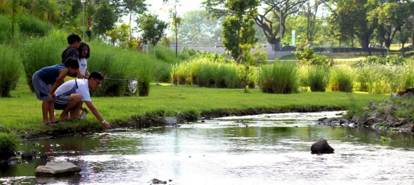
Beyond the economic and infrastructure justifications for daylighting and restoring streams, wetlands and floodplains, there is also a remarkable unifying force a river can have on a neighborhood. Portland is nearly complete with a 7 year, 2.3 mile stream restoration at Crystal Springs. By removing the 80 year old concrete lining of the creek, upsizing nine culverts that were causing localized flooding and preventing fish passage, transforming a nearly three acre “duck pond” that contributed excessive heat and e-coli to the creek and replacing it with a wetland, and restoring riparian vegetation throughout the creek corridor, we have turned this veritable irrigation ditch into a community amenity that is drawing visitors from all over the city and beyond. Portland Parks took the opportunity to replace a decrepit playground with its flagship nature-based playground, complementing the stream and wetland restoration. The entire community, private businesses, federal, state and local governments, and many non-profits partnered in the endeavor, recognizing that public health and watershed health are intrinsically linked. Today, we have wild salmon spawning in downtown Portland, native waterfowl taking up residence, and an ecosystem restarting. A 4° C reduction in stream temperature and a significant reduction in the 100 year floodplain are helping us meet our regulatory requirements. Children have a reason to get outdoors and not become the nature deficit generation.
The only downside is that this blue-green approach isn’t possible everywhere. In Portland, planners, engineers, ecologists, and residents now agree we must make it the primary alternative, moving to another only if it is infeasible.
about the writer
Adrian Benepe
Adrian Benepe has worked for more than 30 years protecting and enhancing parks, gardens and historic resources, most recently as the Commissioner of Parks & Recreation in New York City, and now on a national level as Senior Vice President for City Park Development for the Trust for Public Land.
Adrian Benepe
Urban stream restoration has been in practice for over 30 years, with early efforts in the Chesapeake Bay watershed and California. In recent decades, other U.S. cities have joined in, including New York City and nearby suburbs; Boston; Los Angeles; Kalamazoo, Mich.; and San Luis Obispo, California, with many more in the planning and development stages.
Among the stream restoration practices is the daylighting of a stream or small river that has been covered over. Among the best known examples is in Seoul, South Korea, where the Cheonggyecheon stream—a once-pristine waterway that, by the 20th century, had turned into an open sewer—was buried under layers of highways and other urban systems. The city peeled away layers of roadway, exposing and restoring the stream bed and making it the centerpiece of an enlivened neighborhood, where children play in the clean waters (fed by a mechanical system) and plant, insect, bird and fish species proliferate, despite the extensive engineering.
Yonkers, New York (just north of New York City) has an example of daylighting a buried stream. The Saw Mill River, which housed the eponymous mill that used hydropower to cut timber, was covered over by the city and encased in a flume to hide the dirty waters that flowed through it. Recently, the city celebrated the completion of the first phase of daylighting of the Saw Mill, which did not demolish the circa 1925 flume, but instead diverted water from it into a new river bed which flows through the heart of the city, where a parking lot once covered the river.
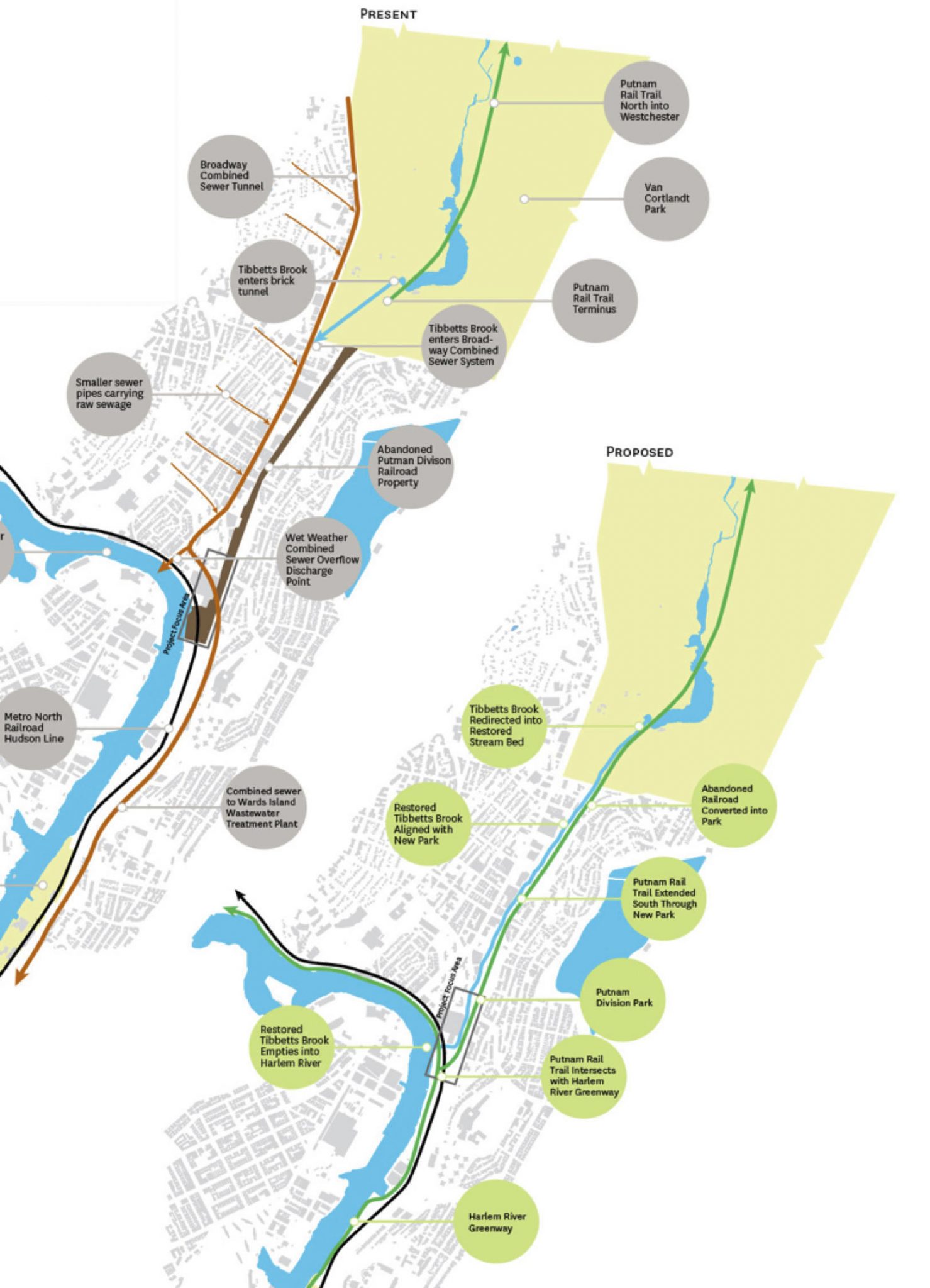
Nearby, in the Bronx, a bold new daylighting project is in the planning stages. The goal of this project is to remove Tibbetts Brook from New York City’s combined sewer overflow (CSO) system, into which it is currently piped. Tibbetts Brook drains a 2,508-acre watershed that consists of most of Van Cortland Park in the Bronx and Tibbetts Brook Park in Yonkers. The Brook is a natural tributary to the Harlem River, but for almost a century the entire stream has been piped to Broadway, several blocks to the west, where it mixes with sanitary sewage and is pumped nearly seven miles south to a waste water treatment plant. Removing the stream from the CSO and daylighting it by restoring a section of the stream to an open, vegetated channel, will reduce the combined sewage overflows to the Harlem River, restore ecological functions to a buried stream, enhance open space and environmental experience, and increase the resiliency and operational flexibility at a waste water treatment plant.
Removing the Tibbetts Brook stream flow from the combined system would provide significant relief to the CSO system in addition to providing multiple other benefits. The restoration of the creek as a tributary to the Harlem River could reduce flow entering the CSO by up to 240 million gallons per year and could reduce the number of CSO events occurring on the Harlem River by approximately 15%. In addition, daylighting the stream through Van Cortlandt Park and along the street and adding a proposed greenway could create new economic, educational, cultural and recreational opportunities and provide aquatic and riparian habitat together stormwater detention and treatment.
Despite the clear benefits of not directing the entire stream system from this largely forested watershed into the CSO, the City has not made any prior efforts to correct flawed hard engineering solutions. Currently, the NYC Parks & Recreation Department is working with the City’s Department of Environmental Protection, which oversees the water supply and sewer system, to evaluate alternatives for Tibbetts Brook.
Will the City take the bold step to daylight the stream and create the stacked benefits of green infrastructure, or go for the more “cost effective” but one-dimensional move to simply use a lake in the park as a temporary holding facility, keeping the level low but allowing it to fill higher during storm events and channeling the overflow through traditional gray infrastructure to the treatment plant? The decision could mean a lot to the quality of life of local residents—and their animal neighbors.
about the writer
Susannah Drake
Susannah C. Drake FAIA FASLA is a Principal at Sasaki and founder of DLANDstudio. Susannah lectures globally about resilient urban design and has taught at Harvard, IIT, and the Cooper Union among others. Her award-winning work is consistently at the forefront of urban climate adaptation innovation. Most recently “From Redlining to Blue Zoning: Equity and Environmental Risk, Liberty City, Miami 2100,” was included in the 2023 Venice Biennale. Her first book “Gowanus Sponge Park,” was published by Park Books in 2024. Her work is in the permanent collection of MoMA.
Susannah Drake
Making our urban hydrologic systems visible not only makes economic and environmental sense it also has major cultural ramifications as well. Swamps, streams, springs and rivers contained and channelized to facilitate development give us a false sense of security that the forces of nature can be easily controlled by hard engineered solutions. While this may be true for a particular moment in history, the forces of nature are variable and with climate change the limits of these systems are also being tested and challenged more frequently.
If we look at the geology of New York City and the hydrologic mapping of Eduard Viele interesting patterns become apparent. High-rise buildings populate areas where the bedrock could support them. Lower buildings occupy areas that were historic marshes, mudflats, swamps, streams and streams. With technological advances, the necessity of bedrock foundation is less important for structure. But is building in the historically swampy areas a good idea? Superstorm Sandy should have provided an answer. Areas that are low and were swamps, that historically flooded received a bulk of the damage. We knew it was coming. We knew where the water was going to go but the grey engineered systems gave us a false sense of security.
Which brings me to the importance of day-lighting streams. We need to learn to live with the environment. This is not to say that we should become victims of weather events and rely on a rhythm method of flood protection. What is needed is a balance of green and grey engineering that creates a more dynamic synthesis of urban and ecological form. Daylighting streams in urban areas is part of this. Exposure of the waterways not only creates a healthier ecosystem by promoting habitat it also serves an important pedagogic function.
Kids that play in streams will see the dynamism of fluid dynamics. They can experience spring surges and summer dry spells. Teachers and environmental educators can help them recognize the variety of birds, butterflies, fish and amphibians that migrate through, feed, breed and occupy the corridor. Waterways as corrIdors enhance habitat beyond their immediate area by creating connectivity with disparate patches of open space.
But fundamentally there is also an important functional reason to daylight urban streams. Green infrastructure provides an attractive and reasonably priced means for cleaning storm water runnoff and reducing the load on combined sewers. Plantings not only absorb water their evapo-transpiration helps cool the air reducing heat island effect. Blue green corridors help absorb pollutants and particulate matter in the air releasing clean oxygen. Day-lit streams can enhance wildlife habitat and improve the quality of life for urban dwellers as well.
about the writer
Keith Bowers
For nearly 30 years, Keith Bowers has been at the forefront of applied ecology, land conservation and ecological restoration. As the founder and president of Biohabitats, Keith has built a multidisciplinary organization focused on regenerative design.
Keith Bowers
Urban stream restoration: a catalyst to improving biodiversity and quality of life
Urban stream restoration is an interesting subset of urban ecological design because its value sits so squarely between cultural and ecological benefits. The sheer poetry of freeing water from the rusty confines of subterranean pipes and raising it into a cultural amenity that brings the natural world to urban residents (daylighting) is irresistible to the landscape architect in me. As a restoration ecologist, I am also keenly aware that many urban stream restoration initiatives, including most daylighted streams, rarely have the ability to restore the full suite of physical and ecological processes associated with them. But this doesn’t matter. What matters is that we use every opportunity we can to restore urban streams and wetlands to the best of our ability to improve both the places we live, work and play along with the receiving waters these systems feed.
While many urban stream restoration and stream daylighting initiatives focus more on aesthetic and cultural benefits, an often-missed opportunity is the chance to enhance urban hydrology, water quality and biodiversity.
An often overlooked but critical component to any stream is its adjoining floodplain. Floodplains are the hydraulic relief valve for streams, attenuating flood flows, recharging groundwater, assimilating nutrients and harboring many species of flora and fauna. Without access to floodplains, stormwater runoff is often trapped in the stream channel, causing increased erosion of the channel bed and banks, degraded water quality and loss of in-stream habitat. Understandably, in many cases the idea of restoring an urban channel and its adjoining floodplain are all but impossible due to space constraints. But that should not stop us from trying to restore floodplain functions back into these projects. Truncated (or sporadic) floodplains, alternating flow regimes, recharge areas and reestablishing a native plant community along the stream’s edge can all contribute to restoring the functions and values associated with lost floodplains.
Another aspect of urban stream restoration and daylighting is its ability to be integrated into a more holistic program to improve water quality. Stormwater runoff from buildings, paved streets and other hard surfaces in urban areas carries with it a toxic mix of nutrients, heavy metals and hydrocarbons. Untreated, this runoff enters storm drains, channelized streams and ditches, which eventually drain to downstream water bodies like rivers, lakes, estuaries and oceans. Combined with stormwater best management practices throughout the watershed, urban stream restoration provides a great compliment to improving water quality for both human consumption and fisheries.
Finally, urban streams often serve as the only vestiges of once thriving natural habitat left in urban settings. Too often the primary purpose of restoring urban streams is to improve water quality or to enrich the cultural or aesthetic value of nearby property. Wildlife along with migratory and resident birds need these corridors of remnant vegetation to meet their life requisites. This habitat is rendered even more important because riparian corridors often offer the only connection between larger patches of green space such as parks. Studies have shown that restored and daylighted urban streams that purposively build-in both physical and hydrological complexity found in natural streams will support a greater array of wildlife including amphibians, mammals, reptiles, insects and birds of all kinds. One example is the presence of wood. Decaying wood in stream systems adds carbon and fuels the growth of aquatic insects and other microbial organisms. This in-turn provides food for many of the larger aquatic species that support a more divers and interesting urban food web.
Restoring and daylighting urban streams can improve water quality, support riparian zones rich in native plants and wildlife, regulate water flows and floods, and can create landscape connectivity as the backbones of urban habitat corridors. While few single urban stream restoration initiatives afford the opportunity to realize all these benefits, that doesn’t mean we shouldn’t try. Supporting multiple ecological benefits, regardless of the initial impetus for a project, will allow us to restore ecological balance in urban areas.
about the writer
Marit Larson
Marit Larson is the Chief of the Natural Resources Group (NRG) at NYC Parks. NRG manages over 10,000acres of natural areas including forests, grasslands and wetlands, stormwater green infrastructure and a native plant nursery.
Marit Larson
In New York City, over the last centuries, hundreds of miles of streams have been piped and thousands of acres of wetlands have been filled. Most of the remaining streams and wetlands are degraded to some extend through physical and hydrologic alterations, invasive species, and pollutants. Many city dwellers have limited access to and interactions with streams and wetlands. Urban streams and wetlands restoration projects can help create that access and provide other social and environmental benefits by transforming the urban landscape. But these projects need to have clearly defined goals, be tied to integrated community and watershed plans in some way, and be maintained. The concept of stream daylighting offers an example of the benefits, and challenges, of one type of ecological restoration that might be easy to convey to the public and decision makers.
Daylighting most streams in NYC would involve removing roads, street trees, and even buildings, and re-locating a complex network of below ground utilities and infrastructure. Sections of stream would need to pass in culverts or other structures under roads or railroad. The watershed is largely impervious, and the stream will likely be fed by piped stormwater runoff, resulting in a very different hydrologic regime than when the stream was last free flowing. Illicit connections to buried stormwater infrastructure connected to the stream may also have an impact on water quality. In addition, likely space constraints limit how nature-like the stream channel can be when re-constructed. Ultimately, a developed urban watershed is likely to result in hydrologic and water quality conditions that will limit the abundance and diversity of biota a stream can support.
Given these complexities and limitations, there are situations in which other forms of green infrastructure bring more environmental benefit at lower cost than true stream daylighting. For example, where there is too little space or it is too expensive to unearth an old stream course, the effect of a stream may be better achieved by building smaller, consecutive stormwater bio-retention systems that perform some of the same functions. Or a system of stormwater capture or even greywater treatment and recycling, constructed as a wetland system, might be the most feasible and functional version of “daylighting.” In some cities, streams are piped in their entirety to a combined sewer system that flows to a wastewater treatment system. In such cases, the restoration of the stream flow to its natural receiving water body is the requisite action for water quality improvement. This might happen through daylighting, but could also be achieved using a pipe network, if space is unavailable, or if no mechanism in place for maintenance of the natural system.
But water quality enhancement or stormwater management is seldom the only, or even the primary, objectives of stream daylighting. Instead, these projects can provide natural beauty, increased biodiversity and habitat for insects and other fauna, shade and local cooling through evapotranspiration, opportunities for environmental education and stewardship, and interesting landscape features that draw visitors and even attract businesses. Measuring these social culture and ecological benefits is difficult, and usually very site specific. Daylighting, or new wetland construction projects, can be the best places to measure these benefits, because of the contrast they provide to the prior condition.
Stream and wetland restoration and other types of green infrastructure projects all need to be maintained and managed, after construction, in part because these systems are in urban environments with constant urban stressors. This sometimes requires establishing new maintenance and operation systems or partnerships, specific to the site and is usually difficult to fund. Ultimately both the construction and maintenance of daylighting and wetlands reconstruction is costly. Thus, these projects should help build the argument for why it is so important to protect existing aquatic systems in our cities.
about the writer
Herbert Dreiseitl
Herbert Dreiseitl is an urban designer, director of the Liveable Cities Lab, the new think tank at the Rambøll Group International, and founder of Atelier Dreiseitl.
Herbert Dreiseitl
Comparing structures in the natural environment with those from urban settings, a significant difference can be seen: nature works on principles of flexibility and resilience, a dynamic reaction and balance to any event, from a soft change to the unexpected disaster. We can learn a lot from this flexible and dynamic response of ecosystems in the design of urban settings.
Fast growing urban sprawl continues to cover the surface of the planet with asphalt and concrete. Instead of slowing down rainwater runoff, holding it back and avoiding concentrations, this type of development results in large quantities collecting at the same time and same place. These are the conditions for urban flooding. On the other hand urban streams often lack water in dry periods. As a result, temperatures rise and oxygen is low. In the absence of blue and green there is no filtration of air, no holding back of micro particles (wind-blown dispersal). Thus, there are higher dust concentrations which contribute to conditions that are unhealthy. Blue-Green Infrastructure (BGI), an approach to urban design that relies on natural elements (flora and water) which are deployed in strategic ways, can mitigate these conditions, creating natural corridors that are highways for biodiversity.
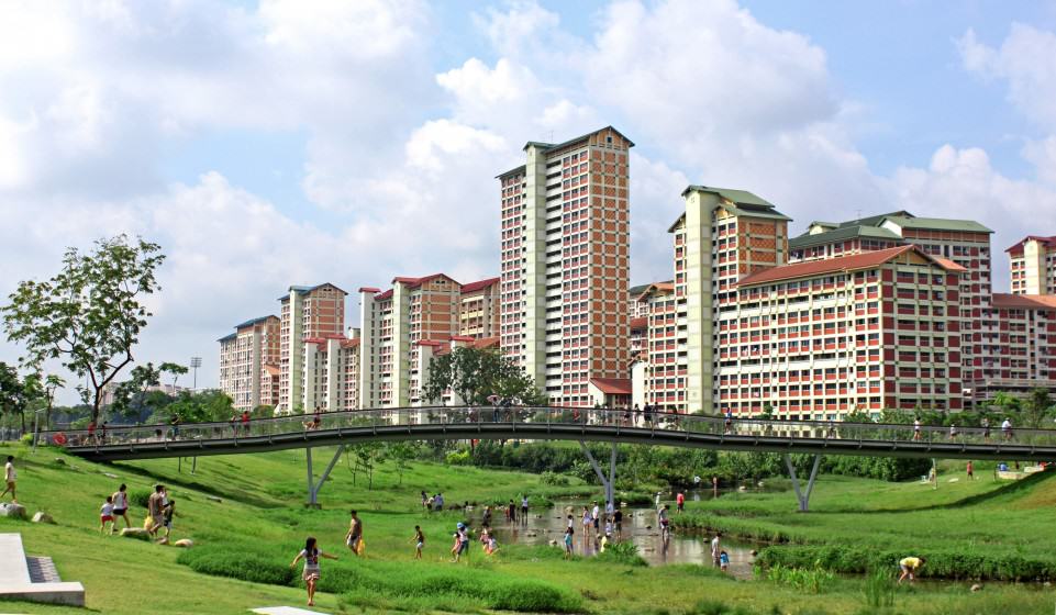
In 2006, the Public Utilities Board and the National Water Agency of Singapore started a program called ABC Waters—Active, Beautiful, and Clean—that aims to realize the full potential of an integrated BGI approach. By treating rainwater as a prime resource to fill up reservoirs and water bodies the ABC Waters’ program is a strategic initiative that works with the entire urban catchment of the island. Instead of getting water from far the city, urban development is the collecting surface and contributes to its water security.
One of the pilot projects, by far the largest, is the transformation of 3.2 km of the Kallang River in combination with 62 hectares of Bishan-Ang Mo Kio Park. This is classic BGI project with a strong social component—a vibrant urban river with natural elements counting over 3 million visitors per year. The benefits and improvement of this and other BGI projects are the objective of an ongoing research project by the Rambøll Foundation in partnership with Harvard, MIT, Zeppelin and the National University of Singapore.
There are many questions to be answered about the integration of BGI into cities. What functions and qualities must these spaces fulfill today and in the future? How can we create living systems that save natural resources, filter, clean and regulate water supply, balance temperature, produce good air, and increase natural habitats? What are the basic principles, processes and methods to integrate BGI in cities of today and in the future?
These questions must extend to the search for strategic policy making tools and good governance structures. Detailed knowledge about Blue-Green living systems, about materials and integrated technologies, have to be developed and experts must be called in during the early stages of the project, and importantly, be taken seriously. Urban landscape architecture should have a higher priority in a development and not be seen as byproduct.
BGI is not yet properly understood in its true function and value to a city and its inhabitants. It is the backbone for liveability, a repository of resources that balances and stabilizes life processes. We cannot easily measure, count and quantify the value of BGI to urban structures, not in the way that we might, say, hard forms of engineered infrastructure. BGI can never be a prefabricated décor that is countable, statically-determined and never-changing. It is a resilient living system.
And since these projects affect people, there must be public engagement and society building. To give hope to denser growing cities we have to create partnerships that balance the needs of people and the environment within urban landscapes in a more respectful way.
It seems we have all technology and knowledge available today; yet there is a lack of implementation. There is a discrepancy between what designers and engineers can create with what governments can activate in reality. We cannot afford this dilemma in the future.
about the writer
Alberto Tacón
Alberto Tacón is an Environmental Biologist, specialist in management of protected areas, with 15 years of experience in conservation and local development in southern Chile with different institutions in the public and private sectors, grassroots organizations and landowners interested in conservation.
Alberto Tacón
Urban wetlands restoration: cities out of the closet
An urban wetland is a condition in which a city is born, grows and develops. To restore is to reconcile something with its true natural identity
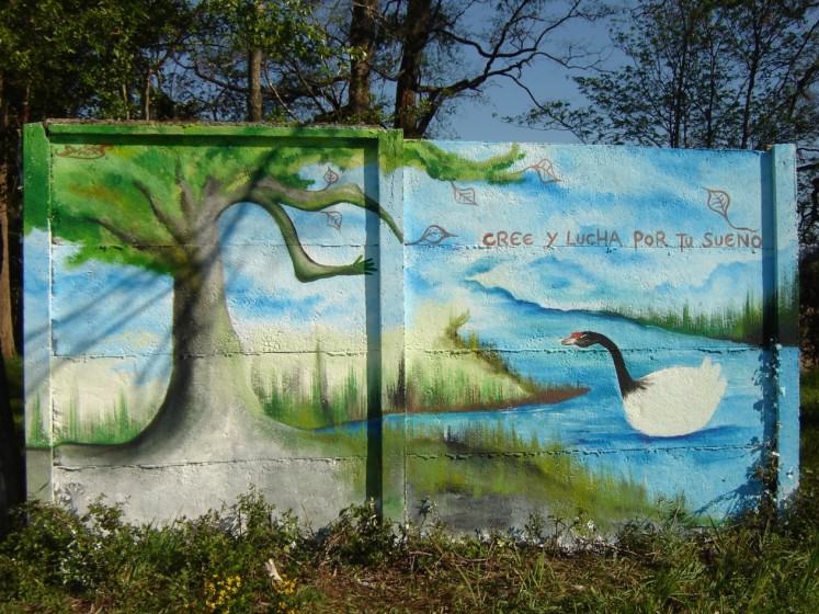
The city of Valdivia is located in the heart of the Valdivian Ecoregion: temperate rainforest, large rivers and a dense network of coastal wetlands. For thousands of years, the Mapuche communities that inhabit this territory have developed sustainable livelihoods within the limits of nature. In their symbolic universe, “cai cai vilu” is the snake of water, and fights constantly with the snake of earth, “txen txen vilu”. The balance of these forces results in a complex landscape, with active volcanoes, greats lakes, rivers, fjords and islands in permanent transformation.
The city of Valdivia, originally a European settlement, was born 450 years ago in this setting. For most of its life, the growth of the city was limited by nature. After surviving several earthquakes and floods, the city’s inhabitants decided to integrate a large belt of publicly-held wetlands into urban development because of their great importance for river navigation, military defense, supply of drinking water, and food production.
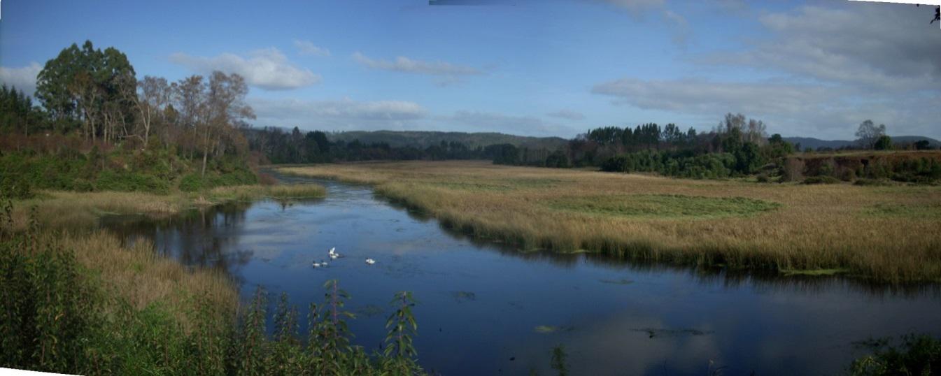 However, in the last century, the situation has changed. These wetlands became a private property where their profitability prevailed over the common good. Changes in technology and economic conditions, coupled with the loss of social control, allowed the growth of the city beyond its limits. The filling and draining of wetlands through engineering has tried to hide the true nature of the city for decades.
Then, in 1960, Valdivia was the epicenter of the most intense earthquake and tsunami recorded in human history. Wetland soils do not meet the requirements of stability and security for buildings, especially in areas of high seismicity. Our ancestor, the water snake, returned to its domain and the urban wetlands surfaced again, like old wounds that never healed.
The history of Valdivia allows us to extract multiple lessons and to reinterpret the concept of limits to growth from a global approach to an urban local context, where wetlands mark some limits that urban growth can never overcome. Contrary to the prevailing view, where technology can solve all our problems, hiding urban wetlands through engineering is akin to trying to hide a natural condition.
In times of crisis, like the earthquake in Valdivia or Hurricane Katrina in New Orleans, nature forces us to “come out” and to accept the ecological reality. The accepting of the wetland as a natural condition forces us to establish a more mature and honest relationship with our planet. Cities can not hide their true identities forever; therefore, to restore wetlands is to reconcile with the past and to project into the future. But to restore wetlands is not only to recover the structure and dynamics of these natural ecosystems—it is also a means to restore the cultural, economic and political relations that allow wetlands to be managed as a common good.
We all know that to restore wetlands is a large and complex task. Although it is not easy to perform a cost / benefit balance of wetland restoration, and it can be an expensive activity, it is much better than to bear the cost of natural disasters caused by poor management. Wetlands are highly resilient when they stop being stressed, and can quickly recover their functionality, providing multiple benefits and ecosystem services for sustainable urban development. Restoring urban wetlands is a sign of maturity in the planning of cities, which recognizes their natural conditions and reconciles development with cities’ true identities.
about the writer
Meredith Dobbie
Meredith Dobbie is a landscape architect and research fellow at Monash University. Her research interests revolve around urban nature, landscape aesthetics and sustainable landscape design.
Meredith Dobbie
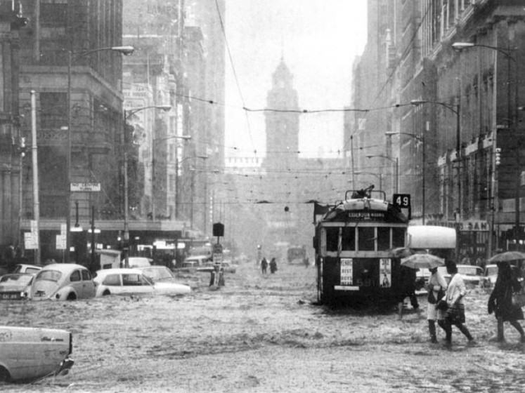
Recently, Gilbert Rochecouste, a placemaker, proposed that Williams Creek, channelled in a stormwater drain under Elizabeth Street in the centre of the city of Melbourne, Victoria, Australia, should be daylighted. The proposal was described as “unfeasible” by the city council.
How can we advance the cause of daylighting and restoration of urban streams, ponds and wetlands? One way is to demonstrate their benefits and evaluate them in monetary terms. We need to develop the business case. The benefits are often expressed as economic, environmental and social. Laura Musacchio, an American landscape architect, suggests that we should broaden this triple bottom line to 6 E’s for sustainable landscape design: economic, environmental, equity, (a)esthetic, ethical and experiential. (The scientific basis for the design of landscape sustainability: A conceptual framework for translational landscape research and practice of designed landscapes and the six Es of landscape sustainability. Landscape Ecology, 2009, 24, 993–1013).
Let’s look at what is known about these benefits. If we know what they are, we can more easily put a dollar value on them, for those interested in the business case.
For the moment, let’s put aside the economic benefits, with the assumption that they will be evaluated. Some of these benefits have markets, e.g. fishing, and can be evaluated easily. Some non-market economic benefits, e.g. ecotourism, can also be evaluated with methods such as ‘willingness to pay’. It’s the evaluation, in dollar terms, of other non-market benefits that’s tricky. Many of those benefits derive from the other Es. Let’s consider them.
Environmental benefits must be self-evident, surely: increased biodiversity, improved water quality, reduced urban flooding, aquifer recharge, improved urban microclimate, etc, etc. Some of these can be evaluated economically, e.g. value of insurance claims prevented by restoration of wetlands to reduce urban flooding. Some cannot, e.g. intrinsic value of biodiversity.
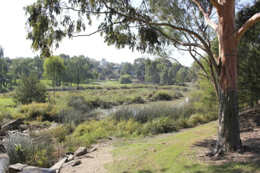
Benefits involving equity, aesthetics, ethics and experience of waterways and wetlands generally do not have markets to inform their evaluation. Nevertheless, these benefits are increasingly acknowledged and the subject of research in many countries. Much of this research is based around the theme of well-being and has shown the critical importance of urban nature, accessible at creeks and rivers, ponds and wetlands, to human well-being, contributing to psychological restoration and improving health. Some of these benefits derive from experiencing the landscape. Other benefits result from the improved thermal comfort of the urban landscape as a result of the vegetation and water within it. The presence of water also provides benefits associated with opportunities for passive and active recreation.
The aesthetics of the waterway or wetland are important in perception of the benefits. Not everyone uses the same aesthetic when they look at the world. There are at least four ways of looking at landscapes, discussed by Paul Gobster, Joan Nassauer, Terry Daniel and Gary Fry, in their very interesting paper titled “The shared landscape: what does aesthetics have to with ecology?” (Landscape Ecology, 2007, 22, 959-972). People using a scenic aesthetic look for beauty in the landscape, whereas those using an ecological aesthetic look for dynamism, ecological function and health. A tension exists between these two aesthetics, for both can interpret the landscape as ‘natural’. In scenic landscapes, perceived naturalness might not reflect the scientific notion of naturalness, which is valued by the ecological aesthetic. An aesthetic of care and effect of knowledge values signs of human care and intent in the landscape, and an aesthetic of attachment and identity values cultural landscapes that reflect place attachment and identity.
Which of these aesthetics, then, might be used when looking at restored waterways and wetlands? How might the different aesthetics influence their perception and value? I would suggest that waterways and wetlands can be viewed favourably with any of these aesthetics, so that they are appreciated and valued. Context of the waterway or wetland in the landscape is all important, as are the personal characteristics of the viewer, including knowledge and familiarity. However, the scenic aesthetic and the aesthetic of care and effect of knowledge might not always yield favourable perceptions. Not all creeks, rivers and wetlands are beautiful and many can look messy and uncared for, particularly in an urban context. This potential pitfall, though, can be overcome with attention to the design and maintenance of the restored landscape, to suggest that any apparent ‘messiness’ is intended, and by promoting familiarity and understanding of these landscapes.
So we return to the pesky problem of providing a business case for the daylighting and restoration of urban streams, ponds and wetlands. We must look to the economists to evaluate in dollar terms the myriad non-market values of the benefits of these waterbodies. I know that they are working on this, for example within the Cooperative Research Centre for Water Sensitive Cities, based in Melbourne, Victoria, Australia.
In addition, we must encourage everyone to discuss this issue, so it is already part of the public discourse when we have the business case to make it a priority in urban planning.
about the writer
Chan-Won Lee
Dr. Lee, Chan Won is a professor at the Department of Urban Environmental Engineering of Kyungnam University, South Korea. He is also a chairman of Changwon Local Agenda 21 and Environment Capital Changwon Forum.
Chan-Won Lee
Urban Wetland in Changwon—Bongam tidal flat in Masan Bay
In most countries with a marine coast, development-oriented national policies have led historically to the concentration of populations and industrial activities in areas adjacent to the ocean known as the coastal zone. For many developing countries, shipping, fishing, aquaculture, and coastal tourism are vitally important to their economies.
Not withstanding this importance, coastal resources are often developed with a land-oriented perspective that fails to consider the unique physical and ecological characteristics of the coast. During the last 40 years, the natural features of Masan Bay in Changwon have been dramatically modified by urban, industrial, and port developments, with its tidal wetlands having been reclaimed to accommodate the expansion of a large population and ever-growing industry. Thus, the problems of pollution have steadily increased and have become a matter of public concern.
The Masan Bay and its vicinity has long been the center of national economic growth of Korea since 1970. However the bay got drastically polluted due to rapid industrialization and urbanization. The pollutant load collected in Changwon’s watershed located in the area of Masan Bay is either delivered to wastewater treatment plant through sewer line or directly entered Masan Bay after passing through the Bongam tidal flat which serves as the natural purification system.
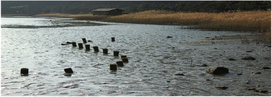
The Bongam tidal flat, as a brackish tidal flat of Masan Bay, is located in the center of Changwon city and is also situated at the inner-most of the estuary near the Changwon Industrial Complex Zone. This tidal flat was also under reclamation pressure and was long neglected as a small piece of tidal flat generally considered as a wasteland. However, as it is accessible to local residents and because of its ecological significance, it was finally protected at the suggestion of various NGOs and put into law by the government in 1999. Restoration efforts have been attempted at Bongam tidal flat since then. The Community Advisory Council for Masan Bay was established since 2005 as a legal organization for Masan Bay’s ecosystem recovery and total pollution load management (TPLM) system to manage the coastal environment of the Masan Bay as the 1st model case in Korea.
The Community Advisory Council established an eco-tour program which provides citizens an opportunity to witness the restoration of the ecosystem and the mudflat ecosystem service. To raise the public awareness of the importance of the ecosystem, this tidal flat was assigned as an official visit site during the 2008 COP10 Ramsar Convention held in Changwon.
Bongam tidal flat is home for a variety of salt marsh plants, migratory birds, crabs, otters, and benthos. With the combined efforts of the government and NGOs, the urban (Bongam) tidal flat in Masan Bay was designated as a national protected wetland area in December 2011 and has been managed as one of the successful wetland protected areas in Korea. The contamination level of sediments in the tidal flat was changed from heavily polluted to non-polluted level by the monitoring data between 2006 and 2012. The COD loading to the tidal flat of Bay mouth through three streams was gradually reduced from 2,690 kg/d in 2005 to 620 kg/d in 2012. This was made possible through a series of actions including sewer line repairs, expansion of wastewater treatment facilities, eco-stream development, clean-up activities and increased public awareness. The sediments and bio-species have been monitored from 1988 to the present. Citizen science monitoring has been directed by the governance.
It soon became clear that close collaboration of stakeholders was essential in achieving in the recovery and preservation of the bay ecosystem. Moreover, there have been various art works portraying the beauty of bay area. There are sculptures by well-known sculptor Moon Shin and a painting by an artist Choi Woon in which he portrays crabs in Bongam tidal flat as he saw in his youth.
The Bongam tidal flat as a restored urban wetland gives us back the ecological, cultural, and educational benefits and no pitfalls have been encountered. This kind of restored area as a place where citizens enjoy fishing, recreation, and education should be extended along the coast of Masan Bay. Decisions in urban policy could be made based on citizen’s awareness and interpretation of what the ecosystem services would be. Decision makers need to be more careful in habitat destruction, however, and we still want to change the way they make decisions. They do not put primary priorities on wetland benefits in urban planning.




Leave a Reply