From 2014, we have been taking part in a project in city planning for urban biodiversity in Fukutsu city, Japan. Our lab (Keitaro Ito laboratory, Kyushu Institute of Technology) has been directing the project in collaboration with Fukutsu city and high school students from Fukuoka Koryo high school and Fukuoka fishery high school. The project’s origins result from the city government’s desire to make environmental planning part of the basic city planning, resting on the ecological characteristics of the city. They asked us to collaborate in this planning.
The site
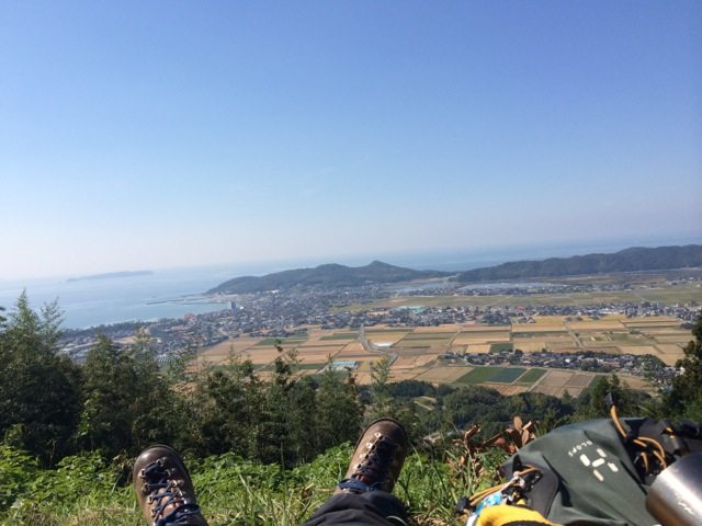
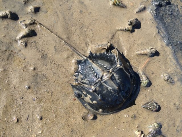
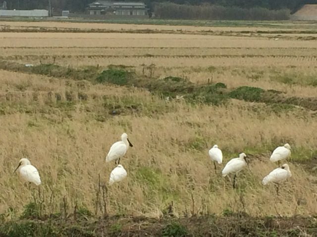
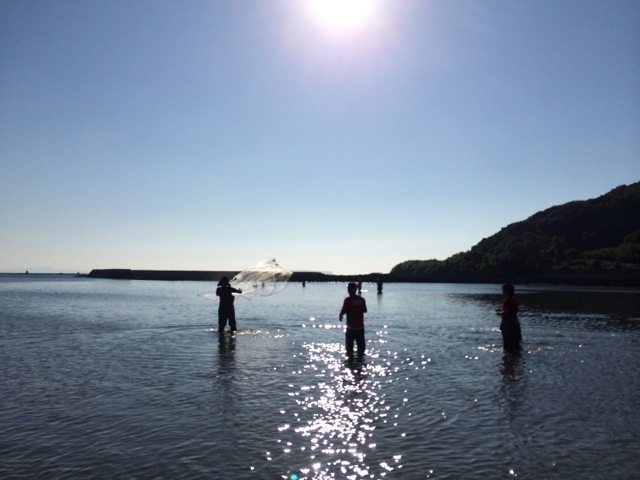
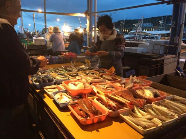
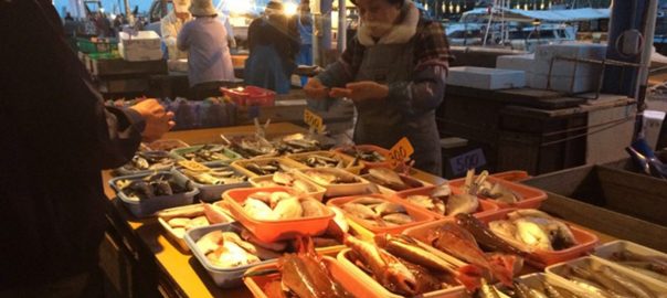
Fukutsu city is located in the southern part of Japan. The land area of the city is 52 km2 and the population is 58,000. The city has coastal area to the west and is hilly to the east. In the tidal areas, we can find designated endangered species such as Horseshoe crab. In wintertime, migrating birds (such as Black-faced spoonbill) stay for several months around the coast and in paddy fields. There is a fishport at the sea coast where we have extensive ecological system services. Japanese people, especially the local people around here, they like fish for eating. (I usually eat vegetables and like fish for observing…) Anyway, if we lost Fukutsu’s beautiful environment, nobody would get receive the benefits of ecosystem services, such as fish.
For example, Horseshoe crab (Tachypleus tridentatus), Black-faced spoonbill (Platalea minor), and Loggerhead turtle (Caretta caretta ) are thought of as icons of this area of nature, and the existence of these species is an index of nature’s richness and biodiversity. They were classified as an endangered species and they choose the area for their habitat. Therefore, the city has rich biodiversity, even located beside a big city. People are living with nature.
However, the populations of these species are reported to be decreasing these days.
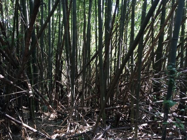
Some of the forests have big problems too, such as the expansion of bamboo.Because of the lack of maintenance of forest by people, the forested landscape around the city has changed. As the bamboo comes to dominate the forest, the forest floor is goes dark in deep shade and other biodiversity is significantly reduced.
And unfortunately, people sometimes don’t realise how the nature they live with is important. A lack of daily connection to nature has become normal for them, a situation one can easily observe in visiting local places in this country.
So, one of our important roles is this. How shall we lead the people in a return to thinking about nature in Fukutsu?
Participation
The city environmental plan is aiming to evaluate the characteristics of the city’s nature through a collaboration with young people and local residents. We think it is very important hear the voices of younger people who are living in and loving this city.
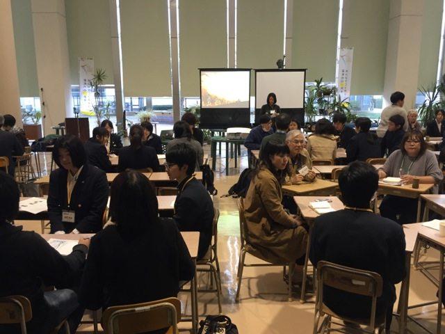
So we conduct project meetings with city government every month and hold workshops about environmental planning with high school students and local citizens every three months. High school student participation has had an especially good effect in this project because they live in the city; sometimes the parents also take part in the workshops. In this series of workshops we continue to discuss how to plan the engagement and how to participate. Typically in Japan, the majority of the participants tend to be elderly people. But in this workshop, students from University and high school students and local residents are actively participating in roundtable discussions, in a format called “World Café.” The mixing of younger and elderly people in discussion is so interesting because we have been able to compare generational experience, discussing present day problems in relation to the environmental situation in former times .
Analysis and the plan
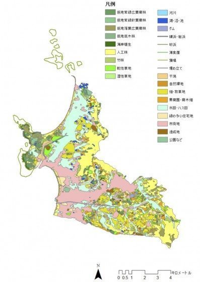
Now, we are trying to evaluate the present condition of the natural and city environment by using GIS and a field survey. Through this survey, we made a biotope map for preserving the nature in the city that includes, for example, important places for habitat and biodiversity in the city. There are various types of biotopes included in the map, such as forest, river, ponds for irrigation for the paddy fields and coast.
We are aiming to evaluate each biotope for habitat and also people’s activity, because many of the natural elements are preserved alongside human activity, such as paddy fields. For example, paddy fields have water spring to summer. In that period, there are various creatures in the water, and biodiversity is changing by the season. So, we are also creating the calendar of biodiversity in each season.
The plan should be completed in 2017. We are challenging ourselves to make the plan effective for preserving biodiversity and ecological system services. Each biotope has functions, not only as habitat for creatures but also for providing places for ecological learning by children. Landscapes and natural environments afford habitats for play and learning. For example, children are not allowed in some river banks, but if we could evaluate and think of such places in terms of nature restoration and education, such areas could be multifunctional. Therefore, this project also aims to provide natural sites for children’s play and activity. It will help to create places in which young children will have sustained contact with nature in the city.
In this plan, we are thinking of sustainability and ecological services very close to our city. The farmers are producing vegetables in the fields and fisherman catch fish around the coastal area. As we think of sustainability and biodiversity in the city, the plan will be very important for managing the city environment, but also in sustaining people’s connection to nature. Such connection is a key factor in sustainability, since without knowledge of nature, people will be less engaged with the idea of sustaining nature.
Keitaro ITO
Fukutsu, Japan

Leave a Reply