The people living in Mumbai generally associate nullahs with dirt, filth, and odor. City authorities have channelized these waterways, building impervious concrete walls along their edges, thus further severing their ecological and environmental attributes, and separating them from the people. This must change. It is changing.
As I am writing this piece, the entire state of Kerala in India stands devastated due to floods. It is estimated that more than 300 people have died, 10,000km of roads damaged and property worth millions of rupees lost (yet to be estimated). As per the Times of India report, an Indian daily, “If the National Disaster Management Agency’s (NDMA) estimates of the average loss of life and property due to floods every year in India is taken as a base, more than 16,000 people could die in floods across India in the next ten years and property worth over 47,000 crore (6.70 billion US$) may be lost. Little has been done to build disaster resilience”.
Madhav Gadgil, an eminent scientist and author of a landmark report on the conservation of the Western Ghats said in an interview, published in The Indian Express (another daily), that the scale of the disaster would have been smaller had the state government of Kerala and local authorities followed existing environmental laws. He further said that the problem was “man made”. “Unfortunately our state governments are in the grip of, and in collusion with, vested interests that do not want any environmental laws to be implemented, and the local communities to be empowered”. …“In terms of unregulated growth of illegal constructions, and creation of real estate all over, there are disturbing parallels (in Kerala) with Uttarakhand (another state in India)”. He said, …“These are not just natural events. There are unjustified human interventions in natural processes which need to be stopped”.
The understanding of nature, rather of every earth system, by most governments and their consideration in city-building endeavors is not considered important, rather deliberately ignored—submerged in the complexity of socio-political conditions that is often ridden with short-term material and financial gain. Tragically, this trend continues in spite of the devastation of land, property, loss of life and uncertainty of human existence caused due to climate change. It is people’s empowerment, participation and their movements for democratization of land and resources that would provide incredible possibilities, also being the most effective means, for the achievement of social and environmental justice.
The need for organizing participatory movements to check the ongoing destruction of natural systems and for achieving a sustainable ecology of cities is urgent and compelling. Re-envisioning cities through nature-based development plans and programs have become a priority. The Irla nullah reinvigoration movement in Mumbai is one such attempt and an example for bringing about structural changes in the way our governments conceive cities, prepare development plans and policies and undertake projects. Furthermore, this movement aspires to transform how Mumbai’s institutions approach open space and provide equitable access to ecosystem services for millions of people across the city, encompassing biophysical and social justice goals.
Mumbai is a city on the water with rich natural assets covering an area of 140km2 that define its geography. Sadly, the city has turned its back on such assets and considered these areas as dumping grounds, both physically and metaphorically. This has led to their degradation and environmental risk—such as flooding and pollution—that are threatening life and property. The central objective of this Irla movement is to revive and restore these natural assets and integrate them across the city, through participatory plans and programs, to achieve a sustainable and livable future for all.
This Irla initiative addresses the abuse and exclusion of over 300 km of watercourses, including four rivers within the city that have been turned into nullahs, or drains. These nullahs were originally natural watercourses, or rivers connected to the sea, thereby regulating ground water and assisting in dispersal of stormwater.
The people living in Mumbai generally associate nullahs with dirt, filth, and odor. Over the years there is little public knowledge of them being rivers and natural watercourses that defined the landscape. City authorities too have been apathetic towards the protection of both natural and open spaces, and have neglected their integration with the city’s Development Plan. They have channelized nullahs, building impervious concrete walls along their edges, thus further severing their ecological and environmental attributes, and separating them from the people.
This must change.
The Irla nullah movement
The Irla nullah movement was launched at the beginning of 2012 for the conservation, re-invigoration, and re-integration of a 7.5km nullah in Juhu, Mumbai. At the time, the Municipal authorities wondered why this was important. Battling such impediments, the movement continued: comprehensive plans and implementation programs were created through active citizen participation. Meetings were held in public places with posters and a Vision Juhu book, communicating the project. The gathered momentum could no longer be ignored by the city officials: the Municipal Commissioner finally approved the project eleven months later.
The central objective of the movement was to re-invigorate the nullah, including treating the waters and arresting silt formation. Although the nullah precinct and the neighborhood area contain vast number of public spaces, they are idiosyncratic, disconnected, and some are not open to the public. They are disparate in nature and function in isolation. These spaces include, the iconic Juhu beach, open spaces, gardens, parks, playgrounds, various public institutions like schools, colleges, training centers, music and dance schools, markets and health-care and community centers. There are over 20 such institutions along and in the precinct of the nullah.
These connected spaces could be further networked, as per the Vision Juhu plan, with neighborhood streets and marginal open spaces for integration and accessibility. The nullah itself physically weaves through the entire neighborhood as, potentially, a linear park, connecting various disparate spaces. Such networking of spaces realizes the high potential of networking different communities: fisher folk, slum-dwellers, hawkers, and all other classes. Almost 40% of the approximately 250,000 population of Juhu live adjacent to the nullah, while the remaining numbers reside within a 10-minute walk. Through this linear park, we could generate an active and pulsating system of public spaces, including the nullah that would form the spine of Juhu. This effort would continue to nourish community life, neighborhood engagements and participation, truly symbolizing our democratic aspirations.
Participation and the movement
The Irla nullah movement and the plan are conceived and executed through an active participatory process involving local citizens, elected representatives, officials of the government, celebrities, a host of educational and commercial institutions, the Municipal Corporation of Greater Mumbai (MCGM), and certain state and national government agencies. An extensive public communications campaign backed by surveys and data, have led to wider participation in the project.
[Importantly, the movement and project exemplify the need for engaging multiple and diverse stakeholders in the people’s “Right to the City”, and their key role in scripting urban growth. To claim such a right is to assert peoples’ power over the ways in which our city spaces are created, with a determination to build socially and environmentally just and democratic cities. This requires systemic change in city institutions, and how the people participate in the democratic process. The challenges are significant, and include the conservation of a variety of vital natural assets; their integration with the urban landscape; and expanding public spaces (both physical and democratic). It is a model a paradigm shift in understanding Mumbai’s sustainable ecology and use nature-based solutions to improve, with equity, the quality of life for more Mumbaikers.]
Engaging people from all sections of our society continue to challenge such movements. It is largely the middle class who continues to control and lead this project. This is in spite of the widespread campaign by the proponents to involve all people, including the slum dwellers, fishing communities, business establishments, and the rich. As the project has evolved, only a few from the leadership of the poor have continued to participate, but others did not show up in large numbers. Probably projects such as these do not seem to be their priority or they do not see nor realize any short-term tangible benefit, caught in their daily struggle for survival. Addressing social conditions such as these and overcoming them requires much greater mobilization, public campaign for dissemination of information, enhancement of public knowledge on environmental matters and their integration.
Sadly, the understanding of many such significant public interest projects are considered to be a part of the many “beautification” works that certain sections of the upper and middle class propose constantly and consider as their contribution towards the making of a better city. Governments too have been proposing and encouraging many such projects in the city in order to divert peoples attention from more significant public interest works that are kept under wrap.
In keeping with the dominant upper and middle class desire for an exclusive and beautified city, most elected representatives have developed gardens and landscaping of traffic islands or medians along important roads where visibility is of prime concern, visible manifestation being necessary to win elections. While most elected representatives have supported public gardens and other beautification works, they seldom, perhaps never, proposed or actively supported policies and works relating to the ecology the city. Such indifference is the biggest barrier in the 300km of nullah re-invigoration.
Often, due to weak social and political engagements with diverse communities, various citizens’ demands and movements are termed elite. But this is dangerous, as often experienced, in the understanding of the larger ecological and environmental battle for the achievement of sustainable development. The destruction and degradation of the ecological conditions in Juhu and the city warrants various social and political movements to understand the impact this has on the poor and marginalized communities in particular. As a matter of fact, it is the marginalized people who suffer the most due to climate change impact that has been heightened due to the continuing abuse of the natural conditions. Urban floods is just one of the many threats that we experience.
Neighborhood-based development
The nullah and related projects serve a larger objective also. Both the Irla nullah plan and the Vision Juhu Plan, of which the Irla nullah project is part, demonstrate that through a neighborhood-based development approach it is possible to decentralize and localize projects, thus breaking away from monolithic planning and design ideas that are disconnected from most people (and often serve the interests of the few, not the many). “Master Plans” for cities are generally drafted by elite groups of designers, and fail to engage with citizens on their ideas. It is through neighborhood based projects that it is possible to maximize participation of the local area people and in that process achieve a greater sense of collective ownership. Importantly, it creates the opportunity for a more collaborative approach to city and place making, as clearly realized in this case. For citizens of Juhu, this project has allowed the immediate reclamation, redesign, and re-programming of public spaces.
The current mindset of formal planning exclusive to “experts” has to be challenged. Sustainable ecology and environment has to be the central aspect of city development plans, prepared with people’s participation right from its inception. It is with the objective of participatory planning that the rejuvenation and integration of the natural areas and the wider city is set out to be our mission.
A new geography
Projects such as the Irla nullah work can help us re-envision our city with streams of open spaces and water, thus defining a new geography. We can restore these nullahs to their past glory, and contribute towards the ecological regeneration of these natural assets. We can simultaneously break away from large monolithic spaces and geometric structures of parks and gardens into fluid stream of linear open spaces, meandering, modulating and negotiating varying city terrains. We can re-design nullahs to be linear parks, accessible to many people across various neighborhoods.
Considering citizens participation as the basis and strength of such ecology movements, the Irla project demonstrates the importance of neighborhood based planning and design for the preparation of the city’s development plans and projects. Considering neighborhoods as the basis for organizing movements for effective democratization of urban planning and design is key. Such an approach facilitates local people’s active participation in matters concerning their area, which they know best, while influencing the city’s planning and development decisions.
With the nullah and the public spaces being the main planning criteria, we hope to bring about, over period of time, social change: promoting collective culture and rooting out alienation and false sense of individual gratification promoted by the market. Our experience of neighborhood actions such as in Bandra, Juhu, and the Irla plan implementation in particular, has come to confirm that such initiatives can influence long-term change in the way development of the city is understood.
De-barricading the city and its unification
There is a constant effort in carrying out public campaigns to explain the need for de-barricading the city and achieve unification, particularly its public spaces and the natural areas. This has been successful in the seafront projects in Bandra– another coastal suburb of the city, where spaces are open. In spite of the many significant social and environmental merits of the Irla movement and the project, the leadership there has gone ahead in proposing fences around the public parks and walls between the nullah and the adjoining gardens. Thus, public spaces, as much as the city, are yet again vulnerable to fragmentation and restrictions on free movement. They may have their reasons: vandals have abused and vandalized these places even during their construction.
Also, it is a constant struggle for achieving equality amongst the participants within a movement. Many significant movements that have been popular to start with have over time collapsed due to the hierarchical order within their organizations. Such social relations pose continuing challenge to the struggle for democratization of public spaces, indeed of the movements themselves.
To begin with, public campaigns as were undertaken by the Juhu residents’ movement to promote public dialogue and participation in decision-making would be necessary. Mapping of the area may follow this: documenting different conditions that exist, including the various changes that have taken place over time. People’s collaborative mapping of their own area is necessary in order to produce their own data and information that would, in most instances, differ with those that are constantly put up by the state. The issue is not limited to the production of people’s data, but evolving through that process their needs and demands pertaining to ecology, environment and development. The various studies conducted and the learning’s from the Irla movement is a telling story. The success of these efforts will hopefully propel people in different parts of the city to engage in similar movements.
Through this plan, we will generate an active and pulsating system of public spaces that would form the heart of Juhu. This will also provide a distinct identity to our neighborhood and all the people. Women, children, the aged, the young, will find opportunity to walk, cycle, play and intermingle. Groups, both formally and spontaneously, will be able to organize various social and cultural activity and get-togethers, including in the 500 capacity amphitheater built in a park adjoining the nullah, like music, dance, art festivals, and games for children, literary sessions and plays. The various schools and colleges in the area would be able to organize various students’ programmed too.
Keeping social, ecological and environmental values in place, the project has developed, with the active support of the Municipal Corporation, a forest of thousands of trees all along the first phase of the 1.5 kilometers of the nullah. This forest is a part of the larger idea of developing city-forests across neighborhoods and the city. Under this project the various forest parks that have been developed include the Kishore Kumar Baug (Kumar was a legendary Bollywood singer and actor), the Kaifi Azmi Udyan (Azmi was an eminent poet, writer and social activist) and a Children’s Forest Park. In the midst of these two parks a landmark amphitheater has been built that encourages spontaneous and formally organized cultural functions, named after Vijay Tendulkar (Tendulkar was an eminent theatre writer and director). In first phase, walking and cycling tracks and areas for children to play, pavilions for rest etc. have been developed. Good lighting and landscape have turned these places to be popular destinations. Thousands of people of all classes and communities throng these areas.
Building human resources
What this project has produced in terms of human resources is noteworthy. Through this project it has been possible to demystify and democratize the planning and design process. Citizens have actively interacted, and participated in various discussions and conferences, weekly site visits and interactions with the contractors, contributed to the formulation of design ideas and details, including the selection of materials and finishing’s. Many actively participated in the planning and design decisions from the inception. The myth of design and planning being the prerogative of trained professionals is, in more ways than one, dispelled through such collective efforts. The democratization of planning and design, and thereby of cities, has got a major thrust through this project. The mobilization of the collective to such an extent as in this project has successfully leveraged human resources at a neighborhood level. These citizens are now empowered to actively participate in decisions concerning planning and design of other projects of public interest in their area. This also reinforces the idea of participatory governance with the preparedness of an army of vigilant neighborhood residents taking ownership of their public assets.
These active citizens are now participating in meetings to discuss the forthcoming Development plan 2034 for Mumbai. Going beyond the interest of their area, they are prepared now to address matters across the city and build bridges with other citizens.
The key to the success of this pilot Irla project of addressing the issue of the watercourses of Mumbai has been the successful leveraging of all resources at a hyper-local, immediate and neighborhood scale. Residents of an area who feel strongly for their public assets can collectively assert pressure on government agencies for change; actively oppose disruptive forces to safeguard the larger interests of the environment as well as contribute towards the building of many more public assets, thereby leading to a mode of active and democratic development.
Collaboration and transparency
Fortunately, an earlier Juhu citizens’ movement for the restoration of the iconic Juhu beach and the experiences gained from it has forged for Irla nullah project important alliances and collaboration with many other neighborhoods and citywide citizens’ struggles. Such relationships generate enormous impetus to the localized movement, making it possible to sustain Irla and similar works in continuation and sustenance of initiatives in the future. As an example, Juhu citizens have participated along with other movements and projects through the form of Mumbai Nagrik Vikas Manch (Citizens Development Forum), in which over 20 citywide organizations have participated actively and engaged with several crucial city issues, like the ill-advised Coast Road, the elevated Metro and the opening of Aarey Colony, an eco-sensitive zone, for construction.
Collaboration and transparency are indeed the high point of Irla nullah. From the very inception of the plan, its execution has been possible due to the collaboration of multiple stakeholders at various levels. It is a unique story of teamwork. The list of collaborators includes the MCGM, which is the owner of the nullah and open spaces in its precinct; MHADA, the agency charged with the responsibility for its implementation; National Environmental Engineering Research Institute (NEERI) which has provided designs for the water filtration and cleansing systems; PKDas & Associates architects supervised this project on an entirely pro bono basis; the Mumbai Waterfronts Centre along with Kamala Raheja College of Architecture (KRVIA) which jointly undertook the neighborhood study of Juhu, resulting in the Juhu Vision Plan along with its publication in 2006; final year architecture students from KRVIA who partook in a design studio exploring the redevelopment potential of the Irla nullah precinct in 2017; PUDDI that is currently taking further the study and primary research for the re-invigoration of all Mumbai’s watercourses; Gulmohar Area Societies Welfare Group, the citizens’ group that has spearheaded the daily supervision and vigilance of the project with the support of other local area residents associations: JVPD Housing Association, Juhu Scheme Residents Association, Juhu Residents Association, Rotary Club of Juhu, Gaothan (Village) Area Residents Association of Juhu, and Juhu Scheme Residents Association.
This movement has also seen participation of several individuals from the area that include Javed Akhtar, who’s MPLAD Funds not only financed the project, but whose active participation in contributions key decisions has lent a fresh perspective. It is also important to mention several designers who have contributed as consultants to PKDas & Associates on an entirely pro bono basis: Ganti Designs, for lighting, Enviro designers for landscape and SACPL, for structures.
The complexity of the logistics in establishing this extensive collaboration and carrying out the multiple tasks of planning and implementation on a entirely honorary basis is a testament to the transparency of the process, without which such collaborative efforts would collapse due to misgivings and communication gaps, which are common in such kinds of projects. The movement involved the publication of several booklets, public campaigns and exhibitions, round table discussions, public meetings, press coverage and constant liaison with various authorities and this effort helped to foster trust in the project.
Such processes as evident in the Irla movement highlight the dedication shown by all collaborators equally and these have not only contributed to the success of the project, but have also reinforced the values and importance of such endeavors for larger public interest works within our cities. The Irla nullah movement and the project has demonstrated the need and significance of participatory, collaborative and co-operative endeavors as the foundation for building a robust, resilient and sustainable city.
P.K. Das
Mumbai
with input from Darryl DeMonte and Samarth Das
Regularly, we feature a Global Roundtable in which a group of people respond to a specific question in The Nature of Cities.
show/hide list of writers
Hover over a name to see an excerpt of their response…click on the name to see their full response.
Gloria Aponte, MedellínTo select abundant species and biological associations is not enough to design with biodiversity and for people. We must satisfy human scale spaces and habitat.
Ana Luisa Artesi, Buenos AiresIn the intervention of landscape architecture projects, we start with biodiversity’s definition as a reference framework, but then move beyond it it, to the characteristics of the place and the environment, developing and re-developing according to changing local necessities.
Andrew Grant, BathWe are literally a part of the Earth’s living system, and this is where I struggle with some of the conventional landscape architectural approaches to biodiversity that suggest biodiversity is an option, to be embraced or not depending on your point of view.
Yun Hye Hwang, SingaporeBeyond promoting an abundance of species, designers could strengthen the concept of biodiversity in design by understanding the principles of urban ecology aiming at habitat enhancement.
Maria Ignatieva, PerthLocal biodiversity as well as urban non-native biodiversity can become a new design tool, even a key to creating a new generation of landscape design compositions that are sustainable, memorable, and at the same time accepted by people.
Jason King, PortlandEach site we design, as landscape architects, is an opportunity to increase biodiversity as it works in the local bioregion and bolsters local goals, which collectively contribute to tackling that wicked global problem of biodiversity loss.
Victoria Marshall, SingaporeI wonder if landscape architecture has over-focused on biodiversity and neglected ecology. Might landscape architecture look into the puzzles raised by other ecology questions in order to tackle the “grand challenges” in the emerging field of urban ecology.
Daniel Phillips, DetroitThe definition of biodiversity in the city is necessarily hard to pin down, precisely because the value and role of biodiversity in cities is open to so much debate and nuance.
Mohan Rao, BangaloreWhile deploying endemic species is preferred to exotics as a pure aspiration or goal, there are times when a designer needs to take a more nuanced stand on “biodiversity” based on the social, economic, and ecological contexts together.
Sylvie Salles, ParisThe real ambition—to improve biodiversity as bio[socio]diversity—is that biodiversity be part of our landscape experiences, in which landscape architecture focuses on an ecological equilibrium with communities’ interests or wishes.
Kevin Sloan, Dallas/Fort WorthSince each urban site cannot support all the species that are possible, the role of biodiversity is to guide the wild life program and synthetically edit the possibilities into a list that will be ecologically successful, appropriate and possible to co-exist with human activity.
Diana Wiesner, BogotáTo democratize the concept of biodiversity let’s talk about the earth and the forms of life that dwell on it; about how human beings fit in; about the magic and poetry of biodiversity; by listening to people as they share their knowledge of nature.
Diana Wiesner, Bogotá (en esp)Para democratizar el concepto de biodiversidad, hablemos de la tierra y las formas de vida que la habitan; sobre cómo encajan los seres humanos; sobre la magia y la poesía de la biodiversidad; Escuchando a las personas mientras comparten su conocimiento de la naturaleza.
David loves urban spaces and nature. He loves creativity and collaboration. He loves theatre and music. In his life and work he has practiced in all of these as, in various moments, a scientist, a climate change researcher, a land steward, an ecological practitioner, composer, a playwright, a musician, an actor, and a theatre director. David's dad told him once that he needed a back up plan, something to "fall back on". So he bought a tuba.
Introduction
The word biodiversity is one of those words that lives happily in metaphor. But in detail, it is all over the map. Ask 10 people, you’ll get 13 definitions. Even ecologists use diverse definitions, that sometimes make distinctions between native and non-native species, but sometimes not; that alternate between indicating species or ecosystems and their services; and sometimes in the same conversation. And then there is the subtle and not so subtle distinctions between definition, meaning, and action.
There is important meaning and consequence inside the ideas of biodiversity, and ecology too. Indeed, there is a global wicked problem of biodiversity loss that finds expression at all scales. Biodiversity is a fundamental building block of ecosystems and their services. There’s definitely a pony in here. But what pony? And what pony do different people see?
Landscape architects are the practitioners of biodiversity’s meaning through their acts of shaping nature into “spaces”. They have their hands on definitions of biodiversity that they use in their work, and that we experience in the landscapes their create. But they aren’t necessarily the same definitions as a scientist’s. Or even a regular person’s. So, how do landscape architects view the word “biodiversity”? How does it find meaning in their work?
We asked twelve landscape architects this: As a designer—someone both supporting and manipulating the environment—what does the word biodiversity mean to you? Perhaps nothing? Perhaps something specific? Perhaps something metaphorical. What is it? And how does it find expression in your work, in your design?
Gloria Aponte is a Colombian landscape architect who has been practicing for more than 30 years in design, planning and teaching. She lead her own firm, Ecotono Ltda., in Bogotá for 20 years. She led the Masters program in Landscape Design at Universidad Pontificia Bolivariana, in Medellín. She is a consultant and belongs to "Rastro Urbano" research group at Universidad de Ibagué, and also the Education Clúster at LALI (Latinamerican Landscape Initiative).
Gloria Aponte
Biodiversity Design and Happiness
To select abundant species and biological associations is not enough to design with biodiversity and for people. We must satisfy human scale spaces and habitat.
In general terms, biodiversity is the expression of variety of life. From the scientific understanding it has been interpreted as an external phenomenon, but from the landscape design point of view, feelings acquire a definite importance.
A landscape design focus means the equilibrium between nature, built world, and human perception. To analyze the first, its composition functioning and ecosystemic services, the science realm would be enough, but the other two components let us have the complete spectrum; it is to say, the landscape.
Figure 1: Landscape interpretation scheme. Source: G. Aponte.
Perception plays as the starting point of a dialog between human beings and the other parts of nature that ends up in a built environment. I say the “other parts of nature” because humans are as nature as a plant or a bird. Although this principle widely recognized by indigenous peoples from many places of the world, nowadays is usually forgotten. One important difference with the rest of nature is that humans want to see their thoughts reflected on those other parts of nature, sometimes imposing it, without regard to what nature actually is. Such an attitude carries the risk of nature capriciously violated as the result of a selfish and unappropriated happiness search.
Although the term biodiversity is new, with no more than thirty years of literary use since W. G. Rosen (1985) and E.O. Wilson (1988) put it in well known writings, the fact itself and its impact in people’s life has been there forever. It is not just variations of flora and fauna as it is usually understood, but of all life expressions and needs. Biodiversity depends on many other natural not alive diversity factors, nevertheless dynamic, such as landform and water.
Figure 2. Well preserved biodiversity in the middle of a big city. ThePedregal reserve in UNAM, México. Photo: G. Aponte
Considering people as another ingredient of biodiversity, together with their culture as one more characteristic of human diversity, the three factors of landscape appear again.
Biodiversity in urban environments has to be much more than “use” or “inclusion” of species of flora and fauna. Urban biodiversity starts with the recognition of all its types of local expressions, starting from the very base. It means the attention to elements of natural support to the “bio” development: those that propel, stimulate, and let native variety develop and, as a consequence, support biodiversity.
Urban biodiversity also considers people a “bio” component: diverse community groups, diverse age groups, that establish different types relations with the place and its components.
Figure 3. Stimulated tropical biodiversity in Marina Bay Sands. Singapore. Photo G. Aponte
What I have promoted in professional and academic practice is the discovery of actual existing nature, first from the sensible and perceptional approach to re-activate feelings, to experience the psychological welcoming provided by natural diversity, then compare those with scientific registers: to validate—in our usual occidental way of knowledge—their native origin or their good behavior as introduced material. In this matter it is important to be open but not too much, to accept introduced species but in reasonable proportion to maintain local identity.
Finally, design responds to the integration in equilibrium for better experiences for people. It means to provide pleasant spaces, inspiration for connivance, and promote happiness for people, based on human’s ethological needs of being involved in a natural world (i.e., biophilia).
The preservation of as much as biodiversity and well connected ecological nets trough city is one of landscape architect’s responsibilities. To select abundant species and biological associations is not enough to design with biodiversity and for people. We must satisfy human scale spaces and habitat. Spontaneous or manipulated, landscape nurtures people’s spirit, and a biodiversity based urban landscape undoubtedly will bring happiness to inhabitants.
Ana Luisa Artesi is Head and Founder of the studio Ar&A – Arquitectura y Ambiente, an interdisciplinary office, whose focus is on highways, private and public landscapes, individual houses, multi-family buildings and housing developments
Ana Luisa Artesi
In the intervention of landscape architecture projects, we start with biodiversity’s definition as a reference framework, but then move beyond it it, to the characteristics of the place and the environment, developing and re-developing according to changing local necessities.
When talking about biodiversity, I think about:
Diversity
Difference
Micro and Macro
Complexity
Definition
Biodiversity is the variety of living organisms from all ecosystems and ecological complexes of which are they part.
“There are many dimensions of Biodiversity. Every biota can be characterized by its taxonomic, ecological, and genetic diversity and that the way these dimensions of diversity vary over space and time is a key feature of biodiversity. Only a multidimensional assessment of biodiversity can provide insights into the relationship between changes in biodiversity and changes in ecosystem functioning and ecosystem services.”
—Global Assessment Reports of the Millennium Assessment
Biodiversity is everywhere and it is very complex and difficult to appreciate. All ecosystems—managed or unmanaged—are included. Wild lands, reserves and natural areas, but also plantations or cultivated areas, all have their own biodiversity. Every action undertaken by man concerns the maintaining of the ecosystem services. Millions of different species of plants, animals and microorganisms coexist in genuine and adapted ecological niches.
Diversity of genetic systems structures each species and combine in an evolution and constant change. Individuals and communities coexist in territorial and survival struggles, within ecological niches rich in relations and diversity. Diverse natural kingdoms and human society live in urban and suburban environments in an intricate relationship fabric.
Fight
Survival
Necessity
Interdependence
Adaptation
Transformation
Mutation
Science
Awareness
Landscape Architecture
The ecological science can be integrated into landscape architectural projects by taking the concept of biodiversity and its philosophy and understanding ecosystem related to urban necessities.
The continuity of the Parks: biodiversity corridors
Teams of landscape architects, ecologists, and researchers in coordination with social actors are needed to implement solutions and creative proposals for urban sustainability and the interaction of people with nature. In the intervention of projects, we start with the definition as a reference framework, which is analyzed according to the characteristics of the place and the environment, and is redeveloped according to changing local necessities.
Design concept is not a repetition of typology, but provides solutions according to the site requirements. The challenge is to recognize the complexity of nature to give appropriate responses.
Corridor on the side of Ricchieri Highway, includes a cataloging of the elements in a database that will be updated and evaluated throughout the project: its qualities; its potential; its history (its layers both in terms of social and nature); the evaluation of its loading capacity; implementation of the necessary policies for the mitigation of impacts.
The growing of Nature in Cities
The presence of man and his activity constitute another part of the local biota—their actions are directly or indirectly reflected in the environment, forming an extensive ecological and biocultural system.
Activities such as hikes, aerobic tours, and bicycle rides enrich these Areas for meeting and recreation
A bridge can be designed as biological or ecological corridor that supports life forms containing plants and associated biodiversity.
Greening trails, edge walks, and groves can be traveled by pedestrians, small vehicles, through a natural landscape, by the margin of a river, or the sea, or a park in the city. These are spaces for life and biodiversity. The interactions of man and fauna, insects and microorganisms that inhabit or travel through these spaces is verified. These spaces provide places for observation, study, and appreciation of individuals.
Bridge of Innovation: The paths can cross watercourses, until crossing an avenue, railroad, etc. by a bridge, viaduct or footbridge.Residual spaces can be included into nature corridors, widening streets and avenues, and surrounding areas of stations and transport terminals. De la Serna Bridge Side Park is a linear urban oasis that crosses railways and links two parts of the city that were not connected before.
Andrew formed Grant Associates in 1997 to explore the emerging frontiers of landscape architecture within sustainable development. He has a fascination with creative ecology and the promotion of quality and innovation in landscape design. Each of his projects responds to the place, its inherent ecology and its people.
Andrew Grant
Designing with Beasts and Senses
‘We are all Bloody Animals…its really weird that with all our technology, with all our instruments, with all our intelligence, still we are really basic.’ – Anthony Gormley, artist
‘We are all Lichens Now’ – Scott F Gilbert, biologist
We are literally a part of the Earth’s living system, and this is where I struggle with some of the conventional landscape architectural approaches to biodiversity that suggest biodiversity is an option, to be embraced or not depending on your point of view.
Anthony Gormley’s work is all about our perception of the connections between us as humans and the world around us. He makes the point that despite all of our extraordinary ingenuity in inventing machines and systems and technologies, we are still just “bloody animals” with all the raw instincts of nature. Scott F. Gilbert goes further by describing the influence of symbiotic microorganisms that exist across species and disrupt the boundaries of classification. We are actually all bound into a collective biodiversity.
My body supports a huge diversity of microorganisms. I am biodiverse. I am part of biodiversity.
I am an animal and my habitat is the city of Bath. From here I imagine plans and designs for pockets of land across the world but always have in mind my connection to the species that exist there or could exist there. Biodiversity to me is not a tick box topic to collect points on an environmental accreditation form. Biodiversity is the foundation and inspiration for all my work.
As a designer I look for the potential to enrich a place with diversity of species but also to shape it so humans can co exist and draw inspiration, wonder and joy in the experience of that place. I also think we have a duty to go beyond the confines of our project site boundaries and to join forces with those desperately trying to slow or halt the extinction of species. As Roberto Burle Marx said “it seems to be almost an obligation of the landscape architects to combat destruction and to preserve certain ill fated species in danger of extinction in order that they survive for the education and enjoyment of future generations’’. Roberto Burle Marx Lectures. Landscape as Art and Urbanism. 2018
If our role as landscape architects is to design for the experience of landscape alongside conservation of the natural world then we must start with an understanding that biodiversity underpins the functions of ecosystems on which we depend for our food and fresh water, and provides the resilience and flexibility of the living world as a whole. We are literally a part of this living system and this is where I struggle with some of the conventional landscape architectural approaches to biodiversity that suggest biodiversity is an option, to be embraced or not depending on your particular point of view. McHarg’s Design with Nature, and many of the environmental planning and design tools since, sets “Biodiversity” up as a factor in the design process and often just a factor among many. It becomes a tick box item rather than a fundamental driver and inspirer of the process. E O Wilson’s “Biophilia” is closer to my heart, but its definition—“the idea that humans possess an innate tendency to seek connections with nature and other forms of life”—also implies some form of disconnect or difference between humans and other life forms.
“Beasts and Senses” is a shorthand title for designing with biodiversity and the human experience in mind. It is a title I have used at Grant Associates since I started the practice over 20 years ago and I still keep coming back to it as a prompt for starting each project. Over the years we have applied this in many different ways. At New Islington in Manchester we had the idea of using an image of the very rare Floating Leaved Plantain that existed in the nearby canals, as a motif for the streetscape and developed a grid of large cast iron discs decorated with the motif and thus bringing a sense of this species to the street in a way that enhanced the character and quality of the space.
At Gardens by the Bay we used the image of the orchid, Vanda Miss Joaquim var. Agnes, the national flower of Singapore, as a metaphor for the project. This orchid represents the most cosmopolitan species in the world in one of the most cosmopolitan cities. A plant of beauty and intrigue. A plant with an extraordinary physiology that allows it to exist and to remain beautiful, in the harshest epiphytic conditions.
Credit: Andrew Grant
The subsequent designs and implementation of the Gardens translated these qualities into a powerful spatial and sensory series of experiences but also transformed the site into a biodiverse haven. It is not only a fully fledged botanical garden with over 19,000 species of plants, but it has attracted huge numbers of bird, insect, reptile species and has become the home of the largest population of Smooth Otters in the whole of Singapore. Finally, we recently marked our 20 year anniversary of Grant Associates by investing time and funds into a special conservation project in Madagascar. There we are working with Bristol Zoo and the AEECL to conserve and protect the habitat of the critically endangered Blue-eyed black lemur and the Sportive lemur along with all the species that co exist in the small fragments of forest that remain.
In summary I think these three projects portray my personal approach to biodiversity in design. Celebrate Biodiversity – Create Biodiversity – Conserve Biodiversity. Be an animal!
Yun Hye Hwang is an accredited landscape architect in Singapore, an Associate Professor in MLA and currently serves as the Programme Director for BLA. Her research speculates on emerging demands of landscapes in the Asian equatorial urban context by exploring sustainable landscape management, the multifunctional role of urban landscapes, and ecological design strategies for high-density Asian cities.
Yun Hye Hwang
Beyond promoting an abundance of species, designers could strengthen the concept of biodiversity in design by understanding the principles of urban ecology aiming at habitat enhancement.
Landscape architecture is playing an increasing role in the promotion of urban biodiversity. As I see it, biodiversity is an overarching impetus, guiding landscape designers to contribute to the planet’s ecosystems in a practical sense. As a design scholar based in Singapore, I have found several opportunities to apply biodiversity in both my designs and research. Five strategies of these works are listed below.
Utilizing naturally growing plants: Singapore’s ecosystem is extremely diverse and structurally complex, as the city state is located in the equatorial zone. But in design practice, plant selection commonly relies on the limited plant species available in the local horticultural industry. In taking advantage of the tropicality, however, designers could explore other alternatives to promote biodiversity. For example, in one garden design project we selectively utilized some of spontaneously growing plants not available in the market but which are not aggressive, are generally well-suited to support local habitats and are tolerant in an urban context (see project photo below).
‘From Lawn to Forest Garden’ project (2017). The enchanted garden in NUS (National University Singapore) campus came naturally by promoting growth of spontaneous vegetation. Photo: Zi En Jonathan YUE
Increasing public acceptance of biodiversity: Urban dwellers are often known to prefer orderly parks with low-diversity greenery. However, they are becoming conscious of nature conservation, suggesting a shift in perception of biodiversity. The challenge is how to improve social acceptance for biodiversity (defined it as living organisms that have structural and genetic heterogeneity and spontaneity to flourish over time). A forthcoming article in JoLA ‘Intended wildness’ exploring design and management strategies to realize an ecological aesthetic and address social acceptance while promoting spontaneous growth for biodiverse green spaces in a tropical compact city expands on this.
Considering principles of ecology: Beyond promoting an abundance of plant species, designers could strengthen the concept of biodiversity by understanding the principles of urban ecology aiming at habitat enhancement. Design considerations could include larger-scale ecological networks, geological/historic site conditions, interactions between flora and fauna, habitat requirements supporting genetic diversity, microclimate, and functional traits of plants, soil and water. A recent paper identifying actionable design strategies through an ecological lens suggests how biodiversity could be developed in design projects.
Continuous monitoring process afterwards: Biodiversity is not a static concept but is adaptable over time. Yet this aspect of biodiversity is de-emphasized and underappreciated in contemporary landscape practice. For example, designers are typically responsible only until the completion of a project, as highlighted by Felson. They may pay less attention to the inherent biodiversity of constructed landscapes and over/underestimate their outcomes based on achievement at the time of the construction. In fact, biodiversity may flourish several years later. A mangrove planting project we documented in Manila is a prime example (project photo below).
Baseco Kabalikat Mangrove Project, Manila. After several years of failures due to major typhoons, mangrove patches were established and now attract aquatic fauna. Photo: Yun Hye HWANG
Interacting with scientists: To address biodiversity, designers should seek out interactions/collaborations with ecologists. Ecologists could provide more concrete theoretical data that contribute to design ideas. For example, they can list target species, suggest habitats that suit the design site, gauge ecological functionality of design proposals, and explain what to do in the frame of urban ecology. For better communication between designers and ecologists, I recently suggested “redefining working scopes” and “creating a more open design process” in the TNOC roundtable, “What ecologists and landscape architects don’t get about each other, but ought to”.
Maria is working on the investigation of different urban ecosystems and developing principles of ecological design. Her latest FORMAS project in Sweden was dedicated to the lawn as cultural and ecological phenomenon and symbol of globalization.
Maria Ignatieva
Local biodiversity as well as urban non-native biodiversity can become a new design tool, even a key to creating a new generation of landscape design compositions that are sustainable, memorable, and at the same time accepted by people.
Urban biodiversity and landscape design: two sides of the same coin
I started my career as an educator and a consultant in landscape architecture and urban ecology in St. Petersburg, the most European city in Russia. St. Petersburg is the UNESCO Heritage site with numerous historic parks and gardens. For me, urban biodiversity at that time meant first of all spontaneous vascular plants, which found the refuge in bosquets and parterres, manicured lawns and even in the cracks of granite embankments. I remember how happy I was to find rare orchids and ferns just in the very heart of St. Petersburg in the Summer Garden. In mid-1990s, my understanding of urban biodiversity was pretty much European, mostly related to the German School of Urban Ecology. The main task of the new science of urban ecology was to find, describe, and understand urban plants and their associated plant communities, as well as to look for analogues within the surrounding natural ecosystems (urban biotopes and their analogies in nature). Interestingly enough, my dual nature of an urban ecologist and landscape architect (garden historian) directed me to the strategy of protecting rare plants and spontaneous nature even when it contradicted the main strategy of restoration of historic gardens and management policy aiming to keep the manicured and tidy heritage of landscape architecture.
By the end of the 20th century, biodiversity was understood as biodiversity of native ecosystems. There were so many unexplored nearby forests and meadows, bogs and mountain vegetation in Russia, so why should botanists or ecologists be bothered to investigate unusual, complicated urban biotopes and try to think about the diversity of species next to apartment blocks or “dirty” unpleasant industrial zones?
The real understanding and re-evaluation of urban biodiversity came to me only after living and visiting different countries. Without problems, I can recognise lawn or hedge species and park vegetation in New York City and Christchurch (New Zealand). However, these were familiar to me from childhood — urban plant pallets were all foreign here and had no analogues in the surrounding native ecosystems. So I discovered a new term, “native biodiversity” (native urban biodiversity), which is actually quite absurd from an ecological point of view. However, particularly in New Zealand, this native biodiversity term was a necessity. Island ecosystems are very vulnerable to many of introduced “familiar” urban plants. Thousands of exotic plants escaped from cultivation. Here in New Zealand it became extremely clear that me and my landscape architecture peers are responsible for making our urban environment so similar, so uniform. Here in New Zealand I had to switch my urban ecology “eyes” from passive “contemplation” that described urban plant species towards a new understanding of the truly complex character of plant communities. My landscape architecture eyes were in search for inspiration from the extremely diverse native and local biodiversity. Now I introduced a new term to my vocabulary: “urban biodiversity and design. Local biodiversity as well as urban non-native biodiversity can become a new design tool, even a key to creating a new generation of landscape design compositions that are sustainable, memorable, and at the same time accepted by people.
My latest urban destination is Perth, in West Australia. Here I realise how difficult is to design with native biodiversity and try to mimic natural processes in urban environment because of a very limited experimental works. Compared to the centuries of garden design and exploring new varieties of plants, landscape architects have a very limited knowledge of how to marry design with nature and native plants in urban environments.
Each site we design, as landscape architects, is an opportunity to increase biodiversity as it works in the local bioregion and bolsters local goals, which collectively contribute to tackling that wicked global problem of biodiversity loss.
Biodiversity is one of those rare words landscape architects should use often, and with confidence to describe a unique value our profession can add to the world. Few terms are as clear, concise, and inspiring, the embodiment of a goal to value abundance and variety. I’d disagree that biodiversity is just about metaphor, but rather, is one of those ecological referents that is distinctly defined and can be measured with specificity, the variety of life in terms number of species (species abundance) and how they are distributed in a community (relative abundance). Confusion can arise when we couple measurement of biodiversity with performance. Once measured, it provides many guides for this performance and designs by informing specific goals to be met — how a site works in comparison to a reference ecosystem condition, habitat values based on indicator species, presence and absence of pests or invasive species, and the ability to withstand disturbance. While it is perceived and often true that high biodiversity means a healthy, more stable, ecosystem, in the end, biodiversity on its own doesn’t embody these values, but simply provides the necessary data to measure performance.
A quick look at the Google Ngram shows how little usage the term had prior to the 1980s, which surprised me, until I realized that it is a relatively new portmanteau which locks both biology and diversity (both terms which go way further back in defining ecological science) into a tidy package. Biodiversity has a timelessness, along with a simplicity and coherence makes it a powerful term because of its lack of ambiguity. Many terms borrowed from ecology and science are misunderstood and misused, and as we know, there’s an overabundance of jargon in the world of landscape architecture and design. These terms are employed at times to inform key processes, however can also be used to obfuscate, dumb-down, or greenwash. Biodiversity, however, is a measure, and thus transcends being a buzz-word (with the exception being if you’re actually measuring bees), avoiding jargon status occupied by many other terms used by landscape architects, sustainability, and placemaking.
Biodiversity is also engaging, as it is inclusive of larger contexts (global and regional biodiversity) but offers a simple and measurable vehicle for what we can do locally. The global challenges are pointed out in the Millennium Ecosystem Assessment, and perhaps more poetically in Richard Weller’s ambitiously engaging Atlas for the End of the World, which showcases critically endangered bioregions, creating “…essential groundwork for the future planning and design of hotspot cities and regions as interdependent ecological and economic systems.”
Biological Hotspots – From Atlas for the End of the World – http://atlas-for-the-end-of-the-world.com/world_maps/world_maps_biological_hotspots.html
It’s an overwhelming and somewhat depressing concept to reconcile, because it seems insurmountable. However, each site we design, as landscape architects, is an opportunity to increase biodiversity as it works in the local bioregion and bolsters local goals, which collectively contribute to tackling that wicked global problem. Certification schemes such as SITES provide a much more robust tool for measuring design goals and performance, and guidelines such as Salmon Safe provides additional, regional strategies which encourage urban ecology in development. Coupling this into multi-functional landscapes, biodiversity can be a key ingredient in green infrastructure, such as the shift from sedum-specific to more biodiverse green roofs, which amplify what we’re currently doing with a great focus on biodiversity.
Bonneville Power Administration 905 Building – Habitat Roof. Deswign & Photo: Jason King
At a functional level, biodiversity isn’t just about habitat, but can also provide functional ways of ensuring our designs have adaptability and resilience, because we are modeling them. This isn’t about native purism, but acknowledging novel ecosystems that require new assemblages, but using cues from natural reference ecosystems in designing using multiple species, three-dimensional structural canopies, and incorporating species. Modern monocultures may be striking in their formality, but are at risk for shifts of climate, pests, and other issues. This local action to global connection obviously is limited by the scale of the work we do, and there’s only so much that can be accomplished on each site. Thus, landscape architects need to continue expanding our reach and influence beyond site boundaries into policy, planning, and strategy to expand our reach and impact.
By casting a broad net about the component parts, bio- (living organisms) and -diversity (variety), the term is able to be inclusive and also applicable to so many situations. I think of this in terms of ecology, and the shift towards both incorporating humans as key organism into ecological studies allows us move beyond ideas of untouched nature and natural processes, and truly measure human impacts in the Anthropocene. In short, it now shows that humans are intertwined (and culpable) in destruction, and can be important actors in regeneration. The term also hints at a viable metric for equity, which is often hard to measure. We tend to be focused on non-human diversity, but accounting for the full range of species, and how much diversity (of usage, participation). our designs yield. The term is a way of expanding the potential for dialog around regenerative design potential for us as designers, and a key metric for success of these landscape in terms of actual performance.
Chapman Swifts – used under Creative Commons 2.0 from Kat+Sam – https://www.flickr.com/photos/39871249@N07/5398763612/
Last week, like many in Portland, my wife and I ventured up into Northwest to view the annual gathering of the Vaux’s Swifts as they looked to bunk down for the night in the old Chimney at Chapman School. A sideshow twenty years ago, it’s now blossomed into a full spectacle, with thousands of people of all ages and walks of life each year coming to experience the event. While the drama of raptors zooming through the tightening funnel of swifts was accompanied by the oohs and ahhs of the crowds, it showed an important lesson about biodiversity.
By saving the Chimney at the school, we’ve created a place for this unique species to have a home on their annual migration route. By creating a city that is verdant and varied, we create a destination for species, including humans, that are attracted by these unique qualities. And by highlighting a somewhat oddball but magical event to celebrate this, we come together, diverse groups of species, humans and non-humans, exhibiting variety and richness, in a display of true biodiversity.
Victoria Marshall's design practice is called Till Design. She is a registered landscape architect and is trained in both landscape architecture and urban design. Marshall is currently a President’s Graduate Fellow at the National University of Singapore where she is pursuing a PhD in the Department of Geography.
Victoria Marshall
I wonder if landscape architecture has over-focused on biodiversity and neglected ecology. Might landscape architecture look into the puzzles raised by other ecology questions in order to tackle the “grand challenges” in the emerging field of urban ecology.
What is a biodiversity inflected landscape architecture, where is it deployed, and why now? This is what came to my mind when I was asked to write about landscape architecture and biodiversity. In my understanding, landscape architecture is a critical, cultural practice. By this I mean it is a practice that interrogates, reflects, and analyses culture. In my definition of culture I include the entangled way that humans and non-humans make each other. Accordingly, I understand biodiversity as an ecologically informed feature of culture, and that a landscape architecture project may or may not engage biodiversity. A critical, landscape architecture, for example, can actively advance the field of work around biodiversity. Or, it can engage design strategies to shape other ideas of Nature. Or, landscape architecture can critique biodiversity as a type of fetishization of scientific narration, representation and aesthetics. The important thing to remember, to my mind, is that landscape architecture is an active cultural practice that engages art and design in ways that are always in a dialog with how the world is becoming.
I have raised the topic of critique here so that the relationship between biodiversity and landscape architecture might be looked at more broadly, and as something that is still being formed. I do this because I have struggled with “biodiversity”, as I find it abstract. I share below how I get around this concern by briefly noting something about my own design and research practice, and showing where I fit biodiversity in.
I see close connections between biodiversity and landscape ecology, and I see that landscape architecture has formed a close relationship with landscape ecology. While there is room for landscape architecture to keep focusing deeper into the biodiversity research questions that come with landscape ecology, such as habitat or land-use types as well as, species community and gene issues, and more (Botzat, Fischer & Kowarik, 2016), ecology offers more than biodiversity. For example, I have undertaken collaborative research in urban design and urban ecology about land classification. I wonder if landscape architecture has over-focused on biodiversity and neglected ecology. Might landscape architecture look into the puzzles raised by other ecology questions in order to tackle the “grand challenges” in the emerging field of urban ecology (Pataki, 2015)?
Second, there is the big topic of the cultural characteristics of Nature. Stakes in conservation and change are always formed from a special mix of society and environment, as well as belief practices and institutions. Landscape architecture practices can support, mediate, or resist, such subjectivities. My current research is in the field of geography and it is a study of the “lived ecologies” of peri-urban Kolkata as political ecologies, as landscape, and as a dynamic biophysical spatiality. I do this, in part, with the hope that ecological research questions, such as those that come from biodiversity work, might be asked of this understudied condition in Asia. That is, while I do not measure biodiversity effects, I hope that my research work lays a foundation for applied and research ecology practices that support such urban-rural systems.
I toggle between these approaches. That is, between a critical engagement with urban ecology tools and work that aims to inform what, and where, urban ecology questions are asked. My tangible, biodiversity inflected, landscape architecture is therefore, a creative practice of locating the ”design element” within the ways that I collaborate and co-create with science and society. I believe that my approaches, and others, do work to keep the field of landscape architecture, and others, continuously open. This is important because a diversity of practices might sustain an agile responsiveness to the novel conditions and situations designers, scientists, and researchers inevitably find themselves in today.
References:
Botzat, A., Fischer, L. K., & Kowarik, I. (2016). Unexploited opportunities in understanding liveable and biodiverse cities. A review on urban biodiversity perception and valuation. Global Environmental Change, 39, 220–233.
Pataki, D. E. (2015). Grand challenges in urban ecology. Frontiers in Ecology and Evolution, 3.
Daniel Phillips is an urban ecologist and landscape architect. He is the co-founder of COMMONStudio, a collaborative creative practice with independent projects and research spanning many countries.
Daniel Phillips
In order to better shape urban biodiversity, let’s reconceive the possibilities it already holds!
The definition of biodiversity in the city is necessarily hard to pin down, precisely because the value and role of biodiversity in cities is open to so much debate and nuance.
The (city) limits of biodiversity as a useful heuristic.
Landscape architects often rely on distillations of broad ecological principles to inform design decisions. The promotion and preservation of biodiversity is a great example of how established scientific knowledge can be applied as a useful heuristic device to inform decisions such as plant selection. Biodiversity is understood by many practitioners and managers as shorthand for “complexity”, and more complex ecosystems tend to be more resilient. It’s the same heuristic that we often apply to investment portfolios: The more diverse, the better.
Yet, borrowed as it is from the field of conservation biology (which has historically focused on “pristine” ecosystems), conventional biodiversity principals certainly don’t make a seamless transition onto the urban environments where landscape architects do the majority of their work. Cities are highly disturbed and irrevocably altered environments with compacted, under/over-fertilized soils, vast impervious surfaces, heat islands, and widespread contamination. Beyond these novel biotic and abiotic conditions, the cultural landscape of cities vibrates with the friction of competing values and needs.
It’s clear that the definition of biodiversity in the city is necessarily hard to pin down, precisely because the value and role of biodiversity in cities is open to so much debate and nuance. Urban environments are among the most complex and fascinating ecosystems ever produced, and they surely deserve their own distinct modes of rigorous inquiry to drive new theories and practice. Should we value overall species counts? Functional traits? Presence of Keystone species? Preservation of functional patches and corridors through urban gradients? Of course, it always depends on a host of other requirements and considerations.
One problem is that achieving “biodiversity by design”—the intentional planting of specific species in highly constructed environments—is that it tends to focus on assemblages that can be imposed and managed by official sanction, while ignoring those that arise spontaneously as unwanted noise. But what if some of the plants we’re so quick to erase as “weeds” are actually performing vital regulating, supporting, provisioning, or cultural ecosystem services for free? Does it make sense to replace them for those that can only thrive with constant inputs of resources and maintenance? It’s here that a blind insistence on narrow notions of nativism, and the fetishization of corrective ecologies with the “right” species, only blunts our agency and keeps us focused on the past. Luckily, a growing body of urban ecology research offers a way out of these conceptual traps while offering a crucial reframing of the question at hand: What might cities already be trying to tell us about their own emergent patterns of biodiversity?
The “Global Urbarium”
Commonstudio’s “Global Urbarium” is our unfolding multi-city survey of spontaneous urban vegetation that seeks to highlight and understand the subliminal forms of natural process that occur in our cities. It draws on methods of citizen science, herbarium collection, and field ecology with intended applications for designers and managers. To date, the project has explored diverse urban contexts from Los Angeles to Rome, Budapest, and Bangalore. The most recent iteration of the Global Urbarium aims to understand the common plants which define post-industrial cities of the midwest. It focuses on four so-called “legacy” cities: Detroit, Pontiac, Flint, and Saginaw. These sites roughly constitute a post-industrial corridor of inquiry, travelling in a northwestern transect across the “Thumb” of Michigan. Aided with a grant from the Graham Sustainability Institute, the Rustbelt Herbarium is the most ambitious of these efforts to date and the first of its kind in the region.
Daniel Phillips and Kim Karlsrud collect plants near a former factory in the outskirts of Flint, Michigan. Photo: Daniel Phillips
Some of the plants we find in our sampling sites are hardy natives, others escapees or remnants of local gardens. Others are common “pan-global” weeds that we’ve encountered in many other cities around the world. Some are buzzing with pollinators or teeming with invertebrate life, or rooted proudly in the mouldering rubble of an abandoned factories. We try not to judge, but to merely observe, collect, and take detailed notes. In addition to a publicly facing digital herbarium available on Instagram, we are building a database which will serve as a foundation for inform future studies, comparative analysis, and interdisciplinary tools. Our ultimate goal is to make this data actionable to researchers and practitioners who may be interested in incorporating these messy features of the urban ecosystem into their purview and projects.
Digitally preserved specimens from Commonstudio’s “Global Urbarium”. Credit: Daniel Phillips
For too long, urban ecosystems have been subject to a strange mode of “double blackmail”—too urbane for naturalists to take seriously, and too wild for urbanists to sanction. It’s clear that cities are already way more biodiverse than we had imagined. But if we want to better shape urban biodiversity by design, we would do well to study it’s nuances and messy complexities in more intentional ways.
Mohan S Rao, an Environmental Design & Landscape Architecture professional, is the principal designer of the leading multi-disciplinary consultancy practice, Integrated Design (INDÉ), based in Bangalore, India
Mohan Rao
While deploying endemic species is preferred to exotics as a pure aspiration or goal, there are times when a designer needs to take a more nuanced stand on “biodiversity” based on the social, economic, and ecological contexts together.
The provocation is bang on target when it says that the term Biodiversity is understood, meant and defined in a bewildering array of ways by different people. For ease of discussion, my response is limited to factors determining the use of endemic or exotic vegetation in practice.
My practice covers a fairly large diversity, in geographical, social, economic, and cultural contexts. And my interpretation (not meaning or definition) of the term biodiversity varies substantially in response to a combination of such contexts. It is useful to unpack some of these contexts to explore possible ways in which one could deal with biodiversity.
In an ecologically oriented intervention, I interpret biodiversity (referring to vegetation in this note) in fairly strict terms. It would include origin (whether endemic or not), habitat (as understory, relationship with other specimens, etc.), position in the succession order (whether they are pioneer species, for example), ecological function (nitrogen fixing, essential food for fauna, etc) and so on. More importantly, its relevance to other biotic systems and consequent impacts would be more carefully understood.
In an ecologically sensitive context, I interpret biodiversity in fairly strict terms. This would include exclusive use of endemic species and integration of their key ecological functions (nitrogen fixation, as a habitat for avifauna, etc.) in the landscape structure. Equally important is understanding their relevance to other biotic systems such as soil chemistry, ground water regime, etc.
In one particular instance, a recreational development close to a wildlife corridor meant that we had to ensure the complete absence of several species whose flowering and fruiting characteristics are known to excite the elephants which frequent the corridor!! Though all these species were indigenous to the region and have specific ecological benefits, the choice had to be made based on safety issues.
Dealing with the ecological context is relatively simpler compared to the challenges of addressing the issue of biodiversity in specific social and cultural contexts. In creating social spaces, ecological characteristics become less critical than aspirational aspects of the vegetation palette. In the South Asian context, for instance, this means confronting quite of a lot of baggage carefully handed down from the colonial era when designed landscapes signified power, exclusion and domination—characteristics deeply rooted in the visual language of even current day public space design. Given this historic baggage, most public spaces are “expected” to be formal in nature; populated with Roystonea regia or Cupressmacrophylla and of course, hedges of Duranta goldiana enclosing formal lawns.
In such contexts, rather than focus on what is truly indigenous, I often choose the middle path of what is not overtly invasive. Many specimens, while clearly exotic, may not necessarily be aggressive or invasive; one could say they are comparatively benign. As long as their impact on other biodiversity—floral, faunal, and avian—including soil and water regime is clearly understood, the conflict between use of endemic versus the exotic can be handled more sensitively.
Such an approach has helped address the ecological aspect (to a lesser extent) and the social dimension of the space created in a fairly balanced manner.
The challenge gets more extreme when dealing with productive landscapes; especially those meant to provide for nutritional and food security.
For example, in interventions around the flood plains of a river that are also the commons for the informal settlements that surround it, the choice of vegetation catering to the food, fuel, and fodder requirements for the underprivileged needs an extremely careful assessment.
Exotic and invasive species are often specimens of choice in such situations due to their faster growth rates.
However, the negative impacts of such choices even over periods as short as three to five years, can be quite drastic in terms of changes to the soil and water regimes.
The inherent requirements of exotic species, such as additional fertilizers, pesticides, increased water demand, soil management, etc., imposes an increased economic burden on the users.
The choice would then get limited to the indigenous palette—they are hardy, resilient to pests and extreme weather and more amenable for multiple canopy structures. While it may seem fairly obvious to the professional, the decision to pursue the indigenous route needs extended engagement with the users to debate short-term efficiency versus long-term sustainability. In this instance, though the choice of vegetation used is clearly driven by their endemic nature, it’s not the ecological paradigm that is driving design decisions, but economic and social frameworks defined by the users.
While deploying endemic species is preferred to exotics as a pure aspiration or goal, there are times when a designer will need to take a more nuanced stand on the issue based on the social, economic, and ecological contexts together.
Sylvie (PhD in Urban Studies) is an architect and senior researcher at the Larep (landscape research laboratory) and full professor in landscape architecture at the École Nationale Supérieure de Paysage de Versailles.
Sylvie Salles
A sensitive bio[socio]diversity
The real ambition—to improve biodiversity as bio[socio]diversity—is that biodiversity be part of our landscape experiences, in which landscape architecture focuses on an ecological equilibrium with communities’ interests or wishes.
How to design living processes—improving biodiversity—through an anthropic oriented common mindset? This question resumes the landscape architect paradox in France, where biodiversity became an urban design’s goal within the framework of the Grenelle’s Laws in 2010.[1] Since the 1960s, the landscape has been a living environment only for landscape ecologists; not for an aesthetic distant vision, nor for people. The landscape architects, Bernard Lassus,[2] as well as the philosopher Alain Roger[3], promoted the idea that the landscape—a cultural notion developed from aesthetic—had nothing in common with the environment, which was only an ecological scientific notion. These distinctions progressively subsided in the 2000s. Now, local authorities have to implement government action plans as “green infrastructure” and “nature in the city”. Here, the biodiversity is more a bio[socio]diversity, focusing on what is significant to inhabitants than for living beings… as if man was not a living being!
French landscape architects used to deal with environmental approaches that improve human quality of life; for example, rainwater management of the 70s’ new towns. Thus, in urban design, biodiversity is considered as a link between human ecology and natural process. The attention to the living beings’ diversity is filtered out by an attention to the way people perceive and use their own environment. Here, in the word “biodiversity”, the biologic sense is closely attached to the common sense of “what is our environment”. Design with biodiversity involves a new aesthetic because environmental matters were mainly run by technical approaches, because horticultural processes ran gardening. The French landscape architect, Gilles Clément (http://www.gillesclement.com/), has been a leading figure to disseminate a new landscape and gardening culture; based on the ecological richness of abandoned spaces (Third Landscape), and on the accompaniment of natural processes (Garden in Motion). This culture favors an aesthetic vision, which encouraged urban brownfield and urban wild. These new images of the nature, for townspeople, are also little spots of biodiversity; but they are not connected to form a corridor. .
The real ambition–to improve biodiversity as bio[socio]diversity–is that biodiversity be part of our landscape experiences. The Chevreuse’s Regional National Park, Southwest of Paris, promotes “Landscape and Biodiversity Plans” to combine urban planning; landscape preservation, and biodiversity restoration. It’s a step, where landscape architecture focuses on an ecological equilibrium with communities’ interests or wishes. When I worked on this project, I proposed to involve artists to bring out a sensitive environmental experience, and to help people to center on their own involvement in living processes. It did not happen, because the board assumed that urban planning was a technical matter. They didn’t understand that biodiversity, as a landscape object, articulates material facts—to improve ecosystems— and symbolic values as pleasure, comfort, or beauty. Nowdays, ecology asks us to no longer dissociate ecosystems functionality and human well-being. Sensitive, socio-symbolic, and biophysical qualities of our environments have to interact. That’s enlarged the boundaries of the biological diversity. Biodiversity refers to equilibrium —between social and natural processes— focusing on the ways human and non-human share the same habitat, and, for a landscape architect, on the ways to make visible this common use. For the biologist, Jacob von Uexküll,[4] men and animals have the same kind of relationship with their surrounding environment; based on the perceptions they have and the uses they make. Just as, in landscape architecture, the word “biodiversity” refers to a subjective lived environment. So foster biodiversity is a sensitive act, more than a scientific one.
[1] Grenelle’s Laws for “a national commitment to the environment” set an action framework to address the ecological emergency. One important goal is taking biodiversity into account in urban planning.
[2] Bernard Lassus, The Landscape Approach, Philadelphia: University of Pennsylvania Press, 1998.
[3] Alain Roger, Court traité du paysage, Paris: Gallimard, 1997.
[4] Jakob von Uexküll, A Foray Into the Worlds of Animals and Humans: With a Theory of Meaning, translated by Joseph D. O’Neil, Minneapolis/London: University of Minnesota Press, 2010 (first edition, 1934).
Kevin Sloan, ASLA, RLA is a landscape architect, writer and professor. The work of his professional practice, Kevin Sloan Studio in Dallas, Texas, has been nationally and internationally recognized.
Kevin Sloan
Applied and Synthetic Biodiversity for Cities
Since each urban site cannot support all the species that are possible, the role of biodiversity is to guide the wild life program and synthetically edit the possibilities into a list that will be ecologically successful, appropriate and possible to co-exist with human activity.
When people who aren’t scientists — in other words, people like me, a landscape architect and Professor of Architecture — think of biodiversity, we usually think of flora and fauna, of soil samples and climate data for forests, repairing ecological imbalances, and reconstructing preserves. We don’t normally think of urban parks, Brownfield, sites or municipal watershed networks.
But the US cities that have rapidly appeared in the last century — most especially suburban mega cities like Atlanta, Phoenix and Dallas / Fort-Worth, etc. — have given rise to unprecedented problems and environmental challenges. As readers of “The Design of Cities” already know and appreciate, the list of problems and relevant topics is long and seem to multiply as fast as they are identified and remedied with innovation.
A new way of re-conceiving biodiversity is now possible with the appearance of the new cities, especially since the new urban forms are replete with wildlife. An overview of the contemporary city and how it supports wildlife, versus how the historical city form excluded it, is first.
Prior to the twentieth century the relationship between city and nature was a set pattern of relationships that repeated.
Pre-modern cities were typically dense formations of buildings with spatial networks of streets and public spaces all within a physical boundary. Whether the boundary was a fortification wall or a natural barrier like a river, mountain or the water surrounding an island, the outcome almost always produced an identifiable object — the city or town situated in a landscape. In these cities, being inside or outside the city, was never a geographical matter in question.
Surrounding the city was the “field”. Agriculture, commercial exchange, open visibility for protection against advancing mercenaries were just a few of the roles serviced by this mediating zone. Danger, lawlessness, and predators roamed freely out in the wilderness, which was the final layer beyond the field.
Biodiversity is no longer a concern that is exclusive to wilderness. It is and can be an integral consideration for contemporary cities, since the low density of suburban mega cities offers an abundance of open space where wild life can take hold.
Nature sightings within contemporary cities like Dallas are now commonplace. Once, where only pests and vermin plagued a city like ancient Rome, it is now a privilege and delight to see migrating waxwings in a backyard tree, monarch butterflies in lantana, or to hear the whistling cry of a red tailed hawk overhead. Exterminating the natural life, for whatever reason, is futile. It will only return since the sparse density of a suburban mega city gives nature and us and new kind of opportunity to co-exist.
Where biodiversity was a condition and priority only for environments outside a city, now it can now mean a synthesis of human and natural life in the city.
ReWILDing is sweeping the world. The process of making a ReWILDed landscape begins with the determination of an inventory of wild life that a site can reasonably and appropriately support. This is a task greatly improved with scientists and experts that specialize in biodiversity.
Once the wild life program is established; plants, landforms, and patterns take shape accordingly. Establishing the biodiversity of a ReWILDing program is an inseparable part of this activity. Since each urban site cannot support all the species that are possible, the role of biodiversity is to guide the wild life program and synthetically edit the possibilities into a list that will be ecologically successful, appropriate and possible to co-exist with human activity. Applied incrementally, regions within a suburban mega city will transform patiently, with each new project, to collectively generate a more balanced urban ecology where the built and bio-morphic are synthetically integrated.
I see ReWILDing not as a trend or the latest environmental thing, but rather as the next step for sustainability and a logical final step in making American and especially, sprawling Texas cities unique from our European and colonial predecessors. A new kind of approach and application to biodiversity will help carry both activities, forward.
Diana Wiesner is a landscape architect, proprietor of the firm Architecture and Landscape, and director of the non-profit foundation Cerros de Bogotá.
Diana Wiesner
To democratize the concept of biodiversity let’s talk about the earth and the forms of life that dwell on it; about how human beings fit in; about the magic and poetry of biodiversity; by listening to people as they share their knowledge of nature.
Biodiversity and urban “weeds”
After finishing my general architecture studies, I began working in the specialized field of landscape architecture. My ensuing research and newfound interests have allowed me to go down a poetic path that leads through nature, high and folk culture, ecology and community affairs. My professional endeavors have branched out into the interrelated fields of biology, art, geography, conservation, hydraulics, hydrology and sociology.
However, during the early years of my career, I rarely came across the word “biodiversity”, and it has only been in the last decade that the meaning of this term has become clear to me. I can further add that I have discovered that this concept is still missing from the educational background of a number of practicing architects.
Intuition and common sense correlate the term biodiversity to biological life and diversity; to the entire, complex system of relationships among living beings, one that recognizes their uniqueness as well as their differences. As a landscape architect acquires professional experience, she or he comes into direct contact with this concept and uses it as a way to understand the interrelated worlds of flora and fauna with other biological systems, including those of water, soil, air.
Subsequently, on a variety of levels, the practicing landscape architect begins to understand how evolution and biological change have occurred within a specific geographical context. Furthermore, biodiversity also involves human beings in this web of biological relationships that can be both tangible and intangible.
Listening to people as they share their knowledge of nature, these words include creativity, calmness, seeds, people, interconnection, safety, spirit, and many others1. Image from Cerros de Bogotá
A designer of urban scenarios and landscapes tries not to focus solely on how to make a site beautiful. This is especially true in a geographically diverse country like Colombia, where educated professionals also need to help encounter solutions that can contribute to reducing the nation’s poverty and social inequality, to improving its education system and to fostering respect for human rights. As requisite as rising to these challenges may seem, when public policies are being shaped, environmental initiatives are often left out of the discussion. Therefore, so that these socio-economic goals can be met, professional experts, whose job it is to transform the landscape, should use the tools they have at their disposal to advance the causes of social and ecological transformations.
In Colombia, the modern phenomena of sprawling urban areas combined with booming population growth have brought constant changes in the configuration of the landscape, as well as in the dynamics of urban ecosystems.
Consequently, it has become increasingly clear that landscape design should be based upon biodiversity, so as to ensure society’s well-being and sustainable development.
The accelerated growth of cities and “the massive and chaotic occupation of territories results in natural spaces becoming insularized and the consequent loss of their biodiversity”.1 In urban areas, the fragmentation of natural landscapes, where vegetation is restrained, leads to their homogenization and reduces their impact on biodiversity.
In addition to this fragmentation, other urban development processes have had a significant impact on ecosystems and their biodiversity. These include repetitive formulas for constructing public spaces (for example, laying out monotonous grids on irregular topography), homogenizing the landscape, and expanding suburbs and conurbation.
Therefore, it is essential that the concept of biodiversity be included in landscape guidelines so that green spaces and corridors can be woven into urban territories. Such guidelines should be in line with public policies that aim to create resilient and sustainable cities.
It is possible to achieve connectivity in urban areas and to preserve and construct green zones when environmental restoration encompasses both the restitution of flora and urban tree planting. Hopefully, all of these endeavors can be carried out hand in hand with local residents.
It is common to hear both experts and the general public refer to “A natural setting in a city”. However, a more apt term would be “A city in a natural setting”. This reversal of priorities would make it easier not only for urban dwellers to understand the importance of biodiversity, but would also help to clarify the need to rationalize growth in accordance with environmental standards.
Biodiversity can be described as a global system in which living organisms are placed and in which their relationships to humankind are defined. In order to help everyday urban dwellers better comprehend this complex, interdependent network, their attention should be drawn to the cracks in the pavement where they place their feet innumerable times, night and day, and where, in their words, “noxious weeds” are growing. These city dwellers should be encouraged to exchange the term “weeds” for “friendly greens”, since these humble plants bring a multitude of benefits to their urban lives.
Cracks designed to give space to the biodiversity of goodness, in the Agora Bogotá project. Landscape design by Diana Wiesner
The term biodiversity can be understood by any number of definitions available to experts. The Convention of Biological Diversity (CBD,1992) defines it as, “the variability among living organisms from all sources including, inter alia, terrestrial, marine and other aquatic ecosystems and the ecological complexes of which they are part; this includes diversity within species, between species and of ecosystems”.2
Because this definition may seem complicated to the general reader, as I have pointed out elsewhere, it, and other similar concepts, should be democratized by taking it out of the exclusive domains of scientists and making it more easily available to local communities.3
The best way to democratize the concept of biodiversity is by simply talking about the earth and the forms of life that dwell on it, as well as about how human beings fit in; by talking about the magic and poetry of biodiversity; by listening to country people and common people as they share their knowledge of nature. Landscape architects work directly with life, and we hear these stories before we intervene in a given space; which is why the idea of biodiversity was surely imprinted in our DNA long before we were given these long, complex definitions to deal with.
Notes:
1 —Wiesner, D. (2015). Democratizing sustainability conversations. En The Nature of Cities. From https://www.thenatureofcities.com/2015/11/29/conversations-on-sustainability-must-be-democratized-towards-soul-resilience/
2 — The Convention of Biological Diversity, Rio de Janeiro, Brazil (1992).
3 — Special Plan for Environmental Sustainability Indicators for Urban Growth in Seville. (2007) Office of the Mayor, Seville, Spain
[Translated from Spanish by Steven William Bayless, Sept., 2018]
Biodiversidad y «malezas» urbanas
Para democratizar el concepto de biodiversidad, hablemos de la tierra y las formas de vida que la habitan; sobre cómo encajan los seres humanos; sobre la magia y la poesía de la biodiversidad; Escuchando a las personas mientras comparten su conocimiento de la naturaleza.
Años después de estudiar Arquitectura del paisaje y de trabajar e investigar sobre el paisaje, mis actividades fueron llevándome por una senda poética frente a la naturaleza, la cultura, el arte popular, la ecología y las comunidades. Mi quehacer se amplió hacia un universo de interrelaciones que se enriquecieron cada día con aprendizajes desde otras disciplinas como la Biología, el Arte, la Geografía, la Ecología, la Hidráulica, la Hidrología y la Sociología. Durante mi carrera en arquitectura, pocas veces escuché la palabra «biodiversidad», y solo hasta hace unos diez años empecé a aproximarme de manera conciente a ella. El desconocimiento de este concepto se evidencia en la formación algunos arquitectos.
La intuición y el sentido común relacionan la palabra biodiversidad con vida y diversidad biológica, con todo el sistema complejo de relaciones entre los seres vivos, reconociendo su particularidad y su diferencia. Cuando un arquitecto paisajista inicia las actividades que le dan experiencia, la asociación directa con este concepto lo lleva a entender el mundo florístico, asociado con el mundo animal y con otros sistemas: el agua, el suelo, el aire. Este profesional entiende la evolución y los cambios de una geografía particular en diversas escalas. La biodiversidad involucra al ser humano en ese sistema de relaciones que pueden ser tangibles o intangibles.
Un diseñador de temas urbanos y de paisaje no solo debe pensar en embellecer los entornos; en un país geográficamente diverso como Colombia, es necesario tener en mente compromisos como hacer aportes a la disminución de la pobreza y la desigualdad, aumentar la calidad de la educación y promover el respeto de los derechos humanos. Aunque estos son retos evidentes, la variable ambiental no lo es tanto en las prioridades políticas. El diseñador de paisaje debe utilizar las herramientas que lo apoyen en la búsqueda de un cambio social y ecológico que lo acerque a estos objetivos.
Pieza gráfica de palabras asociadas a la biodiversidad.1 Cerros de Bogotá
En ese orden de ideas, el diseño de paisaje debe estar estructurado sobre la base de la biodiversidad como fundamento del bienestar humano y del desarrollo sostenible.
Fenómenos como la expansión de áreas urbanas y el crecimiento de la población de manera exponencial han generado cambios progresivos en la configuración del paisaje y en todas las dinámicas ecosistémicas de los ámbitos urbanos.
El crecimiento acelerado de la ciudad y «la ocupación masiva del territorio de forma dispersa conlleva la insularización de los espacios naturales con la consiguiente pérdida de biodiversidad». La fragmentación del paisaje y el uso limitado de la vegetación en áreas urbanas tiende a homogenizar y a limitar el aporte a la biodiversidad.
Otros procesos urbanos que, además de la fragmentación, tienen efectos relevantes sobre la biodiversidad y los ecosistemas son las fórmulas repetitivas de solución en el espacio público (por ejemplo, cuadrículas continuas sobre geografías irregulares), la homogeneización del paisaje, los procesos de periurbanización y la conurbación.
El concepto de biodiversidad hace parte de los lineamientos en los que se basa la red de espacios y corredores que conducen los procesos ecológicos esenciales a través del territorio en una ciudad, en concordancia con los objetivos públicos de promover ciudades resilientes y sostenibles.
En las áreas urbanas es posible la conectividad a través de las zonas verdes y protegidas en las que se pueden proponer acciones de restauración ecológica, revegetalización y arboricultura urbana. Todas ellas, ojalá acompañadas por la ciudadanía.
Generalmente se habla de naturaleza en la ciudad, en lugar de entender que la ciudad está en la naturaleza. Esta comprensión invertiría las prioridades, y, de esta manera, la biodiversidad lograría ocupar, en la mente de los ciudadanos, el lugar estructurante que le corresponde en el ordenamiento territorial.
En tanto que la biodiversidad es un sistema de organización de organismos vivos en la Tierra, claramente relacionada con el hombre, se pueden presentar a los ciudadanos comunes hechos que son cotidianos para ellos. Por ejemplo, podríamos señalar una grieta en el pavimento llena de plantas que denominamos «malezas» cuando en realidad deberían llamarse «buenezas», por todos los servicios que prestan; sin embargo, diariamente las pisoteamos o las valoramos peyorativamente. Este sería un buen ejemplo de biodiversidad urbana mal entendida por la mayoría de los ciudadanos.
El concepto de biodiversidad puede tener numerosos significados entre profesionales. El Convenio sobre la Diversidad Biológica (CDB, 1992) la define como «la variabilidad de organismos vivos de cualquier fuente, incluidos, entre otras cosas, los ecosistemas terrestres y marinos y otros ecosistemas acuáticos y los complejos ecológicos de los que forman parte; comprende la diversidad dentro de cada especie, entre las especies y de los ecosistemas».
Esta definición puede ser compleja para un ciudadano común, por eso, como lo mencioné en otro artículo , es necesario democratizar los conceptos que alejan a los científicos, encerrados en sus centros de investigación, de las comunidades.
Grietas diseñadas para dar espacio a la biodiversidad de las buenezas, en proyecto Agora Bogotá. Diseños de paisaje Diana Wiesner.
Una forma de democratizar el concepto sería simple: hablar de la vida en la Tierra y sus relaciones, incluyendo la forma como el hombre se relaciona con ella, hablando de su poética y su magia, escuchando las voces de los campesinos y de la gente del común cuando se refieren a todas las formas y expresiones de vida. Por eso, en mis proyectos tambien diseño grietas donde caben las “buenezas”, las yerbas espontáneas como pequeños brillos de biodiversidad en medio del asfalto.2
Los arquitectos del paisaje trabajamos con la vida y escuchamos las historias sobre ella para intervenir un lugar, por tanto, ya tenemos incorporado el concepto de biodiversidad en nuestro ADN, seguramente mucho antes de acceder a la definición compleja.3
Three lenses—ecocentrism, sustainability, and urban political ecology—offer different ways to look at the same problem. Viewed together they offer nuance. Separately they can mute aspects in the other two that “don’t fit”. This is especially true in southern cities.
Sustainable cities can be viewed from multiple perspectives. Each perspective can highlight or mute certain aspects, leading us to take different positions on complex issues. Take for example the recent floods in Kerala, the southernmost state of India. Unprecedented rainfall led to intense floods across the state. Over 400 people lost their lives, and several millions were displaced from their homes. Across India, people watched powerful visuals of the tragedy in newspapers, on television, and shared via social media.
One visual that circulated widely through social media was that of the Malayatoor Kodanad bridge. Receding floodwaters had left behind large amounts of plastic waste on the bridge. An earthmover was used by local residents to throw the waste back into the river. An image and associated video went viral on social media and was shared repeatedly. A well-known radio jockey tweeted, “see what these idiots are doing to clear the Malayattoor bridge. They are putting it back into the river!! Will we ever learn??” Another woman shared the picture and said “the Malayattur Kodanad bridge (Kerala) after flood waters receded. All the ‘gifts’ from mankind to the river have been returned with thanks”. Yet another concerned individual shared a video of the incident with the opinion that “after all that has happened in #Kerala, this is how we treat our rivers—dumping all the debris, including plastic bottles, that the Periyar left on the Malayattoor bridge back in the river”. Someone else said “Kerala’s river tossed plastic waste onto its streets and bridges only to have clearing teams toss it back in after the devastating floods cleared.” The media editor of the Indian Express, a prominent newspaper in the country shared the image with the caption: “Nature has its own way of giving it back. This is the Malayatur-Kodanad bridge after waters recede”. The picture also made its way into international media, with headlines such as “Plastic waste and debris is dumped BACK into the river in ‘clean up’ operation after devastating floods in Kerala that killed 410 people and have left more than a million in relief camps”.
A different perspective came through when Dhanya Rajendran, the editor in chief of an Indian e-magazine the Newsminute.in, conducted a local investigation. The story that then emerged was not one of callous disregard for nature, but rather one in which residents had to make a quick decision and act, in very difficult circumstances. The article quoted residents saying, “For two days, we could not go anywhere near the bridge. The currents were so strong and it was neck-deep water on either side of the bridge… On Friday, August 17, as the water receded a bit, someone from the Malayattoor brought an earthmover.” The flood had affected all the surrounding areas, further disrupting connectivity. The article further quoted local police officers. “There was water on either side of the bridge and there was no time to take the garbage elsewhere…Where could we have taken the earthmover to dump the garbage? There was no place. There was water everywhere…The situation was critical, relief and rescue was getting obstructed, so they put it back into the river”.
The piled up wastes created a potential health hazard which had to be treated. According to the secretary of the village panchayat (village council), “It was the need of the hour. The garbage had blocked the bridge, we were also scared that with the garbage blocking the flow of the water, it may get diverted into the village, in case the water levels rose again”. The circulating visuals also caused a certain amount of distress among the people. A District Committee member who spoke for the people had this to say, “People are upset. We have been portrayed as people who dump into the river unscrupulously. They don’t even want to clear garbage and carcasses accumulated everywhere. They are worried if cases will be filed against them too… How is our village alone responsible for all the garbage? Right from Idukki (another city upstream of the location), locals and tourists have been chucking garbage recklessly into this river for decades. This had to happen”.
This incident brought to light the consequences of framing details used to judge a distant event without adequate context. The image circulated in this case was used by people to create a narrative that both romanticized nature and lamented the destructive influence of human beings on it—the lens of ecocentrism. Seen this way, the incident became a snapshot of a community that supposedly generated the waste, and who were punished by having it thrown back into their midst by the flood. The community was further perceived as one that did not care about what happened to nature because their response of throwing that plastic back into the waters made them appear callous and uncaring. Strengthening this perception were its links to an already burning issue in mainstream media—marine plastics that have similarly washed up on urban beaches across the world, and which have generated equally powerful visuals such as those of animals choking on them.
One could also frame this issue through the lens of sustainability. In an online course we conduct at Azim Premji University, we discuss sustainability and its challenges as being framed by the complex interplay of the 3F’s: finitude (limits), fragility, and fairness. Put this way, the floods reflected the fragile state of the social ecological system, both in its physical manifestation, as well as in the plastic it deposited on the beach. It was this fragility that was represented in the various social media mentions of the event. Also represented were narratives of the pollution of a finite, yet important resource: water. What was missing however, was the related idea of fairness. Was it fair to blame the villagers for taking one of the few options available to them in a disconnected landscape? Was it fair to blame only the people at the physical location where the plastic washed up? Water flows down a slope and was it not likely that the plastics washed up on the bridge was partly generated by communities living upstream of the bridge? It was also not fair that people in other parts of the country and who were disconnected from the experience of the flood blamed the flood affected communities within the dry comfort of their homes and offices.
Another perspective that can be used to understand this story is that of urban political ecology. It seems unlikely that the plastic washed up on the bridge could have been generated only by the locals, particularly given that the state of Kerala (and particularly the landscape upstream of the bridge) is a well-known tourist destination. It is also unlikely the plastic was generated only at one source (by the community affected), instead probably being carried by the water at several locations (occupied by people of different social, economic, and political statuses) along the course of the river before coming up against the bridge. It is also unrealistic to assume that all communities had equal access and ability to discard the trash that eventually washed up on that bridge. Overall, the problem of plastic wastes is one which was already present in the landscape but which was made more visible by the flood.
By examining the event through this lens, and contrasting it with the narratives built around the issue through social media, one can also see how social media narratives contributed to marginalizing an already vulnerable group of people. First, it created a dichotomous segregation of people—those who did not care about the environment (flood affected near the bridge) and those who did. The people who fell in the latter category were those who by virtue of not being disconnected by the floods, were also considerably more privileged in that they had better access to resources and the ability to share the visual multiple times. Secondly, by creating that dichotomy, it also assigned complete blame on people who may have had only a partial role in the creation of the disaster. In doing so, the narrative muted several aspects of the complex nature of this issue: such as upstream-downstream dynamics and external sources of pollution. Instead, it drew attention to only one partial aspect of the entire story—that of people throwing the waste back into the waters, which of course, goes against all notions of sustainable lifestyles.
These three lenses—ecocentrism, sustainability, and urban political ecology—offer different ways to look at the same problem. While ecocentrism adopts a primarily ecological viewpoint that posits all human influence as being equally disruptive to the delicate balance of nature, sustainability recognizes that there is an inherent issue of fairness in these debates: who is affected, why are they affected, and how differently they are affected. Both these perspectives however offer only a static, temporally independent snapshot of events and challenges, that are often more complex and dynamic in nature. Missing in these perspectives issues however, are a few key things: the historical trajectories of how these cities got to where they are currently, the colonial and postcolonial regimes that shaped urban socio-natures in these global south cities. Third, the differential experiences of urban populations (separated as they are by economic, social, and gendered divides) with respect to events leading up to the disaster, the disaster itself, and the responses that followed. Also the differences in political bargaining power of these various sections of the society that feed back into their experiences of such social-ecological disasters.
Urban political ecology with its explicitly historical-geographical approach that also internalizes nature in cities offers the right set of tools to bring out these nuances and complexities clearly. The discipline also recognizes the subjectivities induced by inherently power laden dynamics of urban social-ecological interactions, thus allowing one to critically examine processes of inclusion, exploitation, domination, repression, and subjugation in the creation of the urban terrain. Yet, as complex as this picture is, urban political ecology may provide only a partial picture of the social-ecological complexities that are characteristic of cities within the global south such as those within India.
A senior academic at a recent workshop HU was part of said “It is very annoying, sometimes I feel like scientists who study the subjectivities of social-ecological systems have two boxes – one a highly detailed, heterogeneous ‘people’ box and a much less complex ‘ecology’ box. While a lot of effort goes into the detailing of the ‘people’ box, much less effort is made to understand the ecological processes and feedbacks that interact with the subjectivities of society.” This quip made in jest, sums up one of the most evident critiques of urban political ecology—where is the ecology? The urban is a process of social-ecological change, and all too often, the ecological nuances of urbanization get subsumed or trivialized because of the political critique of societal interactions with nature.
Second, while urban political ecology does look at continuities and interactions between rural and urban spaces, there still remains a certain dichotomy in characterizing these continuums. In southern cities, which have grown by engulfing peri-urban villages, such dichotomies remain insufficient in explaining dynamics of interactions within a place where sprawling paddy fields and grazing livestock may be found a mere stone’s throw away from corporate giants and gated communities, thus creating a unique set of challenges towards understanding the landscape. Urban political ecology further takes a critical approach towards understanding the uneven expressions of power that shape nature-society relationships and the production of urban nature across multiple scales—local, regional, and global. Yet, in many cities of the global south, one may encounter heterogeneous interactions with multiple expressions of power at the same scale. These interact both with each other as well as across multiple scales to shape inclusions and exclusions of societal groups within emerging nature-society interactions and eventually the urban terrain itself. Such interactions remain sparsely captured in scholarly literature and deserve greater attention.
For example, these heterogeneous expressions of power were very noticeable in the case of plastics washing up on that bridge in Kerala. While the state boasts of high levels of communal harmony (particularly noticeable during adverse situations like floods), day to day interactions however remain differentiated heavily along communal, caste, and religious divides, each of which create different experiences of domination and repression within the communities. Yet, all of them, irrespective of their individual social identity became uniformly marginalized through the imagery circulated by equally heterogeneous communities about their perceived lack of respect to the water body. Such nuances, identity fluxes and heterogeneities are often not captured in an urban political ecological knowledge that is situated within knowledges derived from studying relatively less heterogeneous contexts of the global north.
In relation to the event presented here, each of the three perspectives we have discussed offer different ways to understand complex social ecological interactions. Taken separately, each of them offer particular and situated ways of looking at the issue, while muting and subsuming aspects of the issue that do not fall within that particular frame. Taken together, however, they begin to partially capture the social and ecological interactions that frame a particular issue—yet with particular shortcomings when applied in contexts of the global south. It is these subtle nuances that need to be captured effectively when studying cities and their complex nature-society interactions. What is also needed is better dissemination of these critical nuances into the public realm, not driven by popular, mainstream ideas of what environmentalism means, but in ways that capture the hows and whys of a given situation.
For if there was anything that photograph of flooded Kerala showed us, it was that we need more nuanced, integrated, and open hearted analysis, even within the realms of science.
Harini Nagendra is a Professor of Sustainability at Azim Premji University, Bangalore, India. She uses social and ecological approaches to examine the factors shaping the sustainability of forests and cities in the south Asian context. Her books include “Cities and Canopies: Trees of Indian Cities” and "Shades of Blue: Connecting the Drops in India's Cities" (Penguin India, 2023) (with Seema Mundoli), and “The Bangalore Detectives Club” historical mystery series set in 1920s colonial India.
On 14 June 2018, Isabelle Anguelovski participated in the panel Designing, Planning and Paying for Resilience at Rice University Kinder Institute for Urban Research, where she and other leading experts discussed flood mitigation strategies such as low impact design, green infrastructure and urban-scale greenspace preservation, and how they interact with a community’s broader planning efforts. These are Isabelle’s insights from the panel.
Many public officials seem to have their hands tied because of developers’ influence on decision-making. Real estate development is at the core of Houston’s economic development, together with the petrochemical industry, and perhaps explains why you have entire low-income minority communities sitting right next to a refinery.
What kind of reconstruction and greening initiatives are we seeing post-Harvey in Houston that are raising social equity concerns?
It seems to me that one of the most controversial green resilience planning initiatives post-Harvey has to do with the buyout program. Buyout programs are sponsored by the Flood Control District from Harris County, where Houston is located, and financed by federal grants as well as local funds. They consist in buying out houses and other types of properties to address potential flood damages. The land in which those properties is located is then often turned into green infrastructure and.or green spaces. From the meetings and discussions I was part of, residents in African-American and lower-income communities showed concerns about this approach because of displacement and relocation issues and their fear of not being able to afford anything in a nearby community with the money they’d receive, even if the buyout program would pay them a fair price for their house. Those fears also stem from long-term trauma related to housing segregation and discrimination. Lastly, residents also seemed concerned about the loss of community ties as a result of this displacement.
A buyout lot in Independence Heights. Photo: Isabelle AnguelovskiIndependence Heights. Photo: Isabelle Anguelovski
How do these programs affect residents, more specifically?
A lot of these fears seem to be manifested in neighborhoods like Independence Heights and Kashmere Gardens, the former being the first incorporated city in Texas in 1915 and still mostly African American. Residents claim that elevating homes would be “resilient enough” and cost less (50% less than a buyout), but this “preservation” approach is not a commonly used strategy in Houston, where a more common approach has been about tearing properties down, replacing them, and/or greening. Also, many lower-income flood victims don’t have the funds to rebuild or elevate their homes and FEMA won’t insure them, which means that many of them leave their neighborhood. So, there are new forms of insecurization in those neighborhoods linked directly or indirectly to Harvey, infrastructure planning, and green resilience.
What is the role of local real estate developers in this process?
When residents walk away and the land is not part of the buyout program, developers come in quickly and flip the lots. This can be a goldmine for them. Many even seem to be encouraging residents to sell and/or leave their property to be able to access land considered as prime location for their investment strategy.
Neighborhoods like Independence Heights will also likely have a substantial proportion of its edges being taken over by the expansion of highway I45, along which there will also be new townhouse developments. Residents perceive this as a move to remake their neighborhood for upper income residents whose new homes will be the gate of entry to the community and who will have direct access to new highway ramps and be very close to the business district and midtown. All of this process means that the historic black commercial corridor—and the jobs that go with it—will be torn down, which is of course creating deep concerns of displacement for residents.
Displacement is also social and cultural because developers and other investors, like Whole Foods, contemplated changing the name of the neighborhood to “Garden Oaks” as they announced new businesses or projects, and thereby erasing its historic African-American identity and significance. As everything in Texas happens without having to deal with governments, developers can run their business without governments, and activists don’t often have the power to respond to developers. This was basically the bottom line of people’s analysis. And there is no political system responding to community organizing, which makes organizing a really daunting task. Another complexity in Houston is that there is also a lack of a Master Plan or Resilience Plan in which community activists could take part, but are not.
Highway expansion and townhome constructions in Houston. Photo: Isabelle Anguelovski
Despite the relative absence of historic community organizing, are there any grassroots movements contesting displacement and gentrification?
Activists in Houston neighborhoods repeatedly pointed out at the lack of community organizing capacity in Houston beyond what researcher Dr. Kyle Shelton calls “infrastructure citizenship”, or when residents organize for or against roads, transit, and other mobility-driven projects. Houston was not highly active during the civil rights movement, unions were crushed very early on, and churches never seem to have played the organizing role they played in other places such as Alabama or Georgia. One activist I met said: “People don’t organize residents at the base of power.” Many members of Black congregations have moved out, so there is a cultural and spatial disconnection there that prevents present-day organizing through churches. Churches also don’t seem to be used to organizing in their congregation.
There is, however, a fantastic group called EEDC working in the historically black Third Ward neighborhood of Houston, where people have engaged in community planning since 1985. They work on building community wealth through partnerships with anchor institutions, mobilize residents towards political and community action, strengthen community ownership and housing choice, revitalize Emancipation Avenue as a dynamic and safe business corridor, support preservation efforts, and mobilize faith for spiritual health. Among their fights has been the preservation of and community access to Emancipation Park, the first public park in Texas, which just reopened in 2017 after a $38M high-end renovation. Despite incorporating design features from the neighborhood architecture, EEDC and its constituency have been particularly concerned about its green gentrification potential due to new nearby development interest. They were also critical of a $10M budget dedicated to new bike trails, feeling that this money could have been used for much more immediate needs such as housing and health.
What particular tools do you see communities using to resist displacement in Houston?
There’s been some success with the community land trust (CLT) model. At first, residents pushed back against MIT Colab’s proposal to put up a CLT. Many residents were afraid that a CLT would mean redevelopment of lots into townhouses, which have been criticized for spurring gentrification—attracting suburban residents back to the center in search of more dense neighborhoods and housing—and that Black residents would not own the pieces of land they had fought for decades and centuries ago.
Activists talked a lot about “free slaves” having fought to buy land, about those that had not been able to participate in the Great Migration and had had to stay in areas like the Third Ward where, later on, Black residents had been forced to move after being redlined from other neighborhoods. Now, a few generations later, Black residents are afraid of seeing their history being taken away again. For them, CLTs don’t always deal with history very well. Eventually, however, the model of CLT for the Third Ward was supported by residents as a way to resist gentrification, and is embraced by EEDC. And now the city of Houston has adopted a city-wide community-land trust model. This is an important evolution to follow.
What other strategies are being used in the Third Ward to address gentrification threats?
There seem to be two see two camps in the neighborhood: the arts and preservation groups that fight for affordable housing and the presentation of existing housing stocks, and the redevelopment groups that, among others, push for parks as an amenity for residents and newcomers. As part of the anti-gentrification movement, EEDC has also worked on dynamizing community-owned and driven economic development through main street businesses, small businesses, and creating workers’ cooperatives around needs in the local economy such as construction. Supported by Project Row House, a community platform empowering residents and enriching community through engagement, art, and direct action, EEDC folks are mapping and identifying who lives where and is doing what, connecting people to jobs, to each other, and to the political apparatus. Part of their focus is lobbying the city to literally pay and compensate residents to attend planning meetings so that residents can have a meaningful contribution to planning processes in their neighborhood. They try to address unfair burdens on residents and avoid reinforcing inequalities. For them, robust community engagement has to factor in inequality, and thus pay low-income residents to attend planning meetings.
A key challenge for EEDC is how to secure lots and key properties adjacent to newly redeveloped parks like Emancipation Park so that they don’t get rebuilt into townhouses. There are lots next to the park that were previously “affordable housing” (private affordable housing) and that are now for sale. Here, activists that fail to support greening initiatives are faced with the possibility of losing their seat at the table, and thus their chance at addressing these issues.
Residents express their concerns over the new botanic garden in Houston. Photo: Isabelle Anguelovski
You often warn of green gentrification. Could you give us some other examples of how this and other types of green inequalities are happening in Houston?
Park Place is a minority neighborhood where the city is building a highly controversial Botanic Garden to replace a public golf course which was also used as a connection through the community. It will be a fenced-off, fee-based space that obliges residents to make a detour in order to access a local school and community center. It is also destroying natural wildlife growing on the edges of the golf course. Despite the huge uproar, the private developer and city are moving ahead with it, as Prof. Susan Rogers well explains here and here.
In another instance, a municipal program called Spark Park, which aims at sharing school parks and open spaces with local residents, excludes most low-income neighborhoods in which school play and green areas remain locked up after hours. Nevertheless, the City counts them as new accessible green space for residents as a way of improving statistics on acres of green space per resident in lower-income areas of the city.
In addition, while there are several programs to revitalize Bayous (local rivers), including Bayou Greenways 2020), and open up new bike lanes and trails, some residents find that more privileged neighborhoods benefitted first. One of the trails started from center of Houston outwards. Why would you not start with more outer bayous where lower-income residents also have less access to green space?
What are the more structural issues that prevent green gentrification and other environmental inequalities from being addressed by state agencies or municipal decision-makers?
First, developers have a huge power in Houston. Many public officials seem to have their hands tied because of developers’ influence on decision-making. It’s a historic issue. Real estate development is at the core of Houston’s economic development together with the petrochemical industry. This also explains why you have entire low-income minority communities, like Manchester, sitting right next to a refinery or another contaminating plant.
Second, inclusionary zoning, or the dedication of a portion of new residential buildings or new developments towards affordable homes, is illegal in Texas. Developers are given a free ride throughout the city and development can go run rampant. However, some Texas cities are finding creative ways to go around this restriction. For example, Austin, is allowing for inclusionary zoning in “Homestead Preservation Districts”, which are seen as an important tool to fight gentrification.
A playground in the Manchester neighborhood, near a power plant Photo: Isabelle AnguelovskiManchester neighborhood, near a power plant. Photo: Isabelle Anguelovski
Are there other ways to address displacement in Houston?
Another program that addresses displacement is the Major Activity Corridor (MAC). In areas designated as MACs, while developers have the right to densify and build housing townhomes and taller buildings, regulations on building heights are much more stringent just outside those corridors, which provides guarantees for the preservation of historic homes. It has also been fascinating to read about the development of a campaign called the “minimal lot size campaign” to prevent developers from turning lots into townhouses. Townhouses seem to have this terrible connotation of being ivory towers parachuted into low-income neighborhoods, as they are usually fenced in, have no ground floors, and where homes are placed above garages to create a sense of seclusion from the rest of the neighborhood.
There is an interesting municipal program called Complete Communities to write up community plans and pilot projects for lower income neighborhoods and integrate health improvements, affordable fresh food access, open and green space, and overall neighborhood revitalization into local development efforts. There are five Complete Communities through the city. The program is derived from recommendations from the Mayor’s Equity Task Force. However much of the funding for it seems to be shifting towards resilience planning. Bringing the two together could work well if you consider all those issues as part of long-term community resilience without reducing resilience to climate disaster preparation, but I am not sure if this is what local officials have in mind.
Funded by the State of Texas, there is also a parallel program called the Opportunity Zones Program to use tax deferrals to steer capital towards more economically and socially fragile communities, some of the targeted communities being in Houston. The funds would serve to invest in business equity, housing, infrastructure. In this case, however, much attention will need to be paid to ensure inclusive redevelopment and build on existing community-driven comprehensive or small-area plans in order to avoid new displacement threats.
How can Houston learn from similar experiences in other cities?
I’ve recently started to conduct field work in Boston, where I did much of my previous research on community organizing and environmental justice in the United States. There are powerful groups and networks there, such as the Center for Cooperative Development and Solidarity (CCDS) or the solidarity economy network/initiative, which mobilize around alternative economic development models and political and economic transformation. This kind of transformation is essential so that residents and groups that have historically been left behind can also propose and build new pathways for the city and themselves. Boston also has a Greater Boston community land trust network, which is another transformative model for land control and development for and by residents, on which to further build.
A review of the book Suburban Remix: Creating the Next Generation of Urban Places, Edited by Jason Beske and David Dixon. 2018. 330 pages. ISBN: 9781610918626. Island Press. Buy the book.
For the first time in American history, more people in the suburbs are living below the poverty line than in the inner city; a reality that contradicts the original promise of the American suburb.
In the course of solving a design problem, landscape architects and designers will often encounter an unexpected issue that suddenly becomes the real problem to solve and driver of the solution. Examples of this might be the discovery of a constraint that was unforeseen at the beginning: a building code, or an intangible cultural issue as one might see in a multi-family project that may have to alleviate cultural concerns about racial diversity, or disentangling the advantages of density from crowding during a public hearing.
Book projects are the same. As an author begins work on one topic, uncovering facts of a particular kind or encountering a body of new and related research can redirect the book or, if the author is attentive, take the book in a completely different direction that replaces the original topic with one that is new.
Suburban Remix, by Jason Beske and David Dixon, contains numerous examples of this phenomenon. Interspersed throughout a compendium of articles by some 16 contributing authors are facts, observations, and speculations that, on occasion, are eye-opening, jarring, and truly worthy of regard and concern in their own right in this book or as a freestanding book of their own.
For example, in the course of delivering a practical and straightforward Introduction about creating walkable density nodes within the sparse pattern of an existing suburb, the content suddenly shifts in the middle section to illuminate the explosive rise of suburban poverty between 2000 – 2014. According to Suburban Remix, for the first time in American history, more people in the suburbs are living below the poverty line than in the inner city; a reality that contradicts the raison d’etre and original promise of the American suburb and the abundance and leafy environs it was originally intended to offer. The proliferation of suburban poverty also intersects alarmingly with another 2010 global statistic: more people are now living in mega cities than in rural areas of the planet.
For devotees and practicing landscape architects in urban fields, these moments in the book are touchstones for pause and reflection.
Another eye-opener arrives in the form of a rhetorical question on Housing by Laurie Volk, Todd Zimmerman and Christopher Volk-Zimmerman. “Where are the residents coming from?” Urban designers and development experts frequently extol that density offers hope. But density in service to only making the population arrays denser creates crowding and potential blight when other key ingredients such as cultural diversity, mixed-use programming, correct spatial relationships between buildings and other tenants are not equally considered. Moreover, as the “Housing” chapter surprisingly points out in its exposition, denser housing nodes require new and greater population numbers to fill them up. Just because density can be realized through policies and constructions, the authors rhetorical question of “Where will the residents come from?” leaves the reader in reflection over where the vast suburban geography of a mega city can be statistically populated even if economics can generate the infill construction.
Revelatory gems such as these pave the way for a book that is largely and best written for readers with a new and first interest in urbanism. City council members, real estate attorneys, or scientists and environmentalists who have cultivated a professional or casual interest in urbanism will find the basic tone, and the user-friendly, non-jargon driven terminology both accessible and engaging. The structure and organization, using pithy titles such as “Ongoing Urban-Suburban Challenges” in the chapter on Shanghai by Tianyao Sun, or “Landing on the Right Site” in the planning chapter by co-author David Dixon, followed by brief expositions, is applied throughout the book and to all the contributors. Taken together, this gives Suburban Remix a level of concision and accessibility that will be attractive to professional groups who have the interest but not necessarily the time to wade through a lot of academicism.
The middle section of the book contains a set of three sequential chapters that are each based on a particular land use, that a beginning urbanist would find instructive. In order, a chapter on “Housing”, as previously mentioned, followed by one on “Office” by Sarah Woodworth, and then a section on “Retail” by Michael Berne. The planning and economic problems that each of these uses currently experience in conventional suburbs and the potential opportunities for transformation are not only well discussed, the lessons and observations they share could be transferrable to most other cities and situations.
Each of these three chapters contains a historical overview of their respective topic followed by synopses of the problems, opportunities, constraints, and potential for each category. For example, the causes of the decline of suburban retail, largely due to online alternatives, are well documented and observable across North America. However, what communities can do about the problems are well-covered here, with recommendations about how to overcome parking issues, establishing niche-driven retail mixtures, and how to rethink the idea of what kind of business can constitute an “anchor”. These are well written and productive offerings in the book.
Setting aside the eye-opening gems the book periodically unveils, more literate urban professionals may find Suburban Remix a basic read. The numerous case study examples that are taken from familiar cities and locations on the United States’ east coast and around Washington D.C., such as Tyson’s Corner, which is invariably mentioned in most any new book on the New Urbanism. If there is a weakness or a lament about the book, it’s a wish that some of the case study examples were done in the vast interior of U.S., in more typical suburban geographies one might encounter in Phoenix, Kansas City, Houston, and Atlanta.
Individuals who have a new found interest in urbanism and the plight of the contemporary city and suburb will find Suburban Remix a useful read and good tool for recall and reference. It was delightful to see the topic presented in such a thoughtful and accessible way.
To move towards more sustainable and resilient cities, it is essential that we connect urban ecology researchers and practitioners to find and implement solutions to urban environmental issues. The question, though, is how to do this?
The Challenge of Managing Urban Ecosystems
Cities are increasingly understood as mosaics of grey, green, and blue infrastructure that interact in complex ways to affect the wellbeing of urban residents (Ahern 2007, Svendsen and Northridge 2012). In particular, green and blue infrastructure provides important benefits to urban residents (Lovell and Taylor 2013) such as flood protection by urban wetlands and forests (Lennon et al. 2014), improved mental health from greener streets and park visitation (Bragg and Atkins 2016, Shanahan et al. 2016), and food production from community gardens (Russo et al. 2017). This ecological infrastructure also supports key wildlife populations in urban areas (Hough et al. 2004). However, with this new view of cities comes a key challenge: how to integrate specialized knowledge and ecologically-sound management practices into urban planning in order to maintain natural areas and promote urban ecosystem services.
Urban parks and green infrastructure like Calgary’s Nose Hill (left) and Montreal’s Mount Royal (right) parks protect important ecosystems and provide key benefits to urban residents. Photos: M. Mitchell
Just as grey infrastructure can falter without proper care and maintenance, green and blue infrastructure—and the benefits it provides—can break down if urban ecosystems are not properly managed. Improper selection of street trees can lead to increased allergen exposure or property damage (Roy et al. 2012), failure to effectively manage forested areas in or near cities can lead to infrastructure damage when wildfires occur (Calkin et al. 2014), and unfamiliarity with animal movement corridors can lead to car accidents and loss of both animal and human life (Malo et al. 2004). Added complexities include understanding the social aspects of the workers who are maintaining urban green and blue infrastructure (Bardekjian 2016), as well as navigating the values and preferences of the multicultural communities that make up today’s cities (Wilkerson et al. 2018).
Managing urban ecosystems is not simple; it requires understanding of both the ecology of these ecosystems—how living organisms relate and interact with each other and their surroundings (Lepczyk et al. 2017), and the socioecology of cities—how human, built, green and blue infrastructure, ecosystems, and social-economic systems interact across urban areas (Andersson et al. 2014). In other words, decision-making must draw on and effectively integrate urban ecology and urban planning/management knowledge (Aronson et al. 2017, Groffman et al. 2017).
In order to move towards more sustainable Canadian cities, our municipal governments need to adopt a collaborative systems approach, where conversation and cooperation among urban planners, managers, arborists, landscape architects and ecologists is the norm rather than the exception.
Canada and the integration of urban ecology and planning
Eighty percent of Canadians that live in cities are directly affected when urban temperatures increase, urbanization leads to flooding, or species shifts lead to human-wildlife conflict in cities. Urban ecology focuses on topics that have direct implications for the ecosystem services that contribute to human wellbeing in urban areas (Ziter 2016) and thus can provide valuable information about how to manage the places where most Canadians live. However, despite the rapid increase in attention to urban ecology around the world (Mayer 2010, McDonald 2016), there has historically been relatively little focus on urban ecosystems among the Canadian ecological community compared to other regions (e.g., Europe, US, Australia). Rather, there has been an emphasis on ecology in “natural” areas, or production systems (e.g. forestry, agriculture), which cities don’t readily fit into. For example, an urban ecology session has been only been part of the two most recent (i.e. 2017, 2018) annual conferences of the Canadian Society for Ecology and Evolution, despite the organization’s 13 year history. If Canadians want to build sustainable cities where green and blue infrastructure is effectively managed, urban ecology research that can inform—and is informed by—urban planning needs to be accelerated, supported, and valued.
Edmonton’s river valley green space provides key recreation, wildlife, flood regulation, and urban cooling benefits to local residents. Photo: Merijana cc by-sa
Furthermore—or perhaps consequently—urban planning and ecology research in Canada (as often occurs elsewhere) currently operate too often in parallel, rather than cooperatively. Several key challenges to effective collaboration exist in cities. Academics and city staff may have different goals, unequal understanding of the concerns of urban residents, and thus ask different types of questions. Planners and decision-makers must operate within the constraints of economic systems and budgets that are often unfamiliar to academic ecologists. Different professions often speak different “disciplinary languages” that must be bridged. Early career researchers (e.g. students, postdocs) may be new to a region or on a short term contract, and thus lack the time or connections to build the relationships necessary for co-produced work. And academic incentive structures may not sufficiently support or encourage collaboration of this type. In Canada, it is a particular challenge that federal agencies explicitly separate funding for natural science (NSERC), social science (SSHRC), and health research (CIHR). This means there is limited support for research that explores complex urban socio-ecological systems (Conway 2018).
Increasing awareness of urban ecology in Canada, however, offers an opportunity to ensure that urban ecologists work together with Canadian urban planners/decision-makers to produce rigorous and practical solutions for Canada’s cities. Development of a national culture emphasizing collaborations among urban ecology researchers and practitioners will have two primary benefits. One, it will ensure that ecologists engage in research that can be meaningfully applied to urban management challenges. Two, municipal planners will more rapidly gain the knowledge they need to effectively design and manage green and blue infrastructure in cities. To move towards more sustainable and resilient cities, it is essential that we connect Canadian urban ecology researchers and practitioners to find and implement solutions to urban environmental issues.
The question though, is how to best do this?
Fortunately, we can look towards a number of Canadian case studies as examples of urban ecology initiatives that successfully transcend disciplinary boundaries and overcome some of the above challenges to connect ecologists and planners for the benefit of Canadian cities and their residents. The following three examples (contributed by participants of the Canadian Society for Ecology and Evolution’s inaugural urban ecology symposium in 2017) demonstrate the benefits of building partnerships between researchers and practitioners, connecting ecological knowledge to people, and speaking the language of urban governments.
Case Study 1: Managing urban invasive species
The District of North Saanich, British Columbia, increasingly has to deal with invasive species that threaten parks and natural areas. For example, recent invasion by Carpet Burweed (Soliva sessilis) has reduced the use and enjoyment of public spaces for recreation. However, dealing with invasive species can be extremely expensive, and can be controversial since some people like problematic species (e.g. Himalayan blackberry (Rubus armeniacus) for its fruit). Faced with difficult decisions around invasive removal, North Saanich staff recognized the potential for ecologists to advise on best strategies. In 2012, North Saanich developed an Invasive Species Management Strategy (Manton and Schaefer 2011) that was widely successful. It provides clear direction and a coordinated approach for dealing with the invasive species, and has subsequently been a model for other locations (e.g. Kathrens et al. 2016). Integral to this success was the establishment of strong partnerships between ecologists, planners, municipal staff, and the public.
Exclosures like this one at Cattle Point in Oak Bay, adjacent to the District of Saanich, help contain the spread the invasive species Carpet Burweed by people and pets. Photo: V. Schaefer
The Strategy has largely been successful because it was developed through an inclusive process that allowed it to be harmonized with other local municipal and provincial plans, policies, and legislation. The process included presentations and publication of comprehensive educational materials; facilitator-led workshops and interviews with politicians, management, operations staff, volunteers and the public; and an Open House and online survey to facilitate input from the public. This extensive consultation process introduced the public to the technical, logistic, and political issues of invasive species management. This was critical to deal with challenges such as collaboration and sharing of resources across different municipalities within the region.
The inclusive process helped inform the urban ecology contributions to the Strategy and their harmonization with the policy goals of North Saanich, and provided a valuable learning opportunity for the ecologists involved. For example, urban ecologists helped to develop “Watch Lists” to identify which species should be publicized amongst staff and the general public to report new sightings. Ecologists also guided management and removal efforts for heavily impacted public areas; prioritizing removal of species that affect important ecosystem processes (e.g. Garlic mustard) or present public health threats (e.g. Giant hogweed). Finally, ecologists worked with municipality staff to determine which species should be maintained at current levels rather than eradicated, which frees municipalities from some public pressure to undertake costly and often unfeasible complete eradication of invasive species.
Ecologists, in turn, learned how to effectively work within the political and regulatory framework familiar to urban planners and decision-makers. Guidelines integrated into the Strategy couldn’t be based solely on ecological values, but had to agree with the values and goals of several additional plans (e.g., the Saanich Park and Natural Areas Guidelines, Bylaw Policies and Legislation, and Provincial and Federal Environmental Protection Legislation, to name only a few). By virtue of substantial involvement of volunteers and community organizations in regional invasive species management and the development of the Strategy, ecologists also gained insight into community engaged approaches to science that are often outside the traditional academic repertoire. Taking adequate time to ensure that all involved groups were “speaking the same language” was a key component of long-term success.
Since its inception, the Strategy has resulted in a strengthened working relationship between local stakeholders in the region, clear statements of the vision and goal for invasive species management in North Saanich, and a plan for optimizing municipal resources for invasive species control. This has, and continues to be, facilitated by the strong academic-municipal-public partnerships built during the creation of the Strategy.
Further Resources:
Kathrens L, Jennings J, Schaefer VH. University of Victoria Invasive Species Management Strategy. Victoria, BC: Office of Campus Planning and Sustainability. University of Victoria; 2016. Available at: https://www.uvic.ca/sustainability/assets/docs/fund/CSF003-invasive-species-mgmt-plan.pdf
Manton C, Schaefer VH. Invasive Species Management Strategy for Saanich. Saanich, BC: District of Saanich; 2012. Available at: http://www.saanich.ca/assets/Parks~Recreation~and~Culture/Documents/InvasiveSpeciesManagementStrategy.pdf
Case Study 2: Providing guidance for urban forest climate adaptation and design
Metro Vancouver—a federation of 21 municipalities, one Electoral Area and one Treaty First Nation that collaboratively plans for and delivers regional-scale services—has identified climate adaptation as an important piece of building and maintaining a livable region. Consequently, the region is currently incorporating climate adaptation into its policies and regulations to both conserve biodiversity and enhance quality of life.
Urban forests, including park forests and street trees, were identified as a particular policy focus due to their contribution to multiple ecosystem services and role in climate adaptation. However, practical region-specific guidance on how to plan and manage urban forests within the built environment and in a changing climate was lacking. To address this knowledge gap, an advisory panel of planners, urban foresters, and ecologists (from academia and government) worked together to develop the Urban Forest Climate Adaptation Framework and Design Guidebook based on the most recent science. This work includes a tree species selection database with 144 species to support evidence-based decision making. Multiple perspectives were critical to finalizing these recommendations. For example, the database was specifically designed to balance the practical difficulties of tree survival in harsh conditions (a frequent planning justification for planting of non-native trees) against the need to be cautious about planting invasive species (a value often held by ecologists and conservation groups). Navigating this challenge required careful consideration and discussion of the concerns and goals of different stakeholders, including negotiation of values held by different parties. Discussions ultimately resulted in a compromise among planners and ecologists, recognizing the validity of arguments on each side. This compromise involved inclusion of a strong communications strategy around invasive species built into the resultant products, and recommendations to prioritize native plantings in locations in close proximity to natural areas—but without eliminating non-native trees from the guide altogether.
Metro Vancouver’s Urban Forest Climate Adaptation Framework and Design Guidebook will ensure that street tree selection and management in the region takes into account likely future climate change. Photo: Canuckdon cc by-sa
The creation of the Framework and Design Guidebook demonstrates the need for interdisciplinary collaboration to develop strong, evidence-based recommendations for urban planning. Those involved in the process also highlighted the importance of identifying the unique levers and barriers for each stakeholder group to make progress, and the need to take time to appropriately tailor their messages. Planners learned to be open to the suggestions of ecologists, while ecologists in turn learned the importance of recognizing values outside of their own, and of adapting their language and messages to a new audience. The next step—and an ongoing challenge—of this project includes looking at ways to increase the ease and accessibility of this information to different end users, which will be critical to support the implementation of urban forest plans and climate adaptation strategies across the Metro Vancouver region. A promising early success has been the recent incorporation of the Framework into the University of British Columbia’s Urban Forestry Masters Program, which educates the next generation of urban foresters.
Case study 3: Partners in Action: A shade policy in the City of Toronto for skin cancer prevention
It is not often that medical doctors, dermatologists, urban foresters, researchers, health consultants, planners, architects, landscape architects, urban designers and municipal employees come together to address a common goal. However, the creation of Toronto’s shade policy represents a successful synergy linking ultraviolet radiation awareness and skin cancer prevention with public health, city planning, urban forestry, civic design and health promotion policy. Integrating the expertise of these diverse groups to inform policy in Canada’s most populous city demonstrates the strength of building diverse partnerships across academia, practitioners, and other stakeholders, and the importance of aligning ecological knowledge with key urban policy goals.
The provision of shade (natural, built, and mobile) is a key method of preventing skin cancer caused by environmental ultraviolet radiation. Public policy to support shade creation is thus an important component of skin cancer prevention. The Toronto Cancer Prevention Coalition Ultraviolet Radiation Working Group (TCPC – UVRWG) successfully put shade on the city’s cancer prevention agenda through collaborative pilot projects. Although the group’s goals were medically motivated, an ecological perspective was important to the success of the strategy as outdoor access to shade is a result of urban planning, site design and landscaping decisions, requiring strong knowledge of urban forestry.
Selection of urban street trees in Toronto will now have to incorporate consideration of shade. Photo: Vanessa Sabino cc by 3.0
The formation of such a large, interdisciplinary group, as TCPC-UVRWG represents, presented challenges in negotiating multiple perspectives and agendas. Ensuring that each member was heard necessitated the creation of mechanisms whereby everybody had an opportunity to speak or contribute – particularly in a situation where a wide array of educational and professional backgrounds was represented. Ultimately, this broad representation was critical to the policy’s success. The City of Toronto is now the first city in Canada to have implemented a Shade Policy (2015), including guidelines for the selection of shade trees. The official nature of the policy has resulted in an increased awareness of the relationship between green spaces and public health, at both the general public and institutional levels. Additionally, several communities across Canada have since approached the TCPC for help in developing their own shade policies, encouraging urban forestry initiatives in cities more broadly.
Incorporating urban ecology knowledge into urban planning and policy is increasingly essential as Canadians seek to improve human well-being and biodiversity outcomes in cities. The challenge is how to do this effectively in the complex social-ecological landscapes cities represent. Our case studies exemplify how urban ecology, when attentive to the social, governmental, and practical considerations that come into play when managing urban systems, can help inform urban management and lead to positive outcomes.
Key to this are processes that facilitate communication and understanding between the diverse groups involved in urban planning. Urban ecologists, in particular, must be prepared to adapt their language and approach for new audiences, and embrace the need for compromise when faced with alternative value systems. In addition, improved incentives within the Canadian university system for this type of work are also required, including more opportunities to develop long-term research partnerships with city governments. In the meantime, urban ecologists and planners in Canada and worldwide—whether working for government or as part of academic or NGO organizations—should continue to strive to work collaboratively to ensure that urban management strategies are based on sound, current, and relevant ecological knowledge.
1Department of Integrative Biology, University of Wisconsin-Madison 2Institute for Resources, Environment and Sustainability, University of British Columbia 3Faculty of Forestry, Department of Forest Resources Management, University of British Columbia, and Tree Canada 4Department of Geography and Planning, University of Toronto 5Sustainability Group – Planning, Urban Design and Sustainability, City of Vancouver 6David Suzuki Foundation 7Parks, Planning and Environment Department, Metro Vancouver 8Faculty of Environmental Studies, York University 9Department of Environmental Studies, University of Victoria
Acknowledgements
This article is the result of a symposium organized by Carly Ziter and Matthew Mitchell at the 2017 Canadian Society for Ecology and Evolution Annual Meeting entitled “Accelerating urban ecology in Canada: Identifying current research approaches, gaps, and needs in Canadian cities”. Ziter is supported by a Natural Science and Engineering Research Council of Canada doctoral fellowship and a PEO Scholar Award. Mitchell is supported by a Natural Science and Engineering Research Council of Canada postdoctoral fellowship.
References
Ahern J. Green infrastructure for cities: the spatial dimension. In: Novotny V., Brown, P., editors. Cities of the Future: Towards Integrated Sustainable Water and Landscape Management (pp. 267-283). London, Great Britain: IWA Publishing; 2007.
Andersson E, Barthel S, Borgström S, Colding J, Elmgvist T, Folke C, Gren Å. Reconnecting cities to the biosphere: Stewardship of green infrastructure and urban ecosystem services. Ambio 2014;43(4):445-453.
Aronson MFJ, Lepczyk CA, Evans KL, Goddard MA, Lerman SB, MacIvor JS, Nilon CH, Vargo T. Biodiversity in the city: key challenges for urban green space management. Frontiers in Ecology and the Environment 2017;15(4):189-196.
Bardekjian A. Towards social arboriculture: Arborists’ perspectives on urban forest labour in Southern Ontario, Canada. Urban Forestry and Urban Greening 2016;19:255-262.
Bragg R, Atkins G. A review of nature-based interventions for mental health care. Natural England Commissioned Reports 2016; Number 204.
Calkin DE, Cohen JD, Finney MA, Thompson MP. How risk management can prevent future wildfire disasters in the wildland-urban interface. Proceedings of the National Academy of Sciences of the U.S.A. 2014;111(2):746-751.
Groffman PM, Cadenasso ML, Cavender-Bares J, Childers DL, Grimm NB, Grove JM, Hobbie SE, Hutyra LR, Jenerette D, McPhearson T, Pataki DE, Pickett STA, Pouyat RV, Rosi-Marshall E, Ruddell BL. Moving towards a new urban systems science. Ecosystems 2017;20(1):38-43.
Hobbs RJ, Arico S, Aronson J, Baron JS, Bridgewater P, Cramer VA, Epstein PR, Ewel JJ, Klink CA, Lugo AE, Norton D, Ojima D, Richardson DM, Sanderson EW, Valladares F, Vilà M, Zamora R, Zobel M. Novel ecosystems: theoretical and management aspects of the new ecological world order. Global Ecology and Biogeography 2006;15:1–7.
Hough M. Cities and Natural Process: A Basis for Sustainability (2nd Edition). London, Great Britain: Routledge; 2004.
Lennon M, Scott M, O’Neill E. Urban design and adapting to flood risk: the role of green infrastructure. Journal of Urban Design 2014;19(5):745-758.
Lepczyk CA, Aronson MFJ, Evans KL, Goddard MA, Lerman SB, MacIvor JS. 2017. Biodiversity in the city: Fundamental questions for understanding the ecology of urban green spaces for biodiversity conservation. BioScience 2017;67(9):799-807.
Lovell ST, Taylor JR. Supplying urban ecosystem services through multifunctional green infrastructure in the United States. Landscape Ecology 2013;28(8):1447-1463.
Malo JE, Suárez F, Díez A. Can we mitigate animal–vehicle accidents using predictive models? Journal of Applied Ecology 2004;41:701–710.
Mayer P. Urban ecosystems research joins mainstream ecology. Nature 2010;467:153–153.
McDonald R. Urban ecology for the urban century. Ecosystem Health and Sustainability 2016;2(7):e01221.s
Roy S, Byrne J, Pickering C. A systematic quantitative review of urban tree benefits, costs, and assessment methods across cities in different climatic zones. Urban Forestry & Urban Greening 2012;11:351–363.
Russo A, Escobedo FJ, Cirella GT, Zerbe S. Edible green infrastructure: An approach and review of provisioning ecosystem services and disservices in urban environments. Agriculture, Ecosystems and Environment 2017;242:53–66.
Shanahan DF, Bush R, Gaston KJ, Lin BB, Dean J, Barber E, Fuller RA. Health benefits from nature experiences depend on dose. Scientific Reports 2016;6:art28551.
Svendsen E, Northridge ME. Integrating grey and green infrastructure to improve the health and well-being of urban populations. Cities and the Environment 2012;5:art3.
Wilkerson et al. 2018. The role of socio-economic factors in planning and managing urban ecosystem services. Ecosystem Services 31: 102-110.
Ziter C. The biodiversity-ecosystem service relationship in urban areas: A quantitative review. Oikos 2016;125:761-768.
Matthew Mitchell is a postdoctoral research fellow at the Institute for Resources, Environment and Sustainability at the University of British Columbia. His work focuses on identifying ways to better manage human-dominated urban and agricultural landscapes for both people and nature.
Dr. Adrina C. Bardekjian is an urban forestry researcher, writer, educator and public speaker. She works with Tree Canada as Manager of Urban Forestry and Research Development. Her current academic research examines women's roles, experiences and gender equity in arboriculture and urban forestry. She is also an Adjunct Professor with Forestry at the University of Toronto.
Tenley Conway is a professor in the Department of Geography and Planning at the University of Toronto. Her research explores on socio-ecological interactions in urban landscapes, with a focus on urban forests and green infrastructure.
Angela Danyluk is a Senior Sustainability Specialist at the City of Vancouver. Angela is a biologist and works across disciplines on projects and programs related to adaptation to sea level rise and heat as well as ecology and biodiversity.
Michelle Molnar works at the David Suzuki Foundation as an Environmental Economist and Policy Analyst, where she focuses on the conservation of natural capital using various tools of ecological economics, policy analysis, and public outreach.
Marcin Pachcinski oversees planning for Metro Vancouver’s Electoral Area A and leads the regional planning environment portfolio, which is focused on advancing ecological health in the region.
Justin Podur is an Associate Professor at the Faculty of Environmental Studies at York University. Ongoing projects in his lab include research on urban parks and on urban human-squirrel relations.
Val Schaefer is the Academic Administrator for Restoration Programs at the University of Victoria. He is a biologist and ecologist by training who has developed a unique expertise in ecological restoration and the emerging field of Urban Ecology.
Josephine Clark is a Regional Environmental Planner at Metro Vancouver. As a professional biologist and GIS specialist, her work focuses on using geospatial analysis to inform complex ecological issues.
Sinead is a sustainability strategist and environmental planner with expertise driving strategic initiatives to create impact at the intersection of human and ecological health in cities.
Seeing trees as sacred is not an anomaly; it’s the fact that we’ve somehow lost this fellowship that’s the anomaly.
Awake a few hours earlier than necessary, we are on bicycles heading through urban infill, in a part of town that used to be Osaka Bay. Moving inland, we pass through a few old shopping arcades, and several dozen close-knit neighborhood blocks where century-old homes with wood frames and soil walls, mingle with newer concrete apartment towers.
Ten minutes later, we pass a 12th century wooden lighthouse. Previously at the ocean’s edge, today it stands several kilometers inland, thanks to the gradual land-reclamation and urbanization projects that have taken place here from around 1610, and continue today. The lighthouse is no longer lit, but for a moment, I imagine it still working, its light shining not into the ocean, but into a sea of buildings.
We continue past the lighthouse. Our destination is the well-forested park just across the way.
Once a week, my wife Suhee and I make this short morning trip to say hello to one of our favorite trees in the city, a towering, sprawling Camphor. The Camphor tree is around two centuries in age, and has captured our affection since we first came upon it. On that first meeting our bikes halted in unison at the tree. Not only the shape and size, but the way this tree held the space was somehow mesmerizing. We both put our feet on the ground, heads slowly bent upwards, mouths agape. Since then, we’ve brought many friends to meet this tree: artists, farmers, and even a botanist from the United States who remarked “That’s a Camphor alright. Golly. I’ve just never seen one so huge.” Golly was a pretty strong word for this man.
Our favorite tree on a morning in early Spring in Osaka, Japan. Photo: Patrick M. Lydon, cc by-sa
In our weekly visits to the tree, we normally have a bow and a smile, touch the tree, and enjoy some time sitting under its canopy with a cup of tea or coffee. As we sit, the sparrows, crows and turtle doves actively chirp, caw, and rustle above and around, and the “Nankai Line” train, on the opposite side of the park, rattles past with typical punctuality, shuttling people in or out of the city center every three minutes and thirty seconds. But time has a habit of slowing down here. Sometimes those three minutes and thirty seconds seem like hours.
This past week I didn’t have the time – aka dedication – to visit the Camphor, but Suhee did. She reported that while she was there, a cute old couple approached her, and the tree. The couple happily talked about the grand tree, informing her that it was the oldest in the park. After touching the tree, the old couple said goodbye and continued on their way.
It was moving for Suhee to see this old couple, who have the same habit in visiting the tree as we’ve adopted. Hearing the story of a couple who have been at it for much longer than we have brought a sense of respect, and of comfort.
Saying hello to our favorite tree in Summer in Osaka, Japan / photo: Suhee Kang, cc by-sa]
Indeed, when one looks for it, there is much proof that we humans know ways to live with this Earth.
Though large urban forests are not common in most Japanese neighborhoods, old trees are many. These trees are found variously in the small parks occurring every few blocks, or in the Buddhist temples punctuating the urban landscape, nearly all of which prominently feature at least a few large, old trees.
So too do the numerous Shinto shrines in the city host tree elders. In these sacred spaces, trees are often honored like royalty, with entire complexes dedicated to nature, torii gates leading up to five-hundred-year-old trees, and regular visitors who stand in awe and pray to these tree elders.
“Bow. Two Claps. Pray to the Tree Kami.”
This is what an old man once told me as I approached one of the old enshrined trees in Osaka. The word “Kami”, which the man used, is sometimes translated to “God” in Western writing. More accurately in this case, it refers to the essence or spirit of a natural element.
Sumiyoshi Taisha (left) and Tenjinnomori Tenmangu (right), two of the many urban Shinto shrines in Osaka, Japan. Photos: Patrick M. Lydon, cc by-sa
The old man was more or less instructing me how to pray to the essence of a tree.
Even where not explicitly stated, such places play the role of guardians of the urban forest. More than this, they are spaces where urban dwellers can connect to something older and grander than themselves, whether it’s through tradition and ceremony, or by simply walking through these spaces on a regular basis, as many do.
Some will call this an antiquated thought.
Perhaps it is.
Is there room for such “old ideas” in the future of sustainable cities?
Seeing trees as wise elders
With this question in mind, I’d like to try an exercise in imagination. If you will be so kind as to play along, try to imagine a curiously beautiful tree in your own neighborhood. Any tree will do, but it’s best if it’s a tree in a place nearby that you can remember.
With the image of that tree in your mind, now imagine that someone wraps it with a ribbon, gives it a wooden sign to signify its birthday, species, and perhaps some interesting fact about it, and then constructs a permeable border—not a chain-link fence, but something like an informal area of acknowledgment—around it. People in the neighborhood, too, are intrigued by the tree, and even more so, by the way one of their neighbors has thus highlighted it. Imagine that these neighbors also begin to develop some matter of friendly affection for the tree. When they pass by, they give a nod, one elderly woman gives a bow. Even those who don’t physically acknowledge the tree nevertheless maintain an awareness of its curious beauty. Imagine further now, that a few times a year, some of these neighbors begin to gather to have a celebration around the tree. Formally, the celebration may not necessarily be about the tree. Informally, the tree is the master of ceremonies.
Now imagine this happening at the same site, with the same tree, for a few hundred years.
By this point it would be improbable that some deep relationship had not been formed between the community at-large and this tree. Although this story may not be familiar to many of us, it is somehow easy for many of us to imagine. This is because it is not an isolated or new story. It is a part of the story of humanity, ever since humanity began. The importance of fellowship with trees is historically, a large part of who we are as a species.
Indeed, seeing trees as sacred is not an anomaly; it’s the fact that we’ve somehow lost this fellowship that is an anomaly.
An elder man on a bicycle admires a late-blooming tree in Osaka, Japan. Photo: Patrick M. Lydon, cc by-sa
There is an essence about this story—and these spaces as they exist in the real world—that tugs at the deepest parts of our being, an essence which is the product of generations of grateful interactions between human beings and trees.
Throughout human history and in every part of the world where they grow, trees have been held as a symbol of the natural and inevitable cycle of life and death which we are all a part of, and further, as our wisest living elders. Quite literally, our oldest trees hold the knowledge of beings who have lived for thousands of years, interacting with the Earth and universe along wholly different modes and timespans than we humans can ever experience.
Nearby where I grew up in California, there are trees living that were born before recorded human history, before any Greek philosopher uttered a word, before any religious text was written, before the rational mind was idolized. Surely, if wisdom comes with age, then trees are among the wisest living beings on this Earth. Good reason then, why the ancient roots of the word “wisdom” are found in the Scandanavian word for wood or forest.
Is it possible to re-ignite such an understanding and reverence in the places we live today?
It is possible; and it’s happening as we speak.
Cultivating the seeds biophilia
Biophilia is not a quality that some humans have and some humans lack.
So far as we can see, it is a quality that all human beings have, but which has been suppressed by various contemporary cultural beliefs that run contrary to it. In this way, we might see biophilia as a seed, sometimes dormant, waiting as seeds do, for the right conditions to grow. Today’s cultural rituals of consumerism and the quest for endless monetary growth are quite effective means of keeping these seeds dormant.
But what are the conditions for growing these seeds?
For some hints, we can simply look to examples where biophilia is alive and growing. These examples exist not only in Japanese Shinto shrines, but in nearly every corner of this Earth, from the sacred and culturally valued trees across India, to laws like Ley de Derechos de la Madre Tierra, giving rights to nature in Bolivia and now dozens of other countries, states, and cities. And lest you think that the United States is bound to be woefully behind in this respect, remember that it was an American lawyer and court justice who gave us serious pause to consider the inherent rights of nature—see the 1972 legal essay Should Trees Have Standing, and the dissenting remarks that it spurred in a court case—almost 50 years ago.
Practical, on-the-ground actions are also many, from The New York City Tree Map and Trees for All in the United States, to efforts in tree-culture-cultivation in Singapore, in Uganda, and in the EU, just to name a few examples from contributors here at The Nature of Cities.
The author visits a favorite California Oak in San Jose, USA. Photo: Suhee Kang, cc by-sa
At the intersection of these two categories—the cultural and the practical—there are ecological artists who have been working for several decades, to help us question and better understand the possibilities in human-tree relations. These efforts range from Alan Sonfist’s proposal in the 1960s to return small pockets of New York City into forests that reflected the city’s pre-colonial state, to the Joseph Beuys’ act of dumping 7,000 large basalt columns in a public space, and demanding that each one can only be removed if an oak tree is planted along with it. Sonfist’s project helped form a serious culture of re-greening New York City, and Beuys’ work likewise, resulted in 7,000 oak trees being planted in Kassel, Germany, a movement which spread to other cities soon after.
More recently, the ecological artist duo Tim Collins and Reiko Goto lassoed some biologists and musicians to help them listen to the breath of a tree. They built a living installation called Plein Air, where visitors can do just that; trees breathe, visitors listen. The work of Collins and Goto gives a technological twist to an age-old understanding that yes, humans can learn to listen to trees.
The question we face now, is what we’ll do with our listening ability.
Trees are fundamental for life
On the most basic of levels, without trees, our cities could not exist.
This is not to say that a city with no trees will suddenly disappear, for surely there are cities built within naturally treeless landscapes , but rather that we must acknowledge the ways in which the tree supports our very lives here. It cleans and produces the air we breathe; it regulates our microclimates, cools our sweltering asphalt and concrete landscapes; it provides stability to our soil, our rivers, mountains, and fields; it creates the conditions for increased biodiversity, offering home, habitat, and shelter for so many other living things who, in turn, lend their services to innumerable other parts of our urban ecosystems.
Can a building, street, sidewalk, or parking lot offer any more than this?
In some cases, this question is rhetorical. In others however, perhaps the balance of the needs of humans and trees might necessitate the street winning this argument. This depends on where you’re looking from however, and we can quite easily argue that all too often, our view is exclusively from the human point. Without much thought, we have a nasty habit of saying yes to convenient infrastructure, and no to what we view as “encroaching” nature.
But when a tree asks for more space in the city, who is encroaching on who?
A lone tree survives after the razing of a neighborhood for future development in the middle of Seoul, South Korea. From the series “Trees Thriving in Glorious Nature” by Patrick M. Lydon, cc by-sa
Our attempts to answer such questions inevitably turn to economic quantification, which in turn, can only render trees as mere commodities. For this, we can never rely solely on economic justification, either remove or to save trees. Look no further than the Sheffield Tree Massacre for the end result of this logic.
If a tree offers so much to us beyond the economic, if a tree is sacred, if a tree is indeed a keystone of our environmental wellness, and a reason for our continued existence here, then why not at least learn to listen to its voice?
If we did listen, how might the things we hear transform the landscape of a city over years, decades, and centuries?
A city infrastructure, dictated by trees
One way to answer this, would be to follow a road similar to that of the aforementioned legal efforts to value and honor trees. These efforts however, still inherently suffer a deficiency in forcing trees to answer to the human legal and monetary system. From the point of view of the tree, this must surely be absurd.
As a practicing ecological artist, I propose an alternative, in the form of a framework for a municipal code. Treat this framework as an open challenge to the municipal leaders who truly believe in building an ecologically sustainable, resilient city, which goes as such:
In the case where a mature tree requests more space within the urban domain[as in the case where a tree’s roots or branches encroach into existing or planned public or private space or utilities, or when said tree obstructshuman rights of way, or otherwise leads to the deterioration or instability of public or private infrastructure] the tree will not be altered, killed, or otherwise harmed. Instead, the tree will be allowed to grow, and human habits and existing city infrastructure will be altered in order to accommodate the tree’s request for more space.
Is the above request outlandish?
Tongue-in-cheek. Admittedly it sides with the tree.
We’re not used to siding with a tree.
We’re not used to accepting that a tree’s intentions and needs might hold as much value as our own.
Inasmuch, the above text is a reversal of our current anthropocentric ways of dealing with trees.
Today, we assume that urban structures are the most important things on Earth, and so these structures, and the perceived human needs tied to them, necessarily control how cities develop. This is so even when we claim “ecological” development.
But what would a city look like if trees had complete control over development? Would trees allow concessions to humans, judging them by nature’s growth requirements rather than human industry’s, holding high court to decide whether a human development was sufficiently benefiting nature’s economy?
What would the bottom line judgment from a convening of trees?
Image from the series “Trees Thriving in Glorious Nature” by Patrick M. Lydon, cc by-sa
The suggestion goes far beyond what most of us would consider reasonable.
In doing so, where does it draw our imaginations?
When I imagine the city of the future, I imagine scenarios such as those involving the elder trees in so many Japanese neighborhoods. I imagine unfathomably sacred spaces in which one feels closer to the real world in which our cities are built; spaces where one feels respect and reverence for the living world which we inhabit. I imagine cities centered around trees, cities that grow organically, not brazenly existing in spite of their trees, but gently morphing over time together with their trees.
Collective experience from our biological sciences, from ecopsychology, from environmental law, and as well from thousands of neighborhoods, cities, and cultures around the world that favor their trees, all would suggest that this kind of future is not only desirable, but deliverable.
As more nature is incorporated into the places we live, humans will naturally become more closely attuned to the rhythm and reality of their inherent individual relationships with nature. The dormant seeds of biophillia can be cultivated within us, and when they are, our culture may again stand a chance to make decisions that ensure the well-being of our future, and of the Earth’s. Together.
A shrine in the deep mountains of Nara Prefecture, Japan. Photo: Patrick M. Lydon, cc by-sa
As a culture, we need to be unflinchingly realistic with ourselves and what we are doing as human beings on this Earth. Our contemporary mainstream view—a cocktail of continued economic growth, waste, resource extraction, and technological fixes, all of it divorced from really knowing nature—is perhaps the most unrealistic, and dangerous, proposition one could possibly imagine for humanity.
If we are serious about our calls for sustainability, for environmental equity, and for resilience, we must begin to work together to build something more truthful, honest, and realistic.
That something cannot be dictated by any human being. Whatever form it takes will require us to learn to work with nature, to learn to listen to nature, and like any good team player, to do things like giving our tree elders a chance to call the shots once in a while.
We don’t necessarily need a tree shrine, an eco-artwork, or municipal code to do any of this—though these things likely won’t hurt.
All we truly need is a tree and some intention.
This, at least, is within the capability of each of us.
All of which makes me think, I shouldn’t miss the next visit to our favorite camphor.
Anderson M.K. (2013) Tending the Wild, Berkeley: University of California Press
Stone C.D. (1972) Should Trees Have Standing?–Towards Legal Rights for Natural Objects, Southern California Law Review 45: 450-501
Hageneder, F. (2005) The Meaning of Trees, San Francisco: Chronicle Books
Manning A., Fischer J., Lindenmayer D.B (2006) Scattered trees are keystone structures – Implications for conservation, Biological Conservation 132:3 311-321
Naess A. (2010) The Ecology of Wisdom, Berkeley: Counterpoint Publishing
Sewall L. (1995) ‘The Skill of Ecological Perception’ in T. Roszak, M. Gomes, A. Kanner (eds) Ecopsychology, Berkeley and London: University of California Press, Sierra Club
There are places that have been designed with water as a key feature—new neighbourhoods in London such as Barking Riverside and Greenwich Millennium Village incorporate and link to water.
The 2018 London heatwave lasted weeks! I know we Brits like to talk about the weather—but honestly, it has been really hot—and it’s unheard of to be able to go for weeks without worrying about bringing a cardigan, umbrella, or raincoat when you step outside your door.
The parks have been full; the ice cream vans have been doing a roaring trade; the tube has been unbearable. My hundred-year-old flat has a beautiful, large bay window in my bedroom, south facing, and the room has been stifling at night, making sleep difficult. I had special glazing put in 4 years ago, when I had the windows replaced, that is supposed to manage the solar gain but still the blinds and windows had to remain shut all day to try to keep the internal temperature lower. We dog owners have had to adjust the daily regime: no walking in the middle of the day, checking the pavement temperature, hugging any shade from trees and buildings. I even have a little paddling pool that I put in the garden with some water in for the dog, much to her initial bewilderment.
Many people this summer have been enjoying formal and informal opportunities to cool down by and in the water in London. We have outdoor lidos dotted across the city, as well as bucolic swimming ponds in Hyde Park and on Hampstead Heath. To the west of London there are swimming spots in the River Thames itself and there is an outdoor swimming club in the Royal Docks, east of Canary Wharf. It was heaven after running around London to slip into the cold, murky green water of Hampstead ladies’ pond where swimmers share space with ducks.
It’s not just the formal outdoor swimming spaces that have been full. We’ve been fascinated to find that a little corner of the River Lee became an impromptu bathing spot for humans in the heatwave, clearly with no thought to things like water quality or personal safety.
Through word of mouth and social media, Shadwell Basin near Wapping has attracted a growing crowd of young people, including my daughter, much to the chagrin of the local authorities. She was chatting with friends about how hot it was and how lovely it would be to find somewhere local outside to swim in the heat and someone mentioned Shadwell Basin. When they got there many other young people were there, jumping in and swimming, sunbathing around the edge.
In neither area was it clear that you shouldn’t swim there. They now have enhanced signage to warn of the dangers of swimming in these spots. [Informal swimming photo folder] In the prestigious development around Kings Cross, the water features have provided children with informal opportunities for play and other parts of the city with water features and fountains have been busy, parents bringing children fully kitted out to play, with towels, swimsuits, changes of clothes and picnics.
As well as these mostly joyous experiences of the heatwave, I’ve been worrying about the wider impacts—in the 2003 heatwave, there were 20,000 related deaths across Europe, with the elderly and vulnerable in cities most at risk. What will the figures be like this year? I’ve been working on themes related to climate adaptation in the urban environment for 11 years, but I’m not sure people (residents, professionals, public officers) are any more aware of how to adapt to extreme heat despite the millions spent on excellent research, for example the suite of projects under the UK Research Council’s Adaptation and Resilience to a Changing Climate programme, 2009-14.
Water is a challenge in extended heatwaves—reservoirs and rivers run low, drinking water has to be carefully managed, often resulting in hosepipe bans and other measures to reduce unnecessary consumption of a precious resource. Water is also a core part of health advice for coping with extreme heat —National Health Service heatwave guidance includes having cool baths and showers and drinking fluids, especially water.
So, a question for us all—if heatwaves and flooding are going to be more frequent and water is therefore at any one time a scarce resource to be conserved, flash flooding to be minimised, and an essential ingredient in dealing with extreme heat—are we doing enough to put water centre stage of urban design, regeneration and management? Are we actually designing new buildings and neighbourhoods with the future climate in mind? For London, this is likely to include more frequent heatwaves and more frequent heavy rain leading to flash flooding. I look at all the new homes being built in London—a high priority to deal with the shortage of affordable homes for families. Evidence of design for a changing climate—multifunctional green and blue areas, sustainable drainage systems, thought about orientation and materials—is scarce. The areas that do introduce these measures stand out as special, for example the London Borough of Hammersmith and Fulham and Groundwork project to “climate proof” social housing through sustainable drainage systems, monitored by colleagues in the UEL Sustainability Research Institute.
Many cities are like London, with different types of water bodies, from large rivers to small canals, creeks, ponds and ditches. Many of these water bodies are neglected and unloved, others are hotspots for regeneration, with developers often featuring pictures of water in their marketing materials. The opportunities for making the most of the water, through increased access, quality and enhanced biodiversity are immense. This is especially important in inner-city areas that have more blue space (water) than green space.
Rosie Markwick, a yoga and standup paddleboard (SUP) teacher, runs classes from the Islington boat club, a charity set up in the 1970s to offer water activities for local children. Islington is one of the densest and least green of the London boroughs and the south of the borough has been identified by the local authority as particularly challenging for climate change because of the magnifying effects of the urban heat island and the vulnerability of the local population. The Regents Canal flows through the borough, and the boat club is located on the City Road basin. Rosie teaches a wide range of people, from local 80-year olds to stressed city workers. She has noticed how people very quickly relax and become much more open and engaged when they’re on the water.
The Canal and River Trust, which manages 2,000 miles of inland waterways for British Waterways, including Regents Canal, has recently published independent research showing wellbeing benefits of being by inland waterways. This adds to emerging academic research about the wellbeing benefits of water in urban areas, such as the work by the Institute for Hygiene and Public Health, University of Bonn reseachers Sebastian Vőlker and Thomas Kistemann, and their 2013 research article “I’m always entirely happy when I’m here!” Urban blue enhancing human health and wellbeing in Cologne and Dűsseldorf, Germany, published in Social Science and Medicine.
The 2018 heatwave has shown how water has provided much delight and refuge from the heat across London. But, inevitably, the weather has changed and already the heatwave feels like a distant memory. But notwithstanding the ephemeral nature of this heatwave, it has been instructional for those city makers who will observe and listen. Rather than either ignoring hidden urban water bodies or just seeing them as profit-optimising development opportunities, we should invest in them for their health, biodiversity, recreation, cooling and social benefits.
There are some great examples of things starting to change, led by charities—for example, Thames 21 and the London Wildlife Trust have both been involved in local projects to engage city dwellers in caring for and understanding local creeks and water spots as well as enhancing quality and access. Thames 21 has worked with Oxford University and local communities to identify a whole range of new opportunities for sustainable drainage and constructed wetlands. London Wildlife Trust manages wetlands in London, including Woodbury Wetlands, which is surrounded by a mix of existing social housing estates and new luxury apartments, as well as Walthamstow Wetlands, which I mentioned in my last TNOC essay.
Notwithstanding these positive signs, I would argue there is still a long way to go to optimise the benefits of urban water for people and nature. For example, there are also issues around increased demands for water in a heatwave. Whilst the urban food growing movement is literally blossoming in London, access to water in some of these spots can be difficult—a real challenge for successful cultivation.
In the heatwave, watering regimes have had to be stepped up markedly. My local mini-allotment site has had to get creative in finding a source of water, negotiating access to a water point in the street and running a hosepipe to fill water butts. Other growing sites have had to rely on residents bringing water from home—not a long-term solution.
Should urban designers in cities like London be looking for inspiration in cities like Seville or Cόrdoba, where hundreds of years ago gardens were created as tranquil oases, with water very much at their heart? Is that what has inspired places like Pancras Square, Kings Cross, with it’s flowing water feature? And can such thoughtful design be incorporated in less prestigious spaces where ordinary people live? Or would that be deemed unaffordable?
If such blue spaces can offer health benefits, surely they are worth the investment. Actually, there are places that have been designed with water as a key feature—new neighbourhoods in London such as Barking Riverside and Greenwich Millennium Village incorporate and link to water. It would be interesting to see whether residents are actively engaging with this local water and if it is bringing health and wellbeing benefits.
What would a design process that embeds water look like? There are many questions. Might it involve not only thinking about physical water bodies, their access, their quality, possible uses—for example, could they be swum in? Kayaked? Fished? Lived on? But also, how could water be managed locally for watering green or growing spaces. Is there potential for rainwater harvesting or grey water recycling, to reduce impacts of flooding? To provide delight and tranquillity? To provide local ecological richness and biodiversity? This type of process clearly requires many strands/disciplines to come together, deep partnership working, understanding local people’s needs and desires, thinking at different scales, and understanding what the trade-offs are between activities and functions, such as with regard to pollution or disturbance.
It seems to me that currently many of these questions are either not explicitly considered or are answered in isolation of each other. If we consider the fundamental role that water, and the water cycle, plays in our very existence and the life of the planet, maybe it’s worth the effort to attempt a more complex and comprehensive analysis of how we engage with water in our cities.
So many restoration projects fail when we try to bring Mother Nature back in a year and a half. In the business of landscape scale restoration, short-term, small-scale efforts are simply not good investments. And long-term requires partnership.
Each morning on my way to work, just west of Portland, Oregon, I pass a thriving new development with hundreds of brand new houses, a beautiful new school, bustling stores and new parks. These new assets, which serve humans so well, have largely replaced the green expanse that characterized this landscape just a few years ago. Along the fringes of this new development, I can spot remnants of the mixed forest, wetlands and oak savannah that until recently characterized this stretch of my commute. This kind of rapid transformation of the urban/suburban landscape is a familiar sight across the country and around the world. As we look out upon this scene, we can perceive the changes through different lenses—some clearly positive, some dimly negative, and some more complex, like bifocals—giving us pause, prompting us to think differently about how humans and wildlife might live together.
Western Tanager. Photographer unknown
Regardless of your perspective, there’s no question that it’s instructive to watch a landscape transform under the influence of rapid urban growth and climate change. That new development, for example: We can view it as a positive change that provides welcoming homes for thousands of new residents, drawn to the opportunities that Oregon’s Washington County offers them and their families. For those of us with experience in the field of public works, it is constantly amazing to observe the efficiency and poetry displayed in the creation of a new development like this one. In the span of a year and a half, we see the creation of a new transportation network, delivery of clean healthy water, a new sanitation system, electricity, and the many other services needed to provide a safe and healthy environment for humans. It is remarkable how quickly the landscape changes in order to provide the services needed by a thriving human community here in the Tualatin River Watershed.
The delivery of parallel services to wildlife can be very different, however. For wildlife, the benefits of food, shelter, and clean water are often provided by native vegetation along stream corridors. What we’ve learned along the way is that wildlife and humans both benefit when they are given an opportunity to work together. If we take a step back and think about human needs on a landscape level, we realize that humans and wildlife alike rely on the many benefits provided by our natural resources, including clean air, healthy soil and clean water. The real challenge is finding efficient ways to deliver these natural resources benefits for both humans and wildlife.
Birds at Fernhill Wetlands. Photo: Michael Nipper
Over the course of a dozen plus years, Tree for All has efficiently planted more than 10 million native trees and shrubs throughout the Tualatin River Watershed. Along the way, we have had many opportunities to celebrate this success with local business leaders and elected officials. On one of these occasions I had an interesting conversation with a person who has since become a friend who criticized this work as a waste of time, producing leaves that had to be picked up, trees that dropped branches in roadways, and the enormous amount of money needed to maintain these “nutty” green assets. I must admit that I had to bite my lip and take a deep breath as I struggled to understand his point of view. Maybe he was looking through a different lens, I thought. Perhaps a new experience could provide him with a more nuanced and accurate perspective—a new pair of bifocals, if you will.
I invited this now-friend to join me at a Tree for All community planting event at a city park near his home. To my delight, he accepted. He became the newest recruit to the army of volunteers that comes together every year, in the worst and muddiest weather, to plant native trees in local parks and natural areas all over Washington County. They participate for many different reasons. Some volunteer as a way to combat climate change, others join in to get their kids out of the house. Some plant a tree to remember a loved one, while others just enjoy the free donuts and an opportunity to chat with friends and neighbors. Regardless of the reason they showed up, each participant is changed by the experience. They have tasted their interdependence with the natural world around them. They more deeply understand how we can make room for nature, and how we can efficiently provide the services that are needed for a welcoming wildlife home. It is interesting, and sometimes transformative, to view the world through Mother Nature’s lens. It is safe to say that after that day my friend found a nice new pair of bifocals that saw both humans and wildlife as important.
Children planting trees at Jackson Bottom Wetlands. Photographer unknown
The long haul
Landscape conservation requires that we think long-term about our investment and stewardship. We are putting actions in place that address both our community’s needs today and the interests of future generations.
At work, the shiny new development miles behind me, I have the good fortune to have a desk just steps from Jackson Bottom Wetland Preserve. Watching the patience of a Great Blue Heron hunting for lunch as it wades through the water at Jackson Bottom reminds me that it often takes years–and sometimes decades–to create a welcoming home for local wildlife. A dozen years ago, this same location was drained dry, a sea of invasive grasses with marginal wildlife habitat. So much has happened since then to provide a home to this Great Blue Heron, along with more than 211 other species of birds. In the first two years, it started with the removal of non-native plants, tilling and reshaping the soil, removing channels, and planting native grasses. During the third year of this effort, the landscape was ready for woody and herbaceous plants, such as willows and forbs, to be placed throughout the wetland. During the next couple of years, native plants began to provide habitat for insects, song birds and waterfowl. Before long, waterfowl had the nesting material and open water needed to raise their families alongside the newly arrived frogs and turtles.
Now, after twelve years, this 600 acre wetland is home to one of the state’s largest Great Blue Heron rookeries, shorebirds, song birds, and the list goes on. Its award-winning environmental education center attracts people of all ages, who learn to balance the needs of humans and wildlife for the benefit of future generations. It is interesting how native vegetation and access to water puts in motion the services needed for a thriving wildlife community. It also helps me understand why so many restoration projects fail when we try to bring Mother Nature back in a year and a half. In the business of landscape scale restoration, short-term, small-scale efforts are simply not good investments.
Trail at Jackson Bottom Wetlands. Photo: Michael Nipper
Partnership snapshot: The Jackson Bottom Wetlands Preserve
Designated as an Important Bird Area by the Audubon Society, the Jackson Bottom Wetlands Preserve is a complex mosaic of wetlands, wet prairie, riparian forest and oak woodland located along the Tualatin River on the southwest edge of Hillsboro, Oregon, the largest city in Washington County. Bordered by agricultural, residential and public sector activity, it serves as an important wildlife refuge for resident and migratory birds, deer, river otter, beavers and amphibians. The preserve is part of a vast complex of open space, wildlife corridors, and lowlands that stretches throughout the Tualatin River Basin and is a partnership between the City of Hillsboro, Clean Water Services, and the Jackson Bottom Wetlands Preserve nonprofit organization. Read more about how these partners continue to transform and expand the Preserve here.
Taking Conservation to Scale video:
Good business
“The Tree for All program is a business model that allows partners to align and integrate their resources around a common investment strategy. In a single year, TFA partners planted more than two million trees and shrubs along the creeks and tributaries of the Tualatin River Watershed. Along with those new two million plantings, their investment strategy has resulted in saving ratepayers more than $100 million in the last 10 years, restored over 120 river miles in the last 10 years; created wildlife corridors for fish and birds, and has engaged thousands of volunteers in natural area restoration” – Pam Treece, Director of the Westside Economic Alliance and incoming (January 2019) member of the Washington County Board of Commissioners
“Green infrastructure costs too much!”
“I can’t afford to plant trees because we don’t have the budget.”
“I put the plants in the ground and it sure costs a lot to maintain them.”
These comments are not uncommon, and not surprising, depending on which lens we are looking through. If we take the long haul view; what does it really cost? During my career, I have seen more failures than success when it comes to restoring Mother Nature. Unfortunately, these situations can perpetuate the notion that green infrastructure is too expensive. More times than not we forget that it takes time to bring back the services Mother Nature needs to be successful. Would we move into a new home if it lacked a roof and electricity? Would it be good business if we built that new house but forgot about water and sanitation, then moved on to build another similar house? Would the Great Blue Heron find a welcoming home if there was no water, no food and no nest material?
It is clear that to be successful both humans and wildlife need an environment where natural resources benefits are available and functioning properly. The Tree for All program has been delivering restoration at the landscape scale for almost a dozen years and during this time we have learned that restoration can be a good business move. The lessons we’ve learned have enabled us to create large scale projects which are able to meet multiple objectives, such as the new Wapato Lake National Wildlife Refuge. We have also learned the importance of transformative partnerships, and that green assets actually reduce capital and operational costs over time. Pumps and pipes may seem more straightforward to those who shy away from the maintenance costs of green infrastructure, but the truth is that investments in natural processes become assets over time.
Wapato Lake. Photographer unknown
Partnership snapshot: The U.S. Fish and Wildlife Service
The United States Fish and Wildlife Service is a longtime key partner of Tree for All. Since the partnership began, the USFWS has been part of more than 1300 acres of Tree for All projects, including two wildlife refuges. The Tualatin River National Wildlife Refuge (TRNWR), established in 1992, was the first of these. A collective enthusiasm about TRNWR encouraged more USFWS projects to take place here—the most recent being Wapato Lake National Wildlife Refuge (WLNWR). Established in 2013, WLNWR is the newest wildlife refuge in the United States. A unique partnership between Intel, U.S. Fish and Wildlife, the Joint Water Commission, Tualatin Soil & Water Conservation District, Clean Water Services and the Clean Water Institute reflects a shared commitment to protect the water quality of the Tualatin River; provide high-quality habitat for birds and other wildlife; and increase the resiliency of the natural systems we all depend on. The restoration of Wapato Lake National Wildlife Refuge offers an unrivaled opportunity to add over 800 acres to the existing 5,000 acres of near-contiguous Tualatin River floodplain habitat that has already been placed in conservation by a diverse network of collaborative partners working throughout the basin. These partnerships have already resulted in the restoration of over 700 acres of riparian forest to protect the water quality of the River and provide wildlife habitat on Refuge lands and have also infused vital public funding for environmental education programs at the Tualatin River National Wildlife Refuge.
Wapato Lake is the ultimate example of what can happen when community members come together to protect and enhance the natural areas in our watershed. It protects drinking water supplies, encourages watershed-friendly farming practices, provides storage capacity for extreme weather events, provides recreational and tourism opportunities, and benefits soil health. A project like these brings public and private investors to the table These are just a few of the multiple objectives achieved by landscape scale restoration. By making room for these other needs, many new public and private investors come to the table—and research is beginning to show how these kinds of partnerships result in powerful benefits.
Partnership snapshot: The Intertwine Alliance
The Intertwine Alliance is a coalition of more than 150 public, private and nonprofit organizations working to integrate nature more deeply into the Portland-Vancouver metropolitan region. The Intertwine leverages investments in nature by building connections across sectors, organizing summits and forums, facilitating collaborative initiatives, and helping partners build capacity through training and education. In 2017, the Intertwine Alliance and a research team from Portland State University’s Institute of Sustainable Solutions conducted a study to explore the relationship between collaborative partnerships and on-the-ground outcomes. The project focused primarily on Tree for All’s work in the Tualatin River Watershed and found that collaborative partnerships, such as those facilitated by the Intertwine Alliance, enables organizations to more effectively achieve their goals. Read the full report by Rebecca McLain here.
In order to create resilient, thriving landscapes, we have to act on unprecedented scale. It will take new kinds of partnerships, new sources of funding and …
Innovation
One of the first lessons learned during the development of the Tree for All program was the need to innovate. In the early days, pilot projects provided a lot of interesting information. More times than not, if we looked at the cost of a single pilot project and projected the resources needed to go to scale, I’d find myself wringing my hands and wanting to invest in a lottery ticket. Over the course of dozen years we did “strike it rich” by thinking outside the box and reengineering every aspect of project delivery which included planning, monitoring, and financing.
So often restoration planning tries to anticipate Mother Nature’s return for the next 100 years by creating elaborate models and thinking we can actually predict when and where vital services will be available for wildlife. In the case of Tree for All, we learned that focusing on foundational native plant communities was one of the best recipes for bringing back wildlife. Successful native plants populations bring the native insects and other food sources needed by wildlife. In addition, native plants provide the wildlife highways and habitat needed for keystone species like Beaver, Blue Heron and amphibians.
When Tree for All started, the going rate in our region to grow and install a single native plant was in the three-dollar range. Today, that cost is running between 50 and 70 cents. Cost savings were realized by implementing innovative site preparation techniques, slashing administrative costs, finding new ways to contract and distribute native plants, stimulating the private sector workforce, and rethinking how we monitor for success.
Having completed more than 700 projects, Tree for All has been able to transition from project-based monitoring to a system that is able to measure success across broad landscapes. This approach brings great cost savings as we have moved to real-time paperless monitoring and drone technologies.
On the financing front, finding creative ways to weave together diverse funding sources is as much an art as it is a science. We have learned that if we begin projects by cultivating transformative partnerships, it became much easier to find innovative ways to finance large scale projects. Again, the Intertwine/Portland State University research project addresses this point in depth. Once each partner recognizes and values each other’s work, it is truly amazing how quickly resources move into projects. While there is no shortage of interest in identifying innovative financing strategies, we have found that a focus on partnerships is fundamental to success.
Restoration work along streams in the Tualatin River Watershed helps support local business, healthy watersheds and a vibrant community. Produced by Sheepsco:
Summary: Balancing human and wildlife needs for a resilient future
Imagine watching a forestry crew place 30,000 native plants in the ground in a single day along miles of urban and rural streams. This is no fantasy, but the reality that we’re witnessing in the Tualatin River Watershed today. Moving from pilot programs to scale has been a historic journey carried out by amazing transformative partnerships that share a common vision and an understanding that we are in it for the long haul. Success has resulted from thinking outside the box and constantly asking: How do we efficiently provide natural resources benefits for both humans and wildlife?
Sunset over jackson Bottom. Photographer unknown
As we look forward, the Tree for All dream of a resilient and healthy watershed in the midst of rapid urbanization and climate change is quickly becoming the vibrant reality for the wildlife and humans of the Tualatin River Watershed.
“What I like about this landscape is that it’s not painted….I can move around into it and feel it. I think about all the things I can find there. But, after I leave this picture, something always changes, and I do too.” —Gabriela Villate, 7 years old.
“This is my drawing. I watch as the mountains come up close and then move back.” Photo: Fundación Cerros de Bogotá
People see a face in the landscape, one which is directly related to their daily lives, to their well-being and to their sense of belonging to a place. This is the idea of the landscape as a “face, or geographical form of space” (Fernandez-Rodriguez, 2007).
What happens when we “freeze” the landscape on pieces of paper? To find the answer, for the past eight years our foundation, Fundación Cerros de Bogotá, has been inviting children from Bogota and the surrounding region to paper our walls with their landscape drawings. (Bogotá is a humid tropical city located at 8,700 feet above sea level, on a highland plateau in the eastern range of the Andes.)
Last year alone, children from diverse backgrounds sent us more than 2,000 drawings of Bogotá’s mountains and their surroundings. Some of the drawings are included in this essay, but you can see many of them in the video below.
In pondering all of these children’s drawings and listening to their stories about their interests, we began to realize that these children would be our greatest allies in bringing about the changes we have been dreaming about.
Their drawings interpret the landscape from a multitude of perspectives, including the aesthetic, the spontaneous, the experiential, the critical and the residential. They reveal how the landscape plays a permanent role in forming children’s awareness of their habitat, how it lends meaning to their world while acting as a mirror of their psychological states of well-being or despair, serenity or anxiety, safety or danger, happiness or sadness. Through these drawings it is clear that the landscape possesses intangible values that influences everything from a city dweller’s sense of self-identity to their cultural expression (Zuluaga, 2015).
Mountains are not the limit because we live on the other side. Everything occurs both sides. Drawing by Eloisa Murillo. Photo: Fundación Cerros de Bogotá
Why should children’s drawings be taken into account when making decisions about the city’s future?
Children’s landscape drawings often include members of their immediate circle: teachers, parents, friends, classmates; which means that a child’s representation of the landscape can go beyond being just a simple portrait of a piece a land. It can also include “the formal representation of emotional relationships among individuals and societies…shaped by social, economic, environmental and cultural factors” (European Landscape Convention, 2000).
It is “any part of a territory perceived by the local population, the character of which is the outcome of actions and interactions produced by natural and/or human factors” (European Landscape Convention, 2000).
Miguel Reales, 4 years old, Category: Hummingbirds, Claustro Moderno School. There is water both above and below the landscape. Adults tend not to see all the water, which in fact that involves everything. Photo: Fundación Cerros de Bogotá
Over the course of many years, Fundación Cerros de Bogotá has advocated for a comprehensive plan by which to guide the development of the city’s mountain border. This plan is based upon community participation, and emphasizes biodiversity as the most important structural component in a socio-ecological pact that links neighboring communities throughout the mountainous corridor. The concept of such a socio-ecological system encompasses a comprehensive perspective of the ecosystem, including the cultural component. Therefore, when the social value of an ecosystem is measured, humankind’s perspective and participation in it must be included.
However, to date, our efforts have only slightly influenced public decision-making, due to the fact that the mountains’ cultural and environmental importance barely registers among local politicians. Such is the case, even though a November, 2013 Colombian Council of State ruling decreed “that unoccupied areas surrounding building sites are to be given priority use as ecological public spaces to compensate the residents of Bogotá for any ecological damage that may have occurred on said building sites, thereby guaranteeing the public right to recreation.”
Because city governance is highly complex and involves a wide variety of actors, each of whom has specific political interests, and because local public policies are generally executed at a sluggish pace, the city’s mountain border, with its enormous potential to improve residents’ daily lives, remains widely overlooked.
So, in pondering all of these children’s drawings and listening to their stories about their interests, we began to realize that these children would be our greatest allies in bringing about the changes for the city we have been dreaming about.
“I was dreaming that my school have the mountain for play and grow.” Conversations from childrens’ meetings. Photo: Fundación Cerros de Bogotá.
Because Bogotá’s eastern mountain range is so vital to the city’s environmental, social, and cultural development, the Colombian Council of State, in a 2013 ruling, ordered a number of public institutions to carry out programs that would compensate the city’s inhabitants for the years of ecological damage that has been done to the city’s mountainous border.
In the frame of a proposal made by this author: “The Eastern Mountain Ecological Corridor”, also known as the “City Border Pact” (see Note below), recognizes that the city’s incomparable eastern mountain border must be protected through civic agreements that will ensure biophysical restoration and the public’s right of use and recreation within the designated Green Belt.
This Pact involves three major strategies: the social, the biophysical and the spatial, all of which are based upon regenerative planning and social inclusion. The Pact’s overall aim is to restore the area’s biodiversity while at the same time ensuring that the local community participates in territorial appropriation for the benefit of the entire region. This project was created in an effort to halt the ecological degradation and fragmentation of the city’s eastern mountain range; to this end, it has established guidelines, objectives, regulations and designs for the development of the mountain socio-ecological corridor.
Landscape of Bogotá, began with the color of the sunset. Photo: Fundación Cerros de Bogotá
We began to understand that effective change could only be brought about by forging a long-term pact with the actors and neighbors who live in and around the city´s mountain range; and that this pact that would also have to actively include the area´s children and young people both in and out of their schools.
Approximately 74 private and public schools and 13 university campuses are located along the 36-mile Bogota mountain border. Some of these educational facilities can occupy up to 150 acres of private property. On the basis of this data, it was clear that the more than 11,600 mountain school students, as well as other students from elsewhere in the city, would have to play a major role in protecting this ecological corridor.
Landscape books for children, at the Escuela El Manantial, 2018. Photo: Elizabeth Barragan
The future of Bogota and its mountains depends upon local children becoming eco-citizens and agents of change
In order to provide greater scope to the annual exhibit of children’s drawings and narratives that fill our Foundation’s headquarters every year, we decided to set up a Bogota Mountain Schools Network. This strategy includes Bogota schools in the management of the city’s mountain range. Students are encouraged to hone their knowledge of ecological sustainability through the study of local geography and environmental resource management.
We can talk about eco-representatives: children as eco-civic citizens and managers of change in the future of the landscape and biodiversity at the region of Bogotá.
Why have we called upon students to become eco-representatives?
Children’s landscape drawings provide an unassuming means for them to express themselves. During the past eight years, as we have collected thousands of such drawings, local politicians have produced few, if any, tangible programs to protect Bogota’s Mountain Reserve. Therefore, we founded a transversal education task force, The Bogotá Mountain Schools Network, to focus on promoting eco-education as the basis for long-term nature conservation. This task force now includes, in addition to the Fundación Cerros de Bogotá, Opepa, the Gimnasio Femenino (a private campus on the mountain border), and other partners: the Bogota Botanical Garden and the Instituto Humboldt.
The individuals who guide these institutions, with their tireless commitment in time and energy, have made it possible for us to reach a number of our goals.
The Bogotá Mountain Schools Network gives private and public school children the chance to participate in important environmental initiatives that will affect their surroundings in the future.
Our task force has invited a number of children from diverse backgrounds to attend our meetings where they are designated as “important urban naturalists”.
Meeting of Important Urban Naturalists sponsored by the Bogota Mountain Schools Network and held at the facilities of the Institute Humboldt for children from “Redcerros” (www.redcerros.org)
Meeting of Important Urban Naturalists sponsored by the Bogotá Mountain Schools Network and held at the facilities of the Instituto Humboldt.
“My father told me that when he was a student, the school had to take everybody to visit the Sumapaz Paramo, or some other place high up in the nearby mountains”—the Sumapaz Paramo, or high mountain meadow lands, is a rural area within Bogota’s city limits; at 44,000 acres, it is the largest paramo in the world—”but, nowadays, kids don’t know very much about local geography. These drawings show how students who walk to school at the foot of the mountains see them, as well as how students who live far away are only able to see the mountains’ profile at the edge of the city.”
Drawing by Sara Carbonell, an 8 year old who lives inside the city. In her drawing, the city and the mountains are clearly divided. Photo: Fundación Cerros de BogotáDrawing by Alanis Murillo, a 4 year old who lives at the foot of the mountains. In her drawing, life goes on non-stop. Photo: Fundación Cerros de Bogotá
Getting children involved in activities and decision-making within their own surroundings contributes to their tapestry of relationships and nurtures better citizens capable of transforming the cities they live in. The jointly-sponsored process we have described recognizes children’s perceptivity of their surroundings as well as their relationships with neighbors; it aims to transform consumer habits by making them more eco-friendly; and, in the long-term, it aims to influence public policy, education and child-rearing. Moving beyond being mere representatives of an ideal or of being critics of the current situation to being active participants among residents in micro-territories will hopefully serve to unite every Bogotá neighborhood in creating a more equitable urban environment, where nature’s spirit will reside in every home.
The landscape of the future is child’s play.
Diana Wiesner
Bogotá
Translated by Steven William Bayless
References:
Carmen Fernandez-Rodriguez. 2007. Landscape Protection, IN A Study of Comparative Spanish Law. Madrid, Editorial Marcial Pons y Ediciones Jurídicas y Sociales, p. 58.
European Landscape Convention. 2000. Article 1, Sec. from Florence, Italy, October 20.
Fernandez-Rodriguez,Carmen. 2007. Landscape Protection, from A Study of Comparative Spanish Law. Madrid, Editorial Marcial Pons y Ediciones Jurídicas y Sociales, p. 58.
Zuluaga, Diana Carolina. 2015. The Right to the Landscape in Colombia, Universidad Externado de Colombia, Bogotá.
Note: “The Eastern Mountain Ecological Corridor”, also known as the City Border Pact, recognizes that the city’s incomparable eastern mountain border must be protected through civic agreements that will ensure biophysical restoration and the public’s right of use and recreation within the designated Green Belt. This Pact involves three major strategies: the social, the biophysical and the spatial, all of which are based upon regenerative planning and social inclusion. The Pact’s overall aim is to restore the area’s biodiversity while at the same time ensuring that the local community participates in territorial appropriation for the benefit of the entire region. This project was created in an effort to halt the ecological degradation and fragmentation of the city’s eastern mountain range; to this end, it has established guidelines, objectives, regulations and designs for the development of the Mountain Recreational and Ecological Corridor.
The idea under these law proposals—for urban wetlands, for the coast, and for city resilience—is to deepen our understanding of nature by specifying its meanings, dynamics, and services in a context of urbanization, in land under high demand for real estate development and private business.
Today, people tend to prefer to live in the same places where the hotspots of biodiversity are located. Many of these hotspots are found in places with a Mediterranean climate, which provide fertile soils for food production and water. As a result, cities are sprawling in areas of high ecological value, which are threatened by real estate agencies’ control of the land and by the lack of planning that regulates how cities and nature interact.
It is ironic that real estate agencies search for lands with natural values to build high standard suburbs and holiday houses when, after construction, nature is often depleted (due to intensive land manipulation), or replaced by artificial green areas and non-native species (both plants and animals). Not only does the beauty of biodiversity disappear, ecosystem services such as flood regulation, provision of water, food, building materials, resilience resources and climate change mitigation are diminished.
The lack of linkage between territorial planning instruments and the ecological values of the land is highly worrying. Ecosystems do not have physical limits as rigid as cities do. Ecosystems have rather dynamic boundaries, and transition zones between ecosystems (or ecotones) usually do not coincide with the urban limits of cities. This situation makes it difficult to regulate nature in and around the city, since such regulation must not only modify the urban planning of a single city, but also the planning among different cities within a region, and between cities and rural areas. Without binding territorial planning, this is practically impossible. There are regional development plans and intercommunal plans that regulate an entire region or a set of communes. However, these plans are usually indicative, or guidelines—that is, they give suggestions of what should be done, but finally, the decisions are made at the local level based on land use plans.
This condition, in which biodiversity is increasingly threatened by the rapid and intense occupation of the natural landscape by cities, is today of high concern in the Chilean territory. This is why citizenry and the academic sphere have begun to develop local movements to regulate this problem through law. Laws, unlike the regional and intercommunal planning instruments, are normative—that is, they must be complied with.
A law for urban wetlands
During 2018, the Chilean parliament, inspired by the continuing damage and neglect of urban wetlands, started to discuss a new law to protect wetlands in Chilean cities. The disregard of natural spaces in urban planning resulted from prioritizing urban sprawl. The discussion and initiative was begun by the senator of the city of Valdivia. Valdivia is recognized as having a system of urban wetlands high in biodiversity, but which are threatened by increasing urbanization, density, and expansion. The law was supported by an academic of the city of Concepción, where large urban wetlands are located within this metropolitan area, surrounded by urban sprawl.
The senator and the academic argue that urban wetlands are relevant to the future of cities, and indeed, the community is very conscious about its role in sustainability and resilience, as shown by research. Wetlands are prized lands, not wasteland. They provide beauty to the urban space and several other ecosystems services, such as flood control, drinking water, filtering of waste, improvement of air quality, and the promotion of human well-being, enabling healthy living. The proposal includes a general definition of “urban wetland” in the Law of Urbanism and Construction and in the Law of Environment.
The images show the Los Batros Wetland in the Concepción Metropolitan area. Due to the lack of regulations, it is used for placing trash, as an agricultural field, and as a source for water extraction. Besides, the connection with the neighborhood is poor as it lacks of a clear access, both physical and visual. Photos: Paula Villagra
While the first law regulates organizations, officials, professionals and individuals in the actions of urban planning, urbanization and construction, the second law regulates the environment in general, which is consistent with the idea of creating binding regulations. In addition, they suggest that the local government is the key author in the creation of general guidelines for the rational use of urban wetlands located in their community, and that the community can give observations and modifications to such guidelines to improve the regulation. This is in line with the idea of empowering local people, and creating tight bonds between people and nature.
The expectations are that the law can preserve the quality of wetlands and respectfully restore and manage those already damaged, to assure healthy urban landscapes for future generations. In this sense, the new law can make it possible to regulate these natural spaces in Chilean cities by allowing their recognition in both extended urban territorial planning and also by the local community.
A law for the coast
In Chile, the Coastal Edge(Borde Costero) is understood to be the 80 meter strip between the highest tide line and inland, or upland area. This strip extends throughout the country and includes all the islands, archipelagos, channels, and fjords of the Chilean sea, as well as a static strip—also 80 meters—in navigable lakes. The Coastal Edge—a national “good” for public use (therefore, property of all Chileans), rich in biodiversity, cultural values, historic spots and beautiful landscapes—extends for 83,400 linear kilometers and covers a total area of 6.5 million hectares. However, the contemporary dynamics of urbanization of the Coastal Edge brings real estate development, mainly of holiday homes, and has produced great changes in this area. In particular, the promotion of hotels and holiday homes has been a very profitable for various real estate sectors and a way to urbanize without building a city. Such development can result in drastic degradation of the environment and the landscape, and have deep and negative social consequences.
A new law under examination has the effect of accentuating this problem. Until today, the Coastal Edge has been administered by the Ministry of Defense through the Secretariat for the Armed Forces, and the General Direction of the Maritime Territory and Merchant Marine (DIRECTEMAR, dependent on the Navy). The new law would transfer its administration to the Ministry of National Assets, which is nothing more than the response to the interest of the private sector in this coastal strip for real estate development.
Playa amarilla is an example of how the real state agencies are occupying the coast in central Chile. This region is the most affected. Photo: unknown
Due to the threats that this zone will suffer if this new law is approved—in the social, economic and ecosystem aspects—the concept of the Coastal Zone is being adopted by academics and the community with the intention to reshape the law under evaluation. A Coastal Zone is understood as the zone where the interaction of the earth, the sea, and the atmosphere is ecologically manifested. According to the Paipa Protocol 1989, this zone should be determined by each country according to relevant technical and scientific criteria.
This is what is sought by academics with a Coastal Law in Chile: first, to change the concept of the coastal esge, including the ecosystemic vision; and second, to be able to define a territory based on local conditions, understanding the coast as a relative and dynamic system rather than a static zone. With a Coast Law, for example, the concept of a “green area”—a designation used in Land Use Plans to protect beaches and dunes from the real estate boom— would not be necessary, since the Coastal Law would include the clarification of coastal ecosystems in terms of their concept and needs.
A law for urban resilience
Since 2005, after signing the Hyogo protocol, Chile has committed to make cities more resilient to disasters of natural origin. This initiative became even more necessary after the 2010 earthquake and tsunami (Mw 8.8), during which whole cities were devastated. To date, several investigations have been carried out on the resilience of Chilean cities in order to make them more resilient.
Although many actions have been taken at mitigating and preparing against disasters of natural origin, the necessary measures for increasing city resilience, that is for assuring the adaptation capacity of cities and their inhabitants, are still missing. It is known that the instruments of territorial planning define actions that influence the resilience of Chilean cities both positively and negatively. However, this has not been the product of an action oriented towards resilience, but rather the product of a random consequence. This has been mainly due to the lack of a clear definition of resilience that unifies and guides all the parties involved in territorial planning.
The images show resilience resources around a small city in the south of Chile called Mehuín. This city is threatened by tsunami hazard, but its resilience capacity is high because around it, it has elevations, native forests and water resources; however, these natural areas are not regulated, hence they can disappear because of the demand of land for holiday houses. Photos: Paula Villagra
Accordingly, a law for the resilience of Chilean cities should start by providing a single definition that guides the action of all parties involved in the regulation of planning and also emergency instruments used during and after a catastrophe. On the other hand, research in the field has revealed that the planning instruments mainly affect the natural areas that contribute to the resilience of cities. Areas such as dunes, forests, wetlands, and others are those that disappear or change as the city sprawls.
However, in case of an emergency, it is such areas that provide water, firewood, and free areas to take refuge and wait until adequate help arrives with the basic necessities for life. In this case, a law for resilience should ensure the protection of these areas and at the same time its flexibility. They should be prepared and conditioned to fulfill the emergency functions without altering their natural condition.
Given that many of these areas are located inside the urban environment, the Law of Urbanism and Construction can be a good platform for its incorporation. However, some of these useful areas for city resilience are located outside the urban environment and are being threatened by private business interests. These natural areas are of high interest for the Chilean tourist industry which contributes over 11% of the national gross domestic product (GDP). This industry promotes nature tourism, in particular for foreigners. The natural areas are also of interest for several industries that provide basic services for the country. For example, hydroelectric power stations look for rivers and marine edges where they can locate their facilities to generate energy. For these situations, the Law of the Environment can be a good platform also. In both cases the type, location and characteristics of the infrastructure included in the natural areas should be carefully studied so they do not loose the ecological values that support their functioning and city resilience. By this, it is expected that cities assure resilience resources based in ecosystems that are both preserved and implemented in the event of a catastrophe.
The idea under these law proposals—for urban wetlands, for the coast, and for city resilience—is to deepen our understanding of nature by specifying its meanings, dynamics and services in a context of urbanization, in land in high demand for real estate development and private business. Understanding what is nature and how it works can facilitate the regulation of the landscapes we live in, as well as improving the relationships among nature, people and economic development.
Paula Villagra and Carolina Rojas Los Rios and Concepción
Carolina is an Associate Professor at the Universidad de Concepción, Chile. She is particularly interested in understanding how the urban growth and transport systems affect the provision and the accessibility to open spaces such as wetlands and parks in cities.
We need research that demonstrates what are the “cues” in a landscape design and how far can yards be pushed down the ecological continuum. This would result in more targeted solutions, with higher levels of acceptance of ecological design in yards.
As an urban ecologist interested in biodiversity conservation, I often work with homeowners, developers, landscape architects, planners and other design professionals. With goal of improving urban biodiversity, I attempt to bring more vegetative complexity and native plants into urban landscapes. I will not outline it here, but it is important to design and manage urban areas for biodiversity. (See these blogs: forest fragments, conservation developments, and planning tools ).
My focus for this blog is to explore whether we can change homeowners from installing conventional landscapes to installing more environmentally friendly landscapes that provide wildlife habitat and reduce natural resource consumption. I am trying to get away from industrial landscapes that are dominated by carpet-like lawns, trimmed ornamentals, and showy exotics. I am trying to steer homeowners towards structurally diverse yards, with lots of native vegetation from the ground up to the canopy. For the purposes here, I call this an eco-friendly yard.
A conventional yard in Gainesville, Florida. It is dominated by lawn and ornamental bushes. Photo: Mark HostetlerA relatively new Gainesville, Florida home with more natural landscaping. It has no lawn and does not require mowing. It conserved trees in the front yard and has native plants that were installed by landscaper. Photo: Mark HostetlerAnother conventional yard in Gainesville, Florida. It is dominated by lawn and ornamental bushes. Photo: Mark HostetlerAnother Gainesville, Florida home with more natural landscaping. It has a small patch of lawn, a natural landscaped rain garden, conserved trees, and permeable paved driveway. Photo: Mark Hostetler
When talking about eco-friendly yards, design professionals, homeowners, and other built environment professionals often say, “Well, it cannot be too messy!” My immediate thought is: What is too messy? Aesthetic preferences are in the eye of the beholder and are shaped by experiences, culture, societal norms, and values. A continuum exists between highly manicured landscapes that contain mainly mowed exotic turfgrass and exotic plants to totally wild yards that contain mainly native plants. Now to me, as an ecologist, I see the beauty of a wild, structurally diverse, native plant yard. Nevertheless, from my experiences, I am the outlier. I understand that we cannot ignore cultural and societal norms because an ecological landscape design may be rejected by most homeowners. Even politics may have a say here as some city ordinances may outlaw non-industrial yards (e.g., everyone must have a mowed lawn). The best-intentioned ecologist may not get anything implemented because of all these challenges.
Enter Cues to Care theory. The term ‘”cues to care” was coined by Joan Nassauer in a paper titled Messy Ecosystems, Orderly Frames (Nassauer, 1995) and is a phrase used to describe actions undertaken by humans that indicate a landscape is well cared for and meets cultural expectations for maintenance. According to this theory, there is a common expectation in societies that landscapes will be looked after, managed, and maintained to acceptable standards. This assumption can be summed up, as Nassauer suggests, with the question “Does it look like they’re taking care of it?” This “cues to care” theory is used in the context of creating eco-friendly yards. If we can figure out how much minimum “cues” are needed to make a landscape acceptable, we can incorporate more native structure into yards. But how many cues are needed? And what types of cues? For example, are one trimmed hedge and 20% mowed lawn the expected ingredients?
Thus, what is needed is research that demonstrates what are the “cues” in a landscape design and how far can front and back yards be pushed down the ecological continuum before a homeowner revolts. When I looked through the literature, it turns out that there are very few studies on this and most (as I will argue below) have not been conducted properly to determine which cues and at what levels are needed to help more eco-friendly yards to be accepted.
From my review of previous studies (mainly conducted by Nassauer and others), they concentrated on a small subset of homes in a given city. In two representative studies by Nassauer (1993) and Visscher et al. (2012), Minneapolis-St. Paul and Detroit homeowners were surveyed to ascertain their landscaping preferences. Essentially, they were shown yards with varying degrees of vegetation structure, from mainly mowed to more “wild”. They were then asked their preferences. The take home message from these studies was that homeowners perceived the more native landscapes as messy and unattractive and some degree of a “cues to care” was required. In fact, in one study (Nassauer, 1993), the author states that in order to garnish homeowner acceptance, “As a general guideline, these mown areas should cover at least half the front yard.”
Several problems are associated with the design and interpretation of these studies, and they contain one or more of the following issues:
First, it was a nonrandom sample in one study. People were invited to group events and no effort was made to make the study a random sample. We cannot know if the surveyed group is a fair representation of all homeowners in that area of the city.
Second, there was no attempt to address non-response bias. If the response to the survey was low (as it was in one study), what are the opinions of those that refused the survey? Again, we cannot know if the surveyed group a fair representation all homeowners in that area.
Third, survey results only reflect the opinions of people in these particular neighborhoods in each particular city. It cannot be extrapolated to represent an average across the U.S. (which is sometimes being done by design professionals).
Fourth, the sample of homeowners were drawn from neighborhoods with landscapes that had highly manicured lawns; therefore, the subjective norm is biased towards this particular type of landscape. Results may be very different if homeowners were surveyed from neighborhoods that had very little lawn, for example.
I do applaud the idea behind “cues to care”. We need to recognize, measure, and address aesthetic preferences if we are going to incorporate more native plants into yards. Overall, it makes intuitive sense. We have all driven through or lived in neighborhoods and our eyes make assessments of “messy” and “attractive” landscapes. Of course, the acceptability of a landscape in cities is dependent on each persons’ experiences, values, and subjective norms.
The danger of course is that built environment professionals take these results (to date) and apply them to urban landscapes throughout the United States. From my experience, many landscape design professionals (academics and practitioners) refer to these studies as an “average” viewpoint by people across the United States. Practitioners may believe that homeowners would only accept a more ecological landscape design with levels of care that were presented in these studies.
My main point here is that we do not really know the level of cues that are needed when installing eco-friendly landscapes. Therefore, it is important to know which cues to care are needed and in what quantity for ecologically-designed landscapes to be accepted by the public. More research is needed to ascertain homeowner landscape expectations across different neighborhoods, cultures, and cities. I wager that acceptance would vary if respondents grew up near older residential yards with very little mowed lawns versus newer residential neighborhoods that have lots of lawn.
In particular, we do not know how malleable these preferences are. For example, if homeowners were presented with the environmental and economic costs of a manicured yard versus an alternative yard, perhaps they would be more willing to adopt a more eco-friendly yard. In particular, if an entire neighborhood, from the beginning, was designed with very little turfgrass and had lots of native plants, would not the homeowners in these neighborhoods have a different acceptance level? A new subjective norm? I bet so.
Take home message? We cannot rely on research to date and must explore what are the boundaries of landscape preferences. Research should be conducted to determine not only how variable cues to care are from one context to the next, but to better understand how subjective norms could be changed from raising neighborhood awareness and creating working models ecological friendly yards. Such studies would result in more targeted solutions that allow for higher levels of acceptance of and even preference for ecological design in yards.
Ultimately, the goal is to have both attractive and ecologically functioning human-dominated landscapes. Residential landscapes have typically been dominated by ornamentals species and manicured lawns. The challenge of shifting landscape preferences remains but the use of cues to care theory remains a potent and viable possibility for allowing more native plants and structurally diverse structure to be incorporated into yards. Imagine in your mind’s eye, patches of natural landscaping, with complex vertical height structure, that are bordered with landscaping rocks, trimmed hedges, etc. (i.e., cues to care). These bordering features would indicate human intent while simultaneously providing a more chaotic, natural landscape in the yard itself. Perhaps even educational signage is required to raise levels of awareness (see neighborhood signs). Exploring peoples’ preferences when incorporating more natural landscaping needs to be researched and maverick developers/homeowners need to try out new designs. Such studies and local examples will lead to the reduction of environmental impacts and create landscapes that are better for wildlife and human kind alike.
Nassauer, J.I. 1993. Ecological Function and the Perception of Suburban Residential Landscapes, IN P. H. Gobster, (ed.), Managing Urban and High Use Recreation Settings, General Technical Report (St. Paul, MN: USDA Forest Service North Central Forest Exp. Station
Visscher, R.S., J.I. Nassauer and L.L Marshall. 2012. Homeowner Preferences for Wooded Front Yards and Backyards: Implications for Carbon Storage, Landscape and Urban Planning 146, 1-10.
Depression and anxiety are both common and under-reported. Greenspaces can help, but the connection needs more awareness and research.
The benefits of nature for general health are well established. Indeed, we intuitively know that green is good for our mental health, but just how good is it? The stress reduction/ supportive design theory posits that viewing or experiencing nature activates our parasympathetic nervous system to reduce stress levels (Ulrich et al. 1991). Ottosson and Grahn (2008) found that the mental health of people who experience nature regularly is actually less affected by a personal crisis than those who have fewer nature-based experiences. Other than these, a review of the literature conducted by Bowen and Parry (2015) demonstrated that there is actually little research specifically focusing on the area of depression and anxiety, and what is there is rather underwhelming. This work highlights the need for more depth research and longitudinal studies to understand the complexities of this very pervasive health issue.
Depression and anxiety in Australia alone accounts 12 percent of the total national burden of disease but it receives a significantly smaller percentage of available health funding. It is estimated that in Australia 45.5 percent of the population will experience a mental health disorder at some point in their lifetime.
That’s what the statistics say, but sometimes I wonder if these numbers are conservative estimates. I like to do my research before I embark on any venture, so when I became pregnant naturally I delved into all facets of pregnancy and motherhood. Something that surprised me was the high incidence of postnatal mental health disorders and also the variance in the numbers of women affected by those disorders cited by health agencies. According to the NHS UK, 1 in 10 women will experience postnatal depression. Figures are higher in Australia, where more than 1 in 7 new mums and up to 1 in 10 new dads experience postnatal depression each year. Depending on where you look, the numbers differ, with some studies estimating this condition affects 20 percent of mothers.
Strolling through the Royal Botanic Garden Bamboo Collection. Photo: Yvonne Lynch
I had considered birth to be a joyous occasion but these figures brought a somewhat stark surprise to bear upon me. Of course, as a city strategist for urban nature the issue of diverse community requirements in a large city is not new to me. Understanding who we are providing for is a critical component of city planning, but our publics are often more nuanced than we may realise. We consult and we co-design with our communities, but do we truly understand the impact of the spaces we create and how people use them through different phases and stages in their lives?
As a new mother, I reflect on this matter differently now.
My use of urban green spaces certainly increased once I became a mother. I look back on my joyous occasion, and I am fortunate to be able to delve into a collection of impossibly idyllic memories. Those memories were facilitated by how uniquely privileged I was to reside amongst Melbourne’s green network of parks, sharing the Domain Parklands as my garden reachable within 60 seconds and the Royal Botanic Gardens a further two minutes.
In 2017, I visited the Royal Botanic Gardens with my baby for 120 days consecutively, sometimes twice a day. It seemed like the natural thing to do was to bring my little bundle of joy to the park. Every. Single. Day.
And what wonderful days they were, inhaling the quintessentially Australian fragrance of lemon scented gums wafting in the breeze on our approach to the Royal Botanic Gardens; soaking up the sun on the vast lawns with panoramic vistas of the Ornamental Lake with the occasional boat punting gently by; or taking refuge shade under the vast canopy of 100 year oak trees on scorching hot summer days. Each day I marveled at those extraordinary trees and beautiful flowers within that park.
Punting on the Ornamental Lake. Photo: Yvonne Lynch
Established in 1846, these gardens are home to more than 50,000 plants from every corner of the planet. Collections span everything from the Australian Forest Walk displaying a range of impressive giant forest trees to the Cycad Collection, with an array of living fossils juxtaposed against a modern urban backdrop.
Water Feature in the Domain Parklands. Photo: Yvonne Lynch
When I wasn’t in the Royal Botanic Gardens I was scouting around its perimeter in the Domain Parklands, which are managed by my wonderful colleagues at the City of Melbourne. The Domain is a classic landscape of endless lawns framed by beautiful trees, walking paths, fountains and distinctive horticultural displays beginning on the meandering frontage of the Yarra River. I would stand at the foot of the Shrine of Remembrance and soak in what truly looked, from that angle, to be a city springing out of a verdant green forest. And then I would march my way through the Domain carefully inspecting the trees that were planted during my stewardship at the city council. How were they growing? How was the place changing?
I was the ultimate park life enthusiast, fueled of course by the excellent croissants and coffee available within and surrounding the Royal Botanic Gardens. And I am quite certain that my, now not so little, baby developed a true sense of awe and wonder that will remain a positive influence for decades to come with such immersion in nature on a daily basis.
Wouldn’t it be great if all mums had access to an abundance of quality green spaces like that? I wonder would the incidence of post-natal depression be reduced if this were the case? Unfortunately, spaces like these in many cities are not accessible for all. Dobbs et al (2017) found, in an assessment of 100 cities, an inequitable distribution of ecosystem services for lower socioeconomic communities. They also found that cities with more than 1 million inhabitants generally have lower recreational opportunities. The reality is that while our cities evolve and grow, we are not making a meaningful connection between our expensive healthcare costs and increasing demands on our overburdened healthcare systems with the distinct lack of quality ecosystem service provision for all urban communities.
Research is now beginning to show an association between green space and birth outcomes, however further work is also needed in this area. Agay Shay et al (2014) found that an increase in distance to a city park was associated with an increased risk of preterm birth and a decrease of gestational age. They also found that there was a statistically significant association between low levels of surrounding green space and term low birth weight. Both factors are associated with a higher incidence of postnatal depression.
According to a report by Deloitte Access Economics, postnatal depression costed Australians $76.66 million in 2012 alone. The London School of Economics and the Centre for Mental Health charity went one step further in 2014 in a report that quantified the cost to the British economy at £8.1 billion per year. That report considered both the direct economic impact on affected mothers and also the effect over decades on their children’s development and opportunities. It is often that we rely on economic assessments to estimate the relative impact of a societal issue and motivate policy makers, but what remains undeniably silent is a real awareness of the impact these conditions can have for a generation of new babies if they become chronic.
Somewhat overshadowed by postnatal depression and anxiety is the recovery phase for new mothers. Birth is no small feat and it certainly takes the body time to bounce back especially if a woman has had a traumatic birth or one that did not meet her expectations. In addition to that there is at least a 6 week recovery period associated with C-sections. Indeed, C-sections are major surgery and we underestimate the physical impact they can have because they are so prevalent now. In Australia, 1 in 3 babies are born via C-section; in the US it is also 1 in 3. That is a lot of major surgeries. But we know that walking, especially in a high-quality green area can aid and speed recovery for both types of birth and we know we can apply the above-mentioned Ulrich’s theory.
Whilst dealing with depression and anxiety is certainly no walk in the park, we need to do more to improve societal awareness of these conditions and the ways in which we can help new families. Dealing with postnatal depression matters because of its broader impacts for all levels of society. This is not some niche group to be ignored because our policy agendas have bigger fish to fry. Maternal depression is shown to contribute to multiple early child developmental problems, including impaired cognitive, social and academic functioning. That impact has ramifications beyond what science has established to date.
As our cities grow, now is the time to think differently about the needs of families. We tend to consider the lack of rich nature in our cities to be the trade off we make for development and progress. We tend to accept it. We now need to rethink and reset.
Agay Shay, K.; A. Peled; A. Crespo; C. Peretz; A. Yona; S. Linn; M. Friger; & M. Nieuwenhuijsen. 2014. Green spaces and adverse pregnancy outcomes. Occupational and environmental medicine. Volume 71.
Bauer A.; M. Parsonage; M. Knapp; V. Lemmi V, & B. Adelaja. 2014. The costs of perinatal mental health problems London School of Economics & Centre for Mental Health
Bowen K.J. & M. Parry. 2015. The Evidence Base for Linkages between Green Infrastructure, Public Health and Economic Benefit. Victoria University & Government of Victoria.
Cummings M. & Kouros CD. 2009. Maternal Depression and its Relation to Children’s Development and Adjustment. Encyclopedia on Early Childhood Development.
Deloitte. 2012. The cost of perinatal depression in Australia. Deloitte Access Economics.
Dobbs C.; C. Nitschke; D. & Kendal. 2017. Assessing the drivers shaping global patterns of urban vegetation landscape structure. Science of The Total Environment, Volume 592.
Ottosson J. & P. Grahn. 2008. The Role of Natural Settings in Crisis Rehabilitation: How Does the Level of Crisis Influence the Response to Experiences of Nature with Regard to Measures of Rehabilitation? Landscape Research, Vol. 33.
Ulrich R.S.; R.F. Simons; B.D. Losito; E. Fiorito; M.A. Miles; & M. Zelson. 1991. Stress recovery during exposure to natural and urban environments. Journal of Environmental Psychology, Volume 11.
A review of the book Animal Internet: Nature and the Digital Revolution by Alexander Pschera (English translation from German by Elisabeth Lauffer). 2016. 209 pages.ISBN: 9781939931351. New Vessel Press. Buy the book.
Apply the sunscreen, fill the water bottle, and put the damn phone at the bottom of the pack. My (precious) time outside, in the woods or on the water, often starts with disconnecting from the internet. Losing that tether is for me a liberating experience that makes me present in my surroundings. Indeed, the internet and its distractions is usually considered an impediment towards bringing people closer to nature. Its offerings easily draw us (and especially our children) away from the complex beauty, the here-and-now wonder of the lives of plants and animals.
Pschera sees the animal internet as fundamental to revolutionizing human-animal interactions. It provides us with the basis for giving wild animals an individual identity that is critical to the protection of them and their habitat.
But what if ecology truly extended to the digital realm? As smart streets and cities becomes the norm for urban managers, can our screens also become a regular means of embracing the wild around us and more critically managing our interactions with plants and animals (and their interactions with us)?
That is the prospect offered by Animal Internet by Alexander Pschera. Pschera draws on the example of Animal Tracker, an app developed by the Max Planck Institute that follows wild animals all over the world in near-real time, to offer valuable insights into the social, ethical, and a few of the management implications of an “internet of animals”. While light on technical details and some practical management considerations of remote sensing of wildlife, this smart book will trigger all kinds of interesting discussions about how tech can change our relationship with nature.
A bit of background: Animal Tracker draws its data from another free online infrastructure also housed at the Institute, Movebank, used by researchers to store and share data on daily and seasonal migrations. The aggregated information is used for research and management, and has that in common with apps with more targeted management objectives such as Whale Alert, which tracks individual whales and is used by agencies, NGOs, and shippers to reduce ship-strikes and other conflicts in Boston Harbor and other locations. But Animal Tracker also enables community sourcing of supporting information, including uploading individual observations and photos of tagged (and named) animals to Animal Tracker. It intentionally seeks to create an online community in support of public understanding, similar to those fostered by other apps such as iNaturalist and its Bioblitzs’ and City Nature challenges.
But the scientist behind Movebank and Animal Tracker, the ornithologist Martin Wikelski, sees a broader purpose. Tapping into the swarm intelligence of birds, turtles, fish, and insects by tracking their movements can be put to a broad array of purposes. Experiments are how underway to use migration patterns to predict and monitor earthquakes and floods, track vectors of disease and climate change, and monitor fisheries and agriculture. His ICARUS project, backed by the German and Russian space agencies, launched a satellite in February 2018 designed to facilitate the tracking of animals from space and lowering costs; a big step toward creating the animal internet that is the subject of the book.
It is the social and ethical dimensions of this change where Pschera, a student of philosophy and chronicler of the internet, makes his most astute observations. He posits that by tracking the movement of creatures in handheld apps and other digital tools can help increase the transparency of the natural world, and bring it closer to our lives and the life in our cities. The close observation of wild animals and any notion of developing a real relationship with them is difficult for most city residents. Naming animals, following their movement and perhaps feeding or reproductive success through webcams and posted photos, both illuminates their world and connects it with ours. It can help humanize apex predators like mountain lions or sharks or celebrate the arrival of migratory birds and fish.
Pschera does his best writing in describing how these interactions, and the power of social media and the internet generally in defining new social spaces and modes of being. He argues that our inherent need to relate to other living things can be well served by this digital world, in part by reducing the physical barriers and expertise once required to closely observe animals. This transparent nature is indeed critical to overcoming the traditional divisions of green and gray. By revealing life through the flexible mechanisms offered by technology around us we will bring animals back into our lives and reaffirm their utility to society. The animal Internet is “nature after nature”, a symptom of the Anthropocene era.
His discussion of the practical implications of the animal internet is not as well developed. The massive and practical challenges of storing and sharing data between scientists, agencies, and the public is not really acknowledged. I would have liked to have some more concrete examples and considerations for how the data could be displayed or shared, what has worked and what has not when it comes to using the internet to engage the public and drawing their interest into difficult policy and management questions.
Also relatively unexplored is some of the darker side of all this information gathering. Tracking animals is as valuable for poachers as it is for managers. Pschera argues that transparency will overcome these issues, and offers some good examples. But as with the internet of people, the harvesting of big data can be used for ill as easily as for good, and Pschera could have gone deeper into these questions.
But perhaps that is the point and the book’s real contribution. The internet of animals is surely coming here in one form or another, and with it “an ecology after ecology”. Coming to grips with what this means is more about ethics and understanding than quality assurance plans and user agreements. Pschera sees the animal internet as fundamental to revolutionizing human-animal interactions. It provides us with the basis for giving wild animals an individual identity that is critical to the protection of them and their habitat. The creation of stories about real animals will personalize them and make their lives real to people.
Can the data become as much of the management of cities as crowd-sourced traffic data and shopping patterns? That is left to others to determine.
Knowing which species are urban avoiders, urban utilizers, and urban dwellers—and their habitat needs—should be baseline knowledge for designing urban habitats.
In 2010, humanity reaches a historical milestone, because the majority of humans started to live in the urban areas for the first time. This milestone produces big pressure on remaining natural habitats inside urban areas, because those areas are the places that can be used to build more housing for people, and the factories, malls, offices, hospitals, or supermarkets that people need. Such development produces a change in the animal species that survive in urban areas. Although remnant natural habitats and artificially created “natural habitats” such as parks and gardens, and new habitat types such as buildings and open areas, could be used for the original native species to survive, not all species can persist. The remnant urban natural areas tend to be small, isolated, or do not have all the species requirements. Likewise with built green spaces. This produces and induces a change in the animal species and its abundance that are found inside natural habitats or urban habitats in cities.
For example, imagine a mammal or bird with a territory size of approximately 1 hectare and that needs large trees with cavities to nest and roost. Perhaps in its urban range a natural area of 5 hectares is created, but all the large trees are removed for security (to avoid falling hazards to people, parked cars, or buildings). This mammal or bird could survive based on the territory size requirements, but the lack of roosting and nesting places causes it to move to other sites, outside the city. So, species that avoid living in the natural habitats of cities for a lack of necessary requirements are called urban avoiders. Imagine another species (a mammal or a bird), but without the requirement of the large trees for roosting or nesting, but with the 1-hectare territory. They can survive in natural habitat inside urban areas that match the species requirements; these species are called urban utilizers. Finally, imagine another species which, previous to the city development did not exist in the area, but now arrives at the city to use remnant natural habitat and new urban habitats. These species are called urban dwellers. Species classification names follow the proposed for González-Lagos and Quesada (2018).
Lesson’s Motmot is an urban avoider because potential nesting sites are reinforced with bricks or concrete to prevent landslides. Photo: Mauricio Calderón
Why is this important? It is important because it tells us how animal species respond to land use changes produced by urbanization. In this way we can learn why some species persist and others do not; or how urban development is impacting species, contributing to their survival or extinction. To know which species are urban avoiders, urban utilizers, and urban dwellers should be baseline knowledge to develop strategies to contribute positively to the conservation and protection of the natural habitats inside cities.
For example, many greening and conservation efforts inside cities, especially in Neotropical countries, are focused on planting more trees. This action helps to decrease temperatures inside cities, helps to retain more water in city soils, increases beauty and appreciation, produces more clean air, and helps some animal species to survive (such as birds, butterflies, and squirrels, for example).
Lesson’s Motmot nest on a earth walls 50cm above the ground. Photo: Luis Sandoval
But in the majority of cases, planting efforts are not planned to contribute directly to facilitate the return of urban avoider species to urban areas, urban utilizers to increase their abundance, and to control populations of urban dwellers when they are not natives (e.g., sparrows or pigeons) or affect the abundance of other species (e.g., rats or cats). These types of tree planting efforts and the creation or preservation of natural habitat inside cities need to take into account which species will be directly benefited or affected, and which species requirements are addressed.
Come back for a moment to our first example, where a species requires big trees to nest or roosting. Further imagine that the species is a woodpecker. In this case, we can create a park with trees that produce fruits and attract insects that the woodpecker can eat, has flowers that provide nectar and have the size for woodpeckers to visit, and water resources. But, dead trees and branches are all immediately eliminated for security (as mentioned above). So the woodpecker may visit the park sporadically but will not survive inside of it because lack dead trees or branches to build a nest.
A similar case occurs with the Motmot species (Family Momotidae) that inhabit in Central and South America and are closely related to kingfishers. Some of these species inhabit urban areas, such as the Lesson’s Motmot (Momotus lessonii). This Motmot has an omnivorous diet (e.g., fruits, insects, mice, birds, lizards, frogs, pet food, wasp nest, bird eggs) that facilitates survival inside cities. But, as kingfishers, this motmot digs nests inside clay cliffs or banks. Such banks may vary from to 30 centimeters to several meters in height. The problem is that inside cities clay banks are reinforced with bricks or concrete to prevent landslides, or are eliminated to make the surface at the same level of the street or sidewalk. Therefore, although this Motmot could forage inside cities, the lack of nesting substrates causes it to disappear from urban areas, transformed from an urban utilizer into an urban avoider.
Cabaniss Ground-sparrow is endemic to Costa-Rican early successional habitats that are not included as part of habitats in urban areas. Photo: Mauricio CalderónEarly successional habitats are not typically included among the habitats inside cities, although they used for numerous native animal species. Photo: Luis Sandoval
Additionally, the majority of efforts to create and preserve natural habitats inside cities neglect the diversity of native habitats (e.g., pastures, wetlands, understory, or successional habitats) and focus mostly on a limited number of them (e.g., forests and lagoons). Therefore, the native species that require of these other habitats fro some aspect of their lives cannot persist in cities. We need to improve the limited habitat diversity inside cities to help to preserve the majority of native species. For example, in Costa Rica, the successional habitats that occur when open areas are abandoned is the main habitat for the survival of many native species of animals, such as birds (resident and migratory), mice, spiders, and butterflies; some of them endemics (such as the Cabanis’s Ground-sparrows Melozone cabanisi in Costa Rica) or close to be endemic to this habitat. To contribute to some of these species to survive inside cities it is necessary to create habitats that match the species requirements, with plantings of appropriate species, flowering plants, grasses, and small trees.
We have urban parks, small forest reserves, house gardens, and other city habitats, and yet species still disappear from cities, never to return. If we want to contribute to the survival of avoider animal species in cities, it is necessary to understand their habitat requirements, because not all of them respond in the same way to human-caused habitat change or human-created habitats.
If you are interested in a more technical review of this topic with pros and cons, focused on northern temperate forest you can read: Aronson, M. F., Lepczyk, C. A., Evans, K. L., Goddard, M. A., Lerman, S. B., MacIvor, J. S., Nilon, C. H. & Vargo, T. (2017). Biodiversity in the city: key challenges for urban green space management. Frontiers in Ecology and the Environment, 15: 189-196.
González-Lagos, C. & Quesada, J. (2017). Stay or leave? Avian behavioral responses to urbanization in Latin America. IN MacGregor-Fors, I & Escobar-Ibañez, J.F. (eds.) Avian Ecology in Latin American Cityscapes. Springer.
I find myself thinking about what kind of connection I want to have with nature after we finish this 2.5 year walk—whether or not strolling through my favorite park in Barcelona will offer me enough of the nature I now crave.
It’s a hot June day in rural Greece. We stop in a run-down gas station on a small secondary road cutting through wheat fields on both sides. We wipe the sweat from our brows.
The gas station attendant opens the refrigerator and pulls out a crate of cherries. “Take what you want,” he says, placing the crate in front of us. “I picked these this morning.”
“Thank you. How many cherry trees do you have?” I ask, expecting him to say he has a handful in his backyard in the village I see on the horizon.
“I have 5,000 cherry trees. I’m a cherry farmer. I work here [at the gas station] for extra money,” he replies in well-spoken English.
“5,000. Five, zero, zero, zero?” I say in disbelief, confirming that I heard right.
The gas station attendant, a tall guy in his early thirties, nods, “Yes, five, zero, zero, zero.”
It turns out that he grew up in Athens, went to university, played basketball there, got a degree, had a job in the city, and then left it all behind. He didn’t want to deal with the noise, traffic and crowds, he was tired of always being tired, he tells us. He wanted a simpler life, a life where he saw more trees and open spaces, so he returned to his grandparents’ village outside Komotini. He runs the cherry orchard, works a few hours a week at the gas station and coaches his son’s basketball team at the village school.
“It’s not easy, but it’s a better life,” he adds, shrugging his shoulders. “I was out picking cherries at 5am with my wife, and then came here for the afternoon-overnight shift.”
It’s a story I have heard several times on this Asia-to-Europe walking journey. It’s the story of college-educated young and middle-age people giving up urban living in big cities, returning to their rural ancestral roots, taking work that usually pays less, and finding ways to connect with the natural world far from streets filled with asphalt and concrete. They are setting up a new life in the small towns and villages their parents and grandparents left decades ago for better paying jobs in cities such as Athens, Thessaloniki, Istanbul, Antalya, and Tehran.
The cherry farmer-gas station attendant’s change-of-life story reminds me of similar conversations I had several months ago in Iran and Turkey.
In Iran, we met a couple in their forties who left their hometown of Tehran for the same reasons. The capital city was becoming too stressful. The husband accepted a water conservation engineering job in a less-urban area near the Caspian Sea, and he and his wife now spend most of their free time taking care of their several dozen peach, nectarine, cherry and orange trees and rose bushes. Their smiling faces and the affection they openly give to their trees and the fruit they pick makes me think they made a good decision.
A walking companion I met on one of Turkey’s long-distance trails told me about his university friend who earned a degree in Japanese. After graduation, the friend took a job with an international company in Istanbul where his Japanese language skills came in handy. But, a few years into the demanding routine that comes with working for a company that has a follow-the-sun schedule, the friend decided to quit his good-paying city job, return to his grandparents’ village and work in their olive grove. He is now using his Japanese and business skills to start exporting olives and olive oil to Japan, my walking companion told me.
Then there was the man who left Antalya, Turkey, spent five years restoring his grandfather’s abandoned, nearly ruined property in an isolated area far from any city, and converted it into a completely self-sufficient house and guesthouse, where he relies on rain water and solar energy to grow his own food and live a quiet life. We spoke for some time about the world’s political and economic situation, the importance of self-sustainability within an interdependent global community, and the joy of being and living in open, green spaces. His intellect may be missed in a corporate, urban setting, but his determination to be connected to the land struck me as meaningful work.
Gravitating towards the green spaces
The city-turned-farm people I am meeting along the way aren’t the only ones gravitating towards green spaces out-of-city boundaries.
Although, statistically speaking, more people globally are flocking to cities all over the world for greater economic opportunities and quality of life improvements, there are reports of people trading in the city life for the farm land. I’m wondering if soon I will be one of them.
A November 2017 article in Washington Post, for instance, speaks to the trend of some people leaving their desk jobs in cities to have a tangible, immediate impact on society by producing organic food and helping to create small, sustainable farms.
The new generation of farmers I am meeting along our way has me considering my own relationship with cities and the land I long to touch.
While I have lived in cities all of my 46 years and we have chosen a walking route that links us to cities for the practical purpose of restocking food and water supplies, an unexpected result of walking and being outdoors for the better part of 2.5 years is my shifting perspective of cities and the quality of life they foster. For the first time, I feel myself cringe when I see a distant skyline of tall buildings and notice the increased traffic as we approach city limits. Instead of the excitement I used to have for being part of the bustle of urban hubs, lately, I want to hurry through the crowded streets and get back to the smaller roads where there are more tractors than cars.
Walking on roads where we see more tractors than cars is changing the way we think about cities and how we interact with nature. Photo: Jenn BaljkoSome people we have met along the way have chosen to leave behind the cities they grew up in and returned to their grandparents’ villages to work the land. We are wondering if we may someday do the same. Photo: Jenn Baljko
Having stepped through mountain forests and besides wheat fields, rice paddies and kilometers of hazelnut trees and tasted the goodness of eggs laid by free-range hens, home-grown, pesticide-free tomatoes and juicy fruit picked moments ago from trees tended to with much love, I find myself thinking about what kind of connection I want to have with nature after we finish this walk.
I think about whether or not strolling through my favorite park in Barcelona will offer me enough of the nature I now crave. I don’t know if I want to readjust my ears to the noise of honking cars, garbage trucks and people having a late-night gathering on the benches below my bedroom window. I have come to enjoy too much the symphony of birds, crickets and frogs, sounds noticeably missing from in the urban spaces I have previously called home. I doubt I will have the patience to be a new-generation farmer, committed to toiling the land day in and day out, but the idea of getting my hands in the dirt and growing my own food has already taken seed inside my heart.
As the road continues to rise up before us, the question of whether we, too, will leave behind our city, Barcelona, for a life with easier access to nature, green spaces and land we can use to feed ourselves comes up with increasing frequency. Could we find a life we love away from cities in the villages where my or Lluís’ grandparents’ once lived? It’s a talking point for us during the long rural stretches where we only hear our own earth-crunching footsteps. And, like all of our walk, it’s a mystery revealing more of ourselves with each kilometer we pass.
Threats to wetlands include unsustainable urban development, pollution from cities, industry, agriculture, and invasive species, to name a few. But the biggest threat is one of perception.
The Ramsar Convention (also known as Convention on Wetlands) is the first of the major intergovernmental convention on biodiversity conservation and wise use. It was signed in 1971, in the City of Ramsar in Iran. This October, the 13thRamsar Conference of the Parties (COP 13) will take place in Dubai, with a focus on “urban wetlands”.
The Convention has highlighted artists’ important roles in wetland conservation, having previously published Wetlands – an inspiration in art, literature, music and folklore. This document highlights a wide range of ways in which wetlands inspire artists, writers, poets, musicians and storytellers.
But why are artists involved? And what can they do?
In 1991, Artist Betsy Damon established Keepers of the Waters. Working with landscape architects and scientists in China (among other places) she helps us understand water as a living thing, building gardens that use a transparent, natural processes of purification. Participatory science methods underpin Brandon Ballengée’s studies of malformed amphibians in wetlands, resulting in peer reviewed papers and installations in galleries and museums. Artist Jan Mun works with bioremediation companies to grow mushroom fairy rings, absorbing oil industry pollution in New York.
Photographs of Betsy Damon’s “Living Water Garden Park” in Chengdu, China | Images courtesy of the artist
These are three brief examples. There exist countless more, and ecoartscotland is out to find and highlight them. In support of upcoming Convention on urban wetlands, we will be using a hashtag #art4wetlands, to highlight a wide range of examples of artists working on conservation and wise use.
Despite our scientific understanding of their critical roles both for humans and other species, wetlands are still among the most widely threatened habitats world-wide. Threats include unsustainable urban development, pollution from cities, industry, agriculture, and invasive species, to name a few.
But the biggest threat is one of perception.
Wetlands are, to quote the Wildfowl and Wetlands Trust, “…misunderstood and undervalued by people, leading to a desire to replace them with more ‘useful’ and ‘productive’ options such as housing developments and agricultural land.”
Changing such “perceptions of value” is one of the typical roles we expect of art. Indeed, this is an important role.
However, there are also other, perhaps more direct ways that artists are involved with wetland conservation. Artists across all disciplines are now actively involved using their creative skills in support of projects to preserve, restore, and interpret wetlands. At the heart of many artists’ projects is changing perceptions of wetlands, not just by representing them beautifully, but through on the ground action, often framed as ecoart (ecological art) or ecovention (ecological intervention).
Over the next few months, ecoartscotland will be publishing examples from all six of the Convention’s regions (Africa, Asia, Europe, Latin America & the Caribbean, North America, and Oceania), specifically those which have to do with the topics of wetland pollution, biodiversity loss, and inappropriate development.
We have assembled a programme highlighting artists working in different ways on issues such as habitat restoration, pollution and biodiversity loss. Below is a sampling of highlighted projects in these areas.
Pollution
Waterwash ABC is a project on the Bronx River led by artist Lillian Ball which created an intelligent buffer zone to absorb stormwater run-off from a parking lot. The project also restored native habitat, engaged local communities, opened up public space behind private businesses, and installed educational signage showing how the remediation works.
Jan Mun, mentioned in the opening of this article, worked within the Superfund site at Newtown Creek, a tributary of the East River and border between Brooklyn and Queens that has a legacy of industrial waste and pollution. Mun was supported to work with the Newtown Creek Alliance on the clean-up of oil industry pollution with a grant from the socially engaged arts foundation A Blade of Grass. Working with expert Paul Stamets, Mun used myco-remediation, mushrooms which absorb petroleum products and heavy metals. Artists have been effectively involved in various forms of remediation using plants since the artist Mel Chin—collaborating with Dr Rufus Cheney—was instrumental in the first field test Revival Field in 1991. Artists Georg Dietzler and Frances Whitehead have also done ground-breaking work on phyto- and myco-remediation.
Biodiversity loss
Also mentioned earlier in this article, Brandon Ballengée’s hybrid practice as a scientist and an artist underpins his Malamp project (1996-ongoing), documenting malformed amphibians and investigating the causes. This work involves participatory science through fieldwork in urban, suburban, and rural contexts across North America and Europe, resulting in peer reviewed papers in scientific journals as well as installations in art galleries. Ballengée’s eco-actions bring together groups comprising scientists and other interested individuals to participate in fieldwork collecting and documenting amphibians.
Urban development
As the largest threat to urban wetlands, you would clearly expect urban planners and architects to be at the forefront of protecting wetlands, but artists are also playing important roles from New York City, USA, to Chengdu, China.
The City as Living Laboratory programme has done extensive work on the potential for daylighting culverted urban waterways (including current proposals for Tibbett’s Brook). Many streams and rivers in urban landscapes have been closed over and now function as sewers and storm drains. Wetlands can absorb stormwater and slow it, reducing the likelihood of flooding where culverted watercourses once overwhelmed create more flooding problems.
Urban water is often polluted and opportunities to create urban wetlands to clean water are increasingly being taken as opportunities to also engage the public in a deeper understanding of water, pollution and their environment. The Living Water Garden (1998) in Chengdu, China, resulted from the artist Betsy Damon’s 40-year concern with water. The garden mimics a natural wetland process to clean a small proportion of the river water, and the process is clearly laid out through the sculptural forms so the city inhabitants come away with a deeper understanding of the function of wetlands. Damon’s work has been highlighted by Ramsar’s Culture Network.
Artists can bring together experts with communities in non-threatening ways, connecting up multiple ‘agendas’ including social justice and diversity with healthy water systems. Here, art plays a central role, engaging all sorts of people and demonstrating new and different ways of seeing and understanding our wetlands and our world.
#Art4Wetlands and Ramsar COP13
You can join the movement, by sharing your own examples of artists contributing to wetlands conservation and wise use with the hashtag #art4wetlands (If you are not on Twitter we are archiving the thread on Wakelet).
What should you tag? We are on the lookout for art in any artform that makes a difference, particularly new, perhaps little-known examples, particularly from Africa, Asia, Oceania, South America and the Caribbean.
The projects ecoartscotland is highlighting are changing perceptions on the ground, engaging experts and local inhabitants in practical and beautiful ways. They are contributing to our understanding of wetlands as well as to their health.
We look forward the stories, ideas, and inspirations that transpire over the coming months leading up to the COP13 urban wetlands conference!
With citizen-generated maps and diagrams based on real-life conditions and structured around a holistic framework, the patterns that emerge allow for both residents and planners to ask questions that can lead to both local and regional ecological improvements.
Like the human body, cities are living, ever-evolving organisms. Just as diet, exercise, sleep, or laughter can be seen as indicators of our personal physical and emotional well being, the ways in which goods, water, commuters, or food move through the urban ecosystem determines a city’s health and sustainability within larger regional and global natural systems. The more knowledge we have of which resources flow into our system, how these resources are being used, and what happens with any output the organism doesn’t need to sustain itself, the more likely we are to live balanced and healthy lives.
While figuring out the intricacies of our own body’s metabolism is no simple feat, doing a holistic assessment of something as complex as a modern industrial city, with all its physical and cultural microcosms, can seem daunting. However, if we look at cities through a metabolic lens, just as we do for our bodies, a framework through which to successfully model urban systems flows comes into focus. Urban metabolism, used to analyze how urban areas function with regard to resource use and underlying infrastructures, helps us understand the relationship between human activities and the natural environment.
Applied urban metabolism
Urban metabolism as a concept is not entirely new. As far back as the 19th century, Karl Marx and Friedrich Engels recognized that human activity alters the biophysical processes by analyzing the dynamic internal relationships between humans and nature. It wasn’t until over a hundred years later that a more holistic assessment of a city’s anatomy was formally developed for the first time. In a 2007 paper entitled “The Changing Metabolism of Cities“, Christopher Kennedy and a team of civil engineers from the University of Toronto defined urban metabolism as “the sum total of the technical and socio-economic process that occur in cities, resulting in growth, production of energy and elimination of waste”.
Urban metabolism forms and flows. Graphic: Ecocity Builders
Since then, urban metabolism analysis has evolved from a mostly academic exercise to more practical applications. For example, Urban Metabolic Information Systems (UMIS), an applied methodology first developed by Canadian researcher, author, and systems design specialist Dr. Sebastian Moffatt, is a standardized “source to sink” framework to better understand and analyze urban systems as they process through the built environment over time and space. The key to this tracking and visualization of the material flow that constitutes an urban metabolism are MetaFlow diagrams, also known as Sankey diagrams. As part of the 2010 Eco2 Cities: Ecological Cities as Economic Cities project, Moffatt began developing diagrams for entire urban systems. Seeking to offer ground-level perspective, the research team conducted case-studies in cities across Asia that would help showcase the cities’ current flow and offer insights into how these flows could be better looped in order to avoid so much waste and leakage.
A MetaFlow diagram of the energy system of Jinze, Shanghai shows the discrepancy between the current system (left) and a scenario for an advanced system (right). Source: Author elaboration (Sebastian Moffatt) with approximate data provided by Professor Jinsheng Li, Tongii University, Shanghai.
More recently, Dr. Philip Mansfield of Graphical Memes has created a number of MetaFlow diagrams for the City of Vancouver B.C., with data provided by BCIT‘s Director of Institute Sustainability, Dr. Jennie Moore. The energy diagram, for example, shows a very typical modern centralized system, with small amounts of locally sourced electricity, not much energy diversity, and minimal cascading, meaning very little efficiency, recycling, or dual use. Most of Vancouver’s energy essentially comes from non-renewable sources (except hydro) and ends up in the air after being used for a single purpose at a single time.
Vancouver B.C. MetaFlow Diagrams for energy (left) and food (right). Credit: Dr. Philip Mansfield/Graphical Memes
Vancouver’s MetaFlow diagram for food shows a lot more cascading at the top, indicating more diverse food-types than energy-types, with local farms supplying a visible share of different foods. Fruits and vegetables are a substantial amount of the total organic material flow. In contrast, the sinks at the bottom of the chart are much less textured, with most of Vancouver’s food waste (which typically represents about 50% of the entire waste stream) passing through transfer stations and incinerators before going to landfill or getting released into the air. Many strategies could be considered for looping and cascading these flows, i.e. to create a more connected food web within the city. For example, if food waste were to be composted as soil, the soil could be used locally for farming or landscaping so the city would have less need for hauling material by truck and acquiring land for landfill.
According to Dr. Moffatt, these diagrams are worth a thousand pie charts. But what if we could drill even deeper into the metabolism of a city by looking at the resource flows through each neighborhood? The fact that currently flow diagrams for most cities in the world would look similar to Vancouver’s—linear and centralized, leaving little room for localized and adaptable ways to make better use of both natural and human resources—shows that there’s a real need for tools that enable communities to better understand their own neighborhoods and identify the areas where more looping and cascading could be applied as systems become more ecological.
Participatory urban metabolism
Enter a methodology designed to empower citizens to map out their own neighborhoods and become participants in transforming their communities into more resilient, equitable, and ecologically healthy settlements: Participatory Urban Metabolism. This approach brings an increased focus on moving from a top-down to a bottom-up approach to urban environmental accounting, in order to capture data that is unavailable in conventional databases while promoting a transdisciplinary approach in which co-design takes place with society and not for society, and to ensure assessment is not a one-off event.
First piloted through Ecocity Builders’ Urbinsight Global Data Initiative in Cairo and Casablanca, the model has most recently been successfully implemented in Cusco, Peru, and Medellín, Colombia. Commissioned by the U.S. Office of the Geographer’s Secondary Cities (2C) initiative and profiled in a blog and video series as part of UN Environment’s Global Initiative for Resource Efficient Cities initiative, these two showcases offer real world examples of how urban metabolism tools and methods can be utilized by managers and practitioners to transition their cities towards more resilience and resource efficiency. To wit, based on the outcomes of Cusco and Medellín’s participatory urban metabolism assessments, city government, local universities, and community groups in those cities are now working together to develop Neighborhood Sustainability Plans.
Cusco: a participatory approach to urban metabolism
Focused on the metropolitan area in and around the city of Cusco, in southern Peru, local citizens, city officials, and student researchers from Universidad Alas Peruanas have been engaged in a multi-faceted and multiple-phase participatory action approach to urban environmental accounting since 2016. The city’s historic inner city neighborhoods, where several small study areas are located, have increasingly been feeling the need for this kind of in-depth accounting of conditions on the ground in order to find and implement a holistic solution to their garbage problem.
Participants consisting of faculty, students, local officials, architects, and planners were first introduced to the technical, community engagement, and planning processes at the core of the participatory urban metabolism method during EcoCompass workshops conducted by Ecocity Builders’ on-the-ground implementation team. After learning the ins and outs of creating a dynamic mapping platform that visualizes multiple data types, they went on neighborhood scoping trips before holding a roundtable with community leaders, who laid out the changes they wanted to see in their neighborhoods: better management of waste, a cleaner environment, and healthier food.
Based on these needs, student teams went on to conduct neighborhood material audits. They collected consumption and waste data from residents, who participated by sorting their solid waste, weighing materials by type, and analyzing composites. The team then created detailed views of neighborhood archetypes of the historic districts, which gives important insights into solutions for neighborhoods with similar characteristics and challenges. With almost 50% of household waste turning out to be organic, the team decided to research methods of constructing home composting modules, which they ultimately co-designed with the help of community members and piloted throughout four communities in the homes of participating neighbors.
The neighborhood metabolism diagrams that were created to visualize the collected data have become conversation pieces that help the community as well as city planners make informed decisions about how to redirect the flows from linear to circular. Community members found that in order to understand urban metabolism it is necessary to understand the origin of resource flows, their distribution within the city, and how the resources are being used. These insights empower people to create informed change in their unique urban contexts, which is currently being enshrined in the city’s DNA as part of the project’s next phase: the creation of Neighborhood Sustainability Plans.
Medellín: Co-creating more robust urban knowledge systems
In February 2013, the Urban Land Institute chose Medellín as the most innovative city in the world due to its advances in politics, education, and social development. Although Medellín has been crowned Most Innovative City and sets an example for urban planning to the world at large, the city is still challenged by harsh economic disparity. Wealth mainly clusters around the city center and decreases exponentially into the surrounding hills.
In Phase I of Ecocity Builders/2C Medellín, local planners, utilities, academics, and local non-profits teamed with community members of Comuna 8, one such vulnerable hillside district outside of the city center that is made up of several low income formal and informal neighborhoods, to apply local participation methods to urban metabolism. The team focused their data collection and mapping on waste management, material flows to and through households, and citizen perspectives of waste practices in their communities throughout several neighborhoods within Comuna 8, a priority expressed specifically by community leaders.
After they collected the data, participants were able to apply their training from the workshops by using Urbinsight’s metaflow app to turn their collective data input into urban metabolic information system flow diagrams. These visualizations proved not only important for researchers to streamline and interpret the household and parcel scale data, but for Comuna 8 residents to understand and improve their own waste stream and for the city to understand the needs of its people.
Water, materials and energy metaflow charts for Medellín, courtesy of Ecocity Builders.
For Phase II of the project, the team determined that the next priority neighborhood type should be a mixed income city center neighborhood. Many neighborhoods of this type are situated within the city center nestled among more wealthy business districts, but are often overlooked by the municipality. As a result, community members of these neighborhoods often have lower earnings, high unemployment, reduced waste collection services, reduced security or health services, and increased air pollution.
On recommendation by the planning department, Universidad EAFIT took the lead as the main academic partner, which suggested Boston, a neighborhood characterized as the intended archetype (mixed-income, city center), as the recommended study area. Low Carbon City, a Medellín-based and internationally recognized non-profit organization with strong ties to the Boston community, joined as the community based partner.
After the data collection activities, participants divided into research teams based on categories of materials that were found to be the most common in the waste stream: plastic, glass, metal, paper, organic, hazardous waste and oils, and mixed waste. Using the field data, they produced reports and presentations on actions that citizens can take to reduce demand, increase efficiency, and reuse/repurpose and recycle materials at home and in the neighborhood in order to decrease waste in public spaces.
During two “mapathons,” participants completed analysis of their waste and materials audits and geoprocessed original data to develop geospatial layers for further analysis and map development. They then worked with the team to integrate municipal data layers with the original neighborhood data layers to produce original maps that they presented to the community members. In a final community event, each group presented interactive participatory educational activities relating to their type of resource topic. They developed posters and short videos to “tell the story” of urban metabolism and the role citizens play in resource cycles.
Sample of materials prepared by community partner Low Carbon City for neighborhood workshops.
Since their collaboration in 2017, the course participants and Low Carbon City have maintained a strong connection to the planning office, which has been analyzing all course data to be officially recognized by the municipality and included in their open data portal for planning and analysis. Intrigued by the potential use of the urban metabolism assessment methodology, planning department professionals asked to collaborate with the Ecocity Builders/2C team on a city-wide data collection exercise to complete all available urban metabolism studies.
The project has now entered its next phase during which the partners are once again coming together to create a Sustainable Neighborhood Plan. Building from initial and ongoing urban metabolism assessments, methods and participatory processes, the plan is meant to be adaptable and replicable and is based on Ecocity Builders’ bottom up approach to ecocity development, underscored by Urban Metabolic Information Systems (UMIS) assessments at the neighborhood scale.
Where do we want to go and why?
More sustainable and resilient urban futures can be furthered by using urban metabolism methods and approaches in an ongoing and iterative process. Healthy urban metabolism, just like a healthy ecosystem or an organism, works best when it’s frequently monitored and continuously fine-tuned.
In addition, since it is human beings that are driving the demand for resources that shape a city’s metabolism, it is imperative that citizens are allowed to weigh in and participate in a meaningful way. Getting this kind of first-hand information is not only invaluable because of the previously unknown data points it provides, but because the personal involvement creates new awareness and provides incentive to the community to become engaged in finding solutions to existing problems.
With citizen-generated maps and diagrams based on real-life conditions and structured around a holistic framework, the patterns that emerge allow for both residents and planners to ask the kind of questions that can lead to both local and regional ecological improvements. What could we do for people to get by on rainwater? How could the city avoid leakage in their water and energy systems? How do we create material loops that solve both local waste problems and reduce global carbon emissions? How do we stay within the Earth’s carrying capacity?
Or as Sebastian Moffatt remarks, “we can use these diagrams to tell the story of where we want to go and why!”
At Suparichit, there is a sense that although this site could be easily dismissed from a distance as a vacant wasteland, it is perhaps the closest thing this community has to a central park—one being intensely utilized every day by a multi-species range of local stakeholders. How can we help it evolve?
To begin to grasp Bangalore’s frenetic patterns of urbanization, Google Earth offers an interesting place to start. Yet despite its much lauded reputation as India’s “Silicon Valley”, the “street view” function is still unavailable here. It appears to be the case that in a city which boasts among the worst traffic congestion in the world, the task of braving the dazzling fray of bikes, motorcycles, rickshaws, potholes, and street cows may be too daunting or dangerous for the “street view subarus” to even attempt. Until your next visit, a low resolution aerial perspective will have to suffice.
Scrolling through the polycentric expanse from above, one can easily trace the broad strokes of a megacity still caught up in the rapid process of becoming ever more “Mega.” Look closely and you might barely manage to trace the serpentine shadows cast by double-stacked urban flyovers (UFO’s). Or the zigzag of dusty urban streets, forming a dense jumble of discontinuities and dead-ends. Look closer still, and you might make out the bright clusters of tarpaulin tent communities, which crystallize like blue ice at the fringes of burgeoning shopping malls, high rise apartment blocks, and expansive corporate tech parks.
Bangalore, India, 2017, Near Dasarahalli Station. Photo: Daniel PhillipsLandscape Anomaly near Rachenahalli Lake. Image: Google Earth
Continuing this process of low resolution aerial wandering, you might eventually find yourself hovering in the approximate location of 13.058199 latitude, and 77.617179 longitude, at which point you would encounter an unmistakable landscape anomaly.
Within this oddly dappled territory at the southern edge of Rachenahalli lake, Google curiously identifies a landmark—The “Dreamz Suparichit Appartment”, yet no such development (as of yet) actually exists. Could this be a digital specter of a developer’s speculation? A promise of what’s to come?
One can only assume that this site dreams of becoming one of the many towering residential complexes which are commonplace throughout the city—offering luxurious three bedroom flats, promising escape from the ills of the seething urban core, fresh air and unobstructed lakeside views. The perfect setting for an up and coming family of urban professionals.
For now, what actually exists within this space of roughly 10 acres is a captivating expanse of piles. These heaps of earth could be loosely defined as the detritus of development—dug up from nearby construction sites and illicitly dumped here in an ongoing process that is slowly subsuming the former agricultural landscape below them. It’s a refugee camp of sorts, for displaced dirt. They aggregate, creep forward, and spread out to form a vast territory with many strange and beautiful juxtapositions—vertical strata of soil once suspended in invisible layers beneath the earth’s crust have been recast as a rich horizontal mosaic which ranges from Bangalore’s distinctive terracotta-colored topsoil, to piles of sand and rock which appear as bleached as the dunes of the Sahara.
Material conditions of piles found at the Suparichit site. Photos/Layout: Daniel Phillips
These curious features of the landscape appear both intentional and naive. They arise not as product, but as byproduct. This expansive landscape produced at the “Suparichit” site reflects a range of frenzied and unfolding processes that remain barely hidden from view and comprehension: the centrifugal forces of real estate speculation, the mechanical maneuvering of deep excavation, and the machinations of India’s informal labor market, all converging to deposit the detritus of development to the fringes of the city in thousands of clandestine after-hours truckloads.
Nearby construction site near Bellary Road. Photos/Layout: Daniel Phillips
A park by any other name
How do we even begin—as ecologists, urbanists, landscape practitioners—to make sense of such sites? Should they be written off and maligned as just another “Tragedy of the Commons”, a wasteland, an unfolding ecological disaster? Or do they represent an inevitable process of transition to a new condition, a disturbed pixel in an ever changing mosaic of urbanization? Or might it be something else entirely? Seen from the elevated, godlike perspectives of GIS or Google Earth, it would be easy to categorize such sites as merely one of the “Remnant”, “Ruderal”, or “Managed” landscape conditions which are typically used as reference points in the analysis and classification of urban land-cover and land-use.
Yet to encounter this place from ground level—as an embedded human subject—tells a much more nuanced and interesting story.
Intrigued as we were by the complexities implied by remote sensing, we first paid a visit to this site “in the flesh” on a cloudy day in the spring of 2017. Our aim wasn’t to judge, blame, or diagnose, but to observe. Rather than producing a clear or singular reading, we soon realized its capacity to contain a symphony of opposite and parallel identities. Wasteland. Wetland. Place. Non-place. Each of these monikers is equally valid, and simultaneous.
Shepherd and flock near the southwestern edge of the site. Photo: Daniel Phillips
The stories told in the spaces on top of, and between the piles are as numerous as the piles themselves: Of traditional agricultural communities contemplating the return of the monsoons, of contemporary developers crunching their returns on investment, of mothers carrying the day’s laundry back and forth. The sounds of human laughter mix with the stern thunder of cattle calls, the constant metallic clamour of nearby construction, the guttural cries of migratory cormorants, and the howling of feral urban dogs, all mixing together, yet never quite in harmony.
These identities are reflected in the in the daily life of the territory, where cows can still be seen grazing and swimming in the margins of the wetlands, overseen by local Cowboys (“Hasu Kayuva”) who now use the elevated promontory of the piles to keep prospect on their animals. Seeds dispersed by wind and birds and foot traffic are giving rise to spontaneous trees shrubs and creepers, emerging in the rich substrates of discarded soil and rubble. To be on the lookout for cobras is a common warning.
In the trenches of Suparichit, one impression began to emerge: a sense that although this site could be easily dismissed as a vacant wasteland from above, it is perhaps the closest thing this community has to a central park. Though its formation is entirely informal and undesigned, it is a vibrant urban commons nonetheless—one that is being intensely utilized every day by a multi-species range of local stakeholders.
Landscape intervention as catalyzing gesture
As urban ecologists and creative practitioners, we are often trying to create a critical feedback loop between studying urban ecosystems, and shaping them. Many of the previous interventions staged under the auspices of The Commonstudio have been unsanctioned yet intentional—social-ecological gestures that catalyze new landscape perceptions and processes. These tactical interventions are all about intervening in small ways, but creating ripples that extend, unfold, and evolve over time.
Yet the question of intention in this case proved to be a slippery one. What can we introduce here that could never happen otherwise? How might we catalyze new processes that point not to the past, but to the present and future? What would it look like to imagine new modes of participation and ecological engagement that invite and nudge rather than prescribe and control? How do we reconcile our own status as outsiders? And perhaps most importantly in this case, when enormous budgets and timeframes necessary for formal modes of remediation or placemaking are simply unavailable, what can you do with 20 dollars (1200 Rupees) and some human sweat in the early hours of a Sunday morning?
Pile Study #1 offers a radically simple, singular gesture aimed at inviting new narratives of value for this liminal place, which is largely referred to as a wasteland by local residents. The tactic of introducing charismatic micro-flora into highly disturbed or maligned urban ecosystems has been explored elsewhere in our work and in the work of many others before us. Whereas seed-based interventions often offer a delayed promise of profusion, we were seeking something with more immediate gratification.
Conceptual diagram of intervention tactic. Image: The Commonstudio
When we arrived on-site on a still morning in August of 2017, the sun was just starting to rise, and the smell of damp dirt and hot algae filled the air. After an early morning trip to Bangalore’s famously frantic KR Flower Market for supplies, and a ragged rickshaw ride to the periphery with 25 kilos of blooms in tow, we were ready to roll. Targeting a single pile along a common path of pedestrian travel, we began methodically inserting a blanket of Marigold flower heads to a state of stark relief from its surroundings. This had originally been intended to appear anonymously, like a mysterious form of environmental “Banksyism”. Yet as it unfolded, we were surprised and delighted to see this initial gesture instead created a magnetic visual spectacle which invited immediate engagement with local communities, who were compelled to actively participate in its construction.
As the morning grew warmer and brighter, we noticed a group of onlookers in the distance. They slowly crept closer, tentative but curious. Within 20 minutes we were joined by the nine young men—local laborers from the surrounding informal encampment. They laughed and commented to each other in Hindi and Kannada, and seemed perplexed by the fact that we didn’t speak a word of either. Yet they stayed, digging small pits in the piles and placing flowers until the bags were empty, snapping photos of the outcome.
Marigolds (Tagetes erecta) in Indian life, and intervention in process. Photos/Layout: Daniel Phillips
Perhaps this act of consecration speaks to the powerful role that the Marigold (Tagetes erecta) holds in Indian cultures. The flower is used widely in rituals marking thresholds, attracting auspicious energy, and paying homage to the sacred aspects of daily life. With its hearty green vertical vegetation, vibrant orange flowers, and prolific re-seeding habit as an annual plant, the Marigolds’ aesthetic and ecological properties also provide a means of visually mapping the afterlife of the intervention in both space and time as the site continues to evolve. When we returned to the site two months later in November, each flowerhead had indeed acted as a seedbank, sprouting life into a new generation with the help of the recent monsoon rains.
Post-intervention vegetation after six weeks. Photo: Daniel Phillips
[Post-intervention vegetation after six weeks. Photo: Daniel Phillips]
The Pile Study is part of an ongoing body of social-ecological experimentation that we hope can contribute to the widening discourse on marginalized urban ecosystems—not just as places worthy of looking at through new eyes, but worth caring for in new ways. Implied in a growing body of action and research are exciting new horizons for creative and civic engagement that reframe these territories as assets rather than liabilities in the fight for more just, more vibrant, and more resilient cities.
Those within the urban landscape practice are particularly well-positioned to conceive of new modes of co-evolutionary bargaining which respect the existing ecologies and informal cultural heritage produced within these marginalized landscapes. Under new paradigms of understanding and collective action, highly disturbed territories regarded as functionally and ecologically useless today may ultimately be recognized and utilized as key contributors to the health of the urban ecosystem in the near future. It’s time we develop more coherent ways to work with and alongside these conditions, however messy they may be.
A review of “A Local Neighborhood Traveler,” an exhibition of painting and drawing by Korean artist Se Hee Kim at the Boroomsan Museum of Art in Gimpo, South Korea.
On the outskirts of Seoul, tucked away into a traditional hillside garden is the Boroomsan Museum of Art. The museum sits on the edge of an enormous expanse of dry, dusty terrain. From the museum’s hillside vantage point, one can see dozens of trucks traversing the landscape in a two-file line, one in, one out. They carry away loads of soil. A few months later, a similar cadre of trucks will be pouring the foundations for what is to be another of South Korea’s ubiquitous “new town” developments.
Kim is thoroughly interested in co-discovering the relationships between people and their environments. She remains curious, not in the object of curiosity, but in the action of being curious.
Less than a year ago, this landscape was not they dusty, desolate, and Martian place it is today. It was an entire village, home to thousands of residents, small farms, schools, local shops, and marketplaces, and a small forested hill affectionately called Boroomsan (Full Moon Hill) by the villagers. It is after this hill that the museum was named.
The hill was bulldozed a few months ago, along with the rest of the village.
View from the front of Boroomsan Museum after the town’s demolition. Boroomsan hill, now excavated, would formerly have blocked most of the view in the left half of the image. Photo: Patrick M. Lydon, CC BY-SA
Looking at the landscape today, it’s almost unimaginable the swift pace and force with which the developer removed an entire town, hill, forest, and farms from the Earth. For most Korean people however, it’s just an everyday reality. The call to “modernize” the country has been going on for some decades now, and is still largely seen as a badge of pride by most elders.
Some members of the younger generation however—born from the 1980s onward, in the midst of a dynamic and active democracy—see things a bit differently. This, by way of lengthy introduction, is where we meet the work of South Korean artist, Se Hee Kim.
Inside the museum, we encounter Kim and her exhibition, A Local Neighborhood Traveler. At first glance the works, primarily small paintings and illustrations, are of ordinary scenes from life during her travels. Three distinct collections hang on the walls of the museum, comprising works created during stays in Japan and Taiwan, as well as Anyang, the town where her studio was located in Korea.
Three drawings in a series from Kim’s time in Taiwan. Images courtesy of the artist.
The most simple of these works are a series of pencil drawings; small scenes of individuals living and being within urban nature. Kim uses her graphite sparsely and suggestively. Figures are unmoored; people float in space together, sometimes comically, with the natural elements. The works convey comfort, curiosity, and playfulness. In these simple works, Kim seems thoroughly interested in co-discovering the relationships between people and their environments; she remains curious, not in the objects being contemplated, but in the action of being curious.
These small works are juxtaposed against a set of large-scale architectural panoramas, made while Kim was resident in Japan. The content of these larger works is broad, covering entire blocks of homes, complete with tiny urban gardens and their caretakers, parking lots, construction zones, and mailmen. These are quiet, contemplative moments, in urban nature. They take place in old, sometimes slightly crumbling towns, filled with character, with subtle diversity, with a feeling that these are spaces truly “lived” in the fullest and deepest meaning of the term.
Three cropped frames from a series on Kitakagaya, a small urban neighborhood in Japan. Images courtesy of the artist.
Kim’s form and color is whimsical to an extent, yet the making of these observations of place is not an unconcerned process. Even the smallest of works, sparse as they often are, feel as if an entire day could be wrapped up into one scene. You will not sense it in a busy onslaught of figures or activities, but instead in the attentiveness and intention that is conveyed in each work.
The work here at times brings with it a melancholic impression. Is it pure romanticism? Or, is there somewhere—wrapped up in Kim’s attentiveness to the slow, the old, the diverse-yet-grumose urban worlds we are fast destroying—a reminder of something missing in our own lives?
Whichever view you take, Kim’s illustrations do provide a stunning antithesis to what is happening just outside the museum—and in so many of our own backyards around the industrialized world.
The work on display here feels in search, not only of the nostalgic and simple, but of ways to build an authentic, creative, and meaningful culture and place within an economic atmosphere that is largely unsupportive of such notions.
In light of Korea’s ongoing pace and methods of development, one hopes that delicate and emotive works such as Kim’s might help us to re-appreciate the old, the diverse, the nature-connected urban landscapes; to trust our own curiosity, playfulness, and love for the places in which we live.
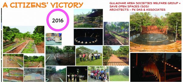


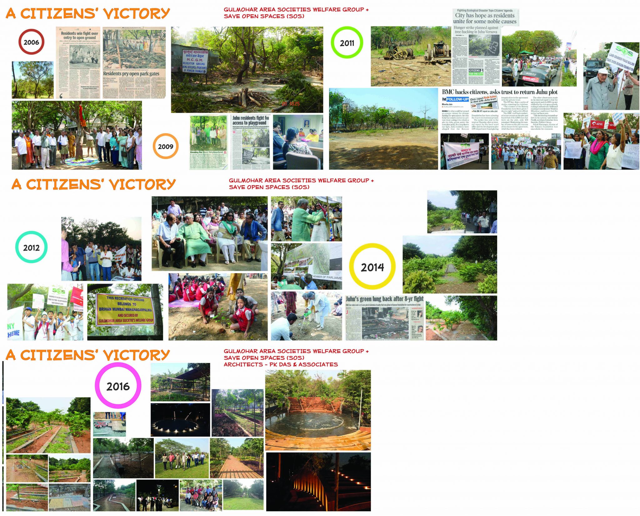
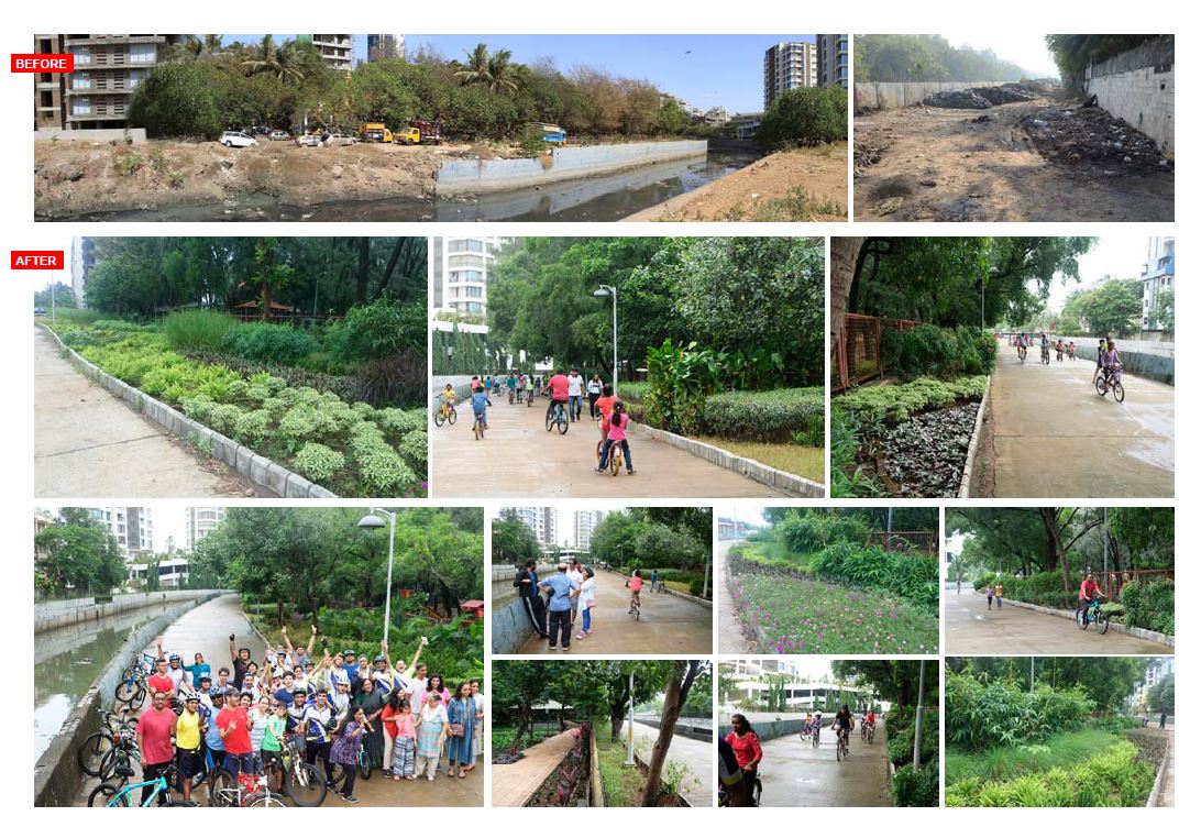
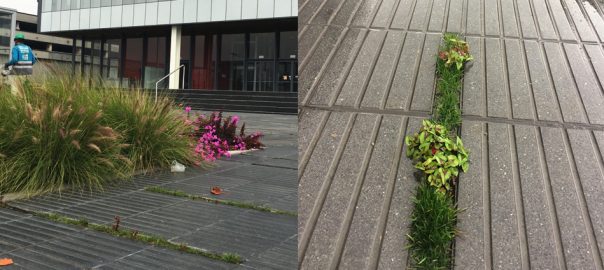

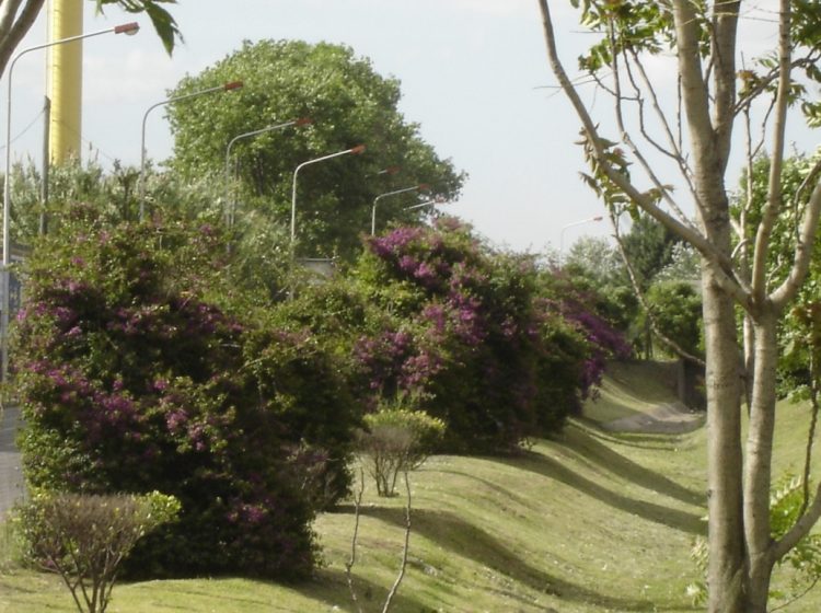
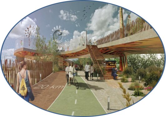
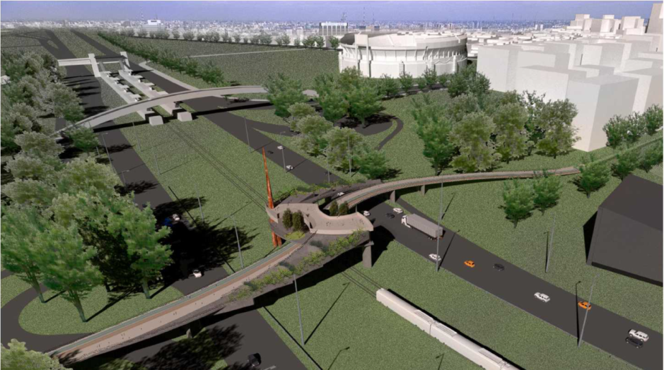
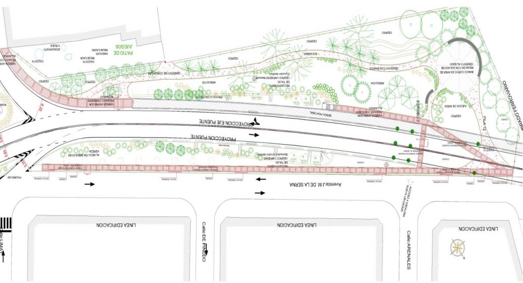
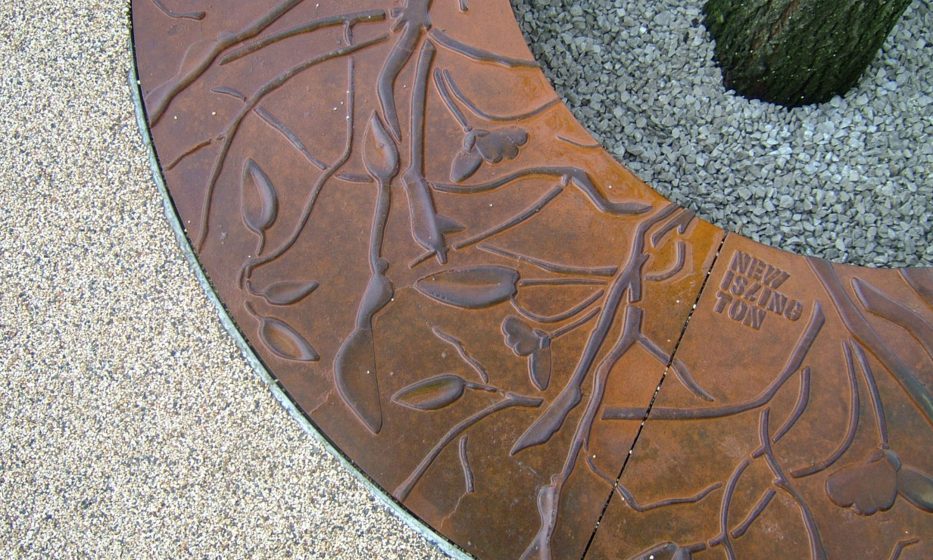
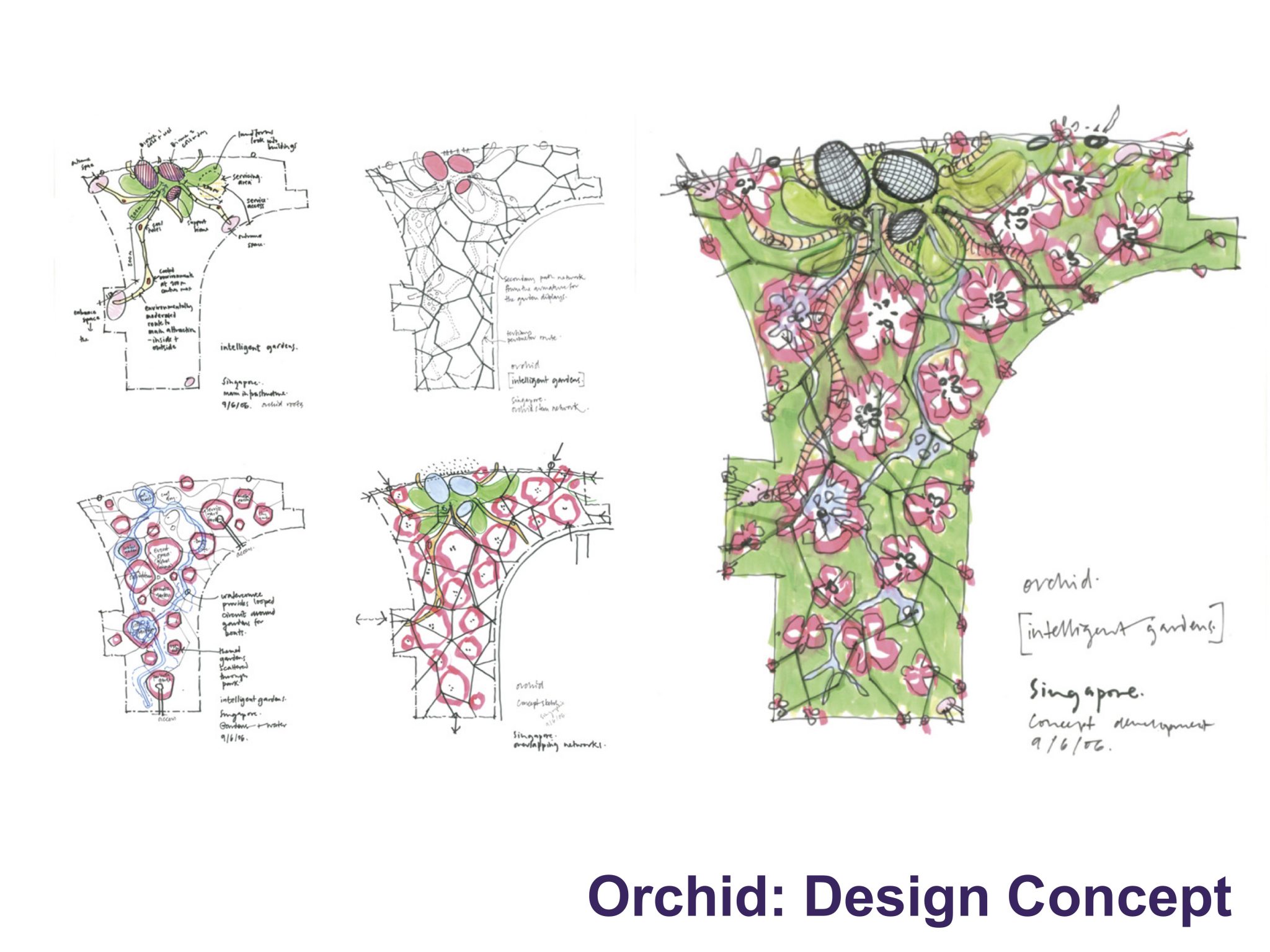
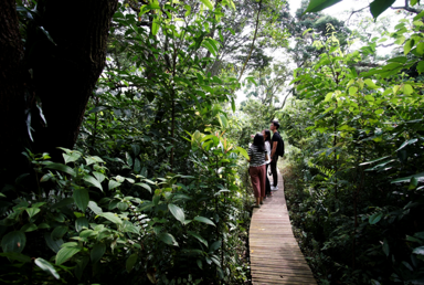
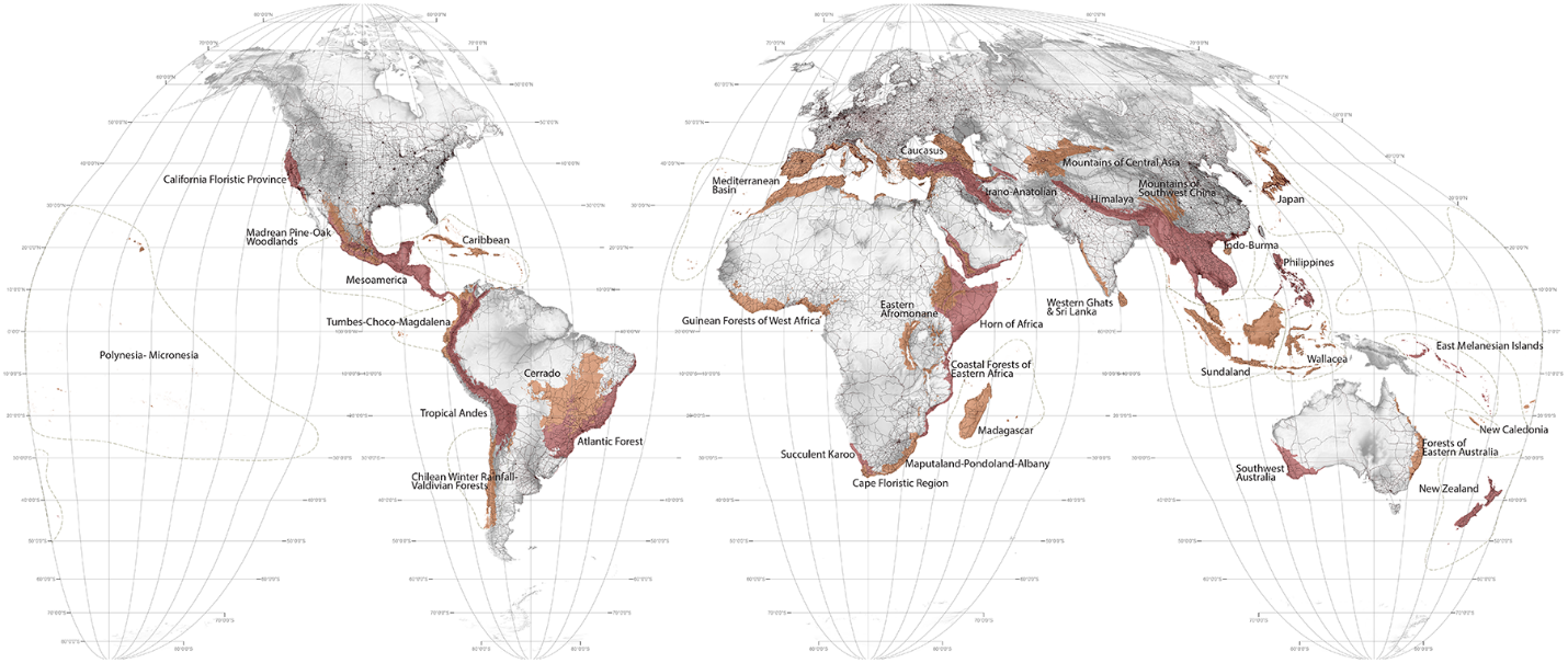
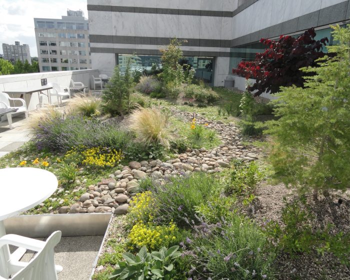
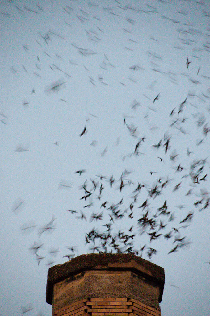
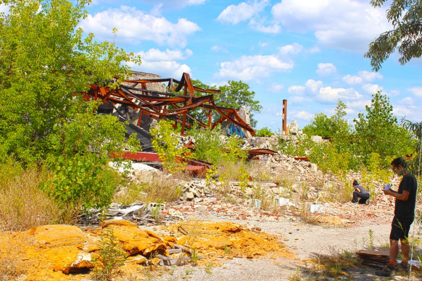


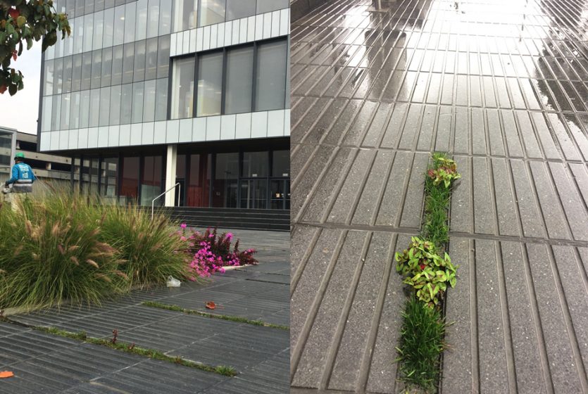
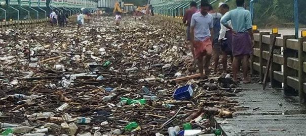
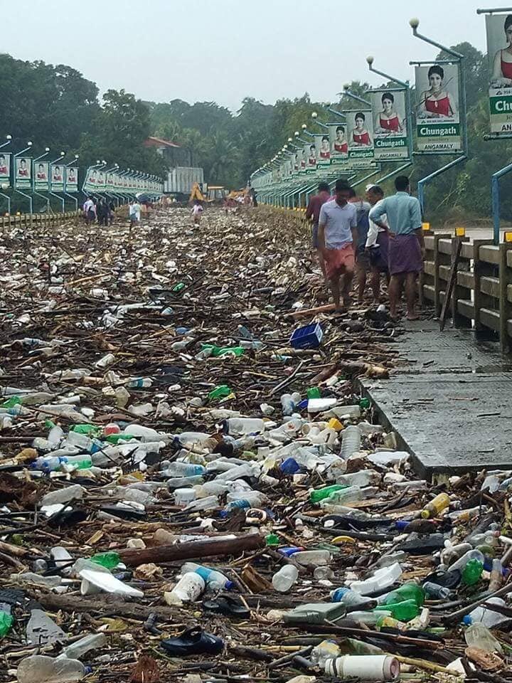
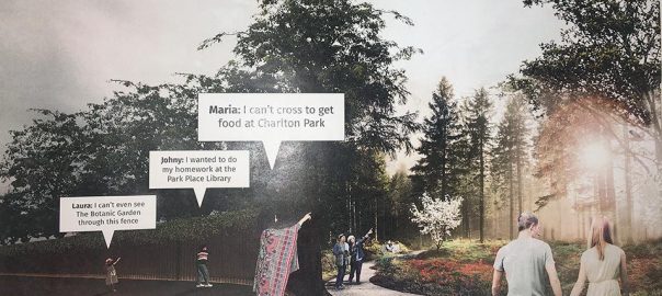
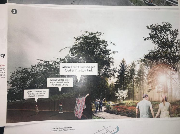

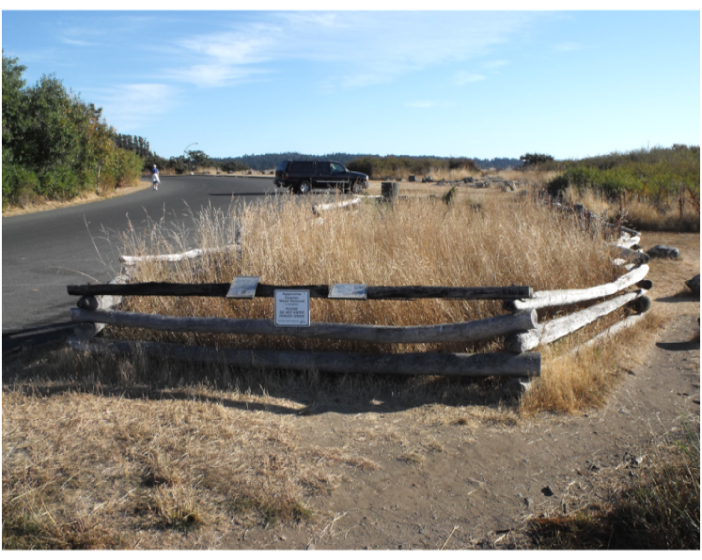
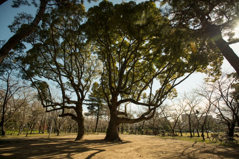
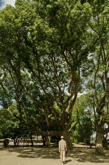
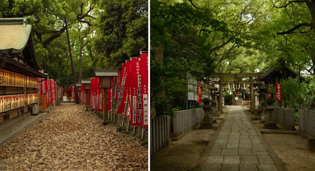
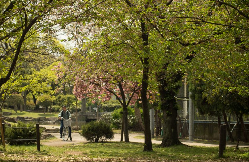
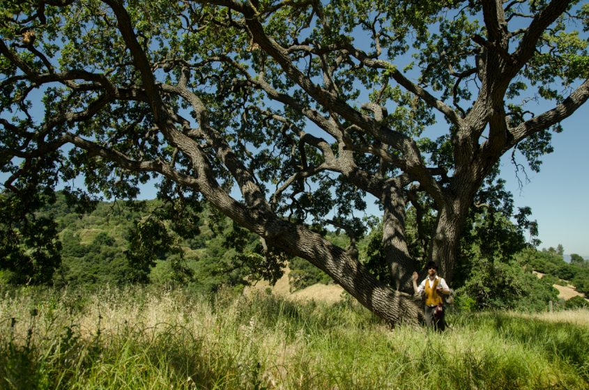
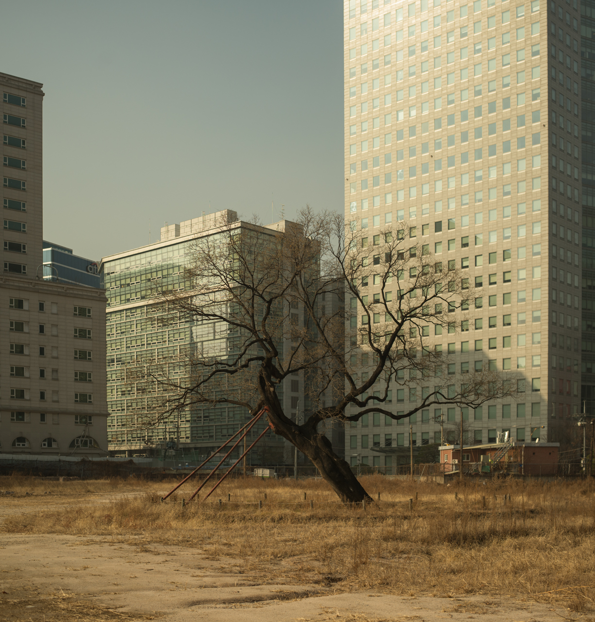


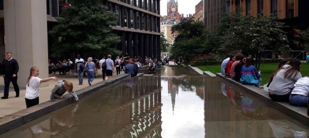
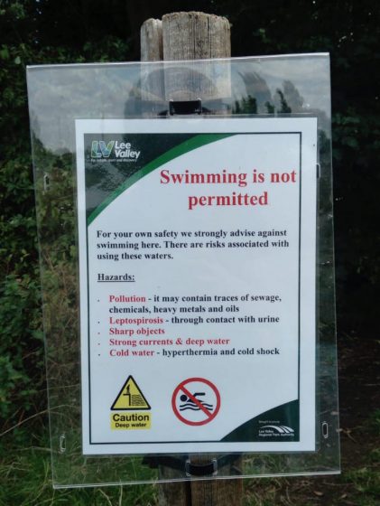
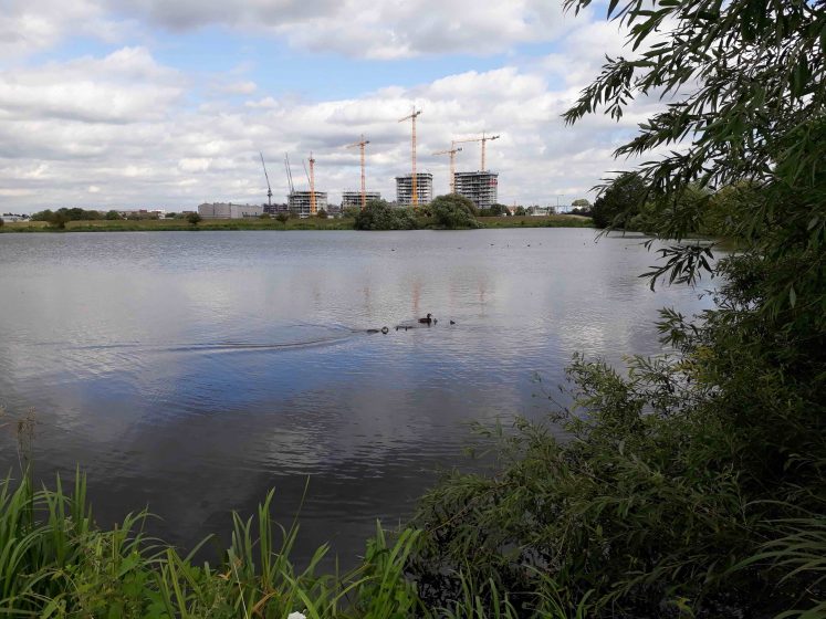
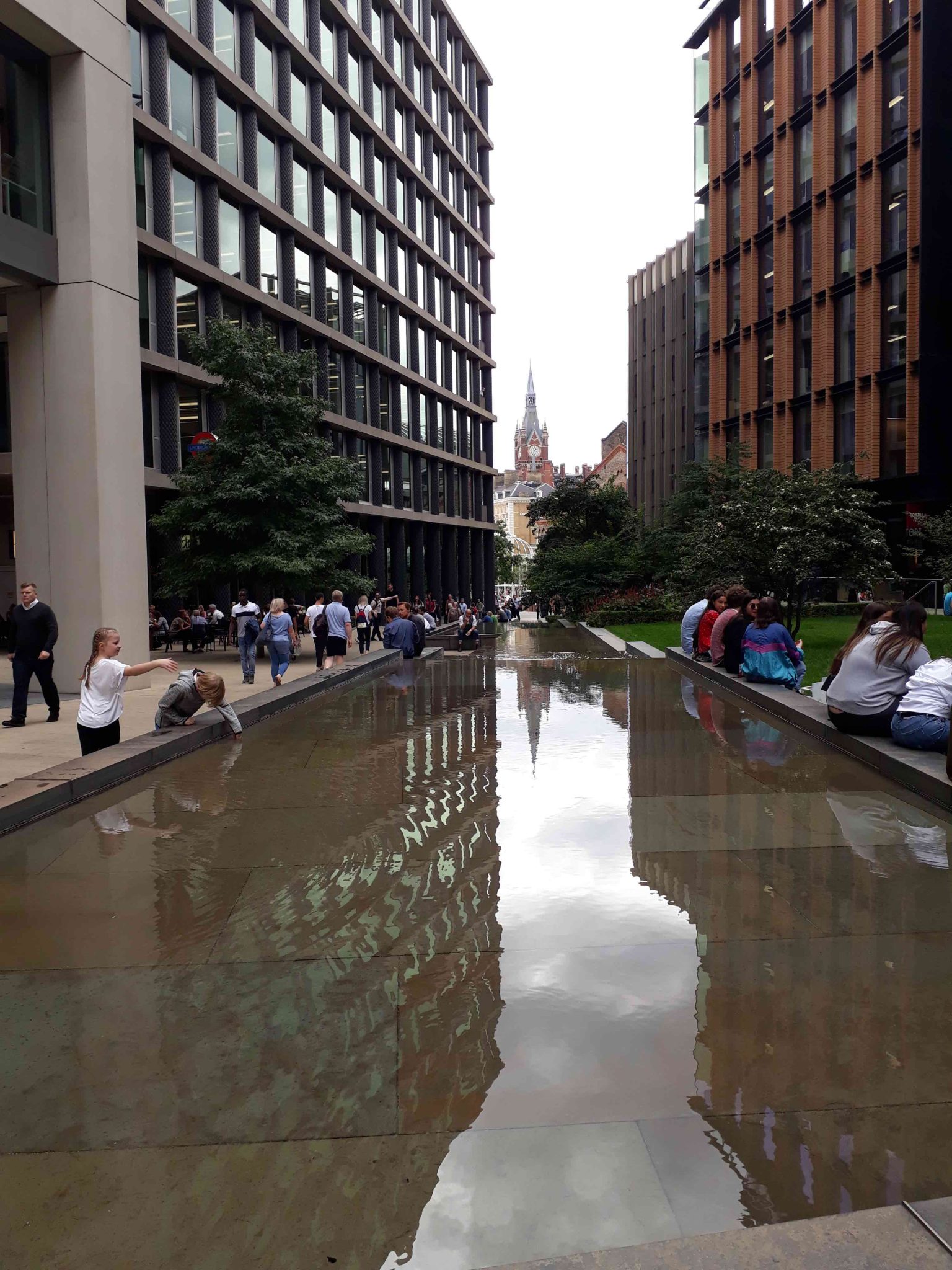
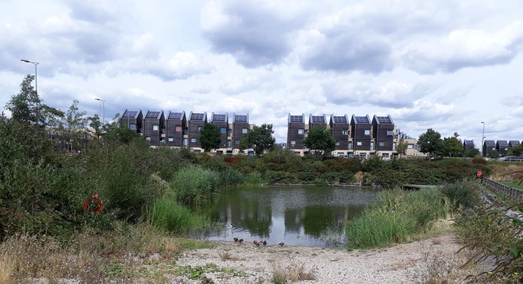
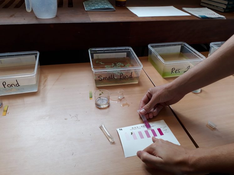
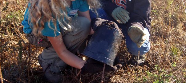
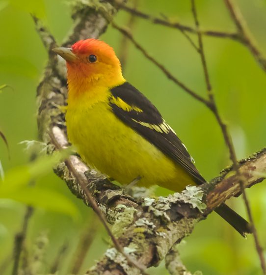
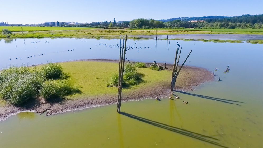
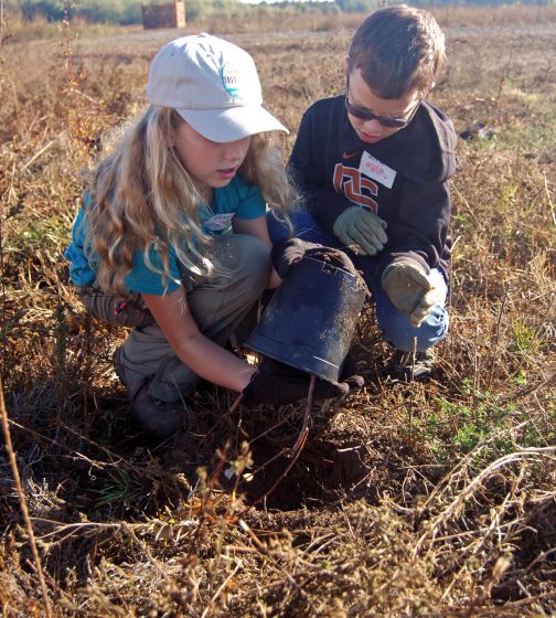

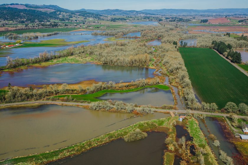

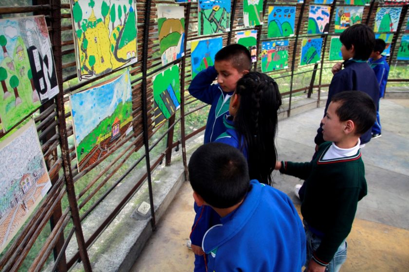
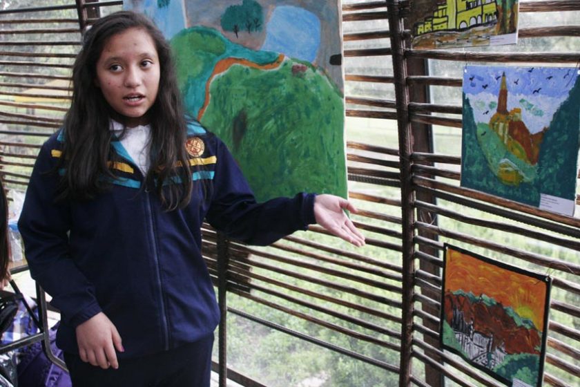
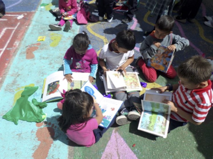
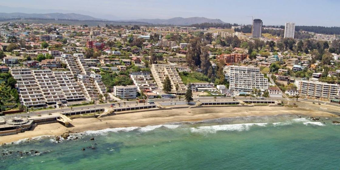
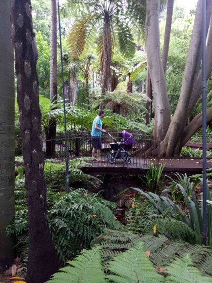
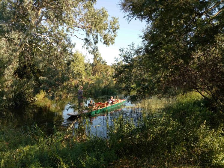
 A bit of background:


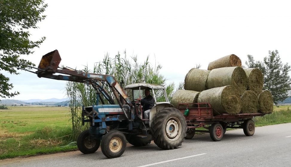
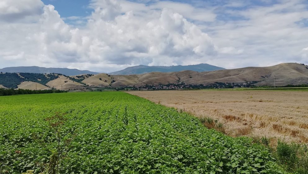
 These are three brief examples. There exist countless more, and
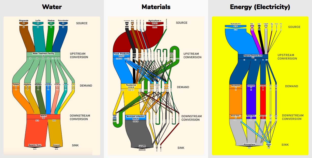
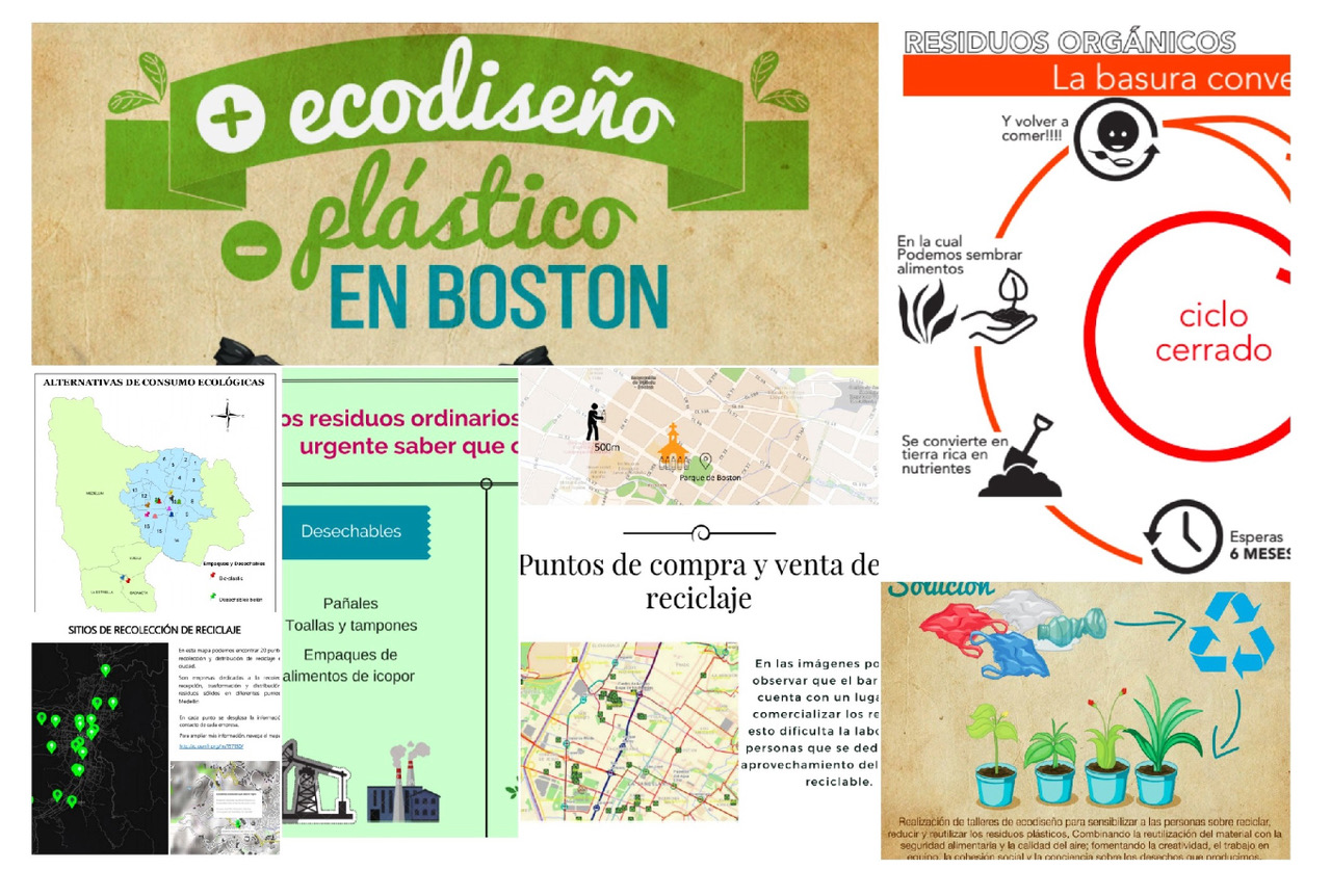
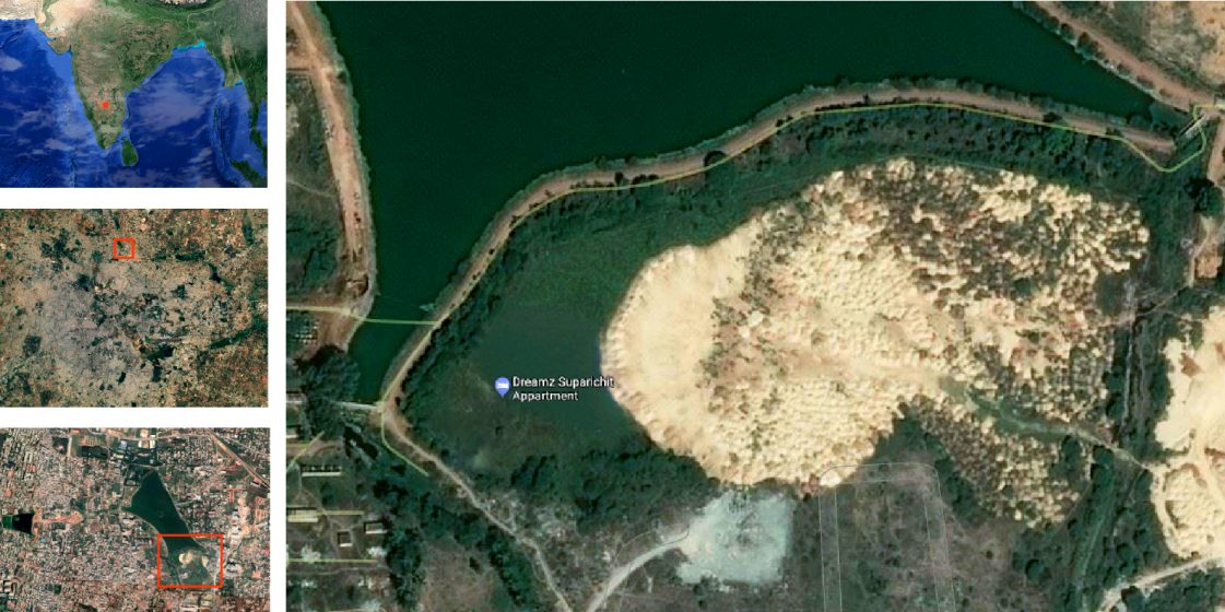
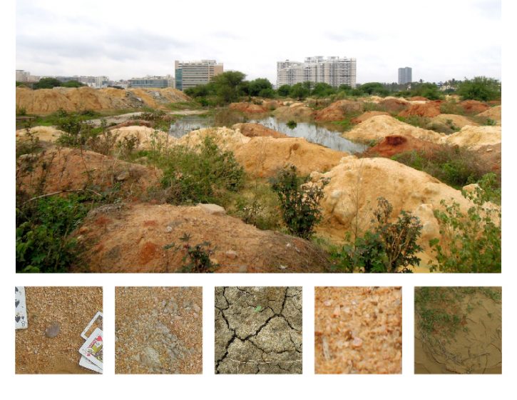
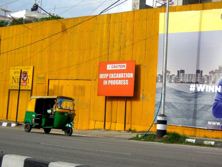
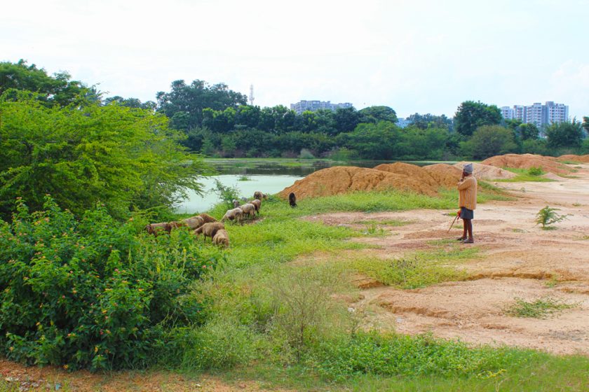
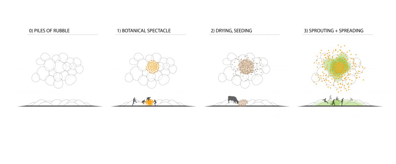
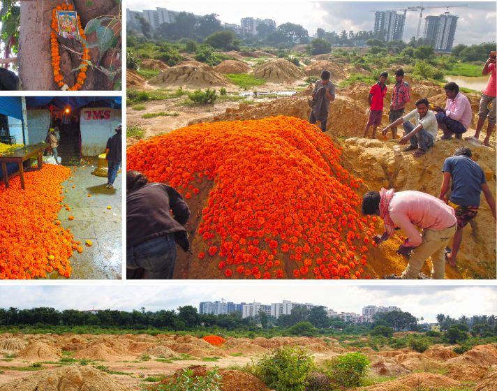
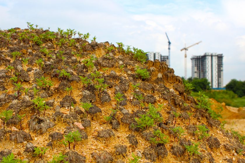
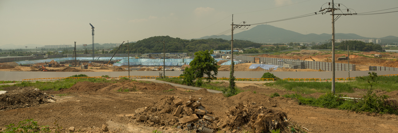
1 Comment
Join our conversation