How has Singapore created itself as a “city in a garden”? I’m from Manila, and have recently returned from a week-long educational trip hosted by the Young South East Asian Leadership Initiative (YSEALI). The workshop was entitled Urban Planning and Smart Growth. It brought together sixty young leaders across the Association of South East Asian Nations (ASEAN) to learn from Singapore, and from each other.
The idea that resonated with me the most was the urban planning initiative to transform Singapore from a “garden in a city” to a “city in a garden”.
This experience was eye-opening. As a young planner living in a metropolitan area that favors a built-up environment, I always viewed green spaces as isolated areas for beautification, or as something held aside until a developer decides to use for more profit. Singapore showed me that my everyday normal could be so much more.
Let me tell you how this experience lifted my hopes for Manila, and why young planners from the Southeast Asian Region could do the same for their cities
The entirety of Singapore’s City in a Garden at the Urban Redevelopment Authority. Photo: Ragene Palma
The week was filled with lectures in the morning, and field trips in the afternoon. Module after module, session after session, we exchanged perspectives and information from every country. We talked about livable cities, addressing topics such as transport issues, industrial growth, housing, and community engagement. We studied each component from an urban planning perspective. We took photo after photo of gardens, green spaces and waterways. We marveled at how a river could be so clean, and how it could ferry us so fast; at the gardens that grew on roof-tops, on building facades, and in every nook and corner the Singaporean urban planners could find. Through the lens of a camera, we attempted to capture the form of the entire city-state.
Metropolitan areas across the ASEAN region all share the struggles of urbanization. Workshop participants talked about congestion, the lack of sidewalks, the kinds of public housing our governments offered to our citizens. We compared our cities with each other, asking who had the worst traffic. Metro Manila’s commute time, in my experience, takes three hours to travel twenty kilometres. (It is not a distinction to be proud of.) Singapore’s worst traffic, on the other hand, was only a short ten-minute delay at the extravagant Orchard Road. Vientiane, Chiang Mai, Ha Noi—we all experience these problems. As urban planners we are all still learning. Among us all, was the same desire to bring our newly discovered knowledge from Singapore back to our home countries.
Over the course of the week, I collected a litany of “aha” moments that captured my imagination—from intangible heritage preservation to controlled climates and recycled energy. However, the idea that resonated with me the most was the urban planning initiative established to increase the livability and sustainability of Singapore, and transform it from a “garden in a city” to a “city in a garden”.
Urban planners from advanced countries may scoff at my delight in something as basic as planned green space. Garden cities, the idea of a utopian city in which people live in harmony with nature, and on which the vision of Singapore was based, have been around since Ebenezer Howard proposed the model in the late 1800s. Singapore adopted its own original Garden City initiative in 1963. But for someone from a developing country which equates progress with more cement and zero-down payment car purchases, seeing the actual implementation of a concept that we’ve only studied is striking.
When asked in an interview about my favourite aspect of the workshop, my response was “All the greens. I want to bring all these greens back home.”
Nature is respected and well integrated into daily life. Photo: Ragene Palma
Every single day, I suffocate in the city of Makati. There are trees, but only because they are part of a privatized landscape. There are parks, and I am thankful for these open spaces, but they are only a temporary relief from the congestion and car emissions of the city. The two-minute relief of crossing a hundred-meter-long park ends all too quickly in a traffic jam. Sadly, these problems are the norm for developing cities.
On this, my first visit to Singapore, the lessons about landscape design began right outside the airport, with the sight of avenues lined with shrubs and flowers. I was overwhelmed with emotion, with inspiration, and mixed incredulity. On the first day of tours, it pained me to see how the “future” I envisioned for our local planning in Metro Manila already exists, far beyond what I imagined it could be. Singaporean planners are already talking about building sky cities and pushing beyond their present innovations. It is difficult to envision such advances in urban planning when the eradication of poverty is one of the biggest concerns among many of the ASEAN representatives. I kept telling myself, “This is how we should be doing it.” I kept telling my lungs, breathe here, while you can.
The second day of tours inspired me to strategize on how I could teach local planners across our 7,000 islands about the greenery strategies of Singapore. Could we actually require our estate developers by law to put biowalls on our building designs? How could we successfully maintain plant life when temperatures in the Philippine islands sometimes hit 50°C? So many of these thoughts played on my mind.
An example of a garden on a facade. It is as if the buildings sprout leaves. Photo: Ragene Palma
By the third day touring Singapore, I could not believe the things my eyes were seeing. It was as though it was all too perfect and beautiful to be true. It was almost inconceivable to me that these urban environments are Singapore’s reality. However, for the young representatives from the ASEAN region recreating the amazing urban environments we discovered in Singapore in our home nations would be difficult given the weight and challenges of the city planning burdens we have at home.
So, what can developing countries and congested cities take away from the success that is Singapore?
The natural environment and the built-up environment are not a dichotomy.
They can co-exist, and they can be integrated.
Whenever I do land-use workshops with local planners, the map is filled with red and yellow areas. These are the commercial and residential zones. Green areas are isolated, and meticulously measured, on the chance that they will someday be developed into future malls, or more condominiums.
Additionally, green areas are zoned. Parks are given little attention and thought with regard to design. The colonial plaza is typically designated as public space. The church, the government center, and any open areas that remain from the three hundred years under Spanish rule serve as public space today. Ask a Filipino where the public space is, and he will direct you to the plaza.
The innovation of Singapore reinventing itself as a city in a garden challenged not only the concept of green zones, but also the idea of exclusive-use zones in its entirety. Inclusion was the key strategy. By bringing diverse races together in one building, infusing leaves with windows and walls, putting the workplace and schools within biking or elevator distance, communities thrived.
In the same way, gardens were not just included in the city as green spots. Gardens were integrated, both horizontally and vertically, in every zone. By reimagining all potential space as green space, and integrating greenery into all zones the trend of planners wedging small gardens into the city was reversed. Now it appears as if the city is placed within a huge garden.
Plants thrive on the built up environment. Photo: Ragene PalmaMalls, homes, workplaces, and greenery everywhere you look. Photo: Ragene Palma
“It’s not about aesthetics, it’s about valuing life.” – Damian Tang
From the perspective of planners, architects, and developers, green spaces are included in the urban landscape because they are pleasing to the eye. Open green spaces increase land value, bring in more money, and serve as an asset, upon which we can capitalize. This limited perspective is a potential problem.
Planners recognize that incorporating green space is both pleasing and ideal, but why this is so has to do with more than just the economic benefits. In Singapore, they found the value of green space to strongly improve the quality of life of their residents. Parks, nature reserves, waterfronts, and even the presence of fish in water bodies played a role in transforming polluted slums to thriving, innovative communities. The role that green space played was so prominent in the lives of the people, that their target today is to have at least 90 percent of their households be within 400 meters of a park by 2030 (from Sustainable Singapore Blueprint, 2015). The proximity of nature to one’s life has such high value.
A river can be the source of life for the people; the Singapore River was transformed from a polluted state to one of the most iconic attractions in Asia. Photo: Ragene Palma
We can see the lesson of valuing life in how much we value our rivers and estuaries. Waterbodies in developing countries’ urban centers are polluted, foul-smelling and dangerous. When we can use water bodies for transport and tourism and be proud of their history and condition, we transform them from our personal, domestic garbage cans into a natural resource to be valued and respected.
This is the same mistake we make when we constantly excavate and build without provisions for land management and future developments. It is the same mistake when we cut down trees for infrastructure and do not replace them with new trees. It is the same mistake that we care not about emissions and the heat we bring to our air, which has reduced our wildlife populations. We have driven living things away from their natural habitat. Unfortunately, we do not value life.
We are a part of nature, so why treat nature differently? Separately? Why do we evaluate it in terms of money instead of in terms of having an inherent value that benefits life?
Urban and environmental planning is about improving the quality of life, and yet, our efforts for development undermine that very objective. To create livable, sustainable, healthy cities, we must elevate the the importance of green space to the level of other planning concerns and seamlessly integrate green spaces into our plans.
When we value life we feel a connection with living things around us. An example is this pigeon management initiative along a heritage street. Photo: Ragene Palma
Piling on the livable layers
In the very dense hearts of cities, we have to learn how life can be brought in to revitalize the urban environment. In Singapore, they increased vegetation from 36 percent in 1986 to an impressive 47 percent in 2007. Even with this success, they continue to question how to maintain it. Some of Singapore’s green design strategies include:
(1) Understanding the ecosystem and habitats where cities thrive.
(2) Add layers that make the city livable. Examples of layers that incorporate space and improve livability are nature reserves, parks (coastal, riverine, heritage), and pocket parks. Other layers include urban greens, such as vertical biowalls and green rooftops.
Green strategies in revitalizing an area can also feature Kevin Lynch’s elements of a city: streetscapes, corridors, and edges all echo how vegetation can define an area and imprint memories on people’s minds. Most importantly, a city has to be planned with social touchpoints, where citizens can interact with nature—vegetation, water bodies, and animals.
Taking the cue
There is this massive responsibility that falls upon a young planner’s shoulders in bringing these ideals to life in an already congested metropolis.
I asked a young Singaporean planner how a developing country could improve its urban centers. How could we possibly transform cities and address so many problems? She replied: “Start small”. It doesn’t have to be a flashy masterplan, it doesn’t have to be too grand.
Philippine urban planners can start by creating a baseline of green spaces in cities; by reviewing land use plans and finding areas to incorporate mixed uses, by standing up to irresponsible conversion, by campaigning for more livable environments, and by putting the value of life before anything else.
Nature parks are within walking distance from all communtieis. Even socio-economic support infrastructure like this walkway provide breathing spaces. Photo: Ragene Palma
In Silent Spring, the book that launched a global environmental movement, author Rachel Carson said, “The history of life on earth has been a history of interaction between living things and their surroundings”. This is a good reminder to young planners. All the more, because of the challenges we face in the developing ASEAN cities. Hopefully, in my lifetime, I’ll be able to say I helped improve the livability of Metro Manila by creating more green spaces. Hopefully someday, I’ll be able to write about the beauty and livability of my home, thanks to the lessons learned in Singapore with the rest of our neighboring countries.
Cities are the new face of climate change. Where I live in New Haven, Connecticut (USA), we are witnessing its impacts—warmer winters, sea level rise, and inland and coastal flooding. The city is taking steps to address climate change, including adding bike lanes and adapting to future vulnerabilities. These measures to create climate solutions are not unique—hundreds of cities across the planet are assessing their own vulnerabilities to climate impacts and designing solutions that reflect and respond to local conditions. Climate change has emerged as a localissue that requires local solutions.
Cities have emerged as key partners in the fight against climate change, but their impact goes beyond the numbers.
It hasn’t happened overnight, but today more and more cities have signaled their support for climate action. The first international climate agreement, the 1997 Kyoto Protocol, received relatively weak support with signatories from only 84 countries. Although cities could not ratify the Protocol, many indicated their support by signing on to a parallel Mayors Climate Protection Agreement in the years following the Kyoto ratification. The groundswell of municipal climate efforts expanded dramatically between 2005 and 2015, indicating that municipalities have advanced climate change policies despite—or perhaps because of—the intractability of international and federal challenges. In fact, the outpouring of support from cities, combined with a bottom-up framework, helped steer the success of the Paris Agreement, the 2015 landmark climate deal which was signed by nearly 200 nations.
In the U.S., the first few months of Trump’s presidency have been characterized by reversing or abandoning federal climate policies altogether. Measures to reduce fugitive methane emissions, standards to improve fuel economy of cars and trucks, and the Clean Power Plan all headed for the chopping block. The Keystone XL pipeline was approved and federal lands and waters were opened to new oil and gas drilling. But the importance of cities reached a tipping point in late May when Trump announced that the U.S. would pull out of the Paris Agreement. This announcement was met with strong and swift repudiation of the President’s actions – cities responded with new municipal climate commitments and mayors denounced the withdrawal from the international climate agreement. Cities like Pittsburgh have committed to 100% renewable energy, and more than 230 cities recently pledged to support the Paris climate targets.
Cities have emerged as key actors in the fight against climate change, but it is worth an investigation to understand the extent to which cities are helping meet international emissions targets. Does city climate action lead to substantial emissions reductions, and if not, why? What is the real importance that cities have in meeting global emissions reductions targets?
): Climate change exacerbated impacts of Hurricane Sandy on New Jersey beaches, Nov. 18, 2012. Official White House Photo by Sonya N. HebertWaiting at the bus rapid transit stop in Tianhe District, Guangzhou, China. Photo: Emily Wier
Progress at the city level
Cities are helping make progress to meet international targets. Cities are measuring their emissions, setting targets, implementing measures to reduce emissions, and joining pledges and pacts (such as the Compact of Mayors). Many cities are setting goals for 2050 and beyond, signaling a commitment to long-term investments in infrastructure and technology that can shape low-carbon development. Many of these targets are in line with international climate mitigation and adaptation commitments. Cities are installing solar panels, building bike lanes, expanding energy efficiency programs, incentivizing public transit, and supporting electric vehicles. These measures have real impacts on reducing a city’s emissions, as well as reducing global climate emissions. Local policies have an impact on the global level.
Although estimates vary based on today’s pledges, it is expected that urban climate policies will avoid between one and three gigatons (Gt) of carbon dioxide (CO2) emissions by 2020. These avoided emissions are the equivalent of shutting down between 300 and 900 coal-fired power plants for one year.
Challenges for city action to deliver international targets
Even with the heightened focus on municipal-level climate action we are still a long way from meeting global emissions reductions targets. Annual carbon emissions were around 49 GtCO2 in 2010, and there is a large gap between what cities can directly reduce and what is needed to meet Paris climate targets. Not all of these emissions contribute to global warming as some is absorbed in carbon sinks (e.g., oceans, forests), but the municipal emissions avoided are too small —federal action will still be needed to meet global emissions reductions targets. Cities alone are not the silver bullet to keep climate change in check.
Some of this discrepancy between a city’s apparent best effort to reduce emissions and the actual policy results are inherent limitations in what cities can achieve. Despite cities’ attempts to address climate change—be it adaptation or mitigation—they are bounded in their abilities to implement climate policies by existing legal constraints, a city’s development trajectory, and available resources or capacity. The legal constraints of the policies available to cities can restrict the policy levers available for local governments. The existing infrastructure and urban development trajectory determine the opportunities for implementation of low-carbon strategies. The existing resources available to a municipal government—from financial to technical expertise—determines the extent to which urban areas are able to implement climate policy.
Existing local government law is the overarching political lens through which we can understand municipal climate policies. Cities do not have a free license to drive policy innovation and adoption. There are constraints on what a city can accomplish or implement based on the constitutional authority or policymaking power afforded by a state. Local government law is created by national governments (such as in the UK or South Africa) or by subnational governments (e.g., the states in the United States). The legal mechanisms established by national or subnational governments determine the legal aspects of how a city operates, including city governance structures, fiscal authority, land use regulatory structures, and city boundaries. As a result, the extent to which self-determination can occur at the city level is constrained in large part by the capacities and requirements set by the federal or subnational governments. For example, even though a city may wish to install a bus rapid transit system, it may not have the regulatory authority to do so—that authority may lie with a different government entity such as a regional transportation agency.
The second limitation is the existing built environment and development patterns, which set in motion the opportunities and challenges that a city may face as climate policy is developed. Cities have very different emissions trajectories shaped by a range of factors, including heating degree days, economic activity, population density, power generation, technology, transport energy consumption, and urban form. In cities, energy use (and therefore emissions) generally increases with increasing economic activity for cities with less than $10,000 gross domestic product (GDP) per capita. Energy use increases more slowly for cities with GDP per capita above $30,000 USD—many of which are countries belonging to the Organisation for Economic Co-operation and Development. If a city is developing with relatively little infrastructure lock-in, rapid development presents more opportunities to encourage a low-carbon development pathway – construction of compact mixed use housing, connectivity through multimodal transportation options, and low-carbon building materials (such as timber-frame high rises). For mature cities, low-carbon policy options may be blocked by inertia of the existing infrastructure. Generally, cities in more developed countries are further along this urban emissions pathway.
The last constraint is the available resources—from financial resources to technical expertise. Cities are faced with many competing priorities, and climate change does not often register as a key priority. Although this is changing, there are many reasons for this—climate change is characterized by delayed effects, dispersed impacts and weak governance resulting in policies that “discount the future irrationally.” Even cities in California—a relatively financially stable state with a progressive climate agenda—may not meet some of their climate goals because of a lack of adequate resource capacity.
City action is Important for climate change
Even though there are many challenges at the city level, more and more cities are stepping up to the plate to reduce emissions. Cities that have already begun are forging ahead with measures to reduce emissions.
Cities are truly labs of experimentation; they are sources of innovation and inspiration for policy development that is not politically feasible at other levels of government. Cities can demonstrate that a given climate policy is successful, and can encourage implementation in other cities or the scaling up of that policy at other levels of government. The flexibility and nimbleness, often because there is less bureaucracy at the city level, represents an important component to scale up successes to the subnational, national, and international scales.
Another key part of climate policy is that they can create a multitude of co-benefits. Co-benefits are additional benefits that are realized through a given climate policy, that are above and beyond the direct benefits of emissions reductions. These co-benefits can be particularly important selling points in messaging a given policy, allowing the climate mitigation to be communicated as an associated or additional benefit. Local governments respond heavily to these demand-side factors. Co-benefits can include green jobs, improved air quality, reduced traffic congestion, and economic development. Green jobs, such as in solar and wind, represent important employment opportunities. Improved air quality or alleviation of congestion result from policy co-benefits associated with transportation emissions. For example, bus rapid transit can provide reductions in emissions as well as alleviate poor traffic conditions and improve local air quality. The financial co-benefits associated with climate action can also be seen as part of a strategy to develop a competitive advantage over other neighboring cities. Policies in a municipality to support renewable energy may lead to the relocation or expansion of renewable energy companies. This helps create a competitive advantage, and accelerates and diversifies the city’s economic development.
Cities move us forward
Cities represent a huge opportunity to mitigate climate change, and there are many openings to use the policies implemented at a local scale to contribute to national or international progress on this wicked problem. Furthermore, cities also represent a groundswell of action that has driven support for international engagement, including the Paris Agreement. The opportunities presented by climate policies in New Haven are many—the city is creating a better quality of life by encouraging biking and walking options, helping residents save money on heating bills by supporting building retrofits, and protecting residents from the financial impacts of flooding and sea level rise. The city’s leadership on climate change can help drive more aggressive action at the state level, creating a positive feedback loop and momentum to support climate policies in other Connecticut cities. Even though New Haven’s climate policies may not make the difference in limiting warming to 1.5oC, the city’s support brings home the concept that climate change is a local issue with local solutions.
The key challenge is that there is only so much that cities can do without top-down action. Cities still need the support from states and national governments to achieve the emissions reductions in line with the Paris climate targets. Because of the nature of local government law, there are limitations on what a city can implement without regulatory approval from a state or national government. Ambitions are unfortunately tempered by legal and regulatory structures. The existing infrastructure and emissions trajectory in a city delineates the extent of policy options are available. And, a city may not have the resources available to implement a desired climate policy. While cities are important to reducing emissions, they are not able to do it alone.
Within the U.S., some of the greatest opportunities to reduce emissions are not at the city scale. Retiring coal fired power plants and strengthening vehicle emission standards are two policies that have the greatest potential to drastically reduce emissions. And, there is not much that cities can do to make sure that those policies are in place. However, in aggregate, city reduction strategies do represent a significant opportunity to stay on track to meet our climate targets and limit the impact of Trump’s withdrawal from Paris.
In today’s landscape, we are looking to cities to scale and amplify the momentum that has already been exhibited thus far. Signing a pledge is an important first step—but it is just the beginning. Current municipal initiatives are not enough to meet international targets. But leveraging available resources, inspiring creativity, and bringing citizens together can hopefully foster the ambition needed. It also may require acknowledgement that although cities are important for many reasons—a key contribution to meeting the climate challenge may not be through emissions reductions, but rather driving the international agenda and setting in motion the measures to reduce emissions, such that when state or national action comes along, it is that much easier to do.
Some months ago I was invited to go to Kalipety, a village of Guarani Mbya Indians at the outskirts of São Paulo. As we drove South towards the ocean and beyond the affluent city, it wasn’t hard to see the gradual transformation of the urban grain, as it diminished from high-rises to tiny shacks along badly kept streets.
São Paulo can seem endless, and as we drove through areas of a city I could not recognize, time also seemed to stretch. I couldn’t stop thinking I would repent once we arrived, as images of poverty and conflicts involving Brazilian Indians kept passing through my mind.
As they root themselves deeper and deeper into their land and their traditions, the Guarani-Mbya raise their voice in the global web.
But when we did arrive, I was too curious to be bothered by my concerns. After an hour and a half of urban traffic, red lights and a couple of extra miles on dirt roads, having past the lively and colorful commercial streets of Parelheiros, the most Southern district of São Paulo, we reached the village’s entrance. Children played soccer on a grass field, as others played in a bright yellow school bus parked nearby. As they stopped to greet us, I immediately noticed their accent in Portuguese, making obvious their first language was not Portuguese, but Guarani.
The air was thinner, the temperature was cooler and São Paulo’s beautiful rain forest surrounded us. We walked past a tractor in a warehouse and were greeted by small groups of busy people, all working under a large roof, in a wall-less open space next to a lake. On the mud floor a fire burned at one end, protected by clay bricks.
Photo: Paula LynPhoto: Anna DietzschPhoto: Anna Dietzsch
An older man was making coffee and soon we were asked to grab a cup on the common sink to serve ourselves along with others. His “white name” was Chico and he served us with a big bright smile. Women and men peeled vegetables around us, or washed lettuce and the white uncooked skin of chicken thighs. Others sat and squatted around, as a couple of elderly Guarani women stirred food in large pots over the fire.
People were talking as they worked, but there was this surrounding silence, maybe emanating from the forest and the water nearby. I had the impression I had entered a place where people moved slower than I was used to.
This was the communal space of the village, open to anyone. The only enclosed spaces were two small food pantries and there were two refrigerators next to them. Two communal sinks provided the water for washing and drinking, and their water was collected in a dirt pit and drained through banana trees, that naturally filtered the used water on its way to the lake. Big wooden counters served as both working surfaces and storage, where clean dishes were pilled for anyone to grab.
Although every house in the village has its own kitchen, the fire in the common space is lit everyday at six in the morning, as children gather for breakfast before school, and the daily life of the village revolves around it. It was in this space that I had my first contact with the Guaranis Mbya and where, in future visits, they would always receive me to sit, chat and eat. This was the space in which they rapidly translated to their visitors the importance of Guarani’s community, and it was here that I could tell, since day one, that I was dealing with a different way of socialization. One where community and individual boundaries were much more porous than I was used to.
After an hour we met Jera, one of the founders of the village, wearing a long woolen sweater over skirt and pants. Jera is a small Guarani woman, not even 40 years old, with a slim and delicate figure. Her shiny black hair is cut short, and like many others around, greeted us with a broad smile and a hug. Jera stands straight and although her gestures are precise, she moves in a beautiful, slow way, as if cautious with the air surrounding her. Her hands are strong and her small black eyes are shiny.
After coffee we went for a walk to visit the village’s plantations. Along the dirt path, amid the rain forest, there were small patches of planting and we could see corn, pineapple, manioc, sweet-potatoes, taioba, banana and papaya, as well as many Eucalyptus trees. Kalipety, in Guarani, means “the land of the Eucalyptus trees”, reminding us that the area was owned and exploited by white men before Jera and her people took back possession – a story of its own, which deserves to be told in a second article.
In this village, the Guarani Mbya are making a point about the importance of planting and the importance of having space, land, and the direct contact with nature and the forest. Jera is making a strong and conscious effort to bring back the traditional Guarani crops and food into their daily lives and has, as well as the abundant crops, also established a planting nursery and a seed bank, with samples that were collected from several other Guarani villages in the southern part of Brazil. So far, they have already been able to plant and harvest seven different kinds of Guarani sweet corn and more than twenty types of Guarani sweet-potatoes, such as the jety-andai (yellow inside and red ouside), jety-ava (white inside and red outside) and the jety-karaū (purple).
With the help of some institutions and groups around Brazil, Jera has transformed Kalipety in a kind of planting laboratory for forest gardening and the Guaranis are teaching us how to go back to an agriculture that is organic, productive, and not aggressive. Instead of eliminating the forest, the crops feed it and are fed by it, in a virtuous cycle of self-fertilization. One of the people helping the Kalipety planting comes from Brasilia, where he works with forest gardening, having the eucalyptus tree as one of the main feeders for soil revitalization and regeneration. Permaculture groups have also visited the area to help the Guarani Mbya learn how to adapt to a planting culture that is not nomad and needs to continuously treat the planted soil.
Photo: Paula LynPhoto: Paula LynGuarani Sweet Potato. Photo: Paula LynGuarani Sweet Potato. Photo Paula Lyn
After our walk through Kalipety, we hiked to a nearby waterfall and were greeted with lunch on our return. “Lunch” began at 2pm and kept on going until six, as more and more people arrived. Close to 100 people came by that day and every single one of them was greeted with a plate and served from the dishes that kept coming from the now three or four fires set in the common area.
As I ate, I could map my surroundings by the gathering of the Guarani women around the fires, or around the food they were preparing. The date marked the beginning of a four-day event organized by Kalipety Indians to gather Guarani Mbya women around their cause. Each village, each group, had brought their contribution and arranged themselves to cook it. Some sat at the center on low benches and logs, or squatted, as others layered around them. Kids played everywhere. As some women and men cooked biju, a kind of thick corn tortilla, others cooked meat, chicken, rice, beans, or mixed salads. All spoke Guarani.
I was amazed as how it all worked in what seemed to be a very organic, non-hierarchical dynamics. I could not detect who was deciding what and how much should be cooked, as I could not tell how many people had already eaten, or were preparing to eat, as some washed their own plate after a meal, others served themselves and others ate desert. The quantity of food also surprised me.
Kalipety is a wonderful community, but it is poor, with no fixed governmental financing, or main sources of income, apart from the salaries some members bring in. Yet, there was no shortage of food and there was no shortage of guests. And as I came back for other visits, it became clear that the money spent on food and the innumerous guests that day was not an isolated event, but the unfolding of a daily routine, where food, and gatherings around it, are a priority that marks the importance of the group, and its collective functioning, over expenses with other goods.
This impression was reinforced as I followed a group of kids playing in the lake. Shorts and T-shirts were scattered on top of surrounding bushes, as they undressed to get in, but in coming out some left their clothes behind, as others seemed to collect theirs at random. As the day passed, I kept noticing scattered pieces of clothes thrown around the property, as if they had a use, but not the same importance we give them. I realized the Guarani possessed things differently than us and the branded T-shirts and clothes they wore acquired another significance, making me feel more at ease with all the English words and logos I kept seeing everywhere.
Photo: Paula LynPhoto: Paula LynPhoto: Paula LynManioca and Pumpkin. Photo: Paula Lyn
Later that day we sat on the logs that laid in the Prayer House, the most important and respected space in the Guarani village, where dances, religious rites and prominent events take place, as Jera introduced the event that had us gathered there, and told us a little about herself. “We organized an event for Indian women that will enable us to exchange experiences and discuss our role in our communities”, said Jera. “I think this is specially important now, because we have forgotten how to live as Indian women and men and have adopted some of the guru vices.”
“When I was a child, I remember being taught about the house chores and responsibilities along with my other siblings, including my brothers. They had to learn how to cook, take care of the house and the younger children, because, as husbands, they would have to assume all their wives duties once a month, when the women would retreat during their period. I still have the image of my father sweeping the house with one of my baby brothers hung around his neck by a tipoia, the woven fabric used as a baby-carrier”.
“Then,” she went on, “it was OK for women to talk about their bodies and act according to their anatomy, without being seen as fragile or weak, as it was OK for men to act and perform ‘like women’, doing their job without loosing their masculinity. We need to talk about this and decide how we want to teach our children”.
Others followed Jera’s speech, as guests and Indians introduced themselves, and then we all danced. The Guarani music is repetitive, based on few simple phrases of tones marked by the cords of an acoustic guitar, and the complex melody of a flute or a violin. It is often chanted by an individual, to which the chorus responds. The dance was simple, merely a couple of steps back and forth, in the manner of line dancing, with everyone holding hands; men on one side, women on the other.
I was in a special and peculiar position, linking the Guarani women, all to my right, to the women guests, the jurua, to my left, and could not fail to notice how differently both sides felt. The steps were the same, the rhythm was supposedly the same, but the cadence felt totally different.
On the right, I could feel the dance in one wave-like movement, as all the Guarani women seemed totally in-sink with each other. To the left I could feel different pulses from the jurua, me included, even though we were all basically making the same movements, supposedly at the same time. Again I had the sensation of facing that strong symbiotic relationship between group and individual. Maybe one our modern Western ways could no longer assimilate?
Kalipety is a new village, having been founded three years ago by a group of young Guarani, who fought for four years for the right to their land. It is located within the perimeter of a newly recognized Indian Territory of 15.696 hectares, within the second generation rainforest that still spreads along the coast of São Paulo. It is home for 18 families and over 50 people, who live in wooden houses built from the forest trees, and as we drove back home that day, my heart was full of hope, as I could still feel the burnt wood smell from the cooking fires on my hair.
Although small, this group of Guarani is steadily gaining their space through a more proactive dialogue with the world than their predecessors could engage. As they root themselves deeper and deeper into their land and their traditions, they raise their voice in the global web. My suspicion is that they are being able to have a clearer voice in our globalized world, exactly because they are being able to anchor themselves firmly in their locality and what that means to them.
Every time I visit, Kalipety feels good to me. I guess it feels like a point of resistance and reminds me of what Manuel Castells, in 1989, had already predicted when he wrote TheInformational City: if the internet will make globalization of big-capital possible, and by doing it, will end up destroying well-fare and social-democracy, it will also enable the connection of dissident voices [1]. And as these voices are able to connect into a global world we now praise, they will remind us about the importance of traditional and local knowledge and how we can learn and feed from them. Or, as Eduardo Viveiros de Castro explains: “It is not a small number of Indian Nations in the world which affirm that the land does not belong to them. It is them that belong to the land” [2].
[1] Manuel Castells, The Informational City: Information Technology, Economic Restructuring, and the Urban Regional Process. Oxford, UK; Cambridge, MA: Blackwell, 1989
[2] Davi Kopenawa and Bruce Albert, A Queda do Céu: Palavras de um xamã yanomami, Sao Paulo, Brasil, Companhia das Letras, 2015
What would you do if things went terribly wrong with your city after promises made by your decision-makers of an “Urban Golden Age” resulting from hosting the Olympic Games? In my city, Rio de Janeiro, my students and a lot of people I know and talk to are willing to leave not only the city, but the country. Indeed, Brazil is in a gloomy situation due to systemic corruption that has led to widespread and interrelated political, economic, social, and ecological crises.
Immersive experiences can reconnect students to urban nature—and inspire them to improve their cities.
How can a person pursue joyful living when so many find themselves in an everyday challenge to bring food to their families? In Brazil, there are more than 14.1 million unemployed people (13.7 percent of the population). Many of my colleagues and former students are jobless. Architecture and urbanism studios have dramatically shrunk, if not closed their doors because the real estate market has collapsed at all scales. Students are scared because they believe they won’t find jobs when they finish school, which is what is happening to many of their recently graduated peers.
How can you keep up the positive energy to teach future professionals that will plan and design cities when you experienced deep frustration with your own performance as an ecologically- oriented planner and designer? The “market” decides what kind of city we are living in now, and the “market” opposes all urban interventions to achieve a sustainable, resilient, and just city. The priority is not life—human or otherwise. The city is seen as a big business, the means by which to generate huge profit for a few select companies (many of which are now under legal investigation due to unimaginable levels of corruption in Brazil, with many high-level entrepreneurs, top executives, and politicians in jail).
These questions are not exclusively related to my personal experience as a Brazilian living in Rio de Janeiro. The time that Jane Jacobs foresaw in her book, Dark Age Ahead (2004), has come. We are living an urban crisis, where most urbanites are disconnected from nature, and economic volatility makes things worse. Meeting immediate needs is most people’s priority and the “market” plays with the fear to push their growth at any cost in less educated countries. Such is the case of Brazil. We now live in the Anthropocene, a new geologic epoch generated by fossil fuel-addicted society. The entity that rules the world—known as “The Market”—considers people consumers and members of the workforce, not as human beings. We are not only disconnected from nature; we are disconnected from each other. We are not a community anymore; we are individuals competing “to make a living” (this expression is quite weird for me; I believe that we need water, food, and shelter to live, and our work should fulfill us and contribute to the common good).
So now what? A bottom-up, gentle revolution
A new paradigm is emerging, and it must gain worldwide expression to overcome our great twenty-first century challenges. Cities and the local scale are at the center of this transformation in search of a more sustainable and equitable future; these movements irradiate to other areas, urban or not. The new paradigm is emerging from a bottom-up gentle revolution that is driving changes in our connection with the urban environment, where people and nature are returned to the center. Diverse people are gathering and transforming the urban landscape to have a more nature-friendly coexistence, and at the same time are cultivating civic relationships. The sense of community is being restored around themes that touch people’s hearts, such as water, rivers, organic food, trees, biodiversity, social interaction, mobility, culture, arts, and so on. The interventions that are being made by people in local communities have been called Tactical Urbanism (Garcia and Lydon 2015). Those actions are great inspirations to envision the city as a real human habitat. I have been researching bottom-up initiatives that are responsible for urban landscape changes, and have written about some of them in previous essays at TNOC.
In search of answers
As a professor at the Architecture and Urbanism Department at Pontifical Catholic University of Rio de Janeiro, or PUC-Rio, I decided to take students on an elective course of Ecological Landscape Design and Urban Ecology in a study trip to São Paulo. I cannot teach about landscape sitting inside a room all the time. The aim was to make the pupils feel the landscape and to enable them to meet active leaders who are articulate and are fueling a deep change in the urban landscape through the movements they have created. In this process, these leaders are mobilizing hundreds of people by reconnecting them with nature and their communities. The trip to São Paulo was a response to my own anguishes with our shady reality, and a search for answers to the questions above. My deep personal goal was to drive my students to experience real, bottom-up changes that are undergoing in this tremendously complex megalopolis.
Two PUC-Rio professors asked to join us, so the trip became even more stimulating. It became interdisciplinary: Henrique Rajão is an ecologist, and Pedro Lobão is an architect embodying a lifestyle shift driven by the jackfruit tree he has in his backyard in a residential, central neighborhood in Rio. His tree produces hundreds of fruits that he is using in a new venture as an urban food producer.
PUC-Rio is ranked as the best private university in the country. It is not affordable to everyone, in spite of offering scholarships to many students. Unfortunately, the trip was also expensive. Only students who could afford to pay extra to travel were able to join. This situation gave me an opportunity to discuss equity and justice with the economically privileged young adults who will soon be working in our cities.
We had four intense, mind-changing days together, which I will try to condense and communicate in this piece. I organized a class a few days before the excursion to prepare the students and my colleagues for the intensive program we would have later in the week.
After a very early morning flight, we went straight to the epicenter of the city: Paulista Avenue. (You can see Paulista Avenue on TV whenever public demonstrations or protests gather up to hundreds of thousands of people.) We walked along the busy avenue to meet our first hosts: architect José Bueno and geographer Luiz de Campos Jr. They are the creators of Rios e Ruas (Rivers and Streets), an initiative they started a few years ago when they met and discovered their mutual passion for the urban watercourses that have been buried underground. They became river chasers, and have brought thousands of people to realize that São Paulo has an immense treasure hidden under its streets and paved areas.
View of Paulista Avenue—the heart of the business district—during a protest. Image courtesy of Cecilia Herzog
We tried to gather bellow the iconic Modernist building of the famous architect Lina Bo Bardi, the Museum of Art of São Paulo, but there was a protest against corruption that was very noisy. We crossed the avenue and went to Trianon Park, a fragment of Atlantic Forest in the heart of the Business district. It is an island of peace, so we could start our conversation. Luiz and José developed a methodology to touch everyone with sensibility and knowledge. First, they asked each student’s names and a river’s name. Yes, the name of a river as if it were the family name. It was so moving for all of us to think about a river as family, and the connection that we could have to one single watercourse. It was easy for some, and impossible for one. She didn’t have a river of which to be reminded, no memories of rivers…I found this to be so sad.
After a brief explanation about the urban rivers and the urbanization process, we headed back to the museum’s esplanade that oversees what once was the Saracura river valley. And that was our river now! After telling the history of the urban growth over the river, Luiz and José guided us in our urban expedition to discover where one of its springs still drips water; to see where a former cascade was put into pipes; and to walk in the streets where the river’s waters are flowing but hidden from our sight. Traversing these partially neglected neighborhoods, the group felt the shapes of the landscape; the water paths that follow the geomorphology and some remnant green areas; and the various periods of architectural styles and social differences in construction types. Along the way, they discovered a complex and alive city, full of diverse people. We continued until the very end of the buried river in the downtown area. There, we found a surprising illustration of nature’s resilience: a capybara was sleeping over a trash island in the channeled Tamanduateí river, were the Saracura issues its waters in a polluted brownish waterfall. It was a comprehensive class to understand geographical, ecological, social, economic, and historical interrelationships, as well as the impacts of the urban growth process.
Saracura river valley viewed from the Museum of Art of São Paulo. Photo courtesy of Cecilia HerzogLuiz de Campos explaining the urban transformation process. Photo: Cecilia HerzogSaracura springs, where water flows permanently to the streets. Photo: Cecilia HerzogModel of the city of São Paulo with dynamic projections of the relations between the rivers and the urbanization at the exhibition Rios.Descobertos. Photo: Cecilia Herzog
To wrap up the first day, we went to an exhibition that was conceived and organized by the two river’s lovers, Luiz and José, named Rios.Descobertos (Rivers.Discovered—the name has double meaning, referring to the discovery and uncovering of the rivers). It is a huge city model with projected images that unveil the landscape change that has occurred during the urbanization process in a dynamic, beautiful, and colorful manner. In a panel, pictures and phrases cover a wide range of geo-biophysical, social, cultural, and even emotional transformations of the city’s landscapes related to the rivers and streets. We could see and feel São Paulo as a city of waters. That was astonishing for all. All of us started to see the unseen.
The next day, our host was Nik Sabey. This young man is a former executive of an advertising company who loves trees. Ten months prior, he decided to stir up his life. He abandoned his job and stable lifestyle, and went out to plant trees all over the urban hardscape and unused lawns in public areas. He started the Novas Árvores por Aí (New Trees Over There), a collective movement that gathers hundreds of people to plant pocket forests, together with the landscape architect Ricardo Cardim—a trained dentist who studied biology to become a landscape transformer specializing in the original ecosystems of São Paulo.
Saracura “falls” into the Tambanduateí river. Note the brownish color of the polluted water, and the island of trash where the capybara is resting. Photo: Cecilia Herzog
Nik took us to one of the most exclusive office buildings of the city, the famous Victor Malzoni. Well known companies occupy their floors, including Google in Brazil. The monumental mirrored façade and manicured gardens hide a recently-developed, groundbreaking waste treatment facility. Organic waste (there are three restaurants on the lot) generates four tons of compost each month, which is donated to urban tree plantings. Other residues are separated and sold. At the facility, they’ve developed a subterranean demonstrative food garden, where people who work in the building can harvest fresh organic herbs (picture) and leafy greens. Bicycling is also a priority, which is very unusual in Brazil. There is a bike lane that enters the garage into the underground parking area, with showers for sweaty bikers, and even a small bike shop. Sewage is locally treated and the water is 100 percent reused. For the students who are future architects and civil engineers (we had two), this visit was a mind-blowing experience. Within ten days of her return to Rio, one student had started working in a start-up project inspired by those practices.
Close-up of the capybara. Photo: Cecilia Herzog
After being underground almost the whole morning, we ventured to one of the most discussed urban spots in recent memory: Largo da Batata (Potato Square), a former traditional and very popular site. It was totally demolished to give way to the construction of a subway line and the local station. Ten years ago, the construction collapsed and people died. When the construction was finally opened for the public, it was a concrete desert. The residents started a movement to transform it, and they called it A Batata Precisa de Você (The Potato Needs You); from then on, the site changed a lot. They planted trees and developed areas for social interactions, including designed urban furniture and playgrounds. They also gave priority to people over cars by painting pedestrian crossings to connect the different areas of the public space. There is even an area for open-air movie projections. Urban art is scattered all over. Today, the area is alive and full of people. The students had direct contact with homeless people, and other interesting people that live in the area.
From there we went to a small pocket forest in the banks of the Pinheiros river (one of the two main rivers of the city). It is a small planting, but a great achievement to call attention to along this polluted, channelized river compressed between two highways. This was an opportunity to teach about the interrelation of riparian forest and watercourses, and the change that car-oriented urbanization has made to it. It was excellent to discuss after the exhibition we had visited the day before.
We crossed the big river by bus and went to visit one of his tributaries, the Iquiririm creek. Its source is hidden behind the wall of the University of São Paulo, where one can see the water falling through a hole in the wall in a jammed, green residual lot. It was a polluted wetland where people dumped garbage until José Bueno and Luiz de Campos discovered it, and began to clean it up and care for it. There was the starting point for Rios e Ruas. Fefa, one of the contributors to this process, was waiting for us there. He was so enthusiastic, telling us the story of Rios e Ruas’ work to recover the stream while he stood over top of the almost-restored wetland. The students got excited and absorbed his love and curiosity. They decided to jump the wall and enter the university to see the other side, where there is a forest that embraces and nourishes the spring. It was an experience that involved all the students and professors, together with José Bueno and Luiz de Campos, who arrived from work just to accompany our group to the discovery of the water source. At that point, things started to amalgamate for the classmates: water, trees and biodiversity, and people! And a better place to live in the city!
Open-air movie at one corner of the Largo da Batata. Photo: Cecilia HerzogPocket Forest at Candido Portinari Park. Ricardo Cardim explains the process of urban transformation through his passion for native São Paulo’s ecosystem, and through tree planting with Nik Sabey and more than 500 other people. Photo: Cecilia Herzog
When the sun was going down, we went to meet Ricardo Cardim in the largest pocket forest yet planted by Novas Árvores por Aí, together with more than 500 people of all ages. That forest is located at the Candido Portinari Park. They planted Atlantic Forest and also a patch of Cerrado (a Brazilian Savannah ecosystem) that covered part of the original landscape. The native trees were planted in association with a diverse array of edible and flowering plants to attract biodiversity. And they came: we saw lots of birds and insects. We had a surprise: a Peregrine Falcon (Falco peregrinus) flew over us. He was going back to Canada. Fortunately, our specialist in birds, Henrique Rajão, was there!
In the third day, we headed to the Praça da Nascente (Headwaters Square—the official name is Homero Silva, but nobody knows why). In fact, Praça da Nascente is now like a small park, whereas a few years ago, it was a place that people dumped garbage; it was derelict, and nobody used to go or even look at it. Andrea Pesek, Lu Cury and the biologist Sandro Von Matter were waiting for us. The sweetness of Andrea hooked everyone. She and Lu told us about the gentle revolution they made and keep making to restore the water sources, and the entire place, reintroducing native flora and fauna. Sandro is responsible for the aquatic fauna that is controlling the mosquitoes in the area. This work was recently highlighted in the headlines of the main newspapers and TV. These caretakers of the park are also legally disputing to block a new real estate development over the water sources. (picture)
It was a kind of magic being there with the students, sitting in the improvised auditorium, where the soundscape consisted of the water flowing as Andrea smoothly told us about the tremendous transformation they had promoted in the landscape and in the neighborhood. (picture)
Praça da Nascente (Spring Square)—Andrea Pesek, Lu Cury and Sandro Von Matter talk about their experiences in the transformation of this beloved small park from a neglected and dangerous area. Photo: Cecilia HerzogThe powerhouse Claudia Visoni fascinates the students with her life history of personal transformation—and the impacts on other people’s minds and hearts—that led to the creation of the Horta das Corujas (Owl’s Square) and the urban food movement Hortelões Urbanos. Photo: Cecilia Herzog“Urban Beach” documentary projection on Saturday night. Photo: Ana Clara PellegrinoThe biologist Sandro Von Matter explores the difference between the biodiversity of the first São Paulo’s park—Parque da Luz—and the Trianon Park. Photo: Cecilia HerzogTrianon Park—A fragment of Atlantic Rain Forest in the heart of the Paulista Avenue that still has trees that are hundreds of years old. Juliana Gatti triggers the curiosity and the biophilia of the entire group: students and professors. Photo: Cecilia Herzog
We also met Daniel Caballero, an artist passionate about Cerrado. He has planted this dry ecosystem vegetation in the slopes of the small park. With his art and planting, he has educated residents, and he is raising awareness about this forgotten ecosystem. It was absolutely incredible to see the regeneration of the green area and to see people strolling up and down the hill, appreciating nature and the small pond in the beginning of fall on a Saturday morning.
At lunchtime, we walked through the Beco do Batman (Batman’s Alley). It is an open-air gallery with astonishing graffiti that attracts visitors from all over the world. Underneath flows the Verde River (Green River), that reappears in heavy rains and can even drag cars, causing a lot of destruction. This neighborhood attracted artists in the 1980s and has become one of the most popular in the city.
After lunch, we went to meet Claudia Visoni, a charismatic urban food gardener (as she likes to call herself). She is a journalist that also overturned her world, abdicating an economically stable life to grow food at the Horta das Corujas (Owls’ Garden, in a small park with the same name). She catalyzed the urban food movement that spread to the entire country, founding the Hortelões Urbanos (Urban Food Growers), now with almost 70,000 members on Facebook. Claudia is a powerful woman that spreads, like a good virus, the idea of living in harmony with nature, in all spheres: producing your own food and cleaning products, consuming only what is absolutely necessary, checking the sources of the products, valuing social relationships, and so on. She is an engaged activist, member of the Regional Environmental Council, and teaches about permaculture and food production (as Nik and Ricardo do about trees and ecosystems). Actually, they work together frequently as activists and doers.
After an inspiring guided tour in the garden that transformed a lifeless lawn into an urban oasis, some students started to work in the field. It was rewarding to watch them work in the soil, cut plants, climb trees, and have a lot fun.
The evening was a surprise. We went to PIPA SP, an urban “beach” in the central area—another public space that was recovered by residents, cleaned, and re-purposed to offer recreation and well-being to all in its new function as a meeting place. While we were there, PIPA SP showed a projection of four short documentaries at the “beach”, by Cine Solar—an itinerant open-air movie theater focused on environmental docs that have already toured around the country. The young group got so excited and enthusiastic with their experience that they started a team called Tribo da Semente (Seed Tribe) to spread what they had experienced and contribute to a better Rio de Janeiro.
On Sundays, Paulista Avenue closes to cars and becomes an urban park. People claim the streets, bikers abound. There was another protest against corruption been organized to happen later in the day, in the same place where it had been three days prior upon our arrival. We started walking along the huge urban space to go back to Trianon Park to meet with Juliana Gatti, founder of the Instituto Árvores Vivas (Alive Trees Institute). She also shifted from her previous professional life because of her passion for trees and urban green areas. The students told us that this second visit to Paulista Avenue was totally different from the first. They could feel, listen, and smell differently as Juliana explained about the trees, accompanied by her husband, the biologist, Sandro (the same who was with us at Praça da Nascente).
We continued the open-air class in the downtown area, where the first public park of São Paulo, the Parque da Luz (Light Park), is located. It has a Romantic design and it was a botanic garden when it was created. There, the trees were different, with many huge and old exotic species. We toured the park, full of people on a sunny day. Juliana has a gift for making people see trees in a sensorial way—not only seeing, but feeling the differences and the role of each one in the urban ecosystem.
View from the elevated highway transformed into an urban park each Sunday, with the huge green wall at the Minhocão in the central area of São Paulo. Photo: Cecilia HerzogTree hug: love you, Jequitibá rosa (Cariniana legalis)!! Photo: Cecilia HerzogOur group at the top of Praça da Nascente (Spring Square) with our hosts, plus the artist Daniel Caballero (who introduced Cerrado vegetation on the slope) and other volunteers. Photo: Cecilia Herzog
We continued our trip with a brief visit to a flyover highway that is also transformed into a park on Sundays, calledMinhocão (Big Worm, due to its shape). We went there in part to see the controversial, expensive, and huge green walls built with the funds earned from 800 trees that were cut near the water reservoir in the South zone of the city.
To wrap up with deep social-ecological experience, we went to São Paulo Cultural Center, a special place that gathers arts, culture, and nature in a Modernist building. It houses a library, café, classrooms, and theaters, and has a patch of forest in its center. It also has green roofs that are used as a park, and one of its sides was transformed in an agroforestry experiment where people compost organic residues and produce organic food. The group stayed there until the very last minute, enjoying the fun of people enjoying the open areas: dancing, singing and rehearsing.
A week after we returned to Rio, we had a class in which we asked each student to bring and present a product to express the experience they had. When I asked for them to translate the trip in word, the word was: TRANSFORMATION. I felt so much joy, so rewarded with the outcome. They had been transformed. They wanted to change the city into a place where they would want to live; they were not talking about leaving the city anymore. They were concerned with everyone, and even questioned the Neoliberal way of exploring and depriving people from the feast of the wealthy. They wanted to learn more to be able to plan and design better cities. They were full of energy and desire to contribute to the society in a systemic and holistic manner—not thinking solely about a future job to “make a living”. They were filled with love and inspiration. They wanted to transform their backyards. Yes, in their backyards! (picture)
A review of the Handbook of Biophilic City Planning and Design, by Timothy Beatley. 2017. ISBN 978-1-61091-620-2. Island Press, Washington. 289 pages.Buy the book.
The term “biophilia” describes our positive and innate response to the key features of the natural world that are thought to have been associated with our survival in the early stages of our evolution as a species. Foremost amongst these features are biodiversity itself; clean and, ideally, flowing water; semi-wooded landscapes; and places in which we can obtain both vantage over our surroundings and refuge against attack.
To those new to the concept of biophilic urbanism, this excellent handbook will be eye-opening. To practitioners and green urbanism theorists, there is much by way of useful, global information.
The term biophilia was first coined by the social psychologist Erich Fromm in 1973 in The Anatomy of Human Destructiveness; but it was E.O. Wilson, the eminent evolutionary biologist, who truly developed it and placed it centre stage in the global literature (see Biophilia, Wilson, 1989). The concept was elaborated further and in more critical fashion in 1993’s The Biophilia Hypothesis, a book that Wilson co-authored with the late-lamented social ecologist Stephen Kellert. From that date, Kellert and a variety of other authors and practitioners advanced the whole concept, firmly integrating our current understanding of biophilic responses into a philosophy and approach of intentional design (see, for example, Biophilic Design by Kellert, Heerwagen, and Mador, 2008).
Over the past decade, Professor Tim Beatley and his network of researchers and affiliates have continued to advance the biophilic design concept (previously applied by others to, for example, buildings, institutions, single gardens, and other features) up to the city scale. Tim Beatley has taught at the University of Virginia for over 30 years. He has had a long-term interest in the key issues of urban sustainability, resilience, human health, and well-being; therefore, he is appropriately prepared to map out the relationship between these issues and biophilic design in theory and practice.
In his book, Biophilic Cities: Integrating Nature into Urban Planning and Design, published in 2011, Professor Beatley set out the concept of biophilic cities and took the first steps towards defining what a biophilic city is and how it performs. He subsequently explored an interesting sub-sector of city-nature relationships in his 2014 book, Blue Urbanism, in which he discusses the relationship between the inhabitants of coastal cities and the world’s oceans—where environmental degradation is reaching levels that should be cause for extreme concern. Three years on and Professor Beatley’s has produced the Handbook of Biophilic City Planning and Design, moving the biophilic city concept an additional step in the direction of an integrated approach to urban design. He has based the work in part on the experience gained from the study of the first cities to join the Biophilic Cities Network, which he established in 2013.
An Oslo park. Photo: Tim Beatley.
The book has four parts, the first of which is a concise summary of the biophilic city concept with intriguing, evidence-based updates, including the introduction of the useful unifying concept of the “urban nature diet”. The second and third sections form the bulk of the book and describe the biophilic characteristics of eight cities in the Biophilic Cities Network; they also examine what it means to be a biophilic city in relation to, variously: strategies and urban planning codes, citizen science and community engagement, architecture and design, the challenges of restoring and reintroducing nature, and the catchall of “other strategies”. The book concludes with a review of the “key lessons” to date, the “remaining challenges” and a vision of the future. In essence, the book follows the Churchillian principles of speech delivery: “Tell them what you are going to say. Say it. Then tell them what you said”. On the whole, this strategy works well, though the conclusion is less powerful than the introductory third of the book.
Whilst Professor Beatley does not expressly characterise the nature of the intended readership for the book, the implication is that the book is for anyone interested in the theory and practice of urban planning and design, social welfare in urban areas, the state of the environment, and the loss of biodiversity in what is now often called the Anthropocene era. I find it notable that authorship of about a fifth of the book is attributed to other parties listed in the Acknowledgements, many of whom are Beatley’s present or former students. This may well have facilitated delivery of the book, but it leads to a somewhat weaker and less systematic treatment of certain case studies in places.
Singapore park connector. Photo: Tim Beatley.
Two particular strengths of the book are worth emphasising at the outset. First, I appreciated Professor Beatley’s writing style, which is economical, clear, fluid, and organised, with effective use of sub-headings. The careful way in which he has documented his visits to cities around the world and his discussions with key urban practitioners that he has met along the way is impressive; in this respect, the chapters on Singapore (where I have done much project work) and Oslo (which I have sadly never visited, but now very much want to visit after reading the book) particularly excel.
Second, he draws his case studies from a suitably wide geographic range. Clearly, his intention is to convey the gamut of material and issues related to biophilia, planning, and design within a small volume; in that regard, the volume is a real success as a succinct, wide-ranging handbook.
Key patterns that emerged clearly from the book (supported by many strong examples) include:
The conceptual difference between biophilic urban design and approaches that describe nature in cities as “green and blue infrastructure”. This is beautifully emphasised three times in the book, perhaps most eloquently at the start of Chapter 13, on Lessons from the World’s Emerging Biophilic Cities. Professor Beatley clarifies that the “philic” part of the word “biophilic” distinguishes the concept of biophilic design from general approaches to green infrastructure and ecosystem service provision in urban planning and design by emphasising our moral obligation to respect and coexist sustainably with nature for its own sake. Biophilia is not just about benefits to man. This is a useful distinction.
The huge role city mayors and other leading activists can play in driving the biophilic agenda.
The great importance of collaborations between multiple organisations at all scales over the long term to promote biophilic urbanism.
The emergence of biophilic initiatives after major environmental degradation or natural resource depletion.
The emergence of new technologies in the exploration and monitoring of nature in urban areas, and the risks and benefits associated with that emergence.
Most of the places where I started in any way to feel critical of the book related to the brevity that is, alas, requisite for a manageable, approachable handbook. Nevertheless, as Professor Beatley and his colleagues continue to expand the biophilia canon, some of the following comments may have some utility. This book illustrates how the word “biophilic” sets up a different dynamic of thought in relation to urban design, but it would have been very useful if the biophilic city philosophy and approach had been framed within the context of other green urban philosophies and approaches, such as those of Herbert Girardet, Arthur Spector, and Ken Yeang, for example. There is a danger that those who have previously framed green urbanism differently could take issue with the biophilic cities concept if there are misunderstandings as to how it meshes with their own conceptual frameworks.
In the penultimate chapter about “obstacles and challenges”, the whole issue of what biophilic urbanism may be doing for biodiversity is assigned just a single paragraph, despite the vast literature on the subject. Likewise, a single paragraph addresses how nature is perceived and defined in cities. Moreover, certain themes relating to ecological function could usefully have been developed,and a few of the case studies could have been described with greater scientific rigour, perhaps through endnotes. In relation to all of these topics, in a future publication, a close collaboration with an urban ecologist could help address these issues.
Perhaps intentionally, the book skims over the potential weaknesses and contradictions in the evidence base for the benefits of biophilia and the need for additional research that controls for more of the variables. Beatley never mentions “biophobia”—a term for an aversion to nature, as juxtaposed with “biophilia”—for example, yet, in my experience, biophobia is often of paramount concern to clients, especially in the tropics. Endnotes would have been helpful here.
The reader would benefit from additional development of the “whys”, as opposed to the “whats” of biophilic design’s successful integration in certain places rather than in others. A handbook is not the apt venue for a full treatment of this topic, but with the amount of information presented elsewhere in the book from different case studies, I often found myself asking myself, for example, why do citizens in Oslo or Anchorage or Portland Oregon have particularly strong cultural ties to nature? What clues emerge from history and social geography? What made their galvanising mayors and leaders so directed towards a biophilic agenda? How do we encourage the emergence of these conditions?
Whilst much is said about mechanisms to deliver projects, and Beatley thoroughly describes mechanisms of sustainable community management, I would have appreciated more information on the economics of revenue funding for long-term management and maintenance of biophilic interventions, for example—especially as they pertain to mainstream green areas, such as large urban parks—and how these relate to any long-term economic benefits. A crisis faced in many parts of the world is a lack of funding for ongoing management and maintenance; absence of funds is often cited as the reason for not implementing biophilic interventions in the first place, even when they would clearly bring benefits.
Near the end of the book, Professor Beatley writes: “I must be careful not to overstate the benefits but frankly this seems increasingly hard to do”. Yet, relative quantification of likely social or economic impacts of biophilic design at scale and in context is not provided in the book. For the next book, a systematic review of the emerging literature on the potential economic benefits of a biophilic approach to urbanism (for example, as is emerging from the Terrapin Bright Green consultancy in New York) and a suggested methodology for scaling these benefits at city-level would be a worthy endeavour. Professor Beatley is right in stating that full academic methods for quantifying biophilic response-related benefits, amongst other ecosystem services, are still largely in the development and trial stages. However, there is perhaps more immediate potential for application of Value Transfer Analysis, also called VTA.
Take, for example, the VTA analysis of the benefits of Camley Street Natural Park in London, UK (see London Wildlife Trust, 2015, Camley Street Natural Park, Ecosystem Service Valuation. LWT, London, UK), which uses data from studies elsewhere to provide an estimate of the likely scale of economic benefits of ecosystem services; those relating to biophilic responses outstrip all other ecosystem services by an order of magnitude . By taking case studies, estimating their economic impacts through VTA, and comparing them to city budgets, we could gain a better understanding of the scale of actual or potential environmental, social, and economic impacts of biophilic urbanism.
I will turn now to minor issues: Beatley’s frequent use of quantification without sufficient contextualisation was, at times, irritating to the scientist in me. Large numbers in themselves—that is, miles of trail or hectares of forest—can sound impressive, but lack meaning unless they are compared against averages drawn from systematic comparison across cities around the globe.
There are a few small technical and typographic errors that could readily be picked up in the next edition (which, I am hoping, will be produced within the decade). For example, the book includes a piece by a co-author relating to the removal of a road on a viaduct in a dense urban area and its replacement with a flowing stream feature through Seoul, in South Korea, along the line of the former Cheonggyecheon River as a “restoration”. This is an extremely worthy project with obvious biophilic and economic benefits, but it is not a true river restoration. Due to urban catchment pollution issues that may take decades to solve, the original stream is still in a culvert under the cleaned and treated freshwater stream that now sits atop it.
Finally, the reference section seemed comprehensive, but it is a pity that the plates could not have been in colour. To address biophilia without emphasising the colour spectrum of nature misses the potential to appeal to the very biophilic senses Professor Beatley aims to tap in his readers.
These observations should NOT be read in any way as deterrents from buying or reading this excellent handbook. It is a very useful publication that maintains the flow of information on green and ecological design of cities for man and nature at a time when information exchange and awareness between practitioners is more important than ever.
To those new to the concept of biophilic urbanism, the book will be eye-opening. To practitioners and green urbanism theorists, there is much by way of useful, global information, as well as pathways into areas of endeavour in urbanism of which they may not be aware.
Most of us know how “good” trees are for the urban environment, and for the planet overall. Whether you’re a human, an insect, a fungus, a bat, a bird, a four-legged omnivore, or an amphibian, we all love trees. Trees are symbols of health, vitality, and goodness. For the greater landscape and environment, trees and woodlands connect the lithosphere and the atmosphere through their role in the water cycle, whether by absorbing liquid water and facilitating infiltration into the soil and aquifers, or evaporating and transpiring water vapour, along with oxygen and other molecules, into the atmosphere.
When it comes to street trees, recent lessons in Sheffield show that we must stay on top of current knowledge, and then put it to good use.
Trees, it would seem, can do no wrong. As in the case of any complex issue, however, there is no such thing as a silver bullet, and the same applies here. With this essay, I’d like to explore some good, some bad, and some ugly stories pertaining to urban trees and forests in Sheffield, England, where I’ve been living for seven years.
Bluebell time in Ecclesall Wood, Sheffield. Photo: Fran Halsall
The Good
This year marks 800 years since King Henry III signed the 1217 Charter of the Forest, which established rights of access and use for common people to the forests of Britain. To celebrate this document (issued concurrently with the Magna Carta), the Charter for Trees, Woods and People will be launched by the Woodland Trust, together with more than 70 organisations from across multiple sectors, to “build a future in which trees and people stand stronger together”. People are invited to sign if they agree with the 10 Tree Charter Principles, and a tree will be planted for every signature. (You can sign, too! After it closes, in November 2017, the Charter may serve as a policy instrument and help to inform decisions about how trees and woods are managed.)
Beyond the pleasing, round number of an 800-year anniversary, the timing of this initiative is resonant. Given that humanity is now an urban species, we are much less aware of how our woodlands are managed than when we depended on them for our livelihoods. Around Sheffield, there are certainly many political symptoms of this evident disconnect (see The Ugly). Accordingly, the Tree Charter aims to facilitate interest and engagement; promote the development of ecological sensibilities; and encourage the development and expression of personal connections with trees and woodlands. Only when we care for something will we protect it.
From my own experience as a “Charter Champion” for Sheffield, together with like-minded friends, we’ve created a group called Sheffield Woodland Connections. After months of familiarising ourselves with Sheffield’s most accessible (and South Yorkshire’s largest) ancient woodland, Ecclesall Woods, we are leading interpretive walks and inviting participants to become more personally involved in the woodland, perhaps by “adopting” a living feature, such as a veteran tree, and making regular experiential records of it for example, photographs, drawings, writing, measuring). These data can be shared on an interactive map that we have developed, and which will be online soon. After our launch event in April 2017, it has become apparent that we are filling a gap and addressing a need. While I hoped that people would enjoy our walks, the feedback we received was tremendous. (One of my highlights: “I’ve always wanted to know how to identify a Hornbeam: thank you!”) The tangible “good” in this case is creating connections, both amongst people and between people and a cultural woodland. I’m confident that providing people with the inspiration and tools to learn more about and engage with the natural world is profoundly good.
The Charter for Trees, Woods and People will be launched by the Woodland Trust. You can sign the charter, too!Immersed by interest, engaged with fascination, enriched with connectivity. Our “Sheffield Woodland Connections” interpretive walks have been very well received. Photo: Christine Thuring
The Bad
I recently learned some of the latest research on urban trees and urban forests at the GreenInUrbs conference in Orvieto, Italy, and was distressed to learn that trees and urban vegetation can have negative effects on air quality. Just as some species can tolerate air pollution or cramped growing conditions better than others, some species can break down urban pollutants whereas others will succumb to poisoning, and some will emit vapour while others will close their pores. Issues such as allergens, ozone formation, and how plants deal with particulate matter play an important role in the quality of the urban atmosphere.
Like most living things, plants emit volatile organic compounds, or VOCs, in the form of evaporated vapour or as sublimated solid resin. The main compound of plant-based VOCs is isoprene and its derivative, terpene. Under natural conditions, biological (or biogenic) VOCs are used for communication between plants, but the volatility of these compounds is also a response to temperature. It has been found that urban trees emit more VOCs during heat waves, and that this is a synergistic interaction with the urban heat island. In other words, urban trees are key agents in the formation of ozone and smog during hot weather. Based on a study of the 2006 Berlin heat wave (spanning 20 days in July in 2006), for example, Churkina et al. reported that 60 percent of the VOCs in the ozone had originated from the urban vegetation. They determined the varying contribution of VOCs from vegetation to ozone levels in Berlin as follows: ~9 – 11 percent on average days in June and August, ~17 – 20 percent on average days in July, and ~60 percent during the heat wave.
Biogenic VOCs combine with air pollution to form smog. Photo: Galena Churkina.
Researchers have reported that there are “crucial knowledge gaps associated with exacerbated emissions of pollen and volatile organic compounds, which may increasingly contribute to tropospheric ozone and particle formation under future climatic conditions” (Grote et al., 2016). Apparently the potential for urban vegetation to produce ozone in combination with anthropogenic emissions “has long been recognized, [but] the municipalities actively enlarging their green spaces still generally either overlook or ignore this fact” (Churkina et al., 2015). This latter comment leads neatly to an Ugly story pertaining to urban trees in the U.K.
The Ugly
With more than 250 parks, woodlands, and gardens, Sheffield is Britain’s most treed and wooded city (10.4 percent woodland by area). In spite of its leafy and green reputation, Sheffield has been receiving bad press recently with regards to how its street trees are being managed and, more troublingly, to how its citizens’ rights to protest are being subjugated.
In 2007, City Council adopted a methodology document, “Streets Ahead”, which categorises trees into one of 6 “D” categories: dead, dying, dangerous, diseased, damaging, and discriminatory. (The last D implies compromises to the sidewalk or pavement by roots, or to branches which could impede a person passing by the tree.) Streets Ahead is part of a £2.2 billion, 25-year PFI contract with Amey plc to maintain the city’s roads, pavements, streetlights, and trees. Herein lies the thorn. Amey is a private, multi-national infrastructure support service provider, for whom chopping down a tree is objectively more economical than maintenance over the long term. Of the thousands of trees already cut down, subsequent examinations have concluded that many of these trees were healthy, structurally sound, and, in some cases, very old. Unfortunately, the species lists for replacement trees are difficult to access and it’s unclear whether the trees being planted are “future-proof”.
Most of the old trees lining Oxford Road are due to be chopped down, as indicated by the ribbons of care. Photo: Christine ThuringOne of several memorials tree slated to be chopped down (Oxford Road, Sheffield)—but not without a fight from local residents. Photo: Christine Thuring
Currently, more than 20 old memorial trees, planted to honour a local group of young soldiers killed in World War I, are slated to be chopped down. For some citizens, this is akin to desecrating a war memorial. You just don’t do it.
The tree felling, and the situation in general, has led numerous citizens to defend individual trees, particularly those outside their homes. A peculiar form of law enforcement that has come to accompany the felling has inflamed the situation further, and brought Sheffield into the national spotlight. Numerous residents have been woken in the early hours of the morning by police officers knocking on their doors, requesting that they move their cars from the street. Fourteen people have been arrested since November 2016 for standing next to trees and protesting their felling, under a law originally designed to prevent strike breakers from working. All charges have been dropped, but tensions remain high and a Sheffield Tree Action Group, a decentralised, citizen-run tree vigilante, is on guard and ready for action. It is worth mentioning that this issue aggravates concerns around fracking, as licences have apparently been granted for shale gas exploration to nearly every town and village in the region.
Concluding thoughts
What these recent and current experiences evoke for me is how differently urban trees can be viewed. As an engaged citizen and plant ecologist, it feels profoundly good to introduce interested folk to the incredible details, stories, or functions of woodland flora. One of my favourite things is enabling connections between people and the natural world, by introducing the subtle lens through which to see certain things in high resolution. Have you ever had that experience of identifying a plant, for example, and suddenly realising that it is everywhere, yet you hadn’t noticed it before? I feel such experiences broaden our ability to see other forms of life more personally. When I sense my interconnectivity with other things (for example, that I comprise the same elements as plants, animals, air, and water), the small insight gained from such visceral understanding has a very positive effect on my state of mind and well-being. Just sitting in the natural world can be an especially calming experience for this reason.
The other side of the coin, of course, is that some people view urban trees not as resources or habitat, but as nuisances and problems. And not to say that this is incorrect, since all views are limited in scope, whether good or bad. In Sheffield, the practitioners who are responsible for urban trees are trained, and accustomed, to working with hard infrastructure and big machinery. Given those conditions, and given the situation of the PFI contract, it is not surprising that so many trees are being chopped down. It is interesting to think that while many people agree that the “Sheffield Tree Massacre” is BAD, the reasons will be manifold. With regards to the trees being planted today, and the possibility that uninformed species choices could potentially be harmful to air quality and public health, the lesson I take is that there are no easy solutions. We must all do our homework by staying on top of current knowledge and then putting it to good use. Trees are clearly more than just trees.
CHURKINA, G., GROTE, R., BUTLER, T. M. & LAWRENCE, M. 2015. Natural selection? Picking the right trees for urban greening. Environmental Science & Policy, 47, 12-17.
GROTE, R., SAMSON, R., ALONSO, R., AMORIM, J. H., CARINANOS, P., CHURKINA, G., FARES, S., LE THIEC, D., NIINEMETS, U., MIKKELSEN, T. N., PAOLETTI, E., TIWARY, A. & CALFAPIETRA, C. 2016. Functional traits of urban trees: air pollution mitigation potential. Frontiers in Ecology and the Environment, 14, 543-550.
What do the Steel Flyover, the Karnataka Power Corporation Limited Power Plant in Yelahanka and Kaikondrahalli Lake have in common? They are all representative of how citizens across Bangalore are responding to environmental sustainability in the city, often linked to choices related to “development”.
The value of community scientists is especially visible in cities of the Global South, where the economically disadvantaged and vulnerable are unable to pursue the full range of mechanisms of environmental activism.
They were also discussed at a panel dedicated to Environmental Activism in Bangalore at City Scripts 2017, a three-day literary festival held at IIHS’ (Indian Institute for Human Settlements) Bangalore City Campus from 3-5 February 2017 and attended by more than 500 people. Speakers on this panel comprised academics and environmental activists sharing experiences from their involvement on a range of city problems that are as environmentally pertinent as they are socially relevant.
Dr. H. N. Chanakya, Chief Scientist at the Centre for Sustainable Technologies at the Indian Institute of Science in Bangalore, has a long history of involvement on research and development of decentralized energy technologies, water and wastewater, treatment and purification, management and processing of solid wastes, and energy system integration into rural and peri-urban areas. Dr. Chanakya is an advisor to several environment-focused civil society organisations and public sector agencies. He has been instrumental in ensuring a nature conservation focus at Puttanahalli (in Yelahanka) and Jakkur lakes, both in North Bangalore’s Hebbal valley. He feels that conducting science walks for children at Jakkur Lake is as important as opposing the development of a power plant in Yelahanka which could potentially destroy the viability of the entire Hebbal Valley lake system. From a sustainability standpoint, it is as important to question the larger, environmental impacts of an intervention that is meant to meet our growing energy demands as it is to empower our next generation to engage with questions of urban sustainability.
Local residents’ resistance to the power plant in Yelahanka extends beyond concern around noise and air pollution to include the health of local water bodies and the larger ecosystem. Current lakes in Bangalore were conceived and designed as part of an interconnected hydrological system that supported provisioning (water for agricultural irrigation and domestic use) and regulatory (flood control, stormwater drainage) functions for a growing human settlement. The city’s topography is defined by a ridge that delineates the region into three watersheds, including the Hebbal Valley. The natural gradient of the land enables the flow of water from upstream lakes or keres, such as Puttanahalli and Jakkur, into downstream tanks, such as Rachenahalli, with smaller tanks and interconnect channels along the way. With rampant urbanization, as is experienced in Bangalore today, the major source of water sustaining keres is not rainwater, but treated water from sewage treatment plants, or STPs. Thus, Jakkur Lake receives on average 8.5 million liters of water per day from an STP, set up by the Bangalore Water Sewerage and Sanitation Board. The KPCL power plant in Yelahanka, once functional, will require 10 million liters of treated water per day, which reports indicate will be purchased from the Sewerage and Sanitation Board and acquired primarily through the Jakkur STP. Debates around this issue raise questions of socioenvironmental justice. In this case, “Who owns urban sewage?”
Dr. Veena Srinivas, is a Fellow at Ashoka Trust for Research in Ecology and Environment, or ATREE, where she leads projects which combine field hydrology, low-cost sensing, and community science to find solutions to critical water problems. Srinivas, whose interests include intersectoral water allocation and sustainable water management, spoke about the unique window of opportunity and years of academic research that sustainability represents: either to be directed towards a sustainability transition, or to counter an unsustainable transition through scientific evidence. Researchers from ATREE have been studying hydrology at Jakkur lake since 2015. They are now concerned about the effect of the new KPCL power plant on Jakkur and downstream lakes, including Rachenahalli. Setting up water level sensors in Rachenahalli and conducting a bathymetry survey will help estimate water balance in the lake, as well as inflow and outflow from the water body. These estimates will help to model different scenarios that emerge from the sale of treated water from the Jakkur STP to KPCL, identification of alternate sources of water (such as new sewage generated as the surrounding area densifies further or the wastewater from the KPCL), and water contamination problems in the absence of adequate water treatment facilities. The researchers’ discussion laid bare not only the interconnectedness of water bodies in the city’s northern valley, but also the impact of decisions made in the realm of energy generation or wastewater treatment and recycling on the continuation of an urban lake system. The mapping of water in select lakes is one segment of a larger study whereby water, and particularly wastewater flows, in the city need to be mapped to think through city-scale solutions on a range of issues, including human waste management.
Priya Ramasubban, another panelist, explained how her citizen group, working with scholars from Azim Premji University, among a range of other stakeholders, had found a way to manage the series of lakes, of which Kaikondrahalli is one. In a novel attempt, slightly different sets of activities related to recreation, conservation, or leisure are being articulated across different lakes in close proximity to each other, thus enabling some level of equitability in access. Ramasubban reflected on the reason she and her citizen group are able to address critical issues related to the conservation of Kaikondrahalli Lake. “We are always present and always engaged”, she said. Governance issues that sometimes need tackling are related to the management of the water body, as well as different groups’ claims and access to the lake and resources in its surrounds. As the managing trustee of a non-profit agency dedicated to environmental custodianship, Ramasubban must regularly negotiate with city officials, must sometimes lobby both politicians and corporate leaders, and must engage with media to ensure that the mandate of the citizen group is communicated, is understood, and remains uncompromised. In her own words, each day brings a new struggle in a drive towards greater inclusiveness and equity. And although some struggles end in frustration, this is not a path that one can step off, says Ramasubban.
Building awareness around conservation is an ongoing effort, with continued support from citizens, bureaucrats, and politicians alike. Environmental activism, conversely, often takes root around planned interventions by state authorities that may harm the city’s environment or its people’s well-being, and which require a highly public and urgent appeal in order to be successful. A perfect example is the proposed steel flyover in Bangalore, which may help reduce travel time from the airport to the city centre by a mere 7 minutes for private vehicles. Priya Chetty-Rajagopal, also a panelist, described the process of activism that has taken place since the flyover was first contested through the formation of the activist group Citizens for Bangalore to the mass public campaigns that finally resulted in a stay order from the National Green Tribunal. People opposed flyover construction on several fronts, including the loss of diverse species; the extent of tree felling required for the actual construction; the awareness that flyovers do not necessarily lead to traffic decongestion; and that the structure does not feature in any of the past or current city development and spatial plans. Finally, a question pertaining to justice took hold—how can public funds be utilized to benefit only a few privileged car owners on a particular route? Instead, they should be redirected towards developing a commuter rail network for the city’s working masses. Transport planners and engineers involved in this campaign believe that even a slight shift from road to rail, scheduled to time with office hours, should have a dramatic impact on non-motorized connectivity in the city. At the same time, planners and academics in the city, led by Leo Saldanha of the Environmental Support Group, are contesting the non-democratic and exclusionary process adopted by the Bangalore Development Authority for preparing the Revised Master Plan for 2031.
In his book on climate change, The Great Derangement, Amitav Ghosh [Note 1] has posited the question whether activism, particularly environmental activism, is merely a physical manifestation of online petitions—a display in which activists consider their own actions as performative, with the awareness that demonstrations will not necessarily lead to change in policy or state-driven practices. Recent experience—at least in the stalling of the steel flyover construction in Bangalore—suggests that protest has more behind it than performance. Citizens are choosing to respond, through activism, to situations of civic concern where a sizeable public outcry may well be the only mechanism that works.
However, there is a softer, less visible, more everyday type of environmental activism, which consists of building awareness, forming political alliances, and collaboratively producing and disseminating knowledge to develop an ecological consciousness in the city. Community members dedicated to daily management of natural assets, or to scientific enquiry and evidence generation on the status of nature in the city, are also helping give voice to unique urban problems, which are both environmental and political. The value of community scientists is especially visible in cities of the Global South, where the economically disadvantaged and vulnerable, who stand to lose the most from environmental misappropriation, are unable to pursue the range of mechanisms for environmental activism discussed at the panel.
How many traces of Indigenous or First Peoples’ presence have you unknowingly walked, driven, or otherwise passed over today?
Buried traces of the presence of First Peoples have contemporary cultural significance for the future-making of a more just society.
In my case, walking along the Sydney Harbour foreshore, through the inner-city suburbs of Glebe and Camperdown, and across parklands to my workplace, the University of Sydney, I am conscious of having traversed numerous buried cultural remains of past Australian Aboriginal presence. There is no doubt in my mind that this is the case. In making this statement, I am drawing on more than three decades of work in the fields of Australian Indigenous archaeology and heritage studies.
Pathway alongside Sydney Harbour, Australia. Millennia-old evidence of Aboriginal occupation likely survives under the pathway and waters of this area. Photo: Steve Brown, May 2017
Buried Aboriginal cultural remains have significance in both a present and past sense. But there is a future significance, too, a significance linked to the ability of these remains to contribute to the future-making of more socially just, rights-based cities.
In this post, I consider the archaeological and cultural perspectives on the concept that Indigenous heritage is everywhere. The subtitle of this post, “buried pasts and pervasive futures”, is intended to express the continuous, un-erased presence of an Indigenous past, present, and future. The perspectives presented here are particularly relevant to those cities located within such colonial settler nations as Australia, New Zealand, Canada, and the United States. However, my focus is on Australia, my country of citizenship.
An archaeological perspective
Traces of Aboriginal people’s presence are to be found everywhere across the Australian continent; this includes within and beneath all parts of the country’s cities and peri-urban and rural landscapes. Evidence supporting this claim is to be found in the huge number of archaeological research reports and commercial archaeology compliance reports prepared in advance of development. In Sydney, for example, extensive archaeological survey and excavation has been undertaken on the Cumberland Plain—a physiographic region now enveloped by the suburbs of southern and western Sydney—in advance of rapid urban expansion and densification.
Virtually all of the archaeological reports, accumulated over more than 40 years and numbering well over 12,000 for the State of New South Wales, detail the ubiquitous presence of “archaeological” remains. The physical evidence of past Aboriginal presence is everywhere.
Most common amongst these surviving objects are stone artefacts, composed of deliberately created stone tool forms as well as the debitage, or chipped waste fragments, of stone tool manufacture. Other relatively common archaeological traces documented within Australian cities include the shells of shellfish and the bones of animals, typically interpreted by archaeologists as the remains of foraging and hunting activities. Together the mass of archaeological survey and excavation reports point strongly to the presence of archaeological traces in all parts of the landscape, though the density of remains varies noticeably.
In Australia, this situation is a consequence of more than 45,000 years of Aboriginal peoples’ occupation of the continent. This is an immense span, not only because of the number of human generations represented (over 2,200), but also because of the dramatic changes in climate that resident populations experienced. Such changes included the Last Glacial Period or ice age (extending from 25,000 to 15,000 years ago), when average global temperatures were between 6 to 10 degrees Celsius (11 to 18 degrees Fahrenheit) cooler than at present and sea levels up to 100 and 130 metres lower. For example, 18,000 years ago the present day coastline in the region of what is now Sydney was from 6 to 20 kilometres (6 to 13 miles) further east. It was only by 6,000 years ago, following millennia of sea level rise, that the coastlines as known today were established. Although rare, Aboriginal stone artefacts have been recovered from inland estuaries and ocean floors, evidence of the occupation of once habitable landscapes.
From an archaeological perspective, many of the buried traces of past presence are interpreted as “mundane”, comprising the remains of domestic activities represented by the huge numbers of fragments of worked stone, shell, and bone. Within the scientific work of archaeology, such objects are assembled as evidence to reconstruct and reimagine past socioeconomic systems and lifeways. Much of the history of Aboriginal peoples’ occupation of Australia is based on such scientific work, and it has produced powerful stories of past migrations, settlement patterns, technologies, and social organisation. For the Sydney region, an authoritative account based on archaeological evidence and historic records is available, for example, in Val Attenbrow’s Sydney’s Aboriginal Past.
The Goods Line is an elevated walkway, linear park, and open space. Beneath the remaining tracks of the 1855 freight rail system lie the buried traces of earlier Australian Aboriginal presence. Photo: Steve Brown, May 2017
A cultural perspective
For present-day Aboriginal people, the descendants of those who created stone artefacts and discarded shell and bone, such physical remains can mean much more. They can be evidence of an ancestral presence. That is, they mark the presence of “relatives” who occupied the lands and seas of Australia prior to and during non-indigenous occupation of the continent. Initial European settlement of Australia commenced in 1788 with the arrival of the first fleet of English convicts and soldiers. The first settlement was founded at Port Jackson (Warrang), now known as Sydney Cove, and the centre of modern day Sydney. The histories of Aboriginal interactions with the settlers and the continued presence of Aboriginal people across the city to the present has been documented and discussed, for example, by Grace Karskens in The Colony (2009) and Paul Irish’s recently published Hidden in Plain View. It is important to note that Aboriginal people continued to live in and around the settlement from 1788 and continue to do so.
For some Aboriginal people, the objects of past presence can be more than physical reminders of past histories and the presence of past family members. They can also be more than mnemonic devices with a capacity to provoke stories of past and present occupation of the landscape. For some, stone objects take on, or are imbued with, social meanings. That is, stone artefacts are significant as material proof and affective markers of the presence of ancestors. And, increasingly for individual Aboriginal people, there is the capacity of stone artefacts to transmit spiritual ties in the form of “special feelings” connected with familial ancestors and “power” associated with find locales.
In Australia, contemporary Aboriginal people speak of their connection to landscape through the concept of Country, a complex Aboriginal-English term referring to a whole-of-landscape meaning. The phrase “caring for Country” is a multifaceted construct related both to personal and group belonging and to maintaining and looking after the ecological and spiritual well-being of the land and of oneself. Caring for Country in Aboriginal cosmology is a phrase encompassing all parts of the landscape and seascape, as well as people and non-human species. In other words, all parts of the lands and seas that make up the territories of Aboriginal individuals and collective groups are important to contemporary Aboriginal people and integral to their cultural and spiritual identity.
A future-making perspective
Together, the idea of Country with the evidence for ever-present worked stone and shell and bone traces in all parts of the landscape mutually reinforce the notion that city, peri-urban, and rural dwellers in Australia are always amongst ancestral peoples. They demonstrate different yet unifying ways in which Aboriginal presence is constructed across deep time, the post-1788 period, and within contemporary cityscapes. In heritage terms, this can be understood as all parts of the land and seas having Indigenous values based on physical (archaeological) evidence, historical (archival) documentation, and contemporary Aboriginal (cultural) attachments and social meanings. That is, the Aboriginal heritage of Australia is physically inscribed in the landscape and marked by deep time connections. This “always-present” is something all city dwellers are connected to, even if unknowingly, as they move through their urban environments.
How does this experience speak to the idea of “pervasive futures”? In short, the Aboriginal objects accumulated over millennia in Australia’s cities, alongside the millennia-long histories of Aboriginal attachments, are omnipresent and inescapable.
Approaching The Quadrangle, University of Sydney, I sense the presence of past, present, and future occupation of the landscape by Australian Aboriginal people. Photo: Steve Brown, May 2017
The idea of heritage has undergone considerable re-conceptualizing in recent decades. Whereas heritage was once thought of as solely things and stories inherited from the past, increasingly heritage is being reformulated as a “future-making”, forward-looking project. In this regard, the University College of London’s Heritage Futures research programme is leading the way: “It begins from the premise that heritage is fundamentally concerned with assembling futures.” From this heritage-as-future-making perspective, the concern of heritage becomes more about human rights and intergenerational justice, resilience, and survival than about conservation and protection of heritage items.
In Australia, concerns for Indigenous rights and social justice continue to be demanded, following on the work of reconciliation projects from the 1960s. Reconciliation Australia is a leader in this work. In 2017, the organization has called for reflection on two significant milestone anniversaries—50 years since the 1967 referendum supporting Aboriginal people in determinations of population and 25 years since the historic Australian High Court Mabo decision recognizing the land rights of the Meriam people, traditional owners of the Murray Islands. These anniversaries will be foremost events in the forthcoming National Reconciliation Week (27 May – 3 June 2017). The theme of 2017’s Reconciliation Week is “Let’s Take the Next Steps”.
So when taking your next steps in getting to work today, be aware that you will be passing over the buried traces of past Indigenous presence. And that those traces are not “of the past”, but rather have deep cultural significance to contemporary Aboriginal people and for the future-making of a more socially just, rights-based society. Furthermore, these seemingly “mundane” objects, whether seen or unseen, have the ability to shape the future of cities, since they serve as pervasive markers of the rights of First Peoples and the responsibilities of those citizens and visitors that inhabit the cities of Australia … as well as New Zealand and all countries in the Americas.
I slump into the sofa of the hotel lobby. It’s been another exhausting day walking through India.
Across South Asia, an essential ingredient of livable cities—thoughtful urban planning—appears to be missing.
We squeezed ourselves through narrow alleyways where bicycle carts, cows, and mopeds also wrestle to move a few feet forward. We sidestepped the foil cookie wrappers, paper tea cups, plastic flour bags, and banana-leaf plates swept into a pile by an old, hunched over woman using a broom as tall as her thighs. We tripped over broken asphalt, got shoved by crowds of people rushing through the market, avoided eye contact with packs of barking street dogs, and stepped in cow dung. We managed to stay off the main road in and out of the city, where maniacal drivers aggressively fight for every inch of driving space—yet, the echoes of auto rickshaw, car, bus, and truck horns bounced in our ears. We would have loved to sit in a park, but none were to be found in the urban jungle of dilapidated buildings, colorful temples, and textile factories.
Vatic construction. Photo: Jenn Baljko
At this moment, we happen to be in the sacred historical city of Varanasi, where locals and people from around the world come to behold and bathe in the sacred (and polluted) Ganges River. But, really, after six and a half months on the subcontinent, we could have been in almost any Indian or Bangladeshi city. They all have this sense of urban planning hopelessness that’s hard to brush off with the ready-made excuse, “Oh, that’s just the way this part of the world is.”
Vatic construction. Photo: Jenn Baljko
Alfons, the Dutch traveler sitting besides me, confirms this feeling.
“What would you do to make this city more livable?” I ask him on learning that he is a retired urban planner.
“I would raze everything and start over,” he said—half-joking, but not really.
Sadly, if filtered through our Western standards of livability and our hopeful thoughts of urban areas as sustainable, resilient, and walkable places where citizens have access to green spaces, safe public transportation, and transparent governance, many cities in India and Bangladesh would fail the test.
Vatic. Photo: Jenn Baljko
The same frustration holds for planners, architects, and thinkers currently working in the region. When I asked TNOC contributor P.K. Das, a Mumbai-based architect-activist, via email how urban planning fits in the mindset of Indian city officials and the residents they serve, he wrote that “a peculiar Indian cocktail of a skewed, market-oriented development mantra and dominant real estate business is steadfastly breaking down our cities and towns to anarchy and chaos.” As a result, “planning and urban design are farfetched ideas.”
He continued:
The overwhelming thrust towards real estate business is steadfastly eroding larger public interest and colonisation of public assets, thereby leading to the slummification of Indian cities.
Interestingly in India, planning of cities are mostly reflected in the preparation of Development Plans of cities (DP). These plans are reduced to mere land-use maps with a maze of colours for different uses without any urban design vision. Neither do they reflect in any way the needs and demands of most city people. The various coloured blocks are then tossed around freely to suit the ruling class demands. DP’s of cities are backed by development control regulations (DCR). Governments including empowered senior officials have powers to change the various provisions in the DCR time and again. In this process, public participation that is highlighted as a requirement in the process of preparation of the DP and the DCR are given lip service. Public opinion for every amendment is called for, but not generally not accepted.
Neither is public dialogue in such matters considered important. Sadly, this process has reduced public understanding of city planning to the preparation of DCRs. There is a bigger issue, the commitment of governments in India to free market and new-liberal policies has in fact encouraged such a backward development trend. Markets must decide the priorities of development. This is also why governments are not giving priority to planning. Freedom of the free market is the mantra, adding a deadly poison to the cocktail.
But, that’s not to say there aren’t examples of cities, regions, and countrywide improvement projects to point to and after which other cities might model themselves. See also following slideshow, “India Under Construction”.
An imported idea worth embracing
While the mishmash of South Asia’s designated “city center” areas may be difficult subjects for urban revitalization and redevelopment initiatives, there are some existing urban concepts that can be extended to surrounding districts and new housing developments popping up around the country.
Chandigarh, the joint capital of the Punjab and Haryana states, offers an example.
The dream city of India’s first Prime Minister Jawaharlal Nehru, it is one of India’s most successful urban planning experiments, according to the city’s website. Built in the 1950s, it’s a unique place in India, and much of that is due to its European roots. Charles-Édouard Jeanneret, the famous Swiss-French architect, designer, and urban planner known as Le Corbusier, planned the city.
Chandigarh park. Photo: Jenn Baljko
Citizens walk on clean, wide sidewalks lined with beautiful trees; bicycles and two-wheelers have designated lanes along main thoroughfares, and traffic flows in a more orderly way than in other cities, through street lights and roundabouts. Chandigarh’s neighborhood sectors are laid out in grid systems, with parks and open spaces featuring as an essential part of the design. There seems to be a good mix of housing and commercial space, alongside a modern bus system connecting different points in the city. There’s even a giant wall map in the main library, pinpointing the locations of other libraries in the cities. Chandigarh has an easygoing, safe, and comfortable feel, and compared to any other city we have passed along our walking route, it is a joy to be there.
Chandigarh street. Photo: Jenn Baljko
Even Indians have a romance with what Chandigarh represents, and seem to wish for similar urban planning successes for their own cities and towns.
A man selling bus tickets in Rishikesh, 200 kilometers away from Chandigarh on the the Ganges River, for instance, cooed when I told him I was heading there.
“Chandigarh… it’s known as the beautiful city. There are so many trees. It’s a pretty city,” he sighed wistfully.
Das actually disagrees. “I personally do not subscribe to gridiron planning,” he told me, specifically citing the style’s accommodations for cars as a problem. “Chandigarh has not been much favoured, nor is it seen as a replicable model,” he said.
Chandigarh plaza. Photo: Jenn Baljko
Following suit
Still, some of Chandigarh’s design elements appear to be influencing suburban development planning in other parts of India.
We see it happening in the many new housing projects under construction near Gurgaon, which itself has experienced a significant growth spurt in the last few decades, as international companies expanded, benefitting from the proximity of the city to New Delhi and the airport.
The Vatika India Next development offers another example emulating Chandigarh. It is spread across 700 acres of rezoned agricultural space, and is expected to house thousands of families when its various phases are complete. Selling itself as a “city within a city,” the integrated township will have various kinds of residential units (single-family homes; three-story buildings with spacious flats, and high-rise, condo-style apartments), marketplaces, commercial centers, open spaces and parks, schools, nursing homes, hospitals and clinics, entertainment venues, and a road system linking to national highways and major roadways.
The number of cranes, active construction zones, and workers around these newly evolving south Gurgaon sectors—and the many other suburban stretches we walked by—suggests that India’s upward economic mobility is shifting the way people want (and expect) to live.
It looks like locals are also getting tired of squeezing between auto rickshaws and mopeds. Like us, maybe they want to sit in and park, and hear the birds singing, instead of horns honking.
Cities start, grow, expand, and usually—mainly in developing countries—exceed their limits, overflowing into rural and wild lands. This city growth applies not only to the imposition of manmade facets on geographical extensions, but to increases in the city’s complexity and dynamics. Urban phenomena start and keep mistreating nature beyond the city’s official boundaries, not just in physical terms, but through the so-called ecological footprint, a term which describes multiple alterations of the healthy functioning of the land both close and quite distant from the urban settlement.
Together with landscape sensibility, ecological intelligence will help us to achieve better urban habitats to welcome better citizens.
Because cities grow on territories that previously exhibited their natural qualities and ecosystem functions, we should recognize natural structures, respecting their traits and articulating urban sprawl according to their form; or, at least, we should emphasize traces of the natural ecological systems when irreversible modifications and a new, non-stimulating landscape has emerged.
Why do we seem unable to do this?
Figure 1. “Generation”: a new landform to harbor a new group of buildings. An imposed landscape, which is not based on local qualities and wastes opportunities to reinforce identity . Photo: Gloria Aponte
Take a glance at Figure 1, starting with a simple, formal approach to a landscape transformation. One may say that the silhouettes of the slopes on both sides keep a certain similarity. Nevertheless, the one on the left has been forced into a new shape by leveling for new construction. Among other changes, water flow has been altered to occur perpendicularly to its natural flow, which will be carried by a tube at the edge, in a direction opposite to that proposed by nature. The shape of the building bursts abruptly in the scene and impedes one’s perception of the small valley, although its texture is similar to the texture of what is built on the slope to the right. The color on the new slope on the left makes a strong and adverse contrast with the one on the right. We can see the same effect when talking about texture. The growth of vegetation that could cover that slope, helping it to maintain a visual relationship to the other side, has been banned, and its diversity is missing.
Our negative reaction to the appearance of this setting is an alert that something is going wrong. The shocking effects of its appearance also convey unconscious discomfort to people. According to several authors (Canter 1987, Rapoport 1982, Granada 2007) this discomfort is part of the motivation for inappropriate behaviors. In other words, a healthy and stimulating landscape will help the development of a healthy society. The designer´s responsibility goes beyond simple formal composition; it is not a matter of taste or individual preferences. The final appearance should reflect the correct articulation of many interlocking systems—both natural and manmade—working in a balanced way, paying attention to natural inertia in order to contribute to a better society.
“Urban nature may be visible, but the processes are not. The vital functions of ecosystems are not readily appreciated until things go seriously wrong”, writes David Goode. Unfortunately, this reality is persistently repeated. Recent and frequent disasters are telling us about the urgent need to read nature carefully, to learn from her, and to apply her teachings, especially in our urban world.
Authorities and planners worry about how much area is occupied, but occupying more area—a necessity as population grows—would matter less if we did so in a less harmful way. The key issue is “how” we do it, and the values that underlie the expansion. If we are motivated by money for the benefit of a few—and the assumption that Earth’s surface is a business resource—before the welfare of many, there will be no future. Welfare cannot rely on consumption!
How to knit relationships between the wide world and the urban one? Or, between this and the small one, that of human scale, that of day-to-day living or the surroundings of our intimate existence? How to manage to write properly on nature in the urban landscape, to offer an inspiring reading to others? How to achieve such a reading if, usually, building activities dominate nature, ignore it, abuse it, and—in the best of cases—hide it?
The concept of city metabolism is well known, and has been clearly explained by Abel Wolman (1965), Herbert Girardet (1996, 2004) and Richard Rogers (2000), to name just a few. Nevertheless, from the point of view of developers, it seems that the responsibility to keep healthy living conditions intact lies solely with environmental authorities . Unfortunately, such public offices work separately from the activities inherent to urban development, and with a focus only on quantifiable issues. Their concern lies with how many square meters of green surface per inhabitant are left, how many trees are planted in a period of time, or what is the distance technically allowed between those trees, instead of on the resultant quality of the space, its coherence with nature functionality, or as a complex fragment of a whole.
How to go from the distant framework of high mountains or immense sea to the very small nature of weeds between the tiles, or from intense traffic noise to the soft sound of a singing bird?
Richard Scott brought a sensible reply to this question in TNOC’s 2016 roundtable about making urban nature more “visible” to people. He wrote, “wildflowers have proven to be a great platform and a connecting force for a new kind of cultural ecology, which brings nature into people’s lives.”
This statement fits with the idea of a constant round-trip from broad to tiny and vice versa—a recommended strategy that supports proper answers in urban interventions, be those big or small.
Taking care of every small area, as part of a whole natural “organism”, would be part of a successful way to reconcile nature’s manifestations at multiple scales in an urbanized world. This requires coherence, connection, and systematization of actions as parts of a whole.
A technical view, connected with a sensible attitude, would be another integral part of it. If we try to imitate nature, please let´s do it properly!
Figure 2. Wrong interpretation of natural water flow; tricking the landscape. Photo: Gloria Aponte
In writing this piece, I received a message from the Biomimicry Institute, where the authors present their Biomimicry taxonomy chart, and there I found a clear starting place for answering my questions.
The Biomimicry Institute says: So although we can’t call nature on the phone, or text her our questions, or read her mind, we can still consult our ecological mentors, and find “time-tested” solutions to our greatest design challenges.
To this list of strategies, I would add observing nature and reading from the “texts” that she has been writing on the surface of the earth throughout time.
The Biomimicry Institute continues, writing, “Ask Nature and make it easier to search. One way to “ask nature” for design guidance is to break your challenges down into their fundamental functions—the specific outcomes your design needs to achieve. See Figure 1.
Here, I found a good lesson that leads from broad actions or intentions that designers may have in mind—and which they express in their inner circles—to a more detailed level of actions, which end up in the outer circle of the public. We must take into account all of the functions involved before any visions or decisions are materialized.
That is to say, carrying out development interventions to satisfy urban functions must go with ecological conditioning. It doesn´t mean to solving broad problems instantly, but it does mean being aware of the implications and connections of small interventions on the performance of the whole.
The fan below illustrates, many ideas and, when all of these are connected, it becomes easier for us to see the panorama, to relate and connect to decision-making processes that direct us towards better urban development.
Figure 3. “Biomimicry Catalog”: The inner circle presents objectives; the middle, actions to achieve those objectives; and the outer circle contains the physical objects on which materialize the previous ideas. But the center is the most important: “ask nature”. Ask her what to do, how to do it, and where to do it.
Some key landscape-oriented recommendations for planners of city expansion would be:
Conduct a real and integrated survey of natural conditions and ecosystem functioning before assigning land uses.
Pay special attention to watercourses, even if they are intermittent
Carry out a landscape character assessment involving the local community
Always bear in mind the human scale. In the end, humans are those who enjoy or suffer the experiential landscape.
Anticipate the effects of every proposal or decision at large, medium, and small scales.
Propose respecting the physiognomy of the place, and following its visual composition elements.
If you already know geometry, please stop! (As our Colombian writer Germán Arciniegas (1973)), says.
For a better urban landscape, we must recognize our belonging to the natural world and free ourselves from the growing domination of technology and Euclidean geometry.
Together with landscape sensibility, ecological intelligence will help us to achieve better urban habitats to welcome better citizens.
Regularly, we feature a Global Roundtable in which a group of people respond to a specific question in The Nature of Cities.
show/hide list of writers
Hover over a name to see an excerpt of their response…click on the name to see their full response.
Amita Baviskar, DelhiThe city in the Global South is a hard place for nature and for poor people. For biodiversity and for human rights, we need more vigorous democratic politics.
Lindsay Campbell, New YorkWe need to cultivate place attachment and cohesion that emerges through community self-help while also supplying crucial municipal resources.
James Connolly, BarcelonaThe either/or options, “common pool” or “public good” will not take us where we need to go. More promising is the trend toward social-ecological coalitions.
Sheila Foster, New YorkQuestions of equity and distributional justice are key to the urban commons as a concept.
Phil Ginsburg, San FranciscoMaintaining a constant feedback loop with park users can allow us to create well-loved public spaces and a social contract we can all adhere to.
Jeff Hou, Seattle“Nature spaces” in cities are increasingly far from a public good, and are, instead, commodities for those who can afford them.
Marianne Krasny, IthacaIntentional communities in Baltimore are reconceiving private space as community space as a way to foster nature, community, and related public goods in the city.
Mary Mattingly, New YorkNot only do we need more people at the table, we also need more opportunities for people to build the table.
Oona Morrow, DublinUrban socio-natures are both common pool resources and public goods—recognizing this is a necessary first step in establishing the ground for the city as commons.
Harini Nagedra, BangaloreCities in many parts of the world are experiencing an alarming shift in the framing of nature in the city away from a commons, repositioning it exclusively as a public good.
Michael Sarbanes, BaltimoreIntentional communities in Baltimore are reconceiving private space as community space as a way to foster nature, community, and related public goods in the city.
Phil Silva, New YorkUrban gardens demonstrate the qualities of common pool resources, public goods, and private lands—these aren’t truly categories in the restrictive sense, but interchangeable interpretive lenses.
Maria Tengö, StockholmThe ultimate responsibility for governance of urban green and blue infrastructure must lie with city authorities, but there is great opportunity for partnership with civil society.
Diana Wiesner, BogotáCities can regulate resources without depleting them. But in many cities, Nature is reduced, contaminated, and its availability diminished. Nature poetry should be equitable for all. (También en español.)
David loves urban spaces and nature. He loves creativity and collaboration. He loves theatre and music. In his life and work he has practiced in all of these as, in various moments, a scientist, a climate change researcher, a land steward, an ecological practitioner, composer, a playwright, a musician, an actor, and a theatre director. David's dad told him once that he needed a back up plan, something to "fall back on". So he bought a tuba.
Introduction
We believe that urban green spaces and natural resources have value. Much of the writing at TNOC describes urban open space, in its various forms, as one of the key drivers of cities that are more resilient, sustainable, and livable. But who manages urban open space and natural resources? Who “owns” them? Who gets to have access and use them? Who is “responsible” for them? Who decides how they are used? Is it the community that lives next to them, or the entire city (which usually means the city administration)? Answers to these question relate to a fourth key theme at TNOC: creating cities that are just.
These issues are embedded in distinctions between “public goods” and “common pool” resources. Central to the definition of a public good is that it is non-rivalrous and non-excludable. That is, everyone has access, and one person’s use does not prevent another person’s use. (The use of an item of food is exclusive—when I eat that apple, another person can’t. When I build my house on a wetland—lucky me—but the other public values of that wetland have now largely been consumed.) Examples of public goods include (ideally) the air we breathe, roads, parks, systems of stormwater management, the enjoyment of birdsong. Common pool resources are owned (and sometimes managed) collectively by a community or society rather than by individuals. Some classic examples are fisheries, forests, and community gardens. The benefits are open, but they can also be used up (potentially resulting in “the tragedy of the commons”). A third category is private resources, an idea of “property” that is common in modern economies (but not necessarily traditional or indigenous ones)—an idea that can easily be at odds with the benefits of both public goods and common resources.
In the real world, in the context of urban natural resources and green space, these can be broadly overlapping or even confusing distinctions. But the underlying ideas are important to how we create green cities. Conflicts between these very different conceptions of to whom the “goods” of urban nature belong and how they are managed are fundamental to many urban contestations: for example, the conversion of wooded streets to concrete highways or wetlands to commercial real estate; inequitable distributions of nature-based solutions to social challenges, such as resilience to storms; foraging in public parks; community gardens in vacant lots; or habitat destruction that leads to loss of biodiversity. They relate to how cities spend money in different neighborhoods. They relate to the emergence of public-private partnerships as a mechanism for public space management. In the Global South, there are cities in which green spaces are consumed by nominally public streets or buildings, or privatized into clubs behind members-only gates, leaving no green spaces for ordinary or poorer residents. In New York, there are are examples of developers given zoning variances in exchange for providing “public spaces”, but public access is subtly (or not so subtly) discouraged.
These are real and deep issues for green city building. To whom does the city, including its green spaces, belong? How is it used? And who decides?
Amita Baviskar is a sociologist at the Institute of Economic Growth, Delhi. Her work focuses on the cultural politics of environment and development.
Amita Baviskar
Common Pool or Public Good—What Matters is Environmental Justice!
In Delhi, the city where I live, nature is an accident. The heart of India’s capital may have stately avenue trees and sprawling gardens, even an “urban forest”. But the rest of the metropolis is an arid expanse of concrete and asphalt. In the packed warrens where the poor and lower middle classes live, there’s little space for nature. At least, not nature as most city-dwellers know it—no parks and pastures, no lakes and streams. The green and the blue have been consumed or conscripted to serve the city. The streams carry away sewage. The pastures have been converted to plots with higgledy-piggledy housing. And no one cared to leave space for parks.
The city in the Global South is a hard place for nature and for poor people—they find the in-between spaces. For biodiversity and for human rights, we need more vigorous democratic politics.
So nature survives by chance. On derelict strips along railway tracks, on abandoned lots tied up in litigation, on swampy soils along the river where it’s unsafe to build. This is where a family of Grey Partridge scuttles into the protective cover of heens shrubs. Where the Small Indian Mongoose darts like a golden streak into a clump of wild grasses. Where Black-headed Gulls swoop in from Siberia to the river Yamuna’s sludgy waters.
Activity on the river Yamuna, Delhi. Photo: Amita Baviskar
This nature was not planned. Plants and animals simply occupied every ecological niche that they could cling to or claim. It’s human neglect, not human design, that allows them to go on living.
And it is in these in-between spaces that the very poorest of citizens, too, make their homes and their living. Take the stretch of land along the river Yamuna. Farmers grow melons and radishes on alluvial islands. Washer-people spread clothes out to dry on the banks. Goats fattened for sacrifice on Bakr-Id are rested and watered here, amidst thickets of white-plumed kaans grass, on the way to the Jama Masjid market. Upstream, Hindus pray and perform rituals to honour the dead. This is where people from the squatter shanties on higher ground descend to defecate, groups of veiled women walking down at dawn and dusk.
Some of these practices are long-established, others newly negotiated. But whether old or new, legal or unlawful, unspoken or boldly asserted, they constitute customs about the commons, carved out as much by encroachment as by the continuity of old usage (the farmers and washer-people have legal rights; the squatters, who are mostly migrant workers, don’t). And yet, these commons have only survived because governments and developers have so far found them valueless. Fugitive flora and fauna could flourish and hard-pressed migrant families could find homes only as long as this sandy stretch remained invisible in the eyes of developers. When the riverbed became real estate—as started to happen with India’s economic liberalization in the 1990s—and the commons became convertible into cash, the customary practices that they supported were cut off. In 2004, 400,000 squatters were evicted from their homes on the river’s embankment. Many farmers’ leases were terminated soon after.
But wait! Before you think this is the old familiar story of “the commons versus capitalism”, consider this: both these moves were ordered by the Delhi High Court acting in the public interest. Meanwhile, the Supreme Court of India also invoked “the public interest”, but to retrospectively legalize a gigantic temple complex on the riverfront. A few years later, the same court allowed luxury apartments to be built on the floodplain, even though both these developments disrupt groundwater recharge and release effluents into the river. “Public interest” or private profit and privilege?
The river Yamuna. Photo: Amita Baviskar
Double standards often prevail when environmental conflicts occur in a society as unequal as India. For our courts—guardians of the public good—“saving the river” meant kicking out the migrants who crowded its banks; never mind that the water is mainly polluted by untreated sewage coming from well-to-do neighbourhoods. But prestigious projects gleaming of high finance and sleek aesthetics are allowed to override environmental concerns.
It’s not just the courts that harbour such views. So do bourgeois environmentalists—well-connected citizens’ groups that profess to be nature-lovers but who do little to lighten their own ecological footprints. For them, nature isn’t a means of subsistence or shelter. It’s a lifestyle accessory, a place of pleasure and recreation. They desire an ordered, domesticated nature, preferring manicured gardens over wilderness, riverside promenades over fluid floodplains. The problem is that these vocal and well-organized groups dominate debates about defining the “public interest”. And their power means that poor people’s predicament is made illegitimate and their claim to environmental goods—safe shelter, water and sanitation—is ignored.
The city in the global South is a hard place for nature and for poor people. For biodiversity and for human rights, we need more vigorous democratic politics. Only that will enable the marginalised and the excluded (and their representatives) to drive decision-making towards environmental justice.
Lindsay K. Campbell is a research social scientist with the USDA Forest Service. Her current research explores the dynamics of urban politics, stewardship, and sustainability policymaking.
Lindsay Campbell
I’m going to sidestep the theoretically rich domain of defining what we mean by “nature” in the “city” and focus in on the narrower subset of urban nature that occurs on the land, including vegetation and green space. So, I’m not considering the atmosphere, water, or energy systems that further constitute our urban environment and that can variously be considered as public goods or privatized commodities.
We need to cultivate place attachment and cohesion that emerges through community self-help, while also supplying crucial municipal resources to support—but not stifle—that engagement.
There is a spectrum of governance arrangements on the land—from the quintessentially shared community garden to the sometimes-exclusionary private lands. But for the most part, every piece of urban land is some shade of gray, some mixing of the public and the private. Plazas, parks, sidewalks, subway platforms, stoops—whether privately owned or publicly managed—they are part of the public realms, spaces where people, at least visually, if not physically, mix. So, while our property jurisdiction may subdivide the land into discrete parcels, we as humans moving through space can experience it as a blurrier, more complex, and multilayered system. Claims on land are both overlapping and incomplete—authorities are never total.
Over the course of my research, I’ve investigated grassroots management of green space, from community-based natural resources management in rural, Global South contexts to community gardens in urban, Global North contexts. I’ve always been drawn to bottom-up, community-led environmental management and have sought to understand why and how people engage in stewardship of the land. This is because I believe in the power, creativity, and voice of communities to solve problems locally and manage landscapes in ways that meet their needs, including through acts of commoning. Along with my co-editor, Anne Wiesen, I explored some of these ideas in the edited volume Restorative Commons: Creating Health and Well-being for Urban Landscapes.
We often see the emergence of community-led solutions in the retreat of capital or the absence of government. In 2005’s City Bountiful, Laura Lawson wrote about the history of community gardening in America and its relationships to periodic crises: the Depression, World Wars, and financial declines. This pattern continues to the present, as we see shrinking cities and Rust Belt cities that are simultaneously wellsprings of community farming, homesteading, and arts practices. With disinvestment by public and private authorities, we see people making their own claims on the land, not only through gardening, but also through squatting and other forms of individual and collective empowerment and self-help.
Though we see innovation and bottom-up management during moments of crises, how can we foster community stewardship in the “good times”? In the current context of New York, where I live, and in many other cities around the globe, community land management practices can be enabled by public authorities and private resources. As such, my more recent research for the book City of Forests, City of Farms (Cornell University Press, September 2017) examines the networked governance of urban forestry and agriculture. I find that municipal parks departments and private NGOs play important roles in supplying access to land, basic material inputs, and labor to organize community residents. For example, the NYC Parks GreenThumb Program has existed since 1978, and provides support to approximately 20,000 community gardeners citywide. While gardeners are the primary land managers of their sites, they adhere to minimum rules of conduct, open hours, and membership policies and also have access to soil, plants, other materials, and trainings as part of the GreenThumb network. We also see examples of public-private partnerships (for example, the MillionTreesNYC campaign), land trusts (such as The Trust for Public Land), and community coalitions (New York City Community Gardening Coalition)—all as different forms of governance arrangements involved in the stewardship of urban environments.
Effective and equitable management requires a balance. We need to cultivate place attachment and cohesion that emerges through community self-help, while also supplying crucial municipal resources to support—but not stifle—that engagement. And further, given the intense competition for space, in the context of skyrocketing real estate markets in many cities, we must find space for individual expression and collective action. Can we leave a little space, something a little more “wild”, a little less “governed”, in order to see what emerges?
Work cited
Lawson, Laura. 2005. City Bountiful: A Century of Community Gardening in America. Berkeley: University of California Press.
James Connolly is Associate Director of the Barcelona Lab for Urban Environmental Justice and Sustainability.
James Connolly
There are conceptual problems with viewing nature in the city solely as a public good or solely as a common pool resource, but common pool resource is closer to our current reality. In understanding why, we can also understand the political challenge of creating just and green cities.
The either/or options, “common pool” or “public good” will not take us where we need to go. More promising is the trend toward social-ecological coalitions.
First, we need to specify the full set of benefits that flow from the stock of nature in the city. Ecological benefits of urban green space include air and water filtration, temperature regulation, and habitat provision. Human health benefits are derived from the association between access to green space and reduced cardiovascular disease, reduced mental disorders, and improved child development. Meanwhile, there are measurable economic benefits, such as increased property values and increased tax revenues. Social benefits include greater connection to community for neighborhood residents and an expanded civic arena, which generates a more functional democracy.
This list of benefits could be much longer, which explains why inner city residents fight for equitable access to nature as a matter of justice. However, one thing that complicates this fight and the effort to conceptually categorize nature in the city is the fact that all of these benefits flow at once and affect one another. How do we decide which benefits to prioritize?
If we focus on certain ecological benefits of nature in the city, then the standard criteria for public goods are easily met. If urban natural areas are a public good, then, generally speaking, no one is excluded from accessing the flow of benefits and one person’s use does not diminish the capacity of another person to benefit. Ecological benefits, such as reduced toxins and cooler temperatures, can be accessed by all and are not diminished when the benefit is received. However, access to some ecological benefits (such as water drainage) and too many health, economic, and social benefits are often curtailed by institutions that limit who can occupy certain areas of the city. Thus, those advocating for urban greening as a public good emphasize the universal ecological benefits.
If we focus on the economic benefits of urban natural areas, then the standard criteria for a common pool resource are likewise easily met. If the stock of nature in the city is a common pool resource, then (generally speaking) anyone can access the flow of benefits, but—differently than a public good—these benefits are finite, and one person’s use limits availability for others. In this circumstance, people are rivals, competing for a resource and struggling to negotiate governance arrangements that ensure it remains available across space and over time. When urban green space demarcates high-end neighborhoods, as is the case with New York’s High Line Park, Boston’s Rose Kennedy Greenway, and Austin’s west side preservation efforts, then the economic benefits are mostly captured by a few. Soon, other benefits of urban natural areas are also increasingly spatially segregated according to the logic of gentrification. Under these circumstances, certain people access the benefits of urban nature at the expense of others meaning green space is no longer defensible as a public good and instead needs to be viewed as a common pool resource with associated governance challenges.
Of course, some ecological benefits remain accessible to all residents despite gentrification processes. Thus, categorizing urban greening as a common pool resource is also a contestable proposition. While it is a tautology, it is necessary to remind ourselves that these theoretical models only partially accommodate messy reality.
In sum, if you focus on ecological flows, then nature in the city is a public good; if you focus on economic flows, then urban natural areas are a common pool resource. I suggest that this conflict means we should see the stock of urban natural areas as existing along a spatially and historically contingent spectrum between common pool resources and public goods. In 1970s America, post-industrial abandonment made nature in the city more of a public good. Now, with urban space treated as a luxury item, greening is experiencing steep privatization pressures and is closer to a common pool resource. The broad urban context matters and those seeking to green the city should adjust with the context.
What does this tell us about the political challenge of creating just and green cities?
Relying only on the public good argument delegitimates those who focus on the non-ecological benefits of greening. Meanwhile, ignoring the public good aspects of urban greening weakens the political position of those advocating for just and green cities. As environmental justice advocates have long understood, such either/or positions will not take us where we want to go. Rather, a more promising trend is toward the formation of social-ecological coalitions, perhaps focused on human health and civic engagement. Precisely because these benefits are hard to put in any one conceptual category, they provide fertile political ground.
Sheila R. Foster is a Professor of Law and Public Policy (joint appointment with McCourt School of Public Policy) at Georgetown University. Professor Foster is the author of numerous books, book chapters, and law journal articles on property, land use, environmental law, and antidiscrimination law.
Sheila Foster
Think of almost any city in post-industrial American in the 1980s—Detroit, Cleveland, Chicago, New York. Failed urban renewal programs have left most of these places scattered with vacant lots, abandoned by their original owners and now owned by the city through tax foreclosures. Now consider that, in the midst of economically and socially fragile communities, neighborhood residents utilize these vacant lots to construct hundreds of community gardens. Residents sweep away trash and drug paraphernalia. They plant and cultivate trees, flowers, and vegetables. The gardens become places where residents of different ethnic backgrounds and ages interact, local food is produced, and crime is prevented (because the garden participants become the eyes and ears of the community). The gardens also provide the infrastructure for community interaction—sitting areas (benches and tables), playgrounds, water ponds and fountains, summerhouses—as well as for cultural and social events.
Questions of equity and distributional justice are key to the urban commons as a concept.
Fast forward to the 1990s. Urban revitalization is well under way; many suburbanites who left the city decades ago are now itching to return to the promise of safe, burgeoning city life. Private developers are interested in land once thought forgotten. City officials, too, are interested in previously abandoned lots, particularly in selling them to private developers for the construction of new housing and other developments. Towards this end, imagine that public officials in one of these cities announces plans to bulldoze hundreds of community gardens and sell off the lots to private developers. Officials argue that in the long run, the communities where the gardens sit would benefit from the new development and even promise to construct affordable housing on some of the sites. In response, neighborhood residents bring a lawsuit to stop the auctioning off of the gardens, but to no avail. They discover that they do not have legal claim or proprietary right to the lots. They are essentially short-term tenants of the city government with consent to use the land at the will of the city.
City officials characterize the lots as “vacant”, notwithstanding the community gardens operating on the land, and want simply to return the lots to their previous commercial or residential uses. The residents, on the other hand, contend that destroying the gardens would deprive their communities, especially the most vulnerable, of critical resources on which they depend. To highlight the resources provided by the gardens, and their loss should the gardens be taken away, residents engage in a rhetorical campaign to equate the gardens as akin to parks or “parkland”. Parkland receives revered protection under the “public trust doctrine”, an ancient legal principle adopted by American courts that preserves for public access and use certain kinds of natural, cultural, and urban resources and prevents them from being sold off or exploited for commercial profit or strictly private gain.
The idea that the community gardens are more than just a piece of undeveloped land, and more akin to a common pool resource, raises important questions for how we think about urban “nature” and the urban commons. In many ways, much of what we consider the urban commons shares characteristics of both a “common pool resource” and a “public good”. At first glance, nature in the city looks and sounds a lot like a common pool resource. Many natural commons, such as lakes and rivers, pre-existed many modern cities and are resources on which urban dwellers now depend for their water supply and other critical goods. However, there are equally as many (if not more) constructed “nature” commons in the city—such as manmade urban parks and lakes—which share more of the characteristics of many public goods. That is, they function much like other built infrastructure in the city; they accommodate multiple users without subtracting from their availability to others. In many instances, public parks and recreational rivers and lakes are even closer to other kinds of urban infrastructure—highways, mass transit systems, public swimming pools, schools, airports—than they are to the forests, underwater basins and irrigation systems that were the subject of Elinor Ostrom’s study of common pool resources.
Take Central Park in Manhattan, New York, which is an entirely manmade park whose construction was made possible only by the destruction of Seneca Village, which was settled by free black people and was a flourishing community of African Americans and Irish immigrants in the nineteenth century. The City government claimed the land using its eminent domain power and then evicted the residents, razed their homes, and built Central Park. A similar story unfolded in the mid-twentieth century, when the now infamous “Master Builder”, Robert Moses, whom Jane Jacobs famously took on, began a seven- year public works spree in New York. Over the course of this period, using public money, he built over a dozen bridges, over 400 miles of highways, over 600 playgrounds, and several iconic cultural buildings such as Lincoln Center and the United Nations. He often did so by using the power of eminent domain to evict working class and poor communities from these sites to accommodate these public goods.
Thus, much of what we might consider to be “urban nature” is some mix of a public good and a common pool resource. More importantly, the creation and destruction of these urban common resources are often contested and raise difficult choices about what kind of urban environment we want and value, and who benefits and pays the costs of these choices. What this means for the urban environment is that we need a version of the “urban commons” that accounts for these difficult choices. One often overlooked aspect of thinking about the urban commons, including constructed “nature” resources in cities, is the generative potential of shared urban resources. We should privilege and protect from destruction and over-development those urban resources, whether natural or constructed, that generate goods necessary for human flourishing in communities. In addition to being able to subtract or extract from shared urban resources, some of the most valuable resources in cities (both natural and constructed) are also a means to produce a variety of critical goods and services for its urban inhabitants.
The “commons” is thus an important conceptual framework for examining questions of resource access, stewardship, distribution, and governance. As with common pool resources—fisheries, forests, information, knowledge, and so on—the issue is often the scale of production and renewability of urban resources. Very few resources are infinite and, at some point, decisions must be made as to how and to whom to allocate urban resources and what kind of process that entails. The management and governance of urban commons should pay particular attention to, and account for, those less able to access and utilize urban assets to support human survival and flourishing. In this sense, questions of equity and distributional justice are also key to the urban commons as a concept, which can help to mediate the question of who should decide, and on what basis.
Phil Ginsburg is the general manager of the San Francisco Recreation and Park Department, which oversees 4,100 acres of park land and more than 220 parks.
Phil Ginsburg
At its best, nature in an urban environment is a public good whose enjoyment by one neighbor does not impinge on the enjoyment of nature by another, but instead enhances it by providing a place for people to connect face-to-face and to take full advantage of the benefits of being outdoors.
Maintaining a constant feedback loop with park users can allow us to create well-loved public spaces and a social contract we can all adhere to.
San Francisco is blessed with 224 parks, occupying roughly 15 percent of the real estate in the city. One thousand acres of that land is pure nature: miles of hiking and walking trails, breathtaking vistas and rich habitat. Every day, I see heartening examples of coexistence and the sharing of space that enriches lives and our public space.
We are not, however, immune to the challenges of managing open space in a dense urban area, which can include user conflicts, trash and vandalism, and disagreements about when and how and why to renovate a park.
We are not arguing the importance of open space versus development. There is a high level of agreement in our city about many things; there is broad consensus that open space makes the city more livable, and we have an active and engaged citizenry that believes in fighting global warming, expanding recycling and composting efforts, and reducing the carbon footprint of our parks.
Inside Golden Gate Park, San Francisco. Photos: San Francisco Recreation and Parks
On our best days, the combination of good planning and design, positive activation, engaged stewards, education, and enforcement keeps our parks as places that we can enjoy without interfering with our neighbors. If one of those pillars falls, however, conflict arises and parks can shift from a public good to a tragedy of the commons, where our shared spaces are riddled with congestion, overuse, and inconsiderate behavior.
Ideally and in practice, we all decide how public space will function—government makes choices in partnership with its citizens, informed by the best thinking and innovative ideas we can find.
An essential component of our strategy has been to place a high priority on community outreach, volunteerism, and engagement, and to maintain a constant feedback loop with our diverse park users, who share with us their priorities and how we can better facilitate connecting them to nature.
A prime example of this model in action is the recent renovation of Kezar Triangle, a 2.8-acre spot of parkland on the outskirts of Golden Gate Park, adjacent to one of our more popular stadium sites. In years past, the triangle was little more than a pedestrian throughway for commuters and an unfettered area for dog owners to exercise their furry friends. A community effort to organize, fundraise, plan, and design a repurposed park space in partnership with our department has resulted in a lively, activated multiuse park with an eager volunteer stewardship base.
Sure, government is the ultimate decision-maker on staffing levels, infrastructure, amenities, policy, and enforcement priorities, and our neighbors are the ultimate decisionmakers on how they interact with their public spaces. But when we align and work together to create well-loved public spaces and a social contract we can all adhere to, everyone wins.
Jeffrey Hou is Professor and Chair of Landscape Architecture and Adjunct Professor of Urban Design and Planning at the University of Washington, Seattle. His work focuses on design activism, community engagement, public space and democracy, and transcultural placemaking.
Jeff Hou
Reconstructing City Nature as Commons
Nature spaces in the city—as with air, light, and water—can indeed be conceived as a public good or common pool resource whose management is to be determined by its citizens. In reality, however, things are obviously far more complicated. The rise of property ownership over the course of centuries has impinged on many preexisting practices of common resource management in traditional societies. In contemporary cities, the prevalent, neoliberal form of urban governance has further blurred the line between public good and private interests, and muddled the process of collective decision-making.
“Nature spaces” in cities are increasingly far from a public good, and are, instead, commodities for those who can afford them.
The development and maintenance of public parks and open spaces in which much of urban nature exists are funded increasingly through myriad private and public funding sources with diffuse decision-making processes and accountability. While the public does benefit through many philanthropic and even private efforts, they are not necessarily engaged in decision-making that influences the outcome of those projects and how they are programmed and maintained. In growing cities, development and improvement of parks and open spaces are inextricably tied to processes of gentrification and displacement of individuals and communities. These “nature spaces” tend to serve only those who are able to live close to them. As such, “nature” is increasingly far from a public good, and is instead a commodity for those who can afford it.
How can we overcome this conundrum? How can citizens and urban multitudes reclaim and reconstruct the “nature” commons within the current framework of urban governance? There are a few things in Seattle, my current home city, that can serve as a starting point for discussion. First, at the institutional level, the City of Seattle faces significant fiscal constraints, like most other North American cities. But unlike the public-private partnership model used to develop major public parks in other large cities, Seattle citizens went to the ballot to pass tax levies that provided hundreds of millions of public dollars for development of new parks and the refurbishment of existing ones in all corners of the city. The use of such money was overseen by a Citizen Oversight Committee. The result is a network of urban open spaces that are accessible to and enjoyed by communities of different economic circumstances.
Figure 1. Donnie Chin International Children’s Park is one of many neighborhood parks in Seattle funded through levy dollars. Photo: Jeffrey HouFigure 3. The Occupy Wall Street protest at the Zuccotti Park in New York City as a form of public space activism. Photo: Jeffrey Hou
At the community level, citizen engagement is key to develop agency, participation, and attachment in the active stewardship of nature spaces in the city. The P-Patch Community Gardening Program under the City’s Department of Neighborhoods provides one such opportunity. Through community gardening initiatives and advocacy, citizens, neighbors, and civic organization form networks that extend beyond those focusing on gardening to include efforts in promoting green infrastructure, urban agriculture, and environmental education.
Public space activism is another important vehicle for civic engagement and as a form of resistance against forces of private interests and neoliberal enclosure. As early as 1971, citizens in Stockholm gathered and succeeded in protecting a beloved grove of elm trees at the King’s Garden (Kungsträdgården) from being taken down to make way for a subway station. More recently, residents in Istanbul staged protests to protect Gezi Park against a proposed development on the site. Though the protests were violently suppressed by the authorities, they inspired broad-based organizing and discussion concerning issues of the environment, authoritarian control of the state, and rights to the city. The cases in Stockholm and Istanbul are two examples of many instances around the world in which activism and social actions have been instrumental in protecting nature spaces (whether they succeed or not) and in engaging discussion and debate concerning the role of nature in the city. It is through these actions and mobilization that nature as a public good can become a subject of public debates and advocacy—a social and political process through which urban nature as a public good can be articulated and clarified in our changing society. I argue that it is through processes like this that the meanings and significance of nature in the city can be not only reclaimed, but also reconstructed.
Marianne Krasny is professor in the Department of Natural Resources and Director of the Civic Ecology Lab at Cornell University, and leader of EPA’s national environmental education training program (“EECapacity”).
Marianne Krasny and Michael Sarbanes
A Tribute to Jill Wrigley
What happens when nature in the city runs counter to what we think we know about common pool resources and public goods? When we observe urban nature that challenges common creeds, such as:
When common pool resources are owned by governments or communally they become public goods, but when owned by private individuals they are private goods.
Restricting access and assigning individual rights to a resource stops people from destroying common pool resources.
Without specific government policies, public goods will be limited [1, 2].
Baltimore, Maryland is a far remove from Sweden. Yet, inspired by the Swedish tradition of farmers allowing anyone access to walking on their land, a Baltimore family bought a house with a wooded yard bordering a stream at the end of an urban block*. Jill Wrigley and Michael Sarbanes set out to make their yard a community resource in a low-income neighborhood with few green spaces. The woods and the stream are a natural attraction for people in the community, particularly children, and Jill and Michael opened up access to their yard to anyone who came down the street.
Intentional communities in Baltimore are reconceiving private space as community space as a way to foster nature, community, and related public goods in the city.
Over time, the space became a place where many children would spend time on a regular basis and that they would claim as a daily part of their lives. The yard became a shared space where neighborhood children, their parents, residents of the block, and Jill and Michael got to know each other. These relationships formed the basis for creating a culture and simple set of rules that govern how the space is used—treat each other with respect; pick up any trash you see; take care of the wildlife; when the streetlights come on, it’s time to go home. When I walked with Jill and Michael through their woods next to their home a few years back, we were followed by a curious child from the subsidized housing complex up the street. She was delighted to skip a rock across the stream wending its way through a space that technically was privately owned, but which she saw as a natural part of her daily life.
Jill and Michael were white-collar professionals and activists deeply committed to social justice and their church. They saw opening access to their “piece of nature” in West Baltimore as a way to build community and address social ills. In Sweden, public access can be viewed from multiple perspectives: as a shift from nature as something to be exploited to something beautiful and intimately linked to humans, as a site of environmental education where contact with nature supports human and community health, and as a means towards environmental justice and democracy [3]. Jill and Michael’s openly accessible property reflects all three of these perspectives, but especially their commitment to justice and democracy.
In Baltimore, justice and democracy mean not just the right to be present in nature, but the right to be influential. Reported low levels of public engagement among people of color in the U.S. result in part from limited access to factors that provide a gateway to engagement—factors such as white adults not thinking to ask adults of color to participate in a volunteer event, for example, and children attending schools where after-school and service learning opportunities are absent [4-6].
Jill and Michael don’t just provide the “right to be present”. This in itself is important—mothers from the subsidized housing project up the street have talked about how this slice of nature is a rare place where they get to think and relax. But Jill and Michael have also tried to address the importance of being influential. Children and families help to establish and enforce the simple guidelines for how to interact in the space. They participate in stewardship outings to clean and improve the land and stream. They engaged in the design and beautification process that converted a vacant, trash-strewn property on the same block into the Peace Park, a flexible community green space maintained by residents. Over the past several decades, Jill and Michael helped to establish a multi-faith, multi-racial, intentional community of families who have moved to the same block with a shared commitment to social and environmental justice, informally naming themselves the Collins Avenue Streamside Community. In these ways, the private common pool resource they own creates a public good that goes beyond access to nature to encompass the right of participation in fostering justice, building community, and more broadly, democracy.
At Collins Avenue Streamside, a privately-owned resource is not a private good. And solving the free-rider and tragedy of the commons problems associated with common pool resources does not rely on restricting access to private property. Yet solving these problems does assign individual rights and responsibilities to the resource—the right of access to nature, the responsibilities of respecting each other and the land, and the right and responsibility of participation in democratic processes in a neighborhood where those rights have been traditionally restricted.
But does Jill and Michael’s initiative counter the tenet that without government policies, undersupply of public goods will ensue? During the evolution of Collins Avenue Streamside Community, several government policies have supported the creation of the space. For example, city code enforcement tore down an abandoned house on the lot that became the Peace Park, and a regional effort to reline old sewer pipes significantly improved the quality of the water in the stream. But these efforts form a background, rather than a direct cause of the creation of the space. The space itself is largely a response to the very limited access to public green space in the neighborhood. So, in this context, the undersupply of public goods in the neighborhood set in motion private action to create those goods.
Jill Wrigley
In Baltimore, families in the Collins Avenue Streamside Community don’t just support greening and social justice, they live greening and justice in their everyday lives. Jill and Michael have seen the rise of similar intentional communities in Baltimore, which are reconceiving private space as community space. They hope other private citizens will consider their streamside project and intentional community as a life choice to foster nature, community, and related public goods in the city.
* Jill Wrigley was a lawyer and university instructor who passed away prematurely in October 2016, leaving behind her husband, her three adopted children, and her Collins Avenue Streamside Community. We offer this short piece in commemoration of Jill’s extraordinary devotion and commitment in all facets of her life.
References
Ostrom, E., et al., Revisiting the Commons: Local Lessons, Global Challenges. Science, 1999. 284(5412): p. 278-282.
Harris, J.M., Environmental and natural resource economics: a contemporary approach. 2006, Boston MA: Houghton Mifflin. 503.
Sandell, K. and J. Öhman, Educational potentials of encounters with nature: reflections from a Swedish outdoor perspective. Environmental Education Research, 2010. 16(1): p. 113-132.
Flanagan, C. and P. Levine, Civic Engagement and the Transition to Adulthood. The Future of Children, 2010. 20(1): p. 159-179.
Musick, M.A., J. Wilson, and J.W.B. Bynum, Race and Formal Volunteering: The Differential Effects of Class and Religion. Social Forces, 2000. 78(4): p. 1539-1570.
Foster-Bey, J., Do Race, Ethnicity, Citizenship and Socio-economic Status Determine Civic-Engagement? 2008, CIRCLE: Boston, MA. p. 19.
Mary Mattingly creates sculptural ecosystems in urban spaces. Mary Mattingly’s work has been exhibited at the Brooklyn Museum, International Center of Photography, the Museo Nacional de Bellas Artes de la Habana, Storm King, the Bronx Museum of the Arts, and the Palais de Tokyo.
Mary Mattingly
Swale: An Experiment in a Commons
The role of trust
A floating food forest, Swale is an experiment in a commons in New York City. With roughly one hundred acres of community garden space compared to 30,000 acres of public parkland, picking food on New York’s public land has been illegal for almost a century.
Not only do we need more people at the table, we also need more opportunities for people to build the table.
In a city where liability often trumps trust (even when benefits outweigh the harms), New York City Department of Parks & Recreation’s §1-04 Prohibited Uses initially stemmed from the concern that a glut of foragers would destroy an ecosystem.
Swale is an edible landscape built on a hopper barge that utilizes marine common law in order to circumvent local public land laws. In this way, Swale is able to dock adjacent to public land and allow people to pick edible and medicinal perennial plants grown onboard for free.
Collaborative building
Building together is a process of physical, mental, and social transformation. Because we all have much to teach each other, Swale has been improved by insights from visitors, and also by learning more about the Parks Department’s current concerns over public access to edible plants. These include differing degrees of plant knowledge, alternative maintenance needs for edible landscaping, and a philosophy of conservation on parkland.
The alliances that steward Swale are small examples that stress the large importance of urging more people to be involved in caring for our common home, and therefore in stewarding water and lands so that they may continue to be safe spaces to utilize in multiple ways. One year after the launch of Swale, the Parks Department will pilot the first public “foodway” at Concrete Plant Park in the Bronx. This signifies a change and a realization that basic human needs for access to healthy food outweigh perceived liabilities. Not only do we need more people at the table, we also need more opportunities for people to build the table.
Social love as a commons
Urban food forests won’t feed a city like New York anytime soon. However, a multitude of different approaches that are closer to home are necessary if we are going to address the role of industrial farming in climate change, and also begin to heal from damage done to the environment, ourselves, and our neighbors through industrial forms of production that neglect human and environmental health.
As a country, the United States has sped towards privatization of everything. So it is no wonder that movements towards food sovereignty and rebuilding common spaces continue to grow stronger. The ability to bridge understandings, communities, and knowledge sets with social love and dignity are urgently needed in order to understand (and then part ways) with systemic social and environmental violence. Social love is itself a commons, and it is what moves us to devise larger strategies together to halt environmental degradation and to encourage care. It’s difficult to presume we can begin healing nature and the environment without, at the same time, being able to trust in our fundamental human relationships.
Oona Morrow is a Postdoctoral Research Fellow in Geography at Trinity College Dublin, where she is a member of the European Research Council funded SHARECITY project. She is conducting ethnographic research on the sustainability potential of urban food sharing in Berlin and New York.
Oona Morrow
Cities pose numerous challenges and opportunities for commons. As Amanda Huron observes, the sociospatial conditions of cities such as density, overlapping uses, cultural diversity, the coming together of strangers, and high levels of capital investment can make cities particularly challenging for creating commons in their traditional forms—that is, place-based communities taking care of the territorially bound resources they depend on.
Urban socio-natures are both common pool resources and public goods—recognizing this is a necessary first step in establishing the ground for the city as commons.
Yet, urban spaces have also proven to be fertile ground for unbounding the commons and moving beyond the logics of scarcity and economic rationality that are embedded in Hardin’s tragedy of the commons. In cities, we discover commons that are abundant and unbound, overlapping in time and space, cultural and digital, material and immaterial, public and private, generative, and in dynamic states of becoming.
I’d like to begin by reflecting on why public goods and common pool resources are placed at odds with one another in this question. Public goods such as parks, fresh air, health care, and infrastructure signify commons in their most open and inclusive form. They are open access, and they exist for the benefit of all urban inhabitants. Depending on their social and material qualities, they may also exhibit the common pool resource characteristics such as sub-tractability and difficulty of exclusion. However, these public goods are rarely recognized as commons—it is often not until they are threatened through privatization or enclosure that they are recognized as such. Sometimes these public goods don’t feel like commons at all. Their rules, regulations, and governance processes might feel exclusionary or too top-down. Rather than encountering urban infrastructures, natures, and spaces as commoners who have the capacity to alter, repair, steward, or care for these resources, we often encounter them as consumers of services provided by an (often underfunded and overburdened) administrative state. I argue that urban socio-natures are both common pool resources and public goods, and that recognizing them as such is a necessary first step in establishing the ground for the city as commons. This “both/and” conceptualization allows us to recognize the place based claims of local communities on the socio-natures they care for and benefit from, while also suggesting that such commons based governance strategies can usefully operate at larger administrative scales, and may at times need to “go public” in order to ensure the equitable distribution of environmental benefits.
What does this “both/and” conceptualization of urban socio-natures as common pool resources and public goods look like in practice?
My research on the diverse economies and nature-society relations of food provisioning in cities has led me to explore commons in Boston and, more recently, in Berlin. In greater Boston, I got to know many people who were experimenting with collective forms of food provisioning. They were reclaiming vacant lots for community gardens and urban farms; foraging for edible plants in parks and on the verges of sidewalks and private yards; and harvesting, sharing, and caring for backyard fruit trees. Their practices produced common pool resources—gardens, urban orchards, knowledge of edible plants. But, they also sought to steward these resources as public goods; requested that city arborists and the parks department plant more edible plants; advocated for zoning changes that would make it easier for people to grow food on vacant lands and share or sell that food; and showed up to resist when the public parks they used for foraging were threatened by development.
In Berlin, I got to know people who treated public goods as if they were always already common pool resources. The mapping platform mundraub allows members to share their local foraging knowledge, enabling a potentially infinite pool of harvesters to reclaim the edible trees and plants growing on public property as commons. The borough of Pankow has gone a step further to pass legislation for the concept of Edible Borough, which provides locals and mundraubers permission to plant, care for, and harvest from fruit trees in designated public parks. All over the city, Berliners have been reclaiming land for commoning through a vibrant and thriving community gardening movement. The landmark 100% Tempelhofer Feld referendum over the future of an abandoned airport in Neu Kölln demonstrated that not only do Berliners want public goods, such as parks and green spaces, they want those goods to be open for commoning—for community gardening, for wilderness and wildlife, for leisure and art. The capacity to create common pool resources out of public and private goods in Berlin is truly inspiring, and all the more necessary during a time when so many public goods—from vacant lots to social housing—continue to be privatized and sold off to pay interest on municipal debts. For public goods to remain public in Berlin and beyond, they need to be recognized as commons, and to be used, governed, and cared for as common pool resources.
Harini Nagendra is a Professor of Sustainability at Azim Premji University, Bangalore, India. She uses social and ecological approaches to examine the factors shaping the sustainability of forests and cities in the south Asian context. Her books include “Cities and Canopies: Trees of Indian Cities” and "Shades of Blue: Connecting the Drops in India's Cities" (Penguin India, 2023) (with Seema Mundoli), and “The Bangalore Detectives Club” historical mystery series set in 1920s colonial India.
Harini Nagendra
Nature in the city is a confusing, contested category. Some would like it to be a public good: an iconic park, large lake, or wetland that exists to serve the needs of the city and all its people, cleaning up its polluted air and recharging its water. Others consider nature to be a common pool resource, co-created with the local community that interacts with the resource by planting, restoring and harvesting, via fundamental acts of commoning that increase the binding between otherwise disparate and disconnected city dwellers. Some others prefer to sequester nature in the form of a club good, shared by a few (a members-only “club”) in an apartment complex or gated community, or a private good reserved exclusively for their homes: this is something one can see real estate developers capitalizing on as they offer ultra-rich luxury homes, advertised with private butterfly gardens and lakes in cities such as Bangalore.
Cities in many parts of the world are experiencing an alarming shift in the framing of nature in the city away from a commons, repositioning it exclusively as a public good.
An urban ecosystem can constitute a public, a commons, and a private good at the same time. Thus, the Kaikondrahalli lake in Bangalore constitutes a public good, because it increases ground water percolation, which is then pumped out and used to supply the city with water. It is a commons, for the fisher folk and grazers who use the lake for its abundant supply of fish and grass. It is also a private good, for those who own apartments with balconies with a view overlooking the lake, in which they sit with their morning cups of tea to enjoy a rare moment of urban peace, and de-stress in harmony with nature. The lake can, it seems, be all things to all people.
Why, then, should we care about this definition? The distinction between public, private, and common goods is not an esoteric categorization dreamt up by political scientists with no bearing on reality. It is clear from many previous discussions at The Nature of Cities, that the increasing privatization of nature is something we all ought to be worried about. However, cities in many parts of the world are also experiencing a silent, but widespread shift in the framing of nature in the city away from a commons, repositioning nature exlusively as a public good. This is alarming, as well.
In Bangalore, my colleagues Seema Mundoli, B. Manjunatha, and I recently looked at what happed to the commons in 18 peri-urban villages that are now engulfed by the city. Government records indicate that these villages had as many as 43 urban woodlots—locally called “gundathopes”—just a few decades ago. An average-sized grove typically contained upwards of 20 trees, majestic collections of jackfruit, mango, tamarind, banyan, and fig that provided shade and fodder, food, timber, and shelter. Many also contained sacred elements such as stones and anthills, and were worshipped as sacred groves, in addition to being used as commons.
Of these 43 groves, 20 are now gone—erased so effectively from the landscape that in many villages, people did not remember the physical locations where the groves once existed. Of the remaining 23, many had no trees left, and were in a pitiable condition of disrepair. What has replaced these groves? We expected that they would have been cannibalized by wealthy private interests and converted into large private homes or business. Instead, we found them converted to “public use”—sites of government offices, schools, and community centers; allotted to low-income housing schemes; or razed to make way for roads, markets, and community temples.
Why was this decimation of groves so widespread? Because the village lost control over its commons. For generations, the local village maintained its groves as common property regimes. Decisions to plant, extract, or fell were collectively taken by local residents. As the city expanded to engulf villages, their groves became properties of the city at large—they went from commons to public goods. In a city cramped for space, it is easy to see why administrators sitting in distant offices prioritise the need for a school or community center over a bunch of trees. It is only the local residents, after all, who valued these as much more than a bunch of trees. As a commons that was central to their identity, culture, and placemaking—a value they have now largely lost, and which only the elderly seem to be able to recall. Ironically, in rare instances where groves have been protected, the local village has actively made efforts to convert them into landscaped parks for recreation, trying to retain control over their grove instead of “losing” it to the city.
The reframing of urban commons as public goods is widespread in Indian cities. A recent article on the cleanup of Bangalore’s largest lake, Bellandur (so polluted that the foam on the lake regularly catches fire, bringing international news coverage with it) highlights that the cleanup will restore the lake as a public space, but will destroy the livelihoods of hundreds of commoners—fishers and grazers—who depend on the lake. It is interesting that it is a business paper that carries this analysis, which provides a good example of inclusive business coverage. The discussion, which carries quotes from a number of experts with influence, clearly shows us that when urban nature is reconceptualised as a public good, the rights and requirements of the local community as stewards and commoners are given short shrift.
The trajectory of de-commonisation of urban nature is not inevitable. There are hundreds of examples around the world where commoners work to restore and maintain pockets of urban nature which also service the city and its public. But to argue for the co-construction of nature in the city as a commons and a public good, we need to make a strong case for keeping the distinction alive. And explain why it matters.
Dr. Raul Pacheco-Vega is an Assistant Professor of Comparative Public Policy at CIDE in Mexico. Raul’s research is interdisciplinary by nature, lying at the intersection of space, public policy, environment, and society. He is primarily interested in understanding the factors that contribute to (or hinder) cooperation in natural resource governance.
Raul Pacheco-Vega
I have a somewhat problematic notion with the idea of the “right to the city” and that of the “urban commons” when it comes down to who gets to dowhat,where, and when—the traditional questions that public policy analysis theories ask. As an anecdote, I walk through the streets of Aguascalientes, the city where I live, and I witness several small, yet painful-to-watch actions that some residents take. These happen on a regular basis. For example, a few weeks ago, I was walking on the street, and saw a driver drop the cellophane that covered the candy he was about to consume. I have also witnessed parents who not only enable but encourage their kids to throw garbage on the floor. This lack of basic respect for the rule of law, these small-yet-visible infractions, drive me bonkers. It’s almost as though these citizens were disrespectful because they didn’t feel like owners of the city. Or maybe they feel like The Owners? Who has a right to access public services? Who should be responsible for taking care of their urban environment? And when will individuals take responsibility for their actions, particularly when these have a negative impact on their shared environment?
There is a right to the city, but it should be accompanied by a duty to the city.
I am always concerned when thinking about shared access to a valuable resource, particularly when these include urban amenities such as lakes, parks, urban forests, and so forth. As someone trained in the Elinor Ostrom school of thinking, I am hopeful about self-organization to protect shared resources, but I’m also skeptical at times. That’s how I can let my personal and academic selves coexist: by believing in individuals’ ability to find ways to access resources but not deplete them, but also keeping a watchful eye on their behaviour and ensuring that they follow governance rules that we all have previously agreed on.
I think part of the discussion on the urban commons that gets overlooked and glossed over is the issue of WHO is responsible for the shared resources. Not only for their governance, but also for their conservation. Sharing urban commons is an activity whose implications go well beyond the RIGHT to access public spaces. While there is some value to the “right to the city” approach (particularly the “No One Is Illegal” model), whereby individuals have a right to be within a specific space, just by virtue of actually being physically there, it’s more complicated than that. The cityzenship approach espoused by Vrasti and Dayal is intriguing, because it argues that:
“citizenship […] is the right to the city, the urban commons, extended to all residents, regardless of origin, identity or legality, based on the principle of ‘rightful presence’ […] The urban commons include public infrastructures as well as public spaces, places of culture and education, cafes, the street and the street corner along with the capacity to make and unmake these spaces” (Vrasti and Dayal 2016, p. 994).
As lovely as the sentiment depicted by Vrasti and Dayal is, the question remains: WHO is responsible for maintaining those urban commons? Who shares in the responsibility (and therefore in the costs)? And when can access to the urban commons be denied or limited? Under what circumstances can we afford to limit the accessibility of shared urban spaces? Approaches such as cityzenship gloss over the need for public service delivery and the role and responsibility of local governments in providing those services. Moreover, it’s important to remember that these public services have costs that need to be borne out by municipal agencies. Such city-level organizations provide services, including cleaning up, watering gardens, treating wastewater from toilets and other locations, and collecting and disposing of refuse. Therefore, one can’t simply let individuals access urban commons without some sense of shared duty and responsibility towards those resources.
While it is clear that urban commons (and, in particular, “urban green commons”, as defined by Colding and Bartel) are useful resources for communities intent on building resilience and enhancing cultural, ecological, and biological diversity (Colding and Barthel 2013), we also ought to build specific norms that delineate who is responsible for what and when. This is where policy theory thinking can help us out. To manage urban commons, we need a diversity of policy tools and mechanisms to guarantee access, but also conservation and preservation. This is also an area where common pool resource theory (or commons theory), as espoused by Professor Elinor Ostrom, can help us build new strategies for urban commons’ governance. In particular, as Colding and Barthel indicate, institutional diversity (Ostrom 2005) can help create new models of governing the urban commons because citizens and service providers aren’t locked into one particular model of public service delivery and regulation.
“[B]roader participation in urban green commons is more likely to succeed when a diversity of institutional options exists for their arrangement in a city. Such diversity provides a better matching of different individuals’ preferences and motives for participating in collective green-area management. Hence, policy makers and planners should stimulate the self-emergence of different types of UGC […]” (Colding and Barthel 2013, p. 163)
Parks are particularly important urban commons that need to be properly managed and governed because they enable everyday participation, as well as building social capital, creating network ties, and enhancing cultural and social diversity. Moreover, “parks are a mark that somebody cares about the neighbourhood; they make a nice place” (Gilmore 2017, p. 39). Nevertheless, parks need to be cared for, tended to, and maintained. Therefore, it’s important to place a system of urban commons governance that assigns roles, duties, and cost-sharing to all members of the urban ecosystem within which the commons exists. At the same time, it will be important to enable members of this urban ecosystem to have free, if governed, access, and to enforce rules and norms aimed at sustaining the urban commons.
In closing, I do believe that there is a right to the city, but it should be accompanied by a duty to the city, as well. This is an area where coproduction thinking can be helpful. Coproduction is defined by the sharing of responsibilities in offering a public service. Citizens and governments both participate in the provision of this service (Ostrom 1996). But the answer to the question of “how can citizens and governments coproduce their public services” will be the topic of another TNOC discussion.
References
Colding, Johan and Stephan Barthel. 2013. “The Potential of ‘Urban Green Commons’ in the Resilience Building of Cities.” Ecological Economics 86:156–66. Retrieved (http://dx.doi.org/10.1016/j.ecolecon.2012.10.016).
Gilmore, Abigail. 2017. “The Park and the Commons: Vernacular Spaces for Everyday Participation and Cultural Value.” Cultural Trends 26(1):34–46. Retrieved (https://www.tandfonline.com/doi/full/10.1080/09548963.2017.1274358).
Ostrom, Elinor. 1996. “Crossing the Great Divide: Coproduction, Synergy, and Development.” World Development 24(6):1073–87.
Ostrom, Elinor. 2005. Understanding Institutional Diversity. Princeton, New Jersey and Oxford, UK: Princeton University Press.
Vrasti, Wanda and Smaran Dayal. 2016. “Cityzenship: Rightful Presence and the Urban Commons.” Citizenship Studies 20(8):994–1011. Retrieved (https://www.tandfonline.com/doi/full/10.1080/13621025.2016.1229196).
Philip's work focuses on informal adult learning and participatory action research in social-ecological systems. He is dedicated to exploring nature in all of its urban expressions.
Phil Silva
“Garden is a verb and a noun,” my friend John used to say.
In the late 2000s, John and I were just two of more than a hundred members of the Prospect Heights Community Farm, a 3,500-square-foot garden slotted between an old four-story tenement and a stately brownstone in the heart of Brooklyn, NY.
Urban gardens demonstrate the qualities of common pool resources, public goods, and private lands—these aren’t truly categories in the restrictive sense, but interchangeable interpretive lenses.
The “farm” provides a sliver of verdant open space in a densely-populated and rapidly redeveloping neighborhood. Yet a tall steel fence limits public access to the site. Gardeners come and go as they please, though, swapping a few hours of volunteer time and a couple of bucks in annual dues to get a little brass key to the rusting padlock on the garden gate.
Most gardeners volunteer by keeping “open hours” on weekends and weekday evenings, throwing open the gate to welcome curious visitors. Others help with weeding and pruning, raking and watering, making occasional repairs to the shed or the compost bins or the rainwater cisterns. The constant work of maintaining the farm means that things are always changing. Trees damaged in windstorms are cut down and replaced with vegetable beds. Overgrown shrubs are pruned to create new habitat for pollinating birds and insects. Fences are painted and paths are rerouted and crops are transplanted.
Every chore is the result of a choice: to prune (or not), to plant (or not), to paint (or not). Individual gardeners make millions of little unilateral decisions as they go about their weekly work. Most decisions go unnoticed, while some become the source of contentious and prolonged debate at monthly meetings. One group of gardeners can’t bear to see anything change. Others are excited by opportunities to tinker with our little patch of the urban landscape. When these two worldviews inevitably clashed, John would calmly remind us of the grammatical dexterity of the very word that brought us all together: garden is a verb and a noun.
I’m not precisely sure if a site like Prospect Heights Community farm is a public good or a common pool resource. The two concepts often overlap, as James Quilligan points out. Maybe it’s both. Looking at the farm through the lens of public goods, we see a resource that is repeatedly renewed through active and intensive use—if you think of the act of gardening and all its associated tasks as a kind of “use”. And you can be sure there are freeloaders—gardeners that do the bare minimum to enjoy the space while others take on all the hard work. Then again, the site is just four-fifths of an acre and cannot grow beyond its property boundaries. Only so much of the space can be actively gardened by its members before things start to get tragic in the commons.
Maybe the farm is neither a common pool resource nor a public good. Access to the garden is excludable to the general public, after all. And unlike municipally-owned parkland, the deed to the farm is held by a private land trust chartered as a non-profit organization in New York State.
So, what’s my point? Just as garden is both a noun and a verb, it may be that gardening sites, such as Prospect Heights Community Farm, can, in practice, demonstrate the qualities of common pool resources, public goods, or private lands—depending on what one chooses to emphasize. These categories aren’t truly categories in the restrictive sense, but interchangeable interpretive lenses that shape the way we see, interpret, and understand any plot of land and its relationship to particular people.
Maria Tengö is a researcher at the Stockholm Resilience Centre, interested in how strong human-nature relationships can contribute to social-ecological resilience.
Maria Tengö
How can cities secure the sustainability of urban green spaces and their ecosystem services while, at the same time, accommodating a wide range of demands and pressures?
The ultimate responsibility for governance of urban green and blue infrastructure must lie with city authorities, but there is great opportunity for partnership with civil society.
I argue that a portfolio of approaches are needed, a portfolio that can build on and nurture people’s engagement in and care of particular places and activities, while also recognizing the need for citywide (and beyond) coordination of initiatives to sustain the sustainability of urban green spaces and its ecosystem services.
As found in numerous examples in The Nature of Cities, from the northern as well as the southern hemispheres, that engagement with civic organizations and local citizens can restore and protect urban green spaces. Such engagement can lead to a number of positive benefits: it generates opportunities for recreation and nature-related experiences in the city; contributes to well-being through meaningful community engagement; and builds capacity for civic engagement and local democracy, as is shown, for example, around community gardens in Berlin. Co-management of parks, wetlands, or similar site types can be a useful way to formalize civic engagement in green space management, and to connect the agency of actors who are strongly engaged and who care for the values generated in parks and other public spaces with the resources and technical know-how of formal authorities.
However, to secure the range of ecosystem services generated by urban green and blue spaces, paying attention to civic engagement and social aspects is not sufficient. Urban ecosystems are often fragmented and isolated, and their biodiversity and ecology are dependent on connectivity between areas within the city as well as with ecosystems outside the city. The connectivity matters for flow of water and movements of animals and seeds, for example. Different ecosystems in the city can offer complementary resources for bird or small mammals. Matching scales of governance with the scales of critical ecological processes is a key challenge for environmental governance in cities. Thus, preserving biodiversity and ecosystem services requires targeting and managing flows and interactions at a larger landscape scale, beyond the internal qualities of individual spaces that can successfully be stewarded by civic groups.
Furthermore, some areas may be critical as urban green infrastructure, but lack characteristics that appeal to and engage citizens in their protection or restoration. Continued stretches of street trees that improve air quality, or green stretches around highways that are critical for water infiltration, are not very likely to be cared for by local citizens (even if individual trees may be protected). In the words of a Stockholm manager: “I focus my energy on the green spaces that nobody cares about”. Citywide formal authorities are required to coordinate initiatives, to secure governance of large-scale ecological processes, and also to maintain a technical knowledge base unlikely to reside in volunteer organizations.
For these reasons, I argue that the ultimate responsibility for governance of green and blue infrastructure in the city must lie with city authorities, but there is great opportunity for partnership and network approaches that can open up space for civic groups to manage and to have a strong influence over form and function of particular areas. As such, awareness of and the ability to identify urban environmental stewardship is required among city managers. Local initiatives can take many different forms that may not fit immediately within conventional arrangements, and creating opportunities for stewardship initiatives to emerge and develop can be a key role for authorities. Experimentation and a portfolio of approaches can include direct management, as well as different forms of partnership with varying degrees of citizen engagement.
See also: Andersson, E., J. Enqvist and M. Tengö. 2017. Stewardship in urban landscapes. In: The Science and Practice of Landscape Stewardship, Bieling and Plieninger (eds.). Cambridge University Press.
Diana Wiesner is a landscape architect, proprietor of the firm Architecture and Landscape, and director of the non-profit foundation Cerros de Bogotá.
Diana Wiesner
Iniquity for all1: The Right to the Poetics of Nature and the Duty to Care for It
[Una versión en español sigue.]
After deciding to risk answering the roundtable discussion topic from my realm of ignorance and intuition, a multitude of other questions immediately came to mind: What does the word “nature” signify in city dwellers´ collective imagination?
Cities can regulate resources without depleting them. But in many cities, Nature is reduced, contaminated, and its availability diminished. Nature poetry should be equitable for all.
Here, I intend the term “collective imagination” to refer to the desires or interpretations held by the majority of people; in this case, I’m talking about “the common man or woman’s point-of-view” on “green” in the cityscape—that is, protected natural areas, urban tree planting, waterways, and other natural features, such as mountains and woodlands. However, the cityscape contains an infinite number of life forms in which nature is held manifest: dazzling sunlight, the ever-changing hues of the sky’s color, atmospheric moisture, the way the wind blows, the sound of rainfall and the land´s slope toward the horizon.
Wind. Drawing: Diana Wiesner
In addition, there are two matters that must be kept in mind when discussing public property: the idea of property itself, and citizens’ duties with respect to its care and conservation. In the case of Colombian cities, the debate is focused on whether the state should be the owner and administrator of natural and protected areas to ensure public access and, thereby, to eventually serve the majority’s need for recreation and services. On the other hand, there are those who maintain that these areas should be kept in private hands, but made available for public use under a public/private administrative plan to guarantee sustainability. A third view makes the case for the public’s inherent right to enjoy nature, with the corresponding duty to respond for services rendered. This is linked to the manifestation of life where nature makes itself seen and heard and felt in the city: it is part of urban poetry. It is the poetry of nature that provokes feelings that in turn produce a specific landscape, one brought about either by nature’s deficiencies and austerity, or by its abundance.
Are these manifestations inequitable for all? Life-giving expressions that give rise to individual narratives cannot be considered property. Interpreting nature in the city is an infinite process carried out by the multitude of observers who are roaming and experimenting in the urban landscape. Individuals encounter spirituality on their own terms: by breathing the air; by seeking well-being, comfort, an aesthetic pleasure; by living through earth tremors, or dry, hot days, or wet and rainy ones. Nature in the city should not be seen as a resource merely to be exploited.
Sky. Drawing: Diana Wiesner
Can a renewable commercial forest be compatible with urban needs? In recent years, the idea of fostering rural enterprises within the city has become more acceptable. A number of agricultural activities could be included to round out the idea of “rurality” in the city; these would focus on introducing rural occupations and the rural aesthetic into the metropolis, thereby enhancing urban poetics by impregnating neighborhoods with greater meaning and symbolism.
Biodiversity is the source of ecosystemic services, and the state must take on the responsibility for their equitable administration and regulation. Public goods belong to the community, and they cannot be consumed by having their availability limited to others. The so-called common pool resources concept does just that: reduces availability to others. But, there are ways in which the community can regulate these resources without depleting them. However, in many cities, what happens is that they are reduced, contaminated, and their availability is diminished.
In consonance with the voices of indigenous peoples, Nature belongs to itself and has a duty to itself and possesses its own right to exist. Such has been the case of the Whanganui River in New Zealand or of the Ganges and Yamuna Rivers in India, where the rights of water sources were recognized as being vitally important to their respective countries. That is to say, these rivers were granted the same legal rights as any individual before the law. Similarly, the indigenous communities in Ecuador claim that, “Nature, or Pacha Mama, possesses the right to be respected in Her existential integrity and that Her vital cycles, structure, functions and evolutionary processes must be maintained and regenerated”.
Indigenous from the Sierra Nevada de Santa Marta. Photo: Eric Bauer
The response to all of these questions may be summed up in the profound answer given by an indigenous mamo from the Sierra Nevada de Santa Marta in Colombia: “No, I have no rights, but the river has rights, the wind has rights, the mountains have rights. All we have is the duty to protect them2″.
Notes:
Title inspired by the 2003 documentary film directed by Jacob Kornbluth
El Espectador. The Nature Conservancy. María Paula Rubiano¿Rights for rivers? Not such a crazy idea.
Translated into English by Steven William Bayless, April, 2017
Inequidad para todos[1]: derecho a la poética de la naturaleza, deber de mantenerla.
Aparentemente la pregunta “Is nature in the city a common pool resource, or a public good?” puede iniciar una interesante discusión entre economistas, sin embargo, he decidido arriesgarme a contestarla desde mi ignorancia e intuición. Inmediatamente, surgen muchas mas preguntas, ¿cual es el imaginario del significado “Naturaleza” en la ciudad”? Imaginario, entendido como el deseo o interpretación de muchos, podría deducirse que esta asociado por el ciudadano de a pie, a la presencia del verde en la ciudad. Áreas protegidas, arborización urbana, rondas hídricas y componentes naturales como montañas, bosques entre otros. Sin embargo, el paisaje urbano, presenta infinitas formas de vida que son el manifiesto de la naturaleza: el brillo solar, el color del cielo, la humedad, el viento, el sonido de la lluvia, el suelo que se inclina en el horizonte.
Cielo. Dibujo: Diana Wiesner
Adicionalmente, hay dos temas a entender respecto a los bienes públicos: el concepto de propiedad, y los derechos y deberes de los ciudadanos sobre la misma. Respecto al primero, en el caso de las ciudades colombianas, la discusión se centra en si estado debe tener la propiedad y la administración de las áreas protegidas y naturales para que permitan el acceso público a la mayoría o bien su disfrute y servicios. Hay posiciones respecto a la posibilidad de que pueden ser privados pero con uso publico y administración mixta para garantizar su sostenibilidad. Por otra parte, se habla del derecho al disfrute de la naturaleza como bien común y un deber ciudadano de corresponder a sus servicios.
Los manifiestos de vida y de presencia de naturaleza en la ciudad, reflejan una poética. La poética de la naturaleza expresada en sentimientos que puede producir un determinado paisaje, por carencia y austeridad o por abundancia. ¿Son estos manifiestos inequitativos para todos?. Las expresiones de vida que despiertan emociones o narrativas en los individuos, no pueden tener propiedad. La interpretación de la naturaleza en la ciudad es infinita, por la cantidad de observadores que recorren y la experimentan. El individuo la aprovecha espiritualmente, la consume en aire, bienestar, confort, estética, pero también sufre la inundación, el sismo, el exceso de calor o de humedad.
Viento. Dibujo: Diana Wiesner
La naturaleza en la ciudad no se visualiza como recurso para explotar. ¿Un bosque de aprovechamiento forestal podría ser compatible con los usos urbanos?. En los últimos años se ha dado gran relevancia a la promoción de practicas rurales como la agricultura en la ciudad, otras practicas podrían implementarse insertando el concepto de ruralidad en la ciudad, entendidas como practicas y estéticas rurales en medio de la urbe que permitan aumentar la poética urbana, impregnar de mayores significados y simbolismos en los barrios.
La biodiversidad brinda servicios eco sistémicos y es deber del estado administrar y regular equitativamente. Los bienes públicos, son para la comunidad y no deberían ser consumidos quitando disponibilidad a los demás. Los llamados “Common pool resources”, reducen la disponibilidad para los demás. Hay formas que la comunidad logra que se regulen para no agotarlos, pero en muchos de los casos que se observan en diversas ciudades, los recursos se reducen, se contaminan, se afectan reduciendo esta disponibilidad.
Pero en consonancia con las voces indígenas, la naturaleza se pertenece y se debe a si misma y tiene sus propios derechos de existencia. Tal fue el caso el rio Whanganui en Nueva Zelanda y los ríos Ganges y Yamuna en India donde les reconocieron derechos a fuentes hídricas de vital importancia para cada país. Es decir, que se reconocieran los mismos derechos que una persona jurídica. Así como las comunidades indígenas en Ecuador reconocieron que “la naturaleza o Pacha Mama, tiene derecho a que se respete integralmente su existencia y el mantenimiento y regeneración de sus ciclos vitales, estructura, funciones y procesos evolutivos”.
Indígena de la Sierra Nevada de Santa Marta. Foto: Eric Bauer
La respuesta a todas estas preguntas, podrían centrarse profundamente en la respuesta de un indígena mamo de la Sierra Nevada de Santa Marta en Colombia, al preguntársele cuáles son sus derechos: “No, no tengo derechos, pero tienen derecho el río, el viento, la montaña. Nosotros solo tenemos los deberes de protegerlos a ellos”. [2]
Notas:
[1] Titulo inspirado en el documentary film directed by Jacob Kornbluth de 2003.
[2] El Espectador – The Nature Conservancy. María Paula Rubiano ¿Derechos para los ríos? Una idea no tan loca
A review of Toward an Urban Ecology, by Kate Orff. 2016. ISBN978-1-58093-436-7. The Monacelli Press, New York. 272 pages. Buy the book.
Kate Orff, one of the leading ecologically-oriented landscape architects working today, and her firm, SCAPE, have put together an engaging and important book. The book describes what it means to pursue urban design, revitalization, and social engagement based on a firm foundation of ecological knowledge and the perspectives it supports. Although the book is rich with examples of creative, socially embedded designs, both built and envisioned, the work can always be traced back to sound ecological foundations. Because of its commitment to community-engaged design and practice, and its use of thoroughly considered future visions, the book stands out as an excellent example of the best of contemporary ecological design theory and practice.
Toward an Urban Ecology‘s breadth of practical, strategic, and conceptual richness lays out a comprehensive understanding of contemporary landscape architecture.
The book is visually attractive and intellectually well organized. Perhaps most significant to the success of the book is the variety of ways in which ideas, designs, and visions are presented. The text of the book is well written and easy to follow. There are compelling and thoughtful essays, many written by Orff herself, but also by other thinkers and practitioners, such as Jane Hutton, Thaïsa Way, Emily Eliza Scott, and Brian Davis. There are also insightful interviews with clients, scientific collaborators, community leaders, community scientists, and others. The interviews give life and immediacy to the role of engagement among disciplines and professions, and with diverse communities. The projects described are also diverse, including the well known “Oyster-tecture” plans for New York Harbor, but also lesser-known, equally visionary and grounded work ranging from Lexington, Kentucky’s Town Creek revitalization to projects in Minneapolis and Cleveland.
Most pages contain some images supporting the foundational thinking of the book; these give life to the projects. Design drawings, site photographs, digital representations of site futures, and the social and ecological functions of sites and their larger contexts are frequent subjects of these images. The paper has a nice heft, supporting high quality reproduction of the images.
The framing of the book, accomplished through four themes, is inclusive and clear, capturing the breadth of contemporary ecological urban design. The two introductory themes of the book are “Revive” and “Cohabit,” where revive delves deeper and beyond restoration, and where cohabitation includes biodiversity and diverse human communities. The Cohabit theme emphasizes an often-unsung client of landscape architecture: nature. Further themes are “Engage” and “Scale,” which deal with linked social and biophysical processes and acknowledge the place of design in local to regional interactions. Each chapter discusses examples of the practice of ecological landscape design and the diversity of strategies that are relevant to that theme. This breadth of practical, strategic, and conceptual richness lays out a comprehensive understanding of contemporary landscape architecture that honors the scientific understanding of open, dynamic, social-biophysical systems, all while following the creative and innovative skills honed in the design professions.
The book is not a textbook of the science of urban ecology. The “urban ecology” of the title is not restricted to the specific science that I know and practice. However, it is a very successful and stimulating dialogue between that science and the motivation, theory, and practice of landscape architecture. Those interested in ecological urban design will be well rewarded by exploring this book, and will be stimulated to think and act in more integrated ways to promote the ecological and social health of urban systems.
In this post, we report on a recent design workshop at National Cheng Kung University, or NCKU, in Tainan, Taiwan, a continuation a series of of intensive practicums held at undergraduate schools of architecture in successive locations internationally since 2008. The work presented here extends from our last essay, posted four years ago in May, 2013, titled Measuring the Sensori-Motor City.
The machinic scene-image as a design tool strengthens and magnifies certain essences of dynamic urban change.
These workshops have offered new tools for an integrated architectural, ecological and social analysis of the contemporary city to TNOC readers. The NCKU workshop most recently was co-sponsored by the Kaohsiung, Taiwan Municipal Government Urban Development Bureau to explore ways to introduce new thinking around the urban transition of the historical Hamasen port area. The workshop used a conceptual framework titled “eight machinic scenes” in order to frame the workshop conceptually and to structure the thinking around the design of temporary installations and exhibitions to generate discussion between Hamasen citizens and visitors with the urban development bureau in reimagining the future of the old port neighborhood.
The workshop was structured by three two-day, intensive sessions. First, the machinic nature of the city was diagramed through three abstractions of ecological, industrial, and social flows. The machine metaphor was employed in order to trigger an immediate discussion about urban systems and processes rather than architectural objects and urban form. The second phase situated these three thematic diagrams within aesthetic scenes cinematically framed by three camera points of view: still, mechanically moving, or freely moving. The machinic analysis and cinematic scenes were synthesized in the final phase, which resulted in a 1:1 scale installation device back in the NCKU campus.
The experimental workshop was not just a tool for architectural design or urban development, but was also a performative machine and a dramatic scene in itself. With 40 students, 10 faculty, and the municipal urban development bureau, there were multiple moving parts, inputs of information and energy, and a considerable amount of creative output. We created quite a scene ourselves during our invasion of the historical city on a beautiful spring weekend in March. The machinic power of collaborative academic pursuits digested and processed an enormous amount of information in a short, intensive period. The situated installations incubated during the workshop are seen as rehearsals for opportunities to install variations of the eight scenic devices developed here in various public venues back in Hamasen.
Three urban machines
Nature is scientifically measured as an ecological processing machine where, for instance, sun energy can be measured as heat and photosynthesis can be measured as vegetative growth. Plant volume in turn produces a respiratory machinery, organic decomposed litter, and food for herbivores, which in turn feed carnivores—all which can be quantified. Hamasen sits on the mainland shore near the mouth of a natural lagoon within an alluvial delta of Kaohsiung’s Love River. A rugged limestone mountain forms the lagoon’s mouth, the result of coral activity taking place over centuries near the end of Taiwan’s largest river by drainage area, the Gaoping, to the east. The Gaoping’s considerable sediment deposits have been carried west by ocean currents over time, creating a barrier island between the coral mountain and river delta. A lagoon is an ecological machine in itself, being a shallow body of salt and fresh water mix with less tidal fluctuation than open harbors or estuaries.
The Japanese colonization of Taiwan began the industrial machine at Hamasen. Military planners laid out the port town of Hamasen on a triangular piece of land between the coral mountain lagoon mouth and Love river delta. Hamasen means beach rail line in Japanese, and the town was bracketed by the mountain to the north and west, and rail lines to the south and east. The colonizers constructed waterside quays on the west side of the gridded settlement, as well as along the rail lines. The colonial industrial machine was built for resource extraction and sugarcane was planted inland and brought by rail to be processed into sugar at the port. The rich fishing habitat of the lagoon and open sea provided resources for a second industry, fishing. After World War II, the port of Kaohsiung became the largest in Taiwan, first with steel and petrochemical industries, and now as a logistical export zone in the age of containerization logistics.
Historical maps of Hamasen. Images: National Cheng Kung University design workshop.
Philosophy and psychology have referred to human history as abstract social machines and humans as desiring-machines. Taiwan is an advanced economy and a vibrant democracy with a noticeable nostalgia for the 150 years of Japanese cultural influence. Hamasen, due to its natural scenery and cultural history, has become a popular tourist site for locals, who come for the day for food, scenery, and history. The apparatus for the sightseeing industry is still developing and it includes the conversion of the rail lines into a cultural park, traditional food shops, galleries and craft, mountain trekking, and a bikeway to the west coast, as well as a popular ferry to the barrier island.
Popular tourist ferry to the barrier island Qi-Jin. Photo: National Cheng Kung University design workshop.
This analysis comprised the first intensive phase of the workshop, which culminated with a review and discussion of the research of the three machines which constitute Hamasen from the natural ecology, industrial history, and post-industrial future. Many of the presentations made use of timelines, charts, and diagrams to document historical changes to the lagoon, to the port area, to the city grid, and to buildings at different scales. Analysis of the relationship between the ecological, industrial, and social machines revealed an urban ecosystem in flux from the villages of Formosa to the formation of a huge metropolitan zone. The presentation looked to focus on how to locate these different aspects of urban flows and processes where they are situated within the public space of the city.
Preparing to make films. Photos (top and bottom): National Cheng Kung University design workshop.
Eight urban scenes
The second intensive session used “cinemetrics” video framing, shooting, and editing to measure ecological, architectural, and anthropological space, movement, and time. Cinema, the art form of the industrial age, is an ideal machinic scene-making device that has proliferated over the last decade with the increased accessibility of video cameras within handheld smart phones and the wide dissemination of these images via social media. The video camera is a tool used to frame and measure human perception, affection, action, and reflection in relation to dynamic movements in space over time. Three specific film framing styles were employed as a method to interpret the city’s still and dynamic aspects through three distinct points of view: from a still tripod; mechanically panning, tilting, or tracking; and handheld and freely moving. This exercise reflects recent research on rendering the social and the ecological in architectural scenes.
Cinemetrics drawings of ‘Mirroring Labor Flows’ with Ozu’s technique. Images: National Cheng Kung University design workshop.
One of our framing styles was the single point, right angle, early Renaissance perspective captured in still tripod style allows students to shoot simultaneously from different 90-degree angles at different distances in order to capture scenes and events in the city. The second involved mechanically moving shots that slowly rotate left or right or tilt up and down in the grand Baroque tradition of panoramic open spaces, where actors appear and disappear in diagonal corners, but which are subject to blind spots when the shot is interrupted by physical elements. The handheld camera creates opportunities to carve through space freely. The camera interacts between the body movement of the film maker and the film subject. This open topology can extend our perception of the city and help us to explore other possibilities of space. All techniques explore and generate spaces full of multiple sensate experiences as part of a nature-culture continuum.
Our main objective was to document real flows and processes which situate the abstract machinic analysis within a cinema sequence. The filming situated the ecological, industrial, and social aspects of Hamasen and the relationship between the sightseer, residents, and workers within the context of the high levels of consumerism present there. The films excavated the nature of the routines of daily life as well as the heightened experience of weekend sightseeing. These scenes comprise various subtle relationships, so the impact of urban design at the scale of the body can be perceived through various movement systems which shape and generate the surrounding living environment. We were looking for the real experience of the urban landscape so that, as architects and urban designers, we can respond to human perception, affection, and action in more sensitive ways and create new sustainable possibilities.
Cinemetrics drawings of ‘The Spectacle of Traffic Flows’ with Godard’s technique. Images: National Cheng Kung University design workshop.Cinemetrics drawings with Cassavetes’s technique using handheld camera. Images: National Cheng Kung University design workshop.
Multiplying the three machine diagrams times the three styles of framing space, movement, and time results in nine possible urban scenes of Hamasen. We selected eight, as eight or ten scenes is a standard number in Chinese landscape artistic and poetic tradition. Cinema, comprised of images mechinically produced at the rate of 24 views per second, can be perceived both as multiple moving architectural views, as well as within the paradigm of traditional panoramic landscape paintings. To carry out the operation of moving-image measurement, an enormous amount of information must be quickly digested, reviewed, discussed, reshot, and edited into short, informatic sequences. Hamasen’s microclimate, ecological landscape, humanity, industry, events, and spatial changes can be explored, enhanced, or enlarged. This is a clear example and model of urban design as a combination of various senses and perceptions for urban ecosystem understanding. The city is not a fixed object, but a fluid-like interaction field that can be both machinically measured and scenically performed.
This second phase documented the static and dynamic dimensions of eight scenes in Hamasen during a brief moment in time. They were openly arranged through cinema’s montage effect, but preserved a variety of imaginary readings of memorable moments from the field. The eight scenes uncover previously unrecognized relationships in the daily life of Hamasen, which can provide a more meticulous understanding of the subtle nature of the city. The machinic scenes enable an urban design recognition of individual bodies perceiving and acting within the various movement systems that they shape and generate. The scenes imply specific moments in time, distance, height, angle, scale, speed, and point of view of and within the surrounding environment. The machinic scene-image as a design tool strengthens and magnifies certain essences and feeling of even subtle examples of dynamic urban change.
Installation devices
In the third intensive session of the workshop the students were asked to create physical devices to screen their videos within an interactive installation wherein the visitor would experience specific perception-movement scenic landscapes. The installation explores questions around the impact of the sightseeing industry in old Hamasen port on both its ecological and industrial pasts. Student groups developed prototypes of installation devices through which to imagine new possible futures based on a realignment of existing ecological, industrial, and social flows. The innovative proposals were designed to induce interaction between a civic audience’s bodily perception; public and private spaces; and between social disparities. When installed in the future, they are intended to create new kinds of conversational contact between residents, workers, and sightseers and Kaohsiung’s urban development and planning bureau.
The performative installation devices were located throughout the NCKU campus in eight different locations, selected to build on associations between the Hamasen site and a new “non-site”. Just three of the eight scenes, Labor Flows, Traffic Flows, and Water Flows are described below, but a larger archive of the workshop is available on a Chinese language blog.
Mirroring labor flows
The group that resulted from the combined logics of the industrial machine diagram and the intimacy of a still camera documented activities along a street of shop-houses near the old port. Their video and installation, Mirroring Labor Flows, focuses on the contrast of several shop-houses occupied by the remaining old factory laborers across from a series of new art galleries and high-end residences. In their final video below, welding, painting, and tool trading activities are juxtaposed with sightseers shooting selfies; moving trucks and fork lifts are juxtaposed with luxury cars parking; a hand exchange of money is intercut with an exchange of a camera. The montage of disparate images produces a new, conjoined imagination where social media is seen as a new kind of labor, and the decline of industry is celebrated in a modern version of the Japanese temple shrine ritual, during which obsolete machinery is ritualistically removed from its sacred interior and paraded down the street. The art tour is seen as another kind of urban ritual.
The group’s installation consisted of a device with two sets of laptop screens and mirrors. Viewers sit on one side of a table facing a screen, a mirror, and another viewer. One side of the street is projected on the screen, while the other side can be seen in the mirror, contrasting, in real time, two images that were spliced together in a montage sequence in the original video. Through this face-to-face and reflective viewing, the two separate worlds of physical and virtual labor are superimposed and face-to-face dialogue is encouraged.
‘Mirroring Labor Flows’ installation encouraged dialogue between physical and virtual labor. Photo: National Cheng Kung University design workshop.
The spectacle of traffic flows
The group that resulted from the combination of the social machine diagram and panoramic camera documented the busiest public space in the neighborhood—the traffic intersection in front of the ferry terminal. The flow of pedestrians, bicycles, motor scooters, and cars mix and weave gracefully in the chi of traffic. There is a graceful order and fluid geometry to the seeming chaos of disorderly vehicles and pedestrians, some knowing their way, others disoriented. This mixed movement highlights people as a self-organized flock operating by some inner logic of fluid dynamics. The camera moves to various corners of the busy plaza, with each position revealing new information or producing new blind spots. The performative installation used a rotating chair with a box-like helmet, which emphasized the movement of the human head up and down through the hollow black scene to reframe the flow as it emerges and disappears.
Gridded water flows
The group that resulted from the combination of the ecological machine diagram with the freely moving, handheld camera videoed the point of view of water flowing through the streets of Hamasen. The scene employs a method of liquid perception as the camera freely moves from the mountains to the lagoon, passing from hillside settlements through street alleys to the port. Even in the most urban of contexts, water flows according to the force of gravity acting within a topography. A set of microecosystems associated with water is made visible for high and low terrain, and the city of the machine. The performative installation featured a guided tour down from an upper level of a building through a series of iPhones installed in a descent scaling the topography of Hamasen. The hillside to the seaside section of body movement, concentrated between the staircase and the high ground, segmented the film to project a variety of different elevations capable of being perceived.
The value of machinic scenes
While the concept of seeing the city as the interaction of a number of machine-like systems comes from the industrialization’s domination of our society, a deeper, pre-industrial history of the urban landscape as a “scene” can be traced in Chinese landscape painting and poetry tradition. For example, a series of scenes described as the “Ten Scenes of West Lake” in Hangzhou was developed during the Southern Song Dynasty by Ye, Xiao Yan (circa 1000 AD). The ten scenes consist of ten drawings and poems: Dawn on the Su Causeway in Spring; Orioles Singing in the Willows; Fish Viewing at the Flower Pond; Curved Yard and Lotus Pool in Summer; Two Peaks Piercing the Clouds; Leifeng Pagoda in the Sunset; Three Ponds Tower Mirroring the Moon; Moon over the Peaceful Lake in Autumn; Evening Bell Ringing at the Nanping Hill; Remnant Snow on the Bridge in Winter. These scenes, which contain detailed ecological information within daily and seasonal cycles, continue to be depicted and visited in Hangzhou today. The classical memory of West Lake interacts with the sensation of the contemporary, sightseeing human body within a compressed timeframe. Only repeated visits offer an attentive circuit of seasonal change and ecosystem processes captured within specific heightened experiences in various seasons and at different scales, distances, and from various viewpoints.
The workshop’s ultimate association with an ancient depictions of memorable experiences served as an inspiration to reexplore the historical authenticity of Hamasan through eight machinic scenes. These scenes capture the profound urban landscape that resulted from the Japanese construction of a coastal railway line ending at the mouth of a beautiful lagoon on the southern coast of Taiwan. There grew a bustling port, market, and the origin of modern Kaohsiung. The port, once closed due to the port activities, has now reopened and has begun to transform into a complex open and public space. The eight scenes of Hamsen provide a clear example and model through which we can recognize the urban ecosystem as a combination of various senses, perceptions, memories, reflections, and possible futures.
Brian McGrath and Cheng-Luen Hsueh
New York City and Tainan
I normally write in The Nature of Cities about biocultural diversity, particularly related to the developing world, but in light of recent events, I would like to ask the reader’s indulgence in my writing about a slightly different topic, and maybe even getting on my soapbox a little.
In the U.S., landscapes where subsidies have promoted dependence on one industry are the same ones registering feelings of alienation and degradation. Why?
You see, in the run-up to the 2016 presidential election in the United States, we heard a lot about the decline of the American rural landscape and the challenges facing the people who live in it. And as we watched a once-unthinkable candidate go from joke to threat to candidate to president, we heard more and more about how this is the result of dissatisfaction—namely, a feeling that much of the country has been consistently ignored by establishment figures, the ones in urban areas who make the decisions. A look at a map of red and blue districts shows the degree to which rural America determined the election. Whatever you make of the result of the election, if these voters were trying to get more attention, they surely succeeded.
It is tempting to point out here, like so many have already, the glaring inconsistencies in claims that the new President understands and speaks for rural America when, to many, he looks more like an extremely privileged urban elite who has gotten rich playing with other people’s money. The irony is not lost on us that so much breath has been expelled—about a candidate who would stop the government from coddling self-identified underprivileged groups—by those exact groups, shouting about an establishment that they did not feel considered them to be its highest priority. These debates will go on, and on, and on. But for now, I would like to suggest that we can treat this feeling of dissatisfaction as real, whether we think it is justified or not. And if so, maybe we can take a moment to think about the American landscape as a place where people live and work and find their identity and produce things, and what can be done to make it a good place for all of this to happen.
One view of an American rural landscape. Photo: William Dunbar
I have already hinted at some of the problems felt in ex-urban, peri-urban, and rural areas in the United States. The perception is that decision-makers in the U.S., particularly those coastal urban elites, have been ignoring rural America for decades; this has resulted in a steady outflow of economic and social capital from the landscape, with jobs being outsourced to other countries, and factories and other places of business abandoned; big-box retailers owned by rich outsiders are empowered to move in and force small enterprises out of business, making the employment situation even worse; without jobs, people have little to give meaning and structure to their lives, and turn to medicating themselves with hours of mind-numbing TV or video games or, worse, drugs; communities cannot thrive with their members living like this, causing family and other social structures to fall apart; and so the landscape becomes a place of little hope, its people holding on as best they can, hoping things will somehow get better again, and looking for a different kind of decision-maker, someone who will make great things happen for them.
In the face of this perception, an overriding theme in 2016 was that this is not what America is supposed to be like. Americans, perhaps to a fault, think of their land as a “great” country, in many ways the most advanced nation in the world. This contrasts with the description I have just given of problems in the American landscape, which do not sound all that different from those facing the rest of the world, even in many developing countries. If the plight of the American landscape is really that bad, then, the time may have come to consider applying lessons more commonly found in the sustainable development field when we think about how to revitalize that landscape.
With all this talk of the American “landscape”, it is notable that a hot topic in fields including nature conservation and sustainable development over the past few years has been the idea of the “landscape approach”. This term is, at least in my experience, generally applied to work in developing countries, or else in places where some kind of historical or biocultural landscape has been found since time immemorial. Still, since it is used in many diverse parts of the world, it is important to keep in mind that it is not a single agreed-upon “the” landscape approach, but rather a general concept of making the basic unit for resource management, decision-making, conservation, and other goals a “landscape”, rather than, for example, an administrative unit such as a municipality or a county. One consequence of using the landscape as the basic unit is that it requires consideration of all factors affecting the landscape, both internal and external. The term “integrated landscape management” is often used in this regard—where “integrated” means accounting for and including as many different stakeholders, interests, ecosystem functions, levels of governance, and so on, as possible in management decision-making. In this sense, “integrated landscape management” is essentially synonymous with “landscape approach”, at least for the purposes of this essay.
A quick note may be helpful here about the term “landscape” itself. There is a bit of semantic slippage between the sense of “the landscape” and “a landscape”, the former being a broader and more abstract concept of the way the world looks from a certain perspective and all the elements that make up this view, while the latter tends to refer to a geographically distinct physical space. Since, as I suggest in this essay, landscape approaches have not typically been used in the U.S., the term tends to be used with the former meaning, as in “the political landscape”. Conversely, applying a landscape approach means working in individual physical landscapes, requiring exactly the kind of re-envisioning of the American landscape—to wit, as a landscape made up of landscapes—that I am arguing for here. In any case, suffice it to say that there may be some inadvertent or advertent mixing-up of the two senses of the word in this essay, but I hope it will help to show the richness of the concept rather than to confuse the reader.
Before tackling any landscape approach, there is the basic question of “what is a landscape?” A definitive answer is surprisingly difficult to find, as it depends greatly on the country and context. For the purposes of the project I work with—a research project based on the Satoyama Initiative, an effort to reconcile biodiversity conservation and human livelihood by promoting the “socio-ecological production landscape or seascape”—we use the somewhat inexact guideline that a landscape is defined by the community or communities that inhabit it, as the area they rely on for their livelihood and well-being. It could therefore be a watershed, an administrative boundary, an arbitrary area centered on an urban area, or almost any other division the communities consider meaningful. Getting community members to think in terms of landscape and to attempt to determine their own landscape is an important basic step. The distinction between “the landscape” and “a landscape” becomes important here, as “a landscape” is a distinct unit while, for example, “the American landscape” refers to essentially the whole country as a more abstract concept. Keeping this in mind, the remainder of this essay briefly asks readers to consider what a landscape approach can do for individual landscapes of the American landscape, providing a few examples from other parts of the world.
Consider the problems facing the American landscape as described earlier. At the heart of most of them—and directly related to our election results—is the feeling among many non-urban Americans that decision-makers create policies that ignore or even harm their well-being. While policymakers say that their intent is to help the economy and improve the livelihoods of all Americans, policies sometimes create perverse incentives that result in jobs fleeing the landscape. An example may be when policies favor cheap imports of foreign-produced goods that make American manufacturing uncompetitive, a problem the new President has said he will meet by opposing free trade.
The advantage of a landscape approach here is that perverse incentives are often caused by favoring one sector or industry at the expense of other priorities—for example, when subsidies lead to overproduction of one type of goods to the point that the supply chain becomes damaged, eventually degrading the ability to produce that good and subsequently causing the subsidized industry to crash. A landscape approach, by focusing on the landscape itself rather than any one industry, should not allow this kind of imbalance if it will harm the landscape. Any subsidies or similar incentives applied using an integrated landscape management perspective would have to be to the benefit of the landscape rather than any one element in it, and would ideally balance costs and benefits toward long-term sustainability.
A diverse landscape in Tuscany. Photo: William Dunbar
A promising example in this vein comes from Italy (not a developing country in this case, but one with a long history of people shaping their landscapes for sustainable existence in harmony with nature). In one part of Tuscany, an organization called the Ancient Grains Association is attempting to bring back heritage wheat species as part of a sustainable landscape management model for an area that has suffered from rural abandonment and environmental degradation, in part a result of the globalization of the wheat industry, which has encouraged modern and calorie-efficient, but less sustainable, strains of wheat and incentivized the cultivation of a small number of high-profit, high-efficiency crops. A traditional landscape in this area comprised a richer mosaic of grapes, olives, forest patches, animal husbandry, and others activities. One major factor that the Ancient Grains Association has identified as crucial to its success is local government action to support growing ancient strains of wheat. Cultivation of these strains has been proven to be possible without subsidies, but would be very difficult if less sustainable grains were subsidized. The local city council is already involved in asking local schools to buy the ancient grains, financing local events, and creating an agricultural reservation as a kind of common space to encourage this kind of project. These actions have led to the success of the project to date, and plans are ongoing to further upscale them in the future.
A wheat monoculture landscape in another part of southern Europe. Photo: William Dunbar
Feelings of alienation can result from this same trend toward globalization. When the people in the landscape feel that they are not in control of the policies and decisions that determine their well-being—that they are not active agents in a mutually-beneficial and harmonious relationship between people and nature in the landscape—they will naturally feel less responsibility to make sure that the landscape is managed in a sustainable manner that will be good for themselves, their communities and the natural environment for the long term. A landscape approach is intended to help with exactly this problem in that it is centered on the people in the landscape themselves, and by definition makes them the decision-makers and key stakeholders in management decisions, resulting in a sense of ownership and motivation to work for long-term sustainability.
Looking to the world of sustainable development, an example of a project strongly emphasizing stakeholder engagement and empowerment is the COMDEKS project, which is administered by UNDP and has been implemented in 20 developing countries around the world. This project works in targeted landscapes to create a “landscape strategy” for integrated landscape management and then promote work toward the strategy’s implementation. Key to the project’s success is that it has required communities in each landscape to examine their own priorities for improving their sustainability and resilience and to collectively agree on steps to take towards reaching those goals. An important principle here is that in many cases, the people in the communities themselves hold the knowledge of what is best for their own landscape, although they are sometimes denied the means to implement it or are otherwise incentivized not to. Since each landscape is unique, the knowledge of what results in sustainable landscape management is built up over people’s long-term interaction with the landscape. This is often called traditional, indigenous, or local knowledge, and in many cases this knowledge is updated, enhanced, or integrated with modern scientific knowledge, while new knowledge is always being developed.
Assessing a landscape in Namibia with the COMDEKS project. Photo: William Dunbar
The American landscape itself provides famous examples of hard lessons learned where there was a lack of an integrated landscape strategy. One of these is the so-called Dust Bowl era, when a number of factors—perverse incentives leading to overproduction of cotton in an almost complete monoculture in some areas, alienation of the local farmers from the very decision-making processes that led to this imbalance, lack of a long-term strategy for sustainability—resulted in a landscape that proved tragically lacking in resilience in the face of changing environmental and economic pressures. Unfortunately, although this experience seems to provide a clear lesson, one look at much of the landscape in, for example, the American Midwest, where I grew up, shows that large-scale, monocultural agriculture, particularly of corn, still dominates. Is it likely a coincidence that the very landscapes where subsidies have promoted similar dependence on a single industry are the same ones where we hear the most about alienation and degradation both of the environment and the communities that live there? Maybe an integrated landscape management strategy for long-term sustainability and resilience—integrating diverse productive activities, interests, levels of governance, and ecosystem services in harmony with nature—is what is needed for the revitalization of these communities and to make their people feel they are truly the decision-makers and stakeholders in their own well-being.
Like anywhere else in the world, conditions in landscapes around the United States vary widely, so, as I have mentioned, there is no one approach that would work everywhere in the country. Still, the factors that characterize landscape approaches in general apply here as well. For one, any approach should include landscape diversity as one of its key factors, as diversity is strongly correlated with sustainability and resilience in many projects—for example, the “Indicators of Resilience” used in the COMDEKS Project encompasses these facets.
Meaningfully including landscape diversity means not only ecological diversity (although it is, of course, important), but also socioeconomic diversity. Readers of The Nature of Cities will be very familiar with the danger of urban areas relying on one or a small number of industries, as in the famous case of Detroit. The same principles apply as in rural areas of Oklahoma in the Dust Bowl—Detroit’s automobile-based economy can be seen as a kind of industrial monoculture and an example of the lack of resilience that comes from reliance on this kind of monoculture. The American landscape overall might be a very different place if communities were incentivized to remake their landscapes as bioculturally diverse mosaics of different land-uses and production activities, taking advantage of the knowledge that has been gained in the past and feeling deeply engaged in the future direction of their own lands.
Ultimately, the point of this essay is that we need policies that will help, not hinder, this goal. We need a well-thought-out and comprehensive vision of the landscape at multiple scales—from the perspective of the individual land-holder all the way up to large-scale policies on infrastructure and economic incentives—that will result in sustainable, resilient, fulfilling, and healthy communities committed to improving their own well-being. The examples provided here are of a few efforts being made in this direction in other parts of the world, and are meant to point to lessons that the United States can learn from when addressing sustainable development. Those who want to improve the American landscape should not be averse to looking at how landscapes are approached elsewhere, even in the developing world, as a source of good ideas and knowledge. If I can climb back on my soapbox just a little at the end here, I propose that this may even be a way to help bring some sanity into our sometimes-crazy politics.
As one last note, I would like to invite readers to post any comments below, but particularly I am interested to hear about any examples of positive landscape approaches in the States, as I have not found many in my limited research. I hope this essay can be the beginning of a dialogue about this important topic.
The historic gardens of Western civilization typically include segments that were municipal areas, hunting grounds, or, on occasion, fragments of the region’s original forest. Many of the Italian, French, and English gardens that establish the history of landscape gardening were interventions added within or onto lands that, originally, were uncultivated royal reserves. While the architectural garden is typically what history records as advancing principles and concepts of landscape, architecture, and urban design, what is often overlooked is the importance of the uncultivated landscape that remained around the garden—or, in some instances, sections of it that were assimilated into Renaissance designs.
The idea advanced by re-wilding is the memory of a landscape type—a woodland, wetland, prairie—made manifest.
For example, what is typically known as the Villa Lante in Italy is a Renaissance garden set within a much larger natural preserve that was also owned by the founding Gambara family. Before political activities moved out of Paris to Versailles and it became a garden, the site served as a hunting lodge surrounded by an uncultivated forest. Likewise, King Henry the XIII originally acquired the area known today as Regent’s Park in London for hunting and leisure before historical circumstances began a process of transforming it from private lands into the public park that it is today.
The uncultivated areas of these gardens served as settings for hunting, horseback riding, and strolling with allies and adversaries—and as an intellectual counterpoint to the metaphors, abstractions, and narratives to the architectural gardens they supported. While the uncultivated segments may be less interesting to history and design students when compared with the architecturally elaborate gardens they complemented, the appearance of megacities and the intersection of their challenges with environmental issues provide reasons to reconsider a new purpose and potential for uncultivated landscapes.
“Re-wilding” is an emerging discourse within contemporary landscape design—an intriguing topic with possibilities and interesting issues. Where historic gardens made the natural reserves secondary and placed them in service to architectural gardens and their cultivated experiments, re-wilding offers the potential to make “wildness” the priority, putting the cultivated landscapes in service to UN-cultivation. What follows in this article is an overview of select terms, case studies, and examples related to the emerging topic of re-wilding.
Re-wilding: terms, definitions, and clarifications
Re-wilding describes a landscape design and construction approach that reestablishes and/or restores an area of land to an uncultivated state. It may also involve the reintroduction of species that have been driven out or exterminated by previous events; g enerally, however, re-wilding accepts that it is impractical, if not impossible to reestablish a textbook example of an “original” landscape and its ecology. Modifications to the reconstituted landscapes produce synthetic alternatives that avoid the trap and problem of ecologically achieving the original landscape.
All architecture—and landscape architecture, by extension—is fiction. Whether the fiction involves a narrative, metaphors, or abstractions, what separates shelter from architecture and landscapes from non-landscapes are ideas, shaped and constructed. The fiction advanced by re-wilding is the memory of an intended landscape type—a woodland, wetland, prairie—that is heightened by suppressing the appearance and evidence of human hands. Adding or including wildlife into the production, where possible and appropriate, further amplifies the design program and intention for re-wilding.
In any design work, appropriateness is an important parameter. Where contemporary landscape architecture enjoys the poetic potential that suggests metaphors of a wild landscape—such as wading grasses and native plants in an urban park—art is not the objective for re-wilding.
Re-wilding is a memory trope that drives establishment of a wild landscape, as close as the physical, urban, and ecological parameters will allow. In the same sense that an uncultivated environment performs multiple services, such as groundwater recharge, water quality improvements, and environmental cooling, the re-wilded landscape should offer the same potential. The addition and/or attraction of wildlife not only increases the ecological services that a re-wilded landscape can perform, it heightens and intensifies the intellectual presentation of the memory project.
Re-wilding also accepts that any such work is as constructed, engineered, and human-made as any other landscape trope that is concerned with the conventions of abstraction, transformation, ambiguity, and poetics. An encapsulation of the intellectual intent may best be explained through Simon Schama’s seminal work, Landscape and Memory.
Landscape & Memory—critical to understanding re-wilding
In his seminal book, Landscape & Memory, historian, documentary filmmaker, and writer Simon Schama introduced a compelling insight into the meaning and perceptions of landscape. “Before it can ever be repose for the senses, landscape is the work of the mind,” Schama wrote. “Its scenery is built up as much from strata of memory as from layers of rock.”
Landscape is a uniquely human phenomenon and activity. Its reality does not center on flora and/or fauna, but rather, in the associations that humans have tenaciously imprinted on nature and internalized in meanings, relationships, and emotions that are recalled through experience.
As a cultivated example, the fine lawn of an American front yard is the “memory” of an English garden and noble estate. In the example of an uncultivated landscape, the American Great Plains is a “landscape of venture” because American history and westward expansion imprinted and mythologized legends and events. To paraphrase Simon Schama: “The prairie has no awareness it represents progress and the future to American lore. But we do.”
A key to understanding re-wilding accurately is making clear that the objective is as much about memory as it is about reconstituting natural plant systems and animal species. Tapping into the memory and recall associated with a particular landscape type through a synthesis and adaptation of a “wild” landscape is the goal and intellectual intention.
The Sprint World Headquarters Campus: a case study for memory and re-wilding.
A significant 68-acre portion of the landscape architecture for the 212-acre Sprint World Headquarters Campus in suburban Kansas City was a first step towards what can be retroactively viewed as a re-wilded Konza prairie and wetland.
Sprint World Headquarters Campus. Photo: Kevin Sloan StudioSprint World Headquarters Amphitheater. Image: Kevin Sloan StudioSprint World Headquarters Prairie Edge. Photo: Kevin Sloan Studio
Surrounding a corporate campus of 21 mixed-use office buildings that are linked by seven elaborately designed garden quadrangles is a reconstituted landscape of Konza Prairie grasses and a 17-acre wetland that is located at the low-point of the campus topography. Because the interaction of 14,000 employees was to be concentrated within the habitable quadrangles, the seven landscapes are variations on garden metaphors. By contrast, the perimeter of the campus is a non-irrigated belt of prairie grasses and native plant materials that, after installation, have attracted coyotes, foxes, and several species of birds and waterfowl in the wetland and its preserved stand of timber.
Given that the corporate campus is situated within suburban Overland Park, Kansas —a southern suburban of Kansas City, Kansas—burning the installation twice a year to rejuvenate an academically authentic ecology wasn’t realistic or feasible. Memory and the “sense of prairie” became the actual goal and a workaround to the practical problems, which were solved by planting a modified mix of grass species that were adapted to mowing and to the invasive species that were present in the suburban context.
Applications for re-wilding and their benefits
Urban planning experts extol density, saying that “density offers hope”. However, suburban megacities are typically settled at exceptionally spare densities that make them virtually impossible to densify by conventional means. For example, the metropolitan area of Dallas-Fort Worth in the United States is settled at an average human density of one person per acre, as are other American cities, including Atlanta, Albuquerque, and Houston. Phoenix contains less than one person per acre. New York, Paris, and Hong Kong have densities well above 100 persons per acre. In some cases, during the workday, these cities reach densities of 500 to 1,000 persons per acre.
While the New Urbanism and urban planning examples of European cities provide potential planning methods that can apply to nodes, concentrations, and areas of greater agglomeration, they generally do not apply to the thin and diffuse geography of a suburban megacity. As a result, wildlife is beginning to emerge within suburban megacities, not merely as varmints and rodents, but rather as members of vertical food chains that include predators such as coyotes, red fox, bobcats, javelinas, and bald eagles.
Graduate programs in wildlife are establishing in suburban megacities such as Dallas-Fort Worth to study this new and expanding phenomenon. Taken together, the documentary evidence and the unassailable persistence of the emerging wildlife afford a new and originally unforeseen possibility to retroactively rationalize the low density geography of a suburban megacity as a new kind of phenomenon where civilization and wild life coexist.
In the formative history of the American suburb, the sparse density of suburban sprawl was conceived as a development pattern that could be rapidly proliferated. As a landscape character and image, the mowed lawns and clipped hedges of American suburbia merged dwelling with the nature of an Arcadian, English-like landscape. However, Arcadia requires cultivation: mowing, watering, and extensive resources for upkeep, which strain personal households and homeowners associations to sustain. Front yards, rights of way, and parks that were once seen as the fine lawns of a noble estate could begin to transform into a new and more practical landscape blending civilization and wildlife.
This is a profound and new way of reconceiving and restructuring suburban cities that also overturns the old urban paradigm juxtaposing cities with wilderness. The premodern paradigm is a two-dimensional construct that locates civilization, law, and culture inside a physical and psychological world that is protected from an uncivilized wilderness surrounding the city, outside. However, vague and blurred geographies of suburban megacities have allowed wild species the opportunity to take hold and even establish food chains. Whereas wilderness and nature were once a matter of “outside”, wild species are now rising as a new ecological layer within the city.
Using Google to search “Bobcat City” will link to a video produced by the Texas Parks and Wildlife Foundation that documents the study of urban wildcats (that is, bobcats) in the low-density geography of the Dallas-Fort Worth Metroplex. Related to this example and activity, The Dallas-Fort Worth Urban Wildlife Club and Face book page tracks and documents a daily record of other wildlife and species when they are spotted.
The shift from cultivated English landscapes, to the contemporary impulse for native plants and then, ultimately, carefully planned wild reserves within an incorporated city geography—a geography where birds, pollinators, predators, and others coexist with human civilization—affords an intriguing new way to live. That this possibility is materializing retroactively in suburban megacities, rather than as an intention that was part of the original suburban project, also holds the promise of shaping a sustainable future where children and generations grow up in a metaphorical “wild classroom,”cultivating an awareness and an immediate relationship with nature that could be a reminder about the human condition and its relationship to Earth.
The Dallas Trinity River project: a case study, re-wilded
Over the course of some 40 years, eight celebrated landscape architects and their firms have proposed design concepts to transform a half-mile wide, engineered floodway through downtown Dallas-Fort Worth into an urban park. Known as the Trinity River Project, the 7.5-mile long, 2,000 acre, treeless landscape formed by earthen levees of erosion-control grasses and pothole wetlands, teases the imagination with potential.
However, the floodway is also a hydrological bottleneck that concentrates stormwater runoff that is collected in several million urban acres upstream in Dallas-Fort Worth Metroplex. The practical demands generated by the floodway present a stupefying set of problems that no single design has yet to comprehensively solve.
When the expansive floodway is brimming from levee to levee with stormwater, the hydrostatic head and the flow velocity through the area has been measured at nine feet per second—a speed calculated by engineers as the frictional equivalent of a 177-mile per hour wind or Category Five hurricane scouring across the flat and treeless landscape surface. Other collateral effects compound the impact of the current and flooding.
Dream Lake. Photo: Kevin SloanTrinity silt deposits. Photo: Kevin SloanTrinity Marsh, becoming. Photo: Kevin Sloan
Expansive silt bars are deposited with each flood event. The June 2015 flood, which resulted from monsoon-like rains that lasted for over one continuous month, deposited silt bars approximately 20 inches deep over jogging trails and walkways, as well as Trammell Crow Park, a small pond and respite built in the late 1980s. In addition to the silt bars, enormous trash snags tend to accumulate around and between the piers of several vehicular bridges that cross the floodway. The agglomerations of plastic bottles, driftwood, suburban toys, and other sharp objects brought into the floodway can grow to several acres in size. The debris presents a formidable problem for maintenance, upkeep, and the related costs to accomplish it. Recently, silt bars created by the June 2015 flood rendered the area’s trail system and its attendant parking lots unusable for over a year.
Beyond to observable debris, environmental experts point out that the incoming stormwater flow is rich in concentrated urban toxins that become incorporated within the silt layers. As an expert cleverly explained at a symposium on the Trinity River, the floodway is a clever “self-healing landfill” that safely encapsulates the toxins within countless layers of silt that naturally form after each rain event.
Setting the hefty demands of this landscape aside, what observers see today is a landscape that resembles a grassy marsh with wading birds, waterfowl, coyotes, red fox, and other wildlife drawn to the area by its ecology and the food sources it presently offers.
A concept known as the “Balanced Vision Plan” has been prepared for the landscape by WRT, a renowned Philadelphia-based landscape and planning firm; it has achieved federal approval by the U.S. Army Corps of Engineers. Founded by the legendary landscape architect Ian McHarg, over seven or so years of work, public meetings, and design, WRT developed a solution for Trinity Marsh that included naturalizing meadows; wetlands; active recreation fields organized by a chain of lakes and marshes; and a network of trails, paths, and accessible parking that ties it all together.
WRT, Balanced Vision Plan. Image: WRT
Thus far, WRT and their team of consultants and engineers have advanced the technical documentation and specifications for this project to a 35 percent point of completion. Sixty-five percent of the process remains to complete before the project can be publicly bid for construction.
As the project awaits authorization to proceed, a group of former City Council members, conscientious activists, and civic enthusiasts have come forward to laud the virtues of the Balanced Vision Plan and also to use the documentation work that remains to be done as an opportunity to heighten the naturalizing systems the BVP includes into a re-wilding project.
MVA plan. Photo of study model: Kevin Sloan
Recently, a second plan for Trinity Marsh has emerged through the support and backing of Dallas patrons. It is championed by Mayor Mike Rawlings and designed by the world-renowned New York firm Michael van Valkenburgh and Associates, or MVA. The MVVA plan concentrates on a 250-acre area in the immediate vicinity of two iconic bridges that were designed by another famous engineer and architect, Santiago Calatrava.
The MVVA scheme features a sophisticated work of landscape architecture that is purpose-designed and hardened to handle the formidable flooding demands of the Trinity. The proposal extends several other waterfront projects and accomplishments by MVVA in New York and the U.S. MVVA also designed the landscape architecture around the George W. Bush Presidential Center at Southern Methodist University in Dallas, designed by Robert A.M. Stern.
WILD DALLAS. Image: D Magazine.
Recently, D Magazine, a regional journal published monthly that covers cultural topics and is widely read by an educated business and corporate population, devoted an entire issue , “Wild Dallas”, to the topic of re-wilding the Balanced Vision Plan. The March 2017 journal included several articles by contributors to the design, renderings, and paintings of what the area would look like as a Nature Project. In coordination with the issue, D Magazine also sponsored a conference in uptown Dallas.
Conference experts included Dr. Robert Moon, renowned master gardener and caretaker of the venerated Nasher Sculpture Center Garden; Tanya Homayoun of the Trinity River Audubon Center; Becky Board, member of the Dallas Parks and Recreation Board; and myself. Former City Councilwoman, Angela Hunt, spearheaded the conference and the effort to implement the WRT Balanced Vision Plan as a re-wilded nature reserve that will be within walking distance of downtown Dallas.
Re-wilding as redefinition
As contemporary landscape architecture converges on ecological and environmental interests, re-wilding offers a new kind of expressive potential for design by redefining how the landscape will perform, and as what. The goal of re-wilding places equal emphasis on the accommodation of a wildlife program with the human condition that it will serve. The first step is to establish re-wilded, synthetic nature that is as close to the original as is practically possible. Then, design to put people into the re-wilded area in such a way that the two can coexist.
Re-wilded Trinity River. Image: Vincent Hunter AIA, D Magazine
In this light re-wilding poses no threat to, nor is it a critique of, artful landscape experimentation. Paths, benches, and pavilions can easily fit into a re-wilded space and can designed with an artful hand. However, artful indulgence to stylize the embankments of a wetland levee, for example, would be an interference with the intended landscape character of a re-wilded wetland.
Given that any design hypothesis can be taken to an extreme, re-wilding should be viewed as a particular approach to naturalistic design that pushes beyond metaphors and abstractions to approach reality as closely possible. Metaphors, which can be powerful when skillfully employed in landscape architecture, exist only as aids—secondhand conditions for a real, factual reconstitution of an original landscape.
Re-wilding should be prudently considered and understood through the lens of two irreducible issues. One is appropriateness; the site, program, and location for where re-wilding might be considered. Secondly, re-wilding fundamentally requires considering the designing for a program of wildlife as equally important to designing the landscape as a place that can be inhabited by people.
With respect to appropriateness, for example, the prairie grass installation around the Sprint Campus in Kansas City establishes a landscape of memory that could attract wildlife—none were deliberately introduced into it. An academic reconstruction of the Konza prairie wasn’t practical, since the fire required to rejuvenate the original species, along with the invasive suburban species it would have been susceptible to, required an “adjusted” plant mix to be resilient and practical. After 15 years, thick stands of wading grasses have attracted coyotes and red fox. Several species of raptor are frequently seen plunging into the grasses for the shrews, field mice, and voles it also contains—an activity that only heightens the memory trope rising from within the campus: the original landscape.
Rather than conventional modalities, which are driven by theory, technology, or personal design style preferences, re-wilding offers an intensely performative landscape that takes the notion of naturalism to an extreme. Re-wilding is not a postmodern retrogression, receding from the future and the uncertainties it presents. Going forward, I am intrigued to observe and participate in re-wilding’s development and proliferation as an organizing concept in landscape architecture.
For city planners and those interested in addressing sustainability of the city as its interrelates with nature, we are very familiar with the pervasive discourse of climate change and the idea of adaptation to, as well as mitigation of, climate change effects and causes.
To strategically transform infrastructure for climate change, we need to indicate how cities can equitably involve the nature and culture of place.
As with any such terms, there are nuances that have important implications for our desired goals. If we are serious about adapting and mitigating climate change, we should understand how our proposed actions interface with the logic driving the patterns of unsustainable/non-resilient growth of our cityscapes—the logic patterns of growth that have collectively contributed to our getting to this climate crisis point.
Even with a degree of mitigation, adaptation that enables the short-term continuation of existing infrastructure and accruing tensions, rather than being part of a process of necessary reorganizing, becomes part of the “sustainability” of an increasingly frail status quo. In other words, certain kinds of adaptation can enable the current system to continue on a similar trajectory. An important critical consideration in sustainability is: what is being sustained, for whom, and who (or what) is being left out?
Living for the city: the greening of late modernity
Cities are human’s largest constructed artifacts and the locus of the majority of the world’s population. In places such as the U.S., our existing cities saw their greatest growth based on the infrastructure and underlying logic of “high modernity”—a logic of production that reigned supreme from 1930-1970. This includes the grey infrastructure-based logic of seeking concrete control of nature, which has resulted in the fragmentation and destruction of our relations to accessing the natural processes of place. This logic also includes the capitalist imperatives of growth centered on property markets, goods movement, profit reinvestment, and commerce backed by the rationalized sciences of economics, efficiency and professional planning. This overall structural complex of high modernity has created the foundation for the sprawl, consumption, technological-fixes, and industrial landscapes we take for granted. The resulting trajectory of this logic, should it continue to be applied, is what we describe in our climate plans as “business as usual.” This is a path that routinely supports “making a killing” as a way of making a living, but, as we know, does not support the living part of our lives in a deep sense, nor the living parts for our landscape ecologies. The sustainability industry is our response to this path—part of a larger “postmodern” environmental effort to ostensibly challenge and re-orient pervading capitalist logic and its built environmental manifestations.
In such a context, sustainability appears to be part of a clear, progressive movement. Yet, capitalist production has the capacity to morph and co-opt sustainability or greening through its logic of disinvestment, reinvestment, and consumption. How genuinely reformative, or transformative, is the emerging practice of applied interventions that we call sustainability? How would we even judge this quality?
Contemplating these questions is a rabbit hole that professional planners are typically trained and advised to avoid. We are not afforded the luxury to think through such critical (read: philosophical) conundrums. There are pragmatic and political concerns to consider; after all, we do not have a blank slate. Rather, we do what we can and hope for the best. In sustainability planning, there is an implicit idea that, somehow, we can balance planet, people, and profit in a form of green, more humane capitalism. The unfortunate elephant in the room is, we know by our own equations and science that as it stands, despite noble political efforts, what we are doing will certainly not be enough to prevent devastating consequences of climate change. We wait, hopefully, for the increasingly realized crisis to prompt deeper critical action, but this is like the homeowner calling for the architectural engineer to save them in the midst of an earthquake.
At this point, we need proactive strategic planning that doesn’t just adapt, as if in acquiescence, for anticipated future scenarios, but that immediately serves a functional purpose by morphing the existing built environment to produce a qualitative difference. The best analogy I like to use is the notion of “retrofitting”: much as the architect seeks to transform the performance of an existing unsustainable building by retrofitting within the given structure instead of razing it completely, we must seek to adapt strategically, so that the performance and capacity of the structure can become fundamentally different. While other unsustainable parts may, in time, fall away, a new emergent infrastructure is set in place. This is what I refer to as transformative adaptation.
My analogy to architectural retrofitting only goes so far, however. While we have a good understanding of structural engineering forces that affect buildings, the place structure of a multilayered, multivariable city is exceedingly complex. We have to create this path as we walk along it. Fortunately, we do have a reference point to orient us—the living nature within cities, often obscured in our everyday routines, plays a vital role in increasing our livability, but is also part of dynamic natural processes which we must carefully understand and work to integrate.
The nature-and-culture fabric of urban greening
What relates nature in the city and its associated living qualities to transformative adaptation? Part of transformative adaptation is about a built environment place that supports layers of interconnected and diverse life—from the nature of place to the culture of place (and its people—such that this nature is woven into the fabric of the city across and between scales. Clearly, this is the not the current case in our cities.
Nature manifests itself to people in cities through glimpses of the seasons and days unfolding, but not as obviously as outside cities, where the intimate ground, the water, the sky, the air, and the nested ecologies that prevail awaken our senses to this whole. There are, of course, places that do alert us to these connections very clearly, but they are the exceptional refuges, the greenbelts, the nature parks, that are not found everywhere nor are made easily accessible to all. Nevertheless, connections to nature are frequently located in less recognized forms: the marginal places of dumping and disuse, such as a trash-filled storm drain opening to a vine-infested, fenced-off creek culvert.
Likewise, a city’s culture is widely and loudly celebrated—but only as a chamber-of-commerce-packaged version or as (re)discovered exotica, soon to be commodified. Today, the ground where culture should be living and emerging organically more closely resembles the sad toil of the factory farm, where cultivation happens at the margins and in the cuts, especially for those of the dispossessed creative class. There is little, if any, ability for people below the formal municipal scale—for example, at the neighborhood level scale—to openly shape their lived places and express shared social aspirations as part of the city’s mosaic.
A rich urban ecology means living nature should support other, diverse living natures, and that living culture should support other layers of diverse cultures. Both are important for our psychological and physical health. For our livability, focusing on the human scale is also key. In fact, specific locations of culture and locations of nature are two significant assets of a city and, as far as structure, these should be valued, protected, enhanced, and interconnected—cross-woven as ends of a transitional continuum.
After waxing poetic about nature and culture, and even acknowledging their anemic presence in our everyday, sterile, standardized cityscapes, we return to the topic at hand: how are these conditions related to adaptation and the role of urban green infrastructure? Environmental and climate planners recognize the significance of trees, wetlands, flood plains, and rechargeable water regimes to environmental adaptation of urban heat island, sea-level rise, storm surges, and other climate effects. How do these types of greening interventions relate to how we, the city dwellers, in our everyday rituals, relate to the place, move about, interact, and collectively contribute to the production of the cultural city landscape?
I assert that the ability to know, see, and interact directly with natural processes in our everyday city life; the ability to know and create cultural expression in the everyday, provides, over time, a calibrated “organic” understanding of place and an experiential understanding of what is at stake in sustainability, what is important to sustain, and possible new ways to communicate this importance. The presence of these direction interactions with nature is missing in so many “disempowered” communities but could support organic empowerment and a sense of relational “ownership” in place that can mitigate the pushes of displacement.
By bringing together place-based nature and culture, we are now reaching the point at which adaptation has a potential to become transformative: as we adapt to climate changes, we are also, in that very intervention, taking greening actions that seek to reawaken spaces that can orient all of us to a living logic—one that is not beholden to academic mastery, but which becomes part of our everyday formative landscape as it integrates with the functional fabric and structure of our cities.
The planning practice of urban greening
As a counterpoint, let us now examine how well intended adaptation and urban greening happens in a city planning context ruled by layers of grey infrastructural forms (and the logic that supports them). Urban greening is one of the latest catchall terms that is a complement to sustainable climate action-oriented planning, crossing-over with co-interests in resiliency, health, and equity. For some, urban greening may include green tech installations, such as solar arrays, smart energy grids, or green roofs. For others, it may connote the conviviality of linear parks and green boulevards from the “City Beautiful/Garden City” movements of the 1990s. Typically though, it refers to green infrastructure elements such as bioswales and vegetative air pollution or storm-surge/sea-level rise buffers.
Figure 1. Typical urban green infrastructure elements around Oakland, CA. Top: Mandela Parkway through West Oakland as an active green median (Wikimedia Commons); Middle: green roof as a productive garden in Garden Village Housing (Urban ReLeaf); Bottom: rendering of newly funded bus-rapid transit line along International Blvd. in East Oakland (Wikimedia Commons).
Unfortunately, the medley of urban greening connotations also mixes with a medley of responsible municipal implementers, styles of implementation, and sustainability goals which, taken together, have created a confusing and often ad-hoc landscape with little overarching coordination or, as I argue, transformative capacity. For example, in my own city of Oakland, California, where I have worked as a planner and a practitioner, the panoply of greening actions are typically operations proceeding in their own silos across more than eight different professional departments: land-use planners focus on incentivizing private-side concentrated smart growth development to mitigate sprawl and incorporate green building or site aspects as a permit condition; the sustainability units (housed in Public Works) manage the carbon-reduction prioritized energy and climate action planning process; the Public Works environmental department oversees city trees and waterways while the Transportation Departments focuses on engineering streets, sidewalks, and bicycle facilities; the Parks Department has urban nature in its purview but is preoccupied with recreation services. Meanwhile, entire other departments and offices deal respectively with culture/arts, resiliency, and equity concerns. Outside of the City, County and regional agencies are responsible for environmental and public health, air pollution, safety and hazard preparedness, and adaptation to sea level rise. Bringing these together is a monumental bureaucratic effort.
Figure 2. Example from the City of Oakland of typical city government silos (yellow circles), their respective “plans” (blue boxes), and actual sustainability policy domains (white boxes). Unfortunately, typical practice keeps these silos—and the overall coordinated planning system—fragmented. Image: David Ralston
In the context of adaptation, sustainability managers may have the broadest climate planning mandate, but only have recommendatory and marginal influence. Land-use planners have formal tools of visioning, and they manage the legally adopted City master plan, but they prioritize the private sector, not public infrastructure or facilities. Public Works has the most implementing authority and funding availability, but as the organization consists predominantly of engineers, it has become pragmatically focused with available standards, value-engineering, and solving immediate problems.
The existing ad hoc conditions unfortunately mean that what little planning does happen is not connected to coordinated or critical-level implementation. Further, while they are exciting, press-worthy, and may even nudge the bar for sustainability higher, a creek restoration, several blocks of protected bike lanes, new recycled water projects, even solar-powered electric car charging stations are actions that remain “boutique pilot projects” in certain areas, which have yet to be integrated or to rise to a critical level of transformation. Other big investments in LEED-certified transit villages and bus rapid transit lines become magnets for new development and thus embroiled in issues of gentrification and affordability that only nominally involve local residents.
Certainly, these are sincere progressive efforts, but the land-use and transportation system still overwhelmingly reverberate with the existing logic of growth. Such initiatives pump millions into improving the function of grey infrastructure, sometimes in the guise of green marketing. In the end, even a functionally resilient city, if it occludes urban nature or caters to the well-off but threatens the culture and livelihoods of working class and other families, is not truly sustainable.
Still, if we seek to be critically strategic in adaptation, we need to: plan how these urban greening approaches integrate (with all departments and areas of adaptation); articulate how they can specifically incorporate mitigation as part of their function; indicate how they directly involve the nature and culture of place; and figure out how they can be comprehensively and equitably applied. Most importantly, as a civic initiative, the best place to start with transformative adaptation is on publically-held lands and facilities.
The energy and capacity for creativity, “ground-truthing,” cultural expression, and championing projects comes from the grassroots, community-based organizations that can support, guide, and hold city planners accountable while also helping to garner outside funding resources. Oakland has clearly demonstrated this energy—a coalition of community-based organizations (Oakland Climate Action Coalition, Rooted In Resilience, Communities for a Better Environment, Asian Pacific Environmental Network, Unity Council, Oakland Food Policy Council, Urban ReLeaf, Health for Oakland’s People and Environment, West Oakland Environmental Indicators, and East Oakland Building Healthy Communities, among others) along with the leadership of the Merritt community college Environmental Studies Program pushed the City in 2015 to develop a comprehensive urban greening plan that begins to meet the above criteria. What is salient about this grassroots plan is that it features a network of interconnected, watershed-based “greenways” along eight of the city’s creeks that connect neighborhoods, weaving their fabrics together and defining the unique features of the city’s topos. Another critical feature is that the plan calls for local involvement in planning, design, building, stewardship, and ancillary usage.
Figure 3. From visions to plans: Oakland Greenway Network. Top: community-based planning around urban greening led to a vision featuring interconnected, watershed-based “greenways” that could connect neighborhoods together from “hills to the Bay.” Here, working through the fabric of a fully built-out East Oakland, the San Leandro Creek became a model of such greenways. Bottom: ongoing efforts of how and where to insert “urban greening” corridors influenced the development and adoption of the City’s Priority Conservation Area/Urban Greening Plan as part of the City’s region-mandated Sustainable Communities Strategy.Figure 4. Photographs of the future San Leandro Creek Urban Greenway through the East Oakland neighborhoods of Sobrante Park, Columbia Gardens, and Brookfield Village. The planning of this project was supported through a decade of community planning and ongoing collaborative work with partners led by the local community-college (Merritt Environmental Management and Technology Program) working with local residents, schools, churches and community organizations. These groups are working with the State and City to direct climate investment funds to make this a pilot urban greening project.
As a key element of living urban nature, water infrastructure—which is often part of publicly-controlled rights of way or easements—is an ideal place to start adaptation that involves ecological restoration, flood plain management, and resource conservation as well as linear open space, access, gathering spots, gardens, and paths for adjacent residents. These can be interlaced with other urban greening corridors along abandoned rail lines or green streets. Not surprisingly, this green network pattern is concurrently emerging in many places. Cities such as Hamburg in Germany are leading examples of bold, comprehensive planning, and cities large to small across the U.S., such as Detroit, Minneapolis, and Madison, Wisconsin are actively planning and building greenway networks as part of alternate infrastructural forms. Oakland’s newest San Leandro Creek greenway moves towards innovative, design-build implementation as an environmental justice victory; project advocates hopes the San Leandro Creek greenway’s success can also propel the city to the forefront of integrative urban greening planning that encapsulates sustainability, resiliency, health, and equity—and, as such, becomes a living foundation for transformative adaptation.
Oakland Climate Action Coalition: Oakland City Council Greenlights “Equity Checklist;” Adopts OCAC’s PCA Recommendations:http://oaklandclimateaction.org/news/
Ralston, David C. (2016): “Climate Action Planning and Urban Greenways: Weaving Together Sustainability, Health and Resilience” in Greenways and Landscapes of Change – Proceedings of the 5th Fabos Greenways Conference, Budapest: https://sites.google.com/site/fabos2016/publication
Nordhaus, Ted and Michael Shellenberger, 2005: “The Death of Environmentalism: Global Warming Politics in a Post-Environmental World” in Grist: http://grist.org/article/doe-reprint/
Through their educational and experimental roles in society, universities can play a unique and vital role in cities’ transitions to sustainability.
Universities can catalyse sustainability transitions through innovation, building community, and acting as living labs.
Although life itself is a learning process and education can happen anywhere, from the streets to virtual places, the temples of educations in our minds were—and still are—schools and universities. But how are those spaces changing, and what is their role within planetary, societal, and urban sustainability?
De-schooling universities as potential hubs for catalysing sustainability transitions
Once upon a time (more specifically, during medieval times), universities were meant to be places for teaching and shaping the elite class of the ruler in charge. This role persisted until the industrial revolution, when professors and scientists were asked to improve the efficiency of machines and new production systems. During World War II, academia was the tool for fostering technological innovation, with some of the tragic consequences we all know about. Recently, Richard Florida has outlined a new university role in nurturing the rampant “creative class”, while John Scott has recalled the needed postmodern shift of the universities missions’ from teaching to research as a tool for public service, embedded within a framework of globalization. Even more recently, Henry Etzkowitz has designed a triple helix cluster that should blend the boundaries between university, industry, and government in a way that becomes the interface for a regional innovation strategy. This last move emphasizes the emerging “third mission” of universities: the need to engage with real societal demands and link the university with its socioeconomic context.
In 1971, Ivan Illich, the philosopher, social critic, and priest, published a book called “Deschooling Society”. Feeling that an “economic growth-machine” was transforming education and our social and cultural realities into commodities (a process he called becoming “schooled”), he used his book to introduce the revolutionary potential of “de-schooling” by using technology to create institutions serving personal, creative, and autonomous interactions, enabling digital tools and learning, providing free access to information, and establishing new open economic models. Unfortunately, just a few universities undertook this road.
Still, it is worth exploring why universities and campuses retain the potential for being active engines catalysing sustainability social transitions, for at least three reasons.
First, innovation could emerge through refurbished buildings where new design and management technologies are tested even as they are revitalizing a part of the city in which a university is located. Among others, the case of Politecnico di Torino in Italy is an interesting example of how to retrofit a UNESCO heritage building (the Valentino Castle, Fig. 1a) for new purposes, or to refurbish former industrial sites, such as the FIAT and General Motors, for lectures and study rooms where car factories were assembling cars just few decades ago (Fig. 1b).
Figure 1. Retrofits of a historical building (a) and a former industrial warehouse (b). Photos: Chelleri and Sonetti
Second, universities create genuine communities, with identities and a sense of belonging that provide fertile grounds for raising awareness about environmental issues. Hokkaido University, in Japan, for example, expressed the important role of Japanese traditional ecological knowledge through a massive campaign about the need to enhance contact with nature (see Fig. 2). The campus community is encouraged to adapt to seasonal temperature changes by using blankets or hot-water bags in the offices during winter, or is allowed to not wear jackets and ties in summer in order to lower air conditioning use, thus reducing electricity consumption.
Figure 2. Community forms at Hokkaido University, Japan. Photos: Chelleri and Sonetti
Third, universities can be conceived as living labs for testing innovative solutions for low-carbon buildings, sustainable mobility solutions, and food/waste reduction strategies in an integrated way and through the active involvement of industry partners or NGOs. The concept of a living lab scales the length of the urban border condition to the campus one, and takes students, teachers, and administrative staff as “citizens” of this portion of the city, co-creating both more sustainable life conditions and a test platform for applied teaching and research (as the University of Manchester, among many others, is demonstrating).
Measuring sustainability performances: How to escape green washing metrics?
When we start critically looking for university examples and best practices about sustainability initiatives and bridges within urban systems, the results lag behind our ambitions and discourse. As with “Smart Cities” rhetoric and related solutions, sustainability has been embraced by neo-functionalism paradigms, relying on quality controls, safety norms, and quantitative performance measurements for the purpose of escalating global rankings in order to become lauded as The Most Green Campus. Greening continues to primarily exist as an outside layer adopted by universities, often lost within technocratic quantitative targets that disregard, for instance, processes, behaviour, and context-dependent aspects of sustainability.
This criticism stems from evidence found in the current Campuses Sustainability Assessment, or CSA, Frameworks. As explored in one of our recent papers, usually CSAs mainly assess material utilisation (such as the “Sustainability, Tracking, Assessment and Rating System”), or regulatory compliances (such as the “College Sustainability Report Card” system), or measuring quantitative parameters, such as the number of kilometers of bike lanes or square meters of green areas. The fallacy of these metrics arises from their total disconnection from the university community and its context, and their focus on a kind of summarizing game, in which all the criteria contribute to reaching a 100 percent sustainable university.
But what if a university is sprawled within the city, having different buildings but no campus, thus relying on the city’s bike lanes and green areas, since it does not have the physical space for building green areas within the city? Its position within the sustainability ranking will be lower, after the big campuses that have bike lanes and lots of green spaces. Also, the eco-efficiency indicators (metrics requested by the “auditing instrument for sustainability in higher education”, or AISHE, for example) simply look at the amount of kilowatts per square meter per year as a key indicator, not wondering about the “trend” in the consumption reduction pattern along the years, nor the percentage of satisfied people related to their comfort level in their working environment or the “hosted function”. What does this imply and what do we mean when we refer to a “hosted function”? Think about a university hosting a data centre and one hosting a hospital. What would its energy consumption be with respect to the data department? Could we compare these two universities within the same sustainability ranking, thereby encouraging LEED certifications to be awarded only to new, big, green campuses without energy-intensive departments? Obviously not. However, this is how current CSAs work and how they rank our universities.
These quantitative and standardized measurements of “sustainability performances” are based, and inspired by, the Global Reporting Initiative, or GRI, which has become the de facto instrument for sustainability reporting in the corporate world, establishing a common language for the discussion on sustainability issues. Although this paradigm could be seen as a necessary preliminary step towards the long process of transitioning to sustainability, we have proposed a more meaningful measuring of sustainability performances in our recent paper. It is nonsensical to compare universities without having first normalized their performance according to at least 3 background parameters: i) morphological structure (is the university a campus, or nested within a city centre having different, maybe heritage historical buildings, which are difficult to retrofit?), ii) hosted function (which are the hosted functions of the building for which we are assessing its sustainability?) iii) climatic context (are we comparing the absolute value of energy required to warm an university in Stockholm, to the energy used in Morocco to keep rooms comfortable through air conditioning, to the consumption performances of a university in Canary Island, which enjoys spring-like temperatures all year?).
Fortunately, new kinds of sustainability assessment frameworks (some of which are listed in this book, by Sandra Caeiro) are trying to introduce these new indicators. The INDICARE-model, for example, introduces a novel approach that encompasses indicators of participation in campus sustainability implementation, and also treats the assessment moment as a reflective, transformative exercise for fostering an experience of the interconnectedness of human–nature (and inter-human) relationships.
From universities to our urban planet
Through an open-ended understanding of sustainability processes that focuses on more than performances, also including universities’ communities, these last advances are key for addressing broader sustainability issues. In a recent post, Stephan Barthel introduced the need for strengthening the nexus between people (especially kids) and nature as a tool for behavioural change that fosters awareness about what nature is and what sustainability is about, beyond energy reductions. Within this post, we aim to amplify this important message, highlighting the role that universities, through their educational and experimental roles in society, can play as cities transition to sustainability. There is an undeniable increasing linkage between the city and universities; universities mission today must be strengthening this linkage through “de-schooling”, open lectures, dissemination activities, and projects involving both people, groups, and buildings sprawled through our cities.
Lorenzo Chelleri and Giulia Sonetti
Barcelona and Turin
Giulia Sonetti is sustainability manager at the Politecnico di Torino’s Green Office and Research Assistant at the Politecnico di Torino and Università di Torino.
Within a 10-minute walk from just about any home in Watts, Los Angeles, you’ll find freeways, liquor stores, train tracks, and paved or weedy vacant lots. You’ll also find houses—lots of them, in this dense community of bright concrete streets and sidewalks. What you’re much less likely to find are shade-producing trees, plants, green open spaces, and parks.
If everyone could access a park within a 10-minute walk from home our public health and children’s success would also grow.
This was the neighborhood where Ronald Cartoon Antwine grew up, and where he first learned how to build parks. Ronald, known to his neighbors as “Cartoon,” lived across the street from a blighted vacant lot at 114th St. and Monitor Ave. his entire life. I first met him in 2009 when my organization, The Trust for Public Land, began partnering with the City to try to purchase that one-acre vacant lot for a new neighborhood park. What I didn’t know was that Cartoon had already been protesting yet more housing on that lot—circulating petitions, organizing neighbors to protest the development, and hosting informational meetings at a church down the street
I was walking the neighborhood, hanging door-flyers advertising our first park-design workshop, and Cartoon phoned me an hour after I had hung one on his door. At first, his attitude was abrupt. “Who is this, what are you doing in my neighborhood?” he asked.
Children playing in their new neighborhood park. Photos: Annie Bang
I explained that I worked for an organization that helps build parks in underserved communities like Watts and that we were hoping to build one on that corner lot. “A park, really? You want to build a park on that lot—not houses?” he replied enthusiastically. “OK! If anyone gives you any problems, you tell them you are working with Cartoon.”
In 2015, after six years of planning and development, Watts Serenity Park was the first park to open in the immediate neighborhood. The park, on a triangular vacant lot pushed up against railroad tracks, is close to two public housing projects and near the historic boundary between local gang territories. The winter we started community outreach, there were multiple gang-related homicides within a half mile of the site.
Building a new park from scratch without identified funding, a secured site, or a base of support can seem like magic—you start with nothing and somehow you end up with a park. You begin by identifying partners and one or two possible locations. Then you host community workshops, gather surveys, and ask people throughout the community what features they would like to see in a new park. This first and most essential step teases out local priorities and concerns and helps define what a new park might look like.
In Watts, we hosted the workshops at the historic Macedonia Baptist Church, which was close to the park and a comfortable gathering place for all community members. We came to the first meeting with large drawings of the vacant lot and boxes of markers and other supplies—as well as tamales and fried chicken.
We started by setting expectations on the process and timeline, explaining that it might be as much as five years before a park was constructed. First, we would need to convince the property owner—a townhome developer—to sell the land for a park, even though we didn’t have funding yet. Then we would need to distill community priorities into a concept park design. Finally, we would need to write a grant to secure funding from the very competitive California State Parks Statewide Park Development program. Once we had funding, design, and a permit, construction could begin.
Ronald Cartoon Antwine at the ribbon cutting for the Watts Serenity Park. Photo: Juan Carlos Chan
With expectations clear, we pulled out paper and markers, broke into small groups, and started to gather ideas for the new park. Subsequent meetings in the evening or on weekends would follow. Cartoon and his neighbors had plenty of ideas, which they diagramed on large sheets of paper. They debated which activities the park should support: soccer, basketball, skateboarding, toddler play on a new playground. Participants struggled to design a park that would welcome children and young people without becoming a focus of gang activity. The final concept we sent to State Parks included all the priorities established by the community.
The park opening in January 2015 was a victory for Cartoon and the neighbors who participated in those workshops and then waited patiently for their ideas to become reality. The park offered a perimeter walking path, spacious playground, skate area for older children, exercise equipment, and well-spaced sheltered picnic areas, so that multiple groups could picnic at the same time. Safety elements included security cameras, fencing along the rail corridor, and clear site lines to every area of the park. To reflect the personality of the neighborhood, the park incorporated art from community members. Sustainable elements included native and drought-tolerant plants, stormwater capture, and energy-efficient LED lighting. And, of course, we included lots and lots of green space.
Unfortunately, there are many other communities throughout Los Angeles County that remain underserved by parks. This is important because research show that parks are more than just nice-to-have amenities—they are important contributors to health and quality of life. Parks are the shared backyards of crowded city neighborhoods. They are where people get the exercise they need, kids go to romp and play after school, and neighbors forge relationships and get to know one another.
Parks are particularly important for the health of children. Summarizing information from the American Academy of Pediatrics, the Centers for Disease Control and Prevention, and other sources, The National Environmental Education Foundation, or NEEF, recently outlined ways in which spending time in nature makes children healthier—and spending too much time inside makes them sicker. Kids today enjoy 25 percent less playtime and 50 percent less unstructured outdoor activity than their peers in recent decades. As a result, says NEEF, their health is suffering—more than 1 in 3 children in the U.S. are overweight or obese; 3,600 are diagnosed each year with type-2 diabetes; 7 million suffer from asthma; and countless others from attention-deficit disorders.
The view of the vacant lot from Cartoon’s house on Monitor Avenue. Photo: Tori Kjer
NEEF posits that the solution is obvious: get kids moving outside. The foundation concluded that time spent outdoors is predictive of higher levels of physical activity in children. In fact, children who spend more time outdoors are less likely to be overweight by up to 41 percent. Weight control and weight-related disease prevention aren’t the only benefits of outdoor exercise. Exposure to nature can reduce children’s stress levels by as much as 28 percent and a 20-minute walk in nature can help kids with attention-deficit hyperactivity disorder, or ADHD, concentrate better.
Because access to parks is essential for the health of communities and their residents, The Trust for Public Land is working to put a safe park, trail, garden, or natural area within a 10-minute walk of every American. And we are now partnering with the National Recreation and Park Association and the Urban Land Institute to establish this as a shared objective in cities nationwide—celebrating, recognizing, and highlighting cities, mayors, and other civic leaders that promote the 10-minute-walk-to-a park goal.
There are many ingredients to meeting this goal in communities such as Watts. They include adequate funding for park construction, operations, and maintenance, along with support and prioritized resources from policy makers. But perhaps the biggest key to successful park development is to ensure that communities—and dedicated neighbors like Cartoon—help plan their parks, ensuring that they really meet neighborhood needs.
As paradoxical as it may seem, the Amazon region is considered not only an “urban forest”, but also a region with one of the most rapid rates of urban population growth in Brazil. Within the region, the Amazon Delta and Estuary (or ADE), where the urban population has increased about 300 percent in the last 40 years, are emblematic of this trend.
The lack of adaptive capacity and increasing flood risks in the city of Belém encapsulate the challenges faced by a growing number of cities in the Global South.
Today, 79 percent of the ADE’s population lives in urban areas distributed in 50 municipalities, including a mosaic of small coastal cities, a few medium urban areas, and two metropolitan regions of the state capitals of Macapá (with over 500,000 inhabitants), and Belém (with around 2.5 million inhabitants) (see Figure 1). This process of fast urbanization has come with deficiencies in the provisioning of public infrastructure and services, such as delivering water and sewage collection, and lack of housing policies that could have prevented the precarious occupation of flood prone areas. In a region historically known for the “dictatorship of the water”, urban areas have increasingly become hotspots of flood risk.
Figure 1. Share of urban population in municipalities of the Amazon Delta and Estuary. Data source: Deltas-DAT; IBGE 2010
Seasonal flooding has always dominated social and environmental dynamics across Amazonian landscapes. While periodic variations in flooding cycles have historically marked Amazonian cities, these dynamics are fast changing in frequency, scale, and impact. In the estuary-delta region, where seasonal cycles are compounded by significant variation in daily tides, urban flooding is increasingly commonplace. Amazonian cities large and small have expanded primarily along two main axes. First, in small and medium cities, urban areas have primarily expanded outwards through forms of habitation considered to be “subnormal.” Many of these areas are known in the region as “baixadas”, a synonym for settlements in low-lying areas or, as in census terms, subnormal agglomerations. These “subnormal agglomerations” are dynamic neighborhoods characterized by “informal” houses and streets, lacking even the most basic infrastructure and services, and often comprising high population density. Exposure and vulnerability to flooding have become the norm rather than the exception. Second, in medium and large cities, urban areas have expanded both outwards through informal settlements, and upwards through high-rises, largely representing marked socioeconomic divides.
An assessment of urban vulnerability in the region of the ADE, carried out as part of the BF-Deltas project, showed that over 1 million people live with a high or very high degree of vulnerability due to high flood exposure; lack of sanitation and services; health risks; poverty; and exposure to environmental hazards and pollution. It is expected that changes associated with climate will increase the frequency and magnitude of flooding in the region, impacting people´s displacement, affecting water quality, and threatening the health and well-being of a majority of the population.
In the Global South, transitioning to sustainable urban infrastructure is perhaps the most fundamental component to achieving the dual challenges of meeting the Sustainable Development Goals and promoting long-term mitigation and adaptation strategies to climate change. According to the World Bank Group, clean water and sanitation deficits are shrinking slowly in developing countries, including Brazil, but the reality on the ground seems to point to a different picture. Across the 50 urban areas of the Amazon Delta and Estuary from 2000 to 2013, for example, the sanitation deficit has increased, particularly in small cities. While provisioning of sanitation infrastructure remained constant, population growth has averaged around 45 percent during this period (see Figure 2). Likewise, for the two metropolitan areas in the estuary-delta region (Bélem and Macapa), the connection to clean water has improved, yet provisioning of water and other services continue to be highly deficient and unequal. As cities grow upwards in height and outwards through informal settlements, the impact of flooding—and, thus, sewage spills—are increasingly affecting, although in different ways, all sectors of society.
Figure 2. Urban population growth 2000 to 2010; water and sanitation service for years 2000 and 2013 within different areas of the Amazon delta and Estuary. Data source: IBGE census data 2000- 2010; Datasus 2013
A recent study from the National Confederation of Industries in Brazil showed that government plans to eradicate deficits in clean water access and to increase sewage connection and treatment (from 57 percent to 93 percent) by 2023 will need to be extended for an additional 20 years. In fact, from 2007 to 2015, only a fraction (36 percent) of investments of the Program of Accelerated Growth (or PAC) slotted to aid sanitation infrastructure have been finished. Sanitation infrastructure, as with other kinds of infrastructure, has been largely ignored in Brazil over the last 20 years, despite ever more pressing needs of and risks posed to large segments of Brazilian society. Without strategic planning and dedicated political priority, Amazonian cities will continue to grow chaotically, becoming increasingly susceptible to flooding as well as to epidemics, and increasingly affecting surrounding ecosystems and populations with high loads of pollution and garbage. As sanitation and urban services and infrastructure in general are foundational to individual well-being and social welfare, in this scenario, it is difficult to imagine that we are making progress towards the 2030 Sustainable Development Goals. The people of the region, however, are not passive, and while often feeling powerless amid political corruption scandals, high levels of violence, and disregard for policymakers, they are reacting to improve their houses and, to the extent possible, their neighborhoods.
Flood risk and infrastructure deficiencies in the largest urban jungle of the Amazon Delta and Estuary
Home to 2.5 million people, the capital city of Belém is an excellent example of a metropolitan region that has accelerated population growth and colossal adaptation deficits. It is not a surprise that when most people land for the first time in Bélem, their reaction is shock. As the airplane glides from vast expanses of forests into peri-urban Bélem, the landscape changes dramatically. In spite of its historical fame as the “city of mangoes” (for its beautiful mango trees, which line a small section of colonial Bélem), Bélem is largely bare of trees—that is, aside from dispersed groves of açaí palm. As one flies over Bélem, the green of the forest gives way to intermingled informal settlements of various ages, skyscrapers of various types, and hundreds (or thousands) of river channels, mostly for sewage drainage and garbage ditches. The city seems to be floating, almost drowning, in the immensity of the river-sea landscape of the Amazonian estuary-delta (Figure 3).
Figure 3. Bélem Metropolitan Region. Photo: Andressa Mansur
Looking at the city from above carries a degree of fascination. The reality on the ground, however, is strikingly different—a combination of poverty and social inequality; attractive historical areas and new developments; intense social interaction and street conviviality; an assortment of evangelical churches, bars, clubs; and frequent scenes of prostitution and drugs. A significant parcel of the land is below sea level and consequently is subjected to flood impacts, which are becoming more frequent throughout the year. Squatting and expansion of subnormal houses and house agglomerations in low-lying floodplains are becoming widespread in the city (Figure 4). Census data from 2010 show that almost 55 percent of the population in the metropolitan region of Belém lives in subnormal agglomerations, making Bélem a leader in this detrimental trend among metropolitan areas in Brazil. Drug traffickers control many of these neighborhoods and have no interest in calling attention to the plight of the local population. Overall, the city confronts an enormous deficit of adaptive capacity to flooding, both in terms of provisioning of basic infrastructure and services, as well as in terms of supporting services, such as organized civil defense and emergency response systems, health centers, and post-flooding support.
Figure 4. Bélem Metropolitan Region (top) and example of a subnormal agglomeration in Bélem (bottom). Photos: Andressa Mansur
In fact, in a national study, Bélem was ranked highest among Brazilian cities for the deficit of infrastructure and services provided to poor and low-income families compared to higher-income families. Public water supply, sewage collection, and trash collection are unequally distributed and poorly managed across the city. An expanding network of over-ground plastic pipes provides water to the majority of the population (at least in public taps). However, shortages and disruption of water provisioning are common. Sewage connection is limited across the city and only historical neighborhoods have more than 80 percent of households connected to sewage system (see Figure 5).
Figure 5. Percentage of households connected to domestic effluent in census sectors of the Bélem Metropolitan Region. Data source: IBGE census data 2010
To make things worse, only 6 percent of the city has sewage treatment; the rest of the sewage is disposed in river channels, reducing water quality and spreading pollution widely. It is common to find open-air sewage in neighborhoods not connected to a sewage network. When not absent, the drainage system is often clogged with garbage and large amounts of sediments from rain runoff. Garbage is also often dumped next to river channels or into watercourses, creating new spaces for the spread of diseases, insects, and rodents, as well as drug trafficking and consumption (see Figure 6). With all these pressures, residents are constantly exposed to potential social and health risks. The impacts from floods exacerbate these risks, exposing people by direct contact with contaminated water that overflows from river channels during a disaster.
Figure 6. Example of open-air sewage (top) and garbage (bottom) disposed on river channels in Bélem. Photos: Andressa Mansur
While flooding impacts are not a new concern in Belém, public initiatives addressing flood mitigation have always been undermined or even neglected by the government. It is not uncommon for one to hear comments from local policymakers and even academics such as “the population is adapted to flooding”. In other words, increasing exposure to floods is often internalized and accepted as part of local culture. While centuries of occupation of the tidal floodplains of the estuary-delta have, indeed, made flooding part of daily life, extending such analogies to precarious urban neighborhoods of the region illustrates the lack of attention to the economic damage and health risks confronted by large segments of the population.
The municipal civil agency that is responsible for disaster risk management in the city is unprepared to respond to direct or indirect impacts of hazardous events and, besides, it is often ineffective. The city lacks all types of risk management actions, including initiatives aimed at providing information about flood mitigation, early warning systems, immediate response actions, and post-disaster response.
Clearly, one of the impediments that prevents improvements in sanitation and flood mitigation is corruption. In 2004, the Brazilian government concluded a US$ 312.5 million project for risk-reduction and sanitation improvement in Belém, which was partly funded by the government of Pará; the rest of the coast was loaned from Inter-American development bank (or IDB). Known as “Projeto de Macrodrenagem da Bacia do Una”, the project promised to be the biggest urban transformation in Latin America. Lack of proper management, corruption schemes, and improper use of the public funds have contributed to the failure of the project in providing flood risk mitigation and its creation of a series of other problems that, in some places, have even worsened flood impacts in the city (see Figure 7). Through the state prosecutor office, a group of harmed residents of the Una River watershed has acted to prosecute the agencies responsible for the project. Since 2005, these residents founded a civil organization called “Frente dos Moradores Prejudicados da Bacia do Una” to fight for their rights and to engage in collective actions and public manifestations related to flood risk. Fortunately, residents are slowly getting organized to give voice to their situation.
Listen to the voices of residents from Bélem
Figure 7. Example of urban floods documented by residents of Bacia do Una after the conclusion of the project “Projeto de Macrodrenagem da Bacia do Una”. Photos: Members of the “Frente dos Moradores Prejudicados da Bacia do Una” Bélem, PA, Brazil
The large-scale of deficiencies at the city and neighborhood levels further challenge the ability of households to adapt to flooding, but not enough to paralyze them. Families do as they can. The most important and dominant adaptation measure is based on raising the floor of a house, from its sidewalk to its interior. Usually, these measures are not enough to avoid flood exposure. Commonly, flooding comes in “reverse,” forcing its way—along with contaminated water—through toilets, drains, and sinks overflowing into the rest of the house, causing serious damages and health threats. Some residents raise shower thresholds and bathroom door thresholds, relentlessly trying to invest in adaptation measures to contain indoor flooding (see Figure 8).
Figure 8. Example of household adaptations to flooding in Bélem. Photos: Andressa Mansur
Today, the city’s residents live in constant insecurity, with large amounts of sewage inputs, poor waste disposal, and large amounts of river sedimentation decreasing the carrying capacities of river channels. Consequently, overflow of contaminated water is becoming hard to avoid. Overwhelmed by the scale of the problem and other concerns, residents have little incentive to engage in practices such as cleaning river channels, removing trash, creating public green spaces, and restoring riverine vegetation and aquatic systems that were once an important part of their livelihoods.
The lack of adaptive capacity and increasing flood risks in the city of Belém encapsulate the challenges faced by a growing number of cities in the Global South. Sustainable adaptation through transformative risk reduction infrastructure will only be possible with a deep transformation of cities to reduce large levels of social, economic, and political inequalities.
Andressa Mansur and Eduardo Brondizio
Cádiz and Bloomington
Eduardo S. Brondizio, Professor of Anthropology at Indiana University Bloomington, is a Science Committee member of Future Earth and co-Editor-in-Chief of Current Opinions in Environmental Sustainability.
Acknowledgments
Special thanks goes to the residents of Bélem, specially members of ‘‘Frente dos Moradores Prejudicados da Bacia do Una’’ for their friendly support during many visits in Bélem, and particularly José Alexandre de Jesus Costa, Antônio Carlos Pantoja Soares, Leny Campelo and Pedro Paulo de Miranda Araújo Soares.
References
Belmont Forum Deltas project: Catalyzing action towards sustainability of deltaic systems with an integrated modeling framework for risk assessment (BF-DELTAS). Support from the Belmont Forum funding agency to 24 collaborating international institutions. The US National Science foundation has funded research conducted by the authors and colleagues at Indiana University (NSF # 1342898).
Brondizio ES, Vogt ND, Mansur AV, Anthony EJ, Costa S, Hetrick S (2016). A conceptual framework for analyzing deltas as coupled social–ecological systems: an example from the Amazon River Delta. Sustainability Science, 11:591-609. doi:10.1007/s11625-016-0368-2
COSANPA – Companhia de Saneamento do Pará (Sanitation Company of the state of Pará) (2002). Manual de Operação e Manutenção de Drenagem, Vias e Obras de Artes Especiais da Bacia do Una, Volume I. Governo do Estado do Pará.
Costa S, Brondizio ES (2011) Cities along the floodplain of the Brazilian Amazon: characteristics and trends. In: Pinedo-Vasquez M, Ruffino ML, Padoch C, Brondízio ES (eds) The Amazon Várzea: the decade past and the decade ahead. Springer and The New York Botanical Garden, New York
CRBU – Comissão de representação da Bacia do Una (Una Basin Representation Committee) (2013). Comissão de representação da Bacia do Una. Assembléia Legislativa do Estado do Pará. Relatório final. Belém-PA.
Datasus (2013) Sistema Nacional de saúde (Brazilian health database). Indicadores de saúde. http://datasus.saude.gov.br/ Accessed 15 August 2016.
Mansur A.V., Brondizio E.S., Roy S., Soares P.P.M., Newton, A. Adapting to urban challenges in the Amazon: Flood risk and infrastructure deficiencies in Belém, Brazil” UNDER REVIEW Regional Environmental Change
Mansur AV, Brondizio ES, Roy S, Hetrick S, Vogt DN, Newton A (2016) An assessment of urban vulnerability in the Amazon Delta and Estuary: a multi-criterion index of flood exposure, socio-economic conditions and infrastructure. Sustain Sci. doi: 10.1007/s11625-016-0355-7
Marques E. (2015) Condições habitacionais e urbanas no Brasil. In: Arretche, Marta (ed) Trajetórias das Desigualdades: como o Brasil mudou nos últimos 50 anos. UNESP, São Paulo
Marwa al-Sabouni’s recent book on her experience as a young architect in Syria provides fascinating insights into the past, as well as current and future life in war-torn Syria. Although I have not been to Syria, the brave questions and reflections al-Sabouni poses resonate with me as they have resonated with others, both as a city planner and a concerned citizen of the Middle East and the world. In this article, I aim to summarise some of the key questions raised and explore how they relate to the wider region and the world. Similar to al-Sabouni, my focus will be not on the details of the political situation but on its overall context and drivers, and their implications for cities and, most importantly, the people within them.
How does the concept of “home” influence national and regional policy and planning? And are the cities we are building to house urban migrants providing shelters, or “homes”?
Is it too late to preserve the old?
In her second chapter, al-Sabouni provides a case study of Old Homs and the transformations it has seen, both before and during the war. She emphasizes the relationship between the built environment and the social fabric of the old city: “…mixed use, mixed origins, and mixed religions” (p.31), a description that holds true for many of the old cities of the Middle East. She describes the architecture of the old city—the courtyard homes, the distinctive building materials, the humble and harmonious proportions and scales even for important religious buildings, such as the Khalid Ibn Al-Walid Mosque and the Church of St. Mary of the Holy Belt (reportedly the oldest church ever built).
Al-Sabouni laments the lack of appreciation for the treasures of the old city and its way of life. Even as a fourth-year architectural student undertaking an urban planning assignment, she writes, she had no appreciation for the old city’s built environment; rather, she saw it as “unimpressive and disorganized” (p.38). Only later did she realize that she simply did not understand it at the time, and that was because no one had taught her any differently. Al-Sabouni and her classmates were asked to develop ideas to “impose a measure of order on the chaos” (p.38); their proposals focused on the use of stereotypical architectural elements (arches, mashrabiya, etc.) that reflected a shallow understanding of the relationships, identities, and intricacies of planning in the old city. What hope do we have of truly preserving the old in our cities, in form and spirit, if the best of our locally trained students are not taught to have a real appreciation of it?
Al-Sabouni describes the sad condition of Old Homs even before the war broke out: crumbling old buildings adjacent to new concrete blocks and tall towers, dysfunctional streets and spaces, a complete lack of harmony and sense of place. This state of chaos was largely due to “upgrades” carried out in the last few decades. Not only did these “upgrades” degrade the physical environment, they caused the city’s communities to lose their sense of belonging and the social fabric that held them together, creating ripe ground for the division and animosity to come during the civil war. During the war, Old Homs was completely destroyed, inadvertently unearthing layers of ancient buildings and archeological treasures.
While it may be too late to rescue Old Homs, there are tens of cities around the region (virtually every city in the Levant, for example) which could benefit socially, culturally, and economically from a better understanding of “the old”, even if only as an essential step towards developing a grounded and functioning “new”. How can we better understand and inform current and future generations of the treasures within these old cities? I am referring here to the built environmental treasures, but also to the culture and harmonious social fabric which they foster. How can we preserve the best of these elements in a way that supports, rather than stifles, the development of each city’s future, including its own way of life and identity?
How can we integrate newcomers?
Looking beyond the old city, al-Sabouni tackles the global issue of migration from a local perspective. Both Homs and Damascus experienced a surge of newcomers in the past few decades leading to urban expansion; however, this impacted each city differently. Al-Sabouni explores why sectarian animosity is a far greater motivation for violence in the former compared to the latter. Her conclusions are relevant to cities around the world facing the challenge of integrating immigrants, be they local or international.
Despite its status as a major city, Homs was previously more of a large village with a closed community. Within that community, people of various religions, ethnicities, and socioeconomic classes lived harmoniously as one. In al-Sabouni’s words, they moved beyond “coexistence” to “one existence”. This was facilitated both by the “generous” built environment whereby the drinking water fountains, street benches, shading trees, and open houses of worship created a strong shared experience and sense of belonging. It was also facilitated by the city’s dominant economy: trade, which provided an opportunity for close social interaction and exchange of goods and ideas. Successfully running a shop in the city’s market required particular people skills and market ethics: ones which the “city’s sons” picked up naturally and the newcomers from farming villages had no chance of instantly grasping.
As such, internal migrants from nearby villages over the past 50 years tended to settle outside the city center, integrating neither into the built environment nor into the main economic cycle. Entire residential suburbs were carelessly built outside Homs for specific socioeconomic groups. This segregated urban existence left no room for a shared experience and instead cultivated an identity of difference. Damascus, conversely, being a capital city already accustomed to a larger diversity of residents and economic activities, did not witness the same level of community segregation.
What would have happened if the residential expansion within Homs had been planned differently, with the promotion of social harmony as a main objective? The influx of newcomers was at a previously unprecedented scale, and thus the “large village” could not organically adapt to them How many of our major cities around the world are in fact large villages, entirely unprepared for the scale and type of migration we face today? In such instances, what interventions can be put in place to strengthen both the social and moral fabric of the city, while providing the necessary infrastructure for the newcomers? Providing housing and job opportunities within the city for newcomers is the lesson learnt from Homs. Moreover, public spaces and civic facilities which encourage community interaction and foster a collective sense of identity can play a role in opening up “large villages”.
Moving into the personal scale, al-Sabouni explores the concept of “home” in modern Syrian culture. She describes home ownership as “the eternal dream of every Syrian before the war” and a “guarantee of existence” (p. 116). It is not an easily attainable dream, with many highly-educated professionals working away their lives in the hope of one day saving enough to buy a home. And it gets worse.—the homes that people are finally able to afford are likely to be small apartments in badly-built concrete towers in remote areas, with no infrastructure or sense of place, let alone sense of home or belonging. It is no wonder, then, that 23 percent of these units are vacant, despite 50 percent of the total population living in slums and informal housing (p.118).
These “social housing” projects are the fruit of a series of five-year government plans intended to meet the ever-increasing housing demand. Yet these plans lack a clear urban vision and are delivered through corrupt partnerships at every level of the supply chain. As an architect herself, al-Sabouni wonders how an architect can begin to influence such a situation. Moreover, how can an architect who has never experienced “home” create one?
The meaning of home has further evolved during the recent conflict to include “temporary” shelters, many of which have turned into permanent homes. Whether previously a school or a collection of unfinished concrete blocks, these shelters—largely unfit even for temporary purposes—have now become “home” for a new generation of Syrians. Al-Sabouni argues that in this long process of losing “home”, Syrians have also lost their accomplishments and identities.
Looking beyond Syria, how does the concept of “home” influence national and regional policy and planning? For instance, in measuring progress, should we be measuring the number of dwellings or homes, and what is the difference? How will the absence of “home” for millions of displaced people around the world influence the way they view themselves and interact with their societies and surroundings? Are the cities we are building to house the next influxes of urban migrants providing shelters (temporary or permanent), or homes? The first step in addressing these questions, in my view, is to move the focus from housing provision to community creation. Isolated and segregated housing projects are simply not fit-for-purpose in a globalized world, regardless of the population they are intended to house. Planning for generous and diverse cities is the way forward.
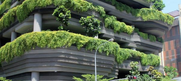


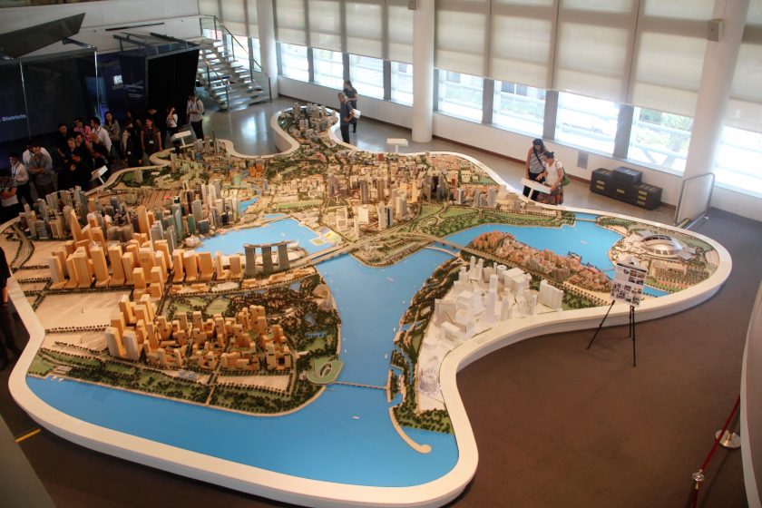
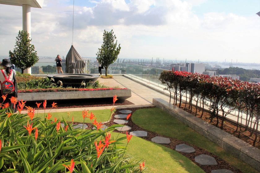
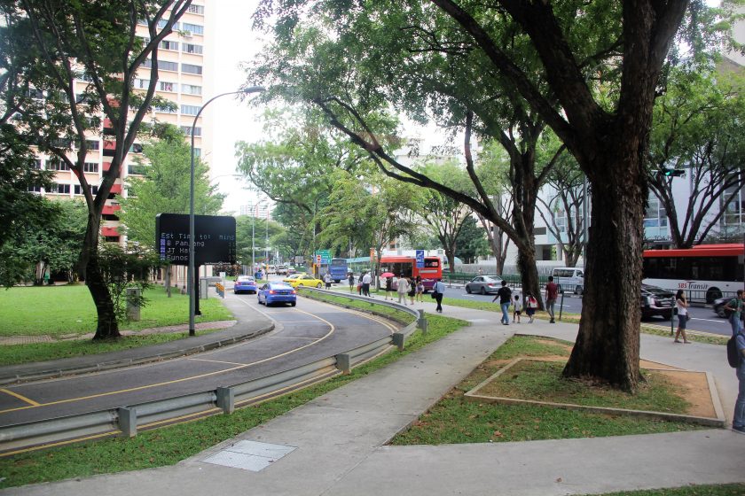
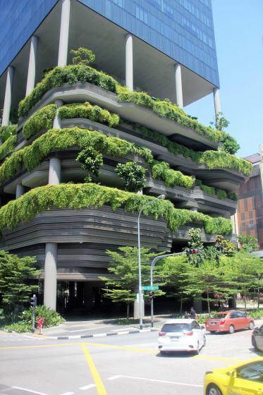
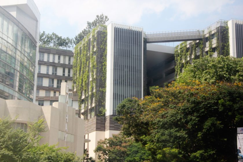
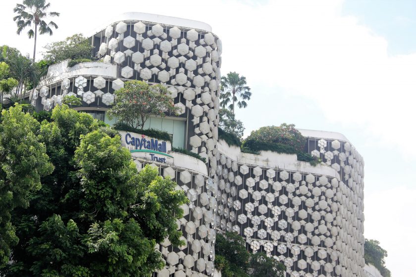

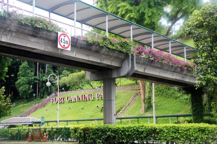
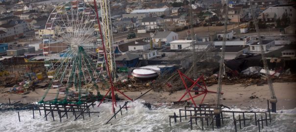
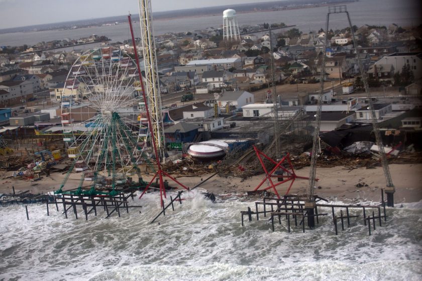
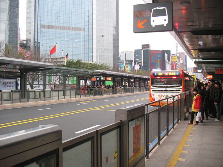

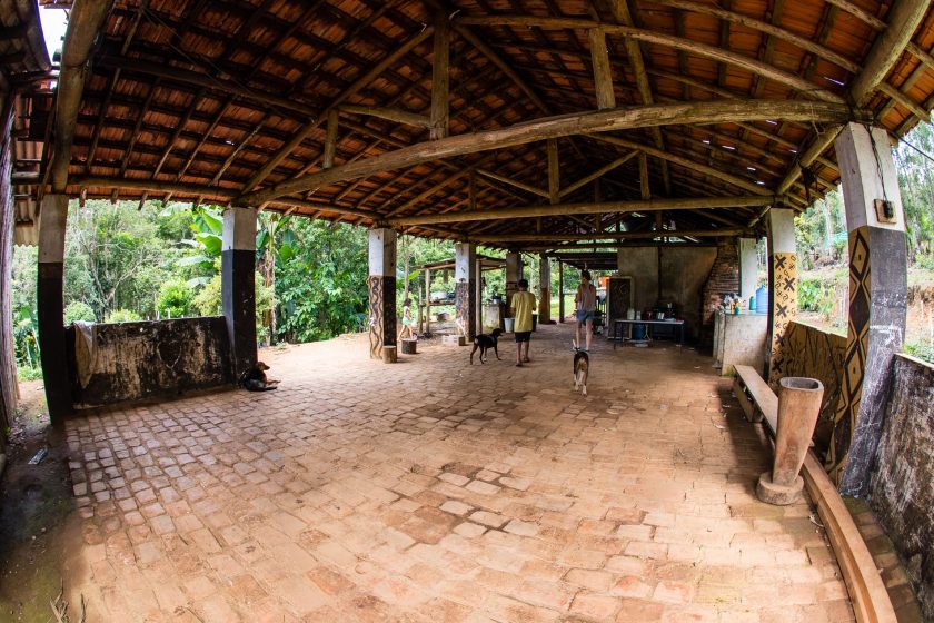
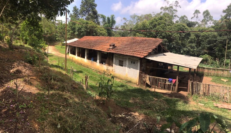
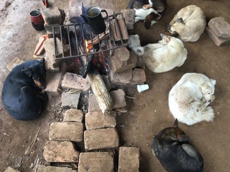
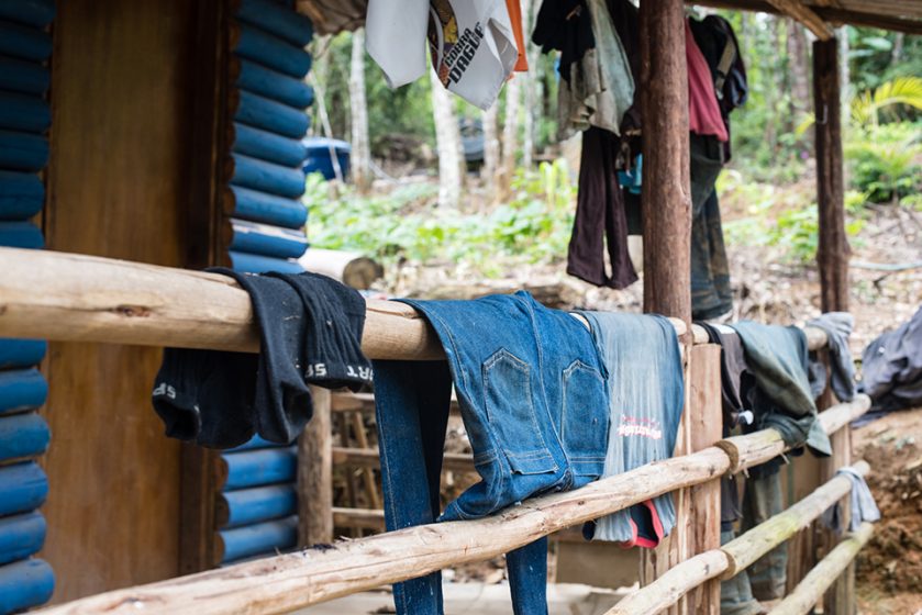
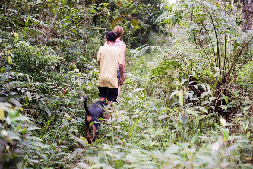
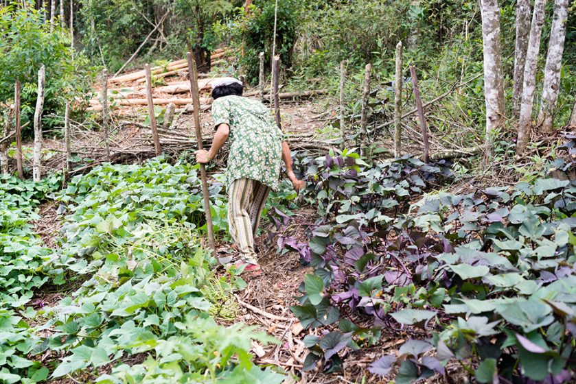


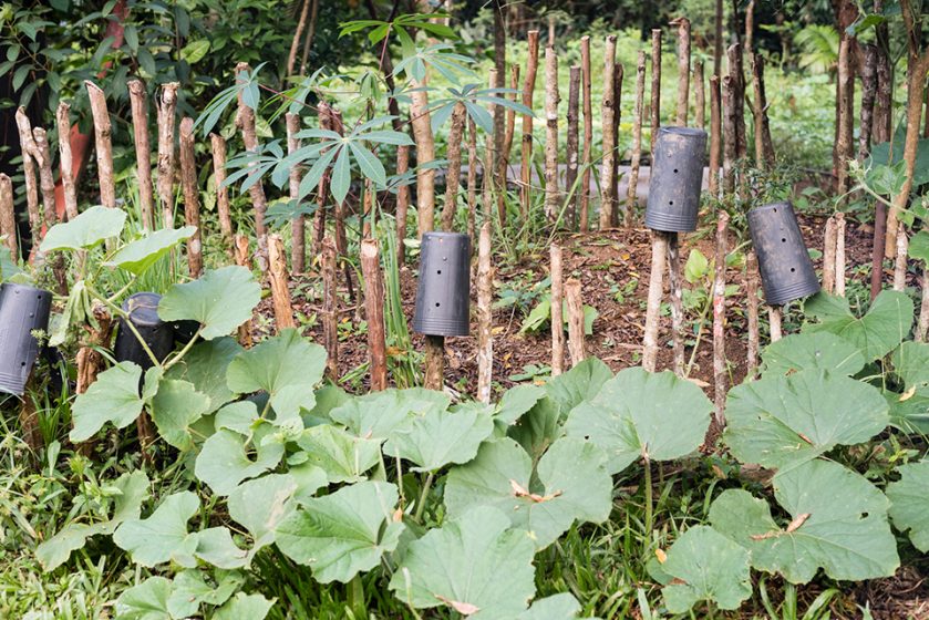
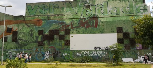
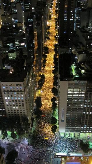
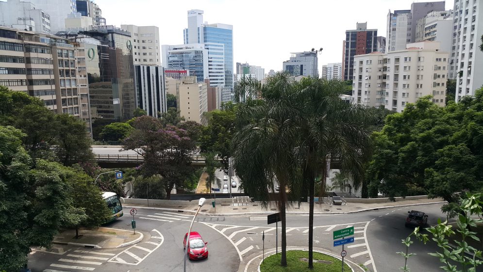
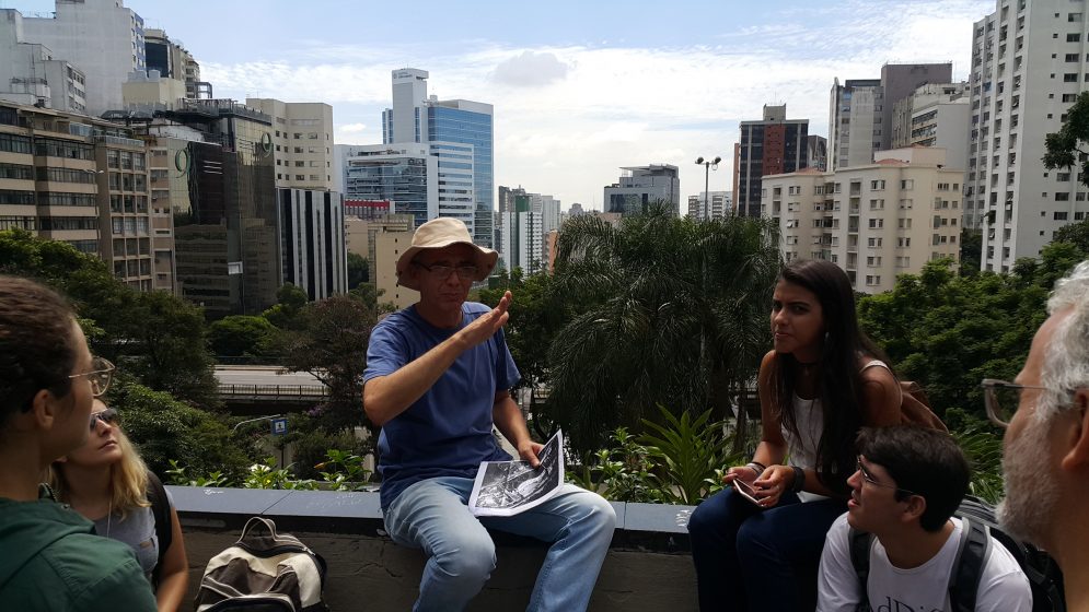
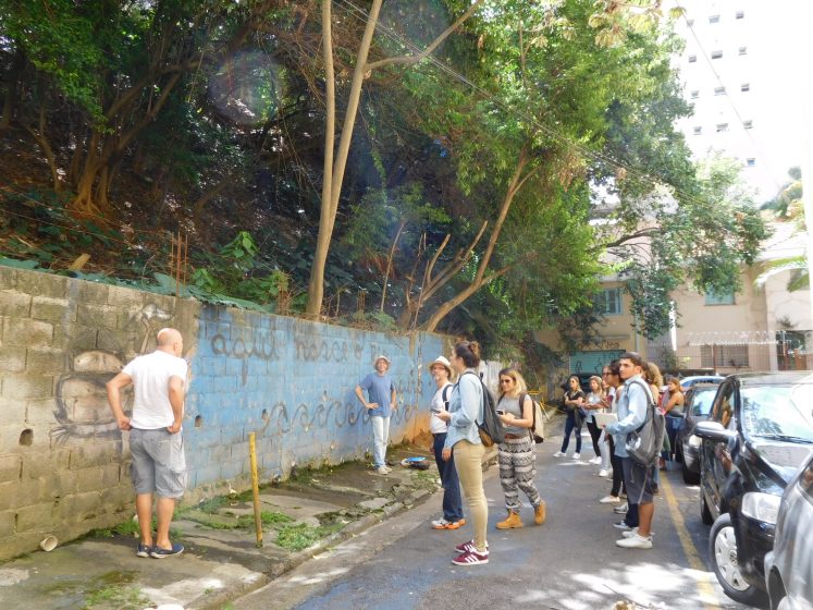
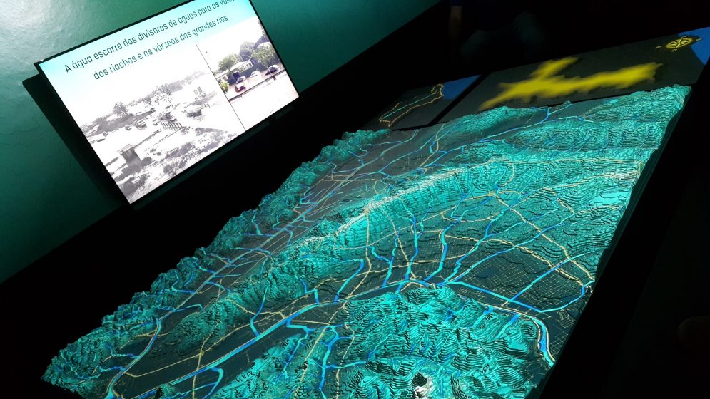
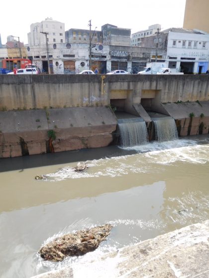
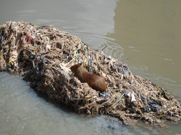
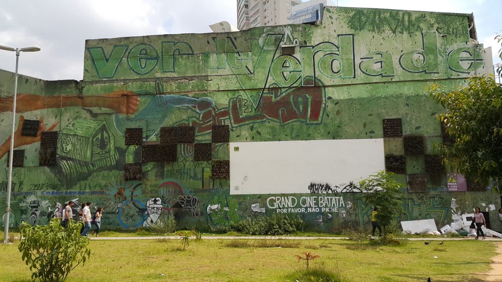
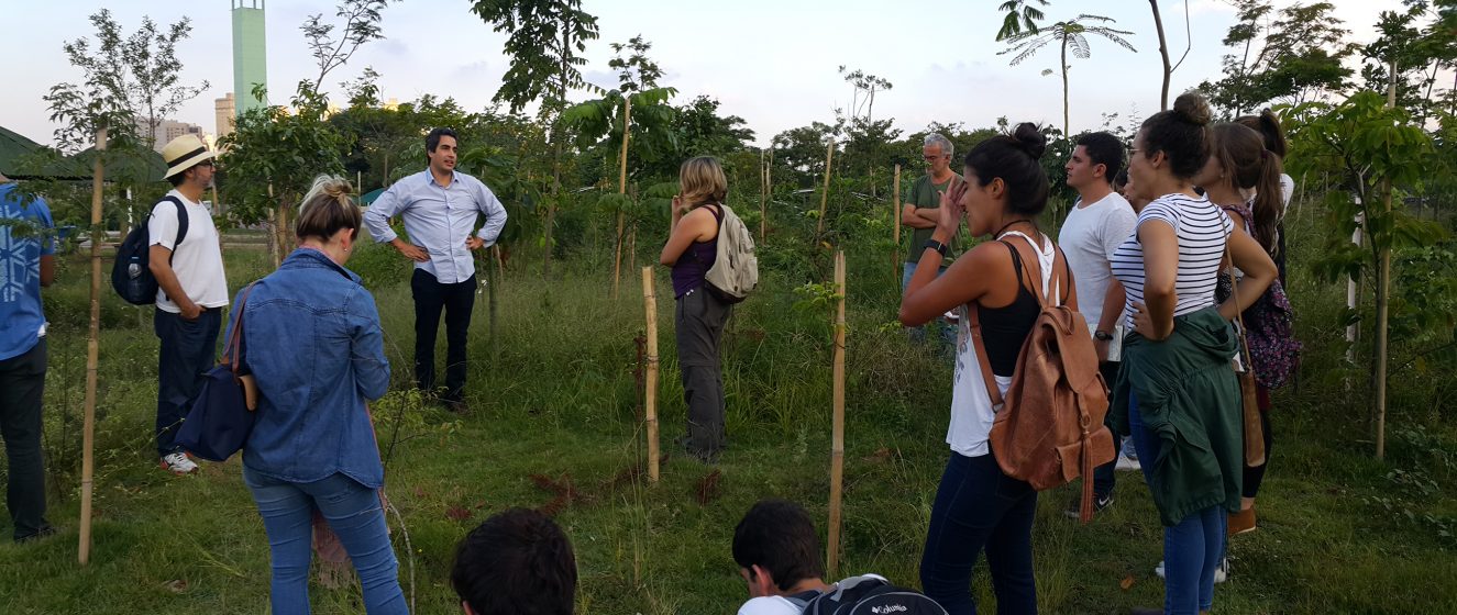
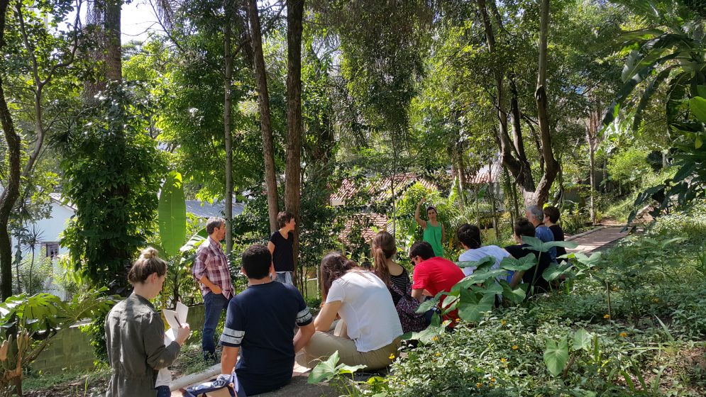
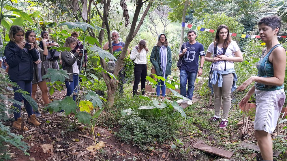
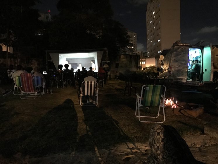
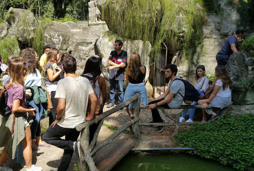
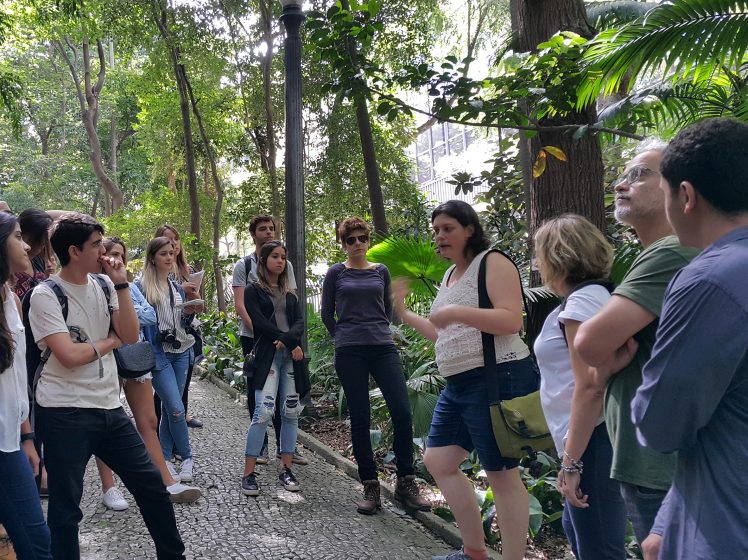
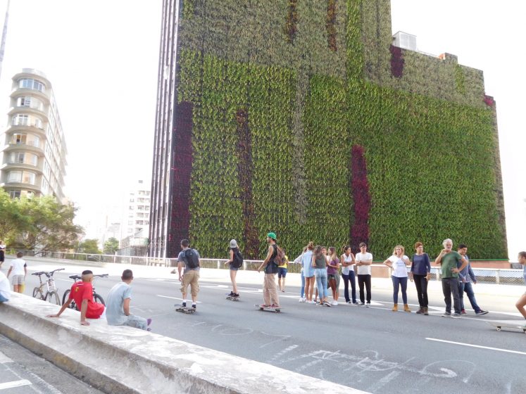
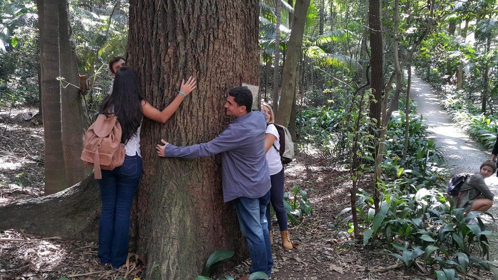
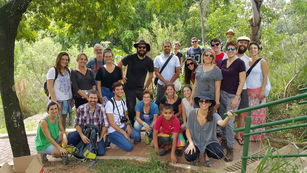
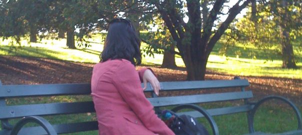
 Over the past decade, Professor Tim Beatley and his network of researchers and affiliates have continued to advance the biophilic design concept (previously applied by others to, for example, buildings, institutions, single gardens, and other features) up to the city scale. Tim Beatley has taught at the University of Virginia for over 30 years. He has had a long-term interest in the key issues of urban sustainability, resilience, human health, and well-being; therefore, he is appropriately prepared to map out the relationship between these issues and biophilic design in theory and practice.
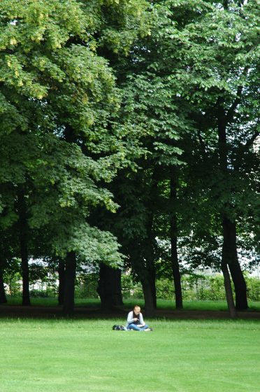
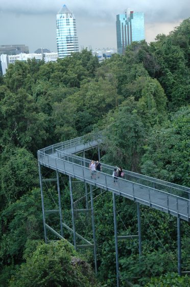

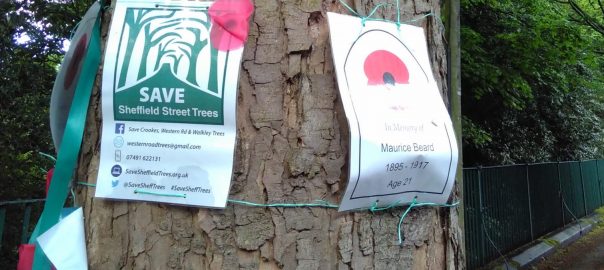
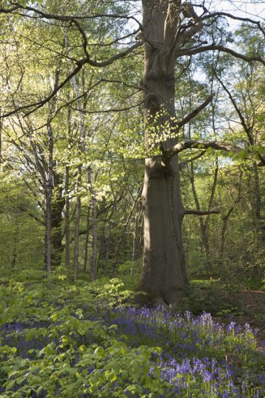
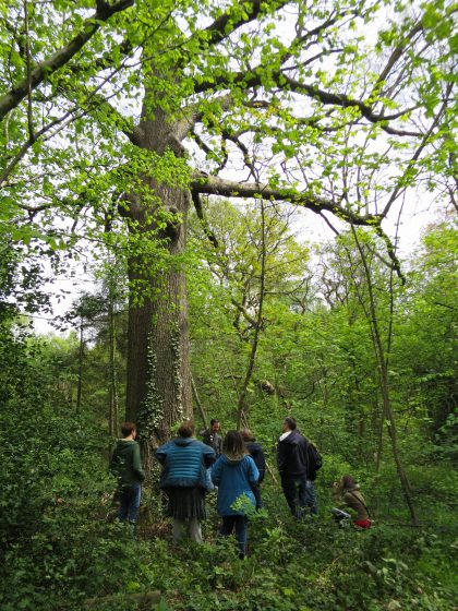
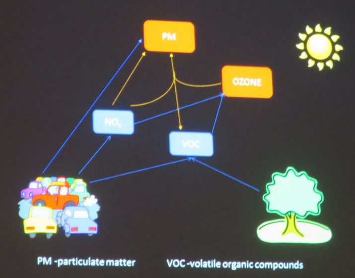
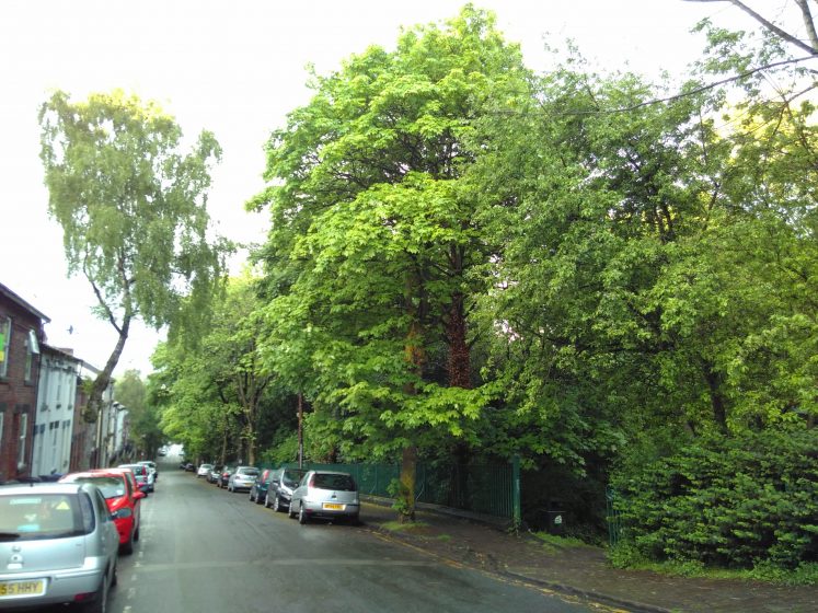
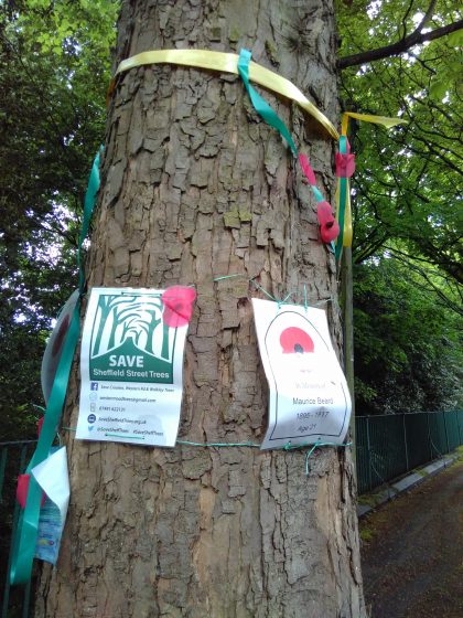
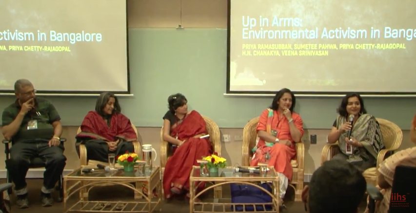 Dr. H. N. Chanakya, Chief Scientist at the Centre for Sustainable Technologies at the Indian Institute of Science in Bangalore, has a long history of involvement on research and development of decentralized energy technologies, water and wastewater, treatment and purification, management and processing of solid wastes, and energy system integration into rural and peri-urban areas. Dr. Chanakya is an advisor to several environment-focused civil society organisations and public sector agencies. He has been instrumental in ensuring a nature conservation focus at Puttanahalli (in Yelahanka) and Jakkur lakes, both in North Bangalore’s Hebbal valley. He feels that conducting science walks for children at Jakkur Lake is as important as opposing the development of a power plant in Yelahanka which could potentially destroy the viability of the entire Hebbal Valley lake system. From a sustainability standpoint, it is as important to question the larger, environmental impacts of an intervention that is meant to meet our growing energy demands as it is to empower our next generation to engage with questions of urban sustainability.
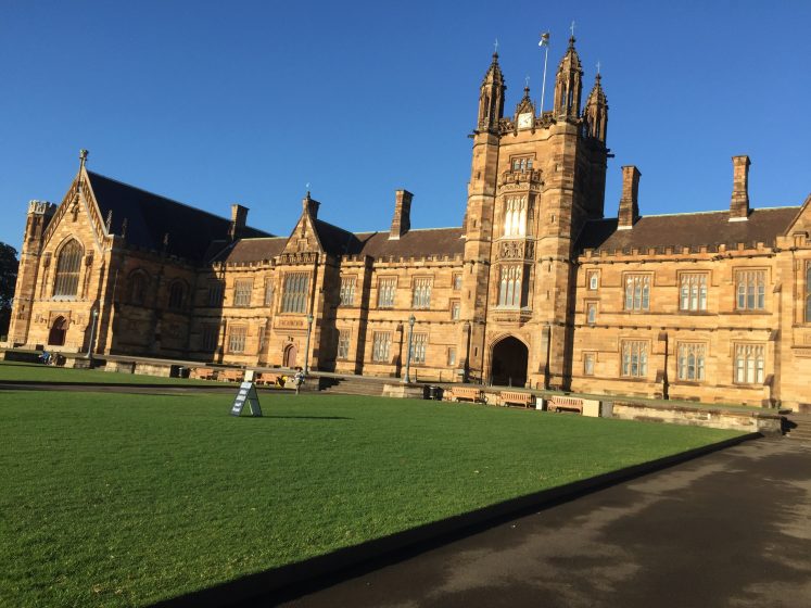
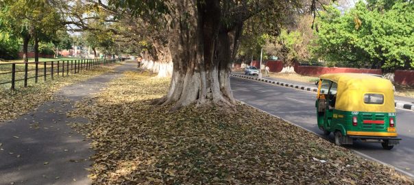
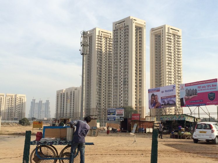
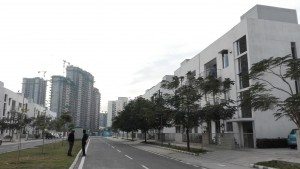
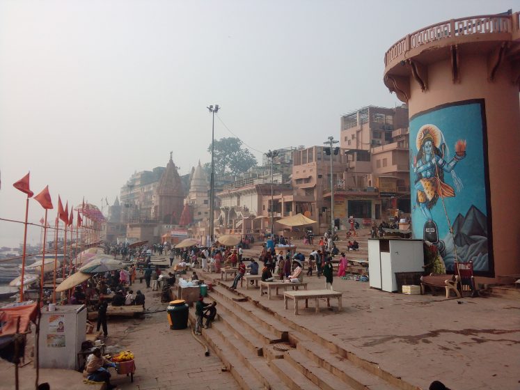
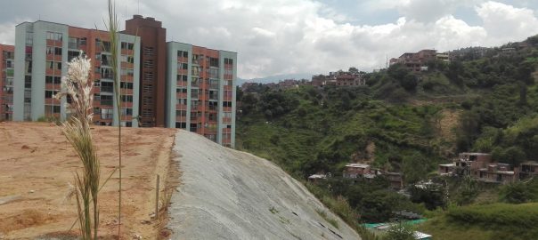
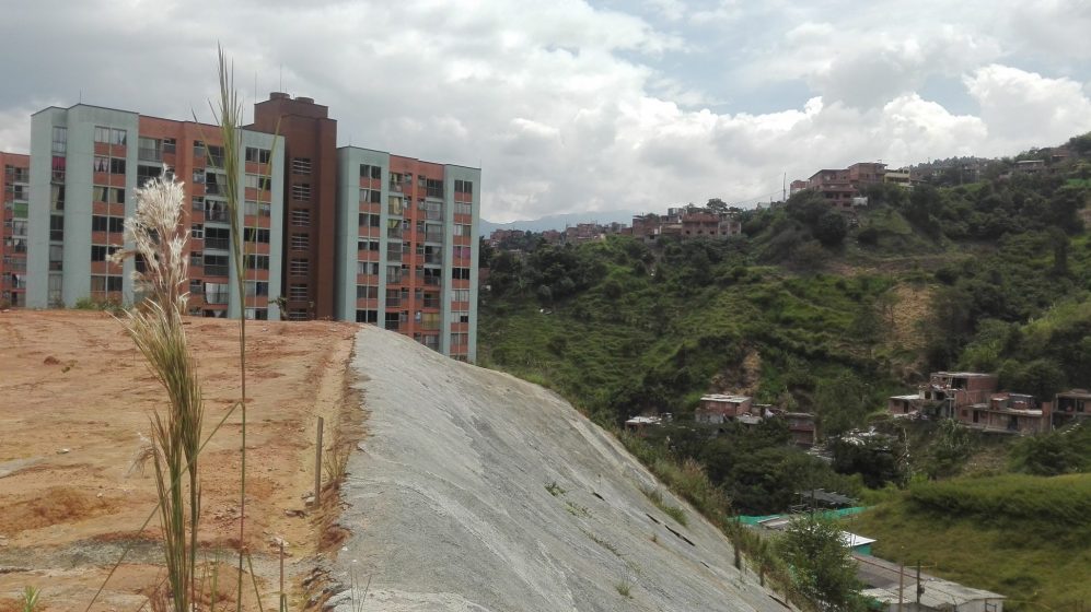
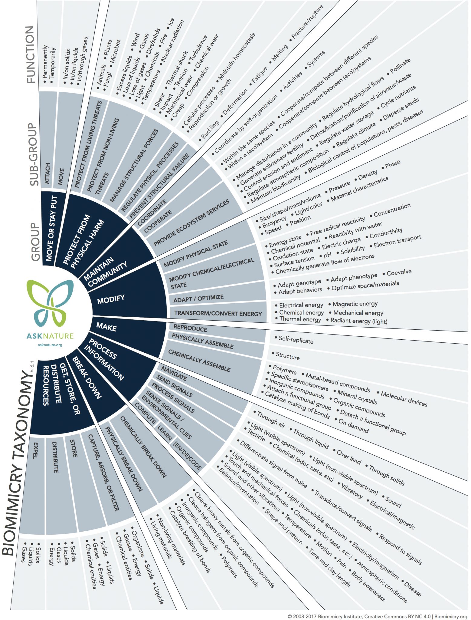
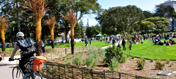

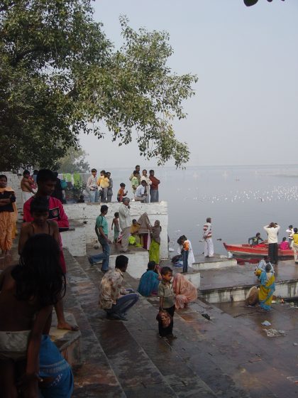

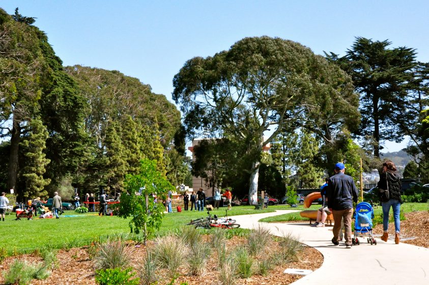
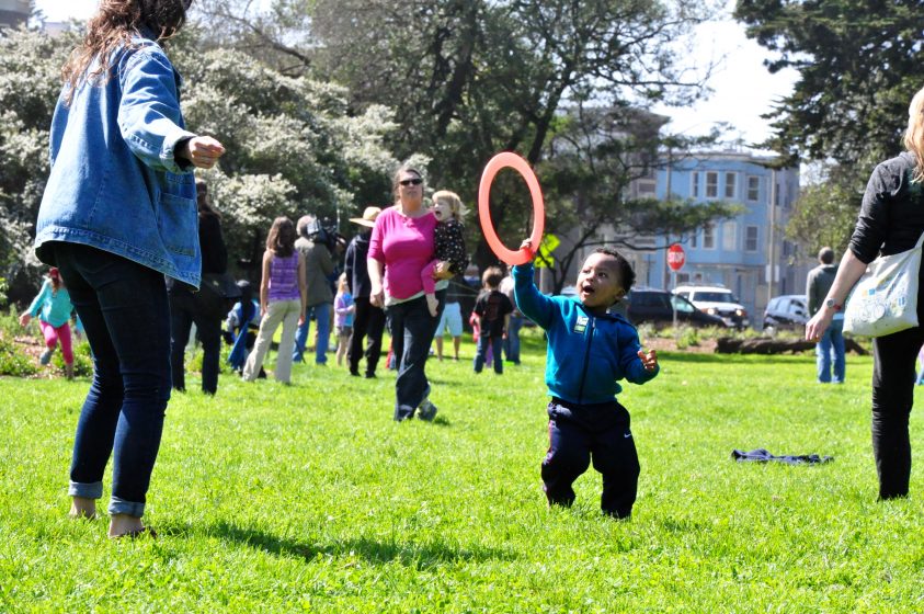
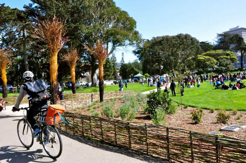
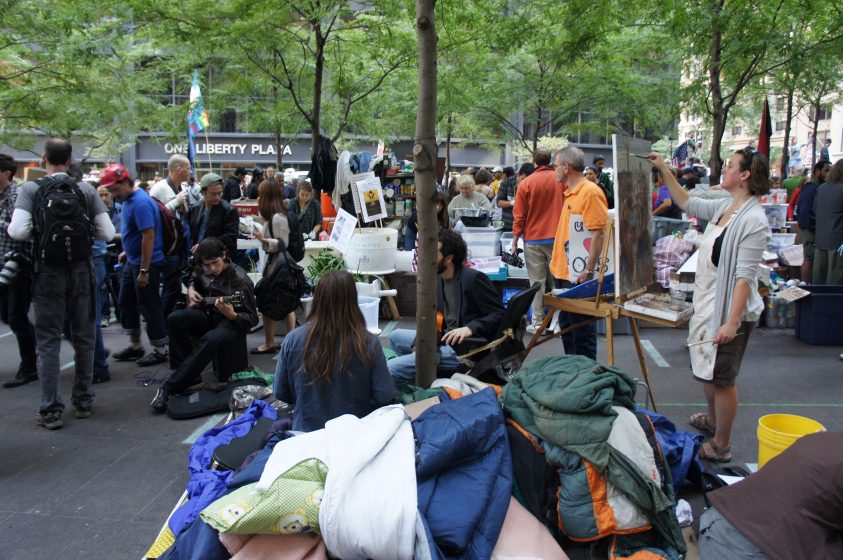

 Most pages contain some images supporting the foundational thinking of the book; these give life to the projects. Design drawings, site photographs, digital representations of site futures, and the social and ecological functions of sites and their larger contexts are frequent subjects of these images. The paper has a nice heft, supporting high quality reproduction of the images.

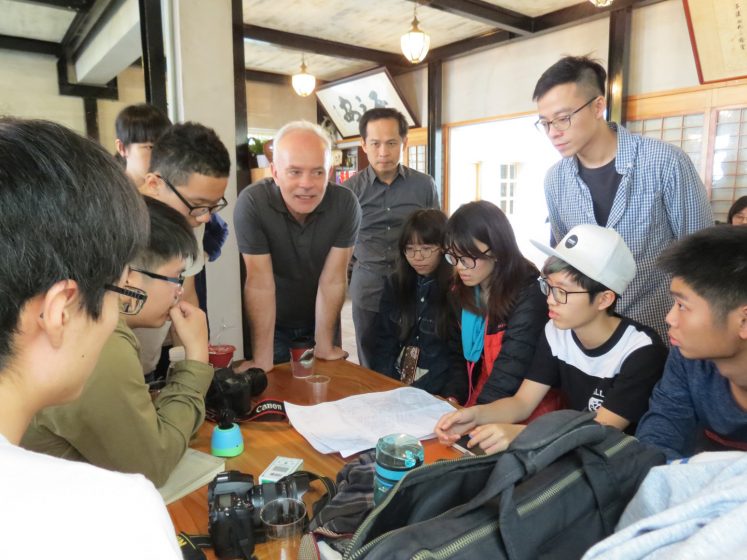
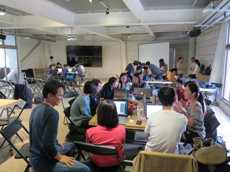
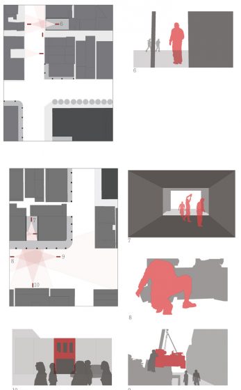
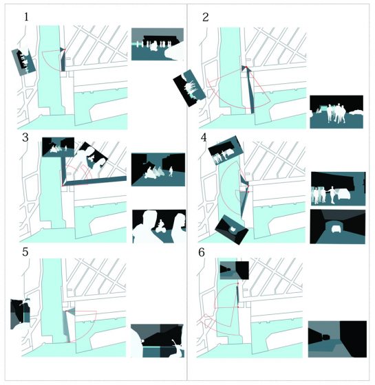
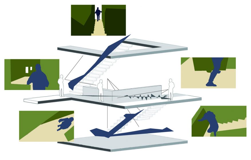
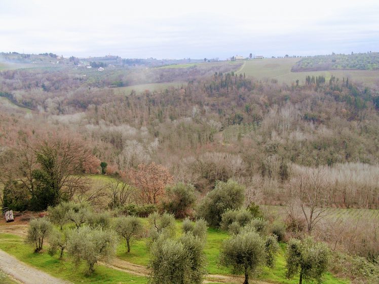
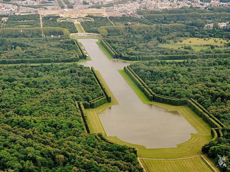

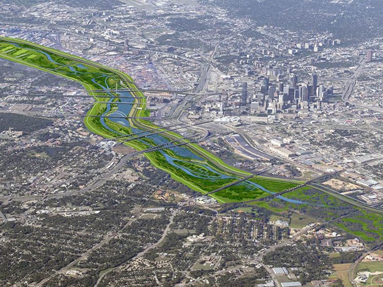
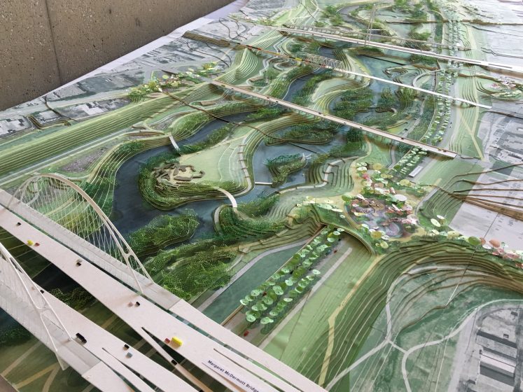
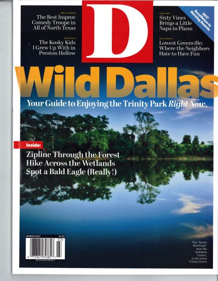
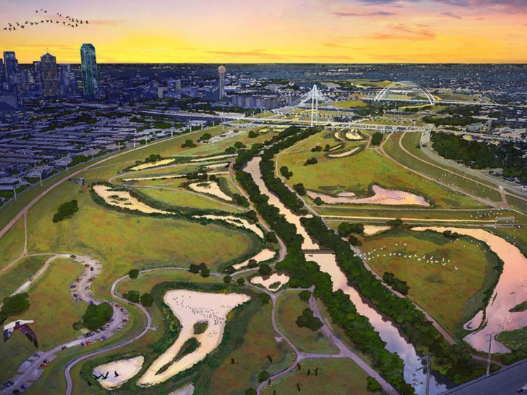
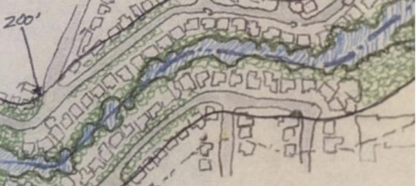
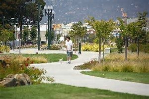
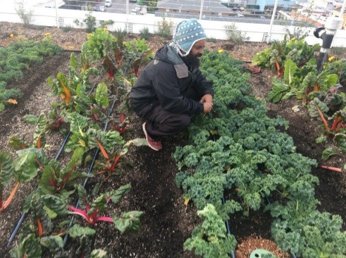
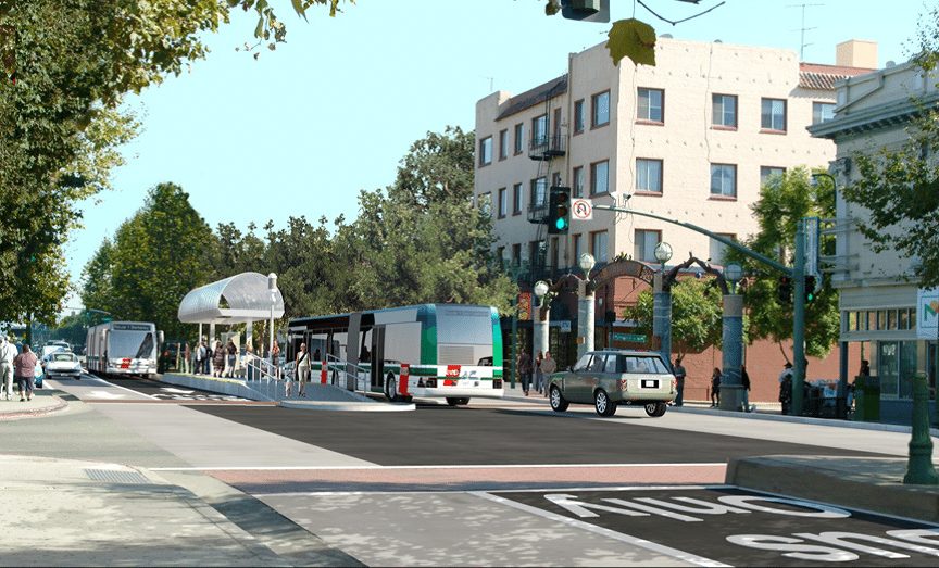
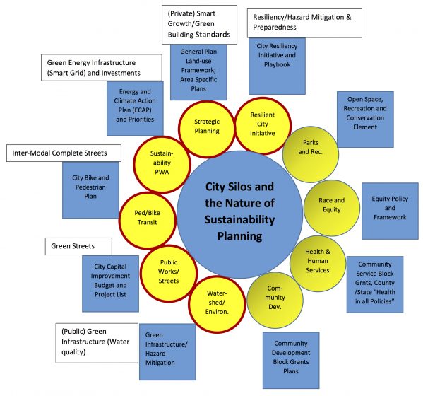
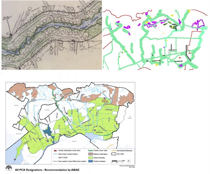
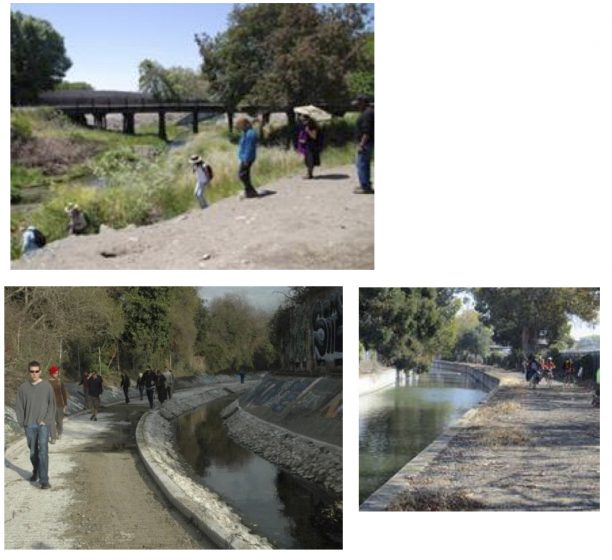
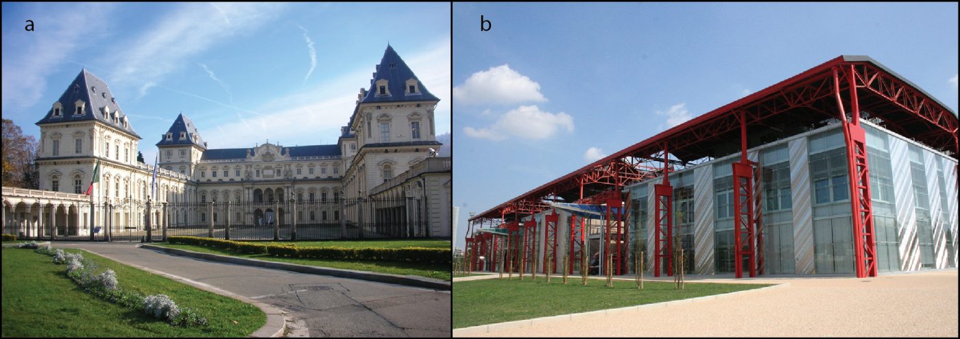
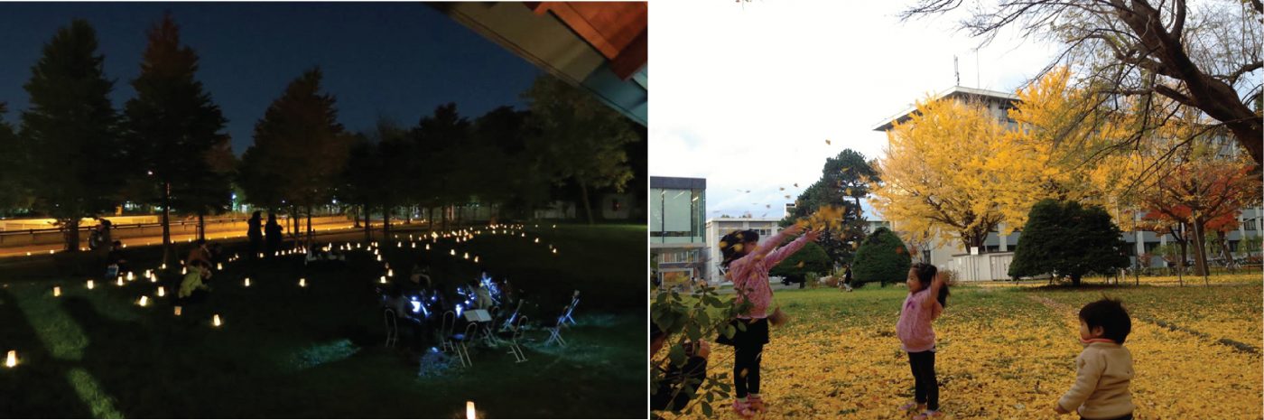


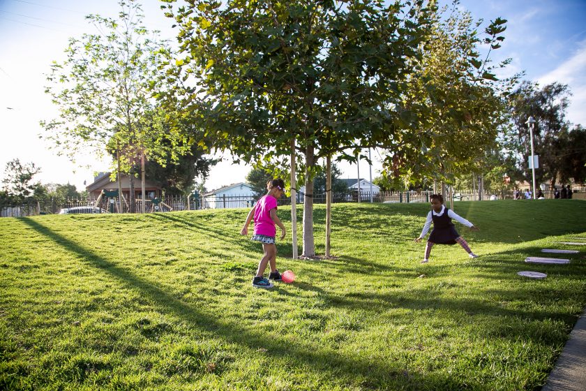

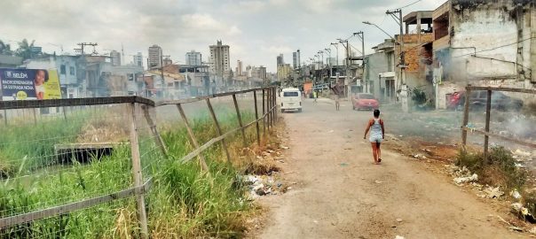
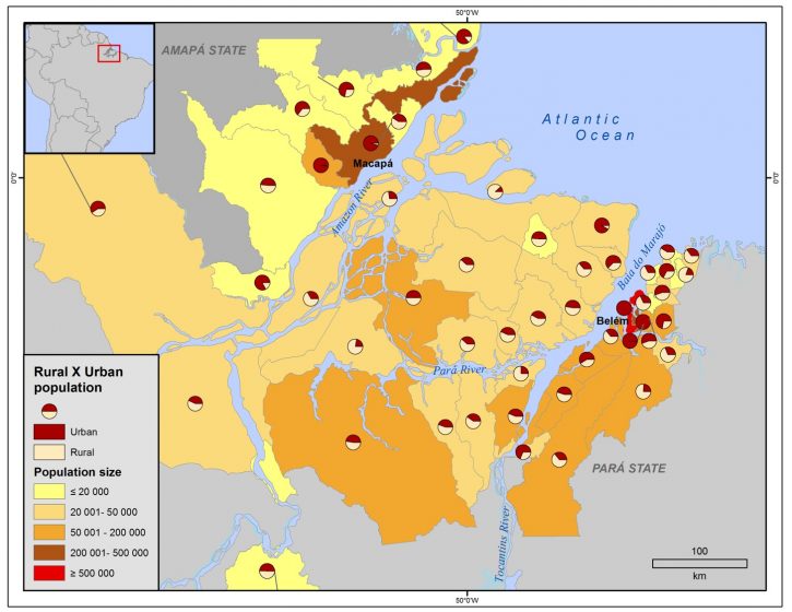
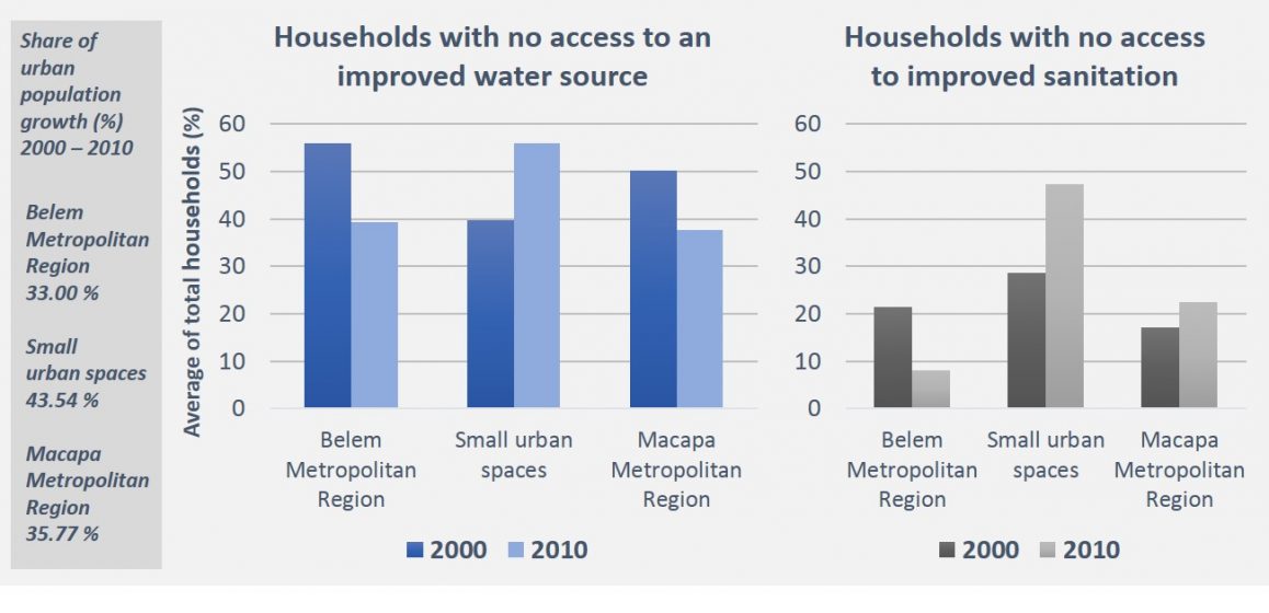
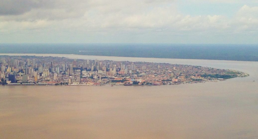
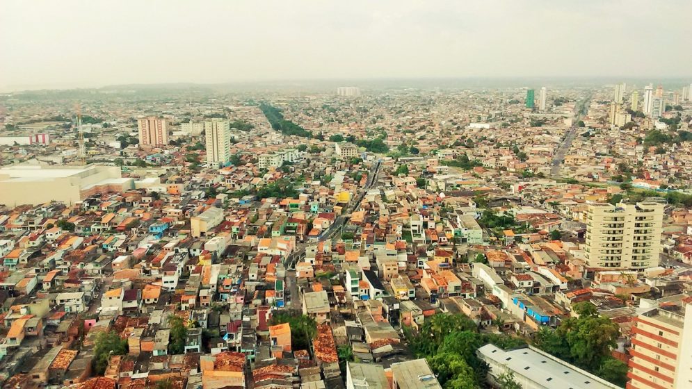
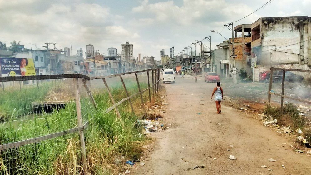
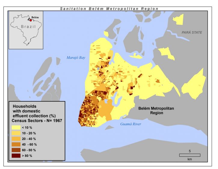
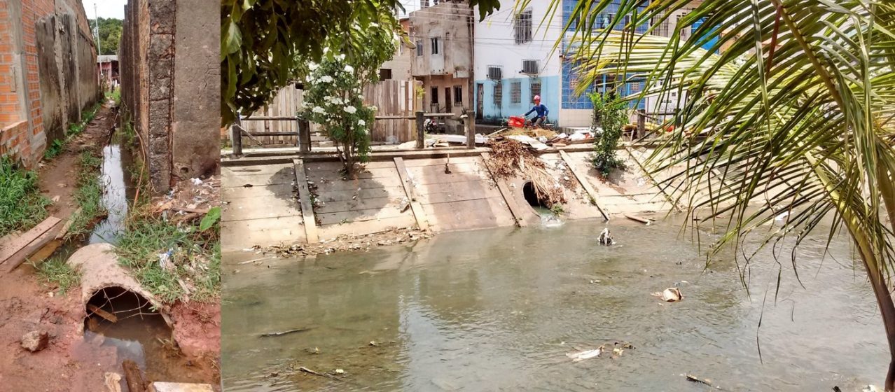
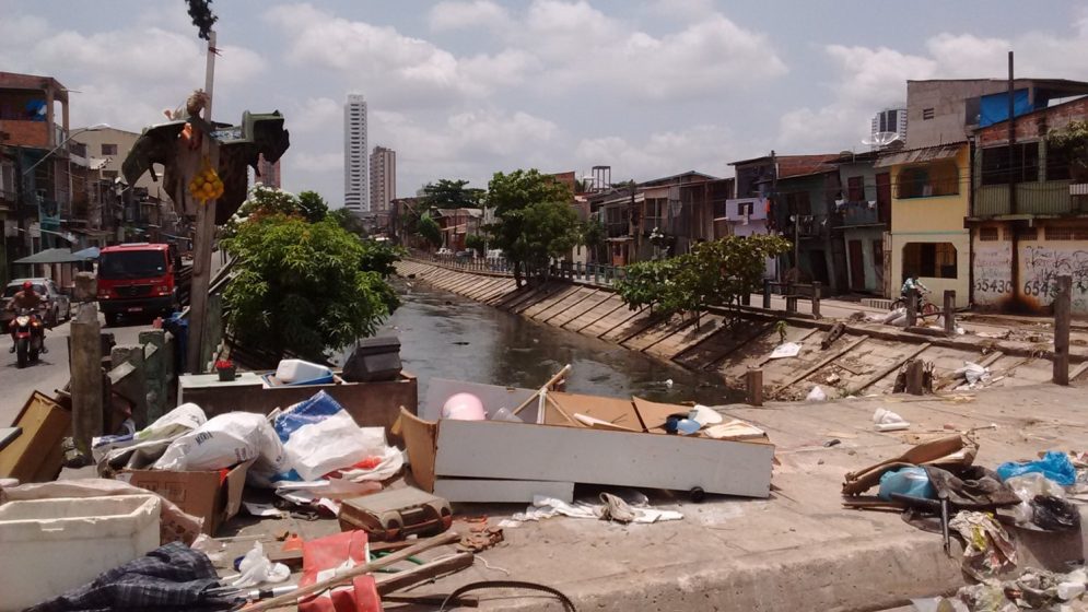
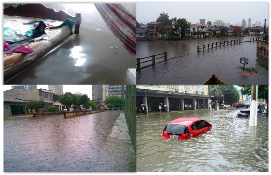
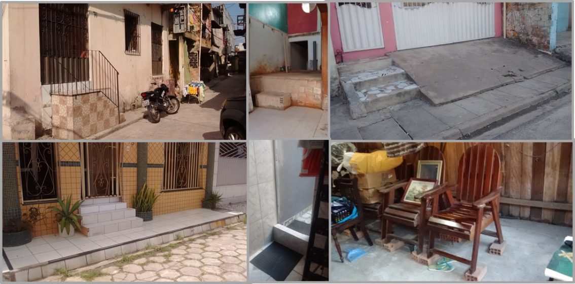
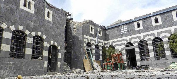
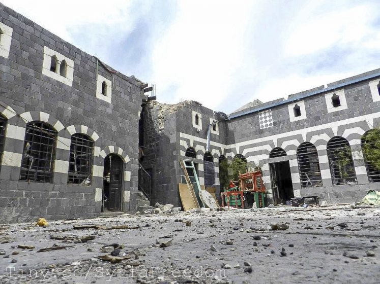
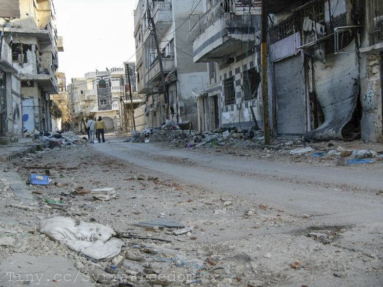
6 Comments
Join our conversation