In winter 2009, Houston Wilderness hosted an inaugural meeting of what would become the Metropolitan Greenspace Alliance. Today the Alliance is a national coalition of coalitions working in ecologically, culturally, and economically diverse communities across the US. Alliance members represent Portland, Oregon; Seattle, the San Francisco Bay Area, Los Angeles, Houston, Chicago, Milwaukee, Cleveland, Nashville, St. Louis, Kansas City, Denver, and Baltimore.
Over 80% of the population in the United States now lives within urban megaregions, and this trend of rising urbanization is similar in countries around the world. Amidst significant investments in “grey” infrastructure to support growing metropolitan regions, conserving nature is increasingly challenging. And, more often than not, the most significant challenge is protecting and restoring natural systems that provide clean air and water and other ecosystem services that nature provides us.
Metropolitan regions that effectively incorporate greenspace and Green Infrastructure into their urban fabric share several things in common, often including ample parks and natural areas, both in quantity and equitable distribution; innovative stormwater management; climate adaptation strategies; public transportation and recreational trail networks; and sustainable food production and delivery systems. Whether it’s Vancouver, Reykjavík, Malmö, Portland, or any number of cities around the world that are “green” or in the process of “greening,” the collaboration among governments, nonprofits, scientists, natural resource agencies, and urban planners is essential to transform a place from grey to a green, living, interconnected network of systems that benefit humans and the unique urban ecosystem they inhabit.
The following case study from Metropolitan Greenspace Alliance member Amigos de los Rios describes an almost century-long process of Los Angeles’ greening that should inspire other cities and metropolitan regions toward a greener future. The struggles faced and overcome are not unique to Los Angeles. This story is a glimpse into how universal urban sprawl and development are and the importance of incorporating Green Infrastructure principles into local and regional urban design.
Metropolitan Greenspace Planning in Los Angeles and Beyond
William L. Allen, III, The Conservation Fund
Claire Robinson, Amigos de los Rios
Green Infrastructure Visions for Metropolitan Greenspace Alliances. Credit: MGA
In the late 1920s, the Los Angeles Chamber of Commerce commissioned two highly-regarded landscape architecture firms to create a vision for the region. Leaders became deeply concerned that traffic, air pollution, overpopulation and a lack of access to parks would harm the area’s future.
Two firms—Olmsted Brothers and Harland Bartholomew & Associates—crafted a prescient plan focused on addressing a scarcity of playgrounds and parks, as well as burgeoning traffic, air pollution and a population rapidly swelling to over two million.
Original Plan Graphic, Credit: Olmsted-Bartholomew Associates
The plan wasn’t adopted, and today these challenges have grown exponentially as the county’s population surges beyond 10 million and the natural landscape is dramatically altered to meet the needs of more residents.
Los Angeles County spans 4,000 square miles and is home to 88 cities and more than 10 million people. Instead of capitalizing on its unique assets of ethnic diversity and picturesque geography, though, the county is cut off from itself. Between mountains and forests to the north and east, and beaches to the west, infrastructure is grey, freeways are gridlocked and quality of life is uneven.
There’s no other place in the United States quite like it; Los Angeles County on its own would be the eighth most populous state in the U.S. and the 88th most populous country in the world. The valley holds nearly one-quarter of California’s population and is one of the most ethnically diverse places in the nation. Its geology is unusual too. Framed by mountains and forests to the north and east, and beaches and oceans to the west, its interior is dominated by grey. Large-scale infrastructure supports a vast population, resplendent with gridlocked freeways, bustling ports, paved riverbeds, and concrete irrigation channels. In the city of Los Angeles alone, average life expectancy differs by 12 years from the lowest-income portion to the highest. Countywide, only 36 percent of children live within one-quarter mile of a park, compared to 85 percent in San Francisco.
The nonprofit Amigos de los Rios decided this could not go on. “We are in the middle of a quiet crisis,” said Claire Robinson, president of the Amigos de los Rios. “We’re not addressing public health, quality of life, and our relationship to nature.” As renowned urban planning writer Jane Jacobs once wrote: “Cities have the capability of providing something for everybody, only because, and only when, they are created by everybody.”
In 2005, Amigos began planning and designing a 17-mile loop of parks and greenways (often underutilized spaces owned by public agencies) along the Río Hondo and San Gabriel Rivers on the east side of Los Angeles that would connect nearly 500,000 residents. The plan’s parks and greenways provide desperately needed recreational areas for communities suffering from extreme density and urban decay, and the associated social and health issues.
The Emerald Necklace of east Los Angeles County. Credit: Amigos de los Rios
As part of this effort, Amigos has helped convene the Emerald Necklace Coalition, comprised of 62 member agencies with a connection to East Los Angeles. All Emerald Necklace Coalition members have signed the Emerald Necklace Accord, a legal document that pledges its signatories to work collaboratively to preserve and restore the Los Angeles and San Gabriel watersheds and their rivers and tributaries for recreational open space, native habitat restoration, conservation, and education.
In 2008, the vision was expanded to help unify a vast region of Southern California, from the desert through the San Gabriel Mountains to the Pacific Ocean, by linking more than 1,500 acres of parks and open spaces along an interconnected greenway around the Río Hondo, San Gabriel, and the lower Los Angeles Rivers.
Initial Conceptual Map of Expanded Vision Plan. Credit: Amigos de los Rios
In 2012, Amigos de los Rios commissioned The Conservation Fund to take a fresh look at how to design and use Green Infrastructure to reconnect people and wildlife with the county’s lands and waters. Over the course of 18 months, the Fund worked with Amigos to convene focus groups, synthesize existing plans, analyze mapping data, and evaluate implementation strategies across the county.
The Fund found that despite the significant alteration of the natural landscape over the past century, many of the core recommendations of the Olmsted-Bartholomew Plan are as relevant today as they were in 1930.
The Emerald Necklace Forest to Ocean Expanded Vision plan, released just a few months ago, has created a contemporary vision—calling for a strategically managed and interconnected network of parks, rivers and lands, designed to re-create Los Angeles County as a better place to live, work and play for decades to come. Amigos and The Conservation Fund hope this ambitious expanded vision is a blueprint to unite the county. Rather than starting from scratch, it integrates common elements from existing plans and outlines specific implementation strategies to create a network of parks and public open spaces connected by greenways and trails.
Expanded Vision Plan Map. Credit: The Conservation Fund, Amigos de los Rios, Hawkins Partners
The plan focuses on eight mutually-reinforcing goals under a common vision. In addition to increasing access to a network of equitably distributed transportation—walking, biking and riding trails—it recommends the creation of functional and multi-purpose natural (“green”) and built (“grey”) spaces. The plan addresses the region’s critical water supply, identifying key recommendations to improve how this vital resource is managed to protect local water quality, and assure ample water supply.
The plan prepares communities to be resilient to inevitable effects of climate change, which can be fostered by a community-wide culture that embraces the benefits of conservation, restoration and recreation. Regional wildlife and natural area “anchors” will be enhanced and restored. Finally, the Plan aims for a robust and durable economy where jobs are created that support the multiple benefits of green infrastructure.
Despite the very clear collaborative priorities and strategies outlined in the plan, the key to lasting success will be if the plan is able to instill “a fierce sense of urgency” among the many partners in Los Angeles County that are needed to make this a reality. The plan encourages cities, counties, school districts, water agencies, public health and environmental groups to put a human face to infrastructure and accelerate improvements now for the benefit of Los Angeles County residents and its collective health.
It has been more than 80 years in the making, and it’s the second—and perhaps last—chance to get it right. It will take 20 to 30 years, cost between $200 million and $1 billion, and involve coordination and funding from the region’s 88 cities, private foundations, public bond issues, and public agencies like Caltrans, the US Army Corps of Engineers, Southern California Edison, and the LA Department of Water and Power. “There’s a full awareness that this would be a slog to get a lot of this done,” notes Will Allen, plan lead for the Fund. “There’s a lot of money out there. A lot is convincing people to invest in things that are multiple benefit.”
Expanded Vision Plan Map. Credit: The Conservation Fund
The City of Los Angeles is on board. Los Angeles Mayor Eric Garcetti said: “The Emerald Necklace Expanded Vision Plan is a visionary framework to link important L.A. area watersheds and the communities they touch. Much in the way that our vision for the L.A. River encompasses its entire 51-mile length, both inside and outside our city limits, the Expanded Vision takes a regional approach to providing much needed open space in some of our most park poor neighborhoods.”
The Emerald Necklace Forest to Ocean Expanded Vision Plan for Los Angeles County, California is available for download here.
William L. Allen, III, Chapel Hill Claire Robinson, Los Angeles Mike Houck, Portland
Claire founded and serves as Managing Director of Amigos de los Rios. Her approach has led to Amigos de los Rios unique success in creating beautifully designed, culturally relevant green infrastructure in open spaces.
Mike Houck is a founding member of The Nature of Cities and is currently a TNOC board member. He is The Urban Naturalist for the Urban Greenspaces Institute (www.urbangreenspaces.org), on the board of The Intertwine Alliance and is a member of the City of Portland’s Planning and Sustainability Commission.
Regularly, we feature a Global Roundtable in which a group of people respond to a specific question in The Nature of Cities.
show/hide list of writers
Hover over a name to see an excerpt of their response…click on the name to see their full response.
Jennifer Adams, New York Collaborative/participatory art is an expression of lived experience and cannot be described separately from the urban green spaces in which it is produced.
Pippin Anderson, Cape Town Nature-related graffiti checks the boxes of art that supports urban nature. We need more though, and to this end we must nurture the artists who produce it and foster a culture of dissidence and provocation with respect to nature in our cities.
Marielle Anzelone, New York PopUp Forest: Times Square will give visitors an immersive natural area experience in the most iconically un-natural place on the planet. We will transform a public plaza in Times Square into a large-scale temporary nature installation.
Stephanie Britton, Byron Bay Trends towards collaborative work where art and science intersect can open up startling new possibilities for artists to influence the thinking of the gatekeepers of public art.
Pauline Bullen, Harare In Harare, Zimbabwe where I have been living for the past year, I have strolled through and driven past community flower, art and sculpture gardens and have had the pleasure of observing much that is astonishingly beautiful
Tim Collins, Glasgow I would like to ask the reader to entertain the idea that urban nature has robust experiential value and can have eco-system authenticity but it primarily serves as a cultural ecology. Its power emerges in dialogue with images and media, narratives, scientific characterization and actual experience with exurban nature.
Emiio Fantin, Milan Artists working in urban public spaces, or in natural contexts, have an innately different approach from those work in the solitude of private studios. Artists working in public spaces must deal with an array of diverse and uncontrolled quantities – with the agency of people, environment, soil, pollution, the weather and so on.
Lloyd Godman, Melbourne By working with plants as a medium and utilizing existing architectural infrastructure, artists can effect change in urban nature and green spaces
Julie Goodness, Stockholm How can we spur our fellow city residents to make their own creative expressions and entreaties about their hopes for the city? One interesting possibility is participatory art.
Noel Hefele, New York Art expands the dialogue between nature and culture from which the world is perceived and understood by gathering senses of alternate value and aesthetic appreciation.
Todd Lester, San Paolo An restaurant-artist collabortation in San Paolo to create community.
Patrick Lydon, San Jose & Seoul I believe it is critically important to also recognize—especially if we are to be mindful of nature and ecological working habits— that physical pieces needn’t always be case and point for urban art.
Elliott Maltby, New York Knowledge + awareness are not sufficient catalysts for change, art must embrace collaboration, embodied participation + the mysterious
Mary Miss, New York Our aim is to advance public understanding of the natural systems and infrastructure that support life in the city. Its strategies are grounded in place-based experience that make sustainability personal, visceral, tangible, and encourages citizen and governmental action.
Lorenza Perelli, Chicago These interdisciplinary projects relate urban planning, art and design to nature. They all support alternative mode of living through an innovative reuse of the public spaces, fostering a new model of participatory practices, such as self organized planning realized by citizens, artists and designers for the common goods.
Stephanie Radok, Adelaide Art is always potentially a bearer of the conscious recognition of sharing the world with other life forms, animate and inanimate, past and present.
Lisa Terreni, Wellington Exhibitions create opportunities for reflection, ongoing debate, and generate ideas for change. Environmental art interventions are often uplifting and inspiring.
Shawn Van Sluys, Guelph The power of sound lies in its potential for displacing the ordinary—its immediacy in our consciousness and its gradual lending of coherence to our understanding of place.
Jennifer D. Adams is an associate professor of science education at Brooklyn College and The Graduate Center, CUNY. Her research focuses on STEM teaching and learning in informal science contexts including museums, National Parks and everyday settings.
Jennifer Adams
How can art be better catalysts to raise awareness, support and momentum for urban nature and green spaces? This was a hard question for me to address because of the way art, urban nature and green space are positioned vis-à-vis each other as if they are separate, however both subjugated to some dominant discourse of the role of art and nature in urban contexts. The question seems to position art and nature at the margins of urban life and one is needed to raise the awareness of the other. However, as bell hooks notes, agency is at the margins because it is here that a discourse that is created that is counter to the dominant discourses of power and causes us to rethink the kinds of relationships that we have not only with each other but also with the places in which we enact our daily lives. Urban nature and green spaces are these places. Art happens in these places. These places exist and are in our awareness, however this awareness may not look like what the dominant discourse of environmental awareness dictates.
Embodiment of art and nature
Sunday morning, a circle of grain marks a sacred space. A gentle pulse builds to a strong beat. The pulsing of the Earth resonates in the rhythm of drummers’ hands on skin rising up and filling the space between the trees. Dancing feet pick up dust as moving bodies, twirl and jump, marking time with the rhythms of the Earth. In the sacred circle, “places, memory, experience, and identity are woven together over time.” In this space, time collides, moves and stands still. The expression of it all is in a breath, a breath that circulates carbon and oxygen and connects living and non-living beings.
The art that I describe here is a participatory art that happens in an urban green space. It is a weekly drumming circle that draws dancers, drummers and appreciators into the space to create a collaborative and fluid expression of art. The location of the circle, in a public green space, is essential to the production and is a part of the creation of the art. This art cannot be described separately from the space in which it occurs or the place it creates. “Dancing bodies accumulate spirit, display power and enact as well as disseminate knowledge,” notes dance scholar Yvonne Daniels. These dancing and drumming bodies create a sacred space, in an urban green space, that connects them to the present community and to communities past and future, transcending the time-space continuum. Mos Def describes African art as functional art, “it serves a purpose. It’s not a dormant. It’s not a means to collect the largest cheering section. It should be healing, a source a joy. Spreading positive vibrations.” For Mos Def and many others, art is not a separate product from the culture that produces it but rather it is intertwined with the daily lived experiences of people who come together and participate in its production. It is also connected to the spaces in which it is produced, in fact art, as a process, creates places and some of these places are what we are calling urban green space and urban nature in this roundtable.
Art is how people connect with green spaces. We sometimes take for granted those participatory forms of art—drumming, dancing, singing, cultural rituals—of which green spaces are an important context for them to occur.
I included a vignette of Drummer’s Grove in Prospect Park because it has been a part of my lived experience as a life-long resident of Brooklyn and it is an example of collectively produced art that represents embodied culture and identity and is not separate from the green space in which it is both produced and enacted. Although West African drums and drumming style dominate the circle, you can also find drums that are representative of indigenous people and other diasporas that find themselves connected to this park—Native American, Middle Eastern, Indian and Celtic to name a few. Thus the art is representative of the urban green space in which it is produced and belongs to anyone who visits the sacred circle.
Art reflects who we are and our relationships to place
As a scholar who is interested in understanding the different relationships people form with places and the relationship to identity, I do not view green space and nature as separate from urban life. It sets up a false human/nature dichotomy and positions urban life as something unnatural. It forces us to use language around raising awareness, support and momentum without asking from whose perspective are we speaking; in other words what does this awareness look like in action? Is this along the lines of the dominant discourse of pro-environmental behaviors and preservation of nature (as if it were something to be viewed, like from behind glass and not to be engaged with)? From the perspective of art, is this only the art that is sanctioned, sponsored, commissioned to “catalyze” a particular view of the environment?
As we enter the new age of human impact, that some are calling the Anthropocene, we need to rethink our relationship to the Earth and this includes in the urban spaces that we occupy. We not only need to think about the different kinds of relationships that people have with their environment, but also the different ways that green spaces appears in urban environments—it ranges from large, manicured parks, to wildlife preserves to small patches of trees and grass that dot the sidewalks, and includes the humans and non-humans who interact with and create these range of places. All of these spaces make up the fabric of urban life. And while there may be a taken-for-grantedness towards urban “nature,” because it is all around us, just like certain art forms are all around us, maybe the awareness we need to raise is that of honoring diversity in all of the ways it is present. Urban spaces, grey or green, allow us to do this in authentic ways. Perhaps more attention to the arts as expressions our place-relationships will allow us to broaden our perspectives about the different ways we connect to our world.
Pippin Anderson, a lecturer at the University of Cape Town, is an African urban ecologist who enjoys the untidiness of cities where society and nature must thrive together.
FULL BIO
Pippin Anderson
Caracal cat Salt River, Cape Town. Photo: Pippin Anderson
Graffiti is generally an illicit or prohibited art form, which when combined with the frequently anonymous nature of graffiti, makes it inherently provocative. Graffiti is no gallery-selected piece, or municipal-funded art project, but the work of an individual who feels the need to make some sort of publically visible ‘statement’. The rationale for graffiti are numerous (see here) but true to all graffiti is that it is visible to a broad sector of the public, which, combined with its frequently provocative nature, makes it a very powerful medium.
In the City of Cape Town there is a fair plethora of nature-based graffiti with depictions of wild life, mountain-scape scenes, and commentary on conservation concerns dotted around the walls of the City. Here the need seems to be primarily a drawing-in of nature to the City, and a demand to engage in or be aware of conservation issues. The audience seems to be both the citizens as well as the authorities. There is a call for renewed engagement and energy from the people of Cape Town, and simultaneously a demand for a more accessible, integrated, available, and people-owned nature in the City. It seems to me it is just the kind of art in question here: the sort that raises awareness, support and momentum for urban nature and green spaces.
Man in Zebra costume. Woodstock, Cape Town. Photo: Pippin Anderson
The question of how to make this art form a better catalyst for urban nature is a tricky one and probably comes down to a simple promotion of more of the kind of work already underway. Support in the form of legitimization could detract from the status graffiti has as ‘unsolicited public voice’ and ‘anti-authority’. Nature-based graffiti really takes both nature and art out of the realm of the middle-class and I think this aspect of graffiti is where the power and potential lies in allowing a different voice to enter a realm, certainly in Cape Town, that is often seen as elitist.
Seoul lamp. Photo: Pippin Anderson
Perhaps what is needed is philanthropic support for those artists who work in this space. For example funded global exchange programmes, conversations between artists and ecologists, and nature-based graffiti art competitions, could all boost the scope and capacity of this community of artists. The difficulty here is that the anonymous and often transient nature of graffiti makes it unappealing to most funders who look for ‘bang for their buck’ with the kind of metrics unlikely to be found in an art work that must be anonymous, un-fettered, and might be erased overnight be vigilant anti-graffiti authorities. I think the dividends however in reaching many people are high, but not captured by standard metrics.
Strelitzia flower (South Africa’s national flower) in Salt River, Cape Town. Photo: Pippin Anderson
It would seem that the volume of nature-based graffiti in the City of Cape Town is somewhat higher than in other cities around the word, and it is possible there is something South African going on here. A long history of anti-government sentiment, and an associated disregard for authority, a pride in taking action, the circumstance of a country with significant natural biodiversity, and the process of giving voice to the voiceless might be a combination that is a South African legacy.
So a final note on how to sustain and grow this informative art form would be to foster these elements of civic engagement, especially among the youth where a natural inclination to rabble-rousing could be put to good effect with ongoing exposure to nature to develop a sense of custodianship which would in turn inform creative and artistic outputs.
Marielle Anzelone is an urban ecologist whose work centers on people’s daily connections with nearby nature and the role that design, education, and government can play in fostering this relationship. She is the founder and executive director of NYC Wildflower Week—an organization that produces cultural and educational programming to engage urbanites with the wilds of the Big Apple.
Marielle Anzelone
I’d like to be able to say that I was inspired to create a public art project for lofty reasons. To reconnect urbanites with nature, for example. Or to build more habitat for wildlife. And while these elements are fundamental to the project, the actual catalyst was much less prosaic.
The inspiration for my art was frustration.
Our cultural zeitgeist has a design fetish. We swoon over celebrity architects and devote television shows to fashion designers. Anything transformed by human hands is deemed cool and sexy, including built landscapes. Cities are a favorite canvas because they are defined as lacking nature. Here landscape architects, among others, are keen to conjure urban forests, introduce native wildflowers, and restore ecological function. But cities are not a clean slate. Not even New York City.
It is easy to forget that modern New York City exists because of the abundant greenery that once defined it. Early Dutch sailors reported being disoriented by the scent of wildflowers wafting out to sea from Manhattan. Certainly no one has that experience today.
And yet, amazingly, forests, marshes and meadows have survived. Today, natural areas cover nearly one-eighth of the Big Apple, more than any other city in North America. Despite this rich natural heritage, New York City’s iconography is limited to taxi cabs, the Empire State Building, and Jay-Z—all hardscapes and humans. With nature excluded, original green spaces get little funding or attention and worse, are often threatened with development.
New York City’s natural areas consist of wildflowers, insects, soils, trees, sedges, and birds that evolved in situ over thousands of years. That kind of complexity is impossible to mimic in a built park. Red oaks brought in from nurseries in Michigan have different genotypes than our extensive local populations. In the drive to make their mark, designers largely overlook opportunities to support what we already have.
For example, the Red Admiral butterfly is a migratory species and pulses of them flock through New York City every spring. The same is true of other insects and many birds. Large natural spaces provide a mosaic of habitats to sustain a variety of wildlife. The trouble is no one designs with this in mind. When local forests are lost to ball fields or big box stores, all of that is lost too.
The problem is further compounded by location—reserves of open space tend to be far from our everyday lives—and out of sight is out of mind. The lack of civic interest in local conservation issues gave me an idea. To spark the public’s imagination, I needed to introduce ecology into the dialogue of urban design. My solution is PopUp Forest: Times Square.
PopUp Forest: Times Squarewill give visitors an immersive natural area experience in the most iconically un-natural place on the planet. We will transform a public plaza in Times Square into a large-scale temporary nature installation. Filled with towering trees, native wildflowers, and mosses and ferns underfoot, it will bring a piece of wildness to the heart of Manhattan.
The installation will feature guided woodland walks, interpretive signs, and hands-on educational activities. It will provide habitat for migratory springtime warblers and vireos and Red Admiral butterflies. Street noises will be muffled, and wildlife sounds will be piped in live from nearby woods. Then after three weeks—it’s gone.
This full sensory experience will open our eyes to the wild elements that share our urban home. I want this art to not only encourage people to rethink the way we aim to ‘green’ New York City, but also shake up our ideas of what cities ultimately can be.
Click here to learn more about PopUp Forest: Times Square. Or contribute.
Stephanie Britton is the founding Executive Editor of Artlink magazine, the visual arts quarterly established in 1981 in Adelaide, South Australia.
Stephanie Britton
Algae hacking, the Plastiphere and living off thin air
Artists who make work dealing with the natural environment do this sometimes in galleries with installations about water use, plants, forestry, loss of habitat, species extinction etc. The context of these installations is crucial to their knock on effect. If they take place in a typical precious white cube space the effect is minimal. If in a regional or less polished space they have more impact as a wider range of people actually see them, and the discussion framework around them is more likely to involve other artists, biologists, gardeners, activists, ecologists and lead to fruitful synergy and collaborations. White cube installations are seen first as a commodity on sale to a collector—whether that be a museum or an individual—and the ecological subject is the secondary message that comes through. Despite the fact that the artworks are laudable and interesting they are all too often limited to being attractive things with plants and water—with or without olfactory or tactile elements—rather than a means of opening up of new awareness and effecting change.
An example of the opposite was Michael Harkin’s piece at Bendigo Art Gallery in the state of Victoria, Australia, which used the town water supply data flow to reveal how much water was being used in real time by the citizens of this medium sized Australian city. The fact that it was created towards the end of one of the region’s longest droughts provided the element of urgency, and the uncomfortable sensation of witnessing the casual waste of the precious water that remained in the dams. Visitors to the Gallery stood spellbound in front of the endlessly changing data display which was sensitive enough to reveal when taps were turned on and off, toilets flushed, washing machines set in motion. The electronic sequences were translated into a work of sound and light playing on elements in the gallery suggesting traditional water tanks.
Guerilla gardens have sprung up in Sydney and Melbourne and other cities, and sometimes these are condoned, even supported by local councils, but often they have a limited life. There are examples of architects working with artists to realise works of public art which incorporate living green, but they are few and far between, and are either so abstracted that they are not perceptible as real plant life, or they are so fragile and vulnerable that they disappear after a short time.
Sustainability is the hallmark of the work of artist Lloyd Godman (who also writes in this collection of essays) who grows bromeliads which only need air to live. He has created large pieces of public art in Melbourne which hang in space or are attached to buildings, made up of these air plants. The difference between this and other attempts at greening the city is that they are designed to last indefinitely. The plants are capable of living for many years, and their slow pace of growth means that they become thoroughly self sustaining. The battle that such artists have to wage to persuade city managers to strike out into these domains of public art, can be daunting for most individuals in the West, where the public domain is massively regulated and controlled by layers of traditional thinking.
Working within a somewhat different set of parameters, Belgian artist Ivan Henriques has created a series of what he calls ‘Symbiotic Machine’ (SM) which engage photosynthesis in an intriguing way.
“SM is the creation of a prototype for an autonomous system that can achieve the basic needs of life: be able to find its own food to have energy to search for food again. This bio-machine hacks the electrons provided by the photosynthetic process that occurs in the algae spirogyra. This specific algae is abundant in the Dutch landscape—mainly found in ponds and canals—a filamentous organism that releases oxygen during the photosynthetic process, in turn creating bubbles which make this filamentous mesh of algae float.
“In order to ‘hack’ the algae spirogyra photosynthesis and apply it as an energy source, the algae cell’s membrane has to be broken. The SM prototype was designed within the disciplines of engineering, biotechnology, art and design to accomplish a condition—to make photosynthesis to continue its life cycle (1), like a plant.” [1]
This kind of work, known as Bio Art, is breaking the boundaries of art and green thinking, where the very matter of biology and the definition of ‘plant’ is opened up so that machine and plant can become one, and not only can life be sustained by a symbiosis of the two worlds, but, in theory at least, this can be used to clean watercourses which have been polluted. Could this new frontier be a way of thinking about how self-sustaining ‘biological design’ could enter the urban fabric? [2]
Another Bio Art practitioner, Pinar Yoldas, (Berlin) proposes that the gyres of plastic that have formed in the South Pacific challenge us to contemplate the coming of a ‘Plastisphere’—an ocean zone in which a new species will evolve from the minute particles to which the world’s trash has been reduced by the action of the waves. This new species will have its own nature parallel to the plant and animal kingdoms.
“Scientists from Brown University and Woods Hole Oceanographic Institution recently came up with the term ‘Plastisphere’ to describe the transformation of our marine ecosystems into a human-made plastic soup that generates new organisms and new microbial reefs even on the smallest plastic particles. Pinar Yoldas moves from observation and documentation to speculation to present a colourful future scenario that has its origins in the past and will continue to run its course no matter what.” [3]
One might speculate what could happen if China’s fast tracking of ecocities from the ground up or adapting existing cities like Chengdu, were to take on board the inventive projects of artists working with self sustaining natural elements.
A life cycle with functions was idealised in order to program the machine and activate independent mechanical parts of the stomach: it has to eat, move, sunbath, rest, search for food, wash itself, in loop.
Pauline E. Bullen, PhD, currently teaches in the Sociology and Women and Gender Development Studies Department at the Women’s University in Africa, Harare, Zimbabwe.
Pauline Bullen
I have recently moved from New York City where artists continually reclaim urban spaces marked by age, dust and dirt with dynamic wall art (graffiti or street art), performance art and more and their works are often found side by side with thriving community gardens, parks and playgrounds. Works appearing in varied venues, such as community gardens often facilitate interactions amongst people and between people and spaces, in richer, more spiritual and dynamic ways.
In Harare, Zimbabwe where I have been living for the past year, I have strolled through and driven past community flower, art and sculpture gardens and have had the pleasure of observing much that is astonishingly beautiful, such as the lavender and purple glory of the Jacaranda trees in September and October, and sculpture gardens open to the public such as one that exists on the grounds of the National Gallery which features large and dynamic works by artists like the internationally renowned Dominic Benhura, who captures forms and feelings in ways that are incredibly real. I however, have also noted a great deal of waste and neglect primarily as a result from misuse and divergence of public funds. As a result the majority of individuals and whole families scramble for clean water, not to water the beautifully manicured lawns that some are privileged to maintain but to feed them selves. With better regulation and use of funds, government commitment to provide jobs, accessibly clean water, improved roads and transportation system, more frequent and reliable garbage collection, a community clean up campaign to build awareness and co-operation amongst the people regarding the health benefits of clean and green (less toxic) spaces would perhaps then be impactful. There may then be more respect for areas, including rivers, which become garbage dumps. There might be less frequent fires—fires to burn garbage and fires indiscriminately set that destroy trees, shrubs and grasses but also chase out wildlife in order to feed poverty and hunger in this country with its 90% unemployment rate. Throughout Zimbabwe works of art appear in well manicured front and backyard gardens, in areas deemed to be “high density” and in villages in the countryside and it appears that the general population barely ‘see’ there significance or notice their presence as they scramble to survive.
In the National Gallery of Zimbabwe there are permanent and temporary installations that demonstrate the creative and recreative nature of the people and speak to a number of current issues that trouble the community—gender based violence, child marriages and more. Permanent installations can also speak to a vision of a cleaner and greener urban center. A recent visit to one relatively small gallery in Harare allowed students to view landscapes commissioned by artists who were able to capture the varied nature of lands in particular parts of the country and the students were tasked to think about what scenes they, as artists, would want to highlight in their works—scenes that would not feed racist and voyeuristic ideas of a primitive Africa only suitable for safaris.
Another recent exhibition took individuals on a walking tour of the city to view original art works hung in varied and unexpected sites, a barber shop, the lobby of a hotel or government office, bus depots, supermarkets and more. It was said that, “artists were invited to submit an alternative reality through lens-based media”. In a huge plot next door to a shopping center I frequent, a gazebo was erected from recycled coca cola cans. There, works are developed from stone, wire, rubber, fabric and scrap metal, and all of these speak to a profound connection between the people, their surroundings and their fundamental need to provide even the basics for themselves and their families.
Projects like these and many more, may be adapted to interrogate the reasons for the deterioration of the ‘grey’ areas of the city and to promote the need for co-operative ‘green’ spaces.
The Collins + Goto Studio is known for long-term projects that involve socially engaged environmental art-led research and practices; with additional focus on empathic relationships with more-than-human others. Methods include deep mapping and deep dialogue.
Tim Collins
Reiko Goto and I have moved back and forth from urban postindustrial sites to natural exurban sites in our art, ecology and planning practice for over thirty years. As artists we engage the world in cultural terms working with ideas, perception, experience and value. Current work engages plant physiology and the ecology of the human body as well as landscape. I would like to ask the reader to entertain the idea that urban nature has robust experiential value and can have eco-system authenticity but it primarily serves as a cultural ecology. Its power emerges in dialogue with images and media, narratives, scientific characterization and actual experience with exurban nature. The value of intimate daily experience and inter-relationship with nature cannot be minimized.
Living in Scotland these days I feel like Patrick Geddes and Ian McHarg are always nearby; they differ from others involved in landscape, art and planning through an essential interest in embedded and embodied experience rather than a distanced gaze, a visual relationship to the world around us. Below you will find a few thoughts from recent writing after spending a year working with the social scientist David Edwards and a group of scientists, land managers artists, humanities experts and resident community interests, thinking about an ancient semi-natural forest in the Highlands of Scotland.
A few ideas for a critical Forest Art Practice
—Establish a model for art with forests rather than in forests. Considering the process, method and form of art as ephemeral forest interface and as a correspondent image that works across the urban and the rural.
—Experiment with the idea of empathic exchange between people and trees, to consider the ways that trees and forest embody culture and how people embody the forest in daily life, regular practices or celebrations.
—Consider how art might contribute to the potential well-being or prosperity of a tree or forest community in the age of environmental change.
The Forest is Moving: Tha a’ Choille a’ Gluadad’, Collins & Goto Studio with Beathag Mhoireasdan, (2013).
Thinking and being with the Black Wood of Rannoch, Scotland
In 2014, the Scots pine (Pinus sylvestris) was selected by the Scottish Government to be the national tree of Scotland, yet the social and cultural relationship to the Caledonian pinewood ecosystem is limited. It is neither an image nor a concept that has much traction in archives and museums or parks and botanic gardens in the cities of Scotland. It is an icon lost in time without a body or image for most urban Scots. As the southern-most large (only one of ten that are more than 1000 hectares) Caledonian pine forest, the Black Wood survived (where others did not) due to isolation and a lack of access. There is one road in and out of Rannoch on its eastern end, and a train line on its western end. Whether one arrives by train, car, foot or bicycle, most will struggle to find the Black Wood of Rannoch.
During the rut, nights in Rannoch resound with the calls of the stags, one quickly realizes this is a place where there are more deer than people (although this was not always trues.) There is one Forestry Commission sign identifying the Black Wood, it is easily missed, as it is set back and parallel to the Loch road. Another can be found a half-mile down a dirt road at the western edge of the Dall Estate. The Black Wood borders the southern shore of Loch Rannoch; between Dall Burn to the east and Camghouran Burn three miles to the west. To get into the forest one follows any one of four trails that move in a southerly direction. One enters the Black Wood moving gently uphill, the forest is alternately open and closed with a mix of birch and pine, and some rowan and juniper, all growing across a range of age classes from saplings to mature trees. The most memorable trees of the Black Wood are the 200-300 year old ‘granny pines’ with their sprawling limbs. One is immediately struck by the forest and its relationship to a curious topography; a mix of small glacial ‘moraine’ deposits or hillocks with a never-ending repetition of smaller hummocks of thick blaeberry, cowberry, bracken and heather. The hummocks are vegetation formed over large rocks and tree stumps, creating an unusual ‘lumpy’ forest floor that adds texture to the rolling mound-and-hollow topography. But it is the granny pines that are worth talking about: why are they here and why so many of them? What is the relationship between these broad branched trees, and the traditional foresters’ ideal of a tall straight trunk?
Moving through the forest along the western-most trails the casual walker will notice changes to topography, the small hills and valleys of the moraine field. This can also be understood as wetter and drier areas. Walking in a southerly direction (towards the summer hill pastures of the transhumance) the forest opens up to the south, where a bog is clearly visible through the trees. Those that explore that area will discover the remnants of an old homestead site on higher, drier ground. Moving further east along the trail, the casual observer will realize that the understory changes significantly with wetland grasses replacing the robust blaeberry and cowberry understory, in reaction to the increasingly wet ground underfoot. Further along the (raised and dry) trail, there are two spots where small open streams are first heard, then seen. These wet/dry transitions do two things. They provide a gradation of microhabitats that support a range of species. But they also provide an aesthetic complexity, which rewards the eye and ear, the nose and the kinesthetic (bodily) senses of those that walk attentively through this amazing forest. The east-west route through the eastern edge of the forest reveals more wet-dry transitions that can be appreciated from a dry trail.
To understand the Black Wood one has to grasp the past, present and future in terms of the 300-year life cycle of a Scots pine tree and its relationship to the use of the land across that period of time. In the historical map above we can see an overlay of edge-to-edge mixed ancient semi-natural forest cover in 1873, 1906, 1947 and 1956; represented through color transparencies. The map tells us three important things. First the Black Wood has been resilient over this period of time, and regenerates despite losses. It establishes that some trails existed prior to 1873, while others were not mapped until 1906. Finally the dark spot at the centre of the forest, an area known as the ‘potato patch’ (by locals and the Forestry Commission ecologist), and attributed to war-related food production in the first part of the twentieth century, was actually cleared by 1906, apparently for some other purpose. The potato patch is notable today for its broad stand of commonly aged trees that reads like a plantation, straight and tall with little understory diversity. It provides an aesthetic counterpoint to the rest of the forest.
Left: A view to the east in the potato patch. Right: Across the trail a view west to a similarly aged area of pine forest with a bit more diversity in its age structure and a more intact understory condition (Collins & Goto Studio, 2013).
What we are trying to establish here is that the Black Wood is a powerful aesthetic presence. We argue that it ‘returns ones gaze’, or that it is woodland of sufficient complexity that it cannot be seen in a day, and indeed evolves in one’s eye and mind as it is visited over seasons and years. The Black Wood contains nested layers of wildlife, plant and microbiological diversity, that starts with the topography and soils, which are then followed by understory plant life, and a wide age-range of trees, some that are less than 100 years old, some that are more than 250 years old. In the layers of organisms, divergent reproduction cycles and ever-changing seasonal conditions lies a complex aesthetic experience that repays attention over time. But what is important here is this is a form that emerges from three centuries of conflict, beginning with the Jacobite rebellion and the forfeiture of the land in 1692, 1715 and again in 1745. In the middle of the 18th century, experiments with sheep would displace people as half the population was forced off the land in Rannoch Glen. Experiments with deer fenced into the forest would further shape the form, as would the eradication of the Gaelic language, which was still dominant in the decade before the dawn of the nineteenth century, and largely lost by the 1960’s and 1970’s. The dominant hill in the area is Schiehallion, or Sìdh Chailleannthe fairy mountain of the Caledonians.
In a recent publication the Edinburgh Landscape Architect John Murray explores the contemporary value and import of the Gaelic language and its relationship to landscape; he talks about ‘ground truthing’ the biotic and the cultural. He says, “…at a fundamental level, the landscape is composed of physical, biological, and cultural elements.” But he also argues that landscape is imaginary and “…shaped in part by our perception and the values prevailing in society and cultures at the time” (Murray 2014, p. 208). Considering Gaelic place names, Murray reveals the fundamental interdisciplinarity that is embedded in knowing a place on foot and in the refinement that emerges during the exchange of everyday life. This is the model of experience and knowing that I want to consider in closing.
With any talk of the future, it is essential to recognize the past. With any talk of urban nature, we must reference the exurban. It has not always been clear that the ancient semi-natural forests of Scotland would survive the industrial age. It is only recently that conservation interests have been able to establish policies and regulations that protect these ancient forests from the mischief of owners, managers and developers. The question that remains unanswered is what can be done to kick start the social and cultural ecologies of places like the Black Wood? How can we create new cultural interface to essential ancient exurban forests and how do win turn, develop meaningful urban forests that reference the larger cultural import of nature? Ultimately, can art and culture serve the long-term interests of the complex of inter-relational living organisms that are Black Wood? I don’t think the problem can be resolved by catalytic agency, I do think the problem may yield to diverse and sustained creative inquiry.
Emilio Fantin is an artist working in Italy on multidisciplinary research.
He teaches at the Politecnico, Architecture, University of Milan, and acts as coordinator of the “Osservatorio Public Art”.
Emilio Fantin
What role does art play in society? What cause does it serve, and why? Let us consider artistic process but also the practice of art in public spaces. Artists working in urban public spaces, or in natural contexts, have an innately different approach from those work in the solitude of private studios. The latter group conceives and realizes works of art work by establishing a bilateral relationship with the canvas (or its equivalent). The inspiration of artists working in this way flows freely from their interiority onto the canvas without being disturbed or modified by the neutral context of the studio. No word or gesture interferes with it. But artists working in public spaces must deal with an array of diverse and uncontrolled quantities—with the agency of people, environment, soil, pollution, the weather and so on. The work is the result of a confluence and a collaboration with external elements that ipso facto imply an interdisciplinary approach. The artist must transcend ordinary boundaries of the discipline in order that his inspiration is not disturbed, but infused and elevated by the externalities of the context in which he or she is working. The circumstances in which the art of public spaces is generated must be assumed by the actuality and vitality of the artistic process if the external, physical world is to be rendered internal and a part of the work. For it is not possible have a sincere relationship with the “external” if the profound quality that links any being to the soil, to the trees, to the city, is unacknowledged. The analytic psychologist James Hillman says that places have a soul. He does not mean, by this, that places are solely defined by their historical, geographical and social characteristics but that each has a further and distinctive essence. Particular places have special qualities so that, for instance, churches and places of worship are frequently built upon themselves—in the same places—century after century. What is in evidence, here, is the correlation of the soul of the place and the purpose of the Church. Thus if I am invited to intervene in an urban or ‘green’ space then it is incumbent upon me to engage with the context of the place. Listening to the voices of the trees, the soil, and the people inhabiting a space is the sine qua non of the creation of meaningful art in public spaces. The recognition and respect of the essence of natural elements is what allows an artist to properly feel and integrate the soul of a place. So, in an urban context, “to see” is to capture the essence of a place through its atmosphere; it is to learn it through the messages and indices of the past, but also the future, that its architecture communicates. To “feel” the history and social configuration of a place is to read across its colors and geometrical forms. Only after having interjected himself into the soul of a place, is the artist able to act. Without compromising the inspiration or integrity of the work, its essence emerges. And as a consequence, whoever looks upon the installation or experiences the intervention will recognize in his or her very being, the inherent quality of the place. This raises awareness. I guess we can call “art,” anything that is able to consolidate the deep legacy of the soul of the place, or that supports the imaginary that emanates from it. Art is work that provides momentum to the humblest invention without prejudice.
The celebration of the living (who reflect upon death). Apulia, Italy 2010. Photo: Emilio Fantin
Lloyd Godman is one of a new breed of environmental artists whose work is directly influencing 'green' building design
Lloyd Godman
As a passionate gardener and photo-based artist in 1996 I made the connection that plants are actually a form of photography; both use the magical, mysterious ingredient that is LIGHT! In fact, the largest photosensitive emulsion we know of is the planet earth. As vegetation grows, dies back, changes colour with the seasons, the “photographic image” that is our planet alters. Increasingly human intervention plays a larger role in transforming the image of the globe we inhabit. Imagine foliated land as a photo-sensor (like a digital camera) that responds to light speeding past the planet. When we remove vegetation and replace it with buildings and infrastructure like roads, as in our cities, the materiality of the building becomes a “dead pixel” in the living sensor of the planet.
Supported through a City of Melbourne Arts Grants 2013, Airborne was an acid test installed for 14 months in central Melbourne with no soil or auxiliary watering system. The work consisted of 8 suspended rotating air plant sculptures and withstood prolonged periods of dry and record heat, opening a portal for a new space plants could occupy in the built environment beyond the, roof top, beyond the vertical garden in what I termed Alpha Space.
As Bromeliads (Tillandsia is a Genus within the family) grow asexually, the living art works are super-sustainable, that is over time they can be harvested to provide a bio-resource to create new works. Unlike other artforms which often create more dead pixels in order to present their sustainable themed art, this super-sustainability is one of the truly unique characteristics of creating art with plants, and is especially so with Tillandsias.
As a means of retaining moisture, the highly evolved biology of Tillandasia uses a double photosynthetic pathway, capturing CO2 and releasing oxygen at night. They use tiny silver light reflecting trichome cells to absorb all water and nutrients through the leaf and can actually uptake heavy metals from the urban atmosphere.
At present I am carrying out an experiment with Tillandsia installed on four sites on Eureka Tower, the second tallest building in Australia at levels 56, 65, 91 and 92. If the experiment proves successful a larger project is planned which will open the way for installing plants in a creative but effective manner on super high-rise buildings.
Through the direct use of appropriate plants in their work, artists have the potential to occupy the largest of gallery walls and spaces in both a permanent and super-sustainable way, reach the widest possible audience and effect real change in the urban habitat. The walls, roofs and “alpha spaces” of our cites are the blank canvas of the 21st century, these are the spaces we must invade with our ideas and living green medium. Plants are a new (old) medium and one we must begin to use more often. By assisting plants to colonize the bare surfaces that are our buildings and the sky space between them in an imaginative manner, contemporary artists can evolve a blue print of urban nature and green spaces as fundamental as the discovery of single point perspective. If we turn to art action, future generations will experience this next millennium in a sustainably positive manner.
Julie Goodness has a PhD in Sustainability Science from the Stockholm Resilience Centre at Stockholm University; her research is focused on urban social-ecological systems, functional traits and ecosystem services, environmental education, design-thinking and design-based learning, social action and community development.
Julie Goodness
I can still recall my first encounters with street art when I became a New York City resident; these small urban interventions of images or words always seemed like a personal entreaty, an invitation to reengage with an urban fabric made momentarily unfamiliar. I am still struck by the unique energy they generated within me; there was a sudden flash of inspiration to think differently about my role in the city or even take some kind of alternative action. Indeed, as Pippin Anderson details in this roundtable, I likewise think that urban graffiti and street art is one of the more provocative and universally accessible mediums through which we can engage our urban citizens.
Caption: Andelwa, a learner at Ikamva Youth, practices with a camera during the photography workshop. Credit: Julie Goodness
Lately, I’ve grown interested in how to propagate this feeling of inspiration and rousing call to action that I’ve found so satisfactorily embodied in street art. How can we spur our fellow city residents to make their own creative expressions and entreaties about their hopes for the city? One interesting possibility is participatory art, in which people can interact with and/or add to an existing installation, or are provided with instruction and materials to become the makers themselves and carry out their own artistic ventures. This is by no means a new concept, and may range from collaborative murals to data-driven exchanges (a favorite New York City example is Amphibious Architecture, which communicated information about fish presence and water quality in the East and Bronx rivers via SMS conversation).
A learner at BEEP demonstrates what it feels like to reach the summit of Table Mountain as part of an environmental camp excursion. Credit: Zikhona & Qhama, learners at Beyond Expectations Environmental Programme (BEEP)
In my own exploratory attempt at participatory urban engagement, this year my colleague Katie Hawkes and I designed and pioneered Youth Design Studio, a sustainable design class for high school students that leads them through the process of how to research, design, and build projects for their community.
Hosted with groups of students in Cape Town, South Africa, the class was a project of the 2014 Cape Town World Design Capital, a year-long programme dedicated to exploring design as a medium for creative social transformation.
One of our lessons was a hands-on introduction to photography, in which we taught basic technical skills and demonstrated how the artistic medium could be used as a communication and storytelling tool. An ambition to have our students document the challenges in their communities (and therefore begin to explore their visions for possible creative intervention projects), led us to take a step back and give a more straightforward assignment:
Tell the story of your day-to-day life through the people, places, and things that are important to you.
What came back to us was truly powerful: beautifully composed images of family, friends, and objects of importance, but also very interesting depictions of connection to the urban nature of the city: the beach and ocean waves captured through a window of the schoolbus, or the sunset over a wetland in the informal settlement. One of our students expressly told us that his photographs told the story of his connection to nature and township life; a photo of a plant springing from a concrete wall (with the student’s shoe captured in the edge of the frame) spoke both of personal strength and of unexpected green flourishing in even the most challenging of urban environments.
“I chose this picture because I love nature and it also symbolizes nature and township life.” Credit: Athandile, learner at Ikamva Youth Makhaza Branch
With another group, whose prompt was to convey how they felt when they summited Table Mountain in Cape Town on their camp trip, we received images of both victorious exaltation atop tree stumps, and quiet peacefulness nestled amongst vegetation.
While this exercise with our students just began to scratch the surface of what kind of stories they could tell through photography, it was an important proof of concept: even our youngest urban residents can use artistic expression to articulate important parts of their identity, and connection to both people and places in their community. While our students’ images do not explicitly advocate for urban nature and green space, I think they demonstrate the great potential available when we’re given the tools to convey what’s important to us in our urban worlds. I would argue that the first step towards raising awareness, support and momentum for urban nature will start with broader opportunities to equip and empower urban citizens with the tools (particularly artistic ones) to figure out who we are and probe our relationship/connection(s) to our urban environment. It is only through the critical reflection process involved these artistic explorations that we may eventually be inspired to become advocates and perhaps find new ways to communicate our visions for future cities of social and ecological well-being.
Thanks to the learners at Ikamva Youth Makhaza Branch, Muizenberg High School, and Beyond Expectations Environmental Program (BEEP), who shared their experiences through photography!
Noel Hefele is an ecological artist who paints landscapes as entangled shared places. He lives in Brooklyn.
Noel Hefele
I find the terms urban nature and green space to be fluid and amorphous. I think the issue is our cultural relationship to nature (in ourselves, streets, buildings, parks, books, and minds) and not necessarily thinking of pockets of green space within urban cities. The boundaries of these terms leak and interact with culture in inextricably intertwined ways. Art definitely contributes to the values, aesthetics and interpretations of such cultural relationships to nature, yet perhaps the question should be flipped—How can we pay more attention and value the ways art supports, awakens, expands and challenges our relationship to nature?
I paint landscapes. Cezanne claimed that “The landscape thinks itself in me and I am its consciousness”, suggesting a temporary merging of subject and object. A painting then becomes more of a collaboration than a representation of the landscape; it does not claim to speak for it, rather, the landscape almost speaks through the artist, giving a visual form to the intangible connections between people and place. Painting is a response to a perceptual experience of encountering a landscape and making it visible through the body.
This appeals to me because it resists further objectification of landscapes and the inherent life and agency of non-human worlds. It opens up lines of participation for these landscapes to enter our cultural ecologies, almost like a tree branch or root growing more complex over time if successful, or dying if not.
Art has no measurable singular end goal; it creates multiplicities of experience and interpretation. It can push at the boundaries of our ideologies. A painting can teach new ways of seeing or what not what to see. A successful artwork can enter the vital flows of a cultural landscape, often seemingly taking on a life of its own, growing and changing over time. Catalysts do not seem to be afforded that same vitality; they are more utilitarian, while art seems to blossom into the world.
I learn as my paintings “find their way”, moving through and highlighting aspects of a previously unseen social fabric as people respond to them. Sometimes people share personal experiences of places I paint, adding depth and richness to my understanding of the landscape. It allows me a degree of awareness and access to a web of relationships that constitute a place. It is a folding in to the cultural and natural landscape that is both humbling and empowering. I paint landscapes that I inhabit and explore as a process of inquiry, never as an authority advocating for nature from a position of expertise.
Urban nature and green space (and Nature, for that matter) are terms defined by the cultural frame we put around them. My painting practice has taught me that the valuable aspects of such places come from tangled knots of perceptions and experience, human and non-human that constitute them.
I am interested in art that can contribute to the development of an ecological aesthetic of connectedness, social responsibility and perceptual tuning to environment. My hope for my own work is that painting and exhibiting landscapes I live in can foster a sense of connectedness within a whole, enhance a sense of place and intimacy, and call to attention a larger web of relations that we live in and among.
All of our interactions with nature are mediated through a cultural lens or transactional membrane. Work within any discipline that chooses to focus on nature or the more-than-human world contributes to the shape, scope and sensitivity of that membrane.
Returning to the question, one way to answer is for artists to recognize that the dominant issue of our time is climate change and all work is produced in relationship to that. But the question can never be answered in full—there is no direct cause and effect.
I frequently walk past a remarkable 142 year old Camperdown Elm in Prospect Park. It is a gnarled, horizontally growing, weeping tree encircled by a fence and held up in places with cables and various support structures. A plaque states that Marianne Moore, a Pulitzer Prize winning poet, captured the public’s attention by immortalizing the tree in a poem. “Moore’s efforts and those of a concerned group of local citizens succeeded in increasing public awareness about threatened and vulnerable elements throughout the park.” I’ve always held the impression that the poem saved the tree.
Is the tree nature, culture, or both? Unique conditions created the poem and the poems reception played a role in saving this tree. The emergent Friends of the Park organization had a role, the Camperdown’s resistance to Dutch Elm Disease also played a role; a series of disparate yet confluent actions all deliver this tree into the present. Perhaps the poem was a catalyst of sorts, taking advantage of a perfect set of conditions to make a difference and raise awareness for this curious tree. And yet, the tree, created through grafting and unable to reproduce on its own, was already dependent on culture for its very existence.
Art can create ( gather and express) a sense of alternate value and aesthetic appreciation for nature and our lived experience in the world. Culture permeates our landscape—we are in and of this world. When dominant value is monetary and context is climate change, the argument for the scientific, the practical, and the engineered necessitate answers from the arts and humanities who focus upon perception and value.
Todd Lester is an artist and cultural producer. He has worked in leadership, advocacy and strategic planning roles at Global Arts Corps, Reporters sans frontiers, and Astraea Lesbian Justice Foundation. He founded freeDimensional and Lanchonete.org—a new project focused on daily life in the center of São Paulo.
Todd Lester
Artists cultivating food systems
When I’m asked how Lanchonete.org is art by a curator, I often feel like it’s a test to see whether I’ll reference Gordon Matta-Clark’s FOOD, a restaurant the artist/ architect and colleagues started in lower Manhattan in the 1970. Sometimes I start my response with what differentiates Lanchonete.org from FOOD, or share the variety of influences—from French cooperative bistros to Welsh pubs, from Fast & French in Charleston, South Carolina made by artists, JEMAGWGA to the 70s Lanchonarte project by Brazilian collective, Equipe 3—that inform and inspire the making of Lanchonete.org. When folks from outside the art world ask the same question, I’m excited … excited to share these examples but also because the project’s personality and aspirations reach into a range of spaces and co-mingle with everyday life. While we are making the container, what happens in that space, and on the broader platform, can be authored by anyone, artist or not.
Used with permission from Cities Without Hunger (cidade sem rome)
Lanchonete.org is the evolving, materializing result of both my artistic practice—one that is both research-based and curious about organizational form—and a process of community organizing by a group of diverse stakeholders, that includes artists yet not as a majority. This dual persona is what makes Lanchonete.org such a dynamic process, and I actually love how it doesn’t have to be understood as art by everyone who encounters it.
Given the topic of urban nature and green spaces, I immediately think of the urban sprawl and congestion of São Paulo, and how the municipal electric company, ElectroPaulo, is the primary holder of remaining green space—the space under power lines—in the city. Lanchonete.org is a five-year project, and in the first two years, our focus is on developing strong partnerships from key sectors and populations, which we feel are foundational to the project. These include both GastroMotiva (culinary vocational training) and Cities Without Hunger (urban gardening), which partners with ElectroPaulo in the East part of São Paulo where unemployment is at the highest level in the city.
GastroMotiva trains at-risk, urban youth to cook and become chefs in professional kitchens. Cities Without Hunger teaches households how to grow produce in urban conditions provides both a healthy diet and income-generating opportunities. Cumulatively the gardens under Cities Without Hunger management produce at a surplus; therefore it is possible for a restaurant to buy directly from producers. It shares a very similar ethos with GastroMotiva, to first improve food preparation and dietary habits at the household level that, in turn, leads to employment opportunities and holistic betterment in families, communities, neighborhoods, business and the city.
We plan to purchase our produce from Cities Without Hunger and hire our restaurant staff from the ranks of GastroMotiva trainees. Furthermore, we have asked the founders of both organizations to be part of an advisory council for Lanchonete.org, and are planning a hybrid ownership model whereby their organizations can serve as anchors within the association’s membership if so desired. Both organizations (whose stakeholders are primarily from the periphery) have expressed an interest in having a central location—or food/food service lab—in the Centro for a variety of reasons; therefore, its makes sense to enter discussions with them now regarding future usage and management of the restaurant facility.
{ii}
As you might imagine, I’ve been thinking about food systems a lot since starting the Lanchonete.org project in São Paolo these past years. In the same period, a steady stream of stimuli started coming my way. Over a year ago, the Vera List Center for Art & Politics presented programming entitled Your food is on its way, that focused—in part—on food delivery workers in New York City and how online aggregating services, such as Seamless, can result in longer delivery routes by offering the customer more options yet do not encourage higher tips to the delivery person. So whereas the customer perceives improved services, the delivery people, often informal, immigrant laborers, suffer lower earnings.
A friend told me about the international peasants’ movement La Via Campesina and its Food Sovereignty Principles; and most recently Thiago, a Brazilian friend in NYC, recounted his trip to Queens to visit the office of Tania Bruguera’s Immigrant Movement International, and witnessed some police stopping a food vendor out front and throwing away her food. The food cart generally and Thiago’s experience specifically remind us that we live in a time when the very cultural (by which I mean broader than artistic/creative) reference for a commodity becomes illegal. We’ve seen food cart primacy (foodie hype, rodeos and other gimmicks) literally supplant the middle ground—and important space—of food workers and delivery person rights while at the far end of the agency spectrum, immigrants in Queens who depend on informal labor (selling food) as their sole income can have the product (and representation) of their labor literally destroyed. Food carts and other pop-up notions, of course, play into the speculative real estate (capitalist) force that influences many—even well-meaning—urban plans that give us the new green and pedestrian spaces in NYC’s higher income zones (e.g. Madison Square Park, Prospect Park) where the food carts are allowed, stationed, taxed and begin to atrophy (because in effect they lose their original mobility/flexibility when sequestered in these demarcated zones).
{iii}
I’ll stop here without attempting to fully compare and contrast the urban nature and green spaces of NYC and São Paulo. There are many commonalities and many differences, which I look forward to discussing. In the mean time, here’s a survey of projects—old and new that I’ve come across in my research:
Plant Adoption, a project that relocated city plants from areas with a wealth of fauna to poorer neighbourhoods that are often neglected by the city (by Golboo Amani).
Poster-Pocket Plants, a project that integrates nature into the urban setting by creating pockets in existing posters throughout the city to create spaces for plants to grow (by Shawn Martindale in collaboration with landscape architect named Eric Cheung).
Outside the Planter Boxes, a project that focuses on transforming crumbling city planter boxes (by Shawn Martindale).
Patrick M. Lydon is an American ecological writer and artist based in Korea whose seeks to re-connect cities and their inhabitants with nature. He is an Arts Editor here at The Nature of Cities.
Patrick M Lydon
The lasting effects of an artist’s intuition and interactions
Two thoughts come to mind here. These thoughts likely stem from my getting to know artists who have such practices as I develop my own, and from my serving as an Arts Commissioner for the city of San Jose a few years ago, where public art commissions were large, and typically aligned with either ecology or technology as a theme.
The first thought is regarding the role of intuition, and the second is a note on materiality.
Most artists are likely to tell you that when they approach their work, they are not in a state of rational thought, but something we might call ‘intuitive’ thought—intuition is actually a rather poor word for it, but it is the closest most have come in the Western vocabulary.
The meaning of ‘intuition’ for me here, is one of place, earth, and spirit being connected well enough to serve as a primary guide for one’s actions. The luck of the artist’s position—and at times the curse as well—is that they tend to work in this intuitive state of mind as a matter of habit.
It is in this state of mind that the artist, as well the ecologist, the city planner, and others who seek to be truthful to their position as living beings on this earth, can meet and take deep and meaningful action together. This sentiment underscores a general need for development of an ecologically-connected mindset, for everyone.
So how does this help us create nature-awareness-catalyzing art? A primary application would be helping those who are involved in the propagation of a city’s structure—or in patronage of arts within this structure—to see the innate connection between an artist’s socio-ecological intuition, and the development of a vibrant nature-connected city.
Connected to this first point, is the rather difficult process of ridding ourselves of a very constricting requirement we often press to the artist, the requirement that they produce a physical icon.
Of course a great sculptural work situated well can fuel wonderment, connection, and intense depth in our experience of the nature and city which surrounds it, and it can be a catalyst in its own right. The work of James Turrell and his “Skyspace,” such as the urban situated “Twilight Epiphany” in Houston reverberate in my mind here as beautiful, meditative works which help connect us to this expanded consciousness.
Yet, in the shadow of such works, I believe it is critically important to also recognize—especially if we are to be mindful of nature and ecological working habits—that physical pieces needn’t always be case and point for urban art. Works such as the “3 Rivers, 2nd Nature” by Tim and Reiko Goto-Collins provide such an example in their use of community involvement to transform long-term plans for a city’s ailing rivers. In my own experience during a residency last year in Japan, I assembled a team to create a requisite temporary installation, however I think we all considered the legacy of our work to be the forging of long-term relationships between regional sustainable farmers and local community members.
Cities have a need for artists who make it a part of their practice to be change-makers, artists who make it a part of their practice to respond to the city, to its people, and to its built and natural elements. There are artists on this very panel who are exemplars of this, and many more throughout the world from Suzanne Lacy to Newton and Helen Harrison.
If an artist’s intuition and interactions can plant seeds in our minds, then the true importance of the artists’ work may at times lie more in a legacy of actions within the community which grow, shoot, and blossom from these seeds, rather than a tombic legacy of a finished art piece they might leave behind.
Programmer Johann Barbie, showing our work to locals during a regional sustainable farming symposium which we initiated as artists in Megijima, Japan. Photo: Patrick Lydon
Ms. Elliott Maltby, founding partner of thread collective, definer of the urban backstage, iLAND board member, lover of novel landscapes, fisherwoman.
Elliott Maltby
In the light of the latest dire UN climate change report, perhaps we should be asking how art can catalyze and be action ; dramatic change in human behavior and our relationship to the environment is a necessity at this point. It should not be the role of the arts to simply weave a more compelling story with the facts that science provides, though there remains a need for that as well. But it is clear that knowledge and awareness alone do not serve as sufficient catalysts for change. I definitely don’t pretend to have the answers, but here a few ideas from my work with thread collective and iLAND*:
collaboration
At its core, the field of urban ecology is multidisciplinary; art can take advantage of this rich condition, developing new ways of researching, communicating, and exploring solutions. Over the years iLAND has developed a specific approach to collaboration across disciplines, rooted in the practices of dance and kinetic understanding. Bringing together movement artists and scientists, visual artists and designers for an intensive two week residency to explore an aspect of New York City’s urban ecology, we support the intersection and invention of different modes of knowledge. Over the years. we have created an adaptable framework for collaborators to participate in each other’s methodologies—and further, to develop new hybrid practices and research strategies that are locally calibrated. Some of the most profound insights have emerged from instances when an expert in one field allows themselves fully the experience of being a beginner in another. This mode of working also breaks down specific hierarchies of knowledge and allows for tremendous cross fertilization.
Deep collaboration requires risk, and the willingness to inhabit odd and unfamiliar situations. This can lead to entanglements, frustrating [but ultimately productive] miscommunications, and slow progress, among other ostensible barriers, but it is the moving out of these entanglements that a creative realignment can happen. Collaborations of this type allow artists to develop new complex processes and research approaches to match the complexity of urban systems and dynamics.
embodied participation
There are very few spaces in our culture where developing new, or experimenting with, collaborative processes is the primary focus of research. iLAND residencies are not structured around the production of a performance, but are required to have a public engagement component. This can take many forms, but must have a kinetic or embodied aspect, and often actively folds public participation into the on-site research. And here is one of many places where my work as a landscape architect and my collaboration with dancers intersects—a strong belief in the power of the physical experience. The body has an intelligence of its own, one that both supports and contradicts cerebral understanding. thread collective’s recent proposal, Gowanus Field Stations, is an exploration of the ecology of the canal, through temporary public space installations dispersed along its length. Each field station creates a dedicated space for people to observe and engage with a distinct aspect of the canal: these discrete experiences create a shifting, composite, and embodied understanding of the area, and demonstrate the intermingling of human and natural systems.
the mysterious
Admittedly, mystery is an odd word in this context, and while I’ve looked around for an alternative, I haven’t yet found one. I want to posit mystery as a counterbalance to the didactic impulse that drives some art in the realm of urban ecology. I am captivated by art that transforms the familiar into the unexpected, and where there are intentional, intellectual spaces, gaps, and fissures for the audience to occupy and explore. Like embodied participation, these kinds of ambiguities allow for critical engagement and the construction of understanding, rather than simple reception of information, that I believe is necessary for action. And while there is much compelling research out there to share with a wider audience, access to information may be less of a challenge than the problems associated with too much information. Art can also uniquely address what is not known, or poorly understood, in relation to our environment—and in doing so, remind us of the limits and fallibility of our knowledge.
* I have also worked with Mary Miss, a panelist in this roundtable, on a number of iterations of her City as Living Lab. I defer to her to describe the successes and insights of this incredible project.
Mary Miss has reshaped the boundaries between sculpture, architecture, landscape design, and installation art by articulating a vision of the public sphere where it is possible for an artist to address the issues of our time. She has developed the "City as Living Lab", a framework for making issues of sustainability tangible through collaboration and the arts.
Mary Miss
City as Living Laboratory (CaLL), is a national initiative that we have spearheaded to establish a platform for artists, working in collaboration with scientists, urban planners, policy makers, and the public, to make SUSTAINABILITYTANGIBLETHROUGHtheARTS. CaLL asks: by what means can we foster roles for artists and designers to shape and bring attention to the pressing environmental issues of our time?
CaLL’s aim is to advance public understanding of the natural systems and infrastructure that support life in the city. Its strategies are grounded in place-based experience that make sustainability personal, visceral, tangible, and encourages citizen and governmental action. Ultimately, CaLL’s goal is to establish a FRAMEWORKthat can nurture such multidiscipline and multi-layered teams in processes that bring about greater environmental awareness and envision more livable cities of sustenance.
This FRAMEWORKis a process of inquiry and exchange between artists and designers, research scientists, municipal policy makers, local community groups, and academic partners. Activating the FRAMEWORKare projects and programs that seed sites, with installations, interactive activities, and events. While focused on the unique conditions of specific locales, the projects and programs are designed to set examples that can extend to other cities over time. These activities are conceived to nurture partnerships among disciplines, institutions, neighborhoods, and interested individuals as they work together toward shared environmental and sustainability goals.
There are two major facets to CaLL. One is the continued development of PRECEDENTSby MaryMisssuch as FLOW (2009–2013) and Stream/Lines in Indianapolis (2013-2016), and If Only the City Could Speak in Long Island City, NY (2011-12), and the ongoing Broadway: 1000 Steps. The second is the support of PROGRAMS that promote collaborations by other artist/scientist teams. This is done by identifying an artist’s interests and recruiting an appropriate science (or other expert) partner.
One strategy CaLL uses to advance these collaborations is its signature WALKS where teams engage the public in a dialogue that makes real conditions—past and present—along with speculative ideas for future visceral and tangible through place-based experience. Building on critical concerns that have emerged from its research and outreach for the Broadway project, CALL WALKS invite artists to respond to features and issues along the avenue through place-based dialogues. The outcomes of these walking dialogues are contextualized in panel presentations that include outside experts and observers and are hosted by collaborating institutions.
The WALKSstart with an invitation to an artist or designer to consider a site or location and an issue of distinctive relevance to that site. Once an area of focus has been determined, CaLL works with the artist to find a scientist or expert who can provide a new set of resources—data, methodologies, learning goals, perspectives, applications, etc. The artist-scientist team is tasked to reflect on the appointed issues in public spaces, exactly where their ideas might help increase awareness and accelerate change. This phase of the challenge is purposefully set in places that are accessible and open to all. The initial artist and designer-led WALKShave engendered dynamic exchanges and sparked innovative strategies. The WALKS have been developed as both an interactive public engagement, as well as a means to vet long-term partnerships between artist and scientist team members.
Other steps include nurturing ideas generated by the WALKS or forwarded in community WORKSHOPS, and the commissioning of full-scale PROPOSALS or PROTOTYPES. The WORKSHOPS involve a selected number of artists and scientists who have participated in the WALKS. They are designed to generate ideas and tactics for innovation and change that emerge from community responses and reflections, while building a grass roots support base, for proposed projects.
The development of these PROPOSALS into PROJECTS to be incrementally implemented and to make new ideas about sustainability available in communities at street level as is at the heart of this initiative. The goal is that through these experimental methods, CaLL is building a replicable practice that sparks dialogue and promotes action for sustainable urban life through art/science/community collaboration.
Lorenza Perelli is an art historian, writer and artist living in Chicago. She taught Public art At the University of Architecture in Milan, with the artist Emilio Fantin. She is the author of "Public Art. Arte, interazione e progetto urbano", edited by Franco Angeli in Milano.
Lorenza Perelli
Do it yourself
The projects I discuss here are part of the recent debate on how art, architecture and design raise awareness to urban and natural habitat. They all are radical in the intention to foster a new reconciliation between nature, the city and the people who inhabits them. Abandoning the opposition between the nature and the city—heritance of some part of the ‘900 art and culture with its nostalgic theme of the ‘return to nature’—these projects work to bridge the human and natural habitats under the aim to make them more sustainable, accessible, and inclusive.
Photo: Daniele Hosmer Zambelli
The City of Turin “saved 30,000 euros by using sheep to mow lawns at three public parks” with the project Pasture in the City, whom also “aerate and fertilize their temporary pasture”; 78th Play Street in Queens, New York, worked with the Department of Transportation to “close a one- block stretch of 78th Street off to cars in order to create a play space.” While the first is organized by the City of Turin in Italy, 78th Play Street is a “spontaneous intervention,” a ‘do-it-yourself’ method of urban planning. It is the new more modern economy of reuse and sharing. In other cases—like WHAT IF: projects Ltd. (Ulrike Steven, Gareth Morris) in the UK and Haye Valley Farm in San Francisco—artists and architect work with the community to reuse interstitial urban spaces for farming and food production. On these direct ‘creative’ use of participating practices, art merge with urban planning and design. Since the late Nineties, artists have worked toward a new paradigm of radical collaboration between the audience and the artist. A new idea of creativity is at stake: one where the artist, the urban planner or the designer is the facilitator or the creator of the connection between the community, the natural landscape and the everyday life in the city.
Stephanie Radok is an artist, writer, freelance editor and General Editor of Artlink magazine.
Stephanie Radok
Art is a space against conformity, rigidity and convention, a space of possibility and discovery, invention and creativity—an ever-renewing starting point for the ongoing development of human culture.
Art is always potentially a bearer of the conscious recognition of sharing the world with other life forms, animate and inanimate, past and present.
One way that art can be a better catalyst to raise awareness, support and momentum for urban nature and green spaces is by being outside or drawing attention to the outdoors of the city.
By being in the world outside galleries and museums and by commenting on daily life.
By taking account of the seasons, the weather and the time of day.
By being casual and ephemeral.
By being free.
By connecting to where it is rather than imagining it lives in no-place.
By connecting to the Earth in big ways.
By separating from the money story.
By being small.
To encounter art when you are not expecting it is to experience surprise and to lighten up, to be delighted. And that delight can be about other lifeforms that we share the city with.
I recall seeing a piece of paste-up art in the street on the post holding the button that people press to cross the street. It consisted of a small image of a pigeon and the text “you walk funny”. Is the pigeon talking to you? Does it have an opinion? A biography? As you cross the street you start thinking about how pigeons and many other birds walk—they sometimes bob their heads as they walk. You try it. You walk funny. You feel lighter. Next time you see a pigeon you see inside it a little.
Weeds of the City, an artwork I made in 2010 for a project called ‘Little weeds: small acts of tenderness & violence’ involved walking in the city of Adelaide every Sunday morning with my dog for a month. While we walked I photographed and then collected weeds from cracks between the pavements and the edges of the gutters. The collection sites and images appear on the website. The weeds are travellers, evidence of botanical diasporas from all over the world. I took them home and then painted images of them on beer coasters, Belgian beer coasters. Fine art is often painted on Belgian linen, in this case the cardboard was from Belgium. At the exhibition the weeds were on sale very cheaply and people were encouraged to buy two and then release one, set it free, in a city pub or café then photograph it and return the image to the city-mapping component of the website of the exhibition.
At the time I wrote: “I am starting to see the city differently from ground level, as both a refuge and a prison. This study of what grows wild and disregarded by the side of the road includes important herbs and edible plants. Among them are some of the seven sacred herbs of the Anglo-Saxons, wattle seedlings, ferns and mistletoe, grain plants, poisonous plants, edible plants. Is it possible that one day the knowledge of what grows disregarded around us may be the difference between life and death? This post-apocalyptic thought is hidden somewhere in the work. Even as the edges of our streets are poisoned so that weeds will not suggest a lack of control so rare plants are found on the verges of roads, escapees from homogeneity.”
Lisa Terreni has been involved in early childhood education for many years—as a kindergarten teacher, a senior teacher, and as a professional development adviser for the Ministry of Education. She is also an artist.
Lisa Terreni
Knitting the faculty together
One of the courses I teach at Victoria University of Wellington for first year early childhood teacher trainees, called Well-being and Belonging, includes a module about the conditions that foster optimal learning environments (Terreni & Pairman, 2001). One of the students’ tasks is to participate in a joint photo voice project (Wang & Burris, 1997). Students individually document, with photographs and text, what they like and dislike about their own learning environment (the Faculty of Education campus), and identify ways to improve it. Once data has been gathered, the photographs and comments form the basis of an exhibition that is displayed in the student cafeteria. As it is a participatory exhibition, other students and staff at the faculty are invited to contribute by adding their own suggestions and comments using sticky labels which are added to the work.
The students’ photo voice exhibition in 2013 led me to consider a number of participatory environmental art interventions that could help ameliorate some of the drab greyness of the campus—an area of concern identified by students in their exhibition. Consequently, in 2014 I initiated a yarn bombing art project entitled Knitting the Campus Together. The project was motivated not only by the students’ critique of the campus, but also by a series of staff redundancies at the faculty which badly eroded morale. The yarn art that resulted, made mostly of recycled wool, involved many people—academic and administrative staff, as well as students. It was designed so that staff and students would work collaboratively to create art, but also to foster a sense of community as the work progressed.
Several knitting stations were set up throughout the campus, and knitting workshops were run for students. Once the yarn art was completed, it was installed in many locations around the campus. These added colour and interest to the environment, often complementing some of the buildings’ architectural features and highlighting the campus’s exquisite gardens. Through the process of their involvement in the project participants learned that domestic craft, such as knitting and crochet, can be used to create works of art that amuse, delight, and lift the spirit.
The yarn bombing project also sparked considerable interest from the general public. Children who pass the campus on their way to school were often seen hugging a yarn bombed cabbage tree. One of our administrators recently e mailed me remarking, “the appearance of knitting on poles and tree trunks has been a talking point for many and add pops of colour around the campus … When I was at my gym in Mana last week, someone discovered I worked at the faculty and talked of their joy of seeing the knitting around the campus”.
De Button believes that art, design and architecture “… talk to us about the kind of life that would most appropriately unfold within and around them. They tell us of certain moods that they seek to encourage and sustain in their inhabitants” (2006, p. 72). The students’ exhibition and resulting art interventions have had multiple benefits for the faculty. This work clearly demonstrates that exhibitions can create opportunities for reflection and ongoing debate, as well as generating ideas for change. Art interventions, such as the one described, provide opportunities for individual and collective endeavor that can uplift and inspire those who inhabit learning spaces like the Faculty of Education.
References:
De Botton, A. (2006). The Architecture of Happiness. New York: Pantheon Books.
Pairman, A. & Terreni, L. (2001). If the environment is the third teacher what language does she speak? Retrieved from here.
Shawn Van Sluys is the Executive Director of Musagetes, a foundation that makes the arts more central and meaningful in people’s lives.
Shawn van Sluys
Art and Urban ‘Blue’Space in Rijeka, Croatia
I want to take a slight detour from the question to talk about urban “blue” space: how art relates to the bodies of water along which our cities are built—especially seas and oceans.
Since 2010 Musagetes has been working in a small, post-industrial city at the top of the Adriatic Sea called Rijeka, Croatia. Rijeka’s waterbreak pier has been shielding the city from the sea since 1888. As property of the Croatian Port Authority the pier enclosed a functioning harbour for ships and fishing boats until it was decommissioned for customs purposes in 2008. As part of a commercial port—one of the largest in Europe up to the turn of the twentieth century—the pier runs the length of the city centre, anchored on the east by a new cargo port and a small cove for ship maintenance; and on the west by silos, a defunct torpedo factory (the weapon was invented there), a rusting INA oil refinery, and a large shipyard called 3.MAJ.
In 2008, the port authority and the City of Rijeka opened the gate where the pier begins and stepped aside to see what would happen with this new almost-public space. As a former industrial site, it had all of the rough intrigue of rust, concrete, ropes, rubbish, and fishnets. Over months it slowly emerged in popular consciousness that this foreign space could now become familiar—as familiar as the ubiquitous lovers snogging nightly in the shadows of the concrete berm. Whereas the pier had once been an icon of productivity, progress, and connectivity, it became a symbol of the city’s transition from being a regional—Yugoslavian—industrial centre to being a small struggling city facing global economic and social crises. This is the context within which Musagetes first visited Rijeka.
As we explored Rijeka we found it to be a city simultaneously nostalgic for the material production that marked its industrial history and aware that a new rhythm, a new pattern, can emerge from the possibilities promised by transition. The pier is a metaphor for a struggling city boldly seeing itself anew—in the words of Canadian poet Ross Leckie: “Metaphor is a form of knowing, a way of seeing-as, and from this everything follows, all of our possibilities for ethical and political thinking and being, and certainly our possibility for grace.”
The pier, as a new public space, is literally a new place from which to view the city and therefore a new way metaphorically to see the city. The storied pier lurks in local consciousness as an object of mystery, as something familiar but with so much yet to reveal. The emergent and abundant creative potential embodied by the pier-as-metaphor became the nucleus of Musagetes’ artistic program in Rijeka in 2011 and 2012.
The first artist we invited to intervene on the pier was Laetitia Sonami, an Oakland CA-based sound-instrument inventor and a creator of immersive sonic environments. She has, and encourages others to have, a ‘sonic curiosity’ in the form of ‘sonic harvesting’—an approach to field recording and an inquiry into the social, historical, and political contexts of the ‘harvested’ or recorded sounds.
Sound Gates (2011) was the first artistic installation to animate the pier in its post-industrial state. Laetitia reimagined the bases of the defunct ship-loading cranes as symbolic gates welcoming residents to the new public space. She installed and camouflaged four homemade speakers—made of aluminum buckets and simple electronics—on each corner beneath the crane structures. An audio player was connected to motion sensors and a random selection of sounds quietly emanated from above when walkers activated the sensors. The volume was subtle enough not to startle but just loud enough for passersby to become vaguely aware of the presence of the sounds. After a moment listeners became fully conscious of, and then transfixed by, the sounds.
The power of sound lies in its potential for displacing the ordinary—its immediacy in our consciousness and its gradual lending of coherence to our understanding of place. The sounds ‘showering’ from Sound Gates were a combination of voices—conversing, singing, laughing—and recognizable sounds of the city—of metal in the shipyard, church bells, the bustle of the Korzo, and the creaking of swings in the playground. Sounds are also strongly connected to memory, reminding us of events in the past that were once familiar.
The pier became a liminal space, reconnecting the city to its urban blue space. An ongoing program of artistic work on the pier opens a new poetic relationship between the residents and their city and their sea.
Laetitia herself observed: “I came to think of the pier as a double-sided mirror, reflecting the city and its rich industrial heritage—its sounds and voices—and also a projection space onto the open Adriatic sea, gazing outwards.” Her second project on the pier, titled Invisible Sea (2011), did exactly that: it was an oculus for sonic ‘gazing’ at the sea.
‘There is nothing in a caterpillar that tells you it’s going to be a butterfly.’ —Buckminster Fuller
Architecture | Education | Landscape | Nature
It’s been six months since Sweet by Nature was penned and released into the ether and in less than a week’s time, my students at the University of Johannesburg (whose work was featured in the article) will submit their Masters projects for external examination. In that time, I’ve not only come to understand better what it is I’m supposed to be teaching them, but also where the potential gaps in the overall structure of architectural education—particularly in Africa—may lie.
One such gap has to do with ‘nature’ and specifically what we mean by ‘nature’ when we teach architecture. It may seem like an obvious point but education, even in the context of a semi-vocational/professional course like architecture, isn’t just about the delivery of an ‘approved’ curriculum, it’s also (perhaps more deeply) concerned with the transmission of values. In the context of Africa where the very idea of shared cultural values that transcend the specificities of place, language, history and even ‘race’ remains an elusive pipedream, the question of how we might teach an approach to ‘nature’ and by extension ‘landscape’ remains equally elusive.
By and large, African schools of architecture follow curricula handed down/derived or adapted from one colonial context or another—British, French or Portuguese. South Africa’s eight schools have an added Dutch/Afrikaans layer of cultural complexity to contend with, but I believe it’s fair to argue that African schools have yet to attempt the profoundly complex translation of indigenous, pre-European built environment beliefs, rituals and ways of seeing into a functioning modern architectural curriculum. Given the explosive nature (no pun intended) of urbanisation, the question of how we define, explore, protect and appreciate nature and landscape in relation to urban growth is particularly urgent.
In his ‘Preface to the Second Edition of Landscape and Power, the American scholar and art historian William Mitchell wrote, ‘if one wanted [to] insist on power as the key to the significance of landscape, one would have to acknowledge that it is a relatively weak power compared to that of armies, police forces, governments and corporations. Landscape exerts a subtle power over people, eliciting a broad range of emotions and meanings that may be difficult to specify.’ Although the terms ‘nature’ and ‘landscape’ are certainly not inter-changeable, for the purposes of this article at least, I’m drawn to a definition of both that is deeply intertwined, if not co-dependent. Edward Said’s notion of ‘imaginative geography’, the invention and construction of spaces that are mapped (and conquered) in the mind as much as they are in any geographical actuality is particularly useful. As he writes, ‘the great voyages of geographical from da Gama to Captain Cook were motivated by curiosity and scientific fervour, but also by a spirit of domination, which becomes immediately evident when white men land in some distant and ‘unknown’ place [the emphasis is mine] and the natives rebel against them.’
Augustus Earle, Distant View of the Bay of Islands, New Zealand, ca 1826-27, courtesy of National Library of Australia.
It isn’t possible to speak of ‘landscape’ in Africa without reference to ‘displacement’: the replacing of one geographical sovereignty over another. What isn’t as readily graspable is how to tackle the residual cultural/emotive struggles over territory, which involve multiple and often overlapping stories, memories, narratives, experiences and, all too often, physical structures. Here, as I alluded to in my previous post, ‘questions of ownership still dominate the discourse around “land” and “landscapes”: who “owns” the land, on whose terms, in whose image, according to whose beliefs and practices?’
South African cities, uniquely, can be defined in three quite distinct ways: township, city and suburb, and in each, nature plays a particular role. The leafy northern suburbs of the city constitute the world’s largest man-made urban forest, defined as a collection of trees that grow within a city, town or suburb (note: not township). In its widest sense, it includes any kind of woody plant vegetation growing in and around human settlements. In a narrower sense, it describes an area whose ecosystems are inherited from wilderness ‘leftovers’ or remnants. Johannesburg’s Northern Suburbs are said to contain between 6 and 10 million trees, and although the claim is often disputed, Wikipedia says it’s true.
Irrespective, as an outsider to Johannesburg in all senses of the word, it’s easy to see why the claim holds such sway. I don’t recall ever being in a city—anywhere—where the difference between two ‘faces’ of the city is quite so stark. Nature here, far from being the gentle pacific force that tempers hard (and often harsh) urban reality, is a weapon that distinguishes one profile from another, softens selectively and purposefully, rams home an insidious, unpalatable truth: nature isn’t for all; only for some.
Two-faced City, views of Sandton (LEFT) and Soweto (RIGHT). Photos: Lesley Lokko
Truth | Beauty
One of the most poignant conversations I’ve had in a long time—anywhere—was held a fortnight ago in Braamfontein, one of the inner city’s up-and-coming regeneration ‘success’ stories. I asked a young black architect what had ‘turned him on’ to architecture (as a possible profession).
‘I grew up in the Cape Flats,’ he said, not without a trace of bitterness, ‘without a tree in sight, nothing but concrete all around us. I had my fifth birthday party in the garage of our house, not the garden. There wasn’t one. That’s what all the kids around me did. We had our birthday parties in our garages. I used to look at the city on the slopes of Table Mountain; look at those leafy suburbs and think, “I wanna live there. I wanna live like that. Those leafy suburbs. That’s what got me. Now I live in Melville. It’s leafy, real leafy. If you ask me what made me choose architecture, it was beauty, just wanting to live in a beautiful place. Yeah, beauty. Or maybe the lack of it, y’know?’
His comments stayed with me long after the conversation ended. As another South African once said:
‘The truth isn’t always beauty, but the hunger for it is.’
The Leafy Suburb, 4th Avenue, Melville, Johannesburg.
Mind the gap: drawing ambience
Having watched my students’ projects literally grow over the past six months, the question of drawing has stubbornly remained uppermost in my mind. How to draw? What to draw? What to expect from a drawing? What to explore, what to explain? Coincidentally (although I’m beginning to understand that nothing is coincidental), I’m about to leave for the U.S. to take part in a panel discussion at Washington University, on the pedagogy and practice of drawing and architecture worldwide.
The invitation comes at precisely the right moment: at the University of Johannesburg, a quiet-but-pivotal change is about to take place that connects the department of architecture to the panel discussion in an unexpected way. Organised in conjunction with the exhibition Drawing Ambience: Alvin Boyarsky and the Architectural Association, the Mildred Kemper Lane Art Museum in St Louis will ‘present the first public museum exhibition of architectural drawings from the private collection of the noted educator Alvin Boyarsky. Amassed during Boyarsky’s tenure as chairman of the Architectural Association School of Architecture (AA) in London from 1971 until his death in 1990, the collection features early drawings by some of the most prominent architects practicing today—Frank Gehry, Zaha Hadid, Daniel Libeskind, Rem Koolhaas, and Bernard Tschumi, among many others. Through a selection of approximately forty prints and drawings that constitutes the bulk of this collection, as well as nine limited-edition folios published by the AA—including works by Peter Cook, Coop Himmelblau, and Peter Eisenman—Drawing Ambience offers a rare glimpse into a pivotal moment in architectural history and the imaginative spirit of drawing that was and continues to be instrumental to the development of the field.’.
Boyarsky was the architect (no pun intended) of the now-famous Unit System of architectural education, which eschewed the traditional approach to teaching architecture in favour of a radical educational model that is now followed in architecture schools across the world. Instead of a standard curriculum, the Architectural Association (AA) allowed tutors to construct their own educational structures, with students free to choose the approach that most interested them. The AA thus heralded the move from modernist orthodoxy to a much more pluralist system. Boyarksy encouraged debate—and sometimes conflict—between the units, so that work was always subjected to a variety of opinions. The AA in the 1970s and 1980s also hosted key architectural lectures and debates, becoming an international hub for the development of architectural discourse. Many of the world’s most famous architects, including Rem Koolhaas and Zaha Hadid, emerged from the intense environment that the AA constructed.
As of February 2015, the University of Johannesburg will be the first school of architecture on the African continent to adopt the Unit System. Central to its success is an approach to drawing that sees the emphasis shift from ‘drawing-as-a-means-of-explanation’ to ‘drawing-as-a-means-of-exploration’. It’s an important distinction but a complex one and in order to make the point more clearly, I’d like to step sideways for a moment, and speak not of drawings but of novels.
When the word ‘novel’ entered the languages of Europe, via Don Quixote, considered to be the first European novel, it had the vaguest of meanings. It meant—as its name suggests—something new: a form of writing that was formless, that had no rules; that made up its own rules as it went along. It captured—and represented—the collision of a number of different forces: urbanisation, the spread of printing, the availability of cheap paper, and it began the tradition of an intimate reading experience that has endured to this day. For cultures without the written word—like the majority of African cultures—that relationship between intimacy (the solitary act of reading or drawing) and performance (those aspects of oral storytelling and communal building)—is one that we grapple with—or at least should grapple with—today.
But we don’t, at least not in any part of the African continent that I know of. In the context of African schools, like it or not, staff and students must necessarily act simultaneously as interpreters and investigators, explaining a world that is often invisible to Western-trained ‘eyes’, both to themselves and others, yet at the same time exploring it in all its depth. It’s a difficult, complex task. As I’ve written elsewhere, ‘there is something deeply interesting and complex happening here [in African cities] if we could only work out how to see it.’
Using the drawing as a means of exploring, not explaining, seems to offer African students (and let me only speak about students here, not practitioners or professionals) a way out. For me it represents a real triumph of will—not only in the context of global speculation about architecture and architectural education, but particularly in the context of Africa, which has never ‘deserved’ to be speculative. Too many toilets to be built, too many people to house, too much poverty and chaos, and too many problems for such esoteric speculation: that’s Africa for you. Well, for us.
But I’ve never held that view, not even as a student, and I certainly don’t know. There’s a lot of work to be done to reconfigure a curriculum that better serves our needs—and I’m not talking about sanitation upgrades or social housing—but rather that gap in the title of this section between exploration and explanation. For me, the speculative, deeply explorative space of design research begins with a new relationship to, and with, drawing. I don’t know about you—and I certainly don’t know yet about my students—but I’m hugely excited by the possibilities that a new relationship might bring.
‘Speaking in Tongues’, from the presentation to Construction Site/Chantier, a research proposal conceived and managed by Pfruender, G. & Kros, C., Johannesburg, forthcoming 2016.
Here’s where some of those drawings ‘grew’ to.
R Wilson Drawings 10/02/03
Rachel began the year exploring what she perceived as the breakdown in society between extreme consumerism and Johannesburg’s fragile ecosystems. In her final proposal, which she has re-named ‘The Sensitive Landscape’, she uses the drawing rather like a loom, shuttling back and forth between techniques, views, ‘man-made’ and ‘natural’ forms. In her own words, ‘this is a project that takes full advantage of the play between light and dark, secrecy and open-ness, obscurity and fame. Small pleasures, often unnoticed or forgotten, are rediscovered. The smell of a particular plant, placed at the entrance, or a light effect that occurs only under specific weather conditions allow the user’s consciousness to expand in small but meaningful ways.’
In many ways, her own drawings are analogies for the unfolding of her design: sub- and often unconscious, intuitive, expressive and sometimes ‘blind’, she has allowed a different language to enter the design process: in place of certainty and precision, she has made room for doubt, for accidental discoveries—a different technique, a particular quality of light, for example. Drawings that are literally full of the ‘small pleasures’ she sought to express.
Credit: Rachel WilsonCredit: Rachel WilsonCredit: Rachel Wilson
T Melless Drawings 01/02
In an even dreamier, drift-like and alliterative way, Tiffany eschewed the conventions of plan, section and elevation to allow a different built proposition to emerge. This is a project driven largely by intangibles: sight, sound, smell. At one level, the entire proposal is a route—through rituals, gardens, landscape and even the city. Frangipani plants sit next to mint: the combination of specific scents is intended to evoke specific memories. A stone wall becomes mossy over time; plants creep and curl their way around latticed screens, providing a dappled roof in Johannesburg’s high, sunny winter. You walk the drawings (some are up to 2m in length) in the same way you might walk through the site. There’s a clear relationship in Tiffany’s work between the site that exists out there, in the ‘real’ world and the site of her imagination: through these beautifully expressive drawings, she manages to pull the two ever closer together.
Credit: Tiffany MellessCredit: Tiffany Melless
G Coter Drawings 01/02
Gabi’s starting point for the year was a clinic. Under (gentle and then not-so-gentle) pressure, she began to move away from the conventional notion of a clinic, first through the use of a well-placed ‘’’ (‘Clinic’), then, slowly, through the use of a different type of drawing: needles and pins; ink and film; water and light, shadow and X-ray. In her own words, ‘this project seeks to understand landscapes not just as blank spaces to be gazed upon, but as territories imbued with their own meanings. With a particular emphasis on healing, regeneration and restoration, the design project attempts to restore memory and dignity within the Rietfontein Farm by investigating recycling, landscape fertilisation and restoration to imbue the site with new meaning and usage. Using the notion of the ‘clinic’ as its point of departure, the project develops a series of architectural interventions that can be found in the hints and clues about its past and past users: forgotten graves, abandoned buildings, a defunct hospital and wastelands.’
These drawings represent a radical departure from the conventional black lines-on-white paper that Gabi began the year with: burning, scoring, tracing, cutting, lacerating—these have become as much a part of her architectural ‘vocabulary’ as any CAD-generated section might once have, and the project is all the richer for it.
Credit: Gabi CoterCredit: Gabi Coter
Z Goodbrand Drawings 01/02/03/04/05
‘Average’ students typically take up half a room at project’s end: Zoë takes up two rooms, possibly more. This year, she has moved between model-making, conventional drawings, landscape urbanism, videos, montages, collages, city council meetings and texts to produce a body of work that is both astonishingly thoughtful and thorough, no mean feat.
Using scale as a means to organise her thinking processes and her representational choices (from regional through metropolitan to the neighbourhood and architectural scales), she has managed to extract a way of working—modeling, filming, mapping, planning, envisioning—that not only serves the four scales of her project exceptionally well, it has driven her design decisions: a cycle-in cinema; an allotment farm and market; a ‘kinetic’ forest that is at once landscape, art and education facility.
Although Wayne’s work wasn’t featured in my original post, in some ways, his ‘journey’ from convention to experimentation has been the most impressive. A former engineering student, in whose work traces of the impulse to structure, order, explain and classify can still be seen, he has learned to move sideways into slippery, unfamiliar and intuitive territory, allowing the drawing to ‘lead’ him, sometimes against his own will, towards an even more precise resolution of ideas than he might otherwise have thought possible.
His chosen site was an abandoned power station just outside Soweto: in a moment of almost Biblical calumny, halfway through the year the ruined power station collapsed as a result of illegal salvage operations: a metaphor for his own way of working. Phoenix-like, a new project has emerged, playful, dextrous and powerful at the same time, with a lightness of touch that surprises everyone who sees it. In this image taken during his final presentation, a ray of light pierced the examination room, casting a perfect shadow on the ground. A photograph led to a new drawing, which in turn led to a new model—the perfect synthesis of time, chance and place.
* * *
It’s hard to summarise a work that is still in progress: these five projects remain a snapshot of a desire that is still partially unfulfilled. In many ways, they have come about through acts of resistance: to convention, to orthodoxy, to established norms and expectations. They express (albeit tentatively) a desire to move beyond a known language into another, more ambiguous realm, neatly sidestepping the dilemma I sketched out earlier: the impossibility of being interpreter and explorer in one.
There’s a gap here, as I have already said, but the role of the school (the educator, the pedagogue) isn’t to fill it, or to answer ready-made questions. In my view, at least, our role is to protect and cherish that gap, so that the tentative propositions put forward through new ways of working/seeing/drawing and thinking will have acquired the maturity and sophistication of genuineknowledge, not open-ended, self-absorbed exploration.
Mind the gap. Caterpillars too have their own persuasive beauty. Just saying.
The TNOC Roundtable for October 2014 focused on green corridors in cities to support nature, and the ‘natural’ ecology that resides in the city. I am focused on the ecology of the city. The aim of ecologists and scientists to strengthen the capacity of the city to connect nature within and across it, is the same instinct that those of us who focus on the physical shape and function of city have: to enable connectivity than enhances the overall function of the whole.
I wrote in a previous post on this site about how cities are fundamentally natural—they are of a piece with nature, created by the interaction of people and place, and not artificial constructs, fated to always-at-odds-with-the-natural.
The contributors to the green corridor roundtable reinforced this for me. They’re eager for ways to enable connection, build and exchange natural capital, explore how linear spaces and corridors can encourage biotic movement, dispersal, address the challenges of predators and invasive species, and encourage ‘biotic connectivity’.
Look at how similar the challenges are for building the physical city for its human inhabitants, and how similarly people actually behave, with the other species with whom they share their urban home, in their use of it. We face various kinds of predators: over-heated real estate markets fueled by speculation; growing mono-cultures of single land-uses; sprawling residential development that bulldozes down diversities of all kinds.
The ways the physical city and its built environment can be created, in more authentic and organic ways, is a wonderful illustration of ‘biomimicry’: how human processes mimic natural ones.
I first came across this term when its conceiver, author and natural scientist Janine Benyus, came to Toronto in 1997 to speak at a conference on cities convened to celebrate the work of Jane Jacobs. Benyus had written a then little-known book of the same title, Biomimicry: Innovation Inspired by Nature, and Jacobs’ had requested she speak. The book soon catapulted to broad popularity and has spawned a movement to encourage innovation in all forms of design that learns from nature. A primer on the concept, written by Benyus, can be found here, and also another book here in which she writes about the connection of her work to city-building, published by the Jacobs’ inspired Center for the Living City, with Island Press.
In the TNOC Roundtable Kathryn Lwin writes “But to feed itself, a city must first feed its pollinators…[and] facilitate the ‘flow’ of wild pollinators and plants between the built environment, urban farms and nature reserves”.
Kathryn could easily be describing the role of various forms connective tissue in a city, that link people with the resources, contacts and opportunities they seek to meet their needs and fulfill their aspirations. When I was a grant-maker working in New Orleans after Hurricane Katrina, I was surrounded by colleagues from various other foundations also investing in the recovery, most of whom were guided by a ‘Theory of Change’ they had inherited or developed, an hypothesis that underpinned their granting strategy and helped guide their decision making about what they would invest in. I was very new to that foundation and arrived without the benefit (or constraint) of any preconceived strategy of where investment would be most ‘strategic’. In fact I bristled at the hubris of some of the assumptions of my colleagues, although I, over time, became more sympathetic that funders need some parameters. But my strategy was initially just to watch and learn from the locals, and see what emerged, see where the early stirrings were, where the new shoots of growth—new ideas—were taking root.
After a while we settled in on two things: cities need hubs and links: the connective tissue of a city. Both are needed to feed the human pollinators of the city.
Elevated walkway Rotterdam. Photo: Mary Rowe
The forms these hubs and links take are highly idiosyncratic, forming up in unique ways that reflect the particular circumstance, maybe influenced by topography, or local preferences. My work over the last several months has taken me to events in various cities where I see ingenious, indigenous forms of connective tissue springing up. Often this is organic, seems to have just emerged serendipitously, and in other cases smart urban planning and investment has encouraged it.
In the Colombian city of Mendellin, which hosted UN Habitat’s World Urban Forum (WUF) this Spring, we saw two extraordinary examples of contemporary urban connective tissue. The escalators of Communa 13, which brought connection to the lower income hillside communities that were isolated from the commerce and cultural center of the city in the valley below. The effect of this intervention, which allows school children and workers access to previously in accessible opportunities, was obvious to the thousands of WUF delegates. Adjacent to the escalators are wonderful locally create murals, and there was even evidence of local business activity at the landings of each escalator, with small signs offering cell phone minutes, baked goods and tailoring services. Neighboring houses were provided with paint.
Medellín escalators. Photo: Mary Rowe.Medellín escalators. Photo: Mary Rowe.
Also in Medellin is an aerial gondola system, again connecting the city across class and geography. Interestingly, in addition to citing a significant public library branch at the upper terminus of one of the lines, the city has even added a small biblio in one of the stations, where you can take a book along for the ride (although it’s hard to imagine the view from one of the ride ever getting old ..)
Also part of the WUF program was a side trip to see the Walk of Life—an ambitious construction and landscaping project to create walking paths being constructed to circumnavigate the top of the bowl in which the city sits, again, connecting previously disconnected neighborhoods. (I was reminded of this when reading TNOC Roundtable contributor Na Xiu’s description of the ring corridors in Chinese cities).
Entrance to the Walk of Life. Phjoto: Mary RowePhoto: Mary Rowe
This is a perfect example of where the fostering and encouragement of social and natural capital meet—the project is part of an effort to protect the environmental and rural attributes of the Aburrá Valley’s mountainside. But what I also observed was the opportunity for people to connect.
In communities there can be anxiety when new forms of connective tissue are introduced that better connect people across class and race. (In the Roundtable, Colin Meurk asks the question whether green corridors enhance biodiversity, or accelerate pest dispersion. There is a human version of that question too, not as innocuous.)
Shot from Nola bridge obstructing access to the Lower 9th Ward: no pedestrians beyond this point. Photo: Mary Rowe
But a city’s capacity to adapt, self-correct, and thrive is totally dependent on connectivity and connection. Isolation of any one group of neighborhood spells disaster.
What’s interesting is to think about the interchangeability of infrastructure that provides these connections. Abandoned railway lines and elevated roadways being converted to linear parks brings social and ecological benefits to cities. Other assets created years before but no longer relevant to contemporary urban life are also suitable for transformation. The danger is that governments may lack resources, or imagination, or both—and miss opportunities to convert these assets into places that better meet contemporary urban needs. The High Line in New York City has become the much touted poster-girl of adaptive reuse of an obsolete elevated cargo rail spur. But that initiative came from two community members, who saw the possibility in that place and then marshaled the resources of government, local businesses and philanthropy to develop the most fabulous designs and transform it. So what was industrial—man-made—has been brought back to the natural (although with significant engineering and design help).
As cities become denser and less attractive to cars, streets (a city’s prime connective tissue) are being transformed into shared places for cycling, walking, and watching. Similarly, what people in Britain call ‘meanwhile spaces’—places in transition waiting for development—can easily be converted to civic uses, and made available for natural purposes (as Timon McPherson has argued so persuasively in this space). But this kind of transformation is only possible when city residents have the agency to make creative uses emerge. And these initiatives needn’t be as ambitious as New York’s High Line: they can be much more modest and simpler, requiring next to capital investment. Just a table, or two. And permission. Streets and sidewalks continue to be used as commercial and social corridors—through formal retail, or informal exchanges, used by self promoters or community groups.
Walking in the city of course is the best form of connective tissue, encouraging serendipitous connections, either informally or through the intentional programs to build urban literacy like the international Jane’s Walk.
Photo: Mary RoweChurch jumble sale. Photo: Mary Rowecards and plaiying fields. Photo: Mary RoweBryant Park (New York) tai chi. Photo: Mary RowePhoto: Mary RoweJane’s walk Queensbridge. Photo: Mary Rowe
I’ve been pretty much consumed for several months, with support from the Knight Foundation here in the US, looking at how cities can better harness the potential of the physical assets they, or another level of government, own—libraries, community centers, pools, rinks, armories, markets, post offices, community hospitals, parks and parkettes—to better fulfill the purposes for which they were intended, that is to support the serendipity of the city that brings city dwellers together for common purposes.
And those purposes are really varied: they can be social, economic, cultural, spiritual, recreational. And its not just public facilities that cater to this fundamentally urban need to connect with ‘the other’. Private and institutional spaces provide this too: as we know by visiting our favorite coffee shop or gallery or faith place. People in cities look for hubs, places where they can do things they can’t, or would prefer not, to do alone or must do together. We’ve been referring to this mix of assets in any city as its civic commons, which I think mirrors the system of natural capital that courses through it, and that green corridors are intended to enable.
Kara Walker domino sugar factory installation. Photo: Mary Rowe
The nature of these shared activities has changed. We used to have public bathing. Town squares were used for hearings, public meetings, exchanges of goods and services. Port cities, like the one in which I live, have a deep history of enabling exchange. Although containerized shipping altered the nature of our ports, those spaces remain pivotally located along waterfronts, prime real estate often occupied by aging buildings and crumbling infrastructure.
But these places are ripe for reimagining into a new contemporary civic purpose, ideally located on the edges, the liminal spaces, where urban meets nature. Similarly, old industrial spaces offer opportunities for art and expression, attracting a diverse following. The gob-smackingly poignant Kara Walker exhibit, staged by Creative Time in the soon to be demolished Domino Sugar factory in Brooklyn, attracted thousands this summer.
In addition to changes in transport, over time lots of other factors have contributed to alter our places and patterns of collective experience and pursuit. We can buy a lot of things on-line; people of means can build their own swimming pools and private clubs. But still that urban urge to congregate, to intersect with difference and recombine to create something new and innovative persists. And our preferences continue to evolve. We may not bathe in public anymore, but more and more of us are looking for places to do our freelance work alongside others.
Or buy a hand-made piece of jewelry.
Or watch a movie.
La Boheme in Lincoln Square, New York. Photo: Mary Rowe
TNOC readers know that monocultures of every kind, if operating in isolation, will eventually die. The hubs we see in cities can become too self-similar, serving a smaller and less diverse user base, and offering a narrower band of activities and programs. They’re doomed: to shrinking funding sources, to diminishing variety of programs. Whether they’re run by governments or as a business, places with a diverse client base are much more resilient to change and circumstance, than ones that only serve a narrow band of users. Bringing connectivity between these often vibrant hubs can inject new energy and resources to them, and the system of which they are a part.
One of the ways to up the diversity of the user base may be to introduce more flexible programming, management, financing and governance of these spaces. In San Francisco, the city government offered a local architect/developer Doug Burnham an opportunity to create something on a few vacant lots adjacent to a narrow green park. He created Hayes Valley Proxy, a pop up space that uses shipping containers to house start up businesses, and a communal space for outdoor exercise classes, movie showings and various cultural events offered by neighbors. A local, apparently homeless, person voluntarily planted the borders of the lots and maintains them. (You see, people even mimic the concept of biotic ‘volunteers’!).
Hayes Valley pop up. Photo: Mary RoweHayes Valley pop up. Photo: Mary RoweHayes Valley pop up. Photo: Mary RoweHayes Valley green volunteer patch. Photo: Mary Rowe
In the large and small cities of Europe you see the story of the flexible, evolving civic commons every day, with ancient buildings having alternatively housed religious, secular and civic purposes over the centuries (and perhaps all three at the same time). Civic squares, part of the vernacular design of traditional cities, are now used to host flash mobs, farmers markets, outdoor concerts, protests and public health clinics. Part the work we are beginning to advance here in the US is to think of a city’s civic assets as a system—an ecosystem—the civic commons, that could operate much more optimally were it better connected, coordinated, integrated.
And the provenance and current ownership of these spaces and places matters less and less, as city dwellers move freely between the public and private realms, often not knowing who actually owns what. Community hospitals house coffee shops; transit stations house libraries; parks host exercise classes. Can we move to a more sophisticated model of cross sectorial sharing- where civic functions are co-housed, co-curated, co-managed, co-financed by all sectors (no longer just government), and playing to the strongest skills, talents and capacities of each sector? We think yes. Lots of things are propelling us in that direction: scarcer public resources, innovative private/public partnership tools, and new demands from users.
The civic commons as matrix. Courtesy WXY Studio
New technologies make an aligned and integrated civic commons much more possible. Public libraries have been the early adopters of digital technology enhancements: we can reserve, borrow and return hard copy and e-books and movies. Parks are offering free wireless access, as are pubs and cafes, and Laundromats!
Nomat book club. Photo: Mary Rowe
The potential is even greater than just the benefits of new apps and digital reading tools. The Estonian city of Tallinn has led the way in exploring the potential of digitizing civic services and functions—from postage to parking. Surely we’re not far from a time when our library card can also be our drivers license, be swiped at the local park to reserve a basketball court, used to redeem bonuses for fruit and vegetable purchases, or entrance into a public art gallery. The City of New York is joining other US cities in offering a municipal photo identification card to all city residents, regardless of immigration status, that also includes free admission to various cultural institutions. Access to the city: and the connective tissue that makes it work: its civic commons!
As is crucial to the natural life of cities, tools that enable the free movement of people and the social capital they create—civic corridors of connection—provide opportunities for both stimulation/pollination and respite. These are critical to the sustainability of the city as an organism, offering an attractive feature to a transient work force looking for a productive and attractive place to land and live.
But the best is always when the natural and human elements of the city intertwine, as they did for me on a recent visit to New Orleans, where I came upon the oldest form of self-fueling, aided by a local.
Photo: Mary RowePhoto: Mary RowePhoto: Mary Rowe
Finally, nature and city perhaps most poignantly intersected most recently in the various marches and civil actions stage in cities around the word in September, acts of solidarity concerning the need for action to halt and adapt to climate change.
I happened to be in London, UK that day. The tube enabled our travel. The streets and public spaces of Westminster allowed us to congregate and express our collective aspirations for a sustainable future. We refueled in cafes (and later, pubs) along the route.
Climate march green. Photo: Mary RoweCimate march giraffes. Photo: Mary Rowe
We cross-pollinated throughout, making the most pointed and profound case that we are, in fact, all connected in the ecology of the planet, of which cities are the crucial element.
As Marina Alberti said in her TNOC essay of spring 2014:
Paul Hirsch and Bryan Norton in Ethical Adaptation to Climate Change: Human Virtues of the Future, (2012, MIT Press) articulate a new environmental ethics by suggesting that we “think like a planet.” Building on Hirsch and Norton’s idea, we need to expand the dimensional space of our mental models of urban design and planning to the planetary scale.
The international conservation movement traditionally has concentrated on protecting large, remote areas that have relatively intact natural ecosystems. It has given a lot less attention to urban places and urban people. About ten years ago, four of us long involved in IUCN, the International Union for Conservation of Nature, set out to correct this.
IUCN is the global umbrella organization of nature conservation. Its 1,200 members in 172 countries include national governments as well as governmental agencies and nongovernmental organizations. IUCN advises UNESCO, the UN Convention on Biological Diversity, and other intergovernmental organizations, as well as governments, especially in developing countries. Although it has a staff of over 1,000, much of IUCN’s work is done by six commissions composed of professionals who volunteer or raise money to cover their time.
The four of us were Jeff McNeely, longtime IUCN Chief Scientist and author of numerous scientific publications on nature conservation; Adrian Phillips, a former chair of the IUCN World Commission on Protected Areas and IUCN Program Director; the late John Davidson, co-founder of Britain’s pioneering Groundwork urban regeneration program; and me, a political scientist and former U.S. career diplomat and chair of the then IUCN Commission on Environmental Strategy and Planning.
We decided to focus our attention on urban nature reserves, especially those fitting IUCN’s definition of “protected areas,” which is also used by the UN: “a clearly defined geographical space, recognised, dedicated, and managed, through legal or other effective means, to achieve the long-term conservation of nature with associated ecosystem services and cultural values.”
The most important product of our efforts to date is a new IUCN book, Urban Protected Areas: Profiles and Best Practice Guidelines, by Ted Trzyna in collaboration with Joseph T. Edmiston, Glen Hyman, Jeffrey A. McNeely, Pedro da Cunha e Menezes, Brett Myrdal, and Adrian Phillips (Gland, Switzerland: IUCN, 2014, 124 pages, illustrated).
In addition to providing guidance on managing urban protected areas, our book takes a strong stand on their importance. We believe they are important for two reasons. First, a reason that has now become obvious: regular contact with nature is good for people. Second, a reason that has not been as obvious: urban people are critical for nature conservation nationally and globally. Conservation depends on support from urban voters, urban donors, and urban communicators. In a rapidly urbanizing world, people tend to have less and less contact with nature. People will value nature only if they care about nature where they live.
Defining urban protected areas
We use the term ”urban protected areas” to mean protected areas in or at the edge of larger population centers. A more detailed definition is given in the book, but two points need mentioning: First, conventional urban parks, with lawns, flowerbeds, playgrounds, and sports fields, are not considered to be urban protected areas, although such places can be very useful in sustaining native animal species and connecting natural areas. Second, there are no limits as to size or location of such protected areas, as is made plain by examples in the book.
The Index of Naturalness developed by the Spanish biologist Antonio Machado is useful in describing the condition of natural and quasi-natural areas in urban settings. On a scale of zero to ten, with zero representing an artificial environment and ten representing the opposite extreme of a (now nonexistent) natural virgin system, most conventional urban parks would fall under point 3 on the scale, while the urban protected areas described in our book would generally fall between 8 and 6, and parts of them may fall under 9 or 5.
Urban protected areas have no formal recognition internationally, nor is there a global inventory of urban protected areas. The World Database of Protected Areas (WDPA – managed by the United Nations Environment Programme’s World Conservation Monitoring Centre) includes many such areas, but does not identify them separately (although maps on WDPA’s interactive website are helpful in identifying protected areas in and near urbanized places).
In terms of IUCN’s six Protected Area Management Categories, most urban protected areas are recognized either as Category II (national park) or Category V (protected landscape or seascape). However, there are urban protected areas in all categories. In terms of other forms of international recognition, urban protected areas include marine protected areas, World Heritage sites, UNESCO Geoparks, Ramsar sites, and biosphere reserves. Examples of all of these are given in the book.
Urban protected areas can be managed by national governments, state or provincial governments in federal systems, local governments, nongovernmental organizations, local community groups, or businesses. Again, examples are given in the book.
How urban protected areas are distinctive
Urban protected areas are distinctive in several ways. They:
—Receive large numbers of visitors, including many who visit frequently, even daily. Many of these visitors lack experience of wilder forms of nature. They tend to be much more diverse ethnically and economically than visitors to more remote protected areas.
—Relate to numerous actors in the urban arena, including government decision-makers, communications media, opinion leaders, and key educational and cultural institutions.
—Are threatened by urban sprawl and intensification of urban development.
—Are disproportionately affected by crime, vandalism, littering, dumping, and light and noise pollution.
—Are subject to such urban edge effects as more frequent and more severe fires, air and water pollution, and introduction of invasive alien species.
NASA aerial image of Sanjay Gandhi National Park in Mumbai. By NASA [Public domain], via Wikimedia CommonsTen examples of urban protected areas
These examples of urban protected areas represent different world regions, socioeconomic situations, natural environments, sizes, and styles of management:
Cape Town, South Africa (metropolitan population 3.9 million): Table Mountain National Park (IUCN Category II, 25,000 hectares of land; 100,000 ha of the Atlantic Ocean). Includes iconic Table Mountain, the Cape of Good Hope, and unparalleled floral diversity. Managed by South African National Parks. Part of a natural World Heritage site.
Hong Kong (7 million): Hong Kong Country Parks (Category V, 44,000 ha of land; 1,430 ha of marine parks). Mountainous parks cover 40 percent of Hong Kong’s otherwise intensively developed territory. Administered by the Government of the Hong Kong Special Administrative Region of China.
Kingston, Jamaica (580,000): Blue and John Crow Mountains National Park (Category II, 580,000 ha). Protects wet tropical forests that are habitat for diverse wildlife and a key source of water for cities and agriculture. Managed by an NGO, the Jamaica Conservation and Development Trust, under contract with the national government.
London, United Kingdom: London Wetland Centre (Category IV, 42 ha). A “re-creation” of wetlands along the River Thames. Created and managed by an NGO, the Wildfowl and Wetlands Trust.
Los Angeles, California, USA (18 million): Santa Monica Mountains National Recreation Area (Category V, 62,300 ha). Extends from the city’s heart to the Pacific Ocean; top-predator mountain lions are resident. A cooperative effort of the United States National Park Service and two California state protected area agencies.
Marseille, France (1.5 million): Calanques National Park (Category II, 8,500 ha of land and 43,500 ha of the Mediterranean Sea, plus buffer zones). Rocky inlets, headlands, and islands heavily influenced by human activity over millennia. Managed by an administrative council composed of representatives of national and regional agencies and local governments, various interest groups, residents of the park, and park staff.
Nairobi, Kenya (3 million): Nairobi National Park (Category II, 11,700 ha). The protected corner of a large savanna ecosystem; an impressive array of wildlife species includes the black rhinoceros (IUCN Critically Endangered), lion, leopard, buffalo, and hippopotamus. Managed by the Kenya Wildlife Service.
Rio de Janeiro, Brazil (12.8 million): Tijuca National Park (Category II, 4,000 ha). Mountains covered by almost entirely restored tropical rainforest. Part of a cultural World Heritage site. Managed jointly by the municipality and the national protected area agency, the Instituto Chico Mendes de Conservação da Bioversidade.
Seoul, Republic of Korea (25 million): Bukhansan National Park (Category V. 8,000 ha). Granite mountain slopes and wooded valleys with over 10 million visits a year. Managed by the Korea National Park Service.
Sydney, Australia (4.7 million): Royal National Park (Category II, 16,000 ha). Heathland, woodland, forest, and wetland; a heavily visited site bordered by the Pacific Ocean, a bay, suburbs, and a transportation corridor. Managed by the National Parks and Wildlife Service of the State of New South Wales.
Swimmers in Angeles National Forest, Los Angeles area: East Fork San Gabriel River. http://commons.wikimedia.org/wiki/File:ANF_East_Fork01.jpg
Challenges and opportunities especially relevant to urban protected areas
These are pertinent to any protected area, but especially relevant to protected areas in or adjoining large population centers:
Providing access for all; reaching out to diverse ethnic groups and the underprivileged. This includes accommodating disabled people, choosing words and symbols for compliance signs carefully, and using a range of languages in signs and publications where appropriate. It also includes encouraging direct public transportation, supplying transportation if necessary, providing well-mapped and clearly marked trails, and making bicycle routes and rentals available where possible.
Engendering a local sense of ownership. To promote appreciation of their protected area among local residents, managers should draw on writers, artists, and other creative people and their works and ideas that relate to it. They should promote appreciation of their area’s cultural, as well as natural assets. Making facilities available for events of governmental agencies, NGOs, and businesses helps build good relations with these organizations.
Demonstrating, facilitating, and promoting good environmental behavior. Urban protected areas offer opportunities to reach large numbers of people with information about the causes and consequences of climate change and demonstrations of energy efficiency; energy and water conservation; and reduction, reuse, and recycling of materials.
Demonstrating, facilitating, and promoting health benefits of contact with nature and good eating habits. Urban protected areas have an important role here. Spending time in nature improves physical and mental health. And rather than selling conventional fast-food items, restaurants and cafés in these protected areas can set an example by making available nutritious, local, and sustainable fresh food to visitors.
Preventing littering. Littering is a perennial problem in many urban protected areas, with their large numbers of visitors, many of whom regard these places as extensions of the built environment. Managers should draw on the results of local research on littering behavior. However, certain measures apply everywhere: cleaning up litter frequently and consistently, providing plenty of containers for trash and cigarette butts, and informing visitors of the importance of and reasons for not littering.
Reducing human-wildlife interaction and conflict. Although conflict between people and wildlife can occur almost anywhere, dense human populations near urban protected areas increase the likelihood of such encounters. Predators are of particular concern. Managers should help people protect themselves from predators and seek to maintain a balance between predators and their wild prey. Public education has a key role. Keeping habitat as natural as possible helps control emerging zoonotic diseases, that is, diseases transmitted between other animals and humans.
Controlling invasive species. The main pathways by which invasive alien species invade new territory are urban: seaports, river ports, airports, rail and truck yards, plant nurseries, and gardens. Urban protected areas can be both facilitators and victims of such traffic. Managers should survey their lands and waters regularly to detect new invasions; and participate in local and national partnerships for prevention, early detection, eradication, and control.
Promoting connections to other natural areas. Managers should cooperate with other public agencies and NGOs to prevent their areas from becoming green islands, including by containing or guiding urban sprawl, maintaining and creating corridors to other natural areas and rural lands, and creating and maintaining buffer zones. Trails linking urban natural areas are physical and psychological connectors to the natural environment.
Helping infuse nature into the built environment. Managers of urban protected areas and their allies should participate in region-wide nature conservation coalitions; projects to develop comprehensive local biodiversity strategies; and efforts to protect, restore, and infuse natural elements in the built environment.
Controlling encroachment. Although illegal building in protected areas is usually associated with the poor, offenders in urban protected areas can also be wealthy and politically well-connected. Managers should prevent and control all encroachment by keeping vigilant, enforcing the law, seeking help from local authorities, and enlisting the cooperation of local people.
Reducing impacts of noise and artificial nighttime light. Noise, defined as unwanted sound, and artificial nighttime light can be problems in any protected areas, but those in urban settings are especially vulnerable. Humans and wildlife are both stressed by noise from visitors, road and rail traffic, aircraft, and other sources. Artificial nighttime light interferes with organism and ecosystem function, impedes visitors’ enjoyment of the nighttime sky, as well as astronomy, and can intrude on appreciation of cultural heritage sites in their authentic state. Some urban protected areas are making progress toward protecting natural soundscapes and the nighttime sky by developing indicators and standards, educating visitors, enforcing regulations, and working with local authorities and businesses in adjoining communities.
Cooperating with institutions that have complementary missions. Educating young people about nature through visits of school and youth groups is a core mission of almost all urban protected areas. Another set of connections is less obvious. Typically there are several kinds of museums and similar institutions in metropolitan areas aimed at educating and sensitizing people to the natural world, but these institutions rarely work together. Managers of urban protected areas should encourage natural history museums, science centers, zoos, aquariums, and botanic gardens to provide information and exhibits about nature and conservation challenges in their regions and cooperate toward that purpose. This can start with cross-promotion. For example, a museum can provide visitors with information about natural places to visit nearby, and exhibits in protected areas can direct visitors to museums.
Other problems especially relevant to urban protected areas include fire, crime, vandalism, flooding, and air and water pollution. Other opportunities include training urban teachers, taking advantage of highly motivated and well-educated urban volunteers, and cooperating with urban universities. These are all discussed with examples in the Urban Protected Areas volume.
Regularly, we feature a Global Roundtable in which a group of people respond to a specific question in The Nature of Cities.
show/hide list of writers
Hover over a name to see an excerpt of their response…click on the name to see their full response.
Diego Borrero, Cali The Calí green corridor will connect the east and west of the city, and its people. It will act as a catalyst for human interaction, bringing together people and interest groups and enabling ideas to circulate in a boundless and healthy environment.
Kelly Brenner, Seattle Green urban corridors can be hugely successful in connecting people with nature in the city. Seattle’s Pollinator Pathway is a good example.
Lena Chan and Geoffrey Davison, Singapore To be able to objectively assess the effectiveness of these green corridors, the project must be well-planned, giving due consideration not only to the objectives and implementation details but also ensuring that monitoring and evaluation criteria are included in the experimental design.
Susannah Drake, New York Linear parks are all about connection; In this case forming important safe routes for kids to local schools, off-road paths for cyclists to subways for shortened commute times, connection to neighborhood commercial corridors, and access to new planned cultural programming.
Irene Guida, Venice A new idea of open public spaces cannot be understood if we continue to sever design, aesthetics and history, from biology, economy and natural sciences.
Marcus Hedblom, Stockholm Fuzzy edges in green corridors can lead to encroachment on ecological and social function.
Mark Hostetler, Gainesville All corridors are not created equal and below; there a three important factors when considering the utility of a planned green corridor for wildlife.
Chris Ives, Melbourne In many cases, it’s likely that the social benefits of corridors will match or outweigh the their ecological benefits in urban landscapes.
Tori Kjer, Los Angeles Los Angeles is surrounded and interlaced by green corridors that provide a full range of ecological and social functions. These include three mountain ranges encircling the city, a 52-mile river corridor, undeveloped hills, alleys, utility corridors, and parks.
Kathryn Lwin, London Community initiatives are starting to create organic ‘pollination’ corridors or ‘rivers of flowers’ in cities all over the world as people actively engage with one another to grow food, wildflowers or both for the benefit of humans and nature.
Pierre-André Martin, Rio de Janeiro There is a critical need for social uses of green corridors, mixing appropriate solutions of transport and promoting environmental education to change the perception of this natural system within the city.
Colin Meurk, Lincoln Green corridors are sociological phenomena as much as ecological imperatives, designed to reverse fragmentation effects.
Toni PuJol, Barcelona Barcelona is working towards a more connected and structured urban green infrastructure.
Glenn Stewart, Christchurch What evidence is there to support the ecological efficacy of corridors? Well actually there is not much!
Marten Wallberg, Stockholm Green wedges that cross polotical boundaries, such as in Stockholm, will be depend on coordinated planning and political cooperation.
Na Xiu, Beijing Whether green corridor works depends on how we, human beings, design and implement them.
Diego Borrero Magana works to promote social inclusion and create better cities. He has advised governments on regulatory reform and competitiveness in Latin America, Africa and Europe. He is currently an advisor for the Just Cities initiative of the Ford Foundation. @diegoborrerom
Diego Borrero
Natalia, a cardiologist living in the west of Cali, and Beatriz, a store manager from the east of Cali, share two passions: salsa dancing and biking. When they first heard about the Cali Green Corridor they reacted like most caleños: excited about a project that will change their lives but skeptical about its feasibility. Indeed, the corridor is an ambitious project to be built on 17km of old railway running from north to south (plus a 5km east-center section). This new backbone of the city will add close to 2 million square meters of public space and a clean transport solution for Cali’s mobility challenges. With the Green Corridor, Cali is placing its greatest bet towards sustainable development.
Green can renew life
The “green” of the corridor is not only about the grass and the trees. It is also about the city dwellers seeking an oasis: a safer, cleaner, and happier space for their everyday lives.
But people don’t come spontaneously to a space that has been abandoned and unsafe for decades. Through its design, the corridor must inspire life to thrive in it, with culture, sports and businesses flourishing inside and around it, as engines for its sustainability.
The corridor needs to prove to citizens—with facts—that it can be a landmark for concerts, exhibitions, sports, and other outdoor celebrations in a city blessed by summer weather and coastal breeze all year long.
Photo: SEGC CityLab Universidad de los AndesPhoto: SEGC CityLab Universidad de los Andes
Green can be inclusive
In previous administrations, the space for the Green Corridor was planned to become a toll highway which would increase pollution and social divide; placing higher income households in the west and lower income households to the east. The Green Corridor will do the opposite.
Cali has often prioritized motor vehicles and enclosed recreational facilities, a trend that has eroded social integration. The corridor will now connect the east and west of the city, and its people. The increase of public space—from 2.5m²/habitant to 3.7m²/habitant—with bike lanes, pedestrian paths and cultural facilities will play more than a recreational a role: it will act as a catalyst for human interaction, bringing together people and interest groups and enabling ideas to circulate in a boundless and healthy environment.
However, such social integration can only happen if the corridor is promoted from its very beginning as welcoming all citizens. Business and real estate development in the corridor and alongside it must be for mixed income and usage. It cannot be conceived—and then perceived—as a park “for the rich” or “for the poor”. The Green Corridor must be a space to celebrate Cali’s diversity.
Green can lead to greener
The corridor can become a proxy of a better city within the city. Its ripple effect can demonstrate how public spaces may be put to better use and break negative perceptions about pedestrian streets, bike lanes and public transportation. It will showcase an optimal situation where everyone—citizens, businesses and government—benefit and learn from turning “inactive” places into opportunities.
In addition the project is being developed with strong participation from citizens. A successful experience bringing together government and civil society will have the potential to strengthen both and replicate this symbiotic model.
Green is the future
Cali is experiencing a new wave of optimism, repatriated talent, visionary leadership and civil society engagement. The Green Corridor will demonstrate that Cali has the capacity to put citizens at the top of its priorities. When this new landscape comes to fruition, Natalia and Beatriz will not only share their passion for salsa and biking, but the pride of living in a more inclusive and greener city.
With so many people now living in cities, and with an increasing detachment from nature, any urban nature we design and create should first and foremost be aimed at reconnecting the human population to nature. There are too many ecologically illiterate or ill-informed people living in cities.
Recently I read some comments that illustrated this point. It was a case of developers versus bird habitat; some believed it was very simple case of humans versus animals and humans should always be placed first. Many people see nature as a luxury, something we do in our free time, and fail to recognize that we are dependent on the natural world for survival. Birds aren’t just nice to watch, they perform pollination, pest control, seed dispersal and waste management. Insects are even more essential as our world would collapse without them. This is why we need green spaces in the city—to help increase awareness of the importance of nature.
This project has touched a great many people locally as well, starting with the homeowners whom agree to turn their grass strip between the sidewalk and road into habitat. Seattle University, University of Washington and Cornish College of the Arts have all incorporated the Pollinator Pathway into courses. Many work parties of volunteers have helped install the gardens and there have been several successful fundraisers to help purchase materials. To analyze and provide help with future designs and improvements, an entomologist from the Woodland Park Zoo has been monitoring the gardens since 2010.
Now for a relatively small green corridor in one city, that’s quite a lot of outreach. From my initial statement I believe in this respect it has been a huge success. Many people are now not only aware of this project, but they also know that pollinators need our help, that we rely on them and that we can provide travel corridors for them in the city. It also demonstrates that many people can indeed work together to create corridors in the city. It also shows that enthusiasm is there and can be fairly contagious.
Although the idea of nature in cities is not a new one, it’s far from standard or common among city planners, architects and landscape architects. We have a lot of work to do in this new Anthropocene era. Cities have much potential for adding and improving our green spaces. We have a great deal of existing infrastructure that would work wonderfully with the creation of green corridors such as waterways, power lines, transit corridors; both public transit and streets, and rooftops. We have to start thinking creatively about how to integrate green space and habitat with what is already there. If we had nature built into our infrastructure, we’d encounter it regularly, every day while going about our lives. The more we can bring nature, even if it’s simply the idea of it, to the city, the more we can connect to it and start to care about it as something that’s not simply a luxury item.
Natural habitats areas, whether spontaneous or human-created, exist in fragmented patches in cities. Some of these sites are connected due to human intervention through the creation of green corridors. To be able to objectively assess the effectiveness of these green corridors, the project must be well-planned, giving due consideration not only to the objectives and implementation details but also ensuring that monitoring and evaluation criteria are included in the experimental design. Some thought should be given to the prevention of invasive alien species during the process of creating green corridors.
Green corridors can also evolve spontaneously.
For example, roads can form the infrastructural backbone of green corridors if they are innovatively enriched with plants that serve ecological functions. Some of these ecosystem services include enlarging the effective habitats for birds, small mammals, butterflies, bats, dragonflies, etc. through forming linkages between core biodiversity areas. Increasing the tree canopy cover of roads can also contribute to the reduction of ambient temperatures, reduction of noise, decrease of pollution, and improvement of the aesthetics of the environment.
When planting along roads is synergised with that of the surrounding landscapes, like parks, residential areas, schools, hospitals, etc., the thin linear corridors broaden to form more effective spaces for wildlife in urban settings.
Green corridors as biological systems will inevitably change in structure and form over time. Hence, to be realistic, the ecological functions of these green corridors will also change as the habitats mature.
Dr. Geoffrey Davison is Deputy Director (Terrestrial) at the National Biodiversity Centre, National Parks Board of Singapore. His latest book is “Wild Singapore”.
Susannah C. Drake FAIA FASLA is a Principal at Sasaki and founder of DLANDstudio. Susannah lectures globally about resilient urban design and has taught at Harvard, IIT, and the Cooper Union among others. Her award-winning work is consistently at the forefront of urban climate adaptation innovation. Most recently “From Redlining to Blue Zoning: Equity and Environmental Risk, Liberty City, Miami 2100,” was included in the 2023 Venice Biennale. Her first book “Gowanus Sponge Park,” was published by Park Books in 2024. Her work is in the permanent collection of MoMA.
Susannah Drake
Linear Parks
Over the last year my firm DLANDstudio worked for the Trust for Public Land on a feasibility study for a linear park project in New York City called The QueensWay. The QueensWay site is a 3.5-mile, long-abandoned rail corridor that runs from Forest Hills to Ozone Park. The path starts on an embankment and then cuts through the terminal moraine of the Wisconsin glacier in a ravine-like area before transitioning to a structured rail trestle. The new trail will form important connections to Forest Park, a large pastoral park at the heart of the path.
Linear parks are all about connection; In this case forming important safe routes for kids to local schools, off-road paths for cyclists to subways for shortened commute times, connection to neighborhood commercial corridors, and access to new planned cultural programming. A recent United States National Institute of Health study suggests that people living within a half mile of a park are much more likely to engage in vigorous physical activity. The public health potential is tremendous. When completed, the 350,000 people who live within a ten minute walk of the park will comprise the most diverse local demographic catchment areas of any park in the city.
Richard T.T. Forman’s theories of Landscape Ecology suggest that long, linear, continuous landscapes are more environmentally productive, fostering a broader habitat for a diverse range of plants, animals, birds, and butterflies, than disparate patches of park land. The site with its continuous corridor of naturally occurring trees will be augmented with new plantings to create enhanced habitat. Its location along the North American flyway is also an important stopover breeding ground for the Monarch Butterfly on their migration route to Mexico.
Transportation infrastructure has transformed the global landscape. In the case of the Queensway, Highline, Chicago’s 606 Trail, and many others around the world, abandoned rail infrastructure has been replaced by park land. This is a laudable and important effort. However, an opportunity exists to transform working linear transport systems that often bisect and divide neighborhoods into more responsible actors in urban design. Dlandstudio is working on a range of projects that ameliorate the impacts of raised viaducts, highway trenches, and train trestles that adversely impact urban life. As the Under the Elevated Urban Design Fellow for the Design Trust for Public Space, the firm is developing designs that address, acoustic, air quality, public safety, way finding, and storm water management issues. Through a series of prototypical projects that include new program, lighting, sound buffers, green infrastructure and ecological strategies, new systems will be tested as pop-up applications to gage public interest and build support. The designs will then be developed further as pilots for system-wide transformation and, when proven, implemented on a broad scale.
On a more local scale the Brooklyn Queens Expressway is the muse of the firm. From taking water from the raised highway into pilot modular storm water swales we call HOLDS (Highway Outfall Landscape Detentions System) to strategies for capping the trench in the brownstone neighborhoods of Brooklyn, we see tremendous potential in transformation of the linear corridor to make it more environmentally and economically productive. In particular we are focused on creating a new cap over the BQE in South Side Williamsburg.
For the past seven years we worked with the local community to develop a plan to add recreation space over the highway trench. The plan would not only enhance the ecology with new trees and better storm water management, it would unify and strengthen the identity of the local neighborhood. The mostly Latino area is currently plagued by poverty, obesity, gang violence, high childhood asthma rates and traffic fatalities. BQGreen—the name we developed for the park—will eliminate territorial boundaries, clean the air of excess particulate matter, create safe walks for kids to school, provide new active recreation space for all ages and add a new community center with pool.
All of this will be accomplished by leveraging overdue infrastructure replacements. New bridges that cross the highway will expand and connect to create new decked park space. This area wil be ringed by trees and plantings, creating a new ecological corridor. While this is a specific proposal for a particular place, it can be replicated and expanded to have an impact on broader and longer corridors in cities across the country and around the world.
Irene Guida, PhD in Urbanism, is a researcher at IUAV Università di Venezia. Among her publications, L'Acciaio tra gli ulivi, Linkiesta, Milan (January 2012), is an experiment in sharing research to a common public, with high quality content.
Irene Guida
What is an ecological corridor?
As an ecological device, the corridor has been conceptualized according to the island theory in biogeography, expounded by Robert McArthur and Edward Wilson in 1967. These young zoologists, among other things, studied birth rates and population dynamics as they relate to processes of territorialization. Their innovative work consisted of ascertaining a general theory from data, in relating the frequency of rare species to the extension and age of patches they colonized and used to move along their migration. Their findings, in generalizing the data, was that the frequency of rare species was directly proportional to the dimension of islands, and at the same time inversely proportional to the distance between them. This theory was a continuation of Darwinian studies on evolution and the extinction of species. McArthur and Wilson were interested in understanding which factors mitigated extinction in favour of evolution and the adaptation of species. The influence of the theory of biogeography islands became key to landscape ecologists who interpreted the islands as patches of natural habitats in urban conditions.
Among them a contribution that had received a great deal of attention among planners, was given by Richard T. T. Formann. His primary relevance in this dissertation stems from the clear definition he provided, by means of graphic analysis and representational tools. Additionally, pertinent to this study are his description of plant ecotones in human disturbed environments, through his investigation of the mitigation of large-scale infrastructure, such as roads, and large scale human settlements. Formann’s attention toward corridors is mainly driven by its importance in human settlements, and he carefully defines corridors by shape (curvilinear or linear), dimension (coarse or fine), and connectivity (number of connections leading to a node). Conservation experts agree that streams, riparian corridors and agricultural barriers can provide shelter to wildlife, thus increasing biodiversity, as well as being useful for human settlements, providing biomass, wood, etc. Corridors are hence also key in landscape management and design, and this is why they receive such a great deal of attention among planners.
Ecological corridors’ capacity for providing effective connectivity has therefore been greatly discussed by scholars and ecologists.
Skeptics argue that biotic connectivity through corridors cannot be entirely proven. Beier and Noss, on the other side, argue that correctly designing a study to prove corridor connectivity is difficult because of the high number of variables that must be taken into account (as with the selection of a habitat’s fragmentation species, for instance). So they instead provide evidence of what happens if corridors are eliminated. They affirm that cutting corridors, which link habitat patches, does in effect reduce biodiversity.
In response, other scholars argue that experimental studies can instead be effectively designed, and they go on to attempt proving that ecological corridors have a key role in biodiversity protection when the matrix is particularly poor for species using the corridor.
In conceiving (or conceptualizing) the city as an energy’s flow, the territory of flows does not appear as flat. Drawing sections is thus important for a proper description of this phenomenon. This is why, in studying Gwynns Falls, Victoria Marshall, Brian McGrath (urban designers) and Stuart Pickett and Mary Cadenasso (plant ecologists), also drew several sections, relating patch disturbance with changeling sloping land. Both high resolution ortho–imagery and fine 3D models of the land are key in relating patch dynamics to physical environments and the bodily perception of space.
Summarizing the findings that we have investigated until now, it becomes apparent that the conceptualization of something as a “corridor” is not a neutral gesture, for it carries with it many considerable issues. It seems to me that a biotic turn, which helps territorializing social bodies into natural regions, is involved. This biotic turn is what renders landscape ecology not only a specialized feature, but also something that has great social and political meaning.
What I suggest is that a stronger reflection is needed, which involves a genealogical inquiry over the term corridor, reviewing the analogy in the long term, and a new idea of open public spaces, which cannot be understood if we continue to sever design, aesthetics and history, from biology, economy and natural sciences. Landscape Urbanism urges us to learn about breaking through boundaries and finding new reading and writing methods for our small, globalized, urbanized planet.
Marcus Hedblom is a researcher and analysist at the Swedish University of Agricultural sciences.
Marcus Hedblom
The fear of actual implementation of a green corridor
In the making of the Uppsala’s strategic master plan 2010 (Uppsala is the 4th largest city in Sweden), a number of green corridors were suggested by the recreational office. Uppsala has a number of larger green corridors leaping from the center to peri-urban area. Those existing green areas are partly left between houses though the history, some are partly left for recreation others are just left by random. Those green areas were never officially named or put on a map prior to the plan. However, it was a small battle internally in the organization about the drawings and purposes of the corridor. The rhetoric was even highlighted in the city newspaper where the “city architects” mentioned that green areas were “dead hands” on the urban development and the “recreation and conservation” planners emphasized importance of recreation and conservation. In the end both “sides” ended with a map that showed the borders of parks and green corridors with very diffuse (intentionally) borders (see figure below).
Although the borders were diffuse, the revision of the master plan in 2014 made an extra case that further emphasized that the map is only visionary. On the other hand, the writing in the master plan still says that “The city’s green wedges…that link the city’s green structure with the surrounding nature and recreation areas should be protected so that the green linkages persists or develops”. Interesting here is that planning is often very precise when it comes to buildings but to make concrete borders for green areas seems harder.
In Stockholm, they have similar corridors and worked a lot with definitions and surveys. I believe that one secret in the success of the work in Stockholm is that they put a minimum width of the corridor: 500 meters. Those 500m makes a distance from disturbing sources as roads and increase social values and also allow habitats in different scales to exist and provide movements for a number of species.
When the society of science has internal discussions about the functions of corridors for humans and species, the planners in cities do not know what to do, or which arguments to use. The city architects in Uppsala fear that 25,000 houses within existing city borders will not fit, or be limited, due to green space. The recreational planners fear that Uppsala will lose attractive recreational and conservational values.
When I worked as a strategic planner in Uppsala, my background as a researcher in ecology put me into difficulties due to the need to generalize. As a scientist, I showed in a study that grassland corridors (resembling road verges) were suitable for movement for butterfly species that were categorized as specialists (not generalists), meaning that they had special preferences for plant species when foraging. However, if a corridor provided very good nectar resources, the specialist butterfly stopped to forage and defend it from other butterflies, making the corridor a potential trap. Thus, telling a planner that they have to make a suboptimal corridor for specialist species is a difficult task.
The distance between the knowledge that a corridor would work, to actual implementation, is difficult.
Back in science again, I believe that it is better to do as they done in Stockholm, to define a minimum width and then work from there with increasing qualities for species and humans. Concretize the borders on a map. As it is now in Uppsala, the diffuse border makes alterations easier and already a road have been built across one part and grasslands for butterflies have decreased.
I am going to focus on the functionality of urban green corridors for wildlife. I do think these corridors could serve as important connectors for significant habitat patches found both within and outside of cities. However, all corridors are not created equal and below, I discuss three important factors when considering the utility of a planned green corridor for wildlife.
1. Which species is the corridor for? This is an important question to answer because corridors for large animals, such as bears, would be much wider than corridors designed for smaller mammals. Also, the mobility of different critters plays a role: butterflies and birds can fly over roads that bisect corridors whereas mammals and reptiles have a relatively difficult time crossing roads. A functional corridor for birds may be viewed more as “stepping stones” compared to a linear corridor with relatively few bisecting barriers for mammals. Often, people think that only large, continuous corridors are noteworthy but I would argue that even small, somewhat disconnected patches of vegetative cover could serve as a functional corridor for smaller species that can traverse built structures. As an example, tree canopy patches that are separated by 45 meters or less (with roads and pavement underneath) can facilitate the movement of forest birds.
2. Management and vegetation structure within a wildlife corridor? Corridors could serve two functions for wildlife—species may be corridor dwellers, where the appropriate habitat structure is available for animals to reside for long periods of time and/or species may be passage users, where animals are in the corridor for a brief period of time and use it primarily to disperse. This has implications for corridor management and vegetation structure. Many urban green corridors are made available for use by citizens and this can raise issues for corridor dwellers and animal passage users. Noise, lights along walking trails, and human activity throughout the interior of the corridor can disrupt corridor dwellers in particular. For example, nesting birds within a corridor where human activity is high would affect reproductive success. It may even affect passage users if the amount of human activity, building structures, and noise is high. In corridors that are heavily used by humans, the presence of passage users (even use as stopover sites by migrating species) is more likely than presence of corridor dwellers.
One way to alleviate the impacts of human activities would be to design paths for humans that go along the very edge of the corridor and occasionally dip into corridor to (for example) see views of a river. This way, there would be areas where corridor dwellers could reside and reduced human activities that may promote passage species as well. Additionally, for both corridor dwellers and passage users, evidence suggests that the amount of native vegetation within a corridor is correlated to use by wildlife. A possible mechanism for this is that native vegetation provides more efficient foraging and functional breeding habitat. Thus, maintain or restoring native vegetation is an important part of retaining corridor functionality. Management actions would include the removal of invasive exotics within the corridor and planting natives.
3. Impacts to corridors from nearby land uses? Pets, noise, lights, motorized vehicles, stormwater runoff, and spread of invasive exotics can negatively impact wildlife use of corridors. These types of impacts typically originate from nearby built areas, especially from densely populated areas. Attention should be focused not only on creating wider corridors (i.e., buffers) in these problematic areas but a management/education plan should be implemented in the built areas. Engaging local citizens about how activities on their property (e.g., planting invasive exotics) and how forays into the corridor (e.g., motorized vehicles) affect wildlife can help mitigate the negative impacts of nearby populated areas.
Chris Ives takes an interdisciplinary approach to studying sustainability and environmental management challenges. He is an Assistant Professor in the School of Geography at the University of Nottingham.
Chris Ives
Urban green corridors are a good example of where we jump ahead to solutions before defining the problem. Before calling for the establishment or protection of corridors, it’s important to consider what kinds of ecological and social objectives we want in our cities. I think that green corridors have great potential because they can perform multiple functions. However, exactly what these desired functions are needs to be clearly defined first before guidelines for their design can be set.
The role of corridors as facilitating movement of organisms across a landscape probably has the least amount of scientific evidence—despite the fact it is the function of corridors that most resonates with people. The purpose of movement is also seldom considered. Ecologically, the movement of organisms is not always desirable, particularly when considering invasive species. Facilitating the movement of plants and animals is most valuable when linking two or more otherwise disconnected populations. The ability of corridors to do this is an area that needs more research effort.
We have much more information on the potential for green corridors to function as habitat refuges in urban areas. Streamside riparian zones are particularly valuable as they are positioned at the interface between aquatic and terrestrial environments and are home to many species. They also help buffer the stream from excess nutrients and pollutants in the landscape. Some research I conducted in northern Sydney, Australia demonstrated that urban riparian corridors sustain complex ant and plant communities [1]. However, their ecological health was generally related more to the landscape context and presence of invasive plants than connectivity or corridor width. This study also demonstrated the importance of considering which taxa are being planned for, since ants and plants responded in different ways to environmental variables.
If large habitat areas do not already exist in an urban landscape, protecting or restoring some may be ecologically more beneficial than implementing a corridor network since narrow corridors are likely to experience significant edge effects and be difficult and expensive to manage. Indeed, even if some large habitat reserves already exist in an urban landscape, biodiversity outcomes may be enhanced more greatly by protecting a habitat type that is presently under-represented in the landscape than by linking up existing habitats that are ecologically similar.
In many cases, it’s likely that the social benefits of corridors will match or outweigh the their ecological benefits in urban landscapes. Corridors have an amazing way of galvanising public interest in conservation and can help connect people with nature. Studies have shown that linear green spaces are vital for facilitating recreational activities [2]. Thus, green corridors are an ideal form of green infrastructure for achieving multiple environmental and social objectives simultaneously. However, there may be some conflicts between designing corridors for human use and appreciation and ecological outcomes. We therefore need to consider exactly what we want corridors to do and weigh carefully the tradeoffs between ecological function, management costs and human uses.
1—Ives, C. D., G. C. Hose, D. A. Nipperess, and M. P. Taylor. 2011. Environmental and landscape factors influencing ant and plant diversity in suburban riparian corridors. Landscape and Urban Planning 103: 372–382.
2—Brown, G., M. F. Schebella, and D. Weber. 2014. Using participatory GIS to measure physical activity and urban park benefits. Landscape and Urban Planning 121: 34–44.
Tori Kjer, PLA, is the Program Director for the Trust for Public Land's Los Angeles Program.
Tori Kjer
Green Corridors in Los Angeles
Los Angeles is surrounded and interlaced by green corridors that provide a full range of ecological and social functions. These include three mountain ranges encircling the city, a 52-mile river corridor, undeveloped hills, alleys, utility corridors, and parks. Clearly, these green spaces vary tremendously in attributes and uses. But all offer undeveloped space in an otherwise densely populated megalopolis.
Depending on location, green corridors may provide habitat for wildlife and spaces where people can play. Where they connect communities, green corridors may host trails for walking and biking. The San Gabriel and Santa Monica Mountains foothill corridors provide an important green buffer for the city while cleaning the air and providing human habitat and recreation for Angelinos.
Less obviously, the dense neighborhoods in South Los Angeles and the San Fernando Valley are laced with 900 miles of alleyways that could serve as multipurpose greenways that would also filter stormwater and provide safe connections between communities. These largely overlooked linear common areas compose nearly 2,400 acres of potential open space.
Similarly, the corridors of the Los Angeles and San Gabriel rivers, when fully greened, could support regional transportation connections for commuters, tourists, and families. Even now, partially developed for transportation, they provide habitat and empty spaces to escape to.
Urban Mountains
The San Gabriel Mountains and foothills constitute approximately 70 percent of open space in Los Angeles County and work hard for Angelinos, providing approximately 35 percent of the region’s drinking water and recreation for the more than 15 million people that live within 90-minutes of the Angeles National Forest. Indeed, the national forest is Los Angeles’ largest playground for hikers, mountain bikers, backpackers, picnickers, and campers, as well as skiers and snowboarders in the winter months.
The mountains’ ecological importance will only increase in coming decades, when they will help ensure that the region remains habitable in the face of climate change. A recent report by the Los Angeles Regional Collaborative for Climate Action and Sustainability predicts that by mid-century, extreme hot days will triple or quadruple for the vast majority of Southern California residents.
Alleys as Green Corridors
Today, The Trust for Public Land’s Avalon Green Alley Demonstration Project is modeling the greening of Los Angeles alleyways. This project will create the first green alley network in South Los Angeles. It is also the first alley retrofit anywhere in Los Angeles to incorporate greening and the first to demonstrate the potential of green alleys to transform neighborhoods of significant density and poverty.
Retrofitted to green corridors, alleys will help link residents to homes, nearby schools, parks, and businesses. Decorated with community art and planted with native and edible landscaping, alleys will become welcoming community spaces for gathering and recreation. Outfitted with permeable paving, dry wells, and other stormwater-control infrastructure, green alleys also will increase the reliability of local water supplies by reducing runoff, improving water quality, and supplementing the City’s water supply via groundwater recharge. Nuisance flows and small rain events will be captured and percolate underground to be temporarily stored prior to infiltrating into the soil.
Like our the green corridors provided by our mountains, our alleys transformed into green corridors could play an important role in keeping the Los Angeles region livable in the future.
Kathryn Lwin is the Founder Director of the River of Flowers, a nonprofit, eco-social enterprise working with community groups and other organisations to create trails or ‘rivers’ of wildflowers and wild flowering trees as forage and habitat for bees and other pollinators in cities.
Kathryn Lwin
‘Human’ and ‘Nature’ are words that go together well. Humans cannot survive without nature; humans have provided nature with the urban environment, one in which it abounds! It’s not cities, which are incompatible with nature but our systems of urbanization and modern agriculture. Such practices have resulted in reduced territory and fragmentation, isolating wild species populations and leaving them vulnerable to loss and extinction. Wild flora and fauna are seen as competitors for space in which to grow food, construct buildings or lay down lines of transport.
If humans were to abandon a city, a green torrent of vegetation would soon rush in to fill in the gaps, facilitating the movement of flora and fauna from one ecosystem to another. Plants would clamber across the built surfaces of the city, swoop over roofs and walls, flow along the linear roadways, railways and waterways, connect up the networks of open spaces designated as city parks, gardens, playgrounds, car parks, cemeteries, urban farms and the non-designated, abandoned areas of vacant lots and brownfield sites with the nature reserves, often girdling the city outskirts. So if humans planted strategically, aiding and abetting this natural flow, we should expect such man-made ‘green corridors’ to work just as well.
Research shows the multiple benefits that plants bring to the urban landscape from cooling and cleaning the air to softening impervious surfaces, lessening flood risk and improving the quality of life by raising health levels. Green spaces have even been shown to reduce crime rates and slow city traffic. City governments could gain even more ‘added value’ from plants by fostering sustainable urban food growing and in the process shrink the miles from ‘farm to fork’ with all attendant implications for carbon emissions, air quality, energy consumption and water use. But to feed itself, a city must first feed its pollinators.
We are already increasing the number of multi-functional green spaces such as rain gardens and pocket parks in a city, but to make these places where pollinators can feed and reside, we need to increase the percentage of diverse, native, insect-friendly forage plants (including wind-pollinated trees for early pollen) as well as nesting and hibernation sites and access to clean water. With more attention to species selection and responsiveness of procurement, a city would add great ‘pollination’ value.
By auditing and mapping the city for availability and distribution of potential and actual growing sites, as the Urban Design Lab has done in New York, we can begin to design ‘pollination’ rather than ‘green’ corridors to criss-cross a city. These would facilitate the ‘flow’ of wild pollinators and plants between the built environment, urban farms and nature reserves.
In London, the Edible Bus Stop has planted fruits and vegetables with the local community along the bus routes in Lambeth while in formal Regents Park, edible crops and beehives now flourish beside stately ornamentals. At the Kings Cross Skip Garden, young people are growing food and wildflowers in building skips, which are simply lifted up and re-sited when the space is scheduled for re-development. Alongside the railway stations and gardens in Hackney, wildflowers and orchards have gained a stronghold, tended by local community gardeners and beekeepers keen to keep their neighbourhood fit for bees. On the River Thames, an urban forest glade and garden, rooted on barges moored beside Tower Bridge, float just a short bee flying distance away from wildflowers blooming on the Queen Elizabeth Hall roof at the Southbank Centre and edible harvests in the housing estates of Bermondsey.
Community initiatives like this are starting to create organic ‘pollination’ corridors or ‘rivers of flowers’ in cities all over the world as people actively engage with one another to grow food, wildflowers or both for the benefit of humans and nature.
Pierre-André has a Landscape architecture degree from École Nationale Supérieure de Paysage de Versailles in France and a MBA in environment from COPPE, Universidade Federal do Rio de Janeiro. He has been a leader over 13 years in urban and environment necessities in France and Brazil, taking care of the integration of urban projects with natural and the urban environment through diagnosis, guidelines and licensing.
Pierre-André Martin
In Rio de Janeiro, where biodiversity rates are among the highest on Earth, green corridors ecological function is heroic, but actually their internal structure is not planned or projected and their ecological characteristics are mainly spontaneous and perceived by most of the population as “remaining” areas or waste land. They work as green, blue and faunal struggling for connections, but they are very vulnerable at the same time, receiving huge amount of waste, sewage, slum construction and invasive species. It is a tense situation.
Environmental laws in Brazil restrict from human occupation within 30 meters, at least, from the edges of water bodies. These legal instruments create an extended network of green corridors along natural, rural and urban areas. Actually architects and urban planners see these areas as “environmental” areas and have typically excluded them from their practice in the city.
In my opinion the strongest characteristic of a corridor is their linearity—in their linearity the potential for more social function, especially in Rio de Janeiro situation. The whole city suffers from mobility problems and is mainly connected by an arid and polluted road system focused on car transportation. Low impact mobility like pedestrian areas or cycling lanes can be inserted in this ecological network of environmental corridors with a specific design, using this mobility challenge as an opportunity for focused structural planning and projects. Outside of these areas the road and transportation systems require serious upgrades in their biological and hydrological aspects, as they are also linear systems and must support a wider range of ecological functions be transformed into a support for life systems and not only a “A to B” transportation system.
A key impediment to the useful improvement of these potential corridors is the public’s prejudice—the perception by most of the population that they are useless and meaningless areas, turning them into areas excluded from the mental geography of its inhabitants. This is why I believe in the critical need for social uses of these corridors, mixing appropriate solutions of transport and promoting environmental education to change the perception of this natural system within the city.
Dr Colin Meurk, ONZM, is an Associate at Manaaki Whenua, a NZ government research institute specialising in characterisation, understanding and sustainable use of terrestrial resources. He holds adjunct positions at Canterbury and Lincoln Universities. His interests are applied biogeography, ecological restoration and design, landscape dynamics, urban ecology, conservation biology, and citizen science.
Colin Meurk
Urban green corridors are a subset of corridors in general, and the same ecological laws will apply, regardless of context. What then is different about ‘urban’ that could change the outcomes? Clearly ‘people’ is the overriding factor (social, cultural, psychological, behavioural, tribal, anti-social). The indirect ecological consequences of stress and disturbance intensity will slow growth and succession, whereas localised nutrient inputs, irrigation and competition control (gardening) will have the opposite effect. The question is whether corridors enhance biodiversity or accelerate pest dispersion. People will control these outcomes by directive behaviours reflecting their aesthetic and cultural perspectives (creating physical barriers, weed control, trapping, opening up closed canopies to light and weed ingress, or actively planting corridors between isolated/fragmented patches). Clearly the concept of ‘corridor’ has a positive ring to it and for this reason a populist ecology has taken over and resulted in these landscape design features being employed by local governments, stream fishing communities, NGOs, planners and landscape architects.
There is voluminous literature on whether they work or not. One statistically persuasive example is by Damschen et al. (2006) which showed, in a carefully orchestrated experiment with open patches in a matrix of closed canopy forest, that ‘corridors increased plant species richness at large scales’ and there was no weed increase. However, the benefits claimed might equally be explained by mere increase in total area of the patch (the corridor itself). There was no evidence that propagules actually migrated along the corridor. This has been observed at small scales (beetles)—and mammals do hug hedgerows, going somewhere!
I cannot get past an old mate Dave Dawson (an expat NZer who worked for the London Ecology Unit) who wrote an unsung review of Green Corridors in 1991. Certainly at that time there was no unequivocal evidence for migratory/conduit function of corridors in cultural landscapes—rather he saw their value as (edge) habitat in their own right. Any value as conduits would be icing on the cake. Clearly they do have socio-cultural value as the idea of connectedness and ‘tidy frames’ (Joan Nassauer) is appealing and resonates with normative human aesthetics and desire for control. They provide visual amenity; when viewed from the side, they are extensive, and were promoted in England along rail corridors as pleasant outlook for commuters.
NZ like other island nations is acutely aware of the role and debates around long distance dispersal. What seemed like impossible barriers of surrounding hostile oceans, or a matrix of intensive farming, could over time be transgressed even at low probability. It seems there is almost no biological event that has zero probability! For this reason, providing a mix of actual corridors as well as virtual corridors, in the form of stepping stones, is a perfectly valid aspiration. Most flighted wildlife or wind-blown propagules are quite capable of hopping from patch to patch with <200m gaps.
Toni is an Environment Officer at the Barcelona City Council and an Environmental Scientist at the Autonomous University of Barcelona.
Toni PuJol
Barcelona is working towards a more connected and structured urban green infrastructure
For several years the Mediterranean city of Barcelona (Catalonia) has been committed to preserving and enhancing the natural heritage present in the city. To achieve this in a systematic manner, Barcelona City Council approved a comprehensive strategy in 2012, the Barcelona Green Infrastructure and Biodiversity Plan 2020.
This plan sets out the goals we aim to achieve and the various lines of action and projects we plan to engage in within an 8-year framework, as well as a vision that goes far beyond 2020. Regardless of whether it is the next 10, 20 or 30 years we are looking at, we believe that it is vital, for a real difference to be made, for us to strive towards a city where nature and urbanity converge and enhance one another, where green heritage and green infrastructures lead to connectivity and continuity with the natural surroundings.
What king of green infrastructure and biodiversity do we seek in Barcelona?
We are not aiming for nature to form a map of isolated spots in the city; but rather, a genuine network of green areas or green spaces. We conceive this urban green as a green infrastructure and an inherent part of the city that would provide the maximum possible amount of environmental and social services and thereby increase the quality of life of the city’s residents.
Besides setting out an action plan, the Barcelona Green Infrastructure and Biodiversity Plan 2020 provides for a model of an urban green network and a city where green elements are not ornamental accessories but rather genuine green infrastructures. This model is based on two key concepts, connectivity and renaturalisation, and defined by two instruments:
• Urban green corridors, with the aim of becoming a real, robust and functional network of green infrastructures.
• Opportunity areas, of varying kinds and sizes, ranging from unoccupied plots to green roofs and balconies which can be identified in all neighbourhoods in Barcelona and are likely to undergo renaturalisation and revitalisation.
Urban green corridors, an ambitious approach for a greener Barcelona
We in Barcelona see urban green corridors as city strips with a high concentration of vegetation, to be used exclusively—if not as a priority—by pedestrians and cyclists. These paths crossing the urban fabric are aimed at forming a functional green network to ensure connectivity not just between city’s various green spots but also between the entire metropolitan area of Barcelona, in particular the Collserola Mountain Range and the Llobregat and Besòs rivers.
Proposed urban green-corridors network to be implemented in the city of Barcelona
To succeed in implementing such an ambitious green-corridors programme, such urban planning and design will further need to incorporate both the complexity of nature and the natural elements’ processes if they are to provide more than just an “isolated” concept of urban green. The Barcelona City Council has published a guide for that very purposes, entitled “Urban Green Corridors. Examples and Design Criteria” (link in Catalan). It deals with a set of 12 main criteria that need to be taken into account when designing urban green corridors in a city such as Barcelona.
Source: Urban Green-Corridors. Examples and design criteria. Guide published by Barcelona City CouncilThis stretch of Passeig Sant Joan is part of the urban green corridor connecting Ciutadella Park with the Collserola Mountain Range
We know that it is no mean feat to make more room and connectivity for nature, and provide high-quality public spaces in a compact city such as Barcelona. It would have been demonstrably much easier if green corridors had been planned and created at the same time that other “grey” infrastructures were being developed. However with these goals in mind, we believe that all city makers—not just Barcelona but any other city around the globe—need to speed up such work if they are to reap the benefits as soon as possible of such urban green corridors and other nature-based solutions introduced to urban environments and offer an improved quality of life in our cities while preserving local&global nature.
Glenn Stewart is Professor of Urban Ecology, Lincoln University, NZ. Current research is on Southern Hemisphere urban ecosystems and invasive species, successional processes and predicted changes in global climate.
Glenn Stewart
Corridors have been promoted by conservation biologists to restore connectivity of habitats and to facilitate the movement of plants and animals. The exchange of genetic material between spatially distinct communities has a fundamental impact on ecological processes such as diversity-stability relationships, ecosystem function, and food webs.
But what evidence is there to support the efficacy of corridors? Well actually there is not much! If one looks at the empirical evidence from the published literature that supports (or otherwise) the utilization of corridors as conduits of biotic movement we see little evidence. As part of a graduate students thesis studies we reviewed literature from 11 scientific journals focussed on conservation, ecology, and landscape ecology from 1993-2010 and assessed the scientific evidence for corridor dispersal. Of 28 published experimental studies, 22 provided some evidence of dispersal. However, only 2 studies displayed scientific rigour i.e. they had clear and concise objectives, addressed confounding variables, utilized a “control” experiment, incorporated “replication”, used appropriate statistical analysis, discussed methodological limitations, described environmental conditions, presented data before and after habitat manipulation, included data on life history traits, and used “recorded” not inferred evidence. So although researchers might agree/promote corridors as beneficial there is little conclusive evidence from experimental studies that corridors increase dispersal of individuals between habitat patches.
So if they may or may not promote dispersal why do we promote their establishment?
Because they aesthetically look good, they harbour urban biodiversity and are relaxing to walk and/or cycle thru. We feel “good “about them. So for many social reasons they are great! On the other hand it may well be that they promote the movement of predators and exotic, invasive plants. Especially in many Southern Hemisphere “colonial countries” like New Zealand, Australia and South Africa. That is not good! So we have to achieve a balance between what is good and what is not! Corridors do provide a range of social and ecological services. In our neck of the woods “downunder” we promote “stepping stones” as a viable alternative. Why? Because a large proportion of our native trees and shrubs have fleshy fruits and are therefore bird dispersed and so many of our native (and exotic) birds freely distribute the seeds around the landscape. Which Is great! Although, unfortunately the same birds spread fleshy-fruited exotics! But the advantages probably outweigh the disadvantages. It is a conundrum!
Mårten Wallberg is President of Swedish Society for Nature Conservation the Stockholm Branch and also vice president of the national section of Swedish Society for Nature Conservation.
Marten Wallberg
This is very interesting questions and I will try to put them in the context of the Stockholm metropolitan area.
Stockholm County’s regional green structure constitutes ten green wedges and one of them is the Rösjö green wedge (Rösjökilen). These wedges stretch from the Stockholm city centre out into the surrounding rural landscape. Besides providing refuges for biodiversity in the urban landscape and spaces for a diversity of human activities, these large areas serve as green corridors connecting the green areas to a large-scale network throughout parts of the the region. However, the management of the green wedges are scattered among several municipalities with differing social and economical preconditions and that have monopoly of land use planning, which is a key challenge to their viability in the long-term perspective.
One way to solve the problem of how to make the wedges sustainable is to establish collaboration between the municipalities concerning the wedges. Let me give you an example of this.
The Rösjö green wedge presents a diversity of biotopes providing several ecosystem services, such as supporting urban biodiversity, mitigating climate change through local cooling effects, erosion and flood control, providing space for outdoor exercising and stress recovery, as well as education in ecology. The planning and formal management of the Rösjö green wedge is divided among six municipalities with limited incentives for cooperation, which risks causing fragmentation of the green wedge. In order to sustain the current and future values, collaboration is necessary as a strategy for policy development and institutional innovation. Since 2006 a collaboration of NGOs, municipalities, other authorities and universities has been developed.
The objectives for this initiative are: resilience, climate change adaptation, good living environment, increased accessibility and effective collaboration. A large number of meetings have been, and are, conducted with patience, trust and gaining approval as motto. The collaboration is dependent on sanctions from politicians and is organized around co-ordination groups and project groups. The main communication strategy was from the start outing guides, meetings with politicians and various media contacts. Currently politicians now sanction a platform for 2014-2020 and three more green wedges have joined the process. At the start of the collaborations my organization was the driving force but now the majors in each municipality comprise the steering committees for the collaborations. The collaborations is constantly being refined and analyses of the wedges concerning, among other things, ecosystem services and week ecological links are now being conducted. One of the aims of the analyses is to create a better tool for developing the region in a more sustainable way.
The point of considering these collaborations, as part of my answer to the questions asked, is to show the green corridors very actively can be a part of the urban development. Another point is that the collaboration makes politicians and policy makers in the different municipalities talk to each other, which is not always the case. Thus, the green wedges have not only ecological but also social and democratic functions.
I also want to point out that a close collaboration with Stockholm Resilience Centre at Stockholm University from the start has been a crucial part of the large collaboration.
Na Xiu, landscape architect and PhD student in Swedish University of Agricultural Sciences, Uppsala. Interested in how green and blue spaces in cities can be strongly connected, landscape history and theory in Scandinavia and China.
Na Xiu
Whether green corridors work depends on how we, human beings, design and implement them. It is commonly accepted that green corridor should be based on habitat connection and also fulfill recreational, cultural and other social functions. For a corridor’s structure, green corridor is normally designed as linear pattern along the road and river systems. There are two common models in Chinese cities: surrounding and coupling. Both derive from an enclosed pie-shape city development and enclosed ring-road system but coupling pattern combines river or road system out of the city as well.
Two models of green corridor in Chinese cities
In Shanghai, an updated green corridor is still under construction. Based on ring-road system, the green corridor here is categorized as a two-fold meaning. The outer is the forest corridor, 100 meters wide with man-planted trees, which aims to build a stable environment for ecological communities. Besides it, a 400 meter wide greenery belt connects the productive nursery, memorial landscape, agricultural fields, wetland parks and so forth. Here, the green corridor is being implemented as two neighbors in order to provide both ecological and social functions. In terms of forest corridor, a variety of highly valued local trees and shrubs were planted with highly-controlled human management. The intention is to refer the structure of natural habitats and then build an artificial environmental community that lays a foundation for biodiversity and habitat conservation.
It is different from what we traditionally think of as a “Green Corridor”, which should focus on one (or several) species and link its habitats together. Until now, it has been difficult to judge whether it would be a good way or not, but a growing number of animals (birds and insects) were attracted for colonization, migration and interbreeding. At least it would be an available approach for severely interrupted and fragmented cities.
Shanghai and Xi’an green corridor plan, the left is for Shanghai and right is for Xi’an. Source: Shanghai City belt Institution of Construction and Management, and Xi’an Urban Planning and Design Bureau.
In Xi’an, city and regional plan of 2008-2020 emphasizes two parts of green corridor—along the ring-road system especially the loop expressway and along the river system. It is easy to see that the 3-122 meters wide green corridors along the road are still working like a belt because its enclosed ring-road system. The main function is to provide a good vision for traffic drivers. So the plan locates green corridor of road as Greenery.
But green corridor along the river system serves more like a typical “green corridor” that promote biodiversity and habitat connection. For quite a few years, habitat fragmentation of river system had been a city problem in Xi’an. In recent years, master plan started to reestablish the importance function of green corridors. But how to realize them? Restoring vegetation is the first step and the ongoing city plan of 2008-2020 is making efforts on that. Local trees, shrubs and grass are being selected and planted in the fragile river and nearby habitats to give them a chance to breathe.
Breathing city land because of green corridor, current habitat condition in Wei River, Xi’an, June 2014
When I consider how to define “green corridor” and how to implement them into practice, I would say it is difficult, especially in some fragmented Chinese cities. What we can see is that green corridor in Shanghai and Xi’an is still following the linear-shaped pattern along the road, river or any other linear-shaped elements of city areas.
As for how to make sure both ecological and social functions, the two cities give us a new idea—focusing on one aspect first. It means that when we design green corridors at the city scale, it should be based on a whole-city vision and select its main goal accordingly. In many Chinese cities, ring-road traffic is the current condition. So the priority is to recognize this and aim at social or ecological goals but not both. After one of these functions is fulfilled, the other one will be put on the agenda soon. Even as one of the functions is realized, the other may have been achieved already, who knows? The point is to focus success at specific goal first.
Jane Jacobs said: ‘Cities have the capability of providing something for everybody, only because, and only when, they are created by everybody.’ To embrace this idea that everyone has to be involved in creating cities is to recognize the vitality of neighborhoods as the scale at which most people relate to the city in their daily lives. Neighborhoods are, in effect, the places where we live and where we tend to spend most of our time, even if much of that is within our private dwellings. They are the places we know best, where we come home to, and where, as the urbanist Lewis Mumford (1954: 269) said, we can ‘recover the sense of intimacy and innerness that has been disrupted by the increased scale of the city’.
Although Mumford and Jacobs sparred often, their thinking can be seen to converge on the question of how neighborhoods matter for city-building. Urban residents are concerned with their neighborhoods because what happens at this geographic scale affects their everyday experience and quality of life. People tend to be invested in and relate to the ‘local’ scale of the neighborhood in a more direct way than cities or metropolitan regions as a whole. In short, the neighborhood is an ideal scale for engaging citizens and undertaking community-based planning, design, and development, and if we co-produce them in new and innovative ways with civil society, our neighborhoods can transform our cities.
In this first of three blog entries on the topic, we present a case for renewing neighborhood planning for more resilient and livable cities. The paradox is that ‘good’ neighborhood planning—as it was done in the past—can be to the detriment of the overall nature of cities for people. It can be divisive both spatially, by setting clear geographic ‘limits’ that signal exclusion or exclusivity, and socially, by putting local interests ahead of broader interests of urban connectedness and complexity.
Two basic questions structure the argument we present in the three blog entries:
• Why do neighborhoods matter for city-building? We consider positive and negative aspects of neighborhood-scale planning with particular attention to strengthening the complementarity and interdependence of civil society and the state. This blog entry focuses on this fundamental question.
• Why should we plan neighborhoods differently and more authentically engage civil society? In our next two entries, we’ll explore how we can create better cities by bringing neighborhoods back into focus while linking them to broader visions and strategies for progress toward ‘wholes that are greater than the sum of their parts’. Civil-society leaders and civil-society organizations (CSOs) can play a pivotal role in developing ‘nested’ neighborhood plans to strengthen cities and to drive innovation for positive social change.
Our forthcoming second entry will outline four key components linking neighborhood-scale planning to the work of ensuring better outcomes for the city as a whole: (1) social innovation, (2) community development praxis, (3) neighborhoods without borders, and (4) a vision of ecological democracy. The third and final entry will tell a story from Montréal about a place-specific approach to neighborhood planning—the Green, Active, and Healthy Neighborhoods project—and explore what can be learned from the first five years of this place-specific work.
Why is the neighborhood scale important for building better cities?
There are good reasons to plan at the neighborhood scale—such as improving the physical environment, building social capital, collectively recognizing community assets, and advocating for public space investment—but we cannot lose sight of the overall city context nor compromise on wider global issues. If we are to succeed in creating more resilient and livable cities, we must renew planning processes at the neighborhood scale, where people already engage with the city on their own (domestic) terms around the world.
Let’s consider some of the many benefits to planning at the neighborhood scale before commenting on some of its drawbacks. In liberal democracies, helpful roles can be played by civil society organizations (CSOs) interacting with the state (government institutions, including municipalities and local councils). Two premises are key here. First, making the leap from the cities we have to the cities we want requires social change, which includes citizens expecting more from their cities and contributing in new and creative ways. This can take root at the scale of the neighborhood—and new approaches to neighborhood planning can help catalyze social change. Second, neighborhoods are both highly-valued home landscapes and ideal spaces for effecting change. People invest themselves in the places they live, even when they don’t intend to do so. Everyday life in a setting builds familiarity and affection, care and concern, as empirically demonstrated by generations of urban scholars from Cook (1988), Fried (1963), Gans (1962), and Hester (1984), to Blake & Arreola (1996), Blokland (2003), Cloutier-Fisher & Harvey (2009), Duncan & Duncan (2004), Feldman (1996), Gallacher (2004), Lewicka (2009), Rollero & De Piccolia (2010), and Woolever (1992).
Neighborhood planning is not a modest endeavor, nor is it new, but it has been neglected in recent decades. By contrast, some of the most dire societal problems in the past century were addressed through neighborhood-focused efforts in the Anglo-American world, such as poverty, crime, alienation, perceptions of powerlessness and political apathy, environmental degradation, and economic marginalization (Rohe 2009). Historically, there have typically been three overall aims: (1) to articulate a shared vision for the future of an area, (2) to guide future growth and development, prioritizing actions and improvement projects that make sense at a local scale, and (3) to determine what is needed to implement the plan. Its proponents identify the following benefits (Jones 1990, Peterman 2000, Rohe 2009, Rohe & Gates 1985):
• Increasing the likelihood that neighborhoods can seize opportunities as they arise to carry out physical improvement projects or pilot initiatives;
• Success in engaging more citizens than broader city-scaled planning processes, because they focus on smaller geographic areas that are ‘everyday environments’ of live, work, and play;
• Increasing social capital by fostering expanded interactions and networks of people involved in the plan;
• Improving the capacity of residents to work together to address complex problems;
• Creating stronger links between neighborhood leaders and citywide decision-makers on urban affairs;
• Improving citizen access to and trust in local government;
• Enhancing knowledge and understanding of local people regarding their own neighborhood’s role and relationships with other neighborhoods and the wider city; and
• Fostering community development.
These are all examples of how neighborhood-based planning can work well, but history has shown that in each instance, the opposite can be true. Among the risks and drawbacks of neighborhood planning are: (1) an overly prescriptive emphasis on physical attributes, (2) the inherently divisive nature of neighborhood-scaled units, which can easily become enclaves, and (3) non-altruistic motivations for citizen involvement.
The first drawback calls for a quick lesson in planning history. Ask most practitioners in the field about neighborhood planning and they will probably mention Clarence Perry (2007 [1929]), whose ‘neighborhood unit formula’ had a huge influence on city-building in North America in the 20th century. Initially a response to pressing social problems in industrial centers, particularly New York City, Perry’s approach is emblematic of an over-emphasis on prescribing ‘ideal’ physical attributes in the name of neighborhood planning. The merits are clear, given the social conditions at the time and place of their origin, but the ‘neighborhood unit’ was based on narrow cultural worldviews that are unsuitable for increasingly pluralistic urban societies. We now recognize the flawed physical determinism on which this approach was based, for example, that residential and commercial land uses ought to be separated; certainly, it is of limited use in already-built urban neighborhoods where billions of people currently live, as well as informal settlements throughout the world.
The conventions of neighborhood planning have evolved and changed since Perry. More recent prescriptions are the Congress for the New Urbanism’s traditional neighborhood development (TND) concept (cf. Duany et al. 2000), the US Green Building Council’s LEED framework for Neighborhood Development (cf. usgbc.org/leed/nd/), the British ‘urban village’ concept (cf. Biddulph 2001), and the sustainable neighborhood concept (cf. Farr 2008). These approaches tend to prescribe a set of desirable physical and functional attributes for neighborhoods, such as population range, spatial area, type of boundaries, proximity to services, and predominant land uses.
Great neighborhoods don’t necessarily make for great cities, as Biddulph (2001) has demonstrated. For cities to be resilient and livable, great neighborhoods must be well-connected, and even overlapping.
A second potential drawback to neighborhood planning is that it can be internally divisive by precluding or severing relationships among people and institutions, both in spatial and political terms. The historic insistence on delineating clear boundaries results in neighborhood ‘insiders’ and ‘outsiders’ as well as those ‘on the margins’. This has produced cities such as Pittsburgh and Toronto with wonderful neighborhood ‘enclaves’ separated by low-quality ‘no-go’ spaces, as so evocatively described by Neal Stephenson in his dystopic 2000 novel Snow Crash. Planning at the neighborhood scale can support the development of enclaves, which have a number of environmental and social drawbacks. Residential enclaves are not positive for the overall social development of a city and they can lead to unfavorable conditions outside the neighborhood borders, such as lower quality environments and higher traffic streets. Even so-called ‘green neighborhoods’ can work against creating better cities, because they are often built on greenfield sties, rolled out as low-density, single-use subdivisions lacking a fine-grained mix of housing types and other activity spaces, thus forcing their users to be heavily dependent on the car for daily life.
The third risk in neighborhood planning arises because the motivations for citizen involvement are as unique as individuals. In some cases, people get involved in neighborhood planning for non-altruistic reasons, such as ‘NIMBY’ efforts to prevent what they consider to be undesirable change—for instance, increased residential densities and/or a wider diversity of housing types. Empirical examples of this abound: Hester (2006) found in a US study that people who claim to dislike higher densities prefer neighborhoods with clear boundaries, marked by social homogeneity and visual uniformity; Blake & Arreola (1996) and Feldman (1990) have reported similar findings. These preferences are not congruent with the small-scale diversity, complexity, and uncertainty that have been found to be important to more resilient and livable cities through empirical evidence spanning decades. Hester’s study also revealed that people are nevertheless more likely to accept higher density if it is associated with well-designed neighborhood parks and increased greenery.
The roles and relationships of civil society and the state have significant implications for neighborhood planning processes and outcomes
Neighborhood plans take a variety of forms, focusing on different kinds of issues:
• Conserving the built and natural heritage of an area
• Developing sustainability policies and initiatives
• Improving access to local democracy, social services, and government institutions
• Addressing sector-specific issues such as housing or economic development
• Enhancing opportunities for active transportation by changing the physical treatment of neighborhood streets and public spaces
What most neighborhood plans have in common is that they provide recommendations for improving a given area of a city based on an analysis of data collected, an assessment of possible alternatives, and a plan for implementation, including assigning who will be responsible for what. City governments have most often led neighborhood planning in the US, although civil-society organizations (CSOs) have also played pivotal roles in some of these processes through a range of engagement methods and often complex and nuanced power relations between civil society and state agents. These relationships merit close consideration because they directly influence the nature, content, quality, implementation, and outcomes of a neighborhood plan. They are also important to examine because CSOs increasingly lead neighborhood planning, with varying levels of involvement of city governments.
Civil society leaders and CSOs operate in a contested in-between space that Margaret Ledwith (2005) refers to as a space of ‘community-development praxis’. It is the site of continual negotiation between ‘bottom-up’ and ‘top-down’ forces. Similarly, John Friedmann (1989) and Leonie Sandercock (1998) speak of CSOs as ‘tightrope walkers’ in a radical planning theoretical framework, while many of the essays collected by Moulaert et al. (2010) stress the potential of CSOs as ‘change agents’ in driving social innovation in neighborhood contexts. In the ever-changing frames of reference that they occupy, CSOs are sometimes considered as ‘honest brokers’ especially for the all-important work of dialogue and negotiation that define planning and policy-making power relationships between citizens and the state. To be healthy, the space of contestation between top-down (state) and bottom-up (grassroots or CSOs) should be in dynamic equilibrium, for the moment it becomes uncontested, one must question what has gone awry.
The specific nature(s) of the roles to be played by CSOs and the state in neighborhood planning to best serve local and citywide interests must be understood as context-dependent. We are not advocating an anti-statist approach, for government must typically play a role in neighborhood planning (notably for the provision of technical assistance and information, so that plans can be implemented, and to ensure that processes are institutionalized and just according to the legal regimes in place). In some cases, the state may play a central but nuanced role, such as the case of Seattle where neighborhood planners were employed by the City to serve local district-specific interests. This city-led planning process was empowering to local citizens, and the municipal officials responsible for neighborhood planning were able to intermediate trust among highly diverse and often contentious community associations, city departments, business interests, and policymakers (Sirianni 2007). In countries or contexts where the state lacks legitimacy for its citizens, the role of trusted civil society leaders and CSOs is of vital importance to neighborhood planning.
The institutionalization of neighborhood planning is helpful to the extent that it is supportive of processes and learning between groups, neighborhoods, and cities, but it should be set up carefully so that innovation is not stifled. While institutionalization can bring negative effects on innovation in movements for social change, some degree of sustained and visionary involvement of the state is warranted if the goal is for various local neighborhood plans to ‘add up’ in sum to resilient and livable cities. Moving beyond the current situation in most places of one-off ‘showcase’ projects to transformative change is a long-term endeavor that requires substantial commitment to shape policy and practice in ways that transcend changes in political leadership. An inspiring example of this began in the 1960s in Copenhagen, as documented by Jan Gehl (2010), where studies of public space and public life were the basis for tracking and assessing progress over time toward Copenhagen’s policy aim to become a great human-scaled city.
Saint-Viateur Street in the Mile-End neighborhood of Montréal, where local residents and merchants come together to organize summer festivals called ‘Journées des bon voisins’ (2010). Photo: Nik Luka
A different approach: Neighborhood planning as central to resilient and livable cities
Cities can be more inclusive and provide something for everybody, as Jane Jacobs said, but only if everyone has a voice—a role—in their creation. This can happen at the neighborhood scale. In our second blog in this series on Neighborhood Planning for Resilient and Livable Cities, we propose four vital components linking neighborhood-scale planning to the work of ensuring better outcomes for the city as a whole. We will propose a diametrically different take on neighborhood planning, which—when combined with deliberative community-development strategies—can affect social movements for the betterment of living conditions and life opportunities. We are intrigued by the capacity that neighborhoods demonstrate to build and sustain social movements. Positive change can be effected when civil society and the state collaborate, when diverse stakeholders are given active roles, and when the relationships of power among those stakeholders are balanced vis-à-vis just, equitable neighborhood planning for cities that are truly resilient and livable.
Nik Luka is a professor of urban design who specialises in transdisciplinary approaches to understanding urban form and cultural landscapes with a particular interest in the everyday interfaces of nature and culture as experienced by individuals.
References
Biddulph, M. (2001). Villages don’t make a city. Journal of Urban Design, 5(1), 65-82.
Blake, K. S., & Arreola, D. D. (1996). Residential subdivision identity in Metropolitan Phoenix. Landscape Journal, 15(1), 23-35.
Blokland, T. (2003). Urban bonds : social relationships in an inner city neighborhood (L. K. Mitzman, Trans.). Cambridge: Polity Press.
Cloutier-Fisher, D., & Harvey, J. (2009). Home beyond the house: Experiences of place in an evolving retirement community. Journal of Environmental Psychology, 29(2), 246-255.
Cook, C. C. (1988). Components of neighborhood satisfaction: responses from urban and suburban single-parent women. Environment and Behavior, 20, 115-149.
Duany, A., Speck, J., & Plater-Zyberk, E. (2000). Suburban nation : the rise of sprawl and the decline of the American Dream. New York: North Point Press.
Duncan, J. S., & Duncan, N. G. (2004). Landscapes of privilege: the politics of the aesthetic in an American suburb. New York: Routledge.
Farr, D. (2008). Sustainable urbanism: Urban design with nature. Hoboken NJ: Wiley.
Feldman, R. M. (1990). Settlement-identity: psychological bonds with home places in a mobile society. Environment and Behavior, 22(2), 183-229.
Feldman, R. M. (1996). Constancy and change in attachments to types of settlements. Environment and Behavior, 28(4), 419-445.
Fried, M. (1963). Grieving for a lost home. In L. Duhl (Ed.), The urban condition (pp. 151-171). New York: Basic Books.
Friedmann, J. (1989). Planning in the public domain: from knowledge to action. Princeton NJ: Princeton University Press.
Gallacher, P. (2005). Everyday spaces : the potential of neighborhood space. London: Thomas Telford.
Gans, H. (1962). The urban villagers. New York: Free Press.
Gehl, J. (2010). Cities for people. Washington DC: Island Press.
Hester, R. T. (1984). Planning neighborhood space with people (2nd ed.). New York: Van Nostrand Reinhold.
Hester, R. T. (2006). Design for ecological democracy. Cambridge MA: MIT Press
Jones, B. (1990). Neighborhood Planning: A guide for citizens and planners. Washington DC: Planners Press.
Ledwith, M. (2005). Community development : a critical approach (Rev. 2nd ed.). Bristol: Policy Press / British Association of Social Workers.
Lewicka, M. (2010). What makes neighborhood different from home and city? Effects of place scale on place attachment. Journal of Environmental Psychology, 30(1), 35-51.
Moulaert F., Martinelli F., Swyngedouw E., & González, S. (Eds.) (2010). Can Neighborhoods save the city? Community development and social innovation. New York: Routledge.
Mumford, L. (1954). The Neighborhood and the Neighborhood Unit. Town Planning Review. 25:1, 256–269.
Perry, C. (2007 [1929]). The neighborhood unit. In M. Larice & E. Macdonald (Eds.), The urban design reader (pp. 54-65). London and New York: Routledge.
Peterman, W. (2000). Neighborhood planning and community-based development: the potential and limits of grassroots action. Thousand Oaks CA: Sage.
Rohe, W. M. (2009). From local to global: one hundred years of neighborhood planning. Journal of the American Planning Association, 75(2), 209-230.
Rohe, W. M. & Gates, L. B. (1985). Planning with neighborhoods. Chapel Hill NC: University of North Carolina Press.
Rollero, C., & De Piccolia, N. (2010). Place attachment, identification and environment perception: An empirical study. Journal of Environmental Psychology, 30(2), 198-205.
Sandercock, L. (1998). Towards cosmopolis: Planning for multicultural cities. London: Wiley.
Sirianni, C. (2007). Neighborhood planning as collaborative democratic design. Journal of the American Planning Association, 73(4), 373-387.
Stephenson, N. (2000). Snow crash. New York: Bantam Books.
Woolever, C. (1992). A contextual approach to neighborhood attachment. Urban Studies, 29(1), 99-116.
In 2010, the 193 national governments that were then party to the Convention on Biological Diversity (CBD) adopted a decision to endorse the “Strategic Plan for Biodiversity 2011-2020”—to guide their actions towards stemming the biodiversity crisis over the following 10 years. Within the Strategic Plan are contained 20 specific “Aichi Biodiversity Targets”, dealing with each area that requires attention in order to achieve the original objectives of the Convention: the conservation of biological diversity; the sustainable use of the components of biological diversity; and the fair and equitable sharing of the benefits arising out of the utilization of genetic resources. The Strategic Plan has become well known now and forms the basis of much of the reporting and planning conducted by the Parties.
Despite mirroring the Strategic Plan, however, ongoing efforts are required to build awareness of the Plan of Action’s importance in achieving it. At the same time, every single one of the Aichi Biodiversity Targets relies at least partly on cities for its achievement. The fact is that cities contain the majority of the world’s population; are responsible for a disproportionate majority of its production and consumption; are growing at an unprecedented rate in terms of population and area. So the targets the Parties are pursuing at the national level rely on the contribution and cooperation of the world’s cities and citizens.
Here follows a target-by-target account of why cities are so relevant to the targets, and why Parties cannot afford to leave them out of their pursuit of their achievement.
Strategic goal A: Address the underlying causes of biodiversity loss by mainstreaming biodiversity across government and society
Target 1:“By 2020, at the latest, people are aware of the values of biodiversity and the steps they can take to conserve and use it sustainably.”
Awareness-raising is perhaps the most basic requirement underpinning all of the Aichi Biodiversity Targets, and cities are where most of the audience resides. That goes especially for the more empowered audience, including government of all levels and corporations. Cities are where the vast majority of knowledge institutions and other mechanisms for communicating the biodiversity message are found. Nowhere else can the message more easily be delivered en masse, and nowhere else is its en masse delivery more important.
Target 2:“By 2020, at the latest, biodiversity values have been integrated into national and local development and poverty reduction strategies and planning processes and are being incorporated into national accounting, as appropriate, and reporting systems.
This Target alludes to the role of local government, perhaps in recognition of the fact that development and poverty eradication strategies are largely implemented by local authorities. It also alludes to the valuation of biodiversity. Valuation is pertinent to cities because more accurate, and therefore more useful, valuation data can be produced at the local level; and because cities, which to some appear so separate to nature, in fact contain more people dependent on it than the rest of the planet’s population combined.
Target 3:“By 2020, at the latest, incentives, including subsidies, harmful to biodiversity are eliminated, phased out or reformed in order to minimize or avoid negative impacts, and positive incentives for the conservation and sustainable use of biodiversity are developed and applied, consistent and in harmony with the Convention and other relevant international obligations, taking into account national socio‑economic conditions.”
City governments, to varying degrees depending on their context, have powers to introduce incentives or remove disincentives to benefit biodiversity. For example, in South Africa, eThekwini Municipality’s Environmental Management Department has worked with the municipal Treasury Department to develop a rating policy to remove disincentives to retain vacant, conservation-worthy land. Consider the potential of multiplying local efforts by the number of local governments (eight metropolitan, 44 district and 226 local municipalities in the case of South Africa) in any given country.
Target 4:By 2020, at the latest, Governments, business and stakeholders at all levels have taken steps to achieve or have implemented plans for sustainable production and consumption and have kept the impacts of use of natural resources well within safe ecological limits.
Cities, due to their relatively high concentrations of wealth and despite their efficiencies and potential for greater efficiency, are responsible for about three quarters of the world’s consumption of resources (Global Initiative for Resource Efficient Cities). Only 600 cities are responsible for more than half of the global GDP (Urban world: Mapping the economic power of cities). Cities therefore offer profound potential for positive impact if their citizens make the right choices.
Strategic goal B: Reduce the direct pressures on biodiversity and promote sustainable use
Target 5:By 2020, the rate of loss of all natural habitats, including forests, is at least halved and where feasible brought close to zero, and degradation and fragmentation is significantly reduced.
This is one of several targets that are relevant to cities because of statistics such as those introduced under Target 4. While supply “happens” mostly in the hinterland, it is of course driven by demand. Demand for most of the world’s resources comes ultimately from cities. Furthermore, cities are also the conduits through which resources, such as tropical timber, pass before being distributed and therefore have opportunities for control of, for example, illegal harvesting of timber.
Target 6:By 2020 all fish and invertebrate stocks and aquatic plants are managed and harvested sustainably, legally and applying ecosystem based approaches, so that overfishing is avoided, recovery plans and measures are in place for all depleted species, fisheries have no significant adverse impacts on threatened species and vulnerable ecosystems and the impacts of fisheries on stocks, species and ecosystems are within safe ecological limits.
Cities may not be where commercial fishing happens (although in many cases coastal waters are under their jurisdiction), but they are where most if its products are consumed or the point from where they are distributed. Harking again back to Target 1, awareness-raising to guide choice of the products of less ecologically problematic fisheries also finds its most effective delivery in cities.
Target 7:By 2020 areas under agriculture, aquaculture and forestry are managed sustainably, ensuring conservation of biodiversity.
Cities are the main centers of demand for the products of agriculture, aquaculture and forestry, and the places where the public can most efficiently be rallied to support more sustainable practices through their purchases. Meanwhile urban and peri-urban agriculture, although insignificant in terms of agricultural production in most cities, has a profound effect on society in some. In Havana, for example (FAO), 89 000 backyards and 5 100 plots of less than 800m2 are used by families in the city to grow fruit, vegetables and condiments and to raise small animals, for household consumption, thereby supporting citizens while sparing the hinterland from a degree of agricultural expansion and saving on emissions from transport.
Target 8:By 2020, pollution, including from excess nutrients, has been brought to levels that are not detrimental to ecosystem function and biodiversity.
Large-scale mining aside, pollution control is an area where cities can clearly claim a critical role due to the proportion of industry located within their borders. Furthermore, city administrations often have the power to curb pollution through fines and taxes to limit or prohibit it.
Target 9:By 2020, invasive alien species and pathways are identified and prioritized, priority species are controlled or eradicated, and measures are in place to manage pathways to prevent their introduction and establishment.
Through ports and airports cities are, naturally, entry points for exotic species. While exotic species are needed for various reasons, their uncontrolled introduction poses a risk to native biodiversity because their effect on a new environment cannot be known until it is at a relatively advanced stage. By that time control may be futile or very difficult. In stark contrast to the vibrant ethnic diversity that is created through the arrival of people from diverse groups, individual exotic species have repeatedly proven to reduce the overall diversity of species and ecosystems. City governments have a role to play, for example in choosing native plant species over exotics in urban landscaping, and guiding the choice of species by the public for purchase.
Target 10:By 2015, the multiple anthropogenic pressures on coral reefs, and other vulnerable ecosystems impacted by climate change or ocean acidification are minimized, so as to maintain their integrity and functioning.
Besides their disproportionate levels of consumption and production, cities are home to a large proportion of the industries that produce greenhouse gasses, which affect ecosystems globally. Cars alone are responsible for 30% of emissions in the USA (www.ucsusa.org), mostly in cities, and like all emissions these are not isolated in their impact but contribute to the global effects of climate change.
Strategic goal C: Improve the status of biodiversity by safeguarding ecosystems, species and genetic diversity
Target 11:By 2020, at least 17 per cent of terrestrial and inland water areas, and 10 per cent of coastal and marine areas, especially areas of particular importance for biodiversity and ecosystem services, are conserved through effectively and equitably managed, ecologically representative and well-connected systems of protected areas and other effective area-based conservation measures, and integrated into the wider landscapes and seascapes.
Ecological connectivity is important at various scales. A city represents a barrier to the dispersal of native fauna and flora, but green areas within the city can help. Within or surrounding cities, green areas are often protected under municipal or other levels of government, and are the protected areas with the greatest potential for access by, benefits for, and awareness of, the world’s citizens. If all cities and other local governments were to target the same percentage of protected areas as the Strategic Plan, Parties work on Target 11 would be done for them.
Target 12: By 2020 the extinction of known threatened species has been prevented and their conservation status, particularly of those most in decline, has been improved and sustained.
It is a fairly well-publicized fact that concentrations of people – as expressed most typically by cities – correspond with concentrations of species and of “biodiversity hotspots, where these high concentrations of species are under especially high risk due to biodiversity loss so far. Preventing or limiting the extinction crisis that has been underway for the past several decades is therefore unlikely to be possible without the help of cities
Target 13: By 2020, the genetic diversity of cultivated plants and farmed and domesticated animals and of wild relatives, including other socio-economically as well as culturally valuable species, is maintained, and strategies have been developed and implemented for minimizing genetic erosion and safeguarding their genetic diversity.
Apart from being the greatest source of demand for agricultural products, cities often house repositories for genetic diversity at agricultural research institutions. It is also at universities and other such institutions, the vast majority of which are located in cities, that agricultural biodiversity is studied.
Strategic goal D: Enhance the benefits to all from biodiversity and ecosystem services
Target 14: By 2020, ecosystems that provide essential services, including services related to water, and contribute to health, livelihoods and well-being, are restored and safeguarded, taking into account the needs of women, indigenous and local communities, and the poor and vulnerable.
Cities are reliant on the services and goods supplied by ecosystems outside their boundaries, such as water purification by vegetated catchment areas and the production and health of the soil that supply their crops. There are also services that are provided by ecosystems and biodiversity within cities. Street trees and parks, for example, provide a cooling of the city heat island effect, as well as an opportunity for recreation and relaxation. These services are provided on a very intensive basis due to the phenomenally dense concentrations of people found in cities. By following the embryonic but growing trend toward considering biodiversity and ecosystems as green infrastructure, cities can contribute enormously to supporting ecosystem services.
Target 15: By 2020, ecosystem resilience and the contribution of biodiversity to carbon stocks has been enhanced, through conservation and restoration, including restoration of at least 15 per cent of degraded ecosystems, thereby contributing to climate change mitigation and adaptation and to combating desertification.
Cities typically have a greater than average amount of resources available for ecosystem restoration, which can be more efficiently and effectively achieved in the space-intensive city environment. It is also often in cities that the effects of climate change is most severe, especially at the coast. This is partly because of the dense concentrations of people they house, but also because ecosystem services are generally eroded in and around them, making them more vulnerable.
Target 16: By 2015, the Nagoya Protocol on Access to Genetic Resources and the Fair and Equitable Sharing of Benefits Arising from their Utilization is in force and operational, consistent with national legislation.
Although city governments are not party to the Nagoya Protocol, its principals apply to cities and citizens. This may, therefore, be a relevant place to point out that cities are home to most of the political votes in the world. An informed society means informed political choices in democratic countries – not only at the local but also the national level.
Strategic goal E:Enhance implementation through participatory planning, knowledge management and capacity building
Target 17: By 2015 each Party has developed, adopted as a policy instrument, and has commenced implementing an effective, participatory and updated national biodiversity strategy and action plan.
National biodiversity strategies and action plans are, almost by definition, broad brush strokes that require replication and application at the appropriate scale on the ground. That is where local biodiversity strategies and action plans come in, translating the expansive strategies at national level into locally-relevant actions. Increasingly, national governments are acting on this realization and promoting the formulation of local biodiversity strategies and action plans by cities and other subnational governments, and consulting local government in the formulation of national strategies and action plans.
Target 18: By 2020, the traditional knowledge, innovations and practices of indigenous and local communities relevant for the conservation and sustainable use of biodiversity, and their customary use of biological resources, are respected, subject to national legislation and relevant international obligations, and fully integrated and reflected in the implementation of the Convention with the full and effective participation of indigenous and local communities, at all relevant levels.
A little-known fact is that the majority of indigenous and local communities reside, not in the natural environments with which they are typically associated but, in cities. Thus, Target 18 needs to consider reaching not only rural indigenous and local communities, but also city-dwellers, especially considering that it is in cities that these communities are most separated from the environments that have formed such an integral part of their cultures.
Target 19: By 2020, knowledge, the science base and technologies relating to biodiversity, its values, functioning, status and trends, and the consequences of its loss, are improved, widely shared and transferred, and applied.
The majority of universities and other research institutions are located, or at least headquartered, in cities. While field work must be conducted in the field, and collaboration is often conducted through remote communication like email, learning institutions themselves are a feature of cities, and cities a feature of these institutions. In the case of some, like museums and botanical gardens, this location is not only a result of convenience, but necessity because they rely on public patronage through visits and exposure.
Target 20: By 2020, at the latest, the mobilization of financial resources for effectively implementing the Strategic Plan for Biodiversity 2011-2020 from all sources, and in accordance with the consolidated and agreed process in the Strategy for Resource Mobilization, should increase substantially from the current levels. This target will be subject to changes contingent to resource needs assessments to be developed and reported by Parties.
As with protected areas, cities are (sometimes relatively well-funded) microcosms of their countries. Resource mobilization for biodiversity work is often solely dependent on the city itself, and their collective contribution to conservation nationally and worldwide is significant. In other cases cities may rely on support from national government or other avenues. In either case, whatever biodiversity work they conduct with that support, is a contribution to their country’s achievement of the Strategic Plan.
***
While there is some way to go in matching the importance attached to the Strategic Plan with that of the Plan of Action, the Parties to the CBD are increasingly demonstrating their recognition of the contribution to be made by cities. Three consecutive decisions at the meetings of the Conference of the Parties to the CBD have centered on this subject, with a fourth for consideration this year. An increasing number of examples of collaboration between Parties and cities or subnational governments is an additional positive sign. In response to COP decisions, Parties have reported on their collaboration; an increasing number of national biodiversity strategies and actions plans feature explicit recognition or inclusion of cities and other subnational governments or support for the production of local versions; and some have stepped forward to fund initiatives on subnational implementation.
What remains now is to continue pronouncing the importance of cities in the achievement of the Strategic Plan at every opportunity, especially when “preaching to the un-converted”, and particularly when preaching to national governments. The TNOC community is considered one important source of these sermons!
“Civilisation; it’s all about knives and forks.” —David Byrne
As a child I was not nature-deprived. I lived in small towns and villages in rural Somerset in England, and enjoyed nature study in primary school but I know that I’ve never seen or experienced anything truly wild. I never will, and as a civilised ape I’m really grateful for that.
Left to our own devices most of us couldn’t survive in the wilderness, not even in what passes for wilderness in its degraded form. Yet we need the wild, we evolved there, and as we can’t experience it for real anymore we make do with controlled, vicarious ‘wildness’, most of which involves getting scared in some way—roller-coasters, horror movies, going face-to-face with tigers in a zoo…
For those with nihilistic tendencies it isn’t hard to argue that there is no longer any such thing as wilderness. If you define wilderness as natural environment untainted by human intervention and manipulation, then there isn’t any because the damaging reach of industrial civilisation is literally global—DDT contaminates Antarctic penguins and the PCB contamination of oceanic particulate matter in Antarctic waters is similar to the level of contamination in the North Sea .
Real forests are wild. They are places where one can both be lost and wish to escape from. But are ‘urban forests’ truly wild? For all the talk of ‘wild’, the wildlife experience is no longer defined by lived experience, because the definition of ‘wild’ has escaped into the thickets of a wholly urban civilisation. ‘Wild’ is behind bars, ‘wild’ is on a screen, ‘wild’ is not something that most of the human race ever experiences any more. ‘Wild’ is vicarious. It’s seductive and dangerous—but not in the way that wild used to be, it’s dangerous because it’s encapsulated. Packaged in media. Mediated by packaging. The danger is in mistaking this domesticated product for authentic experience. Its teeth have been taken out, its claws are manicured and its hooves are muffled. The roar of the wild has been reduced to whatever you’ve set the volume control to on the remote.
If a million people can see a buffalo on TV, why would you need a million buffalo?
Not enough animals in the frame? Photoshop a few more to fill up the space.
Wild with a remote. Credit: Paul DowntonWhich one is real?
Virtual reality is rapidly becoming more interesting than reality—it already is for many. The landscapes in Avatar may have some passing resemblance to Earthly places, but they are much more fantastical. Much more fun to look at.
We’re clever creatures. Thanks to computer-generated imagery even the most run-of-the-mill children’s animated feature movie can contain astonishingly convincing pictures of landscapes, plants and creatures. Imaginary landscapes have become routinely realistic, and for that we have to thank Benoit Mandelbrot and his discovery that the apparent disorder of chaos can be mathematically described by the sublime patterns of fractals. He sought a way to define the geometry of trees and clouds and was successful. Now filmmakers can build mountains and fly clouds that are mathematically correct and we find ourselves unable to avoid falling for what is, after all, a scientifically sound illusion of authenticity.
These experiences are literally unreal, and whilst they may teach us something about nature’s fractals, they also disconnect us from the real world.
Moving and shaking
At the scale of the planet, the disconnect between humans and the natural world is becoming more complete (and complex) by the day. Which is to say that if we fail to treat the biosphere’s natural processes with respect then those processes won’t ‘respect’ we humans. Our disruption of ecosystems is profound and getting worse, but we don’t really know what we’re doing. We can measure the increasing pollution of the atmosphere and track some of the changes in global systems that result, we can make an informed estimate of the number of invertebrates in the world compared with 40 years ago and establish that the population has almost halved, and we can pretty much count how many trees and fish we haven’t got compared with, say, 50 years ago.
We can point to all this data and tell corporate leaders, politicians and decision-makers ‘hey! something’s happening here!’ but it means diddley-squat to most of them. Every day the world news services and financial gurus are exalted or depressed by a point or two shifting on the Dow Jones, the FTSE or the Hang Seng. Every day, these measures of economic health can trigger excited speculation on global progress towards either boom or bust or nothing much. Meanwhile, the inexorable decline of every indicator that describes the state of the natural world goes without comment because it doesn’t mean anything to most of the movers, shakers and commentators of sound-bite capitalism.
At the scale of the city, the disconnect is at its worst. Apart from the wind, rain, snow and smoggy sunlight that might still have a directly experiential effect on their daily lives, most urban dwellers have no idea what ‘nature’ is. When nature is given acknowledgement in the media that acts as the average citizen’s eyes and ears to the world, it’s invariably sensationalistic—floods, blizzards and heat-waves make the headlines. Nature looms up as something to fear and therefore something to control, to put back in its box, tidy up and get out of the way.
But at the scale of the city we can make a difference. At the scale of the city we can design for connection of daily life with the rhythms of the planet. Although they might not produce true wildness (or wilderness) we can include urban forests and woodlands, street trees, parks and reserves to the mix of place and experience for all citizens. As many writers for TNOC have explained—most recently Janice Astbury in TNOC 7 September 2014—there are many small ways to bring nature into the city and, crucially, bring people into the making of that nature. All of this is important, but there is a problem with the big picture; it’s a problem that runs deep in modern culture: it is modern culture, or, more precisely, the culture of modernism.
Modernism, greenery and the dark arts
Yet the legacy of modernism is mostly one of liberation. Modernism freed us from the shackles of stale thought and feudal relationships. It promised a new, more efficient society in which form followed function rather than moribund fashion and it tried to articulate a cultural framework that was simultaneously progressive and egalitarian.
But like all kinds of revolutionism it had trouble distinguishing babies from bathwater and its followers tended to distill subtle ideas into slogans and often seemed to get the wrong end of the stick. Whereas progressive modernist architects like the inimitable Frank Lloyd Wright laid stress on working with nature to shape, inform and become integrated with architecture others, particularly those in the thrall of Le Corbusier’s ideology, saw beauty and purpose in the machine regardless of context. For the many modernists and neo-modernists who carry the flame of Le Corbusier’s aesthetic dogma, nature remains something to be trammelled and tamed, something to be denatured; and the city is their canvas and playground.
The penchant of the modern modernist for covering buildings with greenery can be understood once you realise that the greenery they favour has been reduced to a product, delivered in industrially produced, neatly stackable plastic boxes. The gorgeous walls of manicured plant life that are now beginning to show as bold new brush strokes on the urban canvas present a beautiful illusion of nature in the city, but they are as far from ‘wild’ (and just as aesthetically precious) as the brutalist concrete that was the contemporary modernist fashion a short few decades ago.
Don’t get me wrong; green walls are wonderful and I’m an advocate for them and for green roofs, but bringing nature into the city has to run deeper. It has to engage people in ways that are not entirely predictable or a result of following maintenance manuals for vertical gardening planters (e.g., the roof garden I designed at Christie Walk was installed and is truly ‘gardened’ by the residents).
Christie Walk roof garden photographed against the backdrop of neighbouring buildings…‘green’ but not wild…Photo: Paul Downto
But cities demand a lot of command and control. They are the antithesis of wildness. Regimentation and regulation is second nature to city-making. The great adventure of civilisation was all to do with making human settlement stay in one place. Once you no longer move on when the seasons change or the water dries up or the food runs out or the excrement piles too high, you have to get organised in very particular ways. The dark arts of accountancy and bureaucracy are needed to measure out and distribute resources, allocate activities, keep track of individuals and avoid disorder. In order to protect the accrued grains, brains and wealth of the settlement, standing armies have to replace roving warriors. Farmers replace hunters and gatherers; gardeners and maintenance crews learn the discipline of eternal vigilance against the incursion of weeds—those persistent front-line troops of the unfettered wildness that continually threaten to reclaim the city in the manner quite accurately portrayed in ‘I Am Legend’.
Readers of this blog would all most likely agree that a meaningful connection with nature is vital to human well-being but is that something that cities can really deliver? Parklands and green public spaces do introduce something of that connection—wildflower meadows more than manicured lawns, perhaps—but a prohibition against too many people stepping on the grass becomes an essential part of the management strategy when population numbers and density begin to rise. The scale of the city is key.
Small is…wilder?
The historical city was much, much smaller than what we call cities today. Until fossil fuelishness blew them open and drove the machines that tried to kill them, most cities were, by today’s standards, and in all cultures, tiny. The biggest cities were then, as now, the centres of empires, in Medieval times cities like Baghdad and Beijing were the world’s largest with populations of just one million. Most cities held populations of only tens of thousands, they were dependent on somatically powered transport and could be traversed in little more than 15-20 minutes. Rather than sprawling suburbs, they were ringed closely by agricultural land woven into a matrix with whatever landscape was indigenous to the region. The city was set within a framework of nature that would have been obvious to all of its inhabitants, not in a consciously aesthetic way but simply as a fact of life.
The modern reality is that the pre-industrial framework and setting has been reversed and nature, such as it is, often in a remnant or degraded form, is contained by cities and, by extension, their industrial landscapes. Enabling people to connect with nature is no longer about reaching out to nature but creating facsimiles of natural environments within urban systems that people can somehow reach into. Plunging desk-bound hands into soil can take place at the scale of a balcony flowerpot or a community garden. That the fuzzy-edged messiness of community gardens shows a tolerance for trial and error is part of their beauty. But can the city ever really embrace the wild?
Regardless of the inverted morphology of the modern city-nature relationship, the key to any engagement by citizens with nature is distance. Wherever and however they live, any connection with nature should take place within a 5 to 10 minute walk. This was the distance from old city centres to their nature-girdled periphery and anything further becomes a journey rather than a stroll. There’s something ‘natural’ about it. In the pre-industrial past, it wasn’t much further to where the wild things were. I’ve written before (here and here) about George Monbiot’s lucid proposal for rewilding—giving nature the opportunity to restore landscapes by letting them evolve without the prejudices of human culture (TNOC, 21 August 2013).
Any attempts to free nature from the city run the risk of further alienating citizens from nature. Making cities compact and small so that they are embedded in nature, rather than vice versa, offers a strategy of sorts for enabling the return of the wild, but its realisation would be more than a little challenging at this stage of our evolutionary trajectory. Placing cities within sealed or semi-sealed structures such as giant domes (like Bucky Fuller’s proposal for Manhattan) might conceivably allow nature to be wilder, thriving outside the city limits, but that much separation of the city from nature has its own peculiar dangers.
One thinks of the denizens of the Domed City in the 1976 movie version of ‘Logan’s Run’ who believed the ‘outside world’ to be barren and poisonous. For many city dwellers today the wilderness is already almost that alien and threatening. We need our children to grow up around natural history so that nature is not seen as alien or as Jennifer Frazer wrote “When kids do not grow up around natural history, they become adults who are not only ignorant of natural history, but who do not care about nature and view it as disposable and unimportant.”
“You need a mess of help to stand alone.” —Brian Wilson & Jack Rieley
The city is a collective creation. It can only exist because of a high level of co-operation between individuals. It requires society—as does that most basic unit of human organisation, the tribe. (Families don’t require society in the same way, they arise as an emergent characteristic from the demands of procreation and give few, if any, pointers as to how to organise collective effort.) The idea that individuals are, or should be, at constant war with one another in a battle for survival simply doesn’t fit the observed reality of civilisation and its evolution from tribal roots. The scale of co-operation has grown rather than diminished. Published in 1902, Kropotkin’s ‘Mutual Aid’ made an early and eloquent claim for the inherently tribal, rather than familial, nature of human society and its imperative to favour co-operative behaviour rather than the ‘red in tooth and claw’ interpretation of Darwin’s theory of evolution.
That view was avidly promoted in support of laissez-fair Victorian capitalism by Thomas Huxley, in a kind of late 19th century precursor of late British Prime Minister Margaret Thatcher’s nihilistic assertion that ‘there is no such thing as society’. She might as well have said ‘we don’t need cities’, but that’s another political assertion that doesn’t bear analysis. Even as the craggiest, most individualistic survivalist packs his trunk with AK-47s and BPA-free cans of baked beans and powers off into the mountains in his military-surplus Hummer, he remains tied to the wheels of civilisation with umbilical cords of dependency that tangle their way through great, heaving masses of industrial infrastructure. None of that infrastructure would exist but for the invention of the city. The survivalist could not begin to reach the wilderness without a city to take him there.
Environmental perception by people is complex and dynamic. Individuals are active agents in their perceptions of nature—not passive receivers of information—while the environment is a global unity on which environmental processes within cities are based. Cognitive, interpretive and evaluative components are all incorporated into the perceptual processes of individuals.
The world we perceive is a world created by ourselves through our experiences, which reflects our expectations, needs and goals. Gibson, in his environmental perception theory, asserted that objects are perceived according to the meaning, action and behaviour involved and not according to the physical characteristics they possess.
All of this influences how we plan, design and manage our cities.
Many Nature of Cities posts call the attention to the relevance of green and blue infrastructure in densely built-up areas, representing a win-win way to conciliate urbanization with the protection of ecosystems services. The success of reconnecting people to their nearby nature will hang principally on people´s values.
Riverscapes are attractive places not only because water is one of the most important aesthetic elements of the landscape, but because of the many native plants and animals that occupy the shore. As Wilson asserted in his Biophilia theory, we all have an inborn affinity for other forms of life. At the same time, since the beginning of the last century architects, designers, planners, psychologists and researchers interested in environmental behaviour have consistently reported the presence of water as one of the most important and attractive visual elements of a natural or built landscape. The attraction exerted by the rivers and their banks are explained by the “Hydro- and Biophilia” theories (Wilson (1984) .
This human preference is ancient. Settlements have always been located near water because of the resources that water offer for life. Waterscapes attract tourists, may be distinctive urban icons and have cultural significance to residents binding them to their local landscapes. At the same time—unfortunately—urban settlements have long considered riparian areas as marginal places, disregarding their intrinsic environmental values. That is why such native habitats became progressively altered, fragmented or disappeared.
Environmental perception is remarkably relevant to river management. It has been shown, for instance, that wetlands that are highly valued for their appearance are more likely to persist over the long-term in a human-dominated landscape. In management it is therefore fundamental to examine local residents’ environmental perceptions about urban streams in order to create appropriate and efficient designs.
In Buenos Aires there are three main water courses and 14 other smaller rivers and streams that drain into the Rio de la Plata estuary, most of which have been greatly modified. The Rio de la Plata waterfront is a main urban attraction, very crowded on weekends.
More than seven hundred questionnaires through personal interviews with visitors to the waterfront and coastal residents in 2009 endorsed the predilection for nature and water among other landscape features.
Buenos Aires waterfront as a favourite place for recreationRiverbanks in the metropolitan area
While the estuary is the most important, other neighbouring streams, which still harbour biodiversity, are neglected, losing their appeal because of contamination problems that began 40 years ago. People stopped using streams as recreational and places for contemplation, as they were often used as dumping grounds.
In 2013, opinions and attitudes of three hundred interviewed adults living along one of those polluted streams showed a widespread perception of poor environmental quality across the watershed. The way in which respondents valued and perceived watercourses was highly influenced by what they saw or smelled. Adults generally thought streams were polluted by effluents and waste, and somehow dangerous due to crime. Results showed that a lonely riverbank that is littered and vandalized may be frequently mistaken as unsafe by passing residents, who associate such places with alcohol or drugs abuse. Interviewed adults did not value watercourses for their wildlife or scenery and did not use them for recreation. Worse, some women proposed that streams be culverted underground, removing them from surface view!
An absolutely different message was given by the young peopleliving along the watershed. In the above mentioned study we explored their views and desires concerning the river quality. Almost four hundred young people of 10-15 years old were interviewed and asked to draw how they saw the river today and how they would like it to see in the future.
Young people believe nature is very important and irreplaceable for their daily lives. Although right now they are aware and preoccupied about the environmental state of the river, they see possibilities to improve the environmental situation in the future, regardless on which sector of the basin they live and their social-economic status.
To the left of the picture dark colours showing litter, death trees and fish, and a contaminating industry near their homes. To the right, harmony between the urban fabric and the nature nearby. Drawn by Valentina,13 years oldFabio, ten year old, sees the river in the future as habitat for nature.
Are these optimistic young people’s views based on the fact that kids are traditionally very fond of natural places such as rivers and streams as places to play, rest and come together, developing their own individual understandings of those environments?
Or, do these results confirm the influence of the current Millennial Generation (Y Generation), convinced that they want to overcome current political and economic hurdles; adjusting their lifestyle to the ecological challenges of our time?
If the latter is so, urban nature by the hand of a unified “green”-oriented and civic-minded generation should have a promising future ahead.
‘Cause there’s plenty of room for everyone and when the summer gets nice we can bask in the sun or swing in a hammock like we don’t have a care because we love our river, our river to share. Because we’re family, don’t you know? And this river will always be all of our home. —Kelly Zion, 2013 (20 years old)
Ana Faggi and Jürgen Breuste
Buenos Aires and Salzburg
Dr. Jürgen Breuste is Head of the working group Urban and Landscape Ecology at the University of Salzburg, and founding President of the Society for Urban Ecology (SURE).
Brazilian landscapes suffer rapid and repetitive transformations through intense and successive periods of exploitation—for example, the Brazilwood that gave the country its name, sugar cane, coffee, cattle, soy or urbanization and its infrastructural needs. Such degradation processes provoke losses of nature and biodiversity, which are hardly reversible, but restoration initiatives had already been introduced and occur in rural and urban landscapes at the intersection of landscape architecture, landscape planning, landscape ecology and ecological restoration.
The Rio 2016 Olympic Park, on the city’s waterfront, is converting its degraded landfill into an ecological restoration project. This is not an isolated initiative but is part of a larger ecological and landscape strategy for lagoon borders and ecological corridors for the city of Rio de Janeiro.
Priority areas for green corridors implantation. Secretaria do Meio Ambiente da Cidade. Prefeitura Municipal do Rio de Janeiro
EMBYÁ Paisagens & Ecossistemas landscape studio was commissioned to detail and pursue AECOM’s preliminary landscape architectural study for the Olympic path and the park at the lagoon’s edge. The project for the border of the lagoon had evolved from the preliminary study, due to the environmental requirements of creating an ecological restoration.
The Rio 2016 Olympic Park is inserted in the Macro Watershed of the Jacarepaguá district (commonly called Barra da Tijuca) and planned in 1969 by Lucio Costa, who was also an urban planner who worked on the city of Brasilia. The district’s composition is influenced by rational urbanism, its traffic structures are bold and its uses observe monofunctional zoning categories.
Lucio Costa’s plan has suffered social transformations since its design and, as a result of market pressure, has been transformed into a district of gated communities punctuated by commercial structures that mostly have a “Miami” residential identity. In forty years it has been transformed from a human desert that only had only beaches, swamps, sand dunes, shrubs and thickets, into a district with more than 300,000 inhabitants, a second urban center for Rio.
The macro watershed of Jacarepaguá is framed on its northeast and northwest sides by two ranges of forested hills, two of the biggest urban conservation units in the world (Parque da Pedra Branca and Parque da Tijuca) and on its south shore by 27 kilometers of ocean beaches, making a triangle of sandy lowlands. The name of this landscape type is restingas, which are wide sand deposits running parallel to the shoreline. These deposits were produced by sedimentation processes in two separate historic sea level rise incidents 120,000 and 5,000 years ago. These geologic formations give their name to the area’s specific marine-influenced vegetation that colonizes its soils through different phytophysionomies from reptant beach vegetation, shrubs, thickets, floodplain forest, and fresh and saltwater swamps. These formations are very fragile and quickly react to any transformation or pressure. These ecosystems are currently suffering from anthropic pressure in a direct conflict with the removal of the land cover due to land-filled urbanization and its consequent dramatic changes in landscape dynamics.
Territorial structure of the General Olympic Green Corridor, a unique opportunity for urban ecology
This geology created by a rise in sea level is very sensitive to the actual return of this phenomenon, the most sensitive areas are the humid zones and water bodies like lagoons and swamps, which will follow the sea level rise elevation and will extend their surface, and lowlands that will turn back into swamps. Lagoons and humid zones are connected to the sea level by channels or by marine pressure on the water table. But as the frequency of extreme climatic events increases in Rio de Janeiro, its inhabitants are already able to testify to the collapse of its hydrologic system due to massive flooding. In addition to another natural factor, it can dramatically influence the magnitude of flooding caused by rain in combination with sea tides, during a full or new moon or during high tide (or both at the same time). It often results in the entire city coming to a standstill, affecting road infrastructures and other lowland typologies like residential and commercial areas.
Existing conditions
Ecological restoration and the reconstitution of a continuous planted bank of mangrove is not only important for the wildlife habitat but is also a tactical tool for stabilizing the edges of the lagoon. The mangrove’s dense terrestrial and aerial root system prevents erosion and acts as a resilient agent in the changes of the lagoon limits.
The main problem for these lagoons is their environmental suffering, which is mainly due to biological and chemical pollution on top of abundant sedimentation, which is creating great oxygenation problems for its water bodies.
Water bodies of Jacaperaguá watershed
Regulatory instruments for territorial occupation are numerous and Brazil has a wide range of environmental laws applying to its territory. Brazil is a federation, so these laws are issued on three levels: municipal, state and federal, creating a dense legal context for any territorial intervention. The Código Florestal is the main legal environmental instrument, issued from the federal level, it applies to all Brazilian territory. Its terms define the Permanent Preservation Areas (APP), which are unoccupiable areas defined by geomorphologic, hydrologic and vegetational criteria, which are environmental conditions for land use. The Jacaperaguá Lagoon, in front of the Rio 2016 Olympic Park, has a 25-meter-wide, georeferenced marginal protection strip that is defined as an APP bordering its entire lagoon front.
Although still in the planning phase, Rio de Janeiro has an ambitious mosaic of green corridors crossing the city. The mosaic needs to be implemented, considering the speed with which urbanization is occurring. One of its many sectors is the lowland area of Barra da Tijuca, which is different from most of the other regions, as mainly the hills receive this kind of intervention. The sector of Barra da Tijuca, however, which is also called the Olympic Corridor, was already planned by EMBYÁ in a multidisciplinary working group in 2013. The goal was to identify the lowest-lying land as a potential area for ecological connections and for urban ecology initiatives, as they can also assume social functions.
Barra da Tijuca has already had restoration interventions, which were all done by the landscape architect Fernando Chacel during the 1990s, when he built them and created the Ecogenêse methodology. This involved working with botanists, biologists and naturalists to recreate natural landscapes that imitate natural local vegetal formations through the use of restinga native plants like bromeliads, shrubs, trees and mangroves, which are another coastal ecosystem at the intersection of salt and fresh water.
Ecological restoration and native vegetation planting is a legal exigency for these water body borders, but the legal texts remain quite undefined with regard to methodologies, phytophysionomies and biodiversity, etc. These areas are commonly planted with an arboreous stratus in conventional reforestation methods and alternating monospecific bush masses.
The ecological restoration for Rio 2016 defines the use of two main ecosystems based on scientific floral studies made prior to occupation: manguezal and restinga. In the case of the restinga, the study did not only focus on the arboreous layer but also on reconstructing the mixed-stratus vegetation communities.
Phytosociological structure of a well conserved restinga. Massambaba, Arraial do Cabo
Before work on the Olympic Games site began, it was a speedway with an aerodrome on its border and irregular occupations from different social classes. Its topographic morphology is characterized by flat land that has been filled with earthworks according to the occupation methodology of the region, which has resulted in few areas for the natural accommodation of rain water and increased flood management problems. The vegetation used was mainly exotic herbaceous, including a few exotic trees. In addition to its flat landfill typology, it is configured as an artificial landscape, with no natural attributes to preserve.
Ecosystems zones, render of the project, EMBYÁ
Restinga and mangrove phytophysionomies respond to topographic conditions, and can change their structure within a few decimeters of level variations. The mangrove, which remains permanently in brackish water, requires the removal of the emerged part of a landfill and proportionally pushes itself into the lagoon to create a submersed plateau. During the planting phase this vegetation is sensitive to water level variation, but after growing higher than one meter it becomes resistant to big changes in water level, and when it is mature can cope with drastic changes. Another factor for mangrove planting that is necessary in the Jacarepagua Lagoon is protection from floating garbage, and a system to alleviate this problem must be installed in the water on the border of the submersed plateau.
From sandy lowlands to humid zone, render of the project, EMBYÁ
Mangrove trees or seeds are not sold in nurseries and for every mangrove restoration it is necessary to make an on-site nursery with seeds or cuttings, depending on the species collected in the same watershed. As mangrove is a pioneer ecosystem, this operation is easy, with high rates of success. This process will only take three months if carried out at an appropriate moment regarding the seeding periods. Two species of mangrove were planted in parallel strips, Laguncularia racemosa and at a greater width Rhizophora mangle, as its root system permits more visibility of the lagoon for visitors.
The listing of restinga species was based on phytosociological studies made of the vegetal communities, and based on their observations 8 mixes of plants were created according to different vegetal strati, such as reptant, herbaceous, cactaceous, shrubby, arboreous and sparse native vegetation to create a biologically diverse restoration that better reflects the ecological structures of the restinga than in a conventional reforestation project that only uses an arboreous vegetation stratus.
amples of vegetation compositions using mixed stratus, reptant, shrub, arboreous, epyphitesvii
Similarly to mangrove vegetation, a part of this restinga vegetation needs to be produced, as specialized nurseries are very rare and are relatively small. Collecting seeds will need to be done in other restingas in the state of Rio de Janeiro, as in the Barra conserved areas are very rare and their floral components have already been greatly disturbed.
Irrigation is being done manually during a three-month period, which is enough time to get the plants’ root systems developed in their new soils. Maintenance will be carried out for two years, and mainly consists of removing invasive species.
This contemporary chapter of ecological restoration in Barra da Tijuca is planned and projected to connect with other similar restoration projects, as each land owner bordering the lagoons and water bodies needs to restore it. Some rare interventions make the completion of corridors more rapid: environmental compensatory measures financed by polluting firms like steel mills and oil extraction companies, etc. These companies were involved in detailing planning of the ecological corridors, for instance the western part of the Olympic corridor that connects lagoons, canals, hills and beaches.
This also included a citizen participation process. Planning and constructing regenerated natural spaces requires extended knowledge of environmental legislation, urban legislation, biology, sociology and engineering. Landscape architecture provides the tools and the methodology for this kind of work.
Brazil is actually the most biologically diverse country on earth and the formation and recognition of the landscape architecture diploma is in the process of regulation. This biodiversity can serve as a special highlight for the future of the profession and for the overall formation of Brazilian landscape architecture.
Regularly, we feature a Global Roundtable in which a group of people respond to a specific question in The Nature of Cities.
show/hide list of writers
Hover over a name to see an excerpt of their response…click on the name to see their full response.
Pedro Camarena, Mexico City If we want to conserve the landscapes that save us and give us gifts, then we should always call them sacred places. The intervention in a territory should be seen as a ritual in which man can only play a small role, and tries to pass unnoticed.
Jayne Engle, Montreal We may find the sacred in places where we escape—a quiet, contemplative garden or eave on a highrise roof where there is life around, not too far away, yet distant enough to not force interaction. Or where one steals a magical kiss with a lover in a busy alleyway so lush with vegetation that it provides secret nooks at twilight.
Emilio Fantin, Milan The “sacred” manifests itself in the relationship between man, as a spiritual being, nature and culture.
Mickey Fearn, Raleigh How can public agencies, community organizations, and residents of poor urban communities create a collaborative initiative that will empower, organize and support citizens to create sacred spaces, that increase civility and improve wellbeing?
Divya Gopal, Leipzig Bangalore’s sacred trees have multidimensional relevance – cultural importance, inherent protection and high utilitarian value.
Patrick Lydon, Seoul Think urban nature is important? Hug a tree. Really mean it. Tell your friends.
Jimena Martignoni, Buenos Aires Those who think and plan and design the places for people—meaning cities and urban spaces that make up the cities—have now an opportunity to rethink the sacred.
Maria Tengö, Stockholm Deeply held or sacred values of species or natural sites represent a “social-ecological capital” for local stewardship of urban green spaces.
Naomi Tsur, Jerusalem While the fact that Jerusalem is a spiritual destination for the three monotheistic faiths has caused much conflict and bloodshed, could the nature that is shared by all, and which is the key to our continuing life here and everywhere, become a common denominator, not only in Jerusalem but in all the holy cities around the world that are destinations for pilgrims?
Gavin van Horn, Chicago If social realities are dependent upon ecological realities, then it is important to consider how matter, well, matters.
Shawn Van Sluys, Guelph Urban green spaces, like the arts, are resonant spaces for thinking and being
Diana Wiesner, Bogota Landscape is not just a place, but also has its own cultural image with millions of stories rooted in the ground. It can help people identify with the contexts of their lives, work and leisure, and to strengthen individual and collective knowledge and belonging to the society.
Kathleen Wolf, Seattle Civic sacred should be designed into urban nearby nature—another goal for green infrastructure and sustainability design.
Mary Wyatt, Washington In the last two decades, the TKF Foundation has supported the creation of more than 130 open and accessible urban greenspaces. We believe nature is inherently sacred and has the power to heal and transform.
Pedro Camarena is Landscape Architect and is cofounder of LAAP, where he has created works of landscape urbanism.
Pedro Camarena
The Sacred Place
The sacred can refer to the spiritual, to the ethereal, but can also refer to the material and tangible—whether they be objects or landscapes. In the act of recognition, humans put value on certain aspects of their lives, albeit somewhat subjectively, and sense or give greater or lesser value to things. The values ascribed are not necessarily specific or in a utilitarian sense, but, in the end, things have ascribed and understood value. Landscapes themselves comprise diverse attributes and, in a broad sense, are inclusive of all parts; but are also more than the sum of parts. The word landscape is as great as its defining object and this makes landscapes enormously rich.
It is so hard to make a single accurate definition of landscape because of the breadth of things that represent it. It is rich soil, flora and fauna. It is the great number of interactions between the elements of the landscape that makes a precise, fixed and unchanging definition difficult. The landscape is rich, which together lives, evolves, changes and is renewed. Its richness evolves. But the dynamism of landscapes, sometimes imperceptible, perhaps is the greatest element in which to recognize the sacred. It is precisely the infinite change of scenery that amazes us, that can be sacred to us—the sacredness of landscape.
But, anthropomorphized landscapes are often modified in a banal way, monotonous, and without feeling or reason, which undermines the landscape’s sacred meaning. However, there are also times when man knows how to integrate into the landscape and make it both of landscape and of man. Cultures that protect the landscape and know how to be part of it better understand the concept of the sacred. They have understood that the landscape is a nonrenewable resource and therefore you should not intervene if you do not have the utmost respect and knowledge.
If we want to conserve the landscapes that save us and give us gifts, then we should always call them what they are: sacred, open places that nuture the spirit. Intervention in a territory should be seen as a ritual in which man can only play a small role, and tries to pass unnoticed.
“To give voice to the non-human, to listen to them, becomes a political and creative act, because it opens a new public space, a cosmic forum or parliament of things.”
—Bruno Latour 1999 Politics of Nature
Lindsay K. Campbell is a research social scientist with the USDA Forest Service. Her current research explores the dynamics of urban politics, stewardship, and sustainability policymaking.
Lindsay K. Campbell and Erika S. Svendsen
People make it sacred
Inherent in the meaning and etymology of the word “sacred” is the active role that humans play in consecration, the act of designation. Because so many of our sacred sites are ancient (stone circles, ruins, mountains, earth mounds), we can sometimes forget about the activeness and liveliness of the sacred. But the sacred is certainly not relegated to history. As well, the sacred is not only found in the religious realm (such as churches, synagogues, and mosques). By examining the use and stewardship of urban natural resources, we can see the active role of humans in making things sacred, even in our ordinary, everyday landscapes.
We create monuments in parks, we build cairns in the forest, we leave shrines on the waterfront, and we write graffiti and paint murals in remembrances of places and people throughout our streets and lots. Sacredness is imbued throughout the landscape in the ways we remember the dead, honor the living, and connect to the spiritual plane. Green space in all its varied site types and forms create ample opportunities for humans to connect to nature, as refuge from everyday life and as symbol of the life cycle. Across cultures and throughout time, people have designated sacred trees and groves as special places to meditate alone, to enact rituals in the company of others, or to connect with higher powers.
In our work studying environmental stewardship, we found that the urge to use nature in ritual acts of designation remains powerful even in our contemporary, urbanized lifestyles. We found hundreds of landscape-based memorials in honor of September 11, 2001 across the United States. These range from single tree plantings, to commemorative parks and plazas, to forest restoration sites. The creators of these sites specifically used the word sacred in describing these places. They felt that sacredness was conveyed through location, through symbolism, and through the social processes of creating these sites. But September 11, although a singular and tragic event, was not unique. Stewards commonly name community gardens in honor of elders who have passed on—often times those who were involved in helping to create the garden. Further, we can see that different cultures bring their unique understandings of the sacred to how they interact with urban greenspace. Around the Jamaica Bay waterfront in New York City, we find numerous ritual objects—shrines, incense, coconuts, flowers, and milk—that were left as Hindu ritual offerings to the water by the substantial Guyanese population in this culturally diverse region.
These acts show the fundamental need that people have to make and re-make connections to nature. They show the vital, socio-cultural importance of our urban greenspaces. As policymakers and decision-makers increasingly think of parks as “green infrastructure”, we must not forget these places have layered social and historic meanings. For through these practices, people are cultivating their connection to place and strengthening social cohesion through action. The creators of these sacred sites are some of the most vigilant stewards of the land. And as keepers of the city’s collective memory, they help to realize a truly sustainable, resilient, and inclusive city.
Dr. Erika Svendsen is a social scientist with the U.S. Forest Service, Northern Research Station and is based in New York City. Erika studies environmental stewardship and issues related to hybrid governance, collective resilience and human well-being.
Jayne Engle is Curator of Cities for People and is a PhD candidate based in Montreal, Canada. She practices participatory community planning and development in the global north and south.
Jayne Engle
The Sacred in the city: Escape and Enchantment in Everyday Environments
The late Robin Williams famously quoted C. S. Lewis in the film Dead Poets Society: ‘We read to know we are not alone.’ This aphorism resonates for me the meaning of the sacred in the city: that is the spaces, places, and experiences where individual revelation connects with collective meaning, and which enable escape and enchantment in city life.
The sacred conjures notions of mysterious powers, human flourishing, the search for nature within ourselves, biophilia, oikos—or home. Being at home with ourselves. Home in the city, in our everyday urban environments. We may find the sacred in places where we escape—a quiet, contemplative garden or eave on a highrise roof where there is life around, not too far away, yet distant enough to not force interaction. Or where one steals a magical kiss with a lover in a busy alleyway so lush with vegetation that it provides secret nooks at twilight. Or in places with intense visual stimulation. The sacred, and sacred landscapes, can give expression to an essential nature—of an individual, of a collective, of a place, of a city—where we engage with others or where we retreat to in order to nourish our spirits, regenerate our souls, and reconnect with primal instincts and forces. The sacred in the city is also about a sensibility that heightens awareness of the emotional dimension of humans; of sensory perceptions (smell, sound, sight, touch and taste); of desire, spirituality, enchantment and conviviality.
How can we design and manage urban spaces to nourish the sacred and enable enchantment in everyday environments and contribute to more green and livable cities? Here are four ideas.
1. Treat space as sacred. Every site matters. Sacred spaces can flourish if we have the mindset that ‘the site is to the city as the cell is to the body’. Land should not be commodified or consumed, but cherished. Truly valuing space in cities calls for us to consider the use and evolution of sites on a case-by-case—rather than a formulaic, traditional zoning—basis.
2. Make visible in urban space stories of the past, values of the present, and possibilities for the future. Elucidating temporal dimensions in space involves elevating the imagination—individual and collective—into action, through citizen expression and movements such as Jane’s Walk and 100 in 1 Day Festivals. Artists can engage with people to invent ways to more meaningfully symbolize in urban space what was sacred in the past, represent what nourishes spirits of people now, and what possibilities people dream of for the future.
3. Articulate and map what is sacred. Through participatory planning and active citizenship people can acknowledge the sacred and decide what is worth preserving. Examples are: 1) participatory mapping, photography, video and crowd-sourcing of sacred spaces that identifies places or environmental elements that people care about and want to keep; and 2) storytelling and local lore—constructing livability narratives that reveal the sacred place of nature in the city and precious natural places that are nourishing to the spirit.
4. Relax rules to let people create. Citizens can collectively create and dream together in spaces of their cities when regulating bodies relax the rules at times, such as by supporting urban experimentation through pop-up urbanism installations, guerrilla gardening projects, and human-nature collaborations, and by not thwarting spontaneous street celebrations.
The nourishing of the human spirit needs daily space and has everyday expression, and can flourish when people imaginatively—and often collectively—appropriate space in parks, coffee shops, asphalt plazas, rooftops, wherever.
At the end of the day, to find the sacred in the city is to know we are not alone.
The Mud Maiden, a living sculpture by Sue Hill and Pete Hill in collaboration with nature. This site in Cornwall, England is sacred to me because of her ever-changing beauty and symbolism. Photo: Jayne Engle
Emilio Fantin is an artist working in Italy on multidisciplinary research.
He teaches at the Politecnico, Architecture, University of Milan, and acts as coordinator of the “Osservatorio Public Art”.
Emilio Fantin
The “sacred” manifests itself in the relationship between man, as a spiritual being, nature and culture.The urban structure of the cities of the world, presents important differences, and, though it is not possible to generalize, we can consider some common aspects. We can evaluate a city for its livability, sustainability, and for its environmental friendliness. I have seen urbanized centers where nature predominates, where the quality of life is “poor” and the social development inadequate. I have seen other cities with a certain level of urbanization rather than green spaces, where the quality of the life was good enough.
The quantity of nature seems to be necessary, but not sufficient, to determinate the quality of the life in a city. What it is necessary and sufficient is the quality of the relationship that man is able to develop with nature and the environment. It is necessary to know and respect the natural element=culture; to recognize the vital forces=nature; to consider the spiritual activity in everyday=the human being. Biodynamics affirms that the processes of growth, flowering, and fruiting of plants are to be attributed to spiritual forces. These same forces also act on man, as for example, the vital force.
If we find difficult to understand what is meant by spiritual forces, let’s think how a plant can overcome the force of gravity and raise itself autonomously. Where does this force come from? We can describe the process with which a plant grows without however being able to define what makes it grow. In conventional agriculture, the study of plants in recent years has been focused on the seed, in complete agreement with the reductionist theory, which tends to isolate the field of study to only one component of the plant organism, as, for example, through genetic manipulation, as if this force were contained in the seed itself.
But the gene is only an instrument to drive this force: it has nothing to do with the causes that produce it. Thus, this is the wrong direction because no force exists in nature that is self-referential, that produces force in and of itself. The first step in recognizing what this force is, it is not to observe only the seed, but rather, the entire growth process of the plant. By investigating the growth process of the plant we can “see” the different phases and interpret the action of the seeds, the roots, the stem, the leaves and the flowers. We can recognize this force in the animals but also in the mineral realm, where it assumes a crystallized form.
In recognizing that the same force lives inside us is where the sacredness of any relationship lies. The city is the place where these relationships are made explicit through an organization created by man. It is the respect for the quantityand quality of natural elements that coexist in the social organization with social, economic and cultural necessities, upon which every ritual and devotional moment is based. The “sacred” manifests itself in the interest for the human beings, when we fight for clean air and water, when we fight the abuse of noises and images, or stop the silly tourism and consumerism.
The “sacred” means to consider architecture in a profound relationship with the space rather than just a housing need; it means to have a concept of time far from the idea of profit. Money is sacred; a powerful instrument to create a system of equitable distribution; an economic system that runs as an organic process, as the blood circulation. Blood has to circulate everywhere in the body, or you have a gangrene. We can make the sacred our own if we know how to learn and live the natural processes and to carry them on to the end. This will bring us to encounter death, which is a crucial point to pass on the way of evolving from our physical world to a spiritual one.
Mickey Fearn has been a parks, recreation, and conservation professional for over 45 years. He is currently a Professor of Practice in the North Carolina State University’s School of Natural Resources.
Mickey Fearn
Using the development of Sacred Spaces in Building Community, Civility, Health, and Citizen Stewardship
“Contact with nature is a basic human need not a cultural amenity, not an individual preference, but a universal primary need. Just as we need healthy food, and regular exercise to flourish we need on-going connections with the natural world.”
—E.O. Wilson
The environment of the urban poor is characterized by:
—Density
—Psychic residue (physical evidence of poor economic and political decisions and choices)
—A complex set of overlapping jurisdictions —Socio-cultural systems characterized by diverse ethnic, cultural and demographic populations and diverse lifestyles
—Residents who “seem” alienated from nature
—High concentrations of disfranchised residents
—Food Deserts
—Various kinds of toxicity and pollution
—Complex interlocking social maladies
—Tension between the built and natural environment
Our environment positively and negatively influences the lifestyles, preferences and values of residents. Despite the constraints of the urban poor environment, it can accommodate many residents’ needs for improvisational spontaneous play, some organized play and gathering spaces. However, there are few spaces conducive to stillness, silence, and reflection.
Living environments should reflect the wisdom of our decisions. The environments of the urban poor too often reflect, racism, classicism, or poor individual, business, community or political decisions.
Human spirit is as asset. It is an undeniable aid in both enduring and confronting many of the challenges confronting the urban poor. Using nature to sustain the human spirit is critical. We must be committed to the elimination of urban blight (structures no longer fulfilling their original intent) that drains the human spirit. We are all entitled to live in proximity to places that:
—By their beauty and serenity, are concurrently stimulating and relaxing
—Calm us when we are anxious and stimulate us when our spirits are low
—Insulate us from daily tugs, pulls, stresses, anxieties and distractions and help us transcend our sometimes ordinary, routine, pedestrian lives
—Encourage a receptive attitude of mind, a contemplative attitude, an attitude that is prerequisite to being in the moment and to the apprehension of reality
—Stimulate personal reflections, spiritual thoughts and interactions, meditation, contemplation, personal transformation
—Inspire discussions that would never rise to a conscious level in any other environment—that stimulate thoughts regarding the true meaning of life and the spirit that binds all living things together
—Inspire civility by providing opportunities to interact with nature and help us understand that being around living, growing things creates, in all of us, a deep and abiding respect for all life
We all, at some point, consciously or unconsciously, benefit from the natural beauty of natural sacred places.
Those living in habitats void of nature often revert to alternative experiences to simulate the feelings that result from frequent interactions with sacred places.
These alternative experiences may take the form of anti-social behaviors including, substance abuse or crimes against people and property. Human beings are forced to rely on each other for things they can’t consistently supply. Without accessible opportunities to explore and experience nature, the urban poor, especially urban youth, often come to think of nature as dangerous. They experience stillness, and silence reflection, and meditation, not as vital to physical, emotional and spiritual health, but as boring.
In places where public spaces are scarce, communities and organizations are reimagining underutilized spaces for new and creative uses. Many organizations are now engaged in initiating long-term, carefully crafted initiatives that complement common short-term experiences and result in deeper sustainable engagements.
Civic leaders and environmental experts are not responsible for leading or developing these solutions. Stakeholders must resist the inclination to rescue the urban poor, fix them, reduce their suffering or show them a way out. Every phase of these efforts from planning to community engagement to contruction to maintenance must be accomplished combining their energy, intelligence, ingenuity, knowledge, commitment of participants the resources on public and other community agencies.
We must reaffirm the value of vibrant beautiful spaces regardless of size. The creation of modestly sized, human friendly open spaces in the midst of blight may seem a feeble approach to a large complex problem. However, when we mobilize, organize, support and resource citizens to create sacred spaces that increase civility and improve the physical, emotional and spiritual health of residents and communities by restoration, revitalization, and repurposing of abandoned, underutilized, or financially distressed properties in their communities will also benefit from:
—Building the capacity of communities to address their neighborhood ecology, recreation and environmental justice challenges and improve their communities while avoiding gentrification
—Repairing the disruption that may have occurred between the urban poor and nature
—Reconnecting communities and young people with nature and providing opportunities for STEM education, and career skill development
—Inspiring true collaboration between community organizations and disfranchised communities
—Creating the next generation of environmental leaders and stewards
—Breaking restrictive cycles of racism and poverty that limit social and career choices
“…Man’s heart away from nature becomes hard; lack of respect for growing and living things soon leads to lack of respect for humans too. We must keep citizens close to nature’s softening influence.”
In creating this narrative several times distractions caused me transposed letters. I typed Scared Places instead of Sacred Places. After catching the mistake for the last time I realize that the difference between scared and sacred is stakeholder focus, concentration, commitment, and dedication to purpose. Creating urban sacred places can make the difference in our communities being “sacred” versus “scared.”
Divya Gopal is a researcher at the Department of Ecology, TU Berlin, focussing on the role of culture in urban green spaces.
Divya Gopal
Deeply etched in the cultural and spiritual realm of the society, sacred ecosystems across India are immensely valued resources. In the urban context, there seems to be a clear difference between sacred tree species and other species. The hunger for infrastructure development is causing immense pressure on land in urban areas, often resulting in massive tree-cutting drives. Indian cities, therefore, seem to be part of a paradox. While India is often referred to as the land of spirituality, religion and nature worship; the flora and fauna in both urban and rural areas seem to be on a constant decline. In this context, one wonders what ‘nature worship’—tree worship in this case—means.
In contemporary Bangalore (the southern Indian city where I come from), ‘sacred’ refers to trees, shrubs and herbs that are described in religious texts. ‘Sacred’ also means that which is worshiped and that which ‘should’ not be harmed. While a sacred tree in the neighbourhood or a religious institution is considered to be auspicious bringing good fortune, cutting the same makes for bad karma (in simple terms—bad deeds). ‘Sacred,’ therefore, also seems to imbibe fear wherein—if that which is sacred is harmed/destroyed, one may have to face consequences for the bad deed. With this, cutting a sacred tree becomes a taboo. There might not be written rules about this taboo, but it is generally understood and practiced by both civil society and the administration.
Pete, the old city centre of Bangalore, is an important commercial and residential area. We conducted a study in this locality to find that the tree cover in the area was rather poor (as is in most historic city centres across the world). However, almost all the trees in Pete were sacred. Although little is known of the tree cover in Pete in former times, sacred trees seem to be the only survivors of green cover in this extremely congested locality—portraying the level of protection sacred trees have. In another study we carried out in the slums of Bangalore, slum dwellers were seen to incorporate sacred trees into their neighbourhood, despite the severe space crunch in slums. They seemed to have a deeper relationship with sacred trees which went beyond worship. Slum dwellers were often seen socializing and gathering under the canopy of sacred trees, treating them as active community centers. These spaces also seemed to contribute to income generation as seen in the photograph.
While the first example portrays the immense protection that sacred trees enjoy, the second is an example of how cities can be both green and livable. As an intrinsic part of the Indian culture and with keen observation of people around me, I feel that the fear of earning bad karma often overshadows devotion. As an ecologist, the combination of the two emotions prevalent in the Indian society seems to bring a ray of hope for a city with rapidly depleting tree cover. Most sacred trees like the Ficus species (Peepul, Banyan, Cluster fig, etc.), neem (Azadirachta indica) and Indian blackberry (Syzygium cumini) are native species with medium to dense canopies—well suited for tropical and sub-tropical climate.
In urban India, sacred tree species have multi-dimensional relevance wherein they are culturally important, protected and have diverse uses including medicine, food and shade. Urban planners should acknowledge and tap this potential of sacred green spaces in making cities both green and livable.
Flower vendors (left) and two women (right) having a chat, under the canopy of a sacred space in a residential locality of Bangalore. Photo: Divya Gopal.
Patrick M. Lydon is an American ecological writer and artist based in Korea whose seeks to re-connect cities and their inhabitants with nature. He is an Arts Editor here at The Nature of Cities.
Patrick Lydon
Three years ago, while interviewing Yoshikazu Kawaguchi—a Japanese natural farmer and author of multiple books on the subject of living with nature—I asked how a person can maintain peace and sanity a city when the city contains far more asphalt and concrete than nature.
I expected an answer from Kawaguchi that reflected on how we need more nature in cities, or conversely, how we just need to give up and move to the country for that kind of peace.
But instead, he happily bulldozed these preconceptions, telling me simply that “the only way to live with peace in our soul while in a city, is to understand that you don’t live in a city.” On hearing his answer, I double checked my trusted translator with not one, but two raised eyebrows. I had no understanding of what he meant. Of course I live in a city. How can you say I don’t live in a city?
The slow and gentle Kawaguchi smiled, and continued to say that we don’t live in a city, we live in a universe, and until we realize our lives from this perspective, we will never be able to truly have peace within our souls, regardless of where we physically dwell, concrete-lined city or tree-lined nature.
On the surface, this idea seems to remove any reason for worrying about nature within a city. But if we look a bit deeper, we see that Kawaguchi’s perspective also unveils something more rooted; it shows us a framework wide enough to allow the sacred to enter everyday life.
To clarify, many of these natural farmers—though they follow different religious practices—generally refer to concepts such as ‘Nature’ and ‘God’ as one in the same. With this mindset, we could say that (1) all of what we typically term ‘nature’ is seen by them as sacred, and (2) this sacred nature not only surrounds us constantly, but is also within us.
Looking at the city with these two points in our pocket, from within the city we can look up and see the clouds, and they are sacred. Our buildings are often made of stone, and although removed from its home in the mountain, this stone too, is sacred. Our small urban farms, trees, even the weeds which pop up from the cracks in the sidewalk, all of it contains an element of the sacred. All of it is a part of us. Yet only if we see it this way, and only if we have a mindset which is open to treating the earth and universe in which we dwell as sacred.
I get that this might sound like crazy talk, and that few may see any point, and even fewer will walk around hugging urban trees, saying hello to weeds, and gently touching stone buildings.
But if we claim to take urban nature seriously, why don’t we?
I would like to offer a challenge to you today. If you believe that nature is truly something to be held in high regard in our lives, if you believe nature has an essential role to play in our lives—city or not—I challenge you to walk out into your city and hug a tree.
Don’t just do the action, mean the action. Hug it like its your best friend. Hug it because it is a part of you. Hug it and release your mind, let go of logic for a spell and listen to the tree.
If you feel something change inside of you, congratulations; you are not crazy, you are connected. You know something of the role of ‘sacred’ in urban nature. N ow comes the real challenge: write about it, design it, plan it, tell a friend about it, sing about it, and perhaps, suggest that those around you do it, too.
Jimena Martignoni is an Argentinean architect, freelance writer and curator. She specializes in urban and landscape architecture projects in Latin America.
Jimena Martignoni
Nature is sacred. So are cities.
Cities, also, are infernal machineries in which we, most of human beings, spend our everyday life—that is to say, live our lives there. Only decades ago no one would have imagined how cities would grow, how it would be to be a city dweller, how much nature around cities—or the original landscapes in which cities are born and developed—would be changed.
In principle, we respect all that is considered sacred: places and people, texts, music and objects, gods in whatever form they are conceived. But it seems we haven’t really respected nature. And I wonder, what could be more sacred than nature? We only have to think about simple sacred creatures such as a small bird or an orchid, or larger formations such as woods, rivers and mountains. Pre-Columbian civilizations, in all Latin America, thought about these elements as sacred ones, they revered them, they built their lives, work and food production around them. This was all gone of course, long ago, when other stronger civilizations decided their gods and their sacred objects were better or more reliable. Who knows?
That’s all in the past. Future is what we want to preserve, for the generations to come.
Now we live in a world where the most sacred is the art of consumption, in whatever form this god is conceived. Sad, but true.
Those who think and plan and design the places for people—meaning cities and urban spaces that make up the cities—have now an opportunity to rethink the sacred. The presence of the green is an unquestionable sacred component in any urban context. Green spaces, of course, but also all that comes with it: the possibility of walking, wondering around, meeting with others, gathering, relaxing, sunbathing, playing, resting, breathing fresh air. Place-making would be then understood as a sacred action. And if truly sacred, it should be humble too.
By rethinking cities and places for people to live their lives, we’ll be rethinking life too and making our lives something sacred. We know our lives are sacred; we have to preserve our lives as such, but not only ours but the life around us. Today, our planet is almost an endangered species; we are all trying to rethink how to use the natural resources that make this (sacred) planet and we all are trying to internalize new related thoughts and behaviors.
Those who are in charge of thinking about and creating cities have in the present day a higher (and sacred) responsibility. This is good news. The future is sacred. The past is sacred too. Our present, our lives—both individually (with all the beautiful complexity this is) and collectively—are sacred.
Maria Tengö is a researcher at the Stockholm Resilience Centre, interested in how strong human-nature relationships can contribute to social-ecological resilience.
Maria Tengö
Prevention and mitigation of the negative impacts of human activities on ecosystems is critical. However, there is significant untapped potential for sustainable governance of urban ecosystems in additional focus on the positive connections between people and nature. The TNOC blog carries numerous examples of people’s engagement in protecting, restoring, and mobilizing around the values of parks, wetlands, trees and more.
Sacredness in relation to species or natural sites can be seen to represent a “social-ecological capital”, to draw upon when crafting co-management and enabling local stewardship of urban green spaces. Sacred natural sites and species are manifestations of a strong bond between people and nature in an interdependent social-ecological system. In the city, sacred trees, groves, or wetlands, provide memory and in some instances continuity of historical social-ecological interactions, such as the harvest of medicinal resources and religious practices. They also serve as a reminder that biodiversity and ecosystems play an important role for human well-being—including spiritual and psychological.
Sacred nature is often described in the context of religious beliefs or traditional cultures, and in a rural and marginal context. However, as is shown in Divya Gopal’s contribution to this panel, sacred trees do exist in a modern, contemporary, urban context and play important role for maintaining ecosystem services for the benefit of people in the city. Furthermore, the notion of sacred as deeply held values associated with nature can be interpreted beyond religious beliefs and traditional cultures. For example, in Stockholm, the planned felling of a large oak tree, presumably more than 500 years old, in a central part of the city, led to protests and around-the-clock civic protection for several weeks until it was finally cut down with the help of police in November 2011. Trees on cemeteries have a special significance in Stockholm—as well as in Muslim and Christian burial sites in Bangalore.
In our modern world, the underpinnings of sacred values, may they be religious or cultural, are often forgotten, but the respect and reverence of the ecological features remains. In Bangalore, sacred trees and temple sites were found to be actively managed and nurtured—generally by a temple foundation, but in many cases informally by people in the vicinity. Management includes replanting of trees that die in a city that is rapidly losing much of its former tree cover.
Together with colleagues, I argue in a forthcoming article that, in particular in the urban environment, emotional and cultural ties to ecosystems provide a gateway to nurture and build on people’s engagement in the sustainability of urban green and blue areas and the ecosystem services they generate. To enable stewardship, a valuable approach for urban planners and managers may be to select places with existing strong values and capacity for management (formal or informal). These may not necessarily be the places where ecological and biodiversity values are highest, but rather places where untapped “social-ecological capital” can be mobilized in support of urban ecosystems generating multidimensional benefits for human well-being.
Readings:
Special issue of Current Conservation on the scope for nature in cities, including articles on sacred trees in Bangalore and heritage trees in Cape Town http://www.currentconservation.org/?q=issue/8.1
Andersson, E., M. Tengö, T. McPhearson and P. Kremer. Cultural Ecosystem Services as a gateway for improving urban sustainability. Forthcoming in Ecosystem Services
Naomi Tsur is Founder and Chair of the Israel Urban Forum, Chair of the Jerusalem Green Fund, Founder and Head of Green Pilgrim Jerusalem, and served a term as Deputy Mayor of Jerusalem, responsible for planning and the environment.
Naomi Tsur
In the urban environment, nature has not yet been granted the status it deserves, and is usually not even on the town planner’s checklist of accountability. When open spaces, parks and gardens are integrated into planning, it is usually on the basis of their recreational value for city-dwellers, with no thought for conservation or for the city’s potential contribution to the protection of biodiversity.
Throughout many years of work in Jerusalem, I have come to realize that it is truly inspiring to think that the indigenous flora and fauna of our holy city were the backdrop for a great part of the Bible, Old Testament and New, and that this knowledge should in turn be a source of spiritual inspiration for pilgrims who visit Jerusalem, be they Jewish, Christian or Muslim. While the fact that Jerusalem is a spiritual destination for the three monotheistic faiths has caused much conflict and bloodshed, could the nature that is shared by all, and which is the key to our continuing life here and everywhere, become a common denominator, not only in Jerusalem but in all the holy cities around the world that are destinations for pilgrims? Could the pilgrim’s journey be transformative both spiritually and environmentally, so that he or she would return home a more responsible citizen of the world?
This thinking creates an entirely new and refreshing platform for inter-city and inter-faith dialogue and action, calling on faith communities and pilgrims to “leave a positive footprint”, while encouraging pilgrim cities to respect and conserve their nature assets, which constitute part of their religious and cultural heritage. This philosophy finds expression in the Green Pilgrimage Network, in which the ICLEI cities’ network is a partner, and in the work of Green Pilgrim Jerusalem, established in 2010.
Approaching the interface between green and sacred from another angle, people of faith will undoubtedly agree that it is important to consider urban nature and indeed nature in general, not only in terms of the increasing threat to biodiversity, but also in the context of the sacred duty we have as stewards of God’s creation. In this context, in cities that are not officially “holy”, but which are blessed with an abundance of flora and fauna, it could be hoped that the local faith communities would be the first to lobby both to defend and to enhance their precious green areas.
In a more philosophical vein, is the concept of sacredness to be the experience only of people who adhere to a formal faith doctrine? Can we conceive of non-believers for whom nature is sacred, and whose spiritual, cultural and emotional world is enriched by nature in a way that results in a bond of commitment to protect?
In my city, Jerusalem, there are many examples of the spiritual inspiration drawn by pilgrims and locals alike from the incredibly powerful natural backdrop of the Judaean Desert in the East, and the green Jerusalem Hills in the West. The desert beckoned prophets in the Bible and Jesus himself to meditate, and the green agricultural terraces around west Jerusalem look much as they did two thousand years ago. When the swifts visit Jerusalem on their annual migration route, they come in a multi-faith team, covering their long journey together, but splitting up in order to nest according to their faith, in the crevices of the ancient Western Wall, in the eaves of the Church of the Holy Sepulchre or in the nesting places they have in the Dome of the Rock. They then proceed on their journey together, after enjoying the sustenance provided by Jerusalem’s parks, gardens and forests.
Although I present the case of the multi-faith swift migration with a touch of humor, it has been posited by Prof. Uriel Safriel, a world expert and head of the Israel Man and Biosphere team, that swifts and other migrating birds that nest in sacred sites meet all the criteria to be classed as pilgrims, since they consistently fly to a specific destination at a specific time of year…
To sum up, it is surely appropriate to view the reverence invoked by natural landscapes in and around cities as a meeting ground for believers and non-believers alike, which can inspire them to work together to preserve their shared natural heritage for the benefit of future generations.
Gavin Van Horn is the Director of Cultures of Conservation for the Center for Humans and Nature, a nonprofit organization that focuses on and promotes conservation ethics.
Gavin van Horn
Cultivating the Sacred
If social realities are dependent upon ecological realities, then it is important to consider how matter, well, matters.
The meaning of the sacred to urban green spaces is visible at the intersection of 51st Street and Greenwood Avenue, on Chicago’s South Side. If you stopped a passerby and asked what was sacred about that lot, I’m guessing most people would point to the striking, historic central-dome sanctuary that occupies the space. But in recent years a person might also gesture toward what surrounds the sanctuary.
I spoke with Robert Nevel, the president of KAM Isaiah Israel (KAMII), about the transformation of this land since 2009. A general tendency exists, Nevel told me, for congregants to view their houses of worship as “a mass in a sea of grass” and treat their larger properties as “leftover space.” For most of the synagogue’s history, the grounds were indeed an afterthought, something to walk through on your way to what was truly important. Nevel, an architect by profession, has perspective on this. More than architectural expertise, however, a religious sensibility infuses his understanding of the highest and best use for the synagogue property. “The land is not ours,” he said, “It is on loan to us.” He didn’t mean on loan from the bank, either—unless you understand God as the ultimate account manager.
As a congregation in the Reform Jewish movement, KAMII considers social justice a core part of its identity. Nevel saw an opportunity to connect the dots between social and environmental justice, with the lawn as a canvas of opportunity. He knew, however, that tearing up the lawn was going to be a tough sell. Noting the devotion of Americans to their lawns, he wryly remarked, “In its own odd and ironic way, lawns have become a sacred space.” His solution was to ease his fellow congregants into an alternative perception. He proposed designs for a hexagonal garden in the front lawn of the synagogue, in the shape of a six-pointed Star of David. Each of the star’s points would grow food; the negative space would remain lawn. The proposal was approved. Work began in 2009. The Star of David remains, now anchoring a much larger transformation: gardens surrounding the synagogue have doubled every year and the former lawn on the 2500 square-foot property is hard to find between the vegetables.
Further connections, both religious and secular, have come quickly, and the evidence radiates into the larger community—from the White Rock Gleaning program, to summer leadership training for young people, to “Crop Mob Constructions,” to ongoing produce donations to local soup kitchens and shelters (4500 lbs. in 2013). Some of the most remarkable stories Nevel told me were about the way in which the gardens mediated interfaith relationships and understanding. He recalled a moment when he watched Muslim children attentively listening to an 80-year-old member of the congregation read a book about growing carrots. “Food and care for the earth is common to all of us,” he observed.
The gardens at KAMII serve a very practical purpose—feeding people—but they also represent lifelines that reach still further, connected by the aerial surveys of goldfinches, foraging bumblebees, soil organisms, and a hundred different iridescent beetles. The value of such vital places—their sacredness—is an emergent property of relational depth.
“I think that anybody who works in this program is changed when they work in it,” Nevel remarked. “They see their responsibilities to each other and the land differently.” The meaning of the sacred is more than a concept. “They see it under their fingernails. They see it on their knees. They feel it in their back. They can see, and feel, and taste the difference that they’re making.”
Perhaps gardens like those at KAM Isaiah Israel reveal how the sacred is cultivated. It can be seen under one’s fingernails.
Shawn Van Sluys is the Executive Director of Musagetes, a foundation that makes the arts more central and meaningful in people’s lives.
Shawn Van Sluys
Resonant Spaces for Thinking and Being
“Being is the interconnectedness, the resonant ecology, of things.”—Jan Zwicky (Wisdom & Metaphor, 2003)
When writing about the role literature plays in shaping who we are as individuals and as societies, Philip Davis describes the arts as ‘resonant spaces for thinking and being.’ These conceptual spaces make room for imaginative thought to reach beyond what we currently know, to imagine possibilities for the future. Imagination is the most profound aspect of our being, originary to our existence as a species and world-shaping in the most expansive sense. Imagination is a priori to ourselves; it is on invention and reinvention that our knowledge of self and others depend. Therefore, our imagination is our sacredness. And so the self, the sacred, and the imagination exist in harmonic relation.
While we see conceptual ‘resonant spaces’ revealed through artistic creation, we can also find physical ‘resonant spaces’ for thinking and being in the form of urban green space.
Our world is plural, consisting of multiple stories many of which aren’t told in the commodified world we have constructed in much of our urban design—shopping malls, suburban sprawl, big-box developments, and incoherent spaces for consumption. Rather, the compelling stories of our sacredness are told artistically through continual reaching of the imagination and through careful contemplation of the natural world. Our earliest metaphors—which gave form to language, to meaning—were shaped over millenia of evolution through observation of the physical, natural world around us. (Things fall, heat rises, solids contain, fluids flow, and so on.) And its on the roots of these metaphors that human evolution continues to expand. As Canadian poet Don McKay wrote, “It is as dangerous to act as though we were not a part of nature as it is to act as though we were not a part of culture.” (Vis àVis: Field Notes on Poetry & Wilderness, 2001). Resonant spaces of culture and nature depend on each other.
Guy Davenport points out in The Geography of the Imagination that the etymological root of the word ‘culture’ is ‘cultus’—the ancients’ name for the dwelling of a god. These dwellings were imagined into being as architectural expressions embedded in nature—in the form of groves, mounds, dolmens, and earthworks. Over time they became part of the vernacular ordinariness of daily life. The cultus of cities today is the urban green space that nourishes our soul and inspires our imaginations. The decline of such vernacular, ordinary sites—the decline of the cultus of our cities—would contribute to the demise of the sacred, the diminishment of the imagination, and the loss of the world. A culture that no longer knows its natural origins—where its imagination began—is in a state of decay.
Don McKay also wrote that “the poetic frame permits the possible to be experienced as a power rather than a deficiency; it permits the imagination entry, finding wider resonances, leading us to contemplate further implications for ourselves.” (The Shell of the Tortoise, 2001) He, along with other Canadian poet-philosophers such as Jan Zwicky, Tim Lilburn, and Karen Houle, address ecological and environmental issues with a lyrical aesthetic rather than a realist one, believing that the urgency of ecological decline must be addressed both through our imaginations, poetically, and through reason, scientifically. But too-great dependency on instrumental reason in modern society has quashed our imaginations, limited our perception of the world, and now we are at risk of erasing ourselves and other species.
Great are the capacities of the imagination to draw poetic lines of meaning that invite all of humanity into sacred, resonant spaces for thinking and being. Artists can help with this. Urban green spaces are the soul of it.
Diana Wiesner is a landscape architect, proprietor of the firm Architecture and Landscape, and director of the non-profit foundation Cerros de Bogotá.
Diana Wiesner
Sanctity of Land
“Unquelled in this flood of earth- where seeds end and augur nearness- you will sound the choral rant of memory, and go the way that eyes go. There is no longer path for you: from the moment you slit your veins, roots will begin to recite the massacre of stones. You will live. You will build your house here-you will forget your name. Earth is the only exile.”
Paul Auster
¿…or the meaning of landscape?
The landscape possesses a large diversity of components, as well as a whole plurality of views. The geographic reality is nourished by its representation, images and meanings. Therefore, the landscape is not just a place, but also has its own cultural image with millions of stories rooted in the ground. It can help people identify with the contexts of their lives, work and leisure, and to strengthen individual and collective knowledge and belonging to the society.
The Muiscas, who are the predominant pre-colombian people of Cundinamarca, use to have a sacred relationship with the land. Unfortunately, that relationship has changed over time as other priorities took hold. Priorities have changed from colonization to the modern age, giving rise to different ways of perception and connection with the landscape, tied to a productive and functional view, thus putting sanctity aside.
Over recent decades, there has been a methodical resurgence of meaning and value of the landscape, joining emotional, historical, interpretative and symbolic values without reaching the previous spiritual dimension.
Bogotá is a 468 year old city. Since its foundation, the city has grown across the cold high plain of the Andes. As a consequence, the hills are full of cultural and symbolic sites and values, from a single rock, “el árbol del ahorcado” (The hanged tree), the Virgin, a cave, to the christmas stars. Fundación Cerros de Bogotá promotes the recovery of the mountain’s sanctity value and the forms of relationship of the inhabitants with the hill, to articulate symbolic and affective dimensions, given priority to children and young people as cultural transformers.
Intangibles will bound to that sum of individual perceptions, when matched can motivate movements in defence of something lost.
The continuing work of the foundation and the engagement of the community are having results: not only recognized by media but also by the government. In June 2013, a land protection pact was approved by the mayor, and ratified by government in November 2013. Establishing mechanisms for social change was considered a precondition to the successful implementation of the project. The legislation acknowledges stakeholder rights and protects an area of 415 hectares of the green belt for ecological preservation and recreation.
First, we seek to establish social pacts that gradually stretch up into the physical breathing spaces in the hills adjacent to Bogota. These actions would sow seeds of social change and recover sacred ties of nature to contemporary man, who now goes lost in Bogota’s landscapes of transit and digital tablets.
El palo del ahorcado (The Hangman’s Post). Photo: Barbu Bogota Guide
Dr. Kathleen Wolf is a social scientist at the University of Washington, and is a science advisor to NatureSacred, a program of the TKF Foundation
Kathleen Wolf
Grey to Green—A Call to Include Sacred
Cities all around the world have made rapid (and astounding) progress in their integration of sustainability design and green infrastructure into development standards. Can the innovators that are driving these changes imbed a sense of civic sacred within urban landscapes?
Planners and elected officials typically shy away from the concept of sacred when discussing green infrastructure, parks, and open space systems. Sacred is an ambiguous word, often interpreted as aligned with faith or spirituality and not an appropriate subject in the public realm. And sacred can also imply exclusion, by either the social or cultural group that acknowledges a sacred place, or in being a landscape that is distinctive and away. Yet as our cities grow and lives get busier people seem to be craving the respite and opportunity for mindfulness that a nearby sacred space can offer.
The 19th century could be viewed as the era of the sanitary city as civic leaders and public works departments perfected the engineering practices of sanitation and hygiene. Within that framework nature was seen as nice to have, but not essential. The 20th century might be viewed as the period when city services and operations integrated ecological function. It became obvious that pipe, drain, and paved solutions might not be adequate to handle the demands of rapid population growth and urbanization.
In the current century, and the prospects are exciting, nature is regarded not as a mere aesthetic trinket or bobble of the affluent. Landscape is being explored as a substantial contributor of solutions for the most important challenges of cities and nations—the urban forest for air quality and stormwater management, living walls for air quality and building energy conservation, roof farms for food security, and parks as elements of walkability programs to combat obesity and enable active transit.
Most integrations of nature and ecological function with built environments have an underlying utility function. The justification for investment in natural systems that were once viewed as just being ‘pretty’ hinges on sustainability metrics, performance criteria, and, perhaps most importantly, cost-benefit analysis. The professionals and organizations that advocate for more green cities have developed the analytic tools that provide evidence of key functions and services. In some instances, sophisticated economic modeling suggests that nature, while less tangible than pipes and paving, should be included in capital investment planning and funding in cities.
More recently, extensive evidence about the health benefits of nearby nature in cities is garnering attention. Urban life is stressful, and modest nature encounters are effective in alleviating stress symptoms. Gardens are effective healing environments, and are included in hospital construction plans. Mental health is an emerging health concern in many cities and nations, and the presence of quality nature near one’s home may provide both direct and indirect therapies.
Where is the sacred in these trends and innovations? We no longer make the the distinction in many regions that cities are barren and rural areas are natural. Yet the discourse about nature in the city continues to have a commodity-based tinge—that the only reason that nature is introduced into urban enviroments is because of the bullet list of benefits and services that it provides.
Nature and green systems can multi-task. We can and should imbed sacred with a small ‘s’ within the functional landscapes of cities. Effective planning and design should generate civic, inclusive sacred spaces that augment green infrastructure and sustainability functions. The discussion around this set of essays may provide insight about the built elements and programs that can support sacred experiences.
Green infrastructure for stormwater management that includes opportunities for sacred experiences. Photo: Kathleen Wolf
Mary Wyatt, Executive Director of the TKF Foundation, is an integral piece in the envisioning, planning, launch, and ongoing leadership of TKF.
Mary Wyatt
In the last two decades, the TKF Foundation has supported the creation of more than 130 open and accessible urban greenspaces. We believe nature is inherently sacred and has the power to heal and transform. Our mission is to provide the opportunity for a deeper human experience by inspiring and supporting the creation of public greenspaces that offer temporary sanctuary, encourage reflection, provide solace and engender peace and well being.
Open Spaces Sacred Places are the result of a collaborative design process within each partner community. In addition to the presence of nature (community gardens or landscaped areas) our small public spaces include design elements meant to elicit and represent historical features of sacred spaces. Spaces set apart and dedicated to moments of respite. The design elements draw one into these pockets of urban nature:
Portal—An entrance through a gateway, natural or built, that delineates the reflective space from the surrounding environment; a stepping “out of” and intentionally “into”.
Path—Whether linear and well-defined, or more meandering, a path allows one to focus attention and achieve mindfulness about the surroundings. A path can ground one with the earth while offering a sense of connection to a greater reality that is sacredness.
Destination—An appealing feature or end point(s) that further draws the visitor into the space, and in doing so encourages quiet, fascination, and spiritual connection with nature.
Sense of Surround—Design elements that provide a sense of boundary, safety, and enclosure. They create a sense of “being away” and temporary separation from the emotional stresses and challenges of life.
Once drawn into these spaces, community members can share their thoughts with us via journals stored in benches. We were struck by how many seem to recognize and embrace time spent in urban nature as an opportunity to connect with something larger than individual consciousness. The journal entries reveal recognition and value of protecting and nurturing the environment as both an end in itself, and because it is critical to quality of life. The sense of reverence, awe, and peace that time in nature may elicit gives us something that money can’t buy, and it is available to everyone. As one of our partners once said—“Nature is the great equalizer. Trees know no war.”
These powerful narratives begged us to push further for evidence that open, sacred greenspaces can be community sources for health and wellbeing. Scientific evidence suggests that the experiences of city trees, parks, and gardens can aid with attention restoration and stress reduction, contribute to positive emotions, and can promote social engagement and social support. As our foundation sunsets, our legacy continues in the Nature Sacred award initiative to integrate urban landscape design with an empirical research component. Six diverse multi-disciplinary teams are working together to document the healing power of urban, sacred, nature spaces. While we were cautioned about using the term “sacred”, we found that to the contrary, teams were eager to embrace and use the language—as if the permission to call nature sacred had been granted. A significant number of people recognize and embody the need for sacred nature in their lives, but just don’t call it out as such.
The research component of our initiative will provide quantitative evidence of the need for sacred, urban nature opportunities. Open Spaces Sacred Places spaces support livable, sustainable, and healthy cities. Cities around the world have an opportunity to create these mini-places of respite within larger existing greenspaces, or make valuable use of scraps of vacant land which plague all cities. These small remnants may quite easily be transformed to provide sacred moments for our urban populations—the open spaces, sacred places where people can let out their breath and just “be” for a moment or two in time.
In the many current discussions about how to make cities more resilient, the potential roles of citizens and urban nature are largely overlooked. There are exceptions, including Krasny and Tidball’s work on civic ecology and that of a number of people associated with the Stockholm Resilience Centre (cf. Andersson, Barthel, & Ahrné, 2007; Barthel, 2006; Bendt, Barthel, & Colding, 2013; Elmqvist et al., 2004; Ernstson, Barthel, & Andersson, 2010; Krasny & Tidball, 2012; Tidball & Krasny, 2007). However, the level of interest seems disproportionately small given the tremendous opportunities for citizens to steward nature in cities—or to ‘collaborate’ with nature, as Ernstson and colleagues have inspired me to think of it:
In order to build resilience and face uncertainty and change means to harness the interactions between stakeholders. This requires an involvement of society in its broadest sense towards a change of culture that makes ‘‘collaboration’’ between society and the environment (rather than mere ‘‘interaction’’) the central focus of attention.
—Ernstson, Leeuw, et al., 2010, p. 538
Along with citizens and nature, urban spaces are the third player in this transition waiting to happen. I share Timon McPhearson’s belief in the potential of vacant land in cities (TNOC Encore July 2014). My interest also extends to other ‘loose spaces’ (Franck & Stevens, 2007). These include areas that are not necessarily empty but are in transition, such as post-industrial sites, alleyways that are no longer used for service provision, waterways along which freight has ceased to move and even official greenspaces that do not currently meet the needs of users. I like the idea of “sustainability fallows” (a term I learned from Marianne Krasny’s contribution to TNOC’s recent roundtable on urban environmental education), which refers to all kinds of urban spaces that are lying ‘fallow’, just waiting to have their potential released and be transformed into assets.
Vacant land and undervalued urban spaces have a key role to play in helping to restore urban ecosystems to health and, as Timon also mentioned, in reconnecting people with nature. In another recent TNOC encore blog, Tim Beatley referred to the extensive evidence concerning the positive impact of contact with nature on human health and well-being. Not very long ago I undertook a literature review for The Nature Project (as background for developing strategies to combat nature deficit in Quebec) and was staggered by the range of effects that had been documented. In light of this, it was disconcerting to hear (during the empirical phase of the research) about the lack of contact with nature and the level of discomfort, and even fear of nature, experienced by many Quebecers.
It was however reassuring to discover that solutions were close at hand. We weren’t going to have to find the large amounts of money and overcome the other barriers to getting people out into the wild (which was initially seen as a possible solution to the nature deficit). The environmental educators and biodiversity experts that I interviewed confirmed that we had everything we needed to turn this trend around within the city itself. They believed that urban nature could provide the regular contact people needed to develop a relationship with nature (while also agreeing that experience of less human dominated environments was very valuable and should be available to those who sought it). Several very committed environmentalists told me about how their own dedication to the natural world began in a vacant lot near their childhood homes—and I was assured that watching pigeons was a perfectly good starting point to learn about ecosystems. What these experts also noted was the need to improve both the quality of nature in cities and the opportunities to interact with it. The ‘quality’ that was sought seemed to combine increased biodiversity (and diversity in general), eco-revelatory capacity and elements that people would find interesting and attractive.
As Timon noted, there are many spaces of opportunity in cities. The challenge is how to move them out of their ‘sustainability fallow’ phase and transform them into assets. The large number of urban spaces that need help to fulfill their social and ecological potential makes such a transformation an ambitious project.
Where can cities find the resources to enhance urban nature and maximize citizen interaction with it? Fortunately, a large part of the answer lies with the citizens themselves—and with the places. Around the world, an ever-increasing number of citizens have demonstrated their willingness to get involved in working with nature and transforming their cities.
Credit: Comité de la ruelle champêtre Henri-Julien/Drolet
I have experienced firsthand the level of commitment of volunteers who have struggled for years to help nature thrive in urban spaces and allow people to benefit from it. And it has been a struggle—our efforts to green schoolyards and alleyways in Montreal faced resistance from staff of local government and schools, as well as neighbors and parents. Although there were some supports in place for these sorts of initiatives, we still seemed to be going against the grain. A widespread feeling seemed to persist that nature didn’t belong in cities. Nature was troublesome, potentially dangerous and without any obvious value. If nature was present, it should be restricted to carefully controlled patches in people’s yards or parks. There was also a sense that citizens had no right to intervene in the cities where they lived. It was up to authorities to make decisions and up to paid staff to implement them. In this context, it is easier to stick to mown grass and tarmac rather than attempt creative things involving diverse species and requiring complex maintenance.
Fortunately the tide is turning. The efforts of guerrilla gardeners and insurgent urbanists (Hou, 2010) have helped people get used to wilder and more diverse urban spaces. More city dwellers have begun to realize that relinquishing a bit of control can lead to more interesting cities, greater sense of community and a generally better quality of urban life. There are still people who are uncomfortable with the idea of replacing pavement with vegetation and letting their neighbors make decisions about what should be planted, but they no longer dominate the discussion, they are part of the discussion.
Many local governments that were previously closed to citizen intervention are also becoming more open—in part because they realize they can’t look after things themselves. In the UK, budget cuts have affected maintenance of parks and public spaces for a number of years now and local governments have had to let citizens take over—and are gradually learning to work with them. Montreal now has a fantastic network of green alleyways (ruelles vertes if you are looking for more information) and its expansion is officially supported. The champ des possibles is a space transformed by citizens and now officially co-managed by citizens and city.
Sadly, I cannot speak about these advances in Montreal without also mentioning the recent bulldozing of the wonderful ‘Parc Oxygène’. This urban oasis was created by neighbors nearly two decades ago and looked after and appreciated ever since. The land is privately owned and is now slated for development and the argument was made that the cost of protecting this small space was too high. I would argue that it was an iconic space that has inspired many Montrealers to make positive changes in their neighborhoods and therefore the cost of losing it was too high. I hope that one day the worth of places that redefine a city and invite citizens to be part of making it a better place will be factored into such calculations.
The recently bulldozed Parc Oxygene, Montreal. Photo: Janice Astbury
How to get citizens involved with urban nature:
Invite them
How can we ‘invite’ citizens to engage with urban nature in ways that make their cities more socially and ecologically resilient? I believe such an invitation is most effectively communicated through the landscape itself.
If someone asks you to define ‘city’, chances are that an image of an urban landscape will come into your head and that will be your starting point for thinking about what a city means. For many people, that image is still one of tall buildings and expressways with barely a living thing, human or otherwise, in sight. But that is gradually changing and it will change further as there are more and more examples of urban landscapes where people and nature are highly visible and the relationship between them is one of collaboration rather than control. I use ‘collaboration’ to refer to people working with urban nature rather than against it; protecting and enhancing nature and consequently enjoying the many ecosystem services provided.
So how can we encourage ‘inviting landscapes’ to come into being? The first strategy is, of course, not to block the efforts of people who take it upon themselves to make them.
Include everybody
It is also important to think about how to deliberately design and create such landscapes, particularly in areas of cities where people do not generally feel empowered to transform their local landscapes—or even to interact with nature. Even in areas where visible changes are underway, it is important to ensure that the invitation is inclusive. It shouldn’t just speak to people who are comfortable sneaking out in the middle of the night to take a pickaxe to the pavement—or people who are neighborhood organizers or biodiversity experts. The invitation needs to make all sorts of people feel that they have permission to intervene in the spaces they live, that they are included in the process and that they have something to contribute.
In Clovenstone (Edinburgh), citizens supported by Wester Hailes Edible Estates have begun transforming a small triangle of sad looking grass into a community garden. They will retain the enclosing fence (which can make the area feel helpfully ‘defensible’) but they have also placed raised beds around the perimeter of the fence and have built a step “so that no one hurts themselves climbing over the fence”. Photo: Janice Astbury
In Clovenstone (Edinburgh), citizens supported by Wester Hailes Edible Estates have begun transforming a small triangle of sad looking grass into a community garden. They will retain the enclosing fence (which can make the area feel helpfully ‘defensible’) but they have also placed raised beds around the perimeter of the fence and have built a step “so that no one hurts themselves climbing over the fence”.
Make it seem safe
The landscape has to signify permission to enter—and reassure people that it is safe.
The fear of even slightly wild places in cities should not be underestimated. Numerous people involved in transforming urban spaces in Manchester have told me about what a difference a mown path makes (even through what would otherwise be viewed as weeds).
Mown path, Gateshead. Photo: Janice Astbury
Cultivate an aesthetic of care
An ‘aesthetic of care’ (Nassauer, 1997) is very important in loose urban spaces. Most people recoil from places that are subject to neglect and victims of disdain. Removing litter is key. It needs to be repeatedly removed until a space stops being perceived as a dumping ground. Usually neighbors and particularly keen volunteers can be persuaded to do this a couple of times a year (and it should be made clear that it was citizens who did it) but this is an area where there should be investment in paid staff to sustain the invitation until people begin to take it up.
Showing that the place is cared for gradually changes its identity. There are ways to reinforce this, like giving it a new name. Soon no one in Manchester will remember that ‘Nutsford Vale’ was once known as ‘Matthew’s Lane Tip’.
Citizens cleaned up this space. Photo: Janice AstburyNutsford Vale. Photo: Janice Astbury
Make identity apparent
The identity of a place is important for inviting interest and much of the vacant land in cities seems to have no inscribed meaning or story. Most places do have some sort of little known story and a bit of research might reveal what it is and then efforts can be made to make it legible in the landscape. Or new stories can be created by organizing activities in the space or installing something that attracts attention. Interesting and attractive elements can be added; wildflowers seem to work particularly well. One can look for ways to make the nature that is present more legible. If it can’t be seen, show what is hidden or what could be there.
Regent’s Canal mural. Photo: Janice Astbury
Support the unexpected
Surprises are generally a good idea. Not every Inviting Landscape needs to be surprising but people need something to help change their ideas about what they can do in urban spaces. City centers are good locations for the unexpected because lots of people pass through them and because they send the message that if you can do something in places where nature is so little visible and space so controlled by powerful entities, then you can do it anywhere.
What regeneration of the canal landscape could look like? (The backdrop is a photo of the sort of regeneration that is going on just behind this greener space created in the corner of a car park in Manchester.)
What regeneration of the canal landscape could look like? (The backdrop is a photo of the sort of regeneration that is going on just behind this greener space created in the corner of a car park in Manchester. Photo; Janice Astbury
Show that cities can change
Cities have a way of seeming very permanent and we tend to think that what we see is how things should be and how they will stay. Cities often communicate obduracy (Hommels, 2005); the scale and concreteness of much urban infrastructure makes the city seem resistant to change. This is ironic because cities change all the time and the magnitude of things can just as easily be taken as evidence for what is possible, as Raymond Williams once noted:
H. G. Wells once said, coming out of a political meeting where they had been discussing social change, that this great towering city was a measure of the obstacle, of how much must be moved if there was to be any change. I have known this feeling, looking up at great buildings that are the centres of power, but I find I do not say ‘There is your city, your great bourgeois monument, your towering structure of this still precarious civilisation’ or I do not only say that; I say also ‘This is what men have built, so often magnificently, and is not everything then possible?’ (Williams, 1975, p. 15)
Temporary meadow in Manchester city centre. Photo: Janice AstburyMeanwhile land, Salford. Photo: Janice Astbury
Changes can be temporary. They can provide examples of what could happen when people are not quite ready for it on a more permanent basis. Or they can occupy spaces that are slated for other uses and thus send a message that things don’t have to be permanent. ‘Meanwhile land’ can serve all sorts of purposes and show that urban spaces can be adaptable to changing needs and possibilities.
Focus on home-like landscapes
While city centers represent excellent locations to showcase possibilities, their often more ‘official’ and commercial landscapes are not the ones with the most potential to extend an invitation. People are more likely to intervene in landscapes that feel like home, places which are human-scale and defensible and where they run into people they know. That is why alleyways and sidewalks in residential neighborhoods are generally quite inviting. These are places that feel like they are in between public and private space regardless of who actually owns the land. Because of proximity to where they live, people have opportunities for regular interaction with these landscapes and with the other people who use them, which helps to build connection, a precursor to action
Opportunities to interact with other people are hugely important. People attract people, and out of simple exchanges come great ideas and transformative projects. Putting in a place to sit and organizing gatherings creates space for things to happen.
Rusholme alleyway. Photo: Janice AstburySocial space at Calders. Photo: Janice Astbury
Make it personal
It is good when the things that happen are clearly a result of citizen action. Hand-painted signs and unconventional infrastructure send a message that these things were done by people like oneself.
Better still if one can actually see the citizens. People are part of landscapes too and nothing is a more convincing message about the capacity of citizens to work with urban nature than seeing us doing it. If a passerby shows interest, say hello and explain what you’re doing. Tell them they’re welcome to get involved in some way if they like.
Citizens at work. Photos: Janice Astbury
One of the most important characteristics of an Inviting Landscape is that it must appear that good things are being accomplished but still seem unfinished in some way. It should look as if it’s waiting for someone else to come along with their particular skills and ideas to do the next bit. This is challenging for changemakers. Most people, including urban planners, landscape architects and citizen activists, tend to think in terms of finished projects—and then worry about maintaining them.
But just as we have begun to speak about resilience as a goal for cities, in recognition of inherent complexity and constant cycles of change, so we should think in terms of resilient citizen engagement. People should constantly be invited to bring their own vision and energy to some part of a transformative project or to the next step. Rather than getting depressed about how we’re left with just a few volunteers and the garden isn’t being weeded, we can think about how to create an invitation for other citizens to come and work with nature in their own ways.
Tidball, K., & Krasny, M. (2007). From risk to resilience: What role for community greening and civic ecology in cities. In A. Wals (Ed.), Social learning towards a more sustainable world (pp. 149–164). Wageningen, Netherlands: Wageningen Academic Publishers.
“We will never forget.” After September 11 (2001), this claim was made in countless political speeches, memorial eulogies, bumper stickers, carved stones, tattoos, and tee-shirts.
But we do forget. Time rolls on. We age. New people are born who have no lived experience of the tragic occurrences of that day. So too, does the landscape change. New buildings rise, trees grow, roads are built. We exist in an on-going cycle of disturbance and recovery. As such, our lives and our landscapes are constantly shifting in new and different ways.
So what happens to the places that were purposively set-aside as spaces of remembrance? How do they change or persist? What role do they play in the lives of their creators, their stewards, and their users as we move further in time away from a particular event? These are the questions that we are exploring as we re-visit sites associated with the Living Memorials Project. These sites are community-based memorials that use nature (from single tree plantings, to park dedications, to forest restoration projects, to labyrinths, to community gardens) to commemorate September 11, 2001.
Living memorials exist all across the country, but are concentrated in the areas surrounding the crash sites: the New York City metropolitan area, the Washington, D.C.-Virginia area, and near Shanksville, PA. Many of them were created in the immediate days and months following September 11, on much quicker timelines than the formal, state-led built memorials that are now dedicated and open to the public at these sites. The Living Memorials Project was funded by the USDA Forest Service to provide community grants to stewardship groups and conduct research to understand changes in the use of the landscape post-September 11. In many cases, the creation and maintenance of these sites was led by civic groups—from informal groups of friends to formalized nonprofits—who sought to create a more immediate, accessible, and local response to the event. (To search a list of these sites, visit the National Registry. To read 12 journeys through these Living Memorials, visit Land-Markings. To learn more about the social meanings of community-based memorials in the ‘pre-memorial period, read this article.) So, unlike the Gettysburg Battlefield or the built monuments on the National Mall that are meant to remain in perpetuity in a fixed image, these sites may be more malleable in response to local changes and needs—both because of their physical form as nature-based sites and because of their governance as often civic-led spaces.
The Living Memorials Project national map shows the spatio-temporal patterns of memorials across the country and over time, from 2002-2006. Map created by Urban Interface and the US Forest Service.
Starting next year, we plan to systematically return to a sample of the 113 stewardship groups that we interviewed and the nearly 700 sites that we documented nationwide. We began that process earlier this summer at the request of documentary filmmaker, Scott Elliott, who is creating a film called The Trees. In seeking to tell the story of the memorial forest at the World Trade Center, Scott learned of the hundreds of community-based sites that use trees, plants, and nature to memorialize the event and wanted to visit a few. So we selected two sites in the New York City area that we hadn’t formally interviewed or interacted with since 2006, not knowing what we would find.
The trip inspired us as researchers about the power of these sites and reinforced some important lessons about community stewardship as it persists over time. In particular, our visits to two sites have reinforced our appreciation for the persistence, responsiveness, and adaptability of civic stewardship. We see that community-managed spaces can be sustained throughout the passage of time, changes in leadership, changes in the economy, and even changes in climate. We’d like to share some reflections….
Tribute Park, Rockaway, NY
One common concern about community-led stewardship is that it is temporary or fleeting—as many informal groups are small in terms of staff and budgets, are volunteer-powered, and lack the institutional authority of government. Yet, Tribute Park shows the persistence of community stewardship even in the face of leadership transitions and major disasters.
The site was created, starting in 2002, by the local Chamber of Commerce. It was a vacant, waterfront lot, on the Jamaica Bay side of the Rockaway Peninsula. Just blocks from the busy, public beach on the Atlantic Ocean side, the Bay side of the Peninsula always offered a more quiet space for interacting with nature through viewing, fishing, and crabbing. On September 11, members of the public gathered along the bay, including at the vacant lot, to view the smoldering World Trade Center (WTC) towers. The Chamber of Commerce envisioned a contemplative space that would reflect the seaside character of the Rockaways and would uniquely commemorate the victims of the Rockaways. The peninsula lost a number of residents that day—including many members of the uniformed services—as well as downtown workers in New York City’s financial district.
Tribute Park site in 2002-2003. Credit: Living Memorials Project National Registry.
Since then, a new group has emerged to tend the site—The Friends of Tribute Park. Still powered by volunteers, many of whom are retired residents of the Rockaways, the care for the site is clear. They have added new elements to the park—including a piece of WTC steel that they had to go to court in order to secure and install. Every Tuesday morning, from 8:30-10:00am—in remembrance of when the planes struck the WTC towers, they hold volunteer stewardship days, where anyone from the public can come and help take care of the site. Bernie Coburn of Friends of Tribute Park called the site a “hands on park” that will keep changing over time as the group works to “maintain beauty with a personal touch.” When asked whether he considers the site a sacred space, he said that it was, because it is “a living project—I live for it.” Clearly, the ongoing stewardship and maintenance of the site—perhaps more so than the physical form or the symbolism or design—makes the site sacred.
Tribute Park in 2014, with members of Friends of Tribute Park, the documentary film crew for The Trees, and the Fire Department of New York. Credit: Living Memorials Project National Registry.
The site also endured and persisted through Hurricane Sandy, which inundated the entire peninsula of the Rockaways. While many residents were struggling to rebuild their homes and restore their lives, stewards also took the time to help restore Tribute Park—because they knew that the site was an important gathering space and community resource that merited rebuilding. In addition, the NYC Parks Department provided crucial personnel and heavy equipment, showing that civic stewardship does not work in the absence of government support. Indeed, the volunteers told us that NYC Parks’ crews visit the site weekly to assist with maintenance of the site. While the initial creation of the park was civic-led—with civic stewards operating as a unique form of “first responder” to the 9/11 tragedy, they still work in partnership with state through grant funding, regulatory compliance, and general maintenance. We see that these public-private partnerships exist at many scales and in many contexts. Just as the flagship parks of Central Park and Prospect Park have their prominent private partners—the Central Park Conservancy and the Prospect Park Alliance, so too does this tiny, 30,000 square foot site have the Friends of Tribute Park, which ensures its care and upkeep.
New Jersey’s Grove of Remembrance, Liberty State Park, Jersey City, NJ
Community-based stewardship is often expressed in vacant lots and community gardens—sites that are outside the reach or care of the state or the market or that are deliberately managed via community control. Discussing the case of the North Brooklyn post-industrial waterfront in the 1990s, Daniel Campos writes about these moments in time and space as an “Accidental Playground”—where members of the public have the ability and autonomy to create, shape, and manage the use of space. Once the state and the market come back in, even in a case where a formal park is designated as it was in North Brooklyn—the role for the public tends to shift from creator/steward/manager to “user”. The Liberty State Park memorial, however, is a unique example of ongoing civic stewardship within a designated state park.
Liberty State Park planting day in 2003. Credit: Living Memorials Project National Registry.
When community stewardship occurs on parkland, it can range from one-time, large-scale volunteer tree planting days to decades long dedication by ‘friends of the park’ groups, alliances and coalitions. The Grove of Remembrance at Liberty State Park was born out of the spirit of long-time community stewardship and created via hundreds of volunteer arborists, 9/11 family members, New Jersey residents, and Friends of Liberty State Park who came together to help plant this 10 acre former brownfield site with 691 trees (to honor all of the New Jersey victims who perished). These volunteer events are filled with the excitement and energy of getting hands dirty and “doing something.” Indeed, both authors participated in the planting of this site, and we feel materially and physically connected to its creation.
The ongoing care and attention of the nonprofit New Jersey Tree Foundation (NJTF) over the past 10 years has created opportunities for the public to continue to be involved. NJTF is primarily responsible for the maintenance of the site, though it is on state land, so we see an example of hybrid governance at work. Thus NJTF uses its own staff and its partnerships with civic, private, and school groups to help maintain the site. For example, NJTF has worked with area schools to use the grove as a space for environmental education. Area students learn about the life cycle of trees and plants, starting seedlings in their classroom, and then coming to the grove to engage in planting and maintenance.
Another pattern we see repeated with these sacred sites of social meaning: people go above and beyond their traditional professional roles and see their engagement with sites as a form of ‘giving back’ voluntarily. Working via NJTF, the professional arborist and forestry community in New Jersey has effectively “adopted” the site—donating thousands of hours of services, labor, and expertise. Like Tribute Park, the waterfront Grove of Remembrance was also flooded and heavily affected by Hurricane Sandy. The site is directly adjacent to a marina and after the storm, entire boats were found stranded and overturned inside the grove. Heavy equipment was required to remove the boats, remove the downed trees that could not be saved, and right the trees that could be saved. Volunteer arborists were involved in all stages of the Sandy recovery of the grove, making tree assessments, removals, and continuing to monitor the site over time.
What is even more unique is when we see signs of individual acts of stewardship and care that occur outside the frame of these formal events and programs. The ability to embrace these acts as healthy and productive forms of engagement, rather than intrusion into the authorities of the land manager, requires an ethos that is open to community action, voice, and power. Lisa Simms of the NJTF showed us examples of “guerrilla plantings” that occurred in the grove—people have brought bushes and flowers and are planting in the understory to complete the grove through their individual acts. Lisa pointed out the flowers that she, herself, planted from her home garden. These are examples of the public intimately engaging with the space, adopting it, and transforming it. This type of engagement, regardless of whether it deviates from the master plan, is welcome in places like this as stewards are more interested in cultivating an attachment to place rather than viewing a ‘pristine’ ecological restoration site.
Liberty State Park in 2014. Top: Lisa Simms of New Jersey Tree Foundation speaks to the filmmakers. Bottom, left: guerrilla planting in the understory. Bottom, right: trees that sustained damage during Sandy. Credit: Living Memorials Project National Registry.
* * *
Through these visits, we can see the crucial connection between the need for unplanned space, the role for community stewards, and the ability for neighborhoods (people and places) to cope with change. Thus, stewardship can be understood as a mechanism for cultivating social-ecological resilience. While there are many forms of community stewardship in community gardens, street trees, waterways, and vacant lots—we know that these living memorials are special and even sacred places. They are imbued with the memories and intentions of their creators who sought to set aside land for remembrance, healing, and community cohesion.
One issue to explore in our ongoing longitudinal research is whether this persistence and adaptability is a broad-based trend. It is entirely possible that the need for and meaning of some sites is temporary and short-lived. Thus far, our investigations have found the opposite. Instead, we found a dedicated cadre of neighbors and friends keeping vigil in a waterfront park in Queens and a forest growing across the river from the former World Trade Center site. Finally, a key question is whether and how this sense of deep attachment to place and people can be cultivated, expressed, and celebrated outside of the context of disturbance and tragedy? What can we take from the horribly singular experience of 9/11 that translates to how we care for the land and its people every day?
Lindsay K. Campbell and Erika S. Svendsen
New York City
Dr. Erika Svendsen is a social scientist with the U.S. Forest Service, Northern Research Station and is based in New York City. Erika studies environmental stewardship and issues related to hybrid governance, collective resilience and human well-being.
Promoting urban nature is a significant challenge for local governments. As demonstrated by so many posts on this blog, it is evident that it consists of much more than simply protecting areas of high biodiversity from human activity; it is about enhancing and even creating novel forms of ‘nature’ to promote the environmental and social sustainability of cities for decades to come. Such a task is unparalleled in its complexity and requires new knowledge to be achieved. This challenge calls for a close and effective interaction between science and governance. However, all too often, the potential for collaboration between local government and academic researchers to co-produce knowledge and develop policy and programs that benefit urban nature remains unexplored. In this post, we outline some of the lessons learnt from our individual experiences working in research and government in Melbourne and provide a series of tips to help others harness the potential of local government-science partnerships.
The need for science to be applied through practice is not a new concept in the academic literature on biodiversity and conservation. Much has been written on the science-policy interface and the need for ‘actionable science’ (see McNie, 2007; Palmer, 2012). Indeed, without good research, practice can be ineffective, inappropriate and unjustified; without an understanding of practice, research can be irrelevant. However, despite the obvious benefits of interaction, the potential of collaboration between local government and academic researchers remains unexplored for many reasons. Working in an urban setting throws up many challenges to collaboration such as the requirement to interact with multiple stakeholders and communities with differing values and needs and gathering data within a variety of land tenures. However, the potential benefits of collaboration are significant.
Three models for conducting research
Broadly, there are three common ways that research on urban nature is conducted. The first is the independent model. Here, researchers typically go about generating knowledge with little to no interaction with other end user stakeholders. Research questions are developed based purely on gaps in the literature, researcher driven preference and the feasibility or ease of data collection, which often requires interaction with government concerning matters such as gaining access to sites for data collection. Once the research is completed, the priority is to publish the findings in scientific journals. There is often an optimism that the research will make its way back to practice, but this is rarely followed up. In the absence of a working relationship with researchers, practitioners also seldom track down relevant research conducted in this way because the scientific language used can be hard to understand and access to journal publications can be restricted.
The second research approach is the consulting model. In this case, researchers are commissioned by an end user such as a local council or government agency to conduct research on a particular topic, with set deliverables included in a contract. In contrast to the independent model, the needs of the agency are first and foremost, with any resulting academic publications considered an added benefit. In many cases, the commissioning agency may be attracted by the specialist expertise offered by researchers, but the typical overheads charged by research institutions can be financially prohibitive. This type of research can be affected by restricted timeframes, which can constrain the desired depth of the research on behalf of the academic. In some cases constraints placed around ownership and distribution of the resulting intellectual property by the commissioning agency can serve as a disincentive for researchers. These types of projects, such as expert reports, strategies, opportunities assessments and data collection and analysis, are therefore often undertaken by specialist environmental consulting firms.
The final approach to urban nature research is the collaborative partnership model. This consists of a close working relationship between academic researchers and the management agency that is best positioned to utilise the knowledge produced. Through ongoing dialogue, the needs of both parties are considered together in the interest of producing mutually beneficial outcomes. This is the approach that the City of Melbourne is currently pursuing and is explored in the remainder of this article.
Benefits and challenges of collaborative partnerships
Undertaking urban nature research in a collaborative partnership approach can be far more beneficial than the independent research or consulting models. Academic researchers and government professionals each have unique skills and insights that are complementary. Working together can sharpen each other’s thinking and lead to superior tangible outcomes. For example, research scientists are typically strong on tailoring research methods to specific questions to ensure data are valid and robust. Policy makers and management practitioners will often be able to provide crucial insights into the social dynamics of the area, the decision-making processes by which knowledge is applied and the communication techniques that are likely to be most effective in conveying the significance of the research to various stakeholders. The combination of these skills can help ensure that knowledge is used effectively and appropriately to formulate policy and inform action.
Another benefit of collaborative research approaches is the development of rigorous techniques to support participatory democracy. As local governments typically have a mandate to represent the voice of the community, methods from the social sciences can be used to elicit community views on particular management issues. A good example of this is public participation GIS (discussed here), which has been used in the City of Melbourne and elsewhere to both collect information about the public’s attitudes and values, and engage them directly in decision-making processes when used in public meetings and focus groups. Through applying academic theory, public engagement activities can be designed to generate deeper insights into the character of local communities than would ordinarily be gathered by councils.
By working directly with government end users, researchers can potentially tap into new sources of research funding. From a government perspective, this kind of research can be tailored directly to the local context and is more likely to be effective. A good example of this is a research project conducted in Melbourne on the effectiveness of white roofs for cooling urban environments. Instead of commissioning a review of research on this topic from other global contexts, a collaborative partnership between the University of Melbourne and the City of Melbourne led to a successful project which informed council policy and led to direct academic outputs.
There are, however, some challenges and constrains to collaborative research partnerships that can limit exploratory research. Three of the biggest are budget constraints, time frames and cultural differences. Often, the budgets of local councils are relatively inflexible and may not have the capacity to accommodate new research initiatives. Issues of timing are related to this: the development of policies or undertaking of on-ground works can be planned and completed within a few months. In contrast, research projects typically require multiple years to follow through to completion and this does not always fit neatly with the financial year calendar cycle of councils. Finally, the vastly different work priorities and operating environments can lead to a clash of cultures and misunderstandings.
Dos and don’ts of research collaboration
Below is a list of tips for both researchers and practitioners on how to pursue effective collaborative urban nature research partnerships. These have emerged from our collective experience. We do not assume to have mastered all of these, but are striving to apply them in our current and future work. We hope that these can be of use to researchers and practitioners from around the world.
Formulate questions together
The research questions shape the entire project. By developing the key research questions together, all stakeholders involved can take ownership of a project. This also allows theoretically interesting and practically important questions to be identified. Working with the community at this point is also a good way of engaging the public in the process. Recently the City of Melbourne engaged RMIT University to conduct research to understand the insect biodiversity of the city. Through continuous iterative communication, we were able to identify a series of questions that are both of relevance to the urban ecology literature and to the development of a new urban ecology strategy for the City of Melbourne.
A pair of harlequin bugs (Dindymus versicolor) found in one of Melbourne’s green spaces. Sampling insects such as these will form part of the collaborative project between RMIT University and the City of Melbourne. Photo: Luis Mata
Be opportunistic
Interesting research projects can emerge from capitalising on events and works that are being undertaken in the city. For example, the redesign of parks or the creation of new urban spaces can be viewed as experimental treatments. Such landscape manipulations would ordinarily be far too costly for researchers to undertake themselves, but careful collection of data can provide useful insights. Social engagement events such as festivals or citizen science programs can also be good opportunities undertake research to understand the attitudes of local residents.
Understand institutional culture
Differences in work culture between academia and government can strain collaborative research efforts. In the highly competitive world of academic research, producing high-quality publications is paramount. Local government practitioners can accommodate this by proactively identifying potential projects that are novel and will contribute to the scientific literature. Providing researchers with the freedom to publish results and ideas can also help foster enthusiasm for collaboration. Compared with academia, government agencies tend to prioritise tangible outcomes and high levels of public acceptability. Researchers need to understand this and invest time in communicating research findings clearly. Adapting or compartmentalising research to fit the time constraints and political priorities that face government institutions can also help collaborative projects succeed.
Be creative
Developing new ways to generate and communicate knowledge is an effective way of keeping everyone engaged and maximising the impact of research. In February of this year, a collaboration between the City of Melbourne and three Melbourne research institutions—originally initiated to promote the Melbourne chapter of the recently published Cities and Biodiversity book—led to a public forum on urban biodiversity, which was attended by 600 people. Instead of seeing the promotion of the book chapter as a stand-alone output, creative thinking and collaborative partnerships enabled it to be turned into a successful public engagement event that increased both community and media awareness of the importance and relevance of urban biodiversity.
While there are many challenges to collaborative research, we believe the benefits are significant and largely remain untapped. We encourage researchers and city practitioners to look around and explore the potential for innovative and exciting urban nature research partnerships.
The rewards personally, professionally and for the ecology of our cities are huge!
Green roofs are becoming more popular around the globe and are considered to be a very progressive landscape design devise in urban areas. The green roof has started to become fashionable—it is even considered as one of the “compulsory” sustainable buildings features and an important part of urban green infrastructure. For example in Germany and Sheffield building companies are requested to establish green roofs on new buildings.
Green Roof on the top of industrial building in Sheffield, 2007
In the last two decades, the technology of creating green roofs has become standardized. The most popular today are extensive green roofs with a thin substrate layer and several succulent drought tolerant species such as Sedum and Sempervivum. These plants have become among the most popular because of their low cost, simple installation and basic maintenance. The Sedum green roof industry is quite established in the US, Canada, Germany, UK and Scandinavian countries. In Germany it is estimated that 25% of rooftops are covered with green roofs.
Picture 2. Sedum green roof in 8-Tallet Building in Copenhagen, 2011
However, the commercialization of green roof technologies and mass production is leading to homogenization of green roofs—they all look the same, with a limited number of Sedum species—and a decrease in their ecosystem service potential. The Sedum green roof’s main function is runoff regulation and is not particularly effective in serving as biodiverse biotopes due to the homogeneity of plant material.
The most recent trend in ecological design is creating biodiverse green roofs that can be seen as a valuable urban biotope and substitute of the lost terrestrial habitat during building construction process. In this sense the Scandinavian vernacular experience of green roofs can be a very valuable foundation for modern researchers and designers.
Scandinavian turf roofs of the 20th and 21st centuries can be assumed as the historical analogue of modern extensive green roofs. Turf roof or “torvtak” (in Swedish and Norwegian) is a traditional roof type of Scandinavia. In contrast to an ecological and esthetical purpose of vegetation on modern green roofs, turf was supposed to be a strictly utilitarian and to protect the waterproof layer made of birch bark sheets. It was the common way to construct roofs for timbered houses in Scandinavia up to the end of the 19th century.
Traditional torvtak on the 19th century building in Skansen Museum, Stockholm, 2013
A similar roof type was used for the Far East vernacular houses in order to protect them from the rain damage. The technology of Scandinavian turf roof implies the construction of several layers with broad sheets of birch bark laid on roof surface made of wooden planks. Two layers of natural sod are laid on the birch bark sheets. In Sweden the turf was simply cut from the meadows or forest margins and placed on roofs.The load from a roof was about 250 kg per m², which contributed to the shrinkage of wooden logs. Winter weight of the roof could reach 400-500 kg per m² because of snow. In addition, the turf had insulating properties, which was another advantage in a cold climate.
The technology of such green roofs is quite simple. Wide sheets of birch bark are stacked on the sloping roof of the boards in several layers. Turf is laid directly on the bark in two layers. The first layer is laid back up to the dead grass so it can serve as drainage. The second layer is laid on this first layer. Eventually the roots from both layers bond together. A layer of bark served an average of 30 years, and then it had to be replaced.
Schematic picture of traditional Scandinavian green roof. Source: Hidemark O. Så renoveras torp och gårdar, Ove Hidemark, Elisabet Stavenow-Hidemark, Göran Söderström, Axel Unnerbäck, Västerås: ICA bokförlag, 1992
Since the materials for the construction of sod roofs can be found all over the place, construction was not costly. Construction was carried out by the family or with the help of neighbors.
Meadows had, and have, very high biodiversity and this particular point makes old experiences so valuable for modern landscape design practices. These native turfs perfectly reflect the “genius loci”, which is the main motto for searching in modern landscape architecture practice.
Turf roofs include a high variety of native meadow plant species. They are ideally fit to local climatic conditions. Torvak is a very attractive place for invertebrates, a variety of insects (including beetles, spiders, ants and bees), and some birds.
Even though today in Scandinavia Sedum green roofs are dominant type, there is growing tendency to use biodiverse green roofs. The main supplier for traditional green roofs in Sweden is “Pratensis” nursery. This firm is specialized in growing herbaceous seed mixtures from local genetic material for biodiverse green roofs and alternative lawns (meadow like plant communities).
“Pratensis” nursery is specialized in growing native herbaceous plants, 2014
We researched several traditional Torvak in Stockholm (Skansen Open Air Museum) and Uppsala (Disagården Open Air Museum). These green roofs were established around 40 years ago. The aim of our research was to develop a plant compositions and recommendations for the creation of sustainable plant mixtures for nurseries for different light conditions and orientations of the roof slope. We found 76 species of higher vascular herbaceous plants.
One of the Skansen Museum traditional green roofs, 2013
Our observation leads to the conclusion that the similar green turfs, which were harvested in the same habitats but placed on the roofs with different microclimates, are going through several stages of ecological succession. The nature and speed of these changes depend on the light conditions, the presence of trees in the immediate vicinity that create shade and reduce air flow through the area. There was quite clear division on “open” and “shadowed” green roofs where the differences in plant compositions were quite distinctive.
Shadowed green roof. Skansen Museum, 2013
Based on our research we recommend quite a long list of plants for sustainable biodiverse green roofs.
We also established an experimental biodiverse green roof in the summer of 2012 at SLU Campus in Ultuna, Uppsala. Cut turf from different native plant communities from the Uppsala area was placed on the roof of two story building.
Native turf on the experimental roof in the first week of the experiment. August 2012. Ultuna
There was no watering or any other maintenance operation with these plantations. Exceptionally hot summer of 2013 contributed to the loss of most grass species. However there were quite a few perennials and annuals successfully outlasted this draught, then flowered and produced seeds.
Experimental green roof in July 2014.
In modern conditions it is not advisable to use the cut turf from native meadows as it was in past time even in the countries such Sweden or Russia with available native plant communities. In absence of watering and maintenance the original native composition can be changed quite quickly and does not fulfill the desirable functions (including decorative appearance). The most effective and economic way is using rolled biodiverse turf from special nurseries.
Our research here begs an important question: how can designers and ecologists find, in each bioregion, ecological communities that would be appropriate for biodiverse green roofs, and apply them to the right structural engineering. Then we could develop a paradigm for locally-sourced, native-species, biodiverse roofs everywhere.
Roads are a significant aspect of a city’s environment, both in terms of the area they occupy as well as their socio-environmental condition. In Mumbai for example, nearly 2000 km of roads occupy approximately 40 km2 of land. This is nearly 20% of the developable land area of 240 km2 and much more than the open spaces reservation of 24 km2. Even then there is continuous effort to expand them further. The ratio of streets area may not be much different in most cities across the world.
For various reasons, most city people spend considerable time on roads everyday. Congestion, noise and air pollution, accidents, forever increasing number of cars, shrinking space for walking and cycling, high stress levels and the loss of tree cover, are some of the common road experiences in most cities.
How do we deal with this complex web of conflicts and contradictions for the achievement of more humane and environmentally sustainable streets, and in place of highly unequal roads in favour of cars? How do we make cities and their streetscapes more livable? Reclaiming some of the street space for pedestrians and trees is part of the answer. These spaces need to be planned to be more amenable for people and nature; that is, more livable.
A significant movement presently under way in Mumbai called “Equal Streets”. I am an active member and, for the achievement of the objectives above, Equal Street is noteworthy. Excerpts from its vision statement summarize the ideas and objectives of this movement:
“Every day, people in Mumbai are being squeezed out of spaces to walk or cycle by the sheer pressure of cars, which are getting bigger than ever. Apart from the omnipresent danger posed by motorized transport on the roads, which are actually public spaces, there is the rising toll of air pollution that has left the city literally gasping for breath. Contrary to public perception, however, there is no fundamental right for motorists anywhere to drive or park: it is a privilege for a tiny minority of Mumbaikars, for which they are loath to pay”.
“Equal Streets is a public movement which seeks to correct this fundamental imbalance. As things are, the bulk of public expenditure on city transport favours owners of cars. This movement strives to put the people at the centre of usage of major roads, at least on Sunday mornings to begin with. Through this bold experiment, communities will regain control of some major roads and declare them closed to motorized traffic for a few hours every Sunday morning”.
“As the title suggests, Equal Streets in Mumbai treads the same path and resonates with the move to usher in greater democracy in accessing roads as public, rather than private, spaces. It seeks to rid select roads of an oppressive hierarchy whereby motorists believe that they have a right to occupy the major space while walkers and cyclists are pushed to the periphery, always in danger of being injured, not to mention the omnipresence of toxic emissions from vehicles. This movement is being led by local citizens, who have been highly active in preserving open spaces and waterfronts in the city”.
“Everyone, irrespective of their class or wealth, will have equal access to these open spaces on Sunday mornings. In that sense, the movement is a great leveller. It does not end at declaring certain stretches free of cars weekly but target being the catalyst for raising much greater public awareness regarding the significance of public spaces. In every corner of Mumbai, there are conventional and non-conventional spaces which deserve to be thrown open for public use. Equal Streets can indeed serve to network such spaces by creating walking and cycling tracks between them as corridors. It promotes healthy activity and seeks to correct the sedentary lifestyle which even children now find themselves engaged in”.
“Thus Equal Streets is not a one-off initiative but a sustained movement. The objective is to provide walking and cycling tracks throughout all neighbourhoods in the city. This is the assertion of a democratic principle, based on the rights of citizens to equal space in the city, and should be part and parcel of Mumbai’s Development Plan, which is now being drawn up. The first step is to generate greater public awareness and involve citizens. The closure of certain streets to motorized transport on Sunday mornings will result in achieving this larger mission”.
Besides claiming space for walking and cycling, the movement iscommitted to critically address a host of other concerns, if it is to achieve popularity and gain influence for the achievement of much needed socio-environmental change. Excessive obsession for private cars and their priorities, high investment for roads and flyovers, alarming loss of tree cover, the choking and hacking of trees in order to restrict their growth, reducing footpath widths in order to increase road areas while widening lane widths for cars, increasing traffic speed, rapidly increasing noise and air pollution, restricting and barricading walking spaces in order to discipline pedestrians coupled with continuing abuse, apathy and indifference by authorities towards the environment are some of the critical issues that the movement will not only protest against but also prepare designs forsustainable alternatives. “Equal Streets”, over a period of time, will hopefully be a significant socio-environmental movement in the city.
Let us turn to trees along streets with an idea of developing a rich environmental condition and thereby positively contributing to the larger objective of building healthier and more sustainable city environment. Most roads have, or are planned to have, trees along sides in order to beautify them. In Mumbai, it is alarming that 53 big trees along roads fell in just 24 hours due to rain this year alone. The city looses nearly 20 trees on an average every day. Nearly 1000 trees fell in June and July in this years rain.
A sculptor in memory of a dying environment. Photo: P.K. Das
Who decides what trees have to be planted along streets? How deep can the roots go and how much should they spread. What is the basis for such decisions? Should these trees have good spread or should they be tall with minimal spread? Should the trees be decorative or deciduous? All these important questions have to be dealt with by the Equal Streets Movement and specifications for trees along streets have to be prepared, perhaps a manual produced to guide the engineers and contractors who otherwise act mindlessly.
But above all, citizens, including the Equal Streets Movement will also have to collectively intervene in decision-making and monitor and supervise the plantation and thereafter their maintenance.
In Mumbai, the manner in which trees along streets are treated by the Tree Authority and other municipal agencies like the ‘BEST’ (Public bus transport agency) is deplorable and depressing to witness. Concretization of streets and pavements are carried out up to the tree trunks, thus choking the roots from air and water. The contractors who construct roads and pavements have no knowledge about matters relating to trees, neither are they guided or controlled by any such relevant contract conditions to care about trees during their concretization onslaught. Moreover the concerned engineers of the authorities and the contractors think that leaving areas of earth around the trees would dirty pavements and roads. So they not only pour concrete tightly up to tree trunks but also damage them during excavation for footings and foundations of the streets and pavements. Then there is the construction of rain and storm water drains, which brutally destroy any roots of trees that come in the way of specified widths. Engineers of the Corporation prepare generic plans for streets, footpaths and drains sitting in their cozy offices without reflecting any concern for varying situations and existing trees along streets. The tender documents for contractors only specify the concrete quantity for which the contractor has to quote unit rates. Increasing concrete turnover is indeed their priority. Designs for the construction of footpaths and drains are standardized for all places with fixed and outdated ideas.
Trees are a hindrance and have to go. Photo: P.K. Das
Hapless trees unfortunately do not speak nor protest then and there. They are therefore brutally attacked during our “development” projects. Gradually these trees loose strength, their anchorage to the ground is weakened; finally with time they fall or die. Mumbai is experiencing rapid loss of tree cover along
Streets decay because of this continuing abuse and indifference by authorities accompanied by the lack of citizen’s awareness. While we regularly lose trees, there are no new trees being planted, due to lack of tree planting plans for streets by the Municipal Corporation.
Trees along streets have many benefits. The list can be rather long but I shall highlight a few here. Trees absorb carbon monoxide that cars emit in large quantities. They provide shade and make the area cooler and comfortable for people to walk. Leaves and roots of trees absorb a fairly good quantity of rain-water, thus reducing load on storm water drains that takes huge amounts of money to construct. Driving on streets having tree cover is much less stressful than driving on streets without trees. Street trees provide comfort to pedestrians too. Besides providing shade, they reduce ambient temperatures considerably in hot weather.
A drain and it’s chamber has to be right under the trees? Photo: P.K. Das
There have been many studies to establish all these facts. Trees along streets also contribute substantially to the beauty and aesthetics of the street as well as the city. Street trees provide relief to buildings along streets from noise, dust and fumes from car exhausts. Jeff Spek, in his book ‘ Walkable City’ has enumerated with ample references to various research data on the above issues and has also analysed in depth the plight of pedestrians and cyclists in cities.
Can the ‘Equal Streets Movement’ address these issues in Mumbai, promote public knowledge and influence the authorities to prepare plans and undertake their implementation with citizens’ participation? We will have to wait and watch.
Lack of citizens’ awareness is a serious matter of concern for the movement. Getting to the streets to walk and cycle and enjoy few hours of planned and spontaneous cultural and entertainment programs as planned on Sunday car-free days will undoubtedly be successful. In a similar activity called ‘Rahagiri’ organized by local organizations and the ‘Times of India’ on Sundays in Gurgaoan in Delhi, more than 20,000 people participate, mostly from middle and upper classes.
But, it is another thing altogether when it comes to expressing concerns about trees and other critical environmental issues including cutting down of roads and cars. There are many serious class and related cultural issues that have to be analyzed while organizing such movements. It shocks me as to how and why most city folks, rich and poor equally, instinctively attack trees. They hack their branches with slightest excuse, because the falling leaves dirty their properties. They fear that falling branches and entire trees during wind and rains may pose danger to people and property and parked cars. This fear has got compounded due to a few such incidences and their prominent coverage by the press.
But they do not think to the reason why the trees are falling. Why is such a reactionary instinct against trees noticed amongst city folks? I am sure that many of these people, when they were living in their villages, were nature-caring, worshipping trees and plants and water. Historically it is a fact that communities always had deep-rooted relationships with nature and the environment. Is this change in behavior in cities rooted in the culture of violence that is increasingly becoming a way of urban life, that is severing individual and community relations along with growing apathy and alienation towards the environment? Or is it that these people let their anger and frustration out on trees and nature due to increasing misery and stress of city life? We notice levels of intolerance; apathy, anger, revenge, individualism, etc., rising and fast becoming the mark of city culture.
The case of regular attacks on mangroves and wetlands in Mumbai is no different. Land sharks, real estate agents and developers regularly carry out destruction of the mangroves. Mumbai incidentally has enormous mangrove cover (ca. 61.42 km2) intermingling with the city’s landmass. Similarly, forests too are attacked and encroached. Such aggression towards nature and various environmental features is a long story. As a matter of fact, landfilling wetlands, riverbeds and seacoasts are a historical phenomenon in the making of Mumbai from seven islands to a metro today of 480 km2 and twelve million people. (Of the 480 km2 nearly 240 km2 is developable land while the balance 240 km2 is the vast extent of natural features—rivers, creeks, mangroves, wetlands, watercourses, hills, forests, etc.)
Let us get back to the streets. Space for walking is diminishing by the day due to road widening. Also trees that exist for years along roads and footpaths are now perceived as obstruction in the way of road widening and done away with. There has to be a massive campaign and a strong movement for protection and conservation of trees along the streets in Mumbai, as much in all cities globally. The ‘Equal Streets Movement’ is a significant beginning that addresses the various issues into a comprehensive and sustainable development model with environmental thrust.
In the neighborhood planning for Juhu (an area of approximately four km2 in Mumbai), citizens of the area, along with this author, have prepared their own vision plan in which walking and cycling has been proposed as an important mobility mode within neighborhoods. This perspective has led to the idea of networking and inter-connecting the various public spaces including, open spaces and the diverse extent of natural assets in the area.
Cities cannot be planned to merely have large landscapes or gardens and parks. Jane Jacobs in her various writings has discussed this issue in depth. Big parks or open spaces do not necessarily improve the quality of life and daily experiences of most people living in cities. What matters most is a series of small initiatives intertwined with their neighborhoods and well connected with other such spaces in adjoining areas for easy accessibility and engagement. These ideas would have to be consciously included into urban planning and design proposals. Streets are one such element that connects one area with the other, while enabling social networks and an opportunity for improving the environment.
In terms of physical implementation, we have an endless stream of good knowledge, theory, and practice for building sustainable, nature-inclusive cities; a collection reaching back for well over a century.
What’s missing, I would argue, are not methods and knowledge, but a consciousness of our relationship to the environment, one which supports a consistently growing integration of nature into our urban agenda.
With this consciousness would come the ultimately necessary understanding of how culture and nature fit together to form the basis of an ecologically connected society. This is not an understanding ecologists alone should hold; it is one which on some level or another, all citizens need to carry with themselves in order for any serious attempt at inserting ‘nature’ into a city can truly be considered successful. This consciousness would essentially flip our common mantra of “how does nature fit into the city” into a “how does city fit into and with nature” way of thinking.
I am not an urban planner, academic, or landscape architect; but rather an artist who likes to work with these types of folks. My work straddles rural and urban in attempts to find ways of temporarily unplugging people from their world of economic and political logic, and expanding their consciousness of the reality of the local, regional, and global natural systems which support them.
With this in mind, I would like to use a recent experience of leading a social / ecological art project on Megijima, a small Japanese island with just 130 inhabitants, to ask: what can we learn about urban nature from the loss of traditional culture?
The following writing includes a rather informal dissemination of the ecological and social transformations on this small island, and related suggestions as to how the understanding of such transformations could help us look differently at how nature might fit within the consciousness of contemporary culture. Rather than offering answers, it offers a loose framework for thinking about urban nature issues in a new context, and I hope readers may contribute their own answers and additions to the concept.
A small corn plot, adjacent to one of the many abandoned homes in Megijima. Photo: Patrick M. Lydon
Our work took place during the hot and sticky summer months, and consisted of interviewing all of the willing residents about the island’s history, family, agriculture, and most importantly, about the importance of their connection with the environment. These interviews were turned into a site-specific digital artwork which allowed users to navigate relationships between people, culture, and nature.
To give a brief portrait, the island of Megijima is a physically small piece of land, small enough to be jogged around in just a few hours. The island is situated between Mainland Japan’s Okayama Prefecture on the East, and Shikoku Island on the West, in what is referred to as the Seto Inland Sea.
Natural forest and farmland covers the majority of the island, making it a spectacular example of Japanese nature in this region, yet it’s also only a 20-minute ferry ride from the city of Takmatsu, a city of half a million, and one which includes Megijima in its administrative jurisdiction.
The glow of Takamatsu, a short twenty-minute ferry ride from Megijima. Photo: Patrick M. Lydon
Shigeko Yokohama, who runs the island’s tourism office, offered us the view that “Seeing Takamatsu City from Megijima creates a strong contrast between a modern Japanese city, and the serenity of a traditional country… where the beauty and power of both environments are enhanced.”
You could argue that, both physically and culturally, Megijima occupies a liminal space between the modern and the historical, and also between the urban and the natural. Indeed it sees its share of all of this in waves throughout the year.
In the past few decades, however, the ‘traditional’ waves of the past have been smaller, and the peoples’ culture and connection with their environment has found itself to be quite incompatible with the ideologies of modern Japan.
The center of the ‘beachfront’ district on Megijima. Photo: Patrick M. Lydon
As we interviewed individuals, we saw a recurring theme: several centuries of a flourishing local culture, paired with a deeply rooted cooperation between human and environment on this small island was literally slipping away before the eyes of its inhabitants.
To make a point of the disappearing culture, the island’s semi-annual Matsuri (festival) has just this year seen its last celebration.
This festival, which we were privileged to see and take part in as foreign guests, sees the island’s extended families gather to carry out their own brand of religious and cultural festivities – in a general sense, to celebrate the harvest, banish evil from the island, invigorate the youth, bring prosperity, and other cultural rites which were once commonplace in most towns and villages in Japan.
Dragon dancing on the eve of Megijima’s Matsuri festival. Photo: Suhee Kang
The island’s youth are the center of much of this festival, which in and of itself presents one of the biggest problems for the festival – and the island. On any given day, you’ll be able to count the young people living on the island of Megijima on one hand, if you’re lucky.
This creates some obvious issues with maintaining such cultural events here, and also in maintaining any sort of vibrant community.
For the weeks leading up to the festival, the island temporarily brought enough Megijima relatives back to easily triple the island’s population, most of whom had long since moved off to the big cities and in some cases had started families of their own.
A wooden float which is carried around the village over the span of two days during Matsuri. Photo: Patrick M. Lydon
Even still, there was a large shortage of young men, whose physical work in parading a giant wooden float around the island for two days is a necessity of the festival. Due to this shortage in manpower, the island was forced to import volunteers from nearby cities. The festival went on, and it was two days of only-in-Megijima moments; magical temples lit through painted lanterns, boisterous sake-filled celebrations, nightime dragon dances, where quarters of the town faced off in dynamic fashion, and a series of deeply rooted traditional rites for youth and elders.
According to local leadership on Megijima, this was the last time the festival would be held.
The loss of such cultural tradition is not isolated; it’s widespread across Japan and most of the industrialized world, and when we look at it deeply, we begin to see rather clearly that both the disappearance of tradition, and ecological degradation, are two victims of a single cultural deficiency.
One of the town elders watching over the temple before the Matsuri festival. Photo: Patrick M. Lydon
During the two months we spent on Megijima, we interviewed around 30 families and found that many of their stories mirrored what is happening throughout Japan: young people grow up, they want to experience the fast-paced city life; they leave the small towns and become deeply embedded in what is one of the world’s most hard-working business-centric lifestyles. A lifestyle which is not only devoid of connection to the roots of their personal culture, but also to their roots in nature.
That is to say, nature isn’t culturally valued outside of their towns and traditional cultures.
In particular, as Japan’s rural population is dwindling, its cultural heritage is disappearing, as are the small agricultural and fishing towns once iconic of this country. And silently, along with it all, a historically resilient and well-rooted environmental agenda is disappearing as well.
While the disappearance of cultural heritage is rarely connected to issues like resource depletion, pollution, or land degradation, I would argue – in a most urgent way – that it certainly should be.
Two men leave the main city of Takamatsu, bound for Megijima on the last ferry. Photo: Patrick M. Lydon
Amid all of these changes, the sensitivity of Megijima’s aging denizens to the island’s environment has remained especially well tuned.
I am reminded of our first visit with the island leadership as we began preparation for our project. The meeting was held in a small home, flanked by other small homes on two sides, and a dense forest ascending nearly vertically up into the hillside behind it. Here, we were told by the island’s community leaders that in recent history, Megijima has seen the vitality of the forest and land dwindle, and along with it, the life of the surrounding sea.
From their point of view, the health of this small piece of land, which once flourished with forest, farm, and social life, also gives life to the surrounding ocean, and the ocean back again to it. It’s a continuous cycle, they told us, where cultural life, ecological life, land, and sea are all inextricably interconnected.
It is also a cycle that has been disrupted, by a cultural missing link, a disconnection and mass exodus of youth, and a subsequent lack of care for the immediate and surrounding environment.
It is important to note here, that in Megijima in particular – as in Japan in general – there is a culture of sacred and deep-rooted spiritual connection to the environment, which was very much evident in talking with the population of this island. It is a connection which, as Japan Social and Ecological scholar Allan Grapard once wrote, forces a “continuous examination of nature from the point of view of culture, and of culture from the point of view of nature.”
Today, this connection is held almost exclusively within the retired population.
The only three children from the island wave to an incoming fishing boat. Photo: Patrick M. Lydon
The main industry on Megijima was once its agriculture, which over the years centered variously around dairy, tobacco, rice, and peanuts. Today there is a single rice farm left here, several dozen small-scale gardens and farms, an orange orchard, and a fishing industry consisting of several individual fishermen in small boats.
The rice farmer, Masakatsu Nakamura, runs what is the last agricultural operation of any significant scale, and even then, much of his harvest goes to feed his extended family, who are spread throughout the country.
“It is not about money,” Nakamura told us in reference to his single-person rice farming operation. “It is about affection, and this affection can be expressed through the food that we grow and share. For my family, our rice field is a very significant place, both to find peace and to connect.”
The only rice field left on Megijima. Photo: Patrick M. Lydon
In a short 50 years, Nakamura the rice farmer has gone from being one of many, to quite literally, the only one.
Today, the residents of Megijima still enjoy the simple beauty of the island’s natural setting, talking of cherry blossoms, sitting beneath the expanse of stars, and the subtle sound and light of nearby Takmatsu as it’s carried across the water to mingle with Megijima’s thick forested hills and resident inoshishi (wild boars).
They talk of the love they have for the land, for their small farms with expansive views, for the neighbors who are still around on this island where the youngest farmer is a spry 70-years young.
All of it is talked about with great passion, and more often a smile than a sigh.
Our team interviews a 90-year-old farmer on Megijima: Photo: Suhee Kang
But along with its ever-increasing average age, the days of a vibrant local community have long since passed, and when speaking of the future, the locals see little to no hope that current efforts by the city or cultural organizations such as the Setouchi Triennale (Art Festival) will make much of a difference.
To this, we argued that the arts festival brought us here, so at least we can share their stories and help islanders and visitors make new connections. For that, the local people seemed to at least smile and nod; most were unbelievably supportive of our work.
As we left the island, so did the steady stream of art tourists, and life continued for the people of Megijima. For a 90-year-old woman who still works in her field each day and still enjoys a local beer each night, for the lone family who finds creative ways to bring their children up close to the island, and for the one remaining rice farmer dedicated to keeping his family together through the grain he grows.
A ‘state of agriculture’ walking tour of Megijima which our team arranged with natural farmers from around Japan. Photo: Suhee Kang
I suppose that the hope for this island — the same for anywhere on this earth, island, town, or city — is not that we’ll go back to old rituals, isolated agrarian villages, and storied culture to live it again. We are far beyond that and by most accounts there seems little point to it.
The hope is that we might plant the seeds for a new culture with roots deep enough that we can grow to understand, learn from, and live with our past culture as an informant to future versions of what that culture could be.
There are a substantial yet dwindling number of places like Megijima around the world, and I would put forward to you that these are important and largely undervalued places to learn lessons for ecologically-sound settlements, if only because the lessons are all right there, concentrated, highly visible, at the intersection of modern and historical words.
I would put forward that there are lessons for mega cities within small, historically-rooted communities at the liminal space between two very polarized ways of life; that there is value in viscerally assessing the importance of human-nature connections at individual and community scale, or in engaging a geographically identifiable culture of which a single generation has lived through nearly the entire process of modern development.
Comparatively, much of our current urban culture has almost no awareness of nature; we don’t know nature deeply, we don’t know the extent to which it exists, or what it does for us. It is rare today, that we ever come into contact with nature in an honest and thoughtful way.
Two men stand at a subway exit in Seoul, South Korea. Photo: Patrick M. Lydon
Yet this thoughtful connection is arguably a big part of why semi-isolated places like Megijima have been ecologically successful for centuries; a depth of understanding of nature and constant connection to it. These places have built a very good basis for putting into practice the “how does city fit into and with nature” mantra.
Establishing such a relationship with nature takes time and constant work to build, and conversely, relatively little time to completely destroy. It is not really something you can make an informational poster about, or a one-time event, or even a beautiful city master plan, because these outputs do not themselves necessitate such a depth of connection, they only varyingly make attempts to encourage it.
In this realm, perhaps success isn’t dependent so much on the design, or its physical manifestation, but on the culture which inhabits this physical manifestation.
Gardens fill nearly every piece of unused public and private land in the Daedong neighborhood in South Korea. Photo: Patrick M. Lydon
By example I can think of large cities Korea where something we urbanists call ‘guerrilla gardening’ is simply a normal act ingrained in the culture; a part of life which never really went away in the move from rural to urban. In the most tightly packed urban centers — and I mean places where no one might ever think to plant anything — little old Korean women fit dozens of small garden plots.
Their city wasn’t built for nature, but their individual and collective culture was.
For those communities who have been long disconnected from nature, making the cultural case for nature within cities is slightly more involved; the case for urban nature must be, for lack of softer terminology, both invasive and omnipresent in the lives of citizens, business owners, and elected officials. In these communities, one could say that we face the task of building a completely new culture of respect for and connection to nature.
This could mean political forums held in nature, it could mean more structured open space requirements which include gardens and farms as a percentage of development, or it could involve the sponsoring of artists, ecologists, and activists to regularly engage locals on issues of their ‘neighborhood’ ecology, building some relevant local recognition for — and connection to — local natural features such as watersheds, meadows, gardens, and forests.
Or, it could be vastly more simple.
In the end, perhaps habitually, putting ourselves (and our children and our elected leaders) in constant and meaningful contact with nature — with no tactical agenda to speak of — offers us a way forward.
Sharing local experience is always important. However in the case of the Jerusalem Railway Park, both the process and the outcome have the level of universal relevance that make so many of the themes presented in “The Nature of Cities” essential urban reading.
I refer to themes of the kind that not only have immense impact on a specific local environment, but also fit into the wider context of sustainable urban planning. Indeed, the real challenge of sustainable urban development does not lie in the planning and building of new green neighborhoods, where everything is tidy and organized from square one, but in regenerating abandoned infrastructure in built neighborhoods, taking into account the needs of housing clusters that will be ever denser. Furthermore, the very same new green neighborhoods that claim to be exemplary models of sustainability tend to create new suburbs, requiring additional energy, water, sewage and transport infrastructure. Only too often new suburbs generate a sense of alienation from the pulse of urban life, while playing a role in polluting the city’s inner neighborhoods with the stream of traffic they pour into the city center.
One of the major challenges for modern cities is the need to adapt old infrastructure to modern needs. This is true of many different kinds of infrastructure, such as abandoned quarries, or industrial areas no longer relevant to the city, both of which are examples of the kind of urban challenge created by infrastructure that is no longer needed. Abandoned railway tracks rank high in this category, but in the last decade or so urban planners have risen to the challenge and turned many such abandoned lines into green corridor parks, which enhance, rather than impede urban improvement.
The case of Jerusalem’s Railway Park is particularly interesting, because of the measurable evidence we have of the benefit it is bringing not only to at least a quarter of the city’s residents (more than 200,000 people living in close proximity to the park), but also to visitors to Jerusalem, who see it as a venue for respite and relaxation during their stay. The evidence is measurable economically, environmentally and socially, and this is the triple bottom line result that justifies our investment.
Over the last twenty years Israel has undertaken a railway revolution, modernizing and expanding the system that was built originally as part of the vision of the Ottoman Empire in the nineteenth century, which established direct rail communication from Alexandria in Egypt to Damascus in Syria. The Turkish North-South grid always included Jerusalem in its itineraries. In the recent years of train revival the railway has become the main mode of transport for more than one and a half million Israelis, taking some of the strain off the main highways, and helping to reduce pollution in our cities.
The railway from Jaffo Port to Jerusalem was the first line to be built by the Turks. The route continued to be used during the British Mandate, and after the establishment of the State of Israel in 1948. In 1993 the Israel Rail Authority stopped using the route, since the journey took twice as long as the inter-city buses, and there had been unpleasant incidents of derailing on the sharp curves of the Jerusalem Hills.
An improved, upgraded route was reinstated in 1998, with a new station being built in Malha, a south-western neighborhood of Jerusalem. This left eight kilometers of abandoned railway track between the new Malha station and the original one.
While the steam train was running, it cut through the Jerusalem neighborhoods that had developed in the Southern part of the city after the original track had been laid.
The neighborhoods situated alongside the track had always “turned their backs” on the noise, pollution and dirt caused by the train. The train line into Jerusalem drew a clear divide between the communities on either side of the track.
The upgraded electric train from Tel Aviv to Malha completes the journey in 75 minutes, but although from 1998 onwards, the train no longer cut through residential neighborhoods, the communities on either side of the eight kilometers of abandoned track continued to turn their backs on the railway line, which rapidly became an unofficial yet extremely hazardous garbage dump.
At this point, at the close of the 1990’s, civil society organizations, members of the Sustainable Jerusalem Coalition, led by the Society for the Protection of Nature in Israel, began to campaign for a corridor park that would turn the whole area around. The vision of the park was to repair the social and cultural disconnect between the communities on either side of the track, and establish an equitable shared public domain for the seven neighborhoods in the area. These neighborhoods represent most of the diverse communities of Jerusalem, Jewish, Christian, Muslim, old and young, new immigrants alongside old Jerusalem families, rich and poor, religious and secular.
The establishment of a low-cost green corridor park with separate bike and pedestrian paths, including preservation of the original Ottoman rail tracks, has changed the ambience of the entire area.
The eight-kilometer promenade is used by people of all ages and cultures, practically round the clock. They enjoy the clean air, quiet, social interaction and beauty of the Railway Park. Wheelchairs, baby strollers, joggers and bikers all benefit from an enjoyable and accessible walk/run/skate/ride. The park is also playing an important role in protecting urban biodiversity, since it serves as an ecological corridor linking the chain of inner city parks and gardens to the southern section of the ring of metropolitan parks surrounding the built perimeter of Jerusalem.
The success of the park is proving to be an incentive for the urban development long needed in the poorer areas adjacent to it. A couple of the poorer neighborhoods have had densification and urban renewal planned for several decades. However, without a serious incentive no one was interested in moving into the area, and there is no doubt that the Railway Park has rebranded the whole area with its message of beauty, quiet, greenery and health.
The greatest economic benefit has turned out to be one that was not anticipated when the residents first began to campaign to turn the eight kilometers of abandoned railway track into a green corridor park. Those eight kilometers start, or end at the original train station, built by the Turks in the middle of the nineteenth century.
After the train from Tel Aviv was stopped in 1993, the station, a classic nineteenth century structure, of historic and architectural value, fell into neglect. The place was burgled, vandalized, burnt and more. However, as the plan for the park developed and began to be implemented, Jerusalem businessmen realized the opportunity offered by what has come to be known as “The First Station”. The station houses a large variety of eateries and coffee shops, displays art exhibitions, boasts a small visitors’ center which tells the story of the place, and regularly hosts cultural events. It offers for hire all kinds of bikes and scooters, for use on the track of the railway park and beyond.
I am aware that Jerusalem is not the only city to have turned an inner city abandoned track into a vibrant corridor park. The New York Highline Park is a famous example, Baltimore has several urban nature trails based on old railway lines, and Philadelphia is moving ahead with its own railway park. However, I am sure that there are hundreds, if not thousands of such neglected urban corridors awaiting green redemption around the world, and perhaps the success of the Jerusalem Railway Park, which has impacted the entire city, while improving the lives of more than a quarter of Jerusalem’s residents, will encourage more urban planners and decision-makers to follow this example.
I owe special thanks to Arch. Yair Avigdor, who headed the planning team of the Railway Park, for his photos. The entire project was led by the Jerusalem Development Authority, and the eight kilometers of the Railway Park constitute the urban section of a forty-three kilometer bike trail loop encompassing the Metropolitan Parks to the West of Jerusalem.
The swifts have gone. They left about a week ago and the sky is silent over British towns and cities. By now they will be well on their way south, quartering marshes in the south of France and Spain, making for Gibraltar where they cross to Africa; airborne now until they return next May.
They are not with us for long, but for many people the screaming flocks around the rooftops are the very essence of summer. They are as much a part of urban life as we are, for these birds are totally dependent on buildings for their nest sites. Some colonies in older towns and cities depend on individual buildings, or old walls, which have been occupied for many years. The Wailing Wall in Jerusalem is thought to be the oldest known site of a colony. Ancient city walls of Siena in Italy have supported colonies of swifts for several hundred years. This is typical of many European towns dating from the medieval period with old buildings and town walls still supporting substantial colonies within the urban fabric. Roof spaces of imposing 19th Century buildings such as museums and City Halls, along with housing of the same period, are also favoured nesting locations.
Swift returning to the nest with a bulging throat pouch full of food. Photo David and Jackie Moreton
The colony of swifts that occupies the roof of the University Museum of Science in Oxford provided the basis for one of the most extraordinary ornithological studies, described by David Lack in his book Swifts in a Tower in 1956. He and his wife Elizabeth produced a detailed account of the life history and ecology of swifts that is a model in the literature of urban ecology.
Although we know a great deal about the intricacies of their lifestyle it has been difficult to make accurate estimates of their population both nationally and locally. During the 1980s and 90s most assessments assumed the UK swift population was relatively stable. However, since 2000 a number of surveys suggest that there has been a substantial decline in numbers. The British Trust for Ornithology estimates that over the period 1995 to 2010 numbers fell by 38% in the UK and by 46% in the Republic of Ireland. Following this the swift was put on the Amber List of species that are cause for concern.
As long distance migrants wintering in southeast Africa we can expect that swifts will be susceptible to ecological changes affecting their wintering grounds and migration routes. Current research is pinpointing these areas with remarkable accuracy, but we are a long way from knowing whether significant ecological changes are taking place. The reason for declining numbers may lie much closer to home. We know that great changes are affecting traditional breeding sites in urban areas of the UK and elsewhere in Europe, and it is now widely accepted that these changes could be responsible for declining numbers.
The fact is that new townscapes offer fewer opportunities for swifts. Modern buildings of glass and concrete have no suitable holes for nest sites, and older buildings especially private houses that were at one time suitable are increasingly being re-roofed in ways that make them inaccessible. Modern construction techniques are creating new urban landscapes with no room for swifts.
But need this be so? The lack of provision for swifts is not intentional. Their needs simply do not figure on the radar of most architects and developers who are more concerned with the functional and aesthetic qualities of new buildings. But since 2000 a number of new organisations have been set up to raise public awareness about what is happening and to promote the use of artificial nesting chambers in new buildings. Swift Conservation promotes action plans for swifts in many towns and cities, which have proved to be very successful. It has also tackled the building industry head-on to promote the use of nesting chambers in new developments.
A great variety of swift-bricks and nesting boxes are now available, designed to be incorporated into new buildings or added to existing ones. Swift bricks are standard sized building blocks, with a hole leading to an internal nesting chamber. The nest is entirely self-contained and there is no danger of any mess inside the building. The only external sign is a small hole in the wall. Other kinds of boxes can be fitted under the eaves of existing domestic and commercial buildings. Successful schemes using swift bricks include a number of notable buildings such as London’s police HQ at New Scotland Yard and the 2012 Olympic Village. In 2011 South Cambridgeshire District Council won the Best Practice Award from the UK Institute of Ecology and Environmental Management for a village project called Saving the Fulbourn Swifts, which involved fitting nest boxes to a large number of modern houses. This was particularly significant because architects and developers gain prestige from such awards
It seems that advice provided to businesses and other organisations by Swift Conservation has led to a significant shift in attitudes within the development industry. There is now a willingness to act when pressure is applied. The widespread adoption of such schemes might be precisely what is needed to reverse the current decline in numbers of swifts.
But some people are going a step further with the construction of swift towers akin to dovecots which can be erected anywhere in the built environment on car parks, commercial business estates and even on rooftops. Once the need is identified the possibilities are endless.
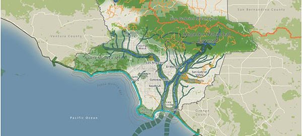


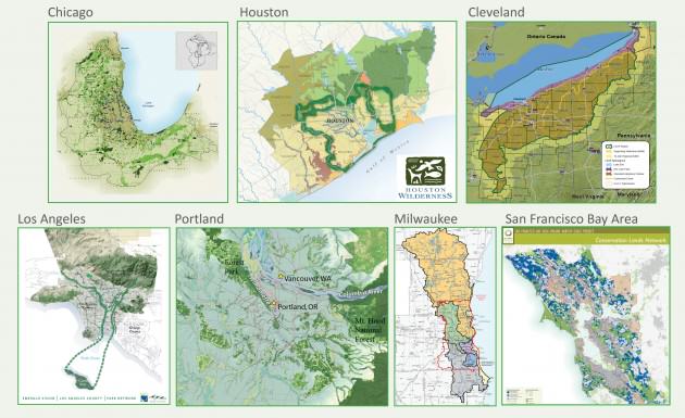
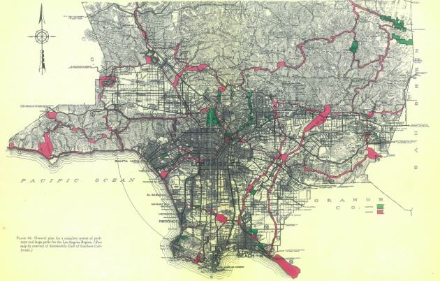
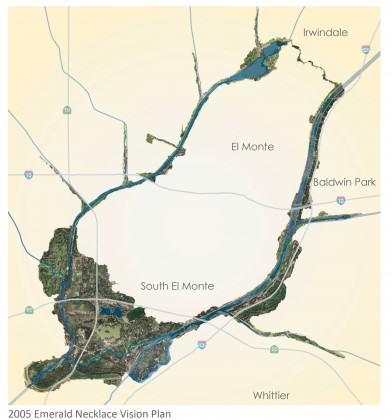
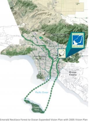
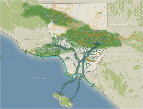
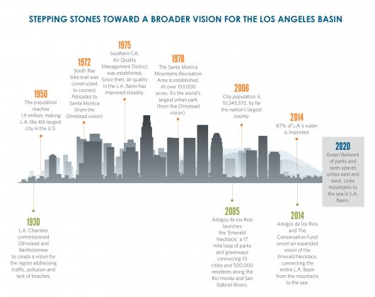


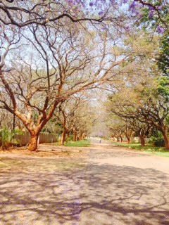 In the National Gallery of Zimbabwe there are permanent and temporary installations that demonstrate the creative and recreative nature of the people and speak to a number of current issues that trouble the community—gender based violence, child marriages and more. Permanent installations can also speak to a vision of a cleaner and greener urban center. A recent visit to one relatively small gallery in Harare allowed students to view landscapes commissioned by artists who were able to capture the varied nature of lands in particular parts of the country and the students were tasked to think about what scenes they, as artists, would want to highlight in their works—scenes that would not feed racist and voyeuristic ideas of a primitive Africa only suitable for safaris.
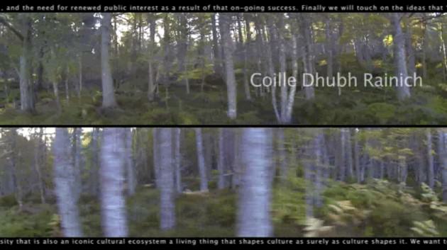
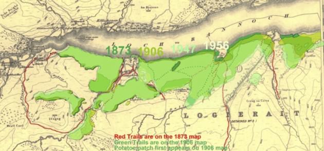
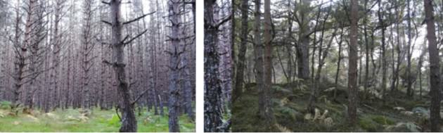
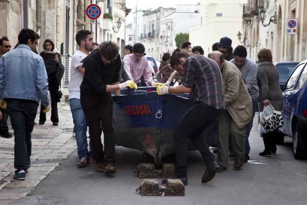
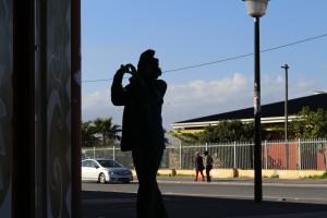


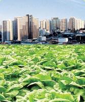
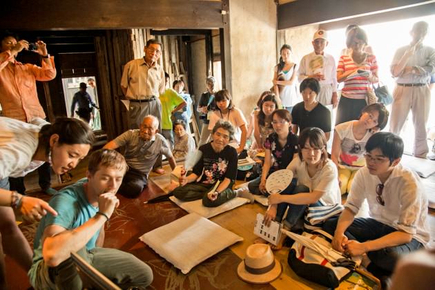
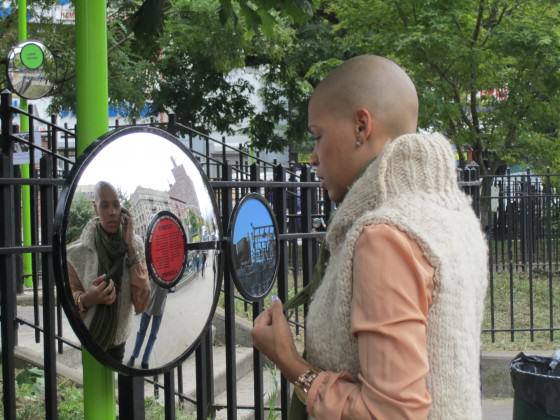 This FRAMEWORK is a process of inquiry and exchange between artists and designers, research scientists, municipal policy makers, local community groups, and academic partners. Activating the FRAMEWORK are projects and programs that seed sites, with installations, interactive activities, and events. While focused on the unique conditions of specific locales, the projects and programs are designed to set examples that can extend to other cities over time. These activities are conceived to nurture partnerships among disciplines, institutions, neighborhoods, and interested individuals as they work together toward shared environmental and sustainability goals.
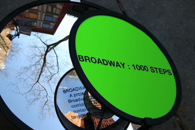
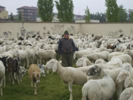
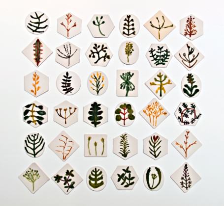
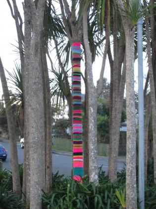 The yarn bombing project also sparked considerable interest from the general public. Children who pass the campus on their way to school were often seen hugging a yarn bombed cabbage tree. One of our administrators recently e mailed me remarking, “the appearance of knitting on poles and tree trunks has been a talking point for many and add pops of colour around the campus … When I was at my gym in Mana last week, someone discovered I worked at the faculty and talked of their joy of seeing the knitting around the campus”.
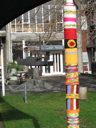 References:
 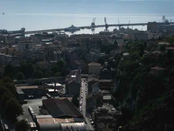 As we explored Rijeka we found it to be a city simultaneously nostalgic for the material production that marked its industrial history and aware that a new rhythm, a new pattern, can emerge from the possibilities promised by transition. The pier is a metaphor for a struggling city boldly seeing itself anew—in the words of Canadian poet Ross Leckie: “Metaphor is a form of knowing, a way of seeing-as, and from this everything follows, all of our possibilities for ethical and political thinking and being, and certainly our possibility for grace.”
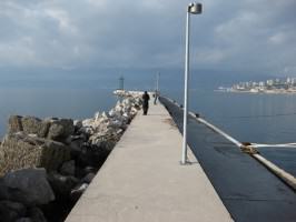 The pier, as a new public space, is literally a new place from which to view the city and therefore a new way metaphorically to see the city. The storied pier lurks in local consciousness as an object of mystery, as something familiar but with so much yet to reveal. The emergent and abundant creative potential embodied by the pier-as-metaphor became the nucleus of Musagetes’ artistic program in Rijeka in 2011 and 2012.
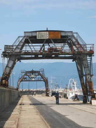 Sound Gates (2011) was the first artistic installation to animate the pier in its post-industrial state. Laetitia reimagined the bases of the defunct ship-loading cranes as symbolic gates welcoming residents to the new public space. She installed and camouflaged four homemade speakers—made of aluminum buckets and simple electronics—on each corner beneath the crane structures. An audio player was connected to motion sensors and a random selection of sounds quietly emanated from above when walkers activated the sensors. The volume was subtle enough not to startle but just loud enough for passersby to become vaguely aware of the presence of the sounds. After a moment listeners became fully conscious of, and then transfixed by, the sounds.
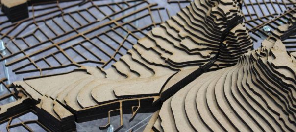
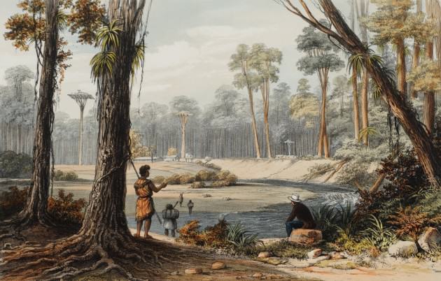
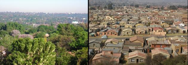
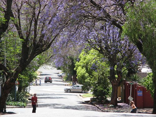


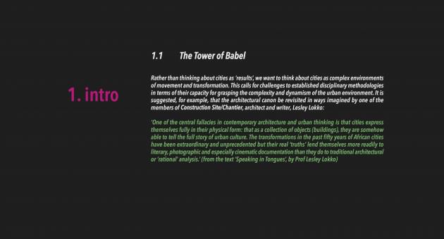 Here’s where some of those drawings ‘grew’ to.
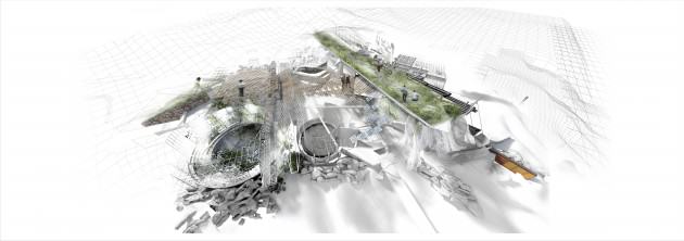


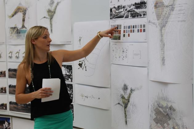
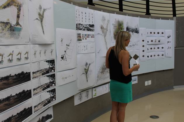
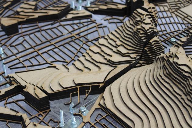
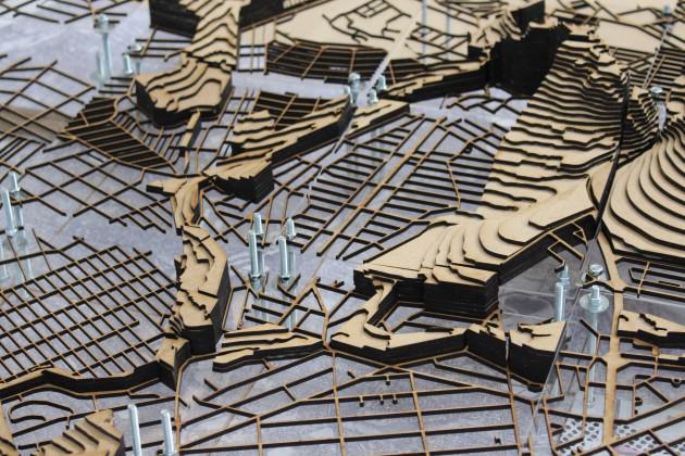


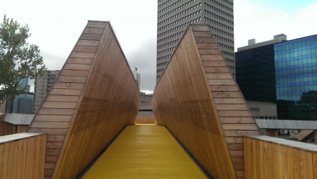
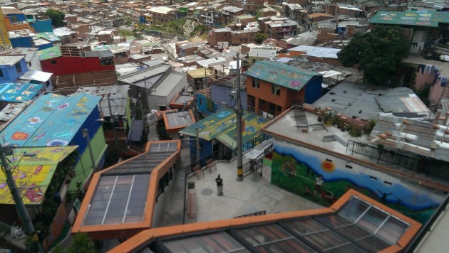
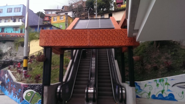
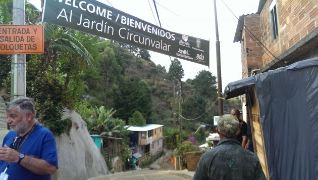
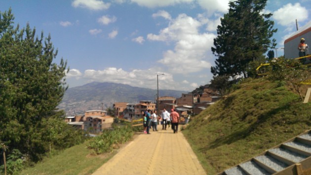
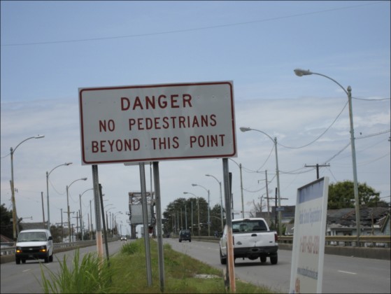
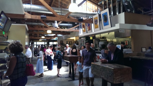

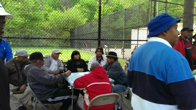
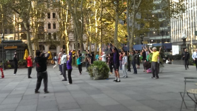
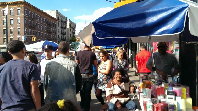
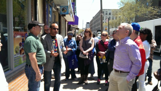
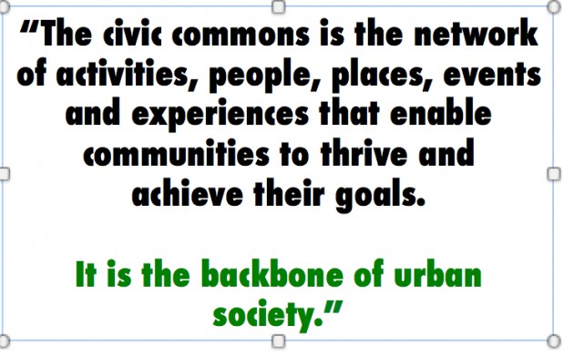
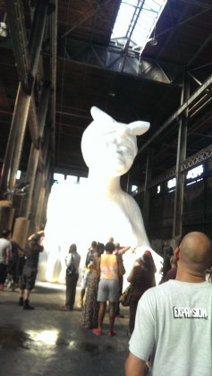
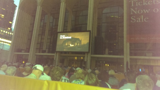
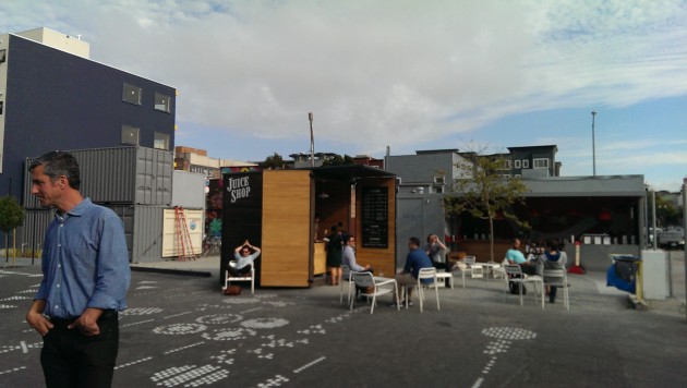
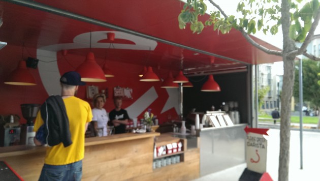
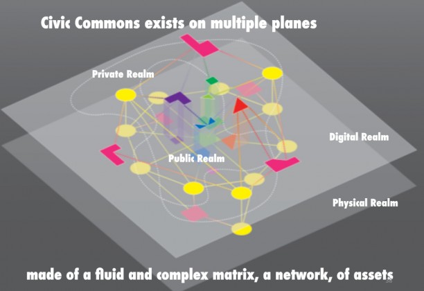
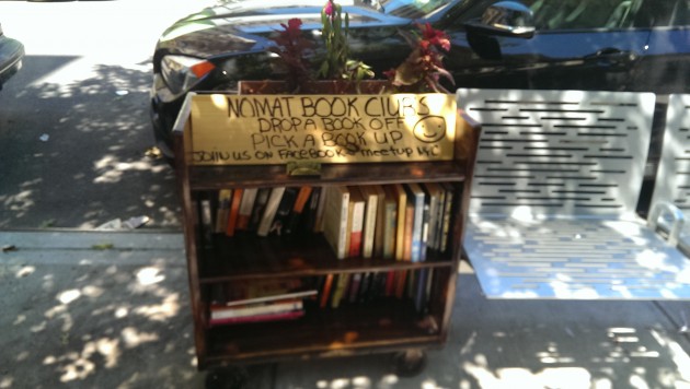
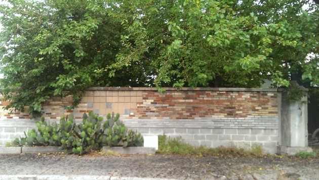
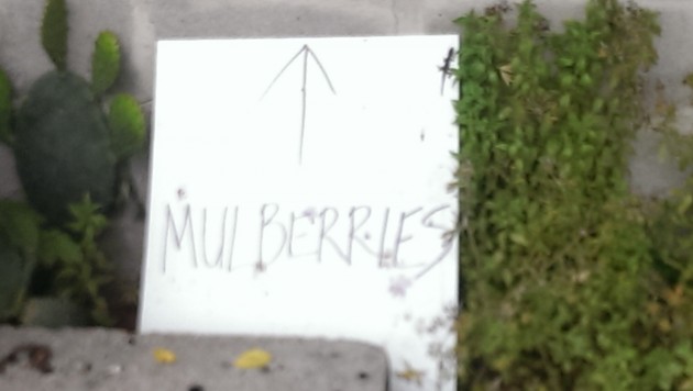

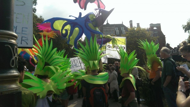
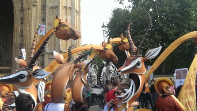
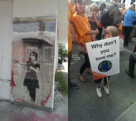


![NASA aerial image of Sanjay Gandhi National Park in Mumbai. By NASA [Public domain], via Wikimedia Commons](https://www.thenatureofcities.com/TNOC/wp-content/uploads/2014/10/Mumbai_metropolitan_region_satellite_image_Landsat-5_2011-01-301-406x420.jpg)
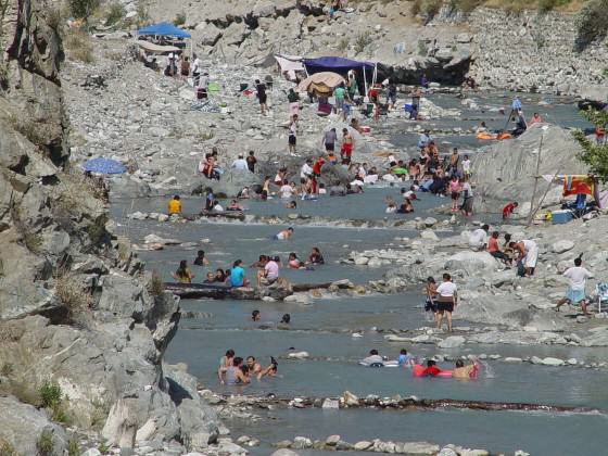
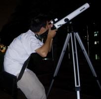 Reducing impacts of noise and artificial nighttime light. Noise, defined as unwanted sound, and artificial nighttime light can be problems in any protected areas, but those in urban settings are especially vulnerable. Humans and wildlife are both stressed by noise from visitors, road and rail traffic, aircraft, and other sources. Artificial nighttime light interferes with organism and ecosystem function, impedes visitors’ enjoyment of the nighttime sky, as well as astronomy, and can intrude on appreciation of cultural heritage sites in their authentic state. Some urban protected areas are making progress toward protecting natural soundscapes and the nighttime sky by developing indicators and standards, educating visitors, enforcing regulations, and working with local authorities and businesses in adjoining communities.
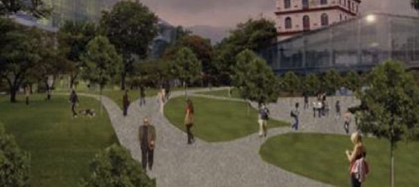
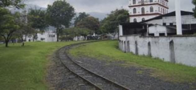
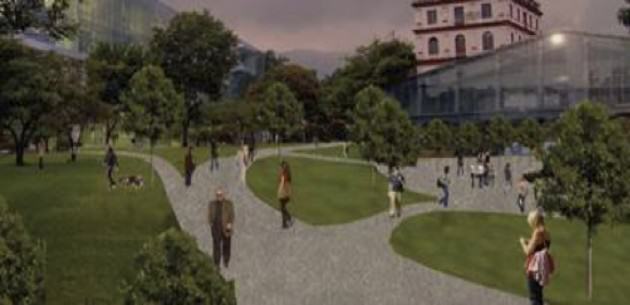
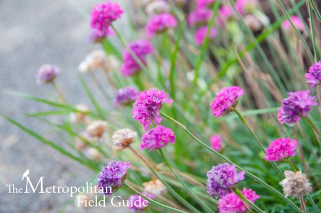

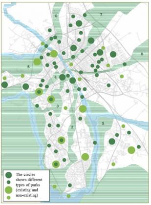 Although the borders were diffuse, the revision of the master plan in 2014 made an extra case that further emphasized that the map is only visionary. On the other hand, the writing in the master plan still says that “The city’s green wedges…that link the city’s green structure with the surrounding nature and recreation areas should be protected so that the green linkages persists or develops”. Interesting here is that planning is often very precise when it comes to buildings but to make concrete borders for green areas seems harder.
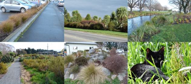
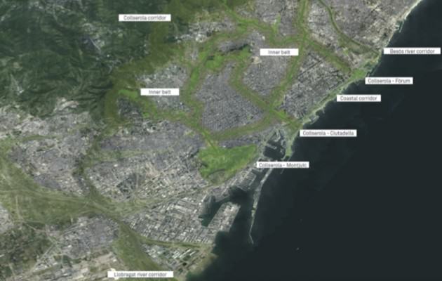
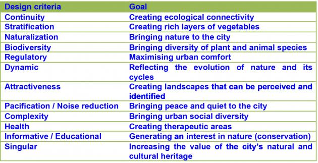
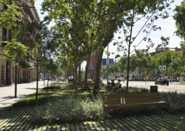
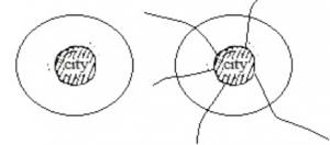
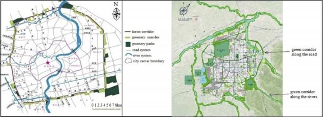
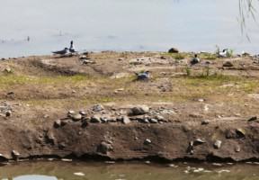
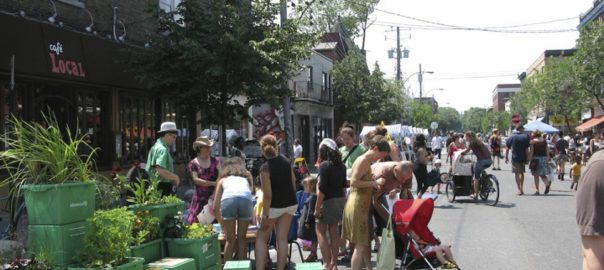
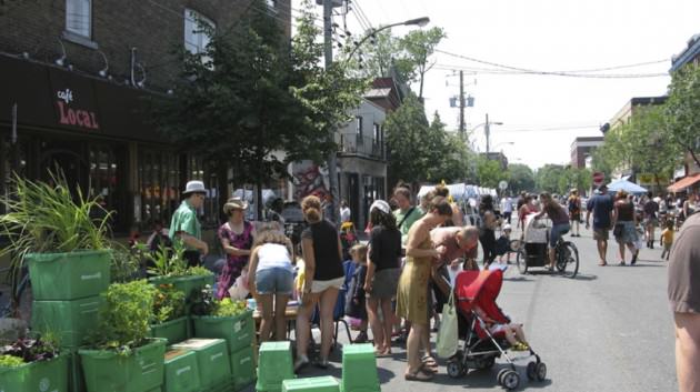

 Target 1: “By 2020, at the latest, people are aware of the values of biodiversity and the steps they can take to conserve and use it sustainably.”
  Target 2: “By 2020, at the latest, biodiversity values have been integrated into national and local development and poverty reduction strategies and planning processes and are being incorporated into national accounting, as appropriate, and reporting systems.
 Target 3: “By 2020, at the latest, incentives, including subsidies, harmful to biodiversity are eliminated, phased out or reformed in order to minimize or avoid negative impacts, and positive incentives for the conservation and sustainable use of biodiversity are developed and applied, consistent and in harmony with the Convention and other relevant international obligations, taking into account national socio‑economic conditions.”
 Target 4: By 2020, at the latest, Governments, business and stakeholders at all levels have taken steps to achieve or have implemented plans for sustainable production and consumption and have kept the impacts of use of natural resources well within safe ecological limits.
  Target 5: By 2020, the rate of loss of all natural habitats, including forests, is at least halved and where feasible brought close to zero, and degradation and fragmentation is significantly reduced.
 Target 6: By 2020 all fish and invertebrate stocks and aquatic plants are managed and harvested sustainably, legally and applying ecosystem based approaches, so that overfishing is avoided, recovery plans and measures are in place for all depleted species, fisheries have no significant adverse impacts on threatened species and vulnerable ecosystems and the impacts of fisheries on stocks, species and ecosystems are within safe ecological limits.
 Target 7: By 2020 areas under agriculture, aquaculture and forestry are managed sustainably, ensuring conservation of biodiversity.
 Target 8: By 2020, pollution, including from excess nutrients, has been brought to levels that are not detrimental to ecosystem function and biodiversity.
 Target 9: By 2020, invasive alien species and pathways are identified and prioritized, priority species are controlled or eradicated, and measures are in place to manage pathways to prevent their introduction and establishment.
 Target 10: By 2015, the multiple anthropogenic pressures on coral reefs, and other vulnerable ecosystems impacted by climate change or ocean acidification are minimized, so as to maintain their integrity and functioning.
 Target 11: By 2020, at least 17 per cent of terrestrial and inland water areas, and 10 per cent of coastal and marine areas, especially areas of particular importance for biodiversity and ecosystem services, are conserved through effectively and equitably managed, ecologically representative and well-connected systems of protected areas and other effective area-based conservation measures, and integrated into the wider landscapes and seascapes.
 Target 12: By 2020 the extinction of known threatened species has been prevented and their conservation status, particularly of those most in decline, has been improved and sustained.
 Target 13: By 2020, the genetic diversity of cultivated plants and farmed and domesticated animals and of wild relatives, including other socio-economically as well as culturally valuable species, is maintained, and strategies have been developed and implemented for minimizing genetic erosion and safeguarding their genetic diversity.
  Target 14: By 2020, ecosystems that provide essential services, including services related to water, and contribute to health, livelihoods and well-being, are restored and safeguarded, taking into account the needs of women, indigenous and local communities, and the poor and vulnerable.
 Target 15: By 2020, ecosystem resilience and the contribution of biodiversity to carbon stocks has been enhanced, through conservation and restoration, including restoration of at least 15 per cent of degraded ecosystems, thereby contributing to climate change mitigation and adaptation and to combating desertification.
 Target 16: By 2015, the Nagoya Protocol on Access to Genetic Resources and the Fair and Equitable Sharing of Benefits Arising from their Utilization is in force and operational, consistent with national legislation.
 Target 17: By 2015 each Party has developed, adopted as a policy instrument, and has commenced implementing an effective, participatory and updated national biodiversity strategy and action plan.
 Target 18: By 2020, the traditional knowledge, innovations and practices of indigenous and local communities relevant for the conservation and sustainable use of biodiversity, and their customary use of biological resources, are respected, subject to national legislation and relevant international obligations, and fully integrated and reflected in the implementation of the Convention with the full and effective participation of indigenous and local communities, at all relevant levels.
 Target 19: By 2020, knowledge, the science base and technologies relating to biodiversity, its values, functioning, status and trends, and the consequences of its loss, are improved, widely shared and transferred, and applied.
 Target 20: By 2020, at the latest, the mobilization of financial resources for effectively implementing the Strategic Plan for Biodiversity 2011-2020 from all sources, and in accordance with the consolidated and agreed process in the Strategy for Resource Mobilization, should increase substantially from the current levels. This target will be subject to changes contingent to resource needs assessments to be developed and reported by Parties.
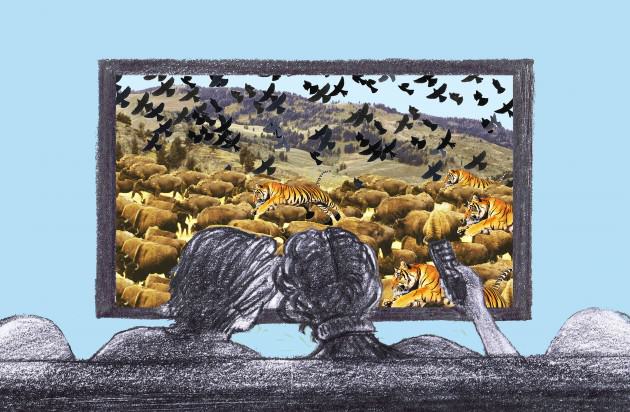

 We’re clever creatures. Thanks to computer-generated imagery even the most run-of-the-mill children’s animated feature movie can contain astonishingly convincing pictures of landscapes, plants and creatures. Imaginary landscapes have become routinely realistic, and for that we have to thank
 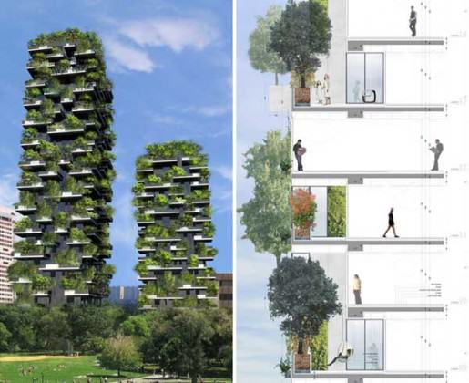 But like all kinds of revolutionism it had trouble distinguishing babies from bathwater and its followers tended to distill subtle ideas into slogans and often seemed to get the wrong end of the stick. Whereas progressive modernist architects like the inimitable
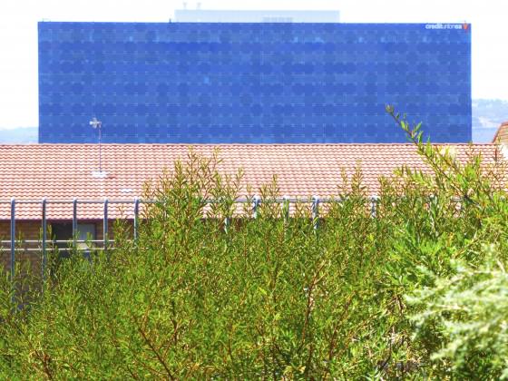
 Readers of this blog would all most likely agree that a meaningful connection with nature is vital to human well-being but is that something that cities can really deliver? Parklands and green public spaces do introduce something of that connection—wildflower meadows more than manicured lawns, perhaps—but a prohibition against too many people stepping on the grass becomes an essential part of the management strategy when population numbers and density begin to rise. The scale of the city is key.
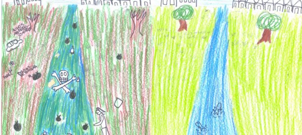
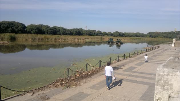
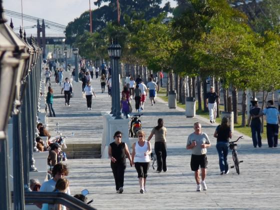
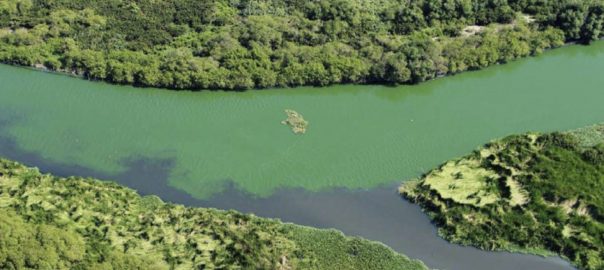
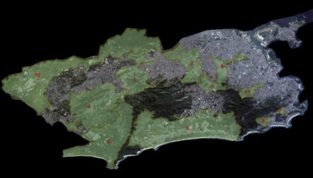
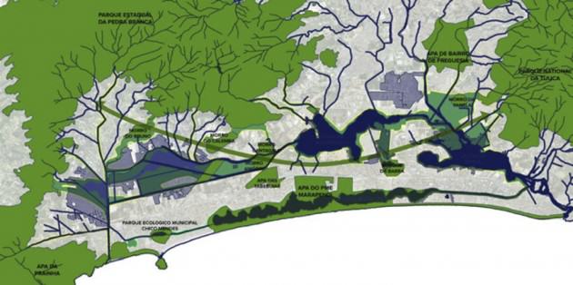
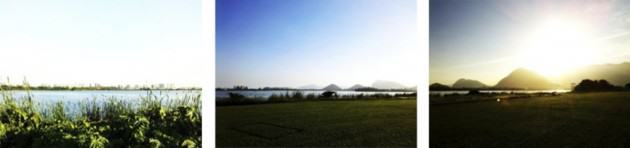
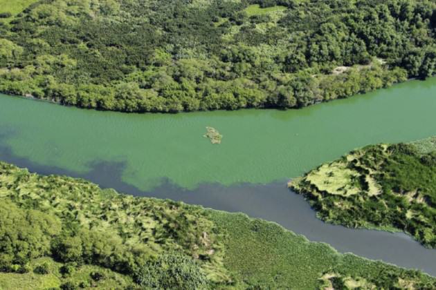
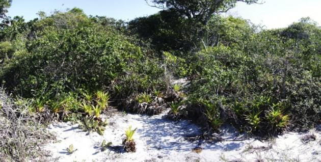
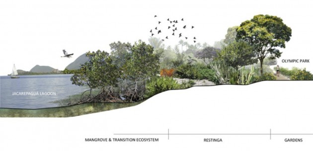
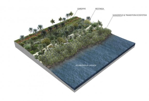
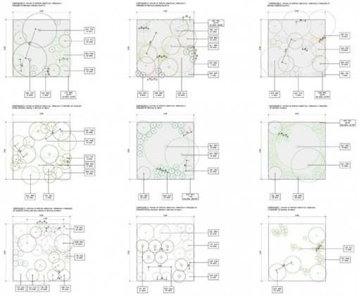
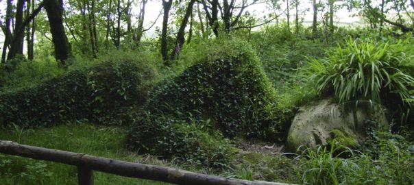


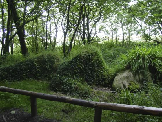
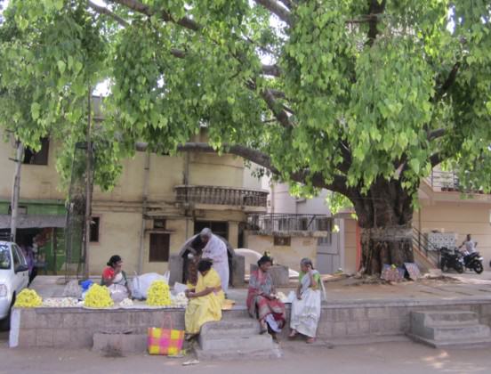
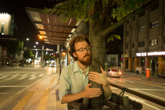 On the surface, this idea seems to remove any reason for worrying about nature within a city. But if we look a bit deeper, we see that Kawaguchi’s perspective also unveils something more rooted; it shows us a framework wide enough to allow the sacred to enter everyday life.
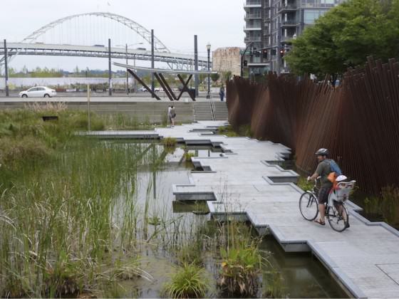
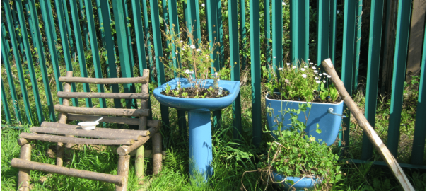
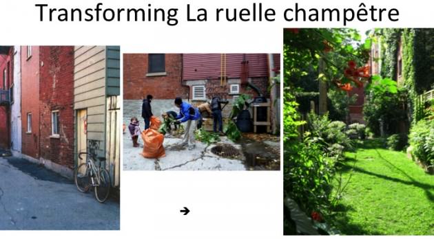
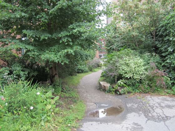
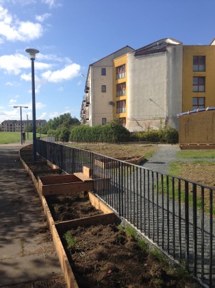
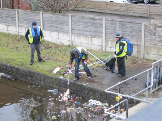
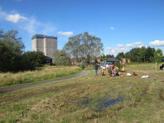
 Make identity apparent
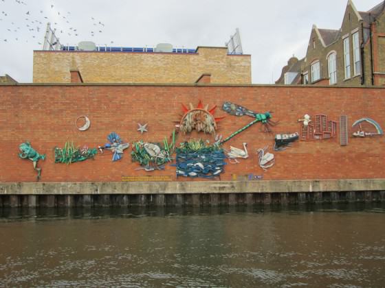
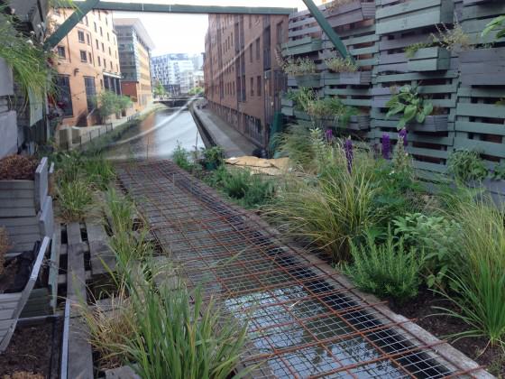
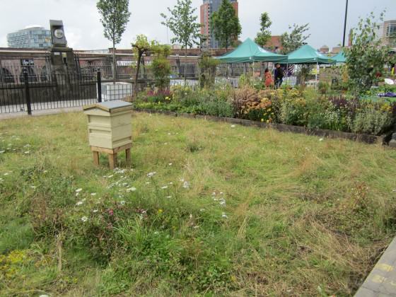
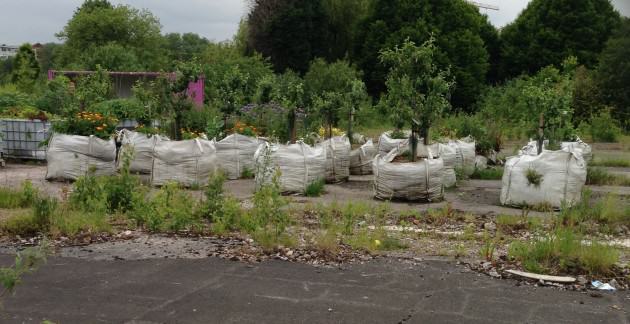
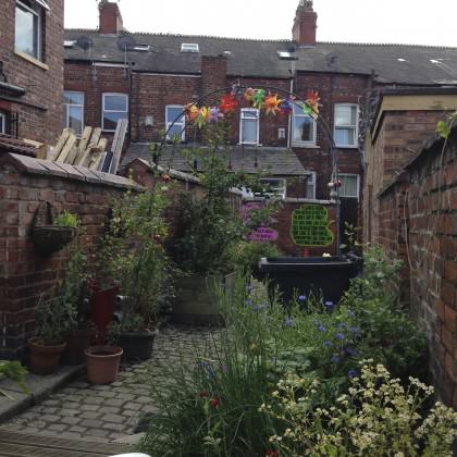
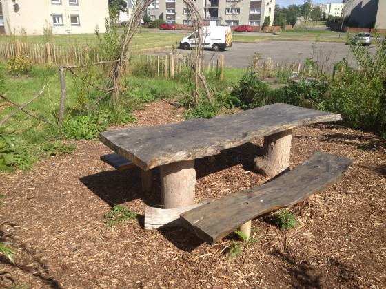
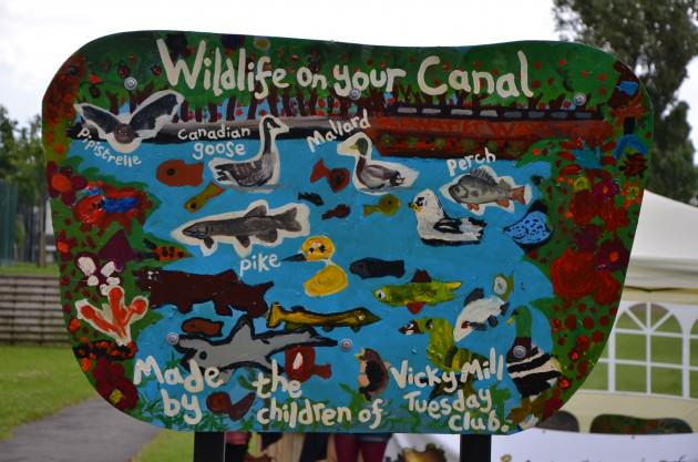
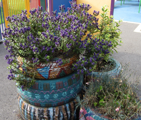
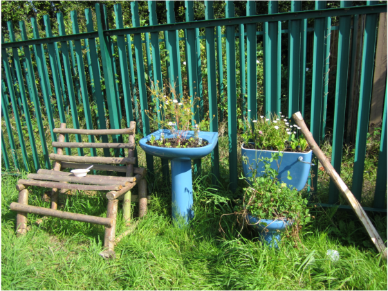
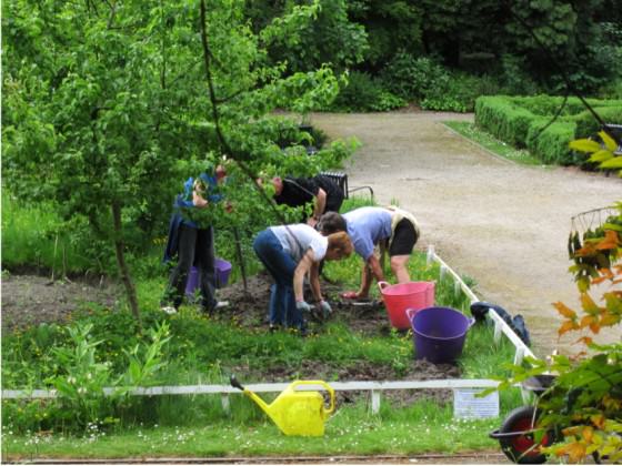
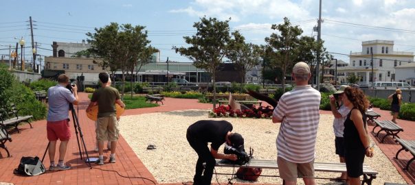

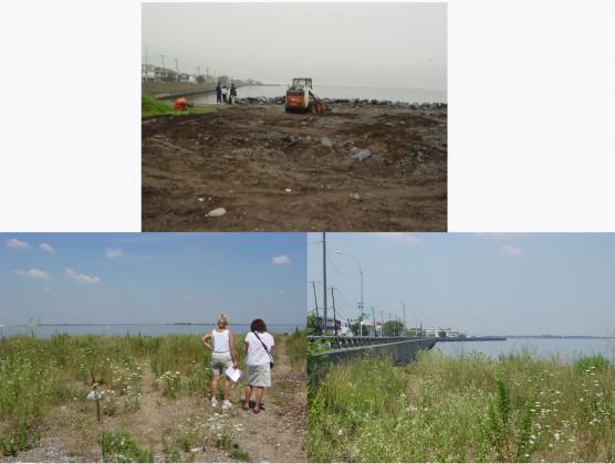
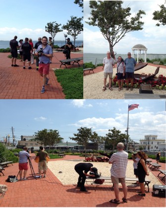
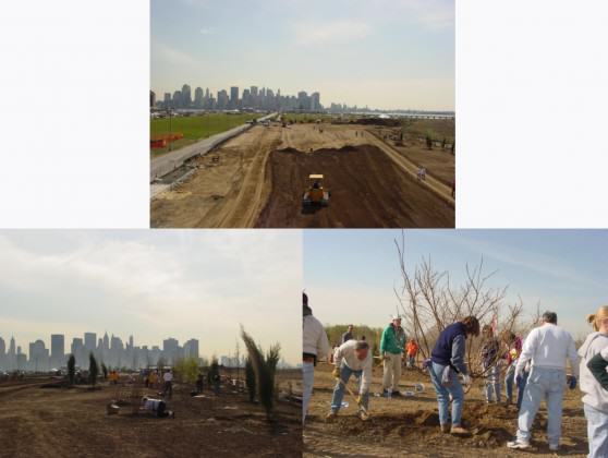
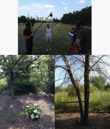


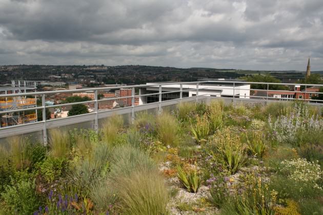
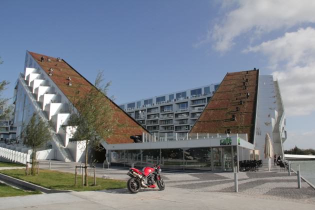
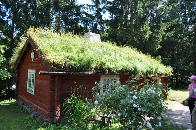
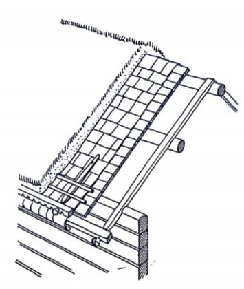
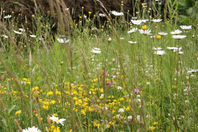
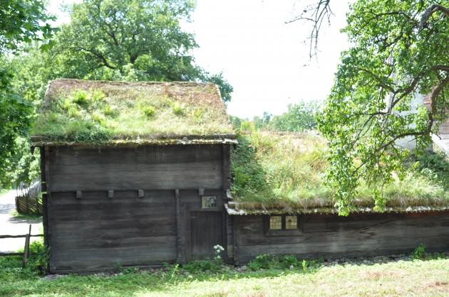
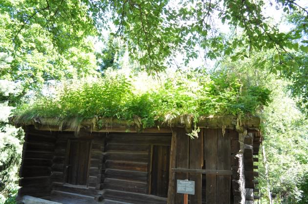
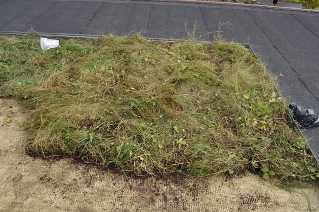
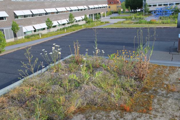
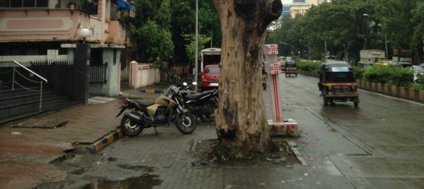
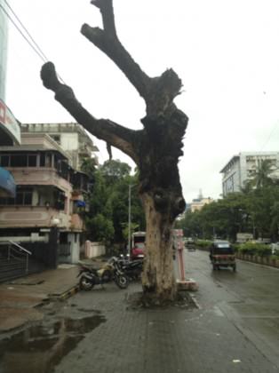
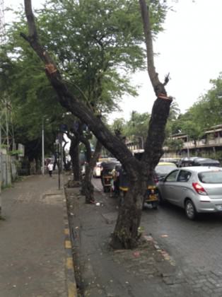


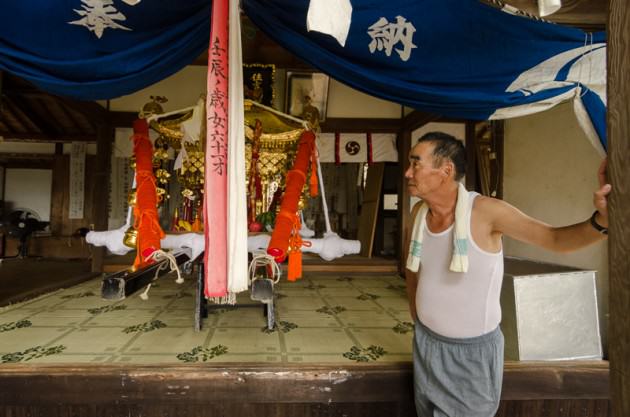
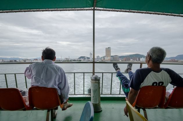
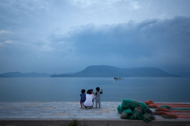
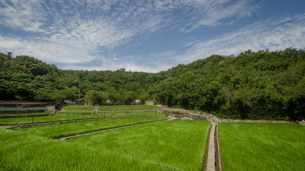
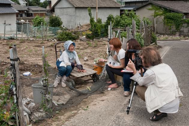
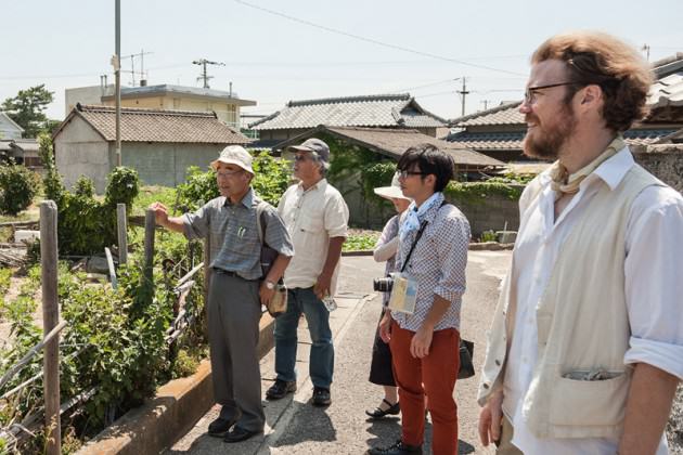
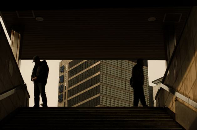
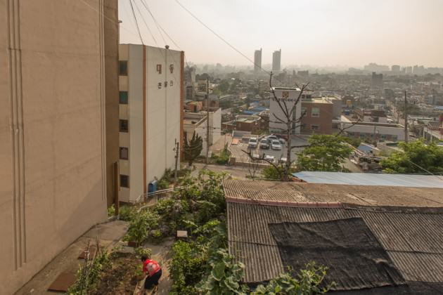
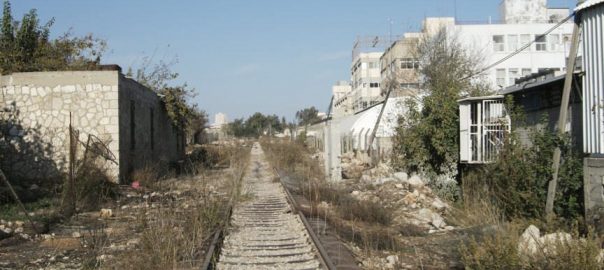
 Over the last twenty years Israel has undertaken a railway revolution, modernizing and expanding the system that was built originally as part of the vision of the Ottoman Empire in the nineteenth century, which established direct rail communication from Alexandria in Egypt to Damascus in Syria. The Turkish North-South grid always included Jerusalem in its itineraries. In the recent years of train revival the railway has become the main mode of transport for more than one and a half million Israelis, taking some of the strain off the main highways, and helping to reduce pollution in our cities.
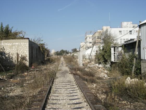 While the steam train was running, it cut through the Jerusalem neighborhoods that had developed in the Southern part of the city after the original track had been laid.
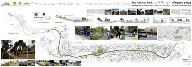 The eight-kilometer promenade is used by people of all ages and cultures, practically round the clock. They enjoy the clean air, quiet, social interaction and beauty of the Railway Park. Wheelchairs, baby strollers, joggers and bikers all benefit from an enjoyable and accessible walk/run/skate/ride. The park is also playing an important role in protecting urban biodiversity, since it serves as an ecological corridor linking the chain of inner city parks and gardens to the southern section of the ring of metropolitan parks surrounding the built perimeter of Jerusalem.
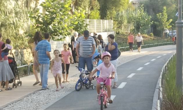 The success of the park is proving to be an incentive for the urban development long needed in the poorer areas adjacent to it. A couple of the poorer neighborhoods have had densification and urban renewal planned for several decades. However, without a serious incentive no one was interested in moving into the area, and there is no doubt that the Railway Park has rebranded the whole area with its message of beauty, quiet, greenery and health.
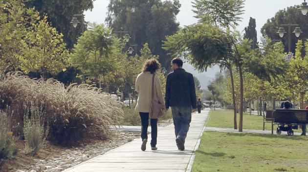 After the train from Tel Aviv was stopped in 1993, the station, a classic nineteenth century structure, of historic and architectural value, fell into neglect. The place was burgled, vandalized, burnt and more. However, as the plan for the park developed and began to be implemented, Jerusalem businessmen realized the opportunity offered by what has come to be known as “The First Station”. The station houses a large variety of eateries and coffee shops, displays art exhibitions, boasts a small visitors’ center which tells the story of the place, and regularly hosts cultural events. It offers for hire all kinds of bikes and scooters, for use on the track of the railway park and beyond.
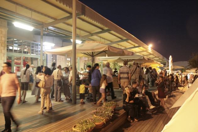 I am aware that Jerusalem is not the only city to have turned an inner city abandoned track into a vibrant corridor park. The New York

2 Comments
Join our conversation