City planners have often many and innovative solutions for how to create a ’good urban milieu’. However, these ideas are mainly focused on accommodating visual aesthetics with necessary practical matters for transport, waste and energy. The dynamic sound perspectives in the urban environment, such as sonic diversity and acoustic ecology, are still very much neglected aspects in planning and architectural design. We are all in general largely unaware of the importance of sounds for how we perceive the quality of a place and a good living environment. Whenever urban sound is on the agenda the topic is primarily noise abatement and legislation to reduce noise.
But the challenge of how we may create an enjoyable acoustic milieu needs to be approached in much more creative ways.
Tim Beatley writes in his excellent essay “Celebrating the Natural Soundscapes of Cities” (January 2013) about the importance of engaging in the soundscape of the city, and that the city should be enriched with natural sounds. Tim points out that the fact that so many urbanites fail to recognize common nature sounds, suggests something about our disconnect from the aural realm and that we have lost the skill or desire to carefully listen to the world around us. Tim argues that the subject of sound needs to be put more squarely on the agenda of urban planning and design fields.
In this essay we will elaborate a bit further on the qualitative aspects of sounds and how innovative design may contribute to acoustic environments that people perceive as enjoyable and less stressful.
What do we know about urban soundscapes and how do we analyse them?
The study of soundscape is the subject of acoustic ecology and refers to both the natural acoustic environment — consisting of natural sounds, including animal and sounds from trees, the sounds of water, weather — and environmental sounds created by humans — through musical composition, sound design, and other human activities, including sounds of mechanical origin resulting from use of industrial technology.
Ecology is the study of the relationship between living organisms and their environment. Acoustic ecology is the study of sounds in relationship to life and society.
— Shafer (1977)
Studies of sound are broad and may include: acoustics, psychoacoustics, otology (study and treatment of the ear), noise reduction practices, analyses of patterns of acoustic perceptions and the structural analysis of language and music.
Much of the analyses and mapping of soundscapes have been done in North America but also e.g. in Sweden. In the US, the New York Society for Acoustic Ecology has been very active, developing projects that focus on the sounds of the urban environment and hosting lectures and concerts that encourage public dialogue concerning sound in cities. The New York Soundmap at Soundseeker.org allows the public to upload their own sounds that simultaneously get marked on an online map. In Sweden earlier this year, Gothenburg introduced a new research program called Sonorus. The Division of Applied Acoustics at Chalmers is coordinating this European project, training “urban sound planners” to reverse the negative trend of a deteriorating acoustic environment in urban areas. “The soundscape is determined as early as at the drawing board” — Wolfgang Kropp (Applied Acoustics, Chalmers University of Technology)
Increasingly, the study of urban sound is becoming an established research field in many parts of the world, with various methods, models and standardized ways of expressing the results. Soundscape studies represent an emerging and exciting research field that unifies the independent areas related to sound and environment. Although soundscape studies so far have been focused on noise pollution, many scientists and planners today argue for the need to make environmental acoustics a study program using innovative design to bring out the positive aspects of sound in the urban environment.
There is room for much innovation and experimentation on how design, architecture and the use of different materials and different types of plant species and other organisms may together create a new type of sound environment — not just noise reduction and not just natural sounds, but the creation of a hybrid sound environment that is the signature of what is urban.
What is noise?
We often refer to noise as “unwanted sounds”. The acoustic ecologist Schafer (1977) proposed three different types of noise: 1) unwanted sound, 2) unmusical sound (defined as non-periodic vibration), 3) any loud sound, and disturbance in signaling systems. The unwanted sound, loud sound and the disturbance of signal are independent factors, having the potential of leading to emotional responses often manifested in frustration. However, some view noise as “unrealized sound” that has the possibility and potential of being redesigned or put into a context that makes it more appreciated.
Noise affects human wellbeing in many ways. The threshold of pain is for most people in the interval 115-140 dB, naive listeners — that is, without training in the particular listening experience — reach a limit at approximately 125 dB, while experienced listeners can expand the limit to 135 -140 dB. Audiologists agree, however, that no unprotected ear should ever be stressed with a 135 dB sound. Constant exposure to moderate or intense noise levels will eventually lead to a temporary threshold shift, which is experienced as a loss of sensitivity when the stimulus is removed (Shafer 1977). For example, the sound output of the police siren has risen 40dB in many North American cities since the beginning of the last century as a result of more traffic, more street activity and an increased ambient sound level in general. The police siren needs to be heard through the highest levels of city sounds (recent research also show that the song of some bird species is affected in the same way).
Midtown Manhattan on 5th Avenue at 53rd St, on a “quiet” Saturday afternoon. Photo: David MaddoxCrossing traffic in downtown Mumbai. Photo: David Maddox
This is a problem, and a rather complicated one. A siren in a noisy environment might be barely noticeable, while the same siren in a calm neighborhood might result in a temporal, or chronic, hearing loss if the attack is sudden. Another problem is the presence of infrasonic frequencies, i.e. sound waves 20 Hz or lower. These frequencies can, if intense enough, result in experiences of nausea and dizziness. Such frequencies are only felt as vibrations and are difficult to extract since they have a tendency to transmit through earth and building materials. We still know little about the long-term physiological and psychological effects of constant exposure to these frequencies.
Today, many cities have effective legislation to reduce the negative effects of noise and even though many (e.g. large Asian) cities may be perceived as very noisy, there are many good and effective experiences and practices that can be rather quickly implemented.
How do we analyze what is a positive and enjoyable sound environment?
To move beyond just reducing noise levels and start innovative experiments of designing urban soundscapes that would, for example, reduces stress levels, we need some sort of conceptual and theoretical framework. Ipsen (2002) developed the Theory of Complexity focusing on acoustic complexity — or sonic diversity (see below).
Relationship between complexity of information and human curiosity. Credit: After Ipsen (2002)
In this model the relation between quality and the complexity of a situation is a non-linear, hump-backed curve. If the complexity of the information is rather low, humans may often find a situation less attractive. Also if the complexity is very high and ”unreadable” humans tend to react with annoyance. There is an intermediate level of complexity, between these two extremes, which generates a high positive motivation and this applies to any form of information, including acoustic perception. However, there is large individual variation. The same level of complexity of a situation may be attractive or unattractive, depending on the individual. The more familiar an individual is with a situation, the less complex the information input gets and the adaptability an individual possesses will influence the response to the acoustic information.
Each city may have a rather unique acoustic profile — the composition of specific natural sounds, signals and noise. Listen here are two examples from Stockholm and New York and an interpretation of the acoustic profiles of the two cities.
A small park embedded between buildings in East Midtown Manhattan (51st St), with a waterfall and a green wall. Photo: David Maddox
How do we proceed?
We can learn from theory that there is a complexity that is appealing to us, no matter the context. Urban sounds can be enjoyable for people in need of high complexity information. At the same time urban planners need to respect those who do not find the high complexity of sounds as attractive.
The solution for this would be the creation of zones and refuges, with varying acoustical complexity. Complete silence is impossible to achieve, but much city noise can be masked and dimmed. Using natural sound sources in urban planning, such as water and vegetation, has proved to be effective for this purpose and pleasing for the general public. Green walls can, if properly constructed, reduce up to 40dB of outdoor noise and vibration.
Parks were previously poorly designed, often a result of leftover pieces of real estate (Shafer 1977). Today, with a more detailed perspective on environmental sounds the value of sonic refuges, such as parks and open spaces, they should become a more pronounced part of urban soundscape planning.
“One thing that I think works really well is the use of water to mask certain sounds, like traffic. There actually is a spot on 53rd street in Midtown here in New York that’s really easy to miss. It’s this little park that is just stuck between these two big buildings and you go in and it’s wonderful because it’s this total oasis. Part of the reason, I think, is because at the end of the park there is this wall and it’s just got all this water, it’s like a waterfall running down this wall, going down over this stone and there are trees. It’s just a wonderful spot. I really think a big reason that it’s so popular is because the water masks a lot of the city sounds. I’m really into plants, what they can do to increase the visual environment – but audio environment too maybe. I’m interested in this question about plants and how they absorb sounds, I wonder if succulent plants absorb more sound because their leaves are thicker.” — from Pontén (2012)
A small park between buildings in Midtown Manhattan (53rd St, and mentioned in the quote above), with a waterfall and a green wall. Green walls may reduce up to 40dB of outdoor noise and vibration. Photo: David MaddoxA small park in Midtown Manhattan (53rd St), with a waterfall, and a piece of the Berlin Wall. Photo: David Maddox
There are many ways we could move forward. On the small neighborhood scale we could work on developing innovative design and materials — green spaces, green walls, water walls and other unrecognized ecosystem services. On the larger district or city scale we could work on the composition of urban soundscapes — e.g. “the dual soundscape”, including zoning areas with “silent parts” intermixed with more “noisy parts” and designing individual acoustic profiles for specific zones in a city.
“I think that it would be interesting to have architects and city planners go on sound walks on a site where they intend to build. Such a walk based on listening to the environment and social atmosphere might inspire them to be creative with the design of the building and how it may interact with the soundscape around it.” — from Pontén (2012)
Conclusion
Urban planning should involve more explicit zoning requirements for new constructions, which offers us the possibility to design soundscapes. However, there must also be an opportunity for people to choose their sonic environment. It would be unwise to impose a general sound aesthetic in ways we may have general visual aesthetics, since sounds are often perceived more subjectively than visual objects.
Acoustic ecology is not just an interesting new aspect of urban studies. We believe that through novel integration of landscape architecture, ecology, acoustics, psychology, innovative design, etc., soundscape design will be crucial for future city planning — building sustainable and pleasant cities.
Hellström, B. 1998. The Voice of Place: A Case-study of the Soundscape of the City Quarters of Klara, Stockholm , Research Report: Royal Institute of Technology. Department of Architecture and Town Planning. Division of Complex Structures, Division of Design Methodology, Stockholm,
Ipsen, D. 2002. The Urban Nightingale – or some theoretical considerations about sound and noise. in H Järviluoma & G Wagstaff (eds), Soundscape Studies and Methods, The University of Turku, Vaasa, 2002, p. 185
Yesterday upon the stair I met a man who wasn’t there He wasn’t there again today Oh, how I wish he’d go away — William Hughes Mearns 1922
Learning to forget
When the early settlers headed west across the American continent their cultural baggage weighed lightly when it came to reading the landscape. Oak trees were recognisably oak trees and the pathways made by the first peoples bore the same legibility and logic as trails through European woods; so they followed them, and assimilated them into their own transport networks. In 1847, Cayuga chief Wa-o-wo-wa-no-onk observed that the land of the ‘Empire State’ was “…once laced by… trails worn so deep by the feet of the Iroquois that they became (the settlers’) own roads of travel…” (McLuhan p.100).
Old ways may have been forgotten but memory is the essential substrate of culture. Some memory of the paths made by the Cayuga remain etched beneath the blacktops of New York. Memory, in the form of books, transcripts, recordings, oral history, song and building is how we transfer essential information from each generation to the next. Each generation doing something like their predecessors did with imperfect recollections, passing on patterns of the past. So cities and architecture evolved over time on the foundations of things that people have found to be functional. Wipe that memory clean and a subtle form of chaos begins to take hold. A society that forgets its history is like a person with dementia — trying to orientate themselves and live competently in the present without the benefit of being able to draw on years of accumulated knowledge and experience.
Too often, when we construct our human nests and lace our habitat with roads and sewers and all the paraphernalia of infrastructure we forget history’s lessons and no longer follow well-worn paths made with the inter-generational logic of ancient trails. The best we manage is to follow the guidelines of rule books (albeit they are also the consequence of cultural record keeping). As a result, our newest cities and urban spaces tend to be delivered with little palpable sense of place and with a kind of emotional emptiness. Modernist experiments like Brasilia perfectly express the kind of alienated thinking that has ruled the way we have shaped and reshaped our cities since the early 20th century, abandoning the intuitive evolution and understanding of place in exchange for an abstract set of rules derived from crude, simplistic, early-industrial logic.
Brasilia – A piece of ‘new world’ delivered to a land of tropical rainforest with little palpable sense of place and styled around a heart of emotional emptiness. Photo: Paul Downton
How and where we live is crucial to the health of the natural environment and to our well-being. Modern humans have evolved to need shelter to the point that, unless specifically trained to do otherwise, we cannot survive without it. Yet all too often, the mainstream disciplines of architecture and planning offer superficial views of the built environment in which design is about making fashionable choices of cladding whilst communities are mostly disregarded and the natural world is treated as an inanimate backdrop to design rather than a living system that encompasses it.
Efforts to understand the ecology of the built environment is muddled by the kind of revisionism that sees an architectural culture hero like arch-Modernist Le Corbusier, who celebrated the city as ‘an assault on nature’, as a prototypical ‘green’ architect (Farmer 1996). One might reasonably ask how architects and planners can hope to see past such sophistry, stuck as they are within the frame of a severely damaged picture of the world.
Urban ‘renewal’ Swansea, South Wales 1977 Drawing: Paul Downton
As if the absence of memory was somehow cleansing and good, the enterprise of Modernism has always trumpeted the joys of kicking over the traces of the past and celebrated the triumph of the new over the old. Anxious to prove its superiority, Modernism has long conflated ‘new’ with ‘freedom’ and ‘progress’ and confounded attempts to conserve the old by portraying it as reactionary. We have learned to forget lest we become somehow corrupted by the past. The preferred canvas of Modernism is a tabula rasa, a place like a blank sheet of paper, without definition or limits. Lost in this indeterminate ‘space’ fetishized by Modernist architectural and planning training, the practice of design is restrained only by the limitless bounds of a designer’s ego, whilst the facts of life and the natural limits of place are willfully ignored.
However, natural systems don’t have the luxury of being able to ignore what designers choose to practice and try as we might, there is no way to maintain civilization outside of the constraints of the actual context of place.
Layers of Change
Stewart Brand explored how different rates of change apply to the various layers that make up civilisation. The ‘slowest’ layer is nature. That’s where we find the slow churning of geology and climate. Resting on that is culture. The fundamental settings of culture are determined by the nature of the environment in which the culture evolves, so desert customs and technologies are markedly different from those associated with rain forests. Culture changes faster than nature. Then, with increasing pace, comes governance, infrastructure, commerce and the flibbertigibbet of fashion. At least that’s how it used to be, maybe for ten thousand years — since the beginning of civilisation.
But in the Australian ‘Age’ newspaper in October 2007, Rachel Wells reported that leading international fashion designers and industry experts were claiming unpredictable and typically warmer weather worldwide was wreaking havoc on the industry and the whole fashion system would have to change. “So worried are some fashion houses about the impact climate change is having on the way we dress and shop,” said Wells “they are calling in the climate experts.” Brand’s layers of change have suddenly flipped. The climate is changing faster than the fashion industry.
An entire nation is sinking beneath the waves in the Indian Ocean. See also here, and here.
Not only is the climate changing, the nature of every place is being systemically undone by ecological poverty as human disturbances range from the introduction of pest species to the clear-felling of ancient forests.
What used to be the world’s fourth largest lake, the Aral Sea, has all but dried up. People are being dispossessed of places that have shaped their lives and old certainties are turning into conundrums. In the face of such changes, it is no wonder that some resort to denial. Losing your place is disorientating.
Despite the gloomy evidence that we are better equipped to diminish or destroy the quality of places rather than enhance them, or perhaps because of it, I would argue that there remains a profound need for maintaining a ‘sense of place’ and responsiveness to place in the making of our built environments. There are sound reasons to reinforce whatever skerrick of sense we might have about where we live. Like the thread of an ecological corridor in a degraded landscape maintaining the connections of diversity and life between human-sundered species, even the slightest sense of what a ‘place’ might have been can catch the thread of memory and pull us into its orbit. Humanity is part of nature, after all.
And humans are integral to the ecosystem that is a city. An unoccupied urban environment is different from an occupied urban environment — one is a mere assemblage of physical stuff, the other is alive. One can be studied by an archaeologist, the other demands the attentions of an ecologist. Pioneering urban ecologist Ian Douglas wrote about the difference between the civitas – the functional, cultural entity, and the urbs – the physical entity. Douglas proposed that “No biophysical study of the city can… be divorced from the ancient view of the city (polis) as a political conception.” (Douglas 1983). To reinforce the idea that there is a difference between the inhabited and uninhabited states of buildings and cities, in a presentation toolkit I put together recently for Urban Ecology Australia I described the physical built environment of the city as its hardware, and community as its software.
A city is nothing without its people and it is the people who decide the nature of the city. (From a slide set prepared for Urban Ecology Australia Inc) Credit: photo and graphic: Paul Downton
Off with their heads!
Cities occupy territory and gradually change it. Industrial civilisation has taken that process of change and put it on steroids. Symbols of the ‘old’ become unwanted, even hated, as brave new worlds jostle for attention. Modernists don’t like pitched roofs because they symbolise another time. Even in climates that command the logic of tilted planes to shed rain or snow the Modernist passion to cut clean across the skyline runs unfettered, slicing off the determinedly irregular patterns of the past in favour of the indeterminate horizontal line. Clearing the city’s collective memory of its weather by decapitating it.
After the Second World War, eschewing the conventional logic of the time, which favoured a Modernist rebuilding agenda that would rid it of the past, Freiburg recognised that its history went back much further than the years usurped by Nazism and set out to reclaim its heritage and its memory. Its citizens took to hard-wiring the city’s built form as a memory of what it used to be. It was very unfashionable — and it has proved very successful in creating a city with a strong sense of itself with progressive communities that harbour the resilience and determination to tackle, amongst other things, the challenge of climate change.
To restore the deeper memories of place we need to go back beyond the cultural baselines established in more recent times. In his book ‘Feral’, George Monbiot writes elegantly and powerfully about the concept of ‘rewilding’ in which nature is given the opportunity to restore landscapes by letting them evolve without heavy-handed management — without, in effect, being shaped by the prejudices of human culture.
On those terms, is rewilding possible in our cities? We have seen the introduction of meadow lands instead of ‘conventional’ parks in many cities including, Dublin, London’s 2012 Queen Elizabeth Olympic Park and Bristol, England, where at least there is some memory of its pre-urban past as “Many hedges several centuries old survive in Bristol, and many of the city’s older streets follow the lines of hedges they replaced.” The Shifting Baseline Syndrome (see below) is alive and well as the Bristol City Council website has that piece of information listed under ‘Fascinating facts about Bristol’s wildlife’ (my emphasis). Hedges (and most meadows) are anything but wild.
There is a need for wildness in the heart of civilisation, there is a need to maintain some threads of historical continuity and there is a need to try and recover a sense of how the world was before the baselines shifted. These things, once discovered, are like itchy wounds; they are irritants reviving the memory of a previous condition and with luck, like an itchy wound, the itch could be a sign that the damage is being healed, provided it isn’t scratched away.
And if we were to rewild our cities, how far back do we go? Some say there were elephants in Europe just a few thousand years ago. There were certainly wolves. Wolves are being reintroduced to landscapes in Europe and North America — is it even possible to conceive of cities that include wild wolves in their cityscapes?
To do so, a cultural shift is needed.
Evoking place
Salvaged verandah connects new apartment to the history of its site (photo Paul Downton)
The evocation of a sense of place can come from small, specific memories. Using reclaimed bricks and masonry pillars, the verandah along the street front of Christie Walk’s largest apartment building is a partial restoration of the verandah that used to front an old house on the site. To those who knew the site before the apartment was built it offers a trigger for memory from which can cascade stories about the place. For those who never knew what was there before, it provides the basis for asking questions about the place and its history.
The evidence that people want to hold on to the past remains strong. Sadly, that evidence is often in the form of debased replicas of old things and places, or the memories of words and meanings applied to things that bear no relation to their origin. Whereas specific memories can evoke a particular sense of place, generic ‘pseudo-memories’ of place corrupt its very essence — one thinks of shopping ‘villages’… Is it possible to recover the deeper past as a means of informing the making of the present?
Solastalgia and the Shifting Baseline Syndrome
In a world that’s quickly heating up and drying up, you can’t go home again — even if you never leave.
— (Thompson 2008 p.70)
Making architecture and building cities is about manipulating the material and processes of the natural environment to create artificial places of firmness, commodity and delight. When those manipulations took place relatively slowly (several hundred years in the case of medieval cathedrals) people were able to adapt to their changing environments whilst maintaining a sense of belonging and of being in place. With more rapid change those senses become unanchored and fossil-fuelled industrial society has been delivering accelerating rates of change for over two centuries.
Developments like open-pit coal mining rapidly and radically change familiar environments and can create a sense of displacement so severe as to raise suicide rates. Climate change may seem to have barely begun but it has already brought about such rapid changes in the natural environment that people in some places are reported to be feeling a “deep, wrenching sense of loss as they watch the landscape around them change.” (Thompson 2008 p.70). Environmental philosopher Glenn Albrecht’s word for this “new type of sadness” is solastalgia: “the pain or sickness caused by the loss or lack of solace and the sense of desolation connected to the present state of one’s home and territory. It is the ‘lived experience’ of negative environmental change. It is the homesickness you have when you are still at home.” (Albrecht 2008). Albrecht describes the syndrome as “that feeling you have when your sense of place is under attack.” His more formal definition is that solastalgia is “an emplaced or existential melancholia experienced with the negative transformation (desolation) of a loved home environment.” And he suggests that with the speed and spread of environmental change, particularly that associated with shifting climate regimes, it is going to become much more common.
Whilst the on-the-spot remaking of places might afflict individuals with solastalgia, the flip side of that remaking is the creation of new baseline normalities for each generation — the ‘Shifting Baseline Syndrome’. The term, according to George Monbiot, was coined by fisheries scientist Daniel Pauly to describe a kind of collective amnesia in which “The people of every generation perceive the ecosystems they encountered in their childhood as normal.” Monbiot cited Pauly’s term to reinforce his argument that many of the supposedly ‘wilderness’ landscapes of Britain are, in truth, severely degraded — the bare hills of “sheep-scraped misery” that are the Cambrian uplands were once rainforest. In the same way, the climate that has been experienced since childhood by anyone in the younger generation is different from the climate that us older folk are likely to recall from when we were growing up.
This is even more true of the villages, towns and cities of childhood, almost anywhere across the globe. As populations have increased, urbanisation has accelerated, technologies have shifted, and the shape of daily life in the world’s towns and cities has changed. What people remember as ‘normal’ varies between generations, what they think of as ‘traditional’ depends on how old they are — if traditional used to mean ‘what our great-grandparents used to do’, it now means ‘what our parents used to do’.
Obliterating sense of place in Swansea, Wales 1977. Drawing: Paul Downton
The upshot of this is that, intuitively, we have lost any sense of perspective on history and place. To know what a place is about with any degree of historical depth, we must consciously study and interpret the scattered and damaged evidence of whatever information we can get hold of.
Living-in-Place
Back in the 1970s, the ever-iconoclastic Peter Berg, with Raymond Dasmann, described a phenomenon they called ‘reinhabitation’ and defined it as a process that involves learning to ‘live-in-place’.
‘Living-in-place is an age-old way of existence, disrupted in some parts of the world a few millenia ago by the rise of exploitative civilization, and more generally during the past two centuries by the spread of industrial civilization. It is not, however, to be thought of as antagonistic to civilization, in the more humane sense of that word, but may be the only way in which a truly civilized existence can be maintained.’
The late Peter Berg, Curitiba 2000. Photo: Paul Downton
Living-in-place, they said, “means following the necessities and pleasures of life as they are uniquely presented by a particular site, and evolving ways to ensure long-term occupancy of that site.” Industrialisation and urbanisation have reshaped and redefined the nature of every place they’ve touched so to get to know the landscape of where a modern city now stands you need to somehow stand in that place as it was before the city was there. We can’t go back in time, so in the absence of a TARDIS, the temporal relocation required has to be all in the mind – fed by whatever data, experiences, fables and history that remains of the original place.
The final boundaries of a bioregion are best described by the people who have long lived within it, through human recognition of the realities of living-in-place. — Berg and Dasmann 1977
Berg and Dasmann’s concept of a bioregion differs from purely biogeographic or biotic definitions by extending the term to include both a geographical terrain and its related ‘terrain of consciousness’. By incorporating this cultural perception of place the Bergian concept of a bioregion knits human occupation into the fabric of our understanding of ecosystems. It places people firmly in the picture and reminds us that even the idea of ‘wilderness’ is a cultural construct. By seeing the changes in the nature of a place as a continuum of human-induced changes it may be easier to make logical connections between pre-industrial and pre-urban environments and the present.
There are ways to recover a deeper sense of place, by understanding the nature of a city before it became a city. Said to be ‘the most detailed scientific reconstruction of an ecological landscape ever attempted’, the Mannahatta Project by Eric Sanderson and the New York-based Wildlife Conservation Society is perhaps the best attempt yet to recapture an in-depth sense of what a place was like before being worked over by industrial-urbanism. The project does not explore bioregional terrains of consciousness, but it does demonstrate how thoroughly retrospective mapping can be and provides good evidence for the power of mental temporal time machines.
Inspired by numerous discussions and Richard Register’s ‘Ecocity Zoning Maps’ in ‘Ecocity Berkeley’ (1987) I became intrigued by the idea of using physical models of a region to assist in planning and conceptualising the perception of place. In 1994 I ran a third year studio in the architecture program of the University of South Australia called ‘City as Organism’ in which we explored ways to plan for the future of Adelaide’s Tandanya bioregion. Students were asked to look at the city as if it was a living organism and they began by investigating the creeks of Adelaide and trying to imagine the place as it was prior to the arrival of Europeans and urbanisation.
The students then began constructing large scale relief models (2.4 x 1.2 metres) of the River Torrens Catchment, extending from the coast all the way to the source of the Torrens near Mt Pleasant. This was inspired by Register’s proposition that creeks should be restored, and informed by the photographic and historical study, edited by Warburton, of the five creeks which drain into the River Torrens (Warburton 1977). The series of three-dimensional contour maps of the watershed were later completed by volunteers, trainees and interns at the Centre for Urban Ecology (notably Digby Hall and later, Nina Creedman).
In a visit to South Australia to address the 1991 National Greenhouse Conference Richard had observed the phenomenon of a ‘shadow ministry’ in Australian governments and noted:
Shadow ministers belong to the party that is not in power at a particular time. These people are those most likely to assume the ministry positions should a new government be formed…The shadow ministers have great influence and are sought out by the media as key critics of the present administration and are a channel for new ideas into the system.
The Shadow Plans for Adelaide and its watershed (partial bioregion). The 1.2m x 2.4m panels cover an area of 30 x 60 kilometres, north is to the left. Metropolitan Adelaide extends some 80 kilometres plus from north to south and the bioregion is larger than that, but the watershed that contains the central city of Adelaide was chosen to make the mapping achievable. Image: Paul Downton
Following this convention of having ‘plans in waiting’, we renamed the zoning maps ‘Shadow Plans’. They spanned some 300 years, from before Europeans came along and started altering the landscape (1836) to Adelaide’s 300th anniversary in the year 2136. The plans are snapshots along that timeline, intended to show how things might evolve in a society that had reinvigorated its culture of city making with deeper ideas about memory, reinhabitation, ecological regeneration and a sense of place. Although focused on the River Torrens Catchment the plans employ and display principles that can be applied to any bioregion in the world and help us remember where our cities really are and what they could be. As I finish this blog, I’ve been told by David Maddox that Eric Sanderson’s current project is ‘2409’ – a simulator that lets people plan NYC the way they want to see it, with user-editable consumption patterns, and feedback on what ecological results ensue. I’d call that a nicely sophisticated shadow planning tool!
The Shadow Plans for Adelaide and its watershed (partial bioregion). The 1.2m x 2.4m panels cover an area of 30 x 60 kilometres, north is to the left. Metropolitan Adelaide extends some 80 kilometres plus from north to south and the bioregion is larger than that, but the watershed that contains the central city of Adelaide was chosen to make the mapping achievable. Image: Paul Downton
Shadows of the past affect every moment of the present — which is damaged when memories are damaged — while the more we imagine and learn about the way things could be, and the more skillful we become at communicating and sharing those imaginings, the more likely it is that shadow plans of the future can enable us to anticipate the accelerating changes in our biosphere, and form cities that properly reflect the reality that, whether smart or dull, cantankerous or harmonious, humans are part of the functioning nature of the world.
The pen drawings are taken from illustrations I did for ‘The Second Blitz: The demolition and rebuilding of town centres in South Wales’ written by Bob Dumbleton, illustrated by Paul F Downton, published by Bob Dumbleton in 1977 in Cardiff, Wales.
McLuhan, T.C. (compiler), 1973, Touch the Earth, Abacus/Sphere Books, London.
41% of the total land area in the densely built city of Mumbai must be reserved as open spaces. A change in the mindset, along with not so radical changes in the development plan, can make this city very eco sensitive and a sustainable urbanized centre to live in.
We feel the need to prepare development plans with open spaces expansion being the basis of planning for Indian cities and towns because of worsening conditions of our urban life. Deteriorating quality of life, growth of informal sector, degradation and deprivation of open spaces, destruction of the environment and the abuse of the ecological assets including water bodies have rendered our cities into a regrettable state. Also the high cost of urban transportation, lack of housing for a majority of the people, inadequate and costly amenities, fragile services, overwhelming real estate thrust, colonization of land and arbitrary decisions in urban development make our cities an arduous place to live in. Our attempts at city development are tragically fragmented, disparate, contradictory and almost always reactionary. Anarchic growth marks the character of most Indian towns and cities.
In response to crises and adversities, the government and development agencies have only looked at ways to exploit the real estate potential of the city. Real estate turnover, in fact has been the single largest thrust of our cities’ development even at the cost of social amenities, basic infrastructure appraisal and loss of open spaces. Our cities are controlled by a real estate agenda and arbitrary changes in land use and development control regulations which work against public good.
As towns expand, their open spaces are shrinking. The democratic ‘space’ that ensures accountability and enables dissent is also shrinking. Over the years, open spaces become ‘leftovers’ or residual spaces after construction potential has been exploited. Hence we need plans that redefine the ‘notion’ of open spaces to go beyond gardens and recreational grounds –– to include the vast, diverse natural assets of our cities, including rivers, creeks, lakes, ponds, exhausted quarries, mangroves, wetlands, beaches and the seafronts. Plans that aim to create non-barricaded, non-exclusive, non-elitist spaces that provide access to all citizens. Plans that ensure open spaces are not only available but are geographically and culturally integral to neighbourhoods and a participatory community life. Plans that redefine land use and development, placing people and community life at the centre of planning — not merely real estate and construction potential.
The objectives for any city should be to expand its open spaces by identifying its natural assets, preserving them and designing them to turn into public spaces for recreation. The aim should be to expand and network public open spaces, conserve natural assets & protect eco-sensitive borders, prepare a comprehensive waterfronts/natural assets plan, establish walking and cycling tracks to induce health enhancing behavior while promoting energy efficient transport and promote social, cultural and recreational opportunities.
Also, interaction in public spaces is an old tradition and needs to be policy of contemporary cities. A good city should have a good community life. Urbanized centers world over have a tendency to create individual spaces and gated communities which result in aloofness, loneliness and depressed lifestyles. Sense of community fades and individualism takes over. According to urbanologist Jan Gehl when the city whole heartedly invites to walk, stand and sit in the city’s common space a new urban pattern emerges: more people walk and stay in the city. We need to design cities as meeting places — for small events and larger perspectives. City designers need to set the stage for necessary activities like walking, optional activities like enjoying a view and social activities like tempting public interaction. Public institutions tempt public interaction and greatly enhance and consolidate social, cultural and community aspirations. Historically public institutions like libraries, cultural centers, theatres, planned squares and chowks, etc have led to significant movements, demonstrations and alternate thinking. For now and for the future it is necessary to establish public institutions to contribute and enrich the life of all the people in the city and facilitate growth of public engagement and knowledge for human development. By building public spaces we weave psychological and intellectual growth into a comprehensive physical plan while bringing substance to the notion of public realm.
Open Mumbai
The ‘Open Mumbai’ plan takes into consideration the various reservations in the existing development plan of the city. The recreation grounds, playgrounds, gardens, parks, rivers, nullahs, hills are already marked in the development plan; we are recognizing them and linking them with marginal open spaces and pavements along roads. No radical land use changes are proposed, except to limit further conversion of natural assets to buildable land. Such measures would make implementation simpler and successful.The various reservations are most often segregated and individual and so we are bringing them together to create a larger network of public spaces.
For example, we are maintaining the land along the mangroves as eco sensitive border but integrating it in the urbanized area with the concept of promenades and cycling tracks and thus merging it with the idea of open spaces, to experience them as a part of the public realm. This will also contribute to enormous recreational activity as citizens can walk, cycle along the marshy bushes and also learn about the ecosystem. Children too will get a chance to play in natural, open to sky surroundings instead of just visiting artificial atriums created in malls — the notion of contemporary public spaces today. Thus the idea of creating green spaces is not just designated to the building of cute and fancy parks and gardens but creating a network of open spaces, open and clear forever for all the citizens equally.
‘Open Mumbai’ Plan objectives and elements (Open Mumbai Map)
Maps are an insight into a nation’s progress. Not maps that define national boundaries, but maps that define cities and neighbourhoods. Maps that reveal the resources we have and how we share them. And the resources we may have lost. Open spaces, water bodies, vegetation, wildlife. Maps that make us vigilant and protective. Ours is a voluntary effort that has helped create a basis for the ‘Open Mumbai’ vision plan. An even more concerted effort by government is needed to continually map the city in extensive detail…if we are to build a more equitable city for its citizens.
Promote social, cultural and recreational opportunities
Evolve and facilitate participatory governance practices
Democratise public spaces
Undertake necessary amendments in the DP and DCR
‘Open Mumbai’ Plan Elements:
Vast Seafronts
Beaches
From Rivers To Nullah’s To Rivers Again
Creeks and Mangroves
Wetlands Conservation
Lakes Ponds and Tanks
Integration Of Nullah’s
Parks and Gardens
Plots and layout RG’s
Historic forts and Precincts
Hills and forests
City Forests
‘Open’ people-friendly Railway Stations
Area Networking
The Way Forward: Summary
Reserve open space around or adjoining the various natural assets and define boundaries of various elements like seafronts, beaches, rivers, creeks and mangroves, wetlands, lakes, ponds, tanks, nullahs, parks and gardens, plots and layout recreational grounds, historic forts and precincts, hills and forests, city forests which will help in creating buffer zones in order to arrest the continuing abuse of these assets.
Earmark spaces that would enable the networking of the various categories of open spaces. These networks may take the form of avenues, ‘squares’, plaza’s, walking and cycling tracks, landscapes, reserved as ‘Open Networks’.
Reserve spaces adjoining markets and public buildings as ‘Open Spaces’.
Reserve spaces adjoining railway stations and other public transportation hubs as ‘Open Spaces’ and reserve the precincts as special planning areas.
Reserve all waterfronts as open spaces.
Demarcate the various beaches as reserved ‘Open and Conservation Precincts’.
Demarcate and reserve 6m open space on both sides of the nullahs and develop them as public open space while also providing access for the maintenance of the nullah.
Identification and demarcation of NDZ land to be reserved as compulsory open spaces, marked as ‘Open NDZ’
Distinguish hills and forests from all other open spaces reservation.
Limit building/civil construction to public conveniences like toilets, drinking water fountains & assistance booths in all accessible spaces.
Permit landscape development to only include promenades, plantations, paving, walkways, seating, lighting, signage, drainage, boardwalks, cantilever decks, railings, steps, plaza’s, open-air performing spaces and edge retaining walls along the natural assets.
Make necessary modifications to ensure that Recreational Grounds (RGs) are effective open spaces for recreation and not fragmented, misused and built upon at anytime. Also, layout RGs be notified as Designated Protected reservations.
It is the State government and the Municipal Corporation who have to initiate the planning and development of public open spaces. Therefore, public participation and dialogue on issues relating to public open spaces becomes necessary.
Vast seafronts: 0.95 sq km
With 149 kms of coastline and seven interconnected islands, Mumbai is a city on the sea. A city with few parallels in the world. Yet how much of this coastline is respected, preserved and used as planned public space? The promenades at Carter Road and Bandstand in Bandra demonstrate how neighbourhood initiatives, ‘inclusive’ non-elitist planning and government and private support can transform our seafronts meaningfully.
Mumbai has a whole series of once iconic waterfronts that have the potential of becoming vibrant, open public spaces, providing access to all sections of society.
Beach conservation and nourishment: 16 km in length
With 16 kilometers of beaches, Mumbai should have an abundance of public open spaces and opportunities to enjoy the Arabian Sea. Unfortunately, our beaches are shrinking due to unbridled construction along the coast and consequent ecological damage. Some of the damage can be reversed by a beach conservation and nourishment programme similar to the one undertaken in Tel Aviv, Israel. On a modest scale, this is being attempted at Dadar Prabhadevi with encouraging results that can be replicated at other beaches in the city. As the beach ‘regenerates’, an inevitable corollary is neighbourhood pride that ensures ongoing conservation.
From rivers to ‘Nullahs’ to rivers again: 81.4 kms in length — both banks
Did you know that Mumbai has four rivers? Mithi, Oshiwara, Dahisar and Poisar, together 40.7 kms long? Almost invisible to the city’s population, these rivers are waiting to be ‘discovered’, protected and their shores revitalised as open public spaces. Mumbai’s riverfronts can yield 81.4 km of walking and cycling pathways. They are the ‘veins’ that can be networked with other public spaces, creating a veritable ‘tree of life’ for the city.
Creeks and mangroves: 34 km
Mumbai is one of the few cities in the world where over 70 sq km of creeks and mangroves coexist with the city’s land mass. A proven natural barrier against high tides, cyclonic winds and coastal erosion, their environs also represent unused potential for the development of ecologically-sensitive public open spaces. The city stands to gain approximately 33 km of boardwalks and promenades in the process. By creating these spaces alongside ecologically rich creeks and mangroves, we open them to public vigilance and therefore greater protection too.
Wetland conservation: 10 km
Every year, hundreds of flamingoes temporarily migrate to Mumbai, drawn to our urban wetlands. A part of nature’s bio-engineering, wetlands protect our coastlines, check soil erosion, keep floods at bay and breed precious marine life. We can integrate our wetlands by creating boardwalks, promenades and gardens along their edges. Let us protect and enjoy our rich natural treasures, instead of building upon them.
Lakes, ponds and tanks: 2.4 km
Compared with our attitude to other natural resources, Mumbai has recognised the importance of its lakes, be it Vihar, Tulsi or even Powai. Our ponds and tanks, however, are an altogether different matter. Instead of losing our once-pristine ponds and tanks to pollution, waste disposal and development, we need to work towards their conservation, so that we can enjoy them. Instead of barricading them, let us network our lakes, along with our ponds and tanks, with other neighborhood open spaces so they become an organic part of the city.
Integration of ‘Nullahs’: 96 kms
Mumbai has 16 planned nullahs covering a length of 48 kms. Designed to be storm water drains meant to protect the city from flooding, these nullahs are misused as dumping grounds for sewage. Let us protect these vital lifelines from abuse and keep them clean. Let us integrate these spaces into our neighborhoods, create walking and cycling tracks and plantations along their sides.
Playgrounds, parks and gardens: 13.37 sq km
London has 31.68 square meters of open space per person. New York has 26.4 square meters. In comparison, Mumbai has just 1.58 square meters of open space per person. Under current development policies, this will further reduce to 0.87 square meters per person. Mumbai’s Development Plan (DP) provides 2053 playgrounds and gardens covering 18.98 square km. Of this, 5.3 square km have already been encroached upon.
The city urgently needs to safeguard and expand its green space through gardens and parks that provide opportunities for enriching community life and expand open spaces. We need to turn all the marginal open spaces along nullahs, roads, transportation links, public buildings and our vast natural assets into welcoming gardens and parks.
Plots and layout Recreational Grounds: 23.15 sq km
In an effort to maintain our green cover, development regulations stipulate that a certain portion of all plot and layout development have to be reserved for Recreational Grounds (RGs). Despite these guidelines, there are no official records or audits that ensure compliance by builders with these regulations. This invariably leaves these spaces open for misuse through further construction, which further depletes our open spaces.
Let us ensure that the roughly 23.15 sq km of open spaces earmarked for Recreational Grounds, which constitute 10.49% of Mumbai’s ‘developable’ land area, is opened up for public use, instead of being misused.
Historic forts and precincts: 0.083 sq km
Mumbai has a rich martial heritage that includes six forts, designated as ‘protected’ areas but in practice entirely neglected. The transformation of the once derelict Bandra Fort into a cultural hub that dominates the urban landscape, proves that all it takes to restore our imposing forts is determined, concerted effort. Mumbai’s ancient forts represent important landmarks in the city’s history. Developing them into meaningful public open spaces as neighbourhood initiatives, supported by government, can ensure greater vigilance and protection of these sites.
Bandra Fort
In a city where land costs are among the highest on earth, there actually exists something even more precious — small urban ‘forests’. The verdant BPT Gardens in Colaba, the green cover around Juhu’s Irla nullah (created by an enlightened former-municipal commissioner), and the hidden gem that was born on a dumping ground, the Mahim Nature Park, are only a fraction of the potential that exists.
Instead of cutting down trees and small urban ‘forests’ in the name of development, let us create new ‘forests’ as part of developmental projects, by adding buffer zones along and around creeks,water bodies and coastline edges. Let us create landscapes that are contiguous, enabling networking of open spaces and inter-weaving of neighbourhoods.
Development control regulations for hills: 64.31 sq km
Restoration of the hills damaged by quarrying and re-forestation.
Protect the National park by defining its borders with walking and cycling tracks, along with necessary resting places.
These hills and forests should further be declared as ‘Conservation Areas’ to ensure their safekeeping.
Name, Location, Total Area (square meters)
Mandala Hill, Chembur 6,333,524.54
Gilbert Hill, Andheri 6,195.11
Sanjay Gandhi National Park, Borivali 46,685,597.10
Aarey Milk Colony, Goregaon 11,230,000.00
Total: 64.31 square km
Open peopl-friendly railway stations: 0.06 sq km
Trains are the lifeline of Mumbai. Almost 7 million Mumbaikars use them every day to travel to work. Our city has 51 stations, covering 155 acres. Yet, crowds, congestion and chaos are the words that come to mind when we think about the hubs that link our trains — the railway stations.
A simple act of building ‘Roof Plazas’ at railway stations, with multiple connectivity to neighbourhoods and their surrounding streets, could ease some of this congestion, and greatly improve the quality of travel. With extensive landscaping and public facilities, these Roof Plazas would not only provide substantial open space, but also enable easy access to and from platforms, help commuter dispersal and contribute substantially
Roads and pedestrian avenues
In our Open Mumbai Plan, we propose comprehensive planning of roads having dedicated and segregated steady lanes to allow the flow of traffic and efficient mobility by various modes of transport including walking and cycling. These roads would then form an integral part of the open space networks throughout the city.
In this plan, many of the arterial roads are redesigned as one-way roads with additional lanes along with adequate space for walking and dedicated cycling tracks. Wider one-way roads will facilitate faster movement of traffic thereby de-congesting the roads. Arterial roads that are parallel with each other would be interconnected laterally to form rings for easy access and dispersal. This road pattern is illustrated in the case of DN Road in the fort area. In our plan certain other roads are re-oriented largely for pedestrian movement and cycling along with motorable service lanes in cases where the buildings have no other access road. The road from Churchgate to Flora Fountain and Horniman Circle is an example of such conversion. Many neighborhood roads throughout the city can be similarly altered.
DN road after designing
Mumbai, like any other global city, is an amalgamation of a diverse set of neighborhoods, each with distinct identities, opportunities, strengths and weaknesses. Neighborhood planning which focuses on individual neighborhoods, without losing sight of the city at a macro level, empowers local residents and leads to quicker development, as seen in the case of ‘Vision Juhu’.
The aim? To develop contiguous open spaces by interconnecting various areas open to the public. A ‘Green Spine’ that nourishes community life, neighbourhood engagement and public participation.
Conclusion
These plans and proposals are essentially rooted in ideas of conservation, restoration, recycling, re-planning and re-structuring existing realities and their spatial transformation. Rather than mega projects with large-scale displacements and enormous revenue burdens, this approach is based on more pragmatic and people-oriented alternatives.
Firstly, we believe that all re-developments should recognise and respect existing realities as part of the planning and urban development process. Public open spaces as the basis of planning are an effective means to achieve these objectives. Such an approach engages citizens, leads to better quality life and ensures a more ‘democratic’, more equitable city.
By achieving intensive levels of citizens’ participation we wish to engage and influence governments to devise comprehensive plans for public spaces and re-envisioning the city with open spaces being the basis for planning including the vast natural assets of the city.
One of the most important factors in promoting good health and preventing chronic disease is regular physical activity; ranked second only to tobacco control. With less than a third of Australians getting enough physical activity, this is leading to increased risks of chronic disease and mental ill health. The estimated cost to the Australian economy has been put at a total of $13.8 billion each year.
Public parks in Victoria, Australia, offer access to nature and it is widely accepted that time spend in nature improves wellbeing, reduces stress and promotes physical activity for all. Parks are now perhaps the main way of accessing nature in the daily lives of many city-dwellers, particularly in Victoria’s capital city of Melbourne. Melbourne is reported to have the largest area of parkland within a three-kilometre radius of the CBD of any major city in the world (Australian Institute of Urban Studies & City of Melbourne 2004, ‘Chapter 5: Open Space’, Environmental Indicators for Metropolitan Melbourne, no. 7, pp. 49-52).
View from an urban park with Melbourne in the background. Photo: Parks Victoria
In light of this it seems timely to acknowledge that natural environments with contemporary facilities may encourage diverse experiences that support our emotional, physical and spiritual health. The benefits of contact with nature for human health are become increasingly clear and it appears that such benefits hold true regardless of age, gender, race, ethnicity and health status (for examples see here).
Nature is now also beginning to be viewed as a commodity that should be readily available to everyone and not just to the lucky few living close to parks. Access to nature is a determinant of health for entire city-based populations and as such is becoming a social justice issue.
Finding lost wisdom
As the number of people in cities continues to rise, how will we meet the challenge of designing and maintaining healthy cities that engage and inspire residents to be healthy? I was pondering this challenge when I recently attended a Biodiversity and Health Forum in the Melbourne (Australia) suburb of Broadmeadows, hosted by the Local Government Biodiversity Planners Network.
One of many insights that I had on that day related to how the park and open space planners of the early 1900s in Melbourne were keenly aware of the health benefits of nature and planned urban development of Melbourne to take advantage of these. A highly insightful quote from 1929 states that:
“…abundant evidence is available to substantiate the views of city planners, the medical profession and psychologists that proper outdoor recreation has a most beneficial effect on the health, morals and business efficiency of communities and consequentially on national life”. —1929 Melbourne Metropolitan Town Planning Commission
Health for all
By 2050, the number of people living in cities is expected to rise to 86% in the more developed and 67% in the less developed regions of the world.
A newly developing suburb in Melbourne’s outer west. Photo Credit: Parks Victoria
The inter-linkages between our health and where we live, work and play means that there are daily opportunities to improve our individual and community health. As we’re predominantly living in cities, let’s work with the decision-makers to maximise nature conservation, share benefits and support community wellbeing and prosperity.
Put simply, we need to broaden the guest list at city parks and do it urgently.
It’s empowering to realise that health promotion policies and actions that focus on combating our non-communicable diseases (NCDs) can achieve benefits for parks too. NCDs include heart attacks, strokes, cancers, various respiratory diseases and diabetes.
More than 36 million people die every year from NCDs and almost 80% of NCD deaths now occur in low- and middle-income countries. With the projected number of deaths per year expected to reach 44 million deaths per year by 2020, this is a global health epidemic. To reinforce this, the World Health Organization (WHO) will convene a formal meeting with Member States in November this year for a new interagency UN Task Force on NCDs, given that the global burden of NCDs “constitutes one of the major challenges for development in the 21st century”.
Current evidence suggests that NCDs can be greatly reduced by lifestyle decisions that are actually key risk factors: tobacco use, unhealthy diet and physical inactivity, and the harmful use of alcohol. In tackling these lifestyle issues, there are opportunities to also benefit and promote urban biodiversity.
Developing urban spaces that improve air quality, promoting public transport and physical activity, and facilitating local food security, for example, can improve our health, conserve biological diversity; and support healthy ecosystems in parks. We need to get more people, more active, more often in city parks.
Parks for preservative health
Parks Victoria has for more than a decade championed the Healthy Parks Healthy People (HPHP) philosophy and developed four principles, which are:
The wellbeing of all societies depends on healthy ecosystems
Parks conserve and nurture healthy ecosystems
Contact with nature is essential for improving emotional, physical and spiritual health and wellbeing
Parks are fundamental to economic growth and to vibrant and health communities
The HPHP principles make it quite clear that parks are of critical importance to the economy and to society and thus to our future health and prosperity. This is a much more holistic and collaborative interpretation of parks and conservation than perhaps just ten years ago.
Through the HPHP Active in Parks program, Parks Victoria and partners have involved approximately 15,000 people in 13 different types of activities in a variety of city parks and some national parks. This program adopts collaborative initiatives to encourage ‘at risk’ groups of people to be more active in parks. ‘At risk’ refers to groups who have been identified as having barriers to accessing parks and include: youth, the elderly, people living with a disability, culturally and linguistically Diverse (CALD) communities, among others.
Laughter Yoga with Council of the Aging. Photo: Parks Victoria
Some examples of activities in the HPHP Active in Parks program include green gyms, art and cultural activities, volunteering opportunities, children and family activities, urban camping, guided walks and other facilitated activities and community exercise events.
The activities are designed to overcome barriers for increasing physical participation, as identified by VicHealth, Australia. These barriers were a lack of time; affordability; visitor knowledge; transport; inclusive facilities; self-confidence and support, as well as concerns about safety and injury.
Examples of Active in Parks activities. Photo: Parks Victoria
HPHP Active in Parks emphasises the introduction of new visitors to Parks that may not otherwise understand the availability, safety, accessibility and additional health benefits of being active in nature. The program facilitates a connection with individuals through partnerships with community development organisations and provides them with information to assist with their confidence and knowledge so that they may pursue their own activities in nature in the future.
The activities and models continuing to be tested and adapted, but they demonstrate just some of the opportunities for city parks to support local residents and to contribute to community wellbeing. It is a practical example of park managers working closely with other sectors to engage new audiences in using urban parks.
Setting the future agenda—World Parks Congress 2014
The upcoming 6th IUCN World Parks Congress (WPC), which will be held in Sydney in November 2014, offers a once-in-a-decade opportunity to collaboratively define a new guest list for parks.
To give a little history, the IUCN World Parks Congress has been held every ten years since 1962, and sets the global parks agenda for the following decade. The 5th World Parks Congress was held in Durban South Africa in 2003. Its theme was ‘Benefits Beyond Boundaries’ and the Congress produced the Durban Accord and Action Plan and the ‘Message to Convention on Biological Diversity’ that led to the development and adoption of the Programme of Work on Protected Areas (http://www.cbd.int/protected/).
The 6th WPC in 2014 is expected to attract 3,000 delegates from about 160 countries. The ultimate aim of the Congress is to position parks and protected areas firmly within broader goals of economic and community wellbeing. The theme of the Congress is ‘Parks, People Planet: Inspiring Solutions’. The program is divided into 8 streams (see below) and will consist of plenary sessions, workshops, special events, side meetings and capacity building activities. A public festival will be held on Sunday 16 November 2014.
The eight streams at the WPC 2014 and their contribution to the goals of the IUCN Global Protected Areas Programme.
Improving global health and wellbeing
The theme ‘improving health and wellbeing’ at the WPC is highly complimentary to the approach of Healthy Parks Healthy People and offers an excellent opportunity for park managers and the health sector to further develop awareness of and commitment for healthy, prosperous societies being dependent on healthy natural environments.
The ultimate aim of the health and wellbeing stream is to enhance concerted global actions for parks and contribute to improved health of individuals and communities globally. This will be achieved by developing a stream programme that:
Creates awareness of the range of vital linkages between human health and parks (nature)
Develops a shared understanding between sectors responsible for human health and parks (nature)
Enables park agencies to develop new health sector partnerships and strengthen existing ones to deliver benefits for both human health and parks (nature)
Inspires the ‘influencers’ to deliver long-term, positive change to the policies, programmes and funding for both human health and parks (nature)
Our success will initially be measured during the WPC, but a more challenging assessment will be the collective ability of stream partners and participants to look long-term and work towards legacy outcomes for the health and parks after the energy and excitement of the Congress has left.
The following five ‘big ticket’ items are currently being discussed with partners (of course!) in a range of forums as potential long-term legacies of the health and wellbeing stream at WPC:
Inspire leaders to promote and utilize parks for their value in connecting individuals and communities to nature and as a means to improving health and wellbeing for all
Develop an innovative and diverse suite of policy, planning, program and funding models that connect the environment (parks) and health sectors in order to enhance the use of and support for nature-based health programmes
Imbed a range of human health objectives into park conservation targets with the outcome being a measure of the value of parks for human health
Contribute to achievement of the Strategic Plan for Biodiversity 2011–2020 and particularly the Aichi Biodiversity Targets 11 and 14 related to protected areas, ecosystem services and human health
Influence the development of the Sustainable Development Goals to recognize the co-dependence of human health and healthy ecosystems and to enhance concerted global actions for parks as a result of their significant contribution to human health and sustainable development
One specific and tangible way that knowledge will be shared on the linkages between healthy societies on healthy natural environments is through the development of a new IUCN Best Practise Guideline for Healthy Parks Healthy People in 2015. The process for development will take advantage of upcoming lead-in events including IUCN Asian Parks Congress (Japan, Nov. 2013) and the 2nd International HPHP Congress and Expo (USA, June 2014) as well as utilizing on-line collaborative development tools. The draft Guidelines will be ready for further consultation and workshopping during the health stream at the WPC 2014. City-based case studies can be contributed and will be considered during the drafting process. Please contact me ([email protected]) for further details.
Volunteer-led community walking in a city park, Melbourne. Photo: Parks Victoria
Funding the future
Parks contribute to human health and nature conservation and nowhere is this more relevant than in cities, given the current and projected proportion of the global population living there. City-based parks boost urban liveability and offer low-cost preventative and remedial health opportunities for individuals and communities, among other benefits.
Park establishment and management demands resources, but their long-term benefits in controlling healthcare costs makes a case for combined budgeting and program development with health and environment sectors. There is also now increasing interest by both sectors to jointly quantify and communicate the values and benefits of parks for health; explore innovative partnerships that establish further clinical trials; and leverage funding for the expansion of nature-based health programs.
The future of city parks is inclusive and collaborative—parks are inspiring and accessible solutions for being healthy by nature.
In my first blog post for The Nature of Cities, I wrote about environmental justice as a bridge between traditional environmentalism and an increasingly urban global population. I suggested that we had work to do to makes environmental concerns salient to a new, ever-more urban generation. Since then, I have been working to test this hypothesis. To that end, I developed an environmental justice education project being implemented in New York City schools. This project is built around Mayah’s Lot, the environmental justice comic book I co-wrote with artist Charlie LaGreca for the CUNY Center for Urban Environmental Reform (CUER). Funding for the project came from the CUNY Law School Innovation Fund. You can read the book here, and listen to an audio version with pictures here.
Mayah’s Lot: An environmental justice comic book. Credit: Charlie LaGreca and Rebecca Bratspies
(Full-disclosure, I am the founding director of CUER, and the Center’s mission in many ways mirrors my own—connecting scholarly research with social change advocacy, particularly around issues of environmental democracy and community empowerment.)
Why environmental justice?
The roots of the Mayah’s Lot educational experiment go back more than a decade. In 2004, Michael Shellenberger and Ted Nordhaus sent shockwaves through environmental communities with their provocatively-titled essay “The Death of Environmentalism.”
Claiming that environmentalists in the United States were like generals fighting the last war, the authors urged that tackling climate change requires a rethinking of the most basic assumptions about the nature of environmental problems, and the solutions needed to overcome those problems. In particular, the authors urged that environmentalists abandon what they call an overly narrow conception of environmental issues, and instead make common cause with unions, industry and others to frame environmentally beneficial social change in terms of economic growth and prosperity. While I agreed with some of these points, I parted company with the authors’ narrow focus on co-opting the rhetoric of economic prosperity. Instead, I became convinced that environmental sustainability had to put social justice squarely at the center of its mission.
The IPCC’s climate modeling of carbon dioxide emissions.
Nearly a decade into this Death of Environmentalism debate, what we are seeing may actually be the death of the environment itself. Atmospheric CO2 concentrations hover at the 400ppm threshold, human population is headed toward 11 billion, 2012 Arctic sea ice hit its lowest extent ever, and we are losing species up to 10,000 times faster than background extinction rates. The Inter-governmental Panel on Climate Change’s worst-case scenario, laid out in 2007, looks increasingly over-optimistic. Yet, the same debate is still raging over the same set of environmental versus economic tactics: even as the world drastically changes for the worse.
It is to one small subset of this ongoing debate that my work in New York City schools is directed. Too often, New Yorkers bracket environmental issues as happening “elsewhere,” or minimize those issues as the province of “liberal white people.” Yet, many of the ills that plague New York’s poor neighborhoods, especially its communities of color, are directly related to toxic waste dumps, excessive truck traffic, bus depots, waste transfer stations and other “locally undesirable land-uses” (often called LULUs, hence Lulu is the villain in Mayah’s Lot).
Enter LuLu: the villain in Mayah’s Lot. Credit: Charlie LaGreca and Rebecca Bratspies
I am convinced that environmental justice is the way out of this conundrum, and I am convinced that youth education is the place to start. In an era of climate change, environmental concerns are the core of social justice. It is no accident that Mayah’s Lot begins with Mayah, saying:
“Environmental Justice, I bet you don’t even know what that means…I had no idea that it actually affects every one of us. That is, until it came to my home.”
Why a comic book?
Once scorned as representing “an all-time low” in education, comic books have recently come into their own as educational tools. Rechristened “graphic novels,” many comic books now grapple with weighty social issues on a regular basis. In 2011, the United States Center for Disease Control released Preparation 101: Zombie Pandemic—a graphic novel targeting emergency preparedness. That same year, MIT Professor Jonathan Gruber published a political primer in comic book form entitled Health Care Reform: What It is, Why It’s Necessary, How it Works. Educators are increasingly realizing that comic books have an untapped potential. Their bright colors and simple story lines make them accessible, and few people are intimidated by being asked to read a comic book. That makes these books an attractive tool for reaching non-traditional audiences, reluctant readers, and young readers. Organizations like Comicbook Classroom are using comics to great effect with these populations.
Graphic artist Charlie LaGreca. Photo: Rebecca Bratspies
It certainly helps that artist Charlie LaGreca created a visually-stunning book. Mayah’s Lot stands alone as a storybook, but it also provides valuable environmental justice lessons. It is an ideal tool for bringing environmental messages to a generation steeped in highly visual and interactive ways of learning. Students learn alongside Mayah, the young heroine, as she organizes her already environmentally over-burdened neighborhood to prevent the siting of a hazardous waste facility on a nearby vacant lot. To succeed, she must navigate administrative law hurdles, produce compelling advocacy grounded in fact-based reasoning (a big component of the new Common Core Learning Standards), and mobilize popular support.
The resulting story offers an environmental justice message that has won praise from state environmental protection agencies around the country (Mississippi and Illinois will be adopting the book in their community outreach efforts), has been featured in Colorlines and mentioned on NY Times Parenting blog. Better still, it resonates with children like my very urban daughter and her friends—many of whom tend to think of “the environment” as existing elsewhere, rather than where they live and learn.
Why public schools?
With funding from the Greening Western Queens Fund, CUER piloted use of Mayah’s Lot in six-week educational workshops with 200 fifth and sixth graders at two Queens schools (Public School (PS) 85Q and PS122Q). Far too many public schools in places like New York City are struggling—underfunded and overcrowded. Even the most dedicated teachers are hard-pressed to meet ever-changing curricular expectations. Projects like Mayah’s Lot can help teachers and students think about learning in new ways, and by integrating science, art and civics with students’ lived experience bringing a new excitement to the classroom (having an amazingly talented artist fresh from organizing the Denver Comic Con come into the classroom and draw with the students doesn’t hurt either).
Denver Comic Con founder Charlie LaGreca, center. Photo: Denver Post
And the results are dramatic. In pre-tests taken before the program began, few students knew whether agencies were part of the executive, legislative or judicial branches of government. They were fuzzy on how laws are made, and had no idea about implementation. None could name three agencies or define environmental justice. By the program’s end, students could comfortably identify multiple agencies, fit those agencies into a scheme of governmental separation of powers, and virtually all knew that fair treatment and meaningful participation were key components of environmental justice.
The comic book challenged students to translate their grade-school civic lessons into a real-world appreciation for how to use law to achieve environmental justice. The environmental justice curriculum built around Mayah’s Lot, helped these students cultivate not only an understanding of how public policy decisions are made, but also a keen appreciation for the points at which citizens can fruitfully intervene in that process. It taught them to use citizen science to generate data, and to make their interventions as persuasive as possible. Students began identifying environmental problems in their neighborhoods.
With help from artist Charlie LaGreca, each class of students created its own environmental villains. Here are a few of the more notable ones: Evil Jimmy (who sprayed polluted water from his hoses); the Bear King (who killed animals indiscriminately and destroyed their habitat) and the Litterer (whose villainy is self-explanatory).
Many students used these villains to create their own environmental justice comic books, addressing environmental issues in their communities. And, because every good comic book has a hero, here is one of the student-created environmental justice heroes for good measure: Super Rex the Recycler.
Super Rex the Recycler: environmental hero. Photo: Rebecca Bratspies
The most encouraging part has been the reaction from the students. One note left by a 10-year old on EPA’s Environmental Justice in Action Blog (which featured Mayah’s Lot on June 27, 2013), really says it all.
“Hola, mi nombre es Itzá y vivo en El Paso,Texas y tengo 10 años. Yo creo que deberían seguir enseñando acerca de la justicia ambiental. Me interesó como un grupo unido de ciudadanos detuvieron a otras personas que querían tirar cosas tóxicas que causaban daño a la gente del barrio. Me impresionó el valor de los activistas que defendieron a su comunidad. Gracias por el mensaje.
(estoy usando el correo de mi papá).”
Translated to English from the original:
Hello, my name is Itzá and I live in El Paso, Texas and I am 10 years old. I think they should continue to teach about environmental justice. It interested me that a united group of citizens stopped others who wanted to dump toxic things that would damage the neighborhood. I was impressed by the courage of the activists who defended their community. Thanks for the post. (I’m using my dad’s email).”
Ten years ago this month, in 2003, northeastern North America experienced the second most widespread blackout in history. That August evening, toward the end of my three-hour commute home on foot, a nearly full moon rose over the soft brownstone canyons of Park Slope, Brooklyn. Candlelit stoops hosted small, spontaneous parties serenaded by banjoes, guitars and accordions. Without the pollution of a million street and building lights the visibility of the night sky was exceptional.
The 2003 blackout over northeastern United States.
But what arrested one most of all was the soundscape of insects. It was as if, for one night, the crickets and cicadas had been given reign over New York; the city streets a symphony of a million minor territories and matings. It was a wet, reverberant carpet that came over one in waves.
Had those insects had always been singing beneath our aural radar? Or had they availed themselves of that perhaps once-in-a-generation niche and taken the cue of the lack of air condensers, ventilation fans and amplified music to raise their voices.
I Plus Ultra
In 2004 a friend of mine invited me to the Metropolitan Opera’s season opening featuring Karita Mattila in the title role of Salome. Having progressed through Strauss’s key modulations and ambiguous tonalities, Mattila then performed the lurid Dance of the Seven Veils. At the end of this incestuous strip tease, she took to centre stage, to a background of audible gasps, completely naked. (It took sixty years for a production to actually follow this staging as the composer intended, and afterward many still used a skin suit.) Salome’s kiss of the beheaded John the Baptist—the reward for her dance—was equally sensational, but it was the orchestral chord in the final minute that I found particularly chilling. At the curtain call the audience cheered and booed the directors in equal measure.
Karita Mattila as Salome, about to kiss the head of John the Baptist
I found this curiously puritanical for a New York audience. But then Salome had always had a controversial history for its combination of the erotic, religious and murderous. Numerous opera houses refused to stage it in the early 20th century because of the nudity and its overall thematic material. But for me the unshakeable impression of Strauss’s workis not so much the subject matter or its explicit visuals, but rather its sound and the way Strauss forces us to open our ears. Throughout the orchestra plays symbolic leitmotivs signaling the presence of the title characters, much like birds signaling the approach of a predator (in the case of Salome). And there is the famous, dissonant, polytonal chord in the final minute. By crushing together A7 and C#-major chords, Strauss was said to have produced ‘the most sickening chord in all opera.’
‘The most sickening chord in all opera’ at the end of Strauss’s Salome (marked sfz)
A generation prior, Richard Wagner had begun experimenting with new tonalities. Like a breath of fresh air, the opening passage of his Tristan and Isolde is for many music historians the birth of atonality. The ‘Tristan chord’ that unexpectedly enters in the eighth second of the opera rests on a dissonance composed of a root, augmented fourth, augmented sixth and augmented ninth. In music before that point, composers essentially employed dissonance as a brief moment of tension that was quickly resolved; a superficial frisson of controlled excitement. Wagner makes a point of focusing on the sound that would before then have been heard as a distraction; perhaps even noise. The effect is sublime.
Wagner’s ‘Tristan Chord’ (highlighted in orange)
Nowadays the tonalities of Wagner nor Strauss are not terribly controversial. But new sounds—or any sounds outside of the most common spectrum of tones, or outside of what our expectations are—still provoke skepticism if not outright outrage. In 1952 John Cage premiered his 4’33” in Woodstock, New York to the delight and consternation of an audience who sat through three movements of an orchestra instructed to play nothing. In fact it is the audience that creates the ambient sound that fills these movements. Some of that audience literally walked out mid-performance. But for Cage, there was no such thing as silence. His intent was to frame the dynamism of the sounds inadvertently created by the orchestra players, audience and environment outside the concert hall.
Why so much outrage? I suppose it depends on our expectations of music. If we expected more—or perhaps less—our broadened minds might allow us to hear more. How much more would we hear? What kind of voices might we discern in all the noise? Would we no longer hear noise but instead just another form of music?
And if we did, would we realize that our music probably came from nature in the first place?
II Tonal inspirations for classical music
By the mid-20th century musical composition had already reached a high degree of abstraction in its preoccupation with serialism and dodecaphony, an abstract formalism in which all twelve tones carry equal weight with none occurring more frequently than the other. Like urbanism of the time, it suggested a complete, practically irreversible divorce from vernacular. But it also reached a new degree of complexity with polytonality and polyrhythm. Composers in the 1960s were experimenting with electronic sound and the imitation and sampling of ambient sound for their sonic textures and patterns. Both nature and the city played inspirational roles, either as borrowed voices or as entire organizing principles. Some specifically imitated or embodied the voicing of animals and the soundscapes they created. Others focused on man-made machines and their own industrial soundscapes.
Charles Ives was famous for incorporating ‘unearthly’ harmonies and ‘cacophonous’ soundscapes into his music. Often he employed thirteenth and fifteenth chords that essentially touch all tones in the scale. Or he created music out of the cacophony of multiple marching bands playing simultaneously, layering both onstage and offstage players. Ives was virtually ignored during his lifetime, but has since posthumously enjoyed a surge in academic and performance-based interest. Much the reverse was the Argentine composer Alberto Ginastera whose work achieved greater renown in the middle of the last century, but who has since been somewhat ignored in the academic literature. Ginastera was known to admire Artur Honegger’s Pacific 321, which articulates the journey of a train from its initial ferric rumblings to its steady clip across the landscape. He was also a keen admirer of Bartók, equally polytonal, who happened to coin the phrase ‘night music’ to characterize the slower, ambient passages in his works that suggested the sounds of nature at night.
Recorded example of polytonal chord can be found here.
Partial recording of Ives’s Fourth Symphony can be foundhere.
Reproduction of a French Mainline steam engine, which inspired Honegger’s Pacific 321. Image by wwwuppertal.
He achieves an abstracted sound that still assertively voices nature within its scope. This holds true from Panambí, his panoramic first work, to his posthumous Popol Vuh, which only had its premiere in 2008 (‘like radio waves reaching Earth after a two-decade trek from a distant star’, as one critic put it [Petert Dobrin, 29 March 2008: A creation score long aborning: commissioned in 1975, a Ginastera work got its premiere with the Philadelphia Orchestra. The Philadelphia Inquirer].
Rather than the melodious birdsong of other contemporary composers such as Bartok and Ravel, his was the ambient sounds of biophony (such as insects) and geophony (such as wind). The effect is relentless and frequently ominous, with a host of instruments furiously buzzing with the insistence that they too co-exist with human life. It is a curious and thoroughly compelling effect, a kind of sumptuous modernism that is rigorous with principle while still lush with nature.
Musician and naturalist Bernie Krause urges us to listen more closely to natural soundscapes in their entirety, rather than simply for the purpose of identifying particular species. He began recording natural sounds in the late 1960s, when ‘sound fragmentation’—acoustic snapshots of solo animals—was en vogue and whole-habitat recordings virtually nonexistent. Manuel De Landa contrasts the two approaches as such: ‘analyzing a whole into parts and then attempting to model it by adding up the components will fail to capture any property that emerged from complex interactions.’ Such complex aural interactions can also be a potent place marker as they ‘generate an acoustic signature distinct to that location whenever times and conditions [are] comparable’. For example, baboons often wait to vocalize until immediately after a rain shower because of the ambient reverberation in the damp air. Coyotes and wolves choose the night because it gives resonance and distance to their calls.
Krause also illuminates the patterning and layering in natural soundscapes, referencing an old-growth Zimbabwean forest that ‘was so rich with counterpoint and fugal elements that is immediately brought to mind some of the same intricate compositional techniques used by Johann Sebastian Bach.’ That compositional whole would clearly have been lost in an accounting-style analysis of its parts. ‘In biomes rich with density and diversity of creature voices, organisms evolve to acoustically structure their signals in special relationships to one another—cooperative or competitive—much like an orchestral ensemble.’ Northern Pacific tree frogs sing in threesomes, each croaking one beat in a ¾ waltz with no voice overlapping the other no matter how fast the tempo. Humpback whales distinguish themselves with songs that ‘feature themes and structures commonly found in the most intricate forms of human music.’
Listening to nature also means recognizing that its music inspired our own.
IV Listening to urban soundscapes
Lest we think there is a linear historical progression from geophony and biophony to the human voice, composed music and ultimately polytonality, polyrhythm and serialism, De Landa reminds us that history has never been linear. There is no strict advancement or retreat, and certainly no ideal end state. For him, the universe is composed of endogenous stable states with many possible bifurcations—Frost’s proverbial divergent path—that can change everything. Furthermore, virtually everything that exists lies somewhere on a continuum ranging from strictly controlled hierarchy at the one extreme to decentralized nodal meshwork at the other. Both human and natural habitats (e.g. city streets and forests) exhibit properties of extremes, and the sounds that emanate from them are equally compounded.
Listening to complete soundscapes in context, we understand that natural sound is not a ‘chaotic random expression’, but rather ‘patterns suggesting musical structures in the natural soundscape’ that become ‘too obvious to dismiss’. The same holds true for urban soundscapes. Bringing this full circle is the sound artist Giorgio Sancristoforo who turns the tables on classically composed music as the highest artform and mines the city streets for their inspiration of—and transformation into—music.
Let us consider a city, Milano, and try to listen to it, in its wholeness. Millions of vehicles and machines stirring chaotically, punctuating the rhythm of our affairs on Earth. We deem this ocean of unwelcome sounds mostly as noise. This soundscape eludes our control: we barely rectify it, yet we cant give it up, since its embodied in the truck carrying our food, in the tram taking us to work, in the construction site building our houses. It [is] the sound of contemporaneity.Sounds can be sculpted. We can use noise as raw material to start with. Noise is at the same time no sound and all the possible sounds. — from Giorgio Sancristoforo
Sancristoforo applies this exploration directly to the city street with ambient noise as his raw material. His project Milano Audioscan made a sound mapping of more than 1,500 recordings of Milanese streets. Each recording, made at exactly the same time of day, was then layered on top of the other to create a total acoustic portrait. To this he applied the ‘three stages of modern music technology: tape recording electronic synthesis and processing, and personal-computer-based digital audio’ to transform these sounds into electronic instruments. As the riveting composition progresses it becomes increasingly layered. At the beginning, however, one hears only the raw material: the combined sounds of the city from above are a nearly indistinguishable woosh of humanity and all its trappings. The single thing that registers, high above back and forth of humans and their machines and their machinations is the occasional counterpoint of a singing bird.
One wonders whether it sang in oblivion to that which was beneath if or, instead, if it recognized sufficient order in the chaos to add its own voice.
A dense, mixed-used street in New York, US. Image: Sergio Somavilla
V Listening in the silence
Humans are frequently so tuned in to particular signals for sound bites and easily interpretable messages that we often miss what falls in the cracks; the interstitial ‘noise’ with less obvious—but not necessarily less structure or rich—patterns. There is dissonance, but there is also silence. But even silence is worth listening to. Before long one realizes it contains its own voices. In what is frequently seen as a precursor to his composition of 4’33”, Cage was known to have visited a soundproof chamber. But even there he unmistakably heard the high and low frequencies of his nervous and circulatory systems.
An old-growth forest in Oregon, US. Image: Susan Liepa
Ultimately, whatever its habitat, each species finds its own wavelength on which to communicate. And the density and diversity of cities and biomes promote the acoustic evolution of human and nonhuman voices ‘in special relationships to one another—cooperative or competitive—much like an orchestral ensemble.’ Music evolves with its contextually evolving voices. These voices are as much opportunistic as they are spatial in the sense that they find and inhabit unoccupied niches in the soundscape. It may well be that fine-grained cities and mature natural habitats are indeed our ultimate listening experiences.
And, unlike formal orchestras, ones to which we can all add our voices once we find our niche.
This blog post takes the form of a seminar report. It is a reflection of the work of the City in Environment class of spring 2013 at The New School, New York. It is also a reflection on urban practice. In this class student explored and interrogated many terms that surround the urban environmental debate. In particular the five big terms: nature, landscape, sustainable, ecosystem and ecology were discussed and documented in a glossary. In short, we didn’t start with an issued based or rights based approach, but rather we learnt from past and emerging urban design and ecosystem science theories, frameworks and spatial strategies in order to discover what new hybrid urban practices might contribute to making positive differences for neighborhoods.
Who creates the art of urban practice?
The neighborhoods, all in or near New York City, were selected from a layered analysis using four datasets on a crop that partially framed the New Jersey Meadowlands, Manhattan Island, Jamaica Bay and Long Island Sound. The four layers, shown in Fig. 1, include the megalopolis highway infrastructure (grey), the New York City Bike Map (orange), a FEMA map of inundation by Hurricane Sandy (pink) and shopping malls or big box retail (not visible at this scale). These conditions intersect fifteen times (black boxes). Thirteen students had a site each, and shared their work on the class blog as well as presenting informally in the seminar each week. The base map was created as a prompt, with shared urban environmental conditions, in different combinations that are current to the region within an easy fieldwork range of the university.
Fig. 1. Neighborhood location map. Credit: Victoria Marshall
The students come from a range of graduate and undergraduate programs across the university (MA MS International Affairs, MS Design and Urban Ecologies, MA Media Studies, BA Environmental Studies), and from around the world (Italy, Belgium, Netherlands, Germany, USA). The assignment is an academic exercise that leans on the full arc of a students learning, for example the International Field Program, and the Atlantis Program: Urbanisms of Inclusion. The class offers students tools through which to develop their own critical practice in a context of world politics. This means that student work was always discussed in relation to other urban environmental debates that surround development, democracy, participation, design, planning policy and imperialism.
The students’ final projects have been sorted into three clusters: chatting, extreme timing and after land use. Direct quotes and original drawings from the student blog posts are used here to share the project intent most clearly.
Chatting
These projects engage participation in urban change, through walking, chatting and online media. The term chatting is used here in the sense described by L. H. M. Ling from her forthcoming book The Dao of World Politics: Towards a Post-ˇWestphalian, Worldist International Relations. The book draws on Daoist yin/yang dialectics to move world politics from the current stasis of hegemony, hierarchy, and violence to a more balanced engagement with parity, fluidity, and ethics. She suggests new ways to articulate and act so that global politics is more inclusive and less coercive. One of the ways to act is chatting.
Emily translates chatting to mean a kind of informal, back-and-forth relationship with an environment through a walking tour. Alberto engages chatting as a relational circuit amongst walking and blogging and drawing and building and then more walking and so on. Samantha discovers that there is already online chatting going on, and her project plugs into this, inflecting it with new connections.
Fluid Experience
Emily Ball
“In the field of International Affairs, there is a strong concern with the categorization of economic and political processes. We have this notion that cities and even countries, basically any area that is formed by political boundaries, follow nice, non-overlapping linear stages that can be easily defined and organized. India is the world’s largest democracy. Pittsburgh is a post-industrial city. In using these simplistic descriptions we are able to simplify the complex processes within a geographical context and apply comparative analysis to otherwise distinct regions. However, in the study of cities, this urgency to define urban form and activity can lead to a sense that we have lost touch with important things happening in transition and have failed to fully realize the overlapping quality of stages …Have we lost sight of the integral relationship between human urban processes and the greater ecological systems for which we are a part? If so, in a chaotic climate era, how do we evolve to address our cities as ever changing and evolving urban ecologies? … With these questions in mind, I visited Red Hook, a neighborhood of 10,000 on the Southwestern tip of Brooklyn (New York), in early spring of this year and I was at once both more confused and utterly inspired.”
After a reflection on the contradictions she encounters, Emily then proposes a strategy of a changing walking tour as a generator for dialogue on urban change. She then offers her idea of the first walking tour of Red Hook including ideas for ways to engage and consider these urban spaces:
“I began to wonder how a waterfront community like Red Hook could redesign their vulnerable urban spaces in coordination with an alternative definition of stability. My proposal is a self-guided walking tour of the neighborhood beginning from the closest subway stop (The Smith St./9th St. F/G Station). The paths would change either seasonally or depending on topical events in the neighborhood so the physical path markers would be minimal and temporary and social media could be used to broadcast the route. The temporary nature of the paths would provide a broader metaphor for the shifting regimes inherent in our urban spaces. The path is a welcoming place for evolving ideas, concerns and desires in the community”Fig. 2
For example:
“The painting of waves presents a bold statement: “Some Walls Are Invisible.” The Mural is a project by Groundswell, a community public art program, and Miles4Justice, a Dutch human rights organization. They propose that the piece: ‘examines the ways that visible attributes of race and ethnicity can be invisible barriers to equality and justice. These barriers can be overcome with careful attention to our shared community and principles of human rights.’ This is such a strong statement of community engagement, I wonder if this work, or the area around it, could expand to include other visual representations of invisible barriers—in particular the community’s waterfront vulnerability. Perhaps an interactive flood marker could be installed which plays off of the waves in the mural.“
Fig 2. “Some Walls Are Invisible.” Photo: Emily Ball
Walkscapes for Seacaucus: A Nomadic Observatory for an Inclusive Design
Alberto Salis
“The trigger of this work … is to deal with a certain rhetoric embedded in urban practice. In the latter years debates and topics around urbanism are more and more engaging participation and inclusiveness in projects and proposals by thinkers, planners and designers. It appears quite paradoxical this doesn’t happen within the creative process as well. It has to be said, of course, this assumption yet keeps in mind of any precedent attempt in this track. But still the impression is transdisciplinary communicativity in urban practice needs a deeper understanding. This project, in this framework, wants to be a starting point for a personal (no less shared) research around this topic.”
“A second trigger is related to environmental debate within urban design, and the complexity of the relations among what are generally called ‘anthropic’ and ‘natural’ environments. This duality here is meant to be argued. If it exists in expressive terms, it doesn’t as an actual concept. Even if it does, the relationships occurring between the two has to be dialectic, that is to say ‘anthropic’ and ‘natural’ delineation is not completely fit to describe the complexity of an environment. This statement, still somehow not yet mature and defined, is supposed to be provocative in a positively and propositive way, rather than being a defeatist critique.”
Albertos blog is divided into three sections that together function as a nomadic observatory: derive mindset (a journal where story telling invites the reader to establish an involvement and to take a critic statement, whether positive or negative), visual derive (paintings, graphic novels, video footage), operative derive (to metabolize the information into an operational agenda, as a milestone) and sketchbook (making design process habits inclusive). He explains:
“Walking is put as a main carrier of meanings all through the project, as esthetic tool of urban investigation and urban practice … this project [is] the first spine of this practice, a proposal for walkable spaces leading to both psychological and environmental resiliency implementation in neglected and over-exploited urban spaces. In the design process it embodies itself in infrastructural intervention and reorganization in Secaucus, NJ.”Figs. 3-5
Fig 3. Walkscapes for Seacaucus Operative Derive key map. Credit: Alberto SalisFig 4. Walkscapes for Seacaucus Visual Derive. Credit: Alberto SalisFig 5. Walkscapes for Seacaucus Operative Derive Section. Credit: Alberto Salis
Scat: A sample of processing East Harlem urban design
Samantha Clements
“Public engagement as a method is used in development and urban design alike. In order to explore this further I have made a website that is a form of public engagement. It’s a sample of what I imagine would be a way of reaching out to the community through technology that already exists and combining information that is already presented in various forums online into one condensed website.
I used Tumblr as the host of the website because it is already a popular community orientated website (whether that be outside / established communities connecting online or communities forming around shared interests) and therefore there would not be an additional problem of driving traffic to the website, which is important because its an interactive extension of conversations already occurring in East Harlem.”
Samantha embedded a music video as a sound image in order to stimulate a better understanding of modern application of scat, which in itself is seemingly haphazard but really is a methodical chaos that is based off of set musical standards.
“The posts may seem a little disjointed but this is to simulate pieces of an urban design project coming together online. That is why there is a ‘site’ map updated to outline how all the pieces of the individual projects come together with any additional information needed. The hash tag system Tumblr utilizes allows for each post to be tagged with its project name any other relevant terms, users can then search for a particular term and see all posts tagged as such.”
Screen shot of blog. Credit: Samantha Clements
Extreme timing
Space, typically thought of as a territory, is also something that we generate through thought in movement. These projects engage frames of time as types of spaces that are generative of new urban form and new urban forms of democracy. The goal is to correlate different time frames. Extreme timing translates dynamics of urban change that are currently generating stress and friction both environmentally and socially into urban form, making danger sensible. The projects are therefore a new type of reasonable speculation.
Thomas translates extreme timing to be a project of drawing long cycles of urban ecosystem change into each other to form a sense of enclosure with a sensibility of sand as an urban actor. Luca engages extreme timing as a long-term restoration project that starts with a sudden overnight move; closing a duplicated branch of highway I-95 and opening it as a pedestrian parkway. Veronica carefully captures the temporal gap between the creative flexibility of residents in a neighborhood and the rigidity of governance systems, finding it as a site for a new extreme timing organization.
Dynamic Dunelandscapes: A framework for the Shifting Sands of Coney Island
Thomas Willemse
Thomas presents Coney Island in his blog through its long cultural, very long geological and very short seasonal histories. He notes that it is a history of inversion (the super-natural opposite of Manhattan) countermoves (reclamation) and extremes (the most recent being Hurricane Sandy.) Inspired by his fieldwork, he explains (Fig. 6):
“…in October 2012 the shores of the island were once again swept clean, this time by Hurricane Sandy. The remaining fun fair was once more heavily hit, leaving the rollercoaster in the middle of a sea of water this time. Sea Gate was struck by an equal force of water that swept through many of the beach houses. But something else has also happened: the artificial barriers between the clearly delineated patches, that protected the ‘super-natural’ inside, have been breached. The escapist ambitions of one realm were blurred with those of another. The ‘naturally restored’ dunes of the Coney Island Creek Park shifted and buried the delineating fence of Sea Gate—and the lower levels of some houses—erasing this once so sharp border. On top of this breaches were slashed in the social barriers, bringing alienated neighbors back together in the recovery afterwards.”
“Perhaps instead of ignoring the disturbances throughout its history and reinforcing the inversion of the natural and re-erecting the barriers between the patches, something can be learned from the blurring that happened after Hurricane Sandy. A new relationship with the omnipresent sand can perhaps be found and some badly hit patches can learn the resilient ecologies of their neighbors. It might even close the circle of its history where the artificial ‘super-natural’ meets the natural again, just like the sand that continuously finds it way in between the patches of the island.”
Fig 6. Fieldwork photo. Credit: Thomas Willemse
For example:
“If we focus on one section in particular, crossing the beach, park(ing) area and residential towers, we encounter highly volatile seasonal dynamics on the shore, with a rapid succession of ecologies, then the amusement park area alternating between very high and very low intensities, until the very slow dynamics of the residential towers.”
Fast, seasonal, slow dynamics map. Credit: Thomas Willemse
What if:
“A wooden framework can be grafted on an existing pedestrian bridge that connects the boardwalk with the elevated subway train station. Perpendicular to this bridge wooden structures, filled with reeds, form first of all collectors of the sand that blows inland from the beach and secondly permanently stabilize the dunes. These dunes are then organized in such a way that they form a framework for a car parking lot, temporary event structures or attractions of the fair. Other hills of sand that might have formed in between can easily be cleared to open the areas in between the stabilized hills that are reinforced by the wooden framework. But the structure itself also becomes a facilitator for other uses to reinvigorate the patches. In winter and spring the framework is a boardwalk in a dunelandscape with lookout posts for bird watching. But transforms completely in summer in a rollercoaster of activities with a stage, a busy metro hub and a major skating area penetrating the residential towers.”Fig. 7
Fig 7. Dunescape section and vignette. Credit: Thomas Willemse
“In Coney Island the sand presents itself as ultimate carrier of the dynamics of its ecologies—shorebirds, water animals, sunbathers—and relates to different spans of time. The sand alternates with the short seasonal histories of the ebb and flow of the migrating tourists. But this revised process still brings new sand on shore to re-nourish now, not only the beach, but also the whole barrier island. And finally, as pointed out before, the ebb and flow of sand could become a major attraction in itself, intertwining in this way the natural and super-natural, bringing the circle of the Island’s history to a new dynamic close.”
Dynamics of Fragmentation
Luca Fillipi
After an analysis of the disturbances created by socio-economic trends, Luca offers three integrated frameworks to guide change in the New Jersey Meadowlands:
“The first one, called an “Inaccessible Landscape,” starts from a ground observation that shows fragmentation as a landscape dramatically cut by infrastructural barriers that deny a real point of entry into it. The second part, called a “Resisting Landscape,” tries to do a qualitative evaluation of the effects of the different dynamics and agents of fragmentation by using an ecological framework that is usually not considered in this kind of evaluation: the non-equilibrium paradigm. In this specific case, it will mean evaluating fragmentation inside an ecological model that accept it to the extent that it contributes in generating a more dynamic, and eventually resilient, ecosystem. The third one, called a “Disturbance Landscape,” develops the argument of the previous chapter by engaging the fragmentation as a disturbance in a landscape of disturbances.” Figs. 8-10
Fig 8. New Mobilities: an inaccessible landscape. Credit: Luca FillipiFig 9. Restoration: a resisting landscape. Credit: Luca FillipiFig 10. Renovation: a disturbance landscape. Credit: Luca Fillipi
“I started this project close to the ground and I moved out from it for finding a way, a project, for going back there, in the middle of the swamp.”
I want to close this essay, started by quoting Bryan Zanisnik, referring again to his work. He writes at the end of his Beyond Passaic:
“…I took some steps to the east and looked past the facade, toward a paved parking lot with evenly spaced white lines and decorative lampposts. All this, along with American Dream Meadowlands, may soon be swallowed up by the marsh, I thought. But if not, the marsh may soon disappear or, even worse, be placed on maps”.
This quote, although absolutely beautiful, refers probably again to an idea of ecology that needs to be overcome. The interaction between human and nature in a way that do not exclude each other is possible and the project that we propose here try to show it. Time has maybe come to place the Meadowlands on a map.
The Metaphors of the City of Resilience
Veronica Foley
Veronica starts her project that engages parks, balance, and order with a discussion metaphors:
“Steward Pickett explains that the use of a metaphor helps create a connection between urban planning and the science of ecology”
“The past notion that ecosystems were constant and maintained a stable equilibrium has been replaced by the non-equilibrium paradigm that emphasizes dynamism, patch dynamics and resilience. Resilience is key to the non-equilibrium paradigm; it takes into account the many stable states of ecosystems. In order to evolve alongside the metaphors that have designed Jersey City, the city must plan for changes in the future. One way that the city can do this is by integrating its open and green spaces into a land trust. A land trust is a flexible urban infrastructure that can handle new metaphors of cities of resilience.”
Veronica introduces three parks, each of which are analyzed through the various metaphors that they engage: Liberty State Park, Reservoir #3, Harsimus Stem Embankment. Her proposal is to connect them as an urban forest trail managed by a land trust, which she describes as a new dimension democratic project:
“The proposed urban forest trail and the sites that would be connected increase the flexibility of Jersey City. These projects would help integrate the public into plans for the city’s future. The many organizations that have formed to support the already existing projects at the embankment, Liberty State Park and Reservoir # 3, have begun to rework how the city government functions.”
“A new dimension of democracy has emerged; these groups have organized to take care of the environment and also to fight for the same resources from the city. This democratization of the decision making process regarding the ecology of the city has lead to a system of governance that is more sustainable and a more sustainable ecosystem.”
“The land trust gives power to the people to create the spaces they want. The changing climate has prompted community to react with plans for sustainable change while sometimes city governments have different obligations that don’t allow them to be as flexible as community actors.”
“The democratic project that could begin once the land trust is established would transform Jersey City from the congested rail city of its past to a city of resilience. The land trust and the urban forest trail would be a platform for democratic and sustainable change.”Fig. 11
Fig 11. Three parks (blue) forest trail (green). Credit: Veronica Foley
After Landuse
Speculative turbulence always surrounds the process of land use reclassification e.g., wetland to commercial, industrial to park, farmland to residential, low density to high density etc. At the same time the fine grain, block, lot, rooftop, sidewalk scale of changes persist such as crisis, disaster, decline, renovation and redevelopment. These are sometimes prescient of a new turn in land use categories, again setting in place another type of speculative turbulence. Can urban practice help correlate the actors who generate land use turbulence with non-equilibrium ecosystems better? The projects in this section offer land cover as a public engagement tool toward this goal. (See my previous post: Patch Reflection.) This approach is also of use in cities where there is no strategic land use planning and a lot of contested speculative urban change.
Noora translates after land use as a tactic of proposing several interconnected micro-changes as tangible requests to be a participant in various disconnected macro-decisions. Wendy engages after land use as a vertical strategy that moderates and makes climate change sensible. Jonas captures the speculative turbulence that is occurring after Hurricane Sandy to create more options for residents to stay in place.
Creating a Patchy Discussion for Corona Park and Willets Point
Noora Marcus
“I analyze the park both as a land cover patch and as located in a larger area of multiple intersecting land cover patches. Through a focus on the patch dynamics of the area of Flushing Bay and three design interventions, the roles, divisions and potential interactions between the green infrastructure and grey infrastructure in the area, are brought into focus. The narrative offered here is for public debate, with the objective to enrich the discussion on heterogeneous urban ecosystem change and the ideal of sustainability.”
“The goal of this narrative is to enrich the area through a strategy that does not erase the existing layers, but works to integrate the layers in new creative ways. The design proposals presented here aim to transform different patches (different land cover mixes) into new types of infrastructure (physical, social and aesthetic). Beyond the designs themselves, the narrative presented here aims to encourage the people of Flushing Bay to view themselves as part of the urban fabric of the park and the city, and to hopefully assert themselves as actors that can influence the potential of this space.”Fig. 12
Fig 12. A simple sharable drawing using simple drawing tools showing sophisticated ideas for urban change. Credit: Noora Marcus.
Urban Strata in Transition
Wendy Van Kessel
“Lower Manhattan is different. Walking through the streets you will notice that it doesn’t conform to the street grid of the rest of Manhattan. The streets have names instead of numbers, and avenues don’t exist.”
Wendy explored a strata section, a vertical analysis toward classifying vertical heterogeneity according to microclimate. Her analysis started from the view from the street, as well as the view from the water, focusing specifically on what she calls the ‘shrub layer.’ Her proposal for a Shoreline Portico aims to intensify the transition between the different urban microclimates. It marks the former shoreline of Manhattan, creates a semi-public terrace, and amplifies the explosion of sky that emerges when a pedestrian walks from from the ‘canyon’ to the ‘waterfront.’ Figs. 13-15
“Altogether, the proposed intervention is a way to reflect the different micro-climates within Lower Manhattan and with that has environmental benefits: reduction of the storm-water runoff, maximize ecosystem diversity, mediation of the “heat island” effect, create shade, oxygen, and habitat for insects and birds.”
“The benefits however are not only environmental; it will give the people a tool to think about their environment as an ecosystem and to be able to understand the differences in micro-climates, the elements that cause these differences and the negative effects by revealing the risk of flooding and the role that the city therein has played.”
“Giving more space to different species, creating more awareness, but also creating a more mix-used area… reflecting the functional transition of Lower Manhattan into an increasingly tourist visited place, with more residential and the persistence of business and commerce.”
Adapting Meadowmere
Jonas De Maeyer
“Although belonging to the New York city area, you easily notice that Meadowmere is totally a different world. Together with Meadowmere Park, part of Long Island it was formed as a fishermen’s village, of which each part flanks a side of the slaloming Hook Creek. Together they are connected by a picturesque pedestrian bridge. The airport and the bay form physical borders and distance Meadowmere from the city and the city’s officials that have lost sight of it for a long time.”Figs. 16-17
Fig 16. Meadowmere environmental history. Credit: Jonas De MaeyerFig 17. Meadowmere and Venice comparison. Credit: Jonas De Maeyer
“In general I see three strategies to deal with afflicted places as Meadowmere; Rebuilding, depopulating or adapting. Homeowners ravaged by the hurricane overwhelmingly choose to stay and rebuild rather than to take a state buyout. But is it really smart to just rebuild everything as it was? I try to understand the stubbornness of the community to stay and try to design adaptive solutions for rebuilding. We have to adapt the community to new floods, but certainly we also have to incorporate the earlier problems (such as the weekly street floods and the forgotten character of the area) and future problems (cost of rebuilding and increasing insurance costs) in the design proposal. I want a Meadowmere that is economically less dependent from the city and physically more resistant to rain and storms.”
Jonas did an analysis of three ecologies, which he describes as three different ecosystems that influence Meadomere and each other: airport, Jamaica bay and suburbia. In his blog he then proposes urban change using a micro-patchy approach that expands out from the front yard:
“Every moon tide the street floods and becomes impassable. There is more that can be done than blaming the City. By replacing impermeable front yards, mainly paved to park cars, we can plant permaculture gardens to absorb the overflowing water instead of directing it straight to the saturated sewage canals. This is the first step.”
“Meanwhile, we can start another strategy by bringing limited tourism. Different from other afflicted suburbia, Meadowmere has a strong locality thanks to its unique relation with the bay. Although a few people try to sell their properties, most people don’t to think of leaving their homes. They prefer to take the risk because they enjoy a lot living there. The S-shape of the Hook creek resembles to the Grand Canal in Venice.”
“To encourage more tourism and to save future re-pavement costs we can make Meadowmere car free. Meadowmere’s relation towards the water is therefore upgraded and the relation with the motorway is downgraded. The relationship with the megasupermarket can be changed as they can sell local products to their consumers. We can create a deal to share parkingspaces for the few cars still needed in Meadowmere and we can create a pontoon so that Meadowmere citizens can still go shopping with their boat to the shoppingmall … We can think of expanding the strategies towards the giant boxes and parking places and towards recovering the oil storage plant.”Fig. 18
The assignment of creating a design project in a seminar, in a class of approximately half design and half social science students, was a request for a type of urgent reflection on our city models and the state of urban practice today. The students didn’t have the luxury of a semester long studio class to develop a deep design project, nor did the social scientists have an extended fieldwork and immersive literature review period. This rapid assimilation and expanded disciplinary experience is often the nature of professional practice today and therefore in itself and important experience.
The lessons of this class therefore position urban practice as an open topic with a physical and intellectual context, in particular learning from the Baltimore School of Ecology. [Science for the Sustainable City: Insights from the Baltimore School of Urban Ecology (Forthcoming) Eds. Steward T.A. Pickett, J. Morgan Grove, Elena G. Irwin, Emma J. Rosi-Marshall, Christopher M. Swan]
By offering the students two professional discourses; urban ecology and urban design, offering them a research neighborhood and asking them to put it all together in their own way in a collaborative classroom environment empowered them to see their ideas as important and generative toward new city models.
Who will create the next opportunities for these young urban practitioners to make more of a difference?
Victoria Marshall Newark, New Jersey USA
With:
Stefano Aresti, Emily Ball, Samantha Clements, Luca Fillipi, Veronica Foley, Kelsey Gosselin, Alma Hidalgo, Wendy Van Kessel, Jonas De Maeyer, Noora Marcus, Martin Mayr, Alberto Salis, Thomas Willemse
“Human use, population, and technology have reached that certain stage where mother Earth no longer accepts our presence with silence.”
― Dalai Lama XIV
I am writing this blog as I am deeply disturbed by the colossal tragedy that happened in Kedarnath and Rambada region of Uttarakhand State on 15 June 2013 due to cloud burst as per few reports or disturbance in the glaciers in Kedarnath as per some others, whatever the reason be. This is one of the important pilgrimage centres in India and is considered as one of the Char Dhams (four must-visit pilgrimage centres).
There is still a debate over the number of people killed. Some estimates put the death toll between 5,000 to 10,000, and many people are still missing. In India, this is not the first incidence of flashfloods and cloudbursts. In 1908 one cloud burst was reported. After a span of 62 years, another cloud burst occurred in July 1970 in Uttarakhand. Since 1990s, 17 cloudbursts have happened to cause massive damage to lives and property, of which at least 11 cloudbursts occurred only in the hilly states of Uttarakhand, Himachal Pradesh and Jammu and Kashmir. In fact, now this phenomenon seems to be highly frequent: 11 out of the 17 cloud bursts occurred only during 2010-2013. Experts say that the increase in frequency of such incidence is because of climate change.
While we can easily categorize this as a natural disaster, I attribute this as a human-made disaster. Ecological disasters are a result of disturbance in the natural rhythm due to adopting lifestyles and technology practices that change the basic constitution of nature. Uttarakhand, the place where the disaster happened in June, is located at the foothills of the Himalayan mountain region and is abundantly rich in forests, mountains and water and is an ideal place of hydropower generation.
We clearly know the real culprits in this case. It is not the nature but we human beings. I see this tragedy directly arising from destabilizing ecosystem services provided in Uttarakhand. There is massive deforestation in the region. Especially the hill regions due to their topography are extremely fragile, and deforestation along the mountain tracts would mean inviting the peril. Similarly, there has been a lot of sand mining along the river banks which change the natural course of the river, rampant and illegal construction to absorb the growing tourists, lack of proper urban and town planning along the hills, ridges and river beds, and building of hydroelectric dams to satiate the demand for electricity mostly from urban population. The last factor seems to be a key trigger in influencing the disaster and dams involve massive destruction of fragile mountain ecosystem through extracting resources from the riverbeds for construction, drilling tunnels, blasting rocks, laying transmission lines, running of giant turbines, along with altering the hydrology of the region.
Statistics do not lie. We can see that the average annual growth rate in Gross Domestic Product of the state has been 18.6% between 2004 and 2012. The state could achieve such a growth rate due to the wide-range of benefits it offers to industries in the form of interest incentives, financial assistance, subsidies and concessions. The state has also undertaken several initiatives to attract tourists. Tourism has both direct and indirect impacts on the economy. The quality of the forest cover has declined and it varied among the districts. The decadal growth in urban population in the State has been 42% during 2001-2011 while the district Rudraprayag, where the disaster struck, has registered a growth rate of 263%. The number of hydroelectric projects in the hill states of Uttarakhand, Himachal and Jammu has increased and they generate 148,701 MW of energy and several projects worth 98,242 MW are in the pipeline. There are around 680 dams reportedly in various stages of planning or construction in Uttarakhand, in addition to the 70 existing ones.
We know that most of this demand for hydroelectric power and better infrastructure comes from the urban dwellers, who do not even understand the relevance of ecosystem services to their everyday life. The problem lies in the mindset of most of the urbanized people and policy makers who think that a magic wand called technology is the key to all problems in India. Our technologies have proved to be regressive in terms of increasing the size of our ecological footprints. My last last blog addressed this issue on ecological footprints and addressed why we need to reduce our footprint.
What does this mean?
There is a multiple organ failure in the form of institutional, governance and policy failures. In my last blog, I discussed that our policies are so short sighted that we cannot move beyond our narrow plans that concentrate on growth. This is like curing the disease even if the disease has multiple side effects. The disease here is curing the problem of unemployment and stagnation in production and consumption. However, there are multiple side effects in the form of ecological degradation, which will ultimately kill us one day. Is there a remedy now? We need to provide a quick fix to the technical snag in the system by addressing institutional, governance and policy failure by adopting integrated system approaches, rather than continuing a component approach.
It is not easy.
First of all we need to ease the pressure of human settlements and promote more balanced development models. We should respect the ecologically fragile zones and protect them from exploitation. This requires creating the ecologically sensitive zones in the states. The regions need (1) strict building and infrastructure codes, (2) undertake massive reforestation in the hilly regions, (3) avoid degradation along the slopes and (4) adopt a more cautious development model.
The growth should allow nature to breathe, regenerate and recuperate. We need to come out of the illusion called growth rate of GDP as the real sign of progress and focus more towards new indicators, which recognize the value of nature. If not, growth rate in Uttarakhand in a year from now would be much higher as a result of asset reconstruction, and we will suffer from an illusion that the economy is truly growing.
The Indian government convened an ‘expert group’ under the chairmanship of Sir Prof. Parth Dasgupta and under the directive of the Prime Minister. The report, a “framework for greening India’s national accounts”, was released on 6 April 2013. The report emphasized the necessity of recognizing all forms of capital as wealth—produced, natural, human and social—for measuring sustainability of the country’s growth. If the recommendations and road map prepared by the report are accepted, the country may seriously think differently about the way they make future assessments of their economic performance. And as a result we would think of different and improved planning strategies for eco-sensitive states.
In our transition from rural to urban life (arguably the largest ever migration of humans on Earth), we lose contact with Nature—that we already knew. It is not easy to find ways to raise awareness of the beauty, as well as the critical role, that living beings, all 30 million species of them, play in giving us our health, food, air and water in our cities. One interesting approach I’d like to propose here is to appropriately manage the natural attraction we have for birds and other animals (from butterflies to whales to bats), notably those migrating “en masse” across continents and seas looking for food or protection in wetlands or protected areas. Not surprisingly (as birds are evenly spread across all biomes in the world, and as around 1,800 species of migrating birds represent about 19% of known bird species), so-called “bird flyways” cross all continents and ecosystems.
Flyways of the world. Credit: Wetlands International, 2009
Birds are colorful, visible and ubiquitous. Three million people take international trips each year to witness the spectacular movements of migratory birds, traveling thousands of miles along their flyways, but it is estimated that domestic numbers can easily attain 10 times more. According to US Fish and Wildlife Service, bird watching is reported as being the fastest growing outdoor activity in America with 51.3 million people contributing more than $36 billion to the US economy in a year. In the UK, expenditure is estimated at $500 million each year and the Royal Society for the Protection of Birds (RSPB) in the UK has membership of over 1 million people. It is thus not a surprise that the Mexican birdwatcher and architect Hector Ceballos-Lascurain coined the term “ecotourism” in 1985 working in an American Flamingo breeding place in northern Yucatan.
“Birding plays a significant and growing part in the tourism industry, and creates direct and indirect economic benefits for many countries and communities, also amongst developing countries. Wildlife watching appeals to a wide range of people, and opportunities to participate in wildlife watching are and should increasingly be a factor in tourists’ holiday choices today” said Elizabeth Mrema, Acting Executive Secretary of the Convention on the Conservation of Migratory Species of Wild Animals (CMS).
Like tourism in general, that attraction to migrating birds can be compared to fire in terms of its relation to the protection of Nature: it can cook your food but can also burn your house down. The right kind of “bird flyway” tourism can help finance parks for these migratory animals, can raise political attention and public awareness to these often endangered species, and can provide much-needed and relatively low-impact jobs and business opportunities for local communities around parks, making them allies for biodiversity (and for the implementation of multilateral agreements like the Convention on Biological Diversity, for which we work). Without the right institutional governance setup, however, too many people can literally “love the parks—and the birds—to death”, or what is as bad, unvisited and badly managed parks of critical importance to the birds may be left to waste outside of the public view and we lose the opportunity to put birds and parks towards decent livelihood options and source of pride for locals. Those areas (most often wetlands and watersheds) also provide surrounding communities with freshwater (wetlands are very cost-effective filters—treating water chemically and through water plants costs around 10 times more) and leisure options (strongly linked to urban health).
Moreover, it turns out that in terms of governance, success or failure of these initiatives depend largely on the close cooperation between national, subnational and local governments mediating and facilitating cooperation with business, civil society and other major groups. The sustainable use of such “bird flyways” as tourism attractions depends largely on the capacity of local and subnational governments to conserve their biodiversity and ecosystem functions, restore degraded areas and leverage the business opportunities from tourism for residents and park agencies alike, always involving civil society in governance and stewardship.
Some examples of migratory animals as tourist attractions
Ann W. Richards Congress Avenue Bridge, Austin, Texas, U.S., is home to the world’s largest urban bat colony. The Mexican free-tailed bats reside beneath the road deck in gaps between the concrete component structures. They spend their summers in Austin and migrate to Mexico in winters. According to Bat Conservation International (BCI), 750,000 ~ 1.5 million bats come and nest in the bridge each summer. The nightly emergence of the bats from underneath the bridge at dusk, and their flight across Lady Bird Lake to the east to feed themselves, attracts as many as 100,000 tourists annually, with economic impacts on the city reaching US$10 million each year. A project called “Bats and Bridges” has been put in place by the Texas Department of Transportation, in cooperation with BCI, to study the best way to make bridges habitable for bats. The Austin Ice Bats minor-league hockey team was named in honor of the bats.
Sungei Buloh Wetland Reserve in Singapore was designated as a nature park by the government in 1989 and officially opened to public in 1993, and has received constant support to help preserve its beautiful space and its vast variety of nature and wildlife. The reserve was recognized as a site of international importance for migratory birds with Wetlands International presenting the reserve a certificate to mark its formal entry into the East Asian Australasian Shorebird Site Network, which include Australia’s Kakadu National Park, China’s Mai Po and Japan’s Yatsu Tidal Flats. From late 1990s to early 2000s, it received 80,000 – 90,000 visitors annually on average, of which 4,000 were tourists. Now as one of leading wetlands in the flyway, it has currently over 130,000 visitors and the number has been increasing every year as the site becomes better known and its reputation for conservation and awareness-raising is increasingly appreciated.
Taking action at UN level
Building on these and other examples, key partners with experience in the field of conservation and tourism have joined forces to design a Flyways and Sustainable Tourism project. The United Nations World Tourism Organization (UNWTO), the Secretariat of the Convention on Migratory Species (UNEP/CMS, which in 2006 produced a seminal publication on the topic), Wetlands International and Birdlife International (as implementing partners) are collaborating with the Secretariat of the Convention on Biological Diversity (SCBD), UNESCO’s Man and the Biosphere (UNESCO/MAB) and World Heritage Centre (UNESCO/WHC) Programmes, the Ramsar Convention Secretariat, and the International Union for the Conservation of Nature (IUCN) to protect migratory birds and their habitats and support the creation of sustainable livelihoods for local communities through the development of innovative sustainable tourism products. In the first phase, the Flyways and Sustainable Tourism project focuses on the East Atlantic, West Asian East African, Central Asian and East Asian Australasian Flyways.
Since 2006, negotiations to implement several multilateral environmental agreements (the Convention on Biological Diversity but also the Ramsar Convention on Wetlands, the Convention on Migratory Species, the World Heritage Convention and the selection of Important Bird Areas), have advanced on the critical role of local and subnational authorities, supported by national/federal governments, in ensuring that wetlands are well used BOTH as freshwater security “insurance” and as tourism attractions—with economic benefits reverting both to steward communities and to the park agencies responsible for monitoring and minimizing impacts of visitation. While federal governments are expected to provide guidelines, incentives and policies that create the enabling environment for those solutions, as well as leverage the use of national parks, subnational governments can apply appropriate land-use planning tools, leverage their parks and provide appropriate infrastructure. Local authorities, in their turn, can enforce rules, apply incentives and help incubate key businesses, involve and educate citizens, manage and restore ecosystems.
The critical role of local and subnational authorities
The sustainable management of tourism equipment and facilities for visitors, including the freshwater security aspect of wetland protection and restoration, depends largely on the capacity of local and State/regional/provincial (i.e. subnational) governments. Protecting water sources and the ecosystem service of filtration is critical to the quality of life of local residents, but often even more so for tourism: freshwater is one of tourism’s key resources (international tourists easily consume 10 times more water than local residents according to a study by Conservation International and UNEP) and a crucial resource in the years to come (between 1980 and 2000 available per capita freshwater supply decreased by almost half).
An interesting example comes from South Korea (the CBD COP 12 host in 2014), where Seocheon County in Chung-cheong-nam Province is being considered as one of the 8 sites of the UNWTO project. The Secretariat of East Asian-Australasian Flyway Partnership is also housed in Incheon. Suncheon-si is a small city located on the southern coast of South Korea, once left behind in the country’s industrialization race. A debate on Suncheon Bay’s restoration started in the late 1990s, as the administration decided to follow a different growth path. While surrounding areas devoted wetlands to industrial purposes (mostly petro-chemical plants and steel mills), Suncheon-si launched a project to restore the tidal flats into the largest sanctuary for hooded cranes.
As a result of concerted efforts by the city government and its citizens, Suncheon Bay was designated as one of the first coastal Wetland Protection Areas in 2003, and South Korea’s Ministry of Environment applied its experience with river restoration in Jeonju, Suwon and Cheonggye streams. Suncheon Bay was designated as the first Korean coastal wetland registered on the Ramsar list in 2006, and is now one of the top ecotourism destinations in the country. Additional investment in complementary infrastructure facilitated the arrival of more than 2.95 million visitors in 2010, a dramatic increase from the 0.1 million tourists in 2002. By the end of 2009, about 6,400 jobs had been created in a city of just over 200,000 people, and more than US$87 million was generated only in 2010.
One interesting fact is that the number of wintering birds in the bay also has increased, in a clear conservation/development win-win model. Nineteen species with 5,210 individuals of migratory birds were found in 1999, and with enhanced governance these totals reached 125 species and 58,000 individuals in 2011. The number of Hooded Cranes, the flagship species, was only 60 in 1996 but now is 660 in 2013.
Suncheon’s key success factor lies mainly on the local government’s strong leadership supported by the national government’s policies. Initially, plans to restore the Suncheon Bay ecosystem met strong resistance from business and land owners whose private interests were restricted when commercial areas were relocated out of the bay area, and rice fields were turned into a reserve for migratory birds. Strong leadership by mayors was the critical factor in turning initial resistance into support and eventually into political success.
The collaborative relationship between civil society and the local government was formalized in 2007 when a Memorandum of Understanding was signed between the Korean Federation for Environmental Movement (Korean NGO) and the Suncheon city government promising continued cooperation for ‘the efficient conservation and sustainable use of Suncheon Bay’.
At the local level, the Committee on the Ecology of Suncheon Bay, consisting of 30 local residents, experts, and NGO members, has been organized to collect opinions, provide policy advice, and establish a cooperative system among various stakeholders.
The importance of national, subnational and local government’s collaborative and complementary roles can also be seen in New York City’s very recent plan of restoring Jamaica Bay. In 2010, U.S. President Obama launched the America’s Great Outdoors Initiative as an agenda for conservation and recreation in the 21st century, proposing that the federal government partner with States and local communities to rework inefficient policies and establish conservation solutions. As part of this effort, the U.S. Department of the Interior, the National Park Service, and the City of New York met with other public agencies, non-profit organizations, and private groups to seek new opportunities for collaboration. Last May 2013, NYC Parks, in partnership with the National Park Service, launched the Jamaica Bay/Rockaway Parks Restoration Corps, with funds from a National Emergency Grant through the U.S. and NYS Departments of Labor. Approximately 200 workers were hired to assist in the clean-up, restoration, and reconstruction of Jamaica Bay and Rockaway Parks – including areas that sustained serious damage from Hurricane Sandy.
Nitrogen discharges were significantly reduced, waterfronts restored, existing natural areas were recovered based on science, and the actions and financial investments of federal, state and local agencies were coordinated with environmental stakeholder groups. Sustainable urban infrastructure (more permeable, with better drainage and was developed as part of NY’s Green Infrastructure Plan. Seaweed was converted into biofuels, oyster beds were recovered and endemic plants reintroduced. Improved satellite environmental monitoring allowed for the production of the Jamaica Bay Watershed Ecological Atlas. Enhanced attractiveness of the area led to visitation almost doubling between 1994 and 2008 (4 to 9 million visitors/year).
Conclusion
This brings us back to the UNWTO project. One key issue on which the Secretariat of the CBD would like to cooperate with all partners, most specially networks of local and subnational authorities, is to focus on capacity-building processes for these levels of government to promote sustainable tourism development as an effective and sustainable mechanism for job creation and regional economic development, always linked to successful conservation and management of wetlands and protected areas in the Migratory Birds Flyways as critical biodiversity and tourism hotspots. Please contact us at [email protected] for more information and exchanges.
Oliver Hillel
Montreal
with Jiyong Huh, SCBD intern and Seoul University Business School graduate
There has been so much building and housing in Japan that we’ve lost open space and natural areas. Where will children learn about nature? Where do they engage with the nature world? To solve this problem, we wanted to design biotopes within school grounds. These spaces would serve as both play and engagement areas. They also serve real ecological functions as natural areas.
Changes of the schoolyard over 10 years, from 2003-2010, in Japan. Photo: K. Ito
Creating a school biotope project over 10 years
This project was started in 2003 by creating a school garden for children to play in and to help restore nature to a small part of Fukuoka City in southern Japan. The garden continues today. We have been creating an area for children’s play and ecological education that can also form part of an ecological network in the urban area.
This area of the city has been developed mainly as a residential area with about 50 percent of its original green spaces (paddy fields, forests and grassland) having been lost over the last 40 years. However, there are still a number of streams, ponds, and other green spaces remaining on the planning site. The planning site was a courtyard in Ikiminami-primary school in Japan.
The planning site within Fukuoka City, May 2003. Photo: K. ItoThe planning site in the primary school (Ikiminami primary school at Fukuoka-city). Photo: K. Ito
Problems with school biotopes in Japan
In Japan, many school biotopes have been created using a number of different methods. Some of them have been successful but many have failed and are abandoned. The main reasons for failure are the following:
1) The children are not allowed to approach the biotope because of an emphasis on the protection of the ecosystem.
2) Failure by the planners to consider the regional ecosystem, which has led to the destruction of that ecosystem.
3) The biotope is too small to have an ecological function.
4) The children and teachers of the school do not use the biotope because it was planned and constructed by the local council without their participation.
Methods for the planning and design
So I thought to try two new ways of planning and design: process planning (a time scale approach) and multi-functional landscape planning (a space scale approach). The architect Arata Isozaki (1970) described 3 different types of planning process.
1) “Closed planning”, which takes every aspect of the planning process into consideration.
2) “Open planning”, which focuses on development for the future.
3) “Process planning”, which focuses on the planning process itself and not solely the end form.
Here, “Process planning” was used to plan the school garden given the length of time the process was expected to take.
Multi-Functional Landscape Planning (a space scale approach, seen below), “MFLP” (Ito et al., 2003, 2010) was used to plan the school garden for space scale planning. In other words, this is a method to think about how to manage the space for various uses. According to this method, the space is divided into a number of layers (layers of vegetation, water, playground and ecological learning), which overlap each other. However unlike “zoning”, MFLP does not divide a space into clear functional areas. The overlapping of layers creates multi-functional areas where, for example, children who are playing by the water can also learn about ecology at the same time. Thus, during the creation of a multi-functional play area, children are able to engage in various activities as its different layers are added on top of each other. In addition, they can learn something new about its ecology while they are playing there.
Multi Functional Landscape Planning. Image: Ito et al. 2003, 2010.
Children, university students, and teachers participation
Planning workshop:
Children at the school, their teachers and students of our Lab participated in the planning and construction phases of the project and in making improvements to the school biotope. The children made lots of suggestions for the water biotope, in particular regarding the shape of the bridge and the depth of the water. They also came out in favour of planting fruiting trees to attract birds and evergreen and deciduous trees to attract small animals and insects. In this way, they were able to gain a basic knowledge of the regional ecosystem and its flora and fauna.
Children’s ideal image of the space and they make presentation in planning workshop (1/100), 2002. Photo: K. ItoCompleted model (1/100) of the school biotope by the children, 2002. Photo: K. ItoThe model(1/100) of the school biotope by Keitaro ITO Lab, 2003. Photo: K. Ito
Construction workshop:
From January 2003 to March 2003, we visited the school to give classes and oversee the construction of the biotope. This process involved the same 83 school children, 20 teachers and 12 students from Kyushu Institute of Technology. The process of the construction was a really enjoyable time for children, teachers and university students because their ideas were realized in every workshop.
Children’s participation in construction with university students, 2003. Photo: K. Ito
Using workshops:
Between April 2003 and the time of writing, July 2013, 230 workshops have been held to make improvements to the biotope. These included the construction of a new bridge, a water purification project and more discussions which particular species the children wanted to attract to the biotope. Through these workshops, we have fulfilled our original goal of enabling the children to directly experience the life cycle of plants and changes in the local fauna.
Children directly experience the life cycle of plants, 2003. Photo: K.Ito
Importance of the process design
“Process planning” (Isozaki, 1970) was used in the planning and design phases of this project. This does not place emphasis on the finished object but allows changes to be made during the actual process and is thus a very flexible method of design. The children have learned about the existence of various ecosystems when playing in the biotope and through their participation in the various workshops.
Children’s activity in the school biotope: finding small insects and herbs, 2005. Photo: K. Hidaka
MFLP provides a variety of activities for the children as they are able to learn more about nature when they play in the biotope. Some children enjoyed running around, jumping from one side of the stream to the other side or just sitting there and talking whilst others were observed trying to catch insectsor just looking at the grass and flowers. 186 kinds of play were observed in the biotope.
Children interacting with the school biotope. 2005. Photo: K. Ito
Affordances for the design:
Gibson’s theory of affordances (1979) was used for the design. The children’s activities corresponded according to the composition of the environment’s function. According to his theory, perception of the environment inevitably leads to some course of action. This biotope not only provides the children with a place to play in a variety of ways but has also become a habitat for a number of living creatures such as birds, insects and fish.
Children use the biotope’s stream as a playground. 2003. Photo: K. Kirihara.
Biotope network in urban area
This biotope succeeded in attracting various birds (for example, the grey heron, Ardeas cinerea) to the site. Mallards (Anasplatyrhynchos) were born in the biotope. It was suggested that the biotope could become one of a number of habitats for birdlife in this urban area. The school garden has gradually changed into a biotope over the past ten years and the ecosystem contained in it has become more complex every year. This type of school biotope would contribute to the ecological network in the city.
Mallard (Anas platyrhynchos) born in the biotope. 2005. Photo: K.Shibata
The children have learned about the existence of various ecosystems by playing in the biotope and through their participation in the workshops during the planning of it. The teachers and local residents have also been active in this process and have actively participated in the development of an accessible environment and been able to propose ideas for its future management.
Schoolyard today in 2013, workshop and discussion is continued with teachers and our lab. students for keeping biodiversity. Photo: K. Ito
Consider “landscape” as an “Omniscape”
A lack of outdoor space to play in, fear of violence in public spaces, the longer working hours of parents, and the artificial nature of most playgrounds have helped create the present-day situation in which young children have gradually lost contact with nature. It is thus vital that planners and landscape designers consider “landscape” as an “Omniscape”(Numata 1996, Arakawa, 1999). It will be more important to think that landscape planning should embrace “the five senses”; not only sight but also touch, taste, hearing and smell (and more?).
Gibson, J. (1979) The ecological approach to visual perception, Houghton Mifflin Company, Boston
Isozaki, A. (1970) Kukan e (Toward the space), bijyutu shuppan, Tokyo (in Japanese)
Ito, K. Masuda, K., Haruzono, N., Tsuda, S., Manabe, T., Fujiwara, T., Benson, J., Roe, M.(2003) Study on the biotope planning for children’s play and environmental education at a primary school –The workshop with process planning methods-, Environmental Systems, 31, 431-438 (In Japanese with English summary)
Ito, K., Fjortoft I., Manabe T., Masuda K., Kamada M., Fujiwara S., (eds.) N. Muller, P.Werner, J.G.Kelcey (2010) Urban Biodiversity and Design, “Conservation Science and Practice Series”, Landscape Design and children’s participation in a Japanese primary school – Planning process of school biotope for 5 years -, Wiley-Blackwell, Oxford, UK, 441-453
Numata, M.(1996) Landscape Ecology, Asakura shoten, Tokyo
I am currently typing away at a hairdresser in Tarragona, in Spain, while my wife receives a pre-wedding facial. That is the reason for our presence in Spain. Our families will soon descend on a tiny village in the mountains of Catalonia, from South Africa and Japan. This background information is my partial justification for writing about that iconic city located nearby my current location, and likely well known to you the reader, at least in name: Barcelona.
Leaf-like undulations of Sagrada Familia annex building. Photo: André Mader
Through my work on local governments and biodiversity through ICLEI’s Local Action for Biodiversity (LAB) Programme, I have had a long history of contact with Barcelona biodiversity officials. Due to my sister’s residence in nearby Tarragona I have also had the fortunate occasion to visit several times. More recently, through the Global Partnership on Local and Subnational Action for Biodiversity, I have also been able to glimpse the workings of the Autonomous Region of Catalonia, the subnational government that contains both cities. Despite having travelled fairly extensively over the past few years, I have been unusually impressed by the way Barcelona works in terms of biodiversity management. That’s the other justification for writing about this city.
Barcelona is an example of a city that blossomed as a result of a major event—the 1992 Summer Olympic Games, which it was selected to host after losing out to Berlin back in 1936. An Indian colleague of mine remembers visiting it as a little city on the Mediterranean when he attended the Games, and was astonished at its growth when he visited again in 2013. Indeed it is one of Europe’s few cities with a population of over 1 million people. The size and the rate of growth of Barcelona place unique challenges on it, comparable in some ways to those of developing countries. Nevertheless, biodiversity management seems to have grown in status rather than shrunken. Biodiversity colleagues of mine from the City have received pay cuts as a result of the financial crisis that has hit this country so much harder than others, but they remain optimistic, proactive and innovative.
Sea-floor-like ceiling detail at La Pedrera. Photo: André Mader
What I find fascinating about Barcelona is the way in which its history seems to have affected its present. It is the capital of the quite fiercely independent Catalonia and that must define it to some extent. But it is its spirit of creativity that sets Barcelona apart from almost any other city I know. That spirit is virtually synonymous with the name of artist/architect Antoni Gaudi, although his contemporaries, such as Montaner, probably deserve more than the mention I am able to afford them here.
Gaudi is best known for his design of the phenomenal Sagrada Familia, a structure still under construction a hundred years after the first brick was laid and paid for entirely through donations, and various other sites around this city. It is fairly well known that Gaudi drew much of his inspiration from nature, which was one of his great passions in life, and this is clearly evident in his works. The spiral of a snail’s shell, the undulations of a leaf, the distinctive shape of tree trunks, these and many other natural phenomena were used to great effect in his work for the purposes of aesthetics, function, and, as he put it, “joy”. Some of his greatest inspirations, apparently, came from the great outdoors such as visits to the caves of Mallorca and Collbató, and the Prades Mountains. He used to say that there is no better structure than the trunk of a tree or a human skeleton. These forms are at the same time functional and aesthetic, and Gaudí discovered how to adapt the language of nature to the structural forms of architecture.
Tree-like columns at Sagrada Familia. Photo: André MaderSnail-shell-like spiral staircase at Sagrada Familia. Photo: André Mader
Gaudi is responsible for a plethora of Barcelona’s major tourist attractions and local pride. It puzzles me, therefore, that his work has not been more widely and thoroughly emulated because it is so wonderfully elegant; so practical. Not only his emulations of nature in design, but the aesthetic effects he achieved by, for example, darkening the color of the tiles on the upper walls of Casa Batllo to balance the dimmer light low down; the many ventilation systems that he built into his works.
This history blends into, and complements, Barcelona’s modern biodiversity efforts. Park Güell is one conspicuous example—visited for Gaudi’s architectural spectacles but a park nevertheless, with more greenery than concrete. Another is the Sagrada Familia itself which, when last I spoke to Barcelona colleagues about it, was home to one of the few pairs of peregrine falcons that the city’s biodiversity staff are trying to preserve. In another sense, Gaudi’s creative spirit may have contributed to some of the many biodiversity initiatives that the City continues to implement, despite hard financial times and a change in local government’s ruling party.
Roof turret and chimney at Casa Batllo. Photo: André Mader
Most recently, Barcelona has produced a “Green Infrastructure and Biodiversity Plan”, which strategically focuses on the ways in which biodiversity and development can coexist. What might sound insignificant, but what I consider the most important part of this plan, is the way it is presented—more illustrations than text, and with artists’ and architects’ impressions of what certain parts of the city could be like if they were greener. It is one of the few documents of its type that I know, which draws the reader in asks for the page to be turned.
The term “green infrastructure” is used in the document to refer to a life support system that carries out the vital role of enhancing the operation of a city and that of other infrastructure. “The network”, as explained in the Plan, “of public and private areas with natural, agricultural and landscaped vegetation provides a host of ecological, environmental, social and even economic services.” As with an increasing number of other such plans in other forward-thinking cities, there is a strong focus on how these services benefit the City and its citizens. Considerable attention was paid to the benefits provided by different sites, depending on their characteristics (for example, a private garden or a forested area).
View of Sagrada Familia from La Pedrera. Photo: André Mader
Although City biodiversity staff admit there is room for improvement, as demonstrated by the lack of green in many of the plazas that dot the city, and indeed others in Catalonia and Andalusia (the only two parts of Spain that I have visited), a major focus of the green infrastructure idea is to complement existing infrastructure with green elements such as the tree-lined streets that connect these plazas. That itself is a product of cultural heritage but one that biodiversity staff in the city are seeking to re-direct. It is an inspiring read, even if one does not go through the text.
It is not certain to what extent the Gaudi legacy affects the biodiversity planning of Barcelona. But biodiversity planners in the city certainly seem proud to be associated with him through their mutual home. It would also be wrong to credit a city’s uniqueness and importance to one person, but Gaudi was one of those special individuals who set a shining example for others to follow. It is often said that case studies are an important way of guiding best practice.
I agree, but I also think there is much that can be done to improve the way in which these case studies can be shared—beginning with design of the way they are presented. This is one of the focuses of my work—and that of many other contributors to this form: to enable examples to be set internationally and locally. Barcelona is an eye-opening showcase of design innovation, and a model both for how a person can influence a city, and the potential that a city has to influence other cities.
We’re now deep into summer, which in Anchorage means that conflicts between the city’s human residents and our wild neighbors are at a peak. Most of the problems involve black and grizzly bears, but moose have also made headlines in the local daily newspaper (“Woman stomped by moose at Kincaid Park,” the Anchorage Daily News reported on June 11) as it happened, my new puppy and I were charged by a cow moose that same week while walking Kincaid’s trails, but avoided getting trampled after the surprise encounter).
A brown bear inspects a residential trash container. Photo: Alaska Department of Fish and Game
Other wild animals, too, occasionally make the local news because of conflicts with the people who live in Alaska’s urban center, from wolves to beavers. But bears are the primary summertime headline grabbers, both because they present a danger to people (especially those who are unwary or foolish), and because many residents continue to behave badly—or at least ignorantly and recklessly—while living in a place that remains bear country notwithstanding its urban character. (Despite the occasional spring or summertime stomping by cows notoriously protective of their calves, moose are a greater problem in winter, when they’re much more likely to be hit by motorists; they’re also more stressed by the season’s harsh conditions, which can lead to increased aggression.)
Ears back, hackles raised, this urban moose is agitated and ready to charge. Photo: Alaska Department of Fish and Game
Beyond the drama and stories they produce, such conflicts point to one of the chief challenges that needs to be addressed in any discussion of “the nature of cities,” namely the fact that many urban residents—even where they’re surrounded by wildness—know little about the wild nature of their homelands. Or worse, that many don’t care to know and/or actually resent and resist the fact that they have to share their lives with other species, some of them large and potentially dangerous wild animals and others that are more an annoyance than a threat, from the aforementioned beavers to cottonwood trees and mosquitoes.
As I’ve written in Living with Wildness and recounted in my initial TNOC posting (“Rediscovering Wildness—and Finding the ‘Wild Man’—in Alaska’s Urban Center”), I am fortunate to live in a city that is blessed with abundant “natural areas”: parklands, greenbelts, healthy creeks, and a coastal refuge. I also live in a city that is bordered by a half-million-acre “backyard wilderness,” Chugach State Park. Because of all these wildlands and waters, my adopted hometown is inhabited by diverse and abundant wildlife: some 230 species of birds, five types of salmon, and nearly 50 species of mammals.
Anchorage is the largest U.S. city to support nesting populations of loons. It is also the biggest to have grizzly or brown bears (which are members of the same species) occasionally stroll through mid-town or even downtown—though when noticed in such high-density parts of Anchorage, such a bear inevitably stirs a ruckus and more often than not pays with its life because of human safety concerns.
Years ago, state wildlife manager Rick Sinnott (now retired and himself the author of numerous wildlife articles for the online journal, Alaska Dispatch) commented, “No other large city in the world is inhabited by grizzlies or brown bears. Most cities wouldn’t stand for it, but here they’re accepted. We brag about our bears.” As evidence he pointed to a late-1990s survey in which 70% of local respondents answered that Anchorage has either “just the right amount” or “too few” brown bears.
Anchorage is the largest U.S. city to have brown bears walk its trails and streets and fish for salmon in its creeks. Photo: Alaska Department of Fish and Game.
Another who has applauded the community’s tolerance of grizzlies is Canadian bear authority Stephen Herrero. The author of the acclaimed book, Bear Attacks: Their Causes and Avoidance, Herrero once commented, “I see the situation in Anchorage as world class and certainly unique. It’s something to be proud of.”
A more recent survey suggests that the overwhelming majority of Anchorage residents continue to appreciate wildlife generally, but their tolerance of brown bears has declined significantly since that 1990s poll. In part that’s likely because of some high-profile bear maulings that have occurred within the Anchorage Bowl, most notably in 2008.
The 2010 summary of “Anchorage Residents’ Opinions on Bear and Moose Population Levels and Management Strategies” reported, “Despite some concerns about wildlife populations, Anchorage residents hold generally positive attitudes toward wildlife—a majority (92%) of residents say that wildlife is an important part of their community, and a majority (86%) say that wildlife encounters, despite the possible danger, make life in Anchorage more interesting and special.”
Black bears are much more common than browns; here two cubs take refuge in a tree. Photo: Alaska Department of Fish and Game
When asked specifically about brown bears, 48% of the 2010 survey participants expressed tolerance. But an equal portion “do not want [brown] bears in the Anchorage area.” The responses for black bears were 61% and 35%, respectively, likely reflecting that species’ reputation as a less-aggressive animal.
Though they present less of a physical threat, most ursine problems in Anchorage involve black bears, not browns. Partly that’s because black bears are much more abundant than their grizzly cousins. State biologists have become hesitant to give population numbers without studies to back them up, but not so long ago wildlife managers estimated that 200 to 300 black bears inhabit the larger Anchorage area, while brown bear numbers are closer to 60, and those general numbers almost certainly still hold true.
Brown bears also tend to be more secretive, or at least less visible, and seem less willing to go where people are abundant. Perhaps that’s because the bolder or nosier members of the species that do walk into the city’s inner, developed areas almost inevitably end up dead. Black bears seem more adaptable to a human presence; they’re more likely to be seen strolling along a street in the middle of the day. And because they are viewed as less dangerous animals, their presence in neighborhoods stirs less fear—and, as the surveys indicate, greater tolerance.
For all those reasons, and perhaps others, black bears are the ones that more frequently get into human garbage, pet food, etc. So while Anchorage residents may like to boast they share the landscape with grizzlies, black bears are the ones we most often encounter on trails and streets and in our yards and trash piles. They’re also the ones most likely to become “problem bears” after learning that humans are a great source of easy-to-get foods. And too many prove the truth of the adage, “A fed bear is a dead bear.”
***
One of the chief attractants for black bears in Anchorage is human trash. Photo: Alaska Department of Fish and Game
Regardless of what the polls say about our acceptance of bears and our willingness to share the city with them, Anchorage residents frequently invite conflicts with bears—and, to a lesser degree, moose—despite numerous and ongoing reminders and warnings.
Even when bombarded with messages that such behavior will invite trouble, far too many people leave pet food in the yard, put garbage in open trash bins, or keep bird feeders filled with seed throughout the summer, when birds don’t need our handouts.
To complicate matters even more, in recent years growing numbers of residents have kept chickens in their yards (thanks to more relaxed city ordinances), yet another draw for bears. There’s now an increased push to get chicken owners to install electric fences around their chicken coops. But as with trash and birdseed, some folks will listen and some won’t. Many Alaskans tend to be stubborn sorts with a strong libertarian streak; they don’t like being “over regulated” or told how to run their lives, even if what they’re being told is for the greater good.
One way to keep bears away from backyard chickens is to install an electrified fence around coops. Photo: Alaska Department of Fish and gameBlack bears have also learned that bird feeders are a good source of food. Credit: Alaska Department of Fish and Game
I’ve written about the challenges of “living with bears” for the past two decades or so, in articles and essays and locally published opinion pieces. I’d like to say things have gotten better, and in some ways they have. In 2002, for instance, an Anchorage Bear Committee was formed. With fifteen or so members representing more than a half-dozen local, state, and federal agencies that manage lands and wildlife within the Anchorage municipality, the ABC’s goal was simply stated, but hardly easy: to minimize the problems and maximize the benefits of living with bears in Anchorage.
The committee launched several programs to increase residents’ awareness of the actions we humans must take if we truly want to have bears as neighbors. In my 2008 book Living with Wildness, I documented many of the ABC’s successes, while also noting that its members “know the education never stops. Though the essence of their message is both familiar and simple, they must repeat it again and again: if residents of Anchorage—or other Alaskan communities—truly wish to share the landscape with ‘urban’ bears, we will do what is necessary to eliminate food temptations. Where problems exist, they almost always begin with humans, not bears.” [Emphasis added for this posting.]
For that reason the ABC continues to conduct “Bear Aware” events throughout the spring and summer, at a wide range of venues that will draw both adults and youngsters.
At the same time I lauded the work done by the ABC, I lamented that “For all the tolerance that locals express in surveys, interviews, and letters to the editor, human-bear conflicts have increased greatly since the mid-1990s.”
Sadly, this continues to be true.
One indicator: increased “bear calls” to the Department of Fish and Game. A second measure: bear DLPs, or bears killed “in defense of life or property.”
Between 1981 and 1995, an average of one grizzly and less than three black bears were annually killed as DLPs within the municipality of Anchorage. Over the next decade (1996-2005), the average had jumped to 2½ brown bears and 10 black bears. Since then things have gotten even worse: from 2006 through 2012, 100 black bears were killed as DLPs, or more than 14 per year. The high was 21 kills in 2008. Not coincidentally, perhaps, that same year three people were mauled in Anchorage by brown bears; with residents on edge, it’s likely that many considered any bear a menace and were less forgiving than usual. Meanwhile the brown bear DLP kill has jumped to three per year, with five in 2008 and a record six in 2012.
Some years, road kills add substantially to the toll. Four black bears were killed on local roads in both 2003 and 2008, two in 2012. At least one brown bear has died when hit by a vehicle every year since 1996, with a record five bears killed in 2000, four in 2007, and three in 2009.
There are many possible reasons for these increased kills. Anchorage’s human population has continued to grow and the city’s margins have slowly but steadily expanded into areas that once were prime bear habitat. Such changes inevitably lead to increased conflicts and what amount to death sentences for bears.
The city has also grown more culturally and ethnically diverse. A higher percentage of residents come from places where bears are not part of the landscape and/or they bring different value systems, different attitudes toward wild animals. Has this led to a greater intolerance of bears? It’s hard to say. But there’s no question it has led to an increased need for public education.
It used to be argued that limited hunting of Anchorage-area bears contributed to their “bad” behavior and resulting DLPs. As Rick Sinnott once put it, “You get more bears being rewarded with garbage while learning humans aren’t much of a threat.” But in recent years the sport hunting kill of both black and brown bears in neighboring Chugach State Park and other areas near Anchorage has increased substantially, diluting that claim. During the 1990s, hunters killed 20 black bears on average in the Anchorage area; since 2000 the annual “harvest” has nearly doubled, to 39. Meanwhile hunters killed only four brown bears total between 1996 and 2007, but from 2008 through 2011 they took thirteen, or more than three per year (complete statistics weren’t available for 2012).
***
More people also seem to be engaging in risky behavior, for instance running or bicycling on trails also traveled by bears. While moving fast, a large number listen to whatever’s playing on the electronic devices they carry, which of course means they pay less attention to their surroundings. And sometimes they do all this in prime bear habitat. The danger of such behavior was shockingly illustrated in 2008. That summer a teenage girl was attacked by a brown bear in the middle of the night, while participating in a 24-hour bicycle race sponsored by a local bicycle club.
A sign at a trailhead warns people about recent brown bear activity. Photo: Alaska Department of Fish and Game
Then the area wildlife manager, Sinnott pointed out that brown bears frequently use “Rover’s Run,” the woodland trail where the attack took place, while traveling to and from a nearby creek where they fish for salmon. The cyclist likely surprised the bear while it walked along or nearby Rover’s Run. The animal then attacked what it perceived to be a threat.
Sinnott and other bear biologists further noted that conditions were ideal for such an attack. Like other race participants, the girl was moving quickly and quietly along a narrow and winding trail, through an area heavily used by bears. And she was doing so at a time of day (1:30am) when bears tend to be more active. Both the low light and thick forest growth beside the trail further restricted visibility, while the rushing creek and winds blowing through the forest made it less likely the bear would hear the girl’s rapid approach.
As Sinnott later told a reporter, “She might have been going only 10 or 15 mph, but there was a winding trail, and I’m not sure either of them had any warning at all. It was just—boom!
“Any adult brown bear would react in the same way. It’s like you’re walking down a hallway in the dark and someone leaps out of a corner. You’re either going to run or you’re going to slug ‘em. That’s the way brown bears think, and in a second they’re on top of you.”
Remarkably, bicyclists and hikers continued to use Rover’s Run even after it was posted with warning signs and local biologists encouraged the public to stay away. Less than two months later, a brown bear female with two cubs attacked and severely injured a runner along the same trail. To her credit, Clivia Feliz admitted, “It was my fault. I shouldn’t have been on that trail.”
Others were less apologetic and some locals insisted Fish and Game should “thin out” the bear population, despite its long and well-known use of the area.
A brown bear female with three cubs walks along a trail that’s popular with walkers and bicyclists. Photo: Alaska Department of Fish and Game
Then-mayor Mark Begich closed Rover’s Run immediately after that second attack and kept it closed during the summer of 2009. But following his election in 2010, Mayor Dan Sullivan chose to reopen the trail against the advice of Sinnott and others on the ABC, while arguing that Anchorage is “a city first . . . it is first and foremost an urban environment.” Sinnott criticized Sullivan’s decision and I too took the mayor to task in the commentary “Rover’s Run: Mayor Sullivan Acts Irresponsibly in Keeping the Trail Open.” It should be noted that yet another cyclist was mauled on Rover’s Run that same summer.
In 2011, the now-retired Sinnott wrote a follow-up commentary, “Mayor Sullivan is betting Anchorage bears will behave,” and this year he’s suggested that if Rover’s Run isn’t closed, it should at least be rerouted to minimize human-bear encounters. I won’t hold my breath waiting for this to happen, at least while Sullivan remains the mayor.
This, I believe, is another major challenge for those of us who wish to enhance the wild nature of our cities: political leaders who maintain that cities are places for people, not wild nature. As I wrote in 2010, “To insist, against all evidence, that Anchorage is simply an urbanized place meant for people alone is to be disingenuous or in denial. And for the mayor to leave a trail open to the public against the best advice of local wildlife managers—and despite the recent history of bear-human conflicts along Rover’s Run—is irresponsible.”
Three years later, nothing has changed that I can tell.
***
In early June, only a few days before the moose-stomps-woman story that I mentioned at the start of this posting, the Anchorage Daily News< ran another article: “City sees seasonal rise in bears, moose run-ins,” which included some telling comments by the Anchorage area’s current wildlife manager, Jessy Coltrane. She reported that Fish and Game was receiving daily calls about problem bears in the city’s Muldoon area, attracted there by unsecured garbage bins.
Trash at illegal campsites scattered through Anchorage adds to the city’s “garbage bear” problems. Photo: Wayne Hall
“There are numerous black bears and at least one brown bear that’s working Muldoon,” Coltrane told reporter Casey Grove, adding it’s unfortunate that garbage continues to be such a common problem in Anchorage.
Unfortunate, indeed. And discouraging.
When you have many people who won’t properly take care of their trash, and others who insist on recreating in ways and in places that invite conflicts with bears (and moose), and a mayor who obstinately refuses to follow the advice of wildlife experts because he believes urban areas are strictly for people, it’s clear that we Anchorage residents have a long way to go in our effort to more fully embrace—and celebrate—wild nature in our city, no matter what surveys show.
Some may argue that Anchorage’s bear-human conflicts present an extreme example of the human-wild nature challenges that exist in our cities. I would suggest that they help to more clearly define those challenges.
As I’ve written many times before, the problem isn’t bears or moose, if in fact we really want to have them as our neighbors. The problem starts with people and our attitudes and actions toward the other forms of life with whom we share the landscape. Are we willing to make compromises, changes in our lives and behavior, to allow wild nature a place in our urban lives? All too often, many of us city dwellers say “yes,” but our actions suggest “not really,” even in a wild place like Alaska.
In my last TNOC article, I wrote about the city of Rio de Janeiro’s rich biodiversity and the huge transformations that the city is going through, boosted by the international events that are already taking place here: 2013 FIFA Confederations Soccer Cup happened in June and the Pope will visit the city for the World Youth Day in July, when millions of young people are expected. In 2014 Brazil will host FIFA World Soccer Cup and in 2016 the Olympic Games will happen in Rio de Janeiro.
I have also talked about how the city is being “prepared”; how the urbanized areas are gray, expanding and destroying the last ecosystem remnants, cutting trees to give place to more concrete and asphalt. People are not participating in the decisions. Isolated local demonstrations against the eradication of green areas have happened during this period of time, but the results have been always the same: bulldozers reign.
We are living extremely intense and interesting days in Brazil, as in several other countries. People want to be heard and to be part of the game! In this historically peaceful country, suddenly masses gathered in the streets with more than 1 million citizens marching in one single day! And the protests continue.
Politicians are astonished. There are analysts of different fields of knowledge trying to understand what really is under those human surges in cities and towns all around the country. There are all kinds of requests: ethical behavior from our legislators, officeholders and all public representatives; full transparency and accountability of public investments and expenses; effective participation in the decisions, and so on.
São Paulo during a protest at Avenida Paulista, the center economic and financial district of the city seen from inside the Bikers Vegetable Garden (Horta do Ciclista) done by Hortelões Urbanos—a group of citizens concerned with healthy food and direct contact with nature. Photo: Fernanda Danelon
The problems are complex and quite intricate, but in my view, there is an important factor that is not being considered: people want to live in cities that are livable. Livable cities are those in which people matter and in which nature matters. During the last years I have seen how urban dwellers praise their trees and green areas, and how they are trying to protect them against creating cities “business as usual”, based on car-centric transportation and sprawl. I love when I go to urban parks and they are packed with curious and happy families, with people of all ages enjoying trees, birds, monkeys, squirrels, and flowers… and life!
Rio de Janeiro Botanic Garden: people appreciating the huge Sumaúma (Ceiba petranda) – a giant tree from Amazon. Photo: Cecilia Herzog
How can our decision makers destroy what make people happy? Ignorance, I guess. In my view, the only way is to teach and draw people out of the “videophilia” that infects “modern” life, to discover and enjoy biophilia. I believe the only way is through ecological literacy, as Tim Beatley, Richard Louv, Edward O. Wilson, Fritjof Capra and many others so eloquently write about. Unfortunately, Brazil is still out of all these exciting discussions. There are almost no publications in Portuguese, and most Brazilians don’t read other languages.
My reflections are about how people need to understand ecology and the cycles of life, and have a systems thinking to not only love and praise nature, but really protect and invest in biodiversity, especially inside the cities—where most of us live! Our leaders should be ecologically educated so we can shift to a new paradigm focused on everyone’s life, including ALL species!
I have been involved in many activities related to urban nature in the last 10 years because I was lucky to radically change the course of my life. In my first 50 years I was totally unaware of the web of life, but I loved nature! I went to business school because my father was an entrepreneur. It was the natural thing to do! Although I had thought about studying architecture twice… Buildings are not my main interest up to now, and there was no (and still there is not!) landscape architecture, nor formal education in urban ecology in this wonderful tropical country.
What made a difference? During a few years Fernando Chacel, who was a pioneer in ecological landscape planning and design in Brazil, coordinated a landscape architecture undergrad course at the Universidade Veiga de Almeida. I was fortunate to have studied with him. From then on, things suddenly started happening. I have been able to meet and learn with people from different places and fields. I became ecologically involved in life, in all species of life. Finally, I overcame my ecological ignorance.
It has been almost a personal mission to study, research and teach about landscape, natural processes and flows, and the interrelations of biodiversity and natural resources with people, culture and human activities.
A group presentation after a four week course organized by INVERDE Institute, where Pierre-André Martin and I teach green infrastructure and urban ecology—May 2013. Photo: Cecilia Herzog
In the beginning of 2012, I decided to go further to try to transmit what I have learned, so I have started writing a book for Portuguese speakers aiming to contribute to fill the huge knowledge gap in a wider scale. The book “Cities for ALL: (re)learning to live with NATURE” (Cidades para TODOS: (re)aprendendo a conviver com a NATUREZA) was released in the World Environment Day, last June 5th. The response has been amazing!
Cover of the book “Cities for ALL :(re)learning to live with NATURE”, release June 5th [in Portuguese] forewords by Cynthia Rosenzweig and Thomas Elmqvist.I have signed books in Rio and São Paulo, and I am giving lectures to different audiences. I have gone to the radio and TV programs and have written articles for newspapers and digital blogs. In just a few weeks, I have already met more lovely people from all social, educational and professional backgrounds that are sharing the same passion for life and all kinds of living organisms, and nature! They all feel the same amazement I feel, they become enthusiasts and they want to collaborate and volunteer in any way they can. It is so rewarding.
Finally, it is not all about the money! It is about getting together and sharing experiences, dreaming and working to transform what seems impossible: bringing people and native biodiversity to the forefront of urban discussions, planning and design.
Book signing with a group of architecture students. Photo: Alex Herzog
A new opportunity is opening: in June 24th UNDP launched the World Centre for Sustainable Development—“Rio +”. It aims to change the way “we do things” in order to comply with our planetary boundaries. As our Minister of Environment Isabel Teixeira states:
“RIO+ will also be a relevant political space for the promotion of the dialogue with the society, opening doors for universities, private sector, governments and everybody interested in discussing and promoting sustainable development.”
Rio+ World Centre for Sustainable Development launching, June 24th 2013 in Rio de Janeiro. Photo: Cecilia Herzog
On the same day there was a seminar promoted by FBDS (Fundação Brasileira para o Desenvolvimento Sustentável—Brazilian Foundation for Sustainable Development) and the Sustainable Development Solutions Network led by Jeffrey Sachs, to launch the “Rio Sustainable Initiative”. It seems to be a good occasion to introduce biodiversity and ecosystems services in the urban planning scenario to build a resilient and sustainable city.
Soon the publication “Cities and Biodiversity Outlook—Action and Policy” will be released in Portuguese, and hopefully it will be synergetic with our actions and dreams. Maybe we will be able to transform hearts and minds of more people and may influence the course of our cities towards a social-ecological outcome for ALL, (re)learning to live with NATURE.
É Hora de Tornar a Cidade Maravilhosa Realmente “Verde”!
Em meu último artigo, escrevi sobre a rica biodiversidade da cidade do Rio de Janeiro e as imensas transformações que vem sofrendo impulsionadas pelos eventos internacionais que já estão acontecendo: a Copa das Confederações da FIFA foi em junho e a visita do Papa, devido ao Dia Mundial da Juventude, será em julho – quando milhões de jovens estão sendo esperados. No ano que vem o Brasil irá sediar a Copa do Mundo e em 2016 os Jogos Olímpicos acontecerão no Rio de Janeiro.
Eu também falei sobre como a cidade está sendo “preparada”; como as áreas urbanizadas são cinza e estão se expandindo e destruindo os últimos remanescentes de ecossistemas nativos, cortando árvores para dar mais lugar para concreto e asfalto. As pessoas não estão participando de fato das decisões. Nesse período têm ocorrido demonstrações públicas isoladas de insatisfação contra a erradicação de áreas verdes, mas os resultados têm sido sempre o mesmo: motosserras e escavadeiras reinam.
Estamos vivendo dias extremamente intensos e interessantes no Brasil, como em inúmeros países. As pessoas querem ser ouvidas e participar do jogo! Nesse país historicamente pacífico, de repente as massas ganharam as ruas com mais de 1 milhão de cidadãos marchando em um único dia! E os protestos continuam.
Os políticos estão estonteados. Analistas de diferentes campos do conhecimento estão tentando compreender o que está por trás dessas hordas humanas nas cidades de todos os tamanhos ao redor do país. Há todo tipo de demanda: comportamento ético de nossos representantes nos poderes legislativo, executivo, judiciário e de membros do Poder Público; completa transparência e responsabilização nos gastos e prestação de contas com o dinheiro de nossos impostos; efetiva participação nas decisões e por aí vai.
São Paulo durante as manifestações na Avenida Paulista, o centro econômico e financeiro da cidade visto de dentro da Horta do Ciclista trabalho do grupo de “Hortelões Urbanos” – cidadãos que estão preocupados com alimentação saudável e contato direto com a natureza. Crédito: Fernanda Danelon
Os problemas são muito complexos e intrincados, mas sob a minha ótica, há um importante fator que não está sendo considerado: as pessoas querem viver em cidades com alta qualidade de vida, e nessas cidades pessoas e natureza importam. Durante os últimos anos tenho visto como os moradores da cidade valorizam as suas árvores e áreas verdes, e como eles estão tentando protegê-las contra a transformação das cidades “como sempre se fez”, com base em transporte individual e na expansão urbana ilimitada. Eu adoro quando vou a parques e eles estão lotados de famílias felizes e interessadas na natureza, com gente de todas as idades apreciando árvores e pássaros e macacos e esquilos e flores… e vida!
Jardim Botânico do Rio de Janeiro: pessoas apreciando a Sumaúma (Ceiba petranda) – gigantesca árvore da Amazônia. Credito: Cecilia Herzog
Como podem os nossos tomadores de decisões destruir o que faz as pessoas felizes? Ignorância, eu suponho. Em minha opinião, a única maneira é ensinar para tirar as pessoas da “videofilia” que contamina a vida moderna, de modo a que venham descobrir e apreciar a biofilia. Acredito que as pessoas precisam ter uma alfabetização ecológica, como Tim Beatley, Richard Louv, Edward O. Wilson, Fritjhof Capra e muitos outros escrevem a respeito eloquentemente. Infelizmente o Brasil ainda está fora dessas conversas estimulantes. Não há praticamente publicações em português sobre o tema, e os brasileiros raramente leem outras línguas.
Minhas reflexões são sobre como as pessoas precisam entender ecologia, os ciclos da vida e ter um pensamento sistêmico para não apenas amar e apreciar a natureza, mas realmente proteger e investir na biodiversidade, especialmente nas cidades – onde a maior parte de nós vive! Nossos líderes deveriam ser ecologicamente educados de modo que possam mudar para o novo paradigma focado na vida de cada um, incluindo TODAS as espécies!
Tenho estado envolvida em diversas atividades relacionadas com natureza urbana nos últimos 10 anos porque tive a sorte de mudar radicalmente o curso de minha vida.
Nos meus primeiros 50 anos de vida era totalmente desconectada da rede da vida, mas amava a natureza! Cursei administração de empresas porque meu pai era um empresário. Era a coisa natural a fazer! Embora tivesse pensado em estudar arquitetura duas vezes… Edifícios não são meu foco principal de interesse até agora, e não havia (e ainda não há!) curso superior de paisagismo, nem educação formal em ecologia urbana nesse maravilhoso país tropical.
O que fez diferença? Durante alguns anos Fernando Chacel, que foi um pioneiro em projeto e planejamento ecológico da paisagem no Brasil, coordenou um curso superior de paisagismo na Universidade Veiga de Almeida. Eu tive a sorte de ter estudado com ele e sua equipe. A partir de então as coisas começaram a acontecer rapidamente. Tive a oportunidade de conhecer e aprender com pessoas de diferentes lugares e campos do conhecimento. Eu me tornei ecologicamente envolvida com a vida, com todas as espécies de vida. Finalmente consegui ultrapassar minha ignorância ecológica.
Estudar, pesquisar e ensinar sobre paisagem, processos e fluxos naturais e suas inter-relações com a biodiversidade, os recursos naturais e as pessoas e suas atividades se tornou quase uma missão pessoal.
Apresentação de grupo depois de um curso de quatro semanas organizado pelo Instituto INVERDE, onde Pierre-André Martin e eu ensinamos sobre infraestrutura verde e ecologia urbana – maio de 2013. Crédito: Cecilia Herzog
No começo de 2012, decidi ir além para tentar transmitir o que tinha aprendido. Então, comecei a escrever um livro destinado aos leitores de língua portuguesa objetivando contribuir para preencher a enorme defasagem de conhecimento em uma escala mais abrangente. Lancei o livro “Cidades para TODOS: (re)aprendendo a conviver com a NATUREZA” no Dia Mundial do Meio Ambiente, dia 5 de junho passado. A resposta tem sido impressionante!
Capa do livro “Cidades para TODOS: (re)aprendendo a conviver com a NATUREZA, lançado no dia 5 de junho com apresentação de Luiz Fernando Janto e prefácios de Cynthia Rosenzweig and Thomas Elmqvist.
O livro foi lançado no Rio e São Paulo, e estou dando palestras para diferentes públicos. Já fui ao rádio e televisão, e tenho escrito e contribuído com artigos para jornais e blogs digitais. Em poucas semanas já encontrei pessoas adoráveis com diferentes formações e origens sociais que estão compartilhando a mesma paixão pela vida de todos os organismos vivos, e pela natureza! Todos sentem o mesmo deslumbramento que eu sinto, e estão se tornando entusiastas, querem colaborar, voluntariar de alguma maneira, qualquer maneira. É muito recompensador. Afinal, não é tudo apenas pelo dinheiro!! É sobre conviver e compartilhar experiências, sonhar e trabalhar para transformar o que parece impossível: trazer pessoas e biodiversidade nativa para a vanguarda das discussões, planejamento e projeto de nossas cidades.
Durante o lançamento do livo com um grupo de estudantes de Arquitetura. Crédito: Alex Herzog
Uma nova oportunidade está se abrindo: dia 24 de junho foi lançado o “Rio+” – Centro Mundial de Desenvolvimento Sustentável pelo PNUD (Programa das Nações Unidas para o Desenvolvimento). Ele objetiva mudar a maneira como “fazemos as coisas” de modo a contemplar os limites planetários. Como afirma a ministra do Meio Ambiente, Izabella Teixeira “O RIO+” será também um espaço político relevante para a promoção do diálogo com a sociedade, abrindo portas para universidades, setor privado, governos e todas as pessoas interessadas em discutir e promover o desenvolvimento sustentável”.
Rio+ Lançamento do Centro Mundial para o Desenvolvimento Sustentável – Rio+ no dia 24 de junho no Rio de Janeiro. Crédito: Cecilia Herzog
No mesmo dia teve lugar um seminário promovido pelo FBDS (Fundação Brasileira para o Desenvolvimento Sustentável presidido por Israel Klabin) e o Sustainable Development Solutions Network (Rede de Soluções para o Desenvolvimento Sustentável liderado pelo economista Jeffrey Sachs), para lançar a “Iniciativa Rio Sustentável”. Parece uma excelente oportunidade para introduzir a biodiversidade e os serviços ecossistêmicos no planejamento de uma cidade resiliente e sustentável.
Em breve será lançada em português a publicação “Panorama das Cidades e Biodiversidade – Ações e Políticas”[1]. Acredito que terá sinergia com nossas ações e sonhos. Talvez sejamos capazes de transformar corações e mentes de mais pessoas e possamos influenciar o curso em direção de uma perspectiva socioecológica para TODOS, (re)aprendendo a conviver com a NATUREZA.
Cecilia Herzog Rio de Janeiro
[1] Publicação da Convenção da Biodiversidade da ONU, Centro de Resiliência de Estocolmo, Universidade de Estocolmo e ICLEI – Governos Locais pela Sustentabilidade, traduzido pelo Ministério de Meio Ambiente do Brasil. Foi lançado em 2012 na COP11 em Hyderabad na Índia, e já está traduzido para vários idiomas.
I am going to take an iconoclastic view on how to conserve urban biodiversity in the real world: we do not need more research on defining the problem or defining the benefits of conserving biodiversity. I think we have enough models and empirical data to know which path to go and potential benefits. What really is needed is implementation and action. What we need is a concentrated effort on reaching the unconverted—namely the majority of the public, developers, and city planning officials who currently don’t see the value of urban biodiversity.
Now, I am the first to admit I have been part of that academic cadre that has created numerous articles on defining the problem and/or the benefits to conserving urban biodiversity. We have a plethora of studies that show improvements in biodiversity, carbon footprint, water quality, etc. when green infrastructure is conserved in cities (think conserved open spaces and conservation/restoration of native plants). I do think these studies form the backbone on how to move forward…but, on-the-ground, have we moved forward significantly? Why are most developers and cities not reducing turfgrass, using more native plants in landscapes, and making an effort to create wildlife habitat?
How many of the unconverted have read or accepted concepts of any urban biodiversity research articles, or even the blogs on this website? I suspect very few. I am not sure if you feel the same way, but I often feel that I am preaching to the converted through my articles. Sure, we have made steps towards the right direction, but as many of you have experienced, one step forward often results in three steps backwards. For example, that important piece of legislation on conserving open space is defeated with the next election; the one homeowner that transforms his/her yard is met with hostility from local neighbors and even a homeowner association; and the one maverick developer does something truly remarkable but his/her designs and management initiatives do not spread to other developers in the area. Each of us can think of efforts that ultimately result in minimal “real world” impacts.
Don’t get me wrong, I truly feel that any local development example that utilizes a conservation design pushes the bar a bit higher and helps further promote efforts to conserve urban biodiversity. However, except for the few remarkable cases, most efforts do not spread throughout a city. Local efforts are often met with pushback from conventional inertia, politics, ignorance, and just pure (or perceived) economics. How can we (more effectively) spread good design and conservation efforts throughout a city?
Ok—I titled the blog that we need to follow the money, but I have said very little about finances. I do think significant barriers to change are stemming from conventional inertia and money. Below, I am going to concentrate my comments on how to reach built environment professionals, which include developers, environmental consultants, and general contractors. This group, with one stroke of a pen or through day-to-day decisions, can have significant impacts if they decide to adopt alternative practices and designs.
From my experiences, developers, contractors, and hired environmental consultants have had to jump through a number of financial and regulatory hoops to make a development viable. Often, they have banks breathing down their necks; they have to adhere a number of different regulations from various agencies; and they are constantly worried about timing in the real estate market. Conserving biodiversity is often the furthest thing from their mind when subdividing land, and it is very difficult to make headway because they are used to doing things like they always have done to make a development work.
What I propose is a more concerted effort to understand the market and regulatory side from the perspective of the developer, and to help developers to jump through these regulatory hoops and make a project financially viable for developers to conserve biodiversity and make a profit.
In all development projects, time is money. Developers have learned and are often comfortable with conventional development designs because they prioritize what is needed to get their project passed through various regulatory and financial hurdles. When new design concepts and management practices are proposed, these are not time tested and they introduce uncertainty into a project and also a perceived or real cost increase. The additional costs could be from pure infrastructure or delays in getting a development order (which means paying more interest on the bank loan). It may also be that they think the homes in a “green” community will not sell because they may be lacking such things as turfgrass and exotic, showy plants. Development decisions are primarily made because of the bottom line—that is, money.
Making a profit is not a bad thing and I argue that if developments, especially green ones, do not make a profit, the odds of replication are slim. Most developers will not adopt new practices without some certainty that new designs and practices will not negatively affect their bottom line. Now, there are some studies that demonstrate that homes in green developments that have open space sell faster and more per square foot. Many green developments conserve natural open space and cluster the built areas, usually with the intent of conserving local plant and animal species. Of course a developer could view that conserving open space means a reduction in buildable space (ergo—money), but most clustered designs allow for the same number of buildable units. Thus, we may be thinking that there will be no financial impact, but developers will often argue that smaller lots and mixed use housing will not sell in their markets. This may or may not be true as there are examples of clustered designs selling quite well. The trick is to get one or two maverick developers to take the plunge and be successful.
How to make conserving biodiversity enticing? Show them the money!
We need to increase awareness of the costs of conventional design concepts vs. green development designs and how much land/money developers could save by doing a green design. In many instances, a side-by-side cost analyses of a fragmented design versus a clustered design will save a developer a remarkable amount of money. For example, in a cost analyses looking at road infrastructure for a proposed subdivision in Florida, costs were assessed for a fragmented versus a compact design (4,000 units in both cases). The compact design saved over 145 million dollars in road construction, landscape maintenance costs significantly decreased, and reduced fuel costs by residents over $13,000,000!
Another route to bring people into the conversation is to offer time saving and cost incentive-based policies that directly impact their bottom line. Incentives can go along the lines of density bonuses (i.e., awarded additional units over current regulations), permit breaks, fast-tracking applications, and reduced impact fees. All of these policies improve the economic bottom line, but which incentives are ultimately the most attractive will be different in different localities. Thus, built environment professionals need to be surveyed and educated to help determine what they would prefer. Further, once a policy is in place, it needs to be marketed so local builders know about the opportunity and the benefits of adopting the policy. From an analysis that we did on incentive-based policies, we found that most incentive-based policies have little impact (building practices, landscaping practices, site development). From our review of incentive-based policies, failure to reach most builders stemmed from:
1. Local built environment professionals did not view the incentive as a “good enough” incentive.
2. Many incentives were not taken advantage of because local developers did not know about them.
3. In some cases, various governmental agencies were not on board when the policy was passed and the novel approaches proposed by the developer actually slowed down the approval process!
For example, in my hometown (Gainesville, FL), a local developer adopted an LID (Low Impact Development) stormwater treatment approach but local regulators did not want to pass this design, and the permitting process was delayed.
Honestly, getting developers who are not convinced in the concepts of conserving boidiversity requires some enabling conditions at the policy level. I have found that if policy is in place (that addresses biodiversity conservation in some fashion), it will help built environment professionals pay attention and seek out counsel and methods to address the concepts of conserving urban biodivesity. However, even decent legislation has loopholes and developers can find ways around them if they do not buy into the intent of the policy. Trust needs to be built between planners, conservationists, and developers, but this is sometimes difficult to do. From my experiences, it takes partnering with that one maverick developer to get the ball rolling. Once established, this model development will provide local, tangible results to help bring other along.
Is there a silver bullet here? No. It is going to take some forays (by ecologists, developers, planners, and conservationists alike) into the built environment world to see what financial incentives will and will not work. This can be trail and error but it also can be systematic social science research about finding the right financial message to reach more developers to adopt novel conservation practices. Giving my two cents, I am convinced that academics need to form interdisciplinary consulting teams and collaborate with local developers and planners to build model “green” communities. We have tried to do this at the University of Florida, forming a group called the Program for Resource Efficient Communities (PREC). We have had our ups and downs with this group, but in collaborating with local developers we have learned much about what goes on in the development world and possible ways to merge research with “real world” activities.
So, how to get started? Below are some steps to get the ball rolling.
1. Meet with local planners and see if there are current policies or opportunities to encourage local developers to adopt biodiversity conservation strategies for planned developments. This also can open the door to help shape future policies.
2. Find that one developer that is willing to adopt novel practices and designs. A local model example pays huge dividends for future development in the area.
4. Develop local recognition and certifications for those model developments. Be careful of “green washing” certification programs that do not offer much in terms of biodiversity conservation. The best one I have found for conserving biodiversity is in the North Carolina Wildlife Friendly Certification Program.
“Your stomach is empty since yesterday. Let me make you some soup,” said the monk to me as I took deep breaths to try and get more oxygen to my altitude-sickened body, “it may help with your nausea too.” As I nodded weakly, he went back into the kitchen, in his home under the great Kee Gompa (Monastery), an 800-year old outpost of Tibetan Buddhism perched on a rocky outcrop high above the Spiti river in Himachal Pradesh, India. I had been sent to the monastery in a hurry the previous night by my ecologist friend Charudutt Mishra, part of the High Altitudes Program of the Nature Conservation Foundation and Director of Science and Conservation for the International Snow Leopard Trust. We were visiting the NCF base camp in the nearby village of Kibber, from where Dr. Mishra has been building community-based wildlife conservation programs for a decade and a half, focusing on the larger vertebrate fauna of Spiti Valley. Starting from the plains of Punjab three days earlier, we had made good progress driving through the Great Himalayan Range to reach this trans-Himalayan village the previous day, but the thin air at 4200 meters above sea level finally got to me. When Charu noticed my symptoms worsening in the night, he rushed me back to a lower elevation, to the care of his friend, the Lama (monk) at this ancient monastery.
Kee Gompa. Photo: Madhusudan Katti
Expecting a nourishing broth from some age-old mountain recipe, I eagerly took the steaming bowl, only to find a more familiar ajinomoto flavor and the crunch of dehydrated peas and carrots. The puzzle was solved when I went to put the empty bowl into the kitchen sink and noticed the empty packet of Knorr-brand instant soup by the stove! So even those seeking spiritual enlightenment deep in these ageless young mountains weren’t above using packages of instant noodle soup. Communities living in this remote valley, near the India-Tibet border, have always depended upon trade with outside communities for many essential goods, and have thus (not surprisingly, even if it seems incongruous at first glance) embraced many elements of modern technology, including processed packaged foods. Thus it was that I came to be drinking instant soup in that ancient monastery that morning, and began to contemplate the reach of the forces of globalization and urbanization. That bowl of soup brought into sharp relief the true extent of rapid urbanization in India, which I had recently written about (with Harini Nagendra, a contributor to TNoC, and several other colleagues) in a report assessing urban growth and its consequences for biodiversity and ecosystem services in India, for the UN Convention on Biological Diversity.
Prayer flags, solar panels, and Alpine Choughs. Photo: Madhusudan Katti
That package of instant soup began its life as a product in a factory thousands of miles away from the monastery, its vegetable contents coming from farms even farther away. Now the empty plastic pouch was going to land in a rubbish pile somewhere on the sides of this breathtakingly beautiful mountain, and perhaps eventually find its way into the roaring Spiti river to be swept back down towards the plains whence it came. For the monastery, like every other settlement in the valley—and indeed, like every urban area in the world—has a growing garbage disposal problem.
Garbage, especially of the non-recyclable plastic variety, littering the hillsides in such a remote valley? Tribal settlements and Buddhist monasteries surrounded by piles of rubbish, in turn overrun by packs of feral dogs? These were unthinkable when Mishra and his colleagues at NCF started working on the ecology of the people, wild ungulates and snow leopards in this region nearly two decades ago. Just as unthinkable as the Facebook apps on cellphones in nearly every villager’s hands, the ATMs dispensing cash in remote towns, or the televisions bringing international cricket tournaments and advertisements for hair and skin products into many homes now electrified and plugged into the global grid. For the once sleepy settlements in these remote mountains, which only drew hardy souls from the plains seeking refuge and spiritual enlightenment in nature, away from the bustle of modern industrial civilization, have now turned into outposts along the rapidly urbanizing fringe of that very civilization. This urbanization has no doubt improved many human lives, helping solve some age old problems with modern technology, but also creating new ones threatening both human health and the biodiversity of this fragile desert ecosystem.
How can one look at a village like Kibber, with its 75 households of mostly mud houses with roofs fringed by tangled bunches of Caragana twigs, clustered tightly amid fields of peas and barley, and pastures with herds of goats, sheep, donkeys, cows and yaks, on the edge of a wildlife sanctuary, and think “urban”? Surely, these villages must still be outside most definitions of “urban”?
Kalamurti, Population 3. Is this a small urban habitat patch? Photo: Madhusudan Katti
The growing scientific literature on urban ecology is filled with attempts to define “urban” in consistent, measurable, quantitative ways. These include many criteria upon which most of us urban ecologists agree, yet there isn’t a single clear definition of what it means for a human settlement to be called “urban”. Often many of us settle on gradients encompassing a range of variables along some rural-to-urban axis, with somewhat arbitrary cut-offs to separate our cities from villages and hamlets. This does not include the many social institutional / governmental definitions of “village”, “town”, and “city”, which only add further layers of confusion for an urban ecologist trying to identify the limits of her study area, the urban ecosystem. It seems so much easier to identify and delimit the boundaries of other “natural” ecosystems on this planet now being blanketed by this new type of ecosystem which is connected with the far corners of the Earth through modern transportation and communication networks bringing together energy, materials, organisms, and ideas, and mixing them up with scant regard for any natural ecosystem boundaries.
How does one properly define (and delimit the extent of) “urban” in such a dynamically networked system? Where do we place a Kibber village, or the settlement around Kee monastery, along any of our rural-to-urban gradients? And on what basis? It might help to take an ecological (or social-ecological) approach, and examine the nature of these settlements in terms of their structure, composition, and the functional processes governing their dynamics.
Is Kibber a village or an urban outpost, and does it matter how we define it?
The small population size (75 households and growing) and geographical footprint (~0.25 sq.km built area) would seem to place Kibber firmly at the rural end of any urbanization gradient. But let us take a closer look at this village, in terms of key characteristics that are important in understanding the dynamics of urban ecosystems. Kibber is a permanent settlement composed of solid houses many of which are many decades old. The Kee Monastery, a few kilometers below, is many centuries old. The houses and monastery buildings, while mostly built from earth and other local materials, are solid structures that clearly distinguish them from the surrounding landscape. Newer buildings include an increasing quotient of concrete in their construction, even though it has much poorer insulation properties for the harsh winters of this high-altitude desert region.
Kibber village. Photo: Madhusudan Katti
The road winding through these settlements may not be paved everywhere with asphalt, but its surface is compacted from the pounding of hooves of livestock, and the tires of SUVs which now churn up the dust. The alleys and footpaths networking through the village are likewise compacted. All of which results in making these settlements much more impervious than the surrounding landscape, with storms resulting in muddy runoff and floods. The extent of impervious surface cover is a key feature of urban ecosystems, and these villages are well on their way along that gradient, despite their lack of paved roads and concrete.
While the total population and area of Kibber are small, the population and housing density are both quite high because this is a compact mountain settlement, with houses huddled together for warmth during the long winter months. The close clustering of the houses, and the fires in the hearths within, also result in local “heat island” like effects—and that is surely by design rather than a by-product of concrete and asphalt surfaces. The settlement is too small perhaps to have any significant impacts on the local climate, but it has clearly altered the flow of many materials and energy from the surrounding ecosystem. Long-term agriculture and human settlement throughout the valley, even at relatively low density, has altered the hydrology of the upper watersheds, with small dams, canals and pipes built to divert water into the farms and villages. These are now augmented by mini-(and larger) hydroelectric projects generating electricity to power the districts all along the Spiti and Sutlej rivers. Roads further alter water flows by stabilizing / destabilizing the slopes and creating new channels of flow.
Farming and livestock herds alter nutrient cycles in the already nutrient poor desert ecosystem. Livestock compete with native ungulates—the Blue SheepBharal, and the Himalayan Ibex—for forage in the alpine pastures, and bring back nutrients to the human settlements in the form of dung. Villagers collect dung both for manure in their farms and as fuel for their hearths, for wood is scarce up here above the tree-line. As a result, I’d guess that the villages also serve as sources of higher nitrogen deposition, well above background levels, just like larger cities worldwide. On the other hand, the apparent higher productivity or forage quality of the farms(likely in terms of higher Nitrogen content, and/or earlier spring flush of leaves in the fields) attract the Bharal and the Ibex, leading to potential conflicts with farmers, albeit mitigated by the Buddhism prevailing in the region which offers greater respect and protection to wildlife.
This seemingly small-scale concentration of nutrients and resulting higher productivity also has other visible effects on the local flora and fauna. Even the smallest village (see photo of Kalamurti above) comes with trees, willows and poplars planted by humans defying the tree-line and a flock of resident house sparrows. The farms and apple orchards, of course, contain their complement of non-native plant species, which nevertheless provide new sources of food for native fauna, from the bugs and pollinating bees to the Pikas tunneling among the terraces and retaining walls of farms and roads, and the Bharal and Ibex coming down to forage in the firlds. Along with trees, there are also occasional lawns and flowerbeds with people undoubtedly bringing species from other ecosystems for aesthetic, cultural, food, or medicinal uses.
House Sparrow flocks abound throughout the villages and farms, blissfully unaware of the population declines among their more mainstream kin across Europe and India. Each village and monastery also has its resident flock of Alpine Choughs, the native corvids swooping and gliding in mesmerizing aerobatic displays, while their cousins the Red-billed Choughs only venture into the edges of the farms. Tibetan Snowfinches, Red-fronted Serins, Great and Common Rosefinches, Black Redstarts and Desert Wheatears mix it up with the House Sparrows among the houses and farms, while the native Hill Pigeons fill in for the other urban icon, the Rock Pigeon. Many of the anthropogenic elements in this system—holes in rock walls, Caragana laden eaves, and rubbish tips—provide nesting habitat, food, and other resources for native fauna able to adapt to urban lifestyles.
Himalayan Pika peeks through the rocks of a retaining wall on the road outside Kibber. Photo: Madhusudan KattiA Red Fox peers at me through a pile of rocks near Kibber. Photo: Madhusudan Katti
The effects ripple further up the trophic levels of the local food web, with Wolves and Snow Leopardsbroadening their palate with an occasional helping of goat, yak or donkey. Himalayan Griffon and Lammergeier Vultures soar in the skies scavenging on the kills of these predators, and are also apparently unaffected by the anthropogenic declines among their cousins throughout Asia. Red Foxes take over the alleyways at night, just like their London cousins, but face stiff competition from a growing population of feral dogs, tolerated and subsidized by kindly humans who feed them during the harsher seasons. Echoing the problems now widespread in all Indian cities, even small villages in Spiti host dozens of feral dogs, which venture in packs into the wilder countryside where they take down an occasional Bharal or Ibex, and even livestock, and no doubt many a smaller vertebrate. There are reports of a feral dog in league with a wolf near one of the villages in the Valley.
What about the human side of these old social-ecological systems?
Spitians are a resilient and enterprising people, having survived through centuries of harsh winters while remaining connected with the rest of the world along the old trade routes between south Asia and Tibet. With fewer (and weakening in recent years) caste hierarchies and narrower economic divisions compared to elsewhere in India, Spitian society seems remarkably cooperative, with village councils working together to face the challenges of their cold desert ecosystems. Tibetan Buddhism, the dominant cultural force in the valley through the monasteries built centuries ago, provides a spiritual framework for not just surviving in these conditions, but for doing so while caring for their fellow human beings, animals, farms, and the local wildlife. This combination of an innately cooperative, consensus-based society with religion inspired tolerance and respect for wildlife, has been a key ingredient in NCF’s conservation success in the region. Mishra and colleagues have been able to establish remarkable models for managing human-wildlife conflicts in such places. They help villagers run self-financed livestock insurance schemes to compensate for the depradations of wolves and snow leopards, a model that is now being adopted in other countries facing similar problems. Villages have also set aside grazing preserves for the wild ungulates facing competition from increasing herds of livestock. This level of cooperation and collective management of grazing lands is a rare accomplishment in India, where conflict between local communities and conservationists is more the norm.
The past two decades of the neoliberal economic boom in India has also reached these remote border villages. Cash crops like green peas and apples (in the lower reaches of Spiti) now augment the traditional barley fields and pastures. Improvements in the transportation and communication infrastructure, along with the Indian government’s opening up of the area to outsiders, have brought many more tourists, of the recreational, spiritual, and some ecological varieties. It also allows Spitians, who place a high value on learning, to send their children to boarding schools in larger towns, whence they may seek better opportunities in life. Access to electricity and liquified petroleum gas (LPG) is reducing dependence on dung as biofuel. This, along with lives now busier with newer ventures means more dung remains uncollected than before, allowing more of those nutrients to remain in the pastures. The Caragana lined roofs of the mud houses now sport solar panels and water heaters and satellite dishes amid fluttering prayer flags, even as people are building new concrete structures extending their homes or for home-stay guest houses for tourists. All of this has sparked a degree of upward mobility among the natives who are now relatively well off, thanks to the cash crops and the tourist money.
The ecological footprint of the average native Spitian has grown considerably over the past decade. Mishra notes that even their diet has been completely transformed since he started working in the region almost 20 years ago. Their collective ecological footprint now spills well beyond their watershed boundaries, what with the imports of instant noodle soups and flat screen televisions. Mishra’s native colleagues also worry about the growing disconnect among their youth who seem less interested in the nature around their village, an early stage of that modern urban malaise of Nature Deficit Disorder. An even darker side of this fast, mindless development in fragile mountain regions became apparent during our visit, when the lower reaches of Spiti also experienced some of the destructive power of an intense monsoon storm which devastated nearby Uttarakhand state. The more arid trans-Himalayan regions remained relatively safe from the more extreme devastation this time. But for how long, given the relentless march of “development” in India?
Meanwhile, the increasing affluence also facilitates another feature of modern urban societies: migration of labor. The relatively well-off Spitians are able to hire migrant laborers from the plains (mainly Bihar, Jharkhand, and Nepal) to work in their fields and hotels. These are often children in their early teens, brought up into the mountains by their parents who came up as part of road construction crews, or by labor contractors often operating in the shadows. Itinerant migrant construction workers and farm laborers are a regular feature of cities worldwide, often the source of both cultural diversification and strife. How this relatively big demographic and cultural shift plays out among the peaceful Spitians remains to be seen.
Increase in tourism with greater access and connectivity over the past decade only serves to ratchet up the urbanization engine, accelerating many of the above impacts, both positive and negative. While the cultural impacts of tourism may take some more time to unfold, even the Lamas have become inured to the presence of camera-toting tourists in their monasteries gawking at them as they carry on with their prayers and daily rituals. Catering to tourists has led to the availability of a much more diverse cuisine, which in turn must be supported by increasing imports of various foods (mostly processed) and drinks from farther away. Hotels are being built with modern conveniences such as hot showers and flush toilets (instead of the traditional waterless compost-pit toilets), but without the attendant improvements in the infrastructure for water supply and sewage management.
The piles of mostly plastic trash that dot the hillsides and ravines around Spiti’s settlements are perhaps the most conspicuous and ubiquitous sign of urbanization having reached this remote valley. There are no cultural traditions or ecological mechanisms among the native social-ecological systems to deal with this growing pile of non-biodegradable modern waste, even if your hotel provides a falsely reassuring bin in your room. The only “system” is for people in the settlements to collect their household garbage and dump it on the outskirts of the town in unruly piles. So what if the growing pile of garbage with its pack of feral dogs is often the first thing to greet visitors entering a town? Meanwhile, the entire countryside experiences a steady drizzle of plastic garbage: polythene bags (although these have been banned, with most shops offering cloth bags instead), plastic water and soft-drink bottles, packaging ranging from single-use shampoo sachets and candy wrappers to instant noodle soup and bags of chips, children’s toys and shoes, and broken down lost cellphones. Bits of plastic fall steadily across the mountains and valleys, dropped along roadsides by slippery or wilful hands from the windows of buses and tourist cars, from the backpacks of trekkers along trails, and mountain-biking tourists, and from the native homes, picked up, dashed against rocks, and scattered by the winds to form a perhaps more dilute terrestrial form of the infamous Great Pacific Garbage Patch. Eventually, the plastic ends up either ground into the dust, or washed into the river.
Yet it is perhaps not too late to start tackling this problem before it really gets out of hand. In their latest effort to care for the environment of these mountains, Mishra’s team has now begun work to address the problem of managing garbage. Intense meetings held this summer—with men, women, and youth groups—have seen animated discussions about the problem with various solutions being proposed and considered. Some of the village committees have pledged to start taking specific actions, such as providing bins as collection points, identifying potential landfill-sites away from the villages, and organizing regular pick up and dumping of garbage. Kibber’s people have even drafted a garbage management plan to address the growing problem. Given the still high cost of transportation, recycling of plastics is not really an option at the moment, so the best short-term option may be to segregate the biodegradable from non-degradable stuff, saving the former for compost and burning the latter. Organic waste is already part of the natural village agricultural cycle, with traditional composting practices that include the use of human waste from the open-pit water-free toilets, or Chaksas, as fertilizers. It makes sense to strengthen these indigenous solutions and adapt them to the modern waste-flows rather than importing more water-intensive sewage treatment options. Better to educate the tourists about the benefits of water-free Chaksas than install expensive plumbing and flush toilets for their benefit in the new hotels. Glass, and most plastic bottles are also routinely reused many times over. As for the rest of the plastic garbage, burning it may be the best option for now. Perhaps it is time to talk to the Swedes about installing small-scale versions of their garbage-incinerating power plants which can solve two problems at once.
The Himachal Pradesh state government has just announced a ban on use of polythene for packaging non-essential eatables, i.e., junk food. This should go a long way towards both solving the garbage problem and improving public health, although one wonders how they will implement such a radical ban. Will industry and commerce rise to the occasion and invent biodegradable substitutes to package the chips and candies, cookies and chewing gum, ice-cream and instant noodles they like to sell to the local populace? And will they also start packaging the more essential eatables, the grocery staples like milk and oils, dal and rice, in similar biodegradable packets? After all, it is hard to deny the convenience of being able to buy all these products in neat, clean packages, especially in the small single use quantities preferred by most of India’s poorer populations. Hopefully technology will come up with better materials that offer the same convenience without adding unsustainable burdens on the environment. Reducing the amount of garbage should also help control the feral dog problem, which is also a major threat to biodiversity conservation in the area. The big immediate challenge, of course, is the same one facing garbage managers in every city: how to get individuals to cooperate and actually do their part, in segregating their garbage at the source, composting on their own, and reducing the use of packaged processed stuff in the first place. And the much larger issue of all the plastic packaging used for everything these days.
Nevertheless, given their traditions of cooperation and collective action to manage their commons, the native Spitians may yet provide us with models for managing this most widespread of urban problems. And the dogs may yet yield the night to the native Red Foxes even in the larger towns.
Meanwhile, sitting in the German Bakery in Spiti’s district headquarter of Kaza, under the mural of Che Guevara on the wall, sipping an espresso over a slice of warm apple pie, perhaps catching up on your Facebook timeline on your mobile phone, while House Sparrows bicker over crumbs from your table and stray dogs roam the alleys outside, you might be forgiven for thinking, momentarily, that you are in Any City, Anywhere, rather than at some remote rural frontier at the edge of the roof of the world.
What would you do if you had the opportunity to design and build a new village or city? These opportunities do not come around often, so when one does we have to make the most of it!! The opportunities abound in Christchurch after the devastating earthquakes of 2010 and 2011. Now a new city must be built!
For some background and to see the amazing opportunities available in re-building a new city watch this short video: http://vimeo.com/46589834
As part of the city rebuild a competition was established. It is called “breathe”—the new urban village project….. an international competition to design and build a new place for living in the Central City.
A design competition for a new urban village
Designers and developers from all around the world were invited to submit entries for a sustainable and commercially viable urban village for Christchurch, to inspire fresh creativity in the city’s rebuild following the devastating February 2011 earthquake. The challenge was to develop a concept for medium density living—a new urban village that provided a variety of housing options and lifestyle choices based on sustainability, innovation and a strong sense of community. Architects were given three months to create a concept in three drawings that would change the way people think about urban living, by designing an exemplar housing development that will be the catalyst for modern urban living in the heart of the city, and attract a new and diverse residential community back into the Central City.
Fifty-eight valid entries were received from fifteen countries, and the judges identified four finalists and three highly commended concepts. To view the finalists, visit the “breathe” site.
The four finalists now have three months to take their initial concepts through to a more developed design. The winning concept will be built adjacent to Latimer Square, offering its residents an exceptional quality of life, with local parks, entertainment, recreational facilities, and the central business area nearby.
“These are visions of Central City living in our city’s exciting and prosperous future”
Being an alternative life-styler, an ecologist, and an advocate of anything green, sustainable and native it is not surprising that my favourite of the four finalists is The Viva Project. [Full disclosure: I am not a judge for this contest.] Viva! is an exciting project that was initiated by a group of Christchurch people committed to actively promoting sustainable developments for the central Christchurch rebuild. The team’s vision was:
“to create a vibrant urban village, an innovative and inspiring example of sustainable design and connected community.”
The Viva folks have been collaborating with Jasmax on the development of their entry in the competition. Together, their unique strengths make for a powerful combination. Viva! represents the collective voice and participatory leadership of the people of Christchurch and Jasmax brings its cutting edge design experience, as well as the sustainable values of the Living Building Challenge, “the built environment’s most rigorous performance standard.”
The ‘Living Village’ team comprises the Viva! Project, a 300-strong collective of Christchurch citizens passionate about creating a sustainable rebuild for Christchurch, and award-winning New Zealand architectural practice, Jasmax, with additional support provided by developer Evergreen Realty, whose mission is to create affordable and sustainable living environments.
Jasmax Principal and Design Team Leader Greg Boyden commented:
“The collaborative vision for the ‘Living Village’ community is to create an innovative village model, based on social, environmental, cultural and financial sustainability. The design incorporates a housing model that optimises the needs of the individual as well as the wider community.”
The judging panel, including international judge Kevin McCloud from the UK commended the design stating:
“The village uses natural materials and native plants to harness rainwater and capture energy from the sun to deliver an exemplar of ‘one-planet’ living. The design delivers a strong sense of place and community created through its diverse housing and shared amenities surrounded by an inviting garden city setting. A further strength of this unique community-based development model is that its modest approach addresses housing affordability issues.”
The judges particularly praised the strong community involvement and very high sustainability standard. This Living Village is based around three courtyards with a community centre near the heart and a mix of houses, apartments and a small amount of retail. It is net zero energy, very efficient in water use and the physical design encourages a strong sense of community, with many informal gathering places and layers between private and common areas. The landscape and architectural design acknowledges the history of the land, its natural environment and the cultures that have passed over the land.
The design draws on local identity and wisdom reflecting, both Tangata Whenua (Maori, the early Polynesian arrivals to New Zealand 800 years BP) and Pakeha (white Europeans who arrived and settled in NZ 150 years ago) influences. Innovative design features include solar electric panels, organic food-growing areas, on-site water treatment, a café, green space, a community house and positioning of homes to encourage social interaction.
Viva! Project Co-Convener, Jane Quigley said:
“Being selected to progress onto the next stage of the competition is a huge honour and an endorsement for all involved in this ‘people-led’ design. We believe that the Living Village will serve as a flagship example of what can be achieved not only in Christchurch, but around the world. We also commend the organisers of the competition for giving the people of Christchurch the opportunity to have an authentic say in the rebuild and revitalisation of their city.”
Wow! Maybe Jane is onto something here!
If you would like to know more about successful eco-villages in New Zealand then I urge you to check out one of the most well known, the eco-neighbourhood in Auckland called Earthsong. The founders of Earthsong were committed from the very beginning, in 1995, to building a neighbourhood that was as socially and environmentally sustainable as possible, with a vision:
“to establish a cohousing neighbourhood based on the principles of permaculture, that will serve as a model of a socially and environmentally sustainable community.”
Here is a recent snapshot of the village, about 12 years after establishment in 2001.
The Nature of Cities collective blog is now over a year old, during which time my friends, colleagues and co-authors have written many fascinating articles on various aspects of nature, and on people-nature interactions in urban environments. Today, in my blog, I’d like to step away from my previous two pieces—a discussion of tree diversity in Bangalore, and a tale of Bangalore’s lakes—to a more retrospective musing.
It all stems from Shakespeare (doesn’t everything?). My high school teacher, who had the unenviable task of teaching a bunch of bored teenagers The Merchant of Venice, highlighted how much his dramas taught us about human nature—and how little things had changed over time, really. Over time, although I began my urban research in Bangalore with a very ecology-centered view, it has become increasingly apparent just how important human behaviors are to this process. I don’t mean only issues such as people’s preferences for biodiversity—which, indeed, are very important. But equally important are how we perceive and deal with differences within us—differences in livelihood, in income, in lineage, but ultimately, differences in social status and in power. And, how our interface with these differences shapes the inclusion or exclusion of “others”, ultimately shaping the governance of the many ecological commons in our cities.
As in Bangalore,freshwater ecosystems including lakes, rivers, and wetlands are managed as common-pool resources in rural and urban areas in many parts of the world. Their inclusion into rapidly growing city boundaries is usually concomitant with a transfer of ownership and formal management rights to city municipalities. Yet—and especially in growing cities like Bangalore, Nairobi and Cape Town—urban commons are still accessed by local inhabitants practicing traditional livelihoods such as cattle rearing and fishing, although these now exist alongside recreational uses by city dwellers. Such contrasting and often conflicting users frequently engender heated debates about ownership and use rights, and bring up a whole host of complicated, thorny, yet very important equity issues.
Stories are always useful, to contextualize and explain abstract issues like context, culture and history to an audience unfamiliar with the place being discussed. So, I will provide two stories here. One is of an ecological commons, a lake being restored in today’s Bangalore. The other is a story of a British market being set up in Bangalore in 1811. Despite the considerable time difference of two centuries, the story these tell us of exclusion and inequity are unfortunately similar.
Let’s begin with the older tale first. On a recent visit to the Karnataka State Archives, I looked at one of their oldest documents: a file from 1811, filled with stylized, looped cursive handwriting that was extremely elegant to look at, but rather difficult to read. The story within was fascinating. The dusty file told the tale of the plan for creation of the Bangalore cantonment market, a plan originating from the officers of the Madras Presidency in Fort St. George, Chennai. A rather terse communication from the powers based in Chennai had apparently decided there was a real need for a market to serve the British troops based in the Bangalore Cantonment, which had been established just a few years before, in 1806. There was already a large and old market existing in a nearby part of the city, being used by the largely civilian population. Amongst the various factors cited as important reasons to establish a separate market for the troops was the need of a reliable place that could sell alcohol to them, clearly a need that separated the military from the civilians—along with problems of congestion in the civilian market.
The files note that the administrators in Madras realized there may be various challenges involved with summarily deciding to create and set up a large market in a populated area. Letters from Fort St. George thus request local British administrators to find out how many people lived in the area that was aimed to be transformed into the cantonment marketplace; how much compensation would be required to move them; and whether or not the king of Mysore would be much opposed to such a move. The letters exchanged thereafter, though rather brief, do not seem to record much possibility of opposition. Except for one rather disturbing piece of correspondence, what seems to be a sole surviving piece of opposition, that mentions that setting up of a Cantonment market would be challenging because there were forty to fifty thousand “souls” residing in that area. The correspondence in this file ends shortly thereafter, and we need to further trace what happened to this debate.
However, there was indeed an area set up as a marketplace for the Cantonment troops—whether this was in a location formerly occupied by the same forty to fifty thousand hapless souls described in the letter that I saw or not, we do not know. But we can speculate, probably with good reason, that there must have been some hapless souls inhabiting the areas where the British army expanded into, including those with livelihoods dependent on the commons such as grazers, fishers and agriculturists. What compensation would these souls, without well established private property rights, have received in return for handing over land for the provision of reliable alcohol sources for the British troops? Presumably little.
A lot can be read into this file, including tales of colonial power and hierarchy. Yet, tempting though it is to ascribe this tale of asymmetry solely to our former colonial past, my second story shows us that things have not changed that much over the past two hundred years. This, more recent tale is that of a lake in peri-urban Bangalore, within the city limits. The lake—let us call it lake X—was formerly encroached, polluted and drying, but is now well restored and maintained by a local lake trust, which takes great care to keep it in good condition. For instance, during a recent flooding event a few weeks ago at the beginning of the monsoon season, the members of the lake association acted quickly to divert the sewage contaminated water entering the lake into another direction, preventing it from contaminating the water within the lake.
The story so far seems excellent, right? However, as with the story of the Bangalore cantonment, the restoration of the lake has not been without collateral damage. A map of the lake from 1970 depicts the area around the lake—including a grazing commons (outlined in green) to the northeast of the lake.
A map of lake “X”. Image: Harini Nagendra
The photograph below shows you the area as it exists today—fenced off from the local community, with a small children’s play area overgrown with grass and weeds, surrounded by apartments. The lake itself is certainly well used by the local apartments and other residents around the area as a site of urban recreation. Missing however are traditional uses of the lake such as fodder collection and grazing, as has been seen in many of the other restored lakes in Bangalore. This portrayal is by no means meant to denigrate the quite significant efforts of those who have worked long and hard to restore and protect this lake. Quite the contrary. Examples such as this are difficult to find in cities like Bangalore, where most lakes lie degraded and polluted, and it is easy to see where the impulse comes from, to protect the lake from consumptive use.
Yet, there are inevitable questions of fairness and of equity.
Photo: Harini Nagendra
There are no easy answers to these challenges. Open access commons such as those presumably existing in the areas designated for conversion to the Cantonment market in 1811, and those that definitely existed around Lake X in the 1970s, are of no use to anyone. Indeed, as Garret Hardin postulated (though somewhat misleadingly, equating “commons” with “open access” areas)—open access commons are almost inevitably going to be subject to dangers of overuse and degradation.
Yet, well protected, gated commons, though more sustainable, also pose the question of “protected by whom, and against whom?” Cities, whether in Bangalore, Nigeria, Moscow or San Francisco, are hardly paradises of equity. Quite the converse, cities are some of the most unequal places within which to live.
Unless we find some truly equitable ways to solve the challenge of equity, the issue of sustainability will remain ecologically biased, and socially skewed.
As we celebrate the 40th anniversary of the Endangered Species Act, I thought I would tell a story from back when the City of Portland (Oregon) first was beginning to grapple with the implications of the listing of a species found in our urban environment.
In 1993 residents of the Pacific Northwest had just lived through the spotted owl wars, a decade of conflict where activists literally took to the trees to protect the last of our majestic old growth forests. That spring President Bill Clinton travelled to Portland to hold the Northwest Forest Summit to develop a plan to resolve the forest conflicts. More than 50,000 people rallied in Portland’s Waterfront Park to the music of Neil Young, Phish and others to greet him and raise their voices for the trees. We were still half a decade away from the first listings of salmon and steelhead that would fundamentally change the way we think about our urban waterways. Bald Eagles were slowly making a comeback, but you still had to travel to a local wildlife refuge to see one nesting. Endangered species were something that residents of Portland cared deeply about, but they were still something that was “out there.” Most people had never seen an endangered species.
It was under these circumstances that a pair of peregrines took up residence on Portland’s Fremont Bridge, a giant arch that dominates Portland’s downtown skyline. Although peregrines had been listed under the Endangered Species Act for more than two decades, we had only a handful of nesting pairs in Oregon at that time. The Fremont Bridge pair was OE 26, signifying the it was the 26th eyrie (nest) to be established in Oregon since peregrines began their long road to recovery from the ravages of DDT.
Portland’s Fremont Bridge. Photo: Bob SallingerAdult falcons on the Fremont Bridge. Photo: Mary Coolidge
Their arrival was met with….secrecy. Biologists, used to keeping the location of wild land nest sites confidential, applied the same logic to falcons on a downtown city bridge. They watched quietly as the falcons courted and played house throughout the 2003 nesting season, but went away disappointed when no eggs ever materialized. However, in 2004, the falcons produced a single eyas (nestling) on a steel plate on the underside of the bridge, high above Portland’s east side industrial area. Rather than gravel, peregrine’s preferred nesting substrate, they hollowed out a scrape (nest) amid hard balls of pigeon poop that had accumulated on the bridge structure.
Peregrine eyases on Portland’s Fremont Bridge. Photo: Bob Sallinger
That first year of nesting, their nestling fledged prematurely. On the cliffs that peregrines typically nest upon, air currents rise in updrafts and tend to keep young peregrines ledge-bound until they are ready to fly. However on bridges, the cold water moving below causes downdrafts. As young peregrines become more active, the combination of descending air currents and poor nesting substrate tends to suck peregrines off the ledge and out of the sky.
Adult falcon protecting nest during banding. Photo: Mary Coolidge
Years later, a worker beneath the bridge would tell me of this young bird’s adventures when she first hit the ground. I was struck by how knowledgeable and aware of the falcons the local workforce appeared to be—truckers and dockworkers below the bridge were often a good source of information on the comings and goings of the falcons. Apparently she landed among small mountains of sand and gravel being loaded onto barges below the bridge, the last flecks of white down still covering the top of her head. Several workers noticed her on the ground, and gave her a wide berth. One shift supervisor, however, decided to get a closer look. Despite the admonishments of other workers to “just leave her alone” he made his way over to her. As he towered over her, falcon looking up and man looking down at falcon, mom came screaming out of the sky in a full stoop (dive) and cold clocked him. Chuckling, the worker who told me this tale, noted, “Any bird that knocks my boss on his ass is okay with me.”
Young falcon learning to fly among the rubble. Photo: Bob SallingerCloser-up. Photo: Bob SallingerTruckers watching peregrines beneath the Fremont Bridge. Photo: Bob Sallinger
That bird did eventually get airborne, but a week later she slammed into the window of a Rolls Royce dealership a few miles from the Fremont Bridge. She was reported by a homeless person who borrowed change to use a payphone. By the time the information was relayed to me at Audubon, a true game of “telephone” had occurred–all we were told was an that there was an injured falcon standing on the sidewalk somewhere near downtown Portland. We were pondering this information when the phone rang again. This time it was my friend Rick Yazzalino, a keeper at the Oregon Zoo. He shrieked into the phone that a peregrine had hit a window near downtown Portland.
“Yeah, we got that call too,” I told him, “but we don’t know the location, and it probably isn’t a peregrine…you know there is only one pair in the city.”
“Oh its a f@#!ing peregrine all right,” he screeched back, “and it’s in my back seat coughing up blood all over the place.”
We were able to repair that bird and successfully return her to her parents within a few weeks, but the travails of 1994 had left their mark. In the ensuing year, serious discussion began about removing either the eggs or nestlings from the Fremont Bridge and fostering them into a remote nest site on the Mt. Hood National Forest. Peregrines were too precious to be left to the vagaries of the urban landscape.
Audubon pushed back hard on this proposal—after years of battles over spotted owls, we felt that it was important that urbanites not only have the opportunity to see an endangered species, but also to participate in its recovery. Eventually the decision was made to leave the falcons on the bridge. Audubon agreed to monitor them and try and keep them out of trouble during the hazardous fledging process, although we had little idea of what that might actually entail. Also, in a decision that seems obvious with nearly two decades of hindsight, but which was debated at the time, we decided to do public outreach and introduce the community to the falcons nesting in their midst.
In 1996 the falcons moved their nest from the east end of the bridge to a mirror site on the west end of the bridge. Whereas the east side of the river is industrial and blue collar, the west side is much more white collar and in 1996, was on the precipice of exploding into Portland’s most trendy, upscale neighborhood, the Pearl District. A small stretch of the Willamette River Greenway runs beneath the bridge, extending out about a quarter mile or so before dead-ending. The Willamette River Greenway aspires to be a continuous riparian buffer and trail extending the entire 187-mile length of the Willamette River, but in Portland, it is disjointed and fragmented. This particular stretch is really not much more than a sidewalk running atop a seawall. There is little that is green. For most of the year it is used primarily by old men fishing for sturgeon and office workers on their lunch break.
In 2006, however, hoards of birdwatchers descended upon this stretch of asphalt. Audubon volunteers set up spotting scopes and an information table. The local media climbed on board with stories with titles like “Falcon’s Crest.” Hippies gathered to play drums and watch falcons hunting pigeons. Fishermen rolled their eyes at first, but eventually grew to enjoy their status as minor celebrities as the assembled throngs would ooh and ahh every time they pulled a prehistoric fish from the primordial muck below.
Peregrine Watchers beneath the Fremont Bridge circa 1996. Photo: Bob Sallinger
In late May of 2006, three young falcons began appearing on the girders and I-beams that extend outward from the steel plate on which the falcons were nesting. Still covered in a thick layer of down on top of their emerging feathers, they would scurry about, often trying to pass one another on beams that were too narrow for one falcon let alone a traffic jam. As the days went by, they grew more active, furiously flapping their wings and rising a foot or two above the smooth steel…and then scrambling furiously to regain their footing. People began showing-up throughout the day to keep a vigil on the high wire act—would they fly or fall?
Photo: William Hall
The first fledgling hit the ground on June 4th and he picked the worst possible time to drop. Other than sturgeon, peregrines and a quiet place to eat lunch, the only other thing that draws people to this little patch of greenway is the annual Rose Fleet Parade—a procession of military ships that dock in Portland for a few days to signal the start of summer. The Rose Festival was started at the turn of the twentieth century by civic leaders who wanted to establish Portland as the “summer capital of the world.” Today our civic leaders have a more modest aspiration of celebrating Portland’s “volunteerism, patriotism and environmentalism” so maybe this little falcon was onto something after all.
Skulking falcon. Photo: William Hall
I arrived to find the falcon wandering about on the ground among a sea of parade watchers, his parents flying just above the crowd in tight circles, his siblings watching from the girders far overhead. At nearly that same moment, a SWAT team of uniformed Oregon Department of Fish and Wildlife officials also arrived on the scene. One of them turned to me and said, “I knew we should not have left those damn birds in the middle of the city.” It was determined that the falcon was only a day or two short of being able to take its first flights and the best thing to do was to leave it alone and let its parents care for it on the ground.
I was assigned to do crowd control and was sent off with the quintessential tool of urban endangered species management: yellow caution tape. I quickly set about dividing the greenway into two areas, one for peregrines and the other for people. I spent the rest of the afternoon fielding questions from the public along the lines of “tell me again why we can’t cross this line because of a bird?” and “Does the Audubon Society actually have the authority to shut down the greenway?”
Photo: Bob Sallinger
The indelible image from that afternoon that sticks with me to this day is of the young falcon skulking around on the ground—ground-bound peregrines are a very different creature than the agile fliers they soon become after taking to the air—with a cadre of four uniformed Oregon Department of Fish and Wildlife officials tiptoeing along in single file about 200 feet behind him. From my vantage point guarding the yellow caution tape, I would see the little falcon periodically emerge or disappear from behind a building or a dumpster or any number of industrial artifacts that lined the riverfront with the ODFW team a minute or two behind in stealth pursuit. And so it went for the next several hours.
Late that afternoon, my reverie was broken by the sudden appearance of Joe Pesek signaling in the distance for me to come down to where the ODFW team had assembled at the edge of the river. Joe had been our ODFW regional biologist as far back as I could recall. Audubon archives have pictures of generation after generation of Audubon staff working with Joe through the decades. Normally staid and laid back, Joe was about as animated now as I had ever seen him.
“The falcon is gone!” he announced.
“What do you mean he is gone Joe?” I asked. “You all have been following him around like deranged bird stalkers all afternoon.”
“He’s gone,” he insisted. “He just disappeared.”
As best we could tell the falcon had not fallen in the river and he was too young to really take to the air. But as night fell, our bird was still nowhere to be found.
I arrived back at the bridge the next morning about a half hour before sunrise. I wanted to get there when it was still quiet and watch for the parents coming down to feed our missing bird. I wasn’t alone however. As I stood at the edge of the river scanning with my binoculars, a steady procession of homeless people emerged from the shadows. One at a time, they made their way to the northernmost part of the greenway, where it terminates under the bridge, and disappeared for several minutes into a small thicket of shrubs that separate the greenway path from the seawall.
As the sun rose over the river, I decided to investigate. Behind the shrubs I found a long narrow crack in the earth, only a few feet wide and perhaps 6 feet long and 7 feet deep where earth had collapsed landward of the seawall. The local homeless community had been using this hole as a latrine. Toilet paper hung from the jagged cement and rebar that jutted out into this gash. At the bottom was a liquid puddle of human feces, and there staring up at me was our missing peregrine.
Joe Pesek pulled in a few minutes later. “I found our bird, I announced as he got out of his car.
He looked at me for a second, and then said, “He’s in that hole full of shit, isn’t he?”
“Yes,” I replied, “down at the bottom.”
Joe sighed, “Well one of us is going to have to go get him.” Joe looked me up and down. I was a good forty years younger and 100 pounds lighter. Without any further discussion he announced, “I will get you a pair of gloves.”
The thing I remember most about that hole is Joe’s voice reverberating above, “Oh my God that looks horrible…oh that is horrible” as the falcon flapped its wings and scurried into the furthest, darkest recesses of the hole, kicking up a small storm of dust and excrement. I held my breath, reached into the darkness and felt a pair of talons latch onto my glove.
45 minutes later, I was sitting on the doorstep of one of our volunteer veterinarians with a five week old peregrine sitting on my lap. She joked that she should probably call the health department to have us both examined. However we both checked-out more or less okay and within days we were able to reunite this young falcon with his parents and siblings.
Author releasing falcon back to parents in 1996. Photo: Elisabeth Neely
18-years later, endangered species are no longer an anomaly on our urban landscape. For better and for worse, they are very much part of the fabric of our existence. Peregrines have been delisted and they now inhabit half a dozen local bridges. The Fremont Bridge nest site has fledged more than 55 young and is recognized as the most productive nest site in Oregon. Bald eagles too have returned to our skies. They nest along our river and we get a growing number of reports of them showing up in backyards. The most common injury we see with eagles is from territorial fights between eagles competing for nest sites. We struggle with our role in recovering federally listed salmon and steelhead knowing that our degraded urban waterways create significant impediments to restoring runs on the Willamette and Columbia Rivers. A new listing is on the horizon—streaked horned larks, a bird that most people have never hear of that nests in disturbed grassland habitats near Portland’s airport and industrial area, is proposed for listing.
The days when we debated whether endangered species belonged in the city seem long ago, but not so far away.
These are the sounds and smells of machines, the machines that fueled by petroleum and are ubiquitous in the urban landscape, seemingly indispensible and unavoidable to the maintenance of urban ecosystem services. The smallest patches of lawn are mown by gasoline powered mowers, the grass is blown aside by gas powered blowers, hedges are trimmed with gas powered trimmers and gasoline fueled vehicles carry the laborers from site to site so they can deploy the machines to trim, cut, mow and tidy up yards, gardens and parks of all sizes and shapes.
There is little to no accounting for the impacts of these activities, not only for their contributions to criteria air pollutants and greenhouse gasses (GHGs), but also for the ways in which they impact the health of yard care workers, and residents. The noise associated with this work is never discussed: the invasive and pervasive sounds of motors whose decibel levels are poorly (if at all) regulated. The senses are assaulted by the banal and routine activities involved in “maintaining” our urban green space, ensuring it is orderly and well tended, controlled and clean.
EPA also estimates that over 17 million gallons of fuel, mostly gasoline, are spilled while refueling lawn equipment each year—more than all of the oil spilled by the Exxon Valdez in the Gulf of Alaska. One gas mower spews 88 lbs of CO2 and 34 lbs of other pollutants into the air every year. And these numbers do not account for the fuel necessary to create nitrogen fertilizer and the impacts of the use of that fertilizer on water quality and soils in cities. It has been estimated that more nitrogen fertilizer is used in cities than for agriculture in the U.S..
The perception of what constitutes the proper nature in cities certainly contributes to this sensory landscape. We are accustomed to an urban nature that is manicured and orderly, contained in both size and shape—no overhanging bushes or vines that could intrude on passageways—pruned up trees so trucks and cars can whiz along. Things are rectilinear and symmetrical.
Now, this is probably an over generalization, but nature in the city is contained and restrained so that it does not interfere with the free flow of commerce and movement, thus neither invasive or over bearing, nor wild or feral, except in reserved and controlled spaces. Lawns serve as out-of-doors wall-to-wall carpeting, ensuring cleanliness, covering soil—dirt—creating a sanitized green covering of what might have been originally the substrate for a mixed flora and the home of insects, microbes, birds, mammals and amphibians. Now instead there is turf, grown at turf farms, cut out and laid upon soil, then watered, fertilized, poisoned so no weeds will grow, nor any potentially destructive insects can live, and tended by poorly paid labor using machines that require petrochemical inputs. Critics of this system (Robbins 2007, among others) have pointed out the power of the lawn care industry (and the chemical industry) in creating societal norms about landscape. Change is occurring, but slowly as it involves not only an aesthetic leap, but also requires new knowledge, new plant availability, and new landscaping practices.
Our conceptual imagination is still challenged by what climate and ecosystem appropriate urban landscapes might look like. One of the issues is that urban landscaping is rather similar across cities, as Maria Ignatieva wrote in this space. Lawns and big trees in parks, lawns in front yards (and often in back too), easy to grow and maintain hedges, a few roses perhaps, and shade trees. But if we were to replace these with more climate appropriate landscapes in cities across the world, the variety and complexity of these landscapes would be extraordinary. We marvel at the differences in architecture in historic cities, architecture that has been often designed to be climate appropriate. White, tight cities along the Mediterranean, to reflect the sun’s intensity and to create shaded alleys for human circulation, and cisterns to capture scarce rainfall. Darker surfaced, less dense cities in the north, with slate roofs, for example, and drainage systems to evacuate rainfall and snow. With increased interest in vegetation and parks in cities, what would the landscapes look like if they too reflected their biogeography and climate?
For the region I know, California and Southern California, a Mediterranean climate region, urban landscapes would be shubbier, browner in the summer with exposed soil between the plants. Oaks might punctuate those landscapes, and the palate of flowering bushes, shrubs and ground covers would be not only diverse in size and types of flowers, but profoundly fragrant. We would have many sages, penstamons, bunch grasses, poppies, ceanothus and arctostaphylus among other wonderful plants. In the Northwest the landscape would be more mesic, with green full vegetation, azaleas and rhododendrons, and maybe turf grass. Trees would include firs, maples, madrones. Imagine the urban landscapes for Chicago, Dallas, Atlanta or Boston. What wonder we would experience going to those cities and feeling “in place” due to the urban gardens and parks reflecting their regions.
This transformation will be difficult for a number of reasons. One is the hesitancy individuals feel to change their landscaping when their neighbors have not. Another is lack of knowledge about different plants and their maintenance. Finally there is the issue of cost, which I partially address below. Landscapes are not inexpensive to change, and funding for this effort remains episodic and requires access to knowledge.
Redesigning the landscape of urban ecosystems fundamentally also requires addressing how they are maintained, and by whom. Today urban ecosystems are by and large anthropogenic—chosen by people and placed in cities regardless of native ecosystems. They are in that way novel ecosystems, almost entirely the artifact of human choice (putting aside the constraints of climate). They are chosen for their ease of management and maintenance, for their characteristics of greenness and homogeneity, consistency and predictability, across neighborhoods and parks, and for their responsiveness to mowing, blowing, pruning and trimming by easily available machines. They are seen as a matter of course today, and only starting to be questioned. Routinization of maintenance tasks, is important to reduce labor time, and one can even think of these landscapes as nearly Taylorized in their arrangements to be efficiently tended.
In Los Angeles, for example, the Mayor has pledged to open up to 50 new small parks, a good thing. One of the main criteria for the park landscapes was ease of maintenance—the ability of crews to come in and mow quickly and to move to the next park. A codified approach to park furniture was also developed to facilitate maintenance. Thus another important issue in considering urban nature is the question of labor costs and skills involved in landscape maintenance.
Photo: Stephanie Pincetl
For private garden crews, the ability to make a living depends on the number of gardens they can mow and blow in a day. Machines make that task easier—it is faster to mow with a machine than a push mower, faster to blow leaves and debris than to rake and to sweep. Machines are also easier on the body—except that the emissions are toxic. The trade-off is between biomechanical injuries and cancer.
While there is growing recognition of the potential environmental improvements that could be provided by new landscapes that include trees, infiltration zones, climate appropriate plants and so forth, paying for the requisite transformation of the urban fabric and for its subsequent maintenance is a challenge. Not only are traditional city services like tree trimming being reduced, but the implementation of new approaches that use ecosystem services may need innovative new public/private partnerships to come to fruition.
Perhaps there are other ways to fund the transition away from the petrochemical, water and input intensive current system. Many urban residents today use gardening services to maintain their yards, the mowers, blowers and fertilizer administrators tending to the grass and flowerbeds. Depending on the amount of labor and the region, fees for such services vary, but residents from single family homes to multiple family apartments with outdoor vegetation commonly hire gardening services for routine garden work. This expenditure of private funds for a private service offers a tremendous opportunity to create neighborhood benefits through the establishment of neighborhood improvement districts, similar to business improvement districts. Such a program could capture the individual private expenditures to implement neighborhood nature’s services infrastructure. Street trees could be planted and maintained for individual and neighborhood benefit, infiltration zones could be created that would capture stormwater and runoff for groundwater recharge or irrigation purposes, benefiting the individual property and the neighborhood, and climate appropriate vegetation could be planted to better reflect local and regional rainfall constraints.
Not only would the individual property receive the environmental benefits, but if implemented at a neighborhood level, the sum of these benefits would be significantly greater than if implemented in a scattershot way at the individual level: consistent shade along the streets, less flooding or waste of water, reduction water-use and mitigation of potential water shortages, reduction of the use of fossil fuel inputs to mow and fertilize plantings, less pollution and impacts to public health. Neighborhood associations could be encouraged to develop these districts. The use of existing Home Owner Associations is an obvious path, but not all neighborhoods have HOA’s, particularly in neighborhoods of renters. Alternatively, there might be the possibility of integrating the maintenance of neighborhood-scale ecosystem services in existing landscape and lighting districts that already collect parcel-based fees for local benefit. Non fossil fuel dependent urban ecosystems maintained by neighborhood-pooled resources could be a new and powerful addition to transitioning urban vegetation away from the need to be so intensively maintained.
Using reoriented and pooled private gardening services thus has the potential to provide significant neighborhood level benefits that include:
Maintenance of urban trees to reduce the urban heat island effect.
The development and maintenance of distributed projects to reinfiltrate stormwater and dry weather runoff.
The creation and maintenance of green streets including bioswales, rain gardens, infiltration planters, permeable pavement and other Low Impact Development techniques. As city budgets are reduced, neighborhoods themselves may be better suited to reconfigure existing infrastructure and to manage the ecosystem service-infrastructure. This approach will require innovative public/private partnerships since cities have traditionally been responsible for stormwater runoff and water quality, but there are examples of nonprofit organizations building bioswales in neighborhoods that could be the template for future efforts, in conjunction with city government and neighborhood stewardship maintenance districts.
Reduction of water-intensive landscaping in planting strips and front yards and to better watering practices.
The regular cleaning of stormwater drains to reduce trash Total Daily Management Load (TMDL), other TMDLs and potential flooding from trash-blocked stormdrains. Budget constraints of cities are making regular maintenance of stormdrain catchment basins less frequent, neighborhood level participation will improve water quality.
Keeping green waste on site for mulching—enhancing rainwater capture.
The reduction of the amount of fossil fuels used to maintain urban vegetation. With neighborhood level aggregated ecosystem services maintenance, stewards (retrained gardening services) can be hired to work in adjacent or single neighborhoods, reducing the need to travel across town from job-to-job. In addition, with more climate appropriate landscaping, fossil fuel inputs for mowing, fertilizers, blowing cut grass and so forth would be diminished.
A Neighborhood Urban Stewards program using the existing garden maintenance workforce for neighborhoods, funded by voluntary “Neighborhood Maintenance Districts,” modeled on Business Improvement Districts, could provide individual and community nature’s services benefits that would greatly enhance environmental quality in neighborhoods. Cities would have to develop agreements with the Neighborhood Stewards for the maintenance of green infrastructure in the public domain, much like how Business Improvement Districts enter into agreements with cities to provide additional security services, to keep streets in their districts clean, and to plant trees. Such agreements will vary jurisdiction to jurisdiction.
As cities advance green infrastructure strategies, programs and projects, a skilled workforce will be necessary. To date, the hiring of many cities has not kept up with the needs of the green infrastructure maintenance it has in place, such as street tree maintenance. An additional and parallel workforce could be responsible for the maintenance of the existing, and new infrastructure at a neighborhood level, chosen by neighborhood organizations, and trained by local community colleges. Community colleges could develop a Neighborhood Steward certificate program for these gardeners. The potential labor force would consist of the current numbers of gardeners who already provide gardening services in cities. Such a program would provide additional skills and knowledge to an existing workforce in water management and other green, skills and responsibilities.
Neighborhood level implementation is the appropriate scale for such services, as it reinforces neighborhood identity, cooperation and sense of community in the city. Such services would simply be additional to those rendered to private residences today. Homeowners Associations with dues, Business Improvement Districts with membership fees and dues are existing models for pooling property owners’ funds for mutual and public benefit. Homeowners Associations in some places already provide many of the traditional municipal services including trash collection and street maintenance. While different than an HOA because it would work collaboratively and cooperatively with a city, the neighborhood steward organization could be used to supplement city services in the transformation of public and private open spaces.
Pooling funds that are already being expended for yard work to also address neighborhood level outdoor infrastructure is potentially one efficient manner to approach the dual challenge: a new infrastructure and insufficient public funds.
Since there is a large, employed workforce already paid for privately, building on an already existing and compensated workforce to provide the green infrastructure maintenance services needed as cities advance their green infrastructure strategies, programs and projects.
This approach would not substantially increase the costs that residents already expend for “gardening” services. It could measurably reduce GHGs generated by this sector by:
Concentrating the client base, reducing driving from location to location
Reducing overall water consumption in cities for outdoor irrigation with watering being done by trained, neighborhood level stewards
Reducing the amount of fossil fuels used in maintenance in the city –requirement that for certification, all blowers, mowers and other machinery be electric, or encouraging new landscaping that does not need this type of maintenance at all
Increasing the health of the landscape worker, the neighborhood and beyond
Such a program would build on an already existing workforce, provide this workforce with additional skills, offer it an opportunity to organize itself into an association and obtain and offer receive health insurance as an association
It would engage neighborhood level groups and organizations in the management of their own green infrastructure, thereby elevating green infrastructure into their awareness and responsibilities.
Cities would have a workforce of neighborhood stewards to implement programs that currently it does not have the personnel to execute.
Such stewards can be responsible for cleaning stormdrains, but also prevent other pollution that gets carried to water bodies through intercepting bad practices, spills, and other occurrences that they might find.
If existing nonprofits involved in green infrastructure could be enlisted to develop and implement this program, it would offer them an opportunity to further their work in the city. This approach can also formalize an informal sector.
Urban parks and green infrastructure are often touted for their benefits in providing for urban biodiversity. There have been several posts about this subject in this blog—by Tim Beatley, Thomas Elmqvist, Russell Galt, Bill Sherwonit, Bob Sallinger, and others—and it’s clear that a core of scientists, designers, planners, and community leaders are doing great work to support the presence of all kinds of non-human life in our urban spaces.
There are a lot of reasons that we should support urban biodiversity. On the utilitarian side, these organisms provide ecosystem services like photosynthesis, decomposition, control of pests, and the processing of air and water pollution. They also provide recreational, aesthetic, and spiritual value—many urban dwellers appreciate living with this menagerie of other creatures for their beauty and companionship. There’s also something to be said for the intrinsic rights of these living beings to exist in these places—especially considering they may long predate the arrival of humans and the construction of the cities.
In my work with various partners in New York City studying and managing forests, wetlands, grasslands, and green infrastructure, I work with people that largely take the value of this biodiversity as a given. Many of the projects we undertake include goals to foster biodiversity, though not always with a formal discussion of why. In the classes I teach, the students, most of whom are in environmental programs, generally don’t need to be convinced that the recovery of wild species in urban systems is a good thing. I suspect many of the readers of this blog also have a gut reaction that urban biodiversity is good.
But when I step outside my usual professional circles, I realize the much broader set of ideas, values, and opinions concerning our non-human neighbors.
Who would want to make a corridor for bees?
I have been working with several graduate students on projects studying which kinds of insects visit green roofs throughout New York City, and how different kinds of plant communities affect that visitation. One interesting idea is to study how these rooftop patches of vegetation might facilitate the movement of insects though the urban landscape. It is possible that green roofs may offer “stepping stones” of habitat that attract insects and functionally connect larger green spaces like parks. These roofs might thereby facilitate the movement of insects throughout a city and perhaps lead to higher site-level diversity, more stable populations, or greater levels of ecosystem services. Ecologists use the term “corridor” to reflect the idea that small patches of suitable habitat can serve to connect larger patches in an otherwise inhospitable landscape.
Bees visiting goldenrod flowers on a school green roof in the Bronx, New York City. Photo: Matt Palmer
I was recently in a committee meeting for an engineering student who suggested that his planned rooftop plant installations—primarily designed for cooling and stormwater management—would also have benefits as corridors for insects, especially bees. At the end of the presentation one of the other professors, an eminent engineer, seemed pleased with the ideas overall but was bewildered by the idea that attracting bees would be a good thing. When he heard “corridors for bees” he had a mental image of swarms of bees frequently passing by the roof and harassing the people who may be up there to enjoy the space. Once we explained more about what we might expect (there would be no river of bees, and those that did come would be busily attending the flowers), the fears were somewhat allayed.
But it took some convincing about why this would be a good thing.
In just about any terrestrial ecosystem, insects are going to be the largest slice of the biodiversity pie. As a group, they provide an incredible array of ecosystem services including pollinating flowers, consuming organic wastes, controlling pests, and as food for other animals like birds. However, a small number of the insects in a community may pose risks—transmitting disease, stinging or biting, damaging desirable vegetation—and these need to be addressed honestly in any discussion of the costs and benefits of designing or managing for insects. As Timon McPhearson discussed in his post on this blog, we need to measure and discuss both services and disservices if we want to make a fair presentation of how we should manage urban biodiversity.
Another concern is about the emotional response that many people have about insects—fear, disgust, and/or discomfort. There are a few charismatic insect groups that seem to enjoy broad support (butterflies, ladybugs, fireflies), but a lot of folks would sooner kill an insect than welcome it to share their space. We should make that case that managing for insects is in our best interests if we want high-functioning urban ecosystems. After all, as the eminent naturalist and scientist E.O. Wilson has said, they are “the little things who run the world”.
But we have a steep hill to climb to make that case with a lot of the public.
“Nuisance” wildlife
While public attitudes about insects may be generally negative, the situation with mammals and birds is somewhat more nuanced. While some of these animals draw widespread feelings of disgust or discomfort (like skunks or vultures) in ways similar to insects, many mammals and birds have very active groups of supporters. Wildlife viewing and feeding, particularly of birds, is a big business and—perhaps because of their appearances or behaviors—many birds and mammals are widely and highly valued. In urban areas, some of this appreciation may arise from an increased desire to connect with nature in landscapes that are highly developed.
Although this isn’t my area of expertise, I’m interested in what influences people’s attitudes towards nature. I suggested above that the absence of nature in cities may make the heart grow fonder, but of course it could be the opposite: urbanites may have fewer positive associations with nature because they are less familiar and comfortable with wildness. Alternatively, cities may attract people more oriented towards indoor pursuits, and they bring anti-nature biases with them. As I was doing some reading on the subject for this post I came across a paper that surveyed middle-school students in Texas and found that negative feelings towards nature were actually stronger in suburban and rural populations than in urban populations.
This paper, by Robert Bixler and Myron Floyd, also has one of the best titles I’ve seen in a while: “Nature is scary, disgusting, and uncomfortable”.
The widespread decline of wildlife populations through the 19th and 20th centuries led to the modern conservation movement including wildlife protection laws, the establishment of parks and protected areas, and the creation of numerous non-profit conservation organizations. This has led to some remarkable recoveries, as discussed in John Kostyak’s recent post on 40 years of conservation success. However, it’s also important to note that there are many conservation failures too – we are still experiencing a human-driven extinction crisis, and the crisis is most acute in the high-biodiversity parts of the world.
While most of this conservation activity has been focused on rural areas until recently, several of the successes have led to the recovery of wildlife populations which are now having an impact on cities. It’s worth noting, however, that some of the recovery of wildlife populations over the past 50 years can be attributed to landscape changes driven by urbanization and the recovery of secondary forest rather than explicit conservation policy. Regardless of the source, several North American wildlife populations are increasing to levels that some consider overabundant—which can lead to conflict.
Although it wasn’t dealing with cities, Jon Mooallem raises interesting issues about how values influence wildlife conflict in a recent piece in the New York Times Magazine that explores the killing of several endangered Hawaiian monk seals. This got me thinking about how people in cities interact with wildlife. There may be positive, neutral, or negative personal responses to wildlife encounters. Some of these responses will lead to action—be it community organization, engagement in the policy process, or direct interaction with wildlife or wildlife managers. I’ll use two examples of increasingly abundant wildlife in New York City to explore some of these issues
White-tailed Deer
Deer in the city. Photo: (c) indykb / www.fotosearch.com
The white-tailed deer (Odocoileus virginianus) is the largest herbivore in the New York City region and a source of significant conflict. Many people value the deer for their beauty, as a symbol of wild nature, or as a game species. However, those who live or work in areas with high deer density must contend with damage to landscape plantings and gardens, a high risk of vehicle collisions, and increased risk of tick-borne diseases like Lyme disease or babesiosis. Besides damage to horticulture and agriculture, high densities of deer can also negatively affect tree recruitment and growth in urban forests. Their consumption of understory vegetation in forests can destroy rare plant populations and impact the wildlife that depend on dense herbs and shrubs.
In woodlands outside the city, where the deer have been abundant for decades, small fenced areas that keep the deer out rapidly grow dense with tree saplings while the understory in deer-exposed areas stays sparse, often dominated by thorny exotic species like barberry (Berberis thunbergii) and wineberry (Rubus phoenicolasius). The deer themselves may not be seen often, but their effects on the landscape are dramatic.
The forest area on the right side of the photo is protected by a mesh fence and supports a dense stand of young trees. The area on the left is frequented by deer and supports a much lower density of trees with extensive cover of ferns and exotic shrubs. Photo credit: Bill Schuster, Black Rock Forest
In the suburban counties just outside New York City, deer populations are large enough that several towns are paying to reduce the deer population through contraception or culling programs to reduce risks of deer-car collisions, disease, and damage to vegetation. Many of these towns are densely settled and do not allow hunting for safety reasons, which takes away the least expensive control option. The decisions about how to manage the deer are fraught with disagreement—both about whether the population should be managed at all or, if the decision to reduce the herd has been made, how to balance cost, safety, effectiveness, and the welfare of the animals. The deer have passionate allies who object to their being harmed in any way. They also have vocal critics, often those who have suffered some health problems or property damage from close encounters with the deer.
There are no precise estimates of the deer population within New York City limits, but sightings are increasingly common throughout the city. There are established populations in the boroughs of Staten Island, the Bronx, and Queens, which all have large forested parks and borders with deer-rich suburban counties. Frequent sightings are made in northern Manhattan and, more recently, in Brooklyn, despite the dense development in those boroughs. New York City has invested significant public money in planting trees and other greening efforts. It remains to be seen how growing populations of deer will affect these programs. NYC hasn’t begun formally managing the deer herd, but discussion of various management options has already begun for Staten Island, which supports the largest deer population.
Coyotes
The large carnivores of eastern North America—gray wolves, black bears, mountain lions, and coyotes—were all considered threats to people and their livestock and were hunted, trapped, or poisoned out of existence along the east coast. While the populations of all four of these species are recovering within the United States, the coyote has been expanding into northeastern urban areas more rapidly than the others. The habitat needs of the wolf, bear, and mountain lion will probably prevent them from becoming truly urban in this region—though mountain lions and black bears are frequently found in and around urban area in the western states. Claims of mountain lion sightings in the northeast have been debated for decades and generally interpreted by wildlife agencies as mistaken identifications or escaped pets. Those sightings may carry more weight now that a mountain lion killed in a car collision in Connecticut in 2011 was confirmed to be a wild animal that had migrated from South Dakota.
But the coyotes seem to adapting to city life quite nicely.
The coyote, Canis latrans, is a medium-sized member of the dog family. Though the classic image of a coyote has them howling at the moon, coyotes in the east are quiet and secretive. They are nocturnal and generally avoid close contact with humans, so sightings are usually brief and many observers may mistakenly consider them to be stray domestic dogs. However, their food sources (small mammals, birds, fruit, and occasional garbage) are abundant in urban areas and, without interference from larger predators like wolves and mountain lions, they appear to be doing quite well.
The spread of coyotes into cities has caused increasing conflict with humans. Although attacks on people are very rare, coyotes can kill small pets and represent a threat to other valued types of urban wildlife, like birds. A recent analysis of human-coyote conflicts in the Denver metro area documented over 450 pet attacks, 26 incidents where coyotes exhibited aggressive behavior towards humans, and 13 human attacks over an eight-year period. The Denver area may be unusual in the frequency of these events, but similar kinds of interactions happen throughout the range of the coyote.
Two coyotes in a park in New York City, photographed by a motion-triggered stationary camera. Photo credit: Gotham Coyote Project
Coyote populations are present and likely growing throughout New York City. An ongoing study of coyotes using camera traps and scat samples has found them in several neighborhoods and has shown that they are successfully reproducing. When coyotes began appearing in Central Park and other Manhattan neighborhoods (including heavily developed Tribeca) between 1999 and 2010, the visits drew significant media attention and captured the imaginations of the urban populace. Several more sightings, including one on the Columbia University campus (passing less than 100 m from my office!) led to feature articles on the growing wildness of New York City. The light tone of many of these pieces, and the delight of many city-dwellers in having a experienced a (brief) connection with a wild predator suggested that this would be more of a point of pride than a point of conflict.
In addition to the pleasure at seeing wild animals, coyotes were appreciated for their presumed benefit in controlling problem wildlife such as rats, deer, and raccoons. However, in 2010, two attacks on children Westchester County (just north of NYC) resulted in changes of attitude such that fewer residents reported being pleased that coyotes lived in their area and more residents were concerned about possible risks. Although direct conflicts with coyotes within New York City haven’t happened (or, at least, haven’t been made public), it is reasonable to expect that enough pet attacks or aggressive encounters with people will start to affect attitudes. After all, large predators in settled landscapes have caused conflicts with humans throughout all of history.
New phases of old relationships
We have complicated relationships with wildlife. Some animals clearly benefit the human experience in a direct way (food from wild fish and game), while for others the benefit is less direct (feeling pride in a national icon like the bald eagle or enjoying birdsong on a spring day). Some animals pose clear risks (stinging insects) while in others the risks are less obvious (rodents spreading disease or herbivorous insects slowly weakening our shade trees).
The ability to distinguish nuances in these relationships is almost certainly connected to the intimacy of our relationships with the land. Farmers, fisherman, hunters, foragers, and others who spend much of their time outdoors have strong opinions about wildlife based on deep personal experience. City dwellers with limited exposure to wild nature don’t know what to expect from urban wildlife, so they are more open to cultural narratives and information from others in shaping their reactions. The urban existence is, relatively speaking, new for both humans and our urban wildlife.
This presents a real opportunity to those of us trying to foster nature in cities. As animals come back into our cities, either through natural recovery, carefully designed landscapes, or even purposeful introduction, we need to effectively tell their stories. This means that, in addition to storytelling of the type so beautifully described by Bob Sallinger in a post from last year, we need careful observation and study to know how the elements of urban systems interact. We tell stories with characters, but we also tell stories with images and with data.
Lucky for us, our cities are full of fascinating stories. We just need to work hard to understand them ourselves, and to find ways to share them with others.
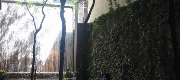


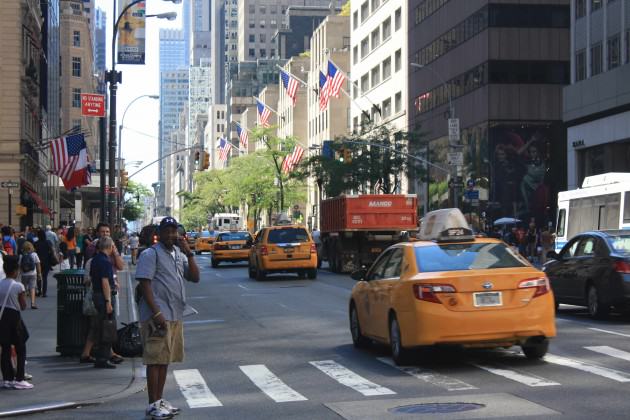
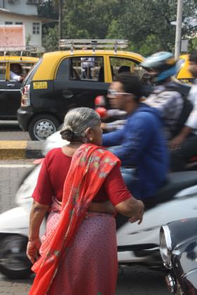
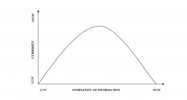
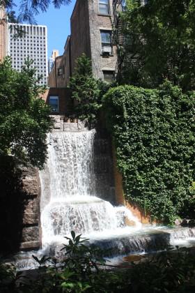
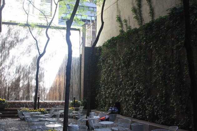
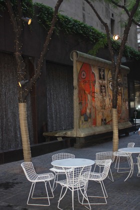
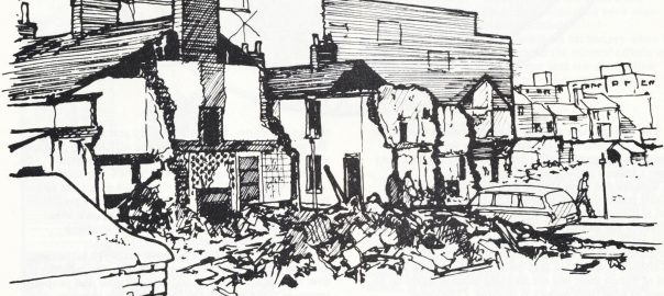
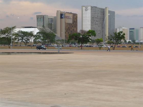
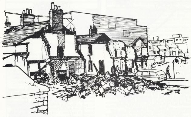
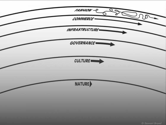
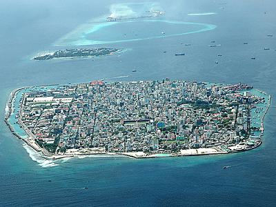

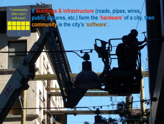
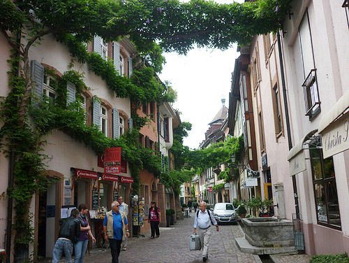

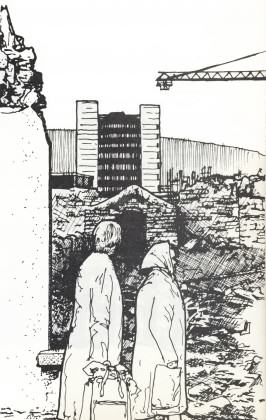
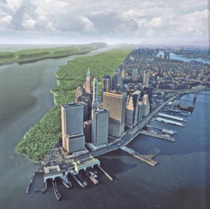
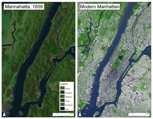
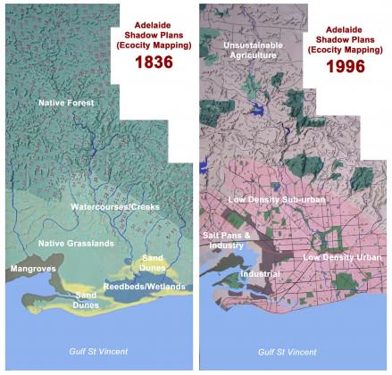
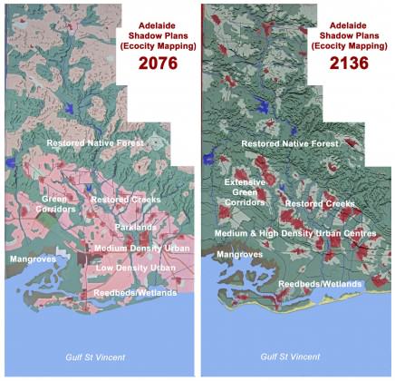
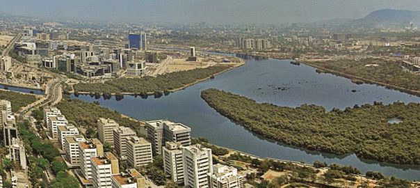
 The Way Forward: Summary
 Beach conservation and nourishment: 16 km in length
 From rivers to ‘Nullahs’ to rivers again: 81.4 kms in length — both banks
 Creeks and mangroves: 34 km
 Wetland conservation: 10 km
 Lakes, ponds and tanks: 2.4 km
 Integration of ‘Nullahs’: 96 kms
 Playgrounds, parks and gardens: 13.37 sq km
 Plots and layout Recreational Grounds: 23.15 sq km


 Development control regulations for hills: 64.31 sq km
 Roads and pedestrian avenues

 Conclusion

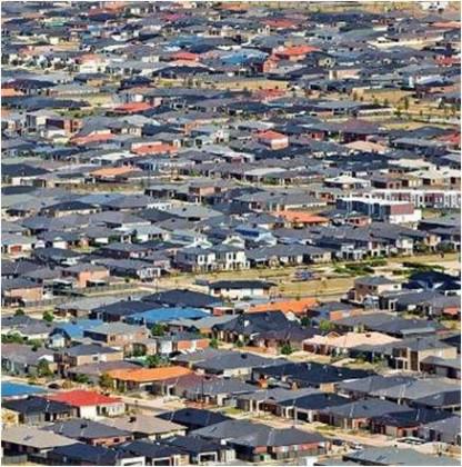
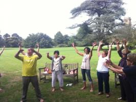
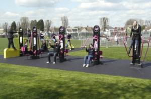
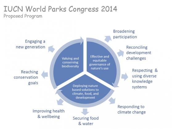
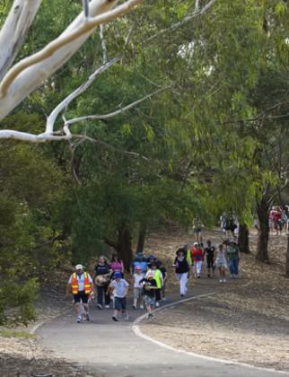


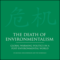
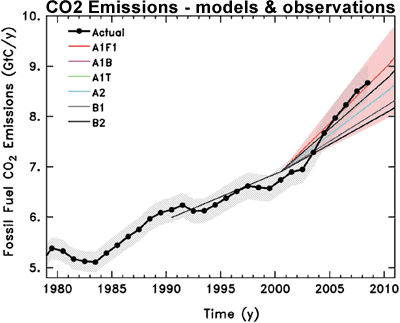


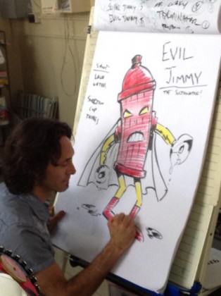


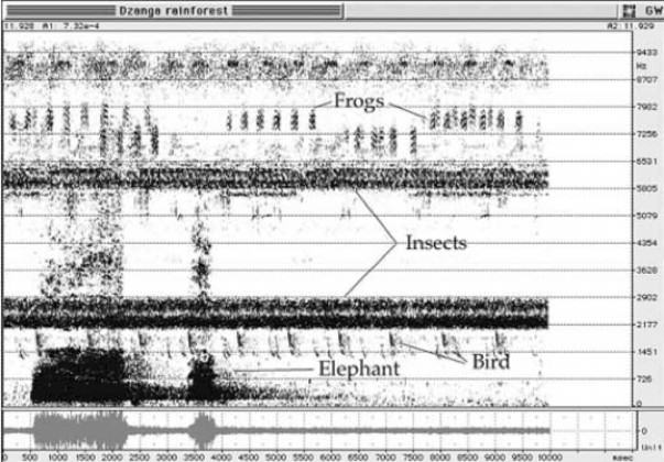
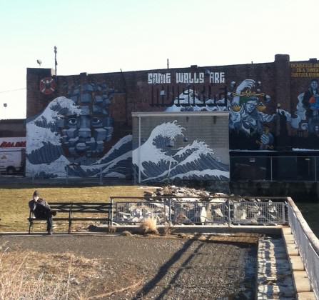

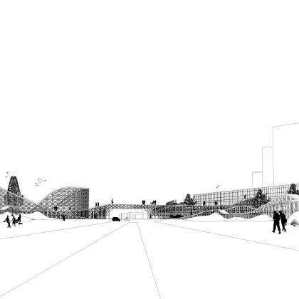
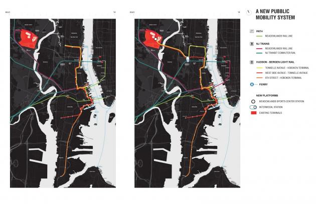
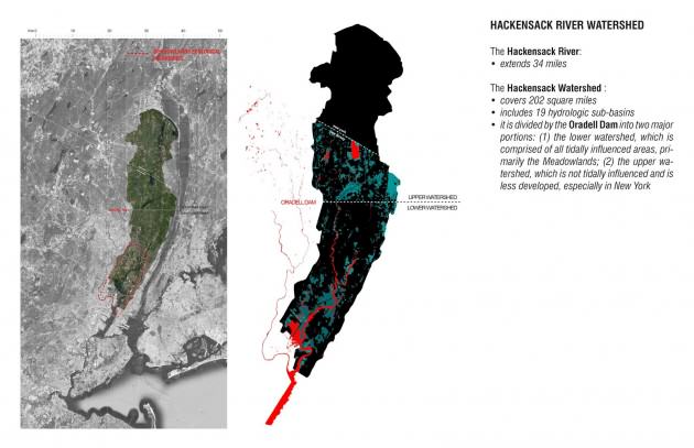
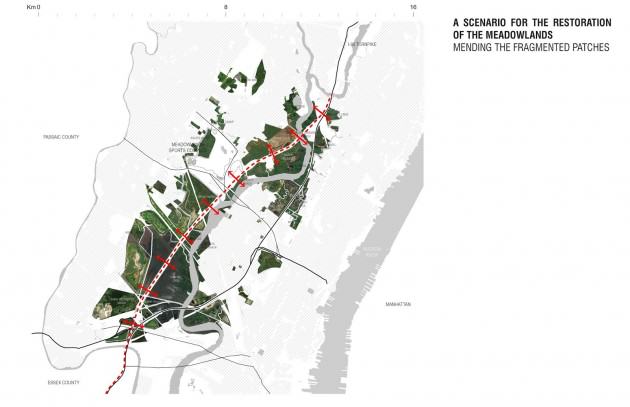
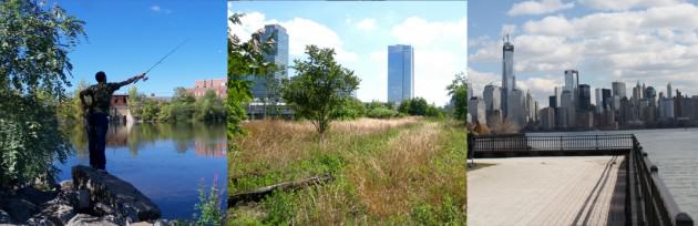
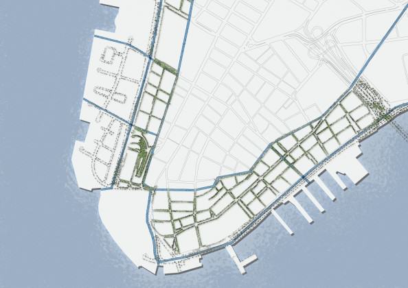
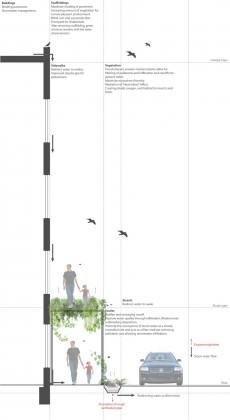
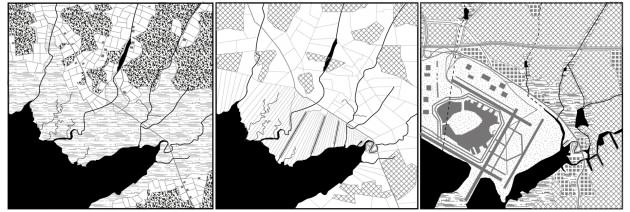
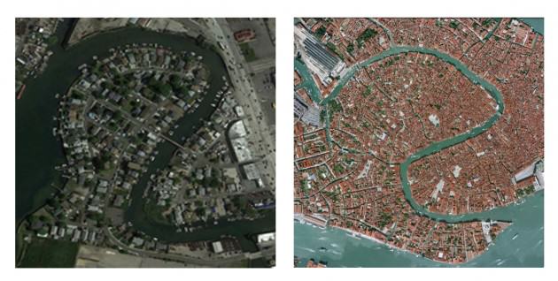
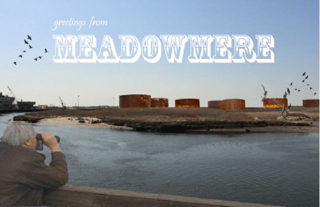


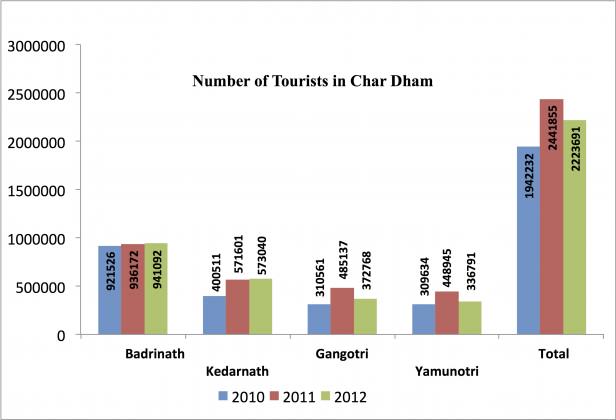 While we can easily categorize this as a natural disaster, I attribute this as a human-made disaster. Ecological disasters are a result of disturbance in the natural rhythm due to adopting lifestyles and technology practices that change the basic constitution of nature. Uttarakhand, the place where the disaster happened in June, is located at the foothills of the Himalayan mountain region and is abundantly rich in forests, mountains and water and is an ideal place of hydropower generation.
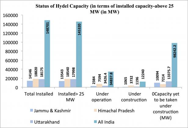 Statistics do not lie. We can see that the average annual growth rate in Gross Domestic Product of the state has been 18.6% between 2004 and 2012. The state could achieve such a growth rate due to the wide-range of benefits it offers to industries in the form of interest incentives, financial assistance, subsidies and concessions. The state has also undertaken several initiatives to attract tourists. Tourism has both direct and indirect impacts on the economy. The quality of the forest cover has declined and it varied among the districts. The decadal growth in urban population in the State has been 42% during 2001-2011 while the district Rudraprayag, where the disaster struck, has registered a growth rate of 263%. The number of hydroelectric projects in the hill states of Uttarakhand, Himachal and Jammu has increased and they generate 148,701 MW of energy and several projects worth 98,242 MW are in the pipeline. There are around 680 dams reportedly in various stages of planning or construction in Uttarakhand, in addition to the 70 existing ones.
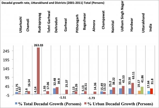 We know that most of this demand for hydroelectric power and better infrastructure comes from the urban dwellers, who do not even understand the relevance of ecosystem services to their everyday life. The problem lies in the mindset of most of the urbanized people and policy makers who think that a magic wand called technology is the key to all problems in India. Our technologies have proved to be regressive in terms of increasing the size of our ecological footprints.
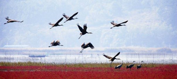
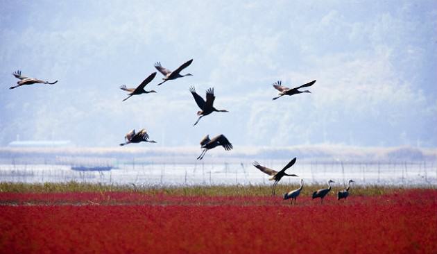
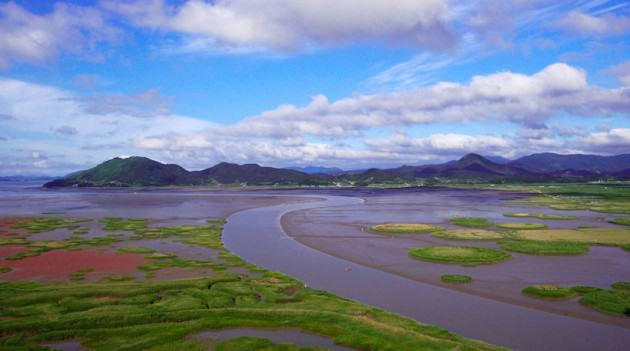

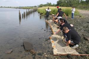
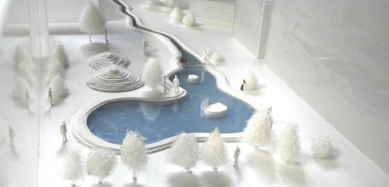
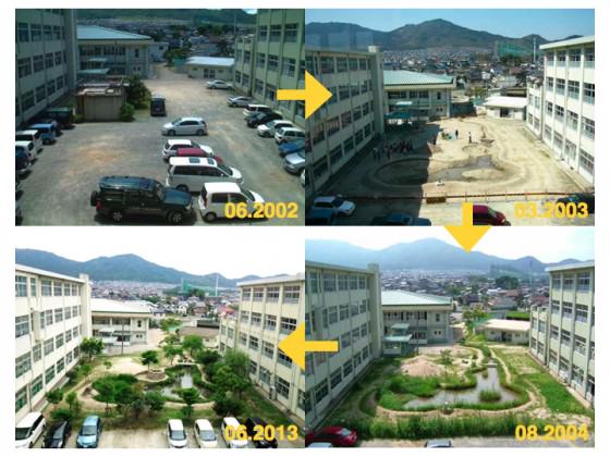
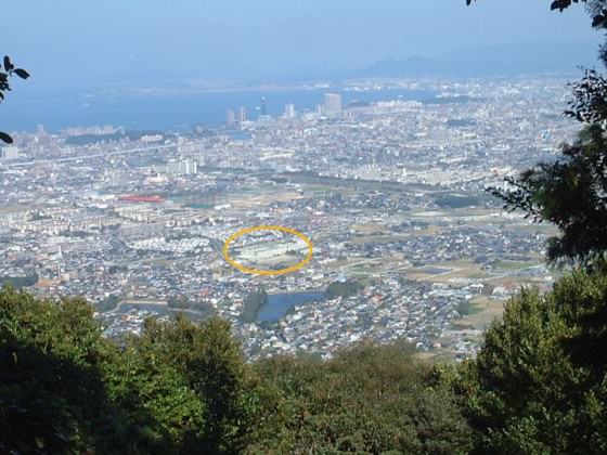

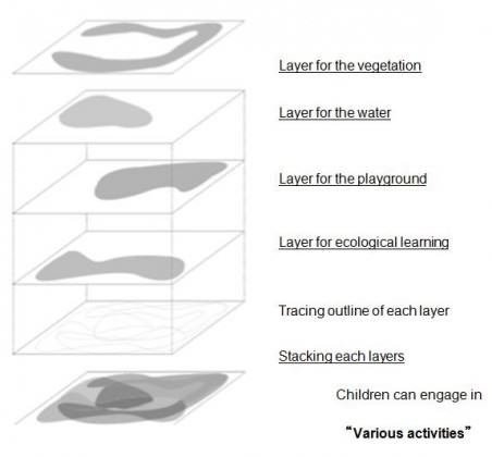
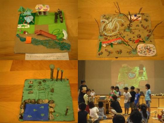
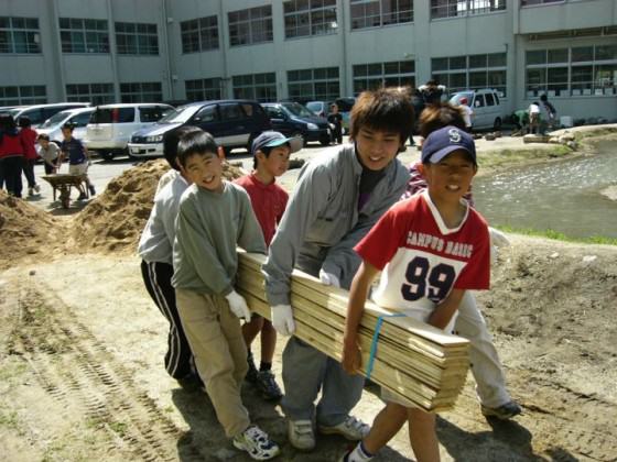
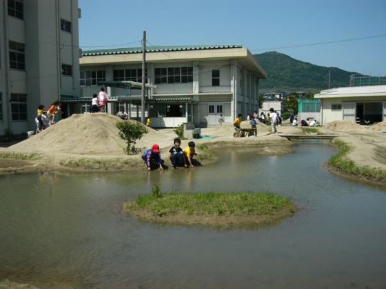
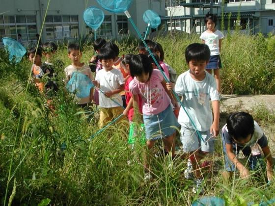
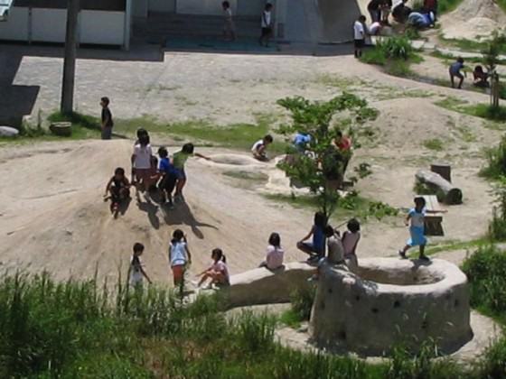
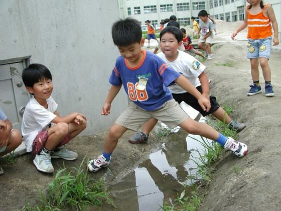


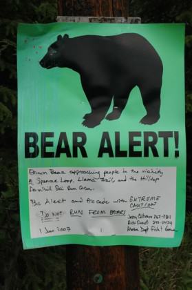
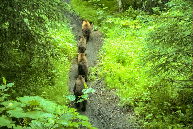
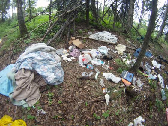
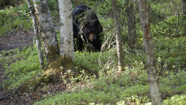
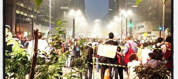


![Cover of the book “Cities for ALL :(re)learning to live with NATURE”, release June 5th [in Portuguese] forewords by Cynthia Rosenzweig and Thomas Elmqvist.](https://www.thenatureofcities.com/TNOC/wp-content/uploads/2013/07/Fig-4-book-cover-268x420.jpg)

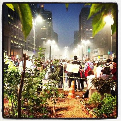


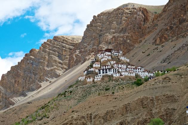
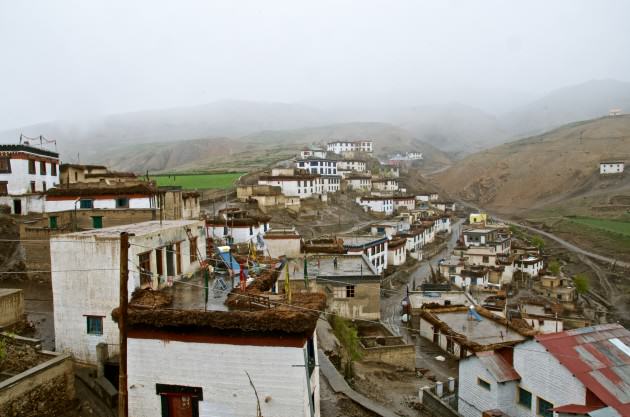
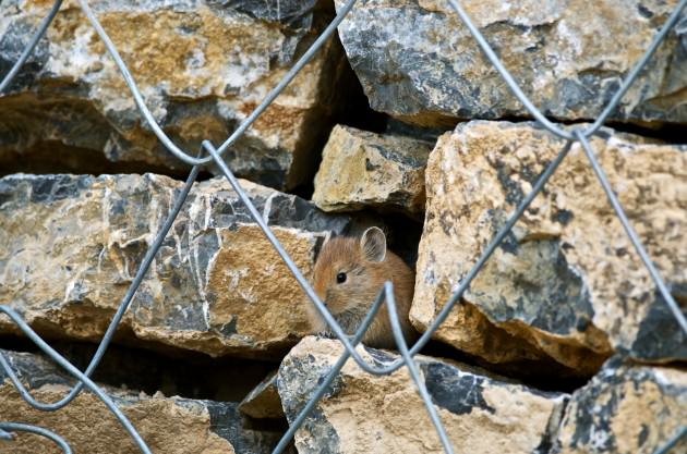
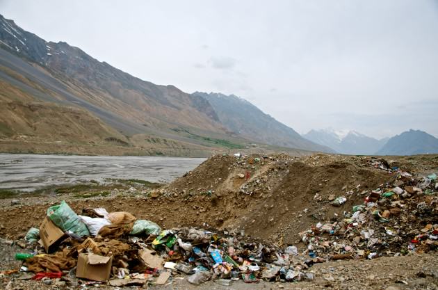


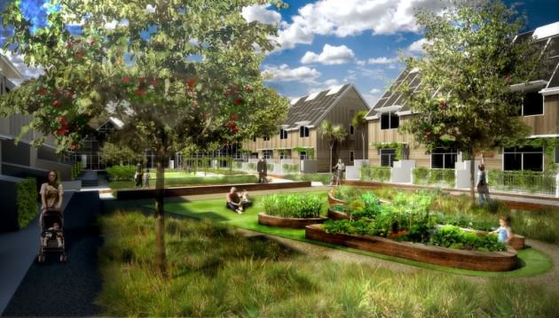
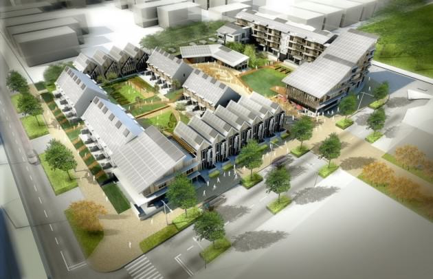
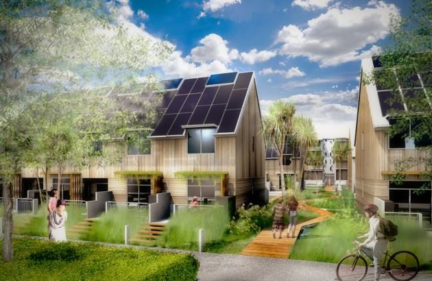
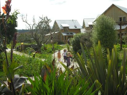 Glenn Stewart


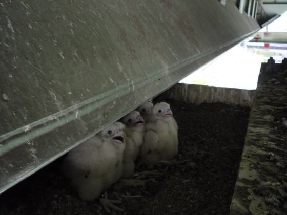
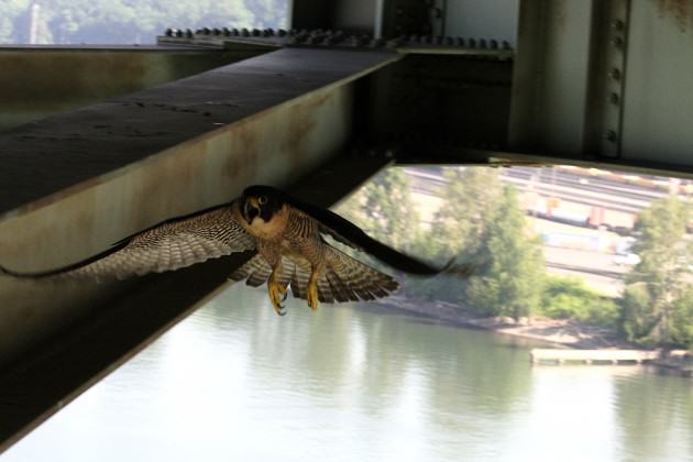


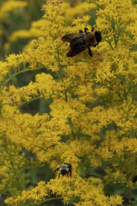
3 Comments
Join our conversation