Dancing with scientists is awkward and hard. We have norms around what is seen as “professional” behavior. Franklin encouraged us to challenge this — pushing us out of our comfort zones.
Lindsay: I am co-principal Investigator on a USDA Forest Service (USFS) research project called “Fueling Adaptation” which is looking at wildfire communications, governance, and adaptation as part of the Wildfire Crisis Strategy. This is work I co-lead with Miranda Mockrin (USFS) and Cody Evers (Portland State University). Our team of social scientists and practitioners met in person for the first time in November 2023 in Denver, after a year of working together virtually to prepare, to kick off the next two years of work. We spent one day in Jefferson County with wildfire response professionals touring various sites in the wildland-urban interface (WUI) and two days meeting, presenting, and collaboratively working on synthesis at CU Denver, hosted by Austin Troy.
Franklin Cruz and Lindsay Campbell
The-PIs agreed to invite Franklin Cruz, an Urban Field Station Artist in Residence, to lead an arts-based exercise as part of our workshop. I have to say that just taking this first step was a leap of faith for my colleagues — they had never done any sort of arts-engaged work as part of a meeting, so they were curious but willing to experiment. I think a willingness to experiment or take a leap is key to this. Another key factor is that Travis Warziniack was willing to offer some of the Denver UFS resources with The Nature of Cities to support Franklin’s time. I’m grateful to Travis for making this possible. I admit that even as PI of a project, I had not built in a budget for this sort of experimentation and that is a lesson learned for me.
We had a Zoom conversation with Franklin and I shared our overarching objectives, described our team and our meeting, and shared a project 2-pager that had our main research questions on it. Franklin offered us a range of options and experiences — from shadowing our group and producing a piece of poetry about our work to a more immersive half-day workshop with other dancers brought in to reflect on wildfire adaptation, to what we settled on which we thought of as an “introductory” step, which was a one hour, somatic and movement based experience that our team would participate in. We both agreed that our team would be tired from sitting in a conference room all day, working with intense cognitive focus, and reconnecting with our bodies would be an important step. Particularly when we think about the heavy emotional resonance and magnitude of the wildfire crisis — we wondered what it would go to our research team to have this shared, embodied experience together.
I can honestly say that dancing with scientists is awkward and hard. We are so used to seeing ourselves as just zoom boxes (disembodied heads), or maybe as bodies in chairs. We have norms around what is seen as “professional” behavior. Franklin encouraged us to challenge this — pushing us out of our comfort zones. Even as a former athlete and a person who likes to dance, it was hard to stop blushing, hard to move past embarrassment. There were many awkward laughs. But Franklin made it easy, leading us through a series of directed exercises.
I will never forget the experience of locking eyes with my colleague, Research Ecologist Michelle Johnson, as we jubilantly danced out a representation of wildfire that was allowed to burn — far away from homes and lives, as we represented visions for the future. Meanwhile, Austin Troy was wiping away unfettered development with a flick of his arms. Dancing allowed us to DREAM and IMAGINE in ways that we absolutely do not as scientists. By the end of the workshop, I actually felt like I was dancing — hearing the music for the first time, and not worried about how folks were perceiving me. I had reconnected with my body.
I asked my fellow PIs for their thoughts, and here’s what Cody shared:
“I was reminded of the challenge of feeling comfortable and free to dance. I was surprised when Franklin asked us to communicate through movement answers to really cerebral questions so closely tied to our project. At first, it seemed like a game of charades – a somewhat awkward way of addressing these issues! I felt these questions are clearly best handled through words and thoughts. But then I realized that perhaps this was a bias that had been impressed on me and that my inability to articulate thoughts through movement was more about my illiteracy in this language rather than the language itself. While I don’t feel that I was able to transcend this barrier, the experience felt like an important realization of how “art can guide science”.
Franklin responded with their thoughts on the collaboration:
Franklin: I was intrigued with this collaboration because of my work integrating science and art at the institutional level. I’m excited to get nerds to play and creatively experiment because I’m a sucker for homo sapiens. My initial thoughts are about the process I’m familiar with: an introductory phase to build comfort and a base vocabulary then shift to an artistic storytelling phase and finishing with a critical graduate-level application. My favorite part is watching limits be broken whether creatively, personally, or philosophically. I see shy folks begin to access introvert power with simplicity, extroverts gather energy. I see strong cerebral folks struggle with being somatic and often do the entire time; compatibility with the art is a variable. Many see the thread of logic to the process and outcome. Everyone usually ends up in their body regardless of the journey asking questions often overlooked and minimized because of professionalism, cognitive fatigue, or simply desensitization to our own somatic experience.
Construction of the workshop is a tried and true practice for me. The questions the organization is tackling weren’t difficult to interpret from the two-page material provided and the conversations with Lindsay. My background in biology and ecology helps immensely with understanding the audience I’m working with. The difficulty is finessing the facilitation; being grounded and prepared to receive unwariness, excitement, and guidance into the high-level application of creative practices for mission-relevant outcomes. I wanna balance the play and expertise of our communities. Regardless of the science or resource management practice, fire has an emotional, social, and ecological impact. Your body is the instrument that processes that information and we hardly practice using the full toolkit.
It becomes a practice of pulling ethos from logos through pathos. Feeling for this particular workshop is essential. Critically we cannot abandon our real-world issues to just dance; movement offers an alternative way of thinking theoretically in a format of infinite possibilities. We reconnect with our deep motivators, critically thinking about impact and playing pretend where we can make anything happen. How would we tackle issues if we build from such a somatically informed base? What would we identify as quick solutions if we connected to our body’s intelligence? Somatically processing is a skill and what does it teach us that cerebral processing isn’t attuned to?
Robin Wall Kimmer in Braiding Sweetgrass reminds us we are mutualistic with many ecosystems when we’re balanced as a species. Her practices balance art and science and this is the model I am inspired by. My Mexica (Meh-shee-ca) elders remind me that adding beauty to the world is symbiotic too and making it mutualistic is difficult, not impossible. Observing my mentors and elders I honor my niche and adaptations, I know my ecosystem, I’m aware of the socio-cultural biosphere, and am most fertile artistically. Seeds spreaders help forests grow, I apply my skills similarly taking seeds from different forests to another. Whether they sprout, mature, make populations or communities, and develop into old forests isn’t my responsibility.
I want to express the gratitude I have for Lindsay and Travis for funding this work because it appreciates the craft and legitimizes the role it has in science. I am a practiced professional and trained extensively over a decade to develop this skill. I’m moved by the comments from Cody above. It is the outcome I deeply desired. I always say I’m not here to make you artists or dancers, I’ve learned so much from my friends that I just want to synthesize the skills we can all learn from as homo-sapiens and see these skills as pathways to envision and direct our communities to an unimagined world that we feel. Any art will do and I always bring writing, movement, culture, nature, and spirity stuff. It’s who I am and my body tells me.
Lindsay: I have many reflective questions as the meeting organizer. We had planned to have this at the end of day 2 as a reset/interrupter before our last day of synthesis, but due to some logistical hiccups we had to move it to the end of day 3, so this meant we didn’t have participation of our full group. It worked as a lighthearted, “send off” to the meeting — but I wonder what work it would have done in its original spot in the agenda? How could I have done more to build off this shared experience and scaffold upon it? Should I have done a formal evaluation? Should I have invited Franklin into more of the meeting? Should I have created a transdisciplinary research question as part of the work from the outset? Would any agency ever fund that? Or is it okay that it was “just an excercise?”
At a minimum, the workshop was a source of team-building and bonding and an alternate way to get to know each other more deeply. More than that, it reminded us that we TOO are human animals, with sensing bodies and feelings. Ideally, it helps us better envision our north stars – why we are in this wildfire research work — and what would a transformed world really look, move, and feel like? Thank you Franklin and to my colleagues for being willing to experiment with me!
Franklin Cruz is a queer Latin dancer, poet and environmental nerd born in Idaho, raised Texan and polished in Denver. Born from an immigrant family their work has placed them in science museums, as an emcee for dance & poetry competitions, conferences and environmental spaces. A Tedx Mile High performer and Nature of Cities residency, he worked throughout the southwest, Peru, Puerto Rico for universities and environmental leadership camps. Their work encompasses self love, immigration, culture, conservation and more.
Every month we feature a Global Roundtable in which a group of people respond to a specific question in The Nature of Cities.
show/hide list of writers
Hover over a name to see an excerpt of their response…click on the name to see their full response.
Adrian Benepe, New York Will New York City take the bold step to daylight a stream and create the stacked benefits of green infrastructure, or go for the more “cost effective” but one-dimensional move to simply use a lake in the park as a temporary storm water holding facility?
Keith Bowers, Charleston Urban stream restoration is an interesting subset of urban ecological design because its value sits so squarely between cultural and ecological benefits.
Meredith Dobbie, Victoria Developing a business case is essential to advance the daylighting and restoration of urban streams, ponds and wetlands.
Susannah Drake, New York What is needed is a balance of green and grey engineering that creates a more dynamic synthesis of urban and ecological form. Daylighting streams in urban areas is part of this.
Herbert Dreiseitl, Überlingen Whatever scale and dimension of the development, BGI is an underlying fundamental that connects people with their environment.
Marit Larson, New York Restoring urban streams and wetlands transforms the landscape, creating green infrastructure with environmental and social benefits.
Chan-Won Lee, Changwon With the combined efforts of the government and the NGOs, the urban (Bongam) tidal flat in Masan Bay was designated as a national protected wetland area in 2011 and has been managed as one of the successful wetland protected areas in Korea.
Kaitlin Lovell, Portland Portland’s restoration of streams is ecologically, economically, socially, and climate smart, and empowers a community as the next-gen of urban eco-stewards
Alberto Tacón, Valdivia An urban wetland is a condition in which a city is born, grows and develops. To restore is to reconcile something with its true natural identity.
Adrian Benepe has worked for more than 30 years protecting and enhancing parks, gardens and historic resources, most recently as the Commissioner of Parks & Recreation in New York City, and now on a national level as Senior Vice President for City Park Development for the Trust for Public Land.
Urban stream restoration has been in practice for over 30 years, with early efforts in the Chesapeake Bay watershed and California. In recent decades, other U.S. cities have joined in, including New York City and nearby suburbs; Boston; Los Angeles; Kalamazoo, Mich.; and San Luis Obispo, California, with many more in the planning and development stages.
Among the stream restoration practices is the daylighting of a stream or small river that has been covered over. Among the best known examples is in Seoul, South Korea, where the Cheonggyecheon stream—a once-pristine waterway that, by the 20th century, had turned into an open sewer—was buried under layers of highways and other urban systems. The city peeled away layers of roadway, exposing and restoring the stream bed and making it the centerpiece of an enlivened neighborhood, where children play in the clean waters (fed by a mechanical system) and plant, insect, bird and fish species proliferate, despite the extensive engineering.
Yonkers, New York (just north of New York City) has an example of daylighting a buried stream. The Saw Mill River, which housed the eponymous mill that used hydropower to cut timber, was covered over by the city and encased in a flume to hide the dirty waters that flowed through it. Recently, the city celebrated the completion of the first phase of daylighting of the Saw Mill, which did not demolish the circa 1925 flume, but instead diverted water from it into a new river bed which flows through the heart of the city, where a parking lot once covered the river.
Nearby, in the Bronx, a bold new daylighting project is in the planning stages. The goal of this project is to remove Tibbetts Brook from New York City’s combined sewer overflow (CSO) system, into which it is currently piped. Tibbetts Brook drains a 2,508-acre watershed that consists of most of Van Cortland Park in the Bronx and Tibbetts Brook Park in Yonkers. The Brook is a natural tributary to the Harlem River, but for almost a century the entire stream has been piped to Broadway, several blocks to the west, where it mixes with sanitary sewage and is pumped nearly seven miles south to a waste water treatment plant. Removing the stream from the CSO and daylighting it by restoring a section of the stream to an open, vegetated channel, will reduce the combined sewage overflows to the Harlem River, restore ecological functions to a buried stream, enhance open space and environmental experience, and increase the resiliency and operational flexibility at a waste water treatment plant.
Removing the Tibbetts Brook stream flow from the combined system would provide significant relief to the CSO system in addition to providing multiple other benefits. The restoration of the creek as a tributary to the Harlem River could reduce flow entering the CSO by up to 240 million gallons per year and could reduce the number of CSO events occurring on the Harlem River by approximately 15%. In addition, daylighting the stream through Van Cortlandt Park and along the street and adding a proposed greenway could create new economic, educational, cultural and recreational opportunities and provide aquatic and riparian habitat together stormwater detention and treatment.
Despite the clear benefits of not directing the entire stream system from this largely forested watershed into the CSO, the City has not made any prior efforts to correct flawed hard engineering solutions. Currently, the NYC Parks & Recreation Department is working with the City’s Department of Environmental Protection, which oversees the water supply and sewer system, to evaluate alternatives for Tibbetts Brook.
Will the City take the bold step to daylight the stream and create the stacked benefits of green infrastructure, or go for the more “cost effective” but one-dimensional move to simply use a lake in the park as a temporary holding facility, keeping the level low but allowing it to fill higher during storm events and channeling the overflow through traditional gray infrastructure to the treatment plant? The decision could mean a lot to the quality of life of local residents—and their animal neighbors.
Current and proposed condition for Tibbetts Brook restoration project in The Bronx, NY, by Geoffrey Lenat
For nearly 30 years, Keith Bowers has been at the forefront of applied ecology, land conservation and ecological restoration. As the founder and president of Biohabitats, Keith has built a multidisciplinary organization focused on regenerative design.
Urban stream restoration: a catalyst to improving biodiversity and quality of life
Urban stream restoration is an interesting subset of urban ecological design because its value sits so squarely between cultural and ecological benefits. The sheer poetry of freeing water from the rusty confines of subterranean pipes and raising it into a cultural amenity that brings the natural world to urban residents (daylighting) is irresistible to the landscape architect in me. As a restoration ecologist, I am also keenly aware that many urban stream restoration initiatives, including most daylighted streams, rarely have the ability to restore the full suite of physical and ecological processes associated with them. But this doesn’t matter. What matters is that we use every opportunity we can to restore urban streams and wetlands to the best of our ability to improve both the places we live, work and play along with the receiving waters these systems feed.
While many urban stream restoration and stream daylighting initiatives focus more on aesthetic and cultural benefits, an often-missed opportunity is the chance to enhance urban hydrology, water quality and biodiversity.
An often overlooked but critical component to any stream is its adjoining floodplain. Floodplains are the hydraulic relief valve for streams, attenuating flood flows, recharging groundwater, assimilating nutrients and harboring many species of flora and fauna. Without access to floodplains, stormwater runoff is often trapped in the stream channel, causing increased erosion of the channel bed and banks, degraded water quality and loss of in-stream habitat. Understandably, in many cases the idea of restoring an urban channel and its adjoining floodplain are all but impossible due to space constraints. But that should not stop us from trying to restore floodplain functions back into these projects. Truncated (or sporadic) floodplains, alternating flow regimes, recharge areas and reestablishing a native plant community along the stream’s edge can all contribute to restoring the functions and values associated with lost floodplains.
Another aspect of urban stream restoration and daylighting is its ability to be integrated into a more holistic program to improve water quality. Stormwater runoff from buildings, paved streets and other hard surfaces in urban areas carries with it a toxic mix of nutrients, heavy metals and hydrocarbons. Untreated, this runoff enters storm drains, channelized streams and ditches, which eventually drain to downstream water bodies like rivers, lakes, estuaries and oceans. Combined with stormwater best management practices throughout the watershed, urban stream restoration provides a great compliment to improving water quality for both human consumption and fisheries.
Finally, urban streams often serve as the only vestiges of once thriving natural habitat left in urban settings. Too often the primary purpose of restoring urban streams is to improve water quality or to enrich the cultural or aesthetic value of nearby property. Wildlife along with migratory and resident birds need these corridors of remnant vegetation to meet their life requisites. This habitat is rendered even more important because riparian corridors often offer the only connection between larger patches of green space such as parks. Studies have shown that restored and daylighted urban streams that purposively build-in both physical and hydrological complexity found in natural streams will support a greater array of wildlife including amphibians, mammals, reptiles, insects and birds of all kinds. One example is the presence of wood. Decaying wood in stream systems adds carbon and fuels the growth of aquatic insects and other microbial organisms. This in-turn provides food for many of the larger aquatic species that support a more divers and interesting urban food web.
Restoring and daylighting urban streams can improve water quality, support riparian zones rich in native plants and wildlife, regulate water flows and floods, and can create landscape connectivity as the backbones of urban habitat corridors. While few single urban stream restoration initiatives afford the opportunity to realize all these benefits, that doesn’t mean we shouldn’t try. Supporting multiple ecological benefits, regardless of the initial impetus for a project, will allow us to restore ecological balance in urban areas.
Meredith Dobbie is a landscape architect and research fellow at Monash University. Her research interests revolve around urban nature, landscape aesthetics and sustainable landscape design.
Recently, Gilbert Rochecouste, a placemaker, proposed that Williams Creek, channelled in a stormwater drain under Elizabeth Street in the centre of the city of Melbourne, Victoria, Australia, should be daylighted. The proposal was described as “unfeasible” by the city council.
How can we advance the cause of daylighting and restoration of urban streams, ponds and wetlands? One way is to demonstrate their benefits and evaluate them in monetary terms. We need to develop the business case. The benefits are often expressed as economic, environmental and social. Laura Musacchio, an American landscape architect, suggests that we should broaden this triple bottom line to 6 E’s for sustainable landscape design: economic, environmental, equity, (a)esthetic, ethical and experiential. (The scientific basis for the design of landscape sustainability: A conceptual framework for translational landscape research and practice of designed landscapes and the six Es of landscape sustainability. Landscape Ecology, 2009, 24, 993–1013).
Let’s look at what is known about these benefits. If we know what they are, we can more easily put a dollar value on them, for those interested in the business case.
For the moment, let’s put aside the economic benefits, with the assumption that they will be evaluated. Some of these benefits have markets, e.g. fishing, and can be evaluated easily. Some non-market economic benefits, e.g. ecotourism, can also be evaluated with methods such as ‘willingness to pay’. It’s the evaluation, in dollar terms, of other non-market benefits that’s tricky. Many of those benefits derive from the other Es. Let’s consider them.
Environmental benefits must be self-evident, surely: increased biodiversity, improved water quality, reduced urban flooding, aquifer recharge, improved urban microclimate, etc, etc. Some of these can be evaluated economically, e.g. value of insurance claims prevented by restoration of wetlands to reduce urban flooding. Some cannot, e.g. intrinsic value of biodiversity.
Williams Creek asserting itself, Elizabeth Street, Melbourne, Victoria, Australia, 1972. Source: http://resources1.news.com.au/images/2014/06/29/1226971/242373-bc68598c-ad6c-11e3-9d7e-f018f46e0213.jpg
Benefits involving equity, aesthetics, ethics and experience of waterways and wetlands generally do not have markets to inform their evaluation. Nevertheless, these benefits are increasingly acknowledged and the subject of research in many countries. Much of this research is based around the theme of well-being and has shown the critical importance of urban nature, accessible at creeks and rivers, ponds and wetlands, to human well-being, contributing to psychological restoration and improving health. Some of these benefits derive from experiencing the landscape. Other benefits result from the improved thermal comfort of the urban landscape as a result of the vegetation and water within it. The presence of water also provides benefits associated with opportunities for passive and active recreation.
The aesthetics of the waterway or wetland are important in perception of the benefits. Not everyone uses the same aesthetic when they look at the world. There are at least four ways of looking at landscapes, discussed by Paul Gobster, Joan Nassauer, Terry Daniel and Gary Fry, in their very interesting paper titled “The shared landscape: what does aesthetics have to with ecology?” (Landscape Ecology, 2007, 22, 959-972). People using a scenic aesthetic look for beauty in the landscape, whereas those using an ecological aesthetic look for dynamism, ecological function and health. A tension exists between these two aesthetics, for both can interpret the landscape as ‘natural’. In scenic landscapes, perceived naturalness might not reflect the scientific notion of naturalness, which is valued by the ecological aesthetic. An aesthetic of care and effect of knowledge values signs of human care and intent in the landscape, and an aesthetic of attachment and identity values cultural landscapes that reflect place attachment and identity.
Which of these aesthetics, then, might be used when looking at restored waterways and wetlands? How might the different aesthetics influence their perception and value? I would suggest that waterways and wetlands can be viewed favourably with any of these aesthetics, so that they are appreciated and valued. Context of the waterway or wetland in the landscape is all important, as are the personal characteristics of the viewer, including knowledge and familiarity. However, the scenic aesthetic and the aesthetic of care and effect of knowledge might not always yield favourable perceptions. Not all creeks, rivers and wetlands are beautiful and many can look messy and uncared for, particularly in an urban context. This potential pitfall, though, can be overcome with attention to the design and maintenance of the restored landscape, to suggest that any apparent ‘messiness’ is intended, and by promoting familiarity and understanding of these landscapes.
So we return to the pesky problem of providing a business case for the daylighting and restoration of urban streams, ponds and wetlands. We must look to the economists to evaluate in dollar terms the myriad non-market values of the benefits of these waterbodies. I know that they are working on this, for example within the Cooperative Research Centre for Water Sensitive Cities, based in Melbourne, Victoria, Australia.
In addition, we must encourage everyone to discuss this issue, so it is already part of the public discourse when we have the business case to make it a priority in urban planning.
Constructed wetland in suburban Melbourne, Victoria, Australia. Photo: M. Dobbie
Susannah is the founding principal of DLANDstudio architecture + landscape architecture pllc. DLANDstudio’s public projects include the QueensWay Greenway, MoMA Rising Currents Exhibit, BQGreen and the Gowanus Canal Sponge Park.
Making our urban hydrologic systems visible not only makes economic and environmental sense it also has major cultural ramifications as well. Swamps, streams, springs and rivers contained and channelized to facilitate development give us a false sense of security that the forces of nature can be easily controlled by hard engineered solutions. While this may be true for a particular moment in history, the forces of nature are variable and with climate change the limits of these systems are also being tested and challenged more frequently.
If we look at the geology of New York City and the hydrologic mapping of Eduard Viele interesting patterns become apparent. High-rise buildings populate areas where the bedrock could support them. Lower buildings occupy areas that were historic marshes, mudflats, swamps, streams and streams. With technological advances, the necessity of bedrock foundation is less important for structure. But is building in the historically swampy areas a good idea? Superstorm Sandy should have provided an answer. Areas that are low and were swamps, that historically flooded received a bulk of the damage. We knew it was coming. We knew where the water was going to go but the grey engineered systems gave us a false sense of security.
Which brings me to the importance of day-lighting streams. We need to learn to live with the environment. This is not to say that we should become victims of weather events and rely on a rhythm method of flood protection. What is needed is a balance of green and grey engineering that creates a more dynamic synthesis of urban and ecological form. Daylighting streams in urban areas is part of this. Exposure of the waterways not only creates a healthier ecosystem by promoting habitat it also serves an important pedagogic function.
Kids that play in streams will see the dynamism of fluid dynamics. They can experience spring surges and summer dry spells. Teachers and environmental educators can help them recognize the variety of birds, butterflies, fish and amphibians that migrate through, feed, breed and occupy the corridor. Waterways as corrIdors enhance habitat beyond their immediate area by creating connectivity with disparate patches of open space.
But fundamentally there is also an important functional reason to daylight urban streams. Green infrastructure provides an attractive and reasonably priced means for cleaning storm water runnoff and reducing the load on combined sewers. Plantings not only absorb water their evapo-transpiration helps cool the air reducing heat island effect. Blue green corridors help absorb pollutants and particulate matter in the air releasing clean oxygen. Day-lit streams can enhance wildlife habitat and improve the quality of life for urban dwellers as well.
Herbert Dreiseitl is an urban designer, director of the Liveable Cities Lab, the new think tank at the Rambøll Group International, and founder of Atelier Dreiseitl.
Comparing structures in the natural environment with those from urban settings, a significant difference can be seen: nature works on principles of flexibility and resilience, a dynamic reaction and balance to any event, from a soft change to the unexpected disaster. We can learn a lot from this flexible and dynamic response of ecosystems in the design of urban settings.
Fast growing urban sprawl continues to cover the surface of the planet with asphalt and concrete. Instead of slowing down rainwater runoff, holding it back and avoiding concentrations, this type of development results in large quantities collecting at the same time and same place. These are the conditions for urban flooding. On the other hand urban streams often lack water in dry periods. As a result, temperatures rise and oxygen is low. In the absence of blue and green there is no filtration of air, no holding back of micro particles (wind-blown dispersal). Thus, there are higher dust concentrations which contribute to conditions that are unhealthy. Blue-Green Infrastructure (BGI), an approach to urban design that relies on natural elements (flora and water) which are deployed in strategic ways, can mitigate these conditions, creating natural corridors that are highways for biodiversity.
In 2006, the Public Utilities Board and the National Water Agency of Singapore started a program called ABC Waters—Active, Beautiful, and Clean—that aims to realize the full potential of an integrated BGI approach. By treating rainwater as a prime resource to fill up reservoirs and water bodies the ABC Waters’ program is a strategic initiative that works with the entire urban catchment of the island. Instead of getting water from far the city, urban development is the collecting surface and contributes to its water security.
One of the pilot projects, by far the largest, is the transformation of 3.2 km of the Kallang River in combination with 62 hectares of Bishan-Ang Mo Kio Park. This is classic BGI project with a strong social component—a vibrant urban river with natural elements counting over 3 million visitors per year. The benefits and improvement of this and other BGI projects are the objective of an ongoing research project by the Rambøll Foundation in partnership with Harvard, MIT, Zeppelin and the National University of Singapore.
Bishan-Ang Mo Kio Park in Singapore. Photo: Atelier Dreiseitl
There are many questions to be answered about the integration of BGI into cities. What functions and qualities must these spaces fulfill today and in the future? How can we create living systems that save natural resources, filter, clean and regulate water supply, balance temperature, produce good air, and increase natural habitats? What are the basic principles, processes and methods to integrate BGI in cities of today and in the future?
These questions must extend to the search for strategic policy making tools and good governance structures. Detailed knowledge about Blue-Green living systems, about materials and integrated technologies, have to be developed and experts must be called in during the early stages of the project, and importantly, be taken seriously. Urban landscape architecture should have a higher priority in a development and not be seen as byproduct.
BGI is not yet properly understood in its true function and value to a city and its inhabitants. It is the backbone for liveability, a repository of resources that balances and stabilizes life processes. We cannot easily measure, count and quantify the value of BGI to urban structures, not in the way that we might, say, hard forms of engineered infrastructure. BGI can never be a prefabricated décor that is countable, statically-determined and never-changing. It is a resilient living system.
And since these projects affect people, there must be public engagement and society building. To give hope to denser growing cities we have to create partnerships that balance the needs of people and the environment within urban landscapes in a more respectful way.
It seems we have all technology and knowledge available today; yet there is a lack of implementation. There is a discrepancy between what designers and engineers can create with what governments can activate in reality. We cannot afford this dilemma in the future.
Bishan-Ang Mo Kio Park in Singapore. Photo: Atelier Dreiseitl
Marit Larson is the Chief of the Natural Resources Group (NRG) at NYC Parks. NRG manages over 10,000acres of natural areas including forests, grasslands and wetlands, stormwater green infrastructure and a native plant nursery.
In New York City, over the last centuries, hundreds of miles of streams have been piped and thousands of acres of wetlands have been filled. Most of the remaining streams and wetlands are degraded to some extend through physical and hydrologic alterations, invasive species, and pollutants. Many city dwellers have limited access to and interactions with streams and wetlands. Urban streams and wetlands restoration projects can help create that access and provide other social and environmental benefits by transforming the urban landscape. But these projects need to have clearly defined goals, be tied to integrated community and watershed plans in some way, and be maintained. The concept of stream daylighting offers an example of the benefits, and challenges, of one type of ecological restoration that might be easy to convey to the public and decision makers.
Daylighting most streams in NYC would involve removing roads, street trees, and even buildings, and re-locating a complex network of below ground utilities and infrastructure. Sections of stream would need to pass in culverts or other structures under roads or railroad. The watershed is largely impervious, and the stream will likely be fed by piped stormwater runoff, resulting in a very different hydrologic regime than when the stream was last free flowing. Illicit connections to buried stormwater infrastructure connected to the stream may also have an impact on water quality. In addition, likely space constraints limit how nature-like the stream channel can be when re-constructed. Ultimately, a developed urban watershed is likely to result in hydrologic and water quality conditions that will limit the abundance and diversity of biota a stream can support.
Given these complexities and limitations, there are situations in which other forms of green infrastructure bring more environmental benefit at lower cost than true stream daylighting. For example, where there is too little space or it is too expensive to unearth an old stream course, the effect of a stream may be better achieved by building smaller, consecutive stormwater bio-retention systems that perform some of the same functions. Or a system of stormwater capture or even greywater treatment and recycling, constructed as a wetland system, might be the most feasible and functional version of “daylighting.” In some cities, streams are piped in their entirety to a combined sewer system that flows to a wastewater treatment system. In such cases, the restoration of the stream flow to its natural receiving water body is the requisite action for water quality improvement. This might happen through daylighting, but could also be achieved using a pipe network, if space is unavailable, or if no mechanism in place for maintenance of the natural system.
But water quality enhancement or stormwater management is seldom the only, or even the primary, objectives of stream daylighting. Instead, these projects can provide natural beauty, increased biodiversity and habitat for insects and other fauna, shade and local cooling through evapotranspiration, opportunities for environmental education and stewardship, and interesting landscape features that draw visitors and even attract businesses. Measuring these social culture and ecological benefits is difficult, and usually very site specific. Daylighting, or new wetland construction projects, can be the best places to measure these benefits, because of the contrast they provide to the prior condition.
Stream and wetland restoration and other types of green infrastructure projects all need to be maintained and managed, after construction, in part because these systems are in urban environments with constant urban stressors. This sometimes requires establishing new maintenance and operation systems or partnerships, specific to the site and is usually difficult to fund. Ultimately both the construction and maintenance of daylighting and wetlands reconstruction is costly. Thus, these projects should help build the argument for why it is so important to protect existing aquatic systems in our cities.
Dr. Lee, Chan Won is a professor at the Department of Urban Environmental Engineering of Kyungnam University, South Korea. He is also a chairman of Changwon Local Agenda 21 and Environment Capital Changwon Forum.
Urban Wetland in Changwon—Bongam tidal flat in Masan Bay
In most countries with a marine coast, development-oriented national policies have led historically to the concentration of populations and industrial activities in areas adjacent to the ocean known as the coastal zone. For many developing countries, shipping, fishing, aquaculture, and coastal tourism are vitally important to their economies.
Not withstanding this importance, coastal resources are often developed with a land-oriented perspective that fails to consider the unique physical and ecological characteristics of the coast. During the last 40 years, the natural features of Masan Bay in Changwon have been dramatically modified by urban, industrial, and port developments, with its tidal wetlands having been reclaimed to accommodate the expansion of a large population and ever-growing industry. Thus, the problems of pollution have steadily increased and have become a matter of public concern.
The Masan Bay and its vicinity has long been the center of national economic growth of Korea since 1970. However the bay got drastically polluted due to rapid industrialization and urbanization. The pollutant load collected in Changwon’s watershed located in the area of Masan Bay is either delivered to wastewater treatment plant through sewer line or directly entered Masan Bay after passing through the Bongam tidal flat which serves as the natural purification system.
The Bongam tidal flat, as a brackish tidal flat of Masan Bay, is located in the center of Changwon city and is also situated at the inner-most of the estuary near the Changwon Industrial Complex Zone. This tidal flat was also under reclamation pressure and was long neglected as a small piece of tidal flat generally considered as a wasteland. However, as it is accessible to local residents and because of its ecological significance, it was finally protected at the suggestion of various NGOs and put into law by the government in 1999. Restoration efforts have been attempted at Bongam tidal flat since then. The Community Advisory Council for Masan Bay was established since 2005 as a legal organization for Masan Bay’s ecosystem recovery and total pollution load management (TPLM) system to manage the coastal environment of the Masan Bay as the 1st model case in Korea.
The Community Advisory Council established an eco-tour program which provides citizens an opportunity to witness the restoration of the ecosystem and the mudflat ecosystem service. To raise the public awareness of the importance of the ecosystem, this tidal flat was assigned as an official visit site during the 2008 COP10 Ramsar Convention held in Changwon.
Bongam tidal flat is home for a variety of salt marsh plants, migratory birds, crabs, otters, and benthos. With the combined efforts of the government and NGOs, the urban (Bongam) tidal flat in Masan Bay was designated as a national protected wetland area in December 2011 and has been managed as one of the successful wetland protected areas in Korea. The contamination level of sediments in the tidal flat was changed from heavily polluted to non-polluted level by the monitoring data between 2006 and 2012. The COD loading to the tidal flat of Bay mouth through three streams was gradually reduced from 2,690 kg/d in 2005 to 620 kg/d in 2012. This was made possible through a series of actions including sewer line repairs, expansion of wastewater treatment facilities, eco-stream development, clean-up activities and increased public awareness. The sediments and bio-species have been monitored from 1988 to the present. Citizen science monitoring has been directed by the governance.
It soon became clear that close collaboration of stakeholders was essential in achieving in the recovery and preservation of the bay ecosystem. Moreover, there have been various art works portraying the beauty of bay area. There are sculptures by well-known sculptor Moon Shin and a painting by an artist Choi Woon in which he portrays crabs in Bongam tidal flat as he saw in his youth.
The Bongam tidal flat as a restored urban wetland gives us back the ecological, cultural, and educational benefits and no pitfalls have been encountered. This kind of restored area as a place where citizens enjoy fishing, recreation, and education should be extended along the coast of Masan Bay. Decisions in urban policy could be made based on citizen’s awareness and interpretation of what the ecosystem services would be. Decision makers need to be more careful in habitat destruction, however, and we still want to change the way they make decisions. They do not put primary priorities on wetland benefits in urban planning.
Bongam tidal flat in Masan Bay. Photo: Jung, Bong Chae
A scientist and a laywer, Kaitlin is the Manager of the Science, Fish and Wildlife Division for the Bureau of Environmental Services, City of Portland, Oregon.
What is the first thing that comes to mind when you think of your urban “east-west arterials” and “north-south arterials”? Most of us think of major streets. Yet most cities were strategically located on rivers that served as economic engines, sources of healthy food, and recreational gathering places. Our urban anchors are in our waterways. In Portland, Oregon, our original “east-west arterial” is the Columbia River and our “north-south” thoroughfare is the Willamette River. In the face of climate change and 21st century resilience planning, healthy rivers are once again the armature of cities.
In Portland we are fortunate that the U.S. Endangered Species Act (ESA), and the Clean Water Act (CWA), passed before we had driven everything to extinction. The 15 ESA protected salmon and steelhead within the city limits drive water protection requirements such as temperature and metals. Motivated by strong regulations, Portlanders have discovered there are enormous ecological, economic and social benefits to restoring aquatic ecosystems in our urban core.
Rivers and streams piped and buried in the name of urbanization can no longer handle all of the stormwater, sanitary, and natural baseflows that run through them—frequently resulting in raw sewage floating in the remaining surface rivers, a problem dubbed by engineers as “combined sewer overflows,” or worse, backing up into people’s basements and businesses. Cities have few choices—build bigger pipes or separate the sanitary and bring the rivers and stormwater back to the surface where it is not confined to a fixed diameter pipe. Portland started down this latter path in the 1990s in response to regulations, but today many other cities are seeing the foresight in this approach as climate change brings more intense rainfalls more frequently. What we did in the name of clean water and endangered fish, many international cities are doing today in the name of resilience. Our “Tabor to the River” experience has also shown that treating stormwater at the surface can cost tens of millions of dollars less than an all-pipe solution. And our experience restoring natural floodplains can save governments and insurance companies thousands of dollars annually in flood damages.
Beyond the economic and infrastructure justifications for daylighting and restoring streams, wetlands and floodplains, there is also a remarkable unifying force a river can have on a neighborhood. Portland is nearly complete with a 7 year, 2.3 mile stream restoration at Crystal Springs. By removing the 80 year old concrete lining of the creek, upsizing nine culverts that were causing localized flooding and preventing fish passage, transforming a nearly three acre “duck pond” that contributed excessive heat and e-coli to the creek and replacing it with a wetland, and restoring riparian vegetation throughout the creek corridor, we have turned this veritable irrigation ditch into a community amenity that is drawing visitors from all over the city and beyond. Portland Parks took the opportunity to replace a decrepit playground with its flagship nature-based playground, complementing the stream and wetland restoration. The entire community, private businesses, federal, state and local governments, and many non-profits partnered in the endeavor, recognizing that public health and watershed health are intrinsically linked. Today, we have wild salmon spawning in downtown Portland, native waterfowl taking up residence, and an ecosystem restarting. A 4° C reduction in stream temperature and a significant reduction in the 100 year floodplain are helping us meet our regulatory requirements. Children have a reason to get outdoors and not become the nature deficit generation.
The only downside is that this blue-green approach isn’t possible everywhere. In Portland, planners, engineers, ecologists, and residents now agree we must make it the primary alternative, moving to another only if it is infeasible.
Alberto Tacón is an Environmental Biologist, specialist in management of protected areas, with 15 years of experience in conservation and local development in southern Chile with different institutions in the public and private sectors, grassroots organizations and landowners interested in conservation.
Urban wetlands restoration: cities out of the closet
An urban wetland is a condition in which a city is born, grows and develops. To restore is to reconcile something with its true natural identity
The city of Valdivia is located in the heart of the Valdivian Ecoregion: temperate rainforest, large rivers and a dense network of coastal wetlands. For thousands of years, the Mapuche communities that inhabit this territory have developed sustainable livelihoods within the limits of nature. In their symbolic universe, “cai cai vilu” is the snake of water, and fights constantly with the snake of earth, “txen txen vilu”. The balance of these forces results in a complex landscape, with active volcanoes, greats lakes, rivers, fjords and islands in permanent transformation.
The city of Valdivia, originally a European settlement, was born 450 years ago in this setting. For most of its life, the growth of the city was limited by nature. After surviving several earthquakes and floods, the city’s inhabitants decided to integrate a large belt of publicly-held wetlands into urban development because of their great importance for river navigation, military defense, supply of drinking water, and food production.
However, in the last century, the situation has changed. These wetlands became a private property where their profitability prevailed over the common good. Changes in technology and economic conditions, coupled with the loss of social control, allowed the growth of the city beyond its limits. The filling and draining of wetlands through engineering has tried to hide the true nature of the city for decades.
Then, in 1960, Valdivia was the epicenter of the most intense earthquake and tsunami recorded in human history. Wetland soils do not meet the requirements of stability and security for buildings, especially in areas of high seismicity. Our ancestor, the water snake, returned to its domain and the urban wetlands surfaced again, like old wounds that never healed.
The history of Valdivia allows us to extract multiple lessons and to reinterpret the concept of limits to growth from a global approach to an urban local context, where wetlands mark some limits that urban growth can never overcome. Contrary to the prevailing view, where technology can solve all our problems, hiding urban wetlands through engineering is akin to trying to hide a natural condition.
In times of crisis, like the earthquake in Valdivia or Hurricane Katrina in New Orleans, nature forces us to “come out” and to accept the ecological reality. The accepting of the wetland as a natural condition forces us to establish a more mature and honest relationship with our planet. Cities can not hide their true identities forever; therefore, to restore wetlands is to reconcile with the past and to project into the future. But to restore wetlands is not only to recover the structure and dynamics of these natural ecosystems—it is also a means to restore the cultural, economic and political relations that allow wetlands to be managed as a common good.
We all know that to restore wetlands is a large and complex task. Although it is not easy to perform a cost / benefit balance of wetland restoration, and it can be an expensive activity, it is much better than to bear the cost of natural disasters caused by poor management. Wetlands are highly resilient when they stop being stressed, and can quickly recover their functionality, providing multiple benefits and ecosystem services for sustainable urban development. Restoring urban wetlands is a sign of maturity in the planning of cities, which recognizes their natural conditions and reconciles development with cities’ true identities.
Reserva Natural Urbana Humedal Angachilla, Valdivia. Photo: Agrupación Biósfera
It is now coming to the end of the rainy season—the point in the year at which the reservoirs across Thailand should be approaching maximum storage levels in order to provide the water resources that are needed for the full range of water uses through the dry season. But as we write this blog, it is difficult to see how the next few months will unfold, and how water needs will be met.
The situation in Udon Thani in Northeast Thailand could well be particularly severe. Water levels in the main reservoir for the province have increased substantially within the last few weeks as tropical storms have moved across the country, but have only risen from 15 to 24 percent. Normally at this time of year, storage capacity should be at least 80 percent. At current levels, Udon is once again facing a major water resource crisis.
This is not the first time that such a crisis has occurred in Udon Thani. Recent years have seen more variable and unpredictable patterns of rainfall that pose monumental challenges for the various institutions with responsibility for water supply and distribution, as well as for the farmers, households, and industries that depend on regular water supply. Udon Thani exemplifies many of the problems of climate change and water resources; a changing agricultural landscape alongside urban development; and the political, technical, and institutional challenges of dealing with greater uncertainty and heightened risk.
Once again, places like Udon Thani, with ambitions to take advantage of regional economic integration, appear to be threatened by the combination of climate uncertainty and weaknesses in governance and planning.
The experience of Udon Thani illustrates the importance of governance institutions and processes that can better accommodate changing patterns of uncertainty and risk and the dynamics of an urbanizing region. But building the kinds of adaptive, learning-oriented institutions that can cope with uncertainty and risk is a major challenge. In many ways, these kinds of calls for institutional change do not fit easily with the ways that bureaucracies operate. Yet, through a combination of engaging citizen scientists and opening space for informed public dialogue, local stakeholders have begun to put the challenges of a climate resilient urban future on the policy agenda, and have begun taking actions to reimagine their urban visions.
Urbanization of Udon Thani
Part of the problem lies in the history of urbanization that Udon Thani has experienced. As the city has expanded, demand for water has increased, while precipitation has become more variable and less predictable. The city is now facing problems with water availability and quality. The city is dependent on one main water source—the Houay Louang reservoir—that was built over 40 years ago and designed to meet the largely rural irrigation needs of small-scale rice farmers. The reservoir has a capacity of 135 million cubic meters, but agriculture requires 138 cubic metres per year, and the combined demand from urban areas and industry is already at 22 million cubic metres per year.
The pressures on the Huay Luang have intensified, with the expansion of irrigated rice and other crops across the province and increasing need to meet domestic water demands of the growing urban population. This demand is only set to rise again as urban populations increase further and as industry becomes more established in the area. Udon Thani is well situated in the Greater Mekong Subregion and is positioning itself as a gateway for trade and commerce with expectations of doubling population and urbanized area within the next decade. This also involves building a second ringroad around the city to accommodate the growth in road traffic that has already occurred and that is anticipated to increase further. Public transport is limited, and there are few efforts to address public transport other than through the expansion of the road network. Future climate concerns are distant thoughts in current planning.
As the urbanized area expands there are growing pressures on land and water resources. Udon Thani has one of the highest rates of land price increase in the country. As with other parts of Thailand, much of the land that is targeted for expansion is low value land that offers the highest returns on speculation and conversion. Much of this land is agricultural or public wetland areas. While such land conversion generates enormous profits that might be hard to resist, the implications for the broader waterscape are significant.
The large wetland of Nong Dae ling to the north of the city on the road to Lao border encapsulates many of these threats and challenges. The 900 rai (355 acres) wetland has been targeted for a series of public and private developments. The natural drainage streams and canals have been much reduced in size and capacity as the road system has expanded, and as warehouses and shopping centres have been built along the highway. Private housing estates have been built on its edges—close to the main road—and are already impacting drainage and flood patterns. Additionally, state plans to fill in 90 percent of the wetland and use the site for an international convention hall, a sports hall, and as parking space for the planned nearby high-speed railway station pose even greater threats.
As well as the threats to natural storage and drainage, demand has increased as water availability has become more variable. Recent conditions appear to be consistent with climate projections that suggest dry seasons will become longer and drier, with precipitation in the rainy season becoming less predictable, and with more intense rainfall falling, often in a shorter space of time. These shifts in precipitation also raise the risk of flooding, which has been further compounded by the expansion of built-up areas across natural floodplains that in turn have altered the natural hydrology.
Recent years have demonstrated the increasing variability in rainfall from year to year, and the cumulative impacts across the years. In 2011, the main pressure on water managers was to manage the dramatic floods that affected many parts of the country. In 2012, reservoir managers released water several times during the rainy season to avoid repeating the 2011 flood crisis. By the release of water meant that at the end of 2012, as they moved into the dry season, Udon was facing a severe water shortage.
In 2013, the main pressure on reservoir managers was to ensure that the reservoir reached sufficient capacity to meet dry season demand. Early in the rainy season, the reservoir had already reached 70 percent of storage capacity when a tropical storm and the threat of intense rainfall moved towards Udon. This led the central department in Bangkok to order pre-emptive release from the reservoir to avoid the risk of flooding downstream of the reservoir and in the city. However, the storm passed without any rainfall, leaving the reservoir well below capacity. It was again a matter of luck that a subsequent but unexpected storm did actually pass through Udon with enough rainfall to refill the reservoir. Even so, in 2014, due to water shortages in the dry season, there were restrictions on allocation of water for irrigation. The levels in the reservoir dropped so low that the Royal Irrigation Department (RID) was obliged to pump the water out of the reservoir to the outflow canals. Fortunately, domestic water supply to the city could be maintained, but at a cost borne by farmers requiring irrigation. After such an intense dry season, RID reservoir managers were keen to ensure that they were able to store enough water in the rainy season to meet the demand of the following dry season.
This year has been even more problematic. With the influence of El Niño, the dry season has been far longer and drier than previously, and rainfall in the rainy season has been far lower than expected. At the beginning of September, when storage is expected to be 80 percent, the reservoir was only at 15 percent of capacity. Precipitation patterns are also proving less reliable than historical trends, making it all the more difficult for reservoir managers to plan when to store and release water.
Facing the challenge of urbanization and climate change
The main challenge has been in putting these issues on the political agenda. Despite a history of increased urbanization and despite reaching the status of a Newly Industrialized Country (NIC) in 1988, Thailand still does not have an effective national strategy or policy framework for urban development. Land use planning has been notoriously weak.
These weaknesses were revealed in glaring detail in the 2011 floods that struck most of the country, but that caused devastation in the Chao Praya basin and Bangkok. Many parts of the basin around Bangkok had been built-up from the early 1990s—agricultural land and land designated as floodways according to earlier land use plans was converted to industrial parks and housing estates with a network of roads cutting across the landscape. The flood risk was certainly well known, but was ignored as the color-coding of land use plans was changed to accommodate commercial interests. The international airport that opened in 2005 is located in King Cobra Swamp—a low-lying wetland area that provides drainage for a city that is built in the delta. As the floods approached Bangkok, there was a desperate attempt to divert the water from its natural flow as it targeted critical economic infrastructure and to steer it towards areas that would not normally flood. After the floods receded, the pressure was on to put floodwalls in place to protect industrial parks, to build walls higher, thereby shifting flood risk elsewhere. The lessons of this experience do not appear to have been learned.
The experience in Bangkok and the Chao Praya basin brought the risks home in other parts of the country. In Udon Thani, local stakeholders are assessing options for managing local water sources. The expansion of the urban area is leading to encroachment and degradation of local water bodies that have traditionally been sources for domestic water supply and that provide important drainage for the city.
Collaborations between ISET, Thailand Environment Institute, the Municipality of Udon Thani, the local Rajabhat University, and the Thai Research Fund (TRF), along with local people across 18 villages, led to participatory action research, mapping, and assessing local water systems—including the flow, areas of flood risk—and identifying the water bodies and wetlands that contribute to urban flood drainage and provide domestic water sources. Traditionally these water bodies provided domestic water (and some irrigation) to local rural communities. However, with limited state funds, these have often been poorly maintained, leading to declines in water quality. At the same time, as the city area has expanded, these formerly rural communities are more directly linked to the urban areas. Many of these small water bodies are being targeted as sites for development of housing estates, often with wastewater discharged from the estates directly into these waterways without adequate treatment. The combination of these pressures has further reduced the water quality. With poor and unreliable water quality, the demand for water from these sources declines, pushing demand towards the piped sources from the Houay Louang.
Participatory research has pointed to options for rehabilitating and maintaining these bodies in ways that would improve natural drainage for all of the expanding urban areas, as well as providing additional water sources in a more decentralized, modular water supply, thus contributing to the flexibility, diversity, and redundancy of the urban water systems. By bringing different communities across the basin together, this research has built up a more holistic understanding of the broader landscape, and also created a platform for learning and dialogue.
Alongside this citizen science, a partnership with the Institute for Water Resources (IWR) of the US Army Corps of Engineers (USACE) has helped introduce shared vision planning: the application of scenario-based models to shared learning dialogues. Through a participatory process, local stakeholders have developed their own scenario-based models that consider the implications of different development and land use scenarios and analyze their implications. This tool has helped bring different stakeholders to the dialogue table and to consider specific actions. One of the core challenges with urbanization in Thailand is the need for different administrative organizations in the urbanizing area to collaborate on plans for land use and water resource management. This is largely an institutional challenge—there are few incentives for local administrations to contribute their own budgets or to place restrictions on their development ambitions. It is also a technical challenge—there are limited tools to assist the analysis of future development scenarios and options.
An additional challenge is being able to imagine an urban future that might be different from the experience of other large cities, and that might be able to steer Udon Thani away from current trajectories of urbanization. While people in Udon Thani frequently remark that they do not want their city to be like Bangkok, much of the development that is occurring is merely repeating Bangkok’s history. Poor land use planning and investment creates a path dependency; once critical economic assets are located in hazardous locations, the only way out seems to be through further construction of flood defenses that shift flood risk, and ultimately exacerbate the problem further.
With support from local and international architects, Udon Thani has been considering immediate steps to redesign their urbanizing future by establishing green infrastructure that could take advantage of natural wetlands and water bodies. With an interest in promoting bicycling as a viable transport option, there is also the potential for rehabilitating the networks of canals in the urbanizing area as both waterways and cycle paths, addressing some of the region’s water management and transport challenges.
Udon Thani is currently dependent on infrastructure built over 40 years ago and designed for different needs and for a different climate regime. The institutions responsible for policy, planning, and management are similarly structured for different challenges; they are less able to cope with emerging uncertainty and risk, or the need to operate across administrative boundaries. This kind of partnership between citizens, research centres, and government agencies, in which they take the lead in assessing and mapping water sources, is important for the information that it generates. Additionally, such a collaborative research process that involves both citizen and expert-led science contributes to opening arenas for more broadly informed public policy dialogue. These processes lie at the heart of building resilience—creating new arenas for the state and its citizens to enter into informed public dialogues to assess vulnerability and to identify innovative options for action. At the heart of this is the need for reimagining an urban future.
Acknowledgements: This article has been prepared with funding under the IDRC/SSHRC Urban Climate Resilience in Southeast Asia (UCRSEA) partnership, an action-research and capacity building program that operates in Thailand, Cambodia, Myanmar and Vietnam.
The original action research in Udon Thani was part of the Mekong-Building Climate Resilience in Asian Cities (M-BRACE). M-BRACE is a four–year program funded by USAID that aimed to strengthen the capacity of stakeholders in medium-sized cities in the Thailand and Vietnam region to deal with the challenges of urbanization and climate change. The program was implemented by ISET-International, in partnership with the Thailand Environment Institute and Vietnam’s National Institute for Science and Technology Policy and Strategy Studies. This blog article draws on original research being conducted under the M-BRACE program led by Dr. Santipab Siriwattanapiboon (Rajabhat University, Udon Thani) and Ms. Pattcharin Chairob (Thai Research Fund), as well as the M-BRACE Vulnerability Assessments.
Pakamas has a technical background in biological sciences and coastal ecology with a Ph.D. from James Cook University, Australia and a bachelor’s degree from the University of Oxford. She joined TEI in late 2008.
When I think about the just city, it’s always black and white
I was born in Chicago the evening before President Lyndon Johnson signed the Civil Rights Act of 1964 into law. Growing up on the south side of Chicago meant that on an average day, I rarely saw or interacted with a person who didn’t look like me. All of my basic needs were met on the south side of Chicago—schooling, shopping, summer jobs, recreation and entertainment. My teachers were predominately black, and my classmates were 98 percent black. This environment did not make me feel isolated, segregated or unusual—I just felt normal.
I offer ten values as my initial metrics for designing for the just city.
Television was my only reminder that I was a “minority”. While I did not regularly see people who looked like me on TV, this didn’t stop me from deciding at the age of 14 that I wanted to be an architect—just like Mike Brady, patriarch of “The Brady Bunch.” By the time I entered college at the University of Notre Dame—and the field of architecture—my context became the exact opposite. For the first time in my life, I actually felt like a minority. And today, professionally, I remain a minority in my chosen field. I am the only African-American full-time faculty member at the City College of New York’s School of Architecture, and one of less than 300 African-American women to be licensed in the United States.
My just city is black and white because I grew up in a racially segregated city
I certainly did not realize how much of an impact Chicago’s urban form and spatial patterns would have on my perspective about cities. Nor was I aware of the profound impact that Chicago would have on my interactions with fellow urbanites and the work to which I would come to devote my career.
My work in architecture, urban design and urban planning spans several cities in the U.S., including Chicago, New York, Washington, Newark, Detroit and Memphis. All of these cities have similar racial patterns of segregation, and all have similar urban conditions, thanks to the impact of segregation on people and place. I would eventually come to know these urban conditions as the environments of social and spatial injustice. I now simply call them the conditions of urban injustice or justice. I define urban justice as the factors that contribute to our economic, human health, civic and cultural well-being, as well as the factors that contribute to the environmental and aesthetic health of the built environment.
There are three conditions of urban injustice that I always seem to confront in my work in cities—conditions that began to reach the height of national awareness at the time of my birth in 1960s Chicago.
The first urban injustice condition is concentrated poverty
On the ground, spatial segregation has created pockets of concentrated poverty in our cities that, in turn, have created spatial and social isolation of those cities’ residents. Over multiple generations, this isolation has had a devastating impact on family structures, social networks, educational systems and access to economic opportunity.
For example, in Newark, N.J., where I served as the director of planning and community development for newly elected Mayor Cory Booker between 2007 and 2009, nearly 50 percent of all the people living in the central ward of the city lived in poverty, a condition that has persisted since a federal slum clearance boundary was drawn around the same area in 1961 and which suggests multiple generations of concentrated poverty.
The second urban injustice condition is disinvestment, crime and the architecture of fear
In the mid-1960s, attempts were made to revitalize the center city through programs such as Model Cities, a federal program that brought funding for redevelopment into communities with the greatest social and physical deterioration. However, the civil unrest of 1967 deepened disinvestment, and the city’s reputation for high crime and political corruption limited its ability to attract widespread capital investment for many decades.
At the height of disinvestment and the federal programs designed to reverse this trend, including Model Cities and Urban Renewal, developers and institutions that felt unable to control the disinvested and crime-ridden environments around their land holdings directed architects to protect them from the adjacent urban decay via windowless recreation centers to keep children safe, elevated and enclosed skywalks from Newark Penn Station to the Gateway Center office campus that removed people from the dangerous streets, and a public community college constructed with uninviting, barrier-like building materials that created a fortress, protecting knowledge from the very public it was situated to serve.
And the third urban injustice condition is socio-economic division
From 2000 to 2006, while serving as deputy planning director under Washington Mayor Anthony A. Williams, I saw that spatial segregation sharply divided the city along the north-south axis marked by Rock Creek Park and the Potomac River, separating rich and poor residents by employment status, income and educational attainment. Fifteen years later, residents of color see that this dividing line is pushing swiftly eastward; they fear they will be pushed across the Anacostia River and, ultimately, outside the city limits.
My just city is also for women, children and people of color (or what the PolicyLink CEO, Angela Blackwell Glover, calls “the least not”)
At the center of these environments of urban injustice, I find an increasing number of women, children, immigrants and people of color struggling to stake their claim in the just city. National trends report that women are poorer than men in all racial and ethnic categories. Some 75 percent of all women in poverty are single, with over a quarter of these women being single mothers, according to the Center for American Progress. Nearly a third of all children in this country live in poverty, giving the U.S. the sixth highest poverty rate for children out of the forty-one wealthiest countries worldwide, according to UNICEF.
Since the start of the 2008 recession, more millennials and a widening spectrum of working folks previously perceived as middle-class are finding it harder to maintain the things we have always associated with a middle-class lifestyle: a decent salary that enabled access to affordable housing in a livable community and to services and amenities in proximity to one’s home or work. In 1967, 53 percent of Americans were in the middle class, classified as earning between $35,000-$100,000, but by 2013, only 43 percent of Americans fit this category, The New York Times reported in 2015.
And more recently, the televised exposure of the unspoken, underestimated, often disbelieved struggle for civil rights by a cohort of people based on their gender, sexuality and/or race reminds us that the good intentions put into law the day after my birth, and those since, have not yet been fully realized and/or continue to be challenged. Many people in this cohort do not have confidence in their right to ownership, inclusion and belonging to the public spaces of the city because of the frequent reminders expressed by those who presume to judge and challenge those rights.
But I am optimistic about cities—American cities, in particular—and our collective ability to facilitate and create greater urban justice for all.
I don’t want my just city to be just black and white
I am optimistic and, once again, inspired by television and pop culture. I watch the new show “Blackish” and enjoy how brilliantly it exposes the generational gaps between the parents, who are my age, and their children, as well as between the children and their grandparents. It reveals how middle-class African-American parents can afford to expose their children to a world that in many cases is broader, with greater global access to opportunity and diversity than our own upbringing, and without the baggage of racial limitations. However, at the same time, the parents—and especially the father—hold tightly to the racial lenses through which they grew up viewing the world, as well as the cultural self-identities we of this generation still desperately want acknowledged and integrated into the American cultural normative.
I am also optimistic because of my work as the founding director of the J. Max Bond Center on Design for the Just City at the Spitzer School of Architecture, The City College of New York. The Center is named after famed African-American architect, J. Max Bond, who was the cousin of civil rights activist Julian Bond, who recently passed away. Max Bond viewed architecture as a social art, one with a responsibility to design the built environment in a manner that expresses the cultural traditions, needs and aspirations of our society.
Inspired by his position and my own belief that design can have an impact on urban justice, both the Center and a graduate seminar course I developed of the same name aim to examine the unresolved issues of race, equity, inclusion, ownership and participation in urban communities; to create a clear definition of the just city; and to develop a set of evaluation metrics that assess the effectiveness of design tactics in facilitating urban justice. I have taught the class over four semesters with 45 students in total (five African-Americans, 10 foreign-born students, four openly LGBTQ students, 19 women and 26 men). Each semester, the students’ observations and discussions remind me of the black-white lenses through which I view the world, and have awakened my desire and need to broaden the prescription of those lenses and widen my view of the just city to incorporate other racial, ethnic, gender and generational perspectives.
In the end, I want more than a livable city, more than a sustainable city, more than a resilient city. I want more than equality, which doesn’t always account for the limitations, disadvantages, or, in some cases, the privileges that render the positions of some in the city unequal.
I want a just city where all people, but especially “the least not,” are included, have equitable and inclusive access to the opportunities and tools that allow them to be productive, to thrive, to excel and to advance through the social and economic ranks of social and economic
Within my work as a practitioner, educator and researcher, I believe I have tried to create places and spaces that promote greater urban justice. Over my career, I have worked on the redevelopment of the Anacostia Waterfront in Washington, where our aim was to direct the city’s growth in a manner that would include existing Washingtonians; I have changed land use and zoning regulations to support higher quality infill housing design standards; and I have created a comprehensive and integrated citywide framework for new neighborhood typologies and reconfigured infrastructure systems to support shifting demographics of Detroit. I believe my intention was to create a more just city, even though I would not have used this term to describe my intentions.
As a reflection on the impacts of these and other design and planning efforts with which I have been involved, I feel the pressing need to become more articulate about the specific impacts of my design work on facilitating my vision for the just city. To do this, I realized that I must first create a clear definition of what it means to have this just city. So, as I look to assess the impact of my past projects, and to work with greater clarity to continue my quest for equitable and inclusive access for all, I offer these ten values as my initial metrics for designing for the just city.
1. Equity – The distribution of material and non-material goods in a manner that brings the greatest benefit required to any particular community.
2. Choice – The ability for any and all communities to make selections among a variety of options including places, programs, amenities and decisions.
3. Access – Convenient proximity to, presence of, and/or connectivity to basic needs, quality amenities, choices, opportunities and decisions.
4. Connectivity – A social or spatial network tying people and places together, providing access and opportunity for all.
5. Ownership – The ability to have a stake in a process, outcome or material good, such as property.
6. Diversity – Acceptance of different programs, people and cultural norms in the built environment and decision-making processes.
7. Participation – The requirement and acceptance of different voices and the active engagement of both Individuals and communities in matters affecting social and spatial well-being.
8. Inclusion and Belonging – The acceptance of difference, the intention to involve diverse opinions, attitudes and behaviors, and the ability of spaces to engender integration, fellowship and safety.
9. Beauty – Everyone’s right to well-made, well-designed environments.
10. Creative innovation – Nurturing ingenuity in problem solving and interventions that improve place.
By offering these values, I know I run the risk of communicating a top-down proclamation, implying a city is not just unless it succeeds at these specific values. Quite the contrary—I believe it is imperative that each city or community decide for itself what values is should assign to become more just. I only insist that there be clear intention, expressed through a clear and collectively developed definition, so that when we achieve the just city, we will know it when we see it.
(Una versión en español sigue inmediatamente después.)
“We must remember that what we observe isn’t nature itself, but rather nature exposed to our method of questioning and perceiving.”
—Werner Heisenberg
In order to talk about sustainability on an urban level, it is fundamental to have an understanding of the social particularities produced by the historical, economic and cultural context of the territories that belong to each urban center. In Latin American cities, informal growth has primarily occurred due to population displacement from rural areas to large, attractive cities that offer more promising economic and job opportunities. In Colombia’s particular case, both the internal armed conflict and scarcity associated to environmental phenomena, such as water shortages, have greatly contributed to the forcible transfer of whole, and disintegrated families, to places that supposedly offer greater security and stability: large cities where, apart from the above mentioned advantages, there’s better access to government institutions.
Conversations on sustainability are dominated by specialized groups that study these processes, seeking solutions and answers, but this has to change.
Along with people displaced by conflict, other people who don’t have access to urban land settle in the city’s periphery, creating out of control, human settlements in which a “natural” and unplanned urban expansion takes place, shaped by its inhabitants. These informal growth areas coincide, not by chance, with the city’s most marginal areas, given that land occupation along the urban periphery has occured in places with difficult access because of strong geographical features like hillsides, river banks, and very steep slopes; areas with no infrastructure and on the fringes of legality, for according to policy, these are unbuildable lands. All of this makes these places highly susceptible to environmental and geological risks such as landslides, forest fires, and floods, among others (Motta C., Sobotova L. 2015).1
Las Violetas neighborhood, South Bogotá. Photo: Daniel Pineda
Inequality prevails in Latin American cities, and 57% of the population that lives in poverty is employed by the informal sector.2 In this sense, in cities where the informal economy seems to be a common denominator, it’s essential for an integral concept of sustainability to reach everyone, for in the face of urban expansion in which there is minimal planning, neighborhood authorities and residents become responsible for the environmental management of their place and its landscape.3
Currently there are multiple proposals revolving around the discourse of sustainable cities, in which green infrastructure systems are implemented and natural resources are protected to guarantee ecosystem service supply. This discourse, however, is concentrated among scholars, specialized professionals, and a limited percentage of the population. As a result, city planning and its corresponding sustainability proposals are far removed from the people who are building their spaces in terms of trends, as other groups that have settled in these territories have done before them, without taking into account water, vegetation, or open space. Instead, their logic privileges survival and permanence on the land.
11th Commune in Medellin, Colombia. Photo: Diana Wiesner
In Colombia, small villages in geographic locations where the population is diverse, access is difficult, and the topography is unstable, have been influenced by models of public space transformation found in more densely populated cities like Bogota or Medellin. In Bogota this is evinced in a tendency toward hardened spaces, away from the application of environmentally friendly infrastructure, so although the amount of public space has increased, its quality and its environmental and ecological functions continue to be a challenge. Thus, in cities located in the Amazon, like Leticia and others, we find examples of public spaces that are far from the particular social and climatic context of the place.
This problem is related to a much greater one, which is that in Latin America, public space is still associated with occupied, impermeable space. An example of this is the transformation of many streets into pedestrian thoroughfares, which in terms of prioritizing people over cars is a great advance. But in environmental terms, very few considerations are applied, except for the planting of trees.
Santander Park, Florencia, Amazonas Photo: Desiderio Martínez
Cities like Monteria, in Cordoba, show that there are important exceptions. There was an evident appropriation of the riverbank by the community, so when the Mayor’s Office started planning its recovery, and with the people’s collaboration, the forest was preserved and a common space was created for the promotion of social welfare and cohesion processes, even though none of this was included in the urban sustainability principles.
Río Sinu, Monteria Colombia. Photo: Diana Wiesner
Nuquí, Colombia. Photo: Alejandra Artunduaga
In this case, many concepts that seem limited to experts, but that are actually part of the community’s daily life, are put into practice. Some of these concepts are: resilience, biodiversity management, climate change, sustainability, low impact development, ecosystem services and green infrastructure, among others.
Biodiversity: according to the United Nation’s Environmental Program (UNEP – WCMC, 2013) the word biodiversity is a compound word derived from the term ‘biological diversity.’ Diversity is a concept that refers to variations or differences within a range of entities; biological diversity therefore refers to variety in the living world.
Climate change (FCCC usage): a change of climate, which is attributed directly or indirectly to human activity that alters the composition of the global atmosphere and which is in addition to natural climate variability observed over comparable time periods. (Intergovernmental Panel on Climate Change – IPCC)
Ecosystem Services: this concept refers mainly to the cultural or economic benefits people receive from the ecosystem.4
Green, or Ecological Infrastructure: a network of strategically planned natural and semi-natural spaces and other environmental elements designed and managed to offer a wide range of ecosystem services. This includes green and blue areas, the latter corresponding to aquatic ecosystems, and other physical elements in natural, rural, and urban terrestrial and marine areas. (Conama 2014)
Green infrastructure uses vegetation, soils, and natural processes to manage water and create healthier urban environments. The scale of green infrastructure ranges from urban installations to large tracts of undeveloped natural lands and includes rain gardens, green roofs, urban trees, permeable pavements, rainwater harvesting, wetlands, protected riparian areas, and forests. (Environmental Protection Agency – EPA)
Integrated Biodiversity Management: process through which actions for the conservation of biodiversity and its ecosystem services, such as knowledge, preservation, use and restoration, are planned, implemented and monitored in a specified social and territorial scenario with the purpose of maximizing social welfare by maintaining the adaptive capacity of socio-ecological systems on a local, regional and national scale. (Alexander Von Humboldt Institute)
Low Impact Development: works with nature to manage stormwater as close to its source as possible. LID employs principles such as preserving and recreating natural landscape features, minimizing effective imperviousness to create functional and appealing site drainage that treat stormwater as a resource rather than a waste product. (Environmental Protection Agency – EPA)
Resilience: “the capacity of a system, be it an individual, a forest, a city or an economy, to deal with change and continue to develop. It is about how humans and nature can use shocks and disturbances like a financial crisis or climate change to spur renewal and innovative thinking.” (The Stockholm Center of Resilience)5
Sustainability: making use of resources without depleting them.
Sustainable development: development that meets the needs of the present without compromising the ability of future generations to meet their own needs. (Panel on Climate Change – IPCC.) 6
Transformational Adaptation: “a process through which fundamental attributes of a system are changed in response to the climate and its impacts.” (IPCCC 2014)
On one hand, the terms above must be simplified in order for the people who live and build informally to understand them, and on the other, there must be a recognition and examination of existing practices that represent these concepts in informal settlements. The informal neighborhoods located on Bogota’s Eastern Mountains are important examples to consider. This mountain range is a 32,124-acre (13,000 hectare) forest reserve thanks to the wealth of its biodiversity and water sources, and it’s the city’s Eastern natural boundary. There are very heterogeneous neighborhoods here, with privileged sectors as well as and informal settlements. In the latter, representing marginal parts of the city, there are examples of social organization in which proposals with sustainable intentions are visible.
Specialists should work more closely with the population, not just during consultations, but through entire processes, and they should be more receptive in learning about people’s day-to-day risk management strategies and environmental problems that are framed by sustainability.
One of the clearest and most widespread practices is the use of local, communal aqueducts, which in the absence of a proper water supply and sewage system, make use of the mountain’s ecosystem services. In this sense, taking care of the water sources becomes directly related to sustenance, which is why these processes are related to the recovery, use, and care of the streams, another important practice that has taken place in the mountains, and the need for a sustainable use of natural resources is evident. There are additional interests linked to environmental protection and maintenance, such as projects that stimulate mountain use by civilians and increase the city’s public space. Agroparque los Soches, Parque Entre Nubes, and Reserva de la Sociedad Civil del Umbral Cultural Horizontes, among other parks and reserves, represent the possibility of the Eastern Mountains becoming a benchmark for the concepts presented here, not just for the mountain dwellers, but for every citizen.
The acknowledgement of existing practices in the Eastern Mountains brings to light how the communities faced with the greatest environmental challenges appropriate the experts’ terminology. Their location, on the Reserve’s border, makes their impact on the ecosystem even greater, and exhibits unique relationships to the environment. Although formal and informal construction in these territories must be suspended, working together with informal settlements is crucial for a sustainable city to exist. Thus, the discourse by scholars and experts must have a greater dialogue and exchange in local settings.
Ecobarrio Villa Rosita. Photo: Diana Wiesner
Photos of Ecobarrio Villa Rosita. Photos: Diana WiesnerHomeless person, Medellin River. Photo: Claudio Valcamonico
The discussion on the democratization of conversations about sustainability is now open; as an example:
Biodiversity Management: Placing value on the variety and differences of living beings and promoting healthy relationships among them.
Resilience: Ability to recover from something.
Risk Management: What mothers are permanently doing with their kids.
Climate Change: Climate changes that have become standard.
Sustainable: That which can be sustained in time.
Ecosystem Services: Benefits we get from nature, such as food, water and recreation.
Green Infrastructure: Water – nature sensitive design.
Pact for the Mountains photomontage, Fundación Cerros de Bogotá (Mountains of Bogota Foundation) www.cerrosdebogota.org. Photo: FCB Pact. Fotomontaje Pacto por los Cerros, Fundación Cerros de Bogotá www.cerrosdebogota.org
In order to achieve participatory processes in Bogota’s Eastern Mountains, we propose the promotion of pacts with the land and among neighbors, which include proposals for friendly behavior and best practices with the environment. This is how the Mountains of Bogota Foundation promotes the pact with the mountains, from each individual inhabitant of the region.
These pacts pursue the restoration of our relationship with nature, and the teachings of inhabitants of rural areas who live together with risk, and seek to teach common sense practices that respect life cycles. For this to take place, citizens must reconnect with the discovery of what’s simple and vital, using concepts such as “the common good” in order to produce ethical and socially responsible day-to-day behaviors with the environment.
Regarding public policies, there are indicators that measure a city’s environmental impacts, such as: proximity, equality, amount of public space in area of influence, pedestrian accessibility, and public safety. It’s important for these best environmental practices to become part of public policy. Equally important is the consolidation of the landscape as a common asset, as well as the implementation of new quality indicators, such as the “resilience indicators of the soul” proposed by Professor Wilches.
Commune in Medellin. Photo: Gustavo Restrepo
From the voice of a country preparing for a time of post-conflict, it’s essential to aim at building communities that appropriate an eco-friendly culture, as well as to acknowledge, from a human perspective, existing environmental practices in different urban settlements in order to strengthen the dialogue that will allow for a real transformation, with the public’s participation, of the landscape.
2 — Patricio Zambrano Barragan. IADB (Inter-American Development Bank,) Resilient, Inclusive and Innovative Cities. International Symposium on Urban Ecology, Bogota, 2015.
3 — This is not an attempt to promote or foster informal land occupation, but rather a search to generate solutions for habitation models in said areas.
Democratización de conceptos hacia la resiliencia desde el alma
“Tenemos que recordar que lo que observamos no es la naturaleza en sí misma, sino la naturaleza expuesta a nuestro método de cuestionamiento y percepción” — Werner Heisenrberg
Para hablar de sostenibilidad a nivel urbano, resulta fundamental entender las particularidades sociales, producidas a partir del contexto histórico, económico y cultural de los territorios pertenecientes a cada centro urbano. Dentro de las ciudades latinoamericanas el crecimiento informal se ha dado principalmente por un desplazamiento de la población desde zonas rurales hacia grandes urbes atractivas, principalmente por ofrecer oportunidades más prometedores respecto a su producción económica y oferta laboral. Particularmente, en el caso colombiano, el conflicto armado interno, así como escasez asociada a fenómenos ambientales tales como carencia de agua ha contribuido fuertemente al traslado forzoso de familias enteras, o desintegradas, hacia lugares que ofrezcan “supuestamente” una mayor seguridad y estabilidad, es decir, grandes ciudades, en donde, además de las ventajas anteriormente planteadas, tienen mejor acceso a instituciones gubernamentales.
Las conversaciones sobre la sostenibilidad esta dominada por grupos especializados que estudian estos procesos y buscan encontrar soluciones y respuestas, pero esto tiene que cambiar.
Al igual que las personas desplazadas por el conflicto, diferentes personas que no pueden acceder al suelo urbano, se asientan en la periferia de la ciudad, conformando fenómenos de asentamiento humano “sin control” en los que se da una expansión urbana “natural” y poco planificada hecha por los propios habitantes. Estas zonas de crecimiento informal coinciden, no fortuitamente, con los lugares de mayor marginalidad en la ciudad, pues la ocupación de lotes en la periferia urbana se ha dado en zonas de difícil accesibilidad y servicios por la presencia de fuertes accidentes geográficos como laderas, bordes de ríos, pendientes muy inclinadas, entre otros sectores sin infraestructura y al margen de la legalidad debido a que son zonas no construibles según las políticas de suelo. Lo anterior, hace de estos espacios altamente susceptibles a riesgos ambientales y geológicos como deslizamientos, incendios, inundaciones, entre otros (Motta C., Sobotová L. 2015).
Las Violetas neighborhood, South Bogotá. Las Violetas neighborhood, Bogotá sur. Photo: Daniel Pineda
Las ciudades en Latinoamérica predomina la desigualdad y el 57 % de la población que vive en situación de pobreza esta empleado en el sector informal. En este sentido, ciudades en donde la informalidad parece ser el común denominador, resulta fundamental que el concepto integral de sostenibilidad debe llegarle a todos, pues, de cara a procesos de expansión urbana con baja planificación, son los agentes y habitantes de los barrios quienes se vuelven responsables por la gestión ambiental de su lugar y paisaje.
En la actualidad es posible encontrar múltiples propuestas en torno al discurso de ciudades sostenibles, en los cuales se implementen sistemas de infraestructura verde y se protegen sus recursos naturales para garantizar la oferta de servicios eco sistémicos. Sin embargo, este discurso se encuentra concentrado entre los académicos, los profesionales especializados y un porcentaje limitado de población.
Producto de ello, los términos en los que se planea la ciudad, y sus respectivas propuestas sostenibles, resultan alejados de las poblaciones, las cuales están construyendo sus espacios de manera tendencial como lo hacen otros grupos asentados en el territorio, sin contemplar temas como el agua, la vegetación o el espacio libre. A cambio, se privilegian lógicas de supervivencia y permanencia en el territorio.
11th Commune in Medellin, Colombia. Photo: Diana Wiesner
En el caso de Colombia, las pequeñas poblaciones localizadas en lugares geográficos de población diversa, difícil acceso y topografía inestable han estado influenciados por los modelos de transformación de lo público, como se observa ciudades de mayor densidad como Bogotá o Medellín. En Bogotá, lo anterior se ha evidenciado en una tendencia hacia espacios endurecidos y alejados de la aplicación de infraestructuras ecológicas, por lo cual, si bien el Espacio Público ha aumentado en cantidad, la calidad de su función ecológica y ambiental sigue siendo un reto. Por tanto, ciudades localizadas en el Amazonas, como lo es Leticia y otras ciudades aparecen ejemplos de espacios públicos , que no corresponden a su contexto social, geográfico y climático .
Esta problemática se asocia a una escala mayor, pues el Espacio Público en Latinoamérica todavía se asocia con la connotación de espacio construido e impermeable. Un ejemplo de ello es la peatonalización de varias vías vehiculares para el disfrute peatonal, que en términos de la priorización del peatón sobre el vehículo automotor, es un gran avance, pero en términos ambientales se aplican muy pocas consideraciones, salvo la inclusión de la arborización.
Santander Park, Florencia, Amazonas. Photo: Desiderio Martínez
Ciudades como Montería, Córdoba, muestra que existen excepciones importantes. Allí, se evidenciaba una apropiación de la ronda del río, lo cual permitió que al momento de plantear una recuperación de la ronda por parte de la Alcaldía e integrando a la población, se velara por mantener la arborización del lugar y por generar un espacio en común que promoviera el beneficio social y los procesos de cohesión, a pesar de que esto no estuviera planteado dentro de los principios de sostenibilidad urbana.
Río Sinu, Monteria Colombia. Photo: Diana Wiesner
Nuquí, Colombia. Photo: Alejandra Artunduaga
En este caso, es posible observar que se ponen en práctica múltiples conceptos que parecen limitados a los expertos, pero que en realidad hacen parte del cotidiano de las poblaciones. Algunos de estos conceptos son: resiliencia, gestión de biodiversidad, cambio climático, sostenibilidad, desarrollo de bajo impacto, servicios ecosistemicos, infraestructura verde, entre otros.
Adaptación transformadora:
“Es un proceso capaz de cambiar los atributos fundamentales de un sistema, en respuesta al clima y sus impactos”.IPCCC 2014
Biodiversidad:
Según el Programa Ambiental de las Naciones Unidas (UNEP- WCMC, 2013) la palabra biodiversidad es una contracción del término diversidad biológica. Diversidad es un concepto que refiere al rango de variación o diferencias entre un rango de entidades; de manera que diversidad biológica refiere a la variedad dentro del mundo viviente.
Infraestructura verde- Infraestructura ecológica:
Red estratégicamente planificada de espacios naturales y seminaturales y otros elementos ambientales diseñados y gestionados para ofrecer una amplia gama de servicios ecosistémicos. Incluye espacios verdes (o azules si se trata de ecosistemas acuáticos) y otros elementos físicos en áreas terrestres (naturales, rurales y urbanas) y marinas* (Conama 2014)
Climate change (FCCC usage)
A change of climate, which is attributed directly or indirectly to human activity that alters the composition of the global atmosphere and which is in addition to natural climate variability observed over comparable time periods. Intergovernmental Panel on Climate Change (IPCC)
Desarrollo de Bajo Impacto: works with nature to manage stormwater as close to its source as possible. LID employs principles such as preserving and recreating natural landscape features, minimizing effective imperviousness to create functional and appealing site drainage that treat stormwater as a resource rather than a waste product. La Agencia de Protección Ambiental (Environmentral Protection Agency -EPA).
Resilience: is the capacity of a system, be it an individual, a forest, a city or an economy, to deal with change and continue to develop. It is about how humans and nature can use shocks and disturbances like a financial crisis or climate change to spur renewal and innovative thinking.” The Stockholm Center of Resilience
Sostenibilidad: A diferencia de la sustentabilidad, implica el aprovechamiento de los recursos sin agotarlos.
Green infrastructure uses vegetation, soils, and natural processes to manage water and create healthier urban environments. The scale of green infrastructure ranges from urban installations to large tracts of undeveloped natural lands and includes rain gardens, green roofs, urban trees, permeable pavements, rainwater harvesting, wetlands, protected riparian areas, and forests. La Agencia de Protección Ambiental (Environmentral Protection Agency -EPA).
Sustainable development is development that meets the needs of the present without compromising the ability of future generations to meet their own needs. Panel on Climate Change (IPCC)
Gestión Integral de Biodiversidad: Proceso por el cual se planifican, ejecutan y monitorean las acciones para la conservación (conocimiento, preservación, uso y restauración) de la biodiversidad y sus servicios ecosistémicos, en un escenario social y territorial definido con el fin de maximizar el bienestar social, a través del mantenimiento de la capacidad adaptativa de los socio-ecosistemas a escalas locales, regionales y nacionales. Instituto Alexander Von Humboldt
Servicios eco sistémicos:
This concept refers mainly to the benefit that people receive from the ecosystem, if they are cultural or economic.
Los términos anteriormente planteados requieren por un lado, que se dé una simplificación del lenguaje para los agentes que habitan y construyen informalmente el territorio, y por otro, que se reconozcan y se examinen las prácticas existentes en los asentamientos que representan los conceptos anteriormente mencionados. Un ejemplo importante para ello es el caso de los barrios de origen informal ubicados en los Cerros Orientales de la ciudad de Bogotá. Esta cadena montañosa se constituye como una Reserva Forestal de más de 13.000 hectáreas debido a su riqueza en biodiversidad y fuentes hídricas, y representa el límite natural al oriente de la ciudad. Allí se encuentran barrios de enorme heterogeneidad social, pues es posible encontrar tanto sectores muy privilegiados como asentamientos de origen informal. En estos últimos, que representan zonas marginadas de la ciudad, es posible hallar ejemplos de organización social que se visibilizan algunas propuestas con intenciones sostenibles.
Los especialistas, por una parte deberían trabajar mas cercanos a la población, no solamente en consultas sino durante todo el proceso y ser mas receptivos en aprender igualmente sobre los procesos cotidianos de resolución del riesgo o de problemática ambiental que la propia gente realiza y que se enmarcan dentro de la sostenibilidad.
Uno de las prácticas más claras y reiteradas es el caso de acueductos veredales y comunitarios que, ante la ausencia de un servicio de acueducto y alcantarillado, han logrado hacer uso de los servicios eco sistémicos de la montaña. En este sentido, el cuidado de las fuentes hídricas se convierte también en un interés directamente relacionado con la subsistencia, razón por la cual estos procesos vienen relacionados con la recuperación, uso y cuidado de las quebradas, otra práctica importante que se ha dado en el territorio de Cerros, evidenciando una necesidad de hacer un uso sostenible por los recursos. Adicionalmente, ligado al cuidado del entorno y el mantenimiento del mismo, vienen otros intereses, como la creación de proyectos que fomenten el uso de la montaña y aumenten el espacio público de la ciudad. El Agroparque los Soches, el parque Entre Nubes, la Reserva de la Sociedad Civil del Umbral Cultural Horizontes, entre otros, han representado la posibilidad de que los Cerros Orientales se conviertan en referentes de los conceptos planteados para la sociedad civil y no sólo para quienes habitan en los Cerros.
El reconocimiento de las prácticas existentes en los Cerros Orientales muestra la manera como los términos usados por los expertos se apropian y se usan en las poblaciones que precisamente encuentran mayores retos ambientales. Su ubicación en el límite de la reserva hace que su impacto con el ecosistema sea aún mayor, presentando maneras particulares de relacionarse con el entorno. Si bien la construcción formal e informal en estos sectores debe suspenderse, el acompañamiento y participación por parte de asentamientos informales es fundamental para tener ciudades sostenibles, lo cual implica que los discursos académicos y de expertos tengan un mayor diálogo e intercambio en escenarios locales.
Photos of Ecobarrio Villa Rosita. Photos: Diana WiesnerHomeless person, Medellin River. Photo: Claudio Valcamonico
Se abre la discusión a simplificar los términos como ejemplo:
Cambio climático: Cambios en el clima que se han vuelto cotidianos.
Resiliencia: Capacidad de recuperarse de algo.
Gestión de la biodiversidad: Valorar la diferencia y variedad entre seres vivos y promover sus relaciones saludables.
Sostenible, es lo que se puede sostener en el tiempo.
Gestión del riesgo: Lo que las madres hacen permanentemente con sus hijos.
Servicios eco sistémicos: Los beneficios que da la naturaleza como alimentos, agua y recreación.
Infraestructura verde: Diseños sensibles con el agua y la naturaleza.
Sustentable: lo que se sostiene a sí mismo.
Commune in Medellin. Photo: Gustavo RestrepoFotomontaje Pacto por los Cerros, Fundación Cerros de Bogotá www.cerrosdebogota.org
Para lograr procesos participativos en los Cerros Orientales de la ciudad de Bogotá se propone promover los pactos con el territorio y con los vecinos, dentro de los cuales se promuevan propuestas de comportamientos amigables y buenas practicas con el lugar, es así como ejemplos locales la Fundación Cerros de Bogotá promueve el pacto con los cerros desde cada habitante de la región.
Estos pactos buscan restituir la relación con la naturaleza, aprender de la población de las zonas rurales, que convive con el riesgo y enseñar prácticas de sentido común que respetan los ciclos de vida. Para ello, es fundamental volver a conectar al ciudadano con el descubrimiento de lo simple y lo vital, valiéndose de herramientas como la inclusión del concepto de “bien común”, con el fin de que se genere un comportamiento ético y social responsable con el medio ambiente en la cotidianidad.
En cuanto a políticas públicas, es posible encontrar indicadores que dan referencia acerca de los impactos ambientales de una ciudad, tales como proximidad, equidad, cantidad de Espacio Público próximo a su población de influencia, accesibilidad peatonal y seguridad ciudadana. Sin embargo, es importante que éstos se conviertan en una política pública de buenas prácticas ambientales, de la misma manera que consolidar el paisaje como un bien común y hacer uso de otro tipo de indicadores de calidad como los que propone el profesor Wilches: “los Indicadores de resiliencia desde el alma”.
Desde una voz de un país que se prepara para un “posconflicto” es fundamental apostar a construir comunidades que se apropien de una cultura ecológica, así como reconocer, desde lo humano, las prácticas ambientales existentes de los diferentes asentamientos urbanos con el fin de fortalecer un diálogo que permita lograr una real transformación del paisaje con participación pública.
2 — Patricio Zambrano Barragan. BID, Ciudades resilientes, inclusivas e innovadoras. Simposio Internacional de Ecología Urbana, Bogotá. 2015.
3 — Con esto no se pretende promover ni fomentar la ocupación informal del territorio, sino que se busca generar soluciones a los modelos de habitación en dichas zonas.
J’ai pu voir de nombreuses espèces pendant mon confinement au Covid, même depuis mon appartement parisien. La nature est toute proche.
J’ai faitles chroniques confinées quotidiennespendant la quarantaine parisienne, et voici quelques observations récentes de notre maison à Pantin, dans la banlieue nord-est de Paris.
Les Mésanges charbonnières qui ont élu domicile dans le trou du mur de mes voisins ont quitté leur nid ce matin. Des six jeunes, un a fini croqué par une pie, mais les 5 autres ont passé leur journée à attendre patiemment leur nourriture dans le cerisier de la cour. Photo du jour d’un des jeunes fraîchement sorti :
Cet essai fait partie de la nouvelle initiative : TNOC Francophone
Le couple de Rougequeues noirs qui niche vraisemblablement dans la rue voisine se fait discret. Le mâle ne chante plus que quelques fois par jour. Il y a 10 jours, un jeune mâle (2e année) est venu concurrencer le mâle bien noir qui occupe habituellement les lieux. La femelle s’intéressait à lui, le vieux mâle tentait parfois de le chasser, mais s’en désintéressait le plus souvent. L’idylle a été intense (poursuites et vols à deux toute la journée mais brève, car je ne l’ai jamais revu, ce ne fut qu’une amourette de passage, mais peut-être en a-t-il profité pour s’accoupler discrètement comme cela arrive si souvent chez les oiseaux 🙂.
J’ai eu la surprise pendant le confinement d’entendre le rougequeue noir émettre plusieurs imitations, dont le chant du Pouillot véloce, le cri du Chevalier cul–blanc et du troglodyte, et des babils que je n’avais jamais entendus.
Mais j’ai eu encore plus de plaisir à écouter le chant du Rougequeue à front blanc qui niche de l’autre côté de la rue, dans l’enceinte du Lycée Berthelot. Il niche là depuis l’an dernier (en tout cas je ne l’avais jamais vu avant), dans le vieux mur que l’on voit au fond. J’en suis à 14 espèces imitées par ce mâle très imitateur, qui passe son temps en particulier à faire le chant de la grisette et du grimpereau. Aujourd’hui, il m’a gratifié pour la première fois du chant du Cochevis, juste avant de s’accoupler avec sa femelle !
A côté de lui, la Fauvette à tête noire chante quotidiennement, mais ce mâle n’est pas coutumier des imitations pourtant fréquentes chez l’espèce.
Le confinement a donc été l’occasion d’apprendre des choses sur des espèces très communes : je n’avais jamais par exemple entendu le chant de la Pie, sorte de babil grinçant, et pendant le mois de mars ça m’est arrivé à plusieurs reprises !
Nous sommes à 300m du cimetière de Pantin. Depuis 2-3 ans, un couple de Faucons hobereau y niche, ce qui est remarquable, à 500m de Paris. Mais c’est également le cas dans les bois de Vincennes et Boulogne, et dans d’autres cimetières périphériques. Incroyable comment cette espèce a regagné du terrain. En montant sur le toit, j’ai le bonheur de le voir de temps en temps passer au ras des toits, et la semaine dernière j’ai entendu le couple émettre de sortes de petits cris de perruches que je n’avais jamais entendus, alors que l’un des deux tenait un oiseau dans les serres.
Nous habitons à 2-3 km à vol d’oiseau du nid de Faucon pèlerin de la tour des Lilas, et encore aujourd’hui, j’ai vu la femelle cercler au-dessus de chez nous. Ce luxe d’ornithologie urbaine est tout récent, j’en rêvais quand j’étais gosse, c’est devenu presque habituel. Quel changement ! Je pensais qu’il s’agissait de ce couple jusqu’à ce que j’observe aujourd’hui les deux oiseaux sur une tour abandonnée de la porte de la Villette, visible en me plaçant à l’extrémité de mon toit ! Il semblerait bien que nous ayons à faire à un nouveau couple de pèlerin, juste au bord du périphérique parisien !
Avec le survol quotidien des perruches, notre environnement s’est modifié à grande vitesse. Sans parler des goélands, bruns et argentés, que j’observe quotidiennement.
Aujourd’hui, avec le beau temps qui a suivi la pluie, je suis remonté sur le toit, en 2h, entre deux lectures de mails, j’ai vu un Milan noir et un Balbuzard pêcheur en migration, et quelques hirondelles rustiques. Coup de chance !
Plus classique, depuis mars j’ai eu plusieurs fois l’épervier, généralement repéré grâce aux cris des corneilles qui viennent le houspiller.
Au rayon des grosses surprises, il y a 10 jours, le 23 avril, alors que j’étais sur mon ordinateur dehors comme ce soir, un Oedicnème s’est mis à crier pendant une vingtaine de secondes ! C’est un étrange oiseau des milieux secs, qui adore les carrières et autres terrains nus. Le couple le plus proche est à environ 15 km, aux abords de l’aéroport Roissy-Charles-de-Gaulle, mais l’espèce est connue pour faire des déplacements assez longs la nuit pour s’alimenter et est loquace en vol.
Il n’y a pas que les oiseaux, et outre les souris domestiques qui passent de temps en temps dans notre cuisine et les Pipistrelles communes en vol le soir, quelques insectes sont de passage. Pendant le beau temps de la semaine dernière, j’ai eu la visite quotidienne d’un Brun des Pelargoniums sur les géraniums de mon voisin (photo ci-dessous), petit papillon introduit dans le nord de la France. Un Némusien est passé brièvement, l’Azuré des nerpruns est présent en continu.
Les Xylocopes (les grosses abeilles charpentières noires) patrouillent en permanence et sont étonnamment nombreux et presque chaque jour, une ou deux cétoines dorées viennent butiner. De notre tas de bois s’est envolé un Petit Capricorne, on va peut-être participer involontairement à l’installation de l’espèce dans un des parcs voisins ! Les Osmies cornues étaient fréquentes il y a un mois mais je ne les vois presque plus.
Un syrphe que je n’avais pas souvent vu en ville, Merodon sylvestris, a fait une apparition la semaine dernière, et une autre espèce, Myathropaflorea, semble intéressée par le terreau de notre petit pin, il pond surement dedans.
Bonne dernière semaine confinée !
(NDLR : Le confinement devrait être levé progressivement en France à partir du 11 mai 2020).
I could see many species during Covid confinement—even from my Paris apartment. Nature is nearby.
I have made daily confined chronicles (in French) during the Paris Covid quarantine, and here are some recent observations from our home in Pantin, in the north-eastern suburbs of Paris.
The Coal Titmouse family that took up residence in the hole in my neighbour’s wall left their nest this morning. Of the six youngsters, one ended up biting a Magpie, but the other five spent their day patiently waiting for their food in the cherry tree in the courtyard. Here is a daytime photo of one of the youngsters, freshly emerged:
This essay is part of the new initiative: TNOC Francophone.
A couple of Black Redheads, who are probably nesting in the nearby street, are discreet. The male now only sings a few times a day. Ten days ago, a young male (a 2 year old) came to compete with the black male that usually occupies the premises. The female was interested in him, the old male sometimes tried to chase him away, but most often lost interest. The romance was intense (chases and flights in pairs all day long) but short. I never saw him again; it was only a passing fling, but maybe he took advantage of it to mate discreetly as it happens so often in birds 🙂
I was surprised during the confinement to hear the Black Redstart emitting several imitations, including the song of the Swift Warbler, the cry of the Leach Knight, and the Troglodyte, and babbling that I had never heard before.
But I had even more fun listening to the song of the Red-headed Redstart nesting across the street, in the grounds of the Berthelot School. It has been nesting there since last year (at least I had never seen it before), in the old wall in the back. I have now counted 14 species imitated by this very creative male, who spends his time to make song imitating the Grizzly Bear and the Creeper. Today, he gave me for the first time the song of the Cochevis, just before mating with his female!
Next to him, the Black-headed Warbler sings daily, but this male is not accustomed to the imitations that are common in the species.
So the confinement was an opportunity to learn things about very common species: I had never heard the song of the Magpie, for example, a kind of squeaky chatter, and during the month of March it happened to me several times!
We are 300m from the Pantin cemetery. For the past 2-3 years, a couple of Hobby Falcons have been nesting there. This is remarkable, only 500m from Paris. But it also happens in the woods of Vincennes and Boulogne, and in other peripheral cemeteries. Incredible how this species has regained its ground. When I go up on the roof, I am happy to see it from time to time passing by at roof level, and last week I heard the couple emitting some kind of little parakeet calls that I had never heard before, while one of them was holding a bird in the greenhouses.
We live 2-3 km as the crow flies from the Peregrine Falcon’s nest in the Lilac Tower, and even today I saw the female circling above us. This luxury of urban ornithology is very recent. I used to dream about it when I was a kid; now it has become almost usual. What a change! I thought it was this couple until today I observed the two birds on an abandoned tower at the Porte de la Villette, visible from the end of my roof! It seems we have a new pilgrim couple to deal with, just on the edge of the Parisian ring road!
With the daily flight of the parakeets, our environment has changed at great speed. Not to mention the gulls, brown and silver, that I observe daily.
Today, with the good weather that followed the rain, I went back up on the roof. In two hours between, between two sessions reading emails, I saw a Black Kite and a migrating Osprey, and some Barn Swallows. Lucky break!
More classic obswevations: since March I’ve had several times the Sparrow Hawk, which I spotted thanks to the cries of Crows that come to mob it.
A big surprise: 10 days ago, on April 23rd, while I was on my computer outside like tonight, an Oedicnème started screaming for about twenty seconds! It’s a strange dryland bird that loves quarries and other bare ground. The closest pair is about 15 km away, near Roissy-Charles-de-Gaulle airport, but the species is known to make fairly long journeys at night to feed and is talkative in flight.
It is not only birds, and apart from the house mice that spend time in our kitchen from time to time and the common Pipistrelle in flight in the evening, a few insects are passing by. During the nice weather last week, I had the daily visit of a Brown of the Pelargoniums on my neighbour’s geraniums (photo below), a small butterfly introduced in the north of France. A Nemusian passed by briefly, the Buckthorn Azure is continuously present.
Xylocopes (the big black carpenter bees) are constantly patrolling and are surprisingly numerous and almost every day, one or two golden ketones come to forage. A Little Capricorn flew away from our wood pile, we may involuntarily participate in the installation of the species in one of the nearby parks! Horned Osmies were common a month ago but I hardly see them anymore.
A hoverfly that I had not often seen in town, Merodon sylvestris, made an appearance last week, and another species, Myathropa florea, seems interested in the soil of our little pine tree, it probably lays in it.
Happy last confined week!
(Note: Confinement was gradually lifted in France starting on 11 May 2020).
Why is it that nature is required to be “financially rewarding” when compared to an obviously destructive development “business as usual”? How is it that the business as usual is not penalized for the destruction of nature and its services when the development is put in place?
There is no doubt that cities, especially since the industrial revolution, have by and large been built overriding local ecologies, obliterating topography, soils, streams, altering soils, ignoring seasons, breezes, sunlight. Nature based solutions, urban ecosystem services, however they are called, have emerged to try to remediate this historical modernist hubris which conceived of cities as technical systems to be placed on landscapes, and their inhabitants as insensate. I am staying in Manchester UK for 6 months investigating the city/region’s goal to become carbon neutral by 2030. A part of the goal is the implementation of the Natural Capital Investment Plan, outlined in 2018.
In the late 1960s and early 1970s, Nature Based Solutions was known as design with nature, a term pioneered by Ian McHarg whose book on such principles was thusly entitled. Landscape architects like Ellen Spirn wrote about how cities needed to be designed/redesigned to take advantage of cooling breezes, sun for heating, vegetation for cooling, and more. But it was not until the Millennium Ecosystem Assessment (MEA) that it seems such ideas began to take hold. The MEA was also underpinned by the quantification started by ecologists such as Robert Costanza and Gretchen Daily about the value of nature to the economy. This new turn created a fusion between ecology and economic value. Since that time, urban ecological science has been deployed to measure the attributes of natural systems in cities and their functions, such as CO2 sequestration, water retention, cooling by vegetation, and assigning monetary value to those services. Measurement and valuation have become normalized over the past several years. This has been accompanied by a quest to reintroduce nature in cities such that it could mitigate the impacts of the built environment whose construction so ruthlessly ignored place, climate, vegetation, rainfall, soils, and more. And now, the value of nature to cities can additionally be given a financial value to the economy.
Source: The Manchester Climate Change facebook page. https://www.facebook.com/McrClimate
Nature based solutions are being advocated to address multiple environmental and social challenges: biodiversity loss, mitigation of climate change impacts such as flooding, urban heat, improving human welfare, and addressing social inequality. For example, GrowGreen is a project funded by the EU Horizon 2020 program for Research and Innovation whose mission is to create climate and water resilient, healthy and livable cities by investing in nature-based solutions. It aims to embed nature-based solutions into long term planning, development, operation and management of cities. The program provides funds for cities to increase NBS by building parks or water retention facilities and other projects.
But, unlike traditional infrastructure—roads, bridges, sewage treatment plants—funding nature-based solutions (NBS) appears to be challenging everywhere, and seems to depend on, in Europe, EU funds. In the UK, there is a turn to attracting equity capital funding for NBS. Greater Manchester, for example, estimates a needed investment of 10 million pounds for a first phase of implementation of NBS. IGNITION is their strategy—Innovative financing and delivery of natural solutions. It calls for investible packages of projects to persuade businesses and organizations to invest in Nature Based Solutions. It defines investment in natural capital as Funding that is intended to provide a return to the investor while also resulting in a positive impact on natural capital (Greater Manchester Natural Capital Investment Plan 2019). The plan outlines key priorities and how the natural capital investment plan can help achieve them, including:
Improving place (making Manchester more attractive and supporting an uplift in property values)
Improving health outcomes by access to the natural environment and also redressing spatial inequalities in access
Building resilience, especially to flooding and climate risks
Supporting the local economy through regeneration toward improving the capacity to supply environmental goods and services
Conserving and enhancing habitat and wildlife
Sustainable travel (walking and cycling)
Climate regulation
Air quality improvements
A map has been generated to target projects and map existing projects. The darker areas show highest opportunities, and they seem to track with the least affluent areas of greater Manchester.
A map of existing and opportunities for natural capital in Manchester. Source: Greater Manchester Natural Capital Investment Plan: Final Report to the Greater Manchester Combined Authority (GMCA). January 2019, p. 4
The plan looks at the roles for different types of investors and identifies the pipeline of potential project types that need investment; finance models to facilitate private sector investment and the role of the public sector, and recommendations to put the plan into practice over the next 5 years. The finance models are vague in the plan, but seem to monetize such things as leasing green and blue infrastructure assets to trusts which could then exploit new revenue opportunities such as through prescribed health activities (e.g. Doctor’s prescribing walking around a lake, and charging the health service for the access). Ironically, this in a country riddled with public and free access walking trails . . . the other potential source of revenue is habitat and carbon banking wherein credits from additional actions that increase biodiversity or stored carbon are sold to organizations whose activities cause unavoidable impacts. A third option outlined is furthering the already established Sustainable Drainage Systems through a reduced water company drainage connection charge for developments. This could then, according to the plan, be turned into a special purpose vehicle (SPV) that would deploy appropriate capital at different project stages, allowing the Sustainable Drainage System to be deployed and the cash flows aggregated to enable investment to be scaled up as part of the Water Resilient Cities Program. The public sector would serve as an investment commissioner, developing a supportive financial environment and business plans for specific investment opportunities. Greater Manchester would also have to create an Investment Readiness Fund that would come from foundations, corporations, Corporate Social Responsibility budgets, High New Worth Individuals, and philanthropists to provide specialist finance, legal and other skills to help develop business plans for natural capital projects to improve their presentation to investors (pages 8-10).
The goal is to increase Greater Manchester’s urban green infrastructure by 10% by 2038 over the 2018 baseline. The University of Salford Campus living lab will demonstrate the potential real world returns that result from such an approach through the development and monitoring of the impact of green infrastructure on buildings. Funding models and finance mechanisms to deliver phase 1 of the Greater Manchester NBS pipeline will be established by April 2020. Tenders for investment by equity capital will be then be offered to build the NBS in Greater Manchester.
At this point, solutions include rain gardens, street trees, green roofs and walls and development of green spaces. The Greater Manchester Combined Authority (GMCA) explains in its official documents, that these technologies can help tackle socio-environmental challenges including increases in flooding events, water security, air quality, biodiversity and human health and wellbeing. But they need to be financed.
Currently the planning project is backed by €4.5 million from the EU’s Urban Innovation Actions initiative, and brings together 12 partners from local government, universities, NGOs and business. The aim is to develop the first model of its kind that enables major investment in large-scale environmental projects which can increase climate resilience. It is all predicated however on successfully attracting investments.
The EU Directorate General for Research and Innovation advocates the use of NBS for urban regeneration to improve the well-being of residents, for coastal resilience, for watershed management. A 2015 EU report of the Expert Group on “Nature-Based Solutions and Re-Naturing Cities” of the Horizon 2020, emphasizes the importance of NBS infrastructure for investment as “it is cost-effective and demonstrates financial advantages due to reducing initial capital and operational expenses” (p. 6). The peculiar thing, if you think about it, is that conventional development—which this is implicitly to remedy—is, of course, not quantified for its costs to NBS, human health and well-being, urban heat, and its other impacts. Why is it that nature must be financially rewarding against an obviously destructive BAU? How is it that the BAU is not penalized for the destruction of the NBS when it is put in place?
Urbanization processes are ever expanding, yet the NBS approach seems content to attempt to retrofit existing urbanized areas cost-effectively and returning profit to investors. If the impacts of contemporary urbanization are as significant as claimed, and they probably are, then the remedy is not cost-effective retrofits of nature in the city alone. Clearly the patterns of urbanization, building materials, and land transformation processes need to change too, but this seems rarely addressed. Rather, these are patches of interventions that must not cost the public sphere any money (as it has none), but indeed, must be profitable and make business sense, just like the original development that caused the destruction of NBS did. At the same time, development must go on to provide economic growth. In fact, Manchester is in the middle of a building boom, high rises underway dot the city, allegedly financed by Chinese capital. Who will occupy the space remains a mystery, but meanwhile, a lot of money is being invested in the built environment that does not seem to reflect any NBS principles.
Cities in the 20th century, as mentioned above, have been built according to modernist engineering guidelines and concerns, and using hydrocarbons to overpower place – cold, heat, rain, wind, natural topographies, rivers and streams. It is amazing what big machinery can do to level mountains, fill in wetlands, and construct new urban areas, heated and cooled with fossil energy. Land use patterns are thus increasingly similar because they are all predicated on the same economic assumptions and power source – fossil energy. We find big box shopping malls, endless single-family suburbs all ribboned together by roads nearly everywhere. In China, single family homes are supplemented by gigantic apartment buildings. But in the end, the land, the place and its specific NBSs, are not integrated into the development. And post hoc remedies must be implemented, at a profit.
NBS should not be an investment opportunity any more than is a sewage treatment plant. If NBS do contribute what is claimed, then clearly land use that impedes them should not be permitted. NBS needs to be infused into building codes, zoning and land use guidelines. Any new building should have to protect and enhance them, de facto, any redevelopment should similarly have to protect, enhance, rehabilitate NBS. This is not a new investment opportunity, it is a matter of health and safety. Just like there are codes for safe electrical wiring in buildings that are not contested (generally!), ensuring that water reinfiltrates into the ground should be a matter of code, or the provision of open space, or trees. That builders must adhere to certain provisions like providing plumbing in their buildings clearly must extend to the creation/recreation/rehabilitation of NBS in the existing urban areas. And the transformation or destruction of NBS must be addressed by regulation, fined, penalized and made illegal. It makes no sense to invest in urban NBS while losing it through careless new land development. No loss of NBS would be one metric. In fact, it maybe that there should be no new land conversion at all. Rebuild, densify, with nature.
Of course, there is the additional question of whether proposed NBS actually produce the services claimed. To truly know if they do requires extensive and expensive monitoring and evaluation. Each site will be different, designs developed that work there, and the NBS will need to be followed over time. NBS is, regretfully, not one size fits all. Slope, soils, hydrology, microclimate, aspect, contamination and more, all matter. And so, while NBS is seen as a relatively inexpensive—or rather cost effective—way to improve the performance of cities and remediate the impacts of land development, the monitoring and evaluation is not integrated into the costs. Nor is the potential of the NBS needing to be changed, or it not working at all. Design with nature is not about cost effectiveness. It is about recognizing the unsubstitutable human reliance on nature and creating the conditions for its success. Such commitment needs to be embedded in urban development and redevelopment, and the private sector which is largely responsible for that activity, must integrate NBS principles as a matter of course. Where they have been damaged, the developer must pay. Ultimately the health of nature is human health though we act as though it is other, outside of our lives on the planet. NBS could be a way to reconnect people to place, cities to their locality, but a mechanism that relies on equity capital to make a return on investment to create them seems desperate indeed.
“Cities separate us from nature, do they not?”
—Light, 2003
No, they don’t; or at least they don’t have to.
The good news: green infrastructure is expanding and gradually softening a proportion of our planet’s increasingly urban surface. It appears we’re on the right track, as recent years have witnessed a global emergence in the implementation of ecological interventions alongside the growing awareness of our inter-connectivity and our complex needs for nature. Yet: from my perspective as a plant ecologist, I regret to say that many green infrastructure installations miss their full ecological potential. While monoculture is better than concrete, diversity is generally better than monoculture.
The ideal of green infrastructure is two-fold: it must be multi-functional and it must express ecological sensitivity.
If green infrastructure were not such a crucial and simple element for offsetting humanity’s footprint—and for sustainability, climate change adaptation, resilience, social well-being, the restoration of natural cycles, ecosystem function, biodiversity, and so on—I could ignore the missed opportunities that I’ve observed. Surely, a xeric green roof is better than a gravel roof, and a grassy swale is better than a bare ditch? As a plant ecologist with over 15 years’ experience working in this multidisciplinary domain, this essay has encouraged me to share some challenging reflections and observations. Confident and loyal to the faith that we all want the same thing—a healthy future on this beautiful planet—I hope you will share your perspectives and opinions.
Background
A major challenge for the 21st century will be ensuring environmentally and culturally sensitive urban landscapes for the health and well-being of future generations (Millennium Ecosystem Assessment, 2005). As the world and its human population become increasingly urban, the provision of plants and soil in the built environment—green infrastructure—is essential to providing ecosystem services and improving the lives of urban dwellers. More than 60 percent of the area projected to be urban by 2030 has yet to be built (CBD, 2012), so the window of opportunity to future-proof our biosphere is immediate. Human settlements need more green infrastructure providing multiple ecosystem services if they are to be liveable and sustainable (Andersson et al., 2015). With respect to urbanisation, green infrastructure is an obvious tool to facilitate our necessary shift from the industrial to the ecological age.
More than 60 percent of the area projected to be urban in 2030 has yet to be built (CBD, 2012, back cover).
The benefits of soil and plants for reducing the ecological footprint of human settlements and for ameliorating some challenges of urban life are well documented and date back to the earliest cities. By definition, green infrastructure is a network of nature-based solutions that are cost-effective and offer multifaceted solutions for social and environmental issues in the built environment. Green infrastructure includes bioswales, rain gardens, vegetated roofs, and living walls, but also green spaces, trees, and grassy verges. An ideal installation offers resources for biodiversity, improves air quality, mitigates stormwater, and supports ecological functions such as nutrient recycling, but it may also provide thermal insulation; enhance thermal comfort; facilitate social cohesion; offer space for creativity, inspiration and connection; and provide experiences of nature.
Despite the obvious associations to plant ecology, experiences from both research and practice suggest that collaborative ecologists form a minority amongst the other disciplines working with green infrastructure. This has been demonstrated for vegetated roofs, whereby the research areas of engineering (followed by environmental science and construction technology) have ten times more publications than plant sciences (Blank et al., 2013). Practical experience also suggests that multidisciplinary teams lacking ecologists are more likely to specify green infrastructure lacking in ecological integrity. If this is the status quo, then we should lower the bar of what benefits we can expect from green infrastructure. But this discredits the potential of green infrastructure, particularly as simple measures can transform substandard designs into expressions that approach the ideal.
What is “the ideal”?
Acknowledging the term “ideal” is loaded with subjectivity, I shall nevertheless try to describe the ideal of green infrastructure from the plant ecology perspective.
Put simply, the ideal of green infrastructure is two-fold: it must be multi-functional and it must express ecological sensitivity. In other words, it will provide a range of ecosystem services, demonstrate sensitivity towards natural cycles (e.g., the water cycle) and complex relationships (e.g., food webs), and honour the principles of regenerative design (Lyle, 1994; Orr, 2002). Ecologically sensitive design, in its full sense, is future-oriented because it creates opportunities for the unknown, including processes, organisms, and uses. When an installation or project is too simple in these terms, the resulting vocabulary may include words such as incomplete, lacking, substandard, missing the point, uninspired, etc.
My contemplation of the disparity between “ideal” and actuality was aroused by my Ph.D. research (Thuring, 2016), which granted unprecedented insight into the long-term development of extensive green roofs. By surveying the vegetation and soil from some of the oldest green roofs in Europe (some were prototypes of the popular systems defining today’s global market), I discovered significant simplification in plant species and functional diversity. As an example of a commercially available, off-the-shelf solution, these findings issue cause for concern that installations of technical green infrastructure can fall short of their designed intentions over the long-term. Poignantly, the vegetation on the old roofs I surveyed was green and considerably more diverse than many of the more recent installations I’ve seen over the years. The option of cheap design (value engineering?) often leads to ultra-shallow roofs that only manage to support perpetually stressed stress-tolerators—i.e., red succulents—not to mention poor function for water management and other ecosystem services.
The disparity between ideal and actual also occurs for sustainable urban drainage system (or SUDS) on the ground. Bioswales are linear, permeable, vegetated conveyances that clean and absorb stormwater. An ideal bioswale will be multi-functional with respect to drainage (both locally and regionally), air quality, aesthetic appeal; it will also be ecologically sensitive by providing a steady buffet for pollinators, birds, and mammals. By contrast, an “uninspired” bioswale might provide limited infiltration (e.g., if the outflow pipe is too low and the water drains away immediately) or be over-engineered (e.g., facilitating drainage rather than infiltration to replenish aquifers); it might be planted with species lacking nutritional value or seasonal interest, and might even be planted inappropriately (e.g., dry-loving plants in the wettest areas). I have borne witness to these scenarios, and am not making any of this up.
Evoking the ideal
In Sheffield, where I’ve been working the last six years, the first phase of the 1.3 km Grey-to-Green corridor is complete: two redundant lanes in the heart of the city have been transformed into a linear network of rain gardens, bioswales, perennial meadows and spacious tree pits. It’s not perfect, but it evokes the ideal. Through its civic engagement program, the University of Sheffield’s Department of Landscape worked closely with Sheffield City Council to devise a fundable plan of urban regeneration. Grey to Green is a good example of what is possible through partnership, as City Council was able to use the ideas and proposals generated by our students to successfully apply for external funding.
Based on the project brief, three cohorts of our Landscape students developed designs for a green/ blue corridor that enhances opportunities for biodiversity (with particular reference to priority species), climate-change mitigation (especially flood risk), and business improvement. Temporary interventions were a requirement (e.g., pop-up landscapes, a café), as was consideration of the mixed-use culture of the area. The overarching aim was to create an exemplary site that would attract and engage visitors, be they design professionals seeking precedence; tourists passing by; locals making themselves at home; or birds, insects, or mammals raising their families.
Top and bottom: Sheffield Grey-to-Green looking eastward. Two lanes were transformed into a linear bioswale planted with species-rich perennial meadow and trees. Given the intensive use of the area, the planted part features a mix of native, non-native, and ornamental species, in order to ensure a long flowering period for people, insects, and birds.
Top and bottom: Sheffield Grey-to-Green, looking west. After uncovering tramtracks and other buried surprises, the resulting bioswale is shaped to reduce traffic speed, and its colourful diverse plantings were further adorned with sculpture, furniture, and lighting.
Top, middle, and bottom: Sheffield Grey-to-Green. Given the slope of the hill, the bioswale is directed through a series of terraced rain gardens. This serves to slow and reduce stormwater runoff entering the River Don below, thereby protecting otter habitat and lowering the risk of flooding in the area.
Other examples that evoke the ideal of green infrastructure, from a plant ecology perspective, include the following.
This private home in Texas features a green roof that replicates the unique, soil-specific prairie flora surrounding it. Image: Mark SimmonsThis roadway verge in Germany is colourful and diverse. Given that some of these species are deep-rooting, this verge likely absorbs more water than a simple turf verge (and requires less maintenance). The species diversity also implies consistent provisions for insects, not to mention aesthetic appreciation by drivers.The 6-acre living roof on Vancouver Convention Centre played a role in earning the building’s LEED Platinum designation. Being planted with native species, some of which had never been commercially grown, this roof also boosted the emerging green roof industry by establishing bioregional species lists. Image: The City of Vancouver Convention Centre
Questions
Green infrastructure offers great opportunities to conjure the wonder and magic of the natural world through urban and ecological design. By visiting exemplary installations that demonstrate what is possible, I’ve come to realise that projects evoking the ideal are destinations, scattered like jewels across a global context of conventional landscapes. For most of the projects given above, I know that at least one plant ecologist was part of the multidisciplinary team, and in a position of leadership. Given how varied the disciplinary constellations can be on such projects, not to mention the role of policy or particular funding requirements, I’m interested to know the basic “how” by which ecological sensitivity can be integrated into green infrastructure installations. Here are some questions:
In spite of all the knowledge, technology, systems, and shared language, why do most designed landscapes not implement ecologically sensitive approaches? Is it because many of the disciplines involved in green infrastructure (architecture, civil engineering, landscape architecture) do not receive training or education on ecology? Perhaps their curricula are focused on the practitioners’ varied obligations to society and thereby lack the space for lessons in ecology and how to address the pressing issues facing the biosphere?
Is financial constraint the main reason? Or are there other mechanisms or even relationships that determine whether a green infrastructure project will evoke the ideal or not?
What are the main drivers that promote green infrastructure that is ecologically sensitive and multi-functional?
What will it take for “ideal” installations to become the norm, and for “conventional” approaches to become the minority?
On a scale ranking theory to practice, how collaboratively do multidisciplinary teams on green infrastructure actually work? If any of the associated disciplines are strongly rooted in their traditional outlooks (i.e., silos), can this be attributed to their education and training, through the taught approach to collaboration, or otherwise?
What would help to advance the expression and integration of ecological knowledge into green infrastructure installations? How might this look in cases where social requirements take center stage? Can social spaces also be multi-functional and ecologically sensitive?
Conclusion
With respect to this collective blog, over the last year, TNOC has published 14 essays reporting on the opportunities and challenges of green infrastructure in various cities in North America and Europe, as well as Japan, Uganda, and India. Compared with more abundant tags such as architecture (68), experiencing nature (100), climate change (46) or ecosystem services (55), green infrastructure still a relatively small topic. As such, it is encouraging to learn about the experiences and efforts of others in this domain, and to reflect on the dynamic influences that determine what goes forward in what form.
Note: The questions posed are drawn from a proposal that, if funded, would seek to determine the disciplinary limits to ecologically sensitive design in the built environment. Your feedback is welcome, whether in the form of sharing experiences (and opinions) or speaking to points of resonance that could help to direct or streamline the research.
Bibliography
ANDERSSON, E., TENGO, M., MCPHEARSON, T. & KREMER, P. 2015. Cultural ecosystem services as a gateway for improving urban sustainability. Ecosystem Services, 12, 165-168.
LIGHT, A. 2003. Urban ecological citizenship. Journal of Social Philosophy, 34, 44-63.
High of 96°F today, much like the past week. Five days of relentless heat, and the humidity makes the city feel like a sauna that you can’t escape. The air buzzes with the sound of hundreds of window air conditioners that can’t seem to banish the heat from the buildings facing the blazing sun. The hospitals are seeing an influx of heatstroke patients. Blackouts due to the power-hungry air conditioning units shut down entire neighborhoods. Those unlucky neighbors are forced out of their apartments and gather in temporary cooling shelters. Offices have limited operating hours because their buildings have become too difficult to cool. Ozone alerts are keeping children indoors. Community gardens struggle to provide fresh vegetables due to heavy rains and intense temperatures. The mayor assures everyone that the city will endure, just like it did for the last three heat waves that struck earlier in the summer. New York has weathered heat waves before, but nothing like this.
“We need to rethink how we approach building design and operations to respond to the changing reality of the weather.”
Such a scenario is very likely in the near future. Climate change is predicted to cause heat waves in New York City (defined as three or more consecutive days above 90°F) to occur five to seven times a year by the 2050s, with an average duration of five to six days [1]. Our planet is already beginning to warm, and with that warming comes extreme storm events, rapid spread of diseases, sea level rise, loss of biodiversity…the list goes on. And these are just the effects climate scientists can currently predict. Such a rapid change in climate worldwide will have far-reaching, unforeseeable impacts. The question becomes, how can we adapt our buildings and cities to this new, unpredictable world?
Of course, the first step is to stop the main cause of this rapid change: greenhouse gas emissions. Many efforts are already well underway with the hope to drastically curb our emissions. Yet, even if all emissions were halted tomorrow, the climate would still warm. We must prepare for the consequences. After storms like Hurricane Sandy and Katrina, many designers, planners, and policymakers are discussing solutions to cope with sea level rise, coastal flooding, and storm surge events. Yet few people are strategizing how to adapt our buildings and cities for the numerous other side effects of climate change, such as heat waves, violent thunderstorms, flooding, pollution, droughts, and the most basic change: a warmer climate.
San Francisco, CA will likely experience a 2.7 degree increase in average temperature and sea level rise by 2050. Photo copyright David Yu/Flickr.
The average temperature increases for New York are projected to climb from 2000 levels by +2.0–2.9°F in the 2020s, and by +4.1–5.7°F in the 2050s [1]. To put that in perspective, experts estimate that in ten years, New York City will have roughly the same climate Washington D.C. has now. By 2050, New York will likely have the climate of Norfolk, Virginia. Similar massive shifts in climate are expected for all other regions of North America.
“By 2050, New York will likely have the climate of Norfolk, Virginia.”
By mid-century, the state of Illinois will have a climate similar to that of Mississippi and Arkansas, and potentially drier depending on how quickly carbon emissions are curbed [2]. In the Bay Area of California, the annual average temperatures by 2050 are expected to rise from the 2000 annual average temperatures by about 2.7°F (or 1.5°C) under both high and low emissions, largely as a result of past emissions and their delayed impact on the climate [3].
Mid-century high rises are ill prepared for a warming climate, with their poorly insulated facades and lack of solar shading. Photo copyright Mark Asthoff/unsplash.
You have probably heard similar stories. And maybe you wonder: how much could a few degrees in temperature really affect our cities? Just turn up the AC, right? Well, consider New York. We’ve witnessed how well buildings in the Big Apple cope with recent extreme conditions. Most buildings perform poorly because they were not designed for the climatic changes that are occurring. They lack proper exterior shading, high performance windows, and well insulated envelopes. Many buildings systems also do not have adequate cooling capacity for this new normal, making them unlivable in heat waves. Increased humidity will also add stress to AC systems and diminish the ability of thermally massive buildings to shed heat at night. Their wall systems were not engineered for a changing climate with increased temperature and humidity conditions, which could lead to excessive water condensation within the wall cavities that causes mold. Much of the New York building stock is unprepared for the changes to come.
In addition to the buildings, New York’s city infrastructure will be increasingly stressed under the warmer climate. Heat waves have the highest mortality potential of any of the climate changes issues and they are particularly lethal in cities due to the urban heat island effect. Currently, the city does have cooling centers, but not enough of them to accommodate the predicted warmer climate and heat waves. Hotter days will increase electricity demand in the most challenging point of the load curve: summer afternoons. The strain on our grid may cause blackouts and brownouts, threatening the lives of people who cannot escape the heat. Smog and ozone pollution increase under hot conditions, worsening air quality and threatening the health of citizens. Droughts will likely become more frequent and threaten water resources and food sources [1]. Flooding and storm surges endanger water quality. These are some of the many potential issues New York faces with a warming climate, and their combined environmental, economic, and social impacts will cripple an underprepared city.
We need to rethink how we approach building design and operations to respond to the changing reality of the weather. Current codes and practices for building and infrastructure design work under the assumption that the climate will not change. However, in the next ten years or so, buildings will have to make the transition to a new climate, something similar to Washington DC. New codes and practices will have to require us to build for a warming climate and account for its unpredictability. The question no longer is how can we build energy-efficient, water-efficient, or economical buildings based on the climate of the previous 30 years, but how can we design these high-performance buildings for the projected climate across their anticipated 50+ year lifespan?
Much of the existing building stock of New York will be underperforming in the next ten years or so. Photo copyright Wojek Witkowski/unsplash.
We also can’t ignore existing building stock. New York has 1.1 million existing buildings, making for a total of 5.3 billion square feet of existing building stock that is designed for the current climate, or will essentially be underperforming in ten years. Almost all of these buildings will need some form of retrofit to adapt them to the changing climate. Our current passive and active strategies have to be reconsidered for both new construction and the existing building stock. Consider how the strategies that architects in New York use differ from those in Washington D.C. For example, Terrapin Bright Green recently advised on a multi-family residence retrofit project that was considering adding exterior horizontal louvers to the southern facades. Energy modeling determined that the sunshades would not save energy or have a payback because solar heat gain in winter displaced more heating fuel than was gained in cooling reductions in the summer. However, the sunshades on this building and many others will make economic sense in a few years once the winters become milder and the summers become hotter (i.e., once the climate matches that of Washington DC’s). Accounting for a warming climate should become integrated into how architects, engineers, and building owners chose what strategies to implement in their buildings for the maximum impact and cost-effectiveness.
Global climate change is inevitable. We have begun to recognize that our cities will experience rapid shifts in temperature and precipitation, accompanied by extreme storms and sea level rise. Cities will be forced to adapt. Design standards are based on historic climate conditions that will no longer be relevant. Furthermore, existing building stock that has already been designed to these historic conditions will have particular difficulty adapting. This challenge also affords architects and engineers a design opportunity: rethinking how they view buildings—not as immutable, but as dynamic. For years, architects have mused about responsive design and tested new construction technologies and smart building systems. We have the capability to create a new generation of adaptive buildings. With climate change looming, we have the incentive as well.
Chris Garvin, Allison Bernett, and Chris Starkey
New York City
This essay is posted with permission from Terrapin Bright Green and originally appeared on www.terrapinbrightgreen.com/blog/ on June 19, 2015.
References
1. Horton, et. al. “New York City Panel on Climate Change 2015 Report.” Ann. N.Y. Acad. Sci. vol. 1336 (2015). doi: 10.1111/nyas.12625.
2. “Regional Climate Impacts: Midwest.” Global Climate Change Impacts in the United States. Karl, T.R., J. M. Melillo, and T. C. Peterson (eds.). United States Global Change Research Program. 2009. Cambridge University Press, New York, NY, USA.
3. Ekstrom, Julia A. and Susanne C. Moser. “Climate Change Impacts, Vulnerabilities, and Adaptation in the San Francisco Bay Area.” 2012. http://www.energy.ca.gov/2012publications/CEC-500-2012-071/CEC-500-2012-071.pdf.
*Header and feature image copyright Simon Tchoukriel/unsplash.
Predicting the future is impossible, but climate science is beginning to paint a concerning image of a future troubled by climate change. My last feature post outlined the challenges climate change poses to our cities and aging infrastructure, but climate change also endangers our health and well-being. Climate change does not just threaten isolated regions of the globe. We are experiencing firsthand the broad negative impacts of the droughts in California, flooding in Miami, and heat waves in the Midwest. According to the research, this is only the beginning. If we want to ensure healthy, happy, and prosperous communities in the future, we have to work now to mitigate the impacts of climate change and strengthen our cities against its inevitable health and infrastructure threats.
Temperature rises in the next 50 years may be incompatible with our current conception of an economically interdependent global community.
The Challenge
The 2015 Lancet Commission on Health and Climate Change has clearly identified the health risks of a warming globe, and the projections are very concerning. No region will be spared these health and physical impacts, but cities will have particular challenges. The direct health impacts of climate change include higher rates of cardiovascular stress and asthma due to greater amounts of air pollution and allergens, increased heat stroke and mortality rates from heat waves, wider spread of bacterial and viral infections, greater risk of serious injury or death from extreme weather, and anxiety and post-traumatic stress issues stemming from these extreme events. Beyond these direct health impacts, there is great concern that disruptions in our food system could cause malnutrition in many communities [1]. Climate change will also alter ecosystems that we depend on for basic services such as clean drinking water, fertile soils for agriculture, and biodiversity to manage pestilence. Such disturbances will strain social and economic systems, intensifying violence and emigration in resource-stressed areas. For these reasons, the U.S. Department of Defense has identified climate change as a “present security threat” [2].
Although the magnitude and nature of health impacts are hard to predict with precision, many anticipated threats have already become real-world impacts after only 1.5°F of warming. These impacts include the increased rate of melting of glaciers, disruptions to global weather patterns, increased intensity of storm events, and regional droughts. Climate change significantly increases the probability of extreme weather, and with dangerous health consequences.
While the poorest and most vulnerable communities might suffer first, the interconnected nature of climate systems, ecosystems, and global society means that none will be immune. Indeed, on the basis of current emission trajectories, temperature rises in the next 50 years may be incompatible with our current conception of an economically interdependent global community.
The Opportunity
While these projections are troubling, we have tools and strategies to mitigate the majority of these challenges. Cities must transition to communities that support and promote lifestyles that are healthy for both the individual and the planet. Leading cities around the world are already initiating this transition by developing a highly energy efficient building stock, improving active transportation, and increasing access to green spaces and green infrastructure. Such measures improve adaptive capacity while also reducing urban pollution, greenhouse gas emissions, and rates of cardiovascular disease, cancer, obesity, diabetes, mental illness, and respiratory disease. These are valuable and necessary steps, but they fail to eliminate the root issues of climate change—strained and diminished ecosystems, and polluting, resource-hungry infrastructure and industrial processes. We need to look to nature if we want to create truly resilient, healthy communities.
We need to look to nature if we want to create truly resilient, healthy communities.
By leveraging the innovation found in natural systems and developing new bioinspired technologies, we can maximize our resources to support human prosperity and health without damaging the ecosystems on which we depend. These benefits include reduced stress and anxiety by reconnecting people to nature, improved resiliency by restoring ecosystems, improved resource management from integrating green infrastructure into cities, and radically improved resource utilization by innovative, bioinspired technologies.
To counteract some of the direct health effects of climate change, designers can reconnect the built environment with nature through biophilic design. Humans have evolved alongside nature and its systems. As a result, the human mind and body function with improved efficiency and performance when natural elements are present. Fortifying our communities with strategic applications of nature and natural patterns—leveraging our multi-sensory relationship with nature, as well as our affinity for physical and spatial complexity and order—will contribute to the healthful vibrancy of city and space. Green urban design can help reduce obesity and improve mental health by encouraging increased physical activity, social connectivity, and connection to nature. Increasing neighborhood green spaces reduces both morbidity and mortality from many cardiovascular and respiratory diseases and stress-related illnesses [3]. In addition to optimizing our productivity, healing time, learning functions, and social cohesion, biophilic design also serves as the perfect partnering mechanism for supporting and restoring local ecosystems. Biophilic design calls for measures like frequent contact with natural systems and green infrastructure, which in turn increase the resilience of natural and human systems to climate change impacts and disasters.
Utilizing ecosystem services, biodiversity, and sustainable resource management as an adaptation strategy to enhance natural resilience and reduce vulnerability can act as a defense against climatic and non-climatic events. For example, restoring wetlands can protect coastal settlements and conserving forests can ensure a clean domestic water supply. This type of green infrastructure is considered to be more cost effective than many hard-engineered solutions, and reconnects people to natural systems. It can be combined with engineered infrastructure or other technological approaches, especially those that have been inspired by nature. These interventions can be effective in reducing certain climate change vulnerabilities, as they reduce disaster risk and enable improvements in livelihoods and food security. Restored ecosystems combat both the direct and indirect health impacts of climate change.
Besides directly working with ecosystems, we can also emulate ecosystem functioning in our engineered systems. At the city scale, ecosystem-based adaptation also has the potential to yield benefits for highly urbanized areas through the development of green infrastructure and system-scale regulations. In many cases, enhancement of urban ecosystems provides multiple co-benefits for health such as clean air, temperature regulation, and biophilia-based health improvements. These ecologically based strategies can further create synergies between adaptation and climate change mitigating measures by assisting in carbon sequestration and enhancing various ecosystem services considered beneficial for human health. For example, trees are considered to be particularly efficient at reducing concentrations of pollutants. Tree canopies also have a higher albedo than other hard surfaces and can work to reduce the urban heat island effect, lowering heat mortality by 40–99 percent [1]. While they result in improved public health and community resilience, many of these measures will also act to mitigate climate change.
Tackling climate change could be the greatest opportunity to create a healthy resilient sustainable community for future generations.
In order for our buildings, cities, and surrounding ecosystems to become regeneratively interdependent, we must reform our industrial processes and modern systems to operate sustainably within these systems while still remaining cost competitive. Bioinspired innovation provides insights on how to redesign these systems by mimicking the processes, forms, and systems of nature. Throughout history we have looked to nature to develop new innovations, and with today’s deepening knowledge of how biological systems work, the possibilities are expanding on a daily basis. For example, researchers are working to develop strategies found in photosynthesis to transform how we capture and store the power of sunlight, technology developers are using water channel proteins (aquaporins) to advance low energy desalination technology, and designers are learning about the adaptive capacity of forests to improve our community’s resilience. All of these approaches to integrating with natural systems, be it through biophilic design, ecosystem restoration, urban ecological planning, or bioinspired innovation, offer holistic solutions to mitigation, resilience, and adaptation to climate change.
Aquaporin Inside™ embeds water channel proteins in a membrane for a low-energy desalination technology. Image courtesy of Aquaporin A/S.
A Call to Action
Tackling climate change could be the greatest opportunity to create a healthy resilient sustainable community for future generations. However daunting this sounds, if we integrate with natural systems, we will not only support human health and productivity, but also increase community resiliency, reduce government spending, reduce resource consumption, and have greater resource equity. While more research is needed to clearly articulate the health and secondary impacts of climate change, if we wait too long, we won’t be able to mitigate the worst effects.
To this end, Terrapin Bright Green is working to support the creation of a regenerative future by working with ecologists, biologists, material scientists, neuroscientists, and environmental psychologists to develop tools and processes that learn from nature. This includes our biophilic design strategies, our Framework for an Ecological Built Environment (Phoebe), and our bioinspiration innovation program. We encourage you to delve into these life-centered disciplines to think more holistically about how we can co-create a future together.
This essay is posted with permission from Terrapin Bright Green and originally appeared on www.terrapinbrightgreen.com/blog/ on August 11, 2015.
References
Watts, et al., “Health and climate change: policy responses to protect public health,” The Lancet, 23 June, 2015. http://www.thelancet.com/journals/lancet/article/PIIS0140-6736(15)61043-1/abstract
“National Security Implications of Climate-Related Risks and a Changing Climate,” United States Department of Defense, 23 July, 2015. http://www.defense.gov/pubs/150724-Congressional-Report-on-National-Implications-of-Climate-Change.pdf?source=GovDelivery
Browning, W. et al., The Economics of Biophilia: Why Designing with Nature in Mind Make Financial Sense, Terrapin Bright Green LLC, 2012. http://www.terrapinbrightgreen.com/report/economics-of-biophilia/
*Header and feature image copyright Linh Nguyen/unsplash.
In 1990 the municipal landfill of the City of Elizabeth, New Jersey (near New York City) was officially closed and a leachate system, layers of cleaner soils, and two brand new wetlands were constructed. The landfill, located on the waterfront on Newark Bay, on top of the mouth of a creek that once supported the salt marsh of the Hackensack Meadows, is now covered with a self-seeded poplar forest and traversed by fishermen seeking solitude at the shore. In 2004 we (Till Design) were commissioned to co-design on this land a new neighborhood for Elizabeth, one that connected people to the key and organizing cycles of nature, and whose rhythms were explicit in the everyday life of the new residents. This neighborhood is called Celadon.
Ecosystem modeling uses patterns of past behavior to predict future trends. However, such models have difficulty accounting for humans as creative actors that learn, evolve new patterns and do unexpected things. Ecosystem change can emerge from invention, from an imagination of a better future and not only as a response to a crisis or disturbance. Are background assumptions and fundamental equations of models about the negative impacts of cities masking the complexity that people in cities generate and demonstrate, and obscuring the benefits of new design ideas?
This blog post describes the urban design model of an environmentally activist real estate development that aims to honor and use the creativity that results when people are exposed to new opportunities and patterns. Future growth based on such dynamic foundations will lead to social sustainability and ecosystem resilience for Newark Bay.
Oblique aerial photo of the former Elizabeth municipal landfill. The Celadon site area is in full color and includes water. The ferry dredge zone is shown in white. In the foreground a fragment of one wetland is visible with the second wetland located on the far side of the landfill seen here as an enclosed body of water. The poplar forest, Newark Port, Newark Bay, Bayonne, Jersey City and the Manhattan skyline can be seen in the background. Image credit: Tern Landing Development and TILL
After 9/11 a ferry landing was hurriedly approved in order to provide another means of egress from Manhattan, however it was never used. In the mid 2000s, with the unused ferry permit due to expire, a discussion began around a concept of doing a real estate project on the landfill. Celadon, is an 8.75 million square foot, twenty-four hour mixed use transit village and airport city, with three thousand housing units, four public gardens, two overlook decks, two neighborhood plazas, an upper and lower waterfront promenade, a pier, ferry terminal and a ferry. The scale of the development made feasible the realization of New Jersey Transit’s long planned light rail line connecting the City of Elizabeth to a ferry terminal at the Celadon site and Newark Liberty International Airport beyond.
People infrastructure
New Jersey is not just the most wealthy and densest state in the United States, but one of the most diverse, being the point of arrival of America’s newest immigrant groups. These new residents are not like 19th century immigrants who leave their homelands behind. They are more likely to be transnational, moving between two homelands and racking up frequent flier miles. The City of Elizabeth is the fourth largest city in New Jersey and its people represent more than 50 countries and 37 language groups. Celadon is designed as a multi-level, high-density neighborhood for these new and existing immigrants and residents.
Our question was how to connect this mobile and diverse social system with a degraded and dramatic bay ecosystem?
We began by offering insights learnt from the Baltimore Ecosystem Study, which revealed that the construction and use of green infrastructure such as greenway trails can be an important tool for building awareness and support for watershed conservation and restoration, and that humans can function as a regulatory feedback mechanism in the ecosystem much as a complex web of interactions maintains stability (resistance and resilience) in unmanaged forest ecosystems (Morgan Grove of the USDA Forest Service). According to Grove, social meanings, social capital and social levels of organization are linked by the fact that different social meanings and types of social capital are significant at different levels of social organization and the social ecological resilience of urban ecosystems is likely to increase with linkages among scales.
The public space and landscape design strategy discussed and presented to the development team and city officials was described as comprised of feedback loops with social and ecological complexity. Due to its industrial legacies and pattern of large fenced land parcels, Newark Bay is off limits both physically and in the general mental map of most New York and New Jersey residents when they consider recreational opportunities.
Rather than wait 12 years until all phases of the Celadon project were completed, we proposed a complementary set of temporary urban interventions that expand and complement the existing uses observed on the site, such as fishing, camping and birding. We also wanted to spiral out from the existing social networks, no matter how diffuse, starting now.
Site photos of the shoreline of Celadon. The southern end (top) of the site has many new salt marsh patches and, with the old abutment of the Conrail bridge behind that projects into the bay, this cove collects all sorts of debris from the bay, such as driftwood from vegetation as well as lumber from old piers, plastic bottles, balls and toys. At the northern end (bottom) of the site is a rocky terrace where fishermen build little huts. There is also a lovely beach where waves on the sand offer a relaxing ambiance. This is a good place to launch a kayak. Photo credit: TILL
The three proposed phases of the urban interventions are: a geo-located sound game that functions like a treasure hunt. Building on the experience trend, it acts to prompt Jersey Gardens mall visitors to wander outside and explore with curiosity the huge parking lot surface of the mall, the Celadon landfill and the adjacent poplar forest, guided by a smart phone. At night the sound game nodes illuminate the ground allowing the asphalted, soily and gravelly game surfaces to be seen from the planes taking off and landing nearby. The second phase coincides with the opening of the ferry pier, concession cafe and commuter parking lot. A bike share with clip-on shopping carts and a new bike trail connects the Celadon site with IKEA using an existing maintenance trail in the poplar forest. A simple kayak clubhouse and removable launch ramp opens the shallows adjacent to the shore for recreational kayaking and gaming. A third phase coincides with the completion of the Celadon roads, buildings, designed landscapes, kayak launch pier and permanent kayak clubhouse. More game nodes with more information mark the water surface of the whole bay extending the range to explore Snug Harbor Cultural Center and Botanical Garden, Fresh Kills Park, Newark’s Riverfront and connecting to the New York water trail.
Three diagrams showing the three phases of urban interventions. Each phase engages a different scale of the bay, repeating tactics and negotiations and introducing new ones. Image credit: TILL
This strategy of temporary installation, underutilized site mini-alterations, site re-use and hybridization is not an unusual urban tactic. What is unusual is that it is part of a real-estate development project.
Often these tactics are deployed by street artists, art and design festivals sponsored by urban or environmental advocacy groups such as community groups, NGOs or quasi-public agencies. The reason that the client supported the development of these tactics was that they would bring attention to the project, generating revenue and create an amenity for the new residents. In order to succeed they would require several key negotiations that Celadon, as a new major urban actor in the bay, would broker. For example, the Jersey Gardens mall and Port Newark security patrol is tolerant of a program that engages their parking lot and forest as a game surface as long as it doesn’t trigger a homeland security alert. The construction of a traffic light and pedestrian crossing on the road to IKEA is important because many trucks traveling at high speed and carrying stacked shipping containers frequent this road. Finally, buoys in the water are needed to demarcate shipping lanes, ferry zone and safe kayak crossings.
This drawing shows the parking lot for the commuters who will take the ferry to Manhattan. Our contribution to the parking layout included a concession café, bike parking for the forest trail, sidewalks for pedestrians and a ‘shipping container wetland hotel’ for adventure seeking tourists. We weren’t able to negotiate a bike lane. The lower waterfront promenade is also built at this stage. It was set back in order to keep and highlight the unique features of the shoreline described in the site photos images above. Image credit: TILL and LanganThis is the site plan for Celadon. In this drawing all elements of the project are shown, such as the roof garden located on top of the inner block. It is designed for music concerts as well as a big playground for the school. Public elevators, a sky bridge connection and rooftop café are designed to encourage residents to traverse the roof on their way to and from the ferry. The roof is also a place for workers from the office tower and the mall to enjoy lunch or sunset. Other elements include ground level pocket parks, plazas, a bioswale shopping street, sand terraces, waterfront promenade, fishing and kayak pier with clubhouse, marina, ferry, storm water retention pond and wetlands. Other features include geothermal energy for lobby common areas, a grey water collection system, solar panels on the roof and façade, a vegetarian building, a charter school focused on the environment, a brewery and below all of this is a new state of the art leachate system. Image credit: TILLPerception?
We perceive our urban environment in a distracted way. We rarely focus our attention out in most situations. Even in a rarified environment such as the theater, museum or art gallery we wander distractedly, attaching given images to mental images and memories.
What we do have, however, is habits, and we often repeat our thoughts, gestures and movements over time, accumulating a deeper understanding of some places more than others.
Three phases of urban interventions in the Celadon project located within the site boundary, around the site boundary, in the sites around the bay and in Newark Bay were created in order to encourage people to further explore a place they have been before even if it was just a glimpse from a car window or a tired gaze from an airplane.
In other words, this project is not designed to be an inward looking otherworld, a place of escape, or a gated community.
These two sets of vignettes communicate the roof and ground level designed landscapes as part of a movement system and as fragments of a bigger landscape. The Celadon landscapes are designed to encourage movement and exploration. Orienting the visitor to the bay in different ways, they rarely offer the whole view, encouraging the visitor to move and put it all together for themselves in their own way, and over time. The smaller vignettes reveal some of the pedestrian unfriendly and degraded but spectacular environments around the site that we discovered in our fieldwork. This vast landscape for cars, trucks and ships, when strategically retrofitted and programmed, will be a more wonderful place to be. Image credit: TILL and MU-Studio.
Finance design
Often, there is a paradoxical situation in accessing the funds to build a real estate project: in order to service the debt portion of the capital stack, taxes and cash-flow are needed – but they cannot be generated without the buildings being built. The financial strategy must therefore reach far forward while operating in the present simultaneously and concurrently otherwise the model falls apart.
This section describes three concurrent cycles – short, medium and long – that are launched through clusters of different financial strategies to allow this environmentally activist real-estate development to happen. Essentially the three subsidies described below allow a clean up of the landfill, new leachate system, landfill cap, construction of private and public spaces including the ferry terminal, and the Celdaon real-estate project itself. These spaces, structures, and the programs attached to them allow three concurrent cycles to occur.
At Celadon the financial means are provided by incremental property taxes, sales taxes and rents. An example of this is Tax Increment Financing (TIF): the anticipated new and additional taxes (hence tax increment) that will be generated by the properties yet to be built are sold to investors in order to raise upfront money for the project.
Brownfields Reimbursement Program (BRP) and the Payment In-Lieu of Taxes (PILOT) can be structured as TIF’s. The BRP permits the reimbursement of 75% of the sales taxes (plus a few other state taxes) generated on the site for 75% of the remediation costs. The BRP is a New Jersey Department of Environmental Protection (NJDEP) program that is implemented by the New Jersey Economic Development Authority (NJEDA). Under the PILOT, the property tax burden (consisting of municipal, county, and school tax) is reduced by eliminating the school tax and substantially reducing the county tax. The difference between the market rate tax payment and the PILOT payment can be montetized through issuance of bonds. The PILOT can be for a period up to 30 years (reduced after 15 years) from the completion of the project.
Although not a TIF, the New Jersey Environmental Infrastructure Trust Financing Program (EIT) also depends on the cash flow that is expected to be produced from the real-estate project. The EIT is largely funded by the EPA’s Clean Water State Revolving Fund, which provides money for the state agency. The EIT program is run in conjunction with the NJDEP, which provides 75% of the funds at 0% interest. The remaining 25% is provided through a bond issuance by the EIT and is currently priced at approximately 2% interest. That is a 20-year loan at an average interest rate of 0.5%! The BRP and EIT can be used for environmental cleanup and environmental infrastructure, without which it would be more difficult, if not impossible, to make economic sense for a landfill-based real-estate project. The proceeds of the bonds issued under the PILOT program can be used in the real-estate project itself.
For simplicity’s sake this description does not talk about the property being in an Urban Enterprise Zone with its own subsidies and the availability of New Markets Tax Credits, which can be sold as quasi equity.
Celadon was paused in 2008 due to local, state and federal issues and the 2007–2012 global financial crisis; therefore the description below of the three cycles is offered as an example of this innovative and sophisticated environmental activist finance design.
It was a great idea but was undermined by economic and political forces beyond our control.
Real estate, ecosystems, and everyday perception diagram. Image credit: TILL
The short-term cycle for Celadon was proposed to start with the above-mentioned financings, which lead to environmental remediation of the leachate system and upgrading of the landfill cap; thus creating the usable spaces of the real-estate development. Private spaces such as residential units become part of the saleable and rentable real-estate and they generate sales proceeds, rent and sales taxes, thus servicing the EIT, BRP and PILOT financings. The minimum time frame to build the first phase of the Celadon was approximately two years. After this each phase takes between two to three years. Therefore this short-term cycle ranges from two to three years and with five phases in total it is completed in 10 years.
Once again, the medium-term cycle starts with the financing program, leading to the construction of the waterfront public spaces – including the promenade, the pier, the ferry terminal and the ferry itself – which bring people to, onto and into the water, thus creating a first connection with the bay. The increased likeability of the experience near and on the water enhances the desirability of the real-estate. That in turn leads to higher sales taxes, higher rents and better sales proceeds. Consequently, there is more money to support environmental stewarship of the bay and urban interventions around and in the bay. The time it takes to build, and get the kinks out of the programming to generate the flow of people is at least five years. If done successfully, the traffic flow keeps on increasing over a long period of time.
The long-term cycle is about creating an identity, particularly with a sound signature for Newark Bay. A lot of people think of Asbury Park when they hear Bruce Springsteen and vice-versa. Expanding on this we proposed to support new and exsiting musicians, poets, storytellers and sound artists around Newark Bay, and to call it NewB music. The cities around Newark Bay – Newark, Elizabeth, Iselin – have living arts that include Brazilian, Indian, and their local fusion. The sound signature would be achieved through installations, live performances, and mass marketing. The time frame to connect this could easily take 10 years; the idea is that a highly diverse group of sound projects as well as a greater desirability of living along the Bay of NewB would generate additional resources for Newark Bay.
Approaching by car down the Exit 13 ramp and then up and over I-95, Celadon appears as a tight cluster of towers on the edge of Newark Bay. Moving up onto the landfill of the Jersey Gardens Mall and around the edge of the parking lot, you see the water of Newark Bay below you on the right with the Bayonne Bridge framing the Kill Van Kull. Entering Celadon and once again moving up and onto a landfill, your attention this time tilts up sensing the enclosure of towers and a curved symmetrical street wall. Image credit: TILL and Urban-Interface
Movement systems
Brian McGrath (also a TNOC writer) offers the concept of correlative space, which is a space, created by movement systems that bring together different groups, urban elements and ideas about the city (McGrath). For example, in New York the subway system and suburban commuter train lines allowed for the concentration of new business districts in both Lower and Midtown Manhattan, while the new Skytrain in Bangkok has created a multi-level urban armature which interconnects formerly distinct urban shopping enclaves.
A recent workshop called High Speed Urbanism hybridized correlative space with environmental activism. Students studied the high-speed train that connects many cities in Taiwan forming one megalopolis. One project titled Pulsating Taiwan imagined the train as a sensing device scanning the island and logging urban ecosystem cycles into the rhythm of the morning and evening commute, correlating the patchy dynamics of spectacular cyclones, landslides, earthquakes and urban regeneration with micro-measures of local biodiversity and food production into sustainable growth.
Pulsating Taiwan aims to hybridize and localize the big and fragmented urban elements that are transforming the western shoreline of Taiwan into a megalopolis by highlighting local food production and landscape identities. Aided and accelerated by the construction of a high speed train the different cities along the coast are responding to their increased connectivity with each-other by emphasizing why they are different. At the same time people on the incredibly steep slopes of the mountains and fertile western shoreline of Taiwan are increasingly adjusting to ecological disturbances that increasingly effect more and more people. A seismic island with a cyclone season, Taiwan people are already tuned into its geological and climate rhythms. This project proposes a correlation of these two pulses with rapid urbanization, re-valuing of vegetative systems and cycles, and repetitive high-speed travel. Pulsating Taiwan was made by students at National Cheng Kung University, Tainan. Image credit: Yu-Chen Zao, Jay Hsu, Chun Shun Yu, Wallace Tsai, Bo Lin
Similar movement systems with environmental activism already exist in Newark Bay on a smaller scale but are not yet correlated together, below are three examples.
New Jersey PATH trains run parallel to the Passaic River between Journal Square and Harrison Stations passing directly opposite the clean up project of the Diamond Alkali site, the source of dioxin, the major contaminant of the Newark Bay water body. Starting in July 2011 a weekly PDF report provided updates on the project. In addition commuters on the train could witness these changes like a stop motion film or flipbook. Each day it is possible witness change, for example the construction of a new sheet pile wall, then excavators removing the soil, new hoppers and barges, a floating pipeline, then tugboats delivering clean back fill, more cranes, etc.
Another example is Captain Bill of the Hackensack River Keeper taking a group on one of over 35 of summer eco-cruises and guided canoe paddles. In addition to introducing the environmental history of the bay, with his binoculars, he is constantly monitoring the bay from the water, keeping track of the health of the salt marshes, bird watching, crab spotting as well as double checking on encroachment and the activity of storm sewer outfalls. The newsletter Hackensack Tidelines, in addition to providing updates on legal proceedings is an almanac of wildlife observations. Learning from the Hudson River Almanac, this simple media formalizes everyday ecosystem process observations into a public database
In 2006 the Newark Bay was scanned using sonar imagery in order to evaluate the age of industrial-age deposit, the images of this project offer a compelling insight into the links between new media and new spatial practices of the bay. Seeing underwater is something only for crystal clear water and what is revealed in the scan are the canyons dredged from the bay for shipping. These effectively keep the large tankers in a tight watery lane, opening the remainder of the bay, which is mostly made up of shallows, as a safe and spectacular surface for kayak exploration. Handheld depth finders and fish finders allow kayakers to continue this ‘reading’ of the bay at an intimate scale.
Celadon as a model
Celadon is a development model which emerged in the vast, dispersed, networked environment for housing, work, leisure and consumption that top-down management systems legislated by master planning, land use and zoning could no longer keep up with. It anticipated, and is now confronting the collapse of our carbon-based urban model. Newark Bay will continue to grow by its own measures. How can we engage and not negate or override this type of ad-hoc change? Expanding from the practices developed for Celadon, and others observed and noted above, we propose enhanced environmental activism that resonates with New B sound. Soon, we hope that more formerly contaminated real estate developments will also contribute to creating a newly famous Newark Bay. In other words these deeply sectional and multiple crisscrossing and parallel, slow speed and high-speed movements together form a correlative space that transforms the bay.
Feedback loops only work when there are linkages among scales. Finance strategies only work when they are concurrent. Urban designers are trained to create spatial strategies, physical environments and programs that allow these loops and cycles to correlate and make a difference. How can the design of urban ecology research account for this and participate? We are in an extremely creative time of rapidly diversifying tools with which to re-imagine and re-define the 21st century city. The Celadon urban design model allows us to now imagine integrated cultural, social and ecological identities in many newly famous waters around New York City, such as Hudson River Upper Bay, Jamaica Bay, Sandy Hook Bay, Raritan Bay, Flushing Bay – learning from other famous movement systems and famous waters around the world – directing future development into more sustainable growth.
Victoria Marshall
Newark, NJ USA
Acknowledgement
TILL team: Dil Hoda, Brian McGrath. Mateo Pinto, Kate Cella, Flora Chen, Marc Brossa, Phanat Xanamane and Manolo Ufer.
This drawing locates Newark Bay within the Hudson Raritan Estuary (the south end of which lies New York City) and within two zones of regional socio-natural resources accessible by car, train and boat. The red line is the East Coast Greenway, a trail that connects major cities along the east coast USA between Key West and Canada. Image credit: TILL
City planners have often many and innovative solutions for how to create a ’good urban milieu’. However, these ideas are mainly focused on accommodating visual aesthetics with necessary practical matters for transport, waste and energy. The dynamic sound perspectives in the urban environment, such as sonic diversity and acoustic ecology, are still very much neglected aspects in planning and architectural design. We are all in general largely unaware of the importance of sounds for how we perceive the quality of a place and a good living environment. Whenever urban sound is on the agenda the topic is primarily noise abatement and legislation to reduce noise.
But the challenge of how we may create an enjoyable acoustic milieu needs to be approached in much more creative ways.
Tim Beatley writes in his excellent essay “Celebrating the Natural Soundscapes of Cities” (January 2013) about the importance of engaging in the soundscape of the city, and that the city should be enriched with natural sounds. Tim points out that the fact that so many urbanites fail to recognize common nature sounds, suggests something about our disconnect from the aural realm and that we have lost the skill or desire to carefully listen to the world around us. Tim argues that the subject of sound needs to be put more squarely on the agenda of urban planning and design fields.
In this essay we will elaborate a bit further on the qualitative aspects of sounds and how innovative design may contribute to acoustic environments that people perceive as enjoyable and less stressful.
What do we know about urban soundscapes and how do we analyse them?
The study of soundscape is the subject of acoustic ecology and refers to both the natural acoustic environment — consisting of natural sounds, including animal and sounds from trees, the sounds of water, weather — and environmental sounds created by humans — through musical composition, sound design, and other human activities, including sounds of mechanical origin resulting from use of industrial technology.
Ecology is the study of the relationship between living organisms and their environment. Acoustic ecology is the study of sounds in relationship to life and society.
— Shafer (1977)
Studies of sound are broad and may include: acoustics, psychoacoustics, otology (study and treatment of the ear), noise reduction practices, analyses of patterns of acoustic perceptions and the structural analysis of language and music.
Much of the analyses and mapping of soundscapes have been done in North America but also e.g. in Sweden. In the US, the New York Society for Acoustic Ecology has been very active, developing projects that focus on the sounds of the urban environment and hosting lectures and concerts that encourage public dialogue concerning sound in cities. The New York Soundmap at Soundseeker.org allows the public to upload their own sounds that simultaneously get marked on an online map. In Sweden earlier this year, Gothenburg introduced a new research program called Sonorus. The Division of Applied Acoustics at Chalmers is coordinating this European project, training “urban sound planners” to reverse the negative trend of a deteriorating acoustic environment in urban areas. “The soundscape is determined as early as at the drawing board” — Wolfgang Kropp (Applied Acoustics, Chalmers University of Technology)
Increasingly, the study of urban sound is becoming an established research field in many parts of the world, with various methods, models and standardized ways of expressing the results. Soundscape studies represent an emerging and exciting research field that unifies the independent areas related to sound and environment. Although soundscape studies so far have been focused on noise pollution, many scientists and planners today argue for the need to make environmental acoustics a study program using innovative design to bring out the positive aspects of sound in the urban environment.
There is room for much innovation and experimentation on how design, architecture and the use of different materials and different types of plant species and other organisms may together create a new type of sound environment — not just noise reduction and not just natural sounds, but the creation of a hybrid sound environment that is the signature of what is urban.
What is noise?
We often refer to noise as “unwanted sounds”. The acoustic ecologist Schafer (1977) proposed three different types of noise: 1) unwanted sound, 2) unmusical sound (defined as non-periodic vibration), 3) any loud sound, and disturbance in signaling systems. The unwanted sound, loud sound and the disturbance of signal are independent factors, having the potential of leading to emotional responses often manifested in frustration. However, some view noise as “unrealized sound” that has the possibility and potential of being redesigned or put into a context that makes it more appreciated.
Noise affects human wellbeing in many ways. The threshold of pain is for most people in the interval 115-140 dB, naive listeners — that is, without training in the particular listening experience — reach a limit at approximately 125 dB, while experienced listeners can expand the limit to 135 -140 dB. Audiologists agree, however, that no unprotected ear should ever be stressed with a 135 dB sound. Constant exposure to moderate or intense noise levels will eventually lead to a temporary threshold shift, which is experienced as a loss of sensitivity when the stimulus is removed (Shafer 1977). For example, the sound output of the police siren has risen 40dB in many North American cities since the beginning of the last century as a result of more traffic, more street activity and an increased ambient sound level in general. The police siren needs to be heard through the highest levels of city sounds (recent research also show that the song of some bird species is affected in the same way).
Midtown Manhattan on 5th Avenue at 53rd St, on a “quiet” Saturday afternoon. Photo: David MaddoxCrossing traffic in downtown Mumbai. Photo: David Maddox
This is a problem, and a rather complicated one. A siren in a noisy environment might be barely noticeable, while the same siren in a calm neighborhood might result in a temporal, or chronic, hearing loss if the attack is sudden. Another problem is the presence of infrasonic frequencies, i.e. sound waves 20 Hz or lower. These frequencies can, if intense enough, result in experiences of nausea and dizziness. Such frequencies are only felt as vibrations and are difficult to extract since they have a tendency to transmit through earth and building materials. We still know little about the long-term physiological and psychological effects of constant exposure to these frequencies.
Today, many cities have effective legislation to reduce the negative effects of noise and even though many (e.g. large Asian) cities may be perceived as very noisy, there are many good and effective experiences and practices that can be rather quickly implemented.
How do we analyze what is a positive and enjoyable sound environment?
To move beyond just reducing noise levels and start innovative experiments of designing urban soundscapes that would, for example, reduces stress levels, we need some sort of conceptual and theoretical framework. Ipsen (2002) developed the Theory of Complexity focusing on acoustic complexity — or sonic diversity (see below).
Relationship between complexity of information and human curiosity. Credit: After Ipsen (2002)
In this model the relation between quality and the complexity of a situation is a non-linear, hump-backed curve. If the complexity of the information is rather low, humans may often find a situation less attractive. Also if the complexity is very high and ”unreadable” humans tend to react with annoyance. There is an intermediate level of complexity, between these two extremes, which generates a high positive motivation and this applies to any form of information, including acoustic perception. However, there is large individual variation. The same level of complexity of a situation may be attractive or unattractive, depending on the individual. The more familiar an individual is with a situation, the less complex the information input gets and the adaptability an individual possesses will influence the response to the acoustic information.
Each city may have a rather unique acoustic profile — the composition of specific natural sounds, signals and noise. Listen here are two examples from Stockholm and New York and an interpretation of the acoustic profiles of the two cities.
A small park embedded between buildings in East Midtown Manhattan (51st St), with a waterfall and a green wall. Photo: David Maddox
How do we proceed?
We can learn from theory that there is a complexity that is appealing to us, no matter the context. Urban sounds can be enjoyable for people in need of high complexity information. At the same time urban planners need to respect those who do not find the high complexity of sounds as attractive.
The solution for this would be the creation of zones and refuges, with varying acoustical complexity. Complete silence is impossible to achieve, but much city noise can be masked and dimmed. Using natural sound sources in urban planning, such as water and vegetation, has proved to be effective for this purpose and pleasing for the general public. Green walls can, if properly constructed, reduce up to 40dB of outdoor noise and vibration.
Parks were previously poorly designed, often a result of leftover pieces of real estate (Shafer 1977). Today, with a more detailed perspective on environmental sounds the value of sonic refuges, such as parks and open spaces, they should become a more pronounced part of urban soundscape planning.
“One thing that I think works really well is the use of water to mask certain sounds, like traffic. There actually is a spot on 53rd street in Midtown here in New York that’s really easy to miss. It’s this little park that is just stuck between these two big buildings and you go in and it’s wonderful because it’s this total oasis. Part of the reason, I think, is because at the end of the park there is this wall and it’s just got all this water, it’s like a waterfall running down this wall, going down over this stone and there are trees. It’s just a wonderful spot. I really think a big reason that it’s so popular is because the water masks a lot of the city sounds. I’m really into plants, what they can do to increase the visual environment – but audio environment too maybe. I’m interested in this question about plants and how they absorb sounds, I wonder if succulent plants absorb more sound because their leaves are thicker.” — from Pontén (2012)
A small park between buildings in Midtown Manhattan (53rd St, and mentioned in the quote above), with a waterfall and a green wall. Green walls may reduce up to 40dB of outdoor noise and vibration. Photo: David MaddoxA small park in Midtown Manhattan (53rd St), with a waterfall, and a piece of the Berlin Wall. Photo: David Maddox
There are many ways we could move forward. On the small neighborhood scale we could work on developing innovative design and materials — green spaces, green walls, water walls and other unrecognized ecosystem services. On the larger district or city scale we could work on the composition of urban soundscapes — e.g. “the dual soundscape”, including zoning areas with “silent parts” intermixed with more “noisy parts” and designing individual acoustic profiles for specific zones in a city.
“I think that it would be interesting to have architects and city planners go on sound walks on a site where they intend to build. Such a walk based on listening to the environment and social atmosphere might inspire them to be creative with the design of the building and how it may interact with the soundscape around it.” — from Pontén (2012)
Conclusion
Urban planning should involve more explicit zoning requirements for new constructions, which offers us the possibility to design soundscapes. However, there must also be an opportunity for people to choose their sonic environment. It would be unwise to impose a general sound aesthetic in ways we may have general visual aesthetics, since sounds are often perceived more subjectively than visual objects.
Acoustic ecology is not just an interesting new aspect of urban studies. We believe that through novel integration of landscape architecture, ecology, acoustics, psychology, innovative design, etc., soundscape design will be crucial for future city planning — building sustainable and pleasant cities.
Hellström, B. 1998. The Voice of Place: A Case-study of the Soundscape of the City Quarters of Klara, Stockholm , Research Report: Royal Institute of Technology. Department of Architecture and Town Planning. Division of Complex Structures, Division of Design Methodology, Stockholm,
Ipsen, D. 2002. The Urban Nightingale – or some theoretical considerations about sound and noise. in H Järviluoma & G Wagstaff (eds), Soundscape Studies and Methods, The University of Turku, Vaasa, 2002, p. 185
We might know how green spaces benefit our health, and we might even know which green spaces are best for us, but what is less clear is how to get people to engage with these green spaces.
How can we design urban green spaces that support health and well-being? What are the roles played by users, practitioners, and researchers? These questions guided our virtual seed session “Designing urban green spaces for health and well-being” during the TNOC Festival 2022. Fifteen participants shared their experience as a user of green space, a landscape designer (practitioner), or as a researcher. This approach allowed us to generate actor-targeted recommendations for designing green and healthy cities.
Before presenting the harvest of our seed session, we should share something about how this seed session came to be. Agnès Patuano and Marthe Derkzen co-lead the Health and Environment Cluster of Wageningen University & Research and were looking for a collaborative opportunity to discuss the health promotion features of urban nature landscapes. The Nature of Cities Festival 2022 offered a platform to bring together not only researchers but also practitioners, artists, users, and policymakers. And, importantly, it was possible to build on a previous TNOC blog post by Takemi Sugiyama and others on ‘Nature Fix for Healthy Cities: What Planners and Designers Need to Know for Planning Urban Nature with Health-benefits in Mind’, which was published after organizing a similar seed session at the 2021 edition of the Festival. The key messages in that blog post were primarily addressed to planners and designers of Australian cities. In the present blog post, we propose and discuss recommendations for a global and diverse audience including green space users and researchers along with designers. These recommendations are based on discussions between participants from the Americas, Africa, Australia, and Europe.
What makes a healthy city?
As a pre-session exercise, we asked participants: what do you think makes a healthy city? We collected their answers and generated a word cloud (see below) that reflects their image of a healthy city. Spaces that are green, natural, and blue (water) pop up as important features of a healthy city. The way in which a city’s infrastructure is designed also clearly influences its health potential, e.g., through accessibility, pedestrian-friendliness, and opportunities for active mobility. Finally, human elements such as a sense of community, art, and care are seen as aspects of a healthy city.
Word cloud with the session’s participants : “what do you think makes a healthy city?”
Three perspectives on green spaces emerge: the users, the practitioners, and the researchers. This is developed hereafter.
From the perspective of researchers:
Researchers are well aware of the health benefits of urban green spaces. Studies have found that having urban green spaces nearby can confer many health benefits, which are derived from multiple pathways. An overview of these benefits can be found in the 2016 WHO review of evidence. For instance, urban green spaces can facilitate people’s physical activity, which is considered a “wonder drug”. Contact with nature (physical and visual exposure to green elements) has been shown to be beneficial to mental health. Promoting opportunities for social interaction is another mechanism through which urban green spaces can contribute to nearby residents’ health. Those spaces may be public, as in equally accessible to all citizens, or “semi-public” such as in the urban green commons (Colding and Barthel, 2013) for which diverse control and managing rights may be given to a community. In either case, urban green spaces are an important resource for community health.
However, it is also known that green spaces are not evenly distributed, and their quality also differs between areas. It has been suggested that disparities in the access to and quality of urban green spaces may be contributing to socioeconomic inequalities in health since disadvantaged areas tend to have poor-quality parks (Barthel et al., 2021). Even more critically, access to green space has been found to be associated with reducing the difference in health observed between the richer and poorer (by up to 40%) (Mitchell et al., 2015). Regarding green spaces where social interaction is naturally occurring, such as the urban green commons, access, and maintenance are precisely the object of numerous claims by communities that feel left out of modern urban developments: famous examples are “guerrilla gardening” in New York (Camps-Calvet et al., 2015) and the protests against the destruction of Gezi Park in Istanbul (Kuymulu, 2013).
Since improving the health of the entire population by eliminating uneven distribution of poor health is a key challenge for public health, it is important to make sure that environmental initiatives to improve health pay attention to the disparities between advantaged and disadvantaged areas. In this case, improving all green spaces equally would not narrow the health gap. What is needed is to identify target areas in which improving green spaces can help mitigate health inequalities. Such a target approach requires collaboration between researchers, public sectors (local government), and local communities. Researchers can provide information about areas where residents can benefit most from green space enhancement. Local government and the community work together to identify how best to enhance green spaces to meet the needs of the community. Researchers can contribute to this process by helping them to make evidence-based decisions.
In this process, it is critical to involve local communities to assess their needs. Improving green spaces has been shown to lead to gentrification in some instances (Wolch, Byrne & Newell, 2014). By taking residents’ needs into account, targeted interventions can be planned which can lead to health benefits for them without driving housing prices up and avoiding the displacing effect. However, communities can be difficult to engage as they lack disposable time and possibly also interest to participate in planning and designing processes. Therefore, a better understanding of the community is needed, i.e., time availability, care responsibilities, age, income, gender differences, digital gaps, etc., as well as their potential involvement as active decision-makers in the solutions to their needs and expectations. In our seed session, researchers shared their experiences and recommendations to ensure participation, proposing activities and tools to involve participants. The guiding question was: How can vulnerable populations be involved in green space research?
Recommendations to involve vulnerable populations in research:
Engage with the community in a way to gain their trust and better understand the community vision and its habits.
Apply non-invasive methods, such as (participant) observation, or methods that can be of use to participants, such as focus groups, which can strengthen community ties and offer opportunities for learning. Practicalities: Split the participants into smaller groups if needed.
Explore alternative tools to involve people, such as gamification, digital tools and apps, and collaborative art installations. Practicalities: Take care of the digital gap!
Use communication methods in the right places, such as posters and flyers in community centers, and through the right persons, such as community gatekeepers. Practicalities: Carefully consider how you communicate and where.
Make sure you communicate with the municipality to join forces and limit participant burden.
Carefully consider the timing of participant involvement in your research process. Do you want to involve the community at the start, or throughout via living labs and other co-creation processes? Practicalities: Be wary of what expectations you might raise.
Make sure the outcomes of your research bring something directly valuable to the community, as this is part of reciprocity on which trust depends. Practicalities: Communicate your research according to your audience.
Last but not least, your attitude as a researcher is key: be humble, culturally sensitive, and mindful of the context and local perceptions of “green needs” and wishes. We need to pay more attention to what ‘green’ means, what ‘vulnerable’ means, and the intersectionality of both.
From the perspective of practitioners:
A perspective that is not often taken into consideration within academic research is that of practitioners. Particularly, within landscape architecture, there is a considerable gap between theory and practice that remains to be bridged. In order to invite practitioners’ voices into our seed session, we enlisted the help of John Boon, a senior landscape architect in the Dutch office of Arcadis, an international design and engineering bureau. In 2020, Arcadis conducted their own research, based on research of the RIVM (the National Institute for Public Health and the Environment in the Netherlands), and developed the Healthy City Index, an assessment of the health conditions provided by the environment in Dutch cities. Therefore, John was invited to the seed session in order to lead a discussion for practitioners on:
How do you include health considerations in your design?
Unfortunately, though perhaps characteristically, no other landscape architect or urbanism or spatial planning practitioner was in attendance to share their experience and recommendations. Therefore, we share here only John’s recommendations from his own practice. Specifically, using the indicators from the Healthy City index, landscape architects at Arcadis were able to assess the health threats and opportunities present in specific sites in order to target their interventions.
These indicators include:
A healthy environment, including air quality, less noise disturbance, and low heat stress
A healthy community, meaning a city where people feel safe, where they can manage their stress, where being physically active is attractive, and with plenty of meeting places in public spaces.
A healthy built environment, meaning not too dense, clean, and with facilities accessible and usable by everyone
Healthy mobility, where it is safe and easy to move around by bicycle or on foot, and with good public transport
Healthy outdoors, including green spaces to play in or look at, with quiet, sheltered places (from the noise, and the wind), and where children can play outside.
In his presentation, John Boon shared an example of such an intervention with the case of Amsterdamse Poort, a vulnerable district of Amsterdam.
First, using open data and GIS, they analyzed the situation in the area and compared it with Amsterdam as a whole and the other 19 cities in the Healthy City Index. Using these indicators, they found out the elements of the environment which needed improving: residents needed more green spaces, less pavement, and more opportunities to meet and exercise.
Therefore, the designers chose to reduce the number of paved surfaces and to add greenery to provide a healthy and attractive public space also visible from the residents’ homes. They stimulated physical activity by making the walking routes more attractive and by adding facilities such as sports fields and a climbing wall. And they placed outdoor seating so meeting people was facilitated.
Diagram of the Healthy City score for Amsterdamse Poort Credit: ARCADISDesign interventions for the Amsterdamse Poort Credit: ARCADIS
You can read more about the design of Amsterdamse Poort here (in Dutch).
Recommendations:
From this example, it is clear that the Healthy City Index can easily be used by practitioners in the Netherlands but also in other areas of the world where similar data might be available, as a starting point for design interventions. However, beyond GIS and open data, it is always best to also involve the residents themselves. In cases where public participation needs to be organized by the designer, other recommendations were formulated through the discussion:
Communicate with residents to let them know what is on offer
Be open to diverse interests
Also, talk with users about functions and programming, and not only about design
Put forward short-term achievements to motivate the community!
You can raise expectations about what environment can be created, but make sure you can deliver.
Take care to include communities also after a green space has been implemented. A flourishing green space needs physical but also social maintenance.
From the perspective of green space users:
To address the user perspective, we tackled the question: How to organize civic participation in urban green spaces? Marthe Derkzen introduced the topic by sharing examples from the research project PARTIGAN at Wageningen University & Research, which is about participatory greening as a strategy to reduce socioeconomic health disparities. She illustrated how green citizen initiatives can provide well-being benefits to people working and volunteering at these shared spaces. Green citizen initiatives are designed and led by citizens and have a clear local and bottom-up character. Think of a community garden, food forest, or veggie patch in a residential neighborhood where people collaboratively work, often as volunteers.
The PARTIGAN project includes four types of green citizen initiatives (see image): an urban agriculture initiative with close to 100 volunteers that produce mainly for the food bank, medium-sized initiatives that focus on ecological values and knowledge sharing or horticultural training, small community gardens that are first of all social meeting places for the neighborhood, and broader initiatives that feature a garden next to other activities such as creative workshops, yoga, or theater classes.
Four types of green citizen initiatives
So, how do these user-designed urban green spaces contribute to health and well-being? We conducted interviews, a survey, and Photovoice experiment (see the TNOC essay Growing food together is healthy) to explore the well-being benefits of the aforementioned green citizen initiatives. Well-being outcomes were assessed on six dimensions, as is visible in the spider diagram. The initiatives score highest on the sense of ownership, sense of safety and trust, and social connection, while the experienced personal development varies among the different types of initiatives. This indicates that the way an initiative is developed and coordinated influences the type of effect it has on volunteers’ well-being. For more details on the study, please see the journal article Healthy urban neighborhoods by Derkzen et al. (2021).
Six dimensions of well-being that green citizen initiatives contribute to Credit: Marthe Derkzen
The participants in the Festival session shared their own examples of how users get involved in local green spaces. Commonly mentioned examples were community gardens where vegetables are being grown by active neighbors and volunteers. An example from the Netherlands was BuitenLeeft, an outdoor meeting spot where everything is about the relationship between people and nature. In the UK, there are plans to develop an old railway line as a green walking/cycling route. The additional value of such projects is the possibility to connect urban nature with peripheral nature areas. Another UK example is the community street audits, which made us wonder whether one could organize community park audits as well, to evaluate park quality by users. Regarding health, one participant mentioned that many organizations now have sustainability goals (often connected to the UN SDGs) and that health is part of these goals, which could help to discuss this with clients when designing urban green space.
Recommendations for user involvement
When discussing the user perspective on designing urban green spaces for health, the conversation quickly came to revolve around the question ‘How to organize civic participation in urban green spaces?’ Several recommendations were formulated on this topic:
Split the community into smaller task groups, so that people can contribute according to their interests, and feel ownership and responsibility
Propose activities and events, or better: have people themselves organize green activities
Social media groups work well for self-organization
Use green space as a stepping stone for other activities and user groups, e.g. start with a community garden and over time reach out to artists to involve children and youth
Finally, we talked about the mode of communication, and especially about the perks of online tools. During the pandemic, we have learned that online participation makes it easier for some target groups (for example younger people) to participate. A tool used by Arcadis is Swipe-o-cratie. This is a Dutch app through which users can judge a design option on their mobile phone. They ‘swipe’ the example to the ‘good’ or ‘bad’ side, just like on Tinder. This facilitates obtaining user input in a low-key manner.
However, our discussion ended with what you could call a small warning regarding the exclusive use of online tools. The efficiency of exchanging short online messages in collaborative processes, and the difficulty to engage all potential actors, remain challenges (Deng et al., 2015; Rao, 2013). Such tools may still be perceived as elitist or exclusionary by more vulnerable communities. The shallow sense of engagement online tools provide often requires the community to additionally meet offline. Indeed, a network already connected by personal ties and trust has more chances to overcome the possible digital limitations.
We therefore really need to use both online and offline communication when engaging with users, as we should not forget about the conviviality and quality of offline exchanges!
Wrap-up
Although the aim of the session was originally to discuss three different perspectives on the design of urban green spaces for health and well-being, it is clear from the recommendations above that the main concerns of our participants revolved around the participation of vulnerable populations, who could benefit greatly from green space improvement. When considering the significant amount of evidence for the health benefits of urban green spaces, this is not surprising. We might know how green spaces benefit our health, and we might even know which green spaces are best for us (Beute, et al., 2020), but what is less clear is how to get people to engage with these green spaces.
Urban green spaces are inherently social spaces, connecting communities and facilitating engagement. They are also relatively easy to change compared to other urban infrastructures and deliver quick wins. At the same time, cities have to deal with increasing land scarcity. One place where this is reflected is in the gardens of newly built homes – these are becoming smaller and smaller. In response to this, there are examples of underused private green spaces being shared as commons in the US. However, this is only possible when populations get together and get involved. And not everyone has the time, energy, or the capacity to do so.
This is particularly true for vulnerable populations, who might struggle to make ends meet. In some cases, vulnerable neighborhoods might be overly solicited by researchers and municipalities in a way that might cause participant fatigue and stigmatization. Participants might also feel like such activities raise their expectations in terms of environmental improvements which are then not delivered.
However, civic participation, in particular of vulnerable populations, remains essential in order to avoid gentrification and to deliver the most health benefits. Although having green spaces available provides some health benefits, engaging with such spaces either alone or as part of a community is shown to deliver significantly more (WHO, 2017).
Finally, we hope that our recommendations help facilitate the engagement with urban green spaces of society in its broadest representation, whether you are a researcher, practitioner, or user of urban green spaces, human health, and well-being is a common purpose.
Marthe Derkzen, Agnès Patuano, Takemi Sugiyama, John Boon, Andrea Ramírez-Agudelo, & Arthur Feinberg Arnhem/Nijmegen, Wageningen, Melbourne, Amsterdam, Bonn, and Rotterdam
Dr. ir. Agnès Patuano is an Assistant Professor in Landscape Architecture and Spatial Planning in Wageningen University (The Netherlands) and an expert on landscape architecture and human health.
Professor Takemi Sugiyama is the leader of Healthy Cities research group in the Centre for Urban Transitions. Building on his background and research experience in architecture, urban design and spatial/behavioural epidemiology, he explores how urban form (building, neighbourhood environments) can be modified to encourage active living and enhance population health.
Landscape architect John Boon (Hoorn, 1969) has been committed to making our cities healthier. Since 2005, John works at Arcadis where he is head of the landscape architecture and urban design team. In addition to his work at Arcadis, John is a member of the Executive Committee of IFLA Europe, and a member of the Supervisory Board of USH.
Andrea holds a Ph.D. in urban sustainability, and her experience in science, policy, and practice has motivated her to look for strategies to facilitate knowledge sharing for urban transformations and a more sustainable future.
Arthur is a postdoctoral researcher at the Erasmus University (Rotterdam), focusing on social resilience through citizen initiatives: the urban commons and social community enterprises such as cooperatives.
Barthel, S., Colding, J., Hiswåls, A. S., Thalén, P., & Turunen, P. (2022). Urban green commons for socially sustainable cities and communities. Nordic Social Work Research, 12(2), 310-322.
Beute, F., Andreucci, M.B., Lammel, A., Davies, Z., Glanville, J., Keune, H., Marselle, M., O’Brien, L.A., Olszewska-Guizzo, A., Remmen, R., Russo, A., & de Vries, S. (2020) Types and characteristics of urban and peri-urban green spaces having an impact on human mental health and well-being. Report prepared by an EKLIPSE Expert Working Group. UK Centre for Ecology & Hydrology, Wallingford, United Kingdom.
Camps-Calvet, M., Langemeyer, J., Calvet-Mir, L., Gómez-Baggethun, E., & March, H. (2015). Sowing resilience and contestation in times of crises: The case of urban gardening movements in Barcelona. Partecipazione e conflitto, 8(2), 417-442
Colding, J., Barthel, S., Bendt, P., Snep, R., Van der Knaap, W., & Ernstson, H. (2013). Urban green commons: Insights on urban common property systems. Global Environmental Change, 23(5), 1039-1051
Deng, Z., Lin, Y., Zhao, M., & Wang, S. (2015). Collaborative planning in the new media age: The Dafo Temple controversy, China. Cities, 45, 41-50.
Derkzen, M.L., Bom, S., Hassink, J., Hense, E.H., Komossa, F. and Vaandrager, L. (2021). Healthy urban neighborhoods: exploring the well-being benefits of green citizen initiatives. Acta Horticulturae 1330, 283-292.
Kuymulu, M. B. (2013). Reclaiming the right to the city: Reflections on the urban uprisings in Turkey. City, 17(3), 274-278.
Mitchell, R. J., Richardson, E. A., Shortt, N. K. Pearce, j. R. (2015). Neighborhood Environments and Socioeconomic Inequalities in Mental Well‐Being. American Journal of Preventive Medicine, 49, 80‐84.
Rao, A. (2013). Re-examining the relationship between civil society and the internet: Pessimistic visions in India’s ‘IT City’. Journal of Creative Communications, 8(2-3), 157-175.
Wolch, J.R., Byrne, J. and Newell, J.P., (2014). Urban green space, public health, and environmental justice: The challenge of making cities ‘just green enough’. Landscape and urban planning, 125, pp.234-244.
A review of: Nature and Cities: The Ecological Imperative in Urban Design and Planningby Frederick R. Steiner, George F. Thompson, Armando Carbonell (eds.). 2016. ISBN 9781558443471. Lincoln Institute of Land Policy. Cambridge, Massachusetts. 465 pages. Buy the book.
Nature and Cities, through the conference and the book, has successfully advanced the urban nature literature—even with the high standards of a McHarg disciple like me!
As I opened this handsomely large book, I was pleased to see a quote from Ian McHarg near the front, even before the Preface. You see, Ian McHarg was the primary reason that I went into the city and regional planning profession. I have always suspected I was not the only one, and within the first few pages of Nature and Cities, I was able to confirm this. I found McHarg’s iconic book 1967 Design with Nature to be the fundamental manifestation of what I thought land use and environmental planning should be, where the suitability of the land drives decision making on land use and design. It inspired me to study planning with an emphasis on environmental design and sustainable development, in urban and rural environments, and at multiple scales. Inspired by McHarg’s layer cake, I steered towards spatial planning using geographic information systems as my fundamental toolbox rather than the design toolbox of landscape architecture.
Image:
Little did I know at the time as I was preparing to go to graduate school, in April 1993, a two-day international symposium was held in Tempe, Arizona entitled “Landscape Architecture: Ecology and Design” which brought together an “all-star team” to present on the practice of ecological design and planning in landscape architecture. Four years later, in 1997, the symposium resulted in the publication of Ecological Design and Planning, a volume in the Wiley Series on Sustainable Design. This publication became a seminal publication in the body of literature focused on the role of ecological design and planning in designing and enhancing urban settlements.
Fast forward to 2014, when the Lincoln Institute of Land Policy, the School of Architecture at the University of Texas, and George F. Thompson Publishing essentially “brought the band back together” by co-hosting an international conference with the goal to “create a synthesis of new perspectives and projects, evolving models and even theories in landscape architecture and its ever-expanding role in improving urban settings at every human scale” (page xiv). This 2016 book is the proceedings from that event and serves as a de facto “revised edition” to Ecological Planning and Design. The book includes 16 contributed essays from conference presenters as well as an introduction and afterword from the book’s editors.
Given the topic, I knew that McHarg would be front and center in many of the essays. Little did I realize, however, that some of the chapters would become a referendum of sorts on the McHargian philosophy. In Richard Weller’s essay entitled: “The City Is Not an Egg: Western Urbanization in Relation to Changing Conceptions of Nature”, Weller identifies what I would call the “McHargian Paradox”—that is, any attempt to apply a prescriptive method to designing with nature in cities is virtually impossible given the complexity of natural systems, functions, and processes that make aspects of nature “unknowable”: “[McHarg] was showing how development can be adjusted to fit with the basic flows of landscape ecology, but, even so, the theoretical flaw in his thinking remains…Whereas McHarg tried to determine the broad-scale future form of the city predominantly through biophysical data…landscape urbanists embrace the subjectivity of the designer and attempt to integrate a diversity of data across both the sciences and the arts” (p.45). This chapter captures that essence of the ongoing tension between urban spatial planning through geographic information systems and the landscape architecture profession. Here I am, a McHarg disciple, but thanks to my primarily practitioner-based career, I did not realize the fierce debate in the academic world over his legacy.
The chronicle of this paradox continues in the essay by Charles Waldheim, entitled “The Landscape Architect as Urbanist of Our Age”. Waldheim observed that McHarg’s branch of “environmentally informed regional planning…came to be perceived, rightly or not, as ultimately anti-urban” and led to “a generation of landscape architects trained as empirical advocates…that was dependent upon a robust welfare state for implementation” (p.71). Waldheim credits the recent renewal of landscape’s relevance for contemporary urbanism not to McHarg but to design culture. I find this one of the most interesting discussions in the entire volume, as it digs deeply into the role of planners and landscape architects to positively impact urban form. I am not able to do the full discussion justice in a short book review. Perhaps with a little touch of irony, however, the example at the end of this chapter on China’s National Ecological Security Pattern looks very McHargian to me.It is perhaps only fitting that the next chapter in the book is from the author of the China work in Waldheim’s chapter—Kongjian Yu—who focuses on “Creating Deep Forms in Urban Nature”. Such forms seem to embrace the best aspects of McHarg’s environmentally informed regional planning and design culture and achieve “human desires within natural processes and patterns”. This “détente” between McHargian planning and design culture continues in the next few chapters, with the McHargian “layer cake” method being acknowledged as a valuable tool to understand a site’s capacity but sustainable landscape design being acknowledged as an essential “systems approach” that leads to creative design solutions. Elizabeth K. Meyer focuses on aesthetics and sustainability that delivers a “manifesto for sustaining beauty”, while José Almiñana and Carol Franklin discuss “creative fitting”, an alternative design practice and theory that attempts to provide a new framework for an “Ecological Aesthetic”.
At about this time in the book, the tone starts to shift away from being a referendum on McHarg to more of an emphasis on defining and developing an operational framework for the concept of resiliency. Intellectually, this is one of the best contributions of this publication. The word resilience gets thrown around a lot in planning circles these days, and the authors tackle this subject very effectively from their unique perspectives. Meyer, for instance, points out that resilience, adaptation and disturbance are becoming operative words in ecosystem studies. Almiñana and Carol Franklin list resilience, biophilia, and regenerative design as three key elements of a new alternative design practice and theory.
The focus on resilience continues in Forster Ndubisi’s chapter entitled: “Adaptation and Regeneration: A Pathway to New Urban Places”. In this chapter fundamentals of resilience theory—the adaptive cycle of ecological systems—are first introduced in detail: growth, consolidation, collapse, and renewal. This leads to a commonly accepted definition of resilience from Pickett et al, 2004[i], which is “the ability of a landscape to absorb change or disturbance, without modifying its underlying structure and functionality or transforming it into a new state” (p.197). Ndubisi lays out seven aspirational yet pragmatic concepts for spatial planning and design and principles for creating and maintaining resilient and regenerative urban landscapes: (1) designing for change and uncertainty, (2) conservation of ecosystem services, (3) adapting and mitigating impacts of climate change, (4) embracing regeneration, (5) affirming regional thinking and action, (6) collaborative processes, practices, and learning, and (7) maintaining places.
Most of the remaining chapters in the book address strategies for implementing these best practices for creating resilient and regenerative urban landscapes. Susannah Drake offers an infrastructure-based approach—a Works Progress Administration 2.0—in which green and gray infrastructure work together to create a “new natural infrastructure system”. As a planner who has practiced green infrastructure planning at multiple scales over the past 20 years, this philosophy resonated with me, and Drake provides some excellent implementation examples from her work, including the Gowanus Canal Sponge Park and the Highway Overpass Landscape Detention (HOLD) System to collect and filter stormwater from highway downspouts. Tim Beatley points out that 40 percent of the world’s population lives within 40 miles of a coastline, so he discusses biophilic cities and strategic elements of “blue urbanism” that would certainly support regional thinking and action in urban coastal cities if his recommendations were implemented.
Click on the image to expand.
Nina-Marie E. Lister digs deep into implementation with “Resilience Beyond Rhetoric in Urban Landscape Planning and Design”. She provides cross-section diagrams developed by University of Toronto Landscape Studio students that demonstrate resilience opportunities in the Greater New Orleans Water Plan and Toronto’s Wet Weather Flow Master Plan (pages 318-319). Laurie Olin’s essay on “Water, Urban Nature, and the Art of Landscape Design” showcases best practice examples from Philadelphia, Cleveland, New York, and New Jersey where water is a central design aspect that positively promotes urban nature.
As I reached the end of the book, I began to ponder whether the co-editors’ achieved their goal: to create a new synthesis of ideas. My first thought was that it did achieve an objective that Ignacio Bunster-Ossa points out in the back cover quote: that ecology is at the center of an urban future and provides “a systemic way of thinking toward building a healthy and resilient future”. But after absorbing so much information from 16 nationally acclaimed experts on urban nature, I still felt some of the frustrations that were identified by Anne Whiston Spirn way back in Chapter 3, in “The Granite Garden: Where Do We Stand Today?” Spirn argues there is a “crisis of comprehension and synthesis” in research on cities and nature: “edited volumes…are valuable, but they are not comprehensive and they do not offer a synthesis”. Her solution is a combination of literature reviews, teams to review the state of research, and clearinghouses that provide models of practice. I absolutely agree, but in order to do effective “meta-analysis” of these important urban nature concepts, there needs to be first-class applied research and publications and high-quality forums to share the work. Nature and Cities: The Ecological Imperative in Urban Design and Planning, through the conference and the book, has successfully advanced the urban nature literature—even with the high standards of a McHarg disciple like me!
[i] Pickett, Steward, Mary Candenasso, and J. Morgan Grove, “Resilient Cities: Meaning, Models, and Metaphors for Integrating the Ecological Socio-Economic, and Planning Realms,” Landscape and Urban Planning, Vol. 69, No. 4 (October 2004): 369-84.
To buy the book, click on the image below. Part of the proceeds return to TNOC.
Measures taken in cities to improve their adaptation to drought and for carbon sequestration are usually based on general standards to reduce water consumption and greenhouse gas emissions and/or to reach an efficient use of water and energy. Normally, these proposals are introduced using ‘globalized’ technologies, which are applied everywhere regardless of context.
But nature and rural areas near cities can provide key ideas to address these issues which are more in line with local needs and nature. An example can be found in the Elqui Valley in the north of Chile, where the carrying capacity for human life has been exceeded. Here, the semiarid climate conditions, increased intensity by the lack of water, land use change (from forest to urban land) and by climate change effects, create a very harsh environment in which to live. However, this has triggered in local people a capacity for innovation to survive in an extreme dry environment. Local knowledge and methods have been used to make efficient use of water and of the land, to grow food, fix CO2 and to develop an environment with good quality of life.
These coping strategies have influenced the shape, materiality, space and way of life in the Valley, which in turn suggest innovative ideas that can be used to inform urban planning and design. These four aspects can be seen as adaptive resources that can contribute to urban resilience to drought and carbon sequestration in multiple dimensions.
The valley is located in the north of Chile, and is characterized by small villages placed along the river watershed and emerging Metropolitan Areas by the coast. Photo at the bottom right @KDP.
The Elqui Valley is located in a watershed, in the Region of Coquimbo, in northern Chile. The main river of this basin is the Elqui, which arises from the confluence of the Claro and Turbio rivers, coming both from the Andes. The Elqui River extends into the Pacific Ocean, a few kilometers north of the emerging metropolitan area of La Serena – Coquimbo, located on the coast. The Valley, comprising 150 km between hills planted with vineyards, is inhabited by villagers that for years have combined agriculture with astronomic tourism (a type of special interest tourism focused on visiting astronomic observatories to enjoy and learn about the solar system) for survival. Long periods of sunshine throughout the year and a clear sky favor both activities. However, population growth has been significant in recent decades, adding many who seek a closer contact with nature and relief from stressful city life, causing an imbalance with respect to the resources which are spent and consumed, mainly water. The reservoirs, located in the Valley, provide water for the 365.371 inhabitants of the Elqui Province, where the Valley is located, including 302.131 people living in the Metropolitan Area mentioned above.
In short, water demand now exceeds the carrying capacity. The population that can be supported indefinitely by ecosystems in the Valley, without destroying it, has been altered. This situation has been previously observed in other contexts as in the Nile River Valley, where population growth, coupled with ease of exports of goods and globalization, altered the natural dynamics of the territory. Adaptive measures in this case included increasing dam numbers on the river, water control for favoring a bi-annual irrigation regime, and the incorporation of artificial fertilizers, which has caused significant changes in the local ecology. In the Elqui Valley more subtle and less invasive solutions can be observed, developed by the local inhabitants, which could be extrapolated to the development of nearby urban environments, especially in the context of emerging cities that occupy natural resources such as water for its operation.
Shape, materiality and urban aesthetic
The mountain formations in the Valley show a clear triangular shape; they are very high and dissected by fluvial erosion. In the high mountain area, heights reach and surpass the 5000 meters above sea level, with steep slopes (15.1-25 °), although 41% of the basin have moderate slopes (5.1-15 °). These conditions have been ‘dominated’ by the local inhabitants for the development of agriculture in slope and in a triangular manner. In this territory, traditional terraced farming practices have been adapted to local geography to make better use of water, including a system of ‘mesh traps fog’. Usually, a dense fog known as ‘camanchaca’ gets concentrated in coastal mountains; this can be described as a stream of cold air which gets condensed due to the intense evaporation. This dense fog is accumulated and reused for irrigation. At the same time, the white color of the mesh, and the green of the crops, generates a rather provocative contrast to the brown and gray colored hills, characterizing a unique landscape of great beauty that favors survival and supports tourism.
Agricultural land use visual effect in the Elqui Valley. Photos: @KDP
This form of land use, in harmony with the surrounding landscape, should be of great interest to urban planners when deciding how coastal cities of this valley might expand and densify. For example, in areas of slopes, urban densities can be reduced to make way for urban agriculture and access to the coastal fog; this can be collected by urban residents themselves and used to irrigate their gardens, among other uses. At the same time, urban citizens would have an active involvement in the shape of urban landscapes with a particular aesthetic, connecting their urban life with natural dynamics, providing identity to the consolidation of metropolitan areas, which tend to the globalization of its landscape due to the great influence of the real estate and international markets.
Use of space and urban growth
To mitigate CO2 released by the human activities in the valley, recent studies indicate that the development of the basin should consider at least 61 hectares of forest vegetation per hectare of housing; or, the average housing density should not exceed 3.20 inhabitants / ha. This means a single dwelling per hectare of forest, or a 53 apartment buildings on 60 ha of land.
In the inner parts of the valley however, a good balance of built and forest areas is observed probably due to concentration of the population in the oasis. In these places, the vegetation and water provide moderate temperatures and shade, much desired in these latitudes. In this sector of the valley, fragmented and scattered occupation of the territory is observed for the development of human life, which is conditioned by the river matrix. This is similar to how land use was distributed in ancient times. For example, in the Nile River, mentioned above, the limit between agricultural and urban land was established based on the area flooded by the river. This would allow irrigation as well as fertilization of agricultural land. Housing areas instead, were allocated after that, on higher ground. This is actually a land use approach that is far from the manner in which big cities develop. Nowadays, land use and urban sprawl is mostly influenced by economic pressures. A denser land use means more space for housing, commerce and industrial facilities, and the possibility this type of urban planning would deteriorate natural systems is non-influential most of the time.
These images show the fragmented human settlement occupation along the Valley (to the left) and of the stratified occupation across it (to the right), where the river is at the lower areas, next to the crops in the flooded areas, and then the housing in the upper zones. Photo: Paula Villagra
It is well known that within the urban environment, the existing plant material in parks, avenues, green roofs and gardens could help in the process of fixing CO2. However, for true impact, urban design should be guided by a study of the carrying capacity of the local territory, which rarely occurs prior to planning. For example, this type of studies can inform the percentage of minimum green areas required in the development of new suburbs, a measure which is usually specified in local planning regulations. This type of studies also can inform about the plants which have a higher carbon sequestration capacity, which in the valley include various trees and fruit plant species, that can be recommended in land use planning and introduced in urban parks.
With such an approach, urban and regional planning can be enhanced by specific results to define urban densities and land uses, which contribute to the adaptation of cities to the natural environment, which ultimately, is what sustains them. Thus, urban development can be linked with the ecological support, to for example, control CO2 emissions. At the same time, urban form can take a local character, contributing to urban landscape identity and local conservation practices of the natural and rural environment.
Rural way of life and urban wellbeing
In recent decades, many people have moved to live in the Elqui valley, trying to have a life closer to nature and away from the bustle of cities. This is a common practice observed in many urban dwellers who have the opportunity to develop their professional life or create new ones in an environment close to the city, but without being subjected to its stressful pressures. Digital technologies and efficient means of transport allow this in the Valley. But can we make urban environments places of restoration too?
People make use of native and exotics plant species to create their own gardens (left) that help cool their houses, and also make use of natural streams to enjoy life inside the Oasis. Photos: Paula Villagra
The design of parks in urban areas can be developed with this aim; to provide a restorative experience that can help people recover from pressures of daily life. The same activities observed in the Valley can be offered in urban parks. These include active participation in the planting and care of plants; the development of small and medium size gardens, where environmental noise is reduced by vegetation buffers that simultaneously allow temperature control; and the incorporation of local flora and fauna to their environments, which allow observation and understanding of the dynamics of the territory.
The incorporation of this ideas on how we develop urban life in the coastal cities near the Valley could certainly improve people’s wellbeing. These ideas are further supported by a strong line of research that has linked stress reduction to the experience of natural environments.
Shapes and colors in the Valley are not only inspiration for planning, but for architecture (which can be designed to melt with the environments as observed on the LEFT), and for urban graffiti (RIGHT). Photos: Paula Villagra (left) and @KDP (right)
The Elqui Valley provides many ideas on how cities can develop in tune with nature, as well as benefit urban life. The nature of cities can be shaped by looking at nearby nature as well as nearby rural environments and their coping strategies. These can inform frequent questions that arise when planning and designing urban environments, such as where to grow, how much to densify and for what reasons do we develop.
What adaptive capacities do you see in the territory where your city is located that can help to solve planning and/or design issues?
Cepeda PJ (ed) (2008). Los sistemas naturales de la cuenca del Río Elqui (Región de Coquimbo, Chile): Vulnerabilidad y cambio del clima. P. 13-37 (2008). Ediciones Universidad de La Serena, La Serena, Chile.
Hartig, T. (2007). Three steps to understanding restorative environments as health resources. In C. W. Thomposon & P. Travlou (Eds.), Open Space People Space (pp. 163-180). London: Taylor & Francis.
Ulrich, R. S., Simons, R. F., Losito, B. D., Fiorito, E., Miles, M. A., & M.Zelson. (1991). Stress recovery during exposure to natural and urban environments. Journal of Environmental Psychology, 11, 201-230.
Cities are considered to be at the forefront of sustainability practices (Rosenzweig et al., 2010) aimed at addressing the impacts of global environmental change and socio-economic inequality. Recent developments in research on urban resilience promote ecological responses to climate change and other urban stressors (McPhearson et al., 2016; European Commission, 2015; Royal Society, 2014). Nature-based Solutions (or NBS) encompass a broad range of such ecological responses.
In India, the high level of economic inequality and recent droughts requires a rethink of the human-environment relationship.
Indian Prime Minister Modi’s Atal Mission for Rejuvenation and Urban Transformation (or AMRUT) proposes to rejuvenate the growing number of large cities in the country through infrastructure as well as management reform-based interventions. Unfortunately, the policy and planning community for Indian cities has yet to integrate the potential of NBS for building resilience and achieving sustainability goals.
Development of literature and knowledge on NBS brings together and builds on previous knowledge in biodiversity and ecosystems, sustainable urban development, natural resource management, and climate change response (European Commission, 2015). At the core of the practice of NBS, however, is the need to rethink the link between people and nature in cities, in order to address problems of urbanization. At a theoretical level, it may require redefining ecology in cities to an ecology of and for cities (McPhearson et al., 2016).
NBS tools relevant to cities include restored and constructed wetlands, preserved urban forestry, and greenfield afforestation and greened brownfields; as well as greening of grey surfaces such as rooftops and walls and natural flood control techniques (Kabisch et al., 2016; European Commission, 2015). NBS could be considered “an umbrella term for all related applications of ecosystem services, natural capital, and ‘lessons from nature’” (Potschin et al., 2015: pp2).
Anthone Appa, a peri-urban farmer and shepherd, has taken his sheep to graze for eight hours daily for the last fifty years. As his environs get increasingly built-up, his daily ‘journey’ grows longer. Unless local planning factors in the resource requirements of such nature-based livelihoods, they will not remain viable. Their loss is a loss of livelihood diversity for the city, eroding the resilience of not just Anthone Appa’s family, but ultimately of Bangalore itself. Photo courtesy of Sumetee Gajjar.
City-scale NBS tools are predominantly from European cities (see, for example, urban ecologist Dagmar Haase’s blog on the topic). In addition, practitioners from complementary fields such as landscape architecture also study city-based NBS from their particular perspectives (see, for example, a recent survey of cities from across the world which are re-inventing their relationship with their rivers).
The concept of NBS still needs to be recrafted for it to have value in application and relevance to policy in the Indian context. Currently, people in India study the fractured relationship between city residents and urban nature from the lens of urban commons (see Unnikrishnan and Nagendra, 2013; Narain and Vij, 2016) or the failure of environmental governance (Purushothaman, 2016). There is a recent shift towards acknowledging the role of nature in cities for resilience-building (such as wooded groves of Bangalore), in particular to inform urban planning and policy-making in India. The International Union for Conservation of Nature recently convened a workshop bringing together Delhi’s state government; the national Ministry for Environment, Forests and Climate Change; a range of state-level agencies as well as private actors to collectively plan towards using urban biodiversity as a means for promoting NBS. This will be an interesting space to watch, both in terms of its extension to other mega cities and medium sized cities in India, as well as the way in which NBS is contextualized to Indian culture and values.
A compendium of solutions for resilient cities
The Urban Climate Change Research Network (or UCCRN) is a coalition of international researchers that was formed at the C40 Large Cities Climate Summit in 2007 to establish the status and understanding of climate response at the city level. UCCRN’s first assessment report, ARC3, was released in 2011, and was lauded by the global scientific community and city leadership for its thorough assessment of the effect that climate change could have on public health, local infrastructure, and economic vitality of city-regions in so-called developed and developing countries.
The UCCRN recently launched its second assessment report (ARC3.2), supported by more than a hundred case studies from the developed and developing world, showcasing climate mitigation and adaptation efforts of cities from across Europe, Latin America, Africa, Australia, and Asia. City initiatives cover a range of services and sectors—transportation, public health, housing, energy security, water management, solid waste, and disaster preparedness. Re-conceptualization of city systems is recommended in order to achieve the dual goal of greenhouse gas reduction as well as climate adaptation, and to move cities towards environmental sustainability, greater equity, and resilience against disasters. A large number of such recommendations are centered on NBS.
For example, Jerusalem is predicted to face higher temperatures and moisture stress, exposing the city’s flora and fauna to adaptation challenges. The city has responded with the establishment of the Gazelle Valley Conservation Park, an initiative that can rally citizens and businesses towards further nature-based adaptation actions. Urban authorities in Colombo, Sri Lanka recognize the potential of the inter-connected system of wetlands in the city for natural flood control. Researchers are undertaking scientific assessment of future climate risks to the city through downscaling of climate projections in order to garner political support for conserving urban wetlands.
The ARC3.2 report represents a larger pool of cities (ranging from mega to small in terms of population size) than its predecessor did, and offers much for city leaders from developing countries to consider. However, temporally truncated case studies tend to glaze over the historical developmental and governance challenges urban settlements of developing countries, such as India.
Indian cities such as Bangalore, Surat, Hyderabad, and Gorakhpur are listed in this compendium of approaches and initiatives for urban planners, city officials, policy makers, and city leaders to learn from and potentially adopt. Researchers studied Bangalore along with the cities of Santiago, Chile, and Los Angeles to understand how different cities utilize adaptation options to address shortages in water supply. City planners’ view of a city—as a closed system with limited, external inputs (such as the Cauvery River); or an open system with multiple water supply options that exist within city boundaries (such as groundwater that can be stored in lakes and retained in wetlands or rain water that can be harvested through the built environment)—underpins these options. These researchers have found the position of a city in the river basin to be a major determinant of water adaptation strategies adopted.
Gorakhpur, one of the most flood-prone districts in Northern India, has focused on building the capacity of local authorities to understand local impacts of climate change in the Gangetic plains. City officials are able to consider and re-allocate funds towards climate compatible development, and thereby proactively minimize loss of life and property to frequent and extreme flooding events.
Surat, another flood-prone city in Western India, fostered collaboration among city stakeholders to get involved in the management of water in the upstream reservoir on a regular basis (for more details, read this article on Citiscope). Recognizing the contribution of poorly planned development to incidents of urban flooding, Surat’s Municipal Corporation no longer permits builders to construct on the floodplain.
A critical review of the Indian case studies shows that although planning approaches for Bangalore have been cited, they are yet to translate into a difference in the treatment of nature in the city. Gorakhpur and Surat were able to implement NBS largely due to the targeted support of the Asian Cities Climate Change Resilience Network, a five-year initiative of the Rockefeller Foundation.
In high growth cities, which provide little in the way of quality of life for majority of their poor and disadvantaged households, NBS for climate change may not appear too urgent (as compared to addressing basic services backlog), or attractive (for ease of implementation, as compared to engineering-driven solutions), unless backed by public policies that recognize the potential for NBS.
A peri-urban village tank in Kolar District, is no longer connected to the larger water network in the region. Proximity to Bangalore and input intensive farming methods have led to greater personal wealth, and therefore rapid construction of larger homes and hardening of ground surfaces. The tank water is used by many households for domestic cleansing purposes, exposing them to high health risks. The tank itself can flood easily during extreme rainfall events. Photo courtesy of Sumetee Gajjar.
A mission for urban transformation
In 2015, the Ministry of Urban Development, Government of India launched AMRUT, mainly to provide universal coverage of basic services and civic amenities and reduce pollution in cities, as a national priority. While the AMRUT mission courageously aims for urban transformation, it does so in the absence of a grounding in what such an endeavor would require, both in terms of socio-economic equity, as well as a re-connection with nature. This is one city-specific policy that could unlock the potential of NBS in Indian cities; but in its current articulation it pays lip-service to nature in the city as “green spaces and parks”!
The AMRUT mission is divided into eight components of water supply, sewerage, septage, stormwater drainage, urban transport, green spaces and parks, administrative reforms (capturing elements of mission governance), and capacity building. Aspects of sustainability are found in each of the components, but are not necessarily linked to each other. For example, the ‘water supply’ component includes rejuvenation of water bodies for drinking and recharging of groundwater. However, the role that urban lakes play in maintaining biodiversity and regulating urban floods is not acknowledged.
Recommendations for green spaces and parks within AMRUT are limited in their vision. Urban commons are valuable not just for recreational purposes, but also for their cultural, associational, and spiritual value. The instrumentality of each component is important, because that will determine whether a park or a lake becomes or stays a living part of the urban ecology, or functions as a fenced green island amidst a concrete jungle.
A limited role for resilience in AMRUT
Within the AMRUT mission, resilience is understood in the context of securing projects against potential disasters.While the intention is to attend to the vulnerability of the poor and the disadvantaged, the potential for building the city’s resilience at several interlinked scales remains unaddressed. Waste recycling and reuse, as well as reduction in unaccounted water in supply networks, is encouraged, but mostly through engineering and structural norms applied at the design stage of the “service level implementation plan”.
AMRUT guidelines recommend building resilience against urban floods through construction and maintenance of bulk infrastructure such as stormwater drains. Technical solutions, which are capital intensive and highly disruptive of urban functions during their construction phase, may be deemed appropriate at the scale of mega cities. However, smart, low-cost solutions also exist that preserve and build on existing natural assets in small and medium-sized urban settlements of India, as well as in rapidly urbanizing peripheries of big cities.
For example, in place of a higher capacity stormwater drainage network, natural flood control techniques—an NBS tool—could be utilized. Cities could mandate a balance of porous surfaces and paved surfaces on the ground that would reduce stormwater run-off substantially. These measures could be accompanied by enforcing wetland conservation and strict prohibition of formal and informal settlements on flood plains and lake beds.
Construction over lake beds, wetlands, and in dangerous proximity to a river’s course are leading causes of flooding in both coastal and non-coastal cities and towns in India (for example, the Uttarakhand floods in 2013, Srinagar floods in 2014 and 2015, and Chennai floods in 2016). Designing stormwater drains for the most extreme rainfall event is wasteful of land, building materials, and financial resources in multiple ways.
Multiple risks to urban resilience
At a recent orientation programme conducted with officials stationed at urban local bodies in Rajasthan, an arid to semi-arid state or province of India, Indian Institute for Human Settlements faculty learnt about the practical limitations of translating a mission for urban transformation in water-constrained cities of India. A majority of the officials expressed that the two biggest threats faced by their cities (such as Jaipur, Bikaner, Bharatpur and Ajmer) were water scarcity as the urban population expands and, not surprisingly, urban floods as the city’s built-up footprint grows.
The officials were quick to identify additional problems of urbanization, such as increased health risk due to human agglomeration in under-serviced and hazard-prone locations in cities and their vicinities. They also shared that the people most at risk in these locations are those without access to modern medicine or private health care.
Multiple deprivations further erode the capacity of the poor and disadvantaged to recover from extreme events such as heat waves and urban floods. The pattern of urbanization being followed in India means that natural assets within older, established core parts of the city are becoming green islands as cities build over lakes and water bodies, urban forests become dumping grounds, and highly productive, peri-urban agricultural land is converted into special economic zones (Karle SEZ, North Bangalore among others), with dubious societal benefits. All these aspects of urbanization render our cities and their inhabitants vulnerable to urban floods and water scarcity. Vulnerabilities which result from severe disruptions can surely not be addressed solely through linear solutions such as the construction and maintenance of stormwater drains, or the development of fenced-in green spaces and parks!
A ray of hope
As it stands, AMRUT is aspirational towards building urban resilience, but its transformational agenda seems to be focused solely on administrative reforms. The new urban mission is too limiting in the way that it relegates resilience to dealing with urban flood events. It also fails to leverage the potential of grounded NBS to address both local environmental change, as well as socio-economic inequity.
AMRUT guidelines require that projects under this mission seek convergence with the Smart Cities Mission, Heritage City Mission, Digital India, and Housing for All, among other nationally promulgated missions aimed at urban development. The hope is that cross-fertilization with pre-existing schemes and programmes will enable ‘learning from the past’ to inform a mature interpretation of urban resilience. In particular, building the capacity to work with nature at multiple scales (households, city infrastructure and regional networks). Successful initiatives from cities such as Gorakhpur, Indore, and Surat could provide a useful resource.
Given the high level of economic inequality in the country, intensified by successive, devastating droughts in recent years, a rethink of the human-environment relationship is required in India. As hundreds of cities across India adopt AMRUT, a huge opportunity for NBS may be lost unless city managers are encouraged to work with local residents, across social and economic classes to understand how nature already exists in their midst in the forms of urban forestry, wetlands, and urban agriculture; and city-makers work with these forms to increase urban resilience. City solutions that can thrive and regenerate without capital-intensive inputs from state agencies might help define the New Urban Agenda, which will be declared at the upcoming global conference for sustainable urban development, HABITAT III, in October 2016.
Cities which are able to embrace nature by weaving built infrastructure with green infrastructure will emerge as winners in the long term. City-scale NBS are informed by the condition and potential of nature in a city, dynamics of demographic and land-use change, lived vulnerability to extreme events, and projected impacts of climate change. Within Indian cities, NBS will need to be adopted at the stages of design (of buildings and fixtures) and planning and upgrade (of new and existing settlements).
European Commission, 2015. Nature-Based Solutions & Re-Naturing Cities Final Report of the Horizon 2020 Expert Group on Nature-Based Solutions and Re-Naturing Cities. Available at: ec.europa.eu/research/environment/pdf/renaturing/nbs.pdf
Kabisch, N., N. Frantzeskaki, S. Pauleit, S. Naumann, M. Davis, M. Artmann, D. Haase, S. Knapp, H. Korn, J. Stadler, K. Zaunberger, and A. Bonn. 2016. Nature-based solutions to climate change mitigation and adaptation in urban areas: perspectives on indicators, knowledge gaps, barriers, and opportunities for action. Ecology and Society 21(2):39. Available at: http://dx.doi.org/10.5751/ ES-08373-210239
McPhearson, T., Pickett, S., Grimm, N., Niemelä, J., Elmqvist, T., Weber, C., Haase, D., Breuste, J., Qureshi, S. (2016). Advancing Urban Ecology toward a Science of Cities, BioScience, 66(3), 198–212
Narain, V. and Vij S., 2016. Where have all the commons gone? Geoforum. Volume 68, January 2016, Pages 21–24.
Potschin, M., Kretsch, C., Haines-Young, R., E. Furman, Berry, P., Baró, F., 2015. Nature-based solutions. In: Potschin, M. and K. Jax (eds): OpenNESS Ecosystem Service Reference Book. EC FP7 Grant Agreement no. 308428. Available at: www.openness-project.eu/library/reference-book
Purushothaman, S., Patil, S., Lodha, S. 2016. Social and Environmental Transformation in the Indian Peri-Urban Interface – Emerging Questions. Working Paper No 1. January 2016. Azim Premji University.
Rosenzweig C, Solecki W, Hammer SA, Mehrotra S. 2010. Cities lead the way in climate-change action. Nature 467: 909–911.
Royal Society, 2014. Resilience to Extreme Weather. Royal Society Science Policy Centre Report no. DES3400.
Unnikrishnan, H. and Nagendra, H., 2013. Privatization of commons: impact on traditional users of provisioning and cultural ecosystem services. In 14th Global International Association for the Study of the Commons Conference, Kitafuji, Japan.
With significant climate change impacts already affecting us, we need to go one step further than to simply suggest methods of mitigation and focus more on radical adaptation as well as change the way we look at development in our cities.
Acknowledging local conditions and ensuring adherence across agencies and citizens will ensure achievements of its goals.
With over 140 km of coastline and 480 sq.km land area, Mumbai is one of the most vulnerable cities to climate change induced hazards such as sea-level rise, storm surge, and urban flooding amongst many others. Further, with only 12% of its land area under green cover and with a population of over 13 million, Mumbai has one of the poorest per capita accessible open spaces at 1.08 sq.m/person, which is much lower than the Urban and Regional Development Plan Formulation and Implementation Guidelines of 10-12 sq.m. for Indian cities. Although Mumbai city’s GDP is slated to touch close to $230bn by the year 2030 – which is larger than that of several countries, this development has come at a large natural and environmental cost – the meagre access to green space for its ever-growing population has been further diminished over the last 4 decades in which time Mumbai has lost over 43% of its green cover, and the situation does not seem to be getting better any time soon.
Personally, I was exposed to the first-hand effects of sea-level rise and storm surges in my time in New York City in 2012 when Superstorm Sandy wreaked havoc on the northeastern coastline of the US. The physical, as well as monetary damages, were too large to comprehend, but the response by the federal and state governments to the event was incredible to witness. Rebuild By Design was a competition that was launched by President Obama in order to have some of the best planners, designers, sociologists, architects, landscape architects, scientists, and many others work on creating long term, sustainable interventions to help prevent a similar loss of life and property in the future. Working as an urban designer within one of the winning teams — SCAPE Landscape Architecture — and on the Rebuild By Design competition opened my eyes to the issues surrounding climate change and its effects in a way I had never before comprehended. The winning proposals like Living Breakwaters by SCAPE off Staten Island, the Big U by BIG Architects in Manhattan, and the Hunt’s Point Lifeline proposal by Penn Design are stellar examples of acknowledging climate change and adapting our urban fabric to be more resilient by addressing the root causes of the issues and by way of systemic changes.
SCAPE/ Landscape Architecture’s winning proposal ‘Living Breakwaters’ for Staten Island/ Raritan Bay. Source: Rebuild by Design
Upon moving back to Mumbai in 2015, I was rather alarmed to see the lack of discussion, or, in fact, any mention of Climate Change hazards let alone planning for their effects. This despite Mumbai having experienced its worst-ever floods in the year 2005 when vast areas of the city were flooded with up to 8 feet of water amidst torrential rain and high tides that paralysed the city for days. The aftermath of the floods saw some peripheral measures being taken such as the installation of check gates in order to prevent backflow of seawater into our natural storm water channels (nullahs) in case of high tide, but no comprehensive changes were set in motion. Mindless construction has followed in the years since the floods, including further destruction of our natural areas such as salt pan lands, wetlands, and mudflats with the government, in fact, proposing these sites as the best areas for generations of large-scale affordable housing. This has ensured that, year after year, the city continues to suffer from any heavy rain event.
Devastating floods in Mumbai on July 26, 2005. Source: PK Das & Associates
Specifically, over the last 8 years, Mumbai city has seen a huge push in city-level transport infrastructure – primarily by way of construction of new Metro rail lines as a means to aid the heavily burdened railway system in the city, as well as an elaborate Coastal road for movement of private vehicles (no planned mass transit systems will use this carriageway). While the Metro is a much-needed initiative in the city, its planning and design have been greatly criticised for lacking a short-term implementation as well as a long-term growth vision. While the southern part of the city has received an underground metro system, the northern part has been planned with elevated metro corridors. The primary reason cited for this differentiation – high costs associated with underground construction. Underground metro construction although more expensive is largely seamless and causes very little disruption to daily life in the city and ensures effortless extension of the lines in the future. (The London Underground— which is the oldest Metro system in the world built in the 1850s continues to grow even today). The overhead metro rail, on the other hand, has forced the hacking and destruction of a countless number of large 50-60-year-old rain trees along our major road arteries in order to make space for the construction and erection of the metro line. The overhead metro also has severe limitations in terms of future expansion and extension since it is weaving through an incredibly dense fabric of the city.
Congestion seen at a typical overhead Metro station in Mumbai. Source: PK Das & Associates
On the other hand, the famed Coastal road —albeit a jewel in the government’s cap — has been proven to be an unnecessary development based on traffic counts and user stats according to transport planners, not to mention the incredible cost of the project ($1.6bn) which could rather have been used for other public infrastructure projects. The coastal road has had a severe impact on the immensely diverse geography of the western coastline. The natural rock beds and their inter-tidal spaces along the coast are home to countless species of marine life. A lot of these areas are also filled with mangroves — which are part of the city’s natural defense mechanism against rising sea levels and coastal flooding due to storm events. The coast is also home to the city’s oldest inhabitants — fisherfolk, referred to as Kolis. Easy and unhindered access to the coastal waters, as well as land areas along the coast for various fishing-related activities, form the basis of the fisherfolk’s livelihood. The incessant landfilling (almost 300 acres) along the coast for the coastal road greatly threatens indigenous activities as well as severely alters the natural anatomy of the coastline. Despite its several cons and clear negative effect on the environment, statutory approvals and all environmental clearances were easily achieved from the Central government — a lot to do with the fact that the ruling party at the centre was also in power in our state.
Glimpses of the immense landfilling off the western coast of Mumbai for the Coastal Road. Source: Times of India and Hindustan Times
These major infrastructure projects coupled with the continuing boom of real estate in the ever-expanding city has meant that we have been in a permanent state of construction which has led to increasing levels of dust and pollution. Despite being a coastal city where the sea breeze aids in carrying most of the polluted air away, Mumbai’s pollution levels have been consistently rising and are similar to the terrible AQI levels seen in northern areas such as New Delhi. What is clearly demonstrated by these projects is a complete disregard towards the state of the environment and its preservation. An immediate shift in our mode of development from purely an engineering and mechanical approach to solving localised problems to a far superior environmental engineering and larger environmental infrastructure approach is the need of the hour if we are to approach and tackle climate change in a holistic manner at a systems level.
Tackling Climate Change is one of the 17 Sustainable Development Goals laid out by the UN- which calls for urgent action to combat climate change and its impacts. The Paris agreement adopted by countries at COP21 in Paris furthers this goal and aims to limit global temperature rise to less than 2 degrees by the end of the century. The agreement requires all countries to take action while recognizing their differing situations and circumstances. Under the Agreement, countries are responsible for taking action on both mitigation and adaptation. As of June 2020, 189 countries have joined the Paris Agreement, India included. In fact, the Government of India had already launched the National Action Plan on Climate Change (NAPCC) in June 2008 and outlined 8 national missions in order to achieve the goals set out in the plan. The National Mission on Sustainable Habitat aims to reduce energy consumption in urban areas used for transport-related infrastructure and urban buildings and promotes an urgent shift to public transport in cities. Taking a cue from the C40 Cities Network, cities are now in the process of developing their own Climate Action Plans to contribute to this vision. (C40 is a network of mayors of nearly 100 world-leading cities that are collaborating to deliver the urgent action needed in order to tackle the climate crisis.) A climate action plan is a detailed and strategic framework for measuring, planning, and reducing greenhouse gas (GHG) emissions and related climatic impacts. Ideally, a climate action plan also includes an implementation strategy that identifies required resources and funding mechanisms. (Source: City of Burlington website)
The Municipal Corporation of Greater Mumbai (MCGM) is developing the City’s first climate action plan with technical support from the World Resources Institute India (WRI). As part of the C40 Cities Network, Mumbai city is encouraged to draft its Climate Action Plan by the end of 2021 and will be doing so in collaboration with and compliance to C40 guidelines and ambitious standards. The Mumbai Climate Action Plan (MCAP): Towards a Climate Resilient Mumbai, primarily focuses on identifying climate change mitigation and adaptation strategies for the city. The 3rd Development Plan of the City – DP 2034 was released last year and aims to guide the city’s development over the next decade. In the city’s history, no previous Development Plan has achieved what it set out to do with local agencies simply not being able to keep up with the promised timelines. With each development plan, earlier initiatives are shelved to make way for new ones leading to a highly unsustainable approach to city planning. The MCAP comes at an important juncture in terms of being able to successfully weave into and carefully facilitate its agenda hand in hand with the goals set out in DP2034. If the MCAP can be successfully integrated into the 12-year plan, it can protect the city’s natural systems, increase resilience capacities of vulnerable groups, and enable resilient urban growth that ensures aggressive reductions to the city’s greenhouse gas emissions. The MCAP is slated to focus on 6 thematic action tracts to specific sectors for mitigation and adaptation. These themes are (1) Sustainable Waste Management, (2) Urban Greening and Biodiversity, (3) Urban Flooding & Water Resource Management, (4) Building Energy Efficiency, and (6) Sustainable mobility.
Mumbai’s unique and diverse ecosystems already offer protection to its citizens from extreme weather-related events such as high tides and floods. The rich diversity of natural assets that are found interspersed across the city’s ever-expanding fabric cover almost 33% of the total landmass and include over 140 km of coastline – which are one of the most bio-diverse zones of the city; 16 km of beaches; 40 km of rivers; over 70 sq. km of creeks, mangroves, and wetlands; 50 km of ‘nullahs’ – open storm water channels; and almost 58 sq. km of hills and forests. In order to have the MCAP truly transform Mumbai into a world-class sustainable and climate-resilient city, the very notion of what open spaces are need to be re-defined to go beyond gardens and parks and include these vast and diverse natural assets. Add the over 320 documented and listed gardens and parks and over 1200 recreation and playgrounds to these natural assets and the MCAP can bring almost 45% of the city’s land area directly under its purview of green and open spaces with policies specifically drafted for their protection.
Some of Mumbai’s natural assets – beaches, creeks, and rivers. Source: Open Mumbai, PK Das & Associates
The MCAP plans to identify pathways for emission reduction strategies for the years 2030 and 2050. Integrating these natural assets into the MCAP will help achieve the following – (1) Enable universal and free access to all types of open spaces in the city – thereby allowing preservation and further expansion of these spaces once they are appropriated by citizens, (2) flood mitigation – by way of protection of mangroves and promoting natural urban drainage systems like our nullahs, permeable pavements, bio-swales and parks to help with maximum water retention and reduce surface runoff during rain events, (3) Reduce urban heat islands and promote carbon sequestration, (4) Develop a local bio-diversity and action plan that can be advocated and implemented by local area residents in their communities thereby contributing to change at a city level and (5) address issues of comprehensive housing and infrastructure solutions for marginalised people living in the buffer areas of these natural assets who otherwise misuse these areas for lack of any options available to them. Over and above this, the MCAP needs to influence the development agenda for infrastructure projects as well and ensure that projects such as the Coastal road and overhead metro go through a much tighter design evaluation process in order to conform to the regulations set in place. In summation, we believe that the following three principles must be adopted under the MCAP in order to achieve the results it is expected to see — (1) Urban Planning & Design are a Right of the common people of the city — and must be an integral part of any design process, not just in the stakeholder consultation stage before the report is published, but should be embedded into the several processes required for implementation as well, (2) Demonstrate change through participatory endeavours at a local, neighbourhood scale which will ensure that local residents can relate to the work being done, and finally (3) Scale-up these local initiatives in order to influence city-wide transformative change.
To ensure a participatory and inclusive process in the development of the MCAP, a series of stakeholder consultation sessions were arranged in the city in September last year where participants included local and state-level government agencies, think tanks, community-based organisations, private enterprises, planners, designers, and citizens of Mumbai participated across various roundtables spanning various topics of waste management, urban mobility, air quality, energy efficiency, urban greening and bio-diversity, and urban flooding and water resource management.
However, as described through the two infrastructure projects of the overhead Metro and the Coastal road, the on-ground realities shed light on the current state of affairs in the financial capital of our country, and, therefore, the distance we need to cover in order to align with some of the initiatives that are being discussed and planned in the MCAP. Close to 50 C40 world cities have successfully developed their own CAPs that are compatible with the Paris agreement ranging from Los Angeles to Kuala Lumpur – clearly, there are several examples to learn from, but it is important to adopt certain unique strategies in order to make a plan truly suitable to the local context. India currently ranks pretty high up in the Climate Change Performance Index of 2022 – in 7th spot with Denmark and Norway leading the charts – but the manifestation of these charts is yet to be seen for any of us here in Mumbai. The MCAP is certainly a much-needed positive step in the quest for tackling Climate change and we truly hope the plan lives up to its hype and facilitates a practical implementation scheme in order to meet its goals.
With significant climate change impacts already affecting us, we need to go one step further than to simply suggest methods of mitigation and focus more on radical adaptation and change the way we look at development in our cities. Initiatives like the MCAP promise a brighter way forward in order to have any chance at a liveable future on our planet.
This is the sound of Dhaka. All. Day. Long. There are only a few hours before dawn when there is quieter hum of traffic. But for the rest of the day, it’s a constant, maddening pummeling to eardrums and interrupts every single thought.
How will this city absorb this rapid growth and become a livable place for the millions already there and the millions that keep coming?
In a matter of a few days, Bangladesh’s capital, a heaving, hot mess of humanity, has become my least favorite place on Earth. It’s the most difficult city I have ever stepped foot in (although Lluís reminds me that I also have little love for Manila and Lima). I’m here because we need to get two necessary stamps in our passports: our Bangladesh extension visa and our visa for India.
But getting anywhere in the city is an exhausting expedition. True to the spirit of our trip, we walk everywhere, not only because we like walking cities, but because in a place like this traffic-logged megacity, it’s faster to walk than to take a bicycle rickshaw, a motorized tuk-tuk (known here as CNGs because they run on compressed natural gas), a bus, a taxi, a moto, or any other wheeled form of transportation.
There are signs of improvement around Dhaka. Construction of a 4-kilometer flyover (top and middle) is underway and posters (bottom) show the promise of other bypass roads designed to ease traffic. Images: Bangkok Barcelona On Foot
We maneuver around people, makeshift tea stalls, people sleeping on used rice bags under a blanket, vendors hawking everything from coconuts to longyis (the sheets of cloth men typically wear here) and (ironically) bottles of shoe shine, and piles of trash with black birds pecking each other for scraps. We watch people with amputated legs roll themselves sideways along the street not knowing how to help them; we avoid eye contact with an old woman, her spine bent down 90 degrees, begging for a few takas, and we circumnavigate the teenagers who are checking Facebook on their phones while milling around near a shop making fresh roti. We skip over chasms in the sidewalk, and dance around webs of wire and electric cables.
Our most bold move comes when we step off the curb, follow the courageous handful of folks in front of us, and squeeze through vehicular chaos, hoping not to catch the end of the stick the traffic cop swings at the back of a bus to get it to move out of the intersection. We do what locals do—with a confident sense of bravado, we hold our hands out and command the drivers to stop, or at least convince them that we, too, need a sliver of space to pass.
I recently read this New York Times article about the traffic in Dhaka, and couldn’t stop shaking my head in agreement.
Where to go from here?
Dhaka’s the worst, but all of Bangladesh’s cities that we walked through—Chittagong, Comilla, Jessore—have the same problems to some extent, none of which will be easy to fix as more and more people migrate to these densely populated urban centers.
Parks, shaded with tall, old trees, offer some refuge from Dhaka’s traffic chaos, but need sprucing up. Many people toss their trash wherever they happen to be standing. Photos: Bangkok Barcelona On Foot
Dhaka is already one of the most densely populated places on the planet, passing even Mumbai, according to this Prothom Alo article. Referring to data from the Bangladesh Bureau of Statistics and the United Nations Population Fund, the article states that Dhaka has the 11th highest population among cities in the world, with 43,500 people living in every square kilometer.
And, it’s only going to intensify. The metropolitan area is home to more than 17 million people, and by 2025 that number could pass 20 million, according to this report from The Independent. Some 300,000 to 400,000 new people migrate to Dhaka every year, the report notes, quoting the World Bank.
Roads begin to get congested during the morning commute in Dhaka. Traffic and horn honking steadily increase as the day goes on. Photo: Bangkok Barcelona On Foot
Creating a sustainable future
Dhaka’s city officials, urban planners, engineers, architects, businesses and residents have a massive task ahead of them. How will this city absorb this rapid growth and become a livable place for the millions already there and the millions that keep coming?
There are so many places to put the development focus, resources, money, and energy. I don’t envy those charged with the job ahead.
Improving the city’s infrastructure would be an obvious starting point. There is an evident lack of infrastructure ranging from sufficient and adequate housing, to trash picking and disposal to, yes, having enough roads and sidewalks to handle exponential growth.
There are small signs of those things happening. We see a few of them walking around the city—there are a few new high-rise buildings going up, and a four-kilometer flyover road that should alleviate some of the ground traffic.
But doing more than that is a costly ambition, requiring funds that Bangladesh doesn’t have.
Infrastructure and housing improvements are critical issues as Dhaka’s population swells. Between 300,000 and 400,000 migrate annually to the Dhaka metro area, which is already home to more than 17 million people. Photo: Bangkok Barcelona On Foot
As I sip my sweet milk tea on a hard bench at a small corner tea stall, watching daredevil CNG drivers fight for every centimeter of road, I mull over other options that wouldn’t cost much in comparison, but could make the city a bit easier to live in.
How about organizing communities to pick up trash in the handful of parks we walked by?
How about limiting how much sidewalk space street vendors can use?
How about creating and enforcing a licensing system for the number of CNGs, rickshaws, and buses that circulate the city?
How about not allowing buses to hog up interactions and mill about while touts scour for new passengers?
How about enacting and enforcing a no-honking, no-bell-ringing rule to eliminate the sheer amount of noise pollution being created every second?
My string of thoughts is interrupted. I thank the tea man, and boldly step off the curb into the chaos of one of the world’s most populated places. I hold up my hand to stop traffic, and keep walking onward.
There’s an old saying about defecating and eating and not doing both in the same place. It is usually applied to interpersonal relations but serves just as well for industrial ones. And it is particularly relevant to mining. Certainly we don’t want to mine directly upstream of water intake sites, blast into rock near dense human settlements or leave scarred sites unrehabilitated. But as the scramble for increasingly scarce resources intensifies and the price of energy escalates, our axiom becomes increasingly untenable. Material flows are intensifying as their travel distances are shortening. With resource extraction, separation and containment are becoming less and less viable.
Offsetting the damage that mining does in one area by compensating with another less-disturbed site — which suggests that a landscape is composed of interchangeable pixels — is making it even harder. As the world effectively shrinks we may well have to eat, draw water and live where our waste ends up. Indeed in many ways we urbanites already are. Why shouldn’t this be a good thing? Cities have long been accruing refined products and are poised to deliver higher recycling yields than they currently are. We need to rewrite the equation so that cities — rather than being the distant instigators and, increasingly, victims of mining — are at the center of the metabolic loop.
1 Minerals
In the last local election in New York State, in November 2013, the question of whether to allow mining in an upstate forest preserve was put to the voters, including those in downstate — and potentially downstream — New York City. This made me happy. Even if some 400 km away, having a say in what happened in the far north was poetic justice since the distant State government had long held sway over local issues within New York City borders. (In fact some contend that the State government has long been ‘mining’ the City by spending less than 10% of the City’s tax revenue on City-related concerns.) It was also the first time I remember being able to directly vote on an environmental issue.
Map showing existing NYCO wollastonite mines (brown), 1 km2 mine expansion as the hatched area cutting into the Jay Mountain Wilderness (blue) and 7 km2 land swap (yellow). Obtained at http://www.adirondackalmanack.com/
One of six on the ballot, Proposal Five was to amend a portion of the State Constitution to allow mineral extraction on roughly 1 km2 of land within Adirondack Park. Adopted in 1894, that portion of the State Constitution protected the 25,000 km2 Adirondack Park as off limits for sale or lease. Second to the higher-profile Mayoral election, all six Proposals were hidden on the back of the ballot like the throwaway songs on the ‘B side’ of a vinyl record. (20 per cent of voters didn’t even bother to flip it over. In New York City, 40 per cent of voters ended up abstaining on the referenda.) Still, I was sure New York’s voters would reject it.
Though it was the only Proposition on which New York City disagreed with the rest of the state, the measure narrowly passed with 53% of votes in favor of constitutional amendment. I was tempted — as I often am — to cast bad design as the villain. (The election in the State of Florida in 2000 illustrates the spectacular fiasco that poorly designed ballots can create.) But the culprit in this election was probably far more banal: simple ignorance. As a result NYCO Minerals, a private corporation, will extract wollastonite — a fairly anodyne mineral conventionally used in ceramics, plastics and asbestos replacement — from within a protected area.
Existing wollastonite mine (foreground) will now expand 1 km2 into the Jay Mountain Wilderness (background), which until the successful November amendment was protected by the New York State Constitution. Photo: Carl Heilman II
Some ‘yes’ voters’ consciences may have been assuaged by the Proposal’s offset arrangement whereby an equivalent amount of land outside the current preserve would be substituted for the piece surrendered within. But New York State may be setting a more ominous precedent. This will be the first ever land swap within Adirondack Park — the largest park in the contiguous US, roughly the size of Albania or Rwanda — for private commercial profit. If NYCO Minerals were to go out of business the extracted land might not be returned to the public trust. In an age of global resource grabs and trade-offs with sometimes catastrophic consequences, the Adirondack mining expansion is relatively small scale. Still, it provides a fascinating lens through which to view the rural-urban continuum and it touches on the wider issues of tradeoffs between economy and environment, geopolitics and offsets.
Edward McClelland writes that ‘[a]n industrial city follows the same life cycle as a prizefighter or a prostitute. Its native beauty, the freshness of its earth and water, the youth and strength of its people, are used up and discarded’. Whereas downstate New York City remains a global financial capital, upstate New York State — like most of the Rust Belt that extends west across the Great Lakes — has never fully recovered from the loss of its manufacturing base. It is easy to understand why the region would seek to attract new jobs. On the other hand, if one doesn’t have a personal (and direct) stake in the economic gains, it is also easy to criticize prioritizing short-term economic gains for more dubious long-term environmental health. As it turns out, the new NYCO mine is expected to support just 100 jobs. In Essex County, where the mining site is located, 65% of voters supported Proposal Five (37% of some 26,000 eligible voters voted in Essex County), where conservatives outnumber liberals 2 to 1. That support — and general turnout — declined with distance to a low of 29% in remote New York City (24% of some 4.6 million eligible voters voted in New York City, where liberals outnumber conservatives 6 to 1).
Wollastonite detail. Photo: R Weller/Cochise CollageReinforced concrete walls of a high-rise building under construction in Manhattan. Photo: Graham Coreil-Allen
While not one of the sexier rare earth minerals famed for their cool performance under high-heat conditions, wollastonite is nonreactive and bright. Second only to China in global production, the US extracts all of its wollastonite from two existing mines in the New York Adirondacks. The mines never sleep, operating 24/7 until the day they are tapped out and closed. One is reaching the end of its life and the land swap now allows NYCO to replace it with another. Increasingly wollastonite is being used as a performance-enhancing additive in concrete, which is now the second-most used resource in the world behind water itself. For the world’s most rapidly urbanizing areas access to concrete is essential. The wollastonite from the new mine may well end up deposited in the new skyscrapers of expanding cities around the world. Perhaps even in New York City itself, which anticipates a net gain of more than half a million residents by 2030.
In 2012 NYCO’s parent company was acquired by a minerals conglomerate in Athens that controls more than 100 mines in 20 countries, representing a diversification of supply and dispersal of risk. Environmental offsets such as the one represented by this land swap suggest that we can neutralize the sins we make in one area by compensating for them in another. Applied spatially, offsets treat land as an undifferentiated field of pixels, any of which could be swapped for another. But of course the effects of land and habitat degradation cannot be easily contained. And the false equivalency of ‘here for there’ distracts from the wider issues of land fragmentation and watershed degradation. Yet, in the ‘iTunes’ mentality of the early 21st century, New York State’s voters seemed content to see this story as two micro-targeted areas of interest in ignorance of the interrelated whole surrounding them.
Edge of existing wollastonite ore mine, beyond which NYCO minerals will now expand. Photo by Mary Esch
2 Water
As it turns out, New York City is not actually part of the same watershed as the NYCO mines. Though the Hudson River also originates in the Adirondacks, the new Adirondack mining site is drained by a watershed that ultimately flows northward to the St Lawrence River, just downstream of Montreal. New York City’s vaunted tap water comes from another watershed, the Delaware-Catskill, which ultimately empties out further south near Philadelphia. Still, the themes of economy vs. environment and pixilated offsets have been playing themselves out over the wider politics of the US.
It has been said that upstate New York was the victim of its own ingenuity. In response to demands of the New York City printing industry, a Buffalo engineer more or less invented air conditioning in 1902. Air conditioning spread rapidly across the hotter, drier southern US, making the naturally mild climate and plentiful water supply of the northern Great Lakes region less of an advantage. Over the next decades, then, a great many factories left the north for the weaker labor and environmental regulations of the south. The fastest growth in the US still persists in the Sun Belt states. However, long forgotten upstate New York and the rest of the Rust Belt may have the last laugh if recent, record draughts in the Sun Belt prove more than a passing exception. California is now experiencing the worst drought in 500 years. Traditional extraction-friendly states like Texas and Oklahoma are seeing no better. The Executive Director of the Associate of California Water Agencies said that ‘[his] industry’s job is to try to make sure that these kind of things never happen. And they are happening.’
In West Virginia mining-related water troubles have been plaguing some 300,000 residents around the city of Charleston since early January when 20,000 litres of 4-methylcyclohexane methanol (MCHM) seeped out of storage tanks of Freedom Industries into the Elk River, just upstream of the water intake for the region. Exposure to MCHM in the local tap water has caused headaches, nausea skin irritation and difficulty breathing. Though the chemical has long been used in the processing of coal mined from the surrounding mountains, its human and environmental effects have never been thoroughly tested. In response to criticisms that the State was not doing enough to provide water and mitigate public health risk, the Governor simply said ‘[i]t’s your decision […] if you do not feel comfortable, don’t use it.’
Freedom Industries site on the Elk River where the chemical spill occurred. The intake for West Virginia American Water, which supplies water to 300,000 people in the Charleston area, is 1.2 km downstream, in the distant upper left. Photo obtained at http://inhabitat.com/huge-chemical-spill-leaves-30000-without-drinking-water-in-west-virginia/The Central Business District of Charleston, West Virginia, 4 km downstream from the chemical spill. Photo: Tim Kiser
Faced with multiple lawsuits over the Elk River spill, Freedom Industries filed for bankruptcy. There were other, less successful attempts to pick up and move on. While the tap water prohibition was still in effect the local water company allegedly attempted to provide untainted water in trucks on a point-by-point basis. The problem was the source of that water: the same Elk River, two km downstream from the chemical spill site. Either they did not understand or hoped no one else would notice that, where water is concerned, a polluted site cannot so easily be substituted for a non-polluted one. An increasingly dispersed scramble for diminishing supply is driving some increasingly desperate attempts to access resources where deposits are costly to access and rife with side effects. Extraction at this scale and intensity is seriously calling into question whether containment and offsets can actually work.
3 Oil and gas
Mining and water supply in New York State remain fairly well regulated, but what does potentially threaten New Yorkers’ water supply is the specter of hydraulic fracturing, commonly known as ‘fracking’. Use of the procedure is accelerating as much of the world’s low-hanging fruit, in terms of energy, disappears. Injecting high-pressure chemicals, water and sand into deep rock strata can liberate otherwise difficult-to-access places. But it is also premised on the gauzy hope that the desired substances — and only the desired ones — will be released. In fact, side effects not infrequently include ground water contamination of ground water, fresh water depletion — especially in the drought-afflicted areas of the Great Plains — air pollution and the migration of gases and hydraulic fracturing chemicals to the surface.
Fracking site in Wyoming, USA with four dispersed oil pads per km2. Obtained at http://blog.ucsusa.org
Proponents contend that it is safe when properly executed. Yet there remains so much that is uncontrollable and, frankly, unknown. And when potential profits exceed the litigation costs of possible environmental disaster, we are digging ourselves into a hole that is both spatially and metaphorically deeper than we have bargained for. Fracking represents a kind of three-dimensional pixellization in which chemicals are injected underground, often across vast areas and beneath settlements under the shaky assumption that its effects — whether contamination, tectonic shift or others — will not percolate beyond the target area. Nevertheless, widespread complaints in four US states (Ohio, Pennsylvania, Texas and West Virginia) suggest its effects are far from contained. In one viral example, a North Dakota man who lives in a fracking zone has posted an online video of him lighting his tap water on fire.
Until now, fracking has been banned in New York State. However, the ban is currently under review and many civil society organizations worry that intense industry lobbying may pressure Governor Cuomo. A new energy plan recently issued by the State does not include fracking as part of its long-term strategy, though it remains agnostic on the issue as a whole. But the Governor’s wider decision has yet to be announced, perhaps before November 2014. There is concern about the potential effect on the Delaware-Catskill watershed: if the state’s fracking ban were lifted, would New York City forfeit its waiver of the national water filtration requirement?
Two weeks ago we saw the environmental impact assessment for the Keystone XL pipeline that would increase the capacity to transport oil from Canadian fields to the US Gulf Coast for shipping. Like the NYCO minerals mine, the lifespan of the existing pipeline is near its end and expanded fracking is raising transport demand. But while a revised route has Keystone XL circumventing the fragile Nebraska Sand Hills, 400 km of it would still cross the highly superficial 450,000 km2 Ogallala Aquifer that supplies water to more than 2 million people. The report takes the shockingly cynical position that since climate-damaging fracking would essentially be taking place anyhow, the pipeline might as well be built. As we double down on our unsustainability, Godfrey Reggio’s film Koyaanisqatsi comes immediately to mind. But what is troubling about this movie is that it is so beautiful we almost forget to be alarmed by its wider message. Clearly it is ‘Life Out of Balance’, but the spectacle and sheer kinetic energy of so much production and consumption is dazzling. I wonder whether we are complacent or just bedazzled by it all. Or both?
1* Garbage
Interestingly, local environmental advocacy groups were somewhat divided on the merits (or evils) of the NYCO land swap. National environmental groups such as the Sierra Club joined Protect the Adirondacks in opposing it because of the precedent established by swapping land for private profit. On the other hand, Adirondack Council and Adirondack Mountain Club believe the 100 jobs and 7 km2 of forest land in exchange make it worthwhile. NYCO Minerals, which will operate the new wollastonite mine in the Adirondacks, has a record of restoring former mining scars to a modicum to habitat recovery. But, as past attempts have shown, a multi-storey hole in the ground is a drastic change and recovering mixed-growth, biodiverse habitat takes many human generations; far beyond the extremely narrow window of opportunity we have to tackle climate change and biodiversity loss. But we are running out of time and land, and the metabolic circle is tightening.
Existing NYCO Minerals wollastonite ore mine. Photo: Mary Esch
Consumption in population-heavy areas often instigates the rural mining that comes back to haunt those same areas in the form of contaminated water and food supply. Urban areas are usually seen as both the perpetrators and victims of unsustainable extraction. But they could be heroes, if their consumption literally fueled itself. Turning waste into inputs allows us close the loop on material flows. Whereas mineral ores have accrued over many millennia, cities often accrue valuable deposits over mere decades. The substances extracted and refined elsewhere are ‘redeposited’ into the buildings, landfills, sewers and other infrastructural systems of the city. In The Economy of Cities Jane Jacobs wrote about the city as a ‘waste-yielding mine’. By transforming that which is challenging and dangerous (and in any case difficult to contain), such as sulfur dioxide and fly ash, into a valuable asset.
Much earlier, and clearly inverting our earlier axiom, Paris achieved an elegantly circular metabolism of its food system whereby ‘night soil’ (i.e. human solid waste) was collected and redistributed as fertilizer to peri-urban farms. Since then, urban mining has reemerged in ways both intentional and informal. In many Rust Belt cities of the North American Great Lakes region, abandoned building stock that remains is frequently vulnerable to theft. Rather than going for typical consumer end products, renegade urban ‘miners’ strip the copper pipes and wiring from the buildings’ plumbing and electrical systems. Clearly this does not qualify as a ‘best practice’, but it signifies the increasing value seen in urban material deposits.
McClelland writes ‘[a]fter a car maker or a steel mill wears out a factory, extracts all the tax breaks a treasury will bear, and accumulates more obligations to its workers than the stockholders will bear, it flees town like a deadbeat husband, leaving a worn-out, exploited patch of land no one else will touch.’ Nevertheless, China has begun to invest in whole portions of cities in the US Rust Belt. For example, Toledo’s recently-obsolete, bargain-priced built infrastructure — and its easy fresh water supply — is a valuable asset to high-growth, limited-resource China. One high-growth economy is taking advantage, like a hermit crab, of the unoccupied urban shell of another. On some level this may be speculation on temporarily undervalued urban space. But it also effectively represents an innovative form of mining of post-industrial urban detritus.
New York City’s capped Fresh Kills Landfill with the Manhattan skyline in the distance. Photo: Nathan Kensinger
Other more formal ways have been widely touted for their ability to transform problems into solutions. A number of cities including New York have begun generating power from methane emitted by landfills. A few such as Singapore have taken to purifying and transforming waste water into drinking water. Other cities are looking to generate power from the waste water that they collect and consolidate, 30% of the energy embedded in which can be readily reused. Most common, in any case, is the recycling of e-waste for more common and rare earth metals. The informal settlement of Dharavi, in Mumbai, continues to exemplify that cities are mines as profitable as conventional ones in rural areas, and they favor a more granular approach suited to SMEs. The continued obstacles of toxicity and child labor are formidable, but with better environmental and worker safety standards they can also provide work that is more decent.
Waste consolidated for recycling in Dharavi, Mumbai. Photo: lecercle
The elephant in the room, or course, is energy consumption. Continued development is predicated — as it always has been — on a continuous supply cheap energy. But existing sources of minerals, water, oil and gas can only be extracted at an increasingly untenable financial and environmental cost. Cities can at least help with relative decoupling of growth from energy consumption and reduce energy demands in transport and building sectors (which are already responsible for approximately two-thirds of energy consumption globally). Shared infrastructure that reduces per capita demand. Material flows analyses are being undertaken by MIT and others. These analyses aim to account for all inputs, transformations and sinks generated through the city-regions’ production, distribution and consumption systems.
In the city, however, we are not necessarily faced with the binary of environment or jobs. Here we can have both if unwanted outputs become desirable inputs by exploiting cities’ highly concentrating infrastructural systems. ‘[City] mines will differ from any now to be found because they will become richer the more and the longer they are exploited. The law of diminishing returns applies to other mining operations: the richest veins, having been worked out, are gone forever. But in cities, the same materials will be retrieved over and over again. New veins, formerly overlooked, will be continually opened. And just as our present wastes contain ingredients formerly lacking, so will the economies of the future yield up ingredients we do not now have’ (Jacobs). Eldorado may not be a distant, legendary city of dazzling gold, but rather– as Calvino painted — our very own city built of cast-off things, whose riches are hidden underfoot. We may as well be bedazzled by it all. But there’s no need for cynicism.
It is tempting and comforting to think that after each disaster, the tragic loss of life, the loss of livelihoods and the loss of productivity awakens the political class to do things differently. Sadly, it seems not to.
Throughout the world, cities are undergoing significant damage and destruction due to a combination of: (1) natural hazards increasing in severity, frequency and losses due to climate change (Figures 1); and (2) increased exposure, vulnerability and losses due to increasing population and economic concentration due to unplanned rapid urbanization (Figure 2); and (3) wars and conflicts that occur due to rising inequalities and marginalization in different regions of the world.
This destruction is obviously a tragic event, which usually leads to thousands of fatalities, injuries and displaced people, loss of income and livelihoods, loss and interruption of essential basic services (e.g. water, sanitation, electricity, food supply, transportation, telecommunication, internet, etc.)—all of which also culminating in significant losses to the Gross Domestic Product (GDP). However, these disasters, by transforming the existing risk to reality, reduce this existing risk to zero (as the risk embedded in structures, infrastructure and livelihoods has materialized). Hence, these disasters present an “opportunity” to rebuild back better[i] cities, where the hard infrastructure and housing is resilient to disaster risk and where the root causes of disaster and conflict (including inequality, exclusion, unplanned urbanization, weak governance and environmental degradation) are mitigated or avoided rather than reintroduced into the reconstruction and rebuilding processes.
Figure 1. The development of the number of natural disasters over 115 years[ii]Figure 2. The economic and human impact of disasters 2005-2014[iii]The opportunity above should be contrasted against the reality on the ground in the wake of disasters, where the destruction is followed by very expensive recovery and reconstruction efforts to restore basic infrastructure and housing services, often financed through significant borrowing by the state, under strict austerity conditions, leading to an inability to meet the Sustainable Development Goals (SDGs) and to a public debt that will have to be repaid by future generations [iv]. For example, around 80% of the most damaging disasters since 2000 have been tropical storms, over 90% of them have been in Small Island Developing States (SIDS), with over 60% being in the Caribbean. In a recent debt sustainability analyses for 21 impoverished SIDS, two are in default, 11 are at high risk of debt default, eight at medium risk and none are at low risk [v].
The post-disaster recovery and reconstruction process is often done in a rapid manner, without sufficient time for planning, and is often significantly influenced by the vested interests of local, national and international private sector actors and their partners in the public sector. In many global south countries, the repayment of public debt consumes a large percentage of the budget, thereby leaving limited funds for governments to invest in development initiatives much needed to mitigate conflict drivers including socio-economic exclusion, youth unemployment and rising inequality. In many of these countries, this situation is exacerbated by prevailing weak governance practices, which hinders the private sector from fulfilling its potential role in being an engine for economic growth and rising employment.
When unplanned, the recovery and reconstruction process reintroduces conflict risk drivers into future societies. In addition, even when the reconstruction and recovery process have accounted for natural hazards by building against earthquakes and flash floods for example, it often misses the opportunity to mitigate existing disaster risk drivers including poverty, environmental degradation, rapid unplanned urbanisation and weak risk governance.
On the other hand, a planned and transparent recovery and reconstruction process, based on inclusive principles, that aim to reach the most disadvantaged in society, can significantly mitigate disaster risk drivers especially when it is based on “build back better” principles. Learning from the mistakes of the past, and trying to mitigate disaster and conflict risk drivers; urban communities, affected people and practitioners call for the following good practices to be accounted for in the reconstruction and recovery processes [vi]:
Housing rehabilitation and reconstruction, based on build back better principles that account for natural hazards and green building considerations.
Housing land and property rights restitution and protection.
Urban livelihood recovery and the creation of decent jobs across society including for youth and women. This should also include training for unemployed and to new entrants to the job market to ensure that skills match market needs.
Protection of historic urban areas and cultural heritage areas, while balancing the needs fort the local population and the stresses of economic growth and development.
Restoration of basic services including water, waste water, energy and transportation while accounting for natural hazards and climate change considerations.
It is tempting and comforting to think that after each disaster, the tragic loss of life, the loss of livelihoods and the loss of productivity awakens the political class to do things differently, to mitigate conflict and disaster risk drivers, through some form of a “NEWer, Greener, More Inclusive Deal” that aims to leave no one behind, or at least not so many behind. However, in many parts of the world, both developing and developed, both rich and poor, the exact opposite is taking place: Disasters have become the opportunity to push for further rapid privatization of basic state services and further deregulation, with short term profits as the main incentive. An incentive that has shown once and again that it is the creator and feeder of conflict and disaster risk drivers.
These trends can also be seen at the international, developed country level, including for example meeting the commitments for financing climate change action as recommended by successive climate change conferences. Developed countries are still far from reaching the goal of mobilizing $100 billion to developing countries by 2020 [vii], to ensure that investments and financial flows worldwide are aligned with climate and development objectives. The climate action-financing gap exacerbates the existing situation where trillions of dollars of investments are directed at actions that ultimately damage our climate and contribute to conflict drivers and disaster risk drivers. Indeed, this is difficult to achieve when investment decisions are funded by agencies focused on shareholders’ short term profits.
The outcome, and the fate of our societies, will be determined by how much we can come together to demand and enforce more resilient, inclusive, greener and more humane reconstruction and recovery processes. In short, recovery and reconstruction processes affect us all, and as such are everybody’s business, and are too important to be left as the exclusive terrain for international finance and aid agencies!
[i] Build Back Better is defined by the United Nations International Strategy for Disaster Reduction (UN-ISDR) as “the use of the recovery, rehabilitation and reconstruction phases after a disaster to increase the resilience of nations and communities through integrating disaster risk reduction measures into the restoration of physical infrastructure and societal systems, and into the revitalization of livelihoods, economies and the environment”.
[ii] The fiscal impact of natural disasters, Ian Koetsier, Utrecht University – school of economics, Discussion Paper Series nr: 17-17, 2017, https://www.uu.nl/en/organisation/utrecht-university-school-of-economics-use/research/working-papers/discussion-papers-2017.
[iii] UNISDR Disaster Statistics, https://www.unisdr.org/we/inform/disaster-statistics.
[iv] Unhealthy conditions-IMF loan conditionality and its impact on health financing, Gino Brunswijck, European Network on Debt and Development, 2018, https://eurodad.org/files/pdf/1546978.pdf.
[v] Don’t owe, shouldn’t pay, The impact of climate change on debt in vulnerable countries, Jubilee Debt Campaign, 2018, https://jubileedebt.org.uk/wp/wp-content/uploads/2018/10/Dont-owe-shouldnt-pay_10.18.pdf.
[vi] E.g. The New Urban Agenda, United Nations Conference on Housing and Sustainable Urban Development, HABITAT III, QUITO 17-20 October, 2016, UNHABITAT, 2017, http://habitat3.org/wp-content/uploads/NUA-English.pdf.
[vii] At COP24 Paris Proved its Worth, Manuel Pulgar-Vidal, WWF, 2018, https://medium.com/@WWF/at-cop24-paris-proved-its-worth-93846e8481de.


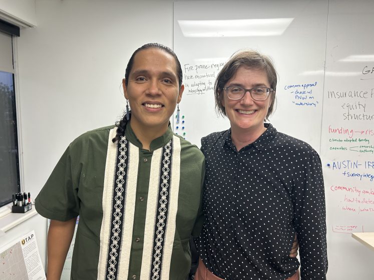

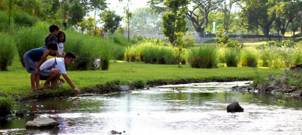
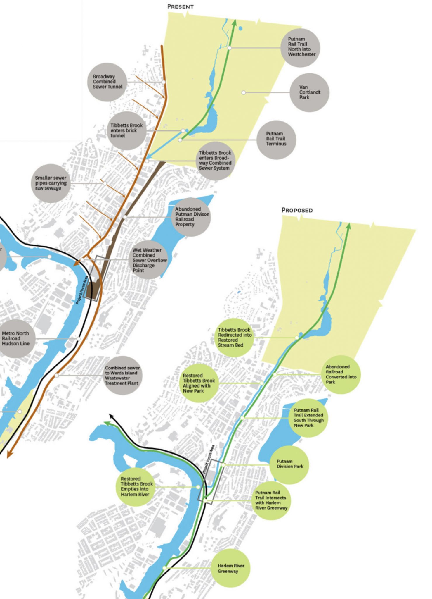
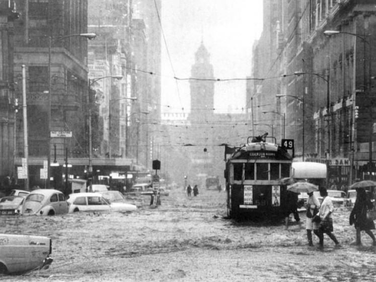
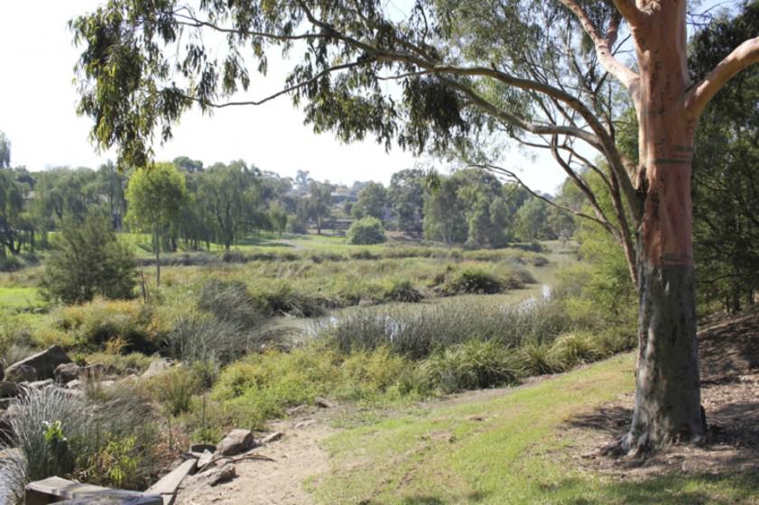
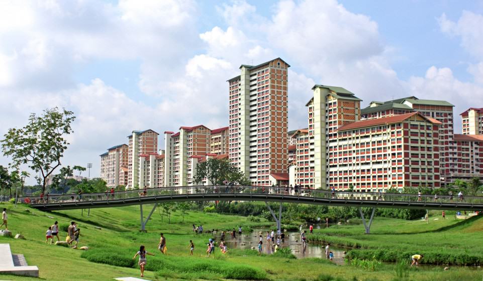
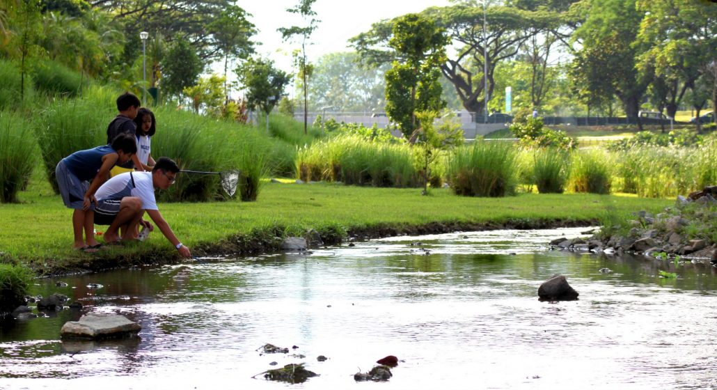
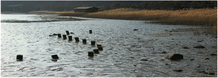
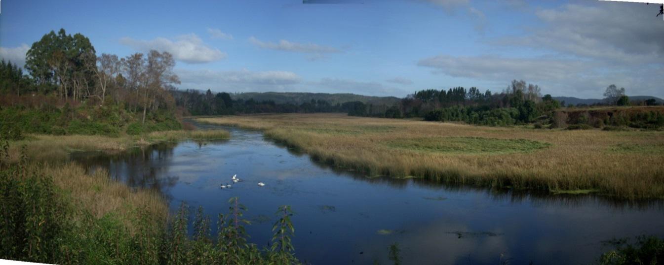 However, in the last century, the situation has changed. These wetlands became a private property where their profitability prevailed over the common good. Changes in technology and economic conditions, coupled with the loss of social control, allowed the growth of the city beyond its limits. The filling and draining of wetlands through engineering has tried to hide the true nature of the city for decades.
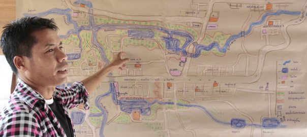
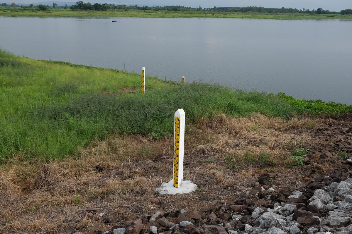
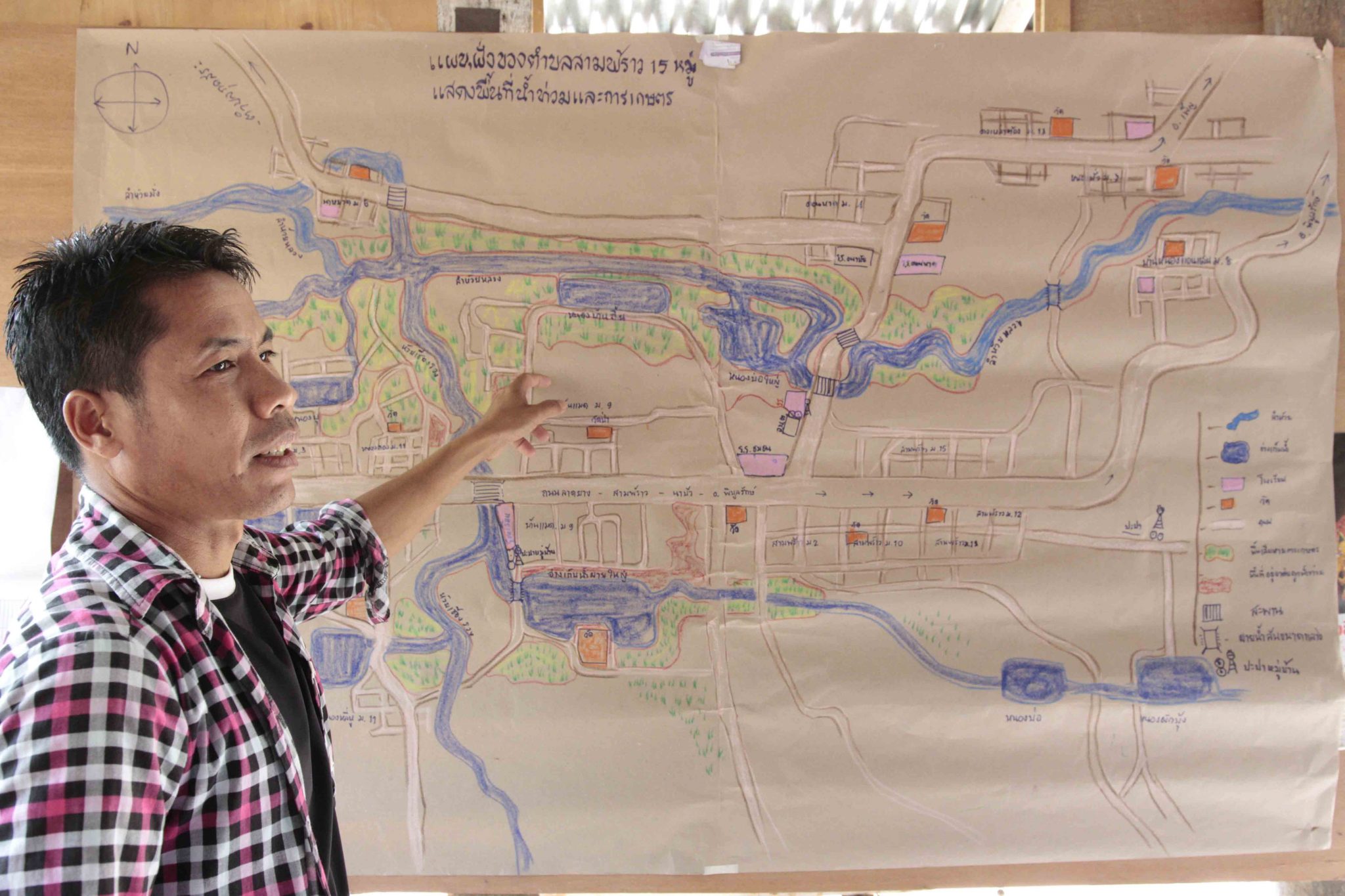
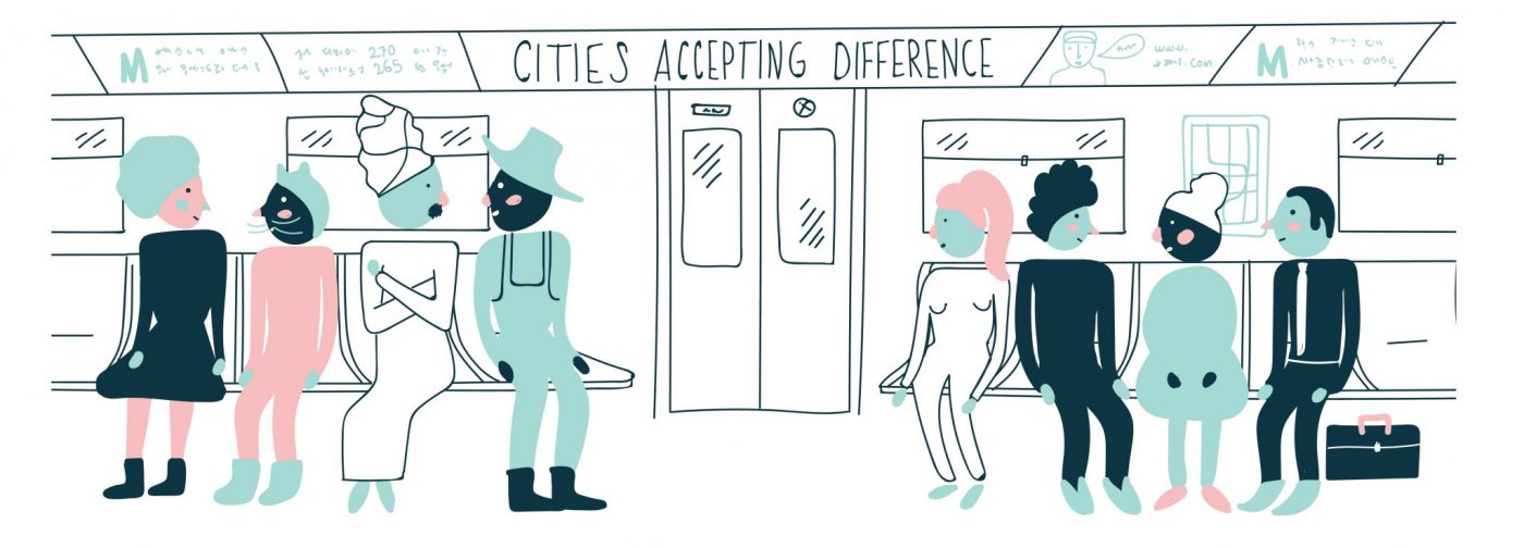

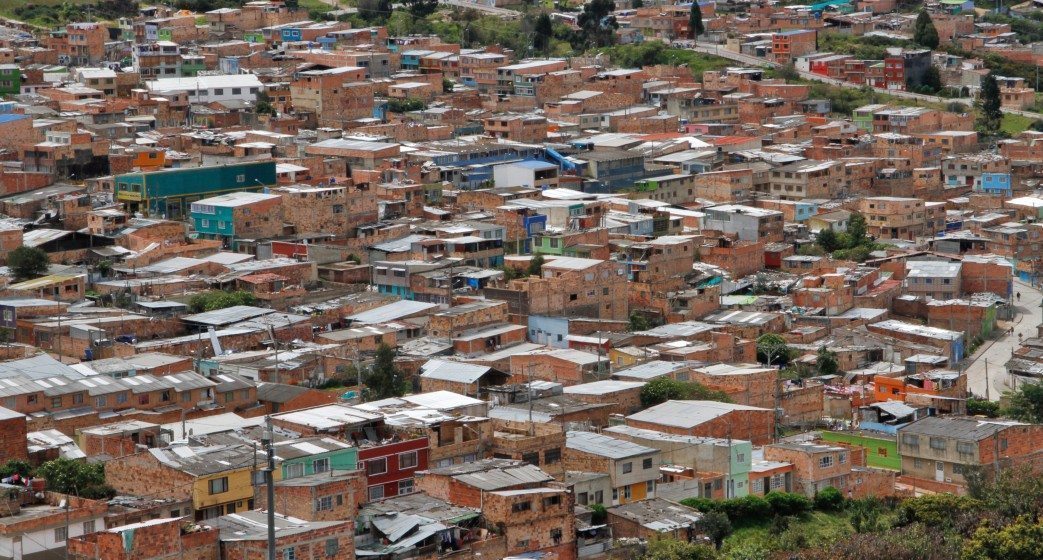
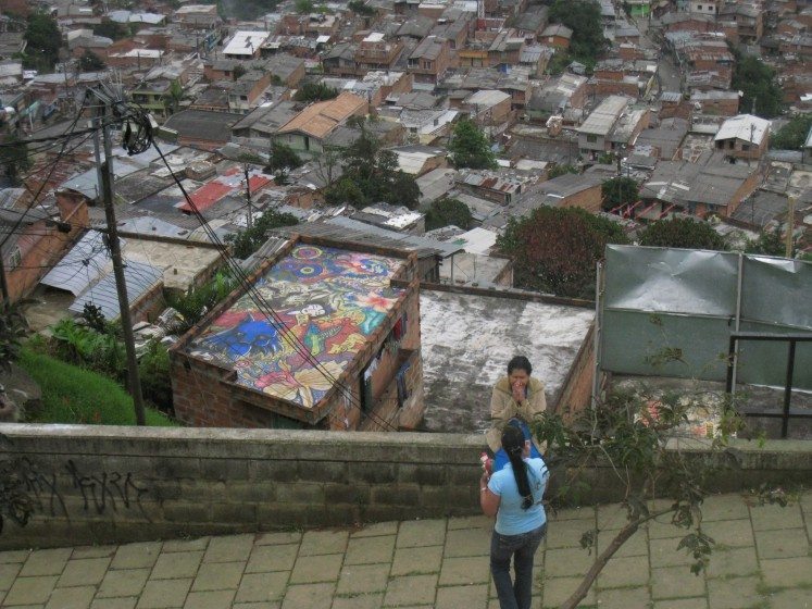
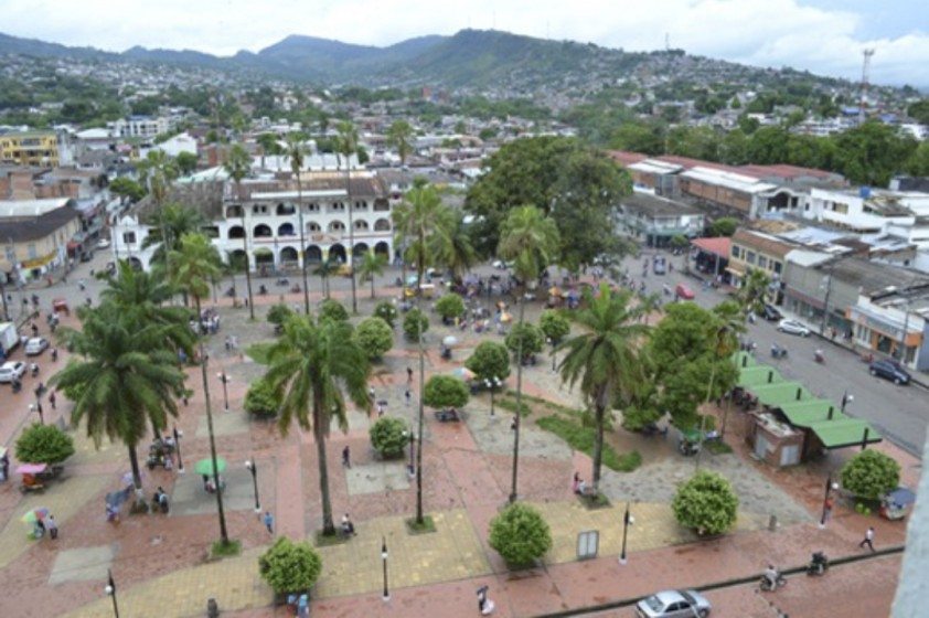
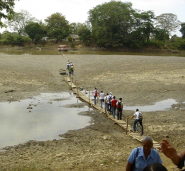
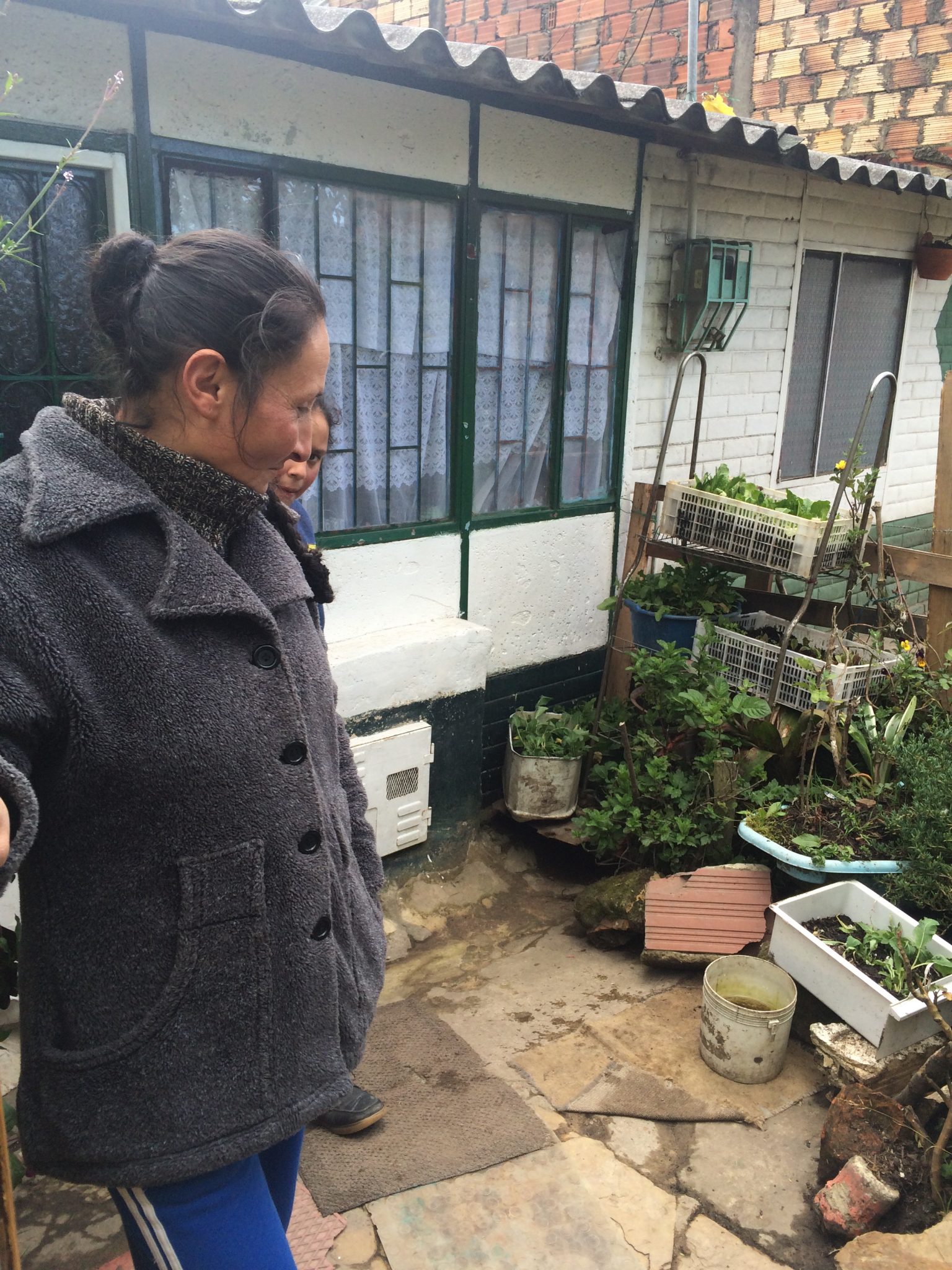 Ecobarrio Villa Rosita. Photo: Diana Wiesner


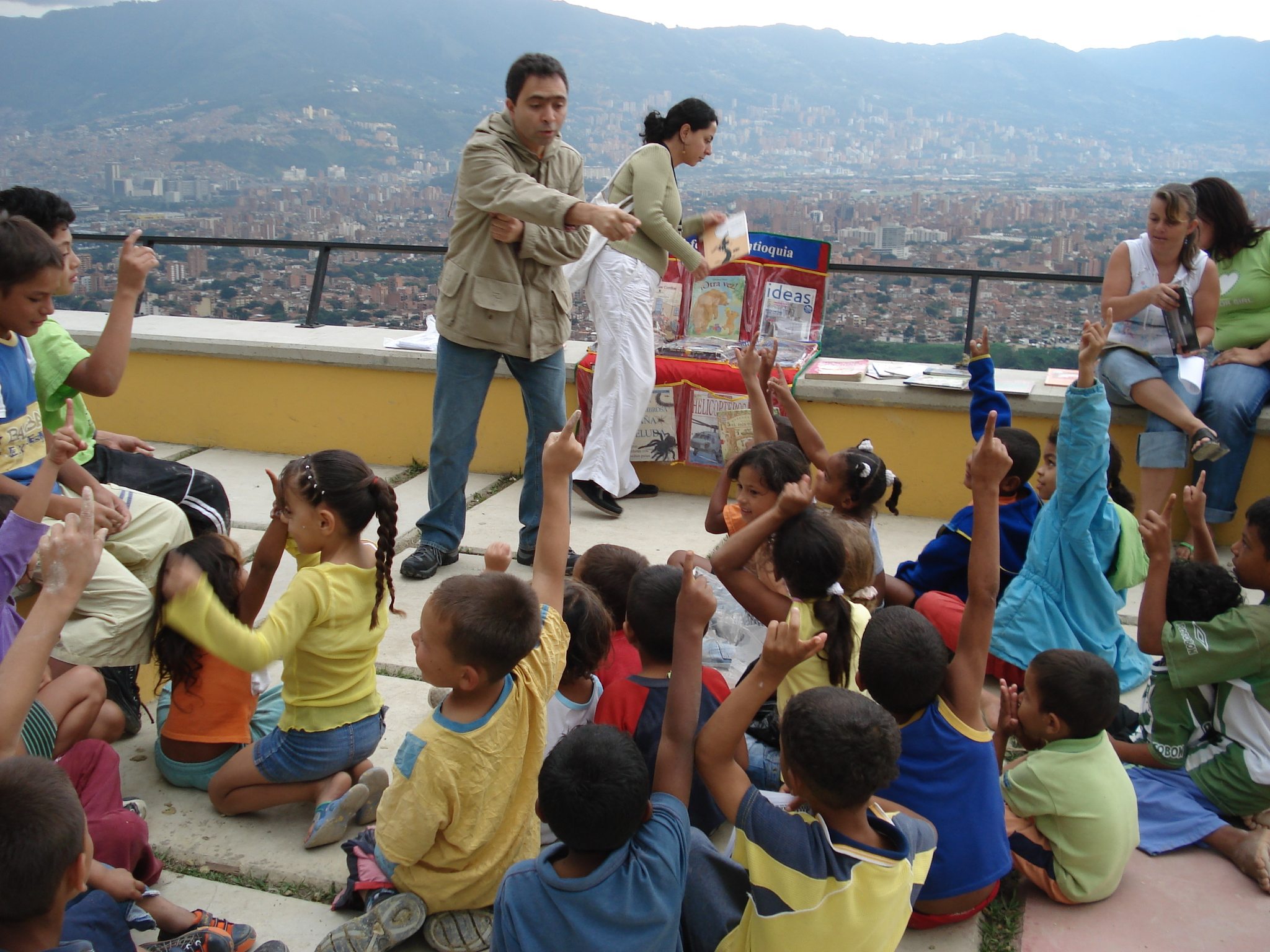


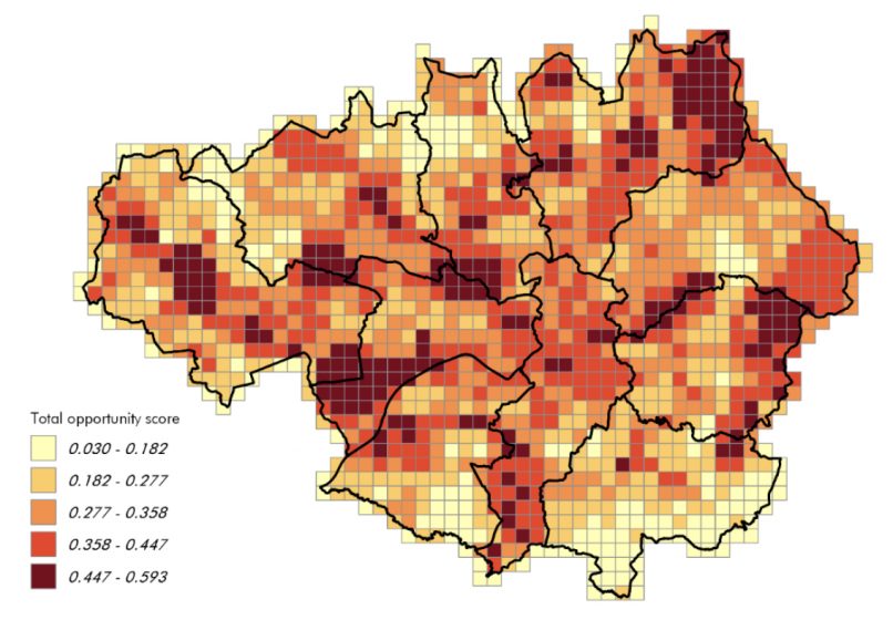

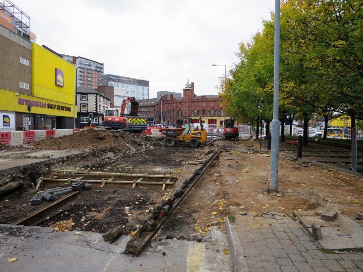
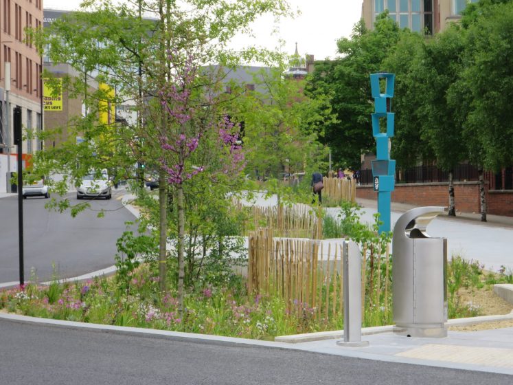
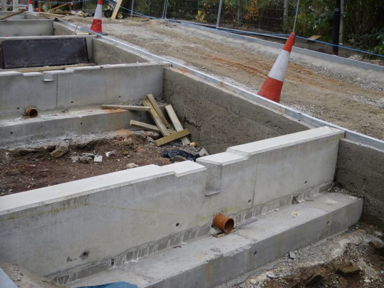
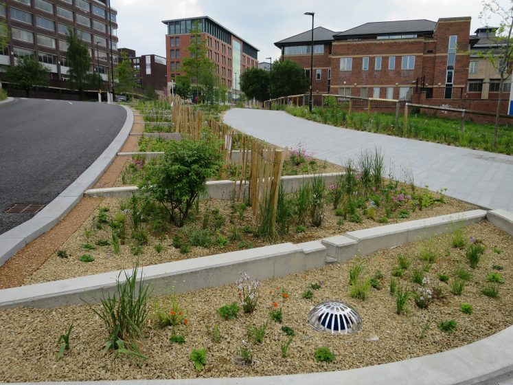
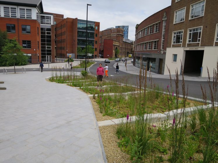
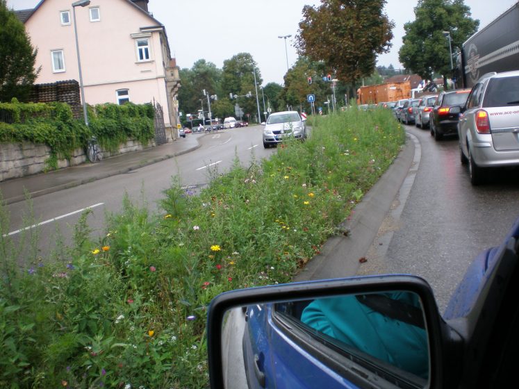


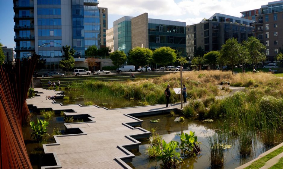

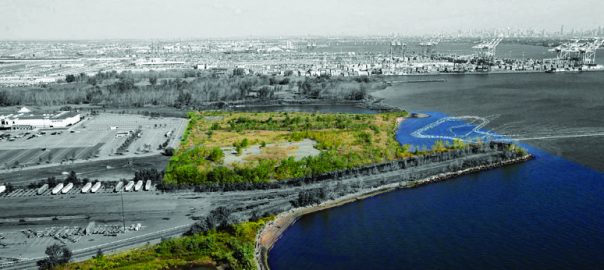


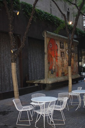
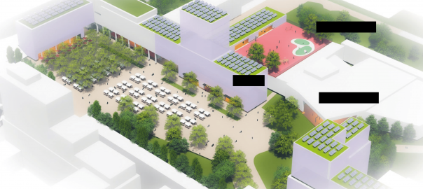
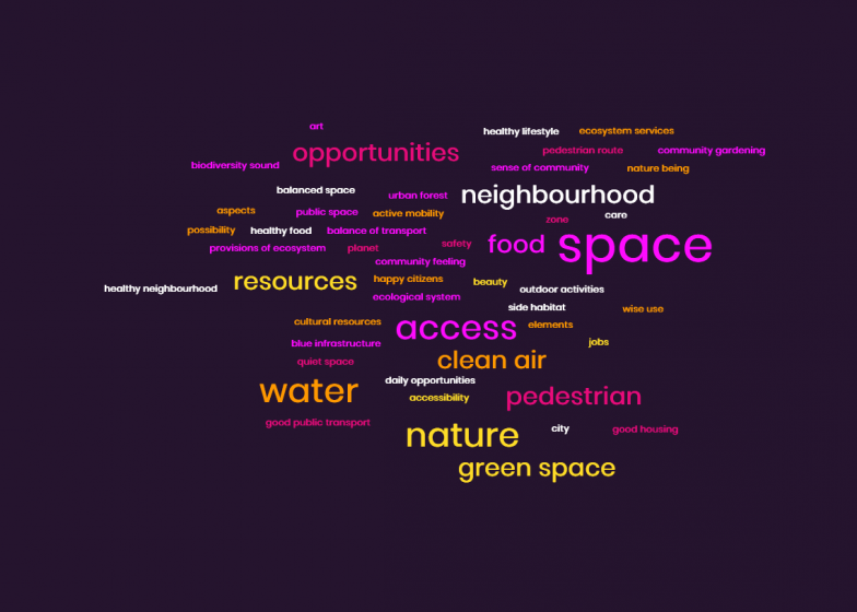
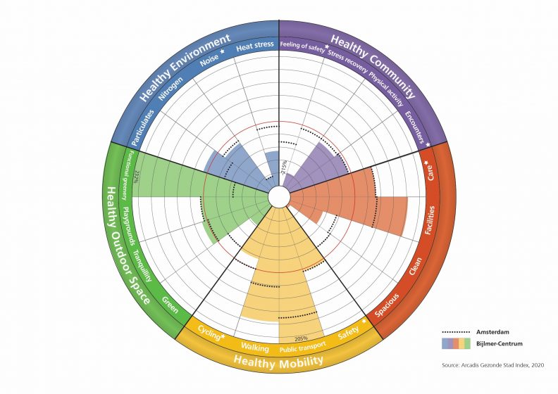
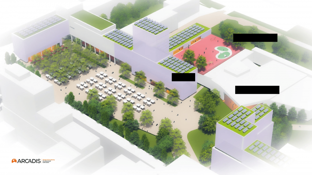
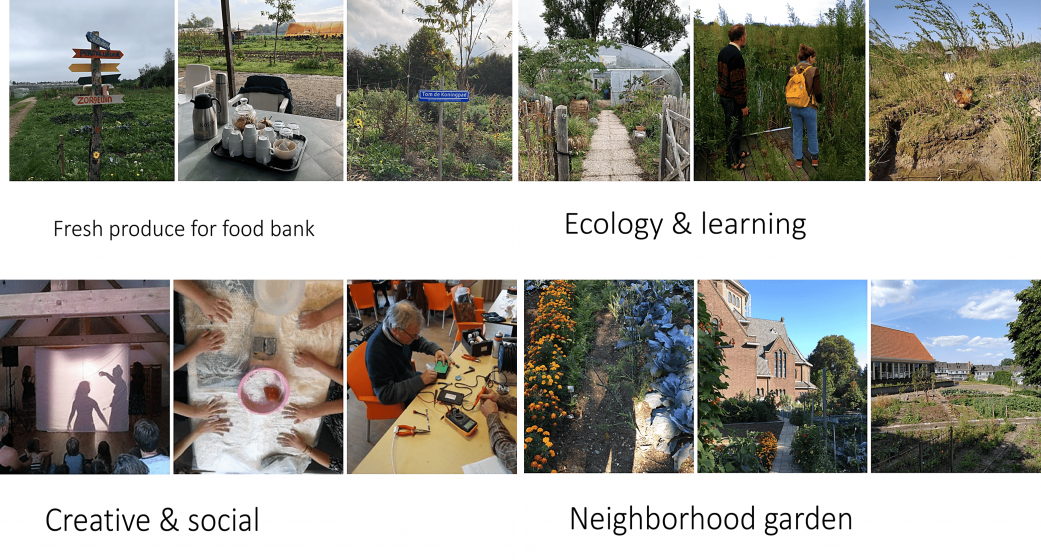
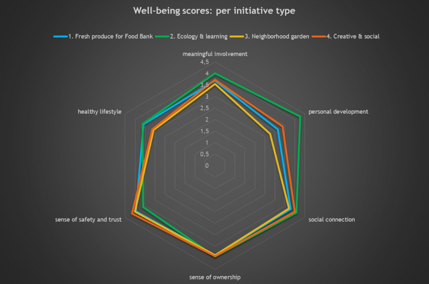
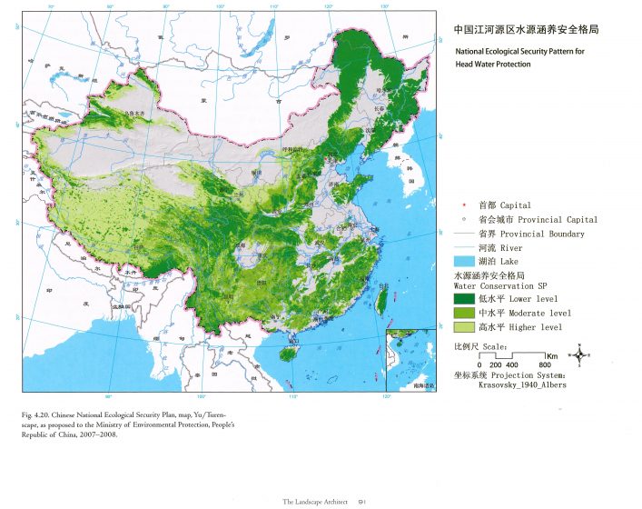
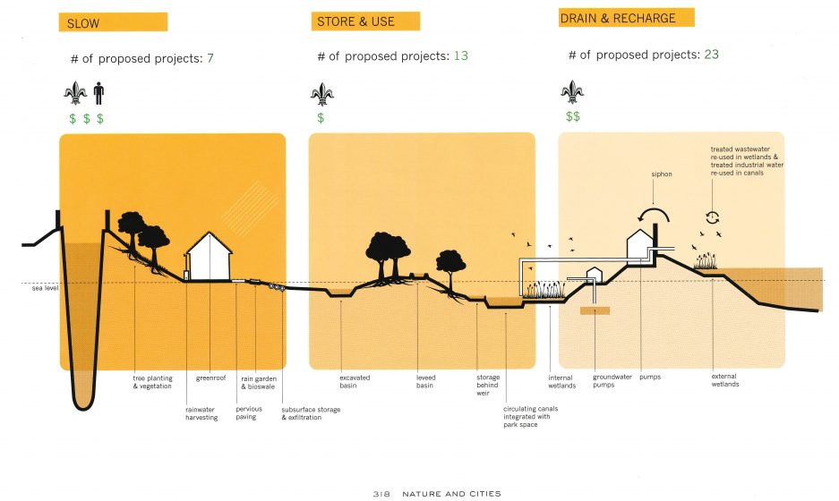


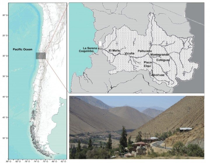
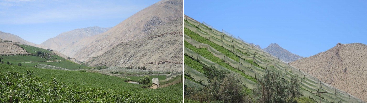
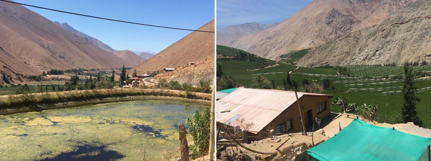
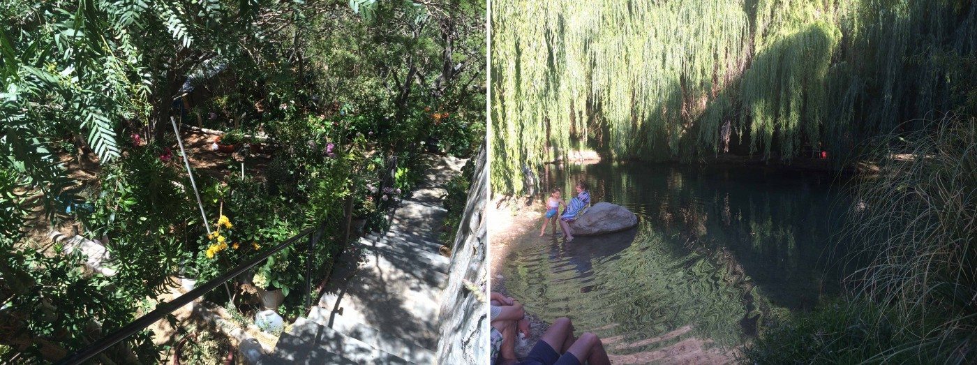

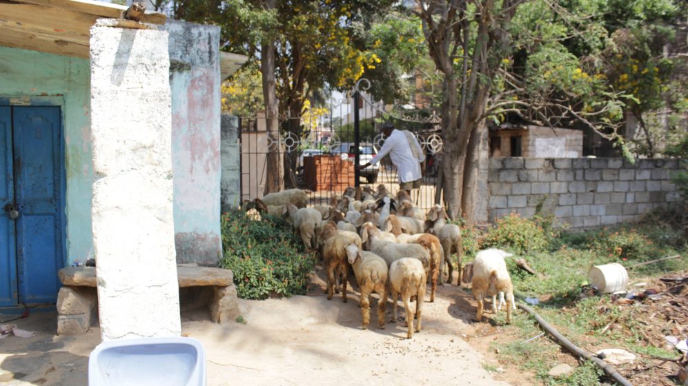
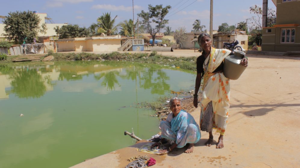
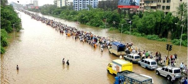
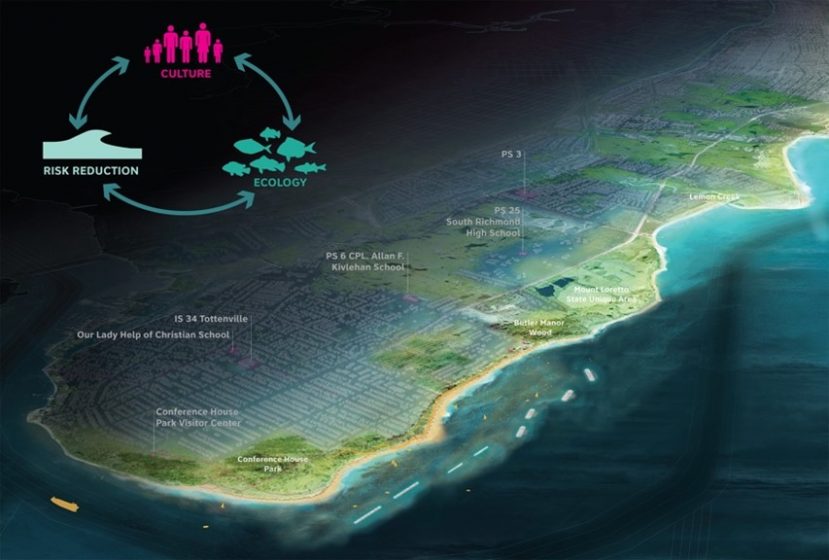
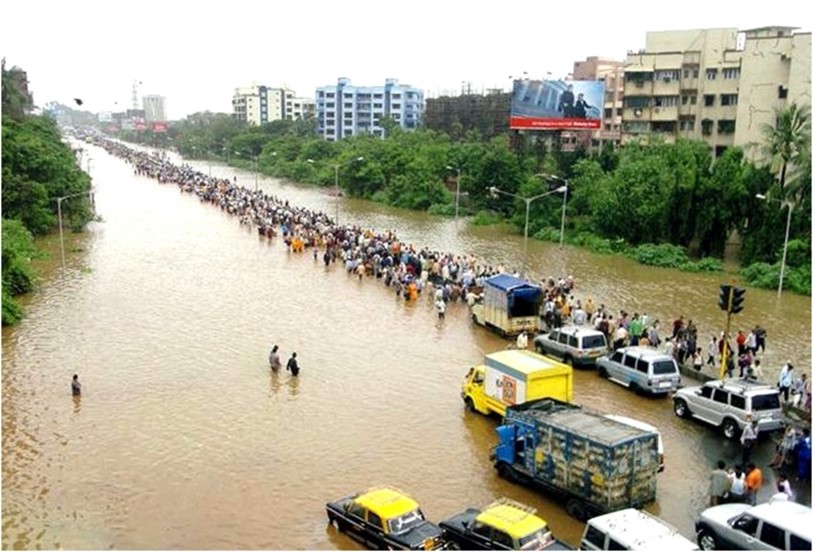
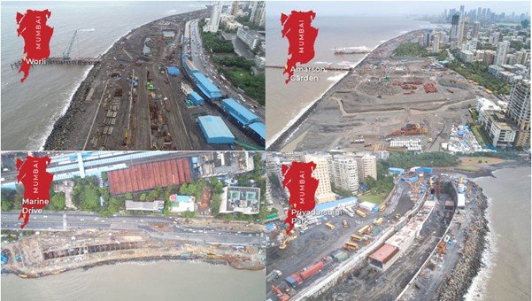

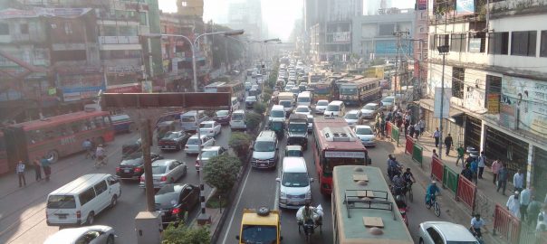
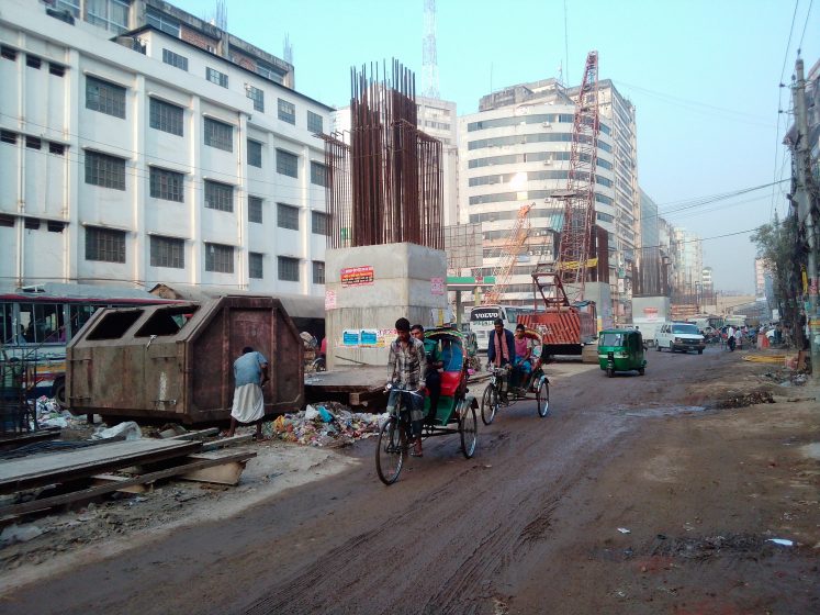
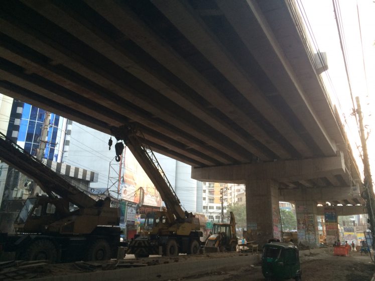
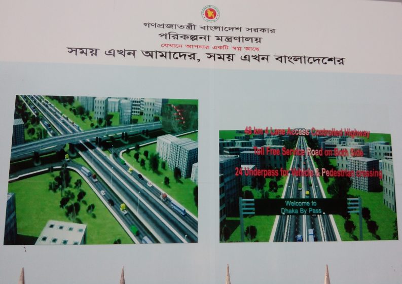
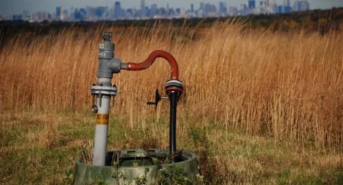

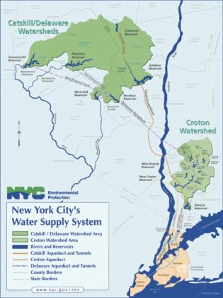
 Until now, fracking has been banned in New York State. However, the ban is currently under review and many civil society organizations worry that intense industry lobbying may pressure Governor Cuomo. A new energy plan recently issued by the State does not include fracking as part of its long-term strategy, though it remains agnostic on the issue

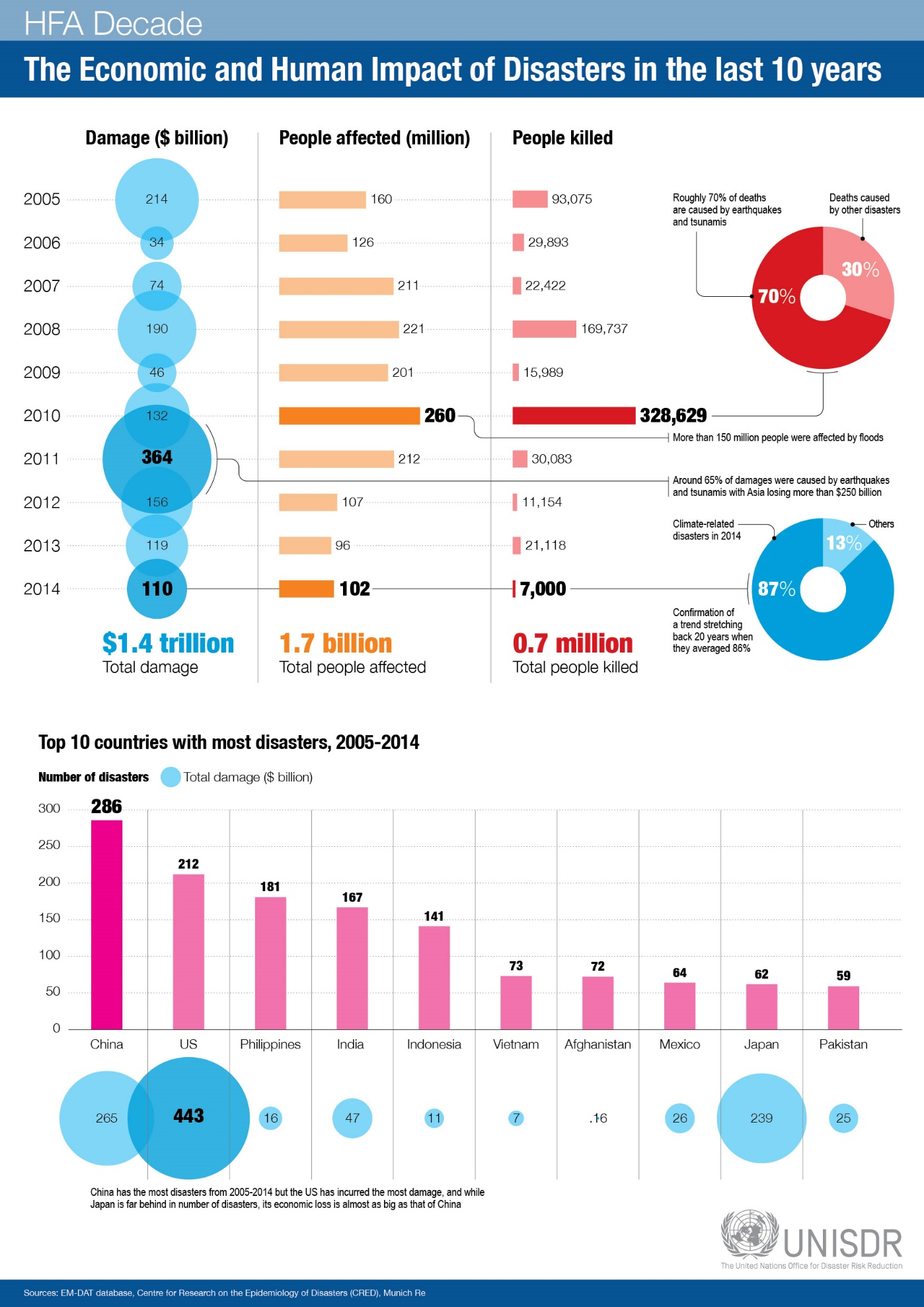
Add a Comment
Join our conversation