The integration of habitat restoration components into traditional shoreline engineering designs is the biggest lesson learned from the Toronto and Region remedial action plan for other areas.
As Toronto grew into Canada’s largest city and a world leader in business, finance, technology, entertainment, and culture, there were unintended consequences such as water pollution and loss of habitat. Today, Toronto and Region are a leader in environmental cleanup and reconnecting people to their waterfront as a part of a city where humans can flourish as part of nature’s beauty and diversity.
It was an early spring day and we were standing on a human-made peninsula called the Leslie Street Spit that extends five kilometers into Lake Ontario. The air temperatures were still biting cold, reflecting the long time it takes Lake Ontario to warm up.
Below: Leslie Street Spit in 1978 before restoration into Tommy Thompson Park. Above: Tommy Thompson Park in 2013. Photos: Toronto and Region Conservation Authority
All of us participating in the Leslie Street Spit tour were thinking how nice it would be to cut the tour short and get out of the cold, with the exception of our tour guide. He was a large and striking figure who could have easily been mistaken for a professional American football player. But what was most memorable was his knowledge of the region and science, and his passion to restore habitats. His passion and enthusiasm were so contagious that by the end of our site visit, despite the biting cold temperatures, all of us were inspired that urban habitat restoration was possible if you had the proper knowledge and the right players involved who have a clear understanding of potential natural resource outcomes and benefits. The tour guide’s name was Gord MacPherson and he spent his early years camping, fishing, trapping, and hunting throughout Ontario. His love for the outdoors led to a 37-year career with the Toronto and Region Conservation Authority where he has championed cleanup and restoration as part of an effort to create a new waterfront porch for both wildlife and people. MacPherson understands clearly that habitat restoration is about people management and that he and his partners are playing a critical role in city building.
Pollution
As Toronto and Region grew and became more urbanized, environmental pollution increased. There is probably no better example of historical water pollution in the Toronto region than the Don River. The Don River is a 38km river that stretches from its headwaters on the Oak Ridges Moraine to the Keating Channel where it empties into Lake Ontario. At one time the mouth of the river had one of the largest marshes in all of Lake Ontario. Over time the Don River was straightened for convenience, channelized, paved and built over, and befouled with all kinds of municipal and industrial waste and land runoff to the point that it twice caught on fire. Heavy oil pollution was the cause of a river fire in 1931 that destroyed a bridge crossing the Don River at Keating Street. In 1943, severe oil pollution was the cause of a river fire fronting the British American Oil Company’s property. To no one’s surprise, on July 30, 1958 the Toronto Globe and Mail editorialized that the Don has “waters heavily polluted and laden with scum, its banks littered with all varieties of filth, and the whole sending up foul odors.”
Little wonder that in the fall of 1969, Pollution Probe organized a funeral for the Don River, symbolizing its death. On that November day, a couple of hundred mourners paraded a casket from the University of Toronto campus to the banks of the banks of the river. The cortege included a hearse, a band playing a dirge, a weeping widow in black, and a top-hatted student portraying a greedy capitalist.
Clearly, for many decades environmental protection was not a priority. Commerce and industry were the priorities and pollution was just considered part of the cost of doing business. By 1985, Toronto was suffering from extensive impacts of several centuries of agricultural land use, industrialization, and extensive urbanization, including poor water quality, contaminated sediments, contaminants in fish, loss of wildlife habitat and populations, and beaches that were often closed due to high levels of bacteria.
Harbour cleanup
As citizens awoke to visible damage and invisible dangers of polluted water and toxic residues, stifling local economies and degrading quality of life for all living near these waters, they began to speak out. It was in 1985 that the International Joint Commission identified Toronto and Region as one of 42 pollution hot spots called “Areas of Concern” where water quality and other ecosystem functions were badly impaired and Environment Canada and the Ontario Ministry of the Environment committed to developing and implementing a remedial action plan to clean up the harbor and restore all impaired beneficial uses using an ecosystem approach. An ecosystem approach accounts for the interrelationships among land, air, water, and all living things, including humans, and involves all user groups in comprehensive management. Think of an ecosystem approach as a more holistic way of undertaking integrated planning, research, and management of specific places like Toronto. If there was an ecosystem approach to drivers’ training for four students, the driver training car would have four steering wheels to show how all need to work together.
Identifying Toronto and Region as a Great Lakes Area of Concern elevated the priority for cleanup within the federal and provincial governments and provided laser-like focus to stakeholders and partners to work together to restore health of their ecosystem and its beneficial uses. A unique partnership of federal, provincial, and local stakeholders first came together to develop the remedial action plan and create the framework and conditions for all stakeholder groups to help implement it.
Early efforts focused on preventing pollution through regulations and voluntary initiatives. Since 2003, the City of Toronto has spent $485 million to control stormwater pollution and reduce basement flooding risks, and projects to spend $2.8 billion in 2016-2025 on additional stormwater projects. The Don River and Central Waterfront Project is particularly noteworthy and will capture and treat stormwater discharges and address discharges from combined storm and sanitary sewer outfalls to the Lower Don River, Taylor-Massey Creek, and Toronto’s Inner Harbour—a $2 billion investment over the next 25 years.
More than $80 million has been spent on habitat rehabilitation since 1987. In the last 10 years alone, over 823 ha of habitat and 57 km of shoreline were created or restored in the AOC. At the helm, every step of the way, has been Gord MacPherson collecting data, performing assessments, designing projects with partners, overcoming obstacles, helping secure funding, overseeing construction, and measuring effectiveness. The federal government and Toronto are now creating Canada’s first national urban park: Rouge National Urban Park. Rouge Park is rich in natural, cultural, and agricultural features, including 1,700 species of plants and animals, and some of the rarest and best remaining wetlands, forests, and agricultural lands in the region. Once fully established, it will be 101 km2 in size—nearly 30 times the size of Central Park in New York. Federal investment in Rouge Park will be $100 million. In 2017, federal, provincial, and municipal governments announced $1.25 billion to construct a new naturalized Don River mouth through the Port Lands, creating a new urban island neighborhood called Villiers Island. Continuous and vigorous oversight is needed to maintain these ecosystem gains and ensure long-term sustainability.
Restoration of the Don River mouth on Toronto’s eastern waterfront. Photo: Don Ford, Toronto and Region Conservation Authority
Cleanup leads to reconnecting people to the waterfront that leads to waterfront revitalization
Toronto Waterfront Revitalization Corporation (now called Waterfront Toronto) was established in 2001 by the federal and provincial governments and the City of Toronto to redefine its waterfront as a public asset for everyone. Working with public and private partners, Waterfront Toronto creates complete neighborhoods anchored by parks and public spaces, and diverse, sustainable, mixed-use communities that offer a high quality-of-life for residents and visitors alike. Waterfront Toronto has worked with MacPherson and the remedial action plan team to restore over 26 ha of wetland and aquatic habitats and 6.4 km of shoreline habitat in prominent locations like Tommy Thompson Park, Toronto Island, Port Union, Mimico Waterfront Park, and others.
As part of an effort to measure economic effectiveness, Waterfront Toronto commissioned studies of the economic benefits stimulated by its waterfront investments. Between 2001 and March of 2017 a total of $1.6 billion was invested in waterfront redevelopment to establish unique gathering places that foster a sense of authentic human attachment.
Economists have estimated that this $1.6 billion investment, adjusted for inflation, will: generate approximately 14,100 full-time years of employment, of which approximately 88.5% were in the City of Toronto; stimulate $4.1 billion in total economic output to the Canadian economy (the majority in Toronto); and generate total government revenues of approximately $848 million. Although Toronto Waterfront’s expenditures are significant, they are relatively small compared to the recurring benefits, like permanent jobs, property taxes, income taxes, and tourism spending that occur with continued development of new office, residential, retail/service, cultural, and entertainment uses along the waterfront which would not occur without the initial Waterfront Toronto investments.
The Simcoe Wavedeck next to the Martin Goodman Trail and Queens Quay Boulevard. Photo: Waterfront Toronto
While these impacts relate to Waterfront Toronto’s direct spending on planning and infrastructure, economists have also quantified benefits accruing to private- and public-sector real estate projects both on lands controlled by Waterfront Toronto and other privately-owned land on the waterfront. For example, the combined development on East Bayfront and West Don lands, and the adjoining neighborhoods, will generate nearly 207,900 years of employment, add $13.8 billion to the Canadian economy, and provide $7.5 billion in tax revenues to the three levels of government.
The next challenge
MacPherson believes that the biggest challenge facing the Toronto and Region RAP is how to fight public apathy surrounding the environment. Public concern has now shifted to the climate change crisis, but the concern has not yet become a catalyst for local solutions. Torontonians need to think globally but act locally. MacPherson feels that people now need to channel their concern for climate change into concrete actions that both demonstrate adaptation to climate change and achieve huge conservation benefits, like restoring wetlands, building green infrastructure, naturalizing shorelines, planting trees, and more.
MacPherson’s advice for the next generation of people who care about Toronto Harbour and the Great Lakes is simple: Be Bold! He is adamant that right now the environmental movement, the Great Lakes, and the planet need bold leaders. Improving habitat is a simple and effective method of engaging the public and educating them on the economic, social, and environmental benefits of looking after our communities as our home. MacPherson has always been struck at how the need to improve our environment is universally accepted, how restoration can be easily explained, and how involvement in restoration can foster a stewardship ethic and lead to advocacy. “We need to be bold and aggressively show the significance, importance, and function of restoring our waterfront to a greater percentage of the population,” notes MacPherson.
View of downtown Toronto through constructed habitat at Tommy Thompson Park. Photo: Toronto and Region Conservation Authority
MacPherson feels that the integration of habitat restoration components into traditional shoreline engineering designs is the biggest lesson learned from the Toronto and Region remedial action plan for other areas. These ecological concepts are universal and are the cornerstone of Toronto and Region Conservation Authority’s habitat restoration projects and have application and benefits throughout the Great lakes and beyond.
Clearly, Toronto has become a North American leader in harbor cleanup, revitalizing its waterfront and reaping economic benefits, and creating waterfront destination of choice that is accessible and welcoming to all. For more information on other Great Lakes case studies about how cleanup leads to reconnecting people to waterways that leads to community and economic revitalization, and how to sustain momentum for restoration over many decades, visit: http://iaglr.org/aocdocs/GreatLakesRevival-2019.pdf.
In the future, I could imagine a whole series of exhibitions—Who Takes Care of Paris? Who Takes Care of Cairo? Who Takes Care of Delhi?—featuring the faces and actions of stewards in each of these places combined with artistic perspectives on that work.
Civic leaders and community members regularly put time and energy into caring and advocating for the environment. We call these acts of care stewardship. Beyond improving green and blue spaces, stewardship can also lead to other types of civic action. Local stewardship groups can strengthen social trust within a neighborhood. People who come together around the shared love of a garden or park steward not just that space, but also their relationships to one another—making them poised to organize around any number of issues affecting their community.
It drew upon the USDA Forest Service’s Stewardship Mapping and Assessment Project (STEW-MAP), which is a dataset of thousands of civic stewardship groups’ organizational capacity, geographic territories, and social networks. STEW-MAP has been implemented in approximately a dozen global locations; it was piloted first in New York City in 2007 and then updated in 2017, which was the source of the data that were used in this exhibit.
The show featured artists whose work aligns with the themes of community-based stewardship, civic engagement, and social infrastructure: Magali Duzant, Matthew Jensen, Jodie Lyn-Kee-Chow, and Julia Oldham. Through photography, drawing, book arts, and performance, these artists reflected upon, amplified, and interpreted the work of stewards and the landscapes and neighborhoods with which they work.
This essay excerpts content taken from exhibition wall text, data visualizations, and artists’ work—interspersed with comments from the curator. The video below is a virtual tour of the exhibition.
What is stewardship?
When you take care of a place you love, you are engaging in stewardship. Whether you pick up trash that you see in your park, band together with a few neighbors to tend to the trees in front of your building, or teach the next generation about the importance of biodiversity, you are joining a network of care that keeps cities like New York green and flourishing. Caring for the environment happens at different scales, and there are roles for all sectors: public, private, and civic. Most often, civic environmental stewardship happens in groups—from a couple of friends, to small informal associations, to citywide or even international nonprofits. But sometimes the important work of these civic groups can go unrecognized. This exhibition aims to make these groups more visible.
The first artist perspective that I will highlight here is Matthew Jensen. Training his eye on the street tree, he reveals the incredible diversity and resilience of this form of nearby nature that is for many New Yorkers (including me) and for many urban dwellers around the world—their first entry point into stewardship action. As a qualitative social scientist interested in place meanings, I found many resonances with Matthew’s multi-modal approach to research (photo documentation, interview, mapping, archives). His process of walking and observing the landscape has taught me a great deal about the porous and blurry line between art and science. He is not only an observer, however, he is also a participant, as he trains himself in the practices and tactics of his subjects, such as becoming a Citizen Pruner to better engage in the care of trees.
Matthew Jensen
Selection from The Forest Between: Street Trees and Stewardship in New York City, 2019. Courtesy Matthew Jensen.
This photographic series celebrates the myriad of ways city residents care for street trees and the spaces surrounding them. Jensen is especially taken with what he refers to as New York’s amazing trees— distinctive for their impressive size, ability to thrive in unexpected locations and defy such obstacles as, extreme damage or abnormal habitat. Jensen’s project recognizes a diversity of practices—from homemade tree guards and creative support systems, to ornate gardens. Through the process of documenting, the artist also participates in his own form of tree stewardship.
Matthew Jensen is a Bronx-based interdisciplinary artist whose rigorous explorations of landscape combine walking, collecting, photography, mapping and extensive research. During his 2017/2018 artist residency at the NYC Urban Field Station he developed his current project The Forest Between: Street Trees and Stewardship in New York City.
Stewardship comes in all shapes and sizes
Stewardship territory reflects each group’s claim on space; it is their basis of power and their landscape of care and concern. Territory ranges in scale from a single tree, to a watershed, to an entire region. It varies in shape and can include rectangular lots, linear strips, curving shorelines, and blocky political districts. For some stewards, such as community gardeners, territory is the specific site where physical land management occurs. Other groups focus on advocacy across wider spatial scales, such as environmental justice groups running neighborhood air quality or green job campaigns. Finally, some groups focus on transformation of waste, food, or energy systems, and therefore have multiple sites across the city.
Stewardship territories. Image created by Pratt SAVI using USDA Forest Service STEW-MAP NYC 2017 data.
Stewards respond to disturbance
Stewardship is one of the ways that communities respond to social-ecological disturbances and stressors, including both disinvestment and gentrification, as well as climate change and its attendant weather extremes. This pattern has repeated over time here in New York City, with stewardship groups forming in response to the fiscal crisis of the 1970s, September 11th, and Hurricane Sandy. The act of caring for local places can transform not only the physical environment, but also our relationships to those places, and, perhaps most importantly, our relationship to each other. It is this shared sense of trust and reciprocity that serves as a building block for the radical changes that are required to steer our cities toward a more just and sustainable future.
New York City is facing a housing affordability crisis. Debates center on concerns around “green gentrification,” rezonings, and whether and how stewardship groups can be part of efforts to both stabilize communities in place and improve local environmental quality with and for residents.
Our changing climate has multiple impacts, including more intense coastal flooding and an increase in the heat island effect. Stewardship groups are on the front lines of observing these impacts, adapting to change, and enhancing the ecological function of sites. Map created by Pratt SAVI using USDA Forest Service STEW-MAP NYC 2017 data.
New York City is facing a housing affordability crisis. Debates center on concerns around “green gentrification,” rezonings, and whether and how stewardship groups can be part of efforts to both stabilize communities in place and improve local environmental quality with and for residents.
Julia Oldham’s artistic work helps us think through stewardship and connections to nature in the era of climate change. Across Julia’s body of work, she imagines both dystopian and more hopeful renderings of our future. She also points out spaces that are often neglected by humans—where human/nature/animal relations have undergone a radical reworking—as with her video “Fallout Dogs” about the Chernobyl exclusion zone.
I was excited to see what sorts of spaces or futures Julia might envision for New York City. At the same time, these futures are rooted very much in the embodied experience of being there—Julia is an intrepid explorer of wildernesses both urban and rural and never travels without her wellies. It also reflects the importance of talk. She interviewed dozens of government workers and volunteer stewards to find both their favorite wild places and to understand their hopes for the future of those places. In particular, Beaver Village reflects Julia’s truly inter-species affection for living things, and playfully imagines a different way in which we might cohabit with non-human others.
Julia Oldham
Beaver Village from Undiscovered City, 2018- ongoing. Courtesy Julia Oldham.
Oldham’s series presents an amalgamated vision of New York City’s future, inspired by conversations with those most intimately connected to its wilderness. During her New York City Urban Field Station residency, the artist used the STEW-MAP database, to connect with nearly 40 stewards of the city’s natural areas. Asking scientists, park rangers, gardeners, beekeepers, educators and volunteers to share their views—especially in regard to nature and climate change—Oldham collected projections ranging from the utopian to the less optimistic.
The visual narratives here are a combination of Oldham’s own methodical documentation to create a unique 360-degree photograph, followed by a process of digital collaging with satellite images, drawings, and found photographs. Julia Oldham’s work expresses moments of hope in a world on the edge of environmental collapse. Working in a range of media including video, animation and photography, she explores potential in places where human civilization and nature have collided uneasily.
STEW-MAP includes 720 groups with a combined budget of $5,301,875,991 and a total of approximately 633,000 people engaged as staff, volunteers, and members.
Stewards are agents of change
The power of civic environmental stewardship groups comes from their ability to create lasting change through direct action, management, education, and advocacy. Beyond environmental benefits, civic environmental stewardship groups provide opportunities for people to get to know one another and beautify their community in the process. These actions create a sense of social connection and a feeling of ownership and place attachment. Stewardship groups work on everything from restoring New York City’s oyster population, to protecting natural areas from development, to helping women get outside to exercise and form empowering friendships and civic ties. Taken together, these efforts can collectively transform our environment and communities.
How can we understand both the collective impact and individual experiences of these thousands of stewards? Magali Duzant’s work takes a deeper dive into the knowledge, practices, and actions of Queens, NY-based stewards, revealing that each of these dots on a map is comprised of important (and even sometimes humorous!) lifeways and histories. In order to uncover these stories, she queried the STEW-MAP database, scoured the internet, and talked with stewards. A self-professed outsider to the world of environmentalism, Magali shared that she found surprising resonances between the network of stewards and her existing world of artists and arts organizations. Everyone was just a few links from each other, and was happy to pass on another recommendation, a site to visit, and event to participate in. Magali navigated that network of relationships to create a new publication that could serve as a sort of “starter kit” for an interested novice to get involved in stewardship work (and play) in Queens and beyond.
Magali Duzant
A page from Whole Queens Catalog, 2019. Courtesy Magali Duzant.
Whole Queens Catalog is a free (limited run) publication commissioned for Who Takes Care of New York? Magali Duzant’s new commission, Whole Queens Catalog, takes inspiration from Stewart Brand’s 1960’s American counterculture magazine and product catalog (Whole Earth Catalog). Duzant has gathered anecdotes, recipes, disaster survival techniques, and other wisdom from stewardship groups throughout Queens that she identified from the STEW-MAP database and additional research.
Magali Duzant is an interdisciplinary artist based in New York. Her work spans photography, books, installation, and text. In collaborative and participatory approaches to projects, she couples research-based practices with a poetic knack for capturing where public and private experiences converge.
A page from Whole Queens Catalog, 2019. Courtesy Magali Duzant.
Stewards work together
Civic stewardship groups collaborate across a broad constellation of stakeholders. Whether they need more volunteers for an event they are holding, a bag of compost for their garden, or information about how to build their own tree guards, the larger stewardship network provides. STEW-MAP asked groups who they work with in order to visualize these vital connections of ideas, materials, labor, and capital. Over time, these relationships shape governance across civic, public, and private sectors, and influence the policy agenda and the form of the city.
NYC Parks, the largest land manager in the city, is also the most connected broker in the entire stewardship network. Partnerships for Parks is the central broker in New York City’s civic stewardship system. Working with hundreds of “Friends of Parks” groups across the city, they were removed from this visualization in order to see other connections between groups:
This diagram focuses on the civic-to-civic component of the STEW-MAP respondent network. Dots represent individual groups and lines represent collaborative ties between them. The network is organized by the types of places where groups work (athletic fields, urban farms) and their issues of concern (employment, seniors). Image created by Pratt SAVI using USDA Forest Service STEW-MAP NYC 2017 data.
Visualizing the power of sometimes subtle forces is not easy. How do we show the strength of a network? Jodie Lyn-Kee-Chow’s work uses a patchwork dress, a picnic, a participatory performance—each of these forms demonstrate the way in which the whole is greater than the sum of its parts. Lyn-Kee-Chow has created a series of picnic performances staged in various locations of the public realm of New York City—including streets, parks, and museums. While the artist herself anchors and orchestrates these performances, she engages others both as co-performers and as participants. For this piece, Lyn-Kee-Chow invited stewardship groups focusing on food justice work to share their wisdom, their harvests, and their relationships in a conversation and celebration on the outstretched dress-as-gathering-space. Throughout the rest of the show, a similar dress hung as a symbol of this gathering.
Jodie Lyn-Kee-Chow
The Picnic: Harvest of the STEW, 2019. Photo: Christina Freeman
Jodie Lyn-Kee-Chow’s participatory performance on September 15, 2019 honored stewardship groups in the five boroughs whose work centers around food justice issues. Lyn-Kee-Chow was joined by representatives from Edible Schoolyard NYC, Hunter College NYC Food Policy Center, Smiling Hogshead Ranch, and Sunnyside CSA, groups she learned about through the STEW-MAP database. These organizations serving The Bronx, Brooklyn, Harlem, and Queens were highlighted for their projects organized by and supporting New York City’s communities of color and immigrant populations.
Since 2010, Jodie Lyn-Kee-Chow has created a series of picnic performances that set up space for the public to have conversations. Inspired by the kitchen tablecloths of her grandmother, she sews together vinyl tablecloths from bargain stores, creating elaborate dresses that double as picnic blankets. Embracing her mixed Chinese and Jamaican heritage, her projects reflect on multiculturalism, food migration and the colonial food trade. Hailing from a lineage of farmers on both maternal and paternal sides of her family, food justice has a particularly personal connection for the artist.
Jodie Lyn-Kee-Chow is a 1.5 generation Jamaican-American interdisciplinary artist living and working in Queens, NY. Her work often explores performance and installation art, drawing from the nostalgia of her homeland, Caribbean folklore, fantasy, globalism, spirituality, and migration.
Stewardship timeline
Stewardship groups not only exist, they persist. They have evolved along with the social, political, economic, and environmental histories of our city.
This animation shows the emergence of stewardship groups by year founded, including the proliferation of groups after the 1970s.
Stewardship animation. Video created by Pratt SAVI using USDA Forest Service STEW-MAP NYC 2017 data.
The timeline calls out selected key moments and turning points in New York City’s stewardship history.
Stewardship timeline. Image created by Pratt SAVI using USDA Forest Service STEW-MAP NYC 2017 data.
Stewards in their own words
Quotes were collected from interviews with a subset of stewardship groups. USDA Forest Service researchers asked stewards to share their definition of stewardship, stories of ways in which they helped to take care of the environment, and their vision for the future of stewardship work in NYC.
Stewardship stories. Image created by Pratt SAVI using USDA Forest Service STEW-MAP NYC 2017 data.
Finally, we have been gathering personal accounts of people’s stewardship stories from all over the world. These narratives range from cherished memories, to everyday occurrences, to sparks that started social movements. To add your own story to the map, go here!
In the future, I could imagine a whole series of exhibitions—Who Takes Care of Paris? Who Takes Care of Cairo? Who Takes Care of Delhi?—featuring the faces and actions of stewards in each of these places combined with artistic perspectives on that work. Not only global cities across the world, but also mid-size cities, smaller towns, and rural areas have their own stewardship stories to tell. Perhaps we can begin to see more clearly the ties of care and connection that bind us all.
Acknowledgments:Who Takes Care of New York? was organized by the NYC Urban Field Station, a partnership between USDA Forest Service researchers (Lindsay Campbell; Michelle Johnson; Laura Landau; Erika Svendsen), NYC Parks (Caitlin Boas), and the Natural Areas Conservancy, with a mission to improve quality of life in urban areas by conducting, supporting, and communicating research about social-ecological systems and natural resource management; Pratt Institute’s Spatial Analysis and Visualization Initiative, SAVI (Jessie Braden; Can Sucuoğlu; Case Wyse; Josephina Matteson; Zachary Walker; Lidia Henderson), a multi-disciplinary mapping research lab and service center within Pratt Institute that focuses on using geospatial analysis and data visualization to understand NYC communities; and Independent Curator, Christina Freeman. Thank you to the thousands of stewards across this city whose work we aimed to amplify in this exhibition.
A sustainable ecology of cities is possible when we successfully combine environmental and socio-economic dimensions equally in our plans and actions. In fact, it is the extent of their integration and inclusion that should form a criterion by which we evaluate our success.
If there is one thing that I have to state as being the most important learning from my living and working in Mumbai, it is the need for collective intervention to combat the current trend of exclusionary urban development with an objective of achieving social and environmental equity and justice for all. Also, as a necessary condition, each individual intervention should have to be linked to other larger democratic rights struggles, thereby building networks of interventions towards evolving an alternate vision of the city.
It is with this objective that I consider building relationships collectively between people and with nature as an important mission. This mission includes an understanding of such relationships and networks of interactions, particularly those that develop in the process of collective interventions by citizens on demands pertaining to social and environmental justice and how they contribute to the larger interest of sustainability of cities.
I would like to view cities from social and environmental perspective and understand how the two together constitute a necessary condition, and what their union means for the achievement of a higher state of sustainability. The two are inextricably entwined and neither is exclusive. Thus, a sustainable ecology of cities is possible when we can successfully combine environmental and socio-economic dimensions equally in the plans and actions that we pursue. As a matter of fact, it is the extent of their integration and inclusion that form a criterion by which we evaluate the value of our work and engagements.
Very often we find ourselves absorbed into zones of comfort and complacence, engaging in issues and places that have already been developed or achieved exclusivity. But to get out and engage with situations of instability and discomfort, dealing with the invisible yet perceived barriers across city landscapes, and their unification, is indeed challenging.
After all, what can be more equal between nations, influenced by neo-liberal globalisation, than the question of land mis-utilisation, exclusionary city planning, and the deplorable state of the environment in which vast numbers of people are discriminated and subject to climate change risk. It is for these reasons that the local struggles of the marginalised and discriminated people for equality and sustainability, across borders and nation states, are indeed global in their essence and spirit.
What we are deeply concerned about is the constant division of our cities into disparate fragments, both in social and spatial terms. Polarisation of people and communities in terms of their religion, race, caste, class, faith, gender, nationality is leading to social instability and tension. Indeed, our cities are producing and reproducing backyards of exclusion, discrimination, hatred, neglect and abuse; even natural habitats are being systematically destroyed leading to increasing levels of social intolerance and climate catastrophe, thus undermining the very idea of cities and their sustainability.
As these conflicts begin to dominate the city landscape, we are compelled to intervene, particularly on behalf of the excluded, discriminated, and much abused backyards of people and places that are, in most instances, situated in the borders, edges, peripheries, and margins.
Our discourses on cities have relied on the understanding of social relationships and how the modes of production have influenced their formation. In support this statement, I would like to refer to David Harvey and his book Social Justice and the City, when he quotes from Karl Marx: “The totality of these relationship of production constitutes the economic structure of society, the real foundation, on which arises a legal and political superstructure and to which correspond definite forms of social consciousness. The mode of production of material life, conditions the general process of social, political and intellectual life. In terms of Marxist terminology, the urban and the process of urbanization are simple superstructures of the mode of production (capitalist or socialist)”.
Further, in the same book, Harvey has analysed social relations, built form and environment and how each influences the other, but his reference to environment is restricted to built-environment and does not include the natural ecosystems. I quote: “Urbanism may be regarded as a particular form or patterning of the social process. This process unfolds in a spatially structured environment created by man. The city can, therefore, be regarded as a tangible, built-environment- an environment which is a social product.”
Interestingly, Pickett, Cadenasso and McGrath in their book, Resilience in Ecology and Urban Design, quoting McGranahan and Satterthwaite, present a much wider understanding of the environment. I quote: “A great deal of the urban sustainability literature tends to promote the so-called ‘brown agenda’ of environmentalism, which emphasizes the need to solve immediate needs of the billions of people who live in degraded, unsanitary conditions and grueling poverty, while the ‘green agenda’ emphasizes protection and enhancement of ecosystems to support future generations and other species. Reconciling green with brown agenda issues, however, is at the heart of more encompassing viewpoints on sustainability, recognizing that poverty and environment conservation are inextricably entwined (McGranahan and Satterthwaite 2002)”.
Such reconciliation is indeed the essence of the Irla movement, of which I am a part.
This phenomenon is realized in many world cities, more critically experienced in the cities of developing nations. While cities are expanding, public spaces are rapidly shrinking, in both physical and democratic terms. The democratic “space” that ensures accountability and enables dissent is also shrinking—very subtly but surely. This means space for wider public participation and dialogue are shrinking. It is in these prevailing conditions that we are compelled to pursue the idea of public spaces as being the foundation of city planning. Public spaces ensure physical, social and democratic well-being of all. The city’s shrinking open spaces are of course the most visible manifestation, as they directly and adversely affect our very quality of life.
It is in this context, I consider our struggles to pursue the idea of unification of cities through architectural and design endeavors as being important; while engaging closely with social and environmental movements. Our priority has to be to establish close relationship between architecture and people, placing strong emphasis on participatory planning from the very beginning and at every stage.
A Mumbai example, with active participation of the author.
A review of “Epitomes,” an exhibition by Yumiko Ono, on view at Museum of Contemporary Art (MOCA) in Taipei through 2 February 2020.
Not antagonistic of city versus nature, Ono’s drawings come across like peaceful meetings between two forces that we so often see as opposites. Here, city and nature create form together.
Situated a few blocks from Taipei’s central train station in an old school building, MOCA Taipei is currently hosting a large exhibition of catastrophic visions of past, present, and future. As large, loud, and exciting as the exhibition is, it is ultimately the most simple of works in the museum that wins the viewer’s eye and mind.
Tucked into a corner of the first floor of the MOCA building, away from the catastrophes represented in the main show, Yumiko Ono’s Epitomes offers us subtle, yet vital reflections on our urban structures, and the cultures and natures that form them.
Pencil drawings from Yumiko Ono’s “Cloud City” series at MOCA Taipei. Photo: CC BY/SA, Patrick M. Lydon
The central works of Ono’s exhibition are her Cloud City series. These simply presented works of pencil on tracing paper are unassuming at first glance, however in both their content and context, they stand out as some of the most deeply moving pieces in the museum.
Within Ono’s drawings, varied architectural elements from Taiwan are pieced together in pleasantly delirious sequence. From afar, they appear truly as a floating cloud cities, urban worlds suspended in space with no roots, cities as inverted caves, spires poking out top and bottom, stalactite, stalagmite.
The works come across like a marriage of Escher’s etchings and the words of Calvino’s Invisible Cities.
These Cloud Cities of Ono’s are not simply a hodgepodge of architectural forms. The matter of the buildings tells the tale of the environment. On close inspection, wall faces here reveal subtle natural motifs. These motifs seem to offer suggestions of Taiwan’s leaves, rivers, winds, mountains, and waters, coalescing to form the walls. Interestingly, the motifs Ono chooses seem to act not as murals on the walls, but as the walls themselves.
There is no solidity to these cities of Ono’s. Instead there are ever-changing cycles — patterns of nature, framed in the architectural styles and structures of humanity.
Detail view of pencil drawings from Yumiko Ono’s “Cloud City” series at MOCA Taipei. Photo: CC BY/SA, Patrick M. Lydon
Not antagonistic of city versus nature, Ono’s drawings come across like peaceful meetings between two forces that we so often see as opposites. Here, city and nature create form together.
Also on view in this exhibition are Ono’s Pan-City 10 porcelain sculptures, products of the artist’s experience living in Russia and the United States, among brutalist architecture.
Ono’s shiny, urbanesque objects give a softness and lightness to typical brutalist form, appearing something like blocks of white butter, stacked atop each other on a summer afternoon. Their weight is made cunningly visible by Ono, as the blocky sculptures seem to slope and cave inward. One might imagine these sculptures as representations of human logic, utilitarian apartment blocks and office buildings given form, and then melting into lumpy puddles of toilet-bowl-white sameness.
Porcelain sculpture from Yumiko Ono’s “Pan-City 10” series at MOCA Taipei. Photo: CC BY/SA, Patrick M. Lydon
The porcelain works—bleak, characterless visions of cities as structures of anthropocentricism—are powerful, yet here they seem purposefully outwitted here by the quietly incisive power of Ono’s simple pencil drawings.
In simplicity of material, the delicate drawings offer a vision of cities as a melding of human ingenuity with nature’s rhythms. Within each drawing, one can find the cycle of life and death as a city, floating in space, along with the clouds.
Detail view of pencil drawings from Yumiko Ono’s “Cloud City” series at MOCA Taipei. Photo: CC BY/SA, Patrick M. Lydon
The juxtaposition of the porcelain sculptures with the pencil drawings in the same space is a good thing. If one provides form and fluidity, the other gives character and context. If one offers subtle critique of the gross, the other offers subtle idolization of the sublime.
It reminds one of the strong Taoist influences here Taiwan, and of the saying by the ancient philosopher Chuang Tzu, that “One who wants to have right without wrong, order without disorder, does not understand the principles of nature … to refuse one is to refuse both.”
Ono reminds us here, not only that there is merit to both sides, but that to follow nature in a city means to accept both the hard and the soft, the solid and the flowing, the growing and the decaying, all in their turn.
As any truly resilient city knows, all forms have their roles.
Regularly, we feature a Global Roundtable in which a group of people respond to a specific question in The Nature of Cities.
show/hide list of writers
Hover over a name to see an excerpt of their response…click on the name to see their full response.
Elisa Silva, CaracasDespite some successful public space interventions in Caracas, we realized there was a larger challenge of overcoming prejudices and recognizing the barrio as part of the city. We began an initiative that would address changes in the urban culture, addressing the language used to talk about informal settlements and urban symbolic gestures in the city. It was a point of departure to educate people about the city and the political and social cost of such lingering prejudices.
David Simon, LondonThe nature of cities can be interpreted in different ways, and “living space” has two complementary meanings. One is space for living, rethinking land use, density, and sustainability. Another is space that is living, nature and nature-based solutions that are part of the cityscape. Both concepts are essential to address challenges in pubic and shared space in cities.
Fish Yu, ShenzhenOn the opening day of our rooftop community space, we invited politicians, media, designers and experts from different sectors to bear witness. We found this place has become more than just a Living Space of Nature, but a real living space to we try to talk about the ideas of today—a cultural hotspot.
Samarth Das is an Urban Designer and Architect based in Mumbai. Having practiced professionally in Ahmedabad, Mumbai, and subsequently in New York City, his work focuses on engaging actively in both public as well as private sectors—to design articulate shared spaces within cities that promote participation and interaction amongst people.
Introduction
How can we create living space in cities? This was the theme of one of the Dialogues at The Nature of Cities Summit in Paris, with architect Elisa Silva (Caracas), social scientist David Simon (London), and urbanist and non-profit campaigner Xin (aka Fish) Yu (Shenzhen), and moderated by architect Samarth Das (Mumbai). Public spaces within cities commonly take on various forms: squares, parks, sidewalks, and even rooftops in dense conditions. How can we build space in the public realm that creates accessible areas that are both alive and for living? What makes them “work”? How are they negotiated among stakeholders?
There were two common themes among the three diverse responses. One is the key idea of shared space, both in terms of use, but also creation. When we build cities, we need to consider not just not public space, narrowly conceived, but shared space that may take many forms and emerge from various sources. Shared spaces must facilitate uses by and interactions among all types of users. We might seek out new uses for familiar spaces—a parking lot to a playground, for example, a shared rooftop to a garden.
A second theme is the idea that engagement among stakeholders—residents, government, business, civil society—is a critical part of every successful shared space. This process of engagement builds on shared experience. It contributes to overall improvement of the project itself, and most importantly ensures that it thrives on people’s emotional connection to the space upon completion. Engagement cultivates broader acceptance of modified land uses, but also curate new ideas about how land could and should be used.
This is an output of The Nature of Cities Summit in Paris.
At TNOC Summit, we largely avoided long presentations in plenary—i.e. “Keynotes”. Rather, even when we gathered in our largest group, we met for “Dialogues”, similar to the Roundtable format at TNOC. For each dialogue there was a core question or prompt, such as the one in this Roundtable. We invited three people to participate, striving for a multi-disciplinary group, with diverse points of view, perspectives, and approaches. Each of the three delivered a short intervention (about 8 minutes), and then sat together for a longer conversation. We are publishing all of the Summit dialogues in oder to make the ideas widely available and keep the conversations going beyond the Summit itself.
In this Roundtable, we present both their written texts (essentially a transcription of their presentations) and video of their presentations. Also you can find a transcription and video of the conversation below.
A transcription of the conversation
Samarth Das (moderator): Thank you all for very exciting set of presentations and thoughts. Before we jump into the first question, I want to string through all three of your dialogues. The one common theme that definitely comes out is the idea of shared space. I think it builds on the earlier discussion we had this morning about shared urban squares—it’s not public it’s shared. And the idea that engagement is a key asset is a key part of each of those discussions, so building on the shared experience. David (Simon), I’d like to take you up on the idea of the living and the livable, you know something that we had discussed. So how do we develop Living Spaces that are at the same time accessible to make them livable? Spaces in that sense. There’s always a tension between experts and locals and their thoughts about this. So, what are your thoughts?
David Simon: Well that comes back to my point about bringing together the different stakeholders living in a particular existing urban area or who are the intended residents of a new area in the process of being developed. The crucial thing about livability is both the physical environment meeting the needs both in a material sense, but also, as I said in my introductory comments in terms of social and cultural values. One can highlight this for example, in terms of the difference: If you look at indigenous cultures in different parts of the world, the way in which space is used socially is often very different. In some cultures and societies traditionally there were spaces for men and women to use together. There are spaces reserved for women and for men both domestically within the domestic sphere but even in public space and these are kind of superimposed layers.
In the conventional modern—as in driven by town planning since the late 19th century in a very sort of Western technocratic sense—the division between public and private is seem as a simple binary division. There’s something called public which belongs to one or other of the public governmental bodies and there’s something called private which belongs to individual people, individual households, individual firms, or other entities. So, in many societies, it’s much more complex and, without necessarily passing a value judgment about whether this is good or bad, the point is simply that if you going to have livable space it has to be culturally appropriate for the people and the values who are going to inhabit them. Otherwise, it becomes part of the challenge of alienation, of dysfunctional space, of anomie, and then we find that all sorts of other social problems relating to unemployment, individual alienation, substance abuse, violence of different sorts become much more prominent and that’s why some of the initiatives that Elisa Illustrated working with children, with youth, with other groups, and getting them to understand and to use and to make the spaces that already exist more expressive of themselves is a crucial part of all of those livability strategies.
Samarth Das: So Elisa, building on what David just said, you did demonstrate how children have been included in the process, the young adults. Tell us a little bit about how that promotes the building of a better Community.
Elisa Silva: These communities where I work and the country in general is very polarized politically. Very much so, and that’s something that is a challenge to work with. Children end up being an amazing tool to overcome that and by engaging them in these conversations and in the end somehow, it’s been a first sort of way to enter. They are as a community very aware that children don’t have safe spaces for play, places for them to really claim as their own, so because of all the obstacles and the difficulties and resources etcetera, we found that that was a way that made it easier to enter into this conversation with the communities and their enthusiasm of children. Because what we quickly picked up on is that we needed to make this fun, as Fish was saying, so every activity we’re doing with them was already somehow occupying and using that public space or that future public space that hadn’t yet been intervened by them or through the design process with them, but that they could already envision it as being something different. And then because they of their low resistance and willingness to play, it created a buy-in from the rest of the community, the adults who might have been more skeptical and those who don’t speak to each other because they’re on different sides of the political fence.
Samarth Das: So essentially it’s about building trust in within communities. So Fish, through your very specific example, how did that project really help build that trust that really opens up many avenues?
Fish Yu: Yeah. That was difficult. In the most of the preparing time we were kind of worrying about if this can be done in that special area, because that’s where Governments try not to really put lots of research resources in there. And so we try to do something but without any available regulation and so the people come to ask for permission, if you are allowed to do such project there, we didn’t know, we didn’t have that, and nobody has that. There is no current procedure of applying for such a permit. So, we were spending lots of time working on that and we try to involve the local residents to talk about the project and to talk about their needs and what do they want in the future for the space?
But there is particularly difficult to conduct in China since we have a very limited sense of community. So you’re you’re not really able to find those people, where those people are in the community. It’s really challenging. So eventually we talked some of those representatives from the Iresidents, from one building alone, but we failed to find so many from the buildings around them. So, I think the trust building is a gradual growing process. You might not be able to do, at the very first place, for the entire whole process, but we found happiness that we keep learning. We still keep this experience getting more and more for the future development. So, we would like to share those local groups in the city and we try to engage more civil organizations to join us to build this part of trust-building process
Samarth Dad 1: You mentioned these processes take time. And then you also showed us a slide where in a matter of years landscape is completely transformed into something absolutely unrecognizable. And you know Elisa, we have time as a factor of scale that we talk about. You have different processes that have their own timelines and yet they all need to come together to somehow contribute towards that larger process. That must be challenging to deal with if not the most challenging aspect but one of the most challenging aspects about this. What are your thoughts about dealing with time and managing timelines for these kinds of processes?
Elisa Silva: Well difficult and indeed challenging what we’re doing and in both of the examples that I showed in the case of Venezuela I think it’s a situation where it’s pretty much impossible to get all of the different actors that you would need involved, especially government and local government. So, there’s a little bit of faith that somehow we might be leading the time in this process and also as a way of resistance against or resistance towards survival. Resistance of a desire to continue to create livable situations, even though we’re very much going against the current. So in that sense, I think it’s a sort of an obstinate way of resistance. The one that has to do with so many other systems and landscapes. It is a challenge. I think most important is to map it, and show it, and make it visible, which has not really been done very clearly, neither for the stakeholders nor for the community itself.
Samarth Das: All right before we just move on to a few questions from the crowd, David that aspect of time relates very directly to some of the challenges that you face in co-production and co-creation. I like that you use those words. It’s recurring again with a theme of shared spaces. So how are those tackled?
David Simon: Well, I think it’s exactly as Fish just said, a case of building trust and confidence which is slow, it’s step by step, and it’s also very easy to break or to lose trust and confidence very quickly. So it’s an asymmetrical process and that’s why one has to be so careful that you don’t have a cross cutting or a contradictory intervention from one other stakeholder that undermines the whole process. But I also, just in the broader context of what we’re discussing, want to draw attention to the fact that there is also a challenge between the permanence, at least in terms of a number of decades, of the urban fabric as we design and build it out of these permanent materials of steel concrete glass metal wood, whatever, and the rapidity and the speed of technological change of demographic and social change, which means that today’s reality is often trying to figure out how to live in inflexible spaces, but where the needs have become very different.
So one example is how in the space of a few decades in many societies—and that number is fewer in the rapidly urbanizing parts of the world–we’ve moved from a situation where extended families are the social norm. However, they are constructed in different cultural contexts to a situation where the nuclear family of two parents and two children or whatever was regarded as the norm to a situation today where in most of the major cities in western Europe and North America between 1/4 and 1/3 of households comprise one adult often living alone, single person households. So, if one thinks about the challenges and those of course are at different stages of the life stage could be separation divorce never partnered—but increasingly it’s the elderly who have lost their life partner in one sense or another—so there is a huge challenge of making today’s urban fabric in the temperate zones, if you like of the world appropriate to the needs of single-person households of different demographic ages and stages.
Samarth Das: Localized approaches, right? That’s basically what it is. All right. Do we have any questions?
Audience member: I’m used to Mediterranean hilltop towns and I figure they probably grew up like the barios. So I’m wondering you know, is there a chance that today’s barrios will become the desirable places to live of the future?
Audience member: Hi, very very interesting session. And I’m glad that David Simon asked or mentioned about different demographics and different kind of households. I just wanted to go through give me a couple of minutes a couple of thoughts where you spoke about private and public spaces and then move say compound idea of private semi-private and public which is what courtyards or corridors outside of houses are considered and then moving into the modern society where you actually can have pockets of private in public spaces and pockets of public on your phone in very very private spaces. So what I just wanted to highlight is that in each of these contexts I think safety is one aspect which was spoken about by the group, but then also maybe legitimacy of doing what we can can do in different kinds of spaces and transparency as well as viewership. So how much of what you do in a private space is actually visible to the outside and how much that you can do in a public space is actually not visible to the public around you and especially because I have lived in three cities in the global South Delhic Cape Town and Bangalore. My one question is often our solutions are for the communities which seem to not have public space to call their own and nature is called upon to bring people together, especially the youth. There is also in a city such as Cape Town where apartheid is well not rife, but there are consequences of it that are still there in the urban fabric and you have families which are and households which actually are completely isolated from each other. Sorry. I’m going on too long, but I just wanted to know if there are examples of people here working with non-vulnerable social groups to bring them in a more public open space. Thanks.
Elisa Silva: Regarding the first question, I’ve thought about that a lot. Yes, I think barrios are a medieval village basically just built in the 20th century. And even though our approach has been very much thinking that public space can be a way to integrate them, I’m very keen right now actually on resignifying existing spaces as their as they are in their public dimension, or their common dimension, or their shared dimension, to recognize the values of those kinds of spaces, which organically were constructed by the people and represented them somehow to the rest of the city in a different light, so that they might find them as valuable as they in fact are. And another kind of really interesting thing that I would like to be able to learn from comparing medieval towns and how they grew for example, the gothic Barrio Barcelona and its expansion is just exactly in that moment where you go from a transition of a planned, gridded area and a medieval fabric—in Barcelona there different, but you just reverse them without ever feeling like you’re going through some gigantic threshold, which is not the case. In Barrios such as Caracas people have in their mind that they’re going into some other world and that’s really where I think there’s an opportunity there to be more specific, to be more mindful of what that can mean. I was in Amalfi on the coast and just in this amazing setting with Gucci stores and Chanel and I realized this boulevard is a creek. I’m certain that it’s a creek and as I walked up to the very end, of course, it had been covered and now it’s clean water that comes out into the ocean. But that’s essentially how barrios have emerged in the fabric of Caracas. They often occupied creeks. And so to be able to imagine that that same transformation would happen seems very logical.
David Simon: Let me pick up the question about different categories of public space and semi-private and private and how you identify them. This was a profound challenge that we faced during the campaign to create the urban sustainable development goal, which is now goalie 11. Where as you probably know there is a target and there are indicators about the extent of public space and the challenge was very simply that it was almost impossible to find an indicator that would work in all countries and all urban contexts because—precisely the point you made—that how open space, and that’s why it’s eventually defined as open space, is controlled very so much between local authorities different categories of private entity, regional, states institutions, and the national state as well as all the other planning issues… so it became impossible to find a sort of single indicator of public open space.
So, the definition shifted towards the open, and even there we’ve had to rely increasingly on remote sensing and other techniques that need ground-truthing to test the accessibility because there are different gatekeeping rules regulations fences boundaries financial disincentives and all the rest.
Samarth Das: Any last thoughts from you Fish before we close?
Fish Yu: I’ll probably just share a little story how we managed to communicate about this specific project. And once we found people having trouble with understanding this idea, then we actually put stuff over the window to stop try to stop the construction. We found a way, we actually put up of plants to show them what’s going on there, that they see the color change. They see there’s something else going on with the nature of the environment. So, they stop doing that. They start smiling with us. So that’s just the real change we sensed that then we can do practically to change people’s idea. I think that’s something to think about. Maybe we can find different ways of communication, different manners to make people understand what’s going on with urban environment
Samarth Das: So, lots of takeaways for what makes public spaces and shared spaces work. Thank you all for joining us here this morning, and thank you to the audience. Thank you.
Elisa Silva is director and founder of Enlace Arquitectura 2007 and Enlace Foundation 2017, established in Caracas, Venezuela. Projects focus on raising awareness of spatial inequality and the urban environment through public space, the integration of informal settlements and community engagement in rural landscapes.
David Simon is Professor of Development Geography at Royal Holloway, University of London and until December 2019 was also Director of Mistra Urban Futures, an international research centre on sustainable cities based at Chalmers University of Technology, Gothenburg, Sweden.
Xin Yu (aka Fish) is Shenzhen Conservation Director and Youth Engagement Director of The Nature Conservancy China Program. Since 2017, he has overseen TNC’s first City project in Shenzhen, China, focusing on Sponge City
Elisa Silva is director and founder of Enlace Arquitectura 2007 and Enlace Foundation 2017, established in Caracas, Venezuela. Projects focus on raising awareness of spatial inequality and the urban environment through public space, the integration of informal settlements and community engagement in rural landscapes.
Elisa Silva
In spite of some successful public space interventions in Caracas, we realized there was a larger challenge of overcoming prejudices and recognizing the barrio as part of the city. We began an initiative that would address changes in the urban culture, addressing the language used to talk about informal settlements and urban symbolic gestures in the city. It was a point of departure to educate people about the city and the political and social cost of such lingering prejudices.
Thank you, David, for this fantastic invitation and to the organizing committee. We are going to talk about how spaces are made for people. I will start by introducing where I work which is Caracas, Venezuela, a city of three million, except when you include its surrounding satellite cities it comes to about 4 million. I’ve lived and worked there for 13 years now.
In 2012, we began a mapping exercise of the informal settlements and how they grew in a 60-year period. Informal settlements are the home of half of the population. That is, half of the city’s population lives in informal settlements. This was a key finding from this study.
Within the discipline of architecture, the discourse focused on social housing, which isn´t a bad thing, except that several open questions remain. For example, what about the people living in existing settlements? And what about those who are still migrating from rural areas?
In 2012, I had the opportunity to do research and visit many informal settlements throughout Latin America. Time and time again, what I witnessed proved that public space had a unique ability to increase social cohesion and integrate these territories into the rest of the urban fabric. At the time of my research, neither Venezuelan local governments nor the State were investing in informal settlement projects. The opportunity to test the effects of public space interventions eventually presented itself through civil society initiatives. One example of work we did is an open-air waste dump sites such as one in La Paloma, where we were able to work with the community and change the space into a small public plaza together with a local NGO and the financial support of Citibank.
Part of the project also focused on engaging neighborhood children, through playful activities to think about and reflect on these spaces and their surroundings. For example, through a theater production, the children acted out the roles of various public space elements such as the sun, trees, cars and shade.
We were subsequently invited, because of this work, to be parts of an initiative with the Swiss Embassy and another NGO. We had the opportunity to help the community of barrio Chapellin recover a deteriorated public square. A curious anecdote is that they were resistant to include green areas within their public space and we were able to overcome this by creating an alliance with local schools, where the children were directly responsible for the upkeep of plants in the plaza’s planters.
A use changed from parking lot to playground.
We were also able to create public space in an informal settlement used to park cars, by talking with the community of Las Brisas in La Palomera about transforming it into a public space. After negotiations with the car owners, a very modest children’s playground was built.
In spite of these public space interventions, we realized there was a larger challenge of overcoming prejudices and recognizing the barrio as part of the city. For example, streets signs indicate were formal neighborhoods are located. But, even if a barrio is right next to a street sign, it will not include the name of the informal settlement. Another example is that the quality of waste management services is very different for formal and informal city sectors. And so we decided to begin an initiative that would address changes in the urban culture. Addressing the language used to talk about informal settlements and urban symbolic gestures in the city, could be a point of departure to educate people about the city and the political and social cost of such lingering prejudices.
The program we started is called Integration Process Caracas. It began with a Manifesto to the Complete City, somewhat like the Dada Manifesto. It was read in public squares and published on online journals. It has inspired the lyrics of traditional music called decimas, which are rhymes, describing a city that includes all of its parts that we hope will sound on radio stations and become jingles people remember. We have printed fragments of it on T-shirts we use at our events. One form of recognition has been to acknowledge, for instance, the presence of bocce (or la pétanque in France) courts in the barrio. To celebrate them, have organized bocce games there, creating a setting were people play and share a space together, regardless of its location.
The initiative has amalgamated a constellation of artists and people from the community that allow us to spread the message further. One important event occurred May 25th, 2019. We celebrated the Cross of May, which is a festival or a traditional celebration. We combined it with a Mobile Museum, a procession through the settlement from the formal sector into the informal settlement, and an ambitious program of events and elements, including a large-scale model that allowed inhabitants of La Palomera to recognize themselves within their territory. There were performances by dancers and artists who worked with children from the barrio. And there were exhibitions such as a mapping and photographs of the barrio’s green spaces. Other artists led the celebration of the May Cross, and the San Juan procession with children from nearby schools. Celebrations that include music and dance, are an important way of creating cohesion among people. The community’s participation in the event was massive, as well as that of outside visitors. The celebrations and a long series of events with the community planned over the course of the previous seven months, have created a process that invites people to question perceived city boundaries between formal and informal sectors, and to expand their mental map of the city into one that is complete.
The stages of mescal production.
I would also like to introduce another question. What about the people that live in villages that still believe moving to a city is a way to improve their livelihood, or a way to send remittances home for their family’s benefit? For the past three years we have been working on a project in the southern part of Mexico in the State of Oaxaca. It is a region with a very important migrant population: 30% of its inhabitants live and work in larger cities or the United States.Mescal is today a spirit sold worldwide. I won’t go into details of how it is produced, which is fascinating, but what we know is that due to rising demand, production will have to increase tenfold over the next 10 years. In order to better understand how the resources used to make mezcal, (water, agave and wood) can be supplied without depleting natural resources, and how to mitigate the effects of waste byproducts, we have been working with three communities in the area of Ejutla, south of Oaxaca city. Deforestation and water shortage are already serious problems in areas where mezcal is made.
Félix González-Torres’ “Perfect Lovers”. In synch.
They also have an interesting land use structure where much of the land in these municipalities is communal, due to agreements made after Spanish presence dissipated and as a result of an agrarian reform in the early 20th century. In the fall 2018 I led a design studio at Harvard University with students mostly in the landscape department. Findings led to understanding that the communal areas, which are underutilized (mainly for grazing and wood supply), but could become a very valuable asset for reforestation, wood and agave production, as well as water harvesting opportunities. Instead of thinking of these fields the way tequila production has, as extensive monocultures of blue agave, proposals pointed to a mixture or species in the form of forests, wood harvesting, agave and crops. As complex and simultaneous systems, the landscape becomes a has happened simultaneously and their complex and in and showing how people land and all of the systems that are productive within them need to somehow enter into synchronicity.
I end with an image of a piece by Félix González-Torres titled “Perfect Lovers”, two wall clocks perfectly in sync with one another. Synchronicity is what makes them perfect. Synchronicity can happen between the land and the people, between city fragments in the city, as well as between people.
David Simon is Professor of Development Geography at Royal Holloway, University of London and until December 2019 was also Director of Mistra Urban Futures, an international research centre on sustainable cities based at Chalmers University of Technology, Gothenburg, Sweden.
David Simon
The nature of cities can be interpreted in different ways, and “living space” has two complementary meanings. One is space for living, rethinking land use, density, and sustainability. Another is space that is living, nature and nature-based solutions that are part of the cityscape. Both concepts are essential to address challenges in pubic and shared space in cities.
It is indeed both a pleasure and a privilege to be part of this wonderful urban experiment and so my answer to the question of how to produce living space for people in cities has many parts. Being here right here right now is the first part of that answer, precisely because this is an experimental transdisciplinary event in the sense of bringing together people from different communities of practice, different parts of the world and different lived experiences to share and to learn. It is a metaphor for the answer to the question of this dialogue. But so too is the way in which the international research center that I head, namely Mistra Urban Futures, works through transdisciplinary practice in several formal city-based partnerships of different stakeholders and institutions.
There we work together to bring together people who are often on opposite sides—and there can be many opposing sides of urban conflicts—to work through the entire process of producing new knowledge and research and thereby to understand that basically wherever you are within the urban fabric, whatever role you play, whatever livelihood activities you undertake, what unites us is greater and more important than that which divides and separates us. That is the basic idea of co-design, co-creation or co-production. These processes are called different things in different contexts, but we use them interchangeably. They are all about building that shared experience—which we find really important. It is innovative. It is experimental and in some of the independent evaluation studies that have been done of our work, those terms keep coming up.
Moreover, participants in the individual research projects and in the governance of the process as a whole often articulate the idea of the Centre’s offices being a safe and experimental space, since the Centre is a boundary crossing organization, if you like, where people are able to step outside their normal work environments and speak and think and study and reflect more freely. So that’s another part of the answer. We have many different examples of this from our different city platforms and, similarly, at each stage of this conference, about how people are using and reinventing their existing urban space to make it more habitable and more livable.
However, I should also flag that over the next 30 or 40 years more urban areas in terms of number of inhabitants and number of hectares that will be built up, will be constructed through the ongoing processes of urbanization worldwide, particularly in parts of the world outside North America and Europe, than have been built in the history of urbanism to date. That is absolutely crucial in terms of the global sustainability equations. The underscores the points that the Peter Head was making in the first dialogue this morning about rethinking use of resources and thinking about Integrated systems approaches and the use of new technologies.
It’s also important in terms of how we imagine new urban spaces and places and build them to reflect our cultures, our environments and so on in a way that most existing spaces at least in the 20th and early 21st centuries have not done. That too is part of sustainability and livability. And in that sense, I should also draw attention to the title of “living space”.
That’s because—rather as was pointed out earlier on—the nature of cities can be interpreted in different ways. To me, “living space” has two complementary meanings. The one is space for living in terms of rethinking densities, rethinking land use mix and ultimately sustainability, requiring that we redesign cities in more compact neighborhoods where we require less personal mobility and travel.
Even the discussions about new technologies, electric cars and all the rest, seem implicitly very often to operate from the assumption that more mobility is both necessary and good but actually, in terms of a more radical approach to urban resilience and sustainability, one could argue in certain contexts, at least, that less mobility is both necessary and good—so we need to have multifunctional neighborhoods in which we can walk or cycle. By other non-technologically intensive means of mobility, more of the facilities and income earning opportunities and neighborhoods and social networks and other resources that we rely on and we utilize within the urban fabric should be reachable.
But the second meaning of the term “living space” is again back to nature and nature-based solutions, not as an alternative to steel, glass, concrete, tarmac, wood, plastic and all the other conventional and unconventional building materials, but very much as part of it. In other words, it is space that is living, and a number of the slides that Eliza just shown and that we’ve had in other sessions and will do for the rest of the conference illustrate that very well.
Hence we need constantly not only to think about the design of new spaces, but how we can retrofit, how we can redesign and repurpose elements of the existing urban fabric that have either outlived their usefulness—through technological redundancy, for example—or are not socially and culturally appropriate to the needs and the priorities of different categories of often quite heterogeneous communities inhabiting not just individual cities, but the numerous neighborhoods or areas that make up the cities.
I’m sure we can pick up some of these points in the discussion. Thanks very much.
Xin Yu (aka Fish) is Shenzhen Conservation Director and Youth Engagement Director of The Nature Conservancy China Program. Since 2017, he has overseen TNC’s first City project in Shenzhen, China, focusing on Sponge City
Fish Yu
On the opening day of our rooftop community space, we invited politicians, media, designers and experts from different sectors to bear witness. We found this place has become more than just a Living Space of Nature, but a real living space to we try to talk about the ideas of today—a cultural hotspot.
Hi everyone. My name is Fish. I work for The Nature Conservancy in China. This is really my honor today to present a story from Shenzhen with the title of Living Sponge or Space for the people in the local area. So how many of you have heard of the name of Shenzhen raise your hand please, and how many of you have heard about Sponge City?
Wow, that’s big crowd. Thank you. Well, I’m not surprised if you have ever heard of name of Shenzhen since the city’s so young. This is a photo taken 40 years ago from the New Territory of Hong Kong to those who know. You can see in just 35 years there is a big change took place in that area. Now we have this city with a population around 20 million.
You might be surprised that I’m telling you half of the city’s population now living in the area we call Urban Village. Take a close look. You can sense the density and the distance between those buildings. This is a main street in this urban village of Gangxia. You can tell the living condition there looks convenient. Residents can find pretty much everything from stores, restaurants to mini Banks…
But when you look up, the sky becomes narrow and you can feel the pressure from this built environment and people from Village. People can gather in very little options of space in those urban village areas to have fun and even find a job. This is where we start our project where is on a kind of unique building roof in this area.
It is one of the oldest buildings in the village and it is smaller than the normal size in the area. We try to use the simplest structure and to make it capable to hold as much water as possible. A 65% of run-off control rate is in this case. The green color on the screen is representing the plants. We also have a name for this project called Green Cloud for people to understand what’s going on in the future days possibly starting from this little building.
With this steel structure and rain bucket, we made this place become looking like this, from different angles, and with those local species you choose. This was taken in its three months’ time. It really became a very green and functional place.
But there are also stories about people. In the very first two weeks, people living around this building gave lots of complaints because they thought that we were trying to build another floor of the building and local executors came to stop us. We did a lot of communication with the local authorities to let them understand what’s going on. Finally they gave us a green light. And then we try to engage as many participants as possible from universities and also from it residents. Young people come together to help some of the construction work.
On the opening day, we invited politicians, media, designers and experts from different sectors of the city to bear the witness. And later on we found this place has become more than just a Living Space of Nature, but a real living space to we try to talk about today. It becomes a cultural hotspot for people to do different types of activities over there. We invited student volunteers to come to have a classical music concert for people living there who rarely have a chance to go to the Music Hall and more importantly we find this distance between those buildings become an advantage for people to be able to stand in front of the window to listen to the music and eventually this area turns out to be now a nature education classroom for the kids in the village to come and learn some science and nature.
This is the story from Shenzhen about a living Sponge Space. It is fun and beautiful. We will continue to work towards building healthy cities through the integration of green infrastructure and people’s engagement. Thank you very much!
Scale tension in common in many large cities, where solutions to problems at one scale are considered the cause of problems at another. At what scale should cities then be governed? The answer is simple without being obvious. A city should be governed at the scale of its most painful problem and highest priority.
Could we construct a new image of what the political boundaries of an urban landscape could take shape as? Instead of the hierarchical approach that is commonplace, with cities governed by layers of neighborhood, urban, regional, and state-provincial levels through different electoral or appointed bodies, I propose to approach the problem geometrically, by using the principles of scaling and iteration to demonstrate how fractal geometries can provide solutions to urban scaling politics that layers of governance fail to provide. We will explore a way to resolve political tensions at the municipal level by applying natural, fractal geometry to city boundaries, and that this geometry provides a natural way to govern cities of millions with historical roots of many centuries.
The most significant event in North American urban planning of the past century is the challenge organized against Robert Moses’ plan to build a highway through Greenwich Village in Manhattan. The conflict put a halt to a half-century (or more) of automobile-scale modernisation in cities and started a trend of scaling down government to the neighborhood. Two books on the outcome of this event have massive influence on our perspective of city planning to this day: The Death and Life of Great American Cities, by Jane Jacobs, documents the complexity and liveliness of urban relationships at the small scale, while The Power Broker, by Robert Caro, documents the byzantine system of management and influence that had been constructed by Robert Moses to plan and transform New York City at its largest scale.
I suspect the reason why these books could become so influential, and the conflict of Greenwich Village so widely known, is that the same tensions and conflicts arise in every large city. While the sample size is admittedly small, there is a visible trend in cities that achieve the multi-million population scale to struggle with issues that are scale problems expressing themselves as political conflicts.
Many of these cities suffer, for instance, severe home affordability issues. As an extreme case, the San Francisco Bay Area is governed as a patchwork of small regional hubs and country towns, not the sprawling world metropolis it has become. For the past decade it has received billions, perhaps trillions of dollars of capital flows to its technology companies. As a result, a class of technology professional has become so wealthy that the housing market of San Francisco is becoming exclusive to cash buyers. The traditional wealth-building instrument of mortgages, such as the one that made the wealth of Steve Jobs’ adoptive middle-class parents, has become irrelevant to people whose wealth comes from selling companies to global investors. Large corporations now erect pharaonicnew headquarters where they once occupied Jane Jacobsean repurposed office and industrial buildings. The patchwork of municipalities, and the city of San Francisco itself, are fighting tooth-and-nail to preserve by regulatory powers their suburban single-family housing originally intended for a mortgage-driven market, and in the garage spaces of which many of the now gigantic corporations were founded, against the waves of investment capital flowing to them. As a consequence, regional home prices are increasing at an even greater pace, and a counter-intervention against those preservationist regulations are being proposed at larger levels of government to increase regional supply of homes and hopefully break the cycle.
The tension between neighborhood preservation and home affordability is in multiple metropolises creating a cycle where regional powers are reasserting themselves through grassroots influence groups such as the various YIMBY movements. Nearly all of them propose, as a solution to the housing development pipeline running dry, a return to regional-scale planning. This takes the form of coercive constraints on the powers of neighborhoods to regulate home building rights, or direct mandates to add more affordable homes in proportion to a neighborhood’s size within the region, with penalties attached for failure. The prototypes for these are the European capital cities of London, then Paris, which struggled with the conflict between local preservation and home affordability decades before North American cities. They have unfortunately not found a successful resolution so far, despite multiple attempts to scale planning up, up to outright nationalization of planning codes.
Scale tension pervades these problems, where solutions to problems at one scale are considered the cause of problems at another. It’s evident that applying more power at one end of the scale produces a balancing reaction at the other end to neutralize that power, and everyone ends up wasting their energies in a cycle that produces no beneficial resolution. Unfortunately there is no political resolution because both positions are correct at their respective scales, and well worth taking a stand for.
The question that should concern us is thus at what scale cities should be governed. The answer is simple without being obvious. A city should be governed at the scale of its most painful problem and highest priority. What makes this simple question create so much complexity is the enormous variation of what constitutes the most painful problem over the landscape, especially large metropolitan world capital landscapes.
Biological systems have no trouble solving for complex landscapes, for instance by repairing small errors in cellular divisions or fighting infections by viruses before they become generalized, while simultaneously the larger animal flourishes in its ecosystem by complex adaptation and cooperation. Fractal geometries and boundaries are essential to this success. Could we imagine such a geometry for a city?
The problem to be solved is to create a geometry of the metropolis that is simultaneously local and regional, that allows local communities to grow through their own specific urban generators while it remains simple to launch and plan projects at the regional scale. The divisions have to be clear enough internally that people can easily understand how they work, thus excluding the layering of levels of governance and bureaucracies.
The Sierpinski carpet is a fractal construct that has structure at infinite levels of scale and can therefore solve problems that occur at the biggest and smallest scales, providing unusual applications with devices such as antennas. Could this be applicable within a large modern metropolis? It could suggest that a regional metropolis has grown around smaller existing communities and towns, each with their own separate and contrasting scale, and harmonizes them into a coherent whole at their boundaries. It would be a fractal, perforated city.
Let’s consider the intuition behind this. We are familiar with hierarchies in cities’ networks, such as arterial roads and access roads, or regional transit lines fed by collector networks. This makes the centrality of cities fractal, since time and distance to reach any given point depends on the shape and hierarchy of the network and not the abstract geometric distance of bird flight. We know the feeling of being in the center of a large nature preserve and feeling the city fading away, despite perhaps having walked from downtown. The shape of networks shapes our experience of urban space, and these networks are fractal.
Has there ever been an experiment with this kind of fractal landscape? I believe all unresolved local-regional standoffs are instances of such an experiment. For my last assignment as a graduate student of urban planning in Paris I was fortunate to serve as an intern on the planning staff of one Paul Delouvrier’s (planner of the regional express system, the Robert Moses of Paris) great projects for the Paris region, the New Town of Saint-Quentin-en-Yvelines. The city has since its founding been a microcosm of the local-regional conflict.
Local government in France is notoriously entrenched, the Ile-de-France region being divided into over 1200 communities, roughly one third of them creating the 10,000,000 people Paris metropolis. Planning a world capital with 1200 mayors, all out to protect their local community and thousand-year-old identity, has to this day been achieved by layering multiple superimposed regional authorities, some elected, some administered by boards, that have fought each other in party-line turf wars and become an abstraction to the citizens they are remotely accountable to. Whenever things achieve complete irrationality the national state under the president, or sometimes Emperor, directly intervenes and bypasses local administration to resolve scale issues.
The city of Saint-Quentin-en-Yvelines was a response to the post-war housing affordability crisis of France’s capital. The original territory, on the outskirts of the urban area just south of Versailles, was a sleepy agricultural country with one small town and a handful of villages surrounded by large farming estates until the state launched its program of new towns in the late 1960’s. Because the farming estates were concentrated in the hands of a few large landlords, the state considered them easy to acquire and develop into a city with a population that could act as a political balance to the Parisian core (it was planned for as many as half a million residents). A state-owned developer, EPASQY, was created to develop and commercialize the new town, and a special regime of planning regulations was imposed by the state around the existing town and villages, while preserving the local building codes within them. This territorial organization had the form depicted below.
“New Agglomeration Zone” of Saint-Quentin-en-Yvelines. Source unknown.
The gray area was the territory controlled by the development company. The white pockets were the town of Trappes and the other villages and hamlets of the area, which maintained nominal political autonomy. The tragic aspect of this organization is the superposition of the historical community boundaries through the structure. The commune is the basic element of local governance in France, defined and delimited during the French revolution and static ever since.
Instead of creating a new commune for the new town, the suburban commuters resettling from Paris became citizens of the existing town and villages, outnumbering the existing citizens with which they had no shared historical interests. In one fateful election year every mayor was swept from office and replaced with more politically-savvy migrants from Paris, who quickly acted to block the plans of the state developer and scale them down to what it is today, a suburban city of around 150,000 made up of 7 semi-autonomous and politically antagonistic communities now struggling to solve integration problems that were to be resolved by the development company.
Because the boundaries of the cities did not match the boundaries of the communities that lived in them, some very ancient (though quite small) communities disappeared, the metropolitan community did not achieve its goal of resolving demand for homes and decentralizing the capital, and a new system of antagonistic suburban towns rose in its place.
The nature of fractals suggests that we should see the same pattern across the territory as we decrease the resolution of our observations. In fact, a visitor to the Paris region could be easily persuaded by the necessity of preserving its local communities, some of which have had a distinct existence since before the middle ages (one town, Saint-Germain-en-Laye, has the claim of being the birthplace of the French kings, with castle and cathedral to go along), from regional growth demands.
A view of the roof of La Défense’s rail transit hub, on the edge of two communes. Photo: Mathieu Hélie
Some tourist-favorite neighborhoods are outright alien, such as the skyscraper district of La Défense, an attempt by the state to create a business cluster decked on top of a three-story rail station and which landed like a UFO on the boundary between two existing communities. That neighborhood has grown in a legal gray area under exceptional administrative status granted to it by presidential decree.
Village of Montmartre, an enclave within Paris. Photo: Mathieu Hélie
Other communities have not enjoyed political autonomy since Haussmann’s reforms, but continue to exist in fact and as special planning zones. The village of Montmartre is physically remote by rising above the center city in height, not only by being hard to access by road. These distinct planning processes are sometimes abolished, sometimes brought back, but as with any exception they make governing a more difficult and conflict-prone task.
The solution to tension within Greater Paris and its many communities would be to create a perforated fractal metropolis, with special historical communities and their distinct planning processes existing autonomously within it, but not concerned with regional-scale issues such as infrastructure, economic competition or home affordability, that being solved by the metropolitan-scale community.
Historic Paris, the world’s most attractive tourist destination. Photo: Mathieu Hélie
The most important of these inner communities, and the one most people recognize as Paris, is the historic core of boroughs 1-12, where all the landmarks and iconic architecture are found. This area has developed a tourism-centric economy that requires a planning process focused on strict preservation of the urban fabric, or as Parisians call it, a museum-city. Quality of life and reducing the impact of traffic and tourist activity dominate its politics.
Metropolitan Paris, home to millions of people and a landscape of dubious architectural and historical value. Photos: Mathieu Hélie
Beyond that circle begins metropolitan Paris, a space centered along the two ring expressways, whose community faces entirely different challenges and priorities. Scalability, not historical preservation, is the major concern, with transportation, home affordability and ecological harmony of residential development as the major problems to be resolved.
If Greater Paris were redrawn as a fractal, then alongside major historic towns such as Cultural Paris, Versailles, and St-Denis, the territory could be perforated by a constellation of villages and perhaps some entirely artificial and experimental communities. At the fractal boundaries of the metropolitan city of Paris would exist preserved historic communities as well as special-purpose mission-based cities, such as La Défense or the community of Eurodisney, whose unconventional urbanism and unorthodox governing institutions preserve the economic vitality of the region.
A fractal territorial structure of thousands of communities cannot be made by legislative act (the debates alone would be endless), it must be an emergent outcome of autonomous communities exchanging parts of their territory until they have achieved an equilibrium. For this the legislators must give up defining the boundaries and instead define a process by which communities are formed and grow out of other communities. Dividing a community from a city must be as quick and expedient as extending a city to a new boundary reflecting its greater scale. Preserving a quiet community from a booming residential market must be as accepted as constructing whole new neighborhoods for hundreds of thousands of new households on reclaimed industrial or commercial zones.
With Paris serving as a model of regional complexity fitting the proposed geometry, we can easily project the same geometry onto Toronto and New York and arrive at similar conclusions. Had Greenwich Village remained an autonomous community (it has an urban grid oriented differently from Manhattan’s because of its autonomous past) then Robert Moses would have gone around it, and perhaps a political operative such as him would not need to exist if New York’s city government had scaled large enough to lead regional capital spending projects. Toronto’s suburban Edge City would be empowered to deal with the consequences of its automobile-centric path without clashing with the preservationist and localist culture of the center city.
Institutional health can come from specializing on a shorter list of priorities, but regional complexity itself cannot be simplified or shortened. It requires complex pattern formation to resolve, and we now know that complex patterns can be produced through the iteration of simple geometric rules that produce fractals. The political landscape can itself be fractal if this geometry becomes part of our common knowledge. With each fractal city able to focus on its unique priorities the friction generated by scale conflict would no longer hold back necessary policies, from preservation of historic or cultural identities at one end of the scale, to resolution of demographic, ecological and technological pressure at the other end. If we could perceive the fractal boundaries of the landscape, then energies that we invest today in debates, public activism and moral arguments over issues that are defensible on different sides of these boundaries could be redirected to improving our communities.
In urban greening, ecological/environmental and social goals of urban sustainability should be “natural” allies but under current common neoliberal conditions, greening runs the risk to become an instrument of (re)production of inequalities and injustices.
Equity and Sustainability: a history of ideological convergence vs. practiced indifference
The idea that equity is an important and indispensable part of sustainable development has been there from the early days. The intellectual basic for and actions taken towards sustainability are thought to be fundamentally fair and just—a world in which all have access and means to the resources needed for their wellbeing. However, as soon as we get down to the operationalization of the concept of sustainable development, these ideal visions largely disappear or become second rank to a focus on technology, green or smart solutions, and market-driven green solutions that serve for only a few. Hence, we are left with is the notion of the great importance of the concept of equity and fairness that has not much to do with the reality of sustainability interventions.
The reasons for this are well understood. Compelling as it is, the notion of equity is antithetical to a global socio-economic system rooted in market-based exploitation of natural and human resources. The notion of sustainable development in the form of global growth-based capitalism—namely knowledge transfer, technological optimism, consumption etc.—is (literally) melting under our feet with every passing day as we watch “global capital” stall and play for time on the most fundamental issue of our time: climate change. Sustainable development as a concept carries the inconsistencies between global(ized) capitalism, telecoupling, and liberal values and human rights that have been the mark of 20th and early 21st centuries’ international politics.
Leipzig’s Lene-Voigt-Park. Photo: Annegret Haase
Social inequality as it relates to sustainability exists across scales from global to local. In this context, we can identify—at least—a “threefold unfairness” of inequities: (a) the day by day unfairness in access to environmental (recreational, clean air and water) and social (education, good housing, health care) resources; (b) the risk of being affected by the consequences of climate change and other environmental hazards; (c) inequitable access to decision making, including decisions that the first two points in the list, through systematic or inadvertent lack of participatory process.
Economic inequality reduces the chances of the disadvantaged to benefit from global economic upswings. Poor and minority communities suffer, in an intersectional manner, because disadvantages commonly co-occur in a way that compounds vulnerability. For example, low income communities are more likely to be located in proximity to natural and industrial hazards which compounds poverty by placing additional health and safety expenses as well as the physical and mental impacts of coping with hazardous events. Poor and minority communities rarely benefit from the advantaged of new “green cities and neighborhoods”, from smart technologies, or other sustainability strategies, and in fact are sometimes displaced from them through processes of gentrification. Sometimes it seems as if the sustainability debate and related strategies of “smarter”, “greener”, and “healthier” orientates too much towards middle and higher class communities and almost completely overlooks the many who are poor or working class.
Global trends in urbanization mean that the tensions around sustainability are most pronounced in and around cities and will become more problematic within the next decades. Cities around the globe are show rising polarization between rich and poor, more and less vulnerable, advantaged versus disadvantaged, included and excluded people living in close proximity. Making progress towards urban sustainability is an essential part of a global sustainability agenda and has been finally recognized international by goal 11 of the SDGs.
A community garden in Berlin. Photo: Anna Dankowska.
In a recent special issue in the journal Sustainable Cities and Society, we explored the notion that approaches to urban sustainability originate from a multitude of perspectives that influence (and often determine) the outcomes. We found that comprehensive conceptualizations of sustainability, relating social-environmental-technical aspects of sustainability, usually occur in in the context of assessment research rather than in theory or application of sustainability. Concepts of equity are tangent or not at all addressed unless the research is framed from that particular perspective.
In order to fulfill the ideological call in sustainable development to further human wellbeing of all, equity—in terms of fairness, participation, mutual recognition and realization of capabilities—should be an explicit, functional goal, placed at the center of sustainability interventions and particularly at the center of the sustainable urbanization agenda. The long-term provision of social and physical infrastructure, goods and services needed to ensure the wellbeing of all, should be the organizing principle for all levels of governance. Indeed, much guidance already exist in the literature. The equity-based approach to environmental sustainability has deep roots in the environmental justice discussion and requires a focus on fair distribution of environmental benefits and burdens, a meaningful integration of underrepresented and vulnerable groups in decision making and the recognition of different values, wants and needs with respect to benefitting from and engaging with nature and environment. Authors such as Walker and Agyeman demonstrate how equity, social, and environmental justice relate to sustainability. Evans et al. (2019, p. 58) argues that today “smart cities risk marginalizing citizens, prioritizing end-of-pipe-solutions, and driving further economic development that runs counter the stated environmental and social objectives”. In our recent special issue, concerning the use of technology should be guided by socially determined values, goals and policies, Michalec et al. offer that the wealth of data now collected in “smart city” designs, can be used to derive more effective and nuanced sustainability plans and policies. And second, Trudeau argues that programs successful in integrating social equity goals derive buy-in and support from stakeholders by offering clear conceptualization of the relationship between social equity and livability concerns.
Equity-based approach to urban greening—what does it look like?
To the extent that there is potential of urban nature and green spaces to contribute to cities and societies that are more equitable, it has to be carefully planned, crafted, and cared for. Recent experience with plethora of greening initiatives stemming out of urban sustainability plans show that the act of greening itself does not inherently entail equitable outcomes in access or distribution of benefits. Equity-centered greening has to be set up as a policy and planning priority, all the more since our existing cities are full of inequities despite the global debate on Sustainable Development Goals and many local greening programs and strategies. What is described today, for example, as “eco-gentrification” or “social-ecological conflict” relates to historical and current processes of distribution of neoliberal housing market mechanisms. To avoid displacement by greening we now need ideas such as such as those proposed in Just Green Enough, but, at the same time, avoiding upgrading and displacement. What seems to be a social-ecological conflict at the surface, is, at its heart, a conflict based on unequal distribution of power and resources. To deny this context and the fact that any greening of cities happens under conditions of real-world capitalism and real-existing inequalities would mean to play off the social and the ecological against each other.
In a recent paper based on discussion between urban scholars from different parts of the Europe and North America, we focused on trade-offs between social and ecological developments in cities that are initiated and/or come along with greening measures—the rise of housing prices, displacement of low(er) income groups, exclusiveness—which are crucial for the future debate on sustainable cities and a socially balanced and inclusive way of developing our cities for all existing groups of urban dwellers. We believe to achieve equity-based greening the following reflections are necessary:
Consider the social effects of green sustainability strategies and existing trade-offs
Under current conditions, it is indispensable to make interactions between greening and existing market-driven distribution social power relations as well as practices of exclusion more explicit and consider them before setting up greening strategies. As described by the eco-gentrification debate, greening as such is not the problem but its realization under market conditions might lead to undesirable or at least socially non-sustainable results (e.g. displacement of the vulnerable). We must acknowledge that greening programs can be a trigger for decreased social sustainability if context factors are not considered. Especially forms of capitalist, market-driven or technological optimism “sustainability-fixes” should be thoroughly scrutinized. Instead, social goals should become more important as criteria for assessment of “green” measures. Some approaches to mitigate this risk are in connecting green and social housing plans or considering “just green enough” approaches to avoid negative social consequences.
Welcome potential conflict resulting from heterogeneous ideas, wants, and needs
Hitherto participation and “co-production” experiences show that results of such processes do not automatically lead to more inclusion or justice; under these circumstances, they can also reinforce existing social power relations and patterns of exclusion. If social sustainability is to be realized, a recognition of different wants and needs, values and practices—for example, of using public green spaces and ideas of shaping such spaces—should be the basis of action. Conflicts resulting from “true” participation must be constantly negotiated and re-negotiated; conflicts and opposite opinions should be acknowledged as a part of a heterogeneous urban society and a fundamental and ongoing condition for social change.
Include various types and sources of expertise
For equity-based process and results we need to recognize the different types of expertise, including different types of knowledge, which are needed and available. Academic and stakeholder expertise should be coupled with civic society expertise, first and foremost hitherto hidden or neglected knowledge (for example, by marginal groups) must be included. We, as academic experts in this field, recognize our responsibility to develop and express a critical view towards the context-driven and context-sensitive role of greening strategies and policies.
Social sustainability includes questioning current power relations within governance and decision-making
Greening happens not in a power-free vacuum but in an urban space that is determined by political and ownership power hierarchies and their respective impacts. Power impacts may reinforce inequities, for example. of green space accessibility, housing in newly greened areas, participation in greening projects/processes. Research and knowledge-building for social sustainability thus has to develop a critical standpoint to real-world inequalities in cities and their economic and power relations context. Social sustainability will only be realizable when we deliberately embed our research into context and critically scrutinize if not question current power mechanisms and real-world practices of social exclusion.
Finally, achieving equity in future sustainability is deeply connected to global political processes and the actors involved. As we experience political push and pull between ideas of liberal and illiberal democracy, between cosmopolitan and republican understanding of society and place, and the questioning of the idea of democracy itself, the debate about equity in sustainable development hangs in the balance.
The concept of sustainable equity assumes that we view pluralism, cultural and lifestyle diversity, multiculturalism, collaboration, flexibility, care about the most vulnerable in society as necessary and desirable. And it also means questioning some basic logics of market-based, neoliberal capitalism determining the fate of our cities. Social sustainability will not be created by market forces, here we need a balance created by government policy and co-produced steering. Thus, seeking an integrative kind of sustainability is intricately connected to the resistance to any kind of authoritarian, illiberal, non-democratic and anti-cosmopolitan waves rising around the whole globe at the moment.
We need more “commons thinking” in our cities and urban societies with respect to a fair distribution of goods and burdens and a real chance for participation and recognition of all. “Socially attentive greening” could be an avenue to trigger and foster more social equity and inclusiveness where urban nature, urban ecosystems and the services they provide play a role in making our cities more sustainable. In order to achieve more equity and inclusiveness in our urban systems we must reinforce our belief in these values and start to adapt now.
Peleg Kremer, Annegret Haase, and Dagmar Haase
Princeton, Leipzig, and Berlin
Dr. Annegret Haase is a senior researcher at Helmholtz Centre for Environmental Research - UFZ in Leipzig, Germany, at the Dept. of Urban and Environmental Sociology. Her research is focused on sustainable urban development, urban transformations and social-environmental processes in cities.
Dagmar Haase is a professor in urban ecology and urban land use modelling. Her main interests are in the integration of land-use change modelling and the assessment of ecosystem services, disservices and socio-environmental justice issues in cities, including urban land teleconnections.
Those last few days in June, we could see Barcelona’s shape in the distance. The three chimneys from the old power plant. The slanted roof of the Forum. The towers from the Olympic village. The long stretch of beach reaching to the glass sail that is the W hotel. The blue of the Mediterranean that always stirs a “Come to me” invitation somewhere deep in my being.
This very long walk—16,000km—has changed my nature, once defined by the rhythm of cities, hurrying from Point A to Point B, barely noticing the beauty around me. I need to pull away from cities, and all their urban-ness. To engage with nature, and a certain slower approach.
We approached these icons with excitement, a sense of accomplishment, a sadness, and a growing feeling of uncertainty.
Our long walk home, which started on 16 January 2016, ended on 29 June 2019. After about 955 days en route (not including three extended breaks)—walking on roads, next to farmlands and rice paddies, in mountain forests, alongside different seas, through desert nothingness, and across chaotic overpopulated cities and tiny quaint villages—we finally put down our 22-kilo backpacks and looked at our lives, once again, with appreciation and gratitude. We had a crazy idea that took seed in 2013, and now, with lots of determination, persistence, patience, and open-mindedness we crossed some 16,000 kilometers and 21 nation/states in Asia and Europe.
Barcelona, along with about 25 friends and family, greeted us with all of her wonder, diversity, and style. We slipped into the familiar back alleys of the Born and Barri Gotic neighborhoods and enjoyed the wide sidewalks of the Eixample, stretching our arms with the satisfaction, embracing a feeling of welcomed back into a city we love.Ten days later, I left Barcelona. While the blaring sirens and constant churning of bus engines, revving mopeds and whirring garbage trucks were enough reason for my escape, I had long-awaited reunions with other friends in family in New York City, New Jersey, and San Francisco, places I grew up in, lived in, and previously worked in.
Walking through those shadows of my past, however, hit me differently than I expected it would. Looping through the concrete caverns, I saw an urban grayness I hadn’t fully noticed before. I missed the sounds of birds singing, something I had tuned into consistently for nearly three years. The faint stench of urine and the unpleasant odor of grit and grime turned my stomach. I pulled out my little bottle of hand sanitizer and wiped away unknown microbes more frequently, something I only did once in a while when I went unshowered for days during our walking journey.
In a rush I could never have anticipated, I needed to pull away from cities, and all their urban-ness. Instead, I sought the protection of redwoods and pine trees and fog horns. I sat in a park and admired sparrows hopping from branch to branch. I sat in a friend’s kitchen and watched with utter awe caterpillars begin their chrysalis metamorphosis, and considered changing my flight so I could see them turn into butterflies.
This long walk has changed my nature, once defined by the rhythm of cities, hurrying from Point A to Point B, barely noticing the beauty around me. Now, I enthusiastically touch and hug trees. I feed wounded animals and talk to stray dogs who follow us. I danceunder the full moon, unafraid of what people think. I learned to listen to the natural sounds around me that went unnoticed a few years ago: a little bird chirping, a big dog barking, a crow stepping on a hard plastic sunroof, the moment crickets and frogs stop singing in the middle of the night and the profound silence that comes in exactly that moment.
Months later, with leaves falling and signs of winter approaching, I’m still trying to make sense of what my footprints have cast on my own life.
I’m haunted by the challenging question, “And, now what?”
For now, I have three manageable goals:
Seek out quieter places
Nurture my relationships with birds
Continue exploring and sharing what I have learned
To the first point, Lluís, my life and walking partner, and I have chosen to move away from Barcelona, his native city and my adopted one. The negative impact noise has on us post-walk continues to surprise us. It’s like our bodies no longer can bear the vibration of millions of people and machines. The nature of cities has darkened our willingness to be a part of them, at least for now.
Today, we are growing accustomed to a more serene lifestyle about an hour away from the city, in a town of 40,000 people. We walk through vineyards a few hundred meters from our house, and buy vegetables from nearby farmers who haul their goods in for Saturday’s vibrant market. I will soon have a few liters of olive oil made by a neighbor who after spending hours teaching children cares for her grove of old olive trees.
In our corner of the world, a few weeks ago, I dashed out to our backyard to watch swallows and bats dive at dusk; I set an alarm on my computer to make sure I didn’t miss those best moments of the day. A few minutes ago, I stood at one of our windows, sipping tea, fascinated by sparrows and magpies, the ones who stay for winter. I feed them sunflower seeds, corn meal, oats and other seeds I bought from the local seed shop. I’m reading about their habits, and am eager to make my yard a place where they want to stay, a place where they feel comfortable, and safe.
To have a justifiable reason to breakaway from the monotonous task of sitting (or often in my case, standing) behind a computer screen for hours on end, I have signed up for an online sketching class so I can begin to draw birds, trees and flowers, things that now matter a great deal to me. When I tell people I want to have a deeper relationship with birds, they chuckle in that curious way they do when they find something strange but interesting. I try to impress on them that we all need to start having deeper relationships with birds to heal ourselves and the planet. They nod, but I don’t think they fully understand. I get it. I didn’t feel so strongly about this years ago before our walk. Our version of a pilgrimage for thousands of kilometers for months and years created this responsibility in me, and now compels to actively seek comfort from our animal and plant friends. I don’t know why. It just does.
Discovering and sharing the lessons we have consciously and unconsciously learned during this rather unique foot journey is still part of our work. It’s a different kind of journey, and conversation we hope to lead or, at least, encourage. To that end, as we ponder the idea of writing a book or taking on some other creative venture, we have sought out and have been invited to speak at libraries, social centers and university classrooms. Our story was picked up by local newspapers, television programs and radio shows. Individuals have come up to us while we were walking down the street of our friendly town, asked us to sit down with them, and, over a coffee, explain the highs and lows of traveling as a couple for such an extended amount of time through parts of the world they didn’t know anything about. It’s flattering, but more, it seems to point to the hope that people so desperately want to have.
In a world where people are becoming increasingly afraid and hateful of “those other people” and the political objective in most places seems to be a deliberate attempt to keep people divided, Lluís and I offer a different perspective: All those years ago, we set out to find goodness in the world, and we found so much of it everywhere. The best thing is that we didn’t have to look so hard to find it. It’s often right there, if you’re willing to see it.
On this note, with a heartful of gratitude, I thank each of you, readers and supporters of The Nature of Cities, for following our journey. Thank you, David Maddox, TNOC founder and editor, for believing in our trek through cities we had never before heard of until we walked through them and for giving us a space to share our evolution from city dwellers to Earth dwellers.
Although the actual walking part of the adventure has ended, we are still writing stories on our blog, http://bangkokbarcelonaonfoot.com/, and posting occasionally on Instagram, @bangkokbarcelonaonfoot.
Like many great Tree for All projects, the Paseos Verdes program began with a conversation about what the community wanted and how we could work together to achieve it.
Since its beginning fifteen years ago, the landscape conservation program called Tree for All (TFA) has found a home for more than 10 million native plants in the 750 square mile Tualatin River Watershed of Northwestern Oregon. Over 700 projects have been completed along 140 river miles across 30,000 acres.
The Tualatin River Watershed
TFA owes its success to more than 30 partners who have recognized the importance of creating a healthy and resilient watershed for humans and wildlife. Key to this success is the notion that solving wicked problems like climate change and rapid urbanization is dependent on our ability to create diverse transformational partnerships. These transformational partnerships bring with them the human and financial resources needed for solving some of our most challenging and complex problems. Reflecting on these 15 past years, I have witnessed many great stories where partners have come together to create transformational projects that feed this landscape conservation program. For me, new programs often start with a walk in the woods with my friend Kirby.
Quiet reflection and connecting with nature
It is an hour before sunrise on a cool fall morning in the suburbs of Portland, Oregon. My alarm clock is going off with the usual thump, thump, scratch, scratch outside my bedroom door. Yep, Kirby the rescue dog is letting me know it’s time for our daily “Paseo Verde” (“Green Walk”). The hour before dawn is a very special time for both of us as we stretch our legs and clear our minds. A few humans are stirring but it’s the local wildlife and natural world that inspires us.
Kirby ready for his walk. Photo: Bruce Roll
Our walk begins in a typical suburban neighborhood, with cul-de-sacs, quiet sleepy streets and dark houses. Soon, however, I take a footpath that travels a mile along an urban stream planted with native vegetation. It’s dark, but we find our way with the help of my trusty headlamp and it’s not long before Kirby is saying hello to four sets of glowing eyes as we watch a mother raccoon herd her children home along this wildlife corridor. They look well fed as Kirby sniffs remnants of last night’s dinner, looks like crayfish was on the menu. It’s not long before we reach a local high school ball field where hundreds of Canadian geese spent the night. It is a safe stopover on their way south and they will be gone before sun up, leaving behind nourishment for the grass.
We are now three miles into our Paseo Verde when we enter the last segment of our journey, a 30 acre natural area with abundant foot paths and another opportunity to say good morning to Mother Nature. This time it’s 80 foot Douglas Firs and Red Cedars, with large Sword Ferns covering the forest floor. Owls and coyotes have left their calling cards beneath trees and along the trail. This stand of trees was here long before the surrounding houses. I wonder how many generations of wildlife have spent time in this forest. I have visited this park many times in the hour before dawn when it’s just me and nature. I wonder how many people are connecting with nature in this park.
Photo: Michael Nipper, 2015
Upon leaving the park, my walk is soon over and the sun is rising as I prepare for work. I saw some interesting wildlife, and, like me and Kirby, they appear to be well fed and happy. Clean air, water, and native vegetation seems to make us both happy. My mental health and moments of quiet reflection are tied directly to this daily Paseo Verde. It’s not the idea of lowering blood pressure and weight that stimulates my interest in these daily walks, but rather the experience I have of walking with a good friend and witnessing Mother Nature just before dawn.
I am fortunate to live in an area where Mother Nature is a few steps away from my home. Having worked throughout Washington County, Oregon, I also know that not everyone has this same opportunity. When I think about underserved communities, I often ponder how my job with a public utility might provide opportunities and access to nature. Creating such connections is not that difficult when we are able to step back and rethink how we connect our clean water regulatory requirements to a broader set of community values. Values like human health and wellness, access to nature, clean water, and sense of place. By pairing utility needs with the needs of local non-profits and governments, a broader set of values can be addressed and a richer outcome is achieved.
The creation of Paseos Verdes
A dozen plus years ago I was fortunate to join forces with the Audubon Society of Portland and Bienestar, a local community development corporation that provides affordable housing for Latino farmworkers and lower income families, on a program called Explorador Camp. The Explorador Camp program provides summer nature-camp activities and field trips to school-age residents of Bienestar housing. At the same time, the Tree for All program was busy restoring thousands of acres of public lands in the Tualatin River Watershed. We had a target audience and many great places to visit and learn about watershed health and stewardship. As the program flourished, we began to ponder how to expand upon the program and this partnership with the local Latino community.
In 2017, amid the burgeoning research linking nature with improved health outcomes, we were inspired to create a program that harnessed our existing partnerships to enhance human health outcomes alongside all of our efforts to enhance the health of the Tualatin watershed.
This seed of an idea was planted into the existing partnership with Bienestar and the Audubon Society of Portland, and the result was Paseos Verdes (Green Walks). The program, now in its fourth year, connects underserved community members to natural areas in Washington County through guided walks in the Tualatin Watershed. The walks engage families to learn about watershed health, water management, and wildlife. These experiences promote environmental stewardship while providing the health benefits of being active in nature and the outdoors.
The Paseos Verdes program began with a dialogue about what the community wanted and how we could work together to achieve it. We learned about the barriers that many community members face to accessing our local natural areas, and followed their lead in designing a culturally relevant program. Community members told us that they wanted a multi-generational, family-friendly program that accommodates the full spectrum of bilingualism. We also learned that transportation is a significant barrier to accessing local natural areas for many community members. Working with Bienestar, we developed Paseos Verdes and piloted the program in the summer of 2017.
A Paseos Verdes walk in action. Photo: Lorena O’Neill, 2019
The first year of Paseos Verdes, we started with three partners and one walk location. The program was a great success, and the response from the Bienestar community was overwhelmingly positive. Program participation exceeded our expectations and families were eager to sign up again and again. Walks were held at the Fernhill Wetlands, a cutting-edge natural treatment system and natural area. Along the trail, participants could often be heard exclaiming “I live nearby and I have never been here before!” while planning their next visit together. On one walk, children lined up excitedly to observe great blue herons and bullfrogs through a bird-spotting scope while marveling over the fact that their bathwater could end up in such a beautiful place. On another occasion, a delighted grandmother spotted wild chamomile growing alongside the trail and taught the group about the plant’s various uses in her native Mexico. This two-way teaching and learning model, in which both participants and naturalists learn from each other, is an important part of the program. Participants often teach the naturalists and the rest of the group about cultural uses for plants or alternate names for migratory birds they encounter on the walks.
A Paseos Verdes participant teaches the group about how this plant is used in basket weaving.Photo: Lorena O’Neill, 2019
In 2018, we brought on another partner, the Tualatin Soil and Water Conservation District, and joined forces with Hillsboro Parks and Recreation District to hold walks at the Jackson Bottom Wetlands Preserve. We also developed a Bilingual Naturalist Training Program. A cohort of five Washington County residents was recruited to participate in trainings and lead the walks. Participants learned about plants, animals, and habitats through classroom learning and field practice, while developing organizational and leadership skills.
The excitement of spotting a barred owl eating its prey. Photo credit: Lorena O’Neill, 2019
Paseos Verdes post-walk evaluations consistently tell us the same story: participants feel happier, less stressed, and more relaxed that they did before the walk. The children become fast friends as they walk the trails and marvel over a barred owl eating prey and families make plans to come back together the following weekend. By providing culturally competent and engaging opportunities for Washington County residents to connect with the Tualatin Watershed, Paseos Verdes is improving community health while fostering the river stewards of tomorrow.
Like so many TFA partnerships, Paseos Verdes started with a conversation between local governments and non-profits wanting to engage in a new partnership. In this case, it was the local Latino community and a walking adventure that brought together health care providers, parks districts, local cities, non-profits and a utility that was able to work within a broader set of community values. As we watch local health organizations join the program, we see new wellness investors joining forces with local restoration efforts. For me, helping create Paseos Verdes was one of the richest and most rewarding experiences of my career. I learned so many new things watching and listening to our new partners. Partners who add a sense of place and a cultural heritage that strengthens our community.
Today’s post celebrates some of the highlights from TNOC writing in 2019. These contributions—originating around the world—were one or more of widely read, offering novel points of view, and/or somehow disruptive in a useful way. All 1000+ TNOC essays and roundtables are worthwhile reads, of course, but what follows will give you a taste of 2019’s key and diverse content.
The Nature of Cities advanced in a number of ways in 2019. The number of contributors has grown to almost 800, and we published 150+ long-form essays, reviews, and global roundtables.
A key event for TNOC in 2019 was The Nature of Cities Summit in Paris. Attended by almost 400 people from 60 countries, TNOC Summit was a major undertaking to model a new collaborative spirit in urbanism. We continue to publish outputs from Summit. You can see them here, along with the Summit report. Planning for the next Summit is underway, and will be announced soon.
The Stories of the Nature of Cities 2099 prize for Flash Fiction attracted 1200 entries from 116 countries. We awarded seven top prizes—women from the U.S., Canada, and India—and in May 2019 we published a book of 57 stories from 21 countries: A Flash of Silver Green. The 2020 version of the prize has just completed accepting submissions—over 1,000 from 99 countries—and we will produce a new book of collected stories early in 2021.
In essays, roundtables, and reviews we continue to seek the frontiers of thought found at the boundaries of urban ecology, community, design, planning, and art. Importantly, we’ve attracted more and more readers: over a million people have visited TNOC. and in 2019 we had readers from 3,500+ cities in 150+ countries.
Thank you. We hope to see you again in 2020.
(Banner photo is by Paris architect Vincent Callibaut.)
Donate to TNOC
TNOC is a public charity, a non-profit [501(c)3] organization in the United States, with sister organizations in Dublin (TNOC Europe) and Paris (TNOC France). We rely on private contributions and grants to support our work, and to demonstrate grassroots support to our organizational funders. No pay-wall exists in front of TNOC content. So, if you can, please help support us. Click here to help.
The Nature of Cities Summit
The Nature of Cities (TNOC) Summit, held in Paris from 4-7 June 2019, brought together a unique diversity of thought- leaders and practitioners to catalyze a cross- disciplinary movement for collaborative green cities. The Summit convened diverse voices and actors, designing interactive sessions to build new connections and propel change—both on an individual and organizational level. Participants ranged from artists, writers, and activists to people working in academia, urban planning, policy, and practice.
A Flash of Silver Green
We asked people to imagine future cities, in the form of a flash or short fiction contest. Our original prompt read like this: What are the stories of people and nature in cities in 2099? What will cities be like to live in?
Of 1,200 submissions from 116 countries, 57 from 21 countries were collected in this book, including the seven that we judged to be prize-winners, authored by women from the United States, Canada, and India. You can get a copy of A Flash of Silver Green directly from the publisher.
This roundtable was inspired by “seed session” workshop “Talk, Map, Act” at the TNOC Summit where we gathered diverse stories of engagement with stewardship from all around the world. To continue this journey we explore the words people use for the constellation of activities suggested by the English word “stewardship”. So, we asked 25 practitioners—scientists, activists, artists, planners, practitioners—from five continents: in your context and experience, what is the word or phrase used for the concept of “actively taking care of things, such as the environment”? The answers are all over the map. In many languages, there is no direct translation to the English word “stewardship”. But there are many phrases that convey the activity of care—activities that in many countries are newly developing and advancing.
This Roundtable was curated by Lindsay Campbell, Erika Svendsen, and Michelle Johnson of the U.S. Forest Service.
With contributions from: Nathalie Blanc, Paris; Lindsay Campbell, New York; Zorina Colasero, Puerto Princesa City; Kirk Deitschman, Waimānalo; Johan Enqvist, Cape Town; Emilio Fantin, Bologna; Artur Jerzy Filip, Warsaw; Carlo Beneitez Gomez, Puerto Princesa City; Cecilia Herzog, Rio de Janeiro; Michelle Johnson, New York; Kevin Lunzalu, Nairobi; Patrick Lydon, Osaka; Romina Magtanong, Puerto Princesa City; Heather McMillen, Honolulu; Ranjini Murali, Bangalore; Harini Nagendra, Bangalore; Jean Ferus Niyomwungeri, Kigali; Jean Palma, Manila; Beatriz Ruizpalacios, Mexico City; Huda Shaka, Dubai; Erika Svendsen, New York; Abdallah Tawfic, Cairo; Diana Wiesner, Bogotá; Fish Yu, Shenzhen
There is a feeling among many that in broad brush, at least, we know what we need to do to make cities better for people and nature. Yet, cities often, even typically, lag in their efforts to be more resilient, sustainable, livable, and just through greening. Why?
There are four threads in the responses: (1) research and data, and perhaps even “knowledge” is, by itself, insufficient; (2) while we mostly have enough research knowledge to act, it doesn’t necessarily apply everywhere, as we lack knowledge applicable to the global south; (3) we all, including scientists, have to become activists for change toward better cities; (4) we need transparency and engagement across sectors of the public realm.
With contributions from: Adrian Benepe, New York; Paul Downton, Melbourne; Ana Faggi, Buenos Aires; Sumetee Gajjar, Cape Town; Russell Galt, Edinburgh; Rob McDonald, Washington; Huda Shaka, Dubai; Vivek Shandas, Portland; Phil Silva, New York; Naomi Tsur, Jerusalem
When I first encountered “urban ecology”, and urbanism generally, what attracted me was the essential collaborativeness of cities and their design—that cities are, or at least should be, collaborative creations. Indeed, this is the fundamental (and ideally fun) and foundational idea of TNOC: let’s put different types of people into the same space and see what emerges. So, we asked a collection of TNOC contributors—scientists, artists, planners, designers, engineers, policy makers—about their own experience with collaboration. It is a rich vein of response, and some threads stand out about the collaborative experience: It challenges us to trust. It is often surprising. It is often difficult. Sometimes there is tension. It takes time. It demands personal growth. It requires acknowledgment of others. It asks us to question our own points of view. It thrives in the in-between spaces. There is no one way. It is an act of transformation.
With contributions from: Pippin Anderson, Cape Town; Carmen Bouyer, Paris; Lindsay Campbell, New York; Gillian Dick, Glasgow; Lonny Grafman, Arcata; Eduardo Guerrero, Bogotá; Britt Gwinner, Washington; Keitaro Ito, Kyushu; Madhusudan Katti, Raleigh; Jessica Kavonic, Cape Town; Yvonne Lynch, San Sebastian; Mary Mattingly, New York; Brian McGrath, New York; Tischa Muñoz-Erikson, Río Piedras; Jean Palma, Manila; Diane Pataki, Salt Lake City; Bruce Roll, Portland; Wilson Ramirez, Bogotá; David Simon, Gothenburg; Tomomi Sudo, Kyushu; Dimitra Xidous, Dublin
London’s communities have recognized and celebrated the role of the network of green and blue spaces in the life of the city in the form of a grassroots campaign to make London the first National Park City. The six year campaign saw London National Park City launched in 2019. Other cities will follow. Can this idea be applied in other cities? How? We asked a variety of people involved in parks and open space around the world. Some are in cities actively contemplating such a national park city approach. For others, it was a new idea. The London National Park City idea is both a formal recognition of the scope and benefits of the macro-park that is all London’s open spaces, and also a call for London’s population to see and get engaged with their myriad green spaces.
This Roundtable was curated by Daniel Ravel-Ellison and Alison Barnes.
With contributions from: Méliné Baronian, Versailles; Maud Bernard-Verdier, Berlin; Ioana Biris, Amsterdam; Timothy Blatch, Cape Town; Aletta Bonn, Berlin; Geoff Canham, Tauranga; Samarth Das, Mumbai; Gillian Dick, Glasgow; Luis Antonio Romahn Diez, Merida; Ana Faggi, Buenos Aires; Eduardo Guerrero, Bogotá; Sue Hilder, Glasgow; Mike Houck, Portland; Sophie Lokatis, Berlin; Scott Martin, Louisville; Sebastian Miguel, Buenos Aires; Gareth Moore-Jones, Ohope Beach; Rob Pirani, New York; Julie Procter, Stirling; Tom Rozendal, Breda; Snorri Sigurdsson, Reykjavík; Lynn Wilson, Victoria
Essays
Ecological City, one of many imaginative designs by this Paris architect. Image: Vincent Callibaut
Vision A—The Smart City: The city is an intricate network of digital communications, computations, and connections. Vision B—The Ecological City: The city is an intricate network of living systems interacting with one another, with built structures, and flows of water, materials, organisms, and information. These alternative visions are not necessarily mutually exclusive, of course, but in my experience they are rarely combined in the same conversation or planning process.
A biosolar roof in full bloom. Photo: Stuart Connop
As we homogenise and sterilise our rural landscapes with intensive agriculture, and disconnect our populations from nature in shining metropolises, it is more pressing than ever to maximize the potential for urban areas to support wildlife. Innovative urban greenspace design also needs innovative management if our nature-based solutions are to sustain diverse populations of biodiversity in urban areas.
While the suburban mega city is largely the product of unbridled real estate speculation, their existence establishes a new starting point for urban design—hopefully one that produces cities by nature. “Form follows performance” may replace the industrial preoccupation of the twentieth century and its priority for “function” that is damaging to the environment. It will take the effort of many, if not everyone’s, hands to get a grip on all the solutions that are needed. It is a purpose and priority on which all should agree.
Urban metabolism is not only a powerful metaphor for better understanding our urban systems, but also the fundamental framework we need for accelerating the transition to sustainable cities. Like human bodies, cities require resources to function. They import or stock up on what they need, consume the resource, and then dispose of what is left over in the form of different types of waste. But one widely accepted definition of urban metabolism does not (yet) exist. Over the course of several generations, different disciplines and schools of thought have used this term to frame a range of findings.
It’s possible that many planners and civic leaders continue to undervalue parks as key pieces of a city’s ecological and social fabric. This is evidenced by how one in three in the United States lack access to a park within a 10-minute walk, leaving more than 100 million Americans deprived of easily accessed green space, creating a cascade of impacts on mental and physical health, and even economic opportunities for these cities. This is why The Trust for Public Land, in partnership with the Urban Land Institute, and the National Recreation and Parks Association, launched the 10-Minute Walk to a Park Campaign.
Campaigning and working for sustainability is a difficult and dangerous job. While various challenges already seem burdensome in the Philippines, especially for a developing country, we continue to face environmentally-damaging threats from “done deal” projects between our government and the Chinese government. As an environmental planner, I am very concerned about sustainability of our resources. Three advances are needed: more effort on environmental assessments, improved legislation, and inclusive planning.
Floating cities. Flying cities. Domed cities. Drowned cities. Cities that flip over once a day to expose different populations to sunlight. Cities underground, in the oceans, or in orbit. Cities on moons, asteroids, or other planets. Cities of memory, of surveillance, or of violence. Speculative fiction in the twentieth and twenty-first centuries has offered an enormous range of urban visions of the future, many of them dystopian, a few utopian, and quite a few somewhere in between. For good reason: Cities have taken on a new centrality for human futures. This essay is the Introduction from TNOC’s new book—A Flash of Silver Green—on very short fiction about future cities.
This story begins on a grey afternoon in January 2018. Twenty-six 9 and 10 year-olds were nervously wobbling on their chairs in their classroom on the 1st floor of a primary school in the town of Ede the Netherlands. The sound of low whispers and hushed giggles, heads curiously turning to the door. We have come to realize that a greener, safer and healthier world starts at a young age and that the schoolyard is the perfect place to provide urban nature for everyone, regardless of any children’s home situation. The movement for green schoolyards is on!
Despite the success of some of these pioneering projects, the rise in popularity of lightweight green roofs in Europe and North America and the podium gardens of the high-rise cities of the Far East, the practice of establishing trees on taller buildings remains a curiosity and is still unusual. But that may be changing. Although there are some difficulties associated with growing trees and certain vegetation types on tall buildings, the success enjoyed by Hancock, Hundertwasser, and Boeri highlighted in this essay, shows that it is possible.
The May Tree, by Jean-Baptiste Pater, early 18th century / Pushkin Museum of Fine Arts
Any exhibition that starts with an 18th century tree hugger has me on a hook. If we learn anything from an exhibition such as “Masterpieces of French Landscape Paintings”, it might be that French landscape painters have a thing or two to teach us about urban nature over the centuries. Despite their lush depictions of natural scenery, French landscape painters were primarily Parisian urban dwellers. Biophiles, the lot of them too.
Melbourne has long been at the forefront of sustainable stormwater management through WSUD. WSUD, in formal definition, is “the design of subdivisions, buildings and landscapes that enhances opportunities for at source conservation of water, rainfall detention and use, infiltration, and interception of pollutants in surface runoff from the block”.
This story won 1st prize in TNOC’s flash fiction contest., It begins: A flash of silver-green in the water. That is all Hasan sees, but it is enough. He runs after, alongside, his small legs propelling him across the planks and platforms that crisscross the city. The wood once scratched underfoot, but it has gone smooth with time and wear, just as the soles of Hasan’s feet have grown thick and hearty, able to withstand all but the sharpest of splinters…
Cairo’s share per capita of green spaces—1.7 m2/capita—is much lower than the international norms and standards. More than half of the city’s population only have 0.5 m2/capita; 70% of the population experience less than the city average of 1.7 m2/capita. In other words, the little green and open space there is concentrated in just a few neighborhoods. New ideas such as green roofs could add a decent amount to Cairo’s green spaces, given the huge amount of abundant flat concrete roofs. The idea has triggered the government’s attention in the form of two national campaigns.
Behind the two fracture points of modern planning, NIMBYs and gentrification, is one fundamental question: should neighborhoods change? NIMBYs and anti-gentrification activists agree that they should not. The modern planning system was invented to enforce that agreement. If you wonder whether a struggle to add a few permissions allowing property owners to build studio rentals on their properties is worth the pain, realize what this change implies; it shifts the fundamental question of planning from should our neighborhood change to how should our neighborhood change.
Less than an hour cycling out of central Manchester along the Bridgewater Canal takes you into a green and blue landscape. It only becomes clear that this is a post-industrial area when the infrastructure of a coalfield pithead rises up behind the trees. The vision for the Carbon Landscape? “It would have to be a thriving place, a green place, a place for people, for wildlife, for recreation, for health, all of those things.”
The TNOC content most read in 2019 was from 2016
(TNOC’s content tends to have a long shelf-life, and many older essays remain actively read.)
In many cities, graffiti is associated with decay, with communities out of control, and so it is outlawed. In some cities, it is legal, within limits, and valued as a form of social expression. “Street art”, graffiti’s more formal cousin, which is often commissioned and sanctioned, has a firmer place in communities, but can still be an important form of “outsider” expression. Interest in these art forms as social expression is broad, and the work itself takes many shapes—from simple tags of identity, to scrawled expressions of protest and politics, to complex and beautiful scenes that virtually everyone would say are “art”, despite their sometimes rough locations. What are examples of graffiti as beneficial influences in communities, as propellants of expression and dialog? Where are they? How can they be nurtured? Can they be nurtured without undermining their essentially outsider qualities?
With contributions from: Pauline Bullen, Harare; Paul Downton, Adelaide; Emilio Fantin, Bologna; Ganzeer, Los Angeles; Germán Eliecer Gómez, Bogotá; Sidd Joag, New York City; Patrick Lydon, San Jose & Seoul; Patrice Milillo, Los Angeles; Laura Shillington, Montreal
Regularly, we feature a Global Roundtable in which a group of people respond to a specific question in The Nature of Cities.
show/hide list of writers
Hover over a name to see an excerpt of their response…click on the name to see their full response.
Isabelle Anguelovski, BarcelonaUrban greening and green spaces are vital to ecological and human health. However, achieving equity in urban health and reducing health inequalities requires a more complex approach than simply claiming that urban greening contributes to better health or livability.
Adrian Benepe, New YorkAs we demand and proclaim the right to parks and open space, we can ground the abstract in the tangible by introducing a metric for park access: everyone within a 10-minute walk to a park.
Samarth Das, MumbaiA “nullah” watercourse weaves through various neighbourhoods. What better way to connect and integrate our various disparate communities within cities than to develop a string of linear parks and shared spaces along such watercourses —which provides easy access from every neighbourhood adjacent to them?
David loves urban spaces and nature. He loves creativity and collaboration. He loves theatre and music. In his life and work he has practiced in all of these as, in various moments, a scientist, a climate change researcher, a land steward, an ecological practitioner, composer, a playwright, a musician, an actor, and a theatre director. David's dad told him once that he needed a back up plan, something to "fall back on". So he bought a tuba.
Introduction
What are the fault lines of making sure everyone has access to the benefits green space? How do we ensure such access is provided?
Do we truly believe in the benefits and value of urban nature and greening infrastructure? If we do, then we must ask ourselves: who should have access to and enjoy these benefits?
Everyone, no?
But not everyone has access to the myriad benefits of green. The world over, north, south, east, and west, green and its benefits for resilience, sustainability, and livability tend to concentrate in wealthier areas. How might we start to face up to and act upon the idea that access to urban green in a right made available to all? This was one of eight TNOC Summit Dialogues in Paris in 2019.
This is an output of The Nature of Cities Summit in Paris.
At TNOC Summit, we largely avoided long presentations in plenary—i.e. “Keynotes”. Rather, we gathered for eight “Dialogues”, similar to the Roundtable format at TNOC. For each dialogue there was a core question or prompt, such as the one in this Roundtable. We invited three people to participate, striving for a multi-disciplinary group, with diverse points of view, perspectives, and approaches. Each of the three delivered a short intervention (6-8 minutes), and then sat together for a longer conversation.
In this Roundtable, with Isabelle Anguelovski (Barcelona), Adrian Benepe (New York), and Samarth Das (Mumbai), we present both their written texts and a video of their presentations. Also below you can find a transcription and video of the conversation below.
A transcription of the conversation
David Maddox (Moderator): Does everyone in this room believe in the benefits of green space?
Raise your hand if you believe in the benefits of green space. Very good, then who gets to enjoy those benefits? Does everyone get to enjoy those benefits? No, they do not. So, the two big threads in this conversation. One is about the developed World. Lots of parks. And the other is places like places like Mumbai and many other places not only in the global South, but often the global South, which have very few or no green spaces at all. So I think there are two threads that we want to talk a little bit. The first one is to riff a little bit on what Adrian and Isabelle were talking about, how if we believe in the benefits of green space and we are trying to create a brilliant program like 10 minute walk to a park, which is very consistent with the what they’re doing in India as well, how do we break a cycle between the benefits of the creation of green space and gentrification and displacement. How do we break this pattern?
Adrian Benepe (Senior Vice President, The Trust for Public Land, New York): It’s a question that we’re actually wrestling with now, we got some money to do some studies. There’s very little actual good data on this. There’s a lot of data about it that lacks any direct conclusion about causation. There’s a lot of correlation, but it’s as we dig into it the causation becomes a lot thinner, because you also have to look at other things like the development of mass transit lines and all the other things that lead to gentrification.
Soho and Tribeca in the West Village of New York gentrified well before parks were added there. These were these are communities absolutely without parks, so the forces behind gentrification and particularly the impact of gentrification which is displacement are varied and complex. However, that said, what we have learned is that it is not an either/or but a but/and. If you’re particularly going to be doing large-scale park development, you have to look at the potential impacts and look at how can we ally this with affordable housing development or making sure that you keep permanently affordable housing there. There are homeowners who love the idea of gentrification because the value of the property goes up, the renter’s not so much. So again, you have both sides.
So, what we have learned finally in the park creation business is it’s not just a park. It’s going to have a ripple effect and, exactly as you say Isabelle, you have to look at how do we combine this park with mobility, with affordable housing, and all the other things that make a holistically healthy community a park by itself won’t do that and it could have, as you point out, unintended consequences.
Isabelle Anguelovski (social scientist, justice advocate, Barcelona): I couldn’t agree more and the causation really requires spatial analysis methods that are very complex, and that are really important because otherwise, as you say, you cannot really parse out the role that green space plays in in gentrification. That said, I think that we also seeing is really some progressive mayors, like I would say our mayor in Barcelona, the mayor in Nantes, really embedding considerations of gentrification in every possible policy that they think about, that is related to land use, so they have special working groups, they have committees, they have almost like a gentrification impact assessment, if you will, which I think is a really smart way to think proactively about it. Cities like Washington DC also have Innovative models. For instance Community Land trust’s are quite popular in the United States, but very difficult to fund. I think regulations also very important like the inclusionary zoning aspect is key. The amount of affordable housing is key.
But you often have mayors who are elected having real estate developers in their pockets, and now real estate development is what drives growth in cities, both economic growth and spatial growth. So, if you don’t have a decoupling between urban agendas and who funds cities and at the same time growth in the city, I think you are going to keep having these gentrification effects, which as I was trying to highlight, really does not only concern lower income and minority residents, but also increasingly concerns the middle class. And it’s shifting. It’s like Boston gentrifying Washington DC because most people can’t afford to live in Boston, now DC becoming so expensive people go to Philadelphia, and now Philly…you know, there’s kind of this rotation around the country. It’s really in the end is kind of a national crisis
David: And Mumbai has a fraction of the green and open space that even New York. New York is a very dense City, but Mumbai has a tiny fraction of what New York has how do you respond to these kind of conversations?
Samarth Das (architect, Das & Associates, Mumbai): To give you the exact figure, the open spaces ratio to number of people in London is 31.68m2 of open space per person. It’s about 26.4m2 per person in New York. In Mumbai, it’s 1.1m2. So, we really don’t have any parks or open spaces when you look at our population density. That’s based on the data in the year 2000, and it’s probably even worse right now. (Source: Vision Juhu – Expanding Public Spaces, 2009, http://pkdas.com/published/juhu-book-final.pdf)
So yes, we are dealing with very different contexts. But the important thing for me is in the process of developing the park and then considering its ripple effects of gentrification, it’s important who’s developing the park. In Mumbai, what we have managed to do is really integrate even the small pocket parks, really integrate and build the process from ground up. I give you the example of some of the parks that I showed in my talk, those parks when undeveloped had illegal activities, drug peddling, but during the daytime you had kids from the slums coming there and playing. It depends who owns the park. Once we developed the parks we’ve ensured that it still be accessible to the kids from the slums. Still have access to those parks. Sonow they have started learning how to use these spaces, because they’re not used to have such spaces. So, initially we are faced with issues of vandalism, of theft. These are some things that communities push back against and then push for exclusion of certain groups of people, but we’ve managed to build that sense, a ground up network. Governance is very important.
And then in Mumbai—I don’t know the situation the other cities—but we have privately owned parks and publicly owned parks. And some of the parks that we’ve developed. In fact, the citizens fought against land-grabbing developers who had snatched land for real estate profits. You had the community mobilizing; you had almost 15,000 people at the gates to the park standing to oppose. We fought in the Supreme Court. So, the people get invested in the process. And then once the Park comes to life, there’s a sense of ownership, of belonging and, of course, maintenance that comes with it.
So, in Mumbai people are yearning for open space, we’re all crying out for some sense of open space. So, unfortunately—or fortunately—we’ve not reached the situation where we have to worry about gentrification that comes with parks, but for now, we want to make more parks.
David: If you applied the 10-minute walk to a park metric that Adrian described in Mumbai, we know what the answer would be it. Could you imagine though that if you applied such a metric in Mumbai, it could be a political tool, as Adrian described, that you could use it as a motivator for leaders and mayors, because they start to look bad? Could you imagine doing that?
Samarth: Well, absolutely. And in fact, that’s precisely what we use to leverage getting some support. We work actively with elected representatives from the government. There are politicians who sometimes very insensitive to the ideas of greening and improving public space and more importantly ensuring access to public space. But we’ve been blessed over the last five or seven years with very active members of the legislative assemblies, along with the officers and the bureaucracy who see the benefits and then support this process.
It is why we focused on the nullah project, because of the importance of scalability. We have 250 kilometers of waterways within Mumbai. In fact, we took this project to the City of Mumbai and the commissioner gave us permission: “All right, here you go, 1.2 kilometers. This is your pilot you have to find funding for it because we don’t have it. Let’s see if it’s successful and then we can Implement that across the city” … and of course everyone jumped onto that opportunity. So now the members of legislative assembly who supported the project already recognition in the city for doing something that has not been done anywhere in the country. Now there are people who piggyback on a process, and then it’s really how we stitch together those collaboratives to make something successful. It’s highly localized, even across the several projects that we worked on. The approaches have been very different, based on the different communities that we’ve been interacting with.
David: Isabelle, do you find the metrics like this to be positive political tools to promote the idea, not only of more parks and access to green space and their benefits, but also as a forum to discuss some of the negative things that you talked about: gentrification and displacement?
Isabelle: Yes, and I think certainly so especially as some cities are focusing on universal access to green space rather than addressing equity. And I think the example of Nantes is very good in that sense. Unlike for instance what Los Angeles has been doing, which is more to map where communities have least access to green space and then to motivate private developers to contribute to a fund, and that then will be used to create new green space around the city … except that this fund is actually going to other communities. So, at the end of the day you have new real estate development in low-income communities that don’t have green space, and the the communities that already have green space have it more. So, I really like the tool of universal access. It’s important.
Adrian: I was really interested in what you said, Isabelle, about the issue of gentrification impacts not just on poor people, but also middleclass people. We had a project in Bozeman, Montana. Bozeman is a small city of 30,000 people, but it’s doubled in population over the last 10 years. It’s going to double again, and we are creating the Central Park of Bozeman. It’s a 60 acre park, which is a big park for Bozeman, right downtown. We were able to carve off eight acres to be set aside for affordable housing. By Bozeman standards affordable didn’t mean for poor people, it meant for teachers, firefighters and others so they didn’t have to live 30 miles outside of town and have a big commute in. And it was also guided by local zoning, which turned out to be really difficult because the local zoning was for single family homes, affordable single-family homes. There isn’t a developer of affordable single-family homes in the United States, and certainly not in Montana. So, the constraints that were placed by zoning made it almost impossible. Luckily, we came up with a solution so that eight Acres of a site are now going to be devoted to affordable, that is for middle-income sort of city workers. So those kinds of trade-offs are important.
I should also add that this issue of green gentrification: there’s a concept of make it “just green enough”. That is make a just green enough that the wealthy people won’t want it, but it’s okay for the poor people. I defy that concept because in all of my work and central Brooklyn, in the South Bronx, and Harlem, I never had a community member say to me “make it just green enough don’t make it as nice as Central Park”. I heard just the opposite: make it as nice as the parks in the rich neighborhoods. And that’s the debate. That’s the problem. T he poor people who live there don’t want a second-class park. They want a first-class park. But if you build the first-class Park, will the poor people be displaced? That’s the big problem. So it’s it is a dilemma.
David: Let’s take a couple of questions from the audience.
Audience member: Hi. I’m wondering if the green gentrification is like a bubble that might just burst in the similar way. We talk about housing in Australia. Is it just a matter of time until the bubble bursts and we have it everywhere. And in the meantime, do we just have to bear the pain?
Isabelle: The problem with housing bubbles is that they burst and then we grow again because we don’t learn and we don’t question our models of growth and development. So hopefully it will burst but I think—and it’s tragic at the same time to think about it this way—as the middle class becomes increasingly impacted by having to leave and then cities lose a variety of their workforce, then they will really starting start questioning what type of housing they need to provide and how to fund it better. So, in the end of the day. it will also become much bigger housing agenda. There are a lot of housing platforms growing in many countries because housing has become an emergency.
Audience member: It’s not really a question; it is more comment or a proposal. I’m thinking about this concept of resilience that we are all are very familiar with. We can have an ecosystem that is resilient but not necessarily just. So we can use a social-ecological approach or social ecological systems approach. Okay, that’s good. I can bring local knowledge. I can network social capital of the people there. and I can use their knowledge to better manage the ecosystem. But still, the definition comes up short when it comes to environmental justice. So, I don’t know if we should keep on relying on this concept. I don’t know if it is an outcome from this conference. Why not create a new definition of resilience, in support of those ecosystems that can support and maintain ecological processes, but also are based on on justice for everyone?
Adrian: I spent some time this morning with the local Parisian parks officials, and they have some really sophisticated metrics now. They’re built into how they design new parks. And, of course, space is at a premium in Paris, and they are trying to put a whole lot into small spaces. What they said to me was that the smallest spaces are the more difficult, because they have to address all of these different demands—the equity demands, the resilience demands—and it was remarkable to see how much you’re squeezing into a six hectare park, roughly 14 acres, where they’re putting in humid zones and native plantings and play areas and all these things,
They created a program, a computer program, that the community could tap into called Design Your Own Park. You can put in all the elements you want, and then the program reports the price, and you have to figure out which you can’t afford to do. It shows an increasing sophistication, with resilience being at the top of what they were looking for and also social aspects being done for this park. I worry that we’re expecting a park to play too many roles, expecting that this park is going to solve all our problems, make us resilient, do all these things. At the end of the day, i’s got to be a great park that brings people together.
As I’ve traveled around Paris, seeing these tiny little parks with a lot of different things in them, and really being used … this is the greatest value of parks. It is not the health benefit or the environmental benefits. It’s people interacting with people which makes a great City and when you leave and you go to the suburbs in your in your private home and you don’t have parks and you have a backyard, it’s not people interacting with people. That’s the greatest virtue of parks. In my four decades of working in parks, it is the connection between people which defines what makes cities not just great, but also viable .
Samarth: So just to talk about the issue of ecology and open spaces. The movement of public space in Mumbai is very intensely interlinked with the movement to reclaim our natural assets and our ecological corridors, because in Mumbai we are faced with another problem. It’s interesting that all three presentations started off with mapping as an exercise—mapping as a means to empower a certain pocket of land, a park, a certain group of people. So, mapping is a tool to the to enable the Right to the City in Mumbai.
What’s interesting is that the mapping we did wasn’t just limited to the open spaces, but it also mapped the mangroves, the forests, the creeks, the salt pan lands, the wetlands. These areas had never existed on the map of Mumbai. In fact, after we did this mapping the city has recognized these resources for the first time in the last 60 years. The new development plan of the city actually has areas marked with edges with buffer zones for mangroves to wetlands to salt pan lands. Now there is a legitimate means to fight for them. So, for communities like us, activists who are looking to fight legal battles, these maps become legal tools.
We had a Seed Session yesterday about the Right to the City, which was very exciting. I believe access to open spaces, and at the same time access to natural spaces, which ensure vigilance and ensure their protection equally, stake a claim in the Right to the City,
Isabelle Anguelovski is a Senior Researcher at the Institute for Environmental Science and Technology at the Universitat Autònoma de Barcelona. She is a social scientist trained in urban and environmental planning and coordinator of the research line Cities and Environmental Justice.
Adrian Benepe has worked for more than 30 years protecting and enhancing parks, gardens and historic resources, most recently as the Commissioner of Parks & Recreation in New York City, and now on a national level as Senior Vice President for City Park Development for the Trust for Public Land.
Samarth Das is an Urban Designer and Architect based in Mumbai. Having practiced professionally in Ahmedabad, Mumbai, and subsequently in New York City, his work focuses on engaging actively in both public as well as private sectors—to design articulate shared spaces within cities that promote participation and interaction amongst people.
Isabelle Anguelovski is a Senior Researcher at the Institute for Environmental Science and Technology at the Universitat Autònoma de Barcelona. She is a social scientist trained in urban and environmental planning and coordinator of the research line Cities and Environmental Justice.
Isabelle Anguelovski
Urban greening and green spaces are vital to ecological and human health. However, achieving equity in urban health and reducing health inequalities requires a more complex approach than simply claiming that urban greening contributes to better health or livability.
Asking how we demand access to green space as a right for everyone can be rephrased into how we build green, healthy, and equitable cities for all rather than creating green cities as enclaves of privilege.
This question is particularly important because traditionally, lower-income and minority residents suffer to a greater extent from environmental toxics, climate risks, and poor access to green space/infrastructure in comparison with white and higher-income residents.
These inequalities are illustrated by earlier highway construction projects replacing valuable green space for people of color, such as the I-10 construction on Clairborne Avenue in New Orleans in the 1960s, and by more recent unequal access to green space for Latino and Black residents in places like Los Angeles County. Such inequities have a particularly strong health ramification since high exposure to green space is associated with lower risk of all-cause mortality. Put differently, unequal access to green space by race, ethnicity, or class also shapes health inequalities and disparities.
Unequal access to green amenities more generally have been produced by urban development trends, including what is now increasingly known as green gentrification. In the context of cities advancing green agendas, visions, and urbanism, our research on green gentrification trens shows that green amenities can create conditions for the social and spatial exclusion of the most socially and racially vulnerable residents, their livelihoods, and practices. Parks, greenways, or climate-proofing infrastructure can become GREENLULUS in racially mixed and low-income neighborhoods.
In our Barcelona Lab for Urban Environmental Justice and Sustainability (BCNUEJ), our research has shown city-wide green gentrification trends in places like Barcelona, where approximately half of the new green spaces created between 1990 and 2005 contributed to strong green gentrification. We have seen similar trends in our recent study of Washington DC, where green space creation predicted losses in African-American residents. In addition, in DC, we were able to pinpoint that the green spaces most associated with green gentrification seem to be community gardens, which have historically been spaces of refuge for people of color. Finally, our latest study, in Boston, confirms the association between community gardens and gentrification, while also adding greenways to the picture of green gentrification. Greenways are particularly important because of the emphasis of local climate plans, such as the 2018 Boston Harbor Plan, on linear resilient parks to address stormwater and flooding.
Bringing it back to health, our work also tries to understand whether everyone’s health benefits from green space and other livability initiatives or, alternatively, whether the process of green gentrification cause worse health outcomes for some and better health outcomes for others. In a recent study of NYC, being exposed as a resident to a higher percentage of neighborhood active green space was associated with lower odds of fair or poor health. We also found that only the health of privileged groups (i.e., those with high incomes and those with high levels of education) who live in gentrifying neighborhoods benefited from active green space. In contrast, residents living in other neighborhoods, and less socially privileged residents in gentrifying neighborhoods, did not experience health benefits from active green space.
Counter-examples
Knowing this reality, what are counter-examples of green, inclusive, equitable planning? One example that comes to mind is the Superblock program in Barcelona. Embedded in the 2012 urban mobility plan, this program combines climate mitigation (emission reduction) and adaptation (heat island) goals. By altering mobility and enhancing access to public/open spaces, it proposes new a urban development path and city vision questioning spatial growth. Additionally, by planning to build more than 500 superblocks in the city, the plan emphasizes an equality-driven vision where all neighborhoods in the city would benefit from superblocks. In our views, this approach may avoid a “flagship” effect, whereby some projects draw specific attention, investment, and possibly green speculation. The HighLine example in New York is a prime example of this process.
Another socially-inclusive greening approach was adopted by Nantes in France at the beginning of the 1990s. At that time, Nantes decided to operate a transition from an industrial shipyard city to a high-tech industry and cultural center, oriented towards sustainable development, health, social cohesion, and livability. From 1984 to 2015, it added 200% green space (1,000ha), and achieved its stated goal of allowing all inhabitants to live within 300m of a green area. During this greening process, Nantes also created ecology- and health-centered ”active” eco-districts in working-class neighborhoods. Last, it added different affordable housing schemes and projects in redeveloped green neighborhoods. One of the most strongest regulations here is the obligation for developers to include 30% of affordable units for every new development. Last, this greening trajectory has been operated in an inclusive manner: In Nantes, green space is co-created and managed with residents, with large resources and times allocated to the Green Space Department to developing new uses, programming, and activities in green spaces.
In sum, urban greening and green spaces are vital to ecological and human health. However, we in our BCNUEJ lab, we argue that achieving equity in urban health and reducing health inequalities requires a more complex approach than simply claiming that urban greening contributes to better health or livability.
In closure, I would like to propose a few directions for planning green and equitable cities: In our views, cities should integrate the concerns and local uses of social groups that might be less vocal or visible is core to the process of designing equitably beneficial public/green space. They should direct public action in ways that places the well-being and health of existing residents at the center of public policy and planning, and that controls real estate development, housing rights, and mass tourism. Policy-makers should also consider how supra-local constraints and politics undermine sustainability planning and decisions and build lasting wider socio-ecological political coalitions. Finally, there should be greater genuine cooperation between public entities and institutions at different territorial levels so that equitable greening is not envisioned and achieved at the municipal scale only, but takes metropolitan and regional realities into consideration as well.
Adrian Benepe has worked for more than 30 years protecting and enhancing parks, gardens and historic resources, most recently as the Commissioner of Parks & Recreation in New York City, and now on a national level as Senior Vice President for City Park Development for the Trust for Public Land.
Adrian Benepe
As we demand and proclaim the right to parks and open space, we can ground the abstract in the tangible by introducing a metric for park access: everyone within a 10-minute walk to a park.
Our relationship to parks and open space is beginning to fundamentally change. Many of my colleagues at The Nature of Cities’ Summit in Paris this past June made the case that the perception of what makes a city livable, and worthwhile, is shifting. More and more, people are demanding green space as a right, not as a luxury.
The right to green space is a new idea, necessitated by the swelling populations of high-density urban areas, and the need to provide respite, relief, and leisure for those communities who are often on the frontlines of the worsening impacts of climate change. Excessive heat, flooding from storm water runoff and rising seas, deteriorating air quality, and the ensuing health challenges exacerbated by these factors, all require a reimagining of the physical and social infrastructure that compose our cities. Part of that is a new way of thinking about green space, and proclaiming it as a right as opposed to an amenity.
As we demand and proclaim the right to parks and open space, we can ground the abstract in the tangible by introducing a metric for park access: the 10-minute walk. The Trust for Public Land (TPL) has adopted a 10-minute walk (half a mile—or roughly 800 meters) to a park as our principle metric in assessing park access in cities across the United States, and we have launched a campaign—The 10 Minute Walk Mayors Campaign—to sign up mayors (300 and counting) willing to make a commitment to 100 percent 10-minute walk park access in their cities by 2050: the “100% Promise”.
NYC schoolyard before and after a TPL-led transformation.
TPL has also helped create or transform more than 500 parks that give 8 million people access to a high quality park within a short walk. One of our programs, NYC Playgrounds, has transformed over 200 asphalt schoolyards in New York City into thriving, green community playgrounds. The model created by this program has been adopted by cities across the US, and we have added more green schoolyard programs in cities like Philadelphia, Camden, Dallas, Atlanta, and Oakland. Paris, our host city for The Nature of Cities’ Summit, has very successfully incorporated the green schoolyard model into their sustainability plans, and have already transformed a number of sites through their Urban Oasis project, thanks to the “importing” of the TPL model by Bloomberg Associates. It’s a model that offers perhaps the best way for creating park access at scale, since most neighborhoods have schools, and by recreating their adjacent schoolyards into public playgrounds, we can create new green space without having to actually acquire new land—a difficult and very expensive prospect. It of course has its own complexities, like the need for a joint-use agreement between municipal agencies, but it nonetheless has the potential to deliver 10-minute walk park access to tens of millions of people.
A Paris Schoolyard, part of the city’s Urban Oasis Project.
As we ask mayors to make specific commitments, we are also equipping the public and city officials with the data necessary for spurring action and guiding implementation. Two TPL resources, ParkServe and ParkScore, do just this. In creating ParkServe, we mapped 14,000 communities in the United States to locate 131,000 parks and identify gaps in park access, and to find out how many residents did not have a park within a 10-minute walk. We also built in a tool where park planners locate optimal points for new parks that would provide the most people the most benefits, and layered these maps with information about the demographics of communities, using census data. We then fed all this information into ParkScore, which ranks the 100 top park systems in the countries according to access, amenities, funding, and a host of other criteria. This year, Washington D.C. came out on top, beating out the prior champion St. Paul, Minnesota, by a narrow margin. ParkScore is a potent tool, as mayors are naturally competitive. By ranking cities, we’ve found that mayors have been incentivized to improve their park systems, creating a race to the top. As a validation of our efforts to elevate the role of parks in the public discourse, the most recent US Conference of Mayors survey listed parks and open space as the number one sub-issue for mayors in 2019.
With many mayors now on board, and the right to green space gaining traction, we are now working with cities to help them meet their commitments and reach the goals they have set for themselves. All of us—community groups, constituents, and non-profits—must continue to celebrate visionary leaders and help them succeed, so that the right to green space is asserted and made a fundamental human right for city dwellers in perpetuity.
With additional writing and research by Thomas Newman, National Programs Coordinator, The Trust for Public Land
Samarth Das is an Urban Designer and Architect based in Mumbai. Having practiced professionally in Ahmedabad, Mumbai, and subsequently in New York City, his work focuses on engaging actively in both public as well as private sectors—to design articulate shared spaces within cities that promote participation and interaction amongst people.
Samarth Das
This “nullah” weaves through various neighbourhoods. What better way to connect and integrate our various disparate communities within cities than to develop a string of linear parks and shared spaces along such watercourses—which provides easy access from every neighbourhood adjacent to them?
Defining relationships
We are currently seeing a rising trend of ‘gated communities’ crop up all throughout the city of Mumbai. These gated communities further the fragmentation and segregation of the city’s fabric; as well as re-inforce and re-assert the several social and economic divides between various classes of people that call the city their home. By the sheer nature of their planning and construction, they promote an ‘exclusiveness’ and thereby a certain apathy towards the surroundings they are located in. Romantic ideas of a utopic lifestyle complete with private parks and amenities are sold to buyers in the market – boldly acknowledging that one needs to ‘get away’ from the disrepair and hopelessness of the city itself in order to find comfort and feel ‘at home’.
The isolation that these types of developments promote stands equally true to the built as well as un-built environments. The concept of ‘nature’ is becoming increasingly manicured – almost manufactured – with little or very less importance given to natural eco-systems and environments.
Fragmented city fabric with apathy towards natural assets. Photo: Johnny Miller, Unequal Scenes, Mumbai
It is important, in this scenario, to build and define relationships collectively between people as well as with nature especially on questions of integration, cohesiveness, co-habitation and sustainability. Over the last 40 years, our architectural endeavours and our design practice PK Das & Associates, have stood by the belief that organising movements and creating grassroots networks would certainly help in defining these relationships.
Wider public dialogue and popularisation of ideas are necessary means towards the achievement of political recognition and thereby influencing structural legislative changes. The practice has been fairly successful in achieving these goals through city-wide public exhibitions for example, which have seen participation from key government officials and politicians; as well as organising and participating in public marches and protests with communities around issues of protecting their neighbourhood parks, gardens and open spaces.
Open Mumbai Exhibition. Mumbai, 2012. Photos: PK Das & Associates
Need for collective intervention
In 2007, we launched the Juhu Vision Plan—which propagated the idea of neighbourhood based planning for cities, instead of ‘city wide’ master plans—which are often alienating to many. Juhu is a western suburb of Mumbai, and this project envisions a public realm integrated into the neighbourhood through networking the public spaces and natural assets in the area. Providing access to these areas also ensures vigilance and protection. We evolved campaign posters in order to sensitise the community about the project as well as achieve the larger goal of popularising planning. The press and media become an indispensable part of this process by helping increase awareness amongst citizens, and ensuring accountability on behalf of governments.
Campaign Poster, Juhu Vision Plan. Credit: PK Das & Associates and KRVIA Design Cell
Integrating the backyards
Focussing on eliminating the expanding backyards of filth, abuse, discrimination and exclusion of places as well as people is a priority as it is undermining urbanisation and the very idea of cities. We argue that ‘urban’ is a larger concept that lends to a certain quality of life and spaces that respect our built as well as natural environments. Therefore, not all cities are ‘urban’; rather in this context rural areas and villages can be far more progressive than cities and thereby are more ‘urban’ in nature.
‘Nullahs’ were originally planned as open water channels – following natural low lying areas and drain channels in order to take storm water from the land to the sea. Unfortunately the apathy with which natural assets are dealt with have turned these potentially incredible waterways into open sewers and dumping grounds carrying the filth of untreated sewage to the sea. It is indeed a challenge to engage with the invisible yet perceived barriers across city landscapes while ensuring their unification.
Irla Nullah – before the Juhu Vision plan. Photo: Samarth Das.
Through urban planning and design endeavours
Urban planning and design are effective democratic tools of social and environmental change and such change must be demonstrative through participatory means and wider collective action, as has been in the cases of several neighbourhoods of Mumbai.
Irla Nullah
The movement to reclaim our neglected backyards has since moved on to several other projects. One of the most significant of these is the restoration of the Irla Nullah. In the process of re-appropriating these spaces, the project has been successful in creating walking and cycling tracks complete with landscaping and lighting and performance spaces which ensure that these spaces are multi-functional yet open to be appropriated in any way as deemed fit by the community.
Owing to its physical footprint, this “nullah” weaves through various neighbourhoods. What better way to connect and integrate our various disparate communities within cities than to develop a string of linear parks and shared spaces along such watercourses —which provides easy access from every neighbourhood adjacent to them? The idea is to advocate smaller, pocket and linear parks that are within walking distance instead of major, city level central parks which we all have to travel to using some means of transport. This project is also the first of its kind in the country where there is an attempt to clean the waters flowing in these nullahs. With over 150kms of ‘nullahs’ running across the city of Mumbai, the potential of this project’s scalability is enormous.
The Irla Nullah Re-invigoration Project. Photos: PK Das & Associates
Bring about citywide transformative change
Bottom up processes and their scalability to city-wide transformative change must be a necessary mission in the re-envisioning of cities and their sustainability. The movement to reclaim public spaces in Mumbai started almost 23 years ago. Through all our public work and engagements we have engaged with communities in each neighbourhood. With every project our understanding of the city grows, and with it, the potential for scalability of ideas across these various projects increases.
Movement to reclaim public spaces in Mumbai – 23 years and continuing Image credit: PK Das & Associates
Open Mumbai
In 2012, we held an elaborate city-wide exhibition called ‘Open Mumbai: Re-envisioning the city and its open spaces’ . A mapping of open and natural spaces in the city revealed some incredible facts. A brief list of the incredible natural assets that we fail to realise within our city can be seen in the image below. Sadly, we have failed to recognise in our city’s development plans. This ignited the idea for the Open Mumbai Plan. vThe Open Mumbai plan proposes the re-invigoration and re-integration of over 300 kms of the natural watercourses within our city’s landscape; and thereby develop a network of linear parks and shared spaces across neighbourhoods and the city.
A plan that aims to create non-barricaded, non-exclusive, non-elitist spaces that provide access to all our citizens. A plan that ensures that open space is not just available, but is geographically and culturally integral to neighbourhoods and a participatory community life. A plan that we hope will be the beginning of a dialogue to create a truly representative “People’s Plan’ for the city of Mumbai”.
We need a rethink of the way cities are planned and built. That is why ecology, biology, and climatology are disciplines that have acquired a greater relevance in landscaping and the planning and design of urban open spaces.
The functions of today’s green are defined mainly by the needs that were conceived in the hygienist movement linked to the industrial city of the nineteenth century. Environmental pollution was the driving force behind public open spaces at that time, and at that time, the need for socialization and recreation was recognized. Today’s green space is heir to the industrial city, and although the need for clean air and social interaction continues, the environmental challenges facing cities in the 21st century involve reformulating the concept of green space.
Today’s urban green needs to be understood as an ecological infrastructure, which acts as a structuring element of the ecological functions needed in the city. It is fundamental in the reproduction of so many natural processes in the city: constituting corridors of connection with the natural habitats of the environment, increasing the degree of biological diversity and the auto-generative capacity of the ecosystem itself, as well as an important role in the prevention of the “heat island” effect, the resilience of cities to climate change, among others.
The functionality of green, in terms of urban infrastructure, refers to the possibility of assuming the urban green system as an instrument to attenuate and guide the urban development of the city, giving it a connotation of high environmental quality, in which the green infrastructure forms the structure. The reality is that the systemic approach of the territory must be translated into a systemic approach of the city, which forms part of the territory, in such a way that the city must be reconnected to the territorial biophysical matrix. That is why green spaces play a central role: to respond to ecological and environmental problems.
Another of the ideal conceptions of current green spaces is that they are intended to constitute a system, that is to say, that they are conceived as a communicated and continuous whole, where the set of the different pieces has more value than the simple sum.
The continuity of the green system is opposed to ghettoization. The city must incorporate green areas as part of its own fabric, and not as a good to be sought far from it. When configured in the urban fabric in the form of a complex network and related to the system of peri-urban open spaces, it represents an effective solution for the improvement of the urban ecosystem. In this sense, the urban green network assumes the connotations of a true and own infrastructure that, along with the others, assumes structural functions of the organization of the city.
Thus, the new green systems are built from the idea of recovering lost ecological connectivities, but also on the basis of each of the new spaces that can be established. A concept that goes hand in hand with an integral vision of the landscape, whether natural or human-made. This integral vision allows a better protection of the landscape through the introduction of corridors that link the urban space with the rural and forest. This initiative is evident in the planning of cities such as Amsterdam, Munich and Berlin.
Urban ecology and green infrastructure
Urban ecology proposes a different way of understanding the city, as an ecosystem. The idea of analyzing the city as a living system is nothing new, there is no notion of this concept since Patrick Geddes, considered the father of urban ecology, in 1904 with his “City developments”. But it was not until 1973 that the importance of urban ecosystem analysis was seriously recognized in UNESCO’s Man and Biosphere program.
To better understand the concept, reference is made first of all to the natural ecosystem, which is nothing more than a set of biotic and abiotic elements that interrelate with each other, producing flows of matter and energy between them. Biotic elements (living beings) need to degrade energy and materials to stay alive, but in natural ecosystems it is only plants that have the possibility of regenerating this energy through photosynthesis.
The following is a brief summary of the characteristics of the city that are derived from urban ecology:
Cities do not produce any of the resources they consume and need to exploit other ecosystems in order to function. This is why, from the point of view of ecological productivity, the urban ecosystem is considered a heterotropic system (Naredo and Rueda, 1998), which feeds on others, depending on other natural and agricultural ecosystems that are often found at great distances from the city.
In the city, most of the flow of resources that it imports to function—matter, energy and information—is done horizontally (through transport systems such as railways, highways, energy networks), unlike natural ecosystems that do so, in most cases, vertically. In other words, the metabolism of cities is linear (Rueda, 1999). Dependent on fossil fuel and emitter of greenhouse gases
The resources (matter, water and energy) once consumed and metabolized in the city, are returned to the ecological system in the form of solid (waste), liquid (wastewater), and gaseous (air pollution) pollution.
In urban areas the “natural” conditions of a territory are transformed, from the soil and subsoil, altering the water permeability, the reduction of the vegetal layer, the climate etc. Giving rise to altered natural processes, which therefore will no longer be altered, becoming ecological processes proper to the urban system.
The alteration caused by cities on natural ecosystems can be felt through micro-climatic modifications and imbalances in natural cycles, mainly carbon dioxide (CO2), nitrogen (N), carbon monoxide (CO), sulphur dioxide (SO2), ozone (O3), the natural water cycle. These alterations caused by the city are collected by the following areas of environmental action:
Atmosphere. The atmospheric affectation is characterized mainly by the increase of the environmental pollution, pollution, especially increase of the emissions of CO2 and CO, linked to the consumption of fossil fuels. This is closely related to the model of a city dependent on transport networks to obtain the resources it needs and to function internally. At the same time, nitrogen dioxide (NO2), produced by combustion in motor vehicles and power plants, when reacting with volatile organic compounds, such as hydrocarbon gases, in the presence of abundant sunlight, generates tropospheric ozone (O3), which is why there will be higher ozone concentrations when solar radiation is more intense, in the case of Panama, this would occur mainly during the dry season. It should be noted that ozone causes health problems ranging from eye irritations, nostrils, bronchial tubes and lung infections.
Water cycle. Cities affect the water cycle through the extraction of water in natural spaces, and water pollution, causing alteration of natural aquifers, and generating floods in the urban environment, due to the lack of vegetation cover in the city, increasing surface runoffs.
Energy. The high consumption of energy in the city contributes to the exhaustion of non-renewable energies, which in turn increases greenhouse gas emissions, contributing to climate change. At the same time, the phenomenon (heat island effect), generated by urban models of the high density of constructions and heat accumulating materials (concrete, asphalt, etc.), raises the urban temperature.
Finally, energy combustion also releases other substances that contribute to air pollution by deteriorating air quality.
Biodiversity. The urbanized space has usually led to the loss of a natural land cover, in not a few cases this translates into loss of habitat for fauna and flora. In addition, cities represent an interruption of the territory’s ecological connections, making it difficult in both cases to conserve biodiversity.
Cities form complex systems in which numerous relationships and exchanges of matter and energy take place, but at the same time they are the main exploiters of natural ecosystems and their connections extend over the entire planet, being responsible for global entropic growth. In such a way that the cities have become parasites of the environment, consuming resources and at the same time contaminating the ecological systems that in turn deteriorate the habitability of the city itself. In this scenario, it is evident the need for structural changes in urban spaces, in different areas. One of them is the reconversion of urban vegetation in such a way that it responds, not to all of them, but to several of the urban environmental problems and future challenges.
The role of tree planting in the construction of green urban infrastructure
How can vegetation and green spaces respond to the ecological and environmental problems of the city, and provide solutions to achieve an environmentally balanced urban planning? The new approaches to nature in the city are no longer limited to a pleasant space and ornamental vegetation, now are priority objectives ranging from the habitability of open spaces for the population, the importance of spatial continuity within the city, habitat for biodiversity and climate change.
Water cycle
The water cycle when entering the urban system suffers a series of alterations that translate into environmental impacts and hydrological risks, which can be prevented or mitigated with various tree planting strategies. On the one hand, excessive urban water consumption prevents the long-term protection of water resources and, on the other hand, the rainfall regime is changing due to climate change. Extreme events alternate, droughts and high intensity torrential rains are expected to become more frequent, as global temperatures continue to rise. As a result, the risk of droughts and floods increases.
This translates into the promotion of sustainable water consumption, which in terms of green infrastructure implies the use of vegetation adapted to the climate, so that during the dry season irrigation is not required. At the same time, rainwater in an impermeable environment such as an urban one conflicts with the water network that naturally crosses urban areas, which as a whole represents a risk of flooding. Therefore, an urban policy of green infrastructure must be aimed at the recovery of the banks of urban rivers, mainly with the planting of riverside tree vegetation, and also the increase of the vegetated surface within the urban fabric. The creation of urban forests is essential to control erosion and protect the water network of cities.
Every year, floods cause considerable damage in urban areas.
Green infrastructure can contribute to rainwater management, absorbing water in a greater percentage of vegetated surface, through controlled and designed temporary flooding systems of squares (United States Environmental Protection Agency, 2016), or systems of bio-retention of rainwater, turning these into fundamental equipment in the design of squares, urban and periurban parks, and even in green cords of public roads. At the same time, tree-planting not only helps to absorb rainwater, but also controls runoff at source, reducing erosion and pollution in water courses (Vargas et al 2008).
The conservation of gallery forests and the maintenance of banks of rivers free of construction are fundamental strategies in the constitution of a green infrastructure that prevents floods. Photo: Graciela Arosemena. Former Clayton Fort, Ex-Canal Zone (Panama).
Implications for improving air quality
City trees can reduce some air pollutants. Pollution is reduced directly when dust and smoke particles are trapped in vegetation. In addition, plants absorb toxic gases, especially those caused by the combustion of motor vehicles.
At the same time, high temperatures accelerate the formation of pollution, such as tropospheric ozone (O3). In this sense, the moderating effect of vegetation, especially trees, can reduce temperatures and in turn reduce the formation of pollutants. Recently, the U.S. Environmental Protection Agency (EPA) recognized that arborization is a measure to reduce O3.
Carbon dioxide is another air pollutant that contributes to climate change. Urban arborization can reduce CO2 levels by capturing the gas through its leaves with photosynthesis, and sequestering CO2 in the trunk, branches and roots while it is growing; in addition, regulation of the urban microclimate reduces extreme temperatures and reduces the energy consumption associated with air conditioners. (Sorensen, Barzetti, Keipi, & Williams, 1998).
Trees extract pollutants in two main ways:
They incorporate gases and pollutants through the stomata of their leaves. The gases enter the interior of the leaves, where there is a lot of water. Many gases dissolve and change state.
They capture particles on the surface of the leaves.
Ideally, the tree should have many leaves and be large in size.
They absorb polluting gases (e.g. NO2, SO2), intercept PM10 (dust, ash, dust and smoke).
In a study of urban forests in Honolulu (Hawaii), it found that 43,817 trees in the city remove about 9 tons of air pollutants, an environmental service estimated at $47, 365.00 dollars (Vargas, McPherson, Peper, & Et. al., 2007).
Thus, when choosing tree species to be located in urban open spaces, consideration should be given to the morphological characteristics that are most suitable for the functions of absorption of polluting gases, or for the prevention of ozone formation. Ornamental aspects are thus left in the background.
Road trees are essential to keep the passage of automobiles shaded and to prevent pollutants such as NO and non-metallic hydrocarbons from mobile sources (automobiles) from becoming ozone due to the action of solar radiation. Photo: Graciela Arosemena
Climate regulation and resilience to climate change
One of the main issues facing urban societies in the 21st century is how to curb their greenhouse gas emissions and adapt to the already present effects of climate change. In Panama, for example, one of the effects associated with climate change is the increase in absolute temperature, which could increase by between 1 and 3ºC during the months with the highest temperatures: April and May (CATHALAC, 2008). And absolute maximum temperature events above 38ºC would be exceeded by 2020. (CATHALAC, 2008).
In cities with hot climates, extreme temperature episodes are expected to be more severe due to adverse baseline conditions associated with the ‘urban heat island’ effect (UN-HABITAT, 2011). A problem generated by the high density of constructions and heat accumulating materials (concrete, asphalt, etc.), by the concentration of anthropogenic heat generating activities (traffic, air conditioning, etc.). In fact, according to the climate change vulnerability maps of the different ecological units in Panama, in terms of temperature, the Pacific Metropolitan Area (Panama) has a high average vulnerability to changes in temperature increase (Tremblay & Ross, 2007).
Bearing in mind that the temperature increase of 1ºC implies an increase in energy consumption in air conditioning of between 3 and 4%, and can reach up to 10%, energy consumption could increase up to 30% with an increase in temperature of 3ºC.
In order to mitigate the effects of the heat island and reduce high energy consumption it is essential to plan the woodland as a natural climate for the urban microclimate.
Key environmental variables for human thermal comfort include solar radiation, urban surface temperature, air temperature, humidity and wind speed. Research has shown that urban tree planting can improve these environmental variables through the prevention of solar radiation and the reduction of heating of building surfaces, combined with the effect of reducing air temperature through evapotranspiration. (Akbari & et al., 1992) (Simpson & McPherson, 1996); (Georgi & Zafiriadis, 2006). In short, urban woodland intervenes in the modification of the climate in warm zones, mainly in the following three effects (Akbari H., 2002):
Shading: The treetops intercept solar radiation, preventing the heating of buildings, asphalt and pavements.
Evapotranspiration: The transpiration of the leaves requires heat energy captured from the environment, producing a decrease in the temperature in the environment.
The treetops generate a protective screen against solar radiation, minimising the heat island effect in cities. Photo: Graciela Arosemena.
The capacity of trees to modify the urban climate, above all to reduce high temperatures, depends fundamentally on the degree of tree cover, i.e. the percentage of urban surface located under the projection of the tree tops, as well as the type and density of the tops. On the refreshing effect of vegetation in urban environments, it has been reported that measurements made in different cities of the North, such as the study carried out in the Berlin Zoo (Hoerbert, 1982). In this study the temperature differences were 5-7°C and the relative humidity varied 10% and reported variations between 3 and 8 ºC for different compositions and species of trees, the measurements were also made at different times of the year.
Measurements on the effect of shadows have been made in studies where design, building typologies, landscape and climates were assessed, they found that energy savings would be around 25% to 80%. The greatest savings were associated with the density and extent of shadows, solar radiation being the largest source of heat gain (Simpson & McPherson, 1996).
Conservation of biodiversity and natural heritage
From an environmental point of view, urban open spaces, in addition to exercising functions of climate control or filtering atmospheric pollution, among others, must guarantee the conservation of biological diversity and a permeability that allows ecological connections, maintaining environmental and landscape values.
Cities can play a fundamental role in the conservation of biodiversity through strategies that include the introduction of ecosystems and habitats into the urban fabric, or the preservation of pre-existing ones, as well as the creation of continuous urban green spaces that guarantee biological connectivity and control territorial fragmentation (Generalitat de Catalunya, 2003). A fundamental objective of this is to establish as the backbone of the territory a continuous network of natural spaces that crosses the city and connects peri-urban natural spaces with urban natural spaces.
The need to increase the nature of the city and strengthen the connections between the city and its surroundings is evident, and one of the key pieces for achieving this are the urban tree planting strategies, aimed at effectively providing habitat for species of birds, mainly mammals. Trees provide habitat, shelter and food for local fauna. In order to guarantee an arborization that restores the ecological biodiversity in the cities, it is necessary to choose native plant species, which are the ones to which the fauna is accustomed. In fact, the use of exotic species is one of the direct causes of threat to biodiversity and ecosystem conservation, along with habitat destruction (Aguirre Muñoz & Mendoza Alfaro).
On the contrary, native tree species in urban environments provide food for fauna, which would be reduced or absent in the case of exotic trees. In addition, native trees increase the richness and diversity of fauna, so an important strategy of urban arborization is the recognition which native species of trees are habitat of certain fauna, in order to establish a biodiverse habitat in the urban environment.
Metropolitan Natural Park, in the middle of Panama City. Humid forest to dry tropical biodiversity reserve that provides environmental services such as sponge rainwater and sink of pollutant gases. For all these functions, it should be considered a green infrastructure facility of the city. Photo: Graciela Arosemena.
A new model of urban open spaces
The impact that local and global environmental problems are having on urban environments is unprecedented in urban history, and this calls not only for a rethink of the way cities are planned and built, but also for a new approach to the system of free and green urban spaces. That is why ecology, biology, and climatology are disciplines that have acquired a greater relevance in landscaping and the planning and design of urban open spaces.
No city can meet the environmental challenges of the 21st century without considering the construction of ecological green infrastructure.
Akbari, & et al. (1992). Cooling our communities: A Guidebook to tree planting and light colored surfacing. .U.S.A EPA, Ofice of Policy Anallysis, Climate Change Division, Washington, D.C.
CATHALAC. (2008). Potential Impacts of Climate Change and Biodiversity in Central America, Mexico and Dominican Republic.
Georgi, N., & Zafiriadis, K. (2006). The Impact of trees on microclimate in urban areas. Urban Ecosyst .
Hoerbert, M. (1982). A climatic and air hygienic aspects in planning of iner-city open spaces: Berliner Grosser Tiergartes. Energy and Buildings, 5 (1).
Naredo, J. (1997). Sobre el origen, eluso y el contenido del término sostenible. Cuadernos de Guincho .
ONU-HABITAT. (2011). Informe mundial sobre asentamientos humanos. Las ciudades y el cambio climático: Orientación para polítcas. Londres: Earthscan.
Rueda, S (1995) Ecologia Urbana: Barcelona i la seva Regió Metropolitana com a referents. Ed. Beta Editoria
Simpson, J., & McPherson, E. (1996). Potential of tree shade for reducing residential energy use in California. Journal of Arboriculture (22).
Sorensen, M., Barzetti, V., Keipi, K., & Williams, J. (1998). Manejo de las áreas verdes urbanas. Documento de buenas prácticas. Banco Interamericano de Desarrollo. División de Medio Ambiente del Departamento de Desarrollo Sostenible., Washington, D.C.
* * *
La arborización en la infraestructura verde urbana
El impacto que están generando los problemas ambientales, locales y globales, sobre los entornos urbanos no tienen precedentes en la historia urbana. Es fundamental un nuevo planteamiento del sistema de espacios libres y verdes urbano. Es por ello que la ecología, biología y la climatología, son disciplinas que han adquirido una mayor relevencia en el paisajismo, en la planificación y diseño de espacios abiertos.
Las funciones del verde actual están definidas principalmente por las necesidades que fueron concebidas en el movimiento higienista vinculado a la ciudad industrial del siglo XIX. La contaminación ambiental fue el impulsor de los espacios abiertos públicos en aquel momento, y paralelamente, fue reconocida la necesidad de socialización y recreación. El espacio verde actual es heredero de la ciudad industrial, y aunque la necesidad de aire limpio e interacción social continúan vigentes, los retos ambientales – a los que se enfrentan las ciudades en el siglo XXI, implican reformular el concepto de espacio verde.
El verde urbano en la actualidad requiere ser entendido como una infraestructura ecológica, que actúa como elemento vertebrador de las funciones ecológicas necesarias en la ciudad. Es fundamental en la reproducción de tantos procesos naturales en la ciudad: constituyendo corredores de conexión con los hàbitats naturales del entorno, incrementando el grado de diversidad biológica y la capacidad auto generativa del ecosistema mismo, así como un importante papel en la prevención del efecto “isla de calor”, la resiliencia de las ciudades al cambio climático, entre otros.
La funcionalidad del verde, en términos de infraestructura urbana, se refiere a la posibilidad de asumir el sistema verde urbano como instrumento para atenuar y orientar el desarrollo urbanístico de la ciudad, imprimiendo a este una connotación de elevada calidad ambiental, en la cual la infraestructura verde conforma la estructura.
La realidad es que la aproximación sistémica del territorio se debe traducir en una aproximación sistémica de la ciudad, que forma parte del territorio, de tal forma que la ciudad debe ser reconectada a la matriz biofísica territorial. Por eso los espacios verdes, desempeñan un papel capital: responder a los problemas ecológicos y ambientales.
Otra de las concepciones ideales de los espacios verdes actuales es que se pretende que constituyan un sistema, esto es, que se conciban como un todo comunicado y continuo, donde el conjunto de las distintas piezas tenga más valor que la simple suma.
La continuidad del sistema verde se opone a la guetización. La ciudad debe incorporar las áreas verdes como parte de su propio tejido, y no como un bien que hay que buscar lejos de él. Cuando se configura en el tejido urbano en forma de red compleja y se relaciona al sistema de los espacios abiertos periurbanos, representa una solución eficaz para el mejoramiento del ecosistema urbano.
En este sentido, la red verde urbana asume las connotaciones de una verdadera y propia infraestructura que, a la par de las otras, asume funciones estructurales de la organización de la ciudad.
Así, los nuevos sistemas verdes se construyen desde la idea de recuperar las conectividades ecológicas perdidas, pero también sobre la base de cada uno de los nuevos espacios que se pueden establecer. Concepto que va de la mano de la visión integral del paisaje, ya sea natural o antropizado. Esta visión integral permite una mejor protección del paisaje a través de la introducción de corredores que vinculen el espacio urbano con el rural y forestal. Esta iniciativa se hace evidente en la planificación de ciudades como Ámsterdam, Múnich y Berlín.
Ecología urbana e infraestructura verde
La ecología urbana plantea una forma distinta de comprender la ciudad, como un ecosistema. No es nada nueva la idea de analizar la ciudad como un sistema vivo, se tiene noción de este concepto desde Patrick Geddes, considerado el padre de la ecología urbana, en 1904 con su “City developments”. Pero no fue hasta el año 1973 cuando fue reconocida seriamente la importancia del análisis del ecosistema urbano en el programa Man and Biosphere de la UNESCO.
Para comprender mejor el concepto, se hace referencia primeramente al ecosistema natural, el cual no es más que un conjunto de elementos bióticos y abióticos que interrelacionan entre sí, produciéndose entre ellos flujos de materia y energía. Los elementos bióticos (los seres vivos), necesitan degradar energía y materiales para mantenerse vivos, pero en los ecosistemas naturales son únicamente las plantas quienes tienen la posibilidad de regenerar esta energía, a través de la fotosíntesis.
A continuación, se resumen brevemente cuáles son las características de la ciudad que se desprenden de la ecología urbana:
Las ciudades no producen ninguno de los recursos que consumen y necesitan explotar otros ecosistemas para poder funcionar. Es por ello que, desde el punto de vista de la productividad ecológica, el ecosistema urbano es considerado un sistema heterótrofo (Naredo, 1997; Rueda, 1995), – que se alimenta de otros -, al depender de otros ecosistemas naturales y agrícolas que muchas veces se encuentran a grandes distancias de la ciudad.
En la ciudad, la mayor parte del flujo de los recursos que importa para funcionar – materia, energía e información -, se realiza en sentido horizontal (a través de sistemas de transportes como el ferrocarril, autovías, redes de energía), a diferencia de los ecosistemas naturales que lo hacen, en la mayoría de los casos, de forma vertical. En otras palabras, el metabolismo de las ciudades es lineal (Rueda, 1999). Dependiente de combustible fósil y emisor de gases efecto invernadero
Los recursos (materia, agua y energía) una vez consumidos y metabolizados en la ciudad, son devueltos al sistema ecológico en forma de contaminación sólida (residuos), líquida (aguas residuales), y gaseosa (contaminación atmosférica).
En las zonas urbanas las condiciones “naturales” de un territorio son transformadas, desde el suelo y el subsuelo, alterando la permeabilidad hídrica, la reducción de la capa vegetal, el clima etc. Dando lugar a procesos naturales alterados, que por tanto ya no lo serán más, pasando a ser procesos ecológicos propios del sistema urbano.
La alteración provocada por las ciudades sobre los ecosistemas naturales se pueden palpar a través modificaciones micro climáticas y de los desequilibrios en los ciclos naturales, principalmente del dióxido de carbono (CO2 ), del nitrógeno (N), monóxido de carbono (CO), dióxido de azufre (SO2), ozono (O3), el ciclo natural del agua. Estas alteraciones ocasionadas por la ciudad son recogidas por los siguientes ámbitos de acción ambiental:
Atmósfera. La afectación atmosférica se caracteriza principalmente por el aumento de la contaminación ambiental, polución, especialmente aumento de las emisiones de CO2 y CO, vinculados al consumo de combustibles fósiles. Esto está estrechamente relacionado con el modelo de ciudad dependiente de redes de transportes para obtener los recursos que necesita y para funcionar internamente. Paralelamente, el dióxido de nitrógeno (NO2), producido por la combustión en vehículos motorizados y plantas eléctricas, al reaccionar con compuestos orgánicos volátiles, como gases hidrocarburos, en presencia de abundante luz solar, genera ozono troposférico (O3), es por esto que habrá mayores concentraciones de ozono cuando la radiación solar es más intensa, en el caso de Panamá, esto ocurriría principalmente durante la estación seca. Cabe señalar que el ozono provoca problemas para la salud desde irritaciones en los ojos, fosas nasales, hasta bronquios e infecciones pulmonares.
Ciclo hídrico. Las ciudades inciden sobre el ciclo del agua a través de la extracción de agua en espacios naturales, y la contaminación de las aguas, provocando alteración de acuíferos naturales, y generando en el medio urbanizado inundaciones, debido la falta de cobertura vegetal en la ciudad, aumentando escorrentías superficiales.
Ámbito energético. El alto consumo de energía en la ciudad contribuye al agotamiento de energías no renovables, que a su vez aumenta emisiones de gases efecto invernadero, contribuyendo al cambio climático.
Paralelamente el fenómeno (efecto de ‘isla de calor’), generado por modelos urbanos de la alta densidad de construcciones y materiales acumuladores de calor (hormigón, asfalto, etc.), eleva la temperatura urbana.
Por último, la combustión energética además libera otras sustancias que contribuyen a la contaminación atmosférica deteriorando la calidad del aire.
Biodiversidad. El espacio urbanizado, usualmente ha conllevado la pérdida de una cobertura de suelo natural, en no pocos casos ello se traduce en pérdida de hábitat de fauna y flora. Además, las ciudades representan una interrupción de las conexiones ecológicas del territorio, dificultando en ambos casos la conservación de la biodiversidad.
Las ciudades forman sistemas complejos en las cuales se producen numerosas relaciones e intercambios de materia y energía, pero a su vez son las principales explotadoras de los ecosistemas naturales y sus conexiones se extienden sobre todo el planeta, siendo responsables del crecimiento entrópico global.
De tal forma que las ciudades se han convertido en parásitos del entorno, consumiendo recursos y a su vez contaminando los sistemas ecológicos que a su vez deterioran la habitabilidad de la propia ciudad. En este escenario, es evidente la necesidad de cambios estructurales de los espacios urbanos, en diversos ámbitos. Uno de ellos es la reconversión de la vegetación urbana de forma tal que responda, no a todos, pero a varios de los problemas ambientales urbanos y los retos futuros.
El papel de la arborización en la construcción de la infraestructura verde urbana
¿Cómo la vegetación y los espacios verdes puede responder a los problemas ecológicos y ambientales de la ciudad, y dar soluciones para conseguir un planeamiento urbano ambientalmente equilibrado’. Los nuevos planteamientos de la naturaleza en la ciudad ya no se limitan a un espacioagradable y con vegetación ornamental, ahora son prioritarios objetivos que van desde
la habitabilidad de los espacios libres para la población, la importancia de la continuidad espacial dentro de la ciudad, hábitat para la biodiversidad y el cambio climático.
Ciclo del agua
El ciclo del agua al entrar en el sistema urbano sufre una serie de alteraciones que se traducen en impactos ambientales y en riesgos hidrológicos, que pueden ser prevenidos o mitigados con diversas estrategias de arborización. Por un lado, el consumo urbano desmedido de agua impide la protección a largo término de los recursos hídricos y, por otro lado, el régimen de precipitación pluvial se está modificando a causa del cambio climático. Los eventos extremos se van alternando, sequías y lluvias torrenciales de alta intensidad se espera que sean más frecuentes, toda vez que continúa aumentando la temperatura global. Como resultado, el riesgo de sequías y de inundaciones se incrementa.
Esto se traduce en la promoción del consumo sostenible de agua, lo que en términos de la infraestructura verde implica el uso de vegetación adaptada al clima, de tal forma que durante la estación seca no sea requerido el riego. Paralelamente el agua lluvia en un ambiente impermeable como el urbano, entra en conflicto con la red hídrica que naturalmente atraviesa las zonas urbanas, lo que en su conjunto representa un riesgo de inundación. Por lo que una política urbana de infraestructura verde debe estar encaminada a la recuperación de las riberas de los ríos urbanos, principalmente con la siembra de vegetación arbórea de ribera, y además el aumento de la superficie vegetada dentro del tejido urbano. La creación de bosques urbanos es fundamental para controlar la erosión y proteger la red hídrica de las ciudades.
Cada año, las inundaciones causan daños considerables en las zonas urbanas.
La infraestructura verde puede contribuir a gestionar el agua lluvia, absorbiendo agua en un mayor porcentaje de superficie vegetada, a través de sistemas inundación temporal controlada y diseñada de plazas (United States Environmental Protection Agency, 2016), o sistemas de bio retención de agua lluvia, convirtiéndose estos en un equipamiento fundamental en el diseño de plazas, parques urbanos y periurbanos, e incluso en cordones verdes de las vías públicas. Paralelamente, la arborización además de contribuir a absorber el agua lluvia, controla la escorrentía en el origen, reduciendo erosión y contaminación en los cursos de agua (Vargas, McPherson, J, Simpson, Peper, Gardner, & Xiao, 2008).
La conservación de bosques de galería y el mantenimiento de márgenes de los ríos libres de edificación, son estrategias fundamentales en la constitución de una infraestructura verde que prevenga inundaciones. Foto: Graciela Arosemena. Antiguo Fuerte Clayton, Ex-Zona del Canal (Panamá).
Implicaciones en la mejora de la calidad del aire
Los árboles de la ciudad pueden reducir algunos contaminantes del aire. La contaminación se reduce directamente cuando las partículas de polvo y humo quedan atrapadas en la vegetación. Además, las plantas absorben gases tóxicos, especialmente aquellos originados por la combustión de vehículos motorizados.
Paralelamente, las altas temperaturas aceleran la formación de contaminación, como es el caso del ozono (O3) troposférico. En ese sentido el efecto moderador de la vegetación, especialmente de la arborización puede reducir las temperaturas y a su vez reducir la formación de contaminantes. Recientemente, la Agencia de Protección Ambiental de Estados Unidos (EPA), reconoció que la arborización es una medida para reducir el O3.
El dióxido de carbono es otro de los compuestos contaminantes del aire que contribuye al cambio climático. La arborización urbana puede reducir los niveles de CO2 mediante la captación del gas a través de sus hojas con la fotosíntesis, y el secuestro de CO2 en tronco, ramas y raíces mientras está creciendo; y además la regulación del microclima urbano reduce las temperaturas extremas y se reduce el consumo energético asociado a los aires acondicionados. (Sorensen, Barzetti, Keipi, & Williams, 1998).
Los árboles extraen contaminantes de dos formas principalmente:
Incorporan gases y contaminantes a través de las estomas de sus hojas. Los gases ingresan al interior de las hojas, donde hay mucha agua. Muchos gases se disuelven y cambian de estado.
Capturan partículas en la superficie de las hojas
Lo ideal es que el árbol tenga muchas hojas y sea de gran tamaño.
En un estudio sobre bosques urbanos en Honolulu (Hawaii), encontró que 43,817 árboles en la ciudad remueven cerca de 9 toneladas de contaminantes atmosféricos, un servicio ambiental estimado en $47, 365.00 dólares (Vargas, McPherson, Peper, & Et. al., 2007).
De forma tal que, en el momento de escoger las especies de árboles para ser ubicados en los espacios abiertos urbanos, deben considerarse las características morfológicas que sean más idóneas para las funciones de absorción de gases contaminantes, o para la prevención de formación de ozono. Los aspectos ornamentales quedan así en un segundo plano.
El arbolado viario es fundamental para mantener sombreado el paso de los automóviles y evitar que, por la acción de la radiación solar, los contaminantes como NO, y los hidrocarburos no metálicos, provenientes de fuentes móviles (automóviles), se transformen en ozono. Foto: Graciela Arosemena
Regulación del clima y resiliencia al cambio climático
Uno de los principales aspectos que deben afrontar las sociedades urbanas en el siglo XXI es cómo frenar sus emisiones de gases invernadero y adaptarse a los efectos ya presentes del cambio climático. En Panamá por ejemplo, uno de los efectos asociados al cambio climático es el incremento de la temperatura absoluta, la cual podría aumentar entre un 1º y 3 ºC, durante los meses en los cuales hay mayores temperaturas: abril y mayo (CATHALAC, 2008). Y los eventos de temperaturas máximas absolutas superiores a 38ºC serían rebasados hacia el año 2020 (CATHALAC, 2008).
En ciudades de climas calurosos, los episodios extremos de temperatura que se prevén son de mayor gravedad debido a las condiciones adversas de base, asociadas al efecto de ‘isla de calor urbana’ (ONU-HABITAT, 2011). Un problema generado por la alta densidad de construcciones y materiales acumuladores de calor (hormigón, asfalto, etc.), por la concentración de actividades antrópicas generadoras de calor (tráfico, climatización, etc.). De hecho, según los mapas de vulnerabilidad al cambio climático de las distintas unidades ecológicas de Panamá, en lo referente a la temperatura, el Área Metropolitana Pacífica (Panamá), tiene una vulnerabilidad media alta a cambios en el incremento de la temperatura (Tremblay & Ross, 2007).
Teniendo en cuenta que el aumento de temperatura de 1ºC supone un incremento de consumo energético en la climatización de entre 3 y 4%, y puede llegar hasta un 10%, el consumo energético podría aumentar hasta un 30% con un incremento de temperatura de 3ºC.
Para atenuar los efectos de la isla de calor y reducir los altos consumos energéticos es esencial la planificación del arbolado como climatizador natural del microclima urbano.
Las variables ambientales fundamentales para el confort térmico humano incluyen radiación solar, temperatura en las superficies urbanas, temperatura del aire, humedad y velocidad del viento. Se ha demostrado en diversas investigaciones que la arborización urbana puede mejorar estas variables ambientales a través de la prevención de la radiación solar y la reducción del calentamiento de las superficies de las edificaciones, que se suman el efecto reducción de la temperatura del aire a través de la evapotranspiración. (Akbari & et al., 1992) (Simpson & McPherson, 1996); (Georgi & Zafiriadis, 2006). En resumidas cuentas, el arbolado urbano interviene en la modificación del clima en zonas cálidas, principalmente en los siguientes tres efectos (Akbari H. , 2002):
Sombreado: Las copas de los árboles interceptan la radiación solar evitando el calentamiento de las edificaciones, asfalto y pavimentos.
Evapotranspiración: La transpiración de las hojas, requiere energía calorífica capturada del ambiente, produciéndose un descenso de la temperatura en su entorno.
Las copas de los árboles generan una pantalla protectora contra la radiación solar, minimizando el efecto isla de calor en las ciudades. Foto: Graciela Arosemena.
La capacidad del arbolado para la modificación del clima urbano, sobre todo para la reducción de las altas temperaturas, depende fundamentalmente del grado de cobertura arbórea, es decir el porcentaje de superficie urbana situada bajo la proyección de la copa de los árboles, así como de la tipología y la densidad de las copas.
Sobre el efecto refrescante de la vegetación en ambientes urbanos, se ha reportado que mediciones hechas en distintas ciudades del Norte, tal como el estudio realizado en el parque zoológico de Berlín (Hoerbert, 1982). En este estudio las diferencias de temperatura fueron de 5-7°C y la humedad relativa variaba un 10%[1] y reporta variaciones de entre 3 y 8 ºC para distintas composiciones y especies de árboles, las mediciones se hicieron también en distintas épocas el año.
Mediciones sobre el efecto de las sombras se han realizado en estudios en donde se valoraban diseño, tipologías de edificio, paisaje y climas, encontraron que el ahorro energético estaría alrededor del 25% al 80%[2]. Los mayores ahorros fueron asociados con la densidad y extensión de las sombras, siendo la radiación solar la mayor fuente de ganancias de calor (Simpson & McPherson, 1996).
Conservación de la biodiversidad y patrimonio natural
Desde una óptica ambiental, los espacios abiertos urbanos, además de ejercer funciones de control climático, o de filtro para la contaminación atmosférica, entre otros, debe garantizar la conservación de la diversidad biológica, y una permeabilidad que permita las conexiones ecológicas, mantenido valores ambientales y paisajísticos.
Las ciudades pueden jugar un papel primordial en la conservación de la biodiversidad a través de estrategias que incluyen la introducción de ecosistemas y hábitats en el tejido urbano, o la preservación de los preexistentes, además la creación de espacios verdes urbanos continuos que garantice la conectividad biológica y controlen la fragmentación territorial (Generalitat de Catalunya, 2002). Un objetivo fundamental de ello es establecer como elemento vertebrador del territorio una red continua de espacios naturales, que atraviese la ciudad y conecte los espacios naturales periurbanos con los espacios naturales urbanos.
Es evidente la necesidad de aumentar la natura en la ciudad y fortalecer las conexiones entre la ciudad y su entorno, y una de las piezas claves para conseguirlo son las estrategias de arborización urbana, orientadas a proporcionar efectivamente hábitat a especies de aves, mamíferos principalmente. Los árboles proveen hábitat, refugio y alimento para la fauna local. Para garantizar una arborización que restaure la biodiversidad ecológica en las ciudades, debe escogerse especies vegetales nativas, las cuales son a las que la fauna está acostumbrada. De hecho, el uso de especies exóticas es una de las causas directas de amenaza de la biodiversidad y la conservación de ecosistemas, junto con la destrucción de hábitat.
Por el contrario, las especies nativas de árboles en ambientes urbanos proveen alimento a fauna, que sería reducida o ausente en el caso de árboles exóticos. Además, árboles nativos incrementan la riqueza y diversidad de fauna, con lo cual una estrategia importante de arborización urbana es el reconocimiento cuáles especies nativas de árboles son hábitat de determinada fauna, con tal de establecer un hábitat biodiverso en el entorno urbano.
Parque Natural Metropolitano, en medio de la ciudad de Panamá. Bosque húmedo a seco tropical reserva de biodiversidad que brinda servicios ambientales tales como actuar de esponja de agua lluvia y sumidero de gases contaminantes. Por todas estas funciones, debe ser considerado un equipamiento de la infraestructura verde de la ciudad. Foto: Graciela Arosemena.
Un nuevo modelo de espacios abiertos urbanos
El impacto que están generando los problemas ambientales, locales y globales, sobre los entornos urbanos no tienen precedentes en la historia urbana, lo cual amerita no solamente repensar la forma de planificar y construir ciudades, sino además, es fundamental un nuevo planteamiento del sistema de espacios libres y verdes urbano. Es por ello que la ecología, biología y la climatología, son disciplinas que han adquirido una mayor relevencia en el paisajismo, en la planificación y diseño de espacios abiertos, para la configuración de verdaderos equipamientos urbanos.
Ninguna ciudad puede afrontar los retos ambientales del siglo XXI, sin considerar la construcción de una infraestructura verde ecológica.
Akbari, & et al. (1992). Cooling our communities: A Guidebook to tree planting and light colored surfacing. . U.S.A EPA, Ofice of Policy Anallysis, Climate Change Division, Washington, D.C.
CATHALAC. (2008). Potential Impacts of Climate Change and Biodiversity in Central America, Mexico and Dominican Republic.
Georgi, N., & Zafiriadis, K. (2006). The Impact of trees on microclimate in urban areas. Urban Ecosyst .
Hoerbert, M. (1982). A climatic and air hygienic aspects in planning of iner-city open spaces: Berliner Grosser Tiergartes. Energy and Buildings, 5 (1).
Naredo, J. (1997). Sobre el origen, eluso y el contenido del término sostenible. Cuadernos de Guincho .
ONU-HABITAT. (2011). Informe mundial sobre asentamientos humanos. Las ciudades y el cambio climático: Orientación para polítcas. Londres: Earthscan.
Rueda, S (1995) Ecologia Urbana: Barcelona i la seva Regió Metropolitana com a referents. Ed. Beta Editoria
Simpson, J., & McPherson, E. (1996). Potential of tree shade for reducing residential energy use in California. Journal of Arboriculture (22).
Sorensen, M., Barzetti, V., Keipi, K., & Williams, J. (1998). Manejo de las áreas verdes urbanas. Documento de buenas prácticas. Banco Interamericano de Desarrollo. División de Medio Ambiente del Departamento de Desarrollo Sostenible., Washington, D.C.
Tremblay, L., & Ross, E. (2007). A Preliminary Assessment of Ecosystem Vulnerability to Climate Change in Panama.McGill University and Smithsonian Tropical Research Institute, Panama.
United States Environmental Protection Agency. (2016). Green Infrastructure and Climate Change. Collaborating to Improve Community Resiliency.
Vargas, K., McPherson, G., Simpson, J., Peper, P., Gardner, S., & Et al. (2008). Tropical Community Tree Guide. Benefits, Costs, and Strategic Planting. United States Department of Agriculture. Forest Service. Pacific Southwest Research Station.
Notas
[1] Mascaró, L. R. AMBIÊNCIA URBANA = URBAN ENVIROMENT. Sagra-D. C. Luzzatto, Porto Alegre, 1996.
[2]Meier, A.K. STRATEGIC LANDSCAPING AND ARI-CONDITIONING SAVINGS: A LITERATURE REVIEW. Energy and Buildings. 1990.
By engaging with residents during the rain simulation process, we were able to explain exactly why their Sustainable Drainage System had been installed and let them see how the system performed with a massive volume of water typical of an extreme rainfall event.
Nature-based solutions are emerging as a key mechanism for renaturing cities, yet barriers around evidence and effectiveness still stand in the way of widespread rollout across our urban landscapes. More by luck than design, we learned that a straightforward technical test of a Sustainable Drainage System (SuDS) retrofit scheme in a social housing estate could provide an innovative mechanism for overcoming local authority and local community reticence towards nature-based solution SuDS. By literally creating a storm in a bioswale, we saw perceptions change through experiencing SuDs in action; securing community confidence and transforming a London borough’s approach towards managing stormwater with nature.
Nature-based solutions provide the potential to reconnect urban communities with nature and the broad array of ecosystem service benefits that nature can provide. Nature-based solutions are solutions that use nature and/or natural processes to simultaneously provide ecological, environmental, social, and economic benefits. Whilst consensus on an exact definition for nature-based solutions has yet to emerge, the evidence base in relation to the cost-effectiveness of such approaches has expanded and it would appear that our urban landscapes will be transforming in the coming years as nature-based solutions become a more widely adopted strategy globally (TNOC essays: 1, 2, 3, 4).
Emerging research links nature-based solutions with everything from improved health outcomes (Kabisch et al. 2017), to better social cohesion (Rutt and Gulsrud 2016), from stormwater management benefits (Haase 2015) to locking away carbon (Davies et al. 2011), and from economic uplift of property (Eftec 2013) to increased workforce productivity (Saraev 2012). Despite this ever-expanding list of potential benefits, key barriers continue to constrain widespread implementation across our cities.
Derbyshire St Pocket Park, a nature-based solution pocket park in the heart of East London, UK.
As urban ecologists and nature-based solution advocates, we wear several interdisciplinary hats. This includes both working as consultants, monitoring the ecosystem service benefits of nature-based solutions, and as academics, trying to push learning and understanding of the planning, delivery and legacy-management phases of nature-based solution implementation. It is the colliding of these two worlds that has provided us with some insight into barriers that can stand in the way of nature-based solution acceptance and rollout, and simple ways that some of these barriers can be addressed.
We are currently working on the EU Horizon 2020 project Connecting Nature. The project brings together researchers, industry, local authorities, local communities, and NGOs to create a community of cities that fosters peer-to-peer learning and capacity building. The aim of the project is to support cities in upscaling and out-scaling nature-based solutions, to move them from a situation where they are delivering innovative small-scale nature-based solution pilots, to one where nature-based solutions are delivered across the city and represent “business as usual”.
One of the Connecting Nature Cities, Glasgow (UK) working to implement nature-based solutions as a mechanism for enhancing the multifunctionality of their open spaces.
One of the key activities of Connecting Nature involves collaborative work with local authorities across a number of partner cities, exploring the barriers they encounter to nature-based solutions roll-out. This process revealed that different cities can face different challenges, generating a wide range of barriers that cover all aspects of nature-based solution implementation from finance and entrepreneurship, to governance and technical design. Encouragingly however, because this process established a peer-to-peer exchange between cities and practitioners, it transpired that barriers faced by one city were often a challenge that had already been addressed by another. Demonstrating the value of a co-creation approach, these exchanges identified that a range of innovative solutions were possible and that these merely need to be recognised and shared amongst practitioners to help them to unlock nature-based solutions barriers. It is an example of such an innovative solution to barriers that we share here.
Connecting Nature peer-to-peer exchange. City officials from across the EU working together to explore barriers to upscaling and outscaling nature-based solutions.
From the Connecting Nature scoping process, it was apparent that some of the key barriers to the rollout of nature-based solution related to public perception of nature-based solutions, buy-in from different local authority departments, and confidence of local authorities in the guaranteed performance of such solutions. Whilst exploring these barriers in one of our academic workshops, it became clear that during our double-lives as a consultants, we had been directly involved in a project that established an innovative but relatively simple solution that could address these barriers with a single action. The solution came out of a project spearheading the retrofit of low-cost nature-based solutions for the management of stormwater: Sustainable Drainage Systems (SuDS). Nature-based solutions are increasingly being adopted for stormwater management, but many local authorities are still cautious about adopting such an approach. In many local authorities, SuDS are still either in the infancy or are not being adopted at all. This is particularly the case when considering retrofitting SuDS into existing developments, and adopting a nature-based solution approach to SuDS design.
The EU Life+ project Climate Proofing Social Housing Estates was a pioneering programme aiming to showcase a novel SuDS retrofit approach and demonstrate the multifunctional benefits it could provide. Led by Groundwork London, the project investigated whether nature-based solution SuDS could be cost-effectively retrofitted across three social housing estates in the London Borough of Hammersmith & Fulham in the UK. Our role in the project was to lead on delivering the monitoring of the project to assess the ecosystem service benefits of such an approach. A key part of this was monitoring a range of the SuDS features to assess their performance in terms of stormwater management. Various monitoring methods were adopted that included the use of weather stations, pressure sensors, and fixed-point cameras to quantify and qualify the rainfall capture and attenuation performance of the SuDS. These monitoring methods provided data to support the local authority in gaining confidence in the implementation of SuDS within the borough. However, of the monitoring methods implemented, by far the most effective for breaking down a range of barriers to nature-based solution implementation was also one of the simplest. This effectiveness was also a happy coincidence rather than an intended impact of the monitoring design:
Rain gardens installed in the London Borough of Hammersmith & Fulham to take rainfall runoff from the road. Part of the Climate-Proofing Social Housing Estates EU Life+ project.
One of the key problems of monitoring in-situ SuDS features is that, in order to understand how they perform under extreme weather events, you have to wait for an extreme weather event to occur. Most SuDS features are designed to manage a specific sized weather event, for example a 1 in 10, 1 in 30, or 1 in 100-year rainfall event. By definition therefore, in order to monitor their as-designed performance, you might have to wait 100 years for an event of that magnitude. As if this is not enough of a challenge, field monitoring being the fickle thing that it is, you can almost guarantee that when that mega-event does finally occur, the battery will have gone on your pressure gauge and the data will be missed!
So, to try to avoid the vagaries of waiting for natural storm events, we decided to create a storm(!) and simulate our own extreme downpour. Checking through the literature, we found evidence that storm simulation had been trialled under laboratory conditions (Alfredo et al. 2010), but in-the-field testing had only been carried out on a small scale previously (Alves et al. 2014). So, it seemed like a fairly novel approach on the scale we were operating. The aim of the simulation was to mimic the rainfall magnitude to which the SuDS feature had been designed (1 in 100-year storm event) by inputting the volume of rain that would be expected to fall during a one hour storm event of the same magnitude. The volume was calculated by multiplying the depth of rainfall expected to fall during such an event by the as-built catchment area for each individual SuDS feature that was to be tested. The calculated volume of water was then to be gradually pumped into each SuDS element being tested over a one hour period.
Depositing a 1 in 100-year storm event onto a real-life housing estate comes with a certain amount of anxiety… The night before the simulation was spent checking and rechecking calculations, nervous that 10,000 litres seemed like an awful lot of water and that some erroneous zeros in the wrong place could lead to way too much water flowing into the SuDS feature than we wanted! Fortunately, this fear proved to be completely unfounded and the storm simulation went very smoothly.
Breaking down civic barriers
For the simulation, we used a bowser containing water collected from the outflow of a wastewater treatment centre so that there was no waste of mains water. As the 10,000 litres were pumped out, we used a selection of monitoring methodologies to assess the capacity of the SuDS feature and the control flow chamber (the chamber that releases water to the storm drain system if the feature is overloaded) to deal with this quantity of stormwater.
The simulation was a great success, with no exceedance of capacity and all standing water infiltrated into the ground within a mere 15 minutes of the end of the event. As the event was organised, in part, to help break down the nature-based solution barriers related to buy-in from different local authority departments, and confidence of local authorities in the guaranteedperformance, local authority representatives were on site to observe the test, and it was videoed so that results could be shared. As this was the first attempt at simulating an in-situ storm event, the local authority representatives were the extent of the invited participants, as there was some nervousness about running such a simulation for the first time. However, this proved to be a missed opportunity in relation to breaking down further nature-based solution barriers. We wouldn’t learn the extent of this missed opportunity until our next storm simulation.
Breaking down community barriers
Buoyed by the success of the first rainfall simulation, for our next storm simulation at a series of rain gardens on another of the housing estates, we publicised the event more widely and some local residents joined us to watch the test in action. Unbeknownst to us at the time of planning, this proved to be an incredibly successful venture, specifically for solving one of the remaining barriers to nature-based solution rollout: public perception of nature-based solutions.
Stormwater simulation at Sun Road Rain Gardens
The development of the nature-based solution SuDS across the three estates had very much been carried out using a co-creation approach that incorporated the residents’ input. Nevertheless, as we discovered during conversations with residents at the start of the simulation, there were still lingering concerns and a lack of understanding about how and why their local open spaces had been changed. Of most value from these interactions, we learned an unexpected misconception held by residents: a sense of anxiety that their properties had been put at greater risk of flooding locally in order to reduce the risk of flooding and combined sewage overflow across London as a whole.
By engaging with residents during the rain simulation process, we were able to explain exactly why their SuDs had been installed and let them see how the system performed with a massive volume of water typical of an extreme rainfall event. At the end of the simulation, there was very positive feedback and residents informed us that their perceptions had changed completely. Most importantly, seeing the SuDs in action had assuaged their concerns regarding changes in water management across their open spaces.
Such was the success of this endeavour in building confidence in local authority planning teams and local community members, that we would recommend this type of hands-on demonstration in all nature-based solution SuDS retrofit projects (or at least until SuDS is more widely accepted). Overall, the project was such a success that the London Borough of Hammersmith & Fulham is leading the way in rolling out SuDS retrofit in London, including a much more substantial retrofit on the largest London housing estate in White City. A critical part of this success though was the potential effect of this kind of citizen-focused storm simulation on the local community. It was eye-opening to experience first-hand both the stress that a change in stormwater management had brought to local residents, and the subsequent change in perceptions by experiencing the SuDS in action.
Co-creation
Nature-based solutions are delivered through co-creative processes involving local community participation. The success of their legacy and wider uptake is dependent on both this co-creation approach to design and on community acceptance, understanding, and ownership. Citizen engagement delivered through this basic storm simulation testing proved to be an effective way to support this understanding. In so doing, it represents an excellent mechanism for changing both civic and community perceptions, promoting social acceptance, and removing barriers that currently prevent nature-based solution mainstreaming.
The performance of the Beatrice House nature-based solution SuDS feature under storm simulation conditions. The bars represent the input of “stormwater”, the blue line represents the water level in relation to the pressure sensor depth.
In order to develop this process further, the next step would be to capture the resident’s perceptions before and after the storm simulation in a more formal way, to quantify the effect in terms of reducing stress and increasing resident understanding. For now though, we look forward to the continued rollout of this type of nature-based solution and the continued opportunity to create storms in a bioswale. We encourage others to follow suit with this kind of hands-on demonstration, to actively engage communities in performance assessment, and to begin to break down the barriers to successful broader nature-based solutions rollout.
Caroline is a Research Assistant in the Sustainability Research Institute at University of East London, working primarily on biodiversity and urban green infrastructure design
The good news is that far from being a theoretical exercise, cities are already well along the way of integrating their own climate and resilience plans into the Green New Deal framework.
It was only a year ago when the idea of a Green New Deal entered the American public sphere with a big splash. When a group of young activists, joined by an idealistic new crop of congresswomen, stormed the incoming house speaker’s office to demand nothing less than the wholesale transformation of unsustainable industrial systems into regenerative and equitable social and economic structures, few could have predicted just how rapidly and profoundly their action would shift the country’s political and moral ground.
The term “Green New Deal” had been floating around various progressive circles since 2007, when New York Times columnist Thomas Friedman first started using it as a moniker for a panoply of market-based climate solutions, from taxing carbon to creating incentives for wind and solar energy. As far back as 2009, UN Environment expanded the idea to “A Global Green New Deal” in a policy report that sought to connect economic recovery and poverty eradication with reduced carbon emissions and ecosystem degradation.
However, it wasn’t until that day in November 2018 when the promise of this modern version of the original New Deal—a series of programs, public work projects, financial reforms, and regulations enacted in the 1930s by President Franklin D. Roosevelt to dig the United States out of depression—was catapulted onto the national stage. Supported by a vast majority of Americans as an ambitious but viable blueprint to addressing an unprecedented climate emergency, the Green New Deal has not only become a rallying cry for a new generation and a litmus test for political candidates, but produced congressional declarations and policy proposals in the form of the Green New Deal Resolution and, most recently, The Green New Deal for Public Housing Act.
Credit: A Message From the Future. Narrated by Alexandria Ocasio-Cortez and illustrated by Molly Crabapple.
And it’s not just in the United States that these three simple words have sparked widespread optimism. From Canada to Spain to the United Kingdom, a growing number of countries around the world have been framing their policy proposals around a broader Green New Deal framework. While local conditions and specific prescriptions vary for each country, there are now even calls for an International Green New Deal, modeled after the Marshall plan that followed World War II. The thinking goes that this transnational scale is needed to bring geographic, historic and technological equity to the process of protecting and repairing a biosphere we all share.
What do cities have to do with all of this?
In short, everything.
Growing Together by James McInvale (left), Breathing New Life Into America by Caitlin Alexander (center), The Green New Deal by Jordan Johnson (right). From the Green New Deal poster series by Creative Action Network.
You don’t have to venture far to understand why. A brief glance around the pages of TNOC offers a remarkable array of examples of just how diverse, complex, and far-reaching of a human and natural ecosystem the modern city is. Its interwoven physical, social, ecological and design strands make for a metabolism worthy of a human body. There is an inherent need for resilience built into an organism that has to function in such a densely populated space while putting so much stress on its natural systems.
Invariably, the stress on its natural environment also translates into stress on its economic and social environments, with some inhabitants faring better than others. This creates a need for structural interventions and investments in its weakest links, to offer access to basic resources to all residents, which is not only fair but an indicator of the organism’s overall health.
The good news is that urban visionaries have already been experimenting with the kinds of policy changes in transportation, housing, energy, education and a host of other sectors that are at the core of creating healthier organisms. Standards and frameworks—from Arup’s City Resilience Index and c40’s Climate Action Planning Framework to Ecocity Standards and the Post-2020 Biodiversity Framework—have been developed to create roadmaps for cities on the most holistically sustainable paths forward.
Understanding the city as a bioregional urban ecosystem. Graphic: Ecocity Builders.
The conditions, challenges and aspirations laid out in these frameworks for urban sustainability, in essence, mimic the conditions, challenges and aspirations of the Green New Deal. And with cities having been at the forefront of the fight to mitigate climate change for quite some time now (to date, major cities like New York, London, and Paris as well as 1,180 jurisdictions and local governments covering 290 million citizens have declared a climate emergency), it stands to reason that these microcosms for humanity’s unbalanced ecological budget make for great laboratories to shape the most effective, comprehensive, and inclusive national and international Green New Deal programs.
There are numerous reasons why cities are uniquely positioned to fulfill the central Green New Deal tenets, but here are three important ones that come to mind.
1. The Physical Impact of Cities
According to the latest UN reports, cities consume 78 percent of the world’s energy and produce more than 60 percent of greenhouse gas emissions. Moreover, residents of just 100 cities account for 20 percent of humanity’s overall carbon footprint. From transportation to construction to food waste, no other entity emits as many greenhouse gases as the city.
There is simply no mathematical path to attaining the principal goals laid out in the Green New Deal Resolution without significant contributions by the largest artifacts humans build. Achieving “net-zero greenhouse gas emissions through a fair and just transition for all communities and workers” and investing “in the infrastructure and industry of the United States to sustainably meet the challenges of the 21st century” will not be attainable without cities doing much of the heavy lifting.
Green New Deal photo booth. Design & Photo: Sunrise Movement.
2. The Social Tapestry of Cities
The “fair and just transition for all communities and workers” outlined above points to the next pivotal provision in the resolution with regard to cities. In the United States in particular, but also across the globe, the growing rift between the haves and have-nots—not only economically but in terms of clean air and water, climate and community resiliency, healthy food, access to nature, and a sustainable environment—has disproportionately washed over its city-regions.
As the most densely populated settlements have had the most experience in grappling with and addressing these social and environmental inequities, they are also best equipped to offer models on how to level the playing field. Or, as the resolution states, to “promote justice and equity by stopping current, preventing future, and repairing historic oppression of frontline and vulnerable communities”.
Green New Deal photo booth. Design & Photo: Sunrise Movement.
3. The Ecological Footprint of Cities
As recent reports of some of the world’s largest cities have shown, consumption, or embodied emissions from goods, food, and services may be as much as 60 percent larger than previously estimated. This departure from a two-dimensional, production-based carbon footprint assessment puts cities at the vanguard of the kind of whole systems ecological or “atmosphere-based” accounting that must be at the core of any large scale remedy to climate change.
The resolution’s aim to remove greenhouse gases from the atmosphere by restoring natural ecosystems, enhancing biodiversity, and promoting an international exchange of technology, expertise, products, funding, and services thus places cities into yet another pole position for Green New Deal modeling. Moreover, with social and economic justice at the front and center of the resolution, the creation of better equity between cities in developed and developing countries provides a blueprint for an eventual Global Green New Deal.
Green New Deal photo booth. Design & Photo: Sunrise Movement.
A Global Green New Deal for Cities
The good news is that far from being a theoretical exercise, cities are already well along the way of integrating their own climate and resilience plans into the Green New Deal framework. The City of Los Angeles is pitching its sustainability plan as its own version of the Green New Deal. Seattle recently launched itself on the path to a Green New Deal. Momentum for policies that help lay the groundwork for a national Green New Deal is growing in state and local legislatures across the United States, including conservative municipalities across the American heartland that are feeling the threats to their cultural identity from climate change and are willing to take action.
In Chico, California, a city of 100,000 that grew by 20% overnight due to the catastrophic 2018 Camp Fire that destroyed much of the neighboring town of Paradise, the City Council recently announced their Chico Green New Deal. The plan mandates 100 percent clean energy by 2020, climate neutrality by 2045, and that policy plans and initiatives to achieve these goals will be in place by 2026.
Chico Vice Mayor Alex Brown summarizes both the urgency and the vision: “We are in the midst of a climate crisis and cities and counties are uniquely situated to take the vision of a Green New Deal and apply it locally, using their unique strengths to steward the value of sustainable, resilient, just and economically stable communities.”
Credit: The Green New Deal, explained. Video: Vox.
And that’s just in the United States. The Green New Deal in the context of cities has already gone global, as a coalition of 94 mayors announced their intention to support a Global Green New Deal and recognize the “global climate emergency” at the c40 Climate Summit in October. In a tweet from the summit, US Representative Alexandria Ocasio-Cortez, one of the co-authors of the resolution, summarized why cities are the perfect laboratories for a Global Green New Deal: “Federal governments are failing to act on the climate crisis. We can’t wait for others to lead.”
Green New Deal resolution co-author Rep. Alexandria Ocasio-Cortez tweets from c40 Summit. Photo: Twitter Screenshot.San Francisco Climate Mural Green New Deal art: Mona Caron. Photo: Sven Eberlein
Cities should remain open and willing to learn from other cities and with other cities and urban change makers so as to progress urban planning to urban resilience.
Experimentation is a way to bring new solutions or approaches to cities. As a researcher on sustainability and sustainability transitions, I believe that, if solutions are to be adopted and scaled to improve human and ecological conditions in our world, they require testing in the field, beyond closed-door labs but in real-life laboratories. This way we can better hybridise, stretch, and embed them.
With this motivation, 5 years ago we started the RESILIENT EUROPE project together with 11 cities in Europe, to think of ways to upgrade and improve deprived neighborhoods, adopting the lens of urban resilience. The idea was very practical and simple, informed heavily by the mounting evidence on both sustainability transitions and resilience: can we find what can work to change the course of development in underserved areas, experimenting with ideas to make them more resilient? If we figure out what can alter the present and the future in the toughest places, then we can build policy, social confidence, and knowledge on what works at various scales.
But our motivation was also deeper and much closer to the heart of the young and brave planners I had the opportunity to collaborate with: what about working together with the people in the places that need it the most rather than having one more “red-ribbon” project in areas that are already overperforming?
And yes, we experimented—it was the way forward.
But experimentation for what?
The cities of Resilient Europe worked in areas in their cities that have been assessed and marked as deprived neighborhoods and places of deteriorating resilience. Deprived neighborhoods are places with unrepaired or outdated infrastructure, abandoned or low-quality public spaces, detached or even alienated civil society, and with evidence of broken relationships among local residents and between residents and their Place—that is, with not “sense of Place”, or even Place detachment. In these areas, social policy programs or urban regeneration strategies have left their (often negative) mark by haphazard interventions and partial implementation of social capacity building programs. Many cities have seen numerous efforts using public consultation and social programs fail in such neighborhoods for unspecified or undetermined reasons. The reason is that researchers rarely investigate failed approaches. The focus is always on effective measures, best practices, and other “showcase” projects. It’s more fun to do another “red ribbon” project with a high probability of success.
Deprived neighborhoods are soft spots in the cities, places that require new ways of thinking, approaching and relating with the citizens. Many cities have seen a sequence of social programs that fail in deprived neighborhoods simply because the plans were drafted with the residence in mind but not in the room. Co-design and co-creation is often an aspiration but not a practice when it comes to urban planning, and even more to programs that have “social policy” character. But it is not only the policy and planning (mal)practice that reinforce a stigmatized image of these areas. It is also the stories, the narratives and their power in preconditioning anyone about what these places are like. Often, marking them as “problematic” or “challenging” stigmatizes them and does not allow seeing them as places that a positive transformation is possible.
In Resilient Europe, the partner cities chose exactly these places to work with, as the toughest case studies, so as to learn-by-doing for urban resilience. The cities and their focus neighborhoods were: Sint Antries in Antwerp, Belgium, Lawrence Hill and Easton in Bristol, United Kingdom, Zaleze in Katowice, Polland, Senge Park in Malmo, Sweden, West End in Vejle, Denmark, Pamvotis waterfront district in Ioannina, Greece, City center district in Potenza, Italy, Dolno Ezerovo in Burgas, Bulgaria, Toumba in Thessaloniki, Greece, Ruchill and Possil Park in Glasgow, United Kingdom and Afrikaanderwijk in Rotterdam, The Netherlands.
Experimenting is a process of trialing, testing, hybridizing an idea, approach or solution that centers on social and policy learning on the institutions, rules, roles and capacities of people to reorganize or rework their practices with and about the new idea, approach or solution. Experimentation allows for new institutions, new roles and capacities of people engaged into it to be trialed. Experimentation allows for this trialing to be ‘safe to fail’ and to maximise learning. It is also a process that connects imagination and creativity about new processes, new rules and new roles with practice through learning. Experiments are the spaces and places that experimentation is organized, facilitated, designed and realised.
Experimentation with what?
A large number of our experiments were about nature, or as we called systemic solutions that are powered by nature, nature-based solutions. Transition experiments with nature-based solutions foremost allowed citizens to bring their creativity and knowledge of place and nature as equals to planners and co-design interventions in the deprived neighborhoods. Experiments were the welcoming and open institutional spaces that enabled and facilitated the co-creation of solutions that showed the “power of nature in cities” (Frantzeskaki 2019).
In Antwerp, the community, social innovation initiative, and youth group, together with the city officers, co-designed interventions for flood reduction and climate mitigation through restoration of green spaces along the main streets and urban public spaces in the Saint Andries neighbourhood.
In Dolno Ezerovo neighborhood of Burgas, city officers and urban planners had the opportunity to open a dialogue with the residents about the outdated drainage canal. Together they co-created an action plan for the renaturing of the public space that will also allow a natural connection with the lake front. The transition experiment in Dolno Ezerovo included the active removal of sealed soil and planting of trees in a parcel of what was a sealed creek and in the public square that was celebrated by citizens and city alike. So, the experiment achieved what the city was failing to activate over years: a sense of community, and a sense of mission to this community, seeing the only public space they had, transformed from a cemented canal to a pocket park that all use and enjoy.
A view of Dolno Ezerovo, Burgas, Bulgaria. This sealed creek was the starting point of the experimentation, where in 2018 citizens together with planners unsealed a small part of it and started planting trees, transforming it to a green urban common. Photo: Niki Frantzeskaki, 2015
Bringing nature back in cities has been proven to be a catalytic theme and “attractor” for mobilizing citizens and for breaking the stereotypes that different actors had for each other. In Ioannina (Greece), a debate continues on how to restore the lake waterfront with nature-based solutions for both climate resilience and restored water quality. Increasingly, people became interested, with soaring participating in open meetings and workshops, from a small group of 10 to 150 people. When the “health of the lake” and “bringing back the nature in the waterfront” were proposed as “design requirements”, citizens and policy makers debated forcefully about priorities, areas that needed to be looked at first, and eventually created an on-line platform to crowdsource ideas on how to employ nature, beyond trees, and pocket parks to restore the lake front. It is a long process to build trust between people, and experiments in which everyone participates allow for such new relations and new institutions to be tested and be built. What the Ioannina city team learned is that restoring trust in nature was fast-paced. With the recent developments in the city, it is evident that nature-based solutions are valued solutions for the lake restoration and in the near future they will simply be the new reality of the city.
A view of the lakefront needing “restoration” of the Pamvotis Lake, in Ioannina City, Greece. Photo: Niki Frantzeskaki, 2015
Experiments allowed for new roles to be revealed, cast, and tested. The community (meaning citizens, civil society organisations, and small to medium enterprises of the neighborhoods in which the experiments took place) was took the lead in all the small-scale transition experiments in the majority of the cities, and the city played a facilitative and enabling role. This shift of roles is seen as a first step in active empowerment of the citizens and progression towards stewardship of places. For example, in Vejle in Denmark and in Potenza in Italy, citizens established community councils to self-organise how to restore and re-appropriate vacant urban place into green space for all. Veijle’s experiments showcased that they are “fast-paced wins” for the city, since due to their scale and attractive character, they get momentum and are quickly realized the moment the community is activated and supported. As such, experiments can become beacons of change, evincing today what it is possible for the cities of the future.
In Potenza city, the trauma of earthquake damages from the 1980s persists, and is very present in the ways the city understood resilience: most urban public spaces were cemented. Literally, everything in the city is very heavily fortified with cement, leaving just too little space for anything to grow or bloom. With the introduction and opening of the debate to “what will make our city resilient”, the city’s new approach enabled and mobilized active citizens to re-appropriate with green vacant space in the city centre, with urban agriculture as a pocket showcase for reimagining city’s common spaces beyond cement. These new initiatives, not only in Veijle and Potenza, but also in other cities of the RESILIENT EUROPE network of cities, resulted in new collaborative relations between the citizens and urban planners and the organization of a continuous exchange and dialogue in place of city-led consultation and information sessions about projects and decisions.
A view of West End’s empty urban parks in Veijle, Denmark. Photo: Niki Frantzeskaki, 2015Citizens creating a new urban green commons in Veijle West End. Photo: Niki Frantzeskaki, 2015A view of Potenza’s city centre, where cement and parked cars rein. Photo: Niki Frantzeskaki, 2015
Experiments are not only about solutions but inherently about people carrying these solutions. The experiments were humanized by bringing forward the “people of the experiment” more prominently rather than the systemic elements only that the experiment was set to trial or investigate. Humanizing the experiments showed that these experiments were not technocratic fixes to an urban problem but rather socio-technical or socio-ecological interventions that respond to social needs and consider social complexity. Humanizing the transition experiments does not mean to personalize them nor that specific communities only receive the benefits of the experiment. Rather it means that the uniqueness of the experiment is brought to the foreground, it bears a social meaning and community image and, in this way, ameliorating the political coloring of its impact.
Is experimentation natural in cities?
Cities and urban change agents in general have to rethink how existing spaces and places can be used for experiments in order to inspire transformative action for urban resilience. Here urban planners and urban change agents in general have to take two aspects into account: First, all experiments require open public spaces as spaces to meet, to act, to organize and often as places to transform. Second, existing spaces are often linked to past visions and plans for the city and are often the places that contest the future and the past. This sparks discussions, dialogues and often action for re-appropriation, regeneration and re-utilisation that fits the present and the future for urban resilience by urban innovators.
Cities should remain open and willing to learn from other cities and with other cities and urban change makers so as to progress urban planning to urban resilience. With the positive experience of city networks, cities can further valorize environments that allow them to learn-by-doing, and also learn from other cities and with other cities in a collaborative and interactive way. Receptivity to new ideas, new approaches and new solutions that can progress urban planning for urban resilience is critical for the cities that want to foster and achieve urban resilience in their future. Last but not least, inclusion in city networks and collaborative transdisciplinary research projects can be one but rather important future action for ensuring continuous learning and building of governance capacity for working for the cities of the future.
Jakarta Is Sinking So Fast, It Could End Up Underwater —New York Times headline, 12/21/17
A flash of silver-green in the water. That is all Hasan sees, but it is enough. He runs after, alongside, his small legs propelling him across the planks and platforms that crisscross the city. The wood once scratched underfoot, but it has gone smooth with time and wear, just as the soles of Hasan’s feet have grown thick and hearty, able to withstand all but the sharpest of splinters.
He hasn’t seen a turtle for days. He promised Ricardo he would get one for him. He said it braggingly, hands on hips, in the way of eight-year-olds who still believe they are unstoppable, that the world holds no match for them. Now, days later, he is beginning to feel twinges of chagrin, a new emotion. But then, there it is: the flash of silver-green. Redemption.
See a video of a reading of the story at TNOC Summit below.
Hasan hears his feet thunk-thunk on the wooden platforms. The planks whisper softly below his pounding weight. He has no fear that they will break. They will hold; they have always held. He has run this way and that across the city since he was able to walk. He hears the swish of the turtle, gliding through the water alongside, the lap of the water’s edge against the planks. The waterways cut through the city like a maze for which Hasan knows every turn and curve and dead end.
The turtle, too, knows its way. The turtle, too, has been here before. The turtle watched the ingress of water into the city, but unlike the humans, it watched without fear, without alarm. It watched, instead, with patience. It waited to retake the land the humans had taken from it.
The turtle makes a sharp right. From where Hasan stands, the turtle’s logic is unclear, but no matter. Hasan has only to follow, to trust that the turtle knows where it is going and why. Hasan jumps from board to board, keeping the turtle always in sight. He runs past the fishermen, past the dry goods shop, past the seamstresses, heads bent over their work. Past the school where he spends six hours a day learning to read and write, learning his arithmetic, so that one day he can go to University like Ricardo. Ricardo is a doctor, Hasan knows, but not the kind of doctor who can fix a body. He’s a doctor of turtles is what Hasan thinks, a doctor of the sea.
Ricardo came to study their city. That’s what he told Hasan. That their city was the only place in the world that lived so close to the water, the only city in the world that had found a way to coexist with the rising tides. Hasan nods his head when Ricardo tells him this, but it does not totally make sense to Hasan. Of course they live close to the water. Where else would they live?
Hasan’s grandparents tell him the city was not always like this, but he has known nothing but. To him, it is beautiful, a never-ending playground of mangroves and sea hibiscus, long-tailed monkeys and heron. His grandparents tell him the city sank, not just because of the rising waters of the sea but because of human greed, human corruption, humans digging under the surface of the city, lowering it inch by inch. That, even, was before their time. Eighty years earlier, an era unknown.
Many fled to higher ground, but those who stayed welcomed the water. It was the corrupt ones who fled, that’s what Hasan’s grandparents say. Those who remained adapted, rebuilt. They raised their houses on stilts; they grew accustomed to moving about the city on makeshift rafts. They built the platforms that Hasan runs across now. The government offered to resettle them, to move them to solid ground. But why should they move? Hasan’s family has lived in the city for centuries. His ancestors walked its roadways back when it was known only as the port of Sunda Kelapa, a valuable stop on European trade routes. His ancestors fought for Sunan Gunungjati, driving out the first colonizers. Sunan Gunungjati, who named the city Jayakarta. Victorious City. These are the lessons Hasan learns in school. Impossible to understand the present, his teacher says, without understanding the past.
The turtle has reached a dead end. But it does not fret. It glides to a stop and floats, contemplating its next move. It is patient. It feels the warmth of the sun above, the cool water below. It has time.
Hasan pulls the equipment Ricardo gave him from the pouch that hangs across his back. He lies on his stomach and reaches his hands into the water. Slowly, slowly. He inches his hands toward the turtle’s body until he holds its ancient mass between his fingers. He lifts it out of the water and into the humid air, gentle, gentle. It flaps its flippers, but it does not fight. He holds the turtle by the body, careful, careful, just like Ricardo showed him. He takes its flipper between his thumb and index finger. It trembles in his hand. Hasan runs the disinfectant swab over the flipper and clips on the metal tag, quick, quick, the flipper tough like leather. He eases the turtle back into the water and feels the splash of drops on his face. He wonders if he will ever see this turtle again. The tags will help him know.
Hasan watches it swim away, untroubled by his brief intervention, the feel of human hands already forgotten.
Hasan, too, will one day be a doctor of the sea.
The turtles, Ricardo says, are coming back.
Jayakarta. Victorious.
This story is also published in the book A Flash of Silver Green, and on line at ArtsEverywhere.ca, which, along with The Nature of Cities and others, was a lead sponsor of this collection.
New ideas such as green roofs could add a decent amount to Cairo’s green spaces, given the huge amount of abundant flat concrete roofs. The idea has triggered the government’s attention in the form of two national campaigns.
I live in a country that lives the dream of conquering the desert and building new cities. Cairo is the second largest city in Africa with a booming population crossing 23 million over an area representing less than 5 percent of the whole country’s land. I always wondered what is so special about my city that, according to various metrics, it is one the fastest growing cities in the world, in terms of population.
Why do we build more cities in the sand?
How is my government dealing with the city’s overpopulation? The answer is simple, according to their perception: “lets conquer the desert and build new cities!”. There is also a paradoxical situation in which the state constantly attempts to “green the desert”, often with little success, while on the other hand failing to strike a balance that allows for the protection and increased productivity of existing agricultural land.
Cairo’s Informal Settlements represents 60 % of its footprint accommodating around 17 Million inhabitants. Photo: Abdallah Tawfic
To escape from the congestion of central Cairo with all its challenges, there are two patterns evolving to absorb the increasing population. The first is building illegally on existing agriculture land on the peripheries of Cairo—inside the delta, which is known as the “breathing lung and the food basket” of Egypt. The absence of effective laws that prohibit agriculture land encroachment, and the leniency of the government in dealing with violators is resulting in the continuous increase of such activities. This is also exacerbated through time when lands are being inherited by more people and fragmented to smaller plots. Through time the living style has changed and farmers owning small plots of agriculture lands are realizing that constructing/selling houses is an easier way of making money, compared to agriculture activity, which usually requires continuous interventions, in terms of technology, labor, operation and maintenance and the return of investment.
Agricultural land incremental transformation into informal settlements through time. Credit: Abdallah Tawfic
This pattern creates lots of challenges in terms of open and green spaces. Those lands were originally divided according to the agriculture basin subdivision and have been transformed through time to unplanned dense urban dwellings. The aftermath of this incremental transformation could be described as “A Transformation from active agricultural producers to intense inactive consumers”.
The second pattern is the governmental vision to expand toward the east and west of Cairo, away from the river, building new cities in the desert. David Sims, in his book “Understanding Cairo”, describes new desert cities as “an investment bubble; and a vehicle for the dispensation of patronage and favors”, referring to desert real estate investors being either behind the bars or on the run. The problem is that very few state funds have gone to the development of Cairo’s existing informal settlements, which are the home of two third of Cairo’s population, whereas the few, largely elite suburban inhabitants out in the desert have seen countless millions poured into their communities for the development of those new desert cities.
Cairo’s East-West expansions and urban agglomerations evolving on agriculture land around Cairo through time. Images: Earthobservatory.NASA.gov
How are green spaces defined in Cairo?
Aerial Image of Embaba one the most densely populated urbanized districts in Cairo, and completely lacking open/green spaces. Photo: arch2o.com
Cairo’s share per capita of green spaces—1.7 m2/capita—is much lower than the international norms and standards, and according to the study “ Review of green spaces provision approaches in Cairo, Egypt” by Merhem Kelleg is still lower even when compared to more arid cities like Dubai. WHO recommendations of 9 m2/capita for a livable environment and 50 m2 for ideal living conditions. This 1.7 m2/capita is not evenly distributed among Cairo’s population. More than half of the city’s population only have 0.5 m2/capita; 70% of the population experience less than the city average of 1.7 m2/capita. In other words, the little green and open space there is concentrated in just a few neighborhoods.
Recreational green space has historically been provided in Cairo at a very low level compared to other cities globally and in the region. Much of the green space that is provided—by municipal government or private entrepreneurs—is provided as a private amenity, enclosed and charged for either by membership fee or entry toll.
A study conducted by Kelleg about green spaces provision in Cairo revealed that two thirds of the green spaces areas in Cairo is provided by the private sector, when the other one third could usually be found in private sports clubs. The focus for private green spaces can be clearly seen in either sports club or gated residential communities. Recently, a growing number of gated communities has been developed especially in the new desert cities East and West of Cairo. These compounds mainly target high income families promising safety through fencing the community with big concrete walls and trained security staff who controls the entrances, with a promise of bringing a better quality of life. In their master plans they tend to focus on the presence of vast green to promote their projects, usually using a reverse psychology of the contrast image that you should run away from, a polluted, chaotic and densely populated non green city of Cairo.
Sporting Clubs are private recreational areas that provides reasonable amount of green spaces to individuals, but with annual memberships. They provide leisure environment and direct access to well managed and maintained landscapes and green areas. Those clubs are usually the escape for residents of Cairo’s middle and upper-class families.
There are other green spaces that evolved in Cairo through partnerships between different entities, adding to the total area of greenery in Cairo. Most of them charge entry tickets, but as the project stakeholders have different agendas and aims, the prices of the tickets vary a great deal: some are relatively affordable for a great percentage of the public like Al Azhar park, being implemented in partnership between Agha Khan foundation, the Egyptian Government as well as some local NGOs. The park, developed at a cost in excess of USD $30 million, opened its gates in 2005 as a gift to Cairo from Aga Khan IV: a descendant of the Fatimid Imam-Caliphs who founded the city of Cairo in the year 969. The low entrance ticket price allows for diversity of socioeconomic strata to benefit from the green spaces inside the park, compared to other green spaces that usually charges a relatively high entrance fee. Despite the important role those green spaces play in adding to the total share of green spaces, they cannot be considered a reliable source for green space for the public as they are designed for specific stakeholder and could be categorized as semiprivate green spaces.
El Azhar Park in the center of old Islamic Cairo is one of very few attempts of affordable semipublic gated Parks. Photo: Agha Khan Development Network
The government has only one centralized entity responsible for the creation and management of any city-related green space. This entity—“ The National Authority for Beautification and Cleanliness”, NABC”—does not get strong political and financial governmental support compared to other local authorities. The authority is also concerned with solving more pressing issues in Cairo, including solid waste management, with the support of the ministry of Environment.
The absence of strategies for green spaces in the city, a lack of policies and governmental support, and the general unawareness of the importance of landscape to the surrounding built environment contribute to the currently poor situation of green spaces Cairo.
It is also obvious that the social aspects of green spaces is mostly overlooked, which affects the livability and social attitudes in Cairo. “Do not ask me about sensations in green spaces because I have lost them a long time ago. My only concern is to feed my family. Green spaces and sensations is a luxury, which I cannot afford even thinking of”, answered one of the interviewees to a question of “How essential to people’s daily lives are the feelings evoked by green spaces?” according to detailed PhD research done on the dynamics of urban green space in Cairo.
In the same study, when asking the residents how do they perceive the problems of existing green spaces, the most common answers were: “Social Behavior” (or misbehavior of certain users in terms of respecting others); “Security” (or lack of nearby police stations and security guards); and “Maintenance” (the lack of essential public services, including seating and site furniture). These problems lower the use-value of green space to residents and may reduce the visiting frequencies, especially for children, families, and women.
Just because we are a sprawling concrete metropolis in a desert does not mean we don’t need some public greenery in our lives. And luckily, there are a few places in Cairo where you can find just that, even if you don’t belong to a sporting club. Districts like Zamalek and Maadi are considered relatively rich in green spaces, However, there is obvious inequality in terms of green space distribution when comparing those districts to other middle/low income ones, situated only a short distance away within the boundaries of the same city.
Public Green Spaces are relatively in good shape in middle-upper class districts like Zamalek & Maadi. Photos: Fraigo (Flickr)
Is it possible to revive Cairenes’ biophilia?
Biophilia is a hypothesis suggesting simply that we as human beings have a feeling of love to all what is living, and that we always seek connections with nature and other forms of life. How can people living in Cairo define their own Biophilia given the challenging urban patterns they live in?
Most of the new Cairenes generations nowadays are not well connected to the natural environment. It could be due to the struggle of the normal Cairo resident in finding a simple and defined access to public green spaces. There is so much pressure on land in Cairo that green spaces become sidelined as the least important use of the land.
As described by the cofounder of Cairo Lab for Urban Studies, There could be two possible models to revive green spaces in Cairo and present it to the public in a sustainable manner. One could be having some commercial activities attached to existing parks, such as concession stands or cafeterias, which would generate income. A park of a small fee ticket for the general public would not impede residents from enjoying green spaces, and at the same time high end restaurants could be introduced to subsidize such tickets and work on making this park as much alive as possible.
The other option is what is called “Privately Owned Public Space” or POPS, a model introduced in many cities around the world and very popular in New York City. It works by inviting the private sector, including banks, companies, law firms, and large cooperation to work inside the city center itself. A part of their branding could be to have a little bit of an urban park outside the premises or headquarters, and it becomes part of their marketing image to dedicate some of their property to public use.
Those two ideas are usually welcomed by the government, given that the budget of public green spaces is always way less than what is really needed for the city and this could support many agendas to improve the livelihood in the city. The challenge facing the government is usually how to create a sustainable public green space, that are free of charge and in good shape for the public. Collecting entrance fees and privatization of public spaces could partially solve the issue of regular operation and maintenance through the acquired funds, however, it contradicts with the realization of environmental justice and proving that green spaces is a free and substantial right for anyone living in the city away from any kind of discrepancies. Given the existing socioeconomic conditions in Cairo and the increasing percentages of urban poverty, those ideas will not find acceptance from a big sect of the Cairenes urban fabric, who are focused on basic needs provision, rather than paying fees for a “luxury” setting as perceived.
Thinking out of the box… up to the top of it
New ideas such as green roofs could add a decent amount to Cairo’s green spaces, given the huge amount of abundant flat concrete roofs, and given the fact that Cairo holds at least 40 % of the total amount of Egypt’s built-up area. The idea has triggered the government’s attention, as they launched two national campaigns with the support of the Ministry of Environment and Cairo Governorate, to Green as much governmental, public and residential buildings possible. The idea is appealing and is expected to have a positive impact on the urban life in Cairo if applied on a larger scale.
Roofs in Cairo are usually used as storage space. In conventional residential buildings any tenant can have an access to the roof and may usually use some storing space for free upon agreement with the building owner. Turning any residential building’s roof green, which will then be used, operated and maintained by all tenants would require a cost sharing scheme alongside the approval of the building owner.
Productive Green Roofs could be a possible solution to increase green spaces in dense areas of Cairo and also tackle food security issues in the growing city. Photo: Urban Greens Egypt
In Cairo’s informal settlements the situation is not simple. The land was historically illegally squatted and converted into residential buildings. The problem arises when apartments are sold to individuals, and the roofs are no longer owned by anyone, but converted in to a shared ownership for all the building tenants. In informal concrete buildings of 10 floors with usually no elevators, a green roof might be a pleasing idea for tenants living at the top floors compared to the ones living in the lower ones. Cost sharing to build a green roof in this case is still not easy to apply and would require more equal incentives for all tenants.
Green roofs could be connected to agriculture production and this could be an incentive supporting the spread of the idea over different social strata. The benefit can start with decreasing food expenditures and creating smart agriculture job opportunities, to being able to produce healthy and fresh food, as well as reconnecting the people again through a Community Shared Agriculture (CSA) model. Using environmentally friendly materials that are durable, locally available and cheap is the key for disseminating the concept of productive green roofs in Cairo.
Rooftops in our urban centers represent a strong potential of currently underused space. The transformation of these urban rooftops into a socioecological resource through an increased implementation of green roof technology is becoming a normal practice in many cities around the world. As a result of the growing interest in urban agriculture practices, a new type of green roofs is emerging. It is no longer a question of whether or not green roofs should be implemented, but rather how their impact can be maximized beyond their recognized environmental values. Green roofs usually target densely populated cities and urban agglomerations that lack open/green spaces. This is exactly where the presence of agricultural lands is rare, and the proximity to fresh and nutritious produce is diminishing. The development of Productive Green Roofs could transform conventional green roofs into business-driven systems if properly studied and implemented.
A model of a rooftop garden in a public school in one of Cairo’s Informal Settlements. Credit: Rouba DagherA teacher explaining to students how to plant and harvest at the school rooftop farm, in one of Cairo’s Informal. Photo: Abdullah Tawfic
Lufa Farms project in Montreal, Canada and Gotham Greens in NY and Chicago are excellent examples of utilizing underused roof spaces in creating a multidimensional agriculture business opportunity. Those projects created a trend that will one day impact the regional agricultural market in Canada and the US if properly disseminated. They have provided a successful attempt to integrate rooftop agriculture practices in urban areas and solely develop through an independent business model.
The fact that those models lies under sophisticated greenhouse systems that used high technology components does not overlook the potential of low tech rooftop farming systems, if the proven agricultural measures are followed. However, It is logical to state the difference in capabilities between simple and complex agricultural techniques.
Nowadays most of rooftop agriculture projects in developing countries is planned on a small/household/pilot scale. Most of the larger scale rooftop farms exists in the developed world especially North America, where in most cases the produce is meant for private use rather than for the market, or is processed, cooked and/or sold to another business in the same building (a restaurant with a kitchen garden). Some rooftop farms cooperate with regional farmers to increase product variety and use common marketing and distribution channels. The commercial farmers in developed countries compete on the basis of quality rather than price. It is important to state the difference in market demand between developed and developing countries. Large scale Productive Green Roofs planned for informal settlements in Egypt would have a different ideology, design approach, marketing techniques, and selling strategies when compared to the ones in Canada or the United States.
Students and Teachers during vegetables and herbs planting session at their rooftop garden. Photos: Mai Hafez and Rouba DagherUsing local materials that are cheap, available for the community and easy to implement is the key for sustainable productive green roofs. Photos: Mai Hafez and Rouba DagherFamilies enjoying the view of the Citadel and Old Islamic Cairo skyline complemented by greenery and trees of one of the few semi public parks in Cairo . Photo: Flickr
There is no argument that Urban green spaces should be considered as a basic right and a not a luxury setting. With the complexity and diversity of our cities morphology, the perceptions usually change on how we design, manage, and deal with our urban green spaces and channel their use according to our different desires and needs.
Cities are different in their urban fabric and morphology, but we all share being human, and biophilia should be rooted inside all of us, no matter where we belong.
The question is still on for Cairo: What should we do to revive our Biophilia and strengthen our connection to the environment and create sustainable development opportunities in a city growing in the desert?
Regularly, we feature a Global Roundtable in which a group of people respond to a specific question in The Nature of Cities.
show/hide list of writers
Hover over a name to see an excerpt of their response…click on the name to see their full response.
Méliné Baronian, VersaillesThe place of nature must not be limited. Let us change and adapt public services based on nature’s skills and know-how.
Maud Bernard-Verdier, BerlinIs Berlin already a national city park in everything but the name? Perhaps integrating such bottom-up initiatives into the overarching plans developed by city planners and experts may be what a Berlin national park would be all about.
Ioana Biris, AmsterdamIn 2025 Amsterdam will celebrate its 750th anniversary. This could be the perfect moment to join the family of National Park Cities and act together with other cities around the world to the common purpose of creating greener, healthier and wilder urban environments.
Timothy Blatch, Cape TownThe more I consider the idea for Cape Town, the more I see its potential to provide an umbrella under which actions by a diverse range of stakeholders can increasingly contribute to co-shaping a collective urban future that is rich and sustainable.
Aletta Bonn, BerlinIs Berlin already a national city park in everything but the name? Perhaps integrating such bottom-up initiatives into the overarching plans developed by city planners and experts may be what a Berlin national park would be all about.
Geoff Canham, Tauranga The National Parks City Movement is a reflection that nature is a basic human right. It also serves as a vehicle to ask what is it that we need from our landscape, what does a city need from nature to sustain itself?
Samarth Das, MumbaiEven though Mumbai is one of the few cities in the world that has a National Park within the municipal limits of the city, we argue that instead of having one “Central Park” in the city that everyone travels in order to access and enjoy, having smaller and more accessible neighbourhood parks promotes healthier and active lifestyles. This is why the London National Park City initiative is such an exciting prospect.
Gillian Dick, GlasgowI’d love the Glasgow conurbation to think about being a national park city. But it needs to be a co-production that all interested stakeholders can comfortably sign up to. Not something that is foisted on the city because of a bright shiny campaign.
Luis Antonio Romahn Diez, MeridaWe achieved a connection between public spaces and community, which is one of the main ingredients in a National Park City. With all these actions we start to gradually diminish the biggest challenge; engaging people with the resources of our city, coexisting in harmony.
Ana Faggi, Buenos AiresEven if efforts were made to increase public green space, the surface area of green would not be sufficient to house populations of native fauna. That is why we believe that the National Park label would be inadequate.
Eduardo Guerrero, BogotáNational Park City and Biodivercities in Colombia are necessary evolutions of traditional paradigms in urban and peri-urban planning. In cities, nature conservation and citizens wellbeing are part of the same equation, not contradictory goals.
Sue Hilder, GlasgowIn Glasgow, we need to create a grassroots groundswell of support across a broad demographic by sharing our passion; by being generous with our time and knowledge; by amplifying and celebrating the work of our partners; and by being inclusive and open to new ideas and alternative pathways.
Mike Houck, PortlandAt a time of transition in Portland’s greening movement, I believe a “gap analysis” regarding how both London and Portland have evolved our respective urban greening efforts over the past thirty years would be a significant value-added effort.
Sophie Lokatis, BerlinIs Berlin already a national city park in everything but the name? Perhaps integrating such bottom-up initiatives into the overarching plans developed by city planners and experts may be what a Berlin national park would be all about.
Scott Martin, LouisvillePerhaps in the National Park Cities framework we will find the vocabulary of shared values necessary to address the urgent urban ecological and health crises that elude, frustrate, and imperil us all.
Sebastian Miguel, Buenos AiresEven if efforts were made to increase public green space, the surface area of green would not be sufficient to house populations of native fauna. That is why we believe that the National Park label would be inadequate.
Gareth Moore-Jones, Ohope Beach The National Parks City Movement is a reflection that nature is a basic human right. It also serves as a vehicle to ask what is it that we need from our landscape, what does a city need from nature to sustain itself?
Rob Pirani, New YorkThe US National Park Service has a planning process for managing national parks. It is founded in purpose, significance, and fundamental resources and values. Can New York articulate these elements? Absolutely.
Julie Procter, StirlingIn Scotland, we already have a strong and supportive policy framework. We now need the ambition, imagination, and confidence to think and do things differently, to break out of traditional sector and organisational silos, to work in ways which are collaborative and empowering.
Tom Rozendal, BredaBreda likes joining the movement of National Park Cities because it is in line with its ambition to become a city in park.
Snorri Sigurdsson, Reykjavík Reykjavík is well suited to be a National Park City—it has all the elements and already many projects that could fit in to this kind of premise. But Icelanders are deeply independent, and any NPC effort will only succeed from the ground up.
Lynn Wilson, VictoriaDaniel Raven-Ellison made it happen for London, but each city will need its own leader(s) to emerge who can inspire and motivate enough people to make it happen in their particular circumstances. Who?
Daniel is a guerrilla geographer, National Geographic Explorer and led the successful campaign to establish London as the world's first National Park City.
Introduction
Cities are constellations of green, blue, and grey spaces. Some cities have more green and blue space than others, but in just about every city such spaces are an idiosyncratic mix of some big parks, small parks, neighborhood spaces, open spaces both formal and informal, community gardens, private gardens, ivy covered walls, flowerpots, and window boxes.
Cities are also our habitat, places where 70% of the world’s population will live by 2050 and where green, blue and grey spaces are home to a surprising diversity of life. They lie at the frontier of the crucial relationships between people and nature that will enable responses to climate emergency and nature loss.
Often we think of spaces in cities as individual, administered differently, distinct. But just like aggregations of street trees, private trees, and park trees can add up to an “urban forest”, so too can the broad constellation of urban green, blue, and open spaces “add up” to something bigger: a city-scale park.
The London National Park City idea is both a formal recognition of the scope and benefits of the macro-park that is all London’s open spaces, and also a call for London’s population to see and get engaged with their myriad green spaces.
London’s communities have recognized and celebrated the role of the network of green and blue spaces in the life of the city in the form of a grassroots campaign to make London the first National Park City—asking “what if” questions to create a vision where spaces and our relationship with them have value that is more than the sum of their parts. What if you didn’t have to choose between city or nature? What if nature started on your doorstep? What if the sights, smells, sounds, and colours of the city were not just of humans and machines but also of nature? What if everybody could lose themselves in nature?
The six year campaign saw London National Park City launched in 2019. Other cities will follow. The idea is both a formal recognition of the scope and benefits of the macro-park that is all London’s open spaces, and also a call for London’s population to see and get engaged with their myriad green spaces. It is a place, a vision, and a city-wide community that is acting together to make life better for people, wildlife and nature. A defining feature is the widespread commitment to act so people, culture, and nature work together to provide a better foundation for life. Because it’s about the city’s entire landscape, everybody can be involved every day and it has the potential to exist forever.
Can this idea be applied in other cities? How? We asked a variety of people involved in parks and open space around the world. Some are in cities actively contemplating such a national park city approach. For others, it was a new idea. We asked: What if your city were a National Park City, analogous to what London created? What it would be like? What would it take to accomplish?
We are interested in your thoughts on this question also, so please take moment to answer some short questions, below.
Special thanks to several people who helped put this roundtable together: Neil McCarthy (World Urban Parks), Ingrid Coetzee (ICLEI Africa), Dominic Regester (Salzburg Global Seminar). This roundtable is an outgrowth of the TNOC Summit Session “Spreading the London National Park City idea”.
Alison has spent over 20 years of her professional life in roles linking the natural environment with people, currently as the Chief Officer at New Forest National Park Authority. Alison is an elected Fellow of the Landscape Institute and the RSA and is a Trustee of the National Park City Foundation.
Méliné Baronian is an Energy Engineer for the City of Versailles. She has been in charge of implementing the PCAET (Plan Climat- Air- Energie Territorial) of the urban community. This project aims to reduce greenhouse gas emissions and energy dependence, while promoting adaptation to climate change.
Méliné Baronian
The place of nature must not be limited. Let us change and adapt public services based on nature’s skills and know-how.
What if we imagined a national park city as a continuity of green and blue spaces? Currently these spaces are interspersed with grey spaces. What if it were the other way around? We want a return of nature to the cities, after we have made it disappear in favour of mineral cities. A national park city must therefore be able to give nature all the necessary space and in all its forms. When we open a map, we should be able to see this continuity and create not grey interconnections. but green interconnections.
A national park city must allow:
To enhance the diversity of its blue and green spaces, in size and type (large parks, small gardens, neighbourhood space, ).
To optimize available spaces and brownfield Each city currently has its own urban planning constraints. But they all deal with the same environmental issues. Acting in a standardised way is not the solution, only appropriate actions can be effective.
To enhance these green and blue spaces at the centre of urban policies in order to preserve all the benefits they can bring to reduce the impact of grey nuisances (noise, pollution, difficult access, etc.) that could reduce the benefits of these places.
To achieve this, it is necessary to build on existing initiatives, connect stakeholders, facilitate their implementation, and disseminate results.
We often think that we have to reinvent ourselves to move forward when there are already many materials available before our eyes. The awareness and awakening of citizens is very important. They are the ones who appropriate, discover, and enjoy these places. They are in the best position to provide an informed opinion on the necessary improvements and, above all, to contribute to the success of the project.
Full stakeholder engagement is crucial. No approach, no project can succeed when we do not have the same objective. The methods can sometimes diverge, but it is dialogue and co-creation in respect of others that will make it possible to find the best compromises.
Also realize that each action, regardless of its individual scope, has a significant impact. It resonates beyond its expectations and contributes to creating more livable cities.
In an increasingly complex and regulated society, we are trying to frame a phenomenon that does not need us to accomplish itself: to let nature expand again. It is time to remove all the administrative and regulatory obstacles that sometimes penalise relevant and favourable actions. Common sense and simplicity must be restored to enable these many initiatives to be carried out.
To contribute to the creation of a national park city, the place of nature must not be limited. Let us change and adapt public services based on nature’s skills and know-how. Public lighting, roads, public buildings, stormwater management, waste treatment would become the driving force for improving the well-being and health of the inhabitants.
The city of tomorrow may be greener, more liveable and, finally, less dense because its natural spaces will no longer be only recreational spaces. They will also be spaces capable of guaranteeing the public services of tomorrow. By building cities inspired by nature, connectivity and human-nature interactions would only be enhanced. This will help us to become aware of the services and benefits that nature brings us, and also to better preserve it.
Ioana Biris is a social psychologist and co-owner of Nature Desks, a social enterprise that promotes urban nature, work and wellbeing. Nature Desks redesigns our relation with the urban green through events, content, products and placemaking.
Ioana Biris
In 2025 Amsterdam will celebrate its 750th anniversary. This could be the perfect moment to join the family of National Park Cities and act together with other cities around the world to the common purpose of creating greener, healthier and wilder urban environments.
Three years ago I accidentally read about a plan which immediately captured my imagination: London National Park City. “A city as a national park.” A combination of words I would never have thought of. It sounded big, crazy, and impossible, but awfully inspiring. Initiator Daniel Raven-Ellison embarked upon a 500km walk across all 32 boroughs and across the city of London campaigning for his plan. A large paper folded map of green London was crowdfunded, designed, and printed. Around the same time, Esri Nederland—a specialist in maps technology—created a StoryMap of the greenest cities in the Netherlands. They measured the percentage of land use which is considered “green”. At the top of the list was Breda (61% “green”). This southern city is still a frontrunner in green ambitions. The local authorities are strongly committed to make Breda the first European “City in a Park”. The numbers 8, 9 and 10 in the list were The Hague (31%), Amsterdam (29%), and Rotterdam (19%).
Another study shows that the amount of green in Amsterdam has decreased constantly over the last years. The capital is growing in terms of population and housing but the number of “green” square meters in the city is not growing at the same pace. Looking at the positive side, the water of Amsterdam (almost 25% of the city’s land use) has never been cleaner, a “green” local government was elected in March 2018 and—for me personally the most relevant fact—the bottom-up civil movement promoting a healthy, sustainable, and green city is continuously growing. People organize themselves and find each other, share information, are proactive, have great ideas. The community is involved.
My city is—just as all other cities in the world—so much more than its streets, buildings, culture, or economic activity. Amsterdam is a unique green and blue urban landscape which we unknowingly share with more than 10,000 species of flora and fauna. There are now more than 873,000 residents. By 2040 this figure will rise to 1,000,000. The dynamic infrastructure of the city is under immense pressure to accommodate this influx. We will have to maintain the right balance between growth and wellbeing, while at the same time respecting the quality of urban nature around us.
Can Amsterdam become a National Park City? Yes, the city has the right ingredients to make this happen: the authorities are currently developing a “green vision” and there is a strong bottom-up civil movement. Can we build a better relationship with the nature? Definitely. Do we want a greener, healthier, and wilder city, that is connected with the surrounding nature? Surely.
You might be familiar with the unique Delta Works construction which was created in the southwest of the Netherlands after the North Sea Flood of 1953 to protect a large area of land from the sea. In 2014, a new Delta Programme was announced. The Dutch government will invest 20 billion euros over the next 30 years to protect the country from flooding, mitigate the impact of extreme weather events, and secure supplies of freshwater. It is now the time for a new Delta Programme: the “Delta Plan for Biodiversity Recovery”. This amazing new plan was presented in December 2018 after scientific research showed that the biodiversity is rapidly declining. “Farmers’ organizations, food supply chain partners, researchers, nature and environmental organizations as well as a bank have joined forces for the first time to reverse biodiversity loss in the Netherlands and embark on the road to recovery”.
And event was organized in Amsterdam in November 2019 where local government, bottom-up initiatives, (nature) organizations, artists, and other stakeholders were asked to make a local contribution to this national Delta Plan for Biodiversity Recovery. A manifesto will be presented soon.
In 2025 Amsterdam will celebrate its 750th anniversary. This could be the perfect moment to join the family of National Park Cities and act together with other cities around the world to the common purpose of creating greener, healthier and wilder urban environments. Do you recall the information I shared about the greenest city in the south of the country? Breda will possibly be the first Dutch city to aim for a National Park City status.
Timothy is an urban development professional with a background in the social sciences and city and regional planning. In his role as a Green City Consultant at AIPH, the world’s champion for the power of plants, Timothy is responsible for progressing strategic partnerships within the Green City programme and for coordinating the AIPH World Green City Awards.
Timothy Blatch
The more I consider the idea for Cape Town, the more I see its potential to provide an umbrella under which actions by a diverse range of stakeholders can increasingly contribute to co-shaping a collective urban future that is rich and sustainable.
As an urban planner and nature-based solutions professional in ICLEI’s Global Cities Biodiversity Center, an organisational partner of the National Park City Foundation, I am passionate about nature in cities. I am also passionate about the National Park City concept. However, this has not always been the case. Personally, the concept has lead me on a long journey from staunch opposition to eventual support for the movement. If you had asked me a year ago whether the concept would work in South African cities, my answer would have been a confident “no”. Since then, however, my opinion has shifted to believing, and even hoping, that it would.
When I first heard about the idea, it seemed an exciting next step for developed cities who are already committed to living in harmony with nature. But I was certain it would be impossible to replicate in the African urban contexts within which I am more accustomed to working.
As a Zimbabwean living in Cape Town, the concept simply did not seem transferrable. This was partly because open spaces, and even urban parks in the cities I have lived in have never been places that have typically been desirable for urban residents. In many cities in Africa, parks are crime magnets and are generally perceived as unsafe and undesirable. Their value in urban quality of life and human wellbeing is poorly understood and horribly taken for granted. Furthermore, the maintenance of these spaces has also typical been neglected, rendering them forgotten remnants of an inherited urban form that are fast disappearing under the pressure for development.
However, the Cape Town example is an exceptional one, in the sense that it is already a national park city, although not in the same way London now proudly defines the movement. The City of Cape Town has historically developed around the perimeter of the base of Table Mountain National Park. Table Mountain rises prehistorically at the heart of the city, and is home a large part of the unique, abundantly biodiverse, and largely endemic Cape Floristic Kingdom that the region is famous for.
However, the Cape Town you see in the picture above is only a small part of the city’s story. The majority of the Cape Town population are still affected by the racially motivated spatial dynamics that were characteristic of the Apartheid era, and do not enjoy the same level of access to the city’s rich natural resources. You see, the majority of the city’s population do not live in the areas the picture above depicts, and many still live in less than favourable conditions, with little access to even the most basic of services.
With much competition for a diminishing public fiscus, trade-offs are essential and the provision of housing and sanitation are understandable priorities. The idea of igniting a wave of change around a contextually nice-to-have concept only seemed possible among a small percentage of the more affluent Cape Town population. Pitching the idea to the critical mass necessary to meaningfully say there was sufficient buy-in to a national park city in the way London, and the Universal Charter define it, seemed a futile exercise in the face of the reality that faces many Cape Town residents.
So, although Cape Town has a number of national parks within the metropolitan boundary, it is only a national park city in so far as the protected areas legislation defines it to be, and not necessarily in the socio-ecological sense. Coupled with this is the fact that the very notion of a national park has a complex history in South Africa and the very word “national” has loaded contextual implications for local implementation.
As I started to become more familiar with London’s ambitious vision, I was encouraged by its flexible nature and bottom-up approach. Even though I am certain that it would look very different in the South African context, my thinking has evolved in the sense that a vision for a greener, wilder, and healthier city is a vision that every city should strive to achieve.
I spent many hours wondering and dreaming of how this concept could be made a reality in Cape Town. It would take a lot of awareness-raising. It would take years of work to mainstream nature-based solutions and build the capacity for strong governance and prioritisation of nature. It would take public participation and collaboration on a massive scale. It would take a whole-of-society approach that we often talk about, but somehow defies our best efforts to achieve.
However, more and more, I am convinced that it is possible. The more I explore the city, the more I am awakened to the many initiatives that are taking place to bring nature into the daily experiences of residents. Small collective action has the power to trigger large scale impact, and I am constantly reminded of this through my work with cities around the world. The national park city movement has certainly triggered a longing for what may be possible and has stirred up interest in the idea of experiencing nature all around us in our urban lives. Nature has the power to transform our cities, and the need for transformation is critical in Cape Town.
The more I consider the idea for Cape Town, the more I see its potential to provide an umbrella under which actions by a diverse range of stakeholders can increasingly contribute to co-shaping a collective urban future that is rich and sustainable. The concept has every likelihood of succeeding in the long-term, only if we are able to ensure just and equitable access to nature and its benefits in Cape Town. Similarly to how my approach to the concept has shifted favourably over time, I hope that with sufficient investment, will, and passion, the readiness to achieve such an ambitious vision might shift favourably, too, in South African cities. In the same way that we protect the Kruger National Park to ensure the highest quality habitat for the species who call it home, surely we should also aim to ensure our human habitats, which are increasingly urban, are healthy places for us to live and thrive in. The national park city concept offers us a solution, and London has demonstrated that it is indeed possible to achieve.
Geoff is a Principal Parks and Recreation Specialist and Accredited Parks and Recreation Professional (ARPro). Geoff runs GCC, a specialist parks and recreation consultancy.
Geoff Canham and Gareth Moore-Jones
The National Parks City Movement is a reflection that nature is a basic human right. It also serves as a vehicle to ask what is it that we need from our landscape, what does a city need from nature to sustain itself?
The forefront of the Parks’ movement occurred approximately a 150 years ago and was a similar one to the National Parks Cities movement. In the 1800’s, what we know to be the parks sector began as leaders and communities fought to ensure that areas of green and wilderness where we lived and some beyond that were saved from being lost (then, to the Industrial Revolution). It was reflected that these lands needed to be saved if we were going to survive and enjoy life ourselves. Then, the focus was setting aside specific areas and having something left. Land was saved or repurposed as “Parks” and the setting aside of “National Parks” was set forth from that time.
Parks are democracy. Parks are the best expression of democracy, community, and society, and one that transcends politics, issues, and the negative side of our species more than anything else. But why “ring fence” these areas at all or away from where we live, why disassociate our species from the settings where we perform the best?
The National Park City Movement honours parks perhaps more than National Parks themselves. The National Parks City Movement seeks to ensure that people don’t have a detrimental effect to the environment but through individual and collective actions, and positive impact, leave the environment better than when they found it. The National Parks City Movement achieves a range of existing environmental goals: e.g. carbon zero, various environmental initiatives, etc. Indeed, the statutory National Parks could learn a thing or two from National Parks Cities Movement. In National Parks people are removed from the setting or the Parks are curated as a place where nature is at best conserved and attempted to be preserved. In actual National Parks there is an uneasy relationship with human visitors where they are excluded, managed, regulated and often kept at arms’ length with a range of additional policies that probably best suited to where we live as opposed to where we visit.
Waihi Beach, coastal area of Bay Of Plenty National Park. Photo: Geoff Canham
The National Parks City Movement is a reflection that nature is a basic human right. It also serves as a vehicle to ask what is it that we need from our landscape, what does a city need from nature to sustain itself? It is a platform for leaders to share a vision for a good future. It’s a reminder that people don’t follow ideas, they follow feelings. When ‘feels good’ to people, people will do it again. The appeal and power from National Parks City Movement is that it’s “bottom up”, it’s about sharing the vision for a good future, it’s about optimism and hope.
At the international launch in London July 2019, many speakers reflected that if we are to have a future we need to look to leaders and some of the things we need to be repeating to our communities. We need to find leaders to remind us not to fear nature but look to engage with it through this optimism of hope. To paraphrase Nelson Mandela, we are a people that make better choices when we make those choices reflecting our hopes, not our fears. Another one of the speaking points was that the National Parks City Movement is in effect a collective and enlightened self-interest. The National Park City Movement is another way of engaging with people that lets them relate to their surroundings and if it feels good then people will follow.
In New Zealand we would use a Maori proverb and to date a number of presentations have been given where this has resonated:
“Na to rourou, nā taku rourou ka ora ai te iwi”. “With your food basket and my food basket the people will thrive”.
Pataka (Community Food Sharing Stand) at Kopeoeo, Allandale School Te Puna te Taiao (Combined Park and School) Whakatane, New Zealand. Photo: Geoff Canham
Aotearoa/New Zealand is a country that people have settled in over the past 700 or so years, either escaping over-population of smaller lands, or to simply find more resources. I can report from the other end of the globe from London that this is it; there is nowhere left to go next. We have to make the best of what we have and as it is, most of us live in cities anyway. Even in New Zealand, compared to the rest of the world, where around 83% of the world’s population live in cities, here 87% of us living in urbanised cities. This is good news for the land where the food needs to come from but highlights that National Park Cities is the future. We are the only species that wants to better ourselves, the only species that tells stories, the only species that can turn imagination into something-it’s time we got a better story.
If you’ve seen some of the bigger trilogies recently, you’ll know New Zealanders love a quest. Our quest with Bay of Plenty National Park Region is to take a group of small cities close to each other and the small towns nearby, in an already beautiful area known as the Bay of Plenty bordered by National Parks, and to create the first National Park Region.
Gareth has been involved in the sector for 30 years and has been CEO of NZ Recreation Association, National Sport & Recreation Manager for NZ YMCA, interim CEO of Outdoors NZ, and as public health planner in the health sector .
Samarth Das is an Urban Designer and Architect based in Mumbai. Having practiced professionally in Ahmedabad, Mumbai, and subsequently in New York City, his work focuses on engaging actively in both public as well as private sectors—to design articulate shared spaces within cities that promote participation and interaction amongst people.
Samarth Das
Even though Mumbai is one of the few cities in the world that has a National Park within the municipal limits of the city, we argue that instead of having one “Central Park” in the city that everyone travels in order to access and enjoy, having smaller and more accessible neighbourhood parks promotes healthier and active lifestyles. This is why the London National Park City initiative is such an exciting prospect.
Mumbai city—with an area of 480 km2—has over 320 documented and listed gardens and parks and over 1200 recreation and playgrounds covering a mere 13.7 km2 of area. With a population of over 13 million, Mumbai has one of the poorest ratios of open spaces to people compared to any city in the world. But what makes the city unique in many ways is the rich diversity of natural assets that are found interspersed across the city’s ever expanding fabric. A city that has all the elements in place to transform itself into a world class Natural Park City. Our natural assets include over 140 kilometers of coastline—which are one of the most bio-diverse zones of the city—16 kilometers of beaches; 40 kilometers of rivers; over 70 km2 of creeks, mangroves and wetlands; 50 kilometers of “nullahs”—open storm water channels—and almost 58 km2 of hills and forests. In order to transform Mumbai into a National Park City the very notion of how open spaces are defined needs to go beyond gardens and parks to include these incredible, vast, and diverse natural assets.
Mithi River running through the heart of the new business district of Mumbai. Image: PK Das & Assoc.
Unfortunately, owing to unplanned and ad-hoc development, these natural features and assets have been neglected, abused, and misused, thereby rendering them as backyards. Even the city’s development plan has failed to recognise the importance or potential of these natural assets. Apart from their undisputable role in protecting and shielding the city from in-land flooding, sea level rise and storm surges, these natural areas can be integrated into the neighbourhoods to become the forefront of public realms that are accessed, enjoyed and protected by one and all.
Picture this: Preservation programs such as those in Jamaica Bay (New York), nature trails through biosphere reserves like those in Sian Ka’an in Mexico, walking and cycling paths along the canals of Amsterdam, boardwalks of KRKA National park in Croatia, leisure and recreation opportunities seen in Central Park in New York City and Hyde Park in London; remediation of water bodies like the ongoing efforts in Gowanus Canal in New York city; along with outdoor classrooms promoting active learning through planting programs and nurseries, bird viewing galleries along wetlands; and programs engaging locals in art amongst other means of interacting with their natural surroundings. All of these would constitute integral elements of a larger vision of Mumbai as a National Park city, a vision constantly under works and one that is continuously evolving.
Through our professional practice, PK Das & Associates, and several of our community-led initiatives, we have successfully implemented neighbourhood-based projects in the city that aim to achieve precisely these objectives. The Irla Nullah Rejuvenation Project in the western suburb of Juhu in one such project which aims at re-appropriating a neglected and dirty open storm water channel into an accessible public space with several parks and gardens along its edge, thereby bringing the several communities that live along it together geographically as well as programmatically. We hope for many more such initiatives across the city.
The Irla Nullah Rejuvenation Plan, Juhu. Image: PK Das & Assoc.
In Mumbai the primary challenge has always been the enforcement of policies and ensuring the safeguarding of our natural areas. With the city unable to provide adequate housing and cope with the speed of population growth over the years, informal settlements sprung up in the most neglected areas of the city—which most often tend to be the edges and buffers of these natural areas. The idea of the National Park City concept demands attention to not just our natural areas, but also a more comprehensive and holistic approach that integrates infrastructure solutions for housing and amenities with neighbourhood based planning, builds in new non-motorised modes of transport into our mobility plans, and most importantly, creates a transparent and open platform for local advocacy groups that can demand definite time periods for responses/ actions taken by local and state machinery to address grievances and complaints. Nature, in our city, is in an advanced state of degradation and it is an immense challenge to reconcile with and rejuvenate these sensitive ecosystems in order to bring them back to their past glory.
Even though Mumbai is one of the few cities in the world that has a National Park within the municipal limits of the city, we argue that instead of having one “Central Park” in the city that everyone travels in order to access and enjoy, having smaller and more accessible neighbourhood parks promotes healthier and active lifestyles. This is why the London National Park City initiative is such an exciting prospect: it allows for every individual, regardless of age and gender, to participate equally in their surroundings while also being able to voice their opinions when needed!
Gillian is the Manager of Spatial Planning – Research & Development team within the Development Plan Group at Glasgow City Council.
Gillian Dick
I’d love the Glasgow conurbation to think about being a national park city. But it needs to be a co-production that all interested stakeholders can comfortably sign up to. Not something that is foisted on the city because of a bright shiny campaign.
The idea of Glasgow as the next National Park City is gaining momentum. A campaign group of knowledgeable individuals have been set up and they are gathering support from third sector organisations who think this is a good idea. But how does it feel from the point of view of an employee of the City that is the target of this campaign?
For London to become the first national park city a movement was created around a campaign to get all 32 boroughs and the London Assembly to sign up to the concept and then to agree a shared charter. For Glasgow to become a National Park City it would only require possibly eight councils to get on board to create a shared vision for a liveable, sustainable and green city. It could be argued that the Council’s in and around Glasgow are already working on a shared vision through their individual Development Plans; Open Space Strategies and colloborative work on the City Region and delivery of the Central Scotland Green Network. As Council officials we are already working collaboratively with partners, whether governmental, community or third sector to provide great places that allow the community to live, work and play.
Whilst welcoming the campaign, there is a real risk that it could distract from the good work that is already ongoing within the City and the surrounding Councils, and bring an added layer of complexity that is difficult to deliver. Conversations with the campaigners have identified that they are developing a vision that they would like campaign supporters and possibly the City Authority to sign up to.
But the campaign doesn’t start from an understanding of what the baseline for open space is for the City or Scotland. There appears to be an assumption that the City doesn’t understand fully what open space can deliver for its communities. The campaign doesn’t appear to acknowledge the difference between legally protected open space and development or vacant and derelict land that has naturally greened. It doesn’t do anything to recognise the limited resources that are available within Cities and the evidence base that is being worked on to try to raise the profile of open space as a key asset for Local Authorities (here and here).
The ideas that fed into the campaign in London are already being worked on in Scotland. The recent Planning bill has made the creation of open space strategies a statutory requirement for all Scottish Councils. The development and use of the Place Standard and the Place Principal are emphasising the health benefits of open space. As a front runner city for the H2020 Connecting Nature project www.connectingnature.eu is developing the ideas of nature-based solutions that deliver great spaces with multiple benefits for society, economy, environment, and health and wellbeing. Early conversations are being held at a national level about updating the typologies for open space; for example, how you measure their quality and whether they are fit for function and how you judge there accessibility for all. Community empowerment is encouraging more citizen science and citizen engagement in our places and spaces.
It’s very easy to campaign today. All you need is a phone and internet access for your voice to be heard. It’s really easy to shout at people and say you should be doing this and look at all the people who also think that you should do this. It’s easy to say there are only a few of us doing this in our spare time, we’re not a big noise.
But it only takes one voice saying something that captures the imagination. In the UK we know this from the political climate we are currently living through. It is far harder to be part of the solution. It would be better to spend energy working collaboratively with the eight Councils that cover the Glasgow area and other supporters to co-produce a vision for what calling Glasgow a national Park city would actually mean in reality. Imposing a vision upon the city employees to implement, without due regard to the political landscape that we are working in, is not collaboration. In fact, it could create conflict and difficulty, and runs the risk of polarising views.
I’d love the Glasgow conurbation to think about being a national park city. But it needs to be a co-production that all interested stakeholders can comfortably sign up to. Not something that is foisted on the city because of a bright shiny campaign. Because at the end of the day, it will not be the campaigners that will implement any designation. It will be the folk that work for the Councils and Scottish Government who will have to make this happen. Please work with us and stop shouting at us.
Disclaimer: the views expressed in this response are those of the author, and not necessarily those of her employer.
He is the president of the National Park Association of Mexico, leader of the World Urban Parks for Latin America, vice president of the World Parks Academy and member of the City Parks Alliance Board of Directors in the United States.
Luis is the author of the book “Building My Park - From citizen participation to the administration of public space”. He has worked for the last 9 years in urban park projects and public spaces in the world through models of participatory design, community building and financial sustainability.
Luis Antonio Roman Diez
We achieved a connection between public spaces and community, which is one of the main ingredients in a National Park City. With all these actions we start to gradually diminish the biggest challenge; engaging people with the resources of our city, coexisting in harmony.
The definition of a National Park City includes many characteristics, including a place, a vision, and a community of the whole city that acts together to improve people’s lives, wildlife, and nature. With this idea, we believe it is one of the most important new ideas, but also a great challenge. How do we get people involved with the fauna, flora, nature, and all the resources that your city has to offer?
People who enjoy public spaces most of the time do not have the opportunity to give their opinions and understand the process and, with this, those who are in charge of making these places happen do not have an idea of what works for the community and, more importantly, its true needs. The role of public servants in the development of the parks of our cities is transcendental—they have the capacity to make decisions that improve our environment.
For this reason, we need public servants committed to public space and their support in conjunction with citizens. At the National Association of Parks and Recreation of Mexico (ANPR Mexico), we have been involving people in their communities through our process to design, build, and maintain our public spaces.
The ANPR Mexico promotes the creation, revitalization and maintenance of urban parks and recreation in our country to improve the quality of life of all citizens through public spaces. Our efforts are reflected in developing information into better content for the training of professionals dedicated to urban parks and public spaces. These activities range from monthly webinars, our parks magazine, educational content, blogs, and the star of the show: our annual urban park congress.
Together with our mission, we have been collaborating with professionals to achieve, in the short and long term, the best place for people who live in it. The design principles and processes for parks are extremely important, since they should be considered for the attractions that will take place within the site, the activities that can be done and its equipment, as well as what happens around it.
Taking into account that, cities are composed of elements and initiatives that make them unique. The importance of play in children, specific socio-cultural characteristics, recreational bicycle projects, resilience, among many others are some issues on which we work continuously from both sides. When the projects begin, we go directly to the people and with this, they begin to develop a sense of belonging and take the public space as their own.
In the end, we achieved a connection between public spaces and community, which is one of the main ingredients in a National Park City. With all these actions we start to gradually diminish the biggest challenge; engaging people with the resources of our city, coexisting in harmony.
Although in our city many people realize the importance of our public spaces, in some areas we still lack the commitment of all the parties involved, from government to the people who benefit from these. As we know, it is a timely cultural choice, a commitment to a sense of place and way of life. We are involving people in the decisions, with their health, with the community, with nature and more. Every action requires time and slowly we are walking towards making our city a National Park City in the future.
Ana Faggi graduated in agricultural engineering, and has a Ph.D. in Forest Science, she is currently Dean of the Engineer Faculty (Flores University, Argentina). Her main research interests are in Urban Ecology and Ecological Restoration.
Ana Faggi and Sebastian Miguel
Even if efforts were made to increase public green space, the surface area of green would not be sufficient to house populations of native fauna. That is why we believe that the National Park label would be inadequate.
Buenos Aires as a National Urban Park? It is a fantasy for a city like Buenos Aires that is characterized by the little green, polluted rivers and streams, noise, and high traffic. A great challenge that could arise for the future as the increase of green in quantity and quality in its different types of parks, squares, urban reserves, bio-corridors, urban trees, remnant areas would mitigate environmental urban evils with a significant improvement in the life of the population.
Going back to reality, if we take the case of the green infrastructure, the quantitative deficit of total area of public green space per inhabitant is known and also poorly distributed. Official statistics say that there is an average 6m2 while international standards set minimums of 10-15 m2 (WHO 2012).
Many of these green areas have insufficient vegetated and absorbent soil, and the vast majority of the vegetation that we find in squares and in the trees along the streets of Buenos Aires is exotic. The absence of elements of the typical Pampas vegetation limits the presence of the possible 200 species of birds and 100 species of native butterflies that we could observe in the original landscape.
In Buenos Aires, by the late nineteenth century, green spaces began to be relevant urban areas in social life. Large public parks arose under the influence of French and English landscaping models, coinciding with the hygienist movement in its attempts to relieve the burden of urban living. Many private gardens have low biodiversity and are getting smaller and smaller, as single-family homes are demolished to build multistory buildings (image below).
Block of the Belgrano neighborhood in Buenos Aires with absorbent surfaces invaded by constructions today. Private gardens are small and unconnected. Credit: Emiliano Fernandez
Even if efforts were made to increase public green space, in the areas that are generated today by coastal filling in the estuary of the Rio de la Plata, or creating new parks on vacant areas of the railroad, the surface area of green would not be sufficient to house populations of native fauna. That is why we believe that the National Park label would be inadequate. However, visioning the future, we could strive to reach situations that could be framed in a conservation figure such as a Nature Biosphere Reserve with cores of greater conservation value that dissipate towards the edges. This would be a chance for the city to understand and manage changes and interactions between social and ecological systems what is currently missing.
Biosphere reserves are areas comprising terrestrial, marine, and coastal ecosystems, promoting solutions that reconcile the conservation of biodiversity with its sustainable use. As defined by United Nations they have three interrelated zones that aim to fulfill three reinforcing functions:
The core area is devoted for the conservation of landscapes, ecosystems and species.
The buffer zone surrounds or adjoins the core areas, and is used for activities compatible with sustainable practices and a transition area where the greatest activity is allowed.
In Buenos Aires, the current trend that raises the new building code is to increase the built surfaces in a compact and high way. To increase green infrastructures, this height development should require that new buildings in both the public and private domain have a greater proportion of internal courtyards with absorbent and green surfaces that mitigate the effects of climate change and become local biodiversity shelters. Vegetation of terraces and walls should be added.
In turn, the city should allocate the hundreds of thousands of square meters of sidewalks and public urban interstices that have the possibility of becoming absorbent soils, small landscaped spaces and green corridors. They should also consider that part of the remaining sites could become re-wilded, areas that are still very little present in Buenos Aires, as we described in a previous roundtable. This would significantly improve the environmental conditions of the city, especially in the pedestrian and at the neighborhood scale.
At the ground level of a city block, the transition zone built up by green corridors, absorbent surfaces and walking and bike roads, can encourage mixed uses programs. At the high level: canopies of trees and green urban roofs, crossed ventilation and exposure buildings to sunlight can mitigate heat. At the underground level, the development of urban infrastructures as water storage and parking may create a better city for pedestrians (image below).
Redefinition of the city block following the new planning code to improve the Belgrano neighborhood by creating a homogeneous ground level at +6.00 m with green roofs (5) and internal limit line of constructions to guarantee crossed ventilation and exposure to sunlight (1, 2, 3, 4). The area of a connected green infrastructure is increased, which allows greater abundance and richness of species on private gardens. Credit: Emiliano Fernandez.
In coincidence with the ecological urbanism mentor, Salvador Rueda, who proposes to create ecological urban links at the three levels of a neighborhood, we believe that the idea of a Biosphere Reserve is possible (image below).
Road section in the Belgrano neighborhood applying the principles of “ecological urbanism”. Increased afforestation and rain gardens on the sidewalks. Credit: Emiliano Fernandez.
Reference: World Health Organization. Health Indicators of Sustainable Cities in the Context of the Rio+20 UN Conference on Sustainable Development. WHO; Geneva, Switzerland: 2012.
Architect and Master Architectural Design (University of Buenos Aires). Director Bio-Environmental Design Lab (University of Flores- Buenos Aires). Professor and researcher at Catholic University of Salta (UCASAL). Principal at Sebastian Miguel Architects & partners (Buenos Aires). Member of Argentinean Association of Renewable Energies and Environment (ASADES)
Eduardo Guerrero is a biologist with over 20 years of experience in projects and initiatives involving environmental and sustainable development issues in Colombia and other South American countries.
Eduardo Guerrero
Cities in nature and nature in cities
National Park City—similar in spirit to the Colombian initiative Biodivercities— are necessary evolutions of traditional paradigms in urban and peri-urban planning. In cities, nature conservation and citizens wellbeing are part of the same equation, not contradictory goals.
Is there nature within a city? Of course, yes. Even more: is there wild nature in a city? The answer is, again, yes. Not pristine wild nature but nature transformed by human society, which shows many ecosystem attributes and functions.
When you arrive by plane into a city, what you see from the air is a city inserted in a regional landscape. The ecosystem matrix of Colombian cities is quite diverse. Some urban centers have been built inside Andean or Caribbean ecosystems, other Amazonian, or within the Orinoquia region or in the middle of the Pacific tropical rain forest.
A city is not an isolated landscape from its regional surrounding territory. On the contrary, cities are immersed into biomes. From a broad landscape perspective, they are patches of transformed soil in the middle of natural ecosystems. So, the question is: should we plan cities as part of nature or aside nature?
Under this perspective, what’s the role of urban protected areas? What’s the role of designed green spaces and green infrastructure? Should urban metropolitan parks, pocket parks, street trees and urban protected areas be part of the same functional ecological network?
In Colombia we have positioned the concept of main ecological structure, that is the natural resources base, as a tool to integrate protected areas and other green spaces to land use planning. With the support of Ministry of Environment and regional and local environment authorities, many cities have identified their main ecological structure trying to link these with regional ecological networks which support socio-economic development.
There is a discussion dealing with the official status of urban protected areas. The National System of Protected Areas does not include them, despite local authorities have declared many. The National Parks agency recognizes them under a secondary figure named “complementary conservation strategy”, related to the Convention on Biological Diversity’s concept of “Other Effective Area–Based Conservation Measures (OECM)”. Debate is opportune and important because it stimulates a reflection about urbanization, nature, and sustainable development. Even if small and transformed, urban protected areas and other green spaces have a key function, not only in terms of ecological connectivity but also in terms of social and economic sustainability.
In the real world, regardless of formal recognition, many of these urban protected areas show remarkable conservation achievements thanks to effective synergies among authorities and citizens.
A Colombian initiative analogous to London’s National Park City campaign
Beyond the name, I share the vision which inspires the National Park City idea: to make cities where people, places and nature are better connected.
In that sense, the example of London is quite motivating. I like such an initiative driven by a collective partnership of citizens, NGOs, and local authorities to convince cities and their residents to be greener, healthier, and wilder.
National Park City initiative challenges the classic concept of National Park. A National Park City is not seeking to be declared as an official National Park under the national protected areas systems. Official or not, what is important is the campaign itself and its effectiveness mobilizing a city around a powerful idea.
Coincidentally, in Colombia, national government is developing an initiative called “Biodivercities”, aiming to integrate biodiversity and the main ecological structure as the foundations for a sustainable urban development.
Under the logic of this initiative, an urban center is aimed at the adopted and adapted concept of “biodivercity” when planning, organizing its territory, and managing its social and economic development in a sustainable and innovative way in harmony with its natural resources base.
A valuable element of the initiative is the synergy between conservation, innovation, and green entrepreneurship. A “biodivercity” not only must conserve biodiversity to preserve ecosystem services. It is also expected to promote bioeconomy, science, technology, and innovation as structural axes of sustainable development and, at the same time, use natural resources efficiently, with a focus on circular economies.
Ideas such as “National Park City” or “Biodivercity” (the Colombian initiative) challenge the conventional and traditional approaches to urban nature. The point is that we need a paradigm evolution in urban and peri-urban planning. In cities, nature conservation and citizens wellbeing are part of the same equation, not contradictory goals.
Simon Bolivar Metropolitan Park, Bogotá. Photo: Eduardo Guerrero
Sue is an outdoor access specialist, currently at Glasgow City Council, with a background in conservation volunteering and environmental sculpture. She is passionate about greenspace and ecology, and believes both in the intrinsic value of species and habitats for their own sake and in their importance for the physical, spiritual and mental health and wellbeing benefits they offer to the people and communities that live alongside them.
Sue Hilder
In Glasgow, we need to create a grassroots groundswell of support across a broad demographic by sharing our passion; by being generous with our time and knowledge; by amplifying and celebrating the work of our partners; and by being inclusive and open to new ideas and alternative pathways.
Everyone with an interest in, or a passion for delivering, a greener, healthier, wilder city, from a child growing cress on a windowsill, to a major organisation developing a nature park, would feel they were part of a big, inclusive, positive movement. Glasgow National Park City would be as much a network of people communicating with, and supporting, each other, as a network of physically connected green and blue spaces.
What would it be like?
If Glasgow were a National Park City, there would be an extensive network of engaged, empowered and passionate individuals and organisations working together to achieve a future Glasgow:
where nature is thriving and spaces and places are connected;
where everyone has the opportunity to be engaged with nature and the outdoors;
where every child has the chance to learn and have fun in nature every day;
where the air is clean and healthy;
where communities are enthused, confident and have the skills to make their neighbourhoods greener, more resilient more environmentally just;
where people are proud of their natural and cultural heritage;
where everyone has access to green, healthy, sustainable travel;
where health and wellbeing statistics are a matter for celebration, rather than despondency;
where excellent design delivers buildings and spaces that respond to the needs of people and nature;
where everyone feels empowered to create, and entitled to expect, a greener, healthier and wilder city.
What would it take to accomplish?
We (Glasgow National Park City Group) know that there’s no magic wand and no undiscovered funding pot. A Glasgow National Park City will only be achieved by developing trust, and sharing knowledge, skills, and ideas, amongst people and organisations who are already committed to, or at least interested in, delivering greener, healthier, more resilient, and more biodiversity rich neighbourhoods. We need to create a grassroots groundswell of support across a broad demographic by sharing our passion; by being generous with our time and knowledge; by amplifying and celebrating the work of our partners; and by being inclusive and open to new ideas and alternative pathways. There is no value in a top-down approach; this has to be achieved by “infection”.
Our small group of volunteers needs to grow into a bigger team, and we are inviting people to join us through our website and social media channels, by running and speaking at events, and by word of mouth. We’re realistic about the time it will take to promote the idea and get people on board, and at the same time we will do what we can to take advantage of amazing opportunities like the COP26 climate summit coming to Glasgow in 2020.
Mike Houck is a founding member of The Nature of Cities and is currently a TNOC board member. He is The Urban Naturalist for the Urban Greenspaces Institute (www.urbangreenspaces.org), on the board of The Intertwine Alliance and is a member of the City of Portland’s Planning and Sustainability Commission.
Mike Houck
At a time of transition in Portland’s greening movement, I believe a “gap analysis” regarding how both London and Portland have evolved our respective urban greening efforts over the past thirty years would be a significant value-added effort.
Given our long history of urban greening connections with London, I couldn’t resist David Maddox’s call for a response to his Roundtable discussion response to discuss the relevance of London’s recent designation as a National Park City and the National Park City movement in general to our work in the Portland, Oregon-Vancouver, Washington USA metropolitan region. We have benefited tremendously from London’s efforts to protect, restore, and manage green spaces, dating back to the mid-1980s under the leadership of Dr. David Goode and his colleagues at the London Ecology Unit and later at the Greater London Authority. Likewise, we’ve learned from more recent urban greening efforts such as Dusty Gedge’s habitat-focused green roof designs.
I spent a couple months visiting Camley Street Natural Park and other sites in and around London in the late 1980s, after having met Goode at a “wildlife in the urban environment” event on the east coast of the United States several years previous. Subsequent to the London foray, Dr. Goode to spoke several times in Portland, once to our City Club and several times to local park professionals, park advocates, and elected officials. On his multiple visits Goode, as an “outside expert”, validated what many of us had been working on for decades to elevate the importance of integrating the natural and built environments locally and regionally. It is not an exaggeration to attribute what successes we have had with protection, restoration, and management of urban nature largely to examples Goode brought to Portland over a decade of collaboration.
All that said, while the tenets and actions advocated by London’s National Park City movement are in direct parallel with our own work, we have worked for years on our own “marketing” campaign, making adoption of the National Park City moniker unnecessary. The City of Portland did recently join the ranks of Biophilic Cities via the Biophilic Cities Network. Likewise, we have benefited greatly from our relationship with The Nature of Cities community.
Expending energy on an additional international campaign would be far less effective and efficient than working to implement elements of both Biophilic Cities and the National Park City movements than expending the political capital it takes to get agreement on joining yet another international organization. I do, however, agree that we would continue to benefit by London’s example as we have in the past by expanding our work through The Intertwine Alliance in the 3,000 square mile Portland-Vancouver metropolitan region. At a time of transition with our own greening movement, I believe a “gap analysis” regarding how both London and we have evolved our respective urban greening efforts over the past thirty years would be a significant value-added effort.
What would take for us to be a candidate National Park City? In my opinion, building more social capital, addressing issues related to equity, racial and ethnic disparities, and capitalizing on the increasing attention to the nexus between human physical and psychological health and access to nature. While we have always understood our work embraces all of these issues the connections have been largely implicit. Of course, access to nature improves human health. Of course. social and environmental justice and equity issues should be integrated into our ecologically-focused work. However, there are those perceive our work as being led by organizations and institutions viewed that are the “white-dominant, mainstream environmental movement”, and inherently tone deaf with regard to racial disparities, social and environmental justice, and cultural diversity.
From my viewing London’s National Park City blogs, articles, and videos it is clear that it explicitly promotes a culturally specific, multiethnic, and environmentally just urban greening movement. London’s highly creative and socially focused efforts provide a template that might inspire us to be more creative in our marketing and to broaden our focus from what heretofore has been principally a biodiversity and ecosystem-based vision. To be fair we, have, in fact, begun efforts at the local and regional governmental levels and through the non-profit sector including The Intertwine Alliance to achieve that goal. That said, we would of course continue to focus on responding to climate change through mitigation and adaptation programs; continue to institutionalize urban green infrastructure as a mandated feature of urban planning; and continue to integrate efforts to protect regional biodiversity through acquisition, restoration and management of parks, trails, and natural areas, but with an explicit goal of building social capital.
Maud is a postdoctoral researcher at Freie Universität in Berlin, Germany. Her research spans community ecology, invasion ecology and evolutionary ecology, with a special focus on novel ecosystems.
Maud Bernard-Verdier, Aletta Bonn and Sophie Lokatis
Is Berlin already a national city park in everything but the name? Perhaps integrating such bottom-up initiatives into the overarching plans developed by city planners and experts may be what a Berlin national park would be all about.
Berlin is sometimes referred to as the “greenest capital in Europe”, and while cycling through the forested Tiergarten, past a pack of young boars, you might agree.
While there may be cities with even larger areas of greenspaces, nature and urban wilderness are surely part of Berlin’s identity. It was always important for Berlin to keep urban parks as “green lungs” for air cooling and air pollution control as well as for recreation during times of enclosure by a wall. In addition, derelict railway tracks owned by the former GDR Deutsche Reichsbahn offered places for nature to reclaim their place during the Cold War times. Today, between its endless oaktree alleys and overgrown wastelands, urban life pulsates. It thrives, enlaced by meandering rivers and lakes, where on occasions dead fish and beer bottles wash up on the shore. Sometimes you will spot a kingfisher or catch a glimpse of a diving beaver. Berlin, indeed, has a great potential to become a National Park City.
A divided city grows together
Berlin’s history is unique, and so is its nature. This November (2019) marked the 30th anniversary of the fall of the Berlin wall. Information plates on contemporary history alternate with those on plant and animal life along a 160km long cycle track around former West Berlin: the Mauerweg, path of the Berlin wall. In its central northern section, the Mauerweg connects an aggregation of half a dozen small to large scale parks and nature areas, mainly former railway areas and freight yards. These wild urban nature areas are invaluable—and novel—ecosystems. Whereas the distribution of green spaces in Berlin are usually highly correlated with socioeconomic status of the neighbourhoods, a fact that fosters environmental and ecological injustice among inhabitants, the Green Belt stretches right through the densely populated northern centre of Berlin, granting access to nature to residents of all income.
A capital of urban ecology science and grassroots movements
The Berlin Green Belt is a striking illustration of an urban planning that is rooted in a long tradition of urban ecology research in Berlin. The story goes like this: from 1961 to 1989, ecologists and naturalists in West Berlin, trapped behind the wall, turned to study the only nature they could access, thereby pioneering the field of urban ecology. Post-war Berlin was a pockmarked city whose many open abandoned areas and ruins welcomed a new growth of wild urban nature. Since reunification, reconstruction and rapid densification of the city has progressively reclaimed the green areas, but some remnant open spaces, such as the Mauerweg, have been actively protected.
The integration of nature conservation in urban planning goes back to the 1980s with the launch of the Landscape Program in 1988. This ambitious program was developed by leading urban ecologists such as Herbert Sukopp, in concert with landscape and city planners, originally for the isolated western sectors of the city. After the reunification of the eastern and western halves of Berlin, it was extended to encompass the whole city area and later joined by additional policies, including the Berlin Strategy for Biodiversity Preservation in 2012 and the Berlin Pollinator Strategy early 2019. What made the landscape program so special was that it was preceded by detailed ecological assessments of habitat types and went hand in hand with a strategy on biodiversity conservation. Therein, the Stadtbrachen—the wild, vacant and entirely novel ecosystems so typical for Berlin—were granted special conservation priority.
“Stadtbrache” Berlin Südgelände, one of several former railway areas that have been transformed into parks that integrate cultural life, recreation and biodiversity conservation. Credit: WikiCommons
So, is Berlin already a National Park City in everything but the name? Some decades ago, efforts to transform the areas surrounding the city into a national park were halted when the population protested that they did not want live in a reserve. How would the citizens of Berlin welcome the whole city being granted special National Park City status? Berlin inhabitants have already demonstrated their strong commitment to urban nature and protecting open spaces. The recent community-led referendum to protect the Tempelhofer Feld is testament to the citizen’s wish to maintain wild and open places in busy urban centres—the former airport field is now transformed into a gigantic open grassland and recreational area, despite being situated in a sector with the highest increases in property values. There is a strong and growing commitment of Berlin citizens and environmental and conservation organizations to conserve and even restore urban nature within the city realms. In a time where many people are disconnected from nature, also termed “extinction of experience”, urban nature attains a special importance. Indeed, in Berlin we see a thriving, creative community garden scene, a rejuvenated interest in allotments by young and old, as well as movements like Mundraub to enjoy edible natural cities, many initiatives to promote insects, e.g. Berlin Summt!, or citizen science projects such as the NABU Insektensommer to reconnect to nature by learning-by-doing.
In addition, nature-based solutions to climate adaptation, such as air cooling through street trees and other larger urban green and blue spaces, will be essential to safeguard citizens in a warming climate. Already, we can see a striking urban heat island effect with differences of up to 10°C in hot summer nights from Alexanderplatz to Grunewald, and promoting urban green and blue spaces can contribute to a climate resilient city. In addition, urbanisation has been linked to a rise in mental health issues, such as depression, and biodiverse urban nature can serve as a natural medicine—it will be important that citizens can actively enjoy nature in their daily life.
Perhaps integrating such citizen-led bottom-up initiatives into the overarching plans developed by city planners and experts may be what a Berlin national park would be all about? Berlin could set an example how daily life can be linked with nature. Conservation of our city nature would serve as active investment into the liveability of Berlin—ultimately a National Park City would not only enhance biodiversity but also public health and wellbeing.
Aletta Bonn is professor of ecosystem services and works at the German Centre of integrative Biodiversity Research. She is interested in the complex interactions of people and nature and employs participatory research methods, including citizen science.
Sophie Lokatis is a phD candidate at Freie Universität Berlin. Her main interests lie in biodiversity research, urban ecology and education for sustainable development.
Scott has worked for over 25 years on urban park and conservation teams across the United States. He is presently Director of a Louisville (Kentucky) regional NGO at work creating a new 600-acre urban park system on the banks of the Ohio River. He also serves as a board member with World Urban Parks.
Scott Martin
Perhaps in the National Park Cities framework we will find the vocabulary of shared values necessary to address the urgent urban ecological and health crises that elude, frustrate, and imperil us all.
I live in the Louisville (Kentucky)/Southern Indiana area with 1.3 million neighbors. We live in a remarkably diverse deciduous forest along one of the continent’s largest rivers, the Ohio. Four distinct seasons are experienced each year. Brisk, sharp winters with infrequent snow, brilliant springs highlighted by an explosion of green, humid and hot summers, and lingering autumns beautifully articulated by orange, red, purple, and yellow foliage define our trip around the sun. These seasons also make our exceptional bourbons possible.
Given these seasons, the incredible diversity of plant and animal species found throughout our forests, and the wonderful Fredrick Law Olmsted-designed system of parks and parkways throughout the city, my neighbors and I should be among the most active and “nature aware” urban residents across the globe. This is not the case.
The Trust for Public Land’s 2018 Park Score ranks Louisville #81 out of the 100 largest US cities for the four characteristics of an effective park system: access, investment, acreage, and amenities. Because of high heart disease and diabetes rates, conditions that are closely related to obesity, Louisville was ranked the fifth-unhealthiest city in America by the American College of Sports Medicine. Perhaps most dangerous of all may be our urban heat island. In 2012, Georgia Tech University analyzed urban heating in the fifty largest cities in the States, and Louisville came out on top—above even Phoenix. Phoenix created a city in a desert. We created a desert in a forest.
Our inability to mobilize solutions to these known challenges, acknowledged across the political spectrum, suggests that is isn’t our leaders’ fault. The fault lies in our imagination. We need a new approach. Thus, the National Park Cities provocation matters.
The implementation of a National Park Cities framework introduces a new vocabulary for place; it provides us with a “string theory” for the urban ecosystem. It provides language that people can understand and quickly personalize. This new vocabulary may allow us to outgrow the adolescence of urbanization where we fought so hard to separate the built from the wild.
So, what could happen if my city became a National Park City? What would be different if we woke up one day with the awareness that we share a special, valuable, and unique urban green space?
We listen to the wisdom of our elders and the traditional owners who thrived here.
We celebrate the annual return of migratory songbirds and understand with whom we share them.
We sustain space for wildlife and healthy corridors for people.
We walk and bike more.
Our private development and public conservation communities collaborate to green our cities, neighborhoods, and urban core.
We thoughtfully give our waterways room they need to flood.
Our students learn about oaks.
Our rich and diverse bodies of faith strengthen their believers’ connection to Creation.
Our burgeoning tech sector deploys platforms that engage people daily with the outdoors just out their doors.
Our couches and gyms empty. Our parks and trails fill.
Nature is reflected in the work of our visual and performing artists.
We demand good answers to questions like, “What if the Ohio River was clean enough to swim?”
Local proteins and produce are found in our home kitchens, restaurants, schools, and senior centers.
Local plant stores and nurseries sell native plants that sustain our wildlife.
Any citizen from any community can register for any recreation program in any city.
We build aerial highways for flying squirrels through our neighborhoods.
We demand buildings with windows that open.
We intentionally incorporate time outdoors into every single day of the year.
We make space in our yards, parks, and buildings for wildlife. We then experience their stories of life, and death.
In doing so, we recover small bit of our humanity.
We make the choice to be better than we were.
We inspire the youngest among us to do more than we ever did.
Could Louisville become a National Park City tomorrow? Certainly. I believe our local elected officials would sign the charter as presently written. We would also see short-term rallying to the cause. However, I don’t believe this will be enough.
The Charter challenges us to recast our thinking, our expectations, our understanding of interdependence, and our accountability to one another to deliver lasting change. Organizing ourselves to its objectives across diverse city landscapes requires changing what it means to build, operate, live in, and sustain our very urban (and nature-divorced) lives.
Frankly, I don’t know if my city is ready for that leap. While the signatures will be easy, finding the ability to foster, in a culture that celebrates consumerism and industrial-level consumption, the awareness and vulnerability necessary to sustain stewardship and collective accountability to the Charter’s objective will be much more difficult. And that’s ok because real, lasting, big change should be hard.
The National Park Cities idea, as now expressed in the Universal Charter, provides the framework, a vocabulary if you would, that elevates the possibility of what our urban environments can do to support healthier people and sustainable ecological communities. That these values are shared in cities across the globe only strengthens my resolve that this work matters.
Robert Pirani is the program director for the New York-New Jersey Harbor & Estuary Program at the Hudson River Foundation. HEP is a collaboration of government, scientists and the civic sector that helps protect and restore the harbor’s waters and habitat.
Rob Pirani
The US National Park Service has a planning process for managing national parks. It is founded in purpose, significance, and fundamental resources and values. Can New York articulate these elements? Absolutely.
How is a city a park—and can we make it more so?
London calling! And their bold declaration promises that considerations of nature in the whole will elevate all the fragmented bits and pieces in our midst. The idea of a National Park City makes for a wonderful and I believe effective campaign and marketing strategy. And it encompasses a host of sound landscape conservation and recreation management practices as well. The trick of course is getting the specifics right.
To think about how application of the National Park City idea might play out in New York, I turned to the planning process deployed for management of National Parks in the United States. The four steps deployed by NPS are to identify the park purpose, its significance, the fundamental resources and values that speak to that significance, and the interpretive themes that will resonate with visitors. To be clear, the mandate is not the same and the analogy not perfect. But the premises and process used by the National Park Service offer the right questions for anyone seeking to improve and celebrate place.
So here are my considerations for nominating New York as a National Park City (with acknowledgement to the recent Management Plan established for our local Gateway National Recreation Area):
The park purpose is a specific reason why a park was established. The National Park Service starts with the premise that that units of the national park system reflects the diversity of the nation and that, as a whole, the National Park System tells America’s story through these cultural and natural resources. The purpose statement provides the most fundamental criteria against which the appropriateness of all planning recommendations, operational decisions, and actions are tested.
Any city can offer testimony to its own purpose and role in shaping a nation’s character. Here is an appropriately modest one for New York:
Park Purpose:
New York City is the heart of the nation’s largest metropolitan area, regional economy, and cultural center. Its forests, beaches, marshes, waters, scenic views, and other public spaces offer critical habitat and resource-based recreational opportunities to a diverse public. Its parks and public spaces include notable examples of the most significant design and management innovations of the last 200+ years.
Statements of significance define what makes the park/city unique—why it is important enough to warrant designation as a park and how it differs from other places. These statements are tools for setting resource protection priorities and for identifying appropriate experiences. Every park—and every city—contains many significant resources, but not all these resources contribute to why the park/city might be designated. The notion is to identify three or four statements that capture the essence of a place.
Here is one example that—again immodestly—captures one feature makes New York as Park significant. My own thinking is that this would be one of four statements; the other defining characteristics of New York National Park City would be Recreational Resources for a Diverse Population; Streetscapes and Urban Mobility; and Parks and Public Space Innovation.
Significance Statement: Ocean & Estuary New York City lies in one of the world’s greatest estuaries. The interaction of the Hudson River and Atlantic Ocean support an important assemblage of coastal ecosystems, including oceans, beaches, barrier islands, bays, tidal rivers, and maritime uplands. The habitats and rich biota that compose these ecosystems are rare in such highly developed areas. These features provide opportunities to restore, study, enhance, and experience coastal habitats and ecosystem processes for a diverse urban population.
Fundamental resources and values are the park/city’s attributes—its features, systems, processes, experiences, stories, opportunities for visitor enjoyment, etc—that are critical to achieving the park’s purpose and to maintaining its significance. These fundamental resources provide a focus on what is truly most important, and where to focus effort and funding.
Relative to the significance of its Ocean & Estuary, New York City’s fundamental resources and values are the variety of coastal and estuarine ecosystems and the most important places and habitat, like the Rockaway Peninsula or the lower Hudson River. But it should also include unique experiences like walking on a sandy beach, kayaking down an urban stream, or witnessing the spring migration of fish and birds.
These resources and values are communicated through the park’s interpretive themes. These themes are based on the park’s purpose and significance and connect resources to relevant ideas, meanings, beliefs, and values. They describe the key stories and concepts on which educational and interpretive programs are based. Here is one drawn right from the Gateway Management Plan that might also fit New York City as whole:
The Natural Wonders, Dynamics, and Challenges of an Urban Estuary. The natural resources of [New York City] are remarkably diverse given their location in the nation’s most densely populated urban area. The mosaic of coastal habitats is a refuge for both rich and rare plant and animal life intrinsically governed by the rhythms, processes, and cycles of nature, yet also continually shaped by people and the surrounding built environment. These resources provide unique and surprising opportunities for experiencing the wildness of the natural world while within the city’s limits, and a model for studying, managing, and restoring urban ecosystems.
It is easy of course for one person to get through this four-part test; not so simple for a room (or city) full of diverse and valid opinions.
So, back to our prompt question: Would management of New York City’s natural and cultural resources truly enhanced by considering the city as whole?
I think so. Considerations of the whole City frames decisions and investments in ways that speak to ecological process, whether it is watershed conservation, creating connective greenways, or restoring guilds of representative species. Creating personal experiences that speak to whole city landscapes—like art that celebrates buried watercourses or massive, collective citizen science efforts that capture a day in the life of the Hudson River—can help reveal nature in our urban midst. The challenge would be defining which processes, and which experiences, are most important to elevate.
Julie Procter is Chief Executive of greenspace scotland. With over 25 years’ experience working in the environmental sector, she is passionate about the importance of greenspace close to where people live and the many benefits it delivers for people, places and communities.
Julie Procter
In Scotland, we already have a strong and supportive policy framework. We now need the ambition, imagination, and confidence to think and do things differently, to break out of traditional sector and organisational silos, to work in ways which are collaborative and empowering.
When Scotland becomes a nation of National Park Cities…
Our parks and public greenspaces will no longer be caged like animals in a zoo. Green fingers, fronds and tendrils will reach out across the city, as street trees, rain gardens, green roofs and walls colonise our streets and neighbourhoods.
Children will no longer be imprisoned in classrooms and nurseries. Every day they will enjoy and be inspired by learning and playing outdoors and experiencing nature at first hand.
Local food growing will break free from the shackles of allotments and soon we will be sowing and growing everywhere—from pop-up gardens at the bus stop and vertical growing up the office wall, to edible playground planters and tasty community street orchards.
Commuters will be liberated from the cars as walking, cycling and active green travel is now the easiest way to get around the city.
Escaping from the car we will connect again at a human scale—noticing the flowers blooming, the wind blowing through the leaves, the sweet sound of birdsong and breathing clean air.
Communities will no longer be entangled in red tape when they want to take action to make their homes, streets, and neighbourhoods cleaner, greener, and healthier or simply enjoy a community event in their local park.
Once again, we will enjoy the sight and sound of children playing outside…and make time to stop and chat with neighbours and friends.
All of this adds up to a greener, healthier, happier city where people, places and nature are better connected, where communities thrive and we all enjoy longer lives, better lived.
Realising the ambition of a National Park City is as much about changing mindsets as it is about changing the fabric and the infrastructure of the city
In Scotland, we already have a strong and supportive policy framework where national outcomes are aligned to the UN Sustainable Development Goals. Our national outcomes include: people value, enjoy, protect and enhance their environment; people live in communities that are inclusive, empowered, resilient and safe; people are active and healthy.
Research already provides a strong and growing evidence base on the multiple benefits of green and blue space for our health, communities, economy and environment.
We now need the ambition, imagination and confidence to think and do things differently, to break out of traditional sector and organisational silos, to work in ways which are collaborative and empowering. We need to be bold and ambitious about how we want to live our lives and shape our cities.
Then we can realise a Scotland that is a nation of National Park Cities, where our green and blue spaces are our natural health service, our children’s outdoor classrooms and our cities’ green lungs.
Tom is coordinator of city in a park near the municipality of Breda.
Tom Rozendal
Breda likes joining the movement of National Park Cities because it is in line with its ambition to become a city in park.
Breda, National Park City?
The city of Breda is inspired by initiative and words of Daniel Raven-Ellison that made London the first National Park City of the world. Breda, a city in the southern part of the Netherlands, has for 2030 set three big ambitions on the themes green, hospitality, and a borderless city. For green this is translated: in 2030 Breda wants to be the first city in Europe that lies in a park. This ambition was chosen together with the inhabitants of the city Breda. Residents and organisations agree that the power of Breda is partly located in the green nature and water that is present in large amounts both in the city and the outer area. From this strong position, the municipality wants to work together with residents and interest groups to further strengthen the green. The emphasis is placed in particular on connecting nature reserves through built-up areas. In addition, Breda will strengthen the green already present in the city of Breda.
Breda is a historic city in which nature occupies an important position. The city originated on the River Mark. Breda is committed to making the river visible again in the city centre. In the final phase, bringing the river back must be combined with nature development. Especially on the outskirts of the city we find nature reserves whose origin goes back to the 12th century. Together with the National Forestry, the municipality of Breda wants to make the green an even more prominent. Based on the figures of Esri-Nederland, 61% of the area of the municipality is green. Breda believes that a green city contributes to solving problems such as heat stress, climate change, and health problems.
Breda also wants to be an attractive city for its residents and businesses in particular. Due to a good location climate, people would like to live in Breda and stay here. Companies are increasingly choosing Breda to settle. Visitors to Breda combine their day of shopping in a historic centre with a day outside in nature. In short Breda profiles itself as a green city where its inhabitants feel at home and who can be proud of their city.
Breda likes joining the movement of National Park Cities because it is in line with its ambition to become a city in park. Breda is also convinced that it can learn from other cities when it comes to involving residents and parties from the further greening of the city. It is also prepared to share the knowledge it has with other cities. For a good future for our children and grandchildren, it is not enough that only Breda will turn green; all cities should be moving in this direction.
Breda has already invested a lot in the further strengthening of green and nature. Especially in the outer area, the city has made great advances. In the coming years, the municipality will work to mobilise other parties that can contribute to our ambition. In the “week of the future”, residents and organisations are challenged to think about with how this ambition can be shaped—ot only by the municipality but also the partners who are already committed. Furthermore, meetings are organized with architects and Breda is one of the organizers of the “Landschapstrienale”.
Together with our other two ambitions—hospitality and a borderless city—Breda becomes a city in a park and a National Park City.
Dr. Snorri Sigurdsson is a biologist, who has worked for the Department of Environment and Planning in the City of Reykjavík, Iceland for the last six years.
Snorri Sigurdsson
Reykjavík is well suited to be a National Park City—it has all the elements and already many projects that could fit in to this kind of premise. But Icelanders are deeply independent, and any NPC effort will only succeed from the ground up.
London National Park City is a fantastic initiative. Its immediate strength lies in the fact it is a movement and a collective spurred on by partnership and breakout ideas and projects. Even though the „national park“ title may allude to a rigidly governed institution, which is surely not the case here, it also signifies a status of importance and value. That this value is being shared via communal use and ownership of London‘s multitude of green spaces and natural heritage is a real triumph. Hopefully, this fabulous concept will be happily received and supported by the citizens and guests of London.
View over central Reykjavík.
It‘s a no-brainer to imagine this idea being applied in other cities. The City of Reykjavík, where I live and work, is truly rich in nature, with pristine habitats of great diversity and value. It is a coastal city, surrounded by the vast blue stretches of the North Atlantic, colonies of breeding seabirds and visiting migratory shorebirds fill the skies and waters and the crown-jewel is a glorious salmon river right in the middle of the city. In addition, as to be expected in Iceland, the geological heritage is rich, with lava fields, volcanic pseudocraters, glacial sediments and rock formations scattered through-out the city landscape. This rich nature is very accessible to the citizens, in easy walking distance for most.
Reykjavík has grown fast in the last decades, and only recently has the rapid sprawl of development been halted by city officials with focus on densification in the name of climate-friendly sustainability. While the positive environmental effect of this strategy is obvious, there has been a conflict when densification occurs in green spaces. One positive impact of the previously dominating sprawl city growth is that green spaces in Reykjavík are numerous and widely spread. Not nearly all are renowned parks or natural areas, some are nameless plots that happen to be vegetated and utilized by people living by them. Thus their use for densification has been protested and remains a contentious and difficult topic for the otherwise very “green-minded” politics ruling the city council.
City Hall by Reykjavík Pond on a foggy day– one of many natural areas in the city.
A new city-run project called the Reykjavík Green Net aims to strengthen the status of the green spaces in the city, with focus on improving connections between green areas by adding various types of green infrastructure, walking and biking lanes as well as blue-green solutions for surface water runoff where applicable. Green spaces also feature highly in projects aimed to improve citizen involvement. “My neighborhood” is a citizen participatory platform where people vote for various features and events in their neighborhoods such as installations for sport and recreation. The vast majority of the features usually voted for are in green areas.
Reykjavík is well suited to be a National Park City—it has all the elements and already many projects that could fit in to this kind of premise. It could be a great opportunity for city officials to kickstart such a project and improve the dialogue about green areas. What makes the NPC concept so inviting is the creation of a platform of true partnership. But this could be its greatest challenge in Reykjavík. Despite there being no bounds to creative examples of collaboration in Reykjavík, there is a strong sense of independence in the typical Icelandic mind-set. Being told what to do, especially by politicians or officials, is never likely to lead to success. Therefore, the NPC concept would have to be introduced ground-up from community organizations, private or NGOs, even youth movements, to really gain traction. Following that, the city council would undoubtedly gladly support the idea.
Puffins are among the bird species breeding in Reykjavík.
Lynn Wilson (MCIP, RPP) is a regional park planner for a 33,000-acre natural area system on Southern Vancouver Island, British Columbia, Canada.
LynnWilson
Daniel Raven-Ellison made it happen for London, but each city will need its own leader(s) to emerge who can inspire and motivate enough people to make it happen in their particular circumstances. Who?
Who can argue that a National Park City isn’t a great idea? When you look at the National Park City website it is full of colorful and catchy images and words that make it virtually impossible to not want your own city to become one. The idea of a National Park City is framed to be accessible and inviting and easily understandable to everyone—all can participate, no matter your background, socio-economic status, zip code, or other markers of life in the city. As posited, a National Park City is a vision, a movement, and a community that you can join. At its core, it’s about getting people in touch with the nature around them, improving the green and blue spaces embedded into a city’s fabric, and promoting the “brand” value of being such a city to the rest of the world. Being a National Park City has cachet, and it certainly promises increased visibility, attention, and status to the network of cities that eventually join its ranks.
While the pull of becoming a National Park City will certainly be strong for many global urban centres with already well-developed green and blue infrastructure, there are serious things to consider before going down this path. One that immediately pops out is the value that a city might place on being identified as a “national park” city—with its inherent identity politics in relationship to a federal government. While we may think that national park systems elicit inherently positive attitudes, this may not be true in every circumstance. Not all citizens have a positive view of their national governments, and the idea of giving the national government “credit” for the best parts of their city by branding it as a National Park City might not sit so well with some. Along those lines, many communities, cities, and regions possess a strong sense of “local” with already well-developed global brands that work for them. In such cases, will the layering on of a National Park City label only serve to dilute these well-established identities?
Another very important consideration about becoming a National Park City is the fact that each city will need a “champion” like London’s National Park City idea originator, Daniel Raven-Ellison, who worked tirelessly for years to bring about his vision. His success is inspiring for so many, but it shows that to become truly successful, a National Park City requires vision, time, commitment, energy, resources, as well as a bit of luck and magic to make it happen. Daniel Raven-Ellison made it happen for London, but each city will need its own leader(s) to emerge who can inspire and motivate enough people to make it happen in their particular circumstances.
It is clear from the London National Park City website that key components of realizing their vision includes the creation of a governing charter, the establishment of a partnership (comprised of groups and organizations) led by a steering group, and the development of a foundation to provide the leadership, fundraising, partnerships, and administration necessary to undertake the day-to-day work to keep it all going—which is to say that a lot of hard work and persistence are required to see this through. A key question for those considering joining this movement is the extent to which this necessary formula can successfully be replicated elsewhere?
That being said, and on balance, I truly believe it is worth endorsing the idea of National Park Cities because the vision is so compelling and timely, the motives for undertaking the work are so pure, and the potential benefits so critical to the continued health and well-being of humans and nature alike. After all, who wouldn’t benefit from living in a healthier, wilder, and kinder city of the type promoted by the National Park City movement? To this end, I, for one, sincerely hope that 25 cities will find what it takes to become a National Park City by 2025.
I think my own city of Victoria, British Columbia, Canada would be an excellent candidate for a National Park City. We enjoy a stunning natural environment, we’re continually investing in our blue and green infrastructure, and we’re passionate about preserving and sharing our high quality of life on beautiful southern Vancouver Island. Now is the time for a local Daniel Raven-Ellison to emerge who will lead the charge and inspire us to become Canada’s first National Park City. If this happens by 2025, it will be truly amazing!
We asked local people what they wanted. And we tried to think about everyone who lives in this area or in the vicinity—people, birds, other animals, and plants—to strike a balance between urbanism and nature’s interests.
For the last two years our interdisciplinary team has been working on the Cherished Meadow (Zapovedniy lug, in Russian) project. This is an unprecedented happening, as it is the first project of its kind in decades that involves building a city park in Moscow for the sole purpose of sustaining the ecosystem rather than for entertainment. The project was born as a civil society initiative, without any financing. The joint efforts of biologists, landscape architects, architects, local officials, and district residents brought about a project equally beneficial to both nature and people.
Background
For the last seven years, the development strategy of Moscow’s park grounds has undergone many changes. Large-scale landscaping efforts have been underway in city parks: over 500 natural areas in the city have been fully or partially redeveloped and turned into more “urbanized” areas, featuring more space in manicured settings for entertainment and sports. Wild grasses are replaced with artificial turf grass and mowed lawns, fallen leaves are removed, gravel paths cede place to paving tiles, and the greenery mostly includes aggressive invasive species, albeit with beautiful blooms. The selection of plant varieties does not in any way take into account their impact, including the negative ones, on local ecosystems. More than 50 billion rubles (around $US780 million) have been allocated so far from the Moscow city budget for these purposes.
The aim of the public program is to make natural areas look more manicured, thus ensuring, according to the authorities, a more comfortable pastime for Moscow residents. At the same time, according to the Birds of Moscow City and the Moscow Region program, the Zoological Museum, and the Biology Department of Moscow State University (MSU), the landscaping of citie’s parks brought about a drastic drop in nightingale, citrine wagtail, western yellow wagtail, whinchat, and corncrake populations—species that need wild grasses and meadows to thrive. The population of sparrows, which have been so common in Moscow, has also seen a dramatic decline due to the lack of food in the freshly mown grass during the nesting period.
At the same time, 2017 polls conducted by the Biology Department of MSU, together with the Online Market Intelligence research organization, showed that 46% of Moscow residents preferred natural landscapes as opposed to 16% who reported to prefer decorative landscapes. But it is no easy job to channel the actions planned by the city into preserving biodiversity. Taking this project as a reference, we have approached the authorities and tried suggesting another approach to landscaping that was hailed as important by the local community and a wide community of professionals.
From “barren Land” to people’s favorite meadow
Before getting a locally known nickname—the Cherished Meadow—this place had been dubbed “barren land”. Once this three-hectare plot housed car sheds that were later pulled down, followed by repairs of underground pipes. And when in the summer of 2016 the repairs were finally complete, the natural growth and wildlife began to slowly take over again. Nature was quickly entering the vacant niche, making use of seedbank left along the sidewalks and across barren land and of soil brought here for earthworks. Natural migrants also came: insects and spiders with aerial settlement routes, wind-borne seeds, also from nearest block’s yards, birds attracted by the food base. But nobody knew or studied the value of the place: a meadow strip lost among the houses did not draw people’s attention and turned into a shelter for birds and insects.
This state of things endured until 2017 when the local administration came up with an idea to build a park there. The project featured sports-grounds and children’s playgrounds. Everything would have been neat but for the fact that, a year before exactly, an identical park had been opened across the street. Furthermore, a project with such a high recreational burden implied asphalting off over 40% of the natural territory. In line with the latest trends in Moscow greening efforts, wild grasses were to be replaced with lawns and flower pots were to be planted with species considered invasive for the city, such as cogon grass (which behaves aggressively in moderate climate, overtaking natural communities and spreading easily) and silvergrass (which does not live long in such weather conditions).
Municipal administration project, summer 2017
It was by mere coincidence that I learnt about the project as it was being prepared and I made a case before the head of the administration: residents should be given a chance to suggest a project of their own. And if many people and local authorities appreciate the project, then the funds initially allocated for the municipal administration project would be used to finance the residents’ project. My idea was supported by the newly elected district municipal officials, and one of them, Irina Dontsova, became the project’s co-coordinator. From then on, we only had to find and engage design specialists. It seemed impossible in the beginning: without financing, with only an idea and mere enthusiasm in hand.
But looking back, we understand that the Cherished Meadow project brought together a unique team: never before has our country (or many other countries either) seen projects developed in an interdisciplinary cooperation on an equal basis with the help of biologists, architects, landscape architects, and the involvement of residents and local authorities.
Ways of finding professionals who think alike to develop a project
I believe in being direct. Just imagine: I contacted and asked for help not just someone who is a biologist, but I did so with brilliant scientists who developed the Red List of Moscow: Liudmila Volkova and Nikolay Sobolev. It was they who suggested inviting the entomologist and the specialist on wild bees Timofey Levchenko, who was appointed the chief researcher for the meadow. A meticulous study of the area by biologists showed that it was inhabited by more than 500 species of animals, plants, and mushrooms. There were found 19 species included in the Moscow Red List (adopted in VII.2019). Out of them meadow grassy plants accounted for over 100 species. Forest grasses – for 30 species. Fauna was represented by over 300 species out of which birds accounted for 21 species. All of this, had it not been for the job biologists did, could be simply destroyed by the design that did not take into account the specific biological features of the territory. This 3 ha wild natural meadow is unique for the 844 ha Academichesky district of Moscow—this territory remains the only one here that has not been landscaped.
Some species listed in the Moscow Red List (2019) in the Cherished Meadow (left-to-right then top-to-bottom): unspotted lungwort (Pulmonaria obscura), spreading bellflower (Campanula patula), broad-leaved helleborine (Epipactis helleborine), large marsh grasshopper (Stethophyma grossum), garden bumblebee (Bombus hortorum), rose chafer (Cetonia aurata). Photos: Timofey LevchenkoSome butterflies in the Cherished Meadow (left-to-right then top-to-bottom): common blue butterfly (Polyommatus icarus) male, short-tailed blue(Cupido argiades), peacock butterfly (Aglais io), common blue butterfly (Polyommatus icarus) female, high brown fritillary(Argynnis adippe), small tortoiseshell(Aglais urticae). Short-tailed blue and high brown fritillary are in the Moscow Red List (2019). Photos: Timofey Levchenko
At the same time, Irina Dontsova contacted the department of landscape architecture in Moscow Institute of Architecture where she had once studied. Ekaterina Prokofieva, head of the department, not only suggested for the project Anna Antokhina and Nadezhda Astanina, great architects and “Gardens and People” Award Laureates, but also proposed to personally lead this ambitious project. All of us, without making any preliminary arrangement, as if decided to some extent to prove that another approach to designing public spaces was possible, that is, environment-oriented.
Communicating with residents
We decided to talk to residents first. We were lucky: the Akademichesky district has quite a big community Facebook group, with about 4-5 thousand participants, so it is rather easy to urge the most active residents to discuss the situation.
In addition to that, I launched a poll in Google forms and sent it to everybody willing to take part in order to gather a more objective feedback on what district residents wanted this territory to look like. Almost 70% responded they wanted a natural area, the one where no lawns were mowed, and where meadows and forest grasses grew.
What residents of the Akademichesky district of Moscow want their park to look like. N=60. Source: online survey via Google Forms
The three main reasons cited in response to the question “Why do you go to parks?” were: walking with children; meeting other people; and having the possibility to admire and watch nature. 40% of respondents come specifically to listen to the birds sing.
The three most popular ideas (that got over 50% of votes) for our project were:
Planting a larger number of beautiful meadow grasses and flowers
Creating conditions for rare species
Providing a sheltered habitat for the nesting birds
But, notwithstanding the seeming unanimity and the wish expressed by the majority to go with the natural format, the community became divided by a huge conflict. Residents who lived in the houses adjacent to the meadow were complaining of the drastic shortage of parking spaces. The yard had a dead end, and they simply were not able to pass one another without that additional space. Tensions were so high that a resident of one of the houses demanded that the meadow should only be left on the margin of the territory and everything else should be asphalted; he even calculated that an estimate of 2,000 parking places could be built. Fortunately, his suggestion did not get any support.
Running a bit ahead of the story, I can say that the architects managed to take every view into account, and car owners got their parking space. Only it turned out that, with careful calculation and planning in the field, the number of the necessary parking places was far from 2,000, but in reality was as low as 70. Besides, the professional approach of placing parking lots at the margins of the meadow, and not in the center, as had been initially planned by the administration, solved the issue of risky fragmentation of meadow areas and inevitable degradation of the species composition that would have resulted.
For me personally, communicating with residents turned out to be one of the most challenging jobs within the project. In order for the people to trust the team, for them to feel involved, and to understand the whole process, we had to inform them of every move: what we were doing, with whom we were meeting, and what progress was achieved. At that point I was posting endless reports in district communities, and a year later we created a Facebook page exclusively dedicated to the meadow.
From proper planning to adequate design
Biologists imposed rigorous terms of reference, and in order to take them into account the team of architects often had to develop new rules and literally establish new standards in park design.
Ideas and solutions:
It was decided to rule out lawns. Because there are many sport objects with lawn across the street. Our project was fully based on wild meadow grasses. The lawn is not a place where insects can survive or where birds can feed. On the contrary, various meadow plants with beautiful flowers provide food for pollinators, i.e., wild bees, butterflies, etc.
It was decided that after completing construction, only plants native to the Middle part of the East European Plain would be used both for flower beds and for the replanting in the soil, in order to rule out aggressive proliferation of invasive species and consequent destruction of the meadow community. This was a challenge for two reasons. Firstly, due to the lack of demand for local species in landscape design. It was a challenge in its own right to find the “common” species which would be available for sale. Secondly, biologists and architects had to find through joint efforts a balance between “native” and “quite decorative.” This list of native plants for creating a meadow as a beautiful park was a really unique case of interdisciplinary collaboration: the biologist suggested what was better for the insects and the landscape architect chose the most beautiful plants from that list that would be surely appreciated by humans as well.
To create better conditions for species that are considered rare or near threatened in Moscow. For instance, a nightingale builds its nest on the ground and it needs bushes and tall grass for successful nesting period. We decided to plant some additional bushes in the area where we knew nightingales nested. Also, we took into account needs of wild bees: for example, the list of grasses to plant on the meadow was tailored in a way to create richer forage for wool carder bee (Anthidium florentinum) and other other rare types of bees.
The territory had a wet area. It was decided to turn this “drawback” into an advantage by planting it with beautiful, moisture-loving species. Thus, this area was converted into the highlight of the meadow, and architects designed a small viewpoint here.
Paths convenient not only for the pedestrians, but also for the insects! Here, the architects had to come up with a know-how technique: not only did they make a pavement without edging, but they also introduced narrow galleted joints (pebbles places in the morter). They are almost unnoticeable for people, but they are very important for small insects: they will be able to use them as corridors to go from one place to another. Because not every insect can fly, and for some species asphalted paths with edging can be an insurmountable obstacle.
It was suggested to use UV-free lamps so that insects would not be attracted to them, would not get burned die.
On top of that, we provided for a children’s playground made of natural materials in “natural style, and other small recreation areas thought-out to the last detail.
“We tried to think about everyone who lives in this area or in the vicinity: people, birds, other animals, and plants. To strike a balance between urbanism and nature’s interests. This also corresponds to our own needs: we want nature back in the city because it is responsible for the comfort of the environment where we live, for our general emotional background, leisure, and stress resistance.”
— Anna Antokhina, architect.
“This is currently a very popular world trend in city landscape architecture, and we are hoping it will eventually come to Moscow as well: people return to nature, and the greening efforts are exclusively about planting species native to a territory. And we decided to make our own contribution to this return.”
— Nadezhda Astanina, landscape architect and co-author of the project.
As a result, everything was ready by the set deadline: drawings, detailed technical description, sketches based on the geologic and topographic report, and model layout of the territory. Max Vorotnikov, one of the district residents, did a beautiful visualization or rendering of the project.
The concept of Cherished Meadow, February, 2018. Visualisations by Max Vorotnikov
Our presentation got roaring applause. Everybody appreciated the project. But, most importantly, we managed to reduce landscaping and subsequent asphalting off of the area to 16% of the territory (the other 84% being left as a green area) rather than 40%, as was initially planned by the administration. We succeeded in decreasing the estimated cost of the project from approximately 56 to 46 million roubles (from $US823,000 to $US676,000), making it at the same time more tailored to the residents’ wishes. As a result, over 3,000 people signed in favor of the project.
Presentation of the project, February 2018. Photo: Alexander Kiyatkin
It was eighteen months ago. Since then the project:
has been given as many as two architecture awards
has been approved by the scientific community, flora and fauna have been studied here for the last two years
has been supported by the Council of District MPs and by local authorities
has been followed by the media, including the federal television
has been dubbed meadow by residents with the word “cherished”, rather than “barren land”.
Attention to and accountability for this place have been steadily growing: we have already conducted two clean-up events here in spring and picked litter together with the residents. Every time no less than 30-40 people took part, including people from other city districts.
Community Cleanup Day for the Meadow, 2019. Photo: Vera Kochina
The project implementation is planned for 2021-2023 at the expense of the city budget. And while there is no park here yet, we have agreed with local authorities on a special regime of maintenance for this territory. This summer the meadow was officially granted the wild grass area status, and in practice this means that the grass will be mowed no more than twice a season (more frequent mowing will only be done near the paths that people use). But it is not the whole meadow that will be mowed: every year the mowed stripes will be alternated as in a patchwork. This will, on the one hand, protect the meadow from the extensive growth of bushes and trees and, on the other hand, ensure the height of grass needed for insects and birds to feed and breed.
Как вдохновить жителей, специалистов и чиновников создать проект парка, поддерживающий биоразнообразие
Мы спрашивали жителей, чего бы они хотели. И мы старались думать обо всех, кто живет в этом районе или поблизости: о людях, птицах, других животных и растениях – чтобы найти баланс между урбанистикой и природой.
В последние два года наша междисциплинарная команда работает над проектом парка «Заповедный луг» – уникальность его в том, что это первый за многие годы проект городского парка в Москве, созданный для сохранения экосистемы, а не для развлечений. Проект возник как общественная инициатива, без финансирования. Совместная работа биологов, ландшафтных архитекторов, архитекторов, муниципальных депутатов и жителей позволила создать проект, одинаково отвечающим интересам природы и людей.
Контекст
В последние семь лет в городских парках развернулись масштабные работы по благоустройству: больше 500 природных территорий города частично или полностью подверглись перепланировке, стали более «урбанизированными», в них появилось больше мест для активного отдыха. Взамен разнотравья создаются рулонные или стриженные газоны, убирается прошлогодняя листва, грунтовые дорожки заменяются на плитку, а в озеленении активно используются агрессивные инвазивные виды, хоть и красиво цветущие. Ассортимент видов растений никак не учитывает влияние, в том числе негативное, на местные экосистемы. На эти работы из бюджета Москвы потрачено уже больше 50 млрд рублей.
Цель государственной программы – придать природным территориям более «декоративный» вид, сделать отдых москвичей, по мнению властей, более комфортным. В то же время в следствие этих работ, по данным программы «Птицы Москвы и Подмосковья», Зоомузея МГУ и биологического факультета МГУ, в столице сильно сократилась численность соловьев, желтой и желтоголовой трясогузки, лугового чекана, коростеля – этим видам для успешного существования нужно разнотравье и луга. Резко упала численность воробьев, обычной для Москвы птицы, так как перестало хватать корма в гнездовой период из-за стрижки травы.
При этом опросы, проведенные на биофаке МГУ в 2017 году при участии исследовательской компании OnlineMarket Intelligence, показали, что 46% москвичей предпочитают природный ландшафт, в то время как декоративный – только 16%. Но развернуть запланированные городом работы в русло сохранения биоразнообразия не так-то просто. На примере нашего проекта мы попробовали предложить властям другой подход к благоустройству и нашли большой отклик среди местного сообщества и широкого круга профессионалов.
Из «пустыря» – в любимый жителями луг
До того, как превратиться у всех в районе на слуху в «Заповедный луг», люди называли это место «пустырем». Когда-то здесь, на участке площадью в 3 га, были гаражи, потом их снесли, вели ремонт коммуникаций. И когда наконец закончили, летом 2016 года, здесь начала восстанавливаться естественная растительность и животный мир. Природа очень быстро заполняла свободную «нишу», используя «резервы» семян, оставшиеся по обочинам и пустырям, а также из завезенного сюда грунта в результате земляных работ. Попадали сюда и «естественные переселенцы» – расселяющиеся по воздуху насекомые и пауки, разносимые ветром семена, в том числе, с близлежащих дворов, привлеченные кормовой базой птицы. Но о ценности этого места никто не знал, никто не исследовал – затерянная между домами полоска луга не привлекала внимания людей и стала убежищем для птиц и насекомых.
Луг, август 2018. Фото Тимофея Левенко.
Луг, июнь 2019. Фото Алексея Денисова.
Так продолжалось до тех пор, пока в 2017 году местная управа не задумала сделать здесь парк. В проекте планировались спортивные и детские площадки, и все бы ничего, но ровно год назад через дорогу открыли такой же. Кроме того, проект с такой высокой рекреационной нагрузкой предполагал запечатывание больше 40% естественной территории. Согласно последним тенденциям в московском озеленении, тут планировали заменить разнотравье на газоны, а на клумбах использовать инвазивные для города виды – такие как императа цилиндрическая (которая в условиях нашей средней полосы ведет себя как агрессивный вид, внедряющийся в природные сообщества и легко расселяющийся) и мискантус (особо не выживающий в наших условиях).
Проект Управы Академического района г. Москвы, 2017 год.
Я узнала о готовящемся проекте случайно – и обратилась к главе управы с просьбой: дать шанс жителям представить свой проект. И если он понравится большому числу людей и местным властям, то выделенные на проект Управы деньги пойдут на проект жителей. Мою идею поддержали только что избравшиеся районные муниципальные депутаты, а одна из них – Ирина Донцова – стала сокоординатором проекта. Оставалось только найти и привлечь специалистов на проектирование. Сначала это казалось нереальным – без финансирования, на идее и энтузиазме. Но оглядываясь назад, мы понимаем, что «Заповедный луг» объединил уникальную команду: никогда еще в нашей стране (как и во многих других странах) проекты не создавались в равном междисциплинарном диалоге между биологами, архитекторами и ландшафтными архитекторами, в диалоге с жителями и местными властями.
Как искать профессионалов-единомышленников для создания проекта
Главный и единственный совет – не нужно бояться просить людей поделиться своей экспертизой pro bono. Не для всех деньги – наивысшая ценность. Кому-то будет интересно принять участие в проекте, потому что совпадают ценности, а кому-то захочется выйти за пределы рутины.
Я наглая. Потому что написала с просьбой помочь не просто биологам, а блестящим ученым, составителям Красной книги Москвы – Людмиле Волковой и Николаю Соболеву. Они же посоветовали привлечь специалиста по диким пчелам, энтомолога Тимофея Левченко, который стал главным исследователем луга. Тщательное исследование биологами участка показало, что здесь более 500 видов животных, растений и грибов. Зафиксировано 19 видов Красного списка города Москвы (принят в VII.2019). Травянистые растения лугов – более 100 видов. Лесные травы – 30 видов. Фауна – более 300 видов, из которых птицы – 21 вид. Все это, не будь проведена работа биологами, могло бы быть просто уничтожено проектированием без учета биологических особенностей местности.
Некоторые виды из Красной Книги Москвы (2019) на «Заповедном лугу» (слева направо и сверху вниз): медуница неясная (Pulmonaria obscura), колокольчик раскидистый (Campanula patula), дремлик широколистный (Epipactis helleborine), кобылка большая болотная (Stethophyma grossum), шмель садовый (Bombus hortorum), бронзовка золотистая (Cetonia aurata). Фото Тимофея Левченко.
Некоторые бабочки «Заповедного луга» (слева направо и сверху вниз): голубянка икар (Polyommatus icarus) самец, голубянка горошковая (Cupido argiades), павлиний глаз (Aglais io), голубянка икар (Polyommatus icarus) самка, перламутровка адиппа (Argynnis adippe), крапивница (Aglais urticae). Голубянка горошковая и перламутровка адиппа в Красной Книге Москвы (2019). Фото Тимофея Левченко.
Параллельно Ирина Донцова обратилась на кафедру ландшафтной архитектуры МАРХИ, где когда-то проходила обучение. Руководитель кафедры Екатерина Прокофьева не только посоветовала замечательных архитекторов для проекта – лауреатов премии «Сады и люди» Анну Антохину и Надежду Астанину, но и вызвалась лично курировать амбициозный проект. Все мы не сговариваясь как будто решили доказать, что может быть совершенно другой подход в проектировании общественных пространств – экологоориентированный.
Команда проекта (слева направо и сверху вниз): архитекторы и ландшафтные архитекторы Екатерина Прокофьева, Надежда Астанина, Анна Антохина; координаторы проекта и местные жители Ирина Донцова, Надежда Кияткина, дизайнер Максим Воротников; биологи Николай Соболев, Людмила Волкова, Тимофей Левченко
Коммуникация с жителями
Мы решили начать дело с обсуждения с жителями. Нам повезло: в Академическом районе довольно большие районные группы в Фейсбуке – в них состоит около 4-5 тысяч участников, поэтому к обсуждению ситуации довольно просто привлечь активную часть жителей.
Отдельно я запустила опрос, создав его на Google-формах и разослав по желающим, чтобы собрать более объективный фидбек, какой же хотели бы видеть эту территорию жители района. Почти 70% ответили, что природной — где не стригут газоны, растут луговые и лесные травы.
Источник: онлайн-опрос жителей Академического района Москвы на Google Forms, 60 участников. Осень 2017 г.
Источник: онлайн-опрос жителей Академического района Москвы на Google Forms, 60 участников. Осень 2017.
На вопрос «Зачем вы посещаете парки?» тремя главными причинами люди назвали: прогулки с детьми, встречи с другими людьми и возможность любоваться природой, наблюдать ее. 40% целенаправленно приходят послушать пение птиц.
Тремя самыми популярными идеями в рамках проекта (за них высказались больше 50% жителей), оказались:
Высадить больше красивых луговых трав и цветов
Создать условия для редких видов
Создать места-убежища для гнездования птиц
Но несмотря на кажущееся единодушие и желание большинства природной концепции, в сообществе оказался большой конфликт. Жители домов, которые прилегают непосредственно к лугу, жаловались, что им очень не хватает парковок. Двор заканчивается тупиком, и машины просто не могут разъезжаться. Эмоции были настолько сильными, что житель одного из домов требовал оставить луг по краю территории, а остальное заасфальтировать: посчитал, что получится 2000 парковочных мест. К счастью, его не поддержали.
Забегая вперед, хочу сказать, что у архитекторов получилось учесть мнение всех, и автомобилисты получили парковки. Только, как оказалось, если выйти на местность, все грамотно посчитать и спланировать, требуется далеко не 2000 парковочных мест, а 70. Кроме того, грамотная планировка парковок по краю луга, без выноса их в центр, как в изначальном проекте Управы, решала вопрос риска фрагментации луговых участков и дальнейшее неизбежное обеднение видового состава.
Коммуникация с жителями для меня вообще оказалась одной из самых сложных работ в рамках этого проекта. Чтобы у людей было высокое доверие к работе, они чувствовали себя вовлеченными и понимали весь процесс, пришлось информировать о каждом шаге: что делаем, с кем встречаемся, какой прогресс. Я на том этапе бесконечно писала посты в районные группы, спустя год мы создали свою страницу луга в Фейсбуке.
От правильного планирования – к грамотному проектированию
Биологи дали строгие вводные – и часто, чтобы учесть их, команде архитекторов приходилось вырабатывать новые стандарты в подходе к проектированию парков.
Идеи и решения:
Отказались от газонов. Сделали проект полностью на луговом разнотравье. Газон не дает возможности выживать насекомым и кормиться птицам. А на разнообразных луговых растениях с красивыми цветками могут кормиться опылители – дикие пчёлы, бабочки и другие.
После строительных работ как для восстановления луговых участков, так и для клумб выбирать растения, произрастающие только в нашем регионе, чтобы исключить агрессивное распространение инвазивных видов и как следствие угнетение естественного лугового сообщества. Это само по себе было большим вызовом. Во-первых, из-за отсутствия спроса на местные виды в ландшафтном дизайне. Нет спроса – нет предложения. Во-вторых, биологи и архитекторы должны были совместными усилиями найти баланс между «родным» и «довольно декоративным». В итоге получился не только уникальный список красивых цветущих трав, но и сам процесс работы над ним стал примером редчайшего междисциплинарного диалога: биолог предлагал, что лучше для насекомых, и ландшафтный архитектор выбирал из этого списка самые красивые растения, которые наверняка оценят и люди.
Создать лучше условия для видов, которые считаются редкими или требующими внимания в Москве. Например, соловей строит свое гнездо на земле, и для успешного гнездования ему нужна высокая трава и кустарники. Решили нанести на план несколько дополнительных кустов в той части луга, где, как мы знали, гнездились соловьи. Также учли потребности диких пчел: например, список трав для посадки на лугу был составлен таким образом, чтобы создать более богатую среду для шерстобита флорентийского (Anthidium florentinum) и других редких видов пчел.
На участке была сырая зона. Решили сделать этот «недостаток» преимуществом – высадить здесь красивые растения, любящие влагу. Так это место превратилось в акцентную точку луга, архитекторы спланировали тут небольшую смотровую площадку.
Дорожки, удобные не только для пешеходов, но и для насекомых. Тут архитекторам пришлось разработать ноу-хау: сделать тротуар не только без бордюров, но и предусмотреть между плитками небольшие расклиновочные швы. Они почти незаметны человеку, но важны для мелких насекомых – по ним они смогут передвигаться как по коридорам. Ведь не всякое насекомое может летать и для отдельных видов асфальтированные дорожки с бордюрами становятся непреодолимой преградой.
Светильники предложили использовать без ультрафиолета, чтобы насекомые не летели на них, не обжигались и не гибли.
И это не считая детской площадки из натуральных материалов, выполненной в «бионическом» стиле, и других, продуманных до мелочей, небольших зон отдыха.
«Мы постарались позаботиться обо всех, кто живет в этой местности или около нее: людях, птицах, других животных, растениях. Соблюсти баланс между урбанистикой и интересами природы. Ведь это и в наших интересах: природа должна вернуться в город, потому что от нее зависит и комфортность среды обитания, и общий эмоциональный фон, и наш отдых, и стрессоустойчивость», — говорит архитектор Анна Антохина.
«Сейчас это очень популярная мировая тенденция в городской ландшафтной архитектуре, и мы надеемся, что она придет и в Москву, — люди возвращаются к природе, а в озеленении используются исключительно родные для местности растения. И мы решили внести свой вклад в это возвращение», — дополняет соавтор проекта, архитектор Надежда Астанина.
В итоге, к назначенному сроку проект был готов – эскиз, подробное техническое описание, чертежи на основе геоподосновы, и макет территории. Красивую визуализацию проекта сделал житель района Макс Воротников.
Проект «Заповедный луг», февраль 2018. Визуализация Максима Воротникова
На презентации мы сорвали овации. Проект понравился всем. Но главное, удалось сделать так, что благоустройство и как следствие запечатывание пространства затронет только 16% территории, а не 40%, как планировала изначально управа. Остальные 84% – зеленая зона. Ориентировочную стоимость проекта удалось снизить примерно с 56 до 46 миллионов рублей, при этом приблизив его к желаниям жителей. В результате за проект поставили свои подписи больше 3000 человек.
Презентация проекта, февраль 2018. Фото Александра Кияткина.
С тех пор прошло 1,5 года.
– проект взял уже две архитектурные премии
– одобрен научным сообществом, в течение двух лет здесь ведется изучение флоры и фауны
– поддержан советом депутатов района и местными властями
– за проектом следят СМИ, включая федеральное ТВ
– жители называют его не «пустырем», а лугом. Добавляя «заповедный».
Растут внимание и чувство ответственности за это место: мы провели здесь уже два субботника по весне для жителей – вместе убирали мусор. И каждый раз в нем принимали участие не меньше 30-40 человек, в том числе, из других районов города.
Субботник на лугу, 2019. Фото Веры Кочиной.
Пока здесь еще нет парка, мы договорились с местными властями об особом режиме содержания этой территории. Этим летом лугу присвоили официальный статус разнотравного участка, и это значит, что косить его будут не больше двух раз за сезон (чаще можно стричь только у тропинок, по которым ходят жители). Но не целиком, а мозаично, каждый год чередуя скошенные полосы. Это позволит, с одной стороны, не дать зарасти лугу кустарником и деревьями, а с другой – оставлять высокую траву для питания и размножения насекомых и птиц.
Go back to your country find pioneers in construction and help them create buildings, green buildings with biodiversity in them. When you find a real estate company, help them instead of fighting them because they are bad or because they are digging concrete. We just want to learn.
Good evening. I’m quite moved by the fantastic show we just had. So, I’m going to be experimental as well, because it’s going to be the first time in my life that I think in French, I try to speak in English, and it’s going to be translated back in French. So, good luck guys and see what happens. I’ll try to do silly words just for you.
In my company, I’m the green guy. We have we are fifteen hundred people working in real estate. So, concrete, transforming cities, all that stuff. So, I’m a bad guy here, but in my company, I’m the green, and today I’m the business guy within a green audience. It’s funny to change sometimes.
A hundred years ago our founders—the two guys in the picture below; it’s a family-owned company, by the way—they decided to create a company and they wanted to have an impact. The impact they wanted to have is to create better opportunity. Better lives. Better territory with the direction with their Innovation. Their first clients were actually French small farmers in a northern part of France, and they provided them with the newest technology at that time, which was armed concrete. And with armed concrete— which was brand new—they managed to build their own silos and they became independent from the wholesaler at that time. They developed their business and they fulfilled their destiny to be entrepreneurs. That’s what our founders wanted to do too: Provide something to others to fulfill their destiny be better.
Thank God concrete is not the only—well, not thank God actually—but today a hundred years after that being a farmer entrepreneur is not the important thing that we are facing on this planet. We think that we are facing three different issues. When I say we I’m talking about my company, whose name is Rabot-Dutilleul.
The first one is the ecological crisis first: foremost climate change, then biodiversity crisis, and then circular economy or resource depletion. So, in that area in this room, you know what I’m talking about, bit this is not always the case. That’s an important issue.
Number two is the issue or the subject of sharing. We need to share money. We need to share power. We don’t know how to do it because capitalism wasn’t made about sharing and now this planet and its people are craving to share more stuff. It’s going to happen. Is it going to happen fast enough to tackle climate change? We don’t know but we want to have a company dealing with that subject: sharing.
Issue Number 3: data and ethics. We are joining the two subjects. I just try to tell you all or remind you that at Amazon at night human beings are carrying boxes and it’s actually computers that are giving orders and not the other way around. We’ve been taught that intelligence, artificial intelligence is going to help us doing only fancy things like creating and in the warehouse of Amazon during the night humans are doing the shitty jobs and computers are doing intelligence. Is that ethical? I don’t know, and I’m an Amazon Customer, by the way. So that’s the three very important issues we want to tackle in our company.
And the only promise we can give all stakeholders is that we are trying our best and we are innovating and changing all the time. Because we never know what’s going to happen. Darwin told us that if you don’t evolve you don’t survive. So, we try to evolve and provide new things to touch that line to try to solve climate change with a happy face, by the way, because I think it’s possible to change it with a happy face and even greater sometimes: smiles. So, why not us? And that’s really our promise. That’s what we want to do. Whatever the projects, whatever the client, whatever the territory.
But as it is a business, we want to do it with real projects with real people living in those projects, real people constructing the buildings. We don’t want to do green buildings only on paper. We don’t want to do green buildings only once like a Formula one green building, only once because it’s too is so expensive, so different, so Innovative that nobody wants it. We’d rather have thousands of green buildings or almost green buildings, but those are thousands of those million green buildings they can make a change because the problem we’re facing during in the cities is that the change of scale. It is not Innovation anymore. It is change of scale.
We do it because we are expert in our own field. That’s my colleague on the left. We know how to design classic buildings. We know how to construct classic buildings.
No surprise there. The only thing that we developed is a tool and a way of thinking for every building that we build is that we force ourselves—it’s monitored in my company—to ask us ask ourselves 14 questions about sustainability. I won’t read them because nobody can, but the subjects we ask about are land, land usage, and fighting against urban sprawl. I say it again: I’m a real estate developer and I’m fighting against urban sprawl.
And it’s not easy, issues like mobility, transportation, or biodiversity. Ten years ago biodiversity, or nature in the city, if I can quote, was a crazy subject. It was crazy because in the construction industry nobody knows anything about biology. They dropped biology when they were 16, that’s for the best of them. So, biology is Donald Duck duck. You know the nice Donald. The funny one, now both funny anyway. So now Energy savings, renewable energy. And I’m coming back to biodiversity. Ten years agoit was a crazy subject and yet we managed to find partners.
That’s the third thing. We are engaging with unusual suspects. We are engaging with NGOs and one of the NGOs which is called French one called La Ligue de Protection Liseuaux, the French name for Birdwatch institute. Maybe Elsa is still here? Yes. She’s typical French, at the bottom by the bar because we didn’t have any red wine for lunch. That’s not typical French.
But thanks to that embodies having a nap during one of well, I speak so it’s good. Anyway, so those partners that helped us to know what is possible to do to make buildings with nature inside of it. It’s possible. How do we do it? What is the cost? What is the story to be told to architects? What is the story to be told to Engineers? What about the people living in the building, and they made it simple. They made it simple. That Partnership allowed us to go from a crazy idea—create a building that is a dwelling also for nature—to a simple idea and develop buildings like this all around. So that that’s a very good example. When you ask yourself good questions and you feel humble enough to find the right partner, you can do things different and you can have a big success.
Not all of those subjects are that easy—transportation is the worst obviously—but it’s possible to change things if you are looking for the right partners. We are looking for partners like yourself because you have the knowledge about nature and about biology. Come to us. Please, come to us and help us help the pioneers of our industry transform the way we design cities, because we really need your expertise. We can provide the wheel. We can provide the money, but we need your expertise.
Come on the help us please. Thank you.
* * *
Question: Do you have a branch in Holland?
Answer: A branch in Holland? Not yet. I know we have a branch in obviously France, Brussels, and Berlin.
Q: I am a behavioral psychologist. What kind of stories do you tell architects to get them interested?
A: The question was how do you tell stories to Architects? And how do we tell stories to the people living in the buildings? it’s a very important subject. Nature in the city is actually not important. Nature is important. So, if you have to spend one dollar, spend it in the tropical forest and not with nests in the cities, or green roofs. It’s less important but in the cities we have humans and those humans are destroying the planet. So, if you can teach the humans about what is possible, what is important, better examples showing examples of real green, simple buildings, then maybe they are going to change.
So, the important thing about biodiversity in cities is: (1) to show examples; and then (2) to teach humans. You have to tell them beautiful stories. That’s where Donald Duck is back, because that’s what everybody likes, Donald Duck right? Everybody likes butterflies. Nobody likes pigeons. So, I’m telling stories about butterflies and the ecologists who are helping me are are helping me tell beautiful stories that kids, all those youngsters, like to hear and then they move into buildings and architecture as well.
The only thing about Architects is they have to be humble enough—and some of them are—to acknowledge that they don’t know everything. I don’t know everything. You guys don’t know everything. So, when you design the building, the Architects is the ultimate responsible party, but he doesn’t know anything about biology, so he should ask for help and there is help outside. That’s the only story I have to tell him. Then he signs a contract with biodiversity objectives in the contract, and then it’s done.
Q: What do you think it will take the change the rest of your industry?
A: I think two things. Knowledge. So that’s a message by the way, the NGO we’re working with, they have a beautiful book. Unfortunately, only in French, please translate it in every language, so that it is in every country, in every language you know. How to do things. You will have the answer of the question of how to do things how to build green buildings for biodiversity.
So, knowledge is key and then pioneers need to be helped or identified everywhere. Some pioneers, like our company, we just want to do it because it’s in our roots to make an impact. You remember hundred years ago impact was about just about helping Farmers to get developed. Today, our impact is partly of about ecological solutions, but pioneers need to be identified and helped and when you have pioneers, then the rest of the industry copies those pioneers and then suddenly politician says, okay. I’ve got pioneers, they are succeeding more than the others. I will create a law for those pioneers to be everywhere not be pioneers is anymore, but who cares we will invent something else.
So, first knowledge and then do whatever it takes to help pioneers transforming their industry. That’s the solution, in my opinion.
Q: You said you want us to be engaged with you. How do you want to hear from us about getting engaged with you and your industry.
A: Go back to your country find pioneers and help them create buildings, green buildings with biodiversity in them. Help the LPO translate their book and adapt. Of course, you don’t just translate the book about biodiversity you need to adapt it for all the different regions, because obviously South Africa is not the same as Sweden. It’s obvious for you guys, but for my industry, it is not. Certainly for you guys it’s obvious.
So, help them translate their book and when you find a real estate company, whether it’s small or big, help them create green buildings on an appropriate land. Help them instead of fighting them because they are bad or because they are digging concrete. We just want to learn. Well, we pioneers just want to learn, we have lots of bad guys as well. But because they don’t understand what is at stake. They didn’t look at their children’s eyes when they go back home. They are humans. They are humans. They are not just cash machines. They are not cash machines. We are all humans. Help them. You know what to do help those pioneers design and construct green buildings.
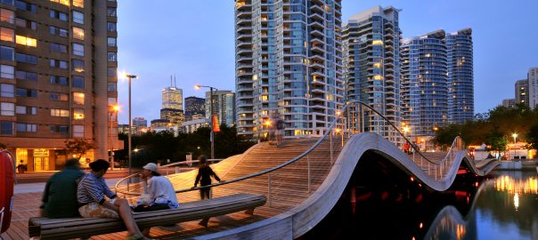


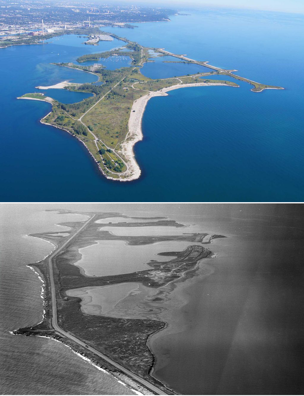
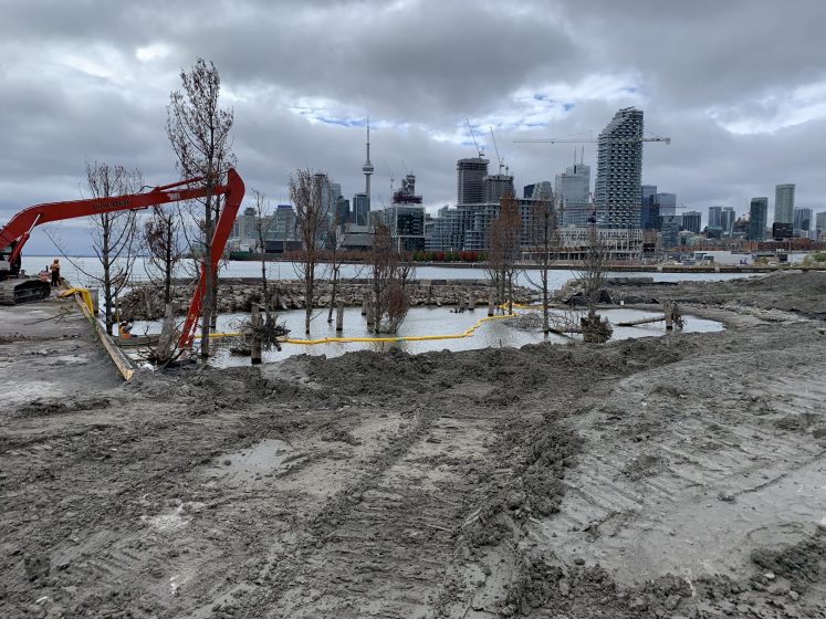
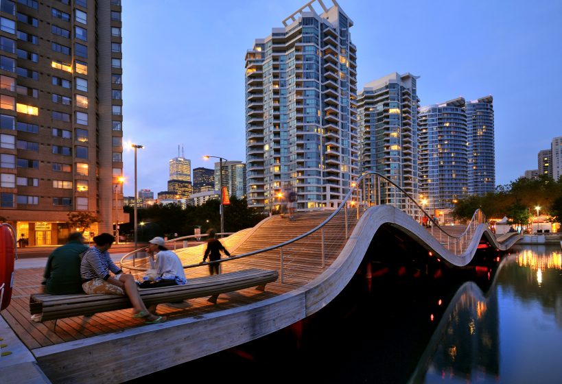
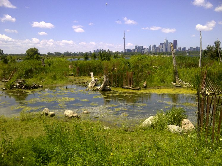
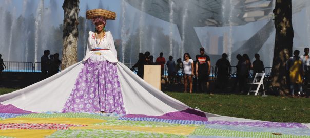
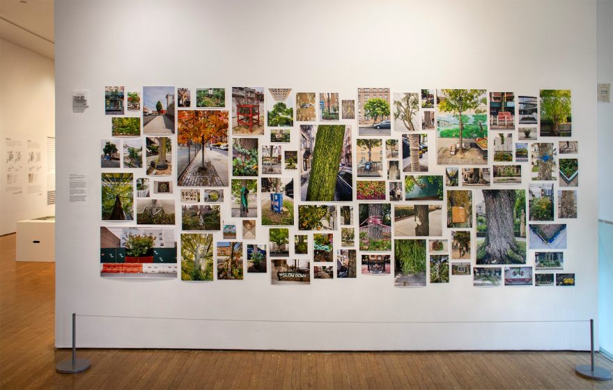
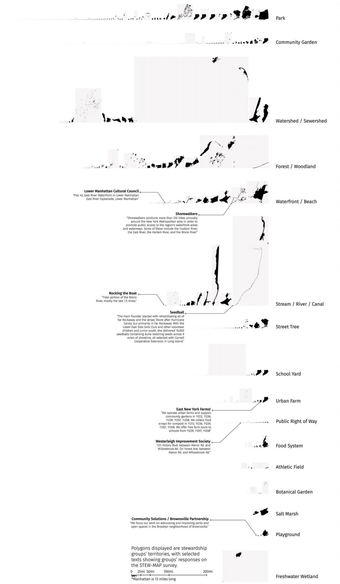
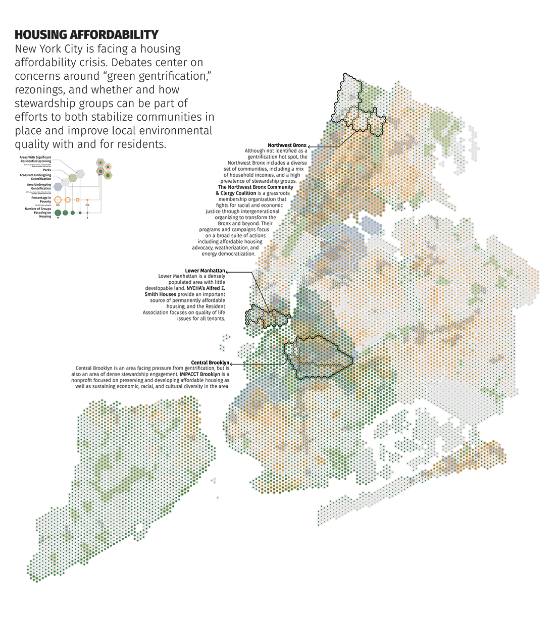
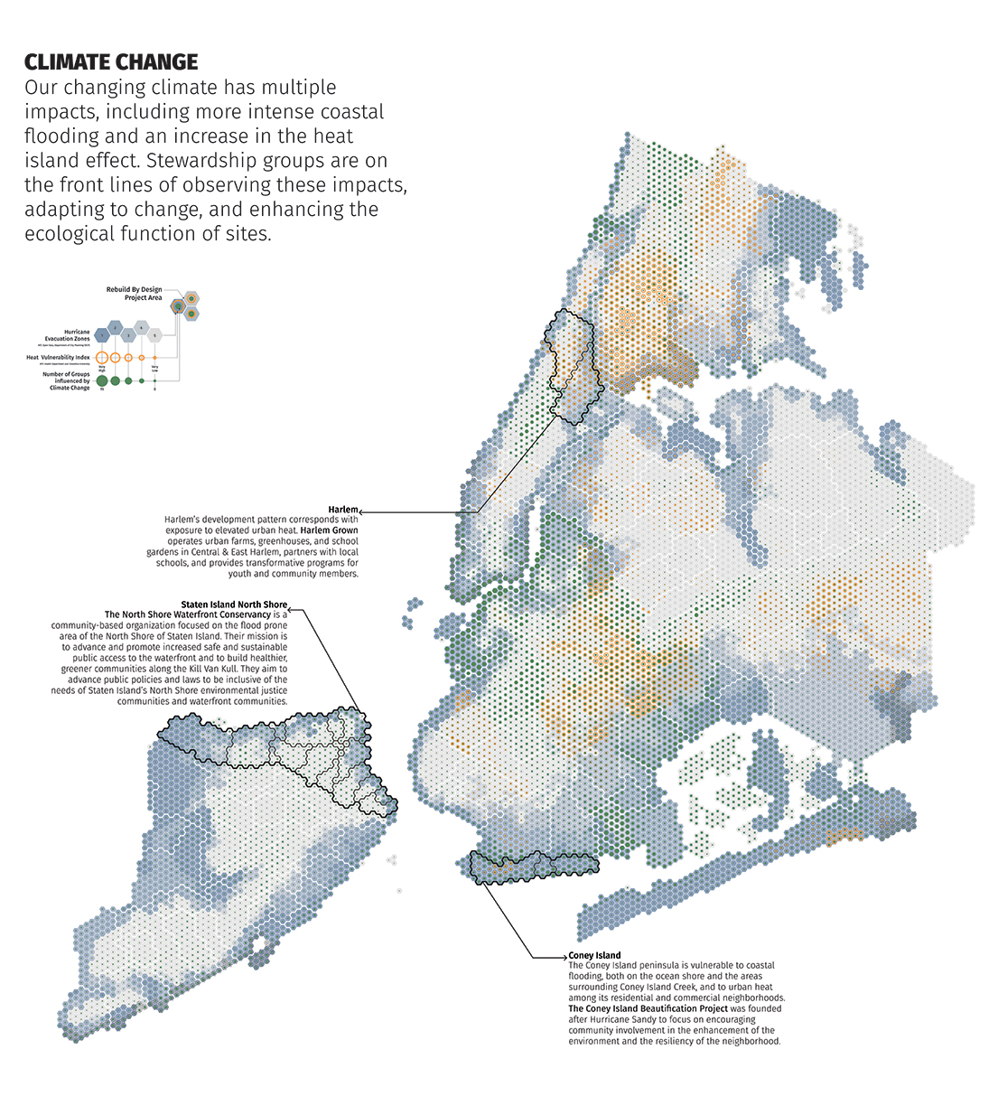
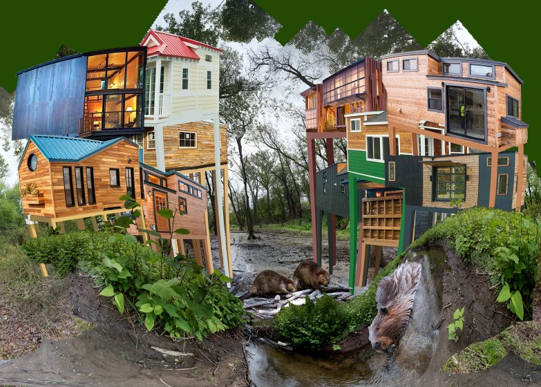
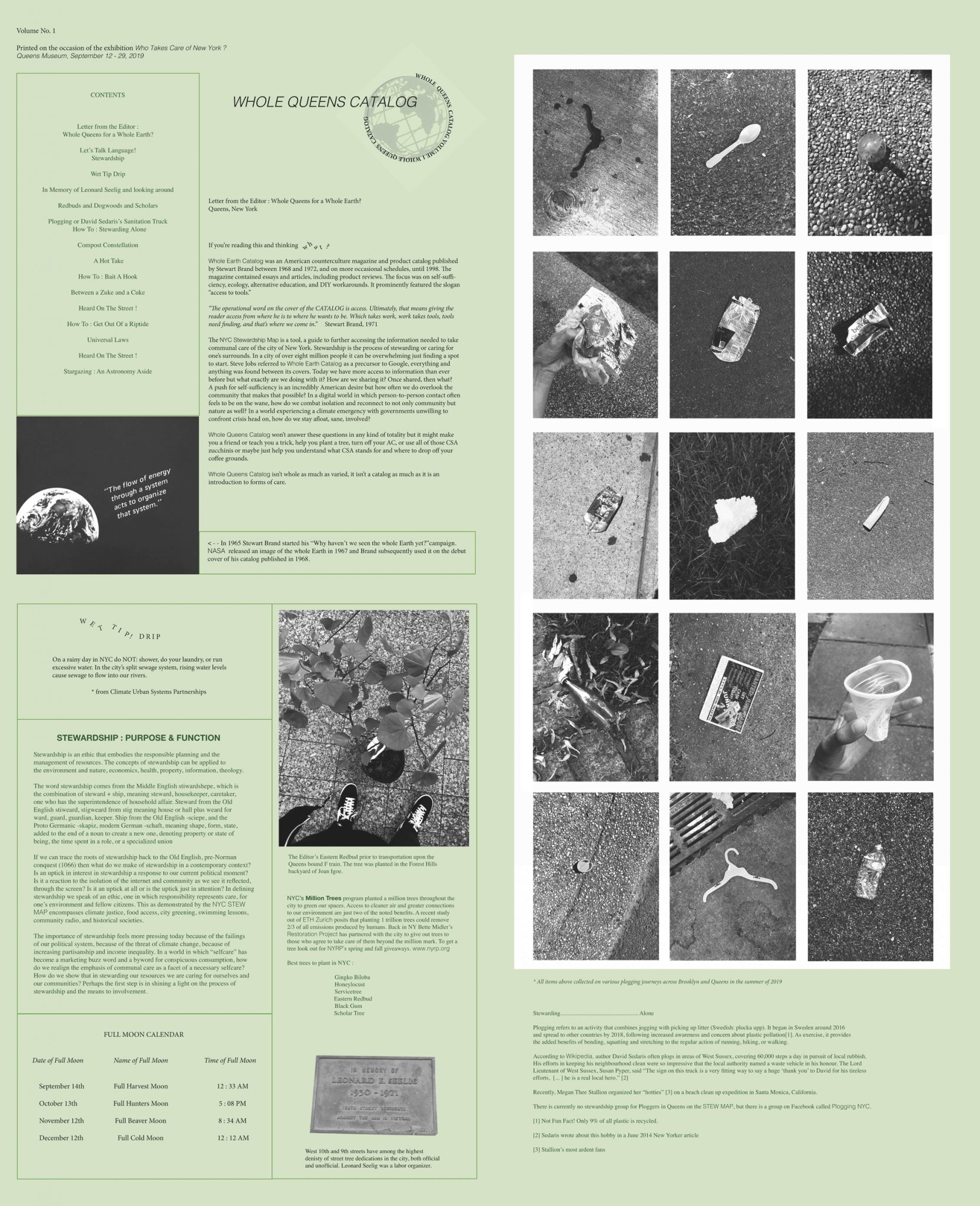
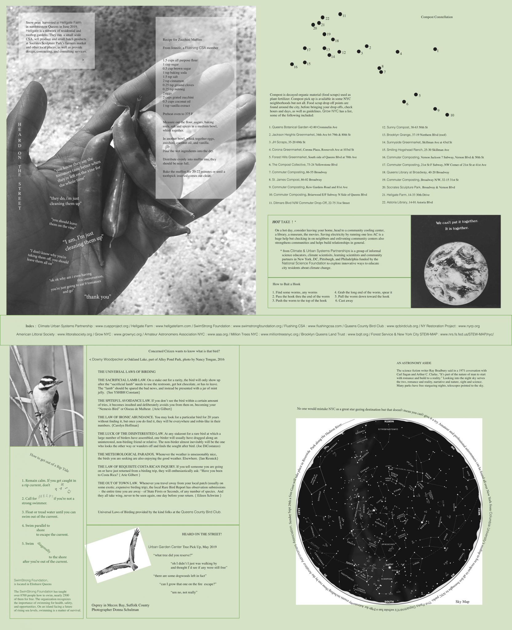
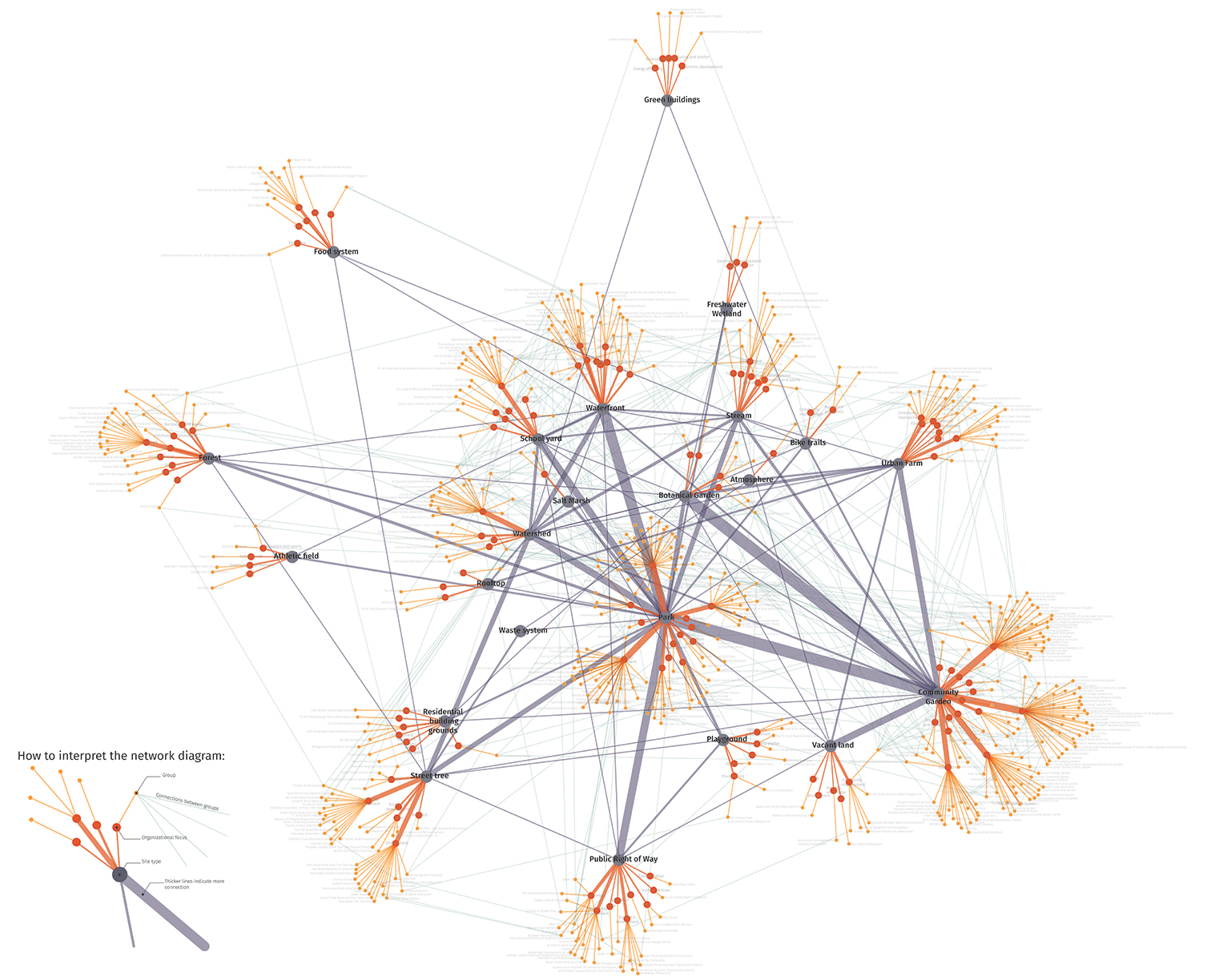
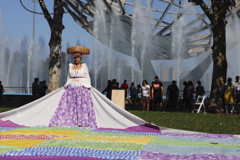
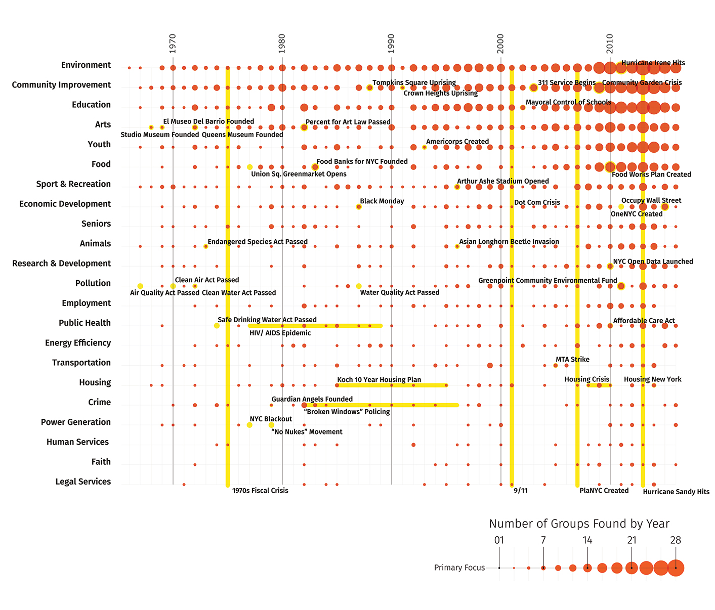
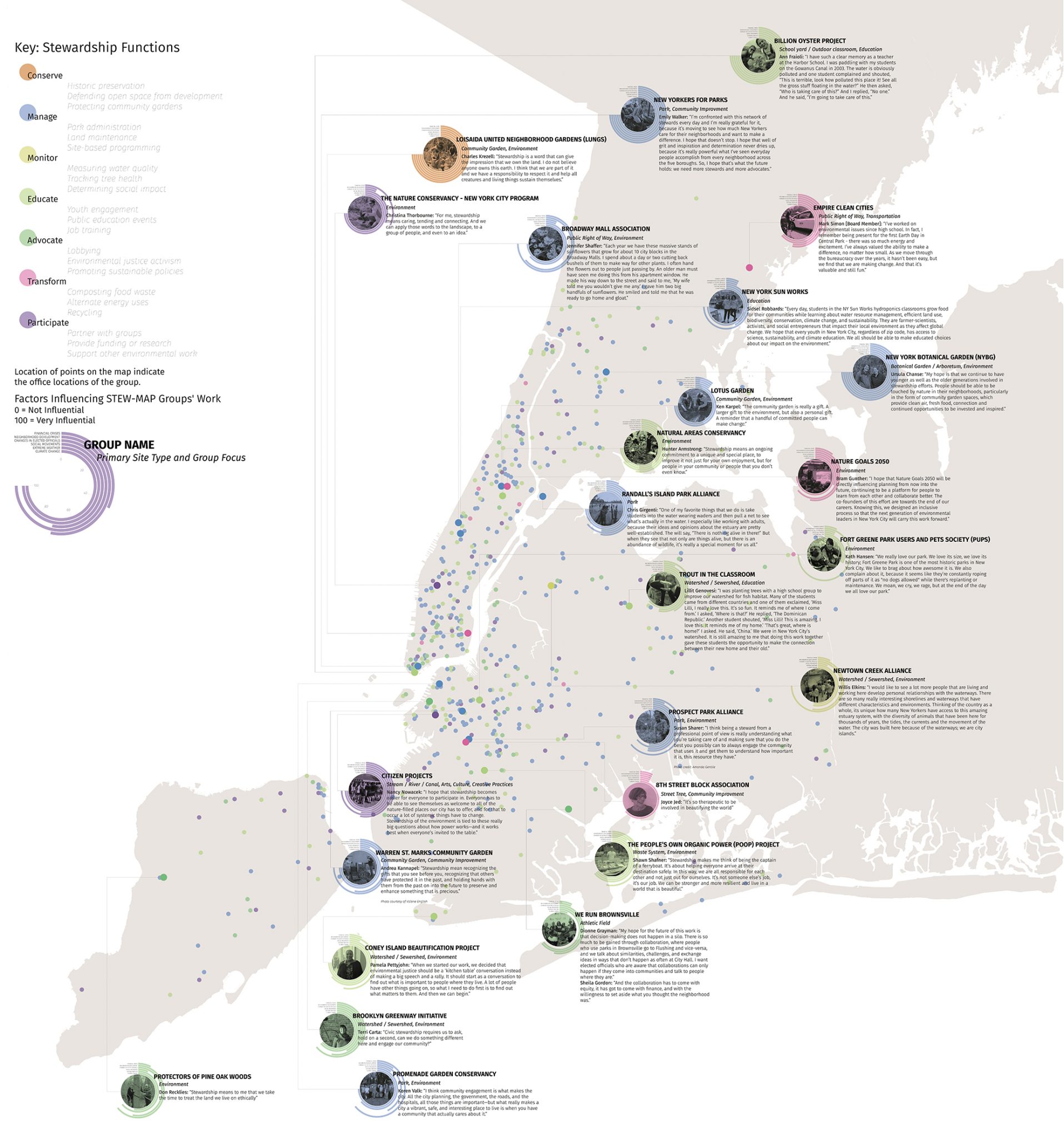
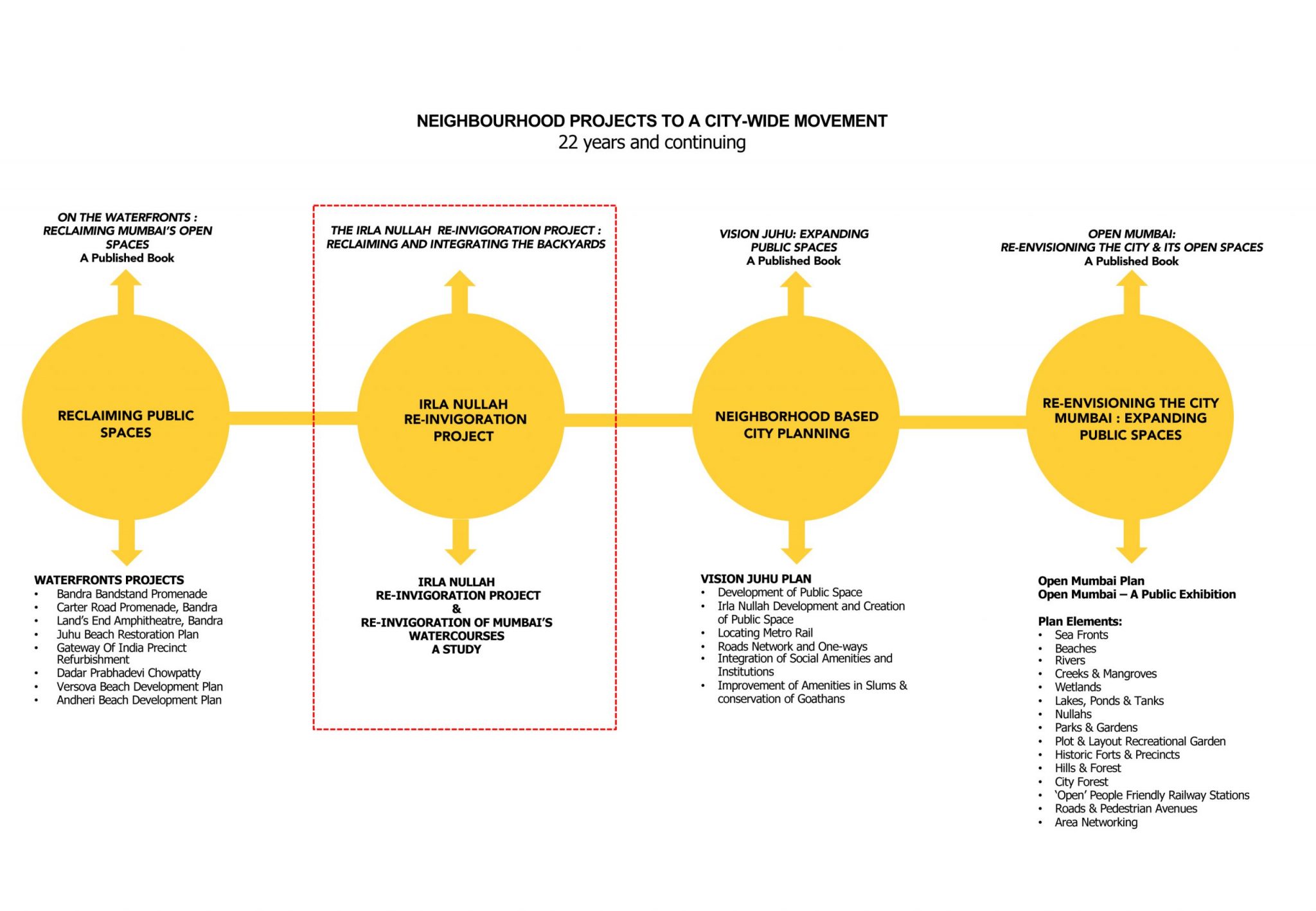
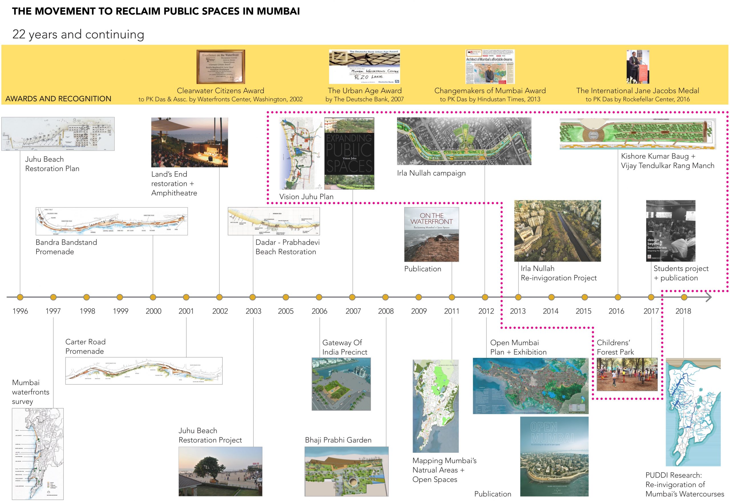

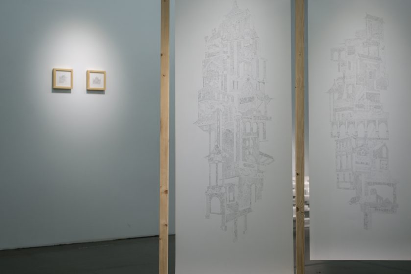
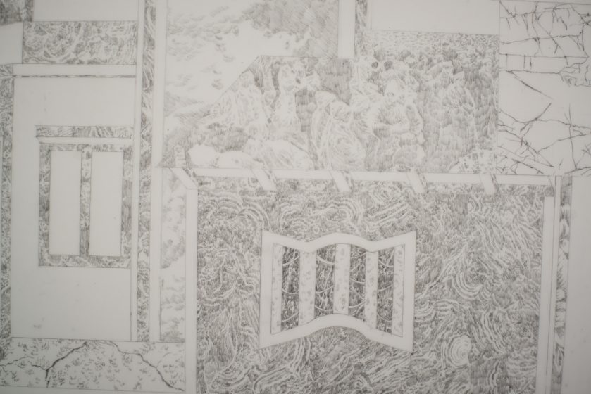
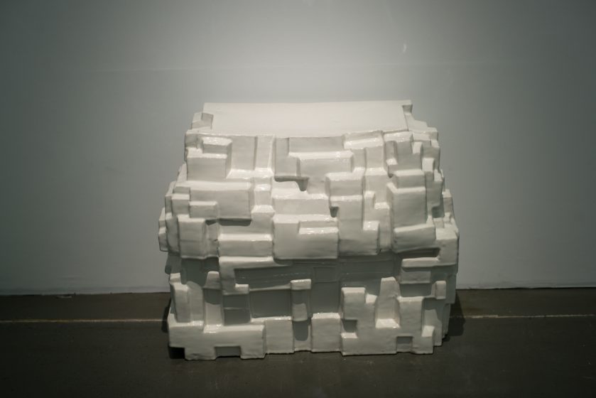
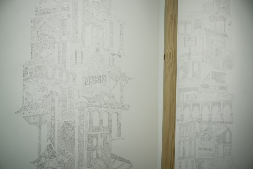
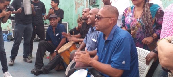


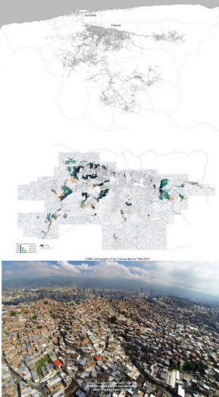
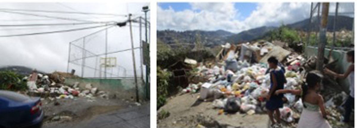
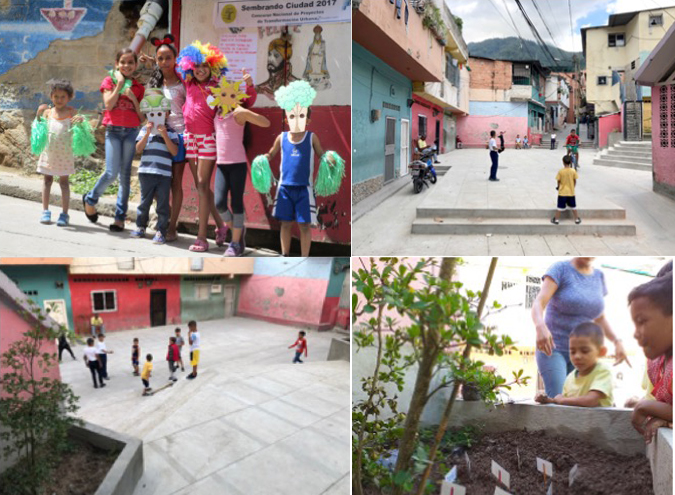
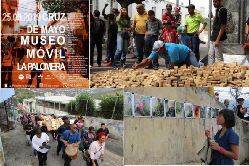
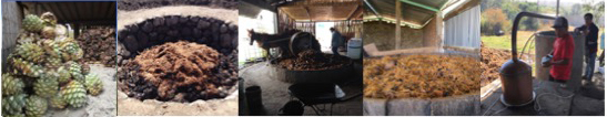

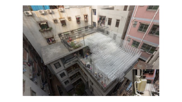
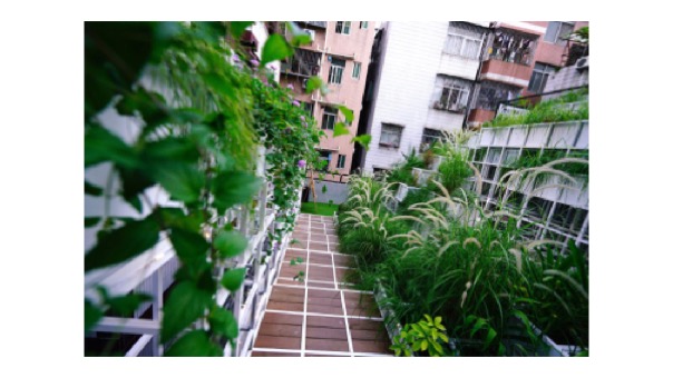
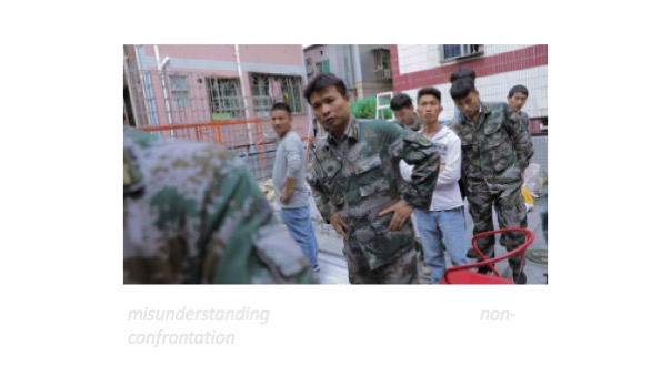
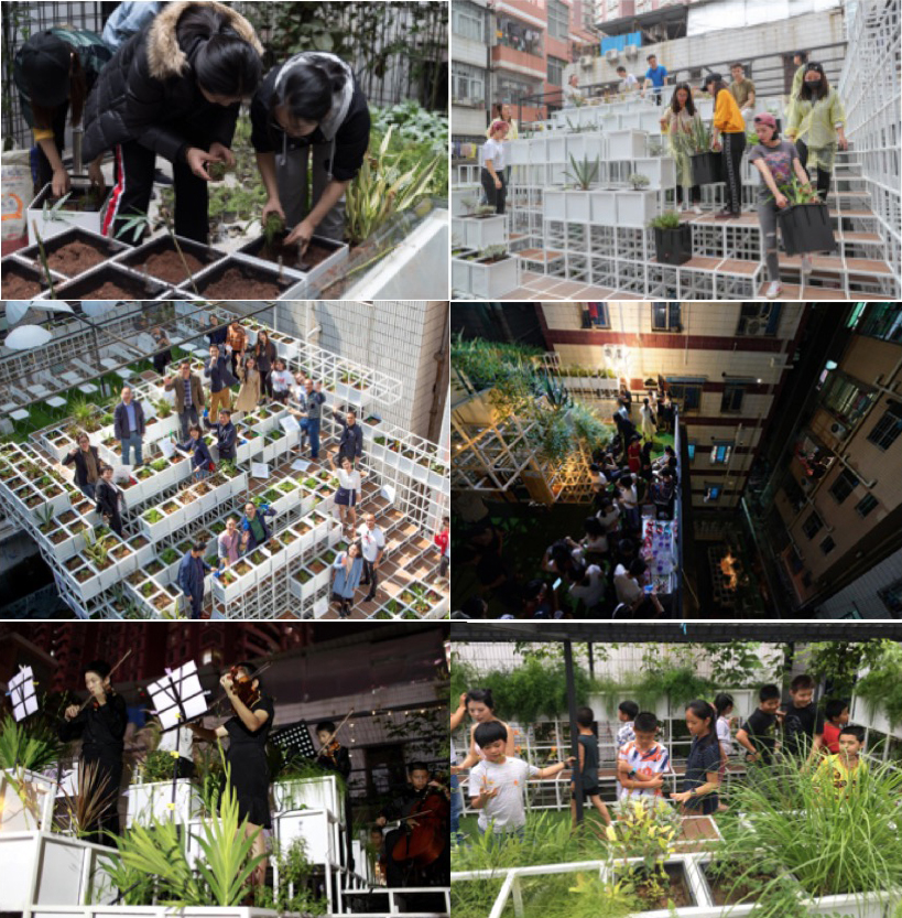
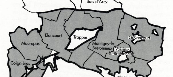

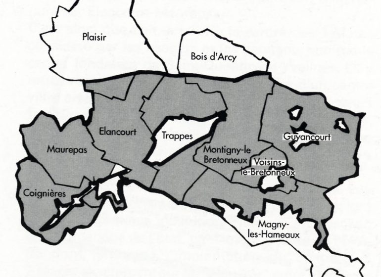
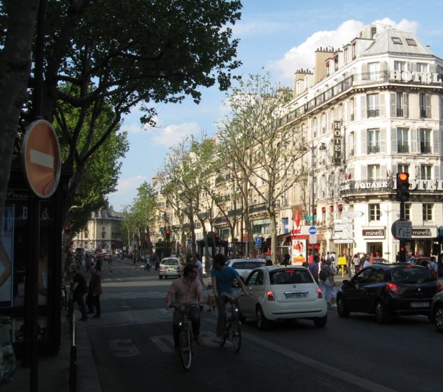
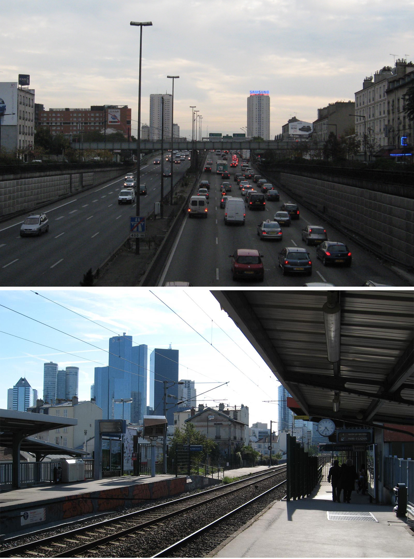
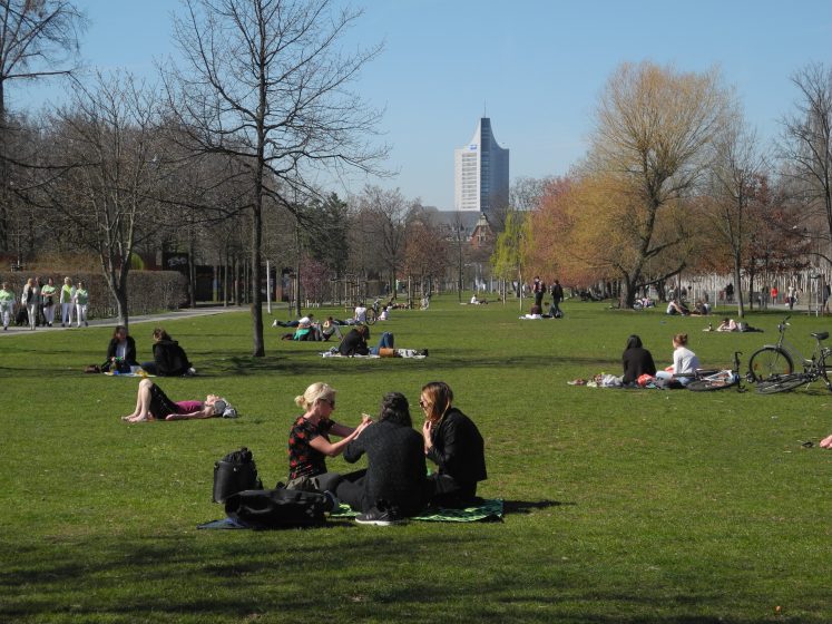
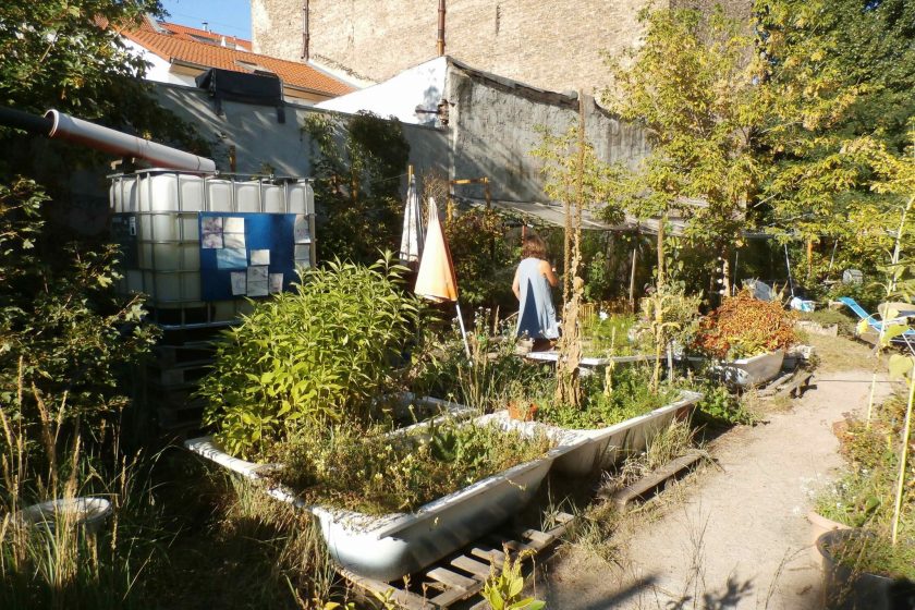


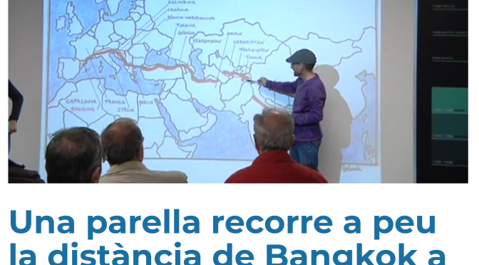
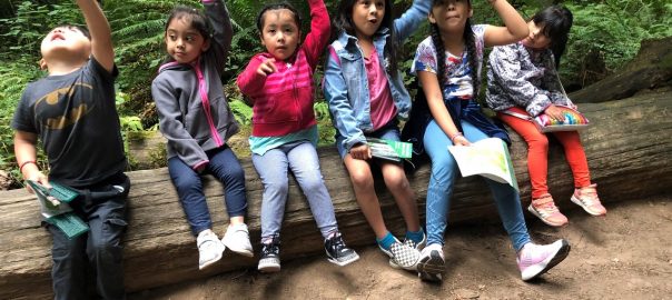
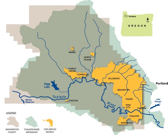

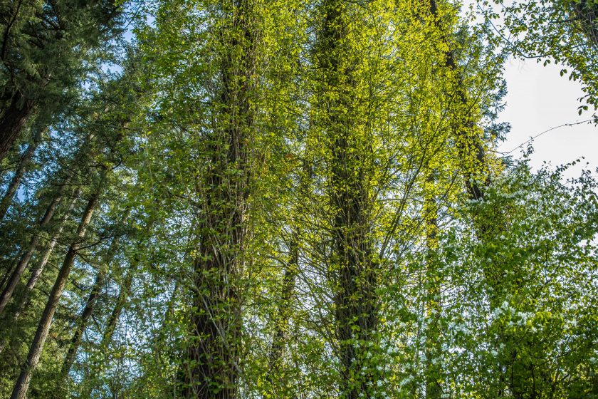
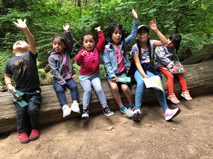
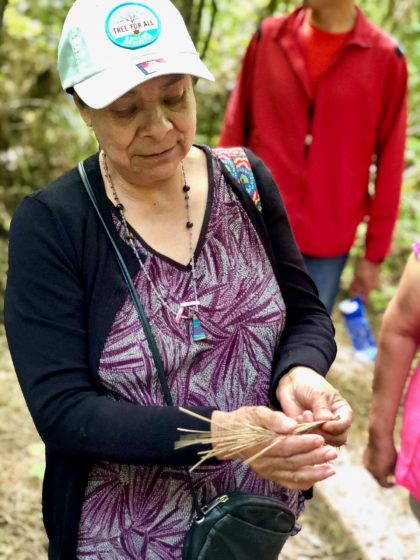
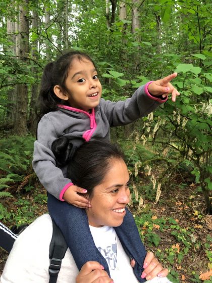

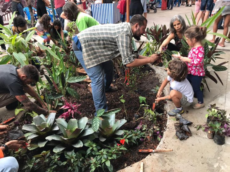
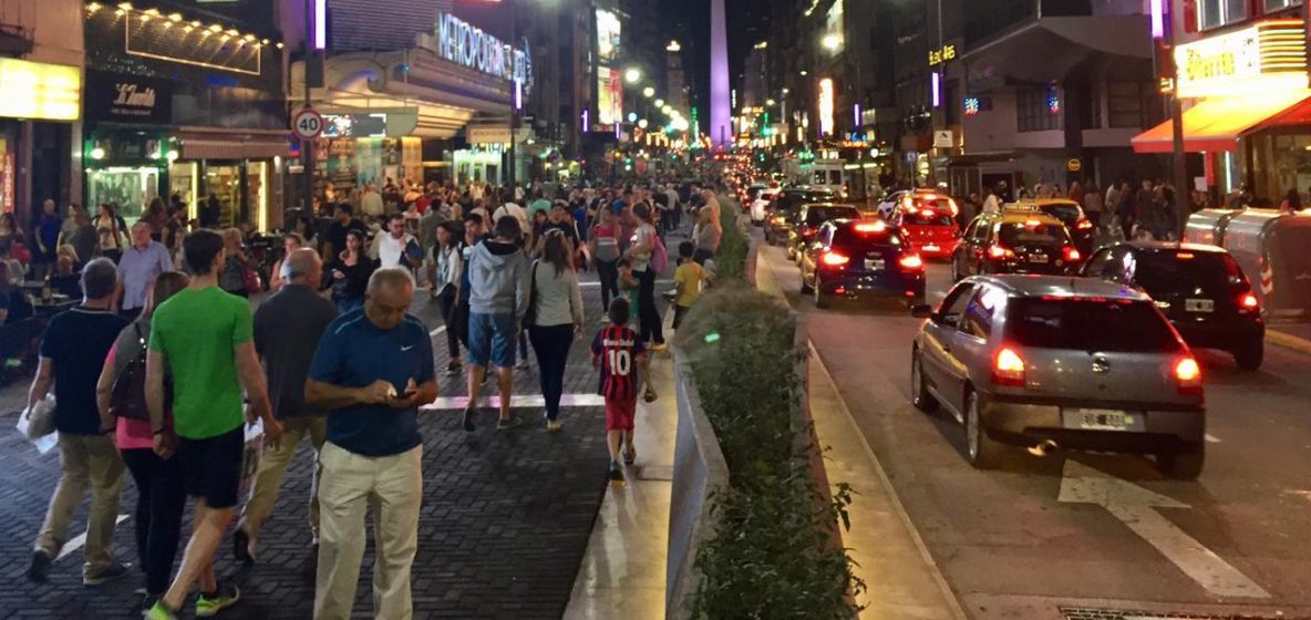
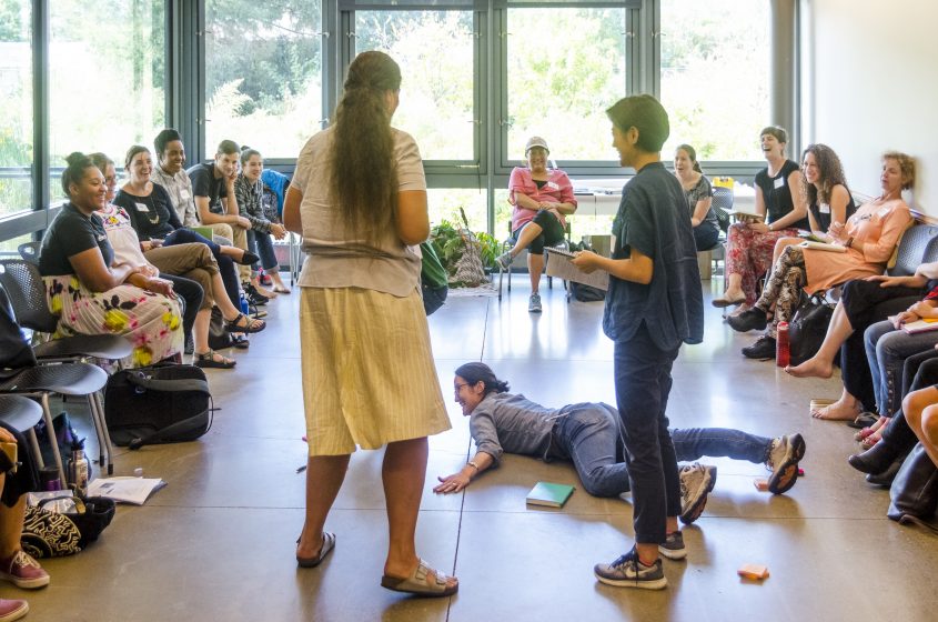
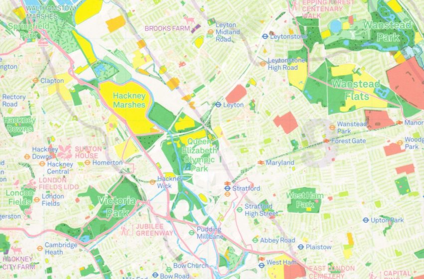
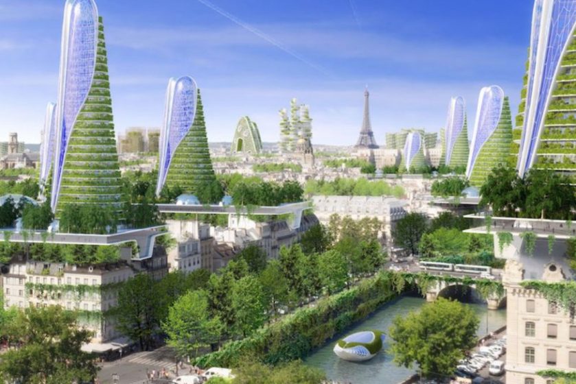
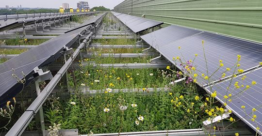
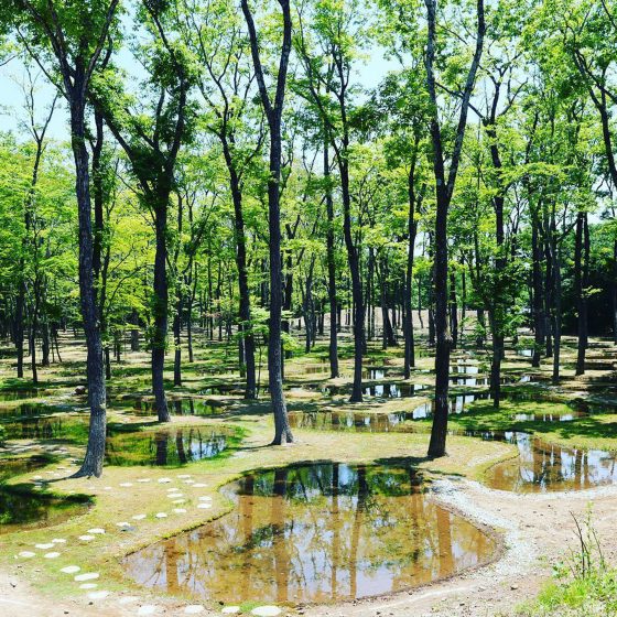
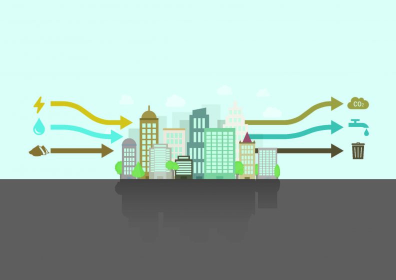
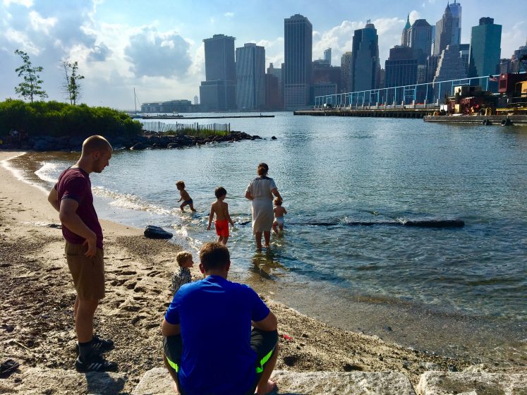
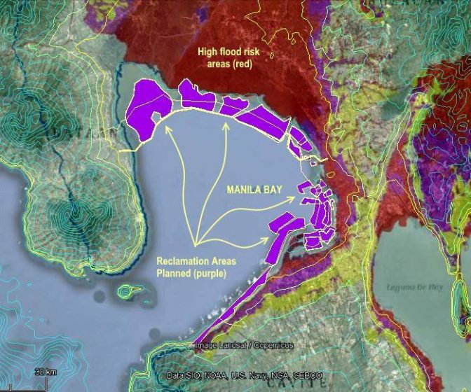
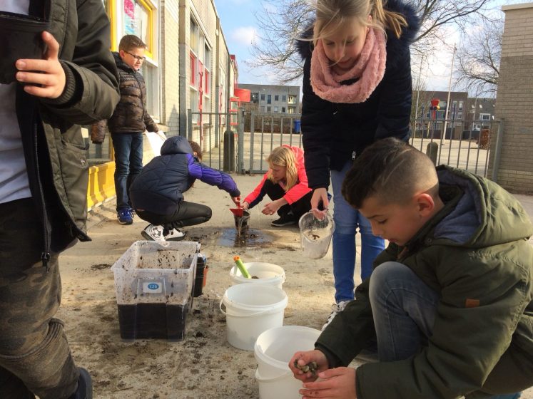
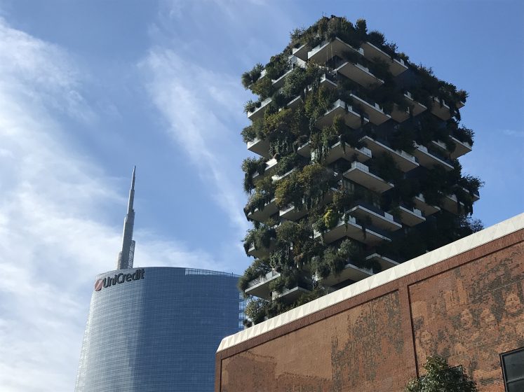


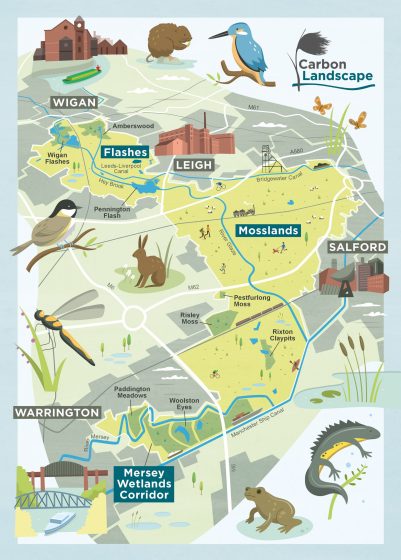
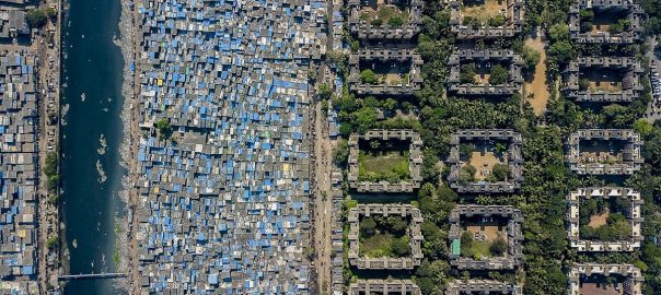


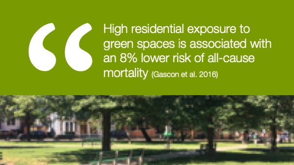
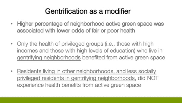
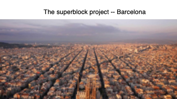
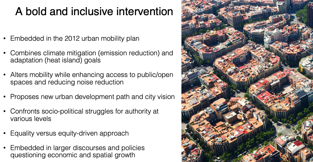
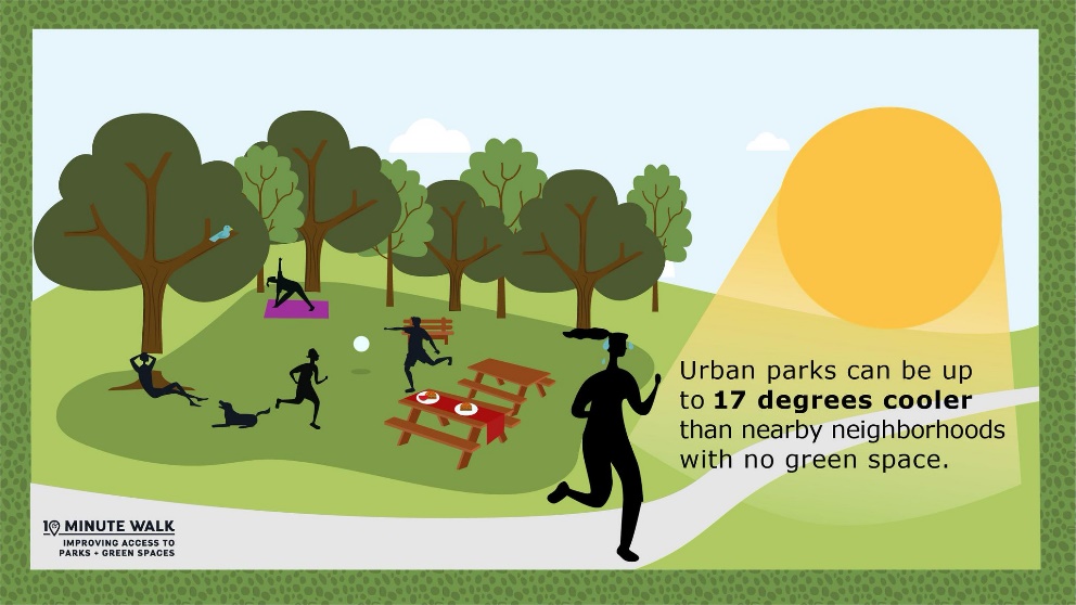
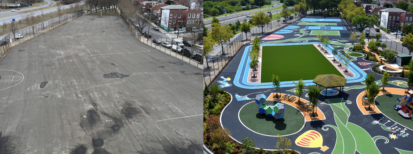
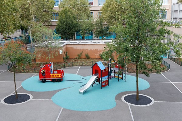
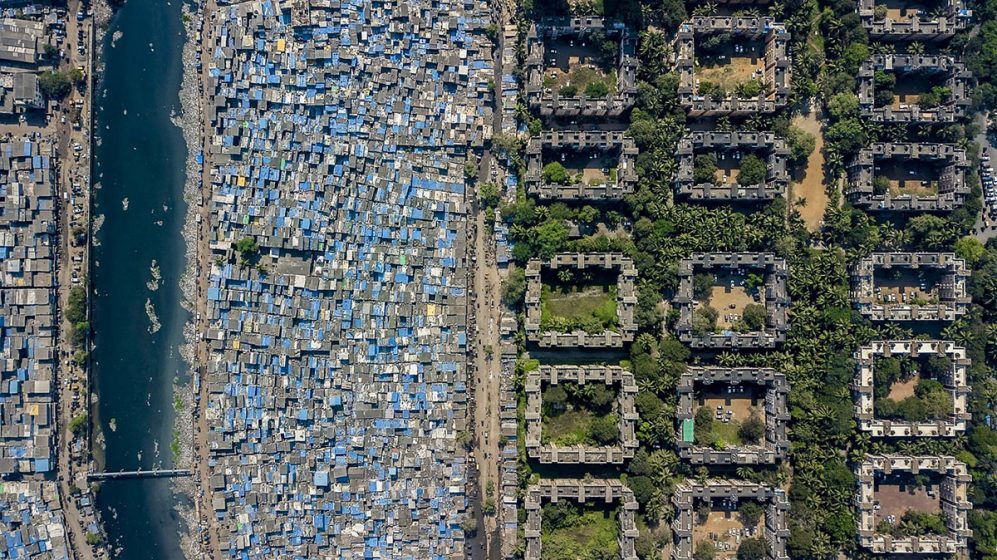
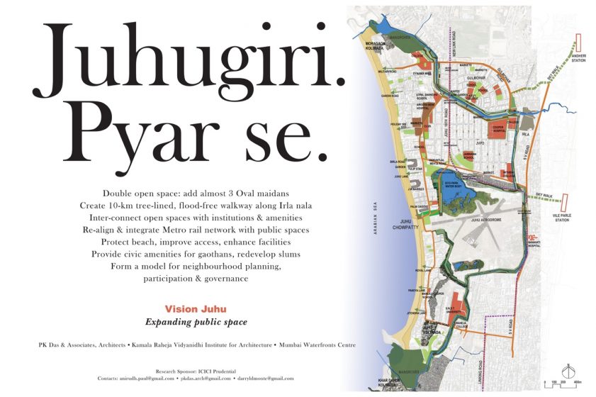
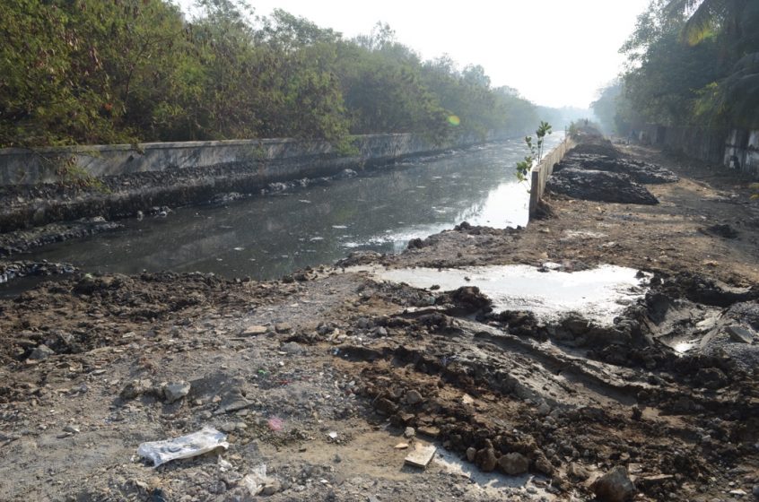
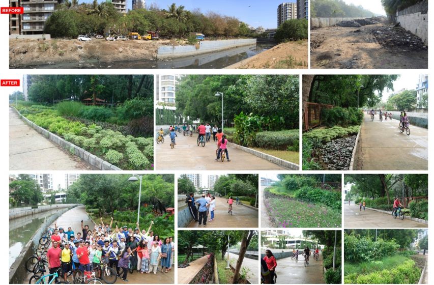
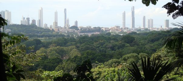
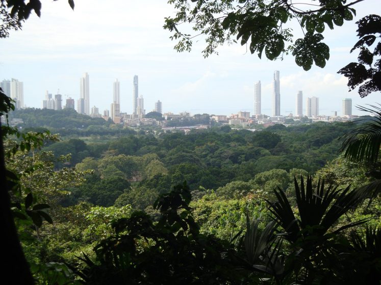
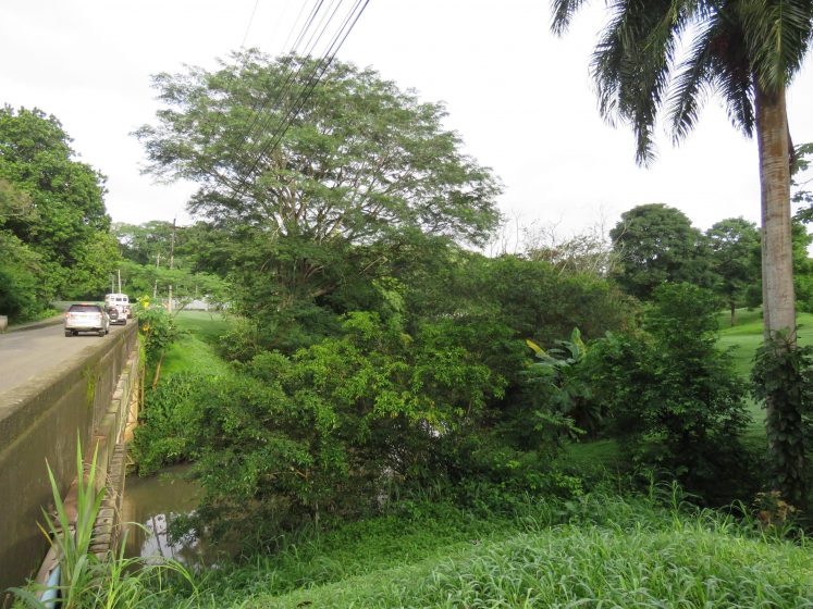

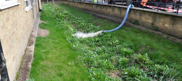
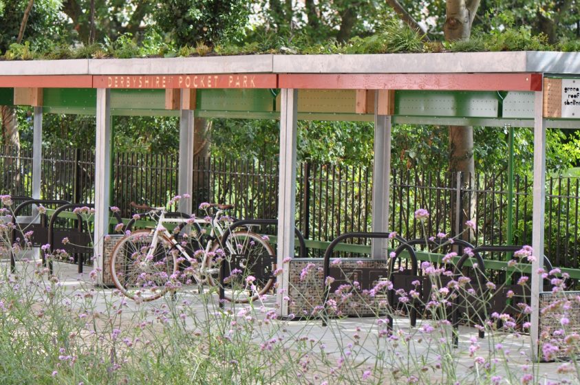
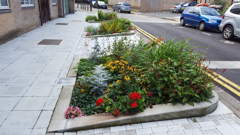
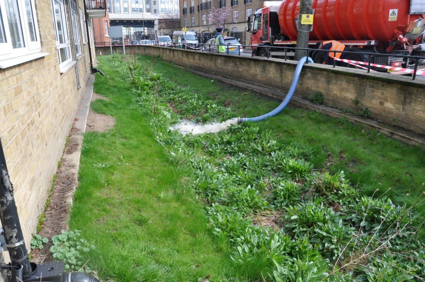
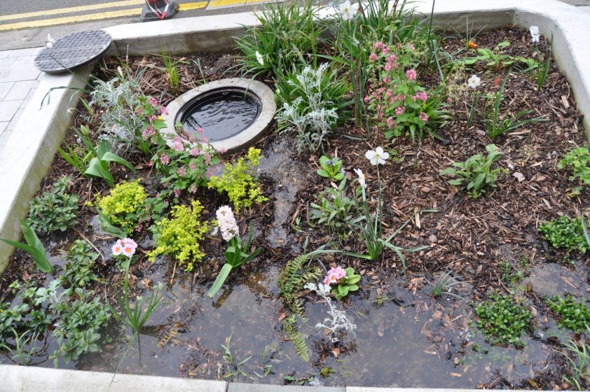
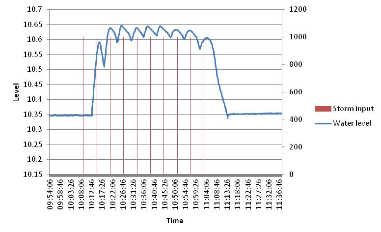

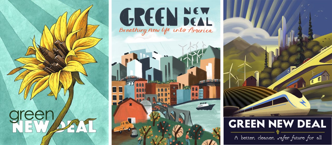
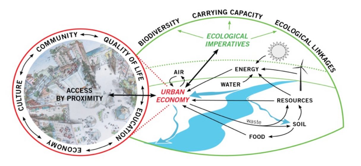
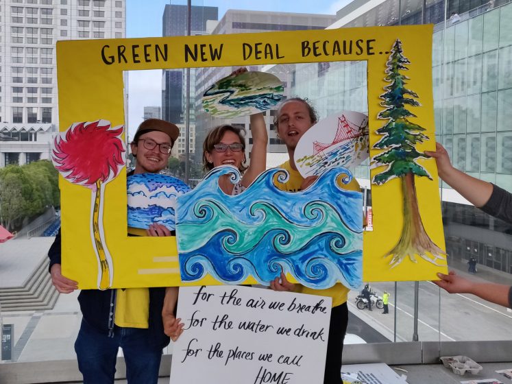
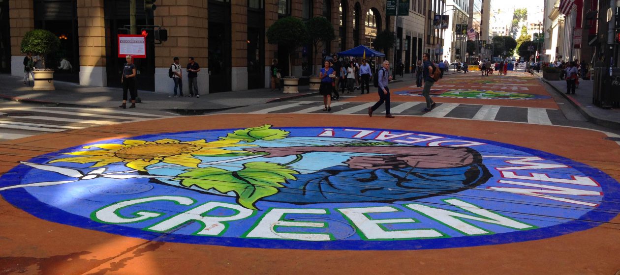
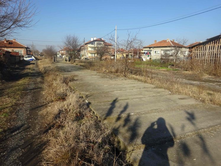
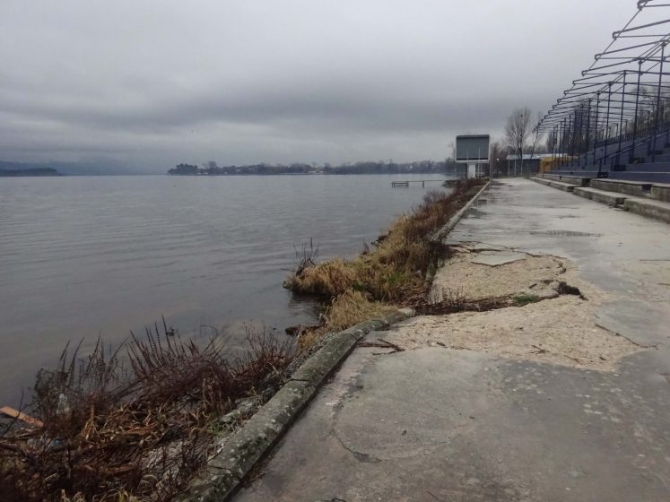
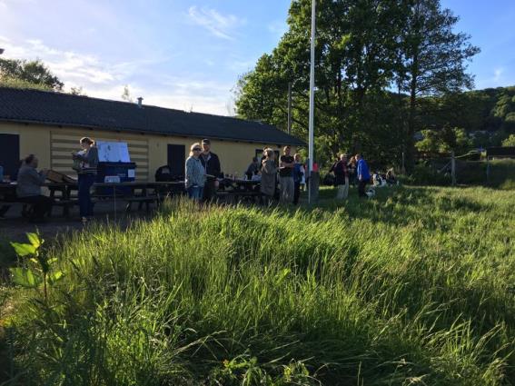
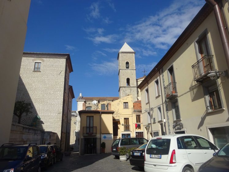

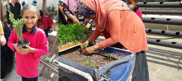
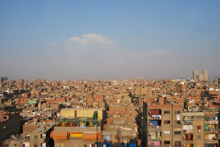
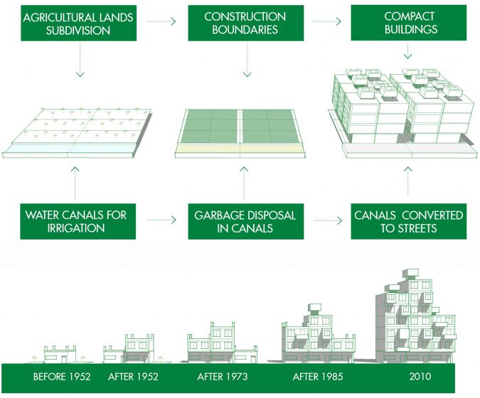
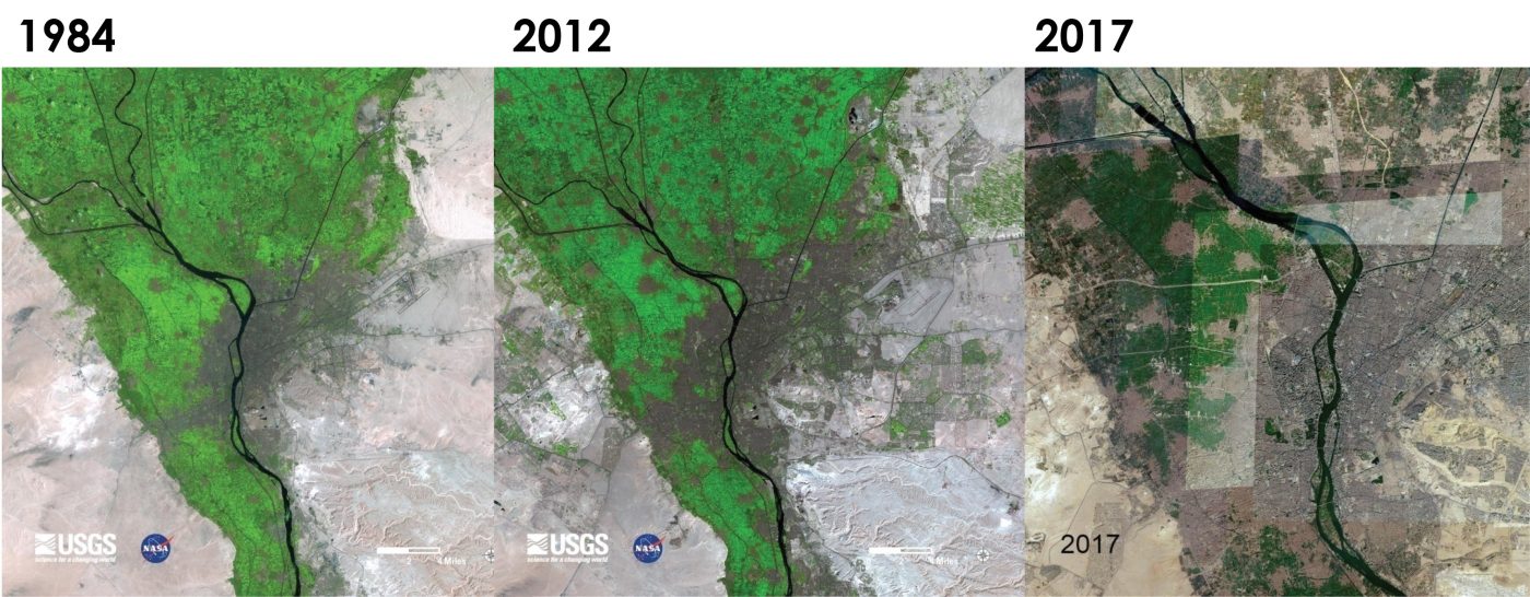
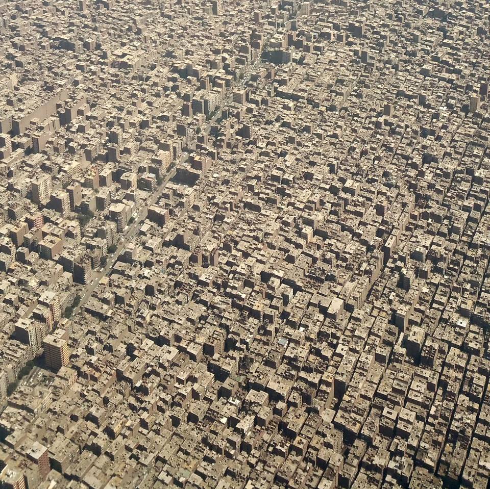
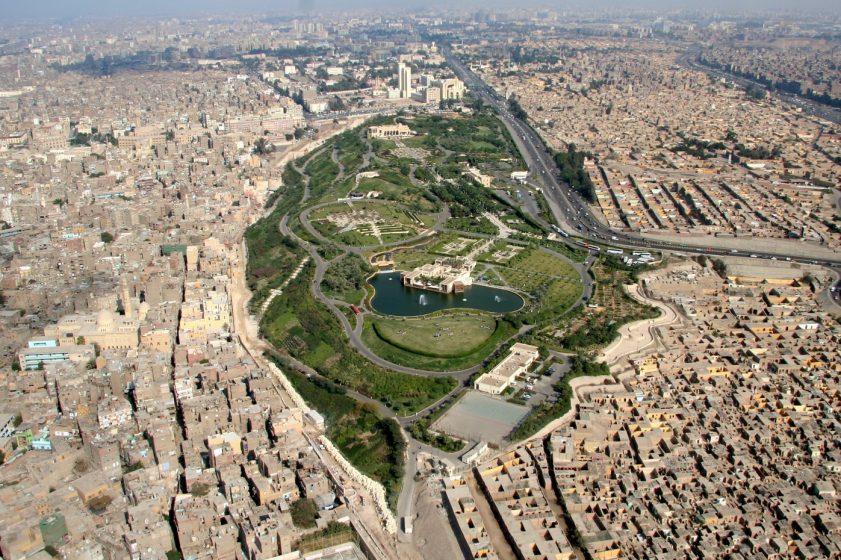
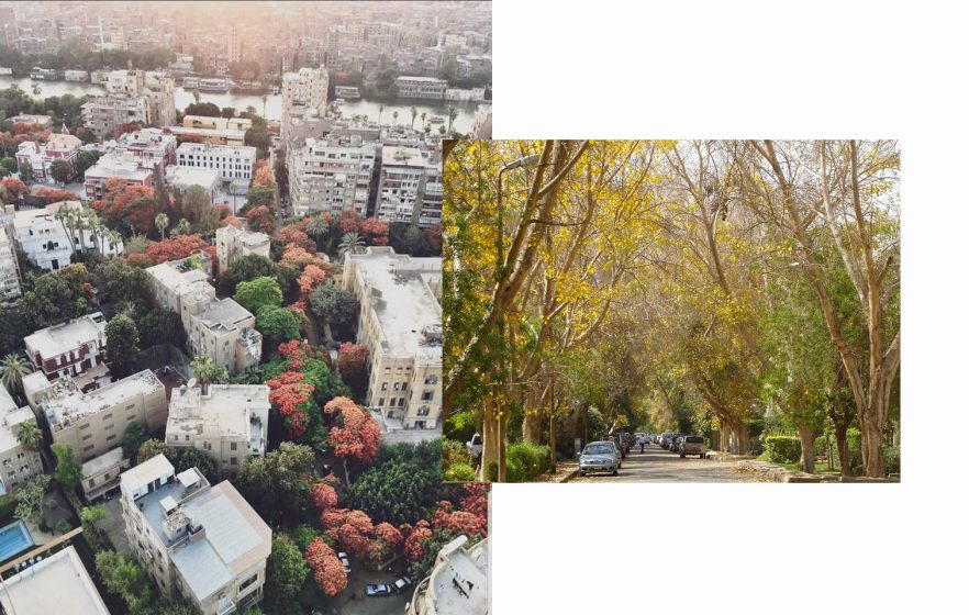
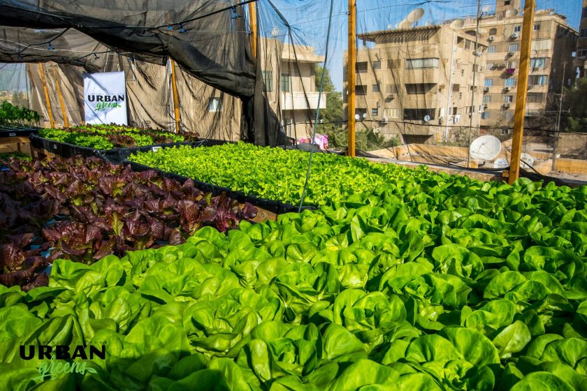
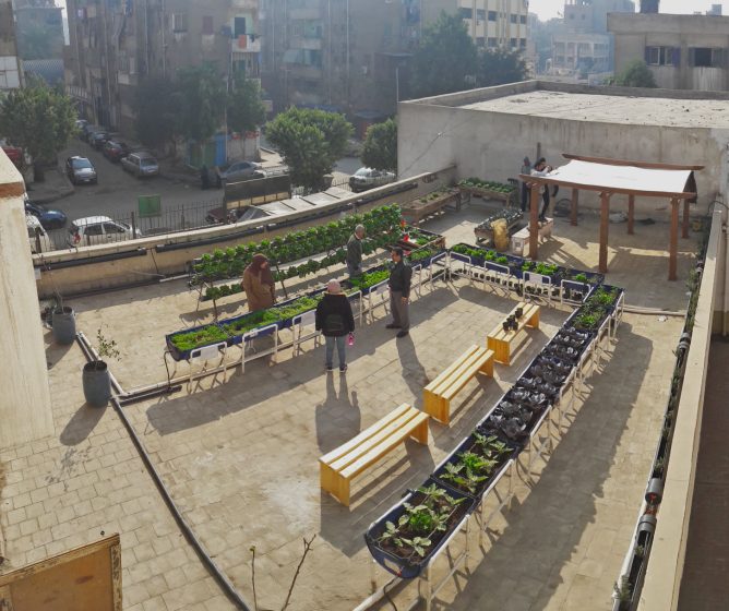
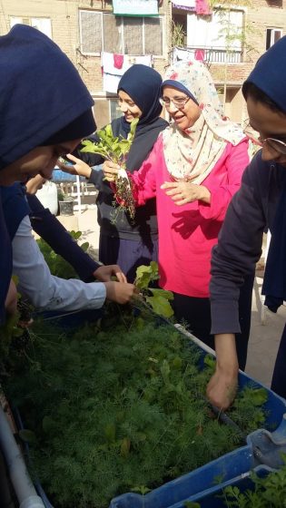
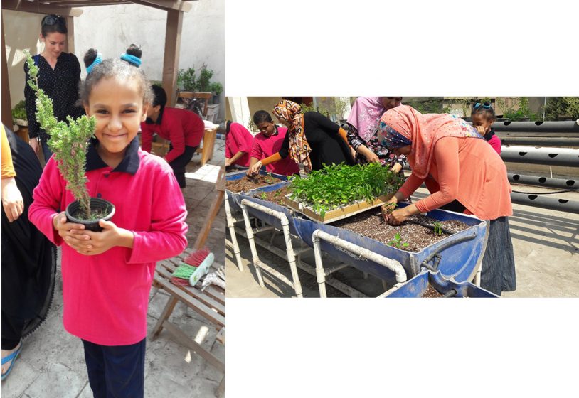
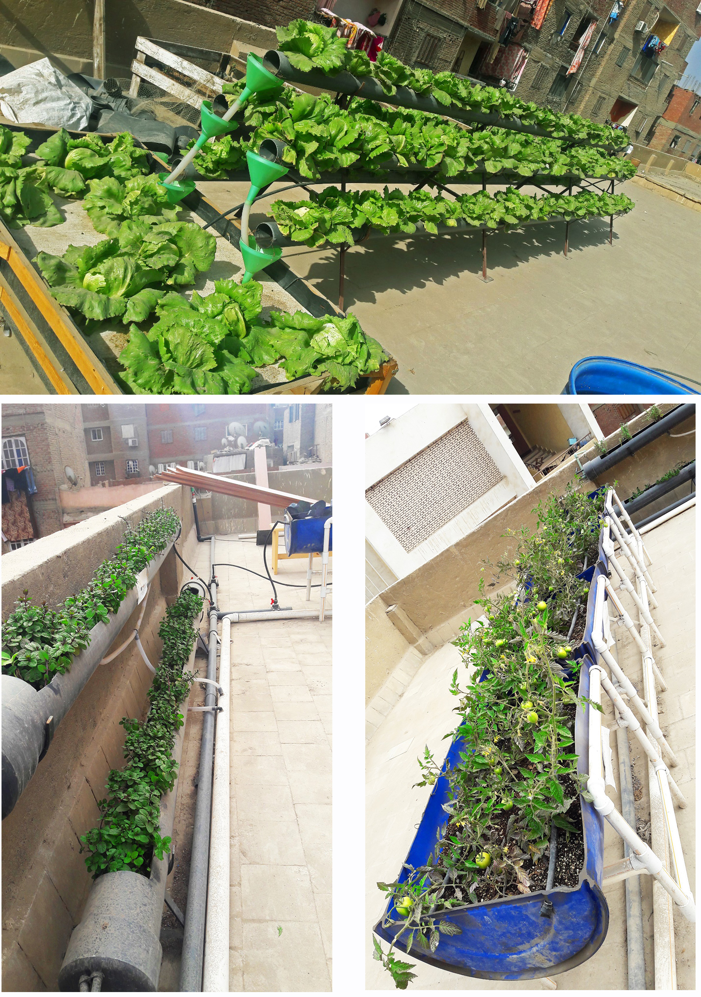
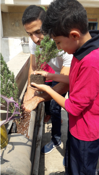

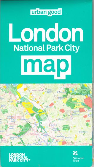


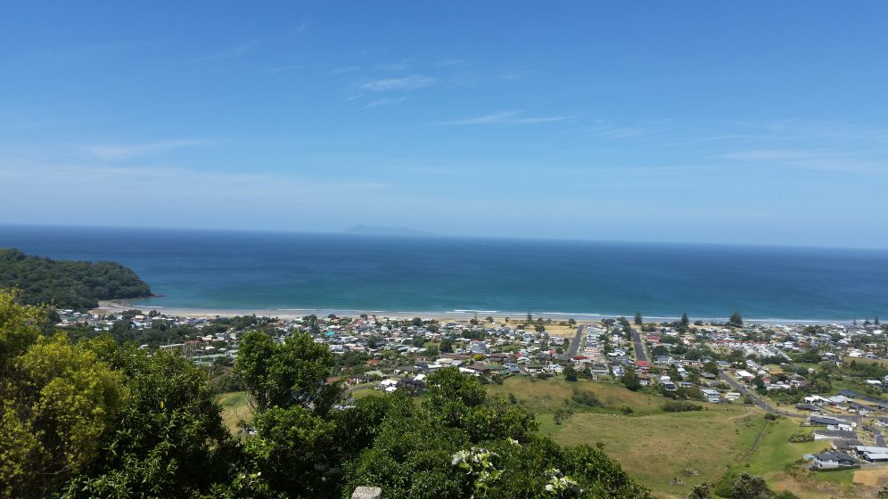


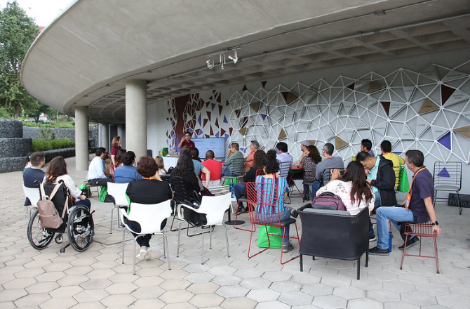
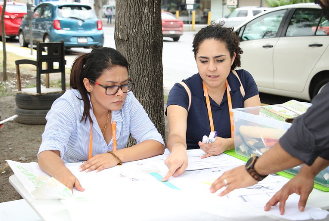

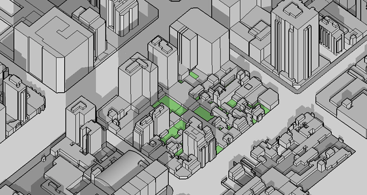
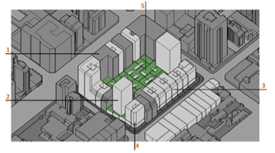
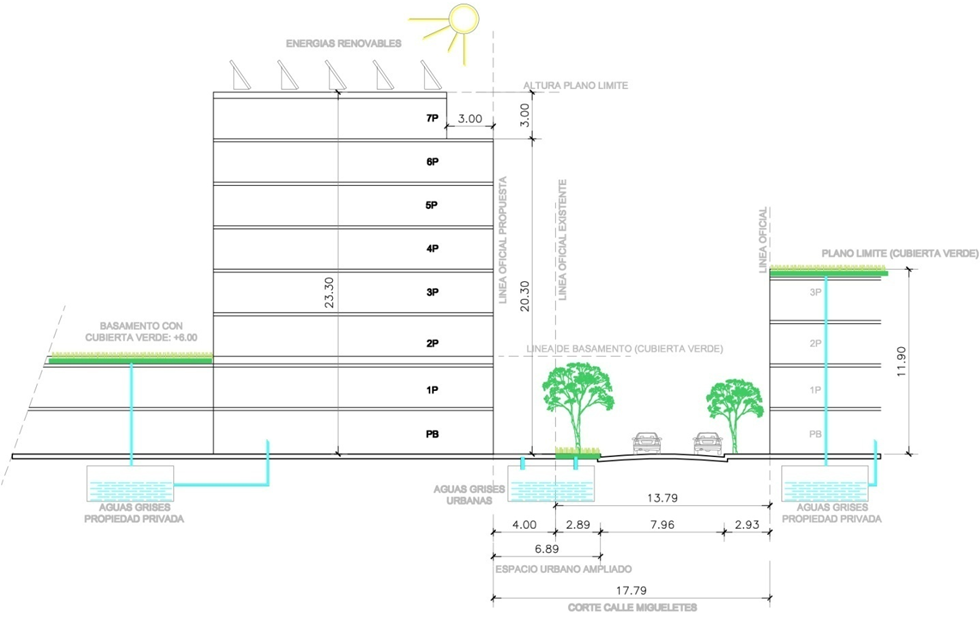

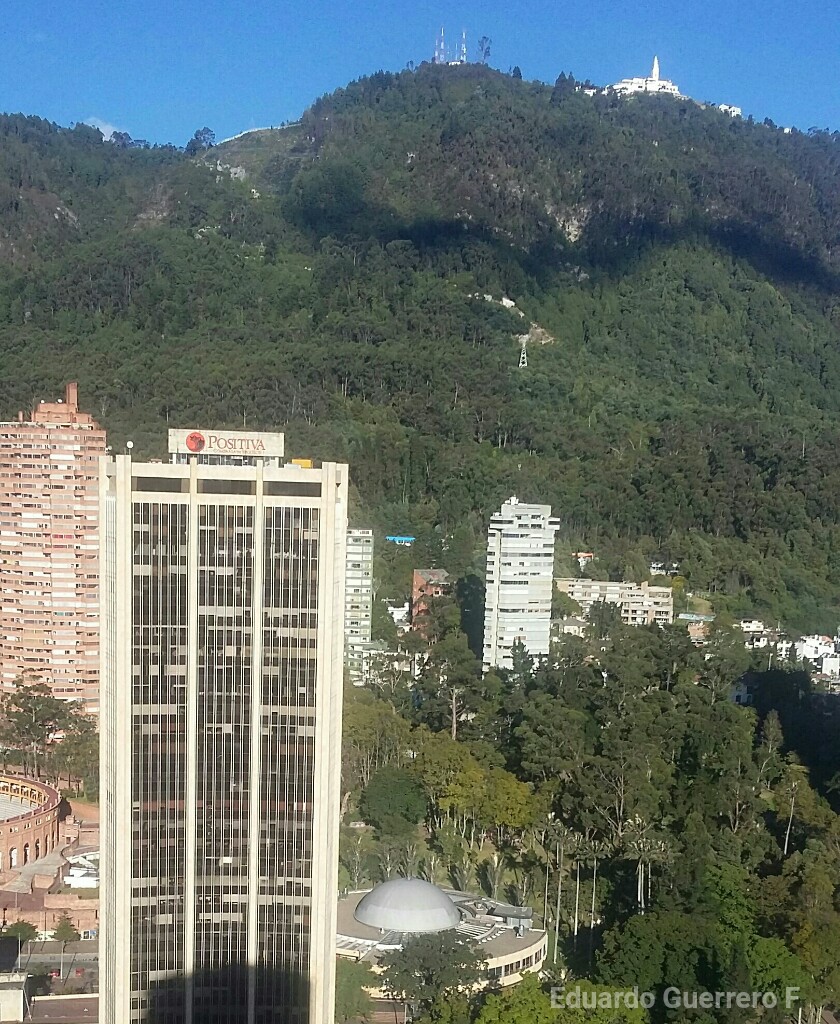
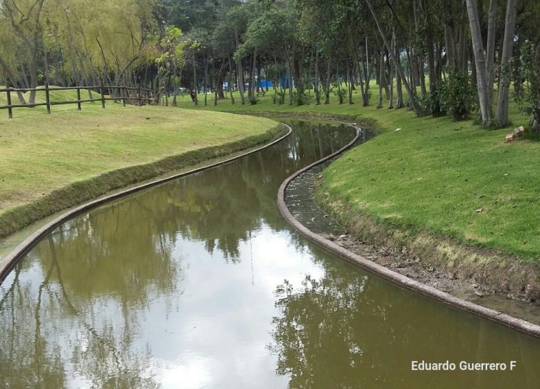


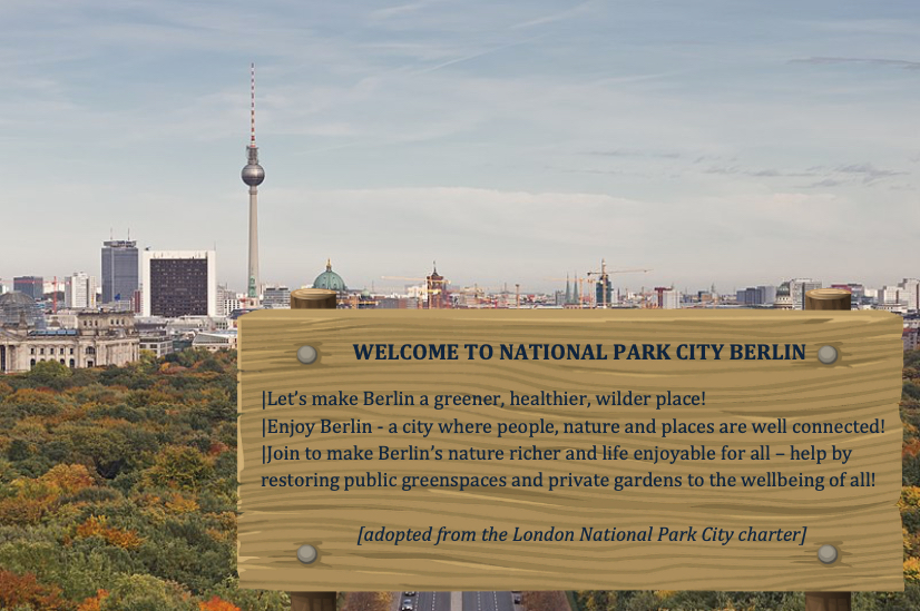


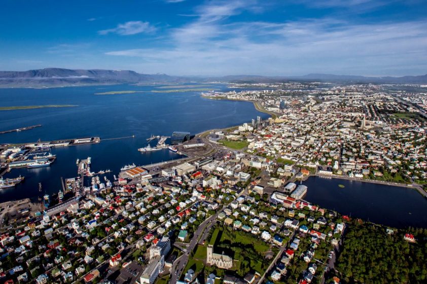
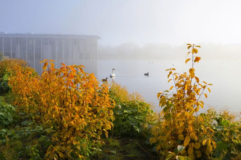


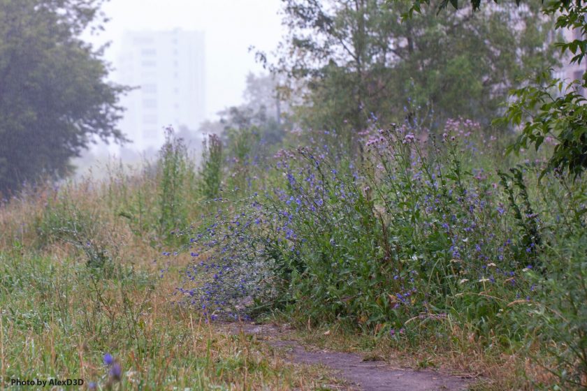

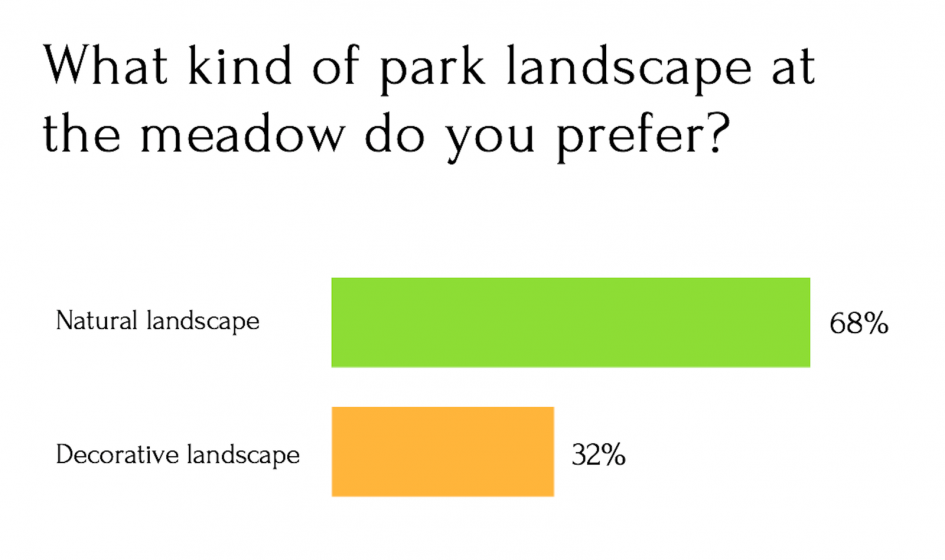
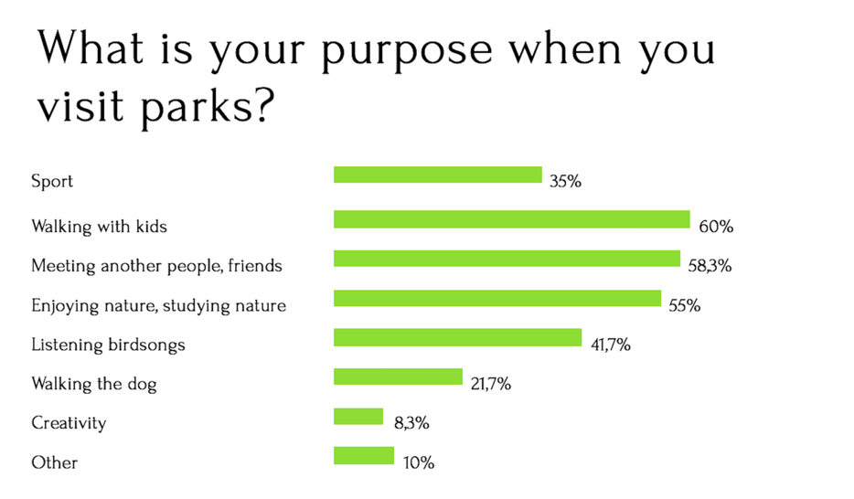

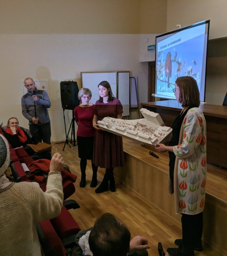
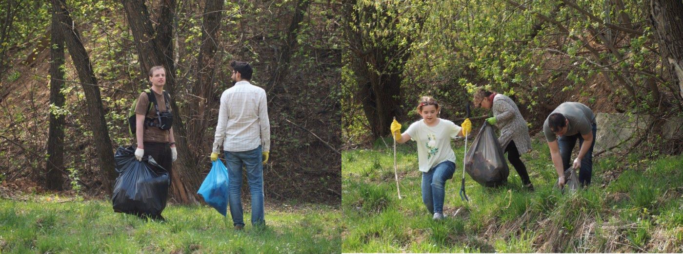

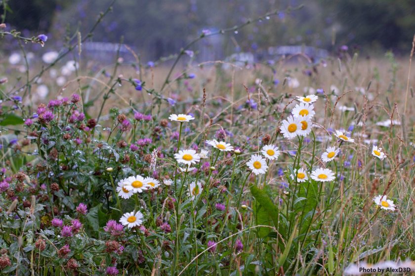

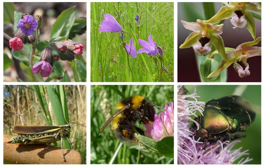

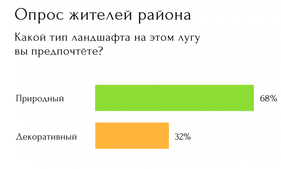
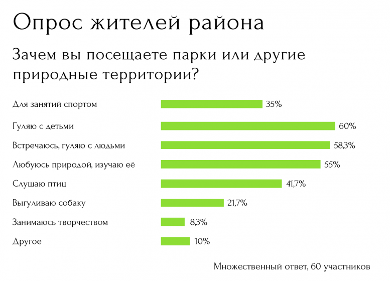
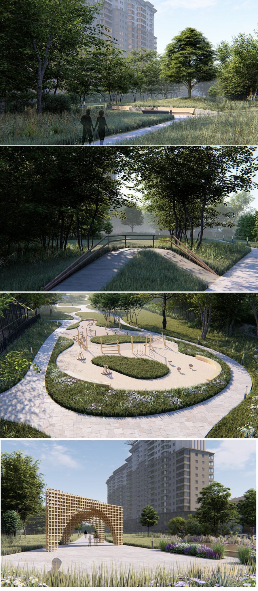

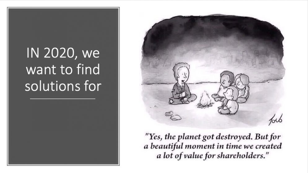

2 Comments
Join our conversation