Fire Escape Red-tails

Many voices. Greener cities. Better cities.

I blogged previously about the importance of integrating urban wildlife into our urban stories, poems, myths and culture in a piece entitled Souvlaki Coyote. Just as we integrate our built and natural environments, we must also repopulate our imaginations with images of wildlife that adhere to an urbanized context. This month I would like to dig down a little deeper on one of the strategies we have used in Portland to try to accomplish this objective.

In 2007, Portland Audubon teamed-up with a local television station to install a web camera above a red-tailed hawk nest that had been built on the 11th floor fire escape landing of a downtown Portland office building. This was before the era of bird nest cams had really exploded. There were at that time a smattering of bird cams on the internet, but nothing like the endless opportunities that exist on the internet today.

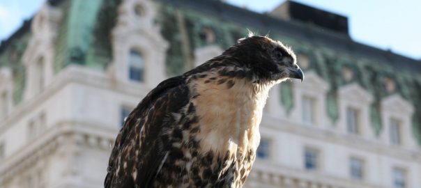
Portland has a number of red-tailed hawks nesting in its downtown core. They nest in the trees in our park blocks, on building ledges, and on industrial grain elevators. If you take some time to look up as you stroll the streets of downtown Portland, there is a decent chance you will be able to find a red-tail perched or soaring somewhere overhead. However like much of urban wildlife, they mostly go unnoticed and unappreciated.

Red-tailed hawk over downtown Portland. Photo: Bob Sallinger

For me this project has been a truly eye-opening experience. I intuitively recoil from all things virtual. My bias is to get people out in the field. Why watch it on television if you can see it in person? In fact, why watch it on television even if you can’t see it in person? The only reason that this project happened at all was a serendipitous pairing of events.

One afternoon in early April of 2007  I received a call at Audubon from a reporter named Vince Patton who I had worked with for many years at KGW/ Channel 8. He told me that he and his colleagues had come up with what might be a “silly idea” but he wondered if we knew of any downtown raptor nests where it might be possible to install a web cam. The call might have led nowhere but for the fact that my colleague, Karen had received a call only a few minutes earlier from a gentleman named Dieter Waiblinger, informing us that a pair of red-tailed hawks had taken-up residence on the fire escape outside his 11th story offices. I told Vince to give me an hour and I would get back to him.

One of the earliest shots of red-tails scoping out a downtown Portland fire escape in winter of 2007. Photo: Dieter Waiblinger

We found the hawks nesting on the fire escape just below the window sill literally a few feet from Dieter’s desk, separated by only a window and a low frame. If you opened the window, you would have been able to reach out an pat the brooding birds on their heads. The hawks already had two nestlings in the nest so installation of a camera outside on the fire escape itself that first season was not feasible. However, we were able to install a cheap web cam on a tripod on the inside of the window.

At first we questioned whether it was even worth the effort. On short notice, the best we could do would be to get grainy footage, shot through a dirty window, with a large metal bar bisecting the image. I also had my own personal doubts as well. I questioned whether we were perpetuating a culture of virtual reality when in fact our job was to get people out from in front of televisions and into the great outdoors. I also worried that focusing attention on these birds would somehow place them at increased risk.

After some consultation with Fish and Wildlife agencies we determined that we could move forward without jeopardizing the birds and I decided to suspend my doubts about the digital versus the real world. We quickly developed webpage and KGW ran snippets of footage of the nesting hawks on the evening news and in the dead space between programming.  I agreed to provide on-line natural history, color commentary and answered viewer questions. We informed our viewers that this would be real “reality television.” We promised them an intimate and unfiltered look at the life of red-tails nesting amid our concrete canyons  We explicitly did not guarantee happy endings.

Young hatching in 2007. Note the plastic bag beneath the eggs. Photo: Dieter Waiblinger

Our doubts were misguided. Within days the “KGW-Audubon Raptor Cam” became a local phenomenon. Despite starting well into the nesting season and capturing only the final two months of the cycle, the web site received more than 50,000 hits in a little over eight weeks and received a great deal of local and national coverage as other news outlets and NBC affiliates nationwide began to pick up the story of the fire escape red-tails. Office workers would periodically bump the camera putting it out of focus and triggering a deluge of calls to Audubon and KGW from upset viewers. Following that first season, a generous anonymous donor bought us a new hi tech camera with the ability to pan and zoom remotely from the KGW studio which we installed above the nest during the off-season. We were told that the donor’s family loved Raptor Cam but thought our camera was junk.

What a strange and interesting window in their world Raptor Cam turned out to be. The nesting cycle is of course intrinsically fascinating in and of itself, but this one came with a uniquely urban flair. Along with the expected selections of rock doves and city rats, our Raptor Cam red-tails also had a penchant for collecting and delivering city garbage to the nest. They brought in ropes, strips of rubber, small electronic devices, a mop head and myriad other found objects to incorporate in among the branches that they piled high on the fire escape.

Incubating red-tail with mop and rat in background. Photo: Bob Sallinger

They had a particular proclivity for plastic bags. At first we assumed that a bag that suddenly appeared drifting about the nest had blown in with the wind. However in the ensuring months and years, it became clear the adult red-tails actually were intentionally seeking out and delivering bags to the nest and actively incorporating them into their nesting and rearing activities. Sometimes the bags were under the eggs, sometimes on top of them, sometimes surrounding them like a little plastic moat. The newly hatched chicks were similarly ensconced. As the chicks grew older, they would use the bags first for entertainment playing tug of war and then to practice their hunting skills, pouncing upon the bags and shredding them with their talons and beaks. Eventually the fire escape red-tails became poster-children in a effort to ban single use plastic bags with their pictures presented in hearings at City Hall and the State Capital as evidence of how plastic bags interact with wildlife.

Most intriguing to me was the on-line community that formed around these birds. During the second season of Raptor Cam, the number of hits on the site jumped to 400,000 and by the third season, hits approached 1 million. Dozens of people wrote in daily with their thoughts, opinions, questions and hopes for these birds.  As a conservation advocate and educator, what I found particularly gratifying was the number of people we were able to reach who otherwise might never have noticed a bird in the city, people who otherwise might be out of reach to a conservation organization like Audubon, the holy grail of conservation education–the non-converted.  It was clear from the questions and comments that for many of the most avid viewers, birds in the city, and perhaps

birds in general, were more or less new concepts. The number of postings over the years that followed the pattern “I never cared about birds…until now” has been remarkable.

Red-tailed hawks with plastic bags-note eggs and chicks above and below bags. Screen shots taken Krista Bradford

We chose not to filter any of the content. Some eggs did not hatch and some nestlings did not survive. In the second year of Raptor Cam viewers watched as one chick succumbed to a severe protozoan infection called Trichomonas. A debate raged on-line for days about whether or not the nestling should be “rescued.” In reality, the question was moot in that intervening would have been neither legal (the active nest is protected from interference under federal law) nor feasible (there was no way to get to the nest without potentially spooking the sick bird’s siblings into prematurely fledging off the fire escape and 11 stories down to the road below.) However, it was a fascinating and remarkably thoughtful online discussion regarding the ethics of how best to interact with the wildlife in our midst. When should we intervene and when should we let nature take its course?

Newly hatched red-tail gets its first taste of the finest of urban delicacies: Rattus norvegicus. Photo: Deter Waiblinger

When the youngster finally did succumb, his death was met with an immediate online barrage of anger and grief…anger that we did not intervene, but also that we had engaged the community in a drama that failed to deliver a storybook ending. The initial response was raw enough that it gave me pause—perhaps we had delivered something too visceral for the audience we were reaching? Were we at risk of alienating rather than engaging people with urban wildlife?

The next day however, something remarkable happened. Others in the online community began to respond to the original blogs, gently explaining about the reality of life in the nest, letting nature take its course, giving thanks for the opportunity to get an intimate peak into these birds lives and for the birds themselves. The day after that, many of the people who were initially so bereft wrote in to apologize for their harsh words although more than a few questioned whether hawks nesting on the 11th floor fire escape of an office building, surviving on invasive pigeons and rats,  and living their lives on network television could be considered “natural.”

Red-tail nestlings approaching first flight. Photo: Bob Sallinger

Another spirited online discussion revolved around naming the birds. For a short while some folks took to referring to the pair online as Rhett and Scarlett. However, those monikers were ultimately rejected by the online community, which felt that it would be bad luck to saddle the hawks with the names of star-crossed lovers. After some additional online discussion a consensus, or at least as much of a consensus as can be achieved on a blog, seemed to be reached that wild birds did not need human names.

Over time these birds seeped deep into the collective psyche of the community.  A viewer in Michigan wrote them a theme song “With Wilder Wings” and posted a video on line. I recall walking through the Mayor’s office and having several people tell me that they set their browsers to raptor cam. A wildlife refuge manager in Eastern Oregon told me that he had become addicted to watching the hawks. Once on an airplane departing from Portland, a fellow passenger noticed my Audubon cap and assuming I was into birds asked if I had seen the Raptor Cam. When I told him that I wrote the raptor cam blog, I was immediately surrounded by half a dozen passengers who wanted to hear firsthand about the birds, until the stewardess came over the intercom and sternly admonished passengers from congregating and ordered people back to their seats. It was the closest a bird nerd will ever come to knowing what it is like to be a celebrity.

Raptor Cam fledgling exploring the concrete canyons of Portland. Photo: Bob Sallinger

I believe that a big part of what made the story of these birds so appealing and accessible was the way in which their story intersects with our own. There was the time that a fledgling spent an hour practicing his flying skills by repeatedly jumping from the ground to the top of a bike rack in the middle of a busy plaza while his sister watched his antics from a nearby tree. Another time, I found a newly fledged bird perched in a tree, entranced by belly dancers that were performing below. One youngster had to be rescued when he inadvertently wandered into the revolving door of a four star hotel.

Birds and Belly Dances: A fire escape fledgling passes the time watching belly dancers in downtown Portland. Photos: Bob Sallinger

In the intervening years, bird cams have proliferated, some far more sophisticated and spectacular than our own Raptor Cam. However, until our birds relocated to another building in 2012, our audience remained loyal and continued to grow. I continue to be amazed how often the fire escape red-tails come up as I make the rounds. I still wonder the degree to which eyes on the screen translates to action on the ground, but I have a strong suspicion that a good number of people are stopping to look skyward who might not have stopped before.
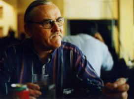
Bob Sallinger
Portland, Oregon USA

Adult red-tail hunting over downtown Portland. Photo: Bob Sallinger


Five Reasons to Conserve Nature in Kampala

Many voices. Greener cities. Better cities.

Many cities still have green areas in various forms, despite the fragmentation of their ecosystems. The call for integration of built form with nature is now more explicit and can be discerned from the Sustainable Development Goals of 2015 as well as the New Urban Agenda of 2016.

Kampala, like many developing cities, has problems & opportunities. Its nature, if conserved, can enhance ecosystem services.

There is motivation both from global goals and local needs for cities in different ecologies to make progress in enhancing ecosystems within their territorial extents, as well as beyond. This impetus becomes even more compelling when a city comparatively exhibits more opportunities for ecosystem enhancement because of the existing building blocks it contains. As noted by Myers (2016), many cities in developing countries have been seen and described as sites of problems—poverty; deficiency in infrastructure; and places of high risk to climate-induced, as well as other types, of perils [1]. But not so much literature or practice views these cities as sites of opportunities for enhancing ecological processes that have local as well as regional and global benefits.

Kampala city fits this categorization as a site of perils characterized by inherent development problems. But Kampala city also exhibits opportunities which need to be harnessed. In this article, I present five reasons why Kampala’s nature, if conserved, can enhance ecosystem services—and why the city should conserve these resources.

  1. A disjointed mosaic of green patches needs connectivity

Kampala city has recently become characterized by sporadic development, where plots of differing sizes are opened up for construction of housing, infrastructure, or industrial development. This development represents a transformation of natural areas with vegetative cover to grey-red impervious surfaces [2]. The reasons for these transformations notwithstanding, the form in which the seemingly unsystematic opening of land for development occurs is the concern here. The resulting pattern in some areas can be described as unconnected, with isolated patches of green having either been left intact or having regenerated with time as development slows down. These green patches may be viewed as problematic because open land areas are associated with flood risk and reduced water quality.

But, as Myers mentions, opportunity lies in spatially linking up the small patches of green along the wetland in Kampala, joining hilltops and valleys to create corridors for plant and animal life. This outcome of planning requires a move from micro-level planning to meso-scale and city-regional levels of planning, so that the spatial linkages of the patches can deliberately create a mosaic that enables nature to thrive in the city. As noted in my earlier articles for TNOC, everything from primates and small- to medium-sized mammals, from aquatic animals and plants to trees, can thrive in a mosaic that is more spatially linked. Corridors would enable migration and temporal movement of wildlife.

In this way, Kampala can formulate a deliberate plan for conservation through planning for ecological mosaics. But more importantly, Kampala should actually create this green-patched mosaic because of its co-benefits to residents and commuters in the city. With industrialization increasing and energy originating mainly with fossil fuels in the city, coupled with the regional climatic influences of westerly air mass systems that blow sand from the Sahara desert, air quality in Kampala is likely to worsen [3]. For example, from August 2016 to December 2016, the daily average temperatures in Kampala have been above the average of 28 degrees C [4]. A mosaic of connected green patches would increase ecosystem services of moderated micro temperatures, improved air quality, and improved water quality for people in this cityscape. Thus, planning for local, specific ecosystem enhancement is a must for a city such as Kampala.

Current patches and possible green mosaic in Kampala. Photo courtesy of Shuaib Lwasa.
  1. Nature on hilltops is critical for the city

Kampala is characterized by a geography and geology of rolling plateaus with wide valleys in which a lining of wetlands exists. This geological nature dictates that care must be given to the interlinkages between hilltops and valleys, which influence several ecosystem services, including drainage of the city. If vegetated, they play the vital role of protecting soil from erosion; if erosion proceeds, it can have various harmful consequences. The ecology of Kampala in this respect can be described as a remnant of a rainforest terrestrial system which, in its current form, is interspersed with built forms. The weaving in of built forms has greatly altered the ecosystem, and many hilltops are patched with built-up or bare land areas. Indeed, hilltops are preferred by high-income people for housing developments, so these areas are on the high end of the land value gradient. This valuation triggers a competition between nature and urban built forms on hilltops. Establishing a minimum vegetation threshold for these landscape elements would have benefits to the ecosystem and to the residents or users of the city.

Trees, in particular, are critical for many ecological reasons. First, patches with trees provide a service of wind breaks and regulated storm flow as excessive precipitation patterns increase. This will become important in the context of a changing climate pattern. Secondly, trees provide habitat for various animals that are needed in the city for continued ecosystem functioning. Thirdly, trees can reduce the effects of intense storms that detach soil particles which, when the land is cleared of trees, accumulates as runoff and erode soils. Such erosion, which drains silts (whether natural or channelized) can be costly for maintenance. For these reasons, hilltops should be conserved with tree vegetation cover, even if this means the City Council must buy off this land, which is prime on market, or through other means of incentivizing developers to keep the built surfaces on the developed plots to a minimum, and the rest of the land area planted with trees.

This is not to say that trees are not needed on lower slopes and valleys. Trees, as mentioned previously, are important in the ecosystem of the city and are needed everywhere that it is possible to have them. Still, Kampala should endeavor to protect the hilltops in particular, because the ecosystem services derived from green patches on hilltops is invaluable. By providing windbreaks, reducing the accumulation of runoff, reducing soil erosion, and providing habitat for animals to moderating microclimates and enhancing air quality, these hilltops are critical to the city and its people.

Hill top patches and forested neighborhoods in Kampala. Photo courtesy of Shuaib Lwasa.
  1. Vegetation reduces heat

In the last year, temperatures have been at their highest on record both globally and locally in Kampala. These high temperatures have also been associated with below average rainfall recorded in the region around Kampala, which has been attributed to La Niña. One consequence of high temperatures and below average rainfall has been an increasing number of hot days and hot nights in the city. This has implications for health and livability in areas of high urban heat island intensity. Although there has not been a record of health challenges associated with the increasing number of hot days specifically in Kampala, there are indications that excessive heat stresses people, systems, and the availability of water in cities generally.

From a study on urban agriculture and forestry as a mediator of local climates, we know the rate at which different types of vegetation, and particularly trees, moderate the local ambient temperature [5]. Thus, one reason that nature should be conserved and increased in Kampala is the undoubted role vegetation plays in lowering temperatures. During months and nights of excessive heat, trees and plants critically reduce the temperature. This is a natural way of adapting to a warming climate compared to other possible ways. Thus, if future climatic scenarios involve an increasing number of hot days and hot nights, it is important that nature should be conserved in the city. That conservation should proceed because of its role in regulating microclimates that directly impact people at a local scale.

  1. Vegetation is key for stormwater management

Rainfall in Kampala is characterized by intense storms, delivering a total average amount of rainfall ranging from 10 to 45 mm in short periods. This intensity of rainfall, coupled with inadequate systems of storm management, today results in flooding even in places that previously were not experiencing flooding in Kampala. In the long rains of March to May 2016, there were several storms that led to widespread flooding in the city and high runoff that affected middle slopes as well as high slopes in some locations of the plateaus.

These recent excessive storms are just one facet of the story. If the storms increase in the future, then Kampala must be prepared for the consequences of increased flooding. The important economic reason why intensive rainfall should be a reason for conservation of nature is that these storms affect businesses and livelihoods, as well as damaging infrastructure, which is costly to construct in the midst of Kampala’s very minimal maintenance culture. It is economically reasonable that investing in nature will directly reduce costs associated with flood-related damages and losses. Nature-based green infrastructure is one of the strategies that the city needs to consider as a move towards reducing grey infrastructure. This should be taken seriously because allowing intense storms to chronically produce this damage slows the economic progress of people and households in the city.

Recent flooding in Kampala. Photo courtesy of Shuaib Lwasa.
  1. The space between buildings is an opportunity for embedding ecosystem restoration and enhancement

There is also a pattern of redeveloping areas and infilling some empty plots and tracts of land with developments at various scales in the city. Redevelopments and infilling offer an opportunity for the enhancement of ecosystem services if nature is weaved in with the redevelopments—an additional reason to pursue the conservation of nature in Kampala. Redevelopments and infilling allow plot-level restoration, while infrastructure to city-regional interventions such as retentions, green mosaics, and corridors, can integrate natural infrastructure into the city. These interventions would have to rely on revised planning and development procedures, with adjusted, appropriate standards and requirements. Many of these would be at no cost to the municipality, while several incentives could be incorporated for developers.

But there are contradictions related to redevelopment and infilling, which also need to be dealt with. For example, whereas the city council and government could offer exemplars for the recommended green infrastructure interventions, these institutions are also leading the destruction of the existing green infrastructure by allowing infrastructure projects in wetlands, as well as clearing hilltops, with the justification that they are being laid bare for development. This trend has to be stopped and more comprehensive processes put in place in order to check the destruction of natural assets of the city. In areas open for development and where possible, nature should take precedent. Where this is not possible, the strategies of plot-level greening can be applied to ensure a path of creating green mosaics that then become weaved into the built urban form.

Conclusion

There are many evidence-based reasons that nature should and can be conserved in cities, including Kampala. In this article, I have given five reasons that illustrate both the urgency and possibility for attaining “low-hanging fruit” in enhancing the ecosystem of the city. As already documented, technological solutions will not provide all the answers to many of the intertwined problems that we are experiencing now.

We need to move away from the trend of handling urban development as separate from disaster risk reduction and climate action. Although this is the pattern, experience shows that these problems, just like their solutions, are very much interrelated. A comprehensive framework that provides a suite of solutions is the starting point that builds on existing practices. These general solutions would be appropriate in many African cities, though they would have to be adapted to the different ecologies. Starting small and building big is a more proactive approach to enhancing cityscapes’ abilities to address the challenges they face. Good development is good for well-being, economy, risk reduction, and nature, and existing cities need to check their development patterns and adjust their planning systems to incorporate nature into their development.

Shuaib Lwasa
Kampala

On The Nature of Cities

References

[1]       G. Myers, Urban environments in Africa: A critical analysis of environmental politics, Policy Press, 2016.

[2]       K. Vermeiren, A. Van Rompaey, M. Loopmans, E. Serwajja, P. Mukwaya, Urban growth of Kampala, Uganda: Pattern analysis and scenario development, Landsc. Urban Plan. 106 (2012) 199–206. doi:10.1016/j.landurbplan.2012.03.006.

[3]       R. Timmermans, H.D. van der Gon, J. Kuenen, A. Segers, C. Honoré, O. Perrussel, P. Builtjes, M. Schaap, Quantification of the urban air pollution increment and its dependency on the use of down-scaled and bottom-up city emission inventories, Urban Clim. 6 (2013) 44–62.

[4]       Seasonal Performance – UNMA – Uganda National Meteorological Authority, (n.d.). https://www.unma.go.ug/index.php/climate/seasonal-performance (accessed December 12, 2016).

[5]       S. Lwasa, F. Mugagga, B. Wahab, D. Simon, J.P. Connors, C. Griffith, A meta-analysis of urban and peri-urban agriculture and forestry in mediating climate change, Curr. Opin. Environ. Sustain. 13 (2015) 68–73. doi:10.1016/j.cosust.2015.02.003.

Footsteps Through Thailand’s Cities and Rural Areas

Many voices. Greener cities. Better cities.

“Thailand is what you make it.” That’s what an ex-pat Westerner who relocated here a few years ago told us when we were strolling through Nakhon Sawan, a busy city in the country’s central/lower north region.

This seems true in many regards, or at least from the on-the-ground impressions we have formed while walking an estimated 580 kilometers from Bangkok to Mae Sot.

Even if people wanted to walk more in their cities, we’re not quite sure how they would do that. Sidewalks in Thailand, as in many other countries, are not designed with pedestrian mobility in mind.

Like every place, Thailand has curiosities that paint a picture of everyday life, that show what a country values, and that tell a story of how people interact with their cities and towns. Thailand has a number of aspects where justice, livability, sustainability, and resilience converge and, sometimes, collide in cities.

Exercise for a happy life

For instance, we were consistently surprised by the amount of outdoor exercise options we found. In most of the urban green spots, parks and riverside promenades we walked by, we saw free exercise equipment, well-maintained children’s playground areas, good-sized group sport courts, and manicured gardens within the parks.

2016-01-30 15.35.55
Photo: Jenn Baljko
2016-01-28 09.32.14
Exercise equipment in a recreation area. Photo: Jenn Baljko
File Feb 01, 7 04 50 PM
The author tests some exercise equipment. Photo: Jenn Baljko
2016-01-23 17.12.43
Photo: Jenn Baljko

From Bangkok to Kamphaeng Phet, we saw plenty of open spaces where people could safely jog, cycle, walk, play volleyball, or simply relax. The exercise equipment, which allows citizens to do a variety of basic stretches with a wide range of motion seemed newly installed in some places and a bit more rudimentary or run-down in others; it appears so frequently, though, that we’ve convinced ourselves that it is not a coincidence. It’s as if there is a national mandate that parks will have exercise equipment accessible to everyone and that exercise helps foster a better quality of life and a happier existence, although an Internet search doesn’t reveal any such governmental guidance and our language barrier prevents us from having meaningful conversations with locals about this aspect of city living. Farther north, between Tak and Mae Sot, several national parks also provide the opportunity to be outdoors in nature, away from the truck traffic that clogs up Highway 12, the main artery linking the two cities.

2016-01-30 16.51.59
Photo: Jenn Baljko
2016-01-30 15.41.41
Cycling culture. Photo: Jenn Baljko

In and out of cities, a culture of bicycling seems to have taken root, too. With designated bike lanes in some provinces and wide shoulders on many of the secondary roads winding through the countryside, we often see individuals and small groups of cyclists, donning helmets and fancy cycling shirts and pants, riding in the early morning hours when we walk. And, in Mae Sot, we met a number of people who not only cycle for health, but also enjoy doing multiple-day bicycle tours in the province and outside of Thailand, down the road into Myanmar. Although people we encountered along the way don’t quite understand why we would walk through Thailand and don’t seem to have a natural love of walking (based on the simple observation that we don’t see many people walking on city streets), they often ask us, via a rolling hand motion that resembles pedaling, why we don’t take a bicycle instead. That implies to us that cycling is a “normal” means of transportation, something “normal people” do. We’re happy to see such prevailing logic, and perhaps it has deeper cultural roots dating back to when bicycles were commonly used and cars, motorcycles, and trucks were still luxury items.

Of course, in today’s Southeast Asia, the omnipresent moped means people don’t walk much from A to B. It’s much easier to hop on a moped for a few hundred meters than it is to get there by foot. More than once, we’ve seen people use their mopeds to go a couple blocks, which seems counterintuitive to the notion that exercise makes for a happy life, the message we interpret from all the exercise equipment and bike shops we see.

But, even if people wanted to walk more in their cities, we’re not quite sure how they would do that. Sidewalks in Thailand, as in many other countries, are not designed with pedestrian mobility in mind. In fact, pedestrian immobility is the more likely scenario. Sidewalks in every city we find ourselves in—when there actually are sidewalks—are mazes of inconsistent heights and widths that largely serve as extra space for setting up food carts and tables, selling vegetables or clothes, stockpiling plants, or parking motorcycles. It’s a maddening up and down workout, and we feel for the people who have to maneuver through cities or towns in wheelchairs or with crutches; they are forced to move on blacktop, a risky endeavor on highly-trafficked streets and roads.

2016-01-31 12.34.27
Sidewalks in Thailand. Photo: Jenn Baljko
2016-01-31 15.40.51
Sidewalks in Thailand. Photo: Jenn Baljko

Infrastructure investment

While fixing sidewalks may not be the highest priority in Thailand, which has made many developmental and economic leaps since the first time we visited here many years ago, protecting itself, its farmlands, and its cities from natural disasters and flooding has clearly won investment attention.

Thailand suffered devastating flooding in 2011, which severely damaged homes and businesses, crippled exports, and battered the country’s economy. In the aftermath, the government budgeted 2.65 trillion baht (about $74 billion by today’s currency exchange) from 2012 to 2016 for infrastructure development, flood prevention, and water management, according to a 2012 report from Thailand’s Board of Investment.

Evidence of that spending was apparent as we walked near new and old dams and water control systems, parallel to irrigation canals in farming areas, and along roads that have been retrofitted with sloping drainage flow.

File Feb 17, 4 29 12 PM
Infrastructure updates in Thailand. Photo: Jenn Baljko

The opening up of Myanmar/Burma will also have a longer-term impact on residents living in border towns, such as Mae Sot. Already a bustling town filled with NGOs and Burmese refugees and migrant workers, the Thai government has designated the city as a special economic development zone, according to a government press release. Part of that investment includes facilitating trade with its neighboring country via a new highway on the Myanmar side of the border, widening the existing highway connecting Mae Sot to the Thai province’s main city of Tak, building a second bridge between Mae Sot and Myawaddy (Myanmar) to lessen congestion, expanding the local airport, and constructing an international university, according to the report and feedback we picked up from talking to locals.

Time will tell how those projects improve the livability of these cities and what their effects will be on the citizens that reside there.

Jenn Baljko

See more about the trip here.


For the Sake of the Common Good? “Gentrifying Conservationism” and “Green Evictions”

Many voices. Greener cities. Better cities.
The spectre of “gentrifying conservationism” and “green evictions” will increasingly haunt segregated spaces and poor communities worldwide.
The “common good”—what an ambitious expression! As far as environmental protection is concerned, governments want us to believe that it is always performed precisely for the sake of the “common good”, or “public interest”. However, things are not that simple.

From a socially critical viewpoint, environmental protection remains a dangerously vague expression, as long as the questions regarding which environment should be protected, how and for the benefit of whom are not adequately clarified. There are some socially very conservative approaches to environmental protection (represented by a heterogeneous set of statements and mottos such as “humans are nothing, nature is everything”, “environmental protection is ultimately a matter of national security” and “the free market and property rights provide the best means to protect our environment”), and among them we can find an interesting type, which I have termed “gentrifying conservationism” (Souza, 2016a, 2016b). It corresponds to a truly exclusionary kind of environmental protection.

The term “gentrification” was introduced in the mid-1960s, but the concept has become widely used only in recent decades as a result of the new waves of “urban renewal” plus displacement of poor people that we have witnessed in the context of the post-1980s (or post-1990s in some countries) neo-liberal city. Although processes of urban renewal that result in displacement of poor people have occurred for generations in many cities, as European and American (both US-American and Latin American) examples testify, gentrification as a concept tries to capture the new aspects of contemporary globalised and neo-liberal capitalism. Different aspects of gentrification have been systematically studied since the 1980s, and several authors have discussed the socio-geographical range of this phenomenon. One of the facets that we must pay attention to is the interplay between gentrification and environmental protection.

An increasing number of authors have paid attention to this interplay. Contributing to a debate in The Nature of Cities (TNOC) a few years ago around the question “What are the social justice implications of urban ecology, and how can we make sure that ‘green cities’ are not synonymous with ‘gentrified’ or ‘exclusive’ cities?,” Rebecca Bratspies warned that “without strong public-minded government oversight, ‘green’ development too often leads to exclusion and displacement” (TNOC, 2014). However, she and most other contributors seem to be too optimistic regarding the potentialities of state-led urban design and planning, overemphasising the effectiveness of tools such as inclusionary zoning. They fail to recognise both the deeper causes of gentrification and displacement (that is, the capitalist city, particularly the neo-liberal one) and the essential limits of state-led urban planning.

In the Global North, a strong link between gentrification and the designation of conservation areas has been emphasised by authors as different as, for instance, Ahlfeldt et al. (2013) and Sandberg et al. (2013). Ahlfeldt et al. (2013) do not address it from a particularly critical point of view; instead, they stress the importance of “cooperative behaviour” between homeowners and the market, observing that most buyers acknowledge and appreciate increases to their property’s value when nearby areas are designated as conservation zones. In contrast, Sandberg et al. (2013, p. 238) explore what they understand to be a “neoliberalisation of conservation” through critical lenses. For them, the exurbanites they observed in the Greater Toronto area—specifically, in the place known as Oak Ridges Moraine—“[…] leave the city in search of the ‘ideal countryside’ based on an Anglo-American countryside idea, hoping to become more closely connected to nature” (p. 110). But what Sandberg et al. actually found there was, in their words, “[…] an attempt by middle-class property interests to use the rhetoric of environmentalism to protect and further their own amenity and landscape consumption values” (p. 20). While “[e]xurbia epitomizes an individualized, private, and exclusive living in an idealized nature” (p. 20), the development industry, for its part:

has […] used the Oak Ridges Moraine brand to market housing developments. […] This aesthetic is seen in the numerous subdivisions that are named after the very same ecosystems that they have replaced. […] Ravine lots, creek lots, or lots next to woods are marketed as a premium. Housing developments are portrayed as green communities that constitute privileged opportunities to live in harmony with nature.—Sandberg et al. (2013, p. 223)

The word that seems to summarise the process—gentrification—is used only at the very end of the book (see Sandberg et al., 2013, p. 241), but the authors make it clear that they understand very well the elitist character of such a process. Indeed, the area has become “the exclusive preserve of the wealthy” (p. 241). In fact, as they say, “[o]n the Oak Ridges Moraine, combined growth and nature conservation plans promote […] an exclusive landscape defined by environmental values that accommodate residents of financial means […]” (p. 232–233).

This is an example of what I call “gentrifying conservationism”, or conservation actions that, by their very design, tend to produce gentrification. Interestingly, as this example also shows, conservationism itself is under such circumstances more often than not very limited: “[t]he current dominant policies in Ontario to preserve nature and promote growth share a common nature aesthetic that is essentially used to protect both development and nature, but in the end the system serves to maintain exclusive residential and industrial property values while excluding other interests and compromising nature in inadvertent ways” (p. 233; emphasis added), in the sense that the conservation outcomes produced in these circumstances are often very limited or even absent, by virtue of new threats. Perhaps unsurprisingly, what seemed to be the primary goal was probably little more than a convenient excuse for real estate and capitalist interests.

Business interests can very much refine and expand the strategies used to achieve capital accumulation, and this sort of “conservationism” is one of them. As Sandberg et al. (2013) put it, Oak Ridge Moraine’s story is about “the pervasiveness and mutability of the prevailing growth paradigm and the way it is not superseded but embedded in new ways of thinking about—and even selling—nature on the Moraine” (p. 235). Within this framework, an interesting alliance emerged: “[w]e documented a sustained campaign that moved beyond place-based activism to form networked coalition of rural and urban interests, homeowners, and environmentalists who organized on a regional scale and drew upon a wider anti-sprawl and environmentalist network” (p. 235).

The reality that inspired me to suggest the expression “gentrifying conservationism” some time ago was in Rio de Janeiro, more specifically the tensions that have taken place in the buffer zone of the Tijuca National Park. In Rio’s case, it was a complicated alliance of groups from different movements—pro-environment, pro-growth, anti-poverty—that were different in detail from the Canadian situation studied by Sandberg et al., but with an essentially similar meaning.

In Rio de Janeiro, the pro-environment and at the same time clearly anti-popular alliance has been especially developed in last decade. Located right in the heart of the city, the slopes of the Tijuca massif influence the landscape of many neighborhoods of the city—ranging from the privileged areas of the South Zone to many favelas. Of enormous relevance is the fact that the Tijuca massif comprises the 39.5 square kilometers Tijuca National Park. Established in 1961, it is the most visited national park in Brazil. The strip of land that is the most densely populated portion of the buffer zone of the park is a perfect laboratory for watching the (geo)political instrumentalisation of the ecological discourse by agents directly or indirectly involved in the attempt to implement what could be termed a sort of non-murderous social cleansing.

A crusade has been carried out by the public prosecutor’s office (Ministério Público) for environmental and cultural heritage issues of the state of Rio de Janeiro. According to that office, the favelas located there are expanding rapidly and in aggregate form “a single spot comparable to Rocinha” (one of the largest favelas in Brazil and the largest one in Rio de Janeiro, whose population has been estimated at 200,000 inhabitants). Statements like this, as well as other comments made by public prosecutors, environmentalists, and others about the danger represented by the presence of informal settlements close to the park have been frequently published above all by Rio’s biggest newspaper, O Globo.

The corporate media has played a decisive role with regard to promoting an asymmetrical treatment of social classes by the state apparatus in Rio de Janeiro, and although the Ministério Público has been the main institutional agent of the current attempt to promote the total or partial removal of the favelas located in the Tijuca massif, it can be said that its role has not only been made public and highlighted but probably also stimulated by O Globo and other, mainstream media.

Fig. 1. “They don’t want us here”: favela residents are not supposed to enjoy such a view… The smaller photograph shows a part of the very small favela Vale Encantado, in Rio de Janeiro, and the other photograph was taken there, too, in 2015; see in the background the middle-class district of Barra da Tijuca. Photo: Marcelo Lopes de Souza

But the available data do not support the idea that the favelas of the Tijuca National Park’s buffer zone are expanding rapidly; according to reliable census data and even the municipal government’s own data, offered by the Pereira Passos Institute, this is far from being the case. Monitoring data based on satellite images from 1999-2013, carried out by Pereira Passos Institute, make clear that the spatial growth of favelas in the buffer zone ranged from nothing to very little (see Souza, 2016a, pp. 791-792). Ten years after it was proclaimed, in 2006, that the favelas around Tijuca were expanding rapidly, this statement can finally be declared false. Likewise, the contention that these mostly small favelas (see Figs. 1 and 2) are a threat to biodiversity can be declared contrary to fact. Moreover, while the Ministério Público and the corporate media continue their anti-favela crusade, residential encroachment of the buffer zone by the middle class is left undisturbed, even where it occurs close to a favela targeted for removal (see for instance Fig. 2). Clearly, the occupation of the same location by the middle class is not regarded by the state apparatus as an environmental threat. In fact, the Municipality of Rio de Janeiro has made it clear on more than one occasion how desirable would it be to increasingly attract financially well-endowed citizens to the area.

Fig. 2. The undesirable and the desirable ones: at the bottom of the photograph (yellow elipse), the small favela Vale Encantado; in the middle and on the right side, a recreational middle-class club and middle-class residential buildings. Photo: Google Earth, 2016

It must be explained that in Brazil, in contrast to mayors and governors, public prosecutors are not chosen through elections (as it is usually the case in the United States, for instance), but are instead civil servants who are chosen through a public tendering procedure. As a result, public prosecutors can be basically accountable only to their own conscience (although not few of them have also tried to attract media and public attention for several reasons), while a mayor or governor must take into account the feelings of potential voters directly and strongly. And favela dwellers are voters. Therefore, it is not difficult to see why in the Tijuca massif’s case the Ministério Público has recently been a more important actor than the City Hall itself as far as pressures on favelados are concerned. Curiously, the Ministério Público even pushed and prosecuted the former mayor Cesar Maia himself for (according to the prosecutor’s office) not doing enough to protect the environment from the threat represented by poor, informal settlements. Nonetheless, the fact is that the City Hall had tried to contain the expansion of favelas through highly controversial so-called “ecolimites” (fences or more usually walls surrounding the shanty-towns) since the beginning of the 2000s, allegedly for the purpose of protecting the remnants of the Atlantic Forest. The state government of Rio de Janeiro followed the same steps and its attempt to build a wall around Rocinha, Rio de Janeiro’s biggest favela, ended in what could be regarded as a media and public relations disaster for the then governor Sergio Cabral in 2009. Strong criticism came not only from Brazilian society but also from abroad, for instance the United Nations.

In a book chapter on New Delhi, Asher Ghertner used the expression “green evictions”—a happy choice of words to express a very unhappy situation. He points out the “metonymic association between slums and pollution”, what seems to justify for Indian courts “slum removal as a process of environmental improvement” (Ghertner, 2011:146, 147). If we expand the first remark a little bit—by means of including things such as environmental degradation and related ideas as part of the second term of that metonymic association—we can easily arrive at a description of Rio de Janeiro and many other, similar cases. In fact, “gentrifying conservationism” and “green evictions” (or “green displacement”, in more general terms) seem to be inextricably linked with each other, particularly (but by no means exclusively) in the Global South.

Factors such as the immediate cause or motivation, the role of specific organs of the state apparatus and of other agents (e.g. the corporate media and middle-class residents) and the way how affected poor people will react to threats of removal will obviously vary from case to case. However, one thing is certain: the spectre of “gentrifying conservationism” and “green evictions” will increasingly haunt segregated spaces and poor communities worldwide.

By way of conclusion I wish to raise a few questions, considering that ultimately the rulers (as well as their allies or funders: the media, business interests, and so on) usually try to convince us that there is a moral justification—namely to ensure the common good—for measures resulting in “gentrifying conservationism” and “green evictions”: Who defines, and on the basis of which parameters, in each particular circumstance, and in the context of specific power relations, what the “common good” is? How to justify morally the many situations in which asymmetries of treatment between rich and poor people can be observed? Where is the compelling evidence that there is a moral justification for sacrificing so often minorities in the name of the “common good”? In cases where, for reasons of safety of the affected persons themselves, a relocation of population is perhaps necessary or recommended, what has been done to adequately compensate for the material and even psychological sacrifices imposed on those who have to give up the places of residence to which they are accustomed? How can we assure that in such cases relocation takes place in a non-authoritarian way? Without persuasive answers to these questions, in the sense of consistency with strong social justice criteria, the “common good” type of explanation will be nothing but a poor excuse.

Marcelo Lopes de Souza
Rio de Janeiro

On The Nature of Cities


References

Ahlfeldt, G., et al. 2013. Game of Zones: The Economics of Conservation Areas. London: Spatial Economics Research Centres, London School of Economics/LSE (= SERC discussion paper 143).

Ghertner, D. A. 2011. “Green evictions: Environmental discourses of a slum-free Delhi” in Peet, R. et al. (eds.): Global Political Ecology. London and New York: Routledge.

Sandberg, L. A., et al. 2013. The Oak Ridges Moraine Battles: Development, Sprawl and Nature Conservation in the Toronto Region. Toronto: University of Toronto Press.

Souza, M. L. de 2016a. “Urban eco-geopolitics: Rio de Janeiro’s paradigmatic case and its global contexto”. City, 20(6), 765-785.

Souza, M. L. de 2016b. “Gentrification in Latin America: some notes on unity in diversity”. Urban Geography, 37(8), 1235-1244.

TNOC [The Nature of Cities]. 2014. Accessed November 9, 2015. https://www.thenatureofcities.com/2014/02/03/what-are-the-social-justice-implications-of-urban-ecology-and-how-can-we-make-sure-thatgreen-cities-are-not-synonymous-with-gentrified-orexclusive-cities/.

For Urban Sustainability, What Research Do We Need Now?

Many voices. Greener cities. Better cities.
I think we already know enough to craft reasonable design and management practices in urban areas. The unknown is how to navigate the current political, cultural, economic, and public sectors and actually implement this knowledge in design. What we need is more research geared towards a “Science of Implementation”.
For over 25 years, as an urban ecologist working in academic institutions and collaborating with city planners, developers, and the public, I have seen the sustainability needle move ever so slowly.

How can we speed things up? For scientists, if they are going to help make cities more sustainable, what research is critical to help city decision makers make decisions? I will go out on a limb and attempt to explain my views below. I will be pointed and do not mean to offend anyone, and know that I am speaking also about myself.

Urban city landscape patterns based on planning decisions. Source: https://www.ipswichfirst.com.auexperts-sought-to-help-with-development-decisions.

First, in terms of urban sustainability solutions, do we really need anymore “advancement of urban ecology theory or basic empirical research?” Do we not know enough NOW to create reasonable solutions to conserve urban biodiversity, water, energy, etc.? What more can we really learn? We continue to spend lots of resources (time and money) to perhaps further understand some ecological, social, or economic variable. For example, I am currently doing these basic ecology studies—for example, which migrant birds use urban forest patches as stopover sites.

But much of our research is reductionist science. In other words, studies are reduced to such simple parameters that we already know the broad outlines of answers before we start—of course migrant birds use urban forest patches! People may argue that we need multiple lines of evidence, especially if cities are going to spend time and money on a solution (for example, is conserving that 1 ha forest patch going to be used as a stopover site for birds?). Unfortunately, most science and scientific studies are geared towards reaching other scientists, not the general public or decision makers. We are speaking amongst ourselves. Thus, most research results stay in journals and have little impact on public policies or strategies.

I think we already know enough to craft reasonable design and management practices in urban areas. The unknown is how do we navigate the current political, cultural, economic, and public sectors and actually implement this knowledge in design. What we need is more research geared towards the “Science of Implementation”.

What does that mean and how can we forge a reasonable path forward?

First, scientists need to tailor their research so their outcomes are explicitly tied to what planners, policymakers, and other built environment professionals (e.g., civil engineers, landscape architects, etc.) actually need in order to create a design, a policy, or other initiative that actually moves the sustainability needle. Conventional development and design inertia is strong and it is not enough to make research data available to built environment professionals (usually published in a journal) and expect it to be implemented in the public arena.

This means that we need to determine where in the urban planning or design process is the best place for ecological and environmental data to be considered and discussed. And what data? Ecologists need to converse with local and regional built environment professionals to learn more about the design process and the critical steps (and constraints) that people make when creating a policy, planning strategy, or design. Further, if the outcomes from an ecological or social science study are going to be meaningful, they need to be in a format that is easily translated.

Participants at a Nature of Cities Summit in Paris exchanging ideas about biodiversity conservation in cities. Photo: Elsa Ferreux (TNOC)

As an example from my work, in the course of working with planners and landscape architects on green development projects, several of them asked me, “Is there a biodiversity metric/tool that could be used to assess different development designs and their impact on biodiversity? If we had this, we could give feedback to developers and environmental consultants about how to improve their designs.”

After listening to practitioners, I thought about their concerns for a while and decided that a synthesis of the literature was needed. I focused on birds. I knew there was lots of empirical research on birds, but it is buried in a number of different journals. What was needed was a synthesis of published research. So, we conducted a systematic review of known empirical research, and we determined which birds do and do not use urban landscapes. Using this synthesis as a backdrop, we developed an online tool where people could put in different landscape designs and get avian habitat scores. This research is published and the building for birds tool is available online. Land developers or city planners simply input the amount of trees and sizes of forest fragments conserved and the tool will output an avian habitat score for breeding and migrating birds. I worked with a number of planners and designers to make this tool transparent and as easy to use as possible.

The Building for Birds online tool has been out there for two years and is applicable to any city in North America. Is it being used? I did a speaking tour around the U.S. to market the tool and get feedback. Built environment professionals like it and so I was hoping people would use it to make planning and design decisions. Has it happened? Alas, very few cities and environmental consultants are using the online tool to make decisions.

So, what is going on? There are several possibilities. First, biodiversity conservation may be the lowest on the totem pole of urban sustainability issues. Energy, water, and even transportation seem to occupy higher considerations in city/county planning and have associated land development regulations (LDRs). However, there are very few regulations concerning optimum designs for conserving native plants and animals. Often, city planners primarily think of large patches and corridors as being important for biodiversity (particularly wildlife); save for generic conservation of open space across a city, often the small, unconnected forest fragments/natural areas and even large trees are not considered as important wildlife habitat. However, these small bits of habitat are important to a variety of birds, insects, and other animals.

Second, without policies that help guide and regulate biodiversity conservation, environmental consultants and developers are not keen to try something new (especially if they do not have to). Without policy directives, it takes a maverick team of built environment professionals to implement a unique design that accounts for biodiversity conservation. Unfortunately, these forward-looking individuals are few and far between. From my experience, the building for birds design tool is applicable to any situation but very few people are taking advantage of it across the U.S. This is a bit frustrating, as I thought if I made the tool simple enough and applicable to planning, folks would use it.

How do we improve implementation? Not an easy answer. We do need ecologists and other scientists collaborating more with planners, landscape architects, and other built environment professionals. Only by learning from each other can we tailor research that is useful in the planning and design process. My collaborations with these decision makers did produce a useful tool (albeit not as well used as I would have liked). I learned quite a bit about planning and what makes or break a development project. For example, for a developer (with a bank breathing down their neck) it is all about avoiding uncertainty. A developer will do a biodiversity design if it will help them get their development approved and can start construction right away. Research data will not be used in planning and/or design if it is not supported by policy. And to get a new policy passed, research data must be in a format that is transparent to policymakers so that they can easily craft a policy for land development regulation.

Projected urban expansion (year 2060) in northcentral Florida based on population growth. Red is urban areas. Credit: http://www.1000friendsofflorida.org

Thus, I am saying that as scientists we are conducting research in (sort of) a vacuum, more geared towards pleasing each other but with an outside hope that someday our data will be used in the “real world”. However, from my experiences, planning staff and regulators are loathe to require “x” (some sustainable policy or action) if there is not good data to back up the requirement. As I have stated before, data is typically buried in scattered journals and most practitioners do not have the time to scour the scientific literature to come up with a rationale for a policy. Perhaps one important step for scientists is to listen to what practitioners need and help conduct a systematic review of the literature (be it birds, other wildlife, water, energy, etc.). The output would be a scientific summary, (a one pager perhaps) for a planner to talk with elected officials in order to create a new policy. In turn, if done properly, this review could be published in an academic journal.

Even the most “transparent” data or tools can still be underutilized (such as the bird tool that I developed). In the academic world, political scientists, urban and regional planners, landscape architects, and social scientists need to become familiar with city/county decision making in order to understand the important “levers” in urban planning and design process. For example, low impact development features (e.g., rain gardens, permeable pavement, bioswales, etc.) are well known to help improve water quality in an urban development, but are underutilized. Why? It is difficult to say what are the reasons across the board because every city/county situation has local flavors and barriers to implementation. The challenges (and opportunities) are likely different from one area to the next. Probably, the most common barrier is just plain inertia. Environmental consultants, developers, and even city/county regulators are comfortable in doing a design/development in a certain way and any change is met with resistance.

To adopt a new way of doing things, social science researchers can conduct studies to determine what makes regulators, policymakers, environmental consultants, and even the public “tick”. If rain gardens are going to be prioritized, for example, what do regulators need in order to give, in this case, stormwater credit for a rain garden instead of conventional curb, gutter, and pond? Most likely they need synthesized data that states rain gardens work in their local area. Scientists know where to go to review this data and could provide that one-pager for decision makers.

In summary, natural resource scientists should collaborate more with practitioners and decision makers before they conduct research. The study and output data should be collected and presented in a way that is useful for practitioners and decision makers alike. To help decision makers overcome conventional inertia, social scientists need to measure how people operate and make decisions, determining the “leverage points” were ecological data could be inserted to sway decisions. Overall, we need to stop creating and writing scientific research for each other and make it more it explicitly available for city/county decision makers.

Mark Hostetler
Gainesville

On The Nature of Cities


Forget the Damned Motor Car

Many voices. Greener cities. Better cities.

Forget the damned motor car and build cities for lovers and friends.
Lewis Mumford, My Works and Days (1979)

Humanity managed for the better part of 400,000 years without cars and did just fine. Julius Caesar, Michelangelo, William Shakespeare, Adam Smith, and Abraham Lincoln lived in cities and never drove an automobile. They didn’t need one, or thought to need one. And you wouldn’t need one either if we could arrange our lives such that you can get where you need to go without a car.

terra nova cover with boxWhat does this have to do with the nature of cities? Cars are Enemy #1 for the nature of cities. Not only do gas-propelled vehicles pollute the environment and contribute to climate change, the roads they require take up space, robbing room from us and from nature at large.

Standing on a sidewalk, a person occupies about four square feet (0.4m2) of land; most cars take up 80 square feet (7.4m2), twenty times more, and that’s before they start moving. In the United States suburban zoning regulations commonly require three parking spaces for every 1,000 square feet (92.9m2) of office space.

Because a standard parking space measures 330 square feet (31m2), this regulation means that a one-story building requires as much asphalt as floor space; a three story building requires paving the soil at a rate of three times the footprint of the office itself!

When you think about it for a minute, you realize just how wasteful and unjust cars are of space. Though celebrated for their ability to abridge distance, cars are about the least effective way to use space that can be imagined. As a result, the nature of cities is diminished. From Terra Nova, by Eric Sanderson
New York City gridlock with pedestrians. Credit.

So, as a result of car dependence, most cities blithely commit 30% percent or more of their valuable urban space not to people or nature, but to cars, counted in millions of square feet (or meters) of streets, parking spaces, garages, and parking lots.

Think how absurd it is that skyscrapers, a thousand feet high, can be found going toe-to-toe with parking lots covered in a single layer of cars, yet downtown parking persists in the midst of the most valuable real estate in the world.

Why do we put up with that?

There are three reasons. One, once upon a time, we thought it was good idea to rip out public transportation and replace it with private ways of getting around. In the United States that time was the early twentieth century, when gas was remarkably cheap (on the order of 5 cents per gallon, cheaper than water in some places, cheaper even than oil is today with the fracking revolution) and streetcars were failing because of bad deals struck by government and industry, setting in motion patterns of disinvestment and disrepair. What America discovered with the car was a new way to make a buck, by paving over farmland near town for suburban development, a process now being replicated globally.

After they were invented in the 1880s, electrified streetcars spread rapidly in American towns and cities.  Then the cheap oil window, a 40 year period of low oil prices, and bad deals did them in; by the mid-1980s, the US was left with only 384 miles of track nationwide, down from a high of 32,548 miles in 1917. From Terra Nova, by Eric Sanderson
After they were invented in the 1880s, electrified streetcars spread rapidly in American towns and cities. Then the cheap oil window, a 40 year period of low oil prices, and bad deals did them in; by the mid-1980s, the US was left with only 384 miles of track nationwide, down from a high of 32,548 miles in 1917. From Terra Nova, by Eric Sanderson

Reason two we suffer the car is millions of people depend on their own vehicles to get into town from their houses in the suburbs. These folks value the livability of their homes more than the livability of other peoples’ homes, so demand, through their dollars and their voting patterns and their incessant traffic, that society provide conduits and parking places for their steel boxes. Other people make money off of those people by selling us motor insurance, car loans, gasoline, tires, mechanical services, road paving services, ticket-writing services, and the wheeled boxes themselves. Governments recoup costs through registration and excise taxes. One would be enraged at such uncivil behavior, except “those people” and “those other people” are the same: us!  We are all caught in the same self-perpetuating economic loop-de-loop of oil, cars, and suburbs.

Reason three we don’t change is that we have already invested so much into the roadways and the regulations and industries to support this car-mad way of life that change feels, smells, and sounds unthinkable, even if for the millions of people stuck in traffic, consciously or unconsciously, they can think of nothing else. In America, inertia reigns over the Republic. What galls, of course, is that so many other cities, in other countries around the world, are making exactly the same mistake America did and giving over lovely towns and cities and countrysides to automobiles…and their attendant problems.

Not everyone needs a car in the city, but all us who love cities must take cars into account. For the passerby, the pedestrian, the person walking in the nature of cities, cars steal our freedom. Crosswalks force walkers to the ends of the streets to wait for a system of authoritarian, automated lights, obsequious servants of motor traffic. Walkers, bicycles, scooters, buses, and streetcars compete with private cars for transport space, while cars are provided an unfair advantage by law (and size and speed). In America, cars on a country road are often represented (especially in automobile advertisements) as the perfect manifestation of freedom, but in cities they destroy liberty for people and nature living downtown.

Journey to work

If we want to forget the damned motorcar, we need cities with more than just lovers and friends, as Mumford says; we also need cities with work close to home. No one drives in the city because they want to; they drive because they feel like they have to. Of all the journeys we make, the journey to work is the center of the transportation lives for most people, and choice of transport is the grease that facilitates compromise among the competing demands of family, job, school, shopping and the cost of real estate. Shorter commutes mean better lives for all.

Less driving to work trips contributes toward another important societal imperative: less consumption of energy, particularly transport fuels based on oil and other fossil fuels, that can be used more productively in so many other ways and whose combustion contributes to climate change. Shorter trips help out because a vehicle, any vehicle, uses less energy over shorter distances. That’s physics. Most working Americans make 500+ journeys between the workplace and home per year. The commuting multiplier means that even small reductions in the distance from home to work subtract considerably to total distance travelled, and therefore the amount of fuel consumed.

The journey to work—the commute—is key to travel behavior. For most people it determines their choice of vehicles. It also drives the total distance travelled as shown in this analysis of commuting patterns from the U.S. National Household Travel Survey, 2009. From Terra Nova, by Eric Sanderson

Trip distance is also an important determinant of how people choose to transport themselves. Travel is constrained by available time as well as required distance, and different forms of transportation move at potentially different speeds. Remarkably even in today’s auto-dominated America, for distances less than a mile, forty percent of trips to work are taken by walking (people mostly drive, even for short distances which is remarkable in itself). Biking bumps up to its highest frequencies at distances between one and five miles. Buses, trains, streetcars, and other public forms of transportation, all minority travel modes in most of America, work nicely for distances of 1–10 miles.

Some research shows that people actually enjoy the trip to work, using it to separate mentally as well as physically from the office or factory; one study found a preferred commute time of about twenty minutes. In twenty minutes of walking a person will travel about a mile; twenty minutes of biking can get you three miles; twenty minutes in traffic depends on how heavy the traffic is. In terms of city design, we can think about the “practical commuting horizon”: the distance a person can travel in twenty minutes.

Can we design cities where for most citizens their daily needs (work, home, shopping, school, religion) can be encompassed within a 20 minute walk? If it sounds impractical, then remember for most of human history that was exactly how cities were made. For all pre-automobile settlements, short travel distance was the most important design objective.

Alas! We live in another time. We are more familiar with the implications of getting into the car in the morning to go to work. Observe that once a person decides to drive, then most of the rest of the day’s travel will also likely proceed by car; it make sense to chain our trips together, avoiding the costs in time and hassle of changing from one transport mode to another. Thus the office and the shopping mall and all the roads in-between need to be paved over to make the convenient trip possible, taking that land from nature. Because automobility entails such large upfront investment (car payments, registration, insurance, maintenance, etc.) it also makes economic sense, once you’ve decided to have a car, to use it as much as possible. You are financially locked in to the car, a fact that many people miss when they only consider the price at the pump.

In short, for people in most cities in the United States (and, increasingly, in many cities elsewhere), cars seem like the only way. The logic goes like this. I can’t to afford to live in the city or I want better schools or I want a garden of my own or just I want to be closer to nature or it’s the American Dream…so I have to move to the suburbs. Now that I live in the suburbs, in residential neighborhoods separated from work, shopping, etc. I have to have a car, maybe two or three. And because we all have to have cars, we all have to kill nature to facilitate them.

I call it the Siren Song. Oil, cars, suburbs sing to us this terrible song, that sounds so beautiful individually that it’s collectively calling us to disaster. It’s taken me many years to realize though that the solution is not anti-city, it is anti-bad-city. Cities do not have to exclude nature or be noisy, crowded, and annoying; they have just become that way because of how we have constructed them over the last 100 years, in service to the automobile. Cities can deliver the goods when it comes to an excellent place to live, with jobs and opportunity, and nature close to home. But that means creating cities that work for people and nature, which means taking back some space from the car.

Some gentle encouragement

Better cities begin by giving some gentle encouragement to how we restructure the journey to work. That must be followed by changes in the city fabric, new investments and new alignments of space and capital, and that too requires some encouragement. In all it is a forbidding task to begin imagining 21st century carfree cities. What’s odd—and exciting—about this imagining though is how it makes radical notions suddenly seem normal, even desirable, from the perspective of the nature of cities.

Ecological use fees: Here is radical notion: let’s value the land as nature not just space. What if property taxes were based not only on the economic value of the land and its structures, but on the ecological values of the land itself. In my book Terra Nova, from which this piece has been extracted, I describe a system of ecological use fees as a replacement for the property tax. Building on land takes nature away from all of us; our taxes could and should reflect that. My house means that a forest can no longer grow there. The street in front of my house interferes with the stream that once crossed nearby. We can reflect the ways that development takes public goods inherent in nature and entails them for private benefit. A land tax has many benefits, not the least of which it encourages both efficient development and more open space.

Similar kinds of taxes could be extended to natural resources and pollution in exchange for alleviating less efficient (from an ecological perspective) taxes like the sales tax or the income tax. This kind of tax reform draws on ideas about externality taxes based on the ideas of Albert Pigou and the land value tax that Henry George put forward to much acclaim over a hundred years ago.

Parking Rules: If you are not willing to that far, then changing zoning and parking codes can go a long way on their own. Simpler, clearer, zoning codes that value nature can be explicit agents of densification, rather than anti-densification. We need to reduce parking, or at least make people pay a market price for it. Parking is a critical lever because without parking a car is like an albatross around the neck (i.e. a terrible curse) once you’ve arrived at your destination. In the United States, parking regulation is almost entirely the province of municipal government. Any city could ban parking if it wanted to or at least set a fair price that includes all the costs imposed by cars in town.

Zoning Codes: Taxes, zoning and regulation should also encourage, not discourage, mixed uses of work, residence, and shopping, so that a person can go to work in the neighborhood and shop for necessities on the way home while on foot. A few more people closer together in neighborhoods with a combination of retail opportunities, employment, and residences mean that a person can trip chain to get the groceries and pick-up the kids, and still get home at a reasonable hour by walking, biking, or riding the street car. And you may find that you like your neighborhood better by experiencing it at lower speed; you will see more.

The average American suburb has between 1,000–4,000 residents per square mile (386–1544 persons/km2). If that density were closer to 5,000 person per square mile, with half the land reserved for open space and nature (Nature Needs Half, anyone?), then most towns and cities could be places with work near home and less need for the car. Note for comparison that Manhattan tops the U.S.A. at 65,000 people per square mile, so in no way does the idea of car-free city mean that every city has to be Manhattan—car-free, human friendly designs work at much lower densities. A couple of apartment buildings and a commitment to streetcars, for example, could do the trick for a lot of current suburban developments.

Home-to-work payroll adjustment: A more aggressive suggestion is to use what Google already knows. Every year, each of us reports to the internal revenue service our home addresses and our employer’s address. Google knows the distance between them. We could set up a fee and rebate fund where employers and employees both get a rebate on their payroll taxes when they are close to each other. For example, if a company has a worker who lives within 5 miles, then both the employer and the employee would get a check rebate of, for example, 10%, of their payroll taxes for the year. And where would the money come from?  From new fees levied on those who live more than 10 miles from work and his or her employer, with a scale sliding upwards the farther a person lives from his or her designated workplace. Second homes could work into the calculation as well, with a separate assessment made for each additional home. Call it the home-to-work payroll adjustment.

***

Terra Nova describes other ideas too. Location-efficient mortgages that build distance into the calculus for home loans. New town districts that are a kind of business improvement district designed to reward density and autophobic development. A Superfund for Real Estate would help bail out people that invested in sprawl but can no longer pay the taxes. In return for helping the land revert to nature, they would receive a cash payment based on a miniscule tax on capital gains, thus converting monetary capital into natural capital in a real and profound way.

Density drives economic growth, lowers environmental impact, and fosters diversity, life and meaning in cities. Here are five measures to increase density through taxes and public policy. From Terra Nova, by Eric Sanderson

Such measures would send strong signals, via the pocketbook, to everyone that the time has come for a change. The policies needn’t be rushed into existence; the “Nature Yes! / Cars Not So Good” campaign could be introduced with an advertising with persuasive men and women drawn from the cast lists of the car commercials explaining to us all the benefits that pertain; the programs could be phased in over a three or five year period, allowing folks to adapt and to take into account what is coming. Such a program need not last forever either—twenty or thirty years should be sufficient incentive that society reorganizes land use, as it did in the cheap oil window that prevailed in the mid-twentieth century, to take advantage of new incentives. From then on momentum and legacy effects will continue the good work of rescuing urban nature from the highway hydra.

The usual radical

If you’ve read this far, you may be astonished that something that seems as innocuous and wonderful as nature in cities could drive an agenda as radical and heretical as the notion of car-free cities. Beyond a few blessed pedestrian plazas and a handful of auto-less islands in cities, no one since the invention of the cars in the late 19th century has lived in a city without them. Moreover huge industries are invested in keeping us driving in town. Nor can I testify to you as a car-free martyr. My family has a car, we drive to work and school, and given the choices available to us…even in New York City, which has the most extensive public transportation system in all the United States…driving is the best of the bad choices available to us. We are just one among the 44% of New York City households that own cars. (It is an electric car, if that wins us any credit.)

To imagine what a car free experience of the city is like, we need the testimony of people who once lived without a car. Would Michalangelo have had a different relationship to the world’s beauty if he viewed it from a car window? Would Abraham Lincoln had different feeling about his fellow man if he knew them from only from his Presidential chauffeur? John Burroughs, an early-twentieth-century naturalist who lived in New York State was a good friend of Henry Ford, Thomas Edison, and Harvey Firestone. In the 1910s, Ford sent his friend a Model-T as a present and Burroughs wrote back:

I see what a fraud the car is—how much it has cheated me out of. On foot and lighthearted, you are right down amid things. How familiar and congenial the ground is, the trees, the weeds, the road, the cattle look! The car puts me in false relations to all these things. I am puffed up. I am a traveler. I am in sympathy with nothing but me; but on foot I am part of the country, and I get it into my blood. If it were not for Mrs. Burroughs I should hang up the car.

What we need to do to improve nature in cities—and the nature of cities—is convince all the Mrs. Burroughs of the world, all our friends and lovers, to hang up the car, or at least to save it for special travel outside of the city, not within it.

I like to dream of cities without cars, where most people get around mostly by walking, biking, and electrified transport modes, like streetcars and light rail trains that can also be adapted for moving freight. Remarkably the technology already exists, we have prototype situations in cities around the world, and certainly the urgency to build better living places exists in the current age of urbanization. I for one wouldn’t mind skipping the next war over oil, or passing on paving over more forests and wetlands, or not contributing my portion to altering the world climate.

But what I really dream of are cities of nature and a quiet walk by a stream in the Bronx.

Eric W. Sanderson
The Bronx

On The Nature of Cities

Extracted and modified from “Terra Nova:  A New World Oil, Cars and Suburbs (Abrams, 2013)

Form, Function, and Cultural Memory: Recalling the Nature of Cities

Many voices. Greener cities. Better cities.

Yesterday upon the stair
I met a man who wasn’t there
He wasn’t there again today
Oh, how I wish he’d go away
       — William Hughes Mearns 1922

Learning to forget

When the early settlers headed west across the American continent their cultural baggage weighed lightly when it came to reading the landscape. Oak trees were recognisably oak trees and the pathways made by the first peoples bore the same legibility and logic as trails through European woods; so they followed them, and assimilated them into their own transport networks. In 1847, Cayuga chief Wa-o-wo-wa-no-onk observed that the land of the ‘Empire State’ was “…once laced by… trails worn so deep by the feet of the Iroquois that they became (the settlers’) own roads of travel…” (McLuhan p.100).

Old ways may have been forgotten but memory is the essential substrate of culture. Some memory of the paths made by the Cayuga remain etched beneath the blacktops of New York. Memory, in the form of books, transcripts, recordings, oral history, song and building is how we transfer essential information from each generation to the next. Each generation doing something like their predecessors did with imperfect recollections, passing on patterns of the past. So cities and architecture evolved over time on the foundations of things that people have found to be functional. Wipe that memory clean and a subtle form of chaos begins to take hold. A society that forgets its history is like a person with dementia — trying to orientate themselves and live competently in the present without the benefit of being able to draw on years of accumulated knowledge and experience.

Too often, when we construct our human nests and lace our habitat with roads and sewers and all the paraphernalia of infrastructure we forget history’s lessons and no longer follow well-worn paths made with the inter-generational logic of ancient trails. The best we manage is to follow the guidelines of rule books (albeit they are also the consequence of cultural record keeping). As a result, our newest cities and urban spaces tend to be delivered with little palpable sense of place and with a kind of emotional emptiness. Modernist experiments like Brasilia perfectly express the kind of alienated thinking that has ruled the way we have shaped and reshaped our cities since the early 20th century, abandoning the intuitive evolution and understanding of place in exchange for an abstract set of rules derived from crude, simplistic, early-industrial logic.

Brasilia – A piece of ‘new world’ delivered to a land of tropical rainforest with little palpable sense of place and styled around a heart of emotional emptiness. Photo Paul Downton
Brasilia – A piece of ‘new world’ delivered to a land of tropical rainforest with little palpable sense of place and styled around a heart of emotional emptiness. Photo: Paul Downton

How and where we live is crucial to the health of the natural environment and to our well-being. Modern humans have evolved to need shelter to the point that, unless specifically trained to do otherwise, we cannot survive without it. Yet all too often, the mainstream disciplines of architecture and planning offer superficial views of the built environment in which design is about making fashionable choices of cladding whilst communities are mostly disregarded and the natural world is treated as an inanimate backdrop to design rather than a living system that encompasses it.

Efforts to understand the ecology of the built environment is muddled by the kind of revisionism that sees an architectural culture hero like arch-Modernist Le Corbusier, who celebrated the city as ‘an assault on nature’, as a prototypical ‘green’ architect (Farmer 1996). One might reasonably ask how architects and planners can hope to see past such sophistry, stuck as they are within the frame of a severely damaged picture of the world.

Urban ‘renewal’ Swansea, South Wales 1977 Drawing: Paul Downton

As if the absence of memory was somehow cleansing and good, the enterprise of Modernism has always trumpeted the joys of kicking over the traces of the past and celebrated the triumph of the new over the old. Anxious to prove its superiority, Modernism has long conflated ‘new’ with ‘freedom’ and ‘progress’ and confounded attempts to conserve the old by portraying it as reactionary. We have learned to forget lest we become somehow corrupted by the past. The preferred canvas of Modernism is a tabula rasa, a place like a blank sheet of paper, without definition or limits. Lost in this indeterminate ‘space’ fetishized by Modernist architectural and planning training, the practice of design is restrained only by the limitless bounds of a designer’s ego, whilst the facts of life and the natural limits of place are willfully ignored.

However, natural systems don’t have the luxury of being able to ignore what designers choose to practice and try as we might, there is no way to maintain civilization outside of the constraints of the actual context of place.

Layers of Change

Stewart Brand explored how different rates of change apply to the various layers that make up civilisation. The ‘slowest’ layer is nature. That’s where we find the slow churning of geology and climate. Resting on that is culture. The fundamental settings of culture are determined by the nature of the environment in which the culture evolves, so desert customs and technologies are markedly different from those associated with rain forests. Culture changes faster than nature. Then, with increasing pace, comes governance, infrastructure, commerce and the flibbertigibbet of fashion. At least that’s how it used to be, maybe for ten thousand years — since the beginning of civilisation.

Layers of change by Stewart Brand ©

But in the Australian ‘Age’ newspaper in October 2007, Rachel Wells reported that leading international fashion designers and industry experts were claiming unpredictable and typically warmer weather worldwide was wreaking havoc on the industry and the whole fashion system would have to change. “So worried are some fashion houses about the impact climate change is having on the way we dress and shop,” said Wells “they are calling in the climate experts.” Brand’s layers of change have suddenly flipped. The climate is changing faster than the fashion industry.

An entire nation is sinking beneath the waves in the Indian Ocean
An entire nation is sinking beneath the waves in the Indian Ocean. See also here, and here.

Not only is the climate changing, the nature of every place is being systemically undone by ecological poverty as human disturbances range from the introduction of pest species to the clear-felling of ancient forests.

 (c) DJTaylor / www.fotosearch.com Stock Photography

(c) DJTaylor / www.fotosearch.com Stock Photography

What used to be the world’s fourth largest lake, the Aral Sea, has all but dried up. People are being dispossessed of places that have shaped their lives and old certainties are turning into conundrums. In the face of such changes, it is no wonder that some resort to denial. Losing your place is disorientating.

Despite the gloomy evidence that we are better equipped to diminish or destroy the quality of places rather than enhance them, or perhaps because of it, I would argue that there remains a profound need for maintaining a ‘sense of place’ and responsiveness to place in the making of our built environments. There are sound reasons to reinforce whatever skerrick of sense we might have about where we live. Like the thread of an ecological corridor in a degraded landscape maintaining the connections of diversity and life between human-sundered species, even the slightest sense of what a ‘place’ might have been can catch the thread of memory and pull us into its orbit. Humanity is part of nature, after all.

And humans are integral to the ecosystem that is a city. An unoccupied urban environment is different from an occupied urban environment — one is a mere assemblage of physical stuff, the other is alive. One can be studied by an archaeologist, the other demands the attentions of an ecologist. Pioneering urban ecologist Ian Douglas wrote about the difference between the civitas – the functional, cultural entity, and the urbs – the physical entity. Douglas proposed that “No biophysical study of the city can… be divorced from the ancient view of the city (polis) as a political conception.” (Douglas 1983). To reinforce the idea that there is a difference between the inhabited and uninhabited states of buildings and cities, in a presentation toolkit I put together recently for Urban Ecology Australia I described the physical built environment of the city as its hardware, and community as its software.

A city is nothing without its people and it is the people who decide the nature of the city. (From a slide set prepared for Urban Ecology Australia Inc) Credit: photo and graphic: Paul Downton

Off with their heads! 

Cities occupy territory and gradually change it. Industrial civilisation has taken that process of change and put it on steroids. Symbols of the ‘old’ become unwanted, even hated, as brave new worlds jostle for attention. Modernists don’t like pitched roofs because they symbolise another time. Even in climates that command the logic of tilted planes to shed rain or snow the Modernist passion to cut clean across the skyline runs unfettered, slicing off the determinedly irregular patterns of the past in favour of the indeterminate horizontal line. Clearing the city’s collective memory of its weather by decapitating it.

Freiburg, Germany. Photo Sven Eberlein
Freiburg, Germany. Photo: Sven Eberlein

After the Second World War, eschewing the conventional logic of the time, which favoured a Modernist rebuilding agenda that would rid it of the past, Freiburg recognised that its history went back much further than the years usurped by Nazism and set out to reclaim its heritage and its memory. Its citizens took to hard-wiring the city’s built form as a memory of what it used to be. It was very unfashionable — and it has proved very successful in creating a city with a strong sense of itself with progressive communities that harbour the resilience and determination to tackle, amongst other things, the challenge of climate change.

To restore the deeper memories of place we need to go back beyond the cultural baselines established in more recent times. In his book ‘Feral’, George Monbiot writes elegantly and powerfully about the concept of ‘rewilding’ in which nature is given the opportunity to restore landscapes by letting them evolve without heavy-handed management — without, in effect, being shaped by the prejudices of human culture.

On those terms, is rewilding possible in our cities? We have seen the introduction of meadow lands instead of ‘conventional’ parks in many cities including, Dublin, London’s 2012 Queen Elizabeth Olympic Park and Bristol, England, where at least there is some memory of its pre-urban past as “Many hedges several centuries old survive in Bristol, and many of the city’s older streets follow the lines of hedges they replaced.” The Shifting Baseline Syndrome (see below) is alive and well as the Bristol City Council website has that piece of information listed under ‘Fascinating facts about Bristol’s wildlife’ (my emphasis). Hedges (and most meadows) are anything but wild.

There is a need for wildness in the heart of civilisation, there is a need to maintain some threads of historical continuity and there is a need to try and recover a sense of how the world was before the baselines shifted. These things, once discovered, are like itchy wounds; they are irritants reviving the memory of a previous condition and with luck, like an itchy wound, the itch could be a sign that the damage is being healed, provided it isn’t scratched away.

And if we were to rewild our cities, how far back do we go? Some say there were elephants in Europe just a few thousand years ago. There were certainly wolves. Wolves are being reintroduced to landscapes in Europe and North America — is it even possible to conceive of cities that include wild wolves in their cityscapes?

To do so, a cultural shift is needed.

Evoking place

Salvaged verandah connects new apartment to the history of its site (photo Paul Downton)

The evocation of a sense of place can come from small, specific memories. Using reclaimed bricks and masonry pillars, the verandah along the street front of Christie Walk’s largest apartment building is a partial restoration of the verandah that used to front an old house on the site. To those who knew the site before the apartment was built it offers a trigger for memory from which can cascade stories about the place. For those who never knew what was there before, it provides the basis for asking questions about the place and its history.

The evidence that people want to hold on to the past remains strong. Sadly, that evidence is often in the form of debased replicas of old things and places, or the memories of words and meanings applied to things that bear no relation to their origin. Whereas specific memories can evoke a particular sense of place, generic ‘pseudo-memories’ of place corrupt its very essence — one thinks of shopping ‘villages’… Is it possible to recover the deeper past as a means of informing the making of the present?

Solastalgia and the Shifting Baseline Syndrome

In a world that’s quickly heating up and drying up, you can’t go home again — even if you never leave.
— 
(Thompson 2008 p.70)

Making architecture and building cities is about manipulating the material and processes of the natural environment to create artificial places of firmness, commodity and delight. When those manipulations took place relatively slowly (several hundred years in the case of medieval cathedrals) people were able to adapt to their changing environments whilst maintaining a sense of belonging and of being in place. With more rapid change those senses become unanchored and fossil-fuelled industrial society has been delivering accelerating rates of change for over two centuries.

The ‘Super Pit’ Fimiston Open Pit Mine, Kalgoorlie, Western Australia, Australia

Developments like open-pit coal mining rapidly and radically change familiar environments and can create a sense of displacement so severe as to raise suicide rates. Climate change may seem to have barely begun but it has already brought about such rapid changes in the natural environment that people in some places are reported to be feeling a “deep, wrenching sense of loss as they watch the landscape around them change.” (Thompson 2008 p.70). Environmental philosopher Glenn Albrecht’s word for this “new type of sadness” is solastalgia: “the pain or sickness caused by the loss or lack of solace and the sense of desolation connected to the present state of one’s home and territory. It is the ‘lived experience’ of negative environmental change. It is the homesickness you have when you are still at home.” (Albrecht 2008). Albrecht describes the syndrome as “that feeling you have when your sense of place is under attack.” His more formal definition is that solastalgia is “an emplaced or existential melancholia experienced with the negative transformation (desolation) of a loved home environment.” And he suggests that with the speed and spread of environmental change, particularly that associated with shifting climate regimes, it is going to become much more common.

Whilst the on-the-spot remaking of places might afflict individuals with solastalgia, the flip side of that remaking is the creation of new baseline normalities for each generation — the ‘Shifting Baseline Syndrome’. The term, according to George Monbiot, was coined by fisheries scientist Daniel Pauly to describe a kind of collective amnesia in which “The people of every generation perceive the ecosystems they encountered in their childhood as normal.” Monbiot cited Pauly’s term to reinforce his argument that many of the supposedly ‘wilderness’ landscapes of Britain are, in truth, severely degraded — the bare hills of “sheep-scraped misery” that are the Cambrian uplands were once rainforest. In the same way, the climate that has been experienced since childhood by anyone in the younger generation is different from the climate that us older folk are likely to recall from when we were growing up.

This is even more true of the villages, towns and cities of childhood, almost anywhere across the globe. As populations have increased, urbanisation has accelerated, technologies have shifted, and the shape of daily life in the world’s towns and cities has changed. What people remember as ‘normal’ varies between generations, what they think of as ‘traditional’ depends on how old they are — if traditional used to mean ‘what our great-grandparents used to do’, it now means ‘what our parents used to do’.

Obliterating sense of place in Swansea, Wales 1977. Drawing: Paul Downton

The upshot of this is that, intuitively, we have lost any sense of perspective on history and place. To know what a place is about with any degree of historical depth, we must consciously study and interpret the scattered and damaged evidence of whatever information we can get hold of.

Living-in-Place

Back in the 1970s, the ever-iconoclastic Peter Berg, with Raymond Dasmann, described a phenomenon they called ‘reinhabitation’ and defined it as a process that involves learning to ‘live-in-place’.

‘Living-in-place is an age-old way of existence, disrupted in some parts of the world a few millenia ago by the rise of exploitative civilization, and more generally during the past two centuries by the spread of industrial civilization. It is not, however, to be thought of as antagonistic to civilization, in the more humane sense of that word, but may be the only way in which a truly civilized existence can be maintained.’

The late Peter Berg, Curitiba 2000. Photo: Paul Downton

Living-in-place, they said, “means following the necessities and pleasures of life as they are uniquely presented by a particular site, and evolving ways to ensure long-term occupancy of that site.” Industrialisation and urbanisation have reshaped and redefined the nature of every place they’ve touched so to get to know the landscape of where a modern city now stands you need to somehow stand in that place as it was before the city was there. We can’t go back in time, so in the absence of a TARDIS, the temporal relocation required has to be all in the mind – fed by whatever data, experiences, fables and history that remains of the original place.

The final boundaries of a bioregion are best described by the people who have long lived within it, through human recognition of the realities of living-in-place.
             — Berg and Dasmann 1977

Berg and Dasmann’s concept of a bioregion differs from purely biogeographic or biotic definitions by extending the term to include both a geographical terrain and its related ‘terrain of consciousness’. By incorporating this cultural perception of place the Bergian concept of a bioregion knits human occupation into the fabric of our understanding of ecosystems. It places people firmly in the picture and reminds us that even the idea of ‘wilderness’ is a cultural construct. By seeing the changes in the nature of a place as a continuum of human-induced changes it may be easier to make logical connections between pre-industrial and pre-urban environments and the present.

‘Half-Park’ Mannahatta|Manhattan, image Mark Boyer WCS
‘Half-Park’ Mannahatta|Manhattan. Image: ©  Mark Boyer, Wildlife Conservation Society, Eric Sanderson

There are ways to recover a deeper sense of place, by understanding the nature of a city before it became a city. Said to be ‘the most detailed scientific reconstruction of an ecological landscape ever attempted’, the Mannahatta Project by Eric Sanderson and the New York-based Wildlife Conservation Society is perhaps the best attempt yet to recapture an in-depth sense of what a place was like before being worked over by industrial-urbanism. The project does not explore bioregional terrains of consciousness, but it does demonstrate how thoroughly retrospective mapping can be and provides good evidence for the power of mental temporal time machines.

The Manhatta Project: Manhattan as it probably was in 1609 (left) and modern Manhattan. Images: © Paul Berg, Wildlife Conservation Society (Eric Sanderson)
The Manhatta Project: Manhattan as it probably was in 1609 (left) and modern Manhattan. Images: © Paul Berg, Wildlife Conservation Society, Eric Sanderson

Shadow Plans

Inspired by numerous discussions and Richard Register’s ‘Ecocity Zoning Maps’ in ‘Ecocity Berkeley’ (1987) I became intrigued by the idea of using physical models of a region to assist in planning and conceptualising the perception of place. In 1994 I ran a third year studio in the architecture program of the University of South Australia called ‘City as Organism’ in which we explored ways to plan for the future of Adelaide’s Tandanya bioregion. Students were asked to look at the city as if it was a living organism and they began by investigating the creeks of Adelaide and trying to imagine the place as it was prior to the arrival of Europeans and urbanisation.

The students then began constructing large scale relief models (2.4 x 1.2 metres) of the River Torrens Catchment, extending from the coast all the way to the source of the Torrens near Mt Pleasant. This was inspired by Register’s proposition that creeks should be restored, and informed by the photographic and historical study, edited by Warburton, of the five creeks which drain into the River Torrens (Warburton 1977). The series of three-dimensional contour maps of the watershed were later completed by volunteers, trainees and interns at the Centre for Urban Ecology (notably Digby Hall and later, Nina Creedman).

In a visit to South Australia to address the 1991 National Greenhouse Conference Richard had observed the phenomenon of a ‘shadow ministry’ in Australian governments and noted:

Shadow ministers belong to the party that is not in power at a particular time. These people are those most likely to assume the ministry positions should a new government be formed…The shadow ministers have great influence and are sought out by the media as key critics of the present administration and are a channel for new ideas into the system.

Image: Paul Downton
The Shadow Plans for Adelaide and its watershed (partial bioregion). The 1.2m x 2.4m panels cover an area of 30 x 60 kilometres, north is to the left. Metropolitan Adelaide extends some 80 kilometres plus from north to south and the bioregion is larger than that, but the watershed that contains the central city of Adelaide was chosen to make the mapping achievable. Image: Paul Downton

Following this convention of having ‘plans in waiting’, we renamed the zoning maps ‘Shadow Plans’. They spanned some 300 years, from before Europeans came along and started altering the landscape (1836) to Adelaide’s 300th anniversary in the year 2136. The plans are snapshots along that timeline, intended to show how things might evolve in a society that had reinvigorated its culture of city making with deeper ideas about memory, reinhabitation, ecological regeneration and a sense of place. Although focused on the River Torrens Catchment the plans employ and display principles that can be applied to any bioregion in the world and help us remember where our cities really are and what they could be. As I finish this blog, I’ve been told by David Maddox that Eric Sanderson’s current project is ‘2409’ – a simulator that lets people plan NYC the way they want to see it, with user-editable consumption patterns, and feedback on what ecological results ensue. I’d call that a nicely sophisticated shadow planning tool!

The Shadow Plans for Adelaide and its watershed (partial bioregion). The 1.2m x 2.4m panels cover an area of 30 x 60 kilometres, north is to the left. Metropolitan Adelaide extends some 80 kilometres plus from north to south and the bioregion is larger than that, but the watershed that contains the central city of Adelaide was chosen to make the mapping achievable. Image: Paul Downton

Shadows of the past affect every moment of the present — which is damaged when memories are damaged — while the more we imagine and learn about the way things could be, and the more skillful we become at communicating and sharing those imaginings, the more likely it is that shadow plans of the future can enable us to anticipate the accelerating changes in our biosphere, and form cities that properly reflect the reality that, whether smart or dull, cantankerous or harmonious, humans are part of the functioning nature of the world.

Paul Downton
Adelaide, Australia

On The Nature of Cities

Ω

The pen drawings are taken from illustrations I did for ‘The Second Blitz: The demolition and rebuilding of town centres in South Wales’ written by Bob Dumbleton, illustrated by Paul F Downton, published by Bob Dumbleton in 1977 in Cardiff, Wales.


McLuhan, T.C. (compiler), 1973, Touch the Earth, Abacus/Sphere Books, London.


Formes pour vivre: An Experiment in Ecological-Environmental-Scientific Poetics

Many voices. Greener cities. Better cities.

In this short essay my aim is modest and two-fold. First, I would like to share with you a story about an experiment in ecological-environmental-scientific-poetics that worked out beautifully. It worked so well that I believe it is worth sharing. Second, in the spirit of sharing, so that others can try out this recipe, I will make explicit the elements of that experiment, including certain autobiographical facts—the “choses et faits d’un agencement poétique-scientifique” that I believe were those which permitted une connexion profonde.

My initial concern was that I would experience isolation as an artist in a milieu strongly marked by a scientistic and empiricist frame. People “worked” while I was doing “something else.”
I am currently an Associate Professor of Philosophy at the University of Guelph in Canada, where I teach and do research on political philosophy and theoretical ethics. I teach a course in Philosophy of the Environment, which in North America is more focused on applied ethics and less on ecosophy; I also teach a course in literary theory. These are the bridges I use when thinking about “the environment” and “aesthetics.” While I have published books and articles on Foucault, Spinoza, Deleuze & Guattari, Irigaray, and Derrida, it’s important for me to say that I have a critical stance toward philosophy and academic philosophers, even though I am included in this demographic. I don’t identify as a philosopher with ease, and perhaps my background in science and my love of poetry is partly to blame.

My training and passions do not line up so nicely. They form something like an isosceles triangle: poetry-science-philosophy. What is important to me, philosophically, is to reflect on how these different métiers can be thought of as distinct forms of activity. They are distinct but not entirely opposed: somewhat complementary. They are three “forms of knowing,” as Michel Foucault might name them. I am much more interested in structures, forms and forces than in content because this perspective allows us to say that each form of knowing is a different form, not so much in what it is about—scientific facts, poems or metaphysical truths—but rather, each is a unique action, or set of actions.

Philosophy acts to find the fissures in large slabs of thought and push through them, like water into crevasses, and yet it flows wherever it flows, without fear. Science acts with a level of certainty and approbation. It cuts any piece of The Real into smaller pieces, and tries to name them to say how they fit together and at which scales these pieces belong. Each act of science, though, as Anselm Kiefer rightly notes, “points us further in the direction of the unknown,” and this smaller and smaller unknown serves as a source of both inspiration and dejection. Poetry is not the art of representation of The Real in words. I think of poetry as I think of ecosystems: commas, words, vowels, phrases, paragraphs . . . these are living arrangements within which all the various relations can come to pass such as predatory words, opportunistic phrasing, and invasive species of banalities. Poetry acts meaningfully, holding together what cannot be otherwise held together. It does this through the sound and shape of words. It enacts relations and allows them to vibrate and flourish at the level of language. Poetry lets the known and the unknown fit into the same place using the tricks of language. In this, it allows us to imagine a new Real, even if this new reality passes by the time the poem ends.

I want to suggest that this configuration—co-participations in three ways of knowing—is the key to the success of this experiment. In Foucault’s phrasing, each one is, or has, a different kind of power to act upon further actions; this means that coming together, an absolutely new power emerges. I also want to affirm that this configuration does not have to be poetry-biology-philosophy. Whether it be engineering + dance + theology OR primary education + music + gardening OR anthropology + sculpture + theoretical physics; a productive combination of three diverse approaches (either in one person or in a collaborative) is a very promising working-figure. This is especially so if there are some levers of distance and ambivalence in the mix such that there can be disavowals that shift the action and allow others to enter and leave these experimental spaces.

_MG_0731
North House at rare Charitable Research Reserve in Cambridge, Ontario; photo by nik harron. Image courtesy of alternativesjournal.ca.

The situation 

About three years ago, Musagetes (also the creator of ArtsEverywhere), a Guelph-based organization, formed a courageous and visionary partnership with rare Charitable Research Reserve, a land trust and environmental institute near Guelph in Cambridge, Ontario. One of the central aims of Musagetes is to create community through the arts, so it is extremely active throughout the region. Musagetes also works within the broader context of Ontario, creating programs and partnerships into working class corners of the province such as its now-concluded program in the city of Sudbury. In contrast, rare is a physical location where scientific research projects are carried out by university faculty, students, rare staff, and interns. Stephanie Sobek-Swant, Executive Director of rare also describes it as having “. . .  a unique method of conservation that includes, among other things, the creation of communities of concern around sensitive lands, playing host to approximately 50,000 visitors annually from a broad sector of society.”

Scientists who do field work (e.g. botanists, entomologists, hydrologists, geneticists, soil scientists, ecologists) need places to complete their longitudinal studies. These places have to have the features that the scientists are interested in (e.g. a certain population of frogs or mites, patterns of erosion in the rocks, a system of streams and rivers, bird populations, etc.), and they have to be accessible. This land, which is the physical space of rare, is on the floodplain of one of the most politically and geographically important rivers in southwest Ontario—the Grand River just south of its confluence with the Speed River. In 1812, the US tried to invade Canada, which at the time was still a colony of Great Britain. Thousands of indigenous people fought against the Americans alongside the Loyalists, and in return for their fidelity, the British Crown granted them 6 miles of land on either side of this river, for the whole of its length, totalling nearly 400 km. This Haldimand Tract turned out to be a treaty that, of course, was never fully honored. In 2010, the University of Waterloo erected an award-winning, solar-powered, state-of-the-art architectural accomplishment called North House. It sits on rare property, where passerby mostly just gawk at it or attend the occasional guided tour. Mostly it goes unoccupied on the land where hundreds of scientists work. Musagetes and rare proposed that North House be used for an artist residency program starting in the fall of 2014 (called the “Eastern Comma Writer-in-Residence”).

There are many such opportunities for writers and artists around the world: Vatnasafn/The Library of Water in Stykkishólmur, Iceland, the Fogo Island Arts residency off the Coast of Newfoundland, the Centre for Coastal Waters Health on Vancouver Island, the Banff Centre for the Arts. I have been on two of these retreats, and even though I was able to produce a giant quantity of quality writing, I really only engaged with other writers in the workshop, but that engagement was often in order to be inspired by, and in turn, to gain something for my private (and pre-planned) writing project. The North House Eastern Comma residency was different for me, though, in ways that turned out to be very important for meshing the power of cultural capital with the power of data. It was a truly transformative experience rather than just acquisitive.

The residency had two stipulations. One was that the writer somehow “engaged the scientific community (formal and informal)” who made use of the terrain. The director had envisioned a vernissage or a reading at the end of my residency, to which the scientists would be invited along with the usual cultural suspects. The other condition of this residency was that the writing done there “be rooted in, and reflect, the place,” to engage with the land and the ecologies (i.e. people, birds, plants, rock formations, minerals, archeological artifacts) who inhered there.

The experiment 

My initial concern was that I would experience isolation as an artist in a milieu strongly marked by a scientistic and empiricist frame. People “worked” while I was doing “something else.” In the past I have been invited to interdisciplinary events as the poet and often given a little demonstration of art at the end, mostly not integrated into the heart of the activities. I functioned like the dessert that could be foregone. I have also been the only philosopher (ethicist) on many social and natural science research teams, and again, experienced extreme disciplinary isolation that wasn’t just a matter of not sharing an idiom; it was as though there was an abyss between what I did and what they did. There was nothing for any of us to do but perform our roles at a distance from one another.  At North House, I felt this immediately during the first week. Although I had suggested I would hold “Open House Fridays” where anyone working on the property could come and chat with me (the parking lot was always full whether of researchers, gardeners accessing the community garden, birders, hikers), nobody did. They went by the groovy glass house, and sometimes waved at me, but that made me feel like an animal in the zoo.

I was also concerned that my relationship to that land would be superficial. I feared that, as a poet with good eyes and ears, and a propensity for (as Virginia Woolf says) “making phrases,” I would walk the land and see only a surface bouquet like a tourist walking the streets of a city she is just passing through. I remember walking through the fields looking at the vegetation and the sky patterns feeling pressure to know it in a way that felt unavailable to me.

It was in the second week, when all that I had written was utterly trite and devoid of intensity, that I came up with The Idea: I would read the articles the scientists working at rare had published based on their data collection at the site. Initially I was thinking of it as a means to fast-track my tourist sensibility and use the number of hours that they had put into “looking” at the local phenomena so that I could see, at the level of detail they operated. For example, a scientist was studying a parasitic wasp that used a certain kind of hollow stem to nest. I would never have “seen” that happening had I not read the articles, but once I did my “nature walks,” those drab stems were transformed. Suddenly, I had high powered lenses to see down deeper into that world.

_MG_0651
The author walking in the woods; photo by nik harron. Image courtesy of alternativesjournal.ca.

But it wasn’t quite enough. I didn’t want to be alone walking those trails, even with a better pair of glasses. I wanted to be accompanied by the ones who were passionate about it. I began to call and email the scientists, telling them who I am and asking if I could go with them to their sites the next time they were working on the grounds. Some never returned my calls. But others did, and we walked around. I asked a million questions, and they answered them all. Through their answers and in the act of going with them, I saw and heard something I am certain I would never have seen or heard, even with the best goggles lent to me: these were people who cared. They loved what they studied, even if they had no way to express that in their academic reporting of it.

As I was reading these articles week after week, something else began to happen. Often buried in the middle of these articles, which are nearly devoid of poetics and scoured of any expression of affect, I would encounter the most strange and beautiful words and phrases. Now because I am a poet, my reading of words is never just for their signification; it is also for their resonate capacity and their ability to metastasize into other meaningful relationships. But also, because I am a person who walked with others whose words I was reading, I could also feel that these were their own affects. I started to relate to these articles, then, as “found poetry,” cutting and dissembling what I took to be beautiful laden turns of phrase, and I set them aside as my own poetic material, knowing the “owners” of these excerpts (which is not usually the case for found poetry). It became a salvage operation like found poetry, but with a key difference: each of these “gleanings” has a footnote where I reference the article from which it was taken. I took my in-passing observations, borrowed insights, the scavenged phrasings and vocabulary, the subterranean axes of meaning, and the voices of the scientists and the way they spoke about what they made graphs of, and built poems. Among these very diverse standpoints, I found profound and coherent threads; deep thematic links that could be discerned, or forged, across the driest facts and stats. The themes included: loss and archival urgency, the inability to protect anything from the forces of change, insecurity and optimism, and trying to save things from getting lost or decaying or passing out of existence, whether a memory or a gene variation.

Houle 2015 Office
The author in her office at the University of Guelph; photo by Ilknur Ozalli.

The final movement of this experiment was something that again, I had not planned out or anticipated. It ran against my experiences of having made something (art) without putting the work into creating the best possible conditions for its reception. For the closing event of my residency, I personally invited all the scientists whose work I had used, and whose accompaniment I had enjoyed, qua scientists. I was asking them to come as patrons of the arts. I read some of those poems, first introducing them as having been inspired not only by a particular location, ecological niche or artifact at rare but also having been expedited via the work of the scientists. The poems were long and strange: hybrids of in-situ science and poetry. Although they read unlike anything I have ever read previously, they are filled with the sense of “nature.” After my reading most of the questions from the audience were directed to the scientists (!), whose answers transitioned to me, in turn, asking questions of them, creating an unscripted few hours of genuine curiosity and mutual admiration.

While I have not finished the manuscript from my time at North House, I hope to reproduce this kind of event at the book launch. My powerful hope is that the book and the launch of it into the world will carry with it some of that unique action-upon-and-action, serving as a signal to the scientists that my poetry, in turn, can be treated as material for their own learning & writing, whatever form of address that may take.

Fall Asters[*]

The flowering plants
form the trophic basis of productivity
in most terrestrial systems-

The fall asters  – Symphyotrichum –
fill Sparrow Field, to the north,
they fill the eye, in fall.

In fall, the asters are in flower.

They are the kind of flower that,
to make another one, rely
entirely on something other than a flower:

A vector
A wingèd thing
A brief inconvenience

Something other that takes a bit of her and carries it to the mouth
of a hole in another.

Symphyotrichum is non-apomictic.

This means she has a permanent need–

including but not limited to bees, flies, butterflies, beetles, bats and birds–

a permanence to her reliance upon

Any of the 43 kinds of bee, or weevils,
or tree crickets even

With their hooked leg hairs and crushing mouthparts,
which they take promptly & directly to her soft parts:

There might be a coaxing.
in a sing-song voice
at the (as yet unreceptive) pistil.

There is always the not-small-matter of acceptance:

Of touch.

Touch is an open-mouthed form of trust,
Touch is a strictly private matter between you and not-you; communion–
A swallowing whole of the bread body;

Of the pollen or the saviour himself which should never
touch the teeth as it passes.

In these moments your future is someone else’s making.

Karen Houle
Guelph, Ontario

On The Nature of Cities

This essay is an abridged version of a keynote talk given October 2, 2015 in Paris at the “Formes Pour Vivre L’Environnment” conference, hosted by LADYSS (University of Paris 1, 7, 8, & 10) and CRAL (École des Hautes Études en Sciences Sociales). It originally appeared on ArtsEverywhere.


[*] Type in italics is excerpted from: Woodcock, T.S., Pekkola, L.J., Dawson, C., Gadallah, F.L., and Kevan, P.G. “Development of a Pollination Service Measurement (PSM) Method Using Potted Plant Phytometry.” Environmental Monitoring and Assessment, April 2014. Accessed May 2016. doi:10.1007/s10661-014-3758-x.

Four Recommendations for Greener, Healthier Cities in the Post-Pandemic

Many voices. Greener cities. Better cities.
City leaders and urban planners should use COVID-19 recovery strategies and associated resources to enhance existing green spaces, and to support those who are already motivated to maintain their physical activity into the future.
The extensive societal changes brought about by COVID-19 restrictions have given pause for thought on how we can create healthier and more equitable cities as we transition to a new normal. Public health measures to reduce the spread of COVID-19 have meant that opportunities to go out and interact with others have been limited, with many of us spending large volumes of time indoors. Physical inactivity, stress and social isolation can have corrosive, persistent impacts on health, and are likely to persist to a greater or lesser extent for the foreseeable future. Urban green spaces provide a resource that can contribute in several important ways to the amelioration of these problems. We propose four recommendations for city planners and policymakers to achieve greener and healthier transitions towards the post COVID-19 era.

Anniversary trail. Photo: Niki Frantzeskaki

Health benefits of green space

The health benefits of urban green space, typically parks, are well documented (Twohig-Bennett and Jones, 2018). Parks can enhance physical and mental health by providing attractive opportunities for walking and other moderate-intensity physical activities, which help to protect against a range of disabling chronic diseases (Lee & Buchner, 2008). Being exposed to greenery physically and visually has been shown to be associated with lower stress and better mental health (Hazer et al., 2018; van den Berg et al., 2016). Social interaction in parks, which can support ties with neighbours and acquaintances, is also known to contribute to mental well-being (Sandstrom and Dunn, 2014). Thus, urban green spaces can be seen to have at least three positive and synergistic benefits for physical and mental health.

Walking in green space: Antidote to COVID-19

Walking is a key consideration in this context. It is the most common form of recreational physical activity and is accessible to most people across age and socio-economic spectrums. However, the proportion of adults who engage in walking for recreation is far lower than it ideally should be. In Australia, only about 20% of adults walk for exercise (Australian Bureau of Statistics, 2015). With exercise being one of the few permissible activities during COVID-19 restrictions and with reduced opportunities for “utilitarian walking” for commuting and shopping, recreational walking has become even more important as a means to be active and healthy. Recreational walking in green spaces, where there are salutary opportunities for contact with nature and social interactions, can serve as an antidote to the adverse consequences that COVID-19 has had for our way of life.

Opportunity to establish a habit of recreational walking

About 80% of Australian adults did not engage in leisure-time walking prior to COVID-19. One unexpected positive in the current situation has been that people appear to be motivated to step outdoors to get some exercise. This is an opportunity to promote long-term behavioural change and to increase the number of people who engage in regular recreational walking. From a behavioural science perspective, behavioural change is a complex process involving a series of stages: contemplation, preparation, action, and maintenance (Prochaska & Redding, 2015). In the current context of restrictions, some will have already moved to the stage of preparation (thinking about starting walking) or action (initiating walking). However, a challenge is to maintain the habit of regular recreational walking over the long run as restrictions ease, especially if the surrounding environments are not supportive for walking.

Walkers in a park. Photo: Manoj Chandrabose

Providing attractive and accessible green space to encourage physical activity

Improving urban green spaces that support recreational walking can help to achieve this goal. There may be a number of parks that differ in their size and features in a single neighbourhood. The current available evidence suggests that the number of parks in a given area or shorter distances to parks alone is not sufficient to promote walking or park visits (King et al., 2012; Sugiyama et al., 2010). What has been found to be more relevant to park use by local residents are the size and quality aspects of the parks: larger parks with features such as walking paths, grassed areas, amenities, and dog-related facilities are known to be conducive to walking and park visits (Cohen et al., 2017; Schmidt et al., 2019; Sugiyama et al., 2010; Sugiyama et al., 2015). Unsafe parks where there are more crime incidents and more incivilities have been found to attract fewer park users (Marquet et al., 2019; Zhang et al., 2019).

It is important to note that these park features can be relatively easy to modify and improve to encourage higher use for physical activity – particularly in contrast to urban planning interventions to promote walking such as increasing population density and enhancing access to retail areas and to public transport (Stankov et al., 2017). There is also evidence that park renovation is effective in increasing park visitors (Cohen et al., 2015; Veitch et al., 2018). These findings suggest that improving existing parks (rather than creating a new park), which can be done by local authorities with relatively modest cost, can increase the number of park users and thus contribute to increasing physical activity, reducing stress and promoting sociability at a community level.

Urban park in Melbourne. Photo: Manoj Chandrabose

Opportunity to ameliorate health inequalities

This is also an opportunity to reduce some of the health inequalities that exist between deprived and affluent neighbourhoods. It is known that those living in deprived neighbourhoods tend to be less active during leisure time than those in affluent neighbourhoods (Janssen et al., 2010). Although deprived neighbourhoods do not necessarily have a lower quantity of parks, disadvantaged areas tend to have parks that are poorer in quality with greater safety concerns compared to less deprived neighbourhoods (Crawford et al., 2008; Vaughan et al., 2013). Many residents of deprived areas may be facing tough times due to the restricted economic activity caused by COVID-19. In order to prevent further widening of the health inequalities associated with socioeconomic disadvantage, green space renovation initiatives need to prioritise areas where residents do not have access to quality parks.

Urban greenery. Photo: Fujiko Sugiyama

Urban greening for the post COVID-19 era

City leaders and urban planners are encouraged to use COVID-19 recovery strategies and associated resources to enhance existing green spaces, to support those who are already motivated to maintain their physical activity into the future. The benefits would go beyond physical activity, as walking in green space can help people to recuperate through contact with nature and interaction with neighbours.

A first step could be to identify and improve parks that are considered unattractive by residents, lack amenities or have safety issues. Improved parks that are more amenable to residents may also result in higher numbers of visitors, which may also assist to make park users feel safer. The process of renovating urban green spaces should involve local community groups to better understand the needs of all residents (across genders, ethnicities and the lifespan) and the characteristics that would make parks more attractive to them (Ives et al., 2017). Co-design involving a wide range of stakeholders can help to create vibrant parks where local communities feel more connected.

We propose four knowledge-based recommendations that can be implemented by urban planners and designers and those involved in park planning/management to make cities healthy and equitable through urban greening:

  • Take advantage of the new and changing circumstances, within which people may be more open to opportunities and motivated to walk for recreation: We are in a transition period, where people may be changing their daily behaviours. Knowledge of nearby opportunities for walking can help them to establish healthy habits of recreational walking.
  • Ensure parks and other urban green spaces are attractive and safe for all residents, to encourage recreational use that can improve physical and mental health: It is important to identify poorly featured or poorly maintained parks, as they can benefit from additional facilities and amenities. Larger parks without attractive features are a high-priority target for intervention to increase park visitors.
  • Pay particular attention to parks in deprived neighbourhoods, as this can be an opportunity to reduce the health gap between deprived and affluent neighbourhoods: Issues such as litter and vandalism can discourage park use. Periodical maintenance can improve the sense of safety and help to attract more visitors.
  • Consult with members of local communities about the nature of park renovations that are most likely to meet their desires for use and accessibility needs: Parks that serve the needs of the community will be used by many. Partnership between the public and community can help to improve and maintain parks.

Takemi Sugiyama, Nyssa Hadgraft, Manoj Chandrabose, Jonathan Kingsley, Niki Frantzeskaki, Neville Owen
Melbourne

On The Nature of Cities

References

Australian Bureau of Statistics. 2015. Participation in Sport and Physical Recreation, Australia, 2013-14. Australian Bureau of Statistics, Canberra.

Cohen, D.A., Han, B., Evenson, K.R., Nagel, C., McKenzie, T.L., Marsh, T., Williamson, S., & Harnik, P. 2017. The Prevalence and use of walking loops in neighborhood parks: A national study. Environmental Health Perspectives, 125:170–174.

Cohen, D.A., Han, B., Isacoff, J., Shulaker, B., Williamson, S., Marsh, T., McKenzie, T.L., Weir, M., & Bhatia, R. 2015. Impact of park renovations on park use and park-based physical activity. Journal of Physical Activity & Health, 12:289–295.

Crawford, D., Timperio, A., Giles-Corti, B., Ball, K., Hume, C., Roberts, R., . . . Salmon, J. 2008. Do features of public open spaces vary according to neighbourhood socio-economic status? Health & Place, 14(4):889–893.

Hazer, M., Formica, M.K., Dieterlen, S., & Morley, C.P. 2018. The relationship between self-reported exposure to greenspace and human stress in Baltimore, MD. Landscape & Urban Planning, 169:47–56.

Ives, C.D., Oke, C., Hehir, A., Gordon, A., Wang, Y., & Bekessy, S.A. 2017. Capturing residents’ values for urban green space: Mapping, analysis and guidance for practice. Landscape & Urban Planning, 161:32–43.

Janssen, E., Sugiyama, T., Winkler, E., de Vries, H., te Poel, F., & Owen, N. 2010. Psychosocial correlates of leisure-time walking among Australian adults of lower and higher socio-economic status. Health Education Research, 25:316–324.

King, T.L., Thornton, L.E., Bentley, R.J., & Kavanagh, A.M. 2012. Does parkland influence walking? The relationship between area of parkland and walking trips in Melbourne, Australia. International Journal of Behavioral Nutrition & Physical Activity, 9:115.

Lee, I. M., & Buchner, D.M. 2008. The importance of walking to public health. Medicine & Science in Sports & Exercise, 40:S512–S518.

Marquet, O., Hipp, J.A., Alberico, C., Huang, J.H., Fry, D., Mazak, E., Lovasi, G.S., & Floyd, M.F. 2019. Short-term associations between objective crime, park-use, and park-based physical activity in low-income neighborhoods. Preventive Medicine,126:105735.

Prochaska, J.O. & Redding, C.A. 2015. The transtheoretical model and stages of change. In Glanz, K., Rimer, B.K., & Viswanath, K. (Eds). Health Behavior: Theory, Research, and Practice. John Wiley & Sons.

Sandstrom, G.M., & Dunn, E.W. 2014. Social interactions and well-being: The surprising power of weak ties. Personality & Social Psychology Bulletin, 40:910–922.

Schmidt, T., Kerr, J., & Schipperijn, J. 2019. Associations between neighborhood open space features and walking and social interaction in older adults: A mixed methods study. Geriatrics, 4:41.

Stankov, I., Howard, N.J., Daniel, M., & Cargo, M. 2017. Policy, research and residents’ perspectives on built environments implicated in heart disease: A concept mapping approach. International Journal of Environmental Research & Public Health, 14:170.

Sugiyama, T., Francis, J., Middleton, N.J., Owen, N., & Giles-Corti, B. 2010. Associations between recreational walking and attractiveness, size, and proximity of neighborhood open spaces. American Journal of Public Health, 100:1752–1757.

Sugiyama, T., Gunn, L.D., Christian, H., Francis, J., Foster, S., Hooper, P., . . . Giles-Corti, B. 2015. Quality of public open spaces and recreational walking. American Journal of Public Health, 105:2490–2495.

Twohig-Bennett, C., & Jones, A. 2018. The health benefits of the great outdoors: A systematic review and meta-analysis of greenspace exposure and health outcomes. Environmental Research, 166:628–637.

van den Berg, M., van Poppel, M., van Kamp, I., Andrusaityte, S., Balseviciene, B., Cirach, M., . . . Maas, J. 2016. Visiting green space is associated with mental health and vitality: A cross-sectional study in four European cities. Health & Place, 38:8–15.

Vaughan, K.B., Kaczynski, A.T., Stanis, S.A.W., Besenyi, G.M., Bergstrom, R., & Heinrich, K.M. 2013. Exploring the distribution of park availability, features, and quality across Kansas City, Missouri by income and race/ethnicity: An environmental justice investigation. Annals of Behavioral Medicine, 45:S28–S38.

Veitch, J., Salmon, J., Crawford, D., Abbott, G., Giles-Corti, B., Carver, A., & Timperio, A. 2018. The REVAMP natural experiment study: The impact of a play-scape installation on park visitation and park-based physical activity. International Journal of Behavioral Nutrition & Physical Activity, 15:10.

Zhang, R., Wulff, H., Duan, Y.P., & Wagner, P. 2019. Associations between the physical environment and park-based physical activity: A systematic review. Journal of Sport & Health Science, 8:412–421.

Nyssa Hadgraft

About the Writer:
Nyssa Hadgraft

Dr Nyssa Hadgraft is a postdoctoral research fellow at the Centre for Urban Transitions at Swinburne University of Technology (Melbourne, Australia). Her research interests include understanding the multi-level influences on physical activity and sedentary behaviour as risk factors for chronic disease.

Manoj Chandrabose

About the Writer:
Manoj Chandrabose

Dr Manoj Chandrabose is a postdoctoral research fellow at the Centre for Urban Transitions. His research involves building the evidence base for how urban environmental exposures can impact human health through various behaviours.

Jonathan Kingsley

About the Writer:
Jonathan Kingsley

Dr Jonathan Kingsley is a Lecturer in Health Promotion at Swinburne University of Technology. He has worked for nearly two decades in Aboriginal Community Controlled Health Organisations, government bodies, academic institutes and NGO’s across Australia in the public health and community development field.

Niki Frantzeskaki

About the Writer:
Niki Frantzeskaki

Niki Frantzeskaki is a Chair Professor in Regional and Metropolitan Governance and Planning at Utrecht University the Netherlands. Her research is centered on the planning and governance of urban nature, urban biodiversity and climate adaptation in cities, focusing on novel approaches such as experimentation, co-creation and collaborative governance.

Neville Owen

About the Writer:
Neville Owen

Professor Neville Owen is a National Health & Medical Research Council Senior Principal Research Fellow, Head of the Behavioural Epidemiology Laboratory at the Baker Heart & Diabetes Institute, and Distinguished Professor in Health Sciences at Swinburne University of Technology in Melbourne, Australia. His research links urban-environment attributes with physical inactivity, too much sitting, and risk of developing diabetes and heart disease.

Four Ways to Reduce the Loss of Native Plants and Animals from Our Cities and Towns

Many voices. Greener cities. Better cities.

The actions we undertake under the banner of “creating biodiversity-friendly cities” are about more than just conservation, they are about managing urban biodiversity in a broader sense. Frequently in our discussions of this topic, two distinct but interdependent ideologies tend to emerge. First, we begin by talking about how to preserve the area’s unique plants, animals and ecosystems, which is largely the foundation for the conservation objective in managing biodiversity. However, discussions are increasingly incorporating a second notion, which centres on our motives for managing biodiversity, and in urban areas these are largely expressed as a desire to manage biodiversity for the multiple benefits it provides to people. This latter approach is largely concerned with managing the delivery of ecosystem services for the health and wellbeing of the human population. Recognizing and then fostering the correct balance between these two ideologies is important if we want to be successful in the long-term.

If we wish to achieve this broader goal of preserving, managing and enhancing urban biodiversity, we need to explicitly consider both ideologies, and strike a balance that is informed by the local context or “place”, and the objectives that we are trying to achieve. In this way we can ensure that we maximize our opportunities to get a win-win outcome for people and biodiversity (Fig. 1). Without a balance between these two ideologies, we can end up with a situation where either nature wins, such as in the creation of a biodiversity reserve that does not allow local community access and therefore no opportunities for interaction and engagement, or a much more common situation where people win, for example when lawn and trees are planted to mitigate the local climatic conditions for people, but provide little habitat for plants and other animals. It could be argued that while these situations might be a small win for one component in the short term, in the longer term they are likely to result in a lose-lose situation.

A more effective and rewarding strategy is the development of management actions that include wins for both people and biodiversity in order to create positive outcomes for both people and biodiversity. Due to the ever increasing threat to the survival of many plant and animals in our cities and towns, we need to develop appropriate and effective management actions to achieve more wins for biodiversity.

Fig. 1 Conceptual diagram showing how decisions made entirely within a single ideology can result in win-lose situations, and therefore highlighting the importance of balancing the two ideologies in order to deliver a win-win situation.

Extinction debt: An unanticipated threat to urban biodiversity

Karen Seto and her colleagues have predicted that unless global efforts are made to reduce the impact of urban expansion on existing natural areas more plants and animals will go extinct by 2030 (Seto et al. 2012). Our research indicates that for some cities we can expect significant losses of biodiversity, especially local extinctions, even without the further destruction of existing natural habitats because they are carrying what ecologists refer to as an extinction debt (Hahs et al. 2009). Simply defined, extinction debt is our prediction of the number of species that will most likely go extinct in cities over the next 100 years based primarily on the fact that the larger areas of natural habitats that once supported a diversity of plants and animals have become significantly reduced as the cities have developed and grown. In the case of plants, local extinctions in urban areas occur because populations that persist in relatively small natural areas are vulnerable to extirpation due to a variety of factors including a lack of pollinators and dispersers, increased plant-plant competition and herbivore loads, disruption of ecosystem processes, altered disturbance regimes and a reduced potential for migration and recolonization due to the absence of nearby allied populations.

Extinction debts primarily occur in relatively young cities, those less than 200 years old, that have experienced extensive native habitat destruction, but still support a diversity of plants and animals in relatively small reserves and parks. Using well established ecological species/area relationships it is possible to predict the number of species small reserves or parks can support (Drakare et al. 2006, Hahs et al. 2009). The smaller the size of the reserve or park the fewer species it can support, which will inevitably lead to the extirpation of some species over periods of decades or centuries. Following this principle, the greater the decline of the total area covered by native vegetation in urban areas the less native biodiversity can persist over the long term. (Fig. 2). For example, our research

Fig. 2 A diagrammatic representation of the relationship between the area covered by native vegetation in cities and towns and the persistence of native plant and animal species. Grey shading represents built up areas and green shading indicates native vegetation. Extinction debts occur due to the lag time between the loss of habitat as shown from right to left and the ultimate local extinction of plant and animal species. The solid line represents the expected number of species based on well established ecological species/area relationships (Hahs et al. 2009).

indicates that pre-urbanization the greater Melbourne area included some 225,000 ha of native vegetation, but by 2005 over 90% had been destroyed. But somewhat surprisingly, Melbourne still supports over 90% of the native plant species recorded over past last 100 years. Using this information with the species/area relationships discussed above and the fact that Melbourne has lost such a significant amount of its native habitats, we propose that the city is carrying a high extinction debt. We predict that over the next 100 years it could lose over 55% of its native plant species (Hahs et al. 2009, Hahs and McDonnell in press). For example, our Plains Grasslands community has been reduced by nearly 50,000 ha with only 7.3% of the original habitat remaining, but it supports over 350 native plant species. This plant community exhibits the highest local extinction debt in the region with 21% of the species predicted to go extinct in the future which equates to a loss of some 184 species if management actions are not undertaken over the next few decades (Fig. 3)

Four ways to reduce the loss of native plants and animals from our cities and towns

In order to reduce the further loss of native plants and animals from our cities and towns in the future, we need to develop management actions that mitigate the negative impacts of small reserves as well as the detrimental chemical, physical and biotic conditions that occur in urban environments. In the following paragraphs we will discuss some key issues related to the creation of management actions to reduce future local extinctions of plants and animals in our cities and towns. These include (1) link management actions with ecological knowledge, (2) protect existing natural habitats, (3) restore degraded habitats, and (4) integrate remnant patches into the urban landscape.

Fig. 3 A 134 ha remnant native Plains Grassland reserve located 20 km from Melbourne’s Central Business District. Photo: M. J. McDonnell

Link management actions with ecological knowledge

Management is critical to conservation practices in urban landscapes. Without effective and efficient management practices, the remaining areas of native vegetation, either remnant or restored, are unlikely to deliver the desired outcomes for conservation of native species. One of the basic foundations of effective ecological management is having a strong understanding of the biology, ecology and population dynamics of the target species and the community level processes that influence the composition of the plant and animal communities. This basic ecological understanding relates to patterns such as the distribution of things in time and space (Level I, Fig. 4 ), as well as processes which involve the interactions between organisms, and how they are modified by local context (Level II, Fig. 4).

When this information is available, it can help to inform and guide the most effective and efficient strategies for action (Level III, Fig. 4). When the information is either limited, or unavailable, any decisions about potential actions have to be based on either a “best guess” approach or through learning by doing.

Fig. 4 The relationship between science (Level 1 and Level 2) and effective ecological conservation, management and restoration (Level 3). It is difficult to achieve useful and effective outcomes in Level III without good information in Levels II and I.

Unfortunately, plants and animals are relatively understudied in most of our cities and towns. This means that many of the decisions we are making with regard to how we manage urban biodiversity is being made without a comprehensive knowledge base. We therefore have a pressing need to collect more of this basic ecological information at local urban scales if we want to identify the most efficient and effective management and restoration practices for these systems. In addition, there is a need to conduct more research that investigates the social dimensions of ecological management, in order to better understand the constraints, and options for negotiating alternative outcomes. These social dimensions include understanding the constraints that land managers are operating within, and the potential ways to circumvent these constraints such as overcoming barriers to ecological burning, or identifying alternative practices; as well as understanding how we can engage the broader community in understanding, valuing and supporting these important elements of our natural heritage.

Protect existing natural habitats

Incremental habitat loss has been identified as one of the most widespread, yet least recognized sources of local plant extinctions in urban areas. This incremental loss occurs when the impacts of multiple small scale decisions are added up over time and space, or when a site becomes degraded over time through inappropriate management actions. When there is already such a small extent of native vegetation cover remaining within cities, those areas that do exist become even more valuable to the local ecosystem and the human population because of their rarity. These areas represent some of the last remaining examples of a city’s natural heritage, and may be critical habitat for plants and animals that cannot persist in the urban landscape outside of these remnant patches. Therefore, protecting the remaining areas of native vegetation is a critical first step in minimizing the extinction debt for the city.

Restore degraded habitats

To reverse the impacts of reduced habitat availability, we need to actively undertake restoration efforts in strategic locations throughout our urban areas. These restoration actions can occur at a range of spatial scales, as multiple actions taken at scales as small as 1 m2 can contribute to incremental habitat gain. However, in such cases we may need to be flexible in our approach and recognize that these efforts may be more about gardening practice and the introduction of individual plant species, rather than attempting to recreate a functioning ecosystem. In other cases, where larger areas are available, we should be striving to develop restoration practices that allow broad-scale restoration actions to occur, as these initiatives would allow us to achieve the greatest gains over the shortest time periods.

Integrate remnant patches in the urban landscape

One of the more underutilized actions that can play an important role in biodiversity conservation involves modifying the urban matrix to make the differences between the remnant patch and the surrounding landscape less pronounced. Built structures such as roads and buildings contribute to localized warming and the heat island effect. They also modify patterns of wind and rain within the urban area, and can restrict the recharge of the ground water as rainfall is largely redirected out of the system via an efficient network of roads and drains. All of these factors can contribute to drier, more exposed conditions within the remnant patches, and the associated effects on vegetation.

By increasing the amount of permeable surfaces adjacent to remnant patches we can increase the amount of water that enters the soil and recharges the local ground water tables. By planting trees, shrubs and other plants within the urban matrix we can moderate the local climatic conditions such as temperature and atmospheric water, as well as reduce the flow of wind along urban canyons, and thereby create less extreme environmental conditions in the landscapes surrounding important patches of native vegetation. In addition, by integrating native plants into adjacent street, garden and park landscapes we can increase the effective population size of the various native species, and create a network that increases the opportunities for plants and animals to move across the landscape. This increases the effective size of the remnant patch, and reduces the isolation between patches, and therefore contributes directly to conserving and enhancing biodiversity in our cities and towns.

Mark J. McDonnell and Amy K. Hahs
Melbourne 

On The Nature of Cities

References

Drakare S., Lennon J. J. and Hillebrand H. (2006) The imprint of the geographical, evolutionary and ecological context on species-area relationships. Ecol. Lett., 9, 215-227.

Hahs A. K. and M. J. McDonnell (in press) Extinction debt of cities and ways to minimise their realisation: A focus on Melbourne. Ecological Management and Restoration

Hahs A. K., McDonnell M. J., McCarthy M. A., Vesk P. A., Corlett R. T., Norton B. A., Clemants S. E., Duncan R. P., Thompson K., Schwartz M.W., and Williams N. S. G. (2009) A global synthesis of plant extinction rates in urban areas. Ecology Letters 12, 1165-1173.

Seto K. C., Guneralp B., and Hutyra L. R. (2012) Globalforecasts of urban expansion to 2030 and direct impacts on biodiversity and carbon pools. Proc. Natl. Acad. Sci.109:16083–16088.

Amy Hahs

About the Writer:
Amy Hahs

Dr Amy Hahs is an urban ecologist who is interested in understanding how urban landscapes impact local ecology, and how we can use this information to create better cities and towns for biodiversity and people. She is Director of Urban Ecology in Action, a newly established business working towards the development of green, healthy cities and towns, and the conservation of resilient ecological systems in areas where people live and work.

Free to Live Beautiful Lives

Many voices. Greener cities. Better cities.
Go back to your country find pioneers in construction and help them create buildings, green buildings with biodiversity in them. When you find a real estate company, help them instead of fighting them because they are bad or because they are digging concrete. We just want to learn.
Good evening. I’m quite moved by the fantastic show we just had. So, I’m going to be experimental as well, because it’s going to be the first time in my life that I think in French, I try to speak in English, and it’s going to be translated back in French. So, good luck guys and see what happens. I’ll try to do silly words just for you.

In my company, I’m the green guy. We have we are fifteen hundred people working in real estate. So, concrete, transforming cities, all that stuff. So, I’m a bad guy here, but in my company, I’m the green, and today I’m the business guy within a green audience. It’s funny to change sometimes.

A hundred years ago our founders—the two guys in the picture below; it’s a family-owned company, by the way—they decided to create a company and they wanted to have an impact. The impact they wanted to have is to create better opportunity. Better lives. Better territory with the direction with their Innovation. Their first clients were actually French small farmers in a northern part of France, and they provided them with the newest technology at that time, which was armed concrete. And with armed concrete— which was brand new—they managed to build their own silos and they became independent from the wholesaler at that time. They developed their business and they fulfilled their destiny to be entrepreneurs. That’s what our founders wanted to do too: Provide something to others to fulfill their destiny be better.

Thank God concrete is not the only—well, not thank God actually—but today a hundred years after that being a farmer entrepreneur is not the important thing that we are facing on this planet. We think that we are facing three different issues. When I say we I’m talking about my company, whose name is Rabot-Dutilleul.

The first one is the ecological crisis first: foremost climate change, then biodiversity crisis, and then circular economy or resource depletion. So, in that area in this room, you know what I’m talking about, bit this is not always the case. That’s an important issue.

Number two is the issue or the subject of sharing. We need to share money. We need to share power. We don’t know how to do it because capitalism wasn’t made about sharing and now this planet and its people are craving to share more stuff. It’s going to happen. Is it going to happen fast enough to tackle climate change? We don’t know but we want to have a company dealing with that subject: sharing.

Issue Number 3: data and ethics. We are joining the two subjects. I just try to tell you all or remind you that at Amazon at night human beings are carrying boxes and it’s actually computers that are giving orders and not the other way around. We’ve been taught that intelligence, artificial intelligence is going to help us doing only fancy things like creating and in the warehouse of Amazon during the night humans are doing the shitty jobs and computers are doing intelligence. Is that ethical? I don’t know, and I’m an Amazon Customer, by the way. So that’s the three very important issues we want to tackle in our company.

And the only promise we can give all stakeholders is that we are trying our best and we are innovating and changing all the time. Because we never know what’s going to happen. Darwin told us that if you don’t evolve you don’t survive. So, we try to evolve and provide new things to touch that line to try to solve climate change with a happy face, by the way, because I think it’s possible to change it with a happy face and even greater sometimes: smiles. So, why not us? And that’s really our promise. That’s what we want to do. Whatever the projects, whatever the client, whatever the territory.

But as it is a business, we want to do it with real projects with real people living in those projects, real people constructing the buildings. We don’t want to do green buildings only on paper. We don’t want to do green buildings only once like a Formula one green building, only once because it’s too is so expensive, so different, so Innovative that nobody wants it. We’d rather have thousands of green buildings or almost green buildings, but those are thousands of those million green buildings they can make a change because the problem we’re facing during in the cities is that the change of scale. It is not Innovation anymore. It is change of scale.


We do it because we are expert in our own field. That’s my colleague on the left. We know how to design classic buildings. We know how to construct classic buildings.

No surprise there. The only thing that we developed is a tool and a way of thinking for every building that we build is that we force ourselves—it’s monitored in my company—to ask us ask ourselves 14 questions about sustainability. I won’t read them because nobody can, but the subjects we ask about are land, land usage, and fighting against urban sprawl. I say it again: I’m a real estate developer and I’m fighting against urban sprawl.

And it’s not easy, issues like mobility, transportation, or biodiversity. Ten years ago biodiversity, or nature in the city, if I can quote, was a crazy subject. It was crazy because in the construction industry nobody knows anything about biology. They dropped biology when they were 16, that’s for the best of them. So, biology is Donald Duck duck. You know the nice Donald. The funny one, now both funny anyway. So now Energy savings, renewable energy. And I’m coming back to biodiversity. Ten years agoit was a crazy subject and yet we managed to find partners.

That’s the third thing. We are engaging with unusual suspects. We are engaging with NGOs and one of the NGOs which is called French one called La Ligue de Protection Liseuaux, the French name for Birdwatch institute. Maybe Elsa is still here? Yes. She’s typical French, at the bottom by the bar because we didn’t have any red wine for lunch. That’s not typical French.

But thanks to that embodies having a nap during one of well, I speak so it’s good. Anyway, so those partners that helped us to know what is possible to do to make buildings with nature inside of it. It’s possible. How do we do it? What is the cost? What is the story to be told to architects? What is the story to be told to Engineers? What about the people living in the building, and they made it simple. They made it simple. That Partnership allowed us to go from a crazy idea—create a building that is a dwelling also for nature—to a simple idea and develop buildings like this all around. So that that’s a very good example. When you ask yourself good questions and you feel humble enough to find the right partner, you can do things different and you can have a big success.

Not all of those subjects are that easy—transportation is the worst obviously—but it’s possible to change things if you are looking for the right partners. We are looking for partners like yourself because you have the knowledge about nature and about biology. Come to us. Please, come to us and help us help the pioneers of our industry transform the way we design cities, because we really need your expertise. We can provide the wheel. We can provide the money, but we need your expertise.

Come on the help us please. Thank you.

* * *

Question: Do you have a branch in Holland?

Answer: A branch in Holland? Not yet. I know we have a branch in obviously France, Brussels, and Berlin.

Q:  I am a behavioral psychologist. What kind of stories do you tell architects to get them interested?

A: The question was how do you tell stories to Architects? And how do we tell stories to the people living in the buildings? it’s a very important subject. Nature in the city is actually not important. Nature is important. So, if you have to spend one dollar, spend it in the tropical forest and not with nests in the cities, or green roofs. It’s less important but in the cities we have humans and those humans are destroying the planet. So, if you can teach the humans about what is possible, what is important, better examples showing examples of real green, simple buildings, then maybe they are going to change.

So, the important thing about biodiversity in cities is: (1) to show examples; and then (2) to teach humans. You have to tell them beautiful stories. That’s where Donald Duck is back, because that’s what everybody likes, Donald Duck right? Everybody likes butterflies. Nobody likes pigeons. So, I’m telling stories about butterflies and the ecologists who are helping me are are helping me tell beautiful stories that kids, all those youngsters, like to hear and then they move into buildings and architecture as well.

The only thing about Architects is they have to be humble enough—and some of them are—to acknowledge that they don’t know everything. I don’t know everything. You guys don’t know everything. So, when you design the building, the Architects is the ultimate responsible party, but he doesn’t know anything about biology, so he should ask for help and there is help outside. That’s the only story I have to tell him. Then he signs a contract with biodiversity objectives in the contract, and then it’s done.

Q: What do you think it will take the change the rest of your industry?

A:  I think two things. Knowledge. So that’s a message by the way, the NGO we’re working with, they have a beautiful book. Unfortunately, only in French, please translate it in every language, so that it is in every country, in every language you know. How to do things. You will have the answer of the question of how to do things how to build green buildings for biodiversity.

So, knowledge is key and then pioneers need to be helped or identified everywhere. Some pioneers, like our company, we just want to do it because it’s in our roots to make an impact. You remember hundred years ago impact was about just about helping Farmers to get developed. Today, our impact is partly of about ecological solutions, but pioneers need to be identified and helped and when you have pioneers, then the rest of the industry copies those pioneers and then suddenly politician says, okay. I’ve got pioneers, they are succeeding more than the others. I will create a law for those pioneers to be everywhere not be pioneers is anymore, but who cares we will invent something else.

So, first knowledge and then do whatever it takes to help pioneers transforming their industry. That’s the solution, in my opinion.

Q: You said you want us to be engaged with you. How do you want to hear from us about getting engaged with you and your industry.

A: Go back to your country find pioneers and help them create buildings, green buildings with biodiversity in them. Help the LPO translate their book and adapt. Of course, you don’t just translate the book about biodiversity you need to adapt it for all the different regions, because obviously South Africa is not the same as Sweden. It’s obvious for you guys, but for my industry, it is not. Certainly for you guys it’s obvious.

So, help them translate their book and when you find a real estate company, whether it’s small or big, help them create green buildings on an appropriate land. Help them instead of fighting them because they are bad or because they are digging concrete. We just want to learn. Well, we pioneers just want to learn, we have lots of bad guys as well. But because they don’t understand what is at stake. They didn’t look at their children’s eyes when they go back home. They are humans. They are humans. They are not just cash machines. They are not cash machines. We are all humans. Help them. You know what to do help those pioneers design and construct green buildings.

Rodolphe Deborre
Lille

On the The Nature of Cities

French Landscape Painters and the Nature of Paris

Many voices. Greener cities. Better cities.

A review of Masterpieces of French Landscape Paintings from the Pushkin State Museum of Fine Arts Moscow, an exhibition at the National Museum of Fine Art in Osaka, Japan.

Any exhibition that starts with an 18th century tree hugger has me on a hook.
If we learn anything from an exhibition such as “Masterpieces of French Landscape Paintings”, it might be that French landscape painters have a thing or two to teach us about urban nature over the centuries.

Despite their lush depictions of natural scenery, French landscape painters were primarily Parisian urban dwellers. Biophiles, the lot of them too. From Monet to Rousseau, these painters often went as deeply and as often as possible into nature to do their painting, but they mostly dwelled in built up areas of Paris.

This collection of paintings spans the 17th to 20th centuries, and highlights not only how and why these urban painters progressively left their studios in Paris to venture into nature, but also follows the drastic changes within the urban landscape over the centuries. Thoughtfully arranged by the museum’s curators, the exhibition takes us through this progression in a way that explores relationships between the artworks, cities, and nature.

French tree huggers

Our walk-through of the exhibition begins with The May Tree, which may very well include the original tree hugger. You see the guy in the middle of the painting? While all his friends are courting women, he’s there hugging a tree.

Any exhibition that starts with an 18th century tree hugger has me on a hook.

The May Tree, by Jean-Baptiste Pater, early 18th century / Pushkin Museum of Fine Arts

The patrons of the museum seem equally infatuated—nearly every painting in the entire collection is mobbed with people. Mind you, we are here on a Wednesday afternoon.

I ask myself why these idyllic landscapes are so captivating. There is an obvious answer, which is simply that these bourgeois painters from the city brought to life landscapes that they connected deeply with, and people in turn connect with the resulting emotive works. There is something more than this though; a fiercely dedicated and evolving multi-generational cohort, these painters would often return to the same spaces in nature over their lives, to witness the infinite changes that take place through seasons and years. In doing so, they capture something peaceful and aesthetically pleasing, but perhaps more importantly, as urban dwellers, they capture the essence of something that they—and their fellow Parisians—were missing in their anthropocentric city.

If the mobs of Osaka urban dwellers standing around me at this exhibition are any indication, over centuries, some things never change.

Into the landscape of the city

The city itself is not left out of the “landscape” genre here either. Further along in this Pushkin show is a collection of urban landscape paintings. The works highlight the massive changes in urban structure in Paris at the time of Napoleon III.

Boulevard Saint-Michel, by Jean-François Raffaëlli, 1890 / Pushkin Museum of Fine Arts

In the middle of the 19thcentury, Napoleon and Georges-Eugène Haussmann conducted one of the world’s most intensive—and massive—campaigns of urban renewal. Though it brought us one of the world’s favorite cities to be in, the urban reconstruction work is also sometimes likened to the largest gentrification project known to mankind. Indeed, thousands of poor citizens were unscrupulously booted to the fringes of Paris, their homes razed and replaced by broadways, statues, opera halls, and fancy apartments.

Curiously, in some ways the paintings here feel not dissimilar to contemporary billboards promoting some of the more garish urban renewal going on today; advertisements, idolizing a trendy, consumption-based high life.

The clothes have changed, but not much else has.

Without doubt, the works are alluring. In Paris at Night, a warm amber light filters through a slightly smoky air, in turn floating out to mingle with gray stone blocks, all of it set below the deep blue-orange gradients peeking out between sets of pitch-like clouds.

Paris at Night, by Edouard Leon Cortes, early 20th century / Pushkin Museum of Fine Arts

The color combinations alone provide some kind of primal comfort; mountains reassembled in ashlar, campfires turned to gas lamps. Human time changes, yet the power of such paintings must maintain a slower trot through time than we.

Walking across the room from the comfortable color combinations of Paris at Night, we are hit in the face with a wide-screen drama. Smoke. Not a gentle aesthetic treatment of fog. Manmade smoke. Something resembling grime. Not a new place.

For as dull a color pallet as it is, Smoke on the Paris Circuit Line glitters fabulously with apparent honesty. Luigi Loir does a number on us, sidestepping his peers at the time.

Let’s get real, folks. Trains and smoke.

Smoke on the Paris Circuit Line by Luigi Loir, 1885/ Pushkin Museum of Fine Arts

The rainy, gray, wintry deceptions of Paris are many here, and they tell us too, something of the lives and interests of these painters.

Though France’s urban-dwelling landscape painters typically spent much of the year outside the city—in places like Barbizon and Fontainebleau—when things got frigid, these nature-lovers crawled back into their Parisian studios. This is perhaps one reason why Paris seems so often to appear decidedly in winter attire in their paintings.

Artists as nature preservation advocates

One intensely dedicated exception to this rule seems to be Henri Rousseau, who was so in love with the forest that he rarely went back to Paris at all, save for the necessity of selling his paintings.

So much did Rousseau love these forests, that he made a direct appeal to Napoleon III to stop Fontainebleau from being razed. The appeal seems to have worked; in 1853 Napoleon personally established a nature preserve there, protecting the forest that continues to be celebrated by artists and citizens to this day.

Moving through the exhibition, we exit the room, and exit the city again. We’re forward in time now. The advent of train travel—the gray smoky kind we found in Loir’s work—enables our painters to more easily get further from the city. The countryside becomes a regular destination for city folk.

Here, Monet’s Luncheon on the Grass wows us. It’s one of the centerpieces of this show.

Sketch for Luncheon on the Grass, by Claude Monet, 1865 /  Pushkin Museum of Fine Arts

It’s also representative of your typical 19th century hipster party.

We’re treated to more Monet as we progress into this section of the exhibition. Indeed, Monet is well thought of for good reason. His works speak a truth that goes beyond representational realism.

“Try to forget what objects you have before you—a tree, a house, a field, or whatever. Merely think, ‘Here is a little square of blue, here an oblong of pink, here a streak of yellow’, and paint it just as it looks to you…”. Monet realized that concepts of truth and realism exists only in a personal connection to the place you are attempting to speak about in your work.

In other words, a perfect, technically rigid depiction of a scene is a lie, unless the painter fully believes in it and enacts their own truth into their brush strokes.

Even if we can’t make out the faces, or the blossoms, we still can’t walk past Monet’s “Lilac in the Sun” without connecting to it in a way that we swear we’ve been there, in some life, in some too quiet, too peaceful moment. In some ways, standing in front of this canvas full of squares, oblongs, and streaks, there is no doubt that we are still there.

On our way out of this section, Picasso finally gets a chance to meet with us. His House in the Garden is unmistakable. In its twisting of visual reality, the house in the garden seems more like a garden picking up a house. The house rides, cradled, hoisted by a tree, on a wave of green.

Does it not?

House in the Garden, by Pablo Picasso, 1908/  Pushkin Museum of Fine Arts

We sometimes talk of Picasso’s visual truth being distorted, but certainly this isn’t the way to encounter Picasso! For here, nothing here is distorted. For Picasso, everything is in order, and what a joy it is to consider his conceptual truths in this way.

Picasso’s way of depicting garden and house as something of an integrated tapestry seems to me a kind of foreshadowing of cities to come, an attempt to mend the holes in our urban landscapes, not with a forest apart from the city, but with one fluid, intertwined work.

Forest as city?

Oh, the gems that good paintersleave for us to ponder.

Patrick Lydon
Osaka

On The Nature of Cities

A picture of a waterway full of trash with some vegetation on the banks

From a Buzzword to a Standard: Challenges in Mainstreaming Nature-based Solutions in Urban Planning in the Global South

Many voices. Greener cities. Better cities.
We need nature-based solutions to not be relegated to being a buzzword but be seen as a standard when it comes to planning cities. And we need applications in the Global South to be context specific, not a copy-paste of what is done in the Global North.

“Sewage water is a bonus for us.”

This is what a farmer in the east Kolkata wetlands had to say about the traditional practice of farming using a mix of sewage and freshwater. The wetlands situated in peri-urban Kolkata, a metropolitan city in eastern India, have a fascinating history linked to the growth of the city. It is the story of the transformation of a miasmic swamp from a site of pestilence to a productive one—but a wetland whose benefits are in danger of being lost owing to urbanisation related land use changes. The question then is how can we have a broader vision for our cities that can incorporate urban ecosystems into urban policy and planning?

Nature-based solutions have become a popular concept in recent years. There is also increasing acceptance of nature-based solutions to address multiple urban sustainability challenges. But, while urbanisation in the coming decades is going to be concentrated in the Global South, nature-based solutions as a concept and in their application are more established in the Global North where much of the research has been focused. On the other hand, cities in the Global South, many of which have a scarcity of funds and capacity to invest in built infrastructure, have relied on services provided by urban ecosystems for millennia, without explicitly labelling them as nature-based solutions.

While nature-based solutions have the potential to address the urban sustainability challenges of the Global South, there are two main concerns. The first is how to incorporate urban ecosystems as nature-based solutions in urban planning when there is little recognition of their importance when it comes to addressing sustainability challenges. The second is how to ensure that nature-based solutions are not a copy-paste of what is done in the Global North but are context specific to cities in the Global South. We need “nature-based solutions” to not be relegated to being a buzzword but to be seen as a standard when it comes to planning cities.

What is required is an empirical documentation of existing urban ecosystems that already provide several ecosystem services and highlight their potential as emerging nature-based solutions in Global South cities. In this article, we look at a wetland situated in the peri-urban interface of a metropolitan city in urbanising India. We use this example to highlight how services historically provided by the wetland if viewed as emerging nature-based solutions can contribute to enhancing ecosystem services, provide a better understanding of trade-offs between ecosystem services and disservices and help address sustainability challenges in today’s urban planning.

From pestilence to productive: History of the east Kolkata wetlands

The Kolkata Metropolitan Area situated in eastern India is a megacity with a population of 14.1 million and is a historical city. The Colonial origins of Kolkata (then known as Calcutta) date back to 1690 CE when Job Charnock set up the headquarters of the British East India Company in a cluster of villages on the east bank of the River Hooghly. The choice of location for what was to become the first British imperial capital was strategic from the perspective of fostering trade and ensuring safety against invasions. However, the location was seen as less than ideal by others owing to the “marsh and rank vegetation, producing constant and unwholesome exhalations”—the saltwater lakes to the city’s east.

As the city expanded, and the population grew, the British were faced with the problems of sanitation and drainage. Originally the waste of the city was directed via canals into the River Hooghly to the west of the city. But, especially during rains, the inflow of water from the river caused flooding and led to sanitation, even epidemics, with high mortality rates. A main cause for the flooding identified in the early nineteenth century was that the drainage had been designed disregarding the topography of the city that had a natural slant towards the east into the saltwater lakes. To correct this, the British built a series of canals carrying stormwater and sewage water to the saltwater lakes that were completed by 1869 CE. Solid waste from the city was also transported eastwards in wagons and dumped in what came to be known as the Dhapa Square Mile. Initiated in the nineteenth century and continuing into the twentieth century, the practice of farming and fishing using a mix of diverted sewage and freshwater helped support the livelihoods of people and served as a food source. Thus, by India’s Independence in 1947, the saltwater lakes began to provide two critical services for Kolkata—taking in and treating the waste of the city and generating food through fishing and farming.

Post-Independence, the development of Kolkata progressed rapidly. To accommodate the city’s growth large areas of wetland were reclaimed to set up townships, such as Salt Lake City, and for the construction of roads. The wetlands that once extended across thousands of acres began to shrink and were in danger of being completely lost. The livelihoods of the fishers and farmers were also under threat. But thanks to the efforts of individuals like Dhrubajyoti Ghosh, a sanitation engineer with the Government of West Bengal, and orders of the judiciary, 125 square kilometers of the wetlands were demarcated as the East Kolkata Wetlands (EKW) and accorded protection. The EKW was also designated as a Ramsar site in 2002.

But today changes to the EKW, and areas of the wetlands beyond, have affected the multiple ecosystem services.

A picture of a body of water surrounded by vegetation and trees
Wetland landscape with its mosaic of bheris and farms
Photo: Seema Mundoli

A return to pestilence? Ecosystem services and disservices of east Kolkata wetlands

Provisioning ecosystem services and disservices

Sewage-based farming and fishing, important sources of livelihood and food, have both seen varying impacts over the years. Both were done using knowledge transferred from earlier generations, and their skill in finding the optimal mix of freshwater and sewage water for high productivity.

In the case of farming rice and seasonal vegetables, freshwater was used during the monsoon, and sewage water in the drier summer months. This allowed farmers to grow a second crop, with a higher yield using sewage. Sewage-based fisheries were done in bheris (ponds of varying sizes), privately owned, leased, or belonging to a cooperative. In addition to maintaining a balance of sewage and freshwater, lime (material), husks of mustard, and oilcake made from Madhuca longifolia seeds were added to ensure optimal water quality and good fish production. It was important to keep a close eye on the fish to prevent the spread of disease. While the treated sewage water provided food, organic compost such as cow dung, and more recently food waste for hotels and meat shops was also added. Both farming and fishing thus required special skill and knowledge to be productive.

But today farmers and fishers face multiple challenges. One was the changed composition of sewage from organic to toxic. Effluents from industries located within the city, from a leather unit in the wetlands, and inorganic discharge from homes into the canals have made the sewage water more toxic. Decontaminating the sewage water meant higher production costs. Water scarcity of both freshwater (due to the scarcity of rainfall) and sewage water (because of the siltation of canals, and overgrowth of water hyacinth) were another issue. Canals were also deliberately blocked or diverted due to political interference, enabling the diversion of sewage water to specific locations, and supporting the reclamation of more land to buildings. If there is not enough sewage water, then the water needs to be supplemented with fertilisers for farming and fish food in the case of fishing, increasing cost. This has other adverse effects. As one of the farmers said,

“The soil has lost its fertility, maybe from overuse of fertilisers. No more can we see earthworms in the soil.”

Fishing, and especially farming, was no longer as lucrative as it was even a few years ago.

A picture of a waterway full of trash with some vegetation on the banks
Canals leading into saltwater lakes blocked by hyacinth and solid waste
Photo: Seema Mundoli

Cultural ecosystem services and disservices

The landscape with its mosaic of land and water provides multiple cultural services. It is a site for recreation—a favourite picnic spot for residents trying to get away from the hustle and bustle of the city. Fishing cooperatives also allowed visitors to spend the day with facilities for children’s play areas. The scenic landscape is also a chosen place for shooting movies and television serials. But these activities have also increased littering, accumulation of garbage, and sometimes trouble from unruly and drunken visitors.

The wetlands are also home to the fishers and farmers, for whole pukurs (small ponds) are community spaces where old and young, both men and women, gather for conversation, sometimes talking for hours. While some ponds are used for bathing, others were considered sacred with a temple on its banks. During the monsoon, fishermen went to the Dargah (last resting place) of a local religious leader, Pir Mobarak Gazi at Ghutiari Shariff in the adjoining district. A saffron flag sprinkled with holy water was brought back from the Dargah, tied to a pole, and stuck in the mud, to safeguard the bheri.

A picture of a body of water with grass and trees on the bank and a single orange flag planted on the shoreline
Bheri with a sacred flag from the Pir Mobarak Gazi at Ghutiari Shariff
Photo: Seema Mundoli

Regulating and supporting ecosystem services and disservices

The wetlands have been called the “kidneys of Kolkata” as they take in wastes from the city—a function that would otherwise have to be done by sewage treatment plants—that are used to grow food. The wetlands have enabled flood management and helped maintain water table levels in the region. They also act as carbon sinks, an important function in the era of climate-related impacts that we live in. The wetlands support biodiversity including several species of fish, birds, reptiles, amphibians, and mammals including the Bengal marsh mongoose (Herpestes palustris), an endemic species found nowhere else in the world.

However, the land use changes resulting in the conversion of the wetland, have affected many of these regulating and supporting services. Water levels in tube wells had fallen in villages, and temperatures had increased. According to an interviewee,

“Now it’s impossible to work outside at noon because of the heat. Earlier I used to go to the farm in the afternoon but now I can go outside only after 4:00-4:30 pm.”

Native species of fish have been replaced by exotic varieties introduced by fishermen. The population of jackals, crabs, turtles, and snakes seem to have reduced drastically over the last 7-8 years. The fragmenting of land and changes in the quality of sewage have all affected the diversity of birds and mammals.

Nature-based solutions is still an evolving idea in the Global South. At the same time, many urban ecosystems in the region have been providing multiple ecosystem services traditionally. The east Kolkata wetlands may never have been classified thus but should be seen as an emerging nature-based solution in the Global South. Framing it thus will enable us to recognise the multiple ecosystem services going beyond the more visible ones as a source of food and livelihood.

We are not suggesting that recognising the wetlands as a nature-based solution will provide a panacea for urban sustainability challenges as there are many limitations primarily around trade-offs and ecosystem disservices too that have to be considered. Perhaps the greatest challenge continues to be in building acceptance of nature-based solutions in urban planning and policy in the context of cities in the Global South. Nature-based solutions to be meaningful has to move away from being a buzzword to a standard for attaining sustainability goals of cities.

Seema Mundoli, Abhiri Sanfui, and Harini Nagendra
Bangalore, Mumbai, and Bangalore

On The Nature of Cities

Abhiri Sanfui

About the Writer:
Abhiri Sanfui

Abhiri Sanfui is a Ph.D. scholar in the Department of Humanities and Social Sciences of the Indian Instittue of Technology-Mumbai, India. She has done her Masters in English Literature from Jadavpur University. Her area of interest is Dalit Literature and Ecofeminism.

Harini Nagendra

About the Writer:
Harini Nagendra

Harini Nagendra is a Professor of Sustainability at Azim Premji University, Bangalore, India. She uses social and ecological approaches to examine the factors shaping the sustainability of forests and cities in the south Asian context. Her books include “Cities and Canopies: Trees of Indian Cities” and "Shades of Blue: Connecting the Drops in India's Cities" (Penguin India, 2023) (with Seema Mundoli), and “The Bangalore Detectives Club” historical mystery series set in 1920s colonial India.

A picture of an older child in a Hi Vis vest smiling and holding a sprout towards the camera

From Awareness to Action: Citizen Empowerment in Invasive Species Management

Many voices. Greener cities. Better cities.
It is evident that raising awareness and actively involving the population in the control and management of invasive species is of utmost importance. The success of any effort aimed at combating these ecological threats relies heavily on the collective efforts and engagement of the community.

Invasive species cause one of the greatest threats to biodiversity and ecosystems worldwide. Many species are introduced into environments different from their place of origin and can quickly proliferate, causing significant harm to the ecosystems, economy, and public health. Invasive species have the capacity to establish, reproduce, and spread uncontrollably, out-competing native species and leading to a loss of biodiversity. They can also cause economic damage, impacting agriculture, fisheries, and even human health.

A picture of an older child in a Hi Vis vest smiling and holding a sprout towards the camera
A dedicated green volunteer holds an invasive species, Myriophyllum aquaticum, illustrating the crucial need to comprehend and address the imminent threat it poses to our ecosystem. Photo: Guimarães Landscape Laboratory

The rapid and large-scale introduction of new species poses a significant challenge for ecosystems, as it prevents local species from having enough evolutionary time to adapt effectively. In contrast to the past, when new species were introduced gradually over longer periods, the present-day introductions occur rapidly and in large quantities, leaving insufficient time for native species to develop defense mechanisms or acclimate to the new arrivals.

One example of the destructive impact of invasive species is the Asian hornet (Vespa velutina), which has invaded various regions in Portugal and poses a threat to honeybees (Apis mellifera). Honeybees, unfamiliar with this invasive species, are unable to recognize it as a threat and lack the time to develop adequate defense strategies, resulting in negative impacts on the bee population and ecosystem balance.

Controlling invasive species represents a significant cost for governments and cities. Global annual expenses for the control and management of invasive species exceed €116.61 billion (Haubrock et al., 2021), covering activities such as monitoring, removal, habitat restoration, and public awareness programs. These financial costs highlight the need for ongoing investments to mitigate the negative effects of invasive species.

In light of the destructive impact of invasive species on ecosystems, economies, and public health, it is crucial to examine the measures cities are taking to control and manage these species. What actions are cities implementing to address the threat of invasive species and safeguard biodiversity?

Local approaches to invasion management

In the city of Guimarães, located in northern Portugal, efforts have been made to control and manage invasive species. The municipality of Guimaraes, in collaboration with the Landscape Laboratory, launched a project called SEM Invasoras in 2022. This project was approved and financed by the National Environmental Fund and has two main goals: (1) to raise public awareness, improve literacy, and encourage active engagement in the monitoring and management of invasive species and (2) to control and monitor invasive species, focusing on finding ecological solutions to tackle the spread of the Japanese knotweed (Fallopia japonica). This species is widely recognized as among the 100 worst invasive alien species in Europe, causing significant damage to local ecosystems.

A picture of a group of people standing next to a tall bush-like plant
On the left, we have the invasive species Fallopia japonica, widely recognized as among the world’s 100 worst invasive alien species in Europe. Photo: Guimarães Landscape Laboratory

As part of the SEM Invasoras, we conducted an experiment to assess the effectiveness of four biodegradable mesh materials as an innovative approach for managing Fallopia japonica. Two distinct areas were selected for this study—one close to the river and the other within a forested area. In combination with the mesh implementation, native species will be also planted to promote competition and facilitate the regeneration of the forest and riparian landscape. This comprehensive initiative was designed to address the limitations of current control strategies while exploring alternative methods. Traditional methods commonly rely on the frequent use of chemical herbicides (e.g., glyphosate), which can have detrimental effects on the environment due to their extensive use and detection in ground and surface water. Therefore, there is a growing need for innovative and environmentally friendly approaches to effectively manage the spread and growth of invasive species, especially this kind of species that are difficult to control. For more details on the study, see SEM Invasoras – Laboratório da Paisagem (labpaisagem.pt).

A picture of ground cover plants in a forest
Pre-intervention in a forested area (Penha Mountain), showing the presence of Fallopia japonica. Photo: Guimarães Landscape Laboratory.   
A picture of a black piece of mesh covering the ground in a forest
The implementation of one of the four biodegradable mesh implemented as a test. Photo: Guimarães Landscape Laboratory   
A picture of various green bushes and trees growing within a forest
A schematic representation illustrates the anticipated future state of the site, showcasing the successful establishment of planted shrubs and herbaceous vegetation. Source: Guimarães Landscape Laboratory

Empowering the community

Community engagement plays a crucial aspect when addressing the issue of invasive species, and the Municipality of Guimarães together with the Landscape Laboratory has played a proactive role in involving the community and raising awareness about this pressing concern. Since 2017, the municipality of Guimarães, in collaboration with the Laboratory of Landscape, has been actively working on managing the proliferation of invasive species. The collaborative efforts of the community and dedicated volunteers have made a significant impact. Over 25 awareness actions specifically addressing exotic invasive species have been organized and executed. These efforts have involved over 700 citizens including “green brigades” (groups of green volunteers in each parish of Guimarães), scout groups, schools, and individuals passionate about preserving the natural environment.

By continuing these efforts and involving the community in the ongoing management of invasive species, Guimarães sets an example for other cities facing similar challenges. The commitment to education, innovative approaches, and active participation demonstrates the city’s dedication to preserving biodiversity and maintaining the ecological balance of its ecosystems.

A picture of a person talking to a classroom full of kids
Community session highlighting the impact of invasive species. Photo: Guimarães Landscape Laboratory
A picture of a row of the bases of young trees all wrapped with yellow
Acacia dealbata being controlled using peel control method. Photo: Guimarães Landscape Laboratory
A picture of an older child in a Hi Vis vest smiling and holding a sprout
A volunteer holding Procambarus clarkii, an invasive species found in local rivers. Photo: Guimarães Landscape Laboratory

It is evident that raising awareness and actively involving the population in the control and management of invasive species is of utmost importance. The success of any effort aimed at combating these ecological threats relies heavily on the collective efforts and engagement of the community.

By fostering a sense of environmental responsibility and educating citizens about the detrimental impacts of invasive species, we can empower individuals to act and become stewards of their local ecosystems. Through awareness actions, educational programs, and community outreach initiatives, we can effectively disseminate knowledge and install a sense of urgency regarding the issue. Also, it is vital to continuously evaluate and develop innovative approaches that minimize harm to the environment while effectively managing invasive species. By investing in research, we can discover and implement control methods that are not only efficient but also have minimal ecological impact.

Ana Pinheira
Guimarães

On The Nature of Cities

Sources:

Haubrock, P. J., Turbelin, A. J., Cuthbert, R. N., Novoa, A., Taylor, N. G., Angulo, E., … & Courchamp, F. (2021). Economic costs of invasive alien species across Europe. NeoBiota, 67, 153-190.

From Banlieue to Biophilia: Thinking About Nature as a Basis for Urban Design

Many voices. Greener cities. Better cities.

My second contribution to the Nature of Cities blog was scheduled to fall around that awkward moment at the start of the New Year when productivity is at its lowest ebb. Instead of sitting down to the task at my own snow-bound desk in upstate New York, I find myself seated on a plastic chair in a poured concrete garage smack-dab in the middle of rural Portugal.  The sun is shining through an open door, the flies are buzzing around a stack of old wine bottles in the corner, and a rooster just announced his presence in the yard out back.  I’m on vacation, you see, visiting family and spending time in a part of Portugal that has, in many ways, opted out of the networked society that so completely defines my life back in the U.S.  There are four channels on my aunt’s television set.  No stray WiFi signals show up on my computer.  News still travels efficiently by word of mouth, and neighbors pass the time gossiping at the front gate with anyone who passes by.

On the street in rural Portugal with the author’s family. Photo: Philip Silva.

Being that I’m on vacation, this blog post is less of a watertight exposition on a single topic than a meander through some loosely connected ideas about cities and nature.  There’s little around me right now to inspire any reflection on cities, yet there are seemingly endless opportunities to contemplate nature.  For miles around, this ancient coastal plain is checkered with allotment farms, pine forests, and opportunistic stands of eucalyptus trees.  Much of the rural, self-sufficient lifestyle rhapsodized about in cities back home in the U.S. is unassumingly lived out here, with little conscious thought given to things like environmental sustainability, locally-sourced food, or cultivating a “sense of place.”  People grow their own cabbages and onions, potatoes and garlic, and it’s hardly cause for adulation.

Capucho, Portugal, near Lisbon. Photo: David Maddox

Yet this is Western Europe, after all.  Rural though the setting may be, the fact remains that these lands have been trampled upon, cultivated, exhausted, fertilized, subdivided, colonized, and conquered millennia.  Aside from the wildlife sequestered in a few national parks, little of what the eye beholds here is likely to be “native” in the strictest sense of the word.  It’s all been shaped, to one degree or another, by human hands with the purpose of serving human needs and fulfilling human dreams.  It may look like nature, but the landscape was irrefutably drawn by social and cultural forces.

This problem of defining and delimiting nature – especially when it comes to nature and cities – has bubbled up in more than one contribution to this blog since its inauguration.   My first post last July dealt with the idea of cities as cyborgs, collections of artificial and natural materials and processes inextricably fused together to form urban settings.  In August, Brian McGrath introduced the idea of a “nature-culture continuum,” urging us to go beyond simply finding examples of nature in cities (trees, green spaces, animals, etc.) when we speak about the nature of cities.  More recently, Stephanie Pincetl helped us see the city’s built infrastructure, crafted from stone and steel, as an important part of any conversation about green infrastructure and sustainable urban living.  Put another way, Pincetl encourages us to recognize and value the inanimate dimensions of urban nature, though we tend to focus on biological systems in these discussions.  For the remainder of this week’s post, I want to consider this emphasis on biological systems in our discourse on the nature of cities.

In his introduction to Uncommon Ground, a pioneering collection of essays published in the mid-1990’s, environmental historian William Cronon made an exhaustively strong case for critically deconstructing the seemingly fixed concept of nature.  Cronon and his colleagues argued that the idea of nature couldn’t be taken for granted, its definition assumed to be universal or everlasting.  Nature, it turned out, is a slippery concept.  Though Cronon’s task was deconstruction, his aim was, in the end, the creation of a more stable conceptual footing for the modern environmental movement.  I’ll let him speak for himself:

“… our essays may be perceived by some as hostile to environmentalism, part of a general backlash against the movement.  And yet nothing could be further from the truth.  Indeed, it is precisely because we sympathize so strongly with the environmental agenda – with the task of rethinking and reconstructing human relationships with the natural world to make them more just and accountable – that we believe these questions must be confronted.  To ignore them is to proceed on intellectual foundations that may ultimately prove unsustainable.”

Most of the essays that comprise Uncommon Ground ask us to think twice whenever we turn to nature for solutions to human problems.  It’s not that nature doesn’t offer valuable lessons.  Yet our ideas of nature are inevitably cultivated from our cultural assumptions and prejudices.  When we look at nature, we can’t help but see it through a distorting cultural lens.  For humans, nature is something like a story to be told (and re-told) rather than objective reality that can be exhaustively understood on its own terms.  When we look to nature for inspiration in tackling urban problems, we need to carefully consider how much of that inspiration actually comes from a tacit set of human values and beliefs.  Nature, it would seem, is what we make of it.  What, then, do we make of cities designed in nature’s image?

The idea that nature offers untapped solutions for urban problems is not entirely new.  At least a century ago, the Garden City movement called for cities that more closely resembled the countryside, with lower population densities and more acreage given over to green space.  The same planning  ideas would live on, albeit distortedly,  in the form of Modernist “towers in the park” – an urban design strategy familiar to anyone who’s spent time in a North American housing project or a French banlieue.

Lisbon, Portugal. Photo: Philip Silva

In recent years, the concept of biophilia has inspired some efforts to make cities more livable and sustainable. I n his blog post earlier this year, Tim Beatley described biophilia as the notion “that we are hard-wired from evolution to need and want contact with nature.”  There are two concepts at play in Beatly’s description.  First, there’s the core notion of biophilia, an experience of love or attraction to living biological systems.  Then there’s the biophilia hypothesis, first put forward by the celebrated biologist E.O. Wilson in 1984.  The hypothesis posits that human beings, having spent much of their evolutionary development as a species in nature, are inherently drawn to natural settings.  Designing a city with biophilia in mind means making space for nature, however one defines it.

On the face of it, this would seem to be a common-sense approach to solving some of the environmental ailments found in contemporary cities.  Yet creeping in the background is all that stuff from William Cronon (and others) about the slipperiness of the concept of nature – especially when it comes to determining what is and isn’t “natural” in cities.  Is nature just “the green things” that we find in cities?  The parks and trees and rivers and shrubs and everything else that wouldn’t be out of place in a rural setting like the one I find myself in right now?  Or are even the most developed cities already natural places, regardless of how artificial they seem?  Eric Sanderson made a fine case for moving past this dichotomy in his post earlier in the year, helping us “conceive of cities in their entirety as ecological places.”  Yet if cities are already quite natural on their own, where does that leave the biophilia hypothesis as a prescription for environmentally sustainable and livable cities?

I want to offer three short – and, admittedly, incomplete – observations that I hope will spark further conversation around these themes.  I’ll keep my points brief, mainly because I’m not resolutely devoted to them and I’m curious to hear what others have to say in response to each general idea.

Biomimicry beyond biophilia?

Biomimicry is the idea that natural processes may hold within them the blueprints for engineering sustainable human technologies.  Examples abound, from sewage purified in  ersatz “living machine” wetlands to synthetic fibers spun in factories with as little impact as a spider weaving its web.  Biomimicry promises a future where the materials of an industrial civilization leave no more of a lasting trace on the earth than the objects in a neolithic hunter-gatherer’s toolkit.  Janine Benyus’ Biomimicry and William McDonough’s Cradle to Cradle are both must-read primers for anyone interested in learning more.

All cities rely on technology.  Their infrastructures are a complex tangle of human life-support systems, and like any cluster of technologies, they may be made more sustainable  through biomimcry.  We might think of “green infrastructure” as low-hanging fruit; a kind of first pass, low-tech approach to biomimcry for urban technology.  Instead of re-engineering a sewage treatment plant to function like a wetland, just create a wetland.  In the process, you’ve created a place for humans to experience a biological system within the city.  Green infrastructures are where the concepts of biomimicry and biophilia overlap.

A house in Lisbon. Photo: Philip Silva

However, there remain countless technologies and industrial materials that don’t readily lend themselves to a green infrastructure alternative, all of them integral to the daily function of contemporary cities.  Moreover, in dense mega-cities, green infrastructure may not be able to carry the burden of tens of millions of people, and you’d be hard pressed to plunk down a wetland in the middle of Manhattan.  In these instances, it seems to me, biomimicry trumps biophilia.  Build a sewage treatment plant, and design it to function as much like a wetland as possible, drawing on whatever science tells us about how wetlands work.  The two ideas aren’t mutually exclusive, but there’s a continuum of feasibility that needs to be appreciated.

Sociobiology – biophilia’s conceptual underpinning – is a contested idea

The biophilia hypothesis grew out of sociobiology, a field of research predicated on the idea that human behavior and culture are products of the biological evolution of the species.  Like biophilia, the field owes its development to E.O. Wilson, who set down the parameters of sociobiology in the mid-1970’s.  Sociobiology held out the promise of synthesizing the natural and social sciences for a comprehensive approach to understanding humankind.  However, the field was not without its detractors.  No less an authority than evolutionary biologist Stephen Jay Gould would, along with others, criticize sociobiology as a narrowly “deterministic view of human society and human action.”

There isn’t enough space on this blog to rehash the many debates that followed Wilson’s publication and Gould’s critique.  My point here is simply to emphasize that sociobiology, which gives the biophilia hypothesis its underlying logic, is not a universally accepted approach to understanding humankind.  In fact, the debate continues to this day, with significant arguments against sociobiology coming from scholars across the social sciences.  Yet in many of our efforts to draw on the biophilia hypothesis to create greener cities, we treat the concept as an established fact.  I won’t take a stand one way or another right now, but I do think we need to let the debate into our discourse on the nature of cities in order to make our work more resilient, rigorous, and, ultimately, more relevant.

Is biophilia bigger than “Nature”?

If we hold the biophilia hypothesis to be true, then what are the qualities of biological systems and “natural” settings that make them so attractive to humans?  How do we evaluate an urban setting to determine whether or not it adequately answers to the biophilia hypothesis?  How does the human eye – and the human heart – tell nature from its own creations?  Does a hardscrabble community garden make the cut?  A lonely street tree?  What if it’s an Ailanthus, that much-reviled invasive plant that thrives so comfortably in cities?  We’re back to that issue of defining nature, in all its slipperiness, in order to better understand biophilia in cities.

Graffiti on a wall is Lisbon. Photo: Philip Silva

As a result, I struggle with how nature is defined when the biophilia hypothesis is applied to urban planning and design.  I have a hard time lumping a single tree, a community garden, a wetland, a window box, a green roof, a flock of birds, an urban park, or any number of other phenomena all into the same category.  And, despite contradicting myself, I also wonder we’ve taken too narrow a view of the things that trigger a biophilic response in cities.  If a garden can elicit a feeling a biophilia, why can’t any other object of beauty crafted by human hands?  If we celebrate the presence of nature in cities because it provides unique opportunities for surprise, wonder, and reflection, what other aspects of urban living fulfill those needs?  I personally feel the same magnetic pull from a technicolor graffiti mural as I do from a well-designed park or a lovingly maintained garden.  All three grab the eye with the visual equivalent of a complex polyrhythm.  All three are vibrant expressions of life, human and non-human alike.

What might we discover if we keep pushing the boundaries of biophilia, including more and more things that don’t normally show up on a list of “natural” phenomena?  How would our notion of the biophilia hypothesis change?  What would urban design and landscape architecture have to add to the conversation, given their focus on creating vibrant and interesting public spaces within cities?

This blog post started with me reflecting on my rural surroundings in central Portugal.  By the time I got to putting down this last sentence, I had relocated south to Lisbon to spend the rest of my vacation with friends in the capital city.  As my train pulled into the riverside terminal last night, I couldn’t help feeling relieved to find myself back in an urban setting.  I was bored in the countryside, uneasy and out of place.  Beautiful though it may be, uninterrupted nature is not for everyone.  Maybe neon lights and street art and sidewalk benches packed with people from all walks of life have a place in our understanding of biophilia, too.

Philip Silva
Ithaca, NY USA


From Biocultural Diversity to a Nature-Culture Alliance

Many voices. Greener cities. Better cities.
A new “Nature-Culture Alliance” is being developed after the Convention on Biological Diversity COP 14 that took place in Sharm El Sheikh, Egypt last November, and it may have implications for people who have been working with the concept of “biocultural diversity”. What do these two terms mean, and what is the implication for future policy?

Since I was invited to start writing about biocultural diversity for The Nature of Cities in 2015, there have been a number of developments in both policymaking processes related to biocultural diversity and, recently, to the concept itself. Some of these developments have happened around the Fourteenth Meeting of the Conference of the Parties to the Convention on Biological Diversity (CBD COP 14) that took place in Sharm El Sheikh, Egypt in late 2018. With the end of COP, now seems a good time to take stock and update readers on what has been happening and what we can look forward to as we near the end of the UN Decade on Biodiversity 2011-2020, particularly as it relates to urban biodiversity.

For those  readers who may be unclear about the term “biocultural diversity”—you’re not alone. For reasons that I will touch on in this essay, it is increasingly difficult to define the term  and equally difficult to understand its implications for policymaking. Simply put, biocultural diversity refers to the links between biodiversity and cultural diversity. Biodiversity, according to the CBD, means “the variability among living organisms from all sources including, inter alia, terrestrial, marine and other aquatic ecosystems and the ecological complexes of which they are part”. This definition is complicated by the fact that biodiversity itself is measurable in different ways depending on scale and other factors—whether it means total number of species in the world, species per hectare, or others; a complication that the CBD addresses by including all of these perspectives. Cultural diversity, for its part, can refer to a diversity of different cultures (for the purposes of this essay, I will refer to this understanding as “diversity-of-cultures”), or a diversity of elements within a single culture (“diversity-within-a-culture”; see previous parenthesis). Putting these two complex ideas together adds another degree of difficulty, with most, in my experience, choosing instead to gloss over the issue by referring to it obliquely through discussion of, for example, “the links between biological and cultural diversity” as adopted by the CBD and UNESCO when they were unable to land on a definition.

In any case, some research has shown that higher cultural diversity may be found in places where there is a higher level of biodiversity, borne out by findings that higher linguistic diversity exists in areas with higher biodiversity, indicating that more diverse nature and more diverse culture go together. In terms of policymaking, particularly in processes related to biodiversity such as the CBD, this comes with the implication that policies that encourage the conservation of elements of cultural diversity will enhance the conservation of biodiversity.

With this background, there has been movement in recent years towards incorporation of, or at least respect for, cultural diversity in the CBD’s ongoing policymaking processes. Much of this movement has been related to Article 8(j) of the Convention, which calls for Parties to respect innovations and practices of indigenous peoples and local communities (IPLCs), with the result that biocultural diversity under the CBD is closer to diversity-of-cultures, than diversity-within-a-culture. A major development was the establishment of the CBD Secretariat and UNESCO’s Joint Programme on the Links between Biological and Cultural Diversity. While the Joint Programme has been faced with a shortage of funding and institutional capacity, its proponents have been involved in all of the events and processes mentioned here either directly as organizers or participants.

One of my previous TNOC articles focused on some of the early events, including the 1st European Conference on Biocultural Diversity held in Florence in 2014, which resulted in the “Florence Declaration on the Links between Biological and Cultural Diversity”, and an International Symposium on Biocultural Diversity in Kanazawa, Japan in 2015 that launched a proposed model for an urban biocultural diversity region. Both of these were held in and largely organized by countries of the so-called developed world, and they present a vision of biocultural diversity more as diversity-within-a-culture, somewhat different from subsequent CBD processes that have tended to focus on the diversity-of-cultures of IPLCs often in the Global South.

Signing of the Ishikawa Declaration on Biocultural Diversity. Credit: UNU-IAS OUIK

The 1st Asian Conference on Biocultural Diversity was held 27 to 29 October 2016 in Kanazawa Prefecture, Japan, following-up on both the European Conference and the workshop in Ishikawa, and resulting in the adoption of the “Ishikawa Declaration on Biocultural Diversity”. The Declaration itself is fairly anodyne, with participants promising to further the cause of biocultural diversity in various ways, but includes an annex with recommendations that point towards the diversity-of-cultures model, such as recommendations to “learn from indigenous peoples, local and traditional communities living sustainable lifestyles” and to “use traditional and local calendars to reconnect with Nature and the seasons to promote understanding of cultural, cultivation and life-cycles”. Like the Florence Declaration, the Ishikawa Declaration was not produced at an event that was part of CBD processes, although the CBD Secretariat and others active in CBD processes were involved, and it was disseminated at CBD events.

A weekend event on “Contribution of the links between Biological and Cultural Diversity, Community Conservation and Customary Sustainable Use to the Implementation of the Strategic Plan on Biodiversity 2011-2020 and the Aichi Targets” was held during CBD COP 12in Pyeongchang in 2014, which turned out to be a prelude to what may be a new tradition, holding “summits” related to biocultural diversity during COP meetings.

The Múuch’tambal Summit was held 9 to 11 December 2016, the middle weekend during the two weeks of CBD COP 13in Cancun, Mexico. This event was more heavily focused on indigenous peoples and Article 8(j) issues under the CBD than the Florence and Ishikawa events, and resulted in another Declaration, the titled “Mainstreaming the contribution of Traditional Knowledge, Innovations and Practices across Agriculture, Fisheries, Forestry and Tourism Sectors for the conservation and sustainable use of Biodiversity for Well-being” which, like other Declarations produced by conferences, contains rather general statements and recommendations, in this case with a heavy IPLCs focus. It does, however, represent a kind of development in that it was produced from an event organized specifically in CBD processes, and was included by the COP as an information document in official policymaking processes. While it does not significantly affect the direction of the CBD, this shows a greater integration and appreciation for these developments in international policymaking.

Opening ceremony of the Múuch’tambal Summit. Credit: CBD Secretariat

Between this and the following COP, some smaller related events were held. The United Nations University Institute for the Advanced Study of Sustainability’s Operating Unit Ishikawa/Kanazawa (UNU-IAS OUIK) in Japan organized a series of international forums to commemorate the one-year anniversary of the 2016 Asian Conference. This consisted of two events, the first of which was held on 4 October 2017 on “Biocultural diversity & satoyama: Efforts towards societies in harmony with nature around the world” and dealt largely with issues in Japan, as well as globally in terms of the Satoyama Initiative. The second was on 15 October 2017, titled “Preserving Biocultural Diversity for Future Generations: Partnership of East Asian Countries”, focusing on IUCN work in China, South Korea, and Japan.

On 21 and 22 April 2018 a meeting related to the Joint Programme, the “Action Group on Knowledge Systems and Indicators of Wellbeing”, was held by the Center for Biodiversity & Conservation of the American Museum of Natural History in New York. This meeting was held during the weekend in between two weeks of the meeting of the UN Permanent Forum on Indigenous Issues, and again prominently featured issues related to IPLCs. The Action Group is part of an effort to create action groups under the Joint Programme to explore various issues, although to my knowledge this is the only action group to hold a meeting to date. In any case, the outcomes of the meeting include the creation of an online directory of resources related to biocultural indicators of wellbeing, in addition to a report submitted to the CBD. While these are promising and useful contributions, it is not entirely clear to this author what the next steps for this action group will be. Readers are encouraged to consider any ways you might be able to get involved.

This brings us to the most recent major event in this series, the weekend summit held between the two weeks of CBD COP 14 in Sharm El-Sheikh, Egypt from 22 to 24 November 2018. This time it was called the “Nature-Culture Summit”, seemingly removing the term “biocultural diversity” and anything like “links between biological and cultural diversity”. Again, the summit produced a Declaration, the “Sharm El-Sheikh Declaration on Nature and Culture”. This one again mostly reaffirms many of the elements from earlier declarations and meetings, but is significant for at least two reasons: first, as mentioned above, it marks what may be the beginning of a new chapter in which “biocultural diversity” or “links between biological and cultural diversity” are now “a rapprochement of Nature and Culture in the post-2020 era”; and second, it calls for the establishment of what is planned to be a “multi-partner International Nature-Culture Alliance” to be launched at CBD COP 15 in 2020 in China. In fact, the summit was conceived as a kind of scoping or preparatory event  for the launch of this Alliance.

Participants of the Nature-Culture Summit. Credit: CBD Secretariat

So, what do these events, declarations, and related activities tell us about some of the directions that biocultural diversity has been moving in over the past few years, and what does this say about the state and future of biocultural diversity?

For one thing, and this may turn out to be the most important for the overall future of biocultural diversity, this last development indicates that the terminology may be changing from biocultural diversity to “Nature and Culture”. Not only is “biocultural” not presented as a single unitary concept, but actually the word “diversity” is gone, likely in part an attempt to reduce jargon that may not be commonly understood. This makes sense in that biocultural diversity is obscure enough that, as mentioned above, even those working directly with it have differing and sometimes-unclear ideas of what it actually refers to. It remains to be seen, though, if this represents a move towards Nature and Culture as two separate things that need an Alliance, and away from what had been an emerging concept of a single entity called biocultural diversity. There had been a sense that biocultural diversity was something somehow greater than the sum of biodiversity and cultural diversity, but would the same be true of a “rapprochement between Nature and Culture”? Biocultural diversity per seis not dead as a field of study, as a number of scholars have been working on the concept for years and will undoubtedly continue to do so, but if current trends prevail, it may not be a big factor in CBD circles. In any case, the work plan for the Nature-Culture Alliance is still being developed. It remains to be seen what, if any, effect it will have on policymaking post-2020.

Finally, and to finally get to the discourse on The Nature Of Cities, what all this means for urban diversity is also up in the air. The Ishikawa-Kanazawa model was proposed in 2016 as an idea for biocultural diversity related to the UNESCO Creative Cities Network, but it is not clear where the process is going if anywhere, and its general conception of a diversity-within-a-culture and explicit grounding in “biocultural diversity” may need to be reconsidered in light of trends described here towards diversity-of-cultures and “Nature and Culture”.

The term “biodiversity”, at whatever scale it is being used, indicates a large number of species present, while “nature” implies plants, animals, ecosystems, etc. in some sort of natural state—as the Cambridge Dictionary puts it, “all the animals and plants in the world and all the features, forces, and processes that exist or happen independently of people” (emphasis mine). As has been discussed on TNOC many times in the past, cities can be hotbeds for a number of kinds of biodiversity—such as a gathering point for many, not necessarily native, species in gardens, parks, and homes, or for urban flora and fauna uniquely adapted to the urban environment—but it is less obvious whether we can consider these forms of urban biodiversity as “Nature” when they are not in a state where they exist or happen independently of people.

In any case, it is clear that the upcoming “Nature-Culture Alliance”—even assuming that it represents the future of biocultural diversity in CBD processes—is very much in the process of developing its future direction and activities, including how it may come to consider its core concepts like “Nature” and “Culture”. I am sure I don’t need to make a case for the importance of urban biodiversity to an audience of The Nature Of Cities readers, so let me just conclude by saying that those involved in, or interested in being involved in all of this are encouraged to take part and consider how such an alliance could be nudged toward a direction where urban biodiversity, perhaps urban biocultural diversity, could continue to gain greater recognition in this and other international policymaking processes.

William Dunbar
Tokyo

On The Nature of Cities

From Biomimicry to Ecomimicry: Reconnecting Cities—and Ourselves—to Earth’s Balances

Many voices. Greener cities. Better cities.

One reason we should care about biodiversity is that it might be the solution to our environmental impact: after 3.8 billion years on planet Earth, Nature certainly has some sustainability and resilience lessons to teach us—that is, before it gets driven mostly to extinction. Will we care to listen?

It is at the city- or territory-level that we can transform cities into life-regenerative ecosystems.

As Janine Benyus said in the late 1990s: “Life creates conditions conducive to more life”. How does Nature do that?

Life’s principles

In the biomimetic design approach she has developed over the last 20 years, Benyus identifies the first important step in extrapolating from Earth’s operating conditions to living systems strategies and characteristics to innovating within the frame of “Life’s Principles”.

Life’s Principles, Biomimicry Design Lens – Biomimicry 3.8 (2013)

Such principles are not new, and other approaches like them have been developed before, such as the 16 Principles of Life compiled by the biologist Mahlon Bush Hoagland [I].

His introduction to those principles is even more compelling:

2b_mahlon-bush-hoagland-the-16-patterns-of-life-copie
From The Sixteen Patterns of Life, “Exploring the way life works : the science of biologie “, Mahlon Bush Hoagland, Bert Dodson, Judy Hauck (1995 – 2001)

“To see Life as a whole—to observe what all life has in common—requires a shift in the way we normally look at things. We must look beyond the individual insect or tree or flower and seek a more panoramic perspective. We need to think as much about process as we do about structure. From this expanded viewpoint, we can see life in terms of patterns and rules. Using these rules, life builds, organizes, recycles, and re-creates itself.”

Bio-inspired innovation and architecture

Thus far, biomimicry has gained recognition via famous inventions such as the nose of the Japanese speed train Sinkansen, which took its shape from the nozzle of the Kingfisher bird [ii]; or the Lotusan paint that never gets dirty because of its hydrophobic surface, inspired by the nanostructure of the Lotus leaf surface [iii]; and many more [iv].

In the field of architecture, bio-inspiration is not new; even the Eiffel Tower (1889) was indirectly inspired by the works of Hermann von Meyer (1801–1869), a famous German paleontologist. Von Meyer was studying the structure of bones, particularly the human femur, which can resist a vertical load of 1 ton before breaking. As the story goes, Karl Culmann (1821–1881), a Swiss engineer who visited von Meyer in 1866 and was busy inventing a new type of crane for very heavy loads, immediately noticed that the trabecular structure of the femur followed the lines of force and cried out: “Here’s my crane!” He thereafter theorized his findings, which came to be known by Gustave Eiffel (1832–1923).

Many other famous architects, such as Antonio Gaudi (1852–1926), Buckminster Fuller (1895–1983), and Frei Otto (1925–2015) have pioneered the study of natural shapes and geometries to invent new types of buildings, including the Sagrada Familia in Barcelona, the invention of the geodesic dome, and the Münich Olympic Stadium from 1972, respectively.

In 1957, Frei Otto founded a research center in Berlin, which has since moved to the University of Stuttgart and currently operate as the “Institut für Leichtbau Entwerfen und Konstruieren” (Institute of Building Structures and Structural Design). This research center has continued research themes that Otto explored in his work from 1984 to 1995 (titled “Natural constructions–Light structures in Architecture and Nature”). Today, the center is part of a collaborative, multi-institutional, multidisciplinary research program called “Biological Design and Integrative Structures”, which is conducting impressive scientific and technical work on new bio-inspired materials. Several examples include functionally graded concrete inspired by trabecular structures [v], developed under the lead of Werner Sobek; facade components such as the Flectofin louver system [vi] inspired by the flower, Strelitizia reginae [vii]; and, globally, the analysis of natural movement principles found in the flora world, which also inspired the design of the German Pavilion kinematic façade in South Korea in 2012 [viii].

3b_fig07_julianlienhard-copie

4b_fig02_rusloukoorts-copie
The The hingeless, flapping louver system Flectofin (top), inspired by the Bird of Paradise Flower (bottom) is now under development.

Likewise, the Institute for Computational Design, headed by Achim Menges, has come up with highly performative and beautiful envelope solutions inspired by natural organisms [ix]. For example, in Menges’ Hygroskin—Meteorosensitive pavilion [x], humidity-responsive wood composites, directly derived from the nanometric analysis of spruce cones, open or close themselves according to the ambient air humidity, without any sensors, engines, actuators, or energy.

Having poured millions of euros over decades into bio-inspired research and design, Germany is the most advanced country in this field of research: they are already delivering market applications.

Still, my opinion is that most of these inventions—as scientifically and technically robust as they are; as economically promising [xi] as they appear; and as fascinating and often beautiful as they may be, do not seem to tap deeply enough into Life’s Principles, as Benyus or Hoagland depicted them. Too often, they miss the main point of biomimicry, which is to invent life-compatible, and even life-regenerative, innovations—in the broadest meaning of “Life”.

5b_soma_thematicpavilion_01-copie
ONE OCEAN German Pavilion at Seoul’s World Expo 2012, with façade components directly inspired by natural movement principles found in the flora world. Image: Soma Architects / Knippers Helbig Advanced Engineering

Indeed:

  • such projects often use materials that are not life-friendly or that bear a high carbon/environmental footprint (carbon fibers, cement, steel);
  • they are mostly based on technology-intensive design and production processes, populated by robots, computer numeric control, and computer-aided design, with the embedded carbon and environmental footprint of information technology;
  • and finally, they are mainly focused on maximizing components’ performances (such as load bearing, energy efficiency, and kinematics), without looking at the overall system optimization, especially towards environmental criteria, using tools such as Carbon Footprint, System Life Cycle Analysis or Global Environmental Footprint Assessment.
6b_hygroskin_2_02-copie
Transfer of the biological principle of shape change induced by hygroscopic and anistropic dimensional change of the spruce cone. Images: Achim Menges, in collaboration with Oliver David Krieg and Steffen Reichert
7b_hygroskin_1_13-copie
HygroSkin, Meteorosensitive Pavilion in Stadtgarten, Stuttgart. Images: Achim Menges, in collaboration with Oliver David Krieg and Steffen Reichert.

From bioinspired innovations to ecomimetic cities

The good news—especially at TNOC, where cities are the main focus—is that it is precisely at the city- or territory-level that the fundamental “principles and rules of Life” could have their most valuable applications: transforming cities into life-regenerative ecosystems, and reconnecting those ecosystems to the broader natural ones.

HO+K, the global design, architecture, engineering, and planning firm founded in St. Louis in 1955, starting collaborating with the Biomimicry Guild (today Biomimicry 3.8) of Janine Benyus in 2001, before forging a formal alliance in 2008. Working together on the planning and design for the new city of Lavasa in India, they developed the Fully Integrated Thinking (or FIT) process for innovation [xii], helping integrate Life’s Principles into the full range of the design cycle.

Taryn Mead, initiator of the FIT project at HO+K, and Dayna Baumeister, from The Biomimicry Guild, identified 40 different functions a city must perform, from collecting, storing, filtering, and distributing water to generating and distributing energy, and conducted extensive research into biological models for each of theses functions. “FIT helps turn design challenges into opportunities for better solutions that go beyond ‘doing less bad’ to making a positive impact in multiple areas. The Life’s Principles encourage us to view our designs as part of the complex and adaptive systems of a specific location. The FIT matrix can reveal the latent potential of ‘place’, including site selection, available ecological services, potential partners and opportunities for new industries,” Mead explains in a 2011 CBID article [xiii].

The FIT Matrix and its 15 realms, or “lenses”, aligned with the Triple Bottom Line. Image: HO+K / The Biomimicry Guild (2011)

To systematically tap into the latent potential of place, the FIT process was quickly followed in 2013 by another tool: the Genius of Biome [xiv].

Genius of Biome describes the strategies and designs adopted by living organisms found in the temperate broadleaf forest biome. It describes the biological principles and patterns common to organisms and ecosystems within this biome. From this biology, designers can extract principles to inspire innovation and to identify specific criteria for place-based design for their projects.”

Janine Benyus further explains in a Greenbiz interview: “We look at the place where a development or a city is being built, even just a building, and we say, Okay, what is the ecological story of this place ? What are its realities? Is it a fire regime? Does it get four seasons? Is the Achilles heel of this place that it’s got water scarcity, it’s about to lose its aquifer? Believe it or not, for most architects and builders and developers, that is something that gets skipped over. They know the solar angle. They may know what kind of soil they’re going to put their building into. But that’s about it. They don’t really know what makes the place tick and what could flip the place into losing its resilience.”

The Genius of Biome report can be viewed for free on Issuu, in the hope that its accessibility will “encourage designers, architects and planners to begin integrating nature’s innovations into the design of buildings, communities and cities”.

The aim of FIT and Genius of Biome is to help designers conceive a built environment that is “restorative and resilient and that works with nature”, a goal shared with another American initiative from the International Living Future Institute: the Living Product, Building and Community Challenges.

The idea of the Living Building Challenge, or LBC, came to Jason F. McLennan in the 90s. As an architect and influencer in the sustainable building community, McLennan asked the fundamental question: “Instead of a World that is merely a less bad version of the one we currently have, what should we do to conceive and build positive or even regenerative infrastructures?”

9b_lbc-positive-regenerative-impact-copie
The Living Building Challenge positioning, compared to other certification programs. Image: ILFI (2015)
10b_lbc-matrix-copie
The Living Building Challenge Matrix. Image: ILFI (2015)

Thereafter, they progressively developed the LBC along 7 “petals” (Place, Water, Energy, Health and Happiness, Materials, Equity and Beauty) and 20 imperatives, from “net positive water buildings” to “biophilic environment”, through which to design and build buildings that would be “Socially Just, Culturally Rich and Ecologically Restorative”.

The certification process for Living Buildings is based on actual performances and measures during at least 12 months. As of April 2016, 331 LBC projects had been registered, and 33 had been certified. One of the first certified projects was the headquarters of the International Living Future Institute, itself, at the Bullitt Center in Seattle.

Its characteristics, which you can read about on its case study page here, along with many other case studies, make it one of the most ecological buildings in the world: it includes recycled and reused materials from the site’s previous building, it is the first system in Washington State with onsite potable/waste- and greywater collection and treatment, it has increased floor-to-floor heights in order to increase interior daylighting, and an “irresistible” stair that “encourages occupants to incorporate exercise into their daily routine in exchange for incredible views of the city skyline and Olympic Mountains beyond”, drastically reducing people’s desire to take the elevator.

The building has become famous for its solar roof, which makes the Bullitt Center a Net Zero Positive building despite its total photovoltaic panels’ area, which—thanks to the energy savings achieved through the rest of the design of the building—is only one-third the size of what the Seattle Energy Code requires for a six-floor office building.

The Bullitt Center Solar Roof dimensioning, according to Seattle Energy Code on the left, and according to LBC standards on the right. Source: ILFI (2016)

The University of Washington’s Integrated Design Lab studied the building’s performances and costs in 2013, showing that the building actually over-performed its forecasted energy balance.

The Ecotrust case study of the Bullit Center showed that the 25 percent extra spent in construction costs—compared to those projected for a class A office building—did include the PV energy system, the water collection and treatment system, and the solid waste treatment system, costs that were not originally included in the class A office building budget and usually comprised the capital expenditures supported by the community or energy providers.

The Ecotrust research further showed that The Bullitt Center produces meaningful direct benefits (or avoided impacts) for over two-thirds of the 22 ecosystem services classified by the United Nations in “The Economics of Ecosystems and Biodiversity study”. The Ecotrust study estimated that the “hidden” value created over a 250-year lifecycle of the building at $18,450,000 compared to its $7.5 million extra construction cost produced better environmental performances.

The value of ecosystemic services for regenerative urban design is also at the heart of Dr. Maibritt Pedersen Zari’s doctoral thesis, “Ecosystem Services Analysis for the Design of Regenerative Urban Built Environments”. The case studies Pedersen Zari examined suggest that “ecosystem based biomimicry at the process and function levels may be the most effective kind of biomimicry to respond to climate change impacts and utilise synergies between mitigation and adaptation strategies, as well as address biodiversity issues. […] Buildings are expected to become active contributors to ecosystems and social systems, rather than remaining unresponsive agents of ecosystem degeneration.”

In her thesis, Pedersen Zari devises a thorough framework for the use of ecosystem biomimicry at the process level, suggesting it “could be a way to give order and coherence to the myriad of [sic] methods used in the creation of sustainable architecture. This is because process level biomimicry is not prescriptive of specific technologies or design techniques, or strategies. Rather it provides goals regarding how built environments should work at an overall level of organisation.” (Pedersen Zari, 2012).

12b_2012-ecosystem-services-analysis-for-the-design-of-regenerative-urban-built-environments-pedersen-zari-uni-wellington-nz-table-7-extract-copie
Excerpt of “Ecosystem Process Strategies for the Built Environment to Mimic “ in “Ecosystem Services Analysis for the Design of Regenerative Urban Built Environments”. Image: Maibritt Pedersen Zari, Victoria University of Wellington, New Zealand (2012)
13b_2012-ecosystem-services-analysis-for-the-design-of-regenerative-urban-built-environments-pedersen-zari-uni-wellington-nz-table-9-extract-copie
Excerpt of “Ecosystem Process Strategies for the Built Environment to Mimic” in “Ecosystem Services Analysis for the Design of Regenerative Urban Built Environments”. Image: Maibritt Pedersen Zari, Victoria University of Wellington, New Zealand (2012)

She also notes that, although widely advocated in biomimicry, industrial ecology, and related fields—and as potentially powerful as it might become—mimicking the processes of ecosystems is not widespread and “may be complicated both to understand and use in a design context…because of the large amount of complex ecological information that has to be understood to do this meaningfully (Kibert 2006)”.

Given these limitations, Pedersen Zari rather focuses the main chapter of her thesis on mimicking ecosystemic functions and services for regenerative urban built environments.

She sees several advantages in doing so:

  • in this way, “ecological regeneration goals for developments can be provided by ecosystem services analysis for a particular place”, rather than the one-size-fits-all approach of classical certification programs. The built environment performance goals are judged against “the best an ecosystem could or did do on the same site and in the same climate, rather than on standards defined by humans.”
  • “By devising principles for the application of ecosystem biomimicry at a functional level to the built environment, it is anticipated that designers may begin to understand how to utilise ecology knowledge beyond the level of metaphor.”
  • “New (or retrofitted) developments using an understanding of ecosystem services that become regenerative, even only in part, could act as filters (purifying air and water), providers (of food and fresh water) and generators (of energy) for the rest of the surrounding existing built environment.” Therefore, such developments could mitigate the very causes of climate change and biodiversity loss, and at the same time make the built environment more adaptable to climate change

Following McGranahan et al. (2005), who say that, “even in a stable world, no city or urban region as presently configured could be sustainable on its own”, Pedersen Zari’s position is that “if the built environment can provide some of its own services, pressure is potentially decreased on local and distant ecosystems. This means these may be able to become healthier, or regenerate if they are currently degraded, and therefore be able to support more species. Healthier ecosystems more readily provide ecosystem services to humans that cannot be provided by the built environment and therefore enable humans to be better able to adapt to the impending impacts of climate change” (MEA, 2005b).

By applying her methodology on the area of Wellington, Pedersen Zari shows that all seven ecosystem services could be provided at 100 percent locally by “ecomimetic” engineered solutions in a potential future Wellington (except for nutrient cycling, which could be provided at a level of 80 percent), compared to almost the opposite today.

14b_2012-ecosystem-services-analysis-for-the-design-of-regenerative-urban-built-environments-pedersen-zari-uni-wellington-nz-table-16-extract-copie
Excerpt of “Ecosystem Process Strategies for the Built Environment to Mimic “ in “Ecosystem Services Analysis for the Design of Regenerative Urban Built Environments”. Image: Maibritt Pedersen Zari, Victoria University of Wellington, New Zealand (2012)
15b_2012-ecosystem-services-analysis-for-the-design-of-regenerative-urban-built-environments-pedersen-zari-uni-wellington-nz-figure-113-copie
Excerpt of “Current Ecosystem Services Situation in Wellington “ in “Ecosystem Services Analysis for the Design of Regenerative Urban Built Environments”. Image: Maibritt Pedersen Zari, Victoria University of Wellington, New Zealand (2012)
16b_2012-ecosystem-services-analysis-for-the-design-of-regenerative-urban-built-environments-pedersen-zari-uni-wellington-nz-figure-114-copie
Excerpt of “Potential of Wellington to Provide Ecosystem Services Pre-Development“ in “Ecosystem Services Analysis for the Design of Regenerative Urban Built Environments”. Image: Maibritt Pedersen Zari, Victoria University of Wellington, New Zealand (2012)

Dr. Pedersen Zari’s thesis is a must-read for all sustainable building and city professionals. It continues Professor Janis Birkeland’s work on design for “eco-services” by giving a practicable framework for design teams based on pre-development/current/potential ecosystem services analysis. It goes one step further than the Living Building / Community Challenge by giving a scientific basis for environmental performance goals and design imperatives.

Moving forward using biomimicry: ecomimicry

We’ve seen the real potential of biomimicry for sustainable, regenerative, and resilient cities. We could call this ecomimicry, as it is based more on mimicking how local ecosystems work to transform the city itself into a “more natural” ecosystem, simultaneously releasing the pressure on “real” natural ecosystems, and reaching a balance between the built and non-built environment.

There are no technical or regulatory barriers that we cannot overcome—as the very productive collaboration between the Bullitt Foundation / LBC teams and the Seattle city regulators, the Seattle Department of Planning and Development, and the Washington Department of Health and Seattle Public Utilities demonstrates. But there is a profound mind shift that has to be undertaken by the wider community of built-environment professionals—from architects and engineers, to city planners and regulators, to real estate developers and property owners—to design and (re)build cities that will be “Socially Just, Culturally Rich and Ecologically Restorative” [xv].

Olivier Scheffer
Bordeaux

On The Nature of Cities


For more information on this subject, read:

“Why Should an Urbanist Care About Biodiversity?” on TNOC.

References

[i] « Exploring the way life works : the science of biologie », Mahlon Bush Hoagland, Bert Dodson, Judy Hauck (1995 – 2001)

[ii] https://www.greenbiz.com/blog/2012/10/19/how-one-engineers-birdwatching-made-japans-bullet-train-better

[iii] https://www.greenbiz.com/blog/2010/03/18/lotus-leaf-demonstrates-business-case-bio-inspired-design

[iv] https://www.greenbiz.com/blogs/featured/biomimicry-column

[v] http://www.trr141.de/index.php/research-areas-2/b04/

[vi] http://www.asknature.org/product/5954a34b8660bd0e57a6bfb2103fafe7

[vii] http://www.trr141.de/index.php/research-areas-2/a04/

[viii] http://www.german-architects.com/en/knippers-helbig/projects-3/thematic_pavilion_one_ocean-25297/?nonav=1

[ix] http://www.achimmenges.net/?cat=272

[x] http://www.achimmenges.net/?p=5612

[xi] « Tapping into Nature : Bioinspired innovation as economic engine » Chris Garvin, Cas Smith, Erika Hanson and Allison Bernett (November 6, 2015)

[xii] http://www.hok.com/thought-leadership/fully-integrated-thinking/

[xiii] « The HOK/Guild partnership and the FIT process », Taryn Mead (2011)

[xiv] http://issuu.com/hoknetwork/docs/geniusofbiome?mode=window

[xv] International Living Future Institute

From City of Light to Ville Verte: How a Comprehensive Approach to Climate Change Adaptation is Making Paris the World’s Green Innovator

Many voices. Greener cities. Better cities.
Through many ambitious and innovative efforts, small and large, Paris is greening to adapt to the worsening impacts of climate change, increasing its livability even as the warming planet begins to threaten the healthfulness of urban existence.
On a recent visit to Paris after an absence of more than a dozen years, I was struck by the comprehensive and visionary approach to urban resilience and livability that is transforming Paris into the global leader in innovative urban greening. Since my childhood, I have been entranced by the beauty and scale of Paris and its streets and parks, and over several visits encompassing a half century have come to understand and appreciate the richness and vitality of its urban form, design, and function. But a studied and formal classicism is giving way to a decidedly informal and experimental vison and taking much less staid and more creative approach to parks and open space—driven by the urgency of the impacts of climate change.

Canal Saint-Martin and its green edges, Photo: Adrian Benepe

My main reason for visiting Paris was to attend The Nature of Cities Summit, an international conference very thoughtfully organized and curated by The Nature of Cities, which could not have been held in a more appropriate place—especially in light of very recent and dramatic evidence of the impacts of climate change and global warming. The realities of climate change have drawn attention to the need to tear down the traditional boundaries between the built and natural environment. Now, the importance of integrating the two into a coherent—if sometimes visually confusing—urban fabric is clear: to deploy nature and natural infrastructure as adaptive tools to address challenges solely the product of human invention. 

Over the past decade, Paris has led the way in urban greening, creating and renovating new and existing infrastructure to establish itself as a “ville verte”, in addition to its more common moniker as the City of Light. None of this is surprising—Paris’ Mayor, Anne Hidalgo, recently served as Chair of C40 Cities, and of course the critical international climate accord, the Paris Climate Agreement, was signed by 195 countries in the city for which it is named. The city has entered in to collaborative research and policy initiatives with international organizations focused on climate change and urbanism, including C40 Cities and Bloomberg Associates. The strides they have made in taking a city known more for its architectural cohesiveness and street layout than for a preponderance of parks and green spaces in the center city (its two largest parks, the Bois de Vincennes and the Bois de Boulogne, are at the very outer edges of the city) deserve global attention, and provide a template for other cities to follow. Indeed, their example is all the more important in these days of historic heat waves that last longer and hit temperatures never before recorded—Paris and most of Western Europe recently experienced their hottest temperature in recorded history—almost 109°F (42.6°C) in Paris in late July, 2019. 

Paris Mayor Anne Hidalgo, Photo: Christophe Morin/Bloomberg
Parisians seek relief where they can find it during the recent record heat wave. Photo: Gerard Julien/AFP

Excessive heat is the deadliest and most ubiquitous of the impacts of climate change, and Paris is one of the global cities leading the efforts and innovations to counter urban heat, and leading the deployment of comprehensive resilience plans devised and implemented to maintain the city’s livability—and basic human survival of extreme weather incidents. High-density, asphalt-laden neighborhoods create “ilots de chaleur urbain”—urban heat islands—that amplify temperatures and keep storm water runoff above ground, worsening flooding. During a prolonged 2003 heat wave, more than 15,000 people died in France—and 40,000 across Europe—from heat-related causes, and, with only preliminary results in, at least 5 deaths were directly related to the recent Paris heat wave. These are some of the challenges created by existing infrastructure—such as black asphalt streets that absorb heat and large expanses of impermeable, tree-less surfaces—that can exacerbate the impacts of climate change. Some cities, such as Paris, are finding ways to rethink, and in some cases, totally reinvent the fabric of their environments to make a strong effort at adaptation.

Paris is not alone—other cities have taken aggressive action to green their streets and open spaces. Boston has a quality park within a 10-minute walk of all of its residents, and the current administration under Mayor Marty Walsh continues to prepare its city to prepare for the cascading impacts of climate change effects, while making itself more livable. Washington DC, ranked #1 on The Trust for Public Land’s ParkScore index, grew its investment in its park system significantly, formally adopting the 100% promise to reach 100% park access by 2050. The city already has 98% of its citizens living within a ½ mile of a park, parks that have a varied and extensive array of amenities, and that are well maintained, with parks spending at $270.40 per resident. New York is another leader in green infrastructure, and it is the city that provided the example from which Paris has built, and taken one step further. It is New York’s green schoolyards program, a joint creation of the mayoral administration of Michael Bloomberg and The Trust for Public Land, which Paris has taken as direct inspiration for its own ambitious effort to greatly augment the benefits of schoolyards, which it calls the Oasis Schoolyards Project (Openness, Adaptation, Sensitization, Innovation and Social ties).

“Oasis Schoolyard” at the Ecole Maternelle Charles Hermite. Photo: Henri Garat

The Oasis Project is a key part of Paris’ resilience plan, though under Mayor Hidalgo’s leadership it is just one of a multitude of other efforts aimed at readying the city for both the short-term and long-term climate change impacts. The city’s official plan, adopted in 2017, “Stratégie de Résilience”, locates the challenge at hand in a tradition of change unique to urban environments, while recognizing its immensity. Under this plan and others, the main objectives of the city of Paris include ensuring no resident lives more than seven minutes from a green space by 2020. 

Deputy Mayor Pénélope Komitès, a key leader in implementing the plan, and the official overseeing parks in Paris, sat down with me and spoke in-depth about some of its other components, which includes building two new parks that are energy self-sufficient and 30 hectares (74 acres) of new parks and gardens across the city. Some of these parks will be open 24 hours during the summer. This is particularly important, especially in the context of data showing that summer nights are warming faster than days, preventing the human body from naturally regulating its temperature during the nighttime hours.

Deputy Mayor Penelope Komites in her office with furniture made from fallen trees by Parisian foresters. Photo: Adrian Benepe

The goal of the Oasis Schoolyards Project is simple: radically remake the asphalt lots that currently serve as school playgrounds into green, community assets. The City worked with Bloomberg Associates to help prioritize which of the 700 schoolyards to begin transforming into Urban Oases. Bloomberg Associates helped analyze five years’ worth of satellite thermal imagery to create the most detailed map of Paris’ hottest neighborhoods. That data was combined with other environmental and social data to create a digital mapping tool to help identify and prioritize schoolyards for the Urban Oases program.

By the beginning of the 2019 school year, Paris hopes to have thirty schoolyards transformed, and by 2040, they want every school to have an oasis. More than 173 acres (70 hectares) of the city surface are occupied by these schoolyards, underscoring the potential for this program to have positive impacts on the health of not only its young, but all of its citizens, since the oases become open to the public outside of school hours. This is especially important for vulnerable populations, such as the elderly, who are at greatest risk during periods of high heat. Studies show that parks can cool their immediate area by between 7 to 12 degrees Fahrenheit (3.9-6.7 degrees Celsius), and that this cooling radius can extend past the borders of the green space and reduce the temperature of the surrounding neighborhood. Providing nearby parks to cool off in is not a luxury, but a life-saving step cities can take to protect their more heat-vulnerable residents. The oases are designed to have permeable surfaces—a far cry from the current asphalt that absorbs heat and repels water—and more vegetation, in addition to shaded areas, and water features that will both provide entertainment and critical cooling on the hottest of days. 

As with all ambitious efforts, the process is as important as the product. The students and adults of each community are included in the planning process as part of a co-design methodology, giving ownership of those spaces to those that know and use them the most, while educating them and spreading awareness on matters of sustainability and environmental mindfulness, which are quickly becoming essential components of the toolkit with which we equip our young to cope with this radically changing climate. 

Carine Bernede, Director of Green Spaces and the Environment for the City of Paris, and the leader of the Oasis Schoolyards Project, also briefed me on a number of smaller scale initiatives aimed at greening the city. These smaller projects, such as the city’s “rues végétales,” what we call in the US “green streets,” are quickly implemented, intuitive, and achieve impact without major impact on public funds. Implemented at scale across the city, the rues végétales have the potential to clean polluted air, absorb storm water, and bring nature into the heart of the city. Some of these are city-managed improvements that turn blank sidewalks into green corridors that capture storm water runoff and add shade trees to cool the street, others are citizen-sparked greening of tree pits or odd corners of sidewalks.

Rue de Sully, now a “Rue Vegetale”. Photo: Adrian Benepe

Paris is also deploying urban agriculture to further green the city, mostly on roofs and parking lots. Usually done in partnership with museums, social organizations, schools, libraries, and other institutions, some projects are community-led and maintained, with special permits given to residents to have their own neighborhood “farms.” In an effort to spread the practice’s adoption, the city is streamlining the bureaucratic channels required for approval of permits. Individuals are able to fill out an application online to initiate and manage their own greening projects and get approval in a few days. There are, of course, some rules, including no pesticides being used, but in general, the process is easy and meant to encourage residents to be co-stewards of their environment. If the sites are deemed to be lacking in maintenance, however, the permits can be revoked. 

La Petite Ceinture. Photo: Adrian Benepe

In addition to these smaller-scale initiatives, the city has undertaken and in some cases completed the redevelopment of 8 major “places” to reduce the amount of space occupied by cars, and make them more pedestrian-friendly. Included among the list of redesigned squares are some notable landmarks, such as Place de La Bastille, Place de Nation, and Place du Pantheon. In other spaces, such as adjacent to the Pantheon, the city simply removed traffic lanes and parking areas and replaced them with a “pop-up” sitting area made of repurposed blocks of stone and large wooden benches. Equally audacious has been Paris’ bold moves to remove major traffic arteries from the banks of the River Seine, replacing them with green spaces and paths for cycling, running, strolling, and contemplation. Another ambitious plan is the transformation of about half of the abandoned, mostly below-grade, 30-kilometer (18-mile) freight train line that runs in a circle around Paris, known as “La Petite Ceinture” (“The Little Belt”). Similar to the Paris’s own pioneering adaptive re-use of its elevated freight line as a park, known as La Coulée Verte or the Promenade Plantée, and to other transformations it inspired in the US such as the High Line in New York City, Atlanta’s Beltline, Chicago’s 606, and the planned QueensWay in NYC, this project is adaptively re-using portions of the rail line as a very informal, very wild walking and cycling space, with only modest interventions to get people up and down to the tracks.

Cyclists and strollers have replaced cars on the banks of the River Seine, Photo: Adrian Benepe

More recently, Paris has announced a plan to plant small forests in open spaces, such as the plazas at the Hôtel de Ville (City hall) and along the Seine. Despite the city’s emphasis on greenery, Paris actually has few trees in comparison to metropolises like New York—500,000 to New York’s 6 million. To augment the urban forest, Paris will add at least 20,000 trees by 2020, many of them in these small woodlands beginning to take root in the city’s open spaces.  

Through these many ambitious and innovative efforts, small and large, Paris is working to adapt to the worsening impacts of climate change. By greening the existing infrastructure of the city, and creating new parks and other open spaces, the city is strengthening its capabilities to withstand rising temperatures and more frequent and intense floods, and maintaining its livability even as the planet begins to threaten the healthfulness of urban existence. The recent onset of historic heat waves present major tests to the city of Paris, and these tests will only continue to grow more challenging, which is why it is all the more important Paris pursues and exceeds the goals the city has set for itself—and serves as a model for the rest of the world. 

Adrian Benepe
New York

…with additional writing and research by Thomas Newman, National Programs Coordinator, TPL 

On The Nature of Cities

From Design to City Life: What It Takes to Bring Nature-based Solutions to Urban Reality

Many voices. Greener cities. Better cities.

Cities around the globe are seeing an increased civic interest and appreciation of nature in the city. However, the challenges on progressing from ideas and designs to realizing and implementing nature-based solutions in cities remain.
Cities around the globe are seeing increased civic interest and appreciation of nature in the city. Pictures with citizens thronging to urban parks and urban waterfronts adhering to social distancing have flooded social media and traditional media alike in the past months. This appreciation and recognition of how important it is to have access to and the presence of urban nature in cities come as a reward to all cities that, over the past years, maintained in their planning agendas the objectives of employing nature-based solutions that harness the power, agility, and resilience of nature to address climate change locally.

But the challenges on progressing from ideas and designs to realizing and implementing nature-based solutions in cities remain: departmental divides and silos, “projectification” of the work, prioritization of opportunity-driven projects instead of strategic long-term investments in nature, and sustainability in the city are just a few; all well-known and recognized by the cities. Researchers have spent significant time documenting and systematizing these challenges, showing how they block progress and planning innovations in cities. Restating the obvious and the well-known will not help cities move forward nor discover ways to navigate and to progress the practice and co-produced knowledge on nature-based solutions.

In an attempt to shift the focus to “what we need to bring nature to the city”, we worked collaboratively and co-creatively with three leading cities in Europe that have in their strategic envelope to implement large-scale nature-based solutions:

  • Glasgow, in Scotland with the transformative plan to turn all open spaces into multifunctional spaces with nature-based solutions (Link: https://www.glasgow.gov.uk/openspacestrategy).
  • Poznań, in Poland, with the systemic plan for complementing the green wedge and ring system with small-scale nature-based solutions that connects existing green spaces with kindergartens yards that are transformed into nature-based playgrounds; (Link: https://connectingnature.eu/city-pozna%C5%84-social-gardens-exemplar).
  • Genk, in Belgium, with the resilient plan to create a large-scale linear park – the Stiemer Valley Nature-based Solution Exemplar – as a corridor of connections (connecting people with nature, people with people, and entrepreneurs with nature) and a flood protection zone of the city (Link: https://www.genk.be/stiemervallei).

All these cities identified how new approaches and new frameworks are needed for shifting the focus and dialogue from what ‘blocks us’ to what we need in place to move forward with nature-based solutions. As a proposal, we crafted a conceptual framework on three policy needs as “interrelated processes and conditions” for successful implementation of nature-based solutions in cities: knowledge, skills, and partnerships. To put simply: Poznan for urban planners and urban strategists to bring solutions from the area of a “concept” to the city life, they need a mix of knowledge about the “what”, “where”, “how” and “for whom”, skillful collaborators and colleagues to go through the process of planning and implementation, and to work collaboratively, as cities and their solutions are partnership projects.

Open garden Poznan, Poland. Photo: Iwona Zwierzchowska

Poznań kindergarten. Photo: Piotr Bedlinski

First, identifying knowledge needs is a core step to bridge practitioners’ knowledge to new technical and scientific knowledge for designing, selecting, managing, and implementing nature-based solutions. As knowledge is ever-evolving and, at times, co-produced in response to socially complex problems, cities need to be able to identify what type and in which form knowledge is required for implementing nature-based solutions.

All cities noted that a systems’ thinking is essential for guiding the selection and to be part of the design of nature-based solutions. Why is that so? Systems thinking allows them to recognize and find ways to bridge the multiple bit of knowledge, ideas, and expertise needed for designing and selecting nature-based solutions.

Another cross-cutting identifiable knowledge need is about methods and approaches to enable evaluation and monitoring of how nature-based solutions perform on the ground in addressing diverse urban challenges as well as how to capture policy and social learnings of living in cities with nature.

Next to these, the cities require new thinking alongside new business model knowledge on turning critical infrastructure such as nature-based solutions into business opportunities and enabling platforms for green jobs and investments. This will allow cities to see the short and long-term benefits of such investments, especially in contrast to conventional grey solutions.

Picture from Glasgow policy-science workshop to identify needs for implementing nature-based solutions. Photo: Marleen Lodder

Sustainable Urban Water Drainage systems at the Commonwealth village, Glasgow, Scotland. Photo: Stuart Connop

Second, nature-based solutions are designed, managed, implemented, and monitored by people in the cities. The city officials, including planners, strategy developers, engineers, ecologists, landscape architects, and asset managers have different skillsets and capabilities and, often, it is those new skills that require investment, patience, and capacity building to allow them to combine current and new skills into bringing nature-based solutions to the city life.

All cities noted the importance of communication skills, pointing to how important it is to have, not only a common narrative, but also the ability to communicate what makes a nature-based solution and what the multiple benefits of this solution are across different departments of the city administration as well as to different communities of interest. However, communication skills need to build the diplomacy, advocacy, and translation of knowledge (from technical to planning and community-related) skills of urban planners throughout the different planning phases.

Third, nature-based solutions as sustainability solutions require multiple actors so that they are co-designed and need to be considered as well as foreseen impacts. As urban solutions, nature-based solutions need the support and the integration in the urban fabric to be able to be operational and effective, and that requires the collaboration of multiple actors.

All cities noted how important it is to build partnerships for knowledge/expertise as well as for support across different departments of the city, including political support for nature-based solutions. Cities noted the importance of social support and social capital through partnerships with communities and civil society as well as the political capital and support required to enforce and sustain nature-based supportive policies and projects.

Looking at the identified needs of cities to bring nature to urban life, there are three key lessons we want to bring to other cities as well:

First, investigate and examine what knowledge needs to have rather than identifying what is lacking or missing. A change of perspective to “what it is needed to know” will help not only tapping into knowledge from recent research, finding collaborators that have the needed knowledge resources but also require targeted and tailored capacity-building programs to meet identified knowledge needs. Related to this, it is important to keep in mind that knowledge needs may include technical, financial, organizational as well as procedural (process-related) needs for nature-based solutions and can be addressed in various ways.

Second, approach nature-based solutions as solutions that not only require but also can enable social and policy learning. For cities, it is important to allow or create spaces for learning (for example with reflexive monitoring) for, with, and about nature-based solutions. These learning spaces can take different forms from rethinking city festivals, to co-production processes, to real-life laboratories or urban living labs, to museums and parks utilized as learning and engagement spaces.

Third, think and seek for enabling innovations throughout the process of designing, co-producing, delivering, implementing, and co-managing nature-based solutions in cities. That means not only bringing different innovations and innovators together along the way but also gather evidence (through monitoring and systematic evaluation) of which innovations are effective and transformative in the quest of bringing nature-based solutions to urban reality[1].

Niki Frantzeskaki, Paula Vandergert, Stuart Connop, Karlijn Schipper, Iwona Zwierzchowska, Marcus Collier, Marleen Lodder
Melbourne, London, London, Rotterdam, Poznań, Dublin, Rotterdam

On The Nature of Cities


Read more about this research:

Frantzeskaki, N., Vandergert, P., Connop, S., Schipper, K., Zwierzchowska, I., Collier, M., and Lodder, M., (2020), Examining the policy needs for implementing nature-based solutions: Findings for city-wide transdisciplinary experiences in Glasgow, Genk and Poznan, Land Use Policy , 96, 104688, https://doi.org/10.1016/j.landusepol.2020.104688

Dumitru, A., Frantzeskaki, N., Collier, M., (2020), Identifying principles for the design of robust impact evaluation frameworks for nature-based solutions in cities, Environmental Science and Policy, 111, 107-116, https://doi.org/10.1016/j.envsci.2020.05.024

Frantzeskaki, N., McPhearson, T., Collier, M., Kendal, D., Bulkeley, H., Dumitru, A., Walsh, C., Noble, K., van Wyk, E., Pinter, L., Ordonez, C., Oke, C., Elmqvist, T., (2019), Nature-based solutions for urban climate change adaptation: linking the science, policy and practice communities for evidence based decision-making, Bioscience, 69, 455-566, doi:10.1093/biosci/biz042

Links of related material for practitioners and city makers (free and open access):

On impact assessment for nature-based solutions

On reflexive monitoring of planning process for nature-based solutions

On various forms of innovations related to nature-based solutions


[1] In the Connecting Nature project, we co-produced a framework that encompasses all the different innovations in one iterative process. The framework is a process tool to help cities and other organizations navigate the path towards the large-scale implementation of nature-based solutions. For more information see: https://connectingnature.eu/innovations/connecting-nature-framework


Paula Vandergert

About the Writer:
Paula Vandergert

Dr Paula Vandergert is a Senior Research Fellow in the Sustainability Research Institute, University of East London. She works with local authorities, strategic development organisations and local community groups on adaptive governance methods for sustainable and resilient communities and places.


Stuart Connop

About the Writer:
Stuart Connop

Dr Stuart Connop is an Associate Professor at the University of East London's Sustainability Research Institute specialising in biomimicry/ecomimicry in urban green infrastructure design.


Karlijn Schipper

About the Writer:
Karlijn Schipper

Karlijn Schipper works as an action researcher and advisor for the Dutch Research Institute of Transitions (DRIFT). Her topics of interest include urban inclusive change, just transitions and reflexive monitoring.


Iwona Zwierzchowska

About the Writer:
Iwona Zwierzchowska

Iwona Zwierzchowska is an assistant professor at the Department of Integrated Geography at the Faculty of Human Geography and Planning at the University of Adam Mickiewicz in Poznań. Her research interest focus on urban ecosystems and human-nature interactions in an urban context.


Marcus Collier

About the Writer:
Marcus Collier

Marcus is a sustainability scientist and his research covers a wide range of human-environment interconnectivity, environmental risk and resilience, transdisciplinary methodologies and novel ecosystems.


Lodder Marleen

About the Writer:
Lodder Marleen

Marleen Lodder graduated MSc Architectural Engineering at Eindhoven University of Technology with honours in 2010 and worked as a Ph.D. candidate (October 2011-2015) at DRIFT, Erasmus University. Her research focuses on how urban area development in the Netherlands can become beneficial, by generating economic, ecologic, and social cultural values.


From International Committment to Local Action: The Singapore Experience

Many voices. Greener cities. Better cities.

The Convention on Biological Diversity (CBD) currently has 193 Parties. It is indeed a challenge for each of the Parties, as a nation, to implement their commitments to an international convention like the CBD. How can each Party know how successful it has been in fulfilling its obligations to the CBD? In April 2002 at 6th Meeting of the Conference of the Parties (COP6) to the CBD, the Parties committed themselves to achieve a target of reducing significantly the rate of biodiversity loss at the global, regional and national level by 2010.

If we cannot measure quantitatively what biodiversity we have how can we manage and protect it? If we do not evaluate our biodiversity conservation efforts, how do we know that they are achieving what they were set to do? These were the questions that Singapore pondered over and we would like to share what we have done to help us meet our international commitments through local action.

In 2007, the National Parks Board (NParks) of Singapore reviewed the different indices pertaining to biodiversity conservation. At that time only indices on environmental sustainability and performance existed. Some of them include the 2005 Environmental Sustainability Index and 2007 Environmental Performance Index prepared by Yale Center for Environmental Law and Policy of Yale University, Center for International Earth Science Information Network of Columbia University in collaboration with the World Economic Forum and Joint Research Centre of the European Commission. The biodiversity component comprised only four indicators out of the total of 25 indicators. A number of countries were not included in this study due to the selection criteria.

The figures for environmental sustainability and performance looked grim for countries.

A landmark event occurred in 2008. UN-Habitat announced that the world’s demographic patterns indicated that currently more people lived in cities than in rural area. This trend has shown no sign of reversing or easing in pace. Hence, it is inevitable that cities must play a pivotal role in biodiversity conservation. Doing a similar search for indices that evaluated biodiversity conservation at the city level drew a blank despite observations that cities are pro-active in the intensification of biodiversity efforts. It became increasingly obvious that the success of biodiversity conservation lies in efforts carried out by cities, local authorities and sub-national governments.

Networking among cities occurred as early as 2006 when the Global Partnership on Local and Sub-national Action for Biodiversity was initiated at the ICLEI General Assembly in Capetown, South Africa. The former mayor of Bonn, Barbara Dieckmann, hosted a Mayoral Conference in Bonn in 2008 at the Bonn UN Biodiversity Summit which resulted in the Bonn Declaration. The Global Partnership of Cities and Biodiversity finally took place at the IUCN World Conservation Congress in October 2008 at Barcelona, Spain. At COP10 in Nagoya, for the first time in the history of the CBD, the role of subnational governments, local authorities and cities was recognized when the Parties to the CBD supported the Plan of Action on Subnational Governments, Cities and other Local Authorities for Biodiversity as reflected in Decision X/22. It is significant that the City and Subnational Biodiversity Summit or Cities for Life, was held for the first time at the same location as COP11, a signal of the integral part that subnational governments will be contributing to the implementation of the objectives of the CBD.

I would like to focus on Singapore’s contribution to the role that cities can play in biodiversity conservation.

Aerial view of part of Singapore. Photo by Wong Tuan Wah.

Singapore, as a city-state, has to cater to many land-uses, such as defense, national security, water supply, etc., that many cities do not have to allocate land resources for.  The constraint of space is further exacerbated by its size: 710 square kilometres. As an island, it does not have a hinterland to expand to. By virtue of its location in the tropics, Singapore has rich natural heritage of native flora and fauna species that inhabit this island along with 5.3 million humans.

We are in a unique situation in that Singapore is both a city as well as a nation, hence, a Party to the CBD. So how does Singapore, as a nation and a city, address these challenges?

Singapore as a Nation

As a nation and an obligation as a Party to the CBD, Singapore published its National Biodiversity Strategy and Action Plan: Conserving our Biodiversity (NBSAP) in September 2009. The principles that guide the implementation of Singapore’s NBSAP are

(1) The biodiversity resources of Singapore are our heritage and should be conserved for future generations.

(2) Considerations on biodiversity and ecosystems are factored into the national planning process.

(3) A balanced view is adopted among national priorities and international and regional obligations.

Freshwater swamp in Singapore. Photo by Cheryl Chia.

The goals mirror that of the CBD, i.e., conserve and enhance biodiversity at the genetic, species and ecosystem levels, ensure sustainable use of Singapore’s biodiversity resources, and ensure fair and equitable sharing of benefits that result from the use of our genetic resources. To implement the NBSAP, we have adopted 5 strategies.

(1) To safeguard our biodiversity.

(2) To consider biodiversity issues in policy and decision-making.

(3) To improve knowledge of our biodiversity and the natural environment.

(4) To enhance education and public awareness.

(5) To strengthen partnerships with all stakeholders and promote international collaboration.

Chek Jawa as a rich inter-tidal site with more than 5 ecosystems. Photo by Ria Tan.

The success of the implementation of the NBSAP depends on the comprehensive participation of the public, private and people sectors. Some of the implementation activities for the above strategies are described below.

Oriental Pied Hornbill. Photo by Wong Tuan Wah.

Safeguard our biodiversity

There is a hierarchy of conservation areas in Singapore including Nature Reserves, which are legally protected under the Parks and Trees Act, and Nature Areas, which are captured under the Special and Detailed Controls Plan administered by the Urban Redevelopment Authority. Several of our parks have native ecosystems and these act as conservation sites in addition to providing recreational ecosystem services.

Roads and park connectors form the major green backbone infrastructure. More and more of the roads and park connectors are planted with native species with multiple layers that emulate the tropical rainforest structure.

The breeding of the Oriental Pied Hornbill had not been recorded for over 50 years in Singapore. In the past 10 years, a few pairs started breeding. To facilitate its breeding, NParks with Nanyang Technological University and Wildlife Reserves of Singapore erected nest boxes. There are now more than 100 hornbills in Singapore.

Consider biodiversity issues in policy and decision-making

In a city context, it is not possible to legally protect all the biodiversity areas. Hence, it is important that biodiversity considerations be incorporated into the development planning process. The implementation of an integrated coastal and marine environmental management plan is an example of how biodiversity can be mainstreamed and applied cross-sectorally.

Improve knowledge of our biodiversity and the natural environment

More than ten native ecosystems, both terrestrial and marine, can be found in Singapore.  More than 52 native mammal species, 364 bird species, 60 orthopteran species, 301 butterfly species, etc. have been recorded in Singapore. The marine biodiversity is also interesting. Singapore has more than 50 species of intertidal anemone species, which is a number greater than the north-eastern Pacific coast from Victoria, British Columbia, to Santa Barbara, California. There are 255 species of hard coral species inhabiting Singapore’s waters, which amount to about 32% of the total hard coral species found worldwide, i.e., 800 species.

Dragonfly. Photo by Robin Ngiam.

Knowing what we have and where they are found helps us to make better-informed decisions and to better manage our biodiversity. NParks is in the midst of carrying a Comprehensive Marine Biodiversity Survey in partnership with the National University of Singapore, several non-governmental organisations (NGOs) and over 400 volunteers.  We are still finding new species, new records and re-discoveries.

The biodiversity discovery journey never ends – not even in a city.

Enhance education and public awareness

The biodiversity conservation community in Singapore is as diverse as its biodiversity, comprising schools, NGOs, commercial companies, volunteers, government departments, etc. The Ministry of Education has incorporated biodiversity into its school curricula. When commercial companies donate to biodiversity conservation, their employees also participate as volunteers.

Strengthen partnerships with all stakeholders and promote international collaboration

Earlier on, I mentioned how NParks found a paucity of indices for biodiversity at the city level. To address this lack of an evaluation tool for biodiversity conservation efforts for cities, Singapore suggested the development of an assessment tool with the Secretariat of the CBD (SCBD) and proposed it at COP 9 in Bonn in 2008. An international partnership led by SCBD with the Global Partnership on Subnational Governments and Local Authorities on Biodiversity was formed to develop a self-assessment tool known as the City Biodiversity Index or Singapore Index on Cities’ Biodiversity. The draft User’s Manual for the City Biodiversity can be found on the CBD website. The final version of the Index and the User’s Manual will be ready by 31 December 2012. To date, over 70 cities have applied the Singapore Index. It would be great if more cities join in this initiative and share their experiences.

Singapore as a City

Singapore embarked on its Garden City programme in June 1964. It formed the blue-print of the greening of Singapore. Singapore celebrates the 50th Garden City Anniversary next year. In the course of 50 years, Singapore has matured from a Garden City to a City in a Garden; where stepping out of any building should make one feel that you are in a garden. This is a story to be told another day.

Lena Chan
Singapore