The Mountain View Cemetery in Oakland was created by visionary landscape architect Frederick Law Olmstead whose designs “staged nature”. Our miniature tent in this setting considers the compromise between anthropogenic interests and non-human nature.
It is late June and we are up to our knees floating a small tent sculpture in a containment pond filled with a thick green milkshake-like goo. A combination of duck week and blue-green algae (cyanobacteria), this overgrowth or bloom is probably caused by fertilizer run-off from the surrounding cemetery grounds.
We are working on a photographic series exploring the connection between the reclamation of ponds and marshes and their promotion for recreational activity. The Mountain View Cemetery in Oakland was created by visionary landscape architect Frederick Law Olmstead whose designs “stage nature” by directing the gaze of the viewer and engaging contemplation of our place in the living world. The introduction of our miniature tent into this setting considers the compromise between anthropogenic interests and non-human nature.
Duckweed and Algal Bloom, Camping in a Graveyard Pond, Oakland CA, summer 2017. Image courtesy of Robin Lasser and Marguerite PerretSeed burrs from California hedge parsley growing around the pond. Captured with a toy microscope, Mountain View Cemetery, Oakland, 2017. Photo: Image courtesy of Robin Lasser and Marguerite PerretEden’s Landing Emergency Relief Tent, Hayward Wetlands, summer 2017. Image courtesy of Robin Lasser and Marguerite Perret
Covered in dried algae and hitchhiking seed burrs, we pack our gear into the car. It is getting late, we want to get to Eden’s Landing before sunset.
Eden’s Landing emergency relief tent celebrates a Bay Area environmental victory; the restoration of the artificially made salt ponds flanking the southern shores of the bay back to its original wetlands eco system. As far as changing the physical structure of Southern San Francisco Bay, no industry, not even waste disposal, has had as great an impact on the environment. In the past, more of the south bay had been diked and ponded for salt than not. Eden’s Landing emergency relief tent, as an intervention in this landscape, becomes a celebratory marker for this important transition of the land and water back to their original states.
Living in and on mats of filamentous algae. Captured with a toy microscope, Eden’s Landing, 2017. Image courtesy of Robin Lasser and Marguerite Perret
The return of natural tidal flows along the South San Francisco bay constitutes one of the largest wetland restoration projects in history, turning stagnant industrial ponds into vital sustainable ecologies. Salt has been harvested from the San Francisco Bay since the mid-19th century in a patchwork of salt evaporation ponds. Cargill, an agricultural chemical company based in Minneapolis is the contemporary entity overseeing this process. Cargill works with Morton salt which processes the harvest.
Cargill / Morton Salt Mountain, Hayward, CA, 2017. Photo: Robin Lasser
Things changed in 2003 when a large swath of coastline was returned to the public as a wildlife preserve. Since that time, the wetlands are recovering and now support migratory birds, brine shrimp, fish, and people! The restoration areas are now popular recreation sites for hiking, kayaking and photography.
Video: Electrical towers stretching over the restored salt marsh at the Don Edwards National Wildlife Refuge. Human infrastructure shares the environment with endangered species such as the California gray fox and the western snowy plover.
The next day we crossed through Yosemite arriving at Mono Lake in time to witness the setting sun glowing hot magenta, hurling shimmering embers across the surface of the water before disappearing behind the Sierra Nevada mountains. Tufa formations along the lake banks and extending into the shallows reinforced a sense of an otherworldly landscape. Tufas are calcium carbonate columns, the result of freshwater mineral springs beneath the surface reacting with the alkaline water of the lake. Their visibility is evidence of an incomplete recovery; they should be underwater. And the dramatic color, amplified as light scattered over atmospheric particulates from the wildfires in nearby Mariposa, was a consequence of drought and human negligence. Sometimes beauty is deceptively complicated.
Miniature tent among the tufas, Mono Lake sunset augmented by the Mariposa fires, June 2017. Image courtesy of Robin Lasser and Marguerite Perret
Located 350 miles north of Los Angeles in the Eastern Sierras, the tributaries that feed Mono Lake were diverted for city use for over seven decades dropping the lake level 40 feet until successive litigations finally halted withdrawals. Mono Lake is part of an Endorheic basin, a system with no outlet save evaporation. Normally the lake is already three times saltier than the ocean. But evaporation without adequate replenishment precipitated a near ecological collapse in one of North America’s oldest lakes. Conditions have improved, but the vicissitudes of climate change are still a threat.
The next day was hot. Carrying awkwardly shaped, heavy, three-foot steel armature tent sculptures a mile through scrub brush to photograph under the dessert sun is a sweaty business, so we went for a swim. Swimming in Mono Lake is encouraged. The water is warm with a distinctive slippery feel. Pinkish clouds in the blue water are formed by trillions of tiny Artemia monica, a species of brine shrimp unique to Mono Lake. Small brown/black flies rested along the shore. The lake biome is contingent on brine shrimp and alkali flies; the shrimp and flies eat algae and the birds eat the shrimp and flies; as long as there is an inflow of water and stable pH levels the system works. Simple.
Brine shrimp. Captured with a toy microscope, Mono Lake, CA, 2017. Image courtesy of Robin Lasser and Marguerite Perret
Tourists from all over the world passed us by as we worked. A few paused to watch with puzzled looks. A group of visitors from Germany asked: Are you shooting an advertisement? We thought, yes, in a way, and replied: We are making images that encourage recreational use of the lake to build support for conservation. One of the men smiled appreciatively: Oh yes, we were just reading about this.
Beauty and rarity alone are never enough. Humans need a reason, a benefit.
Reclamation + Recreation = Water.
Mono Lake Tent Encampment, summer, 2017. Image courtesy of Robin Lasser and Marguerite Perret
Robin Lasser and Marguerite Perret
Oakland and Topeka
Marguerite Perret conducts collaborative, arts-based research that scrutinizes the narratives inherent at the interstices of art, science, healthcare and personal experience.
Poems by Claudia Luna Fuentes Translation from Spanish by Gerardo Mendoza Garza
• Fog
It is said that fog is a very low cloud, which is made of tiny drops of water that never stop falling. It is said that fog in order to be fog, must be so thick that it obstructs the vision; that if you look ahead, it is possible to see no more than one kilometer. All that is true, but we say that Fog is the will of Water, the Water that walks standing behind a veil. We say the Fog is our Lady and it is sacred.
• The devotees of the Fog
In the fifth season of the year the city is inhabited by fog
It is when the molecules in their compassion
kiss the sick gardens
cool faces of smoldering lovers
Only when there is fog
the streets become empty
and there's some fear
the golden dragon comes
and behind
the devotees of the fog advance
In this city
where sour agreements bind the water
in polished containers of greed
you and I are going to meet them
we deliver supplies and metals
the devotees bring in their gaze the horizon of the desert
that as wild and free paradise
it's waiting for us
• Brief testimonies of souls
It was a time of Water subdued
of Water in concrete cavities
Water guarded by militia
that embroidered with rifles a black limit
of Water that only went to the throat
of whom their kindness paid
it was a time
of corrupted rivers
by cultivated greed
between men of science and miserable strains
As well
it was a time not narrated
of those who fight for a drink
of ours
fallen to the edge of firearms
brief testimonies of souls
who finally bathed in the Water
and dyed it red
they
the dejected
have become our most sacred offerings
• Clouded their eyes with so much peace
And we shape many temples
spaces safe from review
sites where even
when the military enter
divine buildings they found
emblems of great beauty
because we consider Our Lady
in the category of supreme deity
while looking
with an open mouth they fell on their knees
clouded their eyes with so much peace
in that state they retreated
Thus
safe were our inventions
with its circuits encrypted in the manner of divine symbols
safe our studies
in golden iconography on the wall
with rosaries of formulas
that are certainly the way to make Her come
No one but us would ever understand
how science and devotion were one thing
that they are
Night and day
we beseeched to Her all together
with prayers of prototypes
calligraphy
and brains in acceleration
• May everything be confusing
We have arrived here
to hunt a dawn with humidity at ninety or one hundred percent
we want everything to be confusing before our eyes
We beseech
to discover healthy Fog for our children
We implore
not to see beyond a thousand meters
and birds alight on the mist catcher
this manifestation fills us with fervor• Notes of converts on exceptional days
You must first understand that spirit and matter are vapors
united to Her very fine veil
trust She will come soon
and these months
are the stairs of her steps
if you want to fill in your mouth with Her name
your prayer should be like the noise of the leaves
your song like the wind sifted by a grave rock
you must become love
because Our Lady is love
falling without distinction on every living thing
Meanwhile She returns
sitting on the side of the dam
you must let your singing be heard by the snipers
and hope for one of them
to bend before your gaze
and deliver his canteen
because today is the strongest sunny month
and there's thirst in our children
Can the water of your body
converse with the water that you contemplate?
Diario de montaña. Photo: Claudia Luna Fuentes
_____________________________________________
2046, año de Nuestra Señora la Niebla
Poemas de Claudia Luna Fuentes
• Niebla
Se dice que la niebla es una nube muy baja, que está conformada por diminutas gotas de agua que no terminan de caer. Se dice que la niebla para ser niebla, debe ser tan espesa que obstruya la visión; que al frente, sólo sea posible ver no más de un kilómetro. Todo esto es cierto, pero nosotros decimos que la Niebla es la voluntad del Agua, el Agua que camina de pie tras un velo. Nosotros decimos que la Niebla es Nuestra Señora y es sagrada.
• Los devotos de la niebla
En la quinta estación del año la ciudad es habitada por la niebla
es cuando las moléculas en su compasión
besan jardines enfermos
refrescan rostros de amantes que arden
Solo cuando hay niebla
las calles se quedan vacías
y hay cierto miedo
el dragón de oro viene
y detrás
avanzan los devotos de la niebla
En esta ciudad
donde agrios acuerdos aprisionan agua
en pulidos envases de avaricia
tú y yo vamos a su encuentro
les entregamos provisiones y metales
los devotos traen en su mirada el horizonte del desierto
que como paraiso salvaje y libre
nos espera
• Breves testimonios de almas
Era el tiempo del Agua sometida
del Agua en cavidades de concreto
Agua custodiada por milicia
que bordaba con fusiles un negro límite
del Agua que solo iba a la garganta
de quien pagaba sus bondades
era el tiempo
de ríos corrompidos
por avaricia cultivada
entre hombres de ciencia y estirpes miserables
También
era el tiempo no narrado
de quienes luchamos por un trago
de los nuestros
caídos al filo de armas de fuego
breves testimonios de almas
que finalmente se bañaron en el Agua
y la tiñeron de rojo
ellos
los abatidos
se han vuelto nuestras más sagradas ofrendas
• Nublados sus ojos con tanta paz
Y dimos forma a muchos templos
espacios a salvo de la revisión
sitios en los que incluso
al entrar los militares
edificaciones divinas encontraban
emblemas de gran belleza
pues consideramos a Nuestra Señora
en la categoría de suprema deidad
al mirar
con boca abierta caían ellos de rodillas
nublados sus ojos con tanta paz
en ese estado se retiraban
De esta forma
a salvo estaban nuestros inventos
con sus circuitos cifrados a la manera de símbolos divinos
a salvo nuestros estudios
en iconografía dorada sobre la pared
con rosarios de fórmulas
que ciertamente son la vía para hacerla a Ella venir
Nadie fuera de nosotros entendería jamás
cómo ciencia y devoción eran una cosa
que lo son
Noche y día
rogábamos a Ella todos juntos
con rezos de prototipos
caligrafía
y cerebros en aceleración
• Que todo sea confuso
Hemos llegado aquí
a cazar un amanecer con humedad al noventa o al cien por ciento
Buscamos que todo sea confuso ante nuestros ojos
Rogamos
descubrir Niebla saludable para nuestros hijos
Imploramos
no ver más allá de los mil metros
y aves se posan en el atrapanieblaesta manifestación nos llena de fervor
• Apuntes de conversos sobre días excepcionales
Debes entender primero que espíritu y materia son vapores
unidos a Su velo finísimo
confiar que Ella pronto viene
y estos meses
son los peldaños de sus pasos
si quieres llenarte la boca con Su nombre
tu oración debe ser como el ruido de las hojas
tu canto como el viento tamizado por una roca grave
debes volverte amor
que amor es Nuestra Señora
cayendo sin distinción sobre todo ser viviente
Y en lo que Ella vuelve
sentada tú a un lado de la represa
debes dejar oír tu canto por los francotiradores
esperemos que alguno
se doblegue ante tu mirada
y entregue su cantimplora
que hoy es el mes de sol más fuerte
y hay sed en nuestros niños
¿Puede el agua de tu cuerpo
conversar con el Agua que contemplas?
_____________________________________________
2046, année de Notre Dame la Brume
Poèmes écrits par Claudia Luna Fuentes
Traduits de l’espagnol par Joel García Govea et Carmen Bouyer
• La Brume
On dit que la brume est un nuage bas, formé de fines gouttelettes d’eau qui ne tombent pas sur terre. Aussi, on dit que la brume pour qu’elle soit appelée brume, doit être tellement dense qu’elle obstrue la vision ; qu’à l’horizontale il soit impossible de voir au-delà d’un kilomètre. Tout cela est vrai, mais nous disons que la brume est la volonté de l’Eau, L’Eau qui marche derrière un voile. Nous disons que la Brume est Notre Dame, et qu’elle est sacrée.
• Les dévots de la Brume
Pendant la cinquième saison de l’année la ville est habitée par la brume
c’est alors qu’en sa compassion les molécules
embrasent les jardins malades
rafraîchissent les visages des amants qui brûlent
Seulement lorsqu’il a de la brume
les rues se trouvent vides
et une certaine peur est là
le dragon d’or vient
et derrière lui
avancent les dévots de la brume
Dans cette ville
où d’aigres agréments emprisonnent l’eau
dans des contenants polis d’avarice
toi et moi, allons à leur rencontre
nous leur donnons des provisions et des métaux
les dévots portent dans leur regard l’horizon du désert
qui, comme un paradis sauvage et libre,
nous attend
• Brefs testaments des âmes
C’était le temps de l’Eau soumise
de l’Eau dans des cavités de béton
de l’Eau gardée par la milice
qui brode avec ses fusils une limite noire
de l’Eau allant seulement jusqu’à la gorge
de celui qui payait ses bontés
c’était le temps
des fleuves corrompus
par l’avarice cultivé
entre hommes de science et lignées misérables
Aussi
c’était le temps non narré
de ceux qui luttent pour une gorgée
des nôtres
tombés au bord des armes à feu
brefs testaments des âmes
qui en dernier lieu se sont baignées dans l’Eau
et l’ont teinté de rouge
eux
les abattus
sont devenus nos offrandes les plus sacrées
• Les yeux assombris par tant de paix
Et nous avons donné forme à de nombreux temples
espaces protégés de la révision
des endroits dans lesquels
les militaires en y entrant
rencontrèrent des édifices divins
des emblèmes de grande beauté
car nous plaçons Notre Dame
dans la catégorie de divinité suprême
en la regardant
la bouche bée, ils tombaient à genoux
les yeux assombris par tant de paix
dans cet état ils se retirèrent
De cette manière
nos inventions étaient sauvées
avec leurs circuits cryptés à la manière de symboles divins
nous sauvions nos études
iconographie dorée sur le mur
en chapelets de formules
qui certainement sont la voie pour La faire venir
Personne, autre que nous, ne comprendra jamais
que la science et la dévotion soit une seule chose
et elles le sont
Nuit et jour
nous La supplions tous ensemble
avec des prières de prototypes
calligraphie
et des cerveaux en accélération
• Que tout soit confus
Nous sommes arrivés ici
Pour chasser l’aube avec une humidité à quatre-vingt ou cent pour-cent
Nous cherchons à ce que tout soit confus devant nos yeux
Nous priions
découvrir de la Brume saine pour nos enfants
Nous implorons
de ne pas voir au-delà des mil mètres
et des oiseaux se posent sur le capteur de brume
cette manifestation nous remplit de ferveur• Notes de convertis sur des jours exceptionnels
Tu dois comprendre d’abord que l’esprit et la matière sont des vapeurs
attachés à Son voile infiniment délicat
sois confiant qu’Elle arrivera bientôt
et ces mois-ci
sont les échelons de ses pas
si tu désires remplir ta bouche de Son nom
ta prière doit être comme le bruit des feuilles
ton chant comme le vent tamisé par une grande roche
tu dois devenir amour
car Notre Dame est amour
tombant sans distinction sur tous les êtres vivants
et pendant qu’Elle revient
assis toi à côté du barrage
tu dois laisser les francs-tireurs entendre ton chant
espérons que l’un d’entre eux
s’incline devant ton regard
et qu’il rende sa gourde
puisque nous sommes désormais au mois du soleil le plus fort
et que la soif étreint nos enfants
L’Eau de ton corps
peut-elle converser avec l’Eau que tu observes ?
Regularly, we feature a Global Roundtable in which a group of people respond to a specific question in The Nature of Cities.
show/hide list of writers
Hover over a name to see an excerpt of their response…click on the name to see their full response.
Antonio José García Cano, MurciaArt can promote reflection about our relationship with place: promote attachment place, point out the ecological and cultural values that still remain, and to generate dialogue and imagination about the future.
Katrine Claassens, MontrealWe had been lulled into hypnotic tap-water love. We filled our lives with the tamed water: swimming pools, fish ponds, saturated lush lawns.
Claudia Luna Fuentes, SaltilloThe presence in the community of actions and elements originated from art has provoked a reflection beyond art.
Nazlı Gürlek, Istanbul & Palo AltoWater is not “urban” or “rural” to me. Water is not this or that concept; it is not separation. It is wholeness, connectedness, oneness. Sacred.
Basia Irland, AlbuquerqueThese few brief excerpts are chosen to contrast how rivers in cities are viewed as sacred, as dumping grounds for every form of pollution, and as concrete conveyance channels.
Robin Lasser, OaklandMelting ice is one of the clearest images of climate change. Our ice ships are clear and black ice cubes, in the shape of the Titanic. They melt in front of the camera, to a soundtrack of love letters sourced from the community.
Marguerite Perret, TopekaThe Snæfellsjökull glacier, visible from Reykjavik, is disappearing. Vatnajökull and Langjökul glaciers may be gone by the end of the century. Climate change will be challenging here as everywhere. But Iceland is not Iceland without glaciers.
Mary Mattingly, New YorkI wanted to co-learn techniques for living in a city acetic-ly, and to envision an urban center that could be less dependent on material supply chains.
Bonnie Ora Sherk, San FranciscoIt began as “Sitting Still l”, a temporary performance installation. It evolved into urban agriculture, ecology, multi-arts and education center that transformed acres of derelict land fragments.
Nadia Vadori-Gauthier, ParisThe qualities of water, allied with my experience of dance, both in the studio and in nature and the city, greatly influence my way of entering into contact with people and environments.
Aloïs Yang, PragueHow can a tiny event—a drop of water, or the sound of cracking and melting ice—create feedback loops that eventually can be seen as the whole? Every aspect inside a system is connected to others and capable of revealing the bigger picture.
Patrick M. Lydon is an American ecological writer and artist based in Korea whose seeks to re-connect cities and their inhabitants with nature. He is an Arts Editor here at The Nature of Cities.
Introduction
As human beings who inhabit bodies made mostly of water, connecting to water as an element means connecting to a large part of who we are. Yet more than this, the artists in this roundtable teach us that if we pay close attention, water can help us connect in profound and useful ways to the environments around us.
Artists who work closely with water seem to take upon themselves a duty, to help us remember, imagine, and even embody the importance of water to life on this planet, and in our cities. They remind us that rivers run through our cities, but also through our bodies. In connecting the water within us and the water that makes up the world around us, they offer opportunities for the kinds of deepened relationships with the Earth that our society can benefit greatly from. Here, water becomes both teacher, and a sort of guide for us to imagine how we might build cities with respect for this precious element.
In cities, water flows through human infrastructures, from drinkable water systems and agricultural fields, to sewerage systems, it travels through pipes, channels, ravines, aquifers, and treatment plants. Yet water continues to follow its ancient patterns too, ever present as the cohabiting sea, lake, wetland or river, streams, taking form in the weather; the monsoons, the snow storms, and the periods of drought, where withering landscapes, and their co-inhabitants, respond to its sudden absence.
Human settlements are responding to water-related issues constantly. Streams and rivers are covered by urban expansion in one area; elsewhere others are unburied and restored. In many parts of the world water pollution is egregious, with two billion humans lacking access to clean water, and countless other beings in nature suffering even worse fates; elsewhere laws to regulate pollution and waste are mitigating or reversing these pollution and access issues. As sea levels rise and climate change affects our cities more broadly in unpredictable ways; in parallel we adapt and protect, creating ecological parks to form living buffers and promoting vibrant water-protecting ecosystems.
On an even more fundamental level, changes to social attitudes towards the precious resource of water – often attained through the collaboration of arts and science – are driving efforts to create more long-term sustainable ways of living and being with this Earth.
For this, our second roundtable, we invite eleven artists to present their conversation with water in cities. Coming from seven different countries—Czech Republic, France, Mexico, South Africa, Spain, Turkey, and the United States—these artists inspire our own experiences with water in cities. They engage with water in the shape of fog, rain, ice, restored wetlands, urban rivers and creeks, city fountains, and reclaimed urban spaces. To them, water is an inclusive moving matter that when listened to, can serve as a conduit to larger understandings.
Water is vital, spiritual, and restorative. It is a common that connects us all, to each other, and to our biosphere. The conversations here take various forms, from the performative to the media-based, from poems to sculptures to design, and from community and civic engagement, to methods of collaborative caring for water and for each other. We are pleased to have you discover these conversations with us, and invite you to further enrich them by responding to the work and perspectives together.
Carmen Bouyer and Patrick M. Lydon Panel Co-Chairs
Antonio José García Cano is an artist interested in Climate Change and its consequences on water and rivers. He learns from the place, other disciplines, and the complexity of reality.
Antonio José García Cano
Murcia
Art can lead us to reflect on our relationship to place: promote place attachment, point out the ecological and cultural values, and generate dialogue and imagination about the future.
Learning from the water
I live in Rincón de Beniscornia (Murcia), a small village in South East Spain. It is in a traditional irrigation area called Huerta de Murcia located in the floodplains of the Segura River, very close to the city. In this place, water has been essential for the economy, culture and landscape. Over centuries, the river has flooded the area and people made a living from varied agricultural activities.
However, today the place has changed deeply: urban developments have been built on top of fertile soils, the river has been channelized and engineered, and parts of the irrigation channels have been funneled into pipes under roads.
Not many people still cultivate the land, and water has become scarce.
The ecological values of the ecosystem have been degraded. In addition, climate change is bringing more challenges, among them higher temperatures, droughts, and floods.
From my perspective, art can promote reflection about our relationship with place. These are some projects where I try to promote attachment to the place, point out the ecological and cultural values that still remain, and to generate dialogue and imagination about the future of those places.
Azarbón (2009, Rincón de Beniscornia, Murcia, Spain)
Azarbe or Azarbón is the channel that collects the water that has not been used to irrigate the lands and brings it back to the river. When I was a child I used to play there. My grandparents fished and played there, drank that water and used it to cook.
Nowadays, you cannot see water very often and it is not drinkable.
I did an artistic intervention in this place using reeds (Arundo Donax) which is an invasive plant but very used historically here. The goal of this piece was to keep the memory of flowing water alive in that channel. In the short film Azarbón you can see how the artwork was created and also learn from the memories of José Cano Cano and Antonia Cano Cano about this place.
In Rincón de Beniscornia, I began a process of learning about the place from the elders, from old photos and ancient maps and documents. I understood how the river had been a living organism moving in the floodplain for centuries until we constrained it by levees and how important the smart irrigation system is. I walked with people who live there and outsiders to share my knowledge, to keep on learning from them, and to generate connections and learning networks.
I drew maps of the place where you can see features that do not exist any longer like the last river or acequias. They also include the traditional names of places.
We filmed eight videos of a farmer (Joaquín Martínez Ortín) doing traditional agricultural tasks, such as preparing the soil, planting potatoes, or watering the plants. They are part of the series of videos called “The cycles of the orchard”.
A community walk during the Iskurna project.Hand drawn map for the Iskurna project.
After these two projects, I understood this as an ideal place to develop a strategy of adaptation and mitigation of climate change. Therefore, I published an article in Ecosistemas science magazine about how we can promote connectivity between the current river, the last meanders of the river and the irrigation channels to embrace different effects of climate change. This system could surround the city, Murcia, and generate a green corridor which regulates temperature, provide shelter, generates oxygen and sink carbon dioxide. In addition, if we eliminate some of the levees of the river and generate natural areas to flood and we also open partially the old meanders, we could embrace floods and promote life at the same time.
Last year, I was an artist and postdoctoral research fellow at University of Washington-Tacoma supported by a Fulbright Scholarship. Below is one of the arts-based projects developed during this time, a process of connecting with the community and scientists, collecting memories, photos, maps and other memories about the Puyallup River in order to learn about how the community had related to the river.
Images from the Puyallup Project.
I developed the exhibition Let the River Draw Again with a mural about the river, a video, collages, some drawings, old photos and maps of the channelization works and questions about how we relate with rivers in urban areas. I learned that Puyallup People had lived for thousands of years sustainably and that in the beginning of the twentieth century the river was channelized to control it.
However, recently, there is good news that Pierce County (WA) is developing a project to reconnect the river with the floodplains.
For me, this is a sign of how we can change the paradigm of controlling rivers to a paradigm of living with them. We need to design plans of coexistence instead of plans of defense from rivers and from nature in general.
How can we learn from the places and their ecological dynamics to evolve with them promoting life and resilience?
How can we learn from those who have lived in a place over centuries and from their culture?
From my perspective, art can facilitate the conversation and raise questions about our relationship with the place.
I am now drawing some of the possible futures for the river in the place where I live in order to share them and promote dialogue and hope about how our relationship with the place could be.
Katrine Claassens' paintings reflect her interest in climate change, urban ecology, and internet memes. She also works as a science, policy and climate change communicator for universities, think tanks, and governments in South Africa and Canada.
Katrine Claassens
Montreal
We had been lulled into hypnotic tap-water love. We filled our lives with the tamed water: swimming pools, fish ponds, saturated lush lawns.
Wild Water
In Cape Town, we thought we had domesticated water, but we had only tamed it, and taming can come undone.
In the city the water goes neatly, invisibly through underground pipes. It performs pretty tricks obediently in the fountains and it submits its rivers to discreet concrete channels that run unnoticed by highways, silently whisking the water out to the sea. For many in the city, water comes out of a faucet, clean and guaranteed.
In the Southern Suburbs, we had been lulled into hypnotic tap-water love. We filled our lives with the tamed water: swimming pools, fish ponds, saturated lush lawns. Water provided the very soundtrack of our lives—the soft white noise of sprinklers and faraway lawn-mowers, the shrieks of children in the swimming pools.
Swimming pools are a perfect example of how tamed water can quickly become wild. They need to be constantly tended. Scooped daily of leaves, refreshed with chemicals, topped-up with the hose. For all intents, this is dead water, but water that must be worked at to be kept dead. Without attention it rebels with algae blooms—becoming green, soupy, alive—a new ecosystem where little things can begin to live.
I Am Jealous of Your Summer. Medium: Oil on board. Size: 40 x 40cm. By Katrine Claassens
But there can be wilder water still: in between the blue swimming pools there is secret water, water that comes up like weeds, and is often as unloved. There are blocked drainpipes that hold old water as baths for the birds and breeding ponds for mosquitoes. The murmuring complaints of streams diverted underground in the stormwater drains near the mountain. The occasional flooding of the Liesbeek River, asserting its ancient territory and depth. The excitement of a burst pipe in the street. Sometimes water long gone leaves a stain; a built-over pond where small frogs come back each year, looking for lost water.
And then there is rain, the traveller, the wildest water of all, to whom all places are alike. It is through rain, more precisely the lack of rain, that we came to know water as wild again.
There has been a drought in the Cape, one that has silenced the sprinklers and made the lawns dusty and brown. The city told us ‘Day Zero’ would come – the day when water would not come out the taps. The drought has acquainted us suburbanites with the weight of water as we carry buckets from the shower to water the garden. For the first time in over a hundred years, people queue to collect water from the mountain streams. Water is no longer guaranteed and anonymous, but something that comes from somewhere, something that is precarious and precious. It brought the outside into the city – faraway dams came into focus and we learned their names, and then what they looked like at their bottoms.
The drought awakened something ancient, something that scratches in the back of the mind about there not being enough. It also harkens to a future time when the nipping sea waters might rise to take the city again. We walk unwillingly into water wilderness; we have stepped outside.
Claudia's poems and visual works are inspired by the nearby nature (forest and desert). Recent works deal with the relationship between people and water, and the interaction of the social, ethical, and spiritual.
Claudia Luna Fuentes
Saltillo
Water: the blood of the world. Creative processes around.
I grew up in a desert, where the sun calcinates the tender buds that have no protection from trees or roofs, where the water slowly evaporates at 45 degrees centigrade. Here there are urban communities that see the water of their rivers contaminated by industries, and rural communities that defend water from the dispossession of cities or the presence of toxic waste deposits. And also, in counterpoint, I grew up with a family that was looking for water to submerge their bodies. That was my childhood: trips to the heart of the desert to swim in pools of water of the valley of Cuatrociénegas and see silhouettes of fish, turtles and grasses, salts and their marks.
Some poems give an account of this relationship, and also some photographs of oxidized metals by the action of water, which account for the work of workers in the desert.
The presence in the community of actions and elements originated from art has provoked a reflection beyond art.
Forest, water, and community
I started writing about forest and water, from a training that made me cross 28 kilometers of the Sierra Madre Oriental. There began the spell, observing the darkness I entered, and then, the dawn with the frozen mantle of fog refreshing my face. Spider webs full of dew were added like diamonds because of the sun that was beginning to appear, also the needles of the bright pines with the soft humidity deposited, the perfumes of the flowers and the earth, the gift of the landscape. I wrote a text in a local newspaper. This writing resonated with an inhabitant of Saltillo, Alejandro Arizpe, who contacted me to write poems and take photographs of this part of the Sierra Madre, called Sierra de Zapalinamé. Thus, in 2009 we published Diario de Montaña. Without proposing to us, we set up a movement based on art, which makes visible the protected area of this mountain range, whose wells offer Saltillo more than 60% of the water. This water motivated the foundation of the city and owes its name: Saltillo, Salto de agua: jump of water.
We call this initiative Yo Soy Zapalinamé and it was consolidated, when observing a construction company invading lands next to the protected area. The work includes publication of poems, a conservation guide to the mountains, reading poems, concerts in nature itself and a musical festival in the protected area.
We also convened through social networks and media, to form a collective citizen that saw the light in 2014 and performs interventions of urban art called environmental communications, as they include common and scientific names of species, as well as conservation phrases.
We are currently in the process of proposing a legal figure that allows citizens to acquire, with small contributions, a percentage of the protected area and avoid reducing the number of hectares.
Personal work
The creative process led me to generate a different support to the book for the poems. In 2014, invited by the Contemporary Art Gallery MACO, Quintana Roo, I wrote chronicles about the biodiversity of the jungle and mangroves; They were made during an expedition with the artists Irma Palacios, Gabriel Macotela, Alberto Castro Leñero, José Castro Leñero, Patricia Soriano, Teresa Zimbrón and Mauricio Colin.
Water became important, until it became a collection of poems. With the support of a PECDA Coahuila 2014 scholarship, I wrote a book of poems initially called “What saves a legion of fog”, inspired by the water and biodiversity of the Sierra de Zapalinamé.
For the reading of this book of poems, I invited the sound artist Mike Campos. We did interventions in book fairs in Saltillo and Monclova, where water is a controversial issue. For these readings we collect sounds of water, stones, grass and wind in the protected area, and we include water sounds in real time.
And as part of the same effort, in 2015 I gave a workshop for young people based in the protected natural area; the participants generated poems and a piece with sound records of the site.
Shortfilm images: “2046. Year of Our Lady The Fog”, a collaboration between Claudia Luna Fuentes and videographer Reginaldo Chapa.Shortfilm images: “2046. Year of Our Lady The Fog”, a collaboration between Claudia Luna Fuentes and videographer Reginaldo Chapa.
It is said that fog is a very low cloud, which is made of tiny drops of water that never stop falling. It is said that fog in order to be fog, must be so thick that it obstructs the vision; that if you look ahead, it is possible to see no more than one kilometer. All that is true, but we say that Fog is the will of Water, the Water that walks standing behind a veil. We say the Fog is our Lady and it is sacred. — Poem by Claudia Luna Fuentes, from “2046, year of our lady The Fog. (Versión Gerardo Mendoza Garza)”
Recently, in collaboration with videographer Reginaldo Chapa, I produced a short film that has as a script part of the poetry collection “What saves a legion of fog”, now under the title 2046: Year of Our Lady the Fog. Mike Campos generated the soundtrack; is also conceptualizing sound pieces from this book of poems.
Currently I continue with interventions in rusty cans found in expeditions to the desert, I add images of flora and fauna of the desert, and also words.
Agua útero desierto, Saltillo, 2018Agua útero desierto, Saltillo, 2018
As part of this poetics, from recycled glass and ceramics I generate containers and elements that store water or reflect on it. I create visual poems made with earth tones obtained from the site, liquid gold leaf, candelilla wax and filaments of ixtle extracted from the lechuguilla -a plant present in the interconnection of desert and forest-. I use water from a spring in the protected area, mixed with my blood, in reference to the struggles and conflicts over water, and also, to allude to the foundation of life: water.
This is my conversation with water, which has allowed the presence in the community of actions and elements originated from art, to provoke a reflection beyond art. I look for the representation of reality, from step to action in reality itself.
Nazli Gurlek is an artist, curator and art writer based between Istanbul and Palo Alto, California. Her work focuses on the physical, emotional, spiritual dimensions of the body, and the micro-politics of affect.
Nazli Gürlek
Istanbul and Palo Alto
Water is not “urban” or “rural” to me. Water is not this or that concept; it is not separation. It is wholeness, connectedness, oneness. Sacred.
“ONE”
ONE is the choreography of bones, veins, cells, the pineal gland and the spinal chord. This is, ultimately, the choreography of water. Water that flows inside the human body and binds its parts together.
ONE is my performance art piece inspired by a wall painting dated around 6500 BC, discovered inside a house at the Neolithic site of Çatalhöyük (7,100 BC – 5,500 BC, Konya plain, Anatolia, Turkey).
Çatalhöyük, 7,100 BC – 5,500 BC, Konya plain, Anatolia, Turkey. Photo: Nazlı Gürlek, 2017
Çatalhöyük holds evidence of the transition from settled villages to urban agglomeration, which was maintained in the same location for nearly 2,000 years. It features a unique streetless settlement of houses clustered back to back with roof access into the buildings. Its eighteen levels of Neolithic occupation include wall paintings, reliefs, sculptures and other symbolic and artistic features. Together they testify to the evolution of social organization and cultural practices as we, humans, adapted to sedentary life. During my first visit to Çatalhöyük in June 2016 and throughout the meticulous research period that followed it, I have been fascinated by how the society was organised by small routine rituals including a rich production of wall paintings. Art and symbolism seem to have played an integral part in the formation of society. What can we learn from it today, I wondered, and how can we compare it to our own society?
Çatalhöyük wall painting, circa 6500 BC, courtesy of Çatalhöyük research project.
The wall painting that has inspired my performance art piece came to my attention during that very first visit. I was captivated by it at first sight. It was so mysterious yet entirely familiar. Since then I have been contemplating its meaning.
The painting seemed to me to mimic the body—it seemed to move. It seemed to document a process and it was the process itself. It was at once kinetic, volatile, fluid and hollow. It was both abstract and somatic. It reminded me of flesh, bones and nerves; of corporeal vigour. It also reminded me of rivers that flow unhindered; life- giving energy, the power of creation and the boundless source.
The painting was believed to have been created as a part of a ritual. So I created a new ritual to explore its meaning. My ritual brought together four different ways of expression: painting, documentation, movement, and sound. It involved two 9-metre rolls of paper with drawings that I had made in response to the Çatalhöyük painting; visual documentation of the excavation process showing the unveiling of the painting and a live performance based on bodily movements of a performer. A soundtrack based on excavation sounds that I had recorded at the site mixed with sounds of water flows accompanied the performance.
ONE (2017), Nazli Gurlek, performer Asli Bostancı, 23 September 2017, Koç University’s Research Center for Anatolian Civilizations (RCAC), Istanbul
The performance took place last September on an open terrace in Istanbul overlooking the Bosphorus between 5 and 8 pm centering on the sunset at 7 pm. In the course of the 3 hours the painted rolls were gradually unfolded by the performer as she interacted with the paintings with her own body. She had a series of props at her disposal: cordage, five balls with reflective surfaces, and soil in two copper bowls.
ONE is ultimately the choreography of water. Water that unites us with each other and with oceans, seas, rivers and all forms of life that have ever existed and will ever exist. Water that is timeless and boundless reminding us that everything on Earth is just ONE big harmonious whole.
Water is Remembrance
Before art and spirituality became their own concepts, parallel tracks separate from each other as well as from life and Earth, they were embedded together in the way we moved through our days. Spirituality and art were one and the same thing: the sacredness of greeting the sun, the moon and the stars; celebrating the life-giving essence of water, the seasons, the cyclic living and our embeddedness in the grand web of life. This is what it meant to be human –human in a deep belonging and respect for life- and Çatalhöyük could be the unique example of an urban agglomeration based on such principles. Our bodies still carry this imprint. Our bodies remember.
My encounter with the Çatalhöyük painting and the project ONE that stemmed from it is the story of this remembrance. It is the story of my body remembering the currents of communication and reciprocity between all beings and its embeddedness in those currents with every breath. It is the story of honoring the life-giving essence of water as well as the inspiration it has provided –in my opinion– to the inhabitants of Çatalhöyük to make that painting.
Water is not “urban” or “rural” to me. Water is not this or that concept; it is not separation. It is wholeness, connectedness, oneness. Water for me is not a metaphor nor a vessel of dialogue or exchange. It is not a resource, property nor currency. Water is sacredness. It is the experience of my own very intimate embodiment on Earth, the imprint of my being and my connectedness to all other beings. Water is also primeval, preceding and outliving my own little embodied being on Earth. It is what makes my body remember how to be a human, a woman, fully awake to the magic of Earth.
Spirituality and art in the face of water -that runs through pipes in our cities just like blood runs through our veins- are one and the same thing, as our bodies remember, embedded in the way we move through our days. I do see that such growing awareness is awakening cities to the magic of Earth, as it once was, in the times of Çatalhöyük.
Video credit: ONE (2017), Nazli Gurlek, 23 September 2017, 17:00-20:00, Koç University’s Research Center for Anatolian Civilizations (RCAC), Istanbul. Performer Asli Bostancı, curator Simge Burhanoglu, sound designer Yusuf Huysal. The performance was held in the context of RCAC’s exhibition entitled “The Curious Case of Çatalhöyük” celebrating the 25th year of the excavations and as a parallel event to the 15th Istanbul Biennial. It was produced in collaboration with Koç University’s Research Center for Anatolian Civilizations and Performistanbul. Special thanks to Prof. Ian Hodder.
Basia Irland is an author, artist, blogger for National Geographic and activist who creates international water projects.
Basia Irland
Albuquerque
These few brief excerpts are chosen to contrast how rivers in cities are viewed as sacred, as dumping grounds for every form of pollution, and as concrete conveyance channels.
I am in love with rivers. And most of the global rivers I have had the privilege to hang out with flow smack through the center of villages and cities. The reason towns are located along the banks of rivers is to take advantage of them for transportation (of merchandise, as a floatation mechanism for wood, and as another “road system” for people), for recreation, and most importantly as a source of potable water.
“Ice Receding/Books Reseeding” projects. “Cleo reading TOME II.” 300-pound ephemeral ice sculpture embedded with native riparian seeds. Photo: Basia Irland
I create projects including “A Gathering of Waters,” which connect communities along the entire length of rivers; and a series (“Ice Receding/Books Reseeding”) that are ice books carved from frozen river water, embedded with an ecological text of native riparian seeds, and then placed back into the stream to foster restoration efforts.
My two books, “Water Library” and “Reading the River, the Ecological Activist Art of Basia Irland” both focus exclusively on international water issues.
Book Cover, “Reading the River, The Ecological Activist Art of Basia Irland.” 2017]
I also write a blog for National Geographic about international rivers, written in the first person from the perspective of the water. The few brief excerpts that follow are chosen due to the contrast of how rivers in cities are viewed as sacred, as dumping grounds for every form of pollution, and as concrete conveyance channels. The full blog posts can be read on my website (projects and then blogs).
I look forward to our continuing dialogue about issues of water in cities, which are complex, intriguing, and instructive.
I am the Chaobai River, the city of Beijing’s largest source of potable water. It is a huge responsibility providing over 25 million people with enough hydration to survive! When released from the dam, my water flows for 59 miles (95 kilometers) into Beijing, the capital of China, initially through an open canal, and then part of me enters into iron and steel pipes, so that some of my liquid does not see daylight again until a person turns on the tap, and I emerge into a residential sink, bathtub, or toilet.
Beijing used to have as many as 200 rivers; today very little remains natural about any of my water, as I have been artificially channelized, and managed through elaborate urban planning.
Further discussion will ensue about Chinese “sponge cities.”
Maenam Ping. Chiang Mai, Thailand. Photo: Basia Irland
On the night of the twelfth lunar month during the full moon at the end of the rainy season, communities gather along my banks to pay homage to me, and my water spirits.
This festival of lights is called Loy Krathong (ลอยกระทง). The name is translated as “to float a basket,” and refers to the tradition of making krathong or buoyant, banana-stem sculptures that are decorated with folded banana leaves and contain flowers, incense, candles, and coins (an offering to the river spirits). These sculptures are floated on my moist skin in the evening forming a candle-lit parade dancing downstream.
I am clogged with human ash and bits of bone. I have always borne the remains of the dead, who are taken to the Pashupatinath Temple on my banks near Kathmandu, Nepal, placed on pyres, ignited, and blessed in Hindu ceremonies. The cremated are swept into my murky waters to plod along toward the confluence with the great mother Ganga as I join other tributaries downstream.
My primary role is as a source of spiritual salvation for millions of Hindus, who take a dip within my waters. And yet, at this particular site, my plight has been the same for decades — an open sewer, full of garbage from an ever-increasing population. I try to flow, but really, I just slog along. There have been gallant efforts by local valley dwellers in recent years to try and clean my body and rid my ribs of slush and guck, but it is an overwhelming task.
I flood. That is what I — and all my cousins — do from time to time. It is part of our rhythm. In their hubris, humans build cities and towns right on our banks, then get upset with us when our waters rise and destroy some of their property. They try to control us by building dams and straightening our courses so that we no longer flow naturally, aiding the hydrologic cycle, creating meanders, spreading silt, and sustaining entire ecosystems of aquatic life, plants, and animals.
It is a sad tale of how people cannot think of me as a living being, but rather as a nuisance. Here is how they have mistreated me: They have encased my body in 1.6 miles (2.6 kilometers) of concrete, putting me in a straightjacket so that there is nothing natural about me anymore. I am not even called a river, but rather a “channel”. Locals sometimes refer to me as “the moat” or “the bunker”.
I have heard that some communities are not very friendly to their rivers, but many friends everyday walk the paths along my shores, ride bikes, have picnics, push baby strollers, and bask in the colors of the nearby trees with cherry blossoms in spring, and red maple leaves in fall.
Amstel River. Amsterdam, The Netherlands. Photo: Basia Irland
Any visitor to this city will notice a lot of plastic trash floating on my surface, and there are currently attempts to clean up my 60 miles (97 kilometers) of canals. One such venture, Plastic Whale, is a company that fishes plastic bottles and other debris from my water and transforms the trash into material to make a boat that will be used to fish for more plastic. Boat Number Seven is constructed from over seven thousand plastic bottles that might otherwise have found their way out to sea.
Robin Lasser produces photographs, sound, video, site-specific installations and public art dealing with environmental and social justice issues.
Robin Lasser
Oakland
Operation Ice Ships: Love Letters in the Time of Climate Change
The ice ships are clear and black ice cubes, in the shape of the Titanic, melt in front of the camera, to a soundtrack of love letters sourced from the community.
Melting glaciers may be the most visible barometers of climate change. The fatal collision of the Titanic comes to mind, when thinking of the glacier as an icon. Somehow love makes its way into both scenarios. To love is to connect, to protect and ultimately to care. Or do we destroy what we love? This film references the science of melting ice, rising sea levels, and the trauma of love in the time of climate change.
Video: Operation Ice Ships: Love Letters in the Time of Climate Change, 16-minute two channel mapped video installation, 2017
Technical notes and community engagement
The ice ships are clear and black ice cubes, in the shape of the Titanic. They melt in front of the camera, the contents of the melt down literally create the landscapes/environments they are filmed in. The love letters in the sound track are sourced from the community.
In the film, the love letters are gifted by San Jose State University students. I head the Photography Department and often engage my students in community-based pieces that highlight environmental and social justice issues. I do this as a form of activism, a way to work metaphorically and at the same time activate the communities I live and work within.
This climate justice project references water in relationship to the city of San Jose. Our students have emigrated from around the globe, the sound track reverberates with love stories spoken in multiple languages. The local meets global with our shared global commons, our oceans and seas.
Proposal for film projection onto exterior gallery façade, Pensacola University, Florida 2017. Photo: Robin Lasser
The project crossed the nation and premiered at Pensacola University in Florida. The University is in close proximity to the Gulf of Mexico where the Deepwater Horizon oil spill occurred. The gulf oil spill is recognized as the worst oil spill in U.S. history. In Florida the film was mapped and projected onto the gallery exterior façade. The right-hand side of the façade reminiscent of the shape of a typical water tower. Pensacola students drew love letters onto the face of floating Japanese lanterns. The students activated the floating lanterns and read their love letters in open-mic format for the duration of the event. The project continues to travel, the most recent iteration taking place at the Albrecht Kemper Museum of Art in a show curated by Marguerite Perret tilted: “Memory of Water: Defining a Sense of Place in the Hydrosphere.”
Film projection onto exterior gallery façade, hand drawn floating lanterns, Pensacola University, Florida 2017. Photo: Robin Lasser
Marguerite Perret conducts collaborative, arts-based research that scrutinizes the narratives inherent at the interstices of art, science, healthcare and personal experience.
Marguerite Perret
Topeka
The Snæfellsjökull glacier, visible from Reykjavik, is disappearing. Vatnajökull and Langjökul glaciers may be gone by the end of the century. Climate change will be challenging here as everywhere. But Iceland is not Iceland without glaciers.
Love, Ice and Tourism in Reykjavik
Tiny bubbles. Air trapped in glittering chunks of ice on black sand, the remnants of icebergs broken away from the mother glacier and torn apart by turbulent waters at the mouth of the Jökulsárlón lagoon. Some are small as a fist and others large as a tour bus. Most drift out to sea, but others languish on the beach quietly liquefying, providing the 2.3 million tourists who visit Iceland annually with another spectacular selfie moment. If you look closely, you can see rivulets of water under the surface collecting in air pockets like tears, as if the ice is crying from the inside out.
Close up of air bubbles in glacial ice at the Jökulsárlón lagoon, captured with a toy microscope. Photo: Marguerite Perret
These bubbles are miniature atmospheric time capsules. Glacial ice stores information about climatic conditions dating back tens of thousands of years held in the captive breath of ancient forests, Vikings and volcanoes. Analysis of carbon dioxide levels in ice core samples evinces increases from 250 parts per million (ppm) in 1900 to 407 ppm in 2017. Correspondingly, 2017 was among the warmest years on record.
The Jökulsárlón glacier lagoon sits at the base of an outlet glacier of the Vatnajökull in the south-east part of the country. It is the largest glacier in Europe. Hundreds of daily visitors are enchanted by the luminous aquamarine ice and blue water, but most don’t make the connection that the lake is a symptom of an accelerating thaw that expands annually.
Wish you were here. Networking with nature at two outlet glaciers, part of the Vatnajökull, Southeast Iceland. Photo: Marguerite Perret
Four hours to the west the capital city of Reykjavik is benefiting from a booming economy driven largely by the tourist industry. It is the portal to the country’s natural wonders such as Jökulsárlón which can be accessed by an all-day round-trip bus tour. The famous Gullfoss waterfall, which is fed by the Langjökull glacier, is even closer at only an hour and a half drive away. The Snæfellsjökull glacier, visible from Reykjavik, is rapidly disappearing. The larger Vatnajökull and Langjökul glaciers may be gone by the end of the century. Climate change will be challenging here as everywhere. Rising seas levels, changes in precipitation and an increase of volcanic activity—are all possibilities. But one thing is clear. Iceland is not Iceland without glaciers.
Rainbow tourists. Gullfoss, one of Iceland’s most iconic waterfalls is fed by the Langjökul glacier. Photo: Marguerite Perret
Tourism, either directly or indirectly, drives much of the city’s cultural innovation and employment opportunities. Clearly the presence of too many humans disturbs fragile ecologies, trampling surface vegetation, polluting water and soil, and spreading invasive species. But if the opposite of love is not hate, but apathy, the people we met were passionately in LOVE with these places, reinforcing our contention that personal experience with non-human nature is essential to conservation.
And of course, Icelanders love this landscape best of all. Reykjavik has committed to go carbon neutral by 2040. Is it too late?
Can love save the ice caps?
Tourists at black sand beach with cheap attempt to replenish the glaciers. In the shadow of the Snæfellsjökull glacier, west Iceland, July 2017. Photo: Marguerite Perret
Mary Mattingly creates sculptural ecosystems in urban spaces. Mary Mattingly’s work has been exhibited at the Brooklyn Museum, International Center of Photography, the Museo Nacional de Bellas Artes de la Habana, Storm King, the Bronx Museum of the Arts, and the Palais de Tokyo.
Mary Mattingly
New York
Building trends, safety, sewage systems, drinking and agricultural needs have formed and reformed urban waterways. The work I do around urban water is rooted in personal experiences and has expanded most immediately by what I’ve learned about water privatization struggles around the world. I grew up in an agricultural town in the U.S. near Springfield, Massachusetts, where drinking water was polluted with DDT (Dichlorodiphenyltrichloroethan) and runoff from fertilizer. Without accessible clean water, the people I knew had an acute sensitivity to water as it is connected to human and ecological health. Because water is itself a monopoly (nothing else does what it does for life) and everyone needs the right to water, it cannot be managed by a single entity. Like air, water doesn’t have an alternative.
I wanted to co-learn techniques for living in a city acetic-ly, and to envision an urban center that could be less dependent on material supply chains.
I began creating interdependent living systems on rivers as a way to share stories about what is possible in urban spaces. I want this work to build coalitions of people who support more public commons, reinforce water as a human right, and who believe in building shared knowledge. Human-created ecosystems offer windows into entire living systems on a scale that is possible for visitors to comprehend and stewards to easily care for: systems with gardens feeding animals and humans, to bees and leftover compost feeding gardens. Since sculptural ecosystems on the water must be contained, participating in them is multisensory. On the water, we need to actively compromise with our neighbors, and we feel its presence as it moves.
In 2006, I wanted to co-learn techniques for living in a city acetic-ly, and to envision an urban center that could be less dependent on material supply chains extracting from rural land, funneling goods through cities, and returning the leftovers to landfills back on rural land. The “Waterpod” was the first large-scale floating, sculptural living structure I undertook. It was to be a habitat and a public platform for assessing off-the-grid living systems on the waterways of New York City. I led a group of artists, civic activists, scientists, environmentalists, and marine engineers in creating the project. Four people lived on the Waterpod for six months. It was a visible public space that created different types of access to New York’s waterways through undertaking a lengthy permit process, multiple ways to reuse and purify water, and through envisioning additional ways more people can steward water as a commons.
Waterpod leaving South Street Seaport New York, 2009
Artwork about water is often both literal and metaphorical. Rivers run through cities, yet often as city-dwellers we are disconnected from them. My father grew up running through the tunnels that comprised the Park River underneath Hartford, CT. In the 1940’s the Army Corps of Engineers began to bury it because it was considered unsafe; it was thought to be the cause of multiple floods and pests. Many people who live there haven’t heard of it.
Currently there’s a movement to “daylight” some rivers that run through cities in the United States, as planners learn more about the multiple values of these water sources to the surrounding ecologies. What happens to the quality of a river and our quality of life when we have more opportunities to tend to the water that runs near our homes?
Rivers determine our livelihoods, lives, and the land, and in 2015 I was able to learn more about the rivers of Des Moines, Iowa through working on a project called “Wading Bridge”. With the surrounding farmland tiled to drain extra rain and irrigation water into the river (bringing with it an abundance of nitrates from fertilizers) the rivers that run through Des Moines are a force. “Wading Bridge” was located six inches under water on the Raccoon River. It was a chance to walk with, in, and through the Raccoon River’s rapid watercourse. The idea inherent in this was that crossing it could allow for an intimacy with a river most people would rather avoid than get to know.
Wading Bridge in Des Moines, 2015
To explain a project like “Wading Bridge” is to try to explain the value to both perceptual and physical experience, and the important practice of re-seeing. I wonder if what this revaluing can do for the health of the river, and for its stewardship and care can be profound.
In 2016, I collaboratively formed “Swale”: a public floating food forest in New York City. People can come onto Swale and pick fresh food for free, take part in an event, workshop, or simply visit a floating park. While there, we ask people to engage in pushing forward a local conversation about public food. The experience of being onboard Swale can be uncanny: you feel the movement of the water while watching a land mass covered in perennial edible, medicinal, and pollinator plants rock with the waves atop the barge.
The “Swale” project at Concrete Plant Park in the Bronx, 2016
It’s a provocative public artwork, a stage or a tool for strengthening coalitions that work towards more commons in NYC: amidst a glut of privatization we want to insist that not only is water a commons, but healthy food needs to be reframed as a commons too. Places like Swale can shrink the distance between the health of the water and the land, and shrink a gap in access to nutritional foods.
Through Swale, I’ve been able to see how what I’ll call active and provocative artwork can be a folly, a beacon, and can be buttressed and cared for. People from fields of art, agriculture, water conservation, and people who care about fresh food, or clean water, and healthy land all steward Swale in different ways. For me, this work is a reminder that a continued awareness of our interconnectedness leaves us with less room for indifference.
Bonnie Ora Sherk is an ecological artist, landscape architect, and educator whose work has been shown and published internationally for over four decades, most notably and recently in the 2017 Venice Biennale, and currently at Parco Arte Vivente in Turin, Italy.
Bonnie Ora Sherk
San Francisco
It began as “Sitting Still l”, a temporary performance installation. It evolved into urban agriculture, ecology, multi-arts and education center that transformed acres of derelict land fragments.
Islais Creek Watershed
The Islais Creek Watershed is the largest Watershed in San Francisco, California, and one that has played a significant role in my life and art for decades beginning in 1970, when I found an area where garbage and water had collected because of the building of a major freeway interchange. This place soon became the site for Sitting Still l, a temporary performance installation in which I became the human figure in an evening gown sitting in this environment facing the audience of people moving slowly in their cars.
At the time, I thought I was demonstrating simply how a seated human could radically transform an environment.
What I did not know, is that I was also facing my future: What would become, beginning in 1974, Crossroads Community (the farm), a pioneering, internationally known, urban agriculture, ecology, multi-arts and education center that transformed acres of derelict, adjacent land fragments including the Freeway Interchange, into a new City Farm Park and one of the first Alternative Art Spaces in the US; the northern frame of the Islais Creek Watershed, which I am still working on—and in—today; the proposed Islais Creek Watershed Northern Gateway Community Park in the currently neglected and flooding 101 Interchange area; and the realization years later, that I had actually been sitting in Islais Creek, water that rose to the surface because of the freeway construction.
Later, in the mid-1990s, I found myself developing the OMI/Excelsior Living Library & Think Park at a four public school, contiguous site (2 High Schools, Middle School, Early Education School) where I had been invited by the Principal of the Middle School to develop A Living Library. During the A.L.L. Master Planning Process that engaged hundreds of students and community members, we discovered old maps that showed the site of Balboa High School, one of the schools, with the Islais Creek flowing beneath it, which had caused massive flooding to the cafeteria which had to be closed, as well as flooding to many homes in the area.
I then realized that I was working in the same Watershed as The Farm, not by design—but through magnificent synchronicity—demonstrating once again, as I had with Sitting Still l, the power of being in one’s alignment, the power of art, and the power of water.
Since then, upstream in the Watershed, the OMI/Excelsior Living Library & Think Park, incorporating my program, A Living Library (A.L.L,), which is a planetary genre of diverse place-based, Branches, meant to be developed world-wide, and interlinked through Green-Powered Digital Gateways, and sponsored by the non-profit I founded and direct, Life Frames, Inc., has taken root, grown, and thrived.
A.L.L. here, over the years, has been working with thousands of students (PreK-12) and community, in hands-on learning by doing, transforming acres of land into ecological wonderlands and Learning Zones that include natives—both riparian and drought tolerant—as well as organic fruit, vegetable, flowers, and herb gardens and other elements.
In 2002, I was invited by another school Principal to create A Living Library at her school and neighborhood in Bernal Heights, also in the same Watershed. Through that A.L.L. Planning Process with students and the community, we decided to develop the Bernal Heights Living Library & Think Park Nature Walk that would interconnect diverse community assets – schools, parks, public housing, streets, and other open spaces in the neighborhood through development of a series of resilient native landscapes with interpretive signage, all leading to the currently hidden Islais Creek at the south side of one of the parks.
Now in place, this Nature Walk, with beautiful new native landscapes and interpretive signage, is a prototype for interconnecting the eleven communities of the Watershed, and transforming its two interconnecting 101 Freeway Interchanges into Islais Creek WatershedNorthern & Southern Gateway Community Parks, and transforming other flooding freeway right-of-way open spaces adjacent to many flooding homes at the confluence of two Creek Forks, into the Islais Creek Watershed Confluence Community Park.
These proposed places will do many things simultaneously through systemic ecological design: mitigate flooding, create resilient landscapes responding to climate change, make areas safe and accessible, provide community and school education including green skills job training, create habitat for diverse wildlife species, among other interrelated issues and opportunities.
The Creek Water and the Watershed have led me and inspired me to do this work, and serve as a natural framework to understand and demonstrate interconnected systems: biological, cultural, technological. The new Gold is Old; it’s Fresh Water!
The qualities of water, allied with my experience of dance, both in the studio and in nature and the city, greatly influence my way of entering into contact with people and environments.
Dancing water
Water, with its physical properties, is a primordial element of my dance and performance practice, in relation to movement, rhythm, space, and life itself. To begin with, our bodies, like that of the Earth, are principally composed of water. For us, proportions vary from 75 percent water for a newborn to 50 percent for an old person.
Dance 510 (One Minute of Dance a Day), Nadia Vadori-Gauthier / June 6th 2016, 11:32 p.m., Port de Bercy, Paris 13th, France. Dancing with Benoît Lachambre.The sky has been milky for a few days and everything seems at the same time strange and familiar, a little unreal. The waters of the Seine starts to recede. The finance Ministry is standing in water. Image from video: https://vimeo.com/169524823
Water has several fundamental characteristics:
Relationship to life: It underlies all life in matter. On the Earth, no life is possible without the presence of water.
Relationship to movement: It is mobile and may take different forms. Its plasticity allowsit to change unceasingly. Water travels, espousing and shaping the territories it passesthrough. Its trajectories are often curved or spiral, with a certain unpredictable quality.
Relationship to the earth: It has a weight and pours towards the earth with the force of gravity.
Relationship to space: On the other hand, it has a quality of capillarity, ascending,
plantlike, which allows it, for instance, to rise along a strip of cotton or expand towards space in every direction, like the surface film of a waterdrop.
Volumetric quality: Between these two antagonistic and complementary forces of gravity [3] and anti-gravity [4] there opens up a multi-directional volumetric space, with no hierarchy among its various parts. To draw a parallel with the dancing body, for instance, this quality allows a body to be lived “in 3D,” moving in multiple directions, as opposed to a vertical body seen in “2D,” with a front and back, a top and bottom. This summons an “immersive” dimension of feeling, rather than an overview, distanced or separated from consciousness. When one dances from this fluid base, consciousness accompanies movement. It precedes or derives from it, inseparable from lived experience.
Rhythmic quality: Obedient to forces of propulsion or aspiration, it behaves dynamically, creating patterns in movement: waves, vortices, fluid rhythms. In our bodies, our liquids have different rhythms. They rebound in our membranes.
Quality of resonance: Water is an element that captures and preserves sonic or
mechanical vibrations and arranges them in natural models (as in cymatics) [1].
These qualities of water, allied with my experience of dance, both in the studio and in nature and the city, greatly influence my way of entering into contact with people and environments. They lead me, through sensation, to enter into a non-hierarchical and non-anthropocentric relationship with earth and space, but also into vibratory resonance with places and materials of my surroundings or with the natural elements.
For the project One Minute of Dance a Day, I created some hundred dances involving the element of water. But even when water is not visibly present in my surroundings, the body out of which my dances begin is principally liquid, moved by a fluid dynamic. By taking as the basis from which my work begins the fluid matter of the body and its cells, I realized that I enter differently into resonance with places and things. I find an alliance with what surrounds me.
Video: Dance 1186 (One Minute of Dance a Day), Nadia Vadori-Gauthier / April 13th 2018, 11:12 a.m., calle de la Racheta, Cannaregio, Venice, Italy.
BMC®
This particularity is also one of the characteristics of my practice of Body-Mind Centering®. This practice was created and developed by Bonnie Bainbridge Cohen, dancer, researcher, dance teacher, and ergotherapist whose practice combines yoga and martial arts. Contrary to other practices of somatic education, this is neither a technique nor a method. Its tools are extremely precise and refined, but there is no particular protocol to follow. Unlike techniques such as Feldenkrais and Alexander, which most specifically consider the muscular-skeletal system, BMC, like Continuum Movement, is based on the experience of the body at a cellular level and a somatic training in fluid movement. Through movement and touch, the practice favors the lived experience of flux physics, that of a fluid base taking as reference the constant navigation of all things. This particularity influences my research. In effect, the body is not envisaged in the perspective of fixed form, identity, or posture; it renews itself constantly within a larger flux. It does not merely travel through space, it transforms itself, without changing place.
The body’s fluids (cytoplasm, interstitial fluid, blood, lymph, cerebrospinal fluid …) are differentiated by movement and touch. They have different expressions, rhythms, densities. The soma of BMC is a fluid body-mind with its cells. There is fluid within the cells and fluid outside them. The exchanges between intra- and extracellular fluids are the liquid respiration of the body: cellular breathing. It takes place in all the tissues: bones, organs, muscles, etc. A cell is a system in constant evolution that records innumerable molecular variations. In this context, it is the metaphoric base of a vibratory resonance common to all that lives. From this vibratory substratum, still formless, there open out new sensorial territories, spaces of resonance by which new forms may be generated.
For the past twelve years, my explorations have progressively led me to address my artistic processes through the sensation of the organism’s fluids and the cellular breathing of the tissues. This brings about a base, in constant motion, from which I enter into dialogue with the elements, places, and things. I find an alliance with materials. My body goes beyond its own organic form to adjust to its surroundings in a vibratory, almost musical fashion, forming harmonies or dissonances. These vibrations include light, space, and color.
This practice establishes modes of corporeality and interrelations that involve a primacy ofmovement and lived experience of the living body, in relation to other bodies and its surroundings. This specificity is essential to my work. It generates its own modes, at once single and collective, non-hierarchical. It brings about a focus on process rather than form, it enters into flows and rhythms rather than focusing on an object. It is, for me, a practice of individuation, of becoming, the creation or reorganization of the self. It facilitates an intersubjectivity that welcomes difference, distance, decentering. It arranges the collective horizontally, encouraging freedom of rhythm and movement in each element.
In the city, more than elsewhere, it seems important to me that we remain connected to nature and its elements, including water, the basis of life and its constant fluctuation. Cities that rivers run through, cities beside the ocean, cities refreshed by fountains or canals, have a special sweetness inviting to reverie and the imagination. The movements of the surfaces of water make the reflections of the sky and the world around them dance; they move them and give them rhythm. Thus the geometric lines of buildings and spatial perception become more sinuous or undulatory. They voyage and thought ripples along with them, opening our senses to constantly renewed possibilities for movement. This fluidity keeps us connected to the forces of life and imagination. It allows us to reinvent ourselves in connection with each other, tracing moving and inclusive lines between our differences.
Video: Dance 579 (One Minute of Dance a Day), Nadia Vadori-Gauthier / August 14th 2016, 10:05 a.m., Water Mirror, Quais de la Garonne, Bordeaux, France.
Video: Dance 558 (One Minute of Dance a Day), Nadia Vadori-Gauthier / April 15th 2016, 3:12 p.m., Duranti street, Paris 11th, France.
Even in the absence of water, every day I dance the water of cities, the water of our bodies, and their rhythms of fluid pulsation. I am sometimes accompanied by figures that influence my imagination and my dances; among them: Dionysus and Shiva. These two divinities are said to have a single origin. They are both masters of the fluid 2 element and of metamorphoses, as well as masters of time, particularly of a cyclical, tidal time. They are thus profoundly connected to wild nature and its cycles of life/death/life. In spring, water and sap rise up in stalks; nature flowers. Then does Dionysus appear, presiding over the rite of blossoming. All around, water is with us in the trunks and branches of trees, in plants, flowers, and all their vegetal manifestations. To dance water is also, for me, to dance in cellular resonance with the dynamic fluid movement underlying vegetal forms; it is to dance with humans and animals, dance in rain or rivers; dance the pulsing blood in arteries and veins.
The liquid dimension of experience allows me to be in relation to the world. This relation is vibratory and solidary. Water, in me and outside me, connects me to life and nature. Thisdimension of experience, which I explore alone and in a group, particularly with le Corps collectif (The Collective Body), contributes to what Antonin Artaud called “healing life” [3] by restoring its fluid poetic forces to a life that the modern world has drained of its powers.
Video: Dance 182 (One Minute of Dance a Day), Nadia Vadori-Gauthier / July 14th 2015, 11:20 p.m., Saint- Michel place, Paris 6th district, France.
Dance 227 (One Minute of Dance a Day), Nadia Vadori-Gauthier / August 28th 2015
Notes: [1] “La vibration est à l’origine de toute forme,” https://www.youtube.com/watch?v=beJQYFSbmt0 , in Mondes intérieurs, Mondes extérieurs – Partie 1 – Akasha, a film by Daniel Schmidt, REM Publishing Ltd. Film (Responsible Earth Media Ltd.), 2009.
[2] David Smith, The Dance of Siva: Religion, Art and Poetry in South of India, Cambridge University Press, 1996.
[3] Antonin Artaud, Le Théâtre et son double [1964], Paris, Gallimard, « Folio », 2009.
Aloïs Yang is a media artist, interaction designer and experimental musician who produces work that investigates the perception of time and space on both “outer” physical world and “inner” metaphysical levels of awareness.
Aloïs Yang
Prague
It all begins with listening.
I am a sound and media artist, who spent most of my life time in cities. Urban sonic environment can often be overwhelming, saturated with sonic informations constantly coming at us. Consciously or subconsciously we all build multiple protective filters so to only receive what we want to hear. In my experience, these passive listening processes take a lot of unwanted attention and energy. Instead of looking for calm places or for some silence that does not exist, I developed a habit of “listening meditation”. It is a practice to free my mind from thoughts and to focus in the present. I treat all sounds equally and appreciate them as they are. By opening up my whole sensibility to a certain level I reach a point where I am able to expand and lose myself freely as sound in space. This practice enables me to observe the ever-changing time perceptions offered by the movement of sound. These inspiring moments often lead me to produce new creations based on field recordings. This is how my interest for water and sound began, in artificial surroundings.
How can a tiny event—a drop of water, or the sound of cracking and melting ice—create feedback loops that eventually can be seen as the whole? Every aspect inside a system is connected to others and capable of revealing the bigger picture.
One of the most intriguing discovery I made is that water has the sonic ability to reflect human activities in harmony. It absorbs the directional forces that we push towards our goals and makes things slow down. It reminds us to humbly live with nature.
Some of the first expressions of this work resulted in “Fluid Stones in the Garden” and “Ping Pong Spring Waves”, two recordings based on a “urban meditative sound walk” i did in Vienna, in the Spring 2017.
SOUND 1: “Fluid Stones in the Garden”
SOUND 2: “Ping Pong Spring Waves”
It was followed by “Micro Loop Macro Cycle”, a series of installation, performance, video, and sound production that investigates environmental cycle system through studies of different states of water. “Micro Loop Macro Cycle” is an ongoing project, that took place in the cities of Turku, Finland and London, U.K in 2017, as well as in the Brazilian’s jungle in 2018.
Sound and water are the primary materials of this project. Sound is used as the communicational medium revealing comprehensive sonic informations about the dynamic states of present time and space. While water, the most common substance on Earth, carrying life and present in almost every biogeochemical cycle systems, is used for this very capacity to highly connect to its surrounding conditions: from large scale environmental changes to small molecular scale variations, from energy waves to shifts in chemical substances. Through the understanding of these notions and the observation of water, we gain insights on systematic interactions. It provides us with measurement and connection, indicating our relationship with nature.
Micro Loop Macro Cycle – in 4:16s & 363mb” Recorded at Titanik, Turku, Finland 2017 and in 13:15s & 1145 mb” Recorded at Resilience: Artist in Residence by SILO, Brazil, 2018
The focal point of this project is to present how a tiny event—a drop of water, or the sound of cracking and melting ice—in a given cycle system, creates feedback loops that eventually can be seen as the whole. I also want to show how every aspect inside the system is connected to others and capable of revealing the bigger picture on its own.
Installation
Video: Micro Loop Macro Cycle – in 4:16s & 363mb” Recorded at Titanik, Turku, Finland 2017
Micro Loop Macro Cycle – in 4:16s & 363mb” Recorded at Titanik, Turku, Finland 2017
Video: Micro Loop Macro Cycle – in 5:13s & 425mb” Recorded at Cafe Oto Project Space, London U.K., 2017
Micro Loop Macro Cycle – in 5:13s & 425mb” Recorded at Cafe Oto Project Space, London U.K., 2017
Performance
Micro Loop Macro Cycle – in 13:15s & 1145 mb” Recorded at Resilience: Artist in Residence by SILO, Brazil, 2018
Video: Micro Loop Macro Cycle – in 24:50s & 2940mb” Recorded at Resilience: Artist in Residence by SILO, Brazil, 2018
Micro Loop Macro Cycle – in 13:15s & 1145 mb” Recorded at Resilience: Artist in Residence by SILO, Brazil, 2018
Sound production
Based on the recorded materials of “Micro Loop Macro Cycle”, I positioned myself as a studio artist. With the aim of contrasting and balancing between two realms, one is the realm of nature – to obey and reveal the organic sonic informations created by natural phenomena. The other realm is the presence of consciousness – the search for humanistic aesthetics in the form of minimalistic improvisation. This soundtrack will be released in July 2018, on the sound art label and explorative platform 901 editions. For more detailed information about the project please visit here.
During the journey of making “Micro Loop Macro Cycle”, I understood that the most important thing I aim to do with this work, is to raise awareness on the separation we consciously create with the nature realm. When I position myself as the observer, researcher, or artist, I understand that realm intellectually, and establish relationship based on my needs. For instance, it took me few try and fail to understand how to freeze the ice with higher transparency, for aesthetic reasons in the installation set-up. And not to mention the cognitive works I did by using technology to achieve my artistic visions. On the other hand, I had experienced my capabilities to connect with nature in the unconscious, when mind and body are not separated. This beautiful moment happened during the river performance at a rainforest in Brazil, when I place myself in the state of wholeness, when the actions of art disappears, when I eventually became one within.
I don’t see these two relationships with the nature as a conflict, on the contrary, I see shifting these two states of consciousness as forms of resilience in responds to our ever-changing environment. I believe this human-being quality of incorporation between mind and body, inner and outer, to the natural cycling system will be more and more important in our time of high information and technology exposure, and online virtual reality. Especially in the fast urban lifestyle, where the natural forces are hidden or disguise as products, it is much more complex to feel and work instinctively with these natural states of transitions. I see that the challenge in our daily busy life is to answer the question – how do we identify the pure nature within ourselves? To reconnect with our surrounding nature as much as possible, from one small drop of tap water, to an vast ocean. And how to be flexible and stable at the same time? To cycle through dynamic states of mind, circumstances and conditions we have to face, in a seamless, formless, and effortless way, just like water.
The lack of clarity around what exactly an eco-city or a garden city is, implies that its conceptualisation and aspiration can be manipulated by local political actors. But here are 6 performance areas that could help focus progress.
New town development or new cities, being rapidly built across much of Asia, Africa, and the Middle East, may be founded on the principles of green cities and are yet found lacking in their attention to the environment. Numerous articles on the smart cities mission in India also note the techno-managerial approach to ecological elements of urban design, whereby monitoring and surveillance of the urban “environment”, whether by smart citizens or devices connected to “command and control centres”, takes precedence over the actual conservation of nature. Critical urban geographers consider this obfuscation of natural environment, with the built environment, a false projection of environmental custodianship, by the creators and promoters of new cities or townships.
Still more articles claim that real estate developers are using the smart city mission in its two forms of greenfield and brownfield development to expand the concept of gated communities to gated cities, or create private, ordered enclaves inside and yet separated from the chaos of existing cities. Various types of developments, even when they are closed to large sections of the society, gain legitimacy as long as they offer a semblance of green infrastructure. This green imagery is created through visual material in the form of sketches and drawings at proposal stage, and later, through superficial treatments of surfaces, both horizontal and vertical.
But there is little or scant evidence that these projects end up providing ecological or environmental benefits, once they materialise. An immediate solution to this problem may present as tight and impenetrable targets or indicators, which track actual delivery of green infrastructure, or ecological design elements in new developments. However, a critical lens questions the intent of land developers, or actors with influence over land transformation (or urbanization) which includes local authorities, domestic and international investors, as well as the building industry.
Rachenahalli lake in North Bangalore is a rejuvenated tank where a created wetland cleanses the water sufficiently to keep a sizeable population of fish thriving for most of the year. Three years of drought (2015-2017) saw the water levels and the fish quantity diminishing, but the numbers are up again this year (2018), following a good monsoon. Municipal services (for stormwater drainage and wastewater treatment) will need to keep pace with the rapid real estate development taking pace around the lake, in order to ensure that the lake’s water quality remains above minimum standards. Civic groups active in the area are proposing greater involvement of neighbourhood schools as a form of urban environmental education. They are also proposing establishment of vertical gardens and enhancement of the wetland. Photo: Sumetee Gajjar
Urban scholars note that the expansion of existing metros and the building of new cities, on so called greenfield sites, often involves cycles of dispossession and dislocation, of predominantly farmers from their agricultural land, at relatively low prices (Kundu, 2017; Datta, 2015). Critical urban theorists lament the reduction of eco-cities or green cities to mere tropes used by city developers to promote and perpetuate pre-existing patterns of unequal development, with no intention of actually embracing transitions to sustainability (Datta and Shaban, 2017). Drawing on the case of Lusaka, Lane (2017) claims that by borrowing design elements such as eco-corridors, wind turbines, foliage and landscaping, the vision of a green paradise is created and offered by developers, which may never materialise. This phenomenon is scattered across the Global South, and perhaps more so in cities which come with a prior image of being green, resplendent and with the title of a “garden city”, such as Lusaka in Zambia or Bangalore in India.
In Lusaka, the new green city paradise is also used by developers and promoters to bring in global experts, claiming low capacity among local officials (Lane, 2017). The lack of clarity around what exactly an eco-city or a garden city is, implies that its conceptualisation and aspiration can be manipulated by local political actors. From the perspective of sustainability, failed attempts at achieving smart, green and eco-city ideals get embedded in local mind sets as not only spatial problems of congestion; material issues of badly designed infrastructure, or risks emanating from climate change, but also as gaps in institutional capacities to govern effectively and apply the principles of sustainability to urbanization.
In the edited volume on fast cities by Datta and Shaban (2017), the editors want to leave readers on a note of hope and possibilities. Several urbanists and sociologists find mention in the conclusion, including David Harvey, a Marxist scholar, and significant contributor to the framing of critical urban theory. He offers the notion of a dialectic utopia, which is neither spatial, nor temporal, but is a ‘spatio-temporal’ play between different juxtapositions of urban politics across multiple locations and times (Harvey, 2000). Only through the materialisation of a wide range of potentialities, can radical alternatives to dominant and powerful pathways emerge (Datta and Shaban, 2017). The exploration of multiple potentialities and possibilities – human and urban – appears to be the call of utopian thinking and action.
I recently picked up my reading on numerous perspectives contained within schools of thought such as critical urban theory, assemblage thinking and speculative urbanism. I was interested in their particular socio-political view of the greatest transformation underway in our lifetimes—urbanisation and the linked environmental changes at global scales. Assemblage thinking seeks to connect with critical urbanism through three contributions (McFarlane, 2011). It is based on a descriptive orientation to the city as produced through relations of the actual and the possible, particularly in relation to the assembling of the urban commons. Through a focus on socio-material interaction and distribution, assemblage as a concept attempts to disrupt how agency and critique are conceived within critical discourses. Finally, assemblage as a collage or descriptive composition, enables an imaginary of the city and in this aspect, appears to me as closest to the idea of the “mythical” city.
Speculative urbanism, on the other hand, is posited on the idea that speculation by global capital investors is the lead determinant of both the scale, speed and instruments for accessing and transforming land, as well as the mechanisms which drive urban design and built form (Goldman, 2011). However, this assumption has been somewhat challenged by Indian authors, attributing the diminished role or in some cases, the entrepreneurial role of the state, to an unrealised and obsolete master-planning process as well as the well-intentioned but ineffective 74th Constitutional Amendment Act (Tiwari et al, 2015).
I am now able to comprehend and grasp much better the different ways in which urban actors are involved in myth-making, and the articulation of their intent by urban scholars. Clearly, there are developers who use the green, smart or eco-city as tropes and indulge in what may be termed “green washing” at the scale of urban retro-fitting or rural to urban land-use transformation. Critical urban scholars are able to draw out the inequitable impacts of such types of urban development, especially on what are claimed to be greenfield cites, and are often ecological commons. Critical accounts of such blatant misappropriation of normative framings of the city tend to come across as cynical, as they highlight social exclusion and superficial treatment of environmental concerns, while green imagery produces an all too common rhetoric. At the same time, there are visionaries, such as mayors, city leaders, practitioners and researchers, who indulge in urban imaginaries of green utopias, in order to coalesce positive action towards sustainable futures. Their intent is to move beyond the questioning of politically driven, inequitable processes, which drive or entrench pre-existing vulnerabilities, across urban and rural contexts, with ecological and social impacts, at local, regional and global scales.
While one group never intends to realise urban fantasies, the other asserts that at least some aspects of myths are in fact, attainable. Both groups generate myths by drawing upon examples of the materialisation of some of the multiple potentialities which Harvey (2000) eludes to. Such examples are in places or projects, where green or nature-based solutions have seen the light of day. And they may have been achieved through design (as planned interventions by municipal authorities or engineering departments) or through more organic, grassroots coalitions. What are these exemplars, which can help achieve green or environmentally brighter cities, through their nuanced replication and relevant realisation across different contexts? They could range from stories of change or continuity, which engage the masses, challenge inequities, promote balance, educate the young, and seek or present solutions with equal emphasis on people and the environment. Stories and cases which build knowledge on sustainable living and city building, and perhaps, theory building. They could help nudge development pathways towards realising green futures and counter the hijacking of smart or eco cities for political gains.
I suggest here a list of potential performance areas, which is not all inclusive. These performance areas are aimed at making the myth of green cities a reality. These are not new ideas, many of them are already explored in research projects and applied by schools, community groups, and institutions with which many of us have engaged or associated. My hope is that they get adopted more deeply and more widely, especially in the global South, in order to discourage the misuse of urban tropes for perpetuating unsustainability, and to dispel the notion that green cities are mythical:
Novel teaching methodologies in cities, which include spending time outdoors, in or with nature. This would be at school and university levels and could be conducted as part of citizen science initiatives. The challenge here would be to ensure that excursions do not end up being disassociated from the larger curriculum at schools and colleges but are integrated with classroom learning and involve teachers from related sciences such as biology, chemistry and ecology. The young need to understand and remember that tending to environmental concerns does not happen after socio-economic or infrastructure interventions in cities, are designed and implemented. Current formats of teaching about nature in the city is ensconced within environmental studies or sciences, which are isolated from more dominant scientific disciplines and somehow relegated to a lower academic status.
Researching, developing and promoting nature-based solutions, particularly in the areas of water resource management and waste water treatment. Piecemeal applications in isolated locations will most likely not last, since water and wastewater are connected cyclically with daily human needs and functions within settlements. Therefore, a long-term strategy for ensuring the longevity of such solutions would be to implement them within an integrated water management system of the city.
Training for public officials which exposes them to nature-based solutions and encourages to apply them within their sphere of influence. Once developed and promoted, nature-based solutions would need to find support among decision-makers to ensure that they get implemented, tested and improved, and become the norm, rather than the exception. Therefore, exposing decision-makers to the long-term benefits of ecologically sensitive applications, across social and financial dimensions, becomes important. This may require generation of financial models which encourage investment in green technologies over the long term.
Building technologies which aim to reduce negative environmental impact or create positive impact of the built environment. There are several decades, if not centuries of work, by architects, engineers and builders, which aims to find resonance with nature or the immediate natural environment of buildings, in all its aspects, such as wind, sunshine, the climate and the topography. It has been called passive buildings, green architecture, which uses bio-climatic design and eco-sensitive building technologies. Digital naturalism is the latest in this long list of practice-based approaches, which aim to reduce the ecological footprint of our built environment, particularly our cities, on the natural environment.
Urban design which refrains from using green imagery and instead involves citizens or future inhabitants / residents in design and building initiatives. This point relates directly to the main discussion of this article, which centres on urban scale, nature-inspired aspirations of green cities, with low delivery of socially just and environmentally sensitive habitats. Engaging citizens across social groups, particularly those with lower access to modern technology, and who should have an equal say in how their cities grow and function, will depend on the intent with which civic participation is conducted.
Regional planning which looks to the future and recognises the need for incorporating risks associated with food supply, extreme climatic events and their impacts, and conservation of urban / peri-urban forestry and natural systems. At this point we reach a scale and a discourse, where arguments centred on global risks and planetary boundaries are exactly those which enable the duplication of fast cities, rushed through the stages of planning to implementation, in order to counteract dialogue and discussion, which are the very basis of engaged urbanity. Therefore, regional planning for urban development needs to be a slow process, of land appraisal, environmental impact assessments and democratic processes of engagement and reflection.
Datta, A. 2015. “New urban utopias of postcolonial India: ‘entrepreneurial urbanization’ in Dholera smart city, Gujarat.” Dialogues in Human Geography 5 (1): 3-22.
Datta, A. and Shaban, A. 2017 (eds). Mega-urbanization in the global South: fast cities and new urban utopias of the post-colonial state. Routledge, New York.
Goldman, M. 2011. “Speculating on the next world city.” In Wordling Cities: Asian Experiments and the Art of Being Global, by A. Roy, and A. Ong (eds.). London: Wiley-Blackwell Publishers.
Gururani, S. 2012. “Flexible planning: the making of India’s ‘Millenium City’, Gurgaon.” In Ecologies in Urban India: Metropolitan Civility and Sensibility, by A.M. Rademacher and K. Sivaramkrishnan (eds.), 121-123. Hong Kong: Hong Kong University Press.
Harvey, D. 2000. Spaces of Hope. Berkeley, CA: University of California Press.
Kundu, R. 2017. ‘Their houses on our land: perforations and blockades in the planning of New Town Rajarhat, Kolkata’ in Mega-urbanization in the global South: fast cities and new urban utopias of the post-colonial state Datta and A. Shaban (eds.). Routledge, New York.
Lane, M. 2017. ‘Mega-scale sustainability: the relational production of a new Lusaka’ in Mega-urbanization in the global South: fast cities and new urban utopias of the post-colonial state Datta and A. Shaban (eds.). Routledge, New York.
McFarlane, C. 2011. “Assemblage and critical urbanism.” City 15 (2):204-224.
Even when full-blown deliberative democracy is not possible in complex societies, we can strive for a more modest goal: “civic coproduction”, which concerns the many grassroots initiatives that we now see in cities and landscapes. Even where the complex needs and desires of diverse publics must be conjugated with scarce resources, people and civil society are participating and making a difference.
There is a common refrain in liberal democracies: local government is where participatory action is most likely to happen. Indeed, we often presume that neighbourhoods and towns and cities are privileged—perhaps even natural—spaces for the deliberative coproduction of plans, policies, strategies, and projects for sustainability and the common good. By “deliberative coproduction” I mean meaningful participation in decision-making so that issues, opportunities, ideas for action, and intervention strategies get discussed by many individuals so that power isn’t over-concentrated in the hands of only a few actors. It is a compelling aspect of city life, in principle, and it is a theme I’ve been exploring for many years as a researcher, a practitioner in architecture and urban planning, and of course as a citizen. Here, I want to reflect on the work I’ve been doing mainly in Montréal but also in others parts of Canada, in Finland, Germany, and Sweden—contexts that have contrasting histories of public engagement in governance and city-building.
Conventional wisdom tells us that deliberative democracy works best at local scales thanks to superior and immediate access to decision-makers, the tightness of feedback loops for citizens, deciders, and third parties (expressed by the notion that disgruntled citizens will “vote with their feet”), and the importance of local places to self-identity [1]. We generally want to believe this, perhaps foremost because it supports our very sense of self as individuals in existential terms—one might argue that if we can effect change in our immediate settings, then we must exist in good (meaningful) ways. To influence decisions is to both have agency and to exercise that agency in real terms. This is certainly more appealing than to see ourselves as mere cogs in machinic systems that will continue operating regardless of anything we do as individuals. It is also appealing because it fits with broader arguments about social justice and what Henri Lefebvre so usefully declared in 1968 as “the right to the city”. It is a theme that permeates many of the thoughtful pieces on TNOC, such as Diana Wiesner’s call for meaningful involvement to ensure that sustainability and resilience come from the soul, the determination expressed by P.K. Das in his call for reclaiming participation as an inalienable right in urban planning and design, and Ben Hecht’s suggestions for how we can rebuild institutions to create a “new civic infrastructure”. The imperative to participate is so compelling that Hannah Arendt (1958) defined it as a fundamental quality of the human condition. Political philosophers talk about how we can enact this imperative through the principle of subsidiarity—the work of bringing decision-making to the nearest or most immediate scales of governance in human affairs [2].
The issue is this, however: where it is presumably easiest to engage in deliberative democracy, it also seems most challenging. We have seen increasing evidence of voter apathy (suggesting citizen ambivalence) at the local level in recent decades [3]. Perhaps this is because local governments often lack resources and the powers of taxation to generate the budgets needed to do substantial work—for instance, to build and maintain most types of infrastructure—and thus the big decisions tend to be taken at state/provincial or higher levels. Compounding the problem is that the resources needed for meaningful public engagement are scarce.
How, then, do we promote civic coproduction beyond “town-hall” meetings, which are often dull and disenchanting, and to which only some citizen-participants have effective access? This means getting beyond participatory moments that exist only to satisfy statutory requirements for public involvement without having real impacts on policy or planning. All of this is compounded by the paramountcy doctrine in federal systems such as Canada and the United States—whereby higher levels of government prevail over local institutions—and which can therefore be seen as thwarting local democracy [4]. One might even worry about the high levels of residential mobility observed in many OECD countries (with many people moving house so often that they have few opportunities to get involved and/or to have credibility as local stakeholders) or the predominantly transactional ways in which many citizens interact with their local governments (e.g., simply using local services such as public libraries, rather than active community-building).
Participation matters. It seems easiest at the local scale, yet forces conspire to make it difficult, and people are understandably ambivalent or even cynical. This is a depressing set of observations…
In response, I want to assert (both optimistically and pragmatically) that even if full-blown deliberative democracy is not possible in complex societies, we can strive for a more modest goal, which I call “civic coproduction”. My main premise concerns the many grassroots initiatives that we now see in cities and landscapes. Even where the complex needs and desires of diverse publics must be conjugated with scarce resources for infrastructure, limited space, and time constraints for many of the protagonists, people are engaging with their local contexts and making a difference, and change is afoot.
People are increasingly engaging in the (co)production of urban space through actions in public space (as in the San Francisco example on the left) and through informal online debates (as in the Facebook example from Toronto on the right). Photos: Nik Luka
I present three sets of ideas here. First, I briefly comment on the importance of civic coproduction in the light of certain hesitations and critiques that we find in scholarly debates. Second, I highlight the importance of civil-society organisations in this coproduction. Finally, I present a few suggestions on how (and where) to make civic coproduction work that have revealed their importance through my 15 years of empirical action-research in urban, suburban, and periurban contexts. Mixed into the narrative are various thoughts and queries coupled with theoretical arguments on how to structure and maintain civic coproduction in terms of the practical (and admittedly instrumental) work I do in urban design and landscape planning.
Contrarianism, conflict, and collaboration
Collaborative planning and design remains a holy grail of sorts in liberal democracies. Since the 1960s, theorists and advocates have sought to develop practical methods and to articulate useful strategies in ways that have shifted the very mission of professional practitioners in architecture, planning, and urban design. From Sherry Arnstein’s seminal 1969 work on a “ladder of citizen participation” to Joan Iverson Nassauer’s 2015 commentary on the importance of embracing landscape as a “medium for synthesis” in civic engagement (of both knowledge and potential interventions), debates have raged in exciting ways on who does what and how. An enduring problem is how to ensure that cheerful contrarianism (whereby citizens question the state) does not default to enduring conflict or what Lucien Kroll (1984) called “anarchitecture”—tiresome patterns of angry confrontation that became typical in the 1960s and 1970s, as Richard Sennett described in The fall of public man (1977: 294):
… planners have largely given up hope on properly designing the city as a whole—because they have come to recognize both their own limits of knowledge and their lack of political clout. They instead have enshrined working at a community level, against whatever interests of money and politics dominate the shaping of the whole city. … today’s urbanist conceives of community against the city.
We now see various efforts to reconcile the two solitudes that Sennett identified. This is more important than ever because metropolitan regions are defined now perhaps more than ever in history by the diversity of the publics to whom they are home, adding new layers of complexity to the daunting work of engaging citizens and other stakeholders in meaningful ways; having found full expression in public law, policy planning, and governance writ large, the imperative to coproduce in meaningful ways is increasingly central to the work of urban design and landscape planning [5]. Collaborative design for resilience is recognised as vital as urgent concerns over the effects of climate change, the ageing population, and worn-out core physical infrastructure (CPI) now dominate public debate in many OECD countries, linking disparate debates over the interdependence of nature and culture in cities [6].
Getting people to participate is easier to say than to do. For one thing, public meetings are dull, difficult to attend, and often treated by local officials as necessary evils. As John Forester (1998) noted 20 years ago, they have few clear or robust ways of capturing the wealth of ideas and concerns that find expression and even fewer mechanisms for cultivating trust and civic learning among participants. Even where participation occurs, expressions of dissent can be obscured through what Macleod (2013) describes tending to forge a disingenuous “post-political consensus”. In short, there is a continuing unmet need for meaningful exchange, for reasons of accountability, the legitimacy of public decision-making, and efficacy in governance.
Provocative actions in the city include (left) the “Villa compostela” garden in Montréal (photo: V. Mikadze); (middle) popup installations on a city sidewalk in Vancouver (photo: S. Hanson / Atrux Collective, @atruxcollective); and (right) as part of a street festival in Montréal (photo: Nik Luka)
One intriguing manifestation of the city as “the hope of democracy” (Magnusson, 2002) is what we often call the third sector (thus named to situate civil society on an even footing with the public and the private sectors). This includes small local groups that mobilise to deal with neighbourhood-specific concerns (see e.g. Kaliski, 2009), broader alliances that arise in response to megaprojects or policy shifts (see e.g. Bornstein, 2010), and trans-border movements that form global assemblages of advocacy for change (see e.g. Sassen, 2008). One might think of initiatives such as guerrilla gardening, which abounds in my own city of Montréal and in many other places (see the thought-provoking piece on this topic by Pippin Anderson as well as Douglas, 2015; Mikadze, 2014; Zukin, 2010) or the general wave of “popup” and “tactical” initiatives that have corresponded with the Occupy movement, many of which are consistent with Marshall Berman’s now-classic (1986) admonition that we “take it to the streets”—as hinted at by Jack Travis in his piece on resistance, education, and the “just city” (cf. Fainstein, 2010).
Should these events and movements be seen as marking a new sort of urban crisis of confidence vis-à-vis the state? Perhaps their proliferation is linked to the frustration of those who doubt the efficacy of local government—many of whom, like Jane Jacobs, might have an anarchist-libertarian streak that is difficult to satisfy regardless of how much inclusiveness or humility might be demonstrated by local government. Perhaps, too, they are symptoms of the decline of the so-called “welfare state” in liberal democracies—a pattern of state disinvestment in civic affairs since the 1980s—an idea that has led some critics to argue that partnerships between local government and non-governmental organisations are part of a sinister plan to force people to fend for themselves as much as possible in society (Rosol, 2010; Wekerle, 2004). Another perspective comes from Susan Fainstein (1999, 2010), whose work on the just city had led her to conclude that healthy, democratic cities are defined by a vibrant third sector, and that we need to nurture what she calls “counterinstitutions”:
Urban citizen participation, as it is conducted now, mainly involves participants demanding marginal changes in the status quo or benefits that respond to their narrowly-defined interests. Movement towards a normative vision of the city requires the development of counterinstitutions capable of reframing issues in broad terms and of mobilizing organizational and financial resources to fight for their aims. … The inherently divisive character of identity politics cuts against the building of such [counter]institutions and, therefore, can only be self-defeating.
—Fainstein, 1999: 268
Fainstein’s conclusion can be usefully juxtaposed with a new set of arguments made by planning theorist Robert Beauregard (2018: 90-101), highlighting the important tension between democracy and oligarchy in cities in a recently-published book. He suggests that five basic categories of counterinstitutions can be observed in the history of the contemporary city:
Those formed around common interests of culture and social practice, including religious groups, sport clubs, and hobby-focused associations
Unions, labour organisations, and other collectives or coalitions that form around common struggles
Interest-focused associations such as residential ratepayer associations and merchant alliances (Business Improvement Districts, for instance)
Formal and informal place-based organisations, some of which are state-supported on a continuing basis, others arising on an ad-hoc basis
Advocacy groups, whether issue-specific or broader social movements
Some categories are more active in coproduction, while others get involved only occasionally when situations demand citizen mobilisation. Regardless, Beauregard and Fainstein are among many observers who remind us of what local actors have been saying for decades: third-sector counterinstitutions cannot be seen as ephemeral responses to failures of the state and/or the market. Rather, they must be (and indeed are) recognised as both continuous and integral to city life, and thus in the very nature of cities. To this conclusion must be added something especially important about that history has shown about why collaboration and its procedural bosom-buddy of compromise matter in liberal democracies. Even if they aren’t easy in practice, as brilliantly argued by Daniel Weinstock (2013), they are often morally necessary because of the shortfalls that unavoidably separate democratic institutions from democratic ideals.
What I call “civic coproduction” is thus based on a recognition that what we want in terms of public participation must be tempered by what is possible.
Two examples of how counterinstitutions express themselves in cities (both from Montréal): on the street, as in this march in favour of traffic calming, and through civil-society organizations, where motivated citizens come together to develop strategic actions in concert. Photos: Nik Luka
Making civic coproduction work: A few hot tips for practitioners and citizens
Clicking through the dozens of inspiring pieces here on The Nature of Cities will reveal the importance of counterinstitutions in ensuring that cities are healthy, democratic, sustainable, and resilient places. The many case studies that have been curated here tell us a great deal about how positive change can be effected in large and small metropolitan landscapes. They often also showcase the happy possibilities that arise when counterinstitutions and local officials seek to collaborate, even if this is not what was originally intended by either party!
To this rich array, I would now like to add thoughts on how we can practice civic coproduction based on my own experiences. My three suggestions are intended to help citizens and practitioners to move from rhetoric (including philosophical bickering about how many angels might deliberatively dance on the head of a pin) to action. They’re also informed by two core claims in debates on ecological design. The first is articulated by Sim van der Ryn and Stuart Cowan (2007), who call upon all of us—especially credential-bedecked “experts”—to recognise that everyone is a designer. The second comes from Michael Hough (1990), who reminds us to start where it’s easiest.
Focus on tangible things: It is hugely important to work on the physical stuff of landscape. Perhaps this comes from professional self-interest, but one of the joys of working professionally on architecture, landscape architecture, urban design, and hard infrastructure is that people can relate easily to things that have material expression, and in ways that are even more palpable than with art—often galvanising local publics into action. Sometimes, as in the case of a city-building project intended to improve the quality of tramway service in Toronto, people get involved because they fear uncertainty and change, but even engagement borne of frustration is better than none at all. In my experience, it’s regularly been the case that immaterial goals such as housing affordability are frustrating for diverse publics to discuss beyond the broad, fuzzy conviction. More engagingly, we can debate how different housing types might be more accessible to certain individuals or households will require place-specific examples with which participants are familiar. Similar sorts of questions have been discussed by Senbel & Church (2011) and Forsyth et al. (2010).
People can engage easily with physical projects. The St Clair West Designated Right-of-Way for a tramway line mobilized several dozen citizens who opposed the project because they perceived it as a threat to the quality of life in their home neighborhoods. Photos: Nik Luka
Seek places where transformation is already happening: We should seize the challenges, tensions, and opportunities of reurbanisation to engage diverse publics. I’m referring here to the processes of transformation that reshape existing landscapes—where a defunct shopping mall or disused industrial precinct gets converted to a dense, mixed-use complex of transit-supportive housing, shops, workplaces, and pedestrian-oriented, public space, as seen in projects undertaken in San Diego and Stockholm. These are not easy projects to tackle, because change is difficult for most people, and familiar landscapes—with all the as proverbial blood, sweat, and tears they represent—demand special attention.
Where the cranes rise, so too does the public interest; physical change engenders citizen concern. Exciting opportunities for civic coproduction are to be found in changing city contexts. Shown here are Toronto’s Canary District, the renovation of underground infrastructure in Montréal’s lower Outremont area, and the new Rosendal “active-living” neighborhood in Uppsala (Sweden). Photos: Nik Luka
Narrow the scope: Small is beautiful when it comes to broad participation. The bigger the scale of the project, the harder it is for people to relate to for the purposes of discussion and debate. In Montréal, we’ve had our greatest success on engaging diverse publics by focusing on smaller “pieces” of the city, such as a five-block stretch of Saint-Viateur, a beloved local main street in the lively Montréal’s neighbourhood known (in a fine example of the wonderful franglais mashup we enjoy in this multilingual city) as Le Mile-End. Larger pieces, such as the 18-ha site in a neighbourhood adjacent to Le Mile-End that was the focus of a long-term participatory project, simply tend to baffle many participants and force them to retreat into vagueness and ambivalence when specific interventions get suggested.
When I say small, I mean small in physical terms, but also in terms of the imaginary. A place with a clear and discrete albeit complex identity is easier for people to talk about than spaces that have a huge array of roles, qualities, and narratives associated with them.
Explorations into community-based urban design in Montréal have confirmed that it is better to focus on smaller, well-defined sites when working with diverse publics, such as the “Repenser Saint-Viateur” project shown here (including an interactive “tent” in which citizens participated in on-the-spot deliberative discussions about the future of this local “main street”), which contrasts with the “Imaginons Bellechasse” example shown in the next set of images. Photos: Nik LukaWhen engaging in civic coproduction, large sites are often harder for diverse publics to discuss in meaningful and satisfying ways, as we found on the “Imaginons Bellechasse” project (encompassing many city blocks), in contrast to the compact “Repenser Saint-Viateur” project area shown in the previous set of images. Shown here are a newspaper blog entry encouraging broad participation, one of many community workshops, and an example of content from an online forum that was created to test practical techniques for deliberative democracy. Photos: Nik Luka
* * *
In closing, I want to add a final point in the interest of procedural pragmatism. Not all processes need to be subject to civic coproduction. Many acts and events can be left to experts. Think of it this way: I don’t want to participate (except as the patient) in an invasive medical procedure because I have confidence in the experts who have focused on that in their careers. I’ll be proactive about wellness, but I don’t want to talk about how to hold the scalpel if surgery is required. Examples include the everyday maintenance of hard infrastructure or changes to snow-removal procedures in Nordic “winter cities” such as Montréal. Rather than soliciting general participation, specially-convened and duly-democratic committees of “citizen experts”—sometimes called “ward councils” or “neighbourhood councils”, as discussed by Kong (2010) and Parlow (2008), respectively—can meet many of the needs for input from diverse publics.
We have lots of work to do in terms of progressive reform if we are to make civic coproduction the norm in cities, but we are starting from strong positions when we work with established places where people have lived, worked, and played for generations. Even if cynics suggest that public participation is a democratic ideal that we cannot achieve in a world driven hard by politics and capital, I remain convinced that civic coproduction is in the very nature of cities.
This piece is based on empirical work funded by the Social Sciences and Humanities Research Council of Canada, the Fonds de recherche du Québec (Société et Culture), and NordForsk. The ideas presented here were presented at a symposium on Landscape Planning and Governance held in Uppsala in June 2018 with researchers from the Institutionen för stad och land at Sveriges Lantbruksuniversitet (Department of Urban and Rural Development, Swedish University of Agricultural Sciences) and the Institutet för bostads- och urbanforskning at Uppsala Universitet (Institute for Housing and Urban Research, Uppsala University). Individual work is often itself the byproduct of deliberative coproduction; in this case, I must thank Marie-Hélène Armand, Jean Beaudoin, Katherine Berton, Laurence Bherer, Martin Blanchard, Lisa Bornstein, Andrew Butler, Stuart Candy, Simon Chauvette, Andréa Cohen, Anne Cormier, Jaimie Cudmore, Carole Després, Anurag Dhir, Jayne Engle, Cynthia Farina, Isabelle Feillou, Alanna Felt, Eve Finley, Isabelle Gaudette, Nils Hertting, Michael Jemtrud, Anne Juillet, Mari Kågström, Hoi L. Kong, Jill Lance, Margo Legault, Becky Lentz, David Maddox, Chelsea Medd, Irene Molina, Christine Mondor, Jimmy Paquet-Cormier, Itai Peleg, Raquel Peñalosa, Anna Persson, Johan Pries, Alphie Primeau, Gary Purcell, Mattias Qviström, Luc Rabouin, Kenneth Reardon, Érick Rivard, Pamela Robinson, Annie Rochette, Margaux Ruellan, Jessica Ruglis, Daniel Schwirtz, Maged Senbel, Renée Sieber, Geneviève Vachon, Darren Veres, and Daniel Weinstock.
Notes:
See Bherer et al. (2010, 2015), Boudreau (2003), Magnusson (2002), and Paddison et al. (2008).
See Collier (1997), Fung (2003), Inwood (2005), Kong (2015), Paddison et al. (2008), and Walker & Belanger (2013).
Notable empirical work includes Ghajnal & Lewis (2003) and Holbrook & Weinschenk (2014).
On paramountcy, see Inwood (2005) and Kong (2014).
On multicultural metropolitanism, see Agyeman & Erickson (2012), Lee Uyesugi & Shipley (2005), Macedo (2000), Sandercock (1998), Walker & Belanger (2013), and Watson (2006); on participation and public law, see Bherer (2010), Fennell (2013), Fischer (2006), Fung (2003), Kong et al. (2010, 2014, 2017), and Paddison et al. (2008); on emerging modes of coproduction in metropolitan landscapes, see Forester (1998, 1999), Healey (2002), Hou (2011), Luka et al. (2015), Nassauer (2015), North (2013), Rabouin (2009), Scott et al. (2013), and van der Ryn & Cowan (2007).
This is a burgeoning area of debate; notable contributions include Collier (1997), Kaliski (2009), Larsen (2015), Lister (2015), MacLeod (2013), North (2013), Radywyla & Biggs (2013), Rosol (2010), Scott et al. (2013), Steiner (2014), and van der Ryn & Cowan (2007).
Works cited:
Agyeman, J., & Erickson, J. S. (2012). Culture, recognition and the negotiation of difference: some thoughts on cultural competency in planning education. Journal of Planning Education and Research, 32(3), 358-366.
Arendt, H. (1958). The human condition. Chicago: University of Chicago Press.
Arnstein, S. R. (1969). A ladder of citizen participation. Journal of the American Institute of Planners, 35(4), 216-224.
Beauregard, R. A. (2018). Cities in the urban age: a dissent. Chicago: University of Chicago Press.
Berman, M. (1986). Take it to the streets: conflict and community in public space. Dissent, 33(4), 476-485.
Bherer, L. (2010). Successful and unsuccessful participatory arrangements : why is there a participatory movement at the local level ? Journal of Urban Affairs, 32(3), 287-303.
Bherer, L., Fahmy, M., & Pinsky, M. (2015). Professionnalisation de la participation publique: Acteurs, défis, possibilités. Montréal: Institut du Nouveau Monde.
Bornstein, L. (2010). Mega-projects, city-building and community benefits. City, Culture and Society, 1(4), 199-206.
Boudreau, J.-A. (2003). Questioning the use of ‘local democracy’ as a discursive strategy for political mobilization in Los Angeles, Montreal and Toronto. International Journal of Urban and Regional Research, 27(4), 793-810.
Collier, U. (1997). Local authorities and climate protection in the European union: Putting subsidiarity into practice? Local Environment, 2(1), 39-57.
Davidoff, P. (1965). Advocacy and pluralism in planning. Journal of the American Institute of Planners, 31(4), 103-115.
Douglas, G. C. C. (2014). Do‐it‐yourself urban design: The social practice of informal ‘improvement’ through unauthorized alteration. City & Community, 13(1), 5-25.
Fainstein, S. S. (1999). Can we make the cities we want? In R. A. Beauregard & S. Body-Gendrot (Eds.), The urban moment : Cosmopolitan essays on the late-20th-century city (pp. 249-272). Thousand Oaks CA: Sage.
Fainstein, S. S. (2010). The just city. Ithaca NY: Cornell University Press.
Fennell, L. A. (2013). Crowdsourcing land use. Brooklyn Law Review, 78(2), 385-415.
Fischer, F. (2006). Participatory governance as deliberative empowerment: the cultural politics of discursive space. American Review of Public Administration, 36(1), 19-40.
Forester, J. (1998). Creating public value in planning and urban design: the three abiding problems of negotiation, participation, and deliberation. Urban Design International, 3(1), 5-12.
Forester, J. (1999). The deliberative practitioner : encouraging participatory planning processes. Cambridge MA: MIT Press.
Forsyth, A., Nicholls, G., & Raye, B. (2010). Higher density and affordable housing: lessons from the Corridor Housing Initiative. Journal of Urban Design, 15(2), 269-284.
Fung, A. (2003). Recipes for public spheres : eight institutional design choices and their consequences. Journal of Political Philosophy, 11(3), 338-367.
Hajnal, Z. L., & Lewis, P. G. (2003). Municipal institutions and voter turnout in local elections. Urban Affairs Review, 38(5), 645-668.
Healey, P. (2002). On creating the ‘city’ as a collective resource. Urban Studies, 39(10), 1777 – 1792.
Holbrook, T. M., & Weinschenk, A. C. (2014). Campaigns, mobilization, and turnout in mayoral elections. Political Research Quarterly, 67(1), 42-55.
Hou, J. (2011). Citizen design: Participation and beyond. In T. Banerjee & A. Loukaitou-Sideris (Eds.), Companion to urban design (pp. 329-340). London: Routledge.
Hough, M. (1990). Out of place: restoring identity to the regional landscape. New Haven CT: Yale University Press.
Inwood, G. J. (2005). Continentalizing Canada: The politics and legacy of the MacDonald Royal Commission. Toronto: University of Toronto Press.
Jacobs, J. (1961). The death and life of great American cities. New York: Vintage Books.
Kaliski, J. (2009). Democracy takes command: new community planning and the challenge to urban design. In A. Krieger & W. S. Saunders (Eds.), Urban Design (pp. 237-252). Minneapolis: University of Minnesota Press.
Kong, H. L. (2010). The deliberative city. Windsor Yearbook of Access to Justice, 28(2), 411-433.
Kong, H. L. (2014). Republicanism and the division of powers in Canada. University of Toronto Law Journal, 64(3), 359-401.
Kong, H. L., Luka, N., Cudmore, J., & Dumas, A. (2017). Deliberative democracy and digital urban design in a Canadian city: the case of the McGill Online Design Studio. In C. Prins, C. Cuijpers, P. L. Lindseth, & M. Rosina (Eds.), Digital democracy in a globalized world (pp. 180-200). London: Edward Elgar.
Kroll, L. (1984). Anarchitecture. In C. R. Hatch (Ed.), The scope of social architecture (pp. 167-181). New York: Van Nostrand Reinhold.
Larsen, L. (2015). Urban climate and adaptation strategies. Frontiers in Ecology and the Environment, 13(9), 486-492.
Lee Uyesugi, J., & Shipley, R. (2005). Visioning diversity: Planning Vancouver’s multicultural communities. International Planning Studies, 10(3-4), 305-322.
Lefebvre, H. (1968). Le droit à la ville. Paris: Éditions Anthropos.
Lister, N.-M. (2015). Resilience: designing the new sustainability. Topos, 90 (Resilient Cities and Landscapes), 14-21.
Luka, N. (2013). Urban spectacular: A bold series of downtown plazas reintroduces vibrant urban life into spaces left over from postwar mega-projects. Canadian Architect, 58(2), 18-22.
Luka, N., Gendron, P.-É., Cudmore, J., & Mikadze, V. (2015). Pour un urbanisme des possibles dans le Quartier des spectacles. In S. Harel, L. Lussier, & J. Thibert (Eds.), Le Quartier des spectacles et le chantier de l’imaginaire montréalais (pp. 185-201). Québec City: Presses de l’Université Laval.
Lynch, K. (1960). The image of the city. Cambridge MA: MIT Press.
Macedo, S. (2000). Diversity and distrust : Civic education in a multicultural democracy. Cambridge MA: Harvard University Press.
MacLeod, G. (2013). New Urbanism / Smart Growth in the Scottish Highlands: Mobile policies and post-politics in local development planning. Urban Studies, 50(11), 2196-2221.
Magnusson, W. (2002). The city as the hope of democracy. In C. Andrew, K. A. Graham, & S. D. Phillips (Eds.), Urban affairs : back on the policy agenda (pp. 331-344). Montreal: McGill-Queen’s University Press.
Mikadze, V. (2014). Ephemeral urban landscapes of Guerrilla Gardeners: a phenomenological approach. Landscape Research, 40(5), 519-529.
Nassauer, J. I. (2015). Commentary: Visualization verisimilitude and civic participation. Landscape and Urban Planning, 142 (Supplement C), 170-172.
North, A. (2013). Operative landscapes : building communities through public space. Basel: Birkhäuser.
Paddison, R., Docherty, I., & Goodlad, R. (2008). Responsible participation and housing: Restoring democratic theory to the scene. Housing Studies, 23(1), 129-147.
Parlow, M. J. (2008). Civic republicanism, public choice theory, and neighborhood councils: a new model for civic engagement. University of Colorado Law Review, 79(1), 137-188.
Rabouin, L. (2009). Démocratiser la ville. Montréal: Lux éditeur.
Radywyla, N., & Biggs, C. (2013). Reclaiming the commons for urban transformation. Journal of Cleaner Production, 50(1), 159–170.
Rosol, M. (2010). Public participation in post-fordist urban green space governance: the case of community gardens in Berlin. International Journal of Urban and Regional Research, 34(3), 548-563.
Sandercock, L. (1998). Towards cosmopolis: planning for multicultural cities. New York: Wiley.
Sassen, S. (2008). Territory, authority, rights : from medieval to global assemblages. Princeton NJ: Princeton University Press.
Scott, A. J., Carter, C., Reed, M. R., Larkham, P., Adams, D., Morton, N., Waters, R., Collier, D., Crean, C., Curzon, R., Forster, R., Gibbs, P., Grayson, N., Hardman, M., Hearle, A., Jarvis, D., Kennet, M., Leach, K., Middleton, M., Schiessel, N., Stonyer, B., & Coles, R. (2013). Disintegrated development at the rural–urban fringe: Re-connecting spatial planning theory and practice. Progress in Planning, 83, 1-52.
Senbel, M., & Church, S. P. (2011). Design empowerment: the limits of accessible visualization media in neighborhood densification. Journal of Planning Education and Research, 31(4), 423-437.
Steiner, F. (2014). Frontiers in urban ecological design and planning research. Landscape and Urban Planning, 125, 304-311.
Van der Ryn, S., & Cowan, S. (2007). Ecological design (2nd ed.). Washington DC: Island Press.
Walker, R. C., & Belanger, Y. (2013). Aboriginality and planning in Canada’s large Prairie cities. In R. C. Walker, T. S. Jojola, & D. C. Natcher (Eds.), Reclaiming indigenous planning (pp. 193-216). Montréal / Kingston: McGill-Queen’s University Press.
Watson, V. (2006). Deep difference: Diversity, planning and ethics. Planning Theory, 5(1), 31-50.
Wekerle, G. R. (2004). Food justice movements: Policy, planning, and networks. Journal of Planning Education and Research, 23(3), 378-386.
Zukin, S. (2010). Naked city: the death and life of authentic urban places. New York: Oxford University Press.
The potential to make wonderful (low-cost) documentary films about urban nature, that tell compelling stories, that captivate, fascinate, and motivate, is great indeed.
At a recent film screening of our new documentary film Ocean Cities, about connecting cities and marine environments, the panel discussion and questions that followed demonstrated clearly the value of these kinds of films. Some of the comments reflected a sense of being inspired by what other cities were doing (“that’s a great idea, we can do that here also”), others seemed surprised that remarkable ideas had already taken hold locally (“I didn’t know we did that here in Baltimore”), and still for others the film ignited a host of questions about whether any of these cities were doing enough or committing enough to address the serious ocean conservation and climate adaptation work that we need to be doing. But whatever the sort of reaction it started conversations, it stimulated thinking, offered a measure of hope and direction, it spurred imagination and strengthened resolve to do more and to see (depending on the role of the viewer) how they might engage in some way in the changes that are needed. There are many venues and avenues to inform and engage: there are books and newspaper articles, op-ed and blog posts (like this one), power point presentations of many flavors, but there are few media that are able to engage in the ways that a film can.
This newest film, recently finished and now making its way to film festivals and screenings, is an hour-long documentary about the innovative ways in which coastal and port cities, mostly in the US, are managing the marine and aquatic habitats around them. The resulting film is at once informative and inspirational, telling some of the emerging stories of actions taken by local governments and NGOs to connect with marine nature, to understand it as an asset, but also to manage and prepare for the dangers associated with proximity to water. I often find myself speaking of the “dangers and delights” of coastal urban settings, and we’ve tried in this film to present the good work of cities to address both issues (two sides of the same coin really).
This is the second major film collaboration with Colorado filmmaker Chuck Davis. It began with an earlier film called The Nature of Cities (pre-dating and unrelated to the creation of the TNOC blog; the entirely of which can now we watched online here: https://vimeo.com/98080426). It was a serendipitous collaboration: we met by chance at a green building conference in Utah. Chuck was screening his latest film, Transforming Energy, and I was giving a talk about work around Green Urbanism. Chuck approached me after this talk and suggested we think about a film that would document and present in compelling visual ways the innovative green cities I was studying. With just a little funding, Chuck and I (and usually one camera man) travelled and filmed in a number of American and European cities, including San Diego, Austin, New York, Copenhagen, Stockholm, Amsterdam, Freiburg, and Paris. It was a dizzying array of stories and voices and to Chuck’s credit he was able to brilliantly weave these strands together to produce an informative and entertaining film, one seen by PBS viewers around the country.
I highly recommend such collaborations, though in the Urban Planning world they seem unusual. It has been an especially potent joining of a filmmaker’s / director’s (Chuck) technical and creative skills with my professional and scholarly knowledge and contacts. It was an epiphany to me as mostly a researcher and academic to begin to understand the power of film in vividly showing what cities could be and what they were striving to accomplish. I had written (and continue to write) books about these leading cities, but have become convinced that telling their stories in this more sensorially rich way has tremendous value.
Our film shoots have been largely low-budget. Mostly it is the cost of travel that is required. At every point we have found creative ways to capture memorable scenes on a low budget. In Copenhagen we filmed on-bicycle interview with the head of the city’s bicycle planning efforts. It was a bit a coordination test for me, the interviewer, and creative equipment solution was found with the use of one of that city’s famous cargo bikes: the cameraman was crouched in the front, with the director frantically pedaling to keep up.
Ocean Cities is similar in strategy and format. Largely unscripted, with interactions on-site, designers, local official, and citizens talk about what we are seeing and share their opinions and perspectives. We’ve been able, I think, to capture the remarkable vitality and beauty of these waterfronts and to embed within specific cities compelling stories of what is possible. The film builds on my own earlier work around the concept of Blue Urbanism[i] (see also this.) The main premise is that we live on the blue planet (more than 70 percent of the surface of the Earth is water) and increasingly the urban planet—yet these two spheres seem rarely connected.
The Trailer for our 50 minute documentary film Ocean Cities. Click to Watch!
While we need to appreciate and plan for the danger, delight is everywhere in such ocean cities. We film opens with a walk along the beach at Carmel with J. Nichols, author of the book Blue Mind, talking about the psychological and stress-reducing benefits of water. The backdrop here makes the point wonderfully, a key premise of our filmmaking approach. This was true at many points in the filming: interviewing kids from an underserved neighborhood in Baltimore as they learned to kayak (and doing the interviews while sitting in a kayak); sampling sustainable seafood dishes and visiting a restaurant’s “white board”, where they keep track of what they are serving and where it comes from; or, following a group of fifth-graders with nets as they scoop up marine life from the bottom of the sea (more about that later). Capturing these kinds of active scenes, involving actual people actively learning, engaging, doing, we have found is a more effectively animates the story in way that a sit-down interview cannot (though we have our share of these kinds of interviews as well).
A key theme of the film is how we must begin to see the watery realms around us in cities in new ways. Too often our collective view is that these are empty or barren areas without nature—they are often depicted as grey or black or otherwise uninteresting and featureless in the conventional maps we prepare and use for city planning. This is changing, and we share the voices of people like landscape architect Kate Orff, who has been working on projects like the Living Breakwaters, along the southern shore of Staten Island, New York. It is an unusual example of civic ecology, creating natural reefs seeded with oysters that moderate flooding but that also engage the public in learning about and caring for the harbor ecosystem. She spoke eloquently about her own journey in re-discovering water, and her design work that increasingly involves “putting water at the center and the land at the edges”.[ii]
The City of Baltimore Parks Department sponsors programs like this one to expose inner city kids to what it’s like to be on a kayak on the Inner Harbor. Photo: Tim Beatley
The medium of film allows the telling of stories visually and also often in impressive real time. You hope for, but are never sure you will find, unplanned spontaneous stories, people, voices along the way. We filmed one day at a neighborhood of floating homes in the IJBurg district of Amsterdam. Walking along with the developer of these homes we encountered a new residents, having just moved in. What was it like to live in a home that was floating, we asked? We were able to capture the interplay and conversation between an appreciative homeowner and the developer (who he did not know or recognize) who made it possible.
While filming in Miami Beach, a city already experiencing the impacts of sea level rise, we had a similar encounter. Filming in Sunset Harbor we sought to capture a sense of how the city’s efforts at elevating roads and investing in new pumping stations looked and felt like in this very sea-vulnerable location. We just happened to encounter a worker at one of the restaurants most affected. It was a personal moment of sharing about the uncertainty of the future of the city, the need to more aggressively tackle climate change for the sake of his kids and family, all at the doorway of a business that was oddly two-feet below the street. It was a striking juxtaposition of the engineered and the human, and something we did not and probably could not have planned. It was another advantage of celebrating the unscripted and being on the lookout for serendipitous encounters that make the film ever more interesting and personal.
Some of the most interesting stories we tell in the film have to do with creative ways to make the often invisible marine world visible to those living in cities. With this in mind we filmed one evening in Gig Harbor, Washington (about an hour’s drive south of Seattle), where a nonprofit called Harbor WildWatch had been organizing a series of monthly events called “Pier Into the Night”. It was a clever, low-tech way to engage the community in appreciating and learning about the underwater life all around them. Volunteer divers are sent underwater with a GoPro camera and lights to see what marine life can be discovered. These images are then displayed in real time on a screen on the town’s public pier. It was a magical evening and impressive that families with small kids were willing to endure a cold evening to watch what the divers were finding (all interpreted in real time by a Harbor WildWatch naturalist). To those who have heard about this it is an “AHA” moment—with a few volunteers and some inexpensive equipment, the underwater world of Puget Sound can be delivered in a compelling way to those (most of us) more terrestrial-bound human beings. But then, disappointingly, none of this footage made it into final film, highlighting a difficult reality: often it is too dark or the images too shaky to use. This might be corrected through acquiring file footage, but many shoots end up this way.
Pier Into the Night in Gig Harbor, Washington: Families with kids watch in rapt fascination to what the volunteer divers are finding on in the nearby waters. Photo: Tim Beatley
Perhaps my favorite shoot occurred in Miami (one that does end up in the film!), with a similar theme of uncovering the wondrous marine world. Just a few weeks after we had visited Gig Harbor we found ourselves wading into the Atlantic Ocean, with a group of highly charged fifth-graders. These kids were participating in a popular program called Seagrass Adventure, organized through the Marjory Stoneman Douglas Biscayne Nature Center.
Here the power of film shines especially. To see the rapt fascination of these young kids, most of whom though they lived only miles away, many from underserved neighborhoods, many had never experienced the ocean before. They tackled their assignment with ferocious courage, dipping and moving their nets along the bottom of the ocean and pulling to the surface a variety of marine organisms. The audible reactions at what they were seeing were remarkable. We came away from that day with the feeling that we had seen human transformation take place.
After about an hour in the water, and with each group’s floating bucket full of unusual and exotic (to us) creatures, the kids headed back to shore. There, the Center’s naturalists continued their work. The kids formed circles and the staff sent around in plastic containers some of what they had discovered. The kids learned more about the biology of these creatures and got an even closer longer look at what they had collected. These in-water activities are supplemented by extensive classroom talks and lab exercises, some of which we also filmed.
Kids participating in the Seagrass Adventure, at the Marjory Stoneman Douglas Biscayne Nature Center, near Miami, Florida. Photo: Tim Beatley
In our films we have also given a priority to voices of young people. In one of our New York City shoots we visited the Harbor School on Governors Island. We learned from several very enthusiastic students about the process for raising and growing young oysters, as they showed us around the aquaculture lab. The New York Harbor School–essentially a public high school specialized in developing maritime skills and careers–is a wonderful story itself, and its founder Murray Fisher spoke eloquently of its origins and value. As Fisher told us, New Yorkers are still “shockingly disconnected” from the harbor and the School has sought in some significant ways to address this. One of the most impressive is the Billion Oyster Project, which engages schools around the city in learning about, raising and deploying oysters in the Harbor. So far they have put a remarkable 20 million in the Harbor. There is a long way still to reach a billion, but progress have been great in engaging schools and others (including local restaurants in who donate badly needed oyster shells used in making new oyster beds).
Students at the Harbor School on Governors Island, explaining how the aquaculture lab works. Photo: Tim Beatley
One of the key themes in the film is rethinking our approach to seafood. It is easy to muster experts and sometimes overly dry statistics (we need them of course), but film can tell the story in a more concrete, contextualized way. To this end we spent the day with a small scale fisher, Calder Deyerley, based in Moss Landing, on the Monterey Bay. It was about the merits of fishing quotas, and new mechanisms such as Community Supported Fisheries or CSFs (we profiled one of these in the film, Real Good Fish, also based at Moss Landing, through which of his harvest is sold), and other ways to support more sustainable local fishing practices, but it was more than that.
We stood on his small boat and listened to him talk about the meaning of fishing, his commitment to place and community, his pride in fishing and hopes that his five year old son (who was also there when we filmed) will be able to follow in his footsteps. It was a compelling visual and a compelling (and hopeful) story of an alternative fishing future, one that you wanted to root for.
Calder Deyerley, a passionate sustainable fisher on his boat in Moss Harbor, California. Photo: Tim Beatley
These onsite shoots are also educational opportunities for me, and I have found that I learn much from seeing, experiencing and conversing directly with those in the trenches. I also sometimes discover things that would be difficult to grasp or absorb in any other way. That day in Moss Landing I had a reaction that surprised me a bit, and one that caused some pondering for days afterwards. Towards the end of the day we waited for Calder to return and to bring his day’s harvest into port. He arrived and after waiting his turn to offload the catch it appeared in several crates full of writhing fish.
Despite my strong feelings of support for what this principled fisher was doing I was still impacted by what I had not thought about before—the pain and suffering of these fish. Later I had the opportunity to speak by phone with Australia ethicist Peter Singer (for a column I was writing for Planning Magazine). With these reactions still percolating our conversation veered to the topic of ethics of food. Singer had been tracking for years the emerging research about the sentience and psychological complexity of fish (and thus their pain and suffering). There are clear ethical advantages, Singer says, to growing oysters and other bivalves (they lack, for instance, a central nervous system) as well as for kelp and seaweed harvesting (already on the rise). These are topics given scant attention in our film but that would be more prominent if we were to start over today (and perhaps will be included in the next film).[iii]
There are limitations to our particular style of filmmaking. to be sure. One is that we often sample so many stories and places that there is little room for in-depth or detailed treatment. Experiencing visually, and perhaps experiencing vicariously (through my eyes) a project such as the immense Maeslant Barrier in Rotterdam, an immense floodgate longer than the Eiffel Tower is tall, is a conscious trade off: A full discussion of the merits and operation of this flood gate would require an hour-long film, but to see it, to get a sense visually of its size and magnitude nevertheless has some power.
One of my own strategies has been to take the extensive taped interviews and to use them to, in part, produce parallel books. In the case of Ocean Cities, more detail about many of the people, projects and organizations highlighted in the film can be found in a 2018 book (called Blue Biophilic Cities, published by Palgrave MacMillian[iv]). In this case, it is a slim volume, but a demonstration of the idea that academics who dabble in filmmaking can often apply (some of) this material in more scholarly ways. There is an efficiency (and a synergy) between writing and documentary filmmaking that serve to extend the value of both.
There are other limitations of our method of filmmaking. One involves the choice of shoot locations. Ocean Cities has a heavy American orientation, and a decided Northern Hemisphere outlook about what is possible in response to sea level rise. It has been rightly observed that climate adaptation in the less-affluent cities of the Global South are more constrained and often raise more serious issues of equity and social justice (I especially recommend Lizzie Yarina’s insightful essay “Your Seawall WIll Not Save You”[v]).
And it is a legitimate question whether the experiences of Rotterdam, highly touted around the world, and given yet more visibility in our film, are relevant in other cities. Indeed there is a risk in generalizing such ideas such as “water plazas,” and failing to appreciate the important ways in which sea level rise adaptation ideas and strategies must be locally indigenous. Nevertheless, we are already seeing how the Rotterdam story stimulates thinking about what can be designed and built in other cities, with a necessary dose of local or regional adaptation.
Despite these limitations the potential to make wonderful (low-cost) documentary films, that tell compelling stories, and that captivate and fascinate, and hopefully to motivate, is great indeed. In the case of Ocean Cities we hope the film helps in a small way to shift our terrestrial biases, to see the watery nature around us in new and more appreciative ways. There is both delight and danger in coastal cities and we must continue to press for creative approaches (especially in city planning) that deftly navigate between these two realities.
[i] Timothy Beatley, Blue Urbanism: Exploring Connections Between Cities and Oceans, Washington, DC: Island Press, 2014.
[ii] For more about the Living Breakwaters project see Orff’s excellent new book Toward an Urban Ecology, Monacelli Press , 2016; This book was recently reviewed in TNOC here:
[iii] Singer has done some writing on this topic, for instance: “Fish: the forgotten victims on our plate,” The Guardian, September 14, 2010, found at: https://www.theguardian.com/commentisfree/cif-green/2010/sep/14/fish-forgotten-victims
[iv] Timothy Beatley, Blue Biophilic Cities: Nature and Resilience Along the Urban Coast, Palgrave-MacMillian, 2018.
[v] Lizzie Yarina, “Your Seawall Will Not Save You, Places Journal, March, 2018, found at: https://placesjournal.org/article/your-sea-wall-wont-save-you/
The lives of street trees are emblematic of the multiple entanglements that characterise the nature-society dialectic animating the ever expanding urban in the global south—entanglements that knit together the past and present, the secular and sacred, and the global and local.
In rapidly growing Indian cities, change seems like the only constant. Heritage buildings are torn down, roads widened, lakes and wetlands drained, and parks erased to make way for urban growth. Nature is often the first casualty in a constant drive towards development. Yet the street tree stubbornly survives across Indian cities—beleaguered by gasoline fumes, besieged by construction, but still tenaciously gripping the sidewalk. These trees play an important role in the daily lives of Indian cities, a role that is often hidden from our awareness. They are fiercely valued and protected by urban residents, either because of their sacrality, or due to secular civic protests, or even their daily domestic value to street vendors and families alike. Yet the dystopic nature of urban growth poses a constant challenge to their presence. Where do street trees thrive, and where do they fail? In this photo-essay of Bangalore—India’s “High-Tech City” with an ecological history of human settlement that is at least 1200 years old —we examine the hidden lives of street trees.
Bangalore’s ecological history of growth can be roughly divided into three broad periods: pre-colonial (pre-1799), colonial (1799-1945), and post-colonial (after 1945). This historical signature determined the pattern of urban growth, and is still visible in the structure and species selection of trees in the 21st century city. The former British Cantonment was designed with trees forming an integral part of the colonial landscape. Large trees—Albizia saman (rain tree), Delonix regia (Gulmohar), Peltophorum pterocarpum (copper pod)—were brought in by British and German-trained horticulturalists from areas as far flung as Brazil, Madagascar, and South-east Asia.
These trees were prized according to a secular colonial aesthetic that favoured the ornamental over the fruiting, and the exotic over the native. Trees were thickly planted along streets, and in wooded campuses, but otherwise kept under strict control. Areas of the footpath were demarcated for plantation, an even spacing was maintained between trees, and the flowering colours of trees were selected in a careful mix, so that every part of the colonial city was bound to have some flowers in season at all times of the year. This colonial signature can be seen even today in the gentrified neighbourhoods near the heart of the Cantonment—in roads adjacent to Mahatma Gandhi Road, Bangalore’s premium commercial and shopping area—with wide footpaths, cordoned off from traffic.
These trees, largely exotic imports, are planted in an orderly, disciplined manner, and the trees stick to their allotted spaces, seeming to display a finely honed sense of decorum. These trees serve an important civic need. Despite the constant churn of old heritage buildings being torn down to make way for tall multi-story offices, these trees are much prized by residents and office goers, giving the colonial neighbourhood its integral character of a “Garden City”, as it is often termed.
At Mayo Hall (a heritage colonial building housing the City Civil Court), an irregular, sprawling Ficus elastica is contained within a cemented square, a bench placed neatly parallel to the square, and its hanging roots well-trimmed so as not to interfere with the asphalt. Photo: Suri VenkatachalamTrees planted at pre-determined spacing, and neatly confined to defined areas on a street near Mahatma Gandhi road in the Bangalore Cantonment. Photo: Suri Venkatachalam
Yet adjacent to this ornamental aesthetic, a very different pre-colonial aesthetic emerges—that of the sacred. The Maha Muniswara temple, on the same road as the well contained street trees in Photo 2, is built around a sprawling Ficus. Unfettered, the tree controls the urban landscape, not the other way round. Despite its location in an area surrounded by trees, owing their existence to a colonial landscape ethic, the sacred tree, and its associated temple intrude on the road, asserting their right by pre-existence to appropriate urban space, and reclaim the city for their own.
The Maha Muniswara temple, built around a Ficus tree. Photo: Suri VenkatachalamThe Maha Muniswara temple from above—surrounded by Ficus trees—the temple pagoda appears to be floating in a green sky. Photo: Suri Venkatachalam
In contrast to the central parts of the city Cantonment—areas of south Bangalore between the neighbourhoods of Basavanagudi and Jayanagar—display a different street tree aesthetic. These areas constitute a well-planned mix of commercial and residential neighbourhoods, distinguished from each other by the size of the roads. Designed by colonial architects, these urban plans did not just “accommodate” street trees—trees and parks were central to the design and layout of these spaces, giving them their quintessential character. For decades in this highly urban area, it was not buildings but street trees that dominated the skyline, dwarfing the shops and bungalows that lined the streets. Even now, traces of such a past can be seen on several streets.
Sprawling rain trees dwarf the skyline in a Basavanagudi shopping area. Photo: Suri VenkatachalamStreet trees still dominate the aerial view in many parts of southern Bangalore – although the buildings are now beginning to compete for height. Photo: Suri Venkatachalam
In other streets, single floor buildings have given way to multi-floor shops with homes above—yet the trees grow taller still.
Less gentrified than the Cantonment, these parts of the city are also commercial spaces bustling with activity, but of a different nature. For centuries, Bangalore has been known as a city of coconuts. Coconut trees can still be seen across the city, and are needed for everyday cooking. Tender coconut water is sold across Bangalore in the hot season, believed to be good for cooling the body and preventing heat strokes in the soaring summer sun. These fruits spoil when left out in the sun for too long. Coconut vendors nearly always seek out a convenient street tree to shade their produce. So do vegetable and fruit sellers, when they can. Fortunately these older parts of the city retain their tree cover, and permit seller and buyer alike to benefit from the shade that these large trees provide, especially during the scorching mid-day sun. Attempts have been made to regulate these trees, as in the Cantonment—planting them at well-spaced intervals. But these “Indian” parts of the city seem to have integrated street trees more seamlessly into local identities, placing flyers on them, using them to advertise roadside flat tyre repair stands, and for a variety of other innovative purposes. In a city where motorbike riders often ride on the pavement to avoid traffic jams, one seller of pirated DVDs said that following a recent accident he preferred to position himself next to a large tree – so that bikers, avoiding the tree, would avoid hitting him as well!
A tender coconut vendor takes advantage of a lull in sales to catch up on the daily news. Photo: Suri VenkatachalamA series of vegetable carts, covered with plastic, are lined up in the early morning hours below the large trees on the busy DV Gundappa road in Basavanagudi, awaiting the start of business. Photo: Suri VenkatachalamEven mango sellers seek out the shade of trees, to keep their mangoes from spoiling in the harsh overhead sun. The trees serve a dual purpose here: their trunks are plastered with flyers, aiming to entice eager job-seekers. Photo: Suri VenkatachalamRoadside snack sellers—in this case a chaat shop—conduct brisk business next to a street tree. Photo: Suri VenkatachalamA lone fruit vendor waits for the last customers of the day, located strategically under a tree. Photo: Suri Venkatachalam
Trees in these older parts of the city are not without threat, though. Old city plans incorporated trees into their fabric. New plans do the opposite—they avoid leaving space for trees on roads. Trees are considered unavoidable casualties in a time of focused infrastructure expansion. The push of a modernizing city for an overhead Metro led to hundreds of trees on some of these roads being marked for felling several years ago. Sustained campaigns by civic groups and local residents saved many of these trees. The concrete pillars of the Metro tower over the traffic, but the rows of trees flanking the Metro line on both sides, saved by civic protests, soften the visual look—and significantly reduce air pollution on these streets, making it easier for residents and travellers to breathe. Electricity transformers make their mark on the overhead canopy as well, crisscrossing above tree branches. Sometimes entire trees or large branches are felled to make way for a new transformer. At other times, trees grow across these alien intruders, dropping branches on them during occasional storms, and leading to long power cuts.
Long term residents, used to living with trees, may complain about these minor inconveniences, but are rather tolerant of them, preferring to live with the occasional pitfalls of having trees to the alternative. Even service personnel adapt to the daily presence of trees on the road. It is a fairly common sight to see telephone wires coiled around trees, stored in hollows, or hanging on branches—while workers and street vendors often hang their belongings or lunch bags on a convenient shaded branch, or tuck them into nooks between branches, to be retrieved at their convenience.
The Metro line in Jayanagar is flanked by trees on both ends. The IT city is gearing up for business, with advertisements promising 1 GBPS, but the trees still stand tall on these roads, giving it an air of timelessness. Photo: Suri VenkatachalamMeeting Bangalore’s growing needs for energy, an electricity transformer towers over the trees cape. Photo: Suri VenkatachalamTrees form an integral part of daily life in south Bangalore streets, used to store bags, and coiled telephone wires. Photo: Suri Venkatachalam
Residential areas within the same south Bangalore neighbourhood, with smaller roads, prefer a different kind of tree. It is more likely to find fruiting trees and those with sweet scented flowers, planted by residents who care for them personally. Trees form a characteristic component of these neighbourhoods. The canopies of trees often connect, forming a seamless canopy, teeming with biodiversity: birds, butterflies, ants, squirrels and monkeys. Cars—from the small to the expensive—are parked under the shade of roadside trees. Flower vendors sell their garlands in the morning, to be attractively wound around braided hair, or carried home or to the temple, for esteemed rituals of daily worship.
Trees of different species form a connected canopy of green above inner residential streets. Photo: Suri VenkatachalamBirds nest in overhead trees, safe from traffic and from ground predators. Photo: Suri VenkatachalamMany small homes lack space for a garage. Instead, cars are parked outside in a shady spot. Street trees are much valued in these neighborhoods. Photo: Suri VenkatachalamA larger car seeks out the shade of a giant tree. Photo: Suri VenkatachalamA resident takes a morning walk on a wooded street. Photo: Suri VenkatachalamCustomers conduct a close inspection of flower garlands under a neighbourhood tree. Photo: Suri Venkatachalam
Dystopia hits when you travel further out of the city, moving into its peri-urban fringes. The outer fringe of Bangalore is an agglomeration of villages, some of which can trace their past history as far back as far 1200 years. The trees found here are largely native, or naturalised through centuries of local presence. A mix of sacred Ficus species like the banyan and peepal, and large fruiting trees like the mango, jackfruit, and tamarind, whose produce is used locally. Yet as the city expands its presence into the hinterland, the fruiting trees are often the first casualties. Of 43 wooded groves of fruiting trees in the south-eastern periphery of Bangalore, we found only 3 that continued to be protected—the rest were either completely denuded of trees, or severely degraded—with several trees removed or felled. Sacred trees are often the last to be left standing. Even one of these sprawling keystone Ficus trees can provide refuge to a number of threatened urban fauna – bats, monkeys, even the endangered slender loris.
A wooded grove in the south-eastern periphery of Bangalore. Photo: Suri VenkatachalamAnother peri-urban road leading from Bangalore to the highway. All trees have been felled, except for a majestic Ficus benghalensis (banyan). Photo: Suri VenkatachalamFicus trees are important keystone species that support a variety of urban fauna, including the monkeys pictured here. Photo: Suri Venkatachalam
Yet even the sacred is not completely safe from the threat of urban expansion. The Maduramma temple of Huskur, at the south-eastern periphery of Bangalore, provides an example of the expansion of the built construction of the temple, at the expense of the grove of trees that once surrounded it and contributed to its sacred identity. A historical temple of great antiquity, the front of the temple is now largely concreted, whereas the areas to the back, more protected from visitors, are still green.
The front view of the Huskur Madurramma temple, largely devoid of trees. Photo: Suri VenkatachalamThe back of the same temple, still relatively green. Photo: Suri Venkatachalam
Dystopia lurks close by. As urban construction expands in the peri-urban, denudation continues at a frenzied pace. Urban planning in the periphery is not driven by planners. It is driven by a motley mix of real estate agents, large builders and land owners, each seeking to maximise the profit they can make from the tiniest patch of land. Land prices have skyrocketed more than 20-fold in the city periphery in 10 years.
This is no city for trees. Instead of wide tree lined avenues connected by parks, the aerial roads of the city periphery actively discourage trees. Municipal officials create informal restrictions discouraging the plantation of trees on sidewalks—ironically, in anticipation of future civic protests at the time of road widening, when these trees may need to be felled. Instead, saplings are squeezed into absurdly tiny spots in the central median, where they struggle to survive. Apartments and residences around these large roads jostle for space with shops and commercial buildings. Apart from an occasional ornamental, there are hardly any trees to be seen. These areas present a stark difference from the scenic green vistas of Cantonment and south Bangalore. The city periphery is dystopic indeed, with some of the highest levels of pollution, dust and breathing disorders—an obvious corollary to the absence of trees.
A section of Sarjapur road, at the city periphery, with saplings squeezed into small confines of space, too close to each other, at the median. The only large tree to be seen in the vicinity is a sacred tree to the right of the image, protected within the confines of a temple. Photo: Suri VenkatachalamA residential area adjacent to Sarjapur road, with a single ornamental tree interspersing the view of concrete rooftops. Photo: Suri Venkatachalam
Secular or sacred, domestic or dystopic, street trees play an important role in our daily lives. As urban residents, we only too obviously need trees for shade, pollution control, fruits, and flowers. But trees are also part of the daily lives of city residents, giving localities a sense of identity—characterising gentrified, commercial, residential and peri-urban neighbourhoods in very different ways. The importance of street trees in making a city liveable lies in plain sight, and is yet hidden from our eyes. The diversity of social and ecological spaces that trees inhabit characterise the lives of Indian cities. In some places they are sacred, in others disciplined, in still other spaces struggling to get a toehold for survival.
The lives of street trees are emblematic in many ways of the multiple entanglements that characterise the nature-society dialectic animating the ever expanding urban in the global south—entanglements that pull together the past and the present, the secular and the sacred, and the global and the local.
Understanding the role of street trees in our daily lives helps us to disentangle the multiple processes, drivers and mindsets that shape Bangalore, in the past and present. Such an understanding might help us generate valuable insights to build a more sustainable future for Nature in the City—insights that can then inform purposeful collective action to chart a course away from the dystopia lurking around the peri-urban corner in Bangalore. Fortunately, the vision of a city built around trees, developed by earlier planners and bureaucrats, does not lie too far in the past. Indeed, as interviews with officials such as Seturam Neginhal, instrumental in the plantation of 1.5 million trees in Bangalore 50 years ago, reveal: these officials were well aware of the importance of street trees in our daily lives. It is that reflective attention and awareness that we must seek to reclaim.
Harini Nagendra is a Professor of Sustainability at Azim Premji University, Bangalore, India. She uses social and ecological approaches to examine the factors shaping the sustainability of forests and cities in the south Asian context. Her books include “Cities and Canopies: Trees of Indian Cities” and "Shades of Blue: Connecting the Drops in India's Cities" (Penguin India, 2023) (with Seema Mundoli), and “The Bangalore Detectives Club” historical mystery series set in 1920s colonial India.
There are significant direct and indirect impacts of gradual, progressive climate change on our cities and the environment. Societies (and scientists) must not ignore them in favor of attention-grabbing nature of extreme weather events.
After decades of warnings and predictions, the effects of climate change are beginning to manifest themselves around us. On 27 May 2018, Ellicott City, Maryland experienced its second 1000-yr flood in two years after 8 inches of rain fell on the town in just two hours. This flooding is becoming more common due to climate change and it is costly—the 2016 flood resulted tens of millions of dollars in cleanup costs and lost revenue, a state of emergency was called and two people lost their lives—and avoiding future floods of this magnitude may cost $85M. One national guardsman lost his life in the 2018 flood. Climate change is manifesting itself through an increased frequency of extreme events such as the Ellicott City floods, Hurricanes Harvey and Maria in 2017, and wildfires throughout the western USA.
Climate resilience is often framed as preparing and responding to extreme events. Because of the risks to human lives, economic and ecological stability, there has been a concerted focus on understanding and managing the risk from these extreme events. And rightly so—Harvey was the costliest storm on record—Maria was the third costliest, and left thousands dead in Puerto Rico.
Preservation Maryland. Wikimedia Commons
At the same time, climate change also manifests itself through gradual, progressive changes that also have an impact on our cities and environment. As an urban ecosystem ecologist, at University of Maryland College Park, we are studying the implementation of green infrastructure technologies such as rain gardens, bioswales, detention ponds, and urban forests for the mitigation of urban runoff and surface water pollution. When we simulated how current watershed implementation of stormwater green infrastructure (centralized detention ponds, and decentralized low-impact development approaches, such as, bioswales, infiltration trenches, and sand filters) may be resilient to predicted future changes in climate, we found that the recent climate record in Maryland had already started a shift towards the predicted increase in rain intensity. The baseline for our study’s present-day scenarios had shifted so much that the future scenarios were not as dramatic as we had expected (Giese et al. in review). So, while our cities and ecosystems have their resilience tested by extreme climate events, they are also constantly experiencing the impacts of gradual and progressive changes in climate, and the indirect effects this change has on ecosystems.
A grassed bioswale. Montgomery County Department of Environmental Protection https://www.montgomerycountymd.gov/dep/
The extreme events that climate change brings can distract us (even scientists) from these persistent and progressive changes. But, we must not ignore the gradual, progressive shifts from climate change because they have a lot to tell us about the resilience of our cities, and also can generate feedback loops to help us combat climate change [or help promote the adoption of climate mitigation and adaptation].
To understand these gradual, progressive shifts from climate change, it is helpful to consider how ecologists think about change and disturbance. While the effects of extreme climate events are devastating and provide significant tests to the resilience of cities, extreme events are not the only ways that climate change will manifest itself and impact the resilience of cities. Climate change progresses by affecting both the climate means and extremes that ecosystems experience.
Ecology has distinguished the response of ecosystems to stress and disturbance events, and this distinction may be useful for managing the response of cities to climate change. Grime (1977) distinguishes between stress which, “consists of conditions that restrict production” and disturbance which “is associated with the partial or total destruction of the plant biomass”. Rykiel (1985) sought to distinguish causes and effects for ecological systems and defined a disturbance as a cause that results in an effect such as stress “a physiological or functional effect” or perturbations “the response of an ecological component or system” that is indicated by deviations of properties away from reference conditions.
Smith (2011) builds on this notion of cause and effect when specifically with regard to climate extremes, suggesting that ecologists distinguish between climate extremes and the extreme response that an ecological system may have to it. McPhillips et al., (2018) recently expand this further to consider extreme events, extreme impacts, and potential responses to these extremes, with a framework that provides space for integration of physical sciences, engineering, and management of a city’s response to extreme events.
When we apply these perspectives to the resilience of cities to climate change it is important to consider both the direct and indirect effects of climate change on cities (da Silva et al. 2012). Direct effects might be thought of as disturbances—flooding, sea level rise, increased storm strengths, prolonged drought. Indirect effects can be seen as stress responses—the effects on plant productivity and organismal physiology, impacts on infrastructure effectiveness, impacts on telecom networks, feedbacks to livelihoods and health.
Both kinds of change are important for understanding the resilience of cities to climate change. There is mounting evidence that green infrastructure bolsters the resilience of cities through the provision of ecosystem services, such as, mitigation of flooding, buffering storm surges, and providing shade during extreme heat. The resilience of these ecosystem services of green infrastructure is impacted by gradual, progressive shifts in climate and indirect ecosystem responses. Therefore, we need to better understand how climate change impacts urban ecosystems through stress and indirect effects. Distraction from these effects can have consequences for different types of players in cities. Scientists miss out on the ability to understand the potential weakening of ecological features that convey resilience. Importantly, there is then limited scientific understanding to guide practitioners and planners to deal with these effects.
Public attention to climate change is very responsive to extreme events—when tracking social media posts before, during, and after extreme weather events, for example—but this attention usually dissipates quickly after the event. Distraction from stress and indirect effects of climate change can lead to an unsustained and weakened approach to climate mitigation and adaptation. Ultimately, stress and indirect impacts may weaken the resilience of cities, putting them at greater risk when extreme events happen. From the perspective of resilience thinking, stress and indirect effects can also set cities up to cross thresholds into new states. The stress and indirect effects of climate change can be seen as slow variables that influence progressive changes in ecosystems over time, and as system characteristics change over time in response to climate change.
Species and ecosystems are already being impacted by the gradual shift in mean climate (see this overview from National Geographic). Species distributions have been observed for many species of plants and insects, and an indirect impact of climate on ecosystems. Some of the movement of species ranges is quite rapid. Importantly, pest and diseases have also shown range shifts, including malaria, mosquito vectors, and pest and pathogens of ornamental and commercial plants. Some of these climate effects on species are seen through changes in phenology—or the timing of events such as leaf-out, flowering, emergence from hibernation, reproduction, and leaf-fall.
As these gradual changes in mean climate progress, future climates will cause some cities to no longer be hospitable for some species of plants. This will impact the plant palates available for urban greening (Yang 2009). Because the urban forests of the future are being planted today, managers should already be considering the future climate windows of their cities for the trees that are planted now. An example of this is a revision of hardiness zone recommendations by the Arbor Day Foundation.
Credit: Arbor Day Foundation
Stress and indirect effects from climate change can impact the ecosystem services societies depend upon. For example, we investigated the climate resilience and adaptation of stormwater green infrastructure and asked how green infrastructure may be resilient to changes in climate and be able to convey climate adaptation strategies. We simulated 2 watersheds under 8 climate scenarios and found that green infrastructure will be able to buffer predicted changes in climate (Giese et al. in review). However, the models used for these purposes lack important climate change related feedbacks. In both modeling and empirical studies, transpiration is a critical driver of reductions in runoff in watersheds using green infrastructure. This imparts a benefit both hydrologically by reducing flows, but also can reduce sediment loading and improve water quality.
But we don’t yet have a good understanding of how plants will transpire in a future climate? What will the water balance look like in a future climate? What will it look like in 5 years? 10 years? 50? 100? If stormwater green infrastructure soils are designed to promote bioretention but the environment of the soil microbes are constantly changing, how will they retain nutrients in the watershed and protect surface waters? How will the response of green infrastructure to climate disturbance act as a feedback to set the system up to provide resilience for extreme events? Just as planning is beginning to account for these directional changes in climate mean trends—our research should as well. It should also explore the interaction and cross-scale TEMPORAL linkages between pulses and presses of climate change.
A soil-eye view from a rain garden. What will the response of soil microorganisms to persistent stress and indirect effects from climate change mean for urban resilience? Photo: Mitchell Pavao-ZuckermanGreen infrastructure and green space provide opportunities for observation and interpretation of local ecologies. Through time, these observations would reflect indirect, stress, and persistent climate change impacts. Could these observations develop a place-based ecology to combat shifting baselines and engage people to combat and adapt to climate change? Photo: Mitchell Pavao-Zuckerman
A dramatic shift in behaviors to address the emission of greenhouse gasses that drive climate change, as well as mitigation and adaptation approaches, is needed to reduce the risk of climate change impacts. However, there is a challenge—climate change may be too big a problem for most of us to perceive. Thomashow (2001) argues that people can’t perceive climate change but they can track local trends because people are best suited to both observe and understand the world directly around them. Thomashow calls for a place-based perceptual ecology, where people can “observe, witness, and interpret the ecological pattern and place where they live”.
Urban greenspace and green infrastructure is a place where urban residents interact with nature intimately—it is the place where most “observe, witness, and interpret” their local ecology. It may be a place where people can observe the gradual and progressive stresses that climate change has on ecosystems. Green infrastructure would be something in the local environment that people could watch and steward and notice changes. This could be a strong feedback for building climate awareness in that awareness of the climate system and climate change by urban dwellers is a slow variable that may contribute to the overall resilience of the global urban system (Elmqvist 2013).
There has been concern expressed about the shifting baseline of climate change—that the slow progressive increase in temperature and shifts in ecological structure and function will make people complacent. Could the use of green space and green infrastructure as an educational tool to build a place-based perceptual ecology help combat the shifting baseline and engage people in combating and adapting to climate change? This would be a significant feedback loop to promote the adoption of climate mitigation and adaptation practices.
Echoing Berbés-Blázquez et al. (2018)—who argue that “societies need spaces for radical thinking to confront not only the climate-change challenges of the future but also the present-day conditions that create, reinforce, and reproduce vulnerability”—societies need to recognize that the gradual, progressive direct and indirect impacts of climate change also create these conditions that shape vulnerabilities.
Berbés-Blázquez, M., Iwaniac, D., Grimm, N., McPhearson, T. https://www.thenatureofcities.com/2018/04/21/positive-visions-sustainable-resilient-equitable-cities/
da Silva, J., Kernaghan, S., Luque, A. 2012. A systems approach to meeting the challenges of urban climate change. Int J Urban Sust Dev 4:125-145
Elmqvist, T. 2013. https://www.thenatureofcities.com/2013/03/27/urban-sustainability-and-resilience-why-we-need-to-focus-on-scales/
Giese, E., Shirmohammadi, A., Rockler, A., Pavao-Zuckerman, M.A. (in review) Assessment of stormwater green infrastructure for climate change resilience at the watershed scale. Journal of Water Resources Planning and Management
Grime, J.P. 1977. Evidence for the existence of three primary strategies in plants and its relevance to ecological and evolutionary theory. The American Naturalist. 111: 1169-1194.
Rykiel, EJ. 1985 Towards a definition of ecological disturbance, Aust. J Ecol 10:361-365
Smith, M.D., 2011, An ecological perspective on extreme climatic events: a synthetic definition and framework to guide future research, J Ecol, 99:656-663
Thomashow, M. 2001. Bringing the biosphere home. MIT Press.
Yang, J. 2009. Assessing the Impact of Climate Change on Urban Tree Species Selection: A Case Study in Philadelphia. J Forestry 107: 364-372.
Should planners maintain inefficiency so that they have the capacity to be efficient when they need to? When the “low-hanging fruit” conversation comes up: Does picking it actually move us in the right direction?
Anyone who has participated in processes of planning, community development, advocacy and societal change more generally has probably engaged in an inevitable conversation about “low-hanging fruit”. (Perhaps there are similar idioms in languages other than English.) In my experience, it goes like this: there is a broader, inspiring conversation about the ultimate vision and goals that the group wishes to achieve. This is followed by the identification of a series of steps to be taken to achieve that goal, some small, some large, most unattainable in the short term with existing resources. Then, to avoid facing what seems like the futility of it all, the conversation turns to identifying pieces of the plan that are achievable in the near term, with the resources available or easily obtainable. A frequent focus of this conversation is some form of assessment of barriers and opportunities to forward progress. The low-hanging fruit are the actions that can be taken toward the goal that are not blocked by barriers.
Problems with this approach include the assumption that the process of change is a linear one, that one step leads to the next until the final goal is achieved and that therefore low-hanging fruit are the same kind of fruit, and of equivalent quality, as the fruit growing higher up on the metaphorical tree. It also assumes that regardless of whether you ever manage to pick the rest of the fruit, the low-hanging fruit is worth picking, and is better than picking no fruit at all. If fruit picking is the goal, then it makes sense to start with the ones you can reach while someone goes and gets a ladder so you can get the rest a bit later. If, however, the lower fruit is not equivalent to the higher fruit, you might take up all the room you have in your baskets with the lower hanging fruit and never get to the higher fruit at all. Or maybe you conclude that if all you can get is the lower fruit, maybe you should choose another tree altogether, where you stand a better chance of success. (As a side commentary on this particular metaphor, and as someone who lives with fruit trees, I can also say that the fruit on the top of the tree ripens first, as it usually gets more sun, therefore picking the lower fruit first is not a good idea at all.) Over the years, I have spoken with many in the field of planning who feel frustration with the low-hanging fruit approach.
The author, ironically, picking low-hanging cherries from her well-watered back yard cherry tree.
Settling for the low-hanging fruit can actually lead you astray
Recently, I spent several days in a workshop as part of a team working on energy resilience in low-income neighborhoods in the city where I live. The team, when I joined it, appeared to me to be working on a typical low-hanging fruit problem: how to increase participation of low-income households in several programs designed to improve energy efficiency and reduce energy use. Efficiency and conservation are the classic low-hanging fruit of sustainability efforts: energy, water, fuel, recycling, these all fall into the general category of working within the existing system to make it less wasteful of precious resources. It’s hard to disagree with these arguments; I think we all intuitively approve of “efficiency” and disapprove of “waste”. But let’s take a look at what efficiency and waste might really mean within the context of the fruit-picking metaphor.
Ecologists are familiar with the concept of resource limitation in ecosystems. An ecological community of plants, microbes and animals will increase its primary production (the production of biomass) until it runs out of a resource it needs. The main limits on primary production globally tend to be sunlight, temperature, or water, however at local scales many ecosystems are limited by a particular nutrient such as nitrogen. Ecologists can detect resource limitation by experimentally adding more of the limiting resource to the system and seeing if production increases. Complex adaptive systems—such as ecosystems, economies, and cities—self-organize around constraints and limits, although they often respond to them in ways we don’t expect. For example, in the complex system that is a city, fundamental resources such as space and water may act as constraints on growth. Transportation planners can tell you what happens when you remove the constraint of road capacity by building more capacity: rather than just relieving congestion, expanding road capacity results in induced demand—more development that quickly brings the system back to a congested state. A few years ago, a graduate student of mine developed a system dynamics for Las Vegas’ water supply that indicated induced demand occurring with water as well. The city’s population growth plateaued until new water projects (the pipeline from Lake Mead, for example) came online, and explosive growth followed.
Here in Salt Lake City, we receive an average of 400mm of precipitation per year; we have some of the highest per capita levels of water use in the world and one of the fastest population growth rates in the US. The vast majority of our water use in the state goes to agriculture, but outdoor irrigation to maintain green grass and shade trees in yards, parks and gardens is the largest share of urban use. We run our sprinklers freely and pay very low rates for what we use. Many civic-minded residents perceive and abhor this “waste” and are converting their lawns to xeriscape. That is, they are imposing a voluntary constraint on themselves that the broader system does not impose. What does this picking of low-hanging fruit achieve within the broader system, then; in years of normal precipitation, what happens to the water that is not used by these residents? The residents, I presume, think that the water is either staying in the reservoirs (which is probably directly true in the short term), or contributing to maintaining ecological streamflows (which may also be true but only if the reservoirs are full). In the longer term, it may also be helping to postpone the construction of a planned water project on the Bear River to the north, thereby saving us all a lot of money and preventing the habitat destruction associated with a new dam. However, it is also probably fueling more development locally by relieving some of the water supply constraints on our local population growth.
I’ve spoken with regional water policy leaders and managers who recognize—off the record—that the “waste” of water in our agricultural and urban systems is actually serving as our emergency reserve. If a deep, multi-year drought hits, there are a lot of taps we can turn off and still have water for basic uses. This is a manifestation of the “flexibility” described by Gregory Bateson in his 1970 essay1. Bateson describes flexibility as “the uncommitted potentiality for change” (the current buzzword “resilience” is also getting at this). From Bateson’s perspective, the goal of all good planning must be to increase flexibility, despite the fact that the system has a “natural propensity to eat up all available flexibility”. How does the planner create flexibility while restraining the system from hungrily gobbling it up? In other words, how do you maintain inefficiency so that you have the capacity to be efficient when you need to? In the case of our wasteful water use, if we increase efficiency now, in good years, we will grow into our good year water supply levels, and have much less room to tighten our belts later.
So, should ecologically-minded citizens continue to water their thirsty lawns rather than try to cut back? What is the higher fruit we’re really interested in here? I think the vulnerability in the system is that nothing protects ecological “uses” for water such as maintaining natural hydrologic flows, aquatic and riparian habitats, etc. Another piece is that the legal framework for water allocation and management here in Utah is set up to be litigious and confrontational rather than collaborative. So the higher fruit is really a reorganization of our water management structure at state, regional and local levels and until we can manage that, in a way that prevents the hungry system from consuming all the slack, I think there’s a reason to stay on the fence with regard to household yard-watering.
Does this narrative apply to the energy efficiency project? Does helping a low-income household to reduce their energy use through, say, upgrading their appliances or insulating their home somehow promote increased energy use somewhere else in the system? Does it remove a constraint on unsustainable growth in the broader system? Certainly, some parallels between the energy and water cases are clear, primarily the desire to reduce “waste” and to save resources and money. However, energy turns out to be a different situation and the low-hanging fruit is more clearly worth picking, for at least three reasons. First, for households who are struggling, then it is a clear win. Constraints on upward mobility of disadvantaged groups are NOT constraints that we want to maintain. Second, energy supply is not a limiting factor in Salt Lake City currently, or in most cities, unless a legal requirement for renewable sources has been imposed. Because energy isn’t limiting here, the picking of the low-hanging efficiency fruit really isn’t going to hasten or impede our progress toward a more sustainable, renewable energy future. Third, our city electricity supply is generatedto meet demand. Energy that isn’t used is energy that isn’t generated, and that means that less fossil fuels are burned, our climate impact is reduced and the air we breathe is cleaner. Using energy more efficiently in this case probably just results in lower resource use and, using less means that we can postpone or avoid expensive investments in electricity generation capacity. The low-hanging fruit of energy efficiency is one of several fruits that will need to be gathered on the path to achieving a resilient, renewable and equitable energy system, and it is therefore worth picking.
One of the fundamental challenges of working in the field of planning, it has always seemed to me, is that planners are good at looking ahead, at perceiving future rough seas, but—to switch metaphors here—they have relatively few levers to pull. How do we plan for game-changers that are coming up fast, like driverless vehicles? Or for changes or catastrophes that we know are likely to hit, but we’re not sure when or how, and that require significant cost to prepare for? As Bateson says, ultimately we need to create a system that has the resilience/flexibility to deal with changes and challenges while still keeping an eye on the further horizon.
This goal is the high fruit, the sun-ripened, juicy-sweet premium fruit. What is the best strategy for choosing actions in the short term, to make sure we don’t run off course, to avoid wasting our efforts? I think we should ask ourselves these questions every time the low-hanging fruit conversation comes up: In picking this fruit, are we altering a constraint on the larger system? Is it a constraint we want to alter? Does picking it actually move us in the right direction, whether or not we ever reach the higher fruit? The answer will vary in different cases, but I propose that thinking about the factors that are limiting the system may help to more effectively target our fruit-picking efforts.
Improvements towards more sustainable urban management in developing countries may require breaking the resilience of the existing systems that resist long-term change and are structured to adhere to states of ineffectiveness and inefficiency.
Many practitioners and scholars have emphasized the importance of strengthening urban system resilience. However, a less explored area of work is the resilience that affects urban areas but in adverse ways. Weak governance, conflicts and lack of resources and capacity in many cities have detrimental environmental and human outcomes that have existed for long periods and are reinforced by the strong resilience of the urban system. Thus, breaking the resilience of urban systems in the first place is necessary to advance the agenda of sustainability and not return to their initial (unsustainable) state.
I argue that the use of resilience in urban systems can be controversial, particularly in the context of developing countries. In the developed and rich world, where the idea of resilience for socio-economic systems has found fertile intellectual ground, the positive meaning reflects the efforts to maintain the status quo of the socio-economic systems that have kept the localities developed and the high quality of life of their inhabitants. However, resilience is not a desirable feature for urban systems that result in unsustainable and unproductive outcomes. Management for resilience can emphasize short-term stability over long-term adaptive strategies. Thus, resilience does not have a straightforward positive meaning for socio-economic systems in the developing world that need a change in the first place. Many cities are stuck with low socio-economic-environmental indicators because of the resilience of their socio-economic systems, which tend to reflect a state of inefficiency, inequity, and ineffectiveness in the use of resources and prevent the improvements in the lives of the most vulnerable part of their populations. Indeed, the biggest challenge for cities in developing countries may be to break the resilient pattern of the socio-economic system in order to advance the development agenda in the first place. A radical transformation may be more desirable than the traditional meaning of resilience.
Penang cityscape. Photo: José Puppim
Case of solid waste in Malaysia
The municipalities held the responsibility for solid waste management (SWM) in Malaysia. This was in keeping with the Local Agenda 21 initiative and trends in other parts of the world. However, the urban SWM systems evolved irregularly across the country and municipalities strived to improve and increase the capacity of the waste disposal facilities. While some wealthier municipalities, such as Penang Island, developed reasonable systems for collection and final disposal of waste, others struggled to keep up even the basic responsibilities for collection. Waste management was funded by the assessment fee paid by each property, which also funds other growing needs of the urban centers. Overall, the disposal systems were completely inadequate. Controlled landfills were unheard of in Malaysia until 2000, recycling initiatives were almost all done informally and urban composting at large scales was not done.
Thus, the federal government decided to recentralize SWM at the end of the 2000s. For most of the municipalities and states, the centralization of SWM was a relief given the growing fiscal pressure in the local budgets. Municipalities struggled to keep up with the rising costs of SWM system and lacked the means to upgrade them. Thus, there was not much resistance to centralization. However, Penang State decided not to join the centralization process in waste management. The state kept its own SWM system managed by the municipalities, which was already working reasonably. This left the burden in the budget of Penang State’s municipalities but pushed them to be more effective and efficient, developing many innovative initiatives for recycling, composting and waste reduction.
Urban Farm Project, Penang. Photo: José Puppim
Breaking the resilience: lessons from Penang
A key factor in the high rates of recycling and composting in Penang is the decentralized SWM system. Having the municipal government in charge of paying for the SWM kept the pressure on the local budget, incentivizing the municipality to find creative ways to reduce the amount of waste going to the final destination and always improving the SWM system. The two municipalities in Penang State (Seberang Perai and Penang Island) work closely with the civil society organizations and the private sector to support their SWM initiatives, a situation that is unique to this area of Malaysia.
There is often a tremendous resilience in keeping the SWM system inefficient when the contracts are given to the private sector. In general, private contracts are paid according to the route of collection and/or amount of waste disposed of in the landfill, or just a lump-sum based on certain quality indicators. There are few incentives to reduce waste at the source, as this would reduce the final waste volume or eliminate collection routes for which the SWM companies are paid (consequently would reducing their revenues). In the case of lump-sum contracts, reduction in the waste stream would not affect results. In the case of Penang, because the municipality has to pay for the SWM services itself and has limited space for disposal, there is a growing pressure to reduce the total amount of waste.
The forces that helped to break the resilience in Penang were a combination factors, both internal and external to the system. Civil society organizations started the changes with urban innovations from the bottom (internal to the system), such as recycling initiatives, that were scaled up by external factors to the system (from the top), including state support for buying equipment or subsidized rent. Having the SWM system under the control of the state/local government delineated the boundaries of the system making possible for internal and external pressures (bottom-up and top-down efforts) to catalyze change. Budgetary restrictions on the local government improved resource efficiency and encouraged the development of innovations from the civil society and private sector to increase recycling and composting rates, and thus breaking the resilience of the SWM system.
What are the implications for policy? Improvements towards more sustainable urban management in developing countries may require breaking the resilience of the existing systems that resist long-term change and are structured to adhere to states of ineffectiveness and inefficiency. However, three lessons from Penang can provide an understanding of the changes in the system to break resilience and inform policy:
Build local capabilities to catalyze internal pressures for change. Firstly, efforts for breaking resilience from the bottom, or internal to the system, are needed. Capabilities in the local organizations, in government and civil society, to mobilize resources and knowledge to make urban innovations are fundamental to create change. For example, incentives for business and civil society, in the form of small grants or leases of government land, can encourage them to push for changes in the system to improve resource efficiency, such as the case of waste management in Penang Island (e.g., grants for composting initiatives and land lease for the Tzu Chi recycling center).
Bring in external pressures to break the resilience. Secondly, scale up the external factors that can change the system to break resilience or support internal change. External changes, such as a new regulatory framework, can create the conditions to spur innovations in the system if there is enough pressure from the bottom or resources from the top. In many cases, external efforts alone will not have any effect in the long-term or would become expensive to break the resilience solely from the top. For example, the centralization of SWM in most of Malaysia brought resources from the federal government improving the SWM system in many localities around the country. However, there are increasing costs to upgrading SWM systems and their resource efficiency, but recycling rates are not on par with the decentralized system such as in Penang.
Define the boundaries of the system. Thirdly, defining the right boundaries of the system can help the mix of external and internal forces to play out their combined roles and break the resilience. If the boundaries are too large, internal forces may not have the capacity to make the necessary changes or spread the urban innovation at such a large scale; alternatively, there may be no external forces great enough to press for resource efficiency, except international organizations or opposition parties, which can keep in check the groups in government. If the boundaries are too small, there may be difficulty achieving a critical mass of internal pressure to break the resilience. For example, civil society groups may be too small and lack the resources or civic mobilization to spur the internal changes. The case of Malaysia before SWM recentralization is an example. Many localities did not have enough mobilization capacity in the civil society or private sector to improve resource efficiency and develop urban innovations.
Thus, defining the right boundaries of the system to allow a combination of external and internal pressures over the system can help to break the resilience to improve resource efficiency.
José A. Puppim de Oliveira Rio de Janeiro
For more information:
This essay is based on the article: Puppim de Oliveira, Jose A. (2017). Breaking resilience in the urban system for improving resource efficiency: the case of the waste sector in Penang, Malaysia. International Journal of Urban Sustainable Development. 9(2): 170-183. DOI: 10.1080/19463138.2016.1236027 https://doi.org/10.1080/19463138.2016.1236027
Video: Urban Innovations: The Case of the Waste Sector in Penang Island, Malaysia
Though the Between Two Seas trail was set up to be a tangible example of how places evolve during different phases of urban development, there is something to be said about how walking opens the door to social changes and broadens perspectives.
I sit at a picnic table in a sliver of a park running alongside Istanbul Caddesi (street), not far from the Küçükçekmece Gölü, a natural lagoon on the Marmara Sea. It’s about noon on a Wednesday and, except for two ladies chatting on a bench a few meters away, I have the rest of the park to myself.
Across the street are rows of luxury, high-rise condos and villas of the elite, gated community known as Bosphorus City. A couple of decades ago, this was the site of one of Istanbul’s largest trash dumps, a factoid I read on the trail map I’m following. Like many parts of the city, and Turkey, in general, the land was reclaimed and sold for housing development initiatives most ordinary people can’t afford.
I spent two days walking parts of the Between Two Seas and Hiking Istanbul’s trails. The 30 or so kilometers I passed through will be greatly impacted if the proposed Canal Istanbul project comes to fruition.
Behind me is a working-class neighborhood with modest single-family homes and squat, square two and three-story apartment buildings. A textile factory has a ground-level shop selling samples of shirts and pants made on the upper floors. Kids, sporting jerseys of their favorite local football clubs, kick a ball around in the street. An old man with a cane makes his way uphill carrying a bag of tomatoes. A cat curls up on the corner, in no rush to be anywhere.
Map courtesy of Between Two Seas.
Suddenly, a rooster and a few hens jump through a hole in the park fence. One of the neighbors behind the park cut the metal spokes so his chickens can peck and find crumbs of left-behind picnic fare. This public space is their private farm.
In many ways, this scene, and others I have seen while walking parts of the Between Two Seas and Hiking Istanbul trails, sum up the push and pull Istanbul faces.
On one side, government officials search for ways to modernize infrastructure, stimulate economic growth through widespread construction projects and accommodate the estimated 15 million people that live in Istanbul. On the other side, beyond the day-to-day routine of getting by, there is an undercurrent of growing concern around the issues of preserving natural green spaces, providing just and equal access to social and economic opportunities, and controlling overdevelopment.
Footsteps through time and development
I’m back in Istanbul, a complete diversion from our Bangkok-to-Barcelona foot journey, because I want to see what soon may be lost.
Canal Istanbul project. Photo: Jenn Baljko
In autumn of 2017, while walking along the Black Sea, I had heard tidbits about the proposed shipping canal project that would create a massive, parallel, alternative route to the heavily-trafficked Bosphorus Canal. This spring, news of the construction of a third Istanbul airport reached my ears. Then, Instagram posts from the Culture Routes Society’s Between Two Seas hiking trail further piqued my curiosity about what is happening on the fringe of Istanbul.
From everything I could gather, Istanbul’s urban sprawl and the government’s plans to hit lofty economic targets before 2023’s 100th anniversary of the founding of the modern Turkish republic was on a crash course to swallow up the last of city’s natural green spaces. As a person walking parts of the planet, I felt an urgency to walk through these precious and endangered spaces.
The Between Two Seas route offers an invitation to do that.
It was set up as a four-day, 60-kilometer hike starting at the Black Sea in the north and ending in the Marmara Sea in the south. It unpeels layers of development, leading walkers from the outermost periphery of the city through rural areas, forests, water basins, vegetable farms, a Neolithic-era cave that marks the city’s oldest settlement, housing complexes, new construction sites, parks, marginalized neighborhoods, historical ruins and other places of cultural importance that define Istanbul’s past, present, and possible future.
“What can you do between two seas? This was the question. In post-modern life, people don’t walk from one sea to the other,” says Serkan Taycan, founder of the Between Two Seas trail who blends his background in civil engineering, urban planning, and photography to focus on urban and rural transformation. “There is a narrative behind the trail. The Between Two Seas trail goes from the rural villages to the water basins to the urban fringe to the gated communities to the new apartment blocks to the lagoon to sub-city centers. Layer by layer, step by step, you can observe the chronology of urbanization in Istanbul.”
Some of the four-day route—originally opened in 2013 before it was clear where the proposed canal could be located—has already been impacted. The northern-most section, once home to forests and fresh-water lakes used by hundreds of migratory birds, is mostly under the concrete of Istanbul’s third airport; the new airport is scheduled to open in late 2018 and will eventually replace Ataturk Airport about 50 kilometers south.
A new road leading to the third Bosphorus bridge, which will help Turkey establish another way to move goods east and west between continents, has also cut away at the city’s natural environment. If that wasn’t enough, there is an ever-present threat that the once-protected lands in the northern part of Istanbul will continue to disappear as recent legislative changes expand the possibility for further development, as reported by National Geographic in March 2018.
I take the advice of Taycan and Nick Hobbs, one of the founding members of Hiking Istanbul, which has created a 700-kilometer network of trails around Istanbul that are accessible via public transportation. I head out to do a two-day walk on the Between Two Sea’s southern 30 kilometers from Sazlıbosna and the Sazlıdere Reservoir to Menekşe Beach. The open spaces and towns along these sections of the trail would be most affected by the proposed Canal Istanbul project, which seems to be inching closer to reality.
“The construction of the airport and motorway are done, and those green spaces are already lost. We hope the canal won’t be built. It will be a tragedy if it is built,” says Hobbs, who is also an artist, concert organizer, and climber. “It will destroy what is left of Istanbul’s north-to-south green corridor and quicken the destruction of the city’s east and west green spaces.”
I start out early from my hotel near Ataturk Airport, thinking I would reach Sazlıbosna about 9 a.m. But getting out of Istanbul’s daily chaos poses its challenges. A bus that was supposed to start near a central metro line never shows up, and after an hour of waiting and the help of a local who speaks some English, I find out that I have to take another tram to the end of the line and get the bus there. The delay means I won’t start walking until noon, but I’m eager to leave the city’s noise and crowds for the silence of rural spaces.
It’s sad to see so much left-behind picnic trash in these open green spaces that call people to relax and soak in the area’s natural beauty. Photo: Jenn Baljko
It’s hot and humid in mid-May, but the breeze coming off the reservoir makes the flat walk comfortable. I watch storks and gulls skim the water’s glassy surface and block out the sound of squawking crows fighting over remnants of food. Green farmland and high-voltage towers string remote towns together with the necessities of food and electricity.
I walk the waterfront’s edge, disheartened to see trash piled up under almost every tree offering a shady spot for picnickers. In Turkey, like many other countries I have walked, I have seen the locals’ affinity to eat and relax in nature, but have made myself crazy trying to understand how they can spoil these beautiful places with plastic bags and bottles, styrofoam trays and soda cans. A herd of grazing cows restores my faith in nature’s survival, and I wave to the cow that has waded into the water to cool off.
The Between Two Seas trail unfolds a narrative about Istanbul’s urbanization, from rural villages to water basins to multi-story apartment buildings. Photo: Jenn Baljko
There are some red and white and blue and orange trail markings pointing the direction southward, but I end up losing the path or reinventing one so I can I have a better vantage point. I climb a small hill and walk a dirt trail pounded down by a tractor. A local warns me to be careful of snakes sunning themselves.
Sometimes I found trail markers, other times I deviated from the path to get a better view. Photo: Jenn BaljkoBetween Two Seas quarry. Photo: Jenn Baljko
I come to an old quarry, and the image of big white blocks submerged under floating algae conjures up an eerie, mystical stillness of time forgotten. A few curves later, a shepherd leads his sheep through scrub and the hazy views of big apartment buildings rise up on the horizon. The sweet scent of yellow flowers, which I recognize as ginesta from back home in Catalonia, reaches me. I close my eyes remembering this smell.
I cross into the small village of Şamlar. I see four things as I enter the town: the mosque’s minaret, a sign advertising Canal Istanbul land sales, a tea house, and a restaurant. It’s the sign I get stuck on. I wonder how many people are selling land that may have been in their families for generations, and I wonder who’s buying the land and at what price. I have seen plenty of real estate signs and development projects along the Black and Mediterranean seas, and it appears that the Canal Istanbul project is now ushering in speculative land buying and selling, something that certainly will give a short-term boost to Turkey’s real estate and construction industries, important GDP sectors.
I make a mental note to backtrack to see the old Ottoman dam just outside of town and make a beeline to the restaurant for a late lunch and a few minutes of reprieve from the heat.
A young man approaches me. He is eager to speak English. He insists on walking with me after lunch. “There are dogs. Maybe there are not nice people ahead”, he tells me. I don’t know whether or not to believe him. Lluís and I have encountered dogs in many places, and yes, it’s possible to meet shady characters anywhere, but, I find people’s fears to be slightly exaggerated. I see kindness in his eyes, and I agree to the escort, slightly regretting my decision not to see the Ottoman dam before my rest break.
Although I know from the Hiking Istanbul’s field notes Hobbs emailed me that I am supposed to follow the waterfront towards the new dam at the end of the reservoir basin, my companion believes the path is closed. It is closed to vehicles, but neither of us is sure if it now also closed to pedestrians. Chatting about Turkey, Europe, and life’s troubles and wishes, we divert ourselves to a hilly path through a thigh-high grassy field and end up on a dirt road wide enough for cars. At the top of the hill, without any dogs or seedy characters showing up, my companion says he must return to work and waves goodbye. “I’ll friend you on Facebook”, he says.
I follow the road downhill and rejoin the waterside trail on the other side of the dam. Signs of urban life become more evident. Apartments, some old and some new, line both sides of the narrow, canalized river. Calls to prayer echo from different directions. It’s about an hour before sunset, so I take the fork in the road and climb up to the two-lane road where cars and trucks whiz by, a little too close to the non-existent shoulder I insist should be there. I’ll end the day here, waiting for a minibus with a woman and her son.
The next morning, I set out for my starting point, Yarımburgaz Cave, the site of one of Turkey’s oldest human settlements.
Finding the bus to the Güvercintepe neighborhood is easier than yesterday’s public transportation adventure, and locals tell me where to get off. Unfortunately, I end up about 75 meters higher than the cave, and the small streets that connect to the two-lane road that connects to the cave are about one kilometer away in either direction. I have to go one kilometer out, and one kilometer back to arrive at the point almost directly below me. I don’t see a clear way to the cave from where I’m standing without slip-sliding downhill, so I let go of the idea of visiting the cave. Still, from this high point, I can imagine how important this area must have been millennia ago with its access to water, fertile land, and hilly protective surroundings.
Walking through this neighborhood, I’m struck once again by the various states of construction happening on every block. Empty plots, half-built apartments, fenced-in areas with active construction underway are recurring images.
Construction is a recurring image in many parts of Turkey, and is especially true in Istanbul which is experience rapid urban development. Photo: Jenn Baljko
Further on, I see parked trucks on one side of the narrow, canalized river, and on the other side, I watch a shepherd move his sheep to a nearby pasture. I don’t know which one looks more out of place, but in today’s Turkey, they both seem to belong there.
Canal, trucks and sheep. Photo: Jenn Baljko
I wind my way down to the main east-west motorway touching the north edge of Küçükçekmece Lake. From here, I can take Hiking Istanbul’s nature-centric route along the western waterfront and find Bathonea, a ruined Roman port probably used for lignite transportation. Or, I can follow the original Between Two Seas trail and enter denser urban areas. I want to see the urban sprawl, so I choose the eastern side.
I take an overpass over the well-used highway, and the sound of traffic haunts me. I have to avoid the rail lines, which are now in use. Looking at my digital map, I find my way to the park with the chickens.
With a few words of English, a few words of Turkish, my map zoomed into where I’m standing, and my Google translate app, I ask a man at a bus stop if he knows whether there are sidewalks ahead. I’m at a place where streets merge and become bigger streets. My walking experience tells me these intersections frequently lose their pedestrian passes.
He tells me there are sidewalks and asks me why I need them. “You can take a bus”, he says.
“No, thanks. I’m walking to the Marmara Sea”, I reply.
When he realizes that I am going to walk onwards, he invites himself along. I don’t want the company during this hot part of the day when I would rather not talk, but I do want to encourage people to walk their cities. I know he’s flirting with me, too, as silly as I look in my sun hat and walking outfit, but I know pretty soon his ambition will wane. I revert to a game I play when people say they want to walk with me, especially men who think they can outwalk me. I ask myself one question: How long will he last? Looking at his fresh-pressed shirt and pointy business shoes, I bet silently one kilometer. Certainly not the 10 kilometers I have left.
We chat a bit in the few common words of two languages we share and then fall into a silent rhythm drowned out by cars and buses. He asks me a couple more times if I want to take a bus, and I continue to say, “No. Really, I’m walking to the sea.”
Near the Halkali rail terminal, occupied with cranes and heavy equipment, I know the heat has gotten the best of my companion. He bows his head slightly and waves, saying he has to be somewhere soon and will take the bus. I’m surprised when I look later in the day at my map and calculate that he walked about 2.5 kilometers.
I had thought to dip my toes into the Küçükçekmece lagoon and the Marmara Sea, but the smell of them made me think otherwise. Photo: Jenn Baljko
I get off the main road, follow the smaller road to the customs area and then route myself to Küçükçekmece Lake and its waterfront park.
The lake is immediately disappointing. It looks like sludge and smells worse than sludge. At least I have a well-manicured park and easy walking ahead.
It’s a proper city park with a nice walking path lined with trees and benches. There are blooming flowers, playgrounds, cozy gazebos, cafes, restaurants, and trash bins. People, young and old, sit on the grass or stroll in the shade.
Again, apartment buildings, in various states of construction serving various classes of the population, line the city-side border of the park. Construction sites are as common as pigeons.
I cross a stone bridge, walk under a highway and reach Menekşe Beach. I ignore the black shipping yard building that first comes into view. It’s an eyesore in all ways.
I stroll towards the twisted trees growing out of the sand and watch men and boys play in the surf. I had thought to put my feet in the Marmara Sea, but the cargo container ships in the distance and the slimy stuff floating on the surface, change my idea.
Instead, I lay across a tire swing in the empty playground. A seagull lands on a light pole. We stare at each other for a while. I can’t help thinking about what will happen to him and this place he considers his home. I can’t help think about what will happen to this place where millions and millions and millions call home.
Walking awareness
People ask Lluís and me all the time why we walk. One of our usual answers is “Walking is the most intimate way to see our planet.”
To read more from the Bangkok to Barcelona series,click here.
Walking brings with it a sense of awareness and connects us to the space we walk in.
This idea is embedded in the Between Two Seas and Hiking Istanbul trails. They are invitations to explore and discover what’s happening in Istanbul and to appreciate the rich flora, fauna, and green hinterland that still exists here.
“I have walked about 2,300 to 2,400 kilometers around Istanbul. I know the land around this city probably better than anyone”, said Hobbs. “People who are not in contact with nature, I think are missing something from their lives. There is a strong benefit for the soul of the city to have a good relationship with its hinterland. And, here it is at your doorstep. You can take a bus to it.”
Though the Between Two Seas trail was set up to be a tangible example of how places evolve during different phases of urban development, there is something to be said about how walking opens the door to social changes and broadens perspectives.
“Walking is the most pacifist way to resist something and walking together has been an important type of resistance throughout history”, said Taycan, pointing to the large-scale walks that helped people in many nations win more civil and women’s rights. “As an artist and citizen of Istanbul, this is what I can do. I can continue to invite people to walk. We have to remind people about the importance of walking. If these kinds of projects remind people of walking’s importance, that is an achievement in itself.”
Other photos
The chickens and rooster don’t seem to mind their view of the luxury, gated community known as Bosphorus City. Photo: Jenn BaljkoCanal Istanbul sign. Photo: Jenn BaljkoRail construction. Photo: Jenn Baljko
Edges are transforming. They are shifting from historic barriers into areas of opportunity for creative architecture and urban design, where the new innovative digital economies that are creating a convergence between maker spaces and making cities.
When I look at cities, I always think about the edges.
Urban edges: the gaps, the voids, “messed up” sections, interstices, leftover pieces, polluted or forgotten areas; sites along waterfronts, highways, rail lines offer the greatest challenges in cities today. Edges also offer the greatest opportunity today—for innovative architectural and urban design and the on-going transformation of cities in the 21st century.
There is another gap in cities, often overlooked—the gap between uses.
Cities are by definition the places where different uses and people come together. The Integration of living, learning, working and playing, within concentrated communities is what defines urbanity. Integrating living and working space in cities is attracting interest today, but is not a new phenomenon, and edges are where these different uses are now coming together again.
Urban thinkers, as diverse as Jane Jacobs and Rem Koolhaas, focus on the fundamental needs and effects of combining uses.
Jacobs identified urban vitality in mixed use, stating “to generate exuberant diversity in a city’s streets . . . a district must serve more than one primary function; preferably more than two…” Jane Jacobs, The Life and Death of Great American Cities
Koolhaas celebrated the exuberant and experimental vertical stacking of wildly divergent uses in New York, identifying “the vertical schism, which creates the freedom to stack such disparate activities directly on top of each other (is) without any concern for their symbolic compatibility” Rem Koolhaas, Delirious New York
Prior to the Industrial Revolution, manufacturers regularly lived where they worked, producing and selling goods from ground floor work spaces. As industry dramatically expanded in scale in the 19th century (along with the cities they enabled), manufacturing created new dangers, emissions, and pollution that impacted communities. After millennia of city making, a modern urban invention, zoning, for the first time segregated uses from one another—for the health and safety of residents. Industry was relegated to the edges and the city retreated from its dangerous “working waterfront.” In New York City, which has 520 miles of waterfront, industry was developed, relocated, and isolated on wharves, canals, wetlands, bulkheads, and beaches, where storage and distribution were best supported and waste products most easily (often unfortunately) disposed.
As technology and industry led to the division between use in the modern city, the reinvention of technology in the digital era is now presenting the impetus to re-integrate uses within the contemporary city. Once again, we return to edges: underutilized waterfronts and edge communities are providing the central opportunity in both city making and maker spaces that are transforming the city in the 21st century.
Originally, tenants from creative new digital media sectors led the demand for new types of development, as those companies sought flexible, creative, and expandable new office spaces and talent. As usual, real estate professionals were among the first to identify and target the emerging market, struggling to come up with an imperfectly hip acronym to describe this opportunity; the best they could do was “TAMI” an awkward acronym for Technology, Advertising, Media, and Information. While the name was less creative than the tenants, TAMI tenants did significantly change the way the market thought about office space, as startups repurposed old buildings and created offices offering greater flexibility. A one-size-fits-all perspective no longer met the needs of creative sectors who often require blended office and studio spaces, as well as authentic environments. As Jane Jacobs also famously stated: “you need old buildings for new ideas”.
This was just the first wave. Today, New York City’s edges are again being re-invented and dramatically reindustrialized, but in different ways.
Within urban edges, small businesses that combine making and industry with digital technology are now emerging. New developments are mixing uses in original ways to combine maker space, digital fabrication, and just-in-time manufacturing with experiential retail, creative office, and hospitality. 3D Printers and CNC (Computer Numerically Controlled) mills are creating a “maker” economy; digitally controlled machines and robots are becoming accessible to small businesses and consumers, starting at mere thousands of dollars, and are completely transforming industries with large-scale custom manufacturing opportunities.
Digital technologies are accelerating the new Maker Economy through innovative fabrication and are transforming small business operations and marketing. Today, the most traditional and historic small-scale businesses—breweries, distilleries, craft goods, furniture making, metalworking, jewelry, homewares—are coming back with a vengeance, as they use digital technologies to market innovative design, build brands through viral campaigns, and sell their wares through the internet directly to broader markets, connected by vast digital marketing platforms such as Amazon and Etsy.
Maker spaces are bringing the factory and the office back together—combining manufacturing and design, digital marketing and industrial making, and synthesizing them into new experiential retail spaces where people can buy, taste, experience, and understand the products. Today everyone is discussing how “Retail” is under pressure from the digital economy, but “Making” is on the rise: experiential “Maker Spaces” have transformed into the new experiential retail of the 21st century. This has huge impacts for cities—and returns us to the concept of the edge, as in “active edges”. How can we activate urban streets if retail companies become bankrupt and urban stores are shuttered as on-line retail explodes? How can we move beyond credit-driven national chains and support local retail?
And in some neighborhoods, new zoning experiments are coming back full circle: combining industry and residential development in ways that are re-inventing 19th century mixed use with 21st century innovation.
Architects are investigating how the maker economy affects the future of cities. Chas Peppers, principal at Woods Bagot collaborated with The Living, an open source space sponsored by Princeton University to research the future of construction with computation. They developed a study examining how TAMI industries are changing in a newer maker economy and developed a kind of tool kit of maker space potential, looking at space and equipment requirements at all scales. As the name “TAMI” no longer seemed sufficient to encompass the diverse combination of making, designing, and marketing, they came up with the new name “TIM” for Technology Innovation Manufacturing. If “TAMI” reminds you perhaps of your eccentric aunt who ventured into the creative economy in the 90’s, “TIM” is her millennial hip nephew who is branching out in the maker economy.
Although TAMI has led the demand for development across industry sectors, TIM is becoming a significant part of this new wave of mixed-use development. Manufacturing’s presence in urban centers is important due to the many types of jobs it creates, its ability to foster innovation, and to diversify local economies. The jobs it provides range from entry level workers, to creative designers, technology jobs, and top management professionals. Its equipment allows the creative class of a city to more easily transform ideas into marketable products. Its cleaner technology supports a city’s ability to maintain local production and have a diverse innovative economy (and co-exist with residential communities).
How can urbanists, government officials, architects, and entrepreneurs address this new potential and what it may mean for our cities?
Based on these conversations, and looking specifically at new developments happening in the “edges” and gaps of New York City, we found four very different typologies or case studies illustrating how TIM and the maker economy has the potential to transform our cities:
Organic Mixed-Use Neighborhoods – transforming existing communities that are naturally combining manufacturing, residential, and the maker economy.
Industrial Business Zones (IBZ’s) – protecting areas through zoning, allowing new and old kinds of modern manufacturing to co-exist.
Gated Industrial Campuses – subsidizing and supporting industrial uses though government-sponsored gated developments, such as the Brooklyn Navy Yard (detailed below).
Zoning & Planning Experiments—government and private initiatives exploring up-zoning opportunities that include manufacturing uses within new residential neighborhoods.
Each of these examples has different potential, challenges, and opportunities to help transform our cities. I have also included examples from my firm STUDIO V Architecture, and other firms’ current projects to illustrate the intersection of architecture and urban design with digital technologies and the creative maker economy.
1. Organic Mixed-Use Neighborhoods
Case Studies: Bushwick, Red Hook, & DUMBO (Down Under the Manhattan Bridge Overpass), Brooklyn
Bushwick streetscape, combining manufacturing and residential buildings. Photo:
Around the edges of New York City, certain neighborhoods are emerging as centers combining maker space, residential communities, and creative industries. Diverse and often conflicting factors have influenced their organic evolution and growth, including historic use as older manufacturing, locations outside the core of the city, the original availability of less expensive housing options, the presence of former or underutilized industrial buildings, and the relative accessibility or inaccessibility of mass transit.
Bushwick offers (although this is evolving) less expensive housing interspersed with manufacturing uses and industry. Razor wire fences encircle industrial lots next to small-scale residential buildings that are once served as neighborhood working-class housing, now attracting creative professionals drawn to lower rents and the neighborhood’s gritty authenticity. Bushwick’s funky character combines TAMI and TIM: traditional manufacturing, creative industries, fabrication shops, artisanal workshops, galleries, and an emerging restaurant and bar scene. The New York subway’s “L” line continues to push north and east as escalating rents drive urban pioneers further out, and inner stops become more valuable, mixing uses and gentrifying neighborhoods.
In contrast, Red Hook’s relative isolation, including its lack of mass transit, has somewhat protected it, even as its original 19th-century working waterfront character started to attract pioneering makers, artists, and creative professionals, taking over industrial buildings, and reinventing storefronts. But growth continues as new industrial projects build on the success of a new water taxi that now connects it to the rest of the City, jumping over lacking subway development: the waterfront edge is also becoming a new transit option.
The neighborhood of DUMBO is a more mature example of an organic neighborhood that evolved from a working waterfront to an industrial center, to an alternative incubator of maker space—and is now a mixture of residential space with creative and tech industries. An essential corner of Brooklyn’s “Tech Triangle”, DUMBO is the epicenter of creative and digitally driven industries in New York City. While surrounding warehouses have been developed as luxurious residential housing, the waterfront warehouses of Empire Stores (as in 19th-century ship’s “stores”) has been developed by the City of New York for creative and digitally driven industries that are playing a major new role in the city’s economy. Meanwhile, the rents from the Empire Stores go to supporting a state of the art new public waterfront park, as well as a new waterfront museum and a rooftop park overlooking the Manhattan skyline.
Empire Stores in Dumbo, Brooklyn combines maker space, creative office, and restaurants. Rents are used to support public programming for Brooklyn bridge park. Architecture by STUDIO V Architecture. Photo: Lester Ali
These qualities have made former “edge” communities into laboratories for mixing residential with creative and maker economies. They serve as a critical place to examine and promote how we might re-integrate housing with new kinds of manufacturing and making as it was in the traditional city.
But as organic developments, these communities are highly fragile: laboratories one day, gentrified neighborhoods the next. Affordable housing policies serve as a potential solution to displacement, while still allowing for rezoning that promotes mixed use developments in previously industrialized areas. In New York City, the Mandatory Inclusionary Housing Program (MIH), enacted in 2016, preserves and requires affordable housing in neighborhoods and new developments that have been rezoned to accommodate residential uses. This program attempts to negotiate between preserving affordable rents and encouraging the introduction of mixed use developments.
To further encourage the mixture of uses, governmental agencies and communities are exploring additional ideas and policy options, including zoning controls, to protect, expand, and promote manufacturing areas—such as Industrial Building Zones and Gated Industrial Campuses.
2. Industrial Business Zones (IBZs)
Case Studies: Industry City, Sunset Park, Brooklyn
A yoga class being held at Industry City. Masterplan by STUDIO V Architecture. Photo: Courtesy of Industry City.
New York City has created sixteen protected zoning areas called IBZs to expand industrial and manufacturing business services across the five boroughs. This designation fosters high-performing business districts by creating more competitive business opportunities within the five boroughs. IBZs are supported by tax credits for businesses that relocate within them, zone-specific planning efforts, and direct business assistance from industrial providers of NYC Business Solutions Industrial & Transportation. IBZs promote industrial sector growth and create real estate stability, and have resisted attempts for rezoning for residential uses.
The Sunset Park waterfront district is one of sixteen protected IBZs in NYC that once struggled to be a competitive industrial working waterfront. One significant project that has contributed to the regeneration of this working neighborhood is Industry City. Industry City, with about 6 million square feet of buildings, is the largest multi-tenant industrial complex in the United States. It was originally built as part of Bush Terminal, by utopian American industrialist and serial entrepreneur Irving T. Bush (his friend Thomas Edison wrote the introduction to his book, Working with the World) and he tried (unsuccessfully) to convert Leon Trotsky to capitalism.
Exterior rendering of Industry City. Masterplan by STUDIO V Architecture. Image: Courtesy of Industry City
Industry City lay mostly empty for nearly forty years after most of its manufacturers moved operations elsewhere. In 2013 Industry City was redeveloped to encourage a broader combination of traditional industry, maker spaces, and retail to focus on the “innovation economy”. Today, Industry City is home to local manufacturing and creative industries such as the revolutionary 3D printing company MakerBot, drone-maker Aerobo, Time Inc’s video production studios, and eyeglass, furniture, candle, vodka, apparel, and chocolate makers, among many others. Industry City is currently pursuing re-zoning to retain and promote this mixture of uses. More than half of the tenants are small workshops and businesses ranging from 500 to 2500 square feet. Industry City’s CEO, Andrew Kimball who is helping to guide the vision for the new innovative maker complex, originally worked to retain and expand industrial development in the Brooklyn Navy Yard—the next example of a government sponsored gated industrial campus, renewing the maker economy on the edge of the city.
3. Gated Industrial Campuses
Case Study: Brooklyn Navy Yard
Aerial view of the Brooklyn Navy Yard. Photo: Courtesy of the Brooklyn Navy Yard.
The Brooklyn Navy Yard (BNY) is an example of a city owned and sponsored urban office park or campus model, based in an historic former naval yard dating back to the American Revolution. BNY offers affordable leases in a large protected area reserved for light manufacturers. Stable rents and lease agreements best accommodate start-up businesses at the Yard’s 300-acre campus. It is now home to over 330 businesses which employ more than 7,000 people and generate over $2B per year for NYC’s economy. These light manufacturers provide a crucial pathway to the middle class for many city residents.
The gating of part of the city is highly unusual, but the BNY’s intent is to create both a protected and a safer environment for industrial companies within the city. However, the Brooklyn Navy Yard is transforming. While its gated industrial campus offers greater security for manufacturing, its isolation has made it harder to attract creative tenants who require amenities such as co-working studio spaces, access to shared technology, flexible spaces for startups to expand, as well as amenities to attract workers, such as outdoor spaces and dining options.
Inside the New Lab at the Brooklyn Navy Yard. Architecture by Marvel Architects. Photo: Courtesy of the New Lab
In response, BNY has begun experimenting with making portions of the campus public, adding communal and public amenities, and offering different types of working environments. This includes the New Lab, a massive building supporting businesses utilizing innovative technologies including robotics, artificial intelligence, connected devices, and nanotechnology. Companies include Honeybee Robotics, StrongArm Technologies, and Nanotronics. The Navy Yard is also working to create waterfront open spaces, a whiskey bar for its on-site distillery in the gatehouse, and rooftop beer gardens among its industrial and historic buildings within the protected campus. Despite pressure from developers, the protected campuses and IBZ’s are holding the line against integrating residential uses—but that potential is being explored through new zoning and planning experiments.
4. Zoning & Planning Experiments
Case Studies: Long Island City & Crown Heights
Rendering of 1010 Pacific in Crown Heights, Brooklyn, showcasing affordable and market rate housing over community arts/maker space. Image: Courtesy of STUDIO V Architecture.
Zoning and city policy are the next frontier of exploring how the maker economy can be combined with other uses, especially residential—using policy to control, counter, or guide the pressures that are transforming organic neighborhoods, and balance forces of economic development and gentrification. New residential development is one of the driving forces in the New York real estate economy—but pressures to redevelop former industrial edges into new residential markets is meeting conflict with the desire to support economic development, maintain manufacturing jobs, and prevent the erosion of the city’s industrial base. TIM and TAMI uses offer enticing opportunities to combine living and working that harken back to the traditional city’s mixture of uses.
Illustration showcasing new zoning and development in Long Island City, featuring maker space and residential development. Image: Courtesy of New York City Department of City Planning
Zoning experiments are being proposed in two ways: top down from government agencies and ground up though community organizations. In the Long Island City community, part of the New York City waterfront in the borough of Queens, the Department of City Planning is pursuing an unusual and much anticipated experiment in zoning. They are exploring allowing for additional zoning as part of the waterfront re-zoning if a portion of the area is zoned for light manufacturing uses combined with new residential developments. It would not only permit these uses—but would essentially require them to achieve the full density and development rights when the sites are rezoned.
Rendering of Silver Cup development combining creative office and maker space with residential. Current zoning predated this scheme. Image: Courtesy of STUDIO V Architecture
In a different manner, the edges of the Brooklyn neighborhood of Crown Heights are filled with manufacturing districts that have gone underutilized for years. These areas were left out of the city’s recent rezoning efforts due to the difficulty and expense in including them in environmental studies. However, entrepreneurs are encouraging the conversion of these prior manufacturing districts to housing because of the great potential in the residential market. While local organizations, working with community boards, are encouraging the mixtures of manufacturing with residential development, developers sometimes struggle to find the middle ground between these groups. The maker and TIM economies may provide a middle ground, as innovative and digital manufacturing and residential uses are no longer seen as incompatible—but rather as complimentary.
* * *
Edges can be part of the solution for rapidly transforming cities, but edges also reveal challenges cities face. Residents of existing neighborhoods are being pushed out to new edges, while makers backfill residents until they too are pushed out. These four examples—organic evolution of neighborhoods, IBZs, protected campuses, and zoning experiments—are all seeking ways to address this conflict while still accommodating these rapidly changing technologies and promoting development. This conflict will continue to play out, and its resolution will be critical in the reinvention of the city.
Edges are transforming. They are shifting from historic barriers into areas of opportunity for creative architecture and urban design, redefining how we work, our public spaces, commercial innovation, job creation, affordable housing—and the new innovative digital economies that are creating a convergence between maker spaces and making cities.
It is time to see the change, make the change and realize the potential of multicultural inclusiveness in building resilient and just cities.
This article describes a new approach to graduate studies, that works at the dynamic intersection of environmental issues and social justice. The Master of Arts in Education with Urban Environmental Education program out of Antioch University in Seattle, has attracted a very diverse student body, who illuminate daily the challenges, struggles, and strategies unique to people of color striving to enter the environmental field. If cities are to be places where all thrive, unraveling inequity, exclusion, and discrimination is paramount. Diverse voices and experiences will build resilient cities.
I spent 2014 doing the market research for a new Master’s degree in Environmental Education for IslandWood, an environmental non-profit on Bainbridge Island. As part of the process, we convened several groups in Seattle and New York City that included community leaders, activists, and organizers in the design effort. The participants were asked one question: “What is the work that needs to be done in urban areas?” Maketa, a graphic facilitator, and I collected their thoughts and translated them into the graphic representation below. The shape of the program is new and refreshing. Traditional environmental education was turned on its head. Launching a program that would prepare a new and diverse cadre of environmental leaders emerged as the unanimous goal.
Capturing the imporant threads of the new program. Image: Maketa Wilborn, Graphic Facilitator, Seattle, WA (www.maketawilborn.com)
The graphic representation above, captured the important threads of the new program:
The world is changing: More live in cities, and they are increasingly diverse culturally and racially.
Cities matter as they represent the greatest hope for long term planetary survival, sustainability, and resilience.
Education has the power to transform the way that people live in cities.
Urban communities will only thrive if they are engaged collectively from the inside out or the ground up.
Urban solutions depend upon the preparation of a diverse cadre of environmental leaders.
The three strands described below shape the pedagogy, practice, and outcomes of the Urban Environmental Education program.
Use the City as a Learning Platform. Place-based and experiential approaches to urban environmental education are aimed at connecting people to the biosphere, to place, to intersecting natural and human-made systems, to change and impacts, to cultural perspectives, and to identifying power, voice, and agency as urban stewards.
“Empty lots are more than just ‘holes’ in the urban façade. They represent the character of a resilient ecosystem, a possibility for vibrant green space in the making. As educators, we help make these possibilities visible and highlight their importance to community strength, health, and resilience.” -Tiffany Adams, Alum of UEE Cohort 2
Focus on the complex socio-ecological dynamic of the urban environment, which includes the ecological, social, political, and economic forces that shape it. Urban environments are ecosystems in which human and ecological health is heavily interdependent.
“Classes are carried out in the city, on the streets, observing and investigating through the perspectives of those who live there. I’m learning to design educational strategies that prepare community members to recognize and act on the impacts of climate change, to identify impacts on environmental health, and employ sustainable practices that lead to the creation of equitable and just solutions.” -James King !!!, Alum of UEE Cohort 3
Develop cultural fluency among environmental educators. Urban areas are dense and increasingly diverse. We seek to engage all people as urban stewards, and its practitioners must represent the diversity of racial, cultural, and ethnic perspectives that live and work in cities. The full story of the urban landscape as a complex socio-ecological place means grappling first-hand with issues of inclusion, equity, and justice.
“Providing intentional voice to environmental justice means that I have personal work to do…studying my culpability, my entanglement. It means integrating issues of power, access, privilege, and fairness into thinking about how I educate others.” -Danielle Nicholas, Alum of UEE Cohort 3
This new approach to Urban Environmental Education intentionally integrates issues of environmental and social justice into the narrative of every academic course and practical experience. Students actively apply the dynamics of equity, privilege, and power as they wrestle with environmental issues. Students insist that they are ‘expanding’ the dominant paradigm of environmental education to include multiple racial, cultural, and ethnic perspectives and experiences.
“The dominant environmental narrative in the US is primarily constructed and informed by white, Western European or Euro-American voices. The black experience of nature always bumped up against social, economic, and historical processes that serve to remind them that their map of the world, while fluid, demands a particularly fine-tuned compass that allowed them to navigate a landscape that was not always hospitable. In the future, environmental programs must address the connections linking race, identity, representation, history, and the environment to awaken from our historical amnesia and create a more inclusive, expansive environmental movement devoid of denial and rich in possibility.” -Carolyn Finney, Black Faces, White Spaces: Reimagining the Relationship of African Americans to the Great Outdoors
Place-based urban environmental mapping with students. Photo: IslandWood Communications and Marketing
We found that most urban communities are exhausted by universities who use them for their own ends. One of the most powerful parts of the program is the 40-week course in Participatory Action Research culminating in a Legacy Project. Students are hired by community organizations in a research capacity with the intention that their research serve the community directly. The research is defined through the ‘eyes’ and interests of the people who live there. The integrity of the research is guided by Paulo Freire‘s approach to community engagement and education. We embed our students in urban communities, to listen closely and without judgment to the everyday experiences, struggles, and solutions percolating among the people who live there.
The UEE program integrates a different set of elements to “nature interpretation”, which includes high-density residential and commercial infrastructure, transformed waterways, waste streams and paved surfaces, air and water quality, and access to healthy food, shelter, and green space. Understanding urban complexity and the interdependence of the natural and the built environment is key to our work. Cities are becoming places of “new nature”, a shifting perspective that is not always green. Understanding the nature of a city requires an intentional shift in environmental perception and educational practice. It requires a new conceptual and pedagogical frame for environmental education that influences the way theory and practice are conceived and delivered.
Historical Ecology in Pioneer Square in Seattle. Photo Khavin Debbs, UEE Cohort 3
“There is a serious disconnect between the changing demographics in our country and the lack of diverse leadership and staffing at organizations that protect our health and the environment.” -Mustafa Ali, Senior Vice President of Climate, Environmental Justice and Community Revitalization with the Hip Hop Caucus
As a learning group, we peel back the layers of the city by walking them, talking with residents and listening to those who live there. Urban ecology is a deep study of the ways that people and nature intersect, influence, and support each other. The students remain our best teachers. The majority are people of color from the guts of cities around the country.
Rasheena is from Chicago, Tiffany is from New York City, James is from Atlanta, Niesha is from Los Angeles, yet they find common ground in their experiences as people of color and as environmental leaders. Every day they, not so gently, open our minds to see a different reality that has actually been there all along. This new environmental lens is one that most of the students live every day, one that transforms the traditional white wilderness model of environmental education to include a parallel awareness of environmental racism, inequity, and exclusion. As one student exclaimed, “I’ve been here all along, you just haven’t and don’t see me.”
In our classes, the realities of race, equity, and environment are a constant theme, sparking hard conversations about power and privilege, barriers and misconceptions, assumptions and implicit bias. Students of color, for the most part, are for the first time in their lives the participating majority in classes. When invited to bring their ideas, feelings, perceptions, and experiences forward, they feel safe and supported. What we hear from them deserves a voice in the larger arena of the environmental field and yet, finding a foothold in environmental organizations continues to be difficult despite the multiple initiatives to create diversity, equity, and inclusion (DEI) mission statements.
Excursion to Danny Woo Gardens in the International District, Cohort 1. Photo: IslandWood Communications and Marketing
The traditional white wilderness model bit the dust early on. Communing with pristine nature is replaced with finding the assets in neighborhoods where most people live including city parks and green spaces. The overwhelming message is that not all people have the means, the power or the voice to ensure the environmental vitality of a place. Social justice plays a big role in determining how people live and thrive in cities.
“As educators, long-term results rely on building trust among constituents, learners, and community members. First, we build relationships…authentic and real relationships. Relationships are key to the longevity of any environmental solutions. We need to step outside of our personal assumptions, our biases, our stereotypes and listen to the stories from inside a community. The real experiences of everyday people shine a light on the environmental issues they face. Embedded in those stories are the keys to building stewards of urban places”. -Jess Wallach, UEE alum Cohort 1
This new program design is cohort based. We live and learn by working through the layers of experience, multiple perspectives, disparate values, and visions of how cities might work better for everyone. The first three cohorts have drawn 60 percent diversity, bringing African American, Hispanic, Asian, and White educators together for 15 months of study and practice. The definition of environmental education has expanded. The traditional environmental education values and goals are consistently questioned and reformulated. Our work is to better understand the nature of cities (rather than nature in the city) from the perspectives of those who live deep in their communities.
“I continued on for years feeling like an outsider in search of environmentalism as a Black woman who grew up partly in inner city Chicago. That was until I realized that I was on the wrong journey. I realized that I hadn’t shown up late to the party, but I had unknowingly stumbled into and was asking to be let into the wrong party. The environmentalism of John Muir and Aldo Leopold was indeed not my environmentalism—not my Chicago community’s environmentalism and not my family’s environmentalism. To be a Black environmentalist means reconciliation with the land and reconstructing the perceptions of nature. It means embracing the toiling of my grandmother in her Chicago backyard urban garden, stepping beyond the nature documentary dreams of my grandfather, and embracing that we too have always been and are environmentalists who may not always fit ‘the mold’.” -Rasheena Fountain, Climate Conscious Collab April 21, 2018, UEE Alum Cohort 2
Group Portrait of Cohort 1. Photo: IslandWood Communications and Marketing
“Leadership will never be measured by what one person is able to accomplish as a result of his or her talents and abilities alone. It can’t be. The word itself implies the existence and participation of motivating and moving with others.” -CJ Goulding, UEE Alum Cohort 1
On an unrecognized and nearly invisible plane, there exists a parallel universe of environmentalists who add important perspectives, approaches, and styles of leadership to a notoriously white profession. It’s time to see the change, make the change and realize the potential of multicultural inclusiveness in building resilient and just cities.
Leading an urban nature hike in Seattle. Photo: IslandWood Communications and Marketing
The students want their stories to be accepted and as well known as Muir and Leopold. Following their lead, traditional approaches to EE are “unpacked” and reworked into a radical intersection of environmental leadership and social justice. Their thinking is fresh and drives educational practice to dance on a necessary edge. These newly recognized voices are rising and challenging us to consider new ways of thinking about old ways of being.
“I hope I am working to add to the plurality of perspectives and stories of relationships with the land. It’s a bridge that I and other environmentalists of color are working hard to build. For this reason, no matter how dissonant it feels, I will keep uttering the phrase ‘I am a Black environmentalist’, even if my dreams may be deferred.” -Rasheena Fountain, Climate Conscious Collab, April 21, 2018, UEE Alum Cohort 2
This winter holiday, I initiated, with some friends I grew up with, a local program called Legends of Sevenli. We created a platform to record the beautiful parts of our sense of place, and to inspire such a sense in other local people. 这个寒假,我和我的朋友们在家乡发起了一个名为‘七里传说’的项目,通过微信公众平台记录地方感之美,期以引起更多当地人共鸣。
Sometimes, as we strive to embrace our future, we are quick to abandon our past. In the process of changing and growing, do we let go of those elements that formed the foundation of who we are, the things that tether us to the place we came from, or do we reflect on them and see them in a new light?
Last April, I participated in a Cornell University online course called Urban Environmental Education, it was here that I first learned about a “sense of place”. This concept soon led me to ideas I have never thought about before.
The construct of a sense of place first reminded me of something interesting about my hometown, particularly about its name. I am from a place called Qinling, but I promise you will never find this place on a map of China except for the famous Qinling mountains, where my family and I definitely do not live. If you ask local people in my hometown where “Qilizhen” is, few of them could help you, because they probably have never been told they are, in fact, officially in Qilizhen. The first name, Qinling, is actually a convenient name, used by local people for more than sixty years, while the second name, Qilizhen, is the official name, yet not important to local life. I started to wonder if Qinling is derived from our sense of place. Are we calling our hometown by a name that reflects something about our forebears’ sense of place?
View of Qinling. 秦岭局部鸟瞰图 Photo: http://www.snxingping.gov.cn
First, Qilizhen extends beyond the border of Qinling. It not only includes Huaxing, which is next to and very similar to Qinling, but also includes the several villages surrounding the two districts. Qinling and Huaxing are not big—it takes no more than twenty minutes to walk from one end to the other, but both provide everything you need, so there is often no reason to go very far. To local people, Qinling and Huaxing are two different places. And similar to those in Qinling, most people in Huaxing have never heard of Qilizhen either. How were these place names created and how did they come down through generations?
Introduction of Qilizhen on Baidu Baike (China’s Wikipedia). 百度百科对七里镇的介绍.
The names Qinling and Huaxing came from the factories they were built around. In the 1950s, two factories were built on this land and workers from cities all over China came here for the jobs. Some workers migrated with their families; some came alone and formed their families here. Factory workers constituted most of the local community at that time, so when the people started using the names of the factories, Qinling and Huaxing, to identify where they worked and lived, the new names stuck. They built up the town from wastelands and farmlands to more closely resemble the cites to which they were accustomed. For example, local buildings were built in the same style as city buildings of the day; they set up hospitals, schools, bus stations and stores, which were rare in the towns before; and they divided residential areas according to a common urban style.
Fuxin building, which was once the center of Qinling. 福鑫楼,曾经的秦岭中心. Photo: Yueyang YuQinling Qiyuan Park. 秦岭憩园. Photo: Yueyang YuThere are many sculptures in Qinling Qiyuan, among them fairies, geese, deer, fish, and frogs. 憩园中随处可见的雕塑,有仙女、天鹅、鹿、鱼和青蛙等. Photo: Yueyang YuQinling Qiyuan Park was created in June,1990, next to Qinling factory. 憩园建设于1990年6月,位于秦岭厂旁边. Photo: Yueyang Yu
The new towns were built less for the workers themselves and more for their children. My mother’s generation grew up in local schools and most of her peers stayed in Qinling and Huaxing to work in the factories where their parents’ generation also worked. Her generation joined in building the town as well, so they were also builders. The two generations of builders often couldn’t speak the local Shaanxi dialect, but they could speak Mandarin or the dialects from where they grew up. For example, my grandfather speaks Mandarin and Shanghai dialect, but my mother can only speak Mandarin. Even today, those old and middle-aged migrants appear to have more common words with distant city people but share fewer common words with countryside people who are geographically closer to where they now live. Over the past 60 years, the urban community of migrants and their families have become very close but have not bonded with nearby farmers.
Soviet-style buildings built nearly 50 years ago. 50年前的苏联式建筑. Photo: Yueyang Yu
Although many families have moved to nearby bigger cities in recent years, such as Xianyang and Xi’an, Qinling and Huaxing remain a significant part of their life-long identity. My grandparents, parents, and their friends often talk about how fast changes are taking place, satisfied with their life today, but also speaking of the past fondly. There was no reason for them to leave, for Qinling/Huaxing provides everything they need to live, and also becomes something they own, something that can’t exist without them. This is especially true for my grandparents’ generation, who came here in 1950s. Qinling/Huaxing witnessed almost every moment of peace and chaos in their past collectivistic life, when each of them was highly bonded with the fate of the country, when their work was such a contribution to the country—a cause of honor. During specific periods in China, my grandparents and parents’ generations survived a series of ups and downs, as a result they developed strong place meanings and attachments as part of their values, and thus formed a deep-rooted sense of place.
However, since the 1980s, as my generation came of age (I was born in 1996), things began to change. For example, this period saw both the implementation of China’s one-child policy and the nation-wide administering of the National Higher Education Entrance Examination. As a result, our experiences are different than those of earlier generations. For example, we have no experience building a town, or even planting a tree as my uncle did, as a family’s only child should be protected. Nor are we expected to stay here, so we long for bigger cities, new identities, achievements, and seek new values. It hard for us to understand why our parents and grandparents stayed in these small places. Qinling and Huaxing became nothing more than two distant names for us.
The children’s trampoline, where we played twenty years, ago is still open for children. 儿童蹦蹦床,二十年前就在玩,现在还开放给孩子们. Photo: Yueyang YuThe “best-ever elephant” slide for local children. 大象滑梯,同样有超过二十年的历史. Photo: Yueyang Yu
Education is largely responsible for the shift. On the one hand, the information we receive through school education, from kindergarten, primary, to middle school, is often about how much better it is in the new, bigger outside world; on the other, the education itself also gets tougher as we grow up. We are thus strongly motivated by the contrast to “finish and harvest”, which is the success in college entrance examination.
Besides, as we value the individual benefits of modern education so much, we can’t help but blame our small-town origins for placing us on the downside of an unbalanced distribution of education resources too. Therefore, the contrast again undermines the positive aspects of the place and even disturbs its interpretation. The relatively unsatisfactory local conditions, once compared with cities, would be ever more obvious signs of backwardness and poverty to us. And an increasing number of migrants from rural areas are also perceived to be lowering our community quality. When such uncomfortable thoughts finally arrive at an intention of abandoning Qinling/Huaxing, making it even more real, our original care and love for the place seems worthless, and even the strong part of sense of place turns to a sense of shame. “This place is good for nothing. When will I be rid of this small poor place?”
Trash in the old residential area, where the poorest people of the town now live. 老街坊的垃圾堆,老街坊成了当地大多数经济困难人口的居住地. Photo: Yueyang Yu
I can’t say our sense of place is broken, or gone, or wrong, or whatever, but indeed the sense of place crisis is felt here. No one is making a voice for the place, so there is no one listening.
What if there were a reminder for local people, or a place to record memories and history, a platform to rediscover something about the place they live? Would it be an opportunity to increase people’s positive sense of the place? Thanks to my experience with Cornell University’s online Urban Environmental Education course, I learned of some promising approaches to address the crisis, such as digital story-telling and place-based education.
The logo card of Legends of Sevenli. 七里传说名片. Photo: Yueyang YuLandmarks blogging column showing local tales about important local spots. 七里地标栏目记录七里镇重要地点的故事. Photo: Yueyang Yu
I still remember that last summer when I brought home the questions about my sense of place, how the familiar landscape suddenly appeared so different before my eyes. I even felt myself energized to learn more about my place for the first time. I started to care about questions like what it was like before and why it had changed. I became curious about how the town was built half a century ago and felt proud of it for the first time. I also felt happy when I discovered that I felt angry to find that the land had not been well cared for, because I believed this was how my sense of place should work. Besides, the idea of having a sense of place has given me an adult perspective on my hometown: “What can I do for it, even if I will not live here for long, but I am still part of it, forever?”
Cuisines blogging column showing good foods and happy memories. 七里佳肴栏目讲述七里镇的美食记忆. Photo: Yueyang YuOld Home blogging column showing old life stories in a specific area. 七里老家栏目讲述在七里镇老街坊的生活故事. Photo: Yueyang YuChildhood blogging column showing memories of our early life in the town. 七里童话栏目讲述在七里镇的童年记忆. Photo: Yueyang Yu
This winter holiday, I initiated with some friends I grew up with, a local program called Legends of Sevenli (i.e., Qili). We created a WeChat public account (a popular blogging and social media platform in China) to record the beautiful parts of our sense of place, and to inspire such a sense in other local people. During the whole month of the winter holiday, we posted about 20 place-based articles to four special columns—Old Home, Landmarks, Childhood, and Cuisines. Old Home collects pieces of story cards from local people related to their old life in a certain area. Landmarks provides local tales about important local spots, such as statues. Childhood gathers memories of our early life in the town, happy or unhappy, excited or upset. Cuisines “re-cooks” those tasty foods, bringing readers back to good times in the town. Happily, some of the articles were very popular among local people, receiving a thousand hits, and were even subscribed to by local newspapers.
A comment made by my grandfather’s friend regarding an article on old 10th Street, very beautifully describing the summer and fall of the street fifty years ago. 姥爷的朋友在一篇讲述十街老街坊的文章下评论,怀念了五十年前那里的春夏之美. Photo: Yueyang Yu
My friends and I also successfully organized a three-day story map activity with local children and teenagers. Even though only a few joined in, we were happy because we were doing something for local people. Two teams collaborated to draw one map of an old residential area and collected stories for the map using self-reflection and interviews. As university students, we also taught the children what we have learned, such as how to draw a professional map, and how to interview family members and strangers.
At last, it became obvious that the organizers, once so determined to abandon the place, had rediscovered its beauty and began reconstructing a new sense of place, and are now ready to take more efforts to improve their hometown too.
However, the winter holiday was short, so the aforementioned is all we have done so far. Since returning to our schools for the new semester, it has been not easy for our group to meet again for new activities and articles. The public account of Legends of Sevenli has already been quiet for three months. We invited a middle school teacher to join us as local facilitator, to help collect articles from other teachers and students to keep the public account alive. Unfortunately he was unable to participate because of an unpredictable work load in the new semester. So, it comes to the question of program sustainability. How do we make the program sustainable? Or, is program sustainability even necessary?
We have had serious discussions about our individual time commitments, needs and career demands with regard to finding ways to sustain the program. Unfortunately, there is very little agreement among us, because none of us are in a position to take on the level of entrepreneurship a sustainable program requires. We don’t want to give up on the important idea that originally generated this project; reinforcing our sense of place. It is a worthy goal to continue to strive for; but continuing the program requires a creative spark that needs to be renewed.
However, we are all very sure that our program has had an impact, and that it will serve as a reminder to us and others about appreciating where we come from, and the importance of a sense place. We hope that someday organizations or institutions will create opportunities to support teams of students or concerned citizens like us to take meaningful actions back home to help nurture an appreciation for local history and foster a sense of place. After all, home is always the best place to “act locally, think globally”; it is the origin of our sense of place.
Today though, if there is any chance to tell others our story, we will take it; any chance we can continue the program, we will take it; any chance we meet others with similar ideas in mind, we will help them! Beyond continuing our program, sharing the message of the importance of creating a sense of place is the ultimate sustainability of the cause for the benefit of many others. Isn’t that exciting?
Marianne Krasny is professor in the Department of Natural Resources and Director of the Civic Ecology Lab at Cornell University, and leader of EPA’s national environmental education training program (“EECapacity”).
A review of the book Gentrifier (UTP Insights) by John Joe Schlichtmann, Jason Patch, and Marc Lamont Hill. 2017. 256 pages. ISBN-10: 1442650451 / ISBN-13: 978-1442650459. University of Toronto Press. $21.98 (Hardcover). Buy the book
“As city residents and students of the city ourselves, we have increasingly noticed an elephant sitting in the methodological corner: many progressive activists and academics against gentrification are actually gentrifiers themselves. Yet the same people tend to talk about gentrification from a veiled, objective distance. Why? It seems to us that ‘gentrifier’ has become a dirty word that indicts one’s very character, and thus many individuals assume that they cannot possibly be one.” Gentrifier (p. 4)
Gentrification is one of those words that is so ubiquitous that most of us think we know it when we see it. Rarely is it defined with any precision, however. As the authors of this new and important book argue, the term gentrification eludes an exact definition and has been so widely used and applied across different contexts that it has “overgrown its original boundaries” (p. 9) and “displaced so many other meaningful concepts that urbanists once had in their tool kits”. (p. 10) The term often obscures more than it illuminates and, importantly for them, fails to engage in a nuanced way the processes of gentrification at both the macro (structural) and micro (individual) level. Most progressives don’t see themselves as gentrifiers and this failure, the authors argue, makes it difficult to see how inextricably intertwined we each are in the larger structural forces that shape our individual agency and choices. More to the point, the authors want to illuminate the relationship between the macro and micro to open the true “black box” that “contains our most valuable tools for understanding gentrification.” (p. 16)
The book is a powerful reminder of the need for a new framework for urban development that re-imagines and re-situates the position of a variety of actors in the urban/suburban landscape.
Many of us associate gentrification with significant social and economic change and the accompanying displacement of long-standing residents in our cities and neighborhoods. Whether gentrification necessarily involves displacement has become somewhat contested. An oft-cited 2016 Federal Reserve Bank of Philadelphia study found “that gentrifying neighborhoods [in Philadelphia] do not lose residents at a substantially higher rate than other neighborhoods”. Nevertheless, the process of gentrification in most instances is palpable to longstanding residents and also quite visible to the casual observer. The term gentrification was coined by sociologist Ruth Glass in 1964 to describe the “invasion” by the middle class of working class neighborhoods in London. The entrance of newcomers of a different race and/or class into previous ethnically or economically homogenous neighborhoods is a potent marker of gentrification. So too are the kinds of amenities and services—like Starbucks or Whole Foods—that often appear on the heels of a critical mass of newcomers.
Today, gentrification continues to be associated with the racial and economic transformation of low-income neighborhoods. The consequences of gentrification, as even the 2016 Federal Bank study concluded, too often result in patterns of concentrated advantage and disadvantage in cities and metropolitan regions. Given this, it is fair to suggest as the authors of Gentrifier do, that in order to figure out what to do about gentrification we have to understand at a more nuanced level what produces it. This nuance is possible by teasing apart the assumptions that we bring to the table when we conceptualize, theorize, name, and blame “gentrification” for the kinds of changes we see happening all around us. Additionally, we must learn to locate our own individual choice in these patterns and the way that our choices are shaped by larger structural forces.
The authors observe that we tend to analyze gentrification either in structural terms—blaming forces larger than ourselves, such as the capitalist market or neoliberal urban development—or by focusing on the role of individual agency and the consumption preferences or patterns of “gentrifiers”. They want to explore the interaction between these two camps and the nuances that such exploration can produce. The way they go about this exploration is to position themselves, their identities and behaviors in trying to understand gentrification and its processes. By “socially locating” themselves within their study of gentrification and offering a “multi-tool” analytical device that seeks to help us understand and examine our individual household’s residential decisions, they are able to help us to see how our decisions structure the process of gentrification. The multi-tool encompasses seven facets of a housing choice: monetary, practical, aesthetic, amenity, community, cultural authenticity, and flexibility. (pgs. 28-29) Using this toolkit, the authors recount each of their stories, or “dispatches,” of being gentrifiers in places as diverse as Philadelphia, New York, Providence, Chicago and San Diego.
The idea that “we are all gentrifiers” does indeed complicate and provide nuance to the locational decisions, motives, and choices at different facets of life. This individual agency alone, however, is only part of the story. Individual and familial choices about which neighborhood and location to “invade”, the authors note, are made against a backdrop of an “accumulation of previous decisions, actions, and policies that frame the current reality in the neighborhood”. (p. 88) Structural processes at almost every level—global, national, regional, local, and sub-local—invariably shape, constrain, and enable individual agency. These include capital mobility and competition, deregulation and privatization, deindustrialization, the securitization of the real estate industry, the rise of the service economy and changing consumption patterns, persistent patterns of racial segregation and discrimination, urban renewal policies, among others. These processes produce and shape gentrification, and not the other way around. As the authors put it, “[w]e have let gentrification become the explanatory factor in understanding urban change rather than interpreting gentrification within broader changes”. (p. 118)
Seen within its macro-context, an important move by the authors is to bring under critical view the “displacement thesis”—the idea that displacement is an inherent and defining component of gentrification. It suggests a clear causal relationship between displacement and gentrification, displacing a broader focus on a progressive urban agenda such as cross-class alliances. In other words, they argue, the displacement thesis suggests that the solution to gentrification is to stop the practice of gentrifying or invading neighborhoods. Managing gentrification becomes, as they say, akin to “managing weeds in a garden”. (p. 110) It avoids the more difficult tasks of identifying and undermining the various strategies employed by a capitalist economy—such as the “rent gap” by individuals, developers, and local governments. These strategies promote gentrification and often displacement. But not all displacement is due to gentrification. To equate the two, the authors suggest, is to displace the focus on processes that displace for reasons unrelated to gentrification and to ignore the kinds of slower, “bottom-up” gentrification that does not involve extensive displacement and where long-time residents (including renters) are able to stay and reap the positive results. (p. 124) This latter point is reminiscent of what Majora Carter calls “self-gentrification,” an emerging phenomenon in places like the South Bronx, New York.
The point, the authors are keen to stress, is that gentrification is produced within a larger economic and social context that often renders irrelevant the motives, manners, or behavior of individual gentrifiers. This is not to say that the way individuals go about making locational and household decisions are not problematic, nor that development policies and practices don’t normalize and naturalize the ways that these “invasions” occur and don’t help produce those who become “invaders”. (p. 128) Rather, appreciating the interaction between the structural and the individual, or macro and micro, levels entails privileging the forces and processes of late capitalism, growing inequality, and racial formation. In this way, all gentrifiers “serve as disruptive forces in the economic, social and cultural make-up of a neighborhood” and “are operating as Columbuses within their respective contexts: functioning as economic, social and cultural power brokers within a space in which they are less rooted and upon which they are less dependent than their neighbors”. (p. 171)
Having offered what is a very personal and conceptually rigorous analysis, the authors end up punting a bit too much on the implications of their arguments. They are right to point out that even their analysis begs the question “where do we go from here?” There are two takeaways that are useful even if incomplete and unsatisfactory. The first takeaway is to push back against a frame of gentrification as a “uniform causal mechanism of good or evil”, as it diverts efforts to work on the ground to improve the lives of residents in communities. In other words, “progressive gentrification theory has sometimes displaced the potential for progressive practice”. (p. 181) This is a profound insight and one that nods in the direction of the second takeaway that is quite hopeful. In trying to understand and situate the “gentrifier who is against gentrification”, the book attempts to hold out the promise for coalition building and movements, like the “right to the city”, that seek to intervene in the either/or politics of class to build an alliance or assembly. Such an alliance would demand both material goods for those deprived of them and a different future “by those discontent with life as they see it around them”. (p. 185)
In the final analysis, the reader could be forgiven for wanting more from the authors about what such demands would look likes substantively—i.e., what form they would take in policy terms. How might the substance of our policies and urban development processes change in response to their analysis? In the end, the prescriptions they offer are far more modest than their prognosis of the problem. They embrace as transformative inclusionary zoning policies, metropolitan regional collaboration, transit-oriented development, fair share housing policies and the like. They also embrace, to their great credit, community-led transformative solutions such as community benefit agreements and community land trusts, both of which have helped to fuse into progressive alliances and coalition some of the presumed disparate elements of those who live in gentrifying communities.
While all of these policies and practices have their merits and potential for transformation, they don’t match the scale of the structural forces that they argue drive gentrification. To what ends are or should these policies be a means? Even the “right to the city” can seem like the kind of vague and widely employed term that requires unpacking and specification before it is fully able to illuminate and drive transformative change. The book is a powerful reminder of the need for a new framework for urban development that re-imagines and re-situates the position of a variety of actors in the urban/suburban landscape. New policies and practices along the lines of the urban commons, for instance, imagine the potential for a framework and set of tools for inclusive and equitable forms of community building and city-making that resonate in different, alternative economic models. They do so by providing a bridge between the claim to the city, and its resources, and the need for more sustainable economies built on solidarity and circularity (versus extractive and speculative). Only this larger, more ambitious type of vision seems to match the scale of the impressive and trenchant analysis that this book offers.
Water is ubiquitous in Georgetown. There is a drain outside every house, flowing towards a canal. Old photos show the beauty of the waterways that comprised the original drainage system for the city.
Guyana sits on what was once known as the “wild coast” of South America. The area was a dangerous swamp that struck terror in the hearts of European adventurers seeking the fabled city of El Dorado. Even Sir Walter Raleigh is rumoured to have come here in search of gold. The name “Guiana” is said to come from an Amerindian word meaning “land of many waters”. Like many myths, it is charming but unsupported by evidence. Water is, however, a dominant motif of Guyana and certainly of Georgetown, the capital city. Water is also likely to end Georgetown’s existence before the 21st century comes to a close.
You cannot get away from water in Georgetown. There is a drain outside every house. It feeds into a trench that at some point flows into a canal. Old photos show the beauty of the waterways that comprised the original drainage system for the city. Georgetown is still crisscrossed by the canals, drains, and gutters that take storm-water from the roads and gardens and sends it to the sea. When the tide is in, the kokers (sluices) are closed. When the tide is out, the kokers are opened, and the water rushes out.
That is the theory. In reality, this superbly designed drainage system is blocked by selfish residents and greedy irresponsible businesses who dump garbage indiscriminately. Very quickly the bottles, tins, Styrofoam boxes, plastic bags, and other debris end up in the canals and drains. Blocked waterways cannot do their job. In 2005 Georgetown suffered one of the worst floods ever, resulting in millions of dollars of damage. There have been other less destructive but still costly floods. In 2014, as the floodwaters entered my house, I disconsolately watched the fish swimming in my study. The charm of their appearance was more than outweighed by the loss of books.
A section of the sea-side near the Marriot and Pegasus hotels. Photo: Melinda Janki
The lesson has not been learned. The ever-increasing mounds of plastic bottles dumped around the city continue to surge out to join the hundreds of millions of tons of plastic waste that are killing the oceans. The private sector, consumers, schools, churches, the Mayor and City Council mutter about garbage from time to time but continue to buy and dump the products that make up that same garbage—a sort of national cognitive dissonance.
In February 2017 the government introduced an environmental levy of $10 (US$5cents) on “every non-returnable unit of metal, plastic or glass container of any alcoholic or non-alcoholic beverage or water, whether imported, locally manufactured or produced in Guyana.” One year later, this levy had produced G$1.2Bn (US$6M). That means 120,000,000 non-returnable bottles or approximately 160 per person in Guyana’s small population of 750,000. Sadly, the levy appears to be more of a revenue-raising exercise for the government rather than a mechanism to restore and protect the environment. The money is not spent on ending environmentally damaging waste and there is still no environmental plan for Georgetown.
The drain outside my house is concrete and connects at right angles with the larger drain in the alleyway.
Just in front of my house. Photo: Melinda Janki
These drains are full of treasures—tadpoles, frogs, fishes, snails, and strange mossy plants. One of the great joys of the afternoon is to watch the little water snakes chasing and eating fish. We pick them up and admire them, before putting them back to finish their dinner. They coil around the wrist like blue and yellow braided bracelets. I have no idea what species these snakes are or even if my memory of the colours is accurate. The fish are still here, but I have not seen the snakes for several months now. One of the hardest things to do is to stop Georgetown folk from killing snakes.
The fish in my drain are small—a few centimetres—although there is the occasional excitement of a big tilapia about 15 centimetres in length.
There are 2 tiny fish between the fallen palm branches in the drain outside my house. Photo: Melinda Janki
You see the odd person fishing in the canals and sometimes catching enough for a meal. Small boys sometimes swim in the cleaner parts of the trenches. On rare occasions, an eel might appear briefly. I once grabbed one and found out for myself why “as slippery as an eel” is so apt. The abundance of freshwater, even when choked with filth, somehow still supports a range of wild birds—snail kites, kingfishers, limpkins, and various herons that eat the snails and fish as well as the other 200 or so bird species that have to drink it.
The waterways are also places of extraordinary beauty and a good place to see the glorious lotus lily. The flower is a rich pink, and the scent is heady and overpowering if you can get close enough without tumbling in. Trench edges are notoriously treacherous.
Lotus flowers. Photo: Melinda Janki
Although the lotus does impede drainage, it can help to create a healthy environment by removing pollution such as heavy metals. The lotus also has cultural and religious significance. It is sacred to Hindus and Buddhists. Eating on lotus leaves is an old custom that was brought to Guyana by indentured Indians. At religious festivals vegetarian curry is served on these leaves and eaten by hand. There is a knack to it that stops everything from sliding into your lap. Times change and now more and more people are using plastic plates and Styrofoam boxes instead of the biodegradable leaves. It is supposed to be more ‘developed.’ Inevitably the plastic and Styrofoam end up in the drains and trenches and block the waterways and outfalls. More than twenty years I wrote the law which says that, “Any person who throws down, abandons, drops or otherwise deposits or leaves anything in any manner whatsoever in circumstances as to cause, or contribute to, or tend to lead to litter shall be guilty of an offence.” All that is needed is a little political commitment and enforcement by the police and Environmental Protection Agency.
To the north, the beauty of Georgetown stops abruptly at a concrete wall. Behind it is the mighty Atlantic Ocean. If you want to see the sea, you do not walk down to a beach; you climb up the sea-wall and look out. Georgetown lies about 6 feet below sea-level. The second surprise is the colour of the water—not the sparkling blue as in the Caribbean – but a rich brown thanks to the silt and soil from three great rivers, Brazil’s Amazon, Venezuela’s Orinoco and Guyana’s largest river, the Essequibo.
The steps leading from the road up to the Atlantic Ocean. Photo: Melinda Janki
The foreshore changes over time. Erosion takes away the beach. Accretion dumps coastal sediment and re-creates land. I remember as a child picking up shells on a sandy beach beyond the sea-wall and watching the crabs scuttling into their holes. There were little pools that smelled of the sea and small rubbery flowers. The beach used to have low bushes that provided natural protection against the force of the waves.
All of these have gone. The sea-defences at this point are just a hideous concrete structure devoid of wildlife. Now and then the four-eyed fish come in with the waves and peep about at the edge of the concrete. These extraordinary creatures have eyes that are divided so they can see above the water and in the water at the same time.
The monument to the Demerara Rebellion of 1823. Photo: Melinda Janki
The seawall has always been a place for Georgetown residents to come, sit and “take the breeze”. The air is salty and smells of the sea. Children run around. Couples court. The city feels small and self-important when you contemplate the vast stretch of ocean. Somewhere out there is Africa. The ships bringing enslaved Africans would come in near here. It is a terrible thought that so much of this city’s wealth was first created by men and women in chains. Enslaved Africans were subjected to the most brutal, life-denying conditions—flogging, mutilation and hanging for trivial offences—and yet they continued to resist. Quamina Street in the heart of the city is named after one of the leaders of the Demerara Rebellion of 1823. And by the sea-wall is a monument to this same rebellion. A dignified figure stands tall on the plinth and gazes into the distance.
Is he seeing his African homeland? I hope so. Below is an enslaved African woman emerging from the stone. History, culture, and water run together all over Georgetown.
Increasingly nature is seen as a bit of an embarrassment, a sort of old-fashioned thing. Bright lights nearby have destroyed the black and silver splendour of the night. The womb-like shushing of the Atlantic waves can no longer be heard. On Sunday nights big speakers pump out music that sounds like a dead monotonous beat accompanied by demented screaming. It is an assault on the senses and a destruction of Georgetown’s seawall tradition.
It is possible to walk westwards along the seawall passing the lovely old wrought iron bandstand, and the relatively new Marriot Hotel, an architectural monstrosity built with public money and imported Chinese labour. The city’s western border is of course water. Having successfully, for now at least, defied the Atlantic Ocean, Georgetown gives the illusion of slipping into the Demerara River with the golden pink sunset. The land ends abruptly. A groyne takes some of the force of the waves coming in from the Atlantic. It is a dangerous spot and people have drowned here.
The northwest point of the city; somewhere here the Atlantic and the Demerara river meet. This small groyne is all that protects the land from the force of the ocean. Photo: Melinda Janki
The Demerara is a much smaller river than the Essequibo, only about a mile wide. This is the country’s main port, and ships come in here, laden with imported consumer goods, including plastic bottles of water from Trinidad, which possibly end up back in Trinidad via ocean currents.
The riverside waterfront is taken up with docks and wharves for the shipping industry until the organic chaos that is the Stabroek Market—fish, fresh fruit and vegetables, meat, spices, medicine even gold—there is something for everybody in Stabroek Market. But it is dirty. The river side of the market is full of the inevitable plastic bottles and garbage. There is absolutely no respect for the river as an ecosystem. The scarlet ibis have wisely fled further south. The other large market—Bourda—is further east near the canals along Church street and North road. It is a favourite spot for this heron to fish.
Part of Bourda market in the centre of town; the original design was for a grass promenade with a vista to St George’s Cathedral, once the tallest wooden building in the world. The area has been ruined by the overspill from the market and a brightly coloured plastic playground for children.The heron up close. Photo: Melinda Janki
A little further along is perhaps the most beautiful waterway of all—the bit that meanders through the zoo and Botanic Gardens. Manatees have lived in this system of ponds for as long as I can remember. There are also small spectacled caiman. It is incredible to think that this kind of wildlife is relatively free to roam in a city. The rest of the manatees are in the National Park, not far from the seawall.
Georgetown cannot escape the sea. 120 miles out, Esso Exploration and Petroleum Guyana Ltd, a Bahamas subsidiary of ExxonMobil has announced a massive oil discovery of over 3 billion barrels of oil. Along with two other companies Hess Exploration Guyana Ltd, a Cayman Islands company, and CNOOC Nexen Guyana Production Ltd, registered in Barbados, Esso has a licence to extract oil. The oil deal is hugely controversial not least because of the favourable terms to the oil companies and the doubts about what Guyana will get.
There is also concern about oil pollution and for the environment in general as well as a legal challenge and international concern Guyana’s oil will contribute to climate change and therefore to rising sea levels. For a country whose capital city is below sea-level this seems a self-defeating course of action, especially as Georgetown is particularly vulnerable. At one time Guyana had the highest suicide rate in the world. Now, it almost seems as if the capital city is getting ready to commit slow suicide by drowning. But it doesn’t have to end like that. Other cities are fighting back. New York and San Francisco are suing the oil companies for harm from climate change. Arnold Schwarzenegger even wants to go after them for murder.
Georgetown’s Mayor and City Council and the central government appear to have little or no understanding of climate change (and other threats to humanity) despite the second warning to humanity from thousands of scientists. Georgetown is running out of time and desperately needs new visionary leadership and citizens who love their capital city. Perhaps the time has come for young people to take over, to enforce their constitutional right to inter-generational equity, to demand a fossil fuel free economy, to insist on an immediate and total ban on plastic and Styrofoam, and to work together to restore the city’s waterways and infrastructure, not just to hold back the sea but to create a healthy environment with a zero-carbon footprint.
Like London, Georgetown could even become a national park city. As Martin Carter, Guyana’s best loved poet wrote, “I do not sleep to dream, but dream to change the world.”
George Barker forecast the need to recognise ecosystem services as a crucial part of urban planning and design. He will have been pleased to see that all the main elements of his original vision are mainstream policies of all whose mission is nature conservation.
George Barker, who died on 1 May 2018, will be remembered fondly by all who worked with him. He was a modest man, always full of fun, yet he was one of the most influential figures in the development of urban nature conservation in the UK and was held in high esteem in many other countries. He was a visionary who, in just a few years, managed to put urban nature conservation firmly on the map and ensured that it became established as a crucial element in the broader conservation agenda.
George (on the right) in a park in Poznan in 1987 with Polish ecologists Maciej Luniak and Tadeusz Mizera. Photographer unknown.
As a teenager in the 1950s, George was already an enthusiastic naturalist, studying the butterflies of his nearest National Nature Reserve (NNR) at Old Winchester Hill in the chalk downlands of southern England. It comes as no surprise that the Nature Conservancy, the British government agency responsible for nature conservation, appointed him as Warden Naturalist for the NNR some years later. By the early 1970s, he was promoted to Deputy Regional Officer of the Nature Conservancy Council (NCC), working in the post-industrial landscapes of the English Midlands. It was here that he first came to prominence in the field of urban ecology. George was well aware of the potential value of post-industrial habitats but was severely constrained by official policy which gave little support to protecting areas of this kind. So when the new West Midlands Metropolitan Authority asked the NCC for advice on the nature conservation content of its forthcoming County Structure Plan, he was more than willing to challenge the accepted wisdom and leapt at the opportunity.
The Metropolitan Authority wanted to know which places ought to be protected and George was well aware that there was a dearth of information on post-industrial urban landscapes. Virtually nothing was known about the relative merits of these areas, which might be ecologically valuable. He realised there was a need for a thorough survey and was on the look-out for someone to do it. The timing was propitious. George was one of the participants at the first urban wildlife conference in the UK held in Manchester in 1974. There he met well-established urban naturalist T.G. (Bunny) Teagle. George soon realised he had found the right man for the job.
Teagle was commissioned to do a systematic survey of wildlife in the predominantly urban landscape of Birmingham and the adjoining Black Country. For some people, the idea that there could be any wildlife worth conserving in the heartland of the industrial revolution seemed ridiculous. Indeed, at one stage, George was instructed not to waste money on such a frivolous enterprise. But by then the survey was already underway. Teagle was finding hundreds of acres of derelict industrial land with a remarkable mixture of habitats and a great variety of species, some of which were rare or declining in the wider countryside.
The report, titled The Endless Village, published in September 1978, has a special place in the history of nature conservation. It was a crucially important document. It demonstrated beyond doubt the wealth of wildlife to be found in a surprising variety of artificial habitats from the formal landscapes of parks, gardens, cemeteries, and playing fields to the wilder areas of industrial dereliction. But it was not just the evidence provided about urban nature that made this report so important. The fact that the NCC commissioned it at all was crucial. It was a government document. George Barker used the report as a vehicle to promote a new approach to conserving urban nature. The proposals for future action provided a clear strategy for urban nature conservation. For the first time, it was recognised that there was a need to interest people in their local wildlife heritage, acknowledging that such an approach would have benefits for people and nature. The report not only destroyed the myth of the urban wildlife desert, which had persisted for so long in nature conservation circles but also laid the foundations for urban nature conservation in the UK. The Endless Village virtually changed the rules overnight.
Shortly after this George Barker was made responsible for providing advice on urban nature conservation throughout the UK, but he also made it his business to find out what was going on elsewhere. He developed strong links with Dr. Lowell Adams, then Director of the National Institute for Urban Wildlife in the USA; with key figures in Europe, including Professor Herbert Sukopp in Berlin and Dr. Maciej Luniak in Warsaw, Poland; with Dr. Debra Roberts in Durban, South Africa; and especially with Dr. John Celecia at the United Nations Educational, Scientific and Cultural Organization (UNESCO). Lowell Adams tells me that he always had great respect for George. Many urban wildlife specialists in the United States and elsewhere shared that view.
For many years George was a one-man band, but he had a remarkable ability to carry conviction, and to influence people wherever he went. In 1987 his Urban Wildlife News, published by the NCC, was circulated to 38 countries. In his modest way, he observed that “It has inadvertently become very popular overseas”. He was an unofficial mentor for many people.
George instigated a string of research reports on many different aspects of urban wildlife conservation. The first of these was entitled People and Nature in Cities, still a hot topic today, which examined the social aspects of planning and managing natural parks in urban areas. Published as a series entitled Urban Wildlife Now, some of these reports documented the development of particular projects in this newly emerging field, whilst others provided prescriptive strategies. Someone like George was needed to make that happen. Even more impressive was the formation in 1987 of the UK Man and the Biosphere (MAB) Urban Forum linked to UNESCO, which was a direct result of his perseverance. George brought together all the key figures in the UK to provide a high-powered think-tank on urban nature. The Forum still exists, but sadly without the UNESCO link.
George was always ahead of his time. In 1997 he published a paper entitled “A framework for the future: green networks with multiple uses in and around towns and cities.” He suggested that a range of functions could be accommodated in green networks including river and wildlife corridors, together with local cycle and walking routes and extensive areas of amenity greenspace which could provide capacity for flood alleviation. Such networks might connect locally important wildlife sites and provide greater opportunities for people to have access to natural areas. He also saw the potential health benefits of urban green space as part of an integrated package. In effect, he was forecasting the need to recognise ecosystem services as a crucial part of urban planning and design. He will have been pleased to see that all the main elements of his original vision of 1978 have now become mainstream policies of both central and local government, and of the whole voluntary sector dealing with nature conservation.
What will I remember most about George? When he entered the stage at a conference, he invariably walked on laughing. One never knew quite what to expect. He was never openly subversive. It was always camoflaged by his quiet way of putting a finger on the key issues, and explaining what was needed in an eminently sensible way. And there was always his mischievous smile. I believe he always knew exactly what he wanted and he took people with him.
There was one famous occasion when something he said, “reduced a serious international workshop to weeping hysteria”. But that was George, a lovely man. We shall all miss him.
By viewing Muir Woods and other urban forests as “museums for trees,” we create the possibility of reconciliatory healing through sharing multiple narratives of place.
At Muir Woods National Monument, an old-growth redwood forest a half hour’s drive north of San Francisco, more than a million people a year from around the world flock to visit ancient, giant trees.
These visitors largely believe they are coming to a beautiful, living example of a thriving and timeless forest, protected forever by benevolent figures from the United States’ early conservation history.
View from Mt. Tamalpais. Muir Woods sits in a valley in the foreground; the San Francisco skyline is visible in the distance. Photo: Laura Booth
After a year working as an informal educator for the National Park Service at Muir Woods, I prefer to liken it to a “museum for trees”: a stunning forest functioning and, in some vital ways, flourishing within its urban context—but not without modern human impacts that alter its character from the coast redwood forests of yore.
Like most cultural institutions, Muir Woods as a park has a complex, difficult history that—if we remember it and share it—increases the forest’s usefulness as a model for exploring contemporary questions that apply to fragmented natural areas in urban contexts worldwide. Who is nature for? How should we expect nature to look? What is beauty, and who deserves access to it? Why does a forest matter, no matter where you live?
What makes Muir Woods a museum for trees?
The first photo I took in awe of Muir Woods. Photo: Laura Booth
The first time I walked into Muir Woods as a weekend hiker, I recall snapping a photo on my phone and sending it to my father and my brother with an accompanying text: “There are real places on Earth that actually look like this.”
It’s not a dissimilar sensory experience to the one I felt on first entering the halls of The Metropolitan Museum of Art in New York with a high school class, or my first solo journey to The American Museum of Natural History. In many (though not all) cultures, these institutions inspire a sense of reverence, and many social signals affirm the importance and fragility of the contents they enshrine: here, guarded around the clock and displayed beneath thoughtfully-calibrated lighting, is Art. Here, behind glass and accompanied by an explanatory placard, is Science.
Here, staffed by people in familiar uniforms and Smokey-the-Bear hats, peopled with other visitors (mostly) adhering to the trail and wearing brand-name hiking attire, is the Forest. It is rare, it is visually arresting, and although we destroyed the vast majority of it, some very smart men from the past have protected the important bits of it, so that you can see it and use it as your Instagram background, and perhaps learn about the ecosystem services you experience by virtue of its persistence today (I’ll counter this particular narrative later on).
This wayside offers a narrative about the “saving of Muir Woods.” But from whom did it need to be saved, and why? In this guided tour, I asked visitors to think about events that were missing from the timeline at the bottom of the panel. Photo: Laura Booth
As in other kinds of museums, at Muir Woods and in the surrounding public lands, visitor participation is typically restricted to certain forms—hiking on trails, viewing wildlife from safe distances, camping in designated locations. Generally speaking, visitors to Muir Woods are discouraged from touching plants in the forest out of concern for the possibility that they will unwittingly reach their hands into a patch of poison oak or stinging nettles. Visitors may look at the Art, or the Science, or the Forest, but not experience it in a tactile way unless the exhibit explicitly calls on them to do so.
In a museum for trees such as Muir Woods, we install distance between ourselves and the Forest. In the United States’ public land paradigm, we have devised rules and signs to protect the land from trampling, littering, and destruction of habitat, among other offenses (though these are notoriously disregarded, sometimes to the mortal danger of visitors). We may argue that regulating participation in this way is the necessary legacy of humans’ disconnection from how land works, which, in turn, is inexorably followed by an inability to respect that land.
I believe that “museums for trees” such as Muir Woods innately contain the possibility of beneficial outcomes for forests and people. They also have limiting outcomes that, if we aren’t thoughtful, can preclude us from seeing novel ways of being in relationship with the land.
Yet, certain outcomes emerge when we treat so-called natural spaces in this way—as places where visitors are often vaguely menacing, destructive consumers as opposed to potential co-creators.
Below, I’ll consider some of these outcomes, and how we can use the conceptual example of Muir Woods as a museum for trees to realize more beneficial outcomes, more often, and for more people in our urban public lands.
What we build and what we lose from a museum for trees
When we create “museums for trees” by designating urban forests or other sorts of natural features as parks with amenities, programs, services, and rules, we can increase accessibility to nature for diverse audiences that may have no connection or negative associations with such places—but we don’t always do so successfully.
For example, Muir Woods offers a length of trail accessible to wheelchair users and assistive listening devices for those who are hearing impaired. Folks who arrive directly from San Francisco can safely walk through the redwoods in flip-flops on the raised boardwalk if that is what makes them feel comfortable in the forest.
Providing such infrastructure is integral to making public land equally accessible to variously-abled people with a diversity of backgrounds and experiences. It is one way we can follow through on our capability to increase accessibility to nature. However, it is also low-hanging fruit in the world of increasing access to civic spaces.
While lack of a safely graded trail can be an initial deterrent, there are many other, subtler ways that natural spaces, similar to exhibits in art and natural history museums, have been made hostile to different communities. That hostility is often unspoken, or manifests through omissions in the way we tell the story of a site.
To illustrate, return to the photograph above, the one with the wayside titled “Saving Muir Woods.” Over a timeline that charts the history of the forest beginning in the early 1800s, the text of this exhibit tells readers that when William Kent and his wife, Elizabeth Thacher Kent, owners of Muir Woods in the early 1900s, were threatened with eminent domain (a local water utility wanted to log the old-growth grove, dam the creek running along the valley floor, and turn the forest into a reservoir for public water), William Kent was outraged. He used his stature as a well-to-do Progressive to gain an audience with President Teddy Roosevelt via Gifford Pinchot, the first head of the U.S. Forest Service.
Kent was able to convince Roosevelt of the value of the forest for leisure and recreation, and shortly thereafter, Roosevelt used the power of executive order—as granted to the president by Congress in the Antiquities Act of 1906—to designate the redwood grove as a National Monument. Kent insisted that instead of naming the forest in honor of his donation of the land, Roosevelt should name it after John Muir, the beloved naturalist and writer who founded the Sierra Club.
This sounds like a happy, if simplified, story of Good, Genteel Nature Lovers triumphing over Bad, Greedy Loggers, right?
Just as I viscerally learned when I invited a friend to The American Museum of Natural History in New York and he responded, “The natural history museum makes me uncomfortable—the way it puts black and brown people behind glass like rhinos,” a little context substantially shifts the connotation of the “Saving Muir Woods” story in key ways.
Kent, the educated son of a merchant, moved to the Muir Woods area as a child; unlike the vast majority of people moving west during the Gold Rush Era (but similarly to most of the men responsible for crafting the tenets of the early American conservation movement), he associated nature with enjoyment and as an expression of moral values rather than as a source of livelihood.
When he went on to campaign for public office later in his life, Kent repeatedly ran on a fervent platform of Asian immigrant exclusion. In a 1920 speech in San Francisco, he said, “We who happen to be of English descent are proud and happy in the fact that the country from which we came was not overrun by successions of peoples yellow and black and indiscriminate in their breeding.”
In working to protect the redwood forest from logging, Kent was adhering to values that other “Progressive” white supremacists had cultivated, relating the ancient stature of the Coast Redwood species with preserving the purity of the white race. From Charles Goethe, who linked conservation of tracts of redwoods with his advocacy of eugenics, to Madison Grant, a zoologist and redwood protector whose 1916 book, The Passing of the Great Race, or The Racial Basis of European History, was lauded both by Adolf Hitler and Teddy Roosevelt, these men feared the loss or muddling of lineages, including that of the redwoods, that they considered superior.
What does this history lesson have to do with the opportunities presented by the forest as museum?
When we tell a more complete story of Muir Woods, it is suddenly ensnarled with the very foundations of identity-based controversies that are embroiling our national politics in 2018. The site becomes highly relevant to intersectional justice for all kinds of communities, urban and otherwise, that have historically been exploited or excluded in relation to nature and public land.
Perhaps even more so than in traditional monuments to art, history, or culture, our public lands offer in situ opportunities for reconciliatory healing when we interpret them fully, via a multitude of perspectives.
That we struggle to share these stories in the containers—the forests, city streets, prairies, oceans, urban rivers, statues, and parks—where they are most vivid is what Nina Simon, executive director of the Santa Cruz Museum of Art and History, might call a problem of relevance.
In her book, The Art of Relevance, Simon draws an elegant, elongated metaphor that equates a museum to a room. The vibrant content and community a museum can offer (if they are doing strong, effective programming) lives inside the room; those as yet unfamiliar with the value of that content are situated outside the room. The key to the door that separates the Inside and the Outside is Relevance.
People who feel comfortable inside the room are already acquainted with the value of its contents—in the case of Muir Woods, insiders might include avid hikers, local families, park volunteers, or park staff. Insiders are sometimes resistant to change—and when the content of the room is altered to be more inclusive, some of those insiders may object. But by sharing specific, challenging histories such as the one I’ve related above, we can invoke the deep relevance of the forest—or any other natural urban space—to those audiences on the outside, and increase the number of people who see their stake in nature without much altering the parameters we’ve put in place to guide them.
Examples of participatory programs in Muir Woods. Photos: Laura Booth
By viewing Muir Woods and other urban forests as “museums for trees,” we can apply Simon’s metaphor to these natural spaces. In doing so, a primary benefit of the analogy emerges: the possibility of creating reconciliatory healing through sharing multiple narratives of place.
I’m proud to note that Muir Woods has embarked on this work, as has the entire Interpretation and Education division within the National Park Service. Today, many parks are trying to take an “audience-centered” approach in their programming and, based on recognition of an exclusive past, seek to share untold histories with their audiences. As an entry-level interpretive ranger, I was encouraged to devise programs in this framework and to discuss difficult knowledge—from institutional racism to indigenous issues to climate change—wherever they applied to Muir Woods. Of course, there is plenty more of this healing work to do.
I’ve just made an argument in favor of thinking about a forest park as a museum for trees—but perhaps the earliest pop cultural reference to the idea, Joni Mitchell’s 1969 song Big Yellow Taxi, is more critical. The lyric is a familiar one:
“They took all the trees
Put ’em in a tree museum
And they charged the people
A dollar and a half just to see ’em”
There’s something distasteful to thinking of Muir Woods as a museum rather than as a forest—when I discussed the idea with visitors, they rejected it out of hand, expressing reluctance to think of the forest’s survival as being inextricably interwoven with humans’ activities.
Unfortunately, this reluctance is seated in the same premise that the men of the early conservation movement held about nature: a mythic idea that forests and other natural spaces without humans are perfect, rising and plateauing in a static, pinnacle state. So thought French Romanticist François-René de Chateaubriand, who wrote, “Forests precede civilizations; deserts follow them.” Likewise, Kent located value in Muir Woods because of his perception of it as “untouched.” In a 1907 letter to Gifford Pinchot, he wrote of the forest:
“It is an object of great scientific value in its wealth of primal tree life and the rare and delicate flowers and ferns found only in an untouched redwood forest.”
Historically, the Coast Miwok people used landscape-scale prescribed fire to manage redwood forests and surrounding ecosystems for edible plants. Ancient fire scars are still evident in the hollows at the redwoods’ bases. Today, the Coast Miwok live northeast of Muir Woods. Photo: Laura Booth.
The Muir Woods of Kent’s time was hardly untouched; prior to their being forced from their homeland and enslaved in the Spanish Mission system, the Coast Miwok people had influenced the forest through landscape-scale burning for thousands of years, shaping the appearance of the forest that Kent and other descendants of Western Civilization chose to see as “primeval.”
The reality of the forest as we find it today is also one of profound human influence, though that influence is largely damaging: the health of the Coast Redwoods’ understory community, the climate processes that determine its biological characteristics, and the persistence of its natural history strategy are threatened by the massive changes people have made within its range over the last 250 years, from rapid deforestation to industrial urbanization, to climate change.
By isolating an old-growth forest such as Muir Woods, we may cut off the stand from the community context that has typified the forest since the last Ice Age—for 10,000 years, more than 2 million acres of connected old-growth Coast Redwood forest blanketed the coast of California; post-logging, the area covered by old-growth stands is approximately 120,000 acres, a full 97 percent reduction from just a few human generations ago.
This loss sets the stage for a wrenching sense of grief that we might also associate with the redwood forest as museum—a place where we put on display trees that, through human actions, have been prevented from performing their evolved function in perpetuity.
Joan Naviyuk Kane, an indigenous poet who writes about her Iñupiaq heritage, illustrates the tragedy of this idea best. In an interview, she spoke about seeing a drum her grandfather had made in a museum’s collections:
“It got me really thinking. Is it still a drum if it is never to be used again and remains only in a museum’s collection? Are they objects or are they poems now?”
Reckoning with the past to create a novel future: lessons from redwoods
If we choose to pay attention, the relationship of indigenous Californians to the landscape offers a lesson for visioning urban forests, such as Muir Woods, both as forests and as the kinds of museums we want: participatory community centers that connect us to each other while instilling us with deep knowledge of the landscape, rather than as elite institutions that serve certain narratives over others.
For thousands of years, California Indians (like indigenous people across the Western Hemisphere prior to European contact) actively managed landscapes at a scale that was virtually impossible for Europeans to conceive at the time. Vast evidence for this management contradicts the premise discussed above—that in order to preserve its truest character, tracts of “wilderness” must be left utterly alone, as free as possible from human influence.
Muir Woods, both contemporary forest and museum. Photo: Laura Booth
In her book Tending the Wild, M. Kat Anderson writes, “Interestingly, contemporary Indians often use the word wilderness as a negative label for land that has not been taken care of by humans for a long time…When intimate interaction ceases, the continuity of knowledge, passed down through generations, is broken, and the land becomes ‘wilderness.'”
By thinking of Muir Woods as a museum for trees, we create an opportunity to hold a duality: that we need more people, not fewer, to interact and care actively for the landscape where it appears in their daily lives—whether in their local urban national park, community garden, wetland, or tidal marsh—and that, by providing extensive guidance (that sometimes takes the form of rules and limitations) in what activities are appropriate, we offer them a portal into the Inside of the urban nature room—where their stake in protecting the resilience of urban nature becomes self-evident, and they become the new ambassadors inviting Outsiders, in.
The manipulation of our hidden hydrology and the desire to connect back to these lost traces is a commonality we share distinct from culture, geography, and ecology. It is a story reflected in every city, and manifest in every old blue line on every old map.
Our cities are filled with hidden stories. Some of these tales are unlocked through conversations with long-time residents and oral histories, while others emerge through the written word, embedded in documents and biographies from the shapers and boosters that made our cities. Some hide in maps, a chronology of layers of changes over time, intimately spatial and tied to places, where you can stand and feel the resonance of what took place years, or centuries before. Historians and ecologists are my heroes for connecting these disparate layers and weaving the threads into compelling narratives aimed at connecting the past with present.
Hidden Hydrology, officially launched in 2016, has a goal of exploring lost rivers, buried creeks & disappeared streams. Connecting historic ecology + the modern metropolis. Site by Jason King, Hidden Hydrology
This was the inspiration for Hidden Hydrology (www.hiddenhydrology.org), my homage to these histories and a way to connect this to my work as a landscape architect and urbanist. The tagline is “Exploring lost rivers, buried creeks & disappeared streams. Connecting historic ecology + the modern metropolis.” A long-time passion for historical ecology, fired by pioneers like landscape architect Anne Whiston Spirn and her work in Philadelphia and Eric Sanderson’s Mannahatta, with its evocative maps of disappeared streams, and inquisitive essays of place by the likes of David James Duncan, led me to more formal research. Starting in late 2016, and through this recent work, I’ve been uncovering and sharing the projects and activities of many urban historians, hydrologists, artists, mapmakers, photographers, and others, including some that have made it to TNOC as well. All of these share a focus on celebrating the lost rivers, buried streams, and disappeared streams in their cities.
Map:
The hidden hydrology of cities manifests itself in unique ways. On a number of walks in Seattle last summer, I followed the routes of urban creeks and discovered that while hidden, the traces left behind reveal layers of meaning. One notable exploration was of an historic waterway known as Licton Springs Creek, in North Seattle. Licton Springs Creek is a short stem flowing north to south, and feeding Green Lake, which is the center point of a significant park in the inner north neighborhood of Seattle. The original General Land Office Cadastral Map from the 1850s revealed the creek.
The General Land Survey Cadastral Survey Maps provide key historical reference points in the US to streams and creeks, such as the maps of Seattle surveyed in the 1850s. Map: BLM Cadastral Survey
The more detailed 1894 U.S. Geological Survey (USGS) topographic map shows the same forked creek along with some topography. The interesting take home message here is the absence of development, with only a few informal roads and a scattering of houses on the banks of the lake, just a bit over a hundred years ago.
USGS Topographic maps provided additional information on historic topography and hydrology, such as this 1894 survey of Seattle. Map: USGS Historical Topographic Map Explorer
The composite map, digitized into a Geographic Information System (GIS) and married with the database of information and aerial photos, provided the current context for the area including the existing open waterways. This became the blueprint for a route to explore. Although the map shows the creek as a shorter waterway, the current water route implies that the creek started further north, at Licton Springs Park.
A composite of historic stream alignments overlaid with a current aerial provides a blueprint for exploration. Map: Jason King, Hidden Hydrology
Explore:
With maps in hand, the process of exploration is easy. Find a good starting point and try to follow the route as closely as possible heading downhill. For this particular site, there were some springs emerging in the neighborhood, and these all led to a significant portion of the original creek in Licton Spring Park. The map below shows areas of “open channel” that exist within the residential neighborhood.
Locations of historic streams winding through Licton Springs Park. Map: Jason King, Hidden Hydrology
Walking a few feet off the sidewalk, you begin to hear the rush of water, and as it gets louder and louder, you find the inflow pipes feeding the creek. Three of these pipes drain other upland water bodies, feeding water to the existing daylighted portion of Licton Springs Creek, which weaves through the park, in both channel form and spreading into a larger wetland, with pathways and bridges crisscrossing at points.
Outfalls carrying drainage from springs and other waterways find daylight in Licton Springs Park. Photo: Jason King, Hidden Hydrology
In the park itself is the namesake Licton Springs, a serene spring consisting of a simple basin with an outlet, which is striking from the reddish tint of the sediment, caused by red iron oxide. From the Licton Springs Neighborhood page, some history of the spring and its significance to native people:
“Aurora-Licton Springs was once heavily forested, filled with springs, bogs and marshes. The Duwamish Indians called the springs Liq’tid (LEEK-teed) or Licton. Liq’tid means “red-colored” or “painted” in the Puget Sound Salish language, referring to the red iron oxide that still bubbles up in the springs. The springs had spiritual significance to the Native Americans who camped and built sweat lodges nearby, using the reddish mud to make face paint.”
A significant site for the Duwamish tribes as well as early settlers, Licton Springs gets it’s coloration from iron oxide. Photo: Jason King, Hidden Hydrology
The springs were a constant destination for native peoples as well as early settlers, including habitation in and around the location of the park, which provided recreation for inhabitants (see an interesting write-up on the site at Holy and Healing Wells). David Denny built a cabin on the site in 1870, and other habitation continued in the adjacent area for years. It is still used as a harvesting and recreation destination by the Duwamish. The pressure to develop this area led to the typical cycle, with concerns about the water quality.
Via Wikipedia: “The natural spring fed Green Lake before it was capped and drained to the Metro sewer system after it became contaminated by residential development (1920, 1931).” The typical “modernization” of city infrastructure in the early 1930s, the shift from destination to development and erasure, happened throughout the area.
“Throughout the years, settlers and city dwellers came to the springs to picnic, drink the mineral water and to ease the aching legs of draft animals by soaking them knee deep in the mineral mud. Until 1931, when Seattle diverted the spring’s water to storm drains, Licton Creek fed Green Lake. Eventually most of the springs and bogs in the area were filled to create buildable lands. The natural wetlands were further drained because they were thought to be a health hazard.”
The area of the current park was always a vision, although it took many years to come to fruition. A development in the 1930s proposed a park plan from the Olmsted Brothers on the site, which is captured in a summary from Historylink:
“The Olmsted Brothers of Brookline, Massachusetts, were retained by Calhoun, Denny & Ewing to draw up plans for a park. They proposed an organic layout with a park, rustic drives, paved streets, and home sites. The Olmsted plan, never fully realized, included rustic shelters over the two spring basins, bridges, paths, and clearing the reserve around the springs as well as preservation of the original, rustic Denny cabins. One remnant from the Olmsted plan for Licton Springs that exists today is a portion of the street network, where Woodlawn Avenue curves to connect with N 95th Street.”
The park plan wasn’t implemented, but the land was used for a spa operated by Edward A. Jensen, which “offered thermal baths that included 19 minerals. Jensen also bottled the water and sold it countrywide.” After his death, the land was slated to be developed as a sanitarium but escaped this fate by being purchased as park land by the city. The park was developed officially in the 1970s, and the connection to the streams was maintained. The outfall to the south is a garden entitled “Healing Hands” designed by landscape architect Peggy Gaynor. Gaynor created drama with ripples transitioning to the grand finale—a larger grated outfall creating a cacophony as it exits into the storm system. The area also includes a bridge crossing a rock-lined channel planted with a mix of streamside vegetation.
Licton Springs outfall garden “Healing Hands” by Seattle landscape architect Peggy Gaynor. Photo: Jason King, Hidden Hydrology
Beyond the park, my thought was that there would be no remnants left of Licton Springs Creek as the remainder of the route is built-up residential neighborhoods. This is where exploration pays dividends, opening up layers of urban history that, if you wander, stop and look, tell unique ecological stories of our places. In this case, two hidden hydrological features emerged to complete the story of Licton Springs Creek.
A map of some of the hidden gems in the neighborhood, including a sanctuary for waterfowl and a neighborhood stream. Map: Jason King, Hidden Hydrology
The first is a gem known as Pilling’s Pond, which is a discovery that opens up new understandings of place. As you near the site, it seems a little different, surrounded by a chain link fence behind which is a large spring-fed pond, teeming with unique residents—waterfowl. An interpretive sign on the site tells the story, with a short excerpt from the Licton Springs Neighborhood page:
“At around 1933, Chuck Pilling dammed the creek that runs through the property from Licton Springs. This enabled him to provide a habitat that still exists and sustains a broad assortment of waterfowl today. Chuck attracted worldwide attention as the first successful breeder of the hooded merganser, bufflehead and harlequin ducks. Chuck’s hobby has turned into a major community attraction. With people stopping to look at the unusual assortment of water birds, both tame and wild it is a truly unique treasure enjoyed by the entire community.”
Pilling’s Pond is the fed by the Licton Springs Creek, and served as a sanctuary for ducks and other waterfowl. Photo: Jason King, Hidden Hydrology
A block south of the pond is what I call the Ashworth Neighborhood Stream, in which the historic Licton Springs Creek (albeit radically altered), is still present, channelized through the front yards of an entire residential block. The small channel slices through the front yards, with various types of bridges spanning the waterway, providing a hint of audible running water from the sidewalks, a rarity in a built up urban area.
The creek emerges in the front yards of a block along Ashworth Street, where residents build bridges over it to access their houses. Photo: Jason King, Hidden Hydrology
Toward the end of the walk, you arrive at Green Lake. The old inflow to the lake is no longer visible, and the location is not the exact stream route of Licton Springs. However, there is an abstracted sequence of water features at the Green Lake Wading Pool that provide a hint of what used to be, including an inlet from the north cascading into a sinuous pool, which overflows under a simple bridge before entering Green Lake. It is a metaphorical connection at best, but one that at least ends the journey in a way somewhat more poetic than a pipe.
Long buried, now only metaphorical waterways make the final connection to Green Lake, here as a drainage from a splash pool. Photo: Jason King, Hidden Hydrology
While this is a story about Seattle, it’s merely the story of one creek, which is sometimes visible, but much of which is obscured from our daily lives. It is also a story that is reflected in every city, and manifest in every old blue line on every old map. While pouring over maps, referencing old reports, and digitizing stream corridors into GIS is a nerdy and noble pursuit, and hours of fun, the most compelling advice I have to offer to engage in these places is to get out and walk them. Walking allows us to see our home places in new ways, as evidenced by a wide-ranging literature from amazing authors and explorers alike, such as Robert Macfarlane, Rebecca Solnit, and Lauren Elkin. Walking is a natural act but walking with purpose sometimes is a mystery. In this manner we are not following a trail, nor are we just aimlessly wandering. The act of tracing hidden streams, shorelines, and other waterbodies exists somewhere in between the two. In this regard, it is neither walking for exercise nor walking just for the sake of walking, but a sensory way to engage the body that connects the present and the historical.
If you don’t have a little mud on your boots, you aren’t doing it right. Photo: Jason King, Hidden Hydrology
For these walks, I have few rules. I do minimal research before the fact, so I’m focused on the experience of the journey and not anticipating some known destination ahead. I follow as closely as possible the original route of the stream or waterway, honoring sensitive ecosystems where present, but sometimes engaging the creek in a uniquely physical manner, as noted by the muddy boots above. For many reasons, I avoid trespassing, even when every fiber of my being wants to walk into someone’s backyard because I know something good is there, hidden just out of site. I often record sounds and take photos. I take lots of notes, and mostly importantly, I take my time. Although I’m not averse to company, I usually like to do these walks alone, to feel fully immersed in the process of engaging all my senses. And every time, even when I’m convinced there will be nothing, a monotony of development for the miles I plan to follow, I’m always rewarded with hints, clues, and traces of the palimpsest of the hidden hydrology.
It’s something that is present to varying degrees in every city around the world. A common thread we can all connect with, is the burying of these lost waterways, which happens in every city, everywhere in the world. It’s a commonality we all share distinct from culture, geography, and ecology—that of the manipulation of our hidden hydrology and our desire to connect back to these lost traces.
So, find and print out an old map. Sketch a route on a new map that matches some stream, any one will do. Grab a comfortable pair of shoes, perhaps a camera and a sound recorder and you’re set. Drive, bike, or bus your way to that hidden endpoint on the map. Map and explore, and begin to truly see these hidden parts of your city for the first time.
Banner Image: Urban creeks and wetlands flow throughout Seattle, often hidden from view, including here at Licton Springs Park. Photo: Jason King, Hidden Hydrology
Round tables brought together participants from around the world to discuss how we can better integrate diversity and multiculturalism into research and practice in our urban forestry work.
Over the past four years in leading the Engagement and Research portfolio at Tree Canada, I have had the opportunity to watch the organization grow, contribute to designing programs that move beyond tree planting efforts, and to create a network of knowledge sharing for Canada’s urban forests. I am pleased to share that our progress has made a significant impact in urban forestry nationwide by fostering comprehensive and interdisciplinary dialogue, by engaging in innovative projects, sharing knowledge, and convening communities. Specific programs in this portfolio include the Canadian Urban Forest Network (CUFN), Strategy (CUFS) and Conference (CUFC).
In Canada, we typically see that the curation and maintenance of urban forests is the responsibility of municipalities. Communities often seek direction from peers as well as look to provincial and federal level support. Tree Canada offers opportunities for communities to get involved through tree planting events, urban greening initiatives and grants, networking, and engagement. The outcomes of initiatives conducted within the Engagement and Research pillar strengthen overall leadership in urban forestry at the national scale and bridge communication across communities to foster collaboration and encourage diversity.
First, with respect to the Canadian Urban Forest Network (CUFN), the list membership rose from 450 individuals (between 2004-2014) to 925 members (between 2015-2017), more than doubling within the past two years. The CUFN was created to bring people together to share their stories and ideas, ask questions and learn from one another, and in some cases contest the status quo and grow. In light of recent threats to urban trees, we have seen more activity on the list with individuals vocalizing their concerns and offering support by sharing successes to overcome challenges. To this end, several recent achievements of the CUFN program include:
Conducting the CUFN member survey to capture demographic profiles of list members and to better understand participant interests (Bardekjian & Chiriac, 2018). These survey results will help guide the CUFN Steering Committee’s efforts to engage the regions in the months to come.
Facilitating the development of urban forestry action plans for each of Canada’s five regions in collaboration with the CUFN Steering Committee regional representatives, including hosting local workshops (e.g., Pacific region: October 2017; Ontario region: October 2017; Atlantic region: November 2017; Prairies region: March 2018). The goal for the action plans is to strategically guide the regions according to their needs.
Sharing knowledge by coordinating and delivering webinars and e-lectures in partnership with the Canadian Institute of Forestry on a variety of topics (e.g., best practices, planning, resiliency) as well as organizing speaker series and panel discussions at the Federation of Canadian Municipalities conferences (June 2017; February 2018). Collectively, we had over 300 participants tuning in nationwide. In addition, the FCM allows us to profile urban forestry efforts and needs to a captive audience of decision makers.
Raising awareness about urban forestry issues at various conventions and events (in excess of 30 between 2014-2017) such as attending the Canadian Forest Service Science-Policy Workshop (September 2017) to discuss integrating urban forests into their 10-year Research Strategy, as well as attempting to set the Guinness World Record for the Longest Tree Hug on National Tree Day (September 2014). The outcomes of these various avenues of engagement have increased public interest in urban forestry as well membership in the CUFN.
Second, the Canadian Urban Forest Strategy (CUFS) offers guiding principles for urban forestry at the national level. In recent years, more and more Canadian municipalities have been developing urban forest management plans and tree protection policies. Feedback from stakeholders and members has evidenced the need for a national strategy supported by all levels of government; as the Secretariat for the CUFS, Tree Canada promotes its importance to municipal, provincial and federal levels. In collaboration with multiple and diverse partners, several recent achievements include:
Conducting the State of Canada’s Municipal Forests Survey (Bardekjian, Kenney, & Rosen, 2016). This study offers insights to municipal forestry practices, inventory systems, canopy cover, bylaws, budgets and social considerations.
Guiding a national-scale municipal research needs assessment in collaboration with Laval University (Larouche, 2017). From 192 responses across 167 municipalities of 5,000 inhabitants or more, this study offers insights into cities urban forest management structures, expectations and research needs in applied and social contexts;
Mapping Canada’s Urban Forestry Footprint in collaboration with the University of Toronto with support from Mitacs (Yung et al., 2018). This study profiles and maps the communities across Canada that have urban forestry departments, management plans, and tree protection bylaws;
Contributing to a labour market research project with the Career Foundation, International Society of Arboriculture Ontario Chapter, Ontario Commercial Arborists Association, and industry partners to identify the barriers and issues that prevent people from pursuing employment opportunities in the field of arboriculture (2017-2018). This study aims to increase recruitment;
Contributing to the development of an urban forestry carbon protocol supported by Environment Canada and multiple academic partners (2017-2018). This study generated the first national database of urban forest inventories from 181 municipalities across Canada and contends that a standardized national urban forest inventory and monitoring approach will support a better understanding of urban forest carbon dynamics and enable policy and management improvements;
Contributing to a literature review of peer-reviewed articles on the benefits of urban forests for public health led by Health Canada’s Climate Change and Innovation Bureau and the University of Washington (Wolf et al., 2018). This study is the first systematic review to focus on urban trees (rather than broader greenspaces, corridors and parks) as a beneficial source for human health and wellbeing;
Examining the needs of Indigenous communities with respect to urban greening projects in collaboration with the Canadian Forest Service by analyzing past Tree Canada grant recipients (Gosselin-Hebert et al., 2018). This study seeks more inclusive ways to better integrate Indigenous perspectives and knowledge into program practices;
Collaborating with various academic institutions to integrate and advance urban forestry education in higher learning. This includes contributing to the University of British Columbia’s Bachelor of Urban Forestry program and collaborating on an application to develop a professional training program with multiple academic partners led by l’Université du Québec à Montréal (UQAM) (2017-2018).
The CUFN Steering Committee, along with a secondary review committee consisting of provincial and federal government representatives, is currently in the process of updating the Canadian Urban Forest Strategy for the 2019-2024 term. This process began with public consultation workshops in autumn of 2015 in each region and has been ongoing for the past two years. The objective of the workshops was to ensure that regional voices were heard in the strategy’s redesign. The new version of the CUFS (2019-2024) will be presented at the 2018 International Urban Forestry Congressin October in Vancouver, BC. With respect to national efforts, there are three recent initiatives in the United States that are relevant and helpful to Canada’s efforts in urban forestry:
The Ten-Year Urban Forestry Action Plan (2016-2026) for the National Urban and Community Forestry Advisory Council and the Community of Practice, offering goals, actions, and recommendations for cultivating urban forestry across the country.
The creation of “Vibrant Cities Lab” by the US Forest Service, American Forests, the National Association of Regional Councils, and others, to help city managers, policymakers, and advocates build prosperous urban forestry programs.
For a detailed overview of the above three programs, see Michelle Sutton’s article in the March/April 2018 issue of City Trees, a publication of the Society of Municipal Arborists.
Lastly, since 2014, in my role with Tree Canada, I have collaborated with several communities to coordinate three Canadian Urban Forest Conferences (City of Victoria, BC: 2014; City of Laval, QC, 2016; City of Vancouver, BC: 2018). The objective of the CUFC is to bring together the network of national and international urban forestry professionals, practitioners, researchers, students, and community groups to share knowledge and foster collaboration. In my experience working with communities on these events, the level of dedication and commitment shown by the individuals who work tirelessly to bring
participants together to create a learning commons inspires me. The next Canadian Urban Forest Conference will be held in conjunction with two other conferences that comprise the 2018 International Urban Forestry Congress. This event is being organized in collaboration with multiple partners: Tree Canada, City of Vancouver, Pacific Northwest Chapter of the ISA, City of Surrey, and the University of British Columbia. The theme of the conference is Diversity.
The Engagement and Research portfolio of programs moves beyond tree planting by recognizing, empowering and bringing together the people who work in urban forestry, and more broadly urban greening stewardship, across Canada. Moving forward in 2018, selected goals of this portfolio include:
Updating the Compendium of Best Management Practices for Canadian Urban Forests;
Building closer partnerships with academic institutions to encourage departments to include urban forestry within their curriculum; and
Contributing to the delivery of a successful International Urban Forestry Congress.
On a personal note, I recently took part in two activities that better informed my perspective on our collective urban forestry efforts in Canada—regarding how we share knowledge and foster cross-cultural collaboration.
Last summer I was invited by the US Forest Service International Programs to represent Canada in their inaugural International Urban Forestry Seminar, with 19 participants from 16 countries worldwide (Chicago & New York; June 4-17, 2017). The two-week seminar enhanced and expanded my views on international activities in urban forestry by sharing insights and learning with others. Our group dealt with a series of themes including youth engagement, collaborating with non-traditional partners, resiliency (both social and ecological) and food security (Bardekjian & Paqueo, 2018). The idea of collaborating with non-traditional partners with the specific objective to integrate diversity and multiculturalism into urban forestry practice is not as actively practiced in Canada. My main takeaway from this experience was to “look more closely, and think more deeply” (Bardekjian, 2017) about the way we do things and I have since integrated many of these lessons into my research and work with various organizations and initiatives.
The second experience I want to share that demonstrated collaborative learning was participating in the Peter Wall Institute for Advanced Studies International Roundtable (October 23-25, 2017) called, “Do Rainbows Come in Green: Urban Forests and Multicultural Citizenship” organized by my mentor and academic supervisor, Dr. Cecil Konijnendijk van den Bosch, University of British Columbia. This three-day workshop explored the theme of diversity in urban forestry across disciplines from both theoretical and practical perspectives. The round table brought together participants from around the world to discuss how we can better integrate diversity and multiculturalism into research and practice in our urban forestry work. As part of this workshop, I had the opportunity to represent a Canadian perspective on a panel of international speakers with leading global experts from Finland, the UK, and the Netherlands, and co-curate a digital photo exhibit, titled, Human Faces, Forest Places (Nesbitt & Bardekjian, 2017), profiling the diversity in people and their experiences with urban trees. During this same week, the CUFN Pacific region held their fall workshop focusing on topics including climate change adaptation, shade tree management, and biodiversity strategies.
As a social scientist, and through my role with Tree Canada, and as a Postdoctoral Research Fellow with the University of British Columbia examining gender equity in arboriculture and urban forestry, I am proud to be contributing to urban forestry interests in Canada, and I look forward to seeing how our field evolves in the coming years. There is more to be done on various scales and ample opportunity for growth and collaboration. I encourage readers to use the CUFN listserv as a tool for sharing stories, projects, successes, and challenges—ask questions and inspire others… and if you are not a member, consider joining the conversation – there is no cost. In the coming months, I will be working with the CUFN Steering Committee Representatives to share regional updates from across Canada.
Bardekjian, A. & Paqueo, L. (2018). Beyond Trees: Growing international stewards in non-traditional ways. In Green Readiness, Response, and Recovery: A Collaborative Synthesis. New York, NY: US Forest Service [in press]
Bardekjian, A. & Chiriac, G. (2018). Interests and expectations: Results of the Canadian Urban Forest Network member survey. Tree Canada: Ottawa, ON.
Gosselin-Hebert, A., Bardekjian, A., Quann, S., & Crossman, V. (2018). Urban forestry in Indigenous communities across Canada: Exploring the impact of greening initiatives. [forthcoming]
Larouche, J. (2017). Research needs in urban forestry in Canada. Unpublished master’s thesis, Laval University, Quebec, QC.
Nesbitt, L. & Bardekjian, A. (2017, October 23). Human Faces, Forest Places. Photography exhibit curated and presented at the Peter Wall Institute for Advance Studies Round Table: Do Rainbows Come in Green? Urban Forests and Multicultural Citizenship. Vancouver, BC.
Sutton, M. (2018). Zooming Out and In on Urban Forestry in the U.S. City Trees: Journal of the Society of Municipal Arborists. March/April issue. Champaign, IL.
Wolf, K., Lam, S., McKeen, J., Richardson, G., van den Bosch, M., & Bardekjian, A. (2018). City Trees & Public Health: Diverse Benefits, Diverse Beneficiaries. [forthcoming]
Yung, Y., Puric-Mladenovic, D., Bardekjian, A., & Wynnyczuk, P. (2018). Canada’s Urban Forestry Footprint: Mapping the extent and intensity of urban forestry activities. (2018). Available at: http://forestry.utoronto.ca/canadas-urban-forestry-footprint/


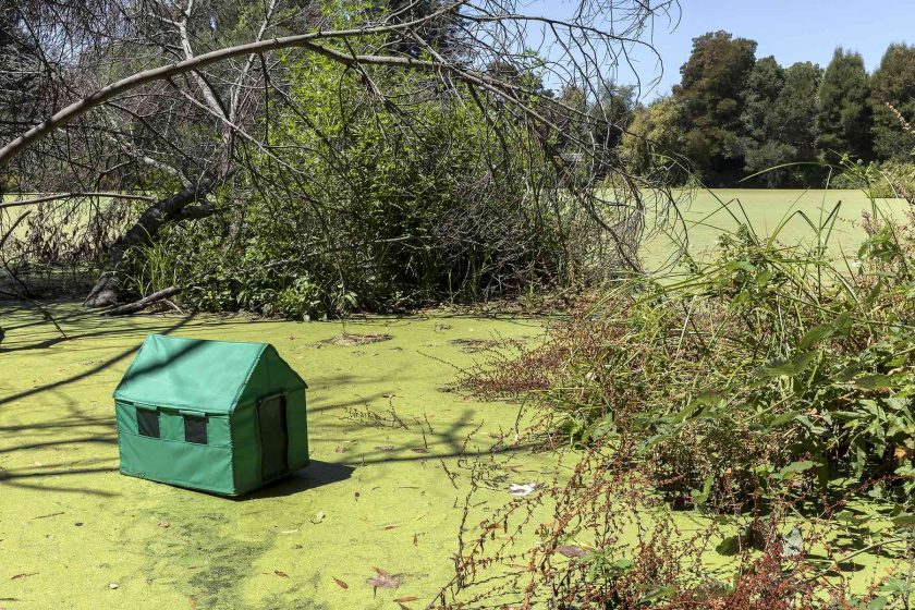


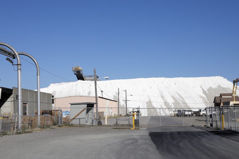


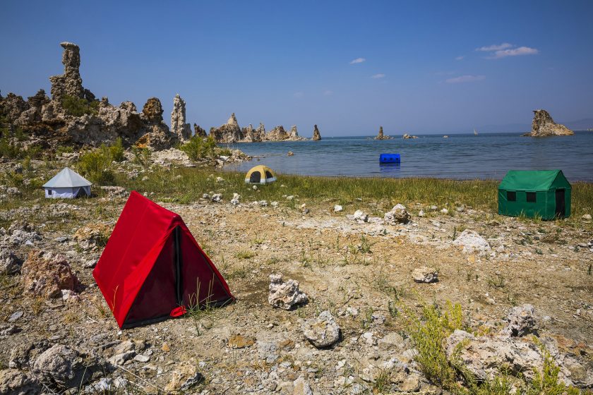


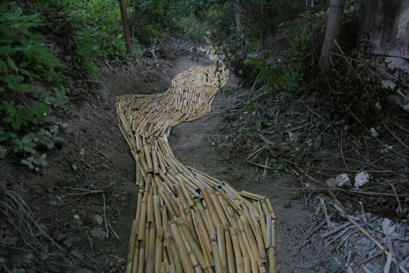
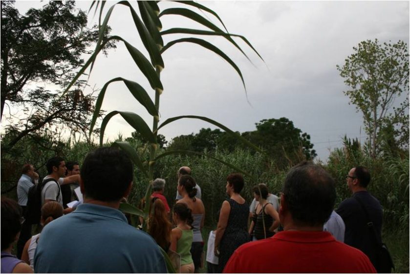
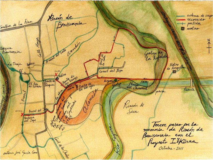
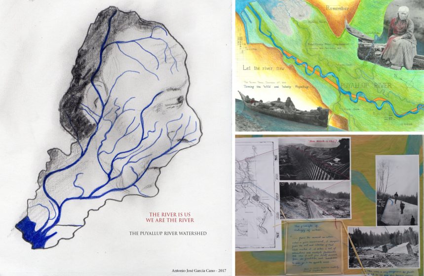

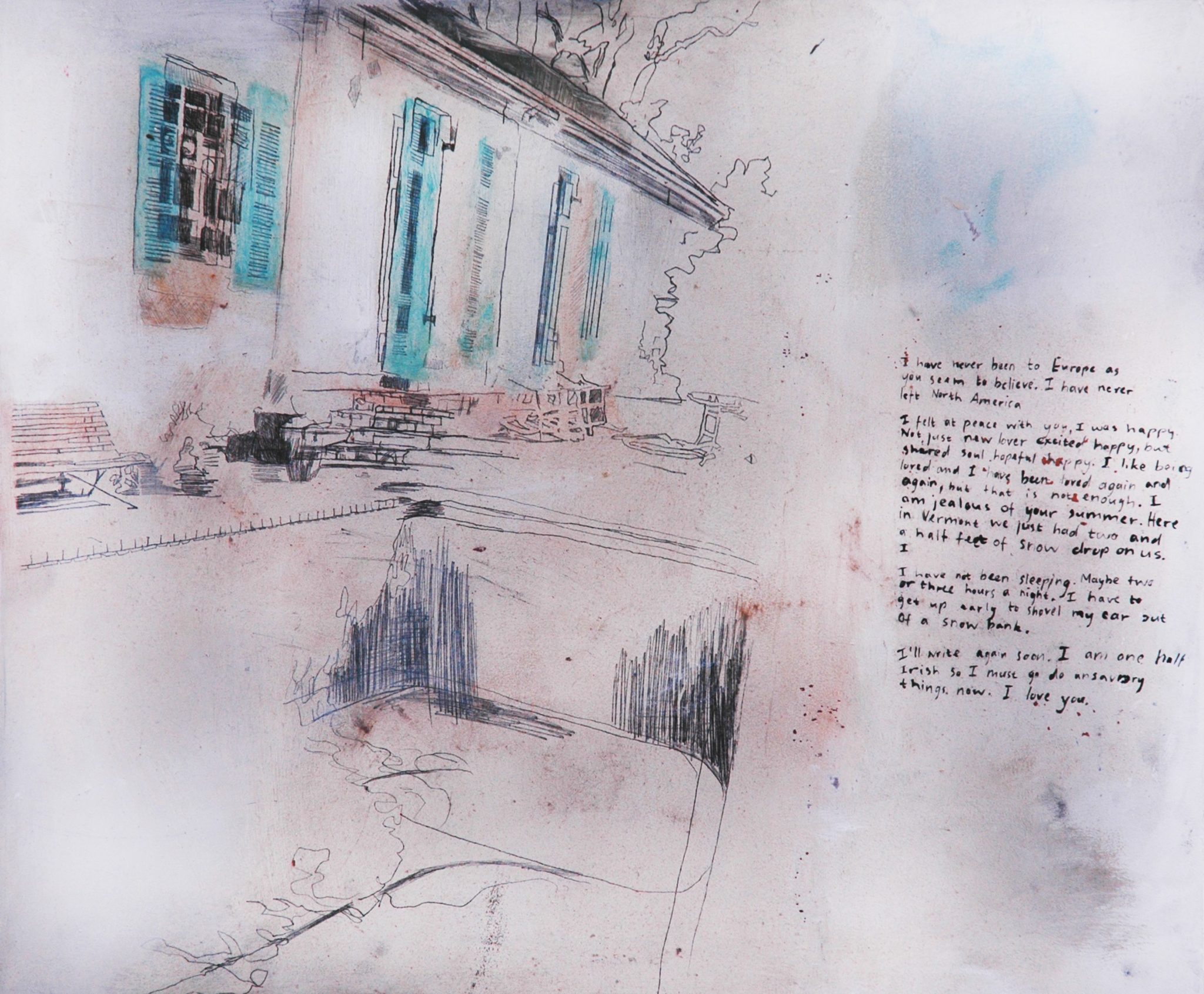
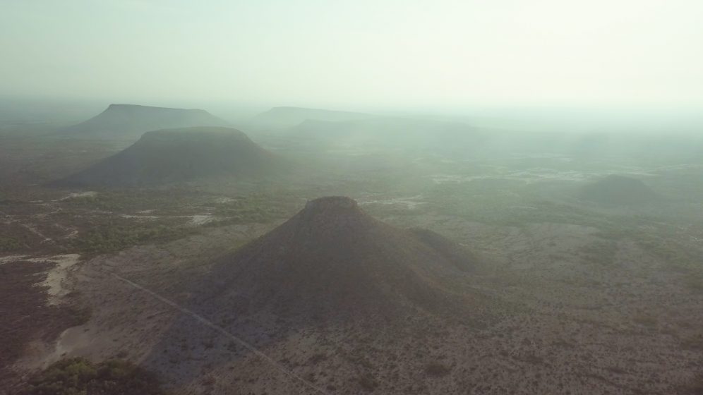
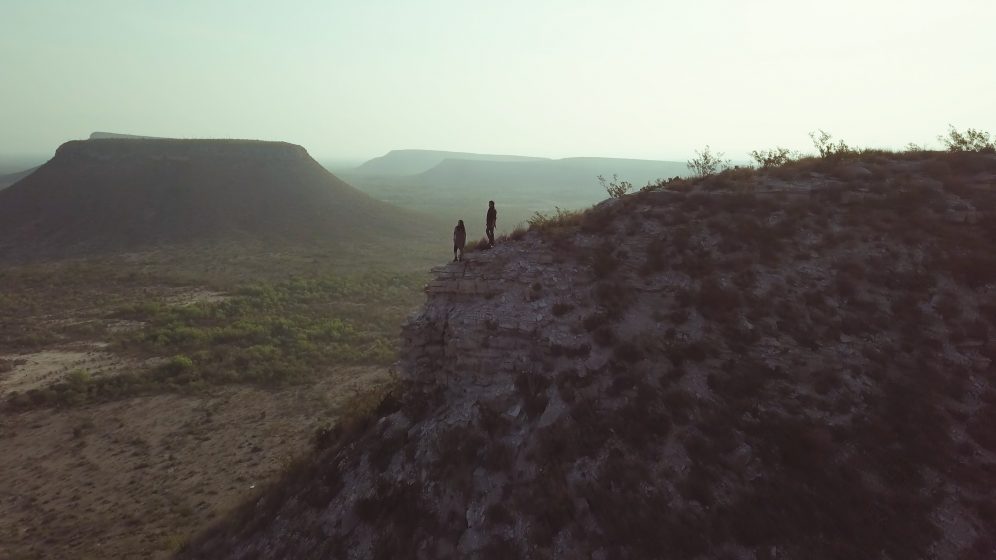
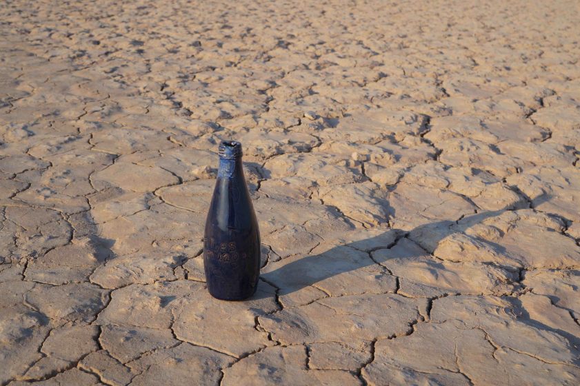

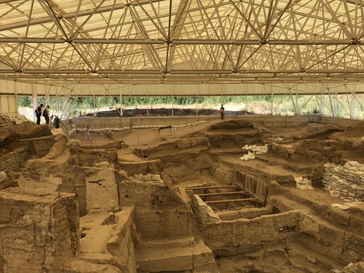
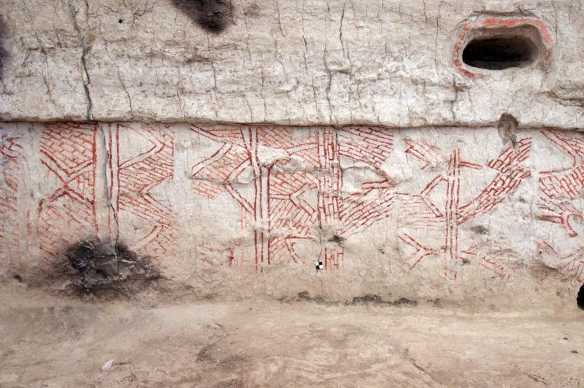

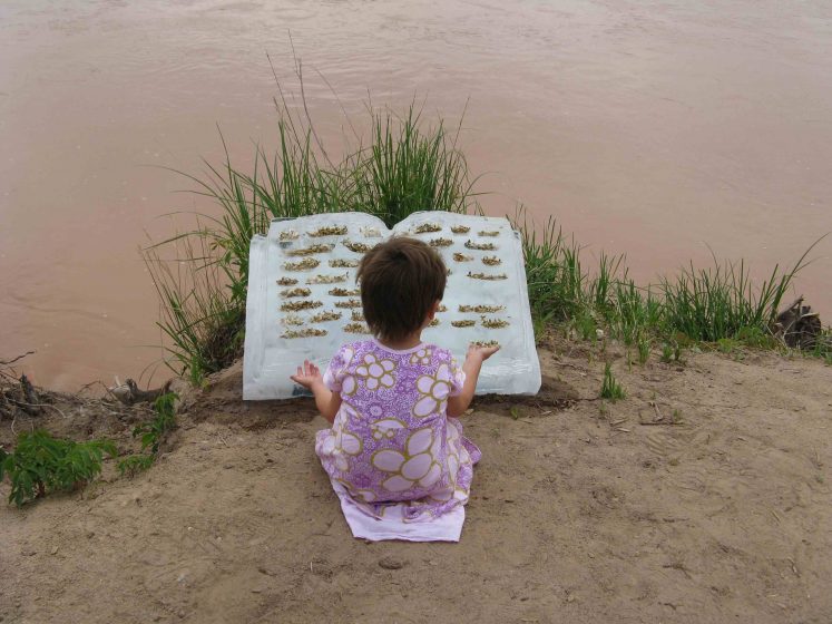
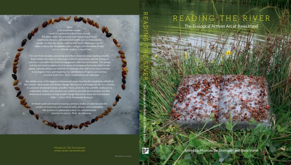
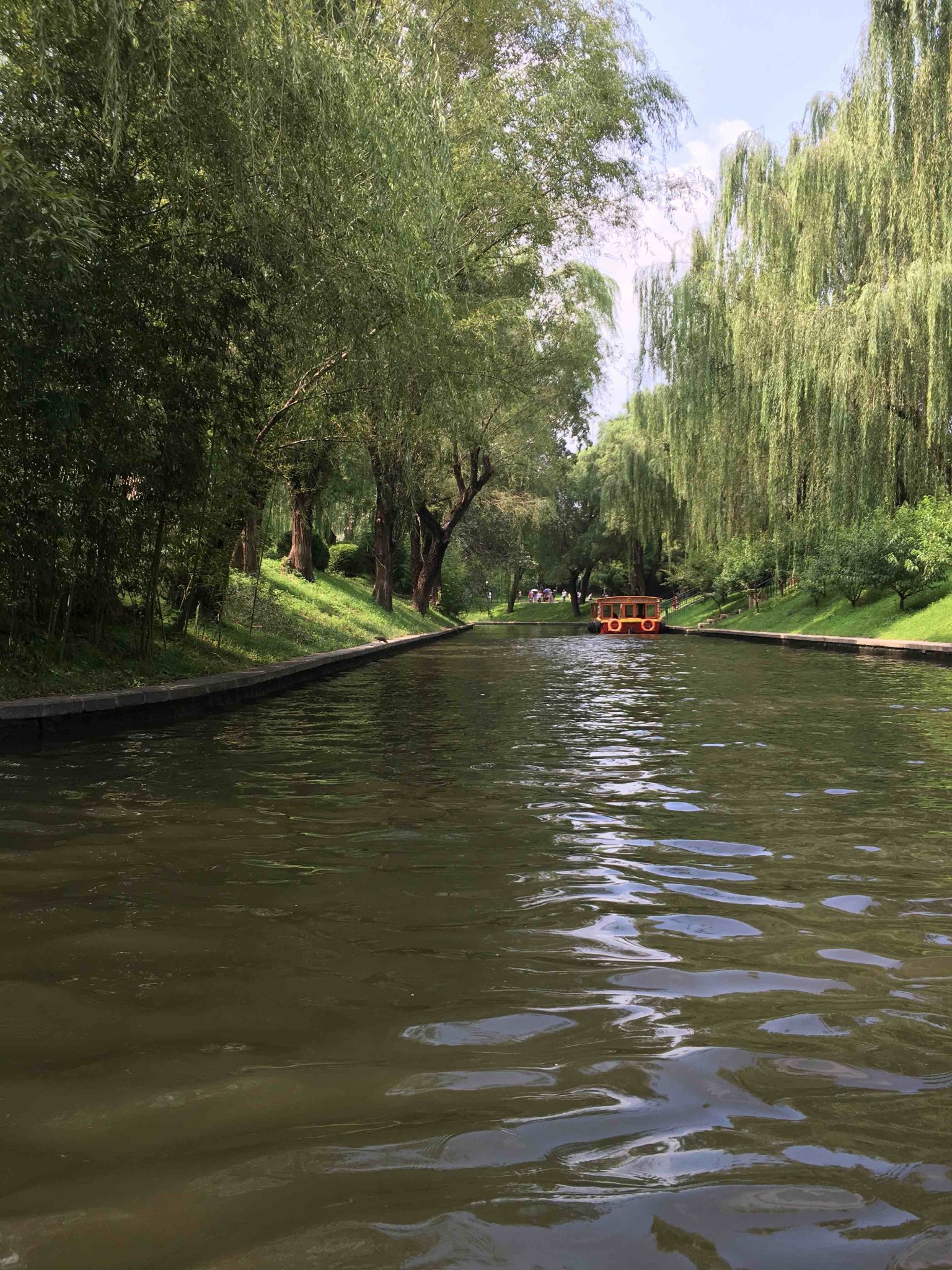

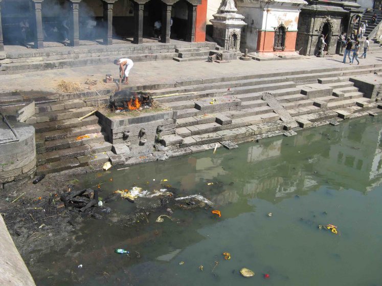
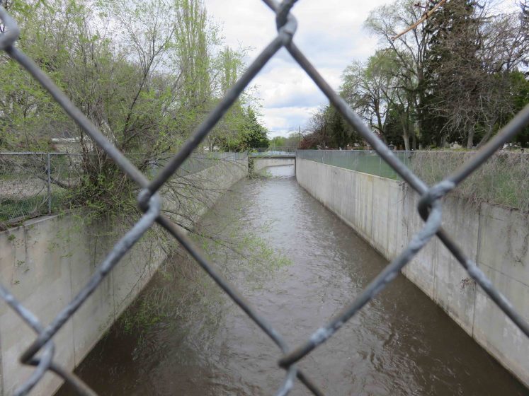
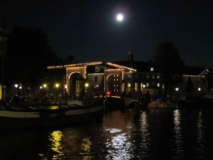
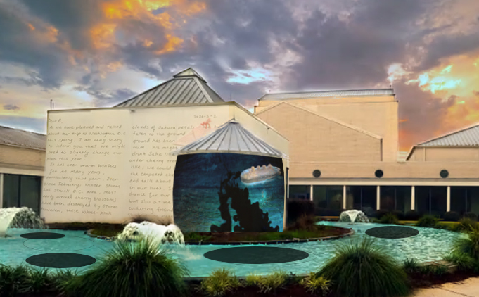
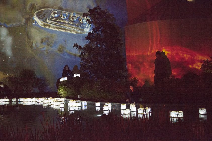

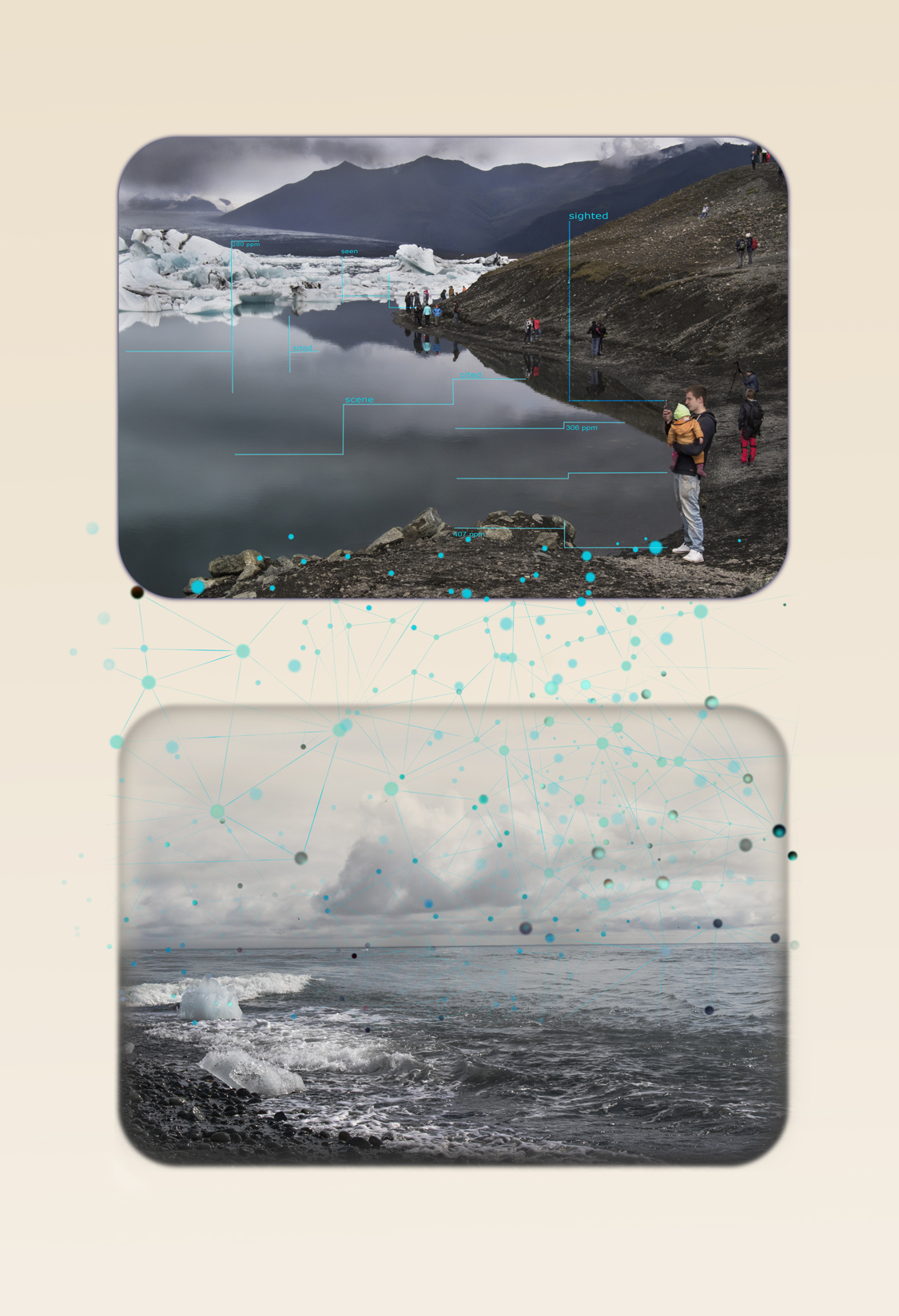
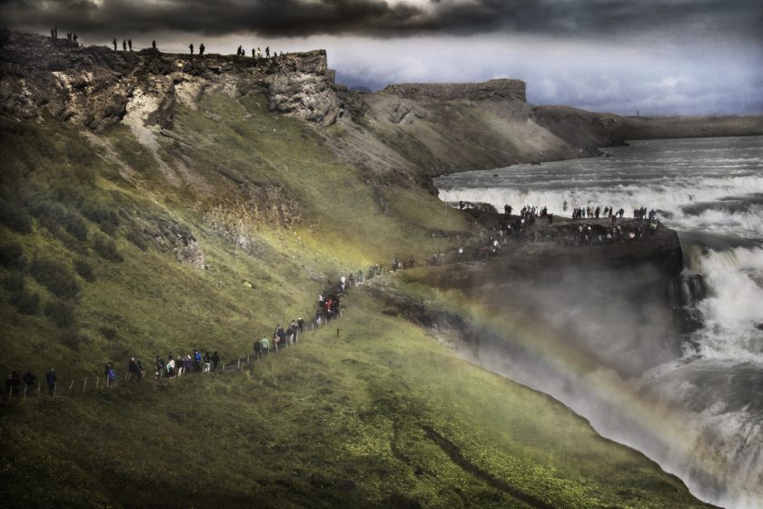

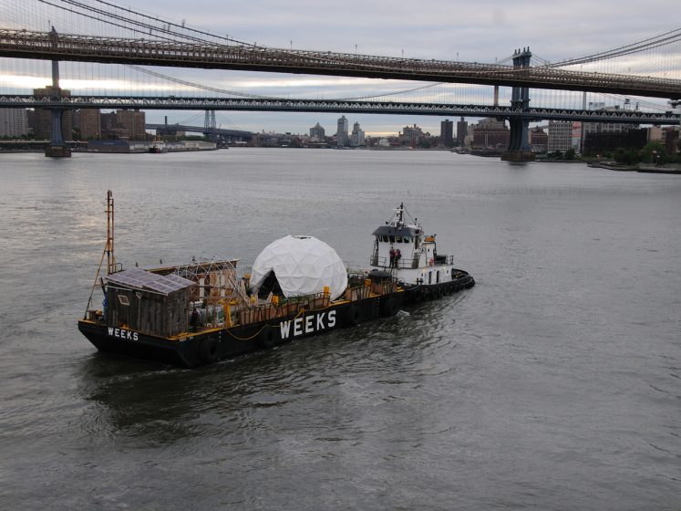
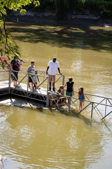
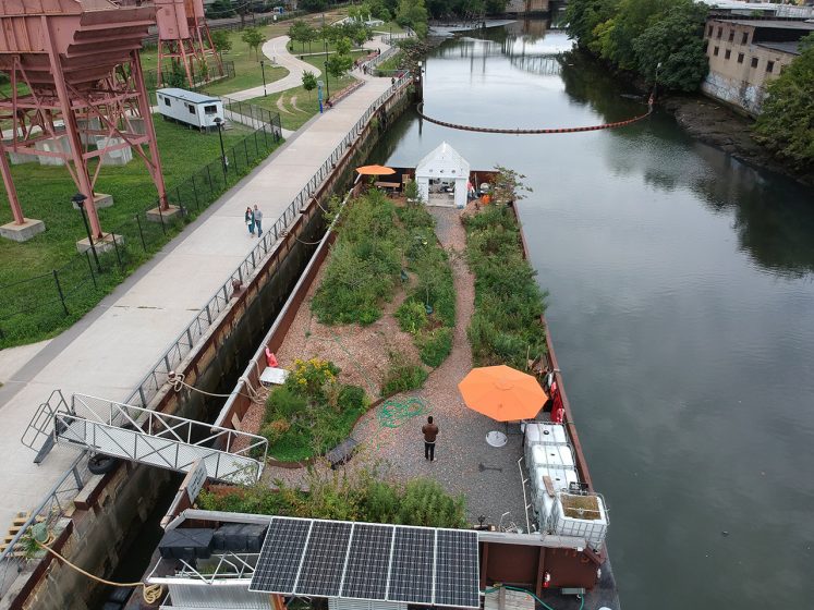
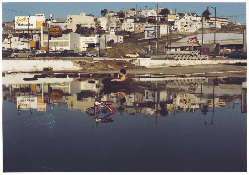
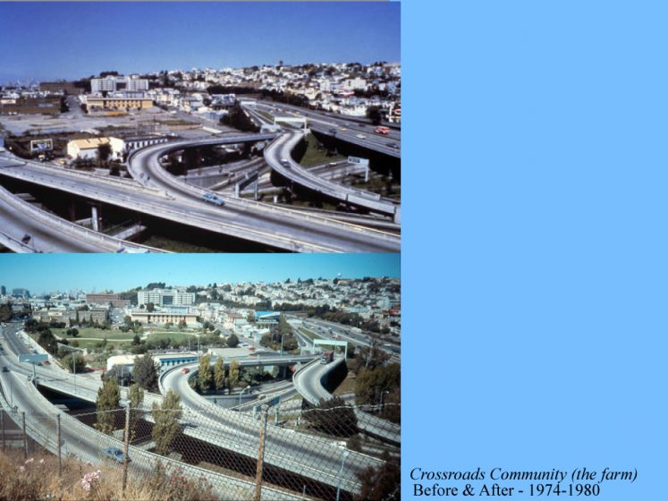
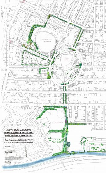
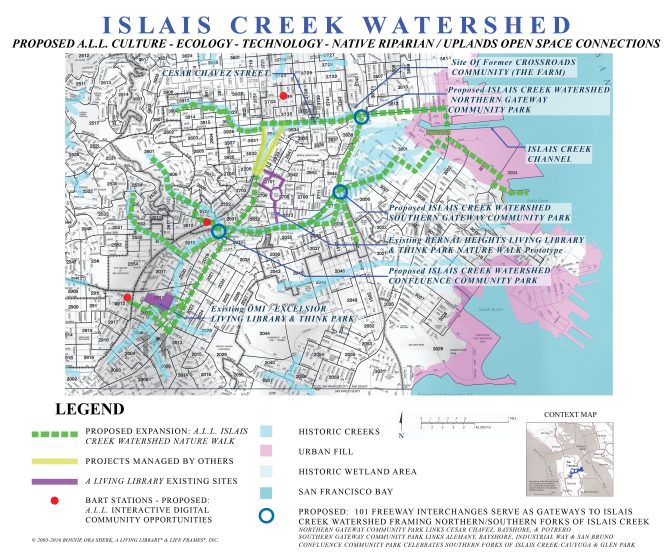
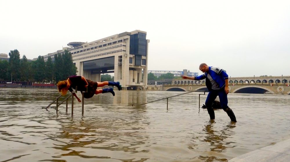
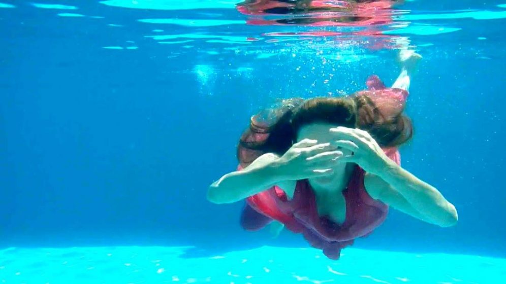
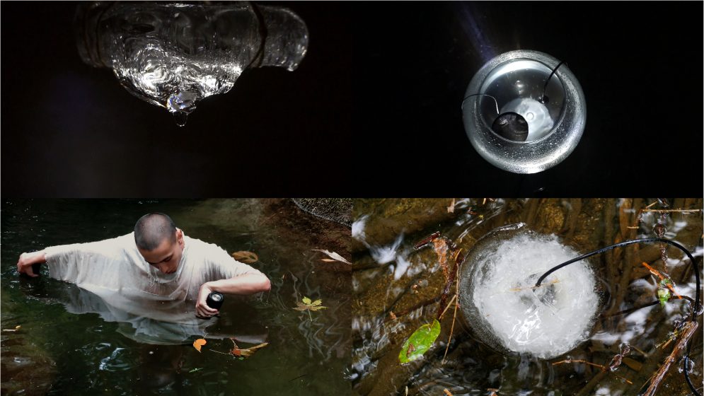


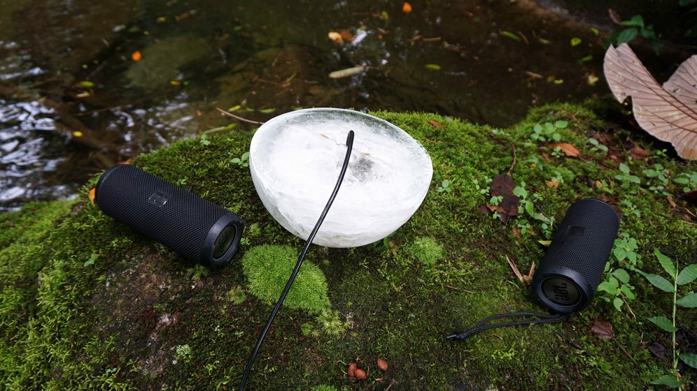

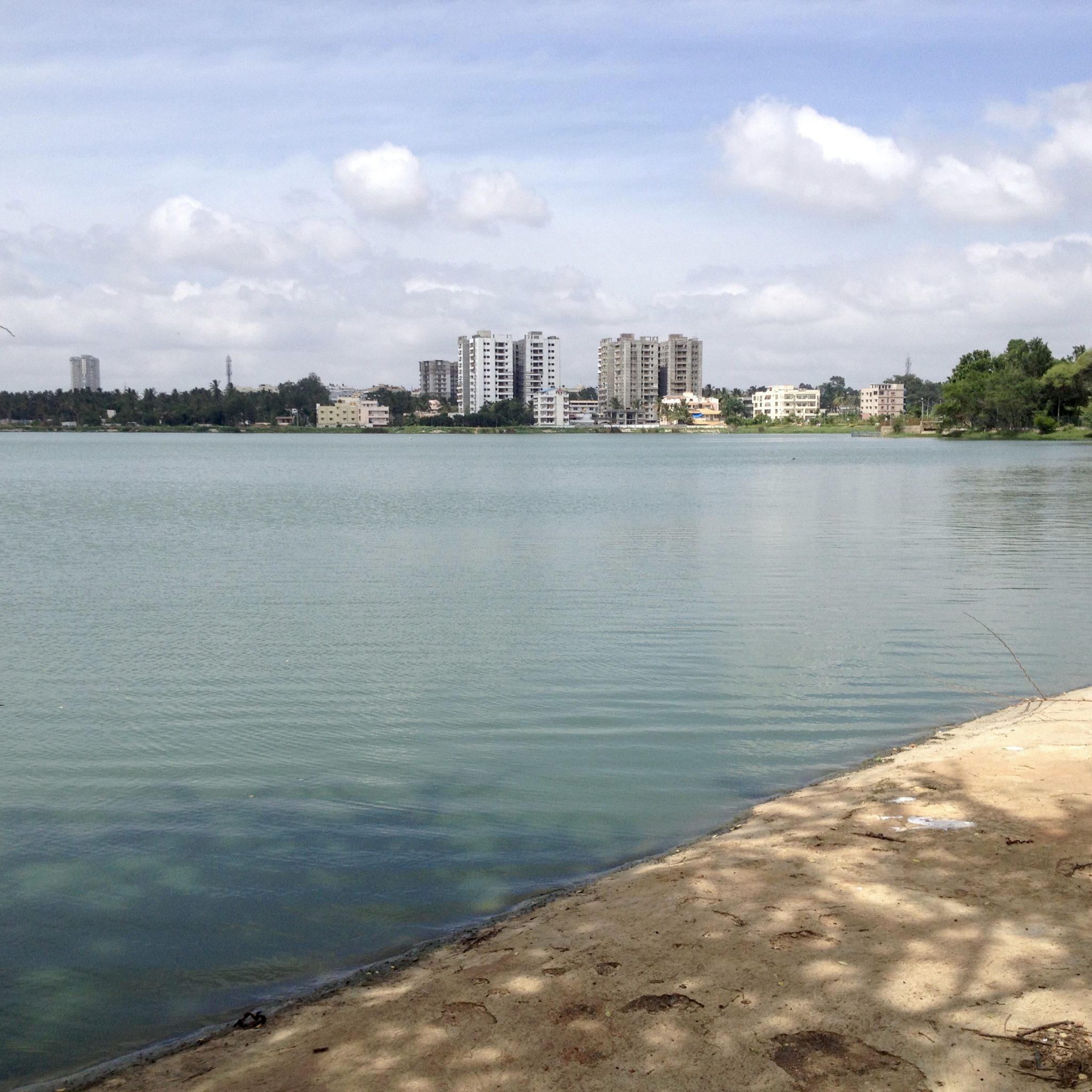
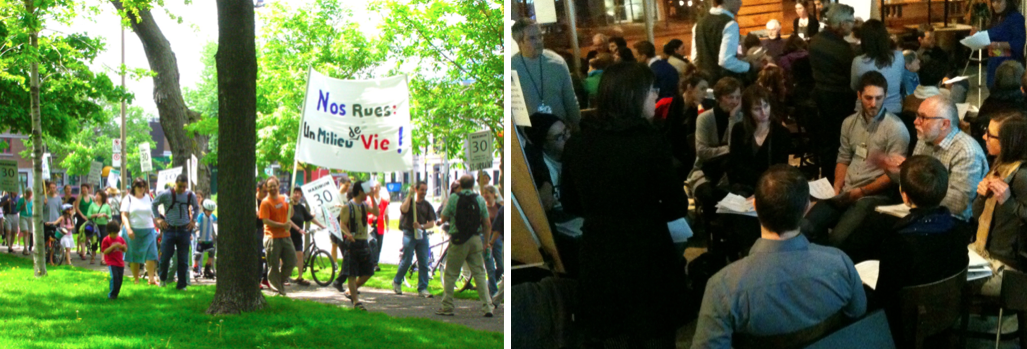
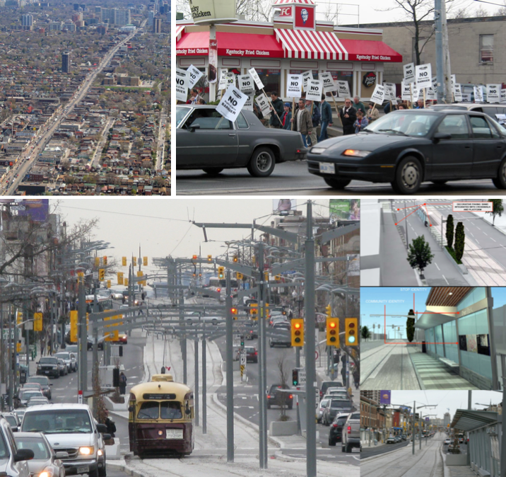
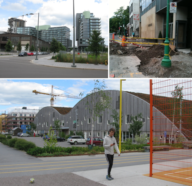
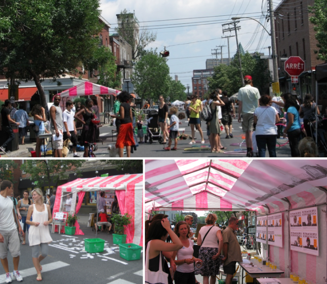
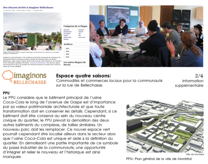
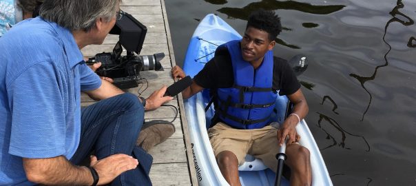
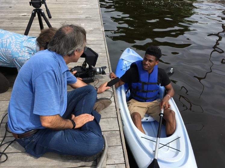
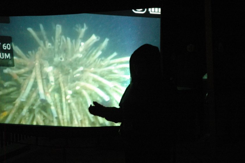
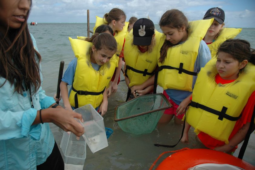

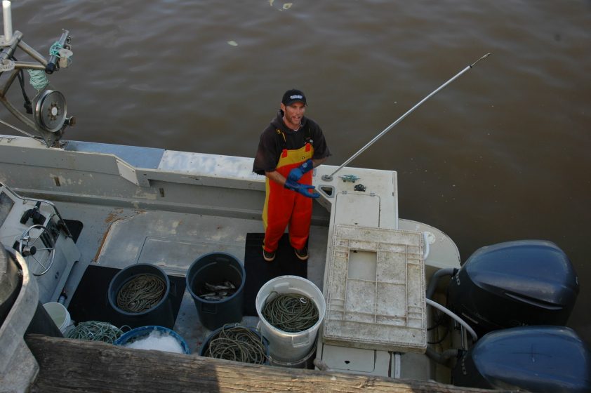
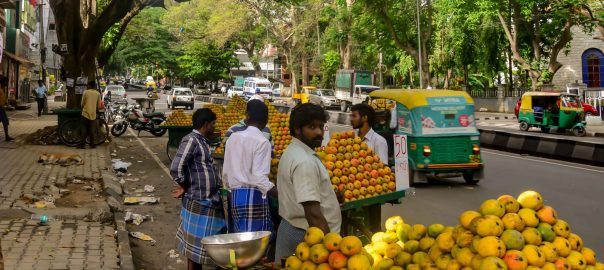
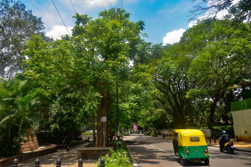


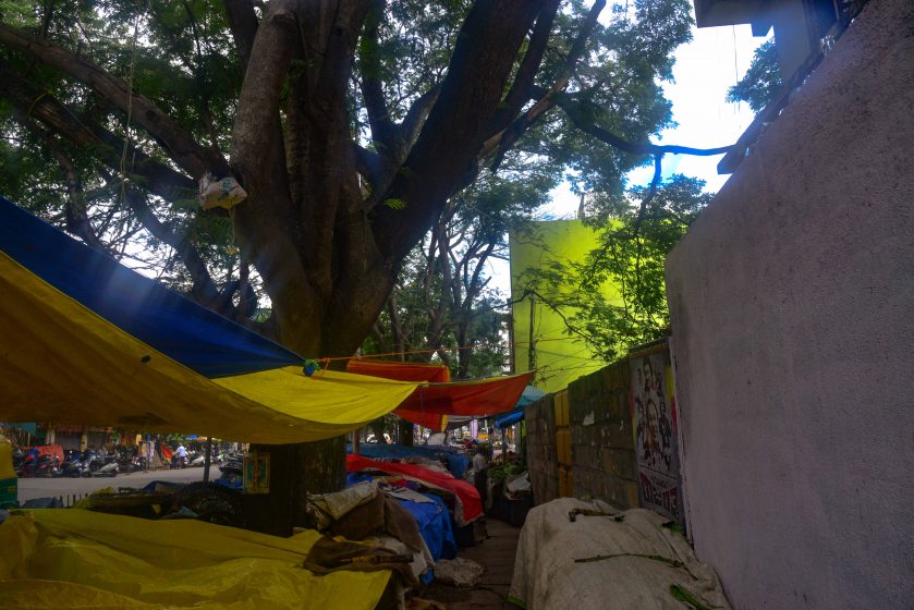
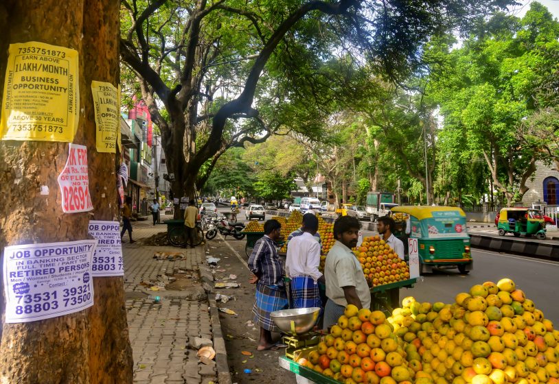
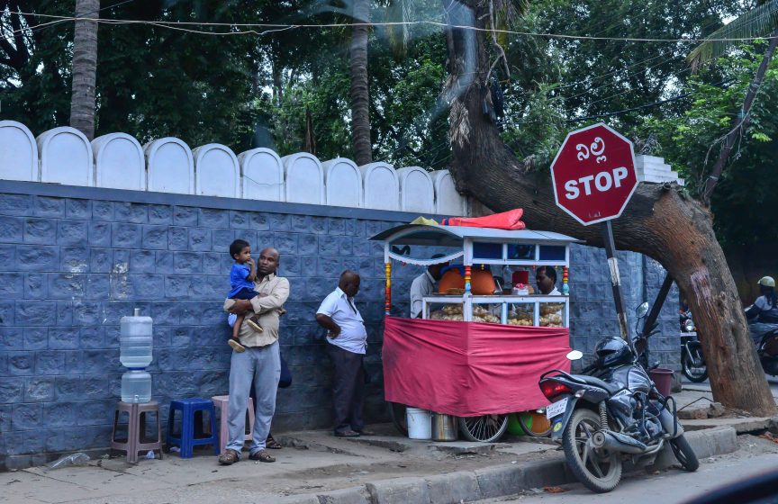
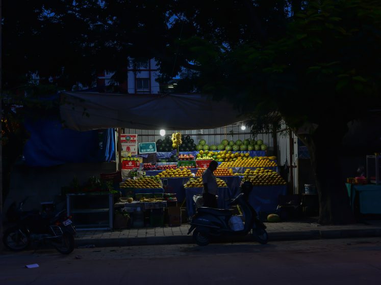
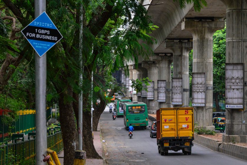


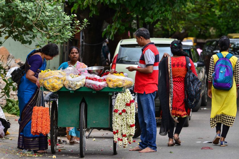
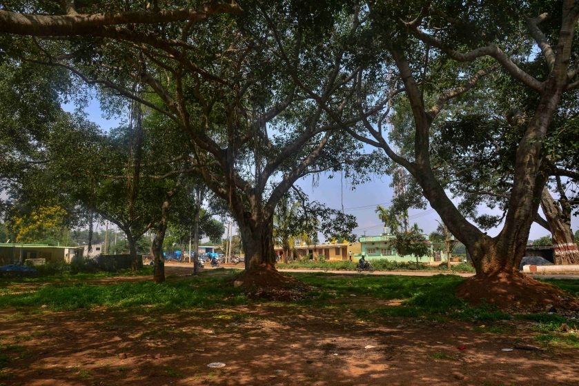
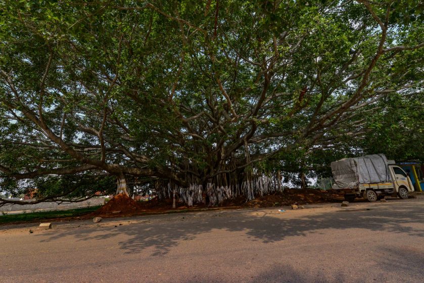

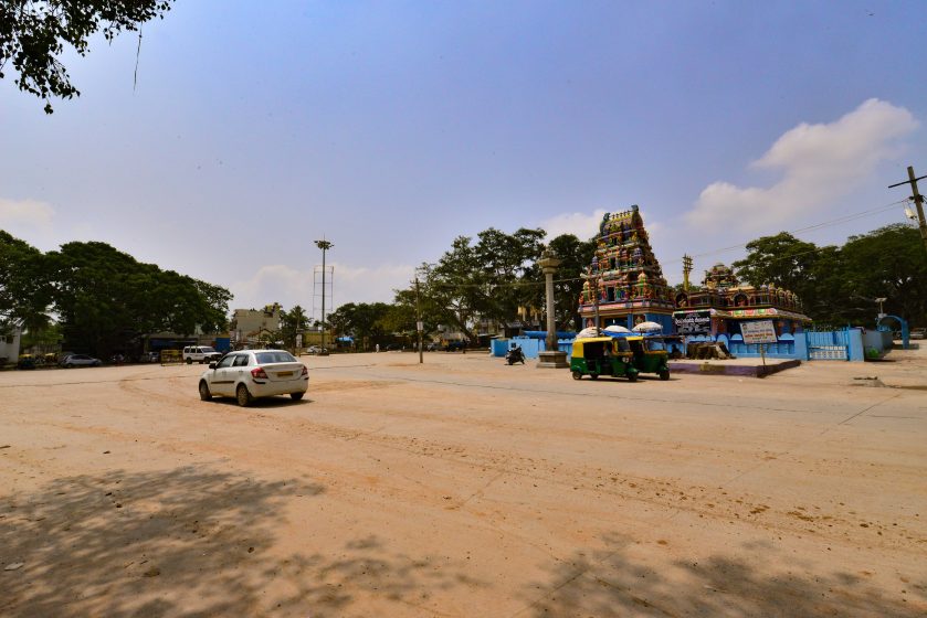


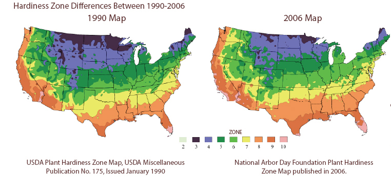
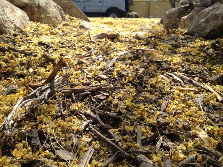
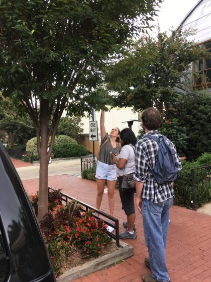

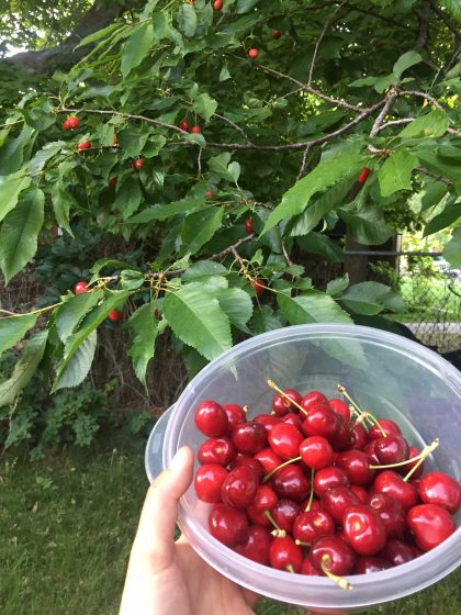

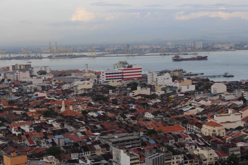
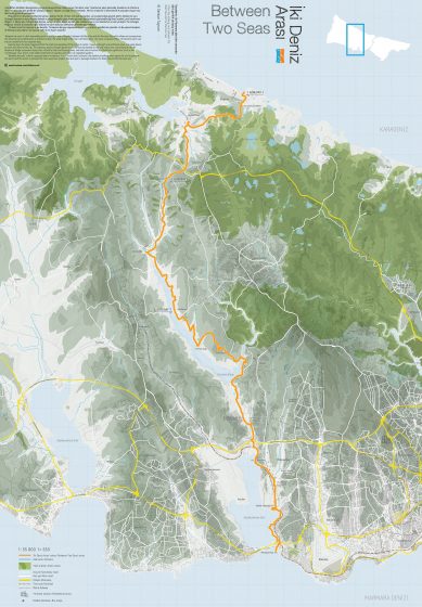
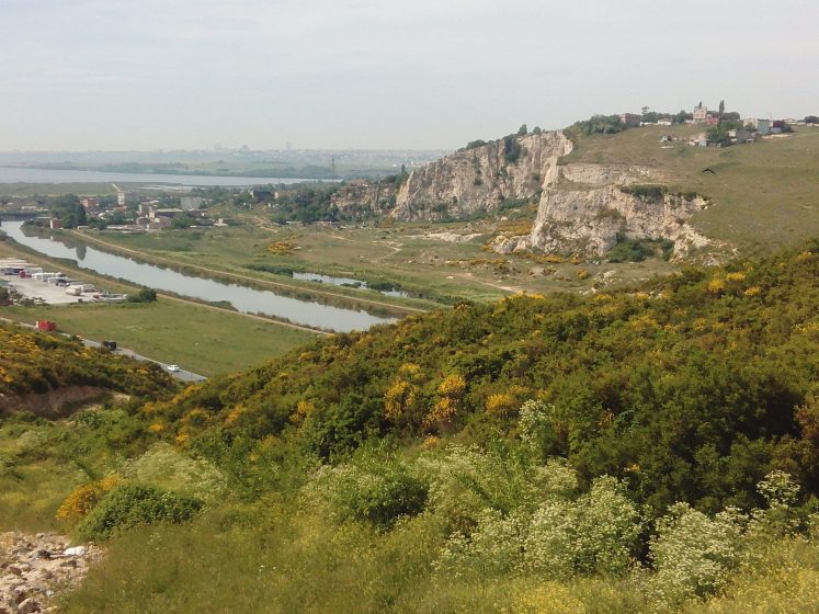
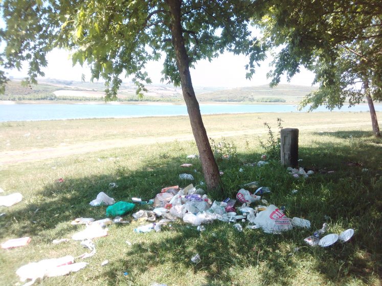
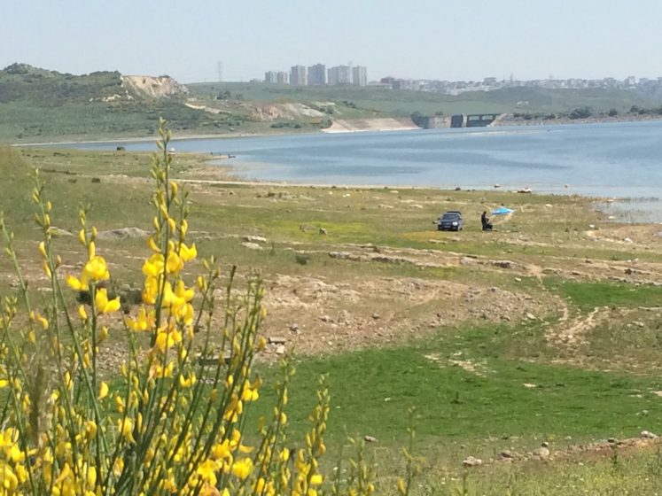
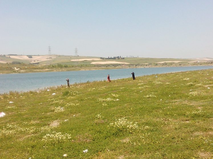
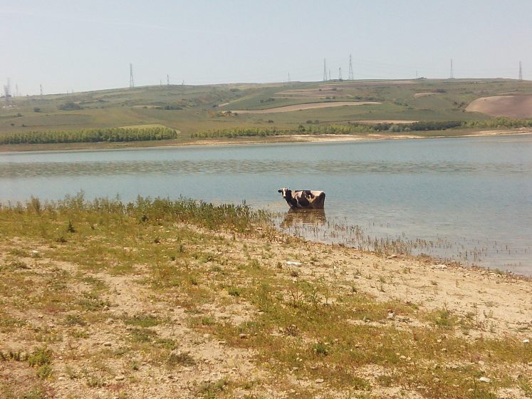
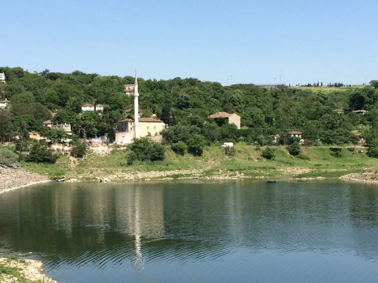
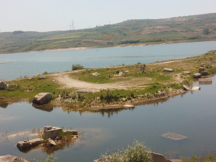
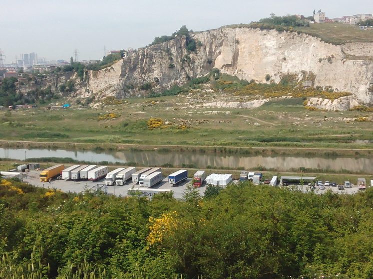
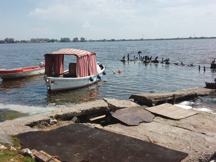
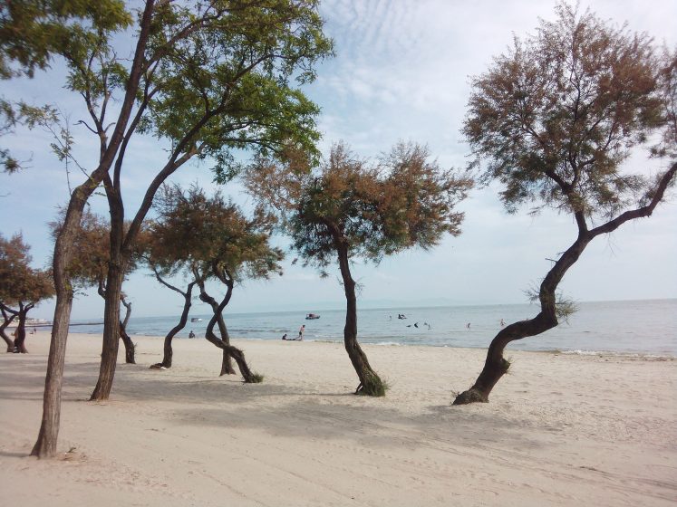
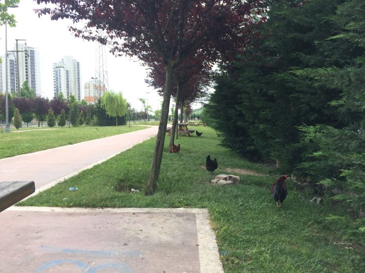
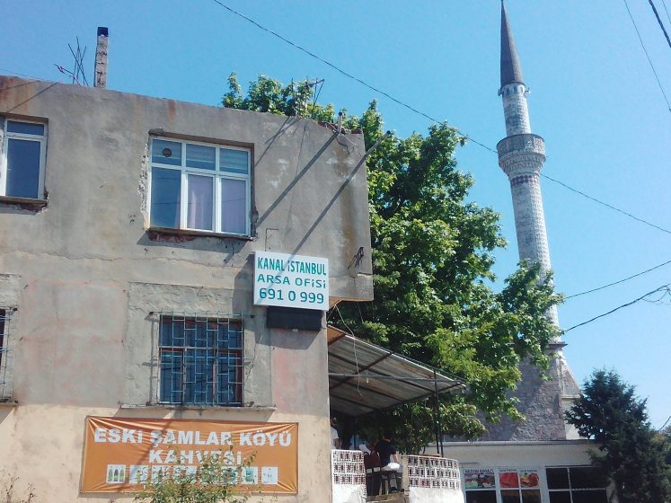
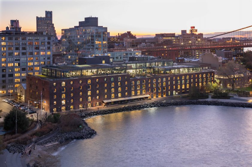
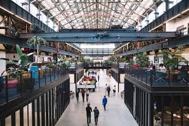
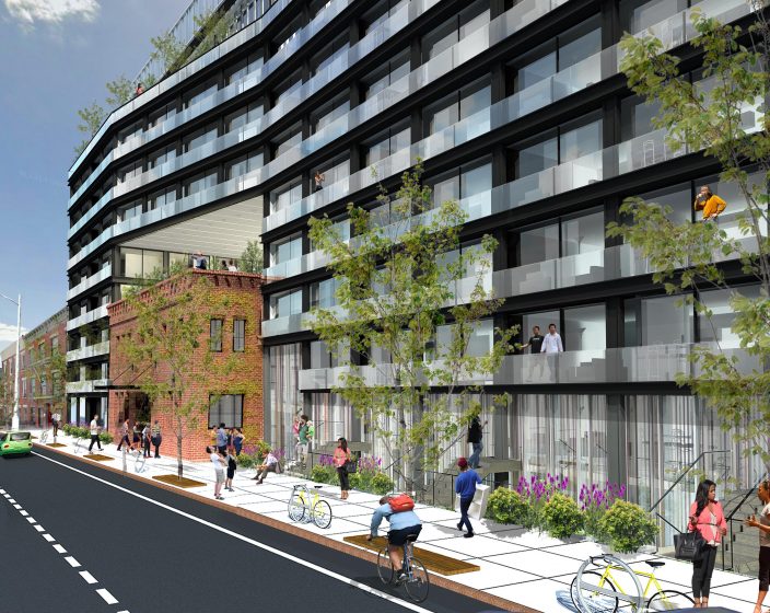
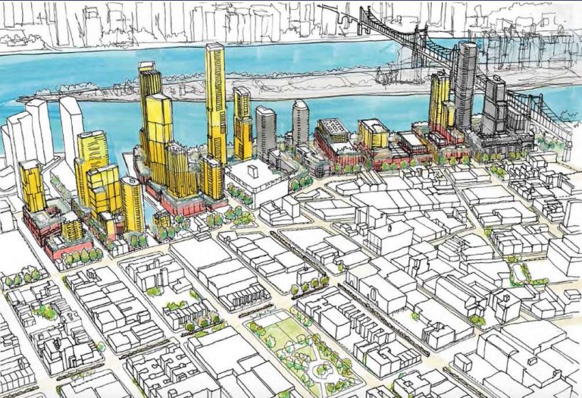

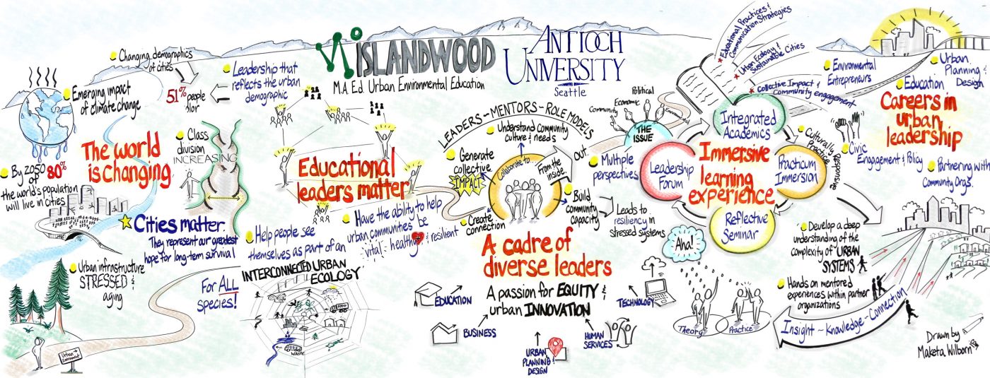
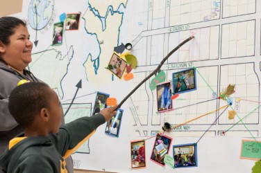
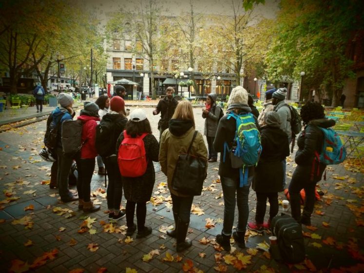
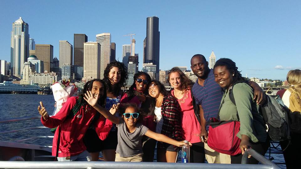


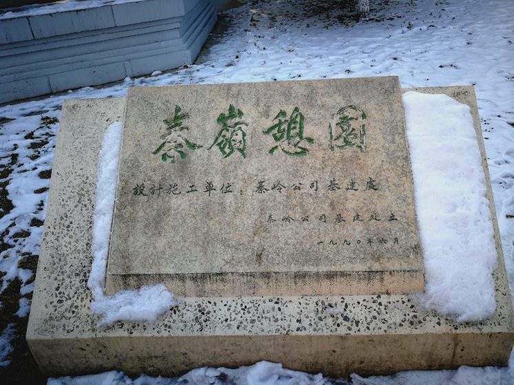


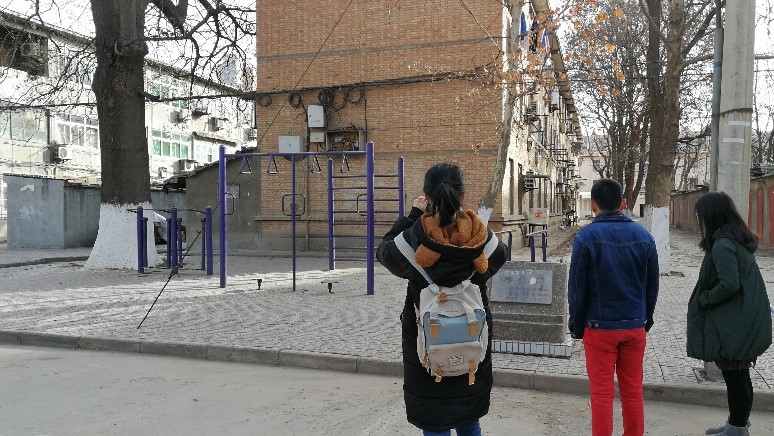

 Gentrification is one of those words that is so ubiquitous that most of us think we know it when we see it. Rarely is it defined with any precision, however. As the authors of this new and important book argue, the term gentrification eludes an exact definition and has been so widely used and applied across different contexts that it has “overgrown its original boundaries” (p. 9) and “displaced so many other meaningful concepts that urbanists once had in their tool kits”. (p. 10) The term often obscures more than it illuminates and, importantly for them, fails to engage in a nuanced way the processes of gentrification at both the macro (structural) and micro (individual) level. Most progressives don’t see themselves as gentrifiers and this failure, the authors argue, makes it difficult to see how inextricably intertwined we each are in the larger structural forces that shape our individual agency and choices. More to the point, the authors want to illuminate the relationship between the macro and micro to open the true “black box” that “contains our most valuable tools for understanding gentrification.” (p. 16)
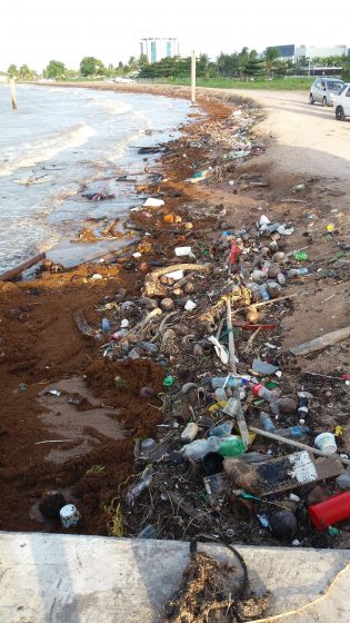

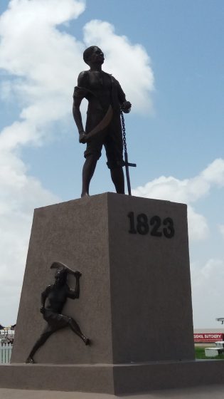
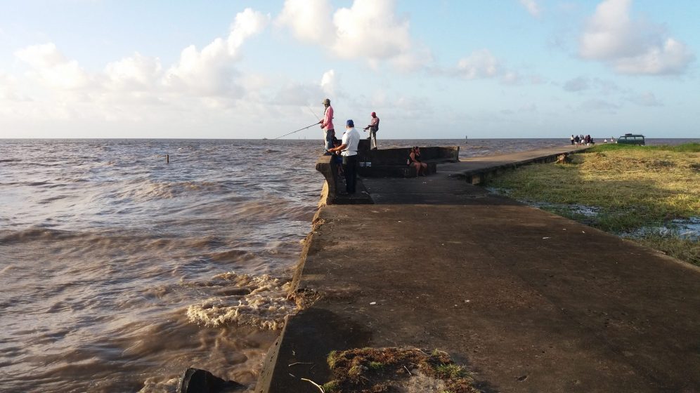
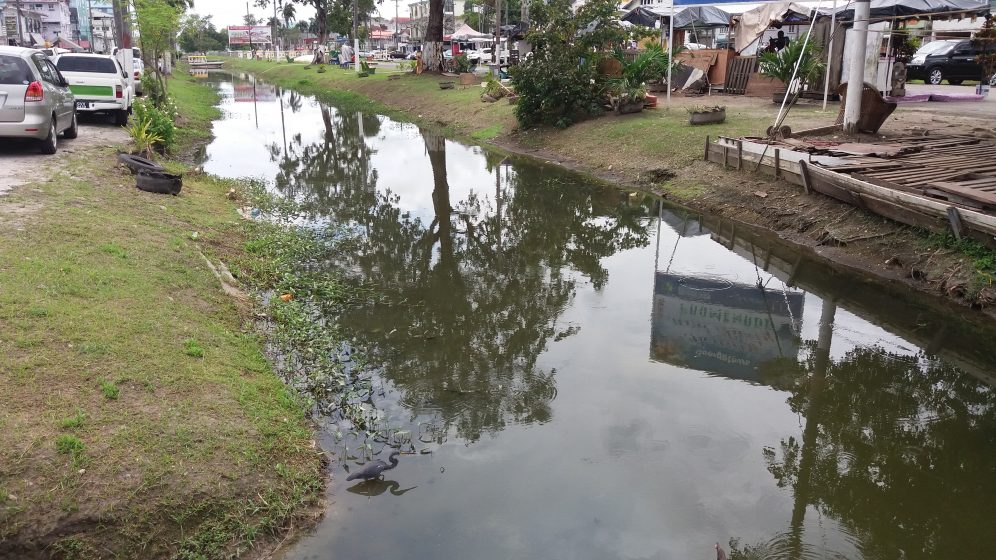
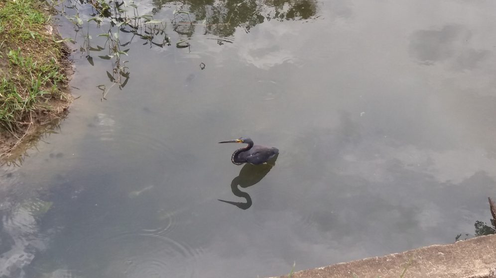
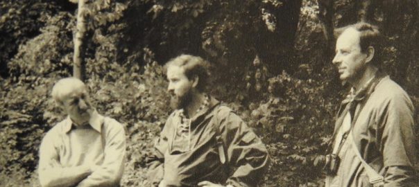
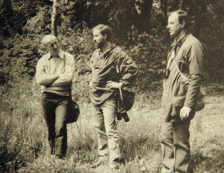
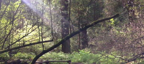
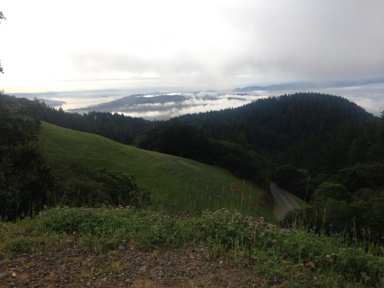
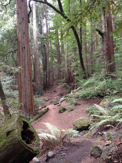
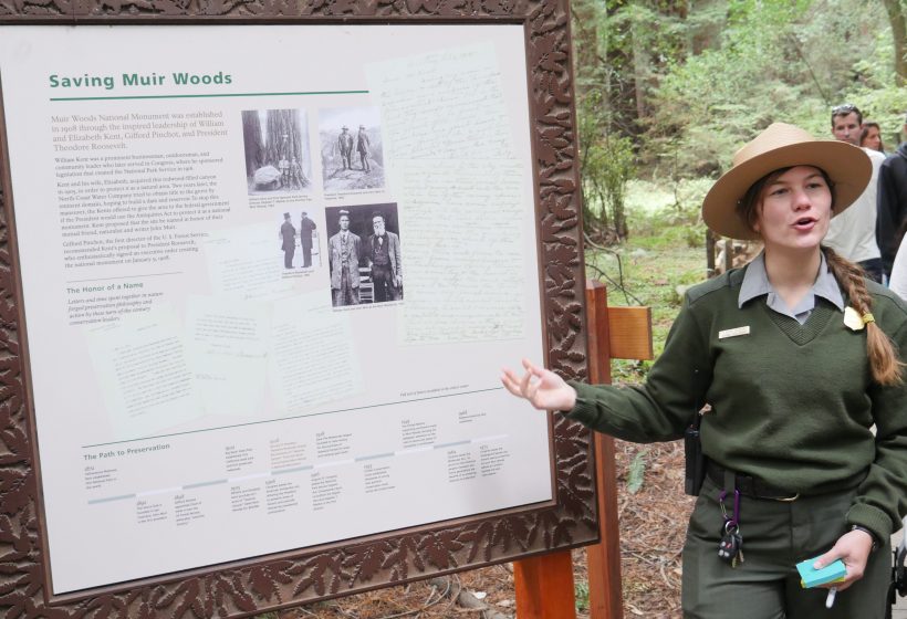
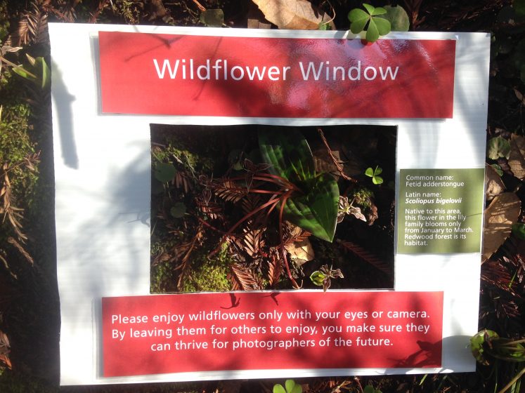
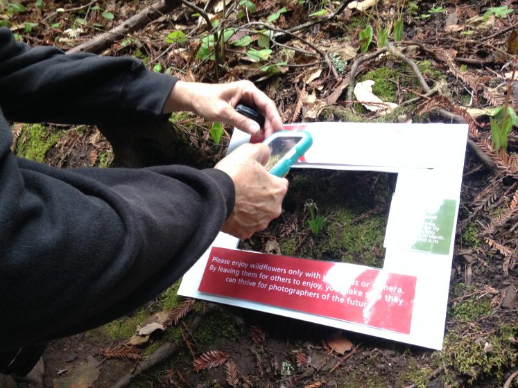
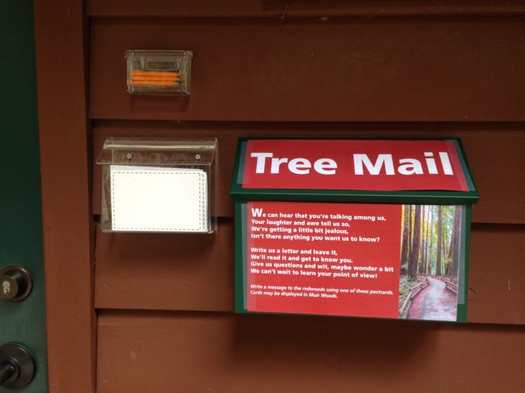
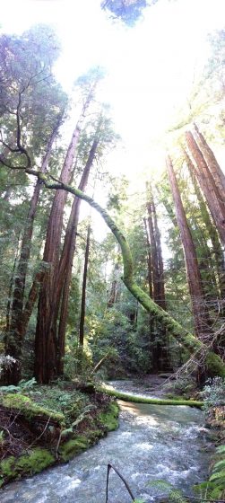
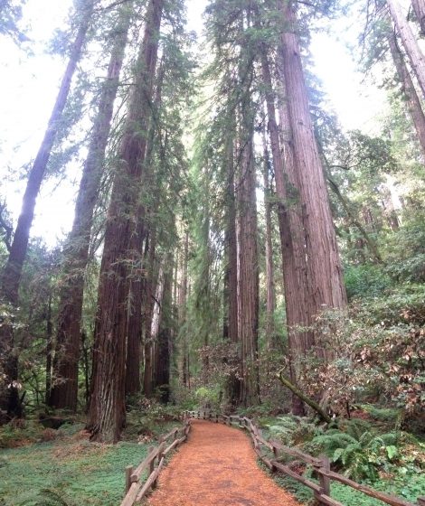
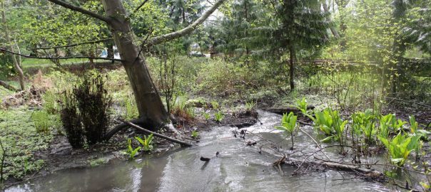
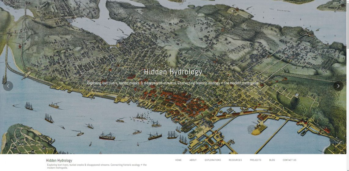
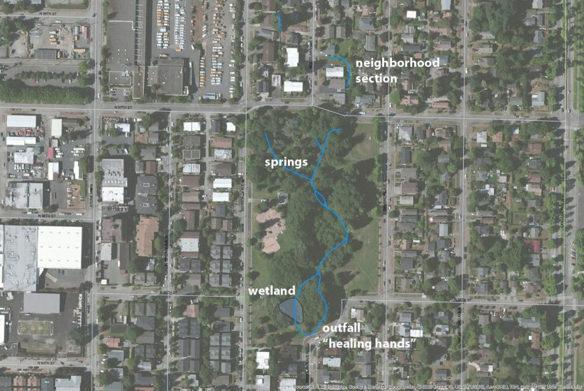
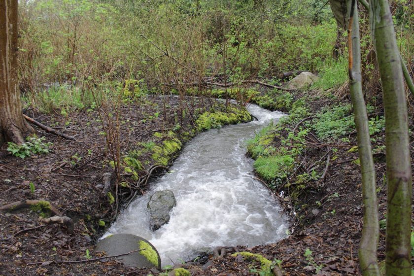
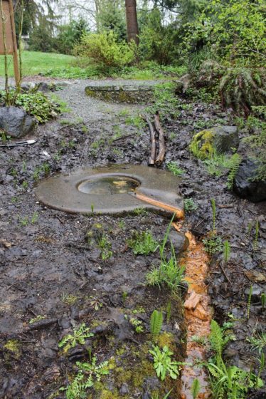
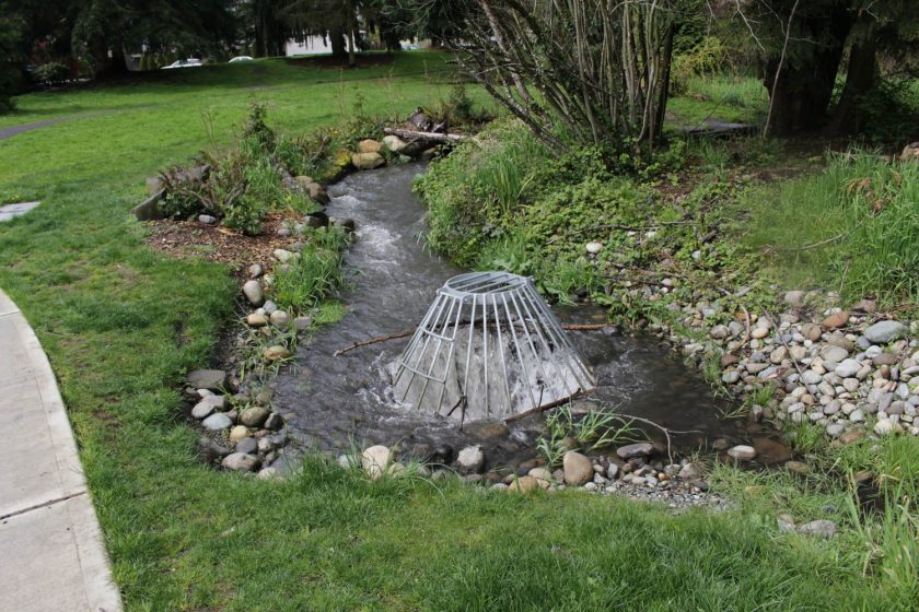
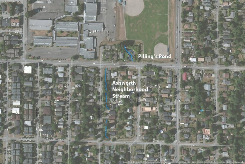
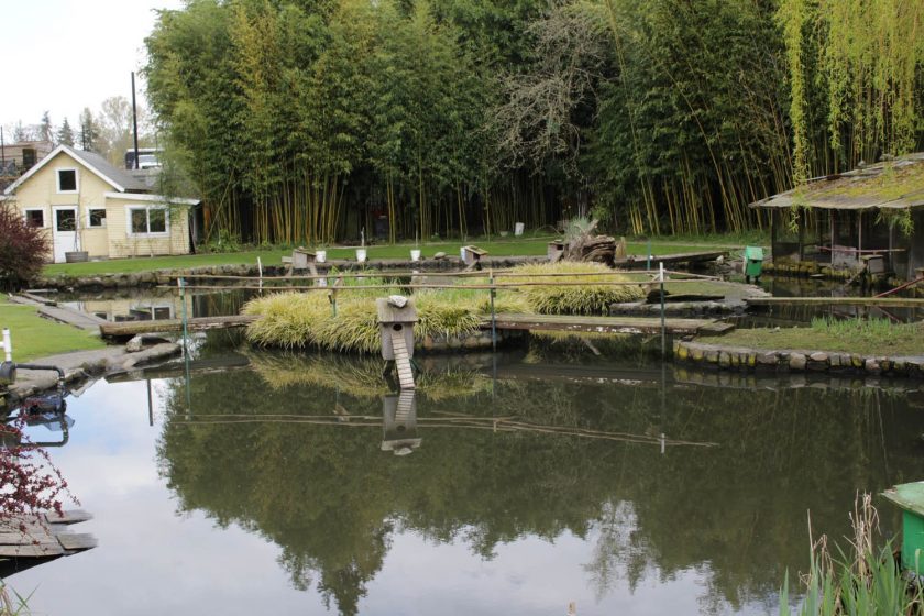
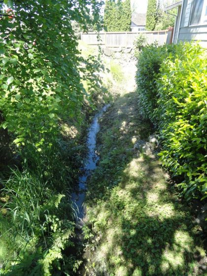
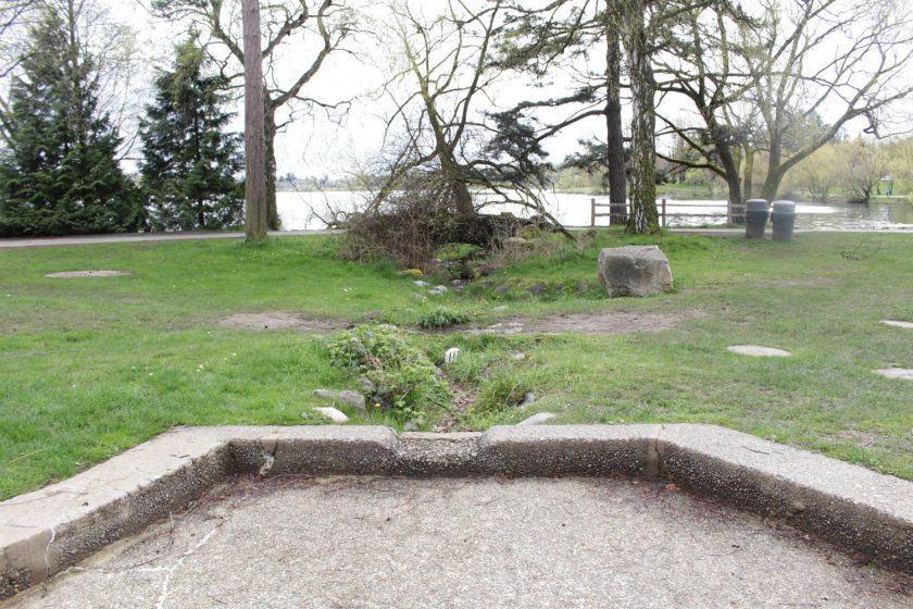
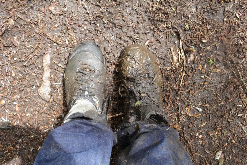
 Second, the Canadian Urban Forest Strategy (CUFS) offers guiding principles for urban forestry at the national level. In recent years, more and more Canadian municipalities have been developing urban forest management plans and tree protection policies. Feedback from stakeholders and members has evidenced the need for a national strategy supported by all levels of government; as the Secretariat for the CUFS, Tree Canada promotes its importance to municipal, provincial and federal levels. In collaboration with multiple and diverse partners, several recent achievements include:
 The CUFN Steering Committee, along with a secondary review committee consisting of provincial and federal government representatives, is currently in the process of updating the Canadian Urban Forest Strategy for the 2019-2024 term. This process began with public consultation workshops in autumn of 2015 in each region and has been ongoing for the past two years. The objective of the workshops was to ensure that regional voices were heard in the strategy’s redesign. The new version of the CUFS (2019-2024) will be presented at the
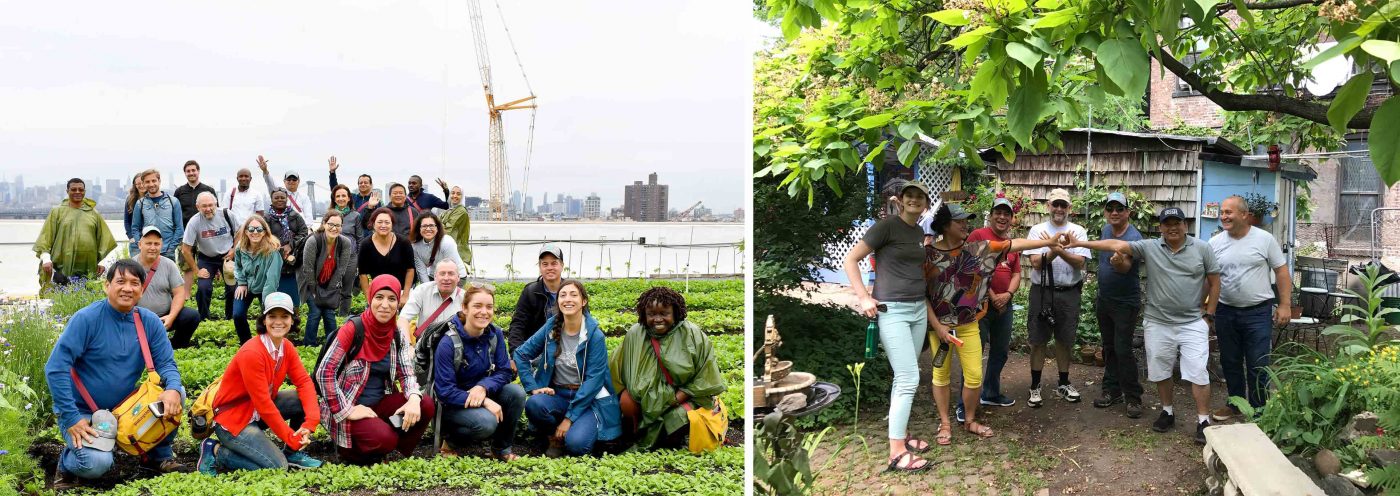 The second experience I want to share that demonstrated collaborative learning was participating in the Peter Wall Institute for Advanced Studies International Roundtable (October 23-25, 2017) called, “
 As a social scientist, and through my role with Tree Canada, and as a Postdoctoral Research Fellow with the University of British Columbia
Add a Comment
Join our conversation