This election season, Prickly Lettuce, Horseweed, and Tree-of-heaven invite you to show up, vote, and to envision a new era of multispecies politics and democracy.
The notion of giving voice to more-than-human communities has long been of interest to artists, activists, and change-makers worldwide. Though still emerging, movements like the rights of nature have increasingly advocated for granting natural entities—rivers, forests, ecosystems—legal standing, akin to the rights given to people or corporations. Over the past several decades, several examples have emerged ranging from New Zealand’s recognition of the Whanganui River as a legal entity (2017), the Lake Erie Bill of Rights in Ohio (2019), Ecuador’s enshrining nature’s rights in its Constitution (2008), and Colombia’s Constitutional Court recognizing the Atrato River among others.
Yet, when it comes to giving nature political representation, there remain few examples where more-than-human communities are granted a direct vote or significant role in decision-making—despite their deep entanglement with human activities and policies. The limited examples we do have mostly come from contemporary art and the humanities, offering a thought-provoking and speculative look at what decision-making might look like if more-than-human stakeholders were given a legitimate voice and how they may actually influence policy. Consider, for example, The Party of Others by Terike Haapoja (2011), which uses immersive visual projections to propose a speculative interspecies party platform in Helsinki, Finland, advocating for the inclusion of non-human beings in local governance. Similarly, Future Assembly (2021) by Olafur Eliasson and Studio Other Spaces, presented at the Venice Biennale, envisions a future where non-human entities are granted agency in global decision-making, symbolized by a circular assembly space with objects representing non-human life forms. La voix des glaces (2019) by Robin Servant captures the haunting sounds of melting glaciers, using field recordings to translate their movement and eerie soundscapes into an auditory experience that highlights their fragility in the face of climate change.
Central to these works and the broader discourse of giving voice to nature, is the critical need to examine the ethics of translation. As Eben Kirskey (2014) describes in the Multispecies Salon, speaking on behalf and representing what nature “needs” or “says” can be easily reified as a form of ventriloquism that runs the risk of exploiting or anthropomorphizing more-than-human actors. To approach this thoughtfully, we need not only a radical commitment to deep listening but also a critical awareness of how we frame more-than-human organisms as “other”, and how political and economic systems shape our interactions with ecosystems and the species they support.
As we approach the 2024 U.S. presidential election in November, the idea of how nature is represented in our electoral process is fresh in my mind. This November is also a critical inflection point, particularly as a member of the Environmental Performance Agency, an artist collective founded in 2017 in response to the Trump administration’s efforts to dismantle the U.S. Environmental Protection Agency. (EPA was co-founded by members Andrea Haenggi, Catherine Grau, Ellie Irons, Christopher Kennedy, and spontaneous urban plants).
In 2017, outraged by the appointments of Scott Pruitt and Andrew Wheeler—both well-known fossil fuel lobbyists—we organized creative actions and artworks inspired by the resilience of urban plants, particularly species we often dismiss as weeds or invasive. As some of the most common vegetation encountered in urban areas, we felt a strong kinship with these resilient plants, not only for their ability to thrive in harsh environments but also for the essential ecological functions, habitats, and cultural services they provide to both human and more-than-human communities. Using this as both a lens and platform for artistic, social, and embodied practices, we advocate for the agency of all living performers co-creating our environment, specifically through the lens of spontaneous urban plants, native or migrant.
This year marks the 2nd presidential cycle where the resurgence of Trumpism looms. As the U.S. Environmental Protection Agency faces renewed threats, we look again to our resilient “weedy” plant allies for inspiration and guidance. In many ways, they offer a chance to reflect on the far-reaching consequences of political decisions, especially those made at the polls, which impact not just human communities, but all life on Earth. To foster this reflection, EPA agents Haenggi, Grau, and Irons developed a series of “scores”—invitations for deep listening and cultivating kinship with urban plants we affectionately describe as plant “specialists”. These plants have a remarkable ability to adapt and respond to human activities, making them valuable models for resilience in the Anthropocene. By engaging with their unique wisdom, the EPA hopes to offer a new perspective on how their adaptability can inspire decision-making in this era of ecological crisis.
Consider for example Prickly Lettuce (Lactuca serriola), the EPA’s Lead Program Analyst. Also known as the compass plant or opium lettuce, Lactuca serriola is an annual or biennial plant related to dandelions and known for sedative effects and used by ancient Egyptians as an aphrodisiac with pain-relieving effects ascribed to lactucarium, contained in milky white sap in stems and leaves. The leaves have a row of delicate spines along the mid-vein of the lower surface and are ingeniously held vertically in a north-south plane, perpendicular to direct sunlight. Prickly lettuce invites you to be scratchy―to reframe potential frictions as opportunities for new directions even if they push against the status quo.
VOTE SCRATCHY
DEMOCRACY DIVERSIFICATION
Experiencing election apathy?
Pause.
Consult a plant.
Consultant: Prickly Lettuce
Visit prickly lettuce in the street.
Greet the compass plant.
Align your hand with one leaf, then with another.
Wait for the sun to shift.
Tolerate the friction. Stay in community.
Ask yourself: What if plants led the way?
EPA Voter Support Poster, 2024 – Prickly Lettuce
Next, the EPA invites you to commune with Horseweed (Erigeron canadensis), whom we’ve dubbed the EPA’s Herbicide Branch Chief. This resilient annual plant, native to much of North and Central America, grows as a tall, upright stalk encircled by leaves. Horseweed has adapted remarkably well to monoculture farming and holds the distinction of being the first species to develop resistance to glyphosate, a common herbicide. Historically, it has also been used medicinally to treat ailments ranging from diarrhea to headaches and earaches. Horseweed encourages you to stand tall, be bold, and reflect on the power of resistance. It prompts you to think about how you can best spread your ideas, seeds of change, within your community and beyond.
VOTE BOLD
DEMOCRACY REVITALIZATION
Experiencing election dissonance?
Pause.
Consult a plant.
Consultant: Horseweed
Visit horseweed in the street.
Greet the emergency plant, an herbicide resistor.
Align your body with the plant’s uprightness.
Get grounded, build your resistance.
Let authenticity spread like seeds.
Ask yourself: How do new democracies germinate?
EPA Voter Support Poster, 2024 – Horseweed
Finally, consider the Tree of Heaven (Ailanthus altissima), the EPA Air Pollution Investigator. Originally brought from East Asia via Europe for both botanical and commercial purposes, it was once planted widely as a street tree due to its remarkable adaptability to polluted urban environments, but now widely considered an invasive pest. Despite its fast growth and short lifespan, the Tree of Heaven can reproduce vegetatively, extending its life and even fracturing concrete and other impermeable surfaces, aiding in stormwater drainage. It’s also culturally significant, lending its name to the classic novel A Tree Grows in Brooklyn. The Tree of Heaven invites us to be persistent, to disrupt toxic systems with actions that can break through and create space for renewal.
VOTE PERSISTENT
DEMOCRACY DETOXIFICATION
Experiencing election dismay?
Pause.
Consult a plant.
Consultant: Tree-of-Heaven
Visit tree-of-heaven in the street.
Greet the pavement disruptor.
Align your head with the trunk, looking to the sky.
Test out the unexpected places.
Be fast. Organize. Send out runners.
Ask yourself: How do toxic systems crumble?
EPA Voter Support Poster, 2024 – Tree of Heaven
While it is unlikely that you will see weedy plants like Horseweed or Prickly Lettuce on your local ballot anytime soon, there is immense value in imagining how other species could be included in our political processes and governance. Our lives are deeply entangled with those of other species, forming a mutual interdependence that many believe is crucial for our survival. As you navigate an election season that feels at times like an emotional rollercoaster, I hope you can find a sense of hope and solace in knowing that these plants and other species hold space for us regardless of who we vote for—we rely on them, and in many ways, they rely on us. Let them serve as guides and reminders of our shared kinship, and perhaps an invitation to consider a new multispecies approach to governance that can foster a greater sense of connection in a time of immense uncertainty and change.
Research on the association between neighborhood green and obesity is inconsistent. New indicators are needed to enable researchers to identify the optimal level of greenness that can help with this widespread public health challenge.
Obesity imposes a heavy burden on individuals and societies (Boutari and Mantzoros, 2022). Since obesity is difficult to cure and often coexists with other chronic conditions, public health efforts to prevent obesity are needed (McNally, 2024). However, a strategy focusing on individuals, simply telling people to eat less and exercise more, has not been successful (Blüher, 2019). It is important to consider the broader context in which people live their lives, as many people live in “obesogenic” environments, where it is difficult to engage in healthy behaviors.
Caption: Two areas with different levels (density, distribution) of greenery Credit: Google (2024) Pakenham & Nambour
Greening neighborhoods could help to tackle obesogenic environments. Urban greenery (e.g., parks, gardens, street trees) has been shown to benefit human health through multiple pathways, such as providing an opportunity for physical activity and social interaction, lowering stress, reducing urban heat, and decreasing air pollution (Nieuwenhuijsen et al., 2017). Given that physically active lifestyles and lower levels of stress can minimize the risk of obesity (Cleven et al., 2020; Tomiyama, 2019), we can expect that urban greenery could protect against obesity. Increasing research has investigated whether living in greener neighborhoods is associated with a lower risk of obesity, but findings are inconclusive. While some literature reviews have reported higher levels of greenness to be associated with reduced risk of obesity in adults and in older adults (Liu et al., 2022; Yuan et al., 2021), there are also reviews showing mixed relationships between greenery and obesity measures (Chandrabose et al., 2019; Hadgraft et al., 2021).
A reason for the lack of consistent evidence linking urban greenery and obesity may lie in the way greenery is measured. Of the diverse methods to assess greenery, there are two common approaches. One focuses on parks or public green spaces, such as the number or size of parks within a certain area and proximity to the nearest park. These park-based metrics have been found mostly unrelated to obesity measures in previous reviews (Hadgraft et al., 2021; Luo et al., 2020). The other often-used measure of greenery is the level of greenness within a neighborhood, typically estimated using the Normalized Difference Vegetation Index (NDVI). This is a measure derived mostly from remote sensing satellite imagery, with higher values indicating denser vegetation (Martinez & Labib, 2023). Studies normally use mean or median NDVI of an area, but they have shown mixed findings in the association with obesity. For instance, higher levels of such NDVI measures were associated with reduced obesity risk in China (Huang et al., 2020) and the UK (Sarkar, 2017) but not in Australia (Daniel et al., 2019) or the US (Browning & Rigolon, 2018).
It is possible that these existing greenery measures do not capture aspects of greenery that are beneficial for reducing obesity. An Australian study showed that variability in NDVI (areas with high variability having distinct greenery, such as larger parks and a network of street trees along with non-green surfaces) was more strongly associated with risk of obesity, in comparison to mean levels of greenness (Pereira et al., 2013). The findings seem to suggest that a neighborhood dotted with dense greenery may be more beneficial to obesity prevention than an area covered evenly with sparse greenery. It can be thus argued that what might matter more is the availability of dense greenery, which is distinct from park-related measures or the average level of greenness across a neighborhood.
To clearly understand what aspects of neighborhood greenery can contribute to obesity prevention, we need to develop new measurement methods. We think that measures capturing the spatial distribution of greenery with different levels of greenness would be promising. Since public health data are often collected from a large sample recruited from diverse localities, new measures of greenery should be derived from readily available data (e.g., NDVI, Google Street views) rather than from bespoke measures applied to limited settings. New greenery measures may enable researchers to identify the optimal level of greenness that can support obesity prevention. Evidence from such research can help local governments to develop health-promoting greening strategies.
Takemi Sugiyama, Manoj Chandrabose, Nyssa Hadgraft, and Suzanne Mavoa Melbourne
Blüher, M. (2019). Obesity: Global epidemiology and pathogenesis. Nature Reviews Endocrinology, 15(5), 288-298.
Boutari, C., & Mantzoros, C. S. (2022). A 2022 update on the epidemiology of obesity and a call to action: As its twin COVID-19 pandemic appears to be receding, the obesity and dysmetabolism pandemic continues to rage on. Metabolism, 133, 155217.
Browning, M. H., & Rigolon, A. (2018). Do income, race and ethnicity, and sprawl influence the greenspace-human health link in city-level analyses? Findings from 496 cities in the United States. International Journal of Environmental Research & Public Health, 15(7), 1541.
Cleven, L., Krell-Roesch, J., Nigg, C. R., & Woll, A. (2020). The association between physical activity with incident obesity, coronary heart disease, diabetes and hypertension in adults: a systematic review of longitudinal studies published after 2012. BMC Public Health, 20, 726.
Chandrabose, M., Rachele, J. N., Gunn, L., Kavanagh, A., Owen, N., Turrell, G., Giles-Corti, B., & Sugiyama, T. (2019). Built environment and cardio-metabolic health: systematic review and meta-analysis of longitudinal studies. Obesity Reviews, 20(1), 41-54.
Daniel, M., Carroll, S. J., Niyonsenga, T., Piggott, E. J., Taylor, A., & Coffee, N. T. (2019). Concurrent assessment of urban environment and cardiometabolic risk over 10 years in a middle-aged population-based cohort. Geographical Research, 57(1), 98-110.
Hadgraft, N., Chandrabose, M., Bok, B., Owen, N., Woodcock, I., Newton, P., Frantzeskaki, N., & Sugiyama, T. (2021). Low-carbon built environments and cardiometabolic health: A systematic review of Australian studies. Cities & Health, 6(2), 418-431.
Huang, W. Z., Yang, B. Y., Yu, H. Y., Bloom, M. S., Markevych, I., Heinrich, J., Knibbs, L. D., . . . Dong, G. H. (2020). Association between community greenness and obesity in urban-dwelling Chinese adults. Science of the Total Environment, 702, 135040.
Liu, X. X., Ma, X. L., Huang, W. Z., Luo, Y. N., He, C. J., Zhong, X. M., Dadvand, P., … Yang, B. Y. (2022). Green space and cardiovascular disease: A systematic review with meta-analysis. Environmental Pollution, 301, 118990.
Luo, Y. N., Huang, W. Z., Liu, X. X., Markevych, I., Bloom, M. S., Zhao, T. Y., Heinrich, J., Yang, B. Y., & Dong, G. H. (2020). Greenspace with overweight and obesity: A systematic review and meta-analysis of epidemiological studies up to 2020. Obesity Reviews, 21(11), e13078.
Martinez, A. d. l. I., & Labib, S. M. (2023). Demystifying normalized difference vegetation index (NDVI) for greenness exposure assessments and policy interventions in urban greening. Environmental Research, 220, 115155.
McNally, S. (2024). Preventing obesity is different from curing it—and even more urgent. BMJ, 384, q134.
Nieuwenhuijsen, M. J., Khreis, H., Triguero-Mas, M., Gascon, M., & Dadvand, P. (2017). Fifty shades of green: Pathway to healthy urban living. Epidemiology, 28(1), 63-71.
Pereira, G., Christian, H., Foster, S., Boruff, B. J., Bull, F., Knuiman, M., & Giles-Corti, B. (2013). The association between neighborhood greenness and weight status: An observational study in Perth Western Australia. Environmental Health, 12(1), 49.
Sarkar, C. (2017). Residential greenness and adiposity: Findings from the UK Biobank. Environment International, 106, 1-10.
Tomiyama, A. J. (2019). Stress and obesity. Annual Review of Psychology, 70, 703-718.
Yuan, Y., Huang, F., Lin, F., Zhu, P., & Zhu, P. (2021). Green space exposure on mortality and cardiovascular outcomes in older adults: A systematic review and meta-analysis of observational studies. Aging Clinical & Experimental Research, 33(7), 1783-1797.
Could we change the outcomes for trees by changing the politics around trees? A network of neighborhood-based citizen foresters could help with this educational mission and could also help with this. Every neighborhood could have a designated (or self-appointed) tree steward or resident forester who is trained and knowledgeable about the health of trees.
I have come to believe that in the fight to save trees and forests in our cities, it is necessary to better understand what I am calling the “psychology of trees”, those factors and influences and patterns of thinking that affect the decisions individuals, developers, and even entire communities, make about protecting (or not) the trees and forests around them. Pulling apart and better understanding this tree psychology will in turn allow us to craft protection strategies that work and, more importantly, are embraced and acceptable to those making decisions.
Not long ago, I was invited to present my work and ideas to a brown bag lunch series in the Psychology Department here at my home institution, the University of Virginia (UVA). It was an interesting event and one of the first times I had the chance to talk about this issue with professionals and scholars in the field of psychology. It further reinforced my sense of the importance of psychology, and I came away with a few especially useful insights and pointed suggestions.
Give a tree a voice
One comment and response had to do with the personhood of trees, something I had already been thinking a lot about. One younger psychology faculty member related the story of her child who had decided to become a vegetarian and as she explained this “She doesn’t feel comfortable eating something that has a voice”. We do indeed seem to make a sharp psychological distinction between animals (that do clearly have voices) and plants and trees (which most of us feel do not).
Could we change the psychology of trees by somehow giving them a voice, something that humans equate with personhood? As more is being discovered about the biology of trees and forests there are strong arguments made that make distinctions between trees and birds less clear or valid. Trees certainly generate many sounds that derive from their biology and their life functions. But perhaps we can amplify sounds that could be unique “voices” that trees and forests already have.
Saving a forest may in a very real sense come down to publicizing and amplifying the many audible voices of the many species that occupy and depend on that habitat: the wood thrush, the eastern tree frog, the crickets and katydids, and cicadas that emerge each summer where I live and that collectively speak (and sing) to us in the eastern US. Joan Maloof, founder of the Old Growth Forest Network, in her excellent book Nature’s Temples speaks compellingly of how special and distinct an older forest is: its remarkable diversity of leaf-eating insects, she says, means the forest literally “sings with their songs.”[1] …
There are now several startup companies that are beginning to develop research aimed at collecting and interpreting the complex electrical and biological signals trees send in response to stressors like drought and heat. A Swiss company called Vivent Biosignals, for example, is already developing commercial products that they refer to as plant electrophysiology. “Plants are talking, we let you listen in,” is the catchy tagline one sees on the opening page of their website.[2] Their “wearable sensors” hold the potential to give trees a voice of some kind: whether it is something audible, or more like an amplifier needle or a Geiger counter needle that moves in response to a tree-generated signal of some kind, is not clear. Perhaps the voice takes the form of a text message sent by a tree, pleading for water or for help in fighting a pest or disease.
The more of these kinds of biosignals we collect and seek to “listen to”, the more the psychology around trees will change. We begin to better appreciate their complex biology in this way and may be better able to evaluate what we need to do to protect them, in addition to stopping someone from cutting them down.
And amplifying the voice is perhaps part of a larger psychological strategy of emphasizing the intrinsic similarity between trees and animals—we know increasingly that trees are not passive, but move in many ways and are quite active, for example, and that they sway and move and grow, and that change shapes as water is moved and stored over the course of a day. It is difficult to see a tree as passive and immobile in light of how a tree moves and changes even just over the course of a day.[3]
Neighborhood norms
A second comment from that day with my Psychology Department colleagues had to do with the importance of norms and the idea that decisions about trees and forests might be tied to or built upon established norms that exist broadly in society. Our discussion of norms that day was rather abstract but it set in motion my own search for established norms that could be helpful in shifting the psychology of how we see trees.
A norm can be defined as “the unwritten rules shared by members of the same group or society” and they can emerge and be sustained in many different ways.[4] The precise set of social norms we carry with us and that influence our actions and behavior will vary of course by culture and geography and there may not be a clear or precise list of these norms to refer to―but I think it a promising suggestion in the effort to protect trees and forests in cities we seek wherever we can to build onto our existing set of norms.
One possible norm to build on might be the idea of what it means to be a good neighbor. Arguably this is an atrophied norm, a norm in need of refurbishment. When we begin to see that one’s decision to clear cut the trees in the front yard yields clear and serious negative impacts on our neighbors―e.g., trees that provided shading and cooling benefits are gone, runoff that was captured by the trees flows onto one’s neighborhood property removing trees seems to violate a norm of neighborliness.
I have started in my own neighborhood to try to change the psychology of trees a little bit in this way. Complimenting my neighbors on the beauty or majesty of the large trees on their property at once seems to be appreciated by neighbors but also a bit surprising to them (as if it rarely or never happens). Doing this reinforces the impression or the psychology that one’s choice to cut down trees will be perceived negatively by one’s neighbors and will make that bad outcome less likely. If my neighbor thinks I care about that tree, that I enjoy seeing it, that I think it is beautiful, and that it provides an element of emotional uplift when I pass by it, s/he will be less inclined to treat that tree carelessly.
The psychology of the decision to cut down a tree then shifts markedly from an individual, or mostly individual-regarding one, to one that has larger neighborhood and community implications. It should engender a sense of pride even in the owner of the tree and perhaps over time this will happen.
Short of talking individually to each neighbor about their trees―a labor-intensive undertaking to be sure―and one that relies on serendipitous interactions on walks and casual chance encounters, are there other techniques or tools that could be used to foster or strengthen this sense of the collective nature of tree decisions? And the idea that, by protecting your trees, this is one important way to be a good neighbor?
What else could be done to strengthen or activate the norm of neighborliness on behalf of trees? I’m not aware of any place where this has been done exactly but preparing (and distributing) a neighborhood-scale map of trees and forests there would help solidify the collective sense of the value of trees and perhaps reinforce the sense that cutting down a tree (on our collectively embraced map of our neighborhood forest) would be tantamount to being a very bad neighbor indeed. Many cities now have extensive online tree maps (and databases), like the one managed by New York City, and these can be important tools for raising awareness about neighborhood trees and help to cultivate a sense that one’s home (and trees) sit within a larger neighborhood forest to which all have some duty of care or protection.[5]
But it may be more about changing our mental maps of our neighborhood―seeing the trees and forests around us is an essential part of the life and place we call home. A literal map could help, but so could other steps: organizing monthly neighborhood tree walks, for example, or establishing places in the neighborhood to gather under large trees, and generally finding ways to work the trees and forests into the collective narrative and life of the neighborhood.
The biggest trees in a neighborhood could, and often do, serve as informal gathering spots and it would be useful to start strengthening the importance of place-defining qualities of trees. The grand swaths of shade provided by larger trees could create the scene and setting for at least some of the social life of a neighborhood―there are many events from block parties to adventure play gatherings for families with young children that could happen around and under these trees. In my own neighborhood, almost every street, or street segment, has one or more prominent large trees, most in residents’ front yards. I have dreamed of organizing a schedule of progressive dinners or teas where neighbors meet under a different tree each week. It would be one way of meeting your neighbors, building friendships, and overcoming social isolation; but it would also build up a reservoir of affection for the trees around us.
I have long advocated for the idea of some sort of, for lack of a better way of describing it, ecological owner’s manual, when one moves into a new house or apartment.[6] Perhaps a map of the neighborhood forest, with prominent logos and iconography indicating the species, size, and likely age of at least the most prominent trees, would do much to educate and deepen connections to place and to foster a sense of the collective nature present in an urban neighborhood.
A network of neighborhood-based citizen foresters could help with this educational mission and could also help with this. Every neighborhood could have a designated (or self-appointed) tree steward or resident forester who is trained and knowledgeable about the health of trees and who could also facilitate the idea of living in and collectively managing the neighborhood forest. Such a position, formal or informal, might also serve as a counterweight to the often over-zealous (and sometimes unscrupulous) practice and advice of tree care companies. Maybe the designated neighborhood forester would have to sign off on any permitted tree removal.
In many cities there already exist organizations of tree stewards and green neighbor initiatives that might serve as a useful starting point for this idea.[7]
Another norm to build on is what I have been calling the “safe sidewalk” standard. In many communities, including my own, there is a legal requirement that property owners do certain basic things to ensure the public sidewalks in front of their homes are safe and usable. One specific requirement is that property owners clear the snow from their sidewalks within 24 hours of the end of a snow event. While rarely enforced, it is an interesting rule, maybe really another version or flavor of the norm of neighborliness. Why do we impose such a snow removal expectation but think it is perfectly fine for a property owner to remove a large tree, depriving the public sidewalk of shade and essentially making these unusable in the increasingly intense sun and heat? Perhaps it is a stretch to extend the safe sidewalk rule to the protection of shade trees but there is a certain set of similar norms that could be activated in support of trees and forests.
Still, another norm to build on might be what could be called the legacy norm―that there is an expectation in many societies that one should leave something behind after death and that one should work to leave the community in an improved and better condition. This idea is captured by Erik Erickson’s concept of generativity, or the sixth stage in his theory of social development, something that appears in midlife. It is true that we do many things, take many tangible steps, to affect a more positive future even beyond our own lives. We set funds aside for college, we prepare for retirement, and even our voting behavior can be said at least some of the time to be motivated by a concern for the future. Maybe this is a weak norm (given how few baby boomers have adequately prepared for their retirement) but a norm nonetheless that could be harnessed on behalf of trees and forests. Taking tangible steps to protect trees that will be alive long after we are dead, that will shade and beautify and provide habitat for centuries potentially, could be one of the most meaningful ways to steer or guide this future- or legacy-oriented impulse.
There are many examples of individuals taking steps to protect landscapes (e.g., by granting a conservation easement to an environmental organization like the Nature Conservancy) but these are mostly outside of cities. If this is also an established norm, or a nascent or emerging norm, how could community tree, and city forest protection be built upon? We might need some new legal mechanisms (e.g. a simple urban tree easement or protective covenant) and new entities (e.g., city forest trusts) to enforce or implement them.
Now, admittedly, the norm of neighborliness might at times work against trees, as when your next-door neighbor preemptively cuts down a tree that she fears might eventually fall on her neighbor’s roof. But more generally I think this is a norm that, if more widely acknowledged, would help to protect trees and forests.
I would welcome other ideas about prevailing norms that could be harnessed or guided to protect trees and forests.
Support for “norm drivers”
How to cultivate a new set of tree-conserving norms or strengthen an existing but weak norm can happen in many ways. Legros and Beniamino Cislaghi identify the key role that some people assume as “norm drivers.” I encountered someone I would describe in this way when recently filming a short documentary about trees and tree protection in Atlanta (see the link to the film below). Debra Pearson, a retired Atlanta high school teacher, has created a remarkable backyard forest, and been a special force in advocating for tree protection in her neighborhood. We visited her in the forest and as we were leaving, she told us the story about her next-door neighbor. One day she heard a chainsaw and discovered her neighbors had hired a tree company to cut down a mature white oak tree. She immediately engaged her neighbor, imploring her to stop the cutting, which she did. Such accounts of springing into action to save an imperiled tree are not uncommon, but in this case, its success of the outcome was a function of one neighbor (and friend) approaching another neighbor and advocating for these trees. There are likely many countless ways Pearson’s actions and advocacy have an impact and her views (and actions) are clearly helping to “drive” a new norm there.
Learning from indigenous norms
This brings me to a third set of comments from my Psychology Department colleagues that suggested learning from indigenous or native peoples. In particular, as one attendee expressed, we need especially to overcome a “property rights view of nature” inherent in Western law and philosophy. A good point indeed, and it does seem that there is an outsize impact of thinking of a tree or a forest as property, intrinsically similar to one’s house or car or boat, and a part of the collection of property objects that we enjoy and dispose of on a whim.
The inverse is to understand trees and forests as part of a collective stock of interdependent relationships necessary for the survival and flourishing of all; something to steward over for the good and enjoyment of the entire community. Changing the psychology of trees and forests so that they are closer in our minds (and in our legal systems) to wetlands, coastlines, oceans, sunlight, climate, etc. would give them a higher status and would definitely change the decisions we make. There are already legal principles and precedents, for instance, the Public Trust doctrine in common law that would help apply these important indigenous ideas. And changing even the way we talk about trees (with gendered pronouns, as Robin Wall Kimmerer suggests: a tree should never be described as an “it”), could help to cultivate a new status or position for trees.[8]
Native Americans view trees and forests through a lens of reciprocity and kinship. As Kimmerer says, trees are “standing people”, and deserve reverence and care, as would a member of one’s family. This may be a step too far for many, but if we begin to see trees as kin, we are, of course, less likely to destroy them for trivial reasons.
In addition to new short films about efforts in Atlanta (mentioned above), we have also recently made several short films about trees and tree-conservation efforts in Seattle. One of these seeks to tell the story of efforts to protect an ancient western red cedar and to raise general awareness of the number of trees threatened by developers and the fairly lax tree ordinance that fails to protect them. In the end, this magnificent tree was saved, partly through the nonviolent direct action of people occupying the tree. But giving this tree a name―Luma, in this case―was quite an important step. It is again hard to cut down a tree that has a name and name that many in the community accept and use. A name implies that this tree is a person, a someone, a sentient being, and in so doing once again changes the psychology at work.
The approach taken by the defenders of Luma is very close to the native American ideas about trees and nature. Luma is essentially kin, a living member of a reciprocal community of life, and as such a person meriting protection. The short film below tells this compelling story (see the link below). One of the early steps taken by tree advocates such as Sandy Shettler of Tree Action Seattle has been to track closely the permits issued for tree removal by the City of Seattle and to organize public “gratitude gatherings” the day before trees are slated for removal. These have been powerful and emotional events and have been covered by the local press. In August 2023, I had the privilege of attending one such event to celebrate and say goodbye to a pair of large and old Douglas fir trees, soon to be lost to a development in western Seattle. It was a moving evening and at the heart is the idea that these trees are (again) not simply inanimate objects to be casually killed but living persons with legal and political status.[9]
A “gratitude gathering” in Seattle, August 2023 Photo credit: Tim Beatley
The legal rights of trees and forests is a matter of growing discussion but one clear way to change the psychology of trees would be to adopt a stringent tree protection code which some cities have been able to do. And the better codes have saved important trees. Such laws and codes, and even publicly debated and disseminated policies, are themselves ways to change psychology. Laws and ordinances send critical moral signals about many of the things already mentioned above―they first of all help to dispel or dissuade one of the ideas that cutting down that tree, at least a protected tree of a certain age or size―is entirely an individual decision. It is not and the law requires one to seek some level of permission to cut it down and only under certain special circumstances (e.g., it is dead or dying, creates a public hazard, and so on).
Part of what we need in cities is (and this verges on another norm) a mechanism that slows down the process of gaining legal permission to cut down trees. The example of Atlanta’s tree code shows how these signals might be conveyed. One especially interesting provision there is that neighbors have the right to appeal for a tree removal permit, and neighbors often do. In one recent case, a developer sought to cut down a large and beautiful southern red oak in order to build a large single-family home. Neighbors appealed the decision to Atlanta’s Tree Conservation Committee, which in short order re-designed the configuration of the house, including shifting the driveway from one side to the other, moving the home back on the lot slightly, and showing how it was indeed possible to build the house but also protect the tree.
Neighbors heard about the tree removal from mandated signs posted onsite and the appeal itself was posted once made. While not a perfect tree ordinance, and one currently being revised, there is at least a prevailing sense there that there is a legitimate public interest in protecting trees and that the public has a right to challenge an individual property owner’s plans or desires. Back again to the importance of neighbors and neighborhood action!
A systems view
Thinking more holistically, there are likely numerous factors that affect the way we see trees and how we treat them, and many other things that influence the collective psychology of tree conservation. With this in mind, it has been helpful to me to pull out of the deep recesses of my graduate education in political science the groundbreaking work of David Easton. Easton is famous for proposing a “systems model of political life”, essentially a comprehensive “flow model” explaining political outcomes by the complex interactions of the environment (including ideology and public opinion), what he called demands and supports (triggering actions or proposals, and the positive and negative factors that might help a proposal or proposed action prevail politically).[10] There is also an important role of a feedback loop, understanding that outcomes, in turn, influence the next round of proposals. Easton’s model was not meant to predict or explain the outcome of a homeowner’s decision or choice, or explain the psychology involved here; it was aimed more at explaining a political outcome, a decision for example of a local city council.
While some of the language of this model is off-putting and can sound a bit too mechanistic at times, the essence of it seems to me to be valid. I have attempted to shape my own version of Easton’s model to help show where key influences might exist and where there are especially promising or important points of intervention. If we want decisions favorable to the protection of trees―which might be the adoption of a strong tree protection code, or a municipal budget allocation sufficient to care for trees and forests in our community―we need to muster the necessary political support and power. That might take the form of crafting and advocating a specific proposal or working on amassing the political support and a coalition of organizations that together can exert the political influence to gain its adoption. Or it might suggest the need to challenge (as I have earlier) the norms and values and the larger environment that shapes how we see and value trees and forests.
A key element of the systems model is the feedback loop, which helps to highlight the unintended consequences of some decision or action―for instance, low budget allocations for the care and watering of a city’s trees lead to high mortality, which may help to set the stage later for setting aside more resources to prevent this from happening in the future. The chance for a community to learn from a mistake or earlier decision that has been made about trees and forests is critical: making visible the “feedback loop” in a way that changes the politics (and the political outcome). There is the promise that feedback loops work at the homeowner or property owner level as well: cutting trees down leads to hotter homes and higher energy bills, and (hopefully) more appreciation of and care for the trees around them.
The diagram above is meant to suggest most importantly that there are many factors and influences that impinge on the choices we make about trees, individually and collectively, and also to help us begin to sort through some of the potential interventions that might change these outcomes.
Could we change the outcomes by changing the politics around trees? For instance, bolstering the number and relative influence of groups in the community that support tree protection? As I have argued earlier, outcomes are shaped by the larger culture and environment and there is a need to both build onto existing norms but also to cultivate and strengthen new or emerging norms around trees.
Changing the economic and financial incentives faced by property owners and developers might help to change the outcomes as well, something I have advocated for years. Could we not imagine a new kind of taxation system that would give credit for trees and natural landscapes that deliver important collective ecological benefits, and impose lower taxes, while doing the reverse for ecologically damaging landscapes? There is considerable precedent for paying homeowners and property owners to protect trees and nature―if each large tree over a certain size gained for the owner even a few hundred dollars a year in income, it would be much harder to imagine that tree being cut down or removed.
What steps or interventions will have the most positive effect will vary from place to place, perhaps from circumstance to circumstance. But there will I believe be many necessary opportunities and pathways to shift the psychology of trees and forests in ways that they are in the long term cherished and protected.
[3] For some interesting new research about this see Juntilla et al “Tree Water Status Affects Tree Branch Position,” Forests 2022, 13(5), 728; https://doi.org/10.3390/f13050728.
[4] Sophie Legros and Beniamino Cislaghi, “Mapping the Social-Norms Literature: An Overview of Reviews,” Perspectives on Psychological Science, 2020, vol 15(1): 62-80.
[5] For more about city tree maps see Beatley, Canopy Cities, Routledge Press, 2023.
[6] This is an idea described more fully in Beatley, Native to Nowhere, Island Press, 2005.
The housemartins are my allies against the rampant heartlessness with which people treat the world. They are suffering from it, too, but the suffering does not diminish their grace.
Did you know that baby housemartins speak in their sleep? I did not ― until some nights ago in early July.
I was walking down the deserted main road outside Varese Ligure, an old-fashioned Italian mountain town. It was the evening of the day I had arrived. Following the dimly lit street, I passed a 1950s building with single-storey flats above some workspaces, derelict farming machinery lined up in front of the glass doors ― those narrow Bertolini tractors where the driver’s seat and the motor are articulated to allow manoeuvering steep Apennine meadows.
Credit: Andreas Weber
I registered the faint chatter when I came upon the next building, equally constructed in that distinctive Italian postwar style, a high multi-purpose ground floor, and a second floor with tall windows, barred with green roller shutters. The house behind a rusty fence with a “no trespassing” sign is the local office of the Carabinieri Forestali ― the branch of the Italian state police that is doing ranger duties in state forests.
When I stopped outside the gate, I could hear the flowing, melodious, multivocal chirping much more clearly. I looked up at the weakly lit façade, following the flow of sound. And then I saw what seemed its sources: Right under the eaves, visible as dark bulging shapes in the twilight, hung a series of rounded cupules, firmly attached to the wall. The sound, I understood, came from a housemartin colony’s nests.
From their openings, soft high-pitched babble emanated, a dreamy chatter in a multitude of tiny voices. The street lay silent under the light of few lamps, the Apennine sky was huge and quiet, stars sprinkled across the black. The night smelled of hay and jasmine. There was darkness and tranquility, and the silvery ringing of the little birds in their mud cradles, like tiny rivers flowing towards an invisible stream.
The sound touched my heart. Was there anything more innocent, more carefree, more trusting than the young bird’s murmur in their precarious housings, two storeys above the concrete ground? Their voices felt like a hidden source of sweetness welling up in a vast silence. The sound plunged me into a sudden trust, coming from some unknown place, regardless of how everything looked.
I had greeted the housemartins already earlier on that arrival day, in the oblique evening light, watching them circle through the transparent mountain sky. I was relieved that they were still here, their nests hanging untouched under the police station’s roof, right as last year when I left them. I felt relief that life was still perpetuating itself.
House martins. Credit: Pixabay
This life is embodied in 15 cm long, black and white feathered bodies, each weighing not more than 20 grams, with wings spanning about the length of a letter sheet. Their existence had flown steadily from the last summer into this one, as it was supposed to be.
Human interference had inflicted no visible damage to the colony. Its members had survived two globe-spanning journeys. Last September they had crossed the Mediterranean southward, then headed across North Africa, the Sahara, and the vast stretches of the African continent towards the Cape. In late winter they had started to fly back north again. And here they were.
Housemartins are swallows. They populate the whole northern hemisphere. Ornithologists estimate their numbers to be several million across the European continent alone. The tiny acrobats of the air are still a sort of everyday bird. You can expect to meet them in the Italian summer. But that does not mean that the shadow of decline is not cast over their daily business. I could not find reliable numbers for Italy apart from the notion that populations are decreasing. In Germany, the species is officially counted as “endangered”.
Housemartins have not always settled on houses. They are a rock-dwelling species, and some still nest on natural stone surfaces. In Tibet, housemartins can be found breeding on towering mountain cliffs up to an altitude of 4600 meters. Human dwellings made of stone supply a suitable ersatz nesting place for rocky cliffs. They do so for other birds who chase the air for insects, e.g., for the housemartin’s close cousin, the long-tailed barn swallow, or his distant relative, the large-winged swift. Attracted by the artificial rocks provided in the form of buildings, swallows and swifts followed humans into dense settlements and even big cities.
Over the centuries, the melodious chatter of swallows, together with the sharp cries of swifts, has become a common element in the soundscape of bigger and smaller settlements. Once housemartins were a common sight even in London. They vanished from there after the air pollution had become too severe ― but recently turned back to a now cleaner sky over the British capital.
From my childhood years at the northern fringe of Hamburg, I remember that both barn swallows and housemartins nested at seemingly every farm. Barn swallows build their homes inside the buildings, and housemartins on the outside, under the roof. The birds’ sharp swirlings, curving in right over my head, their chatter and chirping were part of the sweet presence of summer. They somehow constituted a thread in the fabric of reality itself ― like the sand between my bare toes, like the sinking evening sun, setting the grass pannicles aglow, like the July air, tender and inviting. Housemartins were part of the welcoming structure of the cosmos. They were exponents of life’s promise to never end.
Birds who hunt the skies for food catch the tiny insects that are part of the “aeroplancton” ― little beings who are drifting with the wind and welling up with air currents. Housemartins eat mites, mosquitos, aphids, little flies and occasionally overwhelm bigger prey like butterflies. They swallow their food while flying unless they are not feeding their young. Then they store the insects they caught in their crop. Once back at the nest, clinging to its rough outside with their claws, they push the food into the wide-open beaks of the little ones which peak eagerly through the opening of the mud cupule.
Every day, now, I stand under the birds’ nests for long stretches of time. I come and take satsang with the housemartins. I drink in the life that unfolds, life that is put together from what is necessary to do in order to create life. This necessity unfolding above my head without questioning has its own irresistible grace: Each bird is a “soft animal” allowing its “body [to] love what it loves”, as the Mary Oliver’s famous line (in Wild Geese) goes.
Now, in July, the chicks in the nest are already the second generation of this year’s offspring. Many of the birds feeding the nestlings are probably their slightly older siblings from this year ― a particular culture housemartins have developed to raise their young more securely.
The colony under the police station roof is rather large. More than two dozen mud balls cling to the wall under the eaves. In the night, all is silent, apart from the soft baby bird chatter. During daytime, there is a constant coming and going of birds. The air in front of the orange building resembles the bustling village square on a market day’s morning.
House martin nests. Credit: Andreas Weber
I stand there early in the day, my muscles swelling under the dance of the birds through the “clean blue air” (Mary Oliver). I come back in the heat of noon, while the adult housemartins relentlessly swirl around the nests and carry out their feeding business. I watch after sunset when the blue air is vibrating from wings like an ocean brimming with plankton.
* * *
Housemartins and other swallows, as well as swifts and bats, are directly linked to the availability of insects. The more chitinous bodies are floating through the skies, the easier it is for the flying predators to feed their young. But the air is less and less filled with life. As anyone riding a car in summer witnesses, the windshield remains clean for a long time. Insect density has drastically fallen. In Europe, their biomass is down by nearly four-fifths compared to 1975. Imagine a supermarket with only 20 percent of the shelves remaining filled with food.
Housemartins, although a staunch follower of human culture, are suffering from many sides. Lately, construction work during the summer and new, smooth wall coatings, create particularly devastating effects. In Italy, state subsidies have allowed energy-saving refurbishments of housewalls to peak. Often the builders don’t care, or don’t care enough.
In the provincial capital La Spezia, a ninety-minute bus ride to the sea from Varese Ligure, two winters ago reconstruction work on a city apartment block led to the destruction of all housemartins’ nests on the façade. Only thanks to the intervention of residents, artificial nest cupules from concrete were installed under the eaves, leading to a successful breeding period.
In Italy, all bird nests are safeguarded by law ― and housemartins (as barn swallows and swifts) are a protected species anyway. Not all municipalities, however, act accordingly. Homeowners sometimes even hack down the nests, as the birds create dirt going about their business of raising their young.
In Varese Ligure, I have discovered two new mud nests on another building some distance from the police station. Traces left by the birds are clearly visible on the wall. Every time I pass under that house’s roof, I hold the air. But, so far, the owners have not interfered, and I am grateful.
I know that always something bad can happen. Not because I have a pessimistic mindset ― but because it empirically does. Even if a species is doing halfway well, its life is precarious, and a little change can extinguish its local presence. The dread is not subjective, but objective. It has become a feature of our daily reality, which therefore runs counter to a profound truth: the trust-inducing generosity to give life. This creates painful cognitive dissonance.
Swallows need natural water bodies in order to form the mud balls that they roll in their beaks with the help of their saliva. They put their nests together brick by brick ― about a thousand beaks full of mud are needed to form a cupule. Earlier this year massive excavators dug up the shores of one of Varese’s two rivers and secured them with heavy boulders against potential flooding ― taking away some of the little mud ponds along the stream. It was only a little move towards more regulation, more order, and less complexity. It will not drive the housemartins out of town. And yet it was one more of the endless number of needle stings that the other-than-human beings have to endure, one more little scare in the atmosphere of dread.
Why does the owner of the small house on the road above the town mow the embankments every two weeks, cut down the diversity of flowers that distribute their sweetness to butterflies, bees, beetles, hoverflies, all those beings that create the soft skin of the earth? Another need for order, another desire to keep things controlled ― and it plays out as yet one more needle sting ― into my heart, and into the heart of life too.
Sitting with the housemartins is my medicine against these sort of experiences, although they are not immune against them. The housemartins are my allies against the rampant heartlessness with which people treat the world. They are suffering from it, too, but the suffering does not diminish their grace.
I am still wondering why swallows and swifts convey to me such a feeling of lightheartedness and inspire so much confidence. Is it for the reason that they do what they need to do, at the same time dogged and effortless, as though there was no labour at all involved, revealing that, in the end, everything meaningful is endlessly simple? Is it because their existence seems to be a dance from beginning to end?
The gracious flyers in the blue create a shortcut between inner dimensions and the material all life is made of. They prove that matter is desire, that the world of flesh and blood and rock and air and mud is at the same time a deeply felt experience. They show without words, without concepts, that sweetness is the other side of gravity. They are tiny bodies with fast beating hearts and delicate plumage, and they are the joy that sits at the source of everything that arises, the joy that is nothing else than the pure, direct experience of being, unhindered by thinking, by worrying, by any abstraction. Housemartins are, and this being is the smile of the world.
It seems that the birds manage to follow the old Zen proposal: do everything you do with one hundred percent dedication, do it with the sense, that you are fulfilling a sacred action. Do your dishes as satsang, too. When we acknowledge that even the most repetitive task done is a profound engagement with divinity, then everything becomes divine material. You are immersed in it. There’s nothing that is not the smile of the world.
The biggest housemartin colony I know of is spread out under the eaves of a Buddhist temple. The building is not in Asia, it is in Italy, too, in the Tuscany Hills, shaded by old umbrella pines. From its windows, you can steal a glance of the ocean’s silvery surface. The monastery was founded by a close follower of the Dalai Lama. It is one of His Holiness’s most favored temples outside India, so the saying goes.
The main building where the birds nest, is an old Tuscan villa, which has been adapted to the monastical needs, prayer flags fluttering across its courtyard. Beneath the imposing building lies a row of stupas, their cupolas magically recreating a Himalayan atmosphere in the Italian hills.
During summer school at the monastery, I used to sit on a bench in the courtyard every evening when the sky’s bright blue turned into the soft orange of the Mediterranean dusk. I watched the elegant circles and ecstatic loops hundreds of housemartins described in the air, swirling around the monastery, dancing above it, industriously returning to their tiny nest cupules and feeding their young. The mud nests were lined up one after the other between the roof beams, around all sides of the villa. I counted more than fifty breeding cupules.
On one of those evenings, I realized that the Buddhist monastery did not belong to its human inhabitants. In reality, it was the temple of a thousand stupas, where housemartin worshipped life. Humans dreamt of spiritual realization here. But it was through the little creatures of the air that realization happened. Every curve of flight, every catch of prey, every gift of food to their babies was incessant devotion, full of chant and dance. The housemartins were completely without thought, they surrendered without question. They allowed being to be.
Based on the insights gleaned from TNOC Festival, future research in urban ecology could benefit from multispecies urbanism, which emphasizes the integration of diverse species into city planning to enhance biodiversity and ecosystem services.
I recently attended The Nature of Cities Festival (TNOC Festival) in Berlin, Germany, where I hosted a session with colleagues on the Global Roadmap for the Nature-based solutions for Urban Resilience in the Anthropocene (NATURA), a National Science Foundation research initiative co-led by the Urban Systems Lab. TNOC Festival uniquely blends elements of a conference, art exhibition, and retreat, all centered on urban nature. This year, it was held at Atelier Gardens, a former hub of German filmmaking now repurposed as an event space. The philosophy of Atelier Gardens focuses on soil, soul, and society, integrating natural, social, and spiritual elements. This ethos matched the essence of the TNOC festival, promoting an inter- and transdisciplinary exchange and offering new experiences in the field of urban ecology.
Three key themes — granularity, dynamism, and embodiment — which emerged from the sessions I attended, are each highly relevant to my work at the Urban Systems Lab and on the NATURA Global Roadmap.
The themes illuminate the complex interactions between social, ecological, and technological components in urban environments, and in this blog, I explore how they connect to three compelling TNOC Festival sessions:
“The Hidden Life of Urban Pavement Cracks” introduces granularity: The examination of urban ecosystems at fine scales, revealing detailed insights into biodiversity and ecological processes in small niches like pavement cracks.
“Architecture as Trees” foregrounds dynamism: the continuous change and adaptation of urban nature systems over time, exemplified by evolving living structures and the ever-changing character of urban ecosystems.
I contend that these themes are crucial for advancing urban nature research, as they fill knowledge gaps and re-invigorate researchers, and align comprehensively with the social-ecological-technological systems (SETS) framework. By examining urban landscapes through these lenses, researchers can gain a more nuanced understanding of the intricate relationships shaping our cities and their natural elements.
The NATURA Global Roadmap and Social, Ecological, Technological Systems (SETs)
The NATURA Global Roadmap (GRM) is a groundbreaking initiative to synthesize knowledge and identify gaps in urban nature-based solutions (NbS) across academia and practice. By leveraging insights from NbS implementation in seven world regions, the GRM aims to create a comprehensive understanding of global urban sustainability efforts. This multi-faceted project will culminate in a global report and seven regional assessments on the state of urban NBS, slated for release in early 2025. Given the project’s scope and complexity, careful attention must be paid to granularity, dynamism, and embodiment throughout its execution.
From left to right: Yeowon Kim, Erich Wolff, Timon McPhearson, Loan Diep, Natalie Pierson, Sarah Jaroush, Maitreyi Koduganti, and Eric Hubbard presenting at The Nature of Cities Festival, Berlin, 2024
One of the most helpful ways to contextualize this urban nature research is through a social, ecological, and technological systems framework (SETS), to measure the interactions between people, nature, and infrastructures. Similar to the Atelier Gardens model of soil, soul, and society, a SETS framework allows a holistic understanding of urban nature systems. In this context I argue that embodiment falls under a social-ecological interaction, dynamism as a social-technological interaction, and granularity as a technological-ecological system.
The Hidden Life of Urban Pavement Cracks
The Hidden Life of Urban Pavement Cracks, Natalie Pierson, 2024
The Global Roadmap is interested in a variety of scales – including global, regional, national, city-wide, and site. What is difficult to focus on in a project of this size is the micro-ecosystem. The micro-ecosystem is the heart of the work that Dr. Sophie Lokatis and Susanne Weiland presented during their session “The Hidden Life of Urban Pavement Cracks.” They showed the resilient biodiversity that exists in urban pavement cracks, how it changes throughout the seasons, and the importance of this habitat for ground bees and wasps.
Wasp found in nest under pavement in Berlin, Natalie Pierson, 2024
Weiland began the session by describing her masters project in which she documented the biodiversity of one pavement crack in London for six months. She discovered how riverine plants grow in the rainy months when the cracks are underwater for days at a time, and coastal plants grow in the drier season made possible by the salt spread on sidewalks during the winter to melt snow. She used this tiny cycle to show the resiliency and cohabitation of urban plants, even on the smallest scale.
Dr. Sophie Lokatis described her background in entomology that led to a project of documenting ground bees and wasps living in pavement cracks in urban areas. She showed the participants how to spot nests and how she captures and studies these incredible pollinators. Together they are part of an inaturalist project that encourages people to document urban pavement crack biodiversity all over the world.
Granularity and Technological-Ecological Systems in Urban Ecology
Granularity in urban nature research is crucial for understanding and managing the complex interplay between technological and ecological systems. By examining urban ecosystems at fine scales, researchers can uncover detailed insights into the biodiversity and ecological processes that occur in the smallest niches, such as pavement cracks. This level of detail is often overlooked in broader-scale studies but is essential for a comprehensive understanding of urban ecology. Granularity in research can also enhance the ability to develop targeted restoration and conservation strategies. Understanding the specific needs and habitats of species like ground bees and wasps can inform urban planning and green infrastructure development. This integration of technological and ecological systems ensures that urban environments can support diverse and resilient ecosystems even in the face of urbanization and climate change.
Architecture as Trees
During the first day’s plenary, Ferdinand Ludwig discussed his work on “living structures” inspired by living root bridges created and maintained by the Khasi in Eastern India. These bridges are fashioned using the aerial roots of rubber fig trees. As the aerial roots grow, the Khasi manipulate the roots to grow together by tying them and supporting the structures with wood or bamboo. These bridges can grow into constructions that hold up to 50 people and last for hundreds of years if maintained properly.
Ludwig was inspired by this process for his work in Germany on baubotanik or “living plant constructions.” Baubotanik is a building method of creating architectural structures through the interactions between technical joints and plant growth. Ludwig emphasizes the dynamics of this architecture, as hundreds of young plants fuse around a metal structure forming a “hyper-organism” that is constantly changing. This process challenges the idea that urban architecture projects have a finish date – that there is always room for growth and evolution.
Double living root bridge in East Khasi Hills (2011) PC: Arshiya Urveeja Bose, Flickr, 16 May 2011
Dynamism and Social Technological Systems in Urban Ecology
The concept of dynamism runs through Ludwig’s work and parallels the granularity in urban nature research by highlighting the ever-changing nature of urban ecosystems. Just as baubotanik structures evolve and adapt over time, urban ecosystems at micro scales, such as pavement cracks, are also dynamic and resilient. This dynamism is intrinsic to social technological systems, where human interventions and natural processes intertwine to create sustainable urban environments.
By embracing the dynamism and granularity of urban nature, researchers and planners can foster urban spaces that are not only biodiverse but also adaptable and resilient. This approach acknowledges that urban ecosystems are living systems, continually influenced by both technological advancements and ecological interactions. Thus, integrating granular research and dynamic living structures into urban planning can lead to more sustainable and innovative solutions for urban development.
Waveform of the Roof Structure, Kristina Pujkilovic, TUM, 2022
Exploring the Power of Stories and Art for Understanding Diverse Perspectives on Nature-based Solutions
This session, run by Vanya Bisht, Mariana Hernández, and Danielle MacCarthy, invited participants to share personal stories about nature in four different urban ecosystem types: forest, urban core, river, and ocean. Using storytelling and drawing, participants expressed their experiences and visions for these ecosystems.
Exploring the Power of Stories and Art for Understanding Diverse Perspectives on Nature-based Solutions, Berlin, 2024
I was a part of the ocean group, where we explored how to redefine the concept of a beautiful beach. I drew a picture of moon jellyfish washing up on Coney Island shores, reminiscent of my childhood fascination with such an alien creature appearing in the midst of a dense urban environment. It caused me to think more deeply about my access to shorelines as a child and what felt special about the experience.
Poster from “Exploring the Power of Stories and Art for Understanding Diverse Perspectives on Nature-based Solutions,“ Natalie Pierson, 2024
These narratives then informed a collaborative plan for what these urban ecosystems could look like in 2040 through the conceptualization and implementation of Nature-based Solutions. Instead of only imagining crystal clear waters and golden sands, we considered finding recreational joy in rocky or seaweed-filled beaches. This reimagining supports dune and mangrove restoration, which are vital for biodiversity and erosion protection, and reduces the carbon footprint associated with importing sand for “golden beach” aesthetic purposes. We also discussed the importance of access to waterways, drawing from experiences of limited water access in many areas of New York City, emphasizing the social component of urban coastlines.
Embodiment and the Social-Ecological System
The session highlighted the concept of embodiment, where personal interactions with nature are expressed and integrated into the planning of urban ecosystems. Embodiment in this context refers to the physical and emotional experiences individuals have with their environment, which are crucial in shaping their connection to urban nature. By sharing stories and creating drawings, participants physically engaged with their memories and perceptions of nature, embodying their experiences in a tangible form.
This embodiment creates a social-ecological system where human experiences and natural elements are interwoven. Personal stories and creative expressions become part of the broader ecological narrative, influencing how urban ecosystems are conceptualized and designed. The social aspect is evident as participants’ collective experiences and insights contribute to a shared vision for future urban environments, emphasizing the interconnectedness of social and ecological systems. By incorporating these embodied experiences into urban planning, we can create more inclusive and responsive urban ecosystems. This approach ensures that the design of urban spaces reflects the diverse ways people interact with nature, fostering environments that support both ecological resilience and social well-being.
Furthermore, this process of sharing and embodying personal experiences is vital for inspiring researchers. It provides them with rich, qualitative data and insights that might not emerge from traditional scientific methods alone. Engaging with the lived experiences of individuals helps researchers to appreciate the nuanced and multifaceted relationships people have with urban nature, driving innovative and empathetic approaches in their work. By connecting on a human level, researchers can develop a deeper understanding of the social dimensions of urban ecology, ultimately enhancing the impact and relevance of their research. Thus, the session not only redefined the aesthetics of urban nature but also reinforced the importance of integrating human experiences into the ecological fabric of cities, inspiring researchers to consider the holistic and dynamic nature of urban ecosystems.
Conclusion
The Nature of Cities Festival in Berlin provided a dynamic platform to explore urban nature’s multifaceted dimensions. Granularity emphasized the importance of fine-scale research in urban ecosystems; dynamism highlighted the evolving nature of urban environments; and embodiment incorporated personal experiences and emotional connections with nature into urban planning. The festival showcased interdisciplinary exchange, reinforcing the necessity of a SETS framework in urban nature research to promote resilient, inclusive, and vibrant urban ecosystems worldwide.
Based on the insights gleaned from the festival, future research in urban ecology could benefit from multispecies urbanism, which emphasizes the integration of diverse species into city planning to enhance biodiversity and ecosystem services. City planners can apply these insights by designing urban spaces that accommodate various species’ needs, promoting coexistence between humans and wildlife at multiple scales. This approach can lead to healthier, more resilient urban environments. Additionally, emerging technologies such as remote sensing, environmental DNA (eDNA) analysis, and Artificial intelligence-backed climate modeling will enable more precise monitoring and management of urban ecosystems. These innovative methods and interdisciplinary collaborations will be crucial in advancing our understanding and implementation of nature-based solutions in urban settings.
McPhearson, Timon, Elizabeth M. Cook, Marta Berbés-Blázquez, Chingwen Cheng, Nancy B. Grimm, Erik Andersson, Olga Barbosa, et al. 2022. “A Social-Ecological-Technological Systems Framework for Urban Ecosystem Services.” One Earth 5 (5): 505–18.https://doi.org/10.1016/j.oneear.2022.04.007.
Wieland, Susanne Elizabeth. 2022. “‘The Hidden Life of a Pavement Crack.’” JAWS: Journal of Arts Writing by Students 8 (Art and Non-Human Agencies): 23–30.https://doi.org/10.1386/jaws_00040_1.
The rich, air-conditioned planet deserves to be mocked by climate activities. Rather than gluing themselves to random famous paintings, it might be more appropriate to start shaming stores running air conditioning on high, while leaving their doors open to the street. Or protesting the artificial snow at Dubai’s indoor ski slopes. These actions would target for ridicule those whose actions are directly connected to climate inequality.
India is roasting, with some cities like Delhi pushing to almost 50 degrees C (122 degrees F). In India’s recent election, at least 33 poll workers died while doing mostly compulsory work to administer the election in sweltering polling places. All told, there have probably been thousands or tens of thousands of people who have died in the heat wave, as measured by epidemiologists who look at the number of excess deaths above the usual background mortality rate. What breaks my heart most about these deaths is the separate, unequal planets of humanity with regard to urban heat. No one needs to die during a heat wave. There is a clear cause of mortality: a lack of ways to cool the air, at least in emergency cooling centers, and a lack of adequate medical care for those who cannot get there and are vulnerable, often the elderly or those with pre-existing conditions. Or those, like the Indian poll workers, who must work through the brutal heat. Cities in the developing world, which will face the highest absolute temperatures, will have the least economic capacity to cope.
In contrast, citizens of the richest countries live on another planet. There are still climate-change-induced heat waves in those cities of course, and indeed the largest increases in summer temperatures from climate change are often forecast for high-latitude cities in developed countries. However, higher availability of air conditioning and better medical systems help residents of the rich, cool planet. Heat action planning on this planet is still essential, but focuses on protecting outdoor workers or planning for overloaded electrical grids from high demand during heat waves, as residents crank the air conditioning. On this rich, cool planet, the death rate during an equivalently severe heat wave might be one-tenth or less of what it is in India.
I think a lot about urban trees, as one way to cool outdoor air temperatures. A row of street trees, as they shade impervious surfaces and transpire water, might reduce nearby air temperatures by 2 degrees C or more. And yet, those living on this poorer, hotter planet generally have less tree cover than those living in developed countries. Cities in developing countries tend to be denser, and so have less space for trees, and their governments have fewer financial resources to spend on tree planting and maintenance. But these are precisely the cities that need tree cover more since they are more vulnerable to climate change. In comparison, tree cover on the rich, cool planet—while still important for community health—is relatively less essential for survival, simply because of the greater penetration of air conditioning. And yet, this is the planet with cities with greater tree cover!
Left: Quisling Clinic (Quisling Terrace Apartments), Gorham Street and Wisconsin Avenue, Mansion Hill, Madison, WI. Credit: Warren LeMay, Right: Executive homes, Station Road, Tring. Credit: David Sands
This inequality, this story of two different worlds, also can be found within cities. My own research has focused on the United States, looking at a large sample of almost 6000 communities across the country. In 93% of American cities, poor neighborhoods have less tree cover than rich neighborhoods, on average 15% less tree cover. This inequality extends to neighborhoods that are predominantly the home of people of color (POC). In a recent paper, my colleagues and I found that every year, there are 190 more deaths annually and 30,000 more people made ill annually in POC neighborhoods than would be if they simply had the tree cover of equivalently dense non-Hispanic white neighborhoods. Similarly, POC neighborhoods consume 1.4 Terawatt-hours more electricity simply because of this tree gap.
If we turn our attention to the future, to adapting to climate change, we find that the neighborhoods that don’t have enough tree cover now, which are often poorer and predominately POC with a high population density, are those with the highest return on investment of tree planting. In these denser neighborhoods, the costs of tree planting are generally outweighed by the health benefits during heat waves, let alone the other benefits that trees provide. This is less of the case for suburbs, often richer and predominately non-Hispanic white, where the lower population density means each tree benefits fewer people during heat waves. In other words, the neighborhoods most in need of trees, where nature-based solutions to heat are most viable, are the ones with the least political power in the United States. Sadly, municipal tree planting and maintenance efforts (and certainly those on private lands) sometimes follow patterns of money and power, to neighborhoods that need the trees less.
Heat will likely be the deadliest manifestation of climate change in the coming decades. Heat already kills more than 356,000 people per year, more than any other weather-related factor. By 2100, 48-76% of humanity will be exposed to extreme heat every summer. But the people most in power globally economically and politically, who could most help push through substantive climate mitigation (avoiding the worst extremes of climate change) and climate adaptation (preparing for the coming warmer world), live in a bubble. Residents of the rich, cool world (and I am also speaking about myself here) live in a bubble of cool, artificial areas. Many of us work on a laptop from home or in a white-color office that is similarly air-conditioned. The lived experience of an Indian poll worker, or, for that matter, that of a US construction worker, is often missing from the consciousness of those of us who live on the rich, cool planet.
We must start bridging these two worlds. We need universal access to cool air for all, at least during emergencies when it is a matter of life and death. This implies an increase in air conditioning capacity, which will need to be energy efficient to avoid a huge increase in electricity consumption and the greenhouse gas emissions that would go along with it. This is the core of the Global Cooling Pledge, which promises to reduce cooling-related emissions by 68%, significantly increase access to sustainable cooling, and increase the average efficiency of new air conditioners by 50%. We also of course need to increase tree canopy cover, increasing it in the neighborhoods that need it most, whether in developing or developed countries.
We also need to somehow improve communication between the two planets. There is a place for good reporting or filmmaking here, art that captures the crushing experience of heat on the poor, hot planet. The rich, cool planet (of which again, I admit I am a resident) deserves to be mocked by climate activities. Rather than gluing themselves to random famous paintings, it might be more appropriate to start shaming stores running air conditioning on high, while leaving their doors open to the street, their cool air wastefully flowing out. Or protesting the artificial snow at Dubai’s indoor ski slopes. These actions would at least target for ridicule those whose actions are directly connected to climate inequality, in our separate and unequal two planets of urban heat.
Urban cemeteries such as Lakshmipuram serve diverse important purposes. By bringing the ecological, social, historical, and sacred together can bridge nature and culture of cities.
The word “cemetery” is derived from the Greek word ‘koimeterion’ meaning ‘dormitory’ or “resting place”. But cemeteries in cities can be more than resting sites for the deceased, or for their loved ones to visit and mourn. They are spaces that harbour a rich biodiversity including trees and plants of conservation value. Famous cemeteries also attract a large footfall of visitors, such as the Pere Lachaise cemetery in Paris, France, where a galaxy of famous artists, authors, and musicians are buried. As Francis et al (2000: 43) say, cemeteries can play an important role in “anchoring cultural communities”. The Lakshmipuram cemetery situated in Ulsoor, at the centre of Bengaluru, is one such space―where multiple urban worlds collide.
Over the years, we have visited the Lakshmipuram cemetery in Bengaluru, which covers 7.07 ha, documenting tree diversity, and learning about the social and cultural significance of this cemetery for residents of the city.
Lakshmipuram cemetery situated in Ulsoor, Bengaluru
Tree diversity of Lakshmipuram cemetery
During a research study of Bengaluru’s cemeteries (Jaganmohan et al. 2018), we counted a total of 556 trees of 15 species in Lakshmipuram cemetery, of which eight were introduced and seven were native species. Most trees (504 of 556 trees) belonged to native species, with the Indian beech (Pongamia pinnata) accounting for as much as 83 percent of all trees. We spoke to a grave designer, who told us that many visitors who buried family members in the cemetery paid him to plant a tree near the grave ― and they prefer the Indian beech. He attributed the abundance of this species in the cemetery to this practice.
Indian beech planted near the graves Photo: Seema Mundoli
Other commonly seen native species were banyan (Ficus benghalensis) and peepul (Ficus religiosa), both of which are of cultural and sacred value, especially to Hindus (this is a Hindu cemetery). There were also jamun trees (Syzygium cumini), and wood apple trees (Limonia acidissima); the latter is a species believed to be sacred to the Hindu God Shiva, in whose honour the Maha Shivaratri festival is celebrated each year at the cemetery. The other native species were the Pride of India (Lagerstroemia speciosa), and the Indian mast tree (Polyalthia longifolia). Among the introduced species were Indian siris (Albizia lebbeck), cook pine (Araucaria cookii), pink cassia (Cassia nodosa), golden cassia (Cassia spectabilis), sausage tree (Kigelia pinnata), Nile tulip (Markhamia lutea), raintree (Samaneasaman), and African tulip (Spathodea campanulata).
Tree cover in the cemetery of both native and introduced species Photo: Seema Mundoli
The cultural significance of Lakshmipuram cemetery
The Lakshmipuram cemetery is of special cultural significance to communities from Ulsoor, as well as for those who have moved away, but who still have family members buried there. While the exact origins of the cemetery are unclear, we found a grave dated 29 September 1887, indicating that the cemetery is of considerable antiquity.
Some of the oldest graves in the cemetery Photo: Seema Mundoli
Our visits and interviews focused on the annual festival of Maha Shivaratri―a celebration at the Lakshmipuram cemetery that transforms the otherwise quiet space into a bustling fair. The festival of Maha Shivaratri is held in spring on a new moon night to commemorate the marriage of Lord Shiva to the Goddess Parvati. Shiva is a very important god in the Hindu pantheon who is seen as a creator, protector, and destroyer. The festival begins with the worship of Shiva followed by that of his consort Parvati, the next day as Kali, the destroyer of evil. The priestess explained the significance, saying:
“We perform puja there [cemetery], because, the Goddess Parvati and Shiva will be together only in the graveyard. When Shiva takes his angry form in the graveyard, he can be pacified only by Goddess Parvati. So we first worship Shiva until 12 am, then the goddess after that.”
On the night of Maha Shivaratri, devotees stay awake, praying, meditating, and chanting hymns in praise of Shiva. In Lakshmipuram, the day following the all-night vigil is celebrated in a unique fashion, with a visit to the temples in the cemetery, followed by offerings of food and drink by family members to the graves of their loved ones.
There are six temples in the cemetery. Four are dedicated to the female Goddess Kali (considered to be a form of Parvati), while one is a shrine to the snake gods and the last is a Satyaharishchandra Temple, dedicated to a legendary Hindu king known for his honesty and righteousness. Perhaps the most spectacular of the Kali idols, and one that forms the centre of the Maha Shivaratri festival, is the one of her lying supine on the floor. This idol is made of mud and is shaped to take the form of the goddess 15 days prior to this festival. This Kali has a disproportionately large head, and a truncated torso and legs. The eyes and nose are large, and the mouth is shaped into a hole. On this festival day, the idol is decorated with coloured cloth, and strewn with flowers.
The Goddess Kali made from mud and decorated with coloured cloth and flowers Photo: Seema Mundoli
Several rituals take place around the Kali idol. The priestess blessed lemons that were stepped on, and eggs and cucumbers were waved around the head and touched on the shoulder of the person to ward off the evil eye. Another ritual involved specifically protecting young children from the evil eye and illness. The assistant to the priestess carries a child and places the child briefly on a cloth laid out near the open mouth of the Kali. Chickens were also offered for sacrifice by devotees. We observed several locks on the grills around the enclosure where the idol lay. We were told that the locks were offerings by devotees seeking intervention in resolving fights and altercations. Explaining the reason for the locks, the priestess said:
“It is a symbol to close people’s mouth. If someone is talking ill of us behind our backs, we take their name and put a lock there in the temple. Two people have told me that this has actually worked. I had to remove the locks as they told me that they could not talk.”
The offering of locks, with the supine Kali in the background Photo: Seema Mundoli
While the temple witnesses a steady stream of devotees, worship at individual graves was also being carried out. In the days leading up to Maha Shivaratri, family members visit the cemetery to clean the area around the graves, removing fallen leaves and any trash. The graves range from simple mud graves with no headstones, to large graves made of expensive granite, some with elaborate headstones that have photographs of the deceased. The family members repair the graves, decorate them with flowers, and paint them. Splashes of red, pink, yellow, blue, and orange from freshly painted graves provide a visual contrast with the fresh green leaves of the Indian beech that shades many of the graves. Graves are decorated with simple floral or geometric patterns. We also saw some interesting drawings—for example one of the graves was painted in the hues of the Brazilian flag with a design of the flag and a football.
Grave with the Brazilian flag painted on it Photo: Seema Mundoli
During worship, family members place lit earthen lamps and lit incense sticks on the graves, or in the triangular alcoves that some of the graves. They apply turmeric and vermilion in dots and stripes on the graves and use rice powder to draw patterns on the graves.
Worshipping the grave of the ancestors Photo: Seema Mundoli
An important aspect is to provide offerings of food and beverages to the deceased. Family members prepare food at home, or occasionally purchase food from outside, placing these in plates made of leaves, plastic, and paper on the graves. The food served could be the food cooked at home that day, but often special, multi-course meals were provided, sometimes taking care to include the favourite food of the person buried. We observed a variety of food placed on the graves, ranging from a homemade traditional meal of ragi mudde (a dish made of finger millet, Eleusine coracana) to cake purchased from local bakeries. Beverages including water, buttermilk, and juice were placed on the graves. We even observed a couple of graves with bottles of beer, and alcohol poured into glasses. The visiting family members ate some food at the grave. What was left was collected by young boys waiting eagerly around, and beggars. Dogs ate their fill of food, dozing on the graves afterwards, while crows (Corvus splendens) and black kites (Milvus migrans) circled the air and looked on from the trees, grabbing pieces of meat and other food once people moved away.
Food and beer offered at the grave Photo: Seema MundoliA black kite waiting its turn to get at the food Photo: Seema Mundoli
On the day of the Shivaratri festival, the path from the entrance of the cemetery to the temples was filled with vendors selling snacks, ice cream, and candy floss. Others were selling inexpensive plastic toys and vessels of steel and aluminium. In 2019, the local corporator helped install a large LCD screen that was playing devotional and film songs. We were also told by the interviewees about a live orchestra in the evening that was a major attraction, with the cemetery lit up with floodlights.
Trinkets being sold as the cemetery takes on the atmosphere of a fair Photo: Seema Mundoli
After the festivities around Shivaratri end, the cemetery returns to a quiet place with hardly any visitors for most of the year. Some visitors do come to pray at the festival of Ugadi, locally celebrated as the New Year, which falls between late March and early April. Family members also visited the graves during the birth and death anniversaries of those buried at the cemetery to pay their respects. Women came during the year to pray for a good marriage, and for a child, at the nagarkallus (snake shrine). An Indian beech at the snake shrine was tied with sacred threads. The base of the shrine was surrounded by several small cradles, fertility offerings to the snake god.
Snake shrine with cradles and sacred thread tied to the Indian beech tree behind Photo: Seema Mundoli
Lakshmipuram cemetery as a social space
The cemetery was home to three families who resided within the premises, in charge of burials. We saw children and adults from these families during our field visits. Sometimes there were visitors who came with a specific purpose. The grave designer spoke of a neighbour, a lady whose daughter was buried in the cemetery. Every year, on her daughter’s birthday, she would take a cake to the cemetery, invite her neighbours to join her, and cut the cake next to her daughter’s grave―almost like a picnic according to the grave designer. The grave designer said:
“Yes, sometimes we get the departed people in our dreams. When that happens, we go to visit the person’s grave and ask them what the problem is. My wife goes to visit our son’s grave like that.”
The graves lie overgrown with weeds—till the next Maha Shivaratri festival Photo: Dechamma CS
In our interviews with some of the visitors to the cemetery on the Maha Shivaratri festival day, they reminisced about their childhood and said that they used to come to play cricket in the cemetery. We were told that youth from the area continue to play cricket in an open patch in the cemetery. The grave designer also said that,
“There are some local youths, who drink and smoke and play cards in one corner of the cemetery. I have also seen some destitute people sleeping inside. When I asked one of then he said he sleeps well inside.”
We attended a cultural event at the cemetery ― Karagadhe Kathegalu (stories of the Karaga). This event was organised by The Aravani Art Trust, an NGO that uses art as a medium to create awareness about the transgender community and women’s issues. The Karaga is a festival celebrated by some local communities, is dedicated to Draupadi from the epic Mahabharatha. In the ritual, a man dresses up as a woman and dances carrying an elaborately decorated pot embodying Draupadi. In this event at the cemetery, a man dressed up as a woman performed with members of the transgender community. At the event, the organisers explained the connection between cemeteries and transgendered people, who face extreme discrimination from family members and society and are excluded from accessing public spaces such as parks that are open to others. The cemetery is one location in the city where the community feels safe, not shouted at or shooed away, and not judged. For the community, the cemetery is a place where they can find peace before and after death.
Celebration of the Karaga festival Photo: Sukanya Basu
Cemeteries are for the dead, but can be also for the living
Cemeteries can be quiet, tranquil places that allow for reflection, or social sites used for recreation by urban residents. They can be of sacred or cultural significance, or be habitats for different kinds of biodiversity both floral and faunal especially native species that reflect the ecological history of the city. They can be places to mourn the dead or be sites that enable encounters between different cultures and religions in a heterogeneous urban community (Swensen and Skår 2018, Swensen 2018). Or, as the case of Lakhsmipuram cemetery has shown, serve diverse purposes―sacred, cultural, social, and ecological. Above all, urban cemeteries such as Lakshmipuram by bringing the ecological, social, historical, and sacred together can bridge nature and culture of cities.
Harini Nagendra is a Professor of Sustainability at Azim Premji University, Bangalore, India. She uses social and ecological approaches to examine the factors shaping the sustainability of forests and cities in the south Asian context. Her books include “Cities and Canopies: Trees of Indian Cities” and "Shades of Blue: Connecting the Drops in India's Cities" (Penguin India, 2023) (with Seema Mundoli), and “The Bangalore Detectives Club” historical mystery series set in 1920s colonial India.
Acknowledgements
We thank Muthyalappa Lakshmi for first introducing us to the Lakshmipuram cemetery, sharing her memories, and taking us with her to witness the ceremonies. We are grateful to all who spoke to us for their time and inputs. We thank Manujanth B, Varsha Bhaskar, Kshiraja Krishnan, Dechamma CS, and Sukanya Basu for their assistance with field visits, Enakshi Bhar for preparing the study area map, and Azim Premji University for funding this research.
References
Francis, D., Kellaher, L., Neophytou, G. (2000) Sustaining cemeteries: The user perspective. Mortality, 5(1): 34–52.
Jaganmohan, M., Vailshery, L.S., Mundoli, S. Nagendra, H. (2018) Biodiversity in sacred urban spaces of Bengaluru, India, Urban Forestry and Urban Greening, 32: 64–70.
Swensen, G. (2018) Between romantic historic landscapes, rational management models and obliterations: Urban cemeteries as green memory sites. Urban Forestry and Urban Greening, 33: 58–65.
Swensen, G., Skår, M. (2018) Urban cemeteries’ potential as sites for cultural encounters. Mortality, 24 (3): 333–356.
Even with small spaces where there is no room for large gardens or big trees, it is possible to create biophilic experiences that resonate with users’ emotions.
Human reconnection with Nature is one of the greatest challenges of architecture in the attempt to generate more livable cities in built environments. Among architects and designers, there were visionaries who sought to reflect an indivisible relationship between art, life, and nature in their compositions. One of them was Hundertwasser (1928-2000) who opposed straight lines, geometry, and proposed spiral shapes to connect the inhabitants with the natural environment (Rizzo La Malfa, A. 2019).
Hundertwasser said: “Our houses are sick, they lack emotion, they are dictatorial, cold, anonymous, and empty to the point of boredom. A good building must achieve two things: harmony with Nature and harmony with individual human creation”. Many of his constructions with natural but also symbolic elements in Austria and Germany may have inspired designers of vegetated buildings that stand at different latitudes (Fig. 1).
Fig. 1 Hundertwasser biophilic design in Abersberg, Germany
Inspired by these visionaries, biophilic design today goes beyond the presence of vegetation and addresses a complex and multidimensional concept of “Nature” which brings together the material and the sensory as well as the symbolic and spiritual features. More than 40 TNOC contributions have discussed our positive emotional connection with nature in cities, working environments, healthcare facilities, schools, and other urban settings since the year 2013.
According to Kellert (2018), one of the pioneers in biophilic design in architecture, biophilic designs involve an experience of authentic Nature rather than an artificial one with multiple benefits in health, well-being, productivity, biodiversity, and circularity. Kellert and other professionals began exploring how the inclusion of natural features, such as natural light, outdoor views, organic materials, and green space, could improve the quality of life for building occupants. Later, other scientific studies demonstrated that the incorporation of natural elements into built environments could improve physical and mental health, increase productivity and occupant satisfaction, and reduce stress and fatigue.
Since then, different interpretations have emerged, which have contributed to building certifications such as LBC, Well, and LEED.
When studying biophilic elements used in architectural design Browing and Ryan (2020) clustered biophilic attributes into three categories: Nature in Space, Analogous Nature, and Nature of Space.
When designers use patterns from Nature in Space, elements that guarantee contact with Nature such as the presence of plants, animals, and water are most preferred. Generally, from inside the building there is a visual connection with green and blue compositions and, at the same time, climatic comfort and ventilation are guaranteed. When Analogous Nature patterns are applied, design strategies use references or representations of nature that evoke naturalness through materials, textures, colors, and ornamental elements.
Other designers prefer to design for emotions. This means to design environments inspired by preferences in environmental perception (Nature of space). Spatial qualities of natural environments are imitated to evoke or improve human responses. Therefore, it is necessary to conceive spaces that are coherent, legible, and offer an appropriate level of complexity because they are more likely to be perceived as attractive, inviting, and foster wellness. In this case, the theory of environmental preferences of Kaplan and Kaplan (1989) through Risk, Prospecting, and Refuge is being applied. Understanding these preferences can guide the design and management of environments to enhance their quality and user experience.
In Argentina, particularly post-COVID-19, coffee shops and restaurants with biophilic designs have multiplied to attract customers. As stated in a previous article by Diana Wiesner, a landscape architect, and TNOC writer, “the pandemic gives us an opportunity to rethink the ways of planning cities and territories”.
We found the wide range of different perspectives in the designs observed that addressed biophilia in these coffee shops and restaurants very interesting. Therefore, we created a biophilic index to compare their qualities, as a possible aid for future customers or guests making decisions as to where they want to go, as well as the improvements managers may need to make. To create our index, we surveyed 21 cafes and restaurants with multiple existing biophilic designs. We visited, as customers ourselves, a representative sample of cafes and restaurants and scored 65 variables which we clustered under the elements: Earth, Water, Air, Fire, Sounds, Fire, Light, Vegetation, Scent, Animals, Landscapes, Spatial Perceptions, Scale, Color and Food (Fig. 2). As a check-list, the tool proposed was easy to use and allowed us to distinguish between very biophilic, biophilic and somewhat biophilic establishments (Frontera et al. 2023).
Fig. 2 Elements and variables of the biophilic design index
The biophilic design index varied from 170 to 72 out of a possible maximum of 224.
Fig. 3 Example scores based on the biophilic design Index (IB) for cafes and restaurants in Buenos Aires.Fig. 4 Example scores based on the biophilic design Index (IB) for cafes in Buenos Aires rated as somewhat biophilic in their designs.
This index reflects a technician’s perspective, which an architect or designer might have when deciding on the project (Fig. 2, 3, and 4). But what would the customers prefer? Of these biophilic compositions, which would be the ones that arouse people’s interest most?
To answer these questions, we collected feedback from users as we reviewed customer´s comments published on the Instagram and Facebook pages of the cafes and restaurants previously studied. We compared the comments of eleven sites with biophilic and very biophilic designs with those of ten sites with somewhat biophilic designs incorporated and considered 623 comments mentioning 961 words that could be related to the biophilic design.
Fig. 5 Words most mentioned for sites with somewhat biophilic designs incorporated.Fig.6 Words most mentioned for sites considered biophilic or very biophilic due to their designs.
In both groups, the most mentioned words were qualities that had to do with emotions (Fig, 5 and 6). That is, they referred to attributes that correspond to the Nature of Space such as spectacular, beautiful, divine, charming, unimaginable, divine, adored, etc., rather than specific elements of the composition such as plants, green, trees, flowers, water, etc. As expected, the mention of Nature in Space (green, water, flowers) scored in second place in the very biophilic and biophilic places, while artificial design elements that emulated Nature: decor, wicker baskets, green walls, labyrinth, wood, terrace, bay windows, lights (Analogous Nature) were important in the somewhat biophilic sites.
When comparing opinions, the similarity of the comments corresponding to the categories Nature of Space reached 65%, 30% in the case of Nature in Space, and 20% in Analogous Nature.
These results show that the sites that ranked higher were those that best achieved creating experiences that produce a positive emotional response that strengthens the connection between the user and the place. Designers understood customers: the post-pandemic period created the need to be in spacious, open-air, and green places to meet with friends or simply to connect with oneself. Feeling happy, inspired, safe, and/or relaxed were the key feelings they wanted users to experience when interacting with their designs. They managed to create a coherent and meaningful experience with design elements aligned to evoke the desired sensations: the sounds of nature, and blue and green colors to convey calmness and serenity. Also, the design included surprise elements to generate positive emotions and create a memorable experience through hidden patios, terraces, and labyrinths adding value to the user involvement. These conclusions are significant because they show that even with small spaces where there is no room for large gardens or big trees, it is possible to create biophilic experiences that resonate with users’ emotions.
As emotional experiences are subjective and can vary over time, to keep customers and make continuous design improvements, owners of these cafes and restaurants should consider people´s comments, which can be found simply by browsing over their networks.
In a previous TNOC contribution, Jonce Walker, New York City wrote that it is worthy to place what is referred to as smaller biophilic urban acupunctures, in the urban fabric to produce small-scale but socially catalytic interventions. Going out for some coffee or a meal in these environments can help improve people’s moods, connect people to their surroundings, and improve mental health. Urban acupuncture designs can create ideal spaces with positive effects on our daily or weekly activities. Creative interventions without the need for needles ― found when one simply goes out for a cup of coffee!
Frontera, P., Faggi, A., Nabhen, R., A. Saez , (2023) Propuesta metodológica para comparar calidad de diseños biofílicos RADI, AÑO 11 – VOLUMEN 22 | ISSN 2314-0925
Kaplan, R. & S. Kaplan (1989). The Experience of Nature: A Psychological Perspective. Cambridge: Cambridge University Press.
Kellert, S.F., J.H. Heerwagen, & M.L. Mador (2008). Biophilic Design: The Theory, Science & Practice of Bringing Buildings to Life. Hoboken, NJ: John Wiley& Sons.
Rizzo La Malfa, A. (2019) Naturación Urbana: El legado de Friedenreich Hundertwasser. Arkhe 5: 78/85.
The informal economy’s contribution to urban housing, as contentious as it is, is substantial, especially in offering rural-to-urban migrants and marginalised groups in the urban built environment the opportunity to experience urban existence.
In the dynamic landscape of Africa, a fascinating interplay unfolds between urban informality and the transformative promise of primate cities. Mark Jefferson defined a primate city in 1939 as the largest in its country, province, state, or region, and disproportionately larger than any others in the urban hierarchy: at least over twice the size and significance of the next largest city. These urban giants, atop the hierarchy, wield immense influence over their nations and control the flow of natural resources, aligning with the aspiration of their political leaders to modernise their cities to make them globally competitive and smart (Azunre et al., 2022).
To achieve the strategic goal of positioning Africa’s primate cities to drive the continent’s socio-economic transformation requires deliberate policies that create synergy and a durable balance between the formal and informal sectors of their national economies (Kleniewski, 2006). These efforts should aim at achieving global competitiveness and smart city aspirations without marginalising and antagonising the informal sector, where workers and economic units engage in a range of activities that formal arrangements, either legally or in practice, insufficiently cover (Azunre et al., 2022). The informal sectors within these bustling metropolises thrive, significantly contributing to shaping the growth, resilience, and character of their national economies.
Notably, cities such as Cairo, Lagos, and Johannesburg, irrespective of their historical challenges with urban distress, stand as unrivalled centres of economic, political, and cultural gravity. They draw people, resources, and aspirations, while their formal structures often coexist with vibrant and resilient informal economies. Nezar AlSayyad (2004) argues that “many features of the formal/informal dichotomy owe their origin to unresolved issues in sociologically historic processes” (Ibid., 25). Other sociological thoughts define informality as “the result of the ongoing process of globalisation and the application of neoliberal capitalist practices that exclude large segments of the population” (Davis, 2006; Shatkin, 2007).
Ananya Roy (2014), in this regard, argues that although “the urban growth of the 21st century is taking place in the developing world, many of the theories of how cities function remain rooted in the developed world”, hence the disconnect between theoretical insights and reality. While urban sociology provides a new epistemology for understanding urban informality, in the contemporary realm, it does so in a way that privileges social, economic, and political issues (Samper, 2014: 1). It does not shed much light on the role of the urban form in the process of creating the informal city, obscuring how these informal realms, from street markets to artisan workshops, harbour entrepreneurial spirit, adaptability, and resourcefulness that support national economies.
Africa, with its rich tapestry of urban experiences, grapples with both challenges and opportunities in advancing its megacity transformation projects. The continent’s urban landscape is defined by the rapid pace of urbanisation and the complexities of its informal economies (Kleniewski & Thomas, 2019). From the bustling alleys of Marrakech to the sprawling townships of Nairobi, informal activities shape the very fabric of these cities. The intricate dance between primate cities and urban informality across the continent gives meaning to the vibrant interactions of street vendors, day-to-day petty traders in satellite markets, artisans, and small-scale entrepreneurs, which contribute to the metamorphosis of these urban giants into global competitors.
Photo credit: Suleiman Mbatiah, Inter Press Service (IPS) 2022
Domestically, the contributions of the informal economy are huge; it employs those who cannot find jobs in the formal sector, provides a source of income for low- or unskilled workers, and serves as a safety net when unemployment is high (Elgin & Elveren, 2019). The sector increases workers’ skill levels, thereby increasing human capital accumulation in the overall economy. Thus, by providing job opportunities for low-income workers, the informal economy may, to some extent, improve income distribution (ibid.). It also acts as a subsidy for the cost of living of actors in the formal economies of primate cities (Portes & Sassen-Koob, 1987; Kleniewski, 2006: 164), while providing access to cheaper goods and services for the survival of its urban population.
On the global stage, these subsidies from the contributions of the informal economy have a marginal benefit that goes even further through export regimes and trade mechanisms to help multinational corporations lower their costs of doing business and the costs of producing goods and services for consumption in the global north (ibid.). It highlights the diverse significance and resilience of the informal economy domestically and within the international arena.
In sub-Saharan Africa, the data on the contributions of the informal economy to national growth and development is instructive. According to the International Labour Organisation (ILO), in 2015, the informal economy accounted for 60% of all economic activities in Sub-Saharan Africa, and in 2019, 80% of all employment in the region was in the informal sector (ILO, 2019; Nyamadzawo, 2020).
The employment creation potential of the informal economy in Africa is equally broad. In 2018, the International Labour Organisation (ILO) affirmed that the informal sector employs 89.2% of the total labour force in both agriculture and non-agriculture sectors. The non-agriculture sector recorded a significant 76.8%. In central Africa, without agriculture, the sector’s share of employment is 78.8% and 91% with agriculture (ILO, 2018; Azunre et al., 2022). In East Africa, the contributions stood at 76.6% without agriculture and 91.6% with agriculture. The figures for southern and western Africa were 36.1% and 87% without agriculture, respectively, and 40.2% and 92.4% with agriculture included. In the year 2000, the sector contributed gross value additions to the total GDPs of Benin, Burkina Faso, Senegal, and Togo, including agriculture, at 71.6%, 55.8%, 51.5%, and 72.5%, respectively (ibid.).
The informal economy’s contribution to urban housing, as contentious as it is, is substantial, especially in offering rural-to-urban migrants and marginalised groups in the urban built environment the opportunity to experience urban existence. The most notable form of informal housing, popularly called “slums,” provides not only accommodation but refuge to millions of urban dwellers, especially rural-to-urban migrants in the global south. Not oblivious to the contested use of the term ‘slum’ as referenced in development and urban discourse (Huchzermeyer, 2011), in this context, it describes manifestations of not only urban poverty but also physical expressions of urban inequality, based on location in cities, and how they are serviced—or not—and how legal they are considered to be (Khan et al., 2023: 88). Nigeria’s share of the urban population accommodated in slums as of 2015, according to United Nations (UN) data, was 50.2%. That of Ethiopia was 73.9%; Uganda’s 53.6%; and Tanzania’s 50.7%. Ghana and Rwanda’s stand at around 37.9% and 53.2%, respectively (UN, 2022, cited in Sultana et al., 2022).
These data speak to the utility of informal settlements in the urban built environment in Africa and partly account for the permanence of slums as a feature of primate cities in the global south, their contribution to animating the city, the sustenance of human life, and the existence of socio-cultural networks in cities. It is also suggestive of the fact that the conversation about the ideational influence of the framing of the problem of slums and informal settlements in cities will continue to uncover assumptions and biases that contribute to urban inequality, marginalization, and socio-spatial othering (Khan et al., 2023: 74) as inherent challenges that confront city development initiatives.
In essence, beyond the web of complex rationalities embedded in urban planning and development in Africa, primate cities on the continent remain dependable agents of sustainable development with the potency of their informal pulse to sustain their resilience, character, traditions, and innovative transformation potentials that reflect multiple aspirations and a defined focus on global and national development discourses.
AlSayyad, N. (2004). Urban informality as a ‘new’way of life. Urban informality: transnational perspectives from the middle east, Latin America, and South Asia, 7-30.
Azunre, G., Amponsah, O., Takyi, S., Mensah, H., & Braimah, I. (2022). Urban informalities in sub-Saharan Africa: A solution for or barrier against sustainable city development. World Development, 152. doi:https://doi.org/10.1016/j.worlddev.2021.105782.
Davis, M. (2006). Planet of Slums. London; New York: Verso.
Elgin, C., & Elveren , A. (2019, April). Informality, Inequality, and Feminization of Labor. Amherst, MA, USA.
Gutiérrez-Romero, R. (2021). Inequality, persistence of the informal economy, and club convergence. World Development, 139, 1-66.
Home, R. (2014). Shaping Cities of the Global South: Legal histories of planning and colonialism. In S. Parnell, & S. Oldfield, The Routledge Handbook on Cities of the Global South (pp. 75-85). New York: Routledge.
Huchzermeyer, M. (2011). Cities with ‘Slums’: From informal settlements eradication to a right to the city in Africa. Cape Town: UCT Press.
Huchzermeyer, M. (2014). Troubling Continuities: Use and utility of the term ‘slum’. In S. Parnell, & S. Oldfield, The Routledge Handbook on Cities of the Global South (pp. 86-97). New York: Routledge.
ILO. (2018). Formalizing Domestic Work. Geneva: International Labour Organization (ILO). Retrieved from http://www.ilo.org/wcmsp5/groups/public/—ed_protect/—protrav/–travail/documents/publication/wcms_536998.pdf.
ILO. (2019). Women and Men in the Informal Economy: A Statistical Picture. Geneva: International Labor Organization (ILO).
Khan, S., Lintelo, D., & MacGregor, H. (2023). Framing ‘slums’: global policy discourses and urban inequalities. Journal of Environment and Urbanization, 35(1), 74-90. doi:10.1177/09562478221150210
Kleniewski, N. (2006). Cities, Change, and Conflict (3 ed.). Belmont, CA: Thomson Wadsworth.
Kleniewski, N., & Thomas, A. (2019). Cities, Change, and Conflict: A political economy of urban life (5 ed.). New York: Routledge.
Nyamadzawo, L. (2020, November 09). The Wagner Planner. Retrieved from THE WAGNER PLANNER: Telling the Story of Cities: https://wp.nyu.edu/wagnerplanner/2020/11/09/inclusive-informal-sector-policies-in-african-cities-the-challenge/
Parnell, S., & Oldfield, S. (2014). The Routledge Handbook on Cities in the Global South. New York: Routledge.
Portes, A., & Sassen-Koob, S. (1987). Making It Underground: Comparative Materials on the Informal Sector in Western Market Economies. Ameri-can Journal of Sociology, 93, 30-61.
Roy, A. (2014). Worlding the South: Toward a post-colonial urban theory. In S. Parnell, & S. Oldfield, The Routledge Handbook on Cities in the Global South (pp. 9-20). New York: Routledge.
Samper, J. (2014). Toward an epistemology of the form of the informal city: Mapping the process of informal city making. Journal of Informal Settlement Research.
Shatkin, G. (2007). Global cities of the South: Emerging perspectives on growth and inequality. Journal of Cities, 24(1), 1-15. Retrieved from https://www.sciencedirect.com/science/article/abs/pii/S0264275106000850
Sultana, N., Rahman, M. M., & Khanam, R. (2022). The effect of the informal sector on sustainable development: Evidence from developing countries. Business Strategy & Development, 5(4), 437-451.
Walking is both thought-provoking and a form of embodied knowledge creation. Dispersed walks in the water gardens of Shugakuin, Katsura, and Yo-sui-en provide inspiration for the integration of design and ecological science in the face of the challenges of climate transition.
Kansai is both an international airport built on an artificial island in Osaka Bay and an urban megaregion sprawling across Japan’s largest and most populous Honshu Island. But Kansai also affords countless walks in which to understand landform heritage and ecology. The Osaka Sea is embraced by two mountainous areas, one facing the Japan Sea to the north, and the other facing the Pacific Ocean to the south. The urbanized Osaka plain extends northeast to Kyoto, and through the Izumi Range to Wakayama prefecture to the south. This dramatic terrestrial landform is at the intersection of the Eurasian and Philippine Sea tectonic plates. While elaborate train and highway links interconnect the nearly 24000,000 people who live in Kansai, this blog post focuses on a score of local hikes by an interdisciplinary team of researchers exploring the intersection of geological and human land formations in search of both cultural heritage and ecologically sustainable practices in the face of climate change.
Our peripatetic method began over two decades ago when we explored the rapid urbanization across the vast area of Bangkok’s Chao Phraya Delta, “tasting the periphery” via walks along stops at farms along the newly constructed outer ring road. In our method, close-up observations of agricultural and urban landscape practices are compared with remote sensing data and historical imagery. We later came together over a decade ago to examine the construction of flood protection walls by the Japan International Cooperation Agency around industrial estates north of Bangkok. In 2011, Thailand experienced the most economically damaging flood in its history and Japan suffered from the Tōhoku earthquake and Tsunami, while one year later Superstorm Sandy crippled the New York City region. Our conversations and perspectives are enriched by both our countries of origin ― Japan, Thailand, and the United States ― and informed by our disciplinary training ― architecture, landscape architecture, and landscape ecology. Our Kansai walks explore urban and rural transformations as part of The Landscape Ecology Lab at Wakayama University at a time of the construction of enormous and unprecedented flood prevention infrastructure in all of our hometowns.
Key map of three landform transects tracing our Kansai walks. Transect A takes us from Kansai Airport, through the Izumi Range by train to Wakayama University. Transect B cuts through the mountainous Kii Peninsula from Wakayama to the Pacific Ocean. Transect C connects the two imperial villas that bracket Kyoto to a tidal garden south of Wakayama. (Maps from Google Earth by Brian McGrath and Stan Walden)
This diary of our conversational walks around Kansai is structured around three theoretical futures that emerged from the long-term urban ecological research of the Baltimore Ecosystem Study. These theories are applied to a period of rapid change in the landform of Japan in response to both the aftershocks of the 2011 Tōhoku earthquake and tsunami, and the present reality of a shrinking and aging national population. First, our walks encompass the urban megaregion of Kansai which is seen as an agglomeration of cities and villages around and within agricultural and wild areas tied together by vast transportation and virtual communications networks. Secondly, our paths trace an urban/rural continuum of entangled lands and lives in rural and wild places that have both biophysical and cultural features, called “satoyama” in Japan. The urban/rural continuum of satoyama combines terrestrial, non-human, and human artifacts and the various processes interacting within a dynamic heterogeneity of urban change. Finally, we employ metacity theory to understand embodied places and livelihoods within shifting spatial matrices of biophysical, social, and political structures. A metacity approach provides a way to visualize and project urban structures and transformational processes across space and through time akin to the metacommunity, metapopulation, and metastability frameworks in ecology.
Kansai Megaregion: Walking along the Median Tectonic Line
Our drives, train trips, and walks took us from Osaka Bay to terraced mountain farms and back again to sea-level fishing villages, sprawling urban plains, and river basins. These embodied experiences pass between arduous hikes up tectonic terrain, slow strolls along landforms shaped by human hands, and the speed convenience of the modern rail and road transportation landforms of the anthropocene. Kansai Airport terminal, with its delicate wave-like roof, was designed by Italian architect Renzo Piano, sits on a 4 x 2.5 km artificial island in Osaka Bay. The Bay is an oval-shaped inland sea between the Kii Mountain Range facing the Pacific to the south and the Chūgoku Mountain Range along the Japan Sea to the north. The airport is connected to Japan’s Honshu Island, the 7th largest and most populous in the world, by the 3.75 km Sky Gate Bridge. While most travelers continued by car or train north to Greater Osaka, the Nankai Railroad leads to the seaside of Wakayama Prefecture to the south. Since 1903, the train line has tunneled through the 1000-meter-high Izumi Range, which forms a huge historical and scenic “central park” for the Kansai Megaregion. The Isumi range follows the Japan Median Tectonic Line, where the ancient Nankaido traces a walking path along the ridge line across the mouth of Osaka Bay from Shikoku Island to the 8th-century imperial capital of Nara to the east.
Elevation profile through the Izumi range and the Kinokawa River Valley showing the mix of tectonic and anthropogenic landforms encountered when crossing the Median Tectonic Line between Kansai Airport and Wakayama Prefecture.
After tunneling through the mountain range, we disembark at Wakayama Daigaku Mae Station, located near Wakayama University, founded in 1949. National Highway 26, connecting Osaka to Wakayama, was completed in 1952. The Keinawa Expressway now loops around the southern and eastern slopes of the Izumi Ridge, directly connecting Wakayama City to Nara and Kyoto. The post-war modern campus occupies a large land-scraped plain on the south-facing slope of the Izumi Range, overlooking the Edo-period castle town of Wakayama at the mouth of the Kinokawa River. Wakayama Daigaku Mae Station was completed in 2012 and is connected to a large new shopping mall and suburban residential enclave, circling the university campus on three sides. While the campus maintains a brutalist concrete and glass architectural style, both the subdivision and the station have a vaguely Tuscan hill town feel, which is complemented by an Italianate wedding chapel. The local bus brings us from Daigaku Mae Station to Green Planet House just outside the west University gate.
Looking east where the Izumi Ridge, following the Japan Median Tectonic Line, forming the Osaka/Wakayama border, crosses the mouth of Osaka Bay to Shikoku Island in the distance. Photo by Yuji Hara
Wakayama University is the only national university within mostly rural Wakayama Prefecture. According to the university website, its post-war modernist, geo-engineered campus is situated in “a place cultivated over time in a setting of abundant historical and natural resources”. This forest setting, removed from the city below, is meant to educate “the next generation of students who will be the driving forces of regional revitalization”. In spite of the convenience of the new train station, the campus is the product of American car-based planning, fenced and ringed by faculty and staff parking lots, while most students commute by train and bus from south Osaka. However, the University’s Landscape Ecology Lab monitors the fences around the campus with nighttime cameras, capturing the many non-human visitors from the surrounding forest inhabiting the Izumi Range. The most recent seismic activity along the south edge of the Izumi Mountains was in the 7th to 9th century, but earthquakes remain a risk today.
Drone image of the modernist Wakayama University overlooking Edo-era Wakayama City, where the Kinokawa River empties into Wakayama Bay. Photo by Yuji Hara
Historically, the ancient Nankaidō walkway extends along the entire Isumi ridge line, crossing the sea from Shikoku Island to the old imperial capital of Nara. It was established during the Asuka period (593–710 C.E.) with the introduction of Buddhism and written language from China and Korea. Several modern north/south highways tunnel through the ridge, providing quick points to rural roads that give access to agrotourism and app-assisted hiking routes that trace its history and scenery. The difficult mountainous landform trail is the birthplace of an ascetic shamanism that incorporates Shinto and Buddhist concepts founded by En no Gyoja. The Nankaidō trail is marked by 28 sutra mounds that mark a pilgrimage practice between the mounds called Katsuragi Shugendo.
Drone image of south-facing persimmon groves and Horikoshi Shaku-kannon Temple at the foot of 857m Mt.Tomyo. Photo by Yuji Hara
After a deep sleep and breakfast at Green Planet House, our trusted colleague Dr. Masanobu Taniguchi expertly drove us up the winding narrow roads to Horikoshi Shaku-kannon temple, one of the pilgrimage stations, now also serving agro-tourists, trekkers, motorcyclists, and environmental scholars like ourselves. The road winds through centuries-old persimmon or “kaki” orchards. In contrast to the tectonic land formation of the mountain ridge, the Nankaidō and the ancient terracing of the foothills are both the handiwork of countless laborers over centuries. Colorful garlands of drying fruit hang along the roadside, while miniature trucks take the precious fruit downhill to markets. In spite of considerable efforts to maintain these ancient fields with agrotourism and logistical infrastructure, our hosts noted a considerable decline in the number of fruit garlands lining the route this year.
Garlands of persimmons drying in the sun along the winding orchard terrace road to Horikoshi Shaku-kannon Temple. Photo by Brian McGrath
Our trip culminated at Horikoshi Shaku-kannon Temple, an ancient pilgrimage stop and training hall for Yamabushi mountain priests. Located at an altitude of 664m at the foot of Mt. Tomyo (857m), the temple porch overlooks slopes terraced by hand down to the Kinokawa River. A friendly monk greeted us with fresh persimmons and a tour of his house, recently re-thatched with a new straw roof. The day ended with a warm ramen soup at a farmstand along the new National Expressway, E480, the newest highway tunneling under the Izumi Mountains. At Kushigaki no Sato, products from the Katsuragi orchards are sold along with fresh fish from the Osaka Sano Fishing Port, on the other side of Kansai Airport. Urban infrastructure has put mountainside orchards and seaside fishing villages within easy reach of cars. The newly constructed expressway connecting Osaka to Wakayama is just one example of the enormous land formation processes of the anthropocene, while not at the scale of plate tectonics, it impacts an area well beyond the handmade trails, orchards, and rice terraces above.
The following day we continued to follow the Median Tectonic Line across the mouth of Osaka Bay to Tomogashima Island, the forested home of another Shugen pilgrimage site, as well as the setting for numerous Meiji-era military forts protecting the harbor. We took the Nankai line from Wakayama Daigaku Mae to Kada station. Departing by ferry from the pier at Koda fishing village, we were joined by trekkers, military site-seers, and those looking to catch, and the case with a group of college students, cooking and eating their catch. Kada port is protected from tsunamis by new sea walls, but just above the village, Awashima Shrine has historically served as a tsunami refuge. Here, hundreds of dolls line the porches, to be offered in the Shinto ritual of Hina-nagashi on boats offered to the sea.
Fishermen day tripping to Tomogashima Island at the Kada Ferry. Photo by Brian McGrath
One appreciates the power of tectonic land formations hiking along the tectonic line at the center of the Kansai megaregion. The 28 sutra mounds, forest trails, shrines, villages, temples, and fruit orchards comprise a historical and scenic park for the urban agglomeration of 20 million people. It is a landform that resulted from millennia of geological history in the making, but also over 1400 years of human handiwork, now connected through a century of grading land for rail travel, and decades of bulldozing for a sprawling car-based urban megaregion.
Wakayama Satoyama: Exploring an urban/rural continuum
Wakayama Prefecture consists of 80% mountainous terrain. While the prefecture is 60% forest, it also ranks first in Japan in the production of oranges, persimmon (kaki) and apricots (ume). Our walks in Wakayama extensively covered an urban/rural continuum from the old Edo city situated in the historically bountiful rice-growing village areas in its river basins, but also up the southern mountainside orange and apricot growing villages to the Pacific Ocean. 70% of Wakayama City was destroyed by waves of American B-29 bombers overnight on July 9-10, 1945. While much of the Edo-era castle canal-based town plan remains intact, the city has only partially filled its old fabric, with many vacant buildings and hundreds of surface parking lots. Most people choose to raise families outside the city, and the river basin wet paddy rice fields likewise are pitted with new housing subdivisions of landfill. The prefecture’s dense transportation networks constitute an urban/rural continuum of forests, grasslands, streams, ponds, orchids, rice paddy, historical settlements, new suburban subdivisions, and small parking lots everywhere within what has historically been defined as “satoyama” in Japan.
Walks in mountainous Wakayama Prefecture visited formerly isolated fishing villages and mountainside orchards, which with new highways creates a new urban/rural continuum. (Maps from Google Earth by Brian McGrath and Stan Walden)
Our first walks in the city followed various canal embankments between Wakayamashi to Wakayama train stations. Neither the city museum nor the rebuilt castle that dominates the center of town betray the tragic history of the night in 1945 when American B-29 bombers rained down incendiary bombs. However, on the 70th anniversary of the bombing, the trauma of that night was remembered.
“Wakayama Castle was burnt down by the constant waves of attacks, and 70% of the city was reduced to ashes overnight. More than 1,400 people died, and 27,402 homes in the city were completely destroyed.”
The mixed-use network of homes and workshops of the pre-modern Edo city ended up leading to the city’s destruction. As the Wikipedia site on the air raids on Japan explains: “Initial attempts to target industrial facilities using high-altitude daylight ‘precision bombing’ were largely ineffective. From February 1945, the bombers switched to low-altitude night firebombing against urban areas as much of the manufacturing process was carried out in small workshops and private homes: this approach resulted in large-scale urban damage and high civilian casualties.”
Wakayama Castle, built atop a stone-encased sand dune at the historical mouth of the Kinokawa River. Photo by Yuji Hara
While the town’s wooden buildings caused a great inferno following the bombing, the Edo-era urban landform persists. The formidable castle stone walls were built atop a sea-facing sand dune, and a canal system diverts mountain-fed rivers through the town, once the site of all merchant activity. Now incomplete and car-dominated, only post-war buildings dot the old Edo city grid. The town seems mostly populated by the elderly, school children, with some commuting workers. But moving from the Green Planet House on the hill to a guest house in town, one can take pleasure in many residents who choose to stay in the city as well as small restaurants, new and old. Efforts to bring life back to the canals include the new Kyobashi-Shinsui Park.
Wakayama City walks take one along the Edo-era canal lined with post-war buildings with a Meji-era bridge in the background. (Photo by Brian McGrath)
From Wakayama JR Station, the Wakayama Electric Railway Kishigawa Line travels 14.3km to Kishi Station in neighboring Kinokawa City, where a cat is the legendary station master. The antique-themed rail cars literally strike a transect along a patchy urban/rural landform passing lower rice fields, canals and villages and modern raised subdivisions and roadways. Among the 14 stops, we get off to pay respects to “Itakeru no Mikoto”, who is known as a god of afforestation, who traveled around Japan planting trees. The Itakiso-Jinja shrine, located in a beautiful cedar (sugi) forest is sacred to those involved in the timber industry who visit from all over the country. The shrine is the built embodiment of the nature/culture continuum of Shintoism.
The wooden Shinto shrine of Itakiso-Jinja grows in the cedar forest to which it is dedicated. Photo by Brian McGrath
Other train and bus lines connect south to fishing villages and beaches tucked under sea-facing hilltop temples and shrines. Founded by a Tang Dynasty monk in the 8th century, Kimiidera is a Buddhist Temple approached by a street of shops leading under a gateway, up 231 stairs to a terrace overlooking Wakanoura Bay ― known as the Bay of Poetry ― and south to the city of Kainan. Wakaura Tenmangu Shrine and Kishu Tosho-gu Shrine also face the same Bay, accessed by even longer stairway hikes up the foothills of the Kii mountains to the south. Again, these hand-sculpted highland sanctuaries provide tsunami refuge to the populated seaside below.
View of Wakayama Bay from the stone stairs leading up to Wakaura Tenmangu Shrine. Photo by Brian McGrath
The Kii Mountains and the Pacific Ocean beckon us as we seek out the bountiful mountainside terraced orange groves and seaside fishing villages with our new guide, Dr. Yuki Sampei from Kyoto Sangyo University. Our van first brought us to the mountain-terraced orange groves of Ropponju no Oka, the birthplace of mandarin oranges. overlooking the Arida River valley south of Kanain. Japanese mikan and Japanese sweet are types of satsuma or mandarin orange. Cultural heritage designation is a strategy employed by the Landscape Ecology Lab to maintain these important historical agroindustries. One example is the Japanese apricot (ume) growing land-use system, called the Mibe-tanabe ume system. Our visit included the Kishu Ishigami Tanabe Bairin Ume Orchard which has achieved a Globally Important Agricultural Heritage designation with the Food and Agricultural Organization of the UN.
Mechanical carts carry crates of hand-picked oranges to small roadside trucks for market. Photo by Brian McGrath
Oranges were still being harvested by hand, packed in crates, and carried by single-rail mechanical beltways up the steep hillsides. Returning to Arida City, a logistical hub for this prized fruit and its by-products, we visited orange factories, wholesalers, and retailers. One such business dating from the Meji era (1868–1912) is Ito Farm, specializing in Arida mandarin oranges and citrus products such as juices and sweets. While the sanitary part of juice making is indoors behind windows, the shipping and sorting of the 13 types of citruses ― including Satsuma mandarin orange, ponkan, kiyomi, iyokan, and hassaku takes place in public view as forklifts cross back and forth between open-air warehouses linking both sides of the road. The farm store occupies an old orange storehouse.
Open-air orange juice factory adjacent to Ito Farm Store in the background. Photo by Brian McGrath
Again, we follow recreational motorcyclists to a tiny fishing village just north of Arida. Kazamachi (meaning “waiting for good wind for ships”) Cafe is tucked in a small port protected behind a peninsula and tsunami protection facing the Kii Channel to the west. The bay expands out to Shimotsu town with its JR train station just south of the mouth of the Kamo River. We had a long wait while the motorcyclists had their fill of fresh fish, but it gave us a chance to walk around this tiny vulnerable, mostly abandoned fishing village. These villages, which before the rail lines and highways were difficult to access, are now within easy reach for Kansai megaregion scenery and food lovers. Yet an aging population and the anxiety following the 2011 Tōhoku earthquake and tsunami have depleted the residential population.
Drone view of formally-isolated semi-abandoned fishing village of Mio. The home of the Canada Museum is now connected by roadways, yet vulnerable to tsunamis. Photo by Yuji Hara
Oranges and fish meet in the roadside station along the new north/south highway connecting Osaka to the Senri coast. Five nearby ports provide fresh fish, in addition to the produce from the “Fruit Kingdom of Wakayama”. On our way to the Senri coast, our next stop was the previously remote town of Mio, which is situated facing the Pacific Ocean at the mouth of Wakayama Bay. Most able-bodied people emigrated to Canada for the fishing industry, and the Canada Museum sits in the mostly empty seaside town as a testament to Japanese emigration. Some farmers’ markets along the new highway are run by agricultural corporations. Kitera Akitsuno Direct Sales Office is a social business corporation founded in April 1999 by local volunteers. Community development, investment, business planning, and operation are run by Kamiakitsu area residents and their support groups. These rest stops are contact zones in the urban/rural continuum directly connecting urban customers to farmers and fishermen.
Drone image of landslide and road diversion where volcanic and marine sediment meet. Photo by Yuji Hara
After our coastal hugging route of walks in fishing villages and hillside fruit orchards, we headed back to Wakayama City by going directly north through the mountains, passing through landslides along the geologic seam between volcanic and marine sediment. High above Tanabe City, we enjoyed a homestead lunch at Ryunohara a farmstay guest house being meticulously restored by a native Singaporean. With an active social media presence, Ryunohara attracts volunteers and guests from around the world to get a taste of the rewards of hard manual labor in rural Japan. The trip culminates near the mountain peak of Koyasan, and the zen gardens of Kongobuji Temple, the head temple of Shingon Buddhism, the sect introduced to Japan by Kobo Daishi in 805. While the van covered much more distance than we could ever have reached by foot, it was the walks at each stop where our feet could feel the intersection of the geological infrastructural and human hand in land formation that constitutes Wakayama satoyama as an urban/rural continuum.
Kansai Metacity
Our stop at Ryuohara indicates the importance of digital communication infrastructure in connecting people and places, not just at a mega-regional or prefectorate scale, but also globally. We will conclude this blog with a description of the traditional art of Imperial landform making in Kyoto before concluding with three examples of locally rooted contemporary landform activism that reach out to global conversations on equity and sustainability in Kyoto, Osaka, and back in Wakayama. Like in Ryuohara, we visited urban refugees from Japan and from around the world who became traditional foresters, farmers, traditional house restorers, and craftspeople.
Downstream view of Kansai Metacity from Lake Biwa to Osaka Bay includes three landform gardens from the mountain headwaters above Kyoto and downstream at a river batwater, to a tidal garden south of Wakayama, but also includes visits to environmental landform activists across the Megaregion. (Maps from Google Earth by Brian McGrath and Stan Walden)
Unlike the mercantile sea-facing cities of Osaka and Wakayama, Kyoto is, geographically, a headwater city chosen as the seat of the imperial court of Japan in 794. The city’s Chinese-influenced feng shui planning proved to be politically auspicious and naturally bountiful as it served as the imperial capital of Japan for 11 centuries. The city was spared from the firebombings that leveled Osaka and Wakayama. A great deal of cultural heritage has been preserved, and the city continues to be a vibrant metropolis today. Kyoto is surrounded by mountains on three sides with Lake Biwa, Japan’s largest freshwater lake to the northeast. The city and the imperial palace face south on top of a large natural freshwater table in between two tributaries of the Yamashiro Basin. This large natural water table provides Kyoto with ample freshwater garden pools and wells. Due to large-scale urbanization, the amount of rain draining into the table is dwindling and wells across the area are drying at an increasing rate.
The art of spring-fed headwater landform at Shugakuin Imperial Villa (elevation 140 meters). Photo by Brian McGrath
If one traces a transect from the Shugakuin Imperial Villa in the northeast foothills above the city to Katsura Imperial Villa, in the river floodplain to the southwest, it would cross directly through the imperial palace regally situated in the middle. The landform of the two villas, together with the earthworks which direct river headwaters through the Kyoto city itself, demonstrate the traditional art of Kansai landforms and waterscapes. Our garden walkarounds began at the scholar retreat of Shugakuin, where an artificial lake is formed at a natural spring headwater. An artificial pond, sculpted like the rice-feeding retention ponds below, is the setting for an island writing retreat and a lakeside tea house for a retired emperor. We can follow the water down to the Kamo River, past the imperial palace, and through the more popular quarters of the city, where it is a pleasurable natural resource in the center of the city.
The art of groundwater landform at Katsura Imperial Villa (elevation at 24 meters) Photo by Brian McGrath
Kyoto’s city builders straightened the Kamo River through the gridded town but gave it ample room to swell with seasonal rains and snow melt. Our walks next take us to Katsura Imperial Villa, situated in the floodplain of the Katsura River southwest of the city. A sculpted groundwater-fed pond is at the center of a scenic garden of rolling artificial hills with walking paths to enjoy the seasonal change. It is a classic example of landform art by cut and fill; when the ponds were dug, they provided earth for the hills. From the verandas of the main house, raised above the river backwater floods, guests watched the moon reflected in the hand-sculpted pond. Remarkably, Expressway 480 connects back to Wakayama where a third type of landform waterscape ― the seaside tidal water garden at Yo-sui-en ― provides a tea house near an ecological hotspot for marine species and waterfowl.
The art of tidal seawater landform at Yo-sui-en Garden (elevation at sea level). Photo by Brian McGrath
In contrast to our imperial and aristocratic water garden landform walks in Kyoto, we hiked back up the Katsura River led by Dr. Atsuro Morita from Osaka University to trace the path of lumber from the sugi cedar forest up the mountains to the north to the Nishi-takasegawa canal and warehouses behind Kyoto’s Nijō Castle. In the cedar forest of the mountainous region of Keihoku, we were greeted by Sachiko Takamuro, founder of Ko-gei no Mori, the Forest of Craft. “Kogei-no-Mori focuses on the fact that nature is the starting point for manufacturing and aims to rebuild a healthy relationship between people and nature through action-based manufacturing”. We ate fresh sushi from the nearby Japan Sea prepared by the village grannies, and saw the wood-veneered surfboards, employing traditional Japanese crafts such as urushi lacquer.
Abandoned lumber storehouses in the Sugi cedar forest above Kyoto. After World War 2, Japan invested in sugi plantations, but labor costs make imported lumber much more affordable for everyday wood consumption. Photo by Brian McGrath
Back in Kyoto, our growing team met at FabCafe with Nami Urano at Loftwork to discuss another urban ecosystem initiative in Osaka. Loftwork brought us to be part of a creative walk to inspire urban ecosystem design in the Morinomiya redevelopment area behind Osaka Castle. The walk provided an opportunity to informally exchange opinions about the possibility of ecologically conscious design in Morinomiya, while actually walking along the canal and riverside around Morinomiya with those involved in the area development. Again, the peripatetic method brought to light many possible relationships between the city and nature in the Morinomiya area and how to “bring out the charm of the land” through embodied experience.
Existing condition of Daini Neya Riverwall, Morinomiya redevelopment area, Osaka. Photo by Brian McGrath
Returning to Wakayama, our last walks were in the satoyama outside Kainan City. Coastal Kainan is particularly vulnerable to tsunamis, so the city hall was recently relocated up to former farmland in the foothills. The new Kainan City Wanpaku Park was designed around old agricultural ponds, managed by Biotope Moko (孟子), named for a fourth-century BCE Chinese thinker in the Confucian tradition. Unfortunately, this contract at Wanpaku Park ended with filling the old ponds due to renovation for tsunami evacuations in 2024. Nevertheless, Biotope Moko is still continuously providing local environmental education programs and various nature classes for local kids and adults and promoting organic rice and soba farming.
Biopte Moko’s Biodiversity Revitalization Project seeks to restore the biodiversity of the satoyama environment. With an aging agricultural working population, many rice fields and irrigation systems have been abandoned and upland forest areas are no longer managed through thinning. The forest temple of the Moko Fudosan Naga-dera is hidden in the hills northeast of Kainan at the headwater of a satoyama irrigation stream. The temple, founded in 815, had become overgrown and inaccessible. In 1998, the founder of Biotope Moko, Toshihide Kitahara, organized a team to make the temple accessible again and excavated dragonfly ponds in the former rice paddy with the cooperation of the local landowners. In 2009, the original restoration place of Biotope Moko was designated as a future heritage site by UNESCO Japan.
Drone image of dragonfly ponds on a former rice paddy managed by Biotope Moko. Photo by Yuji Hara
This blog post collapses the scales of a vast urban megaregion with a dragonfly pond in order to promote metacity theory as a way to simultaneously engage with landforms as cultural heritage and sustainable ecology. As mentioned above, metapopulation theory suggests that species survival is dependent on dispersal, metacommunity theory states that a set of local communities are linked by the dispersal of multiple interacting species, and metastability theory proposes that native species communities can form patches that delay the extinction processes by mutual cooperation. Metacity thinking along a dispersed urban/rural continuum may assist in localized human and non-human species cooperation and survival in the face of the huge infrastructural changes being built in the wake of climate change.
Huge infrastructure projects are currently sealing sea and waterfronts in Kansai, Bangkok, and New York in response to disasters that took place over a decade ago. In order to imagine the cooperation networks we need to create a shift from coarse grain technologically driven large-scale landform policies to multiscalar ecological designs that require new tools of local knowledge production linked to broad communication networks. In addition to our walks and talks, we sketch, survey, interview, photograph, and launch drone cameras in order to publicly elevate such finer-scale efforts. Our drone images harken to early 20th-century birds-eye views of cities and scenery newly accessible through modern railroads by Hatsusaburō Yoshida, and the fukinuki yatai ― “roof blown off” views show how urban life extends inside and out. Contemporary representational tools rely on a rich tradition of spatial anthropology (Hidenobu Jinnai) and ethno-graphics (Wajiro Kon) in Japan. Our illustrations in this blog post point to the importance not only of walking but of hand-making future landform projects collectively.
Walking is both thought-provoking and a form of embodied knowledge creation. Dispersed walks in the water gardens of Shugakuin, Katsura, and Yo-sui-en provide inspiration for the integration of design and ecological science in the face of the challenges of climate transition. Landform activism in Kansai continues to be both cultural heritage as well as sustainable ecology by a set of interlinked human and non-human communities. Walking with activists in the forests above Kyoto, the urban canals of Osaka and Wakayama, and throughout the Kansai megaregion gives us great hope in our ability to thrive in an insatiable and unpredictable future.
Yuji Hara is an associate professor at the Faculty of Systems Engineering, Wakayama University, Japan. He specializes in landscape planning and anthropogenic geomorphology and conducts field research in Wakayama, Osaka, Bangkok, Chiang Mai, Metro Manila and other Asian cities as well as in the Netherlands and around New York.
Danai Thaitakoo is an adjunct lecturer at the School of Architecture and Design, King Mongkut’s University of Technology Thonburi, Bangkok, Thailand. His interests lie in the field of landscape and urban ecology with an emphasis on landscape changes, urbanization, landscape dynamics and hydro-ecology.
The relationship that children and adolescents have with water goes beyond its basic function in daily life. Water is an element that awakens emotions and feelings in people, both individually and collectively.
Over the course of a year, we embarked on an emotional and conceptual journey of exploration and reflection on water with two groups of young people and children living on the border between urban and rural areas in the hills of Bogotá. This experience led us toward a comprehensive understanding of their relationship with water, beyond considering it only as an essential resource.
This article is based on the partial results of an ongoing project, developed in the year 2022, by the Cerros de Bogotá Foundation, under the coordination of Santiago Córdoba, Samuel Serna, and Héctor Álvarez. In addition, we had the enthusiastic support of a group of students who were passionate about architecture and the environment. In Bogotá, this project, carried out for Fondo Acción, has explored the relationship of children and adolescents with water, seeking to understand it from different perspectives: emotional, cultural, and ecological.
Water is an element that awakens emotions and feelings in people, both individually and collectively. To understand this relationship, different exercises and workshops were conducted to explore how water young participants feel about this source. The students’ daily experiences reveal three important manifestations of their relationship with water. First, the domestic uses of water, are linked to personal and environmental care tasks; they also highlight the importance of these daily chores, which can be both expressions of affection and culturally undervalued. Second, the weather, particularly rain, influences students’ emotions and decisions, from enjoying it to fearing it or adapting to it in their clothing and activities. Third, the presence of streams and drains in the surroundings of the students’ schools and neighborhoods is a reality that, surprisingly, many are unaware of, despite their proximity and relevance in the territory.
The nature of maps and how they can represent the relationship with water was also explored. Maps are not only geographical representations but also symbolic and emotional expressions of our environment. For the children and adolescents, defining what a map is and what elements it should include was an exercise that allowed them to reflect on how they perceive and represent the world around them.
What does water feel like?
Emotional mapping became a powerful tool for exploring young people’s relationship with water. Multisensory activities were used to allow participants to express their own perceptions and emotions related to water. Questions such as “What does water feel like?”, and “What does water sound like?” led to deep reflections and the creation of emotional maps.
Participants mapping out their emotions and perceptions of water. Photo: Fundación Cerros de Bogotá
An important aspect that was highlighted during these exercises was the language used to describe water and bodies of water in the environment. It was noted that many of the words used were derogatory, such as “puddle”, “pichal”, “caño”, indicating a disconnect and lack of appreciation for these natural resources. This underscores the importance of changing the way we talk about water and promoting a deeper understanding of its ecological and cultural importance.
Participants feeling water. Photo: Fundación Cerros de BogotáPhoto: Fundación Cerros de Bogotá
How much water is there?
The diversity of responses reflected the multiplicity of facets that young people associate with water, from its role as a source of life to its use as a tool or even as a mystery factor. This diversity of meanings highlights the need to contextualize and better understand the concept of water, as it is more difficult to protect something that is not fully understood.
Photo: Fundación Cerros de Bogotá
In addition to exploring what water is, they investigated where it comes from. The answers ranged in context from the mythological to the scientific, showing the complexity of young people’s relationship with this vital resource. These questions have no single answers, opening the door to open dialogue and exploration of scientific and cultural concepts related to water.
“A monster brought it…”, “it comes from the mountain…”, “it forms in the clouds and falls as rain and hail…”, “it comes from the center of the Earth…” or “it comes from the wasteland…” are some of the answers to the question: “Where does water come from?”.
Spaces and experiences
The relationship of children and adolescents with water is forged on different scales and spaces, from the individual body to the community as a whole. Five “living spaces” were identified that influence their perception of water: their own body, the home, the school, the neighborhood, and the homes of people close to them.
Corpography exercises carried out by students from El Manantial school. Photo: Fundación Cerros de Bogotá
An interesting exercise was the “Corpographies of Water”, which explored how young people represent their bodies and their relationship with water through drawing. This allowed understanding of individual and symbolic perceptions of the presence of water in their lives. In addition, the importance of identity in the relationship with water was highlighted, as the recognition of the environment and belonging influence the care and protection.
Scientific name
Names given by the group
Scientific name
Names given by the group
Bomarea multiflora
Delirious bells
Taraxacum sp.
Queen of the plants
Lecanoromycetes
Mushroom plant
Acacia sp.
Stinky witch’s fart
Teloschistes sp.
Mushroom of hearts
Oxalis sp.
Limon bush
Astylus sp.
Soldier
Passiflora sp.
Skeep
Ukulel
Some names with which the group of children from El Manantial school baptized the local biodiversity
Young people’s everyday experiences with water also play a crucial role in shaping their imaginaries and emotional connections. The domestic use of water, interactions with rain, and the presence of bodies of water in their immediate environment are elements that shape their relationship with this natural resource.
This project has demonstrated the importance of understanding the emotional and cultural relationship of children and adolescents with water to promote their community protection. Emotional mapping has been a powerful tool to explore this relationship from multiple perspectives, and the results highlight the need to change the way we talk and think about water.
In addition, the importance of contextualizing questions about water and promoting a deeper understanding of its nature and role in our lives has been highlighted. Education and awareness raising are key to fostering a more sustainable relationship with it and inspiring concrete actions to care for and protect it.
Ultimately, this project demonstrates that the active participation of children and adolescents in reflection and action on water is fundamental to building communities that are more aware of and committed to the preservation of this vital resource. Their voice and vision must be taken into account in efforts to ensure a sustainable future for water in Bogotá and around the world.
This work has made us reflect on how we take water for granted in our daily lives, forgetting its origin. This type of exercise with children and adolescents allows us to explore the temporal, spatial, and social origin of water, as well as to map these questions into graphical results. In addition, we seek to balance the evaluation of water governance by considering sensory and emotional aspects rather than limiting ourselves to technical data obtained by adults.
Voces y huellas del agua percibidas por algunos niños niñas y jóvenes en Bogotá
La relación que niños, niñas y adolescentes tienen con el agua va más allá de la función básica que tiene el líquido en la vida diaria. El agua es un elemento que despierta emociones y sentimientos en las personas, tanto a nivel individual como colectivo.
A lo largo de un año nos embarcamos en un viaje emocional y conceptual de exploración y reflexión sobre el agua junto a dos grupos de niños, niñas y jóvenes que residen en el límite entre lo urbano y lo rural en los cerros de Bogotá. Esta experiencia nos llevó a adentrarnos en una comprensión integral de su relación con el agua, más allá de considerarla únicamente como un recurso esencial.
Este artículo se fundamenta en los resultados parciales de un proyecto en curso, desarrollado durante el año 2022 por la Fundación Cerros de Bogotá, bajo la coordinación de Santiago Córdoba, Samuel Serna y Héctor Álvarez. Además, contamos con el apoyo entusiasta de un grupo de estudiantes apasionados de arquitectura y medioambiente.
En Bogotá este proyecto, realizado para Fondo Acción, ha explorado la relación de niños, niñas y adolescentes con el agua, buscando entenderla desde diferentes perspectivas: la emocional, la cultural y la ecológica.
El agua es un elemento que despierta emociones y sentimientos en las personas, tanto a nivel individual como colectivo. Para comprender esta relación se llevaron a cabo diferentes ejercicios y talleres que exploraron qué sienten frente a este recurso los participantes. Las experiencias cotidianas de los estudiantes revelan tres manifestaciones importantes en su relación con el agua. En primer lugar, los usos domésticos vinculados a tareas de cuidado personal y del entorno; destacan, así mismo, la importancia de estas labores cotidianas que pueden ser expresiones de afecto, aunque estén subvaloradas culturalmente.
En segundo lugar, el estado del tiempo, particularmente la lluvia, influye en las emociones y decisiones de los estudiantes, quienes van el disfrute de la misma hasta el temor que les produce o la adaptación a ella en su vestimenta y sus actividades.
En tercer lugar, la presencia de quebradas y drenajes en el entorno de los colegios y de los barrios en los que viven los estudiantes es una realidad que, sorprendentemente, muchos desconocen, a pesar de su cercanía y relevancia en el territorio.
También se exploró la naturaleza de los mapas y cómo estos pueden simbolizar la relación con el agua. Los mapas no son solo representaciones geográficas, sino también expresiones simbólicas y emocionales de nuestro entorno. Para los niños, niñas y adolescentes definir qué es un mapa y qué elementos debe incluir fue un ejercicio que les permitió reflexionar sobre cómo perciben y representan el mundo que les rodea.
¿Cómo se siente el agua?
La cartografía emocional se convirtió en una herramienta poderosa para explorar la relación de los jóvenes con el agua. Se utilizaron actividades multisensoriales para permitir que los participantes expresaran sus propias percepciones y emociones relacionadas con ella. «¿Cómo se siente el agua?» y «¿cómo se escucha?» son algunas de las preguntas que llevaron a reflexiones profundas y a la creación de mapas emocionales.
Los participantes mapean sus emociones y percepciones del agua. Foto de : Fundación Cerros de Bogotá
Un aspecto importante que se destacó durante estos ejercicios fue el lenguaje utilizado para describir el agua y los cuerpos de agua en el entorno. Se observó que muchas de las palabras utilizadas eran despectivas, como «charco», «pichal», «caño», lo que indicaba una desconexión y una falta de aprecio por estos recursos naturales. Esta situación subraya la importancia de cambiar la forma en la que hablamos sobre el agua y de promover una comprensión más profunda de su importancia ecológica y cultural.
Los participantes sienten agua. Foto de : Fundación Cerros de BogotáFoto de : Fundación Cerros de Bogotá
¿Cuántas aguas hay?
La diversidad de respuestas reflejó la multiplicidad de facetas que los jóvenes asocian con el agua, desde su papel como fuente de vida hasta su uso como herramienta o incluso como un factor de misterio. Esta diversidad de significados destaca la necesidad de contextualizar y comprender mejor el concepto de agua, ya que es más difícil proteger algo que no se entiende completamente.
Foto de : Fundación Cerros de Bogotá
Además de explorar qué es el agua, se investigó de dónde proviene. Las respuestas variaron en un contexto que va desde lo mitológico hasta lo científico, lo que mostró la complejidad de la relación de los jóvenes con este recurso vital. Estas preguntas no tienen respuestas únicas, lo que abre la puerta a un diálogo abierto y a la exploración de conceptos científicos y culturales relacionados con el agua.
«La trajo un monstruo…», «viene de la montaña…», «se forma en las nubes y cae como lluvia y granizo…», «sale del centro de la Tierra…» o «viene del páramo…» son algunas de las respuestas a la pregunta: «¿De dónde viene el agua?».
Espacios y experiencias
La relación de los niños, niñas y adolescentes con el agua se forja en diferentes escalas y espacios, desde el cuerpo individual hasta la comunidad en su conjunto. Se identificaron cinco «espacios vitales» que influyen en su percepción: el propio cuerpo, la casa, el colegio, el barrio y las casas de las personas cercanas.
Ejercicios de corpografía realizados por alumnos del colegio El Manantial. Foto de : Fundación Cerros de Bogotá
Un ejercicio interesante fue el de las «corpografías del agua», que exploró cómo los jóvenes representan a través del dibujo sus cuerpos y su relación con este recurso natural. Esto permitió entender las percepciones individuales y simbólicas de la presencia del agua en sus vidas. Además, se destacó la importancia de la identidad en la relación con el líquido, ya que el reconocimiento del entorno y la pertenencia influyen en su cuidado y protección.
Nombre científico
Nombres puestos por el grupo
Nombre científico
Nombres puestos por el grupo
Bomarea multiflora
Campaneras
Delirios
Taraxacum sp.
Reina de las plantas
Lecanoromycetes
Algosa
Hongo planta
Acacia sp.
Apestosa
Peo de bruja
Teloschistes sp.
Hongo de corazones
Oxalis sp.
Mata de limón
Astylus sp.
Soldado
Passiflora sp.
Ovejita
Ukulel
Algunos nombres con los que el grupo de niños del colegio El Manantial bautizaron la biodiversidad local
Las experiencias cotidianas de los jóvenes con el agua también desempeñan un papel crucial en la formación de sus imaginarios y conexiones emocionales. El uso doméstico del agua, las interacciones con la lluvia y la presencia de cuerpos de agua en su entorno inmediato son elementos que moldean su relación con este recurso natural.
Este proyecto ha demostrado la importancia de comprender la relación emocional y cultural de los niños, niñas y adolescentes con el agua para promover la protección comunitaria de la misma. La cartografía emocional ha sido una herramienta poderosa para explorar esta relación desde múltiples perspectivas, y los resultados destacan la necesidad de cambiar la forma en la que hablamos sobre el agua y cómo la pensamos.
Además, se ha subrayado la importancia de contextualizar las preguntas sobre el agua y promover una comprensión más profunda de su naturaleza y su papel en nuestras vidas. La educación y la sensibilización son clave para fomentar una relación más sostenible con ella y para inspirar acciones concretas de cuidado y protección.
En última instancia, este proyecto demuestra que la participación activa de niños, niñas y adolescentes en la reflexión y acción sobre el agua es fundamental para construir comunidades más conscientes y comprometidas con la preservación de este recurso vital. Su voz y su visión deben ser tenidas en cuenta en los esfuerzos por garantizar un futuro sostenible para el agua en Bogotá y en todo el mundo.
Este trabajo nos ha hecho reflexionar sobre cómo damos por sentada el agua en nuestra vida diaria, olvidando su origen. Este tipo de ejercicios con niños, niñas y adolescentes nos permite explorar el origen temporal, espacial y social del agua, así como mapear estas preguntas en resultados gráficos. Además, buscamos equilibrar la evaluación de la gobernanza del agua al considerar aspectos sensoriales y emocionales en lugar de limitarnos a datos técnicos obtenidos por los adultos.
For cities, addressing the lifestyle choices of their inhabitants is not merely a luxury but an imperative. City governments should delve deeper into their capacity to shift the mindsets of city residents and the prevailing paradigms.
The imperative to mitigate global warming to within 1.5 degrees Celsius above pre-industrial levels necessitates substantial systemic changes in the Global North. While much attention has been directed towards clean energy transition and infrastructure investments, addressing unsustainable consumption habits has not received the priority it deserves. The growing challenges in meeting the Paris Agreement objectives underscore the critical need for a wide-scale transformation in consumption practices, particularly in rich countries.
While the international process towards addressing climate change has been frustratingly slow and thwarted over the last few decades, cities and local governments have been playing an outsized role in developing policies and innovations that enable mitigation and adaptation to climate change. Major cities around the world have adopted ambitious climate goals and developed mechanisms for learning and knowledge sharing across local government networks (e.g., ICLEI, C40 cities).
To date, many of these efforts focus on infrastructure efficiencies and a shift to clean energy. For instance, in a 2022 survey, mayors indicated that their most impactful tools in combating climate change are their authority over building codes and zoning. This finding demonstrates that city governments fundamentally understand their role in transforming the urban physical landscape utilizing the regulatory and planning frameworks they have. At the same time, while these are critical efforts, they still fall short and are insufficient in facilitating the transition needed to follow the pathways to 1.5C offered by the IPCC.
The missing piece
The 2022 IPCC report ‘Mitigation of Climate Change’ highlights the crucial role of altering production and consumption patterns as one of the key mitigation strategies for cities. The authors of the ‘1.5–Degree Lifestyles: Towards A Fair Consumption Space for All’ further stress the urgency of addressing consumption: “…technological improvements in the emission-intensity of goods and services must be accompanied by significant lifestyle changes towards reduced consumption is especially pertinent and should form the basis for emergency governmental plans of action”.
For cities, addressing the lifestyle choices of their inhabitants is not merely a luxury but an imperative. This necessity arises, not only due to the substantial contribution of consumption and lifestyle choices to cities’ climate impacts but also because combating climate change necessitates a cultural shift. Without community acceptance of this cultural transformation, we are more likely to see greater resistance to climate solutions and more populist fights against urban climate policies. While addressing consumption and lifestyle considerations in cities might not guarantee complete buy-in to climate transformation, it remains a pivotal lever for reshaping mental models and establishing vital connections between people’s concerns and climate solutions.
Thus, the next frontier for city governance is to assume a more significant role in addressing the lifestyle choices of their inhabitants. City governments should delve deeper into their capacity to shift the mindsets of city residents and the prevailing paradigms. By effectively leveraging these crucial intervention points, cities can drive significant changes.
Changing people’s mindsets is no small task, yet it is a critical part of the effort to achieve the 1.5C target. A key challenge lies in the fact that city dwellers live in an environment largely optimized to support the current economic system, regardless of its unsustainability. Consequently, it’s unsurprising that residents of urban areas might struggle to see the drawbacks of this system, particularly its inability to uphold safe and just ecological boundaries. Most importantly, there is a lack of clear connections between suggested 1.5C lifestyle alternatives and the economic and social concerns of individuals, who are likely to prioritize other issues.
So, what can cities do about it? There are already several examples of cities taking action that enable and support transformation into the 1.5C lifestyle. These examples demonstrate new ways for cities to utilize their power to achieve their stated climate goals.
1. Changing the narratives
Advertising drives consumption as well as overconsumption. While much of it is done on our device screens, billboards remain a key advertising medium and are actually deemed more trustworthy than digital ads by many. The numerous downsides associated with billboards have prompted an increasing number of cities, starting with Sao Paulo in 2007, to either ban or restrict corporate advertising in public spaces.
Cities ought to consider the prospects of transitioning into ad-free spaces, not solely to eradicate visual pollution but also to shape the narratives to which people are exposed. Narratives wield significant influence in instigating change, and the everyday advertisements we encounter consistently convey a singular consumerist message. Cities possess the potential to alter this narrative by not only reducing exposure to it but also by presenting and promoting a different narrative that is more aligned with 1.5C lifestyles.
Credit: Adfree Cities
Such counter-narratives could play a pivotal role in fostering a transformative future by framing 1.5C lifestyles in appealing and attractive ways. For instance, cities could use billboards to promote the initiatives of campaigns such as ‘Take the Jump‘, which adopts a more playful and positive approach to advocate for 1.5C lifestyle changes. Additionally, providing free advertising space to endorse 1.5C-aligned habits already supported by the city, such as bike-sharing schemes or farmers’ markets, could be another effective avenue.
2. Supporting physical spaces that promote 1.5C lifestyles: a case for urban gardens
Urban gardens have long been hailed as crucial components for an urban sustainable and resilient future, including climate resilience transformation. In addition to benefits such as food production and stormwater mitigation, urban gardens offer many opportunities for interactions that can facilitate the mindset shift needed to achieve 1.5C lifestyles.
For example, it is well established in the literature that urban gardens serve as spaces that generate a sense of community, environmental advocacy, and activism (see for example Certoma et al., 2019). Citizens who spend time working in gardens tend to be more aware of their environmental impacts and are more prone to become active in their localities. Many urban farms and gardens already serve dual roles of offering educational programs to children and to the general public that support the transformation of individual lifestyles― composting, soil quality, and local food production are common topics in programs offered in gardens across many cities.
In addition, urban gardens, farms, and other urban green spaces have been pioneers in developing working mechanisms of the sharing economy. Examples include surplus produce sharing, tool-sharing programs, and knowledge and support exchanges. All of these mechanisms are focused on reduced dependence on external resources and consumption and thus support 1.5C lifestyles. Some city governments are already actively supporting urban garden programs (see Green Thumb in NYC and P-patch in Seattle). Enhancing such support by allowing use of space, providing resources, and coordination act as a force multiplier in the role such spaces play for 1.5C lifestyle education and action.
Therefore, there is a clear case for cities to create greater alignment between economic incentives and climate action to generate short-term economic gains for those who take action towards low-carbon lifestyles. One scheme that employs this approach is the “Carbon Road for Everyone” initiative in Shenzhen, China, where individuals can earn “carbon coins” for taking specific actions, such as using public transit or reducing energy use. They can then trade these coins for shopping vouchers or even cash, as seen in a similar scheme in Guangzhou, China.
Although ‘carbon coins’ schemes have been piloted in the past without much success, the latest examples from China show the potential for cities to use their scale and technology to create short-term financial incentives for residents to adopt 1.5C behaviors. Simultaneously, it is crucial to ensure that the financial incentives support more sustainable consumption behaviors. This could be addressed in various ways, from allowing the use of carbon coins as a means of payment in farmers’ markets to providing higher discounts for purchases in 1.5C-aligned businesses (see next point) or funding sports and educational activities. One innovative idea originated in the city of Quzhou, China, where the People’s Bank of China initiated a “carbon to gold loan” scheme, using carbon coins to improve credit scores. Collaborating with local banks to translate low-carbon lifestyles into higher credit scores could have a meaningful and immediate impact on city residents.
4. Supporting 1.5C-aligned businesses
City governments have considerable influence over the commercial activity within their boundaries. They usually use their power to prioritize economic, educational, social, and other issues they support. Similarly, when it comes to 1.5C lifestyles, cities have different opportunities to support and promote this agenda through their interactions with businesses. One goal should be to provide a clear message to both businesses and residents on the type of commercial activity cities would like to see taking place within their municipal boundaries. Another one should be to make these businesses more viable by supporting their economic activity, helping them to better compete against companies exercising business-as-usual.
For cities, this strategy could extend beyond merely endorsing companies dedicated to enabling 1.5C lifestyles; it could involve cultivating broader public awareness and eventual acceptance of such practices. The “Sharing Seoul” initiative exemplifies this by proposing a “stamp of approval” for select sharing services with the aim of fostering public trust in the sharing economy. Embracing a more comprehensive approach will amplify the visibility of city efforts to position 1.5C lifestyles as a cornerstone in attaining climate targets aligned with the 1.5C trajectory.
Dr. Kremer is an associate professor in the Department of Geography & the Environment at Villanova University. Research in Dr. Kremer's lab focus on spatial patterns in social-ecological systems and urban sustainability.
References
Certomà, C., Noori, S., & Sondermann, M. (2019). Urban gardening and the struggle for social and spatial justice. In Urban gardening and the struggle for social and spatial justice. Manchester University Press.
Dancing with scientists is awkward and hard. We have norms around what is seen as “professional” behavior. Franklin encouraged us to challenge this — pushing us out of our comfort zones.
Lindsay: I am co-principal Investigator on a USDA Forest Service (USFS) research project called “Fueling Adaptation” which is looking at wildfire communications, governance, and adaptation as part of the Wildfire Crisis Strategy. This is work I co-lead with Miranda Mockrin (USFS) and Cody Evers (Portland State University). Our team of social scientists and practitioners met in person for the first time in November 2023 in Denver, after a year of working together virtually to prepare, to kick off the next two years of work. We spent one day in Jefferson County with wildfire response professionals touring various sites in the wildland-urban interface (WUI) and two days meeting, presenting, and collaboratively working on synthesis at CU Denver, hosted by Austin Troy.
Franklin Cruz and Lindsay Campbell
The-PIs agreed to invite Franklin Cruz, an Urban Field Station Artist in Residence, to lead an arts-based exercise as part of our workshop. I have to say that just taking this first step was a leap of faith for my colleagues — they had never done any sort of arts-engaged work as part of a meeting, so they were curious but willing to experiment. I think a willingness to experiment or take a leap is key to this. Another key factor is that Travis Warziniack was willing to offer some of the Denver UFS resources with The Nature of Cities to support Franklin’s time. I’m grateful to Travis for making this possible. I admit that even as PI of a project, I had not built in a budget for this sort of experimentation and that is a lesson learned for me.
We had a Zoom conversation with Franklin and I shared our overarching objectives, described our team and our meeting, and shared a project 2-pager that had our main research questions on it. Franklin offered us a range of options and experiences — from shadowing our group and producing a piece of poetry about our work to a more immersive half-day workshop with other dancers brought in to reflect on wildfire adaptation, to what we settled on which we thought of as an “introductory” step, which was a one hour, somatic and movement based experience that our team would participate in. We both agreed that our team would be tired from sitting in a conference room all day, working with intense cognitive focus, and reconnecting with our bodies would be an important step. Particularly when we think about the heavy emotional resonance and magnitude of the wildfire crisis — we wondered what it would go to our research team to have this shared, embodied experience together.
I can honestly say that dancing with scientists is awkward and hard. We are so used to seeing ourselves as just zoom boxes (disembodied heads), or maybe as bodies in chairs. We have norms around what is seen as “professional” behavior. Franklin encouraged us to challenge this — pushing us out of our comfort zones. Even as a former athlete and a person who likes to dance, it was hard to stop blushing, hard to move past embarrassment. There were many awkward laughs. But Franklin made it easy, leading us through a series of directed exercises.
I will never forget the experience of locking eyes with my colleague, Research Ecologist Michelle Johnson, as we jubilantly danced out a representation of wildfire that was allowed to burn — far away from homes and lives, as we represented visions for the future. Meanwhile, Austin Troy was wiping away unfettered development with a flick of his arms. Dancing allowed us to DREAM and IMAGINE in ways that we absolutely do not as scientists. By the end of the workshop, I actually felt like I was dancing — hearing the music for the first time, and not worried about how folks were perceiving me. I had reconnected with my body.
I asked my fellow PIs for their thoughts, and here’s what Cody shared:
“I was reminded of the challenge of feeling comfortable and free to dance. I was surprised when Franklin asked us to communicate through movement answers to really cerebral questions so closely tied to our project. At first, it seemed like a game of charades – a somewhat awkward way of addressing these issues! I felt these questions are clearly best handled through words and thoughts. But then I realized that perhaps this was a bias that had been impressed on me and that my inability to articulate thoughts through movement was more about my illiteracy in this language rather than the language itself. While I don’t feel that I was able to transcend this barrier, the experience felt like an important realization of how “art can guide science”.
Franklin responded with their thoughts on the collaboration:
Franklin: I was intrigued with this collaboration because of my work integrating science and art at the institutional level. I’m excited to get nerds to play and creatively experiment because I’m a sucker for homo sapiens. My initial thoughts are about the process I’m familiar with: an introductory phase to build comfort and a base vocabulary then shift to an artistic storytelling phase and finishing with a critical graduate-level application. My favorite part is watching limits be broken whether creatively, personally, or philosophically. I see shy folks begin to access introvert power with simplicity, extroverts gather energy. I see strong cerebral folks struggle with being somatic and often do the entire time; compatibility with the art is a variable. Many see the thread of logic to the process and outcome. Everyone usually ends up in their body regardless of the journey asking questions often overlooked and minimized because of professionalism, cognitive fatigue, or simply desensitization to our own somatic experience.
Construction of the workshop is a tried and true practice for me. The questions the organization is tackling weren’t difficult to interpret from the two-page material provided and the conversations with Lindsay. My background in biology and ecology helps immensely with understanding the audience I’m working with. The difficulty is finessing the facilitation; being grounded and prepared to receive unwariness, excitement, and guidance into the high-level application of creative practices for mission-relevant outcomes. I wanna balance the play and expertise of our communities. Regardless of the science or resource management practice, fire has an emotional, social, and ecological impact. Your body is the instrument that processes that information and we hardly practice using the full toolkit.
It becomes a practice of pulling ethos from logos through pathos. Feeling for this particular workshop is essential. Critically we cannot abandon our real-world issues to just dance; movement offers an alternative way of thinking theoretically in a format of infinite possibilities. We reconnect with our deep motivators, critically thinking about impact and playing pretend where we can make anything happen. How would we tackle issues if we build from such a somatically informed base? What would we identify as quick solutions if we connected to our body’s intelligence? Somatically processing is a skill and what does it teach us that cerebral processing isn’t attuned to?
Robin Wall Kimmer in Braiding Sweetgrass reminds us we are mutualistic with many ecosystems when we’re balanced as a species. Her practices balance art and science and this is the model I am inspired by. My Mexica (Meh-shee-ca) elders remind me that adding beauty to the world is symbiotic too and making it mutualistic is difficult, not impossible. Observing my mentors and elders I honor my niche and adaptations, I know my ecosystem, I’m aware of the socio-cultural biosphere, and am most fertile artistically. Seeds spreaders help forests grow, I apply my skills similarly taking seeds from different forests to another. Whether they sprout, mature, make populations or communities, and develop into old forests isn’t my responsibility.
I want to express the gratitude I have for Lindsay and Travis for funding this work because it appreciates the craft and legitimizes the role it has in science. I am a practiced professional and trained extensively over a decade to develop this skill. I’m moved by the comments from Cody above. It is the outcome I deeply desired. I always say I’m not here to make you artists or dancers, I’ve learned so much from my friends that I just want to synthesize the skills we can all learn from as homo-sapiens and see these skills as pathways to envision and direct our communities to an unimagined world that we feel. Any art will do and I always bring writing, movement, culture, nature, and spirity stuff. It’s who I am and my body tells me.
Lindsay: I have many reflective questions as the meeting organizer. We had planned to have this at the end of day 2 as a reset/interrupter before our last day of synthesis, but due to some logistical hiccups we had to move it to the end of day 3, so this meant we didn’t have participation of our full group. It worked as a lighthearted, “send off” to the meeting — but I wonder what work it would have done in its original spot in the agenda? How could I have done more to build off this shared experience and scaffold upon it? Should I have done a formal evaluation? Should I have invited Franklin into more of the meeting? Should I have created a transdisciplinary research question as part of the work from the outset? Would any agency ever fund that? Or is it okay that it was “just an excercise?”
At a minimum, the workshop was a source of team-building and bonding and an alternate way to get to know each other more deeply. More than that, it reminded us that we TOO are human animals, with sensing bodies and feelings. Ideally, it helps us better envision our north stars – why we are in this wildfire research work — and what would a transformed world really look, move, and feel like? Thank you Franklin and to my colleagues for being willing to experiment with me!
Franklin Cruz is a queer Latin dancer, poet and environmental nerd born in Idaho, raised Texan and polished in Denver. Born from an immigrant family their work has placed them in science museums, as an emcee for dance & poetry competitions, conferences and environmental spaces. A Tedx Mile High performer and Nature of Cities residency, he worked throughout the southwest, Peru, Puerto Rico for universities and environmental leadership camps. Their work encompasses self love, immigration, culture, conservation and more.
Lindsay Campbell and Franklin Cruz
New York City and Denver
Making nature metric helps to test all the other standards we put into a project, and question them on necessity next to one another.
A biking lane should measure 4.20 meters at minimum in the city of Utrecht. Sidewalks need to be 1.20 meters wide to make sure pedestrians and a person in a wheelchair can pass each other. For each house we build we add 0.78 parking spaces in the public domain. In the Netherlands, we have a lot of standards and guidelines for our public space. In a project, this usually means that the ‘left-over project area’ is used for green. And in a densifying city, this often amounts to little substantial green. With even less room for elements that add to the nature-quality of the space.
So, in Utrecht, we challenge the standards with norms for nature.
Suzan saved this tree in the newly developed district of Leidsche Rijn. The biking lane is deviated from the 4,20 meters width. (Photo by Gitty Korsuize)
Setting a standard for nature
Of course, every project wants to add nature to their development. But once all Dutch standards and guidelines used in projects are added up, not much room is left for green. So, at the end of a project, adding effective green or nature adds up to more costs than anticipated in the beginning. And the high ambitions, which were formulated at the beginning of the project, are reduced to low-quality green of marginalized nature. By making it metric by listing a specific standard, we raise the bar on nature ambitions in projects and we measure the impact the project has on a certain species. Real impact. Not ‘nature-washing’ but a quantifiable nature-positive impact.
Building blocks for nature
In Utrecht, we developed “building blocks for nature” for five species. We made the habitat required in development plans conform to a quantitative minimum, or a metric. The easiest of the five was a wild bee species (Chelostoma rapunculi), which depends on bellflowers for its pollen. The most challenging target the Smooth Newt (Lissotriton vulgaris), which needs ponds with aquatic plants for breeding and bushes or rocks for hibernation. By defining the metrics of required habitat, we give landscape architects more specific guidelines which they need to incorporate in their design. It also helps in the evaluation of a project design. For example, does the plan meet the required targets set for one or more of the five species?
Nature made easy
To build a well-functioning habitat for the bellflower wild bee the project needs to include 50m2 of nesting grounds (per hectare) with dead wood and brambles; 100m2 of feeding area (per hectare) with a minimum of 2125 bellflowers and four other flowering species such as Common Mallow and Purple Loosestrife. Another requirement is the distance between the nesting area and the flower area; these should be within 100 meters of each other. This habitat should be easily feasible within every project and reflects the minimum of our standard. By making it metric you do not need to be an ecologist to incorporate this wild bee species in your plan. An ecologist is just needed to check the design of the required areas and if all the habitats are incorporated.
Wild bee (Chelostoma rapunculi) sleeping in a blue bell flower. (Photo by Gitty Korsuize)
No “nature-washing”
The house sparrow (Passer domesticus) is a more difficult-to-reach target. Especially when we make this a target species for urban development with a high building density: the Merwede Kanaalzone (https://merwede.nl). In this project development, the aim is to build 250 houses per hectare. According to our nature-standard, the house sparrow requires at least 30 nesting boxes (per ha) 100 m2 (per hectare) of vertical green (shrubs or green wall vegetation) for shelter; 500 m2 (per ha) of feeding grounds such as (rooftop) gardens or parks and at least 10 solitary trees. Shelter should be available at 5 meters distance of the nesting boxes, the feeding areas should be found within 100 meters of the nesting boxes and planted with indigenous species. With these standards, we make nature targets quantifiable. Ecologists, landscape architects, and the project developer all know what is needed at the beginning of the project to achieve a nature-positive development. At the end of the project, it is possible to make the targets reached quantifiable. Whether nature (or the targeted species) agrees is a question of time. And a nice incentive for monitoring the project with future residents.
House Sparrow
A nature-positive development
Of course, nature is more than a checklist. An ecologist is still needed in the project to collect information on patches of green and blue that need to be spared so species can colonize the new area from these “safe spots”. The ecologist also needs to make sure connections to surrounding green are made and identify other chances for adding nature to the project. On top of making sure the above-mentioned requirements are met and executed in the ecologically right way. Making nature metric helps to test all the other standards we put into a project and question them on necessity next to one another.
I look forward to hearing from other cities how they claim room for nature in high-density urban developments.
ESG could contribute to and compliment other initiatives and efforts to ensure multi-stakeholders work together to achieve sustainable development while addressing historic social inequities and challenges in developed and developing countries.
With more than 80% of global GDP generated in cities, urbanisation can contribute to sustainable growth through increased productivity and innovation. However, the speed and scale of urbanisation bring challenges, such as meeting accelerated demand for affordable housing, and viable infrastructure including transport systems, basic services, and jobs, particularly for the nearly 1.1 billion urban poor who live in informal settlements to be near opportunities. Rising conflicts contribute to pressure on cities as more than 50% of forcibly displaced people live in urban areas[ii]. Making cities sustainable means creating career and business opportunities, safe and affordable housing, and building resilient societies and economies. It involves investment in public transport, creating green public spaces, and improving urban planning and management in participatory and inclusive ways[iii].
It is estimated by the United Nations Conference on Trade and Development (UNCTAD) and the International Energy Agency (IEA), that roughly $2.6 trillion is required every year until 2030 to meet the Sustainable Development Goals (SDGs) and stay on course toward a net-zero society by 2050[iv]. Furthermore, recent estimates put the global annual municipal infrastructure funding gap at US$3.2 trillion. However, the global economic outlook remains fragile amid a convergence of crises that are threatening to further reverse progress on the Sustainable Development Goals. The United Nations World Economic Situation and Prospects 2023 projects that global growth will decelerate to 1.9 per cent in 2023. The 2023 Financing for Sustainable Development Report finds that SDG financing needs are growing, but development financing is not keeping pace. If left unaddressed, a “great finance divide” will translate into a lasting sustainable development divide.
The Mid-Term Review of the Sendai Framework for Disaster Risk Reduction concluded that despite increases in direct and indirect economic impacts of disasters, investments in disaster risk reduction and efforts to de-risk investment remain inadequate. In the past 20 years, climate-related disasters have almost doubled. Developing countries need an estimated $70 billion annually for adaptation. Disaster risk reduction-related Official Development Assistance (ODA) has, however, barely increased, with only 0.5 per cent from 2010 to 2019 dedicated to disaster risk reduction in the pre-disaster phase―a marginal improvement from the 0.4% of the 1990–2010 period. This financing gap is yet to be addressed.
This financing gap may appear huge but compared to annual global savings and other large financing markets, it is achievable. The availability of capital is large enough to solve global infrastructure needs. Against the above background, at the international level, several UN-led, multi-stakeholder initiatives emerged to unlock significant capital flows to inclusive, sustainable urbanisation projects, e.g., the Cities Investment Facility (CIF). Concurrently, at the low to middle-income countries level, there is agreement that a paradigm shift from a granting model to a financing model is crucial in keeping up the pace towards attaining the SDGs. This essay examines one particular vehicle for channeling private investments and Foreign Direct Investment (FDI) towards sustainable development, namely the Environmental, Social, and Governance (ESG) metrics, with particular emphasis on the social metrics. This is particularly important as a 2019 Morgan Stanley Asset Owners survey found that sustainable investing is gaining traction among asset owners, where 80% said that they actively integrated sustainable investing in 2019, up 10 percentage points from 2017.
ESG Investments within the Wider Context of Sustainable Development (Credit: Author)
ESG Metrics
The E in ESG considers a company’s energy use, and environmental impact as stewards of the planet and how a company uses resources across the board specifically scope one, two, and three emission sources[v]. Factors considered include energy efficiency, carbon emissions, biodiversity, air and water quality, deforestation, and waste management.
The S in ESG is the social criterion that examines how a company fosters its people and culture and how that has ripple effects on the broader community. Factors considered include inclusivity, gender, and racial diversity; employee engagement; customer satisfaction; data protection; privacy service to the community; human rights and labor standards.
The G in ESG is the governance criterion that considers a company’s internal system of controls, practices, and procedures and avoidance of violations. It aims to ensure transparency and industry best practices and includes dialogue with regulators. Factors considered are the company’s leadership, board composition, executive compensation, audit committee, structure, internal controls, shareholder rights, and political contributions.
Organizations that do not consider these environmental, social, and governance factors and risks may face unforeseen financial risks and investor scrutiny. Transparency is critical to the process, where transparent reporting enables stakeholders to gain a clear picture of a company’s direction and progression. Stakeholders need visibility on the progress as well as the goals.
The critical role of S and G in ESG
The year 2020 was the biggest year for ESG-investing yet. The events of 2020 have shown that social factors are as much on investors’ minds as are environmental or governance factors. But while the “E” is the easiest one to codify and is now mainstreamed, including in real estate investment firms, the “S” and “G” are often more implicit, yet critical.
The “S” and “G” can help address society’s toughest problems, such as economic opportunity and inequity. These are issues that, historically, investors exacerbated by not always considering the negative externalities or the long-term impacts of their investments on society at large. But investors are, increasingly, changing course. For example, BlackRock—the world’s largest asset manager—has decided to focus on ESG because they recognize that rising income inequality poses long-term business risks. In fact, the 2020 World Economic Forum’s inaugural Social Mobility Report finds that increasing social mobility, a key driver of income equality, by 10% would not only benefit social cohesion but also boost economic growth by nearly 5% over the next decade. This has specific and significant implications for each economic sector including the real estate and the hotel sectors.
While developing countries have a considerable sustainable development financing gap, the potential for ESG to address this gap is significant. However, ESG investments are not yet sufficiently being adopted across the different sectors in developing countries. The next two sections review some of the best practices in the USA and Europe, as a way to showcase the potential for ESG impact investments throughout the world.
USA: The critical role of the real estate industry in the development of inclusive cities
Almost every major development project requires significant loans from banks or equity from third-party investors, who are increasingly willing to lend capital to real estate companies that are pursuing projects with real social impacts. Developers are recognizing that the traditional development process — which sets up community members and developers as opponents—needs to change. It is now recognised that Real estate, which historically played a significant role in perpetuating racial and class inequities, could play a significant role in offsetting them, too. Developers who decide to pursue more inclusive and equitable projects will be more likely to receive capital from investors. Elaborating on what this “S” in ESG means for real estate, should be a multi-stakeholder effort including affected communities, and should not be restricted to developers and investors. This is particularly true as it is not just developers that will benefit, but our cities will, too.
Indeed, it is everyone’s task to search, identify, and develop ideas that would make real estate development in cities more inclusive and equitable. This should include new ideas on ownership, wealth creation, social mobility, and economic opportunity approaches. The main question that should be addressed is how real estate can deliver better social outcomes for communities while transforming development into a powerful tool for creating more equitable, inclusive cities.
Leveraging ESG is an important way to catalyze change in the development industry. Financial institutions can be drivers for change, as developers respond to what financial institutions demand. Developing socially-minded metrics is a key step towards helping the alignment of developers and investors to work in locations in the absence of social infrastructure, economic infrastructure, and/or housing and other physical infrastructure.
Metrics is one of the issues that must be agreed upon by different stakeholders within the industry, including the real estate side and the institutional investor side. In this context, it should be recognised that social metrics are more complex than environmental metrics, where developers generally measure monthly building emissions, carbon intensity materials, and/or how much renewable energy is being generated by solar panels.
Social metrics are more complex as they try to address and measure long-term, endemic challenges, to be measured over time. Most development projects track few social outcomes, such as the number of affordable housing units created, the number of construction jobs generated, and/or the number of community engagement hours undertaken. However, none of these are particularly long-term in nature.
Social mobility metrics
Some of these longer-term metrics include for example youth enrichment programs in partnership with universities that can positively impact high school graduation rates and university enrollment rates for children in underperforming schools. Social metrics that need to be measured go beyond providing jobs —like construction, maintenance, or retail jobs to community members. In this case, by helping people graduate high school and attend college, such youth enrichment programs fundamentally improved the likelihood of social and economic mobility of local youth.
Creating long-term social metrics is not enough to instigate more equitable and inclusive development. Creating “S” metrics in collaboration with community members has the potential to align communities’ needs with investors and developers. Hence, the engagement of community members is crucial. In this manner, equitable development is best understood and practiced as an ecosystem-based initiative of private, public, and community-based partners to enact solutions together. Recent trends show that investors are now adopting ESG-based investments, which are driving returns, with the top 10 ESG funds outperforming the market in 2022.
Wealth building opportunities and metrics
New metrics can incentivize new models that have equity at the core. For example Community Investment Trusts Model allows members in a predominantly immigrant and refugee community to share ownership of a commercial building while tracking parameters like the number of women investors, first-time investors, and the dividends earned as a measure of how well the project is giving people new access to wealth-building opportunities.
Another wealth-building model is the neighbourhood Real Estate Investment Trusts (REIT), which aims to measure how much people who have been denied wealth-building opportunities can grow multi-generational wealth over time. These initiatives put the community in the driver’s seat to participate in real estate development, in a way that has usually been limited to wealthy ‘elite’ developers or landowners. Other measures that need metrics include i) how much decision-making power a community has in a project, ii) how much wealth community individuals will generate from a project’s success, and iii) how well a project responds to community needs. These parameters may be measured, year over year, in order to determine how successful a project truly is.
Social impact investing in Europe and the UK
In 2011, the European Commission launched the Social Business Initiative to support the development of social enterprises, social economies, and social innovation. It led to important developments, such as the formation of the Expert Group on Social Economy and Social Enterprises (GECES), which brings together representatives of private and civil sector organizations, associations, and networks to communicate with national governments and advise the European Commission on social economy policies. The public sector supports impact investing in Europe at regional and national levels, by helping build both the demand and supply of capital, catering to the needs of social enterprises as recipients of funding and to the needs of investors and intermediary organizations as funders. The EU taxonomy on sustainable finance helps investors clearly measure sustainability by considering the economic impact of climate change, but no other social or environmental issues, on financial performance.
In 2012, Britain established Big Society Capital, a wholesale investment institution focused on combined social and financial returns. Britain also established the Social Impact Investment Task Force (SITF) in 2013, which was accompanied by the creation of policies, investment funds, and specialized financial tools.
Development in Europe, and across different sectors, varies. The variability shows that investors and policymakers need to account for the field’s different levels of maturity in national, sub-national, sectoral, and municipal markets.
The threat of greenwashing
Sustainable Finance involves taking ESG considerations into account when making investment decisions in order to provide sustainability benefits for organizations, communities, and the world as a whole. However, sustainable investments are expected to make a financial return as well as deliver environmental and social benefits. On the other hand, in some instances, businesses and the investment community engage in greenwashing[vi] practices making false marketing claims. Greenwashing can occur at the entity level, at product level, or at service level, including advice and payment services.
Greenwashing consists of two clear components: misleading intentionally or misleading through negligence. The first category consists of knowingly misrepresenting the sustainability-related characteristics of a particular investment or product with the intention to mislead. The second refers to situations of gross negligence where claims are made without taking reasonable steps to ensure the veracity of the ‘sustainability’ claim. The fact that there is no common definition of sustainable investment in the context of a rapidly evolving legislative framework does not justify negligence.
Greenwashing again shows the importance of i) suitably chosen metrics that can measure impact; and ii) the importance of engagement of all stakeholders, including the impacted communities, in validating the reporting process.
The role of regulations
The E indicators and metrics have been sufficiently elaborated over the past few decades, which makes it easier for the service/product/entity to report on environmental sustainability, and it also makes it easier for the regulators to identify greenwashing. However, this is not yet the case for the S indicators, particularly the long-term S indicators related to social mobility, wealth creation, and poverty reduction for the most vulnerable. This makes it harder for service providers to report on social sustainability indicators and equally difficult for regulators to identify any “social-washing”.
A recent review of the main USA, EU, and UK[vii] ESG regulations shows a general focus on environmental and climate-related metrics. The European Sustainability Reporting Standards (ESRS) provide more detailed, and distinct, Environmental, Social, and Governance Standards. It has four social standards i) ESRS S1 Own workforce; ii) ESRS S2 Workers in the value chain; iii) ESRS S3 Affected communities; iv) ESRS S4 Consumers and end-users. Notwithstanding the importance of the above, more effort should be directed at developing S metrics capable of effecting the required change of social mobility, asset ownership, wealth creation, and other economic opportunities.
ESG+R
Even when ESG investments are designed to effect long-term change in terms of environmental sustainability, governance, social mobility, and poverty reduction, they would still need to be resilient to natural hazards and to climate change in order to be truly long-term. This is the last letter that completes the picture, the need for resilient ESG or RESG.
Closure
ESG could contribute to and complement other initiatives and efforts to ensure multi-stakeholders work together to achieve sustainable development while addressing historic social inequities and challenges in developed and developing countries. It is possible to develop financially viable projects that help historically disinvested communities generate wealth, give regular people a seat at the table, and bring equitable growth and prosperity to neighbourhoods that have been left behind. For the future of all our cities, we must.
[v] Scope 1 emissions are “direct emissions” from sources that are owned or controlled by the company. Scope 2 emissions are the emissions released into the atmosphere from the use of purchased energy. These are called “indirect emissions” because the actual emissions are generated at another facility such as a power station. Scope 3 emissions include all other indirect emissions that occur across the value chain and are outside of the organisation’s direct control.
[vi] The European union definition of green washing is the practice of gaining an unfair competitive Advantage by marketing a financial product as environmentally friendly when in fact it does not meet basic environmental standards.
[vii] USA Enhancement and Standardization of Climate-Related Disclosures (Proposed Rule); EU: Corporate Sustainability Reporting Directive (CSRD) and European Sustainability Reporting Standards (ESRS); UK: The Companies (Strategic Report) (Climate-related Financial Disclosure) Regulations 2022; The Limited Liability Partnerships (Climate-related Financial Disclosure) Regulations 2022.
Whether it is crisis-ridden or adaptive climate mobilities, at whatever urban scale, mobility amidst climate extremes in cities can no longer be understood along the notions of global connectedness, the possibility of geographically spreading risk, or global solidarity at the time of response to disaster.
The United Nations Disaster Risk Agency holds that “displacement means situations where people are forced or obliged to leave their homes or places of habitual residence because of a disaster or to avoid the impact of an immediate and foreseeable natural hazard. Such displacement results from the fact that affected persons are (i) exposed to (ii) a natural hazard in a situation where (iii) they are too vulnerable and lack the resilience to withstand the impacts of that hazard. It is the effects of natural hazards, including the adverse impacts of climate change, that may overwhelm the resilience or adaptive capacity of an affected community or society, thus leading to a disaster that potentially results in displacement. Disaster displacement may take the form of spontaneous flight, an evacuation ordered or enforced by authorities or an involuntary planned relocation process. Such displacement can occur within a country (internal displacement), or across international borders (cross-border disaster displacement)”[i].
But what if mobility due to climate extremes is a crisis for some but an adaptation measure for other city residents? From the crisis point of, the extent of urban flood displacement risk is explained by how many of us live in urban settings, and how common floods are. Much of the world’s population lives in towns and cities. Estimates are that by 2050 66% of us will live in urban settings, many of us in informal settlements[ii]. Floods are the most common hazard to affect towns and cities around the world. More than 17 million people are at risk of being displaced by floods each year. Of these, more than 80 per cent live in towns and cities. Flood displacement risk is highest in South Asia, East Asia, and the Pacific, and is high and rapidly increasing in Sub-Saharan Africa[iii].
Pallbearers carry a coffin at the ceremony for some of the people who lost their lives following heavy rains caused by Cyclone Freddy in Blantyre, southern Malawi, March 2023. Credit: AP Photo/Thoko Chikondi
What has changed? Climate crisis events that used to happen once in a decade, now occur multiple times in a matter of months!
The year 2023 has provided bitter evidence that we are living in a world of perpetual crisis, with astounding flood-induced disasters in Derna-Libya to the wildfires in Hawaii that devastated Maui, fatal landslides in Cameroon’s capital of Yaoundé and south-eastern state São Paulo, overflows in the Indian state of Sikkim and hundreds of millions across the US, Europe, and Asia hit by severe Heat. With three months of 2023 still left and damages from several recent disasters still being calculated, the cost to cities as habitats for most of humanity could surpass previous years.
Based on the relentless media coverage and official inquiries, it would be natural to deduce that the tragic events on September 10 in the flood-ravished eastern Libyan city of Derna, with its destruction and heavy death toll of more than eleven thousand, was a catastrophe aggravated by the collapse of two dams that were decades old[iv]. The city of Derna was devastated by flash floods following the passage of storm Daniel which caused havoc across the Mediterranean Sea. A quarter of all buildings in Derna have been affected: almost 900 buildings destroyed, more than 200 partly damaged, and almost 400 completely submerged in mud[v].
Damaged vehicles are seen at the port city of Derna, eastern Libya, 14 September 2023, in the wake of Storm Daniel and the collapse of two dams that caused devastating floods and swept away entire neighborhoods. Credit: EPA/STRINGER
Therefore, there is a need for the creation of a human settlement resilience framework for early warning, foresight, risk reduction, crisis response, and post-crisis recovery and reconstruction[vi]. Also, urban planning and funding for urban development must take natural hazards and climate change-related risks, especially flooding, into consideration to prevent future disasters[vii].
However, the complex pattern of urban climate mobilities calls on us to shine a light on both the crisis challenges and adaptation opportunities[viii][ix]. If adaptation refers to any human response taken to cope with changes in the external environment to survive the impacts with minimal damage and improve living conditions in a given habitat, then when urban residents decide or are forced to move due to climate extremes ― whether sudden or slow ― their mobility is an adaptation strategy that allows them to minimize harm for themselves and/or improve their overall lives. We also need to remember that the decision, as well as the ability to migrate, are intrinsically linked to the question of pre-existing vulnerabilities ― many individuals do not have the financial and social means to plan for and act upon their migration aspirations. In some cases, people may be unwilling to leave because of uncertain prospects elsewhere, or because leaving would result in losses in terms of land and assets; they may thus choose to stay in areas at risk, exposing themselves to even greater danger.
On trans-local adaptive mobilities in Kampala city
In Kampala city, Uganda, though floods do not generally have a very long duration ― normally lasting from several hours to at most two days ― they do on one hand cause major disruptions in transport and can lead to the spread of malaria and cholera, while on the other hand, the urban poor, whose choice of where to live is driven by a series of trade-offs between what is affordable, proximity to income earning opportunities, social networks, and kinship ties, may not move out of hazard-prone areas. Due to the overlapping nature of challenges and opportunities associated with residency in flood-prone areas, low-income Kampalans can choose two adaptation measures: i) temporary relocation (this is largely voluntary, within and outside the settlements); and ii) permanent relocation (both voluntary and involuntary, within and outside the settlement). Temporary relocation can be seen as a coping response to the emergency since people often return to their homes immediately after the waters recede. Since floods occur frequently, populations have become used to tackling the consequences by seeking temporary shelter in various places. Residents relocate temporarily during flood events within their settlements, either to a friend or relative whose place is less prone to flooding or where the water doesn’t enter the house.
Motorists maneuver through the flooded roads in Kampala city following a heavy down pour on October 10, 2018. Photo: Edgar Batte
Permanent relocation is considered by the affected people to be a normal or near-normal adaptation strategy for flooding. Populations that have relocated permanently also view it as a coping mechanism and survival strategy. However, permanent relocation is a choice not available to everyone as it depends on resources, information, and other social and personal factors. Most of the permanent relocations were from areas that are highly prone to flooding to areas that are less prone or not prone at all.
The tipping points, conditions, or thresholds at which a series of flood events or incidents become significant enough to cause households or individuals to relocate permanently are: when the floodwaters inundate the houses frequently during rainy seasons; constant loss and damage of property; frequent health risk during rainy seasons (with diseases such as cholera, foot diseases, and diarrhea); destruction of livelihoods; the high cost of managing floods, which in the long run puts a strain on their income; children at risk of drowning and illness; children skipping school for fear of drowning; general frustration with the situation. When flooding events coincide with economic or social stressors, the potential for relocation becomes more and more significant[x].
To be “trapped”, individuals must not only lack the ability to move but also either want or need to move. The people living and continuing to stay in flood-prone areas can use flood risk as an opportunity whereby living with the risk provides an opportunity to establish or maintain an income flow that would otherwise not be possible.
Conclusion:
Climate mobilities can be a crisis or an adaptation measure, but what happens if geographically distant places face risks simultaneously due to the global and systemic character or multiplicity of crises?
This concluding question implies that whether it is crisis-ridden or adaptive climate mobilities, at whatever urban scale, mobility amidst climate extremes in cities can no longer be understood along the notions of global connectedness, the possibility of geographically spreading risk, or global solidarity at the time of response to disasters. On the one hand, adaptive climate mobility can be a sign of plummeting global solidarity, like in the case of the Libyan city of Derna where it is mostly wealthy emigrants investing a portion of their monetary savings into the homeland. At a trans-local level, adaptation failure could be when the risk-mitigation strategies of the urban poor fail to match the scale, severity, and frequency of disasters. But even in this case, the last option that urban residents could take, especially in countries where government and global responses are inadequate, could be still mobility as adaption at the expense of their own well-being and risk of mortality. Therefore, there is a need for more research that is at the intersection of crisis-ridden and adaptive climate mobilities in cities.
[x] Kisembo, T., 2018. Flood risk-induced relocation in urban areas. Case studies of Bwaise and Natete, Kampala (Master of Science dissertation, Makerere University).
What is particularly of concern is the lack of action in many disadvantaged communities where historic and current inequities in funding, decision-making, siting of industrial and transportation facilities, and access to nature make residents especially vulnerable to climate impacts.
Looking out from my office in lower Manhattan, preparations for rising seas and coastal storms are becoming real. As I type these words, construction crews are cutting scores of mature trees that once graced the local parks to make room for a system of about five-meter-high berms, flood walls, and deployable barriers. Together with dry- and wet-proofed buildings and infrastructure, these measures are intended to prevent damage from coastal flooding for five kilometers of the City’s shoreline.
Losing precious greenery in our city is never easy. The initial plan put forward by the city government and a state-run development authority sparked community concern and opposition. It’s a fair argument to say that renaturing and retreating from one of the most densely developed business districts on the planet was not really an option (at least for now). And, ultimately, given local memory of flooding from Hurricane Sandy in 2012 and the resources available for this neighborhood, a modified plan is going forward. It provides for the replanting of trees and shrubs as well as new landscaping that will help integrate the new coastal infrastructure into the neighborhood and people’s lives. It’s a sad day for the trees and the wildlife and people (like me) who enjoyed their benefits, but it’s also true that these changes are relatively minor notes in the long story of our ever-changing urban waterfront.
Our seas are expected to rise by at least two meters by 2100 and the probability and reach of coastal storms are increasing as well. But not all the people and neighborhoods that line the Hudson River estuary in New York and New Jersey are currently considering safeguards like the ones I see being erected in Manhattan’s financial district. What is particularly of concern is the lack of action in many disadvantaged communities where historic and current inequities in funding, decision-making, siting of industrial and transportation facilities, and access to nature make residents especially vulnerable to climate impacts. These communities are some of the places most in need of shoreline enhancement.
But our experience is that, if offered support, these communities are eager to engage and take part in developing a response to climate change. A recent targeted grant program instituted by the Hudson River Foundation offers some insight into how community-led efforts can be supported.
Brooklyn’s Coney Island, a neighborhood that also experienced devasting floods in 2012, is a case in point. Despite a number of City and State-led initiatives to address long-term resiliency in the area, the plans for shoreline berms and possible tidal barriers on Coney Island Creek have not advanced. To be sure, protecting the people, homes, and businesses on this former barrier Island is a complex technical challenge that has been the focus of government-led planning efforts. But in the eyes of community leaders like Pamela Petty-John of Coney Island Beautification, the cause for inaction is also a disconnect between community needs and desires and the will and ways of government.
City of Water Day on Coney Island. Credit: Coney Island Beautification Project
Indeed a key objection of a coalition of community organizations and environmental groups to the concepts being discussed in the United States Army Corps of Engineers Harbor and Tributaries Focus Area Feasibility Study (HATS) is that the Corps’ existing cost-benefit calculations reinforce existing inequities by “undervaluing” waterfronts features in poorer neighborhoods and not addressing community-expressed needs. Specifically, the Corp’s process relies on calculations of existing property values and public parks, an impediment for neighborhoods suffering from a legacy of institutional disinvestment. As a result, the study, which is key to unlocking billions of federal, state, and local capital dollars, is missing an opportunity to address flooding issues of concern to community members as well as other potential co-benefits ― remediation of water quality issues and providing waterfront access.
Bridging this gap requires making community knowledge and values an integral part of data gathering, project formulation, design, implementation, and on-going monitoring and management. Such understanding reflects the observations and lived experiences of people living or working in the project location. This is especially important for initiatives located in or otherwise intending to serve disadvantaged communities. Too often a lack of access to planning processes, political power, and cultural differences has disconnected residents and businesses in these areas from these decisions. The result can be poorly conceived projects, or decision-making paralysis resulting from disagreements between the responsible government agencies and local stakeholders. Our changing climate makes getting things right ― and quickly ― an urgent need.
To help meet this moment, the New York – New Harbor & Estuary Program (HEP) has sought to advance climate resiliency planning and education through a series of grants that prioritized disadvantaged communities. A collaboration of government, civic organizations, and university scientists established by the federal Environmental Protection Agency and the states of New York and New Jersey, HEP and our hosts at the Hudson River Foundation, have a long history of supporting partnerships in estuary management.
The creation of this program, which resulted in more than one hundred proposals from local stewardship organizations or their partners, are small snapshots into the expressed needs of frontline communities for assistance and provide a framework for how funders can advance community-led resiliency initiatives.
Our effort is the result of recent federal initiatives in the United States to accelerate the pace of coastal investment and adaptation, funded by the Infrastructure Investment and Jobs (IIJA) and Inflation Reduction Acts. Importantly, this includes significant funding for advancing projects outside of the strict context of disaster recovery/rebuilding or even hazard mitigation. This presents opportunities to advance proposals featuring natural and nature-based resiliency features, or otherwise delivering important water quality, habitat, public access, and other benefits for the local community. Specifically, Executive Order 14052, the Justice40 Initiative, mandates that at least 40% of this funding reach disadvantaged communities.
Thanks to the federal funds provided by the IIJA, HEP recently released its RFPs to underwrite community-led resiliency efforts aligned with our collaboration’s water quality, habitat enhancement, and public access goals. To ensure that the terms of the RFPs would be responsive to the needs of communities, HEP engaged in a series of conversations with local and national environmental justice leaders. Based on that input, we relied on multiple definitions of “disadvantaged communities” to identify qualified communities, incorporating federal guidance, state definitions (that incorporated race as a criterion), and HEP’s own definition (that reflected inequities in access to water). The RFP process itself was structured to provide low barriers to entry (with an initial letter of inquiry, standard forms, and transparent criteria). Expenses for organizational capacity building and administrative expenses, especially hard to fund for groups in poorer communities, were allowed.
Our goals were explicit as well:
Enable disadvantaged communities in the Hudson―Raritan Estuary to fully participate in planning and decisions about coastal adaptation, habitat enhancement, and other infrastructure projects being advanced by federal, state, and local agencies. Proposals that can describe how community input could be incorporated into the federal, state, or local decisions or otherwise demonstrate coordination with the lead project agency were particularly encouraged.
Advance community-initiated projects that will enhance climate resiliency, including shoreline improvements, stormwater management measures, and natural and nature-based resiliency features. We were especially interested in projects that will help communities gain access to future federal and state infrastructure funding opportunities and demonstrate how to incorporate social vulnerability of communities to make better-informed decisions.
Address gaps in data and knowledge that will improve community and agency understanding of baseline conditions, the current and future impacts of climate change, community values, and/or the effectiveness of alternative adaptation measures and management strategies. This could include efforts to assess the state of existing knowledge as well as the development, implementation, and evaluation of educational programs. Projects that engage community members to participate in the co-production of required data and knowledge are especially encouraged.
Demonstrate the power of collaboration between community, government, independent scientists, and/or utilities. Addressing climate change and enhancing habitat in our urban estuary requires a team effort. Proposals that engage multiple stakeholders or seek to establish successful community involvement in such partnerships are highly desired. Using the arts, recreational programs, and experiential learning to bring messages about climate change and resiliency to local waterfront parks and public spaces is appreciated.
The response was great, reflecting the appetite of community-based organizations. Altogether, we received 107 requests for assistance totaling $ 4.1 million. To date, and based on currently available funds, we are able to support about a third of those organizations with 35 grants totaling $ 612,000 for projects ranging from support for co-producing data on flood risk to community-managed engineering consultants to community-led tree planting and habitat restoration efforts to arts-forward community engagement programs. Additional funding anticipated from the IIJA over the next three years will enable us to meet more of this documented need from current and new partners.
While our programs are certainly not the biggest source of assistance available, what we gleaned from the process points to needs, challenges, and opportunities that are also confronting much larger public and private sources of philanthropy for community-led efforts.
For most community organizations, the focus is on authentically and accurately articulating their problems and needs to community stakeholders and the relevant authorities: What are the climate-driven risks? Who will be impacted? What are acceptable solutions/what is the desire for other improvements? How can we effectively organize to ensure these needs are met? These organizations help co-produce needed knowledge, bringing community understanding to the problems confronting the waterfront while at the same time building community support for the proposed solutions.
Another key challenge is about process. Many community members are wary (and weary) of the usual workshops and engagement tactics. Just too many past experiences of public planning efforts going nowhere. Right-sizing engagement efforts and making it easy and even fun to be part of the conversation is key. The familiar community organizing maxim of engaging local residents and businesses where they live is critical, including leveraging existing forums and community festivals. Using cell phones and social media to document the issues and bringing discussion of the issues to existing community institutions and events can help keep the usual suspects engaged and bring new voices to the discussion.
Of course, enabling the community to move from conversations to seeing positive changes on the ground is the best way to avoid the risk of planning fatigue. Ensuring that expressed needs are incorporated in the design, and the final engineered and permitted project requires honesty and transparency in the process. Enabling community organizations to have the means and, importantly, the internal capacity to hire and manage their own trusted technical consultants can help ensure that viable solutions are fairly considered. Just as important, it can allow for unrealistic expectations to be forthrightly addressed early in the process. Every construction project ever conceived requires on-going compromise in terms of design, budget, and delivery. However, bringing and keeping the community and agencies together can help ensure that those changes do not derail the effort or the people who have to live with the results.
Coney Island Creek. Credit: Ed Rainer
We are proud to say that HEP is now supporting the important work of groups like Coney Island Beautification. Building on their history of effective organizing around the development of public parks, water quality improvements, and community greening, the community-based Coney Island Beautification has established an effective partnership with the New York Aquarium/Wildlife Conservation Society and engineering consultants which are lending technical support and additional capacity for this work. They have started hosting community meetings intended to establish a resiliency vision from the ground up, incorporating multiple means of resiliency and potential co-benefits of public access and water quality from the start. The intent is for this conceptual plan to provide a framework for recasting (and hopefully advancing) the many prior government plans in the area.
Of course, these conversations are just starting, and Coney Island is still years away from implementing specific measures. But taking the first steps with the community (as opposed to in or even for the community) is offering some promise for our precarious future.
Mainstreaming mutual aid as a result of the pandemic and compounding crises broadens how we understand the limitations of social infrastructure; these sites are crucial, and they deserve increased investment in the near term as we continue to organize for better options.
Social infrastructure and so-called “third spaces” (the non-work, non-home gathering spaces ― either public or private ― like parks, libraries, houses of worship, and coffee shops where people spend time) are a crucial part of the lifeblood of civic life, particularly in cities. These are spaces where people come together, form relationships, and are in forced proximity with others, regardless of whether or not they come from the same geographic and demographic communities. Much has been written about the importance of these spaces and their unique role in building social resilience and supporting community organizing, particularly after a disaster or disturbance. Examples from past crises, such as Superstorm Sandy in New York City, illustrate how public parks, houses of worship, and community centers can become hubs for donations and distributions of essential supplies. In the quieter times between extreme events, these spaces are activated by civic groups that encourage civic engagement and build greater trust and community cohesion. The unprecedented nature of the COVID-19 pandemic and the need for social distancing shifted the role of social infrastructure in disaster response organizing in multiple ways ― both in how it was activated and how it was framed ideologically. Understanding the benefits and challenges of social infrastructure in 2024 requires looking at its uses and conceptualizations in the context of the COVID-19 pandemic and the civic organizing that emerged.
In March 2020, when the COVID-19 pandemic spread around the world, government-enforced lockdowns and pleas for social distancing altered our relationships to space and place. Office workers shifted to remote work options and spent more time than ever in their private homes. In large cities where space was limited, many people with financial means bought houses in suburban and rural areas in order to get access to more space. Public parks were initially left empty and then later overwhelmed with visitors as public knowledge about virus transmission trickled out, and many added creative social distance indicators to try to keep people safe.
Social distancing in parks Photo: Noam Galai/Getty Images
As city dwellers grappled with their new, often smaller, geographies of home, many were also waking up to the extreme disparities in how the pandemic was impacting people based on racial identity, age, and disability status. The “twinned crises” of COVID-19 and ongoing racialized police brutality came to a head in the summer of 2020, and emergent civic groups were a driving force in the response.
Early in the pandemic when many civic groups were pivoting to COVID response and emergent mutual aid groups were forming in droves, online organizing was the only option to keep everyone safe. This offered flexibility for people to participate on their own time, but many organizers and volunteers soon felt the limitations of online spaces acutely. Organizers who had previously relied on physical spaces to gather in person and collect tangible donations adapted quickly to shift to online networks, but missed the home-base of a physical space (Landau et al., 2021). Online organizing events in the early days of the pandemic were primarily held on Zoom. While this allowed people to participate from the safety of their homes, internet access and comfort with technology blocked participation for many, particularly older community members. In-person connections, especially those happening in outdoor settings, allowed members of new civic groups to meet and form connections in person but were still primarily advertised in online spaces and social media. In interviews with mutual aid groups, organizers and participants shared that it could be harder to create deep relationships without in-person, face-to-face interactions. Terra Incognita, a research project from NYU and New_ Public, mapped the “digital spaces” created during the pandemic in New York City and explored the creation and curation of online public spaces including educational programming through public libraries, virtual synagogue services, online exercise classes, and mutual aid organizing. In the organizing example, they found the online space was not sufficient for community building. “For the Brooklyn mutual aid groups, although they formed online, it was difficult to gain access to them without making direct in-person connections, such as volunteering at a neighborhood food pantry. Publicness was in this sense mediated by access online and offline” (p. 41).
As time went on and the COVID-19 vaccine rolled out, gathering in person, including the option to meet indoors during colder months, brought a new layer of community building. Pre-existing civic groups and post-COVID mutual aid groups utilized local churches, community centers, parks, local bars, and community gardens, as meeting and event locations. My own mutual aid group, Crown Heights Mutual Aid (CHMA), formed an essential relationship with a local pastor and his wife, who offered their space for meetings and community parties that included grocery giveaways, a free store, a hot meal, and music to keep the mood lively and social. These events built bridges between long-term residents of Crown Heights, many of them older people of color, and the younger, whiter, group of new residents who started CHMA.
While many civic groups use spaces like churches, parks, and libraries in a similar way, the framing and language around social infrastructure and public space matters. The surge of local mutual aid groups that formed following the pandemic brought anarchist political thinking closer into the mainstream with their critique of the state and emphasis on abolition and networks of solidarity over traditional state and market solutions such as incarceration and charity. Anarchist mutual aid responses offer an alternative conceptualization of social infrastructure and public space, one that views public spaces as having the potential to be emancipatory when they are sites of deliberative democracy ― spaces where various publics of different classes and backgrounds can interact and create governing structures outside of traditional hierarchies. Using this framework, though, sites of social infrastructure run the risk of being reduced to a source of social capital, which can be co-opted by the state to encourage community participation in their own agendas as they defund care for public spaces (Firth, 2022). Thus, these spaces are constantly in a battle between those who want to expand the autonomy of public space through actions like protests and parties, and those who want to restrict it with increased surveillance and hostile design interventions that prevent people from comfortably gathering or sleeping (Springer, 2016). Public spaces are often privatized by neoliberal policies that restrict access and use, and the anarchist response of “creating or seizing them from below” (Firth, 2022, p.140) understands the exercise of reclaiming the commons as its own form of mutual aid. In practice, this can look like anything from organizing mass occupations of privatized public spaces (as in the Occupy Wall Street movement), to setting up neighborhood food services in the local park, which CHMA has recently started doing on a regular basis.
Source: Crown Heights Mutual Aid
Mutual aid is often framed as existing outside of traditional aid structures, both state and private. The use of publicly funded spaces by mutual aid groups illustrates the blurriness of the line between state and non-state, but as Dean Spade says, “Being an anarchist does not mean avoiding engaging with the governments we live under” (Spade, 2023). Social infrastructure is not only a tool for current mutual aid organizing, it is a springboard for imagining a more equitable world. Mutual aid infrastructures include public spaces where people can meet to organize or negotiate conflict with some anonymity. But they need to go beyond that as well, as Dean Spade points out:
We need new skills to depart from a system for solving conflict based on a centralized authority that determines who is good and bad. We want to build a decentralized approach to solving conflicts focused on recognizing that everyone is worthy of care and that no one is disposable. What if we all had more skills to solve problems in our communities? Endemic problems like child sexual abuse or sexual assault, gender-based violence—those harms are not going to be solved by a central authority, particularly since the authorities are primary sources of that violence… And so I do think it is infrastructure. It is particularly about building complex, flexible, responsive, decentralized infrastructure. (Spade, 2023)
Thinking broadly about social infrastructure can make room for the skills that community members rely on when they support one another or intervene in a conflict. Community-based interventions that rely on relationships of mutual trust are more effective than carceral systems of punishment, and these relationships, as well as opportunities for new people to gain skills and grow trust, are social infrastructure as well.
The mainstreaming of mutual aid as a result of the pandemic and compounding crises broadens how we understand the limitations of social infrastructure; these sites are crucial, and they deserve increased investment in the near term as we continue to organize for better options. But they are limited without a growing investment in social safety and a loosening of the restrictions that keep them from being free spaces. As Ruth Wilson Gilmore teaches us, abolition is not about absence but about presence ― presence of mutual support, shared resources, and communities of care. Taking these lessons, and the framework of an “infrastructure of mutual aid” (McKane et al., 2023), can offer us a way forward to thinking about social infrastructure as transformative infrastructure in the post-pandemic age of compounding crises.
Campbell, L. K., Svendsen, E., Johnson, M., & Landau, L. (2021). Activating urban environments as social infrastructure through civic stewardship. Urban Geography, 1–22. https://doi.org/10.1080/02723638.2021.1920129
Firth, R. (2022). Disaster Anarchy: Mutual Aid and Radical Action. (1st ed.). Pluto Press.
Landau, L. F., Campbell, L. K., Svendsen, E. S., & Johnson, M. L. (2021). Building Adaptive Capacity Through Civic Environmental Stewardship: Responding to COVID-19 Alongside Compounding and Concurrent Crises. Frontiers in Sustainable Cities, 3, 705178. https://doi.org/10.3389/frsc.2021.705178
McKane, R. G., Greiner, P. T., & Pellow, D. (2023) Mutual Aid as a Praxis for Critical Environmental Justice: Lessons from W.E.B. Du Bois, Critical Theoretical Perspectives, and Mobilising Collective Care in Disasters. Antipode, n/a(n/a). https://doi.org/10.1111/anti.12986
I go to nature every day for inspiration in the day’s work. — Frank Lloyd Wright
Cities should be collaborative creations, no? Various professions, ways of knowing, modes of action, governments, and the people that live there, work together (we hope) to build their city from their shared and often contested values. And we need to find greener routes to built cities for them to be sustainable. This mixing of different ways of knowing into shared visions toward cities that are better for both people and nature is the core spirit of TNOC.
In this spirit, let us celebrate some of the highlights from TNOC writing in 2023. These contributions from around the world were some combination of widely read, especially innovative, and/or disruptive in a useful way. What follows will give you a sampling of 2023’s remarkable content.
In 2023, TNOC continued to lean into the arts — and specifically art-science collaboration — as a productive route to innovation. Such art-centered projects are reflected in these highlights.
In our writing, we continue to seek the frontiers of thought found at the fizzy boundaries of urban ecology, community, design, planning, infrastructure, and art. Onward and upward, let us hope.
Thank you. We hope to see you again in 2024!
Donate to TNOC
TNOC could use your help. We are a public charity, a non-profit [501(c)3] organization in the United States, with a sister organizations in Dublin (TNOC Europe). We rely on private contributions and grants to support our work. No pay-wall exists in front of TNOC content. So, if you can, please help support us. Any amount helps. Click here.
Oxbow lake, Yamal Peninsula, Russia. Photo: katorisi
There has been great enthusiasm among NbS professionals for “mainstreaming” NbS into urban practice. We generally mean one of two things when we say mainstreaming NbS: (1) making NbS more widely known in the general public (like, say, “climate change” is…maybe); and (2) making NbS the default or common practice among urban professionals. The two are perhaps related, but the audiences for such social change are not exactly the same. Plus, NbS professionals are often a little vague about which element of “mainstreaming” they are talking about. What are the wicked problems for which we need “solutions”? They are found embedded in both social and environmental challenges, which are difficult to disentangle. Maybe they should remain entangled, so we can seek and find complex solutions.
The Palaver Bench. Made by WXY Studio, New York City. Installed at The Giardini, Venice, in conjunction with the 2023 Bienale. A public conversation with Ethel, a US-based contemporary string quartet. Photo: Mary W Rowe, October 2023
How can we create and maintain communities that people need and deserve; cities that are better for both nature and all people; that are beautiful, liveable, healthy, sustainable, resilient, and just? The New European Bauhaus (NEB) aims to “co-create beautiful, sustainable and inclusive solutions for neighbourhoods across the EU”[1] that “deliver on Green Deal objectives”. The Horizon Europe Work Plan for 2023-24 emphasizes mainstreaming biodiversity and Nature-based Solutions (NbS) in society and the economy.[2] Integrating transdisciplinary knowledge-building along with creatively co-productive engagement and implementation at local scales propels the core aims of both NEB and Horizon Europe. Weaving together art, science, land management, and public perspectives through transdisciplinarity — especially when it is grounded in place — strengthens stewardship and produces new knowledge that we would not otherwise create.
There are five key elements to just about every story: plot, setting, characters, point of view, and conflict (that is, a tension that presents itself). We typically use all of these when we recount a story or event to our family and friends, at least subconsciously. But we don’t use such techniques in science. Why not? What if we explored a rich storytelling approach to knowledge from science and practice? Human-scale stories. Stories with emotional resonance. Dare I say it? Even entertaining stories. Stories that connect to people who perhaps are not “experts” in whatever field, but nevertheless have a real stake in the decisions and outcomes, and so deserve to have access to the knowledge that supports (or does not) decision making.
Can we tell better and more engaging stories about our environmental and social challenges? Can we widen the circle of people who read such stories and take action? Can we use them for education and engagement? Can they create good and entertaining and useful stories? Yes, we can. Although the comics landscape is dominated by superheroes doing classic superhero things, there is a growing movement of comics that have environmental and social justice aims. Comics offer a unique and effective platform for addressing social and environmental challenges through storytelling. The combination of visuals and narratives in comics provides a dynamic and engaging medium to convey complex issues in a compelling manner.
Art and Exhibits
In recent years TNOC has greatly expanded our investment in and comment to art and art-science-practice collaboration. This has taken the broad forms of poetry, fiction, exhibits, comics, graffiti, and residences of artists working with science teams. In every expression, we design to mix voices from artists, scientists, and practitioners together in the joined conversations about the issues we face. Here are a few examples.
TNOC’s latest project in collaboration with NetworkNaturePlus, funded by the European Commission, Nature-based Solutions (NBS) Comics empowers comic creators to combine science and storytelling, re-imagining how people and nature might thrive together. We invite comic creators from all over the world — using any comic style, various approaches to storytelling, and many languages — to imagine comics about nature and her benefits. One of our hopes for this series is to tell good stories about nature that are both intelligent, entertaining, and change-making; from new voices; stories that reach more people. We want to create dialogue and raise awareness about nature and what essential role it plays in our daily lives.
For SPROUT’s third issue, the editors were inspired by The Nature of Cities’ (TNOC) recent art exhibition, Shade, and invited contributors to draw on the exhibition’s virtual installation as a conceptual springboard to contemplate the theme of shade through a poetic lens. We asked poets to reflect on the role shade plays in the built environment, particularly focusing on shade equity—i.e., how shade can make more inclusive spaces in the city, or, conversely, how the lack thereof can create inhospitable, hostile spaces. We were interested in soliciting work that considered shade from ecological, architectural, and environmental justice points of view.
We invite you to embark on an artistic journey framed like a short tale, narrated by the artist Carmen Bouyer and made possible by The Nature of Cities team. This story bridges the urban and the rural in a quest to create art forms that connect us with the larger landscape. The story is an invitation to imagine our own very personal ways to listen and connect with the places we inhabit. Here we will follow the artist’s story of coming home to the Paris region in France after years of living abroad in cities. As many urbanites in Western European cities, Carmen had the feeling that the cultures of relating with the land there were lost since a long time.
Helga Jakobson built a synthesizer system that reads the bioelectric impulse of the plants, and would clip alligator clips onto their leaves. Then the system reads the bioelectric impulse of the plant. More than figuring out what the plants sound like, Helga had to figure out who was singing. In just three months, she collected over 500 hours of plant song and, for the past five years, she has been composing these sounds into a symphony. Information on the final product, Entropic Symphony, can be found on her website.
The phenomenon of water scarcity and access to safe drinking water as a life-saving resource is a significant concern for human survival and should be recognized as such. Though not sustainable, the increased production and consumption of sachet water as a primary source of drinking water is an inescapable reality in rural and urban communities of Ghana today, irrespective of households’ differential experiences with accessing this product.
Although there is a clear move by many cities to recognize that nature is essential to enhance their resilience to face climate challenges, there is still a lack of a wider understanding of the immense benefits they may bring to urban environments. Climate crisis is impacting cities all over the world, and in Brazil, the outcomes are especially dramatic. Nature-based Solutions are gaining more relevance once the decision-makers understand their potential to build urban resilience and offer a better quality of life and well-being to their residents.
We need to defend the general conception of objective facts and be willing to publicly mock those who, for political purposes, would reduce every discussion to a subjective balance of wills. Without science and the belief in the possibility of it guiding us to wiser choices, the environmental movement does not meaningfully exist. As an ecosystem service scientist, I have come to realize that the future of urban nature will not be determined by ecosystem service valuation and rational planning. It will be determined by whose vision of our urban home is more compelling.
The way in which we imagine and understand cities and define their boundaries influences how we think about governing the city, and planning adaptation and resilience strategies, which become increasingly important in the era of the climate crisis. Thus, viewing the city not as a bound entity based on economic definitions, but as a spatially fluid, dynamic distribution of people, processes, and activities connected with ecological systems, which then leads us to consider a city as an interconnected entity.
Several weeks ago, I was startled when taking a typical morning walk to find that a large and majestic white oak tree had been cut down and lay in the front of a neighbor’s yard. It was a shocking and sad sight, a tree I had admired almost daily, reduced to a pile of sawed-up and lifeless segments on the ground. The benefits of trees are irrefutable, but they are not widely understood and don’t seem to change behavior much. This suggests we need other approaches to convince people trees really matter. There are several promising directions.
The question is how can we have a broader vision for our cities that can incorporate urban ecosystems into urban policy and planning? We need nature-based solutions to not be relegated to being a buzzword but be seen as a standard when it comes to planning cities. And we need applications in the Global South to be context-specific, not a copy-paste of what is done in the Global North. Perhaps the greatest challenge continues to be in building acceptance of nature-based solutions in urban planning and policy in the context of cities in the Global South.
In Argentina, as a long weekend arrives many people living in the metropolitan area of Buenos Aires flee from the concrete and asphalt in search of Nature. There are many destination possibilities, but one that is undoubtedly a favorite is a garden city, 370 km south of Buenos Aires, which receives a million tourists in summer. Its name Pinamar — pine + sea — describes the cultural landscape where sea and forest meet, following the vision of an urban architect 70 years ago.
Walking is not just about moving from one place to another. It also engages our senses. Such an experience forges affective bonds between pedestrians and their city by immersing them in urban ambiances. Ambiances are shared by any city inhabitant: they are a common treasure upon which urbanity takes root. The fact is that the walkability of a city is primordial to foster urbanity. It is long overdue to explicitly make walkability the cornerstone of urban design.
A team of practitioners and researchers at the Central Park Conservancy Institute for Urban Parks, NeighborSpace, Borderless, and USDA Forest Service – Northern Research Station met from September to November 2021 to discuss research on social infrastructure and urban green spaces. There is not one magic framework that will tell the true story of community gardens, but it is crucial that we pay attention to the profound work occurring in community-managed garden spaces, and tell the story that does these efforts justice.
If you asked someone if they could imagine growing a forest from scratch, they would most likely say no. Yet, this is exactly what the non-profit organization formigas-de-embaúba is doing. Formigas-de-embaúba carries out environmental education programs to plant native mini-forests in public schools together with school communities. Students become active citizens, inspired to act and take small steps towards collective and transformative futures.
Thanks to the cooling function of the vegetation, urban parks offer cool, pleasant places in cities during hot summer days. The results of the measurement campaigns impressively showed how important urban green spaces are for the provision of the cooling function as a regulating ecosystem service. In particular, urban parks still provide cooling under drought and heat conditions but also the vegetation in gardens or backyards reduce local air temperatures and contribute to heat mitigation.
Interior-forest specialist birds are reported to primarily require large, undisturbed forest areas in which to breed (Archer et al. 2019). Why do these species need interior forest conditions? We do believe that with enough vegetation in a yard and neighborhood, these species will breed in or near your yard in cities located in the southeastern United States. Probably the limiting factor is the vertical height structure. Re-wild certain areas of your yard!
Barrow is once again booming with a new training academy to occupy a redundant department store, new transport links, and an extra 5,000 jobs. But the question remains about local and wider perceptions of what constitutes culture in a town that, at the same time, has some of the highest deprivation, situated at some of the most beautiful UK coasts. ‘Culture is one of the two or three most complicated words in the English language’.
Rightly, people recently have been valuing Indigenous cultures and writing about them. Not wishing to mimic or appropriate, but as an attempt to learn from such ways of thinking, this essay uses a form of circular storying[1] that becomes nonlinear. I stumbled upon ‘storying’ (the making and telling of stories) through my practice as an ecological artist/researcher while working with a youth drama group in 2017. We were working towards a theatrical contribution to a forthcoming lantern parade in Cockermouth, northwest England, to celebrate the anniversary of floods that had devastated the town in 2009 and 2015 and I introduced the idea of a fictional fish. From that idea, the group created an elaborate archetypical, right-of-passage, myth that they performed as a giant shadow puppet-play across the River Derwent. I later realized that several of my projects had initiated what I had rationalized as ‘dialogues’ with people, non-humans, places, and time. I then discovered similarities to Indigenous or ‘otherwise’ ways of thinking, through the work of Vanessa Andreotti[2]. The reason for this explanation is that this text weaves together several ideas, themes, and events that I hope, for the reader, flow to make some kind of sense.
1. Trees Barrow Park. Photo: D Haley
The main story is written from one perspective, about a series of six talks with groups of people in a place in early Spring 2023. But this first requires context about the place; Barrow-in-Furness, Cumbria, Northwest England (aka Barrow).
A Place in Context
The last Ice Age left the Furness Peninsular, on the coast of northwest England, geographically remote; defined by the River Duddon Estuary to the north, Morecambe Bay to the south, and the Irish Sea to the west. For much of its history, it remained predominantly impenetrable to the east, with densely forested mountains, lakes, and wild animals. A few Celts settled to mine copper, iron, and coal and they cultivated some of the low-lying land for arable and cattle farming. The Romans were not particularly interested in this place, so the Celts were followed by Vikings who settled and gave their names to many of the villages in the area. Then the Normans arrived and in just over half a century, Cistercian Monks founded Furness Abbey in 1123. By the time of Henry VIII’s dissolution in 1537, Furness Abbey was the second richest in Britain, with iron smelting, agriculture, and fisheries. However, Barrow itself remained a small fishing hamlet of only 32 dwellings (including 2 pubs) until 1843.
2. Foreground: Sir James Ramsden (25 February 1822 – 19 October 1896), Ramsden Square, Barrow-in Furness. Background: BAE Systems, Devonshire Dock Hall (The Sheds). Photo: D Haley
Boom Town
In 1839, iron prospector Henry Schneider arrived and by 1846 he opened Furness Railway, providing the means of distributing iron ore, slate, and hematite. Schneider was joined by James Ramsden, the railway’s general manager and he established blast furnaces to turn the iron into steel. By 1876, having received substantial investment from William Cavendish, 7th Duke of Devonshire and the Duke of Buccleuch, the Port of Barrow facilitated the export of steel from what had become the largest steelworks in the world. The port developments had, in the meantime, prompted Ramsden to found the Barrow Shipbuilding Company (1871) with merchant ships giving way to orders from the Royal Navy to expand and protect Britain’s burgeoning Empire. Following Ramsden’s death in 1896 the shipyard was taken over by Vickers Ship Building and Engineering, adding their capability for manufacturing armaments for the army and navy. Warships were also built for export, including Japan’s flagship, the Mikasa, in 1905. ‘The Yard’ continued to build aircraft carriers, passenger liners, and airships, and in 1901, it launched its first submarine. By 1914 it had built the largest submarine fleet in the world for the Royal Navy.
At this point, it’s worth considering the demographic and cultural changes that took place from 1839 to 1939. As previously stated, the population of Barrow and surrounding villages prior to 1843 was less than 3,000. By 1876 inward economic migration from Cornwall, Ireland, Scotland and other parts of Lancashire increased the population to over 19,000, with a sizable Indian community and some from China.
As well as being the Furness Railway general manager (the ‘Fat Controller’ in the Thomas the Tank Engine[4] books) and four-times Mayor of Barrow, James Ramsden was keen to express the town’s success by embracing the philanthropic ideas of the age. Barrow became one of the first British towns to be ‘planned’. Influenced by the altruism of Lever Brothers’ Port Sunlight (1888) and Cadbury’s Bournville (1893), Vickerstown (1898-1905) was developed as a ‘model village’, on Walney Island, adjacent to the shipyard. Before he died in 1896, Ramsden’s planning included a grid of well-constructed terraced housing in the town center with a tree-lined avenue leading to a central square. A grand neo-Gothic Town Hall was constructed (1885-1889) from local red sandstone and slate. These gestures of civic grandeur and benevolence continued as the population rose to over 60,000. Nicknamed ‘the English Chicago’ for this rapid growth, the town kept growing as the industries expanded, and in 1905 it was referred to as, ‘the last place God made’, at the zenith of Britain’s Industrial Revolution and colonial Empire.
As Fortunes Come and Go, so do People
During the First World War (1914-1918), with the increase in munitions workers, the population surged again to 82,000. During the Second World War (1939-1945), Barrow was targeted by intense air raids that mostly bombed civilian housing, so that people left the town at night to sleep under rural hedgerows. Following WW II, with a population of 77,900 (1951), local mines (1960), the ironworks (1963), and then the steelworks (1983) closed. As the main employer in the town, the shipyard focused on submarine production, with the first UK nuclear submarine, HMS Dreadnought launched in 1960.
In 1986, the Devonshire Dock Hall (‘The Sheds’) was constructed to develop and build the Vanguard class of nuclear-powered submarines, armed with Trident II missiles, as part of the Government’s Trident Nuclear Programme of ‘Continuous At Sea Deterrent’[5]. The Sheds overshadowed the Town Hall to become Barrow’s iconic skyline. However, in 1991 the end of the Cold War saw a drop in defense budgets, and as shipyard orders fell away VSEL’s workforce shrank from 14,500 in 1990 to 5,800 in 1995, making Furness General Hospital the largest employer in the town. The knock-on effect throughout Barrow meant that many businesses collapsed and there was a sharp rise in unemployment in this remote town, dependent on a single major employer. Despite regeneration initiatives from the Central Government and Europe to build better road access and a new shopping mall, the town’s population continued to decline to 71,900 in 2001, and 69,100 in 2011 and was projected to fall to 65,000 by 2035. In 2011 Barrow’s demographic profile was 96.9% ‘White British’ with ethnic minorities of Hong Kong Chinese, Filipino, Indian, Thai, Kosovan, and Polish people making up the 3.1%. By 2021, little had changed[6]. Barrow remained the largest shipyard in the UK, with BAE Systems employing 9,500, a third of the town’s workforce.
Educating the Future
BAE Systems had taken over the shipyard in 1999 from Marconi (VSEL) and in 2016 the Government invested £300 million in constructing additional ‘sheds’ to facilitate the development of the Dreadnought class of nuclear submarines to replace the Vanguard class. This development again significantly changed Barrow, as thousands of contract workers flood into the town every Sunday evening and leave mid-day every Friday. While the Portland Walk shopping mall and surrounding streets see shops of all sizes close, new bars with craft beers at London prices have opened. Gyms, fast food outlets, hotels, rental apartments, and expensive cars now dominate the town’s economy. BAE Systems with the universities[7] of Lancaster and Cumbria are providing new training facilities and opportunities for schools and further education colleges to prepare their students for apprenticeships; a move that some see as a return to old paternalistic values of the ‘Yard’ as the center of the community. However, the character of the Yard has changed from one of openness and benevolence, with its own brass band to very strict high security, managed by the Ministry of Defence Police.
Other changes are taking place with Barrow Offshore Wind Farm, Ormonde Wind Farm, Walney Wind Farm, and West of Duddon Sands Wind Farm becoming the largest off-shore wind farm in the world (2006-2018). In 2022 the Government recognized Barrow’s estates of depravation through its Levelling-up[8] policy to regenerate civic infrastructure. This has been further enhanced by Arts Council England investing in Barrow through its Priority Places and Levelling-up for Culture Places strategy, with increased revenue funding for new and existing arts organisations. It also created BarrowFull (formerly Barra Culture) to promote arts, culture, and creativity in the town.
The shipyard has, this year, been awarded the AUKUS[9] contract to build nuclear submarines for the next 35 years and BAE Systems advertised for 1,200 new jobs[10]. With attractive salaries, many of these have been filled by mechanical engineers from independent local motor garages, but as an unintended consequence, many local independent motor garages have closed.
3. Bus shelter advertisement, Abbey Road, Barrow-in-Furness. Photo: D Haley
‘All the world’s a stage…’
The 19th and early 20th Century increased population of Barrow-in-Furness gave rise to the emergence of many forms of local entertainment. Blessed with stunning coastal scenery the western shoreline of Walney Island became a great attraction with an open lido and other entertainments for holidaymakers. There were many pubs and working men’s clubs for after-work socialising, with dedicated activities and hobbies from darts and dancing to brass bands and model railways, pigeon racing, and allotments to soccer and rugby. Women came into their own with competition dancing and festivals, but Barrow was essentially a man’s town.
Barrow did boast four theatres during its heydays between 1864 and the 1970s, offering Music Hall, Variety, concerts, drama, ‘animated pictures’, and cinema. The theatres changed their names as they were revamped to meet changing popular demand, and one still remains as a nightclub. In 1990 the Civic Hall (1971) was reconstructed as the Forum 28 entertainment complex. Her Majesty’s Theatre was demolished in 1972 and the proceeds of its funds contributed to the Renaissance Theatre Trust that pioneered touring arts throughout Cumbria to the mid 1990s. It, also welcomed the radical celebratory and arts company, Welfare State International[11] (WSI) to the nearby town of Ulverston where it remained until 2006.
One of WSI’s biggest projects was its eight-year urban regeneration residency in Barrow (1982-1990). The culmination of this cultural programme in 1990, was a festival of locally written and performed plays, The Shipyard Tales, and a spectacular pyrotechnic event, The Golden Submarine. The legacy of this work, however, was to create the space for the Barracudas, a nationally acclaimed carnival band[12], Furness Youth Theatre[13], and eco/visual arts company, Art Gene[14]. The youth theatre company and arts organization continued and were joined by the award-winning Signal Films & Media[15] (2007) and the sonic arts company, Full of Noises[16] (2009). Today many people continue to walk their dogs and children, fly kites, swim, windsurf, sail, and engage in many hobbies, from upholstery and ballroom dancing to model railways, choral singing, and ukulele bands. Barrow, also boasts an internationally acclaimed opera singer, contralto Jess Dandy.
Culture, in the sense of diverse human activities being passed down through the generations, has adapted to change and evolved in this industrial town. However, despite everything mentioned above, in the national press and media Barrow has gained a reputation for lacking in Art World Art and Culture, and cast as the cultural backwater. The question that emerges, therefore, is what constitutes ‘culture’ and what value is given to local culture?
‘TALK IN THE PARK’: another kind of story
About a year ago, I was invited to write a conference paper, a short article, and a book. I, also thought it would be a good idea to apply for a small grant from my local community arts organisation to create a series of talks about art, creativity, and culture.
I presented the conference paper, online, to the University of Murcia, Spain, on the topic of Generous Domains: Storying an Ecological Brave Space, to explore ideas of decolonizing the environmental sciences, based on a United Kingdom Research and Innovation (UKRI) funded research project that I led with Valeria Vargas of Manchester Metropolitan University.
The short article, Unreal Estate: A Dialogue with Pigeons, was for a TNoC Roundtable, ‘How can artists and scientists co-create regenerative projects in cities?’ As for the book, Metapoiesis: an inquiry into space, this article may become one of the chapters.
Meanwhile, I gained a small grant from the local arts development agency, BarrowFull, for a series of six, weekly, two-hour Saturday morning events. The title for the programme suggested itself – TALK IN THE PARK.
4. Full of Noises, Piel View House, Barrow Park. Photo D Haley
Taking time to talk
The idea for the six talks came from my experience as a fifteen-year-old attending adult education evening classes on Life Drawing, Painting, and Art History in London, in the late 1960s. The latter was led by my school’s sculpture teacher, George Poole (1915-2000), and was attended by a diverse group of about twelve people on a Friday evening. Each week, George chose a theme, projected slides of artists’ work, and started a conversation that would last around two hours. The conversations were the real element of learning, as everyone had something to say that prompted questions beyond aesthetic appreciation to include politics, cultures, sex, music, architecture, and environment. The exchanges carried on at the local pub to fuel my sense of inquiry and passion for art as integral to life, beyond galleries, museums, and concert halls. There was no question, then, of the sessions not being in-person, so social interaction was embodied in the dialogue that evolved, session upon session. We each learned to talk and share a common evolving language.
Let the talking begin…
Throughout January 2023 I distributed a thousand black and white leaflets at the Library, Dock Museum, Forum entertainment venue, arts companies, and train station. I gave interviews on local radio, emailed my networks, and posted on social media. On the first day, I brought with me tea, coffee, and a good supply of biscuits.
Here, I use the PowerPoint slides to illustrate some of the ideas and issues I raised to prompt conversation and provide some context for newcomers each week. I tried not to manage or determine people’s participation, but to facilitate and provoke engagement. On occasion, I did contribute my own views, as the view of another participant, but this dual role was at times difficult and constantly required nimble assessment of the reactions of others. In this sense, I tried to step back from being a lecturer or performer to being one of the group, within the group. The first Talk…
WEEK 1. February 11. Five people attended.
I was pleased that I was not alone and the number resembled a small dinner party. The participants were all known to me; two retired school teachers, a local civic councillor/journalist, and two artists. I introduced the concept of the series of events and only got as far as the fifth slide, when everyone had a story to contribute about pigeons, or in one case, the intricate story of fostering a crow with a broken wing for several years. The session over-ran by 30 minutes and nobody wanted to take a half-time break. They just seemed to enjoy the experience of ‘having a good talk’.
5. PowerPoint Week 1. Photos: D Haley
WEEK 2. February 18. Seven people attended.
An artist/academic, a poet, and a lawyer joined the previous week’s group and one of the teachers did not attend.
At the end of the first session, I asked those present what topic they would like to focus on in week 2. The consensus was our relationship with nature. This provided fruitful conversation around human exceptionalism, separability, and the need to reconnect with nature. The importance of nature-focused education was explored, as a subject developed by several of those in the group who had used the area’s coastal location in their teaching practice. A local woman remembered her childhood experiences of visiting the Irish Sea coast of Walney Island in the 1950s. Examples were given about some children from ‘deprived’ families who had not experienced their outstanding natural location and this raised issues around the relationship between culture and nature, education, knowledge, and community. The depiction of Nature through the arts and sciences provided a fruitful line of inquiry as obvious to some but as a new way of thinking for others. Eventually, the extinction of species, the climate emergency, and global political will emerged. This carried over to the following week.
6. PowerPoint Week 2. Images: Charles Darwin and painting by Paul Gauguin, 7,000 Oaks Joseph Beuys. Photos: Morecambe Bay, D Haley
WEEK 3. February 25. Seventeen people attended.
An artist brought their two young children, grandparents, and nephew in addition to the core group.
In addition to an exploration of some of the issues surrounding our response to ‘the nexus of climate, species and cultural crises’, the conversation from the previous week had touched on very human expressions of architectural and landscape design at the heart of Barrow’s cultural identity. As a geographically isolated urban/coastal/industrial town, Barrow-in-Furness represented the conclusion of the Industrial Revolution and the British Empire. This had been expressed through fine Victorian and Edwardian buildings, including St Mary of Furness Catholic church, designed by the son of Pugin (architect of Westminster Palace). Indeed, Barrow Park was designed by Thomas Mawson, the most sought-after landscape architect of his day. These vanity constructions were further compared with contemporary architecture and urban developments. Discussion around such physical and societal development moved to the concept of ‘Sustainable Development’ and this gave way to the notion of different people’s worldviews and the potential for diverse ways of thinking, or not.
7. PowerPoint Week 3. Photos: St Mary’s of Furness[17], Westminster Palace, The Houses of Parliament[18], Centre Pompidou[19], Lloyd’s of London[20], Sydney Opera House[21]/video box cover, Barrow Park[22], United Nations Sustainable Development Goals.WEEK 4. March 4. Eleven people attended.
The poet brought their young niece, an urban ecologist returned to their home town and two local couples joined.
The previous week, someone had praised the Enlightenment and rational thinking as the highest value of human evolution and this was promoted by several regular members of the group, so I thought it was worth further exploration. Surprisingly, to me, nobody seemed to challenge this idea, as it was claimed that the Enlightenment, provided the foundations of Modernity, contemporary education, and the scientific method. Meanwhile, I had noted the lack of people of colour and people other than white European ethnicity among the participants, but thought that the largely educated or even cultured group would have challenged some of the precepts of the Age of Reason… and colonialism. Offering John Lennon and Yoko Ono’s ‘Imagine’ as an antidote to Rene Descartes went nowhere, but Eduardo Paolozzi’s call for ‘a new culture in which way problems give way to capabilities’ did gain some traction, although more from an engineering perspective of Problem-Based Learning!
8. PowerPoint Week 4. Images: René Descartes[23], album cover[24], book cover[25]WEEK 5. March 11. Eleven people attended (four men and seven women).
9. PowerPoint Week 5. Images: DVD cover[26], book cover[27]The central topic for this session was ‘Other Perspectives in Culture’. It arose from what appeared to be polarised views of the Enlightenment being a good or bad thing. On slides, I selected quotes from the UK artist, David Hockney and US philosopher, Robert Pirsig to offer other perspectives that I thought could further explore alternative approaches. Both focused on the phenomenon and metaphor of ‘space’, with the hope that this would prompt the participants to consider different ways of thinking about different ways of thinking; something that, from my perspective, was lacking from the conversation about the Enlightenment.
This topic seemed to be surprisingly difficult for the people to comment on, so I offered more input than I had wished, in an attempt to provoke some response. This included the idea that different cultures experience space differently and that Western Modernity had both valued this richness and appropriated it. A paradox exemplified in visual art by Post-Impressionism’s fascination with Japanese prints and Cubism’s adoption of African sculpture; each of which enhanced Western ways of seeing, while othering the cultures from which they came.
These examples gave traction to the group and in particular, the other three men, two of whom were accomplished artists. While there was some input from the women artists, the men (including me) enthusiastically ran away with the conversation. Then, quite quietly, one of the women asked if we might collectively consider the idea of ‘space’ as having gendered aspects. The conversation paused. The men looked quizzically at each other, agreed with this idea, and carried on. Bizarrely, their conversation moved onto a critique of male football supporters and tribalism within cultures.
While I tried very hard to catch the attention of each of the women to contribute, none took the cue. Finally, out of frustration, the woman who introduced the concept of gendered space snapped and reiterated her idea as a complaint and two of the other women then agreed. Perhaps ashamed, or dumbfounded by their (our) inability to shift the conversation, the men stopped. As the meeting drew to a close, the woman who had complained intervened, with some assertiveness, to consider the place/exclusion of women in the conversation.
Getting it wrong can sometimes hurt and hurting can sometimes be necessary for a learning experience. I took some time and apologised for not facilitating well enough. As the frustrated woman is one of my closest friends, I agonised about the last session and how to manage/not manage it. Something had to be said, we couldn’t leave the elephant in the room, so I consulted Vanessa Machado de Olivera’s book, Hospicing Modernity, for some wisdom that might express my feelings and hopefully help us all to process the situation. I sent my proposed slides for the following week to my friend to check that they were appropriate.
10. PowerPoint Slides Week 6 (not projected at the meeting) Photo: D Haley
My friend replied:
A word of caution against using any quoted abstraction about what ‘good’ or ‘better’ behaviour might be, regardless of how it seems a good direction to take [who would disagree with those ideas?], or even, whether an especially good female thinker has written it. Working from a ‘normative’ abstraction can be a [patriarchal] way of silencing/diminishing/categorising the lived experience of those on the inevitable other side when things don’t happen as they should. It can, also, close off the process for a difficult and necessary conversation if people feel they have to think it in abstract, normative terms. It depends on how it’s done.
There is I think, a lot of goodwill in the room, a lot of experience, and a lot of learning to do. And, it may have all blown over by Saturday.
WEEK 6. March 18. Nine people attended.
The final session arrived and although I had my slides in readiness, I did not project them but suggested that we talk openly about the issues that my friend had raised. It wasn’t easy and there were a few difficult moments. It will, of course, take a lot longer to truly resolve such contradictions, but we did open up ideas of ‘the male voice’ as the dominant conversation, and despite good intentions, how this links to social misogyny and by association racism and coloniality; subjects that I had tried to introduce earlier in the Talks, but that require much greater nuanced reflexivity. The key factor that the group, as a whole, focused on was education but were reluctant to let go of rationality as the pinnacle of human endeavor.
As the final session drew to a close, I reminded everyone that was, indeed, the last session in the series and thanked everyone for their contribution. I then asked if people wanted to continue in any way, they were perfectly at liberty to do so and that I no longer had any ownership of the idea nor further organisation. The group seemed a little sad that our talking adventure had come to an end, but they said they had enjoyed themselves. A Director of the venue said that he liked the title, ‘Talk in the Park’ and asked if he may use it for part of their Summer Programme. I was delighted to pass it on. A little time was spent thanking each other for all our input and I asked if anyone wanted to add anything or if they wanted to ask any questions. Two questions were asked:
With the influx of people, migrants, and contract workers at BAE Systems, what will happen to Barrow’s culture; will it be overwhelmed?
How can we retain Barrow’s culture and heritage?
11. Barrow Park, Central Barrow, ‘The Sheds’. Photo: D Haley
History becoming futures
In 1840 Barrow was a tiny fishing village of about 150 people. By 1870 it had become a town of 19,000, with a railway, a port, docks, iron, and steelworks. The population was largely comprised of economic migrants from Cornwall, Ireland, and Scotland, including a sizable Indian community and some from China. In 1905 it was at the zenith of Britain’s Industrial Revolution and colonial Empire. From then until recently Barrow-in-Furness was largely regarded as a geographic and cultural backwater by the arts and media establishment. Indeed, the A590 road that ends in Barrow was referred to as the ‘longest cul-de-sac in Great Britain’. Each of these historic elements provides their own stories of what now weaves into a collective view of local heritage that has become the somewhat idealized myth of Barrow.
As I write this essay, the AUKUS alliance, with its $4.82bn contract for BAE Systems to build nuclear submarines, represents thirty-five years of assured future business. This means that the town is once again booming with a new BAE Systems training academy to occupy a redundant department store, new transport links, and an extra 5,000 jobs. Ancillary support services, construction, and manufacturing will increase that number greatly. Recent UK Government ‘Levelling-Up’ policies have included Arts Council England investment through its ‘Priority Places’ programme that has increased revenue support for existing and new arts organisations. But the question remains about local and wider perceptions of what constitutes culture in a town that, at the same time, has some of the highest deprivation, situated near some of the most beautiful UK coasts. As Welsh writer and commentator Raymond Williams noted: ‘Culture is one of the two or three most complicated words in the English language’[28] Perhaps that complicatedness also accounts for the paradoxical stories of Barrow-in-Furness and its particular culture.
[2] Vanessa Andreotti (2015) Global citizenship education otherwise: pedagogical and theoretical insights”. In Ali Abdi, Lynette Shultz, and Tashika Pillay (Eds.) Decolonizing Global Citizenship Education. Rotterdam: Sense Publishers.
[3] Bryn Trescatheric (1998) The Last Place God Made: A History of Victorian Barrow
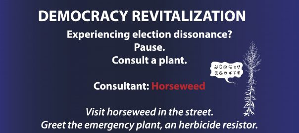


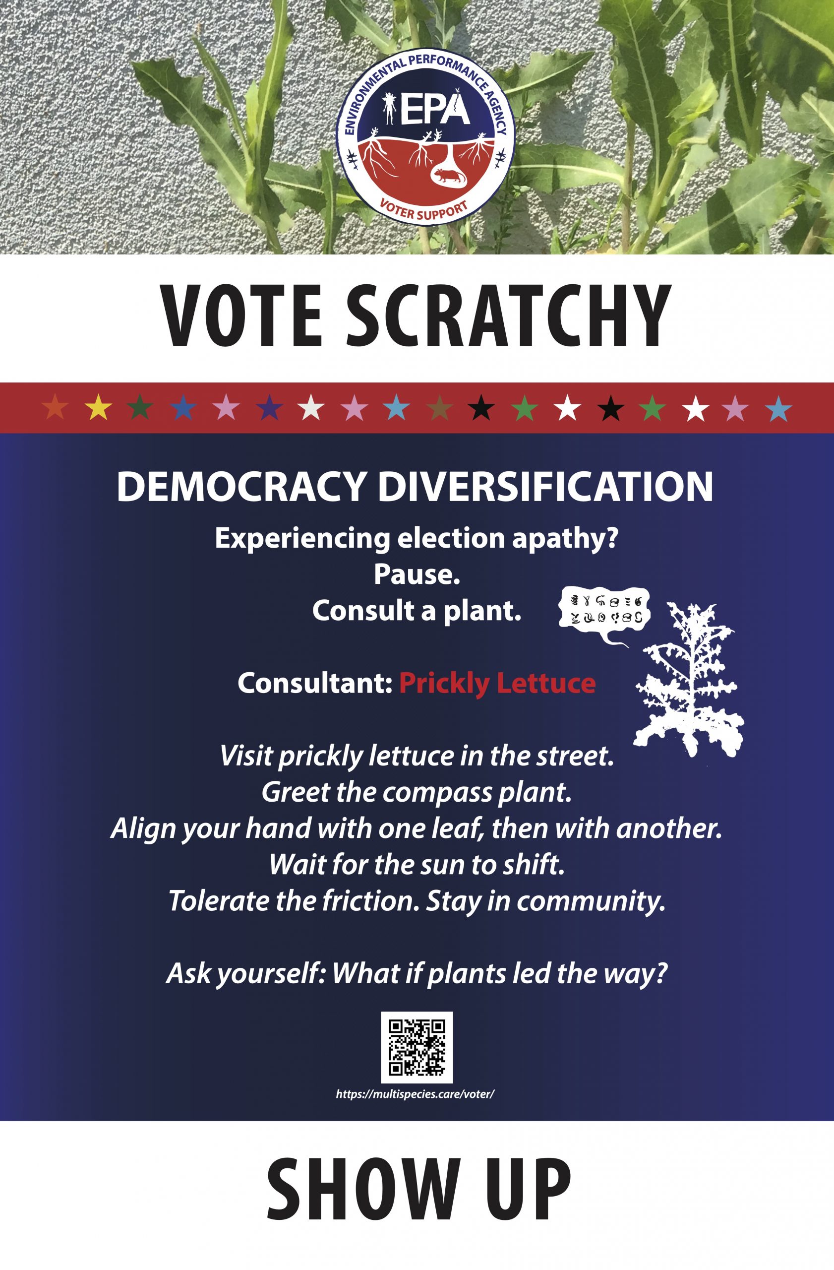
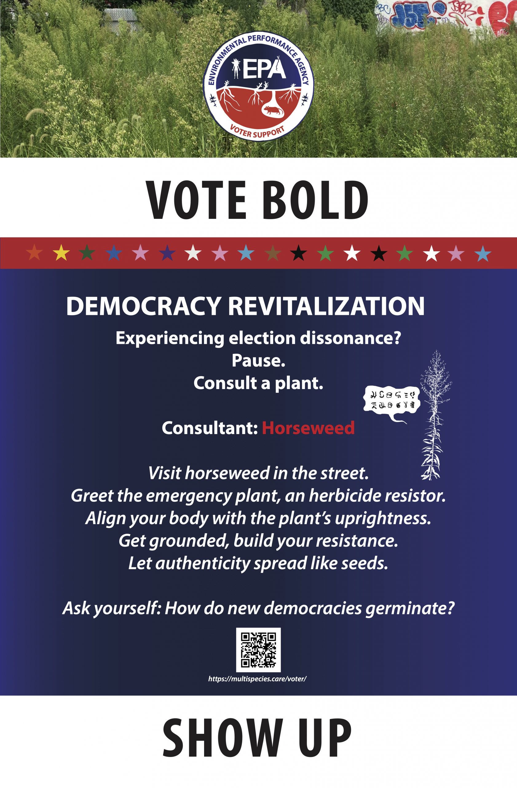
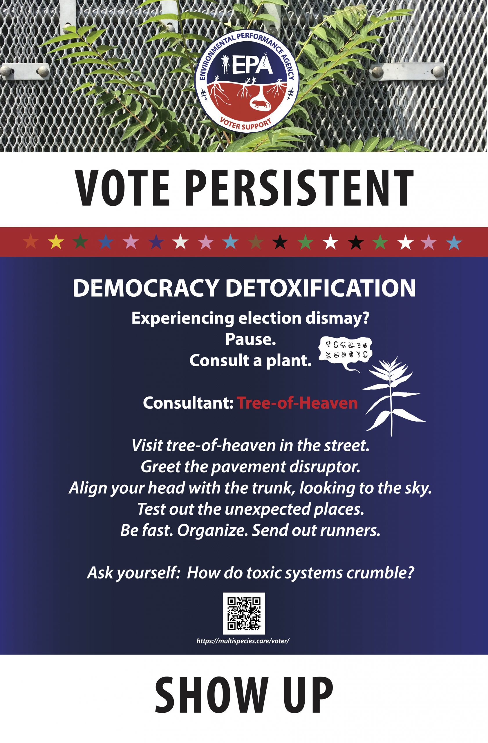

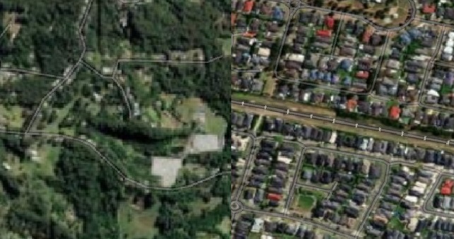

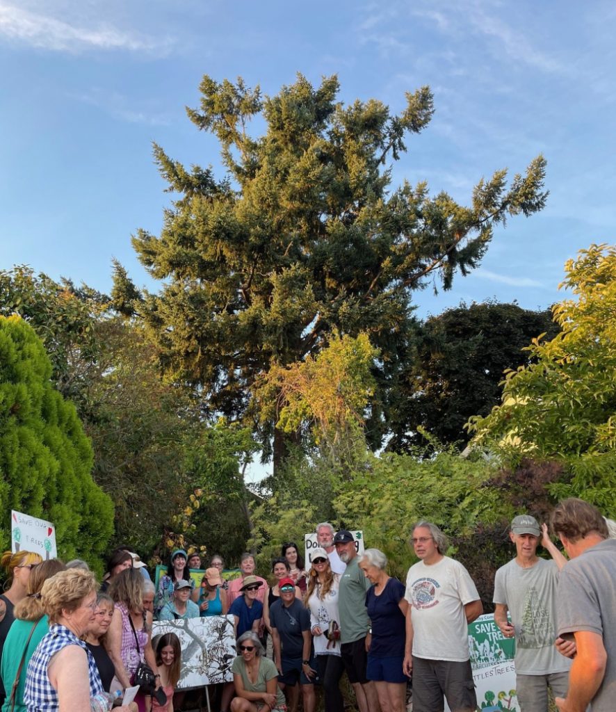
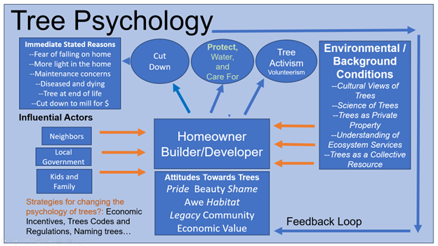 The diagram above is meant to suggest most importantly that there are many factors and influences that impinge on the choices we make about trees, individually and collectively, and also to help us begin to sort through some of the potential interventions that might change these outcomes.


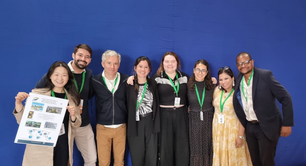
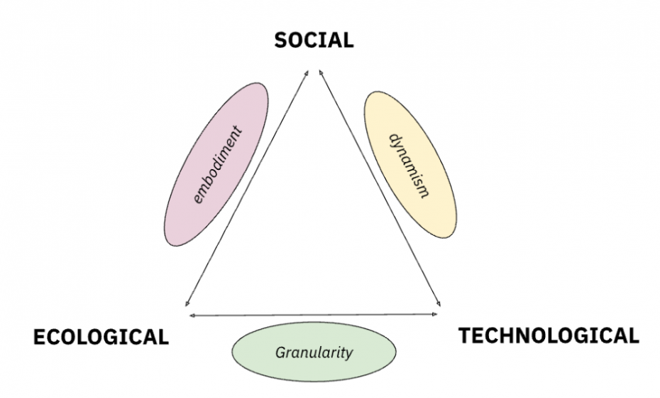
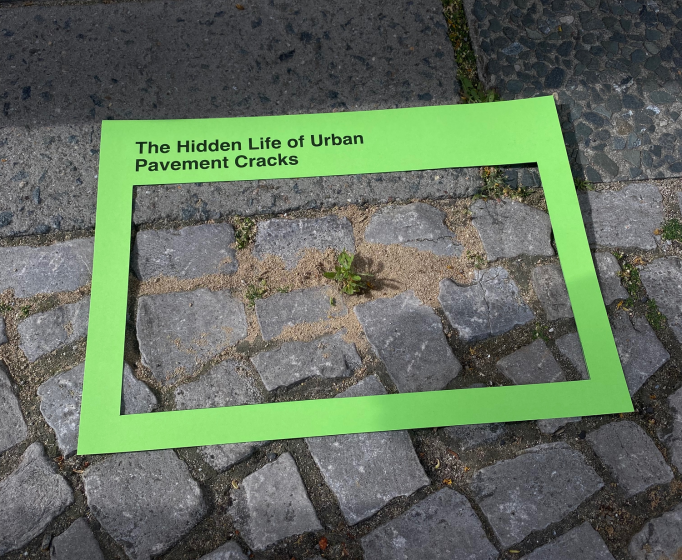
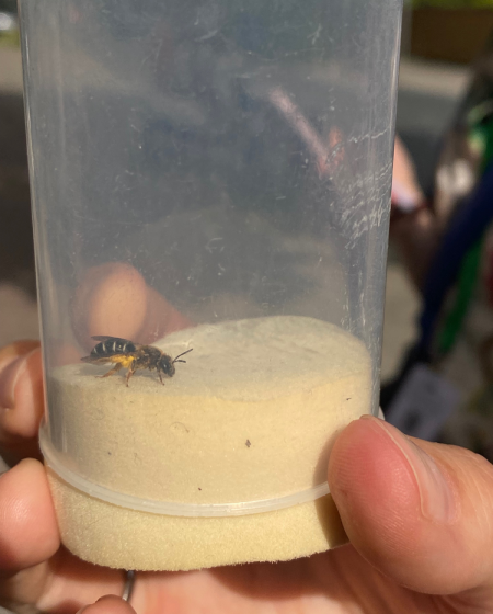

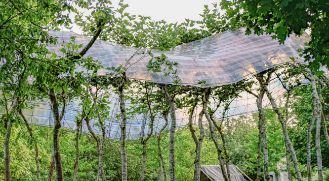
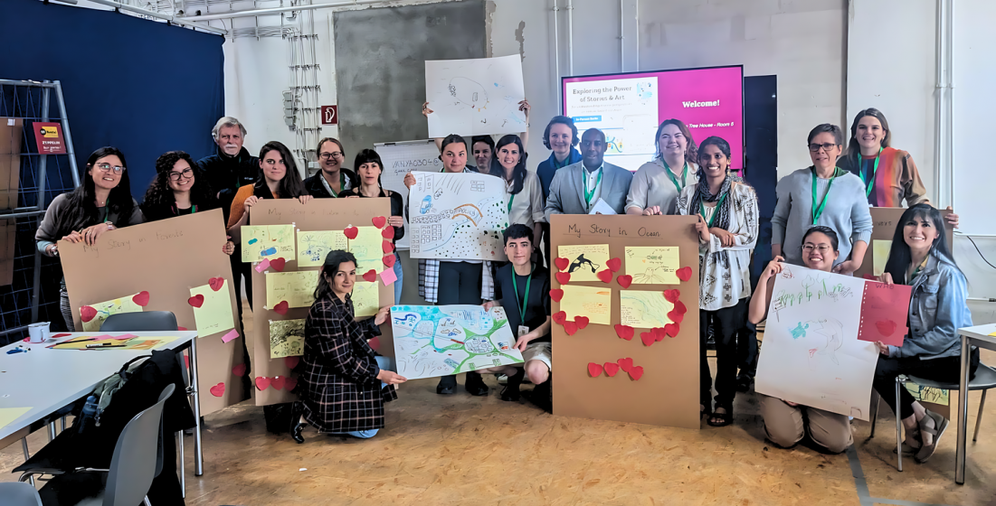
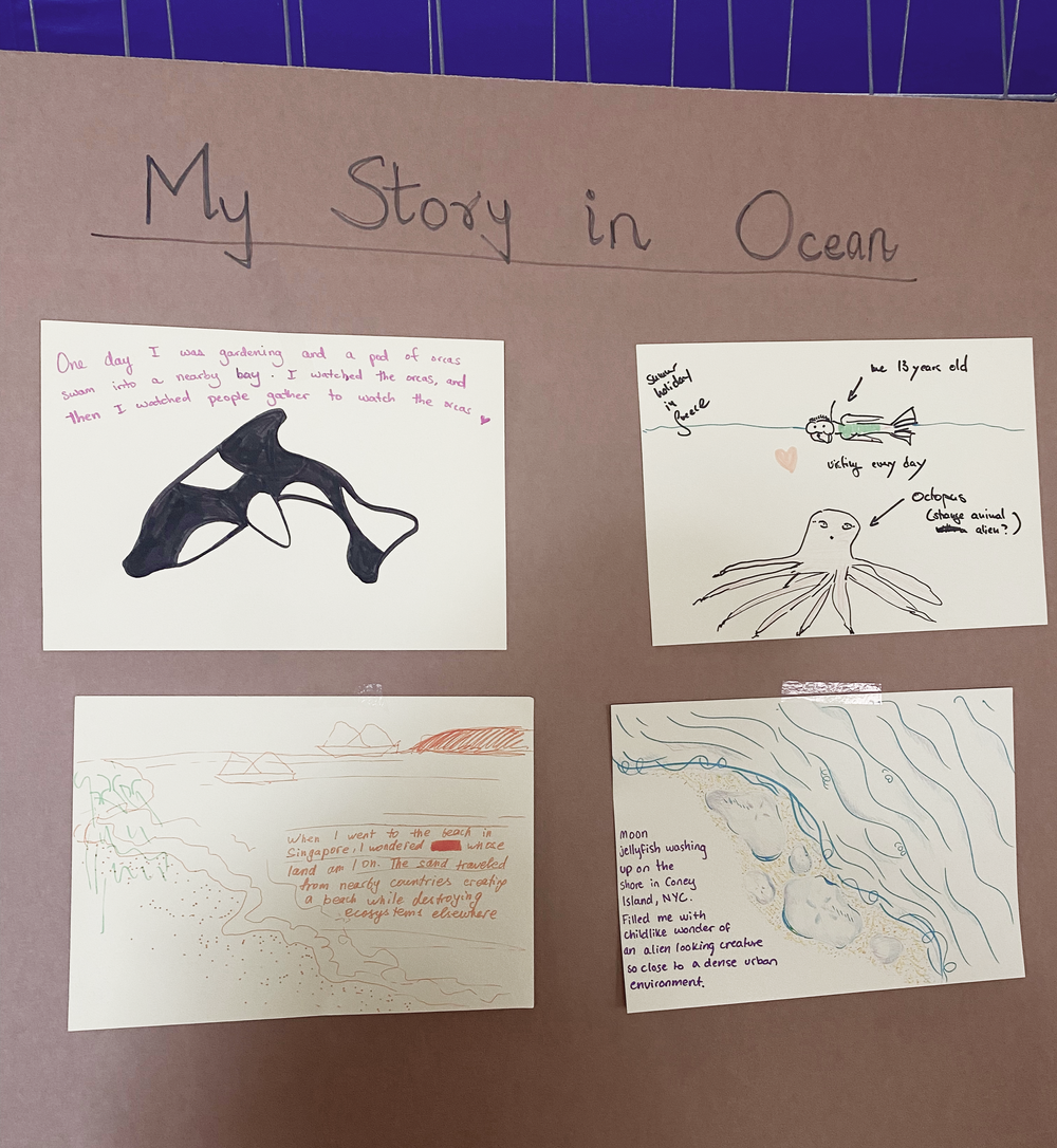
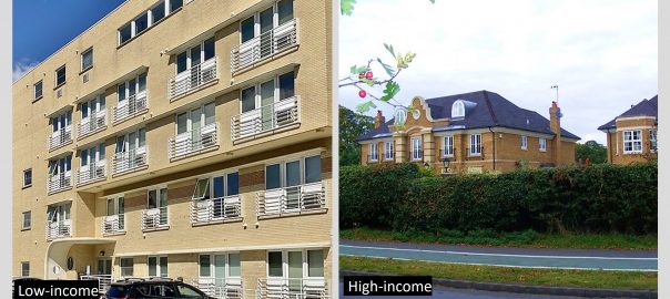
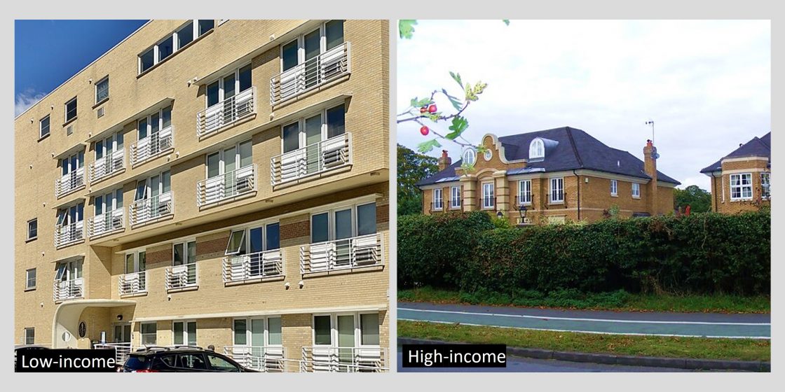


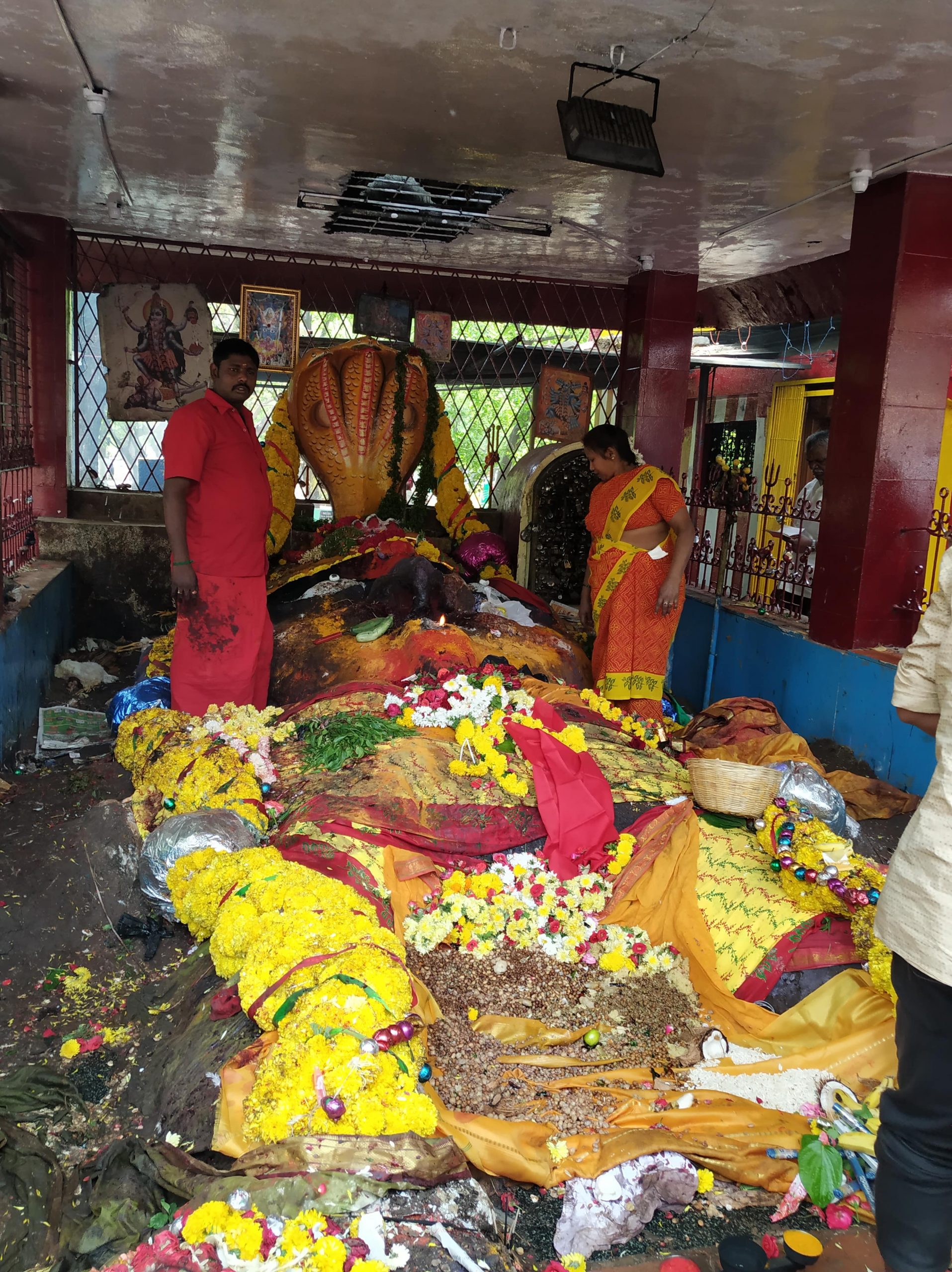


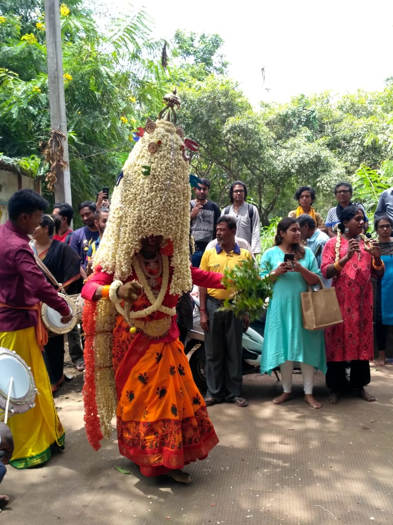

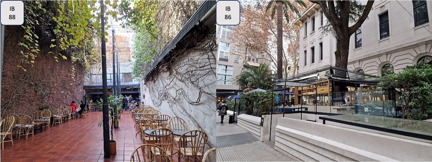


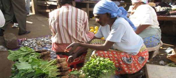
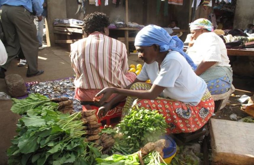
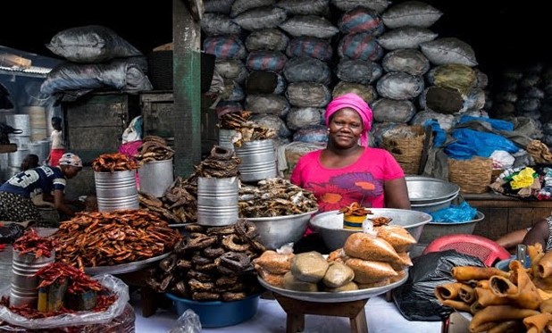

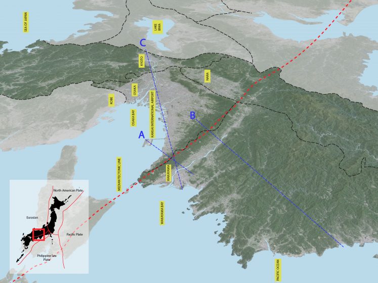
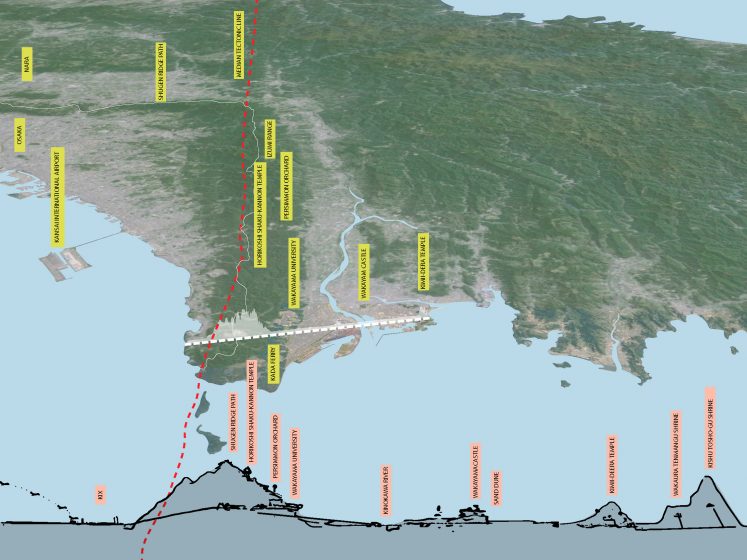

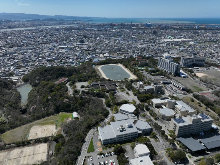
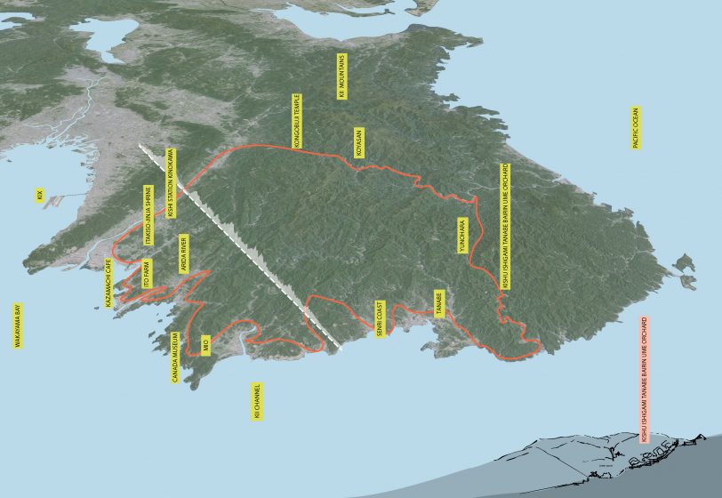
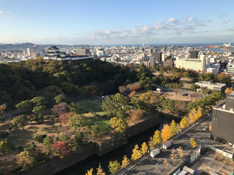
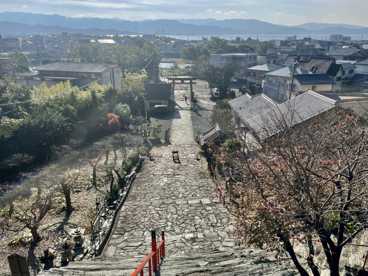

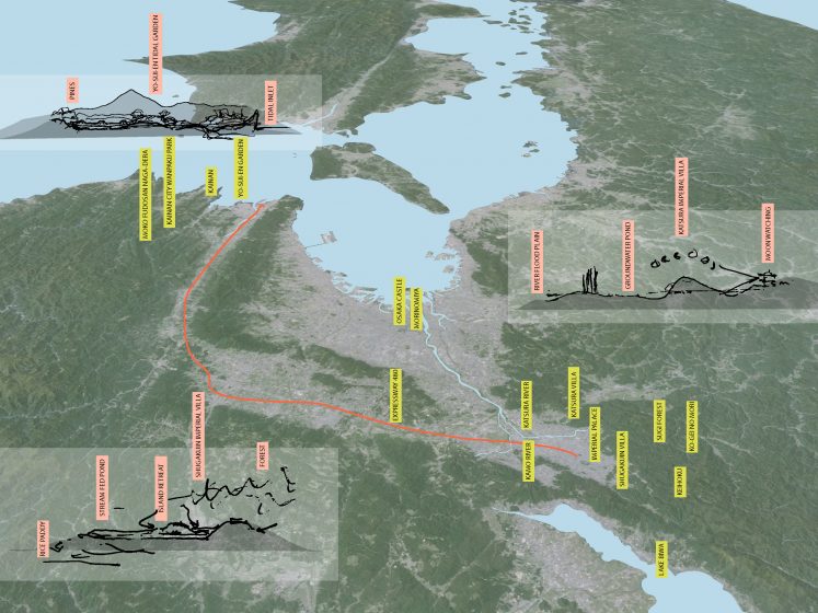


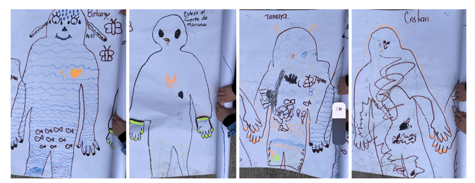


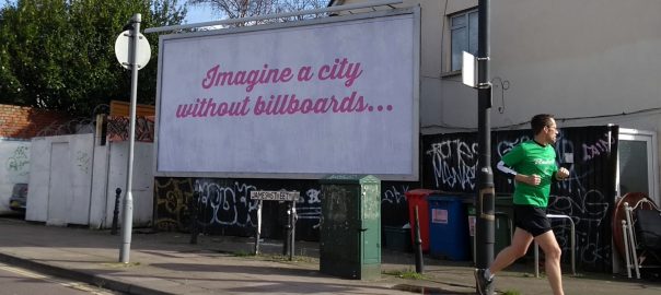
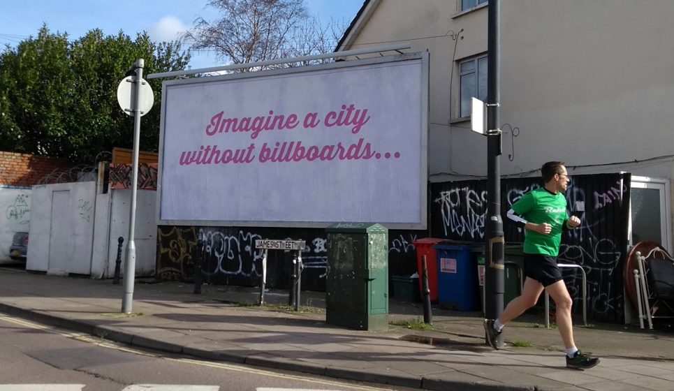


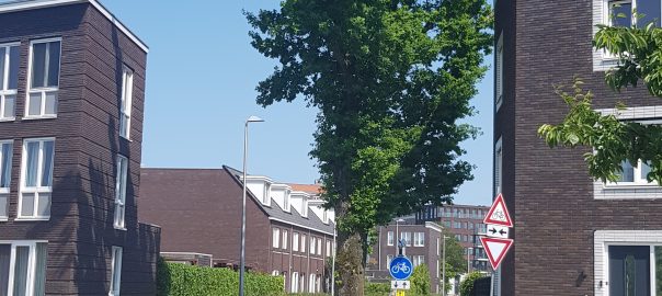
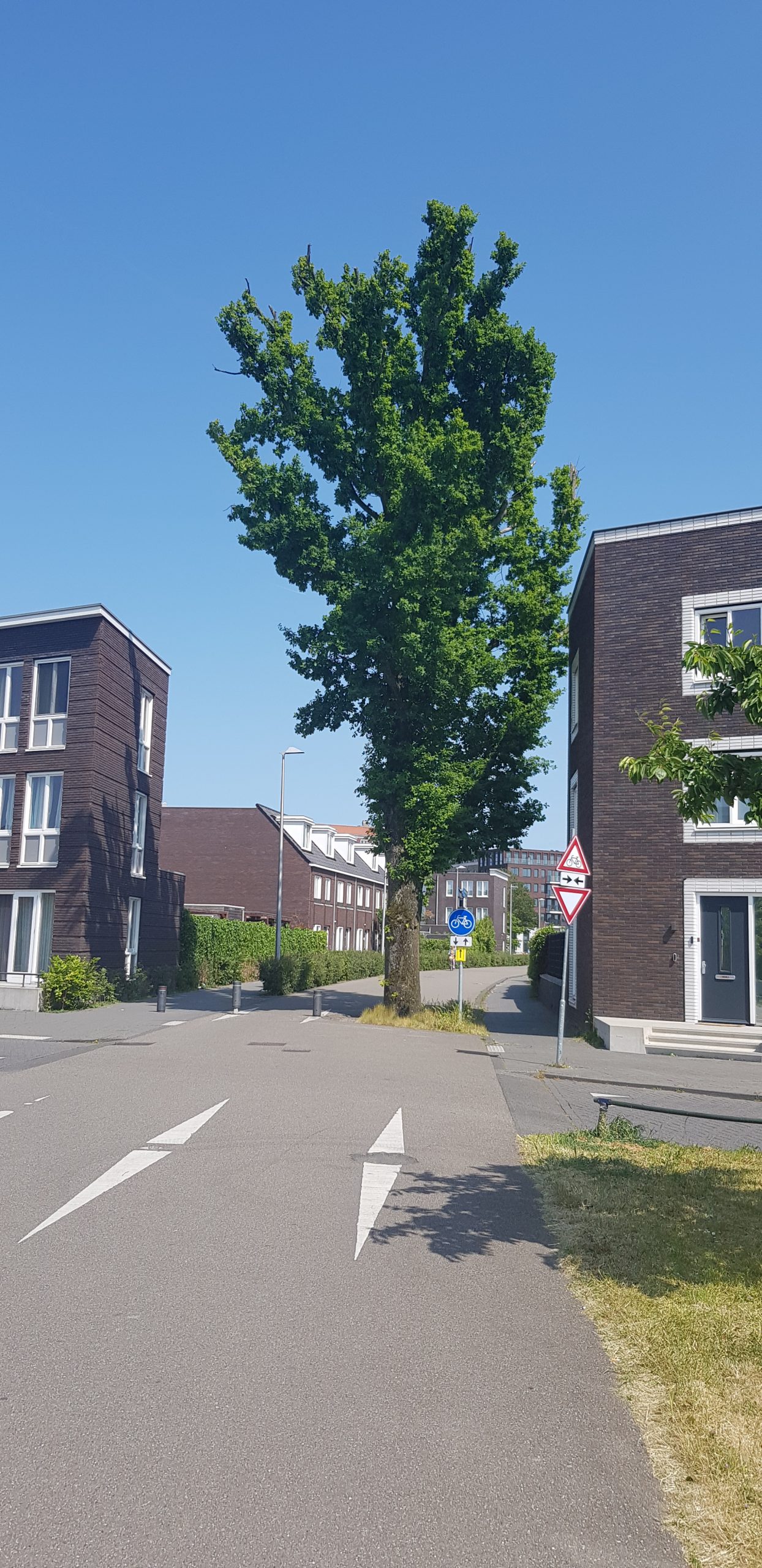

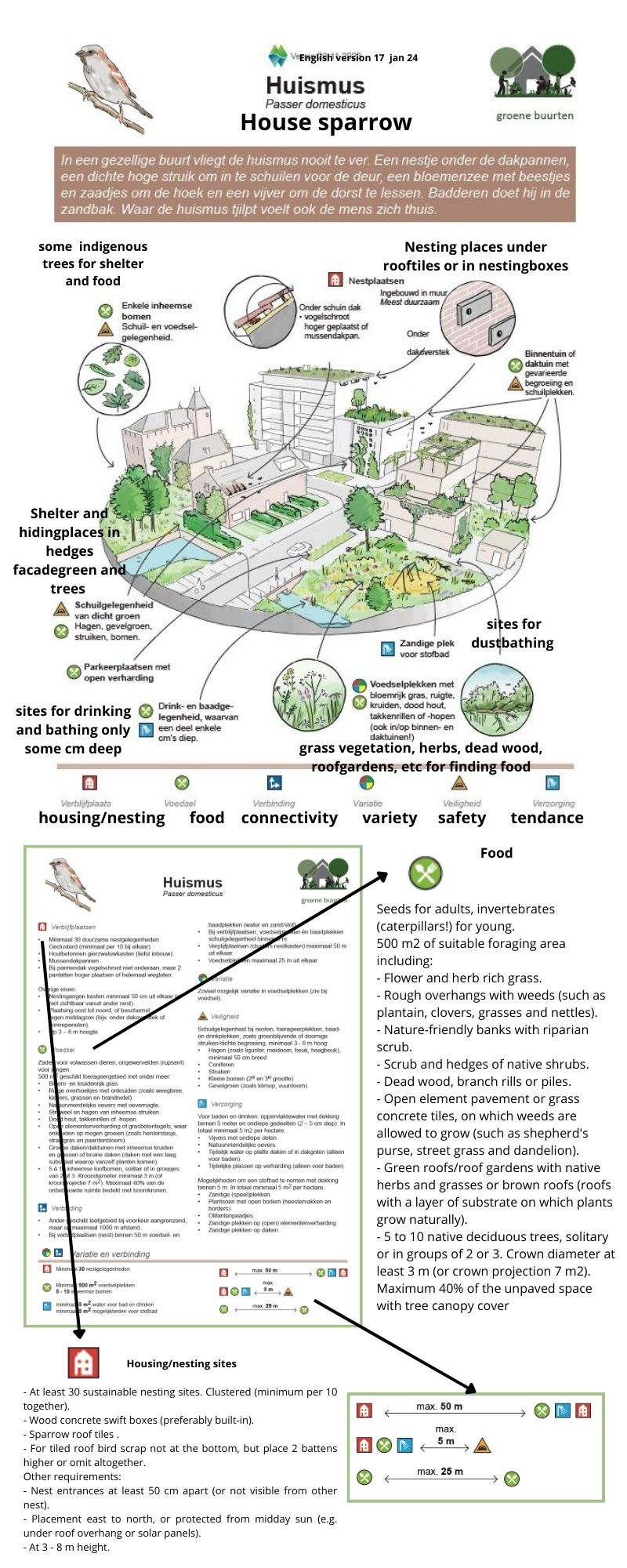
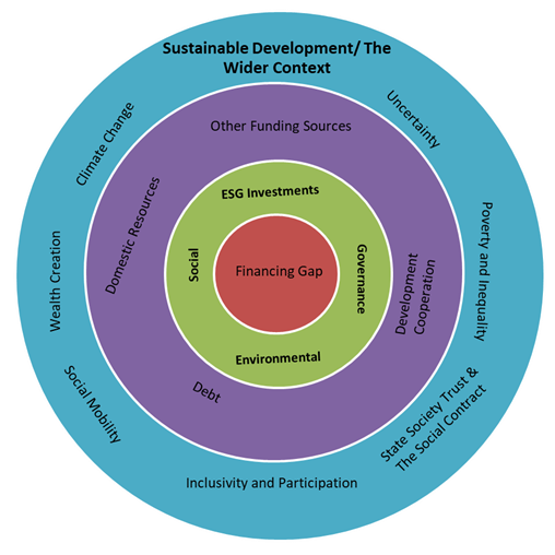


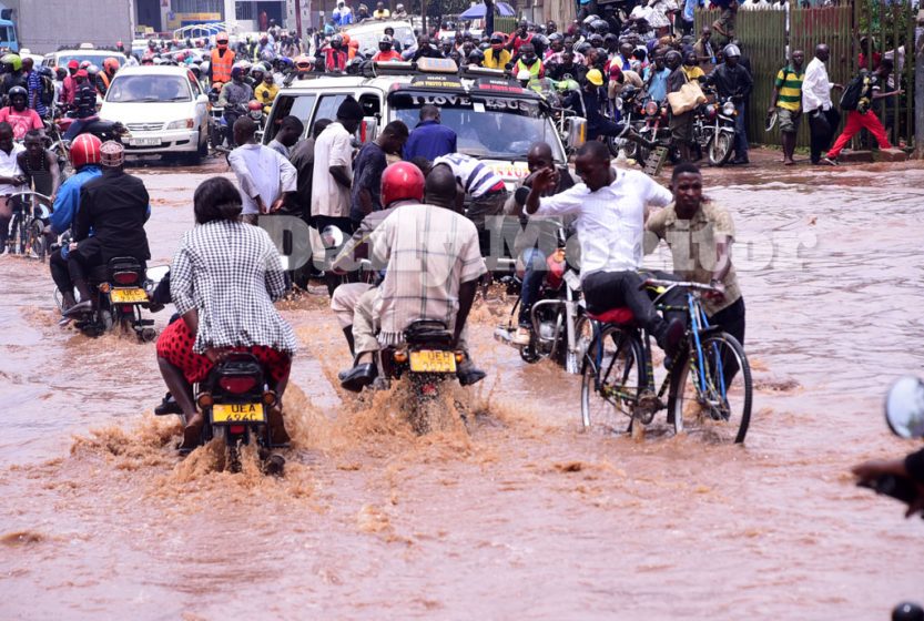
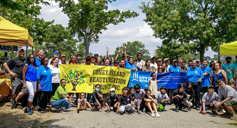
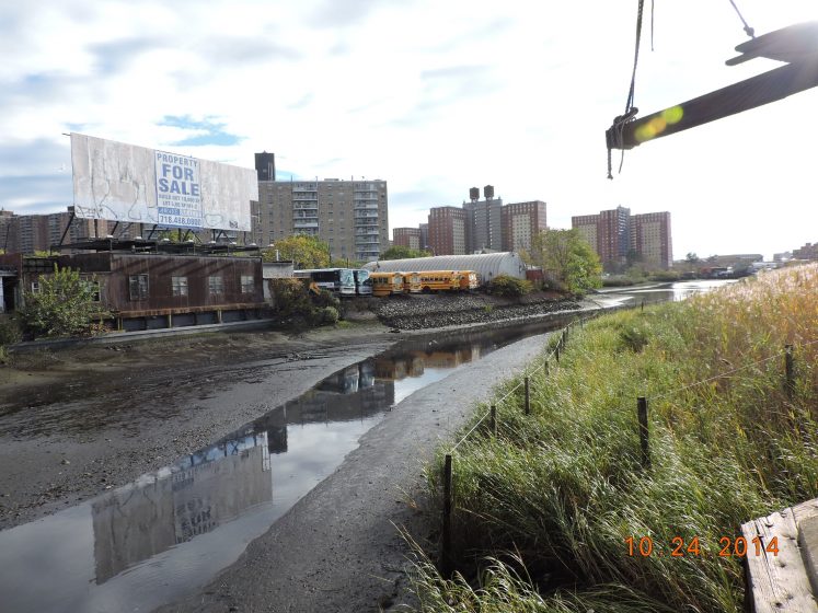


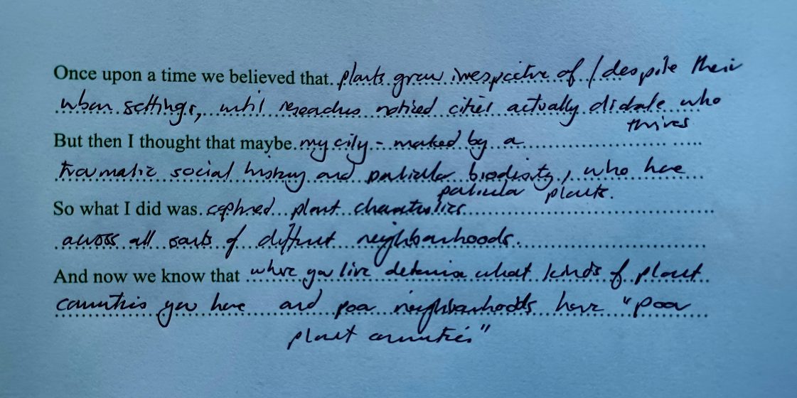
 Can we tell better and more engaging stories about our environmental and social challenges? Can we widen the circle of people who read such stories and take action? Can we use them for education and engagement? Can they create good and entertaining and useful stories? Yes, we can. Although the comics landscape is dominated by superheroes doing classic superhero things, there is a growing movement of comics that have environmental and social justice aims. Comics offer a unique and effective platform for addressing social and environmental challenges through storytelling. The combination of visuals and narratives in comics provides a dynamic and engaging medium to convey complex issues in a compelling manner.
 For SPROUT’s third issue, the editors were inspired by The Nature of Cities’ (TNOC) recent art exhibition,
  We invite you to embark on an artistic journey framed like a short tale, narrated by the artist Carmen Bouyer and made possible by The Nature of Cities team. This story bridges the urban and the rural in a quest to create art forms that connect us with the larger landscape. The story is an invitation to imagine our own very personal ways to listen and connect with the places we inhabit. Here we will follow the artist’s story of coming home to the Paris region in France after years of living abroad in cities. As many urbanites in Western European cities, Carmen had the feeling that the cultures of relating with the land there were lost since a long time.

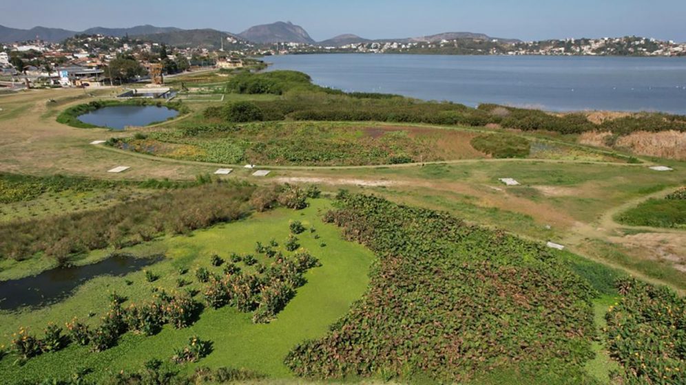

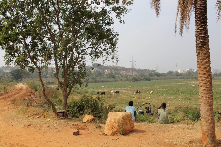
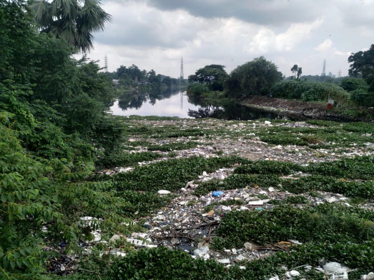

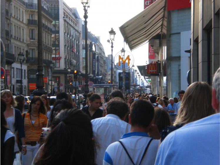
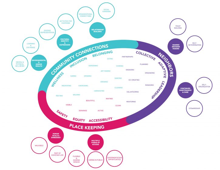

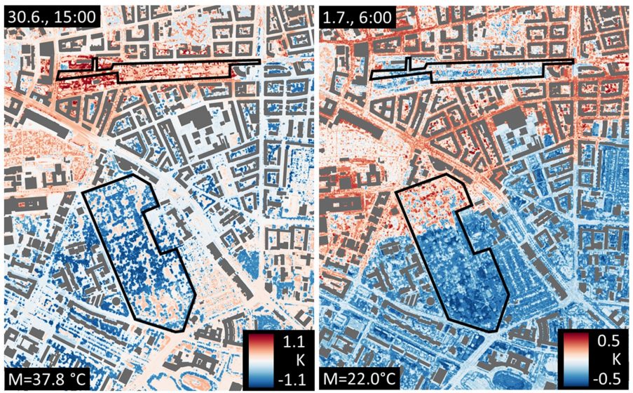


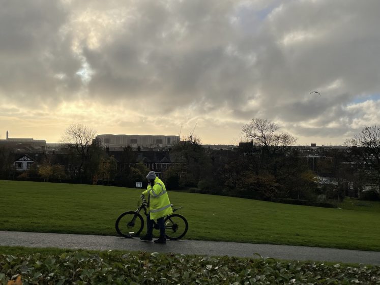
Add a Comment
Join our conversation