Neural Networks—A New Model for “The Kind of Problem a City Is”

Art, Science, Action: Green Cities Re-imagined
The non-linearity of neural networks provides a useful illustration of how details can matter in complex systems, but also of the importance of iteration for adaptation. Is it possible for our cities to learn and adapt as neural networks do?

Jane Jacobs’ final chapter of Death and Life of Great American Cities, titled “The Kind of Problem a City Is”, remains its most misunderstood. The principal ideas of the book have become the mainstream of urban know-how and helped the triumphant turnarounds in the fortunes of American cities, most notably for New York City. But the last idea in the book—that the scientific foundation that is the basis of the planning profession is founded in error—has not had the same impact. The debate over the scientific basis of urban planning was set aside.

To explain why, I could refer to Thomas Kuhn’s theory of paradigm shifts, which states that a discredited paradigm, even though no one believes its conclusions any longer, cannot disappear until a new, more effective paradigm appears. But Jane Jacobs already had a proposed paradigm for a science of cities. She described it as a problem of “organised complexity”, much like biology, contrasted with problems of “disorganised complexity” that are tractable with linear statistical modeling, and problems of simplicity, or constant relationships between variables (Jacobs p. 429).

A likely explanation for the remaining mystery is that the tools of organized complexity science had not become mature enough to be relatable to urban planners, while statistical science was a hundred years old.

We struggled for decades to express problems of organized complexity in formal mathematics, but recent breakthroughs in computer science have provided models that successfully replicate the behavior of biological neural systems. The artificial neural network is now a workhorse technology for some of the world’s biggest enterprises and should be considered an inspiration from which a science of cities can be built. Before we can explain how let’s first provide an illustration of artificial neural networks and how they are constructed from systems that solve for disorganized complexity and simplicity.

Problems of simplicity

These are the classic two, or three, variable problems that began the scientific revolution. Since Newton was hit on the head by an apple, we have known, among other problems, how to measure precisely how much work needs to go into a device to lift a specific weight, as long as we can measure the weight. That is a linear law between two variables. Another classic expression of a problem of simplicity is e=mc2—once we know the mass of an object, we can derive its potential energy by plugging it into the equation.

What distinguishes problems of simplicity from those more complex are their use of constants—we know precisely how the gravity of Earth affects motion, at the rate 9.807 m/s², and that doesn’t fluctuate over time, though it’s different on the Moon.

Problems of disorganized complexity

These are problems that appear to present random relationships, but that can be tackled statistically and described as an average relationship. For example, when conducting studies on the efficacy of new medicine, the measurements of the results are not precise enough that a single observation can confirm or refute its efficacy. We need to measure a whole population against a control group, and different statistical measures are used to establish whether or not the medicine worked. The most widespread technique for tackling the solution to such problems is called a linear regression. It has successful applications in both science and business.

A linear regression starts from a table of known data points, such as the prices of multiple apartments on the market combined with their area, and whether or not they are in a particular neighborhood. Is it possible to devise a “law” that predicts whether or not an apartment will be in this particular neighborhood if we know only its price and area? Using linear regression, we can estimate the relationship, on average, between these variables, by plugging in different multipliers for the input variables and finding the two multipliers that are the least-wrong over the whole table of known values, meaning they produce the real answer as closely as possible as often as possible. (Different algorithms and techniques exist to produce this kind of result.)

Linear regression, and other such statistical estimation techniques, are the foundations of modern 20th-century science, and are used throughout scientific experiments to verify whether or not results are statistically significant. They are not as reliable as simple linear models, which will never present a significant statistical error in predicting the position of a planet, as one example. Thus, using these techniques implies a tolerance for error and confidence in the value of an average.

Nonetheless, this is what modernist planners thought gave them authority. They knew the numbers and could determine precisely, if not exactly, how much sunlight the average human needed. They believed that if they gathered enough data points, they could solve all the averages in the system, and their policies would be beyond debate, a matter of scientific fact alone.

Of course, people build and live in cities for more than average reasons. There are no average households and businesses, just average measurements. This idea is what Jane Jacobs spent most of her words attacking in her chapter on complexity. Around that same time, the US Air Force conducted a statistical study that proved that there was no average pilot in their service after many pilots crashed because the cockpit, having been designed to average dimensions, obstructed them. The problem was resolved by developing an adjustable seat for the fighter jet, but the ideology of the average has been slow to fade away.

Problems of organized complexity

How can we arrive at a statistical model that accounts for all relevant details, without averaging them over? After Jane Jacobs published her book, computer scientists began exploring a system that they believed functioned much like neurons from a biological organism: the neural network.

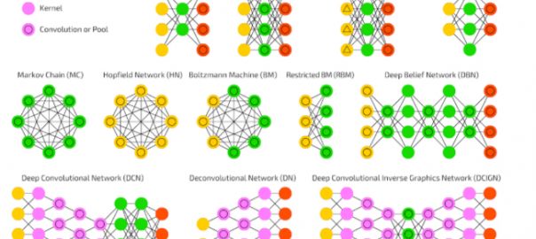
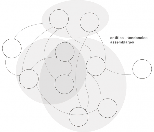
To understand neural networks, it is surprisingly easier to start from linear regression than it is to start from the biology of neurons. Recall that a linear regression model relates multiple input variables to a single output variable through error-minimizing coefficients, which we can picture as inputs (circles) combining to form an output (a circle) through multipliers (lines).

Illustration by author.

One of the characteristic flaws of linear regressions is their namesake linearity. They only work if the input always affects the output in the same proportion. In the neighborhood apartment example before, if the apartments in our neighborhood are either large and expensive or small and cheap, with no middle ground, a linear regression will not be able to draw any conclusions. What we need instead is a model that can keep track of details. In the complex world, some details matter sometimes but are irrelevant other times. The easy way to model these conditions is to connect many linear regressions using a middle “layer” of activations.

An activation is an intermediate prediction—instead of predicting whether an input corresponds to an apartment in our neighborhood, we predict how strongly this input activates another set of predictions. Only when a particular combination of inputs is “strong” does the middle layer provide its part of the output. Thus, when an apartment is small and cheap, an intermediate neuron activates, if it is large and expensive, a different intermediate neuron activates, and the linear sum of those two neurons tells us whether or not a specific apartment is in our neighborhood.
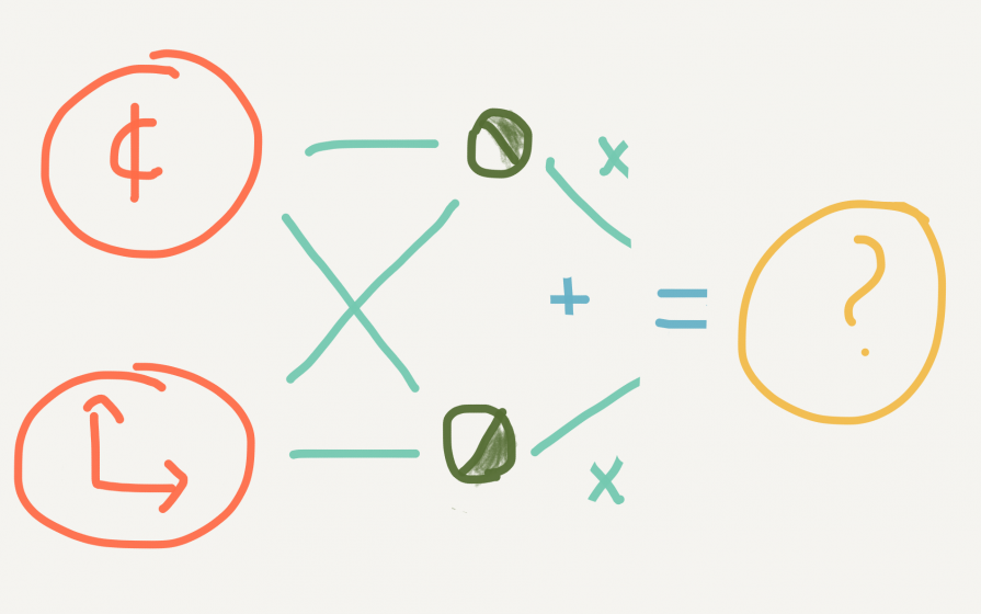
Illustration by author.

Neural networks had limited success for decades after their invention, being applied mainly by the postal services to read the handwritten addresses on letters, until scientists began assembling them with very large numbers of activation layers, in so-called “deep learning” models. They could do this because computational power and speed increased dramatically and they now can afford to run exponentially increasing iterations. The result is an explosion of applications in advanced pattern detection, from identifying fraudulent financial transactions, to filtering spam email, to suggesting movies you might enjoy watching right now, or identifying which of your friends appears in a picture someone took at your birthday party.

The success of deep learning on large data sets had two interesting outcomes. First, there is no longer any clean mathematical description of the solution to such a network. The state-of-the-art algorithm to train them is called stochastic gradient descent, which is a fancy way of saying that the coefficients are iterated by a random amount of error correction until they fall into place (or like shaking a box until it stops rattling).

The second outcome is that it becomes practically impossible to understand how the model makes its predictions. We can look at them and be amazed or amused only.

The focus on building up predictions using combinations of small details can produce results that seem to us absurd. For instance, here are many pictures of dogs and muffins that are highly similar. The world’s most complex neural networks struggle to tell them apart.

Powerful cloud computers are in intense competition to see who can best tell apart a chihuahua from muffins. Source: Chihuahua or muffin? My search for the best computer vision API.

This shows that an enormous gap remains between machine intelligence and human intelligence. We know so much about context that it is obvious to us when a chihuahua differs from a muffin, but the machine knows only pixels and how they combine into activation patterns.

The interesting fact, however, is how efficient this machine is at combining its ability to identify muffins with its ability to identify dogs. Its first layers activate almost identically for both kinds of pictures because at that level of detail they are nearly the same. This means that the more layers of complexity a neural network is built from, the more it is able to retrain to answer wildly different, or never yet encountered questions, so long as the basic patterns of those questions match patterns that were encountered before.

The kind of system a city is

How does this help us understand cities and problems of organized complexity in general? I am not suggesting that cities are neural networks, but that they both belong to the category of complex adaptive systems, and show similarities in behavior. The non-linearity of neural networks provides a useful illustration of how details can matter in complex systems, but also of the importance of iteration for adaptation. Many problems can share details yet resemble nothing at the large scale, such as the problems of identifying muffins or dogs in pictures. It turns out that a system trained in one area can quickly adapt to the other. It also turns out that we can’t really plan for these outcomes.

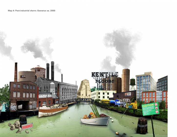
As an example of how this works for cities, the decades following the publication of Death and Life of Great American Cities saw the end of a particular kind of harbor-industrial economy, notably along the harbor of New York. The city was left with warehouse after empty warehouse, an emblem of the decline of cities until some adventurous citizens began repurposing them as workshops and condominiums. The industrial city, while preserving some of its details, completely shed its industrial function and soared back to life as a new form of urban living.

It turns out that the city is not a machine for living or a machine for production, but it is a learning machine, exactly like an artificial neural network learns. A few cycles after the activations for industry stopped, the system found a new path to iterate on while preserving the bulk of its structure.

There is another field where the distinction between linear models and complex models matters greatly: agriculture. Linear agriculture was championed by the United States government in the 20th century for its simplicity and the abundance it produced. All a farmer needed to know was that combining specific land, machinery, fertilizers and pesticides (the inputs) could greatly increase the yield of a crop (the output). The agronomist Norman Borlaug was even given a Nobel prize for inventing a particular combination of inputs that led to wheat being practically free to purchase for the average family. Linear agriculture was driven to its absurd extremes in the Soviet Union, where large state-owned farms could specialise in such narrow crops as beet seeds, under the theory that ever larger and more specialized farms would produce even better yields.

Organic farmers rebelled against this model because they considered it unsustainable, meaning it could not be retrained to adapt to changing conditions. Organic farming’s product is not a commodity crop but the vitality of the soil itself and its ability to produce again, the equivalent of training the middle layers of the neural network or improving the streets of a city to invite buildings of an unspecified type. Organic farmers thus produce what is best to improve the soil, and their main challenge is finding markets for those products, instead of optimizing for existing commodity markets by refining the inputs.

The urgency of thinking of cities in terms of complex or organic models has now moved from industrial cities, which have completely transformed and reinvented themselves and in essence are learning how to learn or become organic, to the suburban sprawl cities that are now finishing their first lifecycle and have never had to endure loss of purpose. Becoming a complex system is learning how to change, and when the next unexpected cycle occurs those cities that have already been through major change start with a strong advantage over those that have always followed the same path.
 

The current panic over a retail “apocalypse”, the collapse in demand for simple suburban stores while the online retailers whose headquarters are anchored in cities soar in value, shows just how far we have come in the transformation of the industrial city. The end of suburban retail should be seen as both a crisis and an opportunity. What new purpose can be devised for the shuttered buildings and parking lots? They typically occupy the most central areas (in fractal terms) of many automobile-oriented cities and should be apt to fulfill any number of purposes. The one thing standing in the way of their re-adaptation are laws stating that their sole purpose is retail, now and forever. Such laws could be repealed overnight. Can these areas produce learning and iteration instead?

After the retail apocalypse is the office park apocalypse and the housing subdivision apocalypse, as they both reach the end of their initial lifecycle. The lessons learned by the retail zones will be crucial to the adaptation of the other two, and may even prevent an apocalyptic outcome by encouraging local inhabitants to welcome change in their environment. Urban planners increasingly must rely on complexity science to inform the decisions that these communities will make, since those decisions make no sense under any other scientific paradigm.

Mathieu Héile
Montréal

On The Nature of Cities

Tracking Resilience Trade-offs: Let’s Build a Crowdsourced Global Database

Art, Science, Action: Green Cities Re-imagined

It is important to examine not only the relationship between sustainability and resilience, but also the embedded cross-scale effects of decisions about whose future should be made more sustainable or resilient.

In recent years, city plansinternational organizationsprivate foundations, and policy discourse more broadly have presented resilience as a necessary characteristic for communities to cope with natural hazards and climate change. Numerous cities around the world are now developing resilience strategies or implementing policies with the stated aim of becoming more resilient.

Resilience agendas and efforts are often justified by the need to guarantee security, reduce risks, and foster sustainability. A more critical take on the “resilience renaissance”, however, suggests that resilience may be a more appealing goal for policymakers because it focuses our attention on managing short-term threats and maintaining the status quo, rather than system transformations required for long-term sustainability.

We can debate the underlying motivation, but there is no doubt that more and more cities are striving to become resilient. In the policy realm, this is widely heralded as a positive development. Within the academic literature, there is greater disagreement about the merits of resilience.

We appreciate these critiques but also see that they have not stymied cities’ resilience policies. In a recent paper, Chelleri and colleagues argue for a more critical and nuanced approach to urban resilience: one that recognizes that many urban policies prioritize certain risks, groups or scales at the expense of others, and acknowledges, documents, and negotiates these trade-offs. Unfortunately, to-date there has been limited research on resilience trade-offs. Published studies suggest that resilience-related strategies seeking to reduce the exposure or sensitivity to certain stresses can exacerbate existing inequalities by disproportionately affecting disadvantaged groups or favoring the interests of others.

This is where our new project comes in.

Leveraging the Urban Resilience Research Network (a virtual platform with more than 250 members), we are crowdsourcing case studies of trade-offs that emerge in resilience-building efforts from all over the world. We will analyse the results to identify common trade-off patterns and to develop a trade-off typology. This can help decision-makers to think through the potential unintended or undesirable consequences of resilience policies and to be transparent about who they seek to benefit and at what scale (resilience for whom, what, when, where, and why?).

What is an urban resilience trade-off?

An urban resilience trade-off occurs when an effort to build resilience by increasing adaptive capacity and/or reducing sensitivity and/or reducing exposure leads to a reduction in adaptive capacity and/or an increase in sensitivity and/or exposure at another spatial or temporal scale, for other individual(s), or to another threat. These trade-offs can occur across spatial scales (one community or city enhances its resilience at the cost of increasing the vulnerability of other places), groups (one group’s resilience increases the vulnerability of others), between threats (when a solution to, e.g., drought implies increasing social fiscal pressures), or even across temporal scales (when a short-term solution results in the lock-in of a particular unsustainable trajectory). As this last point suggests, there can also be trade-offs between resilience and sustainability, a tension that has been discussed in prior TNOC posts.

It is helpful to examine these dynamics in the context of a current eventAt the time of writing, “day zero” was rapidly approaching in Cape Town—the day when the taps of four million inhabitants could have run dry because of a historic drought. After almost three years of diminishing rainfall, and notwithstanding recent water use restrictions, the city should have been prepared for this contingency. Indeed, the city is actively working on water transfers, an emergency plan for day zero, and four desalination plants that should already be operational. While day zero has very recently been indefinitely delayed, discussions continue about long-term policies for reframing water management. When addressing these pressing water concerns, however, city officials should consider other aspects of resilience and sustainability beyond the current drought emergency. For example, the energy required to operate new desalination plants could threaten energy resilience and sustainability in a country where electricity is primarily generated from fossil fuels, and long-term supply continuity is unreliable.

In this example, enhancing resilience to one threat may undermine resilience in another system and have negative environmental consequences, thus illustrating a potential trade-off between urban resilience and sustainability. Additionally, the media and policymakers’ focus on the potential day zero heightens local debates about whose needs are most urgent and how funding is prioritized to guarantee fresh water from dams or desalination plants, all within a context of persistent urban informality. Indeed, informal settlements have long had to grapple with periodical flooding and sub-standard water, energy, and sanitation facilities.

Trade-offs related to ‘resilience for whom’ often extend far beyond municipal boundaries. In Morocco, for example, solar power plants built in the semiarid south through the DESERTEC project aim to provide renewable solar power to Europe. However, as reported in a recent publication, the Ouarzazate solar plant almost doubled water consumption in the region, resulting in a dramatic increase in the social-ecological vulnerability of neighbouring oases and increased urban migration.

These two examples highlight the need to examine not only the relationship between sustainability and resilience, but also the embedded cross-scale effects of decisions regarding whose future should be made more sustainable or resilient.

How and why to contribute to our database

To engender these critical discussions, the Urban Resilience Research Network (URNet) is opening a new section on its website featuring short case studies of urban resilience trade-offs. The aim is to gather evidence from different parts of the world, illustrating these trade-offs and lessons learned from urban resilience implementation. The global database will be presented in Barcelona, during the international conference entitled “Reframing Urban Resilience Implementation”, co-organized by URNet, UN Habitat City Resilience Profiling Program, the Universitat Internacional de Catalunya (UIC), and the International Forum of Urbanism (IFoU). We encourage every scholar, practitioner, or individual critical of “business as usual” framings of resilience to contribute to our database and help advance our collective understanding of the (un)intended consequences of resilience efforts. Simply fill out our short questionnaire (it should take no more than 10 minutes to complete) and your thoughts and case studies can be published on the URNet website and presented and discussed at the Barcelona conference, thereby contributing to international debates on resilience. We thank you in advance for helping us reframe resilience to avoid trade-offs and better align resilience, sustainability and social justice.

Lorenzo Chelleri & Sara Meerow
Barcelona & Tempe

On The Nature of Cities

Sara Meerow

about the writer
Sara Meerow

Sara Meerow is an Assistant Professor in the School of Geographical Sciences and Urban Planning at Arizona State University. She is an interdisciplinary social-ecological systems scientist working at the intersection of urban geography and planning.

Positive Visions for Sustainable, Resilient, and Equitable Cities

Art, Science, Action: Green Cities Re-imagined

Societies need spaces for radical thinking to confront not only the climate-change challenges of the future, but also the present-day conditions that create, reinforce, and reproduce vulnerability.

It is beginning to feel like the anticipated future under climate change is even closer than we once thought. After a particularly harsh hurricane season in North America and following another year of record high global temperatures in 2017, many people recognize that we are entering a new climate reality. Current and projected trends in extreme weather events highlight the need for fundamental and transformative change, to improve living conditions for urban residents.

It seems increasingly clear that urbanization pressures and climate change are on a collision course in cities all over the world. Cities are influenced directly by climate change as they deal with increased extreme weather events such as tropical storms, hurricanes, flooding, heat waves, and prolonged droughts. Therefore, the need for adaptation takes on a particular urgency when it comes to municipal policy. Indeed, municipal governments might be best placed to mobilize resources in the face of sluggish international government agreements and the inaction of their federal counterparts. From coast to coast, municipalities big and small are developing ambitious climate action plans. For example, New York City famously vowed to divest billions of dollars for their pension funds from companies in the fossil fuel industry; San Diego is planning to be 100 percent renewable by 2035; San Francisco announced its plan to honor the Paris Agreement through a combination of strategies to reduce waste, increase sustainable transportation, switch to renewable energy, and improve urban tree canopy; meanwhile, Miami is elevating roads, upgrading stormwater infrastructure, and building sea walls in exposed areas.

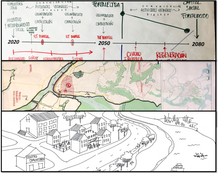
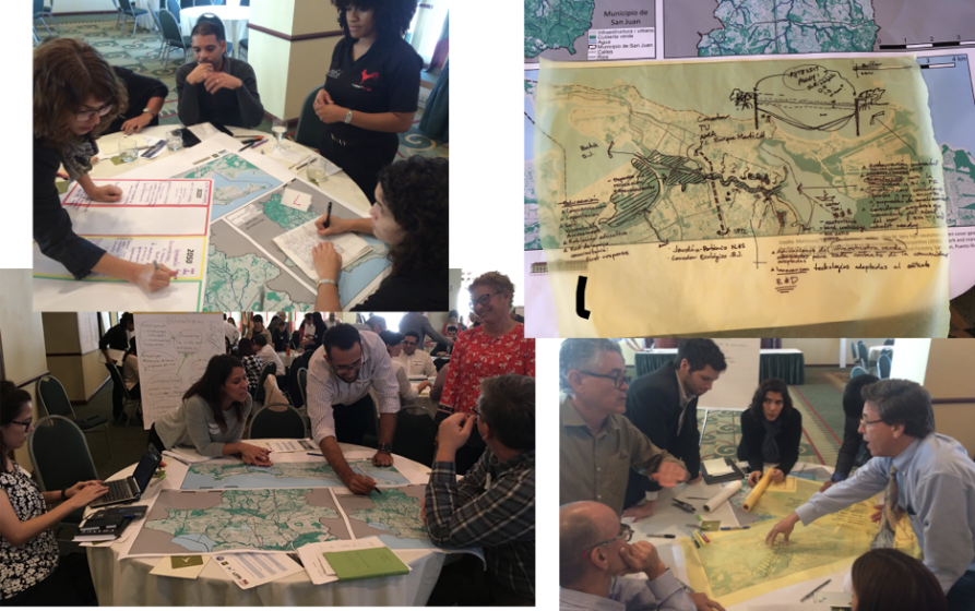
Out of this need emerged the Urban Resilience to Extreme Events Sustainability Research Network (UREx SRN), formed in 2015 with funding from the US National Science Foundation. Bringing together over 100 researchers and practitioners in ten Latin American and North American cities, the UREx SRN’s mission is to build sustainable, resilient, and equitable futures. Working with communities and residents to develop positive visions of the future is a critical component of resilience and sustainability planning, providing an opportunity to step outside the dominant dystopian narratives of our futures and to develop pathways from the present to a good Anthropocene. A keystone of the UREx SRN approach is a series of workshops in each of the network cities, in which scenarios are co-developed. The “movers and shakers” of municipal decision-making are invited, thus bringing together municipal officials, a broad spectrum of civil society groups, community leaders, and sometimes residents. Developing the workshops in partnership with municipal actors who have a pulse on the city allows us to ensure that the scenarios support ongoing processes and future planning. For instance, if a city is extending a light-rail line, we may choose to create a scenario dealing with transit and connectivity to explore the impact of alternative policies. Workshops yield rich data in a variety of formats —maps, timelines, transcripts, narratives, vignettes—from which representations of the future emerge.

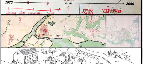
Figure 1: Outputs from scenario workshop from Valdivia (Chile). Top: timeline identifying when strategies will be implemented; middle: map of Valdivia physically situating strategies; bottom: illustration of one of the narratives. Photo: Authors

We have already completed scenario workshops in San Juan (Puerto Rico), Valdivia (Chile), Harlem (New York), and Hermosillo (Mexico), where a wide variety of positive visions emerged. For example, in San Juan participants envisioned a future of food and energy self-sufficiency for the island; in Harlem residents thought of a future in which their community was resilient to increasingly severe heat waves; in Valdivia participants imagined a new paradigm of “living with water” where people embraced their wetland ecosystems. In the next two years, we will conduct additional workshops with the cities of Phoenix (Arizona), Baltimore (Maryland), Syracuse (New York), Portland (Oregon), and Miami (Florida). Being at the halfway point, it seems fitting to offer some reflection on what we have experienced and learned thus far.

Figure 2: Participants in San Juan (Puerto Rico) working through different activities during a scenario workshop in 2016. Photo: Authors.

We have learned a lot about workshop design. By now, we have formalized our workflow even though we constantly adjust our activities based on feedback from facilitators. Our day starts with an exploration of historical trends and vulnerability from social, ecological, and technological perspectives. For instance, in our workshop in Hermosillo, we mapped together indicators of social vulnerability, alongside topographical analyses to identify low-lying areas, and information about the size and age of the water pipe infrastructure to show the parts of Hermosillo most vulnerable to urban flooding. Participants are assigned to tables that represent specific city imaginaries that we modify with our local team of city practitioners to make them relevant to their context. For example, the ever-popular green city imaginary might turn into the golden city imaginary for South Phoenix to reflect its desert environment and culture. The day is structured to go from formulating broad aspirations to identifying concrete strategies to developing rich narratives. Activities alternate between formal analytical and informal creative approaches to elicit different kinds of knowledge and information. Our outputs are multidimensional and complex. Building upon the participants’ stated goals and aspirations for their vision, during the workshop participants identify specific strategies to fulfill those goals, they construct timelines to determine when and how strategies will be deployed, draw maps of where they would implement strategies, outline governance actors who will be responsible or affected by the strategies, and finish up the day by creating a narrative about the future of that vision. Following the workshop, dynamic models capture the biophysical dimensions of the changes that stakeholders wish to see in their city. However, models are just one output, other products such as design renderings, vignettes, and qualitative analyses are used to explore the alternative scenario visions.

Our workshops are participatory and, by design, we invite a diverse group of municipal stakeholders to the table. This is our strength and our challenge. It is our strength in that we get a picture of the future that reflects truly interdisciplinary, rich, and nuanced points of view. However, it also presents a challenge. It is our challenge because participants do not have equal footing in the political landscape of their cities and these dynamics carry into our workshops, even when efforts are made to amplify marginalized voices. Furthermore, we recognize our privilege as researchers. Our positionality with respect to these stakeholder groups is sometimes uncomfortable as we find ourselves both confronting and participating in reproducing historical patterns of inequality. Even the very act of thinking about the long-term future can be seen as a privilege of those who have their immediate needs covered. We are also cognizant that the benefits of the workshop and the visioning exercise are likely to be unequally distributed among stakeholders in the room.

Thinking about transformational change is challenging. In our workshops, we have scenarios that are meant to address immediate challenges that cities face—e.g., flooding—and some scenarios that are intended to explore more utopian futures—e.g., a socially just city. We refer to the former as “adaptive scenarios” and the latter as “transformative scenarios”. However, even among the transformative visions, we encounter a lot of shorter-term thinking that fails to challenge the status quo. Myriad factors might explain the lack of more innovative ideas. For example, to push thinking outside of the box, people have to dare to suggest unusual things. It is indeed daring to say unusual things in front of a very diverse group of actors who may or may not know or trust one another. Having more homogenous groups can help participants feel more at ease and reduce fears of ridicule. Yet, the second ingredient of innovation has to do with the idea of “bricolage”, that is, the combining in creative ways things (methods, perspectives, problems, and interventions) that do not often go together. Finding the right mix is very much a work in progress.

So, why do we create these positive visions of the future? Fernando Birri’s[1] words on the need for utopia resonate with our purpose:

“Utopia is something that sits on the horizon. Every time you get ten steps closer, utopia seems to move ten steps further. No matter how much you walk, utopia will always be out of reach. So what’s the point of chasing utopias? Precisely that, it keeps you walking.”

We believe that societies need spaces for radical thinking to confront not only the climate-change challenges of the future but also the present-day conditions that create, reinforce, and reproduce vulnerability. While we feel that our scenario workshops can and should push the boundaries further, they nevertheless serve as spaces to produce complex, richly-described, world-building visions of a future that are full of nuance and tradeoffs. That is, we offer a model to open up the physical and mental spaces to imagine alternatives and to create a solution space where we can question critically the path that we are on. Visualizing positive futures is meant to inspire—but more importantly, it is meant to guide action and forge the necessary alliances to push for change.

Marta Berbés-Blázquez, Tempe, David M. Iwaniec, Atlanta,
Nancy B. Grimm, Phoneix & Timon McPhearson, New York City

On The Nature of Cities

David Iwaniec

about the writer
David Iwaniec

David Iwaniec is Assistant Professor of urban sustainability at the Urban Studies Institute and Andrew Young School of Policy Studies at Georgia State University. His research is focused on the development and application of sustainability and transitions concepts and methods, with an emphasis on urban transformation in transdisciplinary settings.

Nancy Grimm

about the writer
Nancy Grimm

Nancy B. Grimm is an ecologist studying interactions of climate change, human activities, resilience, and biogeochemical processes in urban and stream ecosystems. Grimm was founding director of the Central Arizona–Phoenix LTER, co-directed the Urban Resilience to Extremes Sustainability Research Network, and now co-directs the NATURA and ESSA networks, all focused on solving problems of the Anthropocene, especially in cities. Grimm was President of the Ecological Society of America (ESA) and is a Fellow of AAAS, AGU, ESA, SFS, and a member of the NAS. She has made >200 contributions to the scientific literature with colleagues and students.

Timon McPhearson

about the writer
Timon McPhearson

Dr. Timon McPhearson works with designers, planners, and local government to foster sustainable, resilient and just cities. He is Associate Professor of Urban Ecology and Director of the Urban Systems Lab at The New School and Research Fellow at the Cary Institute of Ecosystem Studies and Stockholm Resilience Centre.

A Bengaluru that Endures in Essence, Yet Constantly Transforms

Art, Science, Action: Green Cities Re-imagined

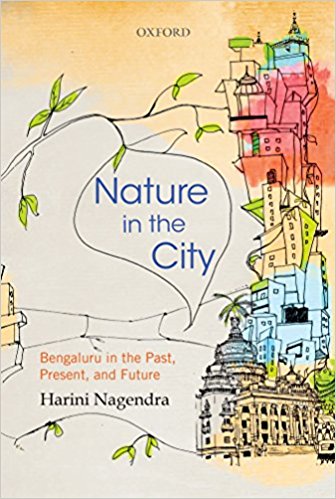
A review of Nature in the City: Bengaluru in the Past, Present, and Future, by Harini Nagendra. 2016. 214 pages. ISBN-13: 978-0199465927 / ISBN-10: 0199465924. Oxford University Press. £ 25.99 (Hardback). Buy the book.

There is a need for an “inclusive commons” a new form of nature in cities, one that can bring city residents together around the common cause of securing a sustainable and resilient future.
In her book Nature in the City: Bengaluru in the Past, Present, and Future (OUP, 2016) Harini Nagendra suggests we draw on the “cultural imagination and capacity for coexistence” demonstrated through the long history of the city of Bengaluru as we strive for sustainable and resilient modern cities. This call for considered and creative action is an appropriate directive in an age of rapid and dynamic urbanization. Her book is fascinating in that it simultaneously meets the directive of contemporary urban ecology in addressing the social and the biophysical, and also shares a personal lived experience of a city. The book opens with the personal marker “… this area has transformed almost literally in front of my eyes in the past decade …” (p. 1), and so we are introduced to the author and the city of Bengaluru, bound up together. Nagendra grew up in Bengaluru and reflects on her childhood, and the text is peppered with references to her personal space, experience, and identity, and this sets a tone for the book which is immensely engaging.

While the book is about nature in Bengaluru, the story one feels is really hers and while full of robust science, anchored spatial analysis and sound anthropological insights, it has the accessibility of an autobiography. It is the story of a city told through the eyes of a resident and globally recognized urban ecologist. Nagendra emerges from a childhood steeped in nature as an adult who holds it dear. Nagendra situates herself as child, adult, participant, learner, academic, witness, and activist. Her activism is restrained and she resists the temptation to gripe but makes clear and directed points around government and governance failings to manage according to well-defined plans, a circumstance which resonates with other cities in the global south. Her activism is expressed through views and frustrations that are clear, directed, and linked to grounded examples. For example, she labels Nehru’s directive that Indian cities develop and grow in strict accordance with agreed plans, “grandiose”, and “futile” (p. 56). That said, she acknowledges herself as part of the system and responsible too for the emergence of a sustainable city, and she refrains from general and obstructive denigration.

The book tells the story of the emergence of the city, laying out the biophysical and natural history of the original site of Bengaluru, from the early establishment of villages and initial settlement, the growth and development of the complex system of lakes, the subsequent British rule and the import of a particular type of nature and the social division of the city, and ultimately to independence and a contemporary Bengaluru which faces global and local environmental challenges. The book never deviates from its intention to share an understanding of nature in the city as a constant that Nagendra describes as both, “enduring in essence and substance”, yet is also, “… constantly transforming its form and function” (p. 7). Against this backdrop, Nagendra picks up on a broad array of urban ecology topics and presents a series of neatly packaged chapters that read like essays and range in scale and focus from the goings on in private yards to the public spaces of streets and lakes. Urban ecology requires a multi-disciplinary agility and Nagendra is undaunted by the task as she moves easily between landscape considerations around significant shifts in vegetation cover through time, to places of worship, and down to the social anthropology of life under individual trees. She states as her intent to “depict to the reader how nature has played a changing role during the evolution of the South Indian City” (p. 5) and she certainly achieves this.
While the focus of the book is unashamedly the city of Bengaluru, the book should readily make it on to the reading list of any postgraduate urban ecology course in any city across the globe. The book is far-reaching in its treatment of urban ecology topics and gives us history, resilience, nature and poverty, blue nature, sacred nature, public nature, and private nature. A student could readily find some point of traction here, and the opportunities to compare and contrast to their own circumstances are evident throughout. The theme of resilience runs through the book, but is taken up directly in Chapter 3, “Resilient City: From Colonial to Independent Bengaluru”. The concept of resilience is debated, and Nagendra wisely does not engage in this debate but rather presents an environmental history of Bengaluru that provides just the kind of empirical material on which to consider resilience irrespective of how one might choose to define the term. The detail of this chapter, researched in evident depth, is gratifying. The use of mapped trees through time, interpreted in association with historical texts, or failing that, speculated on, provides a degree of detail that is powerful and convincing.

Through environmental narratives, the history of Bengaluru and its resilience (or lack thereof) to change is presented. The narrative starts with a clear depiction of the biophysical backdrop, to early settlement with a landscape defined by agriculture and manipulated to this end, to one of separate development and variable landscape views in colonial times, through to transformation for real estate and light industry. The most recent dramatic and unchecked transformations of remnant agricultural land to hard urban surface Nagendra notes as, “much to its disadvantage as a garden city” (p. 56). While the dominant voice of colonial authorities is undeniable in the evidence base, she effectively dispels the myth that nature in Bengaluru is wholly defined by this period, but adds with a wry tone, with particular reference to the predominance of narrative from this period, “one does not know what the Indians thought of it all” (p. 50). Rather what is presented is an honest account of a long history of an urban nature that is a function of an amalgamation of views, emerging in response to mutable power relations, planning schemes, and variable implementation, through time.

This urban fusion is captured nicely in the description of a resident German horticulturalist that drew on the writings of a classical Sanskrit poet for inspiration in selecting plants for an historical greening campaign. The complex and diverse social history of the city and how this relates to urban nature is captivating. “As the form and function of nature in Bengaluru have changed over millennia, the players and actors that shape nature in the city have also transformed in various ways. Biodiversity is valued for productive recreational, and spiritual purposes in diverse ways in different types of land uses, ways that have profoundly altered over time.” (p. 60). As a temporal concept any understanding of resilience must be linked to environmental history and Nagendra reminds us not to judge Bengaluru on the basis of its contemporary nature but rather to see this as a function of a long and important history, and one throughout which nature has been central to much of what makes Bengaluru what it is today.

The same attention to empirical detail is evident in all the thematic chapters. In Chapter 4 “Nature in Personal Spaces: Home Gardens in Bengaluru” the reader is offered insights into Indian gardens that give voyeuristic pleasure. Here nature is presented as a signifier of status with gardens ranging from the useful to the purely aesthetic, the wealthier designed with elements to screen private gardens from “the curious (and often envious) eyes of the proletariat” (p. 61). Chapter 5 on “Nature and Poverty: Vegetation in Slums” presents detailed data on vegetation and tree cover across the socio-economic spectrum of Bengaluru and flags the fact that, “Slums have a particular relationship with nature” (p. 79). The complex livelihood and socio-cultural systems operating in these marginal communities are described through detailed examples, such as the case of slum cattle which are in turn lost as a function of the loss of grazing land with social repercussions in securing marriage partners. The risks and vulnerabilities associated with shifts in, or lack of access to, urban nature for the urban poor are well described. We are reminded that “nature in slums cannot be descried solely in terms of exposure to environmental hazards.” Where these “congested pockets of poverty also constitute parts of the city that have a strong relationship with nature”, as “almost all slums in Bengaluru have at least one sacred tree where nature is worshiped outdoors” (p. 80).

Informality and its relationship to nature tends to be overlooked, or worse caricatured, in the literature and Nagendra chastises the audience for the persistent lack of research on women, poverty and the environment. The ensuing chapters each offer more than enough to engage the reader covering most aspects of the city with insights on nature in relation to road networks in Chapter 6, “Nature on the Road: Street trees in Bengaluru”, public nature in Chapter 7, “Parks: Nature in public spaces”, and urban water systems in Chapter 9, “Blue Nature: City of Lakes”. Chapter 8, presents “Sacred Nature: Places of Worship”, which for me is a highlight of the book and warrants particular mention in that sacred nature, or at least how it manifests, is somewhat particular to the Indian city. Here specific species and their respective roles are described, different religions are engaged, and fascinating insights are offered on practice. Sacred trees are described as “planted in specific patterns believed to symbolize cosmic order” (p. 149) and we are reminded again to take nothing at face value when it comes to interpreting nature in contemporary urban form. Stories are shared of shifting power among deities in response to changes in the places and spaces of worship in relation to land cover change. Nagendra ties these considerations back to resilience, noting that “Sacred spaces in Bengaluru thus form resilient locations for the conservation of urban nature in the face of rapid change” (p. 161). We are reminded again of the surreptitious activist as she ends the chapter by raising the question of whether we can use these insights to good effect, and warns that the current movement for a, “… pan-Indian form of Hinduism, as some political institutions are attempting to fashion (…), cannot facilitate a pluralistic pathway forward” (p. 162). The potential to draw on socio-cultural uses and engagements with nature in addressing contemporary environmental problems is evident, but one that as Nagendra notes will take an inclusive and engaged approach.

In her final chapter Nagendra reflects on the story of her city among the broader global trends in urban ecology drawing in particular on other global south cities for lessons in plotting a sustainable future for Bengaluru, one that renders the City, “adaptive and resilient to change” (p. 195). She closes with words, “Challenges abound, but the need is obvious” (p. 195), and certainly, this is the sense with which she is imbued. The indispensable role of nature in a city, demonstrated repeatedly through periods of history and from multiple angles, is evident. So are the challenges in securing this nature into the future as shown by past reflections of periods of decline and recovery. Nagendra notes the need for something new, and reminds the reader of growing environmental justice issues in modern cities, particularly evident in cities of the global south. There is a need for an “inclusive commons” a new form of nature in cities, one that can bring city residents together around the common cause of securing a sustainable and resilient future.

The work is thought-provoking and I cannot imagine that anyone could read this book without thinking, “how would this play out in my city?” In this respect, Nagendra inadvertently invokes the holy grail of urban ecology which is how much can we generalize about the ecological functioning of cities? While she speaks to the broader project of understanding South Indian cities, Nagendra never promises to make comparisons and makes no significant attempt to address the broader question of generalizing across cities. She does, of course, reflect on her own work in relation to the published findings of others and in this sense the City of Bengaluru is somewhat positioned.

And at the end she again invokes other global south cities in seeking lessons for the future, but her intention is not to compare, but rather to give depth and texture to one city. What she gives us is the “horizontal and vertical” of one city, and what the book does do is invite others to do what she has done. The book immediately calls for other urban ecologists to put together the kind of detailed insight offered here for their own city. The power of a shelf full of such books would be tremendous.

I look forward to seeing what this book inspires in urban ecologists in other cities around the world, and in particular in the global south.

Pippin Anderson
Cape Town

On The Nature of Cities

To buy the book, click on the image below. Some of the proceeds return to TNOC.

Trees are Breath

Art, Science, Action: Green Cities Re-imagined
I carefully placed the oak in the hole, and we moved back the forest earth with our fingers. It felt like a homecoming, like a renewed vow, like having the whole forest as a witness, and at the same time, being witnesses for it. Life, vouching for life. Reciprocity.

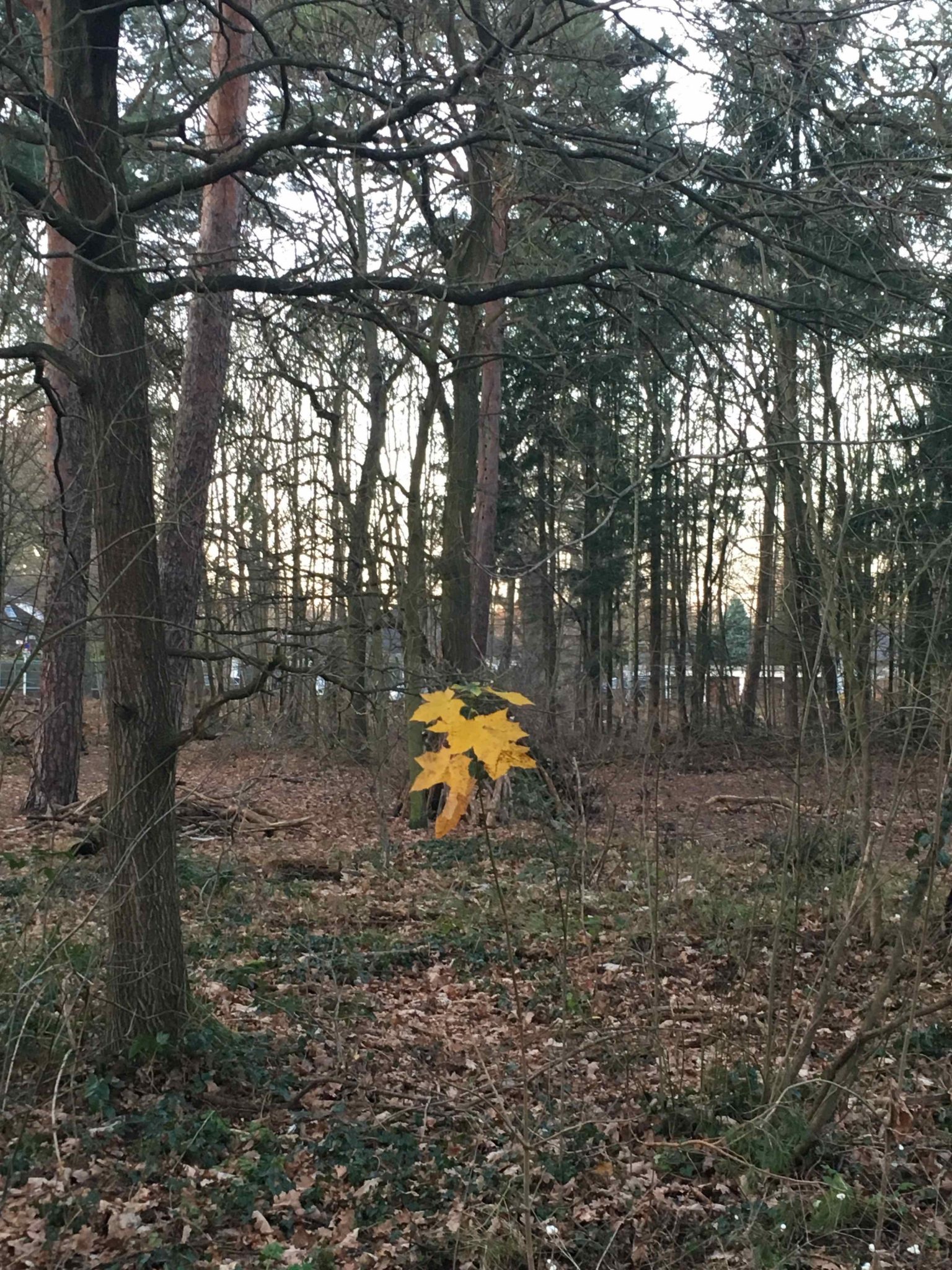
In the last days, with the air finally above the freezing point, and the grey silhouettes of the barren twigs dripping with fine silvery moisture against the faint morning light, I have been drawn into the forest. Every morning, I unlocked the chain securing my bike to a low metal arc between the parking cars, brushed away the water from the saddle and the handlebars, and rode two blocks into the Grunewald forest, often in an early spring drizzle.

The Grunewald is a huge woodland in the southwest of the German capital. It stretches 4 miles from east to west and 6 miles from where I live to the south. Deep inside of it, you don’t hear any traffic noises, only the chirp of the black tit or the tune of a song thrush, the silent thunder of a leaf slowly falling to the ground. There are protected species like the rare and huge hermit beetle. There are joggers, mountain bikers, mothers with small kids and dogs—and some fantastic swim spots with their northern European policy of bare skin and extremely wide tolerance. In the early mornings and evenings, especially now in spring, you almost surely bump into a couple of wild boar. That’s the typical Berlin mixture of these times: considerable wildlife, but more weird people doing weird things.

Photo: Andreas Weber

The Grunewald is about tenfold the size of New York’s Central Park, and nearly equally accessible. The woods are open as a porous skin from many access points of the city. Behind one bend, the trees. When I go there, I first have to get past the roar of the six-lane Heerstraße main traffic artery, and next take the bridge over five curved railroad tracks bluntly sparkling in the mist. Then I cross into the trees. First underbrush, littered with trash, then pine, birch, black cherry, oak. Leaves carpet the floor, punctuated by heath, moss, and withering stumps.

In these last mornings, I have been longing for touch, for the earthly touch of transformation. I was longing for the mutuality which now seemed so overdue after three months of unusually severe winter cold, isolating me mostly inside. When I entered the forest on my usual narrow trail it felt like moving through a wall. Although it was still cold, the forest atmosphere immersed me in the scent of wet leafy soil, of cold bark covered with algae, of moulds and plant parts half transformed into phosphorous, nitrogen, and air.

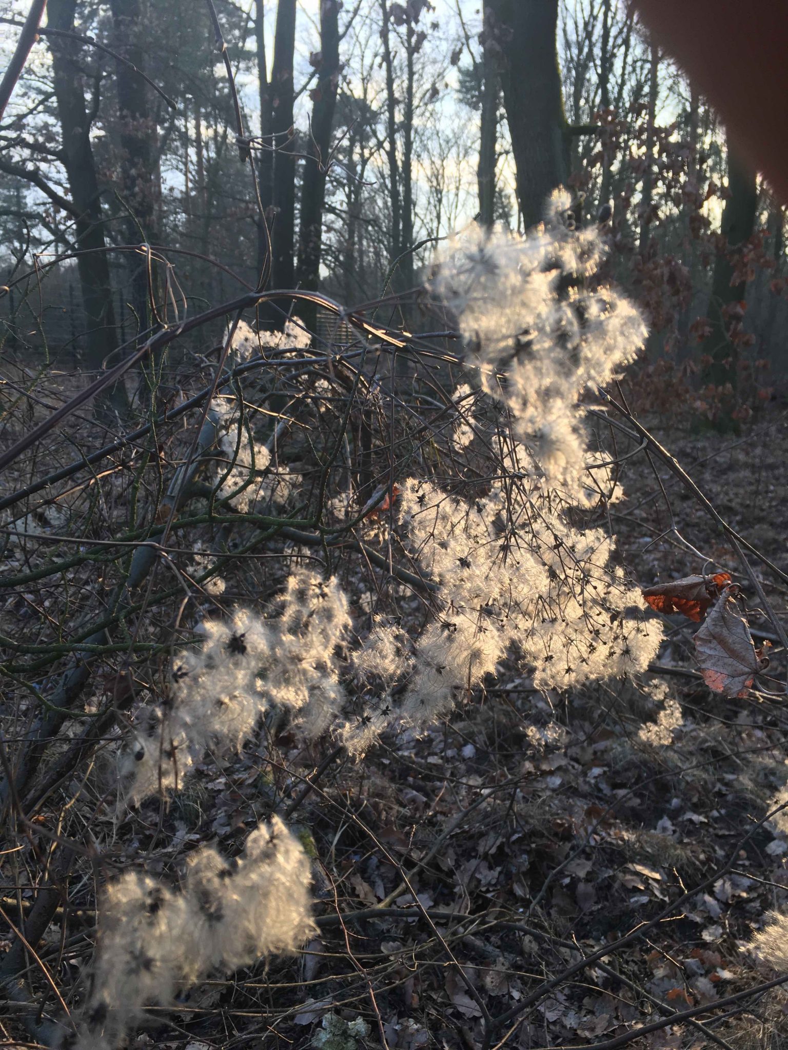
I rode slowly, the wheels leaving deep tracks in the thawing floor, and breathed in the air. There it was already, I thought, the earthly touch for which I had longed. I did not even need to bend down. I inhaled the air, and exhaling gave back something of myself. My breath flowed as steam through the branches. Oxygen and carbon and water vapour condensed into tiny droplets of silvery transparency. Breath is touch as well: a mutuality, bound together on the thin surface of each of my lung’s alveoli, where the world enters into my body like an acorn dips into the surface of a puddle. I pedaled slowly beneath the stems and branches on which the cold gleaming drops hung, occasionally bursting into a sudden rain shower on my coat when I brushed along them.

Photo: Andreas Weber

I thought that the surface with which we respire is not that much different to a water droplet. The innermost layer of the lung consists of delicate bubbles of the most subtle tissue layer which in the end are watery bubbles themselves. They are membranes through which the thin spheres of vapour, transpired by the plants, crystallized as hoarfrost, condensed as dew, enter my own body, merging with its translucent blisters like an iridescent soap bubble merging with another, reflecting the world on its shimmering surface until it bursts.

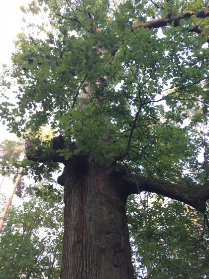
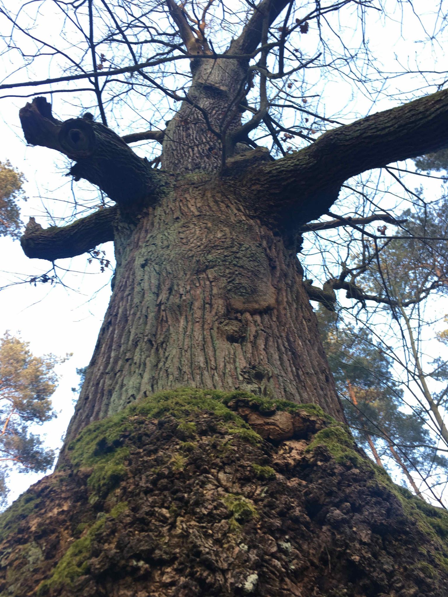
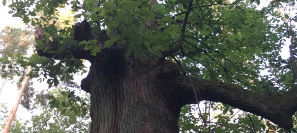
I was on the way to “my” oak. When something important is under way, I always check in with that particular tree to see what to make of it. Being there helps me access the fact that I also am only enabled to thrive by means of the light from above, and that whatever is weighing me down will ultimately be taken back by the earth, without a trace of labour. Trees breath. They are manifestations of the sky inhaling the earth and the earth being washed over by the sky. When the soil inhales sun and air, trees grow. If you looked at a forest through a time-shift lens, you could see its different patches rhythmically swell and decay, like an ocean, the respiration of its waves changing the shores. Trees are breath, on a very large scale.

Photo: Andreas Weber

Last summer, I invited the lady, who is now my wife, to my oak. It was high summer, the air balmy, the undergrowth rustling with life. Some of the 500 species, mostly insects, who are obliged to live on oaks as their only habitat, were buzzing around our heads, while we leaned against the bark with its deep clefts, holding hands, not being able to embrace the whole stem, not by far. Oaks are the trees with the highest number of life-giving relationships in the northern hemisphere. Even if we did not speak it out explicitly, our embrace around the oak’s stem was a promise. It was the pledge to remain tuned into the other’s breath. To remain breathable, edible, vulnerable. To remain earth, fertile, fragrant.

Being edible is the basic condition which we share with all other life. It is the door through which our communion comes, the pleasure to eat, and the consolation of being transformed into the bodies and the blossoms of other beings. Understanding that we need to accept being edible leads to understanding that only as vulnerable beings we are able to be real, and to connect with others. Doing this is a profoundly embodied, sensual process.

Photo: Andreas Weber

I estimate that my oak is about 400 years old. It was already a thriving tree before Descartes decreed that all nonhuman bodies are just machines, and only the human godlike rationality real after all. Another Berlin oak, named “Dicke Marie”, “fat Mary” by Alexander Humboldt and his brother Wilhelm (because the two played at its feet in the Tegel forest near to their manor, and because the kitchen chef of their home was a somewhat strict and pretty obese lady), is estimated to be 800 years old, bringing us straight back into the middle ages.

Breath means to give something back when you receive something. It means giving back something of yourself when you inhale something which belongs to other. I have often been thinking that if we would organise more of our human ways as breath, many problems would settle all by themselves. Imagine teaching schoolchildren conceived as breath. Becoming with-other as mutual breathing in and out. Agriculture as breath. Breath is linked to eating. It is the other half of the respiration cycle in which food becomes body and body air. Breath is a fundamental reaching out to the other, and a substantial welcoming of the other as a necessary condition to be a self. Trees, the stem pushing upwards, the branches reaching for the void air, are a form of how breath becomes body.

Trees grope for the other. They reveal space as a relationship. They reveal relationship as breath. Breath, in which I constantly give away something from myself and constantly receive something from another being, incorporating it into my own existence. We have heard so much of the world’s forests being “green lungs” and therefore needing protection. This plea, however, has not been that successful. Maybe it would help to feel that forests are not only lungs in a technical sense. They are breath. Their way of being, and of relating to us, is an ever so slow rhythmical tide of breathing out myself, breathing in the other, of total, completely entangled reciprocity.

Breath means community, means sharing, means letting yourself be imagined by others: by humans, by non-human others, by non-animate others, as stone, and sand, and air. In the summer, after we had met under the oak tree and joined in its vow of reciprocity, we spent entire nights in its neighbourhood, stretched on the forest floor on a blanket. The wiry forest grass tickled our skin while we looked up to see the foliage flow into the approaching darkness of the night. The thrush’s song gave way to the grunt of wild boar and scattered sounds of stomping feet, while the beasts of the night were closing in on us, creatures among other creatures.

We were there, speechless, amidst a profound encounter of curious and needful bodies, caressed by the night, brought to life by the night. The primordial myth of Eros, as Ovid has written it down, is such a beginning in mutual tenderness, reciprocal fertilization: the primeval wind impregnated the primordial night, giving birth to a silver egg, says Ovid. Out comes Eros. He is a god because he is the tender curiosity for other, the force that yearns for touch and hence begets connection, and thus creates newness. The primordial night being inseminated by the primeval wind, that is also the archetype of breath. Breath is the precursor of what is there in solid form, its precursor in the form of desire.

When I entered the woods in these very early spring mornings of 2018, it was all about touch and reciprocity, all about sensing my skin adjacent to others, of being permeated, embraced, entangled. This touch was pretty faint, a fine mist, a delicate inhalation. My encounter was already touch before I even felt it as such, just by being breathable, by being the space from which I renewed myself. I experienced the world yearning for spring as profoundly mutual. Its fertility relied on the confidence that mutuality would remain possible, would remain the soil from which we all grow.

That’s not always the most obvious thought in a metropolis like Berlin, full of humans, trying to function the best they can, trying to make their lives ever so special, coping with expectations and constraints, all this in the short, busy time they are given.

Berlin is by far not a megacity, but still a place where mutuality often falls short. There is, for instance, a more than 50-percent-chance that your marriage will fall apart, far higher than in most rural settings of my home country. Breathing is not always easy in Berlin. From this angle, it makes things a little simpler that there are far more trees than humans populating the German capital. Berlin streets are lined with over 400,000 oaks, lindens, birches, cherries, sycamores, and other towering fellow beings. Fellow beings like us, who have a youth, born from the tiny shell of an acorn, groping for light, groping for contact, yearning to be, blossoming and bearing fruit, which, as my wife from time to time reminds me, means to understand that becoming mature means to become edible.

As the Berlin trees are on German soil, they are all precisely taken account of. If you look closely, you can discover a little green tag with a number on it nailed to the bark of every stem. In Berlin, if you feel lonely as a human (many do, as surveys reveal), you can at least go out of your house and directly hug a tree. (Beware of dog droppings, though). You can hug it and think of the invisible bubbles it transpires from its leaf surface and the concealed bubbles deep inside your body merging into one another in one tidal wave of breath.

Last November, my wife gave me an oak for my birthday. It was quite a decisive birthday, my fiftieth, so receiving an oak felt somewhat consoling. The oak was a pretty juvenile tree, a slender stem, not much higher than 50 inches, with a couple of short barren branches, to which two or three brown leaves clung, in a pot filled with earth. The oak was in deep hibernation, waiting for spring. It had arrived in a huge box packed with straw. When the temperatures climbed above freezing point in these last days, I suddenly thought of the baby oak and its fate.

My wife had carried the tiny oak for my birthday all the way from the post office. Having it stand there on my special day was a pretty surprise. She had carried the baby oak in its straw cardboard casing all the way into our flat on the third floor while I was traveling. The tree was small, but given the pot, packaging and all, it was an exhausting job for her to drag the tree up to our flat. I did not even know that you could do this: having trees shipped to a condominium in the heart of the German capital.

There it sat, beside the table with the more practical-seeming gifts, in the heated air of our apartment in late autumn, waiting for the earth to take care of it again. She gave me an oak to renew her vow—as we had done for the first time, under that other oak. Now, I thought, looking at that fragile young tree sitting in a tiny pot with some earth, surrounded by the wrapping paper that had hidden it, it is up to me to give something back to the oak. To give it life actually.

As it was too hot in the room, we put the baby oak out on the balcony, still half in its wrapping. There it sat in a corner, between all the summer stuff half-heartedly left there, folded chairs, boxes, empty flower pots. The soil over its roots became dry. We nearly forgot about the plant, until storm Xavier hit the capital in early December. I remember finding a shared car to rescue my wife from her workplace, as all public transport was shut down. The streets were awash with objects drifting around: tree branches, boards from hamburger stands, fragments of billboards, bicycles, plastic debris, driving leaves, in fact, whole trees across lanes and no one around to put them away.

We hurried to check on the devastation that had befallen our balcony. The straw mats that had been fixed to the railing hung in the branches of the surrounding oaks and sycamores. The oak sapling lay upside down under a deck-chair, the earth strewn around. I did not feel very well seeing that. I felt as though I had violated an important obligation. But what to do with it? We did not have a garden. We were impatiently waiting to be allotted a piece of land in an urban gardening area close to the forest but were very low on a long waiting list, and still are.

When the winter cold kicked in, I felt this uneasiness even more considerably. At least when I allowed myself to feel it. When I thought of the baby oak, a slightly startled feeling came up. Was the tree baby ok? Would the earth in its pot freeze through, killing it? Would the frost eat its tiny buds, already protruding from the empty twigs? This went on for some weeks. I visited the balcony, literally held my breath, then closed the door and tried to stop thinking of the tree.

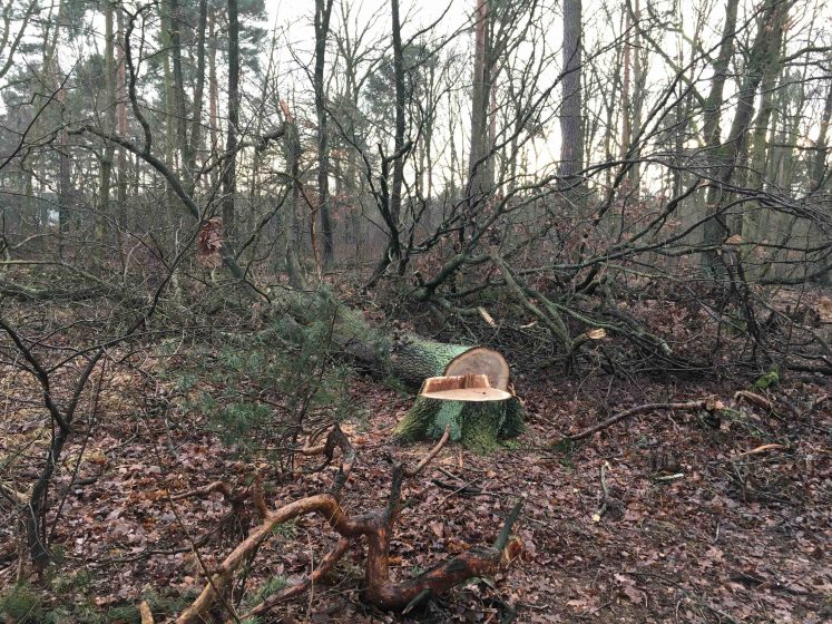
I started moving when I saw the devastation the storm had done to the Grunewald. The forest administration estimates that 40,000 trees were lost here in December 2017, in only an hour’s time, when the worst of the storm hit. Since then, it has been difficult to access the forest by my usual tracks. Fallen trees blocked every path, one after the other. But it was not the devastation that finally made me think of the little oak again. It was the way the forest administration dealt with it. They sent in private contractors to clear cut every affected tree—including the ones badly beaten, but still standing.

One cold and grey morning, on a walk with my dog, I visited my old oak friend (which had weathered the storm unaffected) and cycled back, the poodle in her grey parka against the cold racing from one side of the track to the other. I stopped at another old oak which had been battered but had remained about two thirds intact. I had seen it in the days before since I had been coming back after the storm. If you look at old paintings of oaks you realize that there is nothing that stops them thriving. Here however, I stopped in my track, as the battered oak had been felled and cut to pieces. Cleared away, it was a painful sight.

Photo: Andreas Weber

What these guys were doing here was not simply tidying up the wrong way. It was literally breathtaking. They used the storm as an occasion to step out of the relatedness that thrives on mutuality. The five hundred or so species that rely on oaks as food or dwelling space (like the hermit beetle) do so because the oak is alive even if half crushed, half rotten, already half transformed into other beings.

The oak’s substance is visibly made of other beings. It is itself—in a majestic and towering way—precisely by being other. By this it is, more visibly than other species, breath, open to be breathed in, ready to take up my exhalation, and even more so the breath of the hermit beetle, of the black tit, of the woodpecker, the ants and hornets dwelling in its holes and crevices. Cutting and carrying away a half-dead oak seemed like disallowing relatedness to happen. It was the deliberate act of creating a life in isolation, lonesome and locked in. It is the standard forest policy, not only in the capital but in 99.8 percent of German woodland.

We wrapped our baby oak in long stretches of packing paper and carried it to the 136 bus, and then to the X49 bus. Nobody looked at us and our heavy load. Wildlife and weird people, and we apparently belonged to both. I even carried a spade, rusty from leaning against a damp basement wall. It was a grey, quite chilly day, the forest floor just above freezing solid. When we left the bus and walked the few steps to the forest entrance, we fell silent. A ceremonial feeling came upon me. And then it was also so weird.

What we were doing seemed very much like carrying owls to Athens, or rather, oaks. Planting an oak in an oak forest. Throwing water into the ocean. Besides, this was surely illegal. In a city where there is an individual identification number for each tree, it is hard to imagine that it would be acceptable for citizens to set their own plant specimens to roam free in the woods. At least, we told ourselves, the oak was not an alien species. We were offering the forest what the forest was continuously offering to itself.

Dusk began to fall already. We had selected the place carefully beforehand, a clearing, close to the tree that had been cut. The air was chilly. Our breath formed white clouds of tiny droplets, mine mixing with that of my wife, and then perfusing into the shrubs and among the stems. When I pushed in the spade, the earth under the loose grass gave away easily. It was a thing of few minutes. I dug a hole, and we moved out the remaining sediment with our fingers, touching the cool, soft, velvety sediment, touching our hands with one another, caressing the earth, being caressed back by its sheer touch, caressing one another. Then I carefully placed the oak in the hole, arranged the compact form of roots and earth that had come out of the pot so it sat straight, and we moved back the forest earth with our fingers.

It felt like something we both had long needed to do. It felt like a homecoming, like a renewed vow, like having the whole forest as a witness, and at the same time, being witnesses for it. Life, vouching for life. Reciprocity, celebrated by sheer and simple touch. Just being there, connected. Becoming earth again. What we were doing there was a very simple thing, a kind of natural play, and it was also, by being that simple, a kind of deep understanding. It made us see, in a way, that a vow to stay in reciprocity is respiration. It is a pledge to be earthly: vulnerable, accessible, fertile, nourishing. Also love, after all, is breath.

Planting that slender, lonesome oak in the soil where so many of his brethren already vouched for aliveness (by sharing the own self with others) did not seem different from that moment before falling asleep together when your breath somehow becomes the breath of your beloved, of your partner, your child. Planting the oak in the cold and grey eve of the Berlin forest felt like exchanging a long and tender kiss: the encounter of two sensitive surfaces in a way that forever changes both.

Andreas Weber
Berlin

On The Nature of Cities


A Sense of Wonder: The Missing Ingredient to a Long-Term Value for Nature?

Art, Science, Action: Green Cities Re-imagined

“For the child….it is not half as important to know as to feel. If facts are the seeds that later produce knowledge and wisdom, then the emotions and the impressions of the senses are the fertile soil in which the seeds must grow.”
—Rachel Carson, 1965, p.58.

What are the types of childhood experiences that instil a lifelong value for nature and promote stewardship behaviour later in life? It turns out that the sense of wonder that children experience in nature is a crucial factor.
The natural world is essential to human survival providing food, filtering water, and cleansing the air. However, human activities this past century have compromised the capacity for natural ecosystems to carry out these essential functions on which we rely. The combined impact of urbanisation, land clearing, mining, species extinction, pollution, and human-induced climate change has transformed the Earth’s geology and ecosystems to such a degree that scientists have proposed a new geological age to mark this era of human influence—The Anthropocene.

In response, individuals, organisations, and governments globally are devising interventions to reduce or reverse the negative impact of human activities. Several of these interventions are focused on children—the next generation of environmental stewards who will eventually be responsible for curbing human impacts to preserve the natural world. Instilling a genuine value for the natural world during childhood has been shown to motivate environmental stewardship behaviour during adulthood.

But, what types of childhood experiences instil a lifelong value for nature and promote stewardship behaviour later in life? This question has been explored extensively by environmental psychologists and educators. Their research has found that children who experience a sense of wonder through direct contact with nature are more likely to develop a life-long respect and value for the existence of natural areas, the habitats they contain and the species they support.

A sense of wonder

The sense of wonder children experience in nature was initially articulated by Edith Cobb in her book The Ecology of the Imagination of Childhood, where she surmises,

“The child’s sense of wonder, displayed as surprise and joy, is aroused as a response to the mystery of [the] stimulus [of nature] that promises ‘more to come’ of, better still, ‘more to do’ —the power of perceptual participation in the known and unknown”
—Cobb, 1977, p.28.

A sense of wonder is not only inspired by a lush, damp, tropical rainforest bursting with birds’ songs and monkeys’ cries, or a vast savannah occupied by zebras, lions, and birds of prey. While such visions will certainly awaken a sense of wonder in most of us, many experiences closer-to-home can evoke a similar response. Think of a time when you observed a spider building its web, the individual threads glistening in the sunlight, revealing a shape of perfect symmetry. Or, the feeling evoked when witnessing an army of ants marching synchronistically across the ground, carrying more than their body’s weight in food. Or the sensation of an electric storm, the wind and rain on your skin, and the sound of lightening as it cracks across the sky. The quality of the emotions these experiences evoke in us are often inexplicable, yet they leave an impression so deep that they inspire lifelong respect for the world around us, and the existence of life beyond the human domain.

This sense of wonder can be evoked in children when granted the opportunity to experience the vastness of life beyond and despite human activity. This awareness inspires in young children respect and empathy for other species and habitats, and a desire to protect them.

What qualities of nature-based experiences inspire a sense of wonder in children?

Providing opportunities for children to experience nature “in its element” is something that is crucial to establishing a long-lasting value for it. So, how can we support children in experiencing that sense of wonder so they develop empathy, care, and respect for the natural world?

Broadly, the research has shown two qualities of experiences that inspire a sense of wonder in children.

  1. Quality of the experience

Three qualities of experiences are valuable in instilling a life-long value for nature.

Direct experiences: Where children can touch, see, smell, and hear the unique sensations offered by the natural world.

Autonomous experiences: Play experiences in nature, where children design and direct their activities according to their interests and curiosities is a crucial factor in instilling a lasting awareness and value for the natural world. Encounters with nature that are free of pre-conceived learning objectives and provide time and space for children to engage with nature according to their own curiosities, appear to be central to developing a personal and long-lasting connection with the natural world.

Social or solitary experiences: Interactions in nature with friends, a mentor or a parent who is knowledgeable and passionate about nature can transfer these sentiments to children. However, solitary experiences in nature, where children have unique, personal encounters are also valuable.

  1. Quality of the natural place

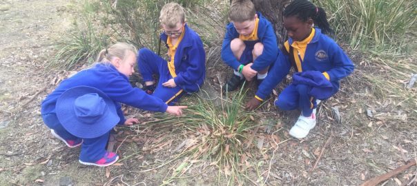
The quality of the natural place is another key determinant of a child’s experience. Children are generally drawn to natural places that contain a diversity of loose-parts and functional affordances as they support a range of play activities, including climbing, exploring, making and building. The diversity of plant and animal species is also important, and this provides children with an opportunity to see, hear, and touch other species in their natural habitat. Opportunities to find and create “special places” that are hidden from the prying eyes of adults are also important components of favourite places for children in middle childhood (8-12 years). These places are generally characterised by natural landmarks or structures that offer seclusion and privacy such as creek beds, rock formations or trees. Essentially, the less curated the natural area, the better for many children.

Interestingly, places that offer rich experiences in diverse natural environments are more likely to stimulate in children a sense of wonder or empathy for nature. Such places allow the child to express a freedom or wildness to explore and grow. Sadly, however, these factors are often missing in children’s play places in modern cities, significantly compromising their experience and appreciation of the natural world.

Child play in today’s cities

The autonomy and independent mobility of children living in cities today have declined substantially over the past few decades due to safety concerns associated with traffic and strangers, and a shift in cultural expectations. For example, in some States in Australia, it is illegal for a child under 12 years of age to roam their neighbourhood unchaperoned. Although aimed at assuaging safety concerns, this policy places considerable pressure on the ability of parents and caregivers to provide their children with opportunities for outdoor, nature-based experiences. Furthermore, where access to natural areas is possible, children are often unable to play independently due to restrictions placed on them by security-conscious adult caregivers.

Moreover, the design of natural areas available to children in cities often fails to provide engaging places for children to explore. Typically, large tracts of open grass, limitations on access to denser vegetation and limited opportunities for climbing or “risky play” make up the urban “playground” in landscaped parks and gardens.

Kytta’s four different categories of child-friendliness experienced by children living in urban contexts. Image: Broberg et al. 2013

Finnish researcher Marketta Kytta’s categorisation of child-friendly places provides a useful guide to interpret the types of nature-based experiences available to children living in cities (see Figure, right). Kytta’s first category, the Cell, is a situation where children are unable to access outdoor places. In the Glasshouse, children can access an engaging natural area but are unable to engage with it independently because of restrictions placed on them by their adult caregivers. The Wasteland is when children can access an outdoor place, but the quality of the place is compromised and does not offer many opportunities for engaging interactions. The final category is the Bullerby, a Swedish term meaning “noisy village”, and depicts the ideal type of experience when children can interact with engaging outdoor places with high levels of independence.

Over 60 percent of children around the globe live in cities where they face substantial barriers to regular and direct experience of nature. In addition to the numerous implications the absence of nature-based experiences has for the health and development of children, an increasing proportion of children are exhibiting a limited understanding of common plants and animals, as well as a biophobia (“fear” or ambivalence) towards the natural world. It would appear that the future “protectors” of the natural world may be ill-equipped to deal with the challenges. By reflecting more critically on the types of experiences in nature that promote a sense of wonder, perhaps we can enhance formative nature-based experiences for children in cities, and potentially reverse this trend.

 Two promising examples

Here we present two promising examples from Australia that are seeking to promote valuable child-nature experiences. The examples are drawn from two different contexts, community-based, and a school setting, to illustrate the range of opportunities available to enrich children’s experiences of nature.

Case Study 1: Parents creating informal nature-play communities

This first example is from Bronwyn Cumbo’s research with children in Sydney, Australia. Bronwyn encountered a group of parents who are taking steps to provide their children with autonomous nature-play experiences in their local neighbourhood. These parents all share a common value for nature instilled through their encounters with nature as children, and a desire to provide their children with similar nature-play experiences. However, the culture of the urban community and safety concerns prevented many of these parents from allowing their children to walk independently or with their friends to the local park to play. To address this, the parents created a regular Friday afternoon “meetup” in a local park after school. These parent meetups were centred around sharing of food and conversation with others in the group. Meanwhile, the children were allowed to roam large distances in the park, unseen by parents, and to engage in a diversity of play activities, many of them that might be considered high-risk by typical urban parents.

Children playing in the local reserve at their Friday afternoon meet-up. Photo: Bronwyn Cumbo

Bronwyn’s research revealed two key elements that enabled these rich nature-play experiences to occur. Firstly, all parents shared a common value of nature and risky play, which allowed parents to express their values and provide their children with greater independent mobility than they may in other contexts. Secondly, parents and children had established a set of rules and limitations for their behaviour within this meet-up context.

  1. Boundaries of independent mobility: Children and parents agreed to boundaries which defined where children could play, and parents could access. The boundaries of children’s play areas were out-of-sight, so parents were required to trust that children would play safely and respect their agreement. Similarly, parents were not allowed to approach or enter a child’s play place unless invited by a child, as a show of respect for the child’s private play activities. Children and parents were able to mingle together at the primary “base” where parents congregated with refreshments.
  2. Boundaries of play activities: Children were encouraged to engage in a range of risky play activities, as long as children felt comfortable that the activity was within their capacity. Children could work together to support or encourage risky activities, such as helping friends climb trees, or explore new areas, but if children were not comfortable, they were encouraged to express this and for others to respect it.

These children had each established a strong connection with certain areas in the park through their play over time and had a unique ability to collaborate together to solve problems or develop imaginary narratives through their play.

Case study 2: The My Patch Project

Children exploring their school’s natural surroundings in the My Patch Project, Australia. Photo: Nel Smit

The second example is the My Patch Project started by Nel Smit in Tasmania, Australia. In the project, each child chooses a patch of land in a designated area within the school’s vicinity. During the course of a year, the children come to identify with their 1 m2 patch: What are its special features? What are the colors, shapes, textures, and smells? What signs of life are there? How is their patch the same or different to other patches? And how do all these elements and activities in the patch change: day to day, after a dry spell, with the seasons, over the year? The outcomes of the My Patch project are very encouraging. Children develop a strong sense of attachment and stewardship that goes beyond taking care of the land. They develop an engagement with and connectedness to “their patch”—a connectedness to nature. And, whilst adults’ and children’s agendas are packed with extracurricular activities, the patches create a feeling of rest and safety. Children mention how they perceive their patch to be a safe haven, a place to visit when they are feeling sad or need some time to think. The My Patch project demonstrates how a low-cost and easy-to-implement idea can render incredibly important benefits, in the short- and long-term, for both individual child development and as a valuable introduction to school-based nature education. Most importantly, My Patch focusses on the direct engagement of children with nature on an emotional level rather than through objective observations.

“I think I know more about my patch than anyone in the world. There is so much to discover. Every time I visit I find something new.”
—Nel Smit, My Patch (1997)

More Bullerby, please

We started with the question: what are the types of childhood experiences that instil a lifelong value for nature and promote stewardship behaviour later in life? It turns out that the sense of wonder that children experience in nature is a crucial factor. The importance of allowing children greater opportunities to independently explore and play within the wild, “in-between” places of their urban environment cannot be easily dismissed. Our case study examples show that these opportunities can be realized by parents as well as at school.

There is a clear need to make room in our cities for more of Kytta’s Bullerby places to ensure children experience interactions with nature that are outdoors, engaging and afford high levels of independent mobility. If the quality of both place and experience are high, urban children can continue to experience that sense of wonder that “wild” natural places provide.

Bronwyn Cumbo & Marthe Derkzen
Sydney & Amsterdam

On The Nature of Cities

Marthe Derkzen

about the writer
Marthe Derkzen

Dr. Marthe Derkzen is a researcher and lecturer with the Health and Society chair group. She studies urban nature from a social justice perspective with an interest in climate adaptation, local food, healthy neighborhoods and stewardship of the commons.

References

Broberg, A.K., Kytta, M., Fagerholm N., (2013) Child-friendly urban structures: Bullerby revisited. Journal of Environmental Psychology. 35 (110 – 120)

Carson, R. (1965) The Sense of Wonder, London. United Kingdom. HarperCollins.

Cobb, E. (1977) The Ecology of Imagination in Childhood. New York: Columbia University Press.

Westward Wandering and Wondering

Art, Science, Action: Green Cities Re-imagined

Thinking of home turf as we start a new phase of the Bangkok-Barcelona journey

Inching westward, the lines of human history blur. The more we walk, the more we see the similarities and differences in the human condition.

My mind always wanders forward. Even as my footsteps ground me in the present, I can’t help but wonder what lies ahead.

We’re still technically in Asia, on the side of the line that divides Turkey between two continents. After a long winter break to rest our bodies, enjoy the warm comfort of family love and plan for the next leg of this journey, we are back to walking in places new to us, inventing the path that connects us to two continents.

Although we have some 4,000-5,000 kilometers before us, we already feel closer to home.

Turkish cities and roads are more European in their design and civility than many of the Asian places we have walked through these last two years. The cafes, restaurants, markets, and malls in the bigger cities frequently have that trendy, hipster-NY feel, that sense of 21st capitalistic development that has become a model globally. It’s really only the food, music, and language overheard in these places that bring us back to where we are—at yet another crossroads of cultures and chronicles.

Walking among the collective

Inching westward, the lines of human history blur. The more we walk, the more we see the similarities and differences in the human condition.

Everywhere we have walked so far; we have witnessed the basic human need of getting on with life, surviving the day-to-day routine to have enough to eat and a place to sleep at night. Many people are doing the work that has to be done to have some level of comfort and, hopefully, a better quality of life than those who preceded them. There is joy, sadness, success, and longing universally rolled out along the 10,500 kilometers we have observed to date.

The differences we sense and see are wrapped up with competing (and frequently undue or excessive) political, religious, and economic sympathies and prejudices.

For example, in suburban Thailand and some parts of Burma, we found ourselves the recipients of Buddhist-related merit-making kindnesses. Strangers rode up to us on their mopeds and handed us bottles of cold water, plastic bags of warm soymilk, slices of watermelon, and the occasional refreshing sugar burst of a soda. We hope their small acts, for which we are always grateful, earn them a closer place to Nirvana.

In Iran, Turkey, Tajikistan, the Pamirs, Uzbekistan, Azerbaijan, and, to a lesser extent, Bangladesh, Muslim hospitality superseded national ideology. Goodness and compassion came in the form of invitations for tea, roadside picnics with just-picked melons, hot multi-course meals, and rooms to sleep in at night. In these places, where Western headlines warn us of “those people,” we were seen as gifts from God. We started as strangers who randomly stepped into their lives and ended as honored guests and friends.

People in India took us in and gave us refuge in their temples, gas stations, classrooms, highway authority offices, and sometimes their homes. They made us roti and lentil dal. They told us it was their duty to look after us; this resonated as the dharma principle Hindus hold dear. It also reflects the Hindu idea of “seva” and the Sikh pillar of “vand chakko,” both of which translate to the idea of selflessly serving others.

In some areas of Burma and Georgia, we have experienced suspicion and the lingering leftovers of former regimes that were more interested in knowing where we are going than knowing from where we came. In other former Soviet countries, the notion of registration–registering with police, collecting registration slips from hotels, and registering at security checkpoints on province borders–is still part of everyday life.

And, in nearly all sizable cities we have stepped into so far, people, regardless of race or roots, fall into a pattern that creates distance. There is anonymity in the middle of urban chaos that keeps most people isolated or unattached while in constant proximity.

Shifting expectations

It’s this perception of detachment we expect to see more of as we cross borders and ramble through European towns and cities.

We hope we are wrong, but our experience tells us otherwise.

To read more from the Bangkok to Barcelona series, click here.
When we walked a 600-kilometer stretch of the long-distance GR-92 hiking trail as a test-walk before this one, only one couple helped us as we crossed Catalonia. And, it was because there was a significant thunderstorm passing through that forced us to seek shelter on their porch, and the man who found us, a French ex-pat, was himself a walker who had also completed several long-distance treks. He had stood in our shoes and knew what it felt like to be wet, tired and without a good camping spot nearby.

As Europe comes into our line of sight, we have questions we can’t yet answer, the first of which is, “What will Europe offer us that Asia didn’t?”

Yes, we expect to have better roads connecting us to familiar cities, and pretty bike and nature trails where we can hear the birds and enjoy nature. We expect to find familiar food, familiar languages and more publically accessible potable water. Finding a good cup of coffee will be vastly easier, too.

But, when there are no hotels or pensions nearby, will the keepers of Christian-based traditions let us camp in their gardens or sleep in extra rooms like the Buddhist and Sikh temples allowed us to do? Will we be welcomed as guests, gifts worthy of a stranger’s smile and will they try to close our human differences with an invitation to sip tea together? Will Europeans be willing to let us into their homes, and will we be willing to follow them inside or will our own suspicions and prejudices keep us guarded and distant? In this day and age, where bad news grabs all the headlines, will fear follow us into parts of Europe where personal attacks, pickpockets, and robberies are seemingly more common?

And, more to the point of what concerns readers of The Nature of Cities: Will our idea of what makes cities just, accessible and inclusive change as we cross the continental divide? With many parts of Europe feeling the pressure of integrating international refugees and migrants, how will we experience the new wave of conservative-leaning policies that tend to exclude, marginalize, and limit the participation of some portion of society?

The answers will come as we continue to step into the unknown and wonder what lies ahead in familiar places.

All photos courtesy of Bangkok to Barcelona on Foot.

Asia
Walking through Asian cities, towns, and villages offered us many opportunities to meet local people. We danced with locals at weddings, accepted dinner invitations, slept in kind families’ guest rooms, and were offered tea more times that we can count.

Europe
As we walk westward toward Europe, we keep wondering what lies ahead as we cross continents and enter familiar territory.

Jennifer Baljko
Bangkok to Barcelona

On The Nature of Cities

Cities of Difference, Part II: Shifting Identities, Diverse Communities and Urban Nature

Art, Science, Action: Green Cities Re-imagined

This article was adapted from an article by Julian Agyeman [i].

A professional ecologist’s view of “ecology” is not necessarily the same as a regular inhabitant of the city. This is especially true in cities full of difference, and the various points of view that result from such difference. What does this mean for urban planning?

Cities of difference are places where we are “in the presence of otherness”, as Sennett puts it—namely, our increasingly different, diverse, and culturally heterogeneous urban areas.[ii] Difference is, in my opinion, a more expansive and useful concept than diversity, which has become virtually synonymous, in the United States at least, with race/ethnicity, and/or gender. Sandercock points out that “Difference . . . takes many forms. It acknowledges that population groups, differentiated by criteria of age, gender, class, dis/ability, ethnicity, sexual preference, culture, and religion, have different claims on the city for a full life and, in particular, on the built environment”.[iii]

In the first part of this series of difference and nature in cities, we looked specifically at gender. This current part focuses on the complexity and dynamism of difference—how the multitude of realities in which people re/create identities, meanings, and values produce, perceive, and experience urban nature differently. No one person can be reduced to one single or fixed cultural or other form of identity, and all, as Sandercock says, “have different claims on the city” and a Right to the City, including its nature(s). People in increasingly diverse urban communities construct and understand urban nature in different ways for varying reasons.

This article uses four vignettes—two from the UK and two from the USA—to show how nature in cities is perceived in different ways.

Vignette 1

In the early 1980s, the parks department of the city of Bristol in southwest England was persuaded by the local wildlife trust to develop wildflower mead­ows in city parks, which like most parks were domi­nated by hard-wearing, close-mown, multipurpose ryegrass. The parks department obliged, applying an appropriate management regimen and, within a few seasons, had beautiful native wildflower swards re­plete with a rich fauna towering above the ryegrass. The wildlife trust and most of the public liked it, ex­cept for the local Asian and African Caribbean popula­tion, who refused to go near the long grass.

Why was this? It was because of a residual fear of snakes in long grass. An environmentally and ecologically beneficial management regime had negative effects on the cul­tural diversity of the park. This dilemma is supported by Low, Taplin, and Scheld’s point that: “In this new century, we are facing a different kind of threat to pub­lic space—not one of disuse, but of patterns of design and management that exclude some people and re­duce social and cultural diversity”.[iv]

Wildflower meadow outside the Cathedral on College Green, Bristol, UK. Source: http://www.avonwildlifetrust.org.uk/my-wild-city/get-bristol-buzzing/latest-news

There are many ways of looking at this issue. One is to say what if a member of the local wildlife trust or the park’s management team was Asian or African Caribbean? Would alarm bells have been raised? Anoth­er way is to say that there is only one venomous snake in the United Kingdom, the Adder (Vipera berus), and its venom is rarely life-threatening (but this misses the point that snakes are deeply imbued with mythologi­cal traits). Another way is to say that perhaps there is no “answer”, but that someone should have thought to ask the right questions.

Vignette 2

Mediterranean and Islamic Gardens, Chumleigh Gardens, Burgess Park. Source: London Parks and Garden Trust http://londongardenstrust.org/photos/

In the mid- to late 1980s, I was working as an environmental education adviser, first in a south, then in a north London borough. While some of the schools in these boroughs wanted advice on creating “nature gardens” using native species, which they had been told by ecologists were “better” for wildlife, oth­ers wanted advice on creating what I called “multicul­tural” or “world” gardens in which teachers and par­ents were intentional in selecting plant species from the diverse countries of origin of pupils in the school. The London Borough of Southwark developed Chum­leigh Multicultural Garden in Burgess Park and the London Borough of Lewisham produced a guide on plants for a multicultural garden.[v]

These gardens were in effect autotopographies: cultural and community inscriptions on the cityscape that offered a statement of presence, of recognition, that both humans and nature(s) in cities are becoming increasingly different, diverse, and cosmopolitan, and are welcome.

English Garden, Chumleigh Gardens, Burgess Park. Source: http://blog.lauranolte.com/2017/07/chumleigh-gardens-burgess-park.html

Vignette 3

In a challenge to the clarion call from al­ternative food movement (AFM) advocates to “buy and grow local”, Filipino immigrants in San Diego, California, see their food as local food. They cook it at home and eat it in local restaurants.[vi] This demonstra­tion of “translocalism”, which is also in evidence when they cultivate their fruit and vegetable gardens in city neighborhoods, ruptures the dominant, geograph­ic notion of “local food” and highlights the need for greater reflexivity within the AFM. Similarly, Mares and Peña use two predominantly Latino/a urban community garden projects—the now-defunct South Central Farm (SCF) in Los Angeles and Puget Sound Urban Farmers (now the Seattle Urban Farm Com­pany)—to analyze how food and farming can connect growers to local and extra-local landscapes, creating an “autotopography” that links their life experiences to a deep sense of place.[vii] In effect, they are writing their cultural stories on the land—or cityscape. This is a type of cultural place-making through the growth and celebration of culturally appropriate foods. Mares and Peña report that one gardener at the SCF, a thirty-year-old Za­potec woman, described her involvement at the farm in the following way:

“I planted this garden because it is a little space like home. I grow the same plants that I had back in my gar­den in Oaxaca. We can eat like we ate at home and this makes us feel like ourselves. It allows us to keep a part of who we are after coming to the United States”.[viii]

Former South Central Farm, Los Angeles, CA. Source: http://www.uncubemagazine.com/blog/12844525
Stack House Apartments, Seattle Urban Farm Company. Source: http://www.seattleurbanfarmco.com/projects/#/stack-house-apartments

Vignette 4

Lanfer and Taylor write about Latino/a immigrants in Boston, Massachusetts, who transform public spaces into familiar landscapes found in their home countries. One group has adopted Herter Park on the Charles River in Boston’s Allston-Brighton neighborhood because it reminds them of the river­banks and the willow trees they left behind in Gua­temala. Lanfer and Taylor quote one Guatemalan American as saying:

“I think one of the reasons that that place . . . is so popular with us, Latinos, is because of the willows. Willows in Guatemala are very common. They grow beside rivers. People like Herter Park because it looks like home”.[ix]

This construction of nature, typical of immigrant groups, can be characterized as nature as refuge.

These vignettes are important because they prob­lematize the dominant, often expert-imposed mono­lithic notion of nature, as opposed to a more negoti­ated and constructed notion of natures. They illustrate two ends of a continuum containing many different constructions of nature and the related concept of “the local”.

So if nature is quite literally in the eye of the be­holder, how then is nature critical to a twenty-first-century urban ethic where we live in cities of difference—in effect, intercultural city ecosystems? Every culture has a re­lation to nature in general, and urban nature specifi­cally. Some want the solitude it can offer, some want the socialization; some want recreation, some want re­laxation; some want reflection, some want refuge.

Furthermore, what is the role of municipal plan­ners, parks managers, urban and landscape designers, and others in catering to difference and diversity, to recognition and negotiation, to the intercultural city ecosystem/new ecology, while still respecting the tra­ditional ecology? Can they help us think about, design, and manage what I call “culturally inclusive spaces”—spaces of encounter with different people/natures?[x] Can such spaces be designed and constructed to have meaning and authenticity to the multiple publics that inhabit intercultural city ecosystems? There is a solid case to be made that the training and recruitment of such professionals should more fully reflect the make­up of our cities of difference. This would help speed the production, quality, and maintenance of culturally inclusive spaces, and, critically, the embedding and ultimately the mainstreaming of culturally inclusive practice within those professions.

Julian Agyeman
Medford

Adapted by Laura Shillington
Managua  & Montréal

On The Nature of Cities


[i] This article was adapted from J. Agyeman, Entering Cosmopolis: Crossingover, Hybridity, Conciliation and the Intercultural City Ecosystem, Minding Nature, 7 (2014): 20-26. The original can be found here: https://www.humansandnature.org/entering-cosmopolis-crossingover-hybridity-conciliation-and-the-intercultural-city-ecosystem-by-julian-agyeman

[ii]  R. Fincher and J. Jacobs, Cities of Difference (New York: Guilford Press, 1998); R. Sennett, The Conscience of the Eye: The Design and Social Life of Cities (New York: Knopf, 1990), 123.

[iii] . L. Sandercock, “When Strangers Become Neighbors: Managing Cities of Difference,” Journal of Planning Theory and Practice 1, no. 1 (2000): 13-20.

[iv] S. Low, D. Taplin, and S. Scheld, Rethinking Urban Parks: Public Space and Cultural Diversity (Austin: University of Texas, 2005), 1.

[v] See London Borough of Southwark, Chumleigh Gardens: The Multicultural Gardens in Burgess Park (London: London Borough of Southwark, 1995); and M. Prime, Plants for a Multicultural Garden (London: London Borough of Lewisham, 1993).

[vi] J.M. Valiente-Neighbours, “Mobility, Embodiment, and Scales: Filipino Immigrant Perspectives on Local Food,” Agriculture and Human Values 29 (2012): 531-41.

[vii] T. Mares and D. Peña, “Environmental and Food Justice: Toward Local, Slow and Deep Food Systems,” in Cultivating Food Justice: Race, Class and Sustainability, ed. A. Alkon and J. Agyeman (Cambridge, MA: MIT, 2011), 197-219.

[viii] Ibid., 209.

[ix] A. Lanfer and M. Taylor, Immigrant Engagement in Public Open Space: Strategies for New Boston (Boston, MA: Barr Foundation, 2005), 5.

[x] J. Agyeman, Introducing Just Sustainabilities: Policy, Planning and Practice (London: Zed Books, 2013).

Laura Shillington

about the writer
Laura Shillington

Laura Shillington is faculty in the Department of Geoscience and the Social Science Methods Programme at John Abbott College (Montréal). She is also a Research Associate at the Loyola Sustainability Research Centre, Concordia University (Montréal).

What’s Under the Car Hood? Looks Like Good News for Stormwater Pollution

Art, Science, Action: Green Cities Re-imagined

Want less, and cleaner stormwater runoff? Buy an electric car. Or, abandon your car and get your city to invest in renewable energy public transportation.

The literature has established that electric vehicles are better for the environment—they produce less pollution than a conventional gas vehicle, regardless of the electricity mix used to fuel the vehicle.[1] They are more efficient, and in part thanks to many state policies[2]—the costs of ownership are decreasing and the vehicles are becoming more ubiquitous. School districts are investing in electric school buses, transit districts now deploy fleets of electric buses, and even ports are converting heavy equipment to run on electricity.

Will Moore’s Chevrolet Volt produces far fewer stormwater pollution-causing substances than a comparable gasoline-powered vehicle. Photo: Will Moore.

Will Moore, the proud owner of a Chevrolet Volt, popped open the hood of his car. Inside, there’s just an electric motor, a battery, and a controller.[3] When compared with a typical gas engine car, the electric vehicle has no petroleum-based fluids, lubricants, antifreeze, or other chemicals. There is no need to change the motor oil. Because there is no tailpipe on an electric vehicle, the car won’t produce particulate matter, ground-level ozone, nitrates or sulfates because an electric vehicle is as clean as the grid behind it (which in California, where Will lives, is close to 40% renewable).[4] When he bought the car, Will understood that his car purchase would reduce the carbon pollution that causes climate change and result in cost savings over the lifetime of the vehicle, but he did not know that his Chevy Volt could have immense benefits for reducing toxic stormwater runoff and groundwater pollution.

In California, there are routine warnings posted after storms for swimmers and surfers to stay out of the water. That’s because the rains cause an alphabet soup of toxins, stagnant on our roadways, to runoff into our stormdrains. That toxic soup is comprised of chemicals and heavy metals from gasoline-powered vehicles, pesticides, herbicides, and other compounds. The capacity of storms often exceeds the ecosystem’s natural ability to filter out the petroleum-derived compounds from oil, grease, vehicle exhaust, heavy metals, benzene, tar, and vehicle coolants.[5] Instead, the pollution enters our waterbodies—urban streams, lakes, estuaries, and eventually the ocean—polluting humans as well as other urban wildlife.

Coho salmon spawning on the Salmon River are at risk from stormwater pollution. Photo: BLM (Flickr). https://www.flickr.com/photos/blmoregon/16335492972

There are severe stormwater pollution impacts on urban watershed health and wildlife. Studies in Seattle, Washington have found that the dissolved copper in vehicle exhaust impairs the ability for salmon and steelhead to detect the environmental cues necessary for upstream spawning.[6] Exposure to copper can inhibit predator avoidance behavior and therefore reduce the chance of survival. Once-productive shellfish beds are now barren because heavy metals (like cadmium, chromium, copper, zinc, and lead) bioaccumulate in mussels and clams, which are then toxic to other predators—including humans.[7] There are other human consequences as well. The decline of fisheries from stormwater pollution results in job losses. People can become sick and die from exposure to stormwater. While the cause of stormwater impacts results from pollution from many different sources, a switch to electric transportation is a mitigation strategy for the unique petroleum-based chemicals and heavy metals from gasoline-powered vehicles.

While we know enough to understand the pollution concerns from gasoline-powered vehicles, there have yet to be studies quantifying the potential stormwater benefits from a switch to transportation electrification.

In the U.S., there are regulations in place governing stormwater management. The Clean Water Act’s National Pollutant Discharge Elimination System (NPDES) targets point pollution sources and requires the adoption and implementation of a stormwater management plan.[8] While the NPDES can work for facilities that discharge wastewater directly, it is much more challenging to regulate pollution from millions of non-point pollution sources—e.g., gasoline-powered vehicles.

Another aspect of transportation electrification that will yield enormous benefits for urban watershed health will be the eventual phase-out of gas filling stations. Underground pipes and tanks often leach gasoline and other chemicals into the surrounding soil, eventually contaminating the groundwater.[9] Extensive and costly remediation is often required before a site can be redeveloped or repurposed. As we switch toward transportation electrification, the lingering groundwater contamination from these sites can be addressed. Although groundwater and stormwater are different aspects of the urban watershed, the benefits from eliminating pollution from our transportation system will play a critical role in improving overall urban health during the 21st century.

Signs at the beaches saying “DO NOT SWIM” are already too common. The pollution impacts from our urban transportation system are a negative impact on our urban watersheds, public health, and wildlife. While the switch to electric transportation won’t ameliorate all stormwater pollution, it will make a significant dent in reducing pollution from toxic chemicals and heavy metals prevalent in gasoline-powered vehicles and the fueling system that supports fossil-fuel transportation.

The switch to electric transportation is occurring at a faster pace than expected. [10]  Norway, India, China, the United Kingdom, and France have all enacted plans to ban gasoline-powered vehicles in the next few decades. Bloomberg New Energy Finance predicts that 50% of new car sales will be electric vehicles by 2040. Close to a third of all vehicles registered in Norway are electric. Many car manufacturers have announced that they will only offer new electric vehicle models in the future. Almost 130 new battery-electric vehicle models will be available in the next five years. All-electric bus fleets are being deployed to meet transit district needs.

Even though there is much positive movement on the road to transportation electrification, more needs to be done to advance transportation electrification, support climate goals as outlined in the Paris Agreement, and comply with air pollution standards. State and federal policies can help reduce the cost of electric vehicle ownership, support the deployment of public electric vehicle charging infrastructure, and encourage fleet ownership of electric transit buses or other heavy-duty electric buses. Comprehensive integration of electric transportation into an asset of a utility-managed grid can help facilitate the broad scale and comprehensive transformation of an urban transportation system. Adopting universal standards and establishing set protocols can help drive interoperability and facilitate a positive driving experience. These changes will not occur on their own, and the market needs support and guidance from state and federal policy, as outlined above.

Bioswales can help buffer stormwater runoff and reduce pollution entering urban watersheds. Photo: Aaron Volkening (Flickr) https://www.flickr.com/photos/87297882@N03/7994702746

Furthermore, a comprehensive strategy to reduce non-point pollution cannot rely on source reduction alone. Integrated solutions to reduce infiltration will be critical. This includes construction of semi-permeable surfaces that can absorb rainwater, rather than just letting the water travel into the stormdrain. Green roofs, rain gardens, and bioswales offer filtering and buffering capacity, and some plants such as sunflowers and mustard greens can even thrive in the presence of heavy metals.[11] These green infrastructure elements can remove pollutants and reduce runoff.[12]

Although this piece did not delve into the multitude of benefits that electric transportation can yield—from air pollution reduction to mitigating climate change—the stormwater pollution reduction potential certainly represents an underappreciated asset. It makes sense to seize upon these benefits and put them to good use in driving toward an electric transportation system. Individual actions like Will’s electric vehicle purchase, when aggregated over large scales, can have substantial positive impacts. We just need the policies in place to encourage the switch to electric transportation and ensure that it is comprehensive.

Emily Wier
New York City

On The Nature of Cities

Disclaimer: The views and opinions expressed in this essay are those of the author and do not necessarily represent official policy or positions of her employer or of its clients.

 Notes

 [1] https://www.ucsusa.org/clean-vehicles/electric-vehicles/life-cycle-ev-emissions#.WpM_smaZORs

[2] http://www.ncsl.org/research/energy/state-electric-vehicle-incentives-state-chart.aspx

[3] https://auto.howstuffworks.com/electric-car2.htm

[4] https://www.eia.gov/state/?sid=CA#tabs-4

[5] https://www.kingcounty.gov/services/environment/water-and-land/stormwater/introduction/stormwater-runoff.aspx

[6] http://www.westcoast.fisheries.noaa.gov/publications/habitat/fact_sheets/stormwater_fact_sheet_3.22.2016.pdf

[7] www.epa.sa.gov.au/files/7597_water_caryards.pdf

[8] https://www.epa.gov/cwa-404/clean-water-act-section-402-national-pollutant-discharge-elimination-system

[9] https://www.eia.gov/energyexplained/index.cfm?page=gasoline_environment

[10] https://www.greentechmedia.com/articles/read/how-vehicle-electrification-will-evolve-in-2018#gs.S7GukWE

[11] http://www.resilience.org/stories/2014-08-11/using-plants-to-clean-contaminated-soil/

[12] https://www.epa.gov/green-infrastructure/performance-green-infrastructure

The Sheffield Street Tree Massacre: Notes from a Public-Private Partnership Gone Wrong

Art, Science, Action: Green Cities Re-imagined

Sheffield exemplifies the worst-case scenario when private companies are contracted to finance and deliver public goods, and a noteworthy example of creative and resilient community activism.
Often described as Europe’s greenest city, Sheffield is reputed to have more trees per capita than any other, with over 100,000 trees spread across parks and open spaces, 10.4 percent woodland by area, and approximately 36,000 street trees. However, a public-private partnership (P3) is dramatically altering Sheffield’s urban forest. The various particulars of the situation have brought the northern English city into the national headlines, drawing scathing criticism from the environment secretarya former Council leadermusic celebrities, and political analysts, not to mention landscape professionalsurban ecologists, the University of Sheffield, and the Woodland Trust.

“Save me”. Photo: Sheffield Trees Action Group

The Sheffield “tree massacre” is the result of a private finance initiative (PFI), a form of public-private partnership that should theoretically improve efficiency on public spending. When Sheffield City Council signed a 25-year PFI contract with a multi-national infrastructure support service provider to upgrade the city’s streets, the effect on the city’s leafy avenues could not have been anticipated.

There were some clues, however.

Most notably, the contract was negotiated behind closed doors, without any discussion in Council Chambers. The only version released for public examination was a heavily redacted document, with sections blacked out on account of “commercial confidentiality”. Effectively, taxpayers are required to pay for work about which they are legally not allowed to know. The situation was confusing from the start and has escalated into six years of conflict, in some cases posing grave questions about the democratic state.

The “safety zones” defined by the injunction. Photo: Sheffield Trees Action Group

A flawed contract

Signed in 2012, the brief of the £2.2 billion Streets Ahead PFI with Amey Plc is to upgrade the city’s roads, pavements, streetlights, bridges, and other infrastructure. Although it is a highways contract (i.e., not a tree contract), thousands of mature street trees are being replaced with 8- to 10-year-old saplings. Trees are technically removed if they are one of six “Ds”: dangerous, dying, diseased, dead, damaging, or discriminatory. The two most frequently used of the 6Ds are “damaging”, in which the tree damages footpaths or curbs, and “discriminatory”, meaning trees that are perceived to create difficulty for elderly, disabled, and partially sighted.

The Council affirmed that felling is a “last resort”, and the contract includes a variety of common, low-cost methods for repairing pavements. One Councillor has stated that flexipave was ‘already used’ in 143 occasions’, but an investigation in 2016 by the Information Commissioner found that none of these alternatives had been used in the first five years of the contract, even though they are paid for.

When residents noticed that healthy and mature trees were slated for removal, people began to protest. Knowing it is a 25-year contract, campaigners feel that Amey is trying to avoid the costs of pruning and maintenance over the long term. Conflict flared in November 2016, when contractors arrived at Rustlings Road at 5 am to cut down trees that residents had demanded should remain. Three people were arrested, in their pyjamas, for standing beneath the trees they wished to defend. Two of of those arrested were retired school teachers. Since then, at least 20 people have been arrested under a Thatcher-era anti-union law.

The situation was in full swing at the time of this writing, with breaking news emerging the day of deadline, so this essay was basically an archive from the moment it was published. For current news, check out Sheffield Trees Action Group (STAG), the non-party-political umbrella group representing the local tree groups that emerged across the city. While there are juicy bits, such as the 100-year old listed memorial trees, the bizarre allegations of “tea gate” or the embarrassment of #tootgate and other arrests made over musical instruments, this essay focuses on the PFI and how it relates to urban and human ecology.

The PFI and the politics

An independent survey in 2006-2007 suggested that 1,000 trees needed replacing, and approximately 10,000 needed “some form of remedial treatment”. A second survey was conducted in 2012 by Acorn, the arboreal firm that would later be sub-contracted to carry out the replacement work. That survey (which has since been removed from the Council website) stated that the majority of street trees would require replacement after 70-80 years. In 2012, City Council reported the intention “to replace about 18,000 of 36,000 trees over a 25 year period” (7.4, point m). The possibility of a target for tree replacements was a mystery from the start, both to the public and to many members of City Council.

To address public discontent, in 2016 the Council conducted a household survey to determine the degree of support for the tree replacements on affected streets. Of the 13.4 percent response rate, 6.75 percent agreed, and 6.65 percent disagreed with the replacement program. It was odd, then, that a Councillor would state in 2017 that “the majority of people in the city want to see this work carried out”. As an outcome of the survey, an Independent Tree Panel was formed, comprising impartial experts that would liaise with stakeholders and with Council in situations where 50 percent or more households opposed the work. However, trees were removed before being referred to the Panel on at least three streets, and in some cases before residents had had their say. By Feb 2018, about 5,500 street trees had been removed. To make matters worse, a horticultural critique has noted that most of the saplings will die young and will not reach the maturity of the trees they’ve replaced.

The elm at Chelsea Road. Photo: Christine Thuring

On March 12, 2018, the politics of the situation became slightly clearer. Whereas the Council had consistently denied that there was a target for tree removal, it was finally ordered to reveal the redacted passages of the contract under the Freedom of Information Act. According to the document, “not less than 200 per year so that 17,500 highway trees are replaced by the end of the term”, meaning that about half of all Sheffield’s street trees would be replaced. Even with this new transparency, the Council cabinet member for the environment has responded by saying that “any suggestion that 17,500 trees is a target or a requirement is an incorrect interpretation.” If confusion is a strategy, then the prize goes to Sheffield City Council under the influence of this PFI.

The crown of Chelsea Elm in February, Sheffield. Photo: Christine Thuring

Urban ecology

One of Sheffield’s oldest trees slated for the chop included the Chelsea Road Elm, a veteran tree between 100-120 years old. Not only is the Chelsea Elm a gem for its genetic resistance to Dutch elm disease, but it also harbours a colony of the White-letter Hairstreak, a priority butterfly species in the UK Biodiversity Action Plan. With these concerns, local residents apparently commissioned an engineer to provide an estimate for addressing the cracked paving and discovered it could be done without felling the tree, at minimal cost.

Nevertheless, the cabinet member for the environment is quoted saying: “Due to the deteriorating condition of the tree, we now have to carry out pressing safety work to tackle extensive decay in the tree to ensure public safety.”

When I visited the Chelsea Elm in early February 2018, the tree was decked out in masses of devotional content, including poetry, drawings, sing-alongs, and love letters alongside bunting and knitting. Examining its winter silhouette from all angles, crown die-back and dead branches were not evident, certainly not to the extent of “extensive decay”.

The roots of the Chelsea Elm have caused some uplift. Photos: Christine Thuring

With regards to the paving around the base of the tree, the roots have indeed caused some uplift (see above). Recalling the alternative solutions that are covered in the contract, and with respect to the stature and significance of the tree, this should be a textbook example calling for a tree pit or at the very least, permeable paving.

By extension, the situation as it stands raises the question about the materials used for sidewalk paving, maintenance in general, and also the logic for absolutely straight curb lines (with no deviation!).

Fortunately, the felling at Chelsea Road was prevented thanks to over forty dedicated supporters who stood vigilant by the tree for hours in the freezing cold. In mid-February, after a series of meetings between City Council, Amey, and Sheffield and Rotherham Wildlife Trusts, it was agreed that the tree would be pruned with sensitivity both to the butterfly colony (i.e., the eggs laid on the tree the previous summer) and for the tree (which could still be at risk of infection by Dutch Elm Disease, since resistance is not the same as immunity).

“Reasonable force” has been used against tree defenders. Photo: Sheffield Trees Action Group

A sensitive pruning was conducted that left enough growth for the butterflies to remain in situ. Were it not for the peaceful tree defenders, this tree and the butterfly would likely both have been destroyed.

New forms of urban (wild-)life: injunction and evolutionary radiation?

The legal pressures of the conflict mounted in August 2017, when the Council gained a High Court injunction against those “trespassing within safety barriers”. The injunction for trespassers includes contempt of court, imprisonment, fines, and/or having assets seized. In early 2018, security measures ramped up significantly, with “specially-trained stewards” contracted to remove trespassers with the authorisation of using “reasonable force”.

Witnesses have provided evidence of assault, even on elderly peaceful protestors, and a worrying lack of health and safety on all operations. The escalating police presence, and its questionable neutrality led to an expression of concern by a former council leader, noting that the removal of one tree in early March involved 33 officers and 20 security staff.

Despite substantial legal costs, the injunction has largely failed to deter protests and has led instead to creative responses by an increasingly committed community of campaigners and citizens. To continue defending trees in this criminalised environment, citizen responses have adapted depending on how much risk they are willing, and able, to take. These new strategies take their names from the animals they imitate.

Geckos in action. Photo: Sheffield Trees Action Group

So, for anyone wishing to dedicate themselves to preventing a tree from being cut down, they can choose from any of the following roles:

  • Gecko: clings to walls near threatened trees, but outside of the completed safety zone and therefore not in breach of the injunction.
  • Squirrel: climbs trees. To date, no one knows if being up a tree before a safety zone has been erected is in breach of the injunction; this has yet to be tested in court.
  • Bunny: hops over fences defining a safety zone. Once the safety zone is complete, this is in breach of the injunction, so a bunny may be guilty of contempt of court.
  • Gnome: sits in a garden (either their own or with the owner’s permission) under any hanging branches from a threatened tree. This is not in breach of the injunction.
  • There are also Owls that conduct night patrols, and there has recently been talk about Hedgehogs, though this manifestation has yet to fully emerge.
Squirrels climb trees. Photo: Sheffield Trees Action Group

In closing

The situation in Sheffield is just one manifestation of how wrong public-private partnerships can go. An investigation of 36 strategic P3s in England that were signed between 2000 and 2007 found that more than a third of these (13) had “since gone back in-house”. In 36 percent of those cases, councils found that it was more economical to manage their own needs rather than outsourcing to commercial companies.

There are a few examples of council’s terminating these agreements ahead of contract end, as in LiverpoolPeterborough, and Cumbria County Council. The proof is in the pudding: local authorities can best serve their constituencies by investing in and managing public services in-house.

This was the Duchess Lime, beloved by rooks and most residents. Photo: Sheffield Trees Action Group (STAG)

Out-sourcing is out-dated

It seems like Sheffield City Council has lost the plot, and taxpayer money has been mismanaged, but it’s not too late to fix this. The Environment Secretary recently offered that Westminster will do “anything required” to end the tree-felling, including helping to pay contract termination penalties. To save the city and its reputation, for a start the Council should end the PFI, refresh the priorities of the South Yorkshire police force, and enlist a collaborative, multidisciplinary team in defining what an Outdoor City looks and feels like.
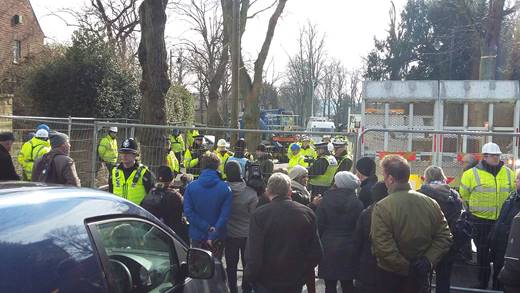
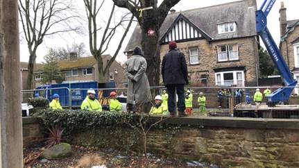
Crucially, the Council must win back the trust of the public. The citizen tree protection movement has been consistently peaceful, united by coherent and informed wishes (for example), and this is an excellent opportunity to give democracy a chance. Council elections are coming up in May, so change is in the air, regardless of what Council decides to do.

Quiz or joke? How many security officers does it take to cut down a tree in Sheffield? Photo: Anne Goodenough

Lastly, the response by civic engagement seen in Sheffield is an inspiring and bright beacon of hope in the current landscape of corporate bullying. Ordinary people continue to respond and stand up for what they believe in, and this has created a dynamic, supportive and creative community guided by the spirit of place-making. Similar, the degree of organising and communication has led to an agile movement. While many trees have been removed, a great number have been protected.

In an interview on BBC Radio 4 (March 16, 2018), former Pulp frontman, Jarvis Cocker, said: “The seventh “D” is daft. It is very daft to get rid of so many trees”. Cocker and other musicians are supporting a fundraising campaign to offset the legal costs of tree defenders. It may be too early to say, but I have a hunch that this community spirit—whether crowdfunding or any of the myriad forms of grassroots social investment that have emerged through this fiasco—is an essential ingredient to loosen the small-text grip of destructive PFI/P3 contracts.
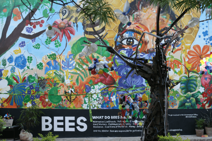
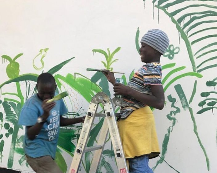
Power to the peaceful, and peace to the powerful.

Christine Thuring
Sheffield

On The Nature of Cities

Protecting More with Less: More Nature in Cities with the Science of Strategic Conservation

Art, Science, Action: Green Cities Re-imagined

By combining the benefits of structured decision-making with optimization, harnessing the power of markets, and the nuances of human behavior, we can achieve more nature in cities.

Not long ago, cities and nature were usually seen as two separate things. Thankfully nature and cities are now being acknowledged as inextricably linked, and an exciting and expanding movement is emerging to invest in green infrastructure that helps make cities sustainable, resilient, and livable.

Billions are spent annually around the world to support nature in cities. One investment strategy is to protect nature next to cities—creating defined edges or transition zones between developed areas and their surrounding natural areas and working landscapes. Another investment strategy is to integrate nature into cities—purposefully protecting and restoring green infrastructure inside urban areas, including the reuse of vacant and underutilized lands.

Despite the countless opportunities to implement each approach, very little attention has been paid to how cost-effective these investments are and whether governments and communities are getting the most “bang for their buck”. For over 10 years, Dr. Kent Messer (Unidel Howard Cosgrove Chair for the Environment at the University of Delaware and Codirector of the USDA-funded national Center for Behavioral and Experimental Agri-Environmental Research) and I have been on a journey to apply promising approaches that are commonly used in the business world, scientific inquiry, and policymaking areas outside conservation that help ensure more strategic and cost-effective outcomes. We are committed to bridging the “implementation gap” between academia and the conservation profession to use the best available tools from economics, operations research, behavioral science, decision analysis, and computer science to support cost-effective conservation and environmental stewardship of natural resources. We have successfully applied these tools in a variety of project contexts, leading to more strategic conservation, more acres protected, and shrewd use of available financial resources. Now we have completed our new book, The Science of Strategic Conservation: Protecting More with Less, as an effort to help publicize these efforts and scale the core principles of strategic conservation.

Significant advancements have been made in the theory and practice of conservation science to strategically identify the most important urban lands for biodiversity, ecosystem services, and other conservation objectives. Landscape ecology, conservation biology, and land use planning are some of the fundamental disciplines of strategic conservation planning that have been effectively applied to help achieve on-the-ground successes. We have attempted to harness these tools through the development of optimization decision support tools and applied projects that demonstrate how the comprehensive integration of these scientific disciplines into strategic conservation can help ensure the best conservation outcomes at a given level of financial investment—or, how specific conservation goals can be achieved at the lowest possible cost.

As a conservation planner, I am engaged in advancing structured decision-making tools able to quantify the benefits of potential conservation investments that result in better project selection and implementation. As a behavioral economist, Kent is engaged in cutting-edge research and outreach efforts related to efficient and effective environmental conservation. Our book highlights many of these advances in integrating these techniques into a variety of conservation contexts.

We provide examples in the book on how nature can be incorporated both “next to” and “into” cities. For instance, we showcase the development of regional forest conservation and restoration models for the Mid America Regional Council (MARC). MARC is the Metropolitan Planning Organization for the Kansas City region, so it oversees investments in transportation infrastructure. MARC was interested in forest conservation and restoration opportunities to avoid and minimize potential impacts to forested lands and to identify strategic mitigation opportunities when impacts were unavoidable. We built a GIS model that quantified the benefits of forest conservation and restoration within four categories: clean water (quality and quantity), clean air (carbon storage, pollution), quality of life (recreation, protected lands), and wildlife habitat (green infrastructure network). The resulting maps provided a spatially explicit framework for MARC and other partner organizations to optimize their investments in forest conservation and restoration projects.

Figure 1. Mid-America Regional Council (MARC) forest conservation and restoration prioritization model Credit: The Conservation Fund

We also showcase how the Upper Neuse Clean Water Initiative in North Carolina is using strategic conservation to creatively protect land parcels that support clean drinking water for the region’s municipalities. The Upper Neuse Clean Water Initiative is a collaboration by The Conservation Fund, Ellerbe Creek Watershed Association, Eno River Association, Tar River Land Conservancy, Triangle Greenways Council, Triangle Land Conservancy, local governments, and state agencies and is coordinated by the Conservation Trust for North Carolina. Together with willing landowners, these partners protect natural areas that are critical to the long-term health of drinking water from the Upper Neuse River basin by either purchasing parcels or establishing conservation easements on them. In its first 10 years, the initiative acquired ownership or an easement for 88 properties, protecting 84 miles of stream bank across 7,658 acres. In 2015, the initiative set a goal of protecting 30,000 acres over the next 30 years. We built a GIS model that examined every potential parcel in the watershed using multiple criteria and ultimately identified more than 17,000 parcels totaling more than 260,000 acres that would support the protection goal.

Figure 2. Upper Neuse Clean Water Initiative conservation strategy Credit: The Conservation Fund and Hawkins Partners

To protect more nature in cities using the science of strategic conservation and cost-effective conservation approaches, it is important to take a multiple benefits approach. For example, urban tree planting programs provide an array of human and natural benefits, including their value in ensuring clean air and clean water as well as providing habitat for wildlife. These ecosystem service benefits can be quantified using a variety of techniques and structured decision-making methodologies. The book illustrates numerous examples of quantifying the value of green infrastructure, including using decentralized stormwater management tools that can capture and absorb rain where it falls, thereby reducing stormwater runoff and improving the health of surrounding waterways.

More nature in cities can be accomplished on the ground by combining the benefits of structured decision making with optimization and the harnessing of the power of markets and the nuances of human behavior. By effectively developing, organizing, and prioritizing decision-making criteria in a structured and consistent way, cost-effective conservation tools can then be applied to get the most “bang for your buck” in an array of nature-based investments.

Will Allen
Chapel Hill

On The Nature of Cities

Socioecological Science is Failing Cities. The Humanities Can Help

Art, Science, Action: Green Cities Re-imagined

Science cannot solve the ultimate mystery of nature. And that is because, in the last analysis, we ourselves are part of nature and therefore part of the mystery that we are trying to solve.” — Max Planck

As a graduate student, I was often assigned to read the foundational work of pioneering ecologists such as the late W. Dwight Billings, who was still on the faculty of Duke University when I was enrolled there. The first few decades of ecological research generated an extensive body of descriptive papers that used the new and evolving ecosystem concept to explore the biomes of the world. Writing in 1933, Billings’ Ph.D. advisor Henry Oosting framed his work on a lake in the area around Minneapolis, USA by noting that “the present study, principally descriptive of the environment and vegetation…was begun as a necessary early step in the cultivation of a field of research as of yet almost untouched in Minnesota…” While quantitative methods were available to scientists at this time, qualitative observations still comprised an important component of the field. “Statistics,” Billings wrote in the journal Ecology in 1941, “cannot replace clear thinking, and masses of figures should not be allowed to obscure a clear picture of a problem.”

While ecology has learned a great deal through an increasingly strict approach to scientific positivism, these constraints are no longer needed, and indeed, no longer desirable in the advancement of urban ecology.
Embedded in these early qualitative and personal accounts is important information that I fear has been lost from ecology as a discipline. Descriptive ecological science, I was taught as a graduate student, had met its end by the 1990s (and indeed many years before that), and the field was entering an era of highly quantitative methods. Advanced statistics, computational models, and the merger of physical and biological sciences was the future of the field as it was presented to me and my fellow students at the time. Consequently, my graduate curriculum included far more coursework in thermodynamics, meteorology, and fluid mechanics than in biogeography or natural history. Like most scientific disciplines, ecology aspired to emulate the foundational sciences in Comte’s hierarchy, which is built on mathematics, followed by astronomy, physics, chemistry, and at a later stage of development, biology. Sociology, according to this framework, is built later still upon the tenets of all of the natural sciences. The more recent distinction between the “soft sciences” and “hard sciences,” formalized by Storer in 1967, has also been influential in ecology as it has struggled to be accepted as a “hard” science.

“Chroma S5 St. Francis” by John Sabraw, Acid mine drainage pigments, gold leaf, and other paints on aluminum composition panel, 36″ x 36″, 2017.

Ecology’s journey to distinguish itself from its “softer” roots is a bit of an ironic twist in the development of the discipline, at least as it pertains to urban ecology. The increasing recognition that human activities are becoming indistinguishable from “natural” processes has led increasingly to calls for a science of biocomplexity and coupled human-natural systems. One common methodological approach to understanding cities as complex ecosystems is to bring together the ecological sciences as they have been practiced as part of biology, with various sub-disciplines of the social sciences. While ecology is ostensibly the study of the relationships between organisms and their environment, in the last two decades many, if not most, ecologists have acknowledged that humans are not interchangeable with other organisms. As Pickett et al. (1997) summarized, “simply inserting humans in the organismal component of the ecosystem concept is correct, but hardly adequate to understand their role in ecosystems. This is because humans are social creatures with large manipulative capacities, whose primary means of adaptation is by learning…the second feature of humans that makes viewing them merely as biological agents inadequate to the task of understanding urban ecosystems is that humans are self aware and can learn individually, as groups, and as institutions.”

“Shindig” by Patrick Dougherty, willow from Double a Willow, Fredonia, NY, 16′ x 12′ x 90′, 2015. Photo: Diane Pataki

This argument certainly holds true today: humans are not sparrows, and there is more to studying human-dominated ecosystems than biological methods alone can reveal. And yet, more than two decades later, where do we stand in the development of socioecological science as a set of theories, a sub-discipline, or even as a set of methodologies? I have been deeply engaged in this field for many years, and I will confess that my answer is not far enough.  Not enough to claim major advances in the scientific understanding of how cities work, and not nearly enough to help cities solve critical environmental and social problems.

I’m sure some readers engaged in this field will disagree. Perhaps some of you think that in fact, major breakthroughs have been made, or that socioecological research has greatly assisted contemporary cities with their most pressing problems, or perhaps simply that the field and its practitioners need more time to accomplish these things. But let me offer something else: the possibility that while ecology has learned a great deal through an increasingly strict approach to scientific positivism, these constraints are no longer needed, and indeed, no longer desirable in the advancement of urban ecology. This idea is somewhat implicit in the framework of “ecology for cities” that is becoming popular with urban ecologists in the United States. Ecology for cities advocates for an applied ecological science that will help inform urban design in ways that meet the needs of stakeholders and urban residents. Not surprisingly, this notion is somewhat contentious given the diversity of views on the varying and blurry lines between modern “objective” science, applied science, and advocacy that undermines public trust.

But there might be another way beyond the science vs. advocacy debate. Although numerous knowledge-to-action frameworks exist, ecology has yet to fully and explicitly interrogate the range of models of scientific objectivity, and their various challenges as implicit in modern urban ecology and it sibling disciplines: environmental science, sustainability science, and conservation biology. To varying degrees, these fields are built upon an implicit or explicit interrelationship between the observer and the object of the study: the city, society at large, and biodiversity. An interrelationship implies some degree of subjectivity and normative concern for the outcome: the practitioners of these disciplines have an interest in contributing to the livable city, the healthy environment, and the survival of non-human species. This conflict between normative ideals and post-Enlightenment scientific methodology has been plaguing the ecological and environmental sciences (and many sciences that have clear societal implications) for decades. But new generations of both scientists and philosophers, including feminist scholars, have challenged the assumptions of current methodologies. Evelyn Fox Keller, the mathematical biologist and feminist philosopher of science, pointed out that “scientific knowledge is made objective first by being disassociated from other modes of knowledge that are effectively tinged and hence tainted.” In the conventional view, the subjective mental experience of nature has little to offer science as a mode of knowledge. However, embedded in this experience are the reasons why we wished to engage in knowledge to action in the first place. In other words, we not permitted, in the traditional scientific method, to fully explore our personal connection to our object of study, how it came about, and how it may (or may not) be common to the human experience. As a result, cut off from ways of knowing in which nature affects us directly through personal experience, the broader relationships between people and nature remain elusive in ecology.

The human experience in the urban environment is, in fact, at the heart of what we need to understand if we’re to use scientific knowledge to build better cities. It’s no accident that human-environment interactions are among the most poorly understood aspects of urban ecology; many of the tools that can be used to access these experiences are deemed to be unusable in modern science, because they are too qualitative, subjective, or unverifiable by experimentation. This dilemma was a major impetus for bringing together the social and natural sciences to study urban complexity. However, the social sciences are also strongly influenced by positivist ideals and methods, going back to Comte. Perhaps less so than the natural sciences are today, but nevertheless, though much has been made of the conceptual and methodological differences between the social sciences and biology, they share many ideals and historical trends in development. Even social constructivism as a contrast to positivism is probably fairly accessible to most natural scientists, at least conceptually.

But the humanities offer additional, new possibilities of direct access to the human experience in urban nature, as well as a fresh understanding of what it means to construct nature in the urban environment, that are also needed in the expansion of ecology as an urban discipline.

The problem is that central to the humanities are assertions that contradict the very basis of modern science: that knowledge can be gained through subjective experience; that there is reality beyond what can be materially measured and physically verified; and that generalizable theory is not always the most insightful path to understanding nature. It is no trivial task to expand the concept of ecology to encompass these views, antithetical as they are to what not just scientists, but all of our modern society has to come to accept as a hierarchy of ways of knowing, with materialism at the top.

Taking materialism all the way to its logical end, the modern scientific method presumes that the human experience can be reduced to atoms, chemistry, and physical laws. Do ecologists really believe that this is true? I suspect that most do not; nevertheless, we’re on track to reduce humans and life in the general to the “ ‘universal laws of life’ that are…mathematizable so that biology could also be formulated as a predictive, quantitative science much like physics,” to quote Geoffrey West in Scale.  To this, as a proposed endpoint for biology, I would answer that as a science that embraces uniqueness, context, variability, and interrelationships, ecology is, perhaps, the branch of the life sciences that is the least well-served by strict reductionism.

There are, in fact, biologically-based arguments for expanding our ways of knowing in ecology. In his dazzling book, The Master and His Emissary, psychiatrist Iain McGilchrist argues that modern cognitive science locates scientific materialism in only one part of the brain.  While most of us have been presented with a simple view of the functioning of the left and right hemispheres of the brain (logic on the left, art on the right), the reality is, of course, more complicated. McGilchrist builds a case based on cognitive studies, neuroscience, evolutionary biology, and case studies in pathology (in which parts of the brain have been damaged) to present a more nuanced view. In his synthetic framework, the left hemisphere is responsible for evaluating information in relation to what is already known, placing objects and experiences in more abstract categories. It further contends with the impersonal, the literal, and the mechanical, but is not well-equipped to understand individuality, the otherness and the howness of things, their context, their interrelationships, and the experience of empathy. Rather, these aspects of cognition are the domain of the right hemisphere, which processes “relational aspects of new experience, emotion and the nuances of expression” as well as wholeness, connections, and uniqueness.  McGilchrist then sweeps through all of western history, arguing that some periods have been dominated by left hemispheric thought, while others (the early Greek period, the Renaissance, and the Romantic period) have drawn more completely on all of our powers of cognition. According to this view, we are currently in a period where the left hemisphere is almost completely dominant over our culture and now constitutes virtually the entirety of the scientific method.

As an ecologist, I find this argument striking, since most of the asserted functions of the right hemisphere—context, interrelationships, the individuality of organisms, and the whole as more than the sum of its parts—are both central to ecology while still remaining the most uncertain and elusive aspects of our understanding of ecosystems and their functioning. Given that the post-Enlightenment scientific method has devalued many possible means of fully exploring these aspects of the natural and human-created world, it seems plausible that without a more radical expansion of the boundaries of ecological concepts and methods, we are highly constrained in our ability to understand, let alone successfully shape, the nature of cities.

“Your Memory is Already Fading” by Wendy Wischer, cast, cristal clear resin, false floor and stereo sound of an original script on loss, 13′ x 10′ x 7.8′. 2015.

Art-science collaborations in ecology abound—I’m not suggesting that they don’t exist—however, more often than not, scientists view these projects as a means of communicating scientific ideas and results to the public.  What I’m calling for is a flow of information in the other direction, in which scientists are open to the arts and phenomenology as a means of gathering much needed knowledge about the intersection between people, cities, and other aspects of nature. At the very least, science and the humanities certainly need not be at odds where their goals intersect, as I believe they do with respect to urban nature. In a wide ranging essay in the Chronicle of Higher Education, Steven Pinker describes this relationship as nothing short of a war between the disciplines, with each side hurling accusations of racism and other atrocities against the other. I must disagree when Pinker implies that all critiques of the scientific method contribute to the cultural “war on science”. Pinker calls for a reconciliation between the humanities and science as I’m doing, but all the while calling practitioners of critical analysis of science “resisters to scientific thinking” for implying that not all phenomena can be quantified. His solution is for the humanities to move closer to science, while science need not question a single digit in the numerical depiction of nature by viewing the world through the lens of the humanities.

I am very much a practicing research scientist and not a humanist, but sometimes our traditional methods simply fall short of the questions that need to be answered. When it comes to the intersection between ecological processes, the built environment, and the experience of living in modern cities, this problem is both acute and urgent. If there is a chance that the arts, literature, philosophy, and other humanist disciplines have something to offer our understanding of what urban ecosystems are and can be, then I think we should explore that chance, and quickly. Given the pace of environmental and social change, we don’t, unfortunately, have another two decades to wait to see the results of urban ecological studies to come to fruition.

Diane Pataki
Salt Lake City

On The Nature of Cities

In the Built Environment of Cities, Urban Ecology and Technology Must Walk Together

Art, Science, Action: Green Cities Re-imagined

As engineering technologies are increasingly used to support urban nature, it is important for urban ecologists to participate and develop procedures to monitor and assess the performance of urban nature. 

Figure 1: Top to bottom: a schematic of soil cells in a street; the tree plantings along Bloor Street, circa 2012; removal of Bloor Street trees by City crews in 2015; the tree plantings along Queens Quay Boulevard in the Toronto Waterfront in 2016. Photos: Urban Toronto; Amber Grant, James Steenberg; Camilo Ordóñez

A recent discussion at The Nature of Cities talked about the most important things to know for an urban ecologist. For many, this was that humans are part of nature. But the many influences of humans on urban nature is so complex, that some aspects of this relationship are better understood as independent dimensions.

A useful way to look at engineering technologies, such as a metallic guard around a tree, or a water-sensitive pedestrian path that channels rain into a tree pit, is as an independent entity. Obviously, these technologies are an extension of human decisions, but it is sometimes useful to de-couple them and expand the usually binary socio-ecological spectrum. Indeed, sometimes the technology is excellent, but human behaviour or urban nature trump its effectiveness.

Consider this example: In 2010, one of the most important commercial retail spaces in Canada, Toronto’s Bloor Street, saw the planting of 133 London planetrees. Growing trees here would not have been possible without the installation of structural soil cell technology, a rigid framework of empty cells that can be filled with high-quality soil that is irrigated with the water run-off from the above street. Five years later, many of these trees were dead, and the multimillion-dollar revitalization of the street had become something of a sore point.

Did the tree species or the technology fail? Is it worth it to continue to invest in tree-planting in heavily built-up areas in Toronto? Many of these questions have been circulating in public media. Many stakeholders were concerned that this failure might be repeated in areas where trees had been planted with the same technology (e.g., Queens Quay Boulevard, Toronto Waterfront). To understand what went wrong on Bloor, we need to see urban nature, human decisions, and engineered technologies as interrelated aspects.

Technology as part of urban ecological design

Urban ecologists don’t like to talk about engineering technology, and with good reason. Engineers have dominated the design of cities and the delivery of its services. Urban nature, including rivers, street trees, bats swarming a mango tree, and sneaky foraging racoons or possums, are considered either pretty or a liability or nuisance to the functioning of cities.

But today, things are taking a turn. Green infrastructure (GI) and nature-based solutions (NBS) are notions that are becoming the mainstream in urban engineering. Parallel to this, urban ecology is growing into a recognized field of science.

Yet, engineering technology rarely gets mentioned as an aspect of urban ecology. There are more attractive narratives for ecologists, such as making urban nature wilder. This re-wilding speaks to the strengths of ecologists and, sometimes, can be cheaper than engineering ourselves out of problems. Also, ecologists complain that GI and NBS turn nature into a technology, stripping it of its inherent biodiversity value, and making it solely utilitarian.

But to distance ourselves completely from engineering technologies hinders the advancement of GI and NBS. Some technologies are the result of countless field experiments making natural elements perform better, including green roofs and planting sites for street trees. Technologies like sub-surface structural soil cells can mitigate some of the environmental stressors that affect street trees, including soil quantity and irrigation. As NSB and GI go forward, the attachment of urban nature to engineering technologies will become more ubiquitous.

As urban nature is included in these increasingly complex environments, it is important to develop procedures to actively participate in their creation. Also important is to find ways to monitor and assess the performance of urban nature, specially considering that these environments create a whole new suite of variables that can influence how urban nature performs. This requires a closer examination of the interplay between technology, nature, and humans.

Technology, nature, and humans: a case study

Figure 2: Top to bottom: modelling of the 3D sunlight/shadow patterns of the street; historical GoogleStreetView® images of the trees; collection of soil from the immediate environment of the trees; collection of tree trunk samples for dendrochronological analysis Photos: GoogleStreetView®, Amber Grant, James Steenberg, Mihai Grosu, Vadim Sabestki

From 2015 onwards, we investigated tree performance in soil cell installations in Toronto, including Bloor Street and Queens Quay Boulevard, to develop an understanding of urban nature performance in these highly engineered spaces.

In the case of Bloor Street, where trees had already declined, we employed a number of digital tools that we call “tree forensics” (see figure 2). We applied the same methods to the trees planted along Queens Quay Boulevard, but with a closer examination of soil conditions involving soil moisture and salinity loggers.

Although we hoped to find a silver bullet for the possible influences of tree mortality and performance at Bloor Street and Queens Quay Boulevard, we never found it. Instead, our results suggested the culprits were numerous and cumulative. Extreme weather events, damage, and sunlight (both too much and not enough) all appeared to play a role. The most notable relationship between tree-mortality patterns at Bloor Street involved the heavy application of de-icing salts, which helps keep streets safe for pedestrians in places like Toronto.

Our research at Bloor Street and Queens Quay Boulevard made us think deeply about the interaction between technology, humans, and nature, and how they each influence urban-nature dynamics as distinct entities.

Figure 3: De-icing salt application in winter 2016-2017 along Bloor Street. Photo: Jim Urban

Moving forward
Some final observations about the interaction between technology, nature, and humans:

1. While engineering technologies are important for ensuring that natural elements perform well in some contexts, we need to understand the influence of factors that are beyond the technology. For instance, the application of de-icing salts in the cases discussed above was more dependent on human behaviour and environmental conditions.

2. Having a good understanding of the technology or of natural elements may not be enough. We also need to consider the way nature responds to environmental factors caused by the technology itself. Also, without a deep understanding of behavior of those people who have a daily direct contact with the trees, which can induce damage, our efforts to scale-up technological fixes may amount to nothing.

3. A comprehensive suite of performance indicators for GI and NBS needs to be developed. This will allow us to monitor these installations and assess their impact.

4. Current demographic and environmental changes will become more important for GI and NBS in the future. For example, the ageing population of Canada means that streets must be kept safe, but this may mean more de-icing salt application. GI and NBS must respond to multicultural needs and preferences, especially in cities with high immigration. Finally, climate change must be considered. An increased frequency and intensity of snow events in northern climates may mean more stressed vegetation and more de-icing salts on the streets.

All in all, urban ecological design needs to be more connected with engineering technologies and human behaviour.

Camilo Ordóñez, James Steenberg and Amber Grant
Toronto

On The Nature of Cities

Acknowledgements
Special thanks to our colleagues, Prof. Dr. Andrew Millward (Ryerson University) and Vadim Sabetski (City of Guelph). We also thank Jim Urban (Urban Trees + Soils, FASLA), Tanya Brown and Brian Brownlie (DTAH), Peter Simon (City of Toronto), Ontario Line Clearing, and the members of Ryerson’s Urban Forest Research & Ecological Disturbance (UFRED) Group. The research showcased here was funded by the Ontario Centres of Excellence, the Natural Sciences and Engineering Research Council (NSERC) of Canada, the Tree Research & Education Fund, DTAH (Toronto), and Ryerson University.

James Steenberg

about the writer
James Steenberg

James Steenberg is an environmental scientist focusing on forest ecology and management. He is currently a Killam Postdoctoral Fellow at Dalhousie University’s School for Resource and Environmental Studies.

about the writer
Amber Grant

Amber Grant is a PhD student at Ryerson University in Toronto, Canada. Her research focuses on determining equitable decision-making in urban forestry, and building best practices for urban foresters through an intersectional approach.

Photo Essay: Finding Refuge in City Parks

Art, Science, Action: Green Cities Re-imagined

In between congested Asian city sidewalks, we found ourselves pulled into urban green spaces.

We walked many treeless roads from Bangkok, Thailand to Samsun, Turkey. On our weekly rest days, when we rambled into cities and found a hotel room where we could sleep in a bed and hang our laundry, we sought out those quiet giants.

This walk we’re on is shifting our preferences.

Before 2016, we would leave our backpacks in the hostel and, with explore-the-world enthusiasm, we would hurry around to see the main sites, the buildings worth seeing, the local hangouts, the things guidebooks recommended.

Now, with greater frequency, we gravitate towards open spaces, parks, and other places where we could get our much-needed dose of flowers, trees and green things. We crave stillness and reprieve in the cities we find ourselves in.

Here are a few of the parks, green spots and bursts of nature we found along the way and remember with fondness. They have helped silence the noise we typically hear when walking through urban areas.

All  photos courtesy of Bangkok to Barcelona on Foot.

While we were in Bangkok mapping our route and getting our visa for Myanmar, we went for frequent walks around Lumphini Park, a big city park ringed with palm trees and high-rise buildings.
Sirijit Park is the biggest public park in Kamphaeng Phet, Thailand. Like many parks in Thailand, public exercise equipment is a fixture here as well.
After a busy day in the pulsing city of Yangon, Burma, it was nice to have a few minutes in Maha Bandula Park. It where locals have been coming to sit on the grass since 1867 when the swampy land was converted to a public recreation ground.
We don’t remember the name of this park we stumbled into in Dhaka, Bangladesh, but it was a much needed moment of relaxation away from the traffic we could barely get around in this overcrowded capital city.
Being in the Wakhan Valley in the Pamir region of Tajikistan was like strolling through a park every day. Walking alongside some of the world’s most majestic mountains remains among our sweetest memories of our Bangkok to Barcelona journey.
The shady pedestrian passageways in downtown Dushanbe, Tajikistan invite locals and visitors to take it easy. They reminded us of similar middle-of-street green-canopied walkways in Bishkek, Kyrgyzstan.
“Why would you stay in a hotel?” an Iranian woman asked us. “You can just camp in one of the parks. It’s no problem. Everyone does it.” We were tempted a few times to pitch our tents in one of the many parks we found in Iran, but on the few occasions when we needed to camp we found camp spots out of public view.
While the seaside promenade in Batumi, Georgia pulses with kitsch touristic restaurants and bars, the park hugging the coastline was where we found our traveling joy.
In Turkey, like in Iran, roadside picnicking is a common sight and municipalities have set up areas where people can break out their picnic baskets. We made good use of these green areas along the shoulder to have lunch along the way and to admire the Black Sea.
Cities along Turkey’s Black Sea have converted their waterfront areas into parks and promenades. Here in Samsun they have a creative way of hiding functional electricity buildings in one of its parks. Perhaps they see open spaces as a gift to their residences? We certainly do.

Jennifer Baljko
Bangkok to Barcelona on Foot

On The Nature of Cities


Conquering the Sea: Expanding Turkey’s Black Sea coast with stones, apartments, and promenades

Art, Science, Action: Green Cities Re-imagined
The Black Sea, streaked with sun rays, stretches out as far as I can see on one side of the highway. Buildings housing thousands of people living their dreams line the other side of the road.

There’s another one. And another one. And another one. And, yes, there’s one more over there…and over there.

I’m noticing the many new apartment buildings dotting—defining—Turkey’s Black Sea coastline. From Hopa to Samsun, and nearly all of the cities and towns in between the 500-kilometer stretch we have done so far in this country, it’s hard not to notice these high-rises. They seem to be everywhere, in various states of construction.

New construction dots the Black Sea coastline. Photo: Bangkok to Barcelona on Foot.

This stretch of the route took us from Batumi, Georgia, primarily along the Black Sea Coastal Road/state road D-010 to Samsun, Turkey. Some of the cities we passed through include: Hopa, Rize, Trabzon, Görele, Giresun, Ordu, Fatsa, Ünye, Çarşamba and Samsun.

We notice other things, too.

Our route takes us around the jagged coast. The smell of salt air and, in some places, tea wafting through plantations and out of processing plants hangs heavy. Through this stretch, we’re lucky to see some kiwi groves and hundreds of hazelnut trees (Turkey produces 75 percent of the world’s hazelnuts, and most of that comes from the Black Sea region, according to Turkey’s Hazelnut Promotion Group (FTG); walking so many months along roads without many trees makes every one we see that much more special. Snow-capped mountains in the distance make us happy to be in the sun looking at a blue sea on a chilly autumn day, even as we wonder about the impact new and under-construction airports will have on maritime ecology. We walk slowly under the weight of 23+-kilogram backpacks on the wide shoulder of the D-010, a regionally important and well-maintained coastal highway bridging east-west trade routes. Giant stones, scooped out of the earth, mark the limit where land and sea meet. Sometimes, these boundaries, especially in larger cities, blend with bike lanes, jogging straightaways, parks with public exercise equipment and promenades where locals walk, sit, and sip the region’s beverage of choice, tea.

Black Sea stone coast. Photo: Bangkok to Barcelona on Foot

But when I’m not looking at the small waves hitting the stone coastline or minding the constant flow of long-distance trailer trucks moving contemporary conveniences, I’m wondering about these new buildings. The sheer number of them along our way gives me pause. “What’s happening here?” is a question that turns over in my head and rolls out of my mouth when in conversation with locals.

Development is what’s happening here. Like in other places in the world, Turkey’s strategy to leap forward, in part, involves new construction to house its citizens, stimulate the economy, create jobs, and raise the quality of life of its residents.

New buildings in various states of construction dot Turkey’s Black Sea coast. Photos: Bangkok to Barcelona on Foot

More than a few people tell me that the Black Sea development—read, these new buildings—is linked to Turkey’s nationwide modernization efforts. Central government incentives, usually in the form of what we interpret to be short-term, low-interest loans, has allowed individuals and families to tear down outdated and, perhaps structurally unsound, buildings and replace them with multi-story dwellings that, superficially at least, shine with a “Look how great we are doing” feel.

Developers, people tell us, have won permission to erect buildings, businesses, and commercial centers, among other things, which are converting many once-rural or suburban towns into bigger urban hubs. I later read reports in several publications, including We Build Valuethe Daily SabahPwC, about the billions and billions of dollars of investment being poured into Turkey’s ambitious economy-boosting Vision 2023 plan, which calls for nationwide construction of new airports, bridges, roads, tunnels, railways, high-speed trains, irrigation canals, electricity generation capacity, and a Panama-like canal that will serve as an alternate route to the Bosphorous Strait linking the Black and Marmara seas. I read other reports about people protesting the environmental impact of a planned gold mine and questioning if the housing construction boom will soon burst.

My head spins. Again, like in other places I have walked, I can’t help but think about the price of progress and the trade-offs that may eventually affect all of us, one way or another.

I believe, of course, that the world’s citizens—in this case, Turkish citizens—deserve a place where they can live with dignity, pride, and comfort. Having a safe place to sleep every night has taken on a deeper meaning during my two years of being a homeless nomad. I also appreciate that people want to spend their hard-earned money on a piece of property that creates long-term value and, hopefully, well-being and contentment. It’s just and equitable to give people access to public and private funds, resources and other tools so they can improve their lives and those of their families, participate in urban planning initiatives and walk along their seaside and through open green spaces without getting plowed down by an 18-wheeler.

But, I’m deflated by a question I find myself pondering over and over again during this 14,000-odd kilometer journey home and can’t seem to resolve: “Is this the best we can do?”

The root of my frustration largely revolves around long-term sustainability.

Hauling stones and reconstructing the coastline. Photo: Bangkok to Barcelona on Foot

Why is the widespread view of development the world over still entangled with the idea of cutting down forests, expanding our environmentally insensitive footprint, extending our shores with questionable materials, raising houses on unstable foundations and selling the capitalist dream of high profits, big returns and having the best new house, car, phone or whatever else defines “doing well.”

At the same time, I benefit from development efforts wherever I go in the world. Transportation, energy-acquisition, and infrastructure improvement projects allow me to move, communicate, and connect with other people with relative ease and comfort.

I’m not alone in sorting through the mental mess development like what I see in Turkey creates in my head and heart. Different points of view on this surface as we walk through Turkey’s northern coast and share conversation with locals holding small glasses of fresh brewed tea.

New buildings dot Turkey’s Black Sea coast. Photo: Bangkok to Barcelona on Foot

One man, a seaman, working on international cargo ships who has a soft spot for the wide-open mountain spaces he discovers on his motorcycle, tells us the region’s fast development over the last 10-15 years has helped many families who were struggling to keep up with repairs on their single-family homes. By leveling those properties and moving into recently constructed ones, people have a new lease on life, a stronger sense of security, and a feeling that they are progressing. Their quality of life is better now than before, he says, adding that the construction boom has ushered in economic, logistics and infrastructure improvements throughout the region.

Many plots of land are up for sale as development initiatives continue along the Black Sea. Photo: Bangkok to Barcelona on Foot

A younger cyclist and outdoor enthusiast shares with us his concern about the stability of the buildings and the high price that comes with development like this: Losing the coast’s natural beauty and resources to accommodate the growing number of people who are leaving behind their rural inland homes, farms, and livestock grazing areas to become city dwellers. Heavy rain is common in this part of the country and increasing floods in areas where erosion-stopping trees no longer exist put many more people at risk, he laments. We recall a news report that ran on TV a few days earlier showing part of a house wrecked during a downpour that triggered flooding along a river up the coast. We shake our heads with dismay.

I see both perspectives but understand less and less as I come to know more about the places I pass. Conquering the sea, conquering nature, has liberated many people. Conquering the sea, conquering nature, has also unlocked a wave of unpredictable outcomes.

Besides new buildings, development has also brought parks, seaside promenades and open spaces for residents to enjoy. Photos: Bangkok to Barcelona on Foot

I walk on, glad to be on the promenade made for walkers, runners, cyclists and picnickers instead of hugging the shoulder hoping trucks and cars don’t weave in my direction. The Black Sea, streaked with sun rays, stretches out as far as I can see on one side of the highway. Buildings housing thousands of people living their dreams line the other side of the road. For a moment, everything appears in balance. But, is it?

Jennifer Baljko
Bangkok to Barcelona on Foot

On The Nature of Cities

#watchingthericegrow

Art, Science, Action: Green Cities Re-imagined

I spent a year documenting the on-the-ground reality of local farmers and villagers, in an attempt to provide an alternative to development maps offered by centralized planners.

#watchingthericegrow is a hashtag I created on Instagram on 4 August 2016, tagging a photo I took from a bicycle survey along a winding rural road on the outskirts of Chiang Mai, Thailand. The initial framing marked a memorable composition at the center of a territorial survey that would spiral out from this center. The posting announced my commitment to an on-line audience to take a picture on that same spot for the entire growing season. My goal, to not only watch but document the rice grow for the following three months was extended to a full calendar year, as my last post was on 4 August 2017. In the year, I documented the growing and harvesting cycles of two crops of rice. I supplemented the Instagram posting with various forms of videography: drone, handheld from a moving bicycle, and contemplative close-up still shots of the community irrigation weirs that dot the landscape.

As an architect and urban designer from a generation that made the transition from analogue to digital media, I have been interested in how forms of new media create new publics and audiences for mapping as well as new forms of social agency in urban design decision making. #watchingthericegrow will provide material, for on-line and in gallery exhibitions, which defines the villagers and farmers of Chiang Mai as the land artists and the owners of the map of the Lanna Territory, and important agents in deciding its future. Local narratives and visions provide alternatives to standard development strategies hatched in Bangkok. It is imperative that artists, designers, and social activists endeavor to assist in communicating local knowledge.

Three pictures from every month for one year. The two planting cycles can be clearly seen from the newly transplanted field on the upper left, in August 2016 during the rainy season, to harvesting in mid-November. The field is filled with irrigation water in mid-January 2017 for seed broadcasting during dry season. This second crop is harvested in May. The field is ploughed and flooded in July for the next year’s planting cycle. Photos: Brian McGrath

Marking a start

View of a rice paddy near Tha Thum temple, Chiang Mai, Thailand, August 6, 2016. Photo: Brian McGrath

I was looking for a composition I would remember. I frame a lush tree in the middle of the straight rows of seedlings in my view finder. A narrow irrigation canal cuts an angled path across two paddies, a giant check mark formed by two raised berms channeling water to the fields. There is a slight grade change between the higher paddy on the right, and the lower one on the left, with a cut in the berm, allowing the adjustment of the water level between the two paddies. The edge of the rural road is in the foreground, and a black and white painted sign post marks my vantage point. My weekly posting documented the growing and harvesting cycles of two crops of rice between August 4, 2016, to August 4, 2017.

This rice field sits between the village and Buddhist temple of Tha Thum, seven kilometers east of the center of the historic city of Chiang Mai, Thailand. The field, village, and temple are an example of the hundreds that dot the Chiang Mai/Lamphun Valley in Northern Thailand. The region, historically called Lanna, which means “a million rice fields”, is one of the most fertile in Thailand, and a complex gravity-fed, wet rice growing irrigation system developed over hundreds of years. The system was both royally supervised and locally managed through a community-based, water sharing network called muang fai, which refers to the weirs and canals that divert river water to fill the thousands of rice paddies that comprise most of the historic valley.

Drone view of the rice field surrounding the marker tree near Tha Thum temple. Pilot: Santipab Sonboom, October 2016

I intended to survey this system outward from this marked point by bicycle and foot, limiting the area geographically, but not focusing on a single village. The area I studied was bounded by the new national highways recently constructed across the valley—the outer ring road to the east, Doi Suteph Road to the north, and new San Kamphaeng Road to the south. The western border was the busy rural San Phranet Road. The rural open matrix of the muang fai system is transforming to a fragmentary urban/rural mix as land is fenced and filled for new houses.

The site study area measures almost 3 KM east/west and just over 8 KM north/south, encompassing an area where the Mae Kuang passes into the urban area within Chiang Mai’s Outer Ring Road (the bow-like curve to the east). Credit: Gabor Janos Suranyi, Mapping Assistant

New developments along the radiating highways and ring roads generate commercial strips and gated residential communities, but the within this superblock there are many dead-ends and overgrown vacant areas that remain from a previous period of land development and subdivision. In addition to the bounding roadways defining the site survey, at its heart is where the Mae Kuang River passes in and out of the urbanizing area encircled by the outer ring road. The area is approximately 12.6 km2 considering the boundaries of the highways and the village road. The east-west distance is approximately 2.8 km between the village road and the ring highway. The north-south distance is approximately 8.2 km between the two intersections of the radiating highways and ring road.

My bicycle survey comprised the circuitous route between these fragments, never crossing the obstacles of the highways. The area is like the one that Terence McGee described as Desakota, named after the rural and urban mix he identified in Indonesia. A major trigger for this kind of dispersed urbanization is the arrival of motorcycles to relatively dense rice growing landscapes. My two-wheeled survey was intended to help me understand the spatial imagination of the locals navigating between farm, village, and city, rather the mindset of the city’s planners and traffic engineers.

Video: The field survey was conducted by bicycle in order to acquire the two wheeler understanding of the farmers and villages.

The Mae Kuang River is a major tributary to the Mae Ping, and the two rivers occupy seismic fault lines, forming the valley and the alluvial plain that allowed the Kingdom of Lanna to flourish from its founding in 1296. Chiang Mai means “new city”, and it is located on a slightly higher elevation west of the Mae Ping, with its western gate leading to the royal gardens at the foothills of Mount Doi Suteph. The main rice fields were in the “belly” of the valley, southeast of the city, around the older city of Lamphun, located on the Mae Kuang River. The muang fai system begins with the royal project of diverting the rainy season excess from the Mae Ping through a long canal parallel to the river. The weir construction was an enormous effort, necessitating the marshaling of thousands of laborers to annually reconstruct the weir (fai) and dredge the canal (muang). Once this conscribed labor was complete, villagers were free to manage and maintain smaller muang fai, under the local supervision of a weir headman.

The Chiang Mai Comprehensive Planning with site area at the periphery of the historical city in green. The valley is dominated by a built landscape that follows the pattern of the ancient river and canal irrigation system. Credit: Gabor Janos Suranyi, Mapping Assistant

The Mae Kuang watershed is drier than this flood plain at the bottom of the valley, and a modern dam and irrigation system built by the national Royal Irrigation Department (RID) was overlain on top of the traditional muang fai irrigation system. However, the majority of the land is still farmed using an upgrade to the traditional wood, bamboo, rock, and silt fai. Called the “people’s irrigation program”, RID converted many of the old fai into concrete foundations that farmers could adjust to continue their practice of diverting river water to muang.

Same-same but different

 Eventually, I discovered four fai within this stretch of the Mae Kuang. The one at Tha Thum and San Si villages were quite easy to find as they were located near bridges over the Mae Kuang on two of the narrows rural roads that I bicycled over to survey the area. San Si includes of two shallow fai and a major diversion muang that feeds an enormous rice field located below an area of more recent industrial farming activity. Tha Thum is the highest fai I found, a spectacular four-meter high falls located just below a royally initiated fish hatchery and water plant harvest area. At this time, I conducted a drone survey to locate additional fai in the area of the river not accessible by bicycle.

Video: Drone from Tha Thum weir. Pilot Santipab Sonboom, October 2016.

With the onset of the dry season, at the start of the new year, I was able to bike along the river embankments south from the weir at San Si and soon discovered a third fai, directing a muang westward towards the village and temple of San Phranet. While the muang from San Si fed the enormous field adjacent to this fai, this muang disappeared into the forest on the other side of the river. I chose to continue surveying the field fed by the San Si muang fai, which continued as a lush farm to the south before the muang drained back to the river. The gravity fed loop of the irrigation system was now apparent in this closed circuit, where the river water fell approximately one meter at the San Si fai and another two meters at the San Phranet fai. The muang gently sloped, and the scores of paddies slightly stepped over the course of this drop.

San Phranet weir. Photo: Brian McGrath

I discovered the fourth fai by biking through the rice fields beyond the temple at Tha Thum. The temple, like my original marker tree, is surrounded by lush, active paddy. I was able to find the water source of the fields and trace a minor branch to a major muang, biking along its embankment, through the small settlements of a chicken farmer and woodworker before I found a spectacular fai that was feeding the Tha Thum fields. This bucolic spot was only accessible by foot, but the sound of the falls led me on, even when the pathway gave way. This fai was a short distance upriver from the village of Yang Phrathat, where a riverfront pavilion created a covered meeting space for the area’s villagers.

Yang Phrathat weir. Photo: Brian McGrath

I followed the last muang from Tha Thum fai through an urbanized area with scattered fields. East of the Mae Kuang, where the ring road bows away from the river, scattered fields fed by an unknown fai surround Wari Sutthawat village and temple. Finally, south of the old San Kamphaeng Road, a branch of the fai fed a few rice paddies, but most of the field was not fed by the system. However, I met a farmer, pumping water up from the Mae Kuang to mechanically irrigate an organic asparagus field he was cultivating, for export to Europe. This area along the river is dotted with earlier developments, many of them incomplete, vacant and overgrown. The 700-year anniversary celebrations of the founding of Chiang Mai were followed in 1997 by a severe economic crisis, and countless real estate developments were abandoned with bankruptcy. If the upper half of the site is dominated by the two large rice fields, to the east and west of the Mae Kuang as it winds around Tha Thum temple, the bottom half is dominated by a secondary forest covering these abandoned landfilled zones.

Asparagus farm. Photo: Brian McGrath

 Scaling up

The four villages and four muang fai discussed here are both in a particular position with the urban/rural interface of Chiang Mai, but also can be generalized to understand the challenges the entire valley faces as urbanization pressures rural life. The Chiang Mai Comprehensive Plan designates the land in between the radiating highways along the ring road as an agricultural preservation zone. However, the new ring has triggered much new development. Within my site boundaries, the Mae Kuang is marked as the boundary between agricultural preservation and low-density urban development, even though as the survey shows, farmland is fed by a muang fai system on either side of the river. A specific solution for this important site where the Kuang River passes through urban land is to preserve these large rice fields and two-wheel paths as important open spaces and trail ways within the city periphery. This proposal is also a model for the rest of the territory as urban development spreads from the newly widened radiating highways.

The Mae Kuang watershed covers an area of dispersed by densely populated farming villages. Credit: Gabor Janos Suranyi, Mapping Assistant
Image: Local farmer. Photo: Brian McGrath

During my survey year, there were many community meetings as another road is planned to cross the site below Tha Thum. In these meetings, villagers are presented with schematic planning maps and asked to offer input. They are not the “owners” of these planning maps, yet they are subject to the planning map’s ordering of their land. My project seeks to understand the farmers and villagers own mental maps of the territory and to use that as a basis for an alternative planning and design process for Chiang Mai. I borrow the term “owners of the map” from anthropologist Claudio Sopranzetti, who’s ethnography of motorcycle taxi drivers in Bangkok revealed their keen tactical knowledge of the city. As Thai scholar Thongchai Winichaikol has written, maps conform on us a “geobody”, usually of belonging to a nation-state. I hoped to embody this two-wheeled understanding of the Lanna territory through this year-long survey.

Weir fishermen. Photo: Brian McGrath

The farmers and villagers seem ready to fully engage in creating a more comprehensive transformation of the territory. Smartphones and a 4G internet network are widely present in the area. In fact, villages have formed “Line” social media groups to post images and discuss many issues of concern. I wonder if planning agencies located in Bangkok and provincial capitals are ready to hear the villager’s messages and understand their alternative maps of the territory, rather than relying on the simplistic ones created in their offices. I wonder if Terry McGee’s Desakota, created through the accessibility afforded by two-wheeled mobility, will be embellished and maintained by modern social communication and networking technology.

Brian McGrath
New York City

On The Nature of Cities

The Nature of Public Art: Connecting People to People and People to Nature

Art, Science, Action: Green Cities Re-imagined
Urban nature and public art can help to break down barriers both mental and physical, sparking imaginations, catalyzing placemaking, forging new connections, and bringing people together.

Mankind may have left the savannah some million years ago, but the savannah never quite left us. It makes sense that since we co-evolved with nature, our need for it is hardwired into our brains and our genes. For millennia, the nature we’ve had access to has influenced everything from our food, to the prints and colours we use on our clothing; our crafts to our livelihoods; the beats and lyrics of our music to our varied cultures and traditions—both ancient and modern. It’s shaped who we are. Not to mention, there is a plethora of scientific research pointing to the fact that we need access to nature for our basic development, our physical health and our mental well-being. Perhaps our genetics have not yet caught up with the pace of our urban and technological developments—hence the number of societal ills and human health issues we see today.

The project team pre-launch (Georgina Avlonitis, Mwamba Chikwemba, Chavi Alheit, Owen Shikabeta and Mbali Dlamini).

As we push ourselves into being an ever atomised, urbanised species, it’s even more important that we have adequate access to nature, a relationship and connectedness with it, and urban green spaces that promote community. Public art speaks to both emotion and reason, in finding new ways to articulate the richness and diversity of the relationships between people and their physical and natural environment—providing a sense of place and connecting people to people, and people to nature.

A very inspired young man from the local street children program who came to volunteer with the artwork.

Greenpop—a social and environmental NGO working across sub-Saharan Africa—was recently funded by the United Nations Educational, Scientific and Cultural Organization-International Fund for the Promotion of Culture (UNESCO-IFPC) to undertake their dream of an art and environment project aptly coined, “Conservation Conversation Corners“. Here, disused public corners in two African cities—Livingstone, Zambia and Johannesburg, South Africa—were transformed using public participation, mural art, public seating, sculpture and indigenous plants—into spaces of connection and of conversation around the incredible biodiversity that makes each city so unique and special. Three artists were selected for each leg of the project including South African up-cycler Heath Nash, Zambian sculptor Owen Shikabeta and Zambian painter Mwamba Chikwemba. All three artists were involved in the Livingstone leg—as well as South African installation artist Mbali Dhlamini (involved in the Johannesburg leg, in place of Heath Nash). The artworks and artists invited people into the space to break down barriers across countries, disciplines, people, and nature, turning these urban corners into functioning, colourful places of interaction—serving to physically, visually, and conceptually link the two African cities, while sparking conversation around our relationship with the natural world.

Local stencil artists came to get involved too.

In cities, we enter territory that is re-interpreted by wildlife itself—Johannesburg has one of the largest man-made forests in the world and Livingstone is hummed to sleep by a nightly chorus of frogs and the roar of Victoria Falls. But how to engage people in this incredible nature? What gets people’s attention is a link into their immediate sense of self and a relevance that draws them in. They have to be able to say “That is me, that is what I am about”. Over the three weeks spent in each city, community members were encouraged to contribute to the creation of the artwork and numerous participatory workshops were held to draw out each artwork’s main theme.

Livingstone’s artwork: Trees for Bees,
(Zambia Tourism Board Offices, Livingstone Way)

The final Livingstone Trees for Bees mural and upcycled tree sculpture. Photo: Mischke Bosse
Local Zambian kids painting their favourite leaves.

In Livingstone, a bare corner adjacent to the Zambian tourism board was chosen as the site for the artwork. Here the artwork’s main theme of bees was synonymous with the wonderful collaboration involved in creating the space. Bees are matriarchal creatures and experts at creative collaboration, working together to make the miracle of honey. After numerous workshops, the theme came about owing to the areas dire deforestation issues and the use of beekeeping in Zambia as an alternative livelihood—where indigenous woodlands are sustainably managed as valuable fodder for bees, instead of being cut down for fuel and the informal charcoal industry. The artwork set out to highlight the inter-dependency between bees and forests and their role in food security. With 90 percent of the world’s nutrition coming from crops pollinated by bees—they’re essential to our very survival. Albert Einstein’s quote was boldly included in the art space: “If the bee disappeared off the surface of the globe, then man would have only four years of life left. No more bees, no more pollination, no more plants, no more animals, no more man.”

Close ups of the Zambia Project

The artwork also had a clear feminist undercurrent, celebrating femininity and female power. Primary muralist of the project, Mwamba Chikwemba painted a powerful female figure as the focal point of the mural. “She represents the queen bee, mother nature and can be taken as a representation, an emblem of all powerful women. Bees are a matriarchal society and my subject matter as an artist normally focuses on strong females and the symbolism of female African head wraps. Here I have depicted a honeycomb hive as a celebratory headwrap—her crowning glory and as a celebration of all powerful women… What was also interesting was the numerous people that walked past me standing on the painting scaffolding and being surprised that a Zambian woman was actually standing so high up, and painting such a big wall. Other women from the community then got involved.”

Reactions from the local community where positive and inspiring. Josephine Monde who was the very first woman employed in the same building by Livingstone Tourism in 1966, walked past the space and commented: “You have really done a huge service to the people of Livingstone. I am proud to see a woman’s face up there on that wall. This has added beauty, not only to the building but to the whole of Livingstone. Tourism depends on the environment—without nature we have nothing.

Owen Shikabeta.
Owen Shikabeta creating his upcycled tree sculpture.

Upcycling was a large part of the artistic process and involved numerous members of the community. Owen Shikabeta created a 3m tall upcycled tree sculpture from scrap metal from which Heath Nash hung numerous upcycled creations, which were co-created by local children and crafters alike. Livingstone crafter, Freeton Matonga arrived on site every day to get involved in the artwork and to learn from the project’s daily upcycling workshops.

Matonga said: “The mural and the recycling are amazing because I can see the response from the people around here, how they are reacting to it.” They are seeing that they can find some value of the materials [waste] that we are using. We cut down so many forests for the wood used in our local crafts. I hope we are going to have some kind of change of mindset…maybe trying to convert things like recycling to keeping the environment clean. We’ve got the challenge of taking care of our environment so if people see that this is quite a good thing then people will be interested, and they will be doing more things—more than what we’ve just done here.

Johannesburg’s artwork: Freedom by Nature
(Corner Commissioner Street and Berea Rd, Maboneng)

Mwamba at the Johannesburg wall being prepped and primed.

Johannesburg is one of the largest man-made forests in the world, gifted with magnificent birdlife and rich biodiversity, but it is also a city with one of the highest crime rates in the country. In this city of bars, walls, and fences the artists set out to ask: “Where do we truly feel free?

The main theme involved birds, and was depicted in eco-friendly paint across the 45m² mural. “Birds are synonymous with freedom. As a woman in Jozi, you always feel like you need to keep eyes at the back of your head. We stay on our guards and alert at all times, whether walking or driving in the city, because of the crime here. How wonderful it would be to feel free and at peace. Nature has that. Nature gives us that. We need to access it and conserve it more in our towns and cities“, stated artist Mbali Dhlamini. Zambian artist Mwamba Chikwemba added that she could only relax properly when in nature. “I realised, the only place I’ve truly been able to relax during my stay [in Johannesburg] is in fact on my visit to Walter Sisulu Botanical Gardens. Being in nature, in a functioning and safe green space, makes you feel physically and mentally free“, she said.

Mwamba creating a heron between the graffiti.
Artist Mbali Dlamini next to the Johannesburg wall.

Some members of the public commented that they felt the artwork in the space made it feel safer. “For some reason, the colours and images on this wall make me feel so much safer, and I guess, well, more carefree when I walk down this street. This space has turned from grey and dusty to something just beautiful”, remarked Gladness Phiri, a local Maboneng resident. And her comments ring true when looking at international urban ecology literature, which is replete with studies showing that birdsong and functioning public green spaces indeed help to reduce the crime rates in towns and cities.

Community members enjoying the new seating.

Zambian artist, Owen Shikabeta created a powerful sculpture and public seating out of upcycled burglar bars. “There seem to be burglar bars everywhere in this city. When hunting for scrap to upcycle for this artwork—I came across so many bars. I use what I find, and so I created a bench. Instead of bars separating us, I wanted to make something that would bring people together. When you sit on it, I wanted it to somehow feel as though you are sitting outside of a cage. Free as a bird.” This was in addition to his life-size sculpture of a human, arms outstretched and free, which sits next to the bench.

Local residents getting involved.

Over the two weeks, the community of Maboneng and local artists made their way to the art piece to pick up a paintbrush, lending their voices and talent and leaving their mark. Maboneng student, Thando Nkosi commented: “I study in the area and it has been truly remarkable walking past this wall and seeing randoms [sic] and young children helping to create this piece. It’s evolved every day. I see one of my favourite birds over there, although you don’t often hear it in this part of the city when that bird sings you know the rain is coming—it’s a comforting sound.”

Johannesburg work in progress.
Johannesburg mural from afar.
The author, Georgina Avlonitis and her painted golden starling, a colourful and common Johannesburg species.

Urban nature and public art can help to break down barriers both mental and physical, sparking imaginations, catalyzing placemaking, forging new connections, and bringing people together. Through Greenpop’s project, these Conservation Conversation Corners give thanks to the magnificent biodiversity in Johannesburg and Livingstone and hope to spark conversations around its importance in people’s daily lives.

Georgina Avlonitis
Cape Town

On The Nature of Cities

Photo credits: All photos courtesy of Greenpop Foundation’s Georgina Avlonitis & Mischke Bosse.

This project was made possible by: UNESCO-IFPC, Propertuity, Art Africa, B-Earth paint, Krost and Vogel.

Greenpop website: http://greenpop.org/
Twitter: @Greenpop
Facebook: @GreenpopTreevolution
Instagram: @greenpopsa

Nature Atlas: Exploring Multi-scalar Methods for Mapping Urban Environments

Art, Science, Action: Green Cities Re-imagined
Engagement is the first step toward active acknowledgment, inclusion, and stewardship of the environment. Nature Atlas provides a rich tapestry of options for engaging with urban nature.

Edward O. Wilson popularized the concept Biophilia more than 30 years ago, in 1984, describing it as “the urge to affiliate with other life forms”. In short, Biophilia is a hypothesis that suggests the innate affinity of humans towards nature. We agree that humans possess the tendency to seek connections with nature—whether as a place for escape from the busy and chaotic city life, or as scientists curious to learn about other life forms, or designers seeking inspiration from natural habitats/environments, or as artists fascinated by colors, forms, shapes, and habits—we all share a love for living systems. It is this tacit, inherent connection between humans and nature that we explore in this essay and wish to make explicit through a research project based on Ruchika Lodha’s master’s thesis, called Nature Atlas, which excavates hidden layers of urban environments by mapping relationships between humans and nature. With this project, we hope to broaden the spectrum of human engagement with nature, to deepen awareness and knowledge, invoke curiosity to observe, interact, and engage, all as a way to help create a culture of stewardship toward our urban (and non-urban) environments.

The purpose of Nature Atlas is to invoke diverse ways of perceiving, understanding, and engaging nature by actively and consciously interacting with our environments through various practices across disciplines, inclinations, expertise, and capacities.

In the Anthropocene, people may be aware of and concerned about the environment, but there are many factors that deter them from being actively engaged with the nature around them. There are time constraints, lack of knowledge or expertise, fear of nature, and many other possible reasons. Engagement is the first step toward active acknowledgment, inclusion, and ultimately stewardship for environments (accreting toward nature at large). Personal associations and attachments that people build with environments provide stronger and more permanent motivations for engagement and stewardship (Nassauer 2011). The aim of Nature Atlas is to involve people with various interests and expertise to create a collective consciousness toward our environments.

Developed over 2016 and 2017, Nature Atlas employs alternative mapping techniques that go beyond top-down, two-dimensional spatial visualization to employ mapping as a reflexive, sensorial, and immersive methodology to excavate the unseen, tacit, or disregarded layers of nature within a case study in New York City, the Gowanus Canal in Brooklyn. This kind of mapping provides a wide range of inspirations and real-life projects to evoke readers to engage with the environment in their own ways without suggesting one universal or “best” strategy. The Atlas, thus, is a compendium of interpretative and speculative maps, diagrams, illustrations, and stories visualizing quantitative, qualitative, archival, scientific, empirical, and anecdotal research.

We envision the Nature Atlas as a step toward the creation of a broader collective of knowledge that yields diverse ways to actively and consciously recognize, interact with and engage nature through sensorial experiences, reflection, and speculation to understand how we (may) intervene with/in the Anthropocene to shift the present toward a more desirable future, Good Anthropocene (Bennett et al. 2016, McPhearson et al. 2017). Below we iteratively map layers of history of the Gowanus Canal, Brooklyn as a basis for exploring the current landscape of contemporary imaginaries and engagement of this changing nature in the city. This historical lens provides an opportunity to compare shifts in human-nature relationships through time.

“Primitive nature”

About four centuries ago, Gowanus was a saltwater marshland and meadows called Gouwane after the chief of the Lenni-Lanape group (Alexiou 2015), who were its earliest inhabitants.

The natives lived well off the tidal inlet of the marshland—a creek, then—through subsistence farming (of corn in the outlying lands), seasonal fishing, and collecting shellfish. These early inhabitants shared resources and lived intimately with nature, ebbing and flowing with its bounty.

Humans (as inhabitants) subsumed within and living intimately with nature (habitat). Credit: Ruchika Narendra Lodha
A speculative representation of primitive nature where human subsistence depends on natural topography. Credit: Ruchika Narendra Lodha

European Encounter

Europeans first arrived in Gouwane around the 1630s and settled in the area, intrigued by its plentiful and pristine nature, which was unlike the ordered and complex European cities (Alexiou 2015)[1]. The Europeans introduced new concepts of land ownership, property, and regulation. They appropriated and tamed the topography by delineating land, water, fields, settlements, constructing mills and roads for farming, fishing, trade, commerce, and navigation. The creek became a means to cultivate and transport produce from Gowanus to Manhattan markets. These delineations between land and water, labor and leisure, nature and society that were nonexistent or mutable before the arrival of the Europeans became clearly defined boundaries with distinct meanings and functions. Nature was therefore “tamed” and appropriated to create an ideal middle ground or pastoral ideal between wild, primitive nature of Gowanus and highly organized European societies to fulfill needs beyond subsistence, arguably producing a dichotomous relationship between nature and society.

An abstraction of the pastoral image as the ideal middle ground between wild nature and civilized society. Credit: Ruchika Narendra Lodha
The introduction of property and land ownership changes human perceptions of, and implications on, nature. Credit: Ruchika Narendra Lodha

Commercial nature

The nineteenth century saw the establishment of many early industries along the creek. Political and economic structures increasingly influenced and subsumed the topography of Gowanus. Infrastructural systems including the construction of the canal were seen as engineering marvels that eased the processes of manufacturing, trade, and commerce providing economic gains and convenience for sewage discharge. The canal became a raw material for exploitation and a waste receptacle for industries and society rather than an environment to inhabit and appropriate based on needs for subsistence (as in the 1600s). Mechanized labor, driving economic and political systems, and technological advancements, dictated its use and form changing the perception, function, and interaction with inhabitants intensifying the separation between society and nature.

Increased alienation between nature and society due to mechanical, industrial, political, and economic systems. Credit: Ruchika Narendra Lodha
The implication of the political grid plan on topography of Gowanus Canal. Map source: https://issuu.com/proteusgowanus/docs/gowanus_canal_maps_1639_2004. Credit: Ruchika Narendra Lodha

Post-industrial detritus

Since the stock market crash during the Great Depression in 1929, development and construction in Gowanus were almost completely at a stand-still due to lack of investments. The century and a half long industrial history that led to its glory, progress, and development also resulted in extreme contamination and toxicity in the canal. Map 4 hyperbolizes the post-industrial landscape of Gowanus Canal. It is a juxtaposition of industry, trade, commerce, prosperity, stagnation, toxicity, grime, romanticism, and charm. This perception of Gowanus Canal exposes contesting and overlapping epistemologies of nature. In the early twenty-first century, after residents and government officials raised concerns and voices, the site was studied and sampled producing reports of contamination levels and its effects on public and environmental health. This was representative of the acknowledgment of the interconnectedness between nature and society. After two years of deliberation, the government eventually designated Gowanus Canal a Superfund site, placing it on the National Priority List 2010. The site is now managed by the United States Environmental Protection Agency (USEPA) and undergoing remediation and cleanup.

Map (iv) is a representation emphasizing the industrialization of Gowanus Canal. Credit: Ruchika Narendra Lodha
Abolishing the idea of nature to envision reality without binaries (of society and nature). Credit: Ruchika Narendra Lodha

Contemporary nature

The current remediation plan envisions Gowanus Canal as an amenity to human society, an accessible piece of nature with flourishing habitats for plant, animal, bird, and aquatic species. Even though there are efforts to clean the canal and employ design strategies to acknowledge, address, include, and improve habitats for other species that cohabit the environment with humans, the vision co-opts the idea of a pastoral “garden” that manifests the reconciliation between deteriorating wild nature and extremely chaotic society through technology. Although there is awareness of the interconnectedness between societies and nature, nature is still perceived as an externality that supports and situates society. The knowledge produced through literature and scientific research that promote ecological thinking are often inaccessible or abstruse to laypeople.

A rendering by dland studio for the restoration of Gowanus Canal Sponge Park, is a composition of overlapping layers of various perceptions of nature (pastoral garden, industrial charm, ecological). Credit: DLand Studio

Actionable engagement

In this section of the Atlas, we list projects and practices that critically engage with nature through various disciplines and skill-sets including science, research, design, photography, art, and pedagogy as a pathway for the multi-scalar approaches for initial and ongoing environmental engagement. This collection hopes to provide inspiration and invoke readers from various backgrounds, with diverse inclinations and capacities to engage with nature by actively observing, acknowledging, interacting and engaging with their environments. The Atlas may also become a live archive connecting people and building networks among similarly-inclined practitioners and aspirers while bridging the gap between the literature on nature and empirical experiences through multidisciplinary practices.

Practice 1: Cartography, research. Source: Gowanus Canal Public Health Assessment Final Release and the New York State Department of Health, January 2017. Credit: Ruchika Narendra Lodha

Interpretive reporting is a method to translate long, tedious, and abstruse scientific reports into accessible and legible (visual) information to a population that is not academic or scientifically-inclined.

Practice 2: cartography, theory, research. Source: Gowanus Canal Public Health Assessment Final Release and the New York State Department of Health, January 2017. Credit: Ruchika Narendra Lodha

Relational reporting allows us to map the relations between things, facts, implications, causes to understand the connections within a situation or context under consideration.

Practice 3: Pedagogy, research, multi-disciplinary collaboration. Photo: Ruchika Narendra Lodha

The Verge Workshop, “designing for inclusion” aimed to engage students and scholars from various backgrounds in an open-ended collaborative discussion around invisible actors, systems, and structures within the framework of extractive economies and environments.

Practice 4: Socially engaged art, exploration, recreation, theory, research, pedagogy. Photo: Ruchika Narendra Lodha

Ellie Irons is an interdisciplinary artist with a background in environmental science whose practice explores human-nature relationships through interactive, exploratory, recreational, and fieldwork-based methods. The Invasive Pigments project focuses on what she calls “spontaneous urban plants” or invasive weed species that rapidly grow within densely populated and developed urban landscapes in order to make pigments to produce paintings, diagrams, or field guides. Whereas, the Next Epoch Seed Library is an archive and seed exchange program that promotes awareness of and engagement with urban plants.

Conclusion

Nature is a complex realm with many meanings and manifestations and for many can be daunting to engage with. Ambiguous genealogies discussed as part of the history of the Gowanus debunk the need for a universal theory to understand or know nature. Our interest here lies in exploring the multiplicities of epistemologies of nature and the shifting relationships of humans within nature to elicit new ways to engage with nature within situated urban environments. This collection of “maps” is both a research method and a presentation technique that expands the scope of and translates abstract and esoteric literature to understand and engage nature within empirical context in two ways: one, by re-telling the story of Gowanus with the focus on human-nature relationships, and two, by addressing the diversity of epistemologies of nature through an assembly of praxis projects in order to create a collective knowledge of and engagement with nature.

As a research method, the Atlas suggests observing and interacting with the environment in a conscious, analytical, and sensorial manner by revealing covert layers. In the case of the Gowanus Canal, the alternative mapping techniques incite the acknowledgment of smells, weeds, “inanimate matter”, and micro-ecologies within the water and soil of the canal. As a presentation technique, the Atlas distills complex information like the transformative history of the landscape of Gowanus, and scientific reports on contamination and health impacts into easily comprehensible visuals through story-telling techniques. In both capacities, the Nature Atlas provides for a pedagogical tool that helps conscious, and more involved interaction and understanding of our environments. Bringing this into local neighborhoods, classrooms, community organizations, and backyard barbecues is the next step to link multiple ways of understanding and to connect to the everyday nature in our communities and streets.

Ruchika Lodha and Timon McPhearson
New York

On The Nature of Cities

This research, including mapping, interviews, and workshops, was conceived and conducted as part of Ruchika Lodha’s unpublished graduate thesis (2017) for MA in Theories of Urban Practice at Parsons School of Design. 

[1] Ibid.

Cited Literature:

Bennett, E.M., M. Solan, R. Biggs, T. McPhearson, A. Norstrom, P. Olsson, L. Pereira, G.D. Peterson, C. Raudsepp-Hearne, F. Biermann, S. R. Carpenter, E. Ellis, T. Hichert, V. Galaz, M. Lahsen, M. Milkoreit, B. Martin-Lopez, K. A. Nicholas, R. Preiser, G. Vince, J. Vervoort, J. Xu. 2016. “Bright Spots: Seeds of a Good Anthropocene.” Frontiers in Ecology and the Environment, 14(8): 441–448, doi:10.1002/fee.1309

McPhearson, T., D. Iwaniec, and X. Bai. 2017. “Positives visions for guiding transformations toward desirable urban futures.” Current Opinion in Environmental Sustainability (Special Issue), 22:33–40 DOI: 10.1016/j.cosust.2017.04.004

Nassauer, Joan Iverson. “Care and stewardship: From home to planet.” Landscape and Urban Planning 100, no. 4 (2011): 321-23. doi:10.1016/j.landurbplan.2011.02.022.

Alexiou, Joseph. “Gowanus: Brooklyn’s Curious Canal.” New York: New York University Press, 2015.

Timon McPhearson

about the writer
Timon McPhearson

Dr. Timon McPhearson works with designers, planners, and local government to foster sustainable, resilient and just cities. He is Associate Professor of Urban Ecology and Director of the Urban Systems Lab at The New School and Research Fellow at the Cary Institute of Ecosystem Studies and Stockholm Resilience Centre.


How One Mostly Unknown Man Shaped Environmental Policy for a Nation: A Tribute to Robert Semple, Jr.

Art, Science, Action: Green Cities Re-imagined
“The up and down cycle [is what] I’ve experienced…we’re down now, but we have a way of battling back, in the courts and in the court of public opinion”, says Semple. “I hope the American people will come to their senses”.
On 11 January 2018, a party was held to celebrate the retirement after 54 years of a man many people have never heard of, whose words, published in anonymity, have helped shape the United States’ environment and environmental policy for decades.

Robert B. Semple, Jr. worked for the New York Times for more than five decades, including 25 years as an editorial writer, and was the mostly unsung hero of the modern environmental movement. His carefully crafted editorials never bore his byline—unlike the reporters at the Times—but he was a confidant of Presidents, Secretaries of the Interior and Environment, leaders of national environmental organizations, and Senators and Members of Congress. His access to those leaders, and his unique ability to translate science and policy into credible explanations, made him the environmental conscience of the U.S.

And I say “mostly unsung” because, in 1996, Semple and the Times won a Pulitzer Prize for ten editorials he wrote the prior year, a rare honor for the writers who primarily toil out of sight, unrecognized by the byline that other journalists get.

Semple’s half-century tenure at the Times parallels the extraordinary growth of the environmental movement from marginal to mainstream and the creation of the nation’s most important and historic environmental protection laws and agencies. It is also likely that Semple’s work led directly to major environmental victories, influencing the nation’s leaders and environmental advocates to stop projects that imperiled some of our most precious parks and natural areas.

I had the good fortune to know Bob when he was writing, both through his wife Lisa Semple’s work on behalf of non-profit organizations I was affiliated with, and though his interaction with The Trust for Public Land and our press director, Tim Ahern. Tim is also semi-retiring after a distinguished career as a reporter and spokesman for governmental organizations and political operations, and he interacted with Semple when he was Press Secretary for the U.S. Department of the Interior and its Secretary, Bruce Babbitt. I recently had lunch with Semple and Ahern, and between bites of fried clams and oyster pan roast at the Oyster Bar in Grand Central Terminal in New York, got a download of that extraordinary half-century of political and environmental news and occurrences.

It was far from preordained that Semple would become an environmental super-hero. Given his youthful endeavors editing the Phillips Andover Phillipan and the Yale Daily News, a career in journalism might have been inevitable. He earned degrees in history from Yale and the University of California at Berkeley (Master’s), and spent a year as a Yale teaching fellow. After a few years working at Dow Jones, Semple’s career at the Times began when he was hired by then-Washington, DC Bureau Chief James Reston, in the fall of 1963. He started with a traditional but important role working on the Washington Bureau news desk, just before the assassination of President Kennedy.

When Thomas Wicker succeeded Reston, he made Semple the White House Correspondent, responsible for covering the White House of President Lyndon B. Johnson, among other things. Another management change, this time bringing Max Frankel to the Bureau, got Semple covering federal agencies. Then, in keeping with a peculiar tradition at the Times, a coin flip led to Semple’s getting the assignment of covering Richard M. Nixon’s presidential campaign and the subsequent six years of his presidency. Semple wrote the Timeslead story on Nixon’s inauguration, and was assailed by then Secretary of State George Schultz in 1971 for the publication of the Pentagon Papers (that daring act, kept secret from all but a handful of Times senior staff, was something that Semple was also surprised to learn of by hearing the news from Schultz).

Semple also got to see a Nixon who gave eloquent speeches on the importance of protecting the environment, and under whose presidency a number of the most important environmental laws, including the Clean Air and Clean Water Acts and the creation of the Environmental Protection Agency (EPA). But Semple credits political savvy and pressure from Democrats and the public with forcing Nixon’s hand.

President Richard Nixon signs the Clean Air Act on December 31, 1970. Credit: Photographer unknown

“Nixon saw the first Earth Day—he was no fool, he jumped right in on the environment”, Semple remembers. “Nixon didn’t really care about the environment, but taking those actions got Congress off his back”.

Robert B. Semple, Jr. accepting the 1996 Pulitzer Prize in Editorial Writing. Credit: Photographer unknown

Subsequent assignments included Deputy National Editor, London Bureau Chief, Foreign Editor, and five years on the Op-Ed Page of the Times. In 1988, Semple was assigned to the Editorial Page, a position he occupied for the next three decades, serving as part of the prestigious, courted, and feared Times Editorial Board, writing hundreds of editorials, and developing a niche in the world of energy and the environment that won him and the Times that Pulitzer Prize.

But how did Semple develop that niche, and more importantly, turn environmentalism from an ancillary and obscure topic into a hot-button issue, allowing the Times to influence national and global policy for decades? Semple, who is willing to give everyone praise except himself, credits two key mentors at the Times. “With the help of Jack Rosenthal, and particularly Howell Raines [Rosenthal and Raines both served as Editorial Page Editor], we put environmental issues at the center of the New York Times”, says Semple. Environment and energy were not “A issues”, compared to crime, the economy, and politics, Semple related, but two things happened to pique his interest. The first was the 1989 Exxon Valdez disaster, which forced Semple to learn about energy and environmental matters, and the second was President George Bush and EPA Administrator Bill Reilly’s proposed updates of the Clean Air Act, with significant reforms and the introduction of emissions trading, among other factors.

Sensing the importance of the issues, Semple says he was “forced to learn the issues from scratch”. So he turned to experts both in government and the environmental advocacy community, including Katie McGinty, (Council for Environmental Quality Chair, 1995-1998), Paul Bledsoe (Director of Communications of the White House Climate Change Task Force, 1998-2000), Russell Train (the first chair of the newly created Council on Environmental Quality under President Nixon, and later the second head of the EPA); Mike Oppenheimer and Joe Goffman at the Natural Resources Defense Council, who were particularly helpful on the politics and science of power plants; and in particular Bruce Babbitt and his Press Secretary, Ahern.

“The good guys in the administration and in the advocacy groups were my sources”, Semple recalls. “But you had to choose them with care because not everyone is a scientist. You depended on people who would help you understand the science and the laws, and you have to get your facts straight so that your readers would believe you”.

On the other side of the equation, government agencies and experts knew Semple was extremely valuable—someone who could get their issues in front of Times readers, but more important, in front of the decision makers and shapers. In a time before social media, there was nothing more important than a New York Times front page story or editorial for getting your message out.

“When Bob Semple would call, the Interior Secretary [Babbitt] would drop everything”, says Ahern, whom Semple counted on to explain to him the complexities of the Antiquities Act. McGinty, head of the Council on Environmental Quality for President Clinton, would call from Capitol Hill, Semple recalls, and say “can you get something in the first edition?” McGinty turned out to be a key player in the issue that perhaps more than any showed Semple’s power to impact national policy—to get a President to act on a very specific issue—the Yellowstone/New World Mine.

When a Canadian company wanted to develop a gold and copper mine just three miles outside of Yellowstone National Park, Semple wrote a series of editorials in 1995 that helped turn the political tide against this “monumental and irreversible environmental catastrophe…[a] disaster-in-waiting…” as Semple wrote in his lead editorial on the topic. Semple went right at President Clinton in two August editorials, making him the key player in this eco-drama: “Mr. Clinton has been making an effort in recent days to polish up his environmental credentials”, Semple writes in an August 14, 1995 editorial. “Figuring out a way to stop this mine would surely help. He alone can make this a national issue it deserves to be. At risk is the oldest and greatest of our national parks”. Almost exactly a year later, President Clinton, in a ceremony at Yellowstone on Aug. 12, 1996, announced an agreement to end the mine, praising scores of people but not mentioning the anonymous man whose writing had possibly stirred him to action.

President Clinton addresses the crowd at the New World Mine buyout ceremony in 1996. Credit: Yellowstone National Park, Jim Peaco

“Yellowstone was entrusted into our care as a people, a whole people, more than 120 years ago now”, Clinton said that day. “And today we are saying to the rest of the world, to the rest of the country, and to future generations of America, that we have been worthy of that trust, and we are giving it to our children and our children’s children”. On a related note, it was The Trust for Public Land which put the final touches on the closing down of the mine threat, when in June 2010 it announced that it had purchased the “772 acres of mining claims in the New World Mining District near Yellowstone National Park”.

A dilapidated cabin sits on a bluff above a green valley in the New World Mining District outside Yellowstone National Park. Credit: The Trust for Public Land, Alex Diekmann

For those four editorials on the Yellowstone mine, and six others, including the much-lauded “Bud Shuster’s Dirty Water Act“, calling to task the then-Congress member (Republican, PA) for attempting to eviscerate the Clean Water Act—Semple and the Times won a Pulitzer Prize. This was the first Pulitzer ever awarded for editorials on the environment.

So what does the future hold for the not-completely-retired Semple, and for our nation and its environmental legacy? First, Semple will still be writing, perhaps a couple of new editorials a month. On 16 January 2018 for example, he penned an editorial lauding New York City Mayor Bill de Blasio for suing oil companies for their role in exacerbating climate change and its impact on NYC (while gently chiding the mayor for his penchant for driving in an SUV convoy to a gym 12 miles away most mornings). In the bigger picture—national and global—Semple worries about President Trump and his cabinet.

“Right now, in terms of environmental progress, we are in the pits”, says Semple. “We are in the pits because President Trump has appointed sworn enemies of the environment. He has hired people who not only don’t want things to get better—they want to roll all the progress back. The guy knows nothing and cares less about the environment. He’s therefore vulnerable to whatever somebody pours into his head”.

That said, Semple has a world view based on his five decades covering presidents and politics that leans to optimism:

“The up and down cycle [is what] I’ve experienced…we’re down now, but we have a way of battling back, in the courts and in the court of public opinion,” says Semple. “I hope the American people will come to their senses”.

We need Semple’s voice, and voices like his, to make sure that happens.

Adrian Benepe
New York City

On The Nature of Cities

The Loneliness of the Protected Area: Biocultural Connectivity, Social Media, and Living in Harmony with Nature

Art, Science, Action: Green Cities Re-imagined
Just as building real connections with people cannot be achieved quickly using technological shortcuts but rather requires time and effort over the long term, building the landscape elements that create biocultural connectivity is also a slow process.
On social media and connectivity

Like a lot of people, my new year’s resolution last year was to stop spending so much time on Facebook and other social media. And like probably a lot of people, I completely failed. So this year, I made a different resolution. This year I resolved to spend more time on social media.

To clarify, I resolved to keep using social media but to make active efforts to post things and be more engaged. I realized I had become a social media lurker, spending hours scrolling through Facebook or Twitter feeds, but hardly ever posting anything myself. My notification areas were empty. Social media and all our modern tech is supposed to connect us, but for all the time spent online, I was making very few actual connections to other people.

Photo: kropekk_pl (Pixabay, Public Domain)

Studies from the past few years indicate that this is a trend. Although people are superficially more connected than ever before, many of us still feel more lonely. In fact, there were a number of stories a few years ago about an “epidemic” of loneliness among teenagers in the UK, where the government recently appointed a “minister of loneliness”. So I’m trying to post something I find interesting on Facebook every day, and use its platform as a way to actually communicate with other people.

I am writing about this for TNOC as a way to make my resolution part of the public record, increasing my chances of keeping it, and also because it is relevant to the nature of cities as an analogy for what I see happening related to connectivity in fields like biodiversity conservation, sustainable development, and others that we read about here. I have been writing on TNOC for a few years about biocultural diversity, particularly discussing biocultural connectivity, and these topics seem particularly relevant to what is happening today. In short, some of the very institutions that have been created to enhance connectivity—both interpersonal and environmental—are having exactly the opposite effect.

First, a little background including some recent developments. In Convention on Biological Diversity (CBD) processes, we are approaching the end of the timeframe for the Strategic Plan for Biodiversity 2011-2020, which coincides with the UN Decade on Biodiversity. The Aichi Biodiversity Targets are the heart of the Strategic Plan, consisting of 20 targets of varying scope and specificity, supposedly to be achieved during the Decade (although, as we will see below, some of them are conceived as aspirational targets and cannot reasonably be expected to be achieved within one or even several decades). The timeframe for these targets is therefore coming to a head as Parties to the CBD consider what progress has been made, which targets are and are not likely to be met, the process of how the targets were produced, and what lessons can be learned for what comes after 2020. Mention has already been made in CBD negotiations of a “post-2020 global biodiversity framework”, and it is expected that a new set of targets will be adopted at the CBD’s fifteenth meeting of the Conference of the Parties (CBD COP 15) in China in 2020.

Within the context of the Aichi Targets, connectivity is most explicitly mentioned in relation to Target 11, which says “By 2020, at least 17 per cent of terrestrial and inland water areas and 10 per cent of coastal and marine areas, especially areas of particular importance for biodiversity and ecosystem services, are conserved through effectively and equitably managed, ecologically representative and well-connected systems of protected areas and other effective area-based conservation measures, and integrated into the wider landscape and seascape”. This is usually thought of as the target on protected areas, but—in a reflection of the difficult negotiation process that produced the Strategic Plan—a lot of different ideas got tossed into the word salad that is this target, so it could also be about concepts like “equitably managed”, “integrated”, and “well connected”. But generally speaking, connectivity shows up in CBD contexts essentially as a function of protected areas management.

One view of protected area integration into the wider landscape, from UNESCO’s Man and Biosphere program. Image: Diagram taken from the booklet, “Octavius on Biosphere Reserves” published by MAB France, © Octavius, MAB France

Pitfalls of quantifiable targets

Target 11 is unusual among the Aichi Targets because it is one of the few that includes measurable numbers for parties to aim for, by specifying 17 percent for terrestrial and inland water areas and 10 percent of costal and marine areas to be somehow protected. Other targets are vague about requirements to be met, for example, Target 7: “By 2020, areas under agriculture, aquaculture and forestry are managed sustainably, ensuring conservation of biodiversity”. What is meant by “areas” in this context? All agricultural land, or just some of it? This—similar to Target 1: “By 2020, at the latest, people are aware of the values of biodiversity and the steps they can take to conserve and use it sustainably” among others—is an example of an aspirational target, unlikely to be met within the UN Decade on Biodiversity.

The pitfall here is that because Target 11 includes quantitative goals, countries can positively evaluate their progress in achieving it, by counting hectares of protected areas or kilometers of protected coastlines. But in doing so, uncountable concepts like integration and connectivity get lost. After all, it is a relatively simple matter to count protected areas, but not to quantify whether they are ecologically representative, well-connected and integrated into the wider landscape. This is one reason why a major survey like the Global Biodiversity Outlook 4 indicates that despite protected area coverage growing globally and likely to meet the target, the status of biodiversity continues to decline.

There are, therefore, two lessons that we should hope CBD negotiating parties will take from the experience of Aichi Target 11 as they look toward creating the next set of targets for the post-2020 global biodiversity framework. One is putting too many elements into one target results in a lack of focus and confusion about the actual goal of the target. The other is that targets must be consistent in identifying quantifiable goals or not. Otherwise, parties will find it easier to focus on quantifiable targets, to the detriment of all of the other targets and important concepts like connectivity.

In case you needed another acronym to remember, meet “OECMs”

An integrated socio-ecological production landscape in Spain. Photo: William Dunbar

An ongoing effort to address some of the concepts included in Target 11 is work by IUCN and partners developing “guidelines for recognising and reporting other effective area-based conservation measures” (OECMs). OECMs were included in Target 11 in an attempt to address some of the very problems identified here by making sure that it is not simply a matter of creating official protected areas, but also recognizing that many different types of land-uses can benefit biodiversity, from indigenous-controlled lands to Globally Important Agricultural Heritage Systems (GIAHS) recognized by the Food and Agriculture Organization (FAO) or “socio-ecological production landscapes and seascapes” promoted in the Satoyama Initiative.

Unfortunately, the lessons suggested above seem not to have been learned in developing these guidelines, which define OECMs as distinct, clearly defined areas set aside for biodiversity conservation. In other words, these are protected areas in every way other than legal recognition as such. This approach results in the same problems we see in protected areas, namely that they are so specific and narrowly-defined that they cannot be integrated parts of a “well-connected system” as prescribed in the target. This represents a real missed opportunity since the idea of OECMs is well-suited to embrace connectivity and integration into the landscape if areas like buffer zones and biocultural corridors were included. The guidelines as they currently exist are more likely to only apply to a small number of isolated pockets of biodiversity, and provide no motivation for integration or connectivity. It can only be hoped that these issues will be dealt with somehow in future planning.

At the beginning of this essay, I described how communications technology available to each individual person in modern society has gotten much greater, but a lack of real connection between these individuals shows that this technology is not achieving its intended purpose due to a lack of real, robust connectivity. I hope the analogy has become clear to the continuing tendency towards creating protected areas, and now OECMs, as isolated pockets that each may contain great biodiversity but are not achieving the intended goal of improvements to the biodiversity situation. In both cases, it is a lack of connectivity that prevents these instruments from fulfilling their purpose.

Slow progress on biocultural connectivity

For Target 11 to be fully effective, protected areas need to be integrated into landscapes where much more land area is used for human production activities. I would like to stress that the connectivity needed in wider-scale landscape planning is exactly what we call biocultural connectivity, and this can only be achieved with biocultural diversity. Toward this effort, there are some recent developments in the field of biocultural diversity that I wrote about in an earlier essay, following up on the process of creating an “Ishikawa-Kanazawa model” for biocultural diversity in cities, partly led by the government of Kanazawa, Japan.

In 2016, Kanazawa went on to hold the 1st Asian Conference on Biocultural Diversity, where the “2016 Ishikawa Declaration on Biocultural Diversity” was adopted, inviting party governments to support work towards biocultural diversity on a wider scale. The CBD Secretariat and UNESCO’s Joint Programme on Links between Biological and Cultural Diversity and its partners are working to organize “Dialogues for Collaborative Action on the Links Between Biological and Cultural Diversity”, including a number of “action groups” that will discuss various aspects of biocultural diversity to present at CBD COP 14 and 15. The first of these action groups will be “The Action Group on Knowledge Systems and Indicators of Wellbeing”, meeting in April in New York.

Signatories to the 2016 Ishikawa Declaration on Biocultural Diversity. Photo: UNU-IAS OUIK

My own project’s “Indicators of Resilience in Socio-ecological Production Landscapes and Seascapes” are expected to be among materials on indicators presented for the action group’s “cross-cutting exploration of knowledge systems and indicators of wellbeing”. The set of indicators developed in this project attempts to identify elements that suggest whether a landscape or seascape and its resident communities are resilient. It is clear that many of these indicators are biocultural elements, such as “households and/or community groups maintain a diversity of local crop varieties and animal breeds” and “local knowledge and cultural traditions related to biodiversity are transmitted from elders and parents to young people in the community”. This is to say that, to some degree, what makes a landscape resilient is what makes it biocultural.

There is another way the analogy of modern technology failing to connect us as humans and the lack of connectivity in the landscape works. Just as it is relatively quick and easy to create protected areas—still often difficult, but easier than fostering true biocultural connectivity—in order to fulfill quantitative biodiversity goals like Aichi Target 11, sending messages through modern technology is also easy and fast as the speed of light. But again, just as building real connections with people apparently cannot be achieved quickly using technological shortcuts but rather requires time and effort over the long term, building the landscape elements that create biocultural connectivity is also a slow process.

Socio-ecological production landscapes and seascapes in places around the world have been created through a slow process of people interacting with nature over hundreds or thousands of years. Rebuilding them where they have become degraded will likewise take years of work and smart management to restore their biocultural connectivity. In much the same way, the often-frustrating negotiations in international processes like the CBD, and the process of arriving at a truly effective global biodiversity framework, can be slow and not immediately gratifying. Perhaps we should not be overly afraid of slow progress, and trust that the very process of undergoing these negotiations is itself a kind of connectivity-building, just as continuously working the land can result in harmonious connections between humans and nature.

Going back to my analogy for how this biocultural connectivity relates to interpersonal connectivity via social media, so far, my new year’s resolution to post daily on Facebook has not resulted in any immediately satisfying improvement in connectivity, although I have mostly stuck to it. But in a small way, I am already having a few more interactions with friends on the site every day, finding common interests, or just joking about a silly picture. These little interactions provide a few more things that my friends and I have in common, gradually forming a little more solid basis to our relationships. Turning social media technology into something worthwhile is a slow process of making connections, and making connections is itself what builds connectivity. Similarly, producing the post-2020 global biodiversity framework will be done in a flurry of policymaking and negotiations over the next few years, but achieving the real goals of a world where people live in harmony with nature is going to be long-term and slow, and only achieved by doing the hard work to build many different forms of connectivity.

William Dunbar
Tokyo

On The Nature of Cities