How to Sell “Nature in Cities” to the Middle Class

Many voices. Greener cities. Better cities.
As long as public transport and high-rise living is seen to be a “budget option”, the middle class is bound to aspire to vehicle ownership and detached homes as an upgrade. The solution could be counter-intuitive, but might lie in making these lifestyle choices more expensive, at least for some people.
Cities are not only hosting 68% of the world’s population by 2050, but a growing population of mobile-toting, car driving, and home ownership aspiring middle class. For rising middle class cities such as Jakarta and middle-income trapped citieslike Kuala Lumpur—middle income trapped cities are cities in countries that are unable to push GNI per capita above $12,056 per annum—the immediate pain of an unaffordable mortgage is often felt more intensely than the global impacts of climate change. Land-locked cities often push affordable housing to the suburbs, encouraging sprawl that further chokes the city with highways and fuel burning vehicles.

The solution, some suggest, is to build affordable housing back in the city to reduce commute times and enhance livability for the growing middle class. But in a land-sparse city like Kuala Lumpur, this line of logic has led to defenseless green spaces being targeted for redevelopment, justified by the need for affordable housing. Several prominent green spaces in Kuala Lumpur have already been sacrificed, including football fields, parks, and even areas adjacent to forest reserves. How then can we ensure adequate provision of affordable housing while preserving nature in cities? Are both these aspirations a dichotomy?

Not necessarily.

The premise for divergence rests on the lack of land in the city. Land scarcity is in turn a function of city living preferences such as landed detached homes and car commute as the desired option. Cities can well afford more space for nature if preferences swing towards high-rise living and public transport-based commuting. Therefore, the true challenge is to convince the person on the street that nature in cities is of greater value than his or her middle-class lifestyle aspirations.

But how?

Like all sales tasks, the first step is to gather intelligence about our citizens and their current behaviors. Do they value living in high-rises or public transportation? Why not? In Kuala Lumpur, we attempted to understand this with data of home prices within walking distance of urban rail systems. Turns out, citizens are frustrated with station construction and prices of homes is practically flat on completion, indicating that residents don’t value public transport much currently.

Price premium of homes close to completed and under construction rail train stations. To read this chart, each par represents a premium or discount paid by a homeowner for a property relative to average neighborhood prices. We then classified the bars to within 500m from a train station or within 1km of a train station. Here, it shows that homebuyers mostly paid only 1% more than neighborhood prices to be within 500m of a train station. Credit: Chaly Koh

The second step to convert our middle-class neighbors into people who value green is to build rapport that resonates with their values and priorities. One way is to convert the value of “nature in cities” to a monetary value that they can directly compare to their immediate concerns of mortgages and housing value. In Kuala Lumpur, we achieved this by showing that homes within walking distance of green spaces were valued 3% higher than those without. In other words, the removal of parks and forest reserve translates to a $3,000 depreciation on a $100,000 home. Most middle-class folks would think twice before letting $3,000 wrung out of their wallets!

Perhaps the most complicated step would be step three, when we attempt to place our middle class to a desired future, where his or her change of behavior would bring a positive impact to their individual lives (not the greater good). A practical approach to this would be to highlight the individual wealth creation of public transport commuting and highrise living in a nature-rich city. In Kuala Lumpur today, 12.7% of household disposal income is spent on transport, which translates to $US3,338 annually, based on median income.

The monetary value would help with the rational hemisphere of the brain, but it boils down to the emotive aspiration that would turn the tables. This is because as long as public transport and high-rise living is seen to be a “budget option”, the middle class is bound to aspire to vehicle ownership and detached homes as an upgrade.

How then can we reframe this world view?

The answer could be counter-intuitive, but might lie in making these lifestyle choices significantly more expensive, at least for some people. Consider the Starbucks effect, which has benefitted coffee distributors all over the United States at the turn of the century. Starbucks gave all coffee and not just Starbucks coffee a new cachet, increasing the desirability of all coffees. In other words, the offering of a luxury version of a product could elevate the overall desirability of the product class of coffee without pricing people out, because not everyone needs to have Starbucks. In Kuala Lumpur, we see the rise of the cafes had such a strong impact that its presence impacted home prices.

Can this convert the middle class to nature-friendly city lifestyles?

The idea, like Starbucks effect, is to create a luxury brand could elevate the status of ALL types of coffee,  while still maintaining the price range and options. Not everyone has to have a Starbucks but now there is more demand for coffee.

Similarly, not everyone needs a $50,000 bicycle but it might get more people to buy other bikes and use them instead of cars. We are beginning to see this change with the rise of ultra-luxury bicycles and the status that comes with penthouse living. Maybe, if all the marketing and advertising agencies harness their superpowers for nature in cities, public transport can be as sexy as the next BMW release.

Cha-ly Koh
Kuala Lumpur

How Would You Design an Urban Eco-village?

Many voices. Greener cities. Better cities.

What would you do if you had the opportunity to design and build a new village or city? These opportunities do not come around often, so when one does we have to make the most of it!! The opportunities abound in Christchurch after the devastating earthquakes of 2010 and 2011. Now a new city must be built!

For some background and to see the amazing opportunities available in re-building a new city watch this short video: http://vimeo.com/46589834

As part of the city rebuild a competition was established. It is called “breathe”—the new urban village project….. an international competition to design and build a new place for living in the Central City.

A design competition for a new urban village

Designers and developers from all around the world were invited to submit entries for a sustainable and commercially viable urban village for Christchurch, to inspire fresh creativity in the city’s rebuild following the devastating February 2011 earthquake. The challenge was to develop a concept for medium density living—a new urban village that provided a variety of housing options and lifestyle choices based on sustainability, innovation and a strong sense of community. Architects were given three months to create a concept in three drawings that would change the way people think about urban living, by designing an exemplar housing development that will be the catalyst for modern urban living in the heart of the city, and attract a new and diverse residential community back into the Central City.

Fifty-eight valid entries were received from fifteen countries, and the judges identified four finalists and three highly commended concepts. To view the finalists, visit the “breathe” site.

The four finalists now have three months to take their initial concepts through to a more developed design. The winning concept will be built adjacent to Latimer Square, offering its residents an exceptional quality of life, with local parks, entertainment, recreational facilities, and the central business area nearby.

“These are visions of Central City living in our city’s exciting and prosperous future”

Being an alternative life-styler, an ecologist, and an advocate of anything green, sustainable and native it is not surprising that my favourite of the four finalists is The Viva Project. [Full disclosure: I am not a judge for this contest.] Viva! is an exciting project that was initiated by a group of Christchurch people committed to actively promoting sustainable developments for the central Christchurch rebuild. The team’s vision was:

“to create a vibrant urban village, an innovative and inspiring example of sustainable design and connected community.”

The Viva folks have been collaborating with Jasmax on the development of their entry in the competition. Together, their unique strengths make for a powerful combination. Viva! represents the collective voice and participatory leadership of the people of Christchurch and Jasmax brings its cutting edge design experience, as well as the sustainable values of the Living Building Challenge, “the built environment’s most rigorous performance standard.”

img2

Community gardens in the northern courtyard http://thevivaproject.org.nz/

The ‘Living Village’ team comprises the Viva! Project, a 300-strong collective of Christchurch citizens passionate about creating a sustainable rebuild for Christchurch, and award-winning New Zealand architectural practice, Jasmax, with additional support provided by developer Evergreen Realty, whose mission is to create affordable and sustainable living environments.

Jasmax Principal and Design Team Leader Greg Boyden commented:

“The collaborative vision for the ‘Living Village’ community is to create an innovative village model, based on social, environmental, cultural and financial sustainability. The design incorporates a housing model that optimises the needs of the individual as well as the wider community.”


Aerial view from the northwest http://thevivaproject.org.nz/

The judging panel, including international judge Kevin McCloud from the UK commended the design stating:

“The village uses natural materials and native plants to harness rainwater and capture energy from the sun to deliver an exemplar of ‘one-planet’ living. The design delivers a strong sense of place and community created through its diverse housing and shared amenities surrounded by an inviting garden city setting. A further strength of this unique community-based development model is that its modest approach addresses housing affordability issues.”

The judges particularly praised the strong community involvement and very high sustainability standard. This Living Village is based around three courtyards with a community centre near the heart and a mix of houses, apartments and a small amount of retail. It is net zero energy, very efficient in water use and the physical design encourages a strong sense of community, with many informal gathering places and layers between private and common areas. The landscape and architectural design acknowledges the history of the land, its natural environment and the cultures that have passed over the land.

North entry from Armagh Street http://thevivaproject.org.nz/

The design draws on local identity and wisdom reflecting, both Tangata Whenua (Maori, the early Polynesian arrivals to New Zealand 800 years BP) and Pakeha (white Europeans who arrived and settled in NZ 150 years ago) influences. Innovative design features include solar electric panels, organic food-growing areas, on-site water treatment, a café, green space, a community house and positioning of homes to encourage social interaction.

Viva! Project Co-Convener, Jane Quigley said:

“Being selected to progress onto the next stage of the competition is a huge honour and an endorsement for all involved in this ‘people-led’ design. We believe that the Living Village will serve as a flagship example of what can be achieved not only in Christchurch, but around the world. We also commend the organisers of the competition for giving the people of Christchurch the opportunity to have an authentic say in the rebuild and revitalisation of their city.”

Wow! Maybe Jane is onto something here!

If you would like to know more about successful eco-villages in New Zealand then I urge you to check out one of the most well known, the eco-neighbourhood in Auckland called Earthsong. The founders of Earthsong were committed from the very beginning, in 1995, to building a neighbourhood that was as socially and environmentally sustainable as possible, with a vision:

“to establish a cohousing neighbourhood based on the principles of permaculture, that will serve as a model of a socially and environmentally sustainable community.”

Here is a recent snapshot of the village, about 12 years after establishment in 2001.

img6Glenn Stewart
Christchurch

On The Nature of Cities

If Nature is the Answer to Climate Change, What are the Questions?

Many voices. Greener cities. Better cities.
Recognizing nature’s inherent resilience and adapting that utility to mitigate coastal and riverine flooding, sea- level rise, and other climate-induced hazards are two different things.

Recently, New York State Governor Andrew Cuomo announced the launch of “Restore Mother Nature”, an aggressive program for habitat restoration and flood reduction. “We must begin restoring the natural balance we disrupted,” said the Governor. “Mother Nature had a plan, she had resiliency built in. We are the ones who destroyed it.”  His call is echoed in the latest effort of President Biden to funding nature-based approaches to coastal community and ecosystem resilience, who has pledged support for nature-based approaches through the National Coastal Resilience Fund and other measures.

These announcements are just the latest indication of the growing interest in the use of natural and nature-based features (NNBF) as alternatives to conventional (typically hardened shoreline) approaches to coastal erosion and flooding.

But recognizing nature’s inherent resilience and adapting that utility to mitigate coastal and riverine flooding, sea-level rise, and other climate-induced hazards are two different things. The questions posed by local communities, landowners, funders, and regulators — Will my home be safer? Can we continue to enjoy the waterfront? Will this project help fish and other wildlife? — require a coherent framework and quantifiable information that can evaluate the relative performance of different interventions.

Over the last two years, the New York–New Jersey Harbor & Estuary Program has been working with a team of researchers led by the Science and Resiliency Institute at Jamaica Bay and funded by New York State to create a set of common metrics and monitoring protocols that will help provide this guidance. Our goal is to encourage others, in New York and elsewhere, to evaluate and share the performance of shoreline sites and build the community of practice of this growing but still a novel set of NNBF strategy and tactics.

Student interns from the Natural Areas Consevancy work with NYNJHEP and NYC Parks to collect ecological data from the Bronx Kill living shoreline created on Randall’s Island in New York City.” Photo: Sara Powell, NYNJHEP

Why natural and nature-based resiliency?

Balancing competing values and uses of urban shorelines is a common need in cities around the world. It is no different in New York Harbor, where crowded urban and maritime uses, rich ecological resources, and increasing demand for public access make it imperative to stack functions across our 2500 km shoreline.

The need to squeeze as much utility as possible from the waterfront has been amplified by climate change. All across the estuary, communities and landowners are developing coastal resiliency plans and advancing capital projects to address sea-level rise and the growing risk of coastal flooding. With the states of New York and New Jersey anticipating an increase of one to two feet in the mean high tide by 2050, the risk of regular tidal and storm-based flooding will increase dramatically.  For many of these stakeholders, the damage wrought by Hurricane Sandy in 2011 is a fresh memory.

These coastal resiliency projects present an opportunity to enhance the ecological performance of shorelines and shallow waters, a Target Ecosystem Characteristic (TEC) of the Hudson Raritan Estuary Comprehensive Restoration Plan. Shallow and shoreline habitat is defined as the near-shore waters of less than four meters, intertidal areas regularly inundated during high tides, and the riparian zones that experience occasional flooding. The estuary’s massive tidal flux helps support high densities and a rich diversity of organisms along its shorelines, particularly when vegetated. Due to high densities of invertebrates like oysters, slower current velocities, and available refuge, this habitat supports resident populations of small fish, blue crabs, and other crustaceans, as well as provides a critical nursery for transient species. Larger fish, notably striped bass, enjoy adjacent deeper water habitat where they feed on invertebrates and small fishes carried outward by tidal currents.

Unfortunately, the ecological value of these areas for much of the area has been compromised, as they have been extensively modified for a variety of uses. Fill has replaced shoals and other shallow-water habitats. About 30% of the shoreline of the estuary, including marshes and tributaries up to the head of the tide, is hardened with bulkheads or engineered structures. For a meta-analysis of the impacts of shoreline hardening, see Gittman et al (2016).

These challenges have drawn the interest of ecologists, coastal engineers, and urban planners. There are a number of projects that have sought to enhance the ecology of urban shorelines while stabilizing the shoreline, reducing erosion, and/or preventing or mitigating flooding. In general, these projects have sought to do this by increasing the physical complexity of the site through stone or other breakwaters, adding texture and using materials that encourage colonization by bivalves, and providing additional intertidal habitat by creating beneficial shallow slopes and ledges, included planted wetlands. By offering new opportunities for estuary education and civic science programs, these projects can also improve the quality of public access and community engagement in management decisions. The best sites include accessible get-downs to the water and other educational infrastructure (including running water, shade, and adjacent wet labs and indoor classrooms). Notable examples in New York City include Hunters Point South Park, Brooklyn Bridge Park, Roberto Clemente State Park Tide Pools, and Randall’s Island Park’s Living Shoreline. A map of the estuary’s shoreline and thumbnail description of some current shoreline projects is here.

Student interns from the Natural Areas Consevancy work with NYNJHEP and NYC Parks to collect ecological data from a restored tidal wetland in Soundview Park in the Bronx, New York. Photo: Emily Stephan, NYC Parks

How does innovation become normal?

The advancement of such tactics and designs should be an important consideration for all proposed shoreline projects. Indeed, a number of local, national, and international guidance and planning documents have encouraged the use of NNBFs. For example, an assessment of how these projects could be deployed throughout the New York City waterfront is included in the Coastal Green Infrastructure Plan for NYC. At the federal level in the United States, see the United States Army Corps of Engineers Research Development Center. The European Union has offered a Research and Innovation policy agenda for Nature-Based Solutions. On a site/design project scale, the Waterfront Enhancement Design Guidelines, or WEDG, created by Waterfront Alliance, provides a certificate approach to encourage landowners, consultants, and community members.

Despite this growing interest and experimentation, widespread adoption of NNBFs remains limited. One clear reason is the relative lack of data on how such shoreline features actually perform over time, whether its ecological enhancement, social benefits, or, and perhaps especially, risk reduction. Absent of such data, not every decision-maker is willing to commit to such technology. This is true for the public or private landowner, their consulting engineers, permitting agency, or the surrounding community.

To help address this need, a number of partners worked with New York State to develop a coherent shoreline monitoring framework for shoreline features across New York State. Measuring Success – Monitoring Natural and Nature-based Shoreline Features in New York State is a two-year initiative, managed by the Science & Resilience Institute at Jamaica Bay and sponsored by the NYS Department of State (DOS), with funds from the National Oceanic and Atmospheric Administration (NOAA), and NYS Energy Research and Development Authority (NYSERDA). The final monitoring framework includes a matrix summarizing (1) performance parameters, (2) indicators for monitoring performance relative to those parameters, (3) monitoring protocols to collect data to track those indicators, and (4) a database structure to make data easily available for reports and trend analysis.

Several important considerations guided this work. To provide the best information, the framework is intended to be used for all shorelines, spanning from traditional hard engineered shorelines to natural wetlands, beaches, and rocky shorelines. This is critical to being able to gauge the effectiveness of greening gray infrastructure or installing breakwaters and sills to protect wetlands and other natural areas. The system seeks to monitor the full spectrum of values associated with the shoreline: risk reduction, structural integrity, ecological value, and social benefits. Given its purpose to encourage data collection across New York’s diverse shoreline and accommodate the always limited amount of funding available for monitoring, the framework is flexible and scalable.

Perhaps most importantly, the project process was also intended to grow the network of shoreline managers, researchers, and other stakeholders interested in adopting and using the monitoring framework in the future. The protocols have been piloted in the field through several seasons, but the framework’s success will only be evident with consistent use over time. Changing behavior requires data to support future decisions.

Can we adapt and thrive?

Our shorelines are, by nature, resilient, with plants and animals adapted to a dynamic environment. This dynamism has always dictated the terms of human efforts to control coastal erosion and flooding. Climate change is amplifying this reality, making the need to accommodate multiple values on our shoreline ever more challenging.

Indeed, as New Jersey’s Chief Resilience Officer expressed at a recent conference on restoration and resilience “If the universe ever gave us a grace period to react to climate change, that period is over”.

Addressing this imperative with works built on the hope of creating something better, rather than just fear of preventing disaster, is difficult. Only with confidence based on experimentation and shared experience can we move forward.

Rob Pirani
New York City

On The Nature of Cities

If We Plant the Plants Will the Insects Follow?

Many voices. Greener cities. Better cities.

Remnants of indigenous vegetation in urban and rural areas often are the only remaining examples of ecosystems that were once more extensive before human settlement. They are therefore vital for preserving and promoting biodiversity. Remnant vegetation also serves as a refuge for indigenous plants, fungi and animals that would not otherwise be found in an urban environment. A major influence on the flora and fauna of natural remnants is the type of surrounding habitat (for example, Doody et al. 2010). In cities, the surrounding matrix is often residential houses and their gardens. These gardens can provide food, shelter and connectivity between green spaces making them an important habitat for some wildlife, including invertebrates. Terrestrial invertebrates are a major component of biodiversity in all ecosystems including urban environments. They are logical choice for studying the effects of urbanisation; they are diverse, have short generation times, are fairly easy to sample, represent a spectrum of trophic levels and are important components of human altered landscapes. They fulfill many important and roles such as decomposers and pollinators therefore are an ideal subject for monitoring biodiversity in urban ecosystems.

And here we begin today’s story…

Christchurch City, New Zealand is an ideal urban environment to explore questions about invertebrates in indigenous remnants, private gardens and also restored native vegetation. And the dispersal or otherwise of invertebrates between different vegetation types. There is a large (c. 8 ha, Riccarton Bush) indigenous forest remnant in the city, thousands of private gardens and also quite a number of areas of native woody vegetation that have been planted over the last 20 years. And, as luck would have it, a scientist (Richard Toft) investigated the invertebrate communities of all 3 vegetation types in 2003. He sampled beetles (Coleoptera), moths and butterflies (Lepidoptera) and fungus gnats (Diptera). So that leads us to the current study.

By re-sampling the sites that Toft sampled in 2003 we can ask the question: if we plant the plants do the insects follow? That is, by planting the plants are we achieving the goals of increasing indigenous biodiversity and restoring fully functioning ecosystems? After 20 years do the planted native vegetation sites contain similar invertebrate assemblages to the remnant forest?

In 2013, one of us (Denise Ford) here at Lincoln University resampled the Toft sites. Using malaise traps (as Toft did in 2003) the 3 groups of invertebrates were sampled at the same sites as in 2003. Six sites in the forest remnant (4 more than Toft), 1 on the edge of the remnant, 7 in private gardens, and 2 in a c. 20 year old area of planted native vegetation (Wigram Detention Basin). We also sampled a few extra sites in 2013 but we won’t report on these here. And so what did we find??

A malaise trap in the native forest remnant (Riccarton Bush) in 2013. Photo: Denise Ford

Despite sampling in an urban environment, the invertebrate communities were predominantly native—in 2003, 84% to 16% adventive. Interestingly though, 28% of the native taxa were confined to the forest remnant. Few adventive species were found in the forest remnant. Suburban gardens also contained a surprising number of native taxa, especially Lepidoptera even though adventives dominated in richness and abundance (82%, 70%). In 2003, the planted native forest site (then c. 10 years old) had more taxa in common with private gardens than the forest remnant.

All four sites had distinct species assemblages as indicated by their separation in the ordination, a statistical technique that describes and analyses differences among complex sets of attributes, such as ecological communities (Fig.1). The remnant native forest is clearly different in species composition from the restoration site and private gardens for all 3 insect groups. Interestingly, the forest edge site was intermediate in terms of compositional similarity between the remnant and the other sites. The gardens and restoration sites were similar in composition for all 3 insect groups, as indicated by similar positions on Axis 1 (Fig. 2.). However, Coleoptera were widely spread along axis 2, indicating that Coleoptera composition was not as similar between gardens and restoration sites as Lepidoptera and Fungus Gnats (less spread on Axis 2). So in 2003, the insect composition was quite different between the native forest remnant and edge, and the restoration site and private gardens (which were similar in composition). The former dominated by native species, and the latter by adventive ones.

Three-dimensional nonmetric multi-dimensional (NMDS) ordinations for Coleoptera in 2003 and 2013. The distance between sites on the ordinations is a relative measure of their similarity in composition. 2003 sites are represented by triangles, 2013 sites by circles. Image: Denise Ford

Species compositional differences were apparent between the two surveys. Take Coleoptera as an example. The forest remnant and remnant edge were separated from the other sites on Axis 2 in the ordination (Fig. 3, top left graph; bottom left graph). Interestingly, the composition in the remnant forest and edge had changed over the 10 years, as indicated by a separation on Axis 1 of the ordination (Fig. 3, top left; top right). Similarly the Coleoptera composition of gardens had changed between 2003 and 2013 (Fig. 3, top left; top right; black triangles and black circles).

Two-dimensional nonmetric multi-dimensional (NMDS) ordinations for all 3 groups of invertebrates at the 12 sites in 2003. The distance between sites on the ordinations is a relative measure of their similarity in composition. Image: Denise Ford

One might expect that at some stage the planted native forest will begin to contain more of the taxa present in the native forest remnant (3.5 km away). But after 10 year’s (since Tofts study) the remnant was still dominated by native species of insects, and the gardens and restoration site by adventive species. The planted native forest site in 2013 did share a few native insect species exclusively with the forest remnant, however, a greater number of species found in the planted site were also found in gardens (many of which were absent from the remnant). Lepidoptera was the only insect group in the planted site that indicate that species composition was getting more similar to the remnant. Insect composition in the planted sites will be influenced by vegetation structure and the characteristics of the species themselves, proximity to source areas, and their ability to disperse and establish a viable population. Many species might be incapable of dispersion and therefore in need of translocation. Others might just find the garden matrix between the remnant and the restoration sites unfavourable to cross?

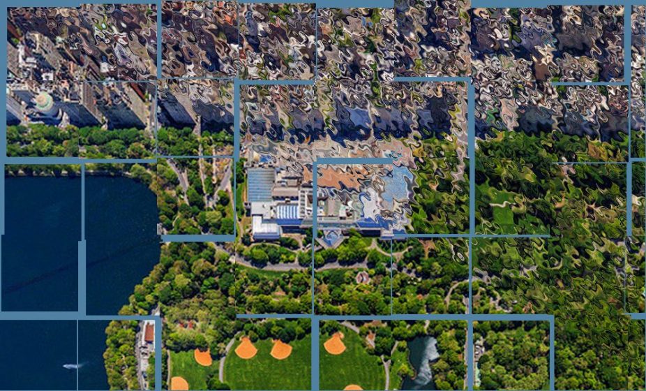
Aerial view of Riccarton Bush, Christchuch City. The native forest (dominated by an endemic podocarp tree, Dacrycarpus dacrydioides) is in the middle and lower left of the image (dark green) and on the right is a woodland of planted European species of trees that are now c. 150 years old. Photo: Google Earth
The interior of Riccarton Bush. The Dacrycarpus trees are c. 30-35 metres tall and c. 450 years old. Photo: www.riccarton house.co.nz

One finding of our re-survey was that we collected at lot less species from all sites than in 2003. For Riccarton Bush a substantial decline in the number of the larger Lepidoptera compared to 2003 is of real concern, and was contrary to what we expected. This does not bode well for the maintenance (or perhaps even enhancement?) of invertebrate biodiversity.

The results of the surveys also illustrate the importance of regular sampling to evaluate restoration success towards a fully functioning forest ecosystem and to monitor the health of the restored sites. Although a 10 year interval appears to be too long to show the trends we found. Hence we cannot say much about the implications for ecosystem function.

Our re-survey indicates that it may take many decades yet for the planted patches of native forest to contain invertebrate taxa in common with the native forest remnant. So, in answer to our original question—if we plant the plants will the insects follow?—indications after 20 years are positive but it maybe too early to tell just yet.

Denise Ford
Glenn Stewart
Christchurch

On The Nature of Cities

Doody, B, Sullivan, J, Meurk, C., Stewart, G. & H. Perkins. 2010. Urban realities: the contribution of residential gardens to the conservation of urban forest remnants. Biodiversity and Conservation 19: 1385-1400

Glenn Stewart

About the Writer:
Glenn Stewart

Glenn Stewart is Professor of Urban Ecology, Lincoln University, NZ. Current research is on Southern Hemisphere urban ecosystems and invasive species, successional processes and predicted changes in global climate.


If You Build It, They Will Come: Modifying Coastal Structures for Habitat Enhancement

Many voices. Greener cities. Better cities.

Since the founding of modern Singapore in 1819 by Sir Stamford Raffles, the small island nation has developed from a sleepy fishing village into a modern day metropolis, and has lived up to the adage, “if you build it, they will come”. Particularly over the last eight decades, Singapore’s coastal landscapes have gone through significant transformation. From an island skirted by mangroves and mudflats, this modern-day coastal city state has become one of the most populated metropolises in the world. Seawalls, headlands, and breakwaters were built along the coast to protect valuable land and inland assets from coastal erosion and inundation. The majority of Singapore’s contemporary coastline is thus reinforced by sea defences and other forms of coastal infrastructure.

The marriage of engineering and ecological knowledge is imperative to create or modify coastal structures that protect the coast and support biodiversity.

Sea defences to shore up the coastlines are a fundamental need for small coastal city states like Singapore, especially in the context of land scarcity, expanding population and impacts from climate change. While sea defences and coastal infrastructure are largely permanent engineered structures that are not purpose-built for supporting biodiversity, one strategy to enhance the capacity of these structures to compensate for and replace lost biodiversity without compromising their intended functions would also come through purposeful engineered modifications. This requires a mindset change that challenges us to understand the functions of coastal infrastructure beyond engineering goals and to explore opportunities for supporting and restoring biodiversity. Ecologically informed engineering in the design and construction of coastal infrastructure can reduce the loss of intertidal and shallow water biodiversity on artificial shorelines.

Biodiversity by chance

As it provides valuable economic, social and functional services, coastal infrastructure—such as jetties, floating pontoons, and seawalls—can also contribute directly and indirectly to habitat and biodiversity loss, as the construction of such infrastructure usually takes place in the shallow areas fringed by biodiversity rich intertidal and reef areas. However, as the character Dr. Ian Malcolm famously uttered in the 1993 movie “Jurassic Park”, “Life will find a way”, recent observations and studies in Singapore have shown that far from being barren, these artificially engineered structures can support unique assemblages of marine organisms. In particular, seawalls support a relatively high diversity of intertidal organisms and share several metrics with rocky shores, such as the number of species present and dominant species. For example, the presence of hard substrates, such as granite armour rocks used for shoreline reinforcement, can support the recruitment of biodiverse corals and other reef organisms in areas where reefs either used to exist, or could exist if suitable substrate were present. We observed this phenomenon along seawalls at reclaimed sites such as Pulau Semakau, East Coast, and Marina East, which continue to support rich assemblages of corals in less than a decade after the completion of reclamation works. We observed similar biodiversity revival within marinas, where the submerged walls of the floating pontoons used for berthing boats supported rich assemblages of marine organisms. In particular, the concrete coating used for the submerged walls provided suitable surfaces that encouraged the recruitment of marine organisms. However, the uniformity of seawall construction material, the inclination of their surfaces, and the lack of microhabitats such as holes, cracks, crevices and rock pools resulted in lower biodiversity assemblages compared to natural rocky shores.

Biodiversity by choice and reverse engineering

Our observations of biodiversity occurring by chance along artificially engineered coastal structures presented us with the perfect opportunity for studying the factors that facilitated their successful development, such as surface material, rugosity, slope gradient and hydrodynamic regimes, among others. We adapted and then applied these factors to intentionally enhance the biodiversity of other existing and future coastal structures. Recent investigations suggest that larval supply of marine organisms is not limited in Singapore. However, the availability of suitable habitat is limited in many areas. By introducing appropriate substrates in the right environment, coupled with effective management of human activities, we believe that marine biodiversity can be revived or enhanced along otherwise barren areas. One way to do this is through the reverse engineering of structures—i.e., the process of extracting design information from a manmade structures/objects and using this information to enhance other structures/objects—to understand the design and engineering aspects and environmental factors that facilitated the recruitment of organisms in the examples described above. We looked at the nature of the built structure from the type of material used, the methods of construction, surface complexity, inclination, hydrodynamic conditions, exposure to varying tidal regimes and anthropogenic activities, and the historical condition of the sites that contributed to their ability to host and support biodiversity. Based on those metrics, we investigated different strategies for biodiversity enhancement and developed the following framework to assess coastal structures and their capacity to host biodiversity [Figure 1].

figure-1_a-framework-to-assess-coastal-structures-and-their-friendliness-toward-biodiversity
Figure 1: A framework to assess coastal structures and their friendliness toward biodiversity.

Based on this framework, we identified and investigated strategies for increasing heterogeneity and complexity of built surfaces, introducing novel habitats such as tidal pools, enhancement units, and textured tiles, substrate manipulation, planting of coastal vegetation, and incorporating purpose built elements to coastal structures.

We found that for enhancement on existing seawalls and coastal structures, surface complexity is the most important and also the most easily manipulated amongst all assessment criteria. Complexity can be manipulated at different spatial scales, ranging from millimetre to metre, and targeting different organismal behaviour. We worked with four complexity parameters that were developed in a separate research project by our research collaborators from the National University of Singapore, namely (1) the number of object types; (2) the relative abundance of object types; (3) the density of objects; and (4) the variability and range in the objects’ dimensions, to design reverse engineered tidal pool units to be introduced along an existing stretch of seawall with a barren horizontal surface.

These tidal pool units consisted of purpose-designed and fabricated concrete modules measuring 1.5m x 1.0m x 0.3m. They were fabricated with concrete suitable for the marine environment using negative fibreglass moulds, and were designed to collect seawater during high tide and to retain it during low tide to mimic a tidal pool environment. These tidal pool units are expected to create habitats that are similar to natural rock pools, to provide additional niches, and to encourage more diverse assemblages of marine organisms to thrive within the area.

Janine M. Benyus’ description of biomimicry as “the conscious emulation of life’s genius” (1997) served as a source of inspiration for our design. To design the units, we first studied natural rock pool habitats to identify attributes that made them suitable for certain marine organisms to colonize and thrive, and found that a combination of crevices, grooves, and pits provided ideal niches and succession for a variety of marine organisms. These attributes were then incorporated in the design process, according to the four complexity parameters, to create conceptual designs that would most closely mimic natural tidal pool habitats. Multiple designs were created based on the different complexity combinations, and two designs were selected for testing.

The first design is a pool with a combination of evenly distributed grooves with pits of three sizes – 30 small pits (20mm diameter), 30 medium pits (40mm diameter) and 30 large pits (70mm diameter) [See Figure 2]. The multiple sizes of the pits enabled us to increase the spatial scale of this feature. Pits and groves are cast on an inverted topographic surface. This surface plan mimics a natural hilly landscape in Singapore (Central Catchment Nature Reserve), where the complex topography houses significant biodiversity.

The second design is a pool of the same surface area with a randomised arrangement of steps. The steps’ thickness was calculated based on the aforementioned complexity parameters [See Figure 2]. The angular edges and offset create niches for marine organisms. We also embedded some pits (3mm) into some of the units of this design to test out the combination of pits and steps.

figure-2a1

figure-2a2

figure-2a3

Figure 2A: (1) Design of the pool with pits and grooves [top]; (2) Cross section A-A [middle]; (3) Casted pool [bottom]

Janine M. Benyus’ description of biomimicry as “the conscious emulation of life’s genius” (1997) served as a source of inspiration for our design. To design the units, we first studied natural rock pool habitats to identify attributes that made them suitable for certain marine organisms to colonize and thrive, and found that a combination of crevices, grooves, and pits provided ideal niches and succession for a variety of marine organisms. These attributes were then incorporated in the design process, according to the four complexity parameters, to create conceptual designs that would most closely mimic natural tidal pool habitats. Multiple designs were created based on the different complexity combinations, and two designs were selected for testing.

The first design is a pool with a combination of evenly distributed grooves with pits of three sizes – 30 small pits (20mm diameter), 30 medium pits (40mm diameter) and 30 large pits (70mm diameter) [See Figure 2]. The multiple sizes of the pits enabled us to increase the spatial scale of this feature. Pits and groves are cast on an inverted topographic surface. This surface plan mimics a natural hilly landscape in Singapore (Central Catchment Nature Reserve), where the complex topography houses significant biodiversity.

The second design is a pool of the same surface area with a randomised arrangement of steps. The steps’ thickness was calculated based on the aforementioned complexity parameters [See Figure 2]. The angular edges and offset create niches for marine organisms. We also embedded some pits (3mm) into some of the units of this design to test out the combination of pits and steps.

figure-2b1

figure-2b2

figure-2b3Figure 2B: (1) Design of the pool with randomized steps [top]; (2) Cross section A1-A1 [middle]; (3) Casted pool [bottom]

We studied the hydrodynamic conditions of the site that may affect the service life of the tidal-pool structures. Through hydrodynamic modelling, we calculated mean current speed and changes in bed thickness per year to identify whether the seawall is subjected to strong erosion or accretion. Mean current speed is also an indicator that helps determine if the coast is subjected to strong hydrodynamic forcing, which might result in lateral movement or even dislodgement of the fitted tidal pool structures. While there are studies suggesting that introduced artificial structures can have a positive impact on sandy shoreline stabilisation, the introduction of these structures should not compromise the ability of the engineered coastal infrastructure to perform its primary function. In the case of seawalls, which are built for sea defence, the enhancement measures have to preserve sea wall structural integrity, as well as connectivity of coastal processes.

We are currently studying the relationship between the tidal pool designs and community assemblage and succession by assessing their ability to provide shade and regulate temperature using drained and un-drained units. In order to reduce bias and account for treatment or site effect, we positioned the different design configurations randomly along a linear stretch of seawall, and introduced control plots to assess the effectiveness of introduced structures versus no modifications. A control plot in this context is an empty plot on the seawall that is of the same size as the tidal pool units [See Figure 3]. Data collected on these control plots will act as a baseline against which the treatments/modifications will be compared.

figure-3_the-tidal-pool-units-positioned-in-a-randomised-layout-with-control-plots
Figure 3: The tidal pool units positioned in a randomised layout with control plots (empty slot without any tidal pool unit).

Currently, we are monitoring the units biweekly to gather data on recruitment and succession of fauna and flora, as well as environmental parameters such as temperature, conductivity, and irradiance. Preliminary results indicate that the tidal pools were occupied by turf algae within the first week after installation and, shortly after, this single species was replaced by an assemblage of algae including Bryopsis spp., Dictyota sp., Enteromorpha spp., Ceramiales spp. and Ceramium spp. Faunal diversity and abundance increased over time and, after several weeks, we recorded periwinkle and nerite snails, crabs, tube and fire worms, feather stars, and bead anemones. The performance of each tidal pool design and its complexity elements are also being monitored. The outcomes of this study are expected to provide a more comprehensive understanding of the combination of complexity treatments on species recruitment and biodiversity.

Projected sea level rise poses the most immediate threat to Singapore, and protecting our coastline has been identified as a priority in dealing with the effects of climate change. The current efforts to defend our coastal areas from erosion include the construction of walls and stone embankments. Thus, the marriage of engineering and ecological knowledge is imperative to create or modify coastal structures that both protect the coast and better support biodiversity. Ecologically informed engineering in design and construction of coastal infrastructure would reduce loss of intertidal biodiversity on our artificial shoreline.

Nhung NGUYEN, Karenne TUN, and Lena CHAN
Singapore

On The Nature of Cities

Karenne Tun

About the Writer:
Karenne Tun

Karenne’s current work at NParks covers issues related to the management and conservation of Singapore’s coastal and marine environment (CME) and the biodiversity they support. She leads a team that serves as Secretariat for the Technical Committee on Coastal and Marine Environment, an inter-agency committee that undertakes studies, provides technical inputs for policy making, and builds capacity in CME related issues.

If You’re Feeling Stressed in These Times of COVID-19, a Picture of Nature Can Be Restorative!

Many voices. Greener cities. Better cities.
Humans find natural scenes restorative. But what within natural scenes make them easier to process, leading to stress recovery or attention restoration? Green. Scenes with water. And even a picture of these things.
More than half the world’s population now lives in cities, where nature, at the best of times, can seem hard to find and enjoy. The restorative value of nature has long been acknowledged but how can we access it in these strange times of social distancing and isolation as COVID-19 sweeps the globe? We can look out our window at a nearby tree, a patch of green, or even a water feature!

Robert Ulrich, in 1984 (View through a window may influence recovery from surgery), showed that surgical patients recovered more quickly if they had a view of nature. He compared two groups of patients in a suburban hospital in Pennsylvania, USA. One group could see a small stand of deciduous trees through their hospital ward window. The other group looked out on to a brown brick wall. Patients with the view of the trees spent less time in hospital, seemed brighter during their stay, required less pain relief, and had fewer post-operative complications. Wisely, Ulrich cautioned us that we can’t necessarily generalise these results to all built views or all patient groups. The results might have been different if the alternative to a view of trees was a dynamic view of the city, especially for patients who had been in hospital for a long time or were bored. But subsequent studies have supported these findings: nature is restorative and a substitute such as a natural view through a window or paintings, photos, videos or computer-generated virtual reality, can also be effective. Immersive computer-generated virtual reality might even be a surrogate for experiencing real nature (Restorative effects of virtual nature settings).

Green oasis in the densely settled inner-city suburb of South Melbourne. Photo: A. Miller

Ulrich and his contemporaries Stephen and Rachel Kaplan produced seminal studies in the 1970s and 1980s, exploring landscape perception, landscape preference and the restorative capacity of nature. They concluded that people prefer natural views over urban views lacking natural vegetation. Views of vegetation, especially with water, held interest and attention more effectively than urban views. This was despite both types of view containing equivalent visual information, i.e. the same amount of content to process. Ulrich proposed that natural views elicited positive feelings, reduced fear in people that were stressed, held their interest and reduced stressful thoughts. He focused on nature restoring people’s physiological stress and anxiety and developed Stress Recovery Theory. In contrast, Stephen Kaplan interpreted the restorative capacity of nature in terms of attention fatigue, and developed Attention Restoration Theory.

Non-urban nature Photo: M. Dobbie

Of course, some nature can be threatening. Just think of an African savannah with a pride of lions stalking zebra, or an Australian nature reserve that is a red-belly black snake sanctuary. So Ulrich believed that the restorative power of unthreatening natural landscapes relieved psycho-physiological stress (Stress Recovery During Exposure to Natural and Urban Environments). Stress has been defined as the condition that results when people find themselves in a situation that demands more of their biological, psychological or social resources than they feel are available. This leads to increased physiological arousal and negative emotions. Ulrich posited that recovery from psycho-physiological stress requires a positive change in emotional state. His research, and that of others since, using self-ratings of emotions of respondents and physiological measures of heart rate, muscle tension, skin conductance and blood pressure, found that exposure to natural environments does, indeed, produce positive mood changes, mediating the negative effect of stress, reducing negative mood states, e.g. fear, anger, sadness and aggression, and enhancing positive emotions, such as feeling carefree, friendly or affectionate. Even exposure to a small amount of nature is beneficial: urban environments with trees generated more positive emotions, fewer negative emotions, and positive physiological responses compared with urban environments with no natural features. Exposure to environments with no natural features evoked anxiety, anger, frustration and sadness.

Landscape painting: “Broad Acres, Western District, Victoria”, by William Dargie (1947). Photo: M. Dobbie

In contrast, Kaplan in 1995 argued that restoration of attention fatigue underlay favourable responses to nature (Restorative Benefits of Nature: Toward and Integrative Framework). He did not dismiss Ulrich’s theory but rather argued that stress and mental fatigue were related: stress could lead to mental fatigue, and mental fatigue could increase vulnerability to stress. He studied attention, distinguishing voluntary attention from involuntary attention. He argued that voluntary, or directed, attention is essential for human effectiveness in everyday life. It is required for clear thinking, planning and follow-through, positive emotions, and, most importantly, inhibition of inappropriate behavior. Thus, loss of directed attention could lead to negative emotions, irritability, impulsiveness, impatience, reduced tolerance for frustration, insensitivity to interpersonal cues, decreased altruistic behaviours, reduced performance and increased likelihood of taking risks. Sleep is generally required to restore directed attention, but insomnia can accompany the loss of directed attention. Kaplan posited that the cure for loss of directed attention is “another mode of attending that would render the need for directed attention temporarily unnecessary” (p. 172). That cure, he suggested, is through involuntary attention.

He described involuntary attention as having four components: fascination, being away, extent, and compatibility. Fascination can be “hard”, e.g. watching car racing, or “soft”, e.g. bird watching. Being away and extent can be conceptual rather than physical. For example, a change in the direction of one’s gaze can be sufficient to “be away”; extent must be sufficient to offer the tired mind another world in which to escape. The compatibility must be between the new environment and its intended purpose for the person. So, in viewing nature we are taken away from our current situation, engaging with the soft fascination of birds, plant life, waterbodies, etc. The natural view suggests something beyond what we see, a broader extent, and is compatible with our need for respite from the everyday. The restorativeness of a setting is determined by assessing the performance of tasks that require mental attention and self-rating on four scales of fascination, getting away, extent and compatibility.

View of a leafy green courtyard in a Melbourne suburb. Photo: S. Keyes-Pearce

In a study similar in concept to Ulrich’s study of surgical patients, published 11 years later in 1995, Carolyn Tennessen and Bernadine Cimprich (Views to nature: Effects on attention) found that students living in dorms with all natural or partly natural views were more able to direct attention than those with partial or full views of built landscapes. They concluded that looking through a window on to a natural scene might be “an easily accessible ‘micro-restorative’ activity” (p. 78). Again, the authors were cautious about extending results to other population groups, e.g. office workers and elderly people, but the evidence is mounting.

Stress Recovery Theory and Attention Restoration Theory are now viewed as complementary rather than in competition and offer two perspectives on understanding our favourable response to nature, and in fact our human need for it. Rita Berto wrote a good review of them in 2014 (Literature review on restorativeness), which provides more detail than given here.

Nature from a balcony in inner Melbourne. Photo: E. Walker

But why do humans respond so positively to nature, to the extent that we need it for our psycho-physiological well-being? Both Ulrich and Kaplan believed that the restorativeness of nature had an evolutionary basis. Ulrich argued that human preference for natural landscapes and their restorative quality is a consequence of human evolution in natural landscapes. We feel most comfortable in the landscape in which we evolved. Edward Wilson described this as biophilia: humans have an innate connection with and love for nature and natural places. Kaplan’s theory assumed that humans have an inherent predisposition to pay attention and respond positively to natural content and to landscape configurations that are characteristic of settings that supported human survival through evolution.

But these ideas are not accepted without challenge. In a fascinating paper published in 2011, Yannick Joye and Agnes van den Berg dissect all the arguments for an evolutionary basis of the restorative capacity of nature (Is love for green in our genes? A critical analysis of evolutionary assumptions in restorative environments research). They conclude that biophilia cannot be supported by empirical evidence. They do acknowledge the evidence supporting the importance of unthreatening nature, and especially green vegetation, in the restorativeness of natural landscapes. But, in place of biophilia, they propose Phytophilic Response Module. They don’t dispute that a green vegetative setting is restorative but argue that this is not necessarily hardwired in humans through evolution. Rather they suggest that the ease with which a green vegetated landscape can be visually processed is critical to restorativeness. Processing fluency is the ease with which a person feels able to process a visual stimulus or sight. Fluent processing is often accompanied by positive emotions. So, the Perceptual Fluency Account of restoration states that unthreatening natural scenes are evaluated more positively than unthreatening urban scenes because our visual system processes certain aspects of the visual structure of natural scenes more easily than those of urban scenes. Restoration, thus, lies in the ability of positive emotions to undo stress. The positive emotions are due to processing fluency rather than evolutionary memory. Processing green natural settings would require less mental effort than processing urban scenes, which is consistent with the findings within Attention Restoration Theory that viewing natural scenes is better than viewing urban scenes to restore directed attention. So, we can see that both stress reduction and attention restoration can be related to processing fluency. In proposing this, Joye and van den Berg remind us that processing fluency relates to the effortless processing that Kaplan attributed to fascination, and also to the ease and efficiency of processing natural scenes that Ulrich attributed to the evolution of the human brain and its sensory systems in natural environments.

Seasonal variation in a leafy inner Melbourne courtyard. Photo: A. Miller

So, humans find natural scenes restorative. But what within natural scenes make them easier to process, leading to stress recovery or attention restoration? The components of restorative landscapes, in a study of small parks in Oslo, Norway, conducted in 2011, were trees, grass and the presence of other people. Decorative elements such as flowers and water features were less important to people looking for somewhere to rest (Assessing restorative components of small urban parks using conjoint methodology). However, in another study published the previous year, the presence of water was restorative, even in urban scenes. In fact, built landscapes with water were as restorative as entirely green natural landscapes (Blue space: The importance of water for preference, affect, and restorativeness ratings of natural and built scenes).

Joye and van den Berg suggest that it is the coherence of a landscape that is important to it being restorative. Coherence is the way that a landscape “hangs together” and can be viewed as a whole. Natural landscapes have been found to be more coherent than urban landscapes. More coherent landscapes might be easier to process visually, leading to greater processing fluency and restorativeness. Joye and van den Berg attribute this coherence to the fractal structure of natural landscapes. Fractals predominate in nature, in which patterns repeat themselves at different scales. They give the example of a tree, in which branches are scaled-down versions of the whole tree. The fractal structure of nature provides perceptual predictability. This pattern repetition facilitates fluent processing of the landscape, and fluent processing is often accompanied by positive emotions.

So, as we remain in isolation, some of us will be lucky enough to have green leafy gardens in which to restore our positive emotions and relieve mental fatigue. Those of us who live in dense urban locations might have a leafy balcony to retire to, or a window on to a park or perhaps street trees. The rest of us should not despair, though. Stress recovery and mental restoration are still possible through viewing pictures of green vegetated landscapes on our walls or even virtual reality. Whatever our circumstances and wherever we are, the restorative benefits of nature can still be enjoyed.

Meredith Dobbie
Victoria

On The Nature of Cities

Illuminating New York Harbor

Many voices. Greener cities. Better cities.

A review of Heartbeats in the Muck: The History, Sea Life, and Environment of New York Harbor, Revised Edition, by John Waldman. 2012. Fordham University Press, New York. ISBN: 9780823249855. 160 pages. 38 black and white illustrations.

New York Harbor is a murky place by nature. The mixing of fresh and salt waters, combined with a rich flow of nutrients from its watershed, makes visibility of two or three feet the norm. For a public accustomed to images sun-dappled fish and sandy bottoms, the opacity of the Harbor’s waters renders its vitality a mystery.

IMG_0032Shining a bright light on this underwater world is Heartbeats in the Muck, John Waldman’s terrific book about the teeming life below the surface and the environmental history of this most urban estuary. Having read the original shortly after it was published in 1999, I recently picked up the Revised 2012 edition. Dr. Waldman’s stories of how life in the Harbor survives and even thrives despite a variety of environmental insults are still poignant.

It is remarkable but perhaps not surprising that, despite the expansion of waterfront recreation and environmental awareness since the book was first published 14 years ago, Waldman’s “man bites dog” storyline about life in Gotham’s waterways still works. It is easy to make cocktail conversation about eels, oysters, humpback whales (whales!) and the other remarkable creatures that share New York City with us.  While more than 500 acres of new waterfront parks and have been built in this region in the 21st century, the life beneath the waves is still unknown to most New Yorkers.

But revealing this urban ecosystem offers the reader more than just good bar banter.

New York Harbor
New York Harbor

Heartbeats in the Muck is an engaging narrative for anyone interested in urban waterways in general and New York in particular. There are important lessons about the management of urban waters and shorelines. It is a great choice for a college or high school environmental science reading list. For advocates of nature and cities, the book also raises important questions of how best to raise the public’s eco-literacy and engage people in our conversations and challenges.

Heartbeats in the Muck is organized in a series of logical chapters that provide the reader with a brief natural history of the estuary, and then dives deeper into the management challenges of sustaining the Harbor’s ecology while providing for  the needs of 20 million people and a half trillion dollar economy. The book’s chapters include an overview of the complex geography of the Harbor, and then investigations of the “Vitae Marinae”, the watery “Medium” so useful for human settlement, and the physical “Vessel” defined by the Harbor’s banks and bottom. The concluding chapter provides a Waldman a chance to answer a question he hears often: “How is the Harbor doing” relative to human use past and present. The revised edition adds an epilogue that informs the reader about some developments since 2000. There is a very useful annotated bibliography. Wonderful pictures from the past and present estuary add to the text.

Heartbeats in the Muck provides a clear and readable overview of the science of the estuary. There are other books to find this science in more exacting detail. This includes The Hudson River Estuary (Cambridge University Press, 2006), a textbook edited by Waldman and Jeffrey Levinton, as well as Donald Strayer’s The Hudson Primer (University of California Press, 2012).

Egrets and the Empire State Building. Photo: Hugh Carola, Hackensack Riverkeeper
Terns in Jamaica Bay, with New York skyline. Photo: Don Riepe, American Littoral Society

Heartbeat in the Muck is notable for providing this information in connection to the people living and working in the Harbor. From his vantage point as a senior scientist at the Hudson River Foundation, Waldman was in a unique position to work with and get to know fellow scientists, natural resource managers for public agencies, advocates, and fisherman plying the water of the estuary. (Full disclosure: the Hudson River Foundation is my current employer. Dr. Waldman is now at the City University of New York). It is their voices who tell the story of the Harbor, from the 17th century Reverend Wolley, who extolled the water’s “sweet and wholesome breath” to Alita Vaughn, a 21st Century New York City high school student, who confesses that she “never knew there was a Hudson” before arriving at the New York Harbor School on Governors Island.

Fishing in Jamaica Bay, with New York skyline. Photo: Don Riepe, American Littoral Society

In between, there are discussions of Waldman’s encounters with fisherman (legal and otherwise) looking for fish and crabs, birders documenting herons and osprey, sewage treatment plant operators, and dredgers. His telling of their stories makes real the challenges facing the harbor. Some of these are well known, such as oil spills, industrial contamination, and combined sewer overflows. Other challenges are subtler, including understanding shifting baselines in an urbanizing environment or the cascading impacts of invasive zebra mussels.

My only real complaint is that the revised edition does not fully integrate the new information into the body of the text. The revision seems for the most part to be relegated to a new epilogue. The major chapters would have benefited from updated information about oyster restoration, current Superfund efforts, and the crash of shad and herring populations (something that Waldman has documented in his more recent book Running Silver). Discussion of the impact of Hurricane Sandy and options for adapting to climate change and sea level rise are also lacking.

Despite these minor flaws, the essence of the book still shines through. The story of this most urban ecosystem told through the eyes and deeds of those actively working its waters. The book is a solid four stars-plus.

Dr. Waldman’s intent in writing the book is clear: celebrating the Harbor and its creatures, human and otherwise, in the cause of raising understanding and involvement in its management. He succeeds at that. Stories of fishing for stripers in the shadow of skyscapers are remarkable. It seems clear to me that sharing such experiences will encourage people to seek their own watery adventures and perhaps become more interested in decisions about this or any urban estuary.

In this way Heartbeats in the Muck belongs squarely within a tradition of environmental literature in the United States. Books such as Aldo Leopold’s A Sand County Almanac, The Pine Barrens by John McPhee or Robert Boyle’s The Hudson River: A Natural and Unnatural History are all landmark efforts that told stories of a place and its people, and raised consciousness about environmental concerns and ecological management.

But as great and as inspirational as such literature can be, books are not the only medium for awakening 21st century consciousness. I was recently at a meeting where a university professor confidently projected that people were no longer interested in exhibits of live animals or the kind of touch tanks familiar to marine educators. The future is digital, he stated, and the ability to stream data in visually compelling ways is what will excite. My colleagues all fired back with anecdotes and data about experiential learning. How animals can compete successfully with screen time for an eight (or 38) year old’s attention. That seeing (or hearing about) real scientists and managers at work provides a deeper understanding and engagement.

But the digital gauntlet had been thrown. We all know that the wealth of information available at one’s fingertips today creates a deep clutter that is difficult to penetrate no matter how compelling the story. And that today’s technology also offers new and more interactive means of engaging a distracted public and their political leadership.

For those working to address the special challenge of urban ecosystems, part of the answer lies in the work of architects and landscape architects adept at creating public spaces, buildings and infrastructure that reveal ecological processes. Such places, such as green infrastructure or living shorelines, enable non verbal learning where people may experience, learn about, and (hopefully) appreciate and engage in discussions of managing those processes. Working in urban settings also provides opportunities to take advantage of crowd sourcing to create 21st century almanacs, where pictures, data, and stories about the workings and wonder of urban ecosystems can be shared online and real time.

Books like Heartbeat in the Mucks will forever provide a means of inspiration (and enjoyment). I hate to think that a fine books like this one are just nostalgia, a memoir of a time that has been passed by. Perhaps what is truly different 12 years after the first edition is not the need to illuminate the life within shadowy waters, but the kind of flashlights that are available.

Rob Pirani
New York City

On The Nature of Cities

Imagine A City Where No One Sleeps Outside: Eden Village, A Model to End Homelessness

Many voices. Greener cities. Better cities.
Two major obstacles separating homelessness and a home are acquiring the first and last month’s rent required by landlords, and a deposit to a local utility company. With no rental security deposit required at Eden Village, or need for a utility deposit—as well as low rent—these obstacles are lowered.

When Dr. David and Linda Brown retired, they moved into a loft in downtown Springfield, Missouri. Very quickly they got to know and become friends with their new urban neighbors. But rather than visiting in with these neighbors in their apartments or lofts, their conversations were always on the streets, as the streets were where they lived. The Browns’ new friends were homeless. 

Soon recognizing gaps in services for their new friends, one of which was no place to be in the evening, in 2010 the Browns, along with several others from the greater Springfield community, opened The Gathering Tree. It is a place for persons who are homeless to gather in the evening to rest, have a hot cup of coffee, play a board game, watch a movie and simply enjoy fellowship with their neighbors.

After successfully running the Gathering Tree for seven years, the Browns decided to take on filling the most important gap in their friends’ lives: a safe place to lay their heads at night. Within the span of just two years from the first dollar raised to handing out the first key, the Browns, along with supporters, staff, volunteers, and community partners, had created Eden Village. Eden Village is a community of 31 tiny homes and a community support center that provides a permanent home and services to the chronically, and disabled homeless. The Gathering Tree organization in Springfield, Missouri, USA aims to create a city where, “No one sleeps outside”, through its tiny home community, Eden Village.

“The causes of homelessness cannot be successfully treated until the fundamental needs of the individual, food, clothing and shelter, are met.”
Eden Village

A model to permanently house the chronically disabled homeless

On average 210-215 people sleep outside in Springfield, Missouri each night. To begin to put an end to this, the Gathering Tree purchased an abandoned mobile home park, made improvements, and planned to place 390square-foot tiny homes on site. Twenty-five have already been completed at the time this was written. Eden Village includes a community center at its entrance, which houses a medical, and mental health clinic, mental health and social service offices, business office, community room, and kitchen. Often preyed upon, it is thought that the residents will be safer with a thumb print entry to the gated community. All visitors must be checked in as well. 

Eden Village is a master-planned, gated community to house our friends with dignity in a place they can call home, permanently. 
— Nate Schlueter, COO Eden Village

Costs are kept well below traditional models for low-income housing as infrastructure such as streets, water, sewer, and electric are already in place. Additional savings are created by placing half of the homes on one of two municipal electric meters, saving the minimum monthly hook-up charge of $19 per meter which would have been times 31 homes per month. There are also plans for a solar array large enough to meet the energy needs of the entire community which will take the monthly expenses even lower. 

Two major obstacles between the homeless and a roof over their heads are acquiring the first and last month’s rent required by landlords and a deposit to a local utility company. Saving money for these deposits is nearly impossible while living on the streets as these folks are enduring the expense of eating out every meal and other inefficient expenses to keep them alive on the streets. With no rental security deposit required at Eden Village or need for a utility deposit, as well as low rent, the obstacles are removed and it becomes easy for residents to move in immediately. 

Each resident pays $300 per month (inclusive of utilities) to live at Eden Village. All residents receive a modest social security check that more than covers the monthly rent. Paying rent is believed to give the residents a sense of ownership and dignity. This also helps to ensure the long-term sustainability of the community. 

Support for the residents equals savings for the city

Case workers and mental health professionals have been permanently assigned by a local hospital and mental health organization to Eden Village. Bringing medical professionals and case workers to the residents rather than expecting those in need to take the typical 1 ½ hour bus ride to see their case worker or to seek medical care makes it more likely they will receive the care they need in a timely manner rather than waiting until their issues are critical. 

“The onsite clinic will be able to triage and take care of things that typically take our homeless friends to the emergency room for unnecessary issues and/or triggers police, fire and ambulance services and the costs associated”, says Schlueter. 

In the long run, it will be less expensive to assign medical professionals to Eden Village. According to Schlueter, these services cost the city of Springfield upwards of $30,000 per homeless person in social resources and capital per year. 

Eden Village also enjoys local municipal support as officials and administrators see long-term savings and less demand on services.

Home Team

Building friendships. It is the Gathering Tree’s intent that those who sponsor a home create a “Home Team” for their resident. “The Home Team becomes a friend to the resident and walks through this new journey in life with the resident”, says David Brown. 

“Poverty is not just an economics issue but also a relationships issue.”
— Tim Stagner, Pastor, Vineyards Church

The first goal of the friendship is to help the resident adjust to living inside a home again. This usually takes a month for every year they have been on the streets. Most of the residents have been homeless for 5 to 10 years, so it takes a while for them to adjust. The Home Team will help guide and remind them of how to do some of the basics in the beginning like remembering to turn off the stove, doing laundry, and keeping the house clean. 

Having their basic needs met, residents are free to hope and dream again because they are out of “struggle and survival” mode. “We tell the residents that they are now CEOs of their own lives, but we are going to provide you with a board of directors”, says Schlueter.

A sense of community

The goal of building community and connecting the residents to it is layered throughout the village. Connections begin with the front porch. Each home has a covered front porch with two chairs facing the neighborhood. The porches have become integral to community building, as residents are often seen gathering on porches and waiving to neighbors. 

Picnic tables and grills alternate with raised community garden beds in between every house. Permaculture is planned and will run the length of the community. Eden village also provides residents with the opportunity for skill building and community participation. Fruit trees have been planted on site, and a community garden grows vegetables needed for the preparation of a popular dish and product produced at Eden Village: salsa. Residence are provided with classes on growing, harvesting, preparation, and canning and selling/marketing to create a dignified income for those who wish to participate. 

Planned activities in the community center are available for those interested. A community laundry facility promotes folks engaging one another in the community center. All of these elements are designed to promote getting out and connecting to the Eden Village community. 

External connections to greater Springfield begin with the home teams. Home team members can be seen visiting frequently, although Eden Village recommends visiting at least once per month.  

Architecture and Inspiration: not your typical DIY tiny home

The approach taken to provide a dignified home for the residents was to make homes look “just like ours” says Schlueter. Each home greets the internal walking street with a front porch, promoting interaction and a sense of connection to the Eden Village community. As you enter the home you arrive in an open-feeling space that holds a fully-functioning kitchen and a modest living space. The ceilings are lofted, allowing natural light to flood the space from a clerestory window above the kitchen cabinets. To the rear of the house is a hall closet, full bathroom, and lovely bedroom with a built-in dresser and two closets. The 390 square-foot tiny homes are nothing like those you see on television. The television version is much smaller and embraces quirky spaces and kitschy décor. The Eden Village homes have a few similarities to the craftsman style with a “Sears and Roebuck” approach—affordability through mass production. The homes are pre-manufactured, delivered and set up in village in the same manner in which a mobile home would be delivered. 

This old house is a classic America style. www.thisoldhouse.com

All of the homes in Eden Village are the same floor plan; however, the plan is often flipped, and each is painted differently inside and out to reflect the preferences and personality of the individual resident. As the home team gets to know the resident in the months or weeks in advance of the pre-manufactured home arriving on-site, color choices and décor become obvious.

Linda Brown coordinates furnishings and décor with donors and each resident. The homes are extremely elegant, personal, and have a comforting feeling.  Visitor reaction to the style, decor and quality of the home is overwhelmingly positive. Most articulate a desire to live in one of the homes.  

Red House. Courtsey Eden Village

Drury University’s Design-Build program studies resiliency and client-centered design

Urbana Sears house.

Drury University’s Design-Build Program was given the opportunity to study improving the resiliency of mobile homes and how architecture could support and improve the lives of the residents in Eden Village. Fourteen architecture students in their Fifth-year Explorations Studio spent eight weeks researching and designing followed by an eight-week build of a tiny home for the village. 

Paired with a future resident, the students were given a once in a lifetime experience. The chosen client was their age (22 years old), talented, intelligent, funny, and he also happened to be deaf. “MJ” had been living on the streets since he was seventeen. Getting to know MJ and realizing that the only difference between themselves and MJ was a set of circumstances, was  eye-opening, and perhaps a life-changing experience for the students. 

Drury University Jordan Valley Community Health Center Tiny House by Traci Sooter

As a result of their research, the students determined that a visual-centric approach to the design would best support a person who is deaf. Examples of this approach are constant visual control  of the interior environment and wall color choices that provide good contrast for hands while signing. Many other design decisions were made based on MJ’s needs, personal preferences, and interests, such as his love of reading. One example is the “library” of shelves in the living space that turns and transitions into a reading nook. The placement of the nook provides visual control of the front door and living space and a view out a window as well as easy viewing of the television. A custom game/dining table was designed and built by the students to be stored under the nook. 

While the front porch is the same size as all of the other homes in the village, the staircase reaches out into the community inviting guests as it wraps the front and south side. This welcoming staircase doubles as seating for passersby who want to pause and visit for a while. Planter boxes at each end of the stairs, one of which provides a lockable place for bicycle storage, create an additional sense of comforting space. 

Reading Nook & Chess table, by Traci Sooter

As Eden Village is located in “tornado alley” of the Midwestern United States, tornado resistance was an important design goal. The students detailed the wall system to meet FEMA (Federal Emergency Management Agency) specifications for a wood storm shelter to achieve tornado resistance and remain affordable. Using typical wood framing materials has the added benefit of familiarity to local trades, and readily available materials. The home is resistant to tornadic wind loads and the impact of flying debris through the combination of the FEMA wall assembly and engineered connections from roof to ground. 

Bedroom, by Traci Sooter

The students named the home the SIGN house: Sustain, Integrate, Gather, Nestinspired by our client’s communication using American Sign Language, Eden Village’s inclusive philosophy, the visual-centric design approach, and tornado-resistant attributes. (click for video tour here)

Replicating the Eden Village model starts with the right property

The Eden Village model could be easily replicated in cities across America and the world. The most important step is choosing a property that is properly zoned. 

Bathroom, by Traci Sooter

Too often, efforts across the United States similar to Eden Village die or are stagnated for years because well-intentioned folks choose a piece of property that is not zoned correctly. Zoning hearings are then triggered and lead to official posted notices and community devised flyers mailed to neighbors that call for “you should be against this” attitudes. This often leads to the development of a “not in my backyard” movement and a fight that can create delays that can last for years or completely kill the project.  

To avoid a “not in my backyard” movement, the Gathering Tree staff researched local zoning laws and found that zoning for mobile home parks or highway commercial gave them the legal right to put in an RV (Recreational Vehicle) park. All the tiny homes in Eden Village are mobile and under 400 square feet which makes them legally a recreational vehicle, and therefore compliant for this zoning. A home near this square footage is the perfect size for a single person and has enough room for all of the amenities of a typical home: living, dining, kitchen space, bedroom, and full bathroom. 

The Gathering Tree located and purchased an abandoned, blighted, mobile home park that would hold 31 tiny homes and a community center. Although well within their rights to begin construction and start setting the mobile homes immediately, the staff of the Gathering Tree went door-to-door in the neighborhood, sharing their vision and intentions with the neighbors. The Eden Village staff were met with great enthusiasm and support from the neighborhood as the new community center and tastefully-designed tiny homes would be a great improvement to the blighted site. 

Avoiding planning and zoning hearings and a potential “not in my back yard” movement enabled Eden Village to hand out the first key to a resident after only two years from the first dollar raised. Most similar projects across the United States take eight to ten years to get off the ground. When there is not a “not in my back yard” movement people are excited about tiny homes, giving folks a second chance, and helping homeless people move into a permanent home. (Schlueter)

Community support is key to the success of  Eden Village. Funding for the community center and improvements to the infrastructure came from local and national grants. Funding for the homes came from local businesses, organizations, churches, families and individuals who sponsored the houses. 

With the exception of the Drury University house, each house is pre-manufactured and delivered to the site. Each home costs approximately $37,000 delivered to the site. (Brown)

Who lives at Eden Village? 

A resident of a Eden Village tiny home is an adult from Greene County, Missouri, USA who has an Axis I mental health diagnosis or physical disability, has a history of involvement in the Criminal Justice System, has a history of homelessness and as a result of these previous issues, are high utilizers of Green County resources such as 9-1-1 calls, ambulance services, emergency room services, police engagement, county shelter services, incarceration for violations like trespassing, vagrancy, public intoxication, panhandling, etc. Combining all of these issues results in being disqualified from the majority of all other housing options. The individuals selected to live in Eden Village truly are the most vulnerable to dying on the streets and most expensive consumers of public services in Springfield.

Residents who will be living in the Village are individuals who due, to their  background as listed above and other extenuating circumstances, are incapable of “graduating” from a program and gaining full time stable independence. Residents may live at the Village, forever, as long as they are a good neighbor to the rest of the village community. 

Eden Village is nearly complete awaiting the delivery of the last few homes. However, they already have their sights on phase two and 50 more homes for their friends. With wide spread community support and many grant sources available, Eden Village hopes to have enough housing within 10 years so that Springfield becomes a city where no one sleeps outside. (Schlueter)

Traci Sooter
Springfield

On The Nature of Cities

Imagine an “ecological certification” for urban design. What are such a certification’s key elements?

Many voices. Greener cities. Better cities.

Every month we feature a Global Roundtable in which a group of people respond to a specific question in The Nature of Cities.
show/hide list of writers
Hover over a name to see an excerpt of their response…click on the name to see their full response.

Ankia Bormans, Cape TownPerhaps a more sustainable approach would be to develop a strategy of assessment where it is ascertained how ecological considerations can enhance or assist in alleviating socio-economic issues.

Katie Coyne, AustinCertification, if fulfilled, should be more than just a trophy, but lead to greater resource efficiency, quantifiable benefits to the local community, and lower life-cycle costs to the owners of the project.

Sarah Dooling, Austin/BostonLEED v4 social equity credits broaden conventional certifications beyond technical standards, but must go further to fundamentally address persistent inequities in design among neighborhoods.

Nigel Dunnett, ScheffieldBasing ecological certification on species lists alone, as is often done in the U.K., is not good ecology, and is a fundamental misunderstanding of the nature of plant communities and of dynamic ecological functions.

Ana Faggi, Buenos AiresAn ecological certification for urban site design should guarantee that the project has considered the site as a living system. This could also help to create inspirational places engaging communities in valuing sustainable sites.

Sarah Hinners, Salt Lake CityNo one should assume that checking a certain number of boxes in a certification scheme assures that you’ve done all you need to do to save the world, even one project at a time.

Mark Hostetler, GainesvilleWhat happens during the construction and postconstruction phases can ruin the ecological value of ecology-sensitive designs. Current certifications schemes don’t address this.

Jason King, SeattleWhile SITES and Salmon Safe begin to address ecological issues, a true ecological certification, in the sense of one that measures actual place-specific ecological value, does not currently exist.

Marit Larson, New YorkTwo key factors should be incorporated in urban ecological urban design — and in an ecological certification program: (1) continued research on the ecological assumptions of design; (2) planning for maintenance and adaptive management.

Nina-Marie Lister, TorontoEcological design is a package deal: ecological performance plus human response — and that is more than a measure. It’s a long-term investment plus passion and care.

Travis Longcore, Los AngelesThree elements are needed for any certification: bird-friendly design; reduction in light pollution; and rules for pesticides and wildlife interactions.

Colin Meurk, Christchurch The first solution for competent decision making is for a certified ecologist to be a required member at all board and governance tables.

Diane Pataki, Salt Lake CityMany people should have a say in developing an ecological certification, but scientists need to speak up too. These days it’s ineffective at best and dangerous at worst to wait for someone else to generate the checklist for us.

Mohan Rao, BangaloreTerms like rating, ranking, and certification need to be replaced with evaluation and benchmarking. This is not merely pedantic nitpicking but an important step towards reimagining both the process and outcome.

Aditya Sood, DelhiIt can’t just be about “sites”. The impact of sites is felt not just within urban limits, but much beyond it.

David Maddox

About the Writer:
David Maddox

David loves urban spaces and nature. He loves creativity and collaboration. He loves theatre and music. In his life and work he has practiced in all of these as, in various moments, a scientist, a climate change researcher, a land steward, an ecological practitioner, composer, a playwright, a musician, an actor, and a theatre director.

Prompt

Urban sites gets planned. Urban sites get designed. Urban sites get built. Many of them are labelled as “sustainable”, or “ecological”. Are they so? How would we know? What do we even mean by the words sustainable and ecological, especially when put alongside the more common design descriptors relating to aesthetics and social function? Integrating these ideas suggests the need for various disciplines — ecology, landscape architecture, and planning, at least — to hash out the common principles into a shared understanding to advance evidence-based and ecologically sound design. Conversations like this can easily turn to certifications.

The Oxford Living Dictionary gives the following definition for the noun “certification”:

The action or process of providing someone or something with an official document attesting to a status or level of achievement.

A certification is a professional seal of approval, based on a set of professionally confirmed metrics. Indeed, we certify people for their expertise; there are certifications for organic produce; for fair trade coffee; and many more. And if we want to call urban sites that are designed to be “ecological” or “sustainable”, then we could certify these too. In theory, it would hold designers to a standard. It would give managers and policy makers confidence. It would put the ecology into ecological design.

That is, if we could actually agree on which underlying values and metrics should be built into such a certification. This is the conservation we are having here in this roundtable, and the responses are all over the map. What the specific metrics are, and at what phase of  a project they should be applied — even whether it is a good idea at all — are offered in diverse and sometimes provocative  answers.

Some examples of ecological design certifications already exist. LEED, owned by Green Business Certification Inc, has evolved to include more ecological and social parameters. The Sustainable SITES Initiative is a metric-based scheme that, according to their website, “ushers landscape architects, engineers and others toward practices that protect ecosystems and enhance the mosaic of benefits they continuously provide our communities…” There the Building Research Establishment Environmental Assessment Method — BREEAM — based in the U.K. Other certifications exist to focus on species or systems, such as Salmon Safe. There are some created by and for specific cities. New York has developed several certifications, including  the Waterfront Edge Design Guidelines, or WEDG (“WEDG is doing for the waterfront what LEED® has done for buildings”, says their website). The always environmentally progressive Singapore created a Landscape Excellence Assessment Framework, or LEAF). [Note: This is not meant to be a comprehensive list, just an illustrative one.] 

So, a number of certifications exist that are relevant to our theme, and each emphasizes a different but overlapping set of ecological and social parameters. Perhaps none are perfect, but all try to build some ecology into the worldview of design. Enough ecology? The right ecology? Do interdisciplinary teams lack a shared vocabulary? (Yes, as we discussed here in a previous roundtable.) What is needed to move froward?

We have gathered 15 designers and ecologists to talk about ecological design certifications. They were invited to celebrate or criticize existing systems, if they cared to. But mostly they were prompted to talk about the key principles and core metrics that would make the phrase “ecological design” harmonize the words ecological and design.

Ankia Bormans

About the Writer:
Ankia Bormans

I came to Landscape Architecture by serendipity. I have many passions and perhaps the greatest passion is curiosity, as that allows me to immerse myself in the process without bothering or caring too much for the end result.

Ankia Bormans

Site analysis and evaluation in a developing country

Mechanisms for site analysis and evaluation have been developed, with the most notable that of SITES, GBC (Australia) and LEED (USGBC). The Green Building Council of South Africa have amended and adopted GBC and have adjusted the document to apply to the environmental and building legislation of South Africa. The document allows for the assessment of a building and more importantly the assessment of a green precinct.

Perhaps a more sustainable approach would be to develop a strategy of assessment where it is ascertained how ecological considerations can enhance or assist in alleviating socio-economic issues.
Although this is a great step forward, the development of a tool to assess any site, be it a rural landscape/site or an urban landscape/site, needs to be developed even further to apply to all the constraints that face us in a developing country.

In both the cases of SITES and GBCSA, the tools are relevant and useful but fall short when it comes to addressing the social and economic issues communities are faced within a developing country such as South Africa. These communities are often faced with more immediate needs, such as ensuring community safety, providing basic needs, developing sufficient public health systems, transport systems and education. These needs take precedence, often at the cost of ecological considerations.

Although there is a section in both SITES and GBCSA relating to the ecological rehabilitation of a site and the responsibility to healthy communities, it fails to address the issues when communities are already established and are in the process of being upgraded in situ.

It is understood that better ecological design will enhance and benefit communities, however pressing socio-economic issues often take precedence to the suggested ecological issues. This is particularly true in situations where immediate remediation is required in order for the community to benefit. Transport systems are a good case in point, where an immediate need to develop a sufficient transport system will take precedence over the rehabilitation of an adjacent river corridor or the upgrade of the stormwater run-off of an existing system. There are simply not enough resources to provide both, nor is there the time to develop an overarching strategy.

One can argue that this is exactly when an ecological assessment is required, but a strategy must be developed where the assessment of the site and the needs of the people can be accommodated without compromising one or the other.

There is a perception that taking a responsible ecological approach will miraculously change the way people respond to their immediate environment; that it will make a project instantly sustainable!

Questions remain. To what extent is the landscape (and inferred ecological responsibility) the appropriate tool to act as a catalyst to social change? What issues can be resolved or assisted through the change or upgrade in the landscape rather than expecting the ecological approach and upgrade of the landscape to be the miraculous answer to the complex issues facing developing countries?

As stated before, the issue is not merely to have a system of site assessment and ecological responsiveness, but how to act on, or within a site, remain ecologically responsible, and still take the needs of the community into account.

Sustainability should not only hinge on ecological factors but should take equality and accessibility and socio-economic factors into account. Perhaps a more sustainable approach would be to develop a strategy of assessment where it is ascertained how ecological considerations can enhance or assist in alleviating socio-economic issues.

More often than not projects or situations of this nature are in the public realm. Developing a strategy where ecology “dove-tails” with socio-economic issues the question around funding is also answered to a certain extent.

I certainly do not have the perfect answer, but feel the ecological assessment of urban sites is perhaps too reductive and do not address complexities in urban developments.


Katie Coyne

About the Writer:
Katie Coyne

Katie co-leads the Urban Ecology Studio at Asakura Robinson where she is a passionate advocate for design informed by studying the overlap between social and ecological systems.

Katie Coyne

Can an ecological certification help fix the critical problems in ecological design and Planning? 

Certification should be more than just a trophy, but lead to greater resource efficiency, quantifiable benefits to the local community, and lower life-cycle costs to the owners of the project.
Before considering what the key elements of an ecological certification are, it’s important to consider what a certification is trying to accomplish. My initial concern is that some proponents of certification schemes are trying to over-simplify complex systems, minimizing the ecology of a site to a series of checkboxes evaluated by the site’s designer.

I hope not, and believe a carefully considered certification should be a catalyst for interdisciplinary collaboration, raising the bar for what we expect from ecological design and planning work. We should start the conversation about what to include in a certification by understanding the most pressing problems we’re trying to solve and prioritize from there. The following outlines are what I see as our prevailing problems in ecological design and planning today and how a certification could be a part of the solution.

1. Disconnection: There is a disconnect between scientists and designers in language, rigor, practice spaces, value systems, and access to research and literature.

If you say “transect” an ecologist will think you’re talking about field sampling, but a designer will think of a graphic, depicting variables across a spatial gradient. A lack of common ground in language translates to an inability to understand expectations of rigor across disciplines and exacerbates physical and theoretical disconnections between disciplines by creating gaps between scientists and designers even when they are both at the table. For scientists, learning to be “bilingual” means they need to be more willing to understand how landscapes hold different value for different people and that ecological value is only one piece of the pie. When designers understand the value of ecological knowledge informing practice, they are often met with literature so filled with jargon that it remains inaccessible because they often do not know how to translate technical scientific data into design principles.

2. Interdisciplinarity: There is a lack of expectation for truly interdisciplinary teams which translates to designs that do not maximize multifunctionality.

Design firms are becoming more interdisciplinary internally — a step in the right direction. Even so, scientists who practice within their field should be regular parts of design teams. Lack of interdisciplinarity means that teams miss opportunities for multifunctional design and favor focusing only on the functions the team is most knowledgeable about.

3. Scale: Many designs focus on sites but do not address neighborhood, city, or regional scales.

Landscape architects and planners are not collaborating enough with each other; and, ecologists are not expounding on the impact larger regional networks have on systems function. Many city policies promote site-scale sustainability but miss neighborhood to regional scales. Policies promoting green infrastructure (GI) decoupled from a city-wide GI plan result in piece-meal development of projects thereby promoting concentrations of GI rather than distributed networks and resulting in differential distributions of GI across socio-economic gradients.

This image shows 5 scales of green infrastructure projects in either Houston or Austin, Texas as compared to Austin’s Waller Creek Watershed. While the Mueller Development has been heralded as a prime example of networked, ecologically-informed, neighborhood-scale landscape design, the most recent widely-celebrated project is Bagby Street—a 0.62 mile green street project in Houston. Image: Katie Coyne, 2017

4. Money: Even for projects with explicit urban ecological goals, there is typically not enough budget to pay ecological consultants as part of the design team or pay for monitoring before, during, and after project implementation.

All too often, academic expertise is expected to be provided free of charge and instead of these experts being integrated parts of design teams, their involvement is reduced to a single meeting. A limited number of informed clients willing to allocate sufficient funding for a consultant team to carry out rigorous research further exacerbates this problem.

All this considered, if an ecological certification is to be successful it must:

  1. Create a common language across multiple disciplines.
  2. Find a middle ground in expectations of rigor.
  3. Create universal metrics across disciplines that provide an accurate measure of project effectiveness against project goals and other projects.
  4. Create a forum whereby scientists and designers can regularly collaborate.
  5. Promote an understanding in ecological partners that ecological value is an equal part of a larger, holistic value set.
  6. Create an open-access database of academic research “translated” for non-scientists.
  7. Mandate the inclusion of interdisciplinary team members with verifiable expertise.
  8. Mandate that designs meet a minimum level of socio-cultural and ecological multifunctionality.
  9. Provide a certification opportunity for site, neighborhood, city and regional scales.
  10. Minimize the cost burden of the certification fee by creating a variable fee structure.
  11. Mandate that academic partners are equitably compensated members of the consultant team.
  12. Mandate socio-ecological research occur before, during, and after a design or planning process.
  13. Promote grant opportunities to help fill funding gaps.
  14. Emphasize that the certification, if fulfilled, will be more than just a trophy for a project but lead to greater resource efficiency, quantifiable benefits to the local community, and lower life-cycle costs to the owners of the project.

As an accredited professional with an existing certification program called Sustainable SITES, I can say that this program hits many of the key elements above, but not all. Most notably, SITES only certifies projects when constructed, leaving the possibility of certifying something like a neighborhood scale or larger green infrastructure plan unlikely, even if there are tangible results on the ground. LEED has a good precedent for what this model could look like with their LEED – Neighborhood Development certification. LEED-ND provides certification opportunities for new land development projects or redevelopment projects containing residential uses, nonresidential uses, or a mix at any stage of the development process, from conceptual planning to construction. Hopefully, SITES will prove to be the dynamic program it needs to be, evolving with practice and the input of its interdisciplinary supporters and critics, expanding its certification offerings to encourage rigorously designed landscapes across scales and contexts, and promoting more interdisciplinary conversations with designers, ecologists, and planners.


Sarah Dooling

About the Writer:
Sarah Dooling

Sarah is an interdisciplinary urban ecologist, with 17 years of experience in urban ecology, social work, and wildlife management. She works on colaborative design projects and policy development efforts that integrate ecological design, environmental planning and social equity issues.

Sarah Dooling

Expanding the social Work of site design: Certification of design mentoring programs in LEED social equity credits

The development of cities is driven by politics and social prejudices that concentrate the creation of aesthetically pleasing and ecologically functional green spaces in wealthier neighborhoods. Site designs, likewise, are also value laden, indivisible from larger cultural and economic systems that generate inequities. However, site designs can also be tools that weaken dominant views that poor neighborhoods are negligible and that the future of community residents is pre-determined by poverty and insufficient opportunities. Many designers feel overwhelmed by the seemingly unstoppable power of speculative economics and underlying racist policies that thwart attempts among design teams to resist the machinations of urban development. One approach for mainstreaming a social justice agenda within the design process is to expand the existing social equity credits of performance-based certification programs, to include credits that award points for sustained relationships between design teams and under-served communities that create possibilities for vibrant futures.

LEED v4 social equity credits broaden conventional certifications beyond technical standards, but must go further to fundamentally address persistent inequities in design among neighborhoods.

Certification creates and enforces standards about the construction and quality of a given product. For the design professions, including ecological design and landscape architecture, certification establishes areas of expertise and skills required in making site designs. Landscape professionals have not historically been trained to integrate social equity concerns into site design plans. However, in 2014 the LEED certification program, which awards points for new construction projects for buildings and master planned neighborhoods, created three social equity credits. Last year, the Landscape Architecture Foundation published The Declaration of Concern which called for broadening the social impact of designs and mitigating root causes of degradation. Momentum is gaining to make the design professions ecologically and socially progressive.

LEED v4 social equity credits clearly broaden conventional LEED site performance metrics from building material selections and energy use to corporate cultural practices that recognize the up and downstream processes involved in creating goods and bads for people and the environment. The first credit focuses on corporate responsibility, and awards companies points if they pay the prevailing regional wage for construction workers and provide adequate safety training for workers. The second credit awards points to companies who develop a community engagement process to determine what the community’s needs are relative to the company’s project. Social responsibility in supply chains is the third credit awarded to companies that prioritize worker health and safety, uphold non-discrimination practices, establish grievance procedures and maintain a harassment-free construction site.

However, certification programs, including LEED v4, must go further in order to achieve truly progressive change in design and development practices. With a widening gap between the wealthy and the poor, the seemingly unstoppable devastation created by gentrification pressures and the unrelenting criminalization of people of color, design professionals must be creative and fearless in their commitment to creating equitable futures. What does “an equitable future” look like for an African American young man who stops attending an under-funded public school and helps pay his family’s rent with money earned by selling drugs? What does an equitable future look like for a community of mothers who worry that their children will quit school and end up in prison?

Expanding the social impacts of design means that designers become aware of and listen to community concerns. Certification programs, like LEED, have been criticized for promoting feature indicators over indicators that assess actual performance. For communities struggling with school-to-prison pipelines, the modification of the physical environment alone remains necessary yet insufficient for addressing root causes of poverty and racism. One possible approach is to establish Design Mentoring programs that partner with local public schools to work with students.

Mentors offer youth opportunities to learn design skills and to explore how modifying physical space can improve their own neighborhood. Youth offer mentors experiences about precarious living and the opportunity to understand that the future is about collaborative survival. The site design process becomes the point of departure for building relationships that heal and open up dialogues where we begin to know more about ourselves and each other.

Incorporating Design Mentoring Programs credits into LEED Social Equity credits legitimizes this broader understanding of the design process and performance goals.

Site Performance Goal: Cultivate a culture of leadership and self-respect within at-risk community youth.

Metric 1.1: Number of public school students involved in mentoring programs involving design team members.

Metric 1.2: Number of public school students who successfully complete a one-year mentoring program and admitted into a post-secondary degree program.

The Design Mentoring Program would require basic technical training, including computer design programs (e.g., InDesign, CAD), hand-drawing and model building. Students would be involved in discussions about project scoping and attend community meetings to observe the influence of political and cultural dynamics on design decisions. Design team members would sign a one-year contract for each mentee, and develop learning goals with the mentee. Participating students would present at the end of their enrollment in the Design Mentoring Program to mentors and clients. Equally important, design team members would publically present their experiences of working closely with their mentees to clients, parents and education administrators.

Creating a Design Mentoring Program is no easy task for design firms. However, such a program is an investment in the future of places and people for whom the future is bleak. Certifying something like a Design Mentoring Program mainstreams the expectation that design professions work to empower historically marginalized communities. Building resilient communities must start where people, and their biotic neighbors, are hurting. Establishing Design Mentoring Program credits establishes the site design process through which learning and leadership converge in the lives of community residents who have the most at stake in reversing the patterns of inequitable development.


Nigel Dunnett

About the Writer:
Nigel Dunnett

Nigel Dunnett is Professor of Planting Design and Urban Horticulture, University of Sheffield, UK, integrating ecology, horticulture and urban design.

Nigel Dunnett

I’m a botanist and ecologist by training and much practical field experience, but I live my life as a researcher, teacher and practitioner in the field of landscape architecture, and specifically in introducing green infrastructure into new and existing developments, often in high-density urban contexts.

Basing ecological certification on species lists alone, as is often done in the U.K., is not good ecology, and is a fundamental misunderstanding of the nature of plant communities and of dynamic ecological functions.

One thing that my knowledge and personal observations have taught me is that in ecology, nothing is ever black and white, and universal truths are hard to come by. Instead of binary “good and bad” concepts, ecology is really all about gradients, and most things can be seen as being on a continuum between two extreme points. Moreover, what is seen as an absolute ecological rule by scientists in one generation, is then superceded by another, as further research and insight shows that in actual fact things were never that simple in the first place. Viewed in this light, ecological certification schemes can, highly ironically, potentially cause actual ecological damage if applied in an unthinking ways.

In the UK, ecological certification (Building Research Establishment Environmental Assessment Method, or BREEAM), as applied to landscape developments rather than buildings, comes down to lists of species: it’s a tick-box approach, based on a complex formula that is based primarily on the number of native species included in a scheme. “Biodiversity” is the key word, and great weight is placed on this at the planning permission stage of developments. Of course, biodiversity itself is a rather meaningless and nebulous term, especially when non-experts are responsible for making planning decisions. Does it mean the total number of species, or does it mean how closely it meets target native plant communities, or is it all about very rare and threatened native species?

Current ecological science journals are filled with articles that are based on extreme quantitative approaches, mathematical modeling, and complex advanced statistics that are a million miles from the more descriptive origins of the science. While quantitative approaches are perfect for certification schemes that largely cover materials, life-cycle costs, energy performance, etc. for buildings, can the same sort of methodology be applied to dynamic, living systems? Too often, as in the UK example, ecological goodness is reduced to a tick-box listing of native plants — the fact that they are native (however that is defined) is seen as the key thing, regardless as to whether they are appropriate for that situation or not.

And this is the key point. The ecological environment in a city is usually far removed from that of the surrounding hinterland or countryside. Soils are highly disturbed, modified, or non-existent. On green roofs and other landscapes over structure, there is no contact with natural soils or geologies. Temperatures are elevated (often significantly so) through the heat island effect, and other microclimatic elements are also modified. It therefore makes so scientific sense whatsoever to insist upon native species of the region, or to look to plant communities that may be typical of the area, or to hark back to some pre-development ideal that represents what would have happened in a pristine world on that site, using the oft-cited argument that native species of the region are best adapted to the climate and soils of that region.

Furthermore, the true urban ecological plant communities that are truly adapted to local conditions, and fully site-specific, are the recombinant communities based upon easily dispersed species that can reach and survive on tough, inhospitable urban sites — and they are composed of alien non-natives that have found their home in the city, alongside native species. These novel ecosystems are truly urban, cosmopolitan, spontaneous, and hugely metaphorical in terms of having great cultural resonance. And yet they would never be recognized in “purist” ecological certification schemes as being a valid basis for high scoring.

I’ve worked on many projects where ecological certification has meant the removal of a wide range of species from the original proposals — species that would have brought huge ecological benefit in terms of pollinator resources, fruits and seeds, and many other benefits, purely on the basis that they were not native. I’ve been heavily involved with green roof schemes, where certification has insisted that “green roofs for biodiversity” are installed, following restrictive sets of rules, only to see them fail because plant species selection has been wholly inappropriate, again because of a purist tick-box approach.

One of the big problems with this method of certification is that ecological factors trump aesthetic ones. Where landscapes are visible and useable, they must work for people, not just for biodiversity. Ecological certification is definitely a good idea, but it must be enlightened and flexible. Basing it on species lists alone is not good ecology, and is a fundamental misunderstanding of the nature of plant communities and of dynamic ecological functions. We need to move from the taxonomic idea that a plant community or ecosystem is composed of a standard list of species, to a functional approach, where it is the ecological functioning of the system that is of key importance. And we need to ensure that such schemes do not do active ecological damage in terms of the those processes and functions


Ana Faggi

About the Writer:
Ana Faggi

Ana Faggi graduated in agricultural engineering, and has a Ph.D. in Forest Science, she is currently Dean of the Engineer Faculty (Flores University, Argentina). Her main research interests are in Urban Ecology and Ecological Restoration.

Ana Faggi

An ecological certification for urban site design should guarantee that the project has considered the site as a living system. As such it could also help to create inspirational places engaging communities in valuing sustainable sites.
I believe that site certification could help to move away from technocratic, design-conforming local agency standards and codes whose advances are too slow (or nonexistent) to sufficiently keep to keep up with the design challenges imposed by the Anthropocene.

Many cities around the world continue to be built with paradigms of the past that do not consider the challenges imposed by climate change, geological and geomorphologic constraints, soil quality, water sources, the loss of biodiversity and the homogenization of the landscape. An ecological certification for urban site design should guarantee that the project has considered the site as a living system. As such it could also help to create inspirational places engaging communities in valuing sustainable sites.

Therefore, an ecological certification should include indicators of natural patterns such as topography, drainage, soils, local weather, and vegetation to be layered on manmade patterns such as land uses, transportation and facilities.

To develop an ecological certification framework one should set goals and define indicators to measure performance in meeting them. To pose an example, I present in the following table a checklist for a multi-scale assessment that allows assigning values to some variables discussed by Bry Sarté (2010) in his book Sustainable Infrastructure.

Assessment for an ecological certification of urban design, following Bry Sarté (2010).

Following this example, an urban site could reach the environmental certification if it scores at least 52 points (26 variables x 2 [the score for adequate]).

Nevertheless, as each site and design are unique, variables should be discussed on site following a participatory process. Evaluating these resources as key design assets will help people meet important community values and help to protect those saving costs of impacts mitigation in the future.

In closing, one question that I want to pose is: who should be responsible for ecological design certification? The city council? Professional councils? NGOs? Universities? Who can we trust for ecological certification without making a project more expensive?

Bibliography
Bry Sarté, S. 2010. Sustainable infrastructure. The Guide to Green Engineering and Design. John Wiley & Sons,, New Jersey.


Sarah Hinners

About the Writer:
Sarah Hinners

Sarah Hinners is a landscape and urban ecologist focused on bridging the gap between academic research and real-world planning and design applications. She is the Director of Research and Conservation at Red Butte Garden and Arboretum in Salt Lake City, Utah.

Sarah Hinners

No one should assume that checking a certain number of boxes in a certification scheme assures that you’ve done all you need to do to save the world, even one project at a time.
Designing for social-ecological systems

I am generally skeptical of anything that involves a checklist, a point system, a prescribed set of “design principles” or “best practices”. At most, these things should be a starting point, not an end in themselves. On principle, I disapprove of any certification system where project planners and designers sign off and walk away, where a certification plaque is displayed somewhere and everyone goes home feeling good about themselves. I am an ecologist, and I know through the challenges of trying to convey the nature of ecological science the tenuous balance that exists between the broadly generalizable and the locally unique. Seeing the world through a lens of complex adaptive systems means that in every place nature, culture and chance events interact to produce an emergent social-ecological system that is different from anywhere else, despite the best efforts of national and international forces to make every place look the same. As the world changes around us at dizzying speed, I see the fulcrum shifting toward the local, rendering generalized recommendations less relevant.

We live in the time of a great social-ecological transition. All of the new human habitat we build for ourselves now should be preparing the next several generations for that transition and the post-transition world. Most of the certification systems that I’m familiar with (namely LEED and SITES) are focused on conservation of ecological resources and minimizing pollution. Wise use of resources and conservation of natural systems are a good and necessary step of course, but how does that prepare the next few generations of humans, other than making resources go a bit further? It just hands off the current maladaptive system, with a little less fuel to run it. What tools do they need? The majority of humans that now live within urban areas are disempowered: they are uninformed, disconnected, and vulnerable to disruptions in the complex global-scale networks of economics and infrastructure that support their lives. These networks are ultimately rooted in the biophysical world of our planet but ordinary individuals and households have essentially zero power to pull any levers to influence that system. (The power of the individual consumer as a market force is oversold in most cases.)

I argue that what the next few generations need from their human habitat is a combination of knowledge, connections, and options. That is, knowledge to understand what they see and experience, how the everyday world around them works, and their place in it. Connection, to place, to each other, to their community and to other living things. And options, to change course, to try something different, to fix something that isn’t working, to adapt to changing conditions. This is a social-ecological conceptualization of resilience in that it embeds the human designers and inhabitants of the built environment within that environment and within “nature”, particularly local nature.

Therefore, the questions I would ask (not the same as criteria but a step in that direction) are:

  1. Social-ecological integration: What human community is associated with this project and how is their ongoing relationship with this system integrated into the design?
  2. Knowledge: What knowledge or understanding will be enhanced by this project, particularly for its local human community?
  3. Connections: How does this project enhance social-ecological connections within the human community and with place?
  4. Options: How does this project build capacity for social-ecological adaptation?

One final question about certification programs concerns me. What is the moment at which certification is earned? Upon completion of construction (the norm)? One year post-construction? Five years? Fifty years? At the end of its lifespan, whatever that means? I think that certification should be given by the next generation, quite frankly, but this removes the incentive.

In the end, working as I do now in the reality of the present, I find systems like SITES useful as a reference point, and as an approach to starting a discussion that “speaks the language” of the current way of doing things. But no one should assume that by checking a certain number of boxes that you’ve done all you need to do to save the world, even one project at a time.


Mark Hostetler

About the Writer:
Mark Hostetler

Dr. Mark Hostetler conducts research and outreach on how urban landscapes could be designed and managed to conserve biodiversity. He conducts a national continuing education course on conserving biodiversity in subdivision development, and published a book, The Green Leap: A Primer for Conserving Biodiversity in Subdivision Development.

Mark Hostetler

What happens during the construction and postconstruction phases can ruin the ecological value of ecology-sensitive designs. Current certifications schemes don’t address this.
Most certifications, while raising awareness about sustainable practices, are lacking in two areas: 1) all do not (adequately) go beyond design and address long-term management, and 2) functional, biodiversity conservation measures are sorely lacking in most certifications. This published article discusses these two points in detail, and I will highlight some concerns in this blog.

Most development certifications, such as LEED Neighborhood Design, spend most of their emphasis, and point allocation, on design. For example, design points given for appropriate placement of built areas and conserved areas. This, of course, is important; one would want to conserve the most highly valued ecological areas. However, what occurs during the construction and postconstruction phases can ruin the ecological value of these conserved areas. Typically, no certification points or very few points are available to project components outside of design.

Construction impacts: In a development project, contractors and sub-contractors sculpt the land, installing transportation systems and building lots. Earthwork machines raise and lower grades to meet local building regulations. This whole process is an extreme disruption of the development site. For example, after a rain event, sediment concentrations coming from construction sites are often 10 to 20 times greater than runoff from agricultural land and 1,000 to 2,000 times greater than forest areas. A nearby, protected wetland can be heavily impacted from an influx of large amounts of sediment, chemicals, and other pollutants. As another example, large, ecologically significant trees may be marked for conservation, but construction activities can kill them. Trees and their roots are extremely vulnerable to construction activity. Vehicles that run over the root zone cause soil compaction, reducing the ability of tree roots to absorb essential nutrients and water. Around 80% of soil compaction occurs in the first pass of a vehicle. Fencing that is placed around the trunk of the tree is usually flimsy and not monitored. Where I live in Florida, heavy machinery is often parked beneath trees for shade.

Another critical issue during construction is how land clearing creates conditions where invasive exotic plants can gain a foothold. Many invasive plants are adapted to disturbance and when native vegetation is removed, and they are typically the first to spread into an area. Earthwork machines, which are transported from other construction sites, may carry invasive plant seeds and propagules to the construction areas. Once invasive plants gain access to a site, they can spread into conserved natural areas and displace native plants, ultimately impacting native plant and animal communities and ecosystem services. Careful monitoring and removal of invasive plants SHOULD occur during construction, but alas, very little attention is given in most certification programs.

Postconstruction impacts: Any sustainable development design can still fail depending on what happens during the postconstruction phase. The way people manage their homes, yards, and neighborhoods dictates how ecologically functional a development is over time. The list of inappropriate behaviors is quite extensive and includes:

  • Excessive irrigation—Watering excessively draws down local groundwater supply, causing nearby wetlands to dry up. Also, overwatering causes an increase in leaching sending large amounts of pollutants to nearby streams, lakes, and wetlands.
  •  Excessive fertilization and pesticide use—Combined with overwatering, excessive amounts of nutrients and pesticides can enter waterbodies, causing a decline in water quality.
  • Spread of invasive plants and animals—How homeowners manage their pets and decisions made on landscaping can have dramatic consequences for conserved natural areas. For example, free roaming cats can kill a surprising number of birds, lizards, and frogs. Released pets, such as Burmese pythons (Python molurus bivittatus), have caused extensive ecosystem problems (e.g., the Florida Everglades). If a homeowner purchased and installed an invasive-exotic plant (e.g., Coral Ardisia Ardisia crenata), this plant would may spread into natural areas and outcompete native vegetation.
  • Replace native landscaping with exotics—Uninformed homeowners could replace natives with exotics and this would not only reduce biodiversity, but may also increase their use of fertilizers, pesticides, and irrigation.
  • Improper management of Low Impact Development (LID) features—LID features must be properly maintained by homeowners if they are to remain effective. Permeable pavements require annual vacuuming, swales and rain gardens should not be filled in, and cars and other vehicles should not park on swales. Lack of maintenance results in a loss of soil permeability preventing water from percolating into the ground.
  • All-terrain vehicles (ATVs) and foot traffic in conserved areas—If people and ATVs are not kept on designated trails, they can disrupt wildlife populations and destroy native vegetation.
  • Feeding wildlife and other human/wildlife conflicts—If people feed wildlife, wildlife species lose their fear of humans and can become a nuisance. Feeding alligators, raccoons, and squirrels may cause these animals to become aggressive. This is especially a problem with alligators, as their threat can be lethal.
  • Conflicts with natural area management practices—For example, many natural habitats (e.g., longleaf pine uplands) are maintained by prescribed fire. If homeowners are not supportive of prescribed burns, these natural areas would revert to something other than what was intended.

While design is important, I believe a majority of the total certification points should be allocated towards construction and postconstruction issues. I conclude by listing several key construction and postconstruction practices (again, taken directly from my online article). These practices should be implemented by the built environment professionals and supported by appropriate certification programs.

Construction

  • Reduction or elimination of turfgrass lawns. A number of native groundcovers and native shrubs and trees covers are available.
  • Utilization of stem wall construction for houses. Often, fill dirt is required to raise the grade of a lot to meet flood requirements. However, when using stem wall construction, only the footprint of the home is raised by the required amount to meet flooding standards. The whole site does not need to be graded; conserving topsoil on a lot-by-lot basis.
  • Establishment of clearly marked construction site access and routes that coincide with eventual streets and roads. This practice limits compaction of the soil to areas that will eventually contain roadways for the subdivision.
  • Designation of parking and stockpiling sites for vehicles and building materials. Limit and clearly mark these areas so contractors know where to park vehicles, to mix materials, and to store materials. Riparian buffers, in particular, should be off limits to vehicles and construction activities.
  • Avoidance of lowering or raising the grade around trees and natural areas as lowering the grade damages roots and raising the grade smothers them. Sturdy, protective fences must be installed at least around the dripline of trees.
  • Regular construction equipment checks for invasive-exotic material. Establish an effective monitoring system to identify and eradicate any invasive species and also to clean machines before they enter a construction site.
  • Construction and maintenance of silt fences. It only takes is one fence blow out to impact nearby wetlands.
  • Development of environmental covenants and contracts for all contractors and subcontractors. In particular, contracts should clearly identify areas and landscape features that are protected; list financial penalties for contractors that damage these areas. Even bonuses could be included where contractors do no damage to protected areas.

Postconstruction

  • Creation of strict Codes, Covenants, and Restrictions (CCRs) that address environmental practices and long-term management of yards, homes, and neighborhoods. These CCRs should describe environmental features installed on lots and shared spaces and appropriate measures to maintain these. An example of an environmental CCR can be found at http://edis.ifas.ufl.edu/uw248.
  • Develop and install an on-site education program that includes educational kiosks along primary walkways and a web site that provides detailed information about local environmental and conservation issues (see example here).
  • Establish a homeowner association that includes a sub-group to oversee conservation issues associated with built and conserved areas.
  • Create a funding source to help with the management of natural areas. Funds can be collected from homeowner association dues, home sales (and resales), and the sale of large, natural areas to land trusts with some of the funds retained for management.
  • Hire a landscaping company that understands environmental management techniques for shared common areas, such as stormwater retention ponds, forested areas, and riparian buffers.


Jason King

About the Writer:
Jason King

Jason King is a landscape architect focusing on urban ecology, practicing at GreenWorks, blogging at Landscape+Urbanism, and researching at Hidden Hydrology.

Jason King

Made to measure: Rating system for ecological performance

Certification systems are valuable drivers of change in development, shifting paradigms by offering added value to developers and owners to differentiate their products from those that merely meet codes. That said, many of these certifications continue to be primarily building-centric, including LEED, Living Building Challenge, BREEAM, and One Planet Living to name a few. The focus on building performance is laudable and have raised the bar for energy use, indoor air quality, and water usage. Additional certifications such as EnvisionSTARS and Green Roads, provide non-building project certification for infrastructure and transportation. Together, these certifications provide opportunities to address sustainability issues in a systematic way, however none of these address ecology holistically, with often simplified metrics of open space and habitat.

While SITES and Salmon Safe begin to address ecological issues, a true ecological certification, in the sense of one that measures actual place-specific ecological value, does not currently exist.
There have emerged in recent years some interesting new examples of certification that move beyond building-centric approaches, while adding a sharper focus on ecology to the mix. Sustainable Sites focuses on non-building projects, and offers new broad strategies that go beyond simple metrics to measure water, soils, vegetation, materials, and maintenance. Transdisciplinary in nature, the system developed robust metrics. For example, the biomass density index (BDI) goals for projects, provides a methodology that goes beyond a mere land cover to assign ecological values that are weighted to difference structural vegetation types.

On the west coast, Salmon Safe uses aquatic and ecosystem health for charismatic megafauna as the touch point for a certification system for parks, farms, campuses and urban sites. Focusing on water quality, habitat, urban ecosystem health, reduced use of chemical and pesticides, and proper construction practices, the system provides guidance for projects ranging from many acres to small parcels. Salmon Safe is unique in being less prescriptive, with guidelines for teams and that are evaluated by an interdisciplinary assessment team of experts in ecology, stormwater, habitat, integrated pest management (IPM), and landscape architecture convened as an assessment team to meet with project teams and evaluate success.

While SITES and Salmon Safe begin to address ecological issues, a true ecological certification, in the sense of one that measures actual place-specific ecological value, does not currently exist. The development of a good certification system requires the ability to both provide clear direction on expectations and levels of compliance with key targets and ensure a reasonably streamlined and consistent way to measure success. This is possible in ecological systems, but more difficult to translate into a metric that is widely adoptable or able to be simplified in a manner that is consistent from project to project. On one hand, a level of specialized knowledge would be needed to provide the necessary data to accomplish the measurements, for instance, using Shannon Diversity Index, conducting Floristic Quality Assessments. On the other hand, this level of rigor would ensure that projects employ a range of professional expertise (ecologist, wildlife biologists) to evaluate and measure pre- and post-development success in ways that are more scientifically rigorous. The certification system must also grapple with the dilemma of regional variation, with different bioregional variables that belie standardization due to the fact that most places have divergent ecological parameters.

At a minimum, the ecological certification system must:

  • Be specific to the ecoregion and promote the key indicators that are unique to a local condition, such as key indicator species, unique ecosystem goals, and specific challenges. The place-based approach would need to employ reviewers that are familiar with the location of the project, and
  • Have clear and measurable goals and objectives so users know the specific targets to achieve appropriate certification levels. This can take the form of a checklist approach, or a rating system via a number of points, or, use a less prescriptive approach, similar to Salmon Safe, using a panel of experts to assess project success.
  • Be developed by an interdisciplinary team, including designers, scientists, planners, and engineers. This allows for vetting and cross-pollination of ideas from multiple fields, but also ensures a combination of rigor and applicability.
  • While the challenges of creating such an ecological certification are not insignificant, the value in raising awareness and expanding our ability to measure project success becomes more vital as we address growing wicked problems. A true measure of projects with a focus on ecological health, and habitat value, provides key data in our strategies to address the impacts of climate change and resilience.


Marit Larson

About the Writer:
Marit Larson

Marit Larson is the Chief of the Natural Resources Group (NRG) at NYC Parks. NRG manages over 10,000acres of natural areas including forests, grasslands and wetlands, stormwater green infrastructure and a native plant nursery.

Marit Larson

Two key factors should be incorporated in urban ecological urban design—and in an ecological certification program: (1) continued research on the ecological assumptions of design; (2) planning for maintenance and adaptive management.
Ecological landscape design requires an understanding of how soil, hydrology and vegetation interact, and can be used to mimic, expand and protect native ecological communities, processes and functions. In urban areas, each of these basic elements of site design is usually disturbed or constrained. The extent of these constraints varies greatly, even within one city, due to different positions in the landscape, and age and types of development. An ecological certification would help planners, regulators and land managers who are trying to preserve and protect natural resources in complex urban environments.

Two examples in New York City show how ecological certifications, or variants thereof, are being tested. One is the Waterfront Edge Design Guidelines (WEDG), which was developed by the Waterfront Alliance to promote a resilient and accessible waterfront in a city with 520 miles (840 km) of shoreline. A large portion of the city waterfront is continuously in some state of construction or repair, as aged infrastructure is replaced and industrial zones on the water’s edge are repurposed. Though WEDG does not focus entirely on ecology — other principles include equity, community input, and access — it provides a good example of an ecological credit system for design. After all, there are few locations in a dense urban area where ecological objectives are the only considerations. In WEDG, ecological design credits are associated with a range of design actions, according to specific waterfront types (residential / commercial; parkland; industrial). Some of the key ecological design components in WEDG include: conduct a thorough site assessment; avoid impact to existing habitat; remove artificial fill or structures; maximize habitat complexity; utilize native vegetation; plan for invasive plant removal and control; minimize stormwater runoff and maximize detention; and use natural materials.

A second example is the effort under way by the New York City Department of City Planning to update rules in the Special Natural Area Districts (SNAD), which were established to manage construction in environmentally sensitive areas. Special districts, which cover about 30 sq mi (78 sq km), were designated to preserve the diversity and integrity of native habitats, as well as neighborhood character. Over the decades, however, the outcomes for both protection of natural features and construction have been unreliable. To be successful, this planning effort needs to present clear criteria for design and construction that are not too onerous to follow, particularly for small homeowners making renovations.

The new SNAD requirements include key elements for ecological site design such as: assessment of current site conditions (wetland boundaries, vegetation communities, rare plants, invasive species, and other features); native planting that provides biodiversity, connectivity, and structural complexity; reduction of impervious area; management of stormwater; and invasive plant control. The applicant will have access to reference information such as site-appropriate vegetation community types, plants species lists, and priority planting locations that will facilitate the process for both applicants and reviewers. One question is how to ensure developers can access the expertise needed to develop and ecologically sensitive design, without posing an excess burdens, particularly to small property owners. An ecological certification process could eventually provide a resource to help landowners understand expectations and find expert advice.

Several common elements of ecological design from both these New York City examples can generate quantitative (or semi-quantitative) metrics. Hydrologic performance, for example, can be measured by a comparison of stormwater runoff at a site under natural vegetated compared to built conditions. Plant selection criteria can include percentage of native species, numbers of species, and forms of species. Use of natural materials can be evaluated in volume, or area. These or other metric can be compared across ecological certification programs over time to assess how effective they are in producing desired outcomes of protecting natural resource over time.

Two more key factors should be incorporated in urban ecological urban design — and in an ecological certification program. One is science and research: whenever possible, assumptions about what ecological benefit a specific design element brings should be tested and quantified. The other is planning for maintenance and adaptive management. In theory, a sustainable design requires little maintenance. In practice, however, in an urban area, many sites are vulnerable to environmental stressors, such as invasive species and pollutants, as well as disturbance — if not directly on the site then on adjacent sites, which can add to more environmental stressors. An ecological certification program can help assure that these factors, which are usually afterthoughts, are seen as integral to effective ecological design.


Nina-Marie Lister

About the Writer:
Nina-Marie Lister

Nina-Marie Lister is Graduate Program Director and Associate Professor in the School of Urban + Regional Planning at Ryerson University in Toronto.

Nina-Marie Lister

Ecological Design-By-Numbers: Metrics for Success or Measuring Minutiae?

What is the measure of good ecological design? Is it in litres, degrees, and watts, or in happiness, heartbeats, and scent? Humans can establish measures for anything, and with it, as the maxim goes, we can know the price of everything and the value of nothing. Certification systems abound, and more recently, several new ones that establish criteria and associated performance measures for sustainability. But do they advance ecological design or fall short?

Ecological design is a package deal: ecological performance plus human response — and that is more than a measure. It’s a long-term investment plus passion and care.
Sym Van der Ryn and Stuart Cowan first described ecological design in 1996 as design that minimizes environmental harm while integrating itself with living processes*. This definition implies performance, which certification systems purport to measure. From ISO systems of manufacturing to LEED Green Buildings, rating and certification systems posit measures for success of materials, building and landscape projects; they are targeted at improving economic as well as environmental and health performance. In the context of landscape and environment, a new player on the ratings circuit has been the Sustainable SITES Initiative, a rating and certification system intended to evaluate the sustainability of landscape designs. Over the last decade, the American Society of Landscape Architects (ASLA) developed the SITES Initiative through a partnership with the University of Texas at Austin, using the Ladybird Johnston Wildflower Garden as a test case. Grounded in a framework of sustainable principles, SITES developed a variety of specific performance measures for design and construction practices that protect ecosystems and enhance their ecological benefits — such as climate regulation, carbon storage and flood mitigation. SITES-certified landscape designs are those that reduce water and energy consumption; filter and reduce stormwater runoff; provide and enhance wildlife habitat; improve air quality; improve human health; and increase outdoor recreation opportunities. The resulting rating system, now in its second version, was recently acquired by the U.S. Green Building Council, which also administers the LEED rating system for buildings. (See more here and here.)

But none of these factors and measures tell us about the quality and impacts of design on the human user (and they certainly don’t address perceptions of non-humans). How should ecologically designed projects look? What responses should they evoke? How should they make us feel? Should they inspire? Create joy? Be beautiful? These outcomes are both the essence and the nuances of design; while related to performance, some would argue, the emergent qualities of design cannot usefully be reduced to, let alone assessed by a single measure. As Ursula Franklin wryly observed, that which is easiest to measure often reveals the least. The challenge for certification and rating systems that relate to ecological design for landscapes and living systems is to integrate rather than reduce. Akin to living systems themselves, a robust rating system needs more than performance measures — it needs monitoring and assessment of human use, the quality of changes over time, adaptation and regeneration, and yes, emergence through design. Such complexity is hard to imagine, and certainly beyond the scope of a single profession or discipline. Rather, it suggests value in exploring processes by which we design, e.g. embracing active transdisciplinarity to develop integrated systems of knowledge, evaluation and monitoring. As useful as it can be to evaluate and rate performance, much depends on which performances are evaluated, and to what ends. Measuring changes in human attitude and beliefs is more challenging than measuring behaviour for example — but these are often connected phenomena and the link between them is essential to learning, and certainly to adaptation and response. When we measure and assess human responses to ecologically designed landscapes (e.g. parks in our cities) we learn much that can inform and improve future designs.

Although SITES is grounded in broad principles of sustainability, like most rating systems, it is silent on the matter of how a landscape should look, how it should make humans feel, or the response it should evoke. Design, at its core, is the act of creation through deliberate direction and intention. In an ecological context, this act embraces the processes of life itself: unfolding, evolving and adapting. Surely this integrative act is more than the sum of performance measures. To be clear, SITES and other related certification systems are positive steps to mainstreaming sustainability through tangible projects and markets, while cultivating political and public acceptance of ecological design. In an era of climate change and a growing challenge to design with nature in our cities, the development of resilient public landscapes demands rigourous evidence-based design with effective performance measures. But arguably more importantly, resilient ecological design will rest on the nuanced and critical social assessment of human use and response to the landscapes that ultimately sustain us. Ecological design is a package deal: performance plus response — and that is more than a measure. It’s a long-term investment plus passion and care.

*Van der Ryn, S & Cowan, S. 1996. Ecological Design. Washington: Island Press.


Travis Longcore

About the Writer:
Travis Longcore

Travis Longcore studies nature and cities. He teaches students at the University of Southern California in the Master of Landscape Architecture and B.S. in GeoDesign programs.

Travis Longcore

Wildlife interactions should be incorporated into ecological site certification

To imagine an ecological certification for urban site design requires development or establishment of a normative definition for ecology. The study of ecology, in theory, is about understanding how interrelated systems work and does not set out aspirational goals, even though many ecologists have such goals. In everyday language, however, “ecological” tends to be used to distinguish a concern for other species and their habitats in addition to concerns that are more anthropocentric. In that usage, an ecological certification could be useful in that it welcomes and encourages consideration of other species and their needs within human settlements. It is necessary because one could have designs that are at the pinnacle of energy efficiency and yet are devoid of life and detrimental to other species (e.g., bird-killing glass boxes with no landscaping so as to avoid the water use).

Three elements are needed for any certification: bird-friendly design; reduction in light pollution; and rules for pesticides and wildlife interactions.
The City Biodiversity Index (aka Singapore Index) is a useful tool to encourage thinking about other species and their needs at the municipal scale. It focuses on establishing a baseline of native species in some required and other user-specified categories and encourages municipalities to think about how biodiversity is integrated into local government and educational systems. It is not, however, well suited to guide project-level assessments and would cause only frustration if applied in that manner. Rather, it provides incentives for cities to create local biodiversity action plans that might include recommendations for project-level features that would encourage native biodiversity in a locally appropriate manner (for which the City would then improve its score on the Index). The SITES scorecard is an appropriate project-level tool for site design and contains several attributes that would be part of an ecological site certification: protect wetlands, floodplain function, and threatened species; conserve and use native plants, special status vegetation, and soils; and reduce light pollution. The SITES program stops short of making deeper and more explicit connections to native wildlife and their habitats and some point categories are couched in predominantly human terms (e.g., reduce light pollution).

For urban sites, an ecological certification that has co-existence with and promotion of native biodiversity could have many metrics. I offer three for this discussion.

First, bird-friendly design is essential, because even the most urban site will have some native bird species and could have more with some thought. The literature on avoiding bird deaths at windows is large and growing and detailed guidelines are available and have been adopted by major jurisdictions in the United States. Once collision hazards are addressed, site design can encourage bird use through provision of native plants, which provide needed food in the form of insects, seeds, and berries. Bird conservation science now identifies survival during the migratory period as critical to the future of many birds of forests and grasslands and designing bird-friendly cities is one way to help conserve birds across the continents.

Second, sophisticated guidance for reducing light pollution is needed in a manner that recognizes how differently other species perceive and react to light at night compared with humans. An ecologically certified site would minimize lighting to the times and places necessary, use the lowest possible illumination necessary, and avoid the shorter wavelengths of light (blue, violet, ultraviolet) that contribute most the physiological disruption of circadian rhythms and alterations in behavior such as insect attraction. “Dark-sky” recommendations are a good start in this direction, but are insufficient to address ecological concerns.

Third, any ecological certification of an urban place needs to have an enforceable set of regulations that govern interactions with wildlife. Urban wildlife specialists have clear recommendations that designers and project planners should incorporate from the start. For just a few examples: do not use anticoagulant rodenticides (they kill mammalian and avian predators); do not use neonicotinoid pesticides (they kill pollinators and birds); do not allow feeding of mammals (that includes unintentional feeding through unsecured trash and intentional feeding, such as feeding outdoor cats, which increases their concentrations and results in conflicts with predators such as coyotes); and remove stray and feral animals. Long-term ecological value depends on how a site is managed, and designers and planners can build that management into the site and set good standards at the outset.

These and other elements as a certification could provide benchmarks for designers to design better for native biodiversity in cities in a way that I believe would measurably improve outcomes in this area over other available certification schemes.


Colin Meurk

About the Writer:
Colin Meurk

Dr Colin Meurk, ONZM, is an Associate at Manaaki Whenua, a NZ government research institute specialising in characterisation, understanding and sustainable use of terrestrial resources. He holds adjunct positions at Canterbury and Lincoln Universities. His interests are applied biogeography, ecological restoration and design, landscape dynamics, urban ecology, conservation biology, and citizen science.

Colin Meurk

The profession of ecology is in a state of crisis — dismissed often as the preoccupation of “greenies” and “tree-huggers”, and yet an ecological lens and ecologically informed decisions about managing the planet and urban environments has probably never been more crucial. Ecology brings a particular holistic approach to analysing issues and problems and devising innovative, joined-up solutions. As they say, some of my best friends are landscape architects, ecological engineers, planners, environmental lawyers, etc., but unfortunately, at least in New Zealand, ecology is not part of their curriculum. And yet these other professions have largely usurped the role of ecology in urban planning and design with their powerful mantras of control, order, safety, colour, fashionable imagery, public health, and 3-D fly through graphics.

The first solution for competent decision making is for a certified ecologist to be a required member at all board and governance tables.
This imbalance can result in costly installations and designs devoid of meaning or historic connection and worst of all may be unsustainable because of lack of basic ecological knowledge about plant succession and the role of stress and disturbance in dictating vegetation potential and management. This feature (visible connection of landscape to history) has been described in the landscape architecture profession as “legibility”. Ironically, the profession that gave rise to this concept sometimes has to be reminded! Despite the emergence, in the 1990s, of the Triple Bottom Line concept to highlight the urgent need for at least three pillars of sustainability (business, sociology, ecology) to be part of decision-making, ecology has remained a poor cousin to the other, taken for granted, considerations. How many governments, boards, committees, and executives have an ecologist as a permanent member? No, ecology is seen as “common knowledge” so therefore why would you need an expert? As I’ve been told by an executive, “our board has very talented and experienced people, and when we have an environmental problem, we know to come and ask”. I said to him, “ok how about if the whole board was very experienced and talented ecologists, and when we have a business or engineering problem we know to come and ask”. While this inversion is somewhat funny, there is no requirement to change, and so we have the same kind of gate keepers who “don’t know that they don’t know” deciding when we need some green fluff added to the grand plan.

This is a slight deviation from ecological certification, but it is one thing to be certified, and quite another for there to be a protocol/rule/law in place that requires ecological input as an equal partner with the other pillars. This is a “metric” that needs to be applied to city hall and business rather than to ecologists. That is, decision-making bodies that evaluate or permit land management, natural values, development, etc., shall have equal representation of business/economics, sociology (in the broad sense, including cultural considerations and aesthetics), and ecology (may include environmental engineering but must have an experienced, ecosystem scale ecologist). Once this is achieved, we can be confident that more integrative, inclusive and sustainable decisions will be made.

So the first solution for competent decision making is for a certified ecologist to be a required member at all board and governance tables—to spot the risks and define the opportunities at an early stage of planning, to save wasting resources and to capture benefits. Ecology should be the hand-maiden of all site evaluation (making sure there isn’t some rare thing being sacrificed for someone’s “amazing” creation), planning, design (using appropriate species in appropriate/sustainable ways), AND implementation. Having an ecologist on all boards is not pretending that they are “neutral”, but it is acknowledging that the business and social representatives aren’t neutral either. It is critical to have an advocate defending all the values at the co-creation stage, not as a “nice-to-have” after thought.

Certification: Boards and clients need to have faith in the integrity and knowledge of the professionals working for them. So some standards are needed. New Zealand does have ecological members of environment courts, but more often than not they are people who have a good understanding of environmental law rather than ecology per se. Maybe I can elaborate on their standards later.

Criteria: Apart from having holistic credentials and expertise in given subfields of ecology, there is a need to demonstrate that one is capable of considering, evaluating and accommodating a broad cross-section of values and needs, and importantly is widely networked to all the sub-disciplines so that opinion can be sought from other appropriate expertise when required. Well, that sounds a bit like the gate keeper again, but at least it is a little closer to the coal face. Attention to minutiae as well as the big picture is essential, as is understanding the difference between a natural ecosystem and a restored or offset one. I’m somewhat protecting my own situation here — decades of experience (based on careful observation of nature in my own country and internationally), but inevitably old school in terms of modern statistical techniques. It seems that paper qualification is one measure, but years of (field) experience should also count.

So, paper qualifications, at least 5 years of field experience (perhaps engaged with community groups), publications, demonstration of wide multi-disciplinary networks, and references from peers and former clients/employees should be in the mix.


Diane Pataki

About the Writer:
Diane Pataki

Diane Pataki is a Professor of Biological Sciences, an Adjunct Professor of City & Metropolitan Planning, and Associate Vice President for Research at the University of Utah. She studies the role of urban landscaping and forestry in the socioecology of cities.]

Diane Pataki

Many people should have a say in developing an ecological certification, but scientists need to speak up too. These days it’s ineffective at best and dangerous at worst to wait for someone else to generate the checklist for us.
Three components (and caveats) of an ecological certification for urban site design

Just the other day I was in a dissertation defense quizzing a student on the definition of the term ecology. This led a colleague from another discipline to suggest that ecological scientists should stop claiming “ownership” of the term ecology, since the word is now used by many different groups to mean many different things. That’s the first issue that comes to mind when thinking about the question of ecological certification. It’s undoubtedly true that even within the intersecting fields of urban ecology, planning, and design, “ecological” means different things to different people.

Which brings me to my first concern about ecological certification:

1) We’ll actually have to agree on what we mean by ecological

Sometimes the term is highly normative, meaning something that’s more “natural” in some sense and therefore basically “good”. Scientists tend to bristle at the suggestion that a particular ecosystem can be “good” or “bad” (although if you scratch at the surface there’s a whole value system embedded in even the most “scientific” ecology). Similarly, my colleagues from the social and environmental sciences often use words like “interconnectedness” and “holistic” to describe places and ideas that are more ecological. This bears some relationship to the ways in which scientists envision ecology at the systems-level, though still, sometimes these words also give me pause, scientifically. Is everything really connected? Everything, in a literal sense? If so, it might be a tall order to understand all of these connections, and an even taller order to account for them explicitly in site design.

Nevertheless, there is some commonality across disciplines in the idea of systems interconnected with each other, and with the outside world. So one element of an ecological certification would probably be about connected-ness, both internally and to the external environment. Understanding how a site is connected to outside systems such as air, water, wildlife habitat, other natural resources, and hopefully the wellbeing of people is tractable, and could bring together several uses of the term “ecology”.

2) We need to talk about who gets to decide what’s important, and who’s willing to decide

This connectedness component presents its own problem though, in that some kind of prioritization is necessary to decide which relationships we should focus on. It’s not uncommon in certifications to generate some kind of checklist that contains all of the possible options we can think of, and then to let someone else decide what’s important: some group of stakeholders, clients, policymakers, or “the community” (which opens up a host of questions about how and why certain members of the community were consulted).

My colleagues on the social science side of the aisle are also quick to point out dynamics of power that determine who gets a seat at the table in deciding the components of ecological certification. The regulatory environment is hugely influential as well. In my experience in U.S. cities, environmental initiatives are still heavily influenced by the Clean Air Act and Clean Water Act, and their accompanying mandates to meet standards for the criteria air pollutants and Total Daily Maximum Loads. These were both critically important pieces of legislation that should be protected (as they are currently in some danger).

However, they’re also more than four decades old. It’s striking to me that in the last 45 years, we’ve made relatively little progress in coming to a consensus about basic metrics of environmental standards that facilitate human health outside of these federal mandates. Even coordinated efforts to reduce greenhouse gas emissions are stalled in the U.S. at the federal level (though admittedly much less so in the rest of the world). Perhaps the accelerating political actions of U.S. scientists responding to federal inaction will finally spur some scientific consensus on environmental metrics and desired outcomes that government mandates cannot. Because while many diverse stakeholders and community members must have a say in developing an ecological certification, scientists need to speak up too. These days it’s ineffective at best and dangerous at worst to wait for someone else to generate the checklist for us.

3) We need to be willing to do this the hard way, not the easy way

So that said, I think full greenhouse gas accounting needs to be part of an ecological certification. While many carbon accounting protocols have been developed for regulatory purposes, urban landscapes have unique issues that differ significantly from, say, avoiding deforestation in the tropics. In my opinion, too many projects seek to claim carbon “credits” either formally or informally by adding up the things that are easy to add, such as carbon contained in soils and trees.

But the climate system is not a carbon calculator. It sees everything: the fossil fuel emissions generated by an offsite nursery to grow the plants; the energy used to pump, treat, and spread irrigation water; the energy consumption and nitrous oxide emissions associated with inorganic fertilizer; and the emissions associated with excavation, transporting equipment, and maintenance.

If we want to promote sites that really contribute to solving climate change we need to do full life cycle accounting of landscapes, in the same way that the full life cycle of products is now commonly accounted for. It will take more information than is generally available for most projects, but it’s still tractable, and it’s the only way to know we’re making real progress in meeting climate goals through landscape projects.


Mohan Rao

About the Writer:
Mohan Rao

Mohan S Rao, an Environmental Design & Landscape Architecture professional, is the principal designer of the leading multi-disciplinary consultancy practice, Integrated Design (INDÉ), based in Bangalore, India

Mohan Rao

Ecological certification for Urban Site design – a really bad idea!!

The idea of a certification or rating is premised on the hypothesis that there is a single perfect solution against which a given intervention / proposal is weighed. One has to only examine the well-meaning but misplaced idea of certification prevalent in buildings. Focused on efficiency, the system has effectively flattened the very nature of built environment across the globe. In its efforts to standardize, the system has not only become highly prescriptive, but more dangerously, has reduced all built form into simplistic templates.

Terms like rating, ranking, and certification need to be replaced with evaluation and benchmarking. This is not merely pedantic nitpicking but an important step towards reimagining both the process and outcome.
If an ecological certification is deemed necessary, the first question would be: Why? What is the need for such a certification and what purpose does it serve? This may seem to be a moot point, but it is critical examine this before developing such a system. Is the purpose to conserve a sensitive ecology, maximize ecosystem services, reduce risk and/or increase resilience, perhaps all of these? Any intervention — urban or otherwise — invariably impacts the site, often in irreversible ways and one of the purposes of an ecological rating would be to ensure minimal damage to the environment. Current processes of certification are extremely building centric and thus have very limited applicability to natural processes.

In other words, if the intent is to mimic LEED-like certification for ecological performance, then yes — it is a bad idea. However, if the intent is to enable a framework for assessment of site level interventions for their ecological performance, the way to go would be creation of comprehensive benchmarking processes as against a mere certification akin to LEED. This is all the more critical given the negative experience of building certification.

An ecological evaluation process would have three necessary characteristics: diversity, prioritization, and temporality; aspects entirely missing from processes such as LEED.

Diversity is obvious, since the process needs to address the immense diversity of ecological processes. Even assuming that this would not be a global standard but one tailored to each country / region, the process would still encounter a wide variation in ecological parameters. One can see immense variation in soil quality, stratification, topography, etc., between sites separated by even a few kilometers.

Prioritisation is a bit more difficult since it may not be strictly objective. Even within a small geo-climatic context, behavior of natural elements and their interaction with each other is complex and varied. For example, a standard framework like zero-discharge cannot be universally applied across contexts. One will have to go beyond urban drainage demands and factor in ecological base flows upstream and downstream and to address capacity and resilience. The other aspect of prioritization comes to the fore when socio-cultural layers are laid over the site and context. The process should allow for subjective prioritization of issues based on both the natural and development context of the site. While not strictly technical, these parameters often determine the success or failure of an intervention.

Temporality is the ability to be able to not only interpret the process and outcome but also allow for dynamic changes in the system’s behavior over time. For example, one may develop a “manicured” landscape as a short-term measure to address erosion and dust but the desired outcome in the long term may be a gradual progression to natural landscapes. It is important to note that unlike building centric rating systems that are concerned with a product, an ecological evaluation process has to address the behavior of and changes in a natural system over time. Temporality becomes all the more critical if one has to integrate climate change challenges over the lifecycle of the intervention.

The ecological benchmarking process should necessarily address three broad aspects: Capacity, Flows and Resilience.

  • Capacity, or Natural Capacity, is the intrinsic capability of the system for generating, sequestering and/or recycling a given resource. This will be a factor of both geological and atmospheric agents to establish capacity of the site with respect to critical resources: water, biodiversity, nutrition, carbon, micronutrients, etc.
  • Resource Flow captures all the resources that are part of the natural system including key elements such as carbon, phosphorous, nitrogen, etc.
  • Resilience of the system maps key parameters likely to render the system vulnerable and disrupt its equilibrium.

The central idea of the ecological evaluation process would be to ascertain the changes in natural processes of the site and the extent to which the final product would enhance, support or disrupt these processes. Only when the benchmarking process is well established can the proposed intervention be evaluated for its impact on the site. This would imply a non-linear evaluation of each aspect of the development, unlike the silo approach seen in LEED-like rating systems. Based on the need, context and expected outcome, the intervention can be evaluated for overall performance. It is important to distinguish from conventional rating processes where above-average performance in one criterion can be offset by suboptimal performance in another (extremely good energy efficiency with very low water conservation, for example).

A critical difference between an ecological evaluation and LEED-like rating systems would be the benchmark. While building-centric conventional rating systems rely on the norm or business-as-usual models for comparison, an ecological evaluation system would derive benchmarks based on natural processes. An intervention would be evaluated for not how it compares with other conventional developments but on the degree of change it brings to the site in its natural state and manner in which that change is managed.

To illustrate one possible way in which ecological ratings may be actualised, one could examine water. LEED-like systems rate an intervention based on the idea of efficiency: reduction in demand, extent of recycling, quality of wastewater output, water harvesting, etc. The entire understanding of water here is one of demand management within piped networks. An ecological evaluation would encompass the complete water cycle: precipitation, run-off, atmospheric humidity, soil moisture, deep aquifer, fossil waters, embedded water in biotic systems, etc. The evaluation process would use the natural capacity of site and systems towards resource management and establish a baseline against which the proposed intervention is examined. The three characteristics of the benchmarking process — diversity, prioritization, temporality — will help address the changed hydrological cycle within the given context and develop strategies based on site specific priorities and over time. It should be noted that unlike LEED-like systems, development strategies are neither static nor dependent on the nature of development (industrial, housing, etc.), but are dynamic and defined by the intrinsic natural capacity of the site. (A part of this process is illustrated in the image below).

To address the original provocation — of ecological certification as a bad idea — the focus is on evaluation based on rigorous benchmarking of ecological processes and not comparative ranking and rating of interventions. Terms like rating, ranking, and certification need to be replaced with evaluation and benchmarking. This is not merely pedantic nitpicking but an important step towards reimagining both the process and outcome.

The process outlined above is by no means comprehensive or conclusive. It captures some of the essential elements I have used in my own work across diverse geographies over the last two decades. And it should be pointed out that the framework undergoes continuous changes when applied to a new site!

Credit: Mohan Rao. Click on the image to expand it.


Aditya Sood

About the Writer:
Aditya Sood

Aditya Sood has a diverse research and professional experience in water resource management, civil and environmental engineering, and in software development. He enjoys hiking, bird watching, photography, and occasional dabbling in oil paints.

Aditya Sood

It can’t just be about small sites. The impact of sites is felt not just within urban limits but much beyond it.
As the world population becomes more urbanized, urban centres will play a critical role in our quest for sustainable development. By its very nature, an urban centre is a densely-populated area with high per capita income and high consumption patterns. Hence its footprint goes much beyond its boundaries. The resources required to meet the demands of the population in an urban centre and the impact of waste generated by urban centres extend thousands of miles outside its boundaries. Sometimes the negative externalities that result cannot be directly linked to cities. It is also critical to look at the environment within the urban centres, since that impacts the wellbeing and heath of urban residents (and hence of the majority world population). Improving resource use within urban centres also helps in reducing conflict between urban and rural sectors. Efficient resource use within urban centres puts less pressure on rural sectors and forests, reduces pollution and hence is also beneficial for conservation.

Certification to a city cannot be a single matrix. It needs to incorporate different aspects of the city. I would group “Ecological Certification” for cities into 2 categories:

Resource Use Certification
This certification helps control the influence of cities beyond their boundaries.

  • Minimal waste: The goal of the city should be towards zero waste. This implies that all the components of a product produced are reused, thus leaving nothing for landfills. This requires a product life-cycle redesign in a way that allows for the reuse of its components. Since most of the industries are in cities, cities can play a significant role in changing the industry practices with the help of incentives and disincentives. The cities could also set up recycling units with active participation from industry.
  • Small footprint: Footprint implies amount of land (or atmosphere) required to sustain the use of natural resources. Cities consume food and water and pollute air and water. How far these impacts go and how large these areas are, should be part of the certification. Cities should encourage urban/peri-urban agriculture and buy food items grown locally or from nearby areas. Water should not be transported from large distances. Instead there should be well developed rainwater harvesting systems, water reuse mechanisms and proper use and management of local groundwater. Strict regulations should be in place for reducing air pollution. The wastewater generated should be treated and reused.
  • Energy self-sufficiency: Cities are the largest consumers of energy. Energy production is the main driver of climate change. Certification should be given based on how many of the buildings in city are energy efficient (LEED certification) and how much of the demand is being met from within city through renewable energy – such as building-integrated solar systems, geothermal, wind etc.
  • Stormwater management: The current goal of building stormwater drainage systems is to remove water immediately from the city through a network of pipes to a river or creek nearby. This is very detrimental to the health of the river or creek. The impervious surface created by a city increases runoff to rivers during storm events and reduces flow in dry season — both of which impact the aquatic biodiversity. With proper combination of decentralized stormwater management systems, storms should be managed to have minimum impact on natural river flows.

City Planning Certification
This certification is more to control a city’s impact within its boundaries.

  • Public transport: A city requires a good network of comfortable public transport with last-mile connectivity that encourages people to not use individual vehicles for their daily commute. This will help to decongest a city, reduce energy consumption, reduce environmental pollution, and reduce stress. There should be infrastructure and encouragement from the city to make people cycle or walk to nearby destinations.
  • Integration of green and grey infrastructure: As part of certification, there should be a way to reward a city for its emphasis on green infrastructure. For example, wastewater can be treated with a conventional system of sewage treatment plants or it can be done as a combination of conventional with green treatment (such as built wetlands).
  • Mixed development: Segregated development of society by residential, business areas and shopping areas lead to large travelling distances for work and even small needs. There should be proper integration of different categories of buildings to reduce daily travel.
  • People-friendly spaces: There could be other interventions such as parks, tree cover, car free plazas etc., which could enhance the living experience within a city.
  • Less noise pollution: A city should also focus on reducing noise pollution to bring down stress levels. Some examples: keeping railway lines away from residential areas, restrictions on use of loud speakers, proper design of expressways near residences.

Imaging the urban wild: Fourteen photographers and artists show and talk about their work

Many voices. Greener cities. Better cities.

Every month we feature a Global Roundtable in which a group of people respond to a specific question in The Nature of Cities.
show/hide list of writers
Hover over a name to see an excerpt of their response…click on the name to see their full response.

Joshua Burch, London
As part of a young generation of conservationists, I see my photography as a way to inspire others to appreciate its beauty and influence a positive awareness towards conservation

Emilio Fantin, Bologna
The chair recomposes the gap between time of nature and time of man; it evokes a moment of rest, a pause, a convivial and social function.

Mike Feller, New York
For most New Yorkers, the subject is the gargantuan asphalt and cement deck upon which the urban throng careens. The estuary and the 22,000 acres of natural area is negative space. I want my images to confront and undermine this bias with the wonder, and pleasure that I experienced at the time and place of the photograph.

Andrés Flajszer, Barcelona
From documentalism to fiction, I’m interested in witnessing the codes that are based on elements belonging to our bi-dimensional reality and, at the same time, that try to inhabit the in-between space enclosed by the apparent contradictions that shape and define our Anthropocene world.

Mike Houck, Portland
A bronze beaver, installed to honor a lost husband, stands in a tiny but hard won nature preserve in Portland. Everyone knows it, interacts with it, adorns it as the seasons pass.

Chris Jordan, Seattle
Perhaps uncomfortable feelings, inspired by images of destructive consumption, can become part of what connects us, serving as fuel for courageous individual and collective action as citizens of a new kind of global community. This hope continues to motivate my work.

Robin Lasser, Oakland
The theme of a recent ZERO1 Biennial was “make your own world.” I thought, if I am to build my own world, over a river, in the age of climate change, the built environment best be prepared for floods, and take into consideration human needs, as well as the needs of other living creatures in the immediate eco system.

Monika Lawrence, Bemidji
When we think of “nature”, we have rural areas, nature reserves, or national parks in mind rather than cities. Why do we often overlook the nature that indeed exists in cities?

Patrick Lydon, San Jose
Can we meet a tree | as we would another human? | Well, of course | we can

David Maddox, New York
In any collection of images from markets and nature-work in cities there is beauty, and bounty, and color—nature’s gifts in abundance. There is also back-breaking work and risk. These are scenes repeated around the world, from Andean or Amazonian markets to Jaipur to early morning truck unloading at the Union Square Greenmarket in New York City.

Christopher Payne, New York
What if these ruins were embodiments of the future and not just the past? The collapse of New York City and its return to a natural state had already happened on North Brother and I thought I had found a way to connect my pictures to a universal story, one that looks into the future and deals with the conundrum of our living in a natural world that we try to alter, but that always reasserts itself in the end.

Eric Sanderson, New York
What was Henry Hudson thinking the day after he sailed into what would someday be New York harbor?  Now it is all ancient history, but at this moment…We imagine him standing on the deck of the Halve Maen, watching the sun rise over Manhattan Island. Perhaps one of his men discharges a musket, scaring a flock of thousand passenger pigeons into the morning light. The day brims with rising warmth and possibility.

Jonathan Stenvall, Stockholm
Our project aims to  show the wildlife outside our doorstep—not only the large number of species that have adapted to live among us, but also the species that are dependent on the valuable green areas that exist in Stockholm and that are, in some cases, threatened. One of these areas is the lake Råstasjön, at risk from plans to construct high-rise buildings.

Benjamin Swett, New York
In my work as a photographer of New York City’s trees, I have tried to show the trees as living objects around which many human associations may have gathered, and to think about what the places where they grow would be like if they were gone.

David Maddox

About the Writer:
David Maddox

David loves urban spaces and nature. He loves creativity and collaboration. He loves theatre and music. In his life and work he has practiced in all of these as, in various moments, a scientist, a climate change researcher, a land steward, an ecological practitioner, composer, a playwright, a musician, an actor, and a theatre director.

Introduction

Photography, and art in general, can help us see. See in new ways. Indeed, it helps us be better at looking. One of the main themes of The Nature of Cities is the idea of “nature nearby”—that cities are not barren of nature, but rather teem with life, both human and non-human. This nature provides services from storm water management to habitat to beauty. Indeed, cities are ecosystems of nature, people, form, and space. Cities are human habitat, and are better designed and maintained when we appreciate them as such.

Yet many people in cities don’t see that nature around them, though they may sense it as part of the nature, or character of their city. Can we learn to look more thoughtfully, and therefore see more fully the natural vibrancy that is all around us in cities? And also along the way see what vibrancy our cities may be lacking? It is a vibrancy that weaves—or should weave—together nature and people and built form in ways that make cities rich—rich in biodiversity, human society, sustainability, resilience, and livability.

So in the spirit of looking more deeply, more finely in ways that can help us see, this is the first of what I hope will be many roundtables on artistic and creative expression on the nature of cities. As is TNOC’s way, the 14 represented here take diverse routes to seeing and sensing the city. What details do they find to make the city more vivid?

Joshua Burch

About the Writer:
Joshua Burch

Hi I'm Josh, a 17 year old award winning wildlife photographer from the UK. As part of a young generation of conservationist I see my photography as a way to inspire others to appreciate its beauty and influence a positive awareness towards conservation.

Joshua Burch

I’ve grown up with an interest in nature since I was about 5, when I spent most of my time collecting all manner of bugs and creatures—generally, anything with more than two legs. My parents bought me my first camera at the age of 10 in the hope that it would reduce the number of escapees in our home!

Rather than grow out of it, my passion for the natural world has grown and now, as part of a young generation of conservationists, I see my photography as a way to inspire others to appreciate its beauty and influence a positive awareness towards conservation by actively supporting and contributing to initiatives like “A Focus On Nature“, a network for young conservationists.

I’m really keen to encourage and develop a network of young nature photographers and would love to connect with people, so please feel free to get in touch. I’m more than happy to share my experience and offer advice (I’m still learning as well), or simply to connect with anyone who shares my interest and passion.

BirdsBy(copyright)JoshuaBurch MosquitoBy(copyright)JoshuaBurch UrbanFoxBy(copyright)JoshuaBurch

Emilio Fantin

About the Writer:
Emilio Fantin

Emilio Fantin is an artist working in Italy on multidisciplinary research. He teaches at the Politecnico, Architecture, University of Milan, and acts as coordinator of the “Osservatorio Public Art”.

Emilio Fantin

The relationship between culture and nature is at the very core of the question of the urban and any issues concerning the landscape.

Wheelbarrow chair. S. Marino di Bentivoglio. Italy. 2011. Photo (copyright): Emilio Fantin

The chair is one of the most powerful symbols of the western culture. It is an unmovable political and religious symbol of power.

Five town hall chairs hung on the facade of the Palazzo Farnese (Ortona (Ps). Italy.1995. Photo (copyright): Emilio Fantin

At the same time, the chair recomposes the gap between time of nature and time of man; it evokes a moment of rest, a pause, a convivial and social function.

Row of chairs, Villa delle Rose Park. Bologna. Italy. 1995. Photo (copyright): Emilio Fantin

Mike Feller

About the Writer:
Mike Feller

Mike Feller is an ecological consultant and nature photographer. He worked at NYC Parks for 31 years, where he was Chief Naturalist from 1987 until 2014.

Mike Feller

During the winter of 1985, I mapped archaeological features in the Bronx. One morning, as I stood in deep snow in the forest, I heard rustling behind me. Six feet away, a red-tailed hawk was struggling to subdue a squirrel. For the next half hour I watched the hawk gain control, eviscerate, and begin to eat its prey. I was close enough to see vapor waft from the squirrel’s body and to whiff bile. As the hawk flew away to finish her meal I resolved to buy a camera and begin to record my field experiences.

As a naturalist, photography serves me three ways. First, it allows me to create objective visual documents, record conditions, establish temporal baselines, and inventory specimens better left uncollected. Second, it satisfies my empirical need to record experiences and the aesthetic dimensions of places. It is also a powerful tool for creating experiences through storytelling, slide shows, and exhibits that reveal relationships and meaning to inspire interest, wonder, and sense of place. Third, photography is a conservation tool.

I am most invested in this last aspect. I know from my experience as a native New Yorker that for the majority, the iconic built city leaves no room in the imagination that beautiful, worthwhile natural areas exist. For most, the gargantuan asphalt and cement deck upon which the urban throng careens, is the subject. The estuary and the 22,000 acres of natural area is negative space. In New York Culture is figure, Nature is ground.

I want my images to confront and undermine this bias and to inoculate the viewer with the wonder, pleasure, and excitement or serenity that I experienced at the time and place of the photograph. My conservation heroes are John Muir and John Burroughs, Thomas Coale and Albert Bierstadt, William Henry Jackson and Ansel Adams: writers, artists, and photographers in the Romantic tradition who made their audiences feel deeply for their subjects and moved them to political action that resulted in the creation of national parks and state forest preserves.

I have three approaches to photographing nature in New York, each represented here.

• I shoot landscapes with a 4×5 view camera. It is a deliberate, contemplative process and the subjects I am drawn to are serene places and moments. Some of these shots can take as long as an hour to set up, compose, and wait for light to change or the breeze to diminish. I attempt to exclude people and artifice.

“The Tall Grass Zoo”, a children’s book about exploring small spaces and observing small creatures made a big impression on me as a child. It inspired me to lie where I grew up in the land-filled, weedy edges of Jamaica Bay with chin perched on my hands and watch insects. This was my first experience of the Romantic’s Sublime, described by Joseph Addison as, “…an agreeable kind of horror”. I focus on the small, simultaneously seductive and repulsive, with my macro photography. The diversity of form, color, and life history details of insects provides endless visual interest and descriptions of predator-prey relationships that would curl Edgar Allan Poe’s toes.

• The long telephoto lens is my means of revealing to others the details of the city’s wildlife that I have observed through binoculars. There is nothing quite like viewing for the first time the sapphire eye of a double-crested cormorant or the ruby eye of the black-crowned night heron, radiant jewels hidden in plain sight.

Robber fly. Photo (copyright) Mike Feller
Robber fly. Photo: (copyright) Mike Feller

Islington Pond. Photo (copyright) Mike Feller
Islington Pond. Photo: (copyright) Mike Feller

Black-crowned night heron Photo (copyright) Mike Feller
Black-crowned night heron. Photo: (copyright) Mike Feller

Andrés Flajszer

About the Writer:
Andrés Flajszer

Formed both as architect and photographer, Andrés lives and works in Barcelona. Since 2005 he develops a professional career in photography exploring the relational changes that take place between the built environment and human behavior as they define our contemporary condition.

Andrés Flajszer

Landscape is both object and representation at the same time. Originally a segment of the vast territory, a portion of land becomes a landscape when a multi-layered pack of forces (environmental, political, economical, social, etc.) shapes it in a specific way or direction. All landscapes have visible and invisible sides, always depending on the eye that beholds them. Ever since Nicéphore Nièpce succeeded in capturing his view from a window at Le Gras in 1826 (what is considered to be the first photograph is actually an image of an urban landscape), the world became obsessed with photography as the ultimate tool to capture reality in an accurate and permanent way, an exercise in revealing the truth. Almost two-hundred years have gone by—we’ve moved from daguerreotype to bits and bytes—and so Documentalism gradually gave way to Fiction. We no longer believe in or seek the absolute truth; rather, we try to understand the multiple realities, each real and artificial, that shape and define our Anthropocene world. So, from documentalism to fiction, I’m interested in witnessing the codes that are based on elements belonging to this bi-dimensional reality and, at the same time, that try to inhabit the in-between space enclosed by this apparent contradiction. The result portrays a wide range of elements, from people’s flow to architecture; they are brought to the world of imagery with no will to constitute a proof of reality, but rather to evoke the multiple forces that originated it. One last thing: whenever people are absent from the picture, that which is being portrayed makes them protagonist, because the urban landscape displays the traces of human presence written in our “new” nature.

Layered Run. By (copyright) Andrés Flajszer
Layered Run. Photo: (copyright) Andrés Flajszer

Green Guts. By (copyright) Andrés Flajszer
Green Guts. Photo: (copyright) Andrés Flajszer

Canopy Street. By (copyright) Andrés Flajszer
Canopy Street. Photo: (copyright) Andrés Flajszer

Mike Houck

About the Writer:
Mike Houck

Mike Houck is a founding member of The Nature of Cities and is currently a TNOC board member. He is The Urban Naturalist for the Urban Greenspaces Institute (www.urbangreenspaces.org), on the board of The Intertwine Alliance and is a member of the City of Portland’s Planning and Sustainability Commission.

Mike Houck

Much Beloved Beaver

In the early 1980s, we fought a three-year pitched battle to save Heron Pointe Wetland, the only remnant wetland on the West side of the Willamette River near downtown Portland, Oregon. The developer’s consultant argued, as even some natural resource agencies are wont to do, that the less- than-one-acre wetland was so small as to be insignificant from an ecological perspective. Those of us who engaged in efforts to protect the wetland, including a city commissioner’s staffer, a U. S. EPA wetland ecologist, citizen activists, and the Audubon Society of Portland, argued that while the wetland had less ecological value than the nearby 450-acre Ross Island archipelago, it’s true significance lay in the fact that thousands of people would pass by the wetland as they ran, walked or cycled on the Willamette Greenway trail. It would also hold great value, we argued, to the residents of the condominiums that sat adjacent to the trail.

Working with the commissioner of parks and the city’s park bureau, we installed an interpretive sign, hoping to educate passersby about the value of even this small remnant wetland. Thirty years later, an elderly resident of the adjacent Heron Pointe condos installed a two-foot tall bronze beaver to honor her husband, who had succumbed to Alzheimer’s. As the gnawed stumps of several cottonwood trees near the sign attest, her choice was ecologically apropos: beaver actually do use even the small wetland scrap, as do a surprising diversity of avifauna.

I have taken to walking the greenway trail on a five-mile loop twice a week for the past two years, and have been taken with how much the sculpture is loved by passersby. From day one, walkers seem unable to resist giving the beaver a pat on the head, leaving a token of small twigs, a flower, or some other token of their affection. More recently, one greenway frequenter has taken to bestowing seasonally appropriate attire on the beaver, whether it be Easter, Halloween, or the coming of spring. While I always look forward to seeing the feisty Anna’s Hummingbird fiercely guarding his nearby perch on a red-osier dogwood, I am sometimes even more delighted to see what new trinket, beaver-chewed twig, or outfit has been visited on what is a much beloved wetland icon.

BeaverDreamsbyMikeHouck

Young Naturalist

Eight years ago, while leading a natural history tour of the 160-acre Oaks Bottom Wildlife Refuge, we fell in behind two parents who were, I assume, taking their young naturalist on a walk through the black cottonwood and big-leaf maple riparian forest. I was immediately reminded of Robert Michael Pyle’s book, “The Thunder Tree”, in which he postulated what has become one of my touchstones regarding our decades-long effort to ensure every child has access to nature nearby. Pyle, in a chapter titled “Extinction of Experience,” poses the question, “What’s the extinction of the Condor to a child who has never known a wren?”

Indeed. I have used this image numerous times, and it has even appeared in a prior The Nature of Cities blog by Marianne Krasny. The image of parents taking their happy little camper on a stroll in a wetland that is within a stone’s throw of downtown Portland represents to me the essence of urban nature. This young boy or girl (I’ve never come to a firm conclusion which, but am guessing boy) with the disproportionately large maple leaf has never failed to elicit a strong emotional response during numerous  lectures, whether the audience members are agency ecologists, elected officials, or the general public. Long before Richard Louv launched what is now a national child-nature movement, Pyle started the conversation regarding the importance of nature to children’s emotional and physical well-being, regardless of the setting, but particularly in the urban context.

Young Naturalist Oaks Bottom 11 10 07 Photo Mike Houck
Young Naturalist, Oaks Bottom. Photo: Mike Houck

Condos and Great Blue Herons

I was paddling my kayak around Ross Island in downtown Portland and was blown away by the juxtaposition of the Great Blue Heron colony on the downstream tip of Ross Island with the new condominium towers at South Waterfront, Portland’s newest neighborhood on the west bank of the Willamette. We talk a lot in Portland about integrating the built and natural landscapes, and this comes close to what I have in mind regarding that effort, which we still have a long way to go to truly achieve. While the habitat improvements at South Waterfront have not panned out in the manner we had hoped it would twelve years ago, after two years of planning the Willamette River Greenway, the residents of the condos can now actually observe Bald Eagle picking young herons out of their nests. Not for the squeamish, perhaps, but pretty damn impressive in the heart of downtown Portland.  This heron colony is the remnant of a 55-nest colony farther upstream on Ross Island, after the eagles took over six years ago. I have to say, having testified before our city council in 1979, almost forty years ago, to establish a 350-foot buffer around the heron colony from adjacent sand and gravel extraction, I beheld the eagle intrusion with mixed feelings. Still, we now have both eagles and herons sharing Ross Island, a stone’s throw from our CBD and one of Portland’s newest neighborhoods.

Condos,  Great Blue Heron Nests, Ross Island and South Waterfront Condominiums. Photo (copyright) Mike Houck
Condos, Great Blue Heron Nests, Ross Island and South Waterfront Condominiums. Photo: (copyright) Mike Houck


Chris Jordan

About the Writer:
Chris Jordan

Chris Jordan’s work explores the collective shadow of contemporary mass culture from a variety of photographic and conceptual perspectives. Edge-walking the lines between beauty and horror, abstraction and representation, the near and the far, the visible and the invisible, Jordan’s images confront the enormous power of humanity’s collective will.

Chris Jordan

These images are drawn from three shows, each depicting scenes from the destructive and consumptive sides of human-nature interactions.

In Katrina’s Wake: Portraits of Loss from an Unnatural Disaster. This series, photographed in New Orleans in November and December of 2005, portrays the cost of Hurricane Katrina on a personal scale. Although the subjects are quite different from those in my earlier Intolerable Beauty series, this project is motivated by the same concerns about our runaway consumerism. There is evidence to suggest that Katrina was not an entirely natural event like an earthquake or tsunami. The 2005 hurricane season’s extraordinary severity can be linked to global warming, which America contributes to in disproportionate measure through our extravagant consumer and industrial practices. Never before have the cumulative effects of our consumerism become so powerfully focused into a visible form, like the sun’s rays narrowed through a magnifying glass. Almost 300,000 Americans lost everything they owned in the Katrina disaster. The question in my mind is whether we are all responsible to some degree.

Remains of a business, St. Bernard Parish. Photo (copyright) Chris Jordan
Remains of a business, St. Bernard Parish. Photo: (copyright) Chris Jordan

Intolerable Beauty: Portraits of American Mass Consumption (2003 – 2005). Exploring the USA’s shipping ports and industrial yards, where the accumulated detritus of our consumption is exposed to view like eroded layers in the Grand Canyon, I find evidence of a slow-motion apocalypse in progress. I am appalled by these scenes, and yet also drawn into them. The immense scale of our consumption can appear desolate, macabre, oddly comical and ironic, and even darkly beautiful; for me its consistent feature is a staggering complexity. The pervasiveness of our consumerism holds a seductive kind of mob mentality. Collectively, we are committing a vast and unsustainable act of taking, but we each are anonymous and no one is in charge or accountable for the consequences. I fear that in this process we are doing irreparable harm to our planet and to our individual spirits.

As an American consumer myself, I am in no position to finger wag, but my hope is that these photographs can serve as portals to a kind of cultural self-inquiry. It may not be the most comfortable terrain, but I have heard it said that in risking self-awareness, at least we know that we are awake.

Circuit boards #2, New Orleans 2005 44 x 57". By (copyright) Chris Jordan
Circuit boards #2, New Orleans 2005 44 x 57″. Image: (copyright) Chris Jordan

Running the Numbers II: Portraits of global mass culture (2009 – Current). This ongoing series looks at mass phenomena that occur on a global scale. Each image portrays a specific quantity of something: the number of tuna fished from the world’s oceans every fifteen minutes, for example. Finding meaning in global mass phenomena can be difficult because the phenomena themselves are invisible, spread across the earth in millions of separate places. There is no Mount Everest of waste that we can make a pilgrimage to and behold the sobering aggregate of our discarded stuff, seeing and feeling it viscerally with our senses. Instead, we are stuck with trying to comprehend the gravity of these phenomena through the anaesthetizing and emotionally barren language of statistics. Sociologists tell us that the human mind cannot meaningfully grasp numbers higher than a few thousand; yet every day we read of mass phenomena characterized by numbers in the millions, billions, even trillions. Compounding this challenge is our sense of insignificance as individuals in a world of 6.7 billion people. And if we fully open ourselves to the horrors of our times, we also risk becoming overwhelmed, panicked, or emotionally paralyzed. I believe it is worth connecting with these issues and allowing them to matter to us personally, despite the complex mixtures of anger, fear, grief, and rage that this process can entail.

Gyre, 2009     8x11 feet, in three vertical panels. Depicts 2.4 million pieces of plastic, equal to the estimated number of pounds of plastic pollution that enter the world's oceans every hour. All of the plastic in this image was collected from the Pacific Ocean. By (copyright) Chris Jordan
Gyre, 2009 8×11 feet, in three vertical panels. Depicts 2.4 million pieces of plastic, equal to the estimated number of pounds of plastic pollution that enter the world’s oceans every hour. All of the plastic in this image was collected from the Pacific Ocean. Image: (copyright) Chris Jordan

The image above (Gyre) is very large, made up of 2.4 million pieces of plastic discarded in the ocean. This GIF zooms to a closeup of the image and the pieces of plastic of which it is made.
Detail of Gyre. The image above (Gyre) is very large. This GIF zooms to a closeup of the image and the pieces of plastic of which it is made.

Perhaps these uncomfortable feelings can become part of what connects us, serving as fuel for courageous individual and collective action as citizens of a new kind of global community. This hope continues to motivate my work.

Robin Lasser

About the Writer:
Robin Lasser

Robin Lasser produces photographs, sound, video, site-specific installations and public art dealing with environmental and social justice issues.

Robin Lasser

Floating World: A Tent City Campground For Displaced Human and Bird Song
commissioned by The San Jose Public Art Program

In thinking about imaging the urban wild, a public art installation I created for the city of San Jose, in California, USA springs to mind. I was offered an opportunity to create a public work for the ZERO1 Biennial. The theme of the biennial that year was “make your own world.” The site for this installation is located above an urban cement riverbed and under a busy freeway overpass. I thought, if I am to build my own world, over a river, in the age of climate change, the built environment best be prepared for floods, and take into consideration human needs, as well as the needs of other living creatures in the immediate ecosystem. In collaboration with Marguerite Perrret, we created twenty-one miniature disaster relief tents that are cantilevered off the guardrail gracing the bridge that crosses over the Guadalupe River. The tents are built on stilts; the architecture is designed to protect occupants from the possibility of floods. The tent designs are fashioned after temporary relief shelters, and are scaled for birds. Each tent interior contains a speaker or microphone and lantern. The tents are a conflation of human and bird design elements. They provide sanctuary or shelter for bird and human song, water compositions, and interviews with scientists who speak about the Guadalupe Watershed, birds, flooding, and the relationship of floods to climate change.

The site is at once a habitat and transitionary space; it embodies a river, road, and air that supports migration of humans, birds, and fish. This corridor also references a site for potential displacement of animals and people.

The miniature tents provide sanctuary for bird and human song. The sound is a collage of audio interviews with scientists, environmental educators, urban planners, and kids who love the river. These interviews are mixed with water songs written by locals. The water composition is filtered by precipitation data archived during the most severe floods occurring in San Jose over the past half century.

Birds are changing their tune in order to be heard over local anthropogenic noise.   Microphones on site pick up the ambient nose and modify the birdcalls recorded and amplified from speakers in the tent interiors.

The flags refer to the health, ecology and culture of the river. Patterns on the flags are based on mercury molecules, greenhouse gases, native bird species, and macro invertebrates—all indicators of water quality.

Viewing the video and photo documentation of the Floating World sculpture will help to bring these ideas to life. See it here. My work is also part of the show review elsewhere on TNOC.

Floating World at Sunset. Work by Robin Lasser and Marguerite Perret. Photo by Robin Lasser
Floating World at Sunset. Work by Robin Lasser and Marguerite Perret. Photo: Robin Lasser

Floating Wold at Night. Work by Robin Lasser and Marguerite Perret. Photo by Robin Lasser
Floating Wold at Night. Work by Robin Lasser and Marguerite Perret. Photo: Robin Lasser

Floating World White Tents at Night. Work by Robin Lasser and Marguerite Perret. Photo by Robin Lasser
Floating World White Tents at Night. Work by Robin Lasser and Marguerite Perret. Photo: Robin Lasser

Monika Lawrence

About the Writer:
Monika Lawrence

Monika Lawrence is a German photographer who moved to the US in 2007. She lives in Bemidji, MN where she teaches photography and photojournalism at Bemidji State University.

Monika Lawrence

When we think of “nature”, we have rural areas, nature reserves, or national parks in mind, rather than cities. Why do we often overlook the nature that indeed exists in cities?

More and more wildlife are pulled into new, urban habitats with the decline of natural areas through intensive agriculture, mining, and urban sprawl on the one hand, and enough food and shelter on the other. Moreover, city heat and climate change enable a growing variety of flora and fauna to overwinter in central European latitudes.

Erfurt, the capital of Thuringia, is a city of 200,000 situated in the heart of Germany. It looks back at a history of more than 12 centuries still visible in its medieval inner city; at the same time, it’s a contemporary urban place with modern infrastructure, including a substantial network of public transport and bike trails. More than 50 percent of Erfurt’s population lives in the densely built, relatively small center—a rising tendency as more people seek accessible living environments.

Situated at the transition between the Thuringian basin and the mountain ranges of the Thuringian Forest and the Harz, lots of small streams drain Erfurt’s urban area. Today’s city benefits from several decisions made more than a century ago. A large flood canal (Flutgraben) dug around the old town protects the medieval center from annual flooding. The canal is now a green belt of floodplain forest stretching through the town together with a trail for hikers and bikers. The richness in water bodies provides ideal habitats for insects, frogs, and fish which in turn feed numerous “rural” bird species such as swallows, herons, ducks, or owls. Almost 30 medieval church towers dominate the old town’s silhouette, most with winged inhabitants like falcons or kestrels. Steeples substitute for natural cliffs, including thermal winds for bold flight maneuvers and nesting niches in safe heights. Park landscapes also serve as foraging and hunting areas. Erfurt’s greenspace investments of past centuries are especially important to maintain today, with growing pressures on natural environments elsewhere.

A convergence of needs—human and nonhuman alike—is possible, and in the past 25 years, both Erfurt’s people and its municipal authorities have become more involved in conserving and creating green space. Urban fallows were opened for temporary green space (Zwischennutzung), including an oasis reclaimed from industrial land now used as a community garden. Housing projects densely built at the periphery of the town in socialist times were partially dismantled, opening new spaces, and in the inner city, a planned shopping center had to give way for greenspace with a playground after citizens’ protests. Long-neglected front gardens have been revived, façade greening is getting more popular, newly planted trees give bare streets a fresh look, and competitions for the most beautiful balcony greenings trigger creativity. “Side effects” include a more beautiful city, raised identification with the town, a healthier climate for a city once with quite poor air quality, and more local recreational opportunities. In other words: quality of life.

The inspiration for my photo project came from a course about urban biodiversity my husband Mark gave as a guest lecturer at the University of Applied Sciences Erfurt in 2012. Exploring the urban nature of Erfurt with my camera gave me a whole new perspective on this town where I had been living and working for more than 20 years before I moved to Bemidji, a small town in Minnesota.

Project in progress. See also: www.monika-lawrence.com/urban-nature

The flood canal, dug more than a century ago, today is not only a favorite local recreation destination but also the favorite hunting ground for herons. Photo (copyright) Monika Lawrence
The flood canal, dug more than a century ago, today is not only a favorite local recreation destination, but also the favorite hunting ground for herons. Photo:(copyright) Monika Lawrence

Erfurt inhabitants enjoy today the greenspace investments of the past. Photo (copyright) Monika Lawrence
Erfurt inhabitants enjoy today the greenspace investments of the past. Photo: (copyright) Monika Lawrence

Young kestrel overlooking the city from his nesting cave in a historic building. Photo (copyright) Monika Lawrence
Young kestrel overlooking the city from his nesting cave in a historic building. Photo: (copyright) Monika Lawrence


Patrick M. Lydon

About the Writer:
Patrick M Lydon

Patrick M. Lydon is an American ecological writer and artist based in Korea whose seeks to re-connect cities and their inhabitants with nature. He writes The Possible City series, is co-founder of City as Nature (Daejeon). He is an Arts Editor here at The Nature of Cities.

Patrick Lydon

unconventional dialogues at the intersection of culture and ecology

In a quest to live ecologically
a man seeks to know nature
in different ways
To know a tree as he knows a good friend
living, growing, sensing
renders betrayal of the tree improbable
Can we meet a tree
as we would another human?
Well, of course
we can

“Centre for Endless Growth”
Building a space for reflection on nature and contemporary culture, Edinburgh, UK

Inspired by dubious proceedings at the World Forum on Natural Capital in Edinburgh, the Center for Endless Growth exhibition offered a public meeting and workspace for catalyzing new ways of thinking about growth, hinting not so quietly that our current methodologies in research and development for economic growth could benefit from direct awareness of ‘real’ growth.

A forest in an office seemed like the appropriate solution. Visitors came in and out during the week, holding meetings and events, and leaving their ideas for a more ecologically just future.

Centre for Endless Growth, installation image, Edinburgh, UK. Credit: Patrick M Lydon
Centre for Endless Growth, installation image, Edinburgh, UK. Photo: Patrick M Lydon

“What is Food: Burger and Cabbage”. Questioning roles in consumption and production, Edinburgh, UK / Berkeley, USA

A living sculpture, What is Food, was created with the help of Vero Alanis and installed in TENT Gallery in Edinburgh, Scotland. It pairs a food which takes very little energy to produce (the cabbage) with one of the most energy-hungry foods (the fast food cheeseburger).

In this role-reversal of sorts, the cabbage slowly feeds on the energy of the decomposing burger during the course of the gallery exhibition.

An archival print of the work was also recently exhibited and acquired by the David Brower Center in Berkeley, California http://www.browercenter.org/exhibitions/reimagining-progress/press

A living sculpture, What is Food was created with the help of Vero Alanis and installed in TENT Gallery in Edinburgh, Scotland. Credit: Patrick M Lydon and Vero Alanis
A living sculpture, What is Food was created with the help of Vero Alanis and installed in TENT Gallery in Edinburgh, Scotland. Photo: Patrick M Lydon and Vero Alanis

“Disgeotic”. Seeing and feeling the city as a living organism in its own right. International

Disgeotic is a formal, yet almost surreal, photographic survey of urban nature in major cities around the world.

Not simply a matter of pitting growth against decay, these images—the products of walking, lying down, and sitting in cities alone, sometimes for days on end—emote something of the continuous and ever-changing flow of relationships between nature and structure.

This project will extend to include artist-led walking tours this summer in Japan as part of my work for the Robert Callender International Residency for Young Artists.

Disgeotic: City infrastructure, Central Tokyo, Japan (photo: P.M. Lydon)
Disgeotic: City infrastructure, Central Tokyo, Japan. Photo: P.M. Lydon

For more visit: www.pmlydon.com

David Maddox

About the Writer:
David Maddox

David loves urban spaces and nature. He loves creativity and collaboration. He loves theatre and music. In his life and work he has practiced in all of these as, in various moments, a scientist, a climate change researcher, a land steward, an ecological practitioner, composer, a playwright, a musician, an actor, and a theatre director.

David Maddox

Often, and especially in places like Europe and North America—and in media such as The Nature of Cities—we talk of urban nature in the context of emotional benefits: beauty, biophilia, peacefulness. Another context is one of sustenance and work. One form of this work takes the form of agriculture, food, and harvest. In many regions of the world, we are divorced—physically and psychically—from the work of food, the work of nature and its role in human survival. We go to the grocery store, we buy food. Sometimes we go to farmers’ markets. One of the most vivid intersections of the natural and urban world is at markets. When I travel, key destinations for me are markets and areas of natural harvest—places in cities where people still make their living from the land. In any such a collection of images from markets and nature-work in cities there is certainly beauty, and bounty, and color—nature’s gifts in abundance. There is also back-straining work, and the risks of weather and poor harvests and uncertain incomes. Although all these images come from India, they are scenes repeated around the world, from Andean or Amazonian markets to early morning truck unloading at the Union Square Greenmarket in New York City.

Cutting and harvesting grass outside the Taj Mahal, Agra. Photo (copyright): David Maddox

Sorting lentils, Jaipur. Photo (copyright): David Maddox

Vegetable sellers on a Jaipur street. Photo (copyright): David Maddox

Chris Payne

About the Writer:
Chris Payne

Christopher Payne specializes in the documentation of America’s vanishing architecture and industrial landscape. Trained as an architect, he is the author of several books: New York’s Forgotten Substations: The Power Behind the Subway, Asylum: Inside the Closed World of State Mental Hospitals, and North Brother Island: The Last Unknown Place in New York City.

Christopher Payne

North Brother Island

North Brother Island is among the most unexpected of places: an uninhabited island of ruins in New York City that hardly anyone knows; a secret existing in plain sight. Abandoned since 1963, the island was once home to a quarantine hospital and the final residence of Typhoid Mary. Today, it is a wildlife sanctuary closed to the public, but in 2008, I was granted official permission by the New York City Parks Department to take pictures.

I visited North Brother many times between 2008 and 2013, and each time I stepped off the boat I felt as if I had closed my eyes for a few minutes and awakened to find myself in another world, completely alone in the middle of a city. I could not have been happier. In just a few decades, a forest has sprung up where there had once been paved streets, sidewalks, and manicured lawns. If not for the decaying structures, one would never know this place had ever been anything else.

One question that kept nagging me was whether my pictures offered a deeper meaning, beyond their aesthetic appeal and documentary value. Their relationship to New York City and its history was strong, almost overwhelming. Could this small island be viewed in any other context? Did the boundaries of the project extend beyond the geography of the island and the city? Interpreting the ruins as metaphors for the transience of humanity seemed obvious, well-trodden territory. But what if these ruins were embodiments of the future and not just the past? What if all humankind suddenly vanished from the earth? This was the theory proposed by Alan Weisman in his fascinating book, The World Without Us, and it liberated my imagination. The collapse of New York City and its return to a natural state had already happened on North Brother, and Weisman’s words could well have been captions for my photographs. I thought I had found the affirmation I was looking for: a way to connect my pictures to a universal story, one that looks into the future and deals with the conundrum of our living in a natural world that we try to alter, but that always reasserts itself in the end.

Seasons North Brother Island: The Last Unknown Place in New York City. By (copyright) Christopher Payne
Seasons North Brother Island: The Last Unknown Place in New York City. Photo: (copyright) Christopher Payne

Boilerplant Roof Interior, North Brother Island, NY, NY.  By (copyright) Christopher Payne
Boilerplant Roof Interior, North Brother Island, NY, NY. Photo: (copyright) Christopher Payne

Boilerplant from Morgue Roof, North Brother Island, NY, NY. By (copyright) Christopher Payne
Boilerplant from Morgue Roof, North Brother Island, NY, NY. Photo: (copyright) Christopher Payne


Eric Sanderson

About the Writer:
Eric Sanderson

Eric Sanderson is a Senior Conservation Ecologist at the Wildlife Conservation Society, and the author of Mannahatta: A Natural History of New York City.

Eric Sanderson

Mannahatta, c. 1609. Credit: Markley Boyer / The Mannahatta Project / WCS.  This image was created for the exhibition “Mannahatta / Manhattan” at the Museum of the City of New York in 2009.
Mannahatta, c. 1609. Image: Markley Boyer / The Mannahatta Project / WCS. This image was created for the exhibition “Mannahatta / Manhattan” at the Museum of the City of New York in 2009.

Manahatta c. 1609. One way to frame the nature of cities is the nature that was there before the city was. This image shows a reconstruction of Manhattan Island at the moment of European discovery in September 1609. The moment is not important, but this snapshot of nature of that moment is important, because it illustrates why cities end up where they do. Cities are not randomly distributed in nature. Rather they tend to show up in places with good soils for growing food, reliable freshwater supplies, at defensible and well-connected places suitable for trade. Mannahatta, as the Lenape Native Americans knew it; New Amsterdam as the Dutch settlers would call it; and New York City as the English and Americans like to call it, exemplifies all of these geographic exigencies of cities. Manhattan had ok soils, but not exemplary soils. (Much better farmland was found in adjacent Queens and Brooklyn, and across the harbor, in Staten Island.) Manhattan did have over 66 miles of streams and 21 ponds and over 300 springs, including a 70 foot deep freshwater pond, the “Collect Pond”, a 20-minute walk from the tip of the island. That tip of a long, wooded island, where the city was founded in 1626, was surrounded by water on three sides, and hills and the pond behind, making it defensible.  And the harbor waters, deep enough to float ocean-going vessels practically up to the shore, also connected to a flooded, north-south running fjord, the Hudson River, that ran a hundred miles inland.  When the Hudson-Mohawk River systems were connected to the American Midwest by the Eire Canal in 1825, they turned New York City into the greatest mercantile city the world as ever seen.

A Hawks-eye View of the Hudson River, c. 1609. Credit: Markley Boyer / The Mannahatta Project / WCS.  This image was created for the exhibition “Mannahatta / Manhattan” at the Museum of the City of New York in 2009.
A Hawks-eye View of the Hudson River, c. 1609. Image: Markley Boyer / The Mannahatta Project / WCS. This image was created for the exhibition “Mannahatta / Manhattan” at the Museum of the City of New York in 2009.

A Hawks-eye View of the Hudson River, c. 1609. Another advantage of a historical perspective on the nature of cities is that the past sometimes better reveals the nature of cities than the present can. Here, we imagined flying with a kettle of hawks south along the line of the Hudson River. Mannahatta (AKA Manhattan Island) is on the left; and “New Jersey” on the right. The hawk might been a broad-winged hawk or a kestrel or a bald eagle, peering down at the river, where fish such as Atlantic sturgeon, or American shad, or striped bass, were running out to sea. In the distance, a classic “V” of geese travel south.  Mannahatta then, like Manhattan today, is a crossroads of migration.  It is no wonder that the Statue of Liberty stands over New York harbor or Ellis Island, landing point for the ancestors of millions of Americans, are also located here. New York City is also at a climatic crossroads. The day-to-day weather of the city is highly variable, as it receives storms that travel across the continent from the West, weather tracking up the Atlantic seaboard from the south, and storm systems descending overland from the north. And of course the Hudson River estuary, where the river waters and ocean waters mix, is subject to changes in global sea level. Since the time Henry Hudson sailed into these waters, the ocean has come up about nine-tenths of a foot per century, accelerating more in the 20th and early 21st centuries.

Henry Hudson the day after, c. 1609. Credit: Markley Boyer / The Mannahatta Project / WCS.  This image was created for the exhibition “Mannahatta / Manhattan” at the Museum of the City of New York in 2009.
Henry Hudson the day after, c. 1609. Image: Markley Boyer / The Mannahatta Project / WCS. This image was created for the exhibition “Mannahatta / Manhattan” at the Museum of the City of New York in 2009.

Henry Hudson the day after, c. 1609. What was Henry Hudson thinking the day after he sailed into what would someday be New York harbor? Here, we try to imagine that moment. Henry Hudson was possessed with the idea of opening up a northern trade route from Europe to China. He made four voyages during his life. The first two tried the Northeast Passage around Norway and Russia. Both times he was turned back by ice. On his third voyage, he was again instructed to go northeast, but having hit the ice again, he turned his ship around and sailed for America. Alighting on the coast near the English Jamestown colony in 1609, he started on a careful coastal route to the north, exploring the mouth of Delaware Bay, and eventually coming into New York harbor. Seeing the magnificent river, he thought perhaps he had found his way north, through a tidal strait, to riches and fame in the Orient. Instead, the river petered out around modern Albany, New York; Hudson would return disappointed to Europe. On his final journey, in 1610, he made it into the Bay that bears his name, where his crew mutinied, leaving Henry, his son, John, and a few loyal crewmen in a small boat to wait out the winter. They were never heard from again.

We know what happened now, because it is all ancient history, but at this moment, Henry Hudson had no idea what is fate would be. It is easy to imagine he was elated, buoyed by the possibilities of his future. We imagine him standing on the deck of the Halve Maen (“Half Moon”), watching the sun rise over Manhattan Island. Perhaps one of his men discharges a musket, scaring a flock of thousand passenger pigeons into the morning light. The day brims with rising warmth and possibility.

Of course, in that that moment, Hudson missed what was important for the future. His mind was all about tea-cups and trade goods. For us now, in Henry Hudson’s future, we have more teacups and other things from China than we know what do with. What we miss is the nature that Hudson took for granted, that was right in front of him. Nowhere in the world today, no national park, no nature preserve or wilderness, holds the kind of nature that Manhattan had that morning, nature with all its parts and with all its functions, including people as part and parcel of the whole.

We created this image because we feel that every day is full of warmth and possibility. What will we use it for? Will we make the Hudsonian mistake of taking nature for granted? Or we will dedicate ourselves to granting back to nature warmth and possibility in the cities where we live?

Jonathan Stenvall

About the Writer:
Jonathan Stenvall

I’m a photographer born 1997 and based in Stockholm, Sweden. Right now I’m working on a book project about the urban nature and environment in the Stockholm region. You can read more about the project here

Jonathan Stenvall

My project started in the spring 2014; during that spring, I was awarded one of the Hasselblads Foundation’s stipends in nature photography for my project about the urban nature in Stockholm. This project aims to conclude in a book that will show the wildlife outside our doorstep—not only the big amount of species that have adapted to live among us, but also the species that are dependent on the valuable green areas that exists in Stockholm and that are, in some cases, also threatened.

One of these areas is the lake Råstasjön. Råstasjön is a big part of the project mainly because it is threatened by plans to construct high-rise buildings around the lake, which will destroy valuable parts of nature. Råstasjön is a unique lake because of its urban location, just 6 kilometers from central Stockholm and right behind Sweden’s new national  ”Friends arena”. Because of its urban surroundings, Råstasjön is visited by thousands of people every week, from bird watchers to joggers, schools, and kindergartens. All sorts of people travel to Råstasjön to enjoy the wonderful nature that is located in the middle of Stockholm and easy to reach by train, subway, or bus.

Råstasjön also has about 60 nesting bird species. It is one of the best examples of urban nature in Stockholm, with high biodiversity. At the same time, Råstasjön’s urban location opens it up for everybody to see. What makes me worried is that if the construction companies can get permission to build around this lake, one of the most valuable ones in Stockholm, then what stops them from getting building permissions at any other urban lakes in Stockholm and in the rest of Sweden?

With my pictures and this project, I want to show how valuable and how wonderful the nature we get so close to our homes is. I also hope to show that nature with high biodiversity is possible in the middle of the cities, which is why we have to protect it—not only for the large number of animals, birds and plants, but also for our own sake.

Grey herons at råstasjön. By (copyright)J onathanStenvall
Grey herons at Råstasjön. Photo: (copyright) JonathanStenvall

Urban Gull. By (copyright) Jonathan Stenvall
Urban Gull. Photo: (copyright) Jonathan Stenvall

Urban Red Squirrel. By (copyright) Jonathan Stenvall.
Urban Red Squirrel. Photo: (copyright) Jonathan Stenvall.


Benjamin Swett

About the Writer:
Benjamin Swett

Benjamin Swett is a New York-based writer and photographer with a particular interest in combining photographs with text. His books include New York City of Trees (2013), The Hudson Valley: A Cultural Guide (2009), Route 22 (2007), and Great Trees of New York City: A Guide (2000).

Benjamin Swett

New York City contains an estimated 5.2 million trees, which might seem like a lot until you realize that the city also has nearly 8.5 million people. Trees in places such as New York exist in relation to the people and grow, in a sense, at the people’s whim. Much has been written about how trees improve the quality of life in cities by cooling and filtering the air, absorbing excess rainwater, and making neighborhoods more attractive. Less has been said about how they act as storehouses of a city’s past.

In one sense, trees function as living archives, physically storing bits of information about the world around them in their annual growth layers. When studied by dendrochronologists, these layers reveal useful information about the amounts and ratios of sunlight, water, and carbon that reach a tree during a given year. Looked at together, the layers form a pattern that tells a story about the world the tree has experienced during its lifetime. For humans, such records have been valuable in understanding the natural histories of places, and for urban historians in particular, of neighborhoods and cities.

In another way, though, because the lifespans of trees are often so much longer than those of the people who live nearby, and because trees so often assume unusual forms in response to the shapes of the places where they grow, certain trees become focal points for neighborhoods and gather personal associations for the people who live near them or see them every day. It is as if the trees are both part of the urban architecture and separate from it, living things that follow their own organic patterns and change by the seasons and by what goes on around them rather than by the human clock. People develop highly personal emotional connections to these living pieces of architecture and sometimes are not even aware of these connections until the tree is gone. Then suddenly a hole is seen, as if not so much a tree as part of one’s life is missing. If you think of the number of people who live in or regularly pass through different parts of the city, you can begin to picture the number of associations that can develop around a tree that grows there, and the number of people who will be affected if it is gone. This is another kind of history that urban trees carry with them, the history of the many lives that have intersected with them and of the many associations that have gathered around them.

In my work as a photographer of New York City’s trees, I have tried to show the trees as living objects around which such associations may have gathered, and to think about what the places where they grow would be like if they were gone.

American Elm, Bay Ridge Brooklyn April 28, 2010. Copyright Benjamin Swett
American Elm, Bay Ridge Brooklyn, April 28, 2010. Photo: (copyright) Benjamin Swett

English Elm. Washington Square Park, Manhattan. November 17, 2010. Copyright Benjamin Swett
English Elm. Washington Square Park, Manhattan. November 17, 2010. Photo: (copyright) Benjamin Swett

Tree of Heaven, 30th Street at 11th Avenue, Manhattan, May28, 2002. Copyright Benjamin Swett


Imagining Future Cities in an Age of Ecological Change

Many voices. Greener cities. Better cities.


We have been working on a new book of global short (flash) fiction on future cities. Here it is: A Flash of Silver Green
The guidelines of the prompt were very simple. Stories had to be set in a city in the distant future (i.e. in or near the year 2099), be 1,000 words or less, and have as significant plot points both nature and people. With this framework The Nature of Cities launched a short story contest in 2018, and by the time the deadline had passed they had received 1,200 submissions from 116 countries—from young people, adults, established writers, emerging writers, first-time writers, and more. They wanted to write about their visions of the future.

Very diverse in form, these 1,200 stories included science fiction, magical realism, speculative fiction, and fantasy. After many rounds of judging, fifty-seven of these stories from 21 countries were compiled into a book titled A Flash of Silver-Green: Stories of The Nature of Cities. Seven of those were judged to be prize-winners, authored by women from the United States, Canada, and India.

To place these stories in context, literary scholar Ursula K. Heise was asked to write an introduction that offers a cultural backdrop to work that tackles the future of cities from an environmental perspective. Her full introduction is included below, and the collection of stories can be purchased now from Publication Studio.

David Maddox, Executive Director, The Nature of Cities
Curtis Walker, Production Coordinator, PS Guelph
Malerie Lovejoy, Co-Editor, A Flash of Silver-Green

* * *

Floating cities. Flying cities. Domed cities. Drowned cities. Cities that flip over once a day to expose different populations to sunlight. Cities underground, in the oceans, or in orbit. Cities on moons, asteroids, or other planets. Cities of memory, of surveillance, or of violence. Speculative fiction in the twentieth and twenty-first centuries has offered an enormous range of urban visions of the future, many of them dystopian, a few utopian, and quite a few somewhere in between. 

For good reason: Cities have taken on a new centrality for human futures. In 2008, the World Health Organization and the United Nations published data showing that more than fifty percent of humans now live in cities, for the first time in the history of our species. By 2050, this figure is expected to rise to seventy percent globally. Much of this increase in urban populations will occur in Africa and Asia, often in cities that are not—or not yet—well-known globally. Some ecologists and demographers argue that this shift in where people live will be one of the crucial environmental challenges of the twenty-first century. Where earlier generations of environmentalists had worried about population increase as a problem in and of itself, these researchers shift the focus from the sheer number of people who will inhabit Earth to the kinds of habitats that will be built to house and employ them and to provide them with infrastructures of water, food, energy, health, education, justice, and governance. Since the new cities that will house twenty-first century people are only beginning to be built in many parts of the world, they offer enormous possibilities for constructing sustainable, healthy, and enjoyable places. But the social and ecological challenge is that many will be constructed informally, without the guidance of laws or building codes (or in defiance of regulations), let alone the input of urban planners, architects, or landscape designers—and even with such guidance, sustainability in fast-growing cities is of course far from assured.

The explosive growth in cities over the next century will entail far-reaching political, economic, social, and cultural consequences. And it will unfold in the context of ecological risks that range from local to regional and global scales: from soil, air, and water pollution to altered water and energy regimes, biodiversity loss, and climate change with its increased threats of droughts, floods, fires, and sea level rise. Many cities in the global South as well as the global North are already struggling to address these challenges—sometimes as a matter of sheer survival, sometimes as a matter of health and social justice, and sometimes as a matter of improved urban livability and aesthetics. Many new paradigms and concepts in urban ecology, urban planning, architecture, landscape architecture, design, and environmental activism have developed to engage with these issues over the last thirty years: ecological urbanism, urban political ecology, urban metabolism, urban environmental justice, biophilic design, and climate urbanism, to name just a few, have transformed the theory and to some extent the practice in these fields of research and activism. 

Translating such principles and ideas into reality often requires a vision of the future of cities in the face of global ecological change. Between the promise of more livable and sustainable cities and the threat of a “planet of slums”, as the geographer Mike Davis has called it, artists, architects, and writers have frequently sought to outline such visions over the last half-century. From the Japanese Metabolism movement in architecture in the 1960s to the recent advocacy for biophilic design in the United States, architects have incorporated the forms and functions of organisms and biological structures into their building models. New Urbanists have developed principles for more walkable cities with a greater number of parks and green spaces. Designs for green roofs, vertical gardens, and urban farming are seeking to bring back some of the practices and products of nature that were driven out of the city during the nineteenth and twentieth centuries. Conscious of the global crisis in biodiversity, environmental activists are reintroducing native plants into city centers and educating urban dwellers to use their backyard spaces for the creation of wildlife habitat. Some geographers and anthropologists are even calling for a new “zoöpolis”, cities designed with the awareness that urban spaces are not just inhabited by one species—humans—but by many other species as well. Ideas such as these form part of an effort to transform ecological crises into points of departure for better-designed cities that integrate both humans and nonhumans into their cultural and economic values.

The Nakagin Capsule Tower, an example of the Metabolism movement in architecture. Photo: Jordy Meow. CC BY-SA 3.0

Artists, designers, and writers have all taken up these issues in their works. The 2010 MoMA exhibition Rising Currents: Projects for New York’s Waterfront, curated by Barry Bergdoll, for example, focused on designs by artists and landscape architects that might protect Manhattan from rising sea levels and increasing storms due to climate change. Robert Graves and Didier Madoc-Jones’ Postcards from the Future, a series of speculative photo illustrations, reimagines London under conditions of large-scale migration and global warming. Urbanism in the Age of Climate Change(2011), a book by architect and New Urbanism founder Peter Calthorpe, explores models for sustainable urban futures. Three volumes by the feminist and environmentalist Rebecca Solnit that focus on San Francisco, New York, and New Orleans, respectively, combine maps and texts to highlight patterns of social, economic, cultural, and ecological change in the three cities now and in the future. And science fiction, from David Brin’s Earth(1990) to Kim Stanley Robinson’s New York 2140(2017), has eagerly explored visions of future cities in their relationship to nature.

What will cities in 2099 look and feel like?
Against this background of academic, critical, and creative engagement with urban futures, The Nature of Cities organized a story contest in 2018 that called on the power of science fiction to imagine cities at the turn of the next century. What will cities in 2099 look and feel like? What political and social structures will shape them? What kinds of people will live in them? How will families and communities have changed by then? What conflicts will divide them, and what ideas will bring them together? What kinds of buildings, green spaces, and means of transportation will they use? And how will urban communities deal with war, disease, inequality, and ecological risks? Clearly, answering such sweeping questions is not for the faint of heart or pen—especially since the contest called for “flash fiction”, short stories of 1,000 words or fewer. Outlining the functioning of a future city in just a few hundred words requires considerable skill and precision, and all of the 1,200 writers from 116 countries who took on this challenge—for quite a few of whom English is a second language—deserve praise for their writerly vision and ambition.

One of the challenges in creating such a brief portrait of urban nature eighty years into the future is finding the right combination of global and local dimensions of urbanization. On one hand, the urban problems and opportunities the story deals with need to be recognizable to current readers hailing from different continents and languages: challenges associated with, for example, pollution, access to green spaces, gentrification, real estate ownership and use, disease, disasters, energy and water infrastructures, and governance, among many others. On the other hand, these general problems that affect cities around the globe need to link up, in a narrative, with enough local specifics to capture readers’ interest in a particular scenario—whether the locale is real or imagined.

A second challenge concerns the combination of familiar and futuristic problems and solutions in the narrative. The portrayals of futuristic or alternative societies in speculative fiction and science fiction (terms that I will use interchangeably here so as to avoid delving into a debate of several decades’ standing about their identity or difference) need to contain enough familiar elements that they are still at least partially intelligible to readers. (The Polish science fiction writer Stanislav Lem, in his novels Eden[1958] and Solaris[1961], has eloquently thematized the enormous challenges that arise when humans traveling into outer space encounter planets and cultures that they have absolutely no grounds for understanding.) But stories about the future also usually contain what the science fiction scholar Darko Suvin has called the “novum”, the new element that turns a familiar scenario into one that does not quite map on to our present reality and thereby makes us look at our present in a new and different way. In this vein, Jonathan Lethem’s Gun, with Occasional Music(1994) and Sheri S. Tepper’s The Family Tree(1997) feature intelligent animals—descendants of animals used in biotechnological experiments in the twentieth century who are full members of future societies—as a way of making readers think in new ways about humans’ current relationships to nonhuman species. 

Cover image for Stanisław Lem’s Eden circa 1971

The literary scholar Fredric Jameson has put this in a somewhat different way by focusing on the typical time structure of futuristic texts. Science fiction makes us think critically about the present, he argues, by offering us a future in relation to which we have to re-envision our present as a past, the precursor to what the narrative portrays for us. This is, quite obviously, the principle of “cautionary tales” about the future, stories about societies that are considerably worse than our own or even dystopian. Descriptions of future totalitarian societies, dire scarcities, or ecological disasters in fiction and film—from Soylent Green (1973) to The Day after Tomorrow (2004)—are often meant to call on readers or viewers to beware of undemocratic, exploitative, or anti-environmental trends in the present. 

Science fiction makes us think critically about the present, he argues, by offering us a future in relation to which we have to re-envision our present as a past…
Dystopias came to prominence in the twentieth century (with a few precursors in the nineteenth century) and functioned as a powerful tool for criticizing totalitarian political regimes. Yevgeny Zamyatin’s We(1924), Aldous Huxley’sBrave New World(1932), Sinclair Lewis’s It Can’t Happen Here(1935), and George Orwell’s 1984(1949) delivered sweeping political critiques of both communist and capitalist totalitarianisms. Through their portrayal of societies that control citizens either directly through surveillance, incarceration, and violence, or indirectly through hedonism, consumption, and entertainment, they created lasting images of the loss of freedom and dehumanization that the authors saw as the dangers of their own time as well as the future.

The dystopian vision of the future was appropriated by writers interested in new media technologies as well as by environmentalists in the 1950s and 1960s. Kurt Vonnegut’s short story “EPICAC” (1950) and D.F. Jones’ novel Colossus(1960) foresaw computers taking over humans’ most personal relationships as well as world government. Rachel Carson adopted the dystopian genre to introduce her path-breaking book Silent Spring(1962) with a “A Fable for Tomorrow” that warned of a ghastly end to the agricultural heartland of America if the use of pesticides were continued, a vision that Brian Aldiss developed at a more global level in his science fiction novel Earthworks (1965). Paul Ehrlich similarly interpolated dystopian science fiction vignettes between the expository chapters of his nonfiction book The Population Bomb(1968), which warned of future starvation and misery if 1960s population growth rates continued into the future. A similar vision informed Harry Harrison’s Make Room! Make Room! (1966), which inspired the film Soylent Green, a vision that was shared by many other overpopulation fictions and films at the time. Implicitly or explicitly, dystopia continued to function as a tool for political criticism in these environmentalist works.

Over the last few decades, dystopian visions of the future have become standard in futuristic fiction and film. Fears about the loss of privacy and freedom in the digital age, about the consequences of biotechnology, the displacement of state by corporate power, aggravation of social inequality and economic exploitation, and about ecological catastrophe have resonated in texts as diverse as Neal Stephenson’s Snow Crash(1992), Edmundo Paz Soldán’s El delirio de Turing (Turing’s Delirium, 2006), Margaret Atwood’s MaddAddam trilogy (2003-2013), Rosaura Sánchez and Beatrice Pita’s Lunar Braceros 2125-2148 (2009), Efe Okogu’s “Proposition 23” (2012), Hao Jingfang’s “Folding Beijing” (2012), and Dave Eggers’ The Circle(2013), as well as in films such as Roland Emmerich’s 2012 (2009), Tarik Saleh’s Metropia (2009), and Neill Blomkamp’s Elysium(2013). Young adult novels and films such as The Hunger Games(2008-2010) and Divergent(2011-2013) series similarly portray socially and ecologically devastated futures. If the dominant mode in science fiction is to be believed, post-apocalyptic wastelands will be as ordinary as parking lots, anarchy as predictable as taxes, and cannibalism as common as lunch at McDonald’s.

Cities are often central to such dystopian visions. The metropolis has, of course, functioned as the quintessential place where modernity unfolds in many twentieth- and twenty-first-century works of speculative fiction—as well as in many other forms of contemporary art and literature. It is often presented as a material manifestation of societies to come, in both their best and their worst dimensions—from the latest achievements in commerce, communication, and transportation to the worst excesses of squalor, inequality, and oppression. Utopian views of cities have become rare in science fiction in the late twentieth and early twenty-first centuries, though they do still emerge occasionally. Kim Stanley Robinson’s descriptions of New York City in his novels 2312(2012) and New York 2140, for example, foreground the ingenious ways in which New Yorkers have recreated their city after climate change and sea level rise, transforming it into a latter-day version of Venice. Both novels show how what seems to a twenty-first century reader like one of the most artificial and human-dominated environments on the planet can appear as an exhilaratingly natural habitat to off-worlders used to living in sealed-off domes, with the outside accessible only in spacesuits.

Still from Fritz Lang’s Metropolis (1927).

Dystopian views of cities make up the overwhelming majority of futuristic urban literature and film. The nightmarish social inequality of Fritz Lang’s Metropolis(1929) has found echoes in Ridley Scott’s Blade Runner (1982) and Neill Blomkamp’sElysium (2013), all films in which poverty and wealth are made visible through spatial segregation—to the point where in Blade Runner and Elysium, the wealthy migrate off planet, leaving contaminated and impoverished cities behind on Earth. In recent novelistic dystopias such as Eden Lepucki’s California(2014) or Claire Vaye Watkins’ Gold Fame Citrus(2015), the city is what the protagonists need to leave behind to escape the worst consequences of social and environmental collapse. And in the most extreme story pattern, a science fiction narrative that is by now over a hundred years old, charismatic metropolises need to be reduced to ashes and rubble before a new social order can emerge. In a by now classic essay called “The Literary Destruction of Los Angeles”, Mike Davis, surveying the films and fictions up to the mid-1980s, blamed the persistence of this narrative template on underlying racism. Visions of London, New York, or Los Angeles destroyed, he argued, fulfilled a racist white fantasy of getting rid of the multiracial and multicultural urban masses. In more recent scenarios of wholesale urban destruction, the fantasy arguably addresses a much broader desire to see modern society with its track record of complexity, inequality, and environmental damage erased in favor of simpler, more egalitarian, and more sustainable ways of life. Often, these post-apocalyptic returns to life without the modern city amount to futuristic visions of the pastoral: from the utopian village community in Marge Piercy’s Woman on the Edge of Time(1976) to Howard Kunstler’s World Made by Hand(2008) and Margaret Atwood’s MaddAddam(2013), the life of the future takes place outside the city.

Dystopian scenarios also appeared in the submissions to The Stories of the Nature of Citiescontest, for example in the highly surveilled and controlled cities of Tatiana Shashkova’s “June Bugs in Glass Jars” and Louise Nzomo’s “Escape from the Butterfly Apartments”, or in Tasha Kerry Smith’s “City of the Last Breath”, where those who cannot afford living in luxury compounds are shipped off to work in submarine settlements while drugs slowly kill them. Daniel Uncapher’s “Dandelion and the Floodshark”, meanwhile, approaches dystopia and apocalypse in an ironic vein in the manner of British novelist China Miéville. Many other entries also foreground the persistence of economic inequality and racial discrimination, and they engage seriously with misguided uses of technology, environmental risk, and degraded nature, showing how these problems may continue and even become aggravated in the future. But a great number of stories present far more optimistic visions of urban futures. Quite a few of them show ways in which future urban societies have adapted to changed ecologies and worked to address if not to eliminate the gaps between the rich and the poor.

Nowhere is this more obvious than in the recurring theme of the flooded city. The city sinking beneath the waves is an age-old trope of speculative literature that one can trace all the way back to Plato’s Atlantis. In the twentieth century, it features prominently in hundreds of speculative fictions from Kobo Abe’s Inter Ice Age Four (第四間氷期, Dai-Yon Kampyōki[1959]), J.G. Ballard’s The Drowned World (1962), and Sakyo Komatsu’s Japan Sinks(日本沈没, Nihon Chinbotsu[1973]) to recent novels such as Frank Schätzing’s Der Schwarm(The Swarm, 2004), Paolo Bacigalupi’s The Windup Girl(2009), and Megan Hunter’s The End We Start From (2017). Since the turn of the millennium, the drowned city has increasingly come to be associated with climate change and rising sea levels, ecological processes that have given an old literary theme a new contemporary resonance.

English edition of Kobo Abé’s Inter Ice Age 4circa 1972.

Many of the fictions in A Flash of Silver-Green: The Stories of the Nature of Citiesallude to global warming or even focus on it as their central theme. But not all of them envision it according to the familiar story template of the disaster movie—the end-of-the-world catastrophe that only a select few survive, often centrally featuring a nuclear family with a heroic father figure. Instead, Alyssa Eckles’s “Uolo and the Idol” imagines a drowned city where piles of rusting cars have become habitat for new coral reefs and a vibrant marine biodiversity that has replaced agriculture as a food source for the human inhabitants. Claire Miye Stanford’s “Neither Above Nor Below” focuses on one of the currently most precarious cities, the Indonesian capital of Jakarta, which is threatened both by the soil subsidence that has followed from decades of aquifer depletion and by rising sea levels. In Stanford’s vision, Jakarta 2099 is “the only city in the world that had found a way to coexist with the rising tides”, a latter-day Venice that has become a global model by letting the water in and creating an entirely new environment for humans and nonhumans. In stories such as these, the drowning city as the melancholy icon of a civilization’s end morphs into a symbol of hope and a new urban way of living in and with nature.

This hopeful vision also predominates in stories that envision future cities as multispecies environments that encourage new bonds between humans and nonhuman species. In Elizabeth Twist’s “May Apple”, this takes the form of rituals that initiate city dwellers into the care of a particular plant, while in L.H. Metzger’s “Ecology” similar scientific attention to individual plants has led to an abundantly fertile and verdant urban landscape. In Amanda White’s “Listen”, biotranslators allow plants and ants, wolves, and worms to make their voices heard in meetings where humans discuss the future of the city. Mariusz Loszakiewicz’s “Tree” envisions cities that grow in trees, and that even the most recent technology is produced by tree growth.And in Joanne Bristol’s lyrical meditation “from eaves to footfall”, the boundaries between human and nonhuman, city and nature become so fluid that one often cannot be told from the other. Stories such as these see ecological crisis as a gateway to a new awareness and a new attribution of value—both cultural and economic—to the natural world and nonhuman species.

…who gets to benefit from nature and who does not, and who is exposed to ecological risks and who is not.
In a similar vein, the motifs of the park, the rooftop garden, the micropark or even just the planted balcony recur frequently in the texts of A Flash of Silver-Green: The Stories of the Nature of Cities as symbols of hope for a nature that will persist in the city, and with which humans will continue to connect. In Alice Towey’s story “The Garden”, the protagonist risks her own life to bury her mother’s ashes in a rooftop patch of green. Arielle So’s “The Tree Remains” outlines an urban landscape that features rising sea levels and threatening typhoons but also a luscious rooftop vegetation that allows a young boy to reconnect with his history and genealogy in spite of the dramatically altered ecology. In LavanyaLakshminarayan’s “The Ten Percent Thief”, a jacaranda tree purloined from an arboretum for the privileged becomes a source of joy and hope for an impoverished neighborhood. And in Amogh Arakali’s “The Trouble with Yards”, an urban dweller, disgruntled with what he thinks of as the nostalgia of gardens, has all the ecological uses and aesthetic appeal of gardens pointed out to him by a fellow-passenger in a shared taxi.

But Arakali’s, Lakshminarayan’s and Towey’s stories also highlight the underside of this renewed appreciation of green spaces: the gentrification of nature that makes access to parks a prerogative for the elite or only a temporary respite from landscapes that otherwise offer few experiences of plants and animals. In this vein, Sierra Adler’s “The Cathedral” features a domed park, from which the protagonist inevitably has to return to “normal” urban life without nature. Jenni Juvonen takes this scenario one step further in her story “Where Grass Grows Greener” by making the experience of “pure, authentic nature” one that is best accessed through virtual reality and by those who can afford its exorbitant cost. And Ari Honarvar’s “A Child of the Oasis” portrays a futuristic eco-utopian Paris only to highlight that the city is blocked to most of the desperate migrants fleeing from other regions of a planet in crisis. Stories such as these put questions about urban nature in 2099 firmly into the context of environmental justice, the question of who gets to benefit from nature and who does not, and who is exposed to ecological risks and who is not.

The contributors to this volume, then, reflect on a wide range of urban issues, from socioeconomic inequality, energy, water, transportation, and architecture all the way to population control, species extinction, and climate change. They offer vibrant visions of future cities, from tightly surveilled dystopias to urban eco-topias, sometimes democratically open and sometimes oligarchically closed. As the best writers to have emerged from this contest, their stories link their reflections on a particular locale and specific individuals to global urban and ecological processes and crises. In the process, the city often comes to function as a microcosm of planet Earth, challenging readers to imagine both the enormous heterogeneity and the unifying issues and institutions that shape planet-spanning societies. By offering a wide spectrum of visions of what urban futures at the end of the twenty-first century might look like, the stories collected here provide a vibrant inspiration to reimagine our cities even and especially in the face of the radical ecological changes that the twenty-first century has already begun to face. 

Ursula Heise
Los Angeles

On The Nature of Cities
Also published by our partner, ArtsEverywhere.ca

Banner art by Katrine Claassens

References

Abbott, Carl. 2016. Imagining Urban Futures: Cities in Science Fiction and What We Might Learn from Them.Middletown: Wesleyan University Press.

Bergdoll, Barry, Michael Oppenheimer, Guy Nordenson, and Judith Rodin. 2011. Rising Currents: Projects for New York’s Waterfront.New York: Museum of Modern Art.

Calthorpe, Peter. 2011. Urbanism in the Age of Climate Change. Washington, D.C.: Island Press.

Carson, Rachel. 2002 [1962]. Silent Spring. New York: Houghton Mifflin. 40th anniversary edition.

Davis, Mike. 1998. Ecology of Fear: Los Angeles and the Imagination of Disaster. New York: Henry Holt.

—. 2006. Planet of Slums.London: Verso.

Ehrlich, Paul. 1968. The Population Bomb. Cutchogue: Buccaneer.

Heise, Ursula K. 2008. Sense of Place and Sense of Planet: The Environmental Imagination of the Global. New York: Oxford University Press.

Jameson, Fredric. 2005. Archaeologies of the Future: The Desire Called Utopia and Other Science Fictions. London: Verso.

Lee, Kai N., William R. Freudenburg, and Richard B. Howarth. 2013. Humans in the Landscape: An Introduction to Environmental Studies. New York: Norton.

Solnit, Rebecca. 2010. Infinite City: A San Francisco Atlas.Oakland: University of California Press.

—. 2013. Unfathomable City: A New Orleans Atlas. Oakland: University of California Press.

—. 2016. Nonstop Metropolis: A New York City Atlas. Oakland: University of California Press.

Suvin, Darko. 2016 [1979]. Metamorphoses of Science Fiction: On the Poetics and History of a Literary Genre. Ed. Gerry Canavan. Bern: Peter Lang. New edition.

UNDESA (United Nations Department of Economic and Social Affairs), Population Division. 2008. World Urbanization Prospects: The 2007 Revision. New York: United Nations. http://www.un.org/esa/population/publications/wup2007/2007WUP_Highlights_web.pdf.

UNFPA (United Nations Population Fund). 2007. State of World Population 2007: Unleashing the Potential of Urban Growth. New York: United Nations Population Fund. http://www.unfpa.org/publications/state-world-population-2007.

UN-Habitat (United Nations Human Settlement Programme). 2007. The State of the World’s Cities Report 2006/2007: Thirty Years of Shaping the Habitat Agenda. London: Earthscan for UNHabitat. https://sustainabledevelopment.un.org/content/documents/11292101_alt.pdf.

Wolch, Jennifer. “Zoöpolis.” 1998. Animal Geographies: Place, Politics, and Identity in the Nature-Culture Borderlands. Ed. Jennifer Wolch and Jody Emel. London: Verso, 1998. 119-138. 

In Terms of Conserving Biodiversity—How Functional is a Conservation Development?

Many voices. Greener cities. Better cities.

I recently blogged about how we could construct urban communities that conserve biodiversity. On private lands marked for development, one strategy to conserve biodiversity is to build a conservation development (CD). CD is an approach to the design, construction, and stewardship of a development that achieves functional protection of natural resources, while also providing social and economic benefits to human communities. Projects range from low-density limited development projects in rural areas to higher density subdivision developments in suburban and urban areas. Conservation developments commonly aim to maximize the conservation of natural areas and biodiversity in conjunction with clustering housing on a portion of the site. It is a popular approach to conserve natural resources on private lands.

But how functional are they?

Conserved forested areas next to a lake in a conservation development – Harmony, FL.  Courtesy of Harmony Development Company.
Conserved forested areas next to a lake in a conservation development – Harmony, Florida (USA). Courtesy of Harmony Development Company.

Whether you are buying a new home, designing a conservation development, or evaluating a proposed conservation development as a city/county regulator, what issues should you be aware of that impact the long-term functionality of a neighborhood? Is the design and management of the development going to conserve natural resources over the long term? What to look for? What key questions to ask?

To help evaluate the potential “functionality” of a conservation development in both the short- and long-term, I post below four key questions to consider. Use them to start a conversation about the conservation design and management of a proposed conservation development. The questions below address home, yard, and neighborhood issues.

Question #1: What kinds of tree protection and natural area conservation strategies have been employed?

When driving through a conservation development—either before or after the homes are built—you may see lots of vegetation: designated natural areas (meadows, wetlands, and forested areas) and large trees left on individual lots. However, the way trees and whole natural areas were designated and managed during the construction process is critical for their long-term health.

For trees, it is vitally important that their root systems be protected from damage during the construction process. Tree roots absorb oxygen, water, and nutrients for survival. Find out if fencing was used to prevent heavy vehicles, from damaging trunks and running over the root zone causing soil compaction. Compaction smothers roots and prevents them from absorbing essential nutrients. Ask or see for yourself how much of the area around the tree was protected. It’s not enough just to place a fence or flagging around the trunk of the tree. The roots underneath the drip line (the outer edge of the leafy canopy) should be protected by a sturdy fence. You may wind up dealing with the expensive problem of cutting down a dying tree near your house, a tree that was actually killed during construction. It just took several years to see the full effect bad practices had on it.

Pileated woodpeckers foraging on a tree. Woodpeckers use trees for both foraging and nesting.  Courtesy of UF/IFAS, Thomas Wright.
Pileated woodpeckers foraging on a tree. Woodpeckers use trees for both foraging and nesting. Courtesy of UF/IFAS, Thomas Wright.

The single best factor that will help ensure the survival of a protected tree is irrigation. Stressed trees need plenty of water during the construction process and this means watering each tree to a soil depth of 30 cm about 2–3 times per week, depending on local site conditions.

With regards to designated natural areas, what kinds of management strategies have been implemented, both during the construction phase and post-construction? At a minimum—as required by law in most U.S. states — there should be well-maintained silt fences around any wetlands or water bodies to prevent silt from entering these areas during construction. Run-off can carry vast amounts of silt and other pollutants into a wetland and essentially choke this system to death. Well-maintained is the operative word here. Check around the construction site. Are silt fences properly placed? Have any fallen down?

Wetlands and small ponds without buffers, where lawn is right up to their margins, can cause a decline in water quality. Usually lawns are managed with fertilizers, pesticides, and herbicides, and without a buffer between the lawn and the water body, these chemicals can drain right into the water.

Take a close look at the “natural” areas. Do they look natural? The protected areas may be heavily infested with invasive exotics, such as Chinese Tallow trees, and may even be dominated by exotic/ornamental vegetation such as old fruit trees. A conscientious developer could implement some kind of restoration plan to remove exotic vegetation, with a long-term strategy to prevent re-invasion.

In more natural remnants, trails meant to be used by residents should be placed in areas to minimize disturbance of wildlife; for example, along the edges of natural areas and not crisscrossing through the middle.

Residents enjoying a stroll through a wooded remnant in a development. Staying on trails is an important action by residents to minimize impacts on local plant and animal communities.  Photo by Mark Hostetler.
Residents enjoying a stroll through a wooded remnant in a development. Staying on trails is an important action by residents to minimize impacts on local plant and animal communities. Photo by Mark Hostetler.

A subdivision with protected natural areas must have a management/educational program for the entire community that addresses the boundaries between natural and human-dominated areas. The health of these natural areas is intricately tied to the behaviors of nearby residents. For instance, residents should not take all-terrain vehicles (ATVs) into natural areas as this would disturb local plants and animals. In a conservation development, developers need to install some sort of visible educational program that addresses how local neighborhood actions affect natural areas (see question 2, below). In particular, is there a funding mechanism in place to implement and maintain the management/educational program?

For example, the control of invasive exotic plants, prescribed burns (where required), and other management practices take money to implement. Even the upkeep of an educational program (signs, web site, etc.) takes money to keep it going. Funds can come from a portion of lot sales, homeowner association dues, and from a portion of density bonuses a developer may have received by doing a conservation development.

To promote native plant regeneration, a prescribed fire burns near the Prairie Crossing conservation development, Illinois. Photo by Mike Sands

Question #2: Is there a long-term environmental education program for residents in the conservation development?

Homeowner understanding and buy-in are essential if the community is to function as originally intended. Although it is the developer who originally built the conservation development, it is up to the community residents to manage and maintain the conservation design in the built and conserved areas.

A tour group stops to read an educational sign about conservation practices implemented in the Town of Harmony, Florida. Photo by Mark Hostetler.

As an example, consider the effect if a homeowner added new plants to her/his garden and her/his choice included some invasive exotics. That choice would have an impact on nearby natural areas. The invasive plants could spread into those natural areas and have a negative impact on wildlife and native plants. Property owners need to know which plants are considered invasive exotics and avoid planting them in their yards. They also need to know how to remove any invasives that might currently occur in their yards.

Initial design is fine, but management is key! Neighborhoods turn over: houses are sold all the time, experienced owners leave, and new owners arrive, unfamiliar with the goals of a conservation development. All residents must be on board in terms of understanding the goals of conservation development and actions that help conserve natural resources.

One way to get the word out is for the developer to set up an educational package that consists of a website and kiosks. The elements help inform residents in the following way:

  • Interpretive Kiosks: Highly visible interpretive kiosks/signs are placed in public areas where people traffic is high (such as sidewalks) or on a trail system in conserved areas. Each of the signs contains informative displays that discuss a particular topic, such as water, energy, or wildlife. Kiosks should be dynamic, with different informative panels being inserted throughout the year.
  • Web site: Because the kiosks/signs can give only limited information, an associated Web site is constructed that gives detailed environmental information and management strategies pertinent to a community.

A sign along a sidewalk in the Town of Harmony, FL that describes the benefits of prescribed fire to residents; this sign was necessary in order to inform residents and promote acceptance of prescribed burns near the community. Photo by Mark Hostetler
A sign along a sidewalk in the Town of Harmony, Florida (USA) that describes the benefits of prescribed fire to residents; this sign was necessary in order to inform residents and promote acceptance of prescribed burns near the community. Photo by Mark Hostetler

For an example of a community that has both an environmental education package and website, visit here.

Question #3: Do the Covenants, Codes, and Restrictions (CC&Rs) address any environmental issues?

Most master planned communities in the USA have Covenants, Codes, and Restrictions (CC&Rs) which act as guidelines to how the community is managed. These help set the flavor and tone of the neighborhood and the CCRs are sometimes attached to the deed of the house. If the community has a homeowner association (HOA), it usually has the power to enforce the CC&Rs. Thus it behooves a homebuyer to understand what the CC&Rs regulate—especially if they don’t encourage sustainable practices.

There are several things to look out for: first and foremost, is there language within the document that could prohibit sustainable practices? For example, the CC&R document could stipulate that the front yard has to consist of 80% lawn. If you (as the homeowner) decide to convert the lawn to more native landscaping, you would not be able to do so without penalty.

On the other hand, if the CC&R document contains information about conservation design and management practices, it can promote good environmental stewardship and conservation of wildlife habitat. Some examples of this include:

    • prohibitions against planting invasive exotic plants (and definitions of what “invasive exotic” means)
    • recommendations about pet care and wildlife (e.g., rules against free-roaming pets)
    • no rules against keeping dead trees (i.e., snags) in place; these are beneficial to woodpeckers and other wildlife species
    • requirements to landscape with native plants and a list of native plants

Take a close look at the wording and intent of the document; it should state somewhere that one goal of the conservation development is to conserve natural resources. See University of Florida’s EDIS document for an example of a CCR that addresses some environmental issues for a town in Florida. Also see this example of greening your CC&Rs from the Idaho chapter of the U.S. Green Building Council.

Question #4: What types of plants are used for landscaping within the conservation development?

The plant palette is the selection of plants that a landscape architect (hired by the developer) installs around homes and in shared spaces such as medians and parks. If the developer provides you with a list of plants, the first question to ask is “Which of these plants are native to the area?” Using native plants—naturally adapted to local climate and soil conditions—saves water and energy. Typically, native plants (once established) do not require the water, fertilizers, pesticides, and herbicides that some non-native species need. When these chemicals are applied to yards, they can run off into nearby conserved areas due to rain events and irrigation. Such pollutants entering conserved areas can have a multitude of negative impacts (e.g., algal blooms and fish kills in nearby waterbodies).

Native plants used for landscaping in a front yard; no turfgrass was used (Madera subdivision – Gainesville, FL). Photo by Glenn Acomb

The next questions to ask are “How much of the yard is planted with turf grass? What type of turfgrass is used?” If 50% or more of each yard is lawn, the community collectively will consume a good deal of water, pesticides, fertilizers, and herbicides when taking care of those lawns. Each yard does not have to be entirely devoid of grass—we do need a place to gather and perhaps grill outdoors—but it should be much reduced. It’s also important to know what type of turf was used. Some species or hybrids of grass require much less water and fertilizer in their upkeep. Some examples of grasses suitable for the South are: Bahia grass, Centipede grass, and Zoysia grass. All have excellent drought tolerance and go dormant during dry periods.

The landscaper should have a good knowledge of which plants work the best in your locality. Ask her/him about why she/he chose certain plants and how they were planted. Do not be hesitant in finding answers not only about what was planted but also how it was planted. Many mistakes can be made in planting shrubs and trees. This is important because years (or even only months) down the road, you may be dealing with dead and dying trees, shrubs, and other plants that were not installed properly in the first place!

Summary

In order to have a functional conservation development, both the built areas and the conserved areas should be designed and managed together and be compatible with each other. Often in conservation developments, not much thought goes into designing the built areas so that there are minimal impacts on the conserved natural areas. Holistic management of the entire site is critical and engaging residents about conservation goals for the community is essential in order to maintain the biological integrity of the site over the long term. To learn more, I recently published a book titled, The Green Leap: A Primer for Conserving Biodiversity in Subdivision Development (University of California Press).  This book contains a host of strategies and case studies to create model conservation developments.

For built environment professional that want to learn more about conserving biodiversity in subdivision development – and obtain CEU credits (Green Building Certification Institute [GBCI] 4 CE hours; American Institute of Architects AIA LU|HSW|SD 4 CE Hours) – a 4-hour online course is now available through the Green Building Institute. Four 60-minute PowerPoint modules have been recorded:

  • Module 1: Key Players and Principles
  • Module 2: Design
  • Module 3: Construction
  • Module 4: Post-construction

Participants in the course will have access and can download a 126-page course manual that includes specific details and resources that are presented in each of the PowerPoint presentations. For more information, contact Mark Hostetler.

Mark Hostetler
Gainesville, Florida USA

Editor’s note: this blog was also published as a Huffington Blog post.

In the Built Environment of Cities, Urban Ecology and Technology Must Walk Together

Many voices. Greener cities. Better cities.

As engineering technologies are increasingly used to support urban nature, it is important for urban ecologists to participate and develop procedures to monitor and assess the performance of urban nature. 

Figure 1: Top to bottom: a schematic of soil cells in a street; the tree plantings along Bloor Street, circa 2012; removal of Bloor Street trees by City crews in 2015; the tree plantings along Queens Quay Boulevard in the Toronto Waterfront in 2016. Photos: Urban Toronto; Amber Grant, James Steenberg; Camilo Ordóñez

A recent discussion at The Nature of Cities talked about the most important things to know for an urban ecologist. For many, this was that humans are part of nature. But the many influences of humans on urban nature is so complex, that some aspects of this relationship are better understood as independent dimensions.

A useful way to look at engineering technologies, such as a metallic guard around a tree, or a water-sensitive pedestrian path that channels rain into a tree pit, is as an independent entity. Obviously, these technologies are an extension of human decisions, but it is sometimes useful to de-couple them and expand the usually binary socio-ecological spectrum. Indeed, sometimes the technology is excellent, but human behaviour or urban nature trump its effectiveness.

Consider this example: In 2010, one of the most important commercial retail spaces in Canada, Toronto’s Bloor Street, saw the planting of 133 London planetrees. Growing trees here would not have been possible without the installation of structural soil cell technology, a rigid framework of empty cells that can be filled with high-quality soil that is irrigated with the water run-off from the above street. Five years later, many of these trees were dead, and the multimillion-dollar revitalization of the street had become something of a sore point.

Did the tree species or the technology fail? Is it worth it to continue to invest in tree-planting in heavily built-up areas in Toronto? Many of these questions have been circulating in public media. Many stakeholders were concerned that this failure might be repeated in areas where trees had been planted with the same technology (e.g., Queens Quay Boulevard, Toronto Waterfront). To understand what went wrong on Bloor, we need to see urban nature, human decisions, and engineered technologies as interrelated aspects.

Technology as part of urban ecological design

Urban ecologists don’t like to talk about engineering technology, and with good reason. Engineers have dominated the design of cities and the delivery of its services. Urban nature, including rivers, street trees, bats swarming a mango tree, and sneaky foraging racoons or possums, are considered either pretty or a liability or nuisance to the functioning of cities.

But today, things are taking a turn. Green infrastructure (GI) and nature-based solutions (NBS) are notions that are becoming the mainstream in urban engineering. Parallel to this, urban ecology is growing into a recognized field of science.

Yet, engineering technology rarely gets mentioned as an aspect of urban ecology. There are more attractive narratives for ecologists, such as making urban nature wilder. This re-wilding speaks to the strengths of ecologists and, sometimes, can be cheaper than engineering ourselves out of problems. Also, ecologists complain that GI and NBS turn nature into a technology, stripping it of its inherent biodiversity value, and making it solely utilitarian.

But to distance ourselves completely from engineering technologies hinders the advancement of GI and NBS. Some technologies are the result of countless field experiments making natural elements perform better, including green roofs and planting sites for street trees. Technologies like sub-surface structural soil cells can mitigate some of the environmental stressors that affect street trees, including soil quantity and irrigation. As NSB and GI go forward, the attachment of urban nature to engineering technologies will become more ubiquitous.

As urban nature is included in these increasingly complex environments, it is important to develop procedures to actively participate in their creation. Also important is to find ways to monitor and assess the performance of urban nature, specially considering that these environments create a whole new suite of variables that can influence how urban nature performs. This requires a closer examination of the interplay between technology, nature, and humans.

Technology, nature, and humans: a case study

Figure 2: Top to bottom: modelling of the 3D sunlight/shadow patterns of the street; historical GoogleStreetView® images of the trees; collection of soil from the immediate environment of the trees; collection of tree trunk samples for dendrochronological analysis Photos: GoogleStreetView®, Amber Grant, James Steenberg, Mihai Grosu, Vadim Sabestki

From 2015 onwards, we investigated tree performance in soil cell installations in Toronto, including Bloor Street and Queens Quay Boulevard, to develop an understanding of urban nature performance in these highly engineered spaces.

In the case of Bloor Street, where trees had already declined, we employed a number of digital tools that we call “tree forensics” (see figure 2). We applied the same methods to the trees planted along Queens Quay Boulevard, but with a closer examination of soil conditions involving soil moisture and salinity loggers.

Although we hoped to find a silver bullet for the possible influences of tree mortality and performance at Bloor Street and Queens Quay Boulevard, we never found it. Instead, our results suggested the culprits were numerous and cumulative. Extreme weather events, damage, and sunlight (both too much and not enough) all appeared to play a role. The most notable relationship between tree-mortality patterns at Bloor Street involved the heavy application of de-icing salts, which helps keep streets safe for pedestrians in places like Toronto.

Our research at Bloor Street and Queens Quay Boulevard made us think deeply about the interaction between technology, humans, and nature, and how they each influence urban-nature dynamics as distinct entities.

Figure 3: De-icing salt application in winter 2016-2017 along Bloor Street. Photo: Jim Urban

Moving forward
Some final observations about the interaction between technology, nature, and humans:

1. While engineering technologies are important for ensuring that natural elements perform well in some contexts, we need to understand the influence of factors that are beyond the technology. For instance, the application of de-icing salts in the cases discussed above was more dependent on human behaviour and environmental conditions.

2. Having a good understanding of the technology or of natural elements may not be enough. We also need to consider the way nature responds to environmental factors caused by the technology itself. Also, without a deep understanding of behavior of those people who have a daily direct contact with the trees, which can induce damage, our efforts to scale-up technological fixes may amount to nothing.

3. A comprehensive suite of performance indicators for GI and NBS needs to be developed. This will allow us to monitor these installations and assess their impact.

4. Current demographic and environmental changes will become more important for GI and NBS in the future. For example, the ageing population of Canada means that streets must be kept safe, but this may mean more de-icing salt application. GI and NBS must respond to multicultural needs and preferences, especially in cities with high immigration. Finally, climate change must be considered. An increased frequency and intensity of snow events in northern climates may mean more stressed vegetation and more de-icing salts on the streets.

All in all, urban ecological design needs to be more connected with engineering technologies and human behaviour.

Camilo Ordóñez, James Steenberg and Amber Grant
Toronto

On The Nature of Cities

Acknowledgements
Special thanks to our colleagues, Prof. Dr. Andrew Millward (Ryerson University) and Vadim Sabetski (City of Guelph). We also thank Jim Urban (Urban Trees + Soils, FASLA), Tanya Brown and Brian Brownlie (DTAH), Peter Simon (City of Toronto), Ontario Line Clearing, and the members of Ryerson’s Urban Forest Research & Ecological Disturbance (UFRED) Group. The research showcased here was funded by the Ontario Centres of Excellence, the Natural Sciences and Engineering Research Council (NSERC) of Canada, the Tree Research & Education Fund, DTAH (Toronto), and Ryerson University.


James Steenberg

About the Writer:
James Steenberg

James Steenberg is an environmental scientist focusing on forest ecology and management. He is currently a Killam Postdoctoral Fellow at Dalhousie University’s School for Resource and Environmental Studies.


About the Writer:
Amber Grant

Amber Grant is a PhD student at Ryerson University in Toronto, Canada. Her research focuses on determining equitable decision-making in urban forestry, and building best practices for urban foresters through an intersectional approach.


In the Future, Will We Build Cities for Wildlife and Design the Countryside for People?

Many voices. Greener cities. Better cities.

Cities have long been known as hotspots for innovation. In the past, much of this could be attributed to cities being the centralised physical location of businesses, investors, consumers, markets, and places of learning, and as nodes for connecting with other people and cities around the world. Yet in the new era of global communication, including crowd-sourced funding, online learning, and virtual marketplaces, this dependence on physical proximity is decoupling. Even as our world’s human population becomes increasingly urbanised, our transport and communication infrastructure are simultaneously changing our physical dependence on a city location for an “urban” lifestyle. This leads to a shift in our understanding of what it means to be “urban”, with previous understandings of urban as a physically defined “urbanized” landscape becoming replaced with a much more nuanced “continuum of urbanity”.

If we are shifting our conceptual focus from urbanisation to urbanity, what does this mean for the way we design, plan, and manage our cities and other landscapes for people and biodiversity? We currently have a large and growing scientific and practical knowledge base regarding how to create sustainable, resilient, biophilic, and biodiverse cities. Are there opportunities to draw upon this knowledge to pre-empt the challenges of retrofitting solutions and reintroducing nature and wildlife (including plants) into landscapes dominated by people? Could we instead begin designing how people can be successfully integrated into landscapes that can remain dominated by nature and biodiversity?

In this essay, I will try to explore this question by bringing together two initially disparate, but fundamentally related, topics that I have been actively thinking about over the past few months. I’ll start by sharing my recent encounters with the “continuum of urbanity” , before moving on to the ecological adaptations of organisms to urban environments. I’ll finish by drawing these two ideas together and showing how they can be combined to improve outcomes for people and nature across the full spectrum of urbanity, both now and in the future.

The “Continuum of Urbanity”

I recently encountered this continuum of urbanity when I attended the 2014 URBIO conference in Incheon in the Republic of Korea. Incheon has a population of 2.8 million people, and can be considered a satellite city within the larger Seoul Capital Area of 25.6 million people. During my visit, I encountered many examples of the new “urbanity”, but I will share three of them here, as they have made the largest impression on me.

hahs-SongoPark
Songdo Park within Incheon, Republic of Korea. Photo © Amy Hahs

1. The hidden urbanity

From the street, the Songdo area within Incheon looks like typical new urban development with the usual configuration of buildings, parks, streets, and amenities. However, what isn’t apparent is the level of sophistication connecting the roads, properties, and residents with each other and the larger world. The advanced technology behind the centralised garbage disposal systems and road traffic control system, and the degree of virtual connectivity provided to the residents, were only revealed to me when a friend shared a link to a BBC series on Connected Cities, which featured the Songdo development. While these may seem like trivial differences, they are likely to have a profound effect on the social-ecological system through subtle changes in the behaviour of residents, and the implications for the environmental conditions associated with this urban landscape. How will personalised in-home conference facilities change the transportation patterns of residents and their preferred modes and locations for physical exercise? What will this mean for their relationship with nature and the external environment? What impact will the significant reduction in access to anthropogenic food resources redirected through centralised waste disposal systems have on the local wildlife populations? Can traffic flows be engineered to benefit wildlife as well as optimising travel times for people?

2. Rural features in urban landscapes

In contrast to the hidden shift to urbanity, I also encountered several examples of the inter-digitization of urban and rural developments. On one occasion, I chanced upon an example where a rural village had been encased within a larger neighbourhood of high-density urban development; the activities occurring in that landscape reflected an “urban” lifestyle, and the connection with the “rural” past was largely confined to the architecture of the buildings and laneways. On another occasion, I went for a walk through an area surrounded by urban development, yet the residents were still actively farming the land and living a much more “rural” lifestyle, whilst encased within the larger landscape of the city.

Hahs-rurallegacy
Urban lifestyle in previously rural infrastructure within Seoul Capital Area, Republic of Korea. Photo ©Amy Hahs

3. “Urbanitizing” non-urban landscapes

These encounters with the interdigitized “urbanity” have also prompted me to look for examples where the reverse may have happened. I didn’t have to look much further than my own backyard.  A few months ago, my family and I relocated from Melbourne, a city of 4 million people, to a nearby regional centre of 100,000 people.  My commute time to work is still roughly just over 1 hour, yet we have essentially joined millions of other people around the world who have made a tree change or sea change and “escaped to the country”. The very same transport and communication technologies that are making our cities more sophisticated are also enabling people to live an “urban” lifestyle in areas that have previously been considered “non-urban”. While this may have some positive benefits for biodiversity, such as the large-scale, spontaneous regeneration of tree cover in central Victoria that has accompanied the shift from commercial farming to hobby farming practices, there are also likely to be many distinctly “urban” impacts. For example, what impact does this low-density development and the associated increases in artificial night lighting infrastructure have on local plant and animal communities? How do human activities in these landscapes change the soundscape?  What happens when areas that were traditionally used as “weekend escapes” become permanent residences?

Hahs-ruralcontinuuance
Rural lifestyle within an urban enclave in Seoul Capital Area, Republic of Korea. Photo ©Amy Hahs

Ecological adaptations in urban environments

I would like to shift focus now to discuss the second topic which has also been occupying my thoughts over the past year.  These topics are actually intricately interrelated, and both are fundamental to addressing the question that I have used to frame the title of this essay.

Over the past decade, thousands of urban ecology studies have been published that investigate how biodiversity has been affected by urbanisation. However, many of these studies have largely been focussing on questions related to patterns: the Who?, What?, Where? questions. These pattern questions can be considered as “low-hanging fruit”—they are often the focus in relatively young fields, as they act as important precursors to finding suitable scenarios where we can address more detailed questions related to processes: the Which?, How?, and Why? questions. However, with the explosion of energy and investment that is now going into urban ecology research around the world, it is time to move beyond the low-hanging fruit and really begin to understand why it is that some species of plant and animals persist in urban areas, whilst others disappear. Which features of urban landscapes tip the balance in favour of biodiversity losses or gains? Why do some organisms remain in urban areas and others disappear? How do species adapt to the new urban environmental conditions, and are there potential costs associated with their persistence?

Over the past year, I have been working with colleagues on a couple of different projects that are addressing these Which?, How?, and Why? questions. I would like to share a little bit of that experience now, as I think that both science and practice have much to gain from an increased understanding of these processes. Additionally, as a second emerging area of research interest and conceptual development, I think it is important to start making the links between process questions and urbanity very early on, so that they can grow and inform each other.

 Which features of urban environments?

Understanding which features of urban landscapes are affecting urban biodiversity is one key building block for designing and creating urban areas that can support people and biodiversity.  The active interplay between science and design has been critical for pushing urban ecology research in this direction over the past few years, and many useful insights are beginning to emerge. For example, there is now strong evidence supporting the importance of retaining large old trees in urban landscapes and recommendations for how we can create succession plans to retaining this resource into the future. There is also emerging evidence of the importance of the spatial configuration of greenspace, and the role of complex vertical and horizontal vegetation structure in providing habitat for a wider range of species. As there are already strong advancements being made in this area, I will keep this section relatively brief. These questions will continue to be important, although we may frameask them slightly differently when addressing them under the framework of urbanity.  The outcomes from this reframed research will be critical when we begin looking at how to design “urbanitizing” landscapes to incorporate people without negatively impacting the existing biodiversity.

Why is it that some organisms persist and others disappear?

As we find with any system, if you tinker with one component, there are repercussions for another component. Understanding Which features of urban landscapes impact on biodiversity, depends upon Why individual organisms are affected by them. Consequently, there has been an increase in the number of studies that are looking for common characteristics of species that may help explain Why specific organisms experience urbanisation in a particular way. Guilds and functional traits have been one common approach to addressing this question. This approach groups species that share specific characteristics (such as insectivorous birds, predatory insects, short plants with small seeds, etc.), where a strong response within a guild or functional group may reveal an insight into Why that particular urban feature is so important. These types of research questions are also gaining prominence within urban ecology, and revealing important insights around how we can better design cities for biodiversity. The shift towards addressing the Why questions under a framework of urbanity will also enhance our understanding of how we can better design “urbanitizing” landscapes for people and biodiversity.

How do organisms adapt and evolve in response to urban environmental conditions?

We have now reached the question that has been most intriguing me over the past twelve months.  The emerging information from the Which? And Why? questions can only be fully understood if we begin to investigate How organisms are able to persist in and respond to the altered environmental conditions that they find themselves in. Are there inherent advantages within certain guild or functional traits that mean a species is pre-adapted to life in urban environments? Or are there ways an organism can adjust their behaviour or physiology that allow them to adapt to the new environmental conditions? Are the adjustments made through some level of phenotypic plasticity, or are there associated changes in genetics that would indicate micro-evolution? Do the adjustments of one feature have consequences for another feature? Overall, are the adjustments advantageous and thus , or are they simply a consequence of random chance?

While many of these questions may seem to belong within the white walls of the ivory tower, I believe that they have just as much potential to shape and inform our actions around the creation and enhancement of landscapes for people and nature as the Which? and Why? questions. In fact, these How? questions may even be more critical as they will equip us with an understanding of how our ecological systems may change in the future under the pressures associated with global climate change and the shift towards urbanity. By understanding the behavioural and physiological responses that confer adaptation and persistence, we can also begin to identify where the limits to adaptation may occur, and therefore the thresholds where our systems may shift from one local state into another state entirely. Therefore, we cannot truly incorporate ecological resilience or evaluate the effectiveness of our actions until we have harvested these high-hanging fruit. The extent and interconnectivity of urbanity only adds to the importance of this task.

In the future, will we build cities for wildlife and design the countryside for people?

And so we return to my original question. It seems to me that much of the current discussion around biophilic and biodiverse cities is often focussed on the features that are lacking in urban environments, which help to explain why we are left with the species that currently persist. While this is a very general statement and there will obviously be exceptions, in most cases the actions we are taking to create and design biodiverse cities involve retrofitting and post-development innovations. This investment in creating cities where humans and biodiversity can co-habit remains critical for all of the reasons that have led to this movement beginning in the first place. However, with the reframing from urbanisation to urbanity, the physical location and spatial extent of the urban influence is going to change with subtle but significant cumulative impacts for biodiversity and ecosystems across the globe. By embracing the continuum of urbanity framework, we have a unique opportunity to begin identifying solutions for how urbanity can develop through a considered and deliberate effort to design people into these urbanitizing landscapes, while the biodiversity that already exists there retains the ability and opportunity to persist, adapt, and evolve.

We are only just beginning to understand how our urban biodiversity has successfully transitioned into urbanising landscapes; it is now our turn to explore how people might innovate and adapt to urbanitizing landscapes. I, for one, look forward to the challenge!

Amy Hahs
Melbourne

On The Nature of Cities

In the Spirit of Nature, Everything is Connected

Many voices. Greener cities. Better cities.

The most important mission of current and future generations is to make the shift that disentangles economic development from environmental degradation, to create a future that is in harmony with nature.

Earth’s ecosystems have evolved for millions of years, resulting in diverse and complex biological communities living in balance with their environment (WWF Living Planet Report, 2016). Since the 16th century, human activity has impacted nature in practically every part of the world, wild plants and animals are at risk of extinction, deforestation and land degradation are causing water scarcity and erosion, and climate change leads to acidification of oceans. In countries like Bangladesh and India, for example, the clearing of forests causes deadly floods during the monsoon season. To bring the natural system into balance, a new economy that is sustainable and respects the limits of natural resources and the functions of ecosystems is fundamental. This requires a shift in how we value, use and dispose of resources, creating a circular system, as in nature.

Urban planning would benefit tremendously if it recognised the connection between cities and their natural surroundings. Most of us do not realise that what we use is directly related to the natural balance on the planet. Almost all consumer goods contain minerals and metals: a mobile phone can contain 50 different materials, but no country is self-sufficient in these materials and all too often this global trade comes with an environmental and social cost. A growing use of synthetic fertilizer to increase food production now sustains about half of the world’s population but also causes pollution of air, water, and soils, and fossil fuels provide energy to many but only at the cost of rising atmospheric CO2 concentrations and global warming (WWF Living Planet Report, 2016).

Portland, can cities and nature develop hand in hand? Photo: ©Chantal van Ham

Earth Overshoot Day, a concept developed by the Global Footprint Network, calculates when the people on Earth have consumed the globe’s renewable resources for the year. This day falls earlier and earlier every year. In 2017 it was on the 2nd of August, whereas 15 years earlier, it was on the 19th of September. This shows the incredible speed at which we are using natural resources, such as air, water, fish stocks and food crops, minerals and other valuable materials extracted from the earth. The natural capital of the planet is limited, and a better understanding of the connections between people and nature can help to restore the balance.

The circle of life

Ecosystems consist of living organisms interacting with the non-living elements in their environment, such as soil, atmosphere, water, and heat and sunlight, in ways that are essential for their survival. We all know that trees produce the oxygen we breathe, but most of us do not know that our oceans are at least as important for producing healthy air. Another example is that over 500 plant species rely on bats to pollinate their flowers, including species of mango, banana, and cocoa. Like birds, some bats play a critical role in spreading the seeds of trees and other plants and also help to reduce the number of mosquitos (Bat Conservation Trust).

Alexander Von Humboldt, the 18th-century scientist and explorer, world famous in his time, was the first to explain the fundamental functions of the forest for the ecosystem and climate, claiming that the world is a single interconnected organism. This is the concept of nature as we know it today. According to Von Humboldt, everything, to the smallest creature, has its role and together makes the whole, in which humankind is just one small part (Andrea Wulf, 2015).

What if we would celebrate nature, the way we celebrate Christmas around the world? Planting trees and visiting seeds markets and natural history museums, gazing at the stars, exploring nature areas near and far from our home, bringing light to rivers, oceans and mountains, and celebrating natural diversity, instead of buying presents that end up in full cupboards and drawers, shipping the most exotic food around the world and extracting valuable resources from the earth.

As Stephanie Pincetl, explained in her essay ”Inhabiting a Post-Urban Twenty-First Century”: earth resources are treated as inputs, not assets with which humans are not engaged and responsible for, thus ensuring on-going existence of both the resource and human well-being. Currently, the environment is an abstraction, not a living, reacting, and creating life force with which we are in a co-productive relationship.

Contrary to what Milton Friedman (1962) believed, ecological values are not finding their place in the market, which explains why they are vastly underrated and exploited. Even more, the economic system is failing to value our natural and social capital. Sixteen percent of the US Forest Service budget used to be for fire suppression, now it is 50 percent. Instead of proactively managing the forests to reduce the risk of fire, the Forest Service has to use funds meant for other purposes, such as restoration to control blazes. Another example is that there is no bailing out of home owners who are facing a growing number of climate-related flooding events. Eighty percent of the home owners in Houston, who were affected by Hurricane Harvey, had no insurance.

If we look at food production, healthy soil is critical, not only for water and food crops, but also to clean and store water, support biodiversity, and regulation of climate. If we think of the web of life, soil perfectly demonstrates the interconnectedness of nature. Organic matter in soil, such as decomposing plant and animal residues, stores more carbon than do plants and the atmosphere combined (Stanford Earth School). It is hard to imagine that a single teaspoon of healthy soil can contain more organisms (e.g., bacteria and fungi) than there are people on the planet (United States Department of Agriculture), a foundation of life (Oregon State University). Better soil management can solve a lot of today’s challenges, even though there is hardly any attention given to it in landscape management and agriculture.

There is a lot of potential in getting a better understanding of these regenerative natural processes to learn how to design a more sustainable society and future-proof business models. There are a variety of ways to stimulate this learning, ranging from early childhood experience of nature, integrated natural resource management, bringing nature to schoolyards and in education programmes and the use of one of the most powerful engines of change of this century: social media.

Can nature make the headlines?

The International Union for the Conservation of Nature’s Red List has assessed around 85,000 species of which almost 25,000 face extinction. According to the WWF Living Planet Report 2016, loss and degradation of habitat and climate change are the main threats for the loss of species. As the rate of extinction is going at a faster speed than ever before, understanding the reasons for the decline of animal and plant species is essential to protect them and the future of human life.

On 26 September 2016, the last Rabbs’ fringe-limbed treefrog died in the Atlanta Botanical Garden. His name was Toughie. The species lived in Panama before it became extinct in the wild as a result of habitat destruction and the amphibian disease, chytrid fungus. The Guardian wrote an interesting article last year that highlighted how the extinction of a frog species gets little attention in the media. If this single frog species is looked at in the context of declining amphibian populations and the mass extinction crisis described by researchers in 2015 in a paper lead by Mark Williams from the University of Leicester, called “The Anthropocene biosphere” many more species could become the last of their kind due to human actions. If frogs do not make headlines, one could wonder about other species, for example lions admired by all, shown in children’s books and movies, and show-stoppers in the zoo. However, what most people do not know is that in the wild, the lion population declined by approximately 43 percent between 1993 and 2014 (IUCN Red List).

As humans and nature are inextricably coupled, and people depend on the plants, animals and microorganisms that supply important ecosystem services, it is really important to find ways to reach the minds and hearts of all people and to create a better understanding of nature and what loss of biodiversity means.

March for Science, 2017. Photo: ©Chantal van Ham

It is clear that science alone will not do the trick. What is promising though is the revelation of processes that influence policy through internet and social media. It has a power that is stronger than ever, bringing out into the open what remained hidden for a long time and facilitating analysis of data, interactions and flows of information in a mind-boggling way.

The WWF Living Planet Report 2016 presents an example of an integrated landscape approach to help reconcile competing objectives of economic development and environmental sustainability. Lake Naivasha is Kenya’s second largest freshwater body which supports a large horticulture industry, representing about 70 percent of Kenya’s cut-flower exports as well as a fishing industry, a growing tourism and holiday homes sector, and dairy and beef industries. The lake is home to a growing human population and is recognized for its rich biodiversity. A severe drought in 2009 was a wake-up call to develop an integrated approach to natural resource management. Formerly antagonistic stakeholders came together to develop a common vision for the Lake Naivasha basin, and this process was supported by political commitment. This lead to an action plan that included a payment for environmental services scheme in which stakeholders in the lower reaches of the catchments offer small incentive payments to upstream smallholders for carrying out good land-use practices.

Another inspiring example is that Paris is transforming school playgrounds into green public spaces as part of the cities’ resilience strategy. The first step consists of taking out the concrete and the asphalt, using more sustainable materials, greenery, and water in the schoolyards and using them as an educational programme for children about climate change. The second step is to open 600,000 square metres of schoolyards to the public.

Playa del Carmen bus station wall. Photo: ©Chantal van Ham

In May 2015, WWF-Hong Kong launched a project to discover biodiversity in Hong Kong wetlands. With the help of many experts and volunteer citizen scientists, the number of plant and animal species recorded in this area rose to over 2,050. This project has helped raise awareness of biodiversity among the public in one of the world’s most urbanized areas and biodiversity hotspots and helps with the future management of the area. The project was funded by HSBC, who have been funding WWF’s wetland conservation work since 1999, in the belief that economic development should be underpinned by the health of the world’s ecosystem and resources.

An example that demonstrates how nature can become part of the life of urban citizens is the Island Bay Marine Education Centre in Wellington, New Zealand. The city is located on a peninsula and has a marine reserve along its beach, 6 kilometres from the city centre. The reserve brings nature into close proximity of citizens and many, including the mayor, speak passionately about the connections with nature and protecting the sea and marine environment (Beatley, 2014).

How can each and every one of us help shift the balance?

In a time when we often see that scientific disciplines become more specialized, the lessons from Alexander Von Humboldt to understanding nature in a holistic way are as relevant today as they were back in the 19th century.

Restoring the natural cycle and ecological functions of soil, water and nutrients are key, as well as new ways to measure development beyond GDP, capturing the value of nature. How does this link to the world’s cities?

To make a transition toward an economic model that is in balance with nature requires solid knowledge and understanding of the linkages between environmental wellbeing and quality of urban life, economic development, climate change, as well as continuous monitoring of biodiversity and ecosystems and their services at all levels, within and around cities.

The extensive green spaces found in many cities are often part of an integrated network that links them to forests and other natural ecosystems far outside the city. To ensure this interconnectivity at the governance level, local authorities have a lot to win when they pursue the protection and management of natural resources and landscape planning, creating multiple benefits for citizens.

The City Parks Alliance in the U.S. is a wonderful nationwide initiative that shows there is a growing interest among city leaders to invest in creating space for nature in urban areas for health, economic reasons and the environment.

For urban planners and decision makers it is essential to work across disciplines and city departments to find common ground to integrate nature-based solutions in urban planning, design and development. This starts by creating a better understanding of the natural assets.

Interesting examples, such as a Corporate Natural Capital Account, developed by The London Borough of Barnet, provide evidence to quantify the economic, social and environmental benefits of its green infrastructure assets. This account shows the enormous value of parks and open spaces for the wellbeing of the residents. The total value of these benefits is estimated at more than £1 billion over the next 25 years, with the costs of maintaining them estimated at £72 million.

Ecosystem services need to be taken into account in planning and development processes. Creating ways for urban citizens to understand their connections with the natural surroundings, such as education centers, trails, spaces for recreation, school projects, maps of parks and biodiversity, increases their appreciation and willingness to become stewards of nature in and around their cities.

Smile of Nature. Photo ©Chantal van Ham

Solutions that combine ecology and economy, and innovative business models that create value based on the potential of circular systems, inspired by nature, are key for restoring the balance. This includes the restoration of damaged ecosystems and ecosystem services, halting the loss of priority habitats and significantly expanding the global protected areas network.

The most important mission of current and future generations is to make the shift that disentangles economic development from environmental degradation, to create a future that is in harmony with nature. Cities are excellent places to create this change, as they are full of innovative ideas, business opportunities, and creative minds. We need to become stewards of the planet, and as most of the examples above show, when we are able to bring back the motivation and imagination to protect and restore the wondrous connectivity of our natural world a lot of opportunities arise.

Chantal van Ham
Brussels

On The Nature of Cities

References

Beatley, Timothy, 2014, Blue Urbanism: exploring connections between cities and oceans

Earth Overshoot Day, Ecological Footprint Network, https://www.overshootday.org/

Milton Friedman 1962, Capitalism and Freedom, University of Chicago Press

Andrea Wulf, 2015, The Invention of Nature: Alexander von Humboldt’s New World https://www.nytimes.com/2015/09/27/books/review/the-invention-of-nature-by-andrea-wulf.html

WWF Living Planet Report, 2016 http://wwf.panda.org/about_our_earth/all_publications/lpr_2016/

Inappropriate Infrastructure Can Make Green Spaces Unlivable

Many voices. Greener cities. Better cities.

When space is the limitation, the challenge is not to create new green spaces, but rather to focus on improving their quality, including their characteristics, use, and functions.
The urban matrix is dominated by the built environment that undoubtedly predominates over green infrastructures like domestic gardens, woodlands, tree-lined streets, squares, sports fields, and green corridors. Thus, cities must be seen as a complex system where the interacting gray, green, and blue elements cannot be analyzed individually. Proper handling of these intricate interactions should guarantee their habitability and sustainability.

Green spaces are key elements in curbing the effects produced by urbanization. They have traditionally been considered the city lungs; in addition, they provide multiple benefits, both for people`s health and the well-being of the urban environment sustaining social interaction among residents and their connection with Nature. In many cities, when space is the limitation, the challenge is not to create new green spaces, but rather to focus on improving their quality including their characteristics, use, and functions.

It is common for designers to say that the quality of a public space is measured by the acceptance of the visiting people. But the design of a successful green space depends also on considering the ecosystem services it will offer such as flood mitigation, air pollution reduction, and climate change adaptation. The quality of public green spaces is given by their structural and functional characteristics in relation to the environmental component (infiltration area, tree and herbaceous cover, thermal regulation, noise damping, etc.) and, on the other hand, to the maintained infrastructure and facilities like paths, benches, and playgrounds. That is to say, a good design will depend, not only on for whom the green space has been planned, but also on environmental conditions, especially its climate. What works best for a particular locality will depend on local circumstances; the choice of planting, materials, furniture, fences, pathways, and paving, these must be carefully planned and adjusted to the conditions of the place.

Usually, the specialized bibliography indicates that green spaces provide thermal regulation, being considered places of urban comfort. But what are the consequences of incorporating an incorrect infrastructure? Many of the squares and parks in the city of Buenos Aires can be used to show how a poor choice of infrastructure reverts to discomfort limiting the use of certain facilities at times of greatest sunlight (Fig. 1).

Last year we performed measurements in 14 parks and squares, measuring air and surface temperatures of the different materials used in the park’s construction. To our surprise, we did not find significant differences in air temperature measured inside the park and in the surrounding streets both winter and summer (Fig.2).

Fig. 1. Rivadavia Park in Buenos Aires city

Fig. 2. Air temperature in a summer day measured inside and outside of three Parks

Fig. 3.  Average contact temperatures of different surfaces materials found in the studied green areas

The explanation of finding similar temperatures inside and outside the parks was due to the presence of profuse paved areas that under the sun get much hotter than grass or soil. In addition, the use of scrap tires as a playground cover material is used in several recreational surfaces, including children’s playground areas. On these surfaces, the temperature on a summer day reached 71 degrees Celsius (159.8 F), while on the lawn the contact temperature was only 37 degrees Celsius (98.6 F) (Fig. 3).

Fig 4. LEFT: Playground in Gurruchaga Square. 73.2 degrees Celsius (163.7 F). RIGHT: Playground in Rivadavia Park 83.3 degrees Celsius (181.9 F) Temperature of playgrounds using infrared vision. Thermographic images reflect the temperature of objects according to the infrared spectrum and are displayed on a color scale. The lightest colors indicate the maximum temperature and the darkest the lowest. For reference, an image in the visible light spectrum is shown for each case.

Fig. 5. Rubber flooring visibly wears in children playgrounds

Squares (1ha) and medium-sized parks (4 ha) fail to significantly mitigate the urban heat conditions since their own built infrastructure ends up dissipating the cooling effect produced by the green canopy.

It is worrying that the temperature on the floors of the playgrounds reaches, in summer, very high temperatures at midday, which makes this unusable right in the holiday months when families have more time to enjoy outdoors. What’s more, there is evidence of high content of toxic chemicals in these recycled materials used as pavers that can volatilize at higher summer temperatures representing a potential source of carcinogenic dibenzopyrenes to the environment (Llompart et al. 2013). Other chemicals of concern in tires include lead oxide styrene and carbon black nanoparticles.

Consequently, the use of recycled rubber tires should be avoided both for reducing thermal comfort and for its toxicological danger to a greater number of citizens. (Vallette, 2013) and the Healthy Building Network do not recommend the use of tire-derived flooring, especially where small children may come into direct contact with the flooring, as they are at a higher risk of exposure because of normal hand-to-mouth activity (Fig.5). Let’s not forget the reason why the materials suffered wear, it’s that there are loose pieces that can come into contact with children who play in those areas.

Fig. 6. Playground in Konigspark, Munich, Germany

Fig. 7. Park in Providencia, Santiago de Chile.

The city of Buenos Aires has been carrying out for several years a strategy of improving green spaces to encourage physical activity incorporating infrastructures for active and passive recreation. However, contradictions arise when the consequences of using inappropriate materials are not analyzed in detail. Therefore, it would be necessary to reformulate some projects, evaluating and monitoring the materials they use in the different infrastructures guaranteeing access to green spaces of good quality.

Perhaps we should return to traditional designs where children’s games are located in areas under the trees and, for the floor, only sand, grass, or soil is used (Fig. 6 and 7).

Ana Faggi and Jose Luis Hryckovian
Buenos Aires

On The Nature of Cities


References

Llompart, M., Sánchez-Prado, L., Lamas, J.P., García-Jares, C., Roca, E., & Dagnac, T. (2013). Hazardous organic chemicals in rubber recycled tire playgrounds and pavers. Chemosphere, 90 2, 423-31

Vallette J (2013) Avoiding Contaminants in Tire-Derived Flooring, A Healthy Building Network Report | April 2013


About the Writer:
Jose Luis Hryckovian

Jose Luis Hryckovian is an Environmental Engineer working with me at The Engineer Faculty, Flores University in Buenos Aires.


Including Animals’ Perspectives Can Expand How We Define Cities

Many voices. Greener cities. Better cities.

A review of Urban Animals: Crowding in Zoocities, by Tora Holmberg. 2015. ISBN: 978-1-138-83288-6. Routledge, New York. 164 pages.

Cities are largely viewed as cultural constructs, built by humans for humans. However, the reality is that animals, whether wild or domesticated, also participate in the creation and definition of cities as sociopolitical spaces. Animals are a part of everyday urban life. Whether you are a pet-owner, a birdwatcher, or simply a person who walks on sidewalks or in the park, interactions with animals are unavoidable. We often take these encounters for granted, rarely pausing to consider their ramifications.

In Urban Animals: Crowding in Zoocities, Dr. Tora Holmberg, a sociology professor and lecturer at Sweden’s Uppsala University, asks the question: What are the multi-species experiences and politics of living in a city? The book explores a number of controversies regarding human/animal relations in urban areas, including the politics of space (who belongs where?), and the ability of animals to challenge established social norms.

Animals in the urban space have the ability to influence social, political and cultural processes.

Urban Animals begins with a chapter outlining the analytical framework employed throughout the book. Here, Holmberg claims that by expanding sociological theories beyond human perspectives to animal perspectives, human/animal crowding can be explored in ways that classical sociology is unable to achieve. Holmberg aims to remove humans from the center of analysis, placing the experiences of our nonhuman urban neighbors at the fore. She also emphasizes that studying crowding of any sort is, by definition, a spatial process. Urban areas consist of numerous types of spaces: domestic, public, commercial, industrial, etc. The spatial context of human/animal interactions has major effects on the manner in which the participants—human and animal—and the nature of the interaction, are perceived. Although wild animals certainly participate in these sorts of encounters, Urban Animals focuses on interactions between humans and their pets, mainly cats and dogs. How do our pets contribute to the delineation and definitions of our urban spaces? How do they influence perceptions of their human counterparts?
coverIn order to answer these questions, Holmberg splits the book into three parts. Part I consists of two chapters, the first of which looks at how dogs have helped shape political and social processes centered on a public beach in Santa Cruz, California, and another about how urban cats in Sweden are defined and correspondingly treated. Swedish law is specific about how to deal with feral cats, but deciding which cats qualify as ‘feral’ is a different process entirely. Part II also contains two chapters, the first of which addresses animal hoarding through multiple lenses, such as behavioral scientific accounts, animal welfare data and U.S. reality TV shows. The next chapter takes a look at ‘cat ladies,’ investigating connections between species and gender through analysis of the portrayals of so-called ‘crazy cat ladies.’ Part III outlines the promises of crowding. A chapter on the opportunities presented by crowding is followed by a closing chapter, which consists of a conversation between Holmberg and Swedish artist, Katja Aglert.

Urban Animals does many things very well. The most important thing this book does is simple: it asks questions. Many of the themes explored here are relatively new in sociological research. The contribution of this book is its ability to form the foundation for future work in the field, more than any answers it provides to existing questions. By using a nonhuman-centered framework, it sheds light on issues from a very different angle than that from which we are used to approaching such subjects. As Holmberg notes early on in the book, cities are expanding worldwide, with more and more humans and animals living in cities. Using the animal-focused framework presented here will be crucial in understanding urban life of the present and future.
Another thing Holmberg communicates quite well through the book is that animals aren’t just along for the ride. As shown by the case of Its Beach in Santa Cruz, California, dogs, though they may be ‘mute’ in that they don’t explicitly speak English, do have ‘agency,’ a sociological term for the ability to exert influence. An iconic ‘dog beach’ in the local culture, Its Beach has recently come under fire from citizens who’d like to see the beach cleaned up and dogs excluded. In excerpts from the political arguments, it is clear that the rhetoric revolves around the dogs, with the pro-dog side pointing out not only the beach’s benefit to the dogs, but also the dogs’ benefit to the community. Here, dogs are actively participating in the sociocultural definition of a place.
Holmberg also demonstrates the role of space in human/animal interactions. A great example of how space influences definitions of animals is the case of urban cats in Sweden. Cats can be categorized (Holmberg uses the pun ‘cat-egorized’) according to their perceived place of belonging: house, farm, alley, etc. How a cat is placed in these cat-egories influences both how the cat is viewed in relation to feral animal laws, as well as how the people who associate with the animals are portrayed. For example, twenty cats living in an alley are viewed quite differently than twenty cats living in a living room. The alley cats can be considered technically feral, and therefore subject to municipal interference, e.g., population control measures. House cats are generally exempt from these injunctions, because they are perceived as closer to humans, somehow more human than feral cats through their close relationship with one or multiple humans.

There is a tipping point, though. Too many cats in a house can invert the relationship between master and pet once the care requirements of the cats exceed the capabilities of their human companion. At this point, the ownership dynamic between human and cat blurs. Holmberg relates a number of cases in which the cats have taken over the house, seemingly subjecting their human to answer to their every beck and call. In these cases, it is possible for animals to exert influence, i.e., to have agency, over the perception of their human counterparts. ‘Crazy cat ladies’ are formed in this way. In contrast, a citizen feeding alley cats is less likely to experience this sort of role inversion, maybe because alley cats are perceived as further from ‘human,’ so it is more difficult for them to ‘rise above’ their masters. Clearly, animals have the ability to influence social, political and cultural processes.

Despite all the strengths of Urban Animals, it is not a book for the faint of heart. Although it investigates familiar events and themes, the analytic content is quite dense. The text is rife with sociological theory, making the finer details of the analyses relatively inaccessible to a reader without experience in the area. Holmberg refers to the previous work of numerous sociologists, seemingly assuming that the reader is already somewhat familiar with them. This book is clearly aimed at practicing sociologists. To an outsider (such as the reviewer), this certainly clouds the points being made, but to a professional it would only serve to enhance and strengthen Holmberg’s arguments.

The other trying aspect of Urban Animals is its structure. Because it asks questions instead of seeking answers, it is not organized into a strict framework of presenting the problem, finding methods to address it, and conclusions. Each chapter instead dwells on a certain case, and addresses slightly different issues. Some common threads run though all or many of the chapters, such as the politics of space, while others, such as the ‘verminization’ of cat ladies, appear in one, or maybe two, chapters. This makes following the main point of the book difficult, though not impossible, and Holmberg does well to reiterate the goals, conclusions and opportunities brought to light in the book’s concluding chapters. Some readers may find this an obstacle, while others may appreciate the meandering nature of the narrative.

Despite the difficulties faced when reading Urban Animals, I can certainly say that it expanded my awareness of the perceptions of urban animals. As a biologist, I definitely felt slightly marginalized by the book’s sociological language, but for anyone interested in the nature of human/animal interactions, this book is sure to be a valuable resource. Professional sociologists will find that it advances the field toward a nonhuman-centered framework, and brings nonhuman perspectives to light. Interested lay readers may have to battle through some technical terminology and theory, but the case studies examined are both enlightening and challenging. Ultimately, I believe that Urban Animals would be an instructive read for anyone with an academic interest in urban animals, and an eye-opening experience for those without much sociological knowledge.

Chris Hensley
Fresno

On The Nature of Cities

Including Diverse Voices in Adaptation Planning

Many voices. Greener cities. Better cities.

The environmental justice movement has only just begun to systematically frame the disproportionate impacts of climate change as a justice issue. The present absence of strategies and goals for justice in climate adaptation planning is highly problematic.

This contribution is the result of a thought-collecting Seed Session during the TNOC Summit in Paris, held on June 5, 2019. Pitches, group breakouts, and a facilitated discussion addressed the question: Including diverse voices in adaptation planning, how do we make it happen? Two illustrators, Frida Larios and Marion Lacourt, enriched the session by creating on the spot artwork to capture the process and ignite creative thinking. These artworks were live outcomes of the session and are integrated into this piece. With our session and this piece, we hope to provide an example of how art and science can enhance each other.

People want a voice. Illustration by Marion Lacourt

~ ~ ~  We express our heartfelt thanks to all session participants in Paris  ~ ~ ~
Including diverse voices in adaptation planning—it is not the first and will certainly not be the last time that it is a topic of discussion among city planners, community representatives, policymakers, researchers, urban designers, and social innovators. Worldwide, cities experience climate adaptation interventions in their planning and development: whether as part of a metropolitan masterplan or in combination with foreign investments or donor projects (World Bank, ADB, bilateral). Think of coastal defense and post-flood green infrastructure plans but also port expansions, land reclamations, and ‘building with nature’ projects that are often technical solutions developed with imported expertise and little stakeholder participation in the planning process. If residents are involved at all, this is generally in the consultation phase when plans have already been designed and cost-benefit analyses done.

Illustration by Frida Larios

Climate justice

The primary challenge is this: low-income residents and other marginalized groups are often left displaced or deprived of their livelihood as a result of climate change adaptation planning. As such, they end up paying a disproportionately high price for climate change adaptation, especially given that they are generally not the major contributors to climate change emissions to begin with, and will often not be reaping the immediate benefits of living in a climate-proof city (Anguelovski et al., 2016; Lanza & Stone, 2016; Liao, Chan, & Huang, 2019; Mitchell, Enemark, & van der Molen, 2015; Shi et al., 2016). For example, a new coastal protection plan may make fishing grounds inaccessible to a coastal community while protecting a planned commercial district that will cater to high-end businesses and global lifestyle customers. Such developments lead to further marginalization of already marginalized groups.

The environmental justice movement has only just begun to systematically frame the disproportionate impacts of climate change as a justice issue. The present absence of strategies and goals for justice in climate adaptation planning is highly problematic. It is imperative to ask the question: to which populations does climate change pose the largest risks?[1]

We believe that diverse voices need to be included in climate change adaptation planning. Most environmental justice work in urban planning has focused on distributional justice or the recognition that injustices are spatial and can be mapped. However, procedural justice involving those affected in the planning process itself has been far less addressed, and is of critical importance. A truly just planning process that is open, inclusive, and has diverse voices at the table can help ensure that everyone benefits from living in a climate-proof city.

But how do we make it happen; how do we get more voices at the table while ensuring effective steering of the project? This is a question that many of us ask ourselves. Since the TNOC Summit provided us with a diverse group of experts and practitioners in the field, we decided to take this opportunity and pose the question there. We imagined that gathering people from all over the world, actively living and working in cities that each have their own adaptation strategies, would result in a process of learning from and with each other, furthering the dialogue on justice in adaptation planning.

Illustration by Frida Larios

The Paris session

The aim of our session at the TNOC Summit in Paris was threefold: to create a dialogue around justice in climate adaptation planning, to collect good examples and best practices as well as common pitfalls and lessons learned, and to explore opportunities for collaboration. We invited participants to think along and share their experience around three questions:

  1. How to engage diverse groups in climate adaptation planning? (incl. bottom-up initiatives and top-down policy)
    — How do you know who to engage? And at what stage of the process?
    — How do you actively engage them?
  2. What is the role of governance and how may it need to shift? (Local and international, incl. regulatory frameworks)
  3. How to transfer and learn between places? (tools, methods, approaches)

Workshop introduction. Illustration by Marion Lacourt

Images by Marthe Derkzen

The question: How to engage?

“Walk and talk together. Don’t go sit in a room.”
The challenge of including diverse voices in adaptation planning starts with engaging diverse groups in the process. For this reason, we asked session participants about their experience with engagement projects and strategies. The group agreed that there is a need for two-directional engagement: coming from both bottom-up and top-down. A top-down strategy could be to counter the charitable image of community engagement by paying community leaders for their work and services. This entails recognizing that community leaders are experts and treated as such and that their efforts are sustained over the long term including being paid for providing their knowledge and expertise in any community or city planning project. Another engagement strategy to adopt by city planners and designers is to be physically present in the target area; to make physical connections and be in contact with residents and local businesses, to listen, observe, invite, and pro-actively approach. Such presence should be open, authentic, and enter the engagement to first, listen. This strategy was adopted and experimented with in Glasgow. A third idea that was pitched by the group is the use of scenarios to “make it real”. What does it mean if a coastal defense plan for an estimated sea level rise of up to fifty centimeters is implemented? What are the types of land (and water) uses that are possible on top or next to a sea wall? Who will be the users and who will be in charge of its management? And what on earth does a nature-based solution look like? Does it look the same in winter as in summer, and how does its function change along with the weather? Scenarios, visions, and stories, especially when accompanied by a visual translation, can help a great deal in understanding, imagining, and even accepting urban adaptation measures (McPhearson, Iwaniec, & Bai, 2016).

Street planting. Illustration by Marion Lacourt

Using scenarios as a top-down strategy for community engagement can be linked and combined with the bottom-up approach of design by community. People know best what is needed and desired for their community. They can outline the desired requirements for residents to live safe, healthy, and happy lives. This could look like a pedestrian-friendly urban district equipped with schools, gardens, shops and services, a playground, a library, bike lanes, and restaurants. A place where people go for work, study, and recreation and one that encourages people to meet each other. Or maybe the community rather wishes a quiet residential neighborhood within easy reach of public transport. Within these desired requirements, residents, city planners, and designers can co-create adaptation pathways: how can we adapt the physical, social, economic, and cultural environment so that it can deal with likely climate change impacts? In such a process, awareness and understanding of climate change impacts and adaptation options are very helpful – and can be supported by scenarios. The other way around, scenarios can be “ground truthed” by having them imagined locally. How do you imagine your own future? And how do you imagine your future living in this city with regular heatwaves and flooded public spaces? Imagining scenarios of the future is a promising method to feed in local knowledge and desires while generating support for climate adaptation planning (Iwaniec et al., 2020).

This links to something else that was brought up during the session as a requirement for inclusive adaptation planning: creating a level playing field. Common knowledge and understanding contribute to a level playing field, for example in a design workshop in which all parties base their input, feedback, and ideas on the same set of facts or descriptions. Of course, a legal counselor or a stormwater engineer may know more about specific procedures or construction techniques compared to a resident who is a language teacher, but the idea here is that everyone at the table feels enabled to purposefully contribute to the discussion. Respecting and valuing each party’s expertise, whether that is in engineering or in knowing the ins and outs of a neighborhood (favorite spots and underused areas, vulnerable families, or key persons), is also crucial for creating a level playing field. A shared belief that all the voices present are needed for a successful project (and that no voices are missing) means that everyone’s voice is heard and respected. One pitfall here is that oftentimes such workshops are part of participatory planning processes in which some parties are being paid as part of their job while others are expected to engage on a voluntary basis. It would be worthwhile to invest in new planning experiments, such as paying community representatives for their contributions, that can further level the playing field.

Everyone is an expert. Illustration by Marion Lacourt 

Who to engage

But how do you know who to engage? In the session, four types of stakeholder groups were highlighted. First, are those living in vulnerable neighborhoods in terms of climate change impacts. These can be residents living at the riverbank or near the coast but also those living in very stony neighborhoods where temperatures rise quickly and rainfall has a hard time infiltrating the soil, impacting their health and wellbeing. Mapping area-specific impacts on health, property, and loss of livelihood should be a first step in the identification of affected groups. Second, are those affected by climate adaptation planning, for instance, the fishing community that is no longer allowed to enter their former fishing grounds because a sea wall was built to protect the downtown area from flooding, turning the waters into a bay which is now being used as a recreational harbor. Third, are the “alpha users” or “champions” in a community who attract community involvement and act as spokespersons. They build and sustain local networks, can encourage action, build momentum, and are not to be confused with community leaders. Fourth, are the most “violent” i.e. those who are most resistant to the plan and who may protest against its implementation. Rather than ignoring this group, they should be invited to participate early on, not just to avoid conflict or delay, but because their reasons to resist the adaptation planning process are grounded in their experience as active, knowledgeable, and vocal residents. Tensions are allowed to happen; different people have different views. What we can agree on in a planning process for future impacts, are the boundaries of what can and cannot happen.

Illustration by Frida Larios

Existing social structures. Illustration by Marion Lacourt

And how do people become engaged? Session participants came to speak about community meals as a clear bottom-up example of citizen engagement. In the community of Doorn, where Marthe Derkzen (MD) used to live, a midday meal is served every Wednesday to older and often lonely residents, cooked by the local butcher, and using the City Hall’s public library community house as a venue. Those eating pay the equivalent of $US10 for a three-course meal plus coffee. It is wonderful to see grey-haired citizens dropping in one by one, arriving an hour ahead and staying up to an hour late. The social function of this weekly community meal is unrivaled. And it extends beyond a joyful get together; while working on this TNOC piece in the library, MD witnessed how one of the older men offered his services as a tire repairman to a library employee (a bicycle tire, of course, in this Dutch case). Getting up slowly from the sofa, bent over, he came to walk more and more upright on the way to the job to be fixed. In MD’s former Amsterdam neighborhood, children experiencing difficulties in learning at school are learning how to cook and run a restaurant serving weekly meals to fellow residents. And in MD’s current home, Arnhem, citizen-led urban agriculture initiatives are combined with community cooking clubs in vulnerable neighborhoods. Indeed, community meals come in many shapes, are common worldwide, and are appreciated for their strong social power. Their established social structure can be used for informative and engagement sessions around a variety of topics (as they do in Doorn) and can serve as a best practice example to set up a similar structure for engagement around urban development and adaptation planning.

Chocolate map. Illustration by Marion Lacourt

Community meals are an example of community-led initiatives supported by local businesses and local government. According to several groups in our session, this is the way to go in adaptation planning: alter the way of thinking and have communities in the lead, supported by other organizations. A challenge here is to establish sufficient trust between bottom-up and top-down actors, for instance, trust to leave responsibilities to the other.

“Let top-down support bottom-up efforts.”
One suggestion from the group is to have guidelines or best practices available to learn from. Another group provided a best practice example of bottom-up action that is facilitated by local policy: a permit system operated in Paris and San Francisco. In this system, residents and business owners can apply for a permit to plant trees, plants, and other greenery in front of their home, school, or company which makes them active players in urban land management. These are opportunities for people to change the landscape according to their needs and preferences. Other suggestions for people to become engaged in adaptation planning are: to have a real, clear issue at stake and one that is site-specific, and to invite parties to participate right from the start and during the entire process, including discussing the process itself.

Illustration by Frida Larios

Recommendations for inclusive engagement

Participants in our session pointed out several recommendations to improve the processes of engagement and co-creation. First of all, local governments are encouraged to utilize existing social structures. Participants urged city planners to take advantage of existing community events and networks rather than creating new forums, as it turns out to be much more effective to work within existing structures (see community meals example).

“One-time engagement is a waste of time.”
Where structures are non-existent, “alpha users” can be employed to build them. Second, a recommendation for both top-down and bottom-up strategies is that long-term engagement should always be preferred over short-term engagement. This means that both sides of the engagement coin invest in building strong personal and institutional relations, express their trust and act trustworthy, and believe in each other’s capacity and dedication to positively (re)shape the urban landscape. Third, engagement should be fun! It should stimulate and encourage those involved to strive for positive change and it should result in plans, designs, and measures that are broadly supported by those affected. A resident should feel good about attending and providing their input at a design workshop, and a designer should have inspiring encounters when visiting a target area. Happy people make a happy process.

Cocreating. Illustration by Marion Lacourt

Governance and knowledge transfer

Our session also asked questions about governance and how knowledge is shared and transferred. We found that also here, much attention was given to collaborative, multi-actor efforts. Some participants suggested that a shift in governance is necessary, one in which communities take the lead and one that allows time for transition as the building up of required skills. Yet, in rethinking governance for adaptation planning, there is a certain tension between the perception of climate change as a long-term, global, and complex issue versus the often locally felt urgency of adaptation measures. This led us to a discussion about scale: at what scale can participatory decision-making processes work, and at what political level in a multi-layered governance system? How can they best be managed, and by whom? Here, power asymmetries come into play. Huda Shaka (HS) provided the example of her hometown Dubai where contractors and consultants are the main actors in adaptation planning, operating in a governance system without any legal requirements for community engagement.

In the Netherlands, new legislation is making citizen participation an obligatory step in urban planning. A pitfall here is that the meaningfulness of people’s participation will be dependent on the degree to which the process is a safe and level playing field for all parts of the community. Instead of developing a relatively rigid regulatory framework that identifies key players in adaptation planning from the outset, perhaps it is worth considering a governance shift which focuses first and foremost on creating an enabling and inclusive planning process and engagement environment.

Cocreating tree. Illustration by Marion Lacourt

Our third question was: how can we transfer learnings between places? Several ideas surfaced in the group discussions, from an inventory of best and worst practices to linking people via national citizen science. Compared to the first two questions, there was a clear and shared perception of the prominent role of science and scientists when it comes to learning and transferring knowledge for adaptation. We spoke about the replicability of methods and developing a library of case studies—indicating the need for a systematic approach. At the same time, participants stressed that local knowledge can and should inform adaptation planning. In our eyes, this reveals the challenge of combining different knowledge systems for shared learning and practice.

What is transferable. Illustration by Marion Lacourt

To conclude, some reflections

The session identified a number of challenges for inclusive adaptation planning: getting people to commit to something not yet clearly defined, the difficulty of prioritizing and reconciling conflicting viewpoints (which has implications for the trust that underpins projects), social vulnerabilities, “weak links” such as communication from a key individual to the community, the vulnerability of networks built on personal relationships, and multiple existing knowledge systems. Is our world one where inclusive engagement could be a reality?

Luckily, there are different stories of which some were told during our session. Stories such as Paris’ permit system for green streets and the payment of community leaders. And there are plenty of positive and practical ideas for including diverse voices adaptation planning:

  • role-playing for climate adaptation and resilience
  • public lecture series
  • art for awareness: artists’ role in community activation
  • day-in-a-life experiences
  • joint fact-finding: step back until you find something to agree upon
  • meet at a “third” place, neutral for all involved
  • develop inclusive planning guidelines e.g. C40 Cities guidelines

Illustration by Frida Larios

What stood out for us as organizers is that the session participants, in their groups, appeared to have interpreted the “engagement of diverse groups in climate adaptation planning” as the engagement of residents, and diverse groups thereof, in municipal planning processes. It is interesting to observe that those who are generally considered as key stakeholders, i.e. public and private sector, researchers, and non-profit parties, were mostly left out of the discussion. One assumption could be that by focusing on diversity, inclusion, and justice, we geared the discussion towards the representation of some of the less usual suspects such as marginalized groups. Participants’ affiliation with these groups may also be the reason why our first question on engagement attracted noticeably more interest than our second and third question on governance and transferability/learning, respectively.

We should also reflect on the term engagement itself. Engagement may have become associated with official institutions, e.g. local governments, engaging others, e.g. residents, in their planning and decision-making processes. One group even hinted that engagement can be framed as public education. With such an interpretation, engagement may indicate certain power dynamics: residents may give their opinion at an information evening or in a consultation round, so that they have “participated” in the process, but there is no guarantee (or it may not have been the intention) that their voices are being heard and taken into account, actually shaping the process and outcomes.

Photo: Elsa Ferreux

Illustration by Frida Larios

Rather than constructing knowledge and shaping ideas together, the participation process is perceived as one of the many boxes to be ticked in the municipal planning cycle. This is not what we meant by engagement — we were looking for the engagement of diverse groups with each other. By not specifying or stressing beforehand what we mean with engagement, we may have unintentionally pushed the discussion in the direction of a uni-directional, “top-down” paradigm of engagement: i.e. adaptation planners engaging with community actors as part of a formal process.

There seems to be a gap between what academics perceive as true (meaningful and inclusive) engagement and how engagement is happening in reality. Where we envision a just representation of all affected voices that builds on existing structures in a long-term process that all parties perceive as pleasant, the reality is one of pushed engagement, checked boxes, and hurried change.

We hope to see the discussion on inclusive engagement in climate adaptation planning become more prominent and to see some of the promising positive ideas become reality in all of our cities.

Marthe Derkzen, Timon McPhearson, Huda Shaka, Marion Lacourt and Frida Larios
Arnhem/Nijmegen, New York, Jeddah City, Paris, and Washington

On The Nature of Cities

References

Anguelovski, I., Shi, L., Chu, E., Gallagher, D., Goh, K., Lamb, Z., … Teicher, H. (2016). Equity Impacts of Urban Land Use Planning for Climate Adaptation. Journal of Planning Education and Research, 36(3), 333–348. https://doi.org/10.1177/0739456X16645166

Iwaniec, D. M., Cook, E. M., Davidson, M. J., Berbés-Blázquez, M., Georgescu, M., Krayenhoff, E. S., … Grimm, N. B. (2020). The co-production of sustainable future scenarios. Landscape and Urban Planning, 197, 103744. https://doi.org/10.1016/j.landurbplan.2020.103744

Lanza, K., & Stone, B. (2016). Climate adaptation in cities: What trees are suitable for urban heat management? Landscape and Urban Planning, 153, 74–82. https://doi.org/10.1016/j.landurbplan.2015.12.002

Liao, K. H., Chan, J. K. H., & Huang, Y. L. (2019). Environmental justice and flood prevention: The moral cost of floodwater redistribution. Landscape and Urban Planning, 189, 36–45. https://doi.org/10.1016/j.landurbplan.2019.04.012

McPhearson, T., Iwaniec, D. M., & Bai, X. (2016, October 1). Positive visions for guiding urban transformations toward sustainable futures. Current Opinion in Environmental Sustainability. Elsevier B.V. https://doi.org/10.1016/j.cosust.2017.04.004

Mitchell, D., Enemark, S., & van der Molen, P. (2015). Climate resilient urban development: Why responsible land governance is important. Land Use Policy, 48, 190–198. https://doi.org/10.1016/j.landusepol.2015.05.026

Shi, L., Chu, E., Anguelovski, I., Aylett, A., Debats, J., Goh, K., … Van Deveer, S. D. (2016). Roadmap towards justice in urban climate adaptation research. Nature Climate Change, 6(2), 131–137. https://doi.org/10.1038/nclimate2841

[1] (risk= hazard * exposure * vulnerability)

Timon McPhearson

About the Writer:
Timon McPhearson

Dr. Timon McPhearson works with designers, planners, and local government to foster sustainable, resilient and just cities. He is Associate Professor of Urban Ecology and Director of the Urban Systems Lab at The New School and Research Fellow at the Cary Institute of Ecosystem Studies and Stockholm Resilience Centre.


Huda Shaka

About the Writer:
Huda Shaka

Huda's experience and training combine urban planning, sustainable development and public health. She is a chartered town planner (MRTPI) and a chartered environmentalist (CEnv) with over 15 years' experience focused on visionary master plans and city plans across the Arabian Gulf. She is passionate about influencing Arab cities towards sustainable development.


Marion Lacourt

About the Writer:
Marion Lacourt

Marion Lacourt is an illustrator, an engraver and by extension a filmmaker. Her film Sheep, Wolf & a Cup of Tea… ( Emile Reynaud Price 2019) got selected in multiple festivals : Locarno, Clermont-Ferrand, Annecy, New-York, Chicago, Aswan, Hong Kong, Berlin, Cork, Moscou, Bilbao, Barcelone ...


Frida Larios

About the Writer:
Frida Larios

Frida Larios [b. San José, Costa Rica, 1974 (of Salvadoran parents)] has been leading learning since 2000, following her higher purpose of facilitating interpretative visual narrative applied to authored books, artworks, garments, workshops, and dialogues with children, youth, and designers, bridging the stories from Indigenous peoples and lands to contemporary reflection and appreciation, through her award-winning New Maya (Visual) Language coding methodology.

Increasing the Native Plants of Colombian Cities

Many voices. Greener cities. Better cities.

I remember when I was a child growing up in Bogotá, the capital and largest city of Colombia, located in the cool, high-altitude environment of the Andean mountain range. Street and park trees were almost all of a few widely planted species: eucalypts, pines, cypress, acacias and ash. In a city that, at that time, had more than 4 million inhabitants, these trees were an essential connection for me with a natural world that grew like a scattered oasis in the middle of a concrete, brick and asphalt desert.

It was in the eucalyptus groves that I admired the hummingbirds singing and drinking nectar from the trees´ flowers; on cypress, I saw migratory black-and-white warblers seeking insects while clinging to the bark like miniature woodpeckers; big ash trees were a place to find many other birds, especially migratory wood-pewees, tanagers and warblers.

With few exceptions, native species were not taken into consideration for planting in Bogotá—until now.

ColombianOak_Quercus_humboldtii_2008_MHS
Leaves of the Colombian Oak, Quercus humboldtii. Image: Mateo Hernández

When I was 10 years old, I gradually started to notice other trees growing in the city, trees which, compared to the previous ones, were smaller and fewer in number, but appeared to represent a greater diversity. These were species such as the Andean alder, with its sparse and dull foliage; the Colombian oak, with characteristic wavy-edged leaves; the Andean wax myrtle, easily identified by its yellowish-olive foliage and aromatic leaves; the myrcianthes myrtle, whose orange fruits were edible; the vallea tree, with small heart-shaped leaves and beautiful pink flowers; the “corono,” or brush holly, whose branched thorns reminded me of a stag´s antlers.

Field guides for identifying all these species were rare and difficult to obtain. Fortunately, at that time, a small pocket-sized book appeared which boosted my knowledge of the plants´ names and natural histories. The book´s title was El Manto de la Tierra (Earth´s Mantle), by Agnes Bartholomäus and others. It provided photos and easy-to-read descriptions on 150 plant species, both native and exotic, which are common in Bogotá´s environs.

It was with this book that I started to realize that plants have different origins—that some, the so-called “native” plants, have been growing in a particular place for thousands of years, while others, the “exotics,” were brought from other countries and continents by humans, in most cases after the European conquest of the New World. With this book and others that followed, I learned that the acacias and eucalypts that grow in Bogotá come from Australia and Tasmania, that our cypress and pines are actually natives to Mexico and Central America. In fact, most of the trees, shrubs, vines and garden flowers that I knew in the city were not native to this area.

MexicanAsh_Fraxinus_uhdei_Bogota_2013_MHS
Mexican Ash (Fraxinus uhdei) in Bogotá. Image: Mateo Hernández

When I realized this, a question started to whirl around my mind: which were the plants that formed the old Andean forests before the city of Bogotá existed?

Ecosystem changes

Walking the area over many years, visiting remnants of natural habitats and reading books and papers on the area´s ecosystems and vegetation, have helped to recreate the ancient ecosystems in my mind. It is well documented that most of the Bogotá plateau, formerly a lake, was covered after the last ice age with reed and cattail marshes and alder-dominated swamps. Some lower-altitude slopes were covered with dry Andean forests dominated by brush holly, duranta, hesperomeles, prickly pear, hopbush and baccharis. Other slopes supported more humid Andean forests with mountain Spanish-cedar, myrcianthes myrtle, brush holly, persea, oreopanax, and “uche” (an endemic species, related to plums and cherries). The trees´ trunks and branches hosted a great variety of epiphytic orchids and bromeliads.

MountainSpanishCedar_Cedrela_montana_InItsNaturalHabitat_2012_MHS
Mountain Spanish Ceder (Cedrela montana) in its natural habitat. Image: Mateo Hernández

With the arrival of humans, these ecosystems were gradually replaced by indigenous crops, then by cattle pastures and monocultures, and then by the city itself. The necessity arose for planting urban trees, which, for the first four and a half centuries of the city´s history, were mostly exotic.

With few exceptions, native species were not taken into consideration for planting in the city; for some plants, this may have been because they were still common as wild species. Many were not valued because they were considered “ordinary,” in contrast with the “classy” and expensive exotics. Reforestation, strongly influenced by commercial plantations and foreign influence, employed only big, exotic trees such as eucalypts and pines as the trees of choice for restoring the plant cover on eroded hillsides.

The result of all of this was the Bogotá in which I grew up, full of big Australian eucalyptus, Mexican ash, European black poplar and American southern magnolia, to name but a few.

The native takeover

The situation of native plants in the city is gradually changing. A growing environmental conscience, fueled by the realization that we are losing our last wild areas, native forests and wetlands, and, together with them, the animals and plants that depend on such environments and that often live nowhere else in the world, has lent more and more importance to the restoration of natural ecosystems and the protection of species that have become rare. Cities are starting to be recognized as emergent ecosystems, which, if well managed, can harbor a large variety of plants and animals, including key groups such as migratory, endemic and threatened species.

BrushHolly_Xylosma_spiculifera_2014_MHS
Brush Holly (Xylosma_spiculifera). Image: Mateo Hernández

Around the year 2000, during Enrique Peñalosa´s first term as the city mayor, the Bogotá Botanical Garden started a massive tree replacement in the city, in which thousands of native trees were planted. Species that were previously scarce in the city, such as the Andean Fig, Andean Walnut, Colombian Oak, Wax Palm and the Croton tree, became a common sight in parks and avenues after this program.

TheWhiteTrunkOfTheWaxPalm_Ceroxylon_quindiuense_2009_MHS
The white trunk of the wax palm (Ceroxylon quindiuense). Image: Mateo Hernández

Other Colombian cities, notably Medellín, also started their own tree planting programs, with emphasis on native species. Now, Medellín is planting more than 200 tree species, and the total number of tree and shrub species reported for the city amounts to 500, perhaps the largest diversity of any Colombian city and one of the largest in the world.

Still, there is much more to do before cities such as Bogotá, Medellín or Cali can truly attain the status of green cities. In terms of biodiversity and native species, it is evident that most of the smaller plants, such as vines and ornamental flowers, are overwhelmingly exotic. If we want to recreate more complex natural systems, we will certainly have to include the pieces that are still missing. Examples of elements that can be implemented include the recognition of unkempt areas of tall grass, shrubs and vines as key habitats that should be valued, protected and promoted in some areas, especially in natural reserves such as green corridors along watercourses and wetlands. The widespread use in gardens of plants which are key food sources for butterflies and their caterpillars. The implementation of low-cost, low-maintenance green roofs which recreate grassland and wildflower communities, as opposed to the expensive, nursery-plant-dominated green roofs which are being used today. And the use of green walls full of epiphytic plants, such as orchids, ferns and bromeliads.

All these elements together would bring back a wealth of biodiversity and ecological interactions into the city. It is important to point out that not all plants have to be native—exotic ones also have an important role in maintaining a city´s biodiversity. Priority should be given to native ones, if only for two reasons: 1) to regain a balance, because for centuries native species have been neglected and, as a consequence, the parks and gardens of our cities are now completely dominated by exotics, and 2) there are certain functions which only native species are known to accomplish; for example, the native chusquea bamboos are the only species known to be used as food plants by the caterpillars of tens of butterfly species that live around Bogotá. No other plant, native or exotic, has been found as a replacement for the function that the chusquea performs as a key species for the conservation of these butterflies.

YellowTrumpet-flower_Tecoma_stans_InTheStreetsOfBogota_2013_MHS
Yellow trumpet flower (Tecoma stans) in the streets of Bogotá. Image: Mateo Hernández

It will be a long way until we see all these ideas fully implemented. But, as we have seen above, there is reason for hope.

Today, in many aspects, the city of Bogotá is a lot different from the one I knew in my childhood. It has grown enormously, doubling its size to more than 8 million inhabitants. This has brought more pressure to the land and natural resources, and represents big challenges for managing education, social integration, the economy, security, infrastructure and transport.

In spite of all the difficulties, I think that, in some aspects, the city has improved. Street and park trees have really changed. Now we see more diversity. One can get to know many native species without going far from home. Threatened species, such as mountain Spanish-cedar, wax palm and Colombian oak, are now part of the city. Birds have a wider choice of fruits available to eat. Eucalypts, pines and acacias are not as ubiquitous as they used to be. If we continue this way, we will certainly advance to our goal of shaping a more sustainable and biodiverse city.

Mateo Hernández
Bogotá

On The Nature of Cities

Inhabiting a Post-Urban Twenty-First Century

Many voices. Greener cities. Better cities.

The capitalist paradigm as a world economic system that works for people and the planet is failing. For cities and nature, shifting graciously and well into the Anthropocene requires a fundamentally different political-economy that reflects new ethics and priorities.

I am spending this Fall in Kyoto Japan, traveling a bit in the country. The Institute for Humanity and Nature is my sponsor for the stay and this blog is inspired by Japan’s complexity. The nation is the home of the first, and still largest, mega-city in the world, Tokyo, a megalopolis of about 39 million people, woven together by trains, trams, subways, buses, vast infrastructure, shrines, and parks. There also still exists a vibrant artisanal culture, deeply immersed in knowledge of materials—clay, wood, silk, cotton, bamboo and stone, fire—handled with dexterity, skill, and concern. Along with the intensity of agricultural production, there is ample evidence of how deeply interwoven the Japanese continue to be with their environment. The country, one could argue, has been in the Anthropocene for a millennium. The Japanese have managed forests and streams, engaged in mixed cropping, the harvesting of wild plants and engaged in fiercely intense environmental management. Of course, they are not flawless or faultless and are now importing more food than they produce, more items than they manufacture. But there remains a great deal of food for thought in this historical relationship where nature is not alienated from human beings.

________________________

Kyoto. Photo: Jonathan Katz

There seems to be growing consensus that the 21st century will be the century of the city, the new habitat of humans, and most especially in megacities. Cities are, of course, major sources of global greenhouse gas emissions due to their reliance on hydrocarbons for fuel. Their development creates storm water runoff due to the pervasiveness of impermeable surfaces, such surfaces—often made of dark materials like asphalt—capture heat and lead to heat islands compounded by waste heat emitted by heating and cooling equipment, vehicle traffic and more. They require vast networks of commodity chains to keep them functional, importing food, fiber, consumer goods, building materials, water, and power. They transform land as they expand, and leave contaminated land as they contract. Although cities cover only 2 percent of the world’s land surface, they consume over 75 percent of the earth’s material resources (UNEP 2016). Cities create many undesirable environmental impacts, near and far, including within the city sphere itself. Earth resources are treated as inputs, not assets with which humans are not engaged and responsible for, thus ensuring on-going existence of both the resource and human well-being. Currently, the environment is an abstraction, not a living, reacting and creating life force with which we are in a co-productive relationship.

Osaka City. Photo: Jonathan Katz

Given how they concentrate human activity, attention has turned to the possibility of cities also being able to lessen their impacts through the implementation of ecosystem services such as bioswales and permeable surfaces to capture stormwater, the planting of trees to mitigate urban heat, and the expansion of urban open spaces to enhance the quality of life in cities. With the possibility of utilizing renewable sources of energy, recycling water, and many other techniques, cities have recently been seen as not just global economic forces, but also able to implement sustainability programs and policies that will reduce their impacts, and hence on Earth systems, including on the climate. Actions to make cities more sustainable, it is believed, will mitigate global climate change by reducing greenhouse gas emissions and more. Cities, it is argued, are therefore both drivers of global environmental change, and the places where that change can be mitigated. The implementation of green infrastructure, reclaiming a place for nature in city functioning is an integral part of that strategy.

One major driver for the urgency to make cities more sustainable is to mitigate the acceleration of greenhouse gas emissions. This is to avoid the worse impacts of global climate change and increased temperatures that will cascade through Earth systems and upset the relatively unusually stable Holocene era. The Anthropocene, it is predicted, will bring enormous changes, including species extinctions, more violent weather, droughts, floods, and essentially more difficult conditions for human and other life. In this context, oddly, cities are seen as offering an ability to alter this frightening destiny. Yet it is clear that cities today, are artifacts of hydrocarbon energy. Reducing, or decarbonizing human activity and cities, undermines cities as we know them and thus the ability of cities to become the new homes of humans. Indeed, cities themselves must fundamentally change, shrink, scatter and return to the constraints of place. There must be a deconcentration of cities, a repopulation of abandoned countrysides through deliberate city building, cities whose activities are dependent on a deep understanding of places, resources, and scarcity in order to achieve the low or post-carbon future.  Clearly this will also require a fundamental shift in economic regimes, and, no doubt, a deep transformation in lifestyles and wealth.

We should consider whether smaller low or decarbonized cities, embedded in landscapes, might not be the path to reduce human impacts. It is time to move beyond accepted and repeated tropes to go a bit deeper into the question of urban dwelling by humans and to expand our thinking about cities and what they can and have been.

Kyoto power. Photo: Jonathan Katz

Lefebvre (2003:57) already has suggested that cities have exploded out of the historical space of the city to create worldwide urban society, erasing the qualitative differences between the city and the countryside (in Angelo and Wachsmuth 2015), enlisting in their metabolisms planetary resources (see the literature on urban metabolism Kennedy et al. 2007, Pincetl et al. 2012). If the planet is already urban, and humans, even if they are not living in what can be formally described as a city, are implicated in the modern networked lifestyle of internet and cell phones, does this not provide the launchpad for rethinking the scale and intensity of cities?

To meet the challenges of the inevitable Anthropocene we need to ask how we can best inhabit this new epoch. We must explore the potential of a deliberate, slow shift to deconcentrated urban agglomerations no longer dependent on hydrocarbons, but deeply dependent on keen Earth systems knowledge and observations in a changing world.

This is an alternative path that reconnects humans with nature and place. It is no longer about seeing nature as an external entity impacted by humans, but rather starts from the understanding that humans co-produce Earth systems. Nature is not a thing that reacts. Rather we live in an animate environment that is actively engaged with human activities and whose comportment creates conditions for its and our daily life and future.

The post megacity alternative proposes that in the age of the Anthropocene, it is possible to transcend—indeed necessary—the historic human/nature divide that emerged in the 17th century with the rise of natural and physical sciences. It involves, as LaTour (2010), Descola (2015), Ingold (2012) and others have noted, a revalorization of an understanding and engagement with nature that does not exist outside of what it is to be human. The objectification of nature as something outside of humanity, and unrelated, has enabled humans to exploit resources, people and places with complete disregard for short and long-term impacts and consequences: mountain-top coal mining, dumping of toxic wastes, spraying pesticides and herbicides and introducing genetically modified seeds, transforming rivers and water ways, depleting aquifers, filling in wetlands, enslavement of other humans who are different (dehumanizing them). The list is long, and indicates a lack of fundamental understanding that, whether we recognize it or not, we are in a partnership with nature, and that partnership may involve huge unintended consequences like global warming and resource exhaustion. It is the thinking that pervades the financialization of ecosystem services and greenhouse gas emissions, a kind of magical thinking that puts a monetary value on a finite set of natural processes, and through the trading of those values or services, the planet’s assets will be protected. The modernist hubris and cleverness in developing technologies and techniques—including markets—to harvest and manage the Earth has succeeded in pushing the planet into another state. The Anthropocene forces us to question scientific epistemologies that alienate the researcher, the modeler, the technology developer, the land developer, the profit-seeking firm, from the place we inhabit.

The challenge then, for the twenty-first century, is how to reclaim our humanity as a member of the Earth community, and recognize that our activities have consequences, as they don’t fall on an inert, static, set of Earth systems.

The current era of the Anthropocene, of which we are so terrified, is a co-produced era that we must learn to inhabit. There is no return to the Holocene, there is just living on a changing planet as a member of the planetary community. What this means for the future of cities can be revolutionary. I argue it means that we engage in a creative reinhabitation of what we term the countryside through smaller scale networked cities that are based on the rediscovery, renewal, revitalization of perceptual skills that are grounded in involvement in specific environments. Such skills are a necessary grounding for future human survival and well-being and involve treating the environment with knowledge and intimacy and, ultimately, respect. It requires developing an ethics of care for place, a sense of empathy for the lives of others, the life processes that both support us and which we are actively co-create.

Weaving room, Kyoto. Photo: Jonathan Katz

What would these cities be like?  A decentered urbanism would mean that cities would have to be more locally resourceful and embedded in their locality. The nature of the city would be the nature of the local environment—the soil, vegetation, minerals, water, sun—upon which that city would primarily depend. Over time, cities would be built, or rebuilt, using local resources, including mud, wood, straw, and manufactured or recycled materials constrained by energy inputs and locally available materials, including recovered ones. And those resources and local attributes would have to be thoughtfully and intelligently managed so they are not depleted, polluted or damaged. This will have to be industrious (re)manufacturing, a people-intensive patient production, based on production for need rather than production for profit. It will be based on hybrid systems of information technology and artisanal dexterity, knowledge of local materials and their capacities, combined with cradle to cradle processes for recovery and reuse.

In this vision, city and nature fuse into a partnership of caring for the long term, for a livable Anthropocene. Agricultural practices will need to be more intensive and localized. Soil fertility and loam will be critical, and dependent on night soil, compost, and green waste. Decentered cities will be a mix of density interspersed with fields and gardens, zones for water capture and infiltration, food provision and preservation and energy production. Cities will be strongly connected to peri-urban areas for their resources, energy and agricultural production. Peri-urban areas will be managed with foresight for long-term resource stability. They will be a mix of cultivated and managed wild. Peri-urban regions are precious areas for cities as they will depend on the ecological health of those areas including foraging, timber, hunting, water supplies and hydropower. What such health might mean in the Anthropocene will evolve over time and involve human perception and understanding of the dynamic adaptation of different places to a different climate.

Vegetables the city, Kyoto. Photo: Jonathan Katz

There are many reasons to be skeptical of the ultimate sustainability of megacities. They must source food and materials from far-flung places, entraining significant greenhouse gas and other costs, and displacing environmental externalities to those places, degrading them. As megacities expand their range of imported foodstuffs, for example, they destroy local food networks and self-reliance, encourage substitute crops for money, shifting the supply of food sources around to other places, disrupting ecologies and patterns of human-environment interrelations. Megacities are dependent on utilizing hydrocarbon energy that packs a hugely dense portable power. Other sources of energy, like solar or wind, need to be collected over large areas and stored. Such differences mean that it will be difficult to maintain megacities, or even large cities, using alternative sources of energy. Deconcentrating cities and relocalizing agricultural production, for example, alleviates those impacts but raises big challenges about the ability of humans to sustain themselves based on working with the potential of the soils, water, and sun in specific places. It may be impossible, but the megacity future is as well given the intensity of energy resources needed to make them function without creating sacrifice zones around the world to support them.

Ohara field. Photo: Jonathan Katz

For humans to thrive in the future, it will require us to perceive ourselves as inextricably intertwined with the animate and inanimate forces that surround us, (and indeed inhabitat us like the biota in our guts). This means, paradoxically, a more deep and extensive inhabitation of the planet—people nearly everywhere in small and larger agglomerations, working in and with nature for mutual survival and well-being.

What looms large in this transformation is the question of the economy. It is clear that none of this can be accomplished without a radical transformation of the current global economic system that is increasingly financializing Earth systems, and human relations, supported by the current political regime. The dramatic intensification of monetizing: the pricing of greenhouse gas emissions, ecosystem services (an instrumentalized view of the living world), water resources, land and more, further alienates humans from living in the world and the potential sewing together a polychromatic quilt that reconnects us to the very planet we depend upon.

Abandoned store in Tokako, Hokkaido. Photo: Jonathan Katz

It is clear that the current neo-liberal political-economic system is deepening economic divides among people and countries. Its economic instruments applied to nature, are simply displacing impacts from one place to another, but at an accelerating pace of destruction. Economic growth, in contrast to enrichment, is slowing and becoming more elusive. The capitalist paradigm as a world economic system that works for people and the planet is failing. For cities and nature, the ability to shift graciously and well into the Anthropocene requires a fundamentally different political-economy that reflects new ethics and priorities. These are ethics of care, ethics of compassion and an orientation that asks what is sufficient for human well-being. It will involve degrowth in places, and a new type of growth everywhere, growth of partnerships among people and the planet for a wholesome future. And it will take reflection and time.

Stephanie Pincetl
Los Angeles

On The Nature of Cities

References

Angelo, H., Wachsmuth, D., 2015. Urbanizing urban political ecology: a critique of
methodological cityism. International Journal of Urban and Regional Research 39, 16–27.

Descola, Philippe. 2015. Prof. Philippe Descola: Winner of the 2012 CNRS Golden
Medal. College de France newsletter 7: 22-24.

Ingold, T. 2012.Toward and ecology of materials. Annual Review of Anthropology 41:427-42.

LaTour B. 2010., “May Nature Be Recomposed? A Few Questions of Cosmopolitics”. The Neale Wheeler Watson Lecture 2010 https://www.youtube.com/watch?v=Ie-_erFVz5A

Lefebvre, H., 2003. 1979] The Urban Revolution, Translated by R. Bononno. University of
Minnesota Press, Minneapolis.

Kennedy, C., Cuddihy J., Engel-Yan, J., 2007. The changing metabolism of cities. Journal of Industrial Ecology. 11, 43–59.

Pincetl, S., Bunje, P., Holmes, T., 2012. An expanded urban metabolism method towards a
systems approach for assessing urban energy processes and causes. Landscape and Urban
Planning 107, 193–202.

United Nations Environmental Program. 2016. Global Material Flows and Resource Productivity Assessment Report for the UNEP International Resource Panel.