Nature Rebounding in the Peri-Urban Landscapes that the Industrial Revolution Left Behind: North West England’s Carbon Landscape

Many voices. Greener cities. Better cities.
The vision for the Carbon Landscape? “It would have to be a thriving place, a green place, a place for people, for wildlife, for recreation, for health, all of those things.”
Less than an hour cycling out of central Manchester along the Bridgewater Canal takes you into a green and blue landscape. It only becomes clear that this is a post-industrial area when the infrastructure of a coalfield pithead rises up behind the trees. Further along the canal you encounter attractive lakes and could not guess by looking that these were created by subsidence due to coal mining. Other areas are characterized by peat bogs, which have been the object of extensive extraction, but now with restoration underway, are providing habitat for a range of species—and sequestering carbon and mitigating flooding.

Beyond the trees: a coalfield pithead. Photo: Joanne Tippett
Pennington Flash. Photo: Joanne Tippett

Now thirteen partners spanning three different local authorities, local wildlife trusts, community groups, government agencies and universities are working together to give nature a helping hand, accelerating the restoration of habitats and creating connections not just between sites to create an ecological network, but between local people and the heritage of their landscape. The Carbon Landscape project is a five-year initiative funded by the Heritage Lottery Fund.

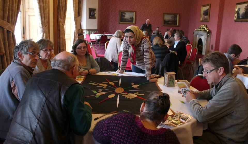
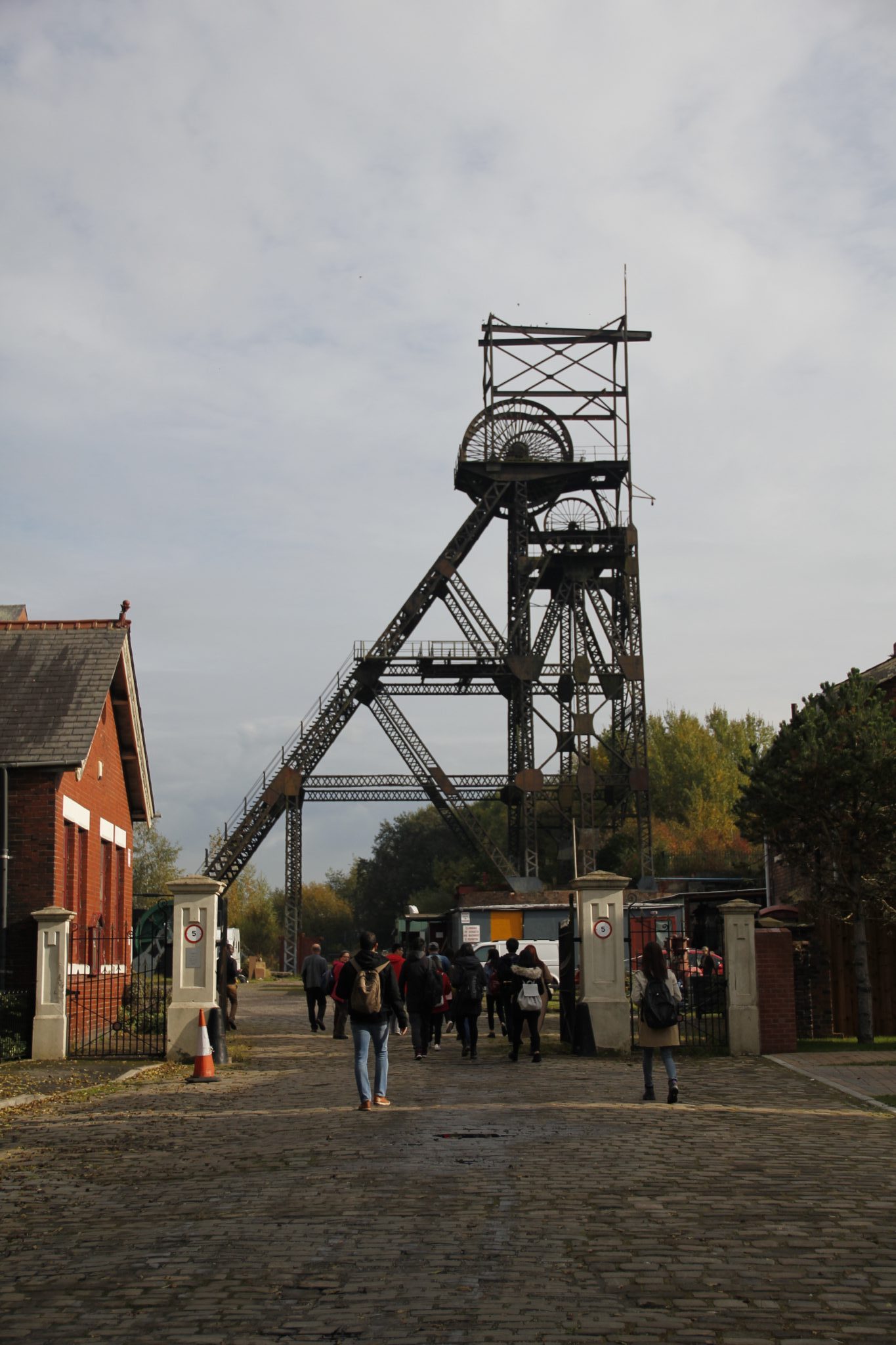
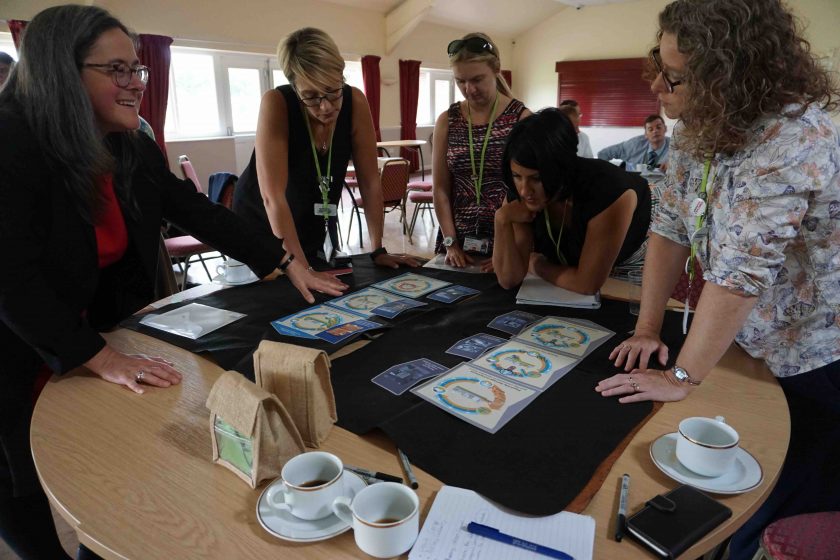
This initiative is taking an innovative approach to community engagement, drawing on the industrial heritage of the area to raise awareness about possible sustainable futures with the local community, organizations working in the area, and school children. This essay is a montage of many insights drawn from the decades of experience of the project partners that we interviewed in our research project. Many of them have been working and living in the region long enough to remember the coal mining and the vivid scars industrial exploitation left on the landscape.

Wigan Wetland and Woodland Custodians use Ketso (www.ketso.com) to explore what matters to them in their local landscape. Photo: Joanne Tippett

“I remember someone coming up with the idea that carbon is that unifying factor between the industry and the habitat,” said one of the originators of the Carbon Landscape project. The project emerged from several years of multi-stakeholder and community discussions about how to look after this special landscape. While some people were deeply engaged with the area’s wetlands and the species that inhabited them, many others saw little of value in this place on their doorsteps. Those involved in outreach activities frequently mention how “it’s surprising how people who live very, very nearby don’t know anything about it.” If they do have any thoughts on the area, they are often negative, describing it as: empty, inaccessible, inhospitable, frightening, polluted, scarred, and industrial.

Aerial view of Pearson and Knowles colliery, no date. Source: Wigan and Leigh Archives

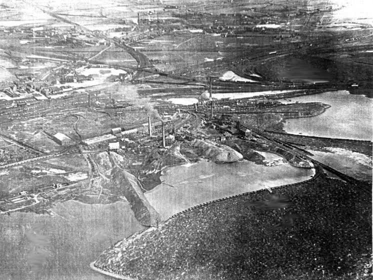
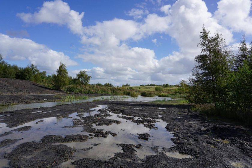
The current landscape is now unrecognizable as the coal dust covered and smoke-besmirched place that fueled the industrial revolution and corresponding urban development in North West England. The industry and associated jobs have gone, but the towns remain and strive to recreate local economies and improve the health and wellbeing of their populations. The surrounding renaturalizing landscape is an important resource in this endeavor. It provides nearby nature for about one million people and interesting opportunities for social and economic development. Many, however, still regard the open space on their doorsteps as a wasteland or a reminder of what has been lost in terms of secure jobs, strong communities and pride. The Carbon Landscape project is trying to shift the narrative to one that incorporates both nature and industrial heritage and sees these as assets and inspiration for a bright future, rather than a story of loss.

Bridgewater Canal at Astley Green. Photo: Joanne Tippett

As another project partner describes, “I would say it was a landscape connected by carbon but carbon would mean different things for different parts of the landscape…it’s peat, and the carbon stored in that way, but as an ex-industrial landscape where carbon has been the driving force of that landscape for the last few hundred years, [there’s] a cultural heritage point of view from coalmining. So the carbon element ties current restoration work in the bogs and peatlands together with the historic aspects of coalmining in the region…But within that, a project that both tries to ensure that the landscape can adapt to future change, future climate change, and for nature conservation purposes, to facilitate species movement across the landscape, as species may need to move for climate change, in what is a quite fragmented landscape” in the only open area in this densely populated region lying between the urban conurbations of Manchester and Liverpool.

Visiting Little Woolden Moss with University of Manchester Students of Planning and Environmental Management, to explore what matters to them in their local landscape. Photo: Joanne Tippett

Even without climate change driven migration, this fragmented landscape needs reconnecting and this is an important aspect of the Carbon Landscape initiative. “We want to connect up islands of populations, we’ve got an island in one place, an island in another place and in between nothing at the moment. We want to try and fill the gaps in so that there’s ways the populations can mix,” says one project partner. Connecting up the different parts of the landscape in people’s perceptions is also an important part of the Carbon Landscape project.

Carbon Landscape Map. Source: https://carbonlandscape.org.uk

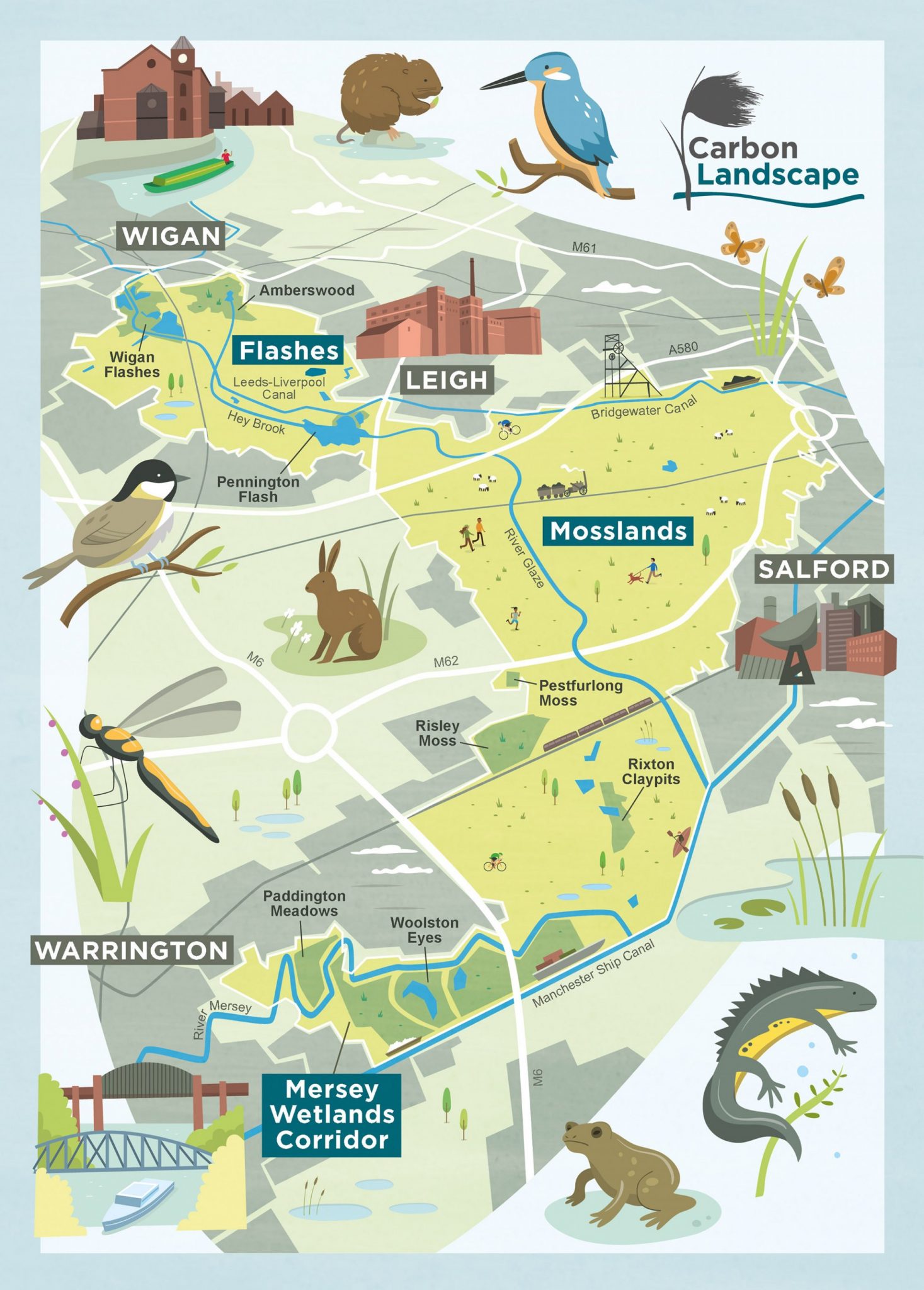
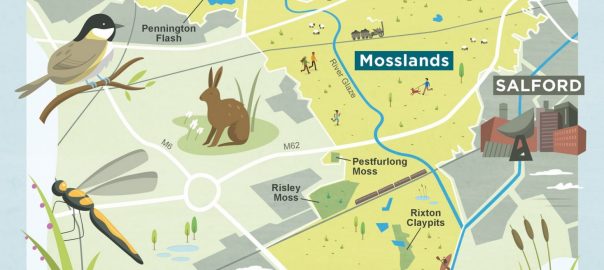
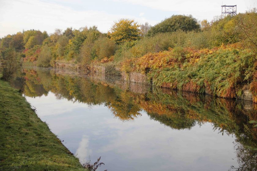
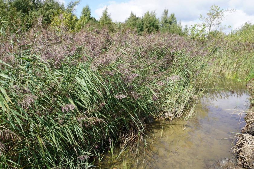
The Carbon Landscape has three related but distinct landscape character areas: the Flashes (as the lakes formed by subsidence are known), the Mosslands with their peat soil, and the Mersey Wetlands Corridor bordering the Manchester Ship Canal which connected Manchester to the sea and facilitated its industrial growth—“and the factory is represented every time you go out, by the amount of strange alien weeds from America, that you find from the cotton industry, just growing in the pavement outside the building here.”

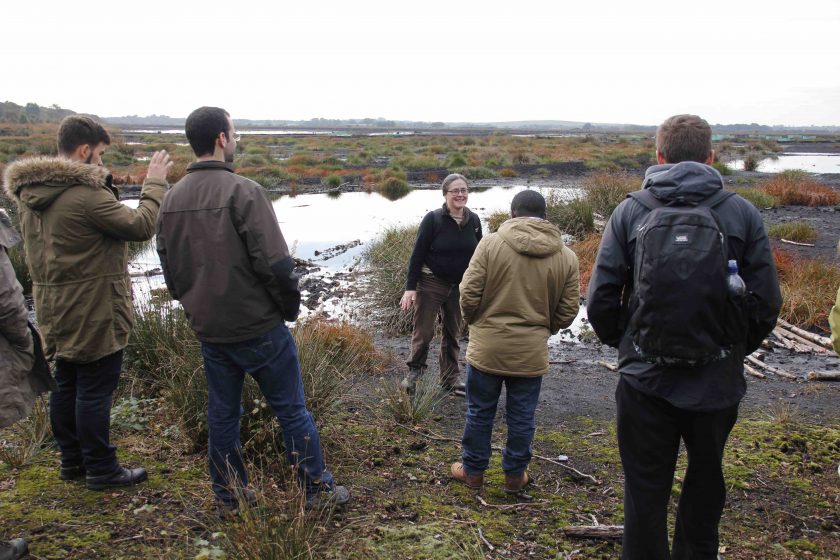
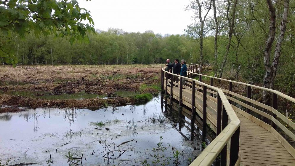
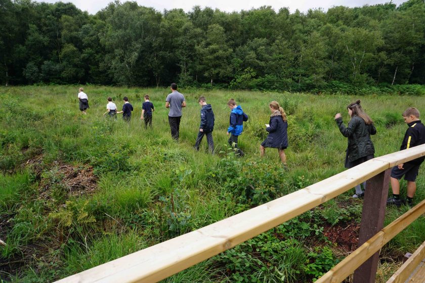
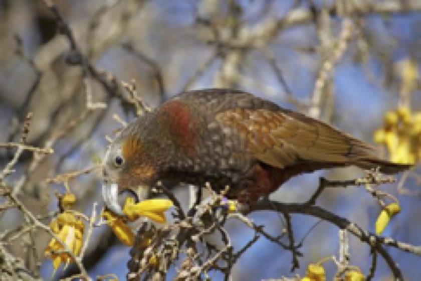
All of the areas provide habitat for internationally important species as well as significant recreational opportunities. The Mosslands are less accessible and considered less obviously attractive, as industrial scale peat extraction is only now drawing to a close, as a result of pressure from citizens and action on the part of local government. Peat extraction (for gardening use) along with drainage for agriculture has severely damaged and in many cases destroyed most of the lowland mosses in the UK, with only 3 percent of this habitat remaining, and not much of that in good condition. This has resulted in loss of habitat for a range of species, and other ecosystem services including carbon sequestration and flood mitigation. With interpretation and some access infrastructure, such as that available at Risley Moss, this 10,000-15,000 year old environment becomes an important and accessible recreational and educational resource. “It’s a fairly unique landscape I think, if we look at peatbogs, they tend to be very remote places in the middle of the countryside, in the middle of nowhere, it could be Scotland or the Peak District or the North Pennines. Whereas here, we’ve got that landscape but in a very densely populated area, …and actually, probably one of the most deprived areas in the country as well.”

Risley Moss Nature Reserve.Photo: Joanne Tippett

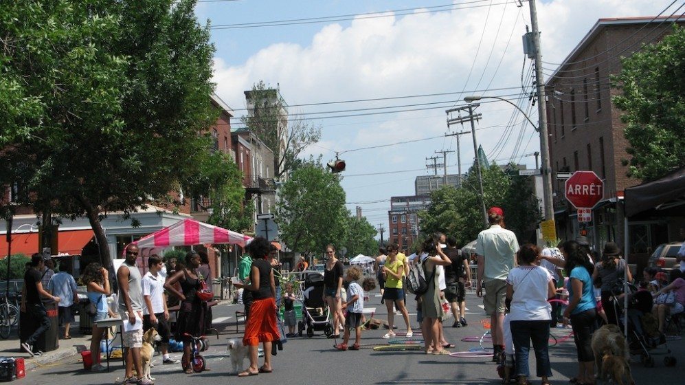
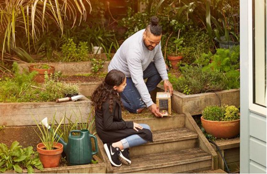
With so many people living in and around the Carbon Landscape, its success depends on engagement of local communities and uptake of a different narrative about what the landscape means. Some people already have deep attachments to particular places and species, and have worked with others to protect these. There is a history of small groups of people being involved with looking after areas near where they live, often areas that may look quite ordinary to outsiders but where local people had noted the presence of particular species and characteristics. But for others it’s an unknown, and possibly frightening, place or a place with different meaning and uses.

“We sometimes forget in this industry that people don’t know about land biodiversity value, they don’t know about land ownership. If no one looks after it, it’s fair game, so they’ve adopted these landscape places as their own. Throughout generations they’ve gone up there, they’ve fished, they’ve used off road bikes, they’ve done shooting, they’ve just generally mucked around up there. That’s part of their individual story and heritage. For us to come in and take that away from them by putting up barriers without doing efficient community engagement gives a very damaging message in some cases. You have a love for the environment there, but it’s in the wrong perspective, it doesn’t align with our values. …My experience of doing community work is that kids…on nature reserves are seen as antisocial, so what everyone’s vision of what we’re trying to achieve is actually culturally not accepted anymore. If they’re mucking around on a nature reserve, it’s antisocial behavior (If they’re stuck on a computer, they’re ruining their future).”

Fear of antisocial behavior is a significant deterrent for many people in the area. They are wary of entering areas that appear uncontrolled or not looked after. Physical changes in the landscape may be needed to invite people in, as one project partner explained:

“At New Cut they put in this concrete tarmac path, and I was talking to some of the older people, they said, ‘we never used to come down here because we were scared, and now there’s a path and people are on their bikes and we don’t feel scared anymore, we can access this beautiful space’…it’s a change of cultural identity, I would say.”

While a perception of damaged communities in damaged landscapes brings with it many challenges, it also can be a motivator for engagement for some people.

“People get involved to do things if there’s a burning platform, if something’s broken, so one of the reasons we can be so successful with engagement right now is that people appreciate that this is broken, so there is a motivator for them to come out. Once we’re further down the line and things are starting to look good then you could argue that the motivation might drop, and I guess time will tell.”

Hopefully, as has been noted in other areas, seeing the positive results of their efforts will motivate engaged citizens to go further and hopefully attract others who needed to see that such work does make a difference.

Restoring pride is a key element in driving engagement with the landscape. As a project partner points out: “A lot of these communities have had a bad time in the past in terms of all sorts of issues. So it’s about pride in communities and there’s a lot of that going on in Manchester in different places, restoring pride in communities that have had a bad time.  And the nature bits should be part of that as well, of restoring local pride.” Another says, “There are communities like ex-mining communities or agricultural communities in places like Irlam and Wigan where there’s real pride in that history and people maybe don’t still connect it with the landscape itself and that, that could be used to really benefit people in terms of having a sense of place of where they live and feeling proud about it.”

Linking this pride to the landscape can be an entry point for a better understanding of it. “I always say, do you know about these internationally important wetlands, we’ve got some species that are as rare as pandas, this is talking at a kids’ level, people connect to that, people like the thought of having super rare wildlife. It’s because it’s this post-industrial landscape that you won’t get these anywhere…this is unique round here and people like that story.”

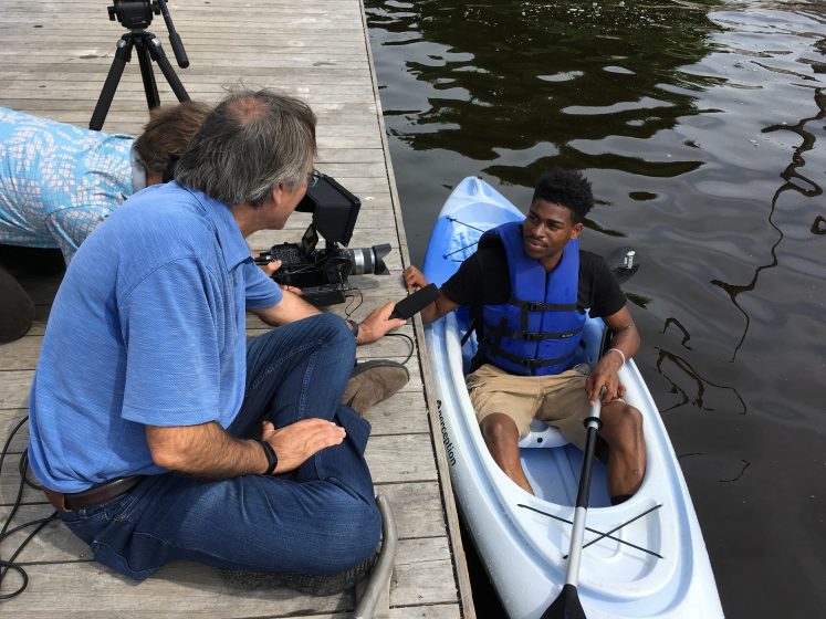
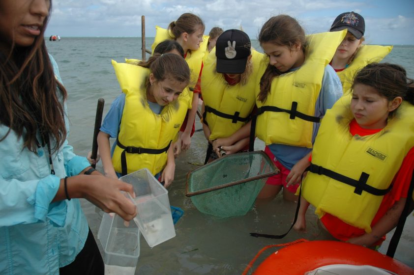
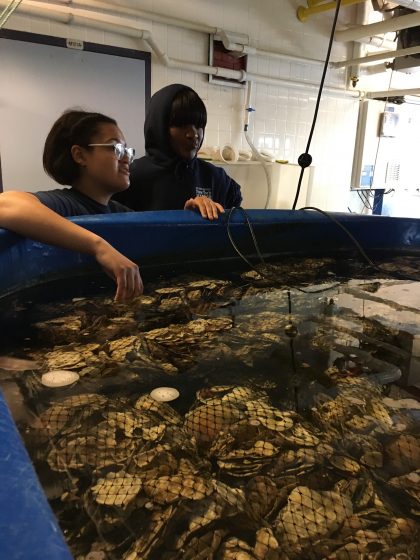
People learn about what is special about this landscape through simple activities, as one project partner explains: “They didn’t appreciate how much was on those sites, and it was just a wasteland behind where they lived, and by going out and doing events like bioblitzes, walks, we slowly started to change some of those attitudes into there’s more here.” It is also important to start from people’s interests, which is facilitated by having multiple partners connected to different interests and groups of people (local communities, groups interested in cultural history, in protecting species and their habitats, in restoring waterways, etc.).

“You’ve got people who were already interested in recording wildlife and doing it that are now wanting to know more about what is the Carbon Landscape, why is that more important than somewhere else? What is the Greater Manchester Wetlands [of which the Carbon Landscape is part]? It spurs those kinds of conversations. And then the flip side of that, the community guys, they’re telling people the story and then they want to get involved. How can they get involved? There’s these opportunities to start recording, and that helps to write the story going forward.”

Coalfield pithead at the Lancashire Mining Museum at Astley Green. Photo: Joanne Tippett

“Starting to give that landscape scale picture [is important] as well. It’s not just this site, it’s how that links to the next site, and how that links to the next site.” Seeing the bigger picture helps people to understand that their efforts are part of something larger and impactful, which is an important source of motivation. But it can also be a challenge to get people beyond their local area. “We’ve had many attempts at getting the volunteers to be landscape scale volunteers, and it hasn’t worked yet, and I don’t know if it works elsewhere in the world, but the people from Woolston love Woolston, that’s why they’re volunteering, the people from Wigan Flashes love Wigan Flashes, that’s why they volunteer, et cetera, and the people from Wigan Flashes don’t want to go to Woolston any more than the people from Woolston want to go to Wigan Flashes, because if they’ve got some work to do [at their site], well it’s their volunteering time, they want to be there.”

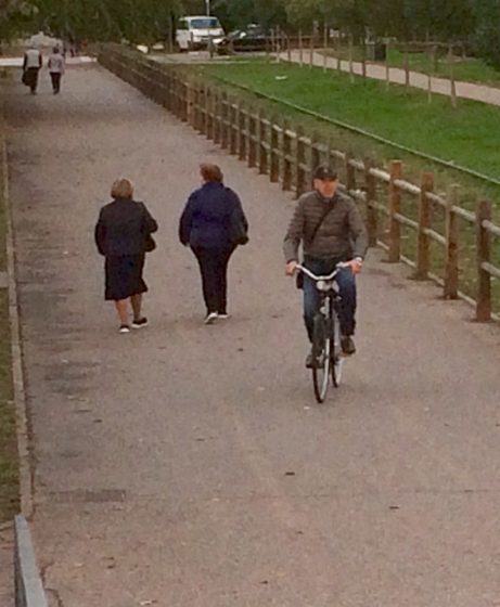
It’s also difficult because people are often unfamiliar with the other areas of the Carbon Landscape. Greater access, connectivity and interpretation are needed to facilitate their engagement with it. The proposed Carbon Trail and Carbon Loops are seen as key vehicles for this. “One of the things I’m really looking forward to, to actually promote this as a landscape are the Carbon Trail and the Carbon Loops. I’m looking forward to those being in place so that I can advertise them as a Carbon Trail, and it’s the Carbon Landscape and this is the Carbon Landscape story. I know they’re still under development. I’m looking forward to cycling those myself so I can see how the different habitats and spaces blend as you move from the south up into the north.” This contact is expected to lead to engagement, “you’re opening it up and people are seeing things that they’ve not seen before, that makes people care about stuff.”

The Carbon Trail will connect gateway sites with the different areas of the Carbon Landscape. There will also be several interpretive walking trails, ‘Carbon Loops’ that will tell the stories of the different character areas, including a story of sustainability that illustrates what has occurred in this landscape in the past and how it can be transformed in a more sustainable future. These will be based on the RoundView, a way of navigating towards a sustainable future that is being used in community and school workshops in the Carbon Landscape to link our modern understanding of the environmental problems unleashed by the industrial revolution to an inspiring vision for the future, where human activities fit well within the landscape. The RoundView traces the long history of the landscape from the formation of peat and coal through the industrial revolution. It conveys that all of these events, and particularly the anthropogenic effects, are very recent chapters in the history of the planet. It describes how the process of change continues, and with it the opportunity for humans to do things differently in the future.

Carbon Landscape RoundView workshop. Photo: Joanne Tippett

The Carbon Trail will bring people into the landscape so that they begin to know, use and care for it, and it will also establish connections among the surrounding towns by linking up and signposting active travel corridors. But some partners are concerned about conflicts between access and connectivity for people and for wildlife: “I would love to see proper links in the landscape being developed. Proper wildlife corridors, so that the landscape is working for wildlife. A by-product of that in my world, but equally valid, is that if it’s working for wildlife, it’s probably working for people. Because porosity is porosity. The only problem I have, is as soon as I mention the word, green corridor, somebody says, you can put a cycleway along that, and I instantly lose my green corridor. So, that’s why I separate the two to some extent, my green corridor is primarily the way that hedgehogs, newts, willow tits move through the landscape. Its secondary function in my world, is as an access for people.”

This discussion about the Carbon Trail and connectivity surface a dynamic tension in the Carbon Landscape project, that of balancing protection of nature and access for people. Some people argue that unless people get into this landscape and care about it, it won’t be protected for other species. A lot of the land is privately owned, demands for housing are very high, new economic opportunities are much needed. There is a tension between conservation and development to improve access and also to provide a funding mechanism to finance restoration work, through for example building new homes on the edges of the mosslands.

Discussing the intense pressure for development in the peri-urban landscape, one project partner said: “At the end of the day, if we want to achieve our goal, we have to engage local people, we have to engage people from further afield. We have to make these sites accessible. They are urban, so we have to create a relationship between people and biodiversity.”

“It’s about ensuring, from a sustainability point of view, that the landscape is treasured for its original assets, its natural assets and what that has provided for us, but it continues to evolve to meet the needs of future society, so that they then continue to value it.”

As the Carbon Landscape acts as an illustration of this history of change, including destructive changes, so can it act as a demonstration landscape for different practices that work for both people and nature. Opportunities for more sustainable livelihoods are emerging, including those related to heritage/eco-tourism and sustainable agriculture. The narrative of this region also includes innovation, and that element too can be called up in support of sustainable transitions. “This area used to be the most innovative region in the industrial revolution. We were frontline of technology and the way people were living their lives and thinking. It’s been overtaken now by modern life, but we have an opportunity again to grab that innovation and lead the way to create a green corridor and more sustainable way of living, a happier, healthier community…focusing on the innovation and wanting to change what connects people with their environment…I feel like a story of our site is about innovation into nature.”

Coal mining waste being restored at Bickershaw, Country Pary. Photo: Joanne Tippett
Wetlands regenerating at former site of Bickershaw Colliery. Photo: Joanne Tippett

The vision for the Carbon Landscape? “It would have to be a place that was a thriving place, a green place, a place for people, for wildlife, for recreation, for health, all of those things.” Through innovative community engagement, active volunteering and working with partners and cities to improve our scientific knowledge of restoration of post-industrial landscapes, the Carbon Landscape project aims to inspire a step-change in the landscape and to bring hope for a sustainable future.

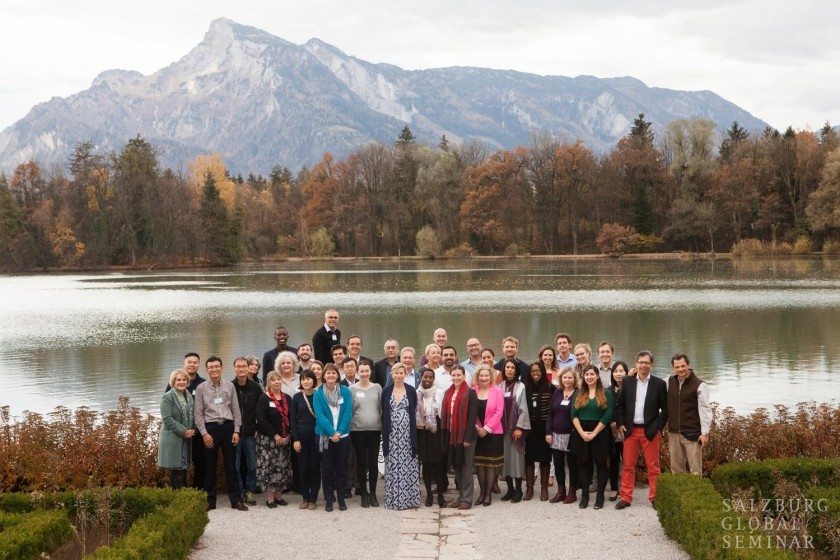
Janice Astbury and Joanne Tippett
Manchester

On The Nature of Cities


Many thanks to participants from Cheshire Wildlife Trust, City of Trees, Environment Agency, Greater Manchester Ecology Unit, Inspiring healthy lifestyles, Lancashire Mining Museum, Manchester Metropolitan University, Manchester Museum, Mersey Rivers Trust, Natural England, Peel Land and Property, Salford Council, The University of Manchester, Warrington Council, Wigan Council, Wildlife Trust for Lancashire, Manchester & North Merseyside and Woolston Eyes Conservation Group.

Rererences

Carbon Landscape Partnership (2016). The Carbon Landscape. Landscape conservation action plan part 1. Preston: The Wildlife Trust for Lancashire, Greater Manchester & North Merseyside.

Great Manchester Wetland Partnership Technical Group (2014). The Carbon Landscape interpretation Report, 28 May 2014.

Tippett, J. & How, F. (2018). “The SHAPE of Effective Climate Change Communication: Taking a RoundView.” In W. Leal Filho et al. (Eds.), Handbook of Climate Change Communication: Vol. 2: Practice of Climate Change Communication, 357–72. Cham: Springer International Publishing. https://doi.org/10.1007/978-3-319-70066-3_23.

Tippett, J., Farnsworth, V., How, F., Le Roux, E., Mann, P. & Sherriff, G. (2010). Learning to embed sustainability skills and knowledge in the workplace. Manchester: Sustainable Consumption Institute. http://www.roundview.org/background/research/

Joanne Tippett

About the Writer:
Joanne Tippett

Dr Joanne Tippett is a lecturer in Spatial Planning in the School of Environment and Development at the University of Manchester. Action research funded by the Sustainable Consumption Institute and 250 staff in Tesco led to the creation of the RoundView Tool for Sustainability [www.roundview.org].

A green land with a body of water

Nature-based Solutions Are Gaining Momentum in Brazilian Cities

Many voices. Greener cities. Better cities.
Although there is a clear move by many cities to recognize that nature is essential to enhance their resilience to face climate challenges, there is still a lack of a wider understanding of the immense benefits they may bring to urban environments.

After more than 15 years of teaching, researching, consulting, and advocating for nature-based solutions (NBS) in Brazil, it’s really fulfilling to see NbS becoming nationally recognized and adopted in several Brazilian cities.

In this essay, I present my view of the process that led to this moment. It has had ups and downs, successes, and frustrations (especially related to the city of Rio de Janeiro, which up to this date has ignored NbS in urban public plans, programs, and projects). I will focus on the ups and successes. To wrap up, I present two cities that are front runners in Brazil.

Learning, educating, and raising awareness about nature in cities

The first time I had contact with green infrastructure concepts and applications was in a workshop at the University of São Paulo (USP), organized by Prof. Paulo Pellegrino and the American landscape architect Nate Cormier in 2006. Paulo has been one of the pioneers in teaching and researching landscape ecological planning (ELP), he is co-coordinator of the LabVerde (Green Infrastructure lab that is responsible for the ―a scientific journal). I met him in a master’s program in 2005, when he invited Prof. Jack Ahern from UMass for an intensive course on ELP at USP. I believe this class was a seed that germinated and flourished in other universities in Brazil.

Some of the actions I have participated in during recent years in Brazil are:

In 2009, I co-founded the Inverde Institute to educate and advocate for the need of nature for sustainable and resilient cities. I have written about our work in previous pieces here, at the TNOC. We have contributed to spreading the word on green infrastructure and contemporary ecological and social challenges with 4 years of monthly lectures with Brazilian and international invited speakers and roundtables, around 10 years of seminars and several short courses, and active participation in the Environmental Council of Rio de Janeiro City, among other initiatives.

I launched a Master’s program on at the Pontifical Catholic University of Rio de Janeiro, together with in 2016. The course was interdisciplinary, with the participation of professors from diverse departments of PUC-Rio: geography, biology/ecology, social services, law, and my department: architecture and urbanism. Also, we had the contribution of Osvaldo Rezende, professor of hydrological engineering at UFRJ (Federal University of Rio de Janeiro). Several lecturers came to talk about soil, urban mobility, urban agriculture, and sustainable cities (e.g., C40 and ICLEI representatives), among other relevant themes. Many of our former students are working in city departments and in other organizations related to NBS.

During the pandemic (2020-2021), we organized with national and international invitees, when the university had more than 2.600 registrations. People from all over the country and abroad attended.

Nature-based Solutions taking central stage in the last years

The synergy with other initiatives started to fructify in 2018 when I was invited to collaborate on and III on NBS, promoted by the European Commission―Directorate-General for Research and the Ministry of Science, Technology, Innovation, and Communications. Two bilingual publications, in Portuguese and English, were products of those dialogues. The first is (2019) and the second is (2022). Both are available for download. The first two seminars on NbS that happened in Brasilia in 2018 and 2020 were under the umbrella of the Sector Dialogues, in collaboration with other organizations.

There were two more recent international webinars on NBS organized by the Centro de Gestão e Estudos Estratégicos (Center for Strategic Management and Studies―CGEE), and several active partners that focus on NBS in Brazil. The 4 presential and online events have reached hundreds of city officials, decision-makers, academia, researchers, and other people interested in the theme.

The is a platform that has a wide reach and one of its themes is NBS, with several case studies in Brazilian cities. It has also been an important means of dissemination. The initial case studies that are listed on their website are also products of the Sector Dialogue III.

Several organizations, Brazilian and international are responsible for diverse actions and programs to develop NBS in cities: Fundação Grupo Boticário de Proteção à Natureza (FGB ― Foundation Boticário Group for Nature Conservation), CGEE, Rede Brasil do Pacto Global da ONU (ONU Global Compact Brazilian Network), ICLEI (Local Governments for Sustainability), a Plataforma Brasileira de Biodiversidade e Serviços Ecossistêmicos (BPBES ― Brazilian Platform of Biodiversity and Ecosystem Services), o WRI Brazil (Word Resources Institute, o Painel Brasileiro de Mudanças Climáticas (PBMC ― Brazilian Panel of Climate Change) and The Nature Conservancy Brazil (TNC). They constituted the Bioconexão Urbana (Urban Bioconnection), a consortium that targets to accelerate NBS, give more visibility, and reach wider audiences and more cities.

A new product of the Bioconexão Urbana is an NBS Guide for the media. The consortium is doing a countrywide research on the perception of the Brazilians regarding climate change and nature-based solutions. Also, they are interviewing 100 city managers to understand what they think about climate change and if NBS is part of the solution. The results will be presented at CoP 28, UN Climate Change Conference, at the end of 2023.

WRI and FGB have launched to prepare city officials to develop urban projects to be funded. The call received about 80 proposals of NbS in ideation in Brazilian cities, the number of applications was astonishing for the expectations. For phase 1, ten projects were selected by a jury to be further developed with the technical support of specialists in all areas. The final two selected projects are now in phase 2 until April 2024, with the support of experts in financing.

Those are some of the initiatives that are underway in Brazil.

Campinas and Niterói: two front-runner cities

I chose the two cities because I have been following their engagement and continuous commitment, and work for urban enhancement with the introduction of nature-based solutions.

Campinas

Campinas is the third most populated city of the State of São Paulo with more than 1.2 million inhabitants, located about 100 Km from the State Capital, São Paulo city―the largest Metropolitan Region of South America with more than 22 million inhabitants. The city has been one of the pioneers in Brazil to address and plan for biodiversity and nature-based solutions to adapt to climate challenges and the need for environmental justice. Plans, programmes, and actions are progressive and being implemented on multiple scales.

Campinas Metropolitan Region (RMC) is composed of 20 municipalities. Reconecta RMC program is led by Campinas with all other municipalities, the aim is to restore the metropolitan ecological infrastructure through the riparian corridors of the regional rivers by ‘promoting local fauna management and biologic diversity; recovering riparian corridors, protecting and restoring water springs and ecological corridors; enhancing existing protected areas and create new ones, with better conservation units management (including new ones), and conserving strategic forest remnants.  In this manner, the region will have increased water security and resilience to face climatic events. It has a ground-breaking ‘Action plan for implementation of the Connectivity Area of the Metropolitan Region’ (Plano de Ação para Implementação da Área de Conectividade da Região Metropolitana de Campinas) (Fig. 1). This plan was elaborated in collaboration with ICLEI and WRI, it is a comprehensive green infrastructure plan, with multiple NBS to be implemented in all cities of the Metropolitan Region. This program is part of the Campinas Metropolitan Region Urban Integrated Development Plan (Plano de Desenvolvimento Urbano Integrado da Região Metropolitana de Campinas), still not approved by the State Representative House. It is a systemic program, that oversees the complexity of the social-ecological-technological regional system, and the potentialities to achieve the desired objectives to adapt to the changing climate with a focus on biodiversity enhancement to provide numerous ecosystem services with multi-scale reach.

A map
Figure 1 – RECONECTA RMC – Biodiversity Connectivity Area (Source: Prefeitura de Campinas, Secretaria do Verde, Meio Ambiente e Desenvolvimento Sustentáve, 2018)

The Municipal Strategic Master Plan (Plano Diretor Estratégico do Município de Campinas, lei 189/2018), incorporates the protection, enhancement, and connectivity of the biodiversity in the city.

A new NBS and environmental resilience municipal plan will soon be released. The spatial plan aims to be systemic and has been elaborated with the transversal participation of all 27 city departments, as well as diverse public and private stakeholders and residents. Once the plan is created by Municipal Decree to guarantee long-term reach (independence of the political shifts), it is flexible and adaptable during the process of elaboration only, but it is a long-term plan.

The city of Campinas has a plan of 43 linear parks along urban rivers to build an urban green infrastructure, which was developed after mapping the areas with less green areas and the lower family income. The parks aim to offer better and more resilient environment for their inhabitants once they are planned for the poorest populated neighbourhoods. The first is already implemented.

Sustainable Development Goals (SDGs) have been addressed in the new plans and programs, also they are aligned with regional, national, and international progressive agendas (highlighting NBS).[i]

Niterói

Niterói is located in front of Rio de Janeiro city, on the other side of the Guanabara Bay. It has almost 500.000 inhabitants, in an area of 1290,3 Km², only 2 meters above sea level in the lower areas. It is an important city in the Metropolitan Region of Rio de Janeiro.

In the last few years, the city has focused on sustainable development in expanding areas. The program, has started to enhance urban mobility and the ideation to requalify the Jacaré River that contributes to the Piratininga Ocean Lagoon. The river restoration faces many challenges once it flows through urbanized areas that are illegally occupied and the legislation doesn’t allow removing people from their homes, even if they are in vulnerable areas.

The most ambitious fully implemented NBS project in Brazil up to this date is the Parque Orla de Piratininga (POP―Piratininga Lagoon Front Park―named Alfredo Syrkis, after the death of this green activist and politician) (Fig. 2). The lagoon receives polluted waters from its affluents, being the Jacaré River the main one. It had a circular canal that captured the contaminated waters before flowing to the lagoon. The water body was polluted and hidden from the residents by tall grasses and invasive plant species, it was very neglected. The urbanized area has a diversity of social income in diverse residential clusters and, in some parts, the parallel power (militia and drug dealers) is still present.

The development of the park is very inspiring for students and professors. In 2017 Raquel Cruz, a student of the PUC-Rio Master Program on Landscape Ecological Planning and Design, proposed a multifunctional park in her final project. At that time, she worked for Niteroi, starting as an intern, after some years she became the Director of Urban Ecology and Climate Change of Niteroi, as the Secretary of Environment, Water Resources, and Sustainability. Her proposal was the seed for the recently implemented park. It has an area of 685,000 m², with built wetlands that treat the polluted waters that flow from the rivers (Fig. 3), bioswales to collect the contaminated run-off from the streets, and a myriad of recreational, sportif, and cultural activity areas. It is a successful and inspiring case that has gained a lot of visibility nationally and internationally. Has so far, received the awards: Sustainable Cities 2023 (Fig. 4) and Smart Cities Congress Mexico City, and was a finalist in the 2023 Green Infrastructure World Congress (WGIC ― Berlin).

Aerial view of a lake surrounded by land
Figure 2 – Piratininga Lagoon Front Park – Alfredo Syrkis (credit: city of Niteroi)
A green land with a body of water
Figure 3 – Built wetlands to treat polluted water before flowing into the lagoon (Credit: Ecomimesis)
A person holding a certificate and a trophy
Figure 4 – Axel Grael, mayor of Niterói, receives the 2023 Sustainable Cities Award. Photo: Flavia Abranches

In both cases, Campinas and Niterói, urban residents were actively engaged with workshops and other means of interaction. The involvement of citizens is critical so they can value and praise the urban greening, giving sustainability to the implemented projects.

Final thoughts

Climate crisis is impacting cities all over the world, and in Brazil, the outcomes are especially dramatic. Nature-based Solutions are gaining more relevance once the decision-makers understand their potential to build urban resilience and offer a better quality of life and well-being to their residents.

As it is mentioned above, diverse institutions are devoted to enhancing the knowledge and skills of public servers and decision-makers, motivating them to adapt to the changing climate to face the current social, ecological, and economic challenges through the introduction of biodiversity, opening room for rivers and creeks, increasing permeable areas in the urban built desert. The results are fructifying, qualified and committed city officials are pushing NbS agendas all over the country.

Although there is a clear move by many cities to recognize that nature is essential to enhance their resilience to face climate challenges, there is still a lack of a wider understanding of the immense benefits they may bring to urban environments. Residents, decision-makers, and other relevant actors need to be educated to value nature in cities, developing their biophilia and systemic understanding of the challenges we are facing. It is beneficial not only to their close environment, but it is also essential to contribute to a paradigm shift to a regenerative culture.

Cecilia Polacow Herzog
Rio de Janeiro/Lisbon

On The Nature of Cities

[i] More about Campinas NbS actions: Neves, G.D.M. et al. (2022). The Implementation of Connectivity Area in the Metropolitan Region of Campinas (São Paulo, Brazil): Biodiversity Integration Through Regional Environmental Planning. In: Mahmoud, I.H., Morello, E., Lemes de Oliveira, F., Geneletti, D. (eds) Nature-based Solutions for Sustainable Urban Planning. Contemporary Urban Design Thinking. Springer, Cham. https://doi.org/10.1007/978-3-030-89525-9_7

Nature, New York, and the Practice of Paying Attention

Many voices. Greener cities. Better cities.

A review of Still the Same Hawk, edited by John Waldman. 2012. ISBN: 9780823249893. Fordham University Press, New York. 160 pages.

“Dualism is the defining quality of urban nature.” 

stillthesamehawkThus begins John Waldman’s introduction to Still the Same Hawk, a grab bag book of “reflections on nature and New York” from eleven different authors. For some readers new to the topic, the very notion of “urban nature” may be a dualism in and of itself: a pair of words missing a conjunction to make them make sense. Urban and nature. Urban or nature. But urban nature? What on earth is that? Waldman and his colleagues set out to find out.

Robert Sullivan literally wrote the book on what he calls “nature that people would rather not think about”—a 256-page meditation on a horde of rats living in an alley at the southern tip of Manhattan. Sullivan’s essay focuses on the nature that thrives and prospers in cities, “…the nature that everyone is not looking at, the nature that Ansel Adams avoided, that people don’t use as screensavers or put on the side of their coffee mugs.” Nature isn’t missing from cities, Sullivan argues. We just refuse to acknowledge it because it’s unexceptional or unappealing. Rats and roaches, rotting trash and roosting pigeons. He challenges us to pay closer attention and, in doing so, transform the unexceptional into the sublime.

The book takes its title from Sullivan’s observation that a hawk nesting on the windowsill of an Upper East Side apartment is a newsworthy event, while a hawk perched on a cliff in the Catskills is, well, just another hawk. And yet, as the book’s title tells us, it’s “still the same hawk.” Same species, different context. We humans choose to focus on the former and shrug at the latter. Our expectations shape our perceptions, and vice versa. In short, we can choose to see nature and the city in a different light. If there’s one theme that runs through all the essays in this potluck collection, it’s probably summed up by two simple words: pay attention.

William Kornblum, a researcher and writer based at the City University of New York, struggles to craft a coherent “land ethic for the city” in his essay on teaching undergraduate environmental sociology at Queens College. His class wanders outside to explore the landscape surrounding the campus. They discover a tight grid of row houses overlooking the sunken six-lane Long Island Expressway before scurrying along to find a patch of urban greenery in nearby Kissena Park. Like an ersatz Socrates strolling outside the walls of Athens, Kornblum peppers his students with questions as they make their way through the neighborhood: “Why is the land here so elevated?” “What happens when it rains or snows and the water runs off the streets?” “What do land uses at three of these corners have in common?”

The students, Kornblum admits, “seem perplexed” by his questions. So, too, is this reviewer. It hardly seems fair to ask questions that most students are unlikely to be able to answer without some prior knowledge of the topic. This isn’t maieutic teaching; it’s uninformed guesswork. These students may see the things Kornblum points out, but, to paraphrase Sherlock Holmes, they aren’t invited to observe. Though his meanderings are well meaning, Kornblum fails to deliver a cohesive land ethic for urban life by the end of his essay—an unfortunate disappointment, given how beautifully he writes about New York harbor in his 2002 book At Sea in the City. 

David Rosane, another educator, recollects a series of personal interactions with New Yorkers confronting the dualism of urban nature. He casts a spotlight on three New Yorkers in a mini-drama with a raccoon in Central Park: an uptight white woman from the Upper East Side who frets about rabies, a sharp-tongued and world-weary Latina who shrugs off the white woman’s warnings, and a timid Asian woman who wonders aloud if raccoon meat makes for good soup.  Rosane is well-meaning in his enthusiasm for New York City’s multiethnic mosaic—we all discover nature in our own unique ways!—but the stereotypes are distracting and do little to advance his message.

Devin Zuber’s essay redeems the theme on teaching and learning that pops up again and again throughout Still the Same Hawk. Good teaching often follows the same rules as good writing, and the axiom “show, don’t tell” aptly summarizes Zuber’s strategy as he invites students at the City University of New York to investigate and interpret the city on their own terms. They find arresting moments of beauty in their everyday experiences of the city, linking small and tangible objects to big and abstract ideas about urban ecology. Like Casper David Friedrich’s Wanderer Above the Sea of Fog, Zuber’s students venture out in search of the sublime and come back having transcended the divide between nature and the city.

Zuber argues that imagination and an appreciation for beauty are integral to understanding the complexity and richness of nature in unnatural settings. It takes a wild mind to see the ghost of Minetta Stream still trickling under the asphalt of Downing Street in the West Village; to see a line of street trees in Midtown as a single small copse in a sprawling rectilinear urban forest; to see the whole of New York City as a palimpsest landscape first etched upon more than twenty thousand years ago by a massive ice sheet travelling south from the Arctic Circle. Imagination, in this sense, is the practice of speculative transformation, of picturing what could be and what could have been.

In her Corner Garden, Dara Ross recalls a small group of imaginative neighbors in Brooklyn that transformed a garbage-strewn vacant lot into a lush community garden. Ross offers a dialogue-driven glimpse at mundane moments in the garden’s history. We overhear Zora and Alma, two of her neighbors, reflecting on the day the garden got started:

“R.C. was out there cleaning up that nasty-ass mess but so was JoJo, Liliana, Lester, Calvin, Sherrie, NayNay, and even that lazybones Willie…” Zora recalls.

“Shoot girl, now I know that was a lot of work,” Alma replies.

“Sho’ nuff it was,” Zora confirms.

These aren’t caricatures like the ones we find in Rosane’s essay; they’re full-blooded characters, each unique and fully alive on the page. We eavesdrop on their chitchat and discover the truest value of community gardens in their deliberations and debates, reminiscences and remonstrations.

Kelly McMasters offers up a similar mini-memoir of her time living in a basement apartment near an abandoned moonscape in the Gowanus neighborhood of Brooklyn. Her essay inventories the utopian schemes projected onto a parcel of land contaminated by the residue of a manufactured gas plant from the Gilded Age. This “section of land in Brooklyn where the Gowanus Canal curves like a comma” would see plans come and go for a public park, a high-tech vertical farm, and any number of competing proposals for new housing. The winner, in the end, was a hybrid of sorts: gardens, parks, and a cluster of condos slated to open in 2017. “This block will be the most expensive in the neighborhood soon,” McMasters’ landlord declares, his imagination running free. “You watch.”

Phillip Lopate tackles one of the most enduring contradictions between American environmentalism and urban design: our love/hate relationship with the sort of dense development currently sprouting up along the Gowanus Canal. Lopate argues that naturalists and urbanists should be friends—that high-density cities are more energy efficient and take up less space than the suburbs designed to replace them. “I don’t know when God declared that there should be no skyscrapers in Brooklyn,” Lopate writes, challenging high-minded NIMBYists in a low-rise borough of brownstones to think of the benefits that come with well-planned density. That’s the kicker, though. In the rush to redevelop, cities like New York have seen density increase without a corresponding investment in infrastructure and municipal services. Skyscrapers are fine, but without affordable rental units, reliable subways, well-maintained parks, excellent schools, and access to a decent grocery store, city dwellers may end up striking out for the suburbs after all.

In Monarchs of the Urban Mind, Betsy McCully focuses her imagination backward to “mentally excavate layers of time and space ever deeper” to discover a New York where “continents docked and drifted, mountains rose and eroded, glaciers advanced and retreated.” McCully sees a region that was already on the move long before Henry Hudson floated into the harbor or Peter Minuit put a down payment on the island of Manhattan. “It’ll be a great place if they ever finish it,” O. Henry wrote about New York more than a hundred years ago, long before skyscrapers and superblocks. McCully, reflecting on the cyclical rhythms of butterflies and horseshoe crabs migrating in and out of the city’s harbor, helps us see that New York is a great place because they never finish it—they being the gods of old who cause mountains to rise and fall and rivers to change their course and the demigods who’ve built canyons of concrete and steel, highways and harbors and railroads and acres and acres of parks.

Stewart Brand, an iconoclastic environmental thinker with an unapologetic love for cities, calls this sort of perspective “long now” thinking. It forces you to look past the trivia of daily life and situate yourself in a broader, more consequential view of yesterday, today, and tomorrow. While McCully digs deep into the long now of New York’s past, Anne Matthews scans and summarizes a stack of scholarly reports forecasting the city’s future and identifies four basic scenarios. The first is a “dystopian battleground of civic chaos and decay, a Bladerunner vision of New York” in a warming and increasingly crowded world. The second is a “milder edition of this chaotic future”—a sprawling megalopolis with creaking infrastructure and ecosystems on life support. Things get better in the fourth scenario: the city is retrofitted for environmental sustainability and resilience in the face of climate change. The fourth is a mix of the preceding three: New York as an archipelago city, surviving though its geography and its infrastructure are altered by rising seas. Which scenario will become a reality?

If McCully and Matthews bring the “long now,” then essayists Tony Hiss and Christopher Meier bring the “big here.” In their Welcome to the H20 Region, Hiss and Meier invite residents of New York to think of the region surrounding the city’s harbor as a “second address” filled with rivers and streams, beaches and wetlands, forests and mountains and valleys to rival any National Park way out west. If the residents of San Francisco and Berkeley and San Jose and Sausalito can all claim the “Bay Area” as their home, why can’t the people of Middletown and Newark and Fort Lee and White Plains picture themselves belonging to a larger “Harbor Area” with New York City at its center?

Frederick Buell does a fine job of summing up the book in his essay on the cultural history of nature in New York. Buell argues that we are living through a slow motion environmental apocalypse. There’s no going back to the way things were, and surviving the future will likely involve exploring and appropriating the contradictions between cities and nature that governed our thinking in the past. In the future, nature will be both nowhere and everywhere—not just because of the radical changes from climate change that already in the pipeline, but because we will have learned to think of nature in a different way.

Still the Same Hawk raises more questions than it answers—a fitting tribute to the complexity and chaos of an urban ecosystem that refuses to settle down into anything vaguely resembling a climax community. Though the quality of the essays varies, the book includes some truly thought-provoking treasures that are easily paired with longer classics such as Nature’s Metropolis by William Cronon or The Granite Garden by Anne Whiston Spirn. Sullivan’s essay, for example, deserves a place on any undergraduate environmental studies syllabus. Ross’s essay should be required reading for anyone in the ever-growing urban agriculture movement.

Waldman deserves credit for compiling the first approachable attempt at deconstructing the idea of nature in the context of New York.  Every big American city should have a similar collection of essays to call its own. So who’s next?

Phillip Silva
New York City

On The Nature of Cities

Nature: Medicine for Cities and People

Many voices. Greener cities. Better cities.

Whilst urbanization has brought many benefits to society, it increasingly denies people of opportunities for the mental, spiritual and physical health benefits from nature. Over the last decade, there has been an alarming global increase in diseases such as heart diseases, cancer, chronic respiratory diseases and diabetes [Note 1]. The risk of these non-communicable diseases is linked to a number of factors, including physical inactivity. Simultaneously, we are just beginning to appreciate the wealth of human health benefits that stem from experiencing nature and biodiversity [2]. A wide range of positive mental and emotional effects have been found to be associated with human exposure to nature, such as on general health, stress reduction, increased physical activity, and reduced incidence/levels of cardiovascular, intestinal, and respiratory diseases.

There is a growing body of research demonstrating the positive influence of nature on human health and well-being.
Natural areas within and around cities restore and safeguard nature and biodiversity, and are critical for healthy and sustainable communities. There is a growing body of research demonstrating nature’s positive influence on health and well-being. Coming into regular contact with nature has been found to reduce stress levels, increase concentration, stimulate exercise, promote social cohesion, and help to treat diseases and disorders. These positive influences on mental and physical well-being in turn lead to substantial economic benefits, by increasing economic productivity and reducing health-care costs.

Nature Rx, a grassroots movement dedicated to informing people about the healing aspects of nature, created a great campaign to remind people about how enjoyable and vital nature really is. They attract attention with innovative and captivating slogans such as “nature, a non-harmful medication,” “side-effects may include spontaneous euphoria and being in a good mood for no apparent reason,” and “ask your doctor if nature is right for you.” Watch one of their videos here.

Nature Rx
Nature Rx

Chris Ives, a Nature of Cities author from Leuphana University in Lüneburg, recently shared some interesting insights on how reconnecting people with nature can help transform society towards sustainability and emphasizing that cities are key places for reconnecting people with nature.

When ecosystems are degraded and disturbed, biodiversity is often lost, as is human health. Protected areas and natural areas within and around cities restore and safeguard nature and are critical for healthy and sustainable communities. In an urbanizing world with a growing population, protected areas are natural solutions for securing our health and well-being, while providing many other benefits such as adapting to the impact of climate change and ensure clean drinking water supply.

Parks, people and health

Representatives of Parks Agencies, cities, governments, civil society groups and international organizations, such as ICLEI, the World Health Organisation, Conservation International and IUCN, were hosted by the Salzburg Global Seminar at Schloss Leopoldskron in Salzburg in November 2015 for “The Parks for the Planet Forum.”

Salzburg Global Seminar – Parks for the Planet Forum, Photo: Ela Grieshaber

This initiative builds on “The Promise of Sydney,” the key outcome of the IUCN World Parks Congress 2014, which presents an ambitious agenda to safeguard the planet’s natural assets, ranging from halting rainforest loss in the Asia-Pacific and tripling ocean protection off Africa’s coasts to a business commitment to plant 1.3 billion trees along the historic Silk Road. “The Promise” includes pledges from governments, international organizations, the private sector, Indigenous leaders, community groups and individuals. It highlights the need to invigorate global efforts to protect natural areas, including scaling up the protection of landscapes and oceans. It includes commitments to boost investment in nature’s solutions to halt biodiversity loss, tackle Climate Change, reduce the risk and impact of disasters, improve food and water security and promote human health. It also aims to inspire people around the globe, across generations and cultures, to experience the wonder of nature through protected areas.

Protected areas are by far the best investment the world can make to address some of today’s biggest development challenges and nature—and nature connectedness—can and must be deployed to tackle impacts on human health and well-being linked to rapid urbanisation.

The discussion during the Parks for the Planet Forum in Salzburg revolved around urban and youth engagement in building appreciation for an access to nature; strategic coalitions for health, cities and nature; the business case for urban transformation in support of health and well-being; and communication with the purpose of improving the understanding for the value of nature for human well-being. The rich discussions during the Forum, show that while the value of nature for health and wellbeing remains highly invisible, there are opportunities and developments that show how we can bring people closer to nature, even in our rapidly urbanising world, and what we can do to spread great ideas.

Indigenous communities make no distinction between culture and nature—they are one. Today, however, we see a growing disconnection from the natural world, with children spending more and more time indoors and names of particular plant species disappearing from our dictionary. Eleven- to 15-year-olds in Britain now spend, on average, half their waking day in front of a screen [3]. According to George Monbiot, losing their contact with nature, the next generation will not fight for it. In Salzburg, Daniel Raven Ellison presented his visionary and hope-giving idea for making London the first National Park City, described as: “A city where people and nature are better connected. A city that is rich with wildlife and every child benefits from exploring, playing and learning outdoors. A city where we all enjoy high-quality green spaces, the air is clean to breathe, it’s a pleasure to swim in its rivers and green homes are affordable. Together we can make London a greener, healthier and fairer place to live.”

Gil Penalosa, Executive Director of 8-80 Cities, explained how Mexico City has benefited from unconventional partnerships between public and private sector partners to expand the resource base for improving the value its largest natural area in the city, Chapultepec park, for citizens and visitors. A group of citizens together with City officials and Park Administrators came up with a Master Plan and set of actions to restore the park. Half of the financing for restoration has been collected from donations, including one million donors at metro stations and supermarkets, and private donations by corporations and important donors. The Chapultepec park is a great example that shows how citizens care for their city and in particular their green spaces and how the impossible can be made possible.

As part of the Promise of Sydney, the IUCN World Commission on Protected Areas has established a joint task force with the IUCN Commission on Education and Communication on Inspiring a New Generation. This will have a strong emphasis on reaching out to young people but also urban communities, to strengthen the linkages between people and nature as young people represent more than half of the world’s population, making this a significant group as a living and breathing force of great potential whose voices must be heard.

How nature can improve physical and mental health 

To investigate the impact of urban nature on childhood asthma in New York City, researchers at Columbia University conducted a study on the correlation between the number of neighbourhood street trees and incidence of the disease (Lovasi et al, 2008)[4]. The study indicates that adding an additional 343 trees per square kilometer decreased the asthma rate by as much as 24-29 percent among children aged 4 and 5.

Public health and the environment are intrinsically linked. Environmental degradation has negative impacts on human health, whilst the conservation of nature and green spaces can deliver multiple health benefits. A study for the European Commission, led by IEEP – Institute for European Environmental Policy, explores these links and how they could be integrated into public health strategies. Marianne Kettunen, Principal Policy Analyst of IEEP, explained at the Parks for the Planet Forum that green areas, rich in biodiversity, in the direct living environment can decrease the incidence and prevalence of allergies and higher levels of exposure to green spaces are associated with improved cognitive development. She emphasized the need to combine evidence with demand and start offering solutions and rightfully stated that “A bit of biodiversity a day keeps the doctor away!”

The European Union Health Strategy 2008-2013 acknowledges the need for action to tackle climate impacts on health. The impact of heat waves is particularly strong in cities and towns. The so-called ‘urban heat island effect’ which describes the increased temperature of the urban atmosphere compared to its rural surroundings, can  cause a growing risk of death from heat stress, in particular for elderly people in our ageing urban societies. The URBES – Urban Biodiversity and Ecosystem Services project has analysed the climate regulation function of green infrastructure in four case study cities, Berlin, Helsinki, Rotterdam and Stockholm (Larondelle and Haase, 2013)[5]. The results of this study confirm that green infrastructure can significantly reduce the urban heat island effect.

Due to the growing number of people in Europe and the U.S. dementia is one of the most critical health challenges. The Nature Assisted Health Foundation, a Swedish/Dutch initiative which translates scientific research on nature and health linkages into concepts for improved health and wellbeing promotes the need for stronger evidence of the benefits of nature to tackle the problem of dementia. Experiments with dementia gardens in Sweden and the Netherlands have demonstrated improvements in quality of life and a reduced need for medication resulting in a substantial reduction in health-care costs.

Partnerships for action

There is a clear scientific understanding of the human need for, and connection to, nature as well as its physical, mental, social and spiritual health and well-being benefits, which the World Health Organisation underlines. However, greater global action is needed to strengthen the evidence base on the connection between nature and human health and well-being and incorporate it into policy and practice, and in particular to engage the health sector, as nature can contribute to reduce health costs substantially. To realise this opportunity, the protected areas, health and business community need to collaborate and work closely together with researchers, governments and NGOs to create a new approach that ensures that nature can help people thrive.

Most of Bogota’s water originates high above the city in Chingaza National Park. The Agua Somos mechanism is a private-public partnership that finances the conservation of moors, forests and rivers that generate water resources in the Bogota region, ensuring not only water supply to more than 10 million people but also the wellbeing of the communities located in the area. This allows users of the water resource to compensate the efforts of both private owners and protected areas to preserve vegetable plantations, forests, and soil that protect watersheds that supply the city, ensuring its quality, quantity and regulation. Owners and protected areas do not have adequate resources to preserve forests and moors that produce the water for Bogota, but they do have restrictions on land use. The Agua Somos mechanism is an interesting alternative as it can provide the necessary funds in order to develop the conservation activities required.

Chingaza National Park, Colombia. Source: www.nature.org

To improve health and well being, we need to strengthen the evidence to show how nature affects health and  promote preventative health contribution made by protected areas and urban green spaces. This entails mapping, assessment and quantification of the qualities and functions of urban and peri-urban parks and green spaces for specific cities and improved understanding of the connection between urban green elements, biodiversity, and human health and wellbeing.

Healthy Parks Healthy People was created by the Australian park agency Parks Victoria in 2000—it has been highlighted before on The Nature of Cities by Kathryn Campbell, the Manager of the initiative—and explores the links between nature and human health. They have published a report this year that reviews the post-2008 literature that examines the health benefits of parks and natural spaces. The wealth of global evidence connecting parks and their value for improving human health highlights the need to promote and invest in parks to ensure the benefits are realised across all communities.

The potential for improving health through use of parks can be enhanced in many ways. This includes park managers, researchers and policy makers promoting the health benefits of nature. The challenge is how to combine a compact city with the need for green space near where people live and the connection between nature in cities and in the surrounding areas is essential for securing the many ecosystem services that benefit urban citizens and means involvement of all relevant planning as well as other stakeholders active at the larger landscape scale.

Central Park, New York City. Photo: Chantal van Ham

Taking action starts with awareness of the values of nature. A contribution to the World Forum on Natural Capital from the Town of Gibsons, a coastal community north of Vancouver,  showed how this municipality not only identified the value of its natural capital, but also made them part of urban decision making. They are pioneering a so called “eco-asset strategy” as an effective financial and municipal management approach that focuses on identifying existing natural assets such as green space, forests, topsoil, aquifers and creeks that provide municipal services such as storm water management; measuring the value of the municipal services provided by these assets; and, making this information operational by integrating it into municipal asset management. The innovation in this strategy is that it helps to explain the value of natural assets in terms of financial and management strategies.

We all know that connecting with and spending time in nature is beneficial for our health. To demonstrate how nature can be used to improve physical and mental health for urban citizens, it is crucial for the nature conservation community to strengthen awareness and knowledge of the values of biodiversity and ecosystem services and to develop a strong business case to improve the connection with non-conventional partners, policy makers and practitioners, the public health sector and urban planners to create opportunities for deploying nature-based solutions to health and well-being challenges.

The partners who participated in the first Parks for the Planet Forum made a joint commitment to find ways to identify and promote mutual co-benefits of nature, health, and a new urban generation. Cities will be usedities as the starting point for the conversation with communities that will provide support to optimize the value of the mutual benefits of nature and human health wellbeing. Turning these ideas into action, we hope to work together closely with the partners The Nature of Cities network to give nature the place in society as miracle medicine it deserves.

Chantal van Ham
Brussels

On The Nature of Cities

Notes:

[1] World Health Organisation Factsheet Noncommunicable diseases, January 2015 http://www.who.int/mediacentre/factsheets/fs355/en/

[2] Paul A. Sandifer,,Ariana E. Sutton-Grier, Bethney P. (2015)Ward, Exploring connections among nature, biodiversity, ecosystem services, and human health and well-being: Opportunities to enhance health and biodiversity conservation, Ecosystem Services, http://www.sciencedirect.com/science/article/pii/S2212041614001648

[3] George Monbiot, If children lose contact with nature they won’t fight for it, The Guardian, 19 November 2015 http://www.theguardian.com/commentisfree/2012/nov/19/children-lose-contact-with-nature?CMP=share_btn_fb

[4] Gina Schellenbaum Lovasi, Kathryn M Neckerman, James W Quinn, Matthew S Perzanowski, Andrew Rundle (2008), Children living in areas with more street trees have lower asthma prevalence, Journal of Epidemiology and Community Health, http://jech.bmj.com/content/early/2008/05/01/jech.2007.071894.abstract

[5] Larondelle, N., & Haase, D. (2013). Urban ecosystem services assessment along a rural – urban gradient : A cross-analysis of European cities. Ecological Indicators, 29, 179–190.

Neighborhood Planning for Resilient and Livable Cities, Part 1 of 3: Why Do Neighborhoods Matter and Where Are We Going Wrong?

Many voices. Greener cities. Better cities.

Jane Jacobs said: ‘Cities have the capability of providing something for everybody, only because, and only when, they are created by everybody.’ To embrace this idea that everyone has to be involved in creating cities is to recognize the vitality of neighborhoods as the scale at which most people relate to the city in their daily lives. Neighborhoods are, in effect, the places where we live and where we tend to spend most of our time, even if much of that is within our private dwellings. They are the places we know best, where we come home to, and where, as the urbanist Lewis Mumford (1954: 269) said, we can ‘recover the sense of intimacy and innerness that has been disrupted by the increased scale of the city’.

Although Mumford and Jacobs sparred often, their thinking can be seen to converge on the question of how neighborhoods matter for city-building. Urban residents are concerned with their neighborhoods because what happens at this geographic scale affects their everyday experience and quality of life. People tend to be invested in and relate to the ‘local’ scale of the neighborhood in a more direct way than cities or metropolitan regions as a whole. In short, the neighborhood is an ideal scale for engaging citizens and undertaking community-based planning, design, and development, and if we co-produce them in new and innovative ways with civil society, our neighborhoods can transform our cities.

In this first of three blog entries on the topic, we present a case for renewing neighborhood planning for more resilient and livable cities. The paradox is that ‘good’ neighborhood planning—as it was done in the past—can be to the detriment of the overall nature of cities for people. It can be divisive both spatially, by setting clear geographic ‘limits’ that signal exclusion or exclusivity, and socially, by putting local interests ahead of broader interests of urban connectedness and complexity.

Two basic questions structure the argument we present in the three blog entries:

• Why do neighborhoods matter for city-building? We consider positive and negative aspects of neighborhood-scale planning with particular attention to strengthening the complementarity and interdependence of civil society and the state. This blog entry focuses on this fundamental question.

• Why should we plan neighborhoods differently and more authentically engage civil society? In our next two entries, we’ll explore how we can create better cities by bringing neighborhoods back into focus while linking them to broader visions and strategies for progress toward ‘wholes that are greater than the sum of their parts’. Civil-society leaders and civil-society organizations (CSOs) can play a pivotal role in developing ‘nested’ neighborhood plans to strengthen cities and to drive innovation for positive social change.

Our forthcoming second entry will outline four key components linking neighborhood-scale planning to the work of ensuring better outcomes for the city as a whole: (1) social innovation, (2) community development praxis, (3) neighborhoods without borders, and (4) a vision of ecological democracy. The third and final entry will tell a story from Montréal about a place-specific approach to neighborhood planning—the Green, Active, and Healthy Neighborhoods project—and explore what can be learned from the first five years of this place-specific work.

Why is the neighborhood scale important for building better cities?

There are good reasons to plan at the neighborhood scale—such as improving the physical environment, building social capital, collectively recognizing community assets, and advocating for public space investment—but we cannot lose sight of the overall city context nor compromise on wider global issues. If we are to succeed in creating more resilient and livable cities, we must renew planning processes at the neighborhood scale, where people already engage with the city on their own (domestic) terms around the world.

Let’s consider some of the many benefits to planning at the neighborhood scale before commenting on some of its drawbacks. In liberal democracies, helpful roles can be played by civil society organizations (CSOs) interacting with the state (government institutions, including municipalities and local councils). Two premises are key here. First, making the leap from the cities we have to the cities we want requires social change, which includes citizens expecting more from their cities and contributing in new and creative ways. This can take root at the scale of the neighborhood—and new approaches to neighborhood planning can help catalyze social change. Second, neighborhoods are both highly-valued home landscapes and ideal spaces for effecting change. People invest themselves in the places they live, even when they don’t intend to do so. Everyday life in a setting builds familiarity and affection, care and concern, as empirically demonstrated by generations of urban scholars from Cook (1988), Fried (1963), Gans (1962), and Hester (1984), to Blake & Arreola (1996), Blokland (2003), Cloutier-Fisher & Harvey (2009), Duncan & Duncan (2004), Feldman (1996), Gallacher (2004), Lewicka (2009), Rollero & De Piccolia (2010), and Woolever (1992).

Neighborhood planning is not a modest endeavor, nor is it new, but it has been neglected in recent decades. By contrast, some of the most dire societal problems in the past century were addressed through neighborhood-focused efforts in the Anglo-American world, such as poverty, crime, alienation, perceptions of powerlessness and political apathy, environmental degradation, and economic marginalization (Rohe 2009). Historically, there have typically been three overall aims: (1) to articulate a shared vision for the future of an area, (2) to guide future growth and development, prioritizing actions and improvement projects that make sense at a local scale, and (3) to determine what is needed to implement the plan. Its proponents identify the following benefits (Jones 1990, Peterman 2000, Rohe 2009, Rohe & Gates 1985):

• Increasing the likelihood that neighborhoods can seize opportunities as they arise to carry out physical improvement projects or pilot initiatives;
• Success in engaging more citizens than broader city-scaled planning processes, because they focus on smaller geographic areas that are ‘everyday environments’ of live, work, and play;
• Increasing social capital by fostering expanded interactions and networks of people involved in the plan;
• Improving the capacity of residents to work together to address complex problems;
• Creating stronger links between neighborhood leaders and citywide decision-makers on urban affairs;
• Improving citizen access to and trust in local government;
• Enhancing knowledge and understanding of local people regarding their own neighborhood’s role and relationships with other neighborhoods and the wider city; and
• Fostering community development.

These are all examples of how neighborhood-based planning can work well, but history has shown that in each instance, the opposite can be true. Among the risks and drawbacks of neighborhood planning are: (1) an overly prescriptive emphasis on physical attributes, (2) the inherently divisive nature of neighborhood-scaled units, which can easily become enclaves, and (3) non-altruistic motivations for citizen involvement.

The first drawback calls for a quick lesson in planning history. Ask most practitioners in the field about neighborhood planning and they will probably mention Clarence Perry (2007 [1929]), whose ‘neighborhood unit formula’ had a huge influence on city-building in North America in the 20th century. Initially a response to pressing social problems in industrial centers, particularly New York City, Perry’s approach is emblematic of an over-emphasis on prescribing ‘ideal’ physical attributes in the name of neighborhood planning. The merits are clear, given the social conditions at the time and place of their origin, but the ‘neighborhood unit’ was based on narrow cultural worldviews that are unsuitable for increasingly pluralistic urban societies. We now recognize the flawed physical determinism on which this approach was based, for example, that residential and commercial land uses ought to be separated; certainly, it is of limited use in already-built urban neighborhoods where billions of people currently live, as well as informal settlements throughout the world.

The conventions of neighborhood planning have evolved and changed since Perry. More recent prescriptions are the Congress for the New Urbanism’s traditional neighborhood development (TND) concept (cf. Duany et al. 2000), the US Green Building Council’s LEED framework for Neighborhood Development (cf. usgbc.org/leed/nd/), the British ‘urban village’ concept (cf. Biddulph 2001), and the sustainable neighborhood concept (cf. Farr 2008). These approaches tend to prescribe a set of desirable physical and functional attributes for neighborhoods, such as population range, spatial area, type of boundaries, proximity to services, and predominant land uses.

Great neighborhoods don’t necessarily make for great cities, as Biddulph (2001) has demonstrated. For cities to be resilient and livable, great neighborhoods must be well-connected, and even overlapping.

A second potential drawback to neighborhood planning is that it can be internally divisive by precluding or severing relationships among people and institutions, both in spatial and political terms. The historic insistence on delineating clear boundaries results in neighborhood ‘insiders’ and ‘outsiders’ as well as those ‘on the margins’. This has produced cities such as Pittsburgh and Toronto with wonderful neighborhood ‘enclaves’ separated by low-quality ‘no-go’ spaces, as so evocatively described by Neal Stephenson in his dystopic 2000 novel Snow Crash. Planning at the neighborhood scale can support the development of enclaves, which have a number of environmental and social drawbacks. Residential enclaves are not positive for the overall social development of a city and they can lead to unfavorable conditions outside the neighborhood borders, such as lower quality environments and higher traffic streets. Even so-called ‘green neighborhoods’ can work against creating better cities, because they are often built on greenfield sties, rolled out as low-density, single-use subdivisions lacking a fine-grained mix of housing types and other activity spaces, thus forcing their users to be heavily dependent on the car for daily life.

The third risk in neighborhood planning arises because the motivations for citizen involvement are as unique as individuals. In some cases, people get involved in neighborhood planning for non-altruistic reasons, such as ‘NIMBY’ efforts to prevent what they consider to be undesirable change—for instance, increased residential densities and/or a wider diversity of housing types. Empirical examples of this abound: Hester (2006) found in a US study that people who claim to dislike higher densities prefer neighborhoods with clear boundaries, marked by social homogeneity and visual uniformity; Blake & Arreola (1996) and Feldman (1990) have reported similar findings. These preferences are not congruent with the small-scale diversity, complexity, and uncertainty that have been found to be important to more resilient and livable cities through empirical evidence spanning decades. Hester’s study also revealed that people are nevertheless more likely to accept higher density if it is associated with well-designed neighborhood parks and increased greenery.

The roles and relationships of civil society and the state have significant implications for neighborhood planning processes and outcomes

Neighborhood plans take a variety of forms, focusing on different kinds of issues:

• Conserving the built and natural heritage of an area
• Developing sustainability policies and initiatives
• Improving access to local democracy, social services, and government institutions
• Addressing sector-specific issues such as housing or economic development
• Enhancing opportunities for active transportation by changing the physical treatment of neighborhood streets and public spaces

What most neighborhood plans have in common is that they provide recommendations for improving a given area of a city based on an analysis of data collected, an assessment of possible alternatives, and a plan for implementation, including assigning who will be responsible for what. City governments have most often led neighborhood planning in the US, although civil-society organizations (CSOs) have also played pivotal roles in some of these processes through a range of engagement methods and often complex and nuanced power relations between civil society and state agents. These relationships merit close consideration because they directly influence the nature, content, quality, implementation, and outcomes of a neighborhood plan. They are also important to examine because CSOs increasingly lead neighborhood planning, with varying levels of involvement of city governments.

Civil society leaders and CSOs operate in a contested in-between space that Margaret Ledwith (2005) refers to as a space of ‘community-development praxis’. It is the site of continual negotiation between ‘bottom-up’ and ‘top-down’ forces. Similarly, John Friedmann (1989) and Leonie Sandercock (1998) speak of CSOs as ‘tightrope walkers’ in a radical planning theoretical framework, while many of the essays collected by Moulaert et al. (2010) stress the potential of CSOs as ‘change agents’ in driving social innovation in neighborhood contexts. In the ever-changing frames of reference that they occupy, CSOs are sometimes considered as ‘honest brokers’ especially for the all-important work of dialogue and negotiation that define planning and policy-making power relationships between citizens and the state. To be healthy, the space of contestation between top-down (state) and bottom-up (grassroots or CSOs) should be in dynamic equilibrium, for the moment it becomes uncontested, one must question what has gone awry.

The specific nature(s) of the roles to be played by CSOs and the state in neighborhood planning to best serve local and citywide interests must be understood as context-dependent. We are not advocating an anti-statist approach, for government must typically play a role in neighborhood planning (notably for the provision of technical assistance and information, so that plans can be implemented, and to ensure that processes are institutionalized and just according to the legal regimes in place). In some cases, the state may play a central but nuanced role, such as the case of Seattle where neighborhood planners were employed by the City to serve local district-specific interests. This city-led planning process was empowering to local citizens, and the municipal officials responsible for neighborhood planning were able to intermediate trust among highly diverse and often contentious community associations, city departments, business interests, and policymakers (Sirianni 2007). In countries or contexts where the state lacks legitimacy for its citizens, the role of trusted civil society leaders and CSOs is of vital importance to neighborhood planning.

The institutionalization of neighborhood planning is helpful to the extent that it is supportive of processes and learning between groups, neighborhoods, and cities, but it should be set up carefully so that innovation is not stifled. While institutionalization can bring negative effects on innovation in movements for social change, some degree of sustained and visionary involvement of the state is warranted if the goal is for various local neighborhood plans to ‘add up’ in sum to resilient and livable cities. Moving beyond the current situation in most places of one-off ‘showcase’ projects to transformative change is a long-term endeavor that requires substantial commitment to shape policy and practice in ways that transcend changes in political leadership. An inspiring example of this began in the 1960s in Copenhagen, as documented by Jan Gehl (2010), where studies of public space and public life were the basis for tracking and assessing progress over time toward Copenhagen’s policy aim to become a great human-scaled city.

Saint-Viateur Street in the Mile-End neighborhood of Montréal, where local residents and merchants come together to organize summer festivals called ‘Journées des bon voisins’ (2010). Photo: Nik Luka

A different approach: Neighborhood planning as central to resilient and livable cities

Cities can be more inclusive and provide something for everybody, as Jane Jacobs said, but only if everyone has a voice—a role—in their creation. This can happen at the neighborhood scale. In our second blog in this series on Neighborhood Planning for Resilient and Livable Cities, we propose four vital components linking neighborhood-scale planning to the work of ensuring better outcomes for the city as a whole. We will propose a diametrically different take on neighborhood planning, which—when combined with deliberative community-development strategies—can affect social movements for the betterment of living conditions and life opportunities. We are intrigued by the capacity that neighborhoods demonstrate to build and sustain social movements. Positive change can be effected when civil society and the state collaborate, when diverse stakeholders are given active roles, and when the relationships of power among those stakeholders are balanced vis-à-vis just, equitable neighborhood planning for cities that are truly resilient and livable.

Jayne Engle and Nik Luka
Montreal

On The Nature of Cities

Nik Luka

About the Writer:
Nik Luka

Nik Luka is a professor of urban design who specialises in transdisciplinary approaches to understanding urban form and cultural landscapes with a particular interest in the everyday interfaces of nature and culture as experienced by individuals.

References
Biddulph, M. (2001). Villages don’t make a city. Journal of Urban Design, 5(1), 65-82.

Blake, K. S., & Arreola, D. D. (1996). Residential subdivision identity in Metropolitan Phoenix. Landscape Journal, 15(1), 23-35.

Blokland, T. (2003). Urban bonds : social relationships in an inner city neighborhood (L. K. Mitzman, Trans.). Cambridge: Polity Press.

Cloutier-Fisher, D., & Harvey, J. (2009). Home beyond the house: Experiences of place in an evolving retirement community. Journal of Environmental Psychology, 29(2), 246-255.

Cook, C. C. (1988). Components of neighborhood satisfaction: responses from urban and suburban single-parent women. Environment and Behavior, 20, 115-149.

Duany, A., Speck, J., & Plater-Zyberk, E. (2000). Suburban nation : the rise of sprawl and the decline of the American Dream. New York: North Point Press.

Duncan, J. S., & Duncan, N. G. (2004). Landscapes of privilege: the politics of the aesthetic in an American suburb. New York: Routledge.

Farr, D. (2008). Sustainable urbanism: Urban design with nature. Hoboken NJ: Wiley.
Feldman, R. M. (1990). Settlement-identity: psychological bonds with home places in a mobile society. Environment and Behavior, 22(2), 183-229.

Feldman, R. M. (1996). Constancy and change in attachments to types of settlements. Environment and Behavior, 28(4), 419-445.

Fried, M. (1963). Grieving for a lost home. In L. Duhl (Ed.), The urban condition (pp. 151-171). New York: Basic Books.

Friedmann, J. (1989). Planning in the public domain: from knowledge to action. Princeton NJ: Princeton University Press.

Gallacher, P. (2005). Everyday spaces : the potential of neighborhood space. London: Thomas Telford.

Gans, H. (1962). The urban villagers. New York: Free Press.

Gehl, J. (2010). Cities for people. Washington DC: Island Press.

Hester, R. T. (1984). Planning neighborhood space with people (2nd ed.). New York: Van Nostrand Reinhold.

Hester, R. T. (2006). Design for ecological democracy. Cambridge MA: MIT Press
Jones, B. (1990). Neighborhood Planning: A guide for citizens and planners. Washington DC: Planners Press.

Ledwith, M. (2005). Community development : a critical approach (Rev. 2nd ed.). Bristol: Policy Press / British Association of Social Workers.

Lewicka, M. (2010). What makes neighborhood different from home and city? Effects of place scale on place attachment. Journal of Environmental Psychology, 30(1), 35-51.

Moulaert F., Martinelli F., Swyngedouw E., & González, S. (Eds.) (2010). Can Neighborhoods save the city? Community development and social innovation. New York: Routledge.

Mumford, L. (1954). The Neighborhood and the Neighborhood Unit. Town Planning Review. 25:1, 256–269.

Perry, C. (2007 [1929]). The neighborhood unit. In M. Larice & E. Macdonald (Eds.), The urban design reader (pp. 54-65). London and New York: Routledge.

Peterman, W. (2000). Neighborhood planning and community-based development: the potential and limits of grassroots action. Thousand Oaks CA: Sage.

Rohe, W. M. (2009). From local to global: one hundred years of neighborhood planning. Journal of the American Planning Association, 75(2), 209-230.

Rohe, W. M. & Gates, L. B. (1985). Planning with neighborhoods. Chapel Hill NC: University of North Carolina Press.

Rollero, C., & De Piccolia, N. (2010). Place attachment, identification and environment perception: An empirical study. Journal of Environmental Psychology, 30(2), 198-205.

Sandercock, L. (1998). Towards cosmopolis: Planning for multicultural cities. London: Wiley.

Sirianni, C. (2007). Neighborhood planning as collaborative democratic design. Journal of the American Planning Association, 73(4), 373-387.

Stephenson, N. (2000). Snow crash. New York: Bantam Books.

Woolever, C. (1992). A contextual approach to neighborhood attachment. Urban Studies, 29(1), 99-116.

Neighborhood Planning for Resilient and Livable Cities, Part 2: Can ‘Nested’ Neighborhood Planning Lead to Urban Ecological Democracy?

Many voices. Greener cities. Better cities.

Is neighborhood planning worth doing? We argued in our last blog entry (Part 1 of this series) that neighborhood planning has the potential to be transformative in improving community resilience, but that it also has a dark side. It can be divisive both spatially—by setting clear geographic ‘limits’ that signal exclusion or exclusivity—and socially, by putting local interests ahead of broad concerns such as urban connectedness and complexity. In this follow-up blog, we propose that neighborhood planning is worth doing if it integrates four key components of ‘nested’ neighborhood planning that link neighborhood-scale planning to the work of ensuring better outcomes for the city as a whole: (1) social innovation, (2) community-development practice integrated with theory, often simply termed ‘praxis’, (3) neighborhoods without borders, and (4) a vision of ecological democracy.

These four components are based on our practical experience with neighborhood planning and our examination of academic and professional literature on planning and community development. We speak normatively here, in terms of what ought to be done. We outline a multi-scalar approach that links dimensions of thinking, planning, and building which are often disparate: integrating scales from the neighborhood to the city to the city-region, integrating action across domains of civil society and the state, and integrating value systems of urban ecology and participatory democracy. In our next and final blog entry of this series, we will present a Montréal case study, and examine whether nested neighborhood planning can offer building blocks for better cities in a wide range of geographic, political, and cultural contexts, if all three types of integration are present.

Neighborhood planning component 1. Social innovation

Social innovation is both a new label for old practices and a significant new notion. As a concept, it has evolved in two important ways: (i) to make the connections between tangible ‘bottom-up’ actions where people take their own initiatives to effect change and much-needed transformations in governance; and (ii) to provide meaning that is both usefully ideological and critically robust, so that it can play an active role in debates of politics and social science (Nussbaumer and Moulaert, 2007: 73-78; in Moulaert et al., 2010: 7). How can we understand the dynamics of social innovation at the neighborhood level? Useful frameworks are found in a collection edited by Moulaert et al. (2010) titled Can Neighbourhoods Save the City? Community development and social innovation, in which contributions from various authors uncover the conditions and prerequisites for making neighborhood-scale initiatives pertinent at the city scale and beyond. The editors contend that ‘socially innovative neighbourhood initiatives’ share three objectives:

  • to satisfy human needs which are unmet by the state and markets;
  • to provide access rights which enhance human capabilities and are empowering to people and social processes; and
  • to change social relations and power structures that lead to more inclusive governance.

In their case studies from 10 European cities, the authors show how neighborhoods can be pivotal sites for driving social innovation, which typically happens through civil-society organizations (CSOs) working not only within local neighborhoods, but also working to connect them with the broader urban context, building bridges to the political realm. A vital success factor in the cases was a capacity and perspective of glocalism, or integration of spatial scales from neighborhood to city to global. A glocal perspective reminds us that ‘localist’ initiatives hold local culture and community interests as exclusive or predominant forces for determining development; this hinders the trans-local relationships, policies, and processes crucial for resilient and livable cities (Rohe, 2009; Moulaert et al., 2010).

Photo1_city_mined
City Mine(d) and its urban pop-up projects in Brussels, London, and Barcelona provide an example of ‘glocal’ action, as an international network of individuals and collectives involved with city and local action. Photo: citymined.org

In our own work, we have found another key reason that socially innovative organizations are poised to contribute to resilient and livable cities through neighborhood-based planning. We call this the expectations-motivation differential. This refers to a dichotomy: it is often in the (rational) interest of state institutions to keep the expectations of citizenry low, whereas progressive civil-society organizations seek to ‘raise the bar’ by inspiring people to have higher expectations for the collective work of city-building. In this perspective, the aim of planning is to inspire and educate people about possibilities for the city, and to explore the possibilities for learning and positive change at the local scale. When ordinary people feel empowered to plan for change in their own neighborhoods by critically assessing the current context, analyzing power dynamics and external forces, understanding that ‘a different city is possible’, and planning for a better future, it stands to reason that they will be more likely to take part in collective action for social change, thereby contributing to creating a more resilient and livable city.

Neighborhood planning component 2. The praxis of community development 

The notion and praxis of ‘community development’ can be defined as thoughtfully designing, continually learning from, and creatively acting on processes of collective engagement associated with neighborhood planning. In other words, we need to strive for social learning by designing engagement processes that lead to knowledge creation, which can be translated into action that will feed the continued refinement of engagement processes.

Our notion of community-development praxis is influenced by work found in several bodies of literature including collaborative and participatory planning, community development, education and social science. We particularly value the idea of ‘phronesis’ or ‘practice-based wisdom’. To unravel what we mean here, we draw on Ledwith (2011a) to start with the notion of praxis as a synthesis of practice and theory, reflection and action, thinking and doing; we can then speak of critical praxis, which refers to the collective endeavor of making sense of the world and our own actions in order to transform it. Through praxis people gain critical awareness of their own condition and collectively work to shift balances in relationships of power in order to work toward social justice, empowerment, and liberation.

Paul Piccone calls praxis “that creative activity which reconstitutes the past in order to forge the political tools in the present to bring about a qualitatively different future” (1976: 493); similarly, Innes and Booher (2010: 89) suggest that

“… [e]ffective collaboration depends on praxis. That is, it depends on extended practical experience deeply informed by theorizing and reflection. Those who engage in collaboration build their capacity and intuition about how to proceed, while at the same time building theory about when and how collaboration can work. Praxis is practice interwoven with theory and theory informed by experience in the spirit of pragmatism.”

Margaret Ledwith (2011b) describes community development praxis as a ‘contested space’ between top-down and bottom-up approaches in which state and civil society participants continually negotiate their ways of working together and challenging one another. Drawing on Flyvbjerg (2001), she has argued that praxis ought to intermingle with phronesis, an approach to social science that emphasizes practical knowledge and practical ethics, which are based on context-dependent, pragmatic action and practical value-rationality (Ledwith, 2011a). Thus, the praxis of community development is unabashedly value-laden. Its aim is collective action for social change, and it is principled on social justice and a sustainable world, a critical analysis of power, and popular education for participatory democracy (Ledwith, 2011b; Ledwith and Springett, 2010).

Photo2_Playscapes
Playscapes are ‘natural playgrounds’ designed by kids and landscape architects at Groundwork UK. They provide great neighborhood spaces for creative urban explorations. Photo: Groundwork UK Playscape project

If neighborhood planning processes are to be transformative in their capacity to contribute to more resilient and livable cities, they must be based on a strong ethos of community development (comprising both physical transformations and the qualitative development of individuals). If community development is to be carried out effectively, sustainably, and in a transformative way, the associated processes of local governance must be participatory and collaborative, building improve neighborhood capacity to manage change over time. This means that neighborhood planning processes must enable community members to mobilize their existing skills, reframe problems, work cooperatively, and use community assets in new ways. Principles of self-help, self-organization, and participation can guide flexible processes of revisiting neighborhood plans over time in order to identify concerns, continue dialogue, explore alternatives, reconsider priorities, and take effective action.

Neighborhood planning component 3: Neighborhoods without borders

A neighborhood plan typically defines an urban district and its boundaries (which might be natural or built elements, such as rivers, steep slopes, railroad tracks and/or large parks). Often the ‘official’ limits for planning follow some kind of public right-of-way, such as streets, roads, and highways. Municipal boundaries often run down the middle of rights-of-way, thus dividing these public spaces into separate jurisdictions. The logic here is not merely convenience or efficiency; it has long been presumed that clear neighborhood edges are needed in order to make neighborhoods ‘legible’ and to provide distinct, easily-recognized character (see e.g. Banerjee and Baer, 1984; Lynch, 1981; Perry, 2007 [1929]).

Our proposition of ‘neighborhoods without borders’ challenges the conventional wisdom of neighborhood planning in North America—that is, the usual prescription that neighborhoods be clearly demarcated by physical edges (usually arterial roads), derived from Clarence Perry’s ‘neighborhood unit’ as discussed by Banerjee and Baer (1984), Greenberg (1994), and Keating and Krumholz (2000). Instead, we argue that neighborhoods should be defined to encompass not only a range of activities, including housing, businesses, and community services, but also the public spaces of arterial and commercial streets often relegated to the outside margins. Neighborhoods defined as overlapping or nested configurations prevent the ‘spaces in between’ prone to becoming zones of social and spatial marginality. This situation is often exacerbated by superhuman-scaled arterial roads that can threaten the safety of residents and urban quality of local neighborhoods, contributing to health problems through pollution and accidents while often reducing opportunities for better integration of nature and biodiversity in dense urban environments.

The conventional 20th-century 'superblock' configuration should give way to a more integrated pattern of neighborhoods without boundaries. Credit: Nik Luka
The conventional 20th-century ‘superblock’ configuration should give way to a more integrated pattern of neighborhoods without boundaries. Credit: Nik Luka

Some argue that the spaces ‘separating’ neighborhoods should be a different category of space unto itself devoted to serving larger city functions. The logic could be seen as that of the ‘city efficient’ of the early 20th century, where activity areas were separated from transportation zones containing high-capacity roadways (see e.g. Van Nus, 1979). We instead argue that these ‘in-between zones’ should be defined as part of neighborhoods, enabling stakeholders to challenge the power structures that govern these spaces based on an understanding of how they are integral to creating better neighborhoods and cities. In a city of neighborhoods characterized by resilience, livability, and people-centered urban design, the whole cannot be greater than the sum of its parts. Cities must be seen holistically as containing overlapping and nested neighborhoods. Those parts should include a range of uses and street types; they cannot be an expression of formally or informally ‘gated’ enclaves—the solipsistic ‘burbclaves’ chillingly described by Neal Stephenson in his dystopic 1992 novel Snow Crash.

Good neighborhood plans should strengthen the public realm of neighborhoods. These shared spaces tend to garner attention, enthusiasm, and collective action, and we cannot forget that the largest share of public space in cities is occupied by streets. It could be argued that neighborhood streets represent the greatest opportunity for transformation in policy and practice toward building better cities. By rethinking our streets and the wide set of externalities that result from their construction, configurations, and use, we can reimagine how these spaces can provide all sorts of beneficial functions: more space for people walking and bicycling; vegetation and other forms of biomass, including urban agriculture and biodiversity corridors; playgrounds and the urban ‘living rooms’ seen in great cities large and small around the world (for examples, see Beatley, 2011; Gehl, 2010; Newman and Jennings, 2008; Register, 2006; Whyte, 1980).

Photo3_Letchworth1
Streets in Letchworth Garden City have extra wide sidewalks and shared space for community events. Photo: Jayne Engle

This prescriptive component is about rethinking how public spaces—specifically streets—in cities are used in an attempt to reverse over time the tendency to carve up cities with highways and instead to think of how these spaces can better integrate neighborhoods to redefine routes in cities so that they can better serve not only the needs of people walking, cycling, and using mass transit, but also as routes that can better facilitate increased nature and biodiversity.

It is important to clarify what we are not arguing. We do not contend that cities ought not to have clear edges. Clear boundaries around cities can be vital to contain urban sprawl and to provide good access to nature and biodiversity. We do not argue that resilient and livable cities must be based on specific templates for neighborhood design. Rather, we are asserting that the neighborhood is an appropriate scale to effectively plan for better cities, particularly in already-built contexts.

Neighborhood planning component 4. Holistic ecological democracy vision

There is far more to resilient and livable cities than physical attributes. If there is no mechanism for the democratic engagement of citizens at the neighborhood scale to create better cities, no combination of good policies and planning will make a difference. Setting a vision for a better city from a neighborhood perspective is critical to bringing people together to organize collective action that will bring about social change. Neighborhood plans should contain a practical utopian vision for the neighborhood within the larger city, which is translated into medium-term policies and programs but also actions that can be taken on a short-term timeframe.

A holistic vision for a resilient and livable city is one of integral neighborhoods within an ecological democracy. By integral neighborhoods we mean what Richard Register and Paul Downton call ‘urban fractals’ or “portions of the city that embody the essential functions of the whole city on a smaller scale” (Register 2006: 128). Integral neighborhoods contain a mix of land uses to provide for housing and jobs, shops, and small manufacturing facilities. Key attributes include compact urban form, socio-economic diversity, organic agriculture, rooftop uses, and pedestrian-oriented streets. The natural and neighborhood environments relate synergistically, and biophysical characteristics, such as sun and wind conditions, play central roles in architectural and urban design and contribute to energy conservation. Compact design and mixed land uses provide for access by proximity, meaning that safe, affordable housing is provided near employment and services in ways that minimize car dependency and energy use (Register, 2006; UNEP, 2012).

Rather than being a traffic sewer, a major street can act as a seam with stacked functions and a mix of activities suitable for the neighborhoods through which it passes. Credit: Nik Luka

Randolph Hester’s (2006) notion of ecological democracy is the joining of urban ecology with participatory democracy; in the specific endeavor of designing better neighborhood and city form, it is particularly useful for our discussion:

“Ecological democracy, then, is government by the people emphasizing direct, hands-on involvement. Actions are guided by understanding natural processes and social relationships within our locality and the larger environmental context. This causes us to creatively reassess individual needs, happiness, and long-term community goods in the places we inhabit. Ecological democracy can change the form that our cities take, creating a new urban ecology. In turn, the form of our cities, from the shape of regional watersheds to a bench at a post office, can help build ecological democracy.”

How is the neighborhood scale important to the lofty aspirations of ecological democracy? Hester (2006: 32) argues that this is the “domain of deliberative face-to-face ecological democracy.” It is through everyday experiences in the everyday environments of neighborhoods that social change occurs. However, given that the concept of (radical) ecological democracy may not be workable within the context of many countries, is it helpful to bring this vision into the dialogue of neighborhood planning processes?

We argue that it is precisely through participatory practices such as neighborhood planning for resilient and livable cities that we can raise expectations of the public and work to bring about social changes necessary to realize the kinds of neighborhoods for the cities we need. In his book Envisioning Real Utopias, Erik Olin Wright (2010) sets out a set of models for social transformation that are instructive for thinking about how we can achieve better cities. Depending on the wider political and institutional context of a place, strategies for transformation will vary. In most cases strategies can be seen as processes of change in which fairly small transformations contribute cumulatively to a qualitative shift in the logic and dynamics of larger social systems. In terms of neighborhood planning, these metamorphoses occur in what we have described above as the contested space of community development praxis between top-down and bottom-up. This is the space where civil society and the state meet—and cooperate (or not) to some degree, even if certain citizen stakeholders are sometimes completely excluded from official planning processes. Exactly how social transformation comes about is highly context-dependent.

Whatever the political, cultural, or institutional context, most people around the world live in some form of neighborhood. The variations are great in terms of what those neighborhoods look like, how they function, and whether they contribute to creating better cities. What is true for all neighborhoods is that they are fundamentally defined by (and for) people. When people decide to come together to work for change, great things can happen.

In our final blog entry (Part 3 of Neighborhood Planning for Resilient and Livable Cities), we will examine how a Montréal civil-society organization successfully undertook neighborhood planning and what can be learned from this experience for making better cities around the world.

Jayne Engle and Nik Luka
Montreal

On The Nature of Cities

References

Banerjee, T. K., & Baer, W. C. (1984). Beyond the neighborhood unit: residential environments and public policy. New York: Plenum.

Beatley, T. (2011). Biophilic Cities: Integrating nature into urban design and planning. Washington DC: Island Press.

DeFilippis, J., Fisher, R., & Shragge, E. (2010). Contesting community : the limits and potential of local organizing. New Brunswick NJ: Rutgers University Press.

Fennell, L. A. (2013). Crowdsourcing land use. Brooklyn Law Review, 78(2), 385-415.

Flyvbjerg, B. (2001).  Making social science matter. Cambridge: Cambridge University Press.

Forester, J. (1999). The deliberative practitioner: Encouraging participatory planning processes. Cambridge MA: MIT Press.

Freire, P. (1972). Pedagogy of the oppressed. Harmondsworth (England): Penguin.

Gehl, J. (2010). Cities for People. Washington, DC: Island Press.

Greenberg, M. (1994). The poetics of cities : designing neighborhoods that work. Columbus: Ohio State University Press.

Guttman, N. (2010). Public deliberation on policy issues: normative stipulations and practical resolutions. In C. T. Salmon (Ed.), Communication Yearbook 34 (pp. 169-212). New York: Routledge.

Hester, R. T. (2006). Design for ecological democracy. Cambridge MA: MIT Press.

Innes, J. E. & Booher, D. E. (2010). Planning with complexity: An introduction to collaborative rationality for public policy. New York: Routledge.

Keating, W. D., & Krumholz, N. (2000). Neighborhood planning (commentary). Journal of Planning Education and Research, 20(1), 111-114.

Kretzmann, P. & McKnight, J. L. (1993). Building communities from the Inside Out: A path toward finding and mobilizing a community’s assets. Evanston IL: Institute for Policy Research.

Ledwith, M. (2011a). Community development: A critical approach (2nd ed.). Bristol : Policy Press.

Ledwith, M. (2011b). From ‘no such thing as society’ to ‘the big society’! Community development in changing political times. Presentation given at the University of Northampton, 25 October. Accessed online in March 2012 via http://www.slideshare.net/curtistim/margaret-ledwith-northampton-lecture-1-25-october-2011.

Ledwith, M. & Springett, J. (2010). Participatory practice: Community-based action for transformative change. Bristol : Policy Press.

Lynch, K. (1981). Good city form. Cambridge MA: MIT Press.

Moulaert F., Martinelli F., Swyngedouw E., & González, S. (Eds.). (2010). Can neighbourhoods save the city? Community development and social innovation. New York: Routledge.

Newman, P. and Jennings, I. (2008). Cities as sustainable ecosystems: Principles and practices. Washington DC: Island Press.

North, A. (2013). Operative landscapes : building communities through public space. Basel: Birkhäuser.

Nussbaumer, J. & Moulaert, F. (2007). L’innovation sociale au cœur des débats publics et scientifiques. In J. L. Klein and D. Harrisson (eds.). L’innovation sociale. Sainte-Foy QC: Presses de l’Université du Québec.

Perry, C. (2007 [1929]). The neighborhood unit. In M. Larice & E. Macdonald (Eds.), The urban design reader (pp. 54-65). New York: Routledge.

Piccone, P. (1976). Gramsci’s Marxism: Beyond Lenin and Togliatti. Theory and Society, 3 (4), 485-512.

Register, R. (2006). Ecocities: Rebuilding cities in balance with nature. Gabriola Island BC: New Society.

Rohe, W. M. (2009). From local to global: One hundred years of neighborhood planning. Journal of the American Planning Association, 75 (2), 209-230.

Sanoff, H. (2000). Community participation methods in design and planning. New York: Wiley.

Sarkissian, W. & Bunjamin-Mau, W. (2009). SpeakOut: The step-by-step guide to speakouts and community workshops. London: Earthscan.

Sarkissian, W. & Hurford, D. (2010). Creative community planning: Transformative engagement methods for working at the edge. London: Earthscan.

Stephenson, N. (1992). Snow crash. New York: Bantam Books.

Toker, U. (2012). Making community design work : a guide for planners. London: Taylor & Francis.

UNEP—United Nations Environment Programme (2012). 21 Issues for the 21st Century: Result of the UNEP foresight process on emerging environmental issues. Nairobi: United Nations Environment Programme.

Van Nus, W. (1979). Towards the City Efficient: the theory and practice of zoning, 1919-1939. In A. F. J. Artibise & G. A. Stelter (Eds.), The useable urban past: planning and politics in the modern Canadian city (pp. 226-246). Toronto: Macmillan.

Wates, N. (2000). The community planning handbook: How people can shape their cities, towns and villages in any part of the world. London: Earthscan.

Whyte, W. (1980). The social life of small urban spaces. Washington DC: The Conservation Foundation.

Wright, E. O. (2010). Envisioning real utopias. New York: Verso.

Nik Luka

About the Writer:
Nik Luka

Nik Luka is a professor of urban design who specialises in transdisciplinary approaches to understanding urban form and cultural landscapes with a particular interest in the everyday interfaces of nature and culture as experienced by individuals.

Neighborhood Planning for Resilient and Livable Cities, Part 3 of 3: Montréal’s Green, Active and Healthy Neighborhoods Project

Many voices. Greener cities. Better cities.

The idea of the ‘neighborhood’ is reassuring, and it is our focus in this text, which explores how neighborhoods can help us to build and rebuild better cities for people. Good neighborhoods define cities and metropolitan regions at scales that are easier for us to relate to as humans, and as suggested in the days of yore by Gans (1962, 1967) and Morris (1969) perhaps more ‘natural’—that is, congruent with how humans have cohabited in smaller communities for thousands of years. In this series of three blog entries, we assert that good neighborhood planning is vital for more resilient and livable cities. The central argument is structured by two sets of questions and objectives:

  • Why do neighborhoods matter for city-building? We consider positive and negative aspects of neighborhood-scale planning with particular attention to strengthening the complementarity and interdependence of civil society and the state.
  • Why should we plan neighborhoods differently and more fully engage civil society in city-building? Creating better cities entails making neighborhoods a strategic focus for planning and action, as well as linking them to broader visions and strategies for progress toward ‘wholes that are greater than the sums of their parts.’ Civil-society organizations can play a pivotal role in developing ‘nested’ neighborhood strategies to strengthen cities and to drive innovation for positive social change.

The first entry (Why Do Neighborhoods Matter and Where Are We Going Wrong?) proposed that the time is right for rethinking neighborhood planning while warning about a paradox: as it conventionally has been done in the 20th century across the Anglo-American world, neighborhoods have been used to justify city-building strategies that are divisive both spatially—by setting clear geographic ‘limits’ that signal exclusion or exclusivity—and socially, by putting local interests ahead of broader interests of urban connectedness and complexity. Thus, while the motivations are noble, the practice has often been detrimental to the overall nature of cities for people.

Vital to the success of neighborhood planning is the avoidance of ‘superblock’ or ‘enclave’ approaches—what we describe as neighborhoods without borders.
In the second entry (Can ‘Nested’ Neighborhood Planning Lead to Urban Ecological Democracy?) four key components were introduced to link neighborhood-scale planning with the work of ensuring better outcomes for the city as a whole: (1) social innovation, (2) community development praxis, (3) neighborhoods without borders and (4) a vision of ecological democracy. This multi-scalar approach links dimensions of thinking, planning, and building which are often disparate: integrating scales from the neighborhood to the city to the city-region, integrating action across domains of civil society and the state, and integrating value systems of urban ecology and participatory democracy.

This third and final entry tells a story from Montréal about a place-specific approach to good neighborhood planning: the Green, Active, Healthy Neighborhoods project. It explores what can be learned from the first five years of this place-specific work led by a civil-society organization (CSO). We present this case study to discuss how nested neighborhood planning can offer building blocks for better cities in a wide range of geographic, political and cultural contexts, if all three types of integration discussed in Part 2 are present. We weave in organizational and project aims, participant roles and a brief analysis of the project with respect to our four components of good neighborhood planning.

Context 

The Green, Active, Healthy Neighborhoods project was led by the Montréal Urban Ecology Centre, a civil-society organization (CSO) that has existed for two decades, in collaboration with Quebec Coalition on Weight-Related Problems, a national partnership of advocacy groups and associations grappling with how to make it easier for Quebec’s population of eight million to eat well and to be more active.[1] The Neighborhoods project has received funding from several granting agencies with the mandate to develop and pilot a methodology for innovative community-based neighborhood planning. Detailed accounts of how the project developed and insights gained from the process can be found in a short article by Armand & Rochette (2011) and a longer piece by Blanchet-Cohen (2014).

The Centre is the lead player in this story. A small non-profit organization, it arose from a long, complex and intense struggle over neighborhood planning in the 1970s and 80s. As a major social movement contesting the destruction of a dense, socially-mixed urban neighborhood of Victorian housing located near Montréal’s downtown core, much of which had been bought up by land speculators seeking to replace the neighborhood fabric with tall apartment blocks, this battle marked the city’s history. The movement, documented by Hellman (1987), not only successfully ‘saved’ most of the local building stock, but went on to create Canada’s first and largest cooperative housing project. Several leaders of the local coalition sought to maintain the solidarity, energy and enthusiasm of the community-based social movement; in 1996, they established the Centre, which is housed in one of the neighborhood’s cooperative commercial buildings.

Since its inception the Centre has developed policies and practices to help create green, inclusive, just, democratic and healthy cities. Its approach is based on social ecology and the complex interdependence of social, economic, environmental and public health. Through its impressive accomplishments in participatory democracy, urban ecology and neighborhood planning, it has been recognized as a civil-society organization of significant importance and an active participant in a global urban movement for social change. It works primarily at the neighborhood and city scales, but also engages in special international projects, such as hosting the 2011 Ecocity World Summit.[2]

Pic1
Popular manifestation for slowing vehicular traffic—an example of the Montréal Urban Ecology Centre ‘taking it to the streets’ (Berman, 1986). The banner reads ‘Our streets: a place to live!’ Image: CÉUM

Project objectives

There is widespread agreement that a shift to modes of active and public transportation is key to reducing the negative health and environmental impacts of car-dominated urban form (Deehr & Shumann, 2009; Frank et al., 2004; Frumkin et al. 2004; Sallis et al., 2004; Smith et al., 2010; Tomalty & Haider, 2009). As dominant patterns of urban growth and development in North America are still car-centric, however, the Neighborhoods approach was developed to redefine existing neighborhoods so that they support walking, cycling and transit use.

The Neighborhoods project also emerged in response to the need for concerted action in Canadian cities with growing awareness of the direct connections between the built environment of cities and public health (e.g., Frank et al., 2004; Purciel et al., 2009; Sui, 2003). It was launched in 2008 with support from key decision-makers in public health to address the problem of obesity among young people by developing participatory neighborhood plans to increase opportunities for safe active transportation (i.e., walking and cycling). It is articulated around six sets of core principles: 1) Public space and streets for people; 2) Safe active and public transport; 3) Strong people-nature connections; 4) Meaningful community engagement; 5) Sense of place and continual creativity; and 6) A long-term vision of urban livability. The Neighborhoods project aims to facilitate learning by the public, community stakeholders, elected officials and professionals in planning, engineering and design, specifically concerning how to design and create neighborhoods that make active transportation attractive and easy. It also strives to influence change in policies and professional norms and practices. The project involves research and dissemination of good practices, neighborhood-scale participatory planning, and public events and awareness-raising campaigns in four Montréal neighborhoods.

Pic2
A ‘complete street’ in Malmö (Sweden) affording safe, comfortable opportunities for walking and cycling. Image: Nik Luka
Pic3
Map of the island of Montréal with its local municipalities highlighting the four areas in which pilot projects were undertaken in the first phase of the Green, Active, Healthy Neighborhood project. Image: CÉUM

Participant roles

Green, Active, Healthy Neighborhood planning processes have now been carried out in four areas in Montreal. The Montréal Urban Ecology Centre led each of these by establishing local Neighborhoods committees comprising representatives of civil society and state institutions (including representatives of the local government) for each of the four pilot projects undertaken, bound together with a memorandum of understanding signed by the Centre, the local partner organization and the municipal authorities. Substantial public outreach ensured that local citizens were involved in various participatory strategies. The results have been quite positive: for the most part, local participants are very pleased with the processes and the plans that were produced. Not surprisingly, stakeholders have found it more difficult to implement the progressive plans and policies that resulted from community-based planning processes, and this work continues apace.

Pic4

Pic5

Images of the workshops with citizens, experts, and city-building professionals (Source: CÉUM)
Images of the workshops with citizens, experts, and city-building professionals. Images: CÉUM

There is an interesting twist in the CSO-state relationship here, however. When the Neighborhoods project received funding in 2008, the City of Montréal adopted its new Transportation Plan; this included major policy directives based on the notion of quartiers verts (‘green neighborhoods’) developed in Paris. These are designated urban zones where steps are being taken to promote active transportation by increasing pedestrian and cyclist safety, including the introduction of aggressive traffic-calming measures to improve the quality of life for local residents. The Neighborhoods project enjoyed heightened recognition from the City and other stakeholders because it seemed to align well with policy. Soon after the adoption of the Transportation Plan, the City of Montreal launched its own parallel Green Neighborhood project and expressed a desire to collaborate with the Montréal Urban Ecology Centre in learning together as the parallel projects progress. Regular meetings took place to exchange information about innovative approaches. Interestingly, because the City did not fund or manage the Neighborhoods project, the Centre had the freedom to ‘push the envelope’ to recommend policies that more progressively favor active and public transportation along with more people-centered uses and configurations of public space. In fact, concerns arose that the city’s Transportation Plan approach implied a ‘superblock’ concept to traffic-calming by improving the quality of urban space within residential fabrics (on local streets) while shunting high-speed heavy traffic onto the main avenues that have defined the city’s armature for over a century. Without the unconditional support of the City, however, the Centre was limited in its capacity to implement the Neighborhoods plans once they were finished—or at least the aspects that relied on public infrastructure spending.

A main street in the central city of Montréal. Photo: Nik Luka

Successes and lessons learned

How does the Neighborhoods project stack up in terms of the four key components we suggest in these three blog entries? How is it vital for neighborhood-scale planning that also generates better outcomes for cities as larger, complex wholes? We start with social innovation, where the ‘expectations-motivation’ difference is evident between CSOs and state actors. Through many public initiatives and policy proposals introduced as elements of the Neighborhoods project, the Montréal Urban Ecology Centre has created synergies for positive change, raising the expectations of diverse publics in Montréal (and farther afield!) to create better neighborhoods and cities. Because the Centre is not confined to work within the constraints of existing municipal policies and regimes, it can ‘push the policy envelope’ and make recommendations in neighborhood plans that are consistent with bolder concepts. Swyngedouw & Moulaert (2010) warn that a project such as Neighborhoods must not be ‘captured’ by the state or its ‘innovative dynamics’ will weaken. The Centre’s capacity for social innovation is further strengthened by its glocal capacity and outlook. While staff members who work on Neighborhoods at the neighborhood level focus most of their energy on developing strategies for addressing local problems, the Centre as a whole maintains a broader global perspective and connection with international movements for creating resilient and livable cities.

Our second key component is the praxis of community development. The contested space between top-down and bottom-up approaches is tricky to navigate for any organization. It is constantly changing, and it can be very difficult to know how to make appropriate decisions, and on what to base those decisions. One early lesson learned in the Neighborhoods project is that advocates need to know when to push hard and when to relent on contentious matters. For example, in one of the study neighborhoods, the local Neighborhoods committee selected participants who were clearly not representative of local ethnic and cultural diversity. While the Montréal Urban Ecology Centre was uncomfortable with the situation and recommended changes to committee composition, the local committee resisted, and so the Centre backed down. A decision was taken as to which principle was more important to favor in this case: listening to and respecting what the local committee proposed as appropriate, or seeking to ensure equitable ethnic representation in a leadership group. Continually navigating contested space is not easy, but it helps to have a clear sense of which aspects of the planning process are most important and which are negotiable—in other words, for the CSO be what Friedmann (1989) and Sandercock (1998) usefully describe as a good ‘tightrope walker’ in progressive planning.

Vital to the success of neighborhood planning is the avoidance of ‘superblock’ or ‘enclave’ approaches—what we described in the second blog entry as neighborhoods without borders. This component represents an area of difference between the Centre, as a CSO, and the City on what to do with arterial roads. The Neighborhoods project includes arterial and commercial streets within neighborhood planning areas as well as traffic-calming strategies so that they are more amenable to walking and cycling. The City’s approach is more consistent with conventional planning, using major streets to define clear neighborhood boundaries onto which heavy flows of vehicular traffic are funneled. City policy does not clearly state the aim to reduce overall traffic volume, effectively guaranteeing increased traffic on arterials and the creation of neighborhood enclaves. As argued in section two, this runs counter to a holistic approach for nurturing resilient and livable cities. Contrasting municipal regimes are seen in Toronto, where local planning and infrastructure-building efforts have focused for almost 25 years on how to transform arterial roads into livable ‘avenues’ or boulevards (see Charney, 1991; Hess, 2009; Jacobs, 1991) and also in Minneapolis-St Paul (see Forsyth et al., 2010).[3]

Intersection of two Montréal main streets where heavy vehicular traffic compromises walkability and livability, despite the many dwellings, shops and services lining both streets. Photo: Nik Luka

Finally, the Neighborhoods project is explicitly aligned with a holistic vision of neighborhoods as integral to ecological democracies. A vision of cities comprising integral neighborhoods that continually weave urban ecological approaches with participatory democracy is consistent with the mission of the Montréal Urban Ecology Centre and its partners, and congruent in principle with the vision of the Neighborhoods project. The project focused primarily on improving conditions for active and public transportation and less on other considerations important for resilient and livable cities. This can be attributed to several factors: first, it aims specifically to address the problem of obesity among young people through modifying the built environment to favor active transportation; secondly, its main objective is to rethink streets as spaces for people—as what Derek Drummond (1991) called a city’s living room. Since city streets in North America have primarily been designed for the movement and storage of motor vehicles, the Neighborhoods project is primarily focused on challenging urban transportation norms. Finally, as mentioned, Montréal’s ‘green neighborhood’ concept was first articulated as urban policy in the city’s official 2008 Transportation Plan, and so it has become local convention to associate ‘green neighborhoods’ primarily with transportation, to the exclusion of other aspects of the Neighborhoods vision such as enhancing human-nature connections, increasing biodiversity and strengthening the sense of place for everyone who spends time there.

Saint-Viateur Street in the Mile-End neighborhood during a street festival. Photo: Nik Luka

Reports by external analysts on the first phases of the Neighborhoods project confirmed that it was producing real results: the project reached a wide range of actors, and it was met with enthusiasm by many elected officials and professionals in private- and public-sector roles, who are exploring ways to enfold the project’s principles and values into their ways of doing things. Success was seen in outreach, popularization and public education, raising awareness among all sorts of citizens of the ways in which neighborhood-based initiatives can make a difference for resilient, livable cities. Familiar challenges arose on that front, however, with unevenness in terms of who participated. It is not easy to engage diverse publics in neighborhood planning even with a strategic approach that links interests, needs, capacity and possibilities for action. Local champions were found to be invaluable in making projects successes, and younger participants were found to be good ‘multiplier’ agents (spreading the enthusiasm and project content among different networks), but the appropriation of the project was found to be uneven from one pilot area to another. As planners have often discovered, not all neighborhoods are the same in terms of public interest, institutional capacity for discussing change and the potential for actually implementing proposed changes. Finally, one of the big questions that arose in the Neighborhoods project concerns how pilot projects can be successfully ‘scaled-up’ (or at least repeated as strategic methods) elsewhere in the city. This question is now being explored in the ongoing project work led by the Montréal Urban Ecology Centre, supported by Canada-wide partners.

Standing-room only at a public presentation of one of the four Green, Active, Healthy Neighborhood plans developed in the first phase of the project. Source: CÉUM
Standing-room only at a public presentation of one of the four Green, Active, Healthy Neighborhood plans developed in the first phase of the project. Image: CÉUM

On balance, the Green, Active, Healthy Neighborhoods initiative demonstrates strong evidence of carrying out neighborhood planning that contributes to resilient and livable cities. Infrastructure, policies and practices that prioritize walking and cycling represent substantial contributions toward city-building objectives such as compact urban form, cleaner air, decreased vehicular traffic, increased opportunities for everyday exercise, fewer transportation-related accidents and a host of other qualities centered on high-quality public space with ample vegetation and permeable surfaces to prevent urban heat islands (cf. Gehl, 2010; Larsen, 2015; North, 2013). Continuing challenges for the Neighborhoods project and its successor projects unsurprisingly have to do with effective implementation, continually balancing the CSO/state ‘tightrope,’ leveraging active transportation to more fully embrace a practical vision of resilient and livable cities, and getting beyond conventional approaches to defining neighborhoods so that major streets—the urban armature—take their rightful place as integral parts of resilient and livable cities for people.

Toward a new paradigm of integrated neighborhood planning 

We have argued in three blog entries that neighborhood planning is an important strategy for creating resilient and livable cities. We propose neighborhood planning with a difference—combining social innovation with community development praxis to create well-connected neighborhoods within cities that are ecologically robust and defined by healthy practices of participatory deliberative democracy. Underlying our approach is the notion of integration (Luka & Lister, 2000): integrating neighborhood and city spatial scales; integrating capacities and domains of civil society and state actions; integrating local and global visions, thinking and action; and integrating theory and practice in collaborative participatory praxis. Participants in innovative neighborhood-focused city-building processes are continually redefining and negotiating these integral relationships in working toward shared visions of resilient and livable cities in practical ways that demonstrate clear evidence of progress to skeptics and supporters alike.

Making the leap from the cities we have to the cities we want requires social change, which includes citizens expecting more from their cities and contributing in new and creative ways. This is one important way that neighborhoods matter for building resilient and livable cities. People are more likely to connect with a city-building policy or project when it maps well onto their local neighborhood and when they play active roles in shaping it. This is vital to prevent one of the major risks and drawbacks we identified with conventional (old-fashioned) neighborhood planning: an overly prescriptive emphasis on physical attributes, often articulated in generic terms. The issue is arguably that city governments have often led neighborhood planning in North America. We have demonstrated through our Montréal case study how civil-society organizations can play pivotal roles in certain these processes through a range of engagement methods.

A second concern we identified in the first blog entry is that neighborhood-scaled ‘urban building blocks’ are inherently divisive by nature, for they can easily become enclaves. We cannot lose sight of the overall city context nor compromise on wider global issues. Great neighborhoods don’t necessarily make for great cities, as Biddulph (2001) has demonstrated. Cities that are resilient and livable are defined by great neighborhoods that are well connected and overlapping in their form and function, and in how people imagine them to exist. In these three blog entries, we have sought to show that neighborhood planning is worth doing if (and only if) it integrates four key components of ‘nested’ neighborhood planning that link neighborhood-scale planning to the work of ensuring better outcomes for the city as a whole: (1) social innovation, (2) community-development practice integrated with theory, often simply termed ‘praxis’, (3) neighborhoods without borders, and (4) a vision of ecological democracy. This multi-scalar approach links dimensions of thinking, planning, and building which are often disparate: integrating scales from the neighborhood to the city to the city-region, integrating action across domains of civil society and the state, and integrating value systems of urban ecology and participatory democracy.

Our closing comment has to do with civil-society organizations as critical agents in creating resilient and livable cities through neighborhood planning. They operate in a contested in-between space that Ledwith (2005) refers to as a space of ‘community-development praxis’—a space of continual negotiation between ‘bottom-up’ and ‘top-down’ forces—and this is why, as mentioned above, Friedmann (1989) and Sandercock (1998) speak of them as ‘tightrope walkers.’ As entities that challenge the dominance of the state and the market in liberal democracies, CSOs are the best example of what Susan Fainstein (1999, 2010) calls ‘counterinstitutions’ that are vital for effecting positive change for just cities. Through participatory collaborations in the contested praxis of community development, socially-innovative CSOs have the opportunity to negotiate relationships of power and engage methods for neighborhood planning that will contribute to collective action for social change to occur, making and continually transforming our metropolitan regions into resilient and livable cities for all.

Nik Luka and Jayne Engle
Montréal

On The Nature of Cities 

Important links: 

Montréal Urban Ecology Centre http://www.ecologieurbaine.net/en/

Links to Green, Active, and Healthy Neighbourhood  plans http://www.ecologieurbaine.net/en/documentation-en/green-heighbourhood-plans

Quebec Coalition on Weight-Related Problems: http://www.cqpp.qc.ca/en/

Notes 

1. The official title of the project, in French, is Quartiers verts, actifs et en santé; the Montréal Urban Ecology Centre is known as Centre d’écologie urbaine de Montréal and it ran the Neighborhoods project in collaboration with Coalition québécoise sur la problématique du poids. The project was funded primarily by Québec en forme and the Chagnon Foundation.

2. The Montréal Urban Ecology Centre hosted the 2011 Ecocity World Summit, in coordination with Ecocity Builders. Over 1500 participants from 72 countries and 280 cities around the world attended this event, the ninth in a series of international conferences, founded by Richard Register in 1990.

3. See also a recent study by Macdonald et al. (2010).

References

Armand, M.-H., & Rochette, A. (2011). Réaménager la ville, un quartier à la fois : L’initiative Quartiers verts, actifs et en santé. Urbanité (winter), 30-34.

Berman, M. (1986). Take it to the streets: conflict and community in public space. Dissent, 33(4), 476-485.

Biddulph, M. (2001). Villages don’t make a city. Journal of Urban Design, 5(1), 65-82.

Blanchet-Cohen, N. (2014). Igniting citizen participation in creating healthy built environments: the role of community organizations. Community Development Journal, 50(2), 264-279.

Charney, M. (1991). City structure as the generator of architectural form. Places, 7(2), 54-59.

Deehr, R. C., & Shumann, A. (2009). Active Seattle: achieving walkability in diverse neighborhoods. American Journal of Preventive Medicine, 37(6), S403-S411.

Drummond, D. (1991). Streets can be a city’s living room. In B. Demchinsky (Ed.), Grassroots, greystones, and glass towers: Montréal urban issues and architecture (pp. 83-92). Montréal: Véhicule Press.

Fainstein, S. S. (1999). Can we make the cities we want? In R. A. Beauregard & S. Body-Gendrot (Eds.), The urban moment (pp. 249-272). Thousand Oaks CA: Sage.

Fainstein, S. S. (2010). The just city. Ithaca NY: Cornell University Press.

Forsyth, A., Nicholls, G., & Raye, B. (2010). Higher density and affordable housing: lessons from the Corridor Housing Initiative. Journal of Urban Design, 15(2), 269-284.

Frank, L. D., Andresen, M., & Schmid, T. (2004). Obesity relationships with community design, physical activity, and time spent in cars. American Journal of Preventive Medicine, 27(2), 87-96.

Friedmann, J. (1989). Planning in the public domain: from knowledge to action. Princeton NJ: Princeton University Press.

Frumkin, H., Frank, L. D., & Jackson, R. (2004). Urban sprawl and public health : designing, planning, and building for healthy communities. Washington DC: Island Press.

Gans, H. (1962). The urban villagers. New York: Free Press.

Gans, H. (1967). The Levittowners: ways of life and politics in a new suburban community. New York: Random House.

Gehl, J. (2010). Cities for people. Washington DC: Island Press.

Hess, P. M. (2009). Avenues or arterials: the struggle to change street building practices in Toronto, Canada. Journal of Urban Design, 14(1), 1-28.

Jacobs, J. (1991). Putting Toronto’s best self forward. Places, 7(2), 50-53.

Larsen, L. (2015). Urban climate and adaptation strategies. Frontiers in Ecology and the Environment, 13(9), 486-492.

Ledwith, M. (2005). Community development : a critical approach (Rev. 2nd ed.). Bristol: Policy Press / British Association of Social Workers.

Luka, N., & Lister, N.-M. (2000). Our place: Community ecodesign for the Great White North means re-integrating local culture and nature. Alternatives, 26(3), 25-30.

Macdonald, E., Sanders, R., & Anderson, A. (2010). Performance measures for complete, green streets: a proposal for urban arterials in California. Berkeley: University of California Transportation Center.

Morris, D. (1969). The human zoo. New York: McGraw-Hill.

North, A. (2013). Operative landscapes : building communities through public space. Basel: Birkhäuser.

Purciel, M., Neckerman, K. M., Lovasi, G. S., Quinn, J. W., Weiss, C., Bader, M. D. M., Ewing, R., & Rundle, A. (2009). Creating and validating GIS measures of urban design for health research. Journal of Environmental Psychology, 29(4), 457-466.

Sallis, J. F., Frank, L. D., Saelens, B. E., & Kraft, M. K. (2004). Active transportation and physical activity: opportunities for collaboration on transportation and public health research. Transportation Research Part A: Policy and Practice, 38(4), 249-268.

Sandercock, L. (1998). Towards cosmopolis: Planning for multicultural cities. London: Wiley.

Smith, R., Reed, S., & Baker, S. (2010). Complete streets: from policy statements to programs and planning, opportunities abound for improving the accessibility of the transportation system for all users. Public Roads, 74(1), 12-17.

Sui, D. Z. (2003). Musings on the fat city: are obesity and urban forms linked? Urban Geography, 24(1), 75-84.

Swyngedouw, E., & Moulaert, F. (2010). Socially innovative projects, governance dynamics and urban change: between state and self-organisation. In F. Moulaert, F. Martinelli, E. Swyngedouw, & S. González (Eds.), Can neighbourhoods save the city? Community development and social innovation (pp. 219-234). London: Routledge.

Tomalty, R., & Haider, M. (2009). BC Sprawl Report: walkability and health. Vancouver: Smart Growth BC.

Ville de Montréal. (2008). Plan de transport. Montréal: Service des infrastructures, transport et environnement, Direction des transports, Division du développement des transports, Ville de Montréal.

Jayne Engle

About the Writer:
Jayne Engle

Jayne Engle is Curator of Cities for People and is a PhD candidate based in Montreal, Canada. She practices participatory community planning and development in the global north and south.


Neighborhoods and Urban Fractals—The Building Blocks of Sustainable Cities

Many voices. Greener cities. Better cities.

Urbanisation is spreading across the face of the planet at an unprecedented rate. Most of it is opportunistic; ad hoc development and shanty towns rather than master plans. Virtually none of it, planned or otherwise, incorporates the elements of natural capital that are needed to create sustainable cities. Every time a new piece of urban fabric is created, or an existing piece is patched up and reworked, it may add to the value of the real estate but subtracts from the ecological health of the urban area. As each conurbation grows it diminishes the biological wealth of its region. Globally, the entire urban system trends towards becoming increasingly dysfunctional.

But what if it were different? What if, every time we added to the weave of this great human construct, we constructed pieces of urbanism that not only provided good shelter for people but also increased biodiversity and enhanced the value of natural capital?

Urban systems are largely unplanned with only incidental (though crucial) relationships to the bioregions on which they are ultimately dependent. Credit: Creative Commons license

For some time I have been intrigued by the idea that one might be able to identify patterns in urban systems that could provide a systematic model for developing cities that can always and simultaneously incorporate the essential characteristics of ecologically sustainable urbanism – and that this might be applicable across the spectrum from eco-village to metropolis.

Dongtan, China – centrally planned but not yet realized. Situated adjacent to RAMSAR wetlands, would it have incorporated the essential characteristics of sustainable urbanism that would protect natural capital? Credit: Arup

Cultural fractals

Around the start of the century I proposed that a living system of human relationships that displays the essential characteristics of the larger culture of which it is a part can be thought of as a “cultural fractal”. In my book Ecopolis – Architecture and cities for a changing climate (Springer 2009) I formally set out a number of propositions, including that:

  • Cultural change can be catalysed by the creation of cultural fractals that display essential characteristics of the preferred cultural condition.
  • An “urban fractal” is a network that contains the essential characteristics of the larger network of the city. Each fractal will possess nodes, or centres, and patterns of connectivity that define its structure and organisation, and it will exhibit characteristics of community associated with living processes. It is a particular type of cultural fractal.

Culture is a living system of human relationships that expresses itself in language, arts, tool-making and social organisation, including politics and economics. Characteristic and distinctive elements weave together in a pattern that we recognise as a particular culture. If there is an identifiable smaller pattern that displays the essential characteristics of the larger culture – if it is self-similar to the cultural whole – it can be considered a “cultural fractal”. For a cultural fractal to be meaningful it should contain all the essential characteristics of its culture. Cities weave together the strands of cultural activity and are the most complete expressions of a society. They include, express and are a consequence of relationships between the rural and urban, the domestic and the wild. The most complete fractal representation of a civilisation is urban. The concept of a sustainable city includes the essential characteristics of a sustainable culture – the concept of ecopolis includes the essential characteristics of an “ecological culture” – in its physical and organisational structure, its ethos, and its process of realisation.

An urban fractal is a kind of cultural fractal.

Fractals catalyse more fractals Credit: Paul Downton.

An urban fractal is any part of the urban system that contains sufficient characteristics of that system to represent the essence of that system in microcosm. It is a conceptual tool (what Patrick Geddes might have called a “thinking machine”) that, I believe, has scope and potential as both an analytical device for understanding exactly what is the essence of sustainable cities and societies, and as a synthesising device for creating replicable models of sustainable design.

The pioneering ecocity advocate and theorist Richard Register found that the urban fractal idea “describes very well” his own “integral neighborhoods” and “ecological demonstration projects” (Register 2006). His nicely succinct summary of the urban fractal is that it is “a fraction of the whole city with all essential components present and arranged for good interrelationship with one another and with the natural world and its biology and resources for human activity”.

Urban fractals should include ecology: Design guidelines for non-human species

Each neighbourhood and precinct scale piece of the city should be what I have called an “urban fractal”, containing the essential characteristics that we want to see in the whole urban system, including nature, ecosystem services, and urban agriculture. The dimensions of an urban fractal are defined in terms of performance, rather than its spatial dimensions. Thus, a required dimension for an urban fractal that supports nature in the city might be a set of Design Guidelines for Non-Human Species that required it to provide support for wildlife indigenous to the place and be able to provide, for example, sufficient viable habitat that it can support at least one key indicator species of fauna and a majority of the species of birds indigenous to the place.

Because urban fractals are not physically the size of a whole town or city they are more achievable than whole new cities, particularly in developed countries. It is possible to identify potential (and partial) urban fractals in existing projects and cities, but an ideal urban fractal of a sustainable city or ecopolis would be an integral neighbourhood with human diversity that reflects the city, shops, jobs, education, housing, biodiversity, gardens, renewable energy systems, water capture and conservation, good transit and pedestrian oriented planning all configured in such a way as to nurture and restore the natural processes of the bioregion to which it belongs. One would expect to see creek and watershed protection or restoration and green roofs. Parks, gardens, public spaces and waterways would form life-supporting arteries of green and blue and there would be a mutually enhancing relationship of built form with the needs of both social exchange and ecosystem function.

Each one of these in every fractal.

The reader may enjoy speculating on what elements should be in place to ensure that an urban fractal for a sustainable city or ecopolis included essential requirements for the functional relationship and integration between natural and anthropogenic systems.

Green roofs to provide both human amenity and other species habitat might be a required dimension for an urban fractal. This one is at Christie Walk in downtown Adelaide, South Australia. Credit: Paul Downton, architecture & photography.

Making complete fractals may appear to be relatively difficult to achieve but developments that are physically large enough to contain a functioning neighbourhood are not unusual, for instance, when an entire city block is redeveloped. However, it is rare for even the largest of conventional developments to contain sufficient characteristics and services for it to function as a neighbourhood. By including those services it would facilitate the activities of a socially functional neighbourhood and by then adding key characteristics that would connect that neighbourhood to natural systems and ecosystem services it can be transformed into a fractal of a sustainable city with the potential to become an ecopolis – that is, a city comprised of ecologically, socially, and architecturally complete fractals.

The urban fractal concept fits well with ideas of the “distributed city”, for instance, where power, water and resource management systems are less centralised, with the technologies under more local control, assisting in the reduction of a city’s ecological footprint.

Pocket neighbourhoods

The task of creating fractals can be broken down further into bite-size chunks of urban development at the smaller scale of what Ross Chapin calls “pocket neighbourhoods”. These are essentially a few dwellings, typically 6 to 20, that are gathered around a commons. Chapin claims that with this simple concept he is giving name to a pattern innate to human nature, which he sees as having the potential power to shift the thinking of everyone involved in building, from home-dwellers to city officials and architects.

Considering that every dwelling in a pocket neighbourhood looks onto the green heart of a central commons of social and green space, it is easy to see how this might be extrapolated to the larger scale of the neighbourhood, and how that neighbourhood might constitute an urban fractal. One can envisage that with each “pocket” within the neighbourhood containing both social and biologically productive or viable space the total socio-biological performance of the fractal would be enhanced.

Socially and biologically viable – part of the common space in the Christie Walk pocket neighbourhood, Adelaide. Credit: Paul Downton, architecture & photography.

As the various fractals developed, linked and interacted, the synergies of their relationships would form the emergent order of the larger anthropogenic biome of the city.

Using this concept of an urban fractal it is possible to imagine the evolution of a city model that can always and simultaneously incorporate the essential requirements for urban nature across the spectrum of urban scale, beginning at the level of the precinct and neighbourhood. In this model, urban fractals would need to exhibit characteristics of healthy ecosystems, such as circular (non-waste) resource flows. Although these characteristics could not all be displayed completely (eg. resource flows might only be circular for some materials, not all) this parallels local ecosystem behaviour in that although all resources are metabolised in ecosystems when viewed globally, the process is only partial when viewed locally.

This, in turn, reinforces the need for effective connectivity between ecological neighbourhoods and the crucial role of boundaries and edge conditions.

Our cities need to be “greener”, incorporating and being incorporated by nature and ideally, operating within the framework and limitation of pre-industrial ecological systems. They need to greatly reduce (and ultimately help to heal) damage from global warming. We’ve got an impressive tool kit of strategies and devices to green our cities and combat climate change, but they won’t work if we don’t use them well. In the context of the larger urban system, green buildings are simply part of the tool kit, they cannot, by themselves, make a green city. For all their individual merits, the tools in this kit work best when they are applied as a set and attention is paid to their interrelationships. The concept of the urban fractal offers a way to frame a thorough consideration of those interrelationships.

Christie Walk is a 27 dwelling, high density ‘pocket neighbourhood’ development on a 2,000sq.m. (half-an-acre) block in the centre of Adelaide that demonstrates how careful design that creates pedestrian pathways rather than bitumen roads can provide corridors of green habitat as well as human amenity even in dense urban development. Credit: Paul Downton, architecture & photography.

Think fractal, act local

At the local level of the neighbourhood and precinct it is much easier to gather, process and act upon information. Rather than seeking top-down control what I’m proposing is a kind of biomimicry in which planning and city governance facilitate the emergence of natural patterns and processes within the artificial ecology of urban systems. Working from a decentralist model, this could also be seen as mapping and embedding desired tendencies for development into the DNA of the city.

In his TNOC post (3 October 2012) Thomas Elmqvist identified opportunities that lie in greening the urban expansion and cited a checklist of “key messages” including that “Ecosystem services must be integrated in urban policy and planning.” If one imagines every development of neighbourhood scale or larger (of whatever density) being required to support and enhance ecosystem services (eg. by replacing lost habitat with green roofs) then the progress of a city’s development will continually move towards greater ecosystem health and associated resilience for humans reliant on that system.

Overall, what’s needed is an approach that allows for individual initiative, creativity and diversity but ensures that all the individual initiatives are related to each other in ways that are practical and effective. So let a thousand fractal flowers bloom – and include all the bugs that make an ecosystem work.

Paul Downton
Adelaide, Australia

Just as nature grows individual organisms that reflect their circumstances whilst developing according to the same set of rules, so individual pieces of the city can grow and develop to reflect their place and circumstance whilst fitting their defining characteristics as urban fractals. Credit: Paul Downton.
http://books.google.com/books/about/Ecopolis.html?id=iDhbMM5ms6QC

Neighborhoods that Change in Non-linear Ways—Urban Planning for Succession

Many voices. Greener cities. Better cities.
Can we shift the fundamental question of planning from “should our neighborhoods change?” to “how should our neighborhoods change?”
For most of urban history, urbanization was a nonlinear process. Lots filled in as needed over time, in a process some call incremental growth, or organic growth, seemingly randomly and chaotically. It was iterative, driven by acute feedback and extreme scarcity. Even the shape of lots was refined over time, leaving no corner unused and a cadastral plan looking like cellular tissue.

After World War I, just as the petrochemical industry was hitting its golden age, the world embarked on a new experiment of linear urbanization. The need to support motorization meant buildings, streets and lots had to be designed, financed and constructed simultaneously. Modern urban planning was invented along with this process. Every part of a new neighborhood was standardized and codified to meet transportation and financing requirements. 

The transition from nonlinear to linear urbanization started with streetcar-oriented suburbs but finished when the automobile was fully democratized. The last living examples of nonlinear urbanization are hence found just before, and they are dramatic to witness.

In this article I will explore the phenomenon of ecological succession and how it realizes itself in the context of nonlinear urbanization. With succession understood I then provide a critique of transect-based planning as a continuation of linear urbanization and propose a new way of drafting city plans based on random lifecycles.

This is São Paulo’s Paulista Avenue on the day of its inauguration, 1891. Many people showed up to visit a whole lot of nothing. Within a few years the place had been settled with spacious mansions surrounded by elaborate gardens as the city’s wealthy elites escaped the overcrowded city center.  Source: https://commons.wikimedia.org/wiki/File:Jules_Victor_AndréMartin-_Avenida_Paulista_no_Dia_de_Sua_Inauguração,_1891.jpg
Yet business kept moving southward, and by the 1950s the central business district was relocating to Paulista, particularly the cultural and media industries which took advantage of its high altitude to set up their transmission towers on their already towering buildings. Source: https://commons.wikimedia.org/wiki/File:Avenida_Paulista_1902.jpg
Source: http://netleland.net/hsampa/mansoesPaulista/mansoes.htm
In the 1970’s Paulista was the undisputed economic heart of the city, and the country with it. That meant the street had to be re-designed to accommodate more cars and more traffic, which would eventually reach apocalyptic levels and stay there. Source: http://www.sorimoveis.com.br/index.php/fotos-de-sao-paulo/sao-paulo-antiga
Then growth kind of peaked. The business district moved on further south. The few remaining mansions became a protected artifact of what had once been the street’s main land use, which sometimes involves weird marriages. Source: https://acervo.estadao.com.br/noticias/acervo,avenida-paulista-completa-125-anos,12597,0.htm
The dramatic transformation of the Paulista neighborhood from idyllic suburb to central business district is an extreme example of the phenomenon called succession. Source: http://netleland.net/hsampa/mansoesPaulista/mansoes.htm

Defining succession

The main concept behind ecological succession is that an ecosystem complexifies when simple organisms complete their lifecycles and establish the conditions for higher-order organisms to thrive. One community thus follows another. 

The successional economy is the entrepreneurial analog to a successional ecology. Small businesses in “emerging economies” create the capital and networks upon which larger companies form. It can also go the other way. For instance, there are businesses that can only emerge on the remains of larger defunct predecessors. The Belgo building was once a luxury department store, then a garment manufacture, and now is filled with art galleries, independent restaurants, a yoga studio, and various small offices. This was what Jane Jacobs meant when she wrote that neighborhoods need a mix of new and old buildings to be alive. Some businesses cannot survive in expensive new buildings, and some can only exist by recycling business failures.

The “retail apocalypse” currently shuttering malls and big box stores is the successional economy analogue to forest fires—extreme fragility linked together in catastrophic failures triggering an ecosystem “disturbance”, sending the ecology backwards in lifecycles.

A cycle of disturbance that sends an ecology backwards in successional communities ultimately ends with its return to a its climax community. Gentrification is tragically the end steady-state of disturbance-triggered economic succession, the trees slowly taking back the regenerating land, suffocating uncompetitive economic activities. Being strategically situated on Montreal’s downtown shopping artery, the Belgo building is being renovated for higher-tier retail such as bank branches. Gentrification is a natural and unavoidable process caused by the disturbance that precedes it, thus fighting it necessitates chaotic intentional disturbances (controlled burns) to maintain the status quo. Since new fires will get triggered in other economic sectors naturally, a city’s regenerative force should focus there first.

Against linear planning: the New Urbanism

Linear urbanization was intensely criticized just as it achieved increasing rates of growth and efficiency and came to dominate the landscape. It eventually standardized on a few widely-denounced but dominant typologies: housing subdivisions (whether of detached single-family houses or condominium towers), shopping centres, and business parks connected by arterial roads. What makes them financially successful is also what makes them so controversial: the larger the quantity of identical buildings sold, the more economical they are. This is the dominant pattern of the world’s fastest growing cities in China and the Middle East today.

New subdivisions being developed in Dubai. Source: https://commons.m.wikimedia.org/wiki/File:Dubai_Marina_on_1_May_2007_Pict_5.jpg

Unfortunately, the mass production efficiencies of these developments also make them extremely vulnerable to disturbances, as we are seeing happen to the retail zones.

Some people perceived this threat long before the fires began. New Urbanism arose from this question: what would be better than a subdivision or a mall? New Urbanists carefully observed how traditional towns of America functioned and concluded that the improvement on a subdivision should be a more complex subdivision/mall hybrid, based on traditional building codes instead of modern zoning. 

Hybridizing the subdivision into a mixed-used development meant an increased financial and legal burden for the developer, required a much longer commitment and exposure to economic cycles, and saw limited adoption. It also changed nothing about the fundamental relationship between developer and community—the developer financed the initial infrastructure to meet local codes and then transferred maintenance liabilities, and the effective lifecycle of the development, onto local taxpayers.

To its credit, the New Urbanism’s ideal was modeled as a “transect”, a concept borrowed from ecology. It models transitions from one community to another as a sequence of distinct geographical “zones”.

Source: https://transect.org/transect.html

What is missing from the new urbanist transect is its “geological” dimension—how does one layer arise out of the previous one? We move across zones in space, but never in time. Without removing the structure of the previous zone and starting over, we cannot “upgrade” a zone. We must assume that a zone comes into existence fully-realized and functional. 

Suburban development (T3 zones) proceeds as such—level the rural structure, subdivide it and sell it back as lots for houses, offices, malls or warehouses, in a process made maximally efficient using economies of scale and linear repetition. 

The New Urbanists thought the same could be done for the urban zones, but the financial risks are an order of magnitude higher. This means besides some limited success making planned towns (“T4 General Urban Zone”) with committed landlords, New Urbanism has failed at its stated objective of ending suburban sprawl. Linear urbanization spreads much faster.


That we can show T5 and T6 zones exist geographically, from a historic trajectory that was pre-capitalist and could not take on large-scale risks, means they had to appear through a successional process. What needs to be added to the transect is the vertical axis of time.

A trip back in time

If we were to roll back the clock and model, for instance, lower Manhattan “devolving” back to its suburban and rural origins, we would see that the T5 and T6 patterns are rooted in a suburban pattern of garden houses and townhouses that has nothing in common with today’s suburb.

Lower Manhattan (New York), circa 1851 . Source: http://www.old-maps.com/NY/NY-BirdsEyeViews_NYC.htm
New York City in 1989. Source: http://stevenwarranresearch.blogspot.com/2014/06/1898-history-of-real-estate-building.html
African Burial Ground in what is now lower Manhattan, New York. Source: https://commons.wikimedia.org/wiki/File:African_Burial_Ground_Manhattan.jpg

What this implies is that, much like today’s existing T6 zone has a past that is nothing like today’s T3 zone, today’s T3 zone has a future that is nothing like today’s T6 zone. This future needs to be invented to scale to the existing morphology of subdivisions, shopping centres, and business parks, before they experience their own version of a forest fire.

The successional infrastructure of nature

Source: https://radicalmycology.com/educational-tools/other-fungi/mycorrhizal-fungi-101/

What triggers succession in natural systems? For a long time succession was seen as phenomenological, we witnessed it happening but didn’t understand how or why. There is recently emerging a theory around fungal networks that promises to integrate ecology and network science to explain the phenomenon.

Forest topsoils have been shown to consist of extensive networks of “mycorrhizal” fungi that colonize roots and communicate nutrients and threats from tree to tree, mushrooms being the “fruits” of these underground systems. A single individual fungi can span many square kilometres.

Compost scientists such as Dr Elaine Ingham are teaching that the successional habitat of plants is related to their mycorrhizal relationships. Weeds bloom in the absence of fungi, when bacteria outweigh fungi 10:1. Trees prosper when fungi outweighs bacteria 5:1, up to 1000:1, where this balance of nutrients in the soil stresses plant species that arrive earlier in ecological succession.

The ecological role of weeds is to grow roots that provide an anchor for fungal networks to bootstrap, while increasingly interdependent plant species colonize those networks and grow the land into an underground of increasingly dense and complex communication networks, which then makes weed growth more difficult and longer-lifecycle plant growth more successful. 

This fact eluded us until now because human civilization evolved in a context where we needed to go backwards in plant lifecycles, by clearing forests to plant orchards, row crops and vegetables. Fire was the first technology employed at large scale to achieve this, tillage the second. Both technologies sever fungal threads in the topsoil and allow bacteria to proliferate, which makes agriculture of edible plants possible.

Tragically, our abuse of these two technologies have produced extreme disturbance leading to soil desertification, caused by an endless war on weeds and pests using an increasingly burdenful mix of petrochemicals and unsustainable land management practices, and ultimately becoming a major factor in global climate change. The theory of soil ecology is the reaction that this crisis demanded, and it can be applied beyond soils and plants to the human urban ecology.

What comes first, fungus or plant?

Humanity’s ecological history begins in old-growth forests and ends with the threat of desertification because of our need to disturb ecologies, but its urban history celebrates the achievement of its most dense and complex systems. 

The urban equivalent of an old-growth conifer forest is the skyscraper district. The extreme concentration of daytime residents needed for them to emerge requires multiple overlapping mass transit lines. Manhattan famously has two such districts of overlap, downtown and midtown. Which came first, transit density or building density? There is no agreement, which suggests a successional relationship.

The Japanese model of railway operation, where railway companies operate commercial real estate around stations and thereby extract the most valuable rents created by their networks, approximates the behavior of a mycorrhizal network even more closely. The network both conducts energy from distant parts and creates energy at its connections. It is both self-sustaining and interdependent.

These examples highlight the chicken-or-egg-first problem of building transit for districts or districts for transit, which is at the core of urban sustainability objectives. We need energy-efficient transit, but we’re stuck with urban growth that can’t sustain it.

Nature solves the problem thusly: short lifecycle plants are less dependent on networks than long lifecycle plants. Long lifecycle plants feed network growth more, until the climax ecology is achieved.

When that symbiosis failed to take hold or was harmed by politics, some American cities, confronted with the extreme disturbance of their neighborhoods by decades of policies expecting immutability, suffered a never-before-seen phenomenon of urban desertification. The solution they are now embracing is “weedy” urbanisation, figuring that even temporary container shops with portable toilets are preferable to a cratered block. They bring life and support for neighboring growth.

Lifecycles replace transects

Modern urban planning has no concept of lifecycle, it assumes all change to be permanent. As we see with the New Urbanist transect, even the best-intentioned urban planning also struggles with the confusion of time processes with spatial processes. New Urbanism sought to imitate the outcome of traditional cities while shortcutting the process they were built from, as if trying to plant a forest in a desert. This paradoxically succeeded best in a context that had no traditional precedent: resort towns.

What does planning that integrates lifecycle look like? It begins from the assumption that everything must eventually be replaced, either to: 

  • an equivalent lifecycle from the natural end of its purpose or material structure, or to 
  • a lower lifecycle from economic disturbance due to recession, bad policies or war damage, or to 
  • a higher lifecycle from economic pressure created by the neighboring ecology and increasing network density.

Successional planning is non-linear because it does not assume order in the rate of replacement. We do not know precisely when each part must be replaced, but we know the half-life of groups of parts. The most accurate plan thus plans for a random half of the system to be replaced. 

Randomness is part of the plan. To not do this is to invite randomness as a pretext to prevent change. When faced with an inevitable maintenance crisis, an easy argument is to claim we must rebuild this block, street or bridge exactly as before because it has become too urgent. If a plan already exists to upgrade it when its lifecycle ends, it becomes a maintenance opportunity instead.

Planning for a half-life has interesting implications. For central business districts, it means facing the fact that large-scale, noisy reconstruction of towers becomes a permanent feature, to be mitigated for life to function normally on a day-to-day basis. At the other end of the scale, it means approaching new neighborhoods with the assumption that some lots may never be built on, or some blocks never filled in, if demand or financing evaporates. New neighborhoods can be planned with the option for half of their space to remain unbuilt, making their contribution to the city as green space. This cannot be financed under conventional planning systems, because a development’s construction is intended to be paid for with land sales, and its maintenance with land taxes.

Finally, lifecycle means the rate of growth of the city expresses itself through planned or unplanned changes. What if the end of a house’s lifespan means city-sponsored demolition, as happens in the “rust belt”, following a severe socio-economic disturbance? Or growth pressure is pulling it up a level or two of transect due to booming capital flows, as California is seeing? Coming full circle, it means cities need a plan for each neighborhood to go up, down, or the same in their transect zone, instead of the assumption that the transect zone itself is the plan and must be encoded and enforced.

Neighborhoods are destined to change

Behind the two fracture points of modern planning, NIMBYs and gentrification, is one fundamental question: should neighborhoods change? NIMBYs and anti-gentrification activists agree that they should not. The modern planning system was invented to enforce that agreement.

Introducing change into such a system is to work against its nature. Whether the rules are coming from the national government, the municipal bylaws or property owners’ associations does not matter. What matters is the intent of the rule, to keep things ordered as they are. This is where “accessory dwelling units” get their significance.

We have witnessed a massive conflict emerge over the euphemistic accessory dwelling unit (studio apartment). In jurisdiction after jurisdiction, the pressure of real-estate demand is splitting the constituents: is this what we want in our backyard to keep rents from rising?

If you wonder whether a struggle to add a few permissions allowing property owners to build studio rentals on their properties is worth the pain, realize what this change implies; it shifts the fundamental question of planning from should our neighborhood changeto how should our neighborhood change.

This is not a simple addition of studio rentals but a generational shift in neighborhood planning. When the next generation finds itself occupying a neighborhood filled with studio apartments, there won’t be a need to shift question again, only to provide new answers. Since accessory dwelling units have some of the shortest lifecycles of any dwelling, this change will bear its fruits soon enough to lead to more extensive succession.

Mathiew Hélie
Montreal

On The Nature of Cities

Neither Above Nor Below

Many voices. Greener cities. Better cities.

Jakarta Is Sinking So Fast, It Could End Up Underwater
—New York Times headline, 12/21/17

 A flash of silver-green in the water. That is all Hasan sees, but it is enough. He runs after, alongside, his small legs propelling him across the planks and platforms that crisscross the city. The wood once scratched underfoot, but it has gone smooth with time and wear, just as the soles of Hasan’s feet have grown thick and hearty, able to withstand all but the sharpest of splinters.

He hasn’t seen a turtle for days. He promised Ricardo he would get one for him. He said it braggingly, hands on hips, in the way of eight-year-olds who still believe they are unstoppable, that the world holds no match for them. Now, days later, he is beginning to feel twinges of chagrin, a new emotion. But then, there it is: the flash of silver-green. Redemption.

See a video of a reading of the story at TNOC Summit below.
Hasan hears his feet thunk-thunk on the wooden platforms. The planks whisper softly below his pounding weight. He has no fear that they will break. They will hold; they have always held. He has run this way and that across the city since he was able to walk. He hears the swish of the turtle, gliding through the water alongside, the lap of the water’s edge against the planks. The waterways cut through the city like a maze for which Hasan knows every turn and curve and dead end.

The turtle, too, knows its way. The turtle, too, has been here before. The turtle watched the ingress of water into the city, but unlike the humans, it watched without fear, without alarm. It watched, instead, with patience. It waited to retake the land the humans had taken from it.

The turtle makes a sharp right. From where Hasan stands, the turtle’s logic is unclear, but no matter. Hasan has only to follow, to trust that the turtle knows where it is going and why. Hasan jumps from board to board, keeping the turtle always in sight. He runs past the fishermen, past the dry goods shop, past the seamstresses, heads bent over their work. Past the school where he spends six hours a day learning to read and write, learning his arithmetic, so that one day he can go to University like Ricardo. Ricardo is a doctor, Hasan knows, but not the kind of doctor who can fix a body. He’s a doctor of turtles is what Hasan thinks, a doctor of the sea.

Ricardo came to study their city. That’s what he told Hasan. That their city was the only place in the world that lived so close to the water, the only city in the world that had found a way to coexist with the rising tides. Hasan nods his head when Ricardo tells him this, but it does not totally make sense to Hasan. Of course they live close to the water. Where else would they live?

Hasan’s grandparents tell him the city was not always like this, but he has known nothing but. To him, it is beautiful, a never-ending playground of mangroves and sea hibiscus, long-tailed monkeys and heron. His grandparents tell him the city sank, not just because of the rising waters of the sea but because of human greed, human corruption, humans digging under the surface of the city, lowering it inch by inch. That, even, was before their time. Eighty years earlier, an era unknown.

Many fled to higher ground, but those who stayed welcomed the water. It was the corrupt ones who fled, that’s what Hasan’s grandparents say. Those who remained adapted, rebuilt. They raised their houses on stilts; they grew accustomed to moving about the city on makeshift rafts. They built the platforms that Hasan runs across now. The government offered to resettle them, to move them to solid ground. But why should they move? Hasan’s family has lived in the city for centuries. His ancestors walked its roadways back when it was known only as the port of Sunda Kelapa, a valuable stop on European trade routes. His ancestors fought for Sunan Gunungjati, driving out the first colonizers. Sunan Gunungjati, who named the city Jayakarta. Victorious City. These are the lessons Hasan learns in school. Impossible to understand the present, his teacher says, without understanding the past.

The turtle has reached a dead end. But it does not fret. It glides to a stop and floats, contemplating its next move. It is patient. It feels the warmth of the sun above, the cool water below. It has time.

Hasan pulls the equipment Ricardo gave him from the pouch that hangs across his back. He lies on his stomach and reaches his hands into the water. Slowly, slowly. He inches his hands toward the turtle’s body until he holds its ancient mass between his fingers. He lifts it out of the water and into the humid air, gentle, gentle. It flaps its flippers, but it does not fight. He holds the turtle by the body, careful, careful, just like Ricardo showed him. He takes its flipper between his thumb and index finger. It trembles in his hand. Hasan runs the disinfectant swab over the flipper and clips on the metal tag, quick, quick, the flipper tough like leather. He eases the turtle back into the water and feels the splash of drops on his face. He wonders if he will ever see this turtle again. The tags will help him know.

Hasan watches it swim away, untroubled by his brief intervention, the feel of human hands already forgotten.

Hasan, too, will one day be a doctor of the sea.

The turtles, Ricardo says, are coming back.

Jayakarta. Victorious.

This story is also published in the book A Flash of Silver Green, and on line at ArtsEverywhere.ca, which, along with The Nature of Cities and others, was a lead sponsor of this collection.


Neural Networks—A New Model for “The Kind of Problem a City Is”

Many voices. Greener cities. Better cities.

The non-linearity of neural networks provides a useful illustration of how details can matter in complex systems, but also of the importance of iteration for adaptation. Is it possible for our cities to learn and adapt as neural networks do?

Jane Jacobs’ final chapter of Death and Life of Great American Cities, titled “The Kind of Problem a City Is”, remains its most misunderstood. The principal ideas of the book have become the mainstream of urban know-how and helped the triumphant turnarounds in the fortunes of American cities, most notably for New York City. But the last idea in the book—that the scientific foundation that is the basis of the planning profession is founded in error—has not had the same impact. The debate over the scientific basis of urban planning was set aside.

To explain why, I could refer to Thomas Kuhn’s theory of paradigm shifts, which states that a discredited paradigm, even though no one believes its conclusions any longer, cannot disappear until a new, more effective paradigm appears. But Jane Jacobs already had a proposed paradigm for a science of cities. She described it as a problem of “organised complexity”, much like biology, contrasted with problems of “disorganised complexity” that are tractable with linear statistical modeling, and problems of simplicity, or constant relationships between variables (Jacobs p. 429).

A likely explanation for the remaining mystery is that the tools of organized complexity science had not become mature enough to be relatable to urban planners, while statistical science was a hundred years old.

We struggled for decades to express problems of organized complexity in formal mathematics, but recent breakthroughs in computer science have provided models that successfully replicate the behavior of biological neural systems. The artificial neural network is now a workhorse technology for some of the world’s biggest enterprises and should be considered an inspiration from which a science of cities can be built. Before we can explain how let’s first provide an illustration of artificial neural networks and how they are constructed from systems that solve for disorganized complexity and simplicity.

Problems of simplicity

These are the classic two, or three, variable problems that began the scientific revolution. Since Newton was hit on the head by an apple, we have known, among other problems, how to measure precisely how much work needs to go into a device to lift a specific weight, as long as we can measure the weight. That is a linear law between two variables. Another classic expression of a problem of simplicity is e=mc2—once we know the mass of an object, we can derive its potential energy by plugging it into the equation.

What distinguishes problems of simplicity from those more complex are their use of constants—we know precisely how the gravity of Earth affects motion, at the rate 9.807 m/s², and that doesn’t fluctuate over time, though it’s different on the Moon.

Problems of disorganized complexity

These are problems that appear to present random relationships, but that can be tackled statistically and described as an average relationship. For example, when conducting studies on the efficacy of new medicine, the measurements of the results are not precise enough that a single observation can confirm or refute its efficacy. We need to measure a whole population against a control group, and different statistical measures are used to establish whether or not the medicine worked. The most widespread technique for tackling the solution to such problems is called a linear regression. It has successful applications in both science and business.

A linear regression starts from a table of known data points, such as the prices of multiple apartments on the market combined with their area, and whether or not they are in a particular neighborhood. Is it possible to devise a “law” that predicts whether or not an apartment will be in this particular neighborhood if we know only its price and area? Using linear regression, we can estimate the relationship, on average, between these variables, by plugging in different multipliers for the input variables and finding the two multipliers that are the least-wrong over the whole table of known values, meaning they produce the real answer as closely as possible as often as possible. (Different algorithms and techniques exist to produce this kind of result.)

Linear regression, and other such statistical estimation techniques, are the foundations of modern 20th-century science, and are used throughout scientific experiments to verify whether or not results are statistically significant. They are not as reliable as simple linear models, which will never present a significant statistical error in predicting the position of a planet, as one example. Thus, using these techniques implies a tolerance for error and confidence in the value of an average.

Nonetheless, this is what modernist planners thought gave them authority. They knew the numbers and could determine precisely, if not exactly, how much sunlight the average human needed. They believed that if they gathered enough data points, they could solve all the averages in the system, and their policies would be beyond debate, a matter of scientific fact alone.

Of course, people build and live in cities for more than average reasons. There are no average households and businesses, just average measurements. This idea is what Jane Jacobs spent most of her words attacking in her chapter on complexity. Around that same time, the US Air Force conducted a statistical study that proved that there was no average pilot in their service after many pilots crashed because the cockpit, having been designed to average dimensions, obstructed them. The problem was resolved by developing an adjustable seat for the fighter jet, but the ideology of the average has been slow to fade away.

Problems of organized complexity

How can we arrive at a statistical model that accounts for all relevant details, without averaging them over? After Jane Jacobs published her book, computer scientists began exploring a system that they believed functioned much like neurons from a biological organism: the neural network.

To understand neural networks, it is surprisingly easier to start from linear regression than it is to start from the biology of neurons. Recall that a linear regression model relates multiple input variables to a single output variable through error-minimizing coefficients, which we can picture as inputs (circles) combining to form an output (a circle) through multipliers (lines).

Illustration by author.

One of the characteristic flaws of linear regressions is their namesake linearity. They only work if the input always affects the output in the same proportion. In the neighborhood apartment example before, if the apartments in our neighborhood are either large and expensive or small and cheap, with no middle ground, a linear regression will not be able to draw any conclusions. What we need instead is a model that can keep track of details. In the complex world, some details matter sometimes but are irrelevant other times. The easy way to model these conditions is to connect many linear regressions using a middle “layer” of activations.

An activation is an intermediate prediction—instead of predicting whether an input corresponds to an apartment in our neighborhood, we predict how strongly this input activates another set of predictions. Only when a particular combination of inputs is “strong” does the middle layer provide its part of the output. Thus, when an apartment is small and cheap, an intermediate neuron activates, if it is large and expensive, a different intermediate neuron activates, and the linear sum of those two neurons tells us whether or not a specific apartment is in our neighborhood.

Illustration by author.

Neural networks had limited success for decades after their invention, being applied mainly by the postal services to read the handwritten addresses on letters, until scientists began assembling them with very large numbers of activation layers, in so-called “deep learning” models. They could do this because computational power and speed increased dramatically and they now can afford to run exponentially increasing iterations. The result is an explosion of applications in advanced pattern detection, from identifying fraudulent financial transactions, to filtering spam email, to suggesting movies you might enjoy watching right now, or identifying which of your friends appears in a picture someone took at your birthday party.

The success of deep learning on large data sets had two interesting outcomes. First, there is no longer any clean mathematical description of the solution to such a network. The state-of-the-art algorithm to train them is called stochastic gradient descent, which is a fancy way of saying that the coefficients are iterated by a random amount of error correction until they fall into place (or like shaking a box until it stops rattling).

The second outcome is that it becomes practically impossible to understand how the model makes its predictions. We can look at them and be amazed or amused only.

The focus on building up predictions using combinations of small details can produce results that seem to us absurd. For instance, here are many pictures of dogs and muffins that are highly similar. The world’s most complex neural networks struggle to tell them apart.

Powerful cloud computers are in intense competition to see who can best tell apart a chihuahua from muffins. Source: Chihuahua or muffin? My search for the best computer vision API.

This shows that an enormous gap remains between machine intelligence and human intelligence. We know so much about context that it is obvious to us when a chihuahua differs from a muffin, but the machine knows only pixels and how they combine into activation patterns.

The interesting fact, however, is how efficient this machine is at combining its ability to identify muffins with its ability to identify dogs. Its first layers activate almost identically for both kinds of pictures because at that level of detail they are nearly the same. This means that the more layers of complexity a neural network is built from, the more it is able to retrain to answer wildly different, or never yet encountered questions, so long as the basic patterns of those questions match patterns that were encountered before.

The kind of system a city is

How does this help us understand cities and problems of organized complexity in general? I am not suggesting that cities are neural networks, but that they both belong to the category of complex adaptive systems, and show similarities in behavior. The non-linearity of neural networks provides a useful illustration of how details can matter in complex systems, but also of the importance of iteration for adaptation. Many problems can share details yet resemble nothing at the large scale, such as the problems of identifying muffins or dogs in pictures. It turns out that a system trained in one area can quickly adapt to the other. It also turns out that we can’t really plan for these outcomes.

As an example of how this works for cities, the decades following the publication of Death and Life of Great American Cities saw the end of a particular kind of harbor-industrial economy, notably along the harbor of New York. The city was left with warehouse after empty warehouse, an emblem of the decline of cities until some adventurous citizens began repurposing them as workshops and condominiums. The industrial city, while preserving some of its details, completely shed its industrial function and soared back to life as a new form of urban living.

It turns out that the city is not a machine for living or a machine for production, but it is a learning machine, exactly like an artificial neural network learns. A few cycles after the activations for industry stopped, the system found a new path to iterate on while preserving the bulk of its structure.

There is another field where the distinction between linear models and complex models matters greatly: agriculture. Linear agriculture was championed by the United States government in the 20th century for its simplicity and the abundance it produced. All a farmer needed to know was that combining specific land, machinery, fertilizers and pesticides (the inputs) could greatly increase the yield of a crop (the output). The agronomist Norman Borlaug was even given a Nobel prize for inventing a particular combination of inputs that led to wheat being practically free to purchase for the average family. Linear agriculture was driven to its absurd extremes in the Soviet Union, where large state-owned farms could specialise in such narrow crops as beet seeds, under the theory that ever larger and more specialized farms would produce even better yields.

Organic farmers rebelled against this model because they considered it unsustainable, meaning it could not be retrained to adapt to changing conditions. Organic farming’s product is not a commodity crop but the vitality of the soil itself and its ability to produce again, the equivalent of training the middle layers of the neural network or improving the streets of a city to invite buildings of an unspecified type. Organic farmers thus produce what is best to improve the soil, and their main challenge is finding markets for those products, instead of optimizing for existing commodity markets by refining the inputs.

The urgency of thinking of cities in terms of complex or organic models has now moved from industrial cities, which have completely transformed and reinvented themselves and in essence are learning how to learn or become organic, to the suburban sprawl cities that are now finishing their first lifecycle and have never had to endure loss of purpose. Becoming a complex system is learning how to change, and when the next unexpected cycle occurs those cities that have already been through major change start with a strong advantage over those that have always followed the same path.


The current panic over a retail “apocalypse”, the collapse in demand for simple suburban stores while the online retailers whose headquarters are anchored in cities soar in value, shows just how far we have come in the transformation of the industrial city. The end of suburban retail should be seen as both a crisis and an opportunity. What new purpose can be devised for the shuttered buildings and parking lots? They typically occupy the most central areas (in fractal terms) of many automobile-oriented cities and should be apt to fulfill any number of purposes. The one thing standing in the way of their re-adaptation are laws stating that their sole purpose is retail, now and forever. Such laws could be repealed overnight. Can these areas produce learning and iteration instead?

After the retail apocalypse is the office park apocalypse and the housing subdivision apocalypse, as they both reach the end of their initial lifecycle. The lessons learned by the retail zones will be crucial to the adaptation of the other two, and may even prevent an apocalyptic outcome by encouraging local inhabitants to welcome change in their environment. Urban planners increasingly must rely on complexity science to inform the decisions that these communities will make, since those decisions make no sense under any other scientific paradigm.

Mathieu Héile
Montréal

On The Nature of Cities

New Integrated and Actionable Urban Knowledge for the Cities We Want and Need

Many voices. Greener cities. Better cities.

A preview of the book, Urban Planet: Knowledge Towards Sustainable Cities. 2018. Editors: Thomas Elmqvist, Xuemei Bai, Niki Frantzeskaki, Corrie Griffith, David Maddox, Timon McPhearson, Susan Parnell, Patricia Romero-Lankao, David Simon, Mark Watkins. Cambridge University Press. Available as an open source download here, or purchase as a physical book.

To secure a better urban future, we must strive to produce an integrated and actionable urban knowledge.
We are living on an urban planet. In the coming decades, about 2.6 billion more people will be added to world cities in various locations. Asia now has half of the world’s urban population, while Africa’s urban population is larger than that of North America. Rapid urbanization in countries like China is thought to be one of the biggest human settlement challenges in human history, accompanied by profound social, economic, and environmental transformations (Bai et al. 2014).

But broad recognition that we now live in a majority urban world—and that cities will surely determine our future—does not mean we agree on why nor how the urban era is important. More importantly, neither does it suggest how to design cities that will serve people and nature so that urban spaces are sustainable, resilient, livable, and just. It is clear that progress toward the goal of such cities will require a more open and reflective dialogue that span divides separating points of view, ways of knowing, and modes of action.

But how? This is the spirit of collaborative and diverse dialogue that nurtured the new book, Urban Planet.

Urban Planet draws from diverse intellectual and practice traditions to grapple with the conceptual and operational challenges of urban development for sustainable, resilient, livable, and just cities. The aim is to foster a community of global urban leaders through engaging the emerging science and practice of cities, including critiques of urbanism’s tropes. We hope that ideas about global urbanism that situate the city at the core of the planet’s future will provide pathways for evidence-based interventions to propel ambitious, positive change in policy and practice.

Most of what will actually happen across the global urban system will be down to citizens, political decision-makers, and the actions of people institutions (including governments and civil society). For us, adaptive urban knowledge and practice is imperative: a new way of thinking and acting about cities and with cities. This will require an excitement and curiosity about cities that fuels a massive scaling up and sharing of our collective wisdom about the urban world we inhabit. Good urban ideas cannot remain isolated in academia: they must be invented and re-invented on the ground, both useful and responsive to the needs of city-builders.

With this at heart and in mind, over 100 contributors, from both practice and academia, make this a book that is both idea-driven and grounded in reality. The sections below provide a glimpse into the key ideas in the primary sections of the book.

We inhabit a dynamic urban planet

Urbanization follows diverse patterns and pathways, each presenting unique policy challenges. Some urban regions are growing rapidly but others are shrinking. While mega-cities often receive more attention in global urbanization debates, many smaller urban centres are growing more rapidly. Cities do not exist in isolation: they are open systems, with various processes linking cities and their global resource/environmental hinterlands. These facts have immense implications for global sustainability.

We need to continue to develop and advance thought on urban typologies and complex systems, and understanding of the different dimensions of urbanization at regional and global scales, both at medium and long-term (beyond 2050) perspectives. However, at the same time, there is also the need for knowledge underpinning very local, place-based solutions. We’ve come a long way with more holistic approaches and frameworks, but knowledge gaps still remain when it comes to understanding politics and underlying power structures, political economy, urban macroeconomics, cultural traditions, and preferences/behavior that influence urbanization.

How do we bridge the gap between the demand for local, placed-based solutions and regional, global, and temporal insights on urbanization?

Urban systems are complex, with many interacting parts, and therefore we need to avoid simplistic indicators—hence the need for increasingly sophisticated indicators and efforts to ensure global relevance. Successive generations of indicators and multi-criteria aggregation tools have improved our ability to capture urban complexity and dynamism, though there is often a trade-off between the increased sophistication of more holistic and composite indicators and the availability of the requisite data. More integration with international agencies and governments can help develop indicators that are useful for both science and policy.

For the development of useful knowledge, we can view cities as living laboratories: Big Data, citizen science, co-production, and the data potential of social media have great potential to be of service in creating knowledge for better cities. For instance, citizen science is an umbrella term for numerous ways in which ordinary urban dwellers and community groups can engage in knowledge creation as active data collectors using everyday devices, such as mobile phones, while undertaking their normal daily activities, or carrying out specific surveys and reconnaissance activities to complement conventional research.

A persistent threat to knowledge-based city making persists. We must work to overcome inertia and entrenched interests. Greater inclusivity and multi-stakeholder engagement do not, in and of themselves, overcome these barriers, although they might help to challenge them by engaging and perhaps empowering previously voiceless and underserved groups.

Reconciling the fundamental “disconnects” of global urban sustainability

In fact, urbanization is an opportunity to increase global sustainability. But, what does it mean to create sustainability on the ground? To do this we must connect to local issues, behavior, and politics, not only global patterns since no masterplan will be locally appropriate and legitimate.

One way to focus the idea of “sustainable cities” is to prioritise the areas of greatest need, for example, the urban poor and the areas they inhabit. This addresses the most urgent and often severe aspects of unsustainability and has the potential to make a clear difference. Success will require complex tools and patience to work with the communities through inclusive and participatory or co-productive approaches.

However, it is also clear that urban sustainability cannot be achieved if current levels of consumption persist in the Global North. It is perhaps the greatest geopolitical challenge of our time: how to reconcile, in terms of global sustainability, the need for increased prosperity in growing cities of the Global South with persistently high consumption (and the related production systems) in the developed world.

To engage multiple points of view is to create more robust solutions

There are many and diverse stakeholders and actors that play a role in urban transformations to sustainability, from city officials and private and civil-society actors, to the people who live in cities. We must actively engage them. A key revelation lies in acknowledging that because a diverse agency is active in cities, we must create solutions that have wide currency, and are born of multiple streams of thought and care. Such a rich solution base can be the stepping stone for positive trajectories to sustainable, resilient, livable, and just cities.

Recognising the diverse agency and the richness of solutions they bring forward, we need multi-actor knowledge building and governance that invites new and unusual partners to play a role in urban transitions, and proposes to deepen research about relations between these urban change agents for new approaches and new collaborative and empowering means to facilitate urban transformations to sustainability. One common thread—and perhaps at the core of such challenges—is the need for merging work across disciplines, integrating other forms of knowledge, opening to multiple forms of knowledge, and embedding urban research into global policy processes.

Views from practice

For many writing from the street view, there is a great distance between academic knowledge and effective practice and city and neighbourhood scales. While the provocations from 38 designers, artists, activists, and other practitioners focus on an array of topics, they tend to hover around a set of key ideas or themes. Central to many of the chapters is the idea that the political reality of local sustainability is often ignored by academic treatments of the subject. For Mahim Maher of Karachi, this means that the concept of sustainability as it stands in New York and London is attractive but meaningless for her hometown, where there have been long periods without a mayor, there is little organized city planning and water has been sold by organized crime.

Good ideas must not remain solely in the academic realm—untranslated in common language, unreported outside of academic journals, not matched with workable solutions, and not addressing the needs of decision-makers in cities. Policy needs a human scale, and so does knowledge. The academic knowledge will mean nothing if the lives of people are not improved. For some of our provocateurs, the core Western economic model is fundamentally flawed or even broken. For example, Guillerma Ramirez, an indigenous leader from the Mapuche region of South America, believes that technical sustainability solutions without fundamental social reform are bound to fail.

Other essays point to the fact that cities around the world increasingly benefit from greater participation and activism by civil society, practitioners, and regular citizens. This activism has two key benefits. First, it facilitates the grounded practice of making better cities through not just knowledge, but action: the design of neighborhoods, infrastructure, and open spaces that better serve the needs of both people and nature. Second, participation by urban citizens in decision making and urban creation should be the driver in any connection between academic knowledge and policy. Indeed, what knowledge do cities themselves feel they need?

Persistent fault lines

First, there is lack of academic knowledge on and voices from cities of the Global South compared to the Global North, which is an apparent and common knowledge gap demonstrated across all the academic chapters (but less so the contributions from practitioners). Indeed, even in cases in which knowledge and experience from the Global South are well-developed, it often does not find its way into traditional academic forums. Even when they do, they tend to receive less attention and less prominence in the traditional academic ecosystem of ideas.

While cities in the Global South are and will be the home for most of the current and future urban populations, and they are confronted by very complex urban challenges, the reality is that more influential and dominant voices in academia are from the Global North. Books such as this one, while still imperfect in this respect, are an important advance, in which ideas and experience from the Global South are integrated into a book with global reach.

Second, there are drastic differences between the perspectives of practitioners and academics. Here it is critical to note that there are many styles, sources, and uses of knowledge that typically exist in isolation from each other. In an attempt to pursue more universal and scalable patterns and processes, academic knowledge can sometimes be agnostic on the idea of social values. It cannot remain so, as we are deeply fragmented, from Global North to South, and from rich to poor.

As demonstrated by the diverse perspectives represented in the section called Provocations from Practice, many urban stakeholders other than researchers hold deep insight into urban issues. Urban practitioners’ knowledge of what works and what does not, based on long-term experience of practice and context-specific knowledge, can be key, and an invaluable complement to scientific knowledge. But, in traditional urban literature,these distinctions only receive peripheral acknowledgment, at best. This is, in part, due to the formalities of academic publishing, which discourage the “informality” of practice. But in general, there is a paucity of forums for sharing practice-based solutions among city and communities. This is starting to change (for example, The Nature of Cities).

 Visions of the cities we want

Building better and sustainable cities requires knowledge from multiple sources. It also requires visions of the cities we want that are grounded in values. High-level policy goals for cities will require science (or, at least, a new integrated urban knowledge), imagination(formulating and utilizing collective visions of the future), and open minds (understanding and embracing deep uncertainties and risks into the future).

The lack of connection of policy and science to the attachment to place by people (a lived experience) is repeatedly highlighted in the practitioner chapters in this volume. Visions need to be co-created in inclusive, experimental settings, varying from demonstrators, to civil society initiatives, to seed-projects and urban living labs across cities around the globe. Uniform across all types of cities is the need to create conditions for inclusive, just cities in which voices and aspirations across social groups are heard and considered and city-wide visions like smart cities are democratic and open for debate.

Conceptualization of the inter-linkages between factors and dynamic processes shaping urban futures. Visions are represented as societal goals influenced by worldviews, value systems, politics and power, culture and choices, and play an important role in intervention, innovations, and transformation that can lead to alternative and more desirable urban futures (McPhearson et al. 2017, modified from Bai 2016 ).

Visions, in particular, shared positive visions, can play a critical role in shaping desirable futures. Of course, visions alone are not enough. There is urgent need for action-oriented research and practice that links positive visions to on the ground transitions and transformations. While we acknowledge that the formal attribution of transformational change as a causal result of visioning is entangled with a myriad of social, political, cultural, ecological, and technological factors, examples of successful implementation of positive visions offer the optimism and empirical basis we need for replication and scaling up to the cities we want.

A way forward

Some of the tensions revealed in this book, especially between the academic and practitioner worlds, present opportunities for synergies, while others represent fundamental frictions and clashes of worldviews, ways of knowing, and modes of action. The reasons for such disparities vary across geography and communities of practice. It is not the intention of the book to present an analysis of the underlying factors (although this would be a worthy direction of research). Rather, by presenting them side by side, we wish to showcase the diverse perspectives, contrast the state of research insight with lived realities in communities of practice, and present different forms of knowledge and ways of knowing.

By doing so, we point to the need to resolve the gaps and produce new types of knowledge that integrate knowledge from applied, practical, and academic sources. There are many more bridges to cross in order to connect knowledge with lived reality. For example, does research-based knowledge truly reflect reality or does it cater to policy and practical needs? To what extent academic knowledge is translated into practice, or, more importantly, correctly translated with all appropriate constraints and caveats? In which areas do practitioners even need research? How can practice-based knowledge be better shared?

These are just a few of the important questions suggested by discussing research and practice in a single volume. Bringing these into one volume in itself is a pioneering attempt, and we hope the creative tensions presented can serve as a springboard to futher discussions.

One thing is clear: To secure a better urban future, we must strive to produce an integrated and actionable urban knowledge.

Thomas Elmqvist, Stockholm
Xuemei Bai, Canberra
Niki Frantzeskaki, Rodderdam
Corrie Griffith, Phoenix
David Maddox, New York
Timon McPhearson, New York
Susan Parnell, Cape Town
Patricia Romero-Lankao, Boulder
David Simon, Gotthnberg
Mark Watkins, Phoenix

On The Nature of Cities

References
Bai, X., Shi, P., & Liu, Y. (2014). Society: Realizing China’s urban dream. Nature, 509(7499), 158–60.

Bai, X. et al. 2016. Defining and advancing a systems approach for sustainable cities. Current Opinion in Environmental Sustainability. Volume: 23  Pages: 69-78  Part: 1 DOI: 10.1016/j.cosust.2016.11.010

McPhearson, T., D. Iwaniec, and X. Bai. 2017. “Positives visions for guiding transformations toward desirable urban futures.”  Current Opinion in Environmental Sustainability (Special Issue), 22:33–40 DOI: 10.1016/j.cosust.2017.04.004

Xuemei Bai

About the Writer:
Xuemei Bai

Professor Bai is a professor in Urban Environment and Human Ecology at Australian National University.

Niki Frantzeskaki

About the Writer:
Niki Frantzeskaki

Niki Frantzeskaki is a Chair Professor in Regional and Metropolitan Governance and Planning at Utrecht University the Netherlands. Her research is centered on the planning and governance of urban nature, urban biodiversity and climate adaptation in cities, focusing on novel approaches such as experimentation, co-creation and collaborative governance.

Corrie Griffith

About the Writer:
Corrie Griffith

Corrie is Program Manager for the Global Consortium for Sustainability Outcomes (GCSO), based at Arizona State University.

David Maddox

About the Writer:
David Maddox

David loves urban spaces and nature. He loves creativity and collaboration. He loves theatre and music. In his life and work he has practiced in all of these as, in various moments, a scientist, a climate change researcher, a land steward, an ecological practitioner, composer, a playwright, a musician, an actor, and a theatre director.

Timon McPhearson

About the Writer:
Timon McPhearson

Dr. Timon McPhearson works with designers, planners, and local government to foster sustainable, resilient and just cities. He is Associate Professor of Urban Ecology and Director of the Urban Systems Lab at The New School and Research Fellow at the Cary Institute of Ecosystem Studies and Stockholm Resilience Centre.

Sue Parnell

About the Writer:
Sue Parnell

Professor Sue Parnell is an urban geographer in the Department of Environmental and Geographical Sciences at the University of Cape Town and is a founding member of the African Centre for Cities there.

Paty Romero-Lankao

About the Writer:
Paty Romero-Lankao

Paty Romero-Lankao’s research focuses on the intersection between urbanization, cities, and risk. She has strived to understand the factors shaping people's capacity to adapt and mitigate risks, while pursuing life goals. She cares deeply about her family and friends and is passionately engaged in finding options to move humankind toward more sustainable and fair futures.

David Simon

About the Writer:
David Simon

David Simon is Professor of Development Geography at Royal Holloway, University of London and until December 2019 was also Director of Mistra Urban Futures, an international research centre on sustainable cities based at Chalmers University of Technology, Gothenburg, Sweden.

Mark Watkins

About the Writer:
Mark Watkins

Mark Watkins is Program Manager for the Central Arizona-Phoenix Long Term Ecological Research Program, part of the US LTER Network.

New York’s Central Park as Muse, as Imagination, as Home

Many voices. Greener cities. Better cities.

A review of: Painting Central Park, by Roger Pasquier. 2015. ISBN: 0-86565-314-3. Vendome Press, New York. 197 pages. Buy the Book.

For the past two years, I’ve invited people to pick free food on Swale, an edible public park built on a barge in New York City. Creating something unexpected is a technique that I’ve utilized on Swale to frame an engaging experience where visitors feel like they are on land and on water at once. Such an experience helps to connect visitors with common spaces in unusual ways. Reading Painting Central Park convinced me that, although a term usually reserved for ornamental architecture that is out of place, parks in cities are all follies to an extent. Through being out of place they insist we confront difference. Artists who paint the landscape inside of the city are drawn to these differences.

For over a century New York’s Central Park has been a muse for artists.

Throughout the book, artists’ interpretations of Central Park range from abstract to diaristic and photorealistic. The selection of artwork propels the reader into the book, and acknowledges how some of these images may inform our own cultural imaginations of the park, a park that has been a site of modern pilgrimage, a subject of many films, novels, and photographs that have circulated near and far.

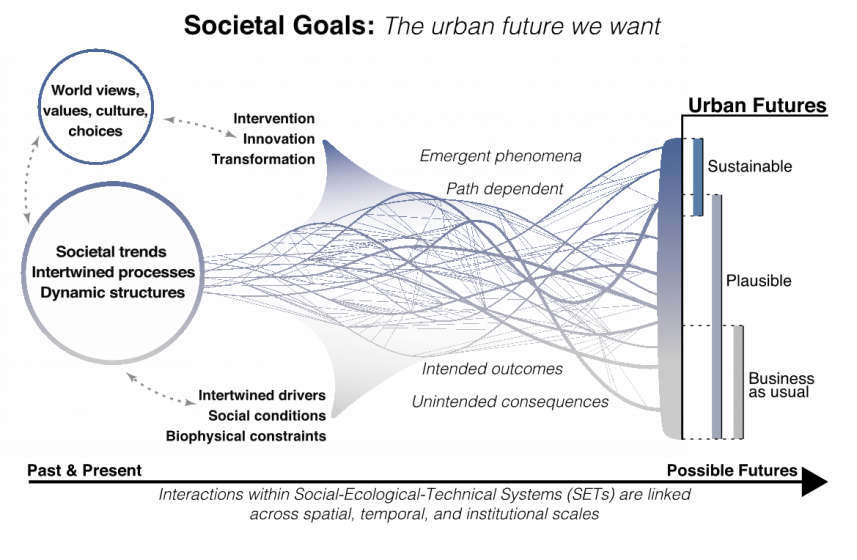
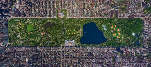
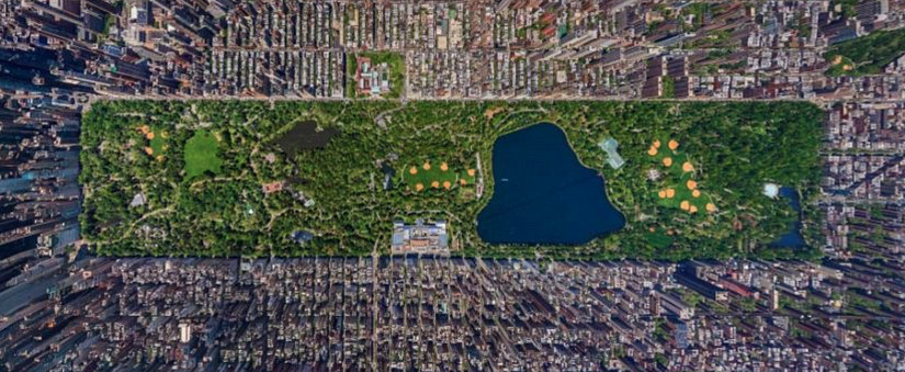
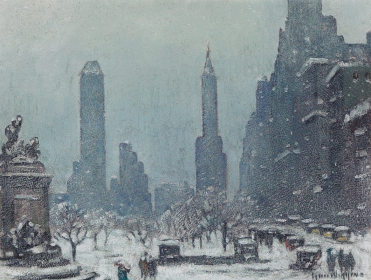
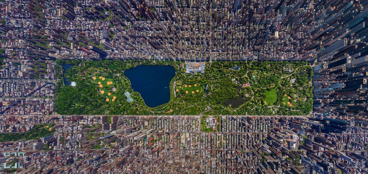
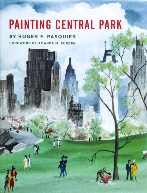
With a preface by Amanda Burden, who asserts that it’s a human necessity to be able to engage with flora amidst urban street life, Roger Pasquier writes an homage to Central Park. He traces the history of the park through the original Greensward Plan, created by Frederick Law Olmsted and Calvert Vaux. He describes the landmarks, buildings, and landscapes that were designed to be intentionally anomalous. Olmsted and Vaux’s plan utilized strategies from English landscape design, such as incorporating follies and other architectural structures for visual interest, while also embracing the grandness of the Catskills to the north. In 1858, 3,800 workers were employed to recreate what Olmsted and Vaux perceived were the better qualities of the less-colonized Catskills nearby.
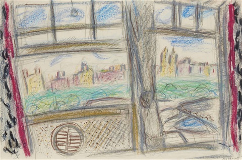
Pasquier shares documents and accounts that evidence the architects’ obsessions with creating tension in a park visitor’s experience. They did this by framing Central Park’s multiple access points as a series of idealized viewsheds into the park, based on what catches peoples’ eyes, and what a painter may choose to paint.

With admiration, he takes us on a journey through some of the many artistic representations of Central Park via visual artists who made the 843 acres of hills, lakes, vegetation, and visitors their muse. We move from Jervis McEntee’s View In Central Park, 1858 (a stark meadow with scattered boulders) quickly to the more active paintings of Julius Bien. As Central Park grows into itself, the paintings and literary references describe a more communal place. That transition is described by two quotes from Henry James who witnessed the park shift over time. His first visit to the park was translated for his novel The Bostonians (1886) with “lakes too big for the landscape and bridges too big for the lakes”. Later in 1905, James observed:

The variety of accents with which the air swarmed seemed to make it a question whether the Park itself or its visitors were most polyglot. The condensed geographical range, the number of kinds of scenery in a given space, competed with the number of languages heard, and the whole impression was of one’s having but to turn in from the Plaza to make, in the most agreeable manner possible, the tour of the little globe.

From paintings of major landmarks like the Bethesda Terrace, to crowds ice-skating, and people in solitary contemplation, Pasquier helps us see a variety of different perspectives of the park. Reproductions are organized thematically, into sections with titles such as “The Park’s First Artists”, “Celebrations and Quiet Times”, and more. The selection of artwork propels the reader into the book.

Marc Chagall Vue de la Fenêtre sur Central Park, 1958.

From painters difficult to categorize such as Rackstraw Downes to the abstractions of Milton Avery and Helen Frankenthaler, or the photorealism of Richard Estes, Pasquier curates a voyage through time, power, beauty, and imagination. Pairing David Hockney’s View from the Mayflower Hotel, New York (Evening), 2002, next to Marc Chagall’s Vue de la Fenêtre sur Central Park, 1958 show artists as voyeurs and subjects; both chose to paint Central Park from windows inside of their rooms looking down on it.

The last chapter highlights the idea of the frame again, but this time it’s not the frame around the canvas or the perspectival views outlined by the park’s planners. Pasquier wants us to see the entire park as a painting, to picture Central Park from above, to imagine its vistas flattened and abstracted like a satellite image of the park, until we are indeed seeing a work of art meant for the wall. Perhaps my favorite chapter, because Pasquier asks us to suspend our belief in Central Park as Central Park, but rather to understand it as a painting too. We can imagine zooming upwards from the Metropolitan Museum of Art for a satellite view of the entire panorama, and then imagine that the Art Deco, Beaux-Arts, and Neoclassical buildings that immediately line the park are the first indentation of a Baroque frame. For blocks, we witness the wealth of this frame, every square foot ascribed extraordinary economic value, but then we are brought back to its focal point, Central Park, whose value can never truly be quantified.

New York’s Central Park. South is to the left. Image: Google Earth

In 1862, Harper’s Monthly said of Central Park, “the finest work of art ever executed in this country”, and the park draws admirers worldwide. Roger Pasquier grew up with Central Park. The idea for Painting Central Park came to him when he was working with environmental organizations in Washington, DC. He writes, “[t]here, nothing made me more homesick than looking at George Bellows’s Bethesda Fountain at the Hirshhorn Museum”.

Guy Wiggins “Central Park Skyline” 1936

In the summer heat, I hold my breath while looking at a representation of Guy Wiggins “Central Park Skyline” in wintertime, and realize it could encapsulate my own love for New York: the brilliant warmth and camaraderie from within the cold. I find myself yearning to be transported to Central Park, too.

Multiple cultural imaginations exist of Central Park, and this book is a gateway into some of them. As a good book tends to do, it leaves me wanting more. I look forward to a follow-up, part two of Painting Central Park, when Pasquier may take Jean Claude and Christo’s “The Gates” as an entry point to investigate some of the expanded fields of art. These could include both representation and active art, moving images and performances that are site-specific, or that Central Park is the main protagonist of. In a crowded city, a park is a landscape of difference. For over a century Central Park has been a muse for artists. These artists inform a growing cultural imagination about it.

Mary Mattingly
New York

On The Nature of Cities

To buy the book, click on the image below. Part of the proceeds return to TNOC.

New Zealand’s Ecological Identity: Should We All Kill Exotic Species to Protect our Natural Heritage?

Many voices. Greener cities. Better cities.

This emphasis on killing introduced species to protect native ones makes me wonder how much people involved in these activities think about why they are willing to kill some to protect others. Why do they value native species above others?
The image of a child triumphantly brandishing a dead rat on national TV news in New Zealand, trapped in her backyard as part of a community’s bid to try to bring native birds and lizards back into her neighbourhood, reminded me of the extent to which local people in New Zealand’s urban areas have committed to protecting and enhancing urban native biodiversity. TV1 News had delicately pixelated the rat’s head, to spare the queasy members of their audience the sight of a crushed skull. Predation by ship rats, also known as black rats, has been linked to local extinctions of many forest birds, reptiles and large invertebrates in New Zealand, and their habit of chewing on seeds has adverse impacts on forest regeneration.

But rats are only one of a suite of introduced mammals that have decimated New Zealand’s flora and fauna. Becoming “predator-free” to protect native wildlife through wide-scale and intensive eradication of predators has become a major national preoccupation in New Zealand, especially since the launch by the previous government of “Predator-Free 2050”, a nation-wide initiative that has the ambitious goal of eradicating three introduced predators (rats, possums, stoats) from across New Zealand, by 2050. While some debate over how and whether this goal can be achieved, large sections of the public of all ages are enthusiastically behind it, particularly in some neighbourhoods in some urban areas, where backyard trapping of rats and possums has become the norm.

Some may ask, is it right to support community initiatives that have the goal of killing as many animals as possible? After all, these species didn’t ask to be brought to New Zealand and in following their own natural instincts, don’t deserve to be demonised. Does this community offensive against introduced predators reflect a lack of compassion for animals that are merely victims of historic human decisions, and are they being used as scapegoats for the consequences of wider environmental degradation? As an urban ecologist and conservation biologist I see the involvement of people in towns and cities in trapping predators as a very positive force, and completely necessary if we are to restore populations of native species in urban areas and foster a sense of stewardship among urban human residents. Although the battle to reverse declines in populations of our native species occurs across all habitats, the urban one is noteworthy in the level of community participation. In fact the community is the biggest resource in this battle, with urban human populations enabling a level of predator control that is difficult to achieve in rural areas without the application of aerial toxins.

From the Department of Conservation’s blog which provides step-by-step instructions on how to trap in your backyard: https://blog.doc.govt.nz/2017/10/15/how-to-trap-in-your-backyard/

The willingness of New Zealand’s urban public to trap rats and brushtail possums is likely to be at least partly explained by New Zealand’s relatively recent history of colonisation and loss. Unlike the UK, Europe or the USA, NZ’s history of settlement by humans is relatively recent, perhaps only about 800 years, and we are still witnessing the ongoing loss of our natural heritage. While wide-scale habitat loss, degradation and modification are undoubtedly important causal factors in the decline of many ancient endemics, mammalian predators introduced for various reasons — to establish a fur trade (brushtail possums), by accident (ship rats and Norway rats), and to control introduced rabbit populations that were out of control in the nineteenth century (stoats) — have wreaked devastation on our native species. This, in combination with large-scale introductions of species, mainly from the UK, mean that only about half of bird species encountered in urban areas are native to New Zealand, and numerically they are very much in the minority: in areas of higher density housing only 10% of the birds seen are likely to be native, but even in well-vegetated suburbs that proportion increases to only 35% (van Heezik et al. 2008). Both rats and possums can be abundant across urban landscapes, and of course there are cats and hedgehogs too. Social support to control cats and hedgehogs is still contentious, but most communities have no problem supporting and participating in the control of rats and possums. People from countries that don’t have the same history of colonisation and level of endemism as New Zealand might not understand our national obsession with trapping predators.

Endemic faunas and floras make a country unique, and it is that uniqueness that engenders among its human inhabitants a sense of place or identity. Those species with populations that respond best to predator control are the most deeply endemic ones; in New Zealand they are species that have evolved for millions of years in an environment with no mammalian predators. The only terrestrial mammalian species native to New Zealand are a couple of species of rather small, insectivorous bats. When urban residents band together to trap rats or possums, it is to protect these vulnerable, endemic, native species — they want to be able to share their living spaces with them and encounter them as part of their day-to-day lives, rather than having to travel to special predator-free areas such as offshore islands to see them. NZ’s Department of Conservation’s Threatened Species Ambassador, Nicola Toki, argues that native species and introduced predators in New Zealand cannot co-exist, and that it is the indigenous subset of our biodiversity that fundamentally defines us as a nation.

Some cities also contain or are situated adjacent to eco-sanctuaries, which are areas fenced with predator-proof fencing — no mean achievement — and from which almost all predators have been removed: mice are always the hardest to eradicate entirely. For example, Wellington, our capital city, has in its core the Zealandia Ecosanctuary, which has been the site of several translocations of species that used to be resident in the area, but which had disappeared with the ongoing process of urbanisation. If these populations of birds thrive in the eco-sanctuary in the absence of predators they inevitably reach their carrying capacity and spill out into the city. One of New Zealand’s native parrot species which was translocated into Zealandia, the kaka, is very mobile and now roams widely across the city. The saddleback, or tieke, a species that has been rescued from extinction through translocations from its one remaining island population to predator-free islands and eco-sanctuaries, was also translocated into Zealandia, and has attempted to nest in suburbs surrounding the sanctuary. It was this event that prompted a group of locals to band together to protect these individuals, by reducing predators as much as they could. Since then a groundswell of support for the predator-free initiative has built in Wellington, with groups working towards entire suburbs being possum and rat-free, and a trap in every 5th resident’s backyard. It is an exciting concept for people living in cities; to now be able to see species that have previously been restricted to ‘safe’ islands inaccessible to most people.

This emphasis on killing introduced species to protect native ones makes me wonder how much people involved in these activities actually think about why they are willing to kill some to protect others, i.e., why they value native species above others? There has been long-standing, ongoing debate in the scientific literature on how introduced species should be managed, with some scientists arguing that the paradigm of native/non-native is no longer relevant in highly modified environments, such as urban landscapes (Davis 2011). Instead, proponents of this school of thought assert that environmental management should involve acceptance of alien species and novel ecosystems. Conciliation ecology is thought by some to be the morally acceptable course of action (references in Russell & Blackburn 2017), but is soundly rejected by others.

While there is no doubt in New Zealand that the introduction of predatory mammals into a fauna that evolved without any mammalian predator has had a disastrous impact on many of NZ’s native species, not everyone in NZ agrees with Nicola Toki’s sentiments or the concept of valuing native species above others. For example, one opponent to the “predator-free” concept asserts that “we can’t keep erasing the fact that the species that we introduced, whether managed or not, are ‘ours’ too — even the ones we later decided were a mistake. They’re our responsibility as well. And a future where people learn to accept the presence of our introduced species is not so horrifying.”

This view is being echoed more frequently in the media; in a recent opinion piece in The Press, columnist Joe Bennett writes:

“We like our birds here. They’re our signature fauna. No-one else has got them and we haven’t got much else. But among birds we practise apartheid. We distinguish between birds that are — and here’s an adjective that chinks like a gold coin — native, and those that are not. Native birds are first-class citizens who can do no wrong. The rest are the rest and the magpie is among them. It’s an Australian import, loud, boorish, a bird to deride.”

In his article defending the magpie, which was introduced from Australia, he goes on to say:

“Reproducing annually they’ve now been here for 150 generations, which in evolutionary terms is more than twice as long as human beings. What do they have to do to become native? How do they get to be tangata whenua (‘people of the land’)? And how fair is it to trap, shoot, bludgeon or poison a bird because its 150-times-great grandfather drank Foster’s, pronounced school skewl and had a penchant for cheating at cricket? We are all of us mongrels from somewhere or other and none of us responsible for our forebears.”

Those who support this view believe that nature connection in people will ensue from our contact with all species, native and introduced, that they see day-to-day outside their windows. Indeed, it is a fact that there is no evidence that the well-being benefits associated with exposure to nature are greater if that nature is native; although this question hasn’t yet been tested explicitly.

Annie Potts (2009) expands on the concept of responsibility for all species, irrespective of their origin. She presents the brushtail possum as a species that was forcibly transported from their native Australia to New Zealand to establish a fur industry, but which in the last 80 years or so has become “blamed and despised” for their unanticipated negative impact on the native environment and wildlife, becoming the subject of “revenge and punishment”, and unworthy of compassion. She neglects to mention that possums also transmit bovine tuberculosis to cattle and by doing so threaten a sector of our economy as well. She argues that the “demonization of possums in New Zealand is overdetermined, extreme, and unhelpfully entangled in notions of patriotism and nationalism”.

Kaka – translocated into Zealandia eco-sanctuary and now roaming widely over Wellington city. Photo: © Jean-Claude Stahl by Jean-Claude Stahl

At a more general level, in other countries, criticism has been leveled by social scientists at those advocating for native species, labelling it as a form of anti-immigrant nativism. They claim that the removal of non-natives reflects an anti-immigrant, racist, political discourse (Mastnak et al. 2014). They draw our attention to the Nazi policy of removing non-native plants, and by doing so implicitly associate the protection of native species with Nazism. An alternative perspective is that many current ecological problems are a legacy of colonialism, a process of settlement of plants, animals and people that resulted in the uprooting of native plants and indigenous peoples (Mastnak et al. 2014). This was certainly the case in New Zealand, where we even had an “Acclimatization Society” whose role was to introduce many species from the UK, where most settlers originated from, and create landscapes populated by familiar species. After early waves of extinctions this process was thought to be a means of restoring biodiversity to a depleted environment. Advocating for native plantings then becomes a process of decolonisation, which is ethically appropriate.

Others advocate for the middle-ground; they both question the dichotomy between native and non-native, but at the same time acknowledge that low-impact, non-native species should be tolerated, and that control methods to remove alien pest species can also be contentious if they involve the use of toxins (Shackelford et al. 2011). Some critics have raised the issue of involving children in the process of systematically killing predators, but also the militaristic dimensions of the entire exercise, which uses terminology such as “war on predators”, or “under siege”, and what some consider to be xenophobic expressions (Schlaepfer et al. 2010 ). Simberloff (2003) discusses the claims and suggests that it is impossible to prove that aesthetic preferences for native species are infected by nativism or xenophobia. He points out that those who criticise efforts to control non-native pest species often ignore their ecological and economic impacts, which alone comprise a valid, ethical rationale for managing introduced species.

Do the families involved in trapping introduced predators in their gardens ever realise the political dimensions of their actions? I suspect not. Given the large body of evidence pointing to the damaging impacts both brushtail possums and rats have on New Zealand’s native fauna and flora, I believe urban community groups are well justified in going into battle to remove these pest species from their neighbourhoods. In doing so they not only provide safe refuges for native species, but they also foster a sense of national identity, and through united community effort, enjoy the social benefits of being engaged in a community undertaking.

Recently our Prime Minister, Jacinda Ardern, explained her feelings about Te Reo Maori, i.e., the Maori language: she said she felt proud to hear Te Reo being spoken when outside New Zealand, knowing that it was something that was unique and special to New Zealand. The same sentiments apply to our natural heritage. While the conciliation ecologists are willing to accept novel ecosystems, in cities in particular, the process of biotic homogenisation means that these novel ecosystems will hardly differ from one city in one country to the next. In this case novel, or new, isn’t better: let the citizens unite and fight to save the unique identity of their cities and country!

Yolanda van Heezik
Dunedin

On The Nature of Cities

References

Davis, M. 2011. Do native birds care whether their berries are native or exotic? No. Bioscience 61(7): 501-502.

Mastnak, T., Elyachar, J., Boellstorff, T. 2014. Botanical decolonisation: rethinking native plants. Environment and Planning D: Society and Space 32:363 – 380.

Potts, A. (2009). Kiwis Against Possums: A Critical Analysis of Anti-Possum Rhetoric in Aotearoa New Zealand. Society and Animals 17: 1-20.

Russell, J.C., Blackburn, T.M. 2017. The rise of invasive species denialism. Trends in Ecology and Evolution 32(1): 3-5.

Schlaepfer, M.A., Dax, D.F., Olden, J.D. 2010. The potential conservation value of non-native species. Conservation Biology 25(3): 428-437.

Shackelford, N., Hobbs, R.J., Heller, N.E., Hallett, L.M., Seastedt, T.R. 2013. Finding a middle ground: the native/non-native debate. Biological Conservation 158:55-62.

Simberloff, D. 2003. Confronting introduced species: a form of xenophobia? Biological invasions 5: 179-192.

van Heezik, Y., Smyth, A., Mathieu, R. 2008. Diversity of native and exotic birds across an urban gradient in a New Zealand city. Landscape and Urban Planning 87: 223-232.


From the Department of Conservation’s blog which provides step-by-step instructions on how to trap in your backyard: https://blog.doc.govt.nz/2017/10/15/how-to-trap-in-your-backyard/


Kaka – translocated into Zealandia eco-sanctuary and now roaming widely over Wellington city.

No More Elsewheres

Many voices. Greener cities. Better cities.

The fern-shaded, monkey-proofed fish pond at my Nairobi home. ©Mimi Huang.

The frogs of suburban Nairobi

Four years ago I moved to Nairobi and repaired the concrete-lined fish pond on my property. Soon thereafter the frogs appeared unbidden. Their performance generally begins with a single peep or croak and rapidly crescendos into something so dramatic and deafening that it feels more like the opening refrain of Carmina Burana than a mundane event in an expatriate Nairobi garden. But, halfway across the world from New York, it is these frogs that remind me where I am. However, their presence, both nocturnally and seasonally, is fleeting. No doubt they are there to breed and lay their eggs. But as the effects of climate change intensify and the distinctions between seasons are blurred, they are less signifiers of seasonal shifts than some obscure evidence of a micro-opportunism I have not yet discerned.

A zebra within the fenced confines of Nairobi National Park. Photo ©Lotte MD

The relationship between human and non-human nature in Nairobi usually raises the issue of exploitation, particularly wildlife poaching. It is true that Nairobi National Park and the Karura Forest – the only protected area in the world adjacent to a capital city and one of the largest urban gazetted forests in the world, respectively — represent relative successes, however isolated. Still, industrial effluent from nearby factories has contaminated the ground water of the Park and the construction of a highway bypass has threatened a wetland connected to the Forest. In the main, biodiversity in Nairobi is considered vulnerable, where it is considered at all. It is easy to think of the frogs in my pond as mere victims. That we as humans impose our own narrative on nature is hardly surprising.

The gardener on my property, James, says that it is the belief of his ethnic group, the Luhya, that frogs cease their calls only when a “bad man” happens to be walking by. This raises the scintillating possibility that the frogs impose their own judgmental narrative on us…and, moreover, the possibility that we may, in turn, use them as a kind of security alarm. (Jane, another Luya, dismisses this with a laugh as sheer superstition. Like many other Luhya, both are effectively long-term commuters who have come to Nairobi for the work opportunities yet continue to identify with and return seasonally to their home in western Kenya).

At some point during the night the frogs in my garden pond conclude their song and suburban Nairobi returns to the hum of generators and bore hole pumps and distant hooting of matatus. Whatever their reasons or our uses for them, the fact remains that the frogs are there.  And then, at a certain point, they are not. They arrive when the conditions suit them and disappear, it would seem, once things turn unfavourable. Once again my sense of being  on a suburban plot in Nairobi, Central Province Kenya supersedes that of being within the Tana, Athi & Coastal Drainages Freshwater Ecoregion of East Africa (whose description, curiously, on the Freshwater Ecosystems of the World website does not even mention Nairobi).

New York’s Staten Island Ferry, which links Manhattan Island with the suburbs in Staten Island. ©Dave Huth

A new species for New York

In February 2012 biologists in the United States published an astonishing discovery.  A theretofore unknown species had been discovered in one of the most built-up and ecologically studied areas in the world.  According to Jeremy Feinberg of Rutgers University, who first discovered the new species on Staten Island, one of New York City’s five boroughs, an entirely distinct leopard frog exists exclusively within the typical commuting range of midtown Manhattan, effectively New York City’s central business district. Its epicentre, amazingly, is estimated to be Yankee Stadium in the Bronx.  However, so far the new species has only been found in parts of the commuter belt surrounding the core of New York City: Staten Island (New York City), in Orange and Rockland Counties (New York State) and in Great Swamp, New Jersey. In other words, its range is relatively low density – i.e. relative to Manhattan — but still very built up with highly fragmented green patches.  The area lies entirely within the Northeast United States and Southeast Canada Atlantic Freshwater Ecoregion.

Rana pipiens, whose widespread range helped mask discovery of the new frog species. ©dvpfagan

How could an entirely new species have been missed for so long? Feinberg admits that the New York City metropolitan area had long been dismissed as lacking biodiversity. In appearance, the new species closely resembles the northern and southern leopard frogs (Rana pipiens and Rana sphenocephala, respectively) whose own natural ranges — which extend over areas of North America thousands of times larger — intersect here in metropolitan New York City. However, the new species’s mating call is completely different. Unlike the “repetitive chuckle” of the other two widespread North American species, the new species emits a terse single cluck.

The New York Times immediately commenced a name-the-frog initiative, highlighting its unique croak. Readers suggested enshrining its commuting habits as well as the New Yorkness of its terse mating call. Some marvelled at its exclusive existence within the urban metropolitan area; others clarified that, strictly speaking, much of the frog lived in upstate New York and the adjacent state of New Jersey, outside of New York City proper. Still others, citing the relatively high (human) incomes of much of the commuter belt that the new leopard frog species inhabits, called it out for its snobbery (admittedly, the original publication does cite “high levels of divergence [that] strongly suggest a lack of gene flow between R. sp. Nov. populations and other leopard frog species, and cluster analysis indicated that none of the samples were of admixed ancestry”).

I myself wondered whether it was being ironical. Was its limitation to metropolitan commuting New York out of solidarity for public transportation? Or had it been riding the Staten Island Ferry, New York Water Taxi and MetroNorth trains out of sheer convenience? Or was this the latest wave of hipster frogs recolonizing the periurban wastelands? Then an unnerving possibility came to my urbanistic mind: perhaps it really is a suburban frog.

The metropolitan settlement patterns of human New Yorkers have long been studied and theorized.  For E B White, in Here Is New York, there were “roughly three New Yorks. There is, first, the New York of the man or woman who was born there, who takes the city for granted and accepts its size, its turbulence as natural and inevitable. Second, there is the New York of the commuter—the city that is devoured by locusts each day and spat out each night. Third, there is New York of the person who was born somewhere else and came to New York in quest of something. Of these trembling cities the greatest is the–the city of final destination, the city that is a goal.”

Had this new species first appeared inevitably in New York and stayed effectively invisible all this time? Or had it come from somewhere else in quest of something new? Had it tried the City itself and, like White’s much-maligned “locusts”, fled for the peri-urban edge? Or had it really discovered a peri-urban niche all along? Mr. Feinberg has hypothesized that the new frog may have once existed in the rest of New York City – Manhattan, Brooklyn, Queens and yes, the Bronx of the Yankee Stadium – but only further studies will tell. Mr Feinberg will be publishing a related manuscript later this year.

Commuter train station on New York’s Hudson Line, along which Cheever’s ‘The Five Forty Eight: passed. ©Jay Skilling

The frontier within

White’s literary contemporary, John Cheever, chronicled the relationship between New York City’s core and periphery.  His suburbanites north of the city (near where the new frog species has been found) had also sought access to livelihoods, maximization of opportunities and space — real and perceived – in which to thrive. Many thought they had found the best of both worlds at the metropolitan edge. However, dysfunction and disillusionment was beginning to creep into many of their lives. In The Five-Forty-Eight a corporate commuter abuses and abandons his office assistant, then hopes to escape the consequences by leaving the city. For him, atonement lay in the suburbs beyond the urban periphery. But when his disgruntled ex-assistant follows him home on the commuter train, he realizes that the frontier of consequences has been breached and he is forced to reckon with his earlier indecencies. We learn that there is no protected area that consequences cannot surpass.

Regular readers of this site will already know that the heterogeneous mosaic that comprises the urban built environment – in short, “the city” – hosts a high amount of biodiversity, especially in terms of richness. Whether in the core or at the periphery, cities and their concentrated interchanges of resources, money, ideas, innovation and genes draw all creatures in search of opportunity. Urbanites and suburbanites; humans and nonhumans; and the New York as-yet-unnamed leopard frog have all come to the New York metropolitan region to secure a place in their respective niches. Evolution favours the resourceful. Some may revel and steep in the midst of constant surprise and exposure; others may go about their business, oblivious to the diversity around them; still others may dash in, acquire what they need and return to the privacy of their homes to enjoy their spoils.

For those who may still think that biodiversity has at best a marginal role in cities – or vice versa – I would ask what becomes of the protected areas once the frontier of development has passed them?  As in Nairobi, the key is not so much the continued existence of its protected areas – important as they are – as it is what we do with the built-up spaces that remain in between them.  With so many spaces already fragmented, the key is to link the patches into a functional mosaic, leveraging the heterogeneity of urban and suburban green spaces and the varied, unexpected opportunities they provide.  But unless we can make our suburbs more sustainable, those opportunities may no longer be there.  The problems of the city cannot be displaced by pushing the edge/frontier further.
Wily as they may be, these new frogs’ exceptional niche existence remains threatened as long as wetlands – particularly those in peri-urban areas – are continually drained, degraded and fragmented. The biologists of this discovery remind us that “urban environments such as the northeastern US have been shown to be detrimental to anuran populations, primarily due to habitat fragmentation and isolation, road mortality, and contamination”.  That is why the passage of the Ramsar Convention Resolution XI.11, Principles for the planning and management of urban and peri-urban wetlands, is so important. And the stakes are even higher for cities like Nairobi and thousands of others in the developing world whose low-density, peri-urban fringe – often where land is cheapest and environmental and zoning regulations weakest – is expanding faster than its population.  How to allow these cities to grow without increased environmental impact in a time of climactic uncertainty and an impending resource wall?

Unless we take urgent measures now to make our cities more compact, less resource intensive and less disruptive of natural processes (often one and the same thing) there will remain no edge beyond which there is no consequence. The key is to assess how advantageous our configuration is now, its implications for urban metabolism – materially, what is flowing through our cities – and adjust them accordingly.  This is critical to halting sprawl, preserving existing large green patches on the periphery and improving environmental interface within existing built-up areas.

In this International Decade for Biodiversity, it is clear that there are no more deferrals, write-offs or “elsewheres”.  We cannot any longer sacrifice our metropolitan edges to the caprices of unplanned, underzoned development in the hopes that our indecencies can later be atoned for by compensating with “untouched” protected areas. Instead, the solutions lie within rather than without. The Convention for Biodiversity’s Global Biodiversity Outlook 3, from 2010, showed that amphibians – including frogs – were the most endangered of all classes, with 42 per cent of all amphibian species declining in population.

The time and place for urban wetlands is now and here, in the places we have already created. Biodiversity in urban areas continues to be opportunistic, but we must ensure that urban opportunities remain viable for all.

Ocean Cities: The Power of Documentary Filmmaking to Tell Stories About the Nature Around Us

Many voices. Greener cities. Better cities.

The potential to make wonderful (low-cost) documentary films about urban nature, that tell compelling stories, that captivate, fascinate, and motivate, is great indeed.
At a recent film screening of our new documentary film Ocean Cities, about connecting cities and marine environments, the panel discussion and questions that followed demonstrated clearly the value of these kinds of films. Some of the comments reflected a sense of being inspired by what other cities were doing (“that’s a great idea, we can do that here also”), others seemed surprised that remarkable ideas had already taken hold locally (“I didn’t know we did that here in Baltimore”), and still for others the film ignited a host of questions about whether any of these cities were doing enough or committing enough to address the serious ocean conservation and climate adaptation work that we need to be doing. But whatever the sort of reaction it started conversations, it stimulated thinking, offered a measure of hope and direction, it spurred imagination and strengthened resolve to do more and to see (depending on the role of the viewer) how they might engage in some way in the changes that are needed. There are many venues and avenues to inform and engage: there are books and newspaper articles, op-ed and blog posts (like this one), power point presentations of many flavors, but there are few media that are able to engage in the ways that a film can.

This newest film, recently finished and now making its way to film festivals and screenings, is an hour-long documentary about the innovative ways in which coastal and port cities, mostly in the US, are managing the marine and aquatic habitats around them. The resulting film is at once informative and inspirational, telling some of the emerging stories of actions taken by local governments and NGOs to connect with marine nature, to understand it as an asset, but also to manage and prepare for the dangers associated with proximity to water. I often find myself speaking of the “dangers and delights” of coastal urban settings, and we’ve tried in this film to present the good work of cities to address both issues (two sides of the same coin really).

This is the second major film collaboration with Colorado filmmaker Chuck Davis. It began with an earlier film called The Nature of Cities (pre-dating and unrelated to the creation of the TNOC blog; the entirely of which can now we watched online here: https://vimeo.com/98080426). It was a serendipitous collaboration: we met by chance at a green building conference in Utah. Chuck was screening his latest film, Transforming Energy, and I was giving a talk about work around Green Urbanism. Chuck approached me after this talk and suggested we think about a film that would document and present in compelling visual ways the innovative green cities I was studying. With just a little funding, Chuck and I (and usually one camera man) travelled and filmed in a number of American and European cities, including San Diego, Austin, New York, Copenhagen, Stockholm, Amsterdam, Freiburg, and Paris. It was a dizzying array of stories and voices and to Chuck’s credit he was able to brilliantly weave these strands together to produce an informative and entertaining film, one seen by PBS viewers around the country.

I highly recommend such collaborations, though in the Urban Planning world they seem unusual. It has been an especially potent joining of a filmmaker’s / director’s (Chuck) technical and creative skills with my professional and scholarly knowledge and contacts. It was an epiphany to me as mostly a researcher and academic to begin to understand the power of film in vividly showing what cities could be and what they were striving to accomplish. I had written (and continue to write) books about these leading cities, but have become convinced that telling their stories in this more sensorially rich way has tremendous value.

Our film shoots have been largely low-budget. Mostly it is the cost of travel that is required. At every point we have found creative ways to capture memorable scenes on a low budget. In Copenhagen we filmed on-bicycle interview with the head of the city’s bicycle planning efforts. It was a bit a coordination test for me, the interviewer, and creative equipment solution was found with the use of one of that city’s famous cargo bikes: the cameraman was crouched in the front, with the director frantically pedaling to keep up.

Ocean Cities is similar in strategy and format. Largely unscripted, with interactions on-site, designers, local official, and citizens talk about what we are seeing and share their opinions and perspectives. We’ve been able, I think, to capture the remarkable vitality and beauty of these waterfronts and to embed within specific cities compelling stories of what is possible. The film builds on my own earlier work around the concept of Blue Urbanism[i] (see also this.) The main premise is that we live on the blue planet (more than 70 percent of the surface of the Earth is water) and increasingly the urban planet—yet these two spheres seem rarely connected.

The Trailer for our 50 minute documentary film Ocean Cities. Click to Watch!

While we need to appreciate and plan for the danger, delight is everywhere in such ocean cities. We film opens with a walk along the beach at Carmel with J. Nichols, author of the book Blue Mind, talking about the psychological and stress-reducing benefits of water. The backdrop here makes the point wonderfully, a key premise of our filmmaking approach. This was true at many points in the filming: interviewing kids from an underserved neighborhood in Baltimore as they learned to kayak (and doing the interviews while sitting in a kayak); sampling sustainable seafood dishes and visiting a restaurant’s “white board”, where they keep track of what they are serving and where it comes from; or, following a group of fifth-graders with nets as they scoop up marine life from the bottom of the sea (more about that later). Capturing these kinds of active scenes, involving actual people actively learning, engaging, doing, we have found is a more effectively animates the story in way that a sit-down interview cannot (though we have our share of these kinds of interviews as well).

A key theme of the film is how we must begin to see the watery realms around us in  cities in new ways. Too often our collective view is that these are empty or barren areas without nature—they are often depicted as grey or black or otherwise uninteresting and featureless in the conventional maps we prepare and use for city planning. This is changing, and we share the voices of people like landscape architect Kate Orff, who has been working on projects like the Living Breakwaters, along the southern shore of Staten Island, New York. It is an unusual example of civic ecology, creating natural reefs seeded with oysters that moderate flooding but that also engage the public in learning about and caring for the harbor ecosystem. She spoke eloquently about her own journey in re-discovering water, and her design work that increasingly involves “putting water at the center and the land at the edges”.[ii]

The City of Baltimore Parks Department sponsors programs like this one to expose inner city kids to what it’s like to be on a kayak on the Inner Harbor. Photo: Tim Beatley

The medium of film allows the telling of stories visually and also often in impressive real time. You hope for, but are never sure you will find, unplanned spontaneous stories, people, voices along the way. We filmed one day at a neighborhood of floating homes in the IJBurg district of Amsterdam. Walking along with the developer of these homes we encountered a new residents, having just moved in. What was it like to live in a home that was floating, we asked? We were able to capture the interplay and conversation between an appreciative homeowner and the developer (who he did not know or recognize) who made it possible.

While filming in Miami Beach, a city already experiencing the impacts of sea level rise, we had a similar encounter. Filming in Sunset Harbor we sought to capture a sense of how the city’s efforts at elevating roads and investing in new pumping stations looked and felt like in this very sea-vulnerable location. We just happened to encounter a worker at one of the restaurants most affected. It was a personal moment of sharing about the uncertainty of the future of the city, the need to more aggressively tackle climate change for the sake of his kids and family, all at the doorway of a business that was oddly two-feet below the street. It was a striking juxtaposition of the engineered and the human, and something we did not and probably could not have planned. It was another advantage of celebrating the unscripted and being on the lookout for serendipitous encounters that make the film ever more interesting and personal.

Some of the most interesting stories we tell in the film have to do with creative ways to make the often invisible marine world visible to those living in cities. With this in mind we filmed one evening in Gig Harbor, Washington (about an hour’s drive south of Seattle), where a nonprofit called Harbor WildWatch had been organizing a series of monthly events called “Pier Into the Night”. It was a clever, low-tech way to engage the community in appreciating and learning about the underwater life all around them. Volunteer divers are sent underwater with a GoPro camera and lights to see what marine life can be discovered. These images are then displayed in real time on a screen on the town’s public pier. It was a magical evening and impressive that families with small kids were willing to endure a cold evening to watch what the divers were finding (all interpreted in real time by a Harbor WildWatch naturalist). To those who have heard about this it is an “AHA” moment—with a few volunteers and some inexpensive equipment, the underwater world of Puget Sound can be delivered in a compelling way to those (most of us) more terrestrial-bound human beings. But then, disappointingly, none of this footage made it into final film, highlighting a difficult reality: often it is too dark or the images too shaky to use. This might be corrected through acquiring file footage, but many shoots end up this way.

Pier Into the Night in Gig Harbor, Washington: Families with kids watch in rapt fascination to what the volunteer divers are finding on in the nearby waters. Photo: Tim Beatley

Perhaps my favorite shoot occurred in Miami (one that does end up in the film!), with a similar theme of uncovering the wondrous marine world. Just a few weeks after we had visited Gig Harbor we found ourselves wading into the Atlantic Ocean, with a group of highly charged fifth-graders. These kids were participating in a popular program called Seagrass Adventure, organized through the Marjory Stoneman Douglas Biscayne Nature Center.

Here the power of film shines especially. To see the rapt fascination of these young kids, most of whom though they lived only miles away, many from underserved neighborhoods, many had never experienced the ocean before. They tackled their assignment with ferocious courage, dipping and moving their nets along the bottom of the ocean and pulling to the surface a variety of marine organisms. The audible reactions at what they were seeing were remarkable. We came away from that day with the feeling that we had seen human transformation take place.

After about an hour in the water, and with each group’s floating bucket full of unusual and exotic (to us) creatures, the kids headed back to shore. There, the Center’s naturalists continued their work. The kids formed circles and the staff sent around in plastic containers some of what they had discovered. The kids learned more about the biology of these creatures and got an even closer longer look at what they had collected. These in-water activities are supplemented by extensive classroom talks and lab exercises, some of which we also filmed.

Kids participating in the Seagrass Adventure, at the Marjory Stoneman Douglas Biscayne Nature Center, near Miami, Florida. Photo: Tim Beatley

In our films we have also given a priority to voices of young people. In one of our New York City shoots we visited the Harbor School on Governors Island. We learned from several very enthusiastic students about the process for raising and growing young oysters, as they showed us around the aquaculture lab. The New York Harbor School–essentially a public high school specialized in developing maritime skills and careers–is a wonderful story itself, and its founder Murray Fisher spoke eloquently of its origins and value. As Fisher told us, New Yorkers are still “shockingly disconnected” from the harbor and the School has sought in some significant ways to address this. One of the most impressive is the Billion Oyster Project, which engages schools around the city in learning about, raising and deploying oysters in the Harbor. So far they have put a remarkable 20 million in the Harbor. There is a long way still to reach a billion, but progress have been great in engaging schools and others (including local restaurants in who donate badly needed oyster shells used in making new oyster beds).

Students at the Harbor School on Governors Island, explaining how the aquaculture lab works. Photo: Tim Beatley

One of the key themes in the film is rethinking our approach to seafood. It is easy to muster experts and sometimes overly dry statistics (we need them of course), but film can tell the story in a more concrete, contextualized way. To this end we  spent the day with a small scale fisher, Calder Deyerley, based in Moss Landing, on the Monterey Bay. It was about the merits of fishing quotas, and new mechanisms such as Community Supported Fisheries or CSFs (we profiled one of these in the film, Real Good Fish, also based at Moss Landing, through which of his harvest is sold), and other ways to support more sustainable local fishing practices, but it was more than that.

We stood on his small boat and listened to him talk about the meaning of fishing, his commitment to place and community, his pride in fishing and hopes that his five year old son (who was also there when we filmed) will be able to follow in his footsteps. It was a compelling visual and a compelling (and hopeful) story of an alternative fishing future, one that you wanted to root for.

Calder Deyerley, a passionate sustainable fisher on his boat in Moss Harbor, California. Photo: Tim Beatley

These onsite shoots are also educational opportunities for me, and I have found that I learn much from seeing, experiencing and conversing directly with those in the trenches. I also sometimes discover things that would be difficult to grasp or absorb in any other way. That day in Moss Landing I had a reaction that surprised me a bit, and one that caused some pondering for days afterwards. Towards the end of the day we waited for Calder to return and to bring his day’s harvest into port. He arrived and after waiting his turn to offload the catch it appeared in several crates full of writhing fish.

Despite my strong feelings of support for what this principled fisher was doing I was still impacted by what I had not thought about before—the pain and suffering of these fish. Later I had the opportunity to speak by phone with Australia ethicist Peter Singer (for a column I was writing for Planning Magazine). With these reactions still percolating our conversation veered to the topic of ethics of food. Singer had been tracking for years the emerging research about the sentience and psychological complexity of fish (and thus their pain  and suffering). There are clear ethical advantages, Singer says, to growing oysters and other bivalves (they lack, for instance, a central nervous system) as well as for kelp and seaweed harvesting (already on the rise). These are topics given scant attention in our film but that would be more prominent if we were to start over today (and perhaps will be included in the next film).[iii]

There are limitations to our particular style of filmmaking. to be sure. One is that we often sample so many stories and places that there is little room for in-depth or detailed treatment. Experiencing visually, and perhaps experiencing vicariously (through my eyes) a project such as the immense Maeslant Barrier in Rotterdam, an immense floodgate longer than the Eiffel Tower is tall, is a conscious trade off: A full discussion of the merits and operation of this flood gate would require an hour-long film, but to see it, to get a sense visually of its size and magnitude nevertheless has some power.

One of my own strategies has been to take the extensive taped interviews and to use them to, in part, produce parallel books. In the case of Ocean Cities, more detail about many of the people, projects and organizations highlighted in the film can be found in a 2018 book (called Blue Biophilic Cities, published by Palgrave MacMillian[iv]). In this case, it is a slim volume, but a demonstration of the idea that academics who dabble in filmmaking can often apply (some of) this material in more scholarly ways. There is an efficiency (and a synergy) between writing and documentary filmmaking that serve to extend the value of both.

There are other limitations of our method of filmmaking. One involves the choice of shoot locations. Ocean Cities has a heavy American orientation, and a decided Northern Hemisphere outlook about what is possible in response to sea level rise. It has been rightly observed that climate adaptation in the less-affluent cities of the Global South are more constrained and often raise more serious issues of equity and social justice (I especially recommend Lizzie Yarina’s insightful essay “Your Seawall WIll Not Save You”[v]).

And it is a legitimate question whether the experiences of Rotterdam, highly touted around the world, and given yet more visibility in our film, are relevant in other cities. Indeed there is a risk in generalizing such ideas such as “water plazas,” and failing to appreciate the important ways in which sea level rise adaptation ideas and strategies must be locally indigenous. Nevertheless, we are already seeing how the Rotterdam story stimulates thinking about what can be designed and built in other cities, with a necessary dose of local or regional adaptation.

Despite these limitations the potential to make wonderful (low-cost) documentary films, that tell compelling stories, and that captivate and fascinate, and hopefully to motivate, is great indeed. In the case of Ocean Cities we hope the film helps in a small way to shift our terrestrial biases, to see the watery nature around us in new and more appreciative ways. There is both delight and danger in coastal cities and we must continue to press for creative approaches (especially in city planning) that deftly navigate between these two realities.

Tim Beatley
Charlottesville

On The Nature of Cities

Notes:

[i] Timothy Beatley, Blue Urbanism: Exploring Connections Between Cities and Oceans, Washington, DC: Island Press, 2014.

[ii] For more about the Living Breakwaters project see Orff’s excellent new book Toward an Urban Ecology, Monacelli Press , 2016; This book was recently reviewed in TNOC here:

[iii] Singer has done some writing on this topic, for instance: “Fish: the forgotten victims on our plate,” The Guardian, September 14, 2010, found at: https://www.theguardian.com/commentisfree/cif-green/2010/sep/14/fish-forgotten-victims

[iv] Timothy Beatley, Blue Biophilic Cities: Nature and Resilience Along the Urban Coast, Palgrave-MacMillian, 2018.

[v] Lizzie Yarina, “Your Seawall Will Not Save You, Places Journal, March, 2018, found at: https://placesjournal.org/article/your-sea-wall-wont-save-you/

Of Flash Floods and a Lost Indian Waterscape

Many voices. Greener cities. Better cities.

The story of the Dharmambudhi lake serves as a reminder of the fact that disrupting the connectivity of a waterscape can have serious implications.

In the weeks prior to the writing of this article, the city of Bengaluru was reeling under the onslaught of torrential rainfall, the likes of which it had not witnessed in decades. Effects of this downpour were felt in many ways—flash floods in several parts of the city, trees uprooted, lives lost, and gnarly traffic standstills. Viral visuals also surfaced showing the city’s main bus station, its prominent indoor stadium, and several other parts of the city knee deep in water. Several lakes breached their banks, while minor rivers like the Vrishabhavati, which have not held water within city limits for decades, came back to life.

It was also this rain that made people realize the faulty infrastructural planning of the city. Images of flyovers draining floodwaters into roads below like mini waterfalls, further contributing to floods, went viral in several circles (Image 1). Reports surfaced of citizens unable to go about their daily lives owing to rising water levels inside homes, and forced to explore outside the box ideas to combat these issues. One woman invested in a rowboat to navigate floodwaters (in land locked Bengaluru!) and ferry her children and those of her neighbours to their after-school tutoring.

Image 1. Mini waterfall created by a flooded flyover – Bengaluru, 2017. Photo: Hita Unnikrishnan

In addition to human suffering and infrastructural challenges, these events have another common thread running through them—that of a vanished waterscape brought to life in unexpected ways when nature decided to pay a call. The city’s present struggles with water are linked to its past, when the intimate relationship between the urban landscape and the waterscape was manipulated over several centuries, leading to its eventual loss. Flash floods, such as Bengaluru recently witnessed, jog memories and nostalgia surrounding Bengaluru’s lost lakes, channels, and streams. Several areas that were flooded in these rains were—for obvious reasons—locations of former lakebeds, storm water channels, and lake wetlands. The Kanteerava Stadium (formerly Sampangi lake), Majestic bus terminus (formerly Dharmambudhi lake), National Games Village (formerly Koramangala tank) and several others were recalled by popular media and cited as examples of bad urban planning by civic bodies.

Why did flooding at such a scale occur in a land locked city that is geographically prone to aridity and does not have a major river flowing through it? The answer to these questions requires one to revisit the city’s past. Early settlers and rulers, recognizing the geophysical constraints imposed by Bengaluru’s topography, exploited natural depressions in the land to engineer a series of networked, cascading water bodies connected by numerous channels. Filled seasonally by monsoon rainfall, water from one lake would overflow into the next across gradients of elevation, creating a flowing waterscape that met the water requirements of its early inhabitants. Water thus harvested and stored was supplemented through massive open wells that tapped into shallow aquifers recharged by lakes, thus ensuring further water security. Why and how did this all-important waterscape disappear across the centuries? Moreover, what does this mean for contemporary urban planning?

Any visitor to Bengaluru city traveling either by train or by bus cannot miss the sprawling Kempegowda bus station, the city’s central bus terminus. The area welcomes visitors and residents with a strong flavour of old Bengaluru—narrow streets, with colourful shops selling all manners of clothes, cheap plastic toys, bangles, vegetables, fruits, and flowers; traditional musical instruments, and old-style homes, juxtaposed to create a cacophony of noise and colour in this space. This is what remains of the Pete: the agricultural and industrial hub of colonial Bengaluru, which was separated from the anglicized cantonment, complete with parks, boulevards, and bungalows. Dharmambudhi lake in the eighteenth and nineteenth centuries, together with three other minor water bodies in the vicinity served to meet the water requirements of the Pete through the diversion of lake water into strategically placed stone troughs that enabled the collection of water. Sluice gates around the lake also enabled the provision of water for agriculture. The banks of storm water channels were used for a variety of domestic activities including washing clothes, swimming, and bathing. Access to pasturage was, however, regulated through tenders and public auctions. A lake deity on the banks of the lake provided the cultural and spiritual connection to the water body and was worshipped through an annual boat festival.

Dharmambudhi was further connected by means of several manmade channels to several other lakes in the vicinity—the Millers tanks, Sankey tank, and the Sampangi tank being the most prominent. Of these many tanks, today, only the Sankey tank survives in a shrunken form. The channels connecting the Dharmambudhi to these other lakes proved to be a source of conflict and were instrumental in catalysing large-scale change to the lake system. Several channels from this lake were diverted into other water bodies or were closed up and built over for several decades before the effects of these activities were perceptible. The lake was considered to be in decline as far back as 1877, and this decline exacerbated conditions of famine in Bengaluru between the autumn of 1876 and March 1877. The main channels connecting this lake with the Sampangi lake (Image 2) were diverted to a newer lake up north (presumably the Sankey), thereby reducing the water flow to the Dharmambudhi. This diversion was meant to clear the way for new railway lines connecting the city. By the October of 1882, the lake had dried up completely, an event linked to a loss of water for farming, and inflation in the prices of food grain.

Image 2. Lakes connected by the Dharmambudhi lake around the year 1885. Map: Hita Unnikrishnan. Click on the image to expand.

The effects of a disrupted channel system began to be felt in other lakes of this network by 1883, causing communities dependent on water for livelihoods such as horticulturists to rise up in revolt. Restoring the channel became an issue of contention between the Mysore kings and the British administrators. A number of technological solutions were proposed, ranging from restoration of the channel to digging a tunnel under the railway line to channel water. None of these proposals were however taken up. All this while, other channels connecting the lake were also disrupted for various purposes, further reducing the inflow of water into this lake and rendering it completely dry by 1892. The city started receiving piped water from distant sources by this time, rendering activities to restore the Dharmambudhi redundant. By 1935, most of the lake was completely dry (Image 3) and the land began to be utilized for a playground. One swampy marsh, where little water was left, was considered too dangerous to negotiate. As with other lakes in the city, the attention of planners was focused on making “use” of this land, by converting it into a playground or a school. Rallies for Indian independence, cattle fairs, exhibitions, and circuses were held on this land, transforming its identity.

Image 3. Urban sprawl and loss of lakes in the same landscape by the year 1973. Map: Hita Unnikrishnan. Click on the image to expand.

Together with a strategic renaming of the landscape into Subhashnagar (in honour of an Indian freedom fighter) after Indian independence, the former waterscape was relegated to the realm of hazy memories, soon to die out and be replaced by others.

Image 4. A view of the present day Kempegowda bus terminus. Photo: Hita Unnikrishnan

The present-day bus station (Image 4) was conceptualized and built on the land by the late 1980s—a brainchild of the then Chief Minister, who was inspired by bus terminals during his tour of New York. Today’s generation of inhabitants around the area, have few memories of its former existence as Dharmambudhi lake. Remnants of the past remain however: a portion of the sluice gate overwhelmed by roads and debris, a single storm water channel today transporting sewage (permeating the air with its unique stench) and flooding the landscape periodically, and temple of the former lake deity, who now occupies a rather privileged position in the middle of a busy road (Images 5 & 6). Otherwise, it is only during rains such as the one Bengaluru witnessed this autumn, when the bus terminal fills up with water that memories are jogged and one remembers the past.

Image 5. The former lake deity stranded in the middle of the road. Photo: Hita Unnikrishnan

Image 6. Remnants of the sluice gate situated amidst construction debris. Photo: Hita Unnikrishnan

The loss of connectivity in this waterscape resulted in the destruction of not just one but several lakes along the chain, which then began to be built over with malls, residential layouts, sports arenas, and other structures. The city expanded phenomenally, began to attract immigrants, and sourced water from a river (the Cauvery) almost 100 km away. Ecological memory persisted, however: the floodplains recalled their original functions despite being unrecognizable from the past, and water continued to flow along the elevation gradient and filled up naturally occurring depressions of the landscape in accordance with the engineering design of long ago.

The floods of 2017 serve as a stark reminder of this lost waterscape, occurring predominantly in converted beds of former lakes, or along channels converted long ago and the serious implications of destroying floodplain connectivity. Effects of such disruption are not limited to the famines and drought resulting from immediate disruption, but can manifest themselves centuries later, such as through the floods in Bengaluru. This ecological history provides potential lessons to upcoming cities of the global south that follow similar trajectories of urbanization, to be aware of the complexities of their waterscapes and plan cities accordingly. Cities need to focus efforts on not encroaching or otherwise destroying the floodplains, while at the same time investing efforts to sustain their existing water infrastructure. This even while sourcing water from elsewhere for meeting rising demands. This will ensure better urban flood mitigation strategies while also creating a secondary dependable water source for the city to fall back on, in case of adverse conditions. Planning strategies of this nature therefore necessarily needs looking to the past in order to create a more resilient and sustainable urban future.

Hita Unnikrishnan and Harini Nagendra
Bangalore

On The Nature of Cities


Harini Nagendra

About the Writer:
Harini Nagendra

Harini Nagendra is a Professor of Sustainability at Azim Premji University, Bangalore, India. She uses social and ecological approaches to examine the factors shaping the sustainability of forests and cities in the south Asian context. Her books include “Cities and Canopies: Trees of Indian Cities” and "Shades of Blue: Connecting the Drops in India's Cities" (Penguin India, 2023) (with Seema Mundoli), and “The Bangalore Detectives Club” historical mystery series set in 1920s colonial India.


Of Wilderness, Wild-ness, and Wild Things

Many voices. Greener cities. Better cities.

And I think in this empty world there was room for me and a
mountain lion.
And I think in the world beyond, how easily we might spare a
million or two humans
And never miss them.
Yet what a gap in the world, the missing white-frost face of
that slim yellow mountain lion!
—D.H. Lawrence, Mountain Lion

Humans are an urban species. For the first time in our history, more than half the world’s 7.4 billion humans now live in urban settlements. We have become the single dominant species shaping the planet, from its surface lands and waters to its climate, and, by extension, to the future of all other species on earth. The Anthropocene age is upon us, and we are its defining creature. But what of the others—the other 2.5 million-so-far (by the most conservative estimate) known species on Earth? Who in the Anthropocene will speak for these creatures and their wild places? Where will be these wild things and, through their fading reflection, what will become of the wild within the human?

The old wilderness is now but fragments, and the wild (and its qualities) will be found in the refuges and connective tissue in-between.

In the last 20 years, landscape architecture has risen to prominence—and, in some cases, to dominance—within the applied professions of city building and urban place-making. In North America, the most urgent challenges posed by the environmental crises of the mid-twentieth century (some of which are referred to in the 1966 landmark Declaration of Landscape Architecture) have been, to a large extent recognized, managed, remediated, and in a rare few cases, solved. Indeed, the rise of 1970s and 1980s Third Wave Environmentalism was activated in large part through landscape architecture and supported by allied disciplines of ecology, environmental planning, environmental studies, and associated sciences. Together with landscape architects, these allies advocated, planned, and designed for environmentally responsible solutions, reducing and cleaning up toxic waste, controlling pollution, improving waste management, and initiating environmental conservation.

Central Park Island. Image: Sergei Semonov

These and other strategies were effective reactions as crisis management, but have now given way to more proactive strategies for longer-term, larger-scale, complex challenges related to climate change and sustainability. Landscape architecture has been at the centre of this shift, from new urbanism, to landscape urbanism, to ecological urbanism, landing squarely in the rhetoric of resilience and the practice of green infrastructure. Some might conclude that the landscape architect has arrived, centre stage, in the Anthropocene as urban saviour. But on this urbanising planet, what remains of the wild? More urgently, what will become of the wild things and their places, and of the quality of being that defines them and, by contrast, us?

On the relentless trajectory of global urbanisation, we continue to lose millions of acres each year of earth’s natural and agricultural cover through land conversion. The loss of natural habitats, whether by swift condemnation and conversion, or by the cumulative paper cuts of habitat fragmentation and degradation, ultimately leads to irretrievable loss of biodiversity. The Anthropocene is the planet’s sixth great extinction epoch: from almost daily extirpation to mass extinction, the wealth of the world’s biodiversity is bleeding away. While we may lament the loss of the wild, we also exacerbate it by failing to validate and value what it is to be wild. Honouring the condition of wild-ness is fundamental to valuing the wild things and caring for their places—central tenets in activating their protection.

Elk in Yellowstone National Park in 2016. Photo courtesy of Nina-Marie Lister.

Wolf kill of elk in Yellowstone National Park. Photo: Nina-Marie Lister

The wild and its essence will not persist if we retreat passively. We cannot simply do nothing, for neglect is not benign. A different wild will inevitably emerge from the void left behind: from invasive species to barren fields and hostile environments, an evolving new nature—an unintended consequence of our own design—will simply select humans out, replacing us with plague and pest alike. Our role must be as active agents in reaffirming, re-establishing, and re-valuing the place and role of the wild. Policies and targets for wilderness protection vary widely, from the United Nations’ Convention on Biological Diversity goal of 17 percent by 2020 to ecologist E.O. Wilson’s ambitious “Half-Nature” movement to protect from development 50 percent of the world’s natural landscapes. In the abstract, these targets are blunt instruments; they need design interventions to engage the imagination and empower action. From restoration sites to rewilding initiatives, from greenways to green infrastructure, we must engage in nothing less than a planetary strategy of landscape connectivity. Large wilderness is now rare, but its interstitial spaces will be the practice of the everyday. Designing and re-making connections between remnant wild fragments will be paramount, from the “mongrel places” [1] of the in-between, to novel and hybrid ecosystems, to agricultural working lands, to reserves for hunting and harvesting, and even derelict places of urban decay: together these landscapes will form a wild mosaic for the next wave of conservation. In the Anthropocene, there is no away to which we retreat, no pristine place unaffected by human hands. Rather, we need design tactics for the full spectrum of landscapes from urban to sub-urban to rural to wilderness. The old wilderness is now but fragments, and the wild (and its qualities) will be found in the refuges and connective tissue in-between. The local work of the landscape architect will be humble, to stitch together the fragments, but the cumulative design is planetary: we must (re)weave the tapestry of the wild back into the landscape of the future.

Grizzly and cub on a road in Montana. Photo: CLLC

To lose the wild is to lose that which makes us most human. The sad irony is that in wasting the wild, we lose a vital, visceral, and primal part of ourselves. Yet landscape architecture has the tools to integrate these stories through the medium of design, reflecting the relationship between wild places and the emotional responses they provoke—and the very human qualities they evoke. Reflected in art, anchored in master plans and policies, implemented in design, landscape architecture has the power and the authority to make legible the story of the wild, to re-centre its place within the landscapes we make, and by extension, to wake the wild within the human. So I urge us, as landscape architects and allies: reaffirm the primordial place of the wild, reactivate the vital role of wild things, and reconnect the landscapes that sustain us all. In so doing, we must design with awareness, humility, intention, direction, and conviction. To honour the voice of the wild, we must listen for it; to reveal the sublime of wild places, we must see them, and to assert the wild-ness that makes us human, we must value it. For without the wild, we are condemned to the endless monochrome, lost to a monoculture of our making.

Nina-Marie Lister
Toronto

On The Nature of Cities

This short essay is part of the Landscape Architecture Foundation’s New Landscape Declaration. It was read by the author at the Summit on Landscape Architecture and the Future, held in Philadelphia on June 10-11, 2016 to honour the 50th anniversary of the 1966 Declaration of Concern.

Endnotes

[1] Richard Weller’s term, elaborated in “World Park”, LA+ WILD Vol. 1(1:10-19).


Oh, For the Love of Bicycles! A Walking Reflection about Moving on Two Wheels through Urban and Rural Areas

Many voices. Greener cities. Better cities.
There’s something intrinsically delightful about watching a 70-something-year-old grandmother riding free and easily in a wide, dedicated bike lane on her old-fashioned, big-wheeled bicycle, her woven basket spilling over with fresh baked bread.
Walking may be my main form of transportation these days, but I often daydream about wheels…bicycle wheels…and the way they move people through urban and rural spaces.

Most of our 14,000-kilometer journey to date is speckled with memories of two-wheeled riders, and my longing to join them in their pedaling outings.

I have frequent flashbacks of the group of smiling Burmese school girls with crisply ironed white shirts and long green skirts cycling unperturbed in the narrow shoulder of a busy truck road. I wince when I remember the Bangladesh and Indian men laboriously squeezing their heavy-loaded bicycles and tuk-tuks through small gaps between the throngs of people, cars, buses and cows. I imagine future adventures when I talk with long-distance cyclists about the gear in their panniers and the ups and downs (both on the physical terrain and their emotional state of mind) of riding on the barren stretches of the old Silk Road in Central Asia. Along Turkey’s Black Sea coast, I sigh with relief when we finally find sidewalks and bike lanes, and we can step off the asphalt into safer, more human-friendly zones.

Big cycle statue with animated-type of figure looking out to the Caspian Sea, Iran (Maybe this could be the feature photo?): Where will the next bicycle lane take us? Photo: Bangkok to Barcelona on Foot
Street chaos: Finding a gap in the street chaos is an everyday challenge for cyclists and tuk-tuk drivers in Bangladesh. Photo: Bangkok to Barcelona on Foot
Bicycles as cargo trucks: It’s a constant surprise to see how bicycles are used in different parts of the world. Anything with wheels helps locals transport all sorts of the things in India. Photo: Bangkok to Barcelona on Foot
But, it’s in northeastern Italy, the country our walking route has most recently led us to, where I’m charmed into a stupor by the retro-style, touring bike culture. There’s something intrinsically delightful about watching a 70-something-year-old grandmother with whitish-gray hair riding free and easily in a wide, dedicated bike lane on her old-fashioned, big-wheeled bicycle, her woven basket, secured to the handlebars, spilling over with fresh baked bread. 

Like in other places, the Italian scene of a happy, waving cyclists and senior citizens doing things they have done their whole lives, like riding to the market, sparks a chain of walking reflections that loop around each other.

Older man on a bike, with two older women walking: Italy’s cycling culture and the country’s numerous bike and walking lanes invite people of all ages to move around their cities and towns by foot. Photo: Bangkok to Barcelona on Foot

“How fun is it to ride a bike to the market! These people are so lucky to have such a nice network of bike lanes through their town. It’s such a joy to walk in a place that makes room for walkers, runners and cyclists! Oh, the bike lane ends here, at the edge of town. Uf! That’s too bad. Now we have to go back to the almost non-existent shoulder with cars nearly touching our elbows,” I think. “It’s too bad the local governments don’t link their cycling routes, and create more inter-town bicycle lanes. What if I want to go to the other town’s market? I would have to brave the road without a shoulder and with trucks and vans. Really, life doesn’t stop at your own city’s border. It’s great that these small towns have invested in these bike lanes (some of which look pretty new judging by the painted white lines and smooth surfaces), but why don’t town officials think this all the way through and work with surrounding communities to share the costs and rewards of expanding their bike networks? What if every town everywhere in the world set aside some money every year to develop and increase walking and cycling lanes so people everywhere can enjoy seeing their slice of the globe by the power of their own feet? Now, that would be a movement I could support! It won’t happen. People will say there is not enough money to do it. But, if it happened little by little…”

Bicing station: Bike-sharing has become so popular in Barcelona that some days it’s hard to find a bike at some docking stations. Photo: Bangkok to Barcelona on Foot
Street light with parking sign: As city cycling gains popularity as a fitness sport and mode of transportation, city officials worldwide will have to reconsider their bicycle parking, safety and overall traffic strategies. Photo: Bangkok to Barcelona on Foot

I drop my head, shut down my string of thoughts, and focus on the oncoming traffic. Italian drivers, like drivers in other countries, give me strange looks. They sort of expect cyclists to be there; Italy has a large cycling community, and it’s common to see cycling groups out for morning or late-day rides. Long-distance walkers, however, are an uncommon lot. 

Reflecting on other cycling moments

In the quieter walking moments, my thoughts return to the luxury of having wheels…bicycle wheels… and other cities where bicycles are now part of the fabric of everyday life, and part of my view of urban life.

I’ve been lucky enough to call places like San Francisco, Munich and Barcelona home for a while. For better or worse, by experiential default, they are the cities I use to compare and measure every other cities’ effort to do anything, including developing sustainable alternatives to car traffic while also promoting citizen well-being. 

When I lived in San Francisco in the late 1990s and early 2000s, I was surprised by the Critical Mass rides in which hundreds of cyclists would pedal around the city on the last Friday of every month. I remember (not always fondly) having to sometimes change my car route to skirt around the blockages the cyclists would cause in the downtown area. Today, wiser to world’s ways, I regret not having joined them when I lived there. The Critical Mass folks caused a shift in the way San Francisco and the Bay Area, hubs for all sorts of athletic endeavors, had to think about bicycle usage, rider and driver safety, and traffic on city blocks.

In 2008, Munich blew me away with its volume of day-to-day bicycle commuting. I used to stand on a corner on Ludwigstraße, one of the city’s main streets, and marvel at the polite order in which cyclists queued up at the streetlight. My jaw dropped when I saw bicycle police give tickets to cyclists going in the opposite way of the designated flow of bicycle traffic. Munich people take their cycling habits and rules pretty seriously, so seriously that I felt I couldn’t possibly learn or understand proper bicycle etiquette in the short year I had an address there.

As I was remembering Munich, an email popped into my inbox, and the link pointed to a report about an increase in global bicycle and run activity and commuting. Strava, a social fitness network primarily used to track cycling and running via GPS data, reported in November 2018 that “Cyclists covered more than 5.2 billion miles in 2018 — far enough to get from Earth to Pluto. Runners covered 944.8 million total miles with an average distance of 5.1 miles per run.”  Additionally, compared to 2017 levels around the world, run commuting grew 70% and bike commuting grew 42%; in the United States, Strava’s users uploaded more than 11 million bike commutes (a year-over-year increase of 30.8%), and 3.6 million run commutes (a 56.8% increase from the previous year), according to the company.

These kinds of data points give me pause. How are cities managing this increased bicycle and foot traffic? Putting in bike lanes and allotting safe places where people can pedal and go by foot are obvious first steps. But, to create something sustainable, long-lasting, and accessible-to-all, city officials need to have a bigger vision. They also need to willing to make important economic, political and popular tradeoffs, such as foregoing building an extra car lane or eliminating auto parking spots in favor of widening the existing bike lane in a crowded neighborhood.

Back home, I’ve seen first-hand how Barcelona’s overall bike demand and, specifically, its bike-sharing program, Bicing, have evolved in about a decade. 

Although it started with a meager 15 stations, 200 bicycles and a few bike lanes, Bicing got 30,000 subscribers in its first two months, according to a Treehugger article. When I checked the Bicing website recently, the numbers, as of September 2018, have climbed to 105,545 users, 420 stations and 6,000 bikes in circulation. What’s interesting, too, is the perception of the many more bicycle shops that have popped up in different neighborhoods the last decade; they obviously are catering to the increasing number of people who prefer to have their own bicycles and to the many tourists who now use rented bicycles to visit the city.

To their credit, Barcelona’s city government noticed this pent-up demand, and in 2015, launched the “Bicycle Strategy for Barcelona”, a measure aimed at “encouraging more bicycle use as a habitual mode of urban transport.” The strategy’s core mission is a noble one: Expand and improve the cycling infrastructure; improve signage to guarantee safer journeys, and take actions to ensure harmonious co-existence with other people using the public highway, both pedestrians and other road vehicles, according to the website.

But it’s not just words on paper. There appears to be a commitment to make this happen. “Barcelona City Council aims to provide 308 kilometers of cycle lanes by 2018, which would mean an increase of 165% on the figure quoted in the 2015 Strategic Bicycle Measure (a network of 116 kilometers). This means that by 2018, 95% of the city’s population would have a cycle lane within 300 meters of their home,” I read on the city’s website.

Think about that­–95% of Barcelona’s estimated 1.7 million residents will be within 300 meters of a bike lane! That’s, basically, a bike lane within one Manhattan city block from nearly everyone’s front door.

I can’t help but to be curious about how many new bike lanes will crisscross my old neighborhood when I get back to Barcelona. And, I’m already thinking about the bike I’m going to a buy and use to rediscover my own city…it will probably be a foldable one that fits under my desk.

For now, though, we’ll press on without wheels (sigh!). Hopefully, cyclists won’t mind if we share their lanes. They are gems we are always grateful to find. I would love to hear about other cities’ bicycle strategies and their plans to expand and manage bike usage within their cities and surrounding areas. Tell me what you’ve heard or know in the comments’ section.

Jennifer Baljko
Bangkok to Barcelona

On The Nature of Cities

On Paschal Mysteries, Primates and Conflagration: Notre Dame and the Ecological Disenfranchisement of Western Civilization

Many voices. Greener cities. Better cities.
While I mourn the damage to Notre Dame, I can’t help notice that I don’t see this level of concern for our forests, our oceans, our water and air.
I was vacationing in Florida, taking advantage of Spring Break, and Easter week, writing and reading and escaping the administrivia that accompanies the end of the spring semester when I saw a short report on the television behind the bar at the local pub. It was Notre Dame. It was burning.

I never miss a chance to visit this cathedral when I travel to Paris. It is like an old book. It is like a family history. It is an arc floating beyond our own memories, containing aspirations and ambitions, as well as the sacred. It was shelter from the plague. It is a symbol of what we, as a society, are losing, made more flesh and bones by the smoke emanating from its spires.

My last visit there was an extended one. I spent the day in and on the cathedral grounds, and then the evening in its shadow writing and pondering at the venerable Shakespeare and Company books. I had been thinking about the crusades, about the various templar organizations, about their fervor. Their sacred and dutiful pilgrimages and vows. What must have been the conviction of their faith, of their certainty in the sheer necessity, for their survival, of the perseverance of Jerusalem, of the Church? The magnitude of effort and resources expended is astounding, even by today’s standards…

A cathedral full of worshippers at Notre Dame, Paris, France, 2014. Photo: Keith G. Tidball

I marveled at the gargoyles, peering out over the City of Light. Like others before me, I wondered at their grotesqueness — “What are these fantastic monsters doing in the cloisters before the eyes of the brothers as they read? What is the meaning of these unclean monkeys, these strange savage lions, and monsters?[1]”  I marveled at the wood, in the paneling, in the pews, in the finely carved ornate filigree. In the timbers above, the flying buttresses and vaults, bringing life to the mathematical fancy that was, nearly 800 years ago, experimental architecture. How many trees, I wondered then?

The fire has sparked interest in the structure, in the materials. “The roof was made of beechwood beams over 800 years ago. There are no longer trees of that size in France,” Bertrand de Feydeau, vice president of the French Heritage Foundation (Fondation du Patrimoine), told CNN on 16 April 2019. Beyond the roof, the frame required many trees. The Cathedrale Notre Dame de Paris is said to be affectionately referred to as The Forest because of the large number of wooden beams used in its construction. Each of the beams came from a different tree, many of which were around 300 to 400 years old.  The building is structured upon 1,300 oak trees that represents approximately 21 hectares (ca. 50 acres) of forest.

The morning after I heard the news, I read the papers while watching the sun come up over the Gulf of Mexico. I read social media and joined in the posting of my own memories of the Cathedral. My friend Georgina Avlonitis, who works at UN Environment and is living on the other side of the planet from me, was awake, and posting about the fire on her social media feeds. She and I, and a host of commentators, began hashing through something I had been mulling in the daybreak half-light. Wasn’t it interesting that so many of our friends and associates were posting their memories, their photographs, of Notre Dame? Their vacation there 10 years ago, their well-meaning Quasimodo references, their home videos…  Catholics, Protestants, Jews, Muslims, even atheists… feeling loss and tying themselves to that loss via nostalgia, via social media, via broadcasted place attachment.  There’s status in being seen to be attached, it seems. Status in being connected.

My thoughts drift to the here and now: to refreshing my cup of coffee as the sun peaks over the Florida scrub lands of Cedar Key and bathes the Gulf of Mexico in golden light. Brown pelicans arrive to perch on the piers and inspect the smorgasbord as the tide goes out. The abandoned piers in row after row, pointing up, look strikingly like the frame of a burned building. Absentmindedly I read the packaging of the coffee I am preparing. Rainforest. Conservation. I look back at the flights of Ibis patrolling the beach edges. I am reminded of the Amazon, of the meeting of the waters, of the Rio Negro and the pink birds, the pink dolphins. The monkeys. My mind fixates on the monkeys momentarily and I recall waking up to the uncanny sound of howler monkeys from my tent, in a tree, north of the Amazon, in Costa Rica. I follow my stream-of-consciousness reverie with coffee to the macaque monkeys loitering at the Ellora Caves in India, the Vervet Monkeys pilfering picnics in the bushveld, the snub-nosed monkeys interrupting my meditation in Yunnan province, or the Snow Monkeys joining my hot springs soak in Japan. The baboon warrior that attempted to strong-arm my colleague in order to free her of her sandwich in Zambia, or was it Zimbabwe? These primates, these cousins of ours—where did they worship? What do they hold sacred? Foolish anthropomorphism. I watch the steam rising from my coffee, and the steam rising from the exposed rich and acrid smelling salt marsh. But their temple is their home, their forest, their hearth. Their Cathedral is their habitat.

Gray Langur monkeys at Ellora Caves, India, 2003. Photo: Keith G. Tidball
Vervet Monkey in Eastern Cape, South Africa, 2017. Photo: Keith G. Tidball

Current information shows the existence of 504 species of primates in 79 genera. According to a recent report[2], alarmingly, ~60% of primate species are now threatened with extinction and ~75% have declining populations. This situation is thought to be the result of escalating anthropogenic pressures on primates and their habitats—mainly global and local market demands, leading to extensive habitat loss through the expansion of industrial agriculture, large-scale cattle ranching, logging, oil and gas drilling, mining, dam building, and the construction of new road networks in primate range regions. Other important drivers are increased bushmeat hunting and the illegal trade of primates as pets and primate body parts, along with emerging threats, such as climate change and anthroponotic disease.  In other words, primates are being driven from their burning cathedrals. We cut them down. Burn them. Farm them. Pave them. My social media notifier chimes, and I read more Notre Dame sentiment – “it took over 800 years to build and now it’s gone.” I am moved to tears by the juxtaposition of film footage of the Cathedral burning and mourning French citizens singing Ave Maria in vigil in the firelit darkness. And I can’t help recall the burning rainforest in the Amazon.

Baboon in Kruger National Park, South Africa 2005. Photo: Keith G. Tidball
Snow Monkey (Japanese macaque) at Joshinestu Kogen National Park, Nagano, Japan, 2011. Photo: Keith G. Tidball

Would that we mourned as deeply the loss of our more ancient cathedrals. Would that we punched through the ecological amnesia that we demonstrate, especially we Westerners, so that we could see the conflagration before our eyes. While I mourn the damage to Notre Dame, I can’t help notice that I don’t see this level of concern for our forests, our oceans, our water and air. While I internalize the loss of stained glass and wooden artifice steeped in centuries of genuine piety, I can’t help recall the lack of crisis that surrounded the likely extinction of the northern white rhino, or the addition of more and more animals to the red list[3], or the continuing loss of the Amazon rainforest[4], casualties of our ecological disenfranchisement.

This affliction, this disenfranchisement, this prodigal parsing of ourselves—we mourn the loss of the great Notre Dame, built to contain our adulation for the great One in Three: Creator, Created, and the Life that binds us. And we should mourn, and allow the loss to settle in to our secular calendars still organized around Pashcal and Easter. And we should raise our eyes above the smoke, to the very trusses of our earthly home, those blue arches and white and gray frescoes. 

We must rebuild Notre Dame, but we must also contemplate the reconciliation that must occur for a rebuilding, a reconnection, a restoration of the temples, cathedrals, mosques and synagogues that are the home of our fellows in Creation. Perhaps we must make new pilgrimages and visit these natural sacred spaces. And like the original builders of Notre Dame, we must simply have faith and immerse ourselves in the labors, knowing that, though we may not live to see it, perhaps our children will worship here in a restored Oikos, a restored cathedral, a restored spiritual, and physical home.

Keith Tidbll
Ithaca

On The Nature of Cities

Notes

[1] Leclercq, Jean; Rochais, H.M., eds. (1963). “Apologia ad Guillelmum abbatem”. Tractatus et opuscula. S. Bernardi Opera (in Latin). 3. Rome: Editiones Cistercienses.

 https://advances.sciencemag.org/content/3/1/e1600946.full

http://cmsdocs.s3.amazonaws.com/summarystats/2016-1_Summary_Stats_Page_Documents/2016_1_RL_Stats_Table_9.pdf

4 https://www.sciencedaily.com/releases/2017/10/171018090212.htm