By denying the existence of inequities within our beloved cities, we set the stage to create even more of them.
Two incidents stand out particularly from my memories as a young child. In the first one, I was perhaps 5 or 6 years old—at that age when we ran out of the housing colony and into the streets to play a game of hopscotch or whatever else took our fancy. I remember playing with a child my age when another child’s parent came up to me and scolded me. “Why are you playing with her? Don’t you know she is of a lower caste?” I had no idea what caste was, but to pacify the irate woman in front of me, I, to my everlasting shame, agreed that I would not play with that child. The reason the incident has stayed on in my memory is that, in recounting it to my parents, I earned one of the biggest spankings I have ever received. My parents were upset that I was exposed to the one thing they tried to keep me away from. I had just treated someone differently, not to mention badly, simply because of the family she was born into. Worse, they found it difficult to explain this to someone as young as I was then, and I was left to ponder the incident over the years until I could finally make sense of it.
The second incident was also equally bewildering to me at the time. I was eight, it was the 14th of April and, here in India, the date is celebrated for a number of reasons. It signals the start of a new harvest year for many people across the country. It is also the birthday of Dr. B.R. Ambedkar, the architect of India’s constitution, a member of the country’s famous untouchable or Dalit community, and someone who went against the social limitations imposed by his birth to shape the direction of the country post-independence. For me, a little school-going child, the day was simply another holiday in which to have fun. Coming from a privileged background, and belonging to the so-called “upper caste”, while I knew that Dr. Ambedkar was an important person, I was oblivious of the struggles and lived inequities of his community, which he worked to address through drafting the Indian constitution. On this particular occasion, I had to run an errand for my parents at a small shop, an “upper caste” family-run business. At the shop, the conversation went something like this:
Shopkeeper: No school?
Me: No, it is a holiday.
Shopkeeper: Why?
Me: Well, it’s Ambedkar Jayanti (the birthday of Dr. Ambedkar) and Vishu (the harvest festival as it is known in the southern state of Kerala, where I come from)
Shopkeeper (with a snicker): Oh, you celebrate Ambedkar Jayanti then?
Me: Yeah, doesn’t everybody?
Shopkeeper (with another snicker, this one louder than the other, and addressing another group of customers): Oho! She celebrates Ambedkar Jayanti; (to me) You celebrate Ambedkar Jayanti—do your parents know about it?
The group found it deeply hilarious and went on to have a huge laugh at my expense. I was unsettled, and, in a bid to escape from the situation I found myself in, denied celebrating the said holiday and ran back to the safety of my home.
These two incidents were my induction into the world of social privilege and, in recent months, I have found myself repeatedly going back to those memories and realizing that my social privilege did not just come about because of the family I was born into; rather it was further enabled and amplified because I could choose to walk away unscathed from both those events. I find myself thinking of that other young child, who in my ignorance I had snubbed, and who might have grown up with deep scars as a result of that and other experiences she would undoubtedly have been subjected to. I think what if it had not been me, but an actual Dalit child who was laughed at because he or she belonged to a community that celebrated Ambedkar Jayanti? And then I realize, while there may have been many such children who bear deep scars that cut into their very being because of events such as this, I was privileged because I was able to simply file them away as unpleasant memories. I had the choice to either remember them or forget them, and I had the choice to decide how much those events would influence me.
I was privileged. I had choice.
During my fieldwork as a Ph.D. student in Bangalore, I spent a lot of time documenting the traditional institutions that existed around lakes, the people who live there, and social changes in the area. One such institution was that of the neerganti or the village waterman—his job was to manually operate the sluice gates of the waterbody and let out required quantities of water to individual farms that were irrigated by the lake. He was compensated for his efforts through a share in the total produce from the area. He was also a member of the scheduled castes and tribes—a dalit, an untouchable—someone whose social status was far beneath those of the farmers and other upper societal echelons, and because of which they were subject to many societal restrictions including their choice of water source. Today his profession is rendered obsolete because agriculture is no longer widely practiced, and, where it is still present, people use electric pumps for irrigation. In several interviews I have conducted with members of this community, I would often hear of how they did not wish to be associated with their former identity:
“In the older days, we were untouchables, yes, but we were self-sufficient. We got our food and grain because of what we did. Today, we have to pay for our food, but people still look down upon us. Why should we call ourselves neergantis anymore?”
“We have seen how it affected our parents—how they drank themselves to ruin because of society’s taunts. It is why we choose not to be associated with the community and an occupation that we were once very proud of.”
That young child whom I had once snubbed was now grown up and she did not have a choice.
An old sluice gate, once manually operated by neergantis to allow precise amounts of water into surrounding farms. Photo: Hita Unnikrishnan
The ongoing COVID pandemic has only brought out the worst in us like never before. Each day brings with it a fresh wave of distressing visuals—thousands of people walking thousands of miles to reach their villages amidst a lockdown announced in the dead of the night, with about four hours of notice. A young child, asleep at the end of a trolley, being dragged along by his parents. A pregnant woman giving birth to her child on the roadside with no medical attention and plodding on with just a couple of hours of rest. Another toddler attempting to wake its dead mother, a woman who perished from hunger and thirst. Several people being sprayed with hazardous chemicals in the name of sanitization and disinfection. Muslims across the country being blamed for spreading the disease thanks to one particular congregation and conveniently forgetting a number of events across other religions also flouting rules of social distancing. A state callously oblivious to their plight, going so far as to treat all of these people like second class citizens in their own homeland. We have seen it all —from denying the hunger and thirst of the migrants, to actively stopping them from travelling back because that would adversely impact the construction industry.
As tragic as these events were, another set of voices were conspicuously absent – of those who depend upon natural resources for their lives and livelihoods—farmers, fishermen, commercial washer folk (dhobhies), urban foragers, livestock owners. Each of these groups of people would have found it exceedingly difficult to eke out their livelihoods, given that the country’s many parks, lakes, and other urban green spaces were closed during the period of lockdown. This undoubtedly would have caused shortfalls in many resources —for instance pasturage for the livestock owners, water for the farmers, or forage for the urban foragers. Given ongoing limitations to social interactions placed by the pandemic, we are still unaware of strategies that these groups of people have evolved in order to continue to sustain themselves and their families.
There is something else that continues to stand out amidst all these events—the deep fault lines existing within urban spaces brought about by privilege—or rather the choice that is enabled by urban privilege. On one hand, the vulnerable migrants were trekking across the country from the cities which once gave them hope and from which they now had to escape in order to reach their distant loved ones. On the other, urban middle to upper-class residents were worried that their supply of fruits and vegetables, which would once reach their homes in less than thirty minutes, would now take over four hours to be delivered. And all the while, in the background, was the ubiquitous television which continued to stream endless visuals of masses of people thronging railway stations, or walking long distances, sometimes with very limited food or water to sustain them. Against such stark contrasts were conversations I had with people around me—people fortunate enough to be able to continue calling the city their home. There were two distinct conversational tones that I found deeply interesting. First, and most prominent were the group of people who while expressing sympathy for the plight of these vulnerable populations, also laid blame at their feet for the aggressive spread of the pandemic. “We are very sorry that some people have to go through this misery—but think about it Hita, if these people would only maintain social distancing and not trouble the government when it is doing so much for our protection.” The head of the country also apologized to “his poor brothers and sisters… but there was no other way to wage war against the corona virus.” On the other hand, there were people who chose to help—volunteering and setting up helplines so these communities could have somewhere to seek help from, setting up neighbourhood task forces in order to provide domestic help, daily wage workers, and other vulnerable populations with support, food, and shelter.
This is, however, not the first time that these fault lines in urban planning have been exposed. Urban planning has historically been iniquitous and geared towards improving the lifestyles of the already privileged. During our long term research conducted into the socio-political and ecological changes driving the loss of lakes within Bengaluru—capital of the south Indian state of Karnataka—we found that certain groups of people have been historically marginalized and continue to remain vulnerable to pressures posed by ongoing urban change. Take the story of a central lake within the city, the Dharmambudhi converted into the city’s central bus station. Driven by colonial concerns of the sanitary city, and the belief that western technologies of managing water and sanitation were superior to native ones, this story is one of how existing forms of infrastructure were superseded by other forms—in this case, local water supply systems (lakes) by networked closed pipes enabling long-distance water transfer. Piped water supply systems were provided into the homes of urban middle to upper-class members of the community who began to dissociate themselves from the water body that formerly sustained them. This dissociation fed into other forms of urban development—it rendered the resource open to being repurposed in other forms, for example, stormwater channels connecting this lake to others within the network began to be built over into other forms of public infrastructure—railways and public utility structures among other things. As a result of this, the lakes themselves began to fall short of meeting the water requirements of those people, mostly those of marginalized urban residents and resource-dependent livelihoods who had continued to depend upon it for meeting their needs. Drought and famine ensued, causing widespread chaos, migration, and death, each event further spelling a death knell upon the already vulnerable water body. Today, memories of the former water body are evoked all around the landscape, for instance, through the names of roads (Tank Bund road, etc) or a solitary temple that still proudly proclaims its association with the former lake. The lake, meanwhile, has given way to another form of public infrastructure: a bus station evocative once again of the processes of change that drove the transformation of this urban space.
The city’s iconic Majestic bus station, and formerly the Dharmambudhi lake. Photo: Hita Unnikrishnan
These inequities are not confined to the past either. Even today, urban transformations tend to prioritize the needs of the privileged over the marginalized. Waterscapes are seen as spaces of entertainment, recreation, and aesthetics. The result is widespread commercialization of water bodies, increasing efforts to landscape them with fountains, gardens, and night lights, as well as the widespread hoardings advertising real estate that promise spectacular lake views to its buyers.
Missing in each of these narratives about the urban space are the people who live in the fringes. Cities, especially those that have grown by engulfing their peri-urban boundaries, have a substantial population of resource-dependent people—migrants who depend upon urban blue and green spaces to meet their domestic needs of food, shelter, and water, urban foragers who supplement their diet or income through harvesting local greens, farmers who cultivate on the banks of water bodies (even polluted as they are), livestock owners who make use of pasturage, and water supplies from these spaces, and so on.
One of the many luxuries offered by an enclosed privatized lake in Bangalore. Photo: Hita Unnikrishnan
Equally visible are voices of other privileged urban populations who either choose to draw attention to these urban fault lines or turn away while still acknowledging and sympathizing with those who may be affected by such changes. It brings home an important thought: yes, privilege is about power, about possessing sufficient bargaining power within communities, neighbourhoods, and bureaucracies, but privilege also confers upon people the ability to choose. That young girl whom I had snubbed long ago did not have that choice. Instead, I had choice and the ability to decide whether or not I wanted to continue playing with her. That I chose not to is a reflection of how societal conditioning allowed, or rather disallowed, me to exercise my own privilege.
Likewise, privilege gives people the ability to sympathize with others while yet staying distant, it gives people the choice to deny that systemic inequality has always been a part of the urban fabric, be it with respect to social or ecological interactions. For example, I have been told several times: “You know issues of gender and caste are not part of a city like Bangalore at all. I am not denying that inequality in India exists, but it exists in backward towns and villages, not in a global cosmopolitan city such as ours.”
At the same, privilege also gives people the choice to fundamentally rethink what “urban” means, what “urban inequality” represents and who urban spaces actually support. It gives us a huge opportunity to rethink the fundamental inequities of our society and drive transformative change towards addressing them. In many cases, however, we choose to leave our privilege undisturbed because it allows us to exist within our own comfortable bubbles. The choice we make may not always be morally or ethically sound—we simply make them because they either represent the path of least resistance or a cop out. This is not to say that individuals who make these choices are inherently bad—in most cases we are simply unaware that we are choosing the easy way out. Perhaps what is needed is more introspection into the privilege we consciously or unconsciously exercise. It’s probably important to remember that in singling out and denigrating an entire religion, we also affect individuals practicing that religion and who may also be part of our own inner circles—people we consider to be close friends for instance. That by denying the existence of inequities within our beloved cities, we set the stage to create even more of them. We also need to reflect on the choices we make, its influence on the collective good of societies we live in, and the broader moral and ethical implications of what we choose. We may need to recognize that in choosing to be comfortable, we may unconsciously be enabling the opposite, not just for the countless faceless people that make up the population of a city, but also for those we deeply care about, can identify in a crowd, and can recognize as individuals in their own right. Because, in the end, it is always a choice down to governments, communities, and individuals—we choose the kind of urban neighbourhood we live in and privilege plays an important role in deciding how, what, and who become part of that cityscape.
Could we change the outcomes for trees by changing the politics around trees? A network of neighborhood-based citizen foresters could help with this educational mission and could also help with this. Every neighborhood could have a designated (or self-appointed) tree steward or resident forester who is trained and knowledgeable about the health of trees.
I have come to believe that in the fight to save trees and forests in our cities, it is necessary to better understand what I am calling the “psychology of trees”, those factors and influences and patterns of thinking that affect the decisions individuals, developers, and even entire communities, make about protecting (or not) the trees and forests around them. Pulling apart and better understanding this tree psychology will in turn allow us to craft protection strategies that work and, more importantly, are embraced and acceptable to those making decisions.
Not long ago, I was invited to present my work and ideas to a brown bag lunch series in the Psychology Department here at my home institution, the University of Virginia (UVA). It was an interesting event and one of the first times I had the chance to talk about this issue with professionals and scholars in the field of psychology. It further reinforced my sense of the importance of psychology, and I came away with a few especially useful insights and pointed suggestions.
Give a tree a voice
One comment and response had to do with the personhood of trees, something I had already been thinking a lot about. One younger psychology faculty member related the story of her child who had decided to become a vegetarian and as she explained this “She doesn’t feel comfortable eating something that has a voice”. We do indeed seem to make a sharp psychological distinction between animals (that do clearly have voices) and plants and trees (which most of us feel do not).
Could we change the psychology of trees by somehow giving them a voice, something that humans equate with personhood? As more is being discovered about the biology of trees and forests there are strong arguments made that make distinctions between trees and birds less clear or valid. Trees certainly generate many sounds that derive from their biology and their life functions. But perhaps we can amplify sounds that could be unique “voices” that trees and forests already have.
Saving a forest may in a very real sense come down to publicizing and amplifying the many audible voices of the many species that occupy and depend on that habitat: the wood thrush, the eastern tree frog, the crickets and katydids, and cicadas that emerge each summer where I live and that collectively speak (and sing) to us in the eastern US. Joan Maloof, founder of the Old Growth Forest Network, in her excellent book Nature’s Temples speaks compellingly of how special and distinct an older forest is: its remarkable diversity of leaf-eating insects, she says, means the forest literally “sings with their songs.”[1] …
There are now several startup companies that are beginning to develop research aimed at collecting and interpreting the complex electrical and biological signals trees send in response to stressors like drought and heat. A Swiss company called Vivent Biosignals, for example, is already developing commercial products that they refer to as plant electrophysiology. “Plants are talking, we let you listen in,” is the catchy tagline one sees on the opening page of their website.[2] Their “wearable sensors” hold the potential to give trees a voice of some kind: whether it is something audible, or more like an amplifier needle or a Geiger counter needle that moves in response to a tree-generated signal of some kind, is not clear. Perhaps the voice takes the form of a text message sent by a tree, pleading for water or for help in fighting a pest or disease.
The more of these kinds of biosignals we collect and seek to “listen to”, the more the psychology around trees will change. We begin to better appreciate their complex biology in this way and may be better able to evaluate what we need to do to protect them, in addition to stopping someone from cutting them down.
And amplifying the voice is perhaps part of a larger psychological strategy of emphasizing the intrinsic similarity between trees and animals—we know increasingly that trees are not passive, but move in many ways and are quite active, for example, and that they sway and move and grow, and that change shapes as water is moved and stored over the course of a day. It is difficult to see a tree as passive and immobile in light of how a tree moves and changes even just over the course of a day.[3]
Neighborhood norms
A second comment from that day with my Psychology Department colleagues had to do with the importance of norms and the idea that decisions about trees and forests might be tied to or built upon established norms that exist broadly in society. Our discussion of norms that day was rather abstract but it set in motion my own search for established norms that could be helpful in shifting the psychology of how we see trees.
A norm can be defined as “the unwritten rules shared by members of the same group or society” and they can emerge and be sustained in many different ways.[4] The precise set of social norms we carry with us and that influence our actions and behavior will vary of course by culture and geography and there may not be a clear or precise list of these norms to refer to―but I think it a promising suggestion in the effort to protect trees and forests in cities we seek wherever we can to build onto our existing set of norms.
One possible norm to build on might be the idea of what it means to be a good neighbor. Arguably this is an atrophied norm, a norm in need of refurbishment. When we begin to see that one’s decision to clear cut the trees in the front yard yields clear and serious negative impacts on our neighbors―e.g., trees that provided shading and cooling benefits are gone, runoff that was captured by the trees flows onto one’s neighborhood property removing trees seems to violate a norm of neighborliness.
I have started in my own neighborhood to try to change the psychology of trees a little bit in this way. Complimenting my neighbors on the beauty or majesty of the large trees on their property at once seems to be appreciated by neighbors but also a bit surprising to them (as if it rarely or never happens). Doing this reinforces the impression or the psychology that one’s choice to cut down trees will be perceived negatively by one’s neighbors and will make that bad outcome less likely. If my neighbor thinks I care about that tree, that I enjoy seeing it, that I think it is beautiful, and that it provides an element of emotional uplift when I pass by it, s/he will be less inclined to treat that tree carelessly.
The psychology of the decision to cut down a tree then shifts markedly from an individual, or mostly individual-regarding one, to one that has larger neighborhood and community implications. It should engender a sense of pride even in the owner of the tree and perhaps over time this will happen.
Short of talking individually to each neighbor about their trees―a labor-intensive undertaking to be sure―and one that relies on serendipitous interactions on walks and casual chance encounters, are there other techniques or tools that could be used to foster or strengthen this sense of the collective nature of tree decisions? And the idea that, by protecting your trees, this is one important way to be a good neighbor?
What else could be done to strengthen or activate the norm of neighborliness on behalf of trees? I’m not aware of any place where this has been done exactly but preparing (and distributing) a neighborhood-scale map of trees and forests there would help solidify the collective sense of the value of trees and perhaps reinforce the sense that cutting down a tree (on our collectively embraced map of our neighborhood forest) would be tantamount to being a very bad neighbor indeed. Many cities now have extensive online tree maps (and databases), like the one managed by New York City, and these can be important tools for raising awareness about neighborhood trees and help to cultivate a sense that one’s home (and trees) sit within a larger neighborhood forest to which all have some duty of care or protection.[5]
But it may be more about changing our mental maps of our neighborhood―seeing the trees and forests around us is an essential part of the life and place we call home. A literal map could help, but so could other steps: organizing monthly neighborhood tree walks, for example, or establishing places in the neighborhood to gather under large trees, and generally finding ways to work the trees and forests into the collective narrative and life of the neighborhood.
The biggest trees in a neighborhood could, and often do, serve as informal gathering spots and it would be useful to start strengthening the importance of place-defining qualities of trees. The grand swaths of shade provided by larger trees could create the scene and setting for at least some of the social life of a neighborhood―there are many events from block parties to adventure play gatherings for families with young children that could happen around and under these trees. In my own neighborhood, almost every street, or street segment, has one or more prominent large trees, most in residents’ front yards. I have dreamed of organizing a schedule of progressive dinners or teas where neighbors meet under a different tree each week. It would be one way of meeting your neighbors, building friendships, and overcoming social isolation; but it would also build up a reservoir of affection for the trees around us.
I have long advocated for the idea of some sort of, for lack of a better way of describing it, ecological owner’s manual, when one moves into a new house or apartment.[6] Perhaps a map of the neighborhood forest, with prominent logos and iconography indicating the species, size, and likely age of at least the most prominent trees, would do much to educate and deepen connections to place and to foster a sense of the collective nature present in an urban neighborhood.
A network of neighborhood-based citizen foresters could help with this educational mission and could also help with this. Every neighborhood could have a designated (or self-appointed) tree steward or resident forester who is trained and knowledgeable about the health of trees and who could also facilitate the idea of living in and collectively managing the neighborhood forest. Such a position, formal or informal, might also serve as a counterweight to the often over-zealous (and sometimes unscrupulous) practice and advice of tree care companies. Maybe the designated neighborhood forester would have to sign off on any permitted tree removal.
In many cities there already exist organizations of tree stewards and green neighbor initiatives that might serve as a useful starting point for this idea.[7]
Another norm to build on is what I have been calling the “safe sidewalk” standard. In many communities, including my own, there is a legal requirement that property owners do certain basic things to ensure the public sidewalks in front of their homes are safe and usable. One specific requirement is that property owners clear the snow from their sidewalks within 24 hours of the end of a snow event. While rarely enforced, it is an interesting rule, maybe really another version or flavor of the norm of neighborliness. Why do we impose such a snow removal expectation but think it is perfectly fine for a property owner to remove a large tree, depriving the public sidewalk of shade and essentially making these unusable in the increasingly intense sun and heat? Perhaps it is a stretch to extend the safe sidewalk rule to the protection of shade trees but there is a certain set of similar norms that could be activated in support of trees and forests.
Still, another norm to build on might be what could be called the legacy norm―that there is an expectation in many societies that one should leave something behind after death and that one should work to leave the community in an improved and better condition. This idea is captured by Erik Erickson’s concept of generativity, or the sixth stage in his theory of social development, something that appears in midlife. It is true that we do many things, take many tangible steps, to affect a more positive future even beyond our own lives. We set funds aside for college, we prepare for retirement, and even our voting behavior can be said at least some of the time to be motivated by a concern for the future. Maybe this is a weak norm (given how few baby boomers have adequately prepared for their retirement) but a norm nonetheless that could be harnessed on behalf of trees and forests. Taking tangible steps to protect trees that will be alive long after we are dead, that will shade and beautify and provide habitat for centuries potentially, could be one of the most meaningful ways to steer or guide this future- or legacy-oriented impulse.
There are many examples of individuals taking steps to protect landscapes (e.g., by granting a conservation easement to an environmental organization like the Nature Conservancy) but these are mostly outside of cities. If this is also an established norm, or a nascent or emerging norm, how could community tree, and city forest protection be built upon? We might need some new legal mechanisms (e.g. a simple urban tree easement or protective covenant) and new entities (e.g., city forest trusts) to enforce or implement them.
Now, admittedly, the norm of neighborliness might at times work against trees, as when your next-door neighbor preemptively cuts down a tree that she fears might eventually fall on her neighbor’s roof. But more generally I think this is a norm that, if more widely acknowledged, would help to protect trees and forests.
I would welcome other ideas about prevailing norms that could be harnessed or guided to protect trees and forests.
Support for “norm drivers”
How to cultivate a new set of tree-conserving norms or strengthen an existing but weak norm can happen in many ways. Legros and Beniamino Cislaghi identify the key role that some people assume as “norm drivers.” I encountered someone I would describe in this way when recently filming a short documentary about trees and tree protection in Atlanta (see the link to the film below). Debra Pearson, a retired Atlanta high school teacher, has created a remarkable backyard forest, and been a special force in advocating for tree protection in her neighborhood. We visited her in the forest and as we were leaving, she told us the story about her next-door neighbor. One day she heard a chainsaw and discovered her neighbors had hired a tree company to cut down a mature white oak tree. She immediately engaged her neighbor, imploring her to stop the cutting, which she did. Such accounts of springing into action to save an imperiled tree are not uncommon, but in this case, its success of the outcome was a function of one neighbor (and friend) approaching another neighbor and advocating for these trees. There are likely many countless ways Pearson’s actions and advocacy have an impact and her views (and actions) are clearly helping to “drive” a new norm there.
Learning from indigenous norms
This brings me to a third set of comments from my Psychology Department colleagues that suggested learning from indigenous or native peoples. In particular, as one attendee expressed, we need especially to overcome a “property rights view of nature” inherent in Western law and philosophy. A good point indeed, and it does seem that there is an outsize impact of thinking of a tree or a forest as property, intrinsically similar to one’s house or car or boat, and a part of the collection of property objects that we enjoy and dispose of on a whim.
The inverse is to understand trees and forests as part of a collective stock of interdependent relationships necessary for the survival and flourishing of all; something to steward over for the good and enjoyment of the entire community. Changing the psychology of trees and forests so that they are closer in our minds (and in our legal systems) to wetlands, coastlines, oceans, sunlight, climate, etc. would give them a higher status and would definitely change the decisions we make. There are already legal principles and precedents, for instance, the Public Trust doctrine in common law that would help apply these important indigenous ideas. And changing even the way we talk about trees (with gendered pronouns, as Robin Wall Kimmerer suggests: a tree should never be described as an “it”), could help to cultivate a new status or position for trees.[8]
Native Americans view trees and forests through a lens of reciprocity and kinship. As Kimmerer says, trees are “standing people”, and deserve reverence and care, as would a member of one’s family. This may be a step too far for many, but if we begin to see trees as kin, we are, of course, less likely to destroy them for trivial reasons.
In addition to new short films about efforts in Atlanta (mentioned above), we have also recently made several short films about trees and tree-conservation efforts in Seattle. One of these seeks to tell the story of efforts to protect an ancient western red cedar and to raise general awareness of the number of trees threatened by developers and the fairly lax tree ordinance that fails to protect them. In the end, this magnificent tree was saved, partly through the nonviolent direct action of people occupying the tree. But giving this tree a name―Luma, in this case―was quite an important step. It is again hard to cut down a tree that has a name and name that many in the community accept and use. A name implies that this tree is a person, a someone, a sentient being, and in so doing once again changes the psychology at work.
The approach taken by the defenders of Luma is very close to the native American ideas about trees and nature. Luma is essentially kin, a living member of a reciprocal community of life, and as such a person meriting protection. The short film below tells this compelling story (see the link below). One of the early steps taken by tree advocates such as Sandy Shettler of Tree Action Seattle has been to track closely the permits issued for tree removal by the City of Seattle and to organize public “gratitude gatherings” the day before trees are slated for removal. These have been powerful and emotional events and have been covered by the local press. In August 2023, I had the privilege of attending one such event to celebrate and say goodbye to a pair of large and old Douglas fir trees, soon to be lost to a development in western Seattle. It was a moving evening and at the heart is the idea that these trees are (again) not simply inanimate objects to be casually killed but living persons with legal and political status.[9]
A “gratitude gathering” in Seattle, August 2023 Photo credit: Tim Beatley
The legal rights of trees and forests is a matter of growing discussion but one clear way to change the psychology of trees would be to adopt a stringent tree protection code which some cities have been able to do. And the better codes have saved important trees. Such laws and codes, and even publicly debated and disseminated policies, are themselves ways to change psychology. Laws and ordinances send critical moral signals about many of the things already mentioned above―they first of all help to dispel or dissuade one of the ideas that cutting down that tree, at least a protected tree of a certain age or size―is entirely an individual decision. It is not and the law requires one to seek some level of permission to cut it down and only under certain special circumstances (e.g., it is dead or dying, creates a public hazard, and so on).
Part of what we need in cities is (and this verges on another norm) a mechanism that slows down the process of gaining legal permission to cut down trees. The example of Atlanta’s tree code shows how these signals might be conveyed. One especially interesting provision there is that neighbors have the right to appeal for a tree removal permit, and neighbors often do. In one recent case, a developer sought to cut down a large and beautiful southern red oak in order to build a large single-family home. Neighbors appealed the decision to Atlanta’s Tree Conservation Committee, which in short order re-designed the configuration of the house, including shifting the driveway from one side to the other, moving the home back on the lot slightly, and showing how it was indeed possible to build the house but also protect the tree.
Neighbors heard about the tree removal from mandated signs posted onsite and the appeal itself was posted once made. While not a perfect tree ordinance, and one currently being revised, there is at least a prevailing sense there that there is a legitimate public interest in protecting trees and that the public has a right to challenge an individual property owner’s plans or desires. Back again to the importance of neighbors and neighborhood action!
A systems view
Thinking more holistically, there are likely numerous factors that affect the way we see trees and how we treat them, and many other things that influence the collective psychology of tree conservation. With this in mind, it has been helpful to me to pull out of the deep recesses of my graduate education in political science the groundbreaking work of David Easton. Easton is famous for proposing a “systems model of political life”, essentially a comprehensive “flow model” explaining political outcomes by the complex interactions of the environment (including ideology and public opinion), what he called demands and supports (triggering actions or proposals, and the positive and negative factors that might help a proposal or proposed action prevail politically).[10] There is also an important role of a feedback loop, understanding that outcomes, in turn, influence the next round of proposals. Easton’s model was not meant to predict or explain the outcome of a homeowner’s decision or choice, or explain the psychology involved here; it was aimed more at explaining a political outcome, a decision for example of a local city council.
While some of the language of this model is off-putting and can sound a bit too mechanistic at times, the essence of it seems to me to be valid. I have attempted to shape my own version of Easton’s model to help show where key influences might exist and where there are especially promising or important points of intervention. If we want decisions favorable to the protection of trees―which might be the adoption of a strong tree protection code, or a municipal budget allocation sufficient to care for trees and forests in our community―we need to muster the necessary political support and power. That might take the form of crafting and advocating a specific proposal or working on amassing the political support and a coalition of organizations that together can exert the political influence to gain its adoption. Or it might suggest the need to challenge (as I have earlier) the norms and values and the larger environment that shapes how we see and value trees and forests.
A key element of the systems model is the feedback loop, which helps to highlight the unintended consequences of some decision or action―for instance, low budget allocations for the care and watering of a city’s trees lead to high mortality, which may help to set the stage later for setting aside more resources to prevent this from happening in the future. The chance for a community to learn from a mistake or earlier decision that has been made about trees and forests is critical: making visible the “feedback loop” in a way that changes the politics (and the political outcome). There is the promise that feedback loops work at the homeowner or property owner level as well: cutting trees down leads to hotter homes and higher energy bills, and (hopefully) more appreciation of and care for the trees around them.
The diagram above is meant to suggest most importantly that there are many factors and influences that impinge on the choices we make about trees, individually and collectively, and also to help us begin to sort through some of the potential interventions that might change these outcomes.
Could we change the outcomes by changing the politics around trees? For instance, bolstering the number and relative influence of groups in the community that support tree protection? As I have argued earlier, outcomes are shaped by the larger culture and environment and there is a need to both build onto existing norms but also to cultivate and strengthen new or emerging norms around trees.
Changing the economic and financial incentives faced by property owners and developers might help to change the outcomes as well, something I have advocated for years. Could we not imagine a new kind of taxation system that would give credit for trees and natural landscapes that deliver important collective ecological benefits, and impose lower taxes, while doing the reverse for ecologically damaging landscapes? There is considerable precedent for paying homeowners and property owners to protect trees and nature―if each large tree over a certain size gained for the owner even a few hundred dollars a year in income, it would be much harder to imagine that tree being cut down or removed.
What steps or interventions will have the most positive effect will vary from place to place, perhaps from circumstance to circumstance. But there will I believe be many necessary opportunities and pathways to shift the psychology of trees and forests in ways that they are in the long term cherished and protected.
[3] For some interesting new research about this see Juntilla et al “Tree Water Status Affects Tree Branch Position,” Forests 2022, 13(5), 728; https://doi.org/10.3390/f13050728.
[4] Sophie Legros and Beniamino Cislaghi, “Mapping the Social-Norms Literature: An Overview of Reviews,” Perspectives on Psychological Science, 2020, vol 15(1): 62-80.
[5] For more about city tree maps see Beatley, Canopy Cities, Routledge Press, 2023.
[6] This is an idea described more fully in Beatley, Native to Nowhere, Island Press, 2005.
Different schools of professional and academic thought have recently emerged to address the unprecedented problems of the sprawling megacity. One particular group believes that solutions will emerge from the cultivation of data and vast amounts of statistical research. This activity, which is sometimes referred to a “datascaping”, reduces the complex problems of megacities to verbal logic that has the capacity to inform other verbal systems, such as the regulatory statutes, zoning, by-laws, comprehensive plans, and public policy of a city.
The suburban megacity feathers through endless gradations, from city patterns and built systems to nature and bio-morphic systems, forming ONE LANDSCAPE.
Another group, comprising architects, landscape architects, and urban planners, see the megacity as a design problem. Born out of a long and time-honored history of urban design, this notion extends from a conviction that the spatial arrangements of a city and the uses they contain can be designed, altered, or permuted to foster the social and economic relationships of a society and its goals. In contrast to the datascapers, this group largely sees the city as visual and spatial logic—in other words, Architecture.
Datascape Diagram[s] from the Endless City. Image courtesy of Kevin SloanAnother group that is neither interested in datascaping or Architectural conventions passionately argues that megacities are unprecedented constructs that deserve, if not demand, new and unprecedented methods. The recent developments of Landscape Urbanism and Ecological Urbanism invent new verbal ideas and terminology that are in concert with the new and unfamiliar design solutions they produce.
Rather than debate the legitimacy of which one is right or better, that a unified theory and nomenclature of megacities do not yet to exist is perhaps a clue that they are not yet accurately understood or characterized. For example, to refer to Rome as a “city” and Los Angeles as a megacity implies that LA is simply a gigantic version of the Roman pattern, which, of course, it isn’t.
Perhaps a productive step would be to characterize the megacity more accurately by its attributes rather than by using nomenclature that is inaccurate or insufficient.
ONE LANDSCAPE
View of Park Cities from Downtown. Image courtesy Kevin Sloan
Pulitzer Prize winning architectural critic, Robert Campbell, offers a useful potential assessment of the megacity and its relationship with nature in “Still Steel” for Landscape Architecture Magazine.
“For the first time in human history, the entire world both built and un-built is being considered as one continuous landscape. It is a profound way of re-conceiving architecture (landscape) and cities.”
This article will explore and discuss the suburban megacity and/or mega-region as a landscape that feathers through endless gradations of city patterns and built systems on the one hand, to nature and bio-morphic systems on the other—i.e., ONE LANDSCAPE.
The article begins with a diagnostic of the suburban megacity that maps out a supportive framework for the notion of One Landscape. Density analyses of various cities and urban geographies will be used to reveal pattern characteristics.
Two potential techniques that can intervene in landscape-like patterns follow the diagnostic. The first is based on the notion of “reciprocity between buildings and landscape”, a conceptual device that was loosely utilized by planners and designers in the mid- to late- 20th century. The second is a particular kind of drawing technique that exploits the formal vagueness of megacities and the potential to introduce new qualities within them that unify urban design, landscape, and ecological impulses.
Photo courtesy of Kevin Sloan
WHICH DENSITY OFFERS HOPE?
Experts on urbanism extol “density”—the ratio of humans to an area of measurement—as an attribute that “offers hope for the future” as a potential strategy that can restructure a suburban pattern. However, simple questions quickly arise. For example, what is the density goal? At what density does urbanity ignite—i.e., what is a target density? And then, by logical extension, would the same density that produces a social and economic network also be sufficient to make energy consumption efficient and economical? Or are these different density thresholds?
And, conversely, at what concentration of building forms and density is the potential for nature and ecologies to exist within a city driven out and replaced by an entirely constructed environment? Simply put, does “density” mean Hong Kong, or is the density of Boulder, Colorado or Savannah, Georgia sufficient, and for what?
An inventory of the density of key world cities is revealing. The density comparisons that follow take into account only the residential population of a city or region and the area it encompasses. For purposes of this analysis, this limitation avoids potential density distortions that are created by surging commuter populations that originate from outside a geography, and which can heighten the urban performance of an area with pulse concentrations.
Density of San Francisco. Image courtesy of Kevin SloanDensity of Paris. Image courtesy of Kevin SloanDensity of New York. Image courtesy of Kevin Sloan
When considering only its residential population, San Francisco’s density is 27 people to an acre. Given that San Francisco is generally seen as a highly urbane world city, its surprisingly low resident-density, which stabilizes the urban performance of the city, is also evidence of the commuter surge delivered by BART (Bay Area Rapid Transit) into the financial and governmental quarters of San Francisco.
The resident-density of Paris is 103 people per acre. At over four times the resident-density of San Francisco, what comes quickly into focus by comparing the two cities is that Paris is an extraordinarily efficient urban pattern, with an abundance of avenues and public spaces. We can infer that it isn’t as reliant on a commuter surge and/or that the weaving of residences with shops and small officing must be exceptionally integrated and fine-grained to sustain a resident-density of over 100 people per acre.
The resident-density of New York City is even higher than Paris at 111 people per acre. According to Professor Kenneth Frampton, the daily commuter surge into Manhattan can drive the resident-density even higher, with guesstimates falling somewhere between 500 and 1000 people per acre.
Comparing the density of these world cities—which originated around a historical core or a colonial center, or were hyper-densified by unusual geographical restrictions such as those posed by Manhattan island—with the 20th-century suburban megacities of the North American Sunbelt reveals a shocking if not an alarming, reality.
Density of Dallas. Image courtesy of Kevin SloanDensity of Atlanta. Image courtesy of Kevin SloanDensity of Phoenix. Image courtesy of Kevin Sloan
The average human density of Dallas-Fort Worth (or DFW) is 1 person per acre. Unaffected during its rapid expansion by any natural boundaries that might interfere and generate density, what has materialized in DFW instead is a pattern that undergoes a machine migration every day: residents abandon vast tracts of purely residential geographies to commute to purely “officing” or shopping geographies. Taken together with the public easements established for intercity highway and infrastructure, multiple airports (including the colossal DFW International Airport), and its system of water-harvesting reservoirs, every person living in DFW currently requires one acre of civilization to exist.
While the astonishment of such a land and resource consumption pattern settles in, keep in mind that Atlanta is virtually the same, with 0.97 persons per acre. Indeed, the same analysis applied to virtually all Sunbelt cities—Houston, Austin, Las Vegas, and others—yields a resident-density of approximately one person per acre.. Since all these cities were largely constructed with the same kind of engineered pattern—designed to the same parameters of traffic, safety, and turning radii—they essentially are one in the same place. Little wonder when critics and writers wax about the “lack of place” that typifies these kind “Generica” environments, they are stating facts that can be supported quantitatively. Whether it was offered as a critique or simply a statistical fact, architect Rem Koolhaas, during his 2008 lecture for the opening of the Wylie Multi-form Theater in the Dallas Arts District, called Dallas (DFW) the, “Epicenter of the generic.”
Only Phoenix, with 0.30 humans per acre—essentially one third the density of all the others—distinguishes itself from the monotonous hyper-pattern of the North American suburban megacity, which has produced one landscape built at an average resident-density of one person per acre.
ONE LANDSCAPE AT ONE PERSON PER ACRE
By comparison with hyper-dense cities, the strikingly thin density of the suburban megacity raises a broad spectrum of questions and potential speculations. It provides evidence for why attempts to create nodes of urban concentration and density struggle to succeed. Urban formations are inherently more complex and expensive to design and construct. Costs to achieve them are transferred into the lease and purchasing rates for officing, retail, condos, and apartments. The spike in price point is theoretically offset by the advantages offered by urbanism that include culture, convenience, walkability, safety, and a generally vibrant and satisfying urban environment.
What can be observed with almost documentary evidence is how the thinly densified suburban area around a dense node tends to exert a dissipating effect on the benefit of urbanization by diffusing the amenities of concentrated land uses: cheaper rents and real estate are supported by an endless array of alternative land uses that are equally accessible by motorcar.
Photo of a denser “attempt.” Image courtesy of Kevin SloanFour density ratios. Image courtesy of Kevin SloanCanadian population density math. Image courtesy of Kevin Sloan
The cause and effect relationship between density and urbanity may be more complicated than the simple notion that attaining higher and higher densities should always be the objective. For example, several U.S. cities, such as Portland, Oregon; Madison, Wisconsin; Boulder, Colorado; and Savannah Georgia frequently top rankings of urban places that are highly desirable to live in. The same density analysis approach in these cities reveals the following:
However, it is the counterintuitiveness of the analysis that brings into focus a more poignant revelation about the suburban megacity that may be its most urgent and irreversible characteristic.
Using North Texas as a typical case study region, we see that 11 separate counties comprise DFW and they incorporate approximately 7 million acres of civilization for approximately 7 million residents. As a simple thought experiment, consider what would happen if the entire DFW metropolis attempted to universally densify to equal the charming and town-like density of Madison, Wisconsin, with 4.7 people per acre. Simple arithmetic reveals that the entire population of Canada would have to move to DFW to inhabit the new and denser city of 36 million people.
Does this potentially mean that any attempt to urbanize the suburban megacity is fundamentally doomed, an exercise in futility or romance for a town-like history that cannot be achieved? Has the unbridled growth and horizontal expansion of the North American city made the suburban megacity statistically impossible to retro-densify? Obviously, nodes of concentration can exist within the pattern, but even the most modest density objectives of, say, a Savannah Georgia-like density project, quickly produce a statistical reality that cannot be achieved. Even if the denser formations were built, there simply wouldn’t be enough people to occupy the buildings.
This documentary evidence could lead us to conclude that the future will, in fact, be One Landscape where nature, either cultivated or “wild,” co-exists with diffuse patterns of civilization that feather across density and nature layers. To meaningfully design new places, design strategies that interchangeably consider nature as architecture and buildings as site elements are needed. A strategy that considered such a hypothesis throughout the history of cities and gardens, as well as in the modern age, that could be useful to the contemporary problem of the suburban megacity, is known as “Reciprocity.”
RECIPROCITY IN HISTORY, LANDSCAPE, ARCHITECTURE & ECOLOGICAL DESIGN
Webster’s definition of reciprocity is “a situation or relationship in which ‘two people or groups’ agree to ‘do something similar’ for each other.” When reciprocity is applied as a design tool for architecture and planning, the phrase “something similar,” means the definition of spaces and places of most types and at most scales for human use. In extending the metaphor and application of reciprocity to urban planning and landscape design, the preceding phrase, “two groups,” that Webster mentions, can refer to architectural elements such as columns, walls, volumes and planes that can “reciprocate” by design with biomorphic and/or landscape elements such as trees, hedges, bosques, and orchards.
The key to reciprocity is that the mutual design of buildings and landscape elements should be a perceivable characteristic to individuals who inhabit environments or spaces that have been reciprocally conceived. Reciprocity is the result of deliberate and composed relationships that put buildings and landscapes into the “reciprocal” role of defining, mending, correcting, making a space or place that is a shared objective. The product of reciprocity is a continuous landscape where buildings and nature are spatially woven into a seamless fabric.
Image courtesy of Kevin SloanOne Landscape is formed in this exploratory project by applying the point grid of an orchard of trees to the interior column grid of houses. Image courtesy of Kevin Sloan
A simple and basic example of reciprocity between buildings and landscape, can be observed in how two repetitive lines of dots can signify the columns of a trellis or colonnade, or the trees of an alley or tree-lined path. If two such conditions were combined, the cadence of the trellis columns could continue into the cadence of the tree trunks and vice-versa.
The same thinking would apply to how a thickened line, drawn in plan view, can signify a building or landscape wall and/or a plant hedge. By further logical extension, a rectangle or volume in plan view, can signify a building footprint—a house—or it could signify a Bosque of trees, or even a biofilter that is planted and filled with dense underbrush.
These basic examples demonstrate how reciprocity can produce environments that are accomplished with the spatial integration of built and biomorphic materials of landscape. Creative extrapolations can rapidly multiply from the basic examples, into a playful and disciplined activity that is rich in possibilities, and thus “The game,” as Shakespeare wrote, “is afoot.”
Traces and built incidents of reciprocity occur throughout history as well as in contemporary buildings and landscapes. While reciprocity has existed as an infrequent occasion for making architecture, gardens, and cities, it could be used more often as a tool to make places and spaces in the diffuse pattern of the suburban megacity.
Two case studies follow that are intended to explain and highlight how reciprocity existed in the Renaissance garden of the Villa Gamberaia, as well as in The Nasher Sculpture Center, a 21st century accomplishment by architect Renzo Piano and landscape architect, Peter Walker FASLA.
Reciprocity in History: The Villa Gamberaia, Settignano Italy
Situated on a Tuscan ridge near Settignano, Italy, and in the hills above Florence, the Renaissance Villa Gamberaia is a textbook demonstration of how garden spaces can be reciprocally conceived with building and landscape elements. Along with the shifted formal relationships of buildings and plant materials, meanings and perceptions produced by the reciprocal operations also shift, adding richness that is an inspiration for how conceptual and perceptual intentions can co-exist in a place of unprecedented beauty and delight.
Villa Gamberaia. Image courtesy of Kevin Sloan
In the same way that the overture of an opera proclaims the essential themes of the musical production, the arrival sequence at the Villa Gamberaia announces to the observer that the entire garden will unfold as an interplay between landscape elements that are rendered as building elements, and building elements that are realized with landscape materials.
The foreshadowing role of the arrival sequence begins on the country road that extends a short distance from the town center in Settignano to the villa entrance, and proceeds through a concavely shaped gate and into a narrow garden corridor that is defined by two monumental bay laurel hedges that terminate on the door-less side of the main house. (Image One) The metaphorical meaning of the hall-like garden corridor is eventually revealed in the sequential presentation of the main space of the V. Gamberaia, which historians often refer to as the “bowling green.” (Image Two)
When examined in plan view, a long and axial bowling green is the dominant spatial figure of the space and the principal element that organizes the entire garden into subsets of other street-like spaces. The main building of the villa, two double arched arcades, a retaining wall that is articulated like a building façade, the edge of an equestrian stable, a banister railing and another bay laurel hedge, are arranged to reciprocally form and define the edges of the bowling green.
A freestanding grotto fountain caps one end and gives the alley-like space of the Bowling Green a kind of metaphorical beginning and origin point. (Image Three) The other end is left open as a belvedere overlook that propels a spectacular view into the Arno valley below.
A third clue is the interaction of the main house with the other dominant object of the garden, which is a monumental bay laurel hedge that was planted and trimmed to appear like a fragment of a Roman amphitheater. (Image Four) A plan view of the garden helps to reinforce the reciprocal reversal of meaning, because the hedge amphitheater looks more like an architecture element than the actual main house, which is a simple rectangular block. Returning for a moment to Webster’s definition of reciprocity, what the two different elements are “agreeing to do for each other,” is to frame and define a formal water garden between them. It is a space made in one part by a building that is simulating a hedge and on the other side by a hedge that is simulating a historical building fragment—an amphitheater. And this pattern of reciprocal operations and reversals in meaning repeats throughout the garden.
When all of these elements are taken together, one realizes that the Villa Gamberaia is a city fragment, where the narrow garden alleys and the bowling green are metaphorical streets and avenues with plants shaped into living facades and building facades that stand in for urban palaces.
Gamberaia. Photo courtesy of Kevin Sloan
Essentially, two places are produced in the same garden. One, in and of the city. The other, outside the city and in a pleasure garden. By traveling outside of Florence to enter a hillside garden, the observer discovers they have been conceptually re-inserted into a city. The concepts and ideals that shift the observer’s interpretation of the environment unfold within a garden that is also exquisitely beautiful and flawlessly integrated into the surrounding landscape.
Contemporary Reciprocity: The Nasher Sculpture Center, Dallas, Texas
Renzo Piano, architect for the Nasher Sculpture Center (Nasher), referred to the design as a contemporary “ruin” that nature has reclaimed as a garden. Where the Villa Gamberaia demonstrates reciprocity using a classical nomenclature of Roman Amphitheaters and axial alignments, the Nasher utilizes a modern and repeating system of parallel alignments of lines and dots that are reciprocally realized as walls, hedges, columns, and trees.
View of the Sculpture Garden. Photo courtesy of Kevin SloanPlan of the Nasher Sculpture Center. Image courtesy of Kevin Sloan
When viewed in a plan, the dominant quality of the overall arrangement is parallel lines that are the walls of the interior, the exterior perimeter walls of the sculpture garden, or freestanding hedges in the garden that act as spatial dividers and partitions within the overall garden room. Rows of live oak trees (Quercus virginiana) stand parallel with the walls and hedges. These point-lines reciprocally extend the building walls from inside the museum building into the sculpture garden, even as they are simultaneously transformed into landscape points that become the live oak rows and a cedar elm orchard.
To heighten interest, some of the line-points are shifted out of alignment with the building walls in order to adjust for pathways and also allow the imagination of the observer to become involved by correcting the misalignment with their minds-eye. Lines of street trees that lie outside the containment walls of the garden seem typical when viewed as a streetscape. However, when seen from within the garden and in comparison with other garden elements, they read like more rows of the parallels trees and hedges within the garden, that have been multiplied onto the street edges.
In addition to being a place that was exquisitely conceived and impeccably maintained, the Nasher is a textbook case illustrating that the elements of a building can be seen as reciprocally continuous with the elements of a garden landscape.
The net effect of reciprocal design is the work of the mind: inside can become outside, building turns into landscape, and a wall becomes hedge or a line of trees. Taken along with the splashing fountains, shadow patterns on the flawless turf, and the unparalleled quality of the sculpture collection, the reciprocal operations heighten curiosity and enlarge any visit to the center.
Reciprocity isn’t the only device that is available to mend and restructure the diffuse pattern of the suburban megacity. Urban applications of landscape and building reciprocity as an “architecture of trees” and potential mending fabric for the fragmentary and misshapen spaces of the contemporary city represent another tool that was advanced in late 20th– century writings of Colin Rowe.
“ARCHITECTURE OF TREES”
Colin Rowe (1920 -1999) was an architectural historian, theoretician, and professor of architecture at Cornell University, who exerted a significant intellectual influence on world architecture and urbanism in the second half of the twentieth century. His writings and influence revivified the urban design tactics and lessons of the great canonical cities of western civilization such as Rome, Florence, Paris and London.
As a graphic tool to convey and explore patterns of urban space and form, Rowe and his colleagues and followers frequently relied on a particular kind of drawing convention known as figure / ground, that was both a graphic device as well as an intellectual summary of an architectural worldview. The highly reductive, black and white abstractions were useful and consistent to their theoretical interests, considering how the black and white contrast intensified the edge and boundary condition between buildings and the voids that are formed between. The conclusion and summary effect of Rowe’s hypothesis is that cities are essentially building solids and the voids between them. In the same way that architectural space is the reality of a building, to paraphrase Frank Lloyd Wright, cities can also be reduced to the same essential condition. Cities are essentially voids that are deliberately shaped by buildings.
Wiesbaden figure / ground. Image courtesy of Kevin Sloan
While Rowe’s erudite speculations and the figure / ground drawings that represented them influenced world-renowned architects such as James Stirling, Michael Graves, Leon Krier, Rob Krier (Leon’s brother), Alan Chimacoff, Michael Dennis, Fred Koetter and others, as well as exerting a revolutionary influence on the curriculum of architecture, planning, and landscape programs at Cornell, Syracuse, the University of Virginia, the University of Maryland and individuals within the Harvard GSD, the drawing technique also carried with it the effect of editing out consideration of any role for nature, landscape, and/or the circumstantial interference of topography and/or geography to city form. All cities can be reduced to black and white diagrams of solids and voids. Cities that cannot be mapped by figure / ground, were edited in Rowe’s hypothesis as irrelevant or as anti-cities.
While an entire school of thought formed around the figure / ground-driven view of the “city of (architectural) space,” the same group of academics and practitioners may have overlooked another important lesson that also originated from Rowe’s writing—one that may be an even more provocative offering that could benefit the crisis of the suburban megacity.
While his interests were principally aligned with the European planning models, doubt about their relevance and/or applicability to the diffuse patterns of the suburban metropolis were already unfolding in the American city of the mid-twentieth century. Skepticism about the universal relevance of European cities may have been a by-product of his early teaching years at UT-Austin and the expansive Texas landscape he encountered. He offered the following speculation in an essay he wrote for “The Present Urban Predicament.”
“I would simply like to suggest that the garden may be regarded as both a model of the city; and that the architecture of trees either articulating as parterres as one of the these cases or, amplifying a particular condition as in the other, might well provide some kind of palliative for the contemporary predicament and even some kind of paradigm for the future.”
In the same way that Rowe revivified principles of the European city which are applicable for dense nodes, downtown centers, or dense American cities that have grown, densely, around the originating colonial center, the notion of an “architecture of trees,” and also the idea of the garden as a “palliative” and/or mending fabric for the sprawling and diffuse contemporary city, is an invitation for current generations to potentially extend Rowe’s line of design inquiry and research.
Two projects by Kevin Sloan Studio (of which I am principle and founder), one built and the other unrealized, are case studies that explored “Architecture of Trees” and the potential cohesion it could develop for a diffuse building and landscape formations.
A tree farm in Florida. Photos courtesy of Kevin SloanBefore and after of St. Cyril, Detroit Michigan. Images courtesy of Kevin Sloan
Case Study One: An Architecture of Trees at the Sprint World Headquarters Campus
The Sprint World Headquarters Campus in Overland Park (suburban) Kansas City is an essay on Colin Rowe’s hypothesis for “an architecture of trees.” Situated on 212-acres that were formerly agricultural land, the Kansas City-based Sprint telecommunications company co-located some 13,000 employees within a new campus formation of 21 buildings. While the building design favored a historicist notion of an academic campus in retro-brick, the planning idea for the mixed-use corporate center, produced seven garden quadrangles that were intended to be a spatial, social, and organizational armature for the entire project.
During the master planning process, the physical size of the quadrangles and the building arrangements that formed them was heavily influenced by an interior space-planning strategy that was driven by the area needed for a mid-level executive at Sprint to supervise their particular group on one continuous floor. Consequentially, the typical floor sizes for the office buildings at the Sprint Campus are unusually large—typically 50,000 square feet per floor, and up to 100,000 square feet for exceptionally large corporate divisions.
As a result, the spaces between the buildings were also unusually large and unwieldy for fostering the kind of social interaction between employees that was imagined by the co-location strategy and master plan. The idea to insert an architecture of trees into the seven voids of the quadrangles arose both as a theoretical exploration and one that would also be useful in re-scaling the quadrangles into multiple spaces that would individually be more humane in proportion.
Once within the network of quadrangles, the architecture of trees creates an enveloping effect that rescales the open areas of the quadrangles in some areas, and in others, completely removes the buildings from any perception. Much like the reciprocal metaphors at the Villa Gamberaia, after entering the quads and the highly densified building formations, one is suddenly presented with a landscape world that is without any visual perception of a building. In addition to abstracting notions from the V. Gamberaia, in other situations, we used modern notions of transforming arcade and column formations into tree groves and fountain structures.
In reversing the perceptual reality of the Sprint Campus from the buildings to the landscape in the seven quads, one is invited to imagine removing the buildings to leave only the trees, earth forms, and fountains as the architectural reality of the campus.
View from the wetland at the Spring World Headquarters Campus. Photo courtesy of Kevin SloanThe quad. Photos courtesy of Kevin SloanRain fountain courtyard at Spring World Headquarters Campus. Images courtesy of Kevin SloanMosaic of landscape devices. Images courtesy of Kevin Sloan
Case Study Two: A Pecan Farm becomes a City of Trees
This project began as an assignment to lay out the orchards of a pecan farm and support buildings on four square miles of river bottomland along the Neosho River in southeast Kansas. In lieu of only an agriculturally established layout, the expansive fabric of trees was re-imagined as a “City of Trees,” to extend Rowe’s hypothesis for an ”Architecture of Trees.”
To originate the abstracted city form in pecan trees, the pattern of an ideal city that was conceived by 1st-century Roman architecture, we used Vitruvius and multiplied it into an array. The scale of the pattern was determined by two conditions: 1) the ideal spacing of pecan trees for agricultural production, which was 2) multiplied vis-à-vis the Vitruvian pattern across the area of the entire site.
The insertion of the pattern onto the site forced the ideal pattern and the circumstantial form of the river and its attendant cottonwoods to interfere and modify the design. The project remains unrealized as the landowner reconsidered the economical potential of hydraulic fracking over pecans.
Aerial photo of the pecan assignment. Photo courtesy of Kevin SloanVitruvius: City of Trees. Image courtesy of Kevin SloanThe pecan orchard as a City of Trees. Image courtesy of Kevin Sloan
Reciprocity in Drawing as a Design Tool
Michael Graves (1934 – 2015) was an American architect who revolutionized modern architecture by repositioning history into contemporary building designs. In addition to his prodigious architectural production and household product designs that included teapots, silverware, and other household items, Graves was an accomplished painter and artist. Drawing assumed an essential role in his architectural production and a particular kind of drawing he referred to as “referential” exploited ambiguities of drawn notations that could be reciprocally interpreted as either a building or a landscape element.
Each of the drawing examples shown above represents different themes, organizational ideas, sets of principles, or even conversations between pieces and fragments that suggest a possible completion or interpretation. The key to the drawing is that the ambiguities remain deliberate, allowing the broadest potential for interpreting what part of the drawing might be the building element and what part the landscape element.
Examples of Graves drawings. Images courtesy of Kevin Sloan
As a demonstration of applying reciprocity as an active part of a landscape or urban design process, Graves’ use of this particular kind of drawing convention may have no equal.
While Graves’ sketches are entirely from his hand, one can easily imagine extending the idea by taking the fragmentary characteristics of an existing site or suburban building arrangement and filling the spaces between with drawn notations that knit, organize, permute and/or transform. By making the drawing insertions similarly ambiguous, the endless speculation that the elements, which knit and transform a fragmentation into a composition, could be additional buildings or landscape devices, is possible.
While Graves may have been definitive in his use of this particular drawing convention for design, much more can be done with it, especially in application towards the vast problems and occasions of the suburban megacity.
SUMMARY
Photo courtesy of Kevin Sloan
In “Landscape & Memory,” author Simon Schama says, “landscape is the work of the mind.” This elegant and accurate remark clarifies that for landscape to be “landscape,” it must distinctly bear the imprint of the hand of man, distinct from nature. In returning to Robert Campbell’s statement that the entire surface of the earth is now being considered as “one continuous landscape”, by logical extension, we can move to viewing the entire surface of the earth as touched directly or indirectly by the actions of people.
At the poetic level, this notion is compelling and opens up exciting new possibilities for planning, design, and the nature of cities. And at a prosaic level, the statement is less poetry than potential fact, given the threats to the environment that are accumulating from the unmanaged actions of humans.
What is hopeful is not density, but rather how design as a productive and beneficial human could make incremental progress in reversing and transforming the malevolent nature of current building and planning paradigms into a synthesis of building with nature. Indeed, as Campbell concludes, it is potentially a profound new territory for landscape architecture to explore.
One of the One Minute of Dance a Day project. This dance was performed on the Sorbonne campus during the TNOC Summit, outside the main auditorium venue. Beats by 3’z. There are over 700 dances, and you can search them by Paris neighborhood, site type, nature element, and more.
12h03, Sorbonne Université, Paris 5e. Une danse avec 3’z lors du colloque international « Nature of Cities », pour des villes vertes et colaboratives. 12:03 p.m., Sorbonne University, Paris 5th. Dancing with 3’z at the « Nature of Cities » summit, to propel a movement for collaborative green cities.
41% of the total land area in the densely built city of Mumbai must be reserved as open spaces. A change in the mindset, along with not so radical changes in the development plan, can make this city very eco sensitive and a sustainable urbanized centre to live in.
We feel the need to prepare development plans with open spaces expansion being the basis of planning for Indian cities and towns because of worsening conditions of our urban life. Deteriorating quality of life, growth of informal sector, degradation and deprivation of open spaces, destruction of the environment and the abuse of the ecological assets including water bodies have rendered our cities into a regrettable state. Also the high cost of urban transportation, lack of housing for a majority of the people, inadequate and costly amenities, fragile services, overwhelming real estate thrust, colonization of land and arbitrary decisions in urban development make our cities an arduous place to live in. Our attempts at city development are tragically fragmented, disparate, contradictory and almost always reactionary. Anarchic growth marks the character of most Indian towns and cities.
In response to crises and adversities, the government and development agencies have only looked at ways to exploit the real estate potential of the city. Real estate turnover, in fact has been the single largest thrust of our cities’ development even at the cost of social amenities, basic infrastructure appraisal and loss of open spaces. Our cities are controlled by a real estate agenda and arbitrary changes in land use and development control regulations which work against public good.
As towns expand, their open spaces are shrinking. The democratic ‘space’ that ensures accountability and enables dissent is also shrinking. Over the years, open spaces become ‘leftovers’ or residual spaces after construction potential has been exploited. Hence we need plans that redefine the ‘notion’ of open spaces to go beyond gardens and recreational grounds –– to include the vast, diverse natural assets of our cities, including rivers, creeks, lakes, ponds, exhausted quarries, mangroves, wetlands, beaches and the seafronts. Plans that aim to create non-barricaded, non-exclusive, non-elitist spaces that provide access to all citizens. Plans that ensure open spaces are not only available but are geographically and culturally integral to neighbourhoods and a participatory community life. Plans that redefine land use and development, placing people and community life at the centre of planning — not merely real estate and construction potential.
The objectives for any city should be to expand its open spaces by identifying its natural assets, preserving them and designing them to turn into public spaces for recreation. The aim should be to expand and network public open spaces, conserve natural assets & protect eco-sensitive borders, prepare a comprehensive waterfronts/natural assets plan, establish walking and cycling tracks to induce health enhancing behavior while promoting energy efficient transport and promote social, cultural and recreational opportunities.
Also, interaction in public spaces is an old tradition and needs to be policy of contemporary cities. A good city should have a good community life. Urbanized centers world over have a tendency to create individual spaces and gated communities which result in aloofness, loneliness and depressed lifestyles. Sense of community fades and individualism takes over. According to urbanologist Jan Gehl when the city whole heartedly invites to walk, stand and sit in the city’s common space a new urban pattern emerges: more people walk and stay in the city. We need to design cities as meeting places — for small events and larger perspectives. City designers need to set the stage for necessary activities like walking, optional activities like enjoying a view and social activities like tempting public interaction. Public institutions tempt public interaction and greatly enhance and consolidate social, cultural and community aspirations. Historically public institutions like libraries, cultural centers, theatres, planned squares and chowks, etc have led to significant movements, demonstrations and alternate thinking. For now and for the future it is necessary to establish public institutions to contribute and enrich the life of all the people in the city and facilitate growth of public engagement and knowledge for human development. By building public spaces we weave psychological and intellectual growth into a comprehensive physical plan while bringing substance to the notion of public realm.
Open Mumbai
The ‘Open Mumbai’ plan takes into consideration the various reservations in the existing development plan of the city. The recreation grounds, playgrounds, gardens, parks, rivers, nullahs, hills are already marked in the development plan; we are recognizing them and linking them with marginal open spaces and pavements along roads. No radical land use changes are proposed, except to limit further conversion of natural assets to buildable land. Such measures would make implementation simpler and successful.The various reservations are most often segregated and individual and so we are bringing them together to create a larger network of public spaces.
For example, we are maintaining the land along the mangroves as eco sensitive border but integrating it in the urbanized area with the concept of promenades and cycling tracks and thus merging it with the idea of open spaces, to experience them as a part of the public realm. This will also contribute to enormous recreational activity as citizens can walk, cycle along the marshy bushes and also learn about the ecosystem. Children too will get a chance to play in natural, open to sky surroundings instead of just visiting artificial atriums created in malls — the notion of contemporary public spaces today. Thus the idea of creating green spaces is not just designated to the building of cute and fancy parks and gardens but creating a network of open spaces, open and clear forever for all the citizens equally.
‘Open Mumbai’ Plan objectives and elements (Open Mumbai Map)
Maps are an insight into a nation’s progress. Not maps that define national boundaries, but maps that define cities and neighbourhoods. Maps that reveal the resources we have and how we share them. And the resources we may have lost. Open spaces, water bodies, vegetation, wildlife. Maps that make us vigilant and protective. Ours is a voluntary effort that has helped create a basis for the ‘Open Mumbai’ vision plan. An even more concerted effort by government is needed to continually map the city in extensive detail…if we are to build a more equitable city for its citizens.
Promote social, cultural and recreational opportunities
Evolve and facilitate participatory governance practices
Democratise public spaces
Undertake necessary amendments in the DP and DCR
‘Open Mumbai’ Plan Elements:
Vast Seafronts
Beaches
From Rivers To Nullah’s To Rivers Again
Creeks and Mangroves
Wetlands Conservation
Lakes Ponds and Tanks
Integration Of Nullah’s
Parks and Gardens
Plots and layout RG’s
Historic forts and Precincts
Hills and forests
City Forests
‘Open’ people-friendly Railway Stations
Area Networking
The Way Forward: Summary
Reserve open space around or adjoining the various natural assets and define boundaries of various elements like seafronts, beaches, rivers, creeks and mangroves, wetlands, lakes, ponds, tanks, nullahs, parks and gardens, plots and layout recreational grounds, historic forts and precincts, hills and forests, city forests which will help in creating buffer zones in order to arrest the continuing abuse of these assets.
Earmark spaces that would enable the networking of the various categories of open spaces. These networks may take the form of avenues, ‘squares’, plaza’s, walking and cycling tracks, landscapes, reserved as ‘Open Networks’.
Reserve spaces adjoining markets and public buildings as ‘Open Spaces’.
Reserve spaces adjoining railway stations and other public transportation hubs as ‘Open Spaces’ and reserve the precincts as special planning areas.
Reserve all waterfronts as open spaces.
Demarcate the various beaches as reserved ‘Open and Conservation Precincts’.
Demarcate and reserve 6m open space on both sides of the nullahs and develop them as public open space while also providing access for the maintenance of the nullah.
Identification and demarcation of NDZ land to be reserved as compulsory open spaces, marked as ‘Open NDZ’
Distinguish hills and forests from all other open spaces reservation.
Limit building/civil construction to public conveniences like toilets, drinking water fountains & assistance booths in all accessible spaces.
Permit landscape development to only include promenades, plantations, paving, walkways, seating, lighting, signage, drainage, boardwalks, cantilever decks, railings, steps, plaza’s, open-air performing spaces and edge retaining walls along the natural assets.
Make necessary modifications to ensure that Recreational Grounds (RGs) are effective open spaces for recreation and not fragmented, misused and built upon at anytime. Also, layout RGs be notified as Designated Protected reservations.
It is the State government and the Municipal Corporation who have to initiate the planning and development of public open spaces. Therefore, public participation and dialogue on issues relating to public open spaces becomes necessary.
Vast seafronts: 0.95 sq km
With 149 kms of coastline and seven interconnected islands, Mumbai is a city on the sea. A city with few parallels in the world. Yet how much of this coastline is respected, preserved and used as planned public space? The promenades at Carter Road and Bandstand in Bandra demonstrate how neighbourhood initiatives, ‘inclusive’ non-elitist planning and government and private support can transform our seafronts meaningfully.
Mumbai has a whole series of once iconic waterfronts that have the potential of becoming vibrant, open public spaces, providing access to all sections of society.
Beach conservation and nourishment: 16 km in length
With 16 kilometers of beaches, Mumbai should have an abundance of public open spaces and opportunities to enjoy the Arabian Sea. Unfortunately, our beaches are shrinking due to unbridled construction along the coast and consequent ecological damage. Some of the damage can be reversed by a beach conservation and nourishment programme similar to the one undertaken in Tel Aviv, Israel. On a modest scale, this is being attempted at Dadar Prabhadevi with encouraging results that can be replicated at other beaches in the city. As the beach ‘regenerates’, an inevitable corollary is neighbourhood pride that ensures ongoing conservation.
From rivers to ‘Nullahs’ to rivers again: 81.4 kms in length — both banks
Did you know that Mumbai has four rivers? Mithi, Oshiwara, Dahisar and Poisar, together 40.7 kms long? Almost invisible to the city’s population, these rivers are waiting to be ‘discovered’, protected and their shores revitalised as open public spaces. Mumbai’s riverfronts can yield 81.4 km of walking and cycling pathways. They are the ‘veins’ that can be networked with other public spaces, creating a veritable ‘tree of life’ for the city.
Creeks and mangroves: 34 km
Mumbai is one of the few cities in the world where over 70 sq km of creeks and mangroves coexist with the city’s land mass. A proven natural barrier against high tides, cyclonic winds and coastal erosion, their environs also represent unused potential for the development of ecologically-sensitive public open spaces. The city stands to gain approximately 33 km of boardwalks and promenades in the process. By creating these spaces alongside ecologically rich creeks and mangroves, we open them to public vigilance and therefore greater protection too.
Wetland conservation: 10 km
Every year, hundreds of flamingoes temporarily migrate to Mumbai, drawn to our urban wetlands. A part of nature’s bio-engineering, wetlands protect our coastlines, check soil erosion, keep floods at bay and breed precious marine life. We can integrate our wetlands by creating boardwalks, promenades and gardens along their edges. Let us protect and enjoy our rich natural treasures, instead of building upon them.
Lakes, ponds and tanks: 2.4 km
Compared with our attitude to other natural resources, Mumbai has recognised the importance of its lakes, be it Vihar, Tulsi or even Powai. Our ponds and tanks, however, are an altogether different matter. Instead of losing our once-pristine ponds and tanks to pollution, waste disposal and development, we need to work towards their conservation, so that we can enjoy them. Instead of barricading them, let us network our lakes, along with our ponds and tanks, with other neighborhood open spaces so they become an organic part of the city.
Integration of ‘Nullahs’: 96 kms
Mumbai has 16 planned nullahs covering a length of 48 kms. Designed to be storm water drains meant to protect the city from flooding, these nullahs are misused as dumping grounds for sewage. Let us protect these vital lifelines from abuse and keep them clean. Let us integrate these spaces into our neighborhoods, create walking and cycling tracks and plantations along their sides.
Playgrounds, parks and gardens: 13.37 sq km
London has 31.68 square meters of open space per person. New York has 26.4 square meters. In comparison, Mumbai has just 1.58 square meters of open space per person. Under current development policies, this will further reduce to 0.87 square meters per person. Mumbai’s Development Plan (DP) provides 2053 playgrounds and gardens covering 18.98 square km. Of this, 5.3 square km have already been encroached upon.
The city urgently needs to safeguard and expand its green space through gardens and parks that provide opportunities for enriching community life and expand open spaces. We need to turn all the marginal open spaces along nullahs, roads, transportation links, public buildings and our vast natural assets into welcoming gardens and parks.
Plots and layout Recreational Grounds: 23.15 sq km
In an effort to maintain our green cover, development regulations stipulate that a certain portion of all plot and layout development have to be reserved for Recreational Grounds (RGs). Despite these guidelines, there are no official records or audits that ensure compliance by builders with these regulations. This invariably leaves these spaces open for misuse through further construction, which further depletes our open spaces.
Let us ensure that the roughly 23.15 sq km of open spaces earmarked for Recreational Grounds, which constitute 10.49% of Mumbai’s ‘developable’ land area, is opened up for public use, instead of being misused.
Historic forts and precincts: 0.083 sq km
Mumbai has a rich martial heritage that includes six forts, designated as ‘protected’ areas but in practice entirely neglected. The transformation of the once derelict Bandra Fort into a cultural hub that dominates the urban landscape, proves that all it takes to restore our imposing forts is determined, concerted effort. Mumbai’s ancient forts represent important landmarks in the city’s history. Developing them into meaningful public open spaces as neighbourhood initiatives, supported by government, can ensure greater vigilance and protection of these sites.
Bandra Fort
In a city where land costs are among the highest on earth, there actually exists something even more precious — small urban ‘forests’. The verdant BPT Gardens in Colaba, the green cover around Juhu’s Irla nullah (created by an enlightened former-municipal commissioner), and the hidden gem that was born on a dumping ground, the Mahim Nature Park, are only a fraction of the potential that exists.
Instead of cutting down trees and small urban ‘forests’ in the name of development, let us create new ‘forests’ as part of developmental projects, by adding buffer zones along and around creeks,water bodies and coastline edges. Let us create landscapes that are contiguous, enabling networking of open spaces and inter-weaving of neighbourhoods.
Development control regulations for hills: 64.31 sq km
Restoration of the hills damaged by quarrying and re-forestation.
Protect the National park by defining its borders with walking and cycling tracks, along with necessary resting places.
These hills and forests should further be declared as ‘Conservation Areas’ to ensure their safekeeping.
Name, Location, Total Area (square meters)
Mandala Hill, Chembur 6,333,524.54
Gilbert Hill, Andheri 6,195.11
Sanjay Gandhi National Park, Borivali 46,685,597.10
Aarey Milk Colony, Goregaon 11,230,000.00
Total: 64.31 square km
Open peopl-friendly railway stations: 0.06 sq km
Trains are the lifeline of Mumbai. Almost 7 million Mumbaikars use them every day to travel to work. Our city has 51 stations, covering 155 acres. Yet, crowds, congestion and chaos are the words that come to mind when we think about the hubs that link our trains — the railway stations.
A simple act of building ‘Roof Plazas’ at railway stations, with multiple connectivity to neighbourhoods and their surrounding streets, could ease some of this congestion, and greatly improve the quality of travel. With extensive landscaping and public facilities, these Roof Plazas would not only provide substantial open space, but also enable easy access to and from platforms, help commuter dispersal and contribute substantially
Roads and pedestrian avenues
In our Open Mumbai Plan, we propose comprehensive planning of roads having dedicated and segregated steady lanes to allow the flow of traffic and efficient mobility by various modes of transport including walking and cycling. These roads would then form an integral part of the open space networks throughout the city.
In this plan, many of the arterial roads are redesigned as one-way roads with additional lanes along with adequate space for walking and dedicated cycling tracks. Wider one-way roads will facilitate faster movement of traffic thereby de-congesting the roads. Arterial roads that are parallel with each other would be interconnected laterally to form rings for easy access and dispersal. This road pattern is illustrated in the case of DN Road in the fort area. In our plan certain other roads are re-oriented largely for pedestrian movement and cycling along with motorable service lanes in cases where the buildings have no other access road. The road from Churchgate to Flora Fountain and Horniman Circle is an example of such conversion. Many neighborhood roads throughout the city can be similarly altered.
DN road after designing
Mumbai, like any other global city, is an amalgamation of a diverse set of neighborhoods, each with distinct identities, opportunities, strengths and weaknesses. Neighborhood planning which focuses on individual neighborhoods, without losing sight of the city at a macro level, empowers local residents and leads to quicker development, as seen in the case of ‘Vision Juhu’.
The aim? To develop contiguous open spaces by interconnecting various areas open to the public. A ‘Green Spine’ that nourishes community life, neighbourhood engagement and public participation.
Conclusion
These plans and proposals are essentially rooted in ideas of conservation, restoration, recycling, re-planning and re-structuring existing realities and their spatial transformation. Rather than mega projects with large-scale displacements and enormous revenue burdens, this approach is based on more pragmatic and people-oriented alternatives.
Firstly, we believe that all re-developments should recognise and respect existing realities as part of the planning and urban development process. Public open spaces as the basis of planning are an effective means to achieve these objectives. Such an approach engages citizens, leads to better quality life and ensures a more ‘democratic’, more equitable city.
By achieving intensive levels of citizens’ participation we wish to engage and influence governments to devise comprehensive plans for public spaces and re-envisioning the city with open spaces being the basis for planning including the vast natural assets of the city.
What happens to a city’s traditional foundations of service delivery when it expands boundaries and enhances its infrastructure? Does the city still concern itself with the maintenance of the supply structures that were once essential for the city? The case of the disappearing wells and polluted lakes in the south Indian megalopolis of Bengaluru gives us some interesting answers to these questions.
The well (in the foreground) of the old Begur Fort with its lone temple surrounded by apartments and children playing in the fields where history was once created. Photo: Hita Unnikrishnan
Earlier this week, we wrote a series of articles in a leading Indian newspaper about the importance of lakes and wells for urban social-ecological resilience in Bengaluru. One article described the disappearance of the thousands of private and public wells that once provided Bengaluru with water. In this piece, we called for a city-wide concerted effort to revive existing open wells, increasing the water security of the city.
As has become common, we received a number of comments on social networking sites. One particularly telling response revealed a viewpoint in stark contrast to ours: perhaps one held by several in the city. A friend commented that she’s glad to see wells disappearing because big open wells posed a danger to inquisitive children. While this is an acknowledged danger—and there are ways to work around this—the comment exemplified the mind-set of an urban population that has become reliant on piped water supply. The availability of piped water 24/7 often leads to the perception of traditional water storage, supply, and recharge structures, such as open wells, as useless, a waste of space that could be more usefully utilized for construction, or even as an environmental and physical hazard.
A dhobhies well in the heart of the city, with water very close to the surface. Photo: Hita Unnikrishnan
Both of us live in upmarket urban neighbourhoods where piped water supply is available, but with intermittent supply. When water is supplied, houses across Bengaluru proceed with filling up household water storage tanks. When water does not come for a few days, the city depends on water tankers filled by borewells that are depleting the city’s ground water table at an alarming rate. Yet while most will complain bitterly when piped water is not provided for a few days in a row, rarely do people spare a thought to consider where the water comes from, from whom water has been taken to provide the city with water, and whether it is sustainable to depend upon piped water from distant sources, or whether alternative arrangements for enhanced water security have to be made. What happens to a city’s innate resilience when basic supplies such as water are brought into it from great distances—in this case, from a river over a hundred kilometres away? Which brings us to our original question: are old and once essential traditional supply mechanisms still maintained? Or, like its residents, does the city ignore its past and disregard those very structures that could guarantee its water resilience?
A well (padlocked) visible on the compound wall of a temple. Photo: Hita Unnikrishnan
The modern day city of Bengaluru is built on the foundations of the medieval sixteenth century city founded by a local war chieftain, Kempe Gowda. Water supply in Bengaluru was always uncertain, with the city located in the rain shadow of the Deccan Hills. To provide the city with water, an intricate system of networked lakes was created in local topographic depressions. These lakes stored water, and replenished the shallow ground water table, functioning in association with smaller reservoirs called kalyanis, and with numerous open wells distributed across the landscape. Surface water was retained by the lakes, while recharge was performed by the wells.
The use of open wells as a source of water goes back much earlier than the sixteenth century; in fact, it goes all the way back to the dawn of civilization in India. Wells have been found in almost every site belonging to the Indus Valley Civilization, attesting to their persistence as well as their social importance.
A well that is used by communities in the more impoverished parts of the city. Photo: Hita Unnikrishnan
One of the oldest forts in Bengaluru is the mud fort of Begur. The fort lies within a larger temple complex, where an inscription from the 9th century AD provides the first mention of the word Bengaluru. This fort, with its mud embankments, encloses a large open ground with a small temple. Behind the fort, an array of high rise apartments can be observed. Within this open ground, where inscriptions record stories of battles fought, lands recaptured, and tales of martyrs and saints, is a magnificent open well: a strong reminder that the availability of water can make or break a civilization. Embedded at ground level, disused, and with stone steps leading to the bottom and stone walls lining it, the inside of the well is dark. Yet, when we knelt down and peered into the well, we could still see the glimmer of water deep within.
A community well under the shade of a banyan tree. Photo: Hita Unnikrishnan
We don’t know much about this well—perhaps its waters were drawn to worship and bathe the idol in the temple nearby; possibly laughing women with flowers in their hair whose anklets chimed in time to their footsteps came here to draw water for their households; or the well may have provided water to the weary soldier, trudging into his home after a long day of battle. Yet, there it stands, surrounded by a changing world with apartments in the background replacing agricultural fields and battlegrounds, still a reservoir of groundwater.
Each well of the city has its own story to tell—of a king who built the well for his people, of a well whose waters never went dry, of a well that was an indispensable resource for the poor, and of the thought and pride that went into its construction. While many people who live around the wells have recently migrated to the city, other elderly residents freely share the stories of these water reservoirs, speaking of them with pride, affection, and nostalgia.
Other information about the location and maintenance of wells in the past comes from maps and archives from the colonial period—crumbling, dusty, yellowing files with elegant, curved penmanship. These documents are evidence of the importance of wells to the social and environmental life of the past. There were different kinds of wells—public wells on roadsides, wells used for livestock living in the courtyards of houses, private wells within homes used to provide drinking water, wells inside temples used for worship, and wells belonging to specific communities like the washer folk (dhobhies) who used it for laundering. The links between lakes and wells were well recognized; some lakes were specifically retained without use, for recharging the open wells in their vicinity.
This is a massive open well that provides water to the community and into which fish have been introduced. The movement of the fish within the water of this covered open well provide local school children with entertainment. Photo: Hita Unnikrishnan
As early as 1865, contaminated wells were recognized to be a source of major epidemics of the time such as cholera, typhoid, and malaria. Steps were taken—not to destroy the wells as is wont in today’s world—but to remove the sources of contamination. The creation of a new position of a Water Inspector, whose job it was to monitor the two thousand or wells in the city, helped to keep the wells clean. Wells were stocked with larvicidal fish to prevent malarial outbreaks, and monthly reports were provided on the condition of wells in the city. When Bengaluru experienced a severe drought in 1891, it was to the wells that people turned to meet their water requirements. During periods of intense drought, such as that experienced by the city in 1905, agriculture was halted to restock wells with water, compensating the affected farmers.
Yet, for all their importance, wells also came with their fair share of problems. Perhaps the most disturbing accounts from the archives are those that describe a time when, in the throes of an epidemic of plague, the city grappled with corpses of affected individuals by throwing them into wells. It must have been quite a harrowing experience for municipal authorities who had to maintain the wells and prevent their contamination in such situations.
Another community well which provides water for domestic purposes. Photo: Hita Unnikrishnan
Wells often stood in the way of sewage channels and became contaminated with their contents. This, too, had to be taken care of. Sir Ronald Ross, the Nobel Laureate who was an officer on special sanitary duty in Bangalore during the cholera outbreaks in 1895, traced the transmission of cholera to wells contaminated with sewage and refuse which percolated through the soil, from which water was drawn for cooking and drinking. He coordinated a program to map all the public wells in the city, and to have them disinfected, or closed down in irreparable cases.
By 1898, lakes and wells ceased to be an important source of water in the city following the construction of reservoirs outside, with piped water supply to urban homes. For a few decades, despite the provision of water from distant rivers, the wells of Bengaluru continued to be maintained and used as important water sources. While many of the city’s lakes were converted for other forms of land use such as sports stadiums and malls, wells were valuable supplements of water for local residents and communities.
Over time, with the decline of the dependence of the city on its lakes, the use of kalyanis and wells also decreased. In the past couple of decades, there has been a steady loss in the number of functional open wells in the city. Using old maps from the 1880s, we find that there were about 1500 mapped wells (presumably public wells) in the old native city and cantonment; by 2014, that number had gone down to a handful: 49. Over time, some of these structures have become decrepit ruins that led to some fatalities, mostly of children who fell into them.
Yet, wells continue to be used by some communities. The dhobhies have never really given up their dependency on wells. Some of the best-maintained wells in the city are those that are used by dhobies. In many low-income areas, wells provide water security in conditions where the municipal water supply is erratic or contaminated. Other wells that are preserved are centuries old wells within temple complexes, used for worship and domestic consumption. Some wells that have been preserved within the homes of people are used both to recharge groundwater and as an alternate source of water to these families.
A well that is a reflection of the most rudimentary type of drawing water—the yatam—with its stem, drawing rod, fulcrum and water very close to the surface. Photo: Hita Unnikrishnan
Many of the old wells in the city are a visual delight. Ornate stone structures, some have lovely spiralling stone steps right down to the bottom. One open well hosts another well within its depths, while several bear beautifully crafted pulleys. Some wells retain the form and structure of the wells of old—a simple fulcrum stem, a base stem, and a drawing rod taking the place of the pulley, with specially handcrafted buckets. Other wells also exist, their structures intact, the glimmer of water captured in sunlight, despite their state of disuse. They provide hope for the city, if only they could be revived and utilized.
The advent of piped water supply did reduce the perceived necessity for wells and lakes: but why, then, do some wells persist? Our field studies clearly indicate that wells have survived only where people see a value for the water they provide. Contamination with sewage, lowering of the water table, and a lack of access to wells are factors that lead to the disuse of many wells now.
For a city to be resilient, it has to harness its innate resources to withstand change. Bengaluru is an example of a city that has provided infrastructure for its residents from afar, while neglecting to build capacity within itself. As a result, Bengaluru has wells that could and do hold water, but they also hold a whole lot of other things: leaf litter, plastic wastes, flower garlands, dead animals, and other garbage. Some magnificent wells are hemmed in on all four sides, so that the only way one can get to them is by climbing onto nearby residents’ rooftops. But once one climbs up, on a lucky sunny day, one could be greeted with a magnificent view of an old stone well with spiralling steps, through which the sparkle of water is still visible.
Structures such as these provide hope—that someday, this sparkle of clear water may be recognized for what it is—the strength and resilience of the city against adversity. The communities of dhobies, temple priests and other groups who still maintain their wells, and use them with reverence and pride, instil hope that more of these structures may be revived (and many of them can with little effort) and used. Then, just maybe, we can progress further down a path of cultivating an ecologically smart, resilient urban scape in water-hungry cities. Such a path is not only relevant for Bengaluru: it holds importance for cities across the world that are facing problems of water shortage, from California to Sao Paulo.
Harini Nagendra is a Professor of Sustainability at Azim Premji University, Bangalore, India. She uses social and ecological approaches to examine the factors shaping the sustainability of forests and cities in the south Asian context. Her books include “Cities and Canopies: Trees of Indian Cities” and "Shades of Blue: Connecting the Drops in India's Cities" (Penguin India, 2023) (with Seema Mundoli), and “The Bangalore Detectives Club” historical mystery series set in 1920s colonial India.
The urge to contribute one’s time, without compensation, to benefit a closely held cause or purpose appears to be a deeply rooted human need because volunteerism is found everywhere, in various forms and for every conceivable reason. For instance, every year, more than 13 million people volunteer in Canada, 63 million people volunteer in the U.S., 20 million people volunteer in England, 6 million people volunteer in Australia and 24 million people volunteer in Germany. These figures work out to between 36 and 39 percent of these nation’s populations. It is difficult to accurately estimate how many people volunteer globally, but a recent Gallup World Poll found that 16 percent of adults worldwide volunteered their time to an organization annually.
Although it is not the number one volunteer choice, many people want to volunteer their time in local parks. This can present both opportunities and challenges for park departments trying to respond to such committed public interest.
Today’s volunteers
A growing body of research about volunteers and volunteering helps to document the social and economic value of volunteers, personal motivations for volunteering, and the changing nature of the volunteer landscape. The field of volunteer management is also well developed, with a number of professional organizations working to advance volunteer management and education.
Despite widespread recognition of the value of engaging with volunteers to help organizations achieve their goals and the availability of guidelines and best practices for effectively doing so, there can still be challenges in utilizing volunteers in an effective way. These challenges may surface as differing expectations about the volunteer experience.
For instance, Paula Sladowski et al. (2013) found that today’s volunteers “lead more structured lives; are more mobile, tech-savvy, results-oriented, autonomous; and have multiple roles and interests,” which requires organizations to be “more structured and more flexible at the same time, and to be well prepared for volunteers and provide the space for volunteers to bring what they have to offer.” This can create gaps between what people want from their volunteer experience and what organizations are offering to them.
Even with significant organizational constraints, local park departments can offer meaningful opportunities for volunteers.
For example, Sladowski identified the following gaps between volunteers and organizations:
Many people are looking for group activities, but few organizations have the capacity to offer them
Many people come with professional skills, but many professionals are looking for volunteer tasks that involve something different from their work life
Organizations are expected to clearly define the roles and boundaries of volunteers, but many volunteers want the flexibility to initiate what they have to offer (i.e., to create their own volunteer opportunity)
Many organizations still want long-term commitments, but many more volunteers are looking for shorter-term opportunities
Many organizations focus on what they need, but, besides helping others, many volunteers come with their own goals to be met
Sladowski says that of the gaps identified above, the most important are for volunteers to be able to fulfill their own goals and to contribute through shorter-term opportunities.
As noted, volunteers can face significant barriers to contributing their time and talents to an organization. For instance, Karen Bell lists some of the limitations to volunteering in conservation activities in Australia:
Lack of resources for volunteer projects
The need for more supervisors for volunteer projects
The need for greater coordination and technical support for volunteer programs
The perceived lack of support for the volunteer program amongst senior staff
Insufficient sense of achievement by volunteers
Having non-interesting, menial or pointless work
Unfriendly or unwelcoming treatment by staff
Poor quality of organization and management
Insufficient recognition of volunteer’s contributions
Failure of training or educational opportunities to match participants’ expectations
A lack of fun
Susan Ellis says that salaried staff may feel threatened by volunteers and this can create tension between staff and volunteers. Some of the perceived threats identified by Ellis include:
Volunteers will take paid jobs….maybe my job
Volunteers will do a bad job and I’ll be left with the blame, or the responsibility to clean it up
Volunteers will do a great job and I’ll look less effective
Volunteers are amateurs; they don’t know much and I’ll have to train them, which takes time
Volunteers are highly trained and they can’t be controlled
Volunteers are different from me
Volunteers are spies, gossips, undependable, can’t be criticized, interrupt my day, bring about unwanted change, etc.
Volunteers will take the fun parts of my job away from me
Volunteers require me to break my work down into smaller tasks, and I’m not sure how to do this
Volunteers require supervision and I have never received any training and I don’t want to ask for help
Volunteers require me to share my work space and I don’t want to do this
Volunteers make me jealous because they get all of the attention and can say “no” to work assignments
Although these challenges may exist across a broad spectrum of volunteer opportunities, they can be particularly problematic for land management agencies, where the public desire to assist with conservation activities can conflict with the ability of such agencies to meet these needs.
This can be the case in local park departments, which may have limited capacity to engage with volunteers in ways that the public desires, even though local park departments have the ability to offer exciting and interesting volunteer opportunities. These opportunities span the spectrum of activities that park departments engage in, including park management, stewardship, interpretation, operations, development, education, monitoring, policy development, special events, research and more. Because park departments manage land, a majority of the volunteer opportunities are usually directly involved with outdoor activities in a park setting. This can present challenges by the very nature of the setting, where many activities involve some degree of risk and may require active supervision.
Often, especially in smaller park departments with limited staff, the capacity of staff to manage volunteers may present a challenge. If a municipality or regional government is unionized, there may be difficulties in determining how volunteer help can be utilized without contravening the union contract. Another challenge can emerge with the political and executive leadership of the organization—if the politicians and top administrators don’t recognize and champion the role of volunteers within the organization, it can send a message to staff that it isn’t really that important for them to work with volunteers.
Following from the need for strong executive leadership, the need also exists for a well developed volunteer program within an organization, including policies, procedures and dedicated resources for managing volunteers once they are in place. This requires qualified staff to recruit, train and supervise volunteers. The presence of policies and procedures for managing risk is also essential for reducing the chance of personal injury and resulting liability of the organization.
While many local park departments utilize volunteers in various capacities to augment the work they do, these challenges can present problems for fully engaging with volunteers in ways that work well for the organization and for the volunteers. Organizations such as local park departments need to keep in mind that volunteering is shifting away from more traditional long-term commitments to short-term or one-off assignments that accommodate people’s busy lives and the growing need to fit volunteerism in with many other commitments.
With today’s volunteers being generally better educated and with more skills to offer than in the past, these volunteers also want to know that their efforts are useful, meaningful and rewarding. This puts pressure on local park departments to accommodate volunteers in ways they may not be equipped to do, which requires adaptability and flexibility on the part of the organization in creating meaningful volunteer opportunities that benefit local parks and natural areas.
The Canadian Code for Volunteer Involvement
Fortunately, a set of organizational standards for volunteer involvement exists which can benefit parks agencies looking for ways to effectively engage with volunteers.
In 2012, Volunteer Canada developed a model Canadian Code for Volunteer Management, which includes statements on the value of volunteer involvement, guiding principles for volunteer involvement and organizational standards for volunteer involvement. Many organizations have developed volunteer programs based on the Canadian Code for Volunteer Management. When such a model program is adopted, a foundation is set for meeting organizational and volunteer needs.
The Volunteer Canada organizational standards for volunteer involvement are:
Mission-based Approach: The Board of Directors and senior staff acknowledge, articulate, and support the vital role of volunteers in achieving the organization’s purpose or mission. Volunteer roles are clearly linked to the organization’s mission.
Human Resources: Volunteers are welcomed and treated as valued and integral members of the organization’s human resources team. The organization has a planned and integrated approach for volunteer involvement that includes providing adequate resources and support.
Policies and Procedures: A policy framework that defines and supports the involvement of volunteers is adopted by the organization.
Volunteer Administration: The organization has a clearly designated individual(s) with appropriate qualifications responsible for supporting volunteer involvement.
Risk Management and Quality Assurance: Risk management procedures are in place to assess, manage, or mitigate potential risks that may result from a volunteer-led program or service. Each volunteer role is assessed for level of risk as part of the screening process.
Volunteer Roles: Volunteer roles contribute to the mission or purpose of the organization and clearly identify the abilities needed. Volunteer roles involve volunteers in meaningful ways that reflect their skills, needs, interests, and backgrounds.
Recruitment: Volunteer recruitment incorporates a broad range of internal and external strategies to reach out to diverse sources of volunteers.
Screening: A clearly communicated and transparent screening process, which is aligned with the risk management approach, is adopted and consistently applied across the organization.
Orientation and Training: Volunteers receive an orientation to the organization, its policies, and practices, appropriate to each role. Each volunteer receives training specific to the volunteer role and the needs of the individual volunteer.
Support and Supervision: Volunteers receive the level of support and supervision required for the role and are provided with regular opportunities to give and receive feedback.
Records Management: Standardized documentation and records management practices and procedures are followed and are in line with current relevant legislation.
Technology: Volunteers are engaged and supported within the organization through the integration and intentional use of current technology. New opportunities are continually evaluated.
Recognition: The contributions of volunteers are acknowledged by the organization with ongoing formal and informal methods of recognition, applicable to the volunteer role.
Evaluation: An evaluation framework is in place to assess the performance of volunteers and gauge volunteer satisfaction. The effectiveness of the volunteer engagement strategy in meeting the organization’s mandate is also evaluated.
Development of a volunteer program based on these 14 principles can help local park departments strengthen and improve their volunteer engagement strategy while meeting their mandates and contributing to a stronger community.
As the next section illustrates, some of the most successful parks volunteer programs incorporate these principles into their organizational culture.
Four model volunteer programs serving local natural area parks
To accommodate the organizational and public interest in volunteering, many local park agencies have developed volunteer programs. These volunteer programs range in scale, scope, focus and opportunities depending on the nature of the organization and its strategic objectives. Often volunteer programs have clearly defined roles for volunteers, such as park warden, nature house interpreter, guide, trail ambassador or park watch volunteer.
Many programs incorporate opportunities to contribute volunteer time in more flexible ways, such as with a group or as a family, and in short-term or single sessions. Park departments with the best programs make it very clear that they value volunteers and consider them essential components of their organization.
What follows are a few examples of outstanding volunteer programs developed by metropolitan area park departments that are worth a closer look. This list represents only a very small sample of the many high-quality volunteer park programs that exist; may they provide inspiration for what can be accomplished.
The Forest Preserves of Cook County were first created in 1914 to acquire, restore and manage public open space for education, enjoyment and public recreation. The Forest Preserves are the largest in the U.S. at more than 69,000 acres; they receive more than 40 million visits each year at the 22 dedicated nature preserves, 40 managed lakes and ponds, seven major waterways and 300 miles of marked recreational trails.
The Forest Preserves showcase outstanding examples of native oak woodlands and savannas, tall-grass prairies and native wetlands. The Forest Preserves place a great emphasis on engaging volunteers to help with land management activities, providing many types of volunteer opportunities.
The volunteer program webpage provides links to the wide array of volunteer opportunities offered at the various nature preserves. Volunteers are involved as citizen scientists and monitors, in ecological restoration activities, and in other nature based positions. The programs reach out to all ages and abilities and provide opportunities for people wanting to connect with nature in a volunteer capacity.
The City of Surrey has an exceptional park, nature, and environment volunteer program. Surrey is the second largest city in B.C., with a population of over 468,000 people. The population is young and diverse, with families coming to the city from all over the world. With over 6,000 acres of parkland and green space, Surrey is known as the City of Parks.
Surrey offers a wide range of volunteer programs that focus on improving conditions in local parks, creeks and streams. The Surrey volunteer website makes it easy to find out about available opportunities. These opportunities range from drop-in volunteer projects, to nature guides trained in local ecology and interpretive skills, to group projects designed to enhance local parks, to volunteers working on the urban forest, to the Surrey Youth Stewardship Squad, and to the Coho Crew charged with protecting salmon and trout in local streams.
The City of New York, with a population of 8.4 million people living in five boroughs, is the largest U.S. city. However, this densely-populated city is also home to numerous parks and nature preserves, enabling residents and visitors to enjoy nature experiences close by. The city also has an excellent parks volunteer program.
For instance, the Forever Wild Program is an initiative of the New York City Department of Parks & Recreation to protect and preserve the most ecologically valuable lands in the five boroughs by incorporating the work of volunteers. The 51 nature preserves include over 8,700 acres of forests, wetlands and meadows. New York also has a variety of green spaces tucked into neighborhoods that provide opportunities for volunteers to work on projects where they live.
NYC Parks offers a wide range of volunteer opportunities in its city parks and green spaces, including park stewards who restore natural areas and monitor wildlife, volunteers who count and map street trees on every city block, and individuals and groups who participate in hundreds of volunteer events throughout the year to improve city parks. The NYC Parks volunteer website is easy to navigate and clearly organized, with easy to follow links for information on how to get involved.
Parks Victoria, the home of the Healthy Parks, Healthy People movement, offers an amazing diversity of volunteer opportunities, ranging from campground hosts to park stewards. Volunteers engage in activities including seed collection and plant propagation, research and survey work, restoration, data collection, invasive species removal, habitat restoration, and park maintenance. Volunteers work in and around the city of Melbourne and in parks located within the State of Victoria. Opportunities range from one day in length to a week or longer.
The Parks Victoria volunteer website is accessible and provides enough information about different volunteer opportunities that potential volunteers can easily connect with opportunities that interest them.
Summary
Local parks departments have a wide range of duties and responsibilities in managing their public lands and facilities. This is typically coupled with budgets that may be stretched thin in accomplishing all the work that needs to be done. One of the ways that parks departments can increase their effectiveness is in utilizing volunteer help. Members of the public also have a great interest in their local parks and often see them as the type of places they would like to contribute their time and energy to improving. While it can be challenging for an organization such as a local parks department to offer meaningful opportunities to volunteers, it can be done, even with significant organizational constraints.
Guidelines and standards exist for developing robust volunteer programs and many examples of exemplary volunteer programs are out there to discover and to learn from. Volunteerism done right is powerful, both for people and for our local parks. I encourage you to get out there and experience this feeling for yourself!
Sladowski, Paula Speevak, Hientz, Melanie, & MacKenzie, Ruth. (2013). Volunteering: a catalyst for citizen engagement, social inclusion, and resilient communities. The Philanthropist, 25(1), 37-44.
While much of the nation reacted to coronavirus by enacting either strict lockdown procedures or reckless reopening, we sought to demonstrate that it was possible to carry out in-person experiential education that was designed around strict health protocol and productivity.
At the beginning of the pandemic, there was widespread concern and uncertainty. How many people would get sick? How long would this last? Will I lose my home, my job? Will there be food shortages? There were also widespread shutdowns—schools, offices, restaurants, libraries, even the police were only responding to “non-emergency calls”. One thing that was not closed however—deemed “essential” along with supermarkets and hospitals—were farms. This included urban farms. Municipal governments had the foresight to realize the potential for food shortages in cities, and the more-than-ever need for good nutrition when people’s health would be stressed. It was because of our “essential” determination that the Radix Ecological Sustainability Center, an urban environmental education center and one-acre farm based in Albany New York, was able to continue operating though the pandemic, pivoting to meet the challenges and the uncertainties of the coronavirus head-on.
Photo: Scott Kellogg
Disasters, from hurricanes to wars to plagues, disproportionately impact the poor. The coronavirus pandemic, combined with this summer’s worldwide protests against police brutality and systemic racism, has laid bare and shone light upon multiple persistent societal inequalities. These inequities are notably visible and pronounced in inner city environments. Poverty, along with other social and environmental determinants of health, have left low-income and communities of color particularly vulnerable to the effects of the virus. Widespread unemployment and economic uncertainty have compounded these stresses, while access to nutritious food and healthcare has only grown more limited. In the meantime, environmental, climate, and food justice issues plaguing inner-city communities continue unchecked.
In response to these challenges, Radix put out the call for and began organizing the creation of “pandemic resilience gardens”—food production centers built to not only give residents some sense of control over their futures, but to seize the opportunity in the crisis to address long-standing issues of food access and sovereignty. Similar to the victory gardens of the world wars, pandemic resilience gardens provided a sense of stability and reliability during frightening times, while simultaneously encouraging people to go outside, eat nourishing food, breather fresh air and feel sunlight—all essential for immune support. The several pallets worth of seeds we had been donated the previous fall proved enormously useful as widespread panic buying resulted in national seed shortages. This allowed us to get numerous trays of vegetable starts going in our greenhouse to be distributed to Albany residents and to neighborhood gardens. Our biggest limiting factor in planting more was a labor shortage. Working within the confines of a greenhouse, it was difficult to maintain social distancing among volunteers. Furthermore, our year-round afterschool youth program was forced largely online after schools closed. As the weather warmed, however, it was possible to move more of the planting work outside where distancing was easier and air exchanges increased.
Photo: Scott Kellogg
It is in this context that the Radix Center ran its “Pandemic Resilience and Climate Justice” summer program. It consisted of a ten-week in-person experiential education offering involving fifteen AmeriCorps employees (recruited through Siena College’s SPIN program) and twenty high-school age youth employed through the city’s summer youth employment program. As a team, we planted multiple garden sites, keeping them weeded and watered throughout the summer, composted significant amounts of food waste, and distributed food and vegetable starts to neighbors in need. Going beyond gardening work, students worked as teams to engage in community-based participatory research throughout the South End neighborhood, investigating socio-environmental issues including food access, evictions, lead-based soil contamination, and “innovation blocks” a door-to-door neighborhood outreach program of our partner organization, AVillage…Inc. For intellectual growth, collectively we read and studied a number of articles on topics ranging from environmental justice, food access, gender studies, prison abolition, climate change, redlining, urban commons, and more. This focused study was necessary for understanding the big picture issues and theories that informed our work in its particular context.
As their opportunities for education, employment, and entertainment have been drastically curtailed by the shutdown, urban youth have been notably impacted by the coronavirus. When schools closed in March, many of them were left in precarious positions with tenuous access to computers and reliable internet connections. At-risk youth were in danger of slipping through the cracks, cut off from meals, guidance, and other essential services provided by schools. Some youth found themselves in dangerous situations, forced into lockdown isolation with abusive family members. Far more students were simply bored, weary from zoom calls, frustrated by the lack of sports, camps, or extra-curricular opportunities of any sort. In this sense, we hoped to provide an enriching employment opportunity that gave youth the chance to be outdoors, learn, and engage with one another, albeit wearing masks and from six feet away.
Safety was of utmost importance to us in the pandemic resilience program. While much of the nation reacted to coronavirus by enacting either strict lockdown procedures or reckless reopening, we sought to demonstrate that it was possible to carry out in-person experiential education that was designed around strict health protocol. Employing program participants of co-designers of these pre-cautions, we enforced a strict stay-home-if-sick policy, mandatory mask wearing, and social distancing, all while being outdoors nearly all the time (we were blessed with remarkably good weather—on only one or two occasions was it necessary to take shelter in the neighboring warehouse, itself a well-ventilated and spacious structure). We are happy to report that to our knowledge, there were no transmissions of coronavirus within the group. In stark contrast to much of the rest of the country, infection rates in upstate New York remained relatively low throughout the summer.
Photo: Scott Kellogg
The rise of Black Lives Matters and the racial justice movement over the summer of 2020 created an intense synergy with the conditions of the pandemic, and for the focus of our program. The South End of Albany is itself a prime example of what happens to a neighborhood after decades of racist policies—federal redlining practices creating zones of disinvestment where basic services are absent, substandard housing is prevalent, and opportunities for advancement are few. Just one week before its start, the South End was engulfed in protests, tear gas flooding every corner of the neighborhood. The South End precinct station, less than a block away from the Radix Center, was the epicenter for much of the protest activity, with community members demanding accountability from the local police. In response, giant concrete barricades were placed in the road by the station, blocking any vehicular access to the street. Their presence was a constant reminder of the intensity of the moment as we each day navigated wheelbarrows loaded with soil, food, and tools between their confines. The eventual removal of the blockades was a moment of jubilant celebration for the group, their symbolic shadow of oppressive securitized control lifted. While the problems facing the South End will require generations worth of work to remedy, the events of the summer created a sense of urgency and timeliness to the work of challenging degenerative structures and regenerating enviro-social equity and health.
The Black Lives Matters movement timed well with the beginning of the South End Night Market, a weekly outdoor market organized by AVillage…Inc. that featured local, predominantly black vendors selling a variety of products to the local community in an effort to build local black wealth and prosperity. After the initial shutdown, the future of the market was cast in doubt as there was a ban on gatherings of almost any sort. Fortunately, Radix’s agricultural “essential” designation came in useful once again as it permitted farmers markets to continue. By selling our locally grown produce at the Night Market, it could be regarded as a farmers market and be allowed to continue. Vendors were carefully spaced on the sidewalk outside of Radix with tape marking the safe setbacks for shoppers to stand behind. The Night Market drew progressively larger crowds over the summer, creating a community event where local wares and affordable produce could be bought. We were fortunate to involve Pandemic Resilience participants in the market, having them help with tasks ranging from set up, produce sales, vendor questionnaires and promotions.
As the summer ends, autumn brings cooler temperatures and continuing uncertainty. How long will this state of emergency continue for? Will in-person education ever resume? Are further waves of disease and political violence on the horizon? While there are no clear answers, we know that we must increase our adaptive capacity to effectively respond to future events with the needed urgency. It may be entirely possible that summer 2021 is a replay of summer 2020, but if it is, we at least have some blueprint of success to work from.
Regenerative urban agriculture is like a lab that fosters the development of a multitude of knowledge sets, not only in the field of sciences and technologies for sustainability, but also in environmental education for ecosystems and biodiversity conservation.
The destruction of Cerrado (Brazilian Savannah), the second largest biome in Brazil after Amazonia, has become the main concern of urban collectives focused on reintroducing elements of this important ecosystem in city landscapes and in the imaginations of city dwellers. In this essay, we look at urban farming for Cerradoregeneration from the perspective of cultural historical activity theory (CHAT) (Engeström, 2001, 2015), that provides a systemic and prospective approach to human practices, particularly useful to foster collaborative learning processes by collectively identifying and handling evolving tensions and contradictions and building consensus on goals, principles and procedures.
Urban agriculture for Cerrado regeneration and conservation
In Brazil, the conversion of native habitats to large scale-farming has caused, among other environmental impacts, deforestation and fragmentation of natural systems along with a considerable loss in biodiversity (Klink and Machado, 2005; Pearce, 2011; Schiesari et al., 2013).
If, on the one hand, the rate of deforestation of Amazonia has declined since 2005, thanks to control programs sponsored by the Brazilian government—then on the other hand, efforts so far are insufficient to restrain the destruction of Cerrado. On the list of the world’s 35 hotspots, it is estimated that in just 20 years, the area ofCerradohas been reduced by 26 million hectares or 260,000 km2, equivalent to twice the area of England. Today Cerrado’snative vegetation occupies 47 percent of its original area and the area preserved by conservation units only corresponds to 6.6 – 8 percent, if we consider reserves which afford higher levels of protection (Beuchle et al., 2015).
Urbanization is one of the factors responsible for the destruction of the Cerradobiome. Cities account for only 0.25% of the total area of the country (Miranda et al., 2005), thus they have a smaller direct impact on natural landscapes compared to agriculture, but the urban population in Brazil is expected to reach 90% of the total population by 2030. Such increasing concentration will exert a great deal of pressure on natural habitats, if not in terms of space (Bogaert et al., 2014) surely in ecological footprint (Rees, 1996).
It is true that natural environments are protected under Brazilian law, but recently laws have been loosened by federal and local administrations in order to meet the demands of urban developers. Remnants of this strikingly beautiful wooded grassland have been pushed to the fringes of urban spaces and designated as empty space that has been abandoned or used for dumping garbage. Stigmatized as inhospitable and inhabitable areas, most Brazilian cities now see the Cerradoas no more than vacant land, reserved for urban housing, road networks of industrial buildings sprawling from the city, both formally and informally. There is little consideration for how the original landscape will be changed irreversibly, with effects on soil fertility and productivity, local and global climates (e.g. urban heat islands and emission of greenhouse gases), water resources, and finally habitat and biodiversity (Tratalos et al., 2007).
Given the prospect of extinction of one of the richest biomes on the planet and the consequences this would have on the quality of human life and wildlife, local and international NGOs and research institutions, among other actors, have been undertaking initiatives aimed at Cerrado conservation and regeneration. With access to very diverse resources and tools, they compose a heterogeneous and comprehensive movement with different motivations, specific contents and local expressions.
The production of seedlings and the cultivation of arboreal native species for commercial purposes is one of these initiatives. The seedlings grown in commercial nurseries are intended for reforestation of “legal reserve areas”—although in most nurseries where Cerrado plants are reproduced, shrub and herbaceous flora (which in natural settings tend to predominate over the trees) areoften neglected.
Indigenous people, who have a deep understanding of Cerrado’s ecology have been an important part of this movement. They have cultivated and lived in tune with the region’s biodiversity since time immemorial. It remains an essential resource for subsistence, and is a knowledge set that is mobilized through practice and handed down from generation to generation. In fact, Brazil is a country whose socio-ecological traits and dynamics reflect its great biocultural diversity and in which societies driven by globalized leading technologies coexist (sometimes side by side, as in the case of the metropolis of São Paulo), though not necessarily peacefully, with societies whose existence is inextricably linked to the features and resources of local landscapes and indigenous practices, knowledge and skills developed in the management of soils and biodiversity of fields and forests (Posey, 1985; Hecht, 2009).
In urban settings, where people tend to value domesticated, orderly and even aseptic sceneries, biodiversity is generally seen as an inconvenience. Not even people who live near the remnants of native forests are aware and acknowledge ecological services such as plants and fruits which are edible and provide therapeutic properties (Maroni et al., 2006; Dias and Laureano, 2009). According to McKinney (2002) this lack of ecological culture in highly urbanized societies hinders the many conservation opportunities commonly created by an informed and proactive public
In this essay, urban farming and ecological restoration are considered as intermingled practices aimed precisely at creating a culture which promotes biodiversity by arousing sensitivities and attitudes of care and belonging to a community which comprehend all living beings and the landscape we shape together (Kudryavtsev et al., 2012; Tidball and Krasny, 2010; McCann, 2011; Krasny et al., 2013). Ecological restoration focuses mainly on revitalizing natural ecosystems, but local perspectives eventually seek to realign it beyond its initial rewilding purposes toward other interests like food and with a focus on growing edible herbs (McCann and Schusler, 2016).
Urban agriculture for restoration delves deeper by cultivating resilience and enhancing biological diversity and ecosystem services, such as pollination, soil enrichment and natural weed and pest control. Such a complex and challenging task both demands and generates knowledge and learning. In this way, regenerative urban agriculture is like a lab that fosters the development of a multitude of knowledge sets, not only in the field of sciences and technologies for sustainability, but also in environmental education for ecosystems and biodiversity conservation. It embodies the idea of community of practice, as participants—volunteers and collaborators (technicians, scientists etc.) learn by doing and interacting, and through the collaborative mobilization of information and resources to overcome problems and contradictions inherent to the activity.
Cultivating Cerrado in urban settings as wildfire activity
Of all the organizations for Cerrado conservation mapped in 2017 by the Institute for Population and Nature Society (ISPN) in partnership with Conservation International (CI), few of them have been focused on cultivating seedlings of native species for the recovery of degraded areas in rural environments, and none of them operate in urban settings.
However, the ISPN report doesn’t do justice to a more recent phenomenon that acquired some visibility thanks to social networks involved in interventions to repopulate urban public areas with native vegetation from Cerrado. Individuals and groups engaged in this activity are not numerous, but strongly motivated, as their performance is characterized by tenacity in the face of all sorts of constrains. After all, public space, especially on the periphery of capitalism, is characterized as a place of conflict among contradictory interests, uses and practices (Wisnik, 2018).
In one way, the activities of these urban groups acts as a counter movement and is a protest in and of itself in its resistance against the predominant model of urbanization—which is heavily predatory of local biodiversity and natural resources. Their conception of green areas design goes beyond arbitrary aesthetics—which do not contemplate the ecological and ornamental value of native species—and recognizes the propaedeutic importance of utilizing Cerrado vegetation as a prerequisite for its conservation (Siqueira, 2016).
In the book Guia de campo dos Campos de Piratininga(Field guide to Piratininga Fields)—where Piratininga Fields used to be the “landscape prior to colonization, having been extinguished after São Paulo urban development” (2016, p. 13)—visual artist Daniel Caballero describes a collective experience of recomposing a Cerrado landscape in a public square in São Paulo, by “looking for wild landscapes in the ditch and collecting memories of a discarded and residual nature, of no value” (p.31), in order to compose a “collage of varied territories represented by plants and the harvested soil itself … as a practice of subversive relational art, mobilizing people with the intention of creating a decolonizing territory within the city” (p.61).
Another active group in Cerrado restoration (in the city of Brasília) is headed by landscape architect Mariana Siqueira. Her office develops projects and experiences in partnership with the Chico Mendes Institute for Biodiversity Conservation (ICMBio / MMA) and the University of Brasilia (UnB), whose researchers subsidize through technical knowledge the creation of a conceptual and methodological framework for “a landscape that expresses the Brazilian savannah”. The purpose of this collective is to bridge the gap in the theory, teaching and practice of landscape architecture by utilizing Cerrados pecies in gardens aimed at reconnecting users to territory from an affective point of view and recreating habitat for wildlife.
Finally, the collective Pomar do Cerrado (Cerrado Orchard) was created as a branch of a movement for the conservation of a natural area within the campus of the Federal University of São Carlos (SP) threatened by the ruling master plan, which has transformed the previous landscape into a predictable mosaic of buildings, parking lots and vast lawns. The immediate purpose of the orchard’s mentors was to make beauty and worthiness of native species apparent to local people, especially the academic community. But the deeper motivation of their activity consisted in reintroducing Brazilian Savannah into collective consciousness through a process of ecological place meaning (Russ et al., 2015), and ultimately in persuading the institution to develop an effective nature conservation program.
The three collectives above are born from the passion and obstinateness of their founders. Over time, actors and collaborators joined the activity oriented toward a common object—which consists in keeping the Cerrado alive in both, urban physical and mental landscapes—with enough drawing power and motivational force to stimulate the search for sustainability and expansion in spite of a number of adversities and constraints, such as little monetary rewards or institutional support and excessive expenditures of time and energy. Engeström (2009) conceptualizes these social production activities as wildfire activities, since they follow a pattern of development characterized by expansive swarming, sideways transitions and boundary-crossing.
This type of activity differs from traditional craft activities and from mass production (although they may seek symbioses with the vertical and linear structures of the latter) in part because they are use-value oriented and resistant to thorough commercialization or assimilation by institutional dynamics. They also differ from peer production, mainly because they develop outside of the sphere of digital virtuality. This doesn’t mean that actors renounce the adoption and use of information and communication technologies, but they put little emphasis and dependency on them. For example, their presence in social networks responds to the need to give visibility and attractiveness to an activity that is seen as a solution to the problem of erosion of Cerrado‘s biodiversity, but a timeline or a blog are only tools among many others and not the object of the activity. Other initiatives such as creating electronic herbarium catalogs have been effective because they make the private collection more accessible to professionals and other people, but also serve as a record of the results and learning achieved through a vast repertoire of actions, such as the collection of seeds and the planting of seedlings in specific contexts: a public square, a school, a botanical garden or a university campus
Wildfire activities are also characterized by high mobility. One of the main actions of participants is “plant hunting”, which entails walking through the city or preserved natural areas to collect specimens, fruits and seeds. But the physical movement of the actors is just one dimension of mobility, since both the material terrain where the garden or orchard is located and the virtual terrain of the activity are continually intersected by the entanglement of information and other things . As Pink (2012) puts it, although the garden asa materiality is visible as a locality, the garden project is not a bounded entity, its edge being opened to plants, humans and other living beings, services (i.e. water), material inputs and tools that move between these virtual borders, as well as are affected by local changes, such as the weather. For example, in the case of Cerrado restoration, gardens and orchards especially are meant to provide awareness and inspiration, experiences of sensory aesthetic, new socialities and nurturing relationships alongside learning opportunities about those gardens in particular and the making of them. In their turn, all these experiencial aspects are constituted in relation to discourses, intentionalities, agencies and agendas which also transcend the garden as a locality, thus emphasizing its character of “a site where agency can be exercised in the face of global culture” (Pink, 2012, p.89).
By moving around in an unexplored territory, that is both material and experiential, people make, therefore, cognitive trails which lead to a progressively more stable conceptualization of that territory and of the way of moving in it. Thus, for instance, when walking through a natural or even degraded area of Cerradoin search of fruits and seeds, or just of evidences of its vegetation, that which may appear to the beginner as an indistinct green mass reveals to a more attentive look its diversity of shapes and textures, its seasonality and mutability—this change in perception is well described in the interview with Mariana Siqueira by Cerrado Infinito: “As I learn to know each type of plant, my sight opens to this type of vegetation and I distance myself from the everyday landscape. What used to be a uniform green mass gains countless textures and volumes, as if I were cured of a type of myopia”.
Our perception—which corresponds to active engagement with the things that matter to usthrough our sensing and sensed carnal bodies—is a privileged source of awareness and knowledge of the landscape, its elements and transformations. In the sphere of activity which has as its general object the “scratching” of a tract of urban landscape in order to transform it into something that evokes (and invokes) the native landscape, the making of a Cerrado garden or orchard can be understood as a process of sensorial and embodied engagements (collecting and saving seeds, producing seedlings, digging planting holes, gardening and also observing the transformations the garden goes through…) as well as other imaginative and practical actions (planning, applying for funding or support, recruiting volunteers, researching, recording and publicizing the results… ) “designed to change the way that the garden might be experienced/known” (Pink, 2012, p.94).
Through this repertoire of actions and operations that configure the routine of the collectives, trails both across the territory and as cognitive objects leave marks in experience and in the environment—a garden, an orchard, a particular scenery, but also their representations, like a book, an electronic catalogue, an exhibition, among other narratives. Particularly the marks in the environment tend to persist and allow the enhancement of the ability to navigate through certain feature-domain (Engeström, 2009) a well as to fit each one’s purpose in the activity.
In fact, people gain their membership by virtue of contributing something to the collective, and once engaged in the activity, they work symbiotically, on the basis of a spontaneous, indirect coordination between agents or actions—this is another feature of wildfire activities which also suits the specific practice of planting and cultivating Cerrado in urban settings. Actually, this activity is carried on by heterogeneous and floating collectives composed by agents coming from different cultural backgrounds (academics, artists, landscape architects, environmentalist…) who join the groups drawn by particular interests, but are still involved in the transformation or redefinition of a shared challenging object. “Encounters” (as defined by Engeström are interactions between actors in the effort to construct a temporary yet effectively collaborative knot) also include agents of institutions with vested power, as is the case with the project Cerrado Orchard. At a certain moment of its existence, this collective sought opportunities for dialogue and support from the university which served to ensure continuity and the activities expansion on university grounds and created permanent material infrastructure.
Encounters between agents in their various trajectories generate questions, deliberations, negotiations and decisions that reflect a sort of balance between understandings, intentions and valuations that are often contradictory. This non-conflict free process shapes the activity in its organization and dynamics. It affects, for example, the adoption of technologies and tools or the drafting of procedures and rules etc.
Encounters multiple learning opportunities, by opening new terrain to be dwelled in and explored, and by constructing collective concepts that serve as platforms for expansive learning and restructuring of the activity along an open path which bridges fields of knowledge and sectorial practices—in this specific case, activism and social learning, academic research and landscape design
Photo: Arca do Cerrado https://www.facebook.com/PomardoCerrado/
The case of Cerrado Orchard (São Carlos, SP, Brazil)
I have been part of the Cerrado Orchard collective for the past three years. Therefore, the following account is based on my own experience as a volunteer, and informed by my academic background in environmental education. More specifically, my description of the Cerrado Orchard activity is inspired by the principles of CHAT, that is, it brings into focus the activity organization and its change caused by a process of expansive learning throughout which the collective has constructed its own conceptual platform and infrastructure.
The collective owes its existence to a ten year dispute over the use of a natural area of 50 Hectares on the campus of the Federal University of São Carlos (UFSCar): where the campus administrators see an undifferentiated piece of land intended to expand infrastructure, the collective—that strives for the preservation of the biotic community which inhabits that fragment of Cerrado—sees a tract of an ecological corridor (whose disruption could cause an irreversible loss of local biodiversity), but also an opportunity of coexistence with other living beings in urban environment.
Along such local dispute—which typify the deeper contradiction between conflicting exchange and use values resulting from the commodification of urban land—it became evident that the planning office was neglecting native vegetation and was unwilling and unprepared to incorporate it into the design of green areas on campus. So, in a first moment Cerrado Orchard presents itself as an initiative of guerrilla gardening – which consists of the unauthorized cultivation of native plants on one of the grass surfaces that occupy much of the territory of the university—in protest against invisibility of Cerrado to those responsible for administrating the campus territory and infrastructure.
Although still weakly coordinated, the efforts of a collective inexperienced in cultivation practices, which is only dedicated to this activity in their free time, sought to mark a trail aimed at linking the Cerrado fragment threatened by the campus master plan to the daily life of the university community and campus users in general. Participants concentrated on performing basic operations such as preparing the soil, planting seedlings, keeping them alive during the dry season, protecting them from wind and invasive plants.
Volunteers engaged in actions related to Cerrado Orchard activity. Photos: Arca do Cerrado (https://www.facebook.com/PomardoCerrado/)
Volunteers ignored the scientific denomination of most plants, known through fancy names assigned ad hoc to evoke morphological or sensorial characteristics (such as perfume and texture), which made possible to associate the collected seeds to the mother plants in the forest. However, this system of identification limited the search for information, both in botanical collections or scientific publications. The need to ascribe the plants of the orchard to the web of ecological relations they participate in the local context, and to appreciate not only the plants of the orchard itself, but also the habitat they come from, caused the group to start a virtual catalog of the orchard’s species, as well as a database of scientific publications about Cerrado in the territory of the university.
From dazzling to botanical identification and seedlings growing (Temnadenia violacea) Photos: Arca do Cerrado (https://www.facebook.com/PomardoCerrado/)
Another contradiction identified by the collective stems from the current configuration of the orchard, far below expectations of stimulating the aesthetic fruition of the orchard through its design. To overcome this contradiction, the collective has invested in isolated and amateurish interventions such as the placement of plaques that identify the plants, the creation of paths and supports for climbing plants. However, the design of a garden demands expert skills and knowledge, the learning of which should become a priority in view of the orchard expansion.
The most important effect of publicizing the collective’s results in social networks and of seeking a dialog with people which share the same interests was aggregation of collaborators, specialized knowledge, tools and techniques that contributed to improve the object of the activity—consisting in growing the Cerrado in urban landscape as well as the actions needed to materialize it. On the other hand, more recent demands (i.e. a database) drove the collective closer to scientific community.
Indeed, the volunteers who created and care for the orchard have been working on a trial and error basis, using their own resources and with restricted access to academic and technical knowledge. This has clearly limited the results of their efforts, both in substantive terms (e.g. orchard’s extent and configuration) and in terms of learning opportunities, which could be provided by research together with hands-on activities. The need to overcome such limitations, related to contradictions between the Cerrado Orchard collective and the academic administration, caused the practice to move along a path of expansive learning and development. As a result, an outreach program was created—The Cerrado Ark: Gardening for Cerrado Valuation and Restoration—through which the collective has sought the collaboration and resources of the academic institution with the purpose of consolidating its own infrastructure and social impact.
Crossing boundaries, expanding learning and opening new trails to foster biodiversity in cities
In a recent article in The New York Times entitled The Global Solution to Extinction, Edward O. Wilson defends that “The only way to save upward of 90 percent of the rest of life is to vastly increase the area of refuges, from their current 15 percent of the land and 3 percent of the sea to half of the land and half of the sea”. According to him, such amount “can be put together from large and small fragments around the world to remain relatively natural, without removing people living there or changing property rights” and he describes our sustained coexistence with the rest of life both a practical challenge and a moral decision.
This essay presents aspects related to the structure and development of the activity of urban collectives which took very seriously the challenge launched by Wilson. Indeed, they engaged in learning processes aimed at reintroducing Cerrado’s endangered biotic community not only in urban landscapes, but also in the collective imagery, through a process of production and ecological significance of places.
This practice, with local variations, has the characteristics of a wildfire activity (Engeström, 2009), a model of human and organizational activity that pursues innovation and expansion along with efficiency and sustainability according to a pattern of development which take multiple learning directions and crosses the boundaries of academic disciplines, fields of knowledge and ways of knowing and learning. Particularly the activity addressed in this article has ecological sustainability as its central object; in a historic context in which government organizations as well as research institutions have shown serious limitations in fostering attitudes and policies needed to reverse the destruction of natural ecosystems, the collectives mentioned in this paper took on the task of criticizing and provoking the transformation of current cultural practices that place at risk not only the survival of wildlife, but the very basis of natural resources on which all human societies depend, regardless of their socioeconomic formations.
In the opening of physical and conceptual trails with the purpose of consolidating their own infrastructure, the collectives intersected other historical trails; in fact, as Engeström reminds us, the physical, cultural and symbolic landscape on which the collectives learn to move and leave the marks of their agency, “never is an empty space to begin with; it has dominant trails and boundaries made by others, often with heavy histories and power invested in them. When new dwellers enter the zone, they eventually have critical encounters with existing trails” (p.14). Thus, the Cerrado planters’ journey is unlikely to be free of obstacles and contradictions imposed by dominant cultural practices of urban land use. But precisely the overcoming of these obstacles and contradictions constitutes the main motivation and motor of development and self renewal of wildfire activities, as they trigger processes of transformative learning, whereby participants gain awareness and control on the activity, greater efficiency in the use of resources and opportunities, sustainability and social impact.
Beuchle, R., Grecchi, R.C., Shimabukuro, Y.E., Seliger, R., Eva, H.D., Sano, E.andAchard, F.2015. Land cover changes in the Brazilian Cerrado and Caatinga biomes from 1990 to 2010 based on a systematic remote sensing sampling approach. Applied Geography. 58: 116–27. Accessed February 10, 2018. Doi:10.1016/j.apgeog.2015.01.017.
Bogaert, J., I. Vranken and M.Andre, 2014. Anthropogenic effects in landscapes: historical context and spatial pattern. In:(Hong Sun-Kee, J. Bogaert and Min Qingwen, eds) Biocultural landscapes: diversity, functions and values. Springer, Dordrecht, pp. 89–112.
Bolund, P and S. Hunhammar. 1999. Ecosystem services in urban areas. Ecol Econ. 29: 293–30. Accessed February 10, 2018. Doi:10.1016/S0921–8009(99)00013–0.
Caballero, D. 2016. Guia de campo dos Campos de Piratininga ou o que sobrou do cerrado paulistano ou como fazer seu próprio Cerrado Infinito. La Luz del Fuego, São Paulo
Dias, J.E. and Laureano, L.C. 2009. Farmacopéia Popular do Cerrado. Goiás: Articulação Pacari (Associação Pacari), Goiás.
Engeström, Y. 2001. Expansive learning at work: toward an activity theoretical reconceptualization. Journal of Education and Work. 14: 133–156. Accessed February 10, 2018. Doi:10.1080/13639080020028747.
Engeström, Y. 2009. Wildfire activities: new patterns of mobility and learning. International Journal of Mobile and Blended Learning. 1: 1–18.
Engeström, Y. 2015. Learning by expanding: an activity-theoretical approach to developmental research. Cambridge University Press, New York.
Hecht, S. 2009. Kayapó savanna management: fire, soils, and forest islands in a threatened biome. In: (Woods, W.I., W.G. Teixeira, J. Lehmann, C. Steiner, A.
WinklerPrins and L. Rebellato eds) Amazonian Dark Earths: Wim Sombroek’s vision. Springer, Dordrecht.
Klink, C.A. and R.B. Machado. 2005. Conservation of the Brazilian Cerrado. Conservation Biology. 19: 707–713. Accessed February 10, 2018. Doi:10.1111/j.15231739.2005.00702.x.
Krasny, M. E., C. Lundholm, E. Lee, S. Shava and H. Kobori. 2013. Urban landscapes as learning arenas for sustainable management of biodiversity and ecosystem services. In: Elmqvist, T., M. Fragkias, J. Goodness, B. Güneralp, P.J. Marcotullio, R.I. McDonald, S. Parnell, M. Sendstad, M. Schewenius, K.C. Seto and C. Wilkinson eds) Urbanization, Biodiversity and Ecosystem Services: Challenges and Opportunities. Springer, New York.
Kudryavtsev, A., M.E.Krasny and R.C. Stedman. 2012. The impact of environmental education on sense of place among urban youth. Ecosphere. 3. Doi: 29.10.1890/ES1100318.1.
Maroni, B.C, L.C. Di Stasi, S.R. Machado. 2006. Plantas medicinais do Cerrado de Botucatu: Guia ilustrado. Editora UNESP, São Paulo.
McCann, E. 2011. Restoration-based education: teach the children well. In: (Egan, D., E.E. Hjerpe and J. Abrams eds.) Human dimensions of ecological restoration: integrating science, nature, and culture. Island Press, Washington, pp. 315–334. McCann, E.P. and T.M. Schusler. 2016. Ecological restoration. In (Russ, A.,M.E.Krasnyeds.) Urban Environmental Education Review. Cornell University Press, Ithaca, N.Y., pp. 251–260.
McKinney, M.L. 2002. Urbanization, biodiversity, and conservation: the impacts of urbanization on native species are poorly studied, but educating a highly urbanized human population about these impacts can greatly improve species conservation in all ecosystems. BioScience. 52: 883–890. Accessed February 10. Doi:10.1641/00063568(2002)052[0883:UBAC]2.0.CO;2.
Pink, S. 2012. Situating everyday life: practices and places. Sage Publications Ltd, London.
Posey, D.A. 1985. Indigenous management of tropical forest ecosystems: the case of the Kayapo indians of the Brazilian Amazon. Agroforestry Systems 3: 139–158
Rees, W. 1996. Revisiting carrying capacity: area-based indicators of sustainability. Population and Environment. 17: 191–215. Accessed February 10, 2018. Doi:10.1007/BF02208489.
Russ, A.; S.J. Peters, M.E. Krasny and R.C. Stedman. 2015. Development of ecological place meaning in New York City. The Journal Of Environmental Education. 46: 73–93. Accessed February 10, 2018. Doi:10.1080/00958964.2014.999743.
Schiesari, L., A. Waichman, T. Brock, C. Adams and B. Grillitsch. 2013. Pesticide use and biodiversity conservation in the Amazonian agricultural frontier. Philos Trans R Soc Lond B Biol Sci. 368: 1619. Accessed February 10, 2018. DOI: 10.1098/rstb.2012.0378.
Siqueira, M. 2016. Jardins do Cerrado: potencial paisagístico da Savana brasileira. Revista CAU/UCB. 4: 33–47. Accessed February 10, 2018. https://portalrevistas.ucb.br/index.php/CAU/article/view/7065/4384
Standish, R. J., R. J. Hobbs and J. R. Miller. 2013. Improving city life: options for ecological restoration in urban landscapes and how these might influence interactions between people and nature. Landscape Ecology. 28: 1213–1221. Accessed February 10, 2018. Doi:10.1007/s10980–012–9752–1.
Tidball, K.G. and M.E. Krasny. 2010. Urban Environmental Education from a SocialEcological Perspective: Conceptual Framework for Civic Ecology Education. Cities and the Environment (CATE). 3: Art. 11. Accessed February 10, 2018. http://digitalcommons.lmu.edu/cate/vol3/iss1/11/
Tratalos, J., R.A. Fuller, P.H. Warren, R.G. Davies, G. Richard and K.J. Gastonet. 2007. Urban form, biodiversity potential and ecosystem services. Landsc Urban Plan. 83:308– 317. Accessed February 10, 2018. Doi:10.1016/j.landurbplan.2007.05.003.
Where we are able to identify a network of urban commons, or some degree of polycentricism in the governance of urban resources, we begin to see the transformation of the city into a commons—a collaborative space—supported and enabled by the state.
Elinor Ostrom’s groundbreaking research established that it is possible to collaboratively manage common pool resources, or commons, for economic and environmental sustainability. She identified the conditions or principles which increase the likelihood of long-term, collective governance of shared resources. Although these principles have been widely studied and applied to a range of common pool resources, including natural and digital commons, there has not been a serious effort to apply them to the urban commons. Can the Ostrom design principles be applied to cities to rethink the governance of cities and the management of their resources? We think they cannot be simply adapted to the city context without significant modification.
Cities and many kinds of urban commons are different from natural resources and more traditional commons in important ways. For this reason, we have surveyed 100+ cities around the world and many examples of urban commons within them. From this study, we have extracted a set of design principles for governing urban commons and cities as commons. And we are creating a website as a resource and open platform to which additional data, or case studies, can be added as we become aware of them.
The results of our research will soon be available on a digital platform. Our intention is that www.commoning.city will become an international mapping platform and open collaborative dataset for the urban commons and for cities that want to embrace a transition towards the commons paradigm. The goal of this research project is to enhance our collective knowledge about the various ways to govern urban commons, and the city itself as a commons, in different geographic, social and economic contexts. The case studies, both community-led and those that are institutionalized or “nested” in the local government, are important data points and empirical input into the larger effort to explicate the dynamic process (or transition) from a city where urban commons institutions are present to one where we see the emergence of networked urban commons.
Ostrom’s design principles need to be adapted for the urban context
In our work we have asked whether the commons can be a framework for addressing a host of internal and external challenges facing cities. More specifically, can designing the city as a commons help us address issues such as urban poverty, gentrification, climate change, migration, among others? Can the Ostrom design principles help cities to transition to more fair, inclusive, sustainable, resilient futures given existing patterns of urbanization and the contested nature of urban resources such as public spaces, open or vacant land, abandoned and underutilized structures, and aging infrastructure? In our study, we will see examples of how these resources can be governed as a commons in cities around the world. Moreover, we extract from these examples a set of design principles that are distinctively different from those offered by Elinor Ostrom.
Ostrom’s study focused mainly on close knit communities in which it was clear who was from the place and who was not (principle 1). For these communities, social control/monitoring and social sanctioning were two central pillars of Ostrom’s design principles for the governance structure that communities would put in place to manage a common pool resource (principles 5 and 6). For this reason, she thought rules of cooperation among users should be written or modified by those who would be entrusted with both the duty to obey to them and the responsibility to enforce them (principle 3).
The fact that these rules would be written by the same community of users that would apply them led to the need to leave some room for adaptation of such rules to local needs and conditions (principle 2). Of course, these structures and rules would be based on the idea that these communities right to self-govern the resource would be recognized by outside authorities (principle 4).
Ostrom realized, however, that for more complex resources this governance responsibility or power should be shared with other actors to form nested enterprises (principle 8). Notwithstanding the above, she anticipated that conflicts might arise because even the most united communities would have internal fractions and therefore require accessible, low cost tools to solve their own disputes (principle 7). These are the basic design principles which for years have been driving the study and observation of common, shared resources—namely scarce, congestible, renewable natural resources such as rivers, lakes, fisheries, and forests.
To say that the city is a commons is to suggest that the city is a shared resource—open to and shared with many types of people. In this sense, the city shares some of the classic problems of a common pool resource—the difficulty of excluding people and the need to design effective rules, norms and institutions for resource stewardship and governance. It is tempting, therefore, to impose Ostrom’s design principles onto the city and to apply them to the management of many kinds of public and shared resources in the city. For many reasons, however, Ostrom’s ideas cannot be used in the city the way they were in the nature. Ostrom’s framework needs to be adapted to the reality of urban environments, which are already congested, heavily regulated and socially and economically complex. Without such adaptation, Ostrom’s design principles will be lost in translation.
This is why, starting ten years ago, we both began to explore the governance of the urban commons as a separate body of study (first investigating individually how different kinds of urban assets, urban public space such as community gardens and urban infrastructure such as urban roads, could be reconceived as urban commons, and later jointly to conceive the whole city as a commons). We realized that we needed a different approach to bridge urban studies and commons studies and therefore to pose a slightly different set of questions for governance of the urban commons. We also needed to define a different set of design principles for the commons in the city and the city itself as a commons.
Designing and constructing commons in the city
Cities and many kinds of urban commons are different from natural resources and more traditional commons in important ways. First, cities are typically not exhaustible nor nonrenewable, although they can become quite fragile over time due to internal and external threats. Much of the city consists of urban infrastructure—open squares, parks, abandoned buildings, vacant lots, roads—which can be purposed and repurposed for different uses and users. These resources share very little with the forests, underwater basins and irrigation systems that were the subject of Elinor Ostrom’s study of common pool resources.
Second, cities are what we might call “constructed” commons, the result of emergent social processes and institutional design. The process of constructing a commons—what some refer to as “commoning”—involves a collaborative process of bringing together a wide spectrum of actors that work together to co-design and co-produce shared, common goods and services at different scales. They can be created at the scale of the city, the district, the neighborhood, or the block level.
Third, cities do not exist in a pre-political space. Rather, cities are heavily regulated environments and thus any attempt to bring the commons to the city must confront the law and politics of the city. Creating urban common resources most often requires changing or tweaking (or even hacking, in a sense) the regulation of public and private property and working through the administrative branches of local government to enable and/or protect collaborative forms of resource management. Legal and property experimentation is thus a core feature of constructing different kinds of urban commons.
Fourth, cities are incredibly complex and socially diverse systems which bring together not only many different types of resources but also many types of people. Because of this diversity and the presence of often thick local (and sublocal) politics, social and economic tensions and conflicts occur at a much higher rate and pace than many natural environments. The economic and political complexity of cities also means that governance of urban commons cannot be just about communities governing themselves. Rather, collective governance of urban commons almost always involves some forms of nested governance, and in most cases cooperation with other urban actors.
New design principles for the urban commons
Based on these differences, we began to think anew about design principles for the urban commons, taking into account what Ostrom learned about successful governance of natural resources commons. While many of her principles have clear applicability to constructed urban commons—such as recognition by higher authorities (principle 7), the importance of nestedness for complex resources (principles 8), the existence of collective governance arrangements (principle 3), and resource adaptation to local conditions (principle 2)—others are of limited utility or need to be adapted to the urban context.
For instance, communities should drive, manage, and own the process of governing shared urban resources, but we have seen time and time again that they can rarely avoid dealing with the state and the market. While this can be true of natural commons, and rural communities, we think both the state and the market are even more omnipresent in cities, making it difficult to side step them over the long run. As such, we observe that many types of urban commons tend to benefit from cooperation with other than internal community members and resource users. Rather, they need to collaborate and pool resources with other commons-minded actors like knowledge institutions and civil society organizations.
We have observed that in contexts where the State is the strongest, and markets are not as strong, local and provincial government actors can lend assistance to, and form a solid alliance with, communities to advance collective governance of urban resources. In this sense, the State generally acts as an enabler of cooperation and pooling of resources and other actors.
On the other hand, where the State is weak or weaker, either because of corruption or lack of resources, strange enough the market seems to be the only answer to enable the pooling of resources (i.e. human, economic, cognitive, etc.) needed for collective action and collaborative management or urban resources. The market could subsidize the commons if proper legal structures and participatory processes are put in place and there is sufficient social and political capital among resource users to negotiate with market actors.
In both cases, the concept of “pooling” seems to capture the true essence of commons-based projects and policies in the urban environment. For these reasons, we have identified in our work two core principles underlying many kinds of urban commons as an enabling state and pooling economies.
We also observed for instance that technology in cities plays a key role in enabling collaboration and sustainability, as well as pooling users of urban assets, shared infrastructure, and open data management. Further, urban commons-based governance solutions are cutting-edge prototypes and therefore need careful research and implementation. In other words, they are experimental; new approaches and new methodologies are constantly being developed and require prototyping, monitoring and evaluation.
These basic empirical observations are now the cornerstone of a much larger and scientifically driven research project that we established and call the “Co-Cities Project”. The Co-Cities Project is the result of a 5-year effort to investigate and experiment with new forms of collaborative city-making that is pushing urban areas towards new frontiers of participatory urban governance, inclusive economic growth and social innovation. The project is rooted in the conceptual pillars of the urban commons.
The idea of the “Co-City” is based on five basic design principles, or dimensions, extracted from our practice in the field and the cases that we identified as sharing similar approaches, values and methodologies. While some of these design principles resonate with Ostrom’s principles, they are each adapted to the context of the urban commons and the realities of constructing common resources in the city. We have distilled five key design principles for the urban commons:
Principle 1: Collective governance refers to the presence of a multi-stakeholder governance scheme whereby the community emerges as an actor and partners up with at least three different urban actors
Principle 2: Enabling State expresses the role of the State in facilitating the creation of urban commons and supporting collective action arrangements for the management and sustainability of the urban commons.
Principle 3: Social and Economic Pooling refers to the presence of different forms of resource pooling and cooperation between five possible actors in the urban environment
Principle 4: Experimentalism is the presence of an adaptive and iterative approach to designing the legal processes and institutions that govern urban commons.
Principle 5: Tech Justice highlights access to technology, the presence of digital infrastructure, and open data protocols as an enabling driver of collaboration and the creation of urban commons
These design principles articulate the types of conditions and factors necessary to instantiate the city as a collaborative space in which various forms of urban commons not only emerge but are sustainable. The concept of the co-city imagines the city as an infrastructure on which participants can share resources, engage in collective decision-making and co-production of shared urban resources, supported by open data and guided by principles of distributive justice. A co-city is based on polycentric governance of a variety of urban resources such as environmental, cultural, knowledge and digital goods that are co-managed through contractual or institutionalized public-private-community partnerships. Polycentric urban governance involves resource pooling and cooperation between five possible actors—social innovators, public authorities, businesses, civil society organizations, and knowledge institutions. These collaborative arrangements give birth to local peer-to-peer production of experimental, physical, digital and institutional platforms with three main aims: fostering social innovation in urban welfare provision, spurring collaborative economies as a driver of local economic development, and promoting inclusive urban regeneration of blighted areas. Public authorities play an important enabling role in creating and sustaining the co-city. The ultimate goal of a co-city is the creation of a more just and democratic city, also in light of the Lefebvrian approach of the right to the city.
The Co-Cities report and dataset
As part of the Co-Cities project, in collaboration with organizations like IASC, P2P Foundation, DESIS and key figures in the commons debate, we have been engaged in organizing and participating in scientific conferences, as well as identifying and evaluating commons-based projects and policies in European and American cities (where we have both worked) and in different geopolitical contexts. We have built thus far a dataset of more than 100 cities, which we surveyed over 18 months (from December 2015 to June 2017), and from which we have summarized more than 200 examples of urban commons projects and/or public policies from observed cities. The case studies we gathered come from different kinds of cities located all around the world, and include groundbreaking experiments in which we have been involved in Bologna and Turin (Italy), as well as those taking place in other Italian cities (e.g. Naples, Milan, Rome, Palermo, Bari, etc.). Our studies of various kinds of urban commons include global cities such as Seoul (South Korea), San Francisco (USA), Madrid and Barcelona (Spain), Amsterdam (Netherlands), Athens (Greece), Nairobi (Kenya), Medellin (Colombia), Bangalore (India) and many other cities (see the map below).
Among the better known recent examples considered by the scope of our research are the FabCity transition plan towards re-localized and distributed manufacturing, the Superblocks initiative, the Reglamento De Participación Ciudadana and the many other initiatives taken by the new Mayor of Barcelona, Ada Colau; the Bologna and Turin Regulation on Civic Collaboration for the Urban Commons; San Francisco, Seoul and Milan initiatives to transform themselves into “sharing cities”; Edinburgh and Glasgow as “cooperative cities”; and Naples’ regulation on urban civic uses.
The results of our research are discussed in a co-cities report to be released early in the Fall 2017 which aims to develop a common framework and understanding for “urban (commons) transitions.” These transitions include: patterns, processes, practices, and public policies that are community-driven and that position local communities as key political, economic and institutional actors in the delivery of services, production, and management of urban assets or local resources. The project focuses on emerging urban innovations and evolutions that are reshaping urban (and peri-urban) development and land use, urban and local economic patterns, urban welfare systems and democratic and political processes, as well as governmental decision-making and organization. Where we are able to identify a network of urban commons, or some degree of polycentricism in the governance of urban resources, then we can confidently begin to see the transformation of the city into a commons—a collaborative space—supported and enabled by the state.
From these examples, we have extracted the above described recurrent design principles and have identified common methodological tools employed across the globe and for different urban resources and phenomena. The report uses case studies to map where urban commons innovations are occurring, analyzes the features of each individual case, and presents the testimony of leaders or key participants in the case studies. One of the main goals in interviews with participants and leaders is to discern whether the projects captured here represent isolated projects or whether they represent a city that is experiencing a transition toward a co-city. The ultimate objective of this report is to raise awareness about the commonalities among these case-studies and to serve as guidance for urban policy makers, researchers, urban communities interested in transitioning toward a Co-City.
A map of the 100 cities surveyed as part of the Co-Cities project.
LabGov students and staff with the Community for the Public Park of Centocelle.
LabGov staff and students in action in the Co-Roma project.
Conclusion: An action-based platform and research project on co-cities
The developing digital platform (www.commoning.city) will contain the results of our studies as well as a map of co-cities. The platform also brings together the contributions of several global thought leaders who have been developing and refining the ideas underlying the conceptual pillars of the Co-City. On this open platform, local practitioners, local officials, engaged residents and others are able to “map” themselves by completing a simple questionnaire (available in the “Map Your Project” section of the website). Once mapped on the platform, participants will then receive access to the dataset. Those who lead policies, projects or practices will receive the text of the in-depth interview, allowing them to explain the specifics of policy, project or practice as a way of being included in the co-cities research project. In return, those participants’ projects will be analyzed and evaluated according to the design principles set out above, as well as receive general guidance and feedback on the policy, project or practice.
We intend to use the platform also as a means to establish Co-City projects in different cities (including Amsterdam, New York City, Liverpool, Accra) as a way to engage directly in the implementation of the above design principles in different legal/economic systems. We also hope to demonstrate their applicability across contexts and the particular forms of adaptation required, particularly so that we can improve and revise the overall framework and design principles. Towards this end, we are looking to work with cities in South America, Asia, Oceania that want to establish the co-city project. The ultimate goal of the research is to co-develop and improve the quality of the theoretical framework and to build a co-cities index.
Sheila Foster and Christian Iaione, New York & Rome
Christian Iaione is associate professor of public law at Guglielmo Marconi University of Rome, fellow of the Urban Law Center at Fordham University, and visiting professor of governance of the commons at LUISS Guido Carli where he directs LabGov – LABoratory for the GOVernance of the Commons (www.labgov.it). He is member of the Sharing Economy International Advisory Board of the Seoul Metropolitan Government and advisor of several Italian local governments and institutions.
Cities are melting pots. I expect we understand this metaphor best as it relates to human beings. Cities around the world grow because people keep moving into them. People move from nearby rural areas, from other regions in the same country, or from around the world. When they arrive, they bring their skills, their beliefs, their music, their food, their culture…and we end up with the beautiful mosaic of urban life. The increased movement of people and goods around the world, especially with increasingly rapid modes of transportation, is the primary way that plants, animals, and microbes get around too – either as treasured reminders of home or as hitchhikers. So cities are melting pots of all kinds of life.
Violet in a sidewalk crack. Photo: (c) Parushin www.fotosearch.com
Some of the new arrivals (the people and all the other organisms) are welcomed with open arms. But many are greeted warily or with open hostility. Family narratives and history books are full of stories about about the hard times that waves of human immigrants found in their new homes. Non-human immigrants – often referred to as exotic, introduced, or non-native species – have received a similarly cold welcome in most places. But the movement of plants and animals across the planet is both ancient and inevitable. It is also increasingly difficult to control. We face choices about which movements to resist and which to allow or perhaps even encourage. We also have the opportunity to plan as well as we can to get the most from our changing ecosystems.
Historical context for biological migration
In the pre-human past, evidence of how organisms moved around the earth is inferred from information stored in fossils (and in genes, though I won’t get into that here). The big charismatic fossils – the dinosaur skeletons, preserved leaves – are well known, but the treasure trove of information about changing distributions comes from the microfossils. Microfossils include preserved pollen grains, bacteria, foraminifera, diatoms, and other small things. They tell us not only which organisms lived where in the distant past, but they are useful in reconstructions of ancient climate, dating geological events, and other kinds of historical inference. For example, microfossils preserved in wetland and lake sediments can tell us how terrestrial ecosystems shift as glaciers advance and retreat.
Clematis pollen. Photo: (c) STEVE GSCHMEISSNER / www.fotosearch.com
For the movement of organisms throughout human pre-history we rely on the field of environmental archaeology. We can trace how crops followed people from their centers of origin around the world, we can trace which plant and animal species were important to which groups of people, and we can observe the origin of new kinds of life resulting from domestication – the hard work of generation upon generation of farmers.
As we get into the historical era, and the origin of cities, we have written records of the migration of people and their associates around the world. For example, ancient Greek and Chinese texts discuss the relationships between people and both domestic and wild animals and their movements across the landscape. Another interesting source of historical information about the distributions of organisms are the biological collections in natural history museums and botanical gardens around the world. The oldest of these institutions have collections spanning several hundred years and – when studied collectively – give a remarkably vivid picture of our changing biological landscape.
The reason I give this brief history lesson is to provide some context to what has happened since the middle of the last century. With urbanization well underway by the late nineteenth and early twentieth century and with long-distance transit links becoming more frequent and much faster, people and other organisms began to move like never before in the history of the planet. We know from all the sources of evidence that I just outlined that plants and animals have always been moving around – but fast ships, trains, and airplanes and booming international commerce represented a quantum leap in biological migration. Farmers noticed a greater frequency of new weeds and pathogens, foresters and other natural resource professionals noticed an accelerated spread of new plants and animals, and scientists and conservationists wondered what this meant for the organisms in the lands and waters receiving these newcomers. A watershed moment in the study of this movement was a book by the British ecologist Charles Elton, the Ecology of Invasions by Animals and Plants, published in 1958.
Modern perspectives on exotic species
Elton’s book not only started a new field of science called invasion ecology, it also shifted the language about this phenomenon in a militaristic direction. These new arrivals were “invaders” that would do harm to the receiving communities. The modern discourse in invasion biology frequently invokes military terminology: enemies battle each other, managers mount eradication efforts, ecosystems become overrun.
This may motivate action against non-native species to potentially good effect such as recruiting volunteers to manage parkland, but it also runs the risk of alienating some portion of the public. Some will find the talk of war distasteful, but others may question why scientists and managers are using violent terminology (and actual violence) against wild animals and plants. For people who take a “live and let live” attitude towards wildlife, efforts against exotic species can be construed as xenophobic efforts against nature.
Another serious issue with this language is that it suggests a war, but in many cases that war will not be won. Successful efforts to manage invasive species are almost always chronic rather than episodic. The best outcome for the manager is usually to keep the invader at bay; it is never really defeated. Cessation of the management effort will generally lead to reinvasion, unless all individuals of the invading species, including dormant propagules, are removed or there is a change in the environment that disfavors the invader. In cases where outright victory is unlikely (which is most of them), language about fighting to put things back the way they were is probably less useful than language about adapting to a changed environment.
Another challenge with the militaristic language on invasions is that it has led to negative feelings about introduced species generally among much of the public. Even my environmentally-aware students and neighbors often seem disappointed when I tell them that the beautiful plant they were admiring is from some other part of the world. These negative feelings are often misplaced – the vast majority of new introductions don’t lead to any serious environmental damage. Scientists and practitioners know this and are focused on the exotics that cause the most damage – but a less well-informed public concerned about nature my tend to associate all exotics with damage.
A grass flowering next to an abandoned building Credit: CasaDeQueso from flickr.com
Positive contributions of exotic species
Many of these introduced species thrive in habitats with frequent human disturbance – like so many areas in cities. They may live side-by-side with indigenous species that also tolerate the disturbance, but their presence isn’t meaningfully detracting from their neighbors. And these new arrivals may be adding something – a bit of shade, an extra splash of green or color in a concrete landscape, a morsel for the next link in the food chain. To anthropomorphize a bit, they are newcomers that are willing to settle down in rough neighborhood and do their part to improve the community. There’s something beautiful about life grabbing hold and bearing fruit in the crack of a sidewalk.
A zebra mussel-encrusted current meter near Michigan City, IN. Lake Michigan, June 1999. Photo: NOAA
The motivation behind both the military language and the negative public perceptions comes from examples of some truly damaging invasions. Zebra mussels in North American lakes have added hundreds of millions of dollars to the cost of managing freshwater infrastructure, introduced rats on islands have driven many kinds of birds extinct, introduced woody plants like Myrica in Hawaii and pines in the South African fynbos have fundamentally changed those ecosystems, and introduced pathogens have devastated populations of plants, wildlife, and people throughout history. These invaders have compromised critical functions of the invaded ecosystems, eliminated other species, and borne tremendous costs to human communities.
I don’t think anyone can win an argument that says all exotic species are ok. However, the relatively small number of clearly damaging examples has led to a bias against non-native species generally and to some misguided efforts at controlling dubiously harmful species.
A group of scientists, many of whom had studied invasive species for much of their careers, published a short paper in Nature in 2011 urging conservationists to shift their emphasis from where a species originated (native vs. exotic) to the specific functions of those species in their new habitats. The authors make the point that the world’s ecosystems are changing rapidly in response to climate change, altered nutrient inputs, and urbanization, so the idea that non-native species should be managed to protect status quo communities of native species is increasingly obsolete. Many invasive species management programs are very expensive and – in the long run – unlikely to succeed. Not only is it nearly impossible to “put the genie back in the bottle”, but species composition will shift with environmental changes, just as it always has.
This paper generated significant opposition from the conservation community and from natural resource professionals who had personal experience managing damaging invasions. Many of the counter-points from this community are also quite valid – these professionals do focus on the damaging species rather than lumping all non-natives together, we have an obligation to attempt to stop extinction from damages wrought by humans, and many invasive-species management projects have been successful, at least at local scales and over short time periods.
Exotics in the city
The broader point I take from this debate for cities is that we should engage in a critical discussion about our goals in managing urban vegetation and wildlife. Cities already represent a significant change from the indigenous landscape – altered land cover, climate, hydrology, chemistry, soils, disturbance regimes, and a suite of other factors. And as much as the physical environment of cities has already changed, in most parts of the world it will change even more – and possibly more rapidly – as climate change affects the timing and intensity of storms, sea levels rise, and growing urban populations increase demands for food, water, and energy. Add to all this physical change the immigration of new plants and animals connected by global trade and human migration and you realize we are facing a future where it would be foolish to believe that our urban environments should look or function exactly like they have in the past.
This is not to say that I think we should give up on preserving native species or managing for native-dominated systems in urban landscapes. There are many good reasons to favor natives where feasible: native species may provide goods or services that we value more than exotics, species that have coexisted for long periods form complex networks that be more stable or higher functioning, we have an ethical responsibility to care for the land and its inhabitants, and there is real value the connection between people and familiar environments. Even in cases where it is hard work to protect native species, the benefits may outweigh the costs.
However, this calculus isn’t always easy.
Two examples from New York City
In New York City, one of the major invasive control programs involves removing exotic vines, largely porcelain berry (Ampelopsis brevipedunculata) and Oriental bittersweet (Celastrus orbiculatus), from forested parkland. These vines, both from temperate Asia, grow vigorously in canopy gaps and prevent the recruitment and growth of trees that would, in the absence of the vines, grow up and close the gap. Forest ecologists from the NYC Department of Parks and Recreation Natural Resources Group have mapped vine-dominated canopy gaps through time and found that forest succession is arrested by the presence of abundant exotic vines: vine-dominated patches tends to stay vine-dominated patches.
A canopy gap dominated by exotic vines in New York City. Photo: Tim Wenskus
As part of a citywide effort to add forest canopy, Parks has invested significant time and money to remove these vines and plant young trees. They manage these reforestation sites for years after the tree planting, primarily by removing vines that have regrown. Their expectation (and hope) is that some of the young trees will grow and close the canopy gap, reduce light to the understory, and inhibit the regrowth of the vines. Over time, urban forest canopy will increase, light and soil resources will be captured by trees and thus be unavailable to the vines, and Parks can scale back their maintenance. This intervention could shift the system from vine-dominated patches to tree-dominated patches and improve some services: more carbon storage, better stormwater management, and improved visitor access in the closed-canopy forest, but with some loss of the fruit resource the vines provided to wildlife. On the whole, this would improve the parks and could be a case of effective long-term management of exotic species.
A stand of Japanese knotweed along the Bronx River, New York City. Photo by Matt Palmer
As a second example, Japanese knotweed (Fallopia japonica, synonyms Reynoutria japonica and Polygonum cuspidatum) is an herbaceous perennial originally from Asia and now common to riparian wetlands, roadsides, and waste places throughout New York City. Knotweed can grow in very dense stands that displace other kinds of vegetation – a stand of knotweed is often just knotweed. The banks of the Bronx River support very large populations of knotweed and other exotic species which the NYC Parks department is beginning to manage. The primary goal of this management is to improve conditions for native plants and wildlife in and along the river. They accomplish this through the physical removal of knotweed (excavating rhizomes from soil – backbreaking work) or by spraying with herbicide. Removal is followed by replanting native shrubs and herbaceous plants. The expected return for this effort is the recovery of high diversity native vegetation, which will support both terrestrial and aquatic wildlife.
Underneath a stand of Japanese knotweed – more knotweed and knotweed litter. Photo: Jacoba Charles.
Managing the knotweed long term will be challenging. It spreads quickly by rhizomes and fragments and – unlike the vine example above – it is not clear that the establishment of native vegetation will prevent the reinvasion of knotweed. To maintain diverse native communities in this park may require a long-term commitment to removing knotweed. The protection of native plants and wildlife in high-value sites like Bronx River may be worth the effort, but I have lately begun to wonder about the broader set of functions that knotweed may provide. It can grow rapidly in a range of habitats and thrives in poor soils. Stands of knotweed are productive and the roots and rhizomes secure soil on slopes, likely preventing erosion and perhaps trapping sediment from floodwaters. Honeybees collect pollen from its abundant flowers and the young shoots are edible. Research on the ecosystem effects of knotweed invasion in Europe is mixed, showing some positive, some neutral, and some negative changes relative to non-invaded stands.
When knotweed is displacing high-value riparian vegetation, perhaps we should manage it intensively to protect native biodiversity. But when it is growing on marginal lands and the costs of invasion are lower, perhaps these benefits outweigh the costs. There is so much knotweed in New York City there’s no way we could effectively manage it all, but perhaps we should look at though a utilitarian lens rather than focusing on it’s geographic origin.
Reconciling with exotic species
The realization that cities are experiencing rapid environmental and biotic change should be forefront in our minds as we choose targets for the living infrastructure of our cities. Which biological invasions should we manage and which should we just allow to proceed? For those invasions that we choose to manage, how will know we have succeeded? Or when will we decide to stop trying? When planning a greening program, what is our target in terms of ecosystem structure and function? What suite of species, both native and non-native, will get us to that goal? When choosing species for green infrastructure, are we choosing species that will do well in the in city in 2030? What about the city in 2100?
At some level, I am disappointed by the realization of all this change. I like the indigenous biological communities of the region where I live. But I also realize that the ecosystems that will replace the preceding system will have their own appeal – both aesthetically and functionally. I take some hope in the imagery from a post by Stephanie Pincetl last summer about the riot of trees from around the world growing in Los Angeles, which sounds pretty great. The recent post by Eric Sanderson about learning from (native) species about resilience to storms reminds me that the new systems will still be based on the same template as the historic system. Exotic species only rarely result in massive changes; the more common result is an iterative revision to a functioning system – forests still grow and rivers still run. And perhaps the next version of the system will even benefit from the new arrival in the melting pot.
Human activities have direct, negative consequences on almost all the world’s ecosystems. It is known that we are in a changing era in which uncontrolled human population growth and the associated increase of urban landscapes are leading to an alteration or reduction of natural areas. The activities that humans usually do, and the lack of understanding of the consequences related to these activities, has led to new interactions between humans and some species of animals that survive or colonize the city ecosystem.
Urban birds are using garbage as nesting material—but is this strategy beneficial or harmful to their survival?
Urban development imposes several constraints and produces direct impacts on such species’ “natural” habitats. One of the biggest impacts of urban development is the fragmentation and isolation of natural habitats, which limits the species’ movements between natural patches. Additionally, the isolation between natural habitats creates small islands, where just a limited number of individuals of each species may survive. Furthermore, these islands of natural habitats are surrounded and used by people, pets, and buildings; in some cases, they are crossed regularly by vehicles. This type of use in urban spaces and their surrounding habitats is the main driver of accumulations of different types of garbage inside or on the edges of what remains of undeveloped habitats.
Rose-throated Becard (Pachyramphus aglaiae) pair building a nest using natural (dry grasses) and artificial materials (cotton rope). Photo: Luis Sandoval
Garbage is one of the consequences of human activity in urban areas. The type and quantity of these kinds of solid wastes are highly related to the level of income, level of development, and level of education in an area. For example, towns, cities, or countries with high proportions of low-income groups typically have inadequate infrastructure and garbage management services, increasing the amount of garbage around urban and “natural” areas. On the other hand, areas with high-income groups have reduced the amount of solid wastes around urban and natural areas; but even their garbage does not disappear completely.
Thus it is constantly argued that garbage availability imposes a risk for public health as well as to the environment because it contributes to the spread of diseases, to flooding, and to soil and air contamination. However, garbage is also used by different groups of animals, for example: as breeding places for vectors of human disease, as food by different type of pests (e.g., rodents) or as a new resource to include in the structures they build (e.g., squirrels, opossums, birds). How the use of garbage affects or benefits animals is poorly understand, because the diversity of waste types is high (e.g., plastic, wood, metal, polyester, and rubber), as are the forms in which each type of waste can be found in the environment (e.g., plastic bags, plastic ropes, pieces of plastic, or plastic mesh).
Despite all the negative effects that urban development produces on the natural environment, in cities, it is common to observe different groups of animals living and reproducing in what remains of “natural” habitats or within the city infrastructure. Those groups of animals are called urban species, as they can survive in the habitats modified by urbanization. Urban species may be classified as exploiters if they increase and occur in the area due to the urbanization, or survivors if they occur before urbanization takes place and continue to persist post-urbanization, but in lower numbers. Birds constitute one of the most common groups of urban animals; birds’ ability to fly allows them to move quickly between places to find refuge, food, or water inside cities. Additionally, several bird species are well adapted to urban areas because of their generalized diets (in other words, they can tolerate the majority of food resources available), large brains (allowing them to solve problems and use new resources), non-specific requirements for nesting places (can nest in the majority of available places), and small sizes (allowing larger populations to survive on small amounts of resources).
Three examples of nests built with solid waste: A) plastic fibers, and B) & C) plastic rope. Photos: Luis Sandoval
Although urban bird species may nest in the majority of available places in the cities, this group could face limitations to obtaining resources for nest building due to the small amount of natural areas where those materials occur. Therefore, some bird species are able to exchange natural materials for artificial ones usually found in urban areas (mainly, garbage) to incorporate as nesting material. For example, natural cotton materials obtained from plant seeds (e.g., bromeliads or Bombacaceae trees) or mosses may be exchanged with cotton insulation or polyester; some dry leaves may be exchanged with pieces of plastic bags, paper, or aluminum foil; and sticks may be exchanged with electric cables, plastic or natural ropes, or plastic sticks. Additionally, some other species of birds also add new and unusual materials to the nest, such as cigarettes butts or nails.
We consider the nest to be a structure built with two main objectives for birds (1) protection of the egg against potential danger and (2) temperature control that leads to adequate embryo development. We also consider that the nests we observe birds building now are the results of a long process of natural selection for the use of adequate materials to improve the rates of achievement of both objectives. It is possible that the use of new, artificial materials inside the nest would affect, in some way, one or both functions, negatively or positively. For example, one negative effect of the use of garbage for nest building could be an increase in the nest temperature when birds use plastic bags pieces, a situation that could negatively affect an egg’s embryo development. Another negative effect may be an increase in nest predation if, by being more conspicuos, artificial materials make nests more easily detectable by visual predators. It is also possible to expect a decrease in chicks’ survival because plastic or nylon ropes may attach and tangle around chicks in the nest, causing mortality. Conversely, a positive effect of the use of garbage could be a disruption of the nest image, because the use of new material may camouflage or blur the typical image of a nest, causing a decrease in nest detectability and, thereby, a reduction in predation by visual predators. Or, the use of some artificial materials may reduce the occurrence of parasites; for example, the nicotine present in cigarettes butts is known to work as a repellent against some hematophagous insects. Information about the direct consequences of garbage use as part of nest materials by birds is contradictory, and direct studies and experiments are lacking to understand whether these new behaviors are favoring the species that display them.
When thinking about the use of garbage as nesting material, it is important to remember that, within the same species (e.g., Clay-colored Thrush, Turdus grayi) in urban areas, some individuals use a lot of garbage as nesting materials, but others do not. This difference may be the result of the differences in garbage abundance around the nesting area, or differences in the abundance of the right materials for nesting. For example, the Clay-colored Thrush builds its nest with clay, mosses, and sticks in “natural” areas, but in cities, the availability of clay and mosses is reduced because the majority of soil is covered with concrete and humidity is reduced, lessening moss occurrence. Therefore, the lack of these materials for nest building may make an individual Clay-colored Thrush exchange mosses for some synthetic mosses/cotton-like materials common in garbage, such as pieces of plastic, cloth, or mesh that can be attached to the external nest structure in a similar way to mosses.
Several examples of Clay-colored Thrush (Turdus grayi) nests that include different types of solid waste: A) plastic fibers, B) ropes, C) cloth, and D) paper. Photos: Josué Corrales
It may be that intrinsic differences between individuals influence the selection of the nesting material. It is also possible to find differences in nesting material selection between individuals that nest in areas with equal amounts and availability of garbage. Given the complexity of these patterns, it is hard to show a perfect relationship between garbage availability and the use of artificial materials as nesting materials. What we do know is that, obviously, it is impossible to use non-natural materials if they are not available. Therefore, the use of artificial materials could be related to urban landscapes where garbage is commonly available, but there is an interesting individual selection of materials for nesting that is poorly understood.
Although some urban bird species may be favoring the use of new materials in the nests, other materials could reduce their reproductive success. The reduction in abundance of natural materials for nest building is probably the force incentivizing species to use artificial materials, which are becoming more, not less, available as human activities increase. For now, for those groups which use garbage as nesting material, it is necessary to determine whether the garbage is a new adaptation that improves survival and breeding success in an urban world, or if it occurs solely as a result of the lack of natural materials in urban areas. If we find that the use of garbage for nesting materials is negative, we can start making management plans for solid waste that include the reduction of garbage and the provisioning of natural material for nest building. But, if the effect is positive on the species, a provisioning of some types of “garbage” could improve a strategy to preserve urban species that are adaptively using artificial materials for nesting.
Josué Corrales and Luis Sandoval
San José, Costa Rica
Luis Sandoval is a researcher and professor at Escuela de Biología, Universidad de Costa Rica. His research focuses on urban ecology, animal communication, and behavior and natural history of birds.
Every month we feature a Global Roundtable in which a group of people respond to a specific question in The Nature of Cities.
show/hide list of writers
Hover over a name to see an excerpt of their response…click on the name to see their full response.
Graciela Arosemena, Panama CityA fundamental strategy for empowering cities and guiding them towards a positive natural future is to develop a model of the city that contains the growth of the urban sprawl, through re-urbanization.
Marcus Collier, DublinWhile we desire a greening of our cities on various levels, and while we become more reliant on the services of nature for environmental change and innovation, the nature-based solution approach has a long way to go.
Marlies Craig, DurbanTrees in cities hold great potential for their cooling carbon sequestration, water absorption, biodiversity… In Durban, tree planting is also transforming the lives of marginalised and unemployed people.
Samarth Das, MumbaiWith scarcity of land becoming a go-to excuse for governments and the real estate industry to exploit “no development zone” lands for housing, mapping of natural areas will help establish what land is “developable” and what land is not.
Ana Faggi, Bueno AiresStop talking about nature in and near cities and think of the cities and their surroundings as multifunctional landscapes
Sumetee Gajjar, BangaloreA gap which needs special attention in the future, led by a specific set of actors, are city biodiversity reports which inform biodiversity planning or city greenprinting process of Asian, African and South American cities or city-regions, experiencing spatial concentration of biodiversity loss.
Gary Grant, LondonUnderstanding, embracing, and acting on the sponge city concept will be the most powerful and effective way that we can increase biodiversity in our cities, among many other benefits.
Eduardo Guerrero, BogotáWe need a multidisciplinary think tank oriented to the relationships between nature and business in cities, focused on concepts, principles, guidelines, and good practices that generate win-win initiatives for entrepreneurship and sustainability.
Fadi Hamdan, BeirutThe threat that urban growth poses on biodiversity and human wellbeing should also be seen as an opportunity to claim “our right to the city ”, to reinvent the city, based on our vision for the society we want, and our relation to nature.
Scott Kellogg, AlbanyPositive natural urban futures may be worked towards by focusing on decentralized educational-activist strategies that emphasize human-non human reciprocity, social inclusion, and the reconstruction of the urban commons.
Patrick Lydon, OsakaFor each place and person, the answers will differ greatly, but our neighborhoods and our cities must become unique representations of natural biodiversity, each one answering to the voice of nature when and where it exists.
Yvonne Lynch, MelbourneMeaningful citizen engagement for participation in decision making is the best way to empower cities to achieve their aspirations and goals for a positive natural future. Working together, city governments and communities can make rapid progress towards creating healthy, natural cities.
Emily Maxwell, New YorkJustice is about people and about places. If we invest in natural solutions in neighborhoods that need them most, we can ensure not only a natural future for cities that protects biodiversity, but an equitable, resilient, and sustainable future as well.
Colin Meurk, ChristchurchGet governing bodies to open their eyes to opening the door to not only “ecology” (everyone knows what that is, right?) but to ecologists. Afterall, we all know about health, but we do seek medical opinion when we have a broken leg!
Jean Palma, ManilaA call for consciousness in urban management and planning is a call for professionals—environmental planners, architects, landscape architects, designers, and other urban leaders—to pay respect to nature.
Jennifer Pierce, VancouverThe outcome of a bioshed party forms a directive for the city and its citizens to acknowledge their dependency on local and global landscapes, and to take responsibility for them.
Mary Rowe, TorontoEnlightened designers are making attempts to better mimic the natural patterns enabled by diversity in natural systems. We need more efforts like this, reminders of what true urbanism actually looks like: an ecosystem.
Luis Sandoval, San JoséWhat biodiversity was there before? We need this baseline to understand our local goals for biodiversity, and whether current conservation efforts are effective.
David loves urban spaces and nature. He loves creativity and collaboration. He loves theatre and music. In his life and work he has practiced in all of these as, in various moments, a scientist, a climate change researcher, a land steward, an ecological practitioner, composer, a playwright, a musician, an actor, and a theatre director.
For many in The Nature of Cities community, a key objective or goal could be stated something like this: to empower cities to plan for a positive natural future. There is a lot of unpack in such a statement. Indeed, almost every word in the phrase “to empower cities to plan for a positive natural future” could benefit from some discovery.
“Empower”? What’s the action? Empower whom to do what? What knowledge would ground and justify such empowerment?
“City”? Where? How big? Is there one thing we might call a “city”? Or do we mean “community”?
“Natural”? What elements of “nature” do we emphasize and value? Wild nature? Built nature? Nativeness or functionality?
And so on…
This roundtable is a follow up to a new report called “Nature in the Urban Century”, in which TNOC was a modest partner. You can see the whole report here. The emphasis of the report is on biodiversity conservation, its goals and strategies, and its emergent benefits for people.
The partners of this roundtable—TNOC, The Nature Conservancy, and Future Earth—wanted to cast a wider net of responses to this topic, so we asked a diversity of people in the TNOC community to respond: architects, artists, activists, academics and practitioners, and people from the north and south. Their prompt: What is one specific action that should be taken (when? immediately?) to achieve a “positive natural future”? And who should do it? We asked them to feel free to define “natural” as it suited their argument.
No one would be surprised to hear that from such a diverse group there are a range of responses. Some threads exist, though, and three in particular. The first is “connection”, both of people to a consciousness about nature, and of connecting urban spaces to a wider geographic sense of the idea of “nature”, for example gradients spanning city centers to rural areas. Partly this is data and knowledge, but it also involves a broader awareness. There probably isn’t one “nature”, but we need to address the idea of this word directly and explicitly with a wide range of stakeholders.
A second thread is “diversity”, recognizing both its bio- and also human expressions. This emerges from recognizing cities as ecosystems of people, natural spaces (both wild and built), and infrastructure—all of these things. A key element in recognizing and honoring diversity is in truly engaging diverse stakeholders, from real participatory actions to finding new ideas from various sources, not just the usual collection of “experts”, such as professional ecologists, planners, and designers.
Third, there is a deep thread of “equity” and “justice” in these responses. That is, in our conversations about nature and cities we must always be demanding about spreading the wealth and benefits of nature so that everyone may benefit.
In other words, If there is going to be a positive natural future, we’ll only achieve it together.
Graciela Arosemena is a Researcher and Professor of Urban Open Spaces at University of Panama, Panama, and the author of “Urban Agriculture: Spaces of Cultivation for a Sustainable City”.
A fundamental strategy for empowering cities and guiding them towards a positive natural future is to develop a model of the city that contains the growth of the urban sprawl, through re-urbanization.
Re-urbanize to naturalize cities
In cities close to natural areas, the continuous growth and urban dispersion has generated great negative impacts on biodiversity, fragmenting habitats and causing spatial interruption, and the reduction of the quantity and diversity of species.
Deforestation of tropical rain forest for the construction of a residential area of the city of Colón, Republic of Panama. Photo: Graciela Arosemena, 2015
The lack of an urban model based on the containment of the growth of the urban sprawl, is causing construction projects to deforest areas of tropical rain forest. Protected area Camino de Cruces National Park, near the City of Panama, Rep. Of Panama. Photo: Graciela Arosemena, 2016.
The need to achieve a balanced coexistence between urban environments and natural ecosystems is evident. Understanding as natural, a multisensory reality, synonym of greenery, and pure air, but also of respect and a high degree of commitment on the part of the cities to conserve.
A fundamental strategy for empowering cities and guiding them towards a positive natural future is to develop a model of the city that contains the growth of the urban sprawl, through re-urbanization, which must be assumed by policy makers and urban planners, of local governments; and although its execution is developed in the medium and long term, from now on, urban studies must be started to develop it.
This strategy constitutes the process of rearrangement of the existing urban fabric that may include the accumulation and new subdivision of lots, the demolition of buildings and changes in the infrastructure of services and population density. This process is based on demographic forecasts, and the promotion of the compaction of urban fabrics, prioritizing their recycling. Through the study of the existing urban sprawl, areas of renewal of the urban fabric can be defined, leaving the natural spaces and/or those with potential to be regenerated around and through the urban fabric.
Urban forest of the towns of the Panama Canal area, maintain their ecological connectivity. Photo: Graciela Arosemena, 2018.
In anticipation of the growth of the city, there is no commitment to extend the limits of it, the re-urbanization avoids the unnecessary occupation of new land, which in many cases is natural, for urban uses, so that an effort is made to a rational and efficient use of urban land. In addition, it contributes to ordering the globalization of undeveloped land, to maintain the ecological permeability of the territory, and to avoid the isolation of natural spaces.
Toucans inhabit the urban forests of the canal villages, in the Metropolitan Area of Panama. Photo: Graciela Arosemena, 2016.
Marcus is a sustainability scientist and his research covers a wide range of human-environment interconnectivity, environmental risk and resilience, transdisciplinary methodologies and novel ecosystems.
While we desire a greening of our cities on various levels, and while we become more reliant on the services of nature for environmental change and innovation, the nature-based solution approach has a long way to go.
Is there any hope for nature in the cities of the future?
There is a lot of concern that urban dwellers in the future, especially in very highly populated cities, will have considerably less “access” to nature, especially wild, unkempt nature. Indeed, there are similar concerns on whether people will have any access to nature, wild or otherwise. The negative effects of this on humans (socially, cognitively, and physiologically) are likely to be significant with respect to population health and well-being. Considering that the urban poor will be disproportionally impacted by this may also give rise to political and social issues. So, there is a demand for more diverse nature in cities, something that The Nature of Cities has been championing for many years now. There are many other champions for nature in cities, and one of the approaches of the European Union is to stimulate the scaling out of “nature-based solutions” partly as a response to this and partly to stimulate innovation in city-making. We know that urban green infrastructure such as parks can provide valuable ecosystem services, such as flood attenuation and improving air quality. The nature-based solution approach takes this further. It sees nature as a technology; one that can have multiple environmental, ecological, social and community gains. Typically, nature-based solutions manifest themselves as living roofs or living walls, rain gardens, nutrient interceptors, etc.; engineered (nature-based) technology that essentially exploits a few billion years of natural R&D to address the complex and the ever-accelerating impacts of environmental change in urban areas. Not that we needed another reason for bringing more nature in to cities, but what “nature” in nature-based solutions are we talking about?
Current technology sees it necessary to populate your typical living wall with evergreen plants that can provide the service of intercepting noise, dust and airborne chemicals; specialist plants that are tolerant of the disrespect and abuse that city living brings. The same goes for rain gardens which are often planted with species selected to tolerate drought and flooding, sometimes on a daily basis! However, will any animal find a living or a home in this new urban and urbanised nature? What of the desire for increasing urban biodiversity? A living wall or rain garden is constructed to do a job and provide at least one service. Therefore, like their counterparts in the rural landscape, for example food crops, will the management of these service providers be similarly anti-nature, as it has been with a myriad of complex chemicals for decades? To keep our living walls doing their jobs effectively, and to ensure no competition from the more common urban botanical urchins (or “weeds”), living walls and rain gardens may need some intensive management that is counter to the intention of providing a more diverse urban nature. Following the food crop analogy, it is logical to propose that we may seek to modify our new urban nature to do its “job” better—engineering our plants to be better nutrient interceptors, carbon absorbers, air filterers, and water attenuators. And with the importation of a new community of street-wise botanical service providers into our growing, densifying cities, there is also the possibility of some of them escaping” and the invasive species debate hots up once more.
Living roofs have taken a step in addressing this. No longer referred to as green roofs (a monocrop of sedums) they are now “living” and more biodiverse in species and structure. This is great for urban invertebrates and some birds, and at certain times of the year biodiversity is colourful and soul-lifting against the grey of the city. At other times of the year, however, this new “wild” can be ugly and depressing; such as when plants go dormant for the winter. So now your expensive living roof looks more like an abandoned and unkempt weed patch. Again, the “nature” of nature-based solutions can problematic. No doubt, social opinions may change as the technology of nature becomes more and more prevalent in cities, but whatever we decide, nature in cities may not necessarily be the nature we remember fondly from the past, if we remember it at all. It may be a sort of hybrid nature, botanically selected and modified, as it always has been in parks and gardens, for tolerance, aesthetics and functions. And just like parks and gardens, over time this hybrid nature may become the new normal in cities.
So, while we desire a greening of our cities on emotional and personal levels, and while we become more reliant on the services of nature to address environmental change and stimulate innovation, the nature-based solution approach has a long way to travel.
Marlies Craig, pictured in her own indigenous city-forest-garden, is the author of What Insect are You? Entomology for Everyone. Currently she works as a science officer for the Intergovernmental Panel on Climate Change.
Trees in cities hold great potential for their cooling carbon sequestration, water absorption, biodiversity…In Durban, tree planting is also transforming the lives of marginalised and unemployed people.
Plant indigenous trees! Everywhere, always, more!
Trees in cities hold great potential for their cooling properties and carbon sequestration, for ground stabilization and water absorption, biodiversity and biophilia, food and fuel, etc. In Durban, South Africa, tree planting is also transforming the lives of marginalised and unemployed people from some of the most impoverished and vulnerable areas.
Incheon, North Korea. Photo: Marlies Craig
So-called “tree-preneurs” collect and grow the seeds of indigenous trees. The small saplings are then bartered for credit notes, which can be used to obtain food, basic goods and/or pay for school fees. The trees are used to afforest the buffer zone of a municipal landfill site, previously under intense sugar agriculture or overrun with invasive alien plants, with fantastic biodiversity outcomes.
The Buffelsdraai Community Reforestation Project is a model of effective collaboration between local government, environmental NGOs and civil society, resulting in multiple benefits for climate change mitigation and adaptation, biodiversity, the environment, human communities and the local economy.
Left: Ricinus communis, an invasive alien, has immaculate leaves: nothing is eating it. Right: this powderpuff mangrove (Barringtonia racemose)is what plants should look like: nibble-marks are a sign that these plants fulfil their function in the food web. Photos: Marlies Craig
Through similar mechanisms the entire city could be “greened” by planting suitable indigenous trees, shrubs or grasses on unused land, company gardens and verges, so they line roads, dot car parks, blanket suburbs.
Unfortunately, urban greening is often achieved with exotic species. Even if, according to UBHub 94% of urban plant species are native, the bulk of biomass (if you could put the plants on a scale) may not be. Johannesburg for example is known as the largest exotic forest; on satellite images it registers as tropical rainforest. Cities can be turned into carbon-dense forest-equivalents with obvious multiple benefits, but non-indigenous “urban forests” are a wasted opportunity, as they do not suitably support local biodiversity.
The beautiful Common Striped Hawk moth (Hippotion eson) eats our local arum lily (Zantedeschia aethiopica), but refused a range of common, exotic garden plants of the same family (Araceae). Photos: Marlies Craig
In the food web the vast majority of consumers are invertebrates—insects mainly. Among the vertebrates, the vast majority eat invertebrates—again, insects mainly—at least sometimes or at some stage of their life: most birds, about two thirds of mammals, virtually all amphibians, reptiles and freshwater fishes.
Biodiversity (in terms of species) is underpinned by a diverse indigenous flora sustaining a myriad of harmless insect specialists, which in turn keep the food chain going. Exotic plants benefit only a small number of generalists.
In cities, where ground space is precious, indigenous trees provide the above-ground biomass required to sustain local insect populations large enough to feed sustainable bird populations. The birds, while keeping insect pests in check, also bring in their droppings the seeds of more plants (trees, bushes, flowers) which then attract more harmless insect species, fueling a wonderful upward-spiral of biodiversity.
An area of lush coastal forest near Durban is overrun by invasive aliens (Eucalyptus spp., Melia azedarach, Ricinus communis, Canna indica, Cardiospermum grandiflorum, Solanum mauritianum, etc., right, coloured red). There is not much for local insects to eat in this “green desert” and consequently little food for many other animals. The fact that birds eat bugweed (Solanum mauritianum) seeds, or that the eucalypts provide forage for local bee keepers does not mean these plants are providing a valuable service. It only means some animals are able to eat the only food available. The same bee- and bird-food service would be provided better and more reliably by indigenous trees—if there were any. Photos: Marlies Craig
Samarth Das is an Urban Designer and Architect based in Mumbai. Having practiced professionally in Ahmedabad, Mumbai, and subsequently in New York City, his work focuses on engaging actively in both public as well as private sectors—to design articulate shared spaces within cities that promote participation and interaction amongst people.
With scarcity of land becoming a go-to excuse for governments and the real estate industry to exploit “no development zone” lands for housing, mapping of natural areas will help establish what land is “developable” and what land is not.
Mapping as a means of empowering Nature in a rapidly urbanizing built environment
Taking national level projects as precedents, nature—in all its forms—is severely compromised in most Indian cities. The issue is compounded several fold in the case of the urban metropolis of Mumbai. Essentially an estuary, the city has grown over the years by way of constant land filling and consolidation. This makes the city highly vulnerable to sea level rise and flooding. Mumbai city has a rich and vast extent of natural assets, measuring approximately 140 km2 including rivers, creeks, nullahs (natural storm water channels), mud flats, salt pans, wetlands, mangroves, lakes, hills and forests. We all know how important a role these natural features play in maintaining the environmental balance in and around the city—the most direct advantage of features such as mangroves and wetlands being that they help mitigate the ill effects of storm surges and high tides in extreme weather events.
Unfortunately over the years, the city’s development plan has not taken these natural features into account, which has led to the lack of their integration and consequent degradation.
Sadly, the city has turned its back and considered them as a dumping ground—both physically and metaphorically—leading to their rampant destruction and degradation. Unplanned commercialization has destroyed the natural environment considerably. The absence of a master plan for development of the waterfronts and other natural edges has encouraged the rich and the powerful to manipulate and grab land along these assets.
Map, Map, Map!
The need of the hour in Mumbai is to engage in an intense mapping process of all natural assets and areas in the city. Mapping today, goes beyond its orthodox use where it was deployed for purposes of physical surveying of land. It has become a powerful tool for analysis of current conditions, as well as in predicting future trends across various fields in which they are used. Mapping of the natural areas in Mumbai will serve a larger purpose at this point—it will establish the relationship of these resources in context to our urban environment while lending credibility and authenticity to the claims of those advocating and fighting for their protection. With scarcity of land becoming a go-to excuse for governments and the real estate industry to exploit NDZ (no development zone) lands for housing, mapping of natural areas will help establish what land is “developable” and what land is not. With the city’s new Development Plan for the next 20 years currently in the works, we are at a crucial juncture to ensure the protection and safeguarding of the city’s lungs against ill intentions of the real estate sector. Once mapped, these development plans become a basis for legal standing to challenge abuse and misuse of our natural assets which is missing presently.
This has to happen now.
To be truly effective, the mapping process will require active participation from local administrative bodies as well as from citizens in individual neighbourhoods/areas. Including the various stakeholders in the process of producing and reviewing the maps will increase the sense of ownership and responsibility towards these natural assets right from the ground up. The Municipal Corporation of Greater Mumbai will need to take the lead in this process. National and State level bodies such as the National River Conservative Directorate (NRCD), the Mangrove Cell and the Ministry of Environment, Forest and Climate Change (MoEF)—who govern various environmental and natural features will need to prescribe the specifics of the mapping endeavor and oversee the process to ensure that basic standards are met. This effort will ultimately need the backing of the State’s Urban Development Department which is tasked with approving and publishing the final Development Plans for the city. We can set a precedent for future administrations, and begin re-gaining lost ground in the race to protect the environment and ensure a sustainable future.
Empowering our cities to plan for a truly positive natural future will require the empowerment of the very natural assets and features that will ensure a sustainable balance between the built and unbuilt environment. Mapping is a socio-political act we must engage in to empower Nature within our cities.
Ana Faggi graduated in agricultural engineering, and has a Ph.D. in Forest Science, she is currently Dean of the Engineer Faculty (Flores University, Argentina). Her main research interests are in Urban Ecology and Ecological Restoration.
Stop talking about nature in and near cities and think of the cities and their surroundings as multifunctional landscapes.
I believe that to empower cities to plan for a positive natural future we should stop talking about nature in and near cities and think of the cities and their surroundings as multifunctional landscapes.
In order for these landscapes to function and be resilient in the face of recurrent and surprising changes (which characterize the Anthropocene), it is necessary that the whole community understand that the green and blue infrastructures are not options but essential elements that cannot be negotiated to continue building the city.
For this, the diverse media should address them from the ecosystem services point of view that they provide.
Green is formed by parks, squares, urban forestry, reserves, gardens, green roofs, corridors, vegetation remnants; the blue: all watercourses.
The choice of the green type will depend on the need to make attractive places to live, work or recreate, to meliorate climate and or to improve local natural habitats and biodiversity. Nevertheless, faced with these decisions of what green to create, maintain or conserve, it is fundamental to use native plants, which are found naturally in an area. This will guarantee the balance.
To mitigate the loss of biodiversity due to changes in land use, an action to be implemented would be the obligation of the municipal government to cultivate native and very especially endemic plants, which should be donated to the neighbors. This would reverse gradually, the harmful trends caused by a globalized landscape architecture which are evident in almost all cities.
Sumetee Pahwa Gajjar, PhD, is a Cape-Town based climate change professional who has contributed to scientific knowledge on transformative adaptation, climate justice, urban EbA and nature-based solutions. I currently work at the science-policy-research interface of climate change, biodiversity and vulnerability reduction, in the Global South.
My research interests continue to be focused on urban sustainability transitions, through collaborative governance, just innovations and climate technologies.
A gap which needs special attention in the future, led by a specific set of actors, are city biodiversity reports which inform biodiversity planning or city greenprinting process of Asian, African and South American cities or city-regions, experiencing spatial concentration of biodiversity loss.
The assessment titled “Nature in the Urban Century” makes a compelling case for aligning urban growth with biodiversity conservation, not only to address habitat loss and promote human connect with nature, but also for providing ecosystem services including flood regulation, climate adaptation and mitigation, and reducing disaster risks.
A suite of solutions is suggested that can help integrate nature into cities. The foremost step offered is biodiversity planning, or greenprinting, to facilitate a combination of efforts including education and communications campaigns about nature, increased direct access to nature, conservation planning and establishment of green and blue infrastructure. Critically, these require the incorporation of biodiversity and ecosystem information into urban planning, busting of institutional silos at local level, which impede integrated planning for future urban growth, and importantly, the alignment of development agendas across different levels of government. Biodiversity planning or greenprinting is presented as the first step towards the next two sets of solutions—integrating nature into the city; and managing protected areas. Nature-based solutions include green infrastructure (including human-designed parks, planted street trees, green roofs) and blue or water management infrastructure (such as bioswales, rain gardens and artificial wetlands). However, land protection is proposed as the most permanent and effective way to safeguard biodiversity.
A city greenprint would speak to urban transport considerations, zoning and affordable housing construction, water management, economic development plans and energy infrastructure. Alongside, it should strengthen disaster management and investment planning within urban areas. The authors suggest inclusion of key stakeholders who are representative of a range of decision-making processes and parallel drivers of urban expansion—both through physical development of the built environment, and population growth—as crucial for a city greenprint, as is with any type of urban planning exercise. Nature-based solutions have clear linkages with eco-sensitive building and urban design and render discernible benefits towards well-being of city residents. Moreover, implementation of particular solutions can be located in brownfield and vacant or unutilised urban plots. However, long-term locking in of land on urban fringes strictly for biodiversity conservation, with controlled human presence, primarily for education, or restricted recreation, would be a harder outcome to negotiate, even with support from higher levels of government, and despite strong evidence proving it as the most effective strategy.
The report finds that while there are several examples of current biodiversity activities by municipal governments such as urban biodiversity reports and plans, these are primarily from the UK, North America and Japan. At the same time, the assessment shows that significant impacts from urban growth on biodiversity in the period under study (2000-2030) have occurred and continue to occur in Asia, Africa and South America. Studies have also shown that biodiversity loss is spatially concentrated, and that targeting key biodiversity hotspots through local planning, could help focusing worldwide efforts on lowering the impact of global urban growth on biodiversity
Therefore, a gap which needs special attention going into the future, led by a specific set of actors, are city biodiversity reports which inform biodiversity planning or city greenprinting process of Asian, African and South American cities or city-regions, experiencing spatial concentration of biodiversity loss. It would include an assessment of current ecosystem health, mandated and approved by government, necessitating collaboration between scientists across a range of natural sciences, and urban planners and practitioners. It can also help align the efforts of citizen groups who demand protection of nature in their cities, by engaging them in the assessment process through citizen science tools, and empowering them to align their efforts, based on scientific evidence.
Authors of the assessment cite governance and capacity gaps, as reasons for why biodiversity reporting and planning lags in regions and cities, which will see the most significant impacts of urban growth on biodiversity planning. To meet capacity constraints, local governments can draw upon and join any number of existing frameworks and programs specific to urban biodiversity. They can then access and apply tools for assessing their biodiversity status, learn how to implement pilot projects and contribute to knowledge networks and platforms, such as those developed and supported by ICLEI, IUCN, and The Nature Conservancy.
Gary Grant is a Chartered Environmentalist, Fellow of the Institute of Ecology and Environmental Management, Fellow of the Leeds Sustainability Institute, and Thesis Supervisor at the Bartlett Faculty of the Built Environment, University College London. He is Director of the Green Infrastructure Consultancy (http://greeninfrastructureconsultancy.com/).
Understanding, embracing, and acting on the sponge city concept, launched in China in 2014, will be the most powerful and effective way that we can increase biodiversity in our cities.
The lack of soil and vegetation and absence of wildlife is largely the result of the replacement of natural features with sealed surfaces. Most people are not concerned with the loss of biodiversity and they are not usually concerned with the problem of sealed surfaces, however there will be an increasing realisation, as climate change brings more frequent and more intense downpours and heatwaves, that the great efforts that were made to pave and seal our cities, for our convenience, have left people vulnerable to flood and the consequences of extreme heat and desiccation. Even those with no appreciation or understanding of nature and wildlife have an interest in adapting to climate change.
Understanding, embracing, and acting on the sponge city concept will be the most powerful and effective way that we can increase biodiversity in our cities, among many other benefits.
Although the reasons to adopt it may take some explanation, the sponge city concept is soon grasped. It is not a technical term, it is a simple idea and can be interpreted in many ways which are largely beneficial. Just as the complete sealing of cities occurred incrementally, the reversal of that process, de-paving and the restoration of soil can also be undertaken as a series of relatively easy steps. This means that individuals can have an impact, as volunteers assisting with the restoration of ponds, wetlands or streams in public lands or as property owners making rain gardens, harvesting rainwater or fitting green roofs. A huge amount can be achieved by individuals in this effort. We can take inspiration from the efforts of individuals working in cities all over the world. I am particularly impressed with what has already been achieved in Philadelphia.
Politicians, officials and experts can do their part. Simple guidance, like the Biotope Area Factor, which came of Berlin in the 1990s and is now been adopted in various forms, for example as the Green Area Ratio in Washington DC, or the proposed Urban Greening Factor in London, can ensure that development proposals contribute towards the establishment of the sponge city. These simple ideas are not too prescriptive and encourage innovation. Where people wish to become more sophisticated about the testing of plans and designs for climate resilience through the use of nature-based solutions, they can turn to new software like the GREENPASS, from Austria, which can used climate data and 3D plans to identify problems with schemes and cost-effective solutions.
Although not all efforts to create the sponge city necessarily increase biodiversity or necessarily create the most appropriate habitats or species, a permanent increase in the volumes of soil and water, both on the ground and on buildings, create more potential for ecological restoration, better informed planting and the provision of more and improved natural services, like cleaner water, cleaner air and pollination. The sponge city will bring together a wide spectrum of people to ensure that more soil, water and vegetation is present. Specialists and enthusiasts can fine-tune the methods of planning, design, installation and maintenance.
In Littlehampton (UK), rain gardens have been installed using local schoolchildren to undertake the planting. Photo: Gary Grant
One of my own experiences with introducing the sponge city concept to a small community was in the small town of Littlehampton, West Sussex on England’s south coast. A public meeting to propose rain gardens was met with some scepticism from some older people who like piped drainage. There were concerns about a lack of funds and the authorities were lukewarm about the idea to begin with. A couple of years later, mainly through the hard work of a few champions, rain gardens have been installed using local schoolchildren to undertake the planting, an award has been won and the authorities are now actively promoting the idea in other towns.
These patterns of bottom-up activism and top-down regulation and guidance can bring about the sponge cities we need and nature needs.
Eduardo Guerrero is a biologist with over 20 years of experience in projects and initiatives involving environmental and sustainable development issues in Colombia and other South American countries.
We need a multidisciplinary think tank oriented to the relationships between nature and business in cities, focused on concepts, principles, guidelines, and good practices that generate win-win initiatives for entrepreneurship and sustainability.
A think tank network on urban nature and competitiveness
Are cities part of nature? Is the budget devoted to cities environment a cost or an investment? Does the urban green matters in terms of the economic performance of the cities? Which kind of cities are more competitive: those actively integrating green areas and peri-urban ecosystems to the urban design or those where green and biodiversity are secondary issues? How can we integrate urban green and environmental concepts to entrepreneurship from the beginning in the business cycle?
In fact, cities are built in the middle of ecosystems and biomes, so they are part of regions and territories whose natural attributes should be integrated into urban design and urban economic plans.
In general, in their narratives urban planners and business stakeholders accept the need to reach minimal standards of green and environment quality in their cities, but in practice entrepreneurs do not receive clear policy signals and market incentives to stimulate nature-based and green businesses.
The point is that nature and ecosystems services are drivers of competitiveness in cities. And there is much evidence, pilot projects, and good practices waiting to be systematized, adapted to local contexts, and scaled up.
In rankings of competitivity, environment use to be considered as a minor factor, mostly dealing with the ability to manage hazards and the environmental governance.
Of course, ability to implement environmentally sustainable policies and mitigate the impact of natural hazards is key to cities, but it is just part of the nature-cities equation.
We propose a most constructive approach, oriented to promote synergies among nature and urban economies. When you invest in green infrastructure, sustainable building, a circular economy, urban nature tourism, urban agriculture, biogastronomy, and so on, you are both investing in sustainability and competitiveness.
We propose to arrange a think tank network on urban nature and competitiveness. The objective: to contribute to a plural, multidisciplinary dialogue on green businesses in cities by connecting university-based research capacity to business stakeholders, policy and decision makers and civil society.
There are many good examples of synergies among biodiversity and economy in cities. A lot of good practices in urban and peri-urban contexts showing that business and environmental sustainability could be mutually reinforced. Limitations and restrictions use to be just the result of rigid cultural visions, biased mentalities and poor dissemination of good practices.
Among other factors, Bogotá is a competitive city thanks to the joint work of the national agency for natural parks and the water supply company taking care of the paramo (high sierra) ecosystems that regulate water supply to the city.
If we look around the world, there are other many excellent examples of city economies increasingly based on nature and ecosystems services. In Rio de Janeiro, income from tourism mostly depends on the beauty of its natural landscape, so conservation and sustainable management of natural landmarks as Guanabara Bay, Tijuca Forest, and the magnificent Botanical Garden represent key investments.
Lima is gaining a reputation as a gastronomic destination, because of an enchanting cuisine based on a fusion of cultural and biodiversity ingredients. Nairobi with its safaris to a National Park located around the city is a suggestive destination. London’s inspirational project to be the world’s first National Park City connects very well with its well-earned reputation as a financial center. Bangkok’s ancient culture and spectacular palaces have an intimate relationship with Chao Phraya River, as Cape Town’s traditional architecture establishes a unified relationship with its coastline ecosystems.
Worldwide there is a growing trend towards responsible businesses based on the environment and biodiversity. So green business entrepreneurs need incentives and useful information, the same as authorities and planners need relevant knowledge and data.
So, my proposal is to develop a plural and multidisciplinary think tank network oriented to the relationships between nature and business in cities. Focus would be on concepts, principles, guidelines, and good practices that generate win-win initiatives and entrepreneurship in terms of both urban sustainability and urban competitiveness and productivity.
Of course, many think tanks on urban development matters already exist, but not many connecting urban nature to urban businesses and competitivity
Urban performance and sustainability indexes offer a general image about situation and trends regarding cities development. They invite us to advance from theory to practice in terms of better integrating nature to urban economies.
Who should do it? A think tank network on urban nature and competitiveness should be a synergic and multi-partner action. Maybe The Nature of Citiescould open a thematic line on these matters in coordination with regional, national and local partners and focal points, taking into account nature particular context of each city. We in Colombia would be interested in such an initiative.
Fadi has more than 25 years of international experience in analysing the interaction between development, urbanism, disaster risk, climate change, conflict, and state fragility. Fadi cooperates with various companies, cities, and countries to protect people, assets, and the environment
The threat that urban growth poses on biodiversity and human wellbeing should also be seen as an opportunity to claim “our right to the city ”, to reinvent the city, based on our vision for the society we want, and our relation to nature.
The great advantage of conserving nature for biodiversity and human wellbeing
In view of the recent publication on urban growth and conserving nature for biodiversity and human wellbeing1, it is important to put such efforts in a wider context.
Human rights-based concepts have occupied the centre stage both politically and ethically, in many cities. However, in many instances these are individualistic and do not necessarily take a collective turn2. On the other hand, thinking of what negative impact of urban growth on biodiversity we are willing to tolerate, is an opportunity to come together collectively, to decide what kind of relations to nature we want to protect and promote. In addition, thinking of how to manage the impact of urban growth on human wellbeing, and how much negative impact on vulnerable people, communities and countries we are willing to tolerate due to the loss of vital ecosystem services, is also an opportunity to decide what kind of societies we want to build, and what kind of urban social relations we strive for.
Therefore the threat that urban growth poses on biodiversity and human wellbeing should also be seen as an opportunity to claim “our right to the city”3, to reinvent the city, based on our vision for the society we want, and our relation to nature. Raising the awareness to recognise this broader opportunity, and the potential of coming together as a result of this recognition, is in my view the single most important action to plan for a positive natural future. This should be done immediately, by all rights-based advocacy and pressure groups, to pressure local and national representatives to allow for a more transparent and participatory decision making process related to the management of urban growth and its impacts on biodiversity and human wellbeing.
In addition to the above, few additional points can be made regarding the recent publication4 on conserving nature for biodiversity and human wellbeing:
In weak governance and weak environmental governance countries, empowering local governments should extend beyond providing a scientific evidence based tool for local urban planning, together with the institutional and legislative arrangements necessary for the successful implementation of such planning. It should also include an equally important aspect of freeing local governments from narrow vested interests that put the interests of the few above the needs of the many. In other words, the issue of local governance in the broadest sense of participation in the decision making process, needs to be given more attention.
The advantages of ecosystem services in climate change adaptation and reducing the impact of natural hazards, extend beyond the hydro-meteorological hazards (floods and storms) referred to in the publication, and include other hazards such as earthquakes, landslides and tsunamis. For example, green cover can reduce the impact of tsunamis on vulnerable coastal communities. Furthermore, it can reduce the occurrence of landslides and soil failure after earthquakes.
The disproportionate concentration of the negative effects of unchecked urban growth on vulnerable and poorer households and communities needs further elaboration. This is particularly important as it can help raise awareness on the opportunity to reclaim our right to the city.
Notes
[1] Nature in the Urban Century, A Global Assessment of where and how to conserve nature for biodiversity and human wellbeing, The Nature Conservancy, 2018.
[2] Rebel Cities, From the Right to the City to the Urban Revolution, David Harvey, Verso, 2012.
[3] The Right to the City, Henry Lefebvre, 1968.
[4]Nature in the Urban Century, A Global Assessment of where and how to conserve nature for biodiversity and human wellbeing, The Nature Conservancy, 2018.
Scott Kellogg is the educational director of the Radix Ecological Sustainability Center, an urban environmental education non-profit based in the South End of Albany, New York.
Positive natural urban futures may be worked towards by focusing on decentralized educational-activist strategies that emphasize human-non human reciprocity, social inclusion, and the reconstruction of the urban commons.
Ecological justice education for regeneration of the urban commons
Actualizing healthy, just, equitable, and ecologically regenerative urban transformations will require strategic diversity and polycentricism. While it is common in planning circles to favor concentrated, policy-based, and expert driven approaches, equally important and frequently disregarded is the potential of citizen-driven, grassroots, and decentralized initiatives. Although the impact of any individual vacant lot garden, rain water barrel, chicken coop, or compost pile may be small, when multiplied and scaled to a city-wide level their effect is synergistic. Together they significantly build a city’s resilience and adaptive capacity, resulting in a locale where control of resources is distributed equitably among an eco-literate population. Moreover, when sustainability tactics are simple, affordable, and culturally relevant, they are easily transferrable to other locations (Smith, 2014).
Community Composting with E-Bike and Trailer. Photo: Scott Kellogg
To those invested primarily in top-down, command and control approaches to urban sustainability governance, such ideas may be seen as trivial, unworthy of consideration, or even threatening. Their operationalization, however, is an essential first step towards cultivating positive natural futures and the resurgence of the collective urban commons (Nagendra, 2014).
Achieving this goal requires challenging the profound ecological alienation experienced by many city dwellers and the exclusion of the social dimensions of justice, access, and equity from mainstream sustainability discourse. These may both be addressed in part through education.
Studying Biocultural Diversity with Bees. Photo: Scott Kellogg
Environmental education, as conventionally taught in urban schools, frames nature as an abstract concept: something “out there” beyond the city limits that needs to be protected from ourselves. Challenging this nature-culture dualism requires reframing urban ecosystems as complex and dynamic co-evolutionary hybrids of human and non-human processes (Alberti, 2008)—not the hopelessly degraded and un-natural spaces they are commonly conceived as. Furthermore, environmental education must examine how equity, access, class, and race apply to urban ecosystems: what are the historical forces that have led to the exclusion and contamination of urban ecosystems for marginalized populations?
Issues of relevancy and justice may be addressed through an urban sustainability education paradigm named Urban Ecosystem Justice: a framework that aims to cultivate familiarity, care, respect and reciprocal symbioses between urban residents and the soils, waters, atmospheres and non-human life in the urban ecosystem (Kellogg, 2018). It provides whole-systems conceptual lens as an alternative to our educational system’s current obsession with reductionist STEM disciplines.
A few specific examples include:
Community composting initiatives—regenerating soil health with food waste
Grassroots soil bioremediation technologies—spent mushroom substrate and compost tea
Artificial Floating Islands—cleaning rivers with DIY wetlands
Urban biocultural diversity assessments—valuing ruderal and novel ecosystems
Citizen-centered air quality monitoring
Preparing a floating island. Photo: Scott Kellogg
The work of teaching socially relevant urban ecological education must be carried out in both formal, informal, and non-formal educational settings and be thought of as a form of grassroots activism. With the threats of climate change, energy depletion, pervasive toxicity and increasing inequality rapidly converging, we cannot rely solely on legislative action to bring about needed transformations.
Integral to the urban ecosystem justice approach is a critique of the neoliberal logic that is endemic in many urban planning circles. The practice of viewing cities as “growth-machine” (Molotch, 1976) real-estate investment engines rather than living communities has led to the degradation of the urban commons. Key to their restoration is the extension of the “cities for people, not for profit” (Marcuse, 2012) ethic to the soils, atmospheres, water, and biodiversity of cities.
Opportunity for urban ecosystem justice and commons restoration exists in “shrinking cities” with plateaued or negative population growth (Herrmann, 2016). On account of their reduced real-estate pressures, it is possible to advocate for both urban green space and affordable housing simultaneously—two essential components of urban ecojustice that are often mutually exclusive in hyper-capitalist cities.
In conclusion, positive natural urban futures may be worked towards by focusing on decentralized educational-activist strategies that emphasize human-non human reciprocity, social inclusion, and the reconstruction of the urban commons.
References:
Alberti, Marina. Advances in Urban Ecology Integrating Humans and Ecological Processes in Urban Ecosystems. New York, Springer Science+Business Media, 2008.
Herrmann, Dustin L., et al. “Ecology for the Shrinking City.” BioScience, 2016, p. biw062.
Kellogg, Scott. “Urban Ecosystem Justice: The Field Guide to a Socio-Ecological Systems Science of Cities for the People”. Ph.D. Dissertation. Rensselaer Polytechnic Institute, 2018. ProQuest.
Marcuse, Peter. “Whose Right (s) to What City?.” Cities for People, not for Profit: Critical Urban Theory and the Right to the City, New York, Routledge, 2012, pp. 24-41.
Molotch, Harvey. “The City as a Growth Machine: Toward a Political Economy of Place.” American Journal of Sociology, vol. 82, no. 2, 1976, pp. 309-332.
Nagendra, Harini, and Elinor Ostrom. “Applying the Social-Ecological System Framework to the Diagnosis of Urban Lake Commons in Bangalore, India.” Ecology and Society, vol. 19, no. 2, 2014, p.67.
Smith, Adrian, Mariano Fressoli, and Hernan Thomas. “Grassroots innovation movements: challenges and contributions.” Journal of Cleaner Production 63 (2014): 114-124.
Patrick M. Lydon is an American ecological writer and artist based in Korea whose seeks to re-connect cities and their inhabitants with nature. He writes The Possible City series, is co-founder of City as Nature (Daejeon). He is an Arts Editor here at The Nature of Cities.
For each place and person, the answers will differ greatly, but our neighborhoods and our cities must become unique representations of natural biodiversity, each one answering to the voice of nature when and where it exists.
Cultivating relationships between people, cities, and nature
Though they may be bad actors at present, streets, housing blocks, and the economy are all inclusive of biodiversity, and of the troupe that we call nature. For this troupe to function properly however, requires a fundamental shift in how we see and experience our cities—and ourselves—in relation to the ecosystems in which we live.
This shift can be plainly put as two (interrelated) points:
in cities, we need to accept that urban spaces areinextricably intertwined with the rest of nature, and build them in light of this awareness
The second of these points necessarily gives birth to answers for the first.
“Study nature, love nature, stay close to nature. It will never fail you.” — Frank Lloyd Wright
Ask our most brilliant scientists, artists, architects, and designers throughout history and you’ll find that a close relationship with “nature” is not only the common fertile ground for creativity and innovation, it is also a critical foundation for growing the kind of nature-connected solutions needed for truly regenerative* cities.
Listening to nature: it’s not just for artists and esoteric philosophers
Having personally spent much of the past decade using an artist’s lens to peer into the mindsets of ecological farmers—both in urban and rural contexts—a comparison of two different approaches to agriculture might help us understand what listening to nature actually means, and why it is important.
Consider that, in Western industrial agriculture, biodiversity most often means creating good conditions for a variety of food plants, while ensuring harmful conditions for weeds, bugs, and most other living things in, around, or downstream of the places where food is grown. At best, this view of biodiversity represents an immature relationship with the natural world. It continues to be accepted today however, even though thousands of years of history—and contemporary biological science—show clearly how harmful it is to our future.
By comparison, on natural farms throughout East Asia—refer to the recent documentary Final Straw: Food, Earth, Happinessif you are unfamiliar with the term—biodiversity has come to mean something far more comprehensive; not only does it mean growing a diversity of foodplants, it also means encouraging a diversity of all other living things in and around the farm, from weeds to bugs.
In the West we tend to question, often harshly, how one could successfully grow enough food to feed humanity without drawing battle lines and waging wars against the parts of nature that seem bothersome to us. However, the truth is that small natural farms throughout the world are growing food more productively, more sustainably, and at less cost to humans and the environment than even the most technologically advanced farms in the United States.
This way of growing food is the result of listening to nature, and of establishing an equitable relationship based on respect, trust, empathy, and acceptance—even for the things we don’t necessarily like. It is also the way to build truly inclusive biodiversity.
If city-building followed a similar prescription, the results would mean positive growth for cities, for people, and for the rest of this nature in which we dwell.
In every neighborhood, a unique representation of biodiversity
What does this mean for cities?
For each individual, each community, each microclimate, the answers will differ greatly. Yet perhaps in this is the answer we are seeking, that our neighborhoods and our cities must become unique representations of natural biodiversity, each one answering to the voice of nature when and where it exists.
Just like a natural farm, or a masterful painting, or a thriving forest.
If we wish for cities to exist harmoniously, sustainably, regeneratively within nature, there is no foundation on which to grow them other than the cultivation of equitable relationships between ourselves, our cities, and the rest of this nature.
Ultimately, it is from these relationships that our best answers will come.
* Regenerative cities go beyond the ‘less pollution, less consumption’ mantra, instead seeing the city and surrounding environment as an organism, and seeking to continually regenerate the health of the whole – people, city, and nature.
Meaningful citizen engagement for participation in decision making is the best way to empower cities to achieve their aspirations and goals for a positive natural future. Working together, city governments and communities can make rapid progress towards creating healthy, natural cities.
There is no silver bullet for developing healthy, natural cities but there certainly are some approaches that will travel further than others. Each city needs to develop its own unique approach that caters to its conditions and circumstances. Whilst city governments can learn from other cities, it is the people who reside within a city who can provide the answers, the solutions and the ideas that are appropriate for that particular place. Harnessing people’s love and passion for their place can return deep dividends for city governments.
I believe that meaningful citizen engagement for participation in decision making is the best way to empower cities to achieve their aspirations and goals for a positive natural future. Citizen participation transcends what we broadly understand to be community engagement. Oftentimes our governments deploy public relations strategies masquerading as community engagement activities. They make their own decisions and then summon the community to a town hall meeting, or similar, to discuss their plans. The problem is that there is rarely an opportunity for people to influence or shape those plans. Information provision is not true engagement.
Inviting citizens to co-create from the outset can unearth local knowledge, foster and strengthen community bonds, develop innovative ideas and build widescale community trust in government. If people have an opportunity to invest their time in planning with their governments, they develop a sense of stewardship for their cities and urban landscapes. This sense of community ownership and involvement has the power to overcome the short-term political cycles and related issues that sometimes stifle progress. Community involvement in decisions also provides government with a social licence for the bold moves that need to be made to secure positive natural futures for our cities.
Planning is perhaps the most controversial portfolio for cities. There are generally many vested interests in this arena and the big dollars are always at play. Planning regulations to both enforce increases in urban greening and to protect natural assets are critical for all cities—no exception. There are some wonderful examples of successful planning regulations which have improved development outcomes such as; the Tokyo Metropolitan Government’s Nature Conservation Ordinance which has resulted at least 6,739 buildings adding 220.2 hectares (2,202,099 m2) of green roofs to the city skyline since 2001; and Melbourne’s tree protection policy, which protects trees from removal and charges developers significant sums if they are removed. There’s also Berlin’s Landscape Programme and Biotope Area Factor (Biotop Flächenfaktor) which require new developments to integrate green space. Developed in the late 1980s, Berlin’s regulations have influenced several cities, including Malmo and Seattle.
However, improving urban nature in a city is not so simple as finding a good example and following the recipe. If a city government decides it wants to implement the measures Tokyo, Melbourne or Berlin have put in place, it may encounter staunch opposition. The media might convey such plans as anti-development or unnecessary. Indeed, certain stakeholders will rally against the new planning requirements before they are even made public. However, if a city government invests time to work with its community and stakeholders to tackle problems together, ideas like this may be well supported and they may even be proposed by citizens themselves.
Working together, city governments and communities can make rapid progress towards creating healthy, natural cities. Leveraging networks and partnerships with the private sector is considered important for governments. We need to value community partnerships with the same gravitas. Working together, we can achieve more than any individual effort for our cities. The timing of securing a natural future for our cities has never been more critical than now.
Emily Nobel Maxwell is dedicated to environmental justice and urban greening. She is Director of The Nature Conservancy’s NYC Program and Advisor to TNC’s North America Cities Network.
Justice is about people and about places. If we invest in natural solutions in neighborhoods that need them most, we can ensure not only a natural future for cities that protects biodiversity, but an equitable, resilient, and sustainable future as well.
Nature in cities should be treated as a matter of justice, because it is a matter of justice. By whom? By all of us.
In the United States, your life expectancy can be predicted by the zip code in which you live. While there are many factors at play, study after study shows that healthy people need healthy environments. To achieve an urban century in which all people, flora, and fauna survive and thrive, we must work in all cities and across all zip codes. We must treat nature in cities as a matter of justice—a basic human right of all people. And we must invest deeply in those communities that have been marginalized to help them protect their natural assets where they still exist.
The forces that denude landscapes and threaten biodiversity challenge all life, including and especially people. As climate change increases both the duration and intensity of heat waves, water supplies are being stressed, plants and trees are removed, and soils are compressed and paved over, exacerbating the impacts. More Americans die from heat waves than all other natural disasters combined, yet they receive relatively little public attention. In July of 1995, Chicago experienced a heat wave where 473 deaths were attributed to excessive heat. This summer (2018), heat waves killed 96 people in Tokyo, which recorded an all-time high of 106. Dozens of people were killed across the U.S. and in Canada—including 54 people in Montreal. As reported in the Guardian, “the majority were aged over 50, lived alone, and had underlying physical or mental health problems. None had air conditioning.”
Heat waves are projected to increase in length, frequency and intensity over the coming decades, and urban landscapes intensify their effects. The good news is that nature can help. Shade from tree canopies can lower surfaces’ peak temperature by 20–45°F (11–25°C), and increasing trees and vegetation can alsoimprove air quality, lower greenhouse gas emissions and enhance stormwater management and water quality.
But how do we ensure all people can access these benefits?
First, we must seek intersections between conservation, public health, and environmental justice— between those who advocate for the rights and dignity of nature and those who fight for the rights and dignity of people. And we must organize at those intersections for collective impact. We must look at the whole landscape, both physical and social. And we must reject the mythology that only certain people care about the environment.
After all, evidence shows that people who face the greatest environmental ills care deeply about the environment. To plan for a positive natural future, we must cultivate relationships with these natural allies, making clear and meaningful connections between social and ecological struggles. We need to recognize, listen to, understand, elevate, and amplify the voices and solutions of those who are on the front lines of ecological and social degradation. Ultimately, we have a duty to invite people to the table who we see are missing, then build bigger tables and join others’ tables.
Who is “we”? Of course, everyone has a role and responsibility in this but I’m focusing my recommendations first on big green organizations, like the one I work for. And as a U.S. resident, I’m writing from a U.S. perspective, though I’m keen to learn what my colleagues from other countries recommend.
Justice is about people and about places. If we invest in natural solutions in those neighborhoods that need them most, we can ensure not only a natural future for cities that protects and even restores biodiversity, but an equitable, resilient, and sustainable future as well.
Dr Colin Meurk, ONZM, is an Associate at Manaaki Whenua, a NZ government research institute specialising in characterisation, understanding and sustainable use of terrestrial resources. He holds adjunct positions at Canterbury and Lincoln Universities. His interests are applied biogeography, ecological restoration and design, landscape dynamics, urban ecology, conservation biology, and citizen science.
Get governing bodies to open their eyes to opening the door to not only “ecology” (everyone knows what that is, right?) but to ecologists. Afterall, we all know about health, but we do seek medical opinion when we have a broken leg!
Need both bottom up and top down (leadership)
I pondered the “one critical action” and know the forum will come up with many relevant things to do to make cities biodiverse and legible while supporting ecological integrity and natural character. I think many of us who were sentient beings through the 1980s and before, believed that there was a dawning if reluctant recognition of the fact that governing structures were fixated on single bottom lines. And Triple Bottom Line (TBL) was born and seen as the way forward. It was on corporate and governors’ lips but, by and large, no actual change in structure and representation took place.
Instead we have often well-meaning, intelligent, and experienced business minds still running the show—gate keepers who “don’t know that they don’t know” the ecological risks and opportunities they are continually overlooking. Somehow ecology is cast as special pleading whereas commerce, engineering, and a nod to culture are not? We recently had a visit from an inspirational Canadian speaker—Dr Enette Pauzé who coached us on mastery of leadership, partnership and stewardship, http://www.valuebasedpartnerships.com/about. The question of how governing bodies can be more inclusive (more TBL), understanding, and remedying inherent bias, was neatly unpacked and answered, but my question is how does one, from outside the tent, convince conventional governing structures in the first place to share their power with ecology, sociology, and cultural diversity? We have previously discussed the relative success of Landscape Architecture in gaining traction for urban design; and one can see how beautifully and innovatively crafted, animated depictions of some imagined landscape will appeal to governing bodies who don’t have the deep ecological insight to drill down to the functionality, sustainability, biogeography or sustainability of such designs.
So my action is to get governing bodies to open their eyes to opening the door to not only “ecology” (everyone knows what that is, right?) but to ecologists. Afterall, we all know about health, but we do seek medical opinion when we have a broken leg!
The irony is that (holistic and projective) ecology is surely the key discipline required to save the planet and yet is seldom if ever represented in decision-making except as nice to have, green fluff (or wash) sprinkled like fairy dust after the “real decisions” have been made. The professional status of ecology needs urgently to be raised as capable of rational thought and often more acutely aware of inherent biases than many other professions. The consequence of this is that design and landscaping should always be informed by professional, experienced ecologists—not just by what people think they know about this complex topic.
An example of necessary joined-up thinking is the importance of “urban wild” in bringing nature and people together even in constructed environments where the conventional tendency is to control and sanitise. A little-known fact is that Berlin (of all places) allows “weeds” to grow in footpath cracks. Like “forest bathing”, this should lead to a more relaxed and forgiving attitude, not just towards nature but to all such interdependencies—one might call it ecological literacy! And for control freaks there is always Joan Nassauer’s “messy ecosystems – tidy frames”.
To summarise: there have been decades of grass roots actions on the environment and there are many initiatives and quasi-polices spawned from this movement. But show me a Board or executive with an actual ecologist on it. We need more ecologically literate/informed governance, not just a vague notion that when “we” think we have an environmental problem we will know to come and ask.
No, we need the canaries in the mine before the disaster!
Ragene Palma is a Filipino urbanist currently studying International Planning at the University of Westminster, London, as a Chevening scholar. Follow her work at littlemissurbanite.com.
A call for consciousness in urban management and planning is a call for professionals—environmental planners, architects, landscape architects, designers, and other urban leaders—to pay respect to nature.
Inclusive urbanism in congested, developing cities
If there was one specific action to push cities for a positive natural future, it would be undertaking conscious urban planning and management that truly integrated development with the natural landscape and ecological systems—not compliance-based, not politically lopsided; just conscious.
While this is not a new approach, and while many cities around the world have made outstanding achievements towards truly sustainable planning (the Netherlands could boast of this), there would always be a different point of view from a developing country.
Cities in the Philippines have very varied levels of development, and it’s due to many reasons: island locations against landlocked areas, unequal distribution of national resources, metropolitan centrism, among many other factors. But one thing is common to our cities: we keep creating plans, yet we leave our resources unchecked, despite the knowledge that the natural environment is finite.
Captive in its own habitat. The Binturong, or the Palawan Bearcat, is safe and protected within the Palawan Wildlife Rescue and Conservation Center. Ironically, it is held in captivity within a protected frontier because of its declining population. Sanctuary spaces in developing countries are cleaned regularly, but barely resemble the real natural habitats of wildlife.
Take Metro Manila, for example. Sixteen cities and one municipality are growing with a 4.4 percent urbanization rate per year, congesting the already concrete-laden capital region, and further increasing the push-and-pull dynamic with provinces. Despite decades of using comprehensive planning to supposedly manage and sustain its growth, the poor implementation has even pushed the boundaries of the metro to create Mega Manila, intoxicating the agricultural fields and fishing grounds of its neighboring regions with sprawl, resettlement, and unmanaged development. While efforts such as designed cities and climate guidelines have entered the planning arena as attempts to make sense of the confused urban fabric and increasing climate impacts, the metro remains to be mismanaged as ever.
The Philippine Eagle is one of the rarest and most powerful eagles in the world, but it is also critically endangered. This eagle named Girlie, who was blinded because of a slingshot injury, now resides in the Ninoy Aquino Parks and Wildlife Center in Metro Manila, and has spent years living inside a cage.
This manifests in everyday experiences in the cities. Metro Manila can hardly be called walkable or comfortable—it just shows how disoriented it is towards human-centered design; so what more for wildlife and the natural environment? If a common commuter can’t even bike across a few hundred meters without fearing for his or her life, and if going through the central business districts call for a face mask as protection against emissions, then how can we even create cities that are welcoming towards fauna? The Philippines is home to “two-thirds of the Earth’s biodiversity and 70% of the world’s plants and animal species due to its geographical isolation, diverse habitats, and high rates of endemism.”[1] And yet, we hardly drive cities to become inclusive towards nature.
The segregation of living things, which is apparent in how many of our cities are built, shows that there is a lack of consciousness and concern for the life around us. Our development is associated to a growing economy and more and more cars—malls pop up almost as fast as Starbucks and 7-11’s, and yet, our wildlife is shunned to cages, and we push back our forests and coastlines in exchange for “progress”.
How do we coexist with and plan with nature? A white feline sits beside a worker on the edge of a creek wall in Makati City, Metro Manila. In developing countries, being inclusive towards biodiversity is a long way to go, given how being people-centric in cities is not yet established.
A call for consciousness in urban management and planning is a call for professionals—environmental planners, architects, landscape architects, designers, and other urban leaders—to pay respect to nature. The how-to all of this of takes a variety of solutions, including conservation of green spaces, making open spaces permanent and multi-use and geared towards ecosystem services, and planners encouraging governments for more buy-backs in terms of property that could be transformed back for natural causes.
This also applies to already congested cities, even in the developmental setting. Some key actions that may be taken include re-integrating flora (and eventually fauna) into the pocket spaces of heavily cemented networks, re-establishing walking trails in the city that extend to rivers and metropolitan borders, and designs that integrate the built-up with the natural environments.
Jennifer Rae Pierce heads the Urban Biodiversity Hub’s Partnerships and Engagement team and is a steering committee member. She is a political ecologist and urban biodiversity planner. She is currently completing her PhD at the University of British Columbia in Vancouver on the topic of engagement in urban biodiversity planning.
The outcome of a bioshed party forms a directive for the city and its citizens to acknowledge their dependency on local and global landscapes, and to take responsibility for them.
Host a bioshed party! A bioshed party is a fun and interactive way to link the functions of your city and the day-to-day decisions of you and your neighbors with the natural systems that you depend on, connecting you and your city with the landscape. It will help you see where shifts need to occur to contribute to a positive relationship with nature.
What is a bioshed? The bioshed is all of those parts of nature that your city depends on, impacts, and stewards. It includes your city’s watershed, food sources, all the “away” places that waste goes, all the places where resources come from to the city, and all the landscapes that the city is in charge of, like parks, abandoned lots, playgrounds, private land, and development sites.
A diagram that illustrates many parts of the bioshed from The 2050 Nagoya Strategy for Biodiversity, chapter 1. Produced by the City of Nagoya, (2012, p. 3)
What is a bioshed party? It’s a fun and select gathering of people with diverse perspectives who come together to understand your city’s bioshed. The outcome of a bioshed party is a diagram of your city’s bioshed in the past, today, and in a happy future. It forms a directive for the city and its citizens to acknowledge its dependency on local and global landscapes, and to take responsibility for them.
Ingredients:
A big, welcoming space
Food and drinks
Lots of huge sheets of paper and quality markers or other artistic elements
Illustrators and facilitators
Youth and elders
Indigenous and traditional cultural leaders
Community leaders of vulnerable or oppressed groups
Technical experts in food, waste, industry, transportation, energy, construction
Ecologists and natural resource experts (fishermen, forestry experts, etc.)
Local government decision-makers and planners
An example drawing for past conditions from The 2050 Nagoya Strategy for Biodiversity, Popular Edition. Produced by the City of Nagoya, (2012, p. 3)
Create visual outputs at each step:
For each step below, create an oversize poster together.
Draw the bioshed of the past. Choose any time frame, but one suggestion is to start with the time period representing the childhood of the eldest person in the room. Include important natural elements from that time (animals, rivers, etc.)
Draw the bioshed of today.
Compare the two diagrams and list how we got from the past situation to today. What happened and how?
Draw the bioshed of a happy future
List the assets of your city today and celebrate what you have already done to move in the right direction
List what you still need to do to get to the happy future scenario
An example drawing for a connecting historical conditions to current day conditions from The 2050 Nagoya Strategy for Biodiversity, chapter 2. Produced by the City of Nagoya, (2012, p. 37)
Close with reflection and action: Set aside time for silent reflection on what participants can contribute. Call for volunteers to form a committee who will transform the resulting drawings into a pledge, which the city can host on its “Bioshed Party” web page where people can discuss and commit publicly to the pledge.
An example drawing for a future vision from The 2050 Nagoya Strategy for Biodiversity, Popular Edition. Produced by the City of Nagoya, (2012, p. 7)
What is the impact? A bioshed party encourages participants to think differently about the role of cities in conserving nature. It illustrates a vision for your city in harmony with nature. In this way, it addresses the perceived lack of connection between our urban lives and nature. Through the three drawings, participants connect the experiences of generations of the past, today, and the future. The bioshed party demonstrates how all members of the community are part of a positive solution.
Mary W. Rowe is an urbanist and civic entrepreneur. She currently lives in Toronto, Canada, the traditional territories of the Anishinabewaki, Huron-Wendat and Haudenosauneega Confederacy, and works with government, business and civil society organizations to strengthen the economic, social, cultural and environmental resilience of the city and its neighborhoods.
Enlightened designers are making attempts to better mimic the natural patterns enabled by diversity in natural systems. We need more efforts like this, reminders of what true urbanism actually looks like: an ecosystem.
Building the Natural City, one home at a time
Diversity is the underpinning of every healthy ecosystem—natural and human. It ensures cross- pollination, adaptation, course correction, efficiency, productivity, and, often, unexpected beauty. This is as true of human-centred ones as it is of ones where human habitation does not dominate. The worlds’ most resilient citiesthe ones that have endured centuries—have an elegant connectivity that enables movement, exchange, solo and communal activities. Before the industrial revolution, the urban neighborhoods that formed up were dense and idiosyncratic, adapted to the landscape, and a range of amenities seemingly emerged “organically”, close at hand. These urban forms have evolved over time, mirroring the natural ecological world in which they reside, each teeming with endeavor.
Sadly, over the decades urban development patterns in North America predominantly followed an industrial path, preferring uniformity over uniqueness in pursuit of “economies of scale” and rapid production. The more organic, human-scale development created by craft and a local labour supply sourced within a few hours walk, was replaced by mechanized, mass production dependent on automobile travel. Contemporary metropolitan regions are left with huge swaths of monotony: tall towers surrounded by half empty parking lots and 4 lane roadways, or single family “estate” residences, with multi-car garages, adjacent to private golf courses.
“Sprawlation” is the daily context for millions of urban dwellers. These artificial forms no longer mirror the intricate interactions found in the natural ecosystems from which they sprang. Units are isolated, there are no corridors or patches even of biodiversity, and a generation of urban dwellers has been deprived of those tactile reminders of the natural roots of place.
Enlightened designers are making attempts to better mimic the natural patterns enabled by diversity in natural systems to guide their plans for parks, neighborhoods, transit systems. We need more efforts like this, reminders of what true urbanism actually looks like: an ecosystem. Connected, porous, rich with feedback loops and redundancies. But faux versions: where designs are artificially imposed, lacking in connections to the vernacular elements of neighborhoods and local people, instead “dropped into place”, defeat the purpose.
This can be more than depressing for ecological urbanists, because the bad patterns of development are locked in our economy, regulatory regimes, and cultural expectations of the middle class. And as with any significant phase transition, the system needs many more disruptors than a cadre of progressive planners, urban designers and architects can catalyze.
To have any real impact on re-surfacing the natural into all aspects of our shared urban life, action must start at the most basic unit: the household. Here is my suggestion for one simple, elegant action that households should undertake, to symbolize, and concretize, a collective commitment for a positive natural future
Municipal governments should strictly limit the zoning approvals for new single-family homes to designated intensification areas, and make easy the approval of multi-unit residential development in existing built-up areas (“infill”) where services exist (and may need to be upgraded).
In addition, provincial (state) governments should levy a modest “heritage occupancy tax” on all dwellings: residential and commercial, to seed a revolving restoration fund to invest in ecological restoration and new forms of green infrastructure. (For instance, in Toronto where I currently reside, a meagre1% percent of assessed property tax would generate about $40 million dollars annually). To create more incentives for recognition and behavior change, households could be offered various ways to exempt themselves from the levy (e.g. installing alternate energy sources, use meters etc.). And the levy could be graduated to favour denser neighborhoods over sprawling ones.
This levy would acknowledge our fundamental, inherent connection to the resources, topography and history of where we live, and be a constant reminder of the natural assets upon which we depend, and their need for replenishment. Together with courageous zoning leadership from municipalities, it will curtail sprawlation.
I have only recently returned to live in Toronto, having spent a decade working in the US. Here, it is common practice to begin every public event with a land acknowledgement of whose territorial lands we occupy. It has become for me a powerful signal of our temporariness. Taking steps to more explicitly monetize the true costs of our occupancy would empower our cities to better plan for a positive, natural future.
Luis Sandoval is a researcher and professor at Escuela de Biología, Universidad de Costa Rica. His research focuses on urban ecology, animal communication, and behavior and natural history of birds.
What biodiversity was there before? We need this baseline to understand our local goals for biodiversity, and whether current conservation efforts are effective.
The main goal to empower cities to plan for a positive natural future is to know what they had inside natural areas before urban development and what they have now. This information is the baseline to improve the recovery of disappeared species and survival of the remaining species. It will tell the city managers and city people, which was the impact they caused to the natural areas and species that remain inside cities.
Also it will provide knowledge to help decrease the impact of cities on natural habitats and guidance to recover some of the species that are not present now, but which were present before. It will facilitate an evaluation of whether the effort in the protection, conservation, and restoration of the natural habitats, due to management or connection between remain patches of natural vegetation, has a positive effect on species conservation.
In the recently released book Greening in the Red Zone, I and many of my colleagues argued that people who have recently experienced surprise, shock and other perturbations (such as created by disasters and war) often demonstrate a significant interest in greening and ecological restoration activities. Those of us who work in urban settings are always interested in groups of people who express interest and support for urban greening and restoration. As wars of the last ten years or more draw to a close an important group of people who have a great deal of experience in the red zone are returning to our cities. These returning warriors may represent both active, well trained and motivated future participants in greening and restoration, and may be excellent examples themselves of the value of greening and green spaces.
3.4 million United States Veterans have a service-connected disability, and they are not all men. More than 250,000 women served in Iraq and Afghanistan, compared with 7,500 during the Vietnam War. While the rate of suicide of young male veterans is reaching epidemic proportions, young women who have served in the military face a suicide risk triple that of non-veterans. Medical and public health officials are desperately seeking more effective ways to address concerns about combat veteran reintegration. Though this issue is not purely an urban issue, it relates to urban studies in both obvious and less obvious ways, and presents an important opportunity to remind us all about the power of nature in healing.
As of a couple of years ago, there were 2,266,883 people serving in the U.S. military, many of whom serve on bases in the U.S. or abroad. The majority of Active Duty members (86.5%) are stationed in the United States and U.S. territories. The next largest percentages of Active Duty members are stationed in East Asia (7.1%) and Europe (5.8%). The largest base in the US is Fort Bragg, which is home to 55,000 military and 8,000 civilian personnel. With a population of over 60,000 people, Fort Bragg is about the size of Utica, NY, a small, but distinctly urban city in the U.S. (see Note 1).
The benefits of human-nature interaction as a form of therapy are well documented. However, the value of human-nature interaction for returning combat veterans and their families and communities has been less studied. While administrators in the U.S. Department of Defense and the U.S. Department of Veterans Affairs struggle to design programs to help returning combatants reintegrate into communities, programs started by veterans themselves have emerged in New York State and across the U.S. Notably, many of these programs have a focus on the healing power of interacting with nature through outdoor recreation, including hunting and fishing, and through other restoration and greening activities. Examples include Wounded Warriors in Action Foundation, Project Healing Waters, Veteran Outdoors, Veterans Conservation Corps of Chicagoland, and Growing Veterans, among many others. Testimony from program participants indicates their powerful impact on vets.
Although a number of research projects are being conducted on reintegrating veterans, a recent literature review revealed only one research project on the impact of nature programs, the results of which were inconclusive. A current study on human-nature interactions among families dealing with deployment suggests that such interactions contribute to individual and community resilience among families and communities where deployment of soldiers to combat zones creates disturbances in social-ecological systems. We know of no studies that look specifically at female returning vets and human-nature interactions. The work presented in overview fashion herein attempts to move beyond these limited studies and begins to fill some gaps in terms of exploring the importance of human-nature interactions in outdoor recreation activities among returning war veterans, male and female, including those disabled in combat, and then accounting for how these interactions relate to individual, community, and social-ecological resilience.
To begin to understand these issues, I started attending events and getting to know the main players working at Fort Drum in the area of Morale, Welfare and Recreation (MWR), the Natural Resources group, and others working in the area of “navigating the deployment cycle.” Fort Drum is an army base in upstate New York that has seen frequent deployments of large numbers of troops in the past few years.
An initial event included one held on post where women and children were able to learn how to plant vegetables in containers. Some of these containers were sent to Afghanistan so that the women’s husbands deployed there could also garden, the idea being that this “distance-gardening” would create shared experience and “common ground” between the deployed soldiers and those left home.
Fort Drum army soldiers and wives participating in a distance-gardening activity, coordinated by members of Cornell’s Civic Ecology Lab and Jefferson County Cornell Cooperative Extension.
I also participated in and helped coordinate Earth Day festivities on Fort Drum, again, to try to get a sense of the way human-nature experiences might be similar or different among this specific community (the military community). We set up a table to attract participants with children that featured a theme of “lending a hand to the planet.” The children worked with their parents to write down one thing that they would do to “lend a hand to the planet” on a colorful cut-out of their hand and then were invited to place the hand on the larger poster of planet earth.
Children and their parents participating in Earth Day activities at Fort Drum, NY.
I later convened groups of veterans in the Fort Drum area to explore how outdoor recreation helped them reintegrate with their families and communities. I employed a method I have called “Collaborative ‘Cut and Paste’ Concept Mapping” (C3M) wherein participants are broken up into teams of 3-5 persons. They are then given a simple task to, in this case, map the multiple ways in which outdoor recreation is important to veteran reintegration. Participants are given no elaboration on the task and outcome. Participants are given a large supply of magazines ranging from general health magazines, hunting and fishing magazines, non-consumptive outdoor recreation magazines, gardening and hobby farming magazines, lifestyle magazines, and electronic industry magazines. They are also given scissors, glue sticks, sticky notes, a package of markers of different colors, and easel paper. Participants are then instructed to spend the first 15 minutes of group time “brainstorming” what they as a group feel are the important meanings and messages they would like to depict, and sketching a general schematic of how they will depict these meanings and messages on their final C3M map. Participants then begin a 90 minute period of interactivity to create the C3M map.
This method is useful both in terms of the final product, which is a visually interesting and conceptually intriguing collage, and in terms of the interaction opportunity to share with fellow veterans in a topic-focused, collaborative and creative endeavor. The following images are examples of the themes and linkages generated via this method. These are being used to better understand common themes and concepts for later use in content analysis of interview data.
So what have we learned and where do we go from here?
Whether through working with military families on installations such as Fort Drum doing gardening activities and other traditionally “earth friendly’ activities, or working with retuning combatants — many of them wounded — in outdoor recreation with organizations such as Wounded Warriors in Action Foundation, Project Healing Waters, and many others, one common theme continues to emerge in this work: the importance of interaction with the rest of nature for veterans and their families.
Work in this area is ongoing, and data gathering and analysis is underway in multiple studies. Though conclusive statements remain in the future, the evidence thus far suggests that outdoor recreation, from gardening and tree planting to hunting and fishing are uniquely powerful and multifaceted avenues for returning combatant reintegration and healing, as is depicted in this Field & Stream video portraying some of this important work.
Soldiers returning from long and protracted wars, especially with life altering injuries, often report feelings of inadequacy and of being devalued, and of feeling that their particular skill sets and competencies are not applicable in civilian life. On the other hand, returning veterans that engage in outdoor recreation and restoration activities report significant relief from these and other feelings, sometimes for short periods of time and more often for longer periods. In these reports are suggestions that reveal an intensification and specific manifestation of Kellert’s Typology of Values of Nature.
Specifically, in the case of returning veterans, the values depicted graphically by soldiers themselves as in the above images indicate the importance of rekindling camaraderie, the value of nature as solace and solitude, the potential of mission accomplishment, and the important inner work of reconnecting to and understanding the sacredness of both life and death, as represented by planting a tree, harvesting a crop, by catching and then releasing a trout, or by taking the responsibility of taking the life of an animal to provide for one’s family. These are not trivial matters, and they represent a specific manifestation of Greening in the Red Zone that may hold clues to how urban society, human society, may rediscover its ecological identity.
I conclude with the story of Chicago area based restoration ecologist Ben Haberthur, a former Marine who deeply believes that working in nature can help veterans heal their war-wounded spirits. Ben, who started the Veterans Conservation Corps of Chicagoland, was stationed in southern Iraq in 2003. Upon returning to the United States, he found that exploring coastal areas in California was a “peaceful, calming alternative to the stresses of my former military life.” He believes connecting with nature could help veterans struggling with post-traumatic stress disorder. He also said his resolve to protect and restore American ecosystems was solidified after seeing environmental devastation wrought by Saddam Hussein, including draining Iraq’s southern marshlands. The lush marshlands, between the Tigris and Euphrates rivers, were drained after the first Gulf War, because Hussein thought the area harbored rebels.
Haberthur obtained a $10,000 grant from TogetherGreen, which is an organization run by the National Audubon Society and Toyota, to start the Chicago chapter. He observes that military service is a place where you can readily see that your actions are having an impact and says that “once you get out of the military, people still want to have that sort of impact in their life…they want to be part of something bigger than themselves…being in nature more led to a stronger connection with nature, so it went hand in hand that I would be restoring natural environments at the same time that I was trying to bring a balance and restoration to my life.”
It is my hope that urban planners, those involved in urban ecological applied research and those involved in restoration activities will recognize and appreciate two important things; first, the great potential of the veteran community to participate in the restoration work that is increasingly an important part of what we understand to be the “nature of cities,” and second, the invaluable power of nature and the time we spend in it to heal the deepest and most destructive wounds.
Keith Tidball
Ithaca, New York
Note 1: According to the US Census Bureau, urban is defined as “all territory, population, and housing units in urbanized areas and in places of 2,500 or more persons outside urbanized areas.” See http://www.census.gov/population/censusdata/urdef.txt
Round tables brought together participants from around the world to discuss how we can better integrate diversity and multiculturalism into research and practice in our urban forestry work.
Over the past four years in leading the Engagement and Research portfolio at Tree Canada, I have had the opportunity to watch the organization grow, contribute to designing programs that move beyond tree planting efforts, and to create a network of knowledge sharing for Canada’s urban forests. I am pleased to share that our progress has made a significant impact in urban forestry nationwide by fostering comprehensive and interdisciplinary dialogue, by engaging in innovative projects, sharing knowledge, and convening communities. Specific programs in this portfolio include the Canadian Urban Forest Network (CUFN), Strategy (CUFS) and Conference (CUFC).
In Canada, we typically see that the curation and maintenance of urban forests is the responsibility of municipalities. Communities often seek direction from peers as well as look to provincial and federal level support. Tree Canada offers opportunities for communities to get involved through tree planting events, urban greening initiatives and grants, networking, and engagement. The outcomes of initiatives conducted within the Engagement and Research pillar strengthen overall leadership in urban forestry at the national scale and bridge communication across communities to foster collaboration and encourage diversity.
First, with respect to the Canadian Urban Forest Network (CUFN), the list membership rose from 450 individuals (between 2004-2014) to 925 members (between 2015-2017), more than doubling within the past two years. The CUFN was created to bring people together to share their stories and ideas, ask questions and learn from one another, and in some cases contest the status quo and grow. In light of recent threats to urban trees, we have seen more activity on the list with individuals vocalizing their concerns and offering support by sharing successes to overcome challenges. To this end, several recent achievements of the CUFN program include:
Conducting the CUFN member survey to capture demographic profiles of list members and to better understand participant interests (Bardekjian & Chiriac, 2018). These survey results will help guide the CUFN Steering Committee’s efforts to engage the regions in the months to come.
Facilitating the development of urban forestry action plans for each of Canada’s five regions in collaboration with the CUFN Steering Committee regional representatives, including hosting local workshops (e.g., Pacific region: October 2017; Ontario region: October 2017; Atlantic region: November 2017; Prairies region: March 2018). The goal for the action plans is to strategically guide the regions according to their needs.
Sharing knowledge by coordinating and delivering webinars and e-lectures in partnership with the Canadian Institute of Forestry on a variety of topics (e.g., best practices, planning, resiliency) as well as organizing speaker series and panel discussions at the Federation of Canadian Municipalities conferences (June 2017; February 2018). Collectively, we had over 300 participants tuning in nationwide. In addition, the FCM allows us to profile urban forestry efforts and needs to a captive audience of decision makers.
Raising awareness about urban forestry issues at various conventions and events (in excess of 30 between 2014-2017) such as attending the Canadian Forest Service Science-Policy Workshop (September 2017) to discuss integrating urban forests into their 10-year Research Strategy, as well as attempting to set the Guinness World Record for the Longest Tree Hug on National Tree Day (September 2014). The outcomes of these various avenues of engagement have increased public interest in urban forestry as well membership in the CUFN.
Second, the Canadian Urban Forest Strategy (CUFS) offers guiding principles for urban forestry at the national level. In recent years, more and more Canadian municipalities have been developing urban forest management plans and tree protection policies. Feedback from stakeholders and members has evidenced the need for a national strategy supported by all levels of government; as the Secretariat for the CUFS, Tree Canada promotes its importance to municipal, provincial and federal levels. In collaboration with multiple and diverse partners, several recent achievements include:
Conducting the State of Canada’s Municipal Forests Survey (Bardekjian, Kenney, & Rosen, 2016). This study offers insights to municipal forestry practices, inventory systems, canopy cover, bylaws, budgets and social considerations.
Guiding a national-scale municipal research needs assessment in collaboration with Laval University (Larouche, 2017). From 192 responses across 167 municipalities of 5,000 inhabitants or more, this study offers insights into cities urban forest management structures, expectations and research needs in applied and social contexts;
Mapping Canada’s Urban Forestry Footprint in collaboration with the University of Toronto with support from Mitacs (Yung et al., 2018). This study profiles and maps the communities across Canada that have urban forestry departments, management plans, and tree protection bylaws;
Contributing to a labour market research project with the Career Foundation, International Society of Arboriculture Ontario Chapter, Ontario Commercial Arborists Association, and industry partners to identify the barriers and issues that prevent people from pursuing employment opportunities in the field of arboriculture (2017-2018). This study aims to increase recruitment;
Contributing to the development of an urban forestry carbon protocol supported by Environment Canada and multiple academic partners (2017-2018). This study generated the first national database of urban forest inventories from 181 municipalities across Canada and contends that a standardized national urban forest inventory and monitoring approach will support a better understanding of urban forest carbon dynamics and enable policy and management improvements;
Contributing to a literature review of peer-reviewed articles on the benefits of urban forests for public health led by Health Canada’s Climate Change and Innovation Bureau and the University of Washington (Wolf et al., 2018). This study is the first systematic review to focus on urban trees (rather than broader greenspaces, corridors and parks) as a beneficial source for human health and wellbeing;
Examining the needs of Indigenous communities with respect to urban greening projects in collaboration with the Canadian Forest Service by analyzing past Tree Canada grant recipients (Gosselin-Hebert et al., 2018). This study seeks more inclusive ways to better integrate Indigenous perspectives and knowledge into program practices;
Collaborating with various academic institutions to integrate and advance urban forestry education in higher learning. This includes contributing to the University of British Columbia’s Bachelor of Urban Forestry program and collaborating on an application to develop a professional training program with multiple academic partners led by l’Université du Québec à Montréal (UQAM) (2017-2018).
The CUFN Steering Committee, along with a secondary review committee consisting of provincial and federal government representatives, is currently in the process of updating the Canadian Urban Forest Strategy for the 2019-2024 term. This process began with public consultation workshops in autumn of 2015 in each region and has been ongoing for the past two years. The objective of the workshops was to ensure that regional voices were heard in the strategy’s redesign. The new version of the CUFS (2019-2024) will be presented at the 2018 International Urban Forestry Congressin October in Vancouver, BC. With respect to national efforts, there are three recent initiatives in the United States that are relevant and helpful to Canada’s efforts in urban forestry:
The Ten-Year Urban Forestry Action Plan (2016-2026) for the National Urban and Community Forestry Advisory Council and the Community of Practice, offering goals, actions, and recommendations for cultivating urban forestry across the country.
The creation of “Vibrant Cities Lab” by the US Forest Service, American Forests, the National Association of Regional Councils, and others, to help city managers, policymakers, and advocates build prosperous urban forestry programs.
For a detailed overview of the above three programs, see Michelle Sutton’s article in the March/April 2018 issue of City Trees, a publication of the Society of Municipal Arborists.
Lastly, since 2014, in my role with Tree Canada, I have collaborated with several communities to coordinate three Canadian Urban Forest Conferences (City of Victoria, BC: 2014; City of Laval, QC, 2016; City of Vancouver, BC: 2018). The objective of the CUFC is to bring together the network of national and international urban forestry professionals, practitioners, researchers, students, and community groups to share knowledge and foster collaboration. In my experience working with communities on these events, the level of dedication and commitment shown by the individuals who work tirelessly to bring
participants together to create a learning commons inspires me. The next Canadian Urban Forest Conference will be held in conjunction with two other conferences that comprise the 2018 International Urban Forestry Congress. This event is being organized in collaboration with multiple partners: Tree Canada, City of Vancouver, Pacific Northwest Chapter of the ISA, City of Surrey, and the University of British Columbia. The theme of the conference is Diversity.
The Engagement and Research portfolio of programs moves beyond tree planting by recognizing, empowering and bringing together the people who work in urban forestry, and more broadly urban greening stewardship, across Canada. Moving forward in 2018, selected goals of this portfolio include:
Updating the Compendium of Best Management Practices for Canadian Urban Forests;
Building closer partnerships with academic institutions to encourage departments to include urban forestry within their curriculum; and
Contributing to the delivery of a successful International Urban Forestry Congress.
On a personal note, I recently took part in two activities that better informed my perspective on our collective urban forestry efforts in Canada—regarding how we share knowledge and foster cross-cultural collaboration.
Last summer I was invited by the US Forest Service International Programs to represent Canada in their inaugural International Urban Forestry Seminar, with 19 participants from 16 countries worldwide (Chicago & New York; June 4-17, 2017). The two-week seminar enhanced and expanded my views on international activities in urban forestry by sharing insights and learning with others. Our group dealt with a series of themes including youth engagement, collaborating with non-traditional partners, resiliency (both social and ecological) and food security (Bardekjian & Paqueo, 2018). The idea of collaborating with non-traditional partners with the specific objective to integrate diversity and multiculturalism into urban forestry practice is not as actively practiced in Canada. My main takeaway from this experience was to “look more closely, and think more deeply” (Bardekjian, 2017) about the way we do things and I have since integrated many of these lessons into my research and work with various organizations and initiatives.
The second experience I want to share that demonstrated collaborative learning was participating in the Peter Wall Institute for Advanced Studies International Roundtable (October 23-25, 2017) called, “Do Rainbows Come in Green: Urban Forests and Multicultural Citizenship” organized by my mentor and academic supervisor, Dr. Cecil Konijnendijk van den Bosch, University of British Columbia. This three-day workshop explored the theme of diversity in urban forestry across disciplines from both theoretical and practical perspectives. The round table brought together participants from around the world to discuss how we can better integrate diversity and multiculturalism into research and practice in our urban forestry work. As part of this workshop, I had the opportunity to represent a Canadian perspective on a panel of international speakers with leading global experts from Finland, the UK, and the Netherlands, and co-curate a digital photo exhibit, titled, Human Faces, Forest Places (Nesbitt & Bardekjian, 2017), profiling the diversity in people and their experiences with urban trees. During this same week, the CUFN Pacific region held their fall workshop focusing on topics including climate change adaptation, shade tree management, and biodiversity strategies.
As a social scientist, and through my role with Tree Canada, and as a Postdoctoral Research Fellow with the University of British Columbia examining gender equity in arboriculture and urban forestry, I am proud to be contributing to urban forestry interests in Canada, and I look forward to seeing how our field evolves in the coming years. There is more to be done on various scales and ample opportunity for growth and collaboration. I encourage readers to use the CUFN listserv as a tool for sharing stories, projects, successes, and challenges—ask questions and inspire others… and if you are not a member, consider joining the conversation – there is no cost. In the coming months, I will be working with the CUFN Steering Committee Representatives to share regional updates from across Canada.
Bardekjian, A. & Paqueo, L. (2018). Beyond Trees: Growing international stewards in non-traditional ways. In Green Readiness, Response, and Recovery: A Collaborative Synthesis. New York, NY: US Forest Service [in press]
Bardekjian, A. & Chiriac, G. (2018). Interests and expectations: Results of the Canadian Urban Forest Network member survey. Tree Canada: Ottawa, ON.
Gosselin-Hebert, A., Bardekjian, A., Quann, S., & Crossman, V. (2018). Urban forestry in Indigenous communities across Canada: Exploring the impact of greening initiatives. [forthcoming]
Larouche, J. (2017). Research needs in urban forestry in Canada. Unpublished master’s thesis, Laval University, Quebec, QC.
Nesbitt, L. & Bardekjian, A. (2017, October 23). Human Faces, Forest Places. Photography exhibit curated and presented at the Peter Wall Institute for Advance Studies Round Table: Do Rainbows Come in Green? Urban Forests and Multicultural Citizenship. Vancouver, BC.
Sutton, M. (2018). Zooming Out and In on Urban Forestry in the U.S. City Trees: Journal of the Society of Municipal Arborists. March/April issue. Champaign, IL.
Wolf, K., Lam, S., McKeen, J., Richardson, G., van den Bosch, M., & Bardekjian, A. (2018). City Trees & Public Health: Diverse Benefits, Diverse Beneficiaries. [forthcoming]
Yung, Y., Puric-Mladenovic, D., Bardekjian, A., & Wynnyczuk, P. (2018). Canada’s Urban Forestry Footprint: Mapping the extent and intensity of urban forestry activities. (2018). Available at: http://forestry.utoronto.ca/canadas-urban-forestry-footprint/
Have you ever noticed how incredibly adept you are at bargain-hunting in the local supermarket; beachcombing for washed up treasures; or foraging for mushrooms, nuts, and berries? Have you ever wondered why sweet melodies of birdsong and fertile meadows of fragrant flowers lull you into a serene sense of security? Or why you so readily disclose secrets to a barber or hairdresser?
Socially, we can eschew the greed and self-interest that neoliberal capitalism rewards and instead foster cultures characterised by the type of sharing and cooperation that were central to hunter-gatherer society.
Are you familiar with the rush of adrenaline, tunnelling of vision and sharpening of focus that attends the sudden tightening of a fishing line, the spotting of a stag in the mist, the aiming of an arrow, or the placement of a penalty kick? Are you familiar with that ecstatic trancelike state of mind in which your feet need neither encouragement nor instruction to hurtle up steep mountain trails in pursuit of some invisible quarry?
When a dark shadow passes overhead, do you flinch with panic as if being preyed upon? When the traffic growls beneath your office window, do you feel anxious and irritable as if threatened by wild beasts?
How easily do you lose track of time staring into the warm flames of a log fire, perhaps enthralled by a storyteller? How often do you jolt out of sleep having dreamt of falling from a high branch or cave ledge, only to find yourself lying safely on a mattress? Do you struggle to fall asleep when the moon is full?
Why do you take such an interest in nature; in observing and contemplating species and their ecological interactions—which trees bear fruit, where a bird builds its nest, when a pod of dolphins enters the bay? Why do you watch Animal Planet, book expensive wildlife safaris or read articles on The Nature of Cities?
Perhaps these feelings and behaviours are relics of our deep evolutionary past.
Try as you might, you’re no urbanite
Between 7 and 10 million years ago, our primate ancestors split from the line that led to our closest ape relatives, chimpanzees and bonobos (Hecht 2015). By 4.4 million years ago, our ancestors were walking upright, and by 1 million years ago, their brains were very much larger than those of other apes and they were able to use fire, fashion tools, hunt animals, gather wild foods and live in social groups (White et al. 2009). Agriculture appeared and began spreading merely 10 thousand years ago. It has still not reached all humans. If, 1 million years ago, our ancestors qualified as humans, then for over 99 percent of human history, we have been hunter-gatherers.
Humans are remarkably adaptable creatures. We have colonised virtually every corner of the planet and may one day colonise other planets, too. However, notwithstanding several examples of recent and relatively speedy human evolution—mutations responsible for lactose tolerance, blue eyes, and malaria resistance have all appeared since the dawn of agriculture (Schaffner and Sabeti 2008)—it seems reasonable to suggest that many of our uniquely human traits are adaptations to the hunter-gatherer way of life.
According to Professor Yuval N. Harari, “Our eating habits, our conflicts and our sexuality are all the result of the way our hunter-gatherer minds interact with our current post-industrial environment, with its mega-cities, aeroplanes, telephones and computers.” The modern world gives us more material resources and longer lives than any generation before us, but “it often makes us feel alienated, depressed and pressured” (Harari 2014). Indeed, the Paleolithic world which shaped us and which we may still subconsciously inhabit bears little or no resemblance to the modern industrialized world and least of all to cities.
The return of the hunter-gatherer
In recent years, a movement has swept through trendy urban neighbourhoods, affecting restaurants, gyms, running clubs, retail outlets and even hospitals. The growing popularity of so-called ‘Paleo-living’ has manifested in the mushrooming of self-help guides such as the Primal Blueprint (Sisson 2009), snack foods such as kale chips and coconut yoghurt, minimalist fitness crazes such as CrossFit and barefoot running, and professional bodies such as the Paleo Physicians Network promoting ‘Evolutionary Medicine.’
Proponents of Paleo claim that by emulating the eating habits, social dynamics, sleeping patterns and physical movements of our ancient ancestors, we may live longer, healthier and happier lives.
To the average urban dweller, chasing deer to the point of exhaustion, scavenging carrion from cackling hyenas, scaling lofty trees to earn a few berries, or scrabbling through soil to yank up tubers may seem like outlandish and unnecessary behaviour. Yet certain lifestyle principles can be gleaned from our hunter-gatherer past that are entirely relevant to our urban future.
With respect to our diet, we can steer clear of the artificial additives, refined sugars, industrial oils and other processed foods that pervade most grocery stores today. Instead, we can opt for foods less obviously alien to the hunter-gatherer palate. This leaves us with many options as their diets varied considerably – seeds and nuts accounted for roughly two thirds of the traditional !Kung diet, whereas the Inuit people ate little but meat and fish (Jabr 2013). We can certainly eat fresher, rawer and more varied foodstuffs; we can ‘go organic,’ espouse entomophagy, and make use of apps such as Falling Fruit to locate edible fruit trees and reap urban harvests.
Socially, we can eschew the greed and self-interest that neoliberal capitalism rewards and instead foster cultures characterised by the type of sharing and cooperation that were central to hunter-gatherer society (Hefferman 2015). We can relearn the healing powers of play and positive touch (Gray 2009). We can choose to cuddle our children and devote meaningful time to their upbringing (Newman 2010). We can refuse to discard the elderly as “economically unproductive” and rather embrace them as the ‘libraries of society.’ We can prioritize small, tightly-knit and highly-dependable friendship circles over superfluous undependable online networks (McRaney 2012).
In terms of exercise, we can escape the gym, kick off our shoes and try moving ‘naturally,’ as if fleeing a predator, tracking prey, hauling a carcass, climbing a vine, clinging to a cliff-face, hopping across boulders, or building a shelter. Exercise is not only about moving our bodies, it is about exposure to the elements, the sun, moon and stars. Erwan Le Corre, founder of MovNat, detests confined environments, insisting that “we are not meant to be disconnected from the natural world and our own true nature… chronic pain, immobility, depression and lack of vitality, these are the symptoms of the zoo human syndrome.” Similarly, Christopher McDougall, author of the international bestseller, “Born to Run,” speculates that “perhaps all our troubles – all the violence, obesity, illness, depression, and greed we can’t overcome – began when we stopped living as Running People… deny your nature, and it will erupt in some other, uglier way” (2009).
The birth of Paleo Cities
Readers of The Nature of Cities may wonder whether the Paleo movement holds any promise for the liveability, sustainability and resilience of cities. For instance, could the Paleo principles provide a useful framework for addressing chronic urban challenges such as nature deficit disorder, obesity, malnutrition, loneliness, inequality and ecological degradation? Could they be applied to urban design, planning and management to foster more cohesive communities, engender intergenerational friendships, induce play and collaboration, and reconnect citizens with nature?
It may still rest on slender science and bold assumptions, but Paleo-living is on the rise. Love it or loathe it, the movement merits our attention. With a little imagination, we may yet witness the birth of Paleo Cities and the return of the hunter-gatherer.
Hecht, J. (2015). Ape fossils put the origin of humanity at 10 million years ago. 2 October 2015, New Scientist. Available here.
White, T.D. et al. (2009). Ardipithecus ramidus and the Paleobiology of Early Hominids. Science 326(5949), 75-86.
Schaffner, S.F. & Sabeti, P.C. (2008). Evolutionary Adaptation in the Human Lineage. Nature Education1(1), 14.
Harari, Y.N. (2014). Sapiens: A Brief History of Humankind (London: Harvill Secker) at p.45.
Sisson, M. (2009). Primal Blueprint (Malibu: Primal Nutrition Inc).
Jabr, F. (2013). How to Really Eat Like a Hunter-Gatherer: Why the Paleo Diet Is Half-Baked. 3 June 2013 in Scientific American. Available at: [accessed 16 October 2015].
Hefferman, M. (2015). Why it’s time to forget the pecking order at work. Presentation on TED. Available here
Gray, P. (2009). Play as a Foundation for Hunter-Gatherer Social Existence. American Journal of Play, 1, 476-522.
Newman, S. (2010). Raising Baby Hunter-Gatherer Style: Can today’s parents follow our ancestors’ parenting practices? 12 October 2015. Available here
McRaney, D. (2012). You are not so smart: Why You Have Too Many Friends on Facebook, Why Your Memory Is Mostly Fiction, and 46 Other Ways You’re Deluding Yourself (Oxford: Oneworld Publications).
McDougall, C. (2009). Born to Run: A Hidden Tribe, Superathletes, and the Greatest Race the World Has Never Seen (New York: Random House Inc.).
I left Springfield to study architecture in 1974, two years after passage of the Clean Water Act of 1972. The first watershed association in the U.S. was established the Connecticut River Watershed Council two years before my birth in 1956. I can measure my return to the Connecticut River Valley some four decades later against the socio-ecological changes in the water and land of the Connecticut Valley as the result of water management following the introduction of Environmental Protection Agency in 1970, but most importantly, the social urge to abandon the old industrial centers, and build a new city within the old tobacco and corn fields of the Connecticut Valley.
As William Cronon has demonstrated in his book Changes in the Land: Indians, Colonists and the Ecology of New England,new social practices can completely alter an environment in a generation. Comparing 17th century explorers accounts of the first encounters with the Native American landscape of New England with the with descriptions of the colonial landscape at the end of the 18th century, Cronin situates historical change within socio-ecological processes tied to belief systems and economic practices. He concludes that the deep ecosystem knowledge that the Native American’s had was not recognized by the colonists bent on an attitude of “land improvement” rather than ecological stewardship.
Returning home, I felt a similar kind of urban knowledge was lost, as my parents’ “greatest generation” lost contact with the institutions, social alliances into which they were born.
This year I began an urban design research project on recent urbanization in the Mae Ping River Valley city in Chiang Mai, Thailand. My research framework is to compare indigenous and scientific practices in water management in relation to urban resilience in the face of climate change as part of a sabbatical leave generously provided by The New School. I was drawn to Northern Thailand in order to understand the famous muang fai gravity-fed weir and canal based irrigation system for wet paddy rice farming that evolved over many centuries. My home in Chiang Mai affords me an intimate view of this system along the Mae Kuang River, a few hundred yards below a community-managed weir.
For a New Englander, this flexible, adaptable and resilient water management practice reminded me both of the wetland engineering qualities of the native North American beaver, and Native American socio-ecological knowledge described by Cronin. The muang fai remain remarkable examples of community based natural resource planning, design, management, adaptation, and resource sharing, even in the face of extreme pressures of urbanization and centralized government development policy.
String of industrial mill towns along the Connecticut River in 1895: From north to south: Northampton, Holyoke, Chicopee and Springfield, Massachusetts, and Enfield and Windsor Locks, Connecticut.
This work, far afield, as has often been the case during the previous decade of my life, has been regularly interrupted as I try to return to the place of my birth and upbringing to care for my parents, aunts and uncles as the normal end cycles of human life take its toll on their generation. What started as an exploration of indigenous socio-ecological practices in Thailand has resulted in an inverted telescope looking at the American landscape from Southeast Asia, much as Benedict Anderson describes in The Spectre of Comparisons. Through this inverted telescope, I began to compare the muang fai system’s network of irrigation dams and canals to the Connecticut Valley’s legacy of beaver dams and industrial mills.
Around Springfield, alongside and replacing this concentration of early urbanization at water power sources exists a landscape of shopping malls, industrial parks and housing subdivisions, which since the 1970’s has been more and more carefully managed through the creation of point-source water pollution restrictions, wetland boundaries around non-point pollution sources. Since selling our family house in the city of Springfield, I have a close-up view of this new landscape. I now often stay on of the hotels clustered at exit 47E on Interstate 91, just over the state line from Springfield. Motel 6, Red Roof and Hampton Suites all have robust storm water management systems between their parking lots and the Freshwater Brook in Enfield, Connecticut, and the shopping malls at Enfield Square and Enfield Commons form a super-block with the fenced brook as its ecological “commons”.
Top: Rice paddy irrigated from a muang fai dam (circular inset) along the middle reach of the Mae Kuang River near Ban Nam Rongkuhn. Bottom: Freshwater Brook passes through the shopping center parking lots comprising Enfield Square and Enfield Commons, before passing under Interstate 91 and forming a mill pond at the Thompsonville hydropower dam (circular inset). Credit: Martina Barcelloni Corte
While in Northern Thailand I am studying new patterns of urbanization in relationship to indigenous water management practices based on diverting water to wet rice paddies. In New England I witnessed the development of more and more intricate water management obsessed with removing water from parking lots. While the control of non-point pollution from America’s ubiquitous asphalt parking surfaces has put us at some distance to water bodies in everyday life, it has also successfully contributed to the remarkable restoration of the Connecticut River Watershed as a whole.
However, the New England mill, like the Northern Thailand muang fai provided an example of direct engagement with water, but based on renewable energy rather than subsistence food production. Through this study I hope to develop design tools combining scientific knowledge about maintaining ecosystems, with socially resilience indigenous practices of adaptation and self-reliance.
Twin Storms
View from Mount Holyoke, Northampton, Massachusetts, after a Thunderstorm—The Oxbow, Thomas Cole, 1826, from the collection of the Metropolitan Museum of Art, New York.
The ancient volcanic ridge of the Holyoke Range cuts across the Connecticut River between Northampton and Holyoke, Massachusetts, creating the famous oxbow scene for Thomas Cole’s seminal landscape painting View from Mount Holyoke, Northampton, Massachusetts after a Thunderstorm. Like the river, Interstate Route 91 now cuts through the weathered ridge forming the northern edge of Jean Gottman’s Bos-Wash megalopolis, and travelers with skis strapped to their roofs know they are entering the heartland of rural New England when they pass through the Holyoke Range.
A similar feeling of arrival greets a driver from Bangkok when crossing the last ridge of mountains separating the ancient valley Kingdoms at Lampang and Chiang Mai, as one descends into the broad belly of the Ping River Valley into the domain of the ancient Lanna Kingdom in Northern Thailand. Teak forests give way to a fertile plain of villages, fruit orchards and rice paddies. A vast, intricate and indigenous irrigation network maintains a lush green carpet among a patchwork of new resorts and subdivisions, even in the dry months of the monsoon cycle.
By coincidence, cross mountain drives across both river valleys last year revealed the urgency of new design and water management practices to enhance urban resilience in the face of climate change. In August, 2011, I found myself traveling in the wake of the late season Typhoon Nok Ten, which dropped an unprecedented amount of rainfall across the already monsoon saturated mountains and plains of Northern Thailand. The storm triggered in the following months the most devastating flood in Thai history, crippling the high-tech and automobile industrial estates in the Central Plane north of Bangkok. I was back in the U.S. for less than a week when I again found myself driving in the wake of a devastating storm as I returned to New York on the tail of Hurricane Irene. Unlike Hurricane Sandy in October 2012, Irene spared the coast of the megalopolis from the feared storm surge, but like Nok Ten, Irene released an unprecedented amount of rain into the upstream watersheds, especially the Connecticut River and its tributaries.
While Cole’s painting is said to metaphorically depict the clash between civilization and nature, the scene depicting a severe thunderstorm about to descend on a peaceful agricultural valley depicts a very real event of ecological disturbance. The twin storms heightened my sense of urgency in discovering how the urbanized countryside in both Connecticut and Ping River Valleys might be designed to be more resilient in the face of unpredictable weather patterns. The initial study begins with close observations in the two sites in early spring through late summer of 2012.
This blog post takes the form of a photo-diary, beginning in April, the Thai New Year, in New England, then taking in the second-crop rice harvesting and new year planting cycle in Northern Thailand, before returning to the wet beginnings of late summer back home.
April, 2012, Enfield Commons, Connecticut, May, 2012 Ban Nam Rongkuhn, Chiang Mai
A dry spring allowed me access to Freshwater Brook, enabling me to conduct an initial survey of the various drains, catch basins, pipes, retention ponds and wetlands. A winter of snow removal and salting had ended the month before. Arriving in Chiang Mai at the end of dry season, it was time for stream dredging and embankment construction for flood control and second rice crop harvesting.
Left: Snowplows finished for the winter line up behind Enfield Commons, Enfield, Connecticut. Right: Just before the monsoon starts in earnest, the Thai Royal Irrigation Department dredges the Mae Kuang River in order to prevent flooding. Credit: Brian McGrath.
Left: Freshwater Brook behind Enfield Commons, Enfield, Connecticut. Right: Embankment reinforcement, Mae Kuang River. Credit: Brian McGrath.
Left: Parking lot grated drain, Enfield Commons. Right: Access to piped irrigation ditch, Ban Nam Rongkuhn. Credit: Brian McGrath.
Left: Parking lot drainpipe outlet to Fresh Water Brook, Enfield Square. Right: Muang fai irrigation canal, Chiang Mai. Credit: Brian McGrath.
Left: Parking lot drainpipe outlet to Fresh Water Brook, Enfield Square. Right: Irrigation canal, Ban Nam Rongkuhn. Credit: Brian McGrath.
Left: Snow plowing equipment and salt storage sheds, Enfield Square. Right: Rice harvesting, Ban Nam Rongkuhn. Credit: Brian McGrath.
Left: Shopping carts at the edge of the Freshwater Brook wetland boundary, Enfield Commons. Right: Rice harvesting machinery, Ban Nam Rongkuhn. Credit: Brian McGrath.
Left: Shopping carts along the Freshwater Brook wetland boundary, Enfield Commons. Right: Burning rice fields after harvest, Ban Nam Rongkuhn. Credit: Brian McGrath.
Top: Detail of Ban Nam Rongkuhn rice paddies along Mae Kuang River, top. Bottom: Enfield shopping centers along Fresh Water Brook. Credit: Martina Barcelloni Corte
May-August, 2012 Ban Nam Rongkuhn, Chiang Mai, August 2012, Enfield Commons, Connecticut,
With the start of the monsoon, I had the opportunity to watch initial plowing and dike rebuilding and the first diversion of water to nursery rice paddies. Next the surrounding fields were plowed, and transplanting occurred just before I left in early August. Some fields were more simply planted with a broadcasting method.
Returning to New England during a period of end of summer thunderstorms, I was able to further investigate the effectiveness of the water management techniques used in the various parking lots at Enfield Square and Enfield Commons.
Left: The wood and rock dam at Enfield Falls was built to divert water to the Windsor Locks Canal (foreground embankment) from the main course of the Connecticut River. The bridge in the background is Route 190, Hazard Avenue, which leads directly to Enfield Commons. Right: One of the ten Muang fai built across the Mae Ping River in Chiang Mai. These weirs diverted water to irrigation canals and were rebuilt of stone and bamboo annually. Credit: Brian McGrath.
Left: The Windsor Lock Canal is now a scenic State Park Trail and a bald eagle preserve, with only one remaining paper factory. The locks are closed and the water remains stagnant. Right: Irrigation canal diverting water from the Mae Ping River weir. Credit: Brian McGrath.
Left: The hydropower falls at Thompsonville, along the Freshwater Brook just west of Enfield Commons. Right: The Thai Royal Irrigation Department has improved many muang fai weirs, like this one on the Mae Kuang River near Ban Nam Rongkuhn by modernizing them with concrete. Credit: Brian McGrath.
Left: Detail of Thompsonville Falls. Right: Youngsters use a Mae Kuang River weir as a water slide after the first monsoon rains in June. Credit: Brian McGrath.
Left: Detail of millpond above the Thompsonville Falls. Right: Above the Mae Kuang weir villagers feed fish in floating hatchery. Credit: Brian McGrath.
Left: The Freshwater Brook is protected by wetland boundary regulations from the Connecticut Department of Energy and Environmental Protection. Right: A spirit house and ceremonies performed by the villagers protect The Mae Kuang weir and its water bounty. Credit: Brian McGrath.
Left: The forest wetland around Freshwater Brook behind Enfield Square. Right: The Mae Kuang below the weir with irrigated rice paddy beyond. Credit: Brian McGrath.
Left: The mouth of the Freshwater Brook where it meets the Connecticut. The pilings from the old Elm Street Bridge at Route 220 can be seen in the background. The angled north face of the pilings was to break the ice floating downriver in the spring. Right: The mouth of an irrigation canal above a Mae Ping weir. Credit: Brian McGrath.
Left: Retention pond behind Enfield Square after a thunderstorm. Right: First nursery paddy is filled with water in Ban Nam Rongkuhn. The rest of the field has yet to be plowed. Credit: Brian McGrath.
Left: Parking lot behind Enfield Square after a thunderstorm drains to a grassy retention pond. Right: Rice seedlings sprout in nursery paddy at Ban Nam Rongkuhn. Credit: Brian McGrath.
Left: Parking lot at Enfield Commons after a thunderstorm drains to a catch basin where the runoff is piped to Freshwater Brook. Right: Nursery paddy at Ban Nam Rongkuhn. The name of the village refers to the irrigation ditch along the road. Credit: Brian McGrath.
Left: Curbless edge of parking lot behind Enfield Square drains oily water to a retention pond. Right: Ban Nam Rongkuhn rice field dike is rebuilt before plowing. Credit: Brian McGrath.
Left: Snowplow behind Enfield Commons is idled for the summer. Freshwater Brook is just behind the tractor. Right: Plowing the fields around the nursery paddy at Ban Nam Rongkuhn. Credit: Brian McGrath.
Left: Reeds flourish in a retention pond behind Motel 6. Freshwater Brook is in the forest beyond. Right: Freshly plowed paddy fields at Ban Nam Rongkuhn. Credit: Brian McGrath.
Left: Bus stop and parking stalls at Enfield Commons. Right: The nursery paddy rice has matured and is ready to transplant. Credit: Brian McGrath.
Left: Rather than a drain and a catch basin, the curb at Red Roof Inn drains water into a gravel channel and then pipes runoff to a wetland behind the sign. Freshwater Brook is in the forest beyond. Right: Irrigation channel between nursery and newly flooded paddy. Credit: Brian McGrath.
Left: Open curb behind Enfield Square sheds water to a retention pond beyond the curb. Freshwater Brook is in the forest beyond. Right: Transplanting begins at Ban Nam Rongkuhn. Credit: Brian McGrath.
Left: Drain, catch basin and pipe system at Enfield Commons. Right: Transplanting at Ban Nam Rongkuhn is done cooperatively and takes one day to transplant the entire nursery. Credit: Brian McGrath.
Left: People wait for the Mohegan Sun Casino bus at Enfield Commons after a thunderstorm. Right: Ban Nam Rongkuhn rice field. Credit: Brian McGrath.
Looking at these photographs together I wonder how to make parking lots more like rice paddies. Credit: Brian McGrath.
Left: Curb between Motel 6 and Enfield Commons. Right: Ban Nam Rongkuhn rice field curves around an uncultivated island of fruit trees. Credit: Brian McGrath.
Left: Curb outlet between Motel 6 and Enfield Commons. Right: Rebuilt dike protects rice paddy. Credit: Brian McGrath.
Left: Small pond before pipe at Red Roof Inn collects cigarette butts. Right: Dike also acts as a walkway and has sluice gates to control paddy water level. Credit: Brian McGrath.
Left: Parking lot stalls and drainage pattern behind Enfield Square. Right: Bamboo bridge over dike. Papaya trees are planted on the dike. Credit: Brian McGrath.
Left: One of the last remaining tobacco drying sheds in Enfield, just above Enfield Square on Route 220. Right: Ban Nam Rongkuhn resident enjoys a smoke of locally grown tobacco wrapped in banana leaf. Credit: Brian McGrath.
Gravity fed urban water system Mae Ping River Valley: Kuang River muang fai fills rice paddies with rainwater in Ban Nam Rongkuhn. The Kuang is a tributary to the Mae Ping RIver, draining to the south. (left in image). Credit: Martina Barcelloni Corte
Gravity fed urban water system Connecticut River Valley: Fresh Water Brook forms a wetland boundary between the parking lots of Enfield Square (north) and Enfield Commons (south). The old Thompsonville millpond and falls is east of the wetland, before the brook deposits into the Connecticut River. Credit: Martina Barcelloni Corte
Chiang Mai’s waterways are hard working elements in a productive agricultural landscape, and could use some of the care devoted to the Connecticut River and its tributaries. However, Enfield’s parking lots could learn from the intricacy of the social networks around Chiang Mai’s muang fai system. Other than Black Friday, intense day of shopping the day after Thanksgiving, the lots are rarely fully occupied.
Rather than concentrating landscaping on the periphery of the asphalt, perhaps parking areas could form paddies, sometimes filled with cars, sometimes with water, sometimes used for agriculture, and sometimes with public events. Both sites would benefit from investment or reinvestment in micro hydropower.
Water is central to the nature of cities, as a source of productivity both economically and ecologically.
More people are changing how they use green and open spaces in New York during COVID-19, but we found the perception of access to these spaces remains unequal, and reduction in funding further compromises the ability of parks managers and city officials to manage these significant shifts in use.
Urban green spaces have long been a refuge for city dwellers, especially in times of crisis, but how has the COVID-19 pandemic affected the use and importance of urban green and open spaces? Are they perceived or used differently during this time? Who has access historically, but also during COVID-19? And can current and future social distancing and budgetary policies impact this access?
In cities like New York, which was hard-hit by the impacts of the pandemic early on, reports of increased park use in some areas signaled a radical shift in mobility and demand for services as communities across the region adapted to new social distancing policies and mandates. With some parks and natural areas closed, while others partially restricted, the Urban Systems Lab in collaboration with The Nature Conservancy in New York,Building Healthy Communities NYC, and the New York State Health Foundation launched a social survey from 13 May to 15 June 2020 to better understand the shifts in use, importance, and perceived access to urban green spaces across the five boroughs. Our aim was to capture a snapshot during a critical time period following some of the worst health impacts in the City, but, before New York State entered into Phase 3 and 4, when restaurants and businesses partially reopened. In total, we received 1,372 responses to a NYC survey, and 1,145 people completed over 70 percent of the survey questions used for analysis.
LEFT: Bikers wearing masks in Prospect Park, Brooklyn. Photo: Chris Kennedy; CENTER: Two NYCHA open spaces in the Bronx. Photos: Nicholas Dagen Bloom; RIGHT: Social distancing signage installed by NYC Parks on the Northern entrance to Central Park. Photo: Allison Meier
The results of the survey show New Yorkers continued to use urban green and open spaces during the pandemic and considered them to be more important for mental and physical health than before the pandemic began. However, the study revealed a pattern of concerns residents have about perceived accessibility and safety, and found key differences between the needs of different populations, suggesting a crucial role for inclusive decision-making and urban ecosystem governance that reflect the differential values of communities across the City. More than this, the study highlights an urgent need for additional funding, and consistent and practical guidelines to meet shifting demands, and to ensure the safe implementation of adaptive management strategies. In this post, we highlight some of the findings from the study and discuss the crucial role urban green spaces play during extreme events. We advocate for recognition of parks and open spaces as more than an essential service, but rather a critical urban infrastructure that provides multiple benefits and ecosystem services to address the interdependent impacts of the COVID-19 health crisis as well as other threats posed by climate change and socio-economic instability. Throughout we take an inclusive approach to the term urban green space, which we refer to as any public spaces with natural or managed vegetation, including parks, greenways, public gardens, plazas, and accessible wetlands, forests, prairies, and beaches.
Variation in responses about the importance of parks and open space for mental (A,B) and physical (C,D) health across gender (A,C) and race/ethnicity (B,D) groups.
In our analysis, we found that most respondents considered urban green spaces to be very or extremely important for their health (88% for mental health, 80% for physical health) and that this held true for all groups across gender, race/ethnicity, and borough. While scholars and practitioners have known this for some time, the multiple and interdependent impacts of the pandemic have brought new meaning to the idea of urban green spaces as a sanctuary or space of psychic refuge. What we found particularly interesting in the results of our study is that respondents generally considered urban green spaces to be more important for mental than physical health. This may indicate the many different roles that urban green spaces can provide for communities especially as a documented case of ongoing “COVID depression” spreads nationwide and social isolation creates additional barriers to the kinds of cohesion and community-building needed for overall well-being. Urban green spaces in this sense may be critical for alleviating mental stress and health, and point to the necessity of providing continued access to these spaces during times of crisis to prevent further inequities in public health.
Distribution of responses to the questions “How many times have you visited a park or open space in the last week?” (A) and “How has your participation in [visiting parks or open space] changed since the start of the COVID-19 crisis?” (B).
Percentage of New York City inhabitants who have access to an urban green space within 400m. Map developed by Ahmed Mustafa.
Uneven access, unequal service
Do all New Yorkers have safe and easy access to an urban green space? Yes and no. According to the Trust for Public Land (TPL), nearly all New Yorkers live within a 10-minute walk to a green space. While this may appear equitable, higher rates of White residents tend to live near large parks with a greater level of desired features. This is now a national trend confirmed most recently in a TPL study published earlier this year. In contrast, low-income and communities of color are more likely to lack access to green spaces of quality and to face disinvestment in local parks, which often do not include basic amenities like bathrooms or basketball courts. Even without considering the multiple impacts of the current health crisis, access to parks and open spaces of quality are not equal for New York’s diverse communities.
However, the question of access is not necessarily the whole story. The use of urban green space depends on more than just who is within physical proximity to parks, but what amenities those spaces provide, how well they match the needs of the community, and who feels safe and welcome to use the park. In a Citywide Social Assessment conducted by NYC Parks and USDA Forest Service in 2014, researchers showed that park visitation correlates with park size, facilities, and the ability to participate in recreational activities and engage with the local environment. And, in a study analyzing NYC park usage through social media data, researchers found the key determinants of visitation are linked to park facilities, access to public transportation, the size of the park, and socio-demographics of the neighborhood.
In our study, we were interested in questions of accessibility, but also understanding resident’s “perceived access”, or ease with which people can reach desired urban parks or open space sites. And similarly, if new concerns over safety, overcrowding, or a lack of desired amenities would influence this. Overall, we found these additional concerns have made an impact, with perceived access to parks unequally distributed across the 5 boroughs, although relatively high because of the number of parks and open spaces in the City.
Approximately 75 percent of respondents said that they had “safe and easy access” to an urban green space, with access to “natural areas” significantly lower, ranging from 53 percent in Staten Island to 20 percent in Brooklyn. In our initial spatial analysis, however, we found that residents in Queens and Brooklyn have lower perceived park access, as well as receive less of their desired features from urban green spaces. This is particularly concerning as studies point to neighborhoods in Queens as disproportionately impacted by COVID-19, which are also at higher risk and incidence to conditions such as diabetes, hypertension, exposure to extreme heat, poor air quality, and heart failure. These have been identified as comorbidities that significantly increase the likelihood of patients requiring hospitalization, contribute to COVID-19 fatality, which may be exacerbated by a reduction in perceived access to produce further inequities.
Variation in features considered to be important for a park or open space visit reported by respondents across race and ethnicity.
New concerns, shifting needs
As many recent reports suggest, the increased use of urban green spaces is taking a toll on the maintenance and capacity of parks to meet the evolving needs of users. In our study, even though visitation to urban green spaces increased for some during the pandemic, we found that shifting needs of New Yorkers can also result in a decrease in park visits. While more than half of park users surveyed were concerned about issues of safety, the concerns and emerging needs also varied across locations and social groups. For example, in selected write-in comments, some Black-identifying respondents expressed concern about police presence in parks or racial profiling, while Latinx respondents more frequently selected “lack of park staff.” One survey respondent explained: “Feels like parks for white people these days and law enforcement continue to target people of color.”
Parks with desired features are key as well. Our findings indicate that people may not use the park or open space closest to them if it does not have the desired amenities or if it is too small and likely more crowded. While the majority of respondents indicated landscaping and trees, places to sit and walk, and water features as a high priority, other communities placed a different value on park features such as places to socialize and cook food within parks, wildlife habitat, or educational opportunities. Additional write-in comments also suggest that other features were necessary, such as public restrooms and open playgrounds. These results highlight the ways in which residents’ beliefs and attitudes are not necessarily uniform and an urgent need to increase the capacity of NYC Parks and other agencies to better understand shifting behaviors and to include communities authentically in decision-making processes.
Illustration from the Connect the Dots project, exploring ecologically-based design solutions for networking urban open space. Developed by Timon McPhearson, Taylor Drake, Chris Hepner, Josh Snow.
Moving Forward: Parks as Critical Urban Infrastructure
So, what are city officials and planners to do, especially in light of recent budget cuts and the likelihood of the pandemic extending into the coming year? How do we plan for equity and resilience?
Although the severity of the COVID-19 crisis this Spring was unprecedented, many of our partners point out that there are still no clear guidelines for how to translate the New York State Department of Health or recommendations from experts into practical measures for NYC’s park and open space managers. The lack of consistent messaging and guidance earlier this Spring meant that some playgrounds were required to close with reports of others remaining open, certain natural areas were closed while others remained accessible, and open spaces not maintained by NYC Parks had to determine policies in an ad hoc fashion. This absence of responsive and inclusive policies, especially in times of crisis, tend to disadvantage low-income communities, while reduced funding compromises the capacity of NYC Parks, park conservancies, and other City agencies to adequately respond and adapt.
Long-term, planners may need to think differently about how urban green spaces are supported both financially and also through engagements with the communities who use and benefit from these spaces. This requires thinking critically about parks and open spaces not just as isolated islands of ‘Nature,’ but rather as complex urban ecological networks that operate as multifunctional systems, providing ecosystem services, transportation opportunities, flood and extreme heat protection, and support local and regional economic activity. Urban green spaces in this sense are more than essential, but rather critical urban infrastructure to manage the multiple impacts of COVID-19 as well as other threats.
In New York City, linking smaller parks with larger parks, NYCHA open spaces, waterfront hubs, community gardens, open and cool streets, and natural areas through a network of urban ecological infrastructure could begin to address issues of uneven perceived access and additional safety concerns reflected in the results of our survey. As many respondents noted, urban green spaces are often fragmented and the spaces with desired amenities can be difficult to access with many traveling greater distances, adjusting their typical routines, or actually reducing or stopping their park use altogether. This suggests that access to urban green space is not necessarily about proximity to a park or open space, but rather a perception of having safe and easy access to an urban green space that meets user’s needs.
This is especially crucial in considering the interdependent and cascading risks of extreme events such as heatwaves and coastal storms, and how they may interact with COVID-19. A reduction in staffing at NYC Parks for instance already had major impacts on City services in the aftermath of Tropical Storm Isaias which caused more than 800,000 people to lose power in New York State in August 2020. Due in part to staffing shortfalls within NYC Parks, the cleanup and recovery were significantly delayed, placing those with pre-existing vulnerabilities at greater risk. Given the likelihood of these events reoccurring with an increased intensity quite high, planning for and building resilience is key.
As parks and open spaces increasingly emerge as a “pandemic commons,” this new appreciation is not just a challenge to manage or merely a strain on resources, but also an opportunity to rethink the role parks and open spaces play in our daily experience. And, more importantly, a call to action to ensure all New Yorkers have a say in the future operations of urban parks and open spaces.
Timon McPhearson, Christopher Kennedy, Bianca Lopez and Emily Maxwell
New York
This study was conducted by the Urban Systems Lab at The New School in partnership with The Nature Conservancy in New York and Building Healthy Communities NYC. Funding for the study is provided in part by the National Science Foundation under Grant Number (2029918) and the New York State Health Foundation. Any opinions, findings, and conclusions or recommendations expressed in this material are those of the author(s) and do not necessarily reflect the views of the National Science Foundation.
Christopher Kennedy is the assistant director at the Urban Systems Lab (The New School) and lecturer in the Parsons School of Design. Kennedy’s research focuses on understanding the socio-ecological benefits of spontaneous urban plant communities in NYC, and the role of civic engagement in developing new approaches to environmental stewardship and nature-based resilience.
Bianca Lopez is a postdoc at the University of Massachusetts Amherst and the Northeast Climate Science Center working at the intersection of invasion ecology and climate change to inform land management. She has also collaborated with social scientists to study people's interactions with nature and is interested in art as a way to communicate science and inspire conservation behavior.
Emily Nobel Maxwell is dedicated to environmental justice and urban greening. She is Director of The Nature Conservancy’s NYC Program and Advisor to TNC’s North America Cities Network.
In my work at the New York City Department of Parks and Recreation, and more recently with the Trust for Public Land, I have been fortunate to be involved at the nexus of landscape architecture, civil engineering, urban design, environmental management, park planning, and many related areas. Over the last decade, but particularly over the last five years, the concepts of sustainable design and its sub-genre, green infrastructure (GI), have entered into the design, construction, and renovation of parks. At the same time, many cities in America have taken on the challenge of managing storm surge, storm water runoff, water conservation, and water pollution reduction, increasingly through the use of green infrastructure. That challenge has become even more urgent with the advent of global climate change, and the more frequent and intense storms that have accompanied it.
Many cities face fiscal constraints that don’t allow them to build new parks, but are nonetheless obligated to manage water better—even to the point of creating major new infrastructure to protect themselves from catastrophic damage from storm surge, flooding rivers, and other damaging weather events. Parkland in U.S. cities makes up between 2.3% and 22.8% (with a median of 9.1%) of city land area. With the opportunity to build new, functionally layered landscapes that serve to process storm water, abate storm surge and serve as esthetic and recreational assets, parks and green infrastructure may be entering a prolonged, perhaps permanent, symbiotic relationship.
As to the question of whether green infrastructure can always be counted as a “park,” the short answer is no. But properly designed, constructed, and managed, GI can be a park, especially under broader definitions. For example, the 2,000 Greenstreets (i.e., greened traffic islands) created by the City of New York, prior to their being formally engineered as GI, were considered “parks” by the Parks Department. They were mostly very small properties, but what they had in common was plants and trees, and often sidewalks and sitting areas or benches. They played a small role in lowering the urban heat island effect, absorbing carbon dioxide and particulate matter, providing oxygen and habitat, and creating many small islands of beauty in otherwise bleak landscapes.
Perhaps the “mother of all GI” in New York City was the first “Bluebelt” in Staten Island, designed to capture, filter, and slowly release storm water runoff. In Atlanta, the spectacular new Old Fourth Ward Parkis a major new GI installation, and very definitely a public park. Finally, existing (“regular”) public parks can have new GI elements added to them, and new parks can contain significant GI elements (as will be detailed later in this article), and in a sense all parks that have significant green open space that absorbs storm water runoff can be looked at as a form of GI.
So the question of whether parks can be considered green infrastructure is a qualified “yes.”
What is Green Infrastructure?
Defining green infrastructure ought to be easy, but type “green infrastructure” into a Google search field, and there are 141 million entries; “green infrastructure definition” has a more modest 5 million. The Wikipedia definition, which comes up first, is quite vague and generic: “Green Infrastructure is a concept originating in the United States in the mid-1990s that highlights the importance of the natural environment in decisions about land use planning.”
The definition used by the New York State Department of Environmental Conservation is more specific, but also perhaps too circumscribed, defining GI as “a variety of site design techniques and structural practices used by communities, businesses, homeowners and others for managing stormwater.” On a larger scale, green infrastructure includes preserving and restoring natural landscape features (such as forests, floodplains and wetlands), and reducing the amount of land covered by impervious surfaces. On a smaller scale, GI practices include green roofs, pervious pavement, rain gardens, vegetated swales, planters and stream buffers.” Others suggest that true GI is not engineered or “built,” but is “natural” and in its simplest form consists of trees, plants, and soil.
Even among my colleagues at the Trust for Public Land, there has been a healthy debate about the meaning. Some favor the tighter definition that relates primarily to storm water management. But an argument can be made that natural systems, such as salt marshes, can provide a GI approach to storm surge abatement, and that conserving land around drinking water and watersheds to avoid pollution and the resulting need to build hugely expensive drinking water filtration plants would also constitute a kind of GI. Consider also that a medium-sized tree can absorb over 2,500 gallons of rainwater per year, and a riparian forest in the Chesapeake Bay watershed was shown to remove 89% of nitrogen and 80% of phosphorous before it reached the water.
However you choose to define it, GI is quickly becoming a major tool in designing and building sustainable cities, and increasingly as a way to both improve park design, and have GI function as parks.
What follows is neither an encyclopedic nor scientific survey, but rather a highly personal and anecdotal tour of where and how GI and parks are coming together across the US (there is also a great deal going on with GI in cities around the world, but that may be a subject of a future installment). I hope the readers will forgive a focus on projects in New York City and those in other cities being done by the Trust for Public Land, as those are some of the projects I know best.
A Short History of Green Infrastructure
By the broader definitions, parks have been part of GI systems since they were first created. Frederick Law Olmsted and Calvert Vaux captured storm water in an intricate system of underground drainage tiles and pipes, and directed it to the lakes and ponds in their earliest parks in the mid-late 19th century. In Boston’s Back Bay Fens, an early version of GI was first used to clean polluted waters using natural landscape typologies. But for the most part, the 20th century saw an approach to storm water that sought to get it into storm sewers as quickly as possible. The prototypical urban playgrounds of New York and other cities featured huge areas of impermeable asphalt pitched to drain the water into sewers, and even sports fields were designed to drain away as much of the water as possible. That water carries damaging pollutants into water systems, causing combined sewer systems that serve more than a quarter of major U.S. cities to overflow. And when they do, they discharge sewage waste and high levels of phosphorous, pesticides, increased concentrations of a host of metals, including mercury, nickel, chromium, lead, and zinc, as well as organic contaminants such as PCBs and PAHs. However, in recent years, landscape architects, ecologists, and horticulturists have taken a new look at park design, seeking to make parks more sustainable. Among the primary ways to make a park more sustainable was to reduce impermeable surfaces and capture the storm water runoff in enhanced and enlarged landscapes.
The American Society of Landscape Architects, following the lead of LEED, worked with the Lady Bird Johnson Wildflower Center at The University of Texas at Austin and the United States Botanic Garden beginning in 2005 to develop the “Sustainable Sites” and rating systems for sustainable landscape design. And in an unusual partnership, the New York City Department of Parks and Recreation and the non-profit Design Trust for Public Space worked with professional peers beginning in 2008 to develop and publish guidelines for building sustainable parks, “High Performance Landscape Guidelines: 21st Century Parks for NYC.”Charles McKinney (a longtime planner, designer and administrator at NYC Parks) and Deborah Marton (then executive director of the Trust) led a team of “fellows” and peer reviewers in developing guidelines for the design and construction of sustainable parks and public spaces, with a focus on storm water management.
Sustainable Urban Development Meets Water Pollution Control
At the same time the guidelines were being developed, some cities were taking macro approaches to sustainable urban development, including Seattle, Portland, New York, and Philadelphia. Portland and Seattle were among the first cities to use GI to capture storm water runoff in vegetated bioswales. New York City’s “PlaNYC” and the “Greenworks Philadelphia” were among the ambitious plans developed under the leadership of Mayors Bloomberg and Nutter in the first decade of this century. And many of those same cities were also confronted with having to clean up their storm water runoff to address federal Clean Water Act violations and consent decrees governing the management of storm water and combined sewer systems.
Greenstreet on Nashville Boulevard in Queens. Credit: New York City Dept of Parks and Recreation (NYC DPR)
The combination of proactive plans for sustainable cities and ways to comply with consent decrees also led to cities developing plans for storm water management that included heavy GI components. In New York City, a “Green Infrastructure Plan” was developed by the Department of Environmental Protection, and $1.6 billion was allocated toward the development of GI, from green and blue roofs to water cisterns, bioswales, “Blue Belts” and even small traffic islands, known as “Greenstreets” and specially designed tree planting systems, known by the cumbersome title of “Right of Way Street Tree Bioswales.” This commitment by the city represents an unparalleled opportunity to redefine the urban landscape, especially if traditional design approaches and cumbersome regulations and procurement processes can be energized and streamlined.
Diagram of Street Tree Bioswale.
Street Tree Bioswale on Dean Street in Brooklyn. Credit: NYC DPR
As city officials across the country address storm water runoff issues (there are at least 770 cities in America with combined sewer systems, and more than 60 of them have consent decrees with the EPA and/or state regulatory agencies), many are also struggling to find funds to build and maintain parks and open spaces, or to plant and care for street trees. In many of those same cities, enterprising landscape architects, park agencies, and community-based organizations are developing novel approaches to address both issues.
In New York City, landscape architect Susannah Drake and her firm, Dlandstudio, have developed a plan to capture and process storm water runoff in street end “Sponge Parks” before it enters the heavily polluted Gowanus canal—construction for the first of these should begin this year. The design itself is complex, but even more complex are the layers of governmental agency oversight and approval involved in the project (see image below). Construction is also essentially complete on a prototype system Dlandstudio developed with the help of the Regional Plan Association to capture and phyto-remediate runoff from an elevated highway in Queens above a creek that flows through Flushing Meadows-Corona Park.
Mapping complex regulatory responsibilities along the Gowanus Canal, New York. Credit: DLand Studio.
Rendering of Gowanus Canal Sponge Park.” Credit: dlandstudio
Lawns at Pier 1, Brooklyn Bridge Park. Credit: nycgo.com Photo by Julienne Schaer
Diagram of storm water management system in Brooklyn Bridge Park. Credit: Brooklyn Bridge Park Conservancy/ Michael Van Valkenburgh Associates
Pearly Gates Playground in the Bronx. Credit: NYC DPR
On Brooklyn’s formerly industrial waterfront, landscape architect Michael Van Valkenburgh has designed Brooklyn Bridge Park as the ultimate sustainable park, with among other things hills constructed of stone recycled from a nearby tunnel-digging project, and a vast underground water storage system that captures storm water in the landscape for irrigation purposes (his landscape also performed admirably when much of the park was inundated with saltwater by storm surge from last fall’s disastrous “Superstorm Sandy.” In Queens’ Fort Totten Park, landscape architect Nancy Owens created a new park landscape in a vacant site of former army housing, designing a vegetated bio-swale which absorbs and channels storm water runoff away from structures, and creates an enriched park habitat. In many other projects, Parks Department landscape architects and architects are designing even humble playgrounds with a large array of sustainable elements, following the guidelines they helped develop. For example, the redesign of a classic 1940s playground in the Bronx, known as Pearly Gates Playground (so named by former parks commissioner Henry J. Stern in honor of St. Peter’s church across the street), landscape architects Stephen Koren, Nette Compton, Patricia Clark, and Jim Mituzas reduced the impermeable surfaces by at least 25 percent, using permeable pavement and bioswales to capture storm water, along with other sustainable materials including recycled glass and asphalt and high ash content concrete.
Green infrastructure goes to school
The traditional urban playground has long had its equally non-resilient twin in the urban schoolyard. In Philadelphia, where Mayor Nutter and his team have put forward perhaps the nation’s most ambitious and complex plan for a “green” city, the Trust for Public Land is working with city officials to transform traditional asphalt schoolyards and old-fashioned playgrounds into “green playgrounds.” The play areas, often not much more than huge deserts of impermeable asphalt and battered play equipment, are being transformed into beautiful new playgrounds with state-of-the-art play equipment, playing fields, and large new planting areas designed to capture not just all the rain water that falls on the playground, but also water that drains in from the surrounding sidewalks and streets. Philadelphia is also adding a range of GI elements to parks including, for example, a subsurface infiltration bed beneath a new basketball court at Clark Park to manage stormwater runoff on site, as well as from an adjacent street and parking lot; a stormwater infiltration basin at Clivedon Park; and a stormwater wetland in Fairmont Park. Using a combination of public funds (including a significant contribution from the Philadelphia Water Department) and private donations, the projects create neighborhood amenities that improve the community, expand opportunities for exercise and fitness, and also capture storm water runoff to help Philadelphia meet its ambitious goals for cleaning the adjacent rivers
A similar program is under construction in New York City, where the NYC Department of Environmental Protection and the Department of Education are providing crucial GI funding for the projects that will allow the Trust for Public Land to transform similar poorly functioning, part-time schoolyards into attractive, multi-functional, fulltime playgrounds. Led by Melissa Potter Ix, the landscape design firm Siteworks partners with Trust for Public Land Project Director MaryAlice Lee to manage a three-month community design process at each site, then works to create plans that direct storm water runoff into rain gardens and linear tree pits; water is also collected using porous pavers and in synthetic turf playing fields. And each site is designed to collect the first inch of rain water from every storm, which covers most typical rain events. Cities large and small, across the nation, are now considering using playgrounds as part of their storm water management strategies, in which GI use is encouraged by the EPA and state regulatory agencies, and in some cases compelled to do so as part of the consent decrees.
Schoolyard at P.S. 164 in New York after renovation. Credit: Trust for Public Land
Schoolyard at P.S. 164 in New York before renovation. Credit: Trust for Public Land
Plan for playground renovation at P.S. 261K in Brooklyn. Credit: Trust for Public Land
No open space is too small to contribute environmental value. In a perfect evocation of ecologist Rene Dubos’ admonition to “Think globally, act locally,” New York City Department of Environmental Protection allocated funding to the Parks Department to transform striped and paved traffic islands into “Greenstreets.” The idea of turning formerly paved areas into small gardens is not new—it was pioneered by then-Parks Commissioner Henry J. Stern and his fellow Department of Transportation Commissioner, Ross Sandler, in the 1980s, following a plan devised by DOT Deputy Commissioner for Planning David Gurin. Approximately 2,000 of these esthetically pleasing transformations were effected over the course of two decades, but the latest GI spin has the Greenstreets being designed to capture the storm water from the surrounding streets in specially designed systems with lush planting beds populated by plants that can tolerate both inundation and drought, along with the other indignities of urban street life, such as salt, contaminants, and dog waste. These hyper-performing landscapes are tiny by park standards, but they bring beauty to formerly barren corners, serve as mini habitats for insects and birds, and most of all, soak up storm water. Moreover, these steps are only the beginning of efforts to abate the increasing “heat island effect” that global warming is bringing to our nation’s cities. During Hurricane Irene two years ago, one of the first generation GI Greenstreets captured 25,000 gallons of storm water, and a corner notorious for flooding during normal rain events did not flood.
Emboldened by the success of the Greenstreets, DEP Commissioner Carter Strickland is now working with his Parks and Transportation colleagues to turn the humble street tree planting pit into a “Right of Way Street Tree Bioswale.” These planting beds are much larger than normal, five feet by twenty, and ten feet deep, with structured soil and drainage materials and infrastructure, with a tree in the middle, and a variety of shrubs and ground covers. Inlets from the street usher in the storm water from the curb, and each bioswales is designed to capture 3,000 gallons of water per rain event. Best of all, perhaps, the DEP is also funding the Parks Department crews that maintain both the Greenstreets and Street Tree Bioswales, addressing one of the essential reasons—chronic lack of maintenance funding—why many city park systems don’t embark on creating new parks and public spaces, no matter how small.
Cities across the country go green
While the GI/parks projects in New York City and Philadelphia are among the largest and most comprehensive currently under development, other cities are also embarking on ambitious projects. In a plan that will restore Olmsted’s Back Bay Fens of the 19th century, the City of Boston is in the first phase of a $93 million project to restore the 3.4 mile Muddy River and its shorelines, to alleviate flooding, restore the riparian habitat, and “daylight” parts of the watercourse that have been hidden in huge culverts for decades. And Washington, DC is commencing a $2.6 billion Clean Rivers Project, including GI/park projects, to comply with a 2005 EPA consent decree. Already Canal Parkis being recognized or its innovative stormwater management, and the National Mall too will become a GI player in the Long Term Control Plan, as the Mall is renovated for the first time in 40 years. Bellevue, Washington, was an early pioneerin a stormwater management partnershipbetween the water district and parks department, where the “Utility” purchased the land and built stormwater management features, and the Parks department built and maintained recreational facilities at each location—where a stormwater vault was built, the Parks would place a tennis court over it; and a stormwater detention basin would also function as a soccer field.
In New Orleans, The Trust for Public Land has worked with local officials to acquire a significant first portion of land that will eventually be part of a 3.1 mile “Lafitte Greenway,” a trail running from the French Quarter to Lakeville near Lake Pontchartrain. A design developed by landscape architect Dan Waggoner envisions not just a traditional bicycle path, but also a complex series of green infrastructure interventions that would help the City of New Orleans manage storm water runoff—a crucial issue for this low-lying city with a history of flooding. In Los Angeles, city officials are likewise looking at the many miles of impervious alleys to transform them into “Green Alleys”where light colored pavement could help alleviate the urban heat island effect, and planting beds could serve as rain gardens to capture storm water. And Chicago is successfully moving forward with its own Green Alley Program, introduced in 2007 to convert more than 1,900 miles of asphalt and concrete public alleys to 3,500 acres of permeable paving, with the goal of reducing stormwater by 80%.
And while green infrastructure has mostly been defined as a natural approach to storm water management, increasingly landscape architects, engineers, geophysicists, planners, and officials are considering natural approaches to creating both barriers and mitigation zones to address the effects of ocean and river storm surge. Fitchburg, Massachusetts, for example, removed a floodwall from the North Nashua River as the first of $39 million in GI in 17 cities across Massachusetts and created a riverfront park on a former brownfields site. And even before the disastrous impact of storm surge from Superstorm Sandy on New York City, ideas had been formulated by these professionals from these diverse specialties. It is been known for years that the low lying areas of New York city would be vulnerable to storm surge damage from both wave action and flooding, that it was just a matter of time before “the Big One” hit and flooded neighborhoods, highways, subway and automobile tunnels, and other crucial infrastructure.
Global climate change, rising sea level, and green infrastructure
In prescient “Rising Currents”exhibition mounted at the Museum of Modern Art in 2010, teams of local landscape architects and architects developed new approaches for addressing rising sea levels and flooding storm surges. Based on a two-year research project by the engineer Guy Nordenson, the landscape architect Catherine Seavitt and the architect Adam Yarinsky, the exhibition (curated by Barry Bergdoll) showcased what appeared to be radical thinking about how to soften the traditional hard edges of the city’s interface with its harbor waters. Among the ideas were recreating the historic salt marsh verges of the city, excavating “slips” that allowed the harbor waters to penetrate the street grid, building two-way porous streets, constructing apartment complexes in Venetian style water settings, and otherwise subverting the traditional approach to harbor waters—to build strong, rigid, vertical structures and walls, which work fine until the water goes higher than the hard edge.
Now, as the city recovers from the devastation of Superstorm Sandy and considers options for preventing or mitigating the effects of both gradual sea level rise and catastrophic storms such as Sandy, officials at the highest levels of government are considering both very expensive, gray infrastructure responses including dikes, levees and barriers, but also green infrastructure approaches, including engineered salt marshes, constructed dunes, and other “soft” systems to mitigate the flooding and storm surge damage. As with the expanded flood plains created next to rural rivers that flood regularly, these green infrastructure elements can also function as parks, greenways, and natural areas, providing public space for humans and vital habitat for animals.
Green infrastructure as part of the solution to managing that most vital and also most dangerous of all natural forces—water—will likely be an essential component of urban design for the foreseeable future. The Trust for Public Land is working with cities across the country to research, design, and construct parks using GI, and to investigate benefits and costs. As we work to create sustainable, resilient cities, green infrastructure, with appropriate planning, will be a way to create new, well-funded, multi-functional public parks and open spaces, large and small.
Adrian Benepe New York City
Acknowledgements: I wish to thank Marianna Koval, a Fellow of the Trust for Public Land, who is currently pursuing a mid-career masters degree at the Harvard Kennedy School of Government, and who is doing research on the use of Green Infrastructure in parks, some of which is incorporated in this piece. I also wish to thanks Cecille Bernstein, an intern here at TPL, who helped with the editing and organization of piece.
The other day, I took my two children to the park. We clambered over rocks and logs, slid down slides, and rolled down a large grassy hill.
Parks with strong “magnetism” can potentially exert forces of attraction and repulsion for people.
At one stage, I stood at the top of the hill, the city skyline before me, and the sounds of happy children all around me, and my overwhelming emotion was “I love urban ecology”. I am not usually a spontaneous tweeter, but at that moment I found myself wanting to share that emotion with the world.
The park was the Royal Park Nature Playground in Melbourne, and our visit there was a reward to the three of us for having sat through a long, boring meeting. We arrived at the park tired and grouchy, but within seconds of our arrival, all we could see were golden opportunities for fun.
Royal Park Nature Playground, Melbourne. Photo: Amy Hahs
The tension in our bodies had no chance against the joy of being out in the open, indulging in the overwhelming desires to run and move and sing and discover. It was a powerful demonstration of how important it is to have access to spaces that really MOVE you—physically and emotionally—as part of everyday life.
Because understanding the ecosystem services of green spaces is part of my job, it can be easy for the cultural services to become simply items on a list. My experience at the park was a timely reminder that I also need to be diligent about enjoying those benefits for myself. It was also an affirmation that the career I am carving out for myself actually can change our relationship with and understanding of cities. Standing at the top of that hill, I was humbled to suddenly realise: “I helped build this”. Not in any tangible, hands on, or direct way—but indirectly, through my participation in the burgeoning field of urban ecology. The research into the ecology in and of cities I have contributed to is now manifesting as beautiful, multipurpose, engaging parks such as the one I was standing in. That wonderful revelation left me feeling inspired to continue working towards creating opportunities for all city dwellers to have access to places that can have a meaningful and positive impact on their lives.
The pull and push of highly valued green spaces
I am a glass half full person, but I am also a realist. In the days that followed my visit to the park, I started to think about what goes into making a park like that. If I rolled back the turf on that fabulous big hill, what would l find? Where do those beautiful boulders come from, and what will happen if we keep gathering those rocks to use in other parks? Are there enough weathered logs to feed our desire for naturalistic playgrounds? And how can we make sure that these parks are distributed equitably now, as well as into the future? These are some critical questions that I would like to explore in the remainder of this essay.
A useful analogy to help with this discussion is the relationships between magnets and metal filings. The forces of attraction and repulsion combine to reveal the shape of the magnetic fields by creating clearly defined areas with and without filings. Some magnets have quite strong fields and produce very clear patterns, whereas others are much weaker and barely make an imprint.
If we think about parks as being magnets in an urban area, the filings are a way of visualising the impact they have on the economic, environmental, and social dimensions of the urban landscape. Outstanding and engaging parks, such as the one I described, have stronger and farther-reaching magnetic fields compared to the smaller parks with fewer resources, which have only a limited effect on a smaller number of filings. However, these strongly magnetic parks also create more obviously binary landscapes, and accumulate a much larger volume of filings.
If the current status quo for parks is to deliver open areas of turf with a tree canopy, then increasing the number of large or naturalistic parks, with undulating land forms and a diversity of physical features (such as rocks), will require a far greater quantity of physical materials during the construction phase. Where will these materials be gathered from, and what is the ecological impact that results from their relocation? Are the ecological benefits of improved habitat diversity in urban landscapes dwarfed by the associated depletion of habitat elements in more “natural” landscapes? There is no single answer to this question, as it will depend on the contractors, their suppliers, the local context, and a multitude of other factors. However, the first step towards fixing a problem is recognising it exists. By questioning and tracking the net impact of a park, we can develop a better understanding of whether the construction of these spaces is truly justified by their impact on the ecology of our planet.
Social justice and equity
Magnets exert two key forces: attraction and repulsion. The simplest demonstration of these forces can be found in toy train sets, where the carriages connect through magnets. The carriages stick together through the force of attraction. However, if you take a carriage off the end of the train and try to reconnect it using the wrong end, the force of repulsion pushes the carriages away from each other, and the train no longer pulls the carriage.
Parks with strong magnetism can potentially exert the same forces of attraction and repulsion for people. A great park will draw people to it, even from larger distances. However, such parks also hold the potential to push other groups of people away. For example, the development of a “great” park may increase surrounding land and rental prices, thereby making it unaffordable to many long-term residents of the neighbourhood. In our efforts to provide better parks without creating a social justice divide, we need to identify additional mechanisms to ensure that when strongly magnetic parks are built for disadvantaged communities, the same communities will continue to be able to enjoy them into the future.
Economic forces
Too often, the things that start out as a consideration of the triple bottom line (social, environmental, and economic forces) eventually get made on the basis of the original, single bottom line: money. Parks with strong magnetism cost more to design and to build than a basic “trees and turf” park. There are also unanswered questions about how much new maintenance approaches will cost compared to the current mulch, mow, and spray approach that we currently appear to be comfortable with. If a new style of ecological parks is going to be more widely adopted, then we need to start integrating the requisite ecological maintenance into the design to minimize the ongoing costs of management. We also need to start recording the maintenance costs for the parks that are built in order to establish the business case for (or against?) a change in the type of parks we build in our cities. As the management costs increase, there may also be more incentives to engage local residents to assist in caring for the parks. This would have the added advantage of providing opportunities to strengthen social bonds within communities, and to connect more people with nature.
A deeper appreciation for parks can change their magnetism
If sustainability is about making more effective use of our existing resources, then there is a case to not only build great parks, but also to explore how we can “re-use and recycle” our current parks to raise their perceived value in the community. Is it possible to adjust the magnetic fields of a park in ways that maximise their magnetism for people and biodiversity, yet minimize the ecological and economic impacts? For example, can simple stewardship activities change the relationship that residents have with their local park? Can simple changes in park management deliver improved biodiversity outcomes, or extend the range of benefits that a park can deliver? How can the ecological or social benefits of parks be increased while the essential design is unchanged? Expanding our park networks in the most sustainable way may require us to see every park—regardless of their many and varied forms—as an asset to be nurtured, improved where possible, and more fully and universally appreciated. In our roles as professionals and citizens, exploring this dimension could be the greatest sustainability challenge of all.
Photo: Amy Hahs
If the magnetism of parks helps shape our cities, how can we use the arrangement of magnets and strengths of magnetic fields to maximum effect? Strongly magnetic parks have been used regularly to shape cities (think emerald necklaces and green spines, for example). Yet it is possible that all parks have the potential to act as magnets and contribute to shaping our cities. If this is the case, how can we use our full diversity of parks to “tune” cities and deliver positive results across the triple bottom line, now and into the future?
The focus of this essay was clearly on parks and how they contribute to efforts at creating sustainable cities. However, many of these same dilemmas and challenges apply equally to other components of our built environment, including buildings, roads, artificial night lighting, water sensitive urban design, and the plethora of other infrastructure present in cities. As I walk through my city’s streets, I now wonder about the magnetism of all of these things that I see, and think about the trails of iron filings that they have created. It affects my vision, but it also makes it even more apparent that truly sustainable cities are only possible where we minimize the detrimental environmental, economic, and social impacts, and thenactually take the time to value and appreciate the benefits. This valuing process is the essential ingredient for moving an idealistic search for sustainability into a meaningful way of life.
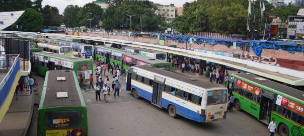

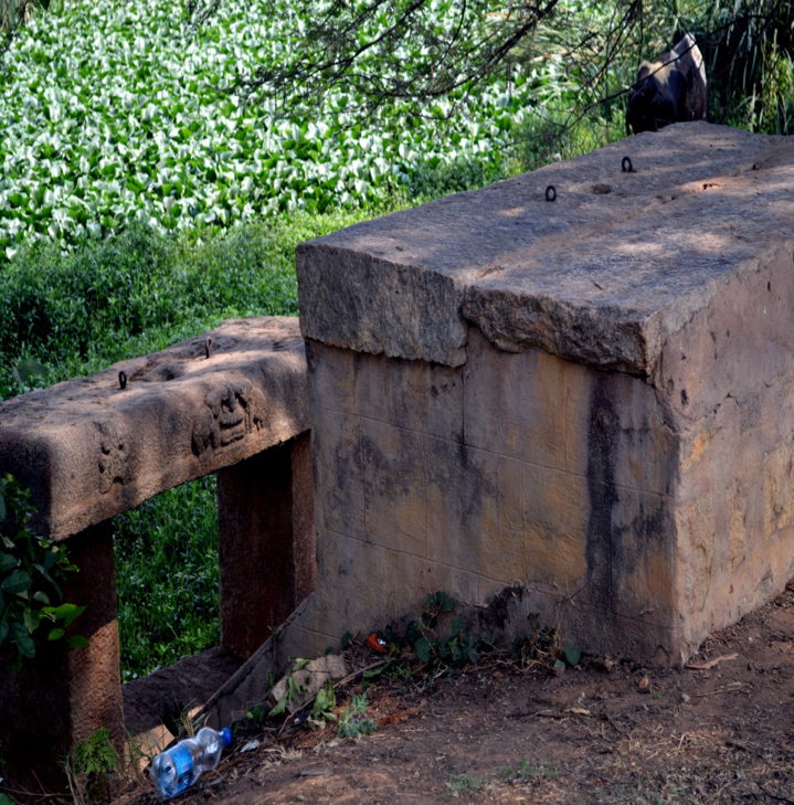
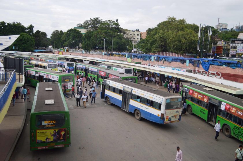
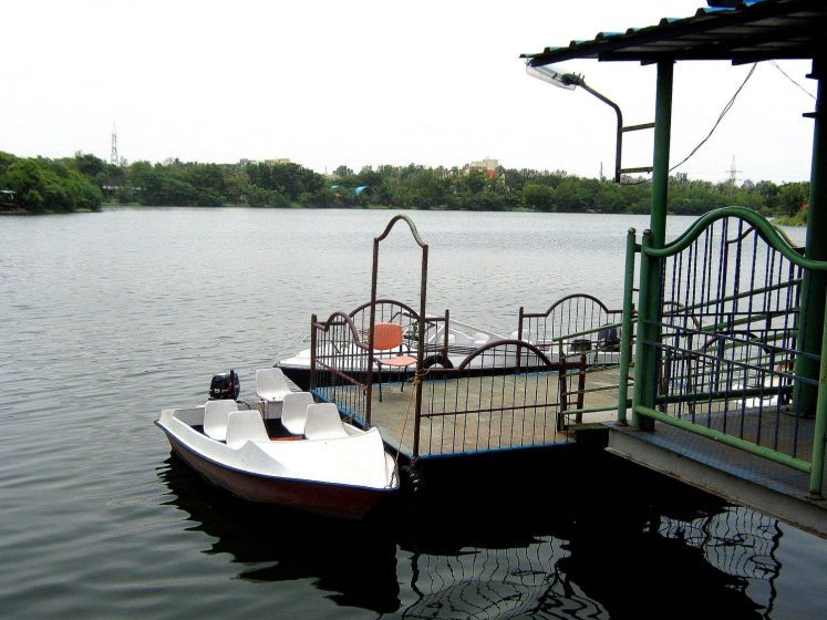
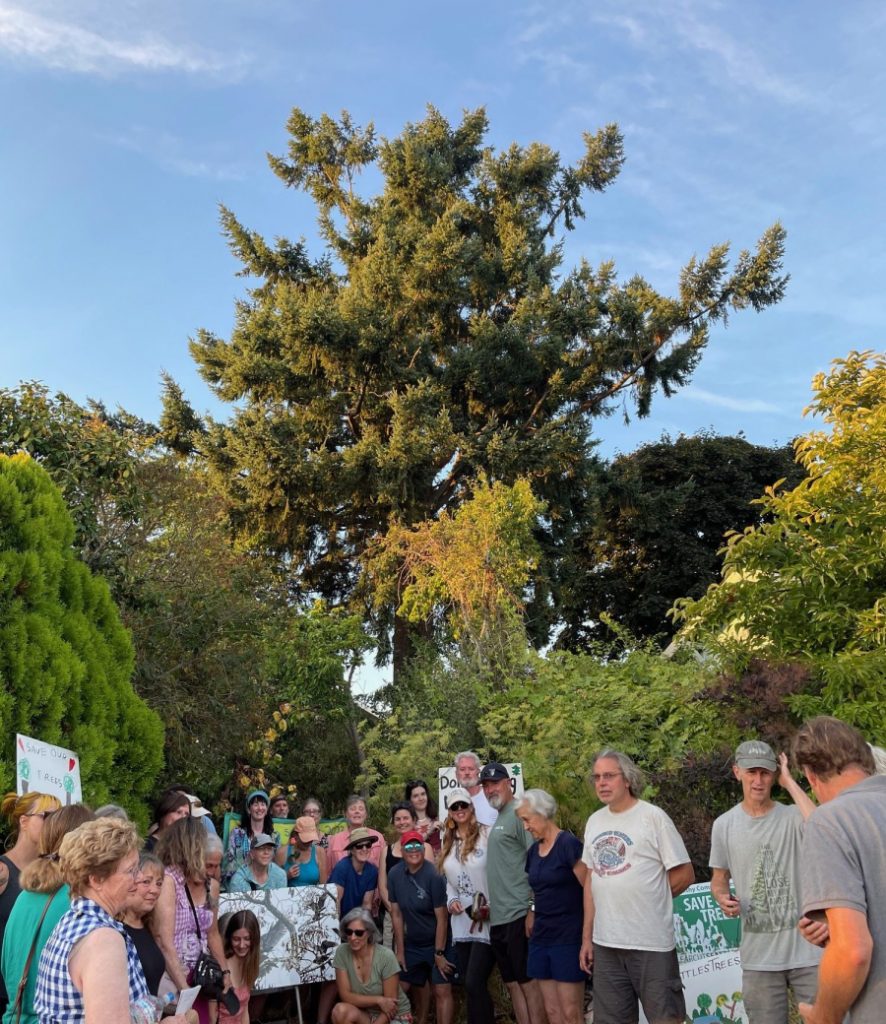
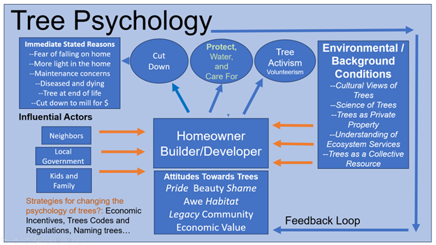 The diagram above is meant to suggest most importantly that there are many factors and influences that impinge on the choices we make about trees, individually and collectively, and also to help us begin to sort through some of the potential interventions that might change these outcomes.
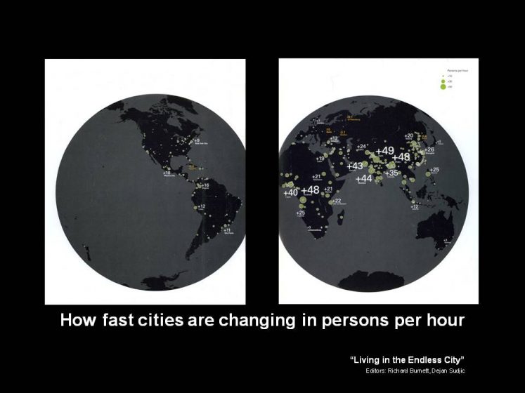
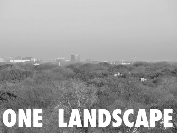
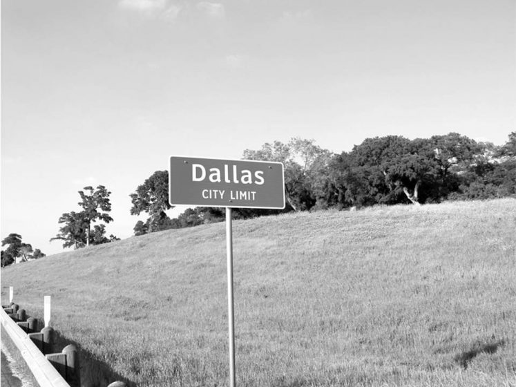
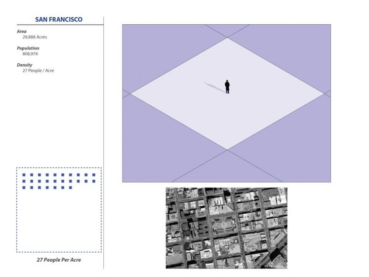
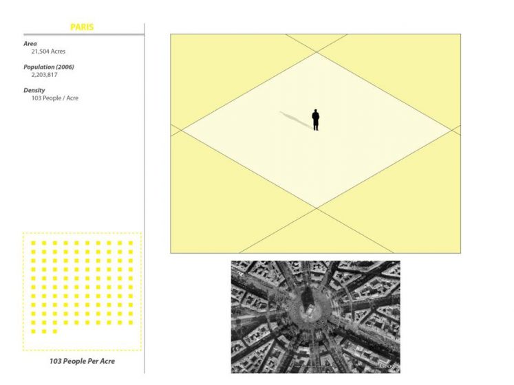
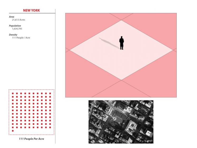
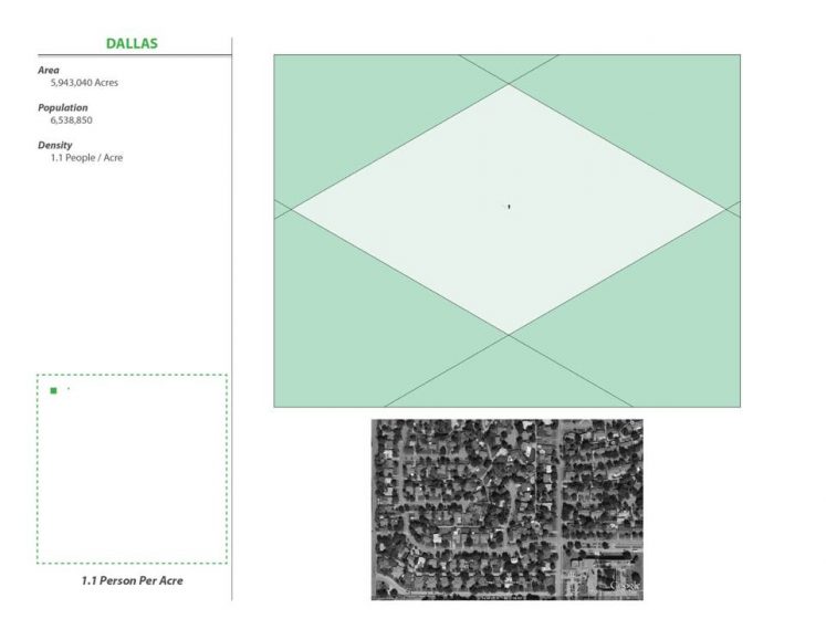

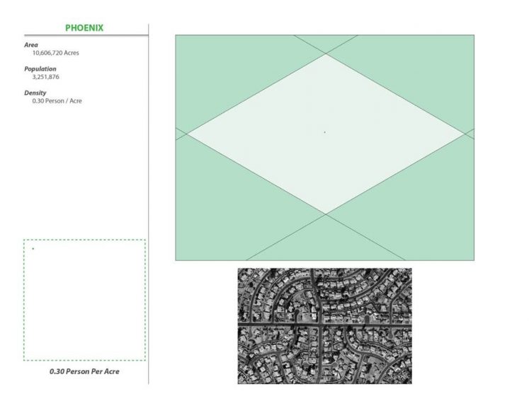
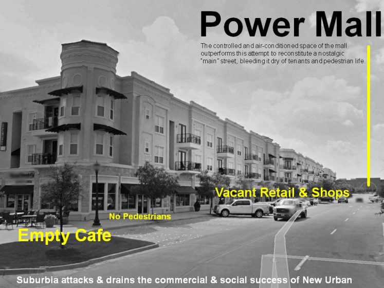
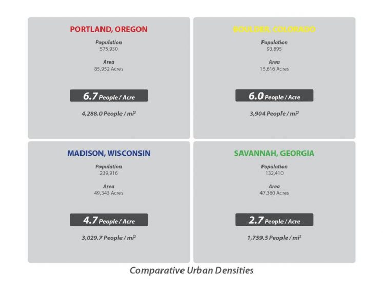
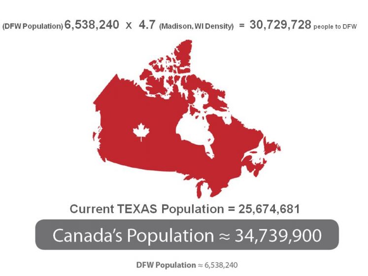
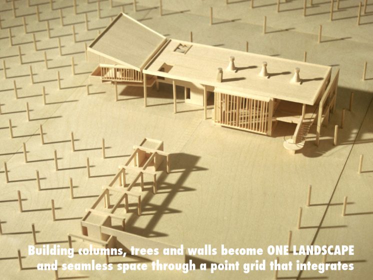
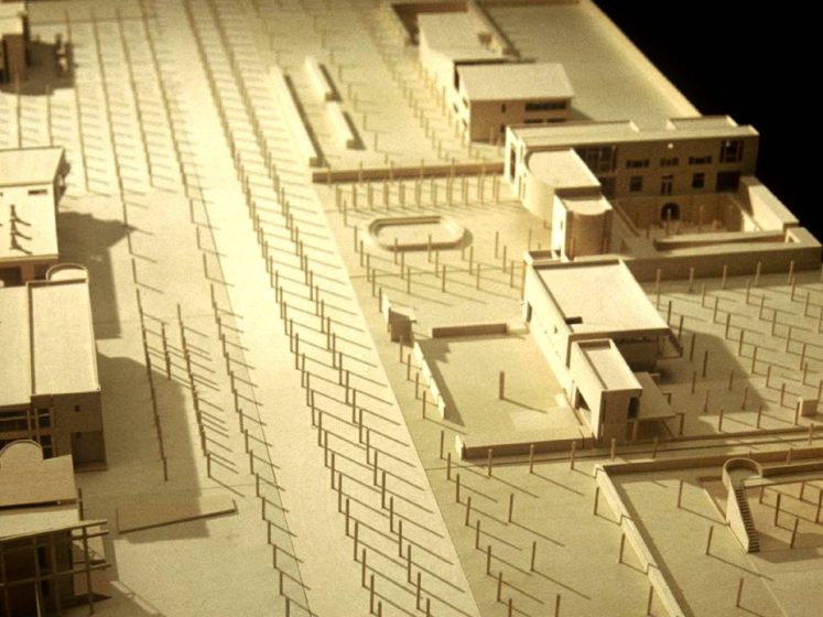
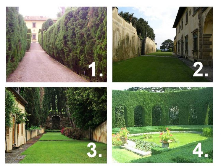
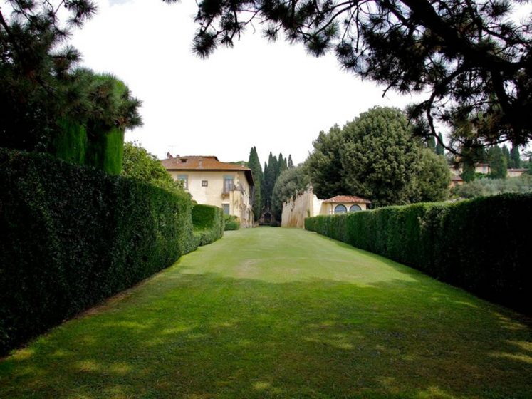
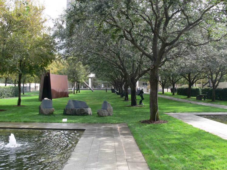
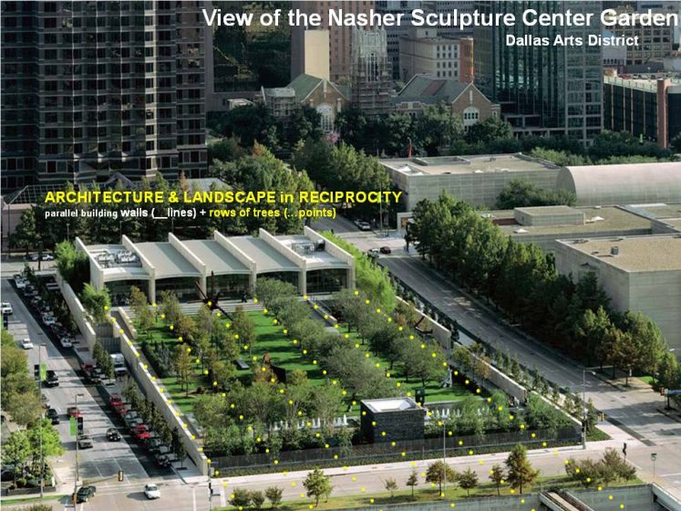
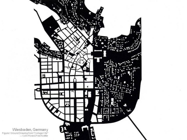
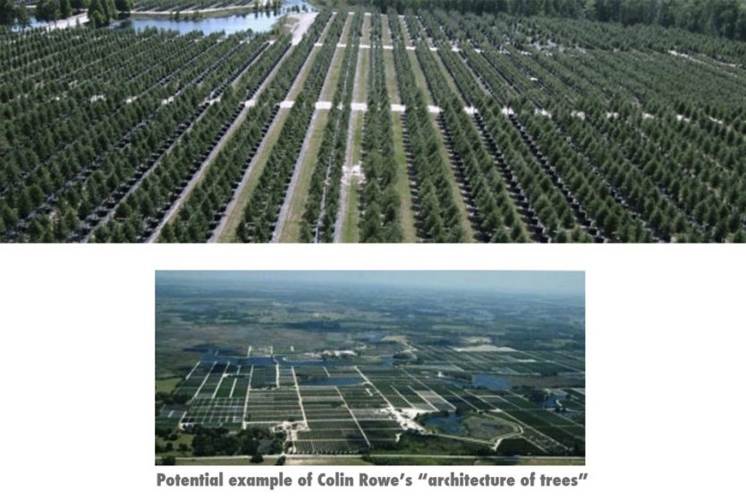
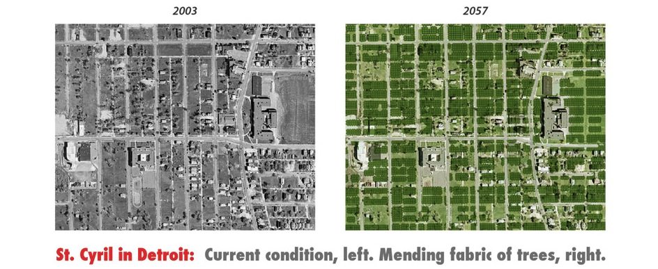
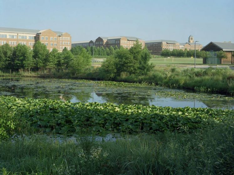
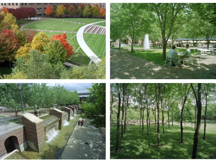
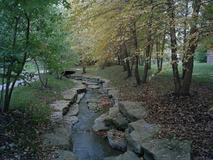
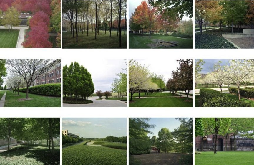
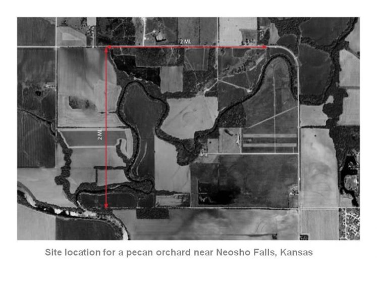
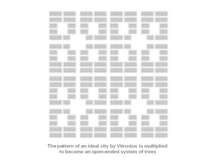
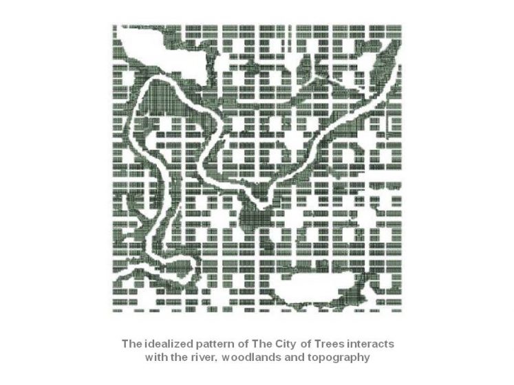
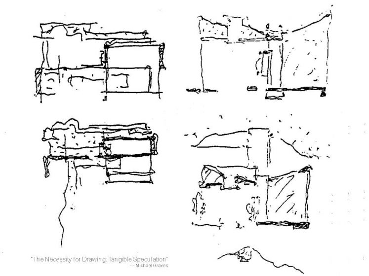
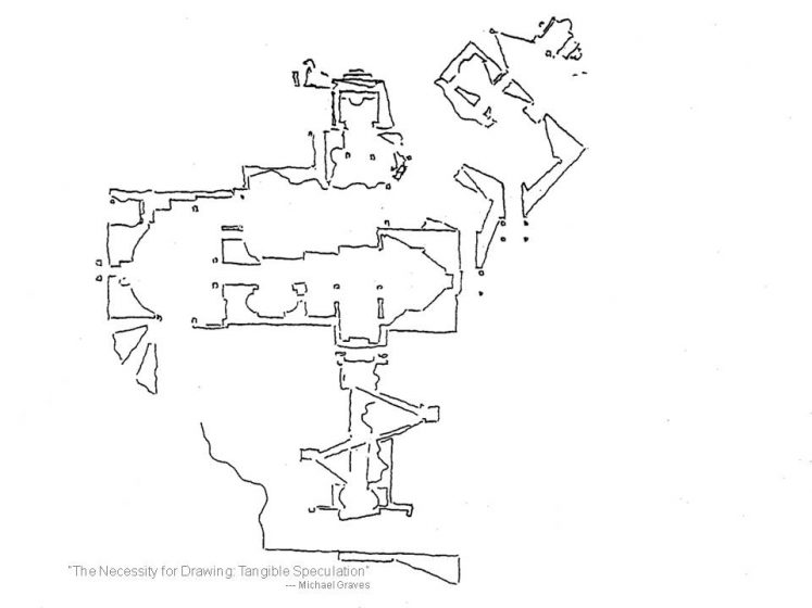
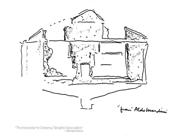
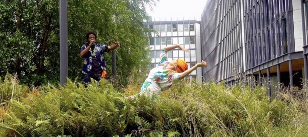
 The Way Forward: Summary
 Beach conservation and nourishment: 16 km in length
 From rivers to ‘Nullahs’ to rivers again: 81.4 kms in length — both banks
 Creeks and mangroves: 34 km
 Wetland conservation: 10 km
 Lakes, ponds and tanks: 2.4 km
 Integration of ‘Nullahs’: 96 kms
 Playgrounds, parks and gardens: 13.37 sq km
 Plots and layout Recreational Grounds: 23.15 sq km


 Development control regulations for hills: 64.31 sq km
 Roads and pedestrian avenues

 Conclusion
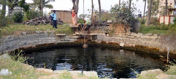
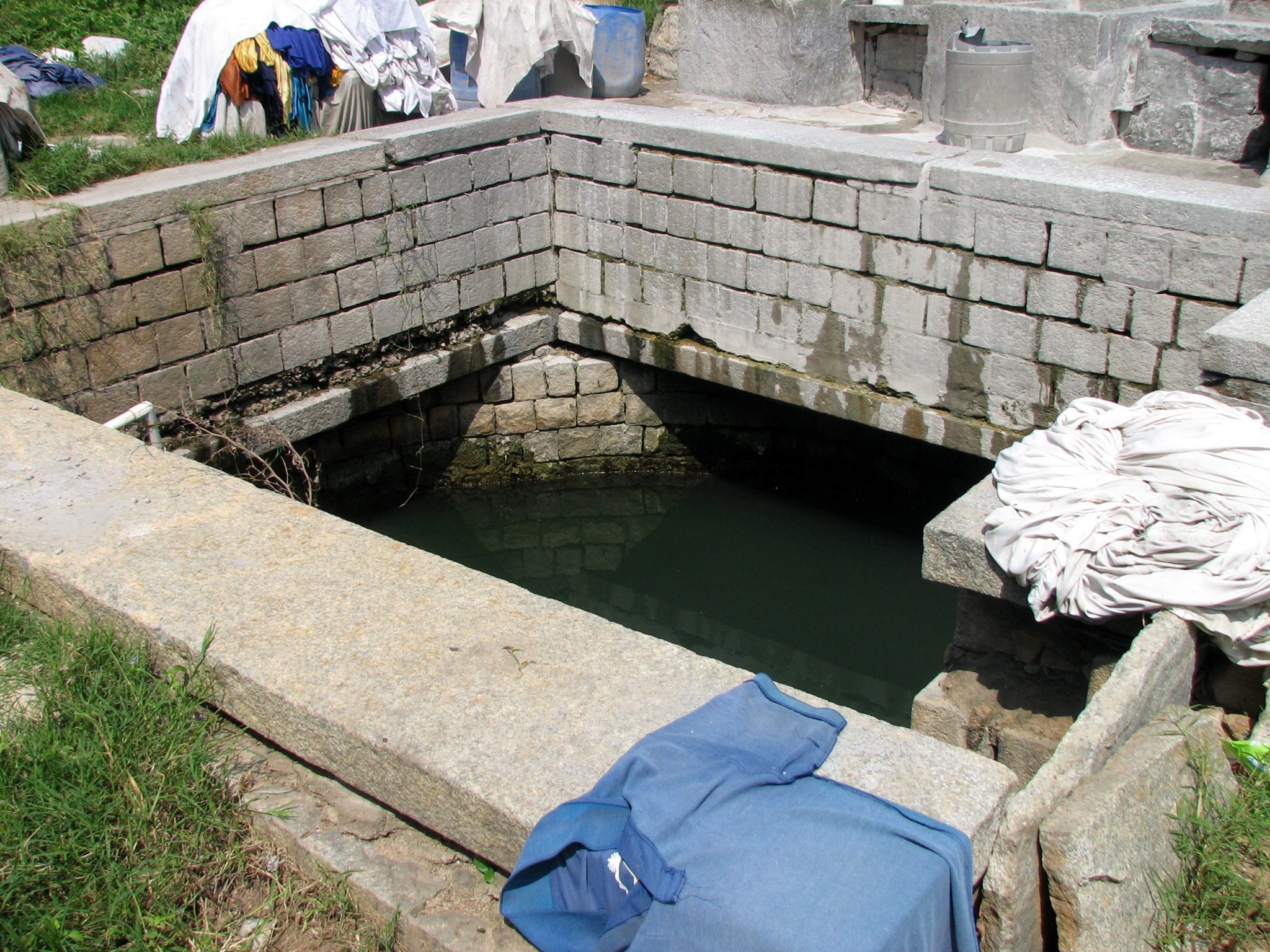

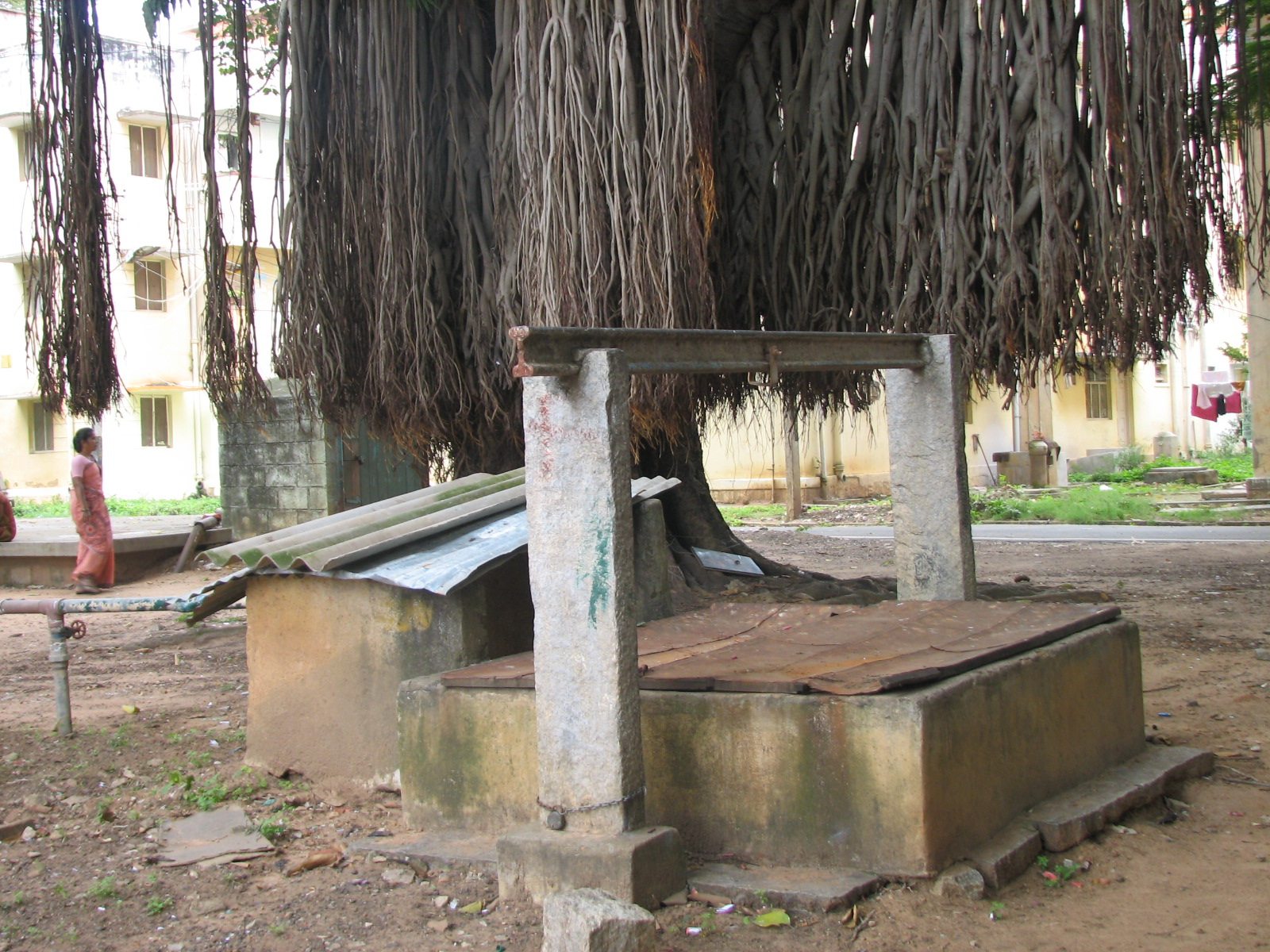

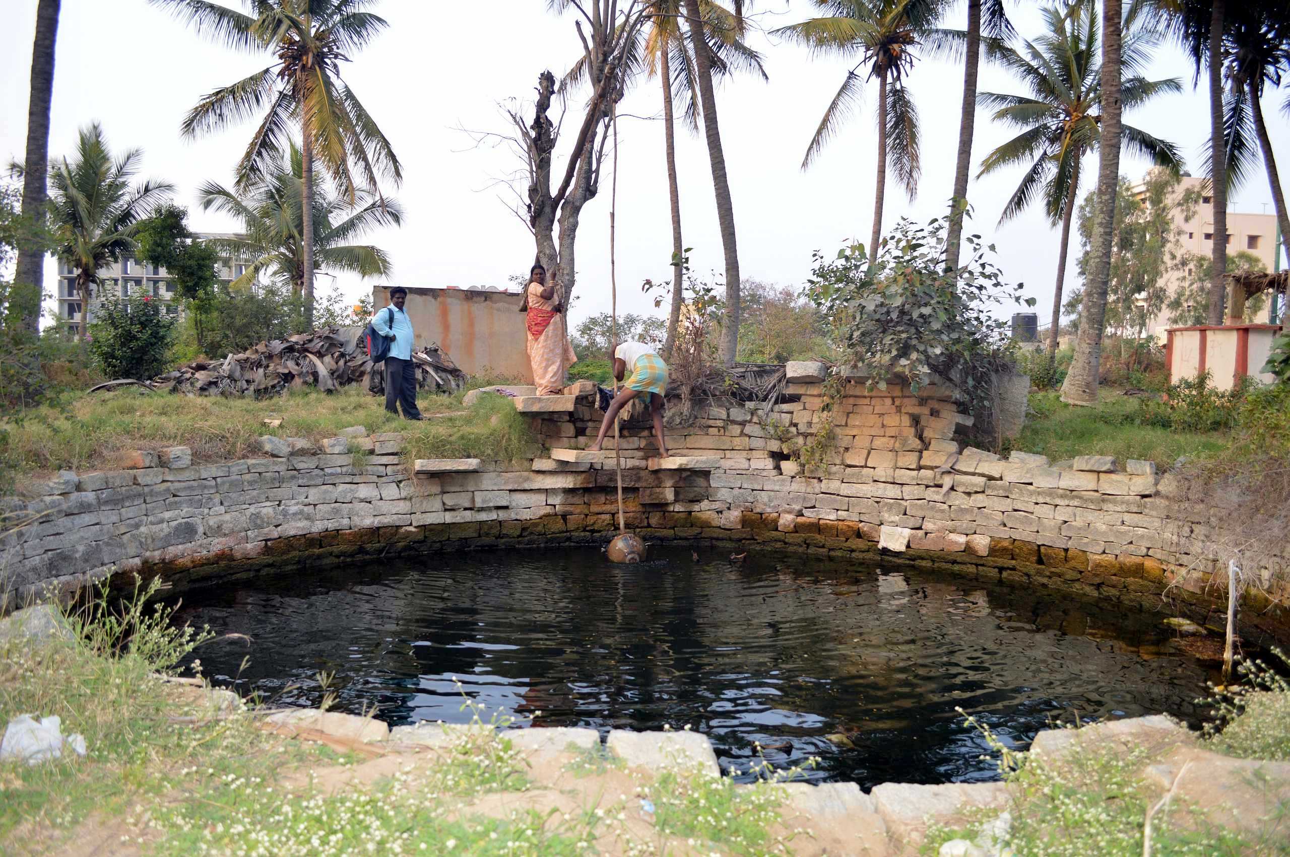

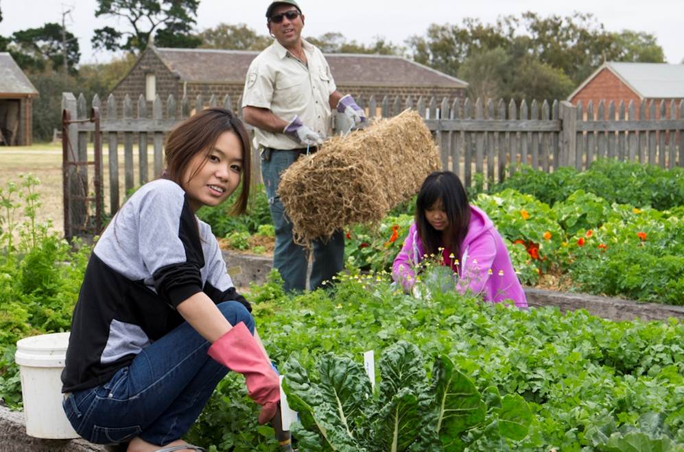
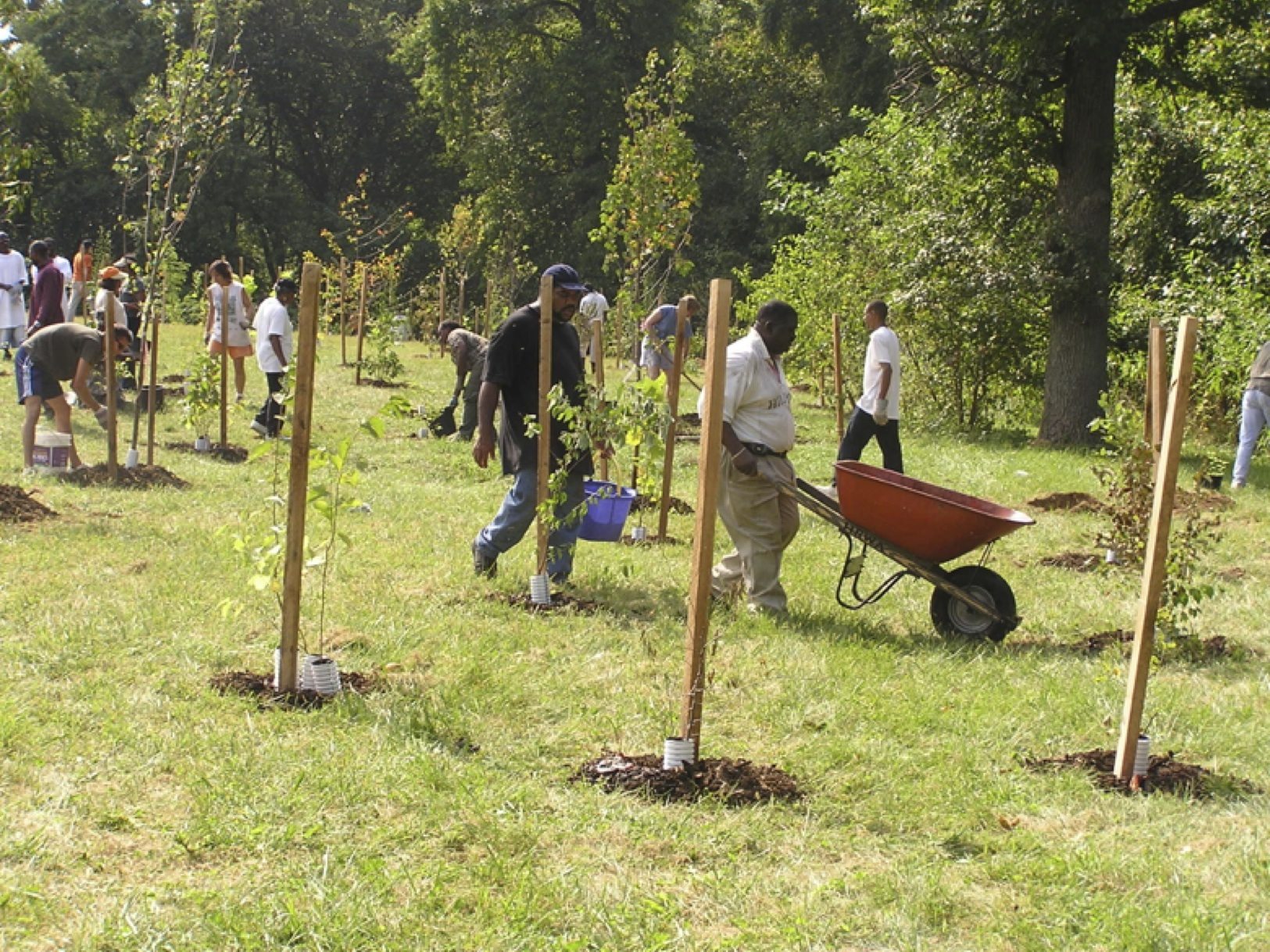
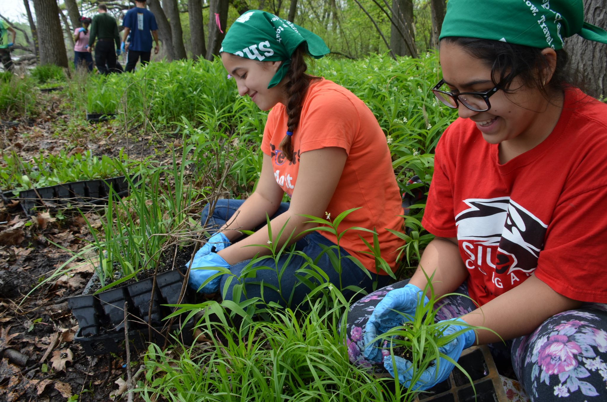

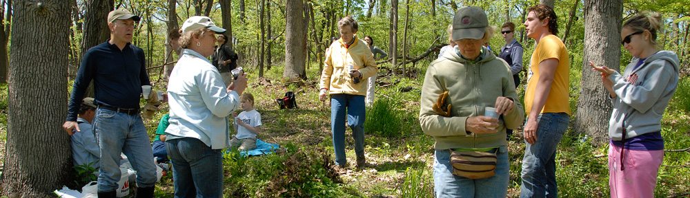
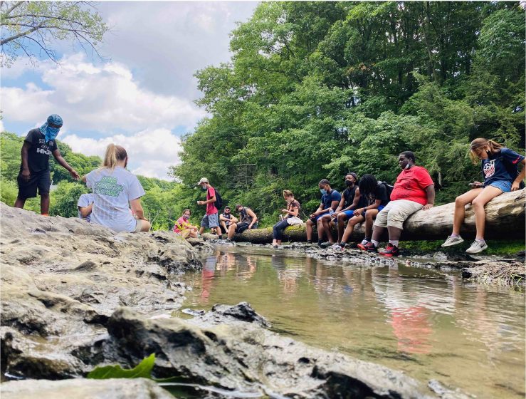
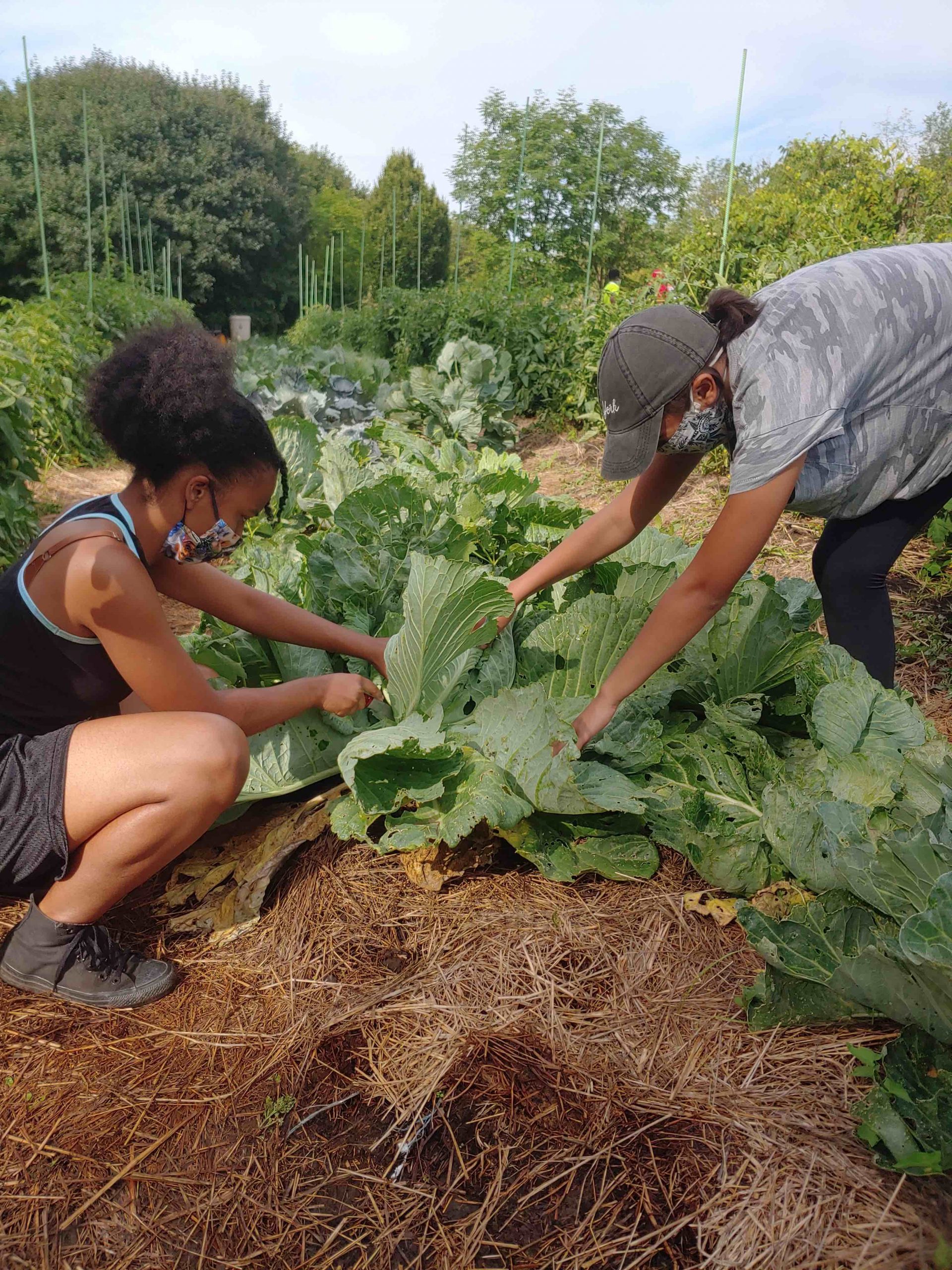
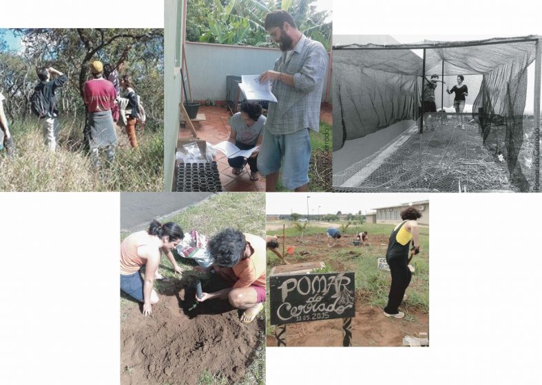
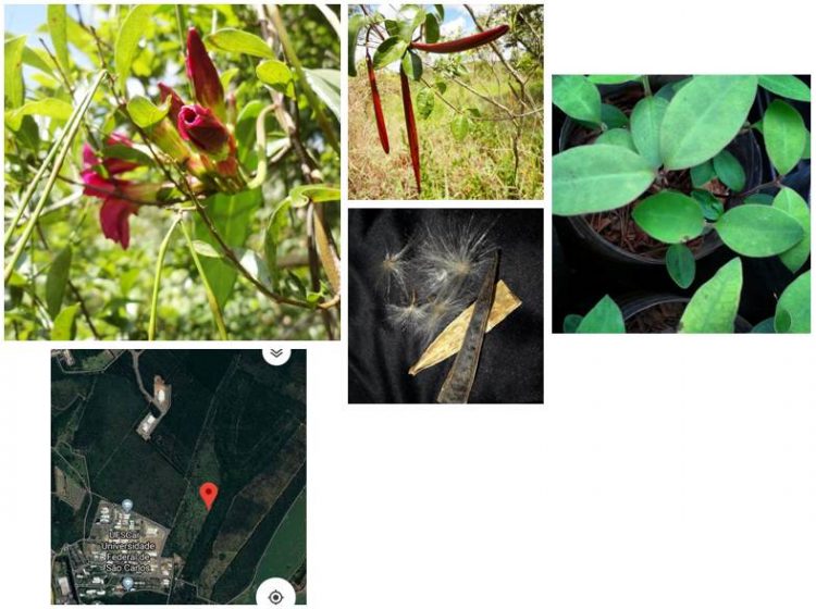
 Ostrom’s study focused mainly on close knit communities in which it was clear who was from the place and who was not (principle 1). For these communities, social control/monitoring and social sanctioning were two central pillars of Ostrom’s design principles for the governance structure that communities would put in place to manage a common pool resource (principles 5 and 6). For this reason, she thought rules of cooperation among users should be written or modified by those who would be entrusted with both the duty to obey to them and the responsibility to enforce them (principle 3).
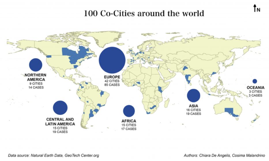


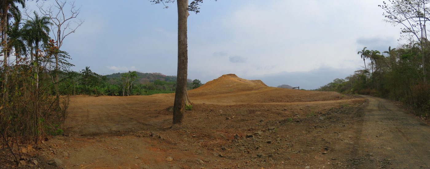
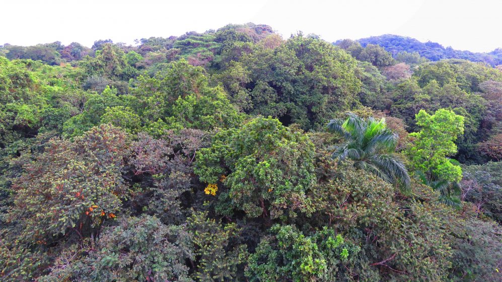
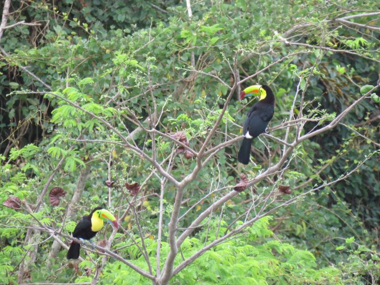

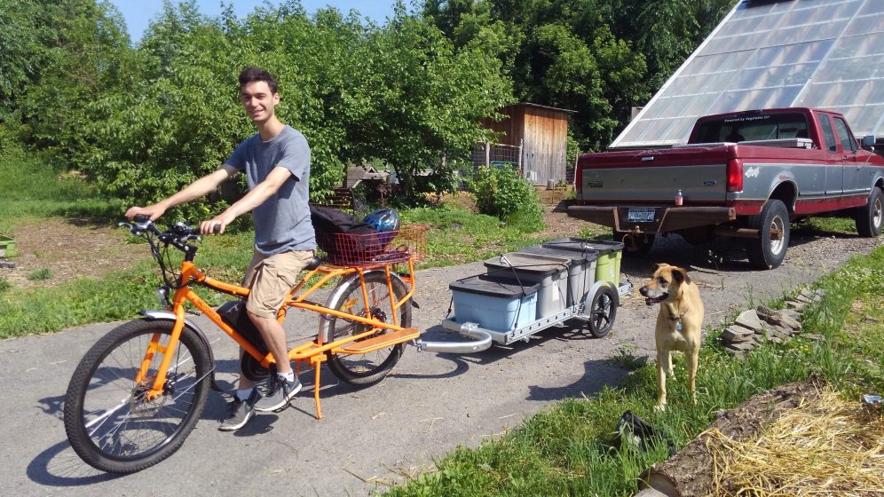
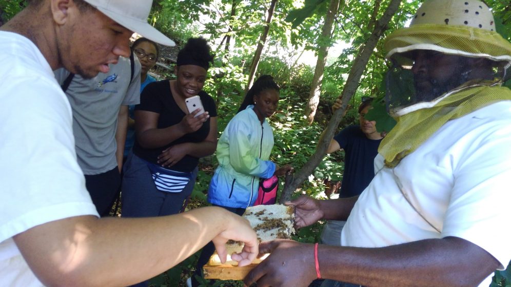
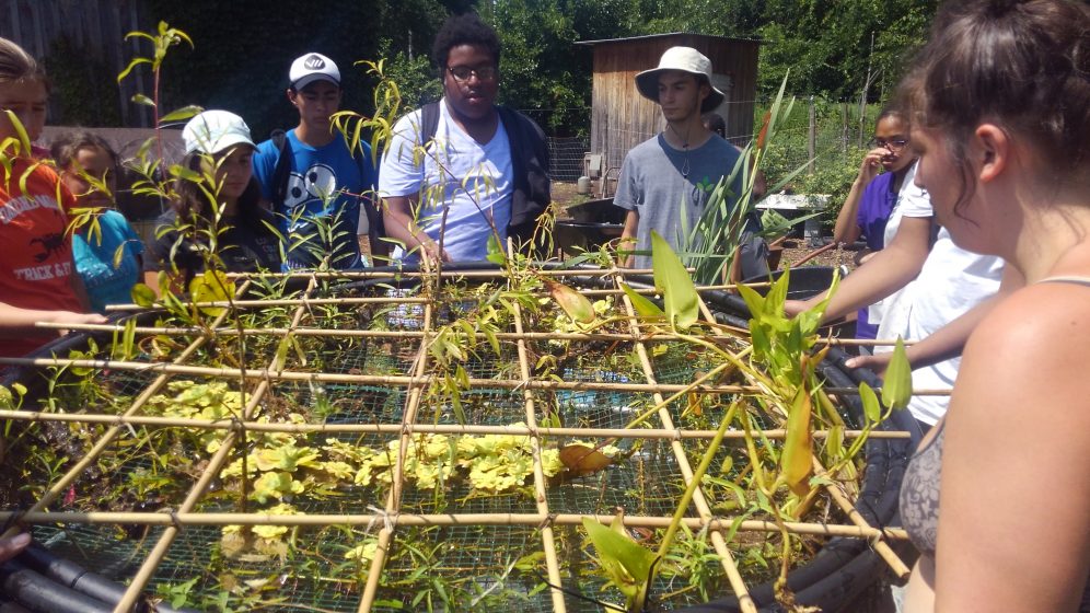


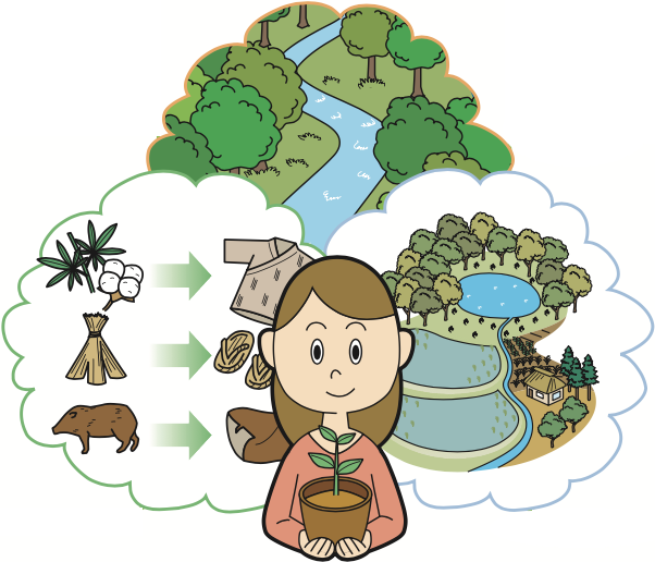
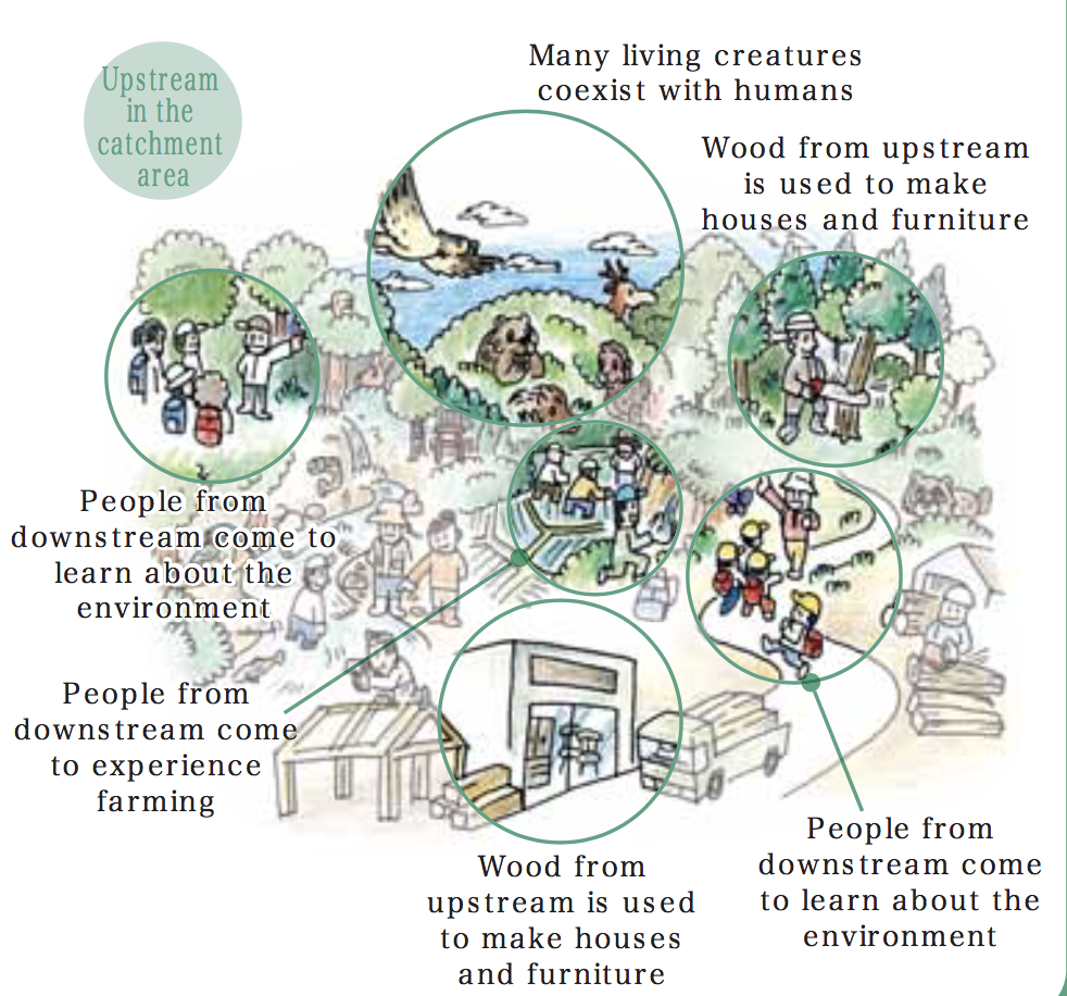

 As of a couple of years ago, there were 2,266,883 people serving in the U.S. military, many of whom serve on bases in the U.S. or abroad. The majority of Active Duty members (86.5%) are stationed in the United States and U.S. territories. The next largest percentages of Active Duty members are stationed in East Asia (7.1%) and Europe (5.8%). The largest base in the US is
 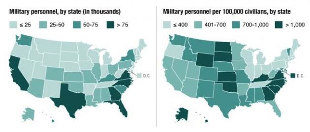 The benefits of human-nature interaction as a form of therapy are well documented. However, the value of human-nature interaction for returning combat veterans and their families and communities has been less studied. While administrators in the U.S. Department of Defense and the U.S. Department of Veterans Affairs struggle to design programs to help returning combatants reintegrate into communities, programs started by veterans themselves have emerged in New York State and across the U.S. Notably, many of these programs have a focus on the healing power of interacting with nature through outdoor recreation, including hunting and fishing, and through other restoration and greening activities. Examples include
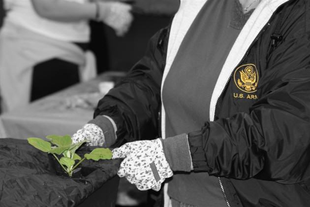
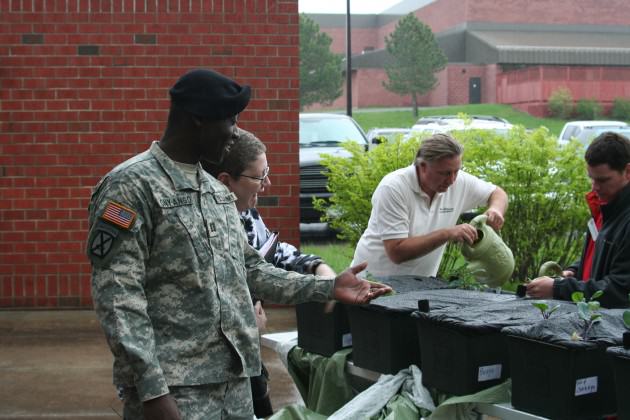


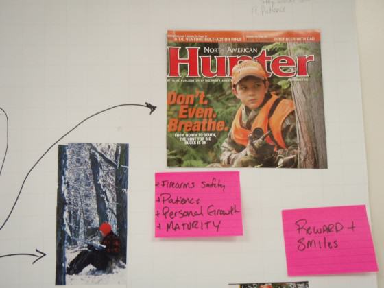
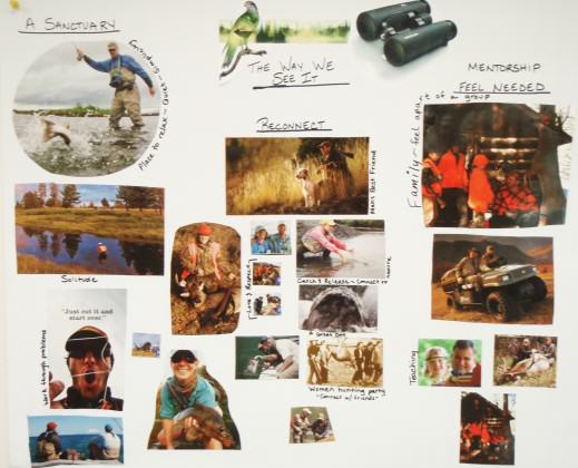
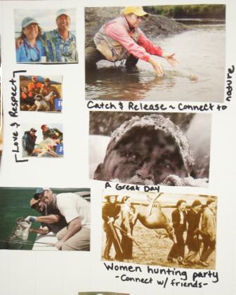
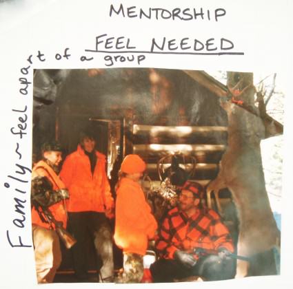
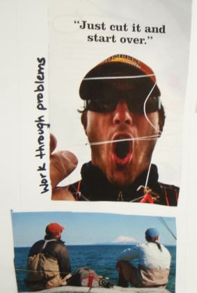 So what have we learned and where do we go from here?
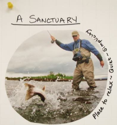
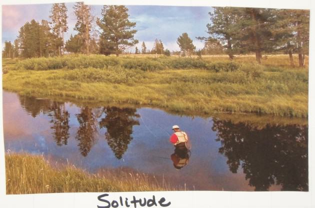 Soldiers returning from long and protracted wars, especially with life altering injuries, often report feelings of inadequacy and of being devalued, and of feeling that their particular skill sets and competencies are not applicable in civilian life. On the other hand, returning veterans that engage in outdoor recreation and restoration activities report significant relief from these and other feelings, sometimes for short periods of time and more often for longer periods. In these reports are suggestions that reveal an intensification and specific manifestation of
 Second, the Canadian Urban Forest Strategy (CUFS) offers guiding principles for urban forestry at the national level. In recent years, more and more Canadian municipalities have been developing urban forest management plans and tree protection policies. Feedback from stakeholders and members has evidenced the need for a national strategy supported by all levels of government; as the Secretariat for the CUFS, Tree Canada promotes its importance to municipal, provincial and federal levels. In collaboration with multiple and diverse partners, several recent achievements include:
 The CUFN Steering Committee, along with a secondary review committee consisting of provincial and federal government representatives, is currently in the process of updating the Canadian Urban Forest Strategy for the 2019-2024 term. This process began with public consultation workshops in autumn of 2015 in each region and has been ongoing for the past two years. The objective of the workshops was to ensure that regional voices were heard in the strategy’s redesign. The new version of the CUFS (2019-2024) will be presented at the
 The second experience I want to share that demonstrated collaborative learning was participating in the Peter Wall Institute for Advanced Studies International Roundtable (October 23-25, 2017) called, “
 As a social scientist, and through my role with Tree Canada, and as a Postdoctoral Research Fellow with the University of British Columbia
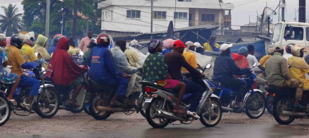
 Try as you might, you’re no urbanite

 The birth of Paleo Cities


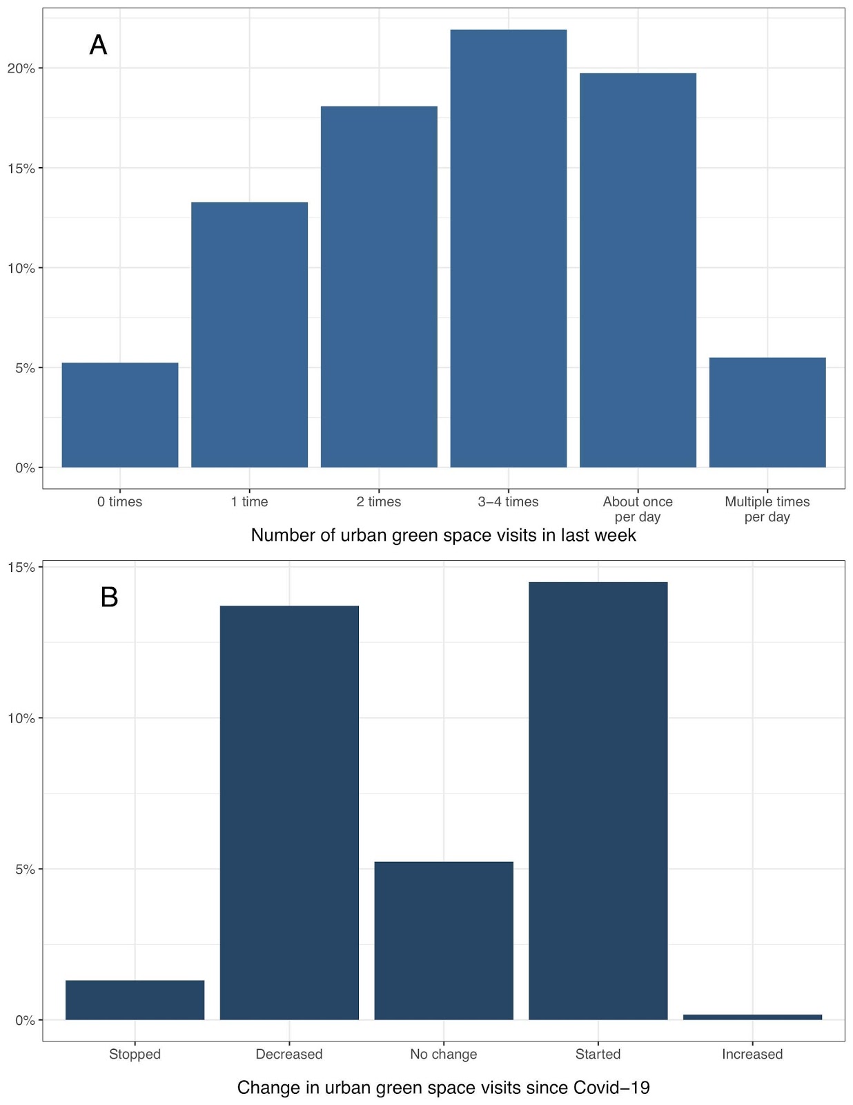
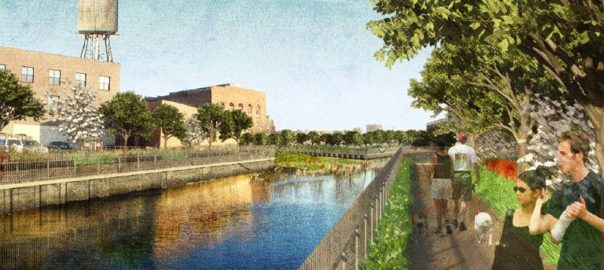
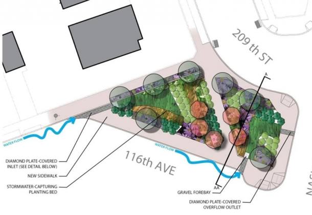
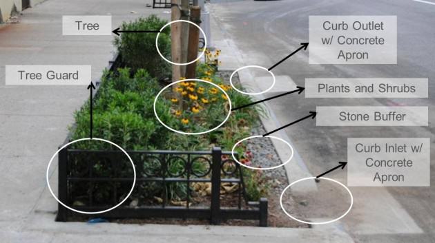
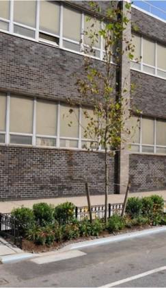
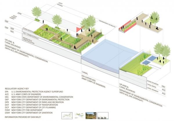
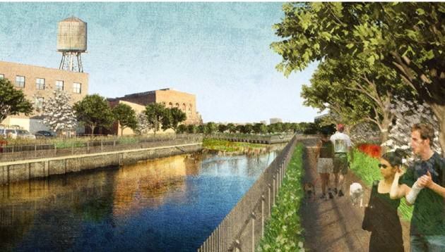
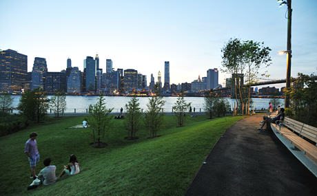


4 Comments
Join our conversation