Long-term sustainability necessitates an inherent and essential capacity for resilience—the ability to recover from disturbance, to accommodate change, and to function in a state of health. In this sense, sustainability typically means the dynamic balance between social-cultural, economic, and ecological domains of human behavior necessary for humankind’s long-term surviving and thriving. As such, long-term sustainability sits squarely in the domain of human intention and activity—and, thus, design. This should not be confused with managing “the environment” as an object separate from human action, which is ultimately impossible. Instead, the challenge of sustainability is very much one for design, and specifically one of design for resilience.
Our approach to resilience has been reactive, with little continuing effort to engage long-term, proactive strategies for adaptation, let alone transformation.
A growing response to the increasing prevalence of major storm events has been the development of political rhetoric around the need for long-term sustainability, especially its prerequisite of resilience in the face of vulnerability. As an emerging policy concept, resilience refers generally to the ability of an ecosystem to withstand and absorb change to prevailing environmental conditions. In an empirical sense, resilience is the amount of change or disruption an ecosystem can absorb and, following these change events, return to a recognizable steady state in which the system retains most of its structures, functions, and feedbacks. In both contexts, resilience is a well-established concept in complex ecological systems research, with a history in resource management, governance, and strategic planning.
The d(NAP) is a proposed measure of sea-level for the Netherlands Delta Region that acknowledges dynamic water levels to accommodate changing hydrological regimes. Images: Kimberly Garza and Sarah Thomas, 2010
Yet, despite more than two decades of this research, the development of policy strategies and design applications related to resilience is relatively recent. While there was a significant political call for resilience strategies following New York’s Superstorm Sandy in 2011 and the ice storm of 2013 in Toronto and the northeastern U.S., this was effectively a reactive approach to crisis, rather than a proactive planning practice. In most instances, once the crisis has abated, there is little continuing effort to engage long-term, proactive strategies for adaptation, let alone transformation—both of which are necessary aspects of resilience, particularly in the context of climate change.
Overall, there is still a widespread lack of coordinated governance, established benchmarks, implemented policy applications, tangible design strategies, and few (if any) empirical measures of success related to climate change adaptation. There has been too little critical analysis and reflection on the need to understand and cultivate resilience beyond the reactive rhetoric and to develop specific and proactive tactics for design. Design for resilience demands proactive planning and an evidence-based approach that contributes to adaptive and ecologically-responsive design in the face of complexity, uncertainty, and vulnerability. Put simply: what does a resilient world look like, how does it behave, and how do we design for resilience?
The emergence of resilience rhetoric is tied not only to the emerging reality of climate change, but to an important and growing synergy between research and policy responses in the fields of ecology, landscape, and urbanism—a synergy that is powerfully influenced by several remarkable and coincidental shifts at the turn of the millennium. Most notable is the global shift in urbanism: our contemporary patterns of settlement are tending towards large-scale urbanization. The last century has been characterized by mass migration to ever-larger urban regions, resulting in the rise of the “mega-city” and its attendant forms of suburbia, exurbia, and associated phenomena of the modern metropolitan landscape. According to the World Health Organization, the percentage of people living in cities is expected to increase from less than 40 percent in 1990 to 70 percent in 2050, and the United Nations projects that in 2030, there will be 5 billion urbanites, with three-quarters of them in the world’s poorest countries. By contrast, in 1950, only New York and London had over 8 million residents. Today, there are more than 20 mega-cities, the majority of which are in Asia. Indeed, for most of the world’s population, the city is fast becoming the singular landscape experience.
Non-linear habitat management: Dynamic uses proposed for Massachusetts Military Reservation at various stages of ecological succession. Images: Geneva Wirth, 2008.Non-linear habitat management: dynamic uses proposed for Massachusetts Military Reservation at various stages of ecological succession. Images: Geneva Wirth, 2008
In North America, and the United States in particular, this shift in urbanism has come (paradoxically) with a widespread decline in the quality and performance of the physical infrastructure of the city. The roads, bridges, tunnels, and sewers that were built in the early part of the last century to service major urban centers are now aging (and crumbling), while the political will and the public funds to rebuild outdated but essential public infrastructure are disappearing. As these infrastructures continue to decay, they are increasingly vulnerable to catastrophic failure in the face of more frequent and severe storm events, which compound the cost of their loss and the extent of their loss’s impact.
Embracing dynamism
The emergence of a new paradigm in ecology represents another significant and concomitant shift with a change in urbanism and the reality of climate change. In the last 25 years, the field of ecology has moved from a concern with stability, certainty, predictability, and order in favor of more contemporary understandings of dynamic systemic change and the related phenomena of uncertainty, adaptability, and resilience. Increasingly, these concepts in ecological theory and complex systems thinking are found useful as frameworks for decision-making generally, and—with empirical evidence—for landscape design in particular. This offers a powerful new disciplinary and practical space, equally informed by ecological knowledge as an applied science and as a construct for managing change, and, within the context of sustainability, planning for and with change as a conceptual model of design.
With this new ecological paradigm has come another important shift in creating the synergy necessary for resilience-thinking: the renaissance of landscape as both discipline and praxis throughout the last 15 years and its (re)integration with planning and architecture in both academic and applied professional domains. Landscape scholars, such as Beth Meyer, James Corner, Julia Czerniak, and Charles Waldheim, among others, have identified the rise of urban post-industrial landscapes coupled with a focus on indeterminacy and ecological processes as catalysts for the reemergence of landscape theory and praxis. Understood today as an interdisciplinary field linking art, design, and the material science of ecology, landscape scholarship and application now includes a renewed professional field of practice in the space of the city—a phenomenon clearly represented in contemporary design projects.
These shifts in our collective understanding of urbanism, landscape, and ecology have created a powerful synergy for new planning and design approaches to the contemporary metropolitan region. This synergy has been an important catalyst for the emergence of resilience rhetoric, but there is much work to be done to move towards evidence-based implementation of strategies, plans, and designs for resilience. The scale and impact of North American mega-storms such as Hurricane Katrina in 2005 and Superstorm Sandy in 2011 have been effective policy triggers—and design provocation— for a new breed of disaster preparedness planning, particularly for flood management plans.
Toronto’s Wet Weather Flow Master Plan, drawn in section to depict implications on landscape infrastructures. Image: T. Bishop et al., Students of Landscape Studio II, University of Toronto 2014
Recent coastal management policies and flood management plans following these major storm events abound in this language of resilience. The New Orleans Water Management Strategy, Louisiana’s Coastal Management Plan, New York’s Rebuild by Design programme, and Toronto’s Wet Weather Flow Master Plan are examples of notable responses to catalytic storm events and climate change. Yet, they remain predominantly speculative, untested, and unimplemented, relying on a general language of resilience that is conceptual rather than experiential, contextual, or scientifically-derived.
Resilience has origins across at least four disciplines of research and application: psychology, disaster relief and military defense, engineering, and ecology. A scan of resilience policies (see http://resilient-cities.iclei.org/) reveals that the concept is widely and generally defined with reference to several of the origin fields, and universally focuses on the psychological trait of being flexible and adaptable; having the capacity to deal with stress; the ability to “bounce back” to a known normal condition following periods of stress; to maintain well-being under stress; and to be adaptable when faced with change or challenges. However, the use of resilience in this generalised context begs important operational questions of how much change is tolerable, which state of “normal” is desirable and achievable, and under what conditions it is possible to return to a known “normal” state. In policies that hinge on these broadly defined, psycho-social aspects of resilience, there is little or no explicit recognition that adaptation and flexibility may in fact result in transformation—and thus, require the adaptive and transformative capacity that is ultimately necessary at some scale in the face of radical, large-scale and sudden systemic change.
Resilience visualized as a function of the adaptive cycle: Holling’s Modified Figure 8, reinterpreted by Thomas Folch, Chris Reed, and Nina-Marie E. Lister, reproduced from Reed, Chris, and Nina-Marie E. Lister, eds., Projective Ecologies, Cambridge, MA: Harvard University Graduate School of Design, 2014.
Using sea level as an example, if we accept that waters naturally rise and fall within a range of seasonal norms, we might be better off to embrace a gradient of acceptable “normal” conditions rather than a single static—and ultimately brittle state—that is unsustainable. A more critical and robust, systems-oriented exploration of resilience is necessary, such as the one being developed by Brian Walker, Carl Folke, and others at the trans-disciplinary Stockholm Resilience Centre. This more nuanced, emerging discourse of resilience is essential for confronting the question of how much a person, a community, or an ecosystem can change before it becomes something unrecognizable and functions as an altogether different entity.
Current policies risk the potential power of resilience by emphasizing a misguided focus on “bouncing back” to a normal state that is ultimately impossible to sustain. But if resilience is to be a useful concept in informing design strategies, it must ultimately instruct how to change safely. This includes a need to plan proactively, and to adapt when necessary, with some culturally acceptable risk and loss, and with transformative capacity—rather than to resist change by relying on the illusion of a perpetual normal. Such a subtle but imperative shift in definition caries substantial if not profound implications for contemporary models of governance, in which perceived failure is rarely recognized let alone rewarded as an act of transformative learning. Despite the growth in and acceptance of ‘systems thinking’ in business and governance literature, and the associated rise of complexity science and transition design over the last several decades, there is still high risk and little reward for tangible learning through change. But there are emerging models for infrastructure development and delivery that show signs of promise: private-public procurement, interdisciplinary and collaborative research (via e.g. applied studios, industry partnerships with design) community experiments in design, and growth in rapid prototyping for small-scale projects (emphasizing safe-to-fail rather than fail-safe strategies). These are incremental and often technical steps that cumulatively may demonstrate ‘next best practices’ for more agile responses to changing conditions. Governments must now embrace the social-cultural dimensions of resilience that are essential to building transformative capacity. This is the challenge ahead for a new culture of sustainability and its associated practice of designing for resilience.
Barnett, Rod, 2013. Emergence in Landscape Architecture. London: Routledge.
Gunderson, Lance and C.S. Holling, eds. 2002. Panarchy: Understanding Transformations in Socio-Ecological Systems. Washington DC: Island Press.
Irwin, Terry, 2015. Transition design: a proposal for a new area of design practice, study, and research. Design and Culture, 7:2, 229-246, DOI: 10.1080/17547075.2015.1051829
Lister, Nina-Marie, 2016. Resilience beyond Rhetoric in Urban Landscape Planning and Design. In: George F. Thompson, Frederick R. Steiner and Armando Carbonell (eds) Nature and Cities: The Ecological Imperative in Urban Design and Planning. Cambridge, MA: Lincoln Institute of Land Policy.
Mathur, Anuradha and Dilip da Cunha, 2014. Design in the Terrain of Water. New York: Applied Research & Design Publishers.
Reed, Chris and Nina-Marie Lister, eds. 2014. Projective Ecologies. New York: Harvard GSD and Actar.
Steiner, Frederick R. 2011. Design for a Vulnerable Planet. Austin: University of Texas Press.
A review ofProjective Ecologies, edited by Chris Reed and Nina-Marie Lister. 2014. ISBN: 1940291127. ACTAR, Harvard Graduate School of Design. 314 pages. Buy the book.
Several months ago, I reviewedLandscape Imagination, a collection of essays by James Corner, a professor at University of Pennsylvania and the landscape architect who designed New York City’s celebrated High Line. Composed over twenty years, his essays examine the many factors hindering the advancement of the cultural medium of landscape. One factor Corner repeatedly addresses is the hoary old dichotomy between nature and culture still pervasive in landscape architecture—the belief in a pristine nature separate from humans.
If we cannot get our most innovative and challenging ideas out of books and into real landscapes, we will squander an opportunity to determine a proud future.
While his collection proposes the “landscape imagination” as a way to transcend this outdated belief in landscape architecture, Projective Ecologies, a new collection of essays edited by Chris Reed and Nina-Marie Lister, turns to ecology for new ways to think beyond the old nature/culture split. Taken together, these complimentary volumes offer a powerful new raison d’etre for contemporary landscape architecture. But they also reveal another thorny dichotomy.
While the essays in both collections are exquisitely written, I am hard pressed to imagine contemporary built landscapes that actually represent the challenging ideas conveyed in either book. This dichotomy between landscape as idea—in academic writing and imaging—and the actual production of landscapes—in the common client/contract model of practice—is not new. Nor is it unique to the discipline. But like nature versus culture, the idea versus practice dichotomy leaves landscape architecture ill equipped to work effectively in a world of quickly hybridizing landscapes.
Projective Ecologies aims to recover a critical sense of ecology for the design professions because they operate at the intersection of nature and culture—particularly landscape architecture, since its medium holds unique environmental, social, and existential opportunities and responsibilities. Emerging from a multi-year research initiative at Harvard’s Graduate School of Design, Reed and Lister drew on Foucault’s The Archaeology of Knowledge to present three “parallel genealogies,” or intellectual traditions, dealing with the concept of ecology: natural sciences, the humanities, and design.
Reed and Lister abandon any hope of editing a chronologically linear exploration of ecology across the disciplines. Instead, they take a cue from it, and tend a wild garden of vines and sprawling, root-like ideas with no center and no linear narrative. While it was once believed that ecosystems were linear, gradually and steadily reaching stability until disturbed by an external force, it is now understood that change is built into them. Biologist Robert E. Cook eloquently explains this paradigm shift in his essay “Do Landscapes Learn? Ecology’s “New Paradigm” and Design in Landscape Architecture” (1999). For Cook, ecosystems depend on change for growth and renewal.
All of the essays are at their best when they investigate the consequences of design and planning operating from the old paradigm in ecology. Jane Wolff demonstrates how decades of decisions and actions from within the old paradigm made Hurricane Katrina such an unprecedented disaster for New Orleans. The complex hybrid ecological systems that have emerged in New Orleans are making rehabilitation efforts nearly impossible. David Fletcher discusses how Los Angeles River revitalization efforts are led by goals to fix the river rather than understand what it has become. This desire to return the river to a “natural” state threatens its urban ecologies, which have adapted to perform significant ecological functions independent of human agency.
Erle C. Ellis, a professor of anthropogenic landscape ecology at the University of Maryland, further explains why these dichotomies are so troublesome in his contribution “Taxonomy of the Human Biosphere.” Ellis defines our new geological epoch, the Anthropocene, as “the completion and permanence of human influence on the terrestrial biosphere.” He argues that the Anthropocene began roughly 10,000 years ago, when humans first started planting crops. The epoch really got underway with the dawn of the Industrial Revolution. Anything that was not altered before is now undergoing rapid changes caused by human-induced climate change. The future of all species, including our own, sits entirely in our hands. Ellis makes a case for understanding and managing our anthropogenic biosphere by moving beyond the mythology of humans as destroyers of a pristine and fragile nature, a theme that is central to the nature versus culture dichotomy. Since this cultural perception of nature does not actually exist in the reality of a biosphere that is now a hybrid of nature and culture, it will not empower us to create nurturing landscapes in the new epoch. Likewise, if we cannot get our most innovative and challenging ideas out of books and into real landscapes, we will squander an opportunity to determine a proud future.
Christopher Tuccio. Milkweed Habitats. 2008.
The essays offer three important perspectives of ecology to better understand ecology as a model of the world and the agency exercised by design and planning in shaping that world. The first perspective from Projective Ecologies is that ecology has transcended its origins as a natural science. The expansion is trans-disciplinary, cutting across the natural and social sciences, history and the humanities, design and the arts. It also pertains to the pervasive co-opting of ecology as an overused metaphor for any general idea about environment or as a poorly understood stand-in for the idea of dense networks of connectivity (see any recent issue of Forbes or Fast Company in which entrepreneurs explain the “ecology” of their multi-million dollar “ecosystem”). In Christopher Hight’s essay “Designing Ecologies,” he declares ecology among the most important epistemological frameworks for the environmental narrative of our times. But because of ecology’s expansion—and, consequentially, its descent into simplistic truisms that everything is interlinked and interacting—it loses its meaning as a specific idea. Reed and Lister say, “few designers have ventured beyond the metaphors and mechanics of these two-decade-old models to design effectively for adaptation to change, or to incorporate learned feedback into the designs, or to work in trans-disciplinary modes of practice that open new apertures for the exploration of new systems, synergies, and wholly collaborative work.”
The second perspective from Projective Ecologies (as implied by the title) is that ecology is actually a plural concept, spanning a broad spectrum of fields. Some of the specialized areas of ecologically oriented research that have emerged, include: landscape ecology, human ecology, urban ecology, applied ecology, evolutionary ecology, restoration ecology, deep ecology, the ecology of place, and unified theory of ecology. These appropriations are responses to the importance of ecology as model, metaphor, and medium for the interrelationships between plants, animals, and the physical, biological, cultural, and experiential world. In a hybrid world of nature and culture, singularities—such as ecology existing outside the city, and urban as external to ecology—no longer exist.
The third main perspective in Projective Ecologies is that ecology holds projective potential for the design disciplines. Reed and Lister explain that, “as ecologists are limited by their conceptual models of ecosystems rarely able to be tested on ecosystems themselves, the term projective thus embraces the creative and speculative ambitions of representation.” Reed and Lister model a speculative and creative approach with the very structure of their book, layering essays, drawings, and other graphics in an effort to bring new connections and new ideas to light. Chris Hight explains a projective ecological program of design as less about organizing matter or even catalyzing processes, as much as it is about researching the critical junctions and “pressure points” of systems. Projective Ecologies proposes a synthetic understanding of ecology as a medium of thought, exchange, and representation for design.
Michel Desvigne Paysagistes. Thirty-Year Planting Development. Thomas Plant, Guyancourt, France. 1989.
While Projective Ecologies raises many questions about the future of ecology and urbanism, it left me asking one critical question: “What is next in the lineage of the project?” We can surely anticipate similar collections of essays and drawings from ecological thinkers. But how does ecology as a medium of thought, exchange, and representation translate to the messy realities of our cities? How does it translate to practice more broadly? How do mid-career practitioners like myself “catch up,” so to speak, with advancements in the ecological paradigm shift since we were in landscape architecture school? How do we become familiar with the realities of a hybridized world shaped by cultural intention and natural process?
Jane Wolff asks a question in her essay, “Cultural Landscapes and Dynamic Ecologies: Lessons from New Orleans,” that is applicable across hybrid landscapes: “What can be done to address the tension between what we know and what we do? With enough public investment, the technical dilemmas posed by New Orleans and southern Louisiana could be addressed successfully. The most significant obstacles to progress are cultural. The need for public literacy about New Orleans’s hybrid ecology suggests a new role for landscape and urban designers, who have the skills to mobilize, represent, and synthesize information about current conditions and more resilient alternatives.”
Perhaps attaining more widespread ecological literacy should be the first goal in breaking down the “nature versus culture” and “ideas versus practice” dichotomies plaguing landscape architecture. As practitioners, taking responsibility for our own knowledge will allow us to better use our skills and creatively mobilize, represent, and synthesize information for the public. These goals may not be practical within the dominant model of practice where methods are monetized, outputs are commoditized, and the march of ecological time is suspended to create landscapes with instant appeal. But the world depends on us to learn from ecology and create hybrid forms of ideas and practice that enable us to better understand the ecosystems and human populations we impact through the landscapes we shape. Offering up the insight that we may not be making the most of a diverse and complex concept of ecology, is, perhaps, the greatest success of Projective Ecologies.
Cities pledge to reduce emissions and fight climate change—but do these commitments measure up? The transport sector makes up nearly one-third of urban emissions, a factor influenced by distances traveled and modes of travel. Most cities focus on policies to reduce emissions from modes of travel, such as encouraging residents to switch from personal automobiles to public transport.
Land use policies need to be integrated with transportation measures in order to reduce transport-related emissions.
Cities that fail to incorporate land use measures actually see an increase in transport-related emissions. To better understand how cities are addressing transport-related emissions, I investigated climate plans in 12 U.S. cities to identify and compare: 1) level of emissions reductions pledged, and 2) policies and metrics to reduce transport-related emissions. The analysis focuses on a small but diverse group of U.S. cities, and recommendations may be extrapolated to other cities in a global context.
Urban transport systems can help cities solve climate change. But it’s just one part of the equation. Photo: Pixaby
The leadership and initiative of international and U.S. cities were highlighted throughout the UN climate conference, COP21. Over 700 global mayors gathered in Paris at the Climate Summit for Local Leaders, which took place parallel to the official UN negotiations. Global leaders at the Summit, including Former Mayor Michael Bloomberg and actor Leonardo DiCaprio, espoused the importance of cities in driving and advancing measures to reduce climate change. Their message was loud and clear: cities cannot wait for mandates from state or federal governments and must instead be trailblazers to move the climate agenda forward.
The emphasis on cities was a break from previous climate conferences, and reflected the global recognition that city actions to address climate change are instrumental—but insufficient—for meeting international climate goals . International city networks, including groups like ICLEI—Local Governments for Sustainability and C40 Cities Climate Leadership Group, play an important role in championing and building capacity for cities to action on climate.. A subset of this group present in Paris was the Local Climate Leaders Circle, a delegation of 12 U.S. cities representing the diversity of urban areas in the U.S., from Des Moines, Iowa to Santa Monica, California (see map below for complete city list). These cities were identified as “speaking out as champions for climate action in national and international policy forums” and are the focus of my research on transport-related climate strategies.
Over one hundred U.S. cities have committed to addressing carbon pollution. Their reduction pledges represent the equivalent of taking 62 million cars off the road, equivalent to a quarter of the 253 million cars on the road today. Cities typically commit to climate change mitigation in order to meet a state directive, or to respond to local leadership or community action. The projected emissions reductions are driven primarily by cities with long-term targets (i.e., 2035-2050). In the U.S., 62 cities have set targets to meet the federal goal of 26-27 percent reduction in emissions below 2005 levels by 2025, and 33 local governments have targets to reduce emissions by 80 percent. Figure 1 below shows how targets and timelines in the Local Climate Leaders Circle compare; nearly half of these cities meet the federal emissions reductions goal.
Figure 1. Emissions reductions targets for Local Climate Leaders Circle cities by year and anticipated percent reduction in emissions. Cities with long-term emissions reductions targets have greater emissions reductions goals. Image: Emily Wier, Yale FES; data compiled from CDP & city Climate Action Plans
Setting specific and measurable targets is the first step in mitigating climate change. The next and critical part is figuring out how to reach mitigation goals and establishing indicators to track progress. Cities have a suite of tools available to mitigate emissions associated with urban form, which includes transportation planning, zoning, and behavioral-based policies. Geographic and municipal boundaries impact the policy options available to mitigate emissions resulting from each of these drivers. Even though mitigating emissions from transportation and land use could be an important aspect of city climate plans, few cities adequately create and implement measures to reduce these emissions.
Tackling transportation emissions
Transportation and land use—how we move around and build our cities—are two of the largest sources of city emissions. Nationally, nearly one third of carbon emissions are from transportation, but there is much more heterogeneity at the local level. Transport-related emissions can vary from 5 percent (Chula Vista, California) to over 50 percent (Grand Rapids, Michigan) of a city’s total emissions (see Figure 2). The presence of a metro or subway system, commuting distances, connectivity of transit options, and spatial composition of housing and jobs has profound impacts on city transportation emissions.
Figure 2. Percentage of total citywide emissions due to land use and transportation average 30 percent, but vary between less than 5 percent and more than 50 percent. Image: Emily Wier, Yale FES; data compiled from CDP & city Climate Action Plans
Through climate policies, cities can encourage residents to swap their cars for public transportation, make it easier to live closer to work, or support more efficient fuels. For example, a bike sharing program and electric vehicle charging stations in Columbus, OH, helped reduce the city’s emissions by 3 percent—the equivalent of taking 19,000 cars off the road. Investments made today in transportation infrastructure, housing stock, or other mobility options have long-term consequences for future emissions. If a city invests in low-carbon transportation infrastructure, it will be locked in to a low carbon emissions scenario that will make it easier to meet climate targets.
Cities tackle transportation and land use in climate plans by proposing to reduce emissions associated with vehicle transportation in two broad categories: 1) reduce vehicle miles traveled by promoting alternative transportation options or promote no- or low-carbon fuel sources; or 2) reduce the physical distance driven through land use policies. Mitigation measures in climate plans typically focus on the former category to reduce the carbon intensity of vehicle use, such as encouraging the use of electric vehicles or creating bike lanes. The two most common interventions proposed by cities in the Local Climate Leaders Circle are transportation policies to improve biking and walking infrastructure. Eight out of twelve cities implemented these policies to try and get people out of their cars and using alternative transportation.
Five of the cities analyzed integrated at least one land use policy within their climate plan. A standout example is Oakland’s Energy and Climate Change Action Plan, which begins to integrate land use consideration by reducing vehicle emissions and the physical distance driven. The integration of transportation policies and land use planning is designed to encourage more people to live closer to work and to use safe and efficient transportation alternatives. Oakland uses transport-oriented development to encourage housing development near transportation nodes and along high-use corridors. Street design optimizes bike, walk, and bus rapid transit infrastructure. Regional transportation planning incorporates the needs of Bay Area residents and plans growth targeted to promote sustainable development.
Do the numbers add up?
Some cities are getting it right. After Oakland’s Energy and Climate Change Action Plan was implemented in 2012, the city’s transportation emissions decreased slightly. Other cities that integrated transportation and land use planning in their climate plans, including Atlanta, Georgia and Columbus, Ohio, also reduced their transportation emissions.
Other cities are not doing as well. Transport-related emissions increased by around 18 percent in Boulder, Colorado and Pittsburgh, Pennsylvania after they implemented their climate plans. These cities did not integrate transportation and land use, and instead implemented measures to reduce emissions solely associated with vehicle transportation. Boulder and Pittsburgh adopted policies to support hybrid vehicles, alternative fuel use, and an increase in bike lanes and associated infrastructure. But these measures alone are not enough to shift the city toward a low-carbon transportation pathway because of the exclusion of land use measures.
In developed or mature cities, infrastructure lock-in, including transport systems and land use patterns, directly impacts emissions trajectories. Due to the inertia of the existing built environment, it is more difficult to change residential patterns to aggregate housing near transit nodes or along multimodal corridors. The suburban sprawl that characterizes much of American cities and subsequent car dependency will require large shifts in the built environment and the way citizens think about their transportation options. Government policies to bring about these shifts are challenging because the policy options are decentralized, often logistically difficult, and are often reliant on personal behavioral shifts.
In creating climate plans, cities identify emissions reductions targets and measures to achieve those targets. These targets are often not associated with a specific performance level or directly tied to a policy measure. The Des Moines Tomorrow Plan identifies a goal to “provide multimodal access in the region” but it is unclear how the city aims to achieve this goal. Multimodal transportation, which integrates a variety of transportation options (e.g., bus, train, bicycling) into a transportation network, is vague—what type of multimodal access is proposed? How will this be measured? What defines the region and where investment in multimodal access will be centered? Greater clarification and specificity is needed.
Other plans, such as Santa Monica’s 15×15 Climate Plan, are more clear and direct—Santa Monica has a target to increase ridership on the Big Blue Bus by an additional 200,000 annual passengers, which is both measurable and quantifiable. Creating policy measures that are both actionable and quantifiable is tied to better success in achieving emissions reduction targets.
How can cities improve their plans?
Although many cities have reduced overall emissions as compared with baseline levels, the transport-related emissions are increasing in several cities where integration of land use and transportation measures have not been included. As cities develop Climate Action Plans, how can these plans be strengthened to ensure that transport-related emissions are effectively mitigated?
Track progress to meet goals. Not enough data is provided by cities to evaluate which land use and transportation measures have been implemented and whether they have yielded the anticipated emissions reductions. It is recommended that cities identify metrics to analyze with respect to land use and transportation, and establish a standardized reporting timeframe. A checklist, such as Oakland’s 2015 Implementation Progress Report, could be created by each city and inserted into an online portal to mark whether a mitigation measure has been implemented, the date of implementation, and emissions reductions associated with that measure to date. The data feedback helps create a reinforcing cycle to identify policy measures that reduce emissions and those that need to be modified.
Link policies to mitigation measures. Mitigation measures are too vague and do not correspond with programs or projects that can be implemented and tracked. Currently, many mitigation measures outline steps to “encourage,” “explore,” or “expand” various emissions reductions steps. The Grand Rapids Sustainability Plan outlines clear targets and measurement indicators, which are completely absent from West Palm Beach’s Sustainability Action Plan. Mitigation measures should instead be clearly linked to policy measures, or otherwise separated into ‘Policies’ and ‘Suggestions’ along with the appropriate policy instruments. This would facilitate better implementation and transparency of the legal framework and create more actionable policy measures.
Make data transparent and available to the public. Data should be readily available, downloadable, and transparent to allow for public engagement. The creation of a portal with baseline data, emissions reductions targets, policy measures, and progress reports on the city website would facilitate better public awareness, accountability, and transparency of the climate plan and its implementation. Boulder, Chula Vista, and Oakland have tracking reports and inventories available on their websites, but the data is not standardized. The scope of a central data clearinghouse, such as Carbon Disclosure Project, could be expanded to make data public and transparent.
Incorporate more land use measures. Measures focusing specifically on land use are disproportionately omitted from climate plans. About 17 percent of all measures in plans focus on land use measures. Four cities have adopted no land use measures, and three others have one land use measure each. Where they do occur, they are siloed from transportation measures, even though land use and transportation are intrinsically related. More mitigation measures aimed to reduce the total miles driven would be beneficial in climate plans; the integration of climate plans with regional plans presents opportunities to change zoning regulations to increase mixed-use development, promote the co-location of housing and employment, and ensure basic services are within a given distance of households. Land use measures are more successful when integrated with transportation policies, and combining these types of measures creates a cohesive development trajectory.
Cities have made progress to address climate change through the implementation of Climate Action Plans, and continued efforts by cities to reduce emissions will be critical to meet these existing climate commitments. However, the process and means of implementation need to be improved because many U.S. cities are not meeting their targets. Although this analysis focused on U.S. cities, many of the findings can be extrapolated to cities around the world that face similar urban challenges. On a global scale, land use policies need to be integrated with transportation measures in order to reduce transport-related emissions. This is important for growing cities, particularly in Asia and Africa, which are not yet locked-in to a high-emissions trajectory. Mayors and city officials in these rapidly urbanizing regions can learn from both the successes and challenges that U.S. cities face in implementing effective low-carbon transportation and land use measures.
When world leaders gather for the UN Habitat III conference later this year to design the New Urban Agenda, there is a strong incentive to link the theme of sustainable cities with climate commitments made in Paris. The New Urban Agenda presents a perfect opportunity to share lessons from cities on how to incorporate transportation and land use policies for low-carbon development on a global scale. Addressing climate change in cities necessitates innovative transportation planning that considers not only how people move in cities, but also the land use decisions that greatly impact carbon emissions and the future sustainability of cities.
Alisa Zomer is a Research Fellow at the Yale Center for Environmental Law and Policy. Her research focuses on urban climate change governance and sustainability policy at both local and international scales.
“Thailand is what you make it.” That’s what an ex-pat Westerner who relocated here a few years ago told us when we were strolling through Nakhon Sawan, a busy city in the country’s central/lower north region.
This seems true in many regards, or at least from the on-the-ground impressions we have formed while walking an estimated 580 kilometers from Bangkok to Mae Sot.
Even if people wanted to walk more in their cities, we’re not quite sure how they would do that. Sidewalks in Thailand, as in many other countries, are not designed with pedestrian mobility in mind.
Like every place, Thailand has curiosities that paint a picture of everyday life, that show what a country values, and that tell a story of how people interact with their cities and towns. Thailand has a number of aspects where justice, livability, sustainability, and resilience converge and, sometimes, collide in cities.
Exercise for a happy life
For instance, we were consistently surprised by the amount of outdoor exercise options we found. In most of the urban green spots, parks and riverside promenades we walked by, we saw free exercise equipment, well-maintained children’s playground areas, good-sized group sport courts, and manicured gardens within the parks.
Photo: Jenn BaljkoExercise equipment in a recreation area. Photo: Jenn BaljkoThe author tests some exercise equipment. Photo: Jenn BaljkoPhoto: Jenn Baljko
From Bangkok to Kamphaeng Phet, we saw plenty of open spaces where people could safely jog, cycle, walk, play volleyball, or simply relax. The exercise equipment, which allows citizens to do a variety of basic stretches with a wide range of motion seemed newly installed in some places and a bit more rudimentary or run-down in others; it appears so frequently, though, that we’ve convinced ourselves that it is not a coincidence. It’s as if there is a national mandate that parks will have exercise equipment accessible to everyone and that exercise helps foster a better quality of life and a happier existence, although an Internet search doesn’t reveal any such governmental guidance and our language barrier prevents us from having meaningful conversations with locals about this aspect of city living. Farther north, between Tak and Mae Sot, several national parks also provide the opportunity to be outdoors in nature, away from the truck traffic that clogs up Highway 12, the main artery linking the two cities.
In and out of cities, a culture of bicycling seems to have taken root, too. With designated bike lanes in some provinces and wide shoulders on many of the secondary roads winding through the countryside, we often see individuals and small groups of cyclists, donning helmets and fancy cycling shirts and pants, riding in the early morning hours when we walk. And, in Mae Sot, we met a number of people who not only cycle for health, but also enjoy doing multiple-day bicycle tours in the province and outside of Thailand, down the road into Myanmar. Although people we encountered along the way don’t quite understand why we would walk through Thailand and don’t seem to have a natural love of walking (based on the simple observation that we don’t see many people walking on city streets), they often ask us, via a rolling hand motion that resembles pedaling, why we don’t take a bicycle instead. That implies to us that cycling is a “normal” means of transportation, something “normal people” do. We’re happy to see such prevailing logic, and perhaps it has deeper cultural roots dating back to when bicycles were commonly used and cars, motorcycles, and trucks were still luxury items.
Of course, in today’s Southeast Asia, the omnipresent moped means people don’t walk much from A to B. It’s much easier to hop on a moped for a few hundred meters than it is to get there by foot. More than once, we’ve seen people use their mopeds to go a couple blocks, which seems counterintuitive to the notion that exercise makes for a happy life, the message we interpret from all the exercise equipment and bike shops we see.
But, even if people wanted to walk more in their cities, we’re not quite sure how they would do that. Sidewalks in Thailand, as in many other countries, are not designed with pedestrian mobility in mind. In fact, pedestrian immobility is the more likely scenario. Sidewalks in every city we find ourselves in—when there actually are sidewalks—are mazes of inconsistent heights and widths that largely serve as extra space for setting up food carts and tables, selling vegetables or clothes, stockpiling plants, or parking motorcycles. It’s a maddening up and down workout, and we feel for the people who have to maneuver through cities or towns in wheelchairs or with crutches; they are forced to move on blacktop, a risky endeavor on highly-trafficked streets and roads.
Sidewalks in Thailand. Photo: Jenn BaljkoSidewalks in Thailand. Photo: Jenn Baljko
Infrastructure investment
While fixing sidewalks may not be the highest priority in Thailand, which has made many developmental and economic leaps since the first time we visited here many years ago, protecting itself, its farmlands, and its cities from natural disasters and flooding has clearly won investment attention.
Thailand suffered devastating flooding in 2011, which severely damaged homes and businesses, crippled exports, and battered the country’s economy. In the aftermath, the government budgeted 2.65 trillion baht (about $74 billion by today’s currency exchange) from 2012 to 2016 for infrastructure development, flood prevention, and water management, according to a 2012 report from Thailand’s Board of Investment.
Evidence of that spending was apparent as we walked near new and old dams and water control systems, parallel to irrigation canals in farming areas, and along roads that have been retrofitted with sloping drainage flow.
Infrastructure updates in Thailand. Photo: Jenn Baljko
The opening up of Myanmar/Burma will also have a longer-term impact on residents living in border towns, such as Mae Sot. Already a bustling town filled with NGOs and Burmese refugees and migrant workers, the Thai government has designated the city as a special economic development zone, according to a government press release. Part of that investment includes facilitating trade with its neighboring country via a new highway on the Myanmar side of the border, widening the existing highway connecting Mae Sot to the Thai province’s main city of Tak, building a second bridge between Mae Sot and Myawaddy (Myanmar) to lessen congestion, expanding the local airport, and constructing an international university, according to the report and feedback we picked up from talking to locals.
Time will tell how those projects improve the livability of these cities and what their effects will be on the citizens that reside there.
Inequality is on the rise! Recent statistics published by Oxfam on the economy of the 1 percent show that the richest 62 billionaires own as much wealth as the poorer half of the world’s population. The report goes on to show that the wealth of the poorest half of the world’s population has fallen by a trillion dollars since 2010, a drop of 38 percent. This decrease occurred against an increase in the global population of around 400 million people. Meanwhile, the wealth of the richest 62 individuals has increased by more than half a trillion dollars, to $1.76 trillion U.S. dollars. The report concludes that the fight against poverty cannot be won until the inequality crisis is tackled.
The dominance of interests and drive for quick profits is leading to degradation of existing infrastructure and lack of investment in renovation.
I would add that the inequality crisis cannot be successfully tackled unless we tackle all the manifestations of inequality, not simply wealth and income inequality. We cannot reduce urban Inequality unless we fix inequality in exposure and vulnerability to disaster risk and inequality in the distribution of disaster losses.
Chinatown section of Bangkok. Photo: 1000 Words, Shutterstock
How urban inequality shows itself
At the urban level, inequality takes different shapes and forms, including inequality in:
Wealth and income
Employment possibilities: legal vs. informal, safe vs. unsafe, healthy vs. hazardous, with or without health benefits, with or without child support, amongst others
Infrastructure: (availability and quality of water, availability and quality of wastewater networks, availability and quality of road networks and public transportation
Crime, law, and order: frequency of burglaries, frequency of violent crime, drug-related crime, frequency of crime against more vulnerable groups including women, children, the elderly, and the homeless
Basic education and health services: in particular access to and quality of: primary education, secondary education, of university and higher education, health services and hospitals
Housing: size and quality of housing, safety of housing, safety of land
Vulnerability to risk
Why is inequality on the rise? Why aren’t all forms of inequality being recognized?
Before deciding on what needs to be done, we need to understand what has recently happened such that inequality is increasing at such rates. In this regard, it is important to recognize the recent rise of the interests of financial capital and the rentier sector versus industrial capital and other forms of productive economic activity. It is this dominance of interests, and the drive for quick profits, that is often leading to a degradation of existing infrastructure and to a lack of sufficient investment in the renovation of infrastructure. This trend is also leading to the real estate sector, and unchecked urban expansion, being a main driver of economic growth in many countries. Notwithstanding the importance of all these sectors to GDP growth, these are now acting as disaster-risk drivers that must be promptly addressed in order to reduce inequality.
What is currently being done?
Governments are increasingly recognizing the rise in this inequality worldwide. Similarly, UN and international donor agencies are also trying to reduce this inequality. However, due to the prevailing compartmentalized approach of developmental work, efforts to reduce the above forms of inequality are not sufficiently recognizing the inequality in the exposure and vulnerability to natural hazards and climate change, and the inequality in the disaster losses arising from them.
Flooding—Bangkok. Photo: 1000 Words, Shutterstock
How does inequality in exposure and vulnerability to hazards manifest?
Inequality in exposure to and vulnerability to hazards manifests in different forms, including:
Exposure of jobs, infrastructure, housing, and basic services to natural hazards and climate change risks.
Vulnerability of jobs, infrastructure, housing, and basic services to natural hazards and climate change risks.
Distribution of disaster losses (in jobs, infrastructure, housing and basic services) caused by natural hazards and climate change.
Exposure, vulnerability, and distribution of disaster losses due to conflict.
How can urban inequality be reduced?
Urban inequality can only be reduced by first recognizing that a holistic approach is required. It is no longer acceptable to suppose that a compartmentalized approach can work. For example, efforts to improve the quality of health and education services should recognize the inequality in the vulnerability and exposure of school buildings. In addition, efforts to create more jobs in order to reduce unemployment and poverty must ensure that these jobs and livelihoods are resilient against natural hazards and climate change.
However, this can only be done once citizens recognize that they must scrutinize the implications of financial and economic policies that favour the real estate, rentier, and financial sectors at the expense of the job-rich pro-poor sectors, including industry and agriculture. For example, the following, but by no means exclusive, government decisions have direct implications on the exposure and vulnerability to natural hazards and potential losses from them:
Not providing safe, affordable land for housing inevitably implies that poorer families will build on unsafe land that is more vulnerable to natural hazards such as landslides, mudflows, and storm surges, among others. Failing to provide safe, affordable land for housing also leads to poorer families moving into the vicinity of hazardous polluting industries. In turn, this translates into a higher degree of direct and indirect losses.
Not investing in the retrofitting of infrastructure inevitably means that poorer neighborhoods, where infrastructure networks tend to be older and weaker, and where population concentration is higher, will be more exposed to weather related hazards, which are increasing in both frequency and severity due to climate change. It also implies that poorer neighborhoods will not receive the necessary prompt assistance by rescue and evacuation services. This trend should be contrasted against current estimates of an infrastructure gap reaching $57 trillion U.S. dollars, without accounting for sustainable development, which may lead to a larger gap.
Not investing in rehabilitating slum neighborhoods, and providing land titles, inevitably leads to housing with high vulnerability to natural hazards, thereby explaining the high degree of fatalities in the wake of hazardous events.
Not developing a national strategy for financing disaster risk management solutions often leads to the lack of availability of micro-finance and micro-insurance, thereby implying that the most vulnerable households, communities and livelihoods cannot invest in reducing risk or in insuring against disasters.
Favouring reducing inflation, at the expense of reducing unemployment, inevitably leads to more poverty, which—as a main disaster-risk driver—leads to poorer households living on unsafe lands, unable to invest in resilient housing, and unable to find decent jobs to lift them from poverty and allow them to invest in building resilience.
Favouring the rentier and real estate sector at the expense of the pro-poor, job rich, industrial, and agricultural sectors inevitably leads to higher unemployment, leaving millions unable to afford safe housing or to invest in building resilience.
Flooding—Rio de Janeiro. Photo: Donatas Dabravolskas, Shutterstock
It is these decisions that often lead to high degrees of inequality in terms of exposure, vulnerability, and disaster losses. Citizens and various stakeholders, including NGOs and various urban pressure groups, can address this inequality by 1) recognizing that it happens, 2) scrutinizing the decision-making process and the vested interests that lead to decisions being made, 3) tracing the decision-making process that leads to risk being constructed due to certain decisions, 4) tracing the transfer of new and existing risk between sectors, 5) forming alliances between NGOs, sectors, urban communities, and vulnerable stakeholders in order to lobby governments and big donors to recognize and address these issues. Only then will the aspirations of donor organizations such as the World Bank’s—We dream of a world without poverty—stop being a dream and become a reality!
A review ofPlanning for Community Resilience: A Handbook for Reducing Vulnerability to Disasters, by Jamie Hicks Masterson, Walter Gillis Peacock, Shannon S. Van Zandt, Himanshu Grover, Lori Felid Schwarz, and John T. Cooper Jr. 2014. ISBN: 9781610915854. Island Press, Washington. 256 pages. Buy the book.
Resilience certainly is the buzzword of our time, symptomatic of an era of greater uncertainty and risk, and more regular shocks and crises. But as some commentators argue, the more or less universal uptake of resilience is itself a way of framing challenges that fits with a neoliberal agenda—placing the burden of action on individuals, households, and communities, while deflecting attention from the systemic failings of states and markets that are contributing to emerging vulnerabilities and risks. It is in this context that guidebooks about how to operate at the community level need to be considered.
An engaged process, as outlined in this book, could be a catalyst for a type of planning that addresses some of the core systemic (and political) concerns that resilience building tends to neglect.
Guides, toolkits, and toolboxes proliferate. There is clearly a need. It’s often difficult to know what, exactly, resilience means. Indeed, there have been a number of campaigns recently to encourage people to explain, in their own terms, what resilience means to them. There is a danger here that resilience will come to mean all things to all people and, as such, that it means everything and nothing. There are several attempts now available to guide us through building resilience, with much of this focused on the level of community.
Here, two powerful buzzwords—resilience and community—come together, yet often with little critical reflection. Both words combine an everyday meaning with positive connotations, as well as a more technical meaning from social and ecological theory. When they enter the realm of public policy, they can support a whole range of (sometimes) unexpected policy narratives; both resilience and community are often associated with narratives of standing on one’s own feet, of being stoical in the face of shocks and crises. As such, they, can deflect attention from the very causes of crisis, and the need for more transformative—often political—change, and the role of the state in providing support.
Community resilience building opens a conceptual and discursive quagmire; there is clearly a need for how to steer some meaningful action. Working one’s way through the maze of resilience theory, discourse, and practice is a challenge—perhaps there is a need for a guidebook to the guidebooks. Each set of tools seems designed to offer a unique perspective, with innovative approaches that mark them out from others that are available. But it is often unclear whether what is being proposed is anything new.
With the proliferation of climate related shocks and crises, building resilience in the face of shocks and crises surely is a good thing, and any contribution to helping us make sense of what this might mean and how it might be achieved is certainly welcome. Planning for Community Resilience: A Handbook for Reducing Disasters is a comprehensive book, which is quite an achievement in less than 200 pages.
The book begins with a compelling explanation of the emerging threat, pulling no punches with the introductory chapter: “The Era of Catastrophes.” It then outlines an overall approach to resilience preparedness, a seven-step process that forms the structure of the book itself: Organize; Connect; Assess; Envision; Prioritize; Implement; Monitor, Evaluate; and Update. This is the basis of the substance of the book, with a series of exercises that are intended to guide planners, citizens, researchers, and other concerned stakeholders through a community-scale resilience building process. Part of the motivation here appears to be to overcome current disaster management practices that emphasize structural infrastructure solutions over soft solutions that might focus on ecological responses, or those that address underlying planning weaknesses.
Yet the book is also based on extensive research and analysis, and a thorough post-mortem of disasters, particularly the experience of Galveston, Texas. Presenting such research insights in an accessible how-to guidebook poses a difficult balance to strike, with the risk that the expectations of two very different readerships might not be met.
For me, reading Planning for Community Resilience: A Handbook for Reducing Disasters has been something of a journey to another world. Sitting in one of Asia’s mega-cities as we are about to approach a drought, only a few years after devastating floods, the book provided insight into a planning context in which actual planning appears to occur; where legislation operates with land use planning, zoning, and building codes; where communities have access to public finance, with rights and the capacity to organize; and where there is a degree of accountability and transparency. I couldn’t help but marvel at the differences, while also wondering about the applicability of the handbook for other parts of the world, outside of the United States.
This is clearly unfair. The handbook targets a part of the world I know little about. But nonetheless, I found myself wondering how more marginalized, poorer communities, and local authorities with limited capacity and financial resources, might begin a process of community resilience building, while also facing other demands and pressures. In some ways, the handbook is too comprehensive—it makes the task seem overwhelming, in a way that is all too familiar. With so much to do, so much detailed analysis, mapping, and consultation, where would one begin? Are there shortcuts, or stripped down approaches that could be applied and modified?
Throughout the book, the emphasis is on building a process of public engagement as the basis for community resilience. Such an emphasis is very much welcome. The authors highlight the importance of public participation and inclusive processes, while also pointing to the necessity of understanding and planning around community dynamics and differentiation. Too much of resilience writing presents it as a rather managerial, technical exercise for experts often overlooking the need to make choices, each with winners and losers. It is less common to find such insights into how to bridge the technical dimensions with a process that can mobilize stakeholders, and put the choices in the public domain.
They do so by introducing concepts of assets and capabilities, drawing on the sustainable livelihoods literature that is probably more familiar to the development and humanitarian world than to urban planners. This is welcome. Going back to established concepts grounded in the political economy of vulnerability that have often been neglected in the sphere of resilience takes some of the burden off resilience theory, which is notoriously weak at addressing issues of power. Rather than mold resilience to something for which it is not designed, it makes more sense to complement resilience theory with such approaches as sustainable livelihoods. Framing the book in this way allows the authors to ‘pull together the pieces,’ including the social, ecological, political, and institutional dimensions, of community resilience. The authors have done an impressive job of assembling a great deal of material from different disciplines. It is rare to come across planners presenting a handbook that also talks about issues of power and participation, critical—but often overlooked—elements of community engagement and action.
Early on, the authors delve into explaining what resilience is. However, this is balanced by being largely based on an array of definitions, with an interesting set of boxes spread over several pages offering definitions from different authors and disciplines. This provides a useful resource for students of resilience, but it is not clear what the value of the boxes is within the overall purpose of the handbook. As important as it is to define resilience as a term, greater effort is needed in laying out the theory of resilience. There is an intellectual history to resilience thinking that tends to be neglected in favor of attempts to capture its richness in simple definitions. Fortunately, the authors then point to some of the risks of applying these kinds of definitions to what they term ‘social systems,’ because there may well be something so fundamentally wrong with the ‘system’ itself, that building resilience really requires transformation of that system. For a handbook on community resilience, this is an important argument, but one that has obvious dimensions of politics, power, rights, and justice.
In addition to discussing definitions of resilience, the book would have benefited from outlining some of the key concepts of resilience theory and how they might be applied to community-scale actions. For example the book would have benefited from a deeper discussion of core urban systems—water, food, energy, transport, waste—and an explanation of critical theory, which underscores the dependence cities on infrastructure and technology; issues of interconnected and interlinked dependencies; cascading impacts of shocks and crises beyond location; and the increasingly complex institutional arrangements that these require. Similarly, including information about the characteristics of resilience, such as safe-failure, redundancy, and diversity might have helped structure some of the later sections of the book. It is in this area of characteristics of resilience that much of what is new about resilience theory becomes more meaningful, providing insight into what it would mean to reimagine and reshape urban systems around managing potential failure as a result of shocks and crises; rather than managing around unrealistic hopes for fail-safe urban systems.
The meat of the handbook takes the reader through a lengthy step-by-step journey of planning. There is a huge amount of information guiding us through each step, interspersed with tables, photographs, and graphics to make it more accessible. This is a thorough section but requires some patience to work one’s way through. It details a method that is enormously data-intensive, requiring a range of data and information, analytical tools, and processes. The authors seem aware that this might be overwhelming and try to point to ways in which data needs can be met.
The book is targeting a readership of planners, citizens, and researchers that have access to a wealth of resources, and a planning process that is based on evidence. I am not convinced that this is the situation in communities across the U.S. It certainly is not the case in most parts of the world. The book could have been strengthened by considering the case of marginalized communities in the U.S. itself, and how such a public process as they outline could be implemented.
There is clearly a balance that needs to be struck between the need for data and information and the need for a process that is public and driven by citizens as much as by planners. If approached from a more aspirational perspective, the book has value for those working in other parts of the world. Even from a baseline of limited (and largely inaccessible) data, an engaged process as outlined in this book could itself be a catalyst for a different type of planning—for generating publicly owned data and opening public spaces that can be empowering and that can foster innovation, and thereby addressing some of the core systemic (and political) concerns that resilience building tends to neglect.
For many developers and city planners, it takes time and money to plan around trees and small forest fragments. Often, the message from conservationists is that we want to avoid fragmentation and to conserve large forested areas. While this goal is important, the message tends to negate any thoughts by developers towards conserving individual mature trees and small forest fragments.
Fragmented landscapes have value for a variety of species—stating that fragmentation is unequivocally bad can only lead to lost conservation opportunities.
To design around individual trees and small forest fragments, it takes a good deal of planning and, in some cases, extra costs. Roads have to be realigned, homes on lots have to be sited to protect trees, and a considerable amount of construction management has to be implemented to prevent earthwork machines from damaging conserved trees and forest areas. From an engineering/construction perspective, it is sometimes easier to wipe out all vegetation and start from scratch. So why should trees and forest fragments be conserved? Below, I discuss a few ecological and environmental reasons.
A view of the tree canopy in downtown Hartford, Connecticut. Photo: Hari Menon/Flickr and American Forests
Benefits for migrating birds
Long-distance Migrants
In and around urban areas, forest fragments could be used by an important group of long-distance migrants called Neotropical birds (Figure 1). These birds typically breed during the summer in the U.S. and Canada and they migrate south to spend the winter months in Mexico, the Caribbean islands, Central America, and South America (Figure 2). Migrating species make the return trip in the spring back to their breeding grounds. Along the migration route, forest fragments in urban areas can serve as stopover sites where migrants rest and forage for food. These stopover sites are critical, as the birds need to rest and forage in these sites in order to make their long journeys.
Figure 1. Neotropical migrants, such as the Yellow Warbler (Setophaga petechia, top photo) and Yellow-throated Vireo (Vireo flavifrons , bottom photo), migrate during the spring and fall. Forest fragments could be used as stopover sites during migration. Photos: Audubon, www.audubon.org
On their breeding grounds, a few Neotropical migrants use forest edges and open woodlands and are not very sensitive to forest fragmentation (e.g., Baltimore Oriole, Icterus galbula). However, many Neotropical migrants are sensitive to fragmentation (e.g., Cerulean warbler, Setophaga cerulea) and typically only breed successfully in large patches of forest (e.g., greater than 100 acres). Birds that primarily breed in large forest patches are called interior forest specialists. It is hypothesized that these species are vulnerable in fragmented landscapes because they are area sensitive, typically nest in open-cups on or near the ground, have small clutch sizes, and often do not nest again if a nest fails.
Figure 2: Yellow Warbler’s range map. All along the migration route, from the upper regions of Canada to the southern regions of Columbia, birds can use forested areas as stopover habitat. Image: www.allaboutbirds.org
In fragmented landscapes containing agricultural and urban areas, a variety of nest predators and brood parasites are more abundant along the edges of forests. Nest predators include mammals and birds, such as raccoons, cats, skunks, blue jays, and crows. The main brood parasite is the brown-headed cowbird, which lays eggs in a Neotropical migrant’s nest; the parents are tricked into feeding and raising the cowbird chick instead of their own. Cowbirds and nest predators thrive in fragmented forest landscapes containing agriculture fields, pastures, and residential development.
Some interior forest specialists (e.g., Canada Warbler, Cardellina Canadensis) breed in dense understory growth in the openings of large forests and use regenerating vegetation (caused by windfalls, fires, and clearcutting) when nesting. Although they technically breed along edges, they do so in large forested areas, and they are thought to be vulnerable to forest edges found in fragmented landscapes where urban and agricultural areas are nearby. This is because of increased predation and cowbird parasitism in fragmented landscapes containing agriculture and urban areas. Overall, interior forest specialists are vulnerable to forest fragmentation; many populations of these species are declining and are in danger of extinction due to human modifications of the landscape.
Short-distance migrants
Short-distance migrants are birds that breed in the U.S. and Canada and winter in the U.S. Many of these species include populations that are considered both as year-round residents (e.g., they breed and winter in the same area) and short-distance migrants. American Robins (Turdus migratorius ) are one example: a portion of the robin population breeds in Canada and migrates south to the U.S. during the winter. American robins can be seen year round in most states south of Canada, but of these robins, a portion of the population will migrate south during the winter, going across state lines. Florida is one state where robins do not breed but they can be found in Florida during the winter because some robins migrate there.
Sometimes, individuals in the same species can either be short-distance or long-distance migrants. For example, Cedar Waxwings (Bombycilla cedrorum) are Neotropical migrants, with a majority appearing during the winter months in Central America and the Caribbean islands. However, a portion of the population winters in southern states, such as Georgia, Texas, and Florida.
Do migrants use forest fragments and trees as stopover sites?
Through a literature review that my graduate student (Jan Archer) and I conducted, we found that many Neotropical migrants—both interior forest specialists and migrants that breed in small forest patches and open woodlands—use small forest fragments as stopover sites. Thus, small forest fragments may not be appropriate breeding habitat for many interior forest migrant species but these fragments could serve as stopover habitat. Short-distance migrants also use forest fragments as stopover sites. We even found studies that found migrating birds using trees in residential areas. Thus, individual trees and small forest fragments are important features in urban landscapes for migrating birds.
In the literature, we found that a majority of the migrant species were from studies that surveyed in one or several similar-sized, small forest fragments. These studies listed migrant bird species that used these patches during the fall or spring. They did not explicitly compare forest fragments of different sizes. However, a few studies conducted surveys across a range of small forest fragments, and these studies found that relatively larger forest fragments contained more Neotropical migrants. These were still small fragments, but more birds were found in forest fragments from 10 to 17 acres in size when compared to fragments from 1 to 10 acres. Because of these studies, I suggest conserving relatively larger forest fragments when opportunities present themselves.
Carbon and energy benefits
First off, trees and forests sequester and store carbon. Trees perform an important function in the natural carbon cycle, helping to mitigate climate change. Through the process of photosynthesis, trees sequester, or capture, carbon dioxide from the atmosphere to create energy for growth. This carbon is then stored in the tree’s biomass over its lifetime. Trees store carbon in their leaves, branches, trunks, stems, and roots, and their fallen leaves contribute biomass to the soil. In addition to directly limiting carbon emissions by storing carbon, trees can indirectly limit CO2 emissions when they are positioned effectively so that they shade a house. Providing shade and evapotranspiration near homes (see here) reduces building energy needs for cooling, allowing homeowners to avoid unnecessary carbon emissions. Trees shade homes, reducing building temperatures and the amount of sunlight entering homes (Figure 3). In such cases, the air conditioning unit will run less frequently and use less carbon-emitting energy to cool the home (see here).
Figure 3. A model home in Gainesville, FL where trees have been conserved to provide shading. Photo: Hal Knowles
Not all trees avoid, sequester, or store carbon at the same rate, however. Carbon sequestration rates and avoidance of carbon emissions are based on a tree’s species, age, size, height, crown characteristics, overall health, and its location in the yard. For example, a live oak (Quercus virginiana, Figure 4) will sequester and store more carbon than a magnolia (Magnolia grandiflora) or a loblolly pine (Pinus taeda). A live oak will typically have more biomass than a pine or a magnolia for a number of reasons. First, wood density has a positive relationship with the amount of carbon stored. In general, hardwood tree species, such as oaks, tend to have a denser wood and a more open crown structure than softwood species. Greater wood density equates to greater biomass and, generally, a more open crown structure means more volume and growth and, therefore, higher carbon sequestration.
Live oak trees with resurrection fern and Spanish moss. Credit: Treehuggerimages.com
Summary
Overall, urban trees and forest fragments provide many ecological, environmental, and aesthetic benefits. In particular, the function of stopover sites for migrating species is very interesting and more research is needed to document the ecological benefits of urban trees and forests. I did not review all benefits, for example, how trees control stormwater runoff and improve water quality (see here). The trick is to convey information to developers and environmental consultants that make on-the-ground decisions. As conservationists, we have to be careful about our messages, as they may dissuade decision makers from doing the best that they can.
As mentioned in this essay, fragmented landscapes do have value for a variety of species and only stating that fragmentation is bad can lead to lost conservation opportunities. Providing local, model examples can help promote such communication and best management practices. Also, city policies can create the enabling conditions for urban forest conservation, such as the Urban Design Framework and Green Streets Policy in Melbourne, Australia, and the Tampa, FL Urban Forest Management Plan.
Regularly, we feature a Global Roundtable in which a group of people respond to a specific question in The Nature of Cities.
show/hide list of writers
Hover over a name to see an excerpt of their response…click on the name to see their full response.
Steve Brown, SydneyPeony poppies tell me a great deal about landscape. They show me how landscape is as much personal as it is urban/rural management tool.
Martha Fajardo, Bogotá The Latin American Landscape Initiative acknowledges landscapes as essential components of people’s environment.
Carla Gonçalves, PortoLet’s make the invisible, visible by launching a World Landscape Campaign that helps to share and spread landscape initiatives.
Liana Jansen, Cape TownThe biggest challenge we face in Africa is capacitating existing professionals and academics within African countries.
Monica Luengo, MadridThe city is being transformed vertiginously; we need a new approach from the perspective dynamics of urban landscape to meet future challenges.
Claudia Misteli, BarcelonaLandscape initiatives are like living cells: they have much more power when they group to form something bigger and more complex.
Osvaldo Moreno, SantiagoThrough a green infrastructure planning approach, our cities can be more sustainable and resilient living systems.
Laura Spinadel, ViennaI am constantly confronted by PRIVATIZED public space which is marked by Big Brother and the fear of what is different.
Ken Taylor, CanberraLandscape is not static; it reflects changing human ideologies over time.
Menno Welling, ZombaAs in Zomba, Malawi, officials may opt for immediate benefits, rather than the elusive prospect of increased economic potential from landscape preservation initiatives.
David loves urban spaces and nature. He loves creativity and collaboration. He loves theatre and music. In his life and work he has practiced in all of these as, in various moments, a scientist, a climate change researcher, a land steward, an ecological practitioner, composer, a playwright, a musician, an actor, and a theatre director. David's dad told him once that he needed a back up plan, something to "fall back on". So he bought a tuba.
Introduction
What are “landscape initiatives”, and can they transform how we create cities and their surrounding regions?
Key to the relevance and context of this roundtable is the very meaning of the word “landscape”. One dictionary definition reads “all the visible features of an area of countryside or land, often considered in terms of their aesthetic appeal”. But this definition is not nearly comprehensive. Where it fails is in the limiting effect of the words “visible” and “aesthetic”, because in fact the word landscape conveys a richer meaning that includes, of course, the aesthetics of nature and the out of doors, but also the organization and design or infrastructure, the biophysical and social services of ecosystems, the livability of communities, and the justice aspects of how our living environments are (or are not) democratically decided upon and created.
Indeed, in recent decades, the concept of landscape has surpassed its limited traditional meaning, which was intimately bound up in the visual perceptions of open space. Today we speak of landscape as a system of services (e.g., ecosystem services), as an expression of social relations, as balances of designed open space and wild, and as a result of everyday experience—that is, as a superposition of layers of many meanings and values embodied in a particular place, and which is central to a place’s identity. To use a line from The Nature of Cities’ mission statement: “[cities] are ecosystems of people, nature, and infrastructure”. In other words, they are landscape in a complete and integrated sense.
How can we build such an important constellation of concepts into the planning of better cities—cities that work for people, communities, and the environment? Such a challenge requires integration of many streams of thought and action: design, ecology, sociology, psychology, governance, law, justice, inclusivity, and participatory democracy. It’s a tall, but critical order. The so-called Landscape Initiatives are a way forward. The European Landscape Convention, agreed upon in 2000, was the first international treaty to be exclusively devoted to all aspects of landscape, and it is the touchstone for many similar efforts around the world, some of which are described in the following contributions. These global attempts at the broad value and meaning of “landscape” have similarities, but also take locally adapted forms. And they can be central to creating cities with the attributes we crave at The Nature of Cities: resilience, sustainability, livability and justice.
Steve Brown is Lecturer in Archaeology (Heritage Studies) at The University of Sydney, Australia.
Steve Brown
Breaking down binaries: landscape and personal heritage
Landscape is not a helpful term when it is used to separate city from country or urban from rural. To confine the term to one or other of these poles is to enact age-old Cartesian binaries in Western thinking. When I think of my home city of Sydney, for example, I recognise that more than 30,000 years of Indigenous occupation has come before me; the suburb in which I live was, until the twentieth century, productive farmland. Thus, in an historical sense, rural landscape (“the bush,” in Australian slang) versus urban landscape is an artificial construct.
Landscape initiatives are most useful when they have relevance to individuals and relate to people’s feelings for places, things, and practices.
I argue that the idea of landscape is useful for recognising and exploring personal or “unofficial” heritage; that is, places, things, and practices valued by individuals, families, and small groups. This is because landscape can be used to refer to the physical environment, processes of change, sensory experience, and perception. To my mind, these different aspects of landscape are most evident in domestic gardens, whether associated with farmyards or suburban backyards. As Australian scholars Lesley Head and Pat Muir show, planting and working in gardens serves to entwine people with local nature-cultures.
I am currently living between homes—moving from a 350m2 suburban property in Sydney to a 56 hectare (140 acre) bush-block near Canberra. Typically, the latter would be characterised as a rural landscape and the former a component of an urban landscape. However, I have always recognised the suburban block as a landscape in and of itself. It was a place where my partner and I created a wonderful garden (and life) with plants for eating and admiring.
An example of the latter is the fiery red peony poppies that we grew in the garden. My partner inherited a container of seeds from his much-loved maternal grandmother, Doris. They grew in profusion in our garden: dense copses of stems up to a metre high with silver-green leaves and topped with spectacular, fire-engine red, pom-pom-like flowers. Year after year, each spring, the self-propagating plants emerge to re-announce their brilliant presence. The poppies mark a celebratory connection with Doris and are a direct connection to a loved family member, provoke sensations of warmth, fun, and happiness. In Sara Ahmed’s words, they are ‘happy objects’.
For me, the poppies are in themselves a landscape, one that entangles past and present, people and place, urban and rural. They are material things imbued with affective power and bound to the physicality of place (our garden). They have a capacity to recall the past (e.g., stories of Doris, sharing seeds with neighbours and friends) and to shape the present (providing a welcoming presence when returning home). Through growing peony poppies and creating a garden, connections are created to people and places—a personal landscape of attachment.
So what do poppies have to say about global landscape initiatives and their benefit to cities? For me, landscape initiatives are most useful when they have relevance to individuals and relate to people’s feelings for places, things, and practices. Landscape is neither defined by scale (large or small) nor reliant on binaries such as city/country and material/symbolic. Current initiatives by global NGOs to produce an International Landscape Convention are therefore challenged to find a balance between creating a holistic planning tool and ensuring relevance to people’s everyday lives, whether they are lived in cities or in wide open spaces.
For now, I am off to plant peony poppies in the new garden.
Martha Cecilia Fajardo, CEO of Grupo Verde, and her partner and husband Noboru Kawashima, have planned, designed and implemented sound and innovative landscape architecture and city planning projects that enhance the relationship between people, the landscape, and the environment.
Martha Fajardo
It is clear that we stand at a critical moment in Earth’s history: we must choose our future. We are living in a time of intense change in the way we value our lives. There is an amazing revival taking place as society, governments, and stakeholders begin to appreciate the true value of the LANDSCAPE.
That landscape represents a direct experience of the everyday life of people explains the growing global interest in landscape.
The rise of potentially devastating problems, such as climate change, ill-conceived urbanization, water shortages, and biodiversity loss means that transboundary cooperation in landscape has become imperative. Nowhere is such cooperation more important than in Latin America.
Landscape visions for Brazil.Landscape visions for Bolivia.Landscape visions for Argentina.
Today, Latin American society is fully aware that the pressures are a threat to numerous resources, both natural and cultural, and that among them is the landscape. Therefore, we felt that we needed to move forward to stimulate regional and local initiatives through a resolution establishing the landscape as a holistic tool for the planning, management, and creation of sustainable development; in protecting the past but shaping the future, we must recognize the vital connections between government, people, culture, heritage, health, and economy.
Latin American landscape and habitat professionals, together with the academic sector and civil society, initiated the Latin American Landscape Initiative. LALI aims to foster the recognition, valuation, protection, management, and sustainable planning of Latin American landscapes. The initiative acknowledges landscapes as essential components of people’s environment, as an expression of the diversity of our shared cultural and natural heritage, and as a foundation of our identity; it acknowledges the special capacities, responsibilities, and leadership possessed by civil society when intervening in landscapes; and it commits to supporting the elaboration, execution, promotion, and communication of the Declaration Action Plan through the LALI Clusters, Landscape Charters, and members.
Latin American Landscape Initiative forum meets in Buenos Aires.
That landscape represents a direct experience of the everyday life of people does a great deal to explain the growing interest of the local world in the landscape. It is time to re-focus on local solutions and innovations. The local realm is increasingly viewing the landscape as an engine for its development and a way to boost the level of citizens’ self-esteem, identity, and quality of life. Cities around the world are already acknowledging the value of landscape for urban life; they have shown that investing in landscape and green areas can enhance economic prosperity, health, and social well-being.
From the European Landscape Convention, we have being inspired to see that physical improvement cannot stand alone. Many people care passionately about their landscapes and take pride in their distinctive character and diversity.
“Cities, towns, villages and the landscape are a reflection of their social, political, economic and environmental context. Consequently, any improvement should be part of the well-being of the people. Cities, towns and villages must make efficient and sustainable use of land and other resources; be safe and accessible by foot, bicycle, car and public transport; have clearly defined boundaries at all stages of development; have mixed uses and social diversity; have streets and parks, spaces that respects local history, the landscape and geography; and have a variety that allows for the evolution of society, function and design”.
Goals and objectives of the Latin American Landscape Initiative.
This is the vision that we link with the European Landscape Convention.
Then, and only then, will the pride we feel as landscape professionals be matched by the quality of our contributions to this world.
Carla Gonçalves is a Portuguese landscape architect, researching and advocating for landscape governance. She currently serves as the executive director of the Climate Centre in Póvoa de Varzim.
Carla Gonçalves
The European Landscape Convention (CoE, 2000) has reinforced the role of democracy in relation to landscape, increasing the knowledge and awareness that common people have about their right to landscape and to be a part of the decision making process. Being that landscape is “an area, as perceived by people, whose character is the result of the action and interaction of natural and/or human factors” (CoE, 2000), what fascinates me is that we cannot rethink landscape without acknowledging the experience of landscape initiatives that are not only designed by landscape architects, geographers, and urban planners, but also by the common citizen.
I believe we need to create a global partnership platform—a World Landscape Campaign similar to the “World Urban Campaign” from UN-Habitat—that helps to share and spread ideas and dialog about landscape.
Cities are witnessing rapid and dramatic changes. New urban territories are not only short of public spaces in terms of quantity, but also in terms of quality. Across the globe, we can find a variety of landscape initiatives in which people are engaging both with themselves and with their communities to protect or improve the common good—the landscape—and, as a result, improving the quality of their lives and of their neighborhoods, enhancing the cities they live in.
If we look carefully, we see that citizens are conscientious of the importance of landscape and that their everyday landscapes are a part of their identities. As a result, people are becoming “landscape changers”, trying to improve the urban environmental they live in, presenting solutions to challenges that today’s cities are dealing with. Landscape initiatives are crucial because they strengthen citizens’ awareness for landscape.
I think that most of the landscape initiatives that we can find today—not only those working at the city scale—are an active response to urgent needs and demands by citizens, in which it’s crucial to engage the stakeholders that have the duty to protect, manage, and plan our landscape. In my opinion, for landscape initiatives to succeed, it’s fundamental to link them to other stakeholders, cooperating towards a shared vision and strategy for our future landscape (regardless of whether we are talking about the national, regional, or urban scale), driven by a participation and proactive process. Bottom-up processes will be the key to transforming our cities—of course, there are many challenges in implementing a collaborative process and there are also many difficulties in defining operational mechanisms to implement it.
The most important thing to keep in mind is that nowadays, these process have already started and progressively more citizens are engaging with landscape initiatives, aiming to reflect on their past, present and future.
“Southwest Landscape Forum—Rethinking the implementation of the European Landscape Convention”: example of a landscape initiative organized by CIVILSCAPE and Evolving Landscape, CRL at Serralves Foundation in Oporto, Portugal, 2015, http://evolvinglandscape.org/.
I would like to thank TNOC for the opportunity to take part in this roundtable and to discuss these issues, and I cannot finish without throwing a challenge that I think could be very useful to all landscape initiatives around the world.
I believe we need to create a global partnership platform—a World Landscape Campaign similar to the “World Urban Campaign” from UN-Habitat—that helps to share and spread individual, corporate, and public initiatives that protect, manage, and plan landscapes by promoting dialogue, difficulties, and knowledge about our future landscape. Any volunteers?
Liana Jansen is a registered professional Landscape Architect and an accredited Professional Heritage Practitioner with 15 years experience in the design, planning, and conservation of landscapes.
Liana Jansen
There are a number of landscape initiatives in operation in Africa. The authors of a study published by the GlobalCanopy (2015), identified 73 such initiatives in 32 African countries, most of which have begun in the past six years. Most initiatives were motivated by and have invested in agricultural production, ecosystem conservation, human livelihoods, and institutional strengthening.
We must strengthen professional networks and host planning and events in Africa itself.
One of the largest and most recent is The African Union New Partnership for Africa’s Development, or NEPAD, which launched the African Resilient Landscapes Initiative, or ARLI. This initiative will be implemented through forest and ecosystem restoration, biodiversity conservation, climate smart agriculture, and rangeland management. ARLI will capitalise on previous experience from Africa-led partnerships such as TerrAfrica and work through various existing platforms. The initiative will be implemented through the African Landscapes Action Plan, prepared by African Union NEPAD and partners from the Landscapes for People, Food and Nature Initiative to advance landscape governance, research, and finance through priority actions that embrace all land actors and all sectors (NEPAD 2015).
In a study done by the World Agroforestry Foundation, Hart and colleagues found that integrated landscape initiatives in Africa are investing heavily in institutional planning and coordination, but they have had mixed results engaging different stakeholder groups, especially the private sector (Hart et al 2015). The authors of the Global Canopy study offer many recommendations, but the most applicable in my opinion are the following (GlobalCanopy 2015):
“Adopt integrated landscape management as a key means to make progress towards the Sustainable Development Goals at national and sub-national scales. Governments, investors, businesses, and communities adopt integrated landscape management approaches within their policies and plans, implementation strategies and reporting processes.
Empower local stakeholders to design sustainable landscape solutions that meet their unique priorities and contexts. Recognise and strengthen local organisations and institutional platforms for meeting, sharing, consulting, acting, and monitoring in landscapes.
Build capacity and facilitate learning among key stakeholders for better outcomes in integrated landscape management. Develop learning systems for emerging leaders in integrated landscape management to actively share and discuss lessons from successes and failures. Establish multi-objective landscape monitoring and data systems for adaptive management. Convene multi-stakeholder dialogues to deepen understanding of landscape management and encourage cross-stakeholder communication. Build long-term interdisciplinary research partnerships between universities and landscape initiatives.”
The biggest challenge we face in Africa is often not the amount of organisations operating on international funding, but capacitating existing professionals and academics in countries such as South Africa, Tanzania, Kenya, Nigeria, Uganda, Botswana, etc. The professionals working in the development sector—architects, engineers, and landscape architects—are actively working on projects not only in their own countries, but also in wider Africa. In my experience, they most often work in silos, not being aware of other professionals operating in the same geographic area and most certainly not aware of organisations involved with landscape initiatives. We must strengthen professional networks and move away from decentralised events and planning in Europe, England, or America, and hosting such events in Africa itself.
NEPAD. 2015. NEPAD Launches Initiative for the Resilience and Restoration of African Landscapes, available online here.
Hart, AK, Milder, JC, Estrada-Carmona, N, DeClerck, FAJ, Harvey, CA and Dobie, P. 2015. Integrated landscape initiatives in practice: assessing experiences from 191 landscapes in Africa and Latin America, World Agroforestry. 2015 Climate-Smart Landscapes: Multifunctionality in Practice, Published Report.
Monica Luengo is an art historian and landscape architect. Honorary member of the International Scientific Committee of Cultural Landscapes, consultant, and lecturer on cultural landscapes.
Monica Luengo
Cities as landscapes
When I have been asked to participate in conferences on urban landscapes, I have often realized that the organizers intended me to speak only of parks and gardens—of “green” in the city, literally. Therefore, perhaps the first clarification we should make is this: What do we mean by urban landscape?
A landscape approach will be the basis for improving both cities and the global environment.
In recent decades, the concept of landscape has surpassed its traditional meaning, which was limited to the view of a natural landscape that becomes a mental construction in the mind of the observer, which subsequently becomes a critical perception of the territory (European Landscape Convention, 2000). And still further, today we speak of landscape as a system of services (e.g., ecosystem services), as an expression of social relations, and as a result of everyday experiences—as a superposition of layers of different meanings embodied in a particular place, which acquires a particular identity. Thus, a city, or its urban landscape, is made up of an amalgam of territorial, political, cultural, social, economic, and environmental layers.
From this complex view of the landscape—particularly the urban landscape—and because of progressive environmental (and landscape) degradation due to multiple factors, there have been many new initiatives exploring how landscape directly affects the welfare of people and their sense of identity.
These initiatives are born at multiple levels—international, national, regional, or local—since landscape is affected by both global (climate change, migration) and local factors; they are dependent on specific territorial policies. In 2000, the need to address these different spatial scales inspired the European Landscape Convention, or ELC, which includes both the countryside and urban areas. The Convention aims to contribute “to the welfare of human beings and the consolidation of European identity”, and has become an important element in the quality of life of populations. The ELC intends to promote the protection, management, and planning of landscapes, and organizes European cooperation based on the understanding that the landscape knows no borders.
Following from and rooted in the Convention, numerous strategies, national plans, and landscape laws have been established in most of the countries represented in the Council of Europe, and cities have established their own Landscape Plans.
General view of the “Morro da Providencia” favela, one of the most violent of Rio de Janeiro, Brazil, taken on August 20, 2008. The French photographer identified as JR is launching a project called “Women Are Heroes”, through which the photographs of women, relatives of the victims of clashes between the police and drug traffickers, were placed in the facades of the houses. This project already took place in Sudan, Sierra Leone, Kenya and Liberia, and will be taken to India, Cambodia, Laos and Morocco after Brazil. Photo: VANDERLEI ALMEIDA/AFP/Getty Images
The ELC has had a large influence since 2000. Although it is not compulsory for cities to create a landscape plan, the strength of the ELC has inspired many cities to reconsider the urban landscape with new legislation, rules, or guidelines. Such legal and regulatory work has made cities healthier, safer, and happier places to be. Various actions have been implemented: reducing risk of flooding, planning inspiring environments throughout the urban fabric, taking measures against climate change, enacting biodiversity plans, and even plans that combine all of the aforementioned. This is the case with my own city, Madrid, which a few years ago adopted a landscape plan. Unfortunately, there remain many examples, as is the case with Madrid, in which the “landscape” plan is limited to mostly architectural or aesthetic aspects of the city, largely ignoring people and the complex strata of lived experience in the city. Our collective concept of the “urban landscape” is evolving, but still has some way to go to achieve a consistently holistic view of the urban environment as a matrix of people, built form, and nature.
After UNESCO adopted the Recommendation on the Historic Urban Landscape in 2011, we have seen the great challenge of the conservation of historic cities and their identity for years to come. In brief, the policy suggests abandoning a purely architectural or monumental view of the city, replacing it with a landscape approach. The idea for a possible Global Landscape Convention, another UNESCO project born at this time, has also experienced many impediments to progress. On the other hand, the innovative Latin American Landscape Initiative and MED-O-MED, or MedScapes—referring to the Mediterranean—has found surprising success.
Traditionally the domain of architects and urban planners, the city is still an uncharted area in which to experiment with these new ideas of landscape—ideas that promote an understanding of the urban phenomenon from a holistic point of view. The landscape idea views cities as processes, as dynamic entities in which both the natural and the built play important roles, but many other factors, including people and communities, also have vital influences. Moreover, in today’s world, we must not forget that cities are extraordinary meeting places, places of coexistence and of exchange of values in incredible settings of cultural diversity. Today, during an age of significant migration to cities and among countries, the evolution of cities continues or even is accelerated.
The urban landscape of our cities is changing and transforming at a breakneck speed, and, at the same time, we are faced with severe environmental degradation. Undoubtedly, a landscape approach, in which dynamism is one of the key and appreciated characteristics, will be the basis for improving both cities and the global environment.
Claudia is a social designer, communicator, and journalist who believes that care, creativity, and collaboration are key to building more just, vibrant, and nature-connected places. Born between Colombia’s coffee region and the Swiss Alps, she now lives in Barcelona, blending cultures and perspectives in her work. At The Nature of Cities, she co-leads European projects and the TNOC Festival, sparking connections and meaningful action. Claudia also volunteers with the Latin American Landscape Initiative (LALI), helping amplify regional voices and build bridges across Latin America through storytelling, communications, and a deep love for people and place.
Claudia Misteli
A landscape initiative is like living cells. Cells have all the equipment necessary to carry out functions of life. A cell can move, grow, transform, adapt to changes in its environment, and can even replicate itself. A cell has life in itself, but cells have much more power when they group themselves to form something else, something bigger and more complex.
People are the meaning, the instrument, and the main objective of the Latin American Landscape Initiative.
This is precisely the character of the Latin American Landscape Initiative, or LALI, an initiative launched and ratified in Medellín, Colombia, in October 2012. LALI is a living organism that aims to stimulate, at global, regional, and local levels, the recognition and the position of landscape as a fundamental objective in order to protect our past—our heritage—and to configure the future in a more coherent way with nature, people, and their landscape. It’s a bottom-up initiative that, from the knowledge, the experience, the persistence, and the endeavor of people and entities, has been able to weave a large network throughout Latin America for the benefit of the protection, management, planning, and recognition of the landscape.
One of the requirements of an initiative such as this one is leadership. Although these initiatives should be organized in a transverse way without a rigid hierarchy, a leadership or co-leadership of someone, several people, or several organizations, must be present.
A second key factor deals with the idea, the message, that the initiative promotes, as well as its content. For instance, the Latin American Landscape Initiative organized itself in different clusters; although they all deal with different topics and disciplines, all of the clusters are related with each other and need the energy and power of the others in order to go forward. Clusters such as Education, Civil Society, Good Practices, Catalogues, Publications, and Communications are, at present, the core of the initiative.
The LALI Network.
A third key element, and a very important one when we talk about landscape, is certainly transdisciplinarity. The diversity of approaches and perspectives (from architecture, geography, ecology, arts, publicity, etc.) enriches landscape projects and multiplies all synergies. But it is noteworthy that the LALI initiative could not work without the support and commitment of civil society (in the end, LALI comes from Latin American civil society). People are the meaning, the instrument, and the main objective.
Another relevant aspect, which does not depend on the initiative itself, is the existence of a legal landscape framework that could act as an umbrella for the development of the different activities of the initiative. For example, the lack of this legal landscape framework at a Latin American level has not stopped the work of the LALI—in Europe, the European Landscape Convention already exists—but this legal framework could help strength and provide more tools and possibilities for its implementation.
Cities are, like landscape initiatives, living organisms. This is why cities need these new approaches to develop and evolve, to become urban hubs of ideas, commerce, culture, education, and, of course, to empower people to be more aware of what they have, the cities they want to live in, the quality of cities’ landscapes and the kind of society and values with which they are identified.
Main square in Filandia (Quindío), Colombia. Photo: Claudia Misteli
Osvaldo Moreno Flores is a PhD candidate and has his MSc. in Landscape, Environment and City. He has worked as a professor and consultant in landscape architecture and in urban environmental planning.
Osvaldo Moreno
Traditionally, the focus on green areas and public spaces in cities has been characterized by a fragmented way of addressing the problems of planning, design and management, without a systemic approach that can integrate their interrelationships and potential synergies. This has resulted in enabling spaces and equipment in contexts of urban centrality, with high construction and maintenance costs and low impacts on beneficiaries’ coverage. It should be noted here that most Chilean cities are under the standards of green areas per inhabitant defined by the World Health Organization, which recommends 9m2. of green area per inhabitant. In general, cities in Chile have rates around 4m2. of green area per inhabitant (Urban Observatory, MINVU). Under these terms, achieving the standards that relate to improved urban environmental quality is a difficult task, especially if the focus is on building new green areas.
Green spaces’ comprehensive, dynamic, and participatory management represents one of the most important challenges of urban and environmental agendas in Chilean cities.
Moreover, a large number of public and private green areas are located in areas of middle and upper socioeconomic strata, as opposed to the deficit situation observed in low socioeconomic sectors. Such sociospatial segregation affects the provision and accessibility of ecosystem services that green areas provide to city’s inhabitants. Green spaces and their components—at the level of vegetation, soil, water, programs, infrastructure and equipment—are systems that contain important ecological, sociocultural, and economic functions. Therefore, green spaces’ comprehensive, dynamic, and participatory management represents one of the most important challenges of urban and environmental agendas in Chilean cities.
From this scenario emerges the need to incorporate the notion of green infrastructure into public policies that aim to form a systemic and integrated look that can go beyond traditional management models of urban green areas. These policies should promote an innovative approach for rethinking, understanding, and managing those systems and components that contribute to the balance of life in its many forms—human, animal, plant—which generally are degraded, neglected, or hidden in urban contexts. Rivers, streams, creeks, wetlands, hills, farmland, forests, grasslands, parks, and peri-urban spaces—these systems and components, almost in the manner of a puzzle, are available to regroup and to strengthen, to establish synergies and complementarities that benefit not only natural ecosystems, but that also provide strategic functions and services for the population living in the city and its surroundings.
Through a green Infrastructure planning approach, our cities can be more sustainable and resilient living systems, improving the quality of people’s lives and helping to conserve ecosystems and landscapes, which are understood as key pieces for the balance of our social, economic, and environmental dynamics.
Architect, Urban Designer, Landscaper, Filmmaker, Multimedia Communicator, Editor. Cisiting professor in Spain, Brazil, Mexico, USA, Italy, Colombia and Argentina.
Laura Spinadel
Tell me, when you were a child, were you allowed to play in the street?
I am constantly confronted by PRIVATIZED public space which is marked by Big Brother and the fear of what is different.
Autobiographical details mark us out in our thinking and our actions. I am convinced that the work I do is shaping society…and that often makes me aware that I must constantly feed my curiosity with images and experiences from all over the world. Seeing how different cultures spend their time in society is my definition of URBANITY. And by building living spaces as an integral designer, it is from those gaps that I must permanently tame the INNER CHILD we all have inside of us, in order to be open to other ways of experiencing the multiple realities that exist. My key has always been to link space with TIME, which is what leads us to understand that everything changes, and that what is important is to be sensitive, and to recognize the POTENTIAL that we must awaken in people so that they can relate to it and evolve.
Campus WU. Photo: Laura Spinadel
Going back to the question. I was not allowed to play alone in the street because I lived much of my childhood under military dictatorships in Argentina. Nowadays, I live in a city where everyone takes “pride” in not playing in the street because that is what foreign immigrants do. In my work as a holistic architect, I am constantly confronted by PRIVATIZED public space that, obviously, nobody wants to pay for, and which, in our globalized culture, is marked by Big Brother and the fear of what is different.
It was very interesting when, a few years ago, I made a film about Campus WU in Vienna, interviewing all of the protagonists who interacted in the conception and realization of the largest University of Economics and Business in the European Union. I asked all of them the same question to kick off the dialogue. Economists, architects, politicians, etc.—all people from different cultures who, together, helped us create this MIRACLE, each of them complementing the others with their NOSTALGIA, using our vision to give birth to a place for FREEDOM. The miracle was that everyone was ready to synchronize with the vision of creating a huge university park which would be open 24/7 for everyone—overcoming all preconceptions—where overstretched economics students would cross paths with visitors to the popular Prater amusement park; and with hoards of football fans who lay waste to everything before the game, drinking beer on our campus; and with international tourists trying to get a selfie in front of a piece of architecture from the “Star System”.
Campus WU. Photo: Laura Spinadel
But…careful…don’t think that we have overcome the 1960s and that everyone respects pedestrians, or that investors have suddenly discovered that they want to be patrons who BRING MORE LAUGHTER into society. When we won the competition for the Masterplan Campus WU, we had no budget for the 70,000m2 university park, nobody in the city had thought about the impact of having 30,000 intruders in a neighbourhood of 100,000 people, and, of course, there was no facility manager to set limits by pointing out that having a university open to society would result in maintenance and security costs that were higher than those for a mega building with an indoor academic life.
Campus WU. Photo: Laura Spinadel
I think it’s extremely important that someone moderate the process and set up a Hannah Arendt “table” in order to interrelate interests and allow the process to gestate COMMUNITY. In this case, it was an anthroposophic Latin American woman dreaming of a better world who managed to wake up the perceived enemies—ECONOMISTS—to the belief that public space was the added value, in order to change perspectives so that we could RETHINK ECONOMY.
In the last few years, I have travelled extensively around the world presenting this project, which has not just stayed on paper, but through the efforts of thousands of people has been transformed into a contemporary space that is driving the economy and culture in Vienna. It is not a space which is merely a baroque jewel; it is a PROCESS that this city was encouraged to start. I must say, in answer to your question, that I’m frightened by the housing speculation bubble that is destroying all of the values that I am talking about in terms of building the RES PUBLICA of the XXI century. I am given hope by initiatives such as the Landscape Law in Chile, Flower Power Neighbourhood Movements in Australia, and the new American generations in Washington who do not want the American dream.
We are learning to see and to believe again. It’s worth encouraging creation from within!
Emeritus Professor Ken Taylor has had a research interest in management of heritage places and cultural landscapes since the mid-1980s.
Ken Taylor
My comments focus on the relationship between the landscape idea and cities and the proposition that cities (urban areas) are in fact cultural landscapes (Taylor 2015). The cultural landscape paradigm can be seen to offer a trajectory of thinking relevant to the historic urban environment, not least because we are dealing primarily with vernacular culture, where landscape study is a form of social history. Such discourse in turn supports the notion that views landscape as a cultural construct reflecting human values.
Landscape is not static; it reflects changing human ideologies over time.
The significance of the cultural landscape concept in the urban sphere is that it allows us to see and understand the approach to urban conservation that concentrates on individual buildings as “devoid of the socio-spatial context” that “contributes to a deterioration of the [wider] urban physical fabric” (Punekar, 2006, p.110). Notable to this line of thinking is the emergence of the Historic Urban Landscape paradigm and its evolving pivotal role in the discourse on historic urban conservation. Inherent in this mode of thinking is the role of landscape change that takes place over time with changing values in culturally diverse communities. Landscape is not static; it reflects changing human ideologies over time. In the urban landscape it is critical that we are able to manage change so that historic cities, as they change in response to changing values, reflect their human history, but do not become merely designated historic zones with a tight boundary around them, devoid of a sense of lived-in places. This thinking is summarised by van Oers (2010, p.14):
“Historic Urban Landscape is a mindset, an understanding of the city, or parts of the city, as an outcome of natural, cultural and socio-economic processes that construct it spatially, temporally, and experientially. It is as much about buildings and spaces, as about rituals and values that people bring into the city. This concept encompasses layers of symbolic significance, intangible heritage, perception of values, and interconnections between the composite elements of the historic urban landscape, as well as local knowledge including building practices and management of natural resources. Its usefulness resides in the notion that it incorporates a capacity for change.”
References
Taylor K, (2015), ‘Cities as Cultural Landscapes’ in Bandarin F & Van Oers R, eds (2015), Reconnecting the City.The Historic Urban Landscape Approach and the Future of Urban Heritage, Chichester: Wiley Blackwell.
Punekar A (2006), ‘Value-led Heritage and Sustainable Development: The Case of Bijapur, India’ in Roger Zetter and Georgina Watson (eds) Designing Sustainable Cities in the Developing World, Aldershot UK & Burlington VT: Ashgate.
van Oers R, (2010), ‘Managing cities and the historic urban landscape initiative – an Introduction’ 7-17 in Van Oers, R. & Haraguchi, S., eds. UNESCO World Heritage Papers27 Managing Historic Cities; Paris: UNESCO World Heritage Centre.
Menno Welling is the owner and lead consultant of African Heritage Ltd in Zomba and African Heritage Consulting in the Netherlands. His interests are in African archaeology, cultural landscapes, heritage tourism and intangible cultural heritage.
Menno Welling
Currently, Zomba is the fourth city in Malawi. But while the other three are ever expanding, Zomba seems to maintain a status quo. There is no big industry, and government departments are slowly moving out. In colonial days, Zomba was the capital of the Nyasaland Protectorate. It was founded by the Blantyre Mission of the Church of Scotland in the 1880s, and British Consul A.J. Hawes decided the little settlement—at the foot of a lush green plateau with several mountain streams—would be the ideal place for setting up central government administration.
In Zomba, Malawi, historic preservation and greenery seem to be considered antithetical to development and the modern city.
In the course of the next decades, Zomba slowly developed. Office buildings were constructed in vernacular architecture and residential areas laid out, the latter following racial and social segregation, as was common in that time. The high ranking white officers lived up the slopes of Zomba Mountain. A large golf course separated them from the African and Asian communities down below. In those days, Zomba was known as the Garden Capital of the British Empire. Indeed, the comparatively moderate climate lent itself to urban greenery. Trees were planted along the roads—and not only in the upper class area. Privately, the British officers, if not their wives and Malawian gardeners, tended their gardens in typical fashion. The common lot size in the white area was 1 hectare, allowing for sizable lawns surrounded by tropical flowers and trees. These, in turn, attracted the most colourful birds, such as Livingstone’s turaco and various hornbills.
A typical colonial residence in Zomba, Malawi, with a brick wall surrounding the neighbours’ plot. Photo: Menno Welling
After independence, President Kamuzu Banda decided to move the capital of what had become Malawi to Lilongwe, which was much more centrally located. The city of Lilongwe was developed with the aid of South African urban planners in the 1970s. Following South African principles of ‘divide & rule’ the Lilongwe neighbourhoods, or “Areas”, as they are called, were spaced wide apart, separated by bush or agricultural land. Ever since, Zomba has gradually seen its government departments and the parliament move to Lilongwe. Whereas other British colonial capitals in Africa have become metropolitan cities with high-rises and skyscrapers, Zomba has, for the most part, retained its charming colonial character. Indeed, its historical core would be worth a World Heritage nomination. Just as nearby Mozambique Island is an outstanding example of Portuguese colonial heritage. And like Mozambique Island–or Zanzibar, or the Island of Gorée, for that matter—Zomba could exploit that heritage for tourism purposes in order to boost the local economy.
Brick wall construction. Photo: Menno Welling
As it is, such developments seem far away. In April 2014, Zomba City Council started cutting the century old Mahogany trees that flanked the main road through Zomba and which are its hallmark. Historical buildings such as the District Assembly and the regional police headquarters were marked for destruction. As any modern city, Zomba was to have a dual carriageway, and greenery and buildings had to give way. From an urban planning point of view, the proposed development was poor; it had all the signs of a political campaign tool of a sitting president seeking re-election who had not yet left a tangible legacy in her home district. City administrators seized the opportunity, as a more sensible city bypass might never come.
On technical grounds, a group of concerned citizens managed to get a court order against further destruction and the National Roads Authority settled for merely redoing the existing road. A lot of damage to the trees was, however, already done. Given vested interests, even some trees outside the construction zone had been cut. Two year later, little seems to have come from the mandatory replanting of 500 trees as part of the court settlement. And another mahogany tree was just cut down by a local resident citing laxity in pruning by city officials.
A road with its flanking trees cut down. Photo: Menno Welling
Yet another development is threatening the garden city of modern Malawi. Under the pretence of security concerns, homeowners have started erecting brick walls around their plots. If this tendency is not kept in check, the pleasant mountain roads along lush gardens and charming white houses will turn into brick funnels. How would this historical neighbourhood then be different from a newly built, middle class area in, let’s say, Lilongwe?
At the heart of these issues lays the concept of development. I dare say security concerns in Zomba do not warrant a brick wall fence. The wall has become part of the middle and upper class homeowner mentality. The same goes for city officials; historic preservation and greenery seem to be considered antithetical to development and the modern city. At the same time, officials may opt for immediate benefits, rather than the elusive prospect of increased tourism potential—despite such being included in the Urban Development Plan.
According to the United Nations, the second biggest problem for humanity after global warming is disorganized urbanization—urbanization without planning and integration of natural environments. Since 2008, for the first time in history, the majority of people live in urban areas, and this pattern is expected to keep increasing in the oncoming decades, until 5 billion people are living in cities in 2030. In general, urbanization occurs at fast rates in tropical countries relative to temperate countries and it is expected that the biggest increase of urbanization will occur in Asian and African countries.
Changes in the structure of the surrounding environment affect the occurrence of native species in remaining natural habitat fragments in cities.
Urbanization reduces natural habitats (such as forest, grasslands, and wetlands), creates new habitats (such as parks, lagoons, and gardens), increases the levels of contamination and species introduction, favors disease dissemination, and produces changes in temperature, wind currents, and the water cycle. Aside from contamination, fragmentation is probably the most influential issue for preserving natural habitat and the species that inhabit it; because fragmentation separates populations, it prevents species movement between patches, reduces the area available to inhabit, changes wind currents and temperature levels, increases temperature and noise levels, and allows alien species to colonize the patches, just to mention a few examples.
Each of the previous effects of habitat fragmentation (and others) may act alone or as a part of a set of effects to cause that native species to go locally extinct. For example, if a fragment starts to be noisy due to the occurrence of more people and traffic, animals that use acoustical signals to attract pairs, defend territories, or announce predator presence—such as crickets, frogs, or birds—must change the structure of their vocalizations (e.g., frequency and duration) by singing at higher volume or changing the periods of singing (e.g., diurnal species singing at night), to allow the message in its vocalizations to arrive at the receiver without degradation caused by the additional, new noise. If individuals of the species cannot change the acoustical properties of their vocalizations or their behaviors, the species is likely to be driven locally extinct from the habitat fragment. Likewise, if the remaining fragments are more open than the original, continuous habitat, the fragment is likely to be brighter and drier because light and heat will arrive more directly to the understory and ground. This will cause species adapted to dense and dark habitats, such as fungi, mosses, understory plants, some insects, insectivorous birds, and newts, to locally disappear or to be reduced in abundance.
Fig. 1. Modification and fragmentation of natural habitats create new structures that may be used by alien species to reproduce, as this White-winged Dove (Zenaida asiatic a), which has invaded many fragments of montane forest in the Costa Rican Central Valley, the most urbanized area of the country.
These two examples of habitat fragmentation and modification illustrate how changes in the structure of the surrounding environment affect the occurrence of native species in remaining natural habitat fragments. But, these are not the only problems that face the remaining native species in fragmented habitats, because when the native species cannot survive in the new fragment conditions, other species more adapted to these conditions—such as pioneer plants, open-area animals, and introduced species—arrive and colonize the empty space. Those species are named alien species and could have two possible origins: (1) species that naturally inhabit the country, state, or region but inhabit other habitats and ecosystems different from the fragmented one, or (2) could be introduced species from other countries or continents by humans. Under this scenario, native species start to compete and interact with the alien species in a war that determines which species will survive and flourish in the fragmented habitats.
In the Neotropics, fragmentation of natural habitats allows dry forest species to colonize what were once more humid habitats. In this case, although dry forest species are native to several countries, they are alien to humid forests. For example, Hoffmann’s Woodpecker (Melanerpes hoffmannii), White-winged Dove (Zenaida asiatica), and Rufous-naped Wren (Campylorhynchus rufinucha), which are Mesoamerican dry forest species, have colonized more humid habitats after fragmentation in the Caribbean rain forest or Pacific rain forest. Hoffmann’s Woodpecker started to increase its distribution along the Caribbean coast of Costa Rica in approximately the last 10 years (Sandoval & Vargas 2007). It was able to compete for nesting substrates with the native Black-cheeked Woodpecker (M. pucherani) because both species use the same type of substrates for nesting and are territorial against other woodpeckers. Based on its actual occurrence on the Caribbean coast (using data from the citizen science-based app, eBird), Hoffmann’s Woodpecker is pushing Black-cheeked Woodpecker out from urban places. This pattern is apparently occurring with other dry forest species, which are pushing out the native species of humid fragmented habitats (Biamonte et al. 2011). For example, in Mexico, after cloud forest fragmentation, the most common species in the remaining fragments are Great-tailed Grackle (Quiscalus mexicanus) and Brown Jay (Psilorhinus morio), which are alien species associated with disturbed habitats. Insectivores and large frugivores are now less common or have disappeared from small fragments (Rueda-Hérnandez et al. 2015).
Introducing alien species into fragmented habitats, where they compete, parasitize, or predate native species, occurs more commonly by human intervention. For example, house cats (Felis catus), both pets and feral, occur in all urban environments and are one of the biggest predators of wild birds in fragmented habitats around urban areas. Researchers estimate that between 1 and 3 billion birds are predated each year by house cats in the United States (Dauphine and Cooper 2009, Loss et al. 2013), between 350,000 and 1 million in Canada (Blancher 2013), and approximately 27 million in the United Kingdom (Woods et al. 2003). A more detailed study showed that house cats are responsible for 47 percent of nest predation in Gray Catbird (Dumetella carolinensis); house cats are directly affecting the recruitment and population growth of the species (Balogh et al. 2011). However, house cats also predate rodents, lizards, and large insects, locally reducing or extinguishing a large set of native species. In this case, it is necessary for humans to intervene to avoid local extinctions and to control the species dynamics inside natural habitat fragments.
Fig. 2. Rock Pigeon (Columbia livia) is an alien species common in the majority of parks around the world, where it competes with native pigeons, doves, and other birds for nesting sites and food.
These few examples represent scenarios in temperate and tropical habitats where native animal species are losing the war against alien species in fragmented habitats inside urban areas. How native plant species respond to the occurrence of alien species is less well-understood because, in some cases, a single individual or small population can persist several years in a place completely isolated from other individuals of its own species, giving a false perception of a lack of harm by alien species to the occurrence of native species. It is important to remember that fragmentation affects the occurrence of native species at several levels by changing the structure of remaining habitats and allowing the occurrence of other, better-adapted alien species in the fragmented habitats. I recommend the development of studies that evaluate how native and alien species interact in fragmented habitats inside urban areas throughout the world, if we want to understand whether those fragmented habitats are working as a reservoir of native species or as a black hole where natives will be replaced by alien species in the near future.
Good management of residual natural habitats inside cities will aim for the preservation of native species because native species (e.g., animals, plants, mushrooms, and bacteria) interact to keep populations and their surrounding ecosystems balanced. For example, a bird species that eat insects (e.g., flycatchers or wrens) keep insect populations under control, preventing them from becoming a plague. Similarly, native plants provide nectar for nectarivorous animals; these animals pollinate flowers, allowing fruit production.
However, to help native species win the war against alien species, it is necessary to consider whether the natural habitat fragment inside the urban area is recent, old, or intermediate in age. The age of the fragment will influence how possible it is to manage and preserve the native species within it, as well as avoiding or reducing the occurrence of alien species. Recently-created fragments will have more native species and less alien species; in this case, with the correct management and relatively low costs, it is possible to preserve the habitat and maintain a large diversity of native species. On the other hand, older fragments that have gone unmanaged probably will have more alien species than native species. In those cases, the cost to help return and maintain the native species could be very expensive and require a lot of management. Therefore, it is very important to analyze the age of fragment creation and the proportion of each type of species (native and aliens) before deciding whether it is prudent to actively manage the fragment.
Balogh, A. L., T. B. Ryder, P. P. Marra. 2011. Population demography of Gray Catbirds in the suburban matrix:sources, sinks and domestic cats. J Ornithol (2011) 152:717–726.
Biamonte, E., L Sandoval, E Chacón & G. Barrantes. 2011. Effect of urbanization on the avifauna in a tropical metropolitan area. Landscape Ecology 26: 183-194.
Blancher, P. 2013. Estimated Number of Birds Killed by House Cats (Felis catus) in Canada. Avian Conservation and Ecology. 8(2): 3. http://dx.doi.org/10.5751/ACE-00557-080203
Dauphine, N., and R. J. Cooper. 2009. Impacts of free-ranging domestic cats (Felis catus) on birds in the United States: a review of recent research with conservation and management recommendations. Proceedings of the Fourth International Partners in Flight Conference: Tundra to Tropics 205-219. [online] URL: http://www.pwrc.usgs.gov/pif/pubs/McAllenProc/articles/PIF09_Anthropogenic%20Impacts/Dauphine_1_PIF09.pdf
Loss, S. R., T. Will, and P. P. Marra. 2013. The impact of freeranging domestic cats on wildlife of the United States. Nature Communications 4:1396. http://dx.doi.org/10.1038/ncomms2380
Rueda-Hénandez, R., I. MacGregor-Fors, & K. Renton. 2015. Shifts in resident bird communities associated with cloud forest patch size in CEntral Veracruz, Mexico. Avian Conservation and Ecology 10 (2): http://dx.doi.org/10.5751/ACE-00751-100202
Sandoval, L. & E. Vargas. 2007. Melanerpes hoffmannii (Aves: Picidae) en el Caribe central de Costa Rica. Brenesia 68: 87-88.
http://www.unfpa.org/urbanization
Woods, M., R. A. McDonald, and S. Harris. 2003. Predation of wildlife by domestic cats (Felis catus) in Great Britain. Mammal Review 33:174-186. http://dx.doi.org/10.1046/j.1365-2907.2003.00017.x
I have written in previous articles (here and here) that Kampala’s urban landscape has been largely fragmented, just like the landscapes of many other cities. In fact, this is the common character of urban development. But it isn’t the only way. In this article, I illustrate the urban risks that Kampala faces—especially those related to natural hazards such as flooding—and demonstrate how diverse forms of nature within Kampala can be harnessed to reduce such risk. This is not based on the dominant grey infrastructure approach (technological-engineering solution) to risk management, but a counter argument: that risk reduction through and by use of nature can be achieved in cities such as Kampala.
Urban risk in Kampala can greatly be reduced through greening and restoration of nature in lowland forests and hilltop forests.
With increasing climate variability as well as future projected climate change, the urban risks associated with these changes are likely to increase [1]. The climate-induced risks, coupled with the nature of urban development, accentuate urban risk in Kampala. The nature of topography, ecosystems, and urban development interact to cause frequent flash floods in Kampala that affect housing, infrastructure, and social services. Disruption of transport in the city usually occurs whenever there are heavy downpours in Kampala.
But if nature is systematically and strategically embedded in urban development, we can reduce impacts from a range of urban risks. From mudslides on steep slopes, floods, air quality, and health outcomes of these hazards, nature in Kampala has the potential to reduce the risks.
Hazards, exposure and urban risk in Kampala
Flooding in Kampala is among the most common and widespread hazards, with impacts on the economy, business, infrastructure, housing, and livelihoods. They can even be life threatening [2]. Kampala experiences flash floods virtually every year, leaving little room for recovery by personal households or by institutions with respect to infrastructure. The topography, comprising hills, wide valleys, landscape changes, and inadequate drainage infrastructure for runoff combines to affect the city from upslope to downstream, as shown in the figure below.
Flood-related losses and damage to people’s property is escalating, while the cost of maintaining roads and drainage channels is also on the rise. One of the key outcomes of flood-related risk is a downturn in public health. The incidence of water borne diseases—such as cholera, typhoid, dysentery, and malaria, which are linked to flood and precipitation events characterized by variable climate—is increasing. Although the flood events occur in low-lying areas often occupied by informal settlements, the wider, knock-on effects on transportation, economy, and infrastructure also influence middle and upper income groups. In this way, the entire city is exposed to these climate-induced risks, despite geographic-, location-, and spatially-differentiated social groups.
The most important infrastructure is located in exposure zones, which are low-lying. Because of this exposure, even a light downpour in the catchment can cause anything from loss and damage to high runoff accumulation.
In addition to floods and related health risks are the less known and less documented risks associated with high temperatures and air pollution. There is a loose connection between high temperatures during the dry seasons with the hottest nights and respiratory diseases, and the same for air pollution, which is also usually at its highest during this period due to a haze that is driven to the region from dry winds that blow over the Sahara desert. The other driver for the haze and dust, which increases PM, is dusty roads; unpaved roads in the city range between 1000 and 1400 km in length.
Figure 1. Topography of Kampala, showing rolling hills and valleys. Image: Shuaib Lwasa
But it is important to reflect on flood mitigation efforts, most of which are concentrated around Kampala city and are technology-based. The more it floods, the more the city authority designs drainage channels to accommodate the runoff. This technological approach to potential flooding has led to the persistence of urban risk in Kampala. Two of the four major drainage systems have been constructed with concrete lining and more are yet to be expanded under a multi-lateral funded project on infrastructure in the city. The thinking is that the major drainage channel modifications will solve the flooding problem.
However, there is increasing evidence that the flash flood problem in Kampala is an interaction between upstream and downstream surface conditions. These conditions relate directly to land cover, which is characterized by degrading natural vegetation as it is cleared for housing and infrastructure development. The higher the roof area, the higher the runoff, and when drainage channels are constructed without cascade design, then the time lag for runoff to reach downstream is shorter. Thus, due to limited infiltration, runoff rapidly moves in the form of pipe flow.
As urban growth and development continues in Kampala, there is an increasing surface condition-created discharge of runoff. Changes associated with urban development, such as channel modifications, storm-sewer construction, and paving of pervious areas, can increase flash flood hazards in the city.
Changing landscape and risk in Kampala
In Kampala, the landscape is a combination of structures and green areas. This landscape has been changing with urban developments and will continue to change. The hilltops and upper slopes are losing tree cover, which is important for infiltration and the slowing of surface runoff. The lower slope and valleys are losing vegetation, which otherwise would slow the velocity of streams and aid in retention. Instead, the valleys and lower slopes are increasingly being urbanized, exposing many buildings, infrastructure, livelihoods, and people to flash floods. As mentioned earlier, the Kampala City Council Authority is in the process of embarking on planting trees in Kampala with a high mark. But this greening is selective and, perhaps, not strategic enough in view of reducing flood risk or air pollution. By focusing on beautification and planting of tress along streets, there is a missed opportunity to utilize nature in reducing flood risk: strategically greening hilltops for multiple purposes, including runoff management. We are losing trees at an alarming rate, especially on hilltops and in lowland areas.
Figure 2. Flood assessment of one sub-catchment in Kampala and a micro-catchment’s contribution to surface runoff. Image: Shuaib Lwasa
For example, in one of the sub-catchments (as shown in figure 2) of Kampala, the loss of tree cover couples with waste management practices, unplanned construction, construction in wetlands, small size and depth of drainage channels, intensive rainfall, and poor drainage maintenance to cause flash floods, with the most affected areas being those located around wetlands. In this micro-sub catchment, runoff is generated by a fifth of the area, mainly because of the relative steepness of the slopes and connectivity and density of housing units. This runoff is likely to increase as more impervious surfaces are created to match increasing development trends. The effects of urban development on runoff characteristics are widely acknowledged and include decreased low flow and groundwater recharge, increased surface runoff in annual stream flow, increased magnitude of peak runoff, decreased lag time between rainfall and runoff response, increased rate of hydrograph rise and recession, and decreased mean residence time of stream flow. Technological solutions are unlikely to solve the problem because the capacity of the drainages will have to be consistently increased, placing huge costs to the city authority. The current engineering work to increase drainage channel size will not reduce flood risk in Kampala, though upslope management activities can enable more infiltration of rainfall. Still, the loss of vegetation cover reduces the ability of the urban ecosystem to reduce ambient particulate matter, which causes respiratory diseases. This occurs both upslope and in the valleys of Kampala. The loss also has effects on micro-ecosystem service of moderating temperatures, which would otherwise reduce the risk associated with hot nights during the dry period.
How restoring nature reduces urban risk
It is clear that nature is useful and should be part of the range of solutions to reduce risk, whether in relation to floods, air pollution, or moderating heat in urban areas like Kampala. But how, exactly, can nature be harnessed to reduce these risks?
In the process of greening, there are competing issues. At the local scale, nature can help in storm protection, erosion control, flood regulation, and microclimate moderation. For example, shade trees not only beautify roadways, but also provide a buffer against high and low temperature extremes, providing natural microclimate control. Conversely, the removal of trees leads to an increase in soil surface temperature and reduced relative air humidity. Additionally, shade trees can enhance soil quality by producing litter fall and pruning residues, which can offset urban heat island effects by increasing the amount of green space within urban areas and their surrounds. Fruit crops and agroforestry also provide shade, which can reduce land surface temperature and hasten night time cooling [3]. Agricultural lands and urban gardens increase evapotranspiration, thereby lowering temperatures through evaporative cooling. The potential for carbon sequestration by nature has not been adequately analysed, but agroforestry is associated with minimal carbon emissions and the trees absorb carbon.
Other co-benefits of urban forestry include windstorm reduction and, to some extent, maintenance of soil hydrology, which can stabilise slopes and reduce landslides. Hedgerows and shade trees provide buffers against strong wind gusts, reducing the overall intensity of storms and damage to infrastructure. In these ways, urban forestry and agriculture can help mitigate landslide hazards associated with an increased frequency of rainfall events by stabilizing steep slopes where urban expansion and residential development often occur. Urban agriculture has demonstrated flood reduction capabilities in Kampala by extending the lag time between floods and slowing stormwater. Reduction of surface runoff from urban forestry ranges between 15-20 percent of rainfall, depending on surface conditions, soil composition, and permeability. In addition to reducing runoff, more porous land surfaces (such as soil) support recharge of water tables and increase groundwater flows. And wetland ecosystems are recognized as economically sound and effective alternatives to traditional water treatment practices; ecological management of water purification may provide useful strategies in Kampala, where often only a fraction of wastewater is treated [4].
Plot-level to citywide restoration of nature
There is a wide range of nature-based solutions, from the plot level to the city level, that can reduce risk. At the plot level, for example, drainage ponds can capture storm runoff, then release it after the rainfall event to reduce surface runoff and increase lag time for stormwater. Rainwater harvesting at the plot level can be used for different purposes, including productive greening. But preservation of tree cover on hilltops to enable infiltration is important for stabilizing slopes, especially given the mudslides associated with excavations and constructions in the city. On some hills in Kampala, such as Kololo, extensive tree cover reduces slope instability; they have almost no accidents compared to other parts of the city. But the upstream to downstream connection is critical: several interventions, including preservation of retention areas with natural cover upstream and using lowland areas to increase tree cover, could attenuate floods in the city.
Conclusion
Technological solutions are not the panacea for urban risk reduction, especially with regard to flood risk and health outcomes related to floods and air pollution. Nature has an important role to play and, based on some examples of existing slopes with few or no disasters compared to other parts of the city with hills that have experienced disasters, may reduce urban risk to a great extent. Living in harmony with nature in urban Kampala will be possible when strategically targeted greening, which includes planting trees, can increase infiltration, reduce particulate matter and air pollution, and slow runoff. Urban risk in Kampala can greatly be reduced through greening and restoration of nature in lowland forests and hilltop forests. Given that Kampala lies in a tropical zone that receives substantial rainfall, flooding will simply continue if technological solutions are taken as the primary risk reducing measures.
[1] IPCC, Summary for policymakers. In: Climate Change 2014: Impacts, Adaptation, and Vulnerability. Part A: Global and Sectoral Aspects. Contribution of Working Group II to the Fifth Assessment Report of the Intergovernmental Panel on Climate Change, Cambridge University Press, Cambridge, United Kingdom, New York, NY, USA, pp. 1-32., 2014.
[2] UN Habitat, Cities and Climate Chage: Global Report on Human Settlements, 2011, Earthscan / UN HABITAT, 2011.
[3] S. Lwasa, F. Mugagga, B. Wahab, D. Simon, J. Connors, C. Griffith, Urban and peri-urban agriculture and forestry: transcending poverty alleviation to climate change mitigation and adaptation, Urban Clim. 7 (2014) 92–106.
[4] S. Lwasa, M. Dubbeling, URBAN AGRICULTURE AND CLIMATE CHANGE, Cities Agric. Dev. Resilient Urban Food Syst. (2015) 1.
Story notes: Federal regulations make clean drinking something close to a guaranteed right for residents of cities in the United States, but not all urban water systems are created equal. Last year, independent scientists and grassroots activists discovered a widespread problem with lead levels in the water pouring into the city of Flint, Michigan. Though local officials assured the public that Flint’s water supply was safe, independent tests revealed lead levels in the water flowing from some homes that were comparable to the U.S. Environmental Protection Agency’s definition of hazardous waste.
This podcast episode, produced by Philip Silva, explores “citizen science” efforts to uncover the truth about lead levels in Flint’s water supply last year. Philip spoke with LeeAnne Walters, a Flint resident who struggled to make sense of the sudden unexplained illnesses plaguing her family shortly after Flint stopped buying water from the nearby city of Detroit and started pumping water directly from the polluted Flint River. Philip also spoke with Siddartha Roy, a researcher in the Flint Water Study at Virginia Tech, the lab that teamed up with local activists in Flint to independently measure the lead in the municipal water supply.
The collaboration between residents like LeeAnne Walters and the scientists at Virginia Tech revealed a municipal water quality crisis that now has cities across the United States scrambling to demonstrate that their water is, indeed, up to Federal standards. The World Health Organization and UNICEF estimate that 884 million people around the world lack access to safe drinking water. Yet most North Americans take for granted that government scientists and regulators are keeping a watchful eye on the quality of water that flows through municipal treatment and supply systems. Philip spoke with Caren Cooper, an expert on citizen science at the North Carolina Museum of Natural Sciences, to learn about the role that grassroots researchers often play in uncovering environmental injustices and keeping local regulators accountable.
Philip Silva
New York
Increasingly, cities are becoming risky and vulnerable places to live in because of climate change; it is vital to integrate natural defences with gray, or built, infrastructure for sustaining cities.
We need to learn from the mistakes of the past and pay adequate attention to investments in natural infrastructure that would maximise our resilience to floods.
The past decade, from 2005–2015, has shown us what happens when we ignore the vital signs of urban ecosystems, which are often viewed as the lifelines of nations, and represent the complex human-coupled natural, social, and economic ecosystems. The deadliest 2005 floods in Mumbai and Gujarat, Assam in 2012, Uttarakhand in 2013, Jammu and Kashmir in 2014, and 2015 floods in Chennai showed us that the urban metabolism has collapsed. Mumbai received 944 mm of rain in a single day in July 2005, killing 500 people. Gujarat floods in the same year recorded more than 123 deaths, with financial losses accounting to 800 million rupees. Jammu and Kashmir experienced floods in several districts as a result of torrential rains in September 2014, submerging almost 390 villages in Kashmir. In the Uttarakhand floods, almost 100,000 pilgrims were trapped as a result of destruction of bridges and roads and more than 5,000 people were killed. The recent December 2015 floods in Chennai, of 1,284 mm of incessant rains, resulted in a loss of 3 billion U.S. dollars to the economy as the city came to a grinding halt. The floods occurred as countries met for climate negotiations at COP21 in Paris, and climate change was cited as one of the reasons; the countries responsible for climate change were blamed as indirectly responsible for the floods in Chennai.
Flooding in Chennai. Photo: Google Images.Flooding in Chennai. Photo: Google Images
While climate change can increase the probability of such extreme events happening, can this be the real culprit?
Hazards turn into disasters when planners violate man-made and natural laws. We have failed to monitor the urban ecosystem vitals seriously, nor have we taken precautions to ensure that the lifelines do not collapse. The reality in both Mumbai and Chennai, as well as other booming cities, is that the storm water and sewage systems have a very small capacity. The drainage system is old, poorly managed, and clogged with garbage at several places. The storm water system of Mumbai, for instance, has the capacity to carry only 25 mm of rainwater per hour (1). In Chennai, construction-blocked storm water channels reduce the capacity of the reservoirs to soak up unseasonal rains. Land-constrained cities are encroaching on drainage areas such as the mouths of rivers and canals, blocking effective drainage. Zoning regulations were weak or neglected in both the cities due to different political and socioeconomic factors. People have suffered because of a lack of adequate warning mechanisms.
Flooding in Mumbai. Photo: Google Images
Though the projects require environmental impact assessments in theory, in practice, these are often inoperative. The marshes and swamps are replaced to make way for construction. Mangroves, which provide protection from storms, are destroyed. People have placed construction close to riparian areas. It is well known that riparian areas reduce floods and concrete structures nearby reduce their infiltration abilities (2). The root systems of living natural vegetation in riparian areas open pores in the soil, intercepting runoff and acting as a potential barrier against moving water. By expanding desultorily, we have disturbed a delicate ecological balance, thereby denying the chance of peaceful co-existence of mankind with nature.
Floods are not a new phenomenon to India, nor are they a concern for developing countries alone. Between 1995 and 2015, more than 3,000 flood disasters affected almost 2.3 billion people worldwide, per the UN’s report on “The Human Cost of Weather Related Disasters (3). India, with approximately 900 cities characterized by high density of population and economic activity, is highly vulnerable to climate-meteorological disasters.
While one cannot fight with the forces of nature, one can take adequate steps to improve resilience and minimize the damage caused by these natural disasters. Such steps have their foundation in well-conceived and consistently implemented urban planning and regulations.
Clearly, the deluge in India is not only due to natural forces and the extent of damage could have been minimized with proper urban planning. We will have to pay for past mistakes and, in the immediate future, we may have to face the brunt of nature’s increasing fury. Climate change, can intensify the frequency and intensity of such extreme events happening and we need to prepare for this. What options do we have?
Flooding in Kashmir. Photo: Google Images
The options we have are to provide (1) resistance, (2) resilience, and (3) remediation. Resistance means preventing the floods or minimizing the damage. This may include new flood gates, flood proofing, flood resistant designs, and using materials which absorb flood related stresses. Resilience means developing the ability of the system to cope with the disaster, both structurally and functionally. Resilience is related to the frequency of the disasters—if cities are resilient, they recover from disasters, else they collapse. Resilience can be improved through strong infrastructure (drainage infrastructure and waste management, for example) and good governance (better weather predictions, advance flood warning systems, awareness campaigns). Remediation means adapting to vagaries and repairing damages after disasters have occurred.
We need to learn from the mistakes of our past and pay adequate attention to investments in natural infrastructure to maximise our resilience to floods. So what are our options?
Nature-based systems have multiple benefits, unlike so-called gray investments, which are highly specific.
Wetlands, floods plains, marshes, swamps, riparian lands need to be maintained and vegetation cover has to be restored on these lands
Pavements need to be permeable
Mangroves provide natural defense to floods cost effectively than gray infrastructure like dykes and and need to be conserved
The basic vitals of the cities (pressure points like the carrying capacity of the storm water systems, ability of the cities to drain water, losses in vegetation, demographic growth and the preparedness to extreme events) must be monitored regularly and appropriate actions taken so that city dwellers are not susceptible to the vagaries of nature.
Rather than emphasising on gray infrastructures alone, nature and nature-based solutions should be integrated with engineering solutions to provide multiple lines of defense.
Studies highlighting the costs and benefits offered by natural alternatives need to be undertaken.
Several successful examples of investments in natural infrastructure across the world exist, and they show how cost effective they can be. During the Mumbai floods in 2005, the loss of life and damage could have been much higher but for the 104-sq. km. Sanjay Gandhi National Park, which lies entirely within the city limits.
Corporations should realise the value of and make investments in infrastructure as part of their social responsibility.
It is time to identify flood areas, estimate how many people are at risk, regulate the areas vulnerable to floods, build green infrastructure, and provide good basic flood information and early warnings.
As the threat of climate change looms large, a coordinated approach across multiple stakeholders and proactive natural infrastructure strategies and policies is the need of the day. India may require an exclusive Flood Control Act.
Story notes: I am Jenn Baljko, and my partner Lluís and I started walking from Bangkok, Thailand, back home to Barcelona, Catalonia. Along the 12,000km journey, we’ll explore the idea of just and green cities, occasionally posting our perspectives here on The Nature of Cities—photos, podcasts, and essays on what we find in different corners of the world.
We’ll see an enormous range of cities and towns over the next three years: big populations and small, thriving and struggling, hardened and lushly green. In this Pod- and Video-cast we start out trip with a few reflections on Bangkok.
Rachenahalli is one of the few living lakes of Bangalore, in the north of the city. It is connected to water bodies upstream and downstream, particularly Jakkur Lake in the northeast. Both of these lakes have been rejuvenated, at substantial cost, by the Bangalore Development Authority over the last decade. A sewage treatment plant with a capacity to treat 10 million litres a day was set up north of Jakkur Lake by the Bangalore Water Supply and Sewerage Board (BWSSB). Water from the sewage treatment plant flows into Rachenahalli when Jakkur Lake overflows during monsoon.
Rachenahalli is an example of a thriving social ecological system—it continues to live and to support life.
Rachenahalli is an example of a thriving social ecological system—it provides natural resources to people living around it, acting as a sink for fisher folk cleaning fish or for women doing Sunday laundry and receiving treated sludge from new residences around the lake, as well as from an upstream sewage treatment plant, the lake continues to live and to support life.
The author and photographer, Sumetee Pahwa, has been living in the vicinity of the lake for the last three years, since her return to India from Cape Town. The lake and its living waters inspire and intrigue Sumetee. More recently, she has taken an active interest in the many ways that people derive resources from the water body and its surrounds.
* * * * *
Molded fishing boats straddle a bountiful lake as new residential developments herald high-rise living into Bangalore’s peri-urban areas. Treated wastewater from most of these high rises will end up in the lake.Cleansing The Sheep, One. Manjunath, a shepherd from Amruttahalli, throws one of his sheep into the lake before giving it a thorough soap and scrub.Cleansing the Sheep, Two. Manna pulls along the next sheep picked for its sunny Sunday morning fling, dunk, and scrub.High Definition. Clumps of bulrushes rise above the water; clumps of concrete define the boundaries of Karle SEZ (Special Economic Zone) in the distance. The SEZ abuts the Outer Ring Road, connecting Hebbal to KR Puram.Guardians of the Lake. Children of migrant construction workers from Bihar learn Hindi, English, and Kannada in a local school. While their parents work on a new commercial building overlooking the lake, the children play in fresh mud.Stealing a Ride. Rupa and Bhagya in the Royal Enclave property owner welfare association (REPOWA) park. Normally, this park is off limits for domestic helpers and their children, but road upgrades around the lake have unlocked many doors!What’s Under the Pavement? A shop owner throws water beneath the chicken coop, which washes off bird excreta into the drain below. The drain empties into Rachenahalli Lake.Under the Pavement, Two.Blue. Seven drums for seven days of water, which comes from the municipal pipe servicing this residence. Mom, her three sons, and their friends pose alongside the chilies drying atop the drums.Yellow. A wealthier resident draws water from a well on her property. The well water comes from the lake.Fish Market, One. The man weighing the fish runs a thriving business next to the lake, with minimal financial investment.Fish Market, Two. Extra help for cleaning and cutting the fish is needed on weekends, when families buy in bulk for an extra sumptuous meal.Scales Off, Innards Out. Two fishermen prepare their catch for sale at local eateries. They throw the innards of the fish back into the lake, as food for other organisms.Cleaning the Tools. Bags, knives, slippers, feet, and hands are all immersed in the lake waters.Solar Energy. A solar panel charges a night lamp and a cell phone while the fisher folks’ clothes dry in the strong sun. Across the lake is the Mahatma Gandhi Institute for Rural Energy and Development, with solar panels on its roof and wind generators in the compound.Bringing the Bounty Home. Most days, the fish are caught in the early mornings and evenings. But today, the catch and sale warranted an extra midday foray into the waters. The stone embankment in the foreground is part of the 19 crore rupee investment made by BDA into “lake rejuvenation.”Reflections and Perturbations. Two pelicans leave trails behind them on a very still surface that reflects new and old residential complexes. The Godrej apartments on the far right are almost three kilometers away, on the New Airport Road.Succulent Borders. Cows can graze along the idyllic lake shores since the paved areas have soft boundaries with adjoining roads, private properties, and public parks.Safely Docked. Three fishing boats rest for the night, carrying rolled up fishing nets, thermakol seats for the fisherman, and small oars. The waters get rough during extreme rain events, but for most parts of the year, this spot, a few steps down from the fish market, is fairly protected.
I have just returned from an exhilarating week spent in a workshop with a collection of UrBioNet members. UrBioNet is a network of researchers, practitioners, and students with an interest in urban ecology and biodiversity. It is broad in its remit: while it offers opportunities for discussion and sharing, it singles itself out in having a particular interest in forwarding empirical work in the fields of urban ecology and biodiversity via data-sharing, collaboration with a view to data generation, and developing teaching tools and curriculum interests related to urban biodiversity.
The illuminating part for any student taking a crosstown walk is exploring and seeing first-hand the socioeconomic and nature patterns…and realizing that we still have a lot to learn.
The recent meeting bought together a small group with two areas of interest, the first being urban ecologists working in Africa, the U.K., and the United States with social interests, and the second being social scientists working on environmental issues. I say “groups of interest” because these groups speak to two significant gaps in urban ecology: there is a notable paucity of work emerging from Africa, the fastest urbanizing continent on the planet, and while we have a growing amount of work emerging that connects social gradients to urban ecological gradients, the exact social mechanisms behind these patterns have yet to be clearly elucidated.
The workshop team in Pilanesberg, South Africa. From left to right: Mark Goddard, Pippin Anderson, Paige Warren, Marie du Toit, Myla Aronson, Dain Palmer, George Middendorf, Charlie Nilon, Sarel Ciliers, Jeremiah Asaka, Kumelachew Yeshitela, Stefan Siebert, Colin Polsky, Richelle Winkler.
The workshop, led by Paige Warren, Sarel Cilliers, Mark Goddard, Charlie Nilon, and Myla Aronson, was funded through a U.S. National Science Foundation grant secured by the American partners. They had used this opportunity to seek out a particular community of researchers who could link these two areas of interest. That community proved to be a stimulating combination.
In the week together, we grappled with three key themes. The first was an empirical exercise towards a meta-analysis that tackles the difficult terrain of unpacking the social elements that inform recorded urban biodiversity patterns. While we have patterns connecting social factors to biodiversity and ecological measures, these patterns are not always consistent, and we certainly don’t yet fully understand the mechanisms that drive the patterns. The second was brainstorming how we might improve our network engagements and expand the scope and breadth of the network, in particular to grow the number of African urban ecologists and practitioners.
The third focused on expanding the use of the ‘crosstown walk’ as a teaching tool, and it is this that I really want to report back on. In many respects, the “crosstown walk” speaks to both of the other two themes of the workshop in fun and interesting ways, and I will touch on both of these in relation to our deliberations over the crosstown walk.
The UrBioNet team at work in Pilanesberg.
The crosstown walk is the brainchild of Charlie Nilon and George Middendorf, and has been presented in a previous TNOC essay. Essentially, the crosstown walk is an urban ecology teaching tool where ecology students must walk a pre-determined socioeconomic gradient across their home city or town. The purpose of the exercise is two-fold. First, it makes students examine and question the environment they see. The students must determine what they think the dominant social and ecological patterns across the gradient are, or what the more subtle ones are. They are expected to observe, ponder, and hypothesize, all fundamental elements of any scientific endeavor.
Their second task is to collect data along the gradient to interrogate the relationships they believe they observe. Data gathered can really be anything, and this is the fun part. Students must apply their minds to the question of what readily-observable or collectable measures along a city street can be gathered that will serve to unpack the relationship between social, economic, and cultural aspects and environmental conditions. These could be building disrepair, types of cars parked in front of houses, yard size, the presence of large trees, lichen on trees, weeds in sidewalks, street lighting, birds, potted plants on porches, or anything else the students develop.
One possible crosstown walk view. A woman walking along a street in the informal settlement, or so-called township, of Imizamo Yethu in the Cape Town suburb of Hout Bay.
The idea is to get the students to interrogate the kinds of measures they intend to capture and why they believe these might relate to each other. In our workshop, as I mentioned, one of our tasks was to grapple with the question of how the metrics used as proxies for socioeconomic status relate to observed patterns of urban biodiversity or other ecological elements. We spent a considerable part of our six days together grappling with the relationships that underpin urban biodiversity and ecological patterns.
This is interesting and valuable terrain, as we do not fully understand the social processes behind biodiversity outcomes and these seem to vary across the globe. While many studies show increased biodiversity with wealth, the actual mechanism behind this pattern has been speculated about, but is not always clearly demonstrated, and some studies show different relationships. Patterns seem to be underpinned by textured and complex factors such as environmental context, tenure, local histories, and cultural dimensions, and these all playing out in concert or in any myriad of combinations. Further, any patterns relating to social-ecological status may well have environmental justice implications, rendering them critical outcomes that should inform city planning.
Another possible view along a crosstown walk, of the streets at Walmer Estate.
The fun part here for any student taking a crosstown walk, gathering data towards exploring socioeconomic and nature relationships, is that while we have some inkling that patterns do exist, we have by no means buttoned up this relationship. Also, because data capture and sharing are main features of the UrBioNet group, we can readily attest that there is a chronic shortage of data from cities relating to urban ecological patterns and an array of socioeconomic factors, particularly in the developing regions of the globe. This is certainly true of Africa. Any student participating in a crosstown walk should know they are working in the realm of the un-resolved and potentially contributing data to a “data scarce” space.
Of course, not every crosstown walk is going to generate data of sufficient volume or quality to warrant its inclusion in any substantive study. But what if a number of students, or classes, across the globe were all collecting data and we set our sights on a larger, collective, data-gathering exercise? Now, this links to the second theme in our workshop, that of network expansion, particularly in Africa. I had been planning to get my urban ecology class to do a crosstown walk for a while, and in the workshop, Charlie and I hatched a plan to make this a global teaching exercise: we will get our students to do their crosstown walks at the same time of year and then get them to share experiences and data to allow for an even better learning experience. Students will be able to get a sense of how their own city varies, and then make comparisons to another city elsewhere in the world. We believe this will add significant value to the urban ecology learning experience, and could potentially generate datasets worthy of global comparison and reflection, in addition to growing a cross-cultural learning experience.
A possible crosstown walk view from the streets of Woodstock.
Charlie and I got so excited that before the end of the meeting, we had Sarel Cilliers of North-West University in South Africa on board to run a simultaneous crosstown walk with his class, too. We now have three crosstown walks planned for September 2016. The opportunity to compare across the globe will get students scratching their heads over the same sorts of gnarly challenges we were grappling with in comparing socioeconomic measures and ecological patterns emerging from different parts of the world in the peer-reviewed literature. The difference is, they will be operating in real time and will be able to put challenging questions to each other, sharing reflections, data, photographs, and opinions. I imagine, for example, that comparing data from a sprawling city where yard size is comparable across a socioeconomic gradient to one where yard size is significantly different between socioeconomic classes could allow for interesting comparisons and considerations for standard species-area relationships and how these are—or are not—affected by socioeconomic status. How, for example, might data compare across cities of different ages, or ones of varying history, or cities with different access to public open space? All these subtle factors should prove interesting material to ponder and would only be prompted by work in different cities, something that would be logistically impossible in a single university teaching curriculum. Personally, I am extremely excited about this project and look forward to reflecting both on the data that emerges and, more critically, on the learning experiences of the students.
All in all, it was an excellent workshop. Of course, what I have presented here is only a portion of what we deliberated on in our time together, but I think it captures the spirit of the meeting, during which we wrestled with methods and data capture, grew collegiate relationships and friendships, and generated innovative ideas for teaching and expanding our urban ecology networks and databases.
For more information on the crosstown walk, I suggest you read George and Charlie’s paper, which clearly outlines the teaching tool and process.
This UrBioNet workshop was funded through NSF RCN: DEB #1354676/1355151. For more information on UrBioNet, find us on Facebook and on Twitter @urbionet_RCN.
Almost everyone knows what urban greening looks like and how much we need it in everyday life, but few understand why we need to think about and manage it as “green infrastructure,” also called GI.
In the urban matrix, green areas are as important as grey infrastructure and need to be handled and cared for with expertise.
This new term emerged as a way to recognize that green areas have many different values to people, providing real and intangible environmental, social, and economic benefits. In the urban matrix, green areas are as important as grey infrastructure and need to be handled and cared for with expertise.
This statement is not at all exaggerated considering that GI forms part of the daily life of a community. It protects water supply, prevents flooding and landslides, filters polluted air and impaired waters, preserves biodiversity, mitigates climate change through carbon sequestration, improves climatic comfort and public health, gives opportunities for recreation, and preserves historic or scenic landscapes. It also increases property values.
Using her wealth of experience, Karen Firehock offers fresh insights into community GI planning, addressing existing ideas of the need to connect green/blue and grey landscapes as well as fields of different disciplines (planning, landscape architecture, forestry, ecology, transportation, health). She does so through a concise, well-illustrated, and easy to read manual.
Like other approaches that envision green infrastructure from the standpoint of environmental services, this report defines it as an environmental insurance policy that enables traditional economic growth and development without compromising the well-being of the community.
The book guides the reader in deciding what landscape features are important to preserve or to restore, and how to do it step by step, emphasizing the need to set goals, review data, make maps, assess risks, and determine and implement opportunities. When creating a GI strategy, one needs to identify and evaluate existing natural and cultural resources, prioritizing those that are distinctive or that best meet current and future needs.
In seven chapters, the authors present an overview of GI planning and a short introduction of the terms commonly used to describe GI (Chapter 1), the reasons to undertake a GI planning process (Chapter 2), and the steps required to organize initiatives at multiple scales with the engagement of different stakeholders (Chapter 3).
Chapter 4 is the key chapter, where readers can find over 40 pages on how to create a GI strategy that is easy to implement. Chapter 5 is devoted to examples from the United States at multiple scales, beginning with a region, scaling down to a county, then a city, and ending with a local watershed in Virginia. At the regional scale, the book shows how Richmond’s Regional Priority Map was created as a collaborative project bringing together local governments, state and federal agencies, and civil organizations. The map identifies natural corridors along rivers is a key tool for future planning and management. At a county scale, the authors describe how a GI map was created for New Kent in Virginia based on field visits and interviews with diverse stakeholders. The city scale example shows how to work in detail with smaller watersheds, streets, pocket parks, community gardens, parcels, and tree canopy, which can become important landscape features.
The importance of engaging residents and planners to guarantee the success of the project is well developed in Chapter 6. Firehock gives options and ideas on how to build community support, along with examples of key messages. By means of 13 short statements, she shows how to get to the heart of the argument that potential GI-implementers wish to make about the benefits of doing their proposed projects. With several examples, the key messages show how many communities are doing, and having success with, strategic GI planning. They address issues linked to personal finance, investment, property values, jobs, recreation and businesses, quality of life, ecological reasons, conservation areas, and social benefits.
The book ends with guidance by R Andrew Walker for creating themed maps, including relevant data and metrics for natural infrastructure (Chapter 7).
Strategic green infrastructure planning: A multi scale approach is the result of many years of work by the Green Infrastructure Center, an NGO which advises governmental agencies and communities on how to manage development with the conservation of natural assets, where the author is director and the co-author is a GIS analyst and spatial planner.
This guide addresses a wide audience: planners, developers, city managers, landscape architects, architects, scientists, and others interested in how and where to develop or conserve land. Its simple and pleasant writing makes it valuable for professors, students, citizen groups, and conservationists. The examples given from the U.S. are applicable worldwide.
It is a useful book that provides tools and tips, and I strongly recommend it.
We’ve seen a surge in new open space design initiatives here in New York City in the past decade, with projects as big and bureaucratically complex as the 2,200-acre Fresh Kills Park on Staten Island and as small and locally focused as the Bedford-Stuyvensant Community Garden in Brooklyn. Many of these initiatives are designed to make New York City more environmentally sustainable and ecologically resilient in response to the disturbances that will come with a warming climate.
Nature isn’t absent in the works of Charles and Ray Eames, but it’s never intended as a replacement for design.
But much of what passes for examples of “ecological,” or “sustainable,” or even “resilient” design in cities makes it seem as if the ideal urban landscape is one that resembles a post-apocalyptic Eden made perfect by the absence of actual human beings. When people do pop into these beautifully rendered images, they often look as if they just finished hiking the Appalachian Trail or rafting the Colorado River. They’re outdoorsy, effervescent, and earnest. There’s no sign of the frazzled morning commuter ascending from an overcrowded morning metro ride, or the disheveled pedestrian jumping over black pools of melting sidewalk snow. No anger or irony or humor. No graffiti. No panhandlers or pizza rats. No street meat vendors or aluminum can scavengers or cops giving teenagers a hard time for sneaking a toke of weed behind the bus stop. No humanity.
Sarah Lidgus and Sam Holleran (not photographed) lead a participatory design process in 2014 with residents of Queens, New York to imagine new futures for Flushing Meadow Corona Park, a project of the Design Trust for Public Space. Photo: Sam Holleran
Nature, it seems to me, is an impoverished source of inspiration for the design of urban landscapes. We think of nature as something out there beyond the boundaries of human culture, a standard for how things ought to be that both predates and excludes people. Nature, in this sense, derives its authority from its essential lack of humanity. It sits in judgment apart from the messiness of human life. It bears the responsibilities of a god, and all of its pronouncements from on high seem to tell us that the solutions to our problems can be found in abandoning our humanity, retreating from society to find holiness in the purity of streams and meadows, forests and mountains.
This deity we call Nature really doesn’t like cities, and when pressed to come up with something useful to say about careful urban design, its dismissive response is, invariably, “Make them in my image.” Nature, though, is what we make of it. “Our experience of nature is rarely direct,” the geographer Noel Castree reminds us. “Rather, it is thoroughly mediated for us.” The wisdom we claim to find in nature is really a refraction of our own culture—our hopes, anxieties, prejudices and beliefs bounced back at us from the horizon of our limited understanding. Nature, by definition, has no language. Or, put another way, Nature does not speak in any language humans will ever understand on its own terms. We are the wizards behind the curtain, pulling levers and talking into a megaphone to make an otherworldly Nature talk. The real trick, though, lies in convincing ourselves that the rumbling voice we hear is not our own.
Residents of neighborhoods surrounding Flushing Meadow Corona Park in Queens survey the outcomes of a participatory design process for the future of the park. Photo: William Michael Freericks
None of this is to say that cities don’t need functional green space or that designers shouldn’t be conscious of environmental concerns. Parks and gardens and trees are essential building blocks in cities, both aesthetically and because of the ecosystem services they provide. And landscape architects, urban designers, engineers, and planners of all stripes have much to learn from mimicking the technics of environmental processes. But in both cases, we’re talking about applying good design practices to urban problems—a thoroughly cultural process, no matter what inspiration we draw from that tangle of concepts and creatures we persist in bundling under the heading of “nature.”
Where do we turn to discover good design processes? We turn to good designers. Let’s consider, as an example, the design processes of Charles and Ray Eames, the mid-20th century husband-and-wife architect-and-painter team that put research, learning, and holistic thinking at the center of their practice. You won’t find much having to do with unspoiled nature in the Eames design archives, but you’ll find plenty of projects tackling breathtaking concepts in science, engineering, and technology—all branches of knowledge at the core of any effort to create more sustainable cities. You’ll also find a sincere appreciation for the simple beauty of living things, for things that grow and change, for leaves and flowers, trees and tumbleweeds. Nature isn’t absent in their design, but it’s never intended as a replacement for design.
There was nothing Ray and Charles seemed to love more than a solving a puzzle—other than explaining the solution and its underlying logic afterward. They were humanists, through and through, betraying a love for every dimension of human culture in their educational films, covering topics that included tops and trains and trigonometry. Charles once made a short film that investigated the flow of sudsy water washing across the surface of a blacktop playground, just because the patterns of movement fascinated him. They loved the stuff of daily human life, the stuff Charles named “The New Covetables” in a lecture at Harvard in 1981: bolts of wool and spools of twine and reams of unused paper, all made valuable by their unreleased creative potential. Ray and Charles were also inveterate aphorists, leaving behind a trove of pithy slogans and sayings about design that give us a peek into their creative process and what it has to say to contemporary urban designers and landscape architects in search of a more sustainable future. Here are just two to get started.
Residents of Greensboro, North Carolina come out to enjoy a revamped public sidewalk as part of the Kit-o-Cart project commissioned by the Elsewhere Museum as part of South Elm Projects. Photo: Mitchell Oliver
“Eventually everything connects—people, ideas, objects. The quality of the connections is the key to quality per se.”
Charles and Ray were “systems thinkers” before there was a popular phrase to describe that way of looking at the world. They were ecologists in the sense that they were sensitive to connections, seeking out surprising links between seemingly unrelated “people, ideas, objects” and exploiting those connections to arrive at better design. Urban designers and landscape architects won’t create more sustainable cities by simply filling every downtown with more trees and grasses and greenery. They need to take the time to consider the emergent and unintended consequences of their designs—how “everything eventually connects.”
Take the case of Los Angeles, where an ambitious “Million Trees” planting campaign initiated by former mayor Antonia Villaraigosa came up nearly 600,000 saplings short by the end of the mayor’s second term in office in 2013. In arid cities like LA, costly investments in lush greenery can make the landscape less sustainable over the long term by making them less resilient in the face of drought and more reliant on water piped in from far-off sources. “By ignoring these technical details,” wrote one local critic, “The Villaraigosa program evokes an earlier generation’s deliberate rejection of environmental realities in favor of imported cultural norms.” And yet it was all done under the guise of “bringing nature back” to the city, as one community group involved in the project claimed.
“Take your pleasure seriously.”
Ray and Charles Eames were playful in their approach to working through design challenges. They loved children’s toys and circuses and every day they hosted a picnic on the lawn behind their sunny Los Angeles studio. “Take your pleasure seriously,” they admonished other designers, inviting them to find joy and satisfaction in complex projects that could demand iteration after iteration of backbreaking failure before arriving at a winning solution.
Residents of New York City’s Lower East Side enjoy the On a Fence installation by Chat Travieso and Yeju Choi at Pier 42 on the East River. Photo: Chat Travieso
Nothing dour ever came out of the Eames studio at 901 Washington Boulevard in the quirky, seaside neighborhood of Venice. Compare the colorful cacophony of an Eames design (be it a bookcase paneled in bright primary colors or a thirteen-minute seven-screen multi-track film about life in the United States in the 1950s) to the flinty renderings of new parks and open space projects that unspool from so many large-format plotters in design firms across the land. These designers certainly take their work seriously, but there’s little evidence of any pleasure in the product. Urban design and landscape architecture in the service of sustainable cities need to make space for solutions that pop up from having a healthy dose of wild fun. For example, check out studios like the Hester Street Collaborative in New York City’s Lower East Side or recent work from designers like Chat Travieso, Sarah Lidgus, or Sam Holleran for an idea of what this joyful approach to crafting sustainable and inclusive cities could look like. Lively, participatory, and grounded in local culture, the work produced by these designers often concerns itself with nature in cities, but doesn’t assume that nature is the antidote to urban life. Instead, Chat, Sarah, Sam, and the growing team at Hester Street all start from the core belief that cities are beautiful and worth celebrating. The rest flows from there.
* * * * *
Urban designers and landscape architects can’t ignore human culture in their efforts to make environmentally innovative cities. Every attempt to turn to nature for broad brushstroke solutions is really a turn toward a particular idea of nature—nature as the absence of human intention, human meddling, human design. Yet design is inevitable, even if we’re talking about the design of trees and grasses and greenery, and even the most conservative urban conservation project can never actually put things back they way the were before humans showed up. There is no way to go but forward. “We are as gods,” Stewart Brand likes to say. “We might as well get good at it.”
Edward Lorenz’s application of chaos theory to weather forecasting is better known to the general public as “the butterfly effect”, thanks to his conference presentation, “Does the flap of a butterfly’s wings in Brazil set off a tornado in Texas?” Lorenz’s law explains to us that there are unknown and invisible (to us) chains of interlinked effects such that any small variation in a system can induce big changes in the long term. One of the meanings of this idea is the assumption that real word phenomena are too complex to be explained or to have their consequences forecasted through simplistic, cause-effects dynamics. In this sense, any small decision can influence the long chains of interactions which will constitute the big picture we see.
It isn’t yet clear what food market booms imply in the long term for rural villages from the perspectives of ecology, socio-cultural changes, regional population movements, and infrastructure.
While I’m writing this, I’m in an organic restaurant in Barcelona, in front of a quinoa salad. I know I’m the final consumer placed at the end of a long food chain.
Maybe some readers already know, or remember, the incredible wave of newspaper articles on quinoa in 2013, when the United Nations General Assembly declared 2013 as the International Year of Quinoa. For a few months, dozens of authors wrote about this super grain’s healthy, beneficial effects. Others complained about quinoa farming’s dramatic environmental consequences in the remote areas of developing countries, where it is produced. Others talked about how it was driving prices up so that Andean people could no longer afford it.
Then, silence.
This is our social attention span.
I’d like to share with you some thoughts on the relationship between consumers choices in cities and the related, emerging resilience and vulnerabilities trade-offs, which link far-flung territories. By resilience trade-offs, I refer to different leverage mechanisms by which increasing resilience in one place could lead to increasing vulnerability in other far-away places, due to unclear, enchained effects. By doing this, I want also to challenge both the negative bias of vulnerability and the positive one of resilience. How does the butterfly effect relate to this? Stay with me: there is something to learn about resilience, vulnerability, and cities from the quinoa revolution.
But what is the quinoa revolution?
Quinoa (but it could have been Ethiopian teff, the next super-grain, or coconut water, or oil palm, since quinoa just serves as an example) is a highly nutritious grain-like crop cultivated by the farmers of the Andes for over 7,000 years, mainly for subsistence purposes. This “peasant food” has adapted to grow under the most harsh environmental conditions (drought, salinity, hail, wind, frost) and is the only vegetable food that possesses all of the amino acids essential to humans. However, it has never had any market or commercial value. Or, at least, not before the 1980s. In fact, in 1983, the establishment of the National Association of Quinoa Producers, or ANAPQUI, and, a few years later (in 1986) the Food and Agriculture Organization of the United Nations’ identifying quinoa as a strategic food for the Andean region, contributed to launching quinoa in the regional and Latin American markets. As a result, in 1996, FAO acknowledged the nutritional importance of quinoa and catalogued it among the promising crops of humanity and, along with other underutilized food crops, as a potential solution to human malnutrition. Recognizing quinoa as a highly nutritious food caught the interest of American and European consumers. Today, quinoa can be found in any organic shop of any global city.
The world-wide market for quinoa. Bolivia’s export of quinoa in tons and its evolution from 2008 to 2012. Image: Chelleri, L, Minucci, G. and Skrimizea E. (under review) “On quinoa revolution and vulnerability trade-offs”, Regional Environmental Change.
Vulnerability and resilience trade-offs
We could review the wave of scholarly and press articles presenting the general public pros (health effects) and cons (environmental degradation in Bolivia, or equity concerns regarding access to productive lands) of such a crop market boom. However, to me, this is not the most interesting issue. If you want to get to why, in cities, we should be aware of such cross-scale food market phenomena, you should take a step beyond the simplistic perceptions linking environmental degradation in Bolivia, food market speculations, and increasing quality of life in rich cities. From globalization, from the virtual shrinkage of distances and the related increased links among very faraway territories, emerges a complicated (and very dynamic) cocktail of opportunities and threats for both producers and consumers. The quinoa revolution falls into a category of opportunities that could empower both producers and consumers, building resilience into the food system. But such a rosy outcome is only theoretical, not realistic, given that new adaptations to these opportunities create new power dynamics and, inevitably, winners and losers.
We have become used to seeing resilience as a positive set of adaptive capacities (mainly related to diminishing risks and adapting to climate change or natural hazards), and vulnerability as the danger of been exposed to risky situations. Also, we have been told that increasing resilience corresponds to a proportional decrease in vulnerability. This is, generally speaking, true, and it does make sense. However, it is also too simplistic and not always adequate for describing our complex, hyper-connected, and fast-changing circumstances. In this regard, myself and other scholars have been recently working on emphasizing the policy nature of resilience (see these links for stepping from the classic ecological issue of “resilience of what to what”, to the critical geographers concern of “resilience for whom” and the “politics of resilient cities”). The emerging concept of “resilience trade-offs” explains such cross-scales and cross-systems leverage mechanisms between resilience and vulnerability, proposing that resilience, per se, is not always good, nor vulnerability bad. Increasing vulnerability to environmental degradation (take the case of quinoa mono-cropping, for instance) could indirectly mean increasing a set of capacities boosting well-being, knowledge, connections, and new development trajectories.
Take a look at Figure 2. These are very tiny villages, placed in remote areas at more than 4,000 m above sea levels, that have survived harsh climatic conditions for millennia. In order to survive these extreme climatic conditions, locals must know how to perfectly manage local resources, without eroding soil fertility or threatening groundwater reservoirs. Figure 2 explains the astonishing growth of quinoa-cropped lands in just 4 years, which in some cases now occupy most of the available arable land of the municipalities.
Quinoa field growth of selected Bolivian Altiplano villages. Image: Chelleri, L, Minucci, G. and Skrimizea E. (under review) “On quinoa revolution and vulnerability trade-offs”, Regional Environmental Change
Can you imagine what this food market boom implies for such rural villages from the perspectives of ecology, socio-cultural changes, regional population movements, infrastructural building opportunities, emerging technological solutions, and multinational partnerships?
In a recent study, I’ve addressed these complex consequences with my colleagues Guido Minucci and Eirini Skrimizea. The results of our five years of observations were:
a specialization of villages in (and a general increase of) llamas and sheep livestock, since the manure is used as the main fertilizer for quinoa in accordance with traditions and organic farming requirements;
emerging technological and mechanical innovations related to the use and management of water and to emerging national and international partnerships with NGOs;
increasing internal (regional) mobility and skills related to marketing strategies to diversify quinoa crops;
generational behavioural changes, which are both generating shocks among groups (urban versus rural people or different villages) and re-framing land-tenure rules, challenging the traditional common management of the lands.
While adapting to global food market stimuli brought Andean farmers a set of benefits and emerging capacities, we also observed a simultaneous increase of new threats and stresses, such as:
the previously unknown risk of “water scarcity” (because of the intensive cropping and breeding);
increasing social tensions and conflicts;
increasing dependencies on external markets and mono-cropping (exposure to economic failure because of lack of diversification);
increasing losses of rare ecosystems and biodiversity; and
the loss of traditional social capital and cultural landscapes.
Can you get a clear picture, from this transition, of whether the Andean farmers are now more resilient or more vulnerable?
A simple answer is that they are no longer exposed and vulnerable to hunger and isolation, since they are no longer completely dependent on natural and climatic processes, as they were used for millennia. However, one of the side effects of this transition is that they are now entirely dependent on exogenous markets dynamics.
We don’t know if the quinoa market boom—which is threatening the Bolivia Altiplano fresh-water reservoir and biodiversity, apparently increasing villages’ vulnerability to climate change—is definitely a bad thing, or if these increasing vulnerabilities are temporary side-effects of establishing the basis for a development revolution in which locals will truly benefit in the near future, thanks to technical innovations and more sustainable cropping strategies. In this sense, a very minor change in some villages (a technical innovation related to water management, for example) could set the ground for a regional transition, which could have future implications for the quinoa market, and feedback loops again on producer threats or opportunities.
This potential recalls a recent and brilliant paper by Lauer et al., which helps us to challenge the common understanding of resilience as good and vulnerability as bad by stating that communities must inevitably negotiate different trade-offs as they manage resilience. The key step here is to understand such complexity, the uncertain system of evolution, and moving from the mainstream of “resilience building” to emergent “resilience and vulnerability management”.
Quinoa and the butterfly effect: how can a grain from Bolivia influence urban resilience in Barcelona?
Far from its geographical origins, quinoa (synergistically with other exotic organic super healthy products) is contributing, in cities, to a boost in business opportunities and quality of life. Writing this post from Barcelona, a city which is smoothly recovering from years of hard economic crisis, the only sectors which have definitely not shrunk, but have grown in the last few years, are the luxury sector, tourism, second-hand markets, and organic farming. In interviewing local organic farmers, nobody fears the competition of exotic healthy superfoods. On the contrary—they know that the organic market is just 3 percent (2015 data) of the total food market of the region, and almost any (local and exotic) organic product boom can contribute to promoting consumers’ behavioral change towards a more organic, healthy, and sustainability-oriented life style.
When, a few months ago, I was working on a paper assessing all the different facets of Barcelona’s “resiliency” (from the most classic risk reduction-oriented ones, to the urban ecosystem services or social ones), a key insight was realizing that the city’s “generic” and core resilience feature was the Catalan people’s business capacity and ambitions, which are strongly linked to their identity (being Catalan, and proud of their city). When referring to city resilience, we mostly look to the built environment: critical infrastructures, urban services supply (business continuity), and people’s safety from different hazards. However, in time and across city history, the resilience of a city is also based on its capacity to stay alive, and to stay alive means to maintain your economic performance.
Figure 3. A quinoa shop. Photo: Lorenzo Chelleri
From being a small city just a century ago, Barcelona has attracted big events and has invested in its infrastructure, public spaces and, therefore, in its image as a trendy and vibrant Mediterranean city. The success of its urban governance is known to planners as the “Barcelona Model”. Based on effective public-private partnerships (although these are contested by most scholars because of the social bias of this model, which is mainly oriented towards city branding for enhancing city attractiveness and competitiveness), the city reinvented itself many times, pretending (and creating different brands) to be: after the Olympics, Barcelona the Green city, Barcelona the Smart City (thanks to its massive investment in technology and infrastructures) and, currently, Barcelona the Resilient City (since it was recognized by the UNISDR in 2013 as a resilient city role model, and in 2015 by the Rockefeller Foundation’s 100 Resilient Cities Challenge).
I lived in Barcelona for 6 years before returning to Italy, and in my neighbourhood I was impressed by the speed at which new trends and investments opened new activities and constantly kept change alive. Within the latest smart, green, resilient city moods, and under the current “Barcelona Inspires” city brand—launched from the Municipality to self-promote the creativity and business opportunities of the city—the emerging hipster, organic, handmade, healthy food lifestyle paradigm brought quinoa to me and, to the city, one of the many innovations playing their roles in the urban economy’s resilience. But how is this key economic resilience engine in Barcelona related to quinoa, and other emerging super-grains? How are these related to global commodity chains, and those chains to the mechanisms redistributing worldwide, temporary windows of opportunity, as well as related threats, to remote areas?
I cannot say definitively that a grain of quinoa from Bolivia can influence the success of Barcelona city resilience, but this grain from Bolivia, like teff from Ethiopia, or coconut water from the Philippines, is, indeed, a small player in interlinked global processes, which shape opportunities and innovations, vulnerabilities and resilience, in cities everywhere.
Chelleri, L., Waters, J.J., Olazabal, M. and Minucci, G. (2015). “Resilience trade-offs: addressing multiple scales and temporal aspects of urban resilience.” Environment and Urbanization, 27 (1) pp 181-198
Chelleri, L, Minucci, G. and Skrimizea E. (under review) “On quinoa revolution and vulnerability trade-offs”, Regional Environmental Change
A frequent refrain in conservation is that we must prioritize. A cottage industry of conservation biologists, among whom I count myself, has risen to plan conservation and set priorities. And in nearly all of the hundreds or thousands of pages of conservation prioritizations that have already been published, nearly always the first thing let go is the nature of cities.
Transforming the human footprint means seeing people as the primary asset that we, as conservationists, can actually influence.
The argument for prioritizing conservation action goes like this: since the funding for conservation is limited, we need to make wise choices about where to invest. Good places for conservation investment are where we get the most conservation benefit for the least cost, as expressed in that most American of expressions, “the bigger bang for the buck” (which, I learned recently from Wikipedia, was coined by the U.S. military during the 1950s, for whom “bang” had a literal as well as a metaphoric meaning.)
Costs for conservation are frequently associated with human development; the more developed a landscape is, the higher the costs for conservation, a difficult but unavoidable fact of urban nature conservation. Conservation in cities is more expensive, sometimes by three or four orders of magnitude per acre, not only because the threats are more numerous and more intense, but also because of competition for land. Land for nature, or anything else, is more expensive in the city than in the countryside.
One can also argue that conservation benefits per acre, in terms of the abundance of species or the amount of intact habitat or ecosystem services, are generally higher where there is less human pressure; in other words, out of town. One might quibble that cities are often constructed in places of naturally high local biodiversity, so in the absence of development, they might actually be quite wonderful places for conservation. But the unfortunate truth is, buildings and pavement and cars usually trump natural potential and trample all but the hardiest of commensal species (e.g., pigeons, weeds, cats and dogs), unless cities are designed to do otherwise.
A classic conservation prioritization is the human footprint map that I helped create many years ago with some colleagues from the Center for International Earth Science Information Network at Columbia University and at the Wildlife Conservation Society, or WCS, my home institution, which is committed to conservation of the world’s wildlife and wildest places. Through the human footprint project, we initially set out to map the Last of the Wild areas, which were defined as the places most intact in all the major biomes of the terrestrial biosphere. The trick is that intactness, as such, is difficult to identify on a global scale; what’s much easier to describe is non-intactness. In other words, to map wild places, we first mapped where people were and the ways people used the land in order to deduce, by subtraction, where people weren’t and wild places were. The Last of the Wild map that resulted found the ten largest, contiguous, wildest areas in all terrestrial biomes of the world—the places where, putatively, the bang for the buck is greatest. I’m proud to say my institution works in many of these wild places to conserve wildlife today, assembled in 15 priority regions around the world.
The Last of the Wild map. Image courtesy of Eric Sanderson.
Along the way, we had once of those happy accidents of the scientific process. I remember standing in the lab watching the intermediate product—the map of non-intactness—pouring off the plotter. It was an extraordinary document, completely fascinating in its detailed depiction of towns and roads and cities and the places in-between, not just in places I knew well, but for places on the other side of the Earth. I realized that the map of non-intactness had value too. Not only did it contain the story of the wilder places of the world, but it showed them in a systematically derived index of human influence that connected wild places to cities, as they existed at the end of the twentieth century. (A new update, by Oscar Venter and colleagues, is currently under review which—the peer review gods willing!—should be out soon.) Because the map was created at such high resolution—one square kilometer pixels—one could zoom in from a global perspective to individual countries and regions and identify towns, cities, highways, even neighborhoods. The patterns made a kind of universal sense regardless of culture, education, or interest in conservation. As we colored it, one can see the wildest places in shades of green; pastures and other lightly used areas appear in light orange and yellows. One can see agriculture in its distinctive geometric shapes in tints of red and umber. The suburbs and highways pop out in scarlet and purple. And the central cities are black: cartographically, the heart of darkness.
Image courtesy of Eric Sanderson.
The human footprint challenged the premise for which it created. It showed a continuum, not a dichotomy. It measured relative levels of human influence, not absolutes. In fact, as I thought about it, I realized there really is no such place that is purely wild (i.e., uninfluenced); nor is there any place where nature is totally destroyed. Both of those abstractions live only in our heads. Midtown Manhattan has nature of a kind, and the biggest wilderness areas feel the troubling effects of climate change and atmospheric pollution. The entire world is caught somewhere in-between. A continuum defies binary distinctions. There are not wild places and non-wild places except as we arbitrarily draw the line; rather, there are less wild situations and more wild ones, more human-influenced localities and less human-influenced ones.
The human footprint was a turning point in my thinking, though I didn’t recognize it at the time. At first, it just meant reformulating my pitch for conservation at WCS. Conservation was about saving the Last of the Wild and Transforming the Human Footprint, one being impossible without the other. While the majority of my colleagues continued to focus on the first priority, I started to wonder about the second part. What does it mean to “transform” the human footprint?
Well, it can’t be just about the wild places and creatures, because if understanding and marveling at nature were enough, we wouldn’t have such a sprawling tangle of human influence in the first place. There must be more to it. Slowly, it occurred to me that transforming the human footprint requires understanding where the human footprint comes from. It means recognizing the reasons why the human footprint has extended so far and touched so much of the Earth, and why it is heavier in some places and lighter in others. Transforming the human footprint means seeing people not just as a threat, but as an asset—in fact, the primary asset that we, as conservationists, can actually influence. We can’t speak to tigers or rally forests or entreat the climate to sustain us. What we can do, and what conservation actually is, is about influencing people to make choices to conserve nature on behalf of us all (tigers, forests, climates, and humanity, etc., inclusive).
Seen in this way, the prioritization argument is turned on its head. If people are essential, then isn’t the biggest bang for the buck also where the people are? If one wants to conserve elephants and other wildlife, indeed we should do everything we can to save the remaining “wild” places of the world. If one also wants to conserve the human relationship to nature, cities are the highest priorities. Conveniently, the human footprint continuum is our guide either way, simply by changing the legend on the map.
Interpreting the human footprint. Image courtesy of Eric Sanderson.
Through my obsessions over the last decade and a half (The Mannahatta Project, Terra Nova, Visionmaker, Welikia, SFB4), my approach to conservation has come to focus on cities. Cities are not hearts of darkness where conservation is hard and pointless, as I once supposed; cities are shining lights that can illuminate the human relationship to nature if we help them to do so. Cities are where decisions are made and money earned and culture created. Cities are where the conservation movement arose and where it still has its strongest support, as evidenced by my own organization, founded over 120 years ago as the New York Zoological Society and still going strong with the same mission it has always had: to speak to urban people about wildlife and to save wildlife out in the world. Urban conservation gets you more minds for your buck and more hearts for your dollar.
I became an urban nature conservationist because I eventually realized that it is self-defeating for conservation to say that only nature far away and remote from view is valuable. Doing so limits our audience to the few people that live in the wildest places, who are often poor and powerless, or to the few people fortunate enough to have an experience of the extraordinary nature of the African savanna or the Patagonian coast or the Russian Far East. When we say that only wild places matter, we limit our audience to the people that already believe. Having limited our audience, we limit the resources and the support available for conservation. Having limited the resources, we then require prioritization. Prioritization of only the wild places for conservation becomes a self-fulfilling prophecy for ever-diminishing influence in the world in a time when the need for conservation, and the love conservation action expresses, is greater than ever.
For conservation to sweep society and to save the world against the enormous pressures created by the natural resource demands of more than 7 billion human beings, we have to say that nature everywhere matters and that every action in the human enterprise matters to nature. Each and every place has a role to play in the web of life, no matter how small or seemingly insignificant. If we believe that people need nature to live fully realized lives, then it is immoral to say that city people—which describes most people in a world where more than half the population is urbanized—don’t deserve nature close by. That’s why we created zoos and botanical gardens, but they are not enough on their own. We can’t say, “Nature over there is cool,” but “Nature outside your door is terrible.” Conservation must encompass nature everywhere, and that includes the nature of cities. Urban nature is our best chance to build the strongest constituency of people to care for the Earth as a whole. That woodlot in the park, that community garden up the road, that green roof on top of the building across the way, provide direct benefits to people that see them every day because they facilitate a connection to the world and build empathy for wildlife and wildness, both near and far.
I am an urban nature conservationist because I love nature everywhere and I need you to love it, too.
The San Jose Museum of Quilts and Textiles is tucked into a rather plain looking beige building at the southern end of San Jose’s “SoFA” arts district. You wouldn’t think much of it at first glance, but this is the oldest museum in the United States dedicated to celebrating quilts, garments, and ethnic textiles as art forms, and currently stewards a permanent collection of over 800 such pieces.
Material and thread can communicate much about our human relationships with our urban and natural environments.
This particular exhibition is a unique event for the museum, an international “juried” exhibition that marks the 25th anniversary of Studio Art Quilt Associates.
“Palimpsest” by Brooke Atherton. Photo: Patrick Lydon
The requirement for having your work considered for the Earth Stories show was that it be inspired by “an individual or organization doing something to save the planet,” says the show’s juror, Dr. Carolyn L. Mazloomi. It was a selection process she had never encountered before, but one which she nevertheless believes could be critical for artists and museums to engage in during these trying social and ecological times.
“The power of the arts to promote certain causes lies in their emotive nature” says Mazloomi, pointing to the fact that emotion plays a big role in why and how arts can inspire actions, connecting to viewers in ways that data sheets, presentations, and lectures cannot. And so, the Earth Stories exhibition begins.
Detail of “Tender Garden,” by Marion Coleman. Photo: Patrick Lydon
The exhibition showcases 25 textile artists from around the world, but one image in particular, Marion Coleman’s Tender Garden, hits home both literally and figuratively. With panels picturing flourishing green swatches and human figures set around the imposing edifice of San Francisco’s Civic Center, Tender Garden tells the story of a community garden in the Tenderloin, historically one of San Francisco’s most troubled neighborhoods. Historically, the Tenderloin is a food desert; Coleman explains that the garden provides a source of fresh vegetables to the neighborhood. Given the vivid patchwork of natural colors and patterns and how they interact with the human elements, one can’t help but feel that the artist enjoys celebrating the connecting of human, nature, and community more than just the food harvest. This piece was inspired by Tenderloin Neighborhood Development, San Francisco.
“African Farmers,” by Jean Herman. Photo: Patrick Lydon
Adjacent to Tender Garden, similar issues are set within radically different circumstances in a work titled African Farmers, by artist Jean Herman. Layers of soil and substrate flow through the middle of the piece, where three women work, hands and feet blending with the soil as another stands close by with a child. In a world where even the most well-meaning Western philanthropy often creates social and ecological turmoil in Africa, this piece gives us an up-close, relevant view of agriculture in Africa and the need for small-scale, local solutions that speak to needs at the individual and village level. The work was inspired by Rotary sustainable food for Africa.
“Hope is the Thing with Feathers,” by Mary Pal. Image: Patrick Lydon
Perhaps unsurprisingly, there is a large collection of work dealing with farming and food in the context of urban and rural society here, but it doesn’t stop there. The thought process from artists in this collection extends deep into our homes and lives, as well.
Detail of “Crowded House,” by Kathy York. Photo: Patrick Lydon
One of the most simple yet striking works was one inspired by Annie Leonard and the Story of Stuff. After seeing the Story of Stuff, artist Kathy York of Austin, Texas, was driven to spend six months dedicated to counting every single object in her home. The compulsion of the artist often plays out in obsessiveness, and this obsessiveness makes a strong statement in York’s work. “I value a simple lifestyle and yet I have too much stuff,” says York. The six months of counting produced a number that made the artist “nauseous,” as York found that she has 56,344 objects in her home.
The quilt which York produced, titled Crowded House, is an enormous and overwhelming work to take in, consisting of a floor plan of her home, and a list of household items ranging from an adjustable sawhorse to wind chimes. The work is a powerful visual, a testament to life, which is all too commonly filled with too much stuff. The “stuffness” of life has perhaps never been so apparent as it is in this bewildering display, line after line of stuff.
While Crowded House is effective in overwhelming us with information, there is one work in this show that, like the museum itself, is so delicate and understated, we could easily miss it, and yet, if we did, we would miss one of the most powerful statements to be found here.
“Stream of Consequences,” by Paula Kovarik. Photo: Patrick Lydon
Stream of Consequences offers a subtly colored patchwork which, as one moves closer, reveals layers upon layers, a web of complexity mirroring the interconnectedness and mutual reliance of our urban and natural ecologies. Inspired by the Wolf River Conservancy, artist Paula Kovarik uses single lines of machine-sewn thread to create emotive landscapes: homes, businesses, power lines, and church steeples morph in and out of trees, windmills, and farmland.
The striking bit, however, is in how it all flows together, wind currents blowing and tumbling through clouds into towns and agrarian landscapes and out again through forests and areas of wildlife, all of it done with single lines sewn to form outlines, silhouettes of our various relationships with this earth. All of these are then tied in to a central meandering river.
Detail views of “Stream of Consequences,” by Paula Kovarik. Photos: Patrick Lydon
For a person familiar with all of these places as individual entities—a forest, a deer, a farm silo, an apartment tower—Kovarik does the job of giving us the sense of interdependence, how it is all intertwined, how each section of thread is literally tied to the vastness which flows to and from either end.
Kovarik’s quilt reminds me of famed naturalist John Muir’s observation that “when we try to pick out anything by itself, we find it hitched to everything else in the Universe.”
The idea that material and thread can communicate so much about our human relationships with our urban and natural environments isn’t so wild. With quilts and textiles, we have such a cultural history of closeness and familiarity. Perhaps this closeness only further deepens the inherently “emotive nature” of art that Mazloomi calls out in the opening to this show.
The works in this exhibition are meant to incite actions to “save the earth,” and while that claim does feel overly generic and ineffective, the majority of the works here are certainly not.
If we’re working to save anything, whether it’s a forest or a culture, one can’t help but think how much easier it is to save that something when one has a personal relationship with it. In this way, much of what Earth Stories accomplishes is in bringing enough familiarity to the gallery wall that we might more easily re-establish these relationships.
Perhaps the power of 25 quilts on a wall is in the simple act of using familiar materials and cultural formats to foster new ideas and relationships. With luck, it can inspire actions, too.


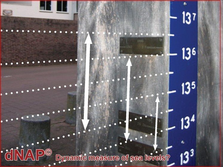
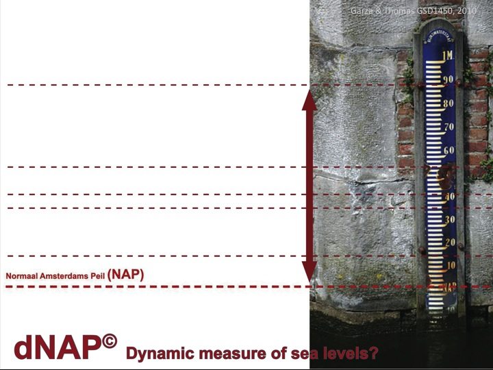
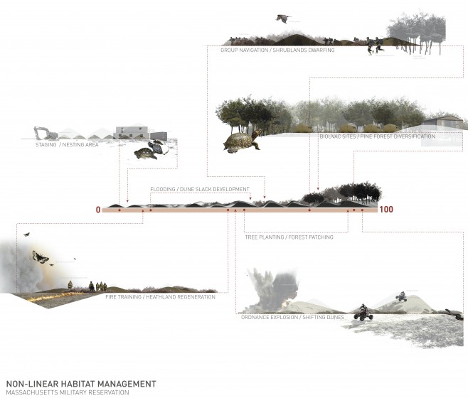
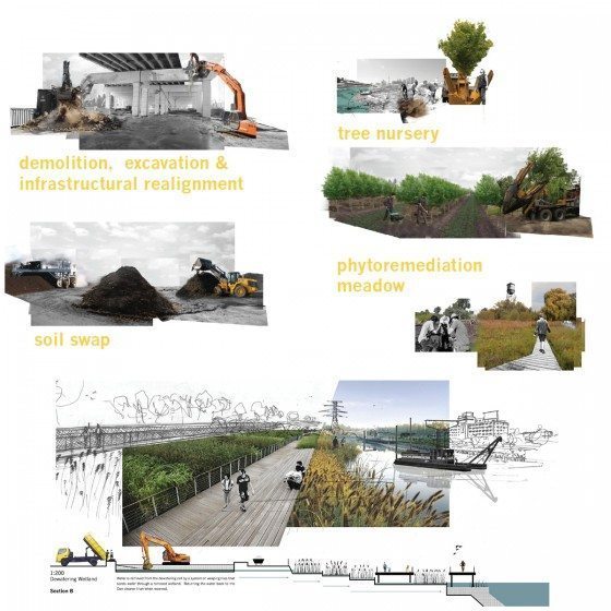
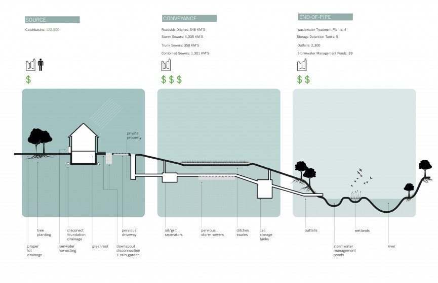
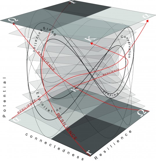

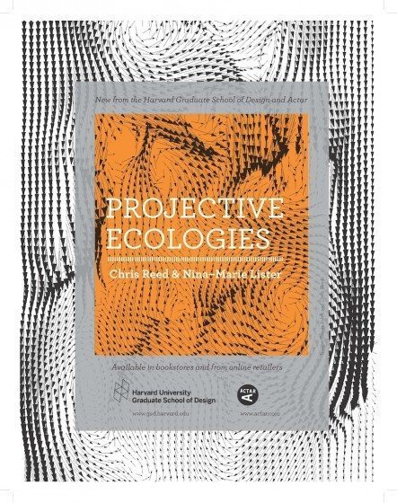 Projective Ecologies aims to recover a critical sense of ecology for the design professions because they operate at the intersection of nature and culture—particularly landscape architecture, since its medium holds unique environmental, social, and existential opportunities and responsibilities. Emerging from a multi-year research initiative at Harvard’s Graduate School of Design, Reed and Lister drew on Foucault’s The Archaeology of Knowledge to present three “parallel genealogies,” or intellectual traditions, dealing with the concept of ecology: natural sciences, the humanities, and design.
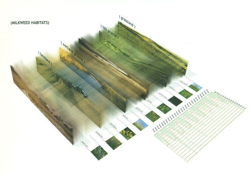
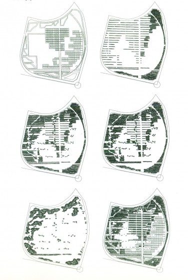


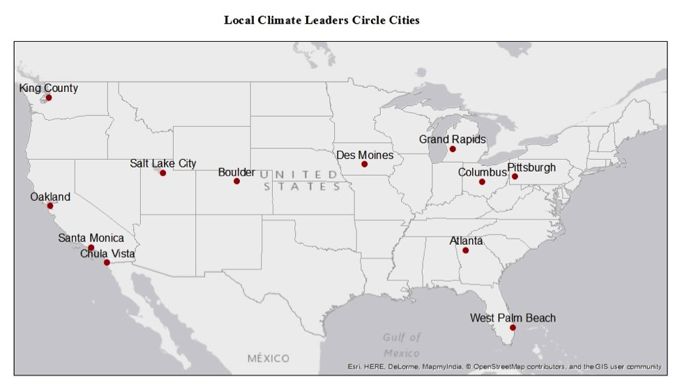
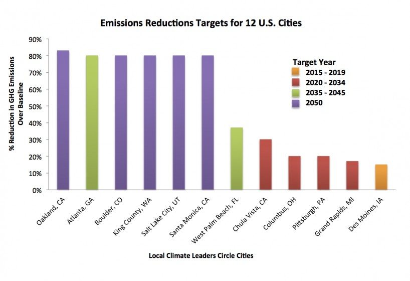
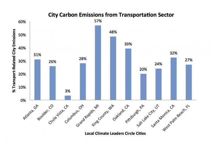
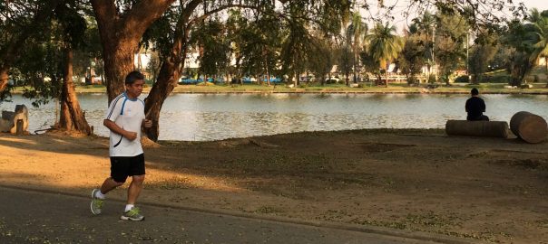
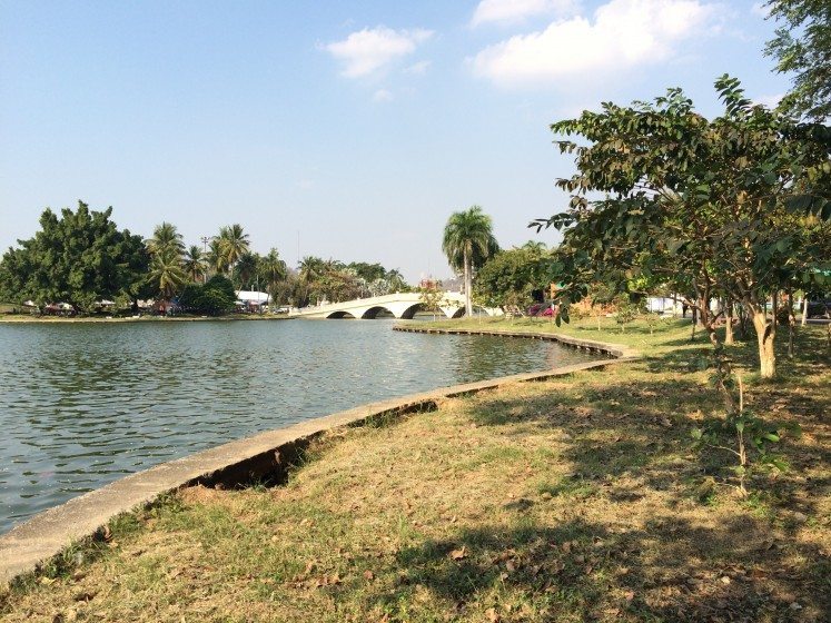

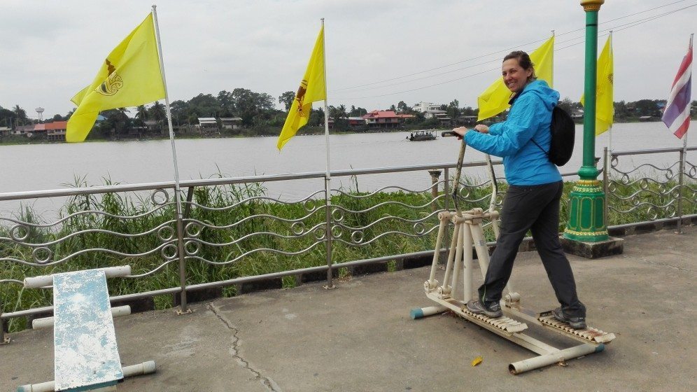
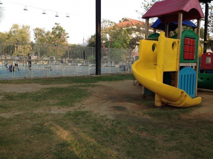

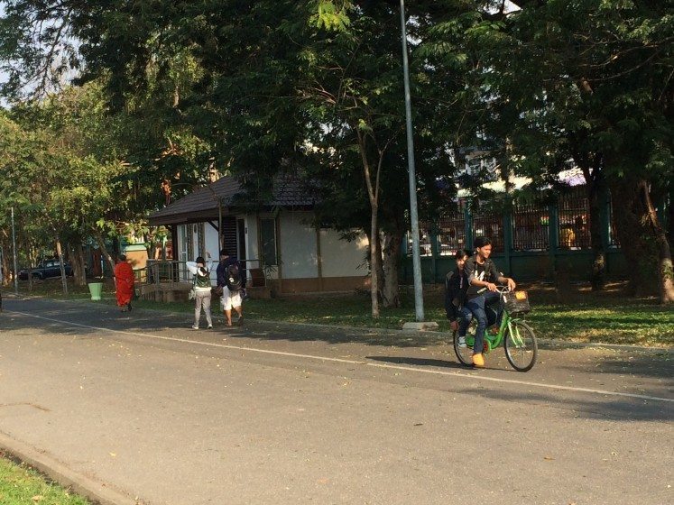
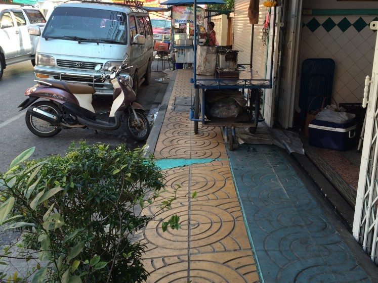
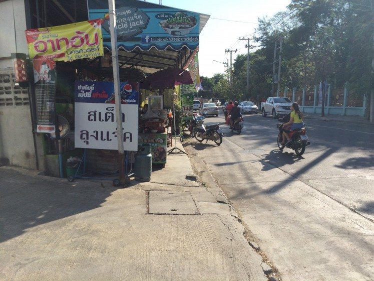
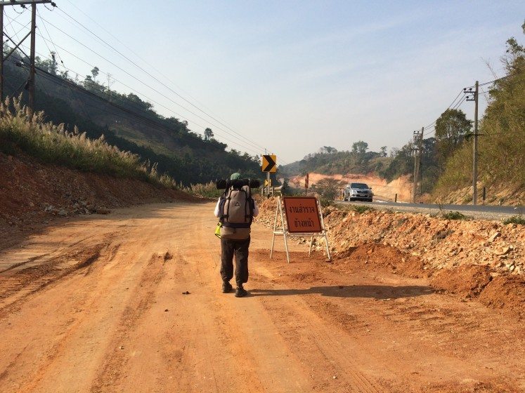
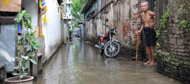
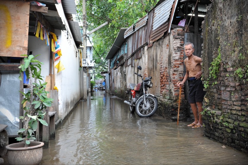
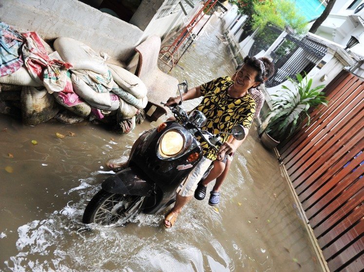
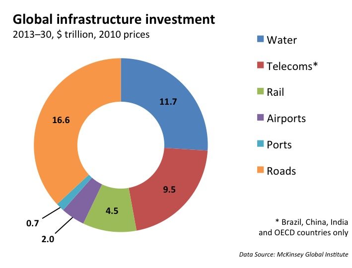 However, this can only be done once citizens recognize that they must scrutinize the implications of financial and economic policies that favour the real estate, rentier, and financial sectors at the expense of the job-rich pro-poor sectors, including industry and agriculture. For example, the following, but by no means exclusive, government decisions have direct implications on the exposure and vulnerability to natural hazards and potential losses from them:
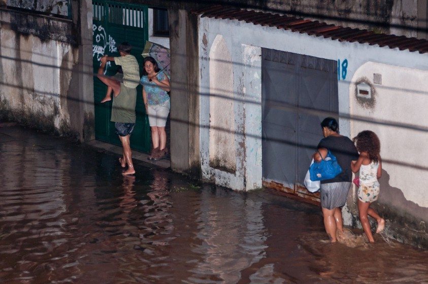

 With the proliferation of climate related shocks and crises, building resilience in the face of shocks and crises surely is a good thing, and any contribution to helping us make sense of what this might mean and how it might be achieved is certainly welcome. Planning for Community Resilience: A Handbook for Reducing Disasters is a comprehensive book, which is quite an achievement in less than 200 pages.


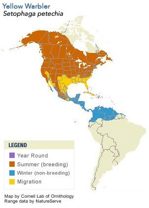
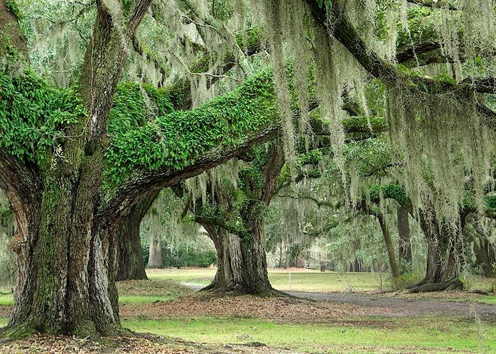

 For me, the poppies are in themselves a landscape, one that entangles past and present, people and place, urban and rural. They are material things imbued with affective power and bound to the physicality of place (our garden). They have a capacity to recall the past (e.g., stories of Doris, sharing seeds with neighbours and friends) and to shape the present (providing a welcoming presence when returning home). Through growing peony poppies and creating a garden, connections are created to people and places—a personal landscape of attachment.


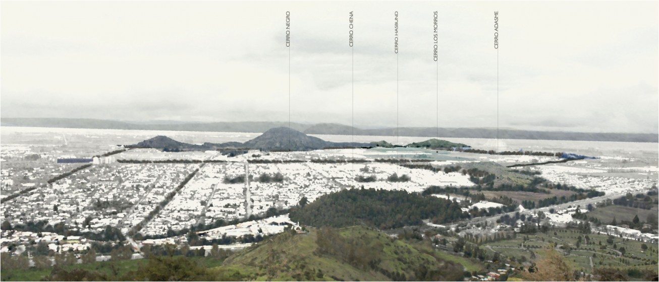


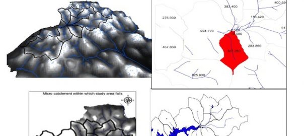
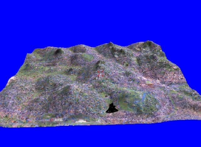
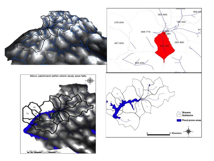


 Story notes: Federal regulations make clean drinking something close to a guaranteed right for residents of cities in the United States, but not all urban water systems are created equal. Last year, independent scientists and grassroots activists discovered a widespread problem with lead levels in the water pouring into the city of Flint, Michigan. Though local officials assured the public that Flint’s water supply was safe, independent tests revealed lead levels in the water flowing from some homes that were comparable to the
  The collaboration between residents like LeeAnne Walters and the scientists at Virginia Tech revealed a municipal water quality crisis that now has cities across the United States scrambling to demonstrate that their water is, indeed, up to Federal standards. The
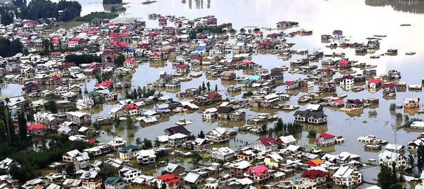
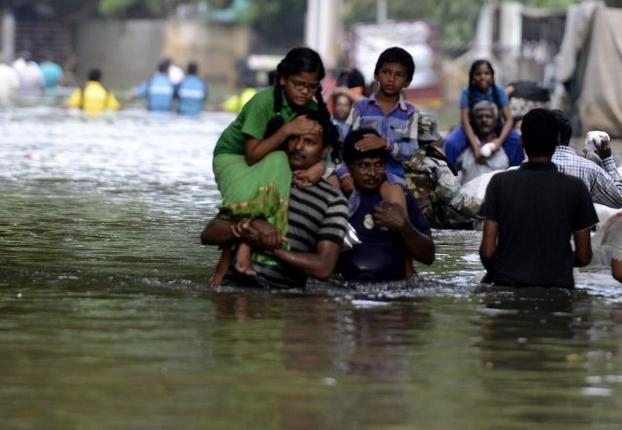
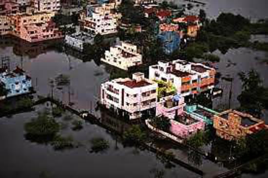
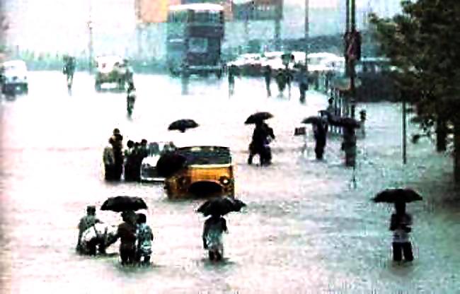
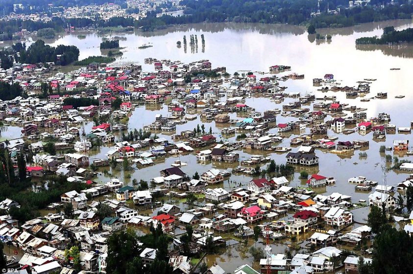
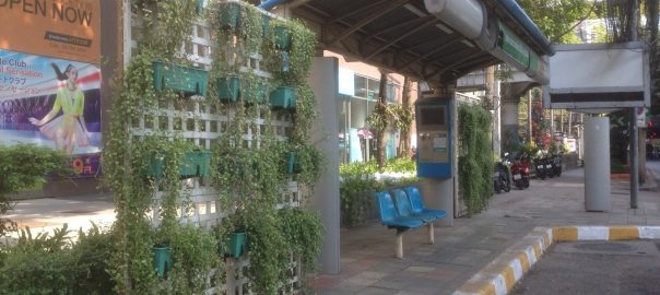
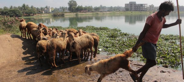
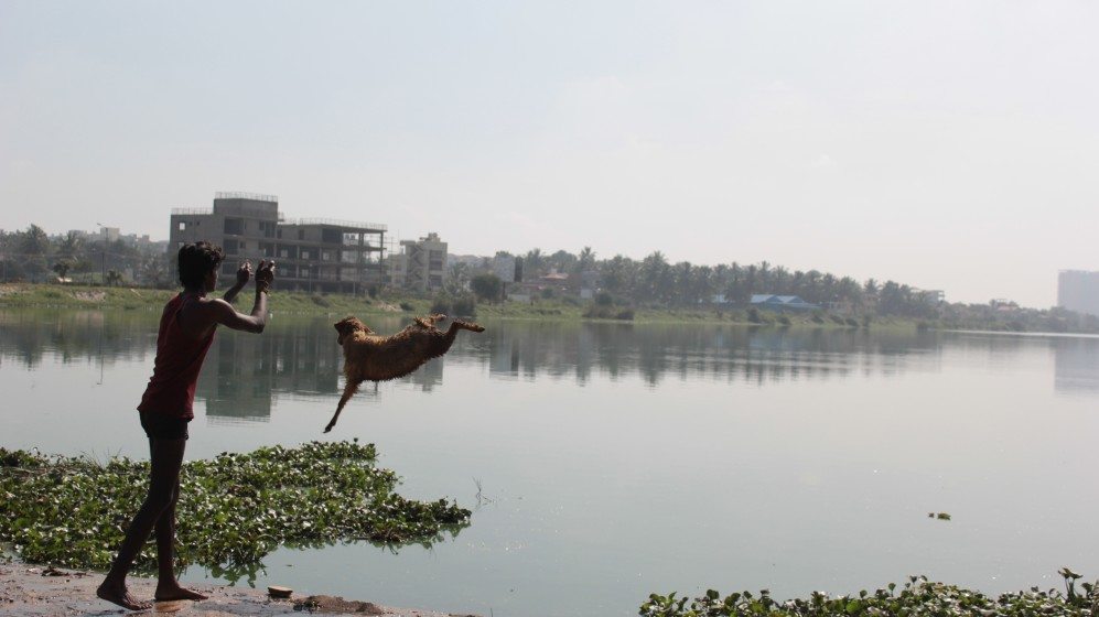
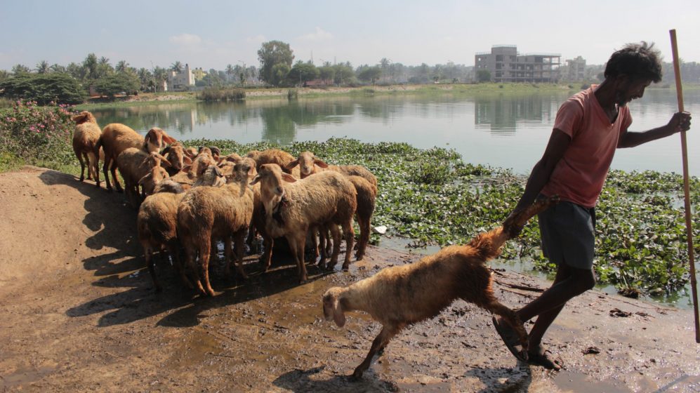
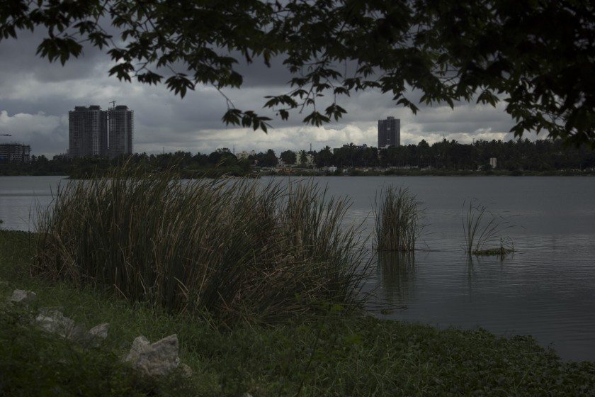
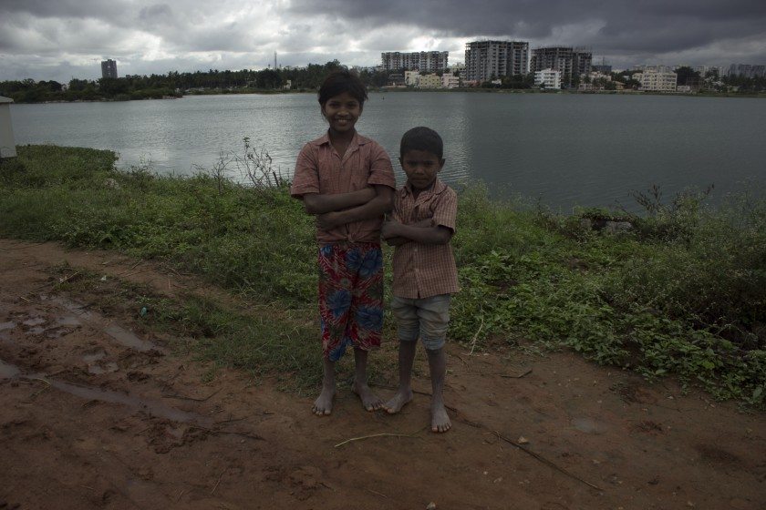

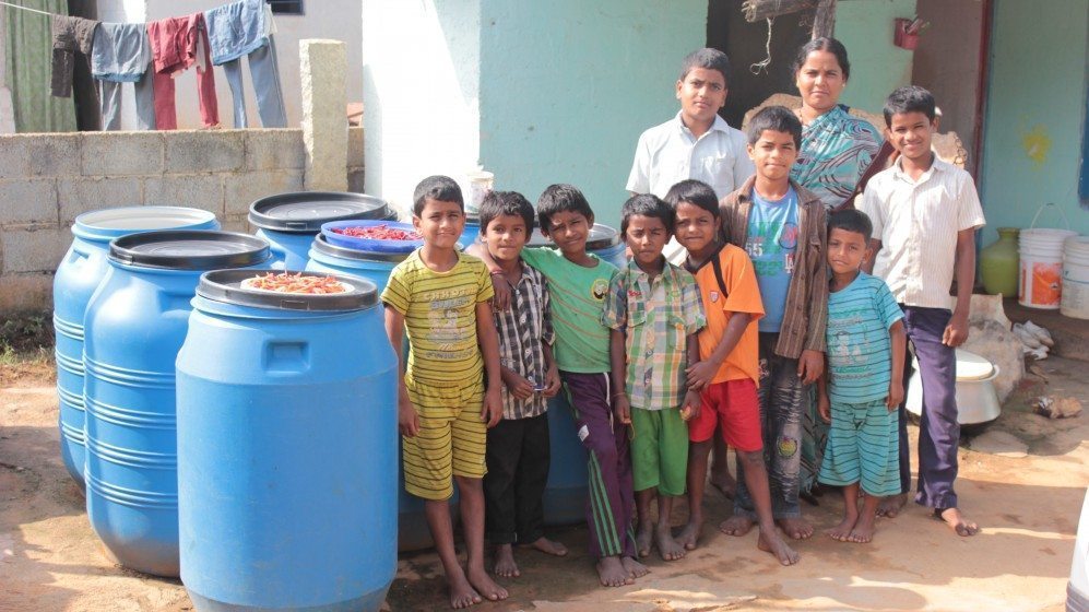
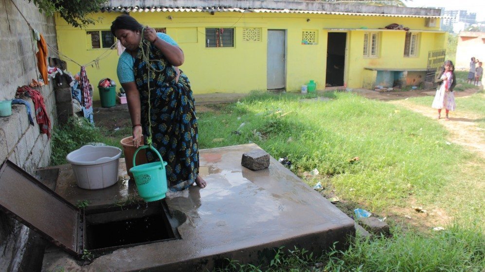
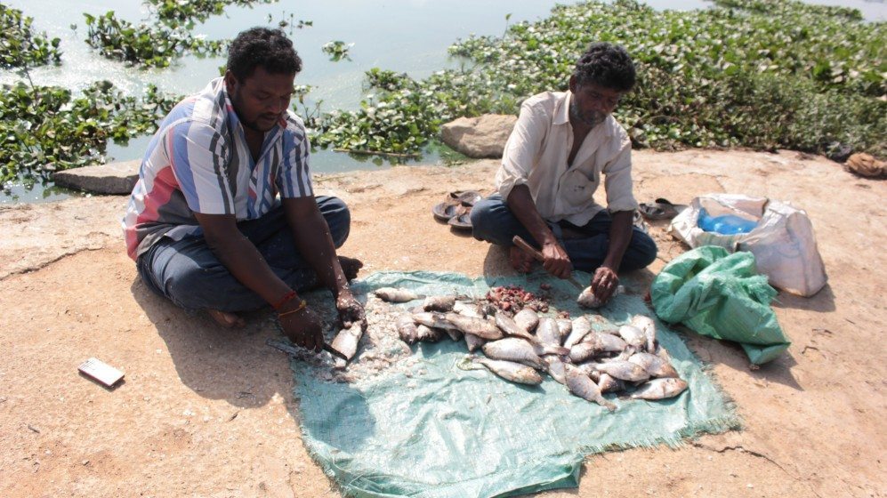
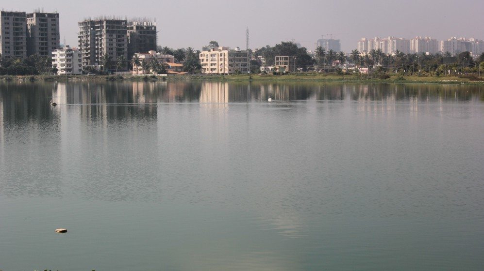
 The book guides the reader in deciding what landscape features are important to preserve or to restore, and how to do it step by step, emphasizing the need to set goals, review data, make maps, assess risks, and determine and implement opportunities. When creating a GI strategy, one needs to identify and evaluate existing natural and cultural resources, prioritizing those that are distinctive or that best meet current and future needs.

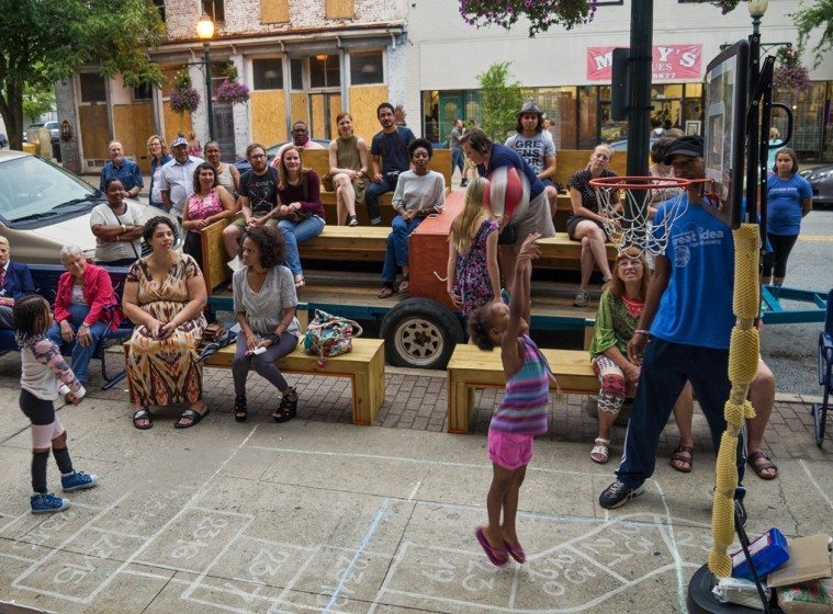
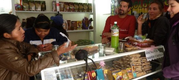
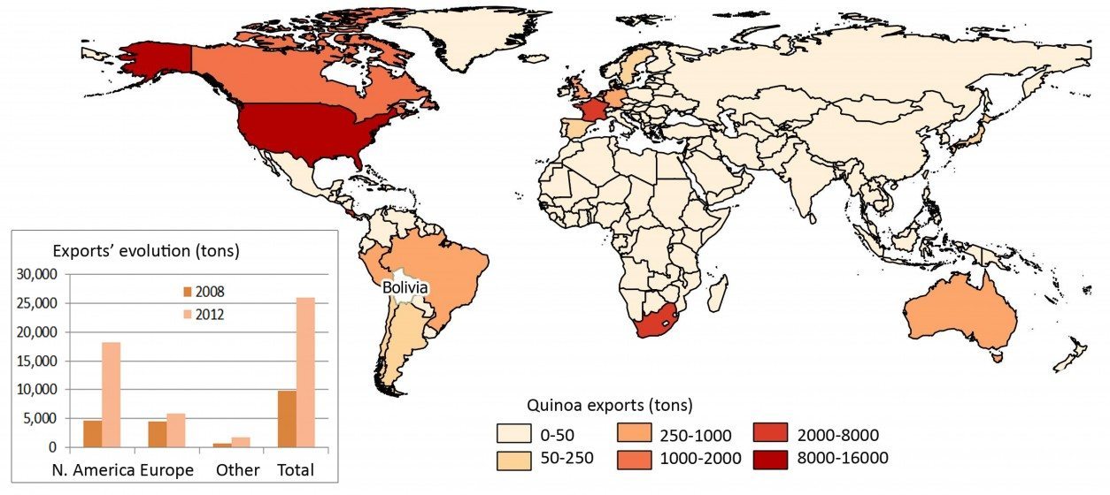
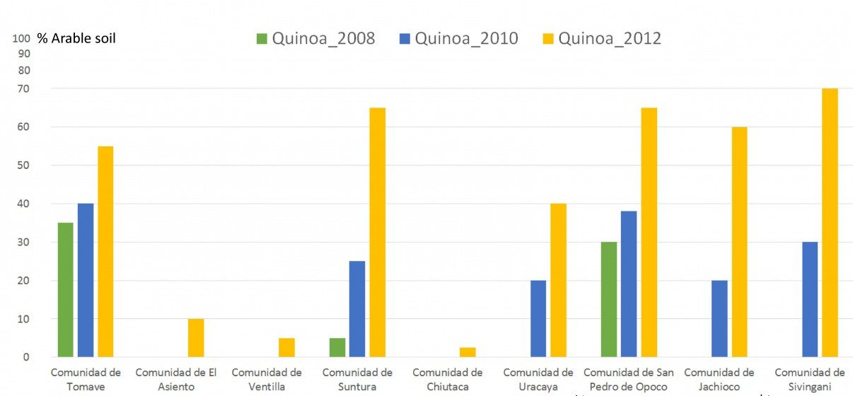
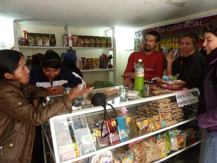
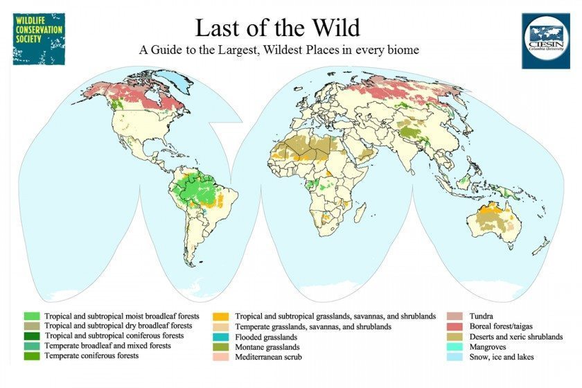
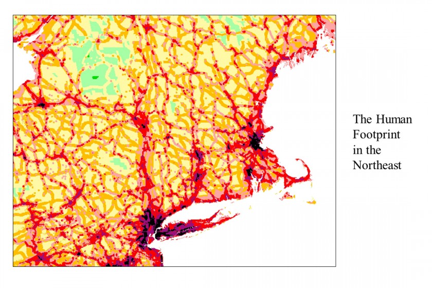
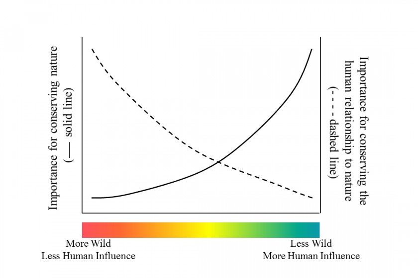
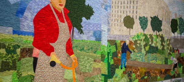

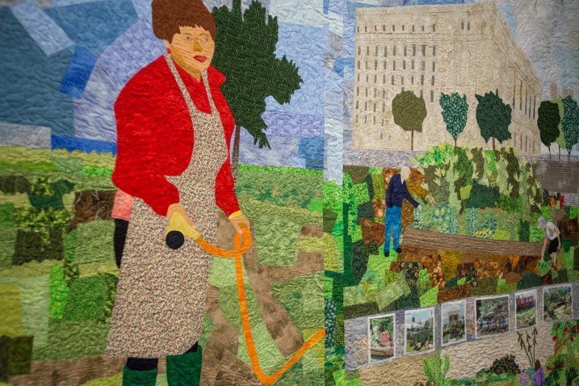
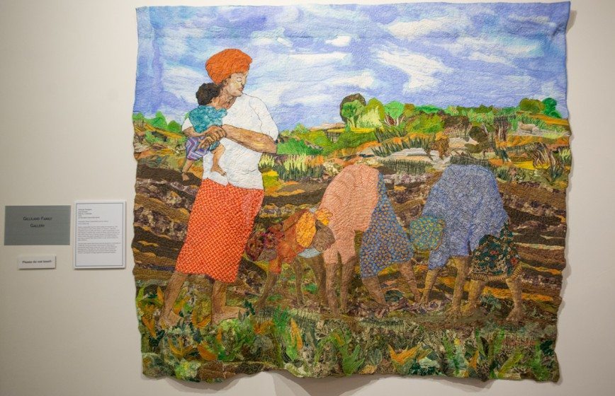
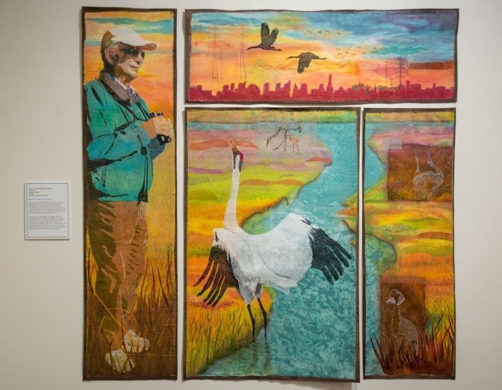


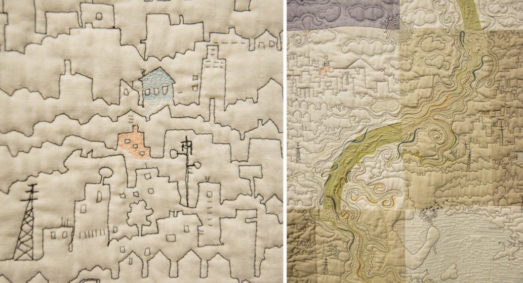
2 Comments
Join our conversation