For all the critical scholarship that is written about the harnessing of volunteer labor in caring for urban trees (see, e.g., Perkins 2009), it never squared with my experience of engaging in stewardship. Following attendance at a human geography panel on ‘powerful objects’, I came to realize that my leisure practices were missing from my research accounts. I was writing myself out of the story, focusing only on the managerial logics of the state and civil society and the biophysical capacities and needs of the trees (Campbell 2014). The missing piece was the interactions of humans with trees, and what better way to explore those than through my own, first-hand accounts?
Inspired by Jones (2014) and Pearce et al. (2015) (see the reference below), I’ll share three stories of my engagements with street trees and reforestation sites to explore affective experiences between me and the trees. I believe that these vignettes offer windows into why and how we create and maintain relations of care with the urban forest.
Encounter 1: Street trees
Though I have worked for the US Forest Service in New York City since 2002, I had never taken part in street tree care. In the past, my colleagues and I used to joke that—despite working in the world of urban natural resource management—street trees made us sleepy. We felt they were too confined, like little toy soldiers, so neatly in their tree pits, standing in linear rows. We were interested in more open spaces—both physically and from a governance perspective—so we studied the conversion of lots to community gardens, the re-appropriation of public space for community memorials, and the restoration of contaminated urban waterways through civic action (Campbell 2006; Campbell and Wiesen 2009; Svendsen and Campbell 2010). But street trees remain the primary focus for many of our researcher and manager colleagues: they are the “stars” of the urban forestry show. These are the sites of quantification and valuation and of carefully constructed managerial practices. My only substantive prior involvement with them was in a research project on young street tree mortality (Lu et al. 2010), but I had never interacted with a street tree as a steward.
Red Hook street tree. Photo: Lindsay Campbell
This changed in the spring of 2014, when a new tree appeared in the sidewalk outside the door to my apartment, courtesy of the NYC Parks Department and the MillionTreesNYC campaign. I did not request this tree via 311 (the New York City government’s service request number), nor did I know who did, but I suddenly felt excitement, ownership, and a sense of possibility. Here was my chance! To DO some of things I sat around yammering about in MillionTreesNYC Advisory Committee meetings or painstakingly studying for my dissertation. I didn’t have a yard, or a roof garden, and my prior community garden plot (in a privately owned, unlicensed site) had been overrun three times—first by mosquitoes, then by the cantankerous landowner, then by Hurricane Sandy. So I had no growing space. My partner, Ricardo, and I eagerly jumped at the chance to “adopt” this tree, writing out names on the tag attached to the trunk of this “wireless Zelkova”—so named because it was bred to perform well in the context of overhead utility wires, which few neighborhoods in New York City have, but which are prominent in my waterfront neighborhood of Red Hook, Brooklyn.
Our first step was to build a tree “guard”—essentially a frame around the 9 x 5 foot tree pit—that would both protect the tree and aesthetically demarcate our garden bed. I queried my artist friends for ideas about how to build a funky guard out of found maritime objects, signaling the waterfront connection of my neighborhood and reusing waste. But I am neither an artist nor a very good scavenger, so ultimately this involved a dreaded trip to Lowes hardware store. About $100 later, we had our lumber (FSC certified and sustainable), stakes, fasteners, and a few plants. (Some perennials, a few annuals just to get us started. From where? Who knows?). It is not lost on me that if you add up the ‘board feet’ of lumber surrounding the tree in the guard and the supportive stakes helping the young tree to get started, our little street tree’s volume of wood is dwarfed by the wood we use to protect it.
When we were outside building the guard, our downstairs neighbor came upon us with a perplexed look. She wanted to know if we had gotten permission to care for the tree. I proudly proclaimed that the tree was in the public right of way (PROW) and that the city wants us to care for trees. Ricardo silently pointed to our names on the Adopt-a-Tree tag, noting the tacit legitimacy that it gave us. I suddenly personally understood the sense of the PROW as a ‘grey area’, particularly for renters in a multi-unit building (see Rae et al. 2010). To whom did the tree “belong”? What really gave us the right to claim it? Our labor? Our capital expense? Calling ‘dibs’ on a tree tag? Once we put our meager plants in, I was shocked at how much space remained in the bed. I would have happily joined with other neighbors in planting out the garden bed a little more fully, but the rectangle did feel like a single serving size garden. The neighbor never inquired again, and the tree seemed to be “ours”.
Tree with guard and plantings. Photo: Lindsay Campbell
As our attachment deepened, we began to anthropomorphize tree a bit. We named it (uncreatively) “Tree” and talked about it like our adoptive child. As recently cohabiting, childless partners, we were joking—but only sort of. We don’t have pets. We try to keep the houseplants alive. Tree came next. Most of the work involved lugging 10 gallon buckets of water down three flights of stairs. I kept urging Ricardo to befriend our downstairs bodega guys, to ask if we could use their sink or hose hook up, but I was too nervous to ask myself. Even though I shopped there nearly daily and said my polite hellos, the whole street corner life/Jane Jacobs/social cohesion thing is a lot harder to enact in real life than it is to just read about and coo over—especially when it involves asking a favor of someone. So, instead, we lugged the buckets up and down the stairs, trying our best to meet the recommended 20 gallons of water per week in the summer, but usually not making it, and using the degree of desiccation of our marigolds as a marker for when we really needed to water.
Eventually we experienced setbacks. As someone exited their car and knocked their car door against the tree guard, they ripped out one whole side of our guard. We dutifully repaired it. This happened again a few weeks later and then Ricardo and I were really crestfallen. But when we returned from work, someone else had repaired the guard. While we are pretty sure it was our building super who was constructing a new trash shed, we preferred to think of it as some anonymous Good Samaritan. More generally, I was worried about the structural soundness of the guard overall. Looking at the completed work, it looked strikingly like a playground balance beam and was just crying out to be walked, stood, or balanced upon. Though I never witnessed it happening at our tree, I’d see this throughout the neighborhood on other tree guard sites. Also, we had a new hipster art space just two doors down, and all the parties and openings to go with it; this led to a rise in the foot traffic and cigarette butts we encountered on the street. Most mornings I would stoop to clean the accumulated garbage out of the pit. Further, my former roommate was dog-sitting and he informed me that “Ginger just loves the new bathroom outside!” Horrified, I explained that the dog urine was bad for the tree and our little plants, and he really should curb her. Yet, when I helped out by walking Ginger one day, I couldn’t bring myself to stop her from crouching on the bit of available dirt that she scurried to—it just felt like she had to scratch her feet in the dirt, and making her crouch on the concrete didn’t respect her dog-hood. But, I still didn’t let her use our tree. So we made a sign: “Please keep tree healthy—no butts or mutts.”
The big setback came on a fall morning in 2014 when I was awoken to the sound of jack hammers. As I left for work, I opened the door to see three of my building owner’s contractors operating a bobcat, tearing out the sidewalk. The tree guard was ripped out, Tree’s dirt was splayed about, and chunks of concrete mounded on the corner. Ricardo asked the workers to replace the guard when their work on the sidewalk was done, and they assured us they would.
A few days and one angry email to my landlord later, the guard was indeed restored. We breathed a sigh of relief: Tree was safe and protected—for now.
Encounter 2: Reforestation sites
Planting Trees
I headed out to Alley Pond Park in northeastern Queens, NY on a spring day in 2013 for my first urban afforestation planting experience. I knew Alley Pond from my work as being one of the sites that the NYC Parks Department natural resource folks were most proud of—closed canopy, tall trees, wide mulch and dirt paths—you really get the feeling of the forest in Alley Pond. But like so many of New York City’s ‘natural areas’, it is highly patchy and variable across space, criss-crossed and subdivided by a spaghetti of deep-Queens major roadways—the Cross Island Parkway, the Grand Central Parkway, and the Long Island Expressway.
Alley Pond Park Trails. Photo: Sadia Butt
The corner of Alley Pond that we approached that day in which to ‘plant a forest’ was unfamiliar to me, and didn’t look much like the soaring, large canopy trees I’d seen in other sections. It was just a wide open, slightly sloping field, pockmarked with hundreds of holes and young trees at the ready. As I set to work, it felt so satisfying to fill the holes, nestling each tree comfortably in its spot, and moving on to the next, like crossing off an item in a to-do list, or fitting in a puzzle piece.
But what I noticed more than the site that day, or even interacting with the trees, were the social dynamics at work. The first thing I felt was the energy and enthusiasm of the staff. They knew how to treat us right—a quick entry sign-in, free breakfast, coffee, garden gloves, ample tools, quick demo, and off you go! Ricardo and I got into quite a rhythm. We didn’t really talk to others while we were working—there was work to do.
We hadn’t come with a big corporate group—we lacked the matching hats or tee shirts that immediately identified those folks. But as our backs tired and we slowed down, I lifted my head up from the dirt and saw friends, co-workers, and their children. It was a great equalizer between my colleague’s seven year old son, me, and the Deputy Commissioner of the Parks Department. The suits were off, it felt familial and easy. Eating my box lunch in the sun, sitting on the ground, talking to other tree planters was probably my favorite part of the day.
The author planting trees.
Stewarding Trees
As the MillionTreesNYC campaign began to wrap up in fall 2014, the Parks Department organized large-scale stewardship days along with planting days. So, I returned to (yet another section of) Alley Pond Park in Queens to see what it was like to steward a young forest. We were greeted with some granola bars, work gloves, and told to wait. A bit less scripted than the mass plantings, this was a smaller site with a few dozen people and one BIG pile of mulch. We were sent out in groups of around ten, and those of us stragglers that came without a team or group (like Ricardo and me) had to wait for a sufficient posse to be sent out. I have to say this made me feel a little orphaned. We watched patiently as four tiny girl scouts pushed a wheelbarrow that one of us could have handled. At points, there were not enough buckets for everyone to have one. Like so many volunteer experiences, the point here was not efficiency of labor; it was about inclusion, intention, fun, and engagement. Still, I wanted to feel useful.
NYC Parks employee showing how to mulch a tree. Photo: Lindsay Campbell
When it was our turn to go, we got a pep talk about how “planting trees is just the beginning;” Parks workers demonstrated how to properly mulch a young tree by making a donut around it. The point of this mulch was less to enhance the soil and more to help keep out weeds and give the young native tree a fighting chance against the vines, Ailanthus, and other invasives surrounding it. They didn’t expressly instruct us to pull weeds, but pull we did. Even with the gloves, I gave myself callouses from pulling so many weeds. Ricardo wrenched his back doing battle against an Ailanthus root. While I could sit in a conference room and debate novel ecosystems and the language of native versus invasive, when I was here—in the field—I was pulling out those invasives, for sure. My colleague, who has much stronger ecology chops than I do, couldn’t help but comment on the possible futility of the effort—all while she, too, was pulling weeds. Those Ailanthus trees would return. Maybe it was futile, but it was fun. It felt like we were doing good. But looking around the site, she noted the proximity to a wetland, and wondered whether these young oaks even ‘belonged’ in this site. Perhaps other species of grasses and bushes would have been more appropriate?
Ricardo stewarding trees. Photo: Lindsay Campbell
Once we cleaned out vines and weeds, we noted how far away the site was from the desired goal of ‘closing the canopy’. Talking with one of the Park workers, he mentioned that he thought it was one of the forest research sites, which meant that managers weren’t going in and planting additional trees, but were letting the forest competition play out—while still holding stewardship events like ours. I realized that—if he was right—I was the embodiment of a variable in the experimental forest plot treatments (mulch / no mulch) that some of my ecology colleagues were involved in running. We would have to wait decades for this experiment to unfold before we knew the outcomes of different treatments. Did it make sense to plant a forest in this site? Would it even work? The managers and stewards working on the site have to take these future outcomes as uncertain—as leaps of faith.
Young forest at Alley Pond Park. Photo: Lindsay Campbell
As before, the day concluded with box lunches, which we consumed while sitting on our overturned mulch buckets. Surrounded by a few dozen other New Yorkers, we chatted about the challenges of growing a forest in the city. And we went home that afternoon to plant fall bulbs around our own beloved Tree.
Concluding thoughts
By placing myself more centrally in these accounts, I present a ‘situated science’ approach to the subject of the urban forest (see Haraway 1991). Paying attention to social context, emotional ties, and affective registers tells a different tale than a remotely sensed, infrared image of urban tree canopy or the quantified accounting of ecosystem services provided by trees. These human-tree connections that we build require different methodological tools to uncover and certainly require a different understanding of what constitutes a research account. But I believe that sharing these stories helps move us towards a fuller understanding of why we create and maintain urban forests.
My relations with urban trees are complex. They are mediated by my needs, assumptions, and values. As these relations move beyond the conceptual and intellectual realms and into the physical and embodied, some of my assumptions have begun to shift:
Taking care of street trees isn’t as easy as I thought. Barriers like access to power tools and water sources are not trivial. Still, I’m willing to overcome these obstacles slowly, imperfectly, and over time. I don’t have a green thumb, I’ll learn through trial and error over the seasons as the tree and I grow together. Over the past year or so, the 45 square foot patch of land where my street tree is planted has come to occupy a much larger space in my mind and heart. I care for Tree, I fawn over Tree. I feel pride when I plant some new native grasses, I feel defensive when I swat off the squirrels. I feel angry when people litter or break the guard. I feel worried about whether Tree will make it through this brutal winter, as big drifts of snow mound up over the guard. I never could have predicted how much time and effort I would expend caring for Tree. But, I am also surprised by all that I have gotten in return from developing a real attachment to a piece of ground and caring for an organism situated within it.
On reforestation sites, I was surprised to learn that I like working hard, for free, on behalf of an effort greater than myself. I’ve come to understand why so many of the volunteer tree planters became repeat attendees, as my colleagues have shown in their work on the links between tree planting and civic engagement (Fisher et al. 2011, 2015). Even though the MillionTreesNYC campaign wasn’t originally conceived with a community forestry ethos, these volunteer events had evolved that way. The tree became the widget to bring people together. What mattered was what surrounded those trees: all of us.
The question remains, then, how can we build bridges between these emotional experiences and our management practices? How can we scale up from individual experiences that are deep but uneven across the population (dedicated street tree stewards) or far-reaching but isolated in time and space (one-time reforestation volunteer events)? How can we cultivate attachment and stewardship but also allow attachment to inform management, decision-making, and priority-setting? What would it look like to grow a forest that is rooted in these community relations all along the way? How can we truly honor relations of care between humans and trees and set ourselves up to create more of these experiences throughout the cycle of creating and maintaining an urban forest—from site selection, to material sourcing, to installation, to maintenance, to removal and reuse?
Campbell, Lindsay K. 2014. “Constructing New York City’s urban forest: The politics and governance of the MillionTreesNYC campaign.” in Urban Forests, Trees, and Green Space: A Political Ecology. L. Anders Sandberg, Adrina Bardekjian, and Sadia Butt, Eds. Routledge Press, pp. 242-260.
Fisher, Dana L.; Connolly, James J.; Svendsen, Erika S.; and Lindsay K. Campbell. 2011. Digging Together: Why people volunteer to help plant one million trees in New York City. Environmental Stewardship Project at the Center for Society and Environment of the University of Maryland White Paper #2. 36 p. Available online here.
Haraway, D. 1991. “Situated Knowledges: The Science Question in Feminism and the Privilege of Partial Perspective.” in Simians, Cyborgs, and Women. New York: Routledge.
Jones, Owain. 2014. “(Urban) Places of Trees: Affective Embodiment, Politics, Identity, and Materiality” in Urban Forests, Trees, and Green Space: A Political Ecology. L. Anders Sandberg, Adrina Bardekjian, and Sadia Butt, Eds. Routledge Press, pp. 111-131.
Perkins, H. A. (2009). Out from the (Green) shadow? Neoliberal hegemony through the market logic of shared urban environmental governance. Political Geography, 28(7), 395–405.
Every day, citizen scientists contribute their time and energy to support thousands of research projects around the world (Bonney et al., 2014). They collect, categorize, and analyze data, generously volunteering their time and their personal resources in return for little other than recreational enjoyment or the personal satisfaction of helping others.
An example of Melbourne’s biodiversity: the crested pigeon. Photo: Museum Victoria
However, as we learnt from Melbourne’s recent BioBlitz (a public event to generate a snapshot of the city’s biodiversity), the benefits citizen scientists receive from experiencing biodiversity firsthand and the value of public engagement in managing urban ecosystems can be just as important as the data that is collected.
Citizen science in history
In the early 2000s, scientists at the University of Washington, Seattle, outsourced critical scientific work on protein structure prediction to citizen scientists. Within three weeks, those citizens produced a near-exact model for a protein whose structure had eluded scientists for more than a decade. In fact, as far back as the 17th century, naturalists such as John Ray (1627-1705) were commandeering the goodwill of friends and family to assist in recording plant and animal classifications. Ray’s work paved the way for Carl Linnaeus, the “father of modern taxonomy,” and thousands of others.
There are many such examples of positive and unexpected contributions of citizen science to knowledge, and interest in citizen science for urban nature is growing, as evidenced by recent essays on TNOC. Yet, in the peer reviewed literature, the validity of citizen science outputs remains in doubt.
For those city practitioners and scientists who wish to advance knowledge of urban nature, there are some serious questions that need to be asked. As technological sophistication increases and barriers to rapid data collection and analysis subsequently decrease, are we denying an untapped army of citizen enthusiasts the opportunity to collaborate to benefit urban nature? Through evaluating our experience with the Melbourne BioBlitz, we argue that the potential for citizen scientists to contribute significantly to the stewardship of urban biodiversity is very great indeed.
The Melbourne BioBlitz
Another example of Melbourne’s biodiversity: White’s Skink. Photo: Museum Victoria
Last year, the City of Melbourne called on citizen scientists to help develop the city’s first Urban Ecology and Biodiversity strategy by participating in a BioBlitz—an intense period of dedicated mass biological surveying.
Melbourne is a biodiverse city, blessed with parks, rivers and a bay all on its doorstep (Ives et al., 2013). However, Melbourne’s biodiversity is challenged by a combination of factors including climate change, rapid population growth, and land use change. In addition, an increasingly urbanised public has less and less familiarity with nature and wildlife.
The City of Melbourne plans to address this issue through the development of a contemporary strategy that aims to bring biodiversity to the fore of urban design and planning in the city. However, apart from a public tree database and limited biodiversity data for three parks, city officers had no comprehensive records of biodiversity. Without such data, it is difficult to set meaningful targets and goals for the strategy. Wide-scale biodiversity data collection by professionals in a short time frame would have been resource intensive and cost prohibitive. The concept of a BioBlitz represented an appealing method of data collection for a number of reasons—such an initiative would involve the community in the development of the new biodiversity strategy from the outset, would increase biodiversity awareness and education levels, and could remove private realm access barriers.
The Melbourne BioBlitz was conducted over 15 days from 31 October to 14 November 2014. During that time, more than 700 citizens participated in the initiative, collecting over 3,000 biodiversity records for the city. Of those 3,000 records, 600 sightings were identified to species or genus level and 500 different species were identified by common names. Groups of taxa identified included insects, mammals, reptiles, birds, plants, fungi and aquatic life. Invertebrates and birds together accounted for 90 percent of all sightings across the municipality.
The lesser long-eared bat (Nyctophilus geoffroyi). Photo: Caragh Threlfall
Rare moths that had not been sighted for decades were discovered fluttering around Fitzroy Gardens, the city’s most central and most visited park. Hidden amongst the canopy in the same park, participants found microbats that have not been encountered in the same abundance in any other urban park in the area. Melbourne’s media became particularly enamoured with the local biodiversity, with conversations and observations on butterflies, bats, bees and birds making positive national headlines.
The BioBlitz employed a variety of methods to facilitate citizen participation, from expert led surveys and activities to a variety of online tools including Bowerbird (an interactive biodiversity data repository), Instagram, Twitter, and the City’s own Participate Melbourne website. The preferred method for data capture during the BioBlitz turned out to be handwritten sightings, with over 750 sightings submitted in this format. Submissions to Participate Melbourne and Bowerbird closely followed the tally from handwritten sightings, with 744 and 739 uploads, respectively. Participants used Instagram and Twitter to a much lesser extent; participants used Twitter primarily to promote the BioBlitz rather than to record sightings.
This unique event represented Melbourne’s first foray into citizen science to inform policy development. The lessons learned offer an ideal basis for reflection on whether citizen science can be an effective means for influencing urban policymaking.
Lessons learned
Our experience with the City of Melbourne BioBlitz has provided many insights, both about how to administer a citizen science project as well as how the general public responds to urban nature. Typically, the primary object of citizen science programs is to generate data that can be used to answer scientific questions. The efficacy of the BioBlitz for this function has yet to be demonstrated. Despite the huge number of species observation records, the design of the event has made it impossible to determine what proportion of the biodiversity of Melbourne was represented in the survey. The BioBlitz does, however, provide a baseline dataset that can be expanded. Of greater value than the data that citizen scientists collected was the level of public engagement that occurred. We found that BioBlitz participants expressed a high degree of interest in contributing to the development of the City’s urban ecology and biodiversity strategy. This is clearly a novel approach to public engagement with policy and it has potential to be adopted in other jurisdictions around the world.
Regardless of the robustness of the scientific data gathered, the event helped to make visible the often-invisible ecology of the city. This was true for both scientists and the public. Scientists made many comments about their surprise in finding so many species (particularly of invertebrates) in the middle of a major capital city. Perhaps even more rewarding was the surprise and joy expressed by the community participants at the animals they found in the city. Indeed, many did not realise before the event that microbats live in Melbourne! The event made evident that people have a natural curiosity for nature, which was surprisingly easily accessed. Further, the educational value of the event for children was evident from their many questions and fascinated expressions as they were shown around the gardens and green spaces.
Local residents participating in the BioBlitz. Photo: City of Melbourne
The BioBlitz helped to foster a sense of stewardship towards biodiversity in local residents. While this is difficult to demonstrate empirically, anecdotal evidence suggests that many participants will undertake new gardening practices that enhance biodiversity in their own backyards. We felt that the experience of biodiversity through the BioBlitz had a far greater impact on people’s behaviour than the presentation of information ever could.
Conversations with participants also pointed to the benefit of the BioBlitz as an exercise in building social cohesion and connection with local government. Participants made positive comments about the non-commercial nature of the event and were pleased that it was free to attend. Clearly, there is a strong community desire for these types of programs, with benefits extending far beyond purely ecological outcomes. The positive sentiment towards the event was even expressed strongly in numerous tweets and Facebook posts. For example:
“I’m not generally keen on spiders, but they all have their role to play.”
“Surprisingly, since I took part in #bioblitzmelb I have a newfound respect for flies.”
“I’m loving all of these native bees! Who’d have thought that we had so many!”
A Melbourne BioBlitz particpant’s Tweet following BatBlitzing.
Finally, one of the biggest lessons that we learned from the experience is the value of collaboration between different organisations and individuals within the city. The BioBlitz was supported by a range of partners (Museum Victoria, RMIT University, University of Melbourne, the Australian Research Centre for Urban Ecology, naturalist groups, ‘friends of’ groups, non-government organisations, and many natural resource management agencies). The event represented a unique opportunity for collaboration between multiple researchers and scientists from these institutions that would not otherwise have occurred. Although each organisation had its individual agenda in participating in the BioBlitz, they all shared an important vision: helping to enhance Melbourne’s natural environment and biodiversity. Museum Victoria, for example, has both an interest and a mandate to document and promote the natural places and animals of Victoria. University academics eager to make a tangible difference to the future of the city were also given opportunities to pursue research questions related to the event. The BioBlitz therefore provided the ideal vehicle for organisations to work together to achieve shared and individual goals. Encouragingly, the connections forged through such an event persist long after its conclusion and have potential to enhance biodiversity initiatives in the city in the future.
Practical guidelines for implementing an urban BioBlitz
There are many insights that we gained for running a successful BioBlitz that we hope can assist anyone planning an event in the future, regardless of your location or budget!
Foster collaborations with local organisations
The success of our event was largely a reflection of strong partnerships between the City of Melbourne and our diverse range of partner organisations. The partnerships brought together people with complementary skills and allowed the event to reach a much wider audience than would have otherwise been possible.
Draw on the experience and talent within your organisation
Organisations such as local governments, Museums, and Universities have a range ofpersonnel that can assist with executing a successful event. The Melbourne BioBlitz not only drew on the scientific expertise within participating organisations, but also on the expertise of staff in communications, media, events management, horticulture, park management and cultural heritage. We also ran staff-specific events and staff photo competitions to increase the participation of staff within each organisation and to get them engaged with issues of urban biodiversity.
Establish an interactive website
As part of the Melbourne BioBlitz, we established a website dedicated to the event. The website detailed the aims of the event and the pathways for participation, from joining an expert-led tour to downloading a toolkit that provided step-by-step instructions for seeking biodiversity in one’s own backyard. Apart from being a repository of information on the event, the website allowed people to upload their own photos of biodiversity from around the city. This allowed members of the public to contribute meaningful data on Melbourne’s urban biodiversity, which is subsequently being used to plan how to better manage biodiversity with the city.
Develop a toolkit to assist people to participate when & where it suits them
To ensure people could participate in the BioBlitz at any time, we developed a toolkit that could be downloaded as a PDF on our website. The toolkit provided hints and tips for finding biodiversity, such as where to look for reptiles or insects, and what times of day are best for finding birds and mammals. It also detailed the various pathways available for people to submit their observations, from mailing or emailing a form to uploading photos to our website. The toolkit allowed people to engage with the BioBlitz as citizen scientists in areas that our facilitated events couldn’t reach, such as their backyards, streetscapes, local parks, and even businesses. As a result, the spatial reach of the event was far greater than we could have ever achieved with the finite number of events we could host ourselves.
Utilise web-based biodiversity databases and phone apps
There are many web-based databases currently in use to collate biodiversity data from around the globe, such as iNaturalist. Fortunately, some of these databases have associated platforms for uploading data via phone apps or online forms. In Australia, the Federal government has created the online Atlas of Living Australia (ALA), which hosts all of Australia’s biodiversity data. To facilitate the upload of data captured during events such as BioBlitzes, Museum Victoria has created an interactive website called Bowerbird, which can be used by citizen scientists to create biodiversity records for Australia. All data uploaded to Bowerbird is linked to Australia’s national database (ALA), allowing citizens to contribute to the collection of meaningful data, which is being used across the country by scientists and policy makers. Wherever possible during Melbourne’s BioBlitz, we encouraged staff, participants, and expert leaders to take photos of the biodiversity they were finding across the city and to upload their photos to Bowerbird. Not only does Bowerbird allow for the identification of species within each photo, it also links directly to the ALA, allowing for the development of a spatially explicit biodiversity data layer that can be used to help develop biodiversity policy for the city. The use of Bowerbird during Melbourne’s BioBlitz provided a complementary method for data collection in addition to our website and toolkit.
Use conventional and social media to your advantage
One of the ‘did you know’ posts used to generate public interest in the BioBlitz.
The Melbourne BioBlitz attracted its fair share of radio interviews and newspaper articles, but we also developed a social media campaign that we designed to sustain interest in the event at key times throughout its duration. Not only did we have all institutions involved in tweeting before and during the event, we also created a hashtag that was used on Facebook, Instagram and Twitter, #BioBlitzMelb. We used a series of sponsored posts on Facebook to advertise the event, which assisted enormously with increasing its reach. To generate interest, each post included a new photo of an animal or plant that was known to occur in the city, and a fun fact about each species. This series of ‘Did you know……’ posts received between 700 and 45,000 views, and turned out to be the most successful way of increasing participation in the event.
Consider hosting events across a range of locations and times
We hosted 52 events over a two-week window, instead of running a more traditional, intensive 24-hour BioBlitz event. The event schedule was designed to span times critical to fauna and included sites for which biodiversity data was needed. We also designed the schedule to include weekday and weekend events that captured a wide range of participants. We included early morning dawn bird surveys, lunch-time invertebrate walks, and nocturnal bat and moth surveying events that attracted people before work, workers on their lunch breaks, tourists, families, school groups, and local residents. We also chose a mix of locations in the city to hold these facilitated events: some that we knew would be great places to spot birds, others for which we had no data at all. Our chosen locations had a range of facilities such as a power sources, shelter, toilets, parking, and public transport to ensure everyone could get to each location. Through this mix of sites and times we were able not only to acquire information on a wide range of taxa, we were also able to highlight the fantastic array of wildlife that calls Melbourne home in unexpected places, helping to create a sense of excitement about the potential for Melbourne to be a biodiverse city.
Chris Ives, Yvonne Lynch, Caragh Threlfall, and Mark Norman
Melbourne
Dr Caragh Threlfall's research is focussed on understanding the impact of urban form on biodiversity, measuring the services biodiversity provides across urban landscapes, and assessing the effectiveness of urban greening for biodiversity conservation.
Dr Mark Norman is Head of Sciences at Museum Victoria where he leads the large and active natural sciences research team of curators, collection managers, postdoctoral fellows, postgraduate students, research associates and volunteers.
Once you start talking about bees, you open Pandora’s box…You’ll find small and very delicate stories behind them. Each one is interesting. — Josep Perelló, associate professor and project leader of OpenSystems UB at the Universitat de Barcelona
If Josep Perelló is right about discovering the stories behind bees, Barcelona’s high-tech, citizen science-based urban bee project could soon have many interesting threads to follow.
By bringing together honeybees, technology and big data analysis, Perelló, an associate professor in the Department of Fundamental Physics and project leader of OpenSystems UB at the Universitat de Barcelona, and his multi-disciplinary team hope to uncover bees’ complex and often mysterious behavior.
“Beehives are the perfect example of a complex system. There is a whole society where some bees are doing some things and other bees are doing other things. They have a queen, and there is a sort of system of communication they use, too. They communicate with a movement or a sound,” says Perelló, who specializes in complex systems studies and analyzing large amounts of data streaming in from many sources.
That honeybees arrange themselves in complex organizations has fascinated scientists for ages, but the increased awareness about their environmental importance has recently made them good candidates for an open lab experiment.
Photo: Mar Morey
“Bees can act as a biosensor for cities, and give a signal that could be easy to understand,” Perelló says. “If the bees are all right, we are living in a good environment. If the bees are suffering or the colony is dying, it could be a sign that [the] environment is having serious problems.”
Recent studies, for example, suggest that bees are sensitive to pollution, and small fluctuations in ozone levels can affect their behavior. Researchers behind the Barcelona project hope that insights generated from data on beehive temperature, humidity, and weight, might provide clues to creating healthier and sustainable environments for bees, for humans, and for cities.
A new approach to beekeeping
To get the kind of data that would tell a more complete story about Barcelona’s bees and their surroundings, Perelló began looking beyond traditional research methods. Typically, bee behavior is monitored by sight and notes taken by scientists in a controlled lab setting. While that’s helpful in many respects, it doesn’t fully correspond with real-life situations.
Barcelona’s OpenBeeResearch project , which is overseen by OpenSystems UB and spearheaded by Perelló, bucks that trend. It makes a city park a living lab, and a colony of honeybees at the Museu de Ciències Naturals (Museum of Natural Sciences), a building better known as the “Three Dragons Castle,” a beating heart of sensor-captured real-time data.
High tech beehive workshop. Photo: Mar Morey
The project idea bubbled up in 2010, around the same time that citizen science initiatives were beginning to emerge globally and the value of public participation in science was being more widely recognized, according to Perelló. And as the concept took hold, the project united people across many disciplines, attracting biologists, data scientists, physicists, engineers, beekeepers, technology buffs, urban gardeners, cultural managers, and artists.
Artist-duo Mar Canet and Varvara Guljajeva were among the project’s first participants. In 2012, they completed the Budgie Waltz art installation, where bird activity was converted to sounds. Every time a bird entered or left its birdhouse, light sensors registered the activity, which triggered a corresponding solenoid to push a piano key.
There seemed to be a natural segue into doing something similar with bees. Two questions needed to be answered: How could a similar setup be recreated to understand when the bees were leaving and returning to the hive, and how could the OpenBeeResearch group track which gates or access points the bees most frequently used?
Setting up the big tech beehive. Photo: OpenSystems
“It’s a very collaborative project and hard to say where the origin of the ideas come from. But, we had this experience with the birds and experience with sensor technology, so it was quite interesting to see how we can do this for the bees,” says Guljajeva, who has a bachelor’s degree in IT, a master’s degree in digital media, and is pursuing a Ph.D in art and design with an eye for how real-life activities can be embedded into works of art. “It offers us a different perspective as well. In the case of the birds, we did the installment for the sake of art. But now, for the bees, we’ll have the scientific data that we can use and help make sense of.”
That data, in addition to helping scientists, can also be visualized in a way that helps people understand bees and their communities—and, more broadly, human society, Canet says.
“We would like to produce a piece of art using the data from the bees. We don’t have a concrete idea of what that will be yet, but we think we will have very rich content,” says Canet, whose areas of studies and work spans from computer game development and data visualization to new media art installations. “We normally work with data. We like to sculpture [sic] data, and sometimes we use real-time feed data. The bees are a colony, and in a way, they are like our society. They are individuals living in a society. It will be interesting to see what the data shows.”
To develop a conversation about the project’s next-steps, OpenBeeResearch held workshops in 2012 and 2014 to figure out which variables to track, how to design the prototype beehive, what types of sensors and communications equipment could be used without harming the bees, and what lessons from other urban bee projects in Helsinki and Bordeaux could be applied to the Barcelona initiative.
Out of those discussions came the high-tech beehive prototype—a wooden box hooked up with infrared motion detection sensors, temperature and humidity sensors, and pressure sensors for tracking weight. The apparatus runs on free GitHub software and Arduino components for sound, weight and temperature (and eventually bee-counting); the data representation will be done with Data Science software. It was installed in June 2014.
In recent months, the team has been tweaking the sensors’ calibration, finishing final repairs on the prototype hive, and waiting for warmer spring weather. In the spring, the bees’ activity will increase and, in turn, there will be greater amounts of data that could provide snapshots of what’s going on inside and around the beehive at any given moment.
And, though it’s still a fledging project in practice, the OpenBeeResearch project has already had some early successes. It has received funding from Socientize, the Barcelona City Council, and the Fundación Española para la Ciencia y la Tecnología (the Spanish Foundation for Science and Technology) through the project Citizen Science Office of the Barcelona Lab. Recently, it was named one of 10 case studies lauded by the newly inaugurated Big Data Center of Excellence of Barcelona.
Surmounting obstacles
Although the project has generated interest across disciplines, has fostered public participation, and has sparked creative collaboration between people who may not otherwise have been connected, it hasn’t been without its challenges.
One of the initial snags was getting permission from the local city government to set up the hive. Unlike other cities in Europe and the United States, urban beekeeping is not allowed in Barcelona.
The workaround was to team up with the city’s Natural Sciences Museum and create a new bee colony from the existing ones there. The museum, located in Ciutadella Park not far from the city’s center, has a long history with rooftop beehives. It houses one of Europe’s oldest apiaries dating back to 1945, according to museum director Anna Omedes Regàs. Though it was not common at the time to see beehives on rooftops, the museum saw it as an opportunity to help train local beekeepers, be a resource for students and researchers, and provide tours to residents who were interested in bee science, she said.
For Jaume Clotet, the site’s beekeeper and a key member of the OpenBeeResearch project, the technology-based research initiative puts a new twist to an old idea. The OpenBeeResearch project puts a new twist to an old idea. “For us, urban beekeeping is not limited to installing one, two, or 20 beehives in a city with the idea to help [only with] their protection and conservation. Urban beekeeping can be applied and used in several areas of a city, including educational, technological, investigatory, cultural, social and, obviously, environmental fields,” says Clotet, who manages about 90 beehives in Barcelona province and in other areas in Catalonia. “Anything that is helpful to investigate and learn from the bees is interesting, and this is a clear example of how urban beekeeping can also be linked to the scientific and technology sectors.”
Another issue the team will be monitoring closely is if and how the technology itself affects the bees. While bees are sensitive to electromagnetic fields, so far the chosen sensors and cable feeds don’t appear to be causing any interference or behavioral changes, Clotet says.
“From my point of view, sensors that can be installed in a beehive have very little effect on the bees’ behavior as they are sensors that only record data,” he adds. “It’s still too early to confirm, but we have not noticed anything that makes us think that the sensors affect bees. I believe that they could be affected by other waves or electromagnetic fields from the city rather than sensors in their beehives.”
What lies further afield for the project? We’ll have to wait and see what stories the bees reveal.
Keep an eye on this space. Later this spring we’ll be following up this report with a podcast about urban beekeeping trends in various U.S. and European cities.
Hello. Come in. What’s on your mind? Why have you come to chat with me?
“We have such different backgrounds”
Ecologists’ interest start with an exploration of the natural world, its structure and function. Architects and landscape architects start with human needs and how constructed features can answer those needs. Of course you have these different backgrounds, and your training is so different. At most universities your training is even in different colleges; so I am sure there are tensions. But think of what you have in common! You share interests in beauty, quantitative analysis, long-lasting projects, and service to your communities. These are not things to sneeze at, or walk away from.
“I hate it when he ignores me”
You’re both so busy with too much work and not enough help to reach your goals. You’re used to the cultures of your own professions and the traditional partners with whom you work. Reaching out to a different specialty and to people who use different idioms and work in different locations and even dress differently, it’s no surprise that you feel ignored by each other. All new relationships take time and nurturing to get to know each other. You shouldn’t give up on a relationship when it’s just getting started.
“She never calls”
Sometimes when we’re involved in our own professional activities, we neglect to see the moments when another person’s additions or constructive critiques could be of use to us. When we’re advancing our daily chores, it’s hard to stop and say, “I wonder what she would think of this. I wonder if a new perspective from another profession could add something unusual and valuable here.” Often a lack of communication is just a naïve ignorance of how diverse perspectives can add value. Perhaps inaction is not malicious, but it’s just a corollary of not knowing where useful help can be found. This can be overcome.
“He always wants it his way”
When people have lived and worked alone (or in a cubicle, maybe?) for a long time or just worked with people that have similar points of view, they want the internal reward of feeling that they know how to do the project right. Collaborating with someone from a different background is at best challenging and at worst may even seem insulting. Do you sometimes think, “I’ve been doing it one way for so long, now he thinks I’m not doing it right? I’ve been trained one way, my projects have always been approved, and now he thinks my designs won’t work right or are even shabby? Why did I ever ask him for comments?”
It is sometimes hard to take two very different perspectives and mesh them into a greater whole. This is not a battle that one person must win. But think of this professional union as a new creative approach to master. Even in ecology, two very different organisms can work together for an advantage to them both, a mutualism. The organisms usually are quite distinct in their needs and abilities, their niches, but together a more promising and sustainable future is possible. Biotic mutualisms can be a simple model for professional linkages. Let’s stick to the project at hand, not to an attitude that critiques are a personal attack.
“She’s so messy”
Oh, the modernist design idiom is so elegant, so geometric, so understated. Ecological structure is usually asymmetric, variable, and spatially unpredictable. It’s the Odd Couple for creating the landscape. Sometimes irregular landscape ecological designs do seem messy, but “messiness” is a loaded word when we could say diverse or mosaic or idiosyncratic. In a changing world, sometimes complex biotic structures can yield stability, as certain elements fade away and die and others expand under the new conditions. Messy may be a word that’s inappropriate as we advance landscape excellence, even if the habitats don’t have repeating patterns or a uniform size distribution. Let’s think outside the box. Maybe I should say outside the amoeboid shape.
“He’s done so much to hurt me”
Ecologists have been distressed by long lists of built projects that ignore or weaken ecological structure and function, driving thick wedges of disrespect between design professionals and their clients and the people who manage and study natural landscape systems. So often financial arguments trump the importance of restoring ecological systems whose real values (ecological services) are obscure to land owners and regulators and whose contribution to sustain-able communities does not appear in annual municipal budgets. The ecological values are not translated from academic understanding to numbers in a civic ledger that can be used to argue against degradation of those services.
The hurt is to the ecological worker’s ego, the real needs of the community, and the long-term financial plans of a healthy government organization.
The parallel hurt to the designer and client is when an ecologist advances a restoration agenda alone, smugly ignoring the values of a new design for other community goals that are seemingly distant from securing solely ecological services.
Improving this relationship is going to take some time. I can’t promise a happy ending, of course, but ask you to remember three things: First, your goals for a sustainable, healthy landscape are parallel, not divergent. Keep that in mind when you seem to have momentary troubles communicating. Second, you are both driven to improve the landscape, not watch it continually degrade; remember you’re soul mates, at least in that way. Third, we live in a rapidly changing world, climate, sea levels, movement of species, and mixing of biotic communities. These are all spinning fast towards a future that is hard to predict. Ecologists and designers are our only real protection against the troubles ahead. We need you to work together. Don’t let us down.
New York Harbor is a murky place by nature. The mixing of fresh and salt waters, combined with a rich flow of nutrients from its watershed, makes visibility of two or three feet the norm. For a public accustomed to images sun-dappled fish and sandy bottoms, the opacity of the Harbor’s waters renders its vitality a mystery.
Shining a bright light on this underwater world is Heartbeats in the Muck, John Waldman’s terrific book about the teeming life below the surface and the environmental history of this most urban estuary. Having read the original shortly after it was published in 1999, I recently picked up the Revised 2012 edition. Dr. Waldman’s stories of how life in the Harbor survives and even thrives despite a variety of environmental insults are still poignant.
It is remarkable but perhaps not surprising that, despite the expansion of waterfront recreation and environmental awareness since the book was first published 14 years ago, Waldman’s “man bites dog” storyline about life in Gotham’s waterways still works. It is easy to make cocktail conversation about eels, oysters, humpback whales (whales!) and the other remarkable creatures that share New York City with us. While more than 500 acres of new waterfront parks and have been built in this region in the 21st century, the life beneath the waves is still unknown to most New Yorkers.
But revealing this urban ecosystem offers the reader more than just good bar banter.
New York Harbor
Heartbeats in the Muck is an engaging narrative for anyone interested in urban waterways in general and New York in particular. There are important lessons about the management of urban waters and shorelines. It is a great choice for a college or high school environmental science reading list. For advocates of nature and cities, the book also raises important questions of how best to raise the public’s eco-literacy and engage people in our conversations and challenges.
Heartbeats in the Muck is organized in a series of logical chapters that provide the reader with a brief natural history of the estuary, and then dives deeper into the management challenges of sustaining the Harbor’s ecology while providing for the needs of 20 million people and a half trillion dollar economy. The book’s chapters include an overview of the complex geography of the Harbor, and then investigations of the “Vitae Marinae”, the watery “Medium” so useful for human settlement, and the physical “Vessel” defined by the Harbor’s banks and bottom. The concluding chapter provides a Waldman a chance to answer a question he hears often: “How is the Harbor doing” relative to human use past and present. The revised edition adds an epilogue that informs the reader about some developments since 2000. There is a very useful annotated bibliography. Wonderful pictures from the past and present estuary add to the text.
Heartbeats in the Muck provides a clear and readable overview of the science of the estuary. There are other books to find this science in more exacting detail. This includes The Hudson River Estuary (Cambridge University Press, 2006), a textbook edited by Waldman and Jeffrey Levinton, as well as Donald Strayer’s The Hudson Primer (University of California Press, 2012).
Egrets and the Empire State Building. Photo: Hugh Carola, Hackensack RiverkeeperTerns in Jamaica Bay, with New York skyline. Photo: Don Riepe, American Littoral Society
Heartbeat in the Muck is notable for providing this information in connection to the people living and working in the Harbor. From his vantage point as a senior scientist at the Hudson River Foundation, Waldman was in a unique position to work with and get to know fellow scientists, natural resource managers for public agencies, advocates, and fisherman plying the water of the estuary. (Full disclosure: the Hudson River Foundation is my current employer. Dr. Waldman is now at the City University of New York). It is their voices who tell the story of the Harbor, from the 17th century Reverend Wolley, who extolled the water’s “sweet and wholesome breath” to Alita Vaughn, a 21st Century New York City high school student, who confesses that she “never knew there was a Hudson” before arriving at the New York Harbor School on Governors Island.
Fishing in Jamaica Bay, with New York skyline. Photo: Don Riepe, American Littoral Society
In between, there are discussions of Waldman’s encounters with fisherman (legal and otherwise) looking for fish and crabs, birders documenting herons and osprey, sewage treatment plant operators, and dredgers. His telling of their stories makes real the challenges facing the harbor. Some of these are well known, such as oil spills, industrial contamination, and combined sewer overflows. Other challenges are subtler, including understanding shifting baselines in an urbanizing environment or the cascading impacts of invasive zebra mussels.
My only real complaint is that the revised edition does not fully integrate the new information into the body of the text. The revision seems for the most part to be relegated to a new epilogue. The major chapters would have benefited from updated information about oyster restoration, current Superfund efforts, and the crash of shad and herring populations (something that Waldman has documented in his more recent book Running Silver). Discussion of the impact of Hurricane Sandy and options for adapting to climate change and sea level rise are also lacking.
Despite these minor flaws, the essence of the book still shines through. The story of this most urban ecosystem told through the eyes and deeds of those actively working its waters. The book is a solid four stars-plus.
Dr. Waldman’s intent in writing the book is clear: celebrating the Harbor and its creatures, human and otherwise, in the cause of raising understanding and involvement in its management. He succeeds at that. Stories of fishing for stripers in the shadow of skyscapers are remarkable. It seems clear to me that sharing such experiences will encourage people to seek their own watery adventures and perhaps become more interested in decisions about this or any urban estuary.
In this way Heartbeats in the Muck belongs squarely within a tradition of environmental literature in the United States. Books such as Aldo Leopold’s A Sand County Almanac, The Pine Barrens by John McPhee or Robert Boyle’s The Hudson River: A Natural and Unnatural History are all landmark efforts that told stories of a place and its people, and raised consciousness about environmental concerns and ecological management.
But as great and as inspirational as such literature can be, books are not the only medium for awakening 21st century consciousness. I was recently at a meeting where a university professor confidently projected that people were no longer interested in exhibits of live animals or the kind of touch tanks familiar to marine educators. The future is digital, he stated, and the ability to stream data in visually compelling ways is what will excite. My colleagues all fired back with anecdotes and data about experiential learning. How animals can compete successfully with screen time for an eight (or 38) year old’s attention. That seeing (or hearing about) real scientists and managers at work provides a deeper understanding and engagement.
But the digital gauntlet had been thrown. We all know that the wealth of information available at one’s fingertips today creates a deep clutter that is difficult to penetrate no matter how compelling the story. And that today’s technology also offers new and more interactive means of engaging a distracted public and their political leadership.
For those working to address the special challenge of urban ecosystems, part of the answer lies in the work of architects and landscape architects adept at creating public spaces, buildings and infrastructure that reveal ecological processes. Such places, such as green infrastructure or living shorelines, enable non verbal learning where people may experience, learn about, and (hopefully) appreciate and engage in discussions of managing those processes. Working in urban settings also provides opportunities to take advantage of crowd sourcing to create 21st century almanacs, where pictures, data, and stories about the workings and wonder of urban ecosystems can be shared online and real time.
Books like Heartbeat in the Mucks will forever provide a means of inspiration (and enjoyment). I hate to think that a fine books like this one are just nostalgia, a memoir of a time that has been passed by. Perhaps what is truly different 12 years after the first edition is not the need to illuminate the life within shadowy waters, but the kind of flashlights that are available.
While it is undoubtedly true that thousands of cities around the world share a wide spectrum of common denominators, from garbage to biodiversity, from air pollution to sophisticated bike-path networks, or from unemployment to entrepreneurship (to mention only a sample few) it is perhaps important to examine common urban denominators that are not universal, but are shared by a significant number of cities around the world.
We could focus on cities that have a river running through them, or historic cities with ancient walls around them, for example. That would be a systematic selection that might yield interesting results.
I arrived at the concept of an alliance or platform for holy cities, not by random selection, but after careful consideration of current global statistics, garnered from reliable sources.
Several years ago, at an interfaith meeting on Climate Change hosted at Windsor Castle in the U.K, Mr. Ban Ki-moon, Secretary General of the United Nations, convened faith delegations from seventeen diverse religions, and asked the religious leaders of the world to state their position on Climate Change. Amid the increasingly frustrating climate negotiations among the member countries of the U.N., Mr. Ban Ki-moon was astonished to learn that eighty per cent of the world’s population is largely faith-motivated, and while in our time (or throughout history for that matter) religion can be a catalyst of violence, he hoped to generate a shared concern among the faith communities of the world for the future survival of the work of divine creation.
After adding the well-known prediction that by the end of this century the world will be ninety per cent urban, there seemed to be a special opportunity for a center-stage role for holy cities throughout the world, together with the diverse faith communities that see those cities as important spiritual destinations.
An even more significant statistic is the quarter of a billion people on the move annually as part of a spiritual pilgrimage, traveling from one city to another. This makes pilgrimage a very significant sector of world travel, with impact on the environment from the journeys, tremendous impact on the pilgrim destination cities, but most of all, perhaps, an immense opportunity to have pilgrims enriched by their journey and by their experience, encouraged to return home more responsible citizens of the world, after leaving a positive footprint.
After that brief introduction to the global concept of green pilgrimage, which I was privileged to initiate at that meeting of faiths in Windsor Castle, I would like to expand the theme by considering its relevance for my own city of Jerusalem, a pilgrim destination for the three Abrahamic faiths, Judaism, Christianity and Islam (although of lesser importance for the latter, whose main destination is Mecca).
Reframing the way we look at Jerusalem in the context of pilgrimage has been a fascinating journey in itself for the Green Pilgrim Jerusalem team, and along the way we have learned that the challenges faced in Jerusalem are shared by many other pilgrim cities around the world.
How do residents feel when their city is inundated by pilgrims as festivals such as Christmas or Tabernacles approach? Do they perhaps feel they would rather disconnect from the holiness of their city, and live ordinary urban lives? How do the pilgrims feel, if they don’t receive welcoming vibes from the local communities?
We cannot disregard the fact that the three faiths that view Jerusalem as a spiritual destination have spent a lot of their energy in the effort to conquer and control the Holy City, which opens up a lot of questions, that must be addressed with sensitivity.
Can we move from a mindset of “control” of the holy sites, to a philosophy of equity and freedom of worship in the public domain?
Can we celebrate the roots that we share, instead of fighting for supremacy?
Can our joint need for economic sustainability enable us to work with partners on the other side of a difficult geopolitical divide?
Can grassroots initiatives such as ours really have a positive impact on local economies?
Can we inspire green pilgrims to return home responsible citizens of the world, geared to greening their own communities?
Can urban nature and the wonder of our historic landscape play a major role in our pilgrim’s progress?
The original Bunting Clover Map of JerusalemThe above illustration, created by Arch. Osnat Post, was inspired by Bunting’s famous medieval “Clover Map”, which placed Jerusalem at the center of the three then known continents, in a world that was still considered to be flat. The three continents are replaced by three religions, and three additional petals add the traditional corners of the sustainability triangle.
The Green Pilgrim Jerusalem team began to work on the potential impact of Green Pilgrimage for Jerusalem in 2012, in the realization that here was an opportunity to reconnect pilgrims with the natural heritage of their journey, by re-examining the historic pilgrim routes and the wonderful cultural landscape on all sides of the city. Indeed, the ascent to Jerusalem gives expression to ancient tradition, going back thousands of years. The approach from the Judean desert, a breathtaking climb from the Dead Sea through the Kidron/Wadi a-Naar Basin, was the backdrop for events of importance to the three Abrahamic faiths. Israelite Prophets, Jesus and later Omar took this desert route up to the Holy City. Higher up, on the edge of the city itself is the King’s Garden, where the Kings of Israel were anointed. Over the centuries dozens of monasteries were carved into the rocks, whose monks chose a life of solitude, hermitage and humble fare, exerting a great influence on the development of Christianity during the Middle Ages. It is here, in the Qumran Caves, that the famous Dead Sea Scrolls were found, with Hebrew texts from the 1st and 2nd century CE, containing parts of the Old Testament and Apocryphal texts. Currently, the impressive structure of Mar-Saba is a pilgrim destination in its own right. This desert region was the home of John the Baptist, who initiated the custom of Baptism in the Jordan River. Nearly untouched by time, the natural landscape, heritage sites and unusual desert flora and fauna, create a unique experience for the pilgrim on his ascent to Jerusalem, and demonstrate the importance of the interface between the Holy City and the Judean Desert.
Pilgrimage routes, like ecosystems, traverse geopolitical, cultural and political borders. The experience of walking these routes on our ascent to Jerusalem can strengthen our understanding of the need to find and share common ground and mutual respect, working together for the benefit of all the communities in the region. This route gives pilgrims the opportunity to experience a truly Biblical landscape, since the local Bedouin tribes live much as did the Patriarch Abraham. The landscape, heritage and culture together create an opportunity to enjoy local hospitality in a unique ambience. The way has been opened for sustainable economic initiatives, in the spirit of “slow tourism”, developed by local stakeholders. The result will hopefully be that the local communities regain a sense of pride and ownership of their natural, built and intangible heritage.
In 2013 Jerusalem hosted “the First International Jerusalem Symposium on Green and Accessible Pilgrimage”. Representatives of Pilgrim Cities and sites shared their knowledge and celebrated the challenges they share. After this meeting of faiths, cities and organizations, the Green Pilgrim Jerusalem initiative accepted the invitation of the Order of St. Lazarus in Jerusalem, to become part of the order’s St. Lazare Holy Land organization.
The above picture was taken at the closing ceremony of the International Jerusalem Symposium on Green and Accessible Pilgrimage. At the event we welcomed the swifts, who are only a few of half a billion birds that fly over Jerusalem twice a year on their migration route, following the Afro-Syrian Rift Valle. They stop over in Jerusalem for mating, rest and recreation. 88 pairs of swifts nest in ancient crevices in the Western wall, and the picture below shows a closer view of a swift about to enter its nest. They seem to be keen on interfaith pilgrimage, since some of our swifts prefer to pray at the Church of the Holy Sepulchre, while others pray in the Great Mosque. Photo: Mr. Aviad TevelIt is interesting to note that in 2003 the Jerusalem Development Authority undertook the enormously costly job of “repairing” faults in the walls of the Old City and the Western Wall. This might have meant extinction for the swifts and other flora and fauna in and on these ancient walls, had it not been for the swift action (not meant as a pun) of the Society for the Protection of Nature in Israel and the International Swift Lovers’ Organization, who stepped in and saved important urban nature for Jerusalem. Photo: Mr. Amnon Hahn, Chair of the Swift Lovers’ Society in Israel
Recently we have begun to examine the pilgrim’s approach to Jerusalem from the west, which would have started from the port of Acre or Jaffo in the Middle Ages, and reach a glorious climax during the ascent through the Jerusalem Hills, a rich green contrast to the sweeping desert vistas on the east side of the Holy City. The flora and fauna are quite different too, since the eastern and western approaches to Jerusalem represent the two contrasting microclimates that are so much a part of Jerusalem, a city that enjoys both worlds, on either side of the North-South watershed. Our Jerusalem teams are trying to fathom the interrelationship between the city and the urban biosphere around it, an interface which is experienced by the movement of animal populations, of pilgrims and tourists, and of commuting residents who in many cases live in the city but commute to work elsewhere or vice versa. In other words, the actual municipal boundary is of little relevance for the human and natural infrastructure in the region. The interface is, of course, exacerbated by the geopolitical issues faced by Jerusalem.
For Christian pilgrims, or for anyone who wants to follow in their footsteps (no one would be tested for their faith on route…), the approach to Jerusalem from the west would pass through the picturesque village of Ein Kerem, now a suburban neighborhood of Jerusalem. Set in a green landscape that retains flora and fauna from biblical times, hedged by ancient agricultural terraces, and watered by the winter streams of the western side of the Jerusalem watershed, Ein Kerem is a very important Christian pilgrim destination, being the site of Mary’s spring, an active water source to this day.
A lovely view of picturesque Ein Kerem. Photo: Danny Barak
Ein Kerem, pastoral though it might seem from the picture above, has become a kind of battleground for the conflict between local residents and millions of visitors on the one hand, and between conservationists and developers on the other. The Green Pilgrim Jerusalem team recently offered its services to the residents and the religious institutions in Ein Kerem, to lead a stakeholder process which will hopefully create a shared vision of Ein Kerem as an important pilgrim destination.
Ein Kerem is an urban treasure, recently recommended for recognition as a World Heritage Site, whose special ambience is generated by the heady mixture of ancient traditions and faiths, telling their story through the prism of a breathtaking landscape, outstanding architecture, fascinating flora and fauna, and last but not least outstanding hospitality.
I would like to conclude with the Green Pilgrim Ladder, a concept developed together with Arch. Osnat Post. It is a concept that can be useful when planning pilgrim tourism in any Holy City, and can also be used by the members of faith communities around the world who are planning to travel to a holy city on a pilgrimage, or even as a tourist.
The beauty of the Green Pilgrim Ladder is its simplicity, while its special significance is that it places the burden of environmental responsibility on the shoulders of the traveller. The framework of travel starts in preparation for the journey, and we are asking the pilgrim not only to endeavor to leave a positive footprint on the way, but also to become a more responsible citizen in his or her own city after arriving home. Responsibility implies greater care for the environment, and greater respect for the many “others” in our neighborhood and throughout the public domain that we all share and enjoy.
India is on a rapid path to urbanisation. While currently only 30% of India’s population lives in cities, this is changing rapidly. Plans have been recently announced to build 100 new “smart cities” across India, with an ambitious plan that includes the proposed investment of 1.2 billion US dollars in 2015. Many of these predicted future ‘smart’ cities will come up on farmland and pasture, often commons land used or managed by the local village. Some predictions indicate that 600 million Indians may live in cities by 2031.
In the urban India that is increasingly becoming our future, the focus of administrators has largely remained on infrastructure provisioning: for roads, energy, piped water, and increasingly, for internet access. The focus on a sustainable vision of planning rarely includes a consideration of green spaces. Yet the importance given to trees and plants seems high in comparison to that given to urban wildlife, which hardly ever figures in the conversation about city planning in India. Wildlife conservation remains a discussion centered on the rural and the forest, spaces that are increasingly shrinking as the city enlarges its footprint on the rest of the country. In this era of rapid urbanization, can we hope to derive a different, urban ethic of nature conservation? One that goes beyond the popular urban fetishization of nature via protected area tourism and wildlife photography, to a more inclusive consideration of how to deal with the challenges of the coexistence of the human with the wild in a city?
Begur Hero Stone Inscription, now preserved in Bangalore Museum
Urban wildlife plays a major role in the imagination of nature in cities. One of the most interesting narratives in the changing history of nature in the city of Bangalore can be constructed around wildlife. Epigraphic inscriptions found on hero-stones, pillars, rocks and temple foundations around Bangalore are filled with tales of hunts and wild beasts. At Kengeri, a satellite city of Bangalore at the south-west periphery, an inscription from 1060 AD commemorates the death of Rama-Deva, killed by an old boar while on a hunt. A series of inscriptions from Kanakapura taluk (south-west of Bangalore, near the Bannerghatta Tiger Reserve), describe the death variously of Rajendra-sola-valanadu from a tiger attack in 1118 AD, of Vellala Angandan from a tiger attack in 1120 AD, and of Sokka-Ilingatton and his dog in a boar hunt in 1310 AD. Hunting wild beasts was a kingly activity and a way to gain prestige: thus most of these inscriptions make it a point to mention that the victim was also a victor, piercing and killing the beast before dying. Yet the consequences of the hunt, and of death thereafter, were borne not just by the hunter but his entire family. Thus, the inscription from 118 AD states (after the death of her husband): “Thereupon his wife S’ikkavai, daughter of Vasavagamundar, entered the fire” (i.e. committed ritual sacrifice).
Tiger hunting in India 1880’s
Deaths due to wild animal attack were not just a consequence of hunting, but occurred as a consequence of making a living in an environment populated with wildlife. An inscription of 1351 AD from Kanakapura taluk describes the death of Vira-Somaji who “having gone to tend the cattle, was attacked by a big tiger and went to swarga” (heaven), while another inscription from 1653 AD commemorates the death of Chudappa’s son Devappa, mauled by a tiger. Presumably there were a larger number of such deaths, though of people not deemed significant enough to construct hero stones in their commemoration…!
Indian rulers were of course known for their fascination with the wildlife hunt. Yet some of the most grotesque of hunts resulted from the intersection between the British imagination of the wild within the confines of the city. Urban “hunts” were a favourite pastime of the British officer in Bangalore, influenced by Indian royalty’s fascination with the wild beast as an object of hunting, used to demonstrate bravery and prowess. Yet the urban hunt in actuality demonstrated neither of these supposedly masculine virtues. Hunts in the city were conducted by British officers on horseback, armed with guns and spears in the urban backdrop of Bangalore’s race course. Tigers and other wild cats were brought in cages from the forests surrounding Bangalore, often supplied by the Mysore maharajah. An account by a British officer James Welsh, in 1811 narrates in gruesome detail the hunting of an unlucky tiger transported in a cart from the nearby town of Ramnagara. When his cage was opened on the Bangalore racecourse, the tiger immediately knocked over four native sepoys, and chased British and Indian officers around the racecourse. The tiger was eventually killed by a group of twenty peons who surrounded him with long swords and shields, despatching him with over a hundred wounds. (Meanwhile the British officer who had arranged for the hunt complained bitterly that the natives had cut a tiger which he had already speared and killed.) In the vicinity of Bangalore, the Bangalore Hunt was a family hobby. Between the 1920s and the 1940s, members of the Mysore Royal family, European and Anglo-Indian participants trampled over agricultural fields, accompanied by hounds and horses, reckless of the damage caused to local farmers.
Lord and Lady Cuzon, governor of India in 1903 with tiger
For the natives, the dangers of wildlife were severe as the city grew, leading to an intensive period of targeted kills. During an 18 month period in 1835-1836, 2397 cattle and 14 humans were killed by wildlife, with an additional 9 people wounded in the division of Bangalore. 1 elephant, 22 tigers, 55 cheetahs, 21 leopards and 1 bear were destroyed during the same time. In 1836, rewards were instated for the destruction of wild predators, after which their number greatly decreased.
About 2 centuries later, the extermination of wildlife has been spectacularly successful. With the exception of Bannerghatta Tiger Reserve, adjacent to the southern border of the city, tigers are not to be found elsewhere (although I have seen a child of about 12 wonder if tigers lurk in an exotic Eucalyptus plantation adjacent to a road choked with traffic near my house!). Some types of wildlife are harder to confine to boundaries. Elephants, for instance. A few months ago, several schools near my home were closed for a couple of days while a herd of elephants moved through the surroundings, trampling over tennis courts and damaging lawns at one school. While we do not know what the elephants thought of such manicured green spaces, we do know that Bangalore’s newspapers were full of alarm at the “rampaging” elephant herds, with people converging in large groups and shining flashlights at the herd, further disorienting them and rendering it difficult for them to return to their familiar forest habitat.
My friend Madhu Katti (also a TNOC writer) has written about other invasions of urban habitat by wildlife in recent times, including the return of the lesser flamingos to Mumbai’s busy port harbour, and the San Joaquin kit fox to central California. These success stories are perhaps easier to handle than the challenges of dealing with a herd of marauding elephants in a city. The herd that visited Bangalore also sadly killed four people in the rural areas surrounding the city during their brief excursion. Animal-human conflicts are on the rise across India, as the city continues its seemingly relentless advance into the countryside.
Yet animals can hardly be to blame for this situation. The roots of the conflict seem to lie deeper, in our very framing of the wild beast as the “other”, a being to be valorized in battle, conquered in a hunt, trapped in a cage, butchered for trophies, and exoticized in print. In our smart cities, can and do expect high speed digital highways where we can browse for photographs of tigers and elephants, and watch spectacular youtube videos of wildlife at a safe distance. Yet can we see the real thing? Unless we seek out a different imagination of coexistence with nature—on her terms, as much as on ours—we lack hope for the maintenance of urban nature in an increasingly urban planet.
In reviewing the wildlife habitats of British towns and cities for my recent book Nature in Towns and Cities (Harper Collins 2014)I became acutely aware that many of the UK’s most spectacular urban wetlands resulted from industrial activities.
The most extensive of these are newly created lakes that formed as a result of sand and gravel extraction. Others originated as subsidence hollows after deep mining of coal and other minerals. The result is a patchwork of high quality wetlands closely linked with urban areas.
Flooded gravel pits provide over 15,000 hectares of new lakes that have become established in Britain since the 1940s, and up to 500 hectares of new ones are still added every year. These new lakes are particularly popular for sailing and fishing and many have become country parks. A large number are now managed as nature reserves and some of these have become remarkably rich wetland habitats. Because of the history of gravel extraction, with most of the early pits being close to large towns and cities, many now lie well within large urban conurbations. While most of the nature reserves are managed by wildlife organisations some are owned and managed by municipal authorities which now find themselves responsible for some remarkably valuable areas for biodiversity.
The detailed story differs in the case of subsidence following mining activities as this has resulted in clusters of high quality wetlands in areas that were previously some of the most heavily industrialised parts of the country. These wetlands now lie within extensive tracts of post-industrial dereliction. Closure of virtually all the coalmines has led to major social and economic problems with development of alternative businesses and livelihoods. The urgent need to revitalise these areas has resulted in the restoration of degraded landscapes on a massive scale, providing opportunities to create new ecological landscapes linking the longer established wetlands that resulted from subsidence. So in the Dearne Valley of Yorkshire there are plans for a landscape-scale approach where a new Nature Improvement Area aims to link these existing habitats to create a 1300 hectare core area with a buffer zone of nearly 3000 hectares of reclaimed industrial land that will be enhanced for wildlife conservation. This is an example of the “bigger, better and joined-up” approach to nature conservation advocated in the UK Government report Making Space for Nature (2010).
Attenborough Lakes gravel pit nature reserve with reed beds and alder woodland. Photo: Nottinghamshire Wildlife Trust
Although gravel pits and subsidence lakes have different origins their ecology has followed a similar pattern and many of those protected as nature reserves have a strong emphasis on birds. Winter duck populations are particularly significant, with a large number of sites supporting sufficient numbers to merit national protection by law as Sites of Special Scientific Interest.
It has also been estimated that the total number of water birds breeding on gravel pits is 33,000, which is nearly a fifth of the UK total. Because they are situated in urban areas many gravel pits are also designated as Local Nature Reserves to provide access to nature for local people.
Some wetland birds owe their survival to gravel pits. One of these was the great crested grebe (Podiceps cristatus), which had been shot almost to extinction in Britain to provide ornate feathers as fashion accessories for the 19th century millinery trade. It was the imminent demise of this bird that led to bird protection legislation being passed in the late 1800s. Although the birds gradually recovered over the next fifty years, it was proliferation of gravel pits in post-war years that guaranteed their survival. Another was the little ringed plover (Charadrius dubius) which found the pebble beds of newly worked gravel pits an ideal habitat as it colonised Britain from continental Europe in the 1940s. The process continues today with species that are moving north in response to climate change, such as little egret (Egretta garzetta) taking advantage of gravel pits and other artificial wetlands in their extraordinarily rapid colonisation of southern Britain. Heat islands of major conurbations may be assisting this process.
Radipole Lake in Weymouth, Dorset: Aerial view of the nature reserve in the middle of the town. Photo: David Wooton/RSPB
Examples of these unintended habitats include the Wigan Flashes, 250 hectares of lakes on the edge of the former coalmining town of Wigan in Lancashire, which has become one of the most notable wetlands in northwest England. As well as large concentrations of ducks the area now attracts wintering bitterns (Botaurus stellaris) from continental Europe. This wetland is accessible to large numbers of people; one estimate suggests that six million people live within twenty minutes drive! Another is Attenborough Lakes on the edge of Nottingham, a series of flooded gravel pits covering 150 hectares, now forming an open-access nature reserve with extensive reed beds, willow thickets, ponds and lakes, and large colonies of herons (Ardea cinerea) and cormorants (Phalacrocorax carbo). The reserve also boasts an award-winning nature centre which attracts 250,000 visitors a year.
Attenborough Lakes, Nottingham: the Award winning Nature Centre. Photo: Nottinghamshire Wildlife Trust
One of the most extraordinary of these new wetlands is Radipole Lake which lies in the centre of the small south-coast town of Weymouth. Run as a nature reserve by the Royal Society for the Protection of Birds it supports a remarkable number of rare reed-bed species, including marsh harrier (Circus aeruginosus) and bearded reedling (Panurus biarmicus), both of which may be seen within a five minutes walk from the railway station. These are certainly not your usual urban birds, but Radipole demonstrates beautifully that high quality wetlands can exist right in the middle of town or city.
But they are not the norm.
The majority of towns and cities in the UK do not have high quality wetlands in their midst. Indeed there are plenty of places where wetlands have been filled to provide new land for urban development. The examples I describe are the exceptions that demonstrate what is possible. The point I am making is that wild areas in the city can be remarkably rich in wildlife and post-industrial landscapes offer enormous possibilities for nature conservation if we were to grasp the opportunities that exist. There is an urgent need for ecologists and city planners to recognise the potential value of such areas. Wetlands happen to produce dramatic results relatively quickly, but there are many other post- industrial landscapes that have enormous potential.
I am sure that you will know similar examples from your part of the world. One that I particularly like, though a very different habitat, is the disused Rocky Mountain Arsenal, now a National Wildlife Refuge, at Denver Colorado. This big chunk of country, covering 47 square miles, provided a buffer zone for the arsenal when it produced chemical weapons, nerve gas and pesticides. After operations ceased in 1982 the prairie recovered and it now provides an amazing example of a fully working ecosystem including burrowing owls (Athene cunicularia), ferruginous hawks (Buteo regalis) and 40,000 prairie dogs (Cynomys ludovicianus). There are even bald eagles, bison and coyotes. Visitors on safari trips liken it to some of the National Parks in Africa. Yet this place is situated right on the city’s doorstep only ten minutes drive from downtown Denver.
Returning to the wetland theme, another urban wildlife refuge that I really like is Oaks Bottom, a wetland that lies very close to the central business district of Portland, Oregon. That city demonstrates very clearly how much can be done to protect wildlife sites if you have determination. Many unintended habitats, as well as some that have more natural origins, are now protected as a result of vigilance and persuasion. I am reminded that one of the world leaders in nature conservation, Ray Dasmann, castigated wildlife managers in the United States in 1966 for being too closely linked with hunting and game preserves. It was he who first urged naturalists to concentrate on the cities instead of the forests, arguing that “they should work… to make towns and cities into places where each person’s everyday experience could be enriched by contact with nature”.
Most of us writing for The Nature of Cities will applaud that view. It is still as valid today. Indeed there are some lessons here that are directly relevant to our current roundtable discussion on “bird-friendly cities”.
Story notes: Cities face many challenges with competing solutions: climate change, economic inequality, lack of access to resources and opportunities, and social and political conflict. Can we plan and design for outcomes that serve nature, provide nature-based solutions to real urban problems, and support human rights? Toni L. Griffin (Director of the J. Max Bond Center on Design for the Just City) and David Maddox (Founder and Editor of The Natures of Cities), have a conversation at the 2014 MAS Summit to initiate a year-long collaboration with the MAS Global Practitioner Network on creating green and just cities.
For The Nature of Cities it is the start of an international project with partners in cities around the world to discus the relationship of the green city to the just city, and moreover to craft actionable metrics for connecting green and open space to justice, equitability, and fairness. These metrics must incorporate concepts for access to open space, but access to minimum standards for types of and qualities of green and open space. This project is funded, in part, by a grant from the Ford Foundation.
Ten keys to just cities. Credit: Toni GriffinOpen space maps in New York City and Mumbai. Lower left a map of a greened canal in Mumbai. Credits: (upper left) New York City Department of Parks and Recreation; (upper right and lower left): P.K. Das
Over time, cities originated wherever indigenous cultures agglomerated and planned links between their settlements and peri-urban ecosystems for the provision of water, food and other goods and services. Not by coincidence, these settlements often occurred in biodiversity hotspots—and we know that historically cities were hotbeds for innovation of all sorts. Yet indigenous knowledge on the sustainable use of biodiversity has largely been unutilized in city design. Here we propose to identify some “bright spots” in integrating traditional knowledge on environmental protection in cities.
Indigenous urbanization, problems and solutions
Like the rest of us, the majority of indigenous peoples all over the world now live in urban settings, and that proportion is increasing. Almost 60% of the indigenous population of Panama lives in its main city, as is the case of Maracaibo in Venezuela. Cities like La Paz (Bolivia), Santiago (Chile), San José (Costa Rica) and Fernheim (Paraguay) concentrate up to 40% of their country’s total urban indigenous population. This growing trend has implications for their lifestyles and culture, including risks of alienation and loss of traditional knowledge. Urban indigenous peoples often find it hard to pass these on to younger generations. Furthermore, many indigenous peoples in various regions are currently living in housing that is at odds with their cultural needs, which is evident by having to give up traditional and culturally specific housing when they migrate to cities. In fact, housing conditions offered to migrating indigenous peoples often do not meet even minimal local criteria for quality of life.
“…cities are not always the destination of opportunities for indigenous peoples. Some indigenous peoples arrive in cities compelled to leave their ancestral lands due to necessity. Escaping natural disasters, conflict or dispossession, caused by large-scale development projects, engulfed in urban extension, indigenous peoples find themselves deprived of their resources and unable to carry out their traditional occupations and livelihood. Limited socio-economic opportunities in the cities result in indigenous peoples’ exclusion from economic gains of the growing cities. Cultural distinctiveness from the majority populations can lead to discrimination and further marginalization from processes affecting urban communities.
Indigenous peoples do not constitute a homogeneous population. Worldwide there are 350 million indigenous people living in 70 countries, representing 500 distinct communities and speaking 400 different languages. In addition to culturally-driven discrimination, some indigenous populations also face the usual sex-, age-, disability-based discrimination. The disproportionate disadvantages affect women’s property rights and security of tenure; transitioning from childhood to adulthood, indigenous youth suffer face further transitions of reconciling the traditional ancestral ways with adaptation to the culture of the majority population. The work of UN-Habitat on urban indigenous issues seeks to explore ways to increase the socio-economic participation of indigenous peoples, improving the self-reliance of communities in urban centres and the realisation of their rights in cities.”
Cooperating with UN-Habitat, the United Nations Environment Programme (UNEP) is the principal UN agency in the field of the environment, assisting governments to address global, regional and national environmental challenges. It has an active agenda on green cities and urbanization, and develops a series of activities with indigenous peoples around the world on several topics such as the Post-2015 agenda, human rights, pastoralism, climate change, ecosystems, poverty, REDD, and TEEB among others. However, the potentially positive influences of traditional knowledge in urban planning have not been studied or generally included in urban planning.
Value of past and present traditional knowledge: a “bright spots” approach
When producing the booklet celebrating the 2014 theme of islands for the International Day on Biodiversity with the Global Islands Partnership (GLISPA), the Secretariat of the Convention on Biological Diversity (SCBD) was inspired by the “bright spots” approach proposed by Rare (“find what works and repeat it”). We’d like to propose the same reasoning to indigenous urbanization, as it can also present opportunities for traditional forms of land-use, ecosystem management and occupation of space to evolve into a source of new and creative ways for urban design and to achieve sustainable urbanization at a time cities around the world are facing the loss of their biodiversity. This will always be done through the full participation of indigenous peoples and traditional communities as urban citizens, planning urban spaces, diversifying landscapes and designing cities differently. In other words, traditional knowledge and diverse cultural identities have the potential to improve urban design, governance and enhance the quality of urban life inasmuch as indigenous peoples have the opportunity to fully participate in the city planning and governance process.
Our efforts are to identify best practices on how indigenous peoples and traditional communities urbanize with nature, incorporating biodiversity and more sustainable forms of socio-ecological production landscapes and seascapes into the urban fabric, and linking peri-urban and urban ecosystems into innovative city design and planning.
The Convention on Biological Diversity (CBD) states that traditional knowledge is both an element of biodiversity and a tool for conservation of biodiversity and sustainable use of its components, which are two out of the three objectives of the Convention. Recent decisions of the Conference of the Parties (COP), which is the governing body of the Convention, provide a mandate for exploring ways and means for increasing indigenous engagement in urban planning and governance, as one of the steps to achieve Aichi Targets, especially target 18.
Traditional knowledge and practices can make a significant contribution to sustainable development. Most indigenous peoples and traditional communities are situated in areas where the vast majority of the world’s biological and cultural diversities are found. Many of these indigenous peoples and local communities have cultivated and used biological diversity in a sustainable way for thousands of years. Some of their practices have been proven to enhance and promote biodiversity at the local level and aid in maintaining healthy ecosystems.
Machu Picchu, Peru. Photo: Rodrigo AlvarezTenochtitlan was an Aztec city located on an island in Lake Texcoco. Today, its ruins are in a central part of Mexico City.
As mentioned, the contribution of indigenous people’s traditional knowledge to urbanization is historical. For example, in Machu Picchu (Peru) the Inca developed a successful method which allowed the construction of the city in a mountain top with seismic activity using the chips which they carved off of the stones in their construction and as a method to avoid mud and landslides, as well as flooding, and an agriculture sector, where extensive terraces were used for agriculture and sophisticated channeling systems provided irrigation for the fields. The terraces were used chiefly to drain and syphon the water from rain, as well as to hold the mountain in place. Each terrace was multi layered: first top soil, then dirt, sand and finally stone chips. This meant that water which sat on the terraces would sift downward into the mountain, as opposed to overflowing and running down the mountain.
Located on what today is in the central area of Mexico City, Tenochtitlan was the capital of the Aztec Empire and the largest city in pre-Colombian America with an estimated population over 200 thousand inhabitants by the time of the Spanish conquest. It had two double aqueducts, each more than 4 km long and made of terracotta, that provided the city with fresh water from the springs at Chapultepec for cleaning and washing. A complex system of canals, extending throughout the city, provided the infrastructure for an efficient approach to sanitation. Over one thousand people worked to collect waste nightly, using barges to recycle organic waste for cultivation and dispose of other forms of waste. Contemporary Mexico City has even begun to imitate its practice of recycling waste for the fertilization.
Tikal, Guatemala. Photo: Pedro Szekely
Over time indigenous peoples also accumulated knowledge from their failures in urbanization. Tikal, despite being one of the larger Mayan cities with almost 90 thousand inhabitants, had no water source other than the rain. For this reason its inhabitants built 10 reservoirs. However when the population reached its peak, most of it was urban. This led to intensive agriculture and environmental decline with erosion, deforestation and loss of nutrients leading to a subsequent population decline and the city collapse.
Cahokia, which was the biggest pre-Colombian city north from Mexico, suffered from lack of supplies and with the waste disposal which made the city unhealthy. Its decline is also due to deforestation and a subsequent lack of wood.
Cahokia Summit. Photo: Ian Holtzman
Today we see examples of communities in urban spaces that have gone ahead to secure their culture and livelihoods. In Cape Town, the NGO led project Healthy Streets – Healthy People: Mitigating the impacts of wild medicinal plant harvesting in Cape Town through research, engagement and inclusive partnership with Rasta herbalists brought conservation officials to work alongside Rasta bossiedoktors (bush doctors or herbalists) and other citizens to plant on the Seawinds open-access street garden. In this garden, 80-90% of the plants are indigenous. Developing a medicinal street garden in low income areas and strengthening biocultural ecosystem resilience built a communication and collaboration space for Rasta and conservation stakeholders. The gardens also add aesthetic, biodiversity, and direct use value to otherwise degraded residential streets.
It should be noted, however, that some considered this project to have had a negative impact on biodiversity in the area because of the not-always-sustainable harvesting of a variety of indigenous plants for sale rather than personal medicinal/culinary use. Still, it is clear that opportunities arise from engaging indigenous people in urban planning, design and implementation. Their traditional knowledge has proven to contribute to higher quality of urban life. It is a source of new and creative ways to sustainable development, planning urban spaces, diversify landscapes and designing cities differently.
Identifying these solutions can also be the task of indigenous universities, some of which in Latin America already offer degrees in city management. For instance in Mexico, the Universidad Autónoma Indígena de México offers a masters degree in municipal development. This program aims not only on those who work in the city administration but also in those who work on NGOs that deal with municipal development ensuring that indigenous peoples be prepared to participate in the city development in all levels.
We have selected some examples of local governments which were either able to engage indigenous people in their urban planning solution and add their views to the city project, or were able to identify traditional knowledge bright spots and apply then on their cities. While links to biodiversity are not always direct, the potential of such engagements is clear.
Auckland, New Zealand
Auckland’scharacter has been shaped by the shared experiences of Maori and European peoples. Maori see themselves as belonging to the land, as opposed to the land belonging to them, and the natural environment plays a significant role in defining the Maori sense of place. The city council has an Independent Maori Statutory Board, whose objective is ensuring that the Council takes into account Maori views in decision making. In order to do so, the board elaborates a Maori priority list of issues (including environmental ones) relevant to the Maori in Auckland that will guide the development of the board working programme. The city also has a Pacific Peoples Advisory Panel. The Panel identifies and communicates to the Council the interests of Pacific peoples living in Auckland regarding Council’s strategies, policies, plans and bylaws or any other matter the Panel considers of interests of the pacific peoples in Auckland. The city also has a Maori Strategy and Relations department, which takes care of its obligations towards the Maori.
With the participation of the Maori, the Auckland City Council developed an urban design framework, in which the number one goal is to reflect the city’s Maori, Pacific, and multicultural identity to be visibly identifiable as a place in the South Pacific. The use of Maori values in urban design and development is entirely consistent with low-impact urban design and development. The merging of Maori values, approaches and principles with Eurocentric based architecture, design, engineering, and planning disciplines results in greater integration between environmental aspects of urban design and more low impact, energy, resource and cost efficient design to achieve socially and culturally sensitive sustainable development in urban built environments.
Powhiri at Auckland University. Photo:: Kathrin Marks
Baguio City, the Philippines
With 60% of its total population comprised of indigenous peoples originally from Cordillera Villages, Baguio City has an indigenous mayor and is in the process of updating it Comprehensive Land Use Plan (CLUP) and the amended zoning ordinance which serves as the CLUP’s implementing tool. The City Council decided to include an indigenous peoples sector in the CLUP, with the proposed policy that “ancestral lands in the city shall be respected and shall be accorded the same rights and responsibilities appurtenant to private titles. Hence, all registered owners of legitimate ancestral domain/land titles shall formulate their respective sustainable development, protection and management plans pursuant to the provision of Republic Act 8371 and other pertinent laws”.
Baguio Houses. Photo: “e.r.w.i.n”
Edmonton and Whistler, Canada
Edmonton has created the Edmonton Urban Affairs Committee and an Aboriginal Relations Office. Edmonton is bringing aboriginal perspectives on environment to city projects, among them the land use review of a portion of Whitemud Parkproposed by an indigenous organization to turn a farm site part of the park to become a permanent licensed site for indigenous activities. Another example of aboriginal perspective is the fund for the redesign of Walterdale Bridge in Rossdale, which is located near a traditional burial ground.
In 1997 the Resort Municipality of Whistler met with the Lil’wat Nation to consult about opportunities for the Nation’s participation and presence. Out of these discussions, the idea of a world-class cultural centre was born and a relationship in the spirit of goodwill and cooperation evolved. The Squamish and Lil’wat Nations built a Cultural Centre to house and showcase indigenous art, history and culture. Indigenous builders have treated the site with respect, building on the northern side of the property and leaving the forested area mostly untouched. The building is designed to evoke the longhouses of our Squamish people and the Istken (traditional earthen pit house) of Lil’wat people with a modern architectural interpretation. The structure was awarded the CBD’s 2010 Indigenous Tourism and Biodiversity Award.
Satoyama and satoumi, Japan
Other approaches can be inferred from the studies linked to “satoyama” and “satoumi” in Japan. Satoyama and satoumi are kinds of socio-ecological production landscapes and seascapes (SEPLS), and are effective models for reaching biodiversity targets without damaging human production activities and originally. As a traditional practice,Satoyama landscapes in peri-urban areas have been faced with new challenges, including conversion of land into built-up areas and the loss of traditional knowledge to manage the landscape. This is significant because the area near Tokyo has maintained relatively higher species richness compared to non-traditional models, suggesting the importance of traditional knowledge for environmental management.
Satoyama – Inagi – Tokyo. Photo: Hajime Nakano
Nowadays satoyama landscapes in peri-urban areas in Japan have become very different from those in the past. Due to the breakup of nuclear families they are highly fragmented and there are fewer people who can continue farming and managing the forest. In urban settings, this traditional knowledge has been approached differently. Satoyama became an example of urban management and governance of a traditional knowledge bright spot that the local authorities have identified as offering a model to be applied by the city. Today it is largely applied by public authorities or urban volunteers, also in the designation as conservation areas or urban parks. It has provided opportunities where urban citizens can connect with nature and gain traditional knowledge.
SEPLS can take many forms around the world where a significant amount of urban food production takes place, making production areas that include human settlements more resilient and sustainable through effective management by the people who rely on their products for their livelihoods. Often relying heavily on traditional knowledge and institutions, or, in the case of satoyama in Japan, employing rediscovered and reevaluated knowledge for landscape revitalization and maintenance, they also serve to link and strengthen both cultural and biological diversity. Examples are being collected and further studied by the United Nations University Institute for the Advanced Study of Sustainability (UNU-IAS), which hosts the International Partnership for the Satoyama Initiative (IPSI).
Tjapukai Park in Cairns, Australia
Founded more than 25 years ago, Tjapukai Aboriginal Cultural Park enables guests to immerse themselves in traditional Tjapukai culture with authentic music, dance and storytelling by the Tjapukai people. The world’s oldest living culture is brought to life by Aboriginal performances set in a uniquely sensitive architectural environment which highlights the central importance of biodiversity to ancestral culture. The Park has been built on traditional Tjapukai land in a beautiful rainforest setting. Since commencing operations, Tjapukai has been visited by more than 3 million people and injected in excess of $35 million to the local Aboriginal community in wages, royalties and through the purchase and commissioning of art and artifacts.
* * *
Many more examples can be found. The City of Guatemala has important indigenous communities, which have also brought some aspects of traditional knowledge into their urban architecture and functionalities. In Bolivia indigenous urban communities can enjoy two separate and complementary institutional systems. In Santa Cruz de la Sierra, several indigenous communities cooperate on a “Being Indigenous in a City”. The main elements of the project include institutional strengthening, capacity building, a set of proposed urban laws and a communications campaign. Cities like Saraguro in Ecuador offer indigenous cultural experiences in natural settings as one of its key tourism attractions.
Conclusion
Mr. Lalande of UN-Habitat cautions that sustainable urban development models must take into consideration the diversity and possible sources of discrimination. A one size-fits-all approach to housing, urban policy and planning is not adequate to counter the inequalities apparent amongst the indigenous population of cities. However, theexamples of bright spots that we have seen above show that it is possible to engage indigenous urban people in urban planning in ways that both the city government and its indigenous citizens benefit.
These examples also indicate that urbanization of indigenous peoples does not necessarily mean only loss—there are gains where communities find their roots and apply their traditional knowledge to their new urban situation. We suggest that researchers look for even smaller scale solutions and analyze their success to apply to other places. One can apply the so-called ‘bright spots’ approach to finding solutions to using biodiversity in an urban context that come along with the (largely inevitable) challenges of urbanization of indigenous and traditional communities. This incubation of bright spots also means trying to further combine traditional approaches with new social-media empowered urban-community initiatives, and ask scientists and thinkers to look at what we can learn..
Questions to initiate a debate on this topic include:
There is an irresistible trend for the urbanization of indigenous peoples and traditional communities, with associated high risks of loss of traditional knowledge and social alienation. However, there are also significant best practices/bright spots/benchmarks of indigenous/traditional empowerment in urban design, social architecture, biodiversity-friendly urban landscape management, conservation partnerships and urban agriculture for food security. How could they be compiled and made available for replication?
Drawing on those examples, what guidelines and policies in community empowerment and governance systems could help mainstream these practices in biodiversity-friendly/sustainable design and construction guidelines related to landscape use, community area design and socio-cultural architecture originating from traditional knowledge into current urban design, construction and operation?
Could traditional practices associated with growing food and medicines in urban peripheries enhance a healthy diet for all city dwellers, conserve or even enlarge green spaces promoting biodiversity and also give indigenous families opportunities tosecure their livelihoods?
We’d like to invite the TNOC community and the wider expert group behind it to offer constructive suggestions on how to identify, describe and offer those solutions as models for others to use and benefit from.
Further on, in November 2015 in Montreal, the Secretariat of the Convention on Biological Diversity plans to hold a workshop on the topic as a laboratory for discussion. It will reflect the expertise of the broad range of actors involved in urban indigenous peoples and local communities and their traditional knowledge of relevance to the conservation and sustainable use of biodiversity, with a view to access the current status of traditional knowledge in the cities, identify synergies between different experts and contribute to the achievement of Target 18 of the Strategic Plan on Biodiversity 2011-2020. Target 18 reads as follows:
By 2020, the traditional knowledge, innovations and practices of indigenous and local communities relevant for the conservation and sustainable use of biodiversity, and their customary use of biological resources, are respected, subject to national legislation and relevant international obligations, and fully integrated and reflected in the implementation of the Convention with the full and effective participation of indigenous and local communities, at all relevant levels.
Viviana Elsa Figueroa is an Associate Programme Officer at the Convention on Biological Diversity, in the Traditional Knowledge, Innovations and Practice, Mainstreaming, Partnerships and Outreach Division.
Andre is a conservation biologist specializing in subnational implementation of the Convention on Biological Diversity, seconded to the Secretariat for a third year by ICLEI.
FULL BIO
Oliver Hillel has been a Programme Officer at the Secretariat of the Convention on Biological Diversity (SCBD, administered by the United Nations Environment Programme) in Montreal, Canada, for the last 6 years. He is responsible for the issues of South-South cooperation, sub-national implementation (involvement of States, Regions and cities), Sustainable Tourism, and Island Biodiversity.
Urban waste management is a crucial component of our constant interaction with the environment within and around our cities. Managing waste efficiently and sustainably is a unique challenge for us all that depends on development trends, socioeconomic composition, political situation, and a host of other factors.
This dependence is especially evident in China, where the past 30 years of rapid growth in size and population of cities has brought about mass lifestyle transitions as Chinese people migrate from rural to urban areas. The massive shifts to consumerist lifestyles by millions of Chinese have produced tremendous quantities of waste, while underdeveloped public waste management services have become severely stressed. On the surface, addressing China’s urban waste may seem like an increasingly daunting task. However, I believe that if sustainably managed and reclaimed, China’s urban waste stream will be a valuable resource and a solution to urban social justice issues, making Chinese cities healthier human and natural ecosystems.
Landfill in the outskirts of Beijing. Photo: Liwen Chen
China’s urban waste problem
China produces around 300 million tons of waste a year, the large majority of which comes from cities. Currently, Chinese urban waste management services generally collect unsorted municipal solid waste (MSW) to be disposed of in landfills or waste incinerators around the periphery of the city or further out into the countryside. Even if separate bins are available for recyclable and non-recyclable waste, government waste services do not have the capacity to operate a recycling system; the separated waste is bundled together into one truck all the same.
The composition and quantity of Chinese urban waste creates many problems for landfills and waste incineration. Chinese landfills are similar to other landfills around the world in that organic matter does not decompose properly in the landfill’s anaerobic conditions. This results in the release methane, a potent greenhouse gas. Since most of the solid urban waste stream consists of organic waste, the Chinese urban waste stream is an inefficient fuel for incineration. Even if proper management systems for composting, recycling, and further landfill waste reduction were put in place, a societal shift is still necessary for urban residents to change their consumption and waste disposal behaviors for waste management systems to be effective.
LEFT: these public waste receptacles that seem to suggest that the municipal government manages a recycling program. In fact, trash from bins such as these are usually dumped into one load and sent to landfills and/or waste incinerators. Photo: Judy Li RIGHT: mixed waste at a landfill in the outskirts of Beijing. Photo: Liwen Chen
The human face of China’s informal recycling sector
It is important to consider the human element of China’s urban waste system to understand how it affects the livability of Chinese cities. In addition to poor waste collection infrastructure, investment, and enforcement, the current waste system in China perpetuates social inequalities for rural-to-urban migrants who enter urban spaces with low socioeconomic statuses. Landfills and incubators are pushed to the outskirts of the city where poor migrants live, bringing along toxic fumes of incineration, disturbances from trucking of waste, and pollution of water, air, and soil. This leaves the wealthier inner city areas relatively clean, while the pollution impacts of their waste are exported to small towns and poor communities that are socially, politically, and economically marginalized from the city. Beijing Besieged by Waste, a documentary directed by Wang Jiuliang, vividly portrays this phenomenon.
A large number of migrants dominate urban recycling of any valuable materials, and make a living off of hand picking through rubbish bins outside buildings, along streets, etc. to collect paper, cardboard, plastic, metals, electronic waste, or anything of recyclable value. This informal recycling sector is extremely efficient. It is estimated that approximately 0.56-0.93% of the Chinese urban population, approximately 3.3-5.6 million people, are involved in the informal recycling sector, and are responsible for recycling about 17-38% by weight of Chinese municipal solid waste. The informal recycling sector’s contribution to urban waste management is significant even if the exact amount is unclear; it has never been formally documented. For example, local waste experts and activists say that in Beijing alone there are around 200,000 informal collectors working seven days a week, collecting around 30% by weight of the total MSW. In cities all over China, informal collectors take advantage of the local governments’ inability to provide adequate infrastructure, services, and education for a formal recycling system.
However, the migrants involved in this informal sector earn very little for the effort they spend collecting waste across the city. While urban recycling depends on their hard work, informal collectors are often older, still live in very poor conditions, and have jobs which become increasingly difficult as city areas expand. Informal recycling centers get shut-down by local governments and relocated farther and farther from the center of the growing city, increasing collectors’ commute costs and time, and reducing the city’s overall recycling rate. Experts in this field fear that as the informal sector faces greater challenges, urban recycling rates will decline, and recycling programs that governments establish without the informal sector will fail to be as efficient at reclaiming these valuable materials.
I took this picture with my phone one night while walking home from the subway. Informal collectors work day and night to collect valuable recyclable material for a living. Photo: Judy Li
Attempts to solve the problem
Chinese cities have tried different methods to address urban waste challenges. Several years ago, cities tried highly technical composting systems which were theoretically able to sort mixed waste mechanically and compost the biodegradable portion of the urban waste stream. Unfortunately, the system did not work as planned, and the toxic sludge output from the composting process was not only unusable, but also a public health hazard. Cities quickly abandoned the composting push, except for some small community-level composting pilot programs that have been successful in some areas.
More recently, there has been a large interest in waste incineration, fueled by the idea that burning waste will address landfill space limitation issues and the energy from incineration will generate revenue for the city. While some regard incineration as an acceptable practice in the U.S. and Europe, the unsorted Chinese urban waste stream, with high proportions of damp organic material, does not make for efficient incinerator fuel. Much more fuel is required to burn damp waste, increasing the costs and decreasing if not nullifying the profits from energy generation.
Waste incinerators in China are also poorly regulated, and the resulting toxic air pollution is an environmental and public health issue that affects nearby poor communities the most. The central government’s recent interest in using anaerobic digesters to decompose organic waste and capture the methane as a fuel source is potentially a positive shift in the right direction. There are now many large-scale anaerobic digester pilot projects in China.
Waste incinerator in the outskirts of Beijing. Photo credit: Liwen Chen
Paper, plastic, metal and organic wastes are valuable resources for urban production and consumption, and should be efficiently and justly collected, processed and fed back into the urban ecosystem to establish a more circular economy.
Below are a few key areas that I think are among the most important for decreasing the environmental footprint of China’s urban waste.
Food scraps can be fed to locally raised pigs. With pork being such a large and growing portion of the urban Chinese diet, local production of pork with locally produced food waste would decrease the environmental costs of pork production, feed production, and transportation.
Diverting organic waste from the landfill or incineration to instead support better managed composting and anaerobic digesters that can provide high quality, natural fertilizer to urban green spaces, and methane to be used as fuel source.
Government cooperation with the informal sector can yield a more efficient, regulated, and orderly urban recycling system that can help lift poor migrants out of poverty while bringing some revenue to the municipal government. Incorporation of the informal sector has been effective in other developing countries such as India and Mozambique.
Local business policies that encourage the reuse of recycled materials can decrease the raw resource consumption from producing products that urban residents consume. This would reduce the ecological footprint of urban lifestyles, which is critical for urban sustainability as more and more Chinese migrate to cities.
Public participation in reliable waste management data collection and disclosure when governments cannot provide this data themselves. Widely available data can help others diagnose the true extent of the urban waste issue. One idea is for urban residents to participate in data collection through smartphone applications that allow them to help pinpoint where nearby landfills, waste incinerators, anaerobic digesters, etc. are located. Such data could help inform future waste management priorities.
By adopting a more socially just, circular economy, and resource utilization approach towards urban waste management, Chinese cities can reduce their per capita environmental footprint, critical for reducing the environmental impacts of urbanization. Wiser resource utilization can help Chinese cities become more sustainable, and addressing environmental injustices of the current waste system is a step towards alleviating the social inequalities that influence livability of Chinese cities for all residents.
Of course, these changes will be difficult. Public policy and regulations are not enough. As is the case with most other issues in China and the developing world, there needs to be reliable and accessible data so we can begin to fully understand the scope of the problems and which solutions are effective. Governments must also enforce policies and create an efficient waste collection infrastructure. We also cannot forget that public education for China’s economically and socially diverse population is no easy task, yet will be crucial for proper waste separation at the source of disposal. As Chinese cities continue to grow rapidly and strive to achieve world-class status, investment in sustainable urban waste management systems and a broader movement towards a circular economy model will be necessary for more environmentally friendly, livable, and sustainable cities.
Regularly, we feature a Global Roundtable in which a group of people respond to a specific question in The Nature of Cities.
show/hide list of writers
Hover over a name to see an excerpt of their response…click on the name to see their full response.
Tim Beatley, Charlottesville There are many things we can and should do to make cities more accommodating for birds, but we must also work hard to actively connect urbanites to the birds already around them.
Luke Engleback, London Defining this term ‘bird friendly’ is largely subjective. It is better perhaps to see birdlife as an essential part of a wider system.
Dusty Gedge, London Will the human inhabitants embrace a new birdfriendly urban realm? Urbanists and modernists will probably say no! However I think the people I meet on a daily basis, whilst filming Kingfishers, would say yes!
David Goode, London If you don’t rigorously protect significant areas of greenspace and water against continuing pressure of urban built development the diversity and numbers of birds will inevitably decline.
Madhu Katti, Fresno In terms of urban design, it seems that habitat diversity begets bird diversity. The trick is in figuring out how to attract and support more of the native avifauna while discouraging invasives and keeping small predators (cats) at bay.
John M. Marzluff, Seattle Cities are bird friendly with much room for improvement. To ostracize birds from cities is to forget who we are and how we came to be.
Bongani Mnisi, Cape Town We all have a role to play in creating environments and cities that are bird friendly. You have to bother because if it is not you who enjoys sighting various kinds of birds, maybe the next generation would.
Glenn Phillips, New York City Is there a perfect bird-friendly city today? No, for sure, but cities today are generally good for birds. Ways to improve include more green space, control of pets, and building standards that reduce collisions.
Ken Smith, New York City New York City is the intersection of celebrities, real estate and birds. Apparently like their human counterparts some birds are drawn to cities. Here are some anecdotal notes on bird life in New York City.
Yolanda van Heezik, Dunelin To be truly bird-friendly, a city needs to have citizens who value biodiversity and influence both bottom-up and top-down decisions on how to manage the urban environment.
Maxime Zucca, Paris A bird-friendly city is probably a city where every urban person would like to live. It’s a place where urbanism is able to design a city shared between its human and non-human inhabitants, and not only aimed to increase efficiency of human society. Maybe, a bird-friendly city is a non-pragmatic one.
Tim Beatley is the Teresa Heinz Professor of Sustainable Communities, in the Department of Urban and Environmental Planning, at the University of Virginia, where he has taught for the last twenty-five years. He is the author or co-author of more than fifteen books, including Green Urbanism, Native to Nowhere, Ethical Land Use, and his most recent book, Biophilic Cities.
Tim Beatley
Judge a city by its birdsong
Every city can and should work to be bird-friendly, both out of an appreciation for the profound quality of life benefits provided by having birds around us, and out of a deep ethical respect for these sentient wonders that we, in so many ways, can affect for good or ill. Hearing birds is one of the joys of life and for me triggers intense memories of childhood. The songs of birds were a source of great pleasure, a calming force; they lulled me to sleep as young boy, and propelled me forward during difficult days. And the emerging research (and practice) is helping to verify these beneficial experiences. There is the Liverpool hospital using bird songs recorded by sound artist Chris Watson to calm kids (at stressful times, such as when being given shots). There is new research that shows that respondents rate images of development more highly if they also hear birdsong, and especially song from multiple birds.
I think we should start to judge the progress of cities (and my profession, city planning) in terms of the ability of residents to hear native bird song. Several of our partner cities in the Biophilic Cities Project are demonstrating the value and feasibility of such a goal or vision. In Wellington, NZ, there is a marvelous wild area in the center of the city, called Zealandia, where through the building of a predator proof fence, they are attempting to restore native species of birds., so devastated by these introduced species. The tagline of Zealandia, is “Bringing Back the Birdsong to Wellington”. Already the numbers of birds such as busy saddleback, tūī, and kākā, a charming and raucous native parrot, have rebounded (in the case of the kākā, from a low of six, reintroduced in 2002, to several hundred today), and the neighborhoods around Zealandia are seeing these birds and hearing them again.
There are many things we can and should do to make cities more accommodating for birds: bird-friendly design guidelines, use of bird-friendly glass (such as the new Ornilux line, which incorporates a UV coating seen by birds but not humans, and inspired by the strands that spiders weave into their webs to prevent birds from flying into them), lights-out programs, and work enhancing and expanding habitat in cities.
But we must also work hard to actively connect urbanites to the birds already around them. And watching and listening to birds is an important element in urban stress-reduction, and a reason to be outside and to break-away, at least for a few minutes, from the sedentary arc of lives. Recently here at the University of Virginia we organized our first bird walk directly through the campus. With the help of a more seasoned birder from our local bird club, we guided mostly undergraduate students along a pre-planned route through a cross-section of the campus (the Grounds, we call it), stopping to listen and observe. I think the students were fairly astounded at the number of bird species (we counted 17 species that day), and the quantity of birds we encountered, and they also seemed to have a lot of fun. We handed out a sheet for recording observations—mostly written but some drawn. I’m not sure whether any of those who participated that day continued to look around their environments for bird, but I am convinced it helped shift, at least for some, the ways they see the pathways, trees and buildings through which they move everyday. These are hopefully understood now as co-inhabited spaces, places where if we listen closely, and if we work hard to reduce the unhealthy noise from cars and jackhammers and leaf-blowers we might be able to hear and understand the voices of life around us.
Studio Engleback’s work currently includes a diverse range of proposals including a Biophilic retrofitting of public realm under and adjacent to the elevated Westway viaduct in London, a major urban renewal site in East London, a ‘green’ low impact design neighbourhood in Kigali (Rwanda), a cultural centre in Bamiyan (Afghanistan), a passive haus co-housing scheme in Essex, and village extensions in sensitive Sussex landscapes.
Luke Engleback
Is there such a thing as a bird friendly city?
Since 2007, more than half of Humanity lives in urban areas, a quantum forecast to reach 70% by 2050. An economic system that, hitherto, has not placed a value on ecosystems that support us all has fuelled Industrialised urbanism, but there is a change occurring. The human value of Ecosystem Services was highlighted in the United Nations Millennium Ecosystem Assessment (2005), an approach beginning to inform sustainable city planning and retrofitting, for resilience to future environmental change.
Cites occupy about 3% of the Earth’s land surface, but are sustained by vast ecological footprints that extend across the globe; therefore, we might ask how should city boundaries, and ultimately, ‘urban bird friendliness’ be defined? Compared to some agricultural monocultures, cities can be very significantly more biodiverse.
The concepts of Ecourbanism (whole system urban design and retrofitting) and Biophilia (an innate tendency for people to seek connections with Nature) are central to reducing our impact on the environment. The links between human and ecosystem health have been shown in many studies. Birdlife might be regarded as a barometer of environmental wellbeing.
Urban bird life depends on its location and hinterland, as well as provision for wildlife within its fabric, so a simultaneous consideration of interventions at macro, meso and micro scales is needed, not only for ‘bird friendliness’, but for essential ecosystem services providing for all.
What does it look like?
Nairobi, capital of Kenya (area 696 km2, estimated population 3.4 million) is the most bird-rich city in the World with 604 species recorded within its boundaries (British Council 1997) of the 1080 species that may be found within Kenya. New Delhi, capital and second most populous city of India (metropolitan area 1484 km2, population about 25 million), is the second most bird-rich city in the world with 202 species recorded. It is also one of the most air polluted.
Common to both cities are extensive areas of forest/scrub and well-treed suburbs that contrast with other neighbourhoods in those cities that are unremittingly urban with little or no vegetation. Clearly, the size of an undisturbed natural habitat coupled with a network of vegetation plays a vital role in ‘bird friendliness’, but defining this term is largely subjective—for how do we define bird friendly or unfriendly, and are these the same as bird safe? It is better perhaps to see birdlife as an essential part of a wider system.
The fabled Nightingale in Berkley Square is a distant memory despite its proximity to Green Park and Hyde Park, both subject to more wildlife-friendly management techniques. However, the large area of ruderal herb and scrub on the Palatine Hill and forum in central Rome (area 1285 km2, population 2.9 million), or the native species plantings in the modernist Flamenco Park by Roberto Burle Marx, are home to a wide variety of birds, seemingly happy to be close to the rumble of traffic and large visitor numbers add to their cultural value. In the case of Rio (area 1182 km2, population +/- 6 million), the adjacent Floresta da Tijuca National Park covering 32 km2, is a prime example of designed Urban Green Infrastructure. This rich wildlife reservoir was replanted in the late 19th century on land that had been cleared for former coffee and sugarcane plantations, to arrest soil erosion and, to secure the water supply for the city.
Large scale thinking is essential, since overheating in cites leading to premature deaths, is caused by the cumulative lack of vegetation, extensive sealed surfaces, and expanses of biologically inert masonry.
This significantly alters microclimate, creating the urban heat island effect (UHI). Work by ASSCUE in Manchester demonstrated that in the UK, a 10% increase in urban verdure could reduce the UHI by 4˚C, whilst a 10% reduction may see a rise in UHI temperatures of up to 7˚C. Investing the city fabric with vegetation not only aids biodiversity, but also to improves air quality, reduces surface water runoff, improves urban soils, effects summer cooling and energy savings, and pumps down atmospheric carbon. In London 80% of the Public Realm in London (metropolitan area 1572 km2, population >8.2 million) comprises roads and paving (GLA 2014), more of this could become vegetated or made porous. Moreover, there is also significant scope to vegetate roofs and walls.
Biodiverse living roofs support invertebrates that are food for birds, and such roofs provide habitat for birds, including Black Redstarts in London and breeding Lapwings in Switzerland. In fact, once more vegetated surfaces are provided to mitigate the urban condition, birds are needed to play their part in managing the enriched urban ecosystem. Encouraging more bird life brings with it the need to address other issues including reducing light pollution, safe roosts, and measures to reduce risks to bird life – especially collision with glazed surfaces – a danger that can kill both healthy and weaker birds alike in large numbers.
Bird friendly cities may therefore look greener, express and celebrate a range of ecosystem services, and make more efficient use of resources. Sustainable, resilient design may be more biophilic, it must certainly be more biodiverse.
What does it not look like?
They are not hard, glassy, energy intensive, impersonal urban deserts that ignore ecosystem services and have only token planting and no soul.
Dusty Gedge is a recognised authority, designer, consultant and public speaker on green roofs. Dusty has also been a TV presenter on a number of UK shows and makes his own Green Intrastructure and Green Roof and Nature Videos. He is an avid nature photographer and social networker posting on Twitter, Facebook and G+.
Dusty Gedge
Birds have always frequented cities. Shakespeare wrote of kites and their stealing linen in cities and of course there is the ubiquitous feral pigeon throughout the world in modern times. Whether these birds had or have merit to the human inhabitants of our metropolitan areas is an open question. I am sure that kites were a major irritant to medieval housewives, but now are celebrated when they are seen flying over London on a regularly basis.
I have recently being spending time in my small local park filming Kingfishers. This iconic bird is on the wish list of many a birder in England. A flash of blue on a river is the most we can expect to see. However in Lewisham they are bold, unlike their timid their rustic cousins. Whilst filming, the whole social and ethnic fabric of my area has engaged me in conversation. After marvelling at the Kingfisher our conversations turn to the ‘crane’ (heron) and why there is a pheasant wandering around. How and where did it come from? This is affirmation of birds being a route to encounters with nature.
The river where we are able to marvel at the splendour of the Kingfisher 15 years ago was a concrete channel devoid of anything natural except the water itself. The river was remodelled 15 years ago and naturalised. People and wildlife could once again meet as they probably did one hundred years before when millponds flanked the river Ravensbourne. This kind of change is characteristic of cities. Change is part of the very fabric of cities.
And there is change afoot. The 20th Century approach to our cities was one of sealing the surface. Concrete, steel and glass ruled. It still does to a certain extent. However many cities are embracing, and most will, the unsealing of surfaces. The notion of green infrasrtructure is taking root. There is a long way to go but it’s happening.
My own work is linked to this new green infrastructure approach. I am first and foremost a birdwatcher. My involvment in green roofs grew out of trying to protect a bird associated with the bomb sites of World War 2 and the industrial blight of 1970s and 80s. The Black redstart, along with a myriad of other birds, associated with dry stony habitats, positively thrived in this urban devastation and decline. In 1990s boom was back and developments burst out of the industrial blight. Protecting birds against the economics of new developments was a hard ‘ask’ but I, along with others, was fortunate to be able to put green roofs on the map in the UK. The protected species status of the black redstart helped ensure that green roofs were created for biodiversity mitigation. That was 17 years ago and central London now has over 179,000 m2 of green roofs. A large proportion of these are partly due to the bird.
So to me the bird friendly city of the future is intricately link to this new agenda. Rivers will be broken out of concrete to allow an encounter with a heron or a Kingfisher. Buildings will be decked with vegation allowing black redstarts to reside in the upper altitudes of our cities. Surely the bird friendly city of the future is confirmed by projects like the Bosco Verticale. Cities comprised of wooded towers and dry grasslands plains on roofs, where the dawn chorus of birds heralds the start of the urban day.
Will the human inhabitants embrace this new birdfriendly urban realm? Urbanists and modernists will probably say no! However I think the people I meet on a daily basis, whilst filming Kingfishers, would say yes.
David Goode has over 40 years experience working in both central and local government in the UK and an international reputation for environmental projects, ranging from wetland conservation to urban sustainability.
David Goode
Two key issues determine whether a town or city is ‘bird-friendly’. One is the range and quality of habitats that prevail, together with opportunities for food and nest sites. The second is the culture of the place, whether birds are protected, encouraged, tolerated or shot. The UK has a long tradition of interest in natural history that results today in a great abundance of bird-life in its towns and cities. But it has not always been so. In 19th Century London finches and other small birds were caught in thousands to provide cage birds. Seagulls that ventured up the Thames were regularly shot from Westminster Bridge. Times change, but our cultural attitude to nature is still crucially important today in many aspects of city life, from detailed architectural and landscape design to wider issues of urban planning and land management.
At the habitat level we are lucky that many of our towns and cities have a significant amount of greenspace and water within their boundaries. In Greater London this amounts to two thirds of the area. Private gardens alone amount to one fifth of the total area. As well as parks, cemeteries, golf courses and reservoirs, there are extensive tracts of woodland, meadow, marsh and riverside. This great variety of habitat types supports 133 species of breeding birds, along with numerous wintering species. Many of these habitats are protected as nature reserves through planning regulations, covering one fifth of the area of Greater London. This is an absolutely crucial feature of a bird-friendly city. If you don’t rigorously protect significant areas of greenspace and water against continuing pressure of urban built development the diversity and numbers of birds will inevitably decline.
The range of habitats in Greater London. Note that the built environment occupies only one third of the area.(From GLA Biodiversity Strategy 2002 www.london.gov.uk)
A striking feature of bird populations in cities is the way that they find food supplies and breeding sites within the urban fabric. Some, such as feral pigeons and roof-nesting gulls, are not popular with city managers, but there are many species that are well adapted to city living that could easily be encouraged if we were minded to do so. Swifts are almost entirely restricted to urban areas for breeding, yet their populations are in serious decline due to the absence of suitable nest sites in modern glass and concrete buildings. One small change in architectural practice could influence this species in a dramatic way. Putting swift bricks in new buildings, or constructing towers specifically to accommodate swifts, would be a very tangible way of creating a bird-friendly city. Similar things already exist for other species such as peregrine falcon, grey heron, kingfisher, osprey, black guillemot and many others. The options are endless and every one of these has a good-news story attached.
Slight variations in landscaping techniques can have a profound effect. The number of species of birds breeding in city squares increases from only a few in hard paved landscapes to nearly twenty in those with fringing mature trees grading into shrubberies and lawns. Town parks can be improved even more. Over 50 species of birds now breed in London’s Royal Parks, a direct legacy of naturalist W. H. Hudson who first championed the concept of landscaping for birds in 1898. Bird-friendly parks result in people-friendly birds, as can be seen every day in central London.
Habitats on rooftops and green walls provide some of the greatest opportunities for enhancing grim and grey inner city townscapes, and with them will come the birds. Two final thoughts. Every city should have a major nature reserve designed for people to experience birds at close quarters like the London Wetland Centre, and we also need to take care of local phenomena such as inner-city pied wagtail roosts that bring delight to so many people.
(Much supporting evidence for these views can be found in Nature in Towns and Cities by David Goode, published by Harper Collins in 2014. Hudson’s compelling advocacy for bird-friendly parks forms chapter 14 of Birds in London Longmans Green, 1898.)
Madhusudan is an evolutionary ecologist who discovered birds as an undergrad after growing up a nature-oblivious urban kid near Bombay, went chasing after vanishing wildernesses in the Himalaya and Western Ghats as a graduate student, and returned to study cities grown up as a reconciliation ecologist.
Madhusudan Katti
Is there such a thing as a bird-unfriendly city? Not if the people are bird-friendly
In North-East India, e.g., in Nagaland, one hears of villages that are eerily quiet because there are no birds to be heard. This is because, when it comes to wildlife, local people adhere to the principle: “if it moves, eat it!” Children learn to hunt early on, and even 10-year-olds armed with slingshots contribute to the family dinner table small morsels of feathered delights or eggs. And so birds have learned to stay away from, and be very quiet around, humans. Yet the nearby hills and forests hold some of the highest diversity of bird species in the world. A bird-rich bird-friendly area containing some of the least bird-friendly human settlements. There may be other such bird-unfriendly cultures elsewhere in the world, but not very many.
Can you think of a city where there are NO birds? Surely there are some pigeons or house sparrows or crows even in the most densely built-up urban center? Indeed, many of the world’s cities support scores if not hundreds of bird species, many in populations larger than in surrounding “natural” habitats. A recent comparative analysis of bird diversity in 54 cities worldwide (Aronson et al 2014, coauthored by me) found, for example, that the median bird diversity was over 110 species; i.e., at least half of the 54 cities support 110 or more species of birds, and less than 5% are non-native species. Worldwide, one in five bird species (2041 out of 10,052 known species) were reliably recorded in just these 54 cities.
Take the metropolitan area of Kolkata (erstwhile Calcutta), for example: famously teeming with people (now over 14 million) this dense urban conglomeration is home to over 250 species of birds, with not a single non-native species managing to establish a foothold competing against native urbanite birds. Other Indian megacities boast of similarly rich avifaunas, comprised of native species that have found ways to make a living amid the cities’ hubbub. Singapore supports over 350 bird species.
So what’s the secret to building a bird friendly city? Well, it depends on what you mean by bird-friendly. It seems that many birds have found ways to live in the interstices of human habitation, as long as they are tolerated and not hunted by people. Even cats, those infamous killers of all manner of wildlife, can’t keep down the sheer number of birds a city may support. Yet cats—and humans—have also driven particular species to extinction, even as others may thrive there. So when you say bird-friendly, you have to be careful to specify which birds!
None of the world’s cities were built with bird diversity or conservation as a goal. So how do they end up with so many birds? The answer is at least two-fold: (1) many birds will come looking for food and other resources no matter how strange and novel a habitat we create; and, (2) the more diverse a range of habitats in a city, the more species of birds you are likely to find. In terms of urban design, it seems that habitat diversity begets bird diversity. Cities generally provide plenty of food (even if mostly junk) for a variety of birds, and often also relatively safe habitats (despite cats). So much so that we must worry if urban habitats are ecological traps drawing threatened species to their eventual doom. The real trick then is in figuring out how to attract and support more of the native avifauna while discouraging invasives and keeping small predators (cats) at bay. And making sure cities don’t become ecological traps, but habitats where birds thrive. All of which is possible if we have bird-friendly people living in our cities.
Even in Nagaland, conservationists were able to work with local communities to completely stop the annual massacres of the threatened migratory Amur Falcons a year ago. Which should inspire us to do even better to conserve bird diversity in our cities.
John Marzluff is Professor of Wildlife Science, University of Washington. His latest book Welcome to Subirdia synthesizes research on urban birds.
John M. Marzluff
Cities should sustain their friendly attitudes with birds, else humanity forgets its past
In my opinion, all cities are bird friendly, to a degree. Even the most hardened metropolis provides a few nooks and crannies, and some bits of food that are seized upon by sparrows, gulls, pigeons, vultures, or crows. Our waste is their bread and butter.
Most cities provide much more for birds. Parks, recreational areas, and cemeteries offer birds of many species respite within the concrete jungle. Here birds can find a variety of more natural foods and nest sites. The warmth of the city may extend birds’ breeding seasons and some of the birds’ natural enemies may be rare. Where citizens notice birds many enjoy feeding them. So, supplements of food, water, and nest sites abound, especially in the less dense suburbs and exurbs that fringe the city. As a result, I see all cities as having great potential to harbor considerable populations and communities of many types of birds. And reviewing checklists of birds found in cities around the world suggests that most cities live up to their potential. For example, in continental Europe, the authors of Birds in European Cities (2005, Ginster Verlag) assessed the species richness of 16 cities, and found Lisbon to have the least avian diversity (44 species) and Bonn to have the greatest—an impressive 168 species.
But, will this potential continue to be realized?
As human populations grow and cities squeeze out all they can for human residence it is possible that urban bird abundance and diversity may decline. Therefore to me a truly bird-friendly city is one in which citizens remain vigilant of, and engaged with, their winged neighbors and take proactive steps to assure their continued prosperity.
1. Reduce the area occupied by manicured, industrial turf lawn and replace it with more diverse plantings;
2. Limit the two most significant sources of bird mortality—unrestrained outdoor cats and large clear or reflective windows;
3. Reduce night lighting, especially steadily glowing, red tower lights;
4. Encourage bird feeding and provision of nest boxes, except in rare instances (e.g., some parts of Australia) where hyper aggressive species benefit and exclude other native birds;
5. Celebrate native predators;
6. Foster a diversity of habitats within their city and the natural distinctiveness of their region;
7. Create safe connections between land and water; and
8. Enjoy and bond with the birds that thrive in the yards, parks, and commercial centers of their city.
Taking these steps will ensure that the habitats, populations, and human engagement exist so that birds can continue to adapt to city life.
Failing to sustain birds in our cities is obviously bad for birds, but it is equally bad for people. Birds add enjoyment, reduce stress, induce wonder and curiosity, and contribute to the economics of the city (houses in bird friendly locations fetch a premium price and purchases of bird feed and supplies add considerably to a city’s economy). Appreciating and understand birds can help build a broad, ecological land ethic, as espoused by pioneering conservationist Aldo Leopold. Birds can help us see our land as a community, not simply as a commodity. When we do so, we are able to love and respect nature. This ethic begins at home, but it should extend from the city to wilder places. Understanding the ecology of home informs residents about the species that do poorly in our shadow. This lesson resonates with an ecologically literate and compassionate public building a willingness to sacrifice by setting aside large, wild areas outside of cities so that the birds and other animals that cannot live with us also have a place in an increasingly human-dominated world.
Paul Shepard, in The Others (1997, Island Press), claimed that birds and other wild animals made us who we are. They were, and continue to be, important selective agents in our evolution as a species. To insulate us from their creative energy is to limit our own potential. To loose them is to loose an understanding of how we came to be. To encourage the company of birds in the city allows todays people to experience a profound taxon that stimulated our ancestors’ cultures by providing both challenge and sustenance, while always engendering curiosity and respect.
Spotted towhees, dark-eyed juncos, and fox sparrows are common visitors to bird feeders in suburban Seattle, WA. Photo: John Marzluff
Bongani Mnisi is a Regional Manager in the Environmental Resource Management Department, City of Cape Town where he manages the largest part of the City’s Biodiversity Network including four Nature Reserves.
Bongani Mnisi
A bird friendly City is…Cape Town…of course if said this I would face a lot of resistance, wouldn’t I. Rather, it is best to state that bird friendly cities do exist.
This would be a city which puts into practice agreed environmental policies; a city which takes its ecological functioning systems such as rivers, wetlands and other green open spaces forward through open green parks, proclaimed national parks and nature reserves. This city would often support greening programmes in all open spaces using native plant species. Bearing in mind that a bird friendly city would often not be without infrastructure such as roads, healthcare facilities, basic and tertiary education as well as central business districts and industrial areas, however, this would be a city where biodiversity and conservation underpins development planning. It is a city where biodiversity is a fabric on which all developmental needs are knitted.
It is important to state that to create a bird friendly city could also be championed by interested individuals who come together through various forms. This could be in the form of tree planting foundations that receive donations for trees or propagate plants/trees for greening purposes. It could also be through university programmes where masters and doctorate students carry on research to establish connections which would see previously fragmented cities reconnected through a series of ecological corridors. These corridors could be established by restoring previously disturbed environments; small individual gardens in unused open spaces such as schools, healthcare centres and even road reserves. These individual gardens alone and isolated would not add any value, but when networked together, they form a network of stepping stones that can easily connect fragmented environments.
For all bird unfriendly cities as highlighted above, the opposite is true. These cities would most likely value rapid infrastructure development with little regard of the environment on which the city itself relies. This would be a city where every square kilometre would be developed. I would call this “The Concrete Jungle”. What is not often realised is that most bird species are sensitive to various elements such as roads and electrical transmission lines. Most people would often talk about the last time they saw a certain type of bird, which is no longer in the area. However, by tracing back what the area used to be like back then compared to now, it would be easier to see why. If not, why is it that when a certain type of plant is planted, the same birds return. This is a clear indication that there are some links with habitat fragmentation and even destruction of natural environments. This would be a city where its industrial development zone is not properly followed and the level pollution is spiralling out of control. A city that lacks green and connecting open spaces.
In all this, we all have a role to play in creating environments and cities that are bird friendly. We can do this by planting bird friendly gardens adding some plant species that produce nesting materials for some birds. Creating bird baths and feeding areas where it is necessary to attract other kinds of birds which we would have otherwise not seen due to lack of plants that attract them. We also have to bother enough to watch and pay attention to our beloved pets especially domestic CATS, which are notorious bird hunters. Like with infrastructure such as roads etc., birds would often avoid homes or areas that are frequented by cats. By trying to manage cats “although it may seem impossible” we may start seeing lots of birds returning to the areas where they once occurred. Pay attention to what you are planting i.e. does it produce nesting material, is it thorny “does it lends itself to be used as a nesting area?”, does the plant have nectar and is it bird pollinated?
You have to bother because if it is not you who enjoys sighting various kinds of birds, maybe the next generation would. So do it not for yourself, but for those who are yet to come.
Glenn is the American Bird Conservancy’s Bird Collisions and Development Officer, and works out of New York City.
Glenn Phillips
As a New Yorker and a bird conservation professional, the question of what is a bird-friendly city is frequently on my mind, and often I think of how sustainability efforts here in one of the largest cities in the world have helped shape a more bird-friendly future. Let me start by saying that I think that cities are critical to the future for birds. Habitat loss is the number one threat to birds, by an order of magnitude, and suburban sprawl is a significant contributor to habitat loss and fragmentation. New York CIty is home to almost as many people as the entire state of Virginia. Imagine 40,000 square miles that could be devoted to unfragmented habitat and sustainable agriculture. Add in the significantly lower carbon footprint of cities like New York with robust public transit systems and the reduced heating and cooling costs of multiple unit dwellings, and cities seem pretty bird friendly from the get-go.
That doesn’t mean that cities should be given a free pass. Cities still present significant threats to birds from feral and free-ranging cats, collisions with glass, light pollution, and toxin bioaccumulation. A truly bird-friendly city must address all these threats. Prohibiting trap and release programs for cats and requiring cat owners to be responsible for their pet’s tresspasses could significantly reduce one of the largest threats to birds. Likewise, rules for dog owners should prohibit dogs from the most sensitive places and times, especially off-leash dogs, places like beaches where threatened piping plovers nest. Requiring the use of bird-friendly construction, especially adjacent to green spaces and waterways, but also along migratory corridors to key stopover sites. A truly bird-friendly city would prohibit the development of new glass box buildings, and require mitigation for existing structures. If even a few more cities followed the lead of San Francisco on this issue, it could promote the development of a huge variety of new bird-friendly glass products which could help reduce the hundreds of millions of birds killed annually in the United States. The American Bird Conservancy has been testing materials for bird-friendliness for several years, so there are already effective solutions on the market. Actively combating light pollution with fully shielded fixtures, prohibitions on vanity lighting, and strong lights-out policies could go a long way to reduce the impacts. Light pollution is implicated in raising collision rates and probably has significant impacts on migration as birds.
After generations of industrial use, cities have significant problems with persistent organic pollutants and heavy metals, that make their way into the food chain and can have significant lethal and sub-lethal impacts on migratory birds that must stop to replenish fat stores during their long flights between wintering and breeding territories. More work needs to be done both to understand the consequences and to mitigate them.
Actively making cities better for birds is the final component, and some cities, New York among them, have made positive strides. First, cities must provide healthy urban forests. New York CIty’s undertook the Million Trees Project as a way to galvanize public support, but despite the hype, the project has made real gains for urban forests, which also provide important habitat for birds, as the nuthatches and goldfinches and occasional Cooper’s hawk in the street trees outside my office window can attest. Managing natural areas in the city with the best interest of native plants and wildlife is another critical effort. New York City’s new Natural Areas Conservancy and Chicago Wilderness seek to do just that for the benefit of people as much as nature.
FInally, actively promoting the recreational enjoyment of birds and bird-watching is critical, as people must value their natural heritage in order to be moved to preserve it.
Is there a perfect bird-friendly city today? No, for sure, but cities today are generally good for birds, and with effort from dedicated individuals and conservation groups like the American Bird Conservancy, they can be better.
Ken Smith is one of the best-known of a generation of landscape architects equally at home in the worlds of art, architecture, and urbanism. He is committed to creating landscapes, especially parks and other public spaces, as a way of improving the quality of urban life.
Ken Smith
A bird report from New York City
New York City is the intersection of celebrities, real estate and birds. Apparently like their human counterparts some birds are drawn to cities. Researchers have found that pigeons, waterfowl, raptors and house sparrows are well adapted to the urban jungle. Following are some anecdotal notes on bird life in New York City.
927 Fifth Avenue—Home of Pale Male and Lola. It only figures that in New York City birds would achieve celebrity status and have their lives chronicled on television, in the news and as a topic of cocktail party chatter. Finding a good place to live in New York City is always a challenge for new residents. When red-tailed hawk, Pale Male arrived in Central Park in 1991, he first settled in an old tree nest but was driven off by thuggish neighborhood crows. But like any striving young New Yorker he soon upgraded to a building ledge above the front door of a fashionable Fifth Avenue manse. Like other New York celebrities, we were obsessed by the news stories about this eligible bachelor’s love life. There were a series of girlfriends, First Love, then Chocolate, then Pale Male reunited with First Love, who tragically died young after ingesting a poisoned pigeon. He was with Blue from 1998 to 2001 but Blue disappeared after the 9-11 terrorist attacks. Lola, his true soul mate, arrived in 2002 and Pale Male and Lola were the social “It Couple” around town. They soon ran into trouble with the building’s coop board, which was skeptical of their means of support and family connections. The board callously removed Pale Male and Lola’s nest and installed anti-bird spikes.
There was an international outcry; people protested on the street outside the building. The Audubon Society became involved and an out-of-court agreement resulted in a new engineered-nest being installed. Maybe because of the trauma, the pair failed to hatch any new eyasses following the disturbance of their original nest. “Pale Male: New York’s Most Famous Red-Tailed Hawk May be A Father Again’” declared ABC News in on May 20, 2011. After years in which Pale Male and his mate Lola produced broods of eyasses, Pale Male took up with a new mate Ginger at his Fifth Avenue address. Pale Male’s seventh and eighth mates were Zena and Octavia. In recent years many more red-tailed hawks have taken up residency in New York City and it is not an uncommon sight to see a hawk flying overhead in a city park. Apparently it is still common practice, however, to poison rats and pigeons and this leads to the unintentional death of raptors, like the red-tailed hawk, which prey on these lower food chain animals.
55 Water Street—Home of the “FalconCam“. A live webcam at 55 Water Street in Financial District of lower Manhattan transmits the lives of nesting peregrine falcons, in what is perhaps the first instance of reality TV programming. Last year it was reported that Adele, a falcon, had laid four eggs, according to Scott Bridgewood the director of building maintenance of the 54-story office building. The falcons have nested on a 14th-story ledge since the 1990s and the FalconCam was installed a decade ago to let naturally voyeuristic New Yorkers peer into the lives of other urbanites. The original breeding pair named Jack and JJaie are gone now from the nest, but like any good pied-à-terre, it was soon occupied by another real estate lucky couple Jasper and Jubliee. In 2008, The New York Times reported that some 17 pairs of peregrine falcons live in the city. The falcons nearly faced extinction in the 1960s from the use of the pesticide DDT, but since then have returned to the city, reclaiming old habitats, in a form of nature gentrification.
Battery Park—Home of Zelda the Turkey, now deceased. On Thursday, October 9, 2014, the Daily News headline read “Zelda, Battery Park’s resident wild turkey, dies after being hit by a car”. The bird was hit while walking along South Street near Pier 11 on the East Side. Zelda was a Lower Manhattan fixture, named after F. Scott Fitzgerald’s wife, who came to represent the renewal of downtown and Battery Park. I personally had seen Zelda, who was very much the bird-about-town in our neighborhood. She once posed for a celebrity photograph with my wife Priscilla. Zelda moved to Battery Park in mid-2003 and was known for roaming around the city’s open spaces. Reportedly, she even had her own Wikipedia page. Wild turkeys have become somewhat common in New York City, especially in the greener outer boroughs. While Zelda was much-loved, not all of the wild turkey population in the city is appreciated. There are about 100 feral wild turkeys (if that isn’t a redundant phrase) living in Staten Island. In a bit of overstatement, the Daily News reported in November 2013 that a “Flock of wild turkeys take over Staten Island”. The wild turkeys there wander freely in the borough’s neighborhoods, on public and private property and along the beaches. Local officials have been trying to relocate the birds for years because the birds defecate in public, stop traffic and are considered a nuisance by many residents. Because the birds have adapted to city conditions they can’t be released into the wild, where their survival would be threatened. Last year a local psychiatric hospital that didn’t like the birds on its ground, rounded up several dozen wild turkeys and shipped them off to a poultry processing plant to an ill fate. Animal activists were rightfully outraged. National Public Radio reported on November 27, 2014, “Wildlife Activists Try To Save Staten Island’s Wild Turkeys”. The conflict between humans and turkeys is still unresolved in Staten Island, the city’s greenest but perhaps least bird friendly borough.
Turkeys just get no respect. Bald Eagles, on the other hand, are much admired. Our country’s founders chose the eagle over the turkey as our national emblem and the rest of the story is history. Bald eagles have been making a comeback in New York City, where their population is the highest since the 1970s. A recent survey showed that there were 569 bald eagles in New York State after coming back from a precarious population estimated at just two living birds in 1975; the result of hunting, pesticide contamination and deforestation. I guess it is a commentary on human prejudice that we admire the birds that soar high overhead like the red-tailed hawk and the bald eagle but we don’t appreciate the ground birds like the wild turkey and the common pigeon.
1 Central Park West—Masters of the Universe. Today’s New York Times real estate section reports that a fully renovated penthouse in the Trump International Tower was recently sold for 33 million dollars, making it one of the most expensive nests in the city. The wealthy humans who can afford it love their urban aeries. These nests for the masters of the universe “birds of prey” provide spectacular views of the urban domain and a tremendous sense of power. Unfortunately we are becoming increasingly aware that architectural glass, the type that provides the sought-after privileged views, is the single biggest killer of birds in the United States. According to the American Bird Conservancy, collision with glass is claiming hundreds of millions or more bird lives annually. The New York Audubon Society has taken the lead with their Project Safe Flight, started in 1997 to provide research and awareness programs aimed at policy makers, architects and builders about the threat glass buildings pose to birds.
Yolanda van Heezik is currently exploring children’s connection with nature, and how ageing affects nature engagement. She is part of a multi-institutional team investigating restoration in urban areas, and cultural influences on attitudes to native biodiversity.
Yolana van Heezik
Is there such a thing as a bird friendly city?
To be truly bird-friendly, a city needs to have citizens who value biodiversity and influence both bottom-up and top-down decisions on how to manage the urban environment. At the level of local government, the valuing of native fauna and flora should be part of a city’s vision of its identity, and embedded in its district planning. The conservation of native biodiversity should be viewed as a priority, rather than an added cost impeding economic development.
Residents of a bird-friendly city will have an awareness and appreciation of plants and animals that motivates the management of their own gardens and neighbourhoods, as well as influencing the people they vote into local and national government. Ideally, all ethnicities would espouse the sense of guardianship of the environment that is practiced by the Māori; i.e. kaitiakitanga. This is based on a belief that there is a deep kinship between humans and the natural world. Managing the environment following a process of kaitiakitanga would create the mindset that would ensure a bird-friendly city.
Bird-friendly cities are green and leafy, and have few barriers to dispersal. Most of the urban area would support a large amount of structurally complex vegetation, dominated by native species, and spatially configured to allow connectivity across potential barriers to dispersal. The potential of natural corridors such as rivers and streams would be optimised, with bird-friendly plantings. Plantings could also create corridors out of man-made features, such as railway lines and roads.
Urban predators are a major threat to birds in cities. Pet cats are probably the most abundant predator, although in New Zealand rats and possums are problems as well. People value their pets and derive benefits from them. In order for city residents to gain benefits from their pets as well as from a biodiverse environment filled with birds, regulations would need to require all cats to be contained indoors at all times, or in a run outdoors. If all owned cats were confined it would be much easier to control unowned cats and other urban pest species.
What do bird friendly cities not look like?
Research has shown that the parts of cities that do not support a diverse avifauna are depauperate in vegetation: in the suburbs green spaces consist mainly of lawn, and small gardens have little complex green cover.
Why bother?
Without regular daily encounters with birds and other wildlife, how can we expect people to value biodiversity and develop a conservation ethic? A growing body of evidence suggests we need contact with nature for our own health and well-being.
MZ is an ornithologist, working at the Ligue pour la Protection des Oiseaux (LPO), France main bird protection NGO, as a director of nature protection department. He has written books on Bird Migration and on Paris breeding birds.
Maxime Zucca
Birds don’t like urban pragmatism
I live in Paris, and I wouldn’t say it is the most bird-friendly city I’ve ever seen. As a birdwatcher, the immediate proximity of high quality wetlands or forests would be the main reason to elect a city as such. The urban wetland of Costanera Sur, in Buenos Aires, is probably the most striking example: it is full of birds and biodiversity in general, readily accessible in the middle of the city, on the bay front. We would dream of such a wetland in Paris. Berlin, with important forested areas within the city limits, even host rare breeding species like the White-tailed Eagle. We can’t compete.
But could a city become bird-friendly, when none or very few space is available? Paris is one the densest cities in the world, with 21,000 inhabitants per km². Two urban forests, Vincennes and Boulogne’s woods, stand just out of the ancient city walls limit (what we call “Paris intra-muros”); Boulogne hasn’t changed in centuries for, and Vincennes hasn’t changed since the Napoleon. These places are interesting for forest birds, especially since wood isn’t harvested.
But let’s talk about the challenging part: Paris intra-muros, within the walls. A recent survey has shown that 65 bird species regularly bred in this entity—55 do so every year. With regards to the number of breeding birds in the whole France (277) and Ile-de-France (178), this is quite a good score.
Most of these birds will be found in green spaces, especially in the parks, those places where the contact of citizens with nature is also essential for well-being, self-harmony, health. Once this relation between nature and human well-being is understood by city dwellers, the city can quickly become bird-friendly, and the space be shared to a greater extent. This space can easily be shared inside green spaces. A part is managed for people first, and biodiversity second—it can be used to rest on lawns and benches, to enjoy playgrounds and scenery, it must of course be suitable for disabled people… But this is not discordant with several birds’ reluctance: old trees can be left if not threatening, horticulture can attract many insects. And another part of the park is managed for the biodiversity first, the humans second: herbaceous plants are cut less often and at different times, local bushes and shrubs grow densely, small wetlands are created, management is extensive… Some new parks, in Paris, are now more “bird-friendly” than old ones, even if there are smaller.
Places of water is of course important for a bird-friendly city. Paris is definitely not waterbird-friendly. The small lakes you find in some of the bigger parks have their whole banks mineralized, without any bushes, mud or reeds. Moorhens and Mallard are the only water birds able to use them regularly, and even migrant birds are not attracted to these places. Creating several small scale high-quality wetlands, who could also have a function of water treatment, is necessary in order to become more attractive.
Then, the buildings, of course: they constitute the main surface of the city! Many birds use them to breed, to hunt, to hide… Bird-friendly buildings are often the oldest ones. The new “ecological” energy-positive buildings are problematic for birds: the walls are smooth, without any holes or anfractuosities, not even a perch. To think the building as a biodiversity habitat—including the humans inside of course—is a prerequisite for the numerous urban specialists, which are mostly rupestrian birds. And of course, the roofs layer is definitively important: it is the only habitat with very few human disturbances.
A bird-friendly city is probably a city where every urban person would like to live. It’s a place where urbanism is able to design a city shared between its human and non-human inhabitants, and not only aimed to increase efficiency of human society. Maybe, a bird-friendly city is a non-pragmatic one.
There has been a rapid decrease in the amount of open or natural space in Japan in recent years, particularly in urban areas due to the development of housing. Preserving these areas as wildlife habitats and spaces where children can play is a very important issue nowadays.
I wrote about the creation of a school biotope project in a previous article, a habitat that has gradually changed over 12 years, adding, for example, vegetation, fish species, insects and so on. With the succession of the vegetation, children’s activity is also gradually changing. It is very interesting to observe how children use the place.
An urban landscape in Japan: Kitakyushu CityA typical children’s playground in Japan
In Japan, many school biotopes have been created. Some of them have been successful but also we have many failed examples. The main reasons for such failures include:
1) The children are not allowed to approach the biotope because of the emphasis on the protection of the ecosystem.
2) Failure by the planners to consider the regional ecosystem, which has led to the destruction of that ecosystem.
3) The biotope is too small to have an ecological function.
4) The children and teachers of a school do not use the biotope because it was planned and constructed by the local council without their participation.
Because of these issues, we tried to design a new type of school garden: a design for a garden in the grounds of a primary school in Fukuoka City in the south of Japan, begun in 2002 and continuing to 2014. The aim of this project is to create an area for children’s play and ecological education that can simultaneously form part of an ecological network in an urban area.
1/100 model of the project. Credit: Keitaro ITO labThe schoolyard, before and after construction of the biotope. Photo: Keitaro Ito
After the biotope’s construction, we conducted a survey of children’s activity. The children have learned about the existence of various ecosystems by playing in the biotope and through their participation in the workshops during the planning of it. Their teachers and a number of local residents have also been active in this process, with the result that their interest in the biotope remains strong due to the fact that they actively participated in the development of an accessible environment and have been able to propose ideas for its future management.
The school garden has gradually changed into a biotope over 12 years and the ecosystem contained in it has become more complex every year. It is important that this type of school biotope can contribute to the ecological network in the city. However, we recognize that this biotope is still an area of artificially created nature in an urban area and it remains to be seen whether the popularity of the school biotope will just be a passing phase or whether it will become established as a means of returning a degree of nature to urban areas in Japan.
Creating landscape element together with children and university students. The methods were taught by Susumu Harada, an artisan of traditional architectural skills. Photo: Keitaro Ito.Cutting and collecting the grass(Typha latifolia L.) to manage the biotope. Photo” Keitaro ItoFinding insects in the biotope. Photo: Keitaro Ito
Landscapes and nature environments provide habitats for play and learning, as this project has demonstrated. Normally, a lack of outdoor space in which to play, fear of violence in public spaces, the longer working hours of parents and the artificial nature of most playgrounds have helped create the present‐day situation in which young children have gradually lost contact with nature.
Present‐day planners and landscape designers should consider ‘landscape’ as an ‘Omniscape’ (Arakawa, 1999, Ito et al. 2010). It is much very important to think of landscape planning as a learnscape’, embracing not only the joy of seeing, but inspiring a more holistic way of using body and senses for learning. Our project has illustrated the importance of introducing natural environments into urban schoolyards, thus enriching the learning environment for the children. Hopefully, this project will serve as an example for the future planning and development of children’s environments.
Ito K., Fjortoft, I., Manabe, T., Masuda, K., Kamada, M. and Fujuwara, K. 2010. Landscape design and children’s participation in a Japanese primary school—Planning process of school biotope for 5 years. Urban Biodiversity and Design.Consrevation Science and Practice Series. Blackwell Academic Publishing, Oxford
For traditional Chinese medicine, acupuncture is a method to stimulate specific points of the body to change or regulate a specific pathology and benefit the broader system. In this sense, Jaime Lerner, in the new English Edition of his Urban Acupuncture, proposes to point to specific evidence and specific actions in the city to comfort general urban illness.
Modern urban reform in early 1950´s sought to control land use and zoning, compartmentalizing human activity into the three spheres of action: dwelling, work, and leisure. During the 60’s and 70’s, urban planners and architects worked to create connections between the ideals of theory and the realities of daily life, offering residents the possibility of taking part in these processes.
Nowadays, a contemporary movement of planners and designers of the city gathers actions that reinvent our daily lives and reoccupies urban space with new uses or recovering the collective memory. The academic work of Jan Gehl, described in his book Cities for People is focused in a methodology approach to improve the urban qualities and enrich people´s urban life.
Lerner’s book encourages planners, public officials and citizens to articulate common sense urban tools to change cities, and to make and promote simple, focused actions and initiatives that ripple outward to uplift city life. In this view all cities have the opportunity to experiment with changes and promote urban transformations by reading and responding to the people’s needs. Lerner’s work provides a global perspective on recent urban transformations and encourages cities that still have challenges ahead to improve urban conditions for people. The way that Lerner tells us about different urban experiences is as if we travel around the world through the pages of this book. He offers notes from experience not only as a renowned urban designer, but also someone with a very high sense of humanity. The readers of this work will find the roots and spirit of the concepts developed by Jane Jacobs, William Whyte and many other thinkers on cities around the world.
As shown by Lerner in this book through his own professional experience, urban changes don´t need to be large-scale and cities don´t necessarily need expensive budgets to be transformed. Curitiba was transformed into a global model of sustainability and livability through its initiatives in integrated public transit, public parks and the restructure of land use, turning the city into an urban model not only for Latin America, but around the world. Each city needs to find their own potential to operate in different urban scales: from a specific location, to a neighborhood or an urban infrastructure.
The book is written in the way Italio Calvinos´s Invisible Cities (1972) and encourages the reader to penetrate deep inside the city and sharpen the perception to understand simple situations that value the citizen. The book is structured in short chapters introduced by a title that summarizes a concept to take an initiative in different cities around the world. For example rescuing a river (Cheonggyecheon River in Seoul), the street sounds, colors and scents (Sihanoukville, Cambodia), or how to find someone in a city, the need of meeting points and how Caracas or Tokio improved their places of reference for people.
In 2007, the Canadian Centre for Architecture (CCA) launched a research project called Actions: What You Can Do With the City. It has taken the form of an exhibition, presented at the CCA (Montreal, 2008), the Graham Foundation (Chicago, 2009) and the X Bienal de Arquitetura (São Paulo, 2013) and also made a publication and a website. This work engages in a dialogue with Lerner´s compilation of urban experiences, focusing the attention on the city. It takes a close look at things that a citizen could aspire to or need in a city. It invites us to debate and define new ways of thinking “urbanity”.
Through Urban Acupuncture´s pages we dive into concepts such as eco-clock were the author invites us to reflect how committed we are with the environment in terms of the proportion of what we spend compared to what we save.
A true urban acupuncture means to be conscious that planning is a process, with no immediate transformation. Sometimes an urban intervention begins with a focal point that allows articulate deeper urban transformations; such are the cases of Cannery district in San Francisco, the Güell Park in Barcelona or the creations of cultural machines as the Centre Georges Pompidou in Pares or Gehry´s Guggenheim Bilbao museum. Those interventions have taken the premise to re-think people needs and allow giving a new sense to the neighborhood or the area. In many cases those transformations give a new image to the place with international impact.
In many moments in the book, Lerner stops to reflect on the growth and urban development, as in the case of the city of Beijing, which has lost the image cut in the landscape: the sea of bicycles, the city of people. Today the enormous freeways and the ultra modern and eclectic building mass dehumanize the scale of pedestrians. Beijing may need a good dose of urban acupuncture to reclaim its rightful place in the sun, Lerner writes.
Many cities define urban spaces through the experiences of open markets. This is an interesting typology of organic space changing through time. A kind of moveable feast that rises early and packs up with the sun. Street markets around the world allow us to experience the daily transformation of space through time.
This book is easy to read and understand. Each story, each concept or virtue of a city follows the other. The main interest of this book is the rich vision that the author has to comment how urban strategies transform the cities. Perhaps the only weakness of the book is the lack of extension in each study case. Someone who wants to learn more about the actions made in the cities described will need to seek out further reading.
It is up to the reader to know how to dive in among these concepts and explore all that is relevant to a particular city. I recommend this book as an overview of contemporary urban aspects and complexities, one that could help enrich the discussion about where we are going with our cities.
Recently, a popular concept called conservation development (CD) has gained traction in many planning and design fields. CDs typically are developments where homes are clustered on small lots with the remaining areas conserved as open space, as opposed to traditional development, where homes are spread out, fragmenting the original natural areas.
Open space in a Colorado development. Photo: Sarah Reed
When a goal is to conserve biodiversity, the objectives for a CD are twofold: 1) to improve biodiversity within a designated subdivision, and 2) to minimize development-related impacts on surrounding habitats.
Often, though, the efforts are limited to just the initial phase of development: site design. To conserve and improve biodiversity within urban environments effectively, one must implement good management for both the built and open space over the long term. Once a CD is built, it becomes the responsibility of residents individually and collectively to manage their homes, yards, neighborhoods, and common areas in ways that do not compromise the original intent of the community. Problems that affect biodiversity can arise if residents are not fully engaged—imagine residents moving in and planting invasive exotic plants in each of their yards (Hostetler & Drake 2009). Residents could also improperly apply fertilizers and pesticides. The spread of invasive plants and polluted stormwater runoff could then severely reduce or destroy the diversity of animals and plants found in the conserved areas.
Aerial photo of development in the foothills of Colorado. Nearby development can have significant impacts on the biological integrity of natural areas. Photo: Sarah Reed
It is up to the developer to not only have a good design but to set up a well-funded management plan that implements practices that help retain the biological integrity of a CD project. But most conservation developments do not have management plans that target biodiversity conservation over the long term (Wald & Hostetler, 2010; Reed et al. 2014). Developers of conservation developments need to be engaged, but are developers interested in conserving biodiversity and are there policies that they would support that encourage long-term management?
To help promote the adoption of management practices within CDs, important questions to address are:
Are developers of conservation developments interested in implementing management practices that help to improve biodiversity?
What kinds of new policies would developers of CDs like to see that help them to implement management practices?
Below, we describe the results of a case study in Colorado, USA (Feinberg et al. 2015). In this study, developers of conservation developments were asked about their opinions regarding management practices for biodiversity and their likelihood to support an incentive-based policy.
Conservation developments in Colorado: A case study
Colorado is experiencing rapid population growth and many of its counties have already created CD policies as a way to conserve open space. However, the CDs tend to lack long-term management plans that are needed for conserving biodiversity (Reed et al., 2014). In order to assess policy directions and whether developers would implement certain management practices in CDs, we surveyed and interviewed developers that have created CDs in four counties of Colorado (Chaffee, Douglas, Larimer, and Routt).
A conservation development in Montana that is touting the benefits of nearby natural areas and ability to view wildlife. Photo: Sarah Reed
We asked 25 developers about their opinions on conserving biodiversity, their willingness to adopt proposed management practices, their opinions on how to fund ongoing management, as well as their opinions on a policy incentive (a density bonus) that would reward them for adopting the management practices. This density bonus option, where developers are allowed to build more homes on the property above current zoning, was chosen based on conversations with city and county planners who indicated that such an option is realistic in these Colorado counties. The survey listed four specific management practices to be implemented if developers received the density bonus:
(1) Landscaping around the homes with native plants
(4) Establishing a long-term management plan that involves removing invasive exotic plants from the open spaces and planting native vegetation
People viewing an educational sign installed in the town of Harmony, Florida. Photo: Mark Hostetler
Out of the 25 survey respondents, 13 had bought the land specifically to develop it (“developers”), whereas 12 had previously owned and farmed the land (“landowners”). The developers’ neighborhoods conserved much less of the land as open space (an average of 26%), whereas the landowners’ neighborhoods conserved 68% of the land. Most of the respondents (76%) said that it was important for the open spaces to contain native plant and animal species, but only half (50%) were concerned about activities in the built spaces negatively impacting biodiversity in the open spaces. This is very interesting as it indicates developers wanted to conserve native plants and animals but they were not concerned about impacts stemming from nearby development areas.
A small wildlife crossing sign in a Colorado conservation development. Photo: Daniel Feinberg
Respondents generally supported the four proposed conservation management practices, although they were neutral about requiring native landscaping around the homes (practice 1), perhaps due to a reluctance to dictate how homeowners manage their respective private properties. In terms of the two groups of respondents (landowners and developers), the long-term landowners were more supportive of environmental CCRs. The two groups did not differ in their opinions of the other practices.
There was some support for the policy incentive: seven survey respondents supported the density bonus (four opposed it) and ten (seven developers and three previous landowners) stated that they were neither unsupportive nor supportive of the policy incentive. Two interviewees (both long-term landowners) explained that the reason why they neither opposed nor supported the scenario was because they lacked experience with the proposed practices and knowledge about how policy incentives work. In addition, four interviewees (three previous landowners and one developer) expressed interest in a fast-tracking incentive, with one (a previous landowner) saying that it would be better than a density bonus because, “it takes forever to get through the permitting process”. Two developers stated that the appropriate incentive depends on the context of an individual developer and neighborhood. For instance, a density bonus might be more attractive if the developer seeks to build a senior community with smaller lawns, but fast-tracking is advantageous if the developer is on a tight schedule.
All of the management practices required a funding source and we asked developers whether they would support funding coming from homeowner association dues and a property tax. Results suggested that long-term funding is the greatest barrier to implementing management programs in the CDs, with developers expressing opposition to the proposed homeowner association dues and property tax. Overcoming this barrier may require more awareness among developers about their potential to profit from CDs; homes in CDs tend to sell for higher prices than those in conventional developments (Hannum et al., 2012), and the increased profits can help developers off-set the initial costs of management (e.g., installing signs, landscaping with native plants). However, Bowman and Thompson (2009) found that although homeowners are willing to pay more to live in CDs, prospective developers are often unaware of this increased willingness to pay.
A small rabbit spotted in a landscaped common area of a Colorado conservation development. Photo: Daniel Feinberg
Although this case study is a snapshot and not necessarily representative of all developers around the world, results demonstrated that developers of CDs in several Colorado counties are generally interested in conserving native animals and plants and would be willing to support some stewardship practices. The study highlighted the importance of assessing stakeholder opinions and values when trying to construct new conservation policies. In Colorado, offering both a density bonus and a fast-tracking option could be viable options that encourage the implementation of management practices in CDs.
However, this study and others suggest that developers often resist adopting novel conservation practices and policies due to a lack of familiarity with these tools and a lack of access to the data that support their efficacy. Developers might be more supportive of implementing management practices in CDs (including a long-term funding source such as HOA dues or a property tax) if they knew more about how policy incentives work, why certain management practices are critical for biodiversity conservation, and even the profitability of CD.
One approach for sharing this information, as well as emphasizing the importance of management, is through workshops in which planners and environmentalists work directly with prospective developers in their region. These workshops would target local issues concerning conservation development and highlight important management practices (e.g., educating developers of CDs on the importance of environmental CCRs, since respondents reported that they were not too concerned about impacts from built areas).
Many metropolitan areas are conserving natural areas in and around residential and commercial districts, and there are various efforts to conserve critical wildlife habitat in areas that are subdivided. Conservation development can be a part of the solution, but the long-term viability of conservation developments is contingent on the implementation of management practices by developers. To realistically create new policies that are locally supported and help in promoting the adoption of conservation management practices, developers need to be engaged and partnerships formed between planners, environmentalists, and developers. Prospective developers and other interested parties can learn more about CD and visualize some of the proposed management strategies by visiting existing neighborhoods in the state of Florida (Harmony and Madera).
Bowman, T., & Thompson, J. (2009). Barriers to implementation of low-impact and conservation subdivision design: Developer perceptions and resident demand. Landscape and Urban Planning, 92(2), 96-105.
Feinberg, D.S., Hostetler, M.H., Reed, S.E., Pienaar, E.F. and L. Pejchar. 2015. Evaluating management strategies to enhance biodiversity in conservation developments: Perspectives from developers in Colorado, USA. Landscape and Urban Planning, 136: 87-96.
Hannum, C., Reed, S. E., Pejchar, L., Ex, L., & Laposa, S. (2012). Comparative analysis of housing in conservation developments: Colorado case studies. Journal of Sustainable Real Estate, 4, 149-176.
Hostetler, M., & Drake, D. (2009). Conservation subdivisions: A wildlife perspective. Landscape and Urban Planning 90(3-4), 95-101.
Reed, S. E., Hilty, J. A., & D. M. Theobald. 2014. Guidelines and incentives for conservation development in local land-use regulations. Conservation Biology, 28(1), 258-268. doi – 10.1111/cobi.12136
Wald, D. M., & M. E. Hostetler. 2010. Conservation value of residential open space: Designation and management language of Florida’s land development regulations. Sustainability 2(6): 1536-1552.
Daniel Feinberg is a PhD student in the University of Washington's School of Environmental and Forest Sciences, focusing on urban ecology and environmental policy under the advisement of Dr. Clare Ryan.
Measures taken in cities to improve their adaptation to drought and for carbon sequestration are usually based on general standards to reduce water consumption and greenhouse gas emissions and/or to reach an efficient use of water and energy. Normally, these proposals are introduced using ‘globalized’ technologies, which are applied everywhere regardless of context.
But nature and rural areas near cities can provide key ideas to address these issues which are more in line with local needs and nature. An example can be found in the Elqui Valley in the north of Chile, where the carrying capacity for human life has been exceeded. Here, the semiarid climate conditions, increased intensity by the lack of water, land use change (from forest to urban land) and by climate change effects, create a very harsh environment in which to live. However, this has triggered in local people a capacity for innovation to survive in an extreme dry environment. Local knowledge and methods have been used to make efficient use of water and of the land, to grow food, fix CO2 and to develop an environment with good quality of life.
These coping strategies have influenced the shape, materiality, space and way of life in the Valley, which in turn suggest innovative ideas that can be used to inform urban planning and design. These four aspects can be seen as adaptive resources that can contribute to urban resilience to drought and carbon sequestration in multiple dimensions.
The valley is located in the north of Chile, and is characterized by small villages placed along the river watershed and emerging Metropolitan Areas by the coast. Photo at the bottom right @KDP.
The Elqui Valley is located in a watershed, in the Region of Coquimbo, in northern Chile. The main river of this basin is the Elqui, which arises from the confluence of the Claro and Turbio rivers, coming both from the Andes. The Elqui River extends into the Pacific Ocean, a few kilometers north of the emerging metropolitan area of La Serena – Coquimbo, located on the coast. The Valley, comprising 150 km between hills planted with vineyards, is inhabited by villagers that for years have combined agriculture with astronomic tourism (a type of special interest tourism focused on visiting astronomic observatories to enjoy and learn about the solar system) for survival. Long periods of sunshine throughout the year and a clear sky favor both activities. However, population growth has been significant in recent decades, adding many who seek a closer contact with nature and relief from stressful city life, causing an imbalance with respect to the resources which are spent and consumed, mainly water. The reservoirs, located in the Valley, provide water for the 365.371 inhabitants of the Elqui Province, where the Valley is located, including 302.131 people living in the Metropolitan Area mentioned above.
In short, water demand now exceeds the carrying capacity. The population that can be supported indefinitely by ecosystems in the Valley, without destroying it, has been altered. This situation has been previously observed in other contexts as in the Nile River Valley, where population growth, coupled with ease of exports of goods and globalization, altered the natural dynamics of the territory. Adaptive measures in this case included increasing dam numbers on the river, water control for favoring a bi-annual irrigation regime, and the incorporation of artificial fertilizers, which has caused significant changes in the local ecology. In the Elqui Valley more subtle and less invasive solutions can be observed, developed by the local inhabitants, which could be extrapolated to the development of nearby urban environments, especially in the context of emerging cities that occupy natural resources such as water for its operation.
Shape, materiality and urban aesthetic
The mountain formations in the Valley show a clear triangular shape; they are very high and dissected by fluvial erosion. In the high mountain area, heights reach and surpass the 5000 meters above sea level, with steep slopes (15.1-25 °), although 41% of the basin have moderate slopes (5.1-15 °). These conditions have been ‘dominated’ by the local inhabitants for the development of agriculture in slope and in a triangular manner. In this territory, traditional terraced farming practices have been adapted to local geography to make better use of water, including a system of ‘mesh traps fog’. Usually, a dense fog known as ‘camanchaca’ gets concentrated in coastal mountains; this can be described as a stream of cold air which gets condensed due to the intense evaporation. This dense fog is accumulated and reused for irrigation. At the same time, the white color of the mesh, and the green of the crops, generates a rather provocative contrast to the brown and gray colored hills, characterizing a unique landscape of great beauty that favors survival and supports tourism.
Agricultural land use visual effect in the Elqui Valley. Photos: @KDP
This form of land use, in harmony with the surrounding landscape, should be of great interest to urban planners when deciding how coastal cities of this valley might expand and densify. For example, in areas of slopes, urban densities can be reduced to make way for urban agriculture and access to the coastal fog; this can be collected by urban residents themselves and used to irrigate their gardens, among other uses. At the same time, urban citizens would have an active involvement in the shape of urban landscapes with a particular aesthetic, connecting their urban life with natural dynamics, providing identity to the consolidation of metropolitan areas, which tend to the globalization of its landscape due to the great influence of the real estate and international markets.
Use of space and urban growth
To mitigate CO2 released by the human activities in the valley, recent studies indicate that the development of the basin should consider at least 61 hectares of forest vegetation per hectare of housing; or, the average housing density should not exceed 3.20 inhabitants / ha. This means a single dwelling per hectare of forest, or a 53 apartment buildings on 60 ha of land.
In the inner parts of the valley however, a good balance of built and forest areas is observed probably due to concentration of the population in the oasis. In these places, the vegetation and water provide moderate temperatures and shade, much desired in these latitudes. In this sector of the valley, fragmented and scattered occupation of the territory is observed for the development of human life, which is conditioned by the river matrix. This is similar to how land use was distributed in ancient times. For example, in the Nile River, mentioned above, the limit between agricultural and urban land was established based on the area flooded by the river. This would allow irrigation as well as fertilization of agricultural land. Housing areas instead, were allocated after that, on higher ground. This is actually a land use approach that is far from the manner in which big cities develop. Nowadays, land use and urban sprawl is mostly influenced by economic pressures. A denser land use means more space for housing, commerce and industrial facilities, and the possibility this type of urban planning would deteriorate natural systems is non-influential most of the time.
These images show the fragmented human settlement occupation along the Valley (to the left) and of the stratified occupation across it (to the right), where the river is at the lower areas, next to the crops in the flooded areas, and then the housing in the upper zones. Photo: Paula Villagra
It is well known that within the urban environment, the existing plant material in parks, avenues, green roofs and gardens could help in the process of fixing CO2. However, for true impact, urban design should be guided by a study of the carrying capacity of the local territory, which rarely occurs prior to planning. For example, this type of studies can inform the percentage of minimum green areas required in the development of new suburbs, a measure which is usually specified in local planning regulations. This type of studies also can inform about the plants which have a higher carbon sequestration capacity, which in the valley include various trees and fruit plant species, that can be recommended in land use planning and introduced in urban parks.
With such an approach, urban and regional planning can be enhanced by specific results to define urban densities and land uses, which contribute to the adaptation of cities to the natural environment, which ultimately, is what sustains them. Thus, urban development can be linked with the ecological support, to for example, control CO2 emissions. At the same time, urban form can take a local character, contributing to urban landscape identity and local conservation practices of the natural and rural environment.
Rural way of life and urban wellbeing
In recent decades, many people have moved to live in the Elqui valley, trying to have a life closer to nature and away from the bustle of cities. This is a common practice observed in many urban dwellers who have the opportunity to develop their professional life or create new ones in an environment close to the city, but without being subjected to its stressful pressures. Digital technologies and efficient means of transport allow this in the Valley. But can we make urban environments places of restoration too?
People make use of native and exotics plant species to create their own gardens (left) that help cool their houses, and also make use of natural streams to enjoy life inside the Oasis. Photos: Paula Villagra
The design of parks in urban areas can be developed with this aim; to provide a restorative experience that can help people recover from pressures of daily life. The same activities observed in the Valley can be offered in urban parks. These include active participation in the planting and care of plants; the development of small and medium size gardens, where environmental noise is reduced by vegetation buffers that simultaneously allow temperature control; and the incorporation of local flora and fauna to their environments, which allow observation and understanding of the dynamics of the territory.
The incorporation of this ideas on how we develop urban life in the coastal cities near the Valley could certainly improve people’s wellbeing. These ideas are further supported by a strong line of research that has linked stress reduction to the experience of natural environments.
Shapes and colors in the Valley are not only inspiration for planning, but for architecture (which can be designed to melt with the environments as observed on the LEFT), and for urban graffiti (RIGHT). Photos: Paula Villagra (left) and @KDP (right)
The Elqui Valley provides many ideas on how cities can develop in tune with nature, as well as benefit urban life. The nature of cities can be shaped by looking at nearby nature as well as nearby rural environments and their coping strategies. These can inform frequent questions that arise when planning and designing urban environments, such as where to grow, how much to densify and for what reasons do we develop.
What adaptive capacities do you see in the territory where your city is located that can help to solve planning and/or design issues?
Cepeda PJ (ed) (2008). Los sistemas naturales de la cuenca del Río Elqui (Región de Coquimbo, Chile): Vulnerabilidad y cambio del clima. P. 13-37 (2008). Ediciones Universidad de La Serena, La Serena, Chile.
Hartig, T. (2007). Three steps to understanding restorative environments as health resources. In C. W. Thomposon & P. Travlou (Eds.), Open Space People Space (pp. 163-180). London: Taylor & Francis.
Ulrich, R. S., Simons, R. F., Losito, B. D., Fiorito, E., Miles, M. A., & M.Zelson. (1991). Stress recovery during exposure to natural and urban environments. Journal of Environmental Psychology, 11, 201-230.
The year 2014 seemed a long year when it came a year ago but passed by very quickly giving way to another long New Year and fresh hope that the world would be prosperous. What does it mean for all the countries in the world to be Prosperous? It requires creating a successful, flourishing or thriving conditions to be well-off?
At the beginning of 2000, the world leaders identified the most pressing development challenges and took a pledge to strive towards these eight goals, popularly called Millennium Development Goals by 2015. The MDGs—with eight goals, 21 sub-goals monitored through 60 indicators—established a blueprint for a better tomorrow. Thus, this year, 2015, is an important milestone and we have just a year ahead of us to achieve the MDGs. Already the world is geared towards post-2015 development agenda. To quote Ban Ki-Moon, Secretary General of United Nations: “Efforts to achieve the MDGs are a critical building block towards establishing a stable foundation for setting sustainable development goals beyond 2015”.
It is time to take stock of what has been achieved so far in our goal of making a better tomorrow. A key question is this: can all of these goals be achieved, or are their trade-offs?
An examination of the data suggests that we gain in some areas of the five capitals—natural, human, social, financial, and manufactured—at the expense of others.
The table below lists the MDG goals and the achievement so far, as per the Millennium Development Report 2014. In sum, work on the time-bound targets has yielded results far off the mark.
Goal
Achievement so far, as per the Millennium Development Report 2014
1
Reduce poverty and hunger
• The extreme poverty rate has been halved, but major challenges remain
• Limited improvement in job quality is accompanied by slowdown in productivity growth
• Hunger continues to decline, but major efforts are needed to achieve the hunger target globally by 2015
2
Achieve universal primary education
• Despite impressive strides forward at the start of the decade, progress in reducing the number of children out of school has slackened considerably
3
Promote gender equity and empower women
• Gender disparities are more prevalent at higher levels of education
4
Reduce by two thirds, between 1990 and 2005, the under-five mortality rate
• Despite substantial progress, the world is still falling short of the MDG child mortality target
5
Improve maternal health
• Much more still needs to be done to reduce maternal mortality.
6
Combat HIV/AIDS, malaria and other diseases
• There are still too many cases of HIV infection• Have halted growth by 2015 and begun to reverse the incidence of malaria and other major diseases; the world is on track to achieving the malaria target, but great challenges remain
7
Achieve environmental sustainability
• Millions of hectares of forest are lost every year
• Global greenhouse gases continue their upward trend• Renewable water resources are becoming more and more scarce
• Many species are driven closer to extinction• The number of people living in slum conditions has been growing
8
Develop a global partnership for development
• Official development assistance is now at its highest level, reversing the decline of the previous two years
What do these millennium goals mean for the overall well-being?
Based on the achievement of targets, can the nations judge whether they are sustainable?
Should income, as measured by the Gross National Product, be the sole criteria for prosperity or are some other indicators important also?
“Income alone is insufficient”
This argument has been promoted since 1990s through one such effort, the human development indicator created by UNDP: the Human Development Index (HDI). HDI emphasizes that each country’s capability should be the ultimate indicator for assessing and comparing development in different countries. Thus the HDI is the geometric means of normalized indices for standard of living (as measured by gross national income), health (measured by life expectancy at birth) and educational attainment (measured by the mean years of schooling for adults aged 25 years and above and expected years of schooling for children entering the school). The index is limited in the sense that it does not consider other important issues like inequality, poverty, empowerment, etc, which however, were used in other HDI versions. HDI should be seen as the maximum attainable level when all the nations are similar and all nationals have similar levels of inequality, poverty, empowerment, etc.
The good news is that since 2000 all the nations have improved their human development index as per the different Human Development reports. This is clearly a good sign but countries vary significantly. The figure below shows HDI in different countries, based on the Human Development Report (2014). It is obvious from the figure that countries with higher levels of income have higher HGI.
Human Developmen tIndex. Source: http://www.ourworldindata.org/data/economic-development-work-standard-of-living/human-development-index/
HDI has parallels with the Millennium Development Goals, above. Goals 1, 2 and 4 of MDGS can be evaluated through HDI. However, HDI falls short as a measure of other goals. The MDGs are balanced on five pillars: the nations standard of living (Goal 1), health capital (Goals 4, 5 and 6), human capital ( Goal 2), natural capital (Goal 7) and social capital (goal 8 and goal 3). HDI, of course, falls short on measuring natural capital, but other indices are available to measure the progress and prosperity of the nations.
Inclusive Wealth Report (2014)
The UNU-IHDP and UNEP initiative on the Inclusive Wealth Report (IWR) fills this gap in measuring other forms of capital. Inclusive wealth is the measure of productive capital base of the economy. The Inclusive Wealth Index (IWI) was created to reflect a bigger picture of a country’s wealth in terms of progress, well-being and long term sustainability.
The index complements GDP by introducing the impact and value of ‘Inclusive Wealth’: Natural Capital, Human Capital, and Produced Capital. IWI measures the wealth of nations by carrying out a comprehensive analysis of a country’s productive base. That is, it measures all of the assets from which human well-being is derived, including manufactured, human and natural capital. In this, it measures a nation’s capacity to create and maintain human well-being over time.
Growth in Inclusive Weath Index (IWI). Source: http://inclusivewealthindex.org/#the-world-wants-to-know-how-its-doing
IWI shows (above) that around 91% of countries for which the data is available experienced a positive annual average growth rate in wealth during the period 1990 to 2010, while the remaining countries exhibited a negative growth. However, if one takes population growth into consideration (i.e. the proportion of the pie that each person gets over a period of time), only 60% of the countries experienced positive growth rates while the rest experienced negative growth rate.
The key reason why inclusive wealth has increased is because (1) in 137 of the 140 countries considered by the IWR (2014) there was an increase in human capital during the period 1990 to 2010 and (2) and increase in produced capital in 132 of the 140 countries. Thus, IWI shows how well the MDG targets are reached but also shows the conflict: to achieve certain targets the natural capital has to be compromised (Target 7). The IWR analysis shows that natural capital has experienced positive growth in only 24 of the 140 countries.
The Millennium Development Goal 7 is “Achieving environmental sustainability”. The analysis of forest wealth of nations in IWR (2014) shows that most of the countries with low and medium HDI are liquidating their forest capital in the process of increasing their income to provide better job opportunities and income earning opportunities for their population. While the total GDP of the nations chosen in the study grew by 69% between 1990 and 2010, low and middle income countries experienced relatively higher growth, with GDP growth ranging between 20 and 66 percent.
Though the human capital has improved, this growth, however, has come with a trade-off in precious forest capital. With the exceptions of Rwanda and Gambia, the low-income countries depleted forest wealth while experiencing positive GDP growth. Haiti experienced a decline in GDP while increasing forest wealth. Zimbabwe experienced declines in both GDP growth as well as forest wealth. The middle-income countries showed a mixed trend. India and China managed to be on the positive growth path while increasing their forest wealth, whereas Brazil and Indonesia are losing their rich forest capital.
Most of the lower middle-income countries are growing at the expense of forest wealth. All the high-income countries in the sample have stabilized their forest wealth.
The illustration suggests that it may not be possible to achieve all MDGs simultaneously.
Percent change in forest wealth against percent change in GDP for four classes of HDI. Note that each sub-graph has different scales. The red zones represent the loss of forest wealth. Credit: Haripriya Gundimeda
What is the role of our urban community? It is clear that urbanisation has a major influence on determining the growth of the nations as well as the quality of the environment. As the pressure on land increases for habitation, infrastructure development and industrialisation increases, natural capital will be at risk.
Sustainable development requires integration of all the five capitals together. It is important to create jobs, provide income earning opportunities and food security, reduce inequalities, improve the standard of living, and improve the human capital health capital but at the same time conserve natural capital.
How we do this is a big open challenge for our urban community. This is what makes countries prosperous. Can we hope that 2015 will prove to be an important year in improving our prosperity?
Community gardeners and urban farmers across North America are using an innovative research toolkit developed in New York City to measure and track the impacts of their work. A small group of dedicated gardeners created the toolkit in mid-2013 as part of the Five Borough Farm initiative of the Design Trust for Public Space, a local non-profit incubator for groundbreaking urban planning and design projects. The toolkit is made up of sixteen different methods for collecting data about things like the number of pounds of food harvested in a community garden or the number of children who develop a taste for fresh vegetables after hanging out at a neighborhood farm.
Gardens as far west as Nevada and as far north as Toronto have started using the toolkit and its accompanying online data-tracking site, “The Barn,” since both were released online in mid-2014. The toolkit is freely available for anyone to download, use, and repurpose under Creative Commons licensing. The Barn data-tracking site is also free and open to any community garden or urban farm throughout the world.
The toolkit has already caught on with other gardeners in New York State. 75 community gardens in Buffalo, New York signed up to use The Barn and organizers for the network plan to help gardeners collect data during the 2015 growing season.
“Previously, we existed to set up and support community gardens in our City,” Derek Nichols wrote in a recent email. Derek is the Program Director at Grassroots Gardens of Buffalo, a convener and organizer for the city’s many gardens. “Now, we can focus on capturing the impact of our gardens on things like food access, the environment, and citizen engagement. The toolkit provides an easy guide to attain that data through innovative collection exercises.”
The toolkit is adaptable to different contexts and its creators hope other sites throughout the world will pick it up and reshape it to meet their local needs.
Community gardens and urban farms using the toolkit and The Barn website are popping up across North America. Credit: Farming Concrete
Farmers and gardeners in New York City developed the toolkit to take this kind of research into their own hands, allowing them to ask—and, hopefully, answer—questions directly relevant to the day-to-day activities at their own farms and gardens. The toolkit invites users to set goals for various gardening and farming practices and then track their successes and failures over time. Users can reflect on their data at the end of a growing season and strategize ways to improve their practices for the year ahead.
Kimberly at the Davidson Avenue Community Garden in the Bronx used the toolkit to measure volunteer time donated to the garden. She discovered that local kids were playing an important role in keeping the garden going. Photo: Liz Barry
The data can also be useful for supporting and expanding community gardens and urban farms in cities where vacant lots are rapidly disappearing under waves of gentrifying redevelopment. Gardeners and farmers can use the data to demonstrate the social, economic, and environmental value of setting aside patches of the urban landscape for something other than concrete, glass, and steel.
The toolkit is broken up into five sections: 1) food production data; 2) environmental data; 3) social data; 4) health data; and 5) economic data. Each section contains step-by-step instructions for collecting data using methods that are cheaply and easily replicated at any farm or garden. For example, gardeners that want to track the pounds of local household garbage they divert from landfills simply need a five-gallon pail, a no-frills kitchen scale, and a clipboard to methodically weigh and record all of the banana peels, apple cores, and woodchips that get tossed into their compost bins.
Some of the social data collection methods in the toolkit build on age-old community organizing techniques, while others were specifically designed with the needs of volunteer-run gardens and farms in mind. One method in this category invites gardeners to take stock of all the latent skills and knowledge waiting to be tapped within a gardening community, using a standard asset-mapping approach with sticky notes and flip charts posted around a conference room. Another method provides garden leaders with illustrated “Task Cards” that allow volunteers to create a paper trail for all of the labor hours they donate over the course of a season.
Attractive “Task Cards” invite volunteer gardeners to track the time they donate for different activities—making it easy for a coordinator to tally up all of the volunteer time that goes into a garden each year. Photo: Philip Silva
One of the health data tracking methods looks at whether children who spend time at a garden or farm develop an affinity for eating fresh vegetables. The method asks children to log whether they think the taste of a particular vegetable grown at the garden is “yum” or “yuck”—both before and after tasting the vegetable for the first time. Here’s an illustration of how the method works, taken directly from the toolkit:
Jeanine is a Children’s Workshop Leader at the little community garden in Memorial Park. Every summer, she works with fifth graders from a local summer day camp to plant rows of corn, green beans, and tomatoes. The children harvest the crops as they ripen throughout the season, tasting each harvest and bringing some of the produce home with them in little paper bags. The children always have a lot to say about what they’ve tasted, but Jeanine struggles to keep track of how their attitudes change as a result of growing and tasting the vegetables for themselves.
Last year, as the green beans and tomatoes started to ripen and harvest time approached, Jeanine got ready to track what the children thought about the taste of these two vegetables. She took two large tin cans out of her recycling bin, cleaned them, and taped a colorful drawing onto the front of each can: one of a big red tomato, the other of a bushel of green beans. She bought a bag of dry red beans and a bag of white beans at her local grocery, and poured each bag into separate bowls.
The next morning, Jeanine arranged the bowls and the jars on a picnic bench in the garden. After the children arrived and got settled, Jeanine briefly taught them how to harvest the tomatoes and green beans. She then invited each one to step up to the picnic bench and pick a “Yum” bean or a “Yuck” bean to describe what they thought about tomatoes—a red bean for “Yum” and a white bean for “Yuck”. Their choice made, they dropped their bean into the tin can labeled with the drawing of a tomato and then did the same thing again for the green beans.
While the children worked in the garden with Jeanine, another adult gardener poured the contents of each jar into separate plastic bags and set them aside for Jeanine to count out later. After the harvest was over, everyone tasted a tomato and a green bean—some for the first time. Jeanine then invited the children to step up to the picnic bench once more and register how they felt about tomatoes and green beans after harvesting and tasting them. When the children left for the day, Jeanine counted out the red beans and white beans in each of the plastic bags and compared them to the beans left in the jars. She found that there was an increase in “yum” opinions about tomatoes by the end of the day, and a small in- crease in “yuck” opinions about green beans. She logged the results and shared them with other gardeners and began thinking about other ways to make the next harvest more appealing to children in the garden.
The toolkit builds on earlier work done by the Farming Concrete initiative to help community gardeners and urban farmers weigh and keep track of all the pounds of food they grow each season. Farming Concrete’s protocols for measuring both the number of crops cultivated and the number of pounds of food grown are the first two methods found in the pages of the toolkit. The Farming Concrete team became partners in the Five Borough Farm initiative, and now the toolkit and its accompanying data logging technology are hosted on the Farming Concrete website.
The toolkit contains handy data worksheets that are easy to photocopy and reuse from month to month and season to season. Gardeners and farmers can also gather and analyze their data at “The Barn” after they set up a user account and create a site record for their urban farm or community garden. The system generates stylish summary reports with charts and graphs that are easy to print, email, and share with other gardeners, with policymakers, and with potential funders.
Community gardeners and urban farmers work together in 2013 to create the first draft of the toolkit. Credit: Design Trust for Public Spacecompost
A group of thirty gardeners and farmers came together in the late spring of 2013 to craft the toolkit with help from two Outreach Fellows sponsored by the Design Trust. The Outreach Fellows facilitated a daylong brainstorming workshop where gardeners and farmers laid down the first core set of ideas that would evolve into the first version of the toolkit. The session followed the precepts of “Open Space Technology”, empowering participants to form their own small working groups based on their own interests, passions, and concerns.
A report published by the Design Trust for Public Space had this to say about the approach:
Groups formed, split, grew, and shrank during the workshop, while creatively tackling the same basic question—“How do we know something good is actually happening in our garden?” At the end of the workshop the full group reassembled to share sketches of a dozen new methods that were both meaningful to them and achievable, based on the capacities of their fellow gardeners.
The Outreach Fellows worked with gardeners and farmers across the city to pilot and test the toolkit throughout the summer of 2013. The feedback they received during the subsequent fall and winter led to the development of an updated version of the toolkit released in 2014. A new team of Outreach Fellows is currently working to adapt the toolkit based on additional feedback from farmers and gardeners provided during the 2014 growing season. The updated toolkit will be available for free download in the spring of 2015.
The author served as a Five Borough Farm Outreach Fellow along with his collaborator Liz Barry from September 2012 to December 2014. The current Five Borough Farm Outreach Fellows are Sheryll Durant and D Rooney. The author continues to serve as a special advisor on the project.
I think having land and not ruining it is the most beautiful art that anybody could ever want.
—Andy Warhol
The new year is a good time to look back before looking forward: this blog offers opportunity to take stock of 2014, which was indeed a seminal year for Landlife. Landlife started out as a pioneering urban wildlife group in 1975, and founded the National Wildflower Centre as a UK Millennium project in 2000. I’ve grown with them for over twenty of those years in Liverpool—a global port with close historic connections to New York City—which has undergone dramatic growth, decline, and cultural resurgence . There is currently a major UK retrospective of Andy Warhol at Tate Liverpool, and it reminded me of his perhaps surprising quote above. Placing nature in the equation of the way people and places respond to change and circumstance is a real measure of resilience, something which urban ecologists are increasingly acknowledging and building into their practice. It is also about passing and sharing experience, and the creative spark of how to retain and get the best from any given situation.
In February 2014 I was invited to Nantes in NW France to participate in a cross-sectoral roundtable event with renowned designer Thomas Heatherwick, British Council France and a group of northern artists, ecologists and researchers. Another Atlantic-facing port city, Nantes’ year as European Green Capital in 2013 boosted the investment and usage of green spaces and energy-efficient transport, which together with massive public investment in the arts have made this city a buzzing centre for creative professionals, public art and, more recently, cultural tourism. Nantes has embraced the Loire, its gateway to the West, with inventiveness second to none, and is well worth visiting, especially if or when Heatherwick’s ferry will be carrying passengers daily.
Heatherwick’s Seed Cathedral was the chosen British Pavillion, which won the No.1 design award at the 2010 Shanghai World Expo. Seeds are Landlife’s daily bread, as, working with co-operative local farmers, we have successfully created a new seed industry on Merseyside. Seeing the thousands of glass rods from the dismantled seed cathedral made a big impression on me. Each of the 66,000 rods contained a seed from Kew’s Millennium Seed Bank, where I took Chinese visitors from Chengdu (one of the world’s fastest growing cities) in July 2014.
The seeds up close, inside the Cathedral. Image via despoke.com
Though such seed banks may be valuable, Landlife believes that beauty and liveability lie in releasing their potential, and unlocking public space to create living seed banks, even in the world’s most densely-populated cities, like New York, Hong Kong and Chengdu. We have thus been able to bounce off some of this creativity and link it back to creative conservation projects in China, and help liberate seeds from the Chinese National Seed Bank in Kunming, which originally supplied seed for the cathedral. To this end we have already initiated special new wildflower seed industry in China, and surprisingly fronted British Week in Western China by signing a special Memorandum of understanding at the opening ceremony in Kunming.
Mrs Zhou Director of a Chengdu engineering company dancing spontaneously in one of Landlife’s fields
As well as fields, spaces in waiting are exciting for their own spontaneous nature, and we can inject a little rhythm with deliberately sown and tended seed for the joy of the evolutionary dance.
Liverpool has the oldest Chinese community in Europe with whom Landlife has a longstanding friendship. Last year, we brokered a deal between the progressive development company Urban Splash, Liverpool City Council with funding from John Swire & Sons Ltd, who have built their international business portfolio from Liverpool roots with the Latin motto which translates as ‘To be, rather than to seem to be’. The Tribeca Lands (named after the New York City neighborhood) is 3 hectares of vacant land below Liverpool’s Anglican cathedral. The project was in effect was a simple cultivation exercise and we made our own community splash by sowing with local children, and Chinese elders.
Landlife’s Poppy sowings on the Liverpool “Tribeca” land, below Liverpool’s Anglican Cathedral
We sowed the areas with the glorious red poppy which had evocative connections in different ways, in England for its connection to memories of the first world war and its poignant centenary. But for many—both in the Chinese community and passers by—it was the pure joy of the unremitting red.
The sites flowered for the first time and looked fantastic from May through to July. The poppies were complete surprise to many people, and the sense of mystery added to the magic, proving that curiosity in projects can be an advertisement in itself, and signage is not always needed.
Despite some July rain, we were able to link it to an event we staged at the Liverpool International Business Festival with an event called Seeding Tomorrow, which for some was the best event of the business festival, and formalised our seed links to our Chinese colleagues from Kunming and Chengdu, as well as strengthening links with our French colleagues from Nantes. The event was chaired by Peter Thoday who was the Eden Project’s first horticultural director. The effect of the poppies still ripples on after the flowers have long gone—but they will be back for at least another two summers maybe three and guarantee a longer-term future for clever and hopefully coordinated cycles of land projects in Liverpool, which can easily combine food growing, artistic uses (a drive in Cinema on one Liverpool vacant plot) with wildflowers and nature.
Our philosophy is to place good applied ecology in the centre of places in flux. Temporary spaces may be short-term, but they can be a great addition to the vitality of any city. This can combine of course with longer term projects ideals, but gives a greater and rich landscape spectrum as a result.
I am pleased to report after a successful harvest, our year culminated in a successful campaign to win, the wildflower Landmark/flagship bid for England, organised by Kew Gardens, as part of their National Lottery-funded programme called Grow Wild. After winning through a series of competitive rounds the result was finally decided by public votes over a one month period. It was an award we were very proud to win for Liverpool and Manchester after generating over 19,000 votes. We’re humbled by international support from China, India to Afghanistan and the United States.
We launched our Tale of Two Citiescampaign in Everton with our own green goddess, Landlife’s trusty combine harvester, and Everton dress-maker, who wore a stunning Rio Carnival dress from Liverpool Samba School, and we sang all the way to Manchester, with the adapted classic ‘Flowers to the People’.
Two green goddesses meet in Everton Park serenaded by Ian Prowse to launch the Tale of Two Cities Campaign in October 2014
During the course of the campaign we canvassed and caroled museums, street markets and football matches to get enough popular votes to beat 4 other UK Cities to win the National prize. This will give us £120,000 prize to use wildflowers as the catalyst for a whole series of adventures in the spirit of creative conservation to allow other people to add their own experience and energy to those of the wildflowers themselves. Twenty football pitches of wildflowers in the the two cities. Football pitches are a significant measuring stick since we received support of past Liverpool football icon Kenny Dagliesh (King Kenny, who has 700,000 twitter followers), who tweeted his support from Liverpool’s John Lennon Airport. Although often the plant and football cultures don;t mix, Dagliesh’s Tweet immediately drew 39,000 people to our website. Mr Silky, the football skills star from the campaign, declared on the day after the vote that he was dreaming of flowers for the first time in his life.
A Tale of Two Cities will be cultural bridge between these two often-competitive places, with planting on prominent roadways and green spaces. The title for our bid came from the Charles Dickens novel, with its fitting opening line “It is the best of times It was the worst of times”, and measures up to the challenges of recession and government cuts, and times we live in. We’ll be working with performance poets and songwriters from both cities to form a collective contemporary narrative with multiple points of entry for people of all ages. This rich cultural element makes the wildflower project unique with cross thread literary links to Gerald Manley Hopkins, to Chinese classical and dub music, and modern songwriting talent, to celebrate the flowering and bring joy to both northern cities.
Seeding this project is believing in the potential held by a single seed, and the cost-effectiveness of using seeds well, as opposed to costly landscaping schemes. The deliberation over choosing and sowing particular species is key to giving nature a helping hand, speeding things up a bit, and loading the dice in our favour. Success is the both the wow factor and the longer-term impact of the bringing the wild in wildflower seeds into city life. Seeing is believing because when people observe these dramatic outcomes for themselves it changes perspectives and gives a new vision of what is possible. This is how such projects can develop a real legacy in changing the way we view the world, in translating the best fit for nature in urban places.
This story will form a springboard of practical effort for the World Conference of the Society for Ecological Restoration coming to Manchester this August to encourage ecological restorationists, planners and communities to leap off into new areas they might not have thought of before, meeting people from all walks of life, being educated by accident. We are still accepting abstracts on the theme of Resilience Ecology. Our conference title is Resilience Ecology: Restoring the Rural the Urban and the Wild.
For me, creative conservation gatherings have nourished and strengthened partnerships and practical actions. So I hope to see some of you in Manchester on 23-27 August 2015!
For further info on our work and projects please email [email protected].
Story notes: The Nature of Cities was invited to create a session at the 2014 Smart Cities Expo in Barcelona: “Participation and the Role of Green and Open Space in Cities”. This Episode is a back stage conversation among the panelists after the presentations. The session, led by The Nature of Cities Founder and Editor-in-Chief David Maddox, was concerned with engaging communities for the beneficial expression of nature and open space in cities. Diverse points of view are essential and the session included multiple design and scientific disciplines: David Maddox (an ecologist and composer), P.K. Das (an architect-activist, Mumbai), Jayne Engle (an urban planner and National Curator of Cities for People, Montreal), Eric Sanderson (a landscape ecologist with the Wildlife Conservation Society, New York), and Ton Borsboom (Senior Director at Philips Design, The Netherlands). The key messages of the conversation were these: public open and green space is critical to resilient, sustainable, and livable cities; today’s cities struggle with a lack of such spaces; yet tools and expanding movements exist to reclaim cities for people and create more open space for the good of nature and urban populations. It is crucial that people are involved in inclusive, not exclusive ways. We need to be better about helping people become not just consumers of their cities, but producers of them.
Public open and green spaces are declining daily in the world’s cities, largely due to population and development pressures. Yet there is broad evidence of the social, population health, and ecological benefits of open space, and a clear desire among urban populations for such space. The need for thoughtful creation of open space is critical now, as thousands of new cities will be built in the coming decades. Decisions about land use in cities—where the building, roads, and open spaces go—tend to become fixed for decades or even centuries. It is critical to get these decisions correct right from the start. David Maddox spoke about the need to articulate the attributes of the cities that we desire, and that how such cities are built is fundamentally about values—what do we think is important? P.K. Das spoke of building movements, such as Open Mumbai, around the public’s desire for more democratically created open space. Jayne Engle described a collaborative initiative in Canada, Cities for People, which was founded to experiment with advancing a movement to create more resilient and livable cities, including tests of new public engagement methods for communities and public space. Ton Borsboom presented a project in which technology facilitates information flow and dialog among the community and police to create safer public areas. Eric Sanderson illuminated a simulation model, Mannahatta2409.org, in which people can re-design and share concepts for the built and natural infrastructure of New York City and see how their designs perform in terms of of housing and jobs, carbon emissions and energy use, water consumption and stormwater management, and green space and biodiversity.
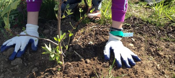


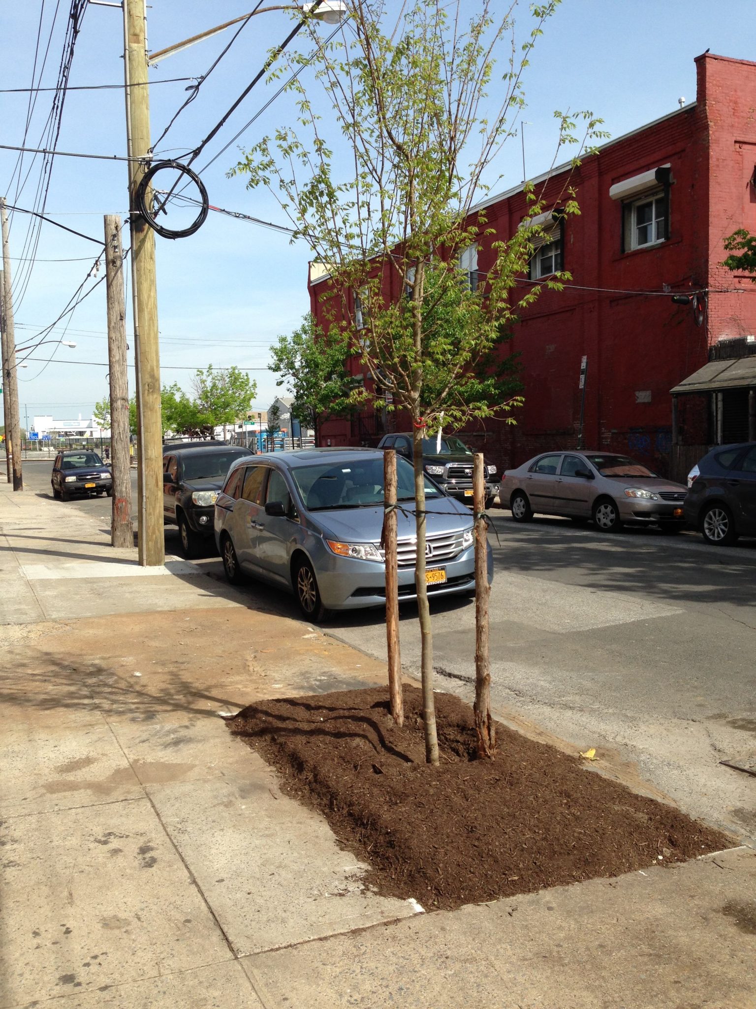
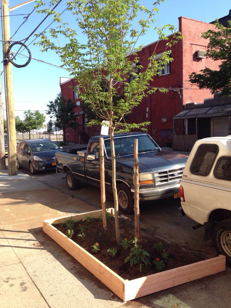
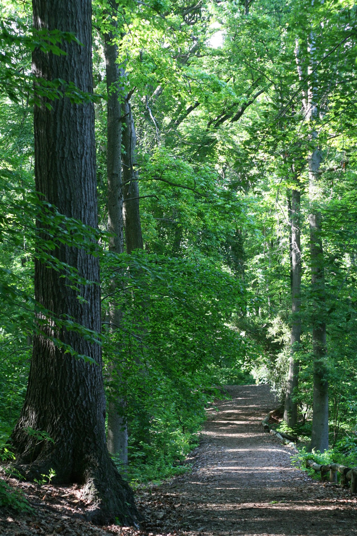
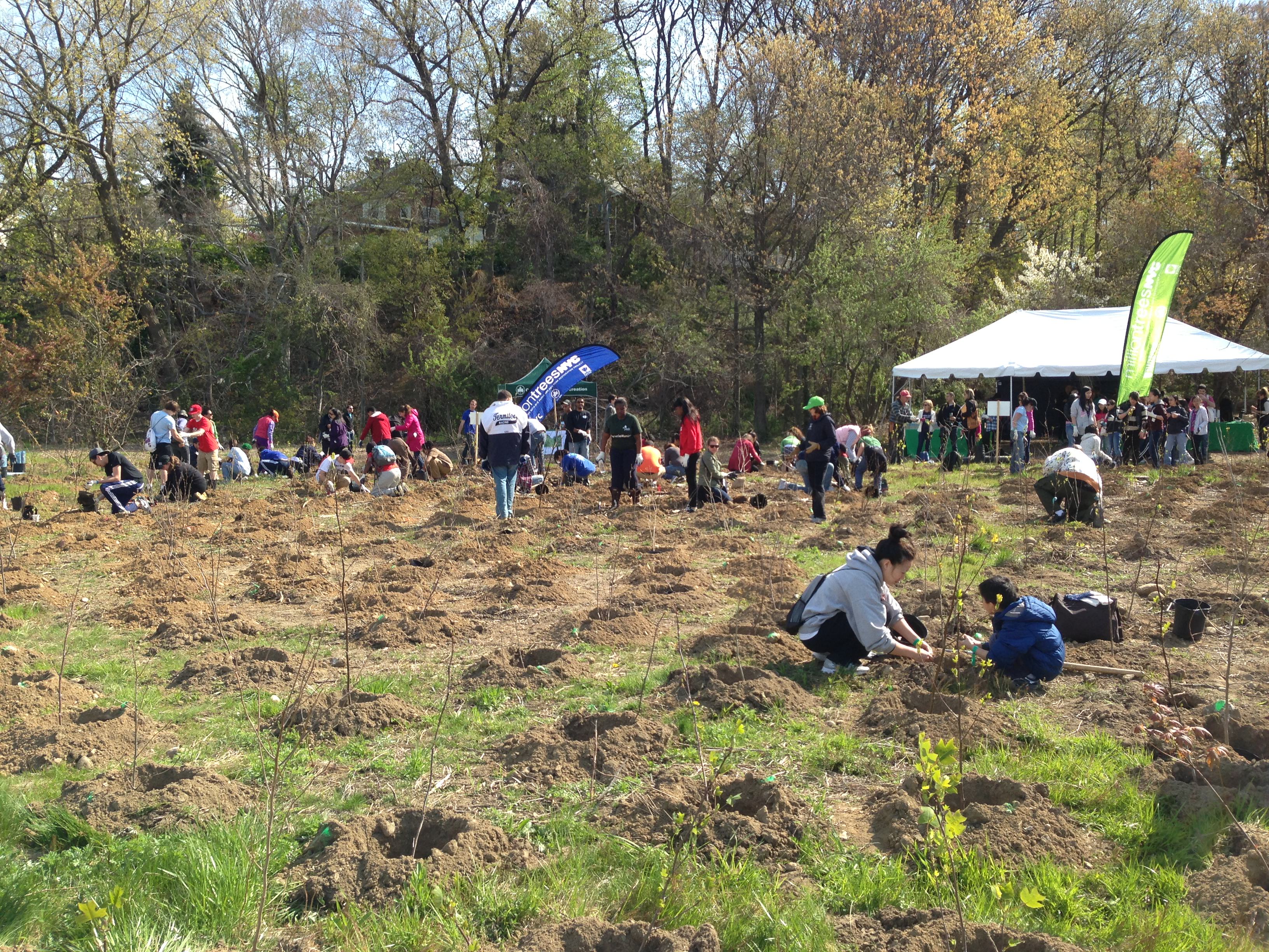
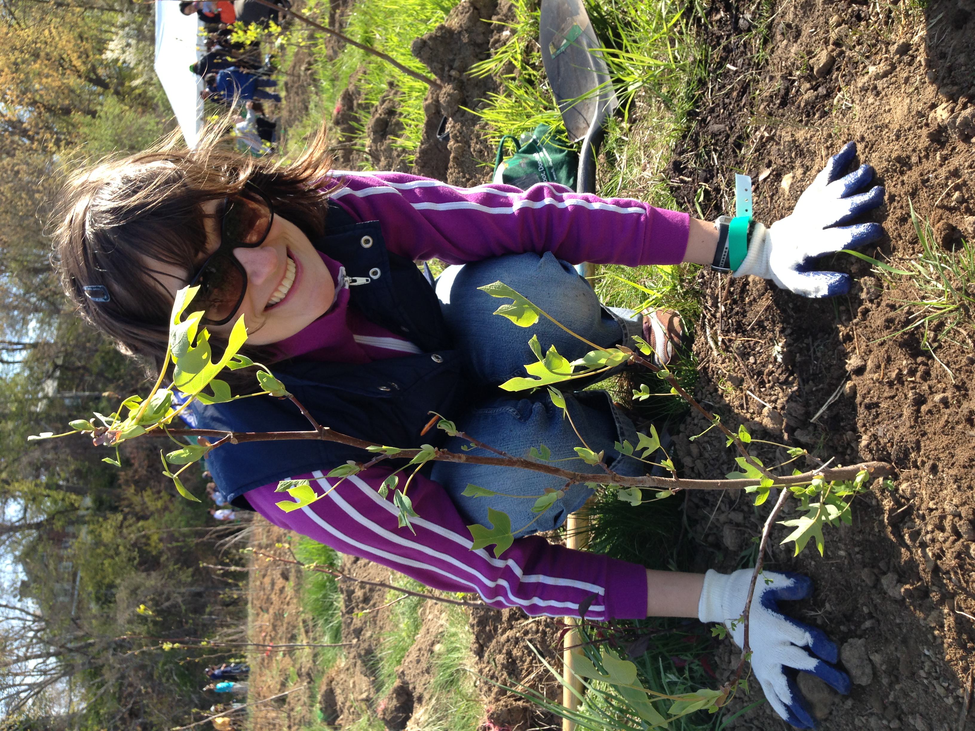
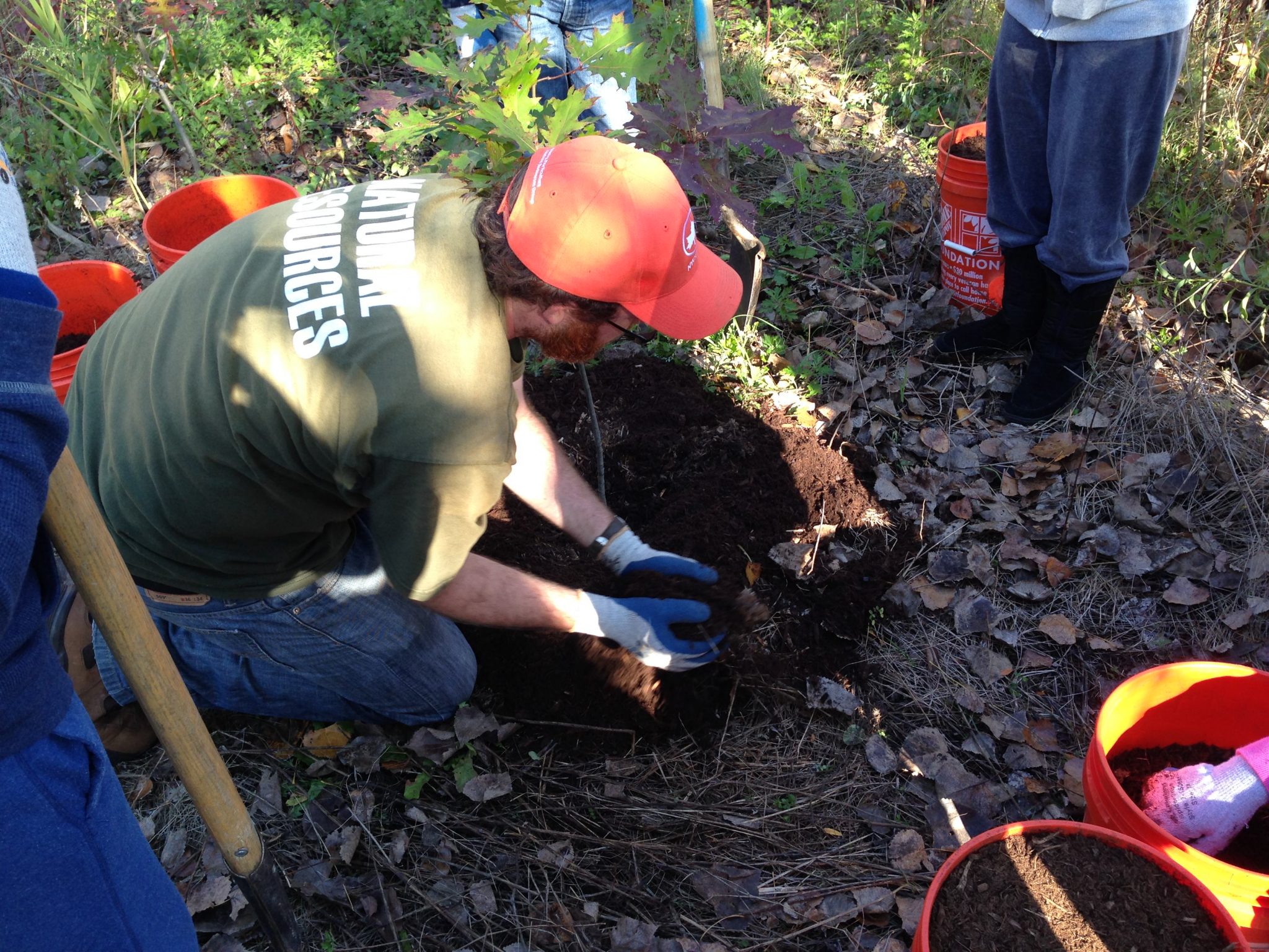
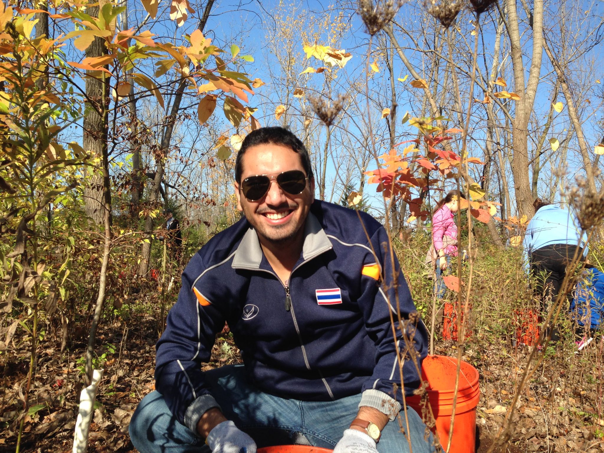
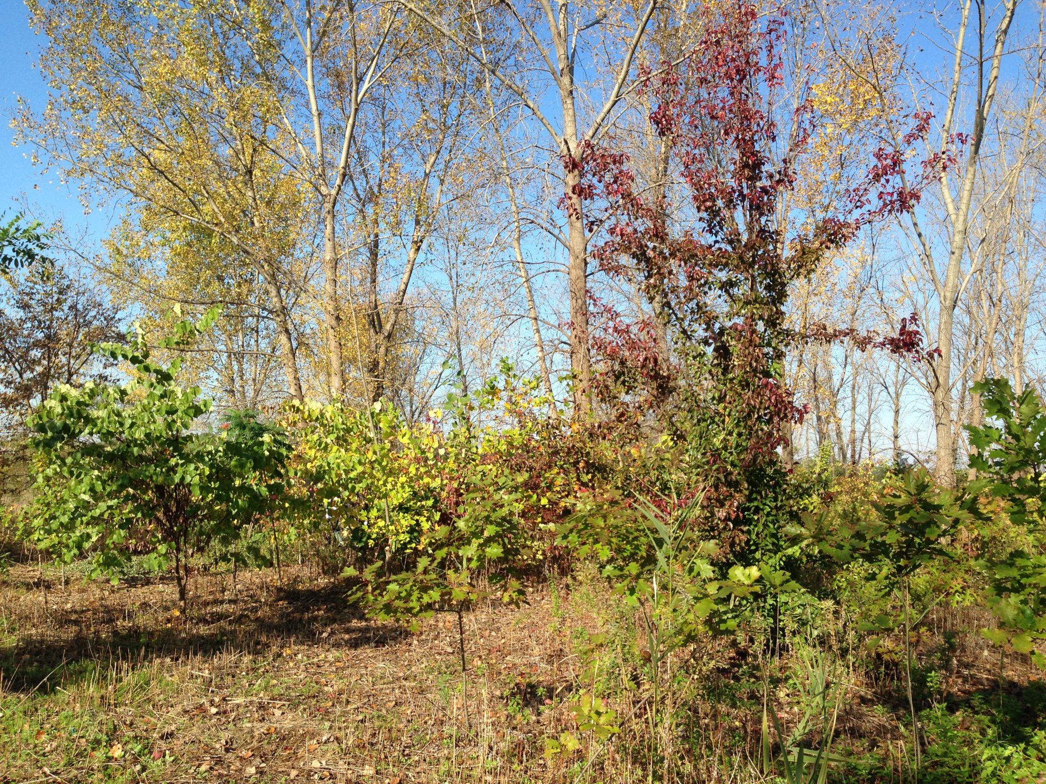


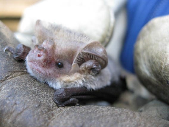
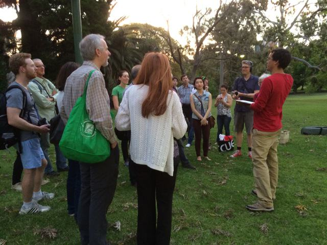

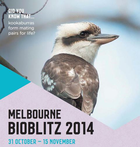
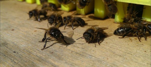
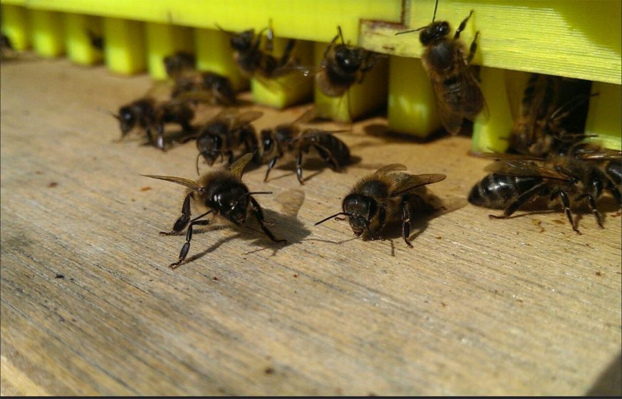
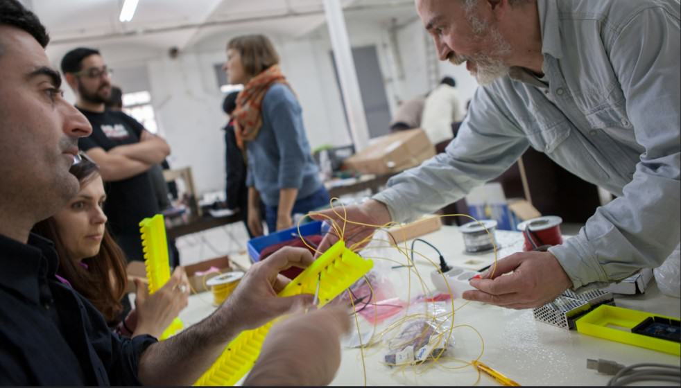
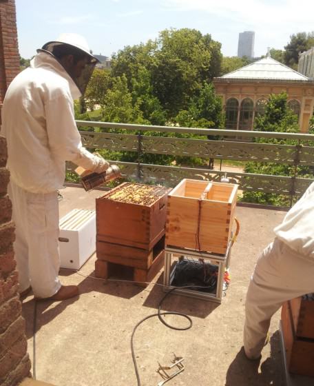
 Improving this relationship is going to take some time. I can’t promise a happy ending, of course, but ask you to remember three things: First, your goals for a sustainable, healthy landscape are parallel, not divergent. Keep that in mind when you seem to have momentary troubles communicating. Second, you are both driven to improve the landscape, not watch it continually degrade; remember you’re soul mates, at least in that way. Third, we live in a rapidly changing world, climate, sea levels, movement of species, and mixing of biotic communities. These are all spinning fast towards a future that is hard to predict. Ecologists and designers are our only real protection against the troubles ahead. We need you to work together. Don’t let us down.
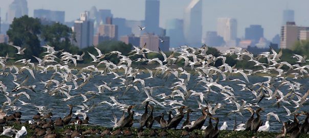
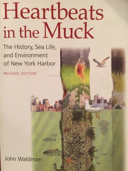 Shining a bright light on this underwater world is Heartbeats in the Muck, John Waldman’s terrific book about the teeming life below the surface and the environmental history of this most urban estuary. Having read the original shortly after it was published in 1999, I recently picked up the Revised 2012 edition. Dr. Waldman’s stories of how life in the Harbor survives and even thrives despite a variety of environmental insults are still poignant.
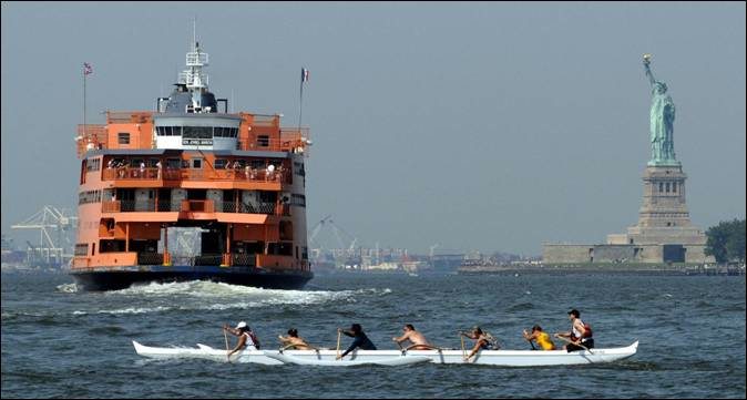
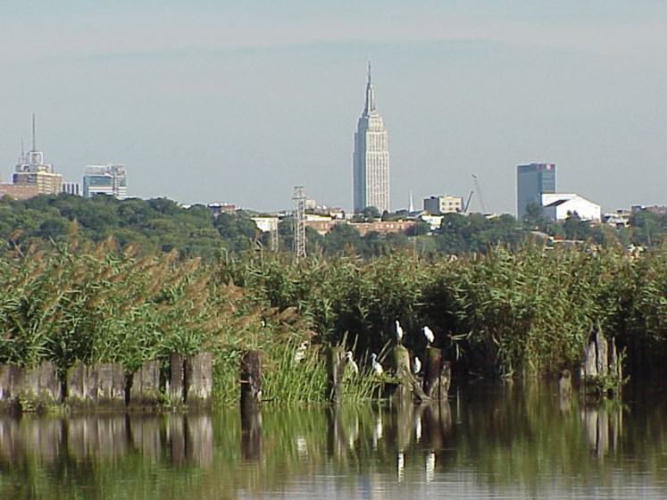
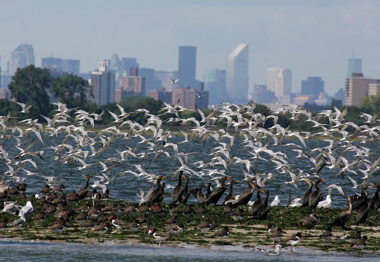
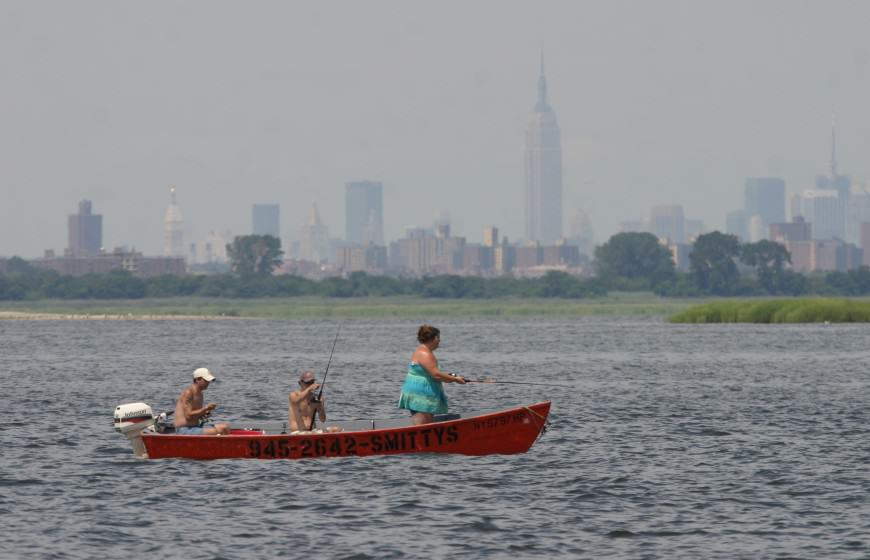

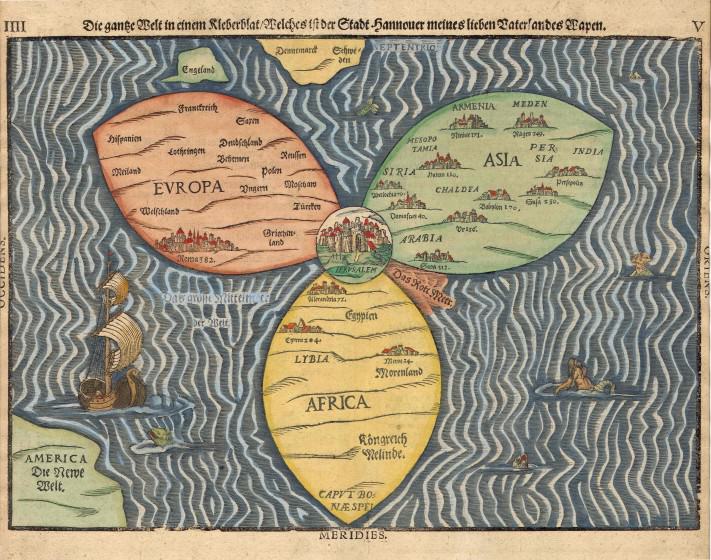
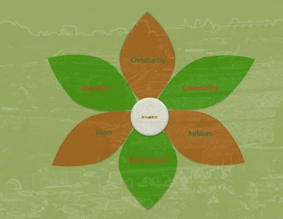
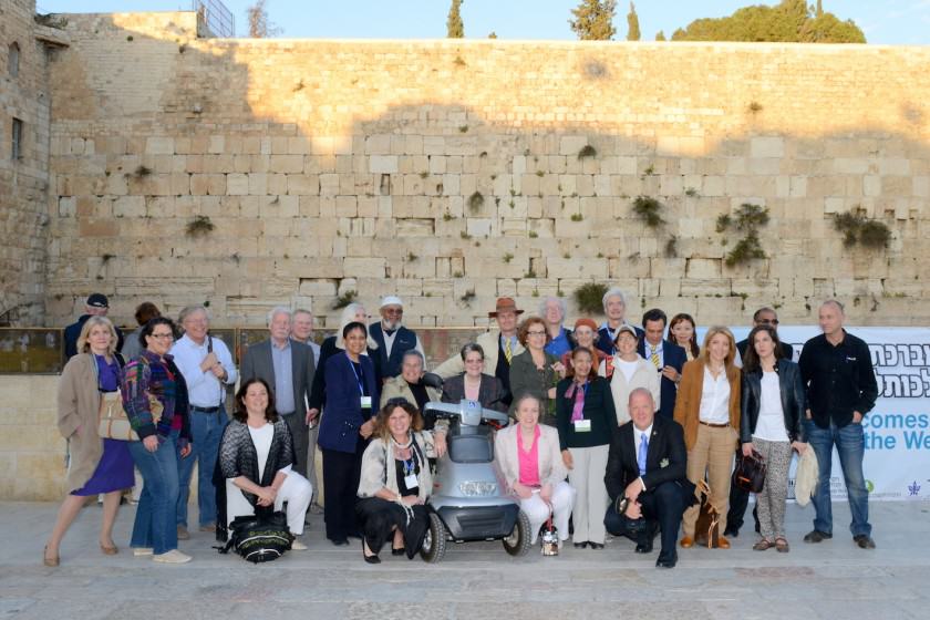


 The beauty of the Green Pilgrim Ladder is its simplicity, while its special significance is that it places the burden of environmental responsibility on the shoulders of the traveller. The framework of travel starts in preparation for the journey, and we are asking the pilgrim not only to endeavor to leave a positive footprint on the way, but also to become a more responsible citizen in his or her own city after arriving home. Responsibility implies greater care for the environment, and greater respect for the many “others” in our neighborhood and throughout the public domain that we all share and enjoy.
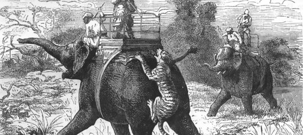

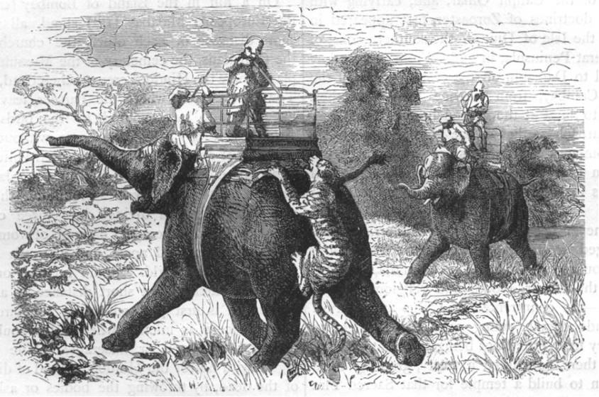
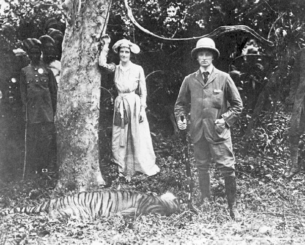
 My friend Madhu Katti (also a TNOC writer) has written about other invasions of urban habitat by wildlife in recent times, including the return of the
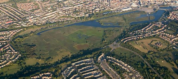
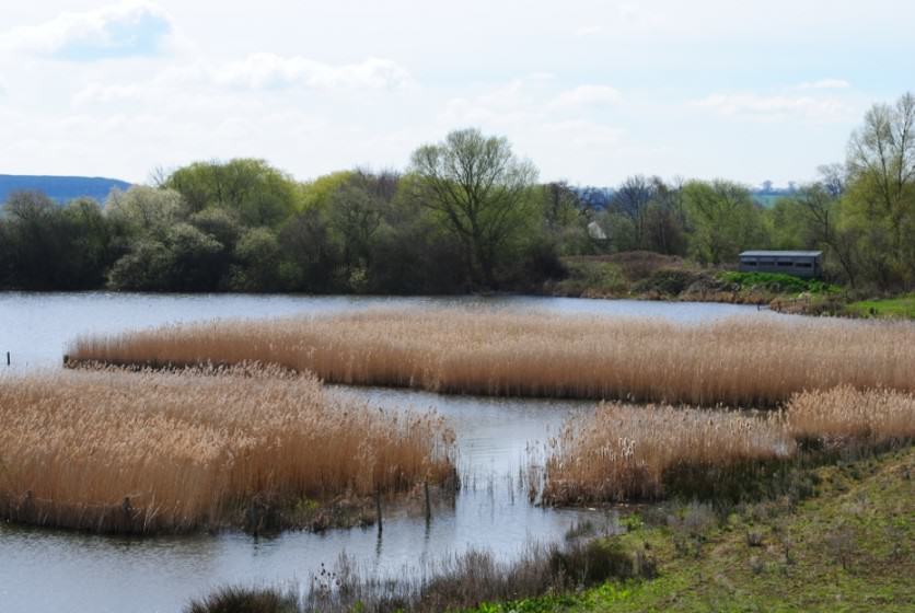
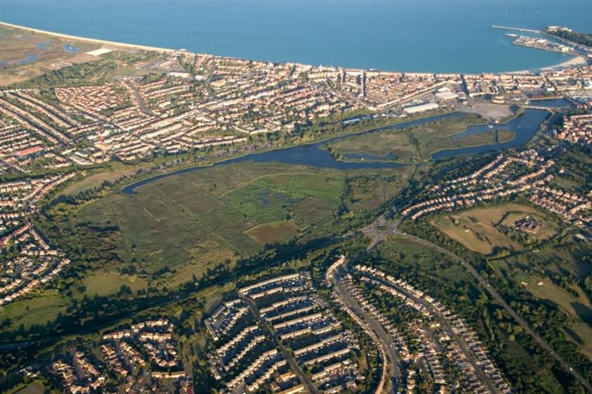
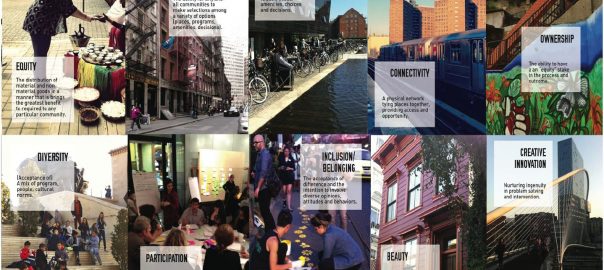

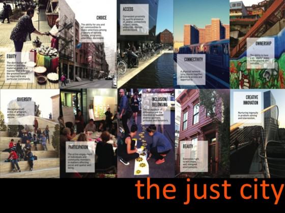
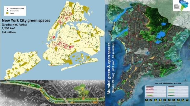
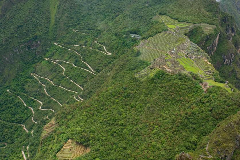
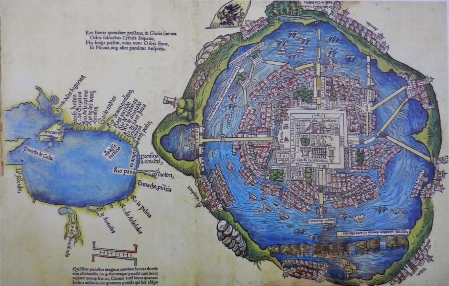


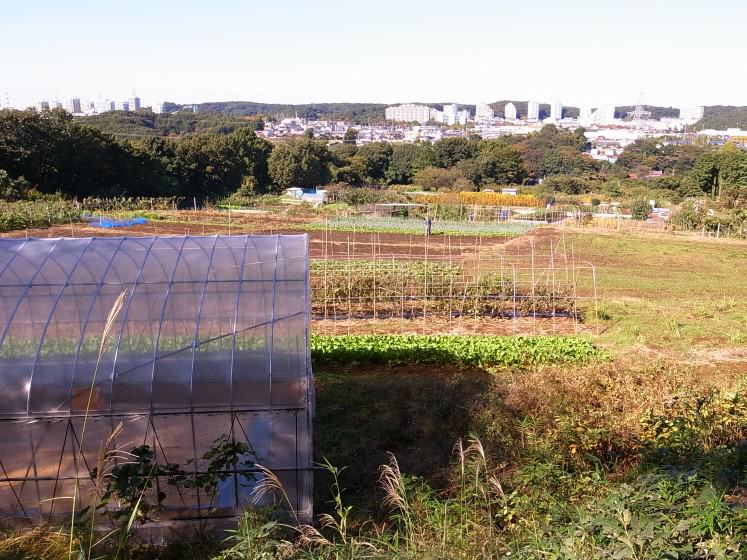


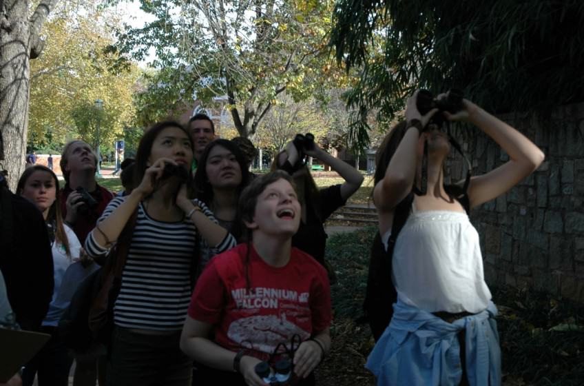
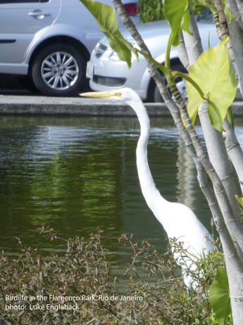
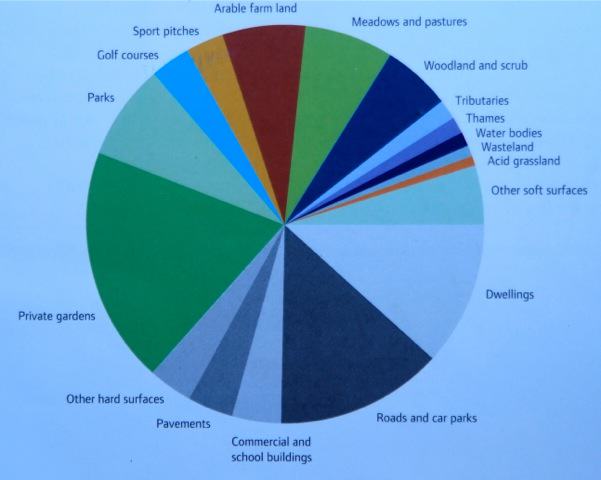
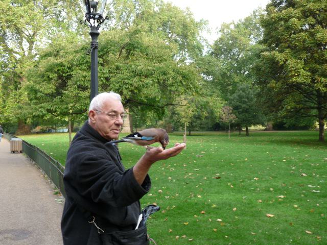
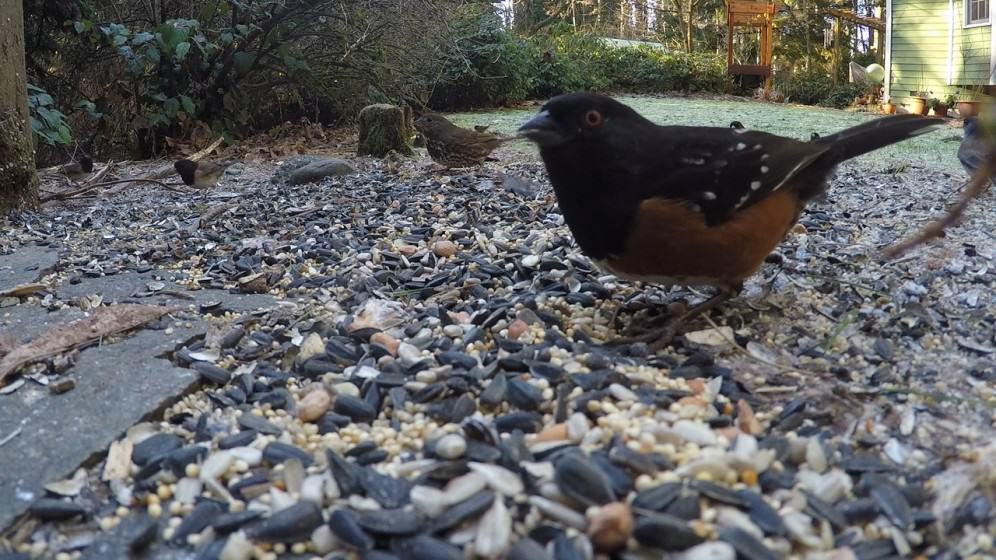
 There was an international outcry; people protested on the street outside the building. The Audubon Society became involved and an out-of-court agreement resulted in a new engineered-nest being installed. Maybe because of the trauma, the pair failed to hatch any new eyasses following the disturbance of their original nest. “Pale Male: New York’s Most Famous Red-Tailed Hawk May be A Father Again’” declared ABC News in on May 20, 2011. After years in which Pale Male and his mate Lola produced broods of eyasses, Pale Male took up with a new mate Ginger at his Fifth Avenue address. Pale Male’s seventh and eighth mates were Zena and Octavia. In recent years many more red-tailed hawks have taken up residency in New York City and it is not an uncommon sight to see a hawk flying overhead in a city park. Apparently it is still common practice, however, to poison rats and pigeons and this leads to the unintentional death of raptors, like the red-tailed hawk, which prey on these lower food chain animals.
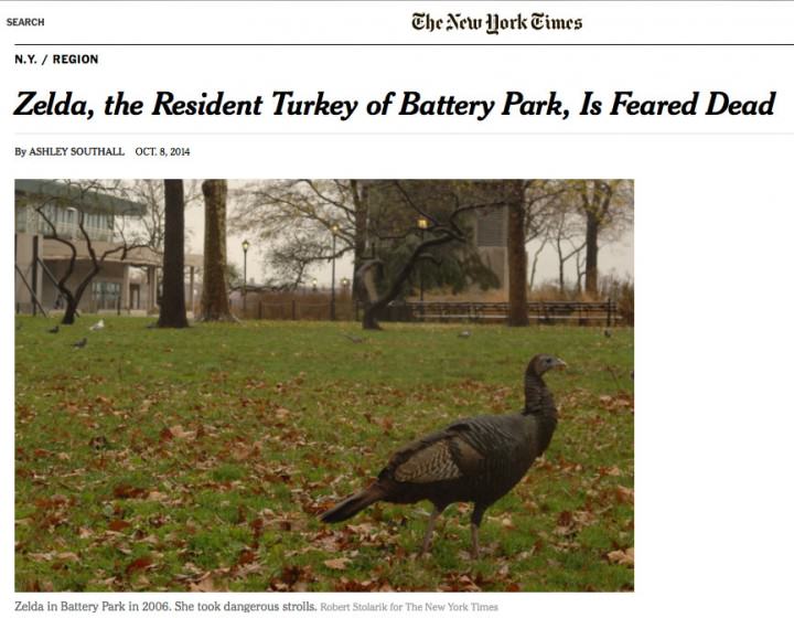


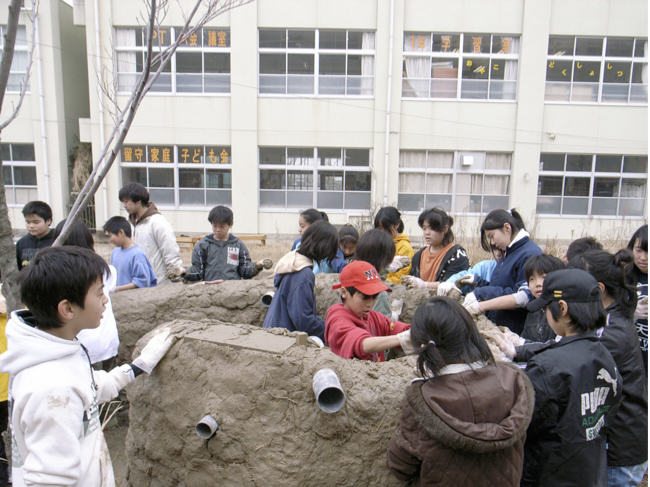
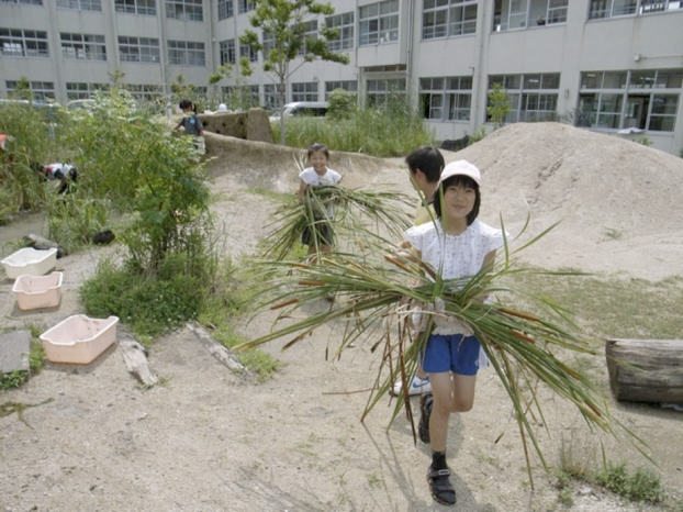
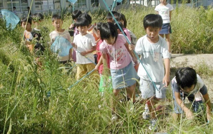


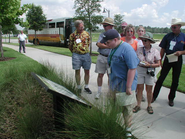


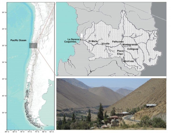
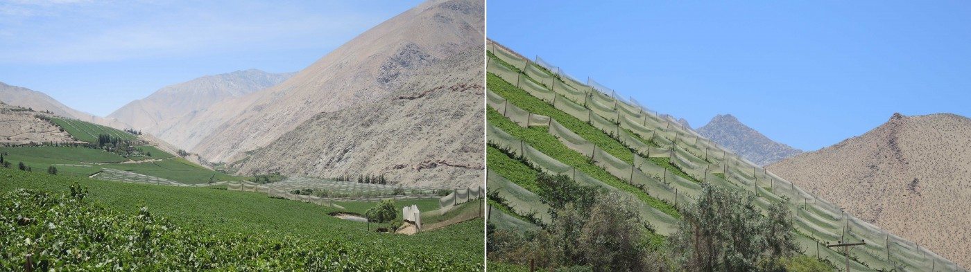
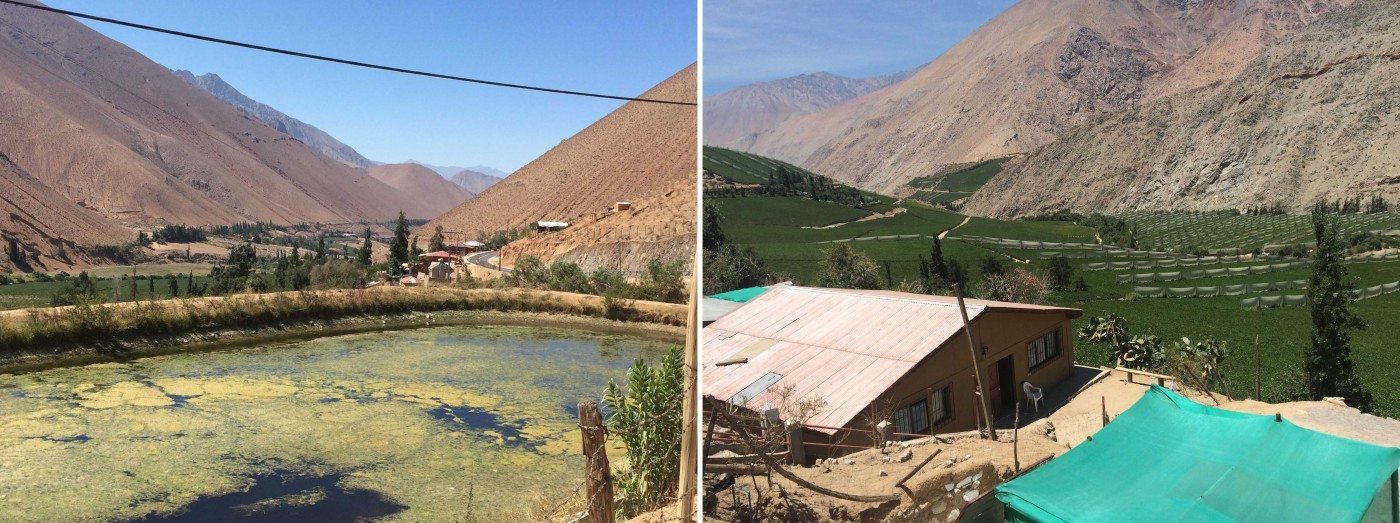


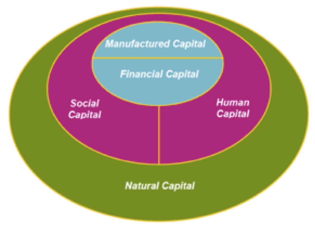

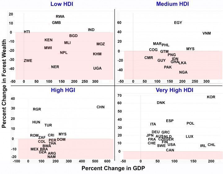

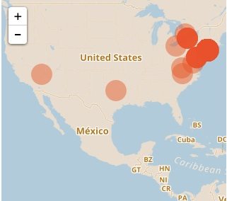
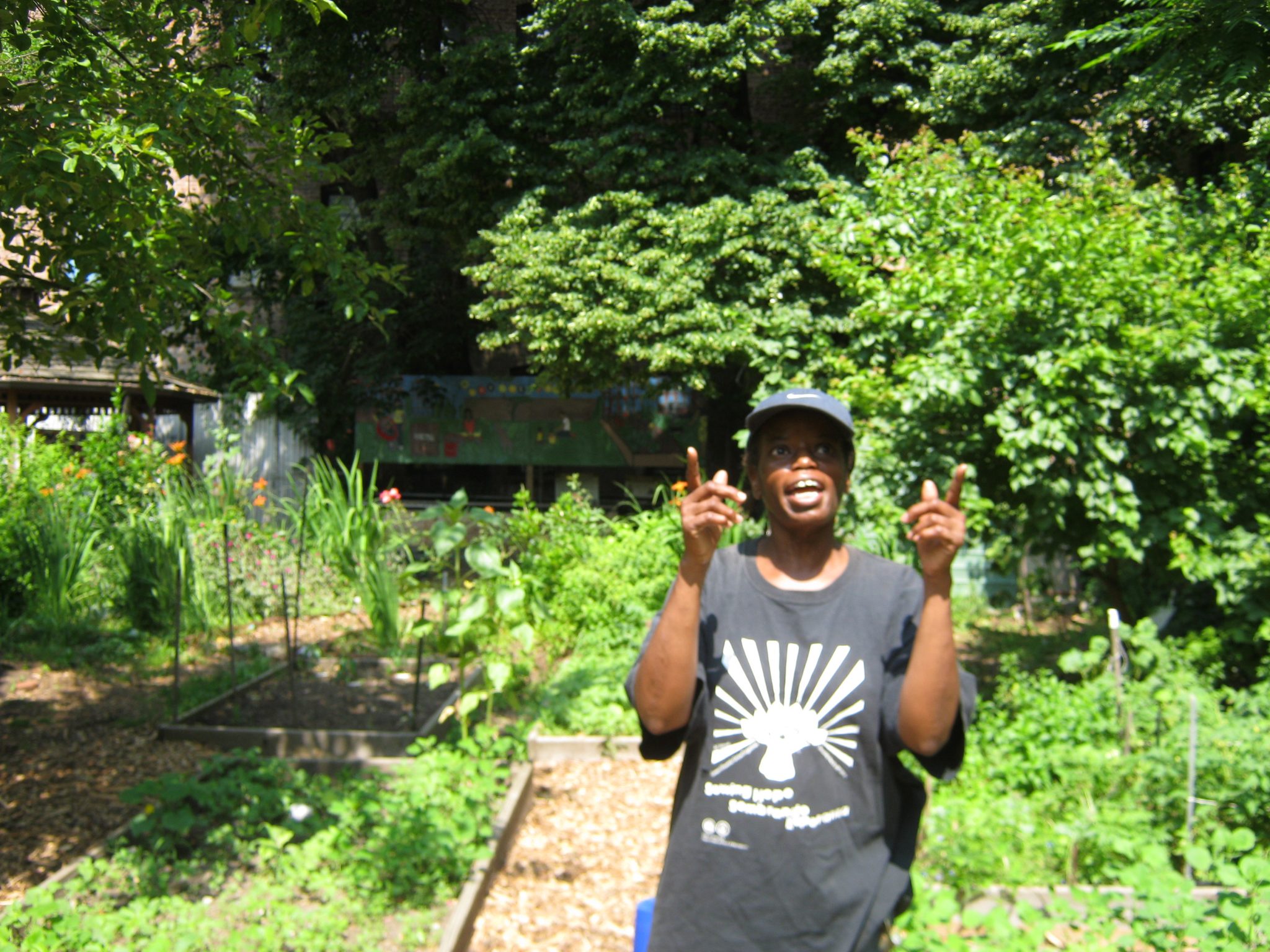


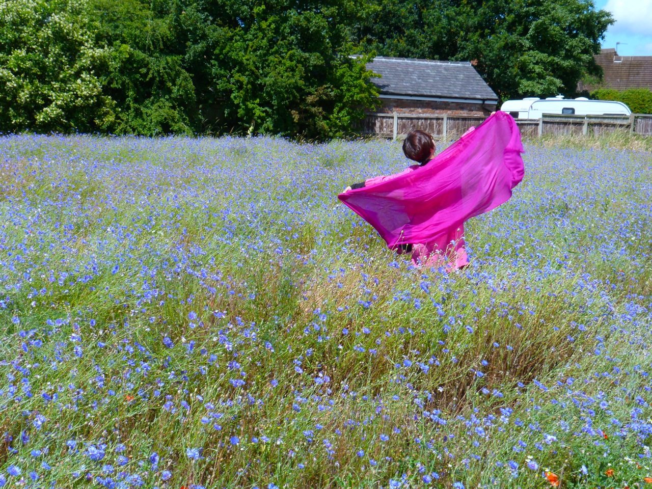

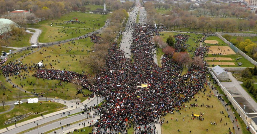 Public open and green spaces are declining daily in the world’s cities, largely due to population and development pressures. Yet there is broad evidence of the social, population health, and ecological benefits of open space, and a clear desire among urban populations for such space. The need for thoughtful creation of open space is critical now, as thousands of new cities will be built in the coming decades. Decisions about land use in cities—where the building, roads, and open spaces go—tend to become fixed for decades or even centuries. It is critical to get these decisions correct right from the start. David Maddox spoke about the need to articulate the attributes of the cities that we desire, and that how such cities are built is fundamentally about values—what do we think is important? P.K. Das spoke of building movements, such as
18 Comments
Join our conversation