Greenways (GW)—from wide wild areas to narrow urban trails—are linear bands of land and water designed and managed for multiple purposes such as nature conservation, flood water management, water quality protection, recreation and many other social functions. Revalued since the middle of last century, when ecology became prominent in planning and design, and strengthened by a solid theoretical framework (island biogeography and landscape ecology) and by analysis tools such as GIS and remote sensing, GW have a renewed popularity through their significant social and ecological functions, performing many services at the same time.
In this collaborative manual editors Paul Cawood Hellmund and Daniel Somers Smith explain the biophysical natural and social ecological functions of GW, and how they can help to solve fragmentation, conservation and functional problems of the landscape in a changing world adding value to ecosystems and people alike.
Paul C. Hellmund is an educator, landscape planner + designer, director of the Conway School of Landscape Design in western Massachusetts, North America. His co-author, Daniel Somers Smith has a background in forest science and is an educator in environmental studies. Other chapters that complete the work are due to R.F. Noss, M.W Binford, R. J. Karty and L. Fisman. In their contributions all authors emphasize the imperative to find a balance between nature and people being creative and critical as a key factor in building sustainable landscapes through collaborative and adaptive design.
Designing Greenways belongs to a series books with mentors such as Design with Nature (McHarg 1969), The Granite Garden: Urban Nature And Human Design, (A. W. Spirn 1985), and more recent books such as Green Infrastructure: Linking Landscapes and Communities (M.A. Benedict and E.T. McMahon, 2006), Sustainable Infrastructure: The Guide to Green Engineering and Design (S. Bry Sarte 2010), Green Infrastructure: A Landscape Approach (D.C. Rouse and I. F. Bunster-Ossa 2013), just to mention a few. All these works have a common theme: the aim to broadcast the benefits of green infrastructure taking advantage of the natural landscape as mitigation efforts in a world of social and ecological fragmentation.
The six chapters Designing Greenways, includinga special chapter on riparian GW (Chapter 4) present definitions, conceptual theoretical and practical frameworks, scientific knowledge based on an abundant bibliography and case studies, describing the multidimensional GW functions and various human activities that impact corridors. Chapter 5 gives a framework to understand the connections and relationships between Society and Nature.
The key chapter in this book (chapter 6) provides a useful method in five stages to guide the conceptualization and planning of GW projects. This tool, of great use for applications in design, integrates concepts and technical outfits from previous chapters.
Although the book seems to be directed at the American readers—most of the examples noted are U.S. based—the content has a global scope, giving readers most of what they need to know about these issues. To me, here is the only weakness shown in this book. In a global world there are many enriching GW examples in other parts of the world. These would have been interesting to mention.
Authors describe the evolution of GW in the USA from parkways in the 1860s, when mentor Olmsted recognised the great potential of linear greenspace to connect neighbourhoods providing access to city parks. No reference is given to influences of Olmsted’s travels in China and Europe, which were definitely inspirational sources linking also to a predilection for the pastoral picturesque architecture of the English countryside, a model that has lasted until the present day. Early English influences can be also found in the green belt policy, a restriction of building around cities that can be traced back to the ancient times. Leaving aside this, Designing Greenways can be considered a masterpiece, being comprehensive from different theoretical perspectives and practices of the multiple disciplines involved in a GW design and implementation.
The book succeeds posing the significance to work in achieving landscape integrity without forgetting that GW are not a conservation panacea. The features that strengthen the corridors—such as linearity, connectivity, accessibility, multitasking—represent at the same time many weaknesses. For example, the high ratio of edge to interior make the ecology of GW very vulnerable to human pressure, predation and biological invasions.
GW projects are nowadays popular because of their multiple benefits. A disadvantage of this popularity is that they are associated with the wrong assumption that they are relatively easy to implement. They are not, and along the pages the authors confront us with the reality of the real world. They warn readers not to be dazzled by the many attractive benefits, calling us to reflect that designed GW projects, in order to succeed, should be integrated in the landscape. They recommend that designers must firstly understand the structures and functions of the system they want to restore. Secondly, they should move to the project stages by answering a series of strategic questions through spatial (local to global) and temporal scales, being aware of possible risks and failures that can result from oversimplification or wrong assumptions.
This book presents scientific information in a way that may be accessible to non-specialists integrating scientific principles into a comprehensive design method. Easy to read from start to finish, it can be used in several ways: as a unit, with a focus on some chapters following personal interests, or as a guide.
Although eight years have passed since its publication Designing Greenways remains valid as a great contribution and provides a practical guide for planners, landscape architects, educators, students, citizen groups and conservationists to move from theory to action.
I strongly recommend this book.
Star rating: Excellent, in achieving its own objectives and as a valuable contribution to TNOC readers
“Because then it becomes a beautiful self-driven machine. Nature driving people driving nature. Where the word is spread and the pride is shared and spread and it spills over (in the community). Everyone wants to feel proud of something that is on their doorstep“. —Kelvin Cochrane, baker and community-activist,
Bottom Road Sanctuary, Cape Town
This piece sets out to explore whether small-scale civic-led gardening schemes are just feel good stuff or whether they make a contribution to the functioning ecology of our cities.
The simple act of digging your fingers into the soil, pushing a seedling into the ground, nurturing it and watching it grow is a sacred, visceral and beautiful process, which opens the door to a greater respect and sense of awe for nature’s mysteries and treasures. There is no doubt that social gardening initiatives, aside from playing a pivotal role in creating the human connections that help reinforce a sense of community, help to generate biophilia and a greater reverence for and connectedness with nature in cities. These sorts of initiatives assist in integrating urban ecosystems as part of the daily experience of citizens, subsequently aiding in creating a new inclusive way, as opposed to a purely scientific way, of speaking about and carrying out conservation objectives that can include and be understood by the everyday citizen.
Bottom Road Sanctuary was previously a derelict wasteland of rubble and is now a magnificent indigenous garden constructed by the local residents and open to the general public. Photo: Georgina Avlonitis
The urban ecology literature presents several cases of the importance of the social dimension of these kinds of engagements promoting and supporting sustainable environmental projects and awareness, encouraging social cohesion, and fostering local ecological knowledge. A colleague of ours who works for the Biodiversity Management Branch at the City of Cape Town once noted how humbled and delighted she always is to stumble on pockets of people doing innovative, environmentally-relevant gardening projects in their neighbourhoods. She also noted that these were the best places where urban conservation managers might intervene, where value could be readily added with information on appropriate indigenous plant species or offers of support in kind or through labour, as the energy and enthusiasm of an already-mobilized community is an exciting thing.
However, some conservation managers dismiss small urban patches and civic indigenous gardening projects as nothing more than points of social cohesion and activity on the basis that make no meaningful contribution to greater ecological functioning in the city. We disagree.
Princeess Vlei
The social value of urban gardens is not news. What is less understood, and what drove us into this particular field of enquiry—this research formed part of a Masters dissertation conducted in 2010 by Georgina Avlonitis—was what the ecological spin-offs of small-scale community endeavors in our cities are. Are these just feel-good hotspots or do these small-scale civic projects actually make an ecological contribution of sorts and what are the likely biodiversity outcomes?
We set out to explore this question by picking a spread of sites to examine ecological outcomes along what we saw as a gradient of engagement and an ecological continuum (ranging from relatively degraded sites, to those that have a high conservation status). Our sites included two civic-led indigenous gardening projects, a vacant lot, and two local nature reserves (one of which is a tiny patch of land conserved by default in the middle of one of Cape Town’s oldest horse race tracks). The two civic-led garden projects are the Bottom Road Sanctuary project and the Princess Vlei garden. Bottom Road Sanctuary is a household neighbourhood project which saw the transformation of a wasteland in a low-to-middle income community. Neighbours, inspired by what they saw over the wall in the first garden, which was catalyzed by community-activist Kelvin Cochrane, decided to physically remove the walls separating their front yards to eventually create (in a little over 10 years) what now stands as a magnificent open-access and indigenous community garden on their doorsteps.
The Rondevlei Nature Reserve presents one of the very few sites for the conservation of Sand Plain Fynbos. Photo: Georgina Avlonitis
The second community garden project is in the same neighborhood, but is a school gardening project on what was previously a wasteland adjacent to the Princess Vlei. This project is younger, being only about six years old, but has a much larger public participation component. Both these projects, while driven by the community, were supported with plants and guidance from the local nature reserve, Rondevlei. The factors driving these gardening projects were informed by a sense of community activism relevant to the post-apartheid urban form, relating to notions of indigeneity, ownership, the ‘good and just city’, and beautification. Our nature reserves were the Kenilworth Racecourse and Rondevlei Nature Reserve. The vacant lot was simply a large empty lot that had no evidence, or any local history, of ever having been developed.
The vacant lot was dominated by an ephemeral layer of annual grass. One rare and endangered species found here reminds us of both the heavy toll of urbanization where fragmentation sees the attrition of biodiversity , but also hints at the opportunity still present in these fragments of land where communities could be nurtured back to a state of ecological functionality. Photo: Georgina Avlonitis
We confined our sites to one original vegetation type, the Cape Flats Sand Fynbos, deemed Cape Town’s most ‘unlucky’ vegetation type as more than 80% has already been transformed and only 1% is statutorily conserved. We measured richness and functional richness among insects and plants (on the basis of the understanding of the causal link between diversity and function) in a series of plots at each site.
Our key findings, drawing on five 9m2 plots at each site, show a consistent pattern of similar plant cover, functional type diversity, and species richness between the conservation sites and the Bottom Road garden (see the Table at the bottom). The Princess Vlei project lags somewhat, but as a younger project much a kin to the Bottom Road project this is likely to be on a similar trajectory. The Vacant lot has lower plant cover, functional richness and species richness. The Princess Vlei project and the Vacant Lot have some similarities in cover and functional richness, but the Princess Vlei site has far greater species richness and greater perennial cover. The Vacant Lot has the greatest richness and cover of invasive alien plant species.
While we acknowledge that it is difficult to identify causal mechanisms in ecology at the best of times and that the urban context is even more complex where ecologies are produced and modified through social, economic, political and cultural processes, some clear trends are evident. What we see is that total neglect, represented by the vacant lot, results in poor species richness and associated ecological functionality outcomes. Without intervention our vacant lots rapidly deteriorate to the ubiquitous urban patch dominated by a relative monoculture of grass and weedy annual species. The presence of high annual cover suggests a seasonally vulnerable site that will have limited cover in the hot dry summer months rendering it open to erosion. The presence of one rare indigenous species on our vacant lot suggests potential; some remnant gems are waiting to be nurtured back to functioning communities.
Kenilworth Racecourse
Without intervention however, these extant species present nothing more than extinction debt, waiting to slip away into obscurity the same way other indigenous counterparts on this vacant lot must have quietly disappeared years ago. This vacant lot reminds us of the heavy toll of urbanization on our indigenous flora and stands in stark contrast to the outcomes of the civic-led indigenous gardening projects where the role of informed activism presents astoundingly different outcomes.
The two gardening projects show a sound trajectory towards sites that have plant richness and functionality similar to the two conservation sites. A correspondence analysis exploring species composition and cover in space show just the trajectory we anticipated with the vacant lot an isolated outlier, and the two gardening projects ‘pulling towards’ the conservation areas, with the older and more established Bottom Road garden lining up more closely with the conservation areas than the younger Princess Vlei garden. There are sampling issues around plot and plant size and associated age, but generally what is evident is that concerned and informed social engagement can see the construction of healthy patches of indigenous garden akin to adjacent conservation areas. In every instance the need to monitor and manage invasive alien plant species is evident. This is a common urban problem that requires relentless attention.
The Princess Vlei garden has been constructed by local school children. Photo: Georgina Avlonitis
Consideration of the insect morpho-species richness at each site presents a potentially less clear picture. The Princess Vlei site has the greatest volumes of insects, followed by Kenilworth Racecourse (see the Table). Aside from these two sites the numbers of insects trapped are very low. The Vacant Lot, while low in actual numbers, has a surprising richness in functional diversity. It is possible the results are confounded by the competitive role of actual flowers resulting in lower insect trapping rates in the more diverse and densely vegetated conservation areas. This could also account for the high trapping rate at Princess Vlei which is less well vegetated as a more recently initiated project. The vacant lot presents relatively high morpho-species richness, and this can be attributed to the abundance of annual flowering species where there would be no floral support at this site outside of the spring flowering season. While perhaps less compelling when compared to each other, when considered together in the broader context of the urban setting, and in keeping with previous studies, these vegetated patches contribute to the matrix in providing a diversity and functional diversity of insect morpho-species. The loss of pollinators as an outcome of urban fragmentation is well documented. In the Cape it is believed as much as 83% of our flora is insect pollinated. Without the simultaneous return of pollinators any patch of indigenous vegetation ultimately faces extinction.
Bar graph representing the total number of insect morpho-species, collected from pan trapping
There are some conservation managers who would argue that this kind of endeavor, without ever being self-sustaining without fire or spontaneous propagation (certainly for those fire-driven species prevalent in the Cape Flora), can never be counted as a true contribution to conservation across the city.
We feel they are wrong. Surely any effort that provides even small patches of indigenous vegetation with appropriate biodiversity elements and functional richness to the broader matrix of indigenous species across the city and fosters social engagement with nature makes a contribution to the conservation mandate of the city? So while these patches may not achieve what a large-scale conservation endeavour would in terms of sustainability they do have elements of ecological functionality that make a worthy contribution, akin to Timon McPhearson and Victoria Marshall’s notion of the relevance of the micro-urban.
Here we see how socially-informed goals meet those of biodiversity conservation to produce excellent social and ecological outcomes. Local school children have learnt about indigenous plants and experienced the joy of planting, residents have access to a biodiversity-rich public space akin to the City’s Botanical Garden, the gaps in the urban matrix are filling up with plants that can share pollinators and pollen with adjacent conservation areas, and populations of threatened species have been expanded. Our work supports the view that these pockets of civic-engagement present a key opportunity to both restore nature and build respect and an infectious sense of community pride for what is growing ‘on their doorsteps’ with bothsocial and ecological gains.
Pippin Anderson, a lecturer at the University of Cape Town, is an African urban ecologist who enjoys the untidiness of cities where society and nature must thrive together.
FULL BIO
Regularly, we feature a Global Roundtable in which a group of people respond to a specific question in The Nature of Cities.
show/hide list of writers
Hover over a name to see an excerpt of their response…click on the name to see their full response.
Mitchell Chester, Miami Urban waterfronts are ticking ocean acidification time bombs. Needed: Strategies to prevent bleeding from structures inundated by sea level rise.
P.K. Das, Mumbai Developing open, sustainable and resilient urban waterfronts is paramount. But increasing attempts to colonize these common assets for private and exclusive consumption is eroding larger public interests.
Ana Faggi, Buenos Aires The relationship between the Buenos Aires city and the estuary´s waterfront has been in the past very particular and conflicting. A common saying “Buenos Aires grew turning its back to the river” describes physically and metaphorically the historical relationship between city and riverside.
Andrew Grant, Bath To arrive at the era of Nature and Commerce, how do we break out of the current planning cycle to reflect a more exciting, enlightened, and creative outlook?
John Hartig, Detroit Since 2000, 53 soft shoreline engineering projects have been completed in the Detroit River watershed. All provide “teachable moments” for the value and benefits of urban habitat restoration and enhancement.
Roland Lewis, New York While we all must do more to reduce inequality, we must not cede important functions of government—including but not limited to providing usable open space and maintaining critical infrastructure—to private interests
Joe Lobko, Toronto Toronto’s waterfront and ravine spaces have become increasingly important within this rapidly growing city, critical to its livability.
Robert Morris-Nunn, Hobart It is very important that uses in the port area have a community dimension. In the pier, one complete floor level is a large local produce and product market, with cafes in addition to accessing the ferries. These uses will bring diverse activities to the area throughout the seasons.
Rob Pirani, New York To restore their ecology and reduce flood risk, treat waterfronts like a public utility by capturing benefits and avoided costs to finance improvements.
Elizabeth Plater-Zyberk, Miami The other day, during a stroll along the Baywalk in downtown Miami, I saw my first manatee.
Andréa Redondo, Rio de Janeiro Radical actions may be needed to defend either ecology or people. In the first case is necessary to prevent predatory urban occupation, rescue invaded shorelines, and free protected áreas.
Bradley Rink, Cape Town Urban waterfronts serve as a point of contact with the ‘wilderness’ of the open sea, reconnecting cities to their marine ecologies, but also risk being neither ecologically sound nor socially inclusive.
Hita Unnikrishnan, Bangalore Inclusivity, ecology, development and historical contexts – exploring ways for effective management of urban waterfronts in Bengaluru city.
Jay Valgora, New York The urban waterfront of the East River in NYC will become the Central Park of the 21st century.
Mike Wells, Bath Regardless of type or commercial values of waterfront developments, the aquatic and fringing ecosystems and the services they provide must be protected, restored and enhanced.
Mitchell A. Chester, Esq. is a trial attorney licensed in the State of Florida. In practice for 37 years, he is focused on identifying and seeking solutions to emerging legal and financial issues created by sea level rise (SLR) and climate impacts.
Mitchell Chester
Urban waterfronts as ticking time bombs
We do not create ethical urban waterfronts. Instead, we produce coastal buildings to emanate toxicity. With each construction permit, local governments and private landowners are creating conditions that will further acidify our endangered oceans as sea level rise (SLR) advances to permanent inundation.
There is no greater long-term responsibility facing today’s urban waterfront planner than to formulate strategies to prevent disastrous bleeding from inundated structures in areas where the invading seas will overcome the built environment.
Utility connections, electronic components, underground storage tanks, paints, sealants, solvents, cleaners, adhesives, glues, electrical grids, sewer systems, septic tanks and drain fields need to be insulated so their chemistry does not cause environmental harm when covered by water.
With each new edifice, our generation is leaving a legacy of neglect. No reasonable society would further acidify the oceans, but that will happen as seas overwhelm coastal shores, allowing the escape of dangerous lead, mercury, formaldehyde, heavy metals, insulation fibers, PVC chemicals, perfluorinated compounds, fiberglass, wall foam, oils, lubricants, flame retardants, toxic electronic wastes and other threatening building materials.
In the absence of secure demolition, what we build on dry land now will poison the seas of tomorrow. Yet, we keep building. According to CraneSpotters.com, as of December 29, 2014, up to more than 300 new South Florida condominiums are being constructed or are on the planning board. While they are required to have elevated foundations, there are no standards to insure those structures are ready for inundation within the average 30 year mortgage span to 80 years, or in some areas, less time. According to RiskyBusiness.org, in Florida alone, “between $15 billion and $23 billion in current property will likely be inundated by 2050 from mean sea level rise…”
We are not ready.
Property owners are taking little, if any, personal responsibility for making sure their condominiums, office towers, government buildings and homes can sequester noxious substances when the time comes to abandon buildings and retreat from today’s threatened and vulnerable areas. To amplify the problem, older properties are poised to release, unchecked, asbestos and volatile organic compounds into ocean currents for unbounded distribution.
The mechanism of the built environment infecting our oceans is already a reality. According to the Guardian (December 28, 2014) “Almost 7,000 homes and buildings will be sacrificed to the rising seas around England and Wales over the next century…” The paper adds, “Over 800 of the properties will be lost to coastal erosion within the next 20 years”. In 2013, 1,400 homes fell into the ocean due to a ‘huge tidal surge’ which affected England’s east coast.
What measures can we take? One can envision a new industry of environmental inspectors and engineers to consult with stakeholders on how to adequately “seal” and prepare homes, offices, schools, hospitals and public infrastructure in the aftermath of hurricanes and advancing salt waters. Such experts are needed before construction begins, and once again when the building is no longer deemed habitable by public health authorities. Done right, such an industry will prompt the creation of thousands of jobs globally.
Governments need to ask not just what happens when the waters regularly intrude, but what occurs after human retreat becomes a reality, and take all reasonable measures to prevent toxins from seeping into the very same waters our heirs will depend upon for survival. In exchange for tax incentives, “abandonment certificates” should be required, based upon rigorous mandates. Existing pollution controls and laws need to be reviewed with SLR and tidal flooding in mind. Financial systems urgently need to help fund efforts to stop the flow of pollutants from our buildings. We must not assume that even LEED certified structures are ready for this challenge.
Legislatures need to focus on what the threat of non-carbon building emissions holds for the near future. Existing pollution control plans, regulations and laws need to be fortified by sound public policy requiring, as a condition precedent to property development, the built environment be made “ocean-safe,” to tough, state-of-the-art standards. The process of issuing demolition certificates must be more demanding. Intensified research of post-retreat acidification should immediately be funded.
Dangerous building materials and contaminants can be dealt with, but it is imperative that attention to this issue be given at the initial planning level…not just when properties are condemned in future years. Similarly, older structures must not be overlooked for their toxicity potential.
Some governments and owners have made a good start in understanding and appreciating the problem. The International Living Building Institute, the U.S. Environmental Protection Agency and even Google have identified “red list building materials” that should not be used in new construction. But such efforts are only for new construction or those undergoing renovation.
“Ocean Safe” buildings must be our legacy. The dangers of SLR go far beyond losing property and disrupting lives. Permitting irresponsible construction techniques and unorganized coastal retreat is not only myopic, it is a continuing crime against nature. The privilege of living in an urban waterfront in 2015 shoulders a burden: leave it ready for the populations of 2030 and beyond.
P.K. Das is popularly known as an Architect-Activist. With an extremely strong emphasis on participatory planning, he hopes to integrate architecture and democracy to bring about desired social changes in the country.
P.K. Das
Integrating the waterfronts
Developing open, sustainable and resilient urban waterfronts is paramount. Also, integration of waterfronts with cities’ hinterlands and their social and cultural fabric in order to overcome their segregation and exclusivity is important. Therefore, evolving an integrated ecological structure that would re-define urban landscapes is our key mission.
Integrating wetlands in Mumbai.
Being on the waterfronts and bathing in the sheer beauty and vast expanse of openness extending up to the horizon, in dense city landscapes, is truly liberating. But, increasing attempts to colonize these common assets for private and exclusive consumption is steadfastly eroding larger public interest and undermining ecological and environmental interests too—all this besides capturing the very experiences of this openness and natural beauty for few. Under such city conditions, the need for developing an intimate and intrinsic relationship between people, ecology and city building—broadly termed as ecology of cities—becomes enormously complicated. Also, it is hard to achieve this important relationship due to ruling socio-political interests that are governed by short-term financial interests of dominant groups.
Build more syndrome in Mumbai. Photo: David Maddox
Tragically, in most instances the assessment and measure of a city’s development and prosperity are based on the extent to which reproduction and turnover of capitals are achieved. While this may be necessary, it is deplorable to pursue the same in-spite of larger sections of people being marginalized from the benefits of development as well as the continuing destruction of finely balanced, interconnected ecological cycles. A balance between these two aspects—financial prosperity and economic growth; along with programs that rebuild, harness and promote interconnectivity of the vast environmental and ecological assets—is daunting, particularly for many of us who are demanding a paradigm shift in the imaginations of an integrated and inclusive ecology of cities.
A fine example of such an effort in the achievement of a new ecology of cities imagination is the ‘Rebuild by Design‘ competition and its resulting projects that have been launched for implementation of waterfronts barriers in certain cities in the US by the Obama government. Even though the process does not sufficiently suggest ways of integrating the waterfronts with the city’s inner areas and neighborhoods, plans for building with nature are indeed commendable. The fact that these ideas can be furthered as models for planning cities and defining urban development is particularly noteworthy. It opens new avenues of thinking about physical planning of cities and conceptions about our built and natural environments.
These US examples are distinctly different from the hugely popular Barcelona-like waterfronts that are being pursued in many cities. The Barcelona waterfronts are places of high consumption and business turnover. This is a successful model of capturing natural areas for furthering market interest. Shopping malls, restaurants, cinema halls, aquariums etc. dominate the waterfronts, including building into the waters by landfilling. A few promenades are provided for leisure and walks in the backyards of these enormous building structures. The waterfronts are not realized from within the buildings that are contained spaces for transactions.
Real estate development as engines of capital reproduction and financial turnover has dominated city waterfronts across the world. As a result, vast stretches of vantage waterfronts have been developed as high cost private enclaves leaving out smaller less attractive parts for public access, as concessional spaces. Along with such developments, natural coastal conditions have been substantially destroyed, thus severing the ecological life cycles, including production and reproduction of flora, fauna and other aquatic life that thrive along these edges. That these natural conditions too stand as effective barriers against the vagaries of winds and floods were ignored in such instances. To conserve natural assets and protect the coastal edges is challenging as we squabble to capture them in the present urban development endeavors that are ridden with a build-more syndrome.
It is therefore important to not only rebuild with nature along coastal edges, but also develop streams of natural corridors across neighborhoods and cities in order to re-establish the symbiotic relationship between nature, people and habitation. These streams of corridors consisting of watercourses, forests of trees, wetlands, mudflats and others would inevitably be rich sites of intense participation and social engagement, thus nurturing and enriching community life and networks. Waterfronts cannot be sustained as isolated or segregated edges from rest of the city. They have to be considered as a thread of a larger ecological structure interwoven with other natural conditions, along with addressing various human needs in the city.
Waterfronts must also be realized and developed as a part of public open spaces plans and firmly placed in public realm. Active engagement of public on the waterfronts will ensure public vigilance and its protection from abuse and misuse. This will not only ensure the democratization of the waterfronts and public spaces, but also lead to the achievement of a sustainable and resilient ecology of cities. Waterfronts development is an opportunity and means for achieving these objectives.
Streams of corridors consisting of watercourses, forests of trees, wetlands, mudflats and others would inevitably be rich sites of intense participation and social engagement, thus nurturing and enriching community life and networks. Waterfronts cannot be sustained as isolated or segregated edges from rest of the city. Credit: Master Plan prepared by P K Das & Associates for the town of Pimpri Chinchwad in Maharashtra, IndiaWaterfront networking in Mumbai. Waterfronts cannot be sustained as isolated or segregated edges from rest of the city. Credit: extract from Open Mumbai Plan prepared by P K Das & Associates for the city of Mumbai.
Ana Faggi graduated in agricultural engineering, and has a Ph.D. in Forest Science, she is currently Dean of the Engineer Faculty (Flores University, Argentina). Her main research interests are in Urban Ecology and Ecological Restoration.
Ana Faggi
Buenos Aires waterfront, where present management defeats ecology
Urban conglomerates like Buenos Aires and many neighbouring localities in the metropolitan area experience the reshaping of waterfronts as a catalyst for urban regeneration, which also is taking place in smaller Argentinean cities like Ushuaia, and some other inland riverine cities as Rosario, Paraná, and Neuquén.
The relationship between the Buenos Aires city and the estuary´s waterfront has been in the past very particular and conflicting. A common saying is “Buenos Aires grew turning its back to the river” which describes physically and metaphorically the historical relationship between city and riverside. The coast was developed into a harbour and a warehouse area for international maritime shipping and was predominantly inaccessible to the public. In 1918 a municipal resort gave direct access to the coast, and its beaches became very popular. But since 1960 the seaside´s appeal declined because swimming was forbidden due to water contamination. In the sixties, during the military government, the whole periphery of the shoreline was forbidden to the public.
Since the early 1980s, and especially with the country’s comeback of democratic life, the waterfront developed along two different paths. The renovation of the harbour docks followed a top-down process carried out by private-public enterprises. It was a successful and lucrative real-state transformation in which contemporary design and aesthetics had precedence. This was the origin of “Puerto Madero”, the youngest neighbourhood, most modern and expensive. Despite the fact that it is not affordable to live for the majority of the inhabitants the attractive public space is very used by all visitors.
Puerto Madero neighborhood. Photo: Ana Faggi
On the other hand, the ecological restructuring of the riverfront was the outcome of a bottom-up process that involved many actors with conflicting interests arguing over three decades. Thanks to the NGO “Fundación Ciudad“, which enabled the involvement of otherwise excluded social groups and had ample community support behind its initiatives, the ecological rehabilitation of the coastal strip acquired relevancy and begun to be discussed. In my previous TNOC essay “Buenos Aires Tries to Design for Biodiversity” I reported on policies at the metropolitan scale proposing to rehabilitate biocorridors along watercourses. Unfortunately a different idea prevails: of designing a landscape with a clean and tidy style that does not match with what is natural. Up to now, little has been done for an ecological rehabilitation that puts priority on the local flora and fauna, restoring the living environment to sustainable conditions over time.
In February 2014, I went along the waterfront together with some colleagues, members of the Fundación Ciudad and people of the city council who are responsible to maintain and clean this area. The objective was to exchange ideas about sustainable management (such as with native venation in the figure below).
Native riparian vegetation along Buenos Aires waterfront (February 2014). Photo: Ana Faggi
Unfortunately our recommendations to maintain natural areas were ignored by the council as you can see in in the image below—a photo taken at the same place just a week ago, in December 2014. A disproportionate cleaning effort goes to the management process rather than to maintain the riparian vegetation and its environmental benefits.
2015 will be the year of political change in Argentina, so a hot debate about candidate qualities already goes on. The current major of Buenos Aires gains more and more popularity through many infrastructure works during his administration. Recently, I heard on the radio an explanation of his high approval ratings: “most likely because he is an engineer, he carried out many works what was welcomed by many people”. But not without criticism: “his management has too much engineering but it lacks on humanity”.
Hearing this statement on the radio made me think about the removal of native scrublands along the waterfront. I wish that the New Year will bring Buenos Aires a better understanding of Nature !
Buenos Aires waterfront. Removal of native vegetation (December 2014). Photo: Ana Faggi
Andrew formed Grant Associates in 1997 to explore the emerging frontiers of landscape architecture within sustainable development. He has a fascination with creative ecology and the promotion of quality and innovation in landscape design. Each of his projects responds to the place, its inherent ecology and its people.
Andrew Grant
Urban Waterfronts are time machines—portals to other worlds past and present. On the one hand they are trading frontiers laced with nostalgia and countless human emotions and memories. On the other, they are a universal connection to our global environment and a litmus test of the health of the world. They have the potential to inspire a profound awareness of the connected world and as such they are important touchstones in urban planning.
We touch the waterfront—we touch the world
Given this pivotal link between city and planet we should be looking to mark developments in these locations with distinction and imagination. These are the places where human creative genius should be brought to bear in its most focused form. Urban Waterfronts must be beautiful, ecological and memorable.
Like it or not, commerce and the expectations of profit dictate the transformation of urban waterfronts. I suggest we can think of three ages of waterfront development reflecting the past, the present and the future.
1. The time of Industry and Commerce represents the past and tracks the explosion of waterfront developments on the back of global trade and shipping. Here the prime value was in the efficiency of storing and processing trading goods alongside the easiest moorings and best connected waterfronts. Interestingly, these industrial waterfronts typically demonstrate the value of practical multifunctionality in their planning and operation also represent an era of environmental degradation.
2. The time of Leisure and Commerce represents the present and implies the cleansing and opening up of former industrial waterfronts into desirable urban destinations. Here the value comes from the perceived added economic benefits of prime waterfront real estate. Multifunctional land use is more likely to be driven by the economics of commercial development rather than the optimised sustainable benefits of waterfront regeneration.
3. The time of Nature and Commerce is my anticipation of the future where waterfronts are transformed into resilient urban filter zones providing extensive habitats within and alongside high density beautiful developments. Here the value is in the diversity of function and the aesthetic, sensory and mitigating benefits of a healthy waterfront ecosystem. Multifunctionality is taken beyond simple economic returns or practical efficiencies into a whole different realm of social and ecological benefits. In addition to the enhanced real estate values are measurable economic benefits related to climate mitigation, biodiversity, resource management and the extraordinary forgotten value of immediate human contact with nature.
Gardens by the Bay, Singapore. Design credit: Grant Associates. Photo: Darren Chin
The way we treat these watery edge places reflects our contemporary values and throughout history these urban waterfronts have also marked human creativity and sense of adventure. They are unique in the urban environment and have the potential, perhaps more than any other space, to define the character and identity of cities.
The industrial period undoubtedly left a legacy of extraordinary development and environmental impact but what an exciting journey can be traced from the 17Th C in these waterfront locations. The infrastructure of global trade, exploration, innovation and the generation of the greatest cities in the world still resonates across the globe. Compare this to the current time of Leisure and Commerce that spawns extrusions of largely forgettable waterfront apartments, hotels, casinos, retail malls and offices all fed by chains of cafes, bars and restaurants. Will this period leave a similar legacy of distinguished human creativity and innovation?
Google ‘Waterfront Regeneration Projects’ (images) and you are overwhelmed by Masterplans and images portraying a green and happy future. Green corridors, waterfront bars and the occasional flight of seabirds populate the images in an almost universal display of the righteous nature of contemporary urban planning and design. But look carefully and it quickly becomes apparent that all we are looking at is a creeping globalisation using a banal and generic approach to the regeneration of these special places. Yes, they reflect a more public opening up of waterfronts and a reduction of environmental pollution but where are the surprises? Where are the creative waterfront landmarks of the 21st Century? Where are the unique responses to each geographical and ecological place? Where are the animals? Where is the wonder?
Similar research into Waterfront Conservation reveals entry after entry outlining the urgency and worthiness of a more ecologically sustainable approach to the restructuring of these post industrial environments but these rarely evoke any sense of the remarkable. Instead, they are bogged down with descriptions of mitigation, design guides, cultural and natural heritage and principles for regeneration. Worthy, important and necessary but, for me, Boring!
So how do we break out of this current planning cycle to reflect a more exciting, enlightened, and creative outlook? How do we move on to the time of Nature and Commerce? First and foremost I would place the words ‘imagination’ and ‘nature’ right at the heart of any visionary statement for waterfront regeneration. Four guiding themes could be:
— Dare to be different
— Celebrate the uniqueness of local ecology and habitats
— Deliver places with creativity, distinction and purpose that truly reflect our place in history
— Be guided by Imagination and Nature
But this begs the question: whose imagination? Who chooses and makes the decision to be bolder? What are the values that we want embodied in these future waterfront projects? In my opinion the vision and administrative process for demanding generous space for nature as well as permission to be imaginative should come from public authorities. If we are to create distinctive local waterfronts with a strong local identity we need more Governments and local authorities to have the confidence and vision to demand greater space for urban waterfront nature and to set the bar higher for imaginative and memorable designs.
In addition to setting the target we need to deliver the solutions. In my mind these more ambitious integrated objectives are dependent on a new type of collaboration in which the traditional hierarchy of professional disciplines and procurement systems are restructured. Different projects will require different team structures and relationships but each must place emphasis on creative and ecological leadership. For this reason landscape architecture is emerging as an important profession that can sit at the heart of waterfront regeneration projects. Sometimes leading, sometimes the creative and ecological conscience, sometimes providing specialist expertise in the specific design of elements.
Current projects around the world that illustrate the growing role of Landscape Architecture and the potential of distinctive, multifunctional and ecological landscapes include Barangaroo in Sydney. Here a major former industrial quarter is being redeveloped into a high value waterfront neighbourhood with extensive public space and regerated landscape. Peter Walker and PartnersBarangaoroo Point Park powerfully symbolises the transformation of this industrial headland into a piece of reimagined nature right at the heart of this waterfront city. In the UK the Swansea Bay Tidal Lagoon will create a new waterfront for Swansea, a focus for water-based activities and a visitor destination in its own right. The masterplan, design coordination and public realm design for the project, by LDA Design, creates a ‘Maritime Park’ including new beaches, water sports, art and mariculture, between Swansea Bay’s beach to the west and Crymlyn Burrows natural dune system to the east.
At Grant Associates we have been fortunate to test these ideas on a number of important landscape projects. Gardens by the Bay in Singapore benefits from the overarching vision for Singapore as a ‘City in a Garden’ and an enlightened approach to integrated environmental infrastructure. Architecture, engineering, horticulture and ecology have merged as an integrated, living entity with its own unique and powerful 3D identity. This has allowed us to create a unique new waterfront Park that at one level has become an international symbol for the country and its ‘green’ agenda whilst offering a special and intimate encounter with plants and nature at the heart of this tropical metropolis.
Almost 20 years ago I, with Dr Mike Wells (also in this Roundtable), explored the seeds of this approach through the masterplan for Greenwich Peninsula in London and through the specific proposals for restructuring the river walls to allow the successful establishment of extensive intertidal habitats. This proved be an economically effective method of repairing the river wall, an ecologically beneficial intervention for the River Thames and a seasonally responsive spatial landscape that adds enormously to the visual setting of the waterfront.
Such multifunctional and inspiring waterfronts have to be our ambition. The time of Nature and Commerce has got to come—and quickly.
Dr. John Hartig is a Visiting Scholar at the Great Lakes Institute for Environmental Research at the University of Windsor where he is undertaking interdisciplinary research on the cleanup, restoration, and revitalization of the most polluted areas of the Great Lakes.
John Hartig
Creating an urban waterfront porch for people and wildlife
Situated at the heart of the Laurentian Great Lakes is the Detroit River. The Detroit River is not a traditional river as most people understand it, but a 51.5-km connecting river system through which the entire upper Great Lakes (i.e., lakes Superior, Michigan, and Huron) flow to the lower Great Lakes (i.e., lakes Erie and Ontario). It provides 80% of the water inflow to Lake Erie.
Detroit, Michigan and Windsor, Ontario are the automobile capitals of the United States and Canada, respectively, and make up a binational metropolitan area that includes nearly six million people. Its highly industrialized and urban landscape is also considered part of the “rust belt”. This “rust belt” image is no longer fully accurate as the region is becoming a leader in restoring urban shoreline habitat, creating waterfront greenways, building the Detroit River International Wildlife Refuge, and celebrating North America’s only river system to receive both American and Canadian Heritage Rivers.
What was once considered a “hard” shoreline is now becoming “soft”. In the past, as commerce and industry expanded in the region, 49.9 of the 51.5 km of the U.S. mainland of the Detroit River shoreline were hardened with concrete or steel (hard shoreline engineering), providing no habitat for fish or wildlife. This shoreline hardening contributed to a 97% loss of coastal wetland habitats along the Detroit River.
Today, communities and businesses see the benefit of turning the focus towards the river and creating waterfront porches for both wildlife and people. One good example is General Motors in Downtown Detroit that changed the front door of its Global World Headquarters, called the Renaissance Center, from looking inland to facing the Detroit River. General Motors created a five-story glass atrium, called the Wintergarden, along the 5.5-mile Detroit RiverWalk that now attracts over three million annual visitors and showcases many examples of habitat restoration. Another good example is the brownfield cleanup of former industrial property in Trenton, Michigan that now serves as the gateway to the Detroit River International Wildlife Refuge, complete with a Gold LEED-certified visitor center. This represented the first time anywhere in the world that the ecological buffer of a “wetland of international importance’ (i.e, Humbug Marsh) had been expanded into a former industrial brownfield. Both of these examples showcase soft shoreline engineering that uses ecological principles and practices to reduce erosion and achieve stability and safety of shorelines, while enhancing habitat, improving aesthetics, enhancing urban quality of life, increasing waterfront property values, and even saving money when compared to installing concrete breakwaters or steel sheet piling.
In total, 53 soft shoreline engineering projects have been completed in the Detroit River watershed since 2000. All provide “teachable moments” for the value and benefits of urban habitat restoration and enhancement. This re-engineering of shorelines is critical for rehabilitating habitat for fish and wildlife, and for helping change the face of the Detroit-Windsor metropolitan area.
Key lessons learned include:
— Involve habitat experts up front in the design phase of waterfront planning
— Establish broad-based goals with quantitative targets to measure project success
— Ensure sound multidisciplinary technical support throughout the project
— Start with demonstration projects and attract many partners to leverage resources
— Treat habitat modification projects as experiments that promote learning, where hypotheses are developed and tested using scientific rigor
— Involve citizen scientists, volunteers, and universities in monitoring, and obtain commitments for post-project monitoring up front in project planning
— Measure economic, social, and environmental benefits, and communicate successes
— Promote education and outreach, including public events that showcase results and communicate benefits.
It has been stated that a rose that grows surrounded by concrete and steel is more remarkable than one that grows in a horticulturist’s garden. If that is the case, then the Detroit River’s soft shoreline engineering sites should be celebrated, valued, cherished, and emulated because of the many benefits. Much like the effort to recreate front porches on houses in cities to encourage a sense of community, soft engineered shorelines along waterfronts in urban areas can help recreate gathering places for both wildlife and people.
Elizabeth Park shoreline before (LEFT) and after restoration (RIGHT), using soft shoreline engineering techniques, Trenton, Michigan, USA. Photo credits: U.S. Fish and Wildlife Service.
A lifetime New Yorker, Roland Lewis has worked in the field of community development since 1984, when he began as a program associate at the Trust for Public Land. In the spring of 2007, Roland took the helm of the Metropolitan Waterfront Alliance, a not-for-profit organization dedicated to making the New York and New Jersey harbor and waterways accessible, healthy, and vibrant.
Roland Lewis
Humans have long had a symbiotic relationship with the water that surrounds us—for commerce, transportation and recreation. It started with the birth of western civilization along the Euphrates and the Nile and continues today in New York, Singapore, Rotterdam and hundreds of other vibrant cities. While oceans, lakes and rivers have been the nexus of commerce and culture, waterfront cities have had and always will have to confront the threat of coastal flooding and heavy storms.
New York Harbor
The Industrial Revolution brought massive change to our waterfronts, which became logical sites for efficient production and delivery of goods. But for some time, industrial facilities, and the resulting contaminants, made many waterfront areas inaccessible and unappealing. Now, as we look on the landscape of our postindustrial cities following a half-century of deindustrialization, we see massive change and opportunity, unlocking new potential for many waterfronts. How can we live with the water, instead of fight it, while also preserving the economic and social mix of waterfront uses?
Port cities are the front lines in the era of a warming planet, globalization and increasing inequality. Challenging conditions arising from climate change are inevitable—and we have to be ready. Here in New York, Superstorm Sandy proved a tough lesson. Whether you endured destructive flooding, or were stuck in gas lines for hours, or lived without power for weeks, we all learned our waterfront is a utility on which we depend. “Resiliency” has become a buzzword, but with rising sea levels, harsher storms and more floods, it must inform everything that is developed at the water’s edge. Just as we have begun to truly enjoy cleaner waterways, waterborne transportation, and beautiful new waterfront open spaces, we have to rethink edge design. The Metropolitan Waterfront Alliance’s (MWA) Waterfront Edge Design Guidelines (WEDG) program, a voluntary, incentive-based rating system launching this month, seeks to balance access, resiliency, and ecology. The program will be a set of best practices in waterfront design and a tool for public stakeholders as well as developers of parks, residential and commercial buildings, and maritime industrial uses.
The embattled working waterfront deserves particular attention. Ports and supporting maritime industries, such as tug and barge operations and ship repair, are important drivers of our regional economies. Our increasingly interconnected world relies now more than ever on shipping to deliver the goods and energy we consume: approximately 90% of all products travel over water. This has substantial environmental benefits as well, as goods shipped by water consume only a small fraction of the energy of those shipped by land or air. The port of New York and New Jersey supports over 280,000 jobs and $37 billion in economic activity. Indeed New York’s economic ascendancy is inextricably linked to the harbor and the growth of the shipping industry, and the working waterfront continues to be a source of good jobs and a critical part of a diversified economy.
Indeed the waterfront should be an asset and a resource for all, though its transformation threatens to bring irreversible change to coastal communities. With cleaner water, attractive parks and lovely esplanades, our waterfronts have become attractive places, and developers and the moneyed class for whom they build have taken notice. Traditional working class waterfront communities are being gentrified, threatening to fashion a “gold coast” by and for the wealthy. A row of massive condominiums at the water’s edge may provide short-term gains in tax revue, construction jobs or other amenities, but it is a Faustian bargain. While all of us must do more to dampen the larger societal forces exacerbating inequality, we must not cede important functions of government—including but not limited to providing usable open space and maintaining critical infrastructure—to private actors.
On the waterfront, the past is prologue. These cities built on waterborne commerce and under the threat of storms, still receive and send our goods and are vulnerable to violent weather. Intelligent design of our harbors to function as ports, to be resilient in the era of climate change and to provide equitable access and use for all is the critical task at hand.
Joe is an architect with a particular interest in urban design, adaptive reuse and the non-profit sector. In 2006, he joined DTAH as a partner and in the same year he received an urban leadership award from the Canadian Urban Institute and became a fellow of the Royal Architectural Institute of Canada.
Joe Lobko
Toronto is a city and region that continues to experience the various impacts and pressures of substantial, sustained population growth. Toronto’s waterfront revitalization evolves in that regional context, delivering upon some aspects of its early promise to create of a series of great, connected public spaces across its breadth.
Stretching over an area of about 2000 acres (800 hectares), along the northwest shoreline of Lake Ontario, and including an inner and outer harbour adjacent to the exquisite jewel that is the Toronto Islands, this area has been under intense study, design, and redevelopment for a period of over four decades, though its many past transformations have been underway for a much longer period of time. Public access has improved substantially and environmental clean-up has been completed on many of the brownfield industrial sites now undergoing transformation.
Over the past decade this effort has been championed by Waterfront Toronto—the quasi-governmental agency formed by three levels of government, Federal, Provincial and Municipal—to conceive, manage and implement the process and shape of waterfront revitalization on their collective behalf.
Some themes come to the surface when reflecting on the statements and questions posed by TNOC for this forum, in the context of the Toronto Waterfront:
1. Importance of A Collective Vision. “Removing Barriers/Making Connections, Building a Network of Spectacular Waterfront Parks and Public Spaces, Promoting a Clean and Green Environment, Creating Dynamic and Diverse New Communities.” A key excerpt from the City of Toronto Official Plan, describing the essential aspects of Toronto’s waterfront vision – ambitious, broad, open to complexity, evolution and balance – a collective vision that while clear and strong in its essential aspects, aspires to have the “light touch – loose fit” capacity necessary to adjust to evolving circumstances.
2. Involvement and influence of committed community leadership. There has been a long history of community involvement in the revitalization of the city’s ravine/watershed systems that terminate at the waterfront, which has laid the groundwork for consistent community commitment and support for the evolving vision of waterfront revitalization, a critical element of its ongoing success and implementation.
3. Waterfronts include and are impacted by adjacent watersheds. Waterfronts can be part of a larger network of connected green spaces, and in the case of Toronto, this means ensuring better natural as well as physical infrastructure connectivity, particularly up into the distinct ravine systems that characterize so much of Toronto’s natural footprint. The re-naturalization of the Lower Don River is a good example in support of this effort.
4. Bureaucratic leadership and creativity. Waterfront Toronto has done an excellent job of facilitating public support for a vision and transforming existing procedures and processes traditionally resistant to change and innovation.
5. High percentage of public land ownership. The high proportion of public land ownership in the territory involved in Toronto’s revitalization has allowed the transformation to be controlled by contract, as well as policy and legislation, a major advantage in the typical private/public partnerships used to implement most of the new buildings and public spaces to be constructed.
6. Substantial upfront investment in public infrastructure including parks, natural systems, great public spaces and streets, flood protection, and utilities (including smart city technology), delivered before new buildings come along, as a means of generating good/better value from private investment.
7. An appreciation of history and the importance of multi-generational thinking. The implementation of these kinds of projects can unfold over decades, and relies upon the energy of multiple generations of champions and stewards, a critical aspect of successful, sustainable community development.
Toronto’s waterfront and inter-connected ravine and water spaces have become increasingly important within this rapidly growing city, providing a broad range of public space experiences and environments, critical to supporting livable cities.
Robert Morris-Nunn, director of Circa Morris Nunn, Architects, is regarded as one of Tasmania's most successful architects, and has practiced in Tasmania for almost 40 years, taking a special interest in the social impact of architecture and collaborative design processes.
Robert Morris-Nunn
Hobart is the second oldest port in Australia, and one of the largest natural river estuaries in the country. From a high point in the mid 20th century, when Tasmania was the ‘Apple Isle’ and most of its farm produce was exported direct to the UK, the port’s activities have progressively declined to the point where it is now only the point of departure of Australia’s Antarctic vessels, and visited every summer by cruise liners, who appreciate they can dock right next to the CBD and visit a small city tucked directly under the picturesque Mount Wellington.
Hobart’s port in its heyday.
Hobart as a capital city is very small, with a population of about 200,000 residents, and needless to say, an equally tiny and fragile economy. Things in Tasmania generally get preserved by neglect or lack of money. It is almost a virtue.
My own architectural practice has played a key role over the last 10 years in the waterfront’s revival, being responsible for the recycling of the two major mid 20thC waterfront warehouses into multifunctional civic buildings, a much acclaimed restoration/recycling of seven Georgian and Victorian warehouses into a distinctive hotel which integrates old and new; and most recently, the creation of a 80m long four story high, 5000 ton floating pier in the tradition of the now-vanished waterfront finger piers that were demolished 20 to 30 years ago when concrete cancer made their continued upkeep untenable.
My personal view regarding rejuvenation of a waterfront is that if the historic fabric can be preserved and put to an effective new use, this is by far the best possible outcome. Quite often the old buildings were simple vernacular structures, but they were generally built by maritime engineers to answer practical needs in a straightforward manner. Their recycling is both more economical than building from scratch, and with care, a far more environmentally sustainable new structure is created.
Where demolition has occurred (such as the removal of all but one of the old finger piers), I always try to reinstate new structures that are contemporary but which still allude to the buildings that formerly graced the area, particularly where these structures had a strong visual correlation with each other, as was the case with the old finger wharves.
The new Brooke St ferry, now anchored in its new home in Sullivans Cove, Hobart’s port.The new Brooke St ferry pontoon under construction on its own slipway, showing its internal diaphragms.
The new floating ferry pier is a case in point. By building a 4m deep floating concrete pontoon, considerable economies could be made over a traditional piled wharf in addition to creating a useful basement storey. More importantly, I feel that the overall building form (length / height / proportions) should reflect the scale and feel to the remainder of the urban waterfront fabric.
The cladding of the ferry pier is a lightweight polycarbonate ribs injected with insulating nanogel, creating a diaphanous skin, which visually compliments the significant environmentally sustainable engineering services within it—the pier floats on concrete and runs on water! The pier behaves like a boat, with the superstructure being kept as light as possible so that the structure’s centre of gravity is below the waterline. The structure also rises and falls with the tide, so it is anchored to the seabed with triangulated diagonal cables that change their angle of thrust with the changing tide heights.
As much as the form incorporates memories, it is also very important that the uses that the spaces within have a community dimension, if not ownership. In the case of the pier, one complete floor level is given over to a large local produce and product market, with two informal cafes in addition to an up-market bar. The boarding level can become a function space for up to 1500 people outside the times when it is used by passengers alighting from ferries.
These multifaceted uses will bring diverse activities and give vitality to the building / boat every day and night, throughout all seasons. We believe it will be a significant step in the transformation of the old port from an industrial area to an urban civic precinct. It marks the beginning of a new chapter in the life of Hobart’s port.
Robert Pirani is the program director for the New York-New Jersey Harbor & Estuary Program at the Hudson River Foundation. HEP is a collaboration of government, scientists and the civic sector that helps protect and restore the harbor’s waters and habitat.
Rob Pirani
Realizing the promise of urban waterfronts starts with understanding the shoreline as a public utility. As with other public utilities, such as electrical, transit or water services, a city’s waterfront is a critical infrastructure that provides for human settlement while (hopefully) sustaining the underlying ecosystem. Its complex nature and competing uses makes management difficult. Grappling with the politics of allocating this limited resource has been a staple of western governments since the public trust doctrine was expounded by Roman Emperor Justinian in the sixth century.
Hurricane Sandy not only eroded the shorelines of New York and New Jersey, but, as is generally true with disasters, also exposed the inadequacies of our current management system. Its wake left a sharp focus on strategies suited for this new era of climate change. This includes integrating uses and, as the Dutch say, living with water, to maximize the potential benefits of the waterfront. But stacking functions—expecting specific pieces of land to do many things like meshing ecological restoration and risk reduction—makes treating the waterfront as a public utility even more critical.
Let’s consider first the structure and many functions of urban waterfronts. Like any shoreline, these waterfronts are a permeable edge that mediates between water and land. There are interactions between upland and benthic ecologic communities. There are incredibly rich fluxes of nutrients and sediment brought by streams and tides. Unique and highly productive wetland communities adapted to changing hydrologic conditions. This ecology generates incredibly valuable services, from fish nurseries to sequestering “blue” carbon.
The transformative nature of the shoreline is also critical for human settlement. It is small wonder that cities grow up by the water. The urban waterfront is a place where commerce shifts modes of transport, especially important for heavy freight and global trade. For better or worse, water is a useful media for diluting human sewage and other waste products. People love the waterfront as a place to live and recreate. The sharp edge provides visual relief from dense urban fabric, and an unequaled sense of place.
But water seeks its own level. What is critical in the climate change era is that the waterfront is not a hard boundary, but a zone that shifts with time and topography. And whether it is due to the twice-daily tide, seasonal flooding and erosion, or the long(ish) now of sea level rise, the waterfront of today at 11am is not the waterfront of tomorrow. The dynamic aspect of the shoreline has always been a cornerstone of coastal zone management—generally in an effort to control that dynamism. Urban waterfronts owe their form to the bulkheads, piers, beaches, and other structures that bring a certain order (and of course economic value) to this shifting environment. But the uncertain risks posed by a changing climate have scrambled engineering, financial, social and political calculations.
Integrating all this functionality and variability at the project level is seen as one means of unscrambling these calculations and addressing this new ‘normal’. In particular, the promise of employing existing habitat and “nature-based features” as a means of reducing risks posed by coastal storms and sea level rise is tremendously exciting. Funded projects like Scape’s Living Breakwater proposal for the Rebuild by Design Competition or New York Rising’s proposal for Spring Creek offer innovative and integrated designs that can reshape our connections to the estuary while mitigating risks of storms and sea level rise. Not incidentally, the opportunity to leverage funding available from the Sandy Supplemental legislation and other sources offer the prospect of addressing long-standing conservation and restoration goals.
But there are many scientific, engineering and management challenges to integrating restoration and hazard mitigation. Our limited engineering experience, challenges in projecting co-benefits, and understandably cautious federal and state permitting system suggests an adaptive management approach. Such an approach must be built on better understanding of baseline conditions, on-going monitoring, and maintenance. One such effort has been led by the Hudson River Estuary Program and the New York City Mayor’s Office of Recovery and Resiliency and Department of City Planning. The Hudson River Foundation’s recent call for proposals will also help address these questions.
But making such best practices real also requires considerations of funding strategies that reinforce long term performance and asset management. Other public utilities, such as transportation, water, and energy, rely on financing models that capture the value they create or the costs they have avoided. By building our understanding and documenting the long term ecosystem services of living shorelines, these techniques can be employed for financing the restoration of our waterfronts in a more resilient and productive way.
Elizabeth Plater-Zyberk is an architect, urban designer and planner. She is co-author of Suburban Nation: the Rise of Sprawl and the Decline of the American Dream, and The New Civic Art, and has had a career-long affiliation with the Univ. of Miami School of Architecture.
Elizabeth Plater-Zyberk
The Waterfront
The other day, during a stroll along the Baywalk in downtown Miami, I saw my first manatee. Considered endangered, the manatee is a large marine mammal endemic to the coastal tropics. My sister and I had just emerged from the porch of the new art museum, overlooking the waterfront rescued from industry, now a park.
Standing on the seawall, we were looking across the bay at Miami Beach, the destination of dreams, a skyline squiggle above the water’s surface. Closer, cruise ships lined up at the port like skyscrapers lying on their sides, prepared to visit the exotic Surrounding us were tall buildings assembled at the edge of the land, representing businesses and residents from throughout the hemisphere.
This scan of the waterscape and the land, the panorama before us, was interrupted by the motion at our feet. The large sea creature lumbered gracefully near the sea wall, puffing spray at surfacings, mindful of our presence, maintaining a pace toward her destination. We watched her slick thick body undulate through the shallow still clear water—imagining her world, and places and creatures far away – until the distance concealed her.
Andréa Albuquerque G. Redondo is an architect devoted to the study and analysis of building codes and urban laws especially related to Rio de Janeiro, and its consequences for the City development.
Andréa Albuquerque G. Redondo
O RIO DE JANEIRO À BEIRA D’ÁGUA
Rio de Janeiro was founded 450 ago, grew around Guanabara Bay and several hills, and spread into North and West directions towards inland. From the 19th Century on it headed South along the coast. Our ‘East’ is the sea. Natural and urban environment in Rio exist together.
The waterfront is heavily populated. In the northern part of the bay port and industrial activities once closed down created abandoned areas, as occurred in many cities. In the front shore neighborhoods, habitation, commerce and services sector are mixed, except at the front land, destined to be apartments, hotels and restaurants by the land-use policy.
Unfortunately water pollution is a problem. Cleaning the marvelous Bay is always postponed, beaches are polluted, lagoons and streams are silt. The absence of sanitation in some vicinities and inefficient controls even in official sections brings bad results from an ecological standpoint. Fortunately, Brazilian Law prohibits exclusive access to the shore, as beachfronts are federal property, except in military areas. It is said that beaches are considered the most democratic space in Rio!
Irregular constructions, or ‘favelas’, exist all over the city. The consolidated ones are popular neighborhoods. Housing policy in early 60’s and 70’s removed some from the acquisitive South area, and transferred residents to distant projects. Those at Rodrigo de Freitas Lagoon were replaced by very high value buildings. In North and West regions favelas still go around lagoons, canals and streams.
Recover the degraded environment or urban land vs. social issues is a complex task. Sometimes radical actions are required to defend either (1) ecology or (2) people. In the first case is necessary to prevent predatory urban occupation—formal or not—“rescue” invaded shorelines, and free ecological protected areas, even if families must be transferred according to the 1990’s Housing Policy. Second, if removal of constructions is impossible due to its consolidation and extension, adequate planning may reduce harm and with ecological benefits for all.
In both conditions land value grows. Avoiding gentrification process caused by “market laws” is a challenge, especially in Rio where pressure from real estate business is strong and permanent. It’s a public sector duty (1) in areas where construction is proper, to stimulate multipurpose structure for habitation, commerce and services, provide public spaces; and (2) in protected areas search private sector support to sustain it or assume the necessary budget.
Successful stories depend on the way we look. At Rodrigo de Freitas Lagoon, Rio’s post-card, there was a trade-off. For landscape, tourism, investors and new residents, it’s a success story. However, new projects create new places of poverty, with lack of infrastructure, to which poor people, losing their original homes, are moved. The transference model has been destructive and inappropriate.
The Port Region renovation is still unpredictable. Planning was conducted by financial interests and allows the construction of 30-50 floor towers. This area received huge and expensive infrastructure and has attracted only entrepreneurs and investors for commercial buildings construction. Without permanent residents it will be another lifeless place.
Protection for natural and urban environments must be appropriate and guide city planning whenever necessary for ecological purposes, independently of the land’s economic value, though balance is required.
Respect for environmental questions should be imposed by building codes and law enforcement. However, in the name of the 2016 Olympics, occupation has increased in free areas, flood-risky grounds and fragile hillsides, propelled by questionable new urban ratios for higher and bigger buildings and hotels, plus fiscal incentives. Pressure for real estate private enterprises along shorelines (and everywhere!) has had governmental support. Recent examples are a luxurious hotel and condo, and the polemical Olympic Golf Course built in Marapendi Reserve, both in protected areas, and worse, the course eliminates an ecological park, and suppressed potential avenues of dissent, despite lively defenders, urban planners and lawyers protests.
Green on the map is nature reserve, but the zoning code was changed to allow a golf course (and a huge real estate business, its real purpose) in a questionabe process. Light and dark green toghether make the Marapendi Protected Area around Marapendi Lagoon
200 years ago Rio turning back to the water; sea bathing was a medication. 100 years ago demolished historic hills gave place to densely occupied flat ground and provided landfill over waters; stone mountains were raw material for construction, pavement and wharfs. There were positive actions in past, too: in the Imperial 19th Century Tijuca Forest, devastated by coffee crops, was replanted; in the 20th Century the municipality prohibited stone extraction; Culture and Environment Preservation policies were reinforced. Avoiding regression is imperative.
Without its Nature Rio would not be an Historic Urban Landscape. Even in our difficult current situation, Rio de Janeiro is still the Wonderful City!
Bradley Rink is a human geographer focusing on mobilities, tourism and place-making. His interests lie in the relational aspects of people, objects and ideas in the urban environment.
Bradley Rink
The urban waterfront: quartering nature and the city
Cities are necessarily heterogeneous and multiple: they are sites where we encounter difference and where humanity and nature come crashing up against each other. Cities both embrace and abrade nature in the same turn. Urban waterfronts are no different in that they serve as the point of contact between the ‘wilderness’ of the open sea or river and the city that lines its shore. Waterfront developments have an opportunity to reconnect cities to their marine or riverine ecologies, but also run the risk of being neither ecologically sound nor socially inclusive. They may become ‘quartered’ urban spaces just like so many others that turn their backs to the cities where they are situated, or they may become the centrepiece of the city itself, engaged as a powerful tool to attract citizens and visitors to the aquatic urban edge.
An example of one such development is Cape Town’s Victoria & Alfred Waterfront. Since the late 1980s the former docklands district comprised of a jumble of warehouses, jetties and a power station has been transformed into what was promised to be an ‘African Riviera’ (Ferreira & Visser 2007), serving to elevate the status of the urban waterfront not simply for the city but for an entire continent. The V&A Waterfront is very much an urban quarter that presents the waters’ edge as a distinct cultural landscape: a spectacle that is steps away from the ambient urbanities that surround it, but discursively differentiated as a seaside entertainment world. In the V&A Waterfront we find a space that is the locus for the symbolic framing of culture, to use Bell & Jayne’s (2004) definition, a space that offers possibilities for identity production and consumption, and a space that enables commodification of the urban experience with little reference to its maritime origins other than the name and location itself.
In spite of this, the imaginary of the V&A Waterfront is one that acts to reconnect the city of Cape Town and its maritime past with a distinctly modern, consumer future. It is a place that makes a nod to the Cape Town’s connection to the sea while it also invites its patrons to indulge in the pleasures of upmarket shopping, dining and entertainment. If you have a yacht or if you arrive on a cruise liner, then your connection from sea to city is complete, but for everyone else, it is a mall just like so many other (Houssay-Holzschuch & Teppo 2009).
The V&A Waterfront has no doubt been a success in many ways: it has created new jobs; it continues to attract tourists and their spending; it serves as a site of mixing in spite of the exclusivity of its consumer-driven purpose. However, its success in connecting urban dwellers and nature has yet to be proven. The spectacle produced by developments of its kind is less about a connection between city and sea than it is about creating a shopper’s paradise.
This type of waterfront development is driven not by concerns over the relationship between city and sea as it is about the re-purposing of otherwise disused waterfront warehouses that proved to be a white elephant on Africa’s Riviera.
Victoria Basin, Victoria & Alfred Waterfront, Cape Town. Used under the Creative Commons Attribution 2.0 Generic license
References:
Bell, David and Jayne, Mark. 2004. Conceptualizing the City of Quarters, In Bell, David and Jayne, Mark (eds) City of Quarters: Urban villages in the contemporary city. Aldershot: Ashgate, 1-12.
Ferreira, Sanette, & Gustav Visser. 2007. Creating an African Riviera: Revisiting the Impact of the Victoria and Alfred Waterfront Development in Cape Town. Urban Forum. 18 (3): 227-246.
Houssay-Holzschuch, Myriam, & Annika Teppo. 2009. A mall for all? Race and public space in post-apartheid Cape Town. Cultural Geographies. 16 (3): 351-379.
Dr. Hita Unnikrishnan is an Assistant Professor at The Institute for Global Sustainable Development, The University of Warwick. Hita’s research interests lie in the interface of urban ecology, systems thinking, resilience, urban environmental history, public health discourses, and urban political ecology as it relates to the evolution, governance, and management of common pool resources in cities of the global south.
Hita Unnikrishnan
Rethinking urban waterfronts in India—a perspective from Bengaluru
India is a rapidly urbanizing country with vibrant historical and cultural diversity spanning centuries. Given its formerly rural character, most of this relates to how people identify with their water resources—oceans, rivers, or lakes. Changes driven by rapid urbanization have meant that lakes and other water bodies have acquired different and often dynamic meanings over time.
One example is the South Indian city of Bengaluru (where I hail from), famous for being the software capital of the country. Also known as the Garden City, Bengaluru by this name, has a relatively unknown history dating back to at least 890 AD (when the first record of the word ‘Bengaluru’ appears). To overcome its natural propensity for drought, low lying areas were used to create large reservoirs (tanks) that supported the city for many a century. When the city started importing its water from the Cauvery, a river thousands of miles away, these tanks lost prominence and became vulnerable. Today known as lakes, they represent urban waterfronts that are both ecologically and socially important.
My work revolves around historical and contemporary dependencies of people on these waterbodies, set within changes in their governance and management. We explored the historical trajectory of a centrally placed lake—the Sampangi Lake, which eventually became a sports stadium in the heart of the city. Built around the time the city was founded in the second half of the sixteenth century, this lake was important both economically and culturally. In fact, this lake is one of the venues for the oldest festival in the city—the Karaga that reveres the sacredness of water. Sadly, today only a small rectangular tank built for this cultural purpose reminds the casual passer-by of this once majestic lake surrounded by horticultural farms and attendant hamlets.
Commercial and often exclusionary activities around a privatized lake in Bengaluru. Photo: Hita Unnikrishnan
Colonial Bengaluru was divided into two zones—the exclusively British Cantonment and the Pete managed by the Wodeyars of Mysuru. This lake, in the Pete, still provided water to the Cantonment until the Cauvery scheme of water supply became operational. There were many disputes at this time, all centred upon different uses of the lake and which use was considered more important. Uses such as water for horticulture warred with those of water supply to the cantonment. These were in further conflict with recreational needs of the population, as surroundings of the lake were fertile turf for a polo playing population. Into this melee were thrown in aesthetic representations—that of it being a beautiful landscape upon which to gaze from the window of a nearby bungalow without fear of inundation by its stormy waters. What eventually triumphed were those ideas of urban waterfronts that held most political leverage—those of aesthetics and recreation—ideas that resonate even today in the conversion of the lake into a state of the art sports stadium. The memory of a water body supporting other uses lives on only in memories of older residents who have switched professions following the lake’s decline.
The present day Sampangi Tank with the stadium overshadowing it. Photo: Hita Unnikrishnan
History repeats itself in contemporary conceptualizations of the lake. Today the lake is seen as a space that supports a great diversity of plants, avifauna and insects. It is perceived to be a lung space for urban middle and high income groups who live in gated communities close to the waterfront. It is also seen as an ideal location for recreational activities such as water sports, jogging or angling. It is a place where young lovers rest their heads on each other’s shoulders and enjoy the time they have together.
Cattle grazing around lakes in Bengaluru. Photo: Hita Unnikrishnan
What it is not perceived as is a water resource for urban agriculturists or a sacred space for communities. It is not seen as a space supporting a fisherman casting his net, a washerman beating the dirt out of clothes, a pastoralist grazing his cattle or cutting fodder. Yet, the lake is bustling with these activities, its waters mute witness to trials of the people accessing it.
Contemporary policies like privatization also prioritize recreation, aesthetics and real estate over other uses of lakes and exclude both ecology and other social needs. This creates a regime of exclusion, enforced through entry charges or aesthetics. Exclusion can also happen when only the ecology of the lake is prioritized. In such cases also, it is the traditional livelihood group who suffer the most. Oftentimes, people have to switch occupations and carve out a new lifestyle completely alien to all they have known. All of this only reduces the value of these resources in the eyes of a substantial population, who, while possessing little political leverage, represent a large number of lake dependents.
We therefore need to look into what the past can teach us about heterogeneities that characterize an urban waterfront. To think beyond commercial, aesthetic and recreational interests, for a lake that is all of these, yet indispensable to traditional and other livelihood groups. To look at how one can balance the social and the natural. A new way of thinking is what is needed—that of perceiving the lake as a social-ecological system,where the natural and the social balance each other and drive the system forward. Only then, can we think of waterfront development policies or practices that are both ecologically sound and socially equitable.
Mr. Valgora brings together an extraordinary range of disciplines at all scales: architecture, waterfront master planning, urban design, and interiors. He founded STUDIO V to create work that is connected to function, history and context.
Jay Valgora
NEW YORK’S EAST RIVER: A new Central Park for the 21st Century
“The city seen from the Queensboro Bridge is always the city seen for the first time, in its first wild promise of all the mystery and the beauty in the world.”
“I became aware of the old island here that flowered once for Dutch sailors’ eyes—a fresh, green breast of the new world . . . for a transitory enchanted moment man must have held his breath in the presence of this continent, compelled into an aesthetic contemplation he neither understood nor desired, face to face for the last time in history with something commensurate to his capacity for wonder.” —F. Scott Fitzgerald, The Great Gatsby
To chase a romanticized perspective for the urban waterfront is to neglect the reality that the great green breast of Manhattan is gone. The ‘wild promise’ however, is not.
A vision for the new urban waterfront requires rhetorical ammunition as much as political will, the support of the community as much as allocation of money. A vision for the waterfront requires an integration of opposites to address the 21st century culture of the metropolis: center and edge, public space and private enterprise, green space and urban form, sustainability and development, the agora and the acropolis.
In the early 21st century two nearly simultaneous events occurred that set the stage for the urban waterfront: the heavily industrialized waterfronts of western cities fell into disuse through massive change in the global economy, and the tipping point occurred where the majority of people now live in urban areas. This simultaneous occurrence offers urban waterfronts a new possibility of the wild promise glimpsed by Fitzgerald.
New York City offers precedent and opportunity for a new rhetoric to reinvent the urban waterfront. Of the five boroughs that comprise New York City, four are islands and one is a peninsula, arrayed around one of the greatest natural harbors in the world. The urban waterfront has always provided transportation, economic vitality, natural limits to encourage urban density, and resources that evolved over time: food, commerce, industry, and recreation. The NYC waterfront comprises every condition: esplanades, nature preserves, wetlands, parks, marinas, industrial sites, beaches, ruins, and canals.
But New York has always been a laboratory for experimental design and urban density. A brief perusal of some of the radical experiments of New York’s urban past can point the way for a new rhetoric for the urban waterfront.
19th Century: Olmstead created a new center around which the dense urban city would grow. His experiment included artificial landscapes, overlapping systems of transportation, and progressive social integration.
19th CENTURY: CENTRAL PARK was a pioneering effort in large-scale creation of urban public space, the manufacturing of green area intended to mimic the original green breast of Manhattan and restore it to the heart of the urban condition. Olmsted created a new center around which the dense urban mass would grow. His was an experiment in artificial landscapes, carving centers against non-existent edges, overlapping systems of transportation, and radical social integration.
20th Century: New York’s West Side progressed from romanticized extension of the Hudson Valley to the center of industry to a paean to the automobile.
20th CENTURY: THE WEST SIDE began with Olmsted’s partially realized Riverside Park but hit its stride in the 20th century with Robert Moses’ parkway expansion (1930s) and the Hudson River Park (early 2000s). Progressing from its original romanticized extension of the Hudson River Valley to the adoption of industry, the abolition of the abattoirs, a paean to the automobile, and ending with a linear park linking piers, greenery, and bicycles the West Side exemplifies the progressive design ideologies of the 20th century, both successful and less so.
21st Century: Today, New York’s East River offers the potential to be the new center of New York. The East River is no longer an edge dividing the city but will provide a diverse network of public spaces, parks, sustainable communities and transportation infrastructure.
21st CENTURY: THE EAST RIVER has historically been the edge of New York City: the division between city and country, metropolis and suburb. This edge provided Fitzgerald’s point of view outside to overlook “the city”. Today, the East River offers a very different potential: to become the center. It will no longer be a moat or wall dividing boroughs. The riverfront can provide a diverse and mutable network of public spaces, parks, development sites, sustainable communities, new institutions, and transportation infrastructure.
The East River provides the ineluctable opportunity to create a new Central Park of the 21st century. Do we dare to build a new Central Park today? Where do we find space and resources? The future of New York City is not Manhattan. The future is Astoria, Long Island City, Greenpoint, DUMBO, Sunset Park, Gravesend, the shores of Staten Island and the waterways of the Bronx.
Olmsted allotted boundaries (defining Space) and Moses worked against them (developing Edges), but the 21stC embraces integration, combining edge and center, transparency and density, combining public space, buildings and water (a true Network). By transforming the edges on both sides of the river, re-defining open spaces, and designing a fluid infrastructure network with water taxis, bus rapid transit, light rail and connective open space we can create the next great center for New York and a model for urban waterfronts around the world: providing new mixed use neighborhoods, housing, parks, schools, and public institutions, while increasing resiliency, ecological, economic, and social goals.
The great historic plans of New York can serve as benchmarks for the creation of powerful public spaces, but also serve as a foundation to build a 21stC rhetoric for the design of the waterfront. So we can embrace the city from below the Queensboro Bridge, as much as we do from atop it.
Dr Mike Wells FCIEEM is a published ecological consultant ecologist, ecourbanist and green infrastructure specialist with a global outlook and portfolio of projects.
Mike Wells
By abusing water edge environments through development and pollution we are in many ways killing and unbalancing ourselves. Our evolutionary ancestors came from the sea. We have gills as babies in the womb. Our blood plasma is isotonic with seawater. We are almost 60% water and need fresh clean water almost daily to survive. The now well-substantiated theory of biophilia holds that over the relatively short evolutionary history of Homo sapiens we have remained instinctively drawn to environments that provide what we need, especially at the interface between land and water where there is an abundance of life. When we abuse or degrade aquatic and marginal environments we are going against the grain of our deepest instincts in a way that damages our psychologically wellbeing and can threaten our lives.
Accordingly we should think less of there needing to be being tradeoffs between ecology on the one hand, and environment and social fabric on the other. We should instead think of designing for new synergies, with planning decisions based on new accounting methods that include the value of ecosystem services and the avoidance of long-term costs through increasing environmental resilience.
The great psychological wellbeing engendered by healthy aquatic fringe biotopes is just one example of the extremely important ecosystem services these habitats provide. The frequent destruction and degradation of the delicate intertidal and inshore sub-tidal communities of saltmarsh/mangrove, seagrass and coral reefs has meant huge harm to fish nurseries and coastal and sea fisheries. It has also increased our vulnerability to hurricanes, typhoons and tsunamis at a time of significant anthropogenic climate change and sea level rise.
The town of Tacloban in the Philippines was destroyed by super-typhoon Haiyan in 2013. The Comprehensive Rehabilitation and Recovery Plan published in October 2014 includes for the relocation of over 200,000 people away from the coast and restoration of coastal ecosystems as defences. In the more urban areas of Tacloban, however, faith appears still to be being placed (I believe unwisely) in ‘holding the line’ with new corniches and levies rather than in managed retreat and restoration of coastal habitats.
In the USA, New Orleans has been proudly rebuilding and restoring levies, but the key debate remains how to reverse the loss of coastal wetlands between sea and city which are capable when of absorbing much of the force of hurricanes. This entails catchment-scale management planning, removal of hard physical intrusions and walls around rivers and reconnecting rivers with their floodplains.
In Iskandar Malaysia along the straits of Johor the loss of mangrove fringe habitat and hinterland forest has been relentless. Instead, such coastal development could and should be tucked behind substantial mangrove fringes, leaving enough space for inland migration of fringe habitats under sea level rise.
In Penang I recently advised the Malaysian government on the factors holding back the development of the State economy. My conclusion was that top talent will increasingly choose to avoid places where the rivers, seas and beaches are poisoned and the environment is generally poorly prioritised. Reversing the damage is something I termed ‘The Penang Project’—an environmental restoration to allow Penang to claim first world ‘liveability’.
Greenwich Terraces that are a very good Seabass nursery. Photo: Mike Wells
No matter how formal and pre-developed a water-edge habitat is, there is always something that can and should be done to restore, respect and enhance the vital ecosystems that thrive, or once thrived, there. In the late 1990s, I led the ecological regeneration of the Greenwich Peninsula in London, UK. This work included incorporating a saltmarsh terrace into a new river wall on a ledge as little as 7m wide. This terrace has now become one of the most important Sea Bass nurseries in the southeast of England. The initiative was strongly driven by the UK Environment Agency who became a development partner. The UK government, I think unwisely, has now reduced funding to strong environmental agencies such as this and forced a disbanding of expertise that had taken decades to build up, based on the false premise that the environmental factors pose a barrier to economic development.
In summary, I maintain that there should never be a development near water where the ecological wellbeing of our water edge environments is not protected, restored and enhanced, no matter how high the commercial values that apply. Smart waterfront development invests in ecosystems and is not contingent upon their destruction. To do this we need to strengthen the government funded agencies that have the expertise to work with the private sector to deliver urban waterside green infrastructure and ecosystem services in every type of development project. We also need inclusive accounting of ecosystem services lost or restored in such projects to make decisions that will stand the test of time.
Small-scale urban spaces can be rich in biodiversity, contribute important ecological benefits for human mental and physical health (McPhearson et al., 2013), and overall help to create more livable cities. Micro_urban spaces are the sandwich spaces between buildings, rooftops, walls, curbs, sidewalk cracks, and other small-scale urban spaces that exist in the fissures between linear infrastructure (e.g. roads, bridges, tunnels, rail lines) and our three dimensional gridded cities.
But most of these micro_urban spaces are overlooked, unrecognized, and even invisible parts of our urban lives. Perhaps our inattention to these spaces is because they so often exist in between our more highly valued built spaces such as large parks, plazas, waterfront promenades, urban forests, rivers and much loved neighborhoods. One of the great biodiversity challenges for urban ecosystems is to solve the problem of high levels of habitat fragmentation in cities.
What if the micro_urban were the missing piece to solving the connectivity puzzle in our fragmented urban ecologies?
An example of a durational micro-space titled “Permeable Futures” by students from the Temporary Works class in the BS urban Design and BFA Integrated Design program at Parsons the New School for Design, taught by Adam Brent. Credit: Sophia Jose, Josh Snow, Eliot Benis, Kayla Paeglis, David Braha, Ashley Padget. https://www.youtube.com/watch?v=qk54Eun0SSU
These elements and experiences remain underutilized in ecological urban design practice yet are a ubiquitous feature of our urban infrastructure. Even low-level investment in these micro-spaces could provide new grounds for ecosystems to establish, for urban dwellers to socialize, and contribute to both well-being and community resilience to the many dynamic changes affecting social-ecological attributes of our urban lives.
A networkedurban ecology
One of the critical biodiversity challenges in cities is dealing high levels of habitat fragmentation. Creating corridors between fragmented green patches in highly heterogeneous landscapes is difficult in older cities with dense built and technological infrastructure. And yet cities have immense potential for linking urban parks, wild spaces, and small green patches through green roofs, green roadways, and other corridor infrastructure that could provide species greater ability to move and migrate while increasing more equitable spread of ecological space throughout cities.
Micro_urban takes this idea further. Rather than a corridor approach that links already existing big green fragments we have been talking about how micro-spaces in any neighborhood with or without parks and with or without corridorscould be networked or clustered to provide a networked ecology in cities. By seeing green roofs, green walls, sandwich spaces between buildings, and durational spaces together we have begun to imagine how people in cities could beginning greening well beyond new parks or retrofitted railways. How might micro_urban habitats that are networked throughout the city; up, over, around, and through our built and social infrastructure then make a difference in the social and ecological well-being of a city?
Walking
Recently, at the invitation of Mary Miss, we developed a guided walk for the City as Living Lab (CaLL) project. We took participants on a tour through the Garment District in New York and we asked them to recognize the potential for these micro_urban spaces to make a difference in the lives of both human and non-human species. We then went to the roof of the Port Authority Bus Terminal parking lot and through a simple drawing exercise we let each participant’s own desires and goals drive their own ideas of the micro_urban.
CaLL walk participants meeting at the corner of 39th and Broadway in New York. CaLL. is an initiative spearheaded by artist Mary Miss to establish a platform for artists, working in collaboration with scientists, urban planners, policy makers, and the public, to make sustainability tangible through the arts. CaLL asks: by what means can we foster roles for artists and designers to shape and bring attention to the pressing environmental issues of our times?
We took our inspiration for both the location in the Garment District and a way to focus our ideas on micro_urban from ongoing micro_urban research on Fourteenth Street in lower Manhattan (see references at the end of this essay) and from a visiting Parsons School for Design student, Yanisa Chumpolphaisal, a 2013 Graduate from Chulalongkorn University in Bangkok and a visiting student in the Parsons BS Urban Design program. She created a project titled “The Art of Capital” where she mapped the billboard corners, sandwich spaces, and the landscape of setback roof spaces in the Garment District.
The colors on the map can be read as follows: Light Blue – billboard corners, Dark Blue – sandwich spaces. Numbers mark the height of the buildings. Yellow border is the historic district where many setback roof spaces are found – a response to the 1911 zoning code that set building height and bulk limits in order to provided for light and air in the street canyon – creating a ‘wedding cake’ urban form. Credit: Yanisa Chumpolphaisal.
This map served as the launching point for the CaLL Walk we developed. As you can see from Yanisa’s drawings, once you start to look for these small overlooked, underutilized spaces you find that they are evenly scattered throughout the city, by accident, by design, and by history; nearly everywhere in this area.
A billboard corner is typically a one or two story building that has a giant billboard on top of the roof. A sandwich space is typically found in the middle of a block and is a small and narrow building adjacent to very tall buildings. A setback roof space is typically found both on the street side and the inner-block side of a building. Credit: Yanisa Chumpolphaisal
Yanisa’s familiarity with soi (small alleys in Bangkok) helped her imagine this area with new eyes Her images reveal how she started imagining what could be done with these spaces. How they could have positive impacts on the lives of local residents if they were reimagined as ecological and social space, and be an opportunity for improving the Garment District as a support system for artists.
Yanisa expanded on the way urban residents in Thailand and New York take advantage of every opportunity for socializing, and for small business. From this she drew possibilities between the social life and micro-spaces in the Garment District in New York. Right now those billboard corners, sandwich spaces, and setbacks are virtually bare of anything living.
Indeed, the more you look you begin to realize that the unmet potential is vast.
“The Art of Capital” project engages horizontal and vertical spaces as opportunities for imagining new possibilities for ecological and social life in the city. These urban welders foster the co-existence of artists, manufacturers, small and mass retailers, to create a cycle of development within which these different cultures can nurture one another. She writes, “I am interested in blurring economic and cultural capital. Like anti-monuments how can these scattered parcels create an urban form that is a reflection of power, rather than a symbol of it?” Credit: Yanisa Chumpolphaisal
One of the main thrusts of urban ecological research and practice is to understand how ecological spaces can be co-designed, managed, and engaged in ways that improve the lives of both human and non-human species. These micro-spaces are opportunities and the locus for focusing the imagination of the artists, designers, and scientists who joined us on our CaLL walk.
On October 25th 2014 we gathered a group of urban ecology enthusiasts on the corner of Broadway and 39th Street in New York City and walked up to and along West 40th street toward the Port Authority Bus Terminal, observing the sheer number and possibility of the micro_urban.
We motivated our group in two ways. First, we focused on three urban forms: the sandwich, the billboard corner and the setback. Second, we observed social-ecological interactions and spaces to imagine a networked ecology of the micro_urban.
As seen here from the roof of the Port Authority Bus Terminal in New York, there several overlooked, underused spaces that could be green roofs, connected to green walls, connected to the belly of the block and the street, and from there other micro-passageways, corridors, walls, roofs, and other micro_spaces. Photo: Victoria Marshall
In our walk, we first, observe these spaces, and second imagined the opportunities that exist over the space of just a couple blocks.
Ecologically, the fundamental idea is that soil, microbes, plants, invertebrates, birds, and other urban adapted organisms can exist in spaces we don’t traditional consider as ecological habitat. What if building owners, their tenants, the business improvement district and other urban actors intentionally managed these spaces to foster more diverse and healthy ecosystems? How might active engagement with the micro_urban help solve the connectivity puzzle in our fragmented urban ecologies?
Drawing
Eventually we took our walk to the roof of the Port Authority, seven stories up, where we conducted a drawing exercise to allow each person to reimagine how these spaces could be used to change the Garment District. Everyone was given simple tools and a method of tracing (acetate on clear plexiglass and markers, developed by Jose DeJesus). We asked participants to use their imagination to draw how these three kinds of spaces, the sandwich, the billboard corner and the setback, might become more biodiverse. In simple terms, we asked them to look out, and look up, and to draw soil as a starting point for urban ecological change.
Credit: Victoria Marshall and CaLL. Drawing soil
Our own goal in this project was very simple: to convey an understanding of the unique urban form of the area, to explore the potential of unused surfaces to become biodiverse.
We were also interested in the value and sociability of those spaces as ‘borrowed and collective views’ rather than gardens directly inhabited by humans. This more complex level—inclusive of insect diversity, microbe diversity, pollinator diversity—engages how these diversities might also begin to create new social spaces in a neighborhood undergoing rapid and dynamic change. It is at this point that were able to introduce the idea of people as part of green infrastructure—as a support system for biodiversity.
Our group was already highly engaged in thinking about important ecological problems in micro_urban spaces. For example: Could mirrors be employed to move sunlight into otherwise dark spaces? How might vegetation be encourage on vertical surfaces through creative use of novel growing substrates? Why is there moss here? How can water move differently on those surfaces? Who might build this? How might they work together? And so on.
Credit: CaLL Walk drawings.
Everyone chose a different scene to draw—some went to the far end of the roof, some drew the roof, and many drew the area we had just walked. Then we asked people to share what they had drawn. As members of the Walk presented their ideas at the end of the hour we were struck by how many different ideas there were, the sheer diversity and creativity, and overall how much is truly possible once you start seeing social-ecological opportunity in the micro_urban.
Credit: CaLL Finished drawings. Ideas included nurse logs, beekeeping, growing food for restaurants, ‘weeds’ to feed birds, kite flying contests, and extensive mini-ledge gardens.
The metacity and the micro_urban
Often roof gardens are designed in a very high-tech way with many pleasurable amenities for people that increase the value of a property, such as chairs, colorful flowering plants and grasses, kitchen gardens, dining areas, and even swimming pools. We offered our CaLL walkers a more simple approach. What if it is OK that people can’t go on the roof? What if only soil was added, after which plants, insects, birds and other species colonized these spaces naturally. They may already be there—seeds move with the wind, and with birds that are flying around searching for places to perch.
McGrath and Pickett (2013) describe a nested mosaic framework as a metacity approach to modeling cities. They engage the term meta not as bigness but as a spatially extensive ‘system of systems’. Through the walk, the drawing exercise, the discussion, and our reflection on this experience we found that a soil-based imagination to this high density neighborhood afforded a metacity spatial understanding for action that could increase biodiversity, create a shared sociability for deeper engagement with natural processes in our cities, and greater well being through neighborly interaction above, and in addition to, crowded and contested sidewalks.
Our earthy micro_urban approach to the garment district was informed by the urban heterogeneity of this Manhattan neighborhood. It was also informed by walking as a base for engaging people as part of green infrastructure. There are other types of movement. For example, consider the difference in the sociability of the stroll, promenade, ramble, commute, parade, ceremony, game, festival, or protest. Each is a type of social space where action in relation to and with ecological spaces might be engaged with intention.
What micro_urban approach does your neighborhood afford?
Timon McPhearson and Victoria Marshall New York and Newark
Victoria Marshall's design practice is called Till Design. She is a registered landscape architect and is trained in both landscape architecture and urban design. Marshall is currently a President’s Graduate Fellow at the National University of Singapore where she is pursuing a PhD in the Department of Geography.
It’s been a great year at The Nature of Cities. The number of contributors has grown to almost 170, and we published 100+ blogs, long-form essays, and global roundtables. Most important, we’ve attracted more and more readers: in 2015 we had 170,000+ visits from 2,812 cities in 140 countries. Thank you.
New things are coming in 2015: a complete site redesign and additional types of content, including book reviews and podcasts. We’re embarking on a couple of new projects: concepts of justice for green cities and urban nature-themed graffiti. Plus some things too fresh to talk about yet. And of course, 100 new essays and roundtables.
Today’s post is offered as a celebration of some of the content from 2015—a taste…a combination of TNOC writing from around the world that was some combination of widely read, a novel point of view, or somehow caused a stir. All 100+ TNOC essays and roundtables are great reads. What follows is a sample of some of the highlights.
The Rise of Resilience: Linking Resilience and Sustainability in City Planning
by Timon McPhearson
Cities around the world are making plans, developing agendas, and articulating goals for urban resilience, but is urban resilience really possible? Resilience to what, for what, and for whom? Additionally, resilience is being used in many cases as a replacement for sustainability, which it is not. Resilience and sustainability need to be linked, but with care and clarity. Read more…
The ‘Equal Streets’ Movement in Mumbai
by P.K. Das
How do we deal with this complex web of conflicts and contradictions for the achievement of more humane and environmentally sustainable streets, and in place of highly unequal roads in favour of cars? How do we make cities and their streetscapes more livable? Reclaiming some of the street space for pedestrians and trees is part of the answer. These spaces need to be planned to be more amenable for people and nature; that is, more livable. A significant movement presently under way in Mumbai called “Equal Streets”. Read more…
The New is Well Forgotten Old: Scandanavian Vernacular Experience on Biodiverse Green Roofs
by Maria Ignatieva and Anna Bubnova
In the last two decades, the technology of creating green roofs has become standardized. The most popular today are extensive green roofs with a thin substrate layer and several succulent drought tolerant species such as Sedum and Sempervivum. But the most recent trend in ecological design is creating biodiverse green roofs that can be seen as a valuable urban biotope and substitute of the lost terrestrial habitat during building construction process. In this sense the Scandinavian vernacular experience of green roofs can be a very valuable foundation for modern researchers and designers. Read more…
The Nature of a City Economy: Towards an Ecology of Entrepreneurship
by Vin Cipolla and Mary Rowe
There is an ecology to the city, a pattern of reciprocal connections that underpin its resilience. We see this in the landscape and topography that (hopefully) informs the constructed city, and then in the design of human-made services of city-life, like transit and street grids, public spaces that serve as recharge areas (in all sorts of ways), and in the ways that water and energy and food are transmitted through the city. Read more…
It’s Not Only City Design—We Need to Integrate Sustainability Across the Rural-Urban Continuum
by François Mancebo
In the minds of many people, sustainable urbanization is identified with the historical model of European cities, with their dense center and their suburbs. Thus, “compact cities” are often perceived as the universal model of urban transition to sustainability. I’d like to ask two very simple questions, however incongruous they might seem: Is it feasible? Is it desirable? Read more…
A Values-Based Approach to Urban Nature Research and Practice
by Chris Ives
I believe that understanding what people value in urban environments, and why, is fundamental to achieving sustainable and biodiverse cities. However, much of the work on urban ecosystem services has failed to explore the breadth and depth of the concept of values. Read more…
Natural Parks Define American Cities
by Adrian Benepe
I was recently surprised to learn an astonishing fact. In American’s largest cities, more than half contain park systems that are more than 50 percent “natural.” In fact, in America’s 10 largest cities, all but one (Chicago) have park systems where more than half are natural. Read more…
We Should Look at Urban Nature More Through the Eyes of Children
by Ana Faggi and Jürgen Breuste
The world we perceive is a world created by ourselves through our experiences, which reflects our expectations, needs and goals. Gibson, in his environmental perception theory, asserted that objects are perceived according to the meaning, action and behaviour involved and not according to the physical characteristics they possess. All of this influences how we plan, design and manage our cities. Read more…
The UN in the Urban Anthropocene
by Oliver Hillel and Jose Puppim
Certainly we need a global legitimate organization like the UN to support the coordination of global efforts. But this is not enough. Global efforts will have impacts on the ground only if we have good local governance in a significant large number of localities. Thus, understanding the mechanisms governing urbanization, arguably as the largest human movement in history, is key to protecting the global environment, and for global politics and governance systems. Read more…
Sweet by Nature: African Cities and the Natural World
by Lesley Lokko
The relationship in most tropical climes between the natural and the manmade (for want of better terms), is profound: heat and humidity combine to ensure a fecundity that is fierce, almost fearful. Inert matter—concrete, glass, metal, wood—must fight nature in order to survive, maintain, remain. Things rot, disintegrate, weather and decay at a rate that far exceeds anything more milder climes contend with. Nature’s vitality is evident everywhere. Yet we speak little of nature, even less about it. It seems to me that there’s a missed opportunity somewhere to think deeply and creatively about what nature means to us, and to translate those narratives into built/grown/planted/managed form. Read more…
Driving Social and Ecological Change: My Experiment with Guerrilla Gardening
by Pippin Anderson
Spurred on by some students who asked me earlier in the year what sort of personal activism I pursue in relation to my views around the importance of forwarding and preserving functioning urban ecologies, I decided to embark on a bit of guerilla gardening in the form of a seed bombing exercise. Read more…
Forget the Damned Motor Car
by Eric Sanderson
What do cars have to do with the nature of cities? Cars are Enemy #1 for the nature of cities. Not only do gas-propelled vehicles pollute the environment and contribute to climate change, the roads they require take up space, robbing room from us and from nature at large. Read more…
Inviting You to Collaborate with Nature to Transform Your City
by Janice Astbury
In the many current discussions about how to make cities more resilient, the potential roles of citizens and urban nature are largely overlooked. There are exceptions, but the level of interest seems disproportionately small given the tremendous opportunities for citizens to steward nature in cities—or to ‘collaborate’ with nature. Read more…
Graffiti on the Path and the Nature of Public Space
by Paul Downton
The nature of cities is inextricably tied to the nature of public space and this blog is about just a small part of that ‘nature’. It was inspired by what appeared to be graffiti on a public footpath that runs along the street where I live, in sunny Semaphore, South Australia. Read more…
Forget the damned motor car and build cities for lovers and friends. —Lewis Mumford, My Works and Days (1979)
Humanity managed for the better part of 400,000 years without cars and did just fine. Julius Caesar, Michelangelo, William Shakespeare, Adam Smith, and Abraham Lincoln lived in cities and never drove an automobile. They didn’t need one, or thought to need one. And you wouldn’t need one either if we could arrange our lives such that you can get where you need to go without a car.
What does this have to do with the nature of cities? Cars are Enemy #1 for the nature of cities. Not only do gas-propelled vehicles pollute the environment and contribute to climate change, the roads they require take up space, robbing room from us and from nature at large.
Standing on a sidewalk, a person occupies about four square feet (0.4m2) of land; most cars take up 80 square feet (7.4m2), twenty times more, and that’s before they start moving. In the United States suburban zoning regulations commonly require three parking spaces for every 1,000 square feet (92.9m2) of office space.
Because a standard parking space measures 330 square feet (31m2), this regulation means that a one-story building requires as much asphalt as floor space; a three story building requires paving the soil at a rate of three times the footprint of the office itself!
When you think about it for a minute, you realize just how wasteful and unjust cars are of space. Though celebrated for their ability to abridge distance, cars are about the least effective way to use space that can be imagined. As a result, the nature of cities is diminished. From Terra Nova, by Eric SandersonNew York City gridlock with pedestrians. Credit.
So, as a result of car dependence, most cities blithely commit 30% percent or more of their valuable urban space not to people or nature, but to cars, counted in millions of square feet (or meters) of streets, parking spaces, garages, and parking lots.
Think how absurd it is that skyscrapers, a thousand feet high, can be found going toe-to-toe with parking lots covered in a single layer of cars, yet downtown parking persists in the midst of the most valuable real estate in the world.
Why do we put up with that?
There are three reasons. One, once upon a time, we thought it was good idea to rip out public transportation and replace it with private ways of getting around. In the United States that time was the early twentieth century, when gas was remarkably cheap (on the order of 5 cents per gallon, cheaper than water in some places, cheaper even than oil is today with the fracking revolution) and streetcars were failing because of bad deals struck by government and industry, setting in motion patterns of disinvestment and disrepair. What America discovered with the car was a new way to make a buck, by paving over farmland near town for suburban development, a process now being replicated globally.
After they were invented in the 1880s, electrified streetcars spread rapidly in American towns and cities. Then the cheap oil window, a 40 year period of low oil prices, and bad deals did them in; by the mid-1980s, the US was left with only 384 miles of track nationwide, down from a high of 32,548 miles in 1917. From Terra Nova, by Eric Sanderson
Reason two we suffer the car is millions of people depend on their own vehicles to get into town from their houses in the suburbs. These folks value the livability of their homes more than the livability of other peoples’ homes, so demand, through their dollars and their voting patterns and their incessant traffic, that society provide conduits and parking places for their steel boxes. Other people make money off of those people by selling us motor insurance, car loans, gasoline, tires, mechanical services, road paving services, ticket-writing services, and the wheeled boxes themselves. Governments recoup costs through registration and excise taxes. One would be enraged at such uncivil behavior, except “those people” and “those other people” are the same: us! We are all caught in the same self-perpetuating economic loop-de-loop of oil, cars, and suburbs.
Reason three we don’t change is that we have already invested so much into the roadways and the regulations and industries to support this car-mad way of life that change feels, smells, and sounds unthinkable, even if for the millions of people stuck in traffic, consciously or unconsciously, they can think of nothing else. In America, inertia reigns over the Republic. What galls, of course, is that so many other cities, in other countries around the world, are making exactly the same mistake America did and giving over lovely towns and cities and countrysides to automobiles…and their attendant problems.
Not everyone needs a car in the city, but all us who love cities must take cars into account. For the passerby, the pedestrian, the person walking in the nature of cities, cars steal our freedom. Crosswalks force walkers to the ends of the streets to wait for a system of authoritarian, automated lights, obsequious servants of motor traffic. Walkers, bicycles, scooters, buses, and streetcars compete with private cars for transport space, while cars are provided an unfair advantage by law (and size and speed). In America, cars on a country road are often represented (especially in automobile advertisements) as the perfect manifestation of freedom, but in cities they destroy liberty for people and nature living downtown.
Journey to work
If we want to forget the damned motorcar, we need cities with more than just lovers and friends, as Mumford says; we also need cities with work close to home. No one drives in the city because they want to; they drive because they feel like they have to. Of all the journeys we make, the journey to work is the center of the transportation lives for most people, and choice of transport is the grease that facilitates compromise among the competing demands of family, job, school, shopping and the cost of real estate. Shorter commutes mean better lives for all.
Less driving to work trips contributes toward another important societal imperative: less consumption of energy, particularly transport fuels based on oil and other fossil fuels, that can be used more productively in so many other ways and whose combustion contributes to climate change. Shorter trips help out because a vehicle, any vehicle, uses less energy over shorter distances. That’s physics. Most working Americans make 500+ journeys between the workplace and home per year. The commuting multiplier means that even small reductions in the distance from home to work subtract considerably to total distance travelled, and therefore the amount of fuel consumed.
The journey to work—the commute—is key to travel behavior. For most people it determines their choice of vehicles. It also drives the total distance travelled as shown in this analysis of commuting patterns from the U.S. National Household Travel Survey, 2009. From Terra Nova, by Eric Sanderson
Trip distance is also an important determinant of how people choose to transport themselves. Travel is constrained by available time as well as required distance, and different forms of transportation move at potentially different speeds. Remarkably even in today’s auto-dominated America, for distances less than a mile, forty percent of trips to work are taken by walking (people mostly drive, even for short distances which is remarkable in itself). Biking bumps up to its highest frequencies at distances between one and five miles. Buses, trains, streetcars, and other public forms of transportation, all minority travel modes in most of America, work nicely for distances of 1–10 miles.
Some research shows that people actually enjoy the trip to work, using it to separate mentally as well as physically from the office or factory; one study found a preferred commute time of about twenty minutes. In twenty minutes of walking a person will travel about a mile; twenty minutes of biking can get you three miles; twenty minutes in traffic depends on how heavy the traffic is. In terms of city design, we can think about the “practical commuting horizon”: the distance a person can travel in twenty minutes.
Can we design cities where for most citizens their daily needs (work, home, shopping, school, religion) can be encompassed within a 20 minute walk? If it sounds impractical, then remember for most of human history that was exactly how cities were made. For all pre-automobile settlements, short travel distance was the most important design objective.
Alas! We live in another time. We are more familiar with the implications of getting into the car in the morning to go to work. Observe that once a person decides to drive, then most of the rest of the day’s travel will also likely proceed by car; it make sense to chain our trips together, avoiding the costs in time and hassle of changing from one transport mode to another. Thus the office and the shopping mall and all the roads in-between need to be paved over to make the convenient trip possible, taking that land from nature. Because automobility entails such large upfront investment (car payments, registration, insurance, maintenance, etc.) it also makes economic sense, once you’ve decided to have a car, to use it as much as possible. You are financially locked in to the car, a fact that many people miss when they only consider the price at the pump.
In short, for people in most cities in the United States (and, increasingly, in many cities elsewhere), cars seem like the only way. The logic goes like this. I can’t to afford to live in the city or I want better schools or I want a garden of my own or just I want to be closer to nature or it’s the American Dream…so I have to move to the suburbs. Now that I live in the suburbs, in residential neighborhoods separated from work, shopping, etc. I have to have a car, maybe two or three. And because we all have to have cars, we all have to kill nature to facilitate them.
I call it the Siren Song. Oil, cars, suburbs sing to us this terrible song, that sounds so beautiful individually that it’s collectively calling us to disaster. It’s taken me many years to realize though that the solution is not anti-city, it is anti-bad-city. Cities do not have to exclude nature or be noisy, crowded, and annoying; they have just become that way because of how we have constructed them over the last 100 years, in service to the automobile. Cities can deliver the goods when it comes to an excellent place to live, with jobs and opportunity, and nature close to home. But that means creating cities that work for people and nature, which means taking back some space from the car.
Some gentle encouragement
Better cities begin by giving some gentle encouragement to how we restructure the journey to work. That must be followed by changes in the city fabric, new investments and new alignments of space and capital, and that too requires some encouragement. In all it is a forbidding task to begin imagining 21st century carfree cities. What’s odd—and exciting—about this imagining though is how it makes radical notions suddenly seem normal, even desirable, from the perspective of the nature of cities.
Ecological use fees: Here is radical notion: let’s value the land as nature not just space. What if property taxes were based not only on the economic value of the land and its structures, but on the ecological values of the land itself. In my book Terra Nova, from which this piece has been extracted, I describe a system of ecological use fees as a replacement for the property tax. Building on land takes nature away from all of us; our taxes could and should reflect that. My house means that a forest can no longer grow there. The street in front of my house interferes with the stream that once crossed nearby. We can reflect the ways that development takes public goods inherent in nature and entails them for private benefit. A land tax has many benefits, not the least of which it encourages both efficient development and more open space.
Similar kinds of taxes could be extended to natural resources and pollution in exchange for alleviating less efficient (from an ecological perspective) taxes like the sales tax or the income tax. This kind of tax reform draws on ideas about externality taxes based on the ideas of Albert Pigou and the land value tax that Henry George put forward to much acclaim over a hundred years ago.
Parking Rules:If you are not willing to that far, then changing zoning and parking codes can go a long way on their own. Simpler, clearer, zoning codes that value nature can be explicit agents of densification, rather than anti-densification. We need to reduce parking, or at least make people pay a market price for it. Parking is a critical lever because without parking a car is like an albatross around the neck (i.e. a terrible curse) once you’ve arrived at your destination. In the United States, parking regulation is almost entirely the province of municipal government. Any city could ban parking if it wanted to or at least set a fair price that includes all the costs imposed by cars in town.
Zoning Codes:Taxes, zoning and regulation should also encourage, not discourage, mixed uses of work, residence, and shopping, so that a person can go to work in the neighborhood and shop for necessities on the way home while on foot. A few more people closer together in neighborhoods with a combination of retail opportunities, employment, and residences mean that a person can trip chain to get the groceries and pick-up the kids, and still get home at a reasonable hour by walking, biking, or riding the street car. And you may find that you like your neighborhood better by experiencing it at lower speed; you will see more.
The average American suburb has between 1,000–4,000 residents per square mile (386–1544 persons/km2). If that density were closer to 5,000 person per square mile, with half the land reserved for open space and nature (Nature Needs Half, anyone?), then most towns and cities could be places with work near home and less need for the car. Note for comparison that Manhattan tops the U.S.A. at 65,000 people per square mile, so in no way does the idea of car-free city mean that every city has to be Manhattan—car-free, human friendly designs work at much lower densities. A couple of apartment buildings and a commitment to streetcars, for example, could do the trick for a lot of current suburban developments.
Home-to-work payroll adjustment: A more aggressive suggestion is to use what Google already knows. Every year, each of us reports to the internal revenue service our home addresses and our employer’s address. Google knows the distance between them. We could set up a fee and rebate fund where employers and employees both get a rebate on their payroll taxes when they are close to each other. For example, if a company has a worker who lives within 5 miles, then both the employer and the employee would get a check rebate of, for example, 10%, of their payroll taxes for the year. And where would the money come from? From new fees levied on those who live more than 10 miles from work and his or her employer, with a scale sliding upwards the farther a person lives from his or her designated workplace. Second homes could work into the calculation as well, with a separate assessment made for each additional home. Call it the home-to-work payroll adjustment.
***
Terra Nova describes other ideas too. Location-efficient mortgages that build distance into the calculus for home loans. New town districts that are a kind of business improvement district designed to reward density and autophobic development. A Superfund for Real Estate would help bail out people that invested in sprawl but can no longer pay the taxes. In return for helping the land revert to nature, they would receive a cash payment based on a miniscule tax on capital gains, thus converting monetary capital into natural capital in a real and profound way.
Density drives economic growth, lowers environmental impact, and fosters diversity, life and meaning in cities. Here are five measures to increase density through taxes and public policy. From Terra Nova, by Eric Sanderson
Such measures would send strong signals, via the pocketbook, to everyone that the time has come for a change. The policies needn’t be rushed into existence; the “Nature Yes! / Cars Not So Good” campaign could be introduced with an advertising with persuasive men and women drawn from the cast lists of the car commercials explaining to us all the benefits that pertain; the programs could be phased in over a three or five year period, allowing folks to adapt and to take into account what is coming. Such a program need not last forever either—twenty or thirty years should be sufficient incentive that society reorganizes land use, as it did in the cheap oil window that prevailed in the mid-twentieth century, to take advantage of new incentives. From then on momentum and legacy effects will continue the good work of rescuing urban nature from the highway hydra.
The usual radical
If you’ve read this far, you may be astonished that something that seems as innocuous and wonderful as nature in cities could drive an agenda as radical and heretical as the notion of car-free cities. Beyond a few blessed pedestrian plazas and a handful of auto-less islands in cities, no one since the invention of the cars in the late 19th century has lived in a city without them. Moreover huge industries are invested in keeping us driving in town. Nor can I testify to you as a car-free martyr. My family has a car, we drive to work and school, and given the choices available to us…even in New York City, which has the most extensive public transportation system in all the United States…driving is the best of the bad choices available to us. We are just one among the 44% of New York City households that own cars. (It is an electric car, if that wins us any credit.)
To imagine what a car free experience of the city is like, we need the testimony of people who once lived without a car. Would Michalangelo have had a different relationship to the world’s beauty if he viewed it from a car window? Would Abraham Lincoln had different feeling about his fellow man if he knew them from only from his Presidential chauffeur? John Burroughs, an early-twentieth-century naturalist who lived in New York State was a good friend of Henry Ford, Thomas Edison, and Harvey Firestone. In the 1910s, Ford sent his friend a Model-T as a present and Burroughs wrote back:
I see what a fraud the car is—how much it has cheated me out of. On foot and lighthearted, you are right down amid things. How familiar and congenial the ground is, the trees, the weeds, the road, the cattle look! The car puts me in false relations to all these things. I am puffed up. I am a traveler. I am in sympathy with nothing but me; but on foot I am part of the country, and I get it into my blood. If it were not for Mrs. Burroughs I should hang up the car.
What we need to do to improve nature in cities—and the nature of cities—is convince all the Mrs. Burroughs of the world, all our friends and lovers, to hang up the car, or at least to save it for special travel outside of the city, not within it.
I like to dream of cities without cars, where most people get around mostly by walking, biking, and electrified transport modes, like streetcars and light rail trains that can also be adapted for moving freight. Remarkably the technology already exists, we have prototype situations in cities around the world, and certainly the urgency to build better living places exists in the current age of urbanization. I for one wouldn’t mind skipping the next war over oil, or passing on paving over more forests and wetlands, or not contributing my portion to altering the world climate.
But what I really dream of are cities of nature and a quiet walk by a stream in the Bronx.
We are not in the Age of Aquarius that had brought—to some of us—radical hope about societal change and a turn toward ecology, steady state growth, and different GDP metrics, including happiness. The age was about love, unity, integrity, sympathy, harmony, understanding and trust. The Age of Aquarius was about doing things differently, building the ‘share economy’, where cooperation and frugality were goals that would reduce our heavy human footprint on the planet. Community gardens, composting toilets, making clothes, raising chickens and making preserves, riding bikes and walking, job sharing and creating worker owned cooperatives that shared profit equitably was the stuff of change.
Today we are in the Age of Green. Green cities, green businesses, urban greening, green buildings, green energy, green cars, making green money from green. The Age of Green is deeply different than the Age of Aquarius as there is an assumption that a transition toward a sustainable “green” society is possible with continued economic growth by using better technologies, enlisting nature’s services, and employing market incentives—that is, without changes in consumption patterns. Stormwater runoff a problem? Simply build infiltration trenches. Air pollution a problem? Plant more trees, add a green roof. Carbon emissions a problem? Just buy green products. Create a market for the emissions and use the profits to invest in forests and wind energy. With the proper quantification of nature’s intrinsic processes and recognition of them, we can unproblematically mitigate human impacts on those very processes. No longer do we need to address the difficult questions about the concentration of wealth and concomitant resource use, or fundamental institutional changes to create more level playing fields among nations and their peoples.
This magical thinking is an interesting turn of events. As Norgaard points out (2010), it blinds us to the complexity of ecosystems, the ecological knowledge available to work with that complexity, and the economic difficulties of implementing ecosystem services strategies, even if they could be sufficiently deployed to mitigate the ravages of environmental exploitation and rampant CO2 emissions, for greater economic growth.
There is a facile way that the implementation of ecosystem services is being advocated despite the lack of scientific certainty about the ability to manage ecosystems to achieve desired outcomes (Healey et al 2008). This is seen on the international level with initiatives such as the UN program for using market incentives to reduce deforestation to mitigate against climate change and retain CO2 forest sinks. The Reducing Emissions from Deforestation and Forest Degradation (REDD) is an effort to create a financial value for the carbon stored in forests, offering incentives for developing countries to reduce emissions from forested lands and invest in low-carbon paths to sustainable development. “REDD+” goes beyond deforestation and forest degradation, and includes the role of conservation, sustainable management of forests and enhancement of forest carbon stocks.
But knowledge about ecosystems themselves is contextual; the quality of the background data on climate, soil conditions, and human impacts requires a great deal of on-the-ground research and debate about what to maximize and why. So the REDD path is more about preserving forests such that the institutional, economic and consumption changes to significantly reduce human impact on ecosystems, especially by the rich, can be put off or avoided. Instead of changing free trade agreements that further enable deforestation-derived products to be consumed by the west, we use market mechanisms to incentivize developing countries to preserve their forests, assuming all things are equal.
But they are not. Indigenous forest populations or peasants are truly not the same in terms of values and economic context as those who purchase the wood products in big box retail stores.
Astroturf. Photo: Stephanie Pincetl
Turning to cities, these questions become even more complex due to the specificities of each city and its morphology, its climate zone, human preferences, institutional rules and regulations, and costs of changing obdurate hard infrastructure.
The California cap and trade program’s urban forestry protocol provides funding for urban tree planting, assuming that the benefits can be homogenized by a simplistic formula: biomass calculated using equations derived from native or natural forest trees is adjusted by a factor of 0.80 when applied to open-grown, urban trees (based on 28 selected species) because of differences in biomass allocation between the tree populations (ARB 2010). These values are derived from the USFS i-Tree program that also estimates the additional GHG emissions of on-going maintenance.
Already here there are a number of significant uncertainties that make such calculations problematic. Trees that grow in cities do so under very different conditions than in natural conditions. Soils are compacted, trees suffer from the impacts of air pollution, the watering regime is different, as is soil fertility. They are pruned and trimmed. The program does takes into consideration tree mortality but not the other more tree-specific and complex urban impacts on trees. The protocol also raises a provocative concept: does the planting of trees in the urban fabric constitute making an urban forest? Forests are historic ecological assemblages that are specific to bioregions and differ widely in density and composition that are indigenous to place, the soils, rainfall and other biodiversity. Urban forests are assemblages of disparate trees people like. Trees are jumbled together that come from different bioregions, from an ecological perspective, how does one describe this assemblage? Which parts of forest ecosystem science do you import from native or natural forests to describe these “novel ecosystems”? Does this approach even apply to an anthropogenic environment?
More problematically is that there seems to be the need to justify planting trees from an economic value perspective. Does this imply that if a street tree does not provide monetary value, it should not be planted? Then what about our parks? What about the sewage treatment plant? Livable and beautiful cities are not necessarily constituted by infrastructure that has to justify its economic value. Sewage treatment plants provide public health protection, they are a common good, they are not justified by an economic calculus. We do not build parks based on an economic benefit formula. They are recognized as providing a public good. And thus, well maintained street trees, also provide benefits: beauty (for some), shade (for others), harmony and dignity overall. Creating an economic value for them is an artifact of the Age of Green.
As I have written about before, successful tree planting requires commitment and funding by cities (Pincetl et al 2010); using cap and trade is grasping at straws, trying to get a program going in an era of austerity due to a tax structure that rewards the 1%. If people want trees in cities, they should pay for them through taxes and ensure they are professionally maintained as a common good, whether or not they sequester carbon, stormwater, diminish particulates or provide shade. Each one of those attributes may be incrementally provided by trees (or not), but the “services” will depend on their location, distance from a road, whether there is infiltration available for the stormwater, the size of the tree, and many, many other very situational factors that vary widely across cities, and trees. The fundamental issue is that budgets for cities in the U.S. have declined. It is not that trees provide economically quantifiable benefits that are not recognized.
The question then is why green now? Why does the color green captivate us so? What is the substance of the shorthand implied? Perhaps like “sustainability” it is the term of the period and we can no longer even think of any other that conveys sensitivity to the environment. Once launched it is free for the using and manipulation, the twisting of the meaning. In my neighborhood, green now means astroturf instead of lawn, requiring the balding of the earth beneath it and nearly sealing it, impairing the absorption of water. The plastic lawn is then rolled out over it. No life can survive this treatment, no worms or insects, and certainly no food for birds. I was assured it was permeable though, in case we get rain in Los Angeles. To me astroturf is the ultimate green value. Petrochemical companies continue to make profit, nothing really changes in terms of the aesthetic of the landscape. Green as the predominant idea of nature prevails.
Obviously the push for green is problematic for a host of reasons. Without rigorous urban ecology (and urban hydrology) that treats cities as distinct and as varied as ecosystems and watersheds, it will be difficult to evaluate what techniques are likely to make a difference in making cities more porous to natural rhythms—if that is the goal. Some mitigation of urban impacts is possible, but it needs to be calibrated to the place. Ecology and hydrology have about 100 years of field experience and data collection. Cities need the same kind of attention if the green route for services is desired, and a financial justification seems requisite. So far the benefits have been small and are likely to remain so, until other values begin to change so that the playing field is more level.
Alternatively we can embrace beauty and livability, think about the place in which the city is located, what seems appropriate given its climate and surrounding ecosystems, and develop strategies to make cities respond to those. Cities might end up looking very different from one another, and from place to place. However, such change will most likely not occur unless there are far wider and deeper societal changes about living on the planet. While the Age of Green can be seen to indicate some social sentiment that we need to change, it is still a path of business as usual. Instead it may be time to take Naomi Klein seriously; we cannot continue on the same path of economic growth and consumption—that includes quantifying and then monetizing nature’s services—and expect to truly change our relationships to the environment. More green businesses, creating more green products, off-setting emissions does nothing to reduce consumption of goods—green or not. There are natural limits to our spaceship Earth.
Perhaps addressing how and why we have unleashed consumption as our pathway for redemption should get more scrutiny. This is beginning to happen through analyses such as Thomas Piketty’s Capital in the Twenty-first Century, Noami Klein’s This Changes Everything, Richard Norgaard’s cautionary analysis of the quantification of ecosystem services and others. The Age of Aquarius challenged the relationship between economic growth and happiness in the 70s. It was met with the Reagan/Thatcher revolution that attacked the regulatory supervision of capitalism, and a liberalization of economic activity. We have reaped the consequences this deregulation and growth of free trade in the rampant growth of greenhouse gas emissions, the reduction of city and governmental budgets and their regulatory authority. Free trade shifted production to places like China and India, exporting the environmental burden of production with it. One response has been REDD, and other UN programs to incentivize clean energy production in those places. Reducing consumption in the west is not on the table.
More careful unpacking of the rise of the Age of Green is certainly called for. This will help us to contextualize it and hopefully begin to make changes because they need to be made rather than trying to fuse money making with the alternatives that need to be implemented.
The Age of Aquarius proposed changes in how we as humans interact with one another, and what makes a good life. Sharing, working together, making things, more equity in income and access to the essentials for happiness may be a more sure way to bring nature back in.
September 2014 marked the 50th anniversary of the signing into United States law of the Wilderness Act. A watershed act and a cornerstone of contemporary environmentalism, it put into place new and important safeguards on the protection and development of some of the nation’s most impressive wild areas.
As we celebrate the accomplishments of this act and the incredible wild and wondrous places it protects, it is timely perhaps to re-consider the concepts of wilderness and nature in our lives, and to consider they ways they will necessarily need to evolve and change in an increasingly urbanized planet.
The Wilderness Act of 1964 contained an essential and oft-repeated definition of wilderness: lands that are “untrammeled by man, where man himself is a visitor who does not remain”, and an area “retaining its primeval character and influence, without permanent improvements or human habitation”. The Act created the National Wilderness Preservation System (NWPS), and now protects more than 9 million acres, placing important restrictions on road building and development in these areas, and ensuring the preservation of their wilderness qualities and habitat values.
The Act was a remarkable accomplishment, and a ringing endorsement of the value of wild places and the quiet solitude of nature in a modern world. But the Act has also had the unintended consequence of helping to solidify the particular notion that genuine or “authentic” nature is remote, pristine, necessarily large in size, and for the most part absent human beings.
LEFT: U.S. President Johnson signs the Wilderness Act of 1964., RIGHT: The Bob Marshall Wilderness, Montana.
Re-thinking urban wildness
Perhaps on this important anniversary it is time to broaden our view of wilderness, not to deny the value of experiencing remote quietude, but to acknowledge the equally valid experiences of wild nature in and around cities, where most people live.
Much has changed, of course, since 1964 and our knowledge of the history of land and landscapes has grown in some important ways. Book’s like Charles C. Mann’s 1491: New Revelations of the Americas Before Columbus, for instance, have helped to show the true (and considerable) extent to which native peoples have actually modified the landscapes in which they lived. The long-popular view of the new world as a verdant land, untouched by human hand, has been shown to largely false. There are few places in North America or elsewhere that have not been highly impacted by humans, and thus the very notion of pristineness has come into question.
Belle Isle, in the James River, Richmond, Virginia, USA. Photo: Tim Beatley
Equally true, we increasingly recognize the importance of natural areas that are in symbiosis with humans, and understand that any notion of modern environmentalism must include, not exclude humans. There has also been a significant rise in the body of research showing how important access to any contact with nature is our health and happiness. We know that we need that connection, that contact with nature, not just during an occasional holiday or summer vacation, but we need it daily or hourly. We need nature all around us and nature, so the new view holds, necessarily need not be remote or distant, but is often more essential and useful when it is near to where we live and work.
Landscape historian William Cronin helped in the mid-1990s to stimulate new thinking and discussion about what we think of as nature, most importantly in his book Uncommon Ground: Rethinking the Human Place in Nature. As Cronin says there, “Wilderness gets us into trouble only if we imagine that this experience of wonder and otherness is limited to the remote corners of the planet, or that it somehow depends on pristine landscapes we ourselves do not inhabit”. When talking of cities perhaps wildness is a better word.
The potential for experiencing the wonder and amazement of the natural world is all around us, even in dense cities, and thus we need to embrace a new, expanded view of nature, one that understands that the qualities wildness can be found in many places and spaces that may not fit the usual stereotype.
We must work to overcome an overly purest view of wildness that questions natural views and settings that contain buildings or urban skylines. The experience of urban wildness may be more fleeting, less immersive, than the Wilderness Act envisioned, but better fits the reality of urban life. We need wild places a close walk or bike ride, or a quick transit trip away.
The Wildness of the Nature of Cities
We know, for instance, that there is immense biological diversity in the soil, and in water at a microscopic level. E. O. Wilson has referred to this as “microwildernesses”: “A suburban woodlot is obviously no longer a wilderness for mammals, birds, and trees. But it might be a “microwilderness” for small organisms” (2006, p. 18). We know that there is often remarkable wildness in the diverse world of the many other small things around us, from moths (there are more than 10,000 species of moths in North America, many of which are micro-moths), to lichen, to mushrooms and fungi. Larger green spaces will remain important, of course, but much of this wildness is delivered in the often small, but potent, interstitial spaces of cities.
Precisely what constitutes wildness, and what stimulates the feeling or experience of wildness, remains an open question. It is certainly a complex set of conditions, to be sure, but some mix of sense of the immensity of the scale and uncontrollability of forces at work, that it exists without much concern for the human world, and lives and thrives in ways that are, to some considerable degree, mysterious and unknowable even. It is the sense we get from things that seem untamed, undomesticated. Perhaps it is the glimpsing ways in which we see the nature around us—and the largely hidden lives that characterize much of natural world. And it is the fierceness and force of nature often that seems to impart its wildness and demonstrate its untamedness, as with a flooding river or fast creek, or a windstorm or hurricane.
Which is all to say that these qualities of wildness, and the experiences of wildness, need not be restricted to remote “wilderness areas”, areas far away from cities. The experience of wildness, moreover, need not be a solitary experience to be meaningful or beneficial. It can happen even in the presence of many others, for instance when hundreds congregate each fall in Portland, Oregon, to watch the amazing spectacle of thousands of migrating Vaux’s Swifts as they converge on a school chimney to roost for the evening.
We need to replace the perceptual dichotomy that many still carry in our heads between cities and nature. The evolution in our thinking should encompass the new ways in which flora and fauna are evolving and adapting to cities and urbanization, and we’re only now beginning to understand this. Bird species are changing the frequencies of their songs in response to urban and traffic noise, for instance. And increasingly there are examples of “new” forms of nature, what ecologists sometimes call novel ecosystems, unique assemblages of native (and non-native species and habitats, that have formed in and around cities. Perhaps there is need for unplanned ecological spaces in our notions of urban wildness; making room in cities for a sort of ecological improvisation, with sometimes unexpected results. We will need to adjust our ideas about nature to include these ways in which the nature in the future will be different from what we previously have known.
Part of this urban wildness is on display where formerly developed or human-occupied is, for some period of time, given over or given back to nature. One thinks of the experiments in re-naturalizing in the Emscher Park, in the Ruhr Valley of Germany, or the newer efforts to re-purpose spaces in Berlin, such as the former Templehof Airport (now an urban park larger than Central Park in New York). There is even an organization called “Abandoned Berlin” celebrating the many places, like Spree Park, a former amusement park now, and at least temporarily, given back to nature. Setting aside areas in and around cities for re-naturalizing, or re-wilding, is close to the notion put forth by environmental philosopher Paul Taylor in his classic book Respect for Nature: “rotation” or “taking turns”, he indicates is one method for advancing distributive justice between and among human and non-human species. An urban nature version perhaps of leaving agricultural fields fallow, the longer-scale rotation of some lands in cities offers opportunities for forms of wildness quite different from those imagined by the Wilderness Act.
This opens as well the possibilities of designed wildness in cities. Perhaps a contradiction on some level, architects and urban designers increasingly recognize the need to accommodate some degree of wild nature into the very corpus of buildings and urban structures. University of Buffalo architect Joyce Hwang has been innovating here, experimenting with new human-designed structures to accommodate bats and other urban critters (she has designed a beautiful, prototype bat tower, and a series of hanging bat pods that she calls a Bat Cloud). She is also working on creative new ways of re-imagining building walls and facades that also serve as important urban habitat (“pest walls”, she calls them , in her essay “Constructing Wilderness”). Part of her key goal is to make the wildness visible to urbanites.
Urban notions of wildness will necessarily entail a hybrid mixing of the built and natural. An emerging example close to my heart (and geographically close), can be seen in Richmond, Virginia, where a wild river ecosystem (the James) interacts with a highly designed and constructed city. It is an unusual but desirable juxtaposing—class five rapids, and a rocky, powerful river in close proximity to where people work, live, walk and recreate, and exhibiting daily the conditions of nature only partially predictable and controllable.
The James River, Richmond, Virginia, USA. Photo: Tim Beatley
Access to this river wildness has become a key feature of planning for the City of Richmond, and a new Riverfront Master Plan seeks to foster new opportunities for contact. One place where this is already possible is on the Pipeline Trail, a walking trail on top of an actual large pipeline running parallel and in the river itself. Visitors can walk along this trail, a breathtaking experience when water levels are high, and even more breathtaking when the re-assuring handrails disappear from the pipeline. There is a certain feeling of danger here, which may be another dimension to experiencing wildness, and on virtually any day a visceral sense of the power and fury of this majestic river.
And there are many other places along this urban stretch of river where its wildness can be enjoyed. Kayakers run the rapids, bathers and swimmers make cautious forays, kids and families hop from rock to rock in a fascinating kind of archipelago that exists near the northern edges of Belle Isle, all within sight of the tall buildings of downtown Richmond.
The Pipeline Trail in the James River, Charlottesville, Virginia, USA. Photo: Tim Beatley
On a recent visit with students from my Cities + Nature class, we found a churning river, with abundant Shad (a migratory fish quite important to the history of the river) jumping and swirling in the eddies of the water caught in the corners of foundation walls. Walking on the Pipeline Trail takes you in close proximity to a large heron rookery, and on that day these majestic birds were sunning, and on the look-out for Shad, as was the Osprey flying overhead, all within a few hundred feet of a busy downtown. These experiences are as wild and exhilarating as any that might be in a more remote setting.
Wildness may in some ways challenge the very notion of contemporary urban planning. Some planners will resist the notion that there are things in the urban realm—natural forces, biology, flora and fauna—that are largely beyond our control (a point that David Maddox made in reading an early draft of this article). Yet, as I have suggested there may well need to be modes of urbanism and urban planning that emphasize designed wildness.
How to take this wildness into account in the formal plans and planning processes of cities remains an open question. Not many contemporary urban plans explicitly aspire to wildness, I suspect—and UVA PhD student Julia Triman is currently analyzing city plans to see if this is the case. On the contrary, we should begin to both advocate for and celebrate the many ways in which wildness, and experiences of the wild, can be seen to occur, and can be actively fostered as an important and desirable urban quality.
A desire for a wild city, or places of wildness in the city, should be included in a plan’s statement of goals and vision. Urban plans, moreover, might designate wild corridors, or wild urban zones (the watery edges of the James River in Richmond, for instance), or perhaps areas of planned re-naturalizing or re-generation? In part this would help to cultivate the wild sensibilities we want citizens and residents to bring to these places, and see and appreciate them for the wildness they present, in contexts that may seem surprising.
Note: A shorter version of this essay appeared as Beatley’s Ever Green column, in the October issue of Planning Magazine (published by the American Planning Association).
On a Friday night at the end of November 2014, nearly 200 people arrived in the departures zone of Berlin’s former Tempelhof Airport for five hours of presentations, working groups and community-led exhibitions. A projection screen stood on the baggage carousel, and former glass-walled airport offices held bulletin boards and tables of sticky notes for brainstorming sessions. Exhibition boards in the front half of the hall featured topics ranging from community gardening to unicycling and performance art. The occasion? A consultation on the management strategy for Tempelhof Park, Berlin’s former inner-city airport, once the site of the Berlin Airlift and now preserved for green and community uses. A prominent theme in discussions was the ecology on site, particularly the “pioneer programs” for urban agriculture.
While arguably the most talked-about new park in Berlin in recent years, Tempelhof is by no means the only green space in the city that has received this type of attention recently. Berliners are passionate about their neighborhoods (or in local terms, Kieze) and the city is known throughout Europe for its green spaces—whether parks, protected woodland or “leftover spaces” found along historic stretches of the Berlin Wall. 338 Natural Protection Areas and 112 Landscape Protection Areas fall within the city’s boundaries, and about 45% of the city is occupied by green space or water, including 20% protected woodland. Berlin’s parks often feature a mix of these types of spaces, and as a result have led to a rich tradition of the study of urban ecology.
These green spaces serve an important role in local communities, providing recreation space and breathing room, particularly in central districts where the majority of homes are rented apartments. As a result, community activism has a strong tie to local green spaces. Berlin’s planning processes also have an extensive tradition of community involvement and are proactive in their efforts to incorporate local interests into newly designed parks, as well as into the technical Landscape Plan for the city as a whole.
Two recent, acclaimed park projects in Berlin offer different but equally striking stories of public involvement in the development process: Tempelhofer Feld and Am Gleisdreieck. In both cases, a thorough public process guided a design competition for a large-scale, reclaimed public space. Yet in one case, citizen participation successfully shaped the design outcome, while in the other case citizen activism transformed the fate of a green space beyond its initially intended use.
Tempelhofer Feld
The Tempelhof Park consultation event followed a citizen-initiated May 2014 Referendum on the future development of the 380-hectare site. Larger than Central Park in New York City, the entire site will remain as parkland due to the Referendum, leading discussions to shift from the design potential for the site, to the optimal approach to managing it as an exclusively green space. Berlin’s Senate Department of Urban Development and Environment is now in the midst of work on an EPP (“Entwicklungs & Pflegeplan” or “Development & Maintenance Plan”), until autumn 2015. The process will involve open community meetings, citizen working groups and a recently-launched online platform. Much of the discussion is likely to focus on the feasibility of continuing existing “pioneer projects” in the park and means of incorporating citizen groups into long-term decision-making structures.
Tempelhofer Feld Community Workshop for the park’s emerging “Development & Management Plan”, held on Friday November 28th in Tempelhof Airport Terminal Building. Photo: Katharine Burgess
Prior to the Referendum, public engagement and activism about Tempelhof had been underway for years. Many of the discussions initially focused on preventing the closure of the historic airport itself, which was to be phased out due to diminishing financial returns and plans for a new regional hub. However, a 2008 Referendum in favor of its continued use was void due to low voter turn-out. Subsequently, thousands of Berliners participated in the Senate Department of Urban Development and Environment’s site planning process in advance of an international design competition to determine the future of the site.
Public meetings and forums about the project began in 2007, while the airport remained open, and eventually included meetings, tours, exhibitions and lectures on broad and specialist subjects. Information-gathering included a 2007 web dialogue, which drew 68,000 users and 2,500 idea contributors, and a survey distributed to 6,000 local households and 1,000 households elsewhere in Berlin, which garnered a respectable 25% response rate. An additional 17 moderated focus groups sought to engage migrants groups which historically had not participated in surveys, with individuals contacted via associations, religious groups and the City’s Quartiersmanagement program. Meanwhile, the City developed a brief for the development of the site which called to preserve the character of the open space, proposing that surrounding development be “climate-friendly and resource-efficient,” “future-oriented” and “integrated” or inclusive.
After the closure of the airport in 2008, in-person consultation continued, with numerous large-scale public events. 3,500 attended a 2009 “Call for Ideas” held in a hangar on site, which was re-opened for the first time since the airport’s closure. 2,400 also visited a subsequent Open House showcasing the concepts developed by the six finalists in the international design competition. Proposals focused on a mixed-use development strategy to relink the site with the surrounding city, including partial use as a park alongside the development of housing and a major new public library envisioned to be an equivalent to Paris’ Pompidou Center. To the City, the site offered the opportunity to create much-needed affordable housing and include large-scale cultural uses such as the library, which would rehouse the famous America Memorial Library collection. Alongside consultation efforts about the park and site as a whole, a parallel consultation, exhibition and design competition process was also underway for the library building proposal. Public scepticism focused on the library to some degree, given Berlin’s recent history with cost overruns for large-scale public projects, such as the new Berlin-Brandenburg Airport.
Meanwhile, community interest in the site grew, particularly after the vast space opened as a temporary park in 2010 in advance of the design competition outcome. With the runways open for biking and kitesurfing and the launch of a popular community garden, the park and its unique historical setting captured the imagination of the city. The nearly treeless setting was far different than any other park in the city, and the immense space became a canvas for community interests. “Pioneer” groups piloted projects to test out uses for the park, including the community garden, public art and sports initiatives. The success of the pioneer projects influenced the direction of the design competition, with the jury selecting a proposal that was seen to capture and reinforce the essence of the site’s wide-open spaces.
Community gardens and recreational spaces, Tempelhofer Feld, September 2014. Photos: Katharine Burgess
Citizen initiatives soon began to advocate for a preservation of the site as a whole, with a petition led by the “100% Tempelhofer Feld” group ultimately bringing about the Referendum that determined the future of the site. This majority vote then preserved the site as a park, eliminating the possibility of residential or community facility development and shifting public discussion towards the future management of the green space. The Referendum decision also determined that preserving the existing atmosphere and ecology of the park would be a priority—meaning that the site’s non-traditional, sparsely planted “temporary” landscape would soon become permanent.
The City’s current consultation on the “Development & Management Plan” is unlikely to attract the numbers that engaged in the prior planning process, but the project remains an interesting case study of public participation in open space development. The citizen engagement process is unlikely to be easy, as many citizens were vocal about their distrust of development proposals during the design competition phase. Another challenge will be complying with post-Referendum legal and financial realities—such as the now-prescribed lack of building—while still considering a range of ideas for the site. Finally, it is of course a challenge for the City to administer an engagement process for a project that has evolved so starkly from original plans. Regardless of these concerns, the City continues to seek a broad range of park users to advance the “Development & Management” plan, with discussions focused on the opportunities and trade-offs of maintaining a park of this size. While some individuals have shown resistance to working within the framework, the process seems to have been generally accepted and has attracted participants of a range of ages and interests.
After this month’s event and the launch of an online program, the City envisions that interested citizens will form a series of Tempelhof working groups, on topics ranging from recreation to climate issues. Their input will then influence the development of the site management plan, developed in three phases of activity:
• Phase 1, Inventory, Oct 2014–Feb 2015: An extensive series of public events coinciding with an online information-gathering phase. The City anticipates using the themes and comments from online and in-person dialogue to structure and advance an overall strategy.
• Phase 2, Working Groups, March–June 2015: After a public Forum on the findings of Phase 1, Working Groups will develop more detailed strategies and input on topics such as nature, sport, recreation, landscape and urban climate.
• Phase 3, Analysis, Summary and Public Discussion, July 2015–Sept 2015: A final summer of analysis, collation and dialogue will lead to the completion of the “Development & Care Plan.”
Public events punctuate these three phases, from focused workshop sessions to larger plenaries on the overall findings. Moving forward, it is clear that the City intends to build on citizen commitment to the park and establish the type of open and transparent process that citizen groups would like to see. However, an ongoing challenge will be maintaining trust between all parties, as well as developing a maintenance plan which is both feasible and respectful of community aspirations for the site.
Am Gleisdreieck
While the Tempelhof community activity ultimately led to the preservation of an existing site, the Am Gleisdreieck process instead led to the development of a completely new public park, albeit one very much rooted in its particular history and ecology.
A winter view of the western half of Am Gleisdreieck Park, including the U-Bahn infrastructure. Photo: Katharine Burgess
Northwest of Tempelhof, the 36-hectare Am Gleisdreieck Park of today is in some ways a microcosm of the many types of green spaces in its surrounding city. Located on a disused railway site, the park’s name means “Triangle of Rails” and its history is still quite visible through the historic infrastructure incorporated into the park design. The site plan transformed this previously abandoned space into “two halves,” a buzzy western park developed with sports fields, play areas and a sun terrace, and a quieter and more naturalistic eastern park, incorporating a nature preserve (das Wäldchen) and preserved sections of the historic tracks. A key aspect of the park is the preservation of the unique ecologies that proliferated in its years of abandonment, including the grove which grew undisturbed on the goods yard site over about 50 years.
The park opened in phases in 2011 and 2013 after a public process and design competition won by design firm Atelier Loidl. While now a celebrated public space, the site initially represented a complex array of stakeholder interests, ranging from the privatized railway company, to the Berlin City government, the three adjacent Bezirk (local district) governments and the developers from nearby Potsdamer Platz, which largely financed the park development. Parts of the site also served as a staging area for Potsdamer Platz—at the time, considered the “largest construction site in Europe”—for a significant amount of time prior to its identification as future park space.
As was the case with Tempelhof, community groups had an active role throughout the design process. In particular, community group “AG Gleisdreieck” was a consistent voice advocating for the preservation of the space as parkland and for the implementation of an “inter-national” community garden. The group began advocating for community gardening on site as early as 15 years before completion, with interest partially piqued by an international conference on micro-farming at the Technical University of Berlin. The group later began an intercultural local agriculture project on site, modelled after the Community Gardens of New York. These gardens moved into use before the official completion of the rest of the park and the surrounding park was then designed to accommodate them permanently.
Once the City proposed the site for park use in 2006, a public engagement process began to determine the design priorities. Initially, the City sent 1600 surveys to all within a 20-minute walk of the park, garnering 400 responses, a response rate roughly equivalent to that at Tempelhof. Walking tours of the site and its unique ecologies drew 2200 neighbors, and developed the project slogan of “Off we go to the Park at Gleisdreieck,” on account of the labelled balloons at the tour meeting points.
Other public events included workshops, exhibitions of design competition concepts and a “planning weekend” with the short listed landscape architects from the design competition. Designers who entered the competition were required to participate in the planning weekend and the City heralded the event as a success, both in terms of participation and ideas generated. Roughly 500-600 citizens attended the weekend, which featured moderated forums and an exhibition of design concepts that encouraged direct dialogue between the designers, jury and citizens. The design firms used the overall community comments from this weekend to continue to develop their proposals and the jury also used the event as a compass for selecting the overall competition winner.
A parallel online engagement process collected resident citizen concepts for the park, with roughly 500 concepts proposed through this medium. Finally, as the design process gained momentum, 32 working groups were established to inform the development of the plan. These many moving parts of the community engagement process involved people from the three adjacent districts of Kreuzberg, Schoenberg and Mitte and galvanized community interest in a space that had the potential to unite the three districts. The only criticism that City officials have articulated was a difficulty in fully engaging the immigrant communities, despite focus group invitations, translated surveys and other efforts.
The City found that two primary interest groups existed within those engaging in the consultation process: one sought a quiet, natural park and the other was interested in a heavily-programmed park offering opportunities for sports and activities. From these interests, and the unusual geography of the site, the concept of the “park of two speeds” emerged. Another main theme from public dialogue that influenced the design process was Spurensicherung—the gathering of evidence, or the protection of the traces of history (and tracks) on the site.
This wide range of uses within the park framework can also be at least partially attributed to the themes emerging from extensive public consultation. The community gardens were one clear priority for the surrounding community. In addition, the now highly successful “Experiencing Nature” pilot project—a natural area for children’s exploration—was also developed from community concepts.
Am Gleisdreieck is something special—a park that preserves unique ecologies while also providing attractive spaces for active recreation and fulfilling community visions of what the space could be. The extensive conversations with surrounding communities throughout the design competition and planning process should be considered an exemplar for other parks in Berlin and internationally.
The current process of consultation at Tempelhof is in some ways more complex given the history of the site, the legal framework established by the Referendum and the cost realities of managing such a vast green space. However, the extensive process recently launched by the City indicates an interest in finding a feasible site management approach compatible with community interests. Over the next 10 months, time will tell how community groups engage with the process and what will community-generated concepts can be embedded in the park management plan, perhaps also creating a model for interested communities further afield.
Remnants of indigenous vegetation in urban and rural areas often are the only remaining examples of ecosystems that were once more extensive before human settlement. They are therefore vital for preserving and promoting biodiversity. Remnant vegetation also serves as a refuge for indigenous plants, fungi and animals that would not otherwise be found in an urban environment. A major influence on the flora and fauna of natural remnants is the type of surrounding habitat (for example, Doody et al. 2010). In cities, the surrounding matrix is often residential houses and their gardens. These gardens can provide food, shelter and connectivity between green spaces making them an important habitat for some wildlife, including invertebrates. Terrestrial invertebrates are a major component of biodiversity in all ecosystems including urban environments. They are logical choice for studying the effects of urbanisation; they are diverse, have short generation times, are fairly easy to sample, represent a spectrum of trophic levels and are important components of human altered landscapes. They fulfill many important and roles such as decomposers and pollinators therefore are an ideal subject for monitoring biodiversity in urban ecosystems.
And here we begin today’s story…
Christchurch City, New Zealand is an ideal urban environment to explore questions about invertebrates in indigenous remnants, private gardens and also restored native vegetation. And the dispersal or otherwise of invertebrates between different vegetation types. There is a large (c. 8 ha, Riccarton Bush) indigenous forest remnant in the city, thousands of private gardens and also quite a number of areas of native woody vegetation that have been planted over the last 20 years. And, as luck would have it, a scientist (Richard Toft) investigated the invertebrate communities of all 3 vegetation types in 2003. He sampled beetles (Coleoptera), moths and butterflies (Lepidoptera) and fungus gnats (Diptera). So that leads us to the current study.
By re-sampling the sites that Toft sampled in 2003 we can ask the question: if we plant the plants do the insects follow? That is, by planting the plants are we achieving the goals of increasing indigenous biodiversity and restoring fully functioning ecosystems? After 20 years do the planted native vegetation sites contain similar invertebrate assemblages to the remnant forest?
In 2013, one of us (Denise Ford) here at Lincoln University resampled the Toft sites. Using malaise traps (as Toft did in 2003) the 3 groups of invertebrates were sampled at the same sites as in 2003. Six sites in the forest remnant (4 more than Toft), 1 on the edge of the remnant, 7 in private gardens, and 2 in a c. 20 year old area of planted native vegetation (Wigram Detention Basin). We also sampled a few extra sites in 2013 but we won’t report on these here. And so what did we find??
A malaise trap in the native forest remnant (Riccarton Bush) in 2013. Photo: Denise Ford
Despite sampling in an urban environment, the invertebrate communities were predominantly native—in 2003, 84% to 16% adventive. Interestingly though, 28% of the native taxa were confined to the forest remnant. Few adventive species were found in the forest remnant. Suburban gardens also contained a surprising number of native taxa, especially Lepidoptera even though adventives dominated in richness and abundance (82%, 70%). In 2003, the planted native forest site (then c. 10 years old) had more taxa in common with private gardens than the forest remnant.
All four sites had distinct species assemblages as indicated by their separation in the ordination, a statistical technique that describes and analyses differences among complex sets of attributes, such as ecological communities (Fig.1). The remnant native forest is clearly different in species composition from the restoration site and private gardens for all 3 insect groups. Interestingly, the forest edge site was intermediate in terms of compositional similarity between the remnant and the other sites. The gardens and restoration sites were similar in composition for all 3 insect groups, as indicated by similar positions on Axis 1 (Fig. 2.). However, Coleoptera were widely spread along axis 2, indicating that Coleoptera composition was not as similar between gardens and restoration sites as Lepidoptera and Fungus Gnats (less spread on Axis 2). So in 2003, the insect composition was quite different between the native forest remnant and edge, and the restoration site and private gardens (which were similar in composition). The former dominated by native species, and the latter by adventive ones.
Three-dimensional nonmetric multi-dimensional (NMDS) ordinations for Coleoptera in 2003 and 2013. The distance between sites on the ordinations is a relative measure of their similarity in composition. 2003 sites are represented by triangles, 2013 sites by circles. Image: Denise Ford
Species compositional differences were apparent between the two surveys. Take Coleoptera as an example. The forest remnant and remnant edge were separated from the other sites on Axis 2 in the ordination (Fig. 3, top left graph; bottom left graph). Interestingly, the composition in the remnant forest and edge had changed over the 10 years, as indicated by a separation on Axis 1 of the ordination (Fig. 3, top left; top right). Similarly the Coleoptera composition of gardens had changed between 2003 and 2013 (Fig. 3, top left; top right; black triangles and black circles).
Two-dimensional nonmetric multi-dimensional (NMDS) ordinations for all 3 groups of invertebrates at the 12 sites in 2003. The distance between sites on the ordinations is a relative measure of their similarity in composition. Image: Denise Ford
One might expect that at some stage the planted native forest will begin to contain more of the taxa present in the native forest remnant (3.5 km away). But after 10 year’s (since Tofts study) the remnant was still dominated by native species of insects, and the gardens and restoration site by adventive species. The planted native forest site in 2013 did share a few native insect species exclusively with the forest remnant, however, a greater number of species found in the planted site were also found in gardens (many of which were absent from the remnant). Lepidoptera was the only insect group in the planted site that indicate that species composition was getting more similar to the remnant. Insect composition in the planted sites will be influenced by vegetation structure and the characteristics of the species themselves, proximity to source areas, and their ability to disperse and establish a viable population. Many species might be incapable of dispersion and therefore in need of translocation. Others might just find the garden matrix between the remnant and the restoration sites unfavourable to cross?
Aerial view of Riccarton Bush, Christchuch City. The native forest (dominated by an endemic podocarp tree, Dacrycarpus dacrydioides) is in the middle and lower left of the image (dark green) and on the right is a woodland of planted European species of trees that are now c. 150 years old. Photo: Google EarthThe interior of Riccarton Bush. The Dacrycarpus trees are c. 30-35 metres tall and c. 450 years old. Photo: www.riccarton house.co.nz
One finding of our re-survey was that we collected at lot less species from all sites than in 2003. For Riccarton Bush a substantial decline in the number of the larger Lepidoptera compared to 2003 is of real concern, and was contrary to what we expected. This does not bode well for the maintenance (or perhaps even enhancement?) of invertebrate biodiversity.
The results of the surveys also illustrate the importance of regular sampling to evaluate restoration success towards a fully functioning forest ecosystem and to monitor the health of the restored sites. Although a 10 year interval appears to be too long to show the trends we found. Hence we cannot say much about the implications for ecosystem function.
Our re-survey indicates that it may take many decades yet for the planted patches of native forest to contain invertebrate taxa in common with the native forest remnant. So, in answer to our original question—if we plant the plants will the insects follow?—indications after 20 years are positive but it maybe too early to tell just yet.
Doody, B, Sullivan, J, Meurk, C., Stewart, G. & H. Perkins. 2010. Urban realities: the contribution of residential gardens to the conservation of urban forest remnants. Biodiversity and Conservation 19: 1385-1400
Glenn Stewart is Professor of Urban Ecology, Lincoln University, NZ. Current research is on Southern Hemisphere urban ecosystems and invasive species, successional processes and predicted changes in global climate.
Regularly, we feature a Global Roundtable in which a group of people respond to a specific question in The Nature of Cities.
show/hide list of writers
Hover over a name to see an excerpt of their response…click on the name to see their full response.
Doreen Adengo, Kampala In Kampala how can we provide the much-needed affordable housing in a way that is sustainable and in equilibrium with the surrounding ecosystems? Engage in multi-disciplinary approaches to learning and sharing knowledge.
Adrina Bardekjian, Montreal & Ottawa Diverse models of education contribute to more inclusive public policies, build community ties, and help foster a culture of stewardship.
Sadia Butt, Toronto Students gain intricate relationships with each other and trees through collaborative planting and measuring activities building an ethical eye for justice.
Lindsay Campbell, New York City planning is thoroughly political. As cities undergo great transformations, we need case study accounts of how these shifts occur.
Luke Drake, New Brunswick “Vacant land” implies no existing use and a site ready for development. But how do you define vacant? What counts as a use?
Bryce Dubois, Ithaca How people learn about and learn to love urban places through their bodies is an important part of urban ecosystem management.
Johan Enqvist, Stockholm Rapid urbanization and heterogeneous population in Bangalore create challenges too complex to be left in the hands of experts only.
Nate Gabriel, New Brunswick Understanding the history of environmental management can free us from what we silently think, and so enable us to think differently.
Tischa Muñoz-Erikson, Río Piedras How do cities think? Privileging some types of knowledge over other will continue to limit our ability to understand and solve complex problems.
Camilo Ordoñez, Halifax Professional urban ecosystem knowledge can be more valuable when it helps articulate and operationalize the desires of urban ecosystem dwellers
Phil Silva, New York Useful #wisdom for managing #urban #ecosystems may be different from #scientific knowledge of urban ecosystems. Context is key.
James Steenberg, Toronto Applying modern urban ecological theory when modelling ecosystems can be fraught with challenges, but still useful for managing them
Doreen Adengo is the principal of Adengo Architects, an architecture and urbanism practice grounded in research and multidisciplinary collaboration.
Doreen Adengo
For most of my career as an Architect, I’ve taught part-time while I worked in an office. And as a result, I am interested in the interaction between theory and practice. This past summer I taught a Housing Studio at Makerere University’s College of Engineering, Design, Art and Technology, located in Kampala, Uganda. The course was part of the university’s practical training program, in which we had a real client, a developer interested in building affordable homes on a 66-acre piece land about 25Km outside of Kampala. The team was multidisciplinary, involving five architecture students from the local university and two international affairs students from The New School, New York, which allowed for a rich and extremely creative design process. On our first visit to the site we found that 11-acres of the land was a wetland—meaning there was a seasonal stream in middle of the land, with two hills on either side. Our main challenge became exploring ways to incorporate the wetlands into the master plan as an essential part of the urban ecology. Inherently, the most challenging task at hand was to convince the developer not to destroy the wetland by filling it with sand and building on it, which is a common practice in Kampala, but rather to see it as an amenity and something that would add value the housing development.
HISTORICAL CONTEXT: Kampala was built on seven hills, adjacent to Lake Victoria. These hills were once lush woods serving as hunting grounds for the King of Buganda, before being transformed, under British colonial rule, into a modern city. In 1945, the British colonial authorities hired the German modernist planner Ernst May to work on an urban plan of the then rapidly expanding Kampala city. The colonial urban planner used the ‘Garden City plan’ as the theoretical framework around which to organize elements of the city. The Garden City movement, as proposed by Ebenezer Howard in 1898, was an approach to urban planning in which towns of limited size would be planned and surrounded by a ‘green belt’ of agricultural land. This new plan was to allow for a doubling of the Kampala’s population to about 50,000.
In a way, the original plan for Kampala took into account the natural landscape and topography, in that each hill became its own ‘satellite city’ surrounded by a green belt of the naturally occurring wetlands. Kampala is right next to Lake Victoria, and the wetlands create a natural filtration system for runoff water as it goes into the lake. It’s therefore really important to respect the wetlands and not encroach on them.
KAMPALA TODAY: Unfortunately what’s happening in Kampala today, because of the growing population, is that people are starting to build structures in the wetlands and disrupting the natural filtration process. Kampala currently has a population of over 3 million people and accounts for over sixty percent of Uganda’s GDP. According to the Kampala City Council Authority (KCCA), Uganda is experiencing a high rate of urbanization averaging 5.6% per year. Currently, because of poor drainage, there is erosion of the roads and flooding. And because the slums are typically located at the bottom of the hill, the inhabitants experience harsh living conditions during the rainy season and are vulnerable to health risks. There is a separation of classes, with the upper and middle class occupying the top of the hills, while the growing urban poor occupy the bottom of the hills and encroach on the wetlands. These are issues that are difficult to tackle separately, because they are all interrelated. And as a result, the city continues to sprawl as the population increases and people look for new areas to live.
Spreading awareness about understanding and managing urban ecosystem in Kampala is therefore an important and challenging task. What is specific to Kampala is that the issue of the wetlands is tied to the housing shortage that the city is currently facing. The government body NEMA (Natural Environmental Management Authority) that is actively involved in protecting the wetlands and evicting the encroachers, does not have an alternate solution, and so the cycle continues.
Therefore, an important question in the case of Kampala is, how does one provide the much-needed affordable housing in a way that is sustainable and in equilibrium with the surrounding ecosystems? One approach to tackling this question is to engage in multi-disciplinary approaches to learning and sharing knowledge, and to work in ways that integrate theory and practice.
Aerial view of Kampala, showing the wetlands and hills adjacent to Lake Victoria. Photo: Doreen Adengo
Dr. Adrina C. Bardekjian is an urban forestry researcher, writer, educator and public speaker. She works with Tree Canada as Manager of Urban Forestry and Research Development. Her current academic research examines women's roles, experiences and gender equity in arboriculture and urban forestry. She is also an Adjunct Professor with Forestry at the University of Toronto.
Adrina Bardekjian
Narratives and creative collaborations for urban forest education
Much of my childhood was spent outside. My sister and I imagined fantastical storied landscapes and acted these out by playing in parks, running on trails and climbing trees. As children, we traveled frequently between Canada and Europe and lived in different cities across continents. With each move, we changed schools, met new friends, and learned different languages. The only constant in our lives was change and the perpetual flow of our existence and understandings of new beginnings and connections.
I became interested in urban ecologies and the ebb and flow of dynamic stories and their energies that traverse the cityscapes and greenspaces we call home. Urban ecosystems are complex and diverse networks of the human and non-human, the built and un-built, and multiple ways of knowing and producing knowledge are integral to holistic learning. Urban forests and tree places are essential learning environments with opportunities for using and uniting alternative models of education, community outreach and citizen engagement. Different ways of knowing and producing knowledge are becoming more widely accepted (and necessary) in urban forestry. Having a variety of learning tools stimulates various parts of our brains and resonates on different levels—intellectually and emotionally. It helps us shape our ideas better and with broader reflection and contributes to a healthy social ecology that influences more inclusive public policies, builds community ties, and fosters a creative culture of stewardship, effectively planning for more sustainable living communities on all levels. Three examples that are particularly meaningful to me are:
Developing policy
The Toronto Cancer Prevention Coalition’s Shade Policy Committee recently used digital storytelling through film and created a video, “Partners in Action”, about the 12-year journey to develop and implement the City of Toronto’s Shade Policy. These efforts were made possible by engaging a multi-disciplinary team of experts, concerned citizens, and community organizations.
Building community ties
In Ireland, Hawthorn trees are rooted in folklore and cultural tradition. This past summer, while traveling, I learned of a story where citizens mobilized with a local historian to save a Hawthorn tree from being demolished for a freeway.
Fostering stewardship
The Truth about Trees is documentary film series produced by a collection of community partners and the USDA Forest Service that is capturing community stories about trees across the United States (I believe we need this in Canada). The main objective of this project is to raise awareness about the importance of trees, both ecologically and socially.
Over the past ten years I have had the privilege of working as a consultant and researcher with diverse organizations and dedicated individuals. I am continually inspired by my colleagues and mentors who have striven to enhance awareness about urban forestry through their collaborations and initiatives across Canada and internationally. Through my work with Tree Canada and the Canadian Urban Forest Network, we are striving to engage communities across the country and provide much-needed infrastructure for greening communities. We are seeing more in urban forestry that students are driven by transdisciplinary and problem-based learning. Cultivation, curation and connectedness are a large part of this conversation; what people know and don’t know about urban greenspaces and urban ecosystem conservation is dependent on who is doing the teaching and ultimately who is framing and telling the story.
Narrative is integral to our work in urban forestry. It renders our own intellectualizing down to a personal level—if you tell someone a story, it resonates. Shared stories bring in the human dimension—about mentorship, giving youth a voice, making complex ideas simple and accessible. Ultimately, narrative propels the imagination to consider and problematize broader issues. In my own doctoral research, interviews with arborists revealed the desire for more apprenticeships due to knowledge being lost as seasoned practitioners leave the profession.
Exploring the connections between our physical and social urban forests through a creative learning commons empowers communities that their voices, both independent and collective, matter in urban forest issues. Alternative models of education in urban forestry, such as oral history, community art (as explored in the recent TNOC round table), and digital storytelling, are useful because they challenge us to move beyond our confines and comfort levels, and to continue our work more collaboratively, free of siloes and with a broader understanding of affect and emotional resonance and resilience.
Sadia Butt is a PhD Candidate at the Faculty of Forestry at the
University of Toronto, Canada. She has worked in urban forestry for
the last 15 years as a practitioner, researcher and a volunteer in
raising urban forest awareness through environmental education.
We often hear that by doing, we learn. When watching students over a few hours of measuring trees in their schoolyard or planting trees for a climate change monitoring project I have seen transformations in knowledge, understanding and relationships. Through my work and volunteering with ACER, an environmental education group based in Mississauga, Ontario, that is headed by a dynamic educator, there have been many heartwarming sessions with students and teachers. The ACER team arrives at the school to impart a scientific protocol to measure trees in a given area. We provide the tools of the trade and the “why it is important to monitor for climate change” and “why these trees our important to the urban green infrastructure”, as well as, show the students how to collect, record and in turn share the data they produce. In some sessions, the children also plant a combination of trees and shrubs in climate change monitoring plots before they learn to measure…all in one day and in shifts of classes. Later, when these children and young adults (grade 6 to 12) produce a baseline database and maps, you can almost see the lights turn on in their heads and their pride in accomplishing something meaningful. Not only do they learn to use a spreadsheet and GIS (tables and maps for the younger students) but they collectively produce a visual graphic of the baseline information they have gathered to share online with students in their school and other schools.
This transformation of knowledge happens in a tactical and visual manner, as well as, with a profound understanding of the role of trees. In countless incidents, where initially young students are thrilled to be outside, while older grades include a mixture of reluctant part-takers and go-getters, all the students leave with an awareness of the trees, themselves and the space that we all take. They become attached to the trees they measured or planted, wanting to name them and to be able to return and nurture them. Many times, those students, too cool for caring, or portraying themselves as trouble makers show resistance to engaging, end up the most attached, wanting to name “my tree” and wanting to plant more trees, dig more holes and ask more questions. The learning leads to more doing!
Apart from the practical and technical information they learn, such as, digging with a shovel, mulching, watering, using tree mensuration tools, they are understanding how they are part of the group, part of nature and that they are woven into the collaborative task of monitoring nature. They become leaders, observers and teachers, further reinforcing the information we imparted as facilitators and even adding from their experiences. Students build intricate relationships with each other and trees through the planting and measuring activity and develop a sense of environmental ethics. In one incident non-participating students who vandalized planting plots were exposed by their peers, an unprecedented behaviour, for destroying their plots. These students were enraged that others would violate the freshly planted trees.
Thus, the way we learn and subsequently teach is an important aspect of how we gather knowledge to apply to our work tasks. Urban ecosystems being complex may require that those who have the responsibility to manage them need to engage in hands on training, work with the human and non-human actors that dwell in the space that we our trying to conserve and manage. Often knowledge is not understood or respected when the experience of it is minimal. It can be attributed to the lack of doing and the lack of opportunities to learn and share knowledge in an inclusive and holistic way.
Lindsay K. Campbell is a research social scientist with the USDA Forest Service. Her current research explores the dynamics of urban politics, stewardship, and sustainability policymaking.
Lindsay Campbell
The ‘science wars’ of the 1990s pitted positivist, quantitative, and realist science against qualitative, post-positivist, or critical approaches. These binaries have become all-too familiar. Some scholars claimed that social scientists suffered from “physics envy” as they tried to emulate methodological approaches from the natural sciences in order to enhance the validity of their claims. Others rejected these attempts and celebrated situated science, where subject and researcher are always already entangled.
Recently, a colleague of mine attended an interdisciplinary conference about humans and nature where the keynote speaker from the public health/active living field called case studies the “dregs” of research. This comment suggests the importance of large sample sizes, precise measurement, experimental design, and control groups to make claims that are scientifically “True” (with a capital T) to inform policy and design.
Clearly, these old lines in the sand are far from settled. Particularly in an era of big data and open data, numbers continue to talk. Quantification, metrics, benchmarks, and targets—these are the ways that ‘sound policymaking’ has come to be understood and framed. This is particularly so in the arena of sustainability planning, which—since the early days of Agenda 21—has emphasized setting and monitoring sustainability indicators as one of the key steps in policy change.
Yet, for all the attempts to be rational or scientific, policymaking is still a political process—and one that is carried out by thoroughly subjective humans. We are swayed by compelling storylines and important constituencies as much (or more so) than the numbers.
We can observe the confluence of these two strains (norms and numbers) shaping decision-making through case study research on the MillionTreesNYC campaign in New York City, where I live. For years, the NYC Parks Department meticulously collected data on the city’s urban forest. Working with researchers at the U.S. Forest Service (where I work), they calculated the ecosystem benefits of street trees. This argument made ‘business sense’ to former Mayor Bloomberg—and city agencies began working toward setting a citywide tree canopy coverage goal as part of PlaNYC2030—the city’s sustainability plan. Simultaneously and separately, Bette Midler, the entertainer and founder of the nonprofit greening group New York Restoration Project proclaimed that she wanted to “plant a million trees in the city”. This claim was rooted in a personal commitment to greening, particularly in underserved neighborhoods. Filled with a showperson’s flair—this goal was pure storyline. Midler reached the ear of City Hall decision-makers and was brought into the planning process. These two halves were woven together to create the MillionTreesNYC public-private partnership that made both scientific claims and normative arguments about the importance of greening. (The program, launched in 2007, has nearly completed the planting of one million trees citywide.)
So, what is the role for qualitative research—particularly the ‘case study’—in our current era of sustainability planning and green infrastructure initiatives? Qualitative methodologies are helpful for investigating processes and mechanisms, for constructing accounts of complex phenomena. While quantitative approaches can show statistical relationships very well, they are limited in their ability to theorize mechanisms. Case studies help us delve further into questions of how something is occurring. Reliance on numeric models obscures both the uncertainty behind their production and the value-laden decision-making in their deployment. Qualitative accounts help make these clear. They uncover the ways in which current modes of science and knowledge production are always already political: we wield our stats, maps, data, and models toward particular ends. Finally, some of our greatest pieces of knowledge about city planning, urban form, and history have been case studies, idiographic accounts of one person or one place—whether it be Jane Jacobs on New York City or William Cronon on Chicago. As cities continue to go through great transformations, including the growth of megacities, the shift from sanitary to sustainable, and responses to climate change, we need to continue our case study account of how these transformations occur.
Understanding complex social-ecological systems like cities requires interdisciplinary teams and many ways of knowing. These teams should span not only the traditionally called-for areas of social and biophysical sciences, but should bring in perspectives from the arts and humanities as well. We need all of our faculties, senses, thoughts, and feelings to understand (and then re-shape and re-define) our urban systems. The first step toward building these bridges is not to trod over the familiar terrain of the science wars, nor to denigrate one side as “dregs”, but to recognize the value and import of multiple approaches and to bring them into conversation with each other.
Luke Drake is an economic geographer who does action research related to urban agriculture.
Luke Drake
This past summer, a collaborative research project in Trenton, New Jersey (USA), examined how vacant and abandoned properties might be repurposed to increase healthy food access. The project emerged from the work of a Trenton-based non-governmental organization (NGO), Isles, Inc., to call attention to vacant properties and healthy food access. This project was based in the idea that the existing stock of vacant properties might, in various ways, contribute to a better food environment. Proposed solutions could include food production in community gardens and urban farms, as well as repurposing buildings into other food-related businesses. There was no comprehensive inventory of vacant properties, however. We started out with a few important questions. How many vacant properties are there, and where are they located? What would be the best areas or individual properties to target for food-related projects? What do residents want to see happen to those properties? This blog post focuses on the topic of vacancy, and the way that one’s definition of vacancy can affect the understanding and management of urban ecosystems.
With a diverse group of stakeholders—faculty and students from Rutgers University, NGO staff, and city planners—this project relied on different ways of thinking about urban space. Certainly, urban ecosystems are a complex web of social, built, and natural environments, and it became clear to us that different ways of knowing reveal parts that are otherwise hidden when using only one perspective. Take the term “vacant property”—it implies an empty space that is ready and available to be used by others. What is ready and available, however, is not universally understood. We encountered a range of ways to define vacancy in our study, and we saw how those definitions might be incompatible with each other. For those interested in food production, a community garden is already a thriving part of the city, and for the gardeners, it is indeed not vacant. Yet historically in the U.S. (and in countries across the world), these are often unsanctioned and informal sites, and local authorities have long assigned vacant status to such spaces. For local authorities interested in tax revenues and property values, construction is often preferred to something like community gardens as a long-term solution—although cities increasingly zone such spaces as green space or parks, and agriculture is entering zoning codes in some U.S. cities. An unmaintained lot with overgrowth of plants and weeds may be undesirable from both a food and planning perspective, but it may also represent a valuable site of biodiversity and urban habitat in an environmental science perspective. To clean up that site, whether for a garden or a building, potentially takes away that habitat. Furthermore, residents had transformed other so-called vacant lots into dynamic social spaces—using them as backyards and semi-public green space. These sites did not produce food or tax revenues, and the manicured lawns were likely not as biodiverse as an unmaintained lot; but they served important purposes for neighborhoods.
In a study to create an inventory of vacant properties, the choices of how to define vacancy carry ramifications for public agencies, neighborhood social dynamics, and natural environments. The recognition of multiple ways of knowing, however, is not necessarily cause for inaction. Questions posed by Danish geographer and planner Bent Flyvbjerg are helpful in this regard: where are we going, who gains and loses, is this development desirable, and what should we do about it? In our case, we began from the perspective that we should serve community needs, and therefore we did not want to classify those sites as vacant that were already serving those needs.
Bryce DuBois
I am steeped in a tradition of studying emotions and behaviors having been educated in the discipline of psychology. But I have turned away from the psychological tradition of describing behaviors and emotions from a normative perspective, and toward an environmental psychology perspective of the most interdisciplinary kind that is embedded in the places that I work in and write about. This is what my program at the CUNY Graduate Center calls a critical perspective, mostly because we ultimately have a desire to upend unequal power relations in places. In the management of urban ecosystems, I view unequal power relations as relating to questions of who has access to learn about and act upon what they have learned. For me, the most interesting sites where I can understand this affective experience and potential inequality is in urban public spaces, such as beaches. It is in these spaces where we can understand Henry Lefebvre’s suggestion that urban space reproduces and reifies social relations. An embodied approach stresses that people develop an understanding of places that are mediated by their physical body, and filtered through their affective experience and the society and culture where they live. In urban public spaces, these everyday experiences are often structured by politically motivated configurations that shape how people live in, interact with, and ultimately develop a relationship with these places. Therefore, an embodied approach can speak to power to make visible how everyday experiences are limited by the form of the material space, and the rules and ideas that construct what is appropriate in the space.
As an example, lets use surfers of the urban public beaches in New York City. Visits to these beaches are regulated to ensure the safety of the visiting public and the valued flora and fauna there. One example of this regulatory approach is that up until 2004 surfing was illegal at Rockaway Beach, because of a fear of letting people swim without the presence of a lifeguard. Since that time, surfers have been allotted two 2-block sections of the NYC parks’ 6.2-mile long beach where the bathymetry of the beach creates the best waves to surf on. In interviews that I conducted with surfers in Rockaway before Hurricane Sandy, they spoke of ecstatic experiences while surfing that included intense emotions such as love and fear. These experiences depend on sand and littoral drift to create preferable wave shapes when wave energy moves up the East Coast.
Beginner surfers in Rockaway Beach. Photo: Bryce DuBois
Therefore, it was a logical conclusion for surfers to restore the sand dunes that had been flattened by Hurricane Sandy to restore the wave shape that they loved. In the summer of 2013, Surfrider worked with the NYC parks department to rebuild dunes using Christmas trees.
Dune stewardship volunteers with Surfrider NYC. Photo: Bryce DuBois
Furthermore, Sandy highlighted how polluted the water can get because of combined sewer overflow, so Surfrider members have taken to testing water quality to ensure their own safety and to monitor progress on sewage treatment plant improvements throughout the calendar year. It is because of the affective experience of surfing that these surfers have become active in the governance of the Rockaway Beach ecosystem.
How people recreate plays a role in how people come to know and potentially love urban ecosystems. True not all people that surf become stewards of the dune ecosystem, but all surfers potentially embody a different type of knowledge about the beach than non-surfers. Thus, an embodied approach to the study of how people relate to places makes it possible to understand how people learn about and love urban places through their bodies, a love that is key to urban ecosystem governance.
Johan Enqvist is a postdoctoral researcher affiliated with the African Climate and Development Initiative at University of Cape Town and Stockholm Resilience Centre at Stockholm University. He wants to know what makes people care.
Johan Enqvist
“In India, you can die from anything but boredom.” This tongue-in-cheek remark was delivered by an Indian man I had joined for a two-day trek in the Western Ghats. Maybe it is a common expression or maybe he was just trying to scare (or impress) me. But he did put the finger on something I came to realize several times in his country: there is always something new to experience, and there is always a different way of knowing it.
The Western Ghats is not only great for hiking but also the source of the Cauvery river, from which most of Bangalore’s water supply is drawn. It is pumped across 100 km and raised over 300 meters, at an immense cost for the city. Why is this needed?
Historically, a network of man-made lakes, or keres, dotted the landscape around Bangalore. Managed by nearby villages, the kere was crucial not only for drinking but also irrigation, domestic needs, religious ceremonies, and fishing. However, with the first connection to Cauvery in 1974 came a new era of rapid demographic, economic and environmental change. Forty years later, most lakes have dried up, been filled with polluted wastewater or simply converted into bus stations or cricket stadiums. Meanwhile, groundwater levels have plummeted and the city has reached the limit of what it can draw from Cauvery to support a population that has grown from less than two to almost ten million.
Framing this situation as a mere failure of lakes management is not telling the whole story. In the exponential growth of the city, every piece of land becomes valuable and the identity of water bodies is highly disputed. Are they traditional keres? Or obsolete pools of wastewater generating malaria and dengue fever? Or potential biodiversity hotspots with havens for birds, fish and amphibians? Or are they recreational spaces, best managed through private-public partnerships to the benefit of the modern city’s amusement economy? Or should they be converted into tanks in a new, decentralized water supply system?
All of these arguments have been made in Bangalore, and several water bodies have been modified to fit with the different ideals. Some citizens prefer idyllic landscaped lakes for their Sunday walks, while others’ livelihoods are crucially dependent on access to water for cattle rearing or open-air clothes washing businesses. There is potential conflict between fishermen and birdwatchers, between gated communities and migrant worker slums, between “localites” living in the area for generations and newcomer techies employed in the booming IT industry.
But amazingly, some inspiring success stories seem to avoid picking sides and instead embrace these differences. Drawing on the knowledge of birdwatchers to rebuild a functioning ecosystem, benefiting from the traditional fisherman’s trained “eyes on the water” for monitoring, acknowledging the traditional custom of idol immersion, and encouraging continued interaction with the restored lake through access for cattle herders and school children, the local community organization mobilizes a multitude of experiences, needs, and ways of knowing. By recreating an urban ecosystem that is intertwined with a broad set of users, legitimacy of the project is strengthened and more people have an interest protecting their common space.
These new bottom-up projects are not solving every problem. Although reports show returning groundwater near restored lakes, the city still faces large-scale water scarcity. But the achievements of these initiatives have motivated dozens of other neighborhood groups around the city to take up similar struggles. By embracing the different types of engagement, experiences, and expertise, Bangaloreans are demonstrating that diversity is not only a great antidote to boredom—it’s also a great asset in urban ecosystem management.
Nate Gabriel is an Assistant Lecturer at Rutgers University. His research is on the political ecology of urban parks and sustainability.
Nate Gabriel
For me, the question posed for this round table—“How can different ways of knowing…be useful for understanding and managing urban ecosystems”—begins with a historical question: How have ways of knowing influenced the management of urban ecosystems, and how have they integrated with particular ideas about the city itself? Understanding these histories and their consequences can, to paraphrase Michel Foucault, help to free us from what we silently think, and so enable us to think differently.
In recent years, there has been increasing interest in urban commons. (For the sake of simplicity, I use the term commons to mean “open-access commons”, which are resources to which access is relatively open and free from restriction.) This trend dovetails with another movement toward thinking of cities as “socio-environmental” entities (rather than as strictly socio-economic ones), where environmental commons like air quality, water resources, and green space are seen as not merely supportive of urban functions, but fundamentally integrated into the urban fabric. This pairing has wide-ranging ramifications for how we interact with and reproduce our cities, since common resources have historically been seen as antithetical to the efficient functioning of cities, where privatization or tight government control have been seen as necessary solutions to potential overuse of resources.
In my research, I use urban green space as way of thinking through the ways urban commons are used and regulated. In the mid-19th century, cities in the United States (and elsewhere) became host to scores of large urban parks whose purpose was to provide sites of recreation for the growing working class. In addition to this important function, many urban parks were established as a means of protecting watersheds from industrial development, which had to some extent already begun to pollute vital water supplies. In these ways, parks were a reconfiguration of commons, direct responses to the anticipated free-for-all that would come with the industrialization of urban life.
On the other hand, parks also incorporated woodlands, farmlands, and open fields that were already under heavy use as de facto commons by urban people for a variety of household purposes (hunting, foraging and farming, logging, etc). Thus, the establishment of parks in the 19th century was also a form of enclosure that limited the range of purposes these spaces could serve for urban people, and was more than a simple matter of drawing borders to conserve undeveloped lands. After de facto common lands were reclaimed by city governments, urban people had to re-learn what they were meant to do with these lands, and that was a lesson that they did not take to readily. My research suggests that urban people have continued to use parks for food, medicine, and other economic purposes throughout the 19th and 20th centuries, and into the 21st. (See here and here; also here.)
Nevertheless, such reconfigurations of commons remain a familiar feature of the urban landscape. For example, the Reading Viaduct, a once well-used elevated railway in Philadelphia, was abandoned in the 1990s. Since then, opportunistic organisms have been allowed to thrive there. Thistle, Ailanthus, wineberry, feral dogs and cats, and a few humans have made it their permanent home. Other humans living in homes adjacent to the viaduct have frequently (but illegally) used the site to escape the noisy, fast-paced city. But growing interest in such places, partially the result of the successes of New York City’s High Line and Paris’s Promenade plantée, have resulted in plans to convert the Reading Viaduct into Philadelphia’s own elevated rail park, which will dramatically remake the space into something more akin to other city parks—replacing unruly vines and edible weeds with benches and walking paths—privileging a narrow set of leisure-oriented activities at the expense of all others.
So, what difference would it make to think about urban commons differently? What would it mean to reimagine urban space itself as a commons? How would that change our managerial approach toward urban green space, biodiversity, water, air?
The start of an answer is to recognize that our approach to managing urban commons—for example, the institution of parks as recreational spaces—is a political act that reifies certain notions of the city, nature, and economy at the expense of others. The organization known as Fallen Fruit, which has articulated a vision of urban commons that incorporates edible landscapes, is one good example of an attempt to imagine urban space differently. But the point is that we are always making choices among possible alternatives is inevitable. The question is whether these choices are “silent”, in Foucault’s terms, or spoken so that everyone, including ourselves, can hear them.
Tischa A Muñoz-Erickson is a Research Social Scientist with the USDA Forest Service’s International Institute of Tropical Forestry (IITF) in Río Piedras, Puerto Rico.
Tischa A. Muñoz-Erickson
How cities think—this was the title of my doctoral dissertation. Not surprisingly, this title provoked a lot of mixed reactions. From those who view cities as physical infrastructures which cannot think, to those who view large social organizations and institutions as having the ability to generate collective thought or worldviews, and therefore the title was nothing groundbreaking. Then there were some that are part of the trend to create Smart cities and found the title to be attractive and intriguing.
Neither one of these views, however, reflected the intention for investigating how cities think. My goal was not to examine what cities think or how they think in a unified cognitive way per se, but rather on the social practices and networks that mediate how different ways of knowing urban systems can co-exist, interact, or conflict. To put it in the context of this blog discussion, I already assumed that different ways of knowing are useful and necessary to understanding and managing urban social-ecological systems. What intrigued me about investigating how cities think were the ways in which those different ‘knowledges’ were managed, integrated, shared, or utilized by different social actors, and therefore how these social relations underlying the production and use of knowledge influence how we envision and design urban systems. In other words, how ways of knowing may or may not be useful.
To illustrate, in the city of San Juan, Puerto Rico, I found that there were multiple types of knowledge, such as scientific, technical, local, and managerial, present and active in the network of actors (organizations) involved in land governance, thus showing potential for the inclusion and integration of diverse ways of knowing into urban ecosystem management. However, deeper analysis of how the network was configured, who the central actors were, and how this knowledge was communicated revealed that there were power asymmetries and fragmentations among actors that kept different ways of knowing from influencing or being used in governance. For instance, state level agencies that relied heavily on technocratic and bureaucratic ways of knowing still dominated the information available about land use and the management approaches towards land governance, even though recent institutional changes towards municipal autonomy demanded more local, bottom up management approaches and information. Thus, even when different ways of knowing existed and should have had the opportunity to influence political opinion and management, social relations and structures kept these alternative ‘knowledges’ from being useful.
My point is that different ways of knowing or of producing knowledge can be useful to the extent that social processes and networks allow their circulation, deliberation, negotiation, and use in decision-making and governance. The utility of different ways of knowing is contingent as much on how the politics of knowledge and expertise (whose knowledge counts) are managed as much as on what they contribute through their content, methods, or theories. Privileging some types of knowledge over others will continue to limit our ability to understand and solve complex problems. From a practical perspective, I propose that capturing the existing configurations, dynamics, and cognitive dimensions of different ways of knowing the city—or how cities think—can help anticipate and assess potential barriers to using different ways of knowing in understanding and managing urban ecosystems.
Camilo is a research associate at the University of Toronto. His interdisciplinary research is about the social and ecological issues of nature in cities. He works in Canada, Latin America, and Australia.
Camilo Ordoñez
Latin America is the most urbanized region on Earth, demographically speaking. It is of no surprise that the region needs to develop a progressive model for managing its urban ecosystems. Many would argue for such knowledge to be based on previous successes in other parts of the world, by, for example, building massive transport networks and designing new buildings based on the idea of social inclusiveness, as it happened in Bogotá and Medellín, Colombia, in the last 10-20 years. This model of new urban design has been mostly positive and helped transform decrepit buildings and roads into modern, functional, and accessible spaces.
Yet, I can’t help but wonder whether these achievements are mere imitations of what is going on elsewhere or if they conform with Latin America’s own idea of urban ecosystem sustainability. This criticism expresses the notion that rather than using the knowledge we have of urban ecosystem services to influence our interpretation of them, we could, in tandem, cultivate the knowledge of ourselves as a determinant of how we value the urban ecosystem. I always find it hard to articulate this idea. So let me add a bit more to it.
One of the guiding questions behind my research is whether experts can really claim to be in the know of how to manage the urban ecosystem if they have a limited understanding of what it means to urban citizens. My work in the last few years has focused on developing a better understanding of what people value in urban forests, that is, the collection of all the natural and planted trees in an urban area. There is a lot of research out there about urban tree services in terms of cleaning the air, reducing attention deficit and crime, and providing a space for recreation, among many others. In some ways, our idea of the importance of urban forests is mostly based on the physiological reactions people may have when surrounded by urban trees. What I wanted to understand was what kind of things mattered to people about urban forests based on a direct experience with them as a way to express the psychological underpinnings behind their deep connection to this vital element of the urban ecosystem.
Based on my urban forest values research in Colombia I see people associate a diverse range of themes with urban forests, from psychological benefits such as calmness and tranquility, to social issues of inclusion, accessibility, and interaction; the aesthetics of views, sounds, feelings, and smells; and tangible and intangible ideas, such as cleaner air and wildlife habitat, or nature connection and admiration, respectively. One of the implications of this research is that a progressive urban forest management directive is not just about planting more trees to provide more services, but about enhancing people’s natural experience of the urban forest to satisfy their values.
With people’s nature experiences being more and more confined to the city, our knowledge of urban ecosystems is defined not just by our professional knowledge of its services, but the knowledge of the values we hold, as urban citizens, in relation to their them. Professional knowledge becomes even more valuable if it can serve as a vehicle to articulate the desires of urban ecosystem dwellers, helping operationalize their own version of urban ecosystem sustainability from an inclusive and integrative standpoint and reducing value trade-off. This is especially true in Latin America, a region with rapidly transforming urban landscapes, in both its ecological and social dimensions. Bogotá’s initiative to protect its urban wetlands and making them accessible by building cycling routes around them is one of the many examples that could be emulated and even enhanced to bring this idea of enhancing the experience of urban nature instead of just optimizing its services.
A participant of the urban forest values studies in Bogotá in a small wetland in the city, which is surrounded by recent plantings of the local “sauce bogotano”, a local tree species of willow. Photo: Camilo Ordóñez)
Philip's work focuses on informal adult learning and participatory action research in social-ecological systems. He is dedicated to exploring nature in all of its urban expressions.
Phil Silva
This question is predicated on the idea that understanding urban ecosystems is a necessary precondition for managing urban ecosystems. What if this isn’t true? What if we can never completely understand urban ecosystems in a holistic way? Every scholar of urban ecology makes a point of emphasizing the irreducible complexity of these systems. They are “wicked problems” that elude the parsimonious cause-and-effect worldview at the heart of almost any consensus definition of science.
How, then, are we to make sound policy and planning decisions that shape the future of urban nature if we can’t fall back on the knowledge provided by scientific inquiry? Two extreme and opposite viewpoints often present themselves. The first involves barreling ahead as if we actually can acquire concrete and incontrovertible knowledge of the holistic workings of urban ecosystems—despite all the ink we’ve spent arguing otherwise. The second swings wildly in the other direction and has us throwing up our hands in the face of complexity, leaving any planning decision to pure chance. We slide down one of two slippery epistemological slopes; one that ends in false surety and another that ends in know-nothing paralysis.
A philosopher like Nicholas Maxwell might look at the choice between these two extremes and urge us to simply leave these questions of “ways of knowing” and “producing knowledge” aside, striving instead to search for useful wisdom about urban ecosystems. Maxwell argues that traditional knowledge production is not compatible with any concern for usefulness or applicability. The aim of knowledge production is, instead, a gradual increase in our storehouse of tested and immutably proven statements about the way things are. Wisdom, on the other hand, is concerned with figuring out how to make things work in the here-and-now. Wisdom is context-bound and value-laden. Wisdom says, “Maybe—we’ll see what happens” where knowledge says, “Definitely—we can predict what happens.”
Urban planners and policy analysts spent much of the twentieth century looking for immutable knowledge to inform the day-to-day management of cities. It turned out that cities—along with the rest of human society—defied the simplifications wrought from social science, and many a big mistake was made under the cover of “rational” or “empirical” planning. Library shelves are lined with books that bear witness to what happens when silver bullet solutions to complex urban problems only end up making matters worse.
Jane Jacobs, the urban planning critic, built her career on a careful analysis of the unforeseen consequences of applying hard-nosed knowledge to the messy reality of urban life. She called cities problems of “organized complexity” and urged planners to search for useful wisdom in the particulars rather than lean too heavily on one-size-fits-all proclamations of scientific fact. Charles Lindblom, writing for an academic audience shortly before Jacobs published her Death and Life of Great American Cities, made more or less the same argument: rational, scientific planning is all well and good when the whole complex system can be processed and understood. Short of achieving that comprehensive understanding of the whole, we shouldn’t seduce ourselves into believing that our insights are anything but time-bound and contextual, liable to be upended by unforeseen consequences at any future moment.
Scholars of rural environmental management have recently come to similar conclusions about the complex systems they investigate. They write of an “adaptive collaborative management” approach for rural ecosystems that uses incremental a “learn-as-you-go” approach to problem solving for forests, fisheries, and even farms across the globe. Local environmental managers, researchers, community members, and government officials work together in an adaptive co-management process to monitor the outcomes of different management strategies, reflect on what they discover, and adapt their practices from season to season, year to year.
One might argue that the knowledge produced by monitoring the outcomes of different urban environmental management programs is not really knowledge at all. Its chief criterion of validity is usefulness rather than explanatory truth and it makes no claims to applicability across different contexts. A philosopher like Maxwell would likely be more comfortable labeling this sort of insight wisdom rather than knowledge—but for most of us, this is just a matter of splitting hairs. Call it wisdom, call it knowledge, or call it just plain horse sense. The insights that come from taking a step back and assessing what just happened are probably best suited for day-to-day management of complex urban ecosystems. A somewhat stable knowledge of urban ecosystems may result in the process, but let’s be clear—this isn’t the stuff of traditional science. It is knowledge that is good enough for now rather than knowledge meant to last in the form of a universal law.
James Steenberg is an environmental scientist focusing on forest ecology and management. He is currently a Killam Postdoctoral Fellow at Dalhousie University’s School for Resource and Environmental Studies.
James Steenberg
My current work has me reflecting on models—ecosystem models, that is—and their role in understanding nature in the city. From my viewpoint, anytime an environment, or a system, or a concept, is described in anything but its entirety it becomes a model. This could be through narrative, spatial representation, or ecosystem modelling.
As both researchers and practitioners of and/or in urban ecosystems, we often undertake some form of assumption, abstraction, and aggregation of the real world. We construct a model and therefore omit knowledge. Arguably, the hope is that what has been left behind, whether for the sake of parsimony, practicality, or functionality, does not compromise the model’s utility in describing the ecosystem. This hope is then dependent on what is defined as an ecosystem.
Theoretical discussions on the ecosystem concept no longer view ecosystems as deterministic, stable, or within closed boundaries. They are adaptive, and both scale and context dependent. Importantly, current urban ecological theory now envisions human activities as internal processes that shape ecosystem structure and function, rather than external agents of change and disturbance.
In my own research, I have been attempting to bring this modern urban ecosystem concept from the theoretical to the applied realm. I’m developing a framework for identifying and classifying urban forest ecosystems using quantifiable and spatially explicit variables that represent (i.e., model) their biophysical landscape, built environment, and human population. Ecosystem classification is a form of modelling that attempts to answer the following questions for researchers and practitioners: What does an ecosystem look like? What happened to make it look that way? What will it look like in the future? In such a fashion can they hope to intervene and manage urban ecosystems towards a more desirable state.
However, in the process of ecosystem classification we knowingly ascribe categorical characteristics to continuous phenomena and draw sharp edges around soft boundaries. This latter issue has been long recognized as a caveat of classifying landscapes – as ecosystems or otherwise. Yet, ecosystem classification has still been recognized as a useful tool for modelling and managing complex systems in its hinterland applications where the emphasis is primarily on biophysical ecosystem components.
In the urban landscape, where the influence of densely-settled human populations and their social structures and institutions on ecosystem processes are so evident, can ecosystem classification still maintain its utility? Can it be adapted to account for these theoretical advancements in urban ecology and the ecosystem concept?
These are my research questions, though I will admit to feeling apprehensive in shifting from the theoretical to the applied. Specifically, the quantification and classification of the ‘human component’ of urban ecosystems is fraught with challenges. For example, ecosystem classification is, in part, a statistical endeavour. As illustrated above, people at that tail end of that distribution curve who occupy the space outside two standard deviations will be the most dissimilar ecosystem components. In urban forest management, this population may be at risk of marginalization—or perhaps equally likely, may be a disproportionally vocal and influential subset of the population and ecosystem. In the context of building ecosystem models, is the omission of social knowledge as acceptable as that of ecological knowledge?
As a researcher, I’m as fascinated by the flaws of ecosystem classification as I am by the possible applications. I do think that applying ecosystem classification in strategic urban forest planning and management can be a valuable way of knowing and of producing knowledge about these ecosystems. Rather, I think this dialogue is the result of examining social processes from my own physical sciences perspective, and thus emphasizing the absolute necessity of inter- and transdisciplinarity within the research and management of urban ecosystems.
Microbes play a key role in the function of ecosystems. They contribute to biodiversity (Fierer et al. 2012), nutrient cycling (Fenchel et al. 2012), pollutant detoxification (Kolvenbach et al. 2014), and human health (Gevers et al. 2012). Since they control the composition of the gases in the atmosphere, they also play an important role in climate change (Bardgett et al. 2008). In urban ecosystems, microbes account for most of the biodiversity and are major agents in nature’s material cycles and food webs (King 2014). Thus the sustainability of cities over the long term is inextricably linked to microbes and their evolution.
But how does urbanization affect the microbiome? Are urban microbes resilient in the face of rapid environmental changes? This is mostly unknown.
The tiniest urban dwellers can change the planet
Microbes might be the tiniest of urban dwellers, but they are powerful. While known primarily as pathogens and potential threats to human health, microbes play a key role in maintaining major ecological functions that directly support humans and city life. Microbes include bacteria, viruses, archaea, and single-celled eukaryotes such as amoebas, slime molds, and paramecia. Since microbes are invisible to humans, we tend to underestimate their importance in maintaining ecological and human wellbeing.
Microbes play a significant role in the evolution of planet Earth. They have been living on the planet for 3.8 billion years: 2.3 billion years ago, cyanobacteria triggered the Great Oxidation Event, the most significant extinction event in Earth’s history, by producing the oxygen that enabled the evolution of multicellular forms. The extraordinary capacity of microbes to adapt to novel environments makes them particularly interesting to scientists trying to understand evolution on an urbanizing planet. They are tiny and ubiquitous and exhibit vast genetic and metabolic variability as well as great genetic plasticity. These properties allow them to adapt rapidly to unfavorable and changing environmental conditions (Guerrero and Berlanga 2009). Interestingly, microbes rarely act alone; instead, they operate as a team in complex communities (Boon et al. 2013). By building on their metabolic diversity these communities operate as complex networks to perform a variety of ecosystem processes and functions.
Photomicrograph of cyanobacteria. Author: Matthewjparke
Despite microbes’ remarkable power, we know surprisingly little about them, and even less about those in the urban environment. In fact, scientists are continually discovering new species. Metagenomic sequencing of the urban microbiome will advance our knowledge as we come to understand the genes necessary for survival in urban habitats and learn how their expression enable microbes to adapt to city environments.
The urban microbiome
The urban microbiome is made up of diverse assemblages of resident and transient microbes that inhabit the city (King 2014). Microbes can be found in and on both the natural and built components of urban ecosystems, including the atmosphere, vegetation, open ground, soil, bodies of water, building surfaces, green roofs, indoor environments, and human bodies; microbes inhabit all elements of our city infrastructure including wastewater treatment plants, combined sewer overflow systems, roads, and subway systems (see below).
The Urban Microbiome. Microbes in the city can be found in the atmosphere (A), water (B), buildings (C), roads (D), subways (E), soil (F), vegetation (G), combined sewer overflow (CSO) outfalls (H), and green roofs (J). Background Image: Alfred Hutter
Urbanization affects soil microbes through a variety of abiotic and biotic changes in land use and land cover, and the introduction of variety pollutants. But what influence do different types of land use and human activities have on the properties of soil microbes and on soil quality in urban areas? Some initial findings indicate that the abundance, diversity, and functions of microbes vary across different land uses (Bowers et al. 2011), and their diversity seems to be higher at increased soil depth (Ramirez et al. 2014).
The urban atmosphere harbors highly diverse transient microbial communities. Brodie et al. (2007) examined urban aerosols in two US cities and found at least 1,800 different bacteria. The atmosphere constitutes both a source and a sink for the urban microbiome, and acts as a pathway through which microbes move between urban areas and their surroundings, even between very distant regions (Bowers et al. 2011). Dust storm events in Africa and the Caribbean might move bacteria across oceans (Kellogg and Griffin 2006). Griffin and Kellogg (2004) estimate that ~ 104 bacteria exist per gram of soil and that 1 million tons of airborne soil are moving around the atmosphere each year; that amounts to a total of more than 1016 dustborne bacteria in our atmosphere.
The signatures of airborne microbes might be associated with various types of land use—and the differences in types are likely driven by shifts in the sources of bacteria. Using barcode pyrosequencing, Bowers et al. (2010) determined that the bacteria in the near-surface atmosphere varied significantly across agricultural, suburban, and forest land uses in northern Colorado. In a more recent study Bowers et al. (2011) found that highly diverse bacterial communities were present in the PM2.5 aerosol fraction (fine particulate matter ≤ 2.5μm) from 96 near-surface atmospheric samples collected from cities throughout the American Midwest. The team also found that microbial communities are strongly affected by the season, but that airborne bacteria differ from those in potential source environments such as leaf surfaces and soils.Fecal material, most likely pet feces, is an unexpected source of bacteria in the urban atmosphere.
More and more researchers are documenting the presence of microbes in a diversity of building interiors and external built surfaces (AAAS 2014). In order to examine the mechanisms that shape the indoor microbiome, biologists are teaming up with architects and designers to collect samples in a variety of indoor environments. Most research has focused on environmental factors including humidity and air temperature (Frankel et al. 2012) and the movement of microbes into the built environment from outdoor habitats and organisms, including humans (Hospodsky et al. 2012), pets (Fujimura et al. 2010), and plants (Berg et al. 2014). Others are exploring the role of building design and maintenance. For example, Kembel et al. (2014) found that architectural design might drive the biogeography of indoor bacterial communities.
Central Park microbiome
When Kelly Ramirez and her team started taking soil samples to characterize the soil in Central Park in New York City, they did not expect to find that its microbial diversity was comparable to the biodiversity seen around the world. To characterize the soil microbiome the team collected a total of 596 soil samples, one every 50 meters throughout the 3.4 square kilometers of green space. They analyzed the samples’ pH, moisture content, carbon and nitrogen concentrations and also sequenced 16S and 18S rRNA to characterize the archaeal, bacterial, and eukaryotic composition of the microbiome. Their key finding, published in the Proceedings of the Royal Society (Ramirez et al. 2014), is that urban systems harbor significant amounts of soil biodiversity: Central Park soils contained nearly as many distinct soil microbial phylotypes and types of soil communities as diverse biomes including the Arctic, tropics, and deserts. Also, though the makeup of the microbiome varies widely across the park, they could predict below-ground diversity patterns based on soil characteristics.
Central Park microbiome. A: Map of the 596 sampling locations in Central Park. B: Only 16.2% of sequences of all bacterial and archaeal species matched the Greengenes database. Of the eukaryotic species found in Central Park, only 8.5% of sequences matched the SILVA database. Histograms of (C) bacterial and archaeal and (D) eukaryotic observed number of phylotypes by samples (a-diversity) across the Park. Reproduced with permission from Ramirez et al. 2014Central Park soil diversity is similar to soil communities from other biomes. Phylotype accumulation curves for (a) bacterial and archaeal communities, and (b) eukaryotic communities from Central Park (green) and global soils (blue). Relative abundances of the most dominant (c) bacterial and archaeal taxa, and (d) eukaryotic taxa from Central Park (green) and global soil sample set (blue). Reproduced with permission from Ramirez et al. 2014
Urban microbes travel on the subway
Recent investigations in Hong Kong and New York City show that urban subways exhibit distinct clusters of microbial communities (Leung et al. 2014). Yet we are only beginning to uncover the mechanisms that shape subway microbiomes across the globe. Microbial diversities within the subway were associated with temperature and relative humidity. The abundance of commuter-associated genera correlated with carbon dioxide levels. The authors also compared the diversity of alpha and beta types and detected different phylogenetic communities associated with different subway lines. The bacterial community within a given subway line could also be correlated with architectural characteristics, outdoor microbiomes, and the degree of connectedness with other lines. Moreover, microbial diversities and assemblages vary within and across days, between peak and non-peak hours.
Ecosystem function
Microbes play key roles in sustaining life on Earth and loss of microbial diversity would significantly affect global and local ecosystems function (Van der Heijden et al. 2007). Although it is well known that microbes drive major biogeochemical cycles and represent the major pool of living biomass in terrestrial ecosystems, ecologists know little about how microbial communities vary across biomes. Scientists are using metagenomic sequencing to unveil some striking patterns. Fierer et al. (2012) examined the functional attributes of samples from 16 soil microbial communities collected from deserts, cold deserts, forests, grasslands, and tundra. They identified the functions the various bacteria performed, including photosynthesis and carbon cycling, and found that the diversity of microbial functions in the soil was directly related to the plant biodiversity above ground.
Microbes have the largest genetic diversity on Earth. Scientists estimate that there are billions of species, although they have described only 1% to 5% of those species. In cities, microbes constitute the greatest pool of genetic biodiversity, providing major ecosystem services that sustain human activities: they treat our wastes, biodegrade a variety of pollutants, and fix nitrogen (King 2014). Thus, loss of microbial diversity could have significant impact on such functions. Soil microbes for example are important regulators of plant community dynamics and plant diversity (Van der Heijden et al. 2007). Although the impact of microbial diversity on plant productivity and diversity is not fully understood, recent studies show that reducing the diversity of soil microbes reduces plant growth. Lau and Lennon (2011) experimentally reduced the complexity of the microbial community in soil, and found that the plants growing there were smaller, had less chlorophyll content, produced fewer flowers, and were less fecund compared to plant populations grown in association with more complex soil microbial communities.
Microbes play also significant roles as agents of both pollution and detoxification. They produce greenhouse gases which contribute to climate change and tropospheric ozone (Bardgett et al. 2008). Yet, since microbial life provides a critical contribution to biogeochemical functions such as decomposition and nutrient cycling (Fenchel et al. 2012), microbes are also a key player in mitigating climate change.
Human Health
Many researchers have established linkages between diseases and the composition of microbiomes (Armougom et al. 2009, Martinez et al. 2013). Recent studies have also found various ways that the human microbiome significantly benefits human health (Ravel et al. 2013). Fierer et al. (2012) points out that the human microbiome constitutes 1014 to 1015 microbial cells. Bacterial cells likely outnumber human cells by at least an order of magnitude, and bacterial genes outnumber the number of genes in the human genome by several orders of magnitude (Qin 2010).
Microbiologists are shifting their attention towards the human microbiome: there are increasing numbers of research projects investigating the relationship between the human microbiome and human health. The National Institute of Health (NIH) Common Fund Human Microbiome Project (HMP) is one of many large scale international initiatives (Methé et al. 2012). Research into the human microbiome and interactions with the urban environment holds significant promise for public health.
Mapping the urban microbiome
Using metagenetic sequencing, scientists have started to map assemblages of microbes that live in urban areas including parks, subways, and buildings, and that live on historical artifacts, cell phones, and other objects, to better understand the urban microbiome (Feazel et al. 2009, Berg et al. 2014, Fujimura et al. 2014, Meadow et al. 2014).
Scientists worldwide use DNA sequence barcodes to catalog the urban microbiome. A project called PathoMap is exploring the microbiome of public spaces in New York City, starting with the subway system. A team at Weill Cornell University in New York City are collecting 1,404 surface samples from 468 NYC subway stations to explore the microbiome at the city level. PathoMap uses a mobile software application from GIS Cloud to record and analyze samples over time. New York University Center for Genomics and Systems Biology and Mount Sinai School of Medicine are collaborating on the study.
The Urban Barcode Research Program (UBRP), led by the Cold Spring Harbor Laboratory, is a science education initiative using barcodes to uniquely identify each species of living thing. It gives high school students an opportunity to study biodiversity using DNA technology. During the 2013–2014 school year, 20 student research teams, representing 17 high schools throughout the five boroughs of New York City, developed projects studying city wildlife, biodiversity, food systems, invasive species, and microbiomes.
How do microbial communities affect urban resilience?
It is well established that the microbiome is important for both the Earth’s ecosystems and human health. Yet we do not know how the stability of the microbiome and its ability to adapt to change relate to the resilience of urban ecosystems. Emerging evidence does indicate that there are symbiotic relationships between microbial communities and human and ecological health, suggesting that microbes play a significant role in maintaining both human and ecosystem functions over the long term. Initial findings show that the urban microbiome is complex, diverse, and dynamic, yet largely unknown at present. Advancing mechanistic understanding of the ecological, evolutionary, and functional implications of anthropogenic impacts on the microbial communities in urban areas pose many challenges and opportunities for preserving ecosystem function and human wellbeing.
A key question is how the urban microbiome influences resilience in urban ecosystems. Although microbial communities are highly adaptable to new conditions, responses to disturbance might shift communities from their initial states to a new state. Understanding the relationship between potential shifts in microbial diversity driven by urbanization and the function and stability of microbial communities will provide important insight towards creating resilience in an urbanizing planet. However, this requires that we expand our knowledge of the diversity and distribution of microorganisms across urbanizing regions.
Recent advances in metagenomics and big data provide new and important opportunities to better understand the invisible life that can influence the future and wellbeing of urban dwellers.
These are some of the questions about urban microbiomes that scientists might focus on, given their new and improved tools:
—How do microbial communities vary across an urban gradient?
—Can we identify an urban microbial signature?
—What mechanisms control these signatures?
—How does the diversity of species affect their function?
—How do the dynamics of microbial communities change with urbanization?
—How can mapping the urban microbiome inform urban planning and design?
I write this piece from my recent experiences with young and early career researchers at my University of Makerere in Kampala. It is a graduate conference organized by the College of Agricultural and Environmental Sciences and among students are those from the School of Forestry, Environmental and Geographical Sciences, with over 20 graduate student’s presentations. I interact with a couple of students following up on questions asked during the morning session. One of the students I interacted with is working on biodiversity conservation and livelihoods in a distant rural place in western Uganda, a place I had visited earlier at the end of October during the school retreat on curriculum.
With all the discussions on curriculum fresh, our discussion with the student lead me to ask whether she thought of, or knew about biodiversity existing in cities like Kampala. The answer was surprising but also revealing. An emphatic no about the existence of biodiversity and that ‘we’ cannot think of talking about biodiversity in cities nor even conduct research simply because, according to the student, there is no biodiversity in cities. This was quite revealing in respect to how either the paucity of knowledge about biological resources or pedagogical approach may be flawed. It also points to how the material and knowledge about biodiversity is under-utilized or lacking the urban dimension.
My interpretation is that this reinforces a flip of the ‘urban bias’ a term that is conceptualized by Lipton as the systemic bias against agriculture and the rural economy in governments’ policies and allocation of developmental resources. The flip in context here is a bias towards urban development seen largely as built-up form and thus resources allocated to such areas and less if not nothing for natural resources within urban systems. However, the inadequacy of curricula in addressing urban natural resources is largely due to the dominance of terrestrial and aquatic ecological studies at university that recognize ecological landscapes mostly as rural phenomena—urban and built-up forms of ecological landscapes are often ignored or masked out in the analysis.
In this essay, I raise a couple of points to illustrate the educational challenge around what knowledge is used and how pedagogical approaches have negated urban biodiversity but also how this can be integrated into the curriculum.
The urban biodiversity bias
The urban bias against biodiversity in cities has been perpetuated by the longstanding conceptualization of urban land uses as non-primary, largely separated spatial units that relate to each other in a complementary manner. Even when such is the transformation of natural landscapes and an imposition of artificial landscapes, little regard is generally given to biodiversity in terms of flora and fauna that comprise vegetation, small to medium sized animals as well as underground biodiversity that remains on the usually conserved or landscape designed surfaces.
But this also relates to the public awareness about biodiversity in cities. In countries that are rapidly urbanizing, opportunities for economic growth increase the land value leading to a very conspicuous pattern of transformation of natural landscapes replaced by high rising buildings, commercial entities, road infrastructure and industry. The pattern and nature of this transformation often disregards nature and again, other than the designed landscapes for aesthetics (which is in itself a good thing), ecological elements that would enhance or maintain biodiversity are not provided for in the planning standards.
Structure Plan of Kampala 1994 Source: Van Nostrand Associate and KCC 1994
Thus there is little incentive for the public to recognize and value biodiversity in cities such as Kampala. This is true also to the municipal authorities, which despite having recognized environmental land use in the 1994 Structure Plan of Kampala (shown above), the Valued Environmental Components (VECs) were limited to wetlands and lakeshore. Little has been done to conserve the wetlands, tree cover on hilltops while small to medium sized animals such as monkeys, rodents and reptiles are either eliminated or transferred to the Uganda Wildlife Authority.
Impala
For example, in Kampala’s over 100 years of existence as a city, the Impala, an animal that grazed the hills and after which the name of the city derives, has disappeared completely. Though there has been an effort to conserve the species in established conservancies, these medium sized animals are not found in cities as part of the landscape. Some of these animals, like monkeys, have adapted to the urban ‘jungle’ and found a way of living with humans—though with challenges as shown in the images below. Thus the disappearance of medium-sized animals in the city and within its immediate hinterland is not a coincidence but a systematic erosion of biodiversity due to habitat loss and change—but also due to deliberate clearance and hunting.
Urban biodiversity, Photograph taken in residential compound of writer. Photos: Shiaib Lwasa
The question which can be posed here is this. If animals and vegetation are hunted or cleared in cities like Kampala, then how can biodiversity resources be truly valued? Formal education largely relies on documented knowledge and less on experiential knowledge, the later built around continuous use of natural resources in locales. This is a big challenge for education to rely on Ex-situ conservation in education that has influenced the appreciation and valuation of biodiversity.
In other words: experiential learning by locals, in which biodiversity is not valued, contradicts and supercedes the ‘book-learning’ lessons of conservation.
Valuable urban biodiversity
Given the scenarios of the student’s knowledge about biological resources in cities, the lack of public awareness and lack of biodiversity valuation by institutions, it is important to reflect on what implications these scenarios have on the value of biological resources and urban future from the education perspective.
One the implications is the gap in education that is created by non-appreciation of local natural resources in urban systems. Experiential learning about own environment in locales is not an approach that is vigorously pursued in university education. This gap needs to be filled in curricula. There are plenty of natural resources, both flora and fauna, in urban areas like Kampala—from terrestrial, aquatic and underground that baseline research deems valuable in generating the knowledge required for the awareness-raising across the population. Research is required at various urban scales to establish knowledge of biodiversity resources, documenting resources for management and education purposes. If nature will be unimportant part of the future urban landscapes, the involvement of students in this process is key, undoubtedly just like the utility of knowledge to fill the gaps reflected by the scenarios above, This would enable rethinking animals, including rodents and monkeys, which are currently seen as vermin, mere vegetation cover, or as a security threat in cities. Despite the dangers they may pose, experiences show that in a controlled manner, animals in cities can live with humans and we can begin to value biodiversity in intrinsic terms, for its own sake.
Valuation of natural resources is a term associated with estimating the intrinsic monetary value of biological resources, although such monetary valuation is only an under estimate of true value. There is no known economic tool or framework that can accurately value natural resources that incorporates their temporal and spatial importance. This implies intrinsic value of biological resources transcends the current and anticipated future economic estimates. On this premise, it seems appropriate that a cultural valuation of biological resources in cities, one that recognizes the connectedness of people and nature, offers a more holistic approach to comprehensive appreciation of biological resources and a foundation on which such resources can be integrated in cities.
Cities as ecological landscape units
In tertiary education, biological resources on a spatial scale are thought of as landscape ecology, but studies are limited to terrestrial natural systems and less consideration is given to the landscapes that include urban units. It is the natural flora and the extensive forests around the present day city of Kampala that have been degraded. The process is ongoing with new developments continuously encroaching on the remaining forests, including “gazetted” and supposedly protected forests and wetlands.
This degrades biodiversity and erodes the genetic resources in areas where cities are built, such as Kampala. The concept of landscape ecology, in contemporary use, is an area containing a mosaic of land-cover “patches” that are distinct and can be spatially defined or mapped. Landscapes include traits, patterns, and structure of biotic and abiotic resources specific to a geographic area with the associated anthropogenic or social patterns (Lopez R.D et al 2002, EPA).
When studying landscape ecology the foci generally are distribution patterns of communities and ecosystems, the ecological processes that affect the patterns, and changes in pattern, and process over time and space. In this comprehensive consideration of landscapes, anthropogenic patterns include built-up form. Thus landscapes manifest in various forms of different mosaics of habitat types both terrestrial and aquatic as shown below. These are usually of varying shapes and sizes that reflect both natural and human influences. As illustrated in the picture below, spatially distinctive units of landscapes range from forest, grass, agricultural fields, water bodies to built-up form. Within these units are ecological processes that include the movement and flow of animals that have adapted to urban habitats, as exemplified in many cities like Kampala.
The interest in knowledge around ecological landscapes is growing, but much of it still at the level of sustainable development discourse framed as payment for ecosystem services, ecosystems-based adaptation, green infrastructure and urban greening. This knowledge needs to be amplified and transferred through curricula designed to deliver education for valuation of biodiversity in cities as part of the continuum of ecological landscapes. The future generation of urban managers and the young generation is perhaps the best group to influence in transition to sustainable consumption and utilization of biological resources.
Satellite image showing distinctive patches of landscapes.
Conclusion
The level of awareness and knowledge about urban biodiversity across categories of society varies and perhaps does not measure up to appreciation of the value of urban biodiversity. It is also evident that the built-up areas are rarely considered as part of the landscape ecological system. With the current discourses of sustainable development, green infrastructure and greening urban systems, terrestrial ecosystems in urban areas must be explicitly included and valued in education and research in order to educate the stewards of the urban future.
Documenting biodiversity can support an education program built on experiential learning by taking advantage of the local urban environments in cities like Kampala. This is an educational challenge that universities and institutions of learning need to address, to transcend the traditional classroom teaching and build research and experimental labs within the urban ecosystems.
Lopez, Ricardo D., Craig B. Davis, and M. Siobhan Fennessy. “Ecological relationships between landscape change and plant guilds in depressional wetlands.” Landscape Ecology 17.1 (2002): 43-56.
John van Nostrand Associates Ltd. with counterparts from Ministry of Lands Housing and Urban Development, Ministry of Local Government, Ministry of Justice, Kampala City Council, September 1994, Kampala Urban Study Final Report, Part Three Action Programs, John van Nostrand Associates Ltd., Kampala
What are the global patterns of biodiversity the world’s cities? Are urban spaces biologically homogeneous and depauperate, or do they harbor significant native biodiversity? These are the questions of a collaborative study of biodiversity in the world’s cities.
For several years researchers and practitioners have thought that cities may be important in conserving biodiversity. In 2011 a group of researchers started a project at the National Center for Ecological Analysis and Synthesis (NCEAS) to document patterns of biodiversity in the world’s cities. Our project, “What Makes an Urban Biota ‘Urban’?” compiled data from previous studies of birds and plants and cities. We focused on citywide studies of birds and of spontaneous (i.e., unmanaged or ‘wild’) vegetation because we wanted to identity patterns in cities that went beyond the relatively well documented flora and fauna of urban greenspaces and yards. Our study only included data from published studies that were completed since 1990. These resulted in a database of 147 cities with bird species lists for 54 cities and plant lists for 110.
We wanted to know:
Are cities becoming more homogenous in terms of biodiversity? Several researchers have raised the issue of biotic homogenization resulting from design and planning practices that shape urban environments with standard species compositions and we wanted to know if cities are indeed becoming more similar to each other in plant and bird species composition.
What are patterns of the proportions of native and non-native species of plants and birds in cities? The biodiversity of native species is of global importance and we wanted to understand the relative importance of cities in this aspect of conservation. That is…
Are cities of conservation importance by harboring native spieces? Are biogeographical (biogeographical realm, amount of remnant vegetation, latitude, elevation, mean temperature, rainfall) and cultural (urban extent, city establishment date) variables are predictors of species richness and of the proportions of native and non-native species?
We found that cities are not homogenous in bird and plant species composition and reflect local biogeographical patterns of species composition. In other words, the bird and plant species composition of North American cities resemble the local flora and fauna and are distinct from those of other regions. The proportions of native and non-native species show different patterns for plants and birds in the world’s cities. Around 3% of bird species in cities are non-native, whereas non-native plant species are close to 25% of the floras in the cities we studied. The percentage of greenspace in a city was the best predictor of the number of plant and bird species and also of the proportion of native species in cities.We found that two families of birds, waterfowl and raptors, were well represented in the world’s cities with most species in the region found in the associated city, suggesting that cities may be important in providing habitats for and potentially conserving some groups of species.
Native species are an important part of urban biodiversity.
The NCEAS project revealed that there is a relatively large amount of data available on birds and plants in cities in Europe and North America, but we had very few studies from cities in the global south. We know that many of these cities occur in biodiversity hotspots, but also suspect that the factors shaping biodiversity in African, South American and South Asian cities may be different. For example, a study of the vegetation of Bujumbura, Burundi, one of the cities in our database, found that the city had a much lower proportion of native plant species than other cities. The study suggested that informal settlements may reduce the amount of undeveloped greenspace in the city and have a negative impact on the number of native species.
Are factors shaping the dominance of non-native plant species in Bujumbura unique or part of a larger pattern in cities in Sub-Saharan Africa? Credit: http://upload.wikimedia.org/wikipedia/commons/4/40/Bujumbura.JPG
Introducing UrBioNet: A global network for urban biodiversity research and practice
In April 2013 the U.S. National Science Foundation funded a research coordination network grant to bring together a network of people interested in biodiversity in cities: researchers, managers, designers, planners, and residents are welcome to participate.
An important goal of UrBioNet is to expand the NCEAS database by adding data from cities in Africa, South and Central America, and South Asia. We seek to expand the taxonomic groups where we have information on diversity adding data on bats, stream fishes and insect pollinators. And we want to expand the list of cities where we have data on species abundance and spatially explicit data and not just species lists.
UrBioNet is organized around three projects that will bring together a network of people interested in biodiversity cities. One project will compile a list of life history traits for each of the bird, bat, fish, insect pollinator, and plant species in the database. The trait data will be used to determine if these species characteristics might explain how cities filter species from a larger regional pool. Another project will compile socioeconomic, demographic and cultural data on cities and subsections of cities that might explain patterns of diversity within and among urban areas. Finally, and perhaps most importantly, a third project will document approaches to monitoring, planning, management, and design of urban biodiversity.
Framework for UrBioNet
How to join UrBioNet
The UrBioNet wiki contains information on the network and a link for joining and participating in the network. There are many ways to be involved with UrBioNet. Working groups perform the work needed to complete the three products, and require the greatest amount of time and commitment. In 2015 UrBioNet will start a collaborative project for undergraduate students and an online course for graduate students.
But the best way to be involved is to contribute your expertise on the cities that you work in and study. There are opportunities to share data, to collaborate with others, and to share information. Participation is open to all.
Every year, new scientific advances indicate life is more interwoven than we ever imagined. From recent reports that reveal the cascading effects of wolves’ reintroduction to Wyoming to current studies that track the dire impact of Washington dams on the decreasing nutrient loads in Montana forests, evidence builds of a tightly entwined biosphere. As we gain ecological understanding, the dream of engineering a new home from scratch seems more and more unrealistic. How could we construct a replacement to an interdependent system so complex that we don’t fully comprehend it?
While our awareness increases of the services we gain from healthy and intact ecosystems, so does the call to preserve landscapes and repair those that have deteriorated or been completely lost. When the built environment expands, human development replaces the habitat that is performing life-sustaining services. Those services performed include water and air purification, climate regulation, carbon sequestration, waste decomposition, detoxification, and pest and disease control among many others. It becomes more and more apparent that our quality of life is tied to the health of the broader environment and that we need to prioritize habitats, all of which sustain the climate.
As the population increases and we take up more area with the built environment, the remaining ecosystems are struggling to perform enough services to support us. Therefore, it has become our responsibility as practitioners who control the built environment to ensure our development contributes to ecological health by performing the same services of the habitat it replaced. We can do this in two primary ways, through ecological incorporation and biomimicry.
Ecological incorporation
Ecological incorporation is making space to include new habitats within our built environment. I have been struck by the recent innovation in this area as well as the development of traditional approaches. Designers and planners are increasingly devising ingenious ways of blending habitats with buildings.
Among the most common habitat-integrating technologies is the use of green roofs. Although the strategy goes back thousands of years in some cultures, green roofs are gaining wide acceptance now, and numerous companies specialize in making the equipment or installing and maintaining these elevated habitats. When Chicago started their green roof initiative in 2006, they aimed to improve the heat island effect of the city, clean water and air, and reduce the load on the sewage system by retaining storm water. Although the total benefits of the program are not fully calculated, by 2010, around 5.5 million square feet of green roofs had been planted, and the city is claiming benefits on all fronts. A 2011 study by Arup engineers for United States General Services Administration calculated that each square foot of an extensive green roof would provide $38 in public services. For Chicago, a rough estimate would be that by 2010, the city’s green roofs were producing $200 million in public services.
Traditional building in Iceland. Courtesy of Whitney Hopkins.
Living in the concrete jungle of New York, I am often struck by the amount of hardscape covering the ground and dream of streets that are literally greener. In 2011, Seattle started a pilot project called Street Edge Alternatives (SEA) to do just that. The program provides drainage through landscaped areas that mimic natural ecological drainage rather than building traditional piped systems. The SEA streets reduced impervious surfaces by 11% compared to typical streets by adding landscaping containing bioswales and many new trees and shrubs. After two years of close monitoring, Seattle found that the storm water leaving the streets had been reduced by 99% and many other ecological services increased, although not measured.
On a project I have been working on in Aspen, Colorado, the city forester has been working with the design team on the landscaping and green roof to insure the design meets the broader ecological goals of the town and will provide the project with specially crafted seed mixes of native plants that are both beautiful and contribute to the local biodiversity. This type of ecological landscape design is spreading beyond public spaces to private ones as well. Sunset magazine, focused on the westerner U.S., recently featured various do-it-yourself strategies for homeowners to create beautiful and desirable xeriscaping to replace their water-hogging and ecologically useless green lawns.
Beyond just landscaping, I have been seeing more and more innovative plans that include habitats as a central aspect to urban development. SCAPE, a New York-based landscape architecture firm, recently proposed a few ecologically ambitious plans for New York and other cities including “Oyster-techture“, which was shown in MOMA’s Rising Currents exhibition. The project proposed growing oyster beds in Brooklyn’s Red Hook and Gowanus Canal to anchor a new reef of various species that will clean New York’s polluted waterways and attenuate waves, reducing damage from large storms like Hurricane Sandy.
To the population’s great delight, New York City has been adding new ecological landscapes throughout the city at a great rate. One of my favorites, and the favorites of many others, is the Highline. Now an ecological string park on top of a former elevated train track, the Highline contains plants that were chosen for their diversity as well as their beauty and smell. They were arranged to maintain the ecological character of the original colonizing plants. Beyond being wildly popular, the park has added valuable habitat for insects and birds as well as retaining stormwater and reducing local temperatures.
Highline in New York City. Photo courtesy of Whitney Hopkins.
One of the more progressive and ambitious plans I am aware of is Bio Milano, a six-part plan for Milan, Italy that aims to form symbiotic relationships between natural and built environments. A portion of the plan, Bosco Verticale, proposed two towers that ambitiously combine a vertical forest with residential housing. The diverse trees and plants will equal 10,000 square meters of uninterrupted forest and will house many species in the city, including birds and insects.
The Center for Architecture Science and Ecology in New York led a team that produced an innovative prototype for a vertical hydroponic wall called the active modular phytoremediation system. The system, which is mounted to a wall, is made of modular pods that contain hydroponic plants and will be installed and tested in a Bronx emergency response center in 2015. This design greatly impresses me with its beauty and intricate geometry, as well as incorporating plants in a powerful vertical building element.
These diverse strategies all improve the ecological contribution of the built environment by providing room for new habitat that can deliver some of the ecological services provided by the original landscape. With passing time, these newly crafted urban habitats will become established, and we can hope that they will act as semi-substitutes for the originally intact ecosystems that fully sustained the region. Furthermore, as designers and planners, we can be inspired by the great variety of ways we can incorporate habitats into the built environment that are both productive and beautiful.
Biomimicry
Biomimicry uses a different, yet compatible, strategy to ecological incorporation. Rather than utilizing biological organisms, biomimicry relies on human innovation and technology imitating biological solutions. I first learned about Biomimicry in 2003, shortly after Janine Benyus wrote her seminal book on the topic, and was so inspired by the potential captured in biomimicry that I chose to pursue a career in design, rather than in field ecology.
According to the definition given by the consulting group, Biomimicry 3.8, “biomimicry is learning from and then emulating natural forms, processes, and ecosystems to create more sustainable designs”. Instead of using newly constructed habitats to replace the functioning of prior disturbed ones, biomimicry allows us to push our buildings and structures to contribute additional ecological services through the building itself, as I’ll illustrate in the following examples.
In the middle of Zimbabwe, the Eastgate Center commercial facility uses minimal energy to maintain a comfortable temperature despite its hot climate because the building utilizes strategies gleaned from the termite mound. Termites construct mounds that preserve a constant internal temperature of 87° F, in spite of outside temperatures ranging from 35°F – 104°F, by using structure to passively manipulate environmental factors. The mounds rely on their great thermal mass to steady internal temperature variations and then further cool themselves when needed with narrowing shafts that accelerate the exit of warm internal air, drawing in cooler air at the base. By emulating these principles, the Eastgate Center only uses 35% of the energy for temperature regulation as compared to conventional office buildings. The unique African feel the architecture that resulted strikes me, hinting that the building truly grew from its unique place in the world.
Working with contractors to achieve sustainable designs, much of our conversation revolves around the creation of waste. However nature has no concept of waste—everything is just a resource. Much like a forest where the resources circulate through the system, various processing companies participate in industrial symbiosis in the harbor town of Kalundborg, Denmark. All the participants exploit each other’s by-products mutually, a co-operation that comprises of some 20 projects. One company’s by-product becomes an important resource to several of the other companies. The outcome has reduced consumption of resources and environmental strain and made communities around the world question their concept of urban waste disposal.
LEFT: Quaking Aspen forest. Courtesy of Whitney Hopkins. RIGHT: Industrial area of Kalundbork, Denmark. Photographer Unknown. License: PD – Public Domain
One of the most innovative urban biomimicry examples I know is from Lima, Peru, bordering the Atacama Desert, where water is scarce. The regional rainfall is almost nothing, and so as many as 700,000 people in the area have no access to clean drinking water. But recently the University of Engineering and Technology (UTEC) in Peru installed a water-generating billboard for the people. This billboard implements a technology similar to and inspired by the Namibian Beetle. The beetle lives in one of the driest deserts in the world in Africa, but captures all of the water it needs from ocean fog using a unique hydrophobic/hydrophilic structure of its back. Water droplets materialize on its back from fog. UTEC’s billboard is similarly structured, creating a waterspout in the air to satiate the population’s thirst. This is development providing a clear ecosystem service—clean water generation.
LEFT: Namib desert beetle. Photographer: Moongateclimber. License: Gnu Free Document License. RIGHT: UTEC’s water-generating billboard. Photographer: Mayo Draft.
The most comprehensive urban example yet is Lavasa, a city development in India that is the first settlement to use standards based on biomimicry. When construction is complete in 2020, Lavasa will be a collection of five cities that implement local biological strategies to cope with conditions in a sustainable manner. The cities strive to be self-sufficient and restore a depleted forest-ecosystem that once stood at it location. HOK’s master plan rejuvenates deforested areas and drives future landscape performance by implementing reforestation, bioswales, rainwater harvesting and environmentally sensitive construction practices. The plan is, as was the prior habitat, complex, which is exactly what is required in detailed, urban biomimicry projects. I cannot attest to the success of the Lavasa design, but I do know a few people who worked on the project and was impressed by the thought and thoroughness of their planning based on biomimicry principles.
LEFT: Costa Rican rain forest. Courtesy of Whitney Hopkins. RIGHT: A lake city near Pune, India. Lavasa. Photographer: Mayur239. License: Creative Commons Attribution
More than anything else, Biomimicry gives us the ability to imagine net-positive design. Rather than striving to minimize the damage our buildings and structures cause, we can now endeavor to design urban areas that are life-supporting. We can aim to be a positive influence on our ecosystem, which is encouraging. Plus, the more I learn about the amazing solutions nature has developed, the more I am energized and inspired to create great and sustainable spaces for people to enjoy.
Replaced landscapes, replaced services
As the population of the world nears 8 billion, our resources are becoming more and more strapped. No longer can we afford to be so wasteful and polluting, nor can we claim ignorance. If engineering an equally capable and sustaining place is out of the question, our best strategy going forward as we replace the natural environment with built environment, is to conserve, restore, and replicate. This is why both ecological inclusion and biomimicry will be crucial urban design strategies as we move forward to a more sustainable future. I look forward to seeing the new innovations and developments in both areas as we move forward toward more ecological building processes.
In winter 2009, Houston Wilderness hosted an inaugural meeting of what would become the Metropolitan Greenspace Alliance. Today the Alliance is a national coalition of coalitions working in ecologically, culturally, and economically diverse communities across the US. Alliance members represent Portland, Oregon; Seattle, the San Francisco Bay Area, Los Angeles, Houston, Chicago, Milwaukee, Cleveland, Nashville, St. Louis, Kansas City, Denver, and Baltimore.
Over 80% of the population in the United States now lives within urban megaregions, and this trend of rising urbanization is similar in countries around the world. Amidst significant investments in “grey” infrastructure to support growing metropolitan regions, conserving nature is increasingly challenging. And, more often than not, the most significant challenge is protecting and restoring natural systems that provide clean air and water and other ecosystem services that nature provides us.
Metropolitan regions that effectively incorporate greenspace and Green Infrastructure into their urban fabric share several things in common, often including ample parks and natural areas, both in quantity and equitable distribution; innovative stormwater management; climate adaptation strategies; public transportation and recreational trail networks; and sustainable food production and delivery systems. Whether it’s Vancouver, Reykjavík, Malmö, Portland, or any number of cities around the world that are “green” or in the process of “greening,” the collaboration among governments, nonprofits, scientists, natural resource agencies, and urban planners is essential to transform a place from grey to a green, living, interconnected network of systems that benefit humans and the unique urban ecosystem they inhabit.
The following case study from Metropolitan Greenspace Alliance member Amigos de los Rios describes an almost century-long process of Los Angeles’ greening that should inspire other cities and metropolitan regions toward a greener future. The struggles faced and overcome are not unique to Los Angeles. This story is a glimpse into how universal urban sprawl and development are and the importance of incorporating Green Infrastructure principles into local and regional urban design.
Metropolitan Greenspace Planning in Los Angeles and Beyond
William L. Allen, III, The Conservation Fund
Claire Robinson, Amigos de los Rios
Green Infrastructure Visions for Metropolitan Greenspace Alliances. Credit: MGA
In the late 1920s, the Los Angeles Chamber of Commerce commissioned two highly-regarded landscape architecture firms to create a vision for the region. Leaders became deeply concerned that traffic, air pollution, overpopulation and a lack of access to parks would harm the area’s future.
Two firms—Olmsted Brothers and Harland Bartholomew & Associates—crafted a prescient plan focused on addressing a scarcity of playgrounds and parks, as well as burgeoning traffic, air pollution and a population rapidly swelling to over two million.
Original Plan Graphic, Credit: Olmsted-Bartholomew Associates
The plan wasn’t adopted, and today these challenges have grown exponentially as the county’s population surges beyond 10 million and the natural landscape is dramatically altered to meet the needs of more residents.
Los Angeles County spans 4,000 square miles and is home to 88 cities and more than 10 million people. Instead of capitalizing on its unique assets of ethnic diversity and picturesque geography, though, the county is cut off from itself. Between mountains and forests to the north and east, and beaches to the west, infrastructure is grey, freeways are gridlocked and quality of life is uneven.
There’s no other place in the United States quite like it; Los Angeles County on its own would be the eighth most populous state in the U.S. and the 88th most populous country in the world. The valley holds nearly one-quarter of California’s population and is one of the most ethnically diverse places in the nation. Its geology is unusual too. Framed by mountains and forests to the north and east, and beaches and oceans to the west, its interior is dominated by grey. Large-scale infrastructure supports a vast population, resplendent with gridlocked freeways, bustling ports, paved riverbeds, and concrete irrigation channels. In the city of Los Angeles alone, average life expectancy differs by 12 years from the lowest-income portion to the highest. Countywide, only 36 percent of children live within one-quarter mile of a park, compared to 85 percent in San Francisco.
The nonprofit Amigos de los Rios decided this could not go on. “We are in the middle of a quiet crisis,” said Claire Robinson, president of the Amigos de los Rios. “We’re not addressing public health, quality of life, and our relationship to nature.” As renowned urban planning writer Jane Jacobs once wrote: “Cities have the capability of providing something for everybody, only because, and only when, they are created by everybody.”
In 2005, Amigos began planning and designing a 17-mile loop of parks and greenways (often underutilized spaces owned by public agencies) along the Río Hondo and San Gabriel Rivers on the east side of Los Angeles that would connect nearly 500,000 residents. The plan’s parks and greenways provide desperately needed recreational areas for communities suffering from extreme density and urban decay, and the associated social and health issues.
The Emerald Necklace of east Los Angeles County. Credit: Amigos de los Rios
As part of this effort, Amigos has helped convene the Emerald Necklace Coalition, comprised of 62 member agencies with a connection to East Los Angeles. All Emerald Necklace Coalition members have signed the Emerald Necklace Accord, a legal document that pledges its signatories to work collaboratively to preserve and restore the Los Angeles and San Gabriel watersheds and their rivers and tributaries for recreational open space, native habitat restoration, conservation, and education.
In 2008, the vision was expanded to help unify a vast region of Southern California, from the desert through the San Gabriel Mountains to the Pacific Ocean, by linking more than 1,500 acres of parks and open spaces along an interconnected greenway around the Río Hondo, San Gabriel, and the lower Los Angeles Rivers.
Initial Conceptual Map of Expanded Vision Plan. Credit: Amigos de los Rios
In 2012, Amigos de los Rios commissioned The Conservation Fund to take a fresh look at how to design and use Green Infrastructure to reconnect people and wildlife with the county’s lands and waters. Over the course of 18 months, the Fund worked with Amigos to convene focus groups, synthesize existing plans, analyze mapping data, and evaluate implementation strategies across the county.
The Fund found that despite the significant alteration of the natural landscape over the past century, many of the core recommendations of the Olmsted-Bartholomew Plan are as relevant today as they were in 1930.
The Emerald Necklace Forest to Ocean Expanded Vision plan, released just a few months ago, has created a contemporary vision—calling for a strategically managed and interconnected network of parks, rivers and lands, designed to re-create Los Angeles County as a better place to live, work and play for decades to come. Amigos and The Conservation Fund hope this ambitious expanded vision is a blueprint to unite the county. Rather than starting from scratch, it integrates common elements from existing plans and outlines specific implementation strategies to create a network of parks and public open spaces connected by greenways and trails.
Expanded Vision Plan Map. Credit: The Conservation Fund, Amigos de los Rios, Hawkins Partners
The plan focuses on eight mutually-reinforcing goals under a common vision. In addition to increasing access to a network of equitably distributed transportation—walking, biking and riding trails—it recommends the creation of functional and multi-purpose natural (“green”) and built (“grey”) spaces. The plan addresses the region’s critical water supply, identifying key recommendations to improve how this vital resource is managed to protect local water quality, and assure ample water supply.
The plan prepares communities to be resilient to inevitable effects of climate change, which can be fostered by a community-wide culture that embraces the benefits of conservation, restoration and recreation. Regional wildlife and natural area “anchors” will be enhanced and restored. Finally, the Plan aims for a robust and durable economy where jobs are created that support the multiple benefits of green infrastructure.
Despite the very clear collaborative priorities and strategies outlined in the plan, the key to lasting success will be if the plan is able to instill “a fierce sense of urgency” among the many partners in Los Angeles County that are needed to make this a reality. The plan encourages cities, counties, school districts, water agencies, public health and environmental groups to put a human face to infrastructure and accelerate improvements now for the benefit of Los Angeles County residents and its collective health.
It has been more than 80 years in the making, and it’s the second—and perhaps last—chance to get it right. It will take 20 to 30 years, cost between $200 million and $1 billion, and involve coordination and funding from the region’s 88 cities, private foundations, public bond issues, and public agencies like Caltrans, the US Army Corps of Engineers, Southern California Edison, and the LA Department of Water and Power. “There’s a full awareness that this would be a slog to get a lot of this done,” notes Will Allen, plan lead for the Fund. “There’s a lot of money out there. A lot is convincing people to invest in things that are multiple benefit.”
Expanded Vision Plan Map. Credit: The Conservation Fund
The City of Los Angeles is on board. Los Angeles Mayor Eric Garcetti said: “The Emerald Necklace Expanded Vision Plan is a visionary framework to link important L.A. area watersheds and the communities they touch. Much in the way that our vision for the L.A. River encompasses its entire 51-mile length, both inside and outside our city limits, the Expanded Vision takes a regional approach to providing much needed open space in some of our most park poor neighborhoods.”
The Emerald Necklace Forest to Ocean Expanded Vision Plan for Los Angeles County, California is available for download here.
William L. Allen, III, Chapel Hill Claire Robinson, Los Angeles Mike Houck, Portland
Claire founded and serves as Managing Director of Amigos de los Rios. Her approach has led to Amigos de los Rios unique success in creating beautifully designed, culturally relevant green infrastructure in open spaces.
Mike Houck is a founding member of The Nature of Cities and is currently a TNOC board member. He is The Urban Naturalist for the Urban Greenspaces Institute (www.urbangreenspaces.org), on the board of The Intertwine Alliance and is a member of the City of Portland’s Planning and Sustainability Commission.
Regularly, we feature a Global Roundtable in which a group of people respond to a specific question in The Nature of Cities.
show/hide list of writers
Hover over a name to see an excerpt of their response…click on the name to see their full response.
Jennifer Adams, New York Collaborative/participatory art is an expression of lived experience and cannot be described separately from the urban green spaces in which it is produced.
Pippin Anderson, Cape Town Nature-related graffiti checks the boxes of art that supports urban nature. We need more though, and to this end we must nurture the artists who produce it and foster a culture of dissidence and provocation with respect to nature in our cities.
Marielle Anzelone, New York PopUp Forest: Times Square will give visitors an immersive natural area experience in the most iconically un-natural place on the planet. We will transform a public plaza in Times Square into a large-scale temporary nature installation.
Stephanie Britton, Byron Bay Trends towards collaborative work where art and science intersect can open up startling new possibilities for artists to influence the thinking of the gatekeepers of public art.
Pauline Bullen, Harare In Harare, Zimbabwe where I have been living for the past year, I have strolled through and driven past community flower, art and sculpture gardens and have had the pleasure of observing much that is astonishingly beautiful
Tim Collins, Glasgow I would like to ask the reader to entertain the idea that urban nature has robust experiential value and can have eco-system authenticity but it primarily serves as a cultural ecology. Its power emerges in dialogue with images and media, narratives, scientific characterization and actual experience with exurban nature.
Emiio Fantin, Milan Artists working in urban public spaces, or in natural contexts, have an innately different approach from those work in the solitude of private studios. Artists working in public spaces must deal with an array of diverse and uncontrolled quantities – with the agency of people, environment, soil, pollution, the weather and so on.
Lloyd Godman, Melbourne By working with plants as a medium and utilizing existing architectural infrastructure, artists can effect change in urban nature and green spaces
Julie Goodness, Stockholm How can we spur our fellow city residents to make their own creative expressions and entreaties about their hopes for the city? One interesting possibility is participatory art.
Noel Hefele, New York Art expands the dialogue between nature and culture from which the world is perceived and understood by gathering senses of alternate value and aesthetic appreciation.
Todd Lester, San Paolo An restaurant-artist collabortation in San Paolo to create community.
Patrick Lydon, San Jose & Seoul I believe it is critically important to also recognize—especially if we are to be mindful of nature and ecological working habits— that physical pieces needn’t always be case and point for urban art.
Elliott Maltby, New York Knowledge + awareness are not sufficient catalysts for change, art must embrace collaboration, embodied participation + the mysterious
Mary Miss, New York Our aim is to advance public understanding of the natural systems and infrastructure that support life in the city. Its strategies are grounded in place-based experience that make sustainability personal, visceral, tangible, and encourages citizen and governmental action.
Lorenza Perelli, Chicago These interdisciplinary projects relate urban planning, art and design to nature. They all support alternative mode of living through an innovative reuse of the public spaces, fostering a new model of participatory practices, such as self organized planning realized by citizens, artists and designers for the common goods.
Stephanie Radok, Adelaide Art is always potentially a bearer of the conscious recognition of sharing the world with other life forms, animate and inanimate, past and present.
Lisa Terreni, Wellington Exhibitions create opportunities for reflection, ongoing debate, and generate ideas for change. Environmental art interventions are often uplifting and inspiring.
Shawn Van Sluys, Guelph The power of sound lies in its potential for displacing the ordinary—its immediacy in our consciousness and its gradual lending of coherence to our understanding of place.
Jennifer D. Adams is an associate professor of science education at Brooklyn College and The Graduate Center, CUNY. Her research focuses on STEM teaching and learning in informal science contexts including museums, National Parks and everyday settings.
Jennifer Adams
How can art be better catalysts to raise awareness, support and momentum for urban nature and green spaces? This was a hard question for me to address because of the way art, urban nature and green space are positioned vis-à-vis each other as if they are separate, however both subjugated to some dominant discourse of the role of art and nature in urban contexts. The question seems to position art and nature at the margins of urban life and one is needed to raise the awareness of the other. However, as bell hooks notes, agency is at the margins because it is here that a discourse that is created that is counter to the dominant discourses of power and causes us to rethink the kinds of relationships that we have not only with each other but also with the places in which we enact our daily lives. Urban nature and green spaces are these places. Art happens in these places. These places exist and are in our awareness, however this awareness may not look like what the dominant discourse of environmental awareness dictates.
Embodiment of art and nature
Sunday morning, a circle of grain marks a sacred space. A gentle pulse builds to a strong beat. The pulsing of the Earth resonates in the rhythm of drummers’ hands on skin rising up and filling the space between the trees. Dancing feet pick up dust as moving bodies, twirl and jump, marking time with the rhythms of the Earth. In the sacred circle, “places, memory, experience, and identity are woven together over time.” In this space, time collides, moves and stands still. The expression of it all is in a breath, a breath that circulates carbon and oxygen and connects living and non-living beings.
The art that I describe here is a participatory art that happens in an urban green space. It is a weekly drumming circle that draws dancers, drummers and appreciators into the space to create a collaborative and fluid expression of art. The location of the circle, in a public green space, is essential to the production and is a part of the creation of the art. This art cannot be described separately from the space in which it occurs or the place it creates. “Dancing bodies accumulate spirit, display power and enact as well as disseminate knowledge,” notes dance scholar Yvonne Daniels. These dancing and drumming bodies create a sacred space, in an urban green space, that connects them to the present community and to communities past and future, transcending the time-space continuum. Mos Def describes African art as functional art, “it serves a purpose. It’s not a dormant. It’s not a means to collect the largest cheering section. It should be healing, a source a joy. Spreading positive vibrations.” For Mos Def and many others, art is not a separate product from the culture that produces it but rather it is intertwined with the daily lived experiences of people who come together and participate in its production. It is also connected to the spaces in which it is produced, in fact art, as a process, creates places and some of these places are what we are calling urban green space and urban nature in this roundtable.
Art is how people connect with green spaces. We sometimes take for granted those participatory forms of art—drumming, dancing, singing, cultural rituals—of which green spaces are an important context for them to occur.
I included a vignette of Drummer’s Grove in Prospect Park because it has been a part of my lived experience as a life-long resident of Brooklyn and it is an example of collectively produced art that represents embodied culture and identity and is not separate from the green space in which it is both produced and enacted. Although West African drums and drumming style dominate the circle, you can also find drums that are representative of indigenous people and other diasporas that find themselves connected to this park—Native American, Middle Eastern, Indian and Celtic to name a few. Thus the art is representative of the urban green space in which it is produced and belongs to anyone who visits the sacred circle.
Art reflects who we are and our relationships to place
As a scholar who is interested in understanding the different relationships people form with places and the relationship to identity, I do not view green space and nature as separate from urban life. It sets up a false human/nature dichotomy and positions urban life as something unnatural. It forces us to use language around raising awareness, support and momentum without asking from whose perspective are we speaking; in other words what does this awareness look like in action? Is this along the lines of the dominant discourse of pro-environmental behaviors and preservation of nature (as if it were something to be viewed, like from behind glass and not to be engaged with)? From the perspective of art, is this only the art that is sanctioned, sponsored, commissioned to “catalyze” a particular view of the environment?
As we enter the new age of human impact, that some are calling the Anthropocene, we need to rethink our relationship to the Earth and this includes in the urban spaces that we occupy. We not only need to think about the different kinds of relationships that people have with their environment, but also the different ways that green spaces appears in urban environments—it ranges from large, manicured parks, to wildlife preserves to small patches of trees and grass that dot the sidewalks, and includes the humans and non-humans who interact with and create these range of places. All of these spaces make up the fabric of urban life. And while there may be a taken-for-grantedness towards urban “nature,” because it is all around us, just like certain art forms are all around us, maybe the awareness we need to raise is that of honoring diversity in all of the ways it is present. Urban spaces, grey or green, allow us to do this in authentic ways. Perhaps more attention to the arts as expressions our place-relationships will allow us to broaden our perspectives about the different ways we connect to our world.
Pippin Anderson, a lecturer at the University of Cape Town, is an African urban ecologist who enjoys the untidiness of cities where society and nature must thrive together.
FULL BIO
Pippin Anderson
Caracal cat Salt River, Cape Town. Photo: Pippin Anderson
Graffiti is generally an illicit or prohibited art form, which when combined with the frequently anonymous nature of graffiti, makes it inherently provocative. Graffiti is no gallery-selected piece, or municipal-funded art project, but the work of an individual who feels the need to make some sort of publically visible ‘statement’. The rationale for graffiti are numerous (see here) but true to all graffiti is that it is visible to a broad sector of the public, which, combined with its frequently provocative nature, makes it a very powerful medium.
In the City of Cape Town there is a fair plethora of nature-based graffiti with depictions of wild life, mountain-scape scenes, and commentary on conservation concerns dotted around the walls of the City. Here the need seems to be primarily a drawing-in of nature to the City, and a demand to engage in or be aware of conservation issues. The audience seems to be both the citizens as well as the authorities. There is a call for renewed engagement and energy from the people of Cape Town, and simultaneously a demand for a more accessible, integrated, available, and people-owned nature in the City. It seems to me it is just the kind of art in question here: the sort that raises awareness, support and momentum for urban nature and green spaces.
Man in Zebra costume. Woodstock, Cape Town. Photo: Pippin Anderson
The question of how to make this art form a better catalyst for urban nature is a tricky one and probably comes down to a simple promotion of more of the kind of work already underway. Support in the form of legitimization could detract from the status graffiti has as ‘unsolicited public voice’ and ‘anti-authority’. Nature-based graffiti really takes both nature and art out of the realm of the middle-class and I think this aspect of graffiti is where the power and potential lies in allowing a different voice to enter a realm, certainly in Cape Town, that is often seen as elitist.
Seoul lamp. Photo: Pippin Anderson
Perhaps what is needed is philanthropic support for those artists who work in this space. For example funded global exchange programmes, conversations between artists and ecologists, and nature-based graffiti art competitions, could all boost the scope and capacity of this community of artists. The difficulty here is that the anonymous and often transient nature of graffiti makes it unappealing to most funders who look for ‘bang for their buck’ with the kind of metrics unlikely to be found in an art work that must be anonymous, un-fettered, and might be erased overnight be vigilant anti-graffiti authorities. I think the dividends however in reaching many people are high, but not captured by standard metrics.
Strelitzia flower (South Africa’s national flower) in Salt River, Cape Town. Photo: Pippin Anderson
It would seem that the volume of nature-based graffiti in the City of Cape Town is somewhat higher than in other cities around the word, and it is possible there is something South African going on here. A long history of anti-government sentiment, and an associated disregard for authority, a pride in taking action, the circumstance of a country with significant natural biodiversity, and the process of giving voice to the voiceless might be a combination that is a South African legacy.
So a final note on how to sustain and grow this informative art form would be to foster these elements of civic engagement, especially among the youth where a natural inclination to rabble-rousing could be put to good effect with ongoing exposure to nature to develop a sense of custodianship which would in turn inform creative and artistic outputs.
Marielle Anzelone is an urban ecologist whose work centers on people’s daily connections with nearby nature and the role that design, education, and government can play in fostering this relationship. She is the founder and executive director of NYC Wildflower Week—an organization that produces cultural and educational programming to engage urbanites with the wilds of the Big Apple.
Marielle Anzelone
I’d like to be able to say that I was inspired to create a public art project for lofty reasons. To reconnect urbanites with nature, for example. Or to build more habitat for wildlife. And while these elements are fundamental to the project, the actual catalyst was much less prosaic.
The inspiration for my art was frustration.
Our cultural zeitgeist has a design fetish. We swoon over celebrity architects and devote television shows to fashion designers. Anything transformed by human hands is deemed cool and sexy, including built landscapes. Cities are a favorite canvas because they are defined as lacking nature. Here landscape architects, among others, are keen to conjure urban forests, introduce native wildflowers, and restore ecological function. But cities are not a clean slate. Not even New York City.
It is easy to forget that modern New York City exists because of the abundant greenery that once defined it. Early Dutch sailors reported being disoriented by the scent of wildflowers wafting out to sea from Manhattan. Certainly no one has that experience today.
And yet, amazingly, forests, marshes and meadows have survived. Today, natural areas cover nearly one-eighth of the Big Apple, more than any other city in North America. Despite this rich natural heritage, New York City’s iconography is limited to taxi cabs, the Empire State Building, and Jay-Z—all hardscapes and humans. With nature excluded, original green spaces get little funding or attention and worse, are often threatened with development.
New York City’s natural areas consist of wildflowers, insects, soils, trees, sedges, and birds that evolved in situ over thousands of years. That kind of complexity is impossible to mimic in a built park. Red oaks brought in from nurseries in Michigan have different genotypes than our extensive local populations. In the drive to make their mark, designers largely overlook opportunities to support what we already have.
For example, the Red Admiral butterfly is a migratory species and pulses of them flock through New York City every spring. The same is true of other insects and many birds. Large natural spaces provide a mosaic of habitats to sustain a variety of wildlife. The trouble is no one designs with this in mind. When local forests are lost to ball fields or big box stores, all of that is lost too.
The problem is further compounded by location—reserves of open space tend to be far from our everyday lives—and out of sight is out of mind. The lack of civic interest in local conservation issues gave me an idea. To spark the public’s imagination, I needed to introduce ecology into the dialogue of urban design. My solution is PopUp Forest: Times Square.
PopUp Forest: Times Squarewill give visitors an immersive natural area experience in the most iconically un-natural place on the planet. We will transform a public plaza in Times Square into a large-scale temporary nature installation. Filled with towering trees, native wildflowers, and mosses and ferns underfoot, it will bring a piece of wildness to the heart of Manhattan.
The installation will feature guided woodland walks, interpretive signs, and hands-on educational activities. It will provide habitat for migratory springtime warblers and vireos and Red Admiral butterflies. Street noises will be muffled, and wildlife sounds will be piped in live from nearby woods. Then after three weeks—it’s gone.
This full sensory experience will open our eyes to the wild elements that share our urban home. I want this art to not only encourage people to rethink the way we aim to ‘green’ New York City, but also shake up our ideas of what cities ultimately can be.
Click here to learn more about PopUp Forest: Times Square. Or contribute.
Stephanie Britton is the founding Executive Editor of Artlink magazine, the visual arts quarterly established in 1981 in Adelaide, South Australia.
Stephanie Britton
Algae hacking, the Plastiphere and living off thin air
Artists who make work dealing with the natural environment do this sometimes in galleries with installations about water use, plants, forestry, loss of habitat, species extinction etc. The context of these installations is crucial to their knock on effect. If they take place in a typical precious white cube space the effect is minimal. If in a regional or less polished space they have more impact as a wider range of people actually see them, and the discussion framework around them is more likely to involve other artists, biologists, gardeners, activists, ecologists and lead to fruitful synergy and collaborations. White cube installations are seen first as a commodity on sale to a collector—whether that be a museum or an individual—and the ecological subject is the secondary message that comes through. Despite the fact that the artworks are laudable and interesting they are all too often limited to being attractive things with plants and water—with or without olfactory or tactile elements—rather than a means of opening up of new awareness and effecting change.
An example of the opposite was Michael Harkin’s piece at Bendigo Art Gallery in the state of Victoria, Australia, which used the town water supply data flow to reveal how much water was being used in real time by the citizens of this medium sized Australian city. The fact that it was created towards the end of one of the region’s longest droughts provided the element of urgency, and the uncomfortable sensation of witnessing the casual waste of the precious water that remained in the dams. Visitors to the Gallery stood spellbound in front of the endlessly changing data display which was sensitive enough to reveal when taps were turned on and off, toilets flushed, washing machines set in motion. The electronic sequences were translated into a work of sound and light playing on elements in the gallery suggesting traditional water tanks.
Guerilla gardens have sprung up in Sydney and Melbourne and other cities, and sometimes these are condoned, even supported by local councils, but often they have a limited life. There are examples of architects working with artists to realise works of public art which incorporate living green, but they are few and far between, and are either so abstracted that they are not perceptible as real plant life, or they are so fragile and vulnerable that they disappear after a short time.
Sustainability is the hallmark of the work of artist Lloyd Godman (who also writes in this collection of essays) who grows bromeliads which only need air to live. He has created large pieces of public art in Melbourne which hang in space or are attached to buildings, made up of these air plants. The difference between this and other attempts at greening the city is that they are designed to last indefinitely. The plants are capable of living for many years, and their slow pace of growth means that they become thoroughly self sustaining. The battle that such artists have to wage to persuade city managers to strike out into these domains of public art, can be daunting for most individuals in the West, where the public domain is massively regulated and controlled by layers of traditional thinking.
Working within a somewhat different set of parameters, Belgian artist Ivan Henriques has created a series of what he calls ‘Symbiotic Machine’ (SM) which engage photosynthesis in an intriguing way.
“SM is the creation of a prototype for an autonomous system that can achieve the basic needs of life: be able to find its own food to have energy to search for food again. This bio-machine hacks the electrons provided by the photosynthetic process that occurs in the algae spirogyra. This specific algae is abundant in the Dutch landscape—mainly found in ponds and canals—a filamentous organism that releases oxygen during the photosynthetic process, in turn creating bubbles which make this filamentous mesh of algae float.
“In order to ‘hack’ the algae spirogyra photosynthesis and apply it as an energy source, the algae cell’s membrane has to be broken. The SM prototype was designed within the disciplines of engineering, biotechnology, art and design to accomplish a condition—to make photosynthesis to continue its life cycle (1), like a plant.” [1]
This kind of work, known as Bio Art, is breaking the boundaries of art and green thinking, where the very matter of biology and the definition of ‘plant’ is opened up so that machine and plant can become one, and not only can life be sustained by a symbiosis of the two worlds, but, in theory at least, this can be used to clean watercourses which have been polluted. Could this new frontier be a way of thinking about how self-sustaining ‘biological design’ could enter the urban fabric? [2]
Another Bio Art practitioner, Pinar Yoldas, (Berlin) proposes that the gyres of plastic that have formed in the South Pacific challenge us to contemplate the coming of a ‘Plastisphere’—an ocean zone in which a new species will evolve from the minute particles to which the world’s trash has been reduced by the action of the waves. This new species will have its own nature parallel to the plant and animal kingdoms.
“Scientists from Brown University and Woods Hole Oceanographic Institution recently came up with the term ‘Plastisphere’ to describe the transformation of our marine ecosystems into a human-made plastic soup that generates new organisms and new microbial reefs even on the smallest plastic particles. Pinar Yoldas moves from observation and documentation to speculation to present a colourful future scenario that has its origins in the past and will continue to run its course no matter what.” [3]
One might speculate what could happen if China’s fast tracking of ecocities from the ground up or adapting existing cities like Chengdu, were to take on board the inventive projects of artists working with self sustaining natural elements.
A life cycle with functions was idealised in order to program the machine and activate independent mechanical parts of the stomach: it has to eat, move, sunbath, rest, search for food, wash itself, in loop.
Pauline E. Bullen, PhD, currently teaches in the Sociology and Women and Gender Development Studies Department at the Women’s University in Africa, Harare, Zimbabwe.
Pauline Bullen
I have recently moved from New York City where artists continually reclaim urban spaces marked by age, dust and dirt with dynamic wall art (graffiti or street art), performance art and more and their works are often found side by side with thriving community gardens, parks and playgrounds. Works appearing in varied venues, such as community gardens often facilitate interactions amongst people and between people and spaces, in richer, more spiritual and dynamic ways.
In Harare, Zimbabwe where I have been living for the past year, I have strolled through and driven past community flower, art and sculpture gardens and have had the pleasure of observing much that is astonishingly beautiful, such as the lavender and purple glory of the Jacaranda trees in September and October, and sculpture gardens open to the public such as one that exists on the grounds of the National Gallery which features large and dynamic works by artists like the internationally renowned Dominic Benhura, who captures forms and feelings in ways that are incredibly real. I however, have also noted a great deal of waste and neglect primarily as a result from misuse and divergence of public funds. As a result the majority of individuals and whole families scramble for clean water, not to water the beautifully manicured lawns that some are privileged to maintain but to feed them selves. With better regulation and use of funds, government commitment to provide jobs, accessibly clean water, improved roads and transportation system, more frequent and reliable garbage collection, a community clean up campaign to build awareness and co-operation amongst the people regarding the health benefits of clean and green (less toxic) spaces would perhaps then be impactful. There may then be more respect for areas, including rivers, which become garbage dumps. There might be less frequent fires—fires to burn garbage and fires indiscriminately set that destroy trees, shrubs and grasses but also chase out wildlife in order to feed poverty and hunger in this country with its 90% unemployment rate. Throughout Zimbabwe works of art appear in well manicured front and backyard gardens, in areas deemed to be “high density” and in villages in the countryside and it appears that the general population barely ‘see’ there significance or notice their presence as they scramble to survive.
In the National Gallery of Zimbabwe there are permanent and temporary installations that demonstrate the creative and recreative nature of the people and speak to a number of current issues that trouble the community—gender based violence, child marriages and more. Permanent installations can also speak to a vision of a cleaner and greener urban center. A recent visit to one relatively small gallery in Harare allowed students to view landscapes commissioned by artists who were able to capture the varied nature of lands in particular parts of the country and the students were tasked to think about what scenes they, as artists, would want to highlight in their works—scenes that would not feed racist and voyeuristic ideas of a primitive Africa only suitable for safaris.
Another recent exhibition took individuals on a walking tour of the city to view original art works hung in varied and unexpected sites, a barber shop, the lobby of a hotel or government office, bus depots, supermarkets and more. It was said that, “artists were invited to submit an alternative reality through lens-based media”. In a huge plot next door to a shopping center I frequent, a gazebo was erected from recycled coca cola cans. There, works are developed from stone, wire, rubber, fabric and scrap metal, and all of these speak to a profound connection between the people, their surroundings and their fundamental need to provide even the basics for themselves and their families.
Projects like these and many more, may be adapted to interrogate the reasons for the deterioration of the ‘grey’ areas of the city and to promote the need for co-operative ‘green’ spaces.
The Collins + Goto Studio is known for long-term projects that involve socially engaged environmental art-led research and practices; with additional focus on empathic relationships with more-than-human others. Methods include deep mapping and deep dialogue.
Tim Collins
Reiko Goto and I have moved back and forth from urban postindustrial sites to natural exurban sites in our art, ecology and planning practice for over thirty years. As artists we engage the world in cultural terms working with ideas, perception, experience and value. Current work engages plant physiology and the ecology of the human body as well as landscape. I would like to ask the reader to entertain the idea that urban nature has robust experiential value and can have eco-system authenticity but it primarily serves as a cultural ecology. Its power emerges in dialogue with images and media, narratives, scientific characterization and actual experience with exurban nature. The value of intimate daily experience and inter-relationship with nature cannot be minimized.
Living in Scotland these days I feel like Patrick Geddes and Ian McHarg are always nearby; they differ from others involved in landscape, art and planning through an essential interest in embedded and embodied experience rather than a distanced gaze, a visual relationship to the world around us. Below you will find a few thoughts from recent writing after spending a year working with the social scientist David Edwards and a group of scientists, land managers artists, humanities experts and resident community interests, thinking about an ancient semi-natural forest in the Highlands of Scotland.
A few ideas for a critical Forest Art Practice
—Establish a model for art with forests rather than in forests. Considering the process, method and form of art as ephemeral forest interface and as a correspondent image that works across the urban and the rural.
—Experiment with the idea of empathic exchange between people and trees, to consider the ways that trees and forest embody culture and how people embody the forest in daily life, regular practices or celebrations.
—Consider how art might contribute to the potential well-being or prosperity of a tree or forest community in the age of environmental change.
The Forest is Moving: Tha a’ Choille a’ Gluadad’, Collins & Goto Studio with Beathag Mhoireasdan, (2013).
Thinking and being with the Black Wood of Rannoch, Scotland
In 2014, the Scots pine (Pinus sylvestris) was selected by the Scottish Government to be the national tree of Scotland, yet the social and cultural relationship to the Caledonian pinewood ecosystem is limited. It is neither an image nor a concept that has much traction in archives and museums or parks and botanic gardens in the cities of Scotland. It is an icon lost in time without a body or image for most urban Scots. As the southern-most large (only one of ten that are more than 1000 hectares) Caledonian pine forest, the Black Wood survived (where others did not) due to isolation and a lack of access. There is one road in and out of Rannoch on its eastern end, and a train line on its western end. Whether one arrives by train, car, foot or bicycle, most will struggle to find the Black Wood of Rannoch.
During the rut, nights in Rannoch resound with the calls of the stags, one quickly realizes this is a place where there are more deer than people (although this was not always trues.) There is one Forestry Commission sign identifying the Black Wood, it is easily missed, as it is set back and parallel to the Loch road. Another can be found a half-mile down a dirt road at the western edge of the Dall Estate. The Black Wood borders the southern shore of Loch Rannoch; between Dall Burn to the east and Camghouran Burn three miles to the west. To get into the forest one follows any one of four trails that move in a southerly direction. One enters the Black Wood moving gently uphill, the forest is alternately open and closed with a mix of birch and pine, and some rowan and juniper, all growing across a range of age classes from saplings to mature trees. The most memorable trees of the Black Wood are the 200-300 year old ‘granny pines’ with their sprawling limbs. One is immediately struck by the forest and its relationship to a curious topography; a mix of small glacial ‘moraine’ deposits or hillocks with a never-ending repetition of smaller hummocks of thick blaeberry, cowberry, bracken and heather. The hummocks are vegetation formed over large rocks and tree stumps, creating an unusual ‘lumpy’ forest floor that adds texture to the rolling mound-and-hollow topography. But it is the granny pines that are worth talking about: why are they here and why so many of them? What is the relationship between these broad branched trees, and the traditional foresters’ ideal of a tall straight trunk?
Moving through the forest along the western-most trails the casual walker will notice changes to topography, the small hills and valleys of the moraine field. This can also be understood as wetter and drier areas. Walking in a southerly direction (towards the summer hill pastures of the transhumance) the forest opens up to the south, where a bog is clearly visible through the trees. Those that explore that area will discover the remnants of an old homestead site on higher, drier ground. Moving further east along the trail, the casual observer will realize that the understory changes significantly with wetland grasses replacing the robust blaeberry and cowberry understory, in reaction to the increasingly wet ground underfoot. Further along the (raised and dry) trail, there are two spots where small open streams are first heard, then seen. These wet/dry transitions do two things. They provide a gradation of microhabitats that support a range of species. But they also provide an aesthetic complexity, which rewards the eye and ear, the nose and the kinesthetic (bodily) senses of those that walk attentively through this amazing forest. The east-west route through the eastern edge of the forest reveals more wet-dry transitions that can be appreciated from a dry trail.
To understand the Black Wood one has to grasp the past, present and future in terms of the 300-year life cycle of a Scots pine tree and its relationship to the use of the land across that period of time. In the historical map above we can see an overlay of edge-to-edge mixed ancient semi-natural forest cover in 1873, 1906, 1947 and 1956; represented through color transparencies. The map tells us three important things. First the Black Wood has been resilient over this period of time, and regenerates despite losses. It establishes that some trails existed prior to 1873, while others were not mapped until 1906. Finally the dark spot at the centre of the forest, an area known as the ‘potato patch’ (by locals and the Forestry Commission ecologist), and attributed to war-related food production in the first part of the twentieth century, was actually cleared by 1906, apparently for some other purpose. The potato patch is notable today for its broad stand of commonly aged trees that reads like a plantation, straight and tall with little understory diversity. It provides an aesthetic counterpoint to the rest of the forest.
Left: A view to the east in the potato patch. Right: Across the trail a view west to a similarly aged area of pine forest with a bit more diversity in its age structure and a more intact understory condition (Collins & Goto Studio, 2013).
What we are trying to establish here is that the Black Wood is a powerful aesthetic presence. We argue that it ‘returns ones gaze’, or that it is woodland of sufficient complexity that it cannot be seen in a day, and indeed evolves in one’s eye and mind as it is visited over seasons and years. The Black Wood contains nested layers of wildlife, plant and microbiological diversity, that starts with the topography and soils, which are then followed by understory plant life, and a wide age-range of trees, some that are less than 100 years old, some that are more than 250 years old. In the layers of organisms, divergent reproduction cycles and ever-changing seasonal conditions lies a complex aesthetic experience that repays attention over time. But what is important here is this is a form that emerges from three centuries of conflict, beginning with the Jacobite rebellion and the forfeiture of the land in 1692, 1715 and again in 1745. In the middle of the 18th century, experiments with sheep would displace people as half the population was forced off the land in Rannoch Glen. Experiments with deer fenced into the forest would further shape the form, as would the eradication of the Gaelic language, which was still dominant in the decade before the dawn of the nineteenth century, and largely lost by the 1960’s and 1970’s. The dominant hill in the area is Schiehallion, or Sìdh Chailleannthe fairy mountain of the Caledonians.
In a recent publication the Edinburgh Landscape Architect John Murray explores the contemporary value and import of the Gaelic language and its relationship to landscape; he talks about ‘ground truthing’ the biotic and the cultural. He says, “…at a fundamental level, the landscape is composed of physical, biological, and cultural elements.” But he also argues that landscape is imaginary and “…shaped in part by our perception and the values prevailing in society and cultures at the time” (Murray 2014, p. 208). Considering Gaelic place names, Murray reveals the fundamental interdisciplinarity that is embedded in knowing a place on foot and in the refinement that emerges during the exchange of everyday life. This is the model of experience and knowing that I want to consider in closing.
With any talk of the future, it is essential to recognize the past. With any talk of urban nature, we must reference the exurban. It has not always been clear that the ancient semi-natural forests of Scotland would survive the industrial age. It is only recently that conservation interests have been able to establish policies and regulations that protect these ancient forests from the mischief of owners, managers and developers. The question that remains unanswered is what can be done to kick start the social and cultural ecologies of places like the Black Wood? How can we create new cultural interface to essential ancient exurban forests and how do win turn, develop meaningful urban forests that reference the larger cultural import of nature? Ultimately, can art and culture serve the long-term interests of the complex of inter-relational living organisms that are Black Wood? I don’t think the problem can be resolved by catalytic agency, I do think the problem may yield to diverse and sustained creative inquiry.
Emilio Fantin is an artist working in Italy on multidisciplinary research.
He teaches at the Politecnico, Architecture, University of Milan, and acts as coordinator of the “Osservatorio Public Art”.
Emilio Fantin
What role does art play in society? What cause does it serve, and why? Let us consider artistic process but also the practice of art in public spaces. Artists working in urban public spaces, or in natural contexts, have an innately different approach from those work in the solitude of private studios. The latter group conceives and realizes works of art work by establishing a bilateral relationship with the canvas (or its equivalent). The inspiration of artists working in this way flows freely from their interiority onto the canvas without being disturbed or modified by the neutral context of the studio. No word or gesture interferes with it. But artists working in public spaces must deal with an array of diverse and uncontrolled quantities—with the agency of people, environment, soil, pollution, the weather and so on. The work is the result of a confluence and a collaboration with external elements that ipso facto imply an interdisciplinary approach. The artist must transcend ordinary boundaries of the discipline in order that his inspiration is not disturbed, but infused and elevated by the externalities of the context in which he or she is working. The circumstances in which the art of public spaces is generated must be assumed by the actuality and vitality of the artistic process if the external, physical world is to be rendered internal and a part of the work. For it is not possible have a sincere relationship with the “external” if the profound quality that links any being to the soil, to the trees, to the city, is unacknowledged. The analytic psychologist James Hillman says that places have a soul. He does not mean, by this, that places are solely defined by their historical, geographical and social characteristics but that each has a further and distinctive essence. Particular places have special qualities so that, for instance, churches and places of worship are frequently built upon themselves—in the same places—century after century. What is in evidence, here, is the correlation of the soul of the place and the purpose of the Church. Thus if I am invited to intervene in an urban or ‘green’ space then it is incumbent upon me to engage with the context of the place. Listening to the voices of the trees, the soil, and the people inhabiting a space is the sine qua non of the creation of meaningful art in public spaces. The recognition and respect of the essence of natural elements is what allows an artist to properly feel and integrate the soul of a place. So, in an urban context, “to see” is to capture the essence of a place through its atmosphere; it is to learn it through the messages and indices of the past, but also the future, that its architecture communicates. To “feel” the history and social configuration of a place is to read across its colors and geometrical forms. Only after having interjected himself into the soul of a place, is the artist able to act. Without compromising the inspiration or integrity of the work, its essence emerges. And as a consequence, whoever looks upon the installation or experiences the intervention will recognize in his or her very being, the inherent quality of the place. This raises awareness. I guess we can call “art,” anything that is able to consolidate the deep legacy of the soul of the place, or that supports the imaginary that emanates from it. Art is work that provides momentum to the humblest invention without prejudice.
The celebration of the living (who reflect upon death). Apulia, Italy 2010. Photo: Emilio Fantin
Lloyd Godman is one of a new breed of environmental artists whose work is directly influencing 'green' building design
Lloyd Godman
As a passionate gardener and photo-based artist in 1996 I made the connection that plants are actually a form of photography; both use the magical, mysterious ingredient that is LIGHT! In fact, the largest photosensitive emulsion we know of is the planet earth. As vegetation grows, dies back, changes colour with the seasons, the “photographic image” that is our planet alters. Increasingly human intervention plays a larger role in transforming the image of the globe we inhabit. Imagine foliated land as a photo-sensor (like a digital camera) that responds to light speeding past the planet. When we remove vegetation and replace it with buildings and infrastructure like roads, as in our cities, the materiality of the building becomes a “dead pixel” in the living sensor of the planet.
Supported through a City of Melbourne Arts Grants 2013, Airborne was an acid test installed for 14 months in central Melbourne with no soil or auxiliary watering system. The work consisted of 8 suspended rotating air plant sculptures and withstood prolonged periods of dry and record heat, opening a portal for a new space plants could occupy in the built environment beyond the, roof top, beyond the vertical garden in what I termed Alpha Space.
As Bromeliads (Tillandsia is a Genus within the family) grow asexually, the living art works are super-sustainable, that is over time they can be harvested to provide a bio-resource to create new works. Unlike other artforms which often create more dead pixels in order to present their sustainable themed art, this super-sustainability is one of the truly unique characteristics of creating art with plants, and is especially so with Tillandsias.
As a means of retaining moisture, the highly evolved biology of Tillandasia uses a double photosynthetic pathway, capturing CO2 and releasing oxygen at night. They use tiny silver light reflecting trichome cells to absorb all water and nutrients through the leaf and can actually uptake heavy metals from the urban atmosphere.
At present I am carrying out an experiment with Tillandsia installed on four sites on Eureka Tower, the second tallest building in Australia at levels 56, 65, 91 and 92. If the experiment proves successful a larger project is planned which will open the way for installing plants in a creative but effective manner on super high-rise buildings.
Through the direct use of appropriate plants in their work, artists have the potential to occupy the largest of gallery walls and spaces in both a permanent and super-sustainable way, reach the widest possible audience and effect real change in the urban habitat. The walls, roofs and “alpha spaces” of our cites are the blank canvas of the 21st century, these are the spaces we must invade with our ideas and living green medium. Plants are a new (old) medium and one we must begin to use more often. By assisting plants to colonize the bare surfaces that are our buildings and the sky space between them in an imaginative manner, contemporary artists can evolve a blue print of urban nature and green spaces as fundamental as the discovery of single point perspective. If we turn to art action, future generations will experience this next millennium in a sustainably positive manner.
Julie Goodness has a PhD in Sustainability Science from the Stockholm Resilience Centre at Stockholm University; her research is focused on urban social-ecological systems, functional traits and ecosystem services, environmental education, design-thinking and design-based learning, social action and community development.
Julie Goodness
I can still recall my first encounters with street art when I became a New York City resident; these small urban interventions of images or words always seemed like a personal entreaty, an invitation to reengage with an urban fabric made momentarily unfamiliar. I am still struck by the unique energy they generated within me; there was a sudden flash of inspiration to think differently about my role in the city or even take some kind of alternative action. Indeed, as Pippin Anderson details in this roundtable, I likewise think that urban graffiti and street art is one of the more provocative and universally accessible mediums through which we can engage our urban citizens.
Caption: Andelwa, a learner at Ikamva Youth, practices with a camera during the photography workshop. Credit: Julie Goodness
Lately, I’ve grown interested in how to propagate this feeling of inspiration and rousing call to action that I’ve found so satisfactorily embodied in street art. How can we spur our fellow city residents to make their own creative expressions and entreaties about their hopes for the city? One interesting possibility is participatory art, in which people can interact with and/or add to an existing installation, or are provided with instruction and materials to become the makers themselves and carry out their own artistic ventures. This is by no means a new concept, and may range from collaborative murals to data-driven exchanges (a favorite New York City example is Amphibious Architecture, which communicated information about fish presence and water quality in the East and Bronx rivers via SMS conversation).
A learner at BEEP demonstrates what it feels like to reach the summit of Table Mountain as part of an environmental camp excursion. Credit: Zikhona & Qhama, learners at Beyond Expectations Environmental Programme (BEEP)
In my own exploratory attempt at participatory urban engagement, this year my colleague Katie Hawkes and I designed and pioneered Youth Design Studio, a sustainable design class for high school students that leads them through the process of how to research, design, and build projects for their community.
Hosted with groups of students in Cape Town, South Africa, the class was a project of the 2014 Cape Town World Design Capital, a year-long programme dedicated to exploring design as a medium for creative social transformation.
One of our lessons was a hands-on introduction to photography, in which we taught basic technical skills and demonstrated how the artistic medium could be used as a communication and storytelling tool. An ambition to have our students document the challenges in their communities (and therefore begin to explore their visions for possible creative intervention projects), led us to take a step back and give a more straightforward assignment:
Tell the story of your day-to-day life through the people, places, and things that are important to you.
What came back to us was truly powerful: beautifully composed images of family, friends, and objects of importance, but also very interesting depictions of connection to the urban nature of the city: the beach and ocean waves captured through a window of the schoolbus, or the sunset over a wetland in the informal settlement. One of our students expressly told us that his photographs told the story of his connection to nature and township life; a photo of a plant springing from a concrete wall (with the student’s shoe captured in the edge of the frame) spoke both of personal strength and of unexpected green flourishing in even the most challenging of urban environments.
“I chose this picture because I love nature and it also symbolizes nature and township life.” Credit: Athandile, learner at Ikamva Youth Makhaza Branch
With another group, whose prompt was to convey how they felt when they summited Table Mountain in Cape Town on their camp trip, we received images of both victorious exaltation atop tree stumps, and quiet peacefulness nestled amongst vegetation.
While this exercise with our students just began to scratch the surface of what kind of stories they could tell through photography, it was an important proof of concept: even our youngest urban residents can use artistic expression to articulate important parts of their identity, and connection to both people and places in their community. While our students’ images do not explicitly advocate for urban nature and green space, I think they demonstrate the great potential available when we’re given the tools to convey what’s important to us in our urban worlds. I would argue that the first step towards raising awareness, support and momentum for urban nature will start with broader opportunities to equip and empower urban citizens with the tools (particularly artistic ones) to figure out who we are and probe our relationship/connection(s) to our urban environment. It is only through the critical reflection process involved these artistic explorations that we may eventually be inspired to become advocates and perhaps find new ways to communicate our visions for future cities of social and ecological well-being.
Thanks to the learners at Ikamva Youth Makhaza Branch, Muizenberg High School, and Beyond Expectations Environmental Program (BEEP), who shared their experiences through photography!
Noel Hefele is an ecological artist who paints landscapes as entangled shared places. He lives in Brooklyn.
Noel Hefele
I find the terms urban nature and green space to be fluid and amorphous. I think the issue is our cultural relationship to nature (in ourselves, streets, buildings, parks, books, and minds) and not necessarily thinking of pockets of green space within urban cities. The boundaries of these terms leak and interact with culture in inextricably intertwined ways. Art definitely contributes to the values, aesthetics and interpretations of such cultural relationships to nature, yet perhaps the question should be flipped—How can we pay more attention and value the ways art supports, awakens, expands and challenges our relationship to nature?
I paint landscapes. Cezanne claimed that “The landscape thinks itself in me and I am its consciousness”, suggesting a temporary merging of subject and object. A painting then becomes more of a collaboration than a representation of the landscape; it does not claim to speak for it, rather, the landscape almost speaks through the artist, giving a visual form to the intangible connections between people and place. Painting is a response to a perceptual experience of encountering a landscape and making it visible through the body.
This appeals to me because it resists further objectification of landscapes and the inherent life and agency of non-human worlds. It opens up lines of participation for these landscapes to enter our cultural ecologies, almost like a tree branch or root growing more complex over time if successful, or dying if not.
Art has no measurable singular end goal; it creates multiplicities of experience and interpretation. It can push at the boundaries of our ideologies. A painting can teach new ways of seeing or what not what to see. A successful artwork can enter the vital flows of a cultural landscape, often seemingly taking on a life of its own, growing and changing over time. Catalysts do not seem to be afforded that same vitality; they are more utilitarian, while art seems to blossom into the world.
I learn as my paintings “find their way”, moving through and highlighting aspects of a previously unseen social fabric as people respond to them. Sometimes people share personal experiences of places I paint, adding depth and richness to my understanding of the landscape. It allows me a degree of awareness and access to a web of relationships that constitute a place. It is a folding in to the cultural and natural landscape that is both humbling and empowering. I paint landscapes that I inhabit and explore as a process of inquiry, never as an authority advocating for nature from a position of expertise.
Urban nature and green space (and Nature, for that matter) are terms defined by the cultural frame we put around them. My painting practice has taught me that the valuable aspects of such places come from tangled knots of perceptions and experience, human and non-human that constitute them.
I am interested in art that can contribute to the development of an ecological aesthetic of connectedness, social responsibility and perceptual tuning to environment. My hope for my own work is that painting and exhibiting landscapes I live in can foster a sense of connectedness within a whole, enhance a sense of place and intimacy, and call to attention a larger web of relations that we live in and among.
All of our interactions with nature are mediated through a cultural lens or transactional membrane. Work within any discipline that chooses to focus on nature or the more-than-human world contributes to the shape, scope and sensitivity of that membrane.
Returning to the question, one way to answer is for artists to recognize that the dominant issue of our time is climate change and all work is produced in relationship to that. But the question can never be answered in full—there is no direct cause and effect.
I frequently walk past a remarkable 142 year old Camperdown Elm in Prospect Park. It is a gnarled, horizontally growing, weeping tree encircled by a fence and held up in places with cables and various support structures. A plaque states that Marianne Moore, a Pulitzer Prize winning poet, captured the public’s attention by immortalizing the tree in a poem. “Moore’s efforts and those of a concerned group of local citizens succeeded in increasing public awareness about threatened and vulnerable elements throughout the park.” I’ve always held the impression that the poem saved the tree.
Is the tree nature, culture, or both? Unique conditions created the poem and the poems reception played a role in saving this tree. The emergent Friends of the Park organization had a role, the Camperdown’s resistance to Dutch Elm Disease also played a role; a series of disparate yet confluent actions all deliver this tree into the present. Perhaps the poem was a catalyst of sorts, taking advantage of a perfect set of conditions to make a difference and raise awareness for this curious tree. And yet, the tree, created through grafting and unable to reproduce on its own, was already dependent on culture for its very existence.
Art can create ( gather and express) a sense of alternate value and aesthetic appreciation for nature and our lived experience in the world. Culture permeates our landscape—we are in and of this world. When dominant value is monetary and context is climate change, the argument for the scientific, the practical, and the engineered necessitate answers from the arts and humanities who focus upon perception and value.
Todd Lester is an artist and cultural producer. He has worked in leadership, advocacy and strategic planning roles at Global Arts Corps, Reporters sans frontiers, and Astraea Lesbian Justice Foundation. He founded freeDimensional and Lanchonete.org—a new project focused on daily life in the center of São Paulo.
Todd Lester
Artists cultivating food systems
When I’m asked how Lanchonete.org is art by a curator, I often feel like it’s a test to see whether I’ll reference Gordon Matta-Clark’s FOOD, a restaurant the artist/ architect and colleagues started in lower Manhattan in the 1970. Sometimes I start my response with what differentiates Lanchonete.org from FOOD, or share the variety of influences—from French cooperative bistros to Welsh pubs, from Fast & French in Charleston, South Carolina made by artists, JEMAGWGA to the 70s Lanchonarte project by Brazilian collective, Equipe 3—that inform and inspire the making of Lanchonete.org. When folks from outside the art world ask the same question, I’m excited … excited to share these examples but also because the project’s personality and aspirations reach into a range of spaces and co-mingle with everyday life. While we are making the container, what happens in that space, and on the broader platform, can be authored by anyone, artist or not.
Used with permission from Cities Without Hunger (cidade sem rome)
Lanchonete.org is the evolving, materializing result of both my artistic practice—one that is both research-based and curious about organizational form—and a process of community organizing by a group of diverse stakeholders, that includes artists yet not as a majority. This dual persona is what makes Lanchonete.org such a dynamic process, and I actually love how it doesn’t have to be understood as art by everyone who encounters it.
Given the topic of urban nature and green spaces, I immediately think of the urban sprawl and congestion of São Paulo, and how the municipal electric company, ElectroPaulo, is the primary holder of remaining green space—the space under power lines—in the city. Lanchonete.org is a five-year project, and in the first two years, our focus is on developing strong partnerships from key sectors and populations, which we feel are foundational to the project. These include both GastroMotiva (culinary vocational training) and Cities Without Hunger (urban gardening), which partners with ElectroPaulo in the East part of São Paulo where unemployment is at the highest level in the city.
GastroMotiva trains at-risk, urban youth to cook and become chefs in professional kitchens. Cities Without Hunger teaches households how to grow produce in urban conditions provides both a healthy diet and income-generating opportunities. Cumulatively the gardens under Cities Without Hunger management produce at a surplus; therefore it is possible for a restaurant to buy directly from producers. It shares a very similar ethos with GastroMotiva, to first improve food preparation and dietary habits at the household level that, in turn, leads to employment opportunities and holistic betterment in families, communities, neighborhoods, business and the city.
We plan to purchase our produce from Cities Without Hunger and hire our restaurant staff from the ranks of GastroMotiva trainees. Furthermore, we have asked the founders of both organizations to be part of an advisory council for Lanchonete.org, and are planning a hybrid ownership model whereby their organizations can serve as anchors within the association’s membership if so desired. Both organizations (whose stakeholders are primarily from the periphery) have expressed an interest in having a central location—or food/food service lab—in the Centro for a variety of reasons; therefore, its makes sense to enter discussions with them now regarding future usage and management of the restaurant facility.
{ii}
As you might imagine, I’ve been thinking about food systems a lot since starting the Lanchonete.org project in São Paolo these past years. In the same period, a steady stream of stimuli started coming my way. Over a year ago, the Vera List Center for Art & Politics presented programming entitled Your food is on its way, that focused—in part—on food delivery workers in New York City and how online aggregating services, such as Seamless, can result in longer delivery routes by offering the customer more options yet do not encourage higher tips to the delivery person. So whereas the customer perceives improved services, the delivery people, often informal, immigrant laborers, suffer lower earnings.
A friend told me about the international peasants’ movement La Via Campesina and its Food Sovereignty Principles; and most recently Thiago, a Brazilian friend in NYC, recounted his trip to Queens to visit the office of Tania Bruguera’s Immigrant Movement International, and witnessed some police stopping a food vendor out front and throwing away her food. The food cart generally and Thiago’s experience specifically remind us that we live in a time when the very cultural (by which I mean broader than artistic/creative) reference for a commodity becomes illegal. We’ve seen food cart primacy (foodie hype, rodeos and other gimmicks) literally supplant the middle ground—and important space—of food workers and delivery person rights while at the far end of the agency spectrum, immigrants in Queens who depend on informal labor (selling food) as their sole income can have the product (and representation) of their labor literally destroyed. Food carts and other pop-up notions, of course, play into the speculative real estate (capitalist) force that influences many—even well-meaning—urban plans that give us the new green and pedestrian spaces in NYC’s higher income zones (e.g. Madison Square Park, Prospect Park) where the food carts are allowed, stationed, taxed and begin to atrophy (because in effect they lose their original mobility/flexibility when sequestered in these demarcated zones).
{iii}
I’ll stop here without attempting to fully compare and contrast the urban nature and green spaces of NYC and São Paulo. There are many commonalities and many differences, which I look forward to discussing. In the mean time, here’s a survey of projects—old and new that I’ve come across in my research:
Plant Adoption, a project that relocated city plants from areas with a wealth of fauna to poorer neighbourhoods that are often neglected by the city (by Golboo Amani).
Poster-Pocket Plants, a project that integrates nature into the urban setting by creating pockets in existing posters throughout the city to create spaces for plants to grow (by Shawn Martindale in collaboration with landscape architect named Eric Cheung).
Outside the Planter Boxes, a project that focuses on transforming crumbling city planter boxes (by Shawn Martindale).
Patrick M. Lydon is an American ecological writer and artist based in Korea whose seeks to re-connect cities and their inhabitants with nature. He writes The Possible City series, is co-founder of City as Nature (Daejeon). He is an Arts Editor here at The Nature of Cities.
Patrick M Lydon
The lasting effects of an artist’s intuition and interactions
Two thoughts come to mind here. These thoughts likely stem from my getting to know artists who have such practices as I develop my own, and from my serving as an Arts Commissioner for the city of San Jose a few years ago, where public art commissions were large, and typically aligned with either ecology or technology as a theme.
The first thought is regarding the role of intuition, and the second is a note on materiality.
Most artists are likely to tell you that when they approach their work, they are not in a state of rational thought, but something we might call ‘intuitive’ thought—intuition is actually a rather poor word for it, but it is the closest most have come in the Western vocabulary.
The meaning of ‘intuition’ for me here, is one of place, earth, and spirit being connected well enough to serve as a primary guide for one’s actions. The luck of the artist’s position—and at times the curse as well—is that they tend to work in this intuitive state of mind as a matter of habit.
It is in this state of mind that the artist, as well the ecologist, the city planner, and others who seek to be truthful to their position as living beings on this earth, can meet and take deep and meaningful action together. This sentiment underscores a general need for development of an ecologically-connected mindset, for everyone.
So how does this help us create nature-awareness-catalyzing art? A primary application would be helping those who are involved in the propagation of a city’s structure—or in patronage of arts within this structure—to see the innate connection between an artist’s socio-ecological intuition, and the development of a vibrant nature-connected city.
Connected to this first point, is the rather difficult process of ridding ourselves of a very constricting requirement we often press to the artist, the requirement that they produce a physical icon.
Of course a great sculptural work situated well can fuel wonderment, connection, and intense depth in our experience of the nature and city which surrounds it, and it can be a catalyst in its own right. The work of James Turrell and his “Skyspace,” such as the urban situated “Twilight Epiphany” in Houston reverberate in my mind here as beautiful, meditative works which help connect us to this expanded consciousness.
Yet, in the shadow of such works, I believe it is critically important to also recognize—especially if we are to be mindful of nature and ecological working habits—that physical pieces needn’t always be case and point for urban art. Works such as the “3 Rivers, 2nd Nature” by Tim and Reiko Goto-Collins provide such an example in their use of community involvement to transform long-term plans for a city’s ailing rivers. In my own experience during a residency last year in Japan, I assembled a team to create a requisite temporary installation, however I think we all considered the legacy of our work to be the forging of long-term relationships between regional sustainable farmers and local community members.
Cities have a need for artists who make it a part of their practice to be change-makers, artists who make it a part of their practice to respond to the city, to its people, and to its built and natural elements. There are artists on this very panel who are exemplars of this, and many more throughout the world from Suzanne Lacy to Newton and Helen Harrison.
If an artist’s intuition and interactions can plant seeds in our minds, then the true importance of the artists’ work may at times lie more in a legacy of actions within the community which grow, shoot, and blossom from these seeds, rather than a tombic legacy of a finished art piece they might leave behind.
Programmer Johann Barbie, showing our work to locals during a regional sustainable farming symposium which we initiated as artists in Megijima, Japan. Photo: Patrick Lydon
Ms. Elliott Maltby, founding partner of thread collective, definer of the urban backstage, iLAND board member, lover of novel landscapes, fisherwoman.
Elliott Maltby
In the light of the latest dire UN climate change report, perhaps we should be asking how art can catalyze and be action ; dramatic change in human behavior and our relationship to the environment is a necessity at this point. It should not be the role of the arts to simply weave a more compelling story with the facts that science provides, though there remains a need for that as well. But it is clear that knowledge and awareness alone do not serve as sufficient catalysts for change. I definitely don’t pretend to have the answers, but here a few ideas from my work with thread collective and iLAND*:
collaboration
At its core, the field of urban ecology is multidisciplinary; art can take advantage of this rich condition, developing new ways of researching, communicating, and exploring solutions. Over the years iLAND has developed a specific approach to collaboration across disciplines, rooted in the practices of dance and kinetic understanding. Bringing together movement artists and scientists, visual artists and designers for an intensive two week residency to explore an aspect of New York City’s urban ecology, we support the intersection and invention of different modes of knowledge. Over the years. we have created an adaptable framework for collaborators to participate in each other’s methodologies—and further, to develop new hybrid practices and research strategies that are locally calibrated. Some of the most profound insights have emerged from instances when an expert in one field allows themselves fully the experience of being a beginner in another. This mode of working also breaks down specific hierarchies of knowledge and allows for tremendous cross fertilization.
Deep collaboration requires risk, and the willingness to inhabit odd and unfamiliar situations. This can lead to entanglements, frustrating [but ultimately productive] miscommunications, and slow progress, among other ostensible barriers, but it is the moving out of these entanglements that a creative realignment can happen. Collaborations of this type allow artists to develop new complex processes and research approaches to match the complexity of urban systems and dynamics.
embodied participation
There are very few spaces in our culture where developing new, or experimenting with, collaborative processes is the primary focus of research. iLAND residencies are not structured around the production of a performance, but are required to have a public engagement component. This can take many forms, but must have a kinetic or embodied aspect, and often actively folds public participation into the on-site research. And here is one of many places where my work as a landscape architect and my collaboration with dancers intersects—a strong belief in the power of the physical experience. The body has an intelligence of its own, one that both supports and contradicts cerebral understanding. thread collective’s recent proposal, Gowanus Field Stations, is an exploration of the ecology of the canal, through temporary public space installations dispersed along its length. Each field station creates a dedicated space for people to observe and engage with a distinct aspect of the canal: these discrete experiences create a shifting, composite, and embodied understanding of the area, and demonstrate the intermingling of human and natural systems.
the mysterious
Admittedly, mystery is an odd word in this context, and while I’ve looked around for an alternative, I haven’t yet found one. I want to posit mystery as a counterbalance to the didactic impulse that drives some art in the realm of urban ecology. I am captivated by art that transforms the familiar into the unexpected, and where there are intentional, intellectual spaces, gaps, and fissures for the audience to occupy and explore. Like embodied participation, these kinds of ambiguities allow for critical engagement and the construction of understanding, rather than simple reception of information, that I believe is necessary for action. And while there is much compelling research out there to share with a wider audience, access to information may be less of a challenge than the problems associated with too much information. Art can also uniquely address what is not known, or poorly understood, in relation to our environment—and in doing so, remind us of the limits and fallibility of our knowledge.
* I have also worked with Mary Miss, a panelist in this roundtable, on a number of iterations of her City as Living Lab. I defer to her to describe the successes and insights of this incredible project.
Mary Miss has reshaped the boundaries between sculpture, architecture, landscape design, and installation art by articulating a vision of the public sphere where it is possible for an artist to address the issues of our time. She has developed the "City as Living Lab", a framework for making issues of sustainability tangible through collaboration and the arts.
Mary Miss
City as Living Laboratory (CaLL), is a national initiative that we have spearheaded to establish a platform for artists, working in collaboration with scientists, urban planners, policy makers, and the public, to make SUSTAINABILITYTANGIBLETHROUGHtheARTS. CaLL asks: by what means can we foster roles for artists and designers to shape and bring attention to the pressing environmental issues of our time?
CaLL’s aim is to advance public understanding of the natural systems and infrastructure that support life in the city. Its strategies are grounded in place-based experience that make sustainability personal, visceral, tangible, and encourages citizen and governmental action. Ultimately, CaLL’s goal is to establish a FRAMEWORKthat can nurture such multidiscipline and multi-layered teams in processes that bring about greater environmental awareness and envision more livable cities of sustenance.
This FRAMEWORKis a process of inquiry and exchange between artists and designers, research scientists, municipal policy makers, local community groups, and academic partners. Activating the FRAMEWORKare projects and programs that seed sites, with installations, interactive activities, and events. While focused on the unique conditions of specific locales, the projects and programs are designed to set examples that can extend to other cities over time. These activities are conceived to nurture partnerships among disciplines, institutions, neighborhoods, and interested individuals as they work together toward shared environmental and sustainability goals.
There are two major facets to CaLL. One is the continued development of PRECEDENTSby MaryMisssuch as FLOW (2009–2013) and Stream/Lines in Indianapolis (2013-2016), and If Only the City Could Speak in Long Island City, NY (2011-12), and the ongoing Broadway: 1000 Steps. The second is the support of PROGRAMS that promote collaborations by other artist/scientist teams. This is done by identifying an artist’s interests and recruiting an appropriate science (or other expert) partner.
One strategy CaLL uses to advance these collaborations is its signature WALKS where teams engage the public in a dialogue that makes real conditions—past and present—along with speculative ideas for future visceral and tangible through place-based experience. Building on critical concerns that have emerged from its research and outreach for the Broadway project, CALL WALKS invite artists to respond to features and issues along the avenue through place-based dialogues. The outcomes of these walking dialogues are contextualized in panel presentations that include outside experts and observers and are hosted by collaborating institutions.
The WALKSstart with an invitation to an artist or designer to consider a site or location and an issue of distinctive relevance to that site. Once an area of focus has been determined, CaLL works with the artist to find a scientist or expert who can provide a new set of resources—data, methodologies, learning goals, perspectives, applications, etc. The artist-scientist team is tasked to reflect on the appointed issues in public spaces, exactly where their ideas might help increase awareness and accelerate change. This phase of the challenge is purposefully set in places that are accessible and open to all. The initial artist and designer-led WALKShave engendered dynamic exchanges and sparked innovative strategies. The WALKS have been developed as both an interactive public engagement, as well as a means to vet long-term partnerships between artist and scientist team members.
Other steps include nurturing ideas generated by the WALKS or forwarded in community WORKSHOPS, and the commissioning of full-scale PROPOSALS or PROTOTYPES. The WORKSHOPS involve a selected number of artists and scientists who have participated in the WALKS. They are designed to generate ideas and tactics for innovation and change that emerge from community responses and reflections, while building a grass roots support base, for proposed projects.
The development of these PROPOSALS into PROJECTS to be incrementally implemented and to make new ideas about sustainability available in communities at street level as is at the heart of this initiative. The goal is that through these experimental methods, CaLL is building a replicable practice that sparks dialogue and promotes action for sustainable urban life through art/science/community collaboration.
Lorenza Perelli is an art historian, writer and artist living in Chicago. She taught Public art At the University of Architecture in Milan, with the artist Emilio Fantin. She is the author of "Public Art. Arte, interazione e progetto urbano", edited by Franco Angeli in Milano.
Lorenza Perelli
Do it yourself
The projects I discuss here are part of the recent debate on how art, architecture and design raise awareness to urban and natural habitat. They all are radical in the intention to foster a new reconciliation between nature, the city and the people who inhabits them. Abandoning the opposition between the nature and the city—heritance of some part of the ‘900 art and culture with its nostalgic theme of the ‘return to nature’—these projects work to bridge the human and natural habitats under the aim to make them more sustainable, accessible, and inclusive.
Photo: Daniele Hosmer Zambelli
The City of Turin “saved 30,000 euros by using sheep to mow lawns at three public parks” with the project Pasture in the City, whom also “aerate and fertilize their temporary pasture”; 78th Play Street in Queens, New York, worked with the Department of Transportation to “close a one- block stretch of 78th Street off to cars in order to create a play space.” While the first is organized by the City of Turin in Italy, 78th Play Street is a “spontaneous intervention,” a ‘do-it-yourself’ method of urban planning. It is the new more modern economy of reuse and sharing. In other cases—like WHAT IF: projects Ltd. (Ulrike Steven, Gareth Morris) in the UK and Haye Valley Farm in San Francisco—artists and architect work with the community to reuse interstitial urban spaces for farming and food production. On these direct ‘creative’ use of participating practices, art merge with urban planning and design. Since the late Nineties, artists have worked toward a new paradigm of radical collaboration between the audience and the artist. A new idea of creativity is at stake: one where the artist, the urban planner or the designer is the facilitator or the creator of the connection between the community, the natural landscape and the everyday life in the city.
Stephanie Radok is an artist, writer, freelance editor and General Editor of Artlink magazine.
Stephanie Radok
Art is a space against conformity, rigidity and convention, a space of possibility and discovery, invention and creativity—an ever-renewing starting point for the ongoing development of human culture.
Art is always potentially a bearer of the conscious recognition of sharing the world with other life forms, animate and inanimate, past and present.
One way that art can be a better catalyst to raise awareness, support and momentum for urban nature and green spaces is by being outside or drawing attention to the outdoors of the city.
By being in the world outside galleries and museums and by commenting on daily life.
By taking account of the seasons, the weather and the time of day.
By being casual and ephemeral.
By being free.
By connecting to where it is rather than imagining it lives in no-place.
By connecting to the Earth in big ways.
By separating from the money story.
By being small.
To encounter art when you are not expecting it is to experience surprise and to lighten up, to be delighted. And that delight can be about other lifeforms that we share the city with.
I recall seeing a piece of paste-up art in the street on the post holding the button that people press to cross the street. It consisted of a small image of a pigeon and the text “you walk funny”. Is the pigeon talking to you? Does it have an opinion? A biography? As you cross the street you start thinking about how pigeons and many other birds walk—they sometimes bob their heads as they walk. You try it. You walk funny. You feel lighter. Next time you see a pigeon you see inside it a little.
Weeds of the City, an artwork I made in 2010 for a project called ‘Little weeds: small acts of tenderness & violence’ involved walking in the city of Adelaide every Sunday morning with my dog for a month. While we walked I photographed and then collected weeds from cracks between the pavements and the edges of the gutters. The collection sites and images appear on the website. The weeds are travellers, evidence of botanical diasporas from all over the world. I took them home and then painted images of them on beer coasters, Belgian beer coasters. Fine art is often painted on Belgian linen, in this case the cardboard was from Belgium. At the exhibition the weeds were on sale very cheaply and people were encouraged to buy two and then release one, set it free, in a city pub or café then photograph it and return the image to the city-mapping component of the website of the exhibition.
At the time I wrote: “I am starting to see the city differently from ground level, as both a refuge and a prison. This study of what grows wild and disregarded by the side of the road includes important herbs and edible plants. Among them are some of the seven sacred herbs of the Anglo-Saxons, wattle seedlings, ferns and mistletoe, grain plants, poisonous plants, edible plants. Is it possible that one day the knowledge of what grows disregarded around us may be the difference between life and death? This post-apocalyptic thought is hidden somewhere in the work. Even as the edges of our streets are poisoned so that weeds will not suggest a lack of control so rare plants are found on the verges of roads, escapees from homogeneity.”
Lisa Terreni has been involved in early childhood education for many years—as a kindergarten teacher, a senior teacher, and as a professional development adviser for the Ministry of Education. She is also an artist.
Lisa Terreni
Knitting the faculty together
One of the courses I teach at Victoria University of Wellington for first year early childhood teacher trainees, called Well-being and Belonging, includes a module about the conditions that foster optimal learning environments (Terreni & Pairman, 2001). One of the students’ tasks is to participate in a joint photo voice project (Wang & Burris, 1997). Students individually document, with photographs and text, what they like and dislike about their own learning environment (the Faculty of Education campus), and identify ways to improve it. Once data has been gathered, the photographs and comments form the basis of an exhibition that is displayed in the student cafeteria. As it is a participatory exhibition, other students and staff at the faculty are invited to contribute by adding their own suggestions and comments using sticky labels which are added to the work.
The students’ photo voice exhibition in 2013 led me to consider a number of participatory environmental art interventions that could help ameliorate some of the drab greyness of the campus—an area of concern identified by students in their exhibition. Consequently, in 2014 I initiated a yarn bombing art project entitled Knitting the Campus Together. The project was motivated not only by the students’ critique of the campus, but also by a series of staff redundancies at the faculty which badly eroded morale. The yarn art that resulted, made mostly of recycled wool, involved many people—academic and administrative staff, as well as students. It was designed so that staff and students would work collaboratively to create art, but also to foster a sense of community as the work progressed.
Several knitting stations were set up throughout the campus, and knitting workshops were run for students. Once the yarn art was completed, it was installed in many locations around the campus. These added colour and interest to the environment, often complementing some of the buildings’ architectural features and highlighting the campus’s exquisite gardens. Through the process of their involvement in the project participants learned that domestic craft, such as knitting and crochet, can be used to create works of art that amuse, delight, and lift the spirit.
The yarn bombing project also sparked considerable interest from the general public. Children who pass the campus on their way to school were often seen hugging a yarn bombed cabbage tree. One of our administrators recently e mailed me remarking, “the appearance of knitting on poles and tree trunks has been a talking point for many and add pops of colour around the campus … When I was at my gym in Mana last week, someone discovered I worked at the faculty and talked of their joy of seeing the knitting around the campus”.
De Button believes that art, design and architecture “… talk to us about the kind of life that would most appropriately unfold within and around them. They tell us of certain moods that they seek to encourage and sustain in their inhabitants” (2006, p. 72). The students’ exhibition and resulting art interventions have had multiple benefits for the faculty. This work clearly demonstrates that exhibitions can create opportunities for reflection and ongoing debate, as well as generating ideas for change. Art interventions, such as the one described, provide opportunities for individual and collective endeavor that can uplift and inspire those who inhabit learning spaces like the Faculty of Education.
References:
De Botton, A. (2006). The Architecture of Happiness. New York: Pantheon Books.
Pairman, A. & Terreni, L. (2001). If the environment is the third teacher what language does she speak? Retrieved from here.
Shawn Van Sluys is the Executive Director of Musagetes, a foundation that makes the arts more central and meaningful in people’s lives.
Shawn van Sluys
Art and Urban ‘Blue’Space in Rijeka, Croatia
I want to take a slight detour from the question to talk about urban “blue” space: how art relates to the bodies of water along which our cities are built—especially seas and oceans.
Since 2010 Musagetes has been working in a small, post-industrial city at the top of the Adriatic Sea called Rijeka, Croatia. Rijeka’s waterbreak pier has been shielding the city from the sea since 1888. As property of the Croatian Port Authority the pier enclosed a functioning harbour for ships and fishing boats until it was decommissioned for customs purposes in 2008. As part of a commercial port—one of the largest in Europe up to the turn of the twentieth century—the pier runs the length of the city centre, anchored on the east by a new cargo port and a small cove for ship maintenance; and on the west by silos, a defunct torpedo factory (the weapon was invented there), a rusting INA oil refinery, and a large shipyard called 3.MAJ.
In 2008, the port authority and the City of Rijeka opened the gate where the pier begins and stepped aside to see what would happen with this new almost-public space. As a former industrial site, it had all of the rough intrigue of rust, concrete, ropes, rubbish, and fishnets. Over months it slowly emerged in popular consciousness that this foreign space could now become familiar—as familiar as the ubiquitous lovers snogging nightly in the shadows of the concrete berm. Whereas the pier had once been an icon of productivity, progress, and connectivity, it became a symbol of the city’s transition from being a regional—Yugoslavian—industrial centre to being a small struggling city facing global economic and social crises. This is the context within which Musagetes first visited Rijeka.
As we explored Rijeka we found it to be a city simultaneously nostalgic for the material production that marked its industrial history and aware that a new rhythm, a new pattern, can emerge from the possibilities promised by transition. The pier is a metaphor for a struggling city boldly seeing itself anew—in the words of Canadian poet Ross Leckie: “Metaphor is a form of knowing, a way of seeing-as, and from this everything follows, all of our possibilities for ethical and political thinking and being, and certainly our possibility for grace.”
The pier, as a new public space, is literally a new place from which to view the city and therefore a new way metaphorically to see the city. The storied pier lurks in local consciousness as an object of mystery, as something familiar but with so much yet to reveal. The emergent and abundant creative potential embodied by the pier-as-metaphor became the nucleus of Musagetes’ artistic program in Rijeka in 2011 and 2012.
The first artist we invited to intervene on the pier was Laetitia Sonami, an Oakland CA-based sound-instrument inventor and a creator of immersive sonic environments. She has, and encourages others to have, a ‘sonic curiosity’ in the form of ‘sonic harvesting’—an approach to field recording and an inquiry into the social, historical, and political contexts of the ‘harvested’ or recorded sounds.
Sound Gates (2011) was the first artistic installation to animate the pier in its post-industrial state. Laetitia reimagined the bases of the defunct ship-loading cranes as symbolic gates welcoming residents to the new public space. She installed and camouflaged four homemade speakers—made of aluminum buckets and simple electronics—on each corner beneath the crane structures. An audio player was connected to motion sensors and a random selection of sounds quietly emanated from above when walkers activated the sensors. The volume was subtle enough not to startle but just loud enough for passersby to become vaguely aware of the presence of the sounds. After a moment listeners became fully conscious of, and then transfixed by, the sounds.
The power of sound lies in its potential for displacing the ordinary—its immediacy in our consciousness and its gradual lending of coherence to our understanding of place. The sounds ‘showering’ from Sound Gates were a combination of voices—conversing, singing, laughing—and recognizable sounds of the city—of metal in the shipyard, church bells, the bustle of the Korzo, and the creaking of swings in the playground. Sounds are also strongly connected to memory, reminding us of events in the past that were once familiar.
The pier became a liminal space, reconnecting the city to its urban blue space. An ongoing program of artistic work on the pier opens a new poetic relationship between the residents and their city and their sea.
Laetitia herself observed: “I came to think of the pier as a double-sided mirror, reflecting the city and its rich industrial heritage—its sounds and voices—and also a projection space onto the open Adriatic sea, gazing outwards.” Her second project on the pier, titled Invisible Sea (2011), did exactly that: it was an oculus for sonic ‘gazing’ at the sea.
‘There is nothing in a caterpillar that tells you it’s going to be a butterfly.’ —Buckminster Fuller
Architecture | Education | Landscape | Nature
It’s been six months since Sweet by Nature was penned and released into the ether and in less than a week’s time, my students at the University of Johannesburg (whose work was featured in the article) will submit their Masters projects for external examination. In that time, I’ve not only come to understand better what it is I’m supposed to be teaching them, but also where the potential gaps in the overall structure of architectural education—particularly in Africa—may lie.
One such gap has to do with ‘nature’ and specifically what we mean by ‘nature’ when we teach architecture. It may seem like an obvious point but education, even in the context of a semi-vocational/professional course like architecture, isn’t just about the delivery of an ‘approved’ curriculum, it’s also (perhaps more deeply) concerned with the transmission of values. In the context of Africa where the very idea of shared cultural values that transcend the specificities of place, language, history and even ‘race’ remains an elusive pipedream, the question of how we might teach an approach to ‘nature’ and by extension ‘landscape’ remains equally elusive.
By and large, African schools of architecture follow curricula handed down/derived or adapted from one colonial context or another—British, French or Portuguese. South Africa’s eight schools have an added Dutch/Afrikaans layer of cultural complexity to contend with, but I believe it’s fair to argue that African schools have yet to attempt the profoundly complex translation of indigenous, pre-European built environment beliefs, rituals and ways of seeing into a functioning modern architectural curriculum. Given the explosive nature (no pun intended) of urbanisation, the question of how we define, explore, protect and appreciate nature and landscape in relation to urban growth is particularly urgent.
In his ‘Preface to the Second Edition of Landscape and Power, the American scholar and art historian William Mitchell wrote, ‘if one wanted [to] insist on power as the key to the significance of landscape, one would have to acknowledge that it is a relatively weak power compared to that of armies, police forces, governments and corporations. Landscape exerts a subtle power over people, eliciting a broad range of emotions and meanings that may be difficult to specify.’ Although the terms ‘nature’ and ‘landscape’ are certainly not inter-changeable, for the purposes of this article at least, I’m drawn to a definition of both that is deeply intertwined, if not co-dependent. Edward Said’s notion of ‘imaginative geography’, the invention and construction of spaces that are mapped (and conquered) in the mind as much as they are in any geographical actuality is particularly useful. As he writes, ‘the great voyages of geographical from da Gama to Captain Cook were motivated by curiosity and scientific fervour, but also by a spirit of domination, which becomes immediately evident when white men land in some distant and ‘unknown’ place [the emphasis is mine] and the natives rebel against them.’
Augustus Earle, Distant View of the Bay of Islands, New Zealand, ca 1826-27, courtesy of National Library of Australia.
It isn’t possible to speak of ‘landscape’ in Africa without reference to ‘displacement’: the replacing of one geographical sovereignty over another. What isn’t as readily graspable is how to tackle the residual cultural/emotive struggles over territory, which involve multiple and often overlapping stories, memories, narratives, experiences and, all too often, physical structures. Here, as I alluded to in my previous post, ‘questions of ownership still dominate the discourse around “land” and “landscapes”: who “owns” the land, on whose terms, in whose image, according to whose beliefs and practices?’
South African cities, uniquely, can be defined in three quite distinct ways: township, city and suburb, and in each, nature plays a particular role. The leafy northern suburbs of the city constitute the world’s largest man-made urban forest, defined as a collection of trees that grow within a city, town or suburb (note: not township). In its widest sense, it includes any kind of woody plant vegetation growing in and around human settlements. In a narrower sense, it describes an area whose ecosystems are inherited from wilderness ‘leftovers’ or remnants. Johannesburg’s Northern Suburbs are said to contain between 6 and 10 million trees, and although the claim is often disputed, Wikipedia says it’s true.
Irrespective, as an outsider to Johannesburg in all senses of the word, it’s easy to see why the claim holds such sway. I don’t recall ever being in a city—anywhere—where the difference between two ‘faces’ of the city is quite so stark. Nature here, far from being the gentle pacific force that tempers hard (and often harsh) urban reality, is a weapon that distinguishes one profile from another, softens selectively and purposefully, rams home an insidious, unpalatable truth: nature isn’t for all; only for some.
Two-faced City, views of Sandton (LEFT) and Soweto (RIGHT). Photos: Lesley Lokko
Truth | Beauty
One of the most poignant conversations I’ve had in a long time—anywhere—was held a fortnight ago in Braamfontein, one of the inner city’s up-and-coming regeneration ‘success’ stories. I asked a young black architect what had ‘turned him on’ to architecture (as a possible profession).
‘I grew up in the Cape Flats,’ he said, not without a trace of bitterness, ‘without a tree in sight, nothing but concrete all around us. I had my fifth birthday party in the garage of our house, not the garden. There wasn’t one. That’s what all the kids around me did. We had our birthday parties in our garages. I used to look at the city on the slopes of Table Mountain; look at those leafy suburbs and think, “I wanna live there. I wanna live like that. Those leafy suburbs. That’s what got me. Now I live in Melville. It’s leafy, real leafy. If you ask me what made me choose architecture, it was beauty, just wanting to live in a beautiful place. Yeah, beauty. Or maybe the lack of it, y’know?’
His comments stayed with me long after the conversation ended. As another South African once said:
‘The truth isn’t always beauty, but the hunger for it is.’
The Leafy Suburb, 4th Avenue, Melville, Johannesburg.
Mind the gap: drawing ambience
Having watched my students’ projects literally grow over the past six months, the question of drawing has stubbornly remained uppermost in my mind. How to draw? What to draw? What to expect from a drawing? What to explore, what to explain? Coincidentally (although I’m beginning to understand that nothing is coincidental), I’m about to leave for the U.S. to take part in a panel discussion at Washington University, on the pedagogy and practice of drawing and architecture worldwide.
The invitation comes at precisely the right moment: at the University of Johannesburg, a quiet-but-pivotal change is about to take place that connects the department of architecture to the panel discussion in an unexpected way. Organised in conjunction with the exhibition Drawing Ambience: Alvin Boyarsky and the Architectural Association, the Mildred Kemper Lane Art Museum in St Louis will ‘present the first public museum exhibition of architectural drawings from the private collection of the noted educator Alvin Boyarsky. Amassed during Boyarsky’s tenure as chairman of the Architectural Association School of Architecture (AA) in London from 1971 until his death in 1990, the collection features early drawings by some of the most prominent architects practicing today—Frank Gehry, Zaha Hadid, Daniel Libeskind, Rem Koolhaas, and Bernard Tschumi, among many others. Through a selection of approximately forty prints and drawings that constitutes the bulk of this collection, as well as nine limited-edition folios published by the AA—including works by Peter Cook, Coop Himmelblau, and Peter Eisenman—Drawing Ambience offers a rare glimpse into a pivotal moment in architectural history and the imaginative spirit of drawing that was and continues to be instrumental to the development of the field.’.
Boyarsky was the architect (no pun intended) of the now-famous Unit System of architectural education, which eschewed the traditional approach to teaching architecture in favour of a radical educational model that is now followed in architecture schools across the world. Instead of a standard curriculum, the Architectural Association (AA) allowed tutors to construct their own educational structures, with students free to choose the approach that most interested them. The AA thus heralded the move from modernist orthodoxy to a much more pluralist system. Boyarksy encouraged debate—and sometimes conflict—between the units, so that work was always subjected to a variety of opinions. The AA in the 1970s and 1980s also hosted key architectural lectures and debates, becoming an international hub for the development of architectural discourse. Many of the world’s most famous architects, including Rem Koolhaas and Zaha Hadid, emerged from the intense environment that the AA constructed.
As of February 2015, the University of Johannesburg will be the first school of architecture on the African continent to adopt the Unit System. Central to its success is an approach to drawing that sees the emphasis shift from ‘drawing-as-a-means-of-explanation’ to ‘drawing-as-a-means-of-exploration’. It’s an important distinction but a complex one and in order to make the point more clearly, I’d like to step sideways for a moment, and speak not of drawings but of novels.
When the word ‘novel’ entered the languages of Europe, via Don Quixote, considered to be the first European novel, it had the vaguest of meanings. It meant—as its name suggests—something new: a form of writing that was formless, that had no rules; that made up its own rules as it went along. It captured—and represented—the collision of a number of different forces: urbanisation, the spread of printing, the availability of cheap paper, and it began the tradition of an intimate reading experience that has endured to this day. For cultures without the written word—like the majority of African cultures—that relationship between intimacy (the solitary act of reading or drawing) and performance (those aspects of oral storytelling and communal building)—is one that we grapple with—or at least should grapple with—today.
But we don’t, at least not in any part of the African continent that I know of. In the context of African schools, like it or not, staff and students must necessarily act simultaneously as interpreters and investigators, explaining a world that is often invisible to Western-trained ‘eyes’, both to themselves and others, yet at the same time exploring it in all its depth. It’s a difficult, complex task. As I’ve written elsewhere, ‘there is something deeply interesting and complex happening here [in African cities] if we could only work out how to see it.’
Using the drawing as a means of exploring, not explaining, seems to offer African students (and let me only speak about students here, not practitioners or professionals) a way out. For me it represents a real triumph of will—not only in the context of global speculation about architecture and architectural education, but particularly in the context of Africa, which has never ‘deserved’ to be speculative. Too many toilets to be built, too many people to house, too much poverty and chaos, and too many problems for such esoteric speculation: that’s Africa for you. Well, for us.
But I’ve never held that view, not even as a student, and I certainly don’t know. There’s a lot of work to be done to reconfigure a curriculum that better serves our needs—and I’m not talking about sanitation upgrades or social housing—but rather that gap in the title of this section between exploration and explanation. For me, the speculative, deeply explorative space of design research begins with a new relationship to, and with, drawing. I don’t know about you—and I certainly don’t know yet about my students—but I’m hugely excited by the possibilities that a new relationship might bring.
‘Speaking in Tongues’, from the presentation to Construction Site/Chantier, a research proposal conceived and managed by Pfruender, G. & Kros, C., Johannesburg, forthcoming 2016.
Here’s where some of those drawings ‘grew’ to.
R Wilson Drawings 10/02/03
Rachel began the year exploring what she perceived as the breakdown in society between extreme consumerism and Johannesburg’s fragile ecosystems. In her final proposal, which she has re-named ‘The Sensitive Landscape’, she uses the drawing rather like a loom, shuttling back and forth between techniques, views, ‘man-made’ and ‘natural’ forms. In her own words, ‘this is a project that takes full advantage of the play between light and dark, secrecy and open-ness, obscurity and fame. Small pleasures, often unnoticed or forgotten, are rediscovered. The smell of a particular plant, placed at the entrance, or a light effect that occurs only under specific weather conditions allow the user’s consciousness to expand in small but meaningful ways.’
In many ways, her own drawings are analogies for the unfolding of her design: sub- and often unconscious, intuitive, expressive and sometimes ‘blind’, she has allowed a different language to enter the design process: in place of certainty and precision, she has made room for doubt, for accidental discoveries—a different technique, a particular quality of light, for example. Drawings that are literally full of the ‘small pleasures’ she sought to express.
Credit: Rachel WilsonCredit: Rachel WilsonCredit: Rachel Wilson
T Melless Drawings 01/02
In an even dreamier, drift-like and alliterative way, Tiffany eschewed the conventions of plan, section and elevation to allow a different built proposition to emerge. This is a project driven largely by intangibles: sight, sound, smell. At one level, the entire proposal is a route—through rituals, gardens, landscape and even the city. Frangipani plants sit next to mint: the combination of specific scents is intended to evoke specific memories. A stone wall becomes mossy over time; plants creep and curl their way around latticed screens, providing a dappled roof in Johannesburg’s high, sunny winter. You walk the drawings (some are up to 2m in length) in the same way you might walk through the site. There’s a clear relationship in Tiffany’s work between the site that exists out there, in the ‘real’ world and the site of her imagination: through these beautifully expressive drawings, she manages to pull the two ever closer together.
Credit: Tiffany MellessCredit: Tiffany Melless
G Coter Drawings 01/02
Gabi’s starting point for the year was a clinic. Under (gentle and then not-so-gentle) pressure, she began to move away from the conventional notion of a clinic, first through the use of a well-placed ‘’’ (‘Clinic’), then, slowly, through the use of a different type of drawing: needles and pins; ink and film; water and light, shadow and X-ray. In her own words, ‘this project seeks to understand landscapes not just as blank spaces to be gazed upon, but as territories imbued with their own meanings. With a particular emphasis on healing, regeneration and restoration, the design project attempts to restore memory and dignity within the Rietfontein Farm by investigating recycling, landscape fertilisation and restoration to imbue the site with new meaning and usage. Using the notion of the ‘clinic’ as its point of departure, the project develops a series of architectural interventions that can be found in the hints and clues about its past and past users: forgotten graves, abandoned buildings, a defunct hospital and wastelands.’
These drawings represent a radical departure from the conventional black lines-on-white paper that Gabi began the year with: burning, scoring, tracing, cutting, lacerating—these have become as much a part of her architectural ‘vocabulary’ as any CAD-generated section might once have, and the project is all the richer for it.
Credit: Gabi CoterCredit: Gabi Coter
Z Goodbrand Drawings 01/02/03/04/05
‘Average’ students typically take up half a room at project’s end: Zoë takes up two rooms, possibly more. This year, she has moved between model-making, conventional drawings, landscape urbanism, videos, montages, collages, city council meetings and texts to produce a body of work that is both astonishingly thoughtful and thorough, no mean feat.
Using scale as a means to organise her thinking processes and her representational choices (from regional through metropolitan to the neighbourhood and architectural scales), she has managed to extract a way of working—modeling, filming, mapping, planning, envisioning—that not only serves the four scales of her project exceptionally well, it has driven her design decisions: a cycle-in cinema; an allotment farm and market; a ‘kinetic’ forest that is at once landscape, art and education facility.
Although Wayne’s work wasn’t featured in my original post, in some ways, his ‘journey’ from convention to experimentation has been the most impressive. A former engineering student, in whose work traces of the impulse to structure, order, explain and classify can still be seen, he has learned to move sideways into slippery, unfamiliar and intuitive territory, allowing the drawing to ‘lead’ him, sometimes against his own will, towards an even more precise resolution of ideas than he might otherwise have thought possible.
His chosen site was an abandoned power station just outside Soweto: in a moment of almost Biblical calumny, halfway through the year the ruined power station collapsed as a result of illegal salvage operations: a metaphor for his own way of working. Phoenix-like, a new project has emerged, playful, dextrous and powerful at the same time, with a lightness of touch that surprises everyone who sees it. In this image taken during his final presentation, a ray of light pierced the examination room, casting a perfect shadow on the ground. A photograph led to a new drawing, which in turn led to a new model—the perfect synthesis of time, chance and place.
* * *
It’s hard to summarise a work that is still in progress: these five projects remain a snapshot of a desire that is still partially unfulfilled. In many ways, they have come about through acts of resistance: to convention, to orthodoxy, to established norms and expectations. They express (albeit tentatively) a desire to move beyond a known language into another, more ambiguous realm, neatly sidestepping the dilemma I sketched out earlier: the impossibility of being interpreter and explorer in one.
There’s a gap here, as I have already said, but the role of the school (the educator, the pedagogue) isn’t to fill it, or to answer ready-made questions. In my view, at least, our role is to protect and cherish that gap, so that the tentative propositions put forward through new ways of working/seeing/drawing and thinking will have acquired the maturity and sophistication of genuineknowledge, not open-ended, self-absorbed exploration.
Mind the gap. Caterpillars too have their own persuasive beauty. Just saying.
The TNOC Roundtable for October 2014 focused on green corridors in cities to support nature, and the ‘natural’ ecology that resides in the city. I am focused on the ecology of the city. The aim of ecologists and scientists to strengthen the capacity of the city to connect nature within and across it, is the same instinct that those of us who focus on the physical shape and function of city have: to enable connectivity than enhances the overall function of the whole.
I wrote in a previous post on this site about how cities are fundamentally natural—they are of a piece with nature, created by the interaction of people and place, and not artificial constructs, fated to always-at-odds-with-the-natural.
The contributors to the green corridor roundtable reinforced this for me. They’re eager for ways to enable connection, build and exchange natural capital, explore how linear spaces and corridors can encourage biotic movement, dispersal, address the challenges of predators and invasive species, and encourage ‘biotic connectivity’.
Look at how similar the challenges are for building the physical city for its human inhabitants, and how similarly people actually behave, with the other species with whom they share their urban home, in their use of it. We face various kinds of predators: over-heated real estate markets fueled by speculation; growing mono-cultures of single land-uses; sprawling residential development that bulldozes down diversities of all kinds.
The ways the physical city and its built environment can be created, in more authentic and organic ways, is a wonderful illustration of ‘biomimicry’: how human processes mimic natural ones.
I first came across this term when its conceiver, author and natural scientist Janine Benyus, came to Toronto in 1997 to speak at a conference on cities convened to celebrate the work of Jane Jacobs. Benyus had written a then little-known book of the same title, Biomimicry: Innovation Inspired by Nature, and Jacobs’ had requested she speak. The book soon catapulted to broad popularity and has spawned a movement to encourage innovation in all forms of design that learns from nature. A primer on the concept, written by Benyus, can be found here, and also another book here in which she writes about the connection of her work to city-building, published by the Jacobs’ inspired Center for the Living City, with Island Press.
In the TNOC Roundtable Kathryn Lwin writes “But to feed itself, a city must first feed its pollinators…[and] facilitate the ‘flow’ of wild pollinators and plants between the built environment, urban farms and nature reserves”.
Kathryn could easily be describing the role of various forms connective tissue in a city, that link people with the resources, contacts and opportunities they seek to meet their needs and fulfill their aspirations. When I was a grant-maker working in New Orleans after Hurricane Katrina, I was surrounded by colleagues from various other foundations also investing in the recovery, most of whom were guided by a ‘Theory of Change’ they had inherited or developed, an hypothesis that underpinned their granting strategy and helped guide their decision making about what they would invest in. I was very new to that foundation and arrived without the benefit (or constraint) of any preconceived strategy of where investment would be most ‘strategic’. In fact I bristled at the hubris of some of the assumptions of my colleagues, although I, over time, became more sympathetic that funders need some parameters. But my strategy was initially just to watch and learn from the locals, and see what emerged, see where the early stirrings were, where the new shoots of growth—new ideas—were taking root.
After a while we settled in on two things: cities need hubs and links: the connective tissue of a city. Both are needed to feed the human pollinators of the city.
Elevated walkway Rotterdam. Photo: Mary Rowe
The forms these hubs and links take are highly idiosyncratic, forming up in unique ways that reflect the particular circumstance, maybe influenced by topography, or local preferences. My work over the last several months has taken me to events in various cities where I see ingenious, indigenous forms of connective tissue springing up. Often this is organic, seems to have just emerged serendipitously, and in other cases smart urban planning and investment has encouraged it.
In the Colombian city of Mendellin, which hosted UN Habitat’s World Urban Forum (WUF) this Spring, we saw two extraordinary examples of contemporary urban connective tissue. The escalators of Communa 13, which brought connection to the lower income hillside communities that were isolated from the commerce and cultural center of the city in the valley below. The effect of this intervention, which allows school children and workers access to previously in accessible opportunities, was obvious to the thousands of WUF delegates. Adjacent to the escalators are wonderful locally create murals, and there was even evidence of local business activity at the landings of each escalator, with small signs offering cell phone minutes, baked goods and tailoring services. Neighboring houses were provided with paint.
Medellín escalators. Photo: Mary Rowe.Medellín escalators. Photo: Mary Rowe.
Also in Medellin is an aerial gondola system, again connecting the city across class and geography. Interestingly, in addition to citing a significant public library branch at the upper terminus of one of the lines, the city has even added a small biblio in one of the stations, where you can take a book along for the ride (although it’s hard to imagine the view from one of the ride ever getting old ..)
Also part of the WUF program was a side trip to see the Walk of Life—an ambitious construction and landscaping project to create walking paths being constructed to circumnavigate the top of the bowl in which the city sits, again, connecting previously disconnected neighborhoods. (I was reminded of this when reading TNOC Roundtable contributor Na Xiu’s description of the ring corridors in Chinese cities).
Entrance to the Walk of Life. Phjoto: Mary RowePhoto: Mary Rowe
This is a perfect example of where the fostering and encouragement of social and natural capital meet—the project is part of an effort to protect the environmental and rural attributes of the Aburrá Valley’s mountainside. But what I also observed was the opportunity for people to connect.
In communities there can be anxiety when new forms of connective tissue are introduced that better connect people across class and race. (In the Roundtable, Colin Meurk asks the question whether green corridors enhance biodiversity, or accelerate pest dispersion. There is a human version of that question too, not as innocuous.)
Shot from Nola bridge obstructing access to the Lower 9th Ward: no pedestrians beyond this point. Photo: Mary Rowe
But a city’s capacity to adapt, self-correct, and thrive is totally dependent on connectivity and connection. Isolation of any one group of neighborhood spells disaster.
What’s interesting is to think about the interchangeability of infrastructure that provides these connections. Abandoned railway lines and elevated roadways being converted to linear parks brings social and ecological benefits to cities. Other assets created years before but no longer relevant to contemporary urban life are also suitable for transformation. The danger is that governments may lack resources, or imagination, or both—and miss opportunities to convert these assets into places that better meet contemporary urban needs. The High Line in New York City has become the much touted poster-girl of adaptive reuse of an obsolete elevated cargo rail spur. But that initiative came from two community members, who saw the possibility in that place and then marshaled the resources of government, local businesses and philanthropy to develop the most fabulous designs and transform it. So what was industrial—man-made—has been brought back to the natural (although with significant engineering and design help).
As cities become denser and less attractive to cars, streets (a city’s prime connective tissue) are being transformed into shared places for cycling, walking, and watching. Similarly, what people in Britain call ‘meanwhile spaces’—places in transition waiting for development—can easily be converted to civic uses, and made available for natural purposes (as Timon McPherson has argued so persuasively in this space). But this kind of transformation is only possible when city residents have the agency to make creative uses emerge. And these initiatives needn’t be as ambitious as New York’s High Line: they can be much more modest and simpler, requiring next to capital investment. Just a table, or two. And permission. Streets and sidewalks continue to be used as commercial and social corridors—through formal retail, or informal exchanges, used by self promoters or community groups.
Walking in the city of course is the best form of connective tissue, encouraging serendipitous connections, either informally or through the intentional programs to build urban literacy like the international Jane’s Walk.
Photo: Mary RoweChurch jumble sale. Photo: Mary Rowecards and plaiying fields. Photo: Mary RoweBryant Park (New York) tai chi. Photo: Mary RowePhoto: Mary RoweJane’s walk Queensbridge. Photo: Mary Rowe
I’ve been pretty much consumed for several months, with support from the Knight Foundation here in the US, looking at how cities can better harness the potential of the physical assets they, or another level of government, own—libraries, community centers, pools, rinks, armories, markets, post offices, community hospitals, parks and parkettes—to better fulfill the purposes for which they were intended, that is to support the serendipity of the city that brings city dwellers together for common purposes.
And those purposes are really varied: they can be social, economic, cultural, spiritual, recreational. And its not just public facilities that cater to this fundamentally urban need to connect with ‘the other’. Private and institutional spaces provide this too: as we know by visiting our favorite coffee shop or gallery or faith place. People in cities look for hubs, places where they can do things they can’t, or would prefer not, to do alone or must do together. We’ve been referring to this mix of assets in any city as its civic commons, which I think mirrors the system of natural capital that courses through it, and that green corridors are intended to enable.
Kara Walker domino sugar factory installation. Photo: Mary Rowe
The nature of these shared activities has changed. We used to have public bathing. Town squares were used for hearings, public meetings, exchanges of goods and services. Port cities, like the one in which I live, have a deep history of enabling exchange. Although containerized shipping altered the nature of our ports, those spaces remain pivotally located along waterfronts, prime real estate often occupied by aging buildings and crumbling infrastructure.
But these places are ripe for reimagining into a new contemporary civic purpose, ideally located on the edges, the liminal spaces, where urban meets nature. Similarly, old industrial spaces offer opportunities for art and expression, attracting a diverse following. The gob-smackingly poignant Kara Walker exhibit, staged by Creative Time in the soon to be demolished Domino Sugar factory in Brooklyn, attracted thousands this summer.
In addition to changes in transport, over time lots of other factors have contributed to alter our places and patterns of collective experience and pursuit. We can buy a lot of things on-line; people of means can build their own swimming pools and private clubs. But still that urban urge to congregate, to intersect with difference and recombine to create something new and innovative persists. And our preferences continue to evolve. We may not bathe in public anymore, but more and more of us are looking for places to do our freelance work alongside others.
Or buy a hand-made piece of jewelry.
Or watch a movie.
La Boheme in Lincoln Square, New York. Photo: Mary Rowe
TNOC readers know that monocultures of every kind, if operating in isolation, will eventually die. The hubs we see in cities can become too self-similar, serving a smaller and less diverse user base, and offering a narrower band of activities and programs. They’re doomed: to shrinking funding sources, to diminishing variety of programs. Whether they’re run by governments or as a business, places with a diverse client base are much more resilient to change and circumstance, than ones that only serve a narrow band of users. Bringing connectivity between these often vibrant hubs can inject new energy and resources to them, and the system of which they are a part.
One of the ways to up the diversity of the user base may be to introduce more flexible programming, management, financing and governance of these spaces. In San Francisco, the city government offered a local architect/developer Doug Burnham an opportunity to create something on a few vacant lots adjacent to a narrow green park. He created Hayes Valley Proxy, a pop up space that uses shipping containers to house start up businesses, and a communal space for outdoor exercise classes, movie showings and various cultural events offered by neighbors. A local, apparently homeless, person voluntarily planted the borders of the lots and maintains them. (You see, people even mimic the concept of biotic ‘volunteers’!).
Hayes Valley pop up. Photo: Mary RoweHayes Valley pop up. Photo: Mary RoweHayes Valley pop up. Photo: Mary RoweHayes Valley green volunteer patch. Photo: Mary Rowe
In the large and small cities of Europe you see the story of the flexible, evolving civic commons every day, with ancient buildings having alternatively housed religious, secular and civic purposes over the centuries (and perhaps all three at the same time). Civic squares, part of the vernacular design of traditional cities, are now used to host flash mobs, farmers markets, outdoor concerts, protests and public health clinics. Part the work we are beginning to advance here in the US is to think of a city’s civic assets as a system—an ecosystem—the civic commons, that could operate much more optimally were it better connected, coordinated, integrated.
And the provenance and current ownership of these spaces and places matters less and less, as city dwellers move freely between the public and private realms, often not knowing who actually owns what. Community hospitals house coffee shops; transit stations house libraries; parks host exercise classes. Can we move to a more sophisticated model of cross sectorial sharing- where civic functions are co-housed, co-curated, co-managed, co-financed by all sectors (no longer just government), and playing to the strongest skills, talents and capacities of each sector? We think yes. Lots of things are propelling us in that direction: scarcer public resources, innovative private/public partnership tools, and new demands from users.
The civic commons as matrix. Courtesy WXY Studio
New technologies make an aligned and integrated civic commons much more possible. Public libraries have been the early adopters of digital technology enhancements: we can reserve, borrow and return hard copy and e-books and movies. Parks are offering free wireless access, as are pubs and cafes, and Laundromats!
Nomat book club. Photo: Mary Rowe
The potential is even greater than just the benefits of new apps and digital reading tools. The Estonian city of Tallinn has led the way in exploring the potential of digitizing civic services and functions—from postage to parking. Surely we’re not far from a time when our library card can also be our drivers license, be swiped at the local park to reserve a basketball court, used to redeem bonuses for fruit and vegetable purchases, or entrance into a public art gallery. The City of New York is joining other US cities in offering a municipal photo identification card to all city residents, regardless of immigration status, that also includes free admission to various cultural institutions. Access to the city: and the connective tissue that makes it work: its civic commons!
As is crucial to the natural life of cities, tools that enable the free movement of people and the social capital they create—civic corridors of connection—provide opportunities for both stimulation/pollination and respite. These are critical to the sustainability of the city as an organism, offering an attractive feature to a transient work force looking for a productive and attractive place to land and live.
But the best is always when the natural and human elements of the city intertwine, as they did for me on a recent visit to New Orleans, where I came upon the oldest form of self-fueling, aided by a local.
Photo: Mary RowePhoto: Mary RowePhoto: Mary Rowe
Finally, nature and city perhaps most poignantly intersected most recently in the various marches and civil actions stage in cities around the word in September, acts of solidarity concerning the need for action to halt and adapt to climate change.
I happened to be in London, UK that day. The tube enabled our travel. The streets and public spaces of Westminster allowed us to congregate and express our collective aspirations for a sustainable future. We refueled in cafes (and later, pubs) along the route.
Climate march green. Photo: Mary RoweCimate march giraffes. Photo: Mary Rowe
We cross-pollinated throughout, making the most pointed and profound case that we are, in fact, all connected in the ecology of the planet, of which cities are the crucial element.
As Marina Alberti said in her TNOC essay of spring 2014:
Paul Hirsch and Bryan Norton in Ethical Adaptation to Climate Change: Human Virtues of the Future, (2012, MIT Press) articulate a new environmental ethics by suggesting that we “think like a planet.” Building on Hirsch and Norton’s idea, we need to expand the dimensional space of our mental models of urban design and planning to the planetary scale.
The international conservation movement traditionally has concentrated on protecting large, remote areas that have relatively intact natural ecosystems. It has given a lot less attention to urban places and urban people. About ten years ago, four of us long involved in IUCN, the International Union for Conservation of Nature, set out to correct this.
IUCN is the global umbrella organization of nature conservation. Its 1,200 members in 172 countries include national governments as well as governmental agencies and nongovernmental organizations. IUCN advises UNESCO, the UN Convention on Biological Diversity, and other intergovernmental organizations, as well as governments, especially in developing countries. Although it has a staff of over 1,000, much of IUCN’s work is done by six commissions composed of professionals who volunteer or raise money to cover their time.
The four of us were Jeff McNeely, longtime IUCN Chief Scientist and author of numerous scientific publications on nature conservation; Adrian Phillips, a former chair of the IUCN World Commission on Protected Areas and IUCN Program Director; the late John Davidson, co-founder of Britain’s pioneering Groundwork urban regeneration program; and me, a political scientist and former U.S. career diplomat and chair of the then IUCN Commission on Environmental Strategy and Planning.
We decided to focus our attention on urban nature reserves, especially those fitting IUCN’s definition of “protected areas,” which is also used by the UN: “a clearly defined geographical space, recognised, dedicated, and managed, through legal or other effective means, to achieve the long-term conservation of nature with associated ecosystem services and cultural values.”
The most important product of our efforts to date is a new IUCN book, Urban Protected Areas: Profiles and Best Practice Guidelines, by Ted Trzyna in collaboration with Joseph T. Edmiston, Glen Hyman, Jeffrey A. McNeely, Pedro da Cunha e Menezes, Brett Myrdal, and Adrian Phillips (Gland, Switzerland: IUCN, 2014, 124 pages, illustrated).
In addition to providing guidance on managing urban protected areas, our book takes a strong stand on their importance. We believe they are important for two reasons. First, a reason that has now become obvious: regular contact with nature is good for people. Second, a reason that has not been as obvious: urban people are critical for nature conservation nationally and globally. Conservation depends on support from urban voters, urban donors, and urban communicators. In a rapidly urbanizing world, people tend to have less and less contact with nature. People will value nature only if they care about nature where they live.
Defining urban protected areas
We use the term ”urban protected areas” to mean protected areas in or at the edge of larger population centers. A more detailed definition is given in the book, but two points need mentioning: First, conventional urban parks, with lawns, flowerbeds, playgrounds, and sports fields, are not considered to be urban protected areas, although such places can be very useful in sustaining native animal species and connecting natural areas. Second, there are no limits as to size or location of such protected areas, as is made plain by examples in the book.
The Index of Naturalness developed by the Spanish biologist Antonio Machado is useful in describing the condition of natural and quasi-natural areas in urban settings. On a scale of zero to ten, with zero representing an artificial environment and ten representing the opposite extreme of a (now nonexistent) natural virgin system, most conventional urban parks would fall under point 3 on the scale, while the urban protected areas described in our book would generally fall between 8 and 6, and parts of them may fall under 9 or 5.
Urban protected areas have no formal recognition internationally, nor is there a global inventory of urban protected areas. The World Database of Protected Areas (WDPA – managed by the United Nations Environment Programme’s World Conservation Monitoring Centre) includes many such areas, but does not identify them separately (although maps on WDPA’s interactive website are helpful in identifying protected areas in and near urbanized places).
In terms of IUCN’s six Protected Area Management Categories, most urban protected areas are recognized either as Category II (national park) or Category V (protected landscape or seascape). However, there are urban protected areas in all categories. In terms of other forms of international recognition, urban protected areas include marine protected areas, World Heritage sites, UNESCO Geoparks, Ramsar sites, and biosphere reserves. Examples of all of these are given in the book.
Urban protected areas can be managed by national governments, state or provincial governments in federal systems, local governments, nongovernmental organizations, local community groups, or businesses. Again, examples are given in the book.
How urban protected areas are distinctive
Urban protected areas are distinctive in several ways. They:
—Receive large numbers of visitors, including many who visit frequently, even daily. Many of these visitors lack experience of wilder forms of nature. They tend to be much more diverse ethnically and economically than visitors to more remote protected areas.
—Relate to numerous actors in the urban arena, including government decision-makers, communications media, opinion leaders, and key educational and cultural institutions.
—Are threatened by urban sprawl and intensification of urban development.
—Are disproportionately affected by crime, vandalism, littering, dumping, and light and noise pollution.
—Are subject to such urban edge effects as more frequent and more severe fires, air and water pollution, and introduction of invasive alien species.
NASA aerial image of Sanjay Gandhi National Park in Mumbai. By NASA [Public domain], via Wikimedia CommonsTen examples of urban protected areas
These examples of urban protected areas represent different world regions, socioeconomic situations, natural environments, sizes, and styles of management:
Cape Town, South Africa (metropolitan population 3.9 million): Table Mountain National Park (IUCN Category II, 25,000 hectares of land; 100,000 ha of the Atlantic Ocean). Includes iconic Table Mountain, the Cape of Good Hope, and unparalleled floral diversity. Managed by South African National Parks. Part of a natural World Heritage site.
Hong Kong (7 million): Hong Kong Country Parks (Category V, 44,000 ha of land; 1,430 ha of marine parks). Mountainous parks cover 40 percent of Hong Kong’s otherwise intensively developed territory. Administered by the Government of the Hong Kong Special Administrative Region of China.
Kingston, Jamaica (580,000): Blue and John Crow Mountains National Park (Category II, 580,000 ha). Protects wet tropical forests that are habitat for diverse wildlife and a key source of water for cities and agriculture. Managed by an NGO, the Jamaica Conservation and Development Trust, under contract with the national government.
London, United Kingdom: London Wetland Centre (Category IV, 42 ha). A “re-creation” of wetlands along the River Thames. Created and managed by an NGO, the Wildfowl and Wetlands Trust.
Los Angeles, California, USA (18 million): Santa Monica Mountains National Recreation Area (Category V, 62,300 ha). Extends from the city’s heart to the Pacific Ocean; top-predator mountain lions are resident. A cooperative effort of the United States National Park Service and two California state protected area agencies.
Marseille, France (1.5 million): Calanques National Park (Category II, 8,500 ha of land and 43,500 ha of the Mediterranean Sea, plus buffer zones). Rocky inlets, headlands, and islands heavily influenced by human activity over millennia. Managed by an administrative council composed of representatives of national and regional agencies and local governments, various interest groups, residents of the park, and park staff.
Nairobi, Kenya (3 million): Nairobi National Park (Category II, 11,700 ha). The protected corner of a large savanna ecosystem; an impressive array of wildlife species includes the black rhinoceros (IUCN Critically Endangered), lion, leopard, buffalo, and hippopotamus. Managed by the Kenya Wildlife Service.
Rio de Janeiro, Brazil (12.8 million): Tijuca National Park (Category II, 4,000 ha). Mountains covered by almost entirely restored tropical rainforest. Part of a cultural World Heritage site. Managed jointly by the municipality and the national protected area agency, the Instituto Chico Mendes de Conservação da Bioversidade.
Seoul, Republic of Korea (25 million): Bukhansan National Park (Category V. 8,000 ha). Granite mountain slopes and wooded valleys with over 10 million visits a year. Managed by the Korea National Park Service.
Sydney, Australia (4.7 million): Royal National Park (Category II, 16,000 ha). Heathland, woodland, forest, and wetland; a heavily visited site bordered by the Pacific Ocean, a bay, suburbs, and a transportation corridor. Managed by the National Parks and Wildlife Service of the State of New South Wales.
Swimmers in Angeles National Forest, Los Angeles area: East Fork San Gabriel River. http://commons.wikimedia.org/wiki/File:ANF_East_Fork01.jpg
Challenges and opportunities especially relevant to urban protected areas
These are pertinent to any protected area, but especially relevant to protected areas in or adjoining large population centers:
Providing access for all; reaching out to diverse ethnic groups and the underprivileged. This includes accommodating disabled people, choosing words and symbols for compliance signs carefully, and using a range of languages in signs and publications where appropriate. It also includes encouraging direct public transportation, supplying transportation if necessary, providing well-mapped and clearly marked trails, and making bicycle routes and rentals available where possible.
Engendering a local sense of ownership. To promote appreciation of their protected area among local residents, managers should draw on writers, artists, and other creative people and their works and ideas that relate to it. They should promote appreciation of their area’s cultural, as well as natural assets. Making facilities available for events of governmental agencies, NGOs, and businesses helps build good relations with these organizations.
Demonstrating, facilitating, and promoting good environmental behavior. Urban protected areas offer opportunities to reach large numbers of people with information about the causes and consequences of climate change and demonstrations of energy efficiency; energy and water conservation; and reduction, reuse, and recycling of materials.
Demonstrating, facilitating, and promoting health benefits of contact with nature and good eating habits. Urban protected areas have an important role here. Spending time in nature improves physical and mental health. And rather than selling conventional fast-food items, restaurants and cafés in these protected areas can set an example by making available nutritious, local, and sustainable fresh food to visitors.
Preventing littering. Littering is a perennial problem in many urban protected areas, with their large numbers of visitors, many of whom regard these places as extensions of the built environment. Managers should draw on the results of local research on littering behavior. However, certain measures apply everywhere: cleaning up litter frequently and consistently, providing plenty of containers for trash and cigarette butts, and informing visitors of the importance of and reasons for not littering.
Reducing human-wildlife interaction and conflict. Although conflict between people and wildlife can occur almost anywhere, dense human populations near urban protected areas increase the likelihood of such encounters. Predators are of particular concern. Managers should help people protect themselves from predators and seek to maintain a balance between predators and their wild prey. Public education has a key role. Keeping habitat as natural as possible helps control emerging zoonotic diseases, that is, diseases transmitted between other animals and humans.
Controlling invasive species. The main pathways by which invasive alien species invade new territory are urban: seaports, river ports, airports, rail and truck yards, plant nurseries, and gardens. Urban protected areas can be both facilitators and victims of such traffic. Managers should survey their lands and waters regularly to detect new invasions; and participate in local and national partnerships for prevention, early detection, eradication, and control.
Promoting connections to other natural areas. Managers should cooperate with other public agencies and NGOs to prevent their areas from becoming green islands, including by containing or guiding urban sprawl, maintaining and creating corridors to other natural areas and rural lands, and creating and maintaining buffer zones. Trails linking urban natural areas are physical and psychological connectors to the natural environment.
Helping infuse nature into the built environment. Managers of urban protected areas and their allies should participate in region-wide nature conservation coalitions; projects to develop comprehensive local biodiversity strategies; and efforts to protect, restore, and infuse natural elements in the built environment.
Controlling encroachment. Although illegal building in protected areas is usually associated with the poor, offenders in urban protected areas can also be wealthy and politically well-connected. Managers should prevent and control all encroachment by keeping vigilant, enforcing the law, seeking help from local authorities, and enlisting the cooperation of local people.
Reducing impacts of noise and artificial nighttime light. Noise, defined as unwanted sound, and artificial nighttime light can be problems in any protected areas, but those in urban settings are especially vulnerable. Humans and wildlife are both stressed by noise from visitors, road and rail traffic, aircraft, and other sources. Artificial nighttime light interferes with organism and ecosystem function, impedes visitors’ enjoyment of the nighttime sky, as well as astronomy, and can intrude on appreciation of cultural heritage sites in their authentic state. Some urban protected areas are making progress toward protecting natural soundscapes and the nighttime sky by developing indicators and standards, educating visitors, enforcing regulations, and working with local authorities and businesses in adjoining communities.
Cooperating with institutions that have complementary missions. Educating young people about nature through visits of school and youth groups is a core mission of almost all urban protected areas. Another set of connections is less obvious. Typically there are several kinds of museums and similar institutions in metropolitan areas aimed at educating and sensitizing people to the natural world, but these institutions rarely work together. Managers of urban protected areas should encourage natural history museums, science centers, zoos, aquariums, and botanic gardens to provide information and exhibits about nature and conservation challenges in their regions and cooperate toward that purpose. This can start with cross-promotion. For example, a museum can provide visitors with information about natural places to visit nearby, and exhibits in protected areas can direct visitors to museums.
Other problems especially relevant to urban protected areas include fire, crime, vandalism, flooding, and air and water pollution. Other opportunities include training urban teachers, taking advantage of highly motivated and well-educated urban volunteers, and cooperating with urban universities. These are all discussed with examples in the Urban Protected Areas volume.
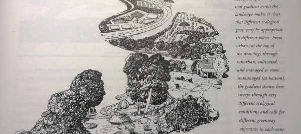


 In this collaborative manual editors Paul Cawood Hellmund and Daniel Somers Smith explain the biophysical natural and social ecological functions of GW, and how they can help to solve fragmentation, conservation and functional problems of the landscape in a changing world adding value to ecosystems and people alike.
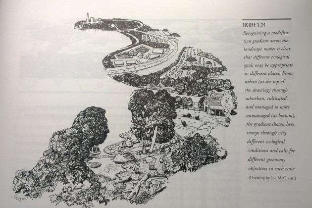 Designing Greenways belongs to a series books with mentors such as Design with Nature (McHarg 1969), The Granite Garden: Urban Nature And Human Design, (A. W. Spirn 1985), and more recent books such as Green Infrastructure: Linking Landscapes and Communities (M.A. Benedict and E.T. McMahon, 2006), Sustainable Infrastructure: The Guide to Green Engineering and Design (S. Bry Sarte 2010), Green Infrastructure: A Landscape Approach (D.C. Rouse and I. F. Bunster-Ossa 2013), just to mention a few. All these works have a common theme: the aim to broadcast the benefits of green infrastructure taking advantage of the natural landscape as mitigation efforts in a world of social and ecological fragmentation.
 Star rating: Excellent, in achieving its own objectives and as a valuable contribution to TNOC readers
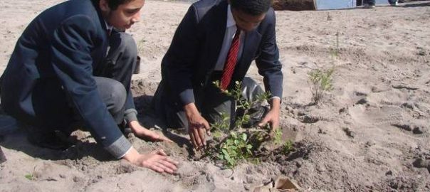
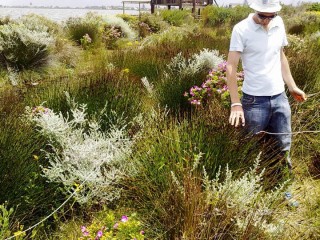
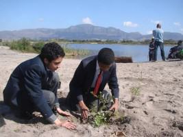
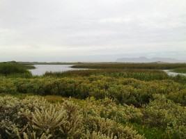
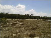
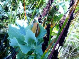
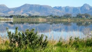
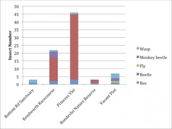
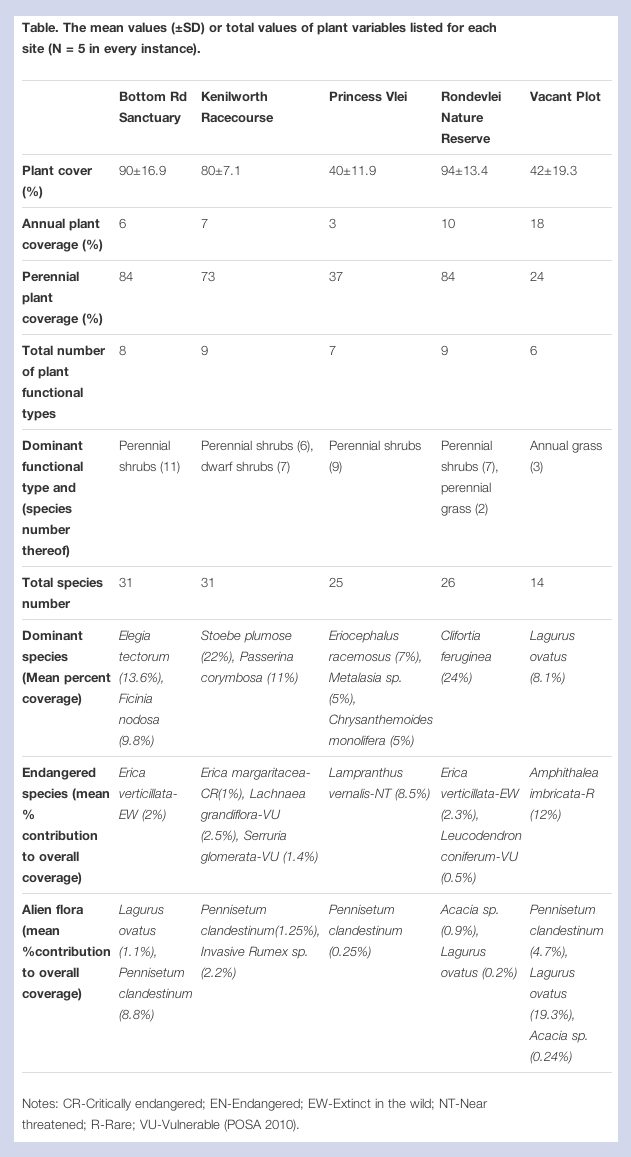 There are some conservation managers who would argue that this kind of endeavor, without ever being self-sustaining without fire or spontaneous propagation (certainly for those fire-driven species prevalent in the Cape Flora), can never be counted as a true contribution to conservation across the city.
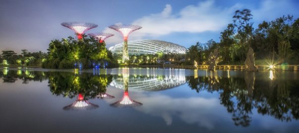
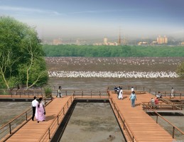
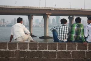
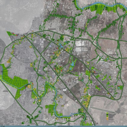
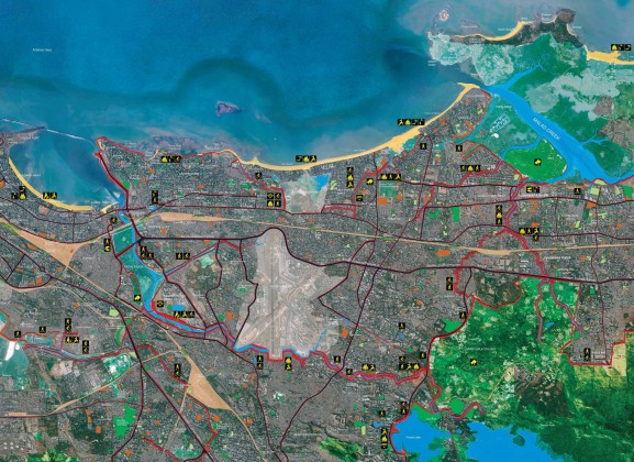

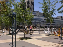
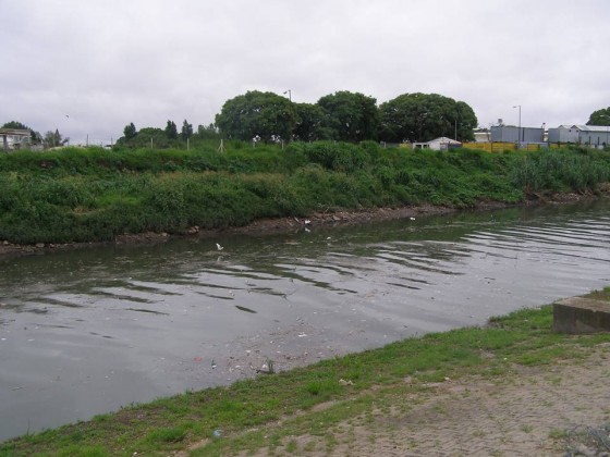
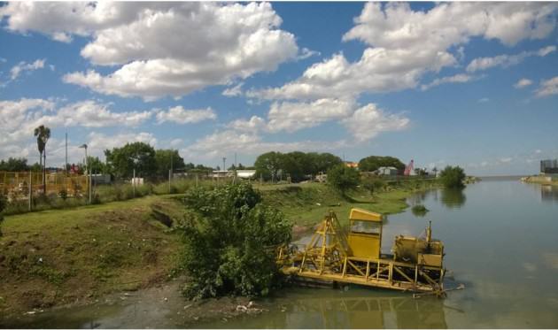
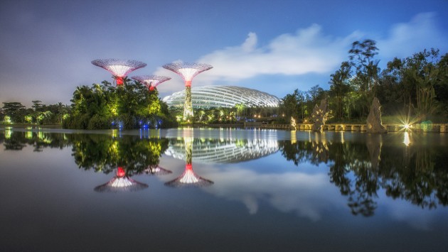
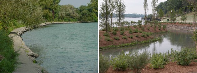
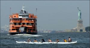
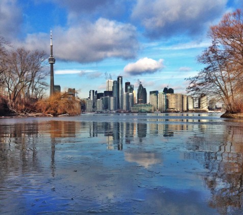
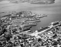
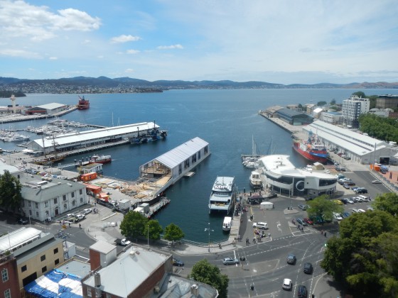
 Standing on the seawall, we were looking across the bay at Miami Beach, the destination of dreams, a skyline squiggle above the water’s surface. Closer, cruise ships lined up at the port like skyscrapers lying on their sides, prepared to visit the exotic Surrounding us were tall buildings assembled at the edge of the land, representing businesses and residents from throughout the hemisphere.
 Successful stories depend on the way we look. At Rodrigo de Freitas Lagoon, Rio’s post-card, there was a trade-off. For landscape, tourism, investors and new residents, it’s a success story. However, new projects create new places of poverty, with lack of infrastructure, to which poor people, losing their original homes, are moved. The transference model has been destructive and inappropriate.
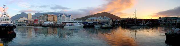

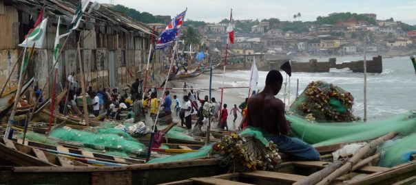
 The sky is the limit for urban agriculture.
 How can art (in all its forms), exhibits, installations and provocations be a better catalyst to raise awareness, support and momentum for urban nature and green spaces?
  Do urban green corridors “work”?
 The Rise of Resilience: Linking Resilience and Sustainability in City Planning
 The ‘Equal Streets’ Movement in Mumbai
 The New is Well Forgotten Old: Scandanavian Vernacular Experience on Biodiverse Green Roofs
 The Nature of a City Economy: Towards an Ecology of Entrepreneurship
 It’s Not Only City Design—We Need to Integrate Sustainability Across the Rural-Urban Continuum
 A Values-Based Approach to Urban Nature Research and Practice
 Natural Parks Define American Cities
 We Should Look at Urban Nature More Through the Eyes of Children
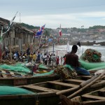 The UN in the Urban Anthropocene
 Sweet by Nature: African Cities and the Natural World
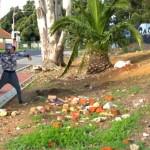 Driving Social and Ecological Change: My Experiment with Guerrilla Gardening
 Forget the Damned Motor Car
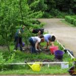 Inviting You to Collaborate with Nature to Transform Your City
 Graffiti on the Path and the Nature of Public Space
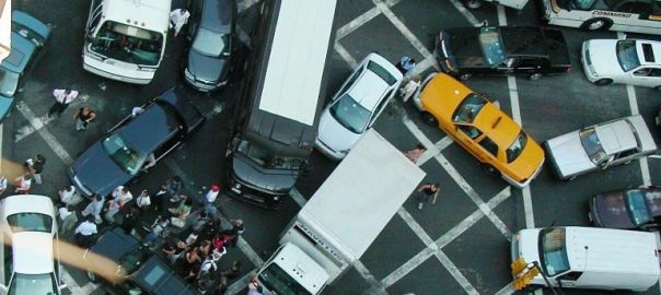

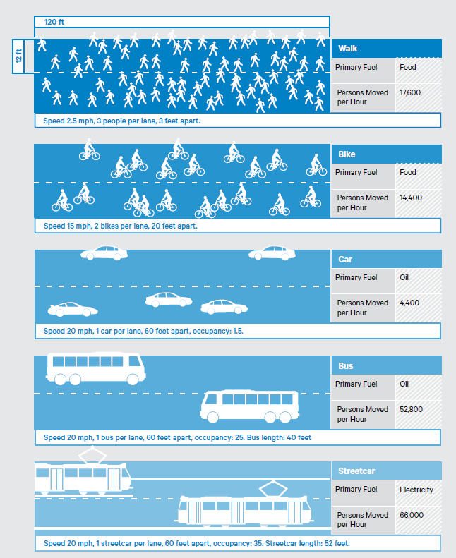
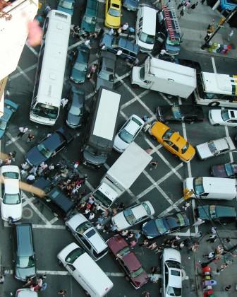
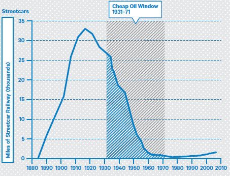
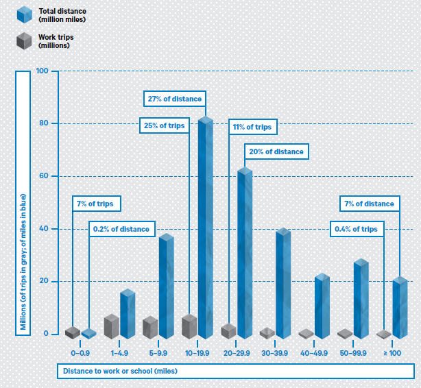
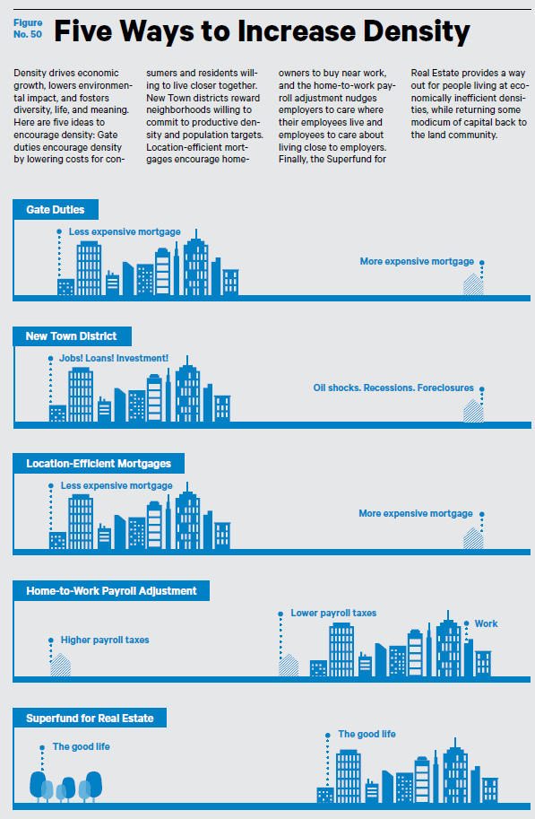
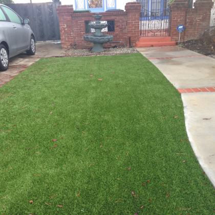
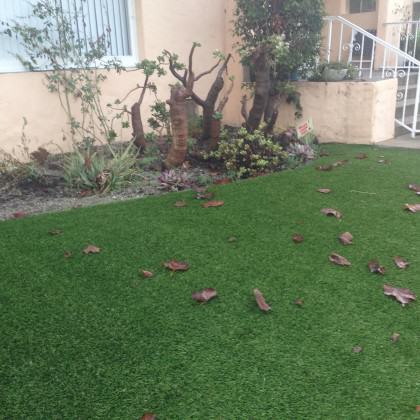 The question then is why green now? Why does the color green captivate us so? What is the substance of the shorthand implied? Perhaps like “sustainability” it is the term of the period and we can no longer even think of any other that conveys sensitivity to the environment. Once launched it is free for the using and manipulation, the twisting of the meaning. In my neighborhood, green now means astroturf instead of lawn, requiring the balding of the earth beneath it and nearly sealing it, impairing the absorption of water. The plastic lawn is then rolled out over it. No life can survive this treatment, no worms or insects, and certainly no food for birds. I was assured it was permeable though, in case we get rain in Los Angeles. To me astroturf is the ultimate green value. Petrochemical companies continue to make profit, nothing really changes in terms of the aesthetic of the landscape. Green as the predominant idea of nature prevails.

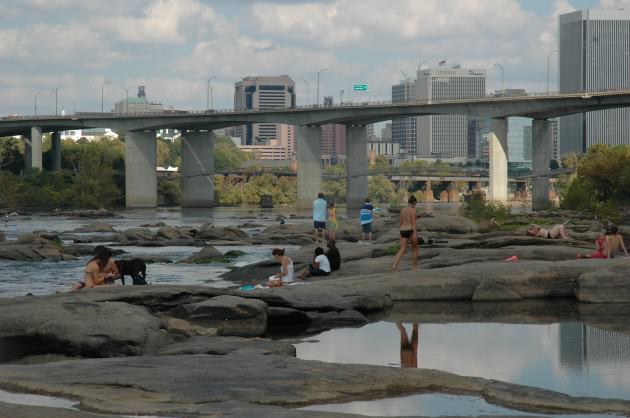
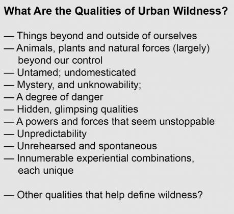 We need to replace the perceptual dichotomy that many still carry in our heads between cities and nature. The evolution in our thinking should encompass the new ways in which flora and fauna are evolving and adapting to cities and urbanization, and we’re only now beginning to understand this. Bird species are changing the frequencies of their songs in response to urban and traffic noise, for instance. And increasingly there are examples of “new” forms of nature, what ecologists sometimes call novel ecosystems, unique assemblages of native (and non-native species and habitats, that have formed in and around cities. Perhaps there is need for unplanned ecological spaces in our notions of urban wildness; making room in cities for a sort of ecological improvisation, with sometimes unexpected results. We will need to adjust our ideas about nature to include these ways in which the nature in the future will be different from what we previously have known.
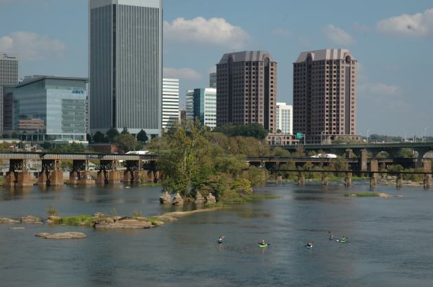
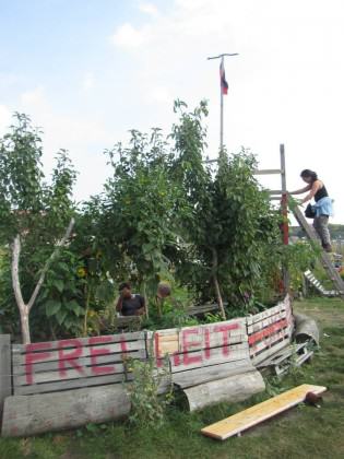 Meanwhile, community interest in the site grew, particularly after the vast space
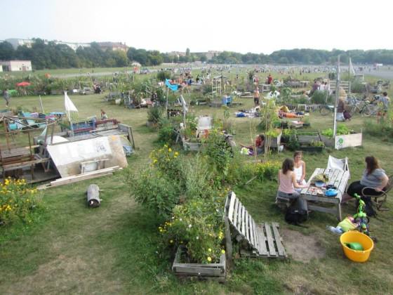
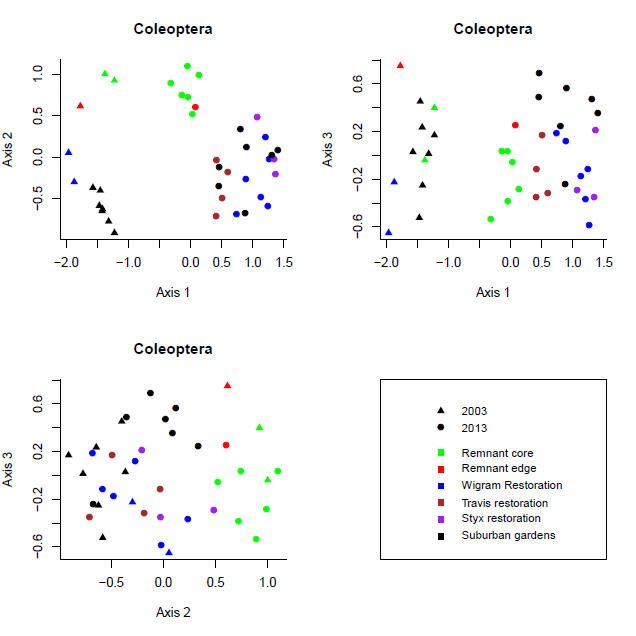
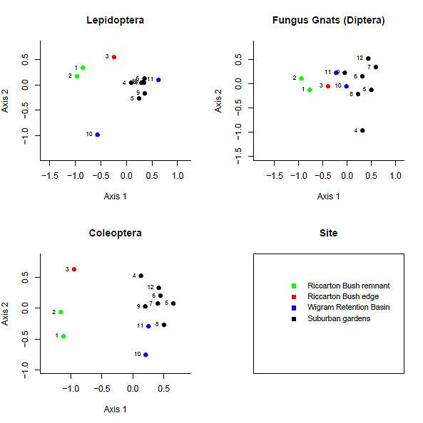
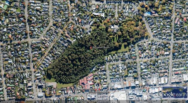

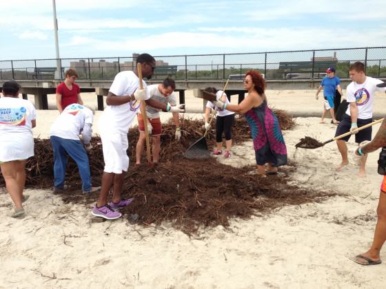
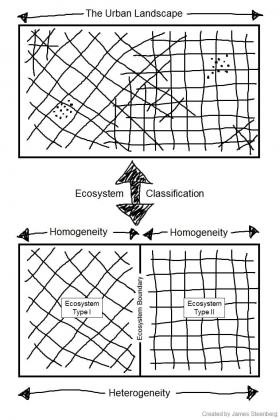 However, in the process of ecosystem classification we knowingly ascribe categorical characteristics to continuous phenomena and draw sharp edges around soft boundaries. This latter issue has been long recognized as a caveat of classifying landscapes – as ecosystems or otherwise. Yet, ecosystem classification has still been recognized as a useful tool for modelling and managing complex systems in its hinterland applications where the emphasis is primarily on biophysical ecosystem components.
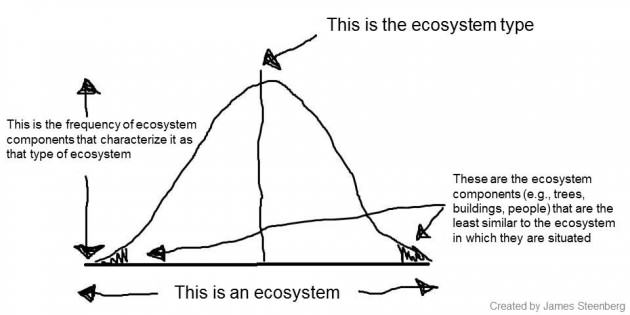 These are my research questions, though I will admit to feeling apprehensive in shifting from the theoretical to the applied. Specifically, the quantification and classification of the ‘human component’ of urban ecosystems is fraught with challenges. For example, ecosystem classification is, in part, a statistical endeavour. As illustrated above, people at that tail end of that distribution curve who occupy the space outside two standard deviations will be the most dissimilar ecosystem components. In urban forest management, this population may be at risk of marginalization—or perhaps equally likely, may be a disproportionally vocal and influential subset of the population and ecosystem. In the context of building ecosystem models, is the omission of social knowledge as acceptable as that of ecological knowledge?
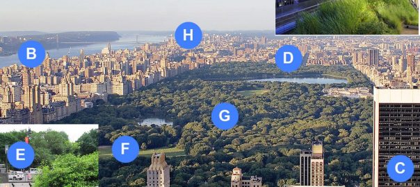

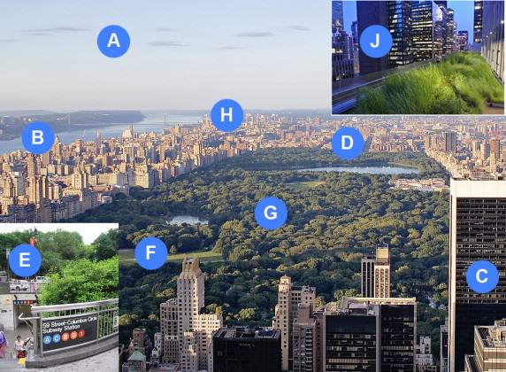
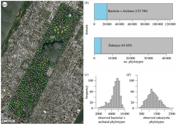
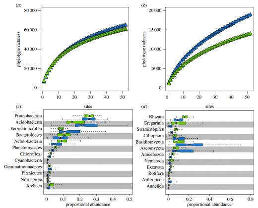
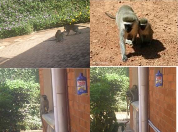
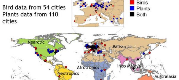
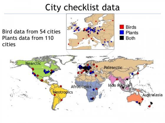
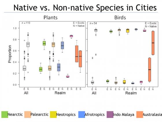
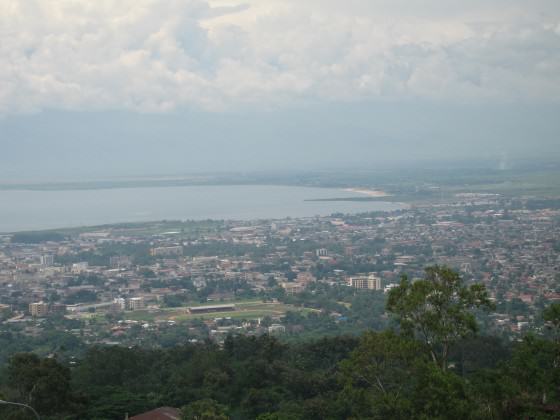
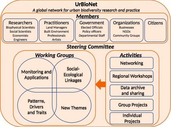
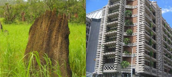
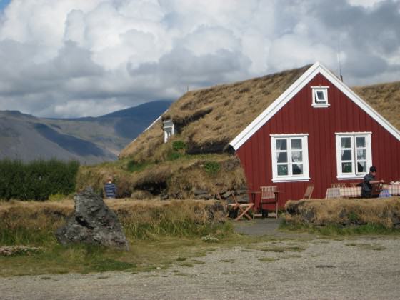
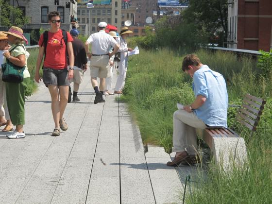

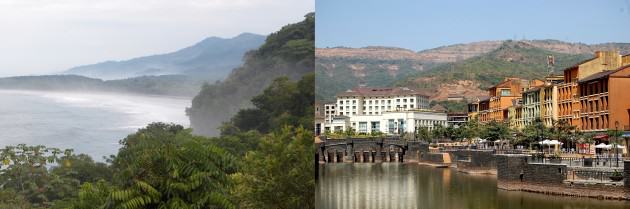
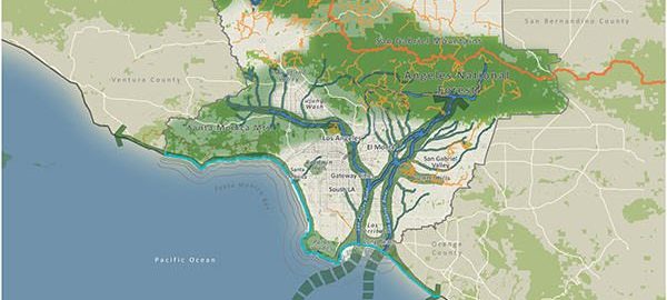
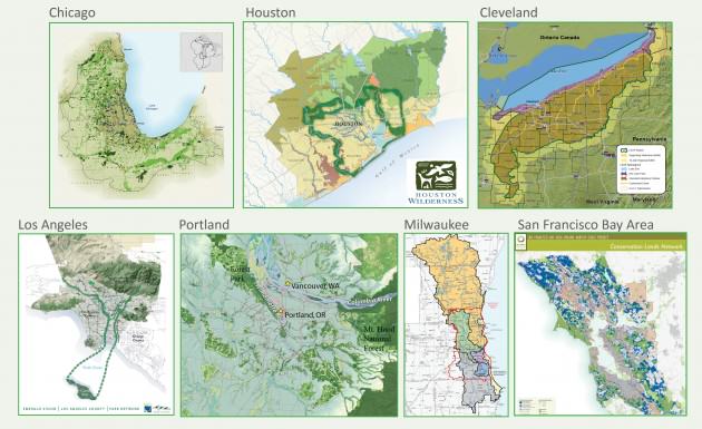
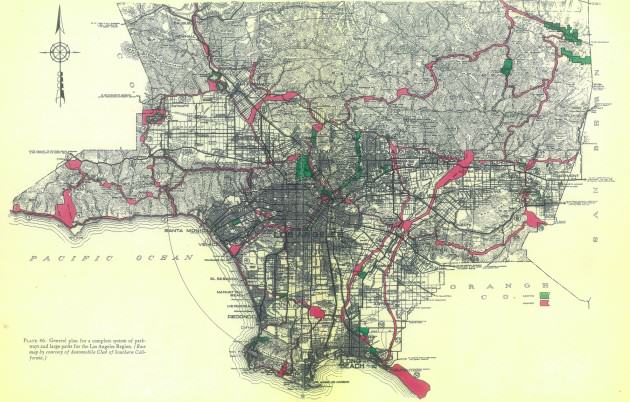
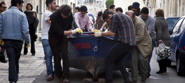


 In the National Gallery of Zimbabwe there are permanent and temporary installations that demonstrate the creative and recreative nature of the people and speak to a number of current issues that trouble the community—gender based violence, child marriages and more. Permanent installations can also speak to a vision of a cleaner and greener urban center. A recent visit to one relatively small gallery in Harare allowed students to view landscapes commissioned by artists who were able to capture the varied nature of lands in particular parts of the country and the students were tasked to think about what scenes they, as artists, would want to highlight in their works—scenes that would not feed racist and voyeuristic ideas of a primitive Africa only suitable for safaris.
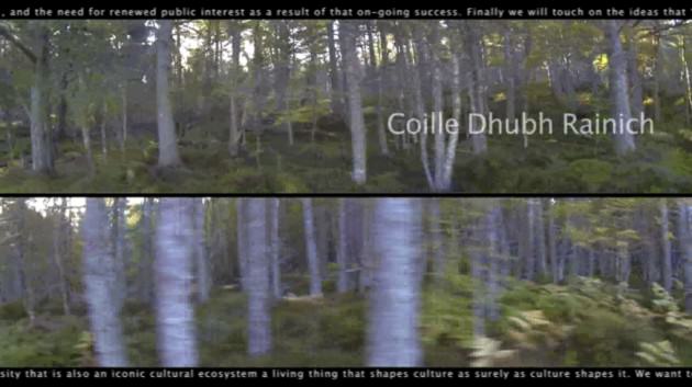
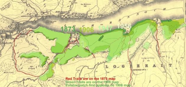
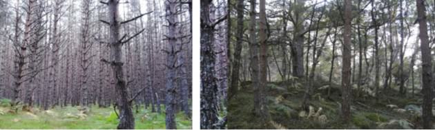


 This FRAMEWORK is a process of inquiry and exchange between artists and designers, research scientists, municipal policy makers, local community groups, and academic partners. Activating the FRAMEWORK are projects and programs that seed sites, with installations, interactive activities, and events. While focused on the unique conditions of specific locales, the projects and programs are designed to set examples that can extend to other cities over time. These activities are conceived to nurture partnerships among disciplines, institutions, neighborhoods, and interested individuals as they work together toward shared environmental and sustainability goals.
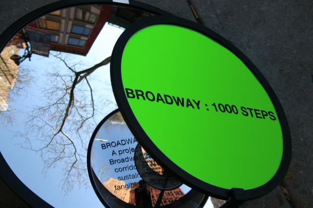
 The yarn bombing project also sparked considerable interest from the general public. Children who pass the campus on their way to school were often seen hugging a yarn bombed cabbage tree. One of our administrators recently e mailed me remarking, “the appearance of knitting on poles and tree trunks has been a talking point for many and add pops of colour around the campus … When I was at my gym in Mana last week, someone discovered I worked at the faculty and talked of their joy of seeing the knitting around the campus”.
 References:
  As we explored Rijeka we found it to be a city simultaneously nostalgic for the material production that marked its industrial history and aware that a new rhythm, a new pattern, can emerge from the possibilities promised by transition. The pier is a metaphor for a struggling city boldly seeing itself anew—in the words of Canadian poet Ross Leckie: “Metaphor is a form of knowing, a way of seeing-as, and from this everything follows, all of our possibilities for ethical and political thinking and being, and certainly our possibility for grace.”
 The pier, as a new public space, is literally a new place from which to view the city and therefore a new way metaphorically to see the city. The storied pier lurks in local consciousness as an object of mystery, as something familiar but with so much yet to reveal. The emergent and abundant creative potential embodied by the pier-as-metaphor became the nucleus of Musagetes’ artistic program in Rijeka in 2011 and 2012.
 Sound Gates (2011) was the first artistic installation to animate the pier in its post-industrial state. Laetitia reimagined the bases of the defunct ship-loading cranes as symbolic gates welcoming residents to the new public space. She installed and camouflaged four homemade speakers—made of aluminum buckets and simple electronics—on each corner beneath the crane structures. An audio player was connected to motion sensors and a random selection of sounds quietly emanated from above when walkers activated the sensors. The volume was subtle enough not to startle but just loud enough for passersby to become vaguely aware of the presence of the sounds. After a moment listeners became fully conscious of, and then transfixed by, the sounds.
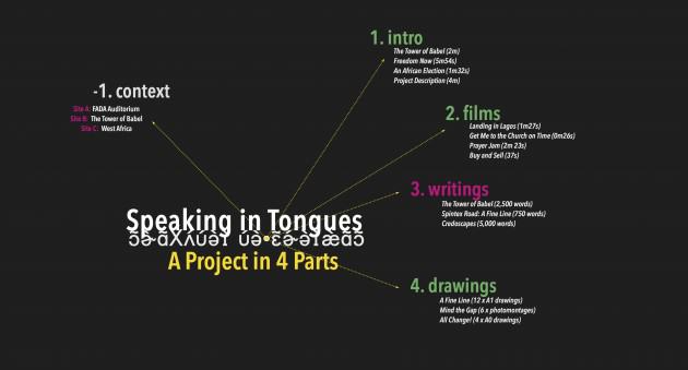

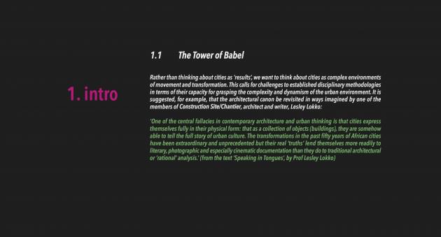 Here’s where some of those drawings ‘grew’ to.
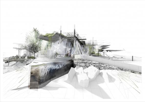
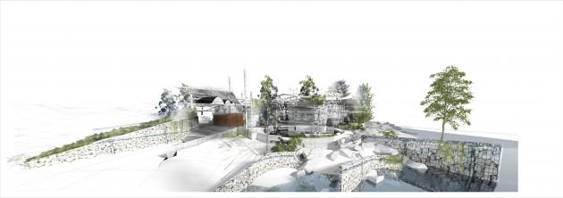
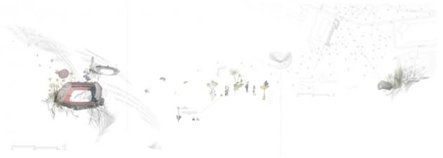


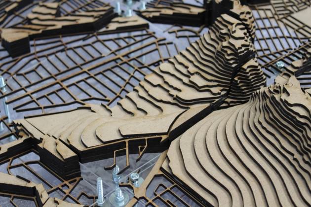
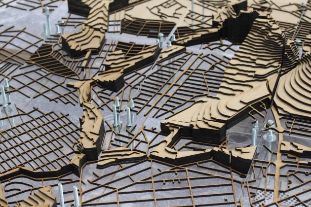


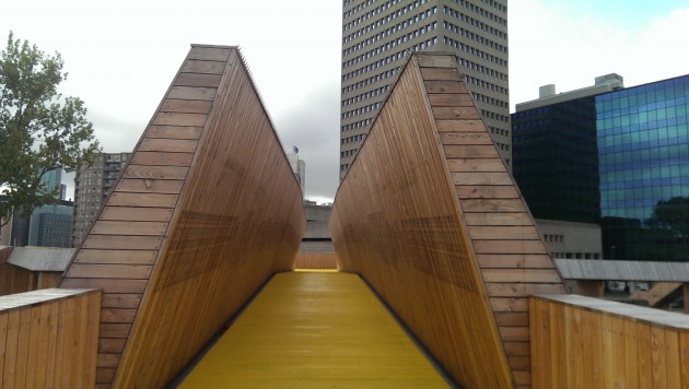
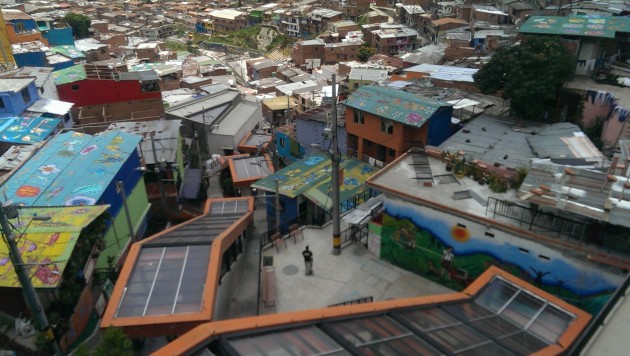
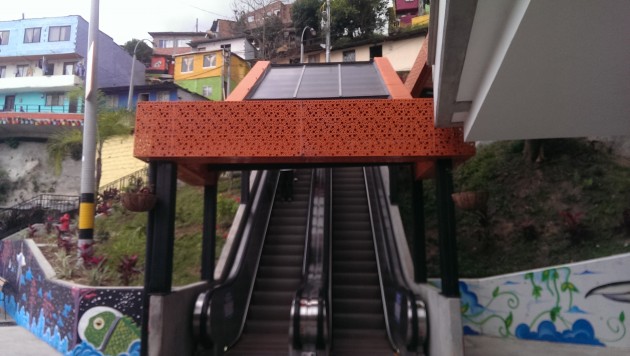

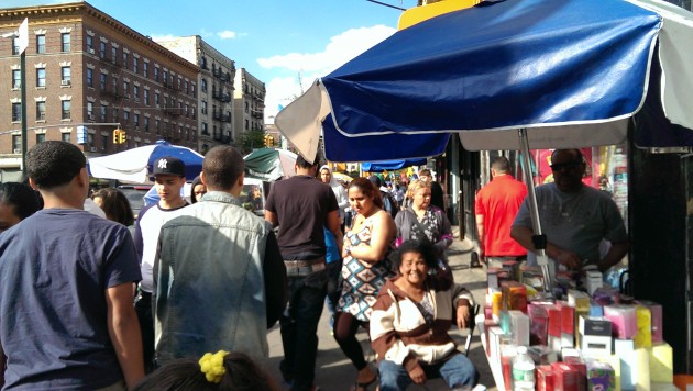
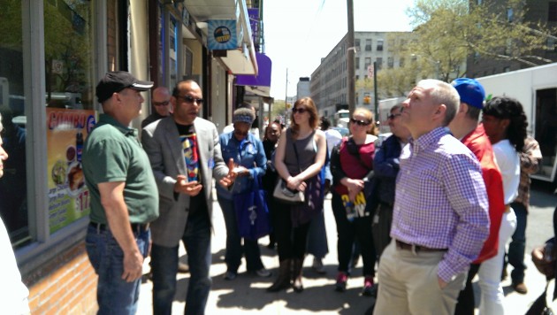
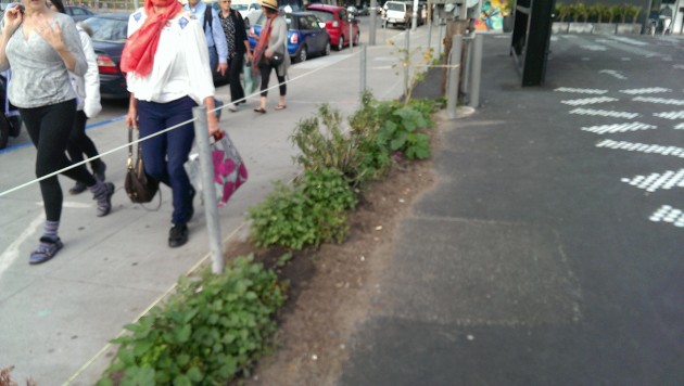
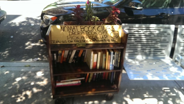


![NASA aerial image of Sanjay Gandhi National Park in Mumbai. By NASA [Public domain], via Wikimedia Commons](https://www.thenatureofcities.com/TNOC/wp-content/uploads/2014/10/Mumbai_metropolitan_region_satellite_image_Landsat-5_2011-01-301-406x420.jpg)
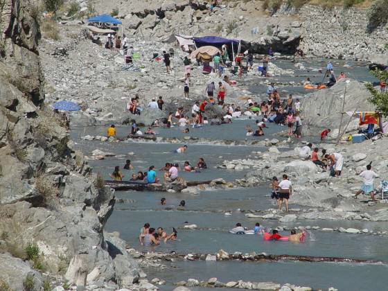
 Reducing impacts of noise and artificial nighttime light. Noise, defined as unwanted sound, and artificial nighttime light can be problems in any protected areas, but those in urban settings are especially vulnerable. Humans and wildlife are both stressed by noise from visitors, road and rail traffic, aircraft, and other sources. Artificial nighttime light interferes with organism and ecosystem function, impedes visitors’ enjoyment of the nighttime sky, as well as astronomy, and can intrude on appreciation of cultural heritage sites in their authentic state. Some urban protected areas are making progress toward protecting natural soundscapes and the nighttime sky by developing indicators and standards, educating visitors, enforcing regulations, and working with local authorities and businesses in adjoining communities.
2 Comments
Join our conversation