Urban China’s Appetite for Land

Art, Science, Action: Cities Re-imagined

Efficient land use for urban development is crucial for limiting urban sprawl, conserving nature around a city, and improving the livability of the city itself. In China, the unprecedented speed of urbanization over the past three decades has unfortunately resulted in widespread inefficient land use, creating problems that only some cities are trying to solve today.

China is already home to the world’s largest urban population of 758 million, which is predicted to reach 1 billion by 2030. With an average of 15 million Chinese rural farmers becoming urban residents every year, there is no question that urban areas in China will continue to feed what may seem to be an insatiable appetite for land. How Chinese cities can satisfy the needs of a growing urban population while expanding sustainably is a critical question that affects so much of the Chinese landscape, from biodiversity to urban carbon emissions.

One of these issues is of particular concern to the central government—the dramatic loss of arable land.
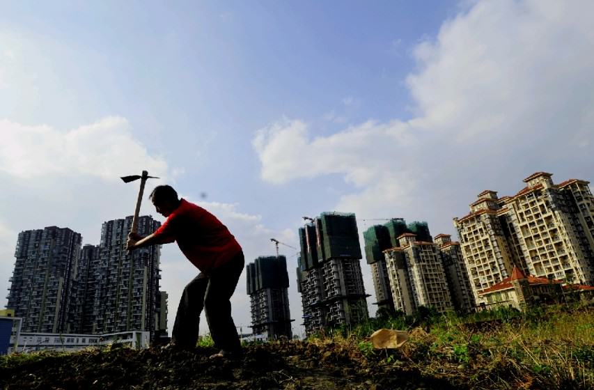
Urban development encroaching upon farmland (Source: China Economy Net “Economic Daily” 中国经济网—《经济日报》)
Urban development encroaching upon farmland. Source: China Economy Net “Economic Daily” 中国经济网—《经济日报》

Hungry for land

China has had an agriculture-based society for thousands of years, so cities and towns have usually sprung up among large swaths of farmland. Over time, urban expansion encroaches into more and more farmland, displacing farmers and reducing China’s total arable land. With a staggering 1.3-billion denizens, China’s arable land is already limited and extremely precious; its arable land per capita is only one tenth that of the US.

However, China’s inefficient land use has seen the nation’s total arable land area drop drastically, especially in recent years (see the figure below). The transition of large amounts of relatively lower-carbon-emitting agricultural land into urban areas has not only removed the carbon sink created by the original vegetation and soil, but has also enhanced carbon emission intensity largely due to construction of roads and buildings.
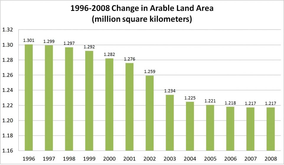
Changes in China’s arable land area from 1996-2008 (Source: China’s national condition profile)
Changes in China’s arable land area from 1996-2008. Source: China’s national condition profile

China now has 121 million hectares of arable land, only slightly higher than the central government’s target of 120 million hectares of protected farmland. Almost every city has enthusiasm for development of industrial parks, places with drastically lower building and population densities compared to old urban areas. Since 2006, the central government has started to designate economic development zones (EDZs) across the nation, with increasingly more rigorous control over the newer EDZs. However, demand for land remains overwhelming and inefficient land use is still prevalent for several reasons, including tax systems and government coordination issues.

Then there’s the complicated issue of carbon emissions. How land is used determines how much carbon is emitted, both during the rural-to-urban conversion process and through urban land use and transportation planning. Emissions generated from China’s farmland represented only 1.84% of China’s land-based carbon emissions in 2008, meaning that farms have a carbon emission intensity of only 3 tons/km2. Converting farmland into developed urban or industrial spaces drastically increases carbon emission intensity to 3,364 ton/km2 and 4,781 ton/km2, respectively (Lu 2011). Common disregard for long-term urban infrastructure planning creates another problem down the line. Roads and buildings built without considering long-term effects have made construction materials and long-term usage of built infrastructure, large sources of carbon emissions themselves. For example, while the construction process and materials required for making a wide road produce carbon emissions, the same road allows for more motorized vehicles to travel and thus generates even more carbon emissions.

Sources of the rapid decline in arable land and increase in carbon emissions from urbanization can often be linked with poor development management systems at different government levels and ministries. Until major reforms are effective, these worrying trends will likely remain unchanged.
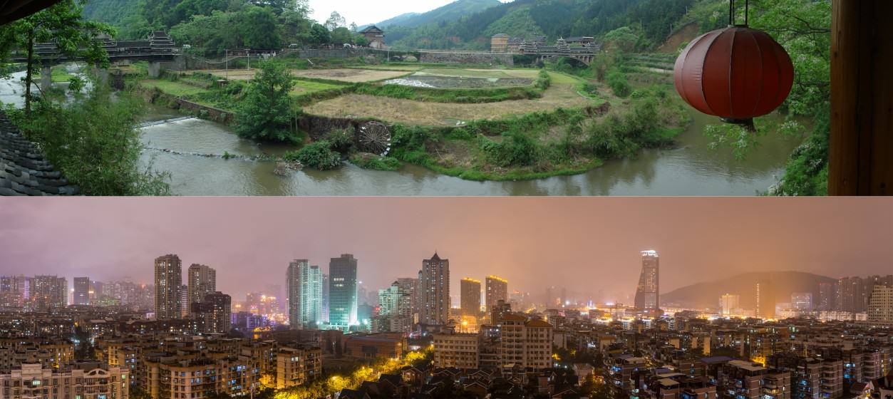
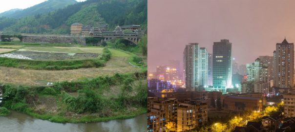
A glimpse of rural China (top) and urban China (bottom) (Sources: top: Samuel Vigier, Creative Commons; bottom: Robert S. Donovan, Creative Commons)
A glimpse of rural China (top) and urban China (bottom). Sources: top: Samuel Vigier, Creative Commons; bottom: Robert S. Donovan, Creative Commons

The Chinese tax regime: a major culprit

When the central government divided its taxes into central and local collection in 1994, easily collected taxes from stable sources became central government taxes, while local taxes were left with taxes from scattered sources that were costly to collect and difficult to administer. As a result, tax revenues for local governments became, and still are, very limited. However, local governments were given the key to a hidden treasure chest—the authorization to convert rural collectively-owned land into urban land for development. This is a huge opportunity given the context that there is no private land ownership In China.

Rural land is owned collectively by local farmers, while urban lands belong to the nation. Local governments can authorize the use of a particular section of land in their jurisdictions. Local governments began to sell the land rights to developers in exchange for land concession revenues. Thus, local governments have been appropriating rural land for urban construction and then using the land concession revenues to address their own fiscal deficits. From 2001 to 2003, China’s land concession revenues amounted to a massive 910 billion RMB, or 35% of local revenues. In 2010, this figure rose to 69% of local revenues. In 2012, land concession revenues climbed to a whopping 2,690 billion RMB (Huang and Cai, 2013). With so much money to be made in rural to urban land conversion and not much to rely on for stable revenue, local governments had no incentive to develop land efficiently. In contrast, this system is largely responsible for the low-density and wasteful land use practices of the past three decades.

Fortunately, the National Audit Office recently launched a nationwide campaign targeting the finances and debts of local governments. Moreover, the politburo just passed the General Plan for Fiscal and Tax Reform. China’s minister of finance indicated that one objective of this reform is to create a tax regime that will level the playing field and unify the market environment, but the details of this plan have not been disclosed yet.

A dance of four ministries

Spatial planning coordination and the creation of a streamlined planning system are gradually gaining more attention in the eyes of the Chinese government. Unlike streamlined planning systems used in most Western countries, China’s spatial planning system is a confusing, “multi-regulation” parallel planning system between four central government ministries. Since the origins, objectives, methods, standards, and implementation periods, etc. of these different programs differ, the agencies get tied up with overlapping, contradictory, and even conflicting issues. This disorganization detracts from the effective allocation of resources and management, negatively affecting land use efficiency.

In August 2014, the four ministries jointly issued a notice calling for a “regulation merger” and selected 33 pilot cities. Prior to this, Tianjin, Shanghai, Chongqing, Guangdong, Beijing and other cities already performed a “regulation merger” trial run, gaining valuable and practical experience. Like the recent tax reform, we still have yet to see how effective this new “regulation merger” will be.

The shining stars

Despite the challenges, there are always some shining examples of progressive cities in China making the shift towards more efficient land use. In our work, we like to highlight these cities’ good practices to encourage other cities to follow their lead. Here are a few of our favorites:

“Landless investment” in Shanghai:
A populous city with a limited carrying capacity, Shanghai is constrained by land availability. Since 2004, some districts have adopted the “landless investment” strategy to develop even where additional land was unavailable.

The goal: to renovate and transform industrial areas while improving the downtown economy and ushering in high rise buildings and the modern service industry.
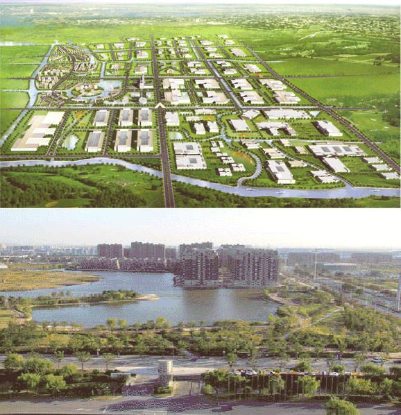
Qingpu Industrial Zone digital rendering (left) and green space (right) (Source for both: Shanghai Qingpu Industrial Zone)
Qingpu Industrial Zone digital rendering (above) and green space (below). Source for both: Shanghai Qingpu Industrial Zone

To transform old industrial parks, investments were given to old companies with excess land to upgrade facilities and increase efficiency. Enterprises with low output per unit of land, high energy consumption, and high pollution emissions were shut down, freeing up land for new, more efficient enterprises. From 2004 to 2005, Shanghai removed 250 enterprises with high energy consumption, low output, and heavy pollution, resulting in 6,875 acres of freed land. The selection process that determined which enterprises could move into the industrial park involved a comprehensive assessment of industry orientation, environmental protection, land demand, and other indicators. Therefore, only enterprises with intensive land use were allowed to establish.

One of the industrial parks participating, Qingpu Industrial Park, developed regulations preventing new investments of less than $300 million/km from establishing, and now requires the expected output to be no less than 3 billion yuan/square kilometer. These regulations clearly define the minimum standards for building density and floor area ratio of land for each project. In Jiading district, 72 prospective projects were assessed, and 32 of the candidates were approved with the average investment per acre at $312,300. These investments across Shanghai’s participating industrial parks also promoted industrial upgrades, resulting in overall economic benefits. With Shanghai leading the way, the minimum capital intensity of land and land use efficiency of the entire Yangtze River Delta region increased.

Redesigning core areas of Chenggong, Kunming:
When Chenggong New Town began construction in 2003, the original plan was covered in superblocks and single land-use patterns, two of the most common yet inefficient urban development patterns in China. Much of the area became packed with buildings of similar appearances and functionality. Excessively wide superblock roads decreased pedestrian safety and bicycle accessibility. Thanks to noise and pollution issues from increased vehicle traffic on the road, buildings were being built further from the road, making pedestrians walk farther just to enter the buildings. These obstacles not only undermined street retail prices, but also reduced transit accessibility and livability of the Chenggong New Town. In 2011, the US Energy Foundation and MoHURD collaborated to launch an urban low-carbon development pilot project.

The goal: to redesign core areas of Chenggong New Town into a transit-oriented hub with mixed land use to create a low-carbon city.

By the time the pilot project was launched in 2011, the original Chenggong New Town plan was partially completed and many projects were under construction. The new plan therefore needed to cooperate with already constructed roads, existing sites, local culture and regulations. Superblocks were replaced by small-scale neighborhoods, which included a multi-functional blend of residential and other buildings. In addition, small-scale neighborhoods favor cycling and walking, reducing the demand for motorized vehicles and increasing the efficiency of buses and private cars. Starting from the transit-dense city center, comprehensive development of offices, retail, entertainment and residential areas have been developed within walking distance. Finally, mixed use neighborhoods encourage walking, which is beneficial for the local economy since walkable cities ultimately increase vitality of local businesses.
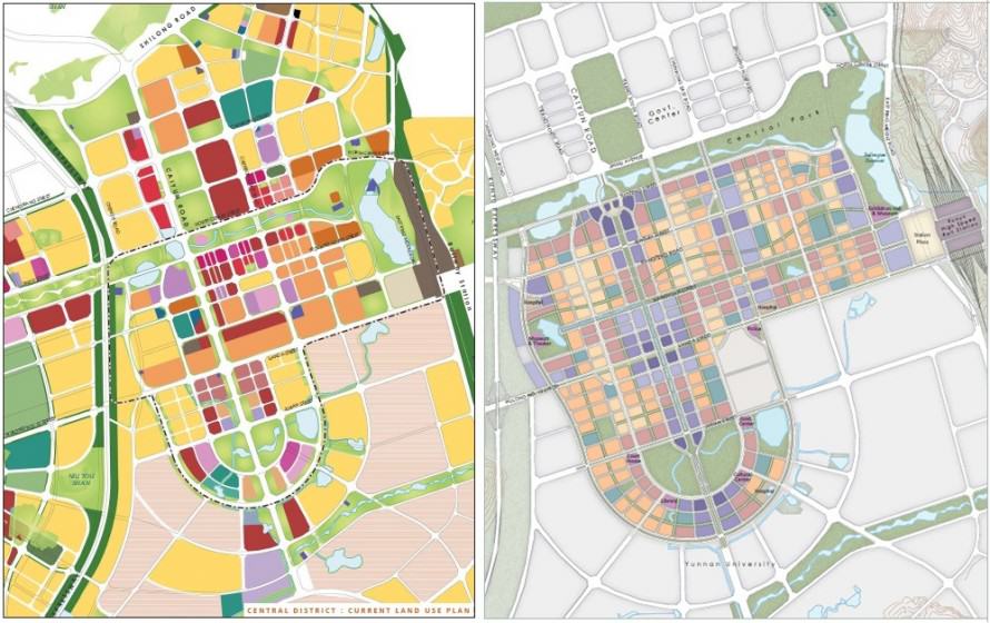
Comparison of superblock design in the original plan (left) and smaller mixed neighborhood design in the new plan (right) for Chenggong New Town. Source: China Sustainable Energy Program of the Energy Foundation and Calthorpe Associates (2011).

Chenggong’s core areas transformed from a network of superblocks into a compact grid of smaller neighborhoods. The new design, with a multi-modal transportation infrastructure, greatly improved land use efficiency and created a more convenient, user-friendly urban living environment. Environmental benefits expected from these results include reductions in vehicle emissions by 72%, greenhouse gas emissions by 59%, and total motor vehicle kilometers traveled by 67%.

Integrated planning in Tianjin Binhai New Area:
In 1994, the Tianjin Municipal Government decided to build upon the foundation of the Tianjin Economic and Technological Development Zone and the Tianjin Free Trade Zone to create the Binhai New Area.

The goal: to develop Binhai New Area as a thriving economic hub and livable ecological city for residents.
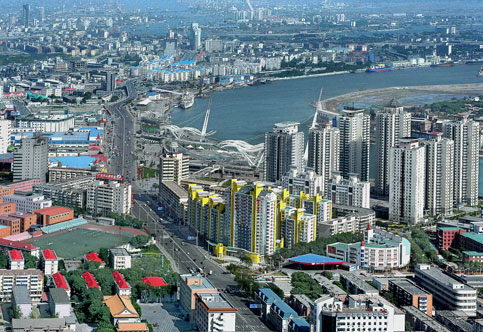
Tianjin Binhai New Area Source: CNRadio.com
Tianjin Binhai New Area
Source: CNRadio.com

Binhai New Area’s success was largely due to its efficient and pragmatic planning and implementation system. First, Binhai New Area established a first-class unified planning system and a master plan with functional area planning, urban planning, and land use planning with a planning period of 20-50 years. The master plan stresses equal importance of environmental protection and urban planning within overall land planning. Secondly, it established unified technical standards for the planning system, which unified land size and standards, along with basic planning details (Wang, 2009). Third, the planning was implemented by the newly created Binhai New Area Administrative Committee for more efficient coordination between different departments. This new district administrative system was much more effective than the old systems were for working within this new model. The Binhai New Area has been wildly successful and has since become the gateway to northern China’s open development. Known as “China’s third economic growth pole”, it is now an advanced manufacturing and R&D hub, a northern international shipping and logistics center, and an ecological city for residents. Tianjin Binhai New Area’s integrated planning model has since become a template for other new district development to follow.

Moving forward

While there are some good examples of more sustainable land use in China, the reality is that the vast majority of Chinese cities are still struggling to use land efficiently, causing the rapid decrease in arable land while increasing carbon emissions. To make the cases of Shanghai, Chenggong New Town, and Binhai New Area more common, key steps that China should take include: 1) universalizing high-density land development; 2) adjusting tax policies to encourage land conservation and intensive utilization; and 3) promoting integrated and coordinated government administration on spatial planning.

The Chinese central government has already launched its fiscal and tax reform, and there is already coordination in efficient land use practices and spatial planning in several Chinese cities. However, China will still need to go above and beyond on a much larger scale and use more diversified methods to reduce its appetite for massive expansion and to develop sustainably for more low-carbon and livable cities.

Judy Li and Pengfei Xie
Beijing

On The Nature of Cities

Note: The content of this blog was extracted from “Climate Change and Urbanization: Challenges and Progress in China”, a report written by NRDC’s China Sustainable Cities Project. The report was endorsed and jointly released by the China Coalition on Urban Sustainability.

References
Lu, N.(2011). Research on Carbon Emission Effects of Land Use Change. Nanjing Agricultural University, Nanjing.

Huang, G. and Cai, J. (2013). Divided Taxation System as a Root Course for Land-based Local Government Revenue – Strategies for Correction 土地财政的分税制根源及其对策, Macroeconomics Research, June 2013.

Wang, CH. (2009). Discussion on Binhai New Area’s implementation of “Regulation Merge”. Port Economy. 2009(8):8-12.

Urban Connectivity is a Catalyst for Leaving No One Behind

Art, Science, Action: Cities Re-imagined
The principle of “leave no one behind” can be made operational through socio-economic and ecological connectivity for overcoming the neglect of equity and inclusion in cities.
The 2030 Agenda for Sustainable Development (Agenda 2030), which is comprised of a global commitment to “leave no one behind” and “endeavor to reach those furthest behind first”, explicitly details neither the pledge to leave no one behind (LNOB) nor establishs a shared understanding of what LNOB means in a city-specific context to drive action and share creative practices. Here I argue that urban connectivity—incidental contact with or direct exposure to the natural or built environment in cities—is closely linked to the broad drivers that contribute to people being left or furthest behind across city scales. I also think that understanding the linkages between urban connectivity and LNOB can inspire action and collaboration on the development of a methodology for city-level assessments of populations and groups who are (or are at risk of) being left behind in any given city, and why they are being left behind. Such advances would inform efforts for achieving SDG 11, which focuses on making cities safe, inclusive, resilient and sustainable.

There are two broad categories of urban connectivity—socio-economic connectivity and ecological connectivity—that can function in a city as catalysts for leaving no one behind. Socio-economic connectivity focuses on the characteristics of urban system services (transportation, sanitation, water, etc.) and the way these play out across different socio-economic groupings to overcome inequality, marginalization, and deprivation. Ecological connectivity, on the other hand, centers on natural and semi-natural habitats in cities (green parks, urban forests, domestic gardens. etc.), and how these are supportive to the ecosystem services needed by urban residents to live and work in the city in the face of inequality and marginalization.

Socio-economic connectivity

In terms of socio-economic connectivity, transport network planning, for instance, can promote urban connectivity at three levels: inter-city connections, intra-metropolitan connectivity, and local-level connectivity. Connectivity gives firms access to input (including labour) and output markets, and it facilitates choices for consumers. It also enables the creation of public spaces for fostering conviviality, artistic expression, street markets, and cultural events that make cities spaces of consumption, entertainment, pleasure, and festivity.

Inter-city connectivity stimulates the growth of secondary and tertiary cities as land- and capital-intensive operations move outward in search of cheaper land that is well-connected to the primary city. This helps to prevent land prices in the primary city from being driven upwards with exclusionary effects. The result is a well-articulated system of primary and secondary cities interconnected by LNOB transit systems that enable different social groupings to access public utilities, jobs, and recreation services, such as India’s freight corridors[1].

Intra-metropolitan connectivity is often characterized by unreliable and/or unaffordable public transport that confines citizens to their neigbourhoods and limits livelihood prospects. Long commuting times can force people into crowded inner-city slums so they can walk to work. If a city faces both of these challenges, economic productivity will be unequal, and wellbeing will deteriorate. Intra-metropolitan transport plans must provide for mixed transit modes that achieve two objectives: increased supply of affordable transport options (possibly by making them compete with each other in real terms, not via false internal markets managed by monopolies to manipulate prices); and minimized congestion and limited pollution. The full cost of individual motor vehicle use should be transferred to the users (e.g., fuel levies, road tolls, charges for single occupancy cars, traffic lanes for multi-occupancy vehicles, congestion charging, etc.), thus raising the personal costs of this mode, which, in turn, will force households and firms to relocate to access public transit services. The result will be strategic intensification, higher land rents, and shorter transport distances, thus fostering urban efficiencies and a more human-scale livable urban environment.

Local-level connectivity, which includes wide traffic-oriented neigbourhood streets connecting large superblocks of gated, low-density residences should be avoided. The street network should occupy 30 percent of the land—this would be equivalent to 18 km of street length with 80-100 street intersections per km2 of residential development. Well interconnected streets with varying widths within these parameters will create a secure but accessible high-quality urban fabric that saves infrastructure costs, reduces energy use, enables non-motorized travel modes and improves efficient through-flows of traffic by 25 percent compared to the wide streets/superblock model[2]. This kind of urban fabric would support building heights of 5 to 8 stories, with relatively small floor area per person ratios—which is only possible if the architectural designs are appropriately inspired by the need for small but highly livable spaces with good natural lighting, effective soundproofing, and a sense of privacy and security. Walkability and biking along tree-lined attractive streets with good pavements and biking paths, benches, outdoor cafes, kiosks, social services and other amenities hold the key to high-quality and safe neigbourhoods. Investments in streetscapes and public spaces will be required to support these kinds of high-density livable neigbourhoods.

Livable streetscape. Photo: Google Images

While London, New York, and Vancouver are well-known for their livable streetscapes[3],  other cities are investing in similar ways: Colombo, Cape Town, and Lagos have invested in public spaces, streetscapes and their waterfront areas, Ahmedabad has used rights-of-way to support pedestrianisation and the BRT, Chennai, and Johannesburg have plans for improving cycling and pedestrian walkability[4].

Ecological connectivity

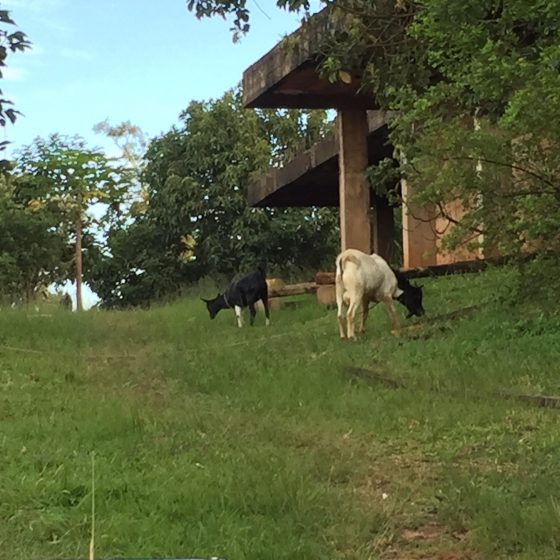
Goats grazing in Muyenga Kampala. Photo: Buyana Kareem

 With regard to ecological connectivity, urban greening interventions that are targeted at community cohesion and improved social relations have created possibilities for improved ecological functioning and ecosystem services. In Kampala, for instance, the planting of indigenous trees and grass in high-income areas like the Muyenga suburb in Makindye Division, attracts not only pollinators and birds but also grazing of animals for small-scale animal husbandry. This, in turn, permits social engagement with the urban poor who stay in low-lying areas but graze their goats uphill, while protecting biodiversity and ecosystem services that can spur the demarcation of green corridors for recreation and urban agriculture in the greater Kampala metropolitan area.

However, Kampala is increasingly plagued by erratic development. Plots of differing sizes are opened up for construction of housing, infrastructure, or industrial development without attention to conservation of green areas, thus affecting the lives of urbanites who are prone to be left behind. For example, women who are typically the primary caretakers of the home in Kampala usually prefer green areas and recreation facilities that are nearer to their residence or within the neighborhood[5].  Women and children need green parks for play fields near to their homes or within recreation centers that can guarantee safe and amenable access by boys and girls, especially during weekends and school holidays. The same category of urban service-users requires good lighting and landscaping, which creates active spaces for women to rest and not feel isolated during their chain of trips and varied destinations at the neighborhood level.

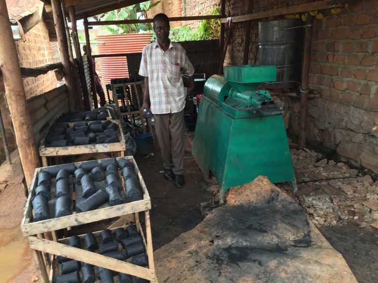
The making of charcol briquettes in Kampala. Photo: Buyana Kareem

Ecological connectivity can also be visualized in the growing waste economy, where organic and inorganic waste processing is gradually gaining ground in Kampala. On a small scale, individuals and community groups helping the poor are experimenting the reuse and recycling of nutrient-rich organic wastes for improved agricultural yields but also recycling of inorganics. But knowledge about the transformation of organic wastes into eco-friendly products has remained at micro scale in communities, even where research and pilots have been undertaken over the last two decades. If they remain at micro-levels of operation, such alternative means of managing the organic waste by turning them into resourceful products, such as energy briquettes, is estimated to recover less than 5 percent of the organic wastes generated in the city[6].

Similarly, New Hope Ecotech, a technology company in Brazil, provides a digital platform to connect manufacturers with waste pickers via an innovative environmental currency, similar to a carbon credit. Founded in December 2014 by Luciana Oliveira and SBAC Lawyers, New Hope Ecotech uses waste recyclables rather than the traditional carbon credit as an environmental currency. By issuing “recycling certificates” to private enterprise, the group helps enterprises to meet their corporate social responsibility commitments or regulatory-based obligations, while aggregating recyclables as an output that directly creates work opportunities for informal waste workers.

In 2015, New Hope Ecotech tracked over 3,600 tonnes of recycled material among 1,120 waste workers across 53 waste management and recycling facilities. New Hope Ecotech issued approximately US$500,000 in certificates to private enterprises. Current clients of the group include AB Inbev, NeoEnergia, Giral Viveiro de Projetos[7]. This is an example of a creative practice for leaving no one behind, which Kampala city could learn from, to enable the transition of the current micro-scale interventions of energy briquettes to meso- and macro-scale, with double edged outcomes of mainstreaming the urban poor into the urban economy while reducing the adverse effects of indiscriminate dumping and management of wastes in the city.

Take-away message on leaving no one behind

The principle of “leave no one behind” can be made operational through socio-economic and ecological connectivity for overcoming the neglect of equity and inclusion in cities. The concept can be visualized in the form of an “LNOB tree”—an image that makes visible the connection between “rooting” (in-building equity and inclusion into urban system services and environmental conservation projects at neigbourhood to city, national and global scales) and “fruiting” (achieving LNOB results and impacts), underlining the message that leaving no one or those furthest behind is a means to an end rather than an end in itself in advancing Agenda 2030.

Buyana Kareem
Kampala

On The Nature of Cities

Notes:

[1] Dhar, S., Pathak, M., & Shukla, P. R. (2017). Electric vehicles and India’s low carbon passenger transport: a long-term co-benefits assessment. Journal of Cleaner Production, 146, 139-148.

[2] Swilling, M., Hajer, M. et al. Forthcoming. The Weight of Cities: Resource Requirements of Future Urbanization. A report for the International Resource Panel. Paris: United Nations Environment Programme.

[3] Harvey, C., & Aultman-Hall, L. (2016). Measuring urban streetscapes for livability: A review of approaches. The Professional Geographer, 68(1), 149-158.

[4] Grieco, M. (2015). Social sustainability and urban mobility: shifting to a socially responsible pro-poor perspective. Social Responsibility Journal, 11(1), 82-97.

[5] Buyana, K., & Lwasa, S. (2014). Gender responsiveness in infrastructure provision for African cities: The case of Kampala in Uganda. Journal of Geography and Regional Planning, 7(1), 1.

[6] http://ual.mak.ac.ug/awelis-green-sustainable-energy/

[7] http://breakthrough.unglobalcompact.org/briefs/wealth-in-brazils-waste-new-hope-ecotech-luciana-oliveira/

Urban Ecological Footprint and Bequeathing a Livable Future

Art, Science, Action: Cities Re-imagined

Speed is irrelevant if you are going in the wrong direction
— M K Gandhi

Will we have enough resources to consume and survive if 60% of the world’s population becomes urbanized by 2030? Are our cities self-sufficient entities? How are we going to satisfy the huge appetite of the growing cities and still be able the leave a livable world for our future? Two per cent (2%) of the world’s land surface, which the cities currently occupy, consumes 75% of the world’s natural resources and discharges an equal amount of waste, causing huge ecological footprints.

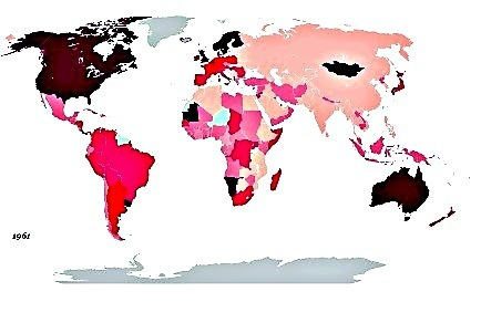
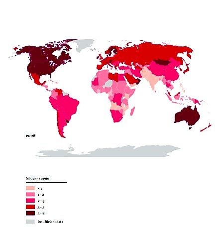
Global map of national ecological footprint per person in 1961 (Global Footprint Network, 2011). Source: Living Planet Report (2012)
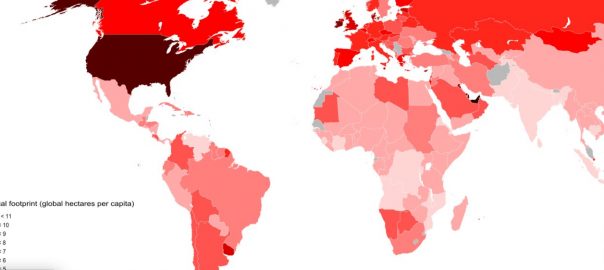
Global map of national ecological footprint per person in 2008 (Global Footprint Network, 2011). Source: Living Planet Report (2012)

“We are using 50 per cent more resources than the Earth can provide. By 2030, even two planets will not be enough” (Living Planet Report 2012, WWF).

Ecological footprint”, a term coined by Rees and Wackernagel in 1992, uses land as currency to measure what we have and what our demands are and how our activities impact nature. It measures the land resources required to support the current consumption levels with current levels of technology for supporting our food consumption, housing, transport and waste production. It is measured in so-called global hectares (GHA), defined as the average productivity of all biologically productive areas (measured in hectares) on earth in a given year. The figures above show how much ecological footprints have increased between the years 1961 and 2008. Against an estimated biocapacity of our planet of 1.87 hectares (per person) — as estimated by Wackernagel et al. (1999) — the average ecological footprint is now 2.2 Gha.

The point of debate in this note is not which country has larger ecological footprints, but rather to point out the fact that cities have large footprints and if we do not curb our footprint it would pose a huge challenge for the policy makers and public. The Future We Want, an outcome document at Rio+20, acknowledged that we must recognize the interlinkages among the three dimensions of sustainability and develop various tools and approaches to measure sustainability in a way that can support growth as well as health of the ecosystems.

The key question is: what are the possible ways to ensure that we bequeath a sustainable planet to our future generations? Some of the solutions proposed in various international debates and fora are:

(1) Reduce the ecological footprints by promoting conservation and sustainable use.

(2) Promote green economies, which would reduce negative environmental impacts, increase resource efficiency and reduce waste.

(3) Engage all the stakeholders of the society — the people, governments, civil society and private sector — in the job of achieving urban sustainability.

The prime thing is to reduce our ecological footprints. The ecologists, conservationists, architects and designers all have proposed several alternatives, such as adopting a landscape management approach to improve connectivity between ecosystem fragments, leaving ecosystems undisturbed, planting native species, controlling invasive species and ensuring ecological succession. These are necessary but not sufficient to bequeath a sustainable earth. Policy makers have a huge role to play to tackle environmental and social issues towards facilitating public acceptance towards naturalistic habitats in urban areas.

I am not advocating that we use a particular measure to see how damaging our activities are. Each approach offers its unique advantages and suffers from limitations. One could use various measurable indicators and environmental planning tools to know where we are heading and how to manage our resources, such as carbon footprints, Biodiversity indices for Cities, ecoBudgets, etc. These indicators are like lists, as pointed out by David Maddox in his earlier essay. Everybody likes to be on the top of the good lists (like clean, green, wealthy) and bottom of ‘bad’ lists (carbon, ecological, water footprints etc.). These lists are useful for managing our environment using different environment management tools like Integrated Management systems, Local Agenda 21, ISO 14001, European Environment Management systems etc, to know where we are heading and how to manage our resources. As mentioned, the applicability of these tools and indicators varies as the situation warrants.

We need to learn from each other’s experiences as even a tiny footstep can go a long way in reducing our ecological footprint. Earlier writers in this series comprising a mix of scientists, designers and practitioners shared their views and showcased successful examples on how we can make “livable ecological spaces”. The UN report on “The economics of ecosystems and biodiversity”, launched at the Convention of Biodiversity-Conference of Parties 10 held at Nagoya, reviewed some successful initiatives at international, national, sub-national, local levels, business and citizens.

Some initiatives which policy makers can take up: create green networks with green belts; arrest urban sprawl through city zoning; promote low energy housing and efficient public transports; develop private green spaces; green rooftops, community gardens, green walls and put more solar plants; and citizens can try and reduce and recycle the waste generation and water use, build green rooftops etc. — all very important initiatives for a green tomorrow.

We also need strong incentives and disincentives to induce change in our behavior. Some ways of modifying citizen’s behaviour include: imposing penalties for consuming more land; promoting bonus and off-setting schemes to compensate for the negative impacts on biodiversity and ecosystems; giving financial incentive to reduce waste through “pay-as-you throw”. Local governments must also assume a regulatory role through imposing building codes for impacts on land/landscape due to construction, regulate waste through promoting polluter-pays principle, impose no vehicle zones to encourage pedestrians and cyclists to suggest some.

Yes, we have promising solutions and possibilities for efficient utilization of resources due to the concentrated nature of demand and supply of cities. I have two examples from Maharashtra to support that recognizing the nature’s values can put nature back in our cities.

The first example shows how the land crunched city of Mumbai tried to increase the retention capacity of the land, which has exceeded its biocapacity — a step forward in reducing the impact that we have created on environment due to our activities. The second example, though not from a city setting, shows how a visionary village which lived above its biocapacity recognized the important role of natural resources management and adopted an integrated model of development, to turn people from abrupt poverty to millionaires.

As urban citizens we need to understand that a ‘magic wand’ does not exist to meet our consumption needs, but comes from nature, and our actions impact nature, which can boomerang. We have lessons to learn from not only these examples but from all over the world.

Example 1: Maharashtra National Park

Mahim Nature Park. Source: Google Images

The first example is the Maharashtra Nature Park, also known as Mahim Nature Park in Mumbai covers an area of 37 acres. The park is situated next to Asia’s largest slum, Dharavi. No one would believe that this lush green forest was created on a five-meter deep garbage dump 20 years ago. This Mahim Natural Park, as a result of the efforts of Mumbai Metropolitan Region Development Authority (MMRDA) and World Wildlife Fund (WWF India), who wanted to tackle pollution in garbage dump and create a much-needed green lung for the city of Mumbai.

Now the park attracts 38 species of butterflies, 80 species of birds, have around 13.500 varieties of species, many insects, reptiles and amphibians. The initiative shows how we can put back nature on a system, which exceeded its biocapacity. Instead of shifting all the filth to some other city or place and damaging the ecosystem further, the effort has resulted in bring back ‘green spaces’, an effort to reduce the ecological footprint of the city of Mumbai.

Example 2: Hiware Bazar in Maharashtra

Hiware Bazar in Maharashtra. Credit: Supriya Singh

Hiware Bazar in Maharashtra is a semi-arid village that from 1970s to 1990s ran out of most of its natural assets. The village faced an acute water crisis as a result of which during 1989-90, only 12% of the land was cultivated resulting in rampant poverty in the region. A number of youth migrated out of the village. In 1990s a visionary leader Popatrao Pawar adopted integrated model of development with water conservation at its core by adopting the following five principles: (1) a ban on liquor, (2) an ban on cutting trees, (3) elimination of free grazing, (4) family planning, and (5) contributing village labour for development work.

During 1995-2000 the village specially targeted ecological regeneration and also took advantage of the Employment Guarantee scheme to regenerate degraded village forests and catchments and to restore watershed ecosystem. The villagers resorted to various watershed conservation techniques like contour trenching and bunding, tree plantation, rainwater harvesting, recharge of ground waters. The irrigation was mainly carried out through drip irrigation, open irrigation and with minimum use of ground water.

Today the per capita income of the village is twice the average of the top 10 per cent in rural areas nationwide. Since 2002, Hiware Bazar is doing an annual budgeting of water, wherein the total amount of water available in the village is measured, uses estimated and then agricultural cropping taken up as prescribed. The Village council’s decisions are binding. Water for drinking purposes (of humans and animals) and for other daily uses gets top priority. Of the remaining water, 70% is reserved for irrigation and 30% is stored for future use by allowing it to percolate and recharge groundwater. Taking this broad framework for water use, a yearly audit is carried out to assess the water available and adjust its usage.

To Conclude

We need to urgently look for doable solutions that can change our lifestyles before it becomes impossible. We cannot wait for a huge revolution to happen. Our footprint is going to get larger but before nature puts a ‘natural end’ to this (Hurricane Sandy, Hurricane Katrina, Cyclone Aila, Massive earthquakes and Tsunamis in Japan, New Zealand, Haiti, Yangtze river floods) we need to act. Recognizing, demonstrating and capturing the value of various ecosystem services and the benefits that they provide to human well-being is a first step to protect our natural resources. We need to get out of our materialistic thinking with “production and consumption” at the centre.

There is a very crucial role that all the policy makers and citizens can play in achieving this goal of reducing the ecological footprints a move towards sustainability. Small footsteps taken by all of us towards achieving the common goal can become a “giant footprint” enough to bequeath as livable planet for our future generations.

Haripriya Gunimeda
Mumbai, India

References:

  • Wackernagel, M., Onisto, L., Bello, P., Linares, A. C., Falfan, I. S. L., Garcia, J. M., Guerrero, A. I. S. and Guerrero, C. S.:1999. “National natural capital accounting with the ecological footprint concept.” Ecological Economics 29(3): 375−390.

Urban Ecology Reformation is Spreading Across the Globe

Art, Science, Action: Cities Re-imagined

Our world is rapidly urbanizing at a rate that is unprecedented in the history of human kind. In 2014, the urban population reached nearly 4 billion people and it is predicted to gain an additional 2.5 billion people, most of whom will reside in African and Asian cities. Although the corresponding urban land cover represents only 1 to 3 percent of the planet, cities are centers of significant power and influence on people, society, economies, and natural resources. The rapid expansion of the global urban population has resulted in more intensification, densification, and outward expansion of existing cities and the creation of new cities.

A new urban reformation is spreading across the globe, which demands changes in how we create new cities and expand existing ones.

There are now numerous mega-cities in the world such as Tokyo, Delhi, New York, Mexico City, and Shanghai that support populations of upwards of 20 million people at densities of over 120,000 people per km2. As cities continue to grow, they stress social, economic, and ecological systems, for they require large amounts of resources, strain transport and other infrastructure, and often create ‘concrete jungles’ that lack greenery and open spaces. In 2011, a UN Global Report on Human Settlements warned that the future synergistic interactions between urbanization and global climate change ‘…threaten the quality of life, and the economic and social stability of human societies around the globemaking them two of the fundamental themes of the 21st century. The magnitude of the global impact of urbanization has been highlighted in a recent issue of Science (20 May 2016) that features a special section entitled ‘Urban Planet’.

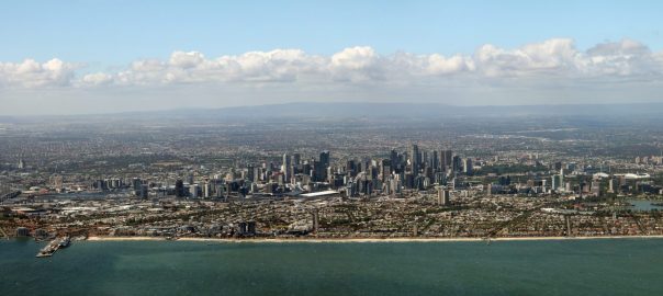
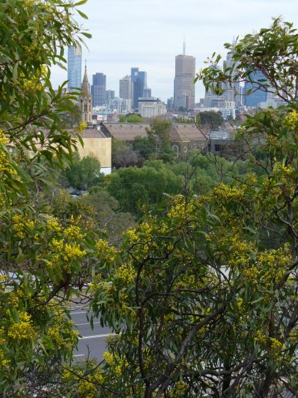
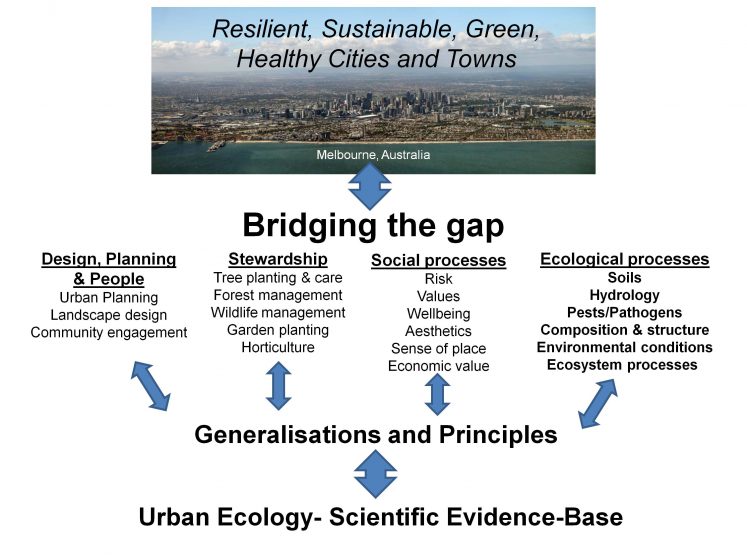
Melb CBD from Studley Park by Nicole MiddletonThe discipline of urban ecology arose in the late 1990s, motivated in part by the rapid rate of urbanization and its often negative impacts on humans and the planet. It was formed through an amalgamation of a diversity of disciplines including geography, ecology, sociology, architecture, planning, and human health, to name a few. The science of urban ecology is primarily focused on increasing our understanding of the ecological and human dimensions of the structure and function of urban ecosystems. Practitioners are engaged in developing evidence-based designs, plans, and construction methods to create and maintain sustainable and resilient cities. We feel that the creation of more livable and healthy cities in the future can only be realized through the synergies achieved by bridging the gap between the science and practice of urban ecology.
Urban ecology: from emergence to reformation

Today, large and small cities are struggling to address myriad environmental and social challenges that impact human health and well-being, including poor waste management systems, inadequate energy supplies, poor food quality and availability, as well as environmental problems such as air, soil, and water pollution. In addition, there are direct and indirect effects of the creation of more urban land on local, regional, and global biodiversity and critical ecosystems.

Over the last 20 years, discontent has grown amongst urban dwellers worldwide, accompanying the erosion of their quality of life and its impact on their well-being. A well publicized example of this occurred in 2013 in Istanbul, when a large protest erupted over the building of a shopping centre in one of its most famous parks (Gezi Park). The residents were angry and frustrated at the loss of one of the last green spaces in that part of the city.

Figure 1 TNOC Blog McDonnell_ MacGregor-Fors and Hahs 23Jun2016
Figure 1. Components of the discipline of urban ecology ultilised to bridge the gap between science and practice. Photo of Melbourne, Australia by James Relph.

Other examples of the growing environmental activism in urban centres around the globe include the recent mass protests in China and Vietnam by residents who do not want to live near industrial plants that pollute the environment. We propose these are examples of a new urban reformation that is spreading across the globe, which demands changes in how we create new cities and expand existing ones. This change in approach (i.e., reformation) explicitly calls for the inclusion of principles of ecology and social justice in the development process.

To address and mitigate the social and environmental challenges associated with the rapid urbanization of our planet, urban ecology researchers and practitioners are synthesizing ecological and social data from cities around the world to identify ecological and social generalizations, principles, and theories that can help guide new approaches to design, construction, and management. Historically, cities have been created and managed based on best practices in planning and engineering, as well as the architectural and design standards of the day. Thus, modern cities have essentially been built and managed in such a way that people, buildings, transportation systems, water, energy, nature, and economic systems were studied, planned, designed, and managed separately in professional, academic, and administrative silos. The adoption of a more holistic or system approach that explicitly includes ecological and social justice principles thus forms the cornerstone of this new urban ecology reformation.

Bridging the gap between science and practice

Urban ecology research has commonly focused on identifying mitigation and adaptation actions to help reduce the negative impacts of human activities. Many cities around the globe are actively working to improve the health, liveability, resilience, and sustainability of their city, and there are several global initiatives to support these efforts, including the C40 Cities, 100 Resilient Cities and the ICLEI Cities Biodiversity Centre’s Local Action for Biodiversity (LAB) program. Research partnerships are being developed to inform future actions on a diversity of themes, including understanding, protecting, and enhancing biodiversity; creating and managing ecological linkages; and creating biodiversity-friendly environments by minimizing negative impacts on animals, plants, soils, and ecosystems. Public participation initiatives are encouraging and assisting the public to experience and value biodiversity and urban ecology in general. By incorporating these elements into mitigation and adaptation strategies, they are effectively bridging the gap between the science and practice of urban ecology (Fig 1). Worldwide, there are a number of examples of cities that are active participants in the new urban ecology reformation including Baltimore (US), Chicago (US), Curitiba (BR), Durban (SA), London (UK), Phoenix (US), Portland (US), Sydney (AU) and Vancouver (CA) to name a few.

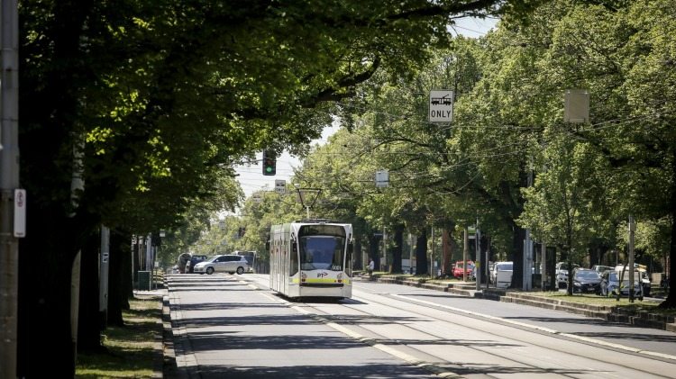
Melbourne trees and trams
Melbourne trees and trams along the Royal Parade. Photo: City of Melbourne

One example of a city which is actively participating in all of the global initiatives, as well as providing leadership in the areas of research partnerships and public participation, is the City of Melbourne, Australia. To date, the City of Melbourne’s actions to create and maintain a green, healthy, liveable, and resilient city include a number of strategies and initiatives that cover climate change, open space, water, vegetation, and biodiversity. The city’s Urban Forest Strategy has received international recognition, for both the approach and targets it sets for its highly developed municipality. The City of Melbourne has also worked to share this knowledge more widely through the “How to Grow an Urban Forest” guide, which was developed and delivered in conjunction with 202020 Vision program. It is clear to us that Melbourne is one of the leaders in this new urban ecology reformation, and there are many other cities in Australia that have also joined this movement. While we still face many challenges associated with an “Urban Planet”, it is clear that the discipline of urban ecology and the many research-practice, and public-private partnerships that utilize this knowledge will play a leading role in our efforts to reduce the impacts of urbanization on urban dwellers and the environment, and create a more promising outlook for the future of our planet.

Mark McDonnell, Ian MacGregor-Fors, and Amy Hahs
Melbourne, Veracruz, and Parkville

On The Nature of Cities

Ian MacGregor-Fors

About the Writer:
Ian MacGregor-Fors

Ian MacGregor-Fors is a researcher at INECOL (Mexico). His interests are broad, but he focuses on the responses of wildlife species to urbanization.

Amy Hahs

About the Writer:
Amy Hahs

Dr Amy Hahs is an urban ecologist who is interested in understanding how urban landscapes impact local ecology, and how we can use this information to create better cities and towns for biodiversity and people. She is Director of Urban Ecology in Action, a newly established business working towards the development of green, healthy cities and towns, and the conservation of resilient ecological systems in areas where people live and work.

Urban Farming for Everyone / La Agricultura Urbana para Todos

Art, Science, Action: Cities Re-imagined

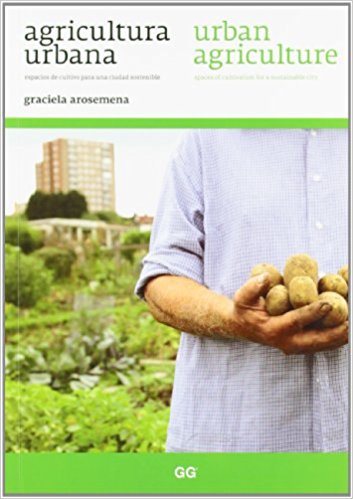
A review of: Agricultura Urbana – Espacios de Cultivo para una Ciudad Sostenibles / Urban Agriculture – Spaces of Cultivation for a Sustainable City by Graciela Arosemena. 2012. 128 pages.  ISBN: 9788425224232.  Buy the book.

The material presented in this book not only considers the merits of urban agriculture, it also provides insight, knowledge and techniques to make urban agriculture an activity accessible to everyone.
Urbanization has gone hand-in-hand with agriculture from the beginning. Even in medieval times, when walls and defensive structures left most of the farmland outside the city perimeter, agricultural patches were available inside the city and next to the city walls. Jane Jacobs assumes that agriculture was initially within the first human settlements that can be considered as primitive urban places, and migrated to the countryside only later. But while cities and agriculture have long been inseparable, everything changed during the twentieth century. Increased mobility and progressive globalization made pointless the previous need for geographical proximity between the farmers and the urban consumers. Farming was then more or less banned from the city under the combined forces of urban densification and planning regulation. This period could be qualified as the great rupture.

In her short book Urban Agriculture, Graciela Arosemena, gives an overview of urban agriculture’s history until the great rupture and asks a question: Now that agriculture has moved outside the city, is it time to bring it back again? Her answer is “yes”, for many reasons which she associates with the idea of making cities more sustainable. In her vision, urban agriculture can stop the vicious circle of real estate speculation, provide a healthy leisure, foster social cohesion, support a new management of organic waste to reduce city’s ecological footprint and provide food security—if not complete self-sufficiency—by allowing citizens to consume locally grown vegetables and ripe fruits.

She relies on Ebenezer Howard’s interest for self-sufficiency in his garden cities and the philosophy of ruralizing the city—which she improperly attributes to Ildefons Cerdà, when in fact it was the idea of one of his followers, (the linear city of Arturo Soria y Mata)—to legitimize her vision of urban agriculture. As everybody knows urban agriculture has become trendy in recent years. Does it still need to be legitimized? Maybe not, but this book is a lot more than a pro domo plea: this short, bilingual book (English and Spanish, on facing pages) is a kind of “Swiss army knife” about urban agriculture. Its material is not only made of considerations on the merits of urban agriculture, it also provides insight, knowledge and techniques to make urban agriculture an activity accessible to everyone. Graciela Arosemena shows how parks and public spaces, gardens, terraces, roofs, and balconies can be converted to cultivating different types of vegetables and fruits. She also shows how organic waste can practically be used to grow fresh food while reducing the ecological footprint of the city. The book is full of photos displaying the different places and techniques for the introduction of agriculture in the city.

This publication can thus be considered as a clear, well-structured and conceptually attractive handbook about how to reintroduce agriculture in the city. But there is much more to it than just that: it also gives insight into how agriculture can transform the practices of urban planning. Indeed Urban Agriculture – Spaces of Cultivation for a Sustainable City summarizes Graciela Arosemena’ doctoral thesis, in which she considers that urban agriculture should be a key element of planning within the urban system. Different examples—in Vienna, Toronto, Havana, Rosario, Barcelona and Gerona—display how gardens and farming lots may penetrate the smallest nooks and crannies of the urban fabric, materializing an emergent movement that the author coins as “global social”.

Now that the urban agriculture is getting so “à la mode”, it is time to move forward and include it officially into urban policies. From this perspective, this book provides us with very valuable seeds for reflection and action. It provides a set of criteria and strategies for intervening in the realms of urbanism and construction that can be helpful to architects, landscape designers and city planners, but also to everyone interested in urban gardening.

François Mancebo
Paris

On The Nature of Cities

Click here to buy the book at Amazon. Part of the proceeds return to TNOC.

Urban Form and Urban Nature After the COVID-19 Pandemic

Art, Science, Action: Cities Re-imagined
The COVID-19 pandemic persisted long enough to accelerate existing trends, leading to what appears likely to be persistent changes in urban form.

The COVID-19 pandemic is slowly receding and, while it still is a fatally serious problem in some places, it is possible to imagine it at least receding into an endemic disease. It is perhaps, therefore, a good time to reflect on what COVID-19 has meant and will mean for urban form and urban nature. In a previous post on TNOC, my coauthor and I argued, among other things, that the effects of COVID-19 on urban form were likely to be transitory. I was wrong. What seemed like a sensible argument in 2020 now doesn’t make sense. The COVID-19 pandemic persisted long enough to accelerate existing trends, leading to what appears likely to be persistent changes in urban form.

The simplistic version of the story is that COVID-19 led people to abandon cities for rural areas. I believe this simplistic version of an urban to rural migration to be a myth, with little support in the empirical data. The popular press sometimes equates “city” with the dense cores of major metro areas, or just focuses on major metro areas and their population trends. But when you look at urban areas as a whole, the fundamental trend does not seem to be migration to rural areas, but migration within and between urban areas.

Moreover, this migration seems to apply only to a few. Only about a quarter of workers in the US can work fully remotely, a figure that is likely much smaller globally. For these “knowledge workers” (a similar but broader set of people than Richard Florida’s famous formulation of the Creative Class), it was surprisingly possible to work remotely from their homes. However, many more workers have place-based jobs, jobs that must occur in a certain place, either because they are service jobs (e.g., wait staff in a restaurant) or because of centralized facilities (e.g., factory workers). The discourse then about COVID-19 leading people to abandon cities only applied to a small slice of (relatively well off) workers.

One unexpected effect of the COVID-19 pandemic was long-distance migration between urban areas, and sometimes between countries. This is best understood as families “going home” to solve problems associated with COVID-19. This could involve returning to family after the loss of a job, to save on the cost of housing. Or it could be, for instance, moving closer to relatives to deal with a lack of childcare caused by the widespread closing of daycare and schools. Whether these long-distance migrations are temporary or permanent is unclear but, at least in the short-term, the usual directions of global immigration reversed. Indeed, new immigration (away from relatives to a new country) appears down in most places.

My family is an example of such a long-distance migration home. While my wife and I thankfully held on to our jobs during the pandemic, two-income families like ours in the U.S. faced a severe childcare crisis. Schools were closed for in-person instruction for almost 18 months, leaving parents with the challenge of working remotely while also serving full-time as teacher’s aides and IT consultants. There was a sense of the U.S. society falling apart, of each family being left to fend for itself. For my French wife, there was some envy of how quickly French schools reopened compared with American ones, and a newfound respect for how difficult it is to be separated from one’s family by an ocean when borders begin to close. Moreover, our (now former) city of Washington, DC, was a particularly difficult place to weather the COVID-19 pandemic. Between civil unrest and an attempted coup on January 6 (2021), it was a grim time to be in the nation’s capital. My family and I ended up taking an opportunity to resettle in the Basel area. I am grateful for the opportunity, and the flexibility of my employer in allowing me to work remotely in the same job. Our family ended up moving from the Washington, DC metro area (population 6.3 million) to the Basel metro area (population 600,000), closer to my wife’s family (although farther from mine).

Our story is but one example among millions of stories of families responding to COVID-19. On average, prior immigrants tended to return to their home countries. There was a movement also from large to small metro areas. In the US, for instance, there was a movement away from big city metros like New York, San Francisco, and Los Angeles, and an acceleration of a preexisting trend toward growth in small metro areas in the South and West of the US. There was also an uptick in people settling in smaller towns and cities that have low costs of living but natural beauty, like Bozeman, Montana. Conversely, there does not appear to be a strong migration from urban areas to rural areas, per se. We might predict, then, that a consequence of COVID-19 globally, at least in the short to medium term, is a slowing of the growth rate in the world’s largest and most dense cities, but an acceleration of growth in small and medium-size urban agglomerations.

Perhaps more common than long-term migration is a shift within urban areas. One can move 50km out of a core urban area, to areas that are much lower density exurbs, and still be within the broader metropolitan area, as defined by commuting trends. For instance, a team member of mine moved to West Virginia rather than being near company headquarters, but may still be within the Washington, DC, metro region, as defined by the US Census Bureau. We might predict, then, that COVID-19 globally has led, at least in the short to medium term, to relatively faster growth rates in far suburbs and exurbs, and relatively slower growth rates in center cities.

One primary driver of this migration within urban areas was the need for more space in housing. City centers have more economic possibilities, for jobs and consumption, but they also have more expensive rent, which leads to smaller sizes of housing units. Households always balance the pros and cons of proximity to urban centers. The COVID-19 pandemic appears to have accelerated significantly an already existing trend toward increased telework. This drastically increased the time we all spent at home, increasing the value of having more space at home. To an urban economist, then, it is a very rational response to move farther from city centers, and get more space at home, if proximity to the urban core is no longer as important. Whether this is permanent or temporary depends on employer’s telework policy but, it should be noted that, in a sense, COVID-19 simply accelerated a transition that has been going on for much of the last century, of decreasing urban densities in metro areas.

Another driver, at least anecdotally, of this move to far suburbs or exurbs is a desire for more parks and nature nearby. A large body of hedonic research shows that proximity to parks and natural areas is an amenity people are willing to pay for during normal times, and health researchers find physical and mental health benefits of time in nature. The COVID-19 pandemic, by reducing other entertainment options, appears to have increased the premium people are willing to pay to be located near natural areas, and this increased access may have been easier to obtain in rural areas. There is also some evidence that desire to access nature during the pandemic was increased, and there is even some evidence that those who have more access to nature are less likely to develop cases of COVID-19. I am hopeful that the desire to be near natural areas that many felt during the pandemic, as well as the rhetoric of policymakers around a “green recovery” to COVID-19, will lead to many communities (small and large) investing more in parks and open space.

While this shift to far suburbs and exurbs appears economically rational, it may have real negative consequences for the natural work. We might predict increased habitat conversion at the fringes of metro areas, as the real estate market responds to increased demand. We might predict increased vehicle kilometers traveled and increased GHG emissions, especially if remote working ends and commuting for knowledge workers restarts. For those now working remotely from a long distance, there is the potential for increased air travel. There is an analogy here to the invention of the Internet, which enables more remote teams but also led to increased business travel- teleworking appears to be a complementary good for physical travel, rather than a substitute.

As the joke goes, predictions are always hard, especially when they are about the future! But that caveat said, it seems likely to me that the increased tolerance for telework mostly persists. We will still live in an urban world, but a less dense, more diffuse one. The world’s urban network may be a bit more polycentric rather than having an intense concentration of talent in an industry in just a few metro areas. For those with place-based jobs, however, urban areas will face a prolonged period of transition, as firms adjust to the new distribution of customers. It is still an urban world, but COVID-19 has altered its form.

Rob McDonald
Basel

On The Nature of Cities

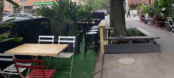
Banner image: Street dining in Brooklyn in the shade of a street tree. Photo: Erika Svendsen

Urban Gardening As a Response to Food Supply Issues in Dense Urban Areas During the COVID-19 Crisis

Art, Science, Action: Cities Re-imagined

En español.

Urban gardening can be adapted to the reality of Santiago and other cities with similar characteristics. In Santiago, urban gardens that provide secure sources of healthy food could be implemented not only in common spaces, roofs, and balconies but also in median strips and tree pits along streets.
In December 2019, the city of Wuhan, China, reported the first case of Coronavirus. Since then, the virus has spread rapidly, reaching more than 31,300,000 cases worldwide (as of September 2020, according to John Hopkins University). Globally and regionally, a series of measures have been taken to slow down the spread of the virus, affecting millions of people in the way they live, work, socialize, and stock up on supplies.

In Chile, the first infected person was confirmed on 3 March 2020. Since then, the government has decreed several measures including mandatory quarantine, lock-down, border closure, and the closing of urban parks, nature parks, and nature reserves. Despite these restrictions, four months later, there were more than 280,000 cases in Chile.

The government and media have mainly focused on the number of infected persons, whether or not to continue with the quarantines/lock-down, and when to resume normal social and economic activities. But other situations are happening at the same moment that can’t be overlooked.

Due to the crisis, many people have shopped excessively in supermarkets, generating a shortage in the food supply and leading to a surge in pricing. Adding to this, the economic impacts of the pandemic have led to reduced pay and/or loss of employment for many, making it very difficult for them to maintain themselves and their families. For these families, food supply has been a daily challenge since the crisis started. The COVID-19 magnifies the inequalities that have always existed, food security being a basic amenity.

In this context, questioning our source of food supply and distribution is imperative. Is it safe, healthy, and accessible? While advocated quite widely for years, urban gardening presents itself as a highly viable practice to ensure food security in times of crisis like the one we are experiencing (Armanda et al. 2019; Poulsen et al. 2015). Urban gardening refers to the production of vegetables within the urban context (Wunder, 2013), being one of the most common activities of urban agriculture. The scale of vegetable production can be highly variable, from community and collective gardens to a micro-scale production such as roof-top gardens, green walls, backyards gardening, and street landscaping (Pearson et al. 2010; Dinis et al. 2018).

Urban gardening in Santiago, Chile, is an activity that is in an early stage. It is mainly developed by civil organizations such as NGOs, artists, neighborhood organizations, and university initiatives, although it is also supported by some municipalities (Contesse et al. 2018). In general, the development of urban gardening has been associated mainly with community gardens. However, there are no available studies on the development of urban gardening on the micro-scale even though it has become more popular in recent years.

Considering the COVID-19 crisis, where thousands of people have been under lock-down with reduced social interactions, the development of urban gardening on a micro scale is emerging as the most appropriate alternative.

While the virus does not distinguish between sex, age, or origin, those living in small spaces, in overcrowded conditions and without sufficient economic resources to support themselves are undoubtedly more vulnerable. In Santiago, there have been several demonstrations during the course of the pandemic. For these communities, food insecurity is a matter of survival.

Vulnerable communities are often located in high-density urban and peri-urban areas. In low-housing neighborhoods, houses are in precarious conditions, gardens are usually expanded to incorporate more family members, generating overcrowded conditions. Similar conditions are seen in high housing neighborhoods. In both cases, there are few green areas or quality public spaces available, and they are commonly associated with insecurity and crime. Slums are extreme examples where vulnerable families live in more than precarious conditions.

Gardening in sacks

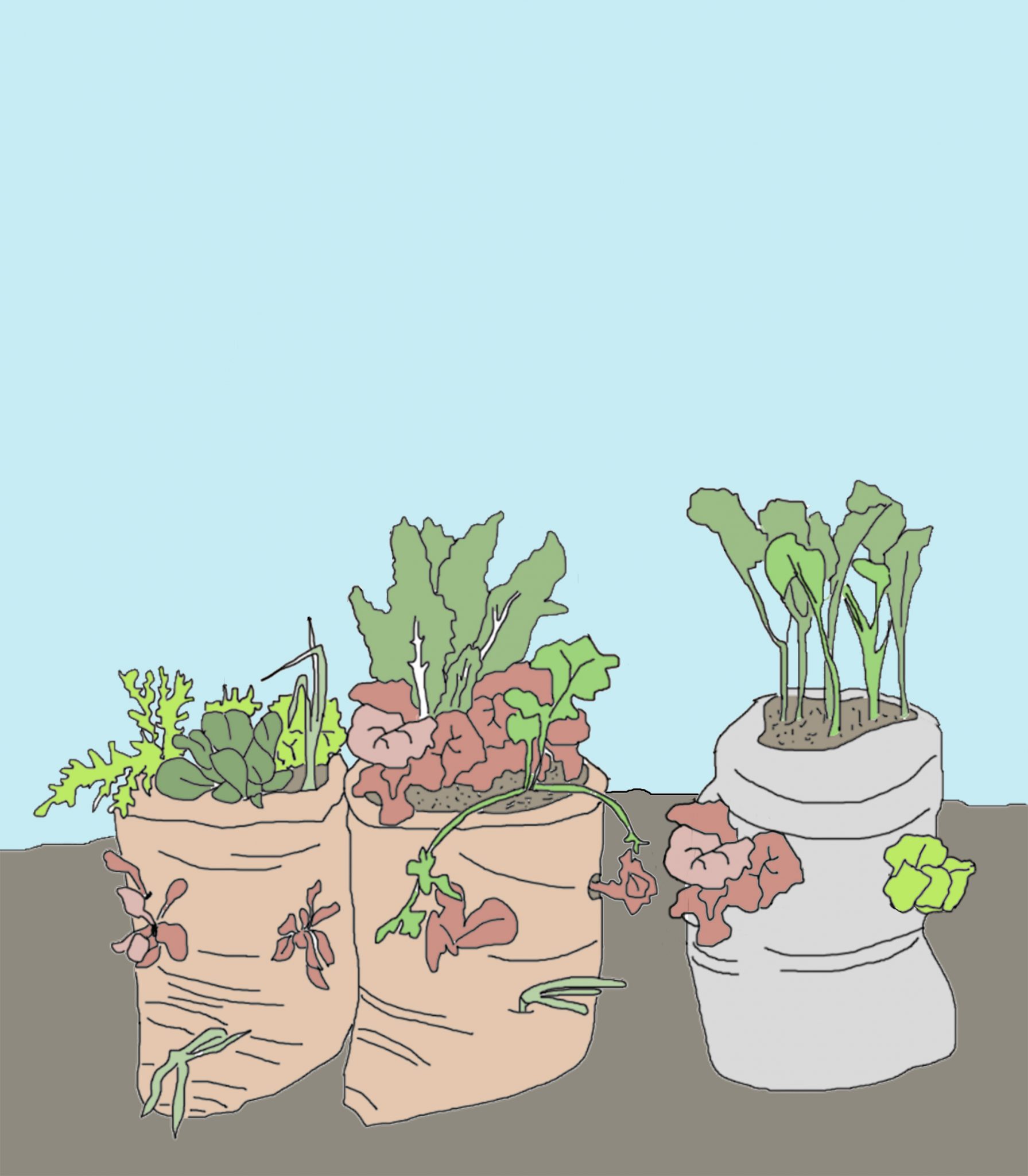
When we think about the incorporation of urban gardening not only in the context of low income but also of high-density neighborhoods where the availability of public and private space is limited, it becomes necessary to look for alternatives that can adapt to these specific conditions. Sack gardening is an urban gardening method that is suitable to be implemented in such conditions. In this method, vegetables are planted on the top and sides of sacks. Gallaher et al. (2013) found that sack gardening in the Kibera slums of Nairobi, Kenya, has a great impact on families’ food security. Faced with challenges of severe poverty and malnutrition, sack gardening in Nairobi has made an important contribution to increasing the diversity of the households’ diet and being a source of nutrition in times of shortage (Gallaher et al., 2013). The use of sacks allows people to produce several vegetables in a limited space that they usually share within their communities.Another example of urban gardening in similar contexts is the roof-top and balcony gardening in Rio de Janeiro’s “favelas”. Since 2003, the Brazilian government has provided funding for urban agriculture projects, one of which is the urban gardening project in the favelas, part of Rio’s Sustainable City program (Ortiz, 2012). People interested in growing vegetables participate in an organic agriculture workshop that educates them on different techniques for growing crops in household planters. People usually share their terraces or balconies to garden with neighbors, that is to say: plant, maintain and harvest together lettuce, arugula, watercress, cherry tomatoes, rosemary, and mint, among other vegetables and herbs (Ortiz, 2012). The possibility of planting in underused spaces such as roof-tops and balconies allow people to develop urban gardening despite living in high urban density contexts.

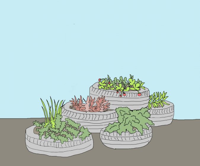
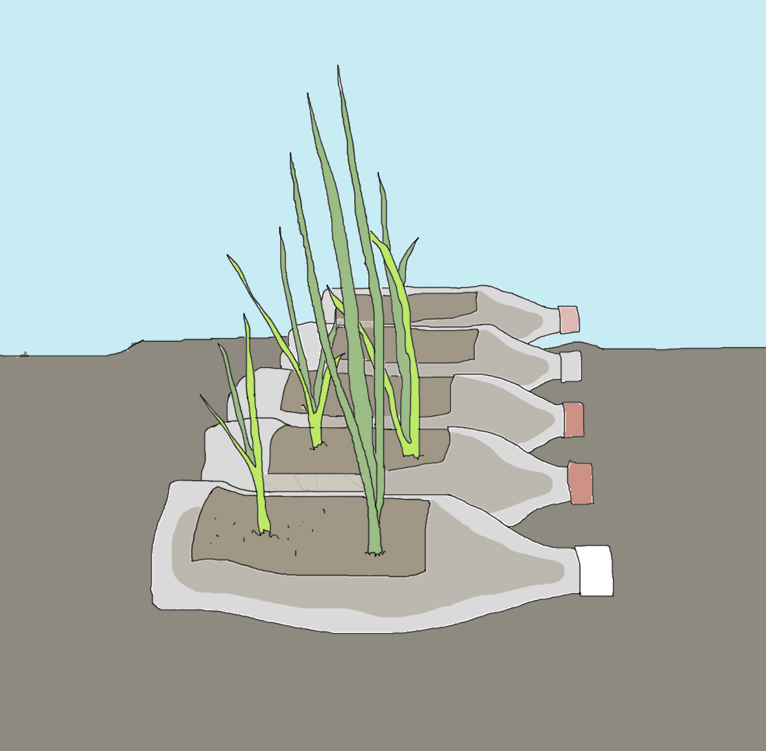
Both examples of urban gardening can be adapted to the reality of Santiago and other cities with similar characteristics. In Santiago, urban gardens could be implemented not only in common spaces, roofs, and balconies but also in median strips and tree pits along streets. As crop containers, sacks are easily available materials and can have great acceptance to be used as containers. In addition, there are many other materials that are usually discarded and can be reused for cultivation: bottles, tires, and pallets.

Gardening in tires
Gardening in bottles

All these different procedures of urban gardening can be developed by the families themselves at a very local scale with the potential to expand to the community scale. In these times of reduced social contact, urban gardening projects could augment community building in innovative ways and build upon the social potential of these communities. The possibilities to exchange different types of vegetables and to sell them in order to have an extra income are activities that can still be done within the restrictions advised during the pandemic. Working in shifts to avoid person-to-person contact can be an alternative to maintain the crops, without losing the support within the community members. Urban gardening at the community level could nurture these relationships and help communities as a cohesive unit to overcome the current crisis and be better prepared for future events.

Urban gardening can be a response to a safer, healthier, and accessible way of food supply and distribution. It is more secure, especially as it can help families from being affected by shortages of supply, ensuring at least basic nutrition. It is healthier, not only because of the contribution of organic vegetables to the diet, but also due to local availability either at home or within the community reducing the need to travel too far to shop, and thus reducing the risk of contagion. This would also reduce food being passed through several “hands” before reaching the consumer. And accessible, because of the availability and low resources required for production and distribution.

Families do not have to be in dire need of producing their own food, but when the state is unable to guarantee the food security of its citizens, alternatives such as this should be supported, especially because the role of the state is fundamental, even more in times of crisis. Santiago de Chile has a path initiated in urban gardening that has great potential for further development, and this may be an opportunity for that. Education on urban gardening would allow local residents to engage in it. The circulation of manuals and development of workshops suggesting the types of vegetables and how, where and when to plant them, along with the delivery of basic materials such as soil and seeds, would be a first step to offer communities tools to better cope with this crisis and empower them in urban gardening development. NGOs, the local government, or even universities, can be key stakeholders in developing this educational process.

The COVID-19 crisis not only raises the question of how vulnerable we are as people, but also whether the way we are building ourselves as a society benefits us all or not. The traditional form of food supply has been stretched to its limit, and it is important that we implement other alternatives as soon as possible.

Constanza M. Cerda
Stuttgart

On The Nature of Cities

References:

Armanda D., Guineé J. and Tukker A., 2019. ‘The second green revolution: Innovative urban agriculture’s contribution to food security and sustainability – A review’. Global Food Security 22 (2019) 13–24. Elsevier.

Contesse M., van Veliet B. and Lenhart J. 2018. ‘Is urban agriculture urban green space? A comparison of policy arrangements for urban green space and urban agriculture in Santiago de Chile’. Land use policy 71 (2018) 566-577. Elsevier.

Dinis, A., Marquez R., Santos C. and Martins, M. (2018) ´ Urban Agriculture: A tool for towards more resilient urban communities?´ Environmental Science & Health 2018 5:93-97, Elsevier.

Gallaher C., Kerr J., Njenga M., Karanja N. and WinklerPrins A.,  2013. ‘Urban agriculture, social capital, and food security in the Kibera slums of Nairobi, Kenya’. Agric Hum Values (2013) 30:389–404.

Ortiz F. 2012. Urban Agriculture Sprouts in Brazil’s Favelas. Tierramerica. September 25, 2012.

Pearson C., Pilgrims S. and Pretty J., 2010. ‘Urban agriculture: diverse activities and benefits for city society’. Ed. Earthcan 2010.

Poulsen M., McNab P., Clayton M. and Neff R., 2015 ‘A systematic review of urban agriculture and food security impacts in low-income countries’. Food Policy 55, 131-146.

Taylor, W., and Goodfellow T. 2009. ‘Urban poverty and vulnerability in Kenya: The urgent need for coordinated action to reduce urban poverty’. Nairobi: Oxfam GB Kenya Programm.

Wunder S. (2013) Learning for sustainable agriculture: Urban gardening in Berlin. With particular focus on Allmende Kontor. Support of Learning and Innovation Networks for Sustainable Agriculture  SOLINSA.

* * *

La horticultura urbana como respuesta a los problemas de suministro de alimentos en zonas urbanas densas durante la crisis de COVID-19

Los huertos urbanos pueden adaptarse tanto a la realidad de Santiago como a otras ciudades de características similares. En Santiago, los huertos urbanos, que proporcionan una fuente segura de alimentos saludables, podrían implementarse no sólo en espacios comunes, techos y balcones, sino también en los bandejones centrales y en las bases de infiltración para árboles a lo largo de las calles.

En diciembre de 2019, en la ciudad de Wuhan, China, se reportó el primer caso de Corona-virus. Desde ese momento, el virus se ha esparcido rápidamente, llegando a más de 31,300,000 casos a nivel mundial (a septiembre de 2020, según la Universidad de John Hopkins). Tanto global como regionalmente, se han tomado una serie de medidas para desacelerar la propagación del virus, afectando a millones de personas en la forma en la que viven, trabajan, socializan y se abastecen.

En Chile, el primer contagio fue confirmado el 3 de marzo del 2020. A partir de ese día, el gobierno chileno decretó medidas como: cuarentena obligatoria, bloqueo de las fronteras y cierre de parques urbanos y reservas naturales. Pese a estas restricciones, cuatro meses después, el número de contagios alcanzaba la suma de 280,000 casos.

Tanto el gobierno como los medios de comunicación han puesto su foco de atención en el número de personas infectadas, si continuar o no con las cuarentenas y bloqueos, y  cuándo comenzar a retomar las actividades sociales y económicas. Sin embargo, hay otros eventos, ocurriendo a la par de la crisis, que no deben ser pasados por alto.

Debido a la crisis, muchas personas se han sobre abastecido, generando escasez en el suministro de alimentos y con ello alza en sus precios. Sumado a esto, las repercusiones económicas de la pandemia han llevado a una reducción generalizada de los salarios y/o a la pérdida de empleos, haciendo aún más difícil que las familias puedan abastecerse. Para estas familias,  el suministro de alimentos ha sido un desafío diario desde el inicio de la crisis. Sin dudas, la crisis generada por el COVID-19, ha magnificado las desigualdades sociales que siempre han existido, siendo la seguridad alimentaria una necesidad básica que ha quedado expuesta como un ámbito especialmente frágil.

En este contexto, cuestionarse sobre las fuentes de abastecimiento y distribución de alimentos es imperativo: ¿Son ellas seguras, saludables y accesibles? Aunque se han defendido ampliamente durante años, los huertos urbanos se presentan hoy como una práctica especialmente viable para garantizar la seguridad alimentaria en tiempos de crisis como la que estamos viviendo (Armanda et al. 2019; Poulsen et al. 2015). Los huertos urbanos conllevan la producción de hortalizas dentro del área urbana (Wunder, 2013), siendo ellos una de las actividades más comunes de la agricultura urbana. La escala de producción de hortalizas puede ser muy variable, desde huertos comunitarios y colectivos hasta una producción a micro-escala, como los huertos de techo, los muros verdes, los huertos en patios y en las áreas verdes de acceso público (Pearson et al. 2010; Dinis et al. 2018).

En Santiago de Chile, el desarrollo de huertos urbanos se encuentra en una etapa temprana. Principalmente, ha sido impulsado por organizaciones civiles, tales como ONGs, artistas, organizaciones vecinales e iniciativas universitarias y, en algunos casos, han sido apoyados por municipios (Contesse et al. 2018). En general, el desarrollo de los huertos urbanos se ha llevado a cabo a través de huertos comunitarios, y a pesar de que su desarrollo en la micro-escala se ha hecho más popular en los últimos años, aún no se dispone de estudios sobre ello.

Si considerarnos que durante la crisis del COVID-19, miles de personas han debido permanecer en sus hogares y reducir al mínimo sus interacciones sociales, el desarrollo de los huertos urbanos en la micro-escala, se perfila como la alternativa de abastecimiento de alimentos más adecuada.

Si bien el virus no distingue entre sexo, edad u origen, quienes viven en espacios reducidos, en condiciones de hacinamiento y sin recursos económicos suficientes para mantenerse, se constituyen, indudablemente, como el grupo más vulnerable. En Santiago, se han llevado a cabo una serie de protestas ciudadanas durante el transcurso de la pandemia, dejando al descubierto que para estas comunidades, la inseguridad alimentaria es una cuestión de supervivencia.

Las comunidades vulnerables suelen localizarse en zonas urbanas y periurbanas de alta densidad. En los barrios de baja altura, las viviendas se encuentran generalmente en condiciones precarias, los patios suelen modificarse para incorporar a más miembros de la familia, generando condiciones de hacinamiento. En los barrios de viviendas en altura, se observan condiciones similares. En ambos casos, el acceso a áreas verdes o espacios públicos de calidad es limitado, siendo lugares que se identifican comúnmente como espacios inseguros. Los campamentos son un ejemplo de la extrema precariedad en los que viven cientos de familias vulnerables.

Cuando pensamos en la incorporación de los huertos urbanos en contextos no tan sólo de bajos ingresos, sino también de alta densidad urbana, donde la disponibilidad de espacio público y privado es limitada, se hace necesario buscar alternativas que puedan adaptarse a estas condiciones específicas. El cultivo en sacos, es una forma de huerto urbano adecuada para ser implementada en tales condiciones. En este método, las hortalizas son plantadas tanto en la parte superior como en los costados de los sacos. Gallaher et al. (2013) descubrieron que el cultivo en sacos realizado en los barrios marginales de Kibera, en Nairobi (Kenya) tiene un gran impacto en la seguridad alimentaria de las familias. Frente a los desafíos de la extrema pobreza y la malnutrición, la horticultura en sacos de Nairobi ha contribuido de manera importante a aumentar la diversidad de la dieta de las familias, además de constituirse como una importante fuente de nutrición en épocas de escasez (Gallaher et al., 2013). El uso de los sacos ha facilitado la producción de verduras en un espacio limitado, que usualmente comparten con el resto de la comunidad.

Jardinería en bolsas

Otro ejemplo de huertos urbanos en contextos similares son los huertos en techos y balcones de las “favelas” de Río de Janeiro. Desde el año 2003, el Gobierno del Brasil ha proporcionado financiación para proyectos de agricultura urbana, uno de ellos, es el proyecto de huertos urbanos en las favelas, que forma parte del programa de Ciudad Sostenible de Río (Ortiz, 2012). Las personas interesadas en cultivar hortalizas participan en talleres de agricultura orgánica, en donde se les enseña diferentes técnicas de cultivo en sembradoras domésticas. La gente suele compartir sus terrazas o balcones para cultivar con sus vecinos, esto implica: plantar, mantener y cosechar en conjunto lechugas, rúculas, berros, tomates cherry, romero y menta, entre otras verduras y hierbas (Ortiz, 2012). La posibilidad de plantar en espacios infrautilizados -como tejados y balcones- permite a las personas desarrollar huertos en contextos de alta densidad urbana.

Ambos ejemplos de huertos urbanos pueden adaptarse a la realidad de Santiago de Chile y de otras ciudades de características similares. En Santiago, los huertos urbanos podrían implementarse no sólo en espacios comunes, techos y balcones, sino también en bandejones centrales y en las bases de infiltración para árboles a lo largo de las calles. Los sacos son materiales de fácil acceso que pueden tener una gran aceptación para ser utilizados como contenedores, además de otros materiales que suelen desecharse y pueden reutilizarse para el cultivo, tales como botellas, neumáticos y pallets.

Jardinería en neumáticos
Jardinería en botellas

Todas estas modalidades de huertos urbanos pueden ser desarrolladas por las propias familias, a escala local y con el potencial para expandirse a escala comunitaria. En tiempos de contacto social restringido, los proyectos de huertos urbanos podrían potenciar las relaciones comunitarias de forma innovadora, aprovechando el potencial social de las comunidades. Las posibilidades de intercambiar diferentes tipos de hortalizas y venderlas para tener un ingreso extra, son actividades que pueden realizarse dentro de las restricciones aconsejadas durante la pandemia. El trabajo por turnos para evitar el contacto de persona a persona, por ejemplo, puede ser una alternativa para mantener los cultivos, sin perder la participación de los miembros de la comunidad. Los huertos urbanos podrían fomentar las relaciones a nivel comunitario, contribuyendo a las familias a superar la actual crisis y con ello, a estar mejor preparadas para eventos futuros.

Los huertos urbanos pueden ser la respuesta para una forma más segura, saludable y accesible de abastecimiento y distribución de alimentos. Es una forma más segura, al permitir que las familias no se vean tan afectadas por la escasez de suministro, asegurando al menos una nutrición básica. Es más saludable, no sólo por la contribución de hortalizas orgánicas a la dieta, sino también por su disponibilidad: un cultivo en el hogar o en la comunidad reducirá la necesidad de viajar para ir de compras y contribuirá a la disminución del riesgo de contagio (este factor también reduciría el riesgo de que los alimentos pasen por varias “manos” antes de llegar al consumidor). Y accesibles, dado los bajos recursos necesarios para su producción y distribución.

Si bien las familias no tienen por qué tener la necesidad imperiosa de producir sus propios alimentos,  cuando el Estado es incapaz de garantizar la seguridad alimentaria de sus ciudadanos, existen medidas alternativas como los huertos urbanos, apropiados para tiempos de crisis como la que estamos viviendo. Santiago de Chile tiene un camino iniciado en los huertos urbanos, con un gran potencial de desarrollo, siendo ésta una oportunidad para ello. La educación en materia de huertos urbanos permitiría a los residentes locales participar en la producción local. La distribución de manuales y la realización de talleres en los que se sugieran los tipos de hortalizas adecuadas para cultivar y eduquen sobre cómo, dónde y cuándo plantarlas, junto con la entrega de materiales básicos como tierra y semillas, sería un primer paso para ofrecer a las comunidades más herramientas para afrontar mejor esta crisis y para potenciar el desarrollo de los huertos urbanos. Las ONGs, el gobierno local o incluso las universidades podrían conformarse como los principales actores interesados en el desarrollo de este proceso educativo.

La crisis de COVID-19 no sólo plantea la cuestión de cuán vulnerables somos como personas, sino también si la forma en que nos estamos construyendo como sociedad nos beneficia -o no- a todos. La forma tradicional de suministro de alimentos se ha forzado hasta su límite, y es importante que pongamos en práctica otras alternativas lo antes posible.

Constanza M. Cerda
Stuttgart

On The Nature of Cities

References:

Armanda D., Guineé J. and Tukker A., 2019. ‘The second green revolution: Innovative urban agriculture’s contribution to food security and sustainability – A review’. Global Food Security 22 (2019) 13–24. Elsevier.

Contesse M., van Veliet B. and Lenhart J. 2018. ‘Is urban agriculture urban green space? A comparison of policy arrangements for urban green space and urban agriculture in Santiago de Chile’. Land use policy 71 (2018) 566-577. Elsevier.

Dinis, A., Marquez R., Santos C. and Martins, M. (2018) ´ Urban Agriculture: A tool for towards more resilient urban communities?´ Environmental Science & Health 2018 5:93-97, Elsevier.

Gallaher C., Kerr J., Njenga M., Karanja N. and WinklerPrins A.,  2013. ‘Urban agriculture, social capital, and food security in the Kibera slums of Nairobi, Kenya’. Agric Hum Values (2013) 30:389–404.

Ortiz F. 2012. Urban Agriculture Sprouts in Brazil’s Favelas. Tierramerica. September 25, 2012.

Pearson C., Pilgrims S. and Pretty J., 2010. ‘Urban agriculture: diverse activities and benefits for city society’. Ed. Earthcan 2010.

Poulsen M., McNab P., Clayton M. and Neff R., 2015 ‘A systematic review of urban agriculture and food security impacts in low-income countries’. Food Policy 55, 131-146.

Taylor, W., and Goodfellow T. 2009. ‘Urban poverty and vulnerability in Kenya: The urgent need for coordinated action to reduce urban poverty’. Nairobi: Oxfam GB Kenya Programm.

Wunder S. (2013) Learning for sustainable agriculture: Urban gardening in Berlin. With particular focus on Allmende Kontor. Support of Learning and Innovation Networks for Sustainable Agriculture  SOLINSA.

A picture of apartment buildings with green plants on balconies and in a courtyard in front of the buildings

Urban Greening Factor Gains Momentum

Art, Science, Action: Cities Re-imagined
City authorities around the world are looking for policies and tools to facilitate urban greening ― in particular, the process of bringing more soil, vegetation, and water into the built environment through the development planning system. In the UK, authorities are looking at the Urban Greening Factor.

What is it?

City authorities around the world are looking for policies and tools to facilitate urban greening ― in particular, the process of bringing more soil, vegetation, and water into the built environment through the development planning system. In the UK, authorities are looking at the Urban Greening Factor (UGF). UGF has recently been adopted by the City of Swansea in Wales (where it is called the Green Space Factor), and by the Greater London Authority in support of the Urban Greening Policy in the London Plan. This essay looks at how UGF works, its origins, and how it is being used in Swansea and London to boost urban greening.

UGF and the other variants mentioned in this essay are based on Berlin’s Biotope Area Factor. Different landscape cover types in a development plan are assigned scores between 1 and 0, where 1 is natural vegetation and 0 is for completely sealed surfaces. Various categories are given scores according to permeability and naturalness, which acts as a proxy for the various ecosystem services provided. Table 1 lists the various categories used in the London UGF scheme. To calculate an overall score for a scheme, the various landscape cover types are measured and multiplied by their factor score and totalled. This total is then divided by the site area to calculate an overall UGF score. (See Figure 1). Targets of 0.3 are set for commercial developments and 0.4 for residential schemes. Counting of overlapping treatments (for example planting under tree canopies or balconies on tall buildings) is allowed and vertical greening can be measured in elevation, so it is possible to get a score of more than 1.

Table 1. Surface Cover Types and Factors (from the GLA UGF calculator)

Surface Cover Type Factor
Semi-natural vegetation (e.g., trees, woodland, species-rich grassland) maintained or established on site. 1
Wetland or open water (semi-natural; not chlorinated) maintained or established on site. 1
Intensive green roof or vegetation over structure. Substrate minimum settled depth of 150mm. 0.8
Standard trees planted in connected tree pits with a minimum soil volume equivalent to at least two-thirds of the projected canopy area of the mature tree. 0.8
Extensive green roof with substrate of minimum settled depth of 80mm (or 60mm beneath vegetation blanket) ― meets the requirements of GRO Code 2014. 0.7
Flower-rich perennial planting. 0.7
Rain gardens and other vegetated sustainable drainage elements. 0.7
Hedges (line of mature shrubs one or two shrubs wide). 0.6
Standard trees planted in pits with soil volumes less than two thirds of the projected canopy area of the mature tree. 0.6
Green wall ― modular system or climbers rooted in soil. 0.6
Groundcover planting. 0.5
Amenity grassland (species-poor, regularly mown lawn). 0.4
Extensive green roof of sedum mat or other lightweight systems that do not meet GRO Code 2014. 0.3
Water features (chlorinated) or unplanted detention basins. 0.2
Permeable paving. 0.1
Sealed surfaces (e.g., concrete, asphalt, waterproofing, stone). 0

The diagram and table show a theoretical square development site of 100 sq.m., showing how the site has been analysed in terms of surface cover and areas of each type.

A treemap chart
Figure 1: Diagram of simplified theoretical development site to demonstrate how the UGF works (modified from Southampton City Council’s Guidance notes)

Formula for calculating the overall GSF score

(Score A x Area) + (Score B x Area) + (Score C x Area) + (Score D x Area) etc.

Total Site Area

Depending on how a scheme is operated by an authority, failure to meet the target can result in rejection of a scheme, or an indication that a proposal needs to be amended, to include a larger area of green infrastructure overall, or elements with higher functionality. Cities usually set a minimum score that must be achieved, and some have targets to encourage developers to be more ambitious and innovative, or they may have requirements which relate to the delivery of a specific function or outcome (e.g., stormwater management).

UGF schemes are usually applied to high-density zones or districts where large-scale urban renewal is planned, where rapid development is expected, or where particular problems (including, for example, biodiversity losses, surface water flooding, or deficiency of accessible green space) could be exacerbated by inappropriate development.

UGF schemes are tools to help translate policy objectives into practice. They are used in combination with the full suite of policies that relate to amenity, green infrastructure, and biodiversity and are usually applied in concert with combinations of green infrastructure and biodiversity strategies, district plans, neighbourhood plans, landscape plans, masterplans, and design codes. UGF schemes do not replace policies, strategies, plans or codes, but help planners and designers to understand how designers are interpreting these.

As UGF schemes are part of a response to the problems associated with the increasing density of cities, they are usually applied in locations that tend to be dominated by multi-storey developments.  Achieving a satisfactory UGF score in developments with limited or no ground-level greenspace (where a building covers most or all a site) will normally require green roofs. Although tall buildings have the potential for the overall surface area that is greened to be increased, there is also the question of whether target scores should be increased to reflect this potential and to address the higher demands associated with taller buildings. Conventional green infrastructure planning is usually characterised by ground-level emphasis that overlooks the potential to green the roofs, terraces, and facades of buildings. With high-rise developments with green roofs and walls located on multiple levels and aspects it will be increasing important that not only UGF schemes, but all policies related to green infrastructure, biodiversity, and climate change adaptation, take account of the challenges and opportunities and challenges associated with denser developments and taller buildings. (See Singapore’s Skyrise Greenery campaign below).

With increasing building heights and the increasing complexity of building forms, with many terraces, roofs and facades at different levels and aspects, and the importance of understanding the thermal performance of buildings, their influence on microclimate and city-wide phenomena like the urban heat island, researchers are looking at ways of analysing proposals and modifying planning to take account of these factors. Modelling software, including Envi-met and Greenpass, will become increasingly important as climate change increases the number and intensity of heat waves.

Origins

The origins of the UGF, go back to Berlin, which had its Biotop Flächenfaktor or Biotope Area Factor (BAF), that was introduced in 1994, having been explored in the Western Sector of the city in the 1980s. The BAF is applied, in combination with Landscape Plans, in several Berlin’s inner-city neighbourhoods. Landscape Plans address spatial issues and opportunities and the BAF ensures that adequate green space is provided within each development parcel. The BAF works by setting target scores for greening, which are adjusted according to land use, with sites with educational use, for example, requiring the highest scores. Minimum scores for sites within neighbourhoods covered by the scheme vary between 0.3 and 0.6. Problems with surface water flooding and an overall lack of green space were the catalysts for the BAF initiative, and surface cover types are assigned scores that were based on their ability to infiltrate, store, and evaporate water. The BAF is viewed positively by city planners, architects, and developers, who have praised its simplicity and flexibility, however, it is recognised that it cannot be used to assess the environmental impact of a scheme.

A UGF scheme was trialed in 2001 in a new residential development in the post-industrial Western Harbour area of Malmö, Sweden. The original purpose was to ensure that adequate green space was provided on every plot and that sealed surfaces were minimised. A minimum target score of 0.5 was set. The scheme was subsequently revised after the quality of some developments did not match the planning authority’s expectations. A Green Points System was also added to improve the quality of landscape design and to encourage the inclusion of features that increase biodiversity. The scheme is now being applied to a wider area within Malmö as well as the neighbouring town of Lund.

A picture of apartment buildings with green plants on balconies and in a courtyard in front of the buildings
Figure 2. Greening of social housing in Malmö

Seattle, in the State of Washington, adopted the Green Factor scheme in 2006, which has been subsequently updated. It was modelled, in some respects, on the Berlin BAF. The three priorities of Seattle’s scheme have been liveability, ecosystem services, and climate change adaptation. As with other schemes, Seattle’s has a catalogue of landscape elements, each with its own score, and a requirement for project proposals to meet a minimum overall score. Minimum scores vary according to zones, with residential zones requiring the highest scores and commercial and industrial areas, lower scores. To qualify for certain scores, landscape features must comply with detailed standards set by the city. For example, bio-retention facilities must include adequate soil volumes. Increased diversity of planting is also encouraged. The scheme includes a provision for bonus credits for drought tolerance, irrigation with harvested rainwater, landscape features visible to passers-by, and food cultivation. For a scheme to be awarded a score, it must be submitted with a landscape plan and landscape management plan and be submitted by a licensed landscape professional. A landscape professional must also verify that the landscape scheme has been installed in conformance with the approved plan. Since the scheme was adopted, Seattle’s Department of Planning and Development has noted higher quality and better-integrated landscape design, with increased use of permeable paving, green roofs, and green walls.

Washington DC operates the Green Area Ratio (GAR) regulation. It was introduced in 2013 and subsequently revised. It has similarities with the Seattle scheme. It has been established by regulation and applies to all applications for building permits for new buildings and major renovations (with a few exemptions). The satisfactory implementation of a landscape scheme, that has met the minimum GAR score, must be demonstrated by a Certified Landscape Expert, before a certificate of occupation may be granted. The scheme gives high scores for trees (measured by canopy size), intensive green roofs, and the conservation of existing soil. Target scores vary according to planning zones, with differentiation between residential, mixed-use, and downtown (city-centre) areas.

Helsinki, Finland, considered a UGF scheme as part of its Climate-Proof City – Tools for Planning (ILKKA) project (2012-2014). The approach was to test the operation of a tool and to use the tool to assess design options in two new development sites (Kuninkaantammi and Jätkäsaari). A unique scoring system was developed by a panel of local experts. Issues considered were ecology, functionality, amenity, and maintenance, with the ecological and functional goals prioritised over amenity and maintenance.  Minimum scores were set for various land use classes, including residential (0.5), office (0.4), commercial (0.3), and industrial/logistics (0.2), with an expectation that higher targets would be met. These targets reflect the typical differences in the extent of greenspace provided within these development types in Helsinki.

Singapore, which has promoted the ‘City in a Garden’ vision, has explored a Green Plot Ratio (GnPR), which measures overall leaf area and compares this with site area. Typical leaf area indices for trees, palms, shrubs, and grasses are used in the calculations and it is intended that the GnPR approach will assist in evaluating green infrastructure on tall buildings. Singapore has also been at the forefront of promoting green roofs and green walls on tall buildings through its Skyrise Greenery scheme of incentives and awards.

UK Initiatives

Using a UGF tool is a requirement for applications within Southampton’s City Centre Action Plan (AP 12), which in 2015, “required all developments (and especially key sites) to assess the potential of the site for appropriate green infrastructure improvements by using the Council’s Green Space Factor, and to improve the score for the site.” For other sites not within the City Centre, the council encourages, but does not require, use of the tool. Scores are assigned according to the rate of infiltration of rainwater for each landscape element. The scoring system considers existing land cover, encourages retention of existing features, and requires an overall increase in score compared with the existing condition. Performance requirements for surface cover types are not prescribed (as they are in the US for example). A completed spreadsheet is submitted as part of an application; however, there is no requirement for a suitably qualified professional to do this and no mechanism for verifying that a scheme has been implemented satisfactorily.

Swansea introduced the Green Space Factor in 2021, as part of its city centre green infrastructure strategy. Swansea’s GSF is based on London’s UGF (see below). In Wales, sustainable drainage (SuDS) for new development is a requirement and local authorities act as SuDS approving bodies (SABs). Having SuDS on its own does not always result in the best multifunctional outcome, with engineers opting for tanks instead of nature-based solutions, however, the GSF highlights the importance of high-quality green infrastructure in new projects. This has already led to several urban renewal proposals, featuring green roofs and green walls in Swansea City Centre. An example is the Biophilic Living housing and office project in the High Street. A culture is being created whereby there is an expectation that all new buildings will feature a green roof.

The New London Plan was adopted in 2021 and features the Urban Greening Factor (UGF) as a tool to boost urban greening in new development. In anticipation of the formal adoption of the UGF, local planning authorities in London have been asking for developers to submit UGF calculations for schemes for some time. An example is the City of London Corporation, where there is a cluster of high-rise buildings which will need vertical greening to meet UGF targets. Inner London boroughs are preparing their own version of the UGF ― see for example the London Borough of Southwark. And the London Legacy Development Corporation (LLDC) in east London centred on the Queen Elizabeth Olympic Park. Examination of planning applications in that borough show how developers are squeezing green space onto buildings to meet the 0.4 UGF target (Figure 2 shows a controversial high-density scheme in Ilderton Road to illustrate this point).

A graphic of an apartment building design highlighting the terraces
Figure 3. Ilderton Road, Southwark, London. 254 dwellings. UGF of 0.42.

Conclusions

In those cities where they have been adopted, UGF schemes have been shown to increase the amount of green space within developments, as well as increasing functionality, particularly with respect to surface water drainage. Depending on how they are operated, UGF schemes may also have the aim of requiring, or encouraging, more developers to take specialist advice (usually from landscape architects) to ensure that their plans meet the planning authority’s requirements. With most UGF schemes, the purpose is easily explained and understood and the calculation of the overall score is a relatively straightforward and inexpensive process. Schemes allow flexibility with respect to plot layout and landscape design and are not prescriptive. Scores for particularly desirable features can be increased to encourage use.

The benefits of UGF schemes include,

  • A reported increase in the use of multifunctional green infrastructure features
  • More greening on restricted sites in densely developed areas
  • A simple mechanism easily understood by non-specialists
  • Facilitation of conversations between developers and planners
  • Empowerment of local authorities, who may successfully argue the case for more greening
  • Flexibility: scores and targets can be adjusted to reflect local priorities

UGF schemes may be perceived as an unnecessary additional administrative burden. This is more likely to be the case in cities, like those in the United States, for example, where the attainment of a score is a pre-requisite of the permitting process. It has been suggested that fragile landscape features (like intensive green walls for example) could be included in plans for meeting a target, with those features subsequently failing if not properly installed or maintained. It should be noted that artificially engineered features tend to require more maintenance and are more vulnerable to failure than retained existing features or more traditional planting in natural soils.

Although scoring schemes are relatively simple, the score assigned to any surface cover may vary from city to city and the assignment of a score to a landscape treatment can be subject to debate.   There is the potential for low-quality features (for example green roofs with inadequate substrate depth) to be used to promote and build unsatisfactory schemes that meet the target score. These difficulties can be overcome by providing good definitions and accurate descriptions of the various types of surface cover. If necessary, scoring schemes can be reviewed to address persistent shortcomings.

Potential issues (depending on how a UGF is implemented) can include the following:

  • given that a UGF determines only the quantum of broadly described categories, the design quality of each treatment cannot be assessed in detail.
  • there is a possibility of the UGF scheme being too rigidly interpreted, with proposals meeting, but not exceeding targets (a compliance mentality)
  • Not promoting green roof and green walls could result in insufficient green infrastructure being created in schemes with tall buildings and a small ground-level curtilage.

Considering these issues, it will be essential to be clear and precise about how a UGF scheme relates to the full suite of policies that influence greenspace planning and design. Planning authorities will need to make clear that the UGF will be an assessment tool and will not be the sole method of assessing GI proposed as part of a development scheme. Planning tools cannot be a replacement for good design. UGF needs to be promoted as a tool to complement and help deliver policies and standards on, urban greening, well-being, biodiversity, and climate change adaptation, including summer cooling and sustainable drainage.

Gary Grant
London

On The Nature of Cities


Urban Habitat Management that Could Attract Species that Otherwise Avoid Cities

Art, Science, Action: Cities Re-imagined
Knowing which species are urban avoiders, urban utilizers, and urban dwellers—and their habitat needs—should be baseline knowledge for designing urban habitats.
In 2010, humanity reaches a historical milestone, because the majority of humans started to live in the urban areas for the first time. This milestone produces big pressure on remaining natural habitats inside urban areas, because those areas are the places that can be used to build more housing for people, and the factories, malls, offices, hospitals, or supermarkets that people need. Such development produces a change in the animal species that survive in urban areas. Although remnant natural habitats and artificially created “natural habitats” such as parks and gardens, and new habitat types such as buildings and open areas, could be used for the original native species to survive, not all species can persist. The remnant urban natural areas tend to be small, isolated, or do not have all the species requirements. Likewise with built green spaces. This produces and induces a change in the animal species and its abundance that are found inside natural habitats or urban habitats in cities.

For example, imagine a mammal or bird with a territory size of approximately 1 hectare and that needs large trees with cavities to nest and roost. Perhaps in its urban range a natural area of 5 hectares is created, but all the large trees are removed for security (to avoid falling hazards to people, parked cars, or buildings). This mammal or bird could survive based on the territory size requirements, but the lack of roosting and nesting places causes it to move to other sites, outside the city. So, species that avoid living in the natural habitats of cities for a lack of necessary requirements are called urban avoiders. Imagine another species (a mammal or a bird), but without the requirement of the large trees for roosting or nesting, but with the 1-hectare territory. They can survive in natural habitat inside urban areas that match the species requirements; these species are called urban utilizers. Finally, imagine another species which, previous to the city development did not exist in the area, but now arrives at the city to use remnant natural habitat and new urban habitats. These species are called urban dwellers. Species classification names follow the proposed for González-Lagos and Quesada (2018).

Lesson’s Motmot is an urban avoider because potential nesting sites are reinforced with bricks or concrete to prevent landslides. Photo: Mauricio Calderón

Why is this important? It is important because it tells us how animal species respond to land use changes produced by urbanization. In this way we can learn why some species persist and others do not; or how urban development is impacting species, contributing to their survival or extinction. To know which species are urban avoiders, urban utilizers, and urban dwellers should be baseline knowledge to develop strategies to contribute positively to the conservation and protection of the natural habitats inside cities.

For example, many greening and conservation efforts inside cities, especially in Neotropical countries, are focused on planting more trees. This action helps to decrease temperatures inside cities, helps to retain more water in city soils, increases beauty and appreciation, produces more clean air, and helps some animal species to survive (such as birds, butterflies, and squirrels, for example).

Lesson’s Motmot nest on a earth walls 50cm above the ground. Photo: Luis Sandoval

But in the majority of cases, planting efforts are not planned to contribute directly to facilitate the return of urban avoider species to urban areas, urban utilizers to increase their abundance, and to control populations of urban dwellers when they are not natives (e.g., sparrows or pigeons) or affect the abundance of other species (e.g.,  rats or cats). These types of tree planting efforts and the creation or preservation of natural habitat inside cities need to take into account which species will be directly benefited or affected, and which species requirements are addressed.

Come back for a moment to our first example, where a species requires big trees to nest or roosting. Further imagine that the species is a woodpecker. In this case, we can create a park with trees that produce fruits and attract insects that the woodpecker can eat, has flowers that provide nectar and have the size for woodpeckers to visit, and water resources. But, dead trees and branches are all immediately eliminated for security (as mentioned above). So the woodpecker may visit the park sporadically but will not survive inside of it because lack dead trees or branches to build a nest.

A similar case occurs with the Motmot species (Family Momotidae) that inhabit in Central and South America and are closely related to kingfishers. Some of these species inhabit urban areas, such as the Lesson’s Motmot (Momotus lessonii). This Motmot has an omnivorous diet (e.g., fruits, insects, mice, birds, lizards, frogs, pet food, wasp nest, bird eggs) that facilitates survival inside cities. But, as kingfishers, this motmot digs nests inside clay cliffs or banks. Such banks may vary from to 30 centimeters to several meters in height. The problem is that inside cities clay banks are reinforced with bricks or concrete to prevent landslides, or are eliminated to make the surface at the same level of the street or sidewalk. Therefore, although this Motmot could forage inside cities, the lack of nesting substrates causes it to disappear from urban areas, transformed from an urban utilizer into an urban avoider.

Cabaniss Ground-sparrow is endemic to Costa-Rican early successional habitats that are not included as part of habitats in urban areas. Photo: Mauricio Calderón
Early successional habitats are not typically included among the habitats inside cities, although they used for numerous native animal species. Photo: Luis Sandoval

Additionally, the majority of efforts to create and preserve natural habitats inside cities neglect the diversity of native habitats (e.g., pastures, wetlands, understory, or successional habitats) and focus mostly on a limited number of them (e.g., forests and lagoons). Therefore, the native species that require of these other habitats fro some aspect of their lives cannot persist in cities. We need to improve the limited habitat diversity inside cities to help to preserve the majority of native species. For example, in Costa Rica, the successional habitats that occur when open areas are abandoned is the main habitat for the survival of many native species of animals, such as birds (resident and migratory), mice, spiders, and butterflies; some of them endemics (such as the Cabanis’s Ground-sparrows Melozone cabanisi in Costa Rica) or close to be endemic to this habitat. To contribute to some of these species to survive inside cities it is necessary to create habitats that match the species requirements, with plantings of appropriate species, flowering plants, grasses, and small trees.

We have urban parks, small forest reserves, house gardens, and other city habitats, and yet species still disappear from cities, never to return. If we want to contribute to the survival of avoider animal species in cities, it is necessary to understand their habitat requirements, because not all of them respond in the same way to human-caused habitat change or human-created habitats.

If you are interested in a more technical review of this topic with pros and cons, focused on northern temperate forest you can read: Aronson, M. F., Lepczyk, C. A., Evans, K. L., Goddard, M. A., Lerman, S. B., MacIvor, J. S., Nilon, C. H. & Vargo, T. (2017). Biodiversity in the city: key challenges for urban green space management. Frontiers in Ecology and the Environment, 15: 189-196.

Luis Sandoval
San José

On The Nature of Cities

References

González-Lagos, C. & Quesada, J. (2017). Stay or leave? Avian behavioral responses to urbanization in Latin America. IN MacGregor-Fors, I & Escobar-Ibañez, J.F. (eds.) Avian Ecology in Latin American Cityscapes. Springer.

Urban Landscape: Reading Nature from Big to Small Scales

Art, Science, Action: Cities Re-imagined

Cities start, grow, expand, and usually—mainly in developing countries—exceed their limits, overflowing into rural and wild lands. This city growth applies not only to the imposition of manmade facets on geographical extensions, but to increases in the city’s complexity and dynamics. Urban phenomena start and keep mistreating nature beyond the city’s official boundaries, not just in physical terms, but through the so-called ecological footprint, a term which describes multiple alterations of the healthy functioning of the land both close and quite distant from the urban settlement.

Together with landscape sensibility, ecological intelligence will help us to achieve better urban habitats to welcome better citizens.

Because cities grow on territories that previously exhibited their natural qualities and ecosystem functions, we should recognize natural structures, respecting their traits and articulating urban sprawl according to their form; or, at least, we should emphasize traces of the natural ecological systems when irreversible modifications and a new, non-stimulating landscape has emerged.

Why do we seem unable to do this?

Figure 1. “Generation”: a new landform to harbor a new group of buildings. An imposed landscape, which is not based on local qualities and wastes opportunities to reinforce identity . Photo: Gloria Aponte

Take a glance at Figure 1, starting with a simple, formal approach to a landscape transformation. One may say that the silhouettes of the slopes on both sides keep a certain similarity. Nevertheless, the one on the left has been forced into a new shape by leveling for new construction. Among other changes, water flow has been altered to occur perpendicularly to its natural flow, which will be carried by a tube at the edge, in a direction opposite to that proposed by nature. The shape of the building bursts abruptly in the scene and impedes one’s perception of the small valley, although its texture is similar to the texture of what is built on the slope to the right. The color on the new slope on the left makes a strong and adverse contrast with the one on the right. We can see the same effect when talking about texture. The growth of vegetation that could cover that slope, helping it to maintain a visual relationship to the other side, has been banned, and its diversity is missing.

Our negative reaction to the appearance of this setting is an alert that something is going wrong. The shocking effects of its appearance also convey unconscious discomfort to people. According to several authors (Canter 1987, Rapoport 1982, Granada 2007) this discomfort is part of the motivation for inappropriate behaviors. In other words, a healthy and stimulating landscape will help the development of a healthy society. The designer´s responsibility goes beyond simple formal composition; it is not a matter of taste or individual preferences. The final appearance should reflect the correct articulation of many interlocking systems—both natural and manmade—working in a balanced way, paying attention to natural inertia in order to contribute to a better society.

“Urban nature may be visible, but the processes are not. The vital functions of ecosystems are not readily appreciated until things go seriously wrong”, writes David Goode. Unfortunately, this reality is persistently repeated. Recent and frequent disasters are telling us about the urgent need to read nature carefully, to learn from her, and to apply her teachings, especially in our urban world.

Authorities and planners worry about how much area is occupied, but occupying more area—a necessity as population grows—would matter less if we did so in a less harmful way. The key issue is “how” we do it, and the values that underlie the expansion. If we are motivated by money for the benefit of a few—and the assumption that Earth’s surface is a business resource—before the welfare of many, there will be no future. Welfare cannot rely on consumption!

How to knit relationships between the wide world and the urban one? Or, between this and the small one, that of human scale, that of day-to-day living or the surroundings of our intimate existence? How to manage to write properly on nature in the urban landscape, to offer an inspiring reading to others? How to achieve such a reading if, usually, building activities dominate nature, ignore it, abuse it, and—in the best of cases—hide it?

The concept of city metabolism is well known, and has been clearly explained by Abel Wolman (1965), Herbert Girardet (1996, 2004) and Richard Rogers (2000), to name just a few. Nevertheless, from the point of view of developers, it seems that the responsibility to keep healthy living conditions intact lies solely with environmental authorities . Unfortunately, such public offices work separately from the activities inherent to urban development, and with a focus only on quantifiable issues. Their concern lies with how many square meters of green surface per inhabitant are left, how many trees are planted in a period of time, or what is the distance technically allowed between those trees, instead of on the resultant quality of the space, its coherence with nature functionality, or as a complex fragment of a whole.

How to go from the distant framework of high mountains or immense sea to the very small nature of weeds between the tiles, or from intense traffic noise to the soft sound of a singing bird?

Richard Scott brought a sensible reply to this question in TNOC’s 2016 roundtable about making urban nature more “visible” to people. He wrote, “wildflowers have proven to be a great platform and a connecting force for a new kind of cultural ecology, which brings nature into people’s lives.”

This statement fits with the idea of a constant round-trip from broad to tiny and vice versa—a recommended strategy that supports proper answers in urban interventions, be those big or small.

Taking care of every small area, as part of a whole natural “organism”, would be part of a successful way to reconcile nature’s manifestations at multiple scales in an urbanized world. This requires coherence, connection, and systematization of actions as parts of a whole.

A technical view, connected with a sensible attitude, would be another integral part of it. If we try to imitate nature, please let´s do it properly!

Figure 2. Wrong interpretation of natural water flow; tricking the landscape. Photo: Gloria Aponte

In writing this piece, I received a message from the Biomimicry Institute, where the authors present their Biomimicry taxonomy chart, and there I found a clear starting place for answering my questions.

The Biomimicry Institute says: So although we can’t call nature on the phone, or text her our questions, or read her mind, we can still consult our ecological mentors, and find “time-tested” solutions to our greatest design challenges.

To this list of strategies, I would add observing nature and reading from the “texts” that she has been writing on the surface of the earth throughout time.

The Biomimicry Institute continues, writing, “Ask Nature and make it easier to search. One way to “ask nature” for design guidance is to break your challenges down into their fundamental functions—the specific outcomes your design needs to achieve. See Figure 1.

Here, I found a good lesson that leads from broad actions or intentions that designers may have in mind—and which they express in their inner circles—to a more detailed level of actions, which end up in the outer circle of the public. We must take into account all of the functions involved before any visions or decisions are materialized.

That is to say, carrying out development interventions to satisfy urban functions must go with ecological conditioning. It doesn´t mean to solving broad problems instantly, but it does mean being aware of the implications and connections of small interventions on the performance of the whole.

The fan below illustrates, many ideas and, when all of these are connected, it becomes easier for us to see the panorama, to relate and connect to decision-making processes that direct us towards better urban development.

Figure 3. “Biomimicry Catalog”: The inner circle presents objectives; the middle, actions to achieve those objectives; and the outer circle contains the physical objects on which materialize the previous ideas. But the center is the most important: “ask nature”. Ask her what to do, how to do it, and where to do it.

Some key landscape-oriented recommendations for planners of city expansion would be:

  • Conduct a real and integrated survey of natural conditions and ecosystem functioning before assigning land uses.
  • Pay special attention to watercourses, even if they are intermittent
  • Carry out a landscape character assessment involving the local community
  • Always bear in mind the human scale. In the end, humans are those who enjoy or suffer the experiential landscape.
  • Anticipate the effects of every proposal or decision at large, medium, and small scales.
  • Propose respecting the physiognomy of the place, and following its visual composition elements.
  • If you already know geometry, please stop! (As our Colombian writer Germán Arciniegas (1973)), says.

For a better urban landscape, we must recognize our belonging to the natural world and free ourselves from the growing domination of technology and Euclidean geometry. 

Together with landscape sensibility, ecological intelligence will help us to achieve better urban habitats to welcome better citizens.

Gloria Aponte
Medellín

On The Nature of Cities

Urban Latin America: How’s it Going?

Art, Science, Action: Cities Re-imagined

A review of the status of and need for green urban work in Latin America as of 2015.

Throughout the Latin American continent, metropolitan areas and intermediate cities are growing rapidly with their individuality and particular regional features. More than 80 percent of the population in Latin America lives in cities, and by 2050 the number is expected to reach 90 percent. The region is simultaneously the world’s most urbanized one, has some of the world’s largest social and economic inequities, and hosts a quantity of the world’s most biodiversity-rich ecosystems (Pauchard and Barbosa 2013). Occupancy patterns and urban development are in many cities far from sustainable. Sprawl, loss of vegetation and fragmentation of ecosystems, waste pollution and water contamination, diminish life quality.

South America is simultaneously the world’s most urbanized region, has some of the world’s largest social and economic inequities, and harbors a significant quantity of the world’s most biodiversity-rich ecosystems. There is much green urban work to do.
On the other hand social inequality in Latin American determines that cities are strongly dual, divided, and segregated spatially with many of them showing uneven distribution of green space availability and quality within cities. The perception of insecurity has escalated in the last years to become the number one public concern in many Latin American countries. As reported by UNDP (2013) today, although the region shows stronger economies and less poverty, crime and insecurity are greater than before and higher than for other regions. As reported by LAPOP-UNDP (2012), as an example, 23.6 percent of Argentine and 25.8 percent of Colombian respondents have limited their visits to places of recreation for fear of becoming a victim of crime. Nevertheless, across the region cities are working hard to change the current models of urbanization, making urban centers more inclusive and sustainable. In line with this there is an increasing attention by Latin American planners on the need to revitalize the public space through important transformations in aspects that include poverty reduction, security, education, service provision and social inclusion.

Presently city’s urban planning is highly influenced by the Barcelona model and these results can be seen in urban interventions reshaping cities with solutions to the growing challenges facing their communities. Following this model some significant changes can be recognized in many cities. Public intervention linked to the demands of the local community, transportation enhancement, encouragement of innovative architecture and thinking, the creation of new communal open spaces in strategic areas encouraging social mixing and strong political and local leadership to drive the regeneration process, are some of the drivers observed.


The new government building of Buenos Aires city (Foster+Partners). The administration has placed an emphasis on the construction and renovation of urban infrastructure in the southern part of the city, a strategy of social inclusion that aims to integrate the poorest districts in the urban development of the city. Photo: Ana Faggi
Transportation improvement in Bogotá. A green roof at the bus stop. Photo: Ana Faggi

The “Transmilenio” and “Metrobus” following the model developed by Curitiba many years ago, improved transportation in Bogotá and Buenos Aires cities fostering at the same time the emerging of new areas and others coming back to life.

Jan Gehl’s legacy is also visible in the region.  As a practicing urban design consultant and university professor of urban design he has transmitted his findings about smart uses of public space throughout many Latin American cities. His recommendations for public space improvements, based on the knowledge of how the city is being used, have become to practice across the region,

“First life, then spaces, then buildings – the other way around never works.” Jan Gehl ‘s advices in Buenos Aires. Photo: Ana Faggi

Since 1999, the city of Bogotá, capital of Colombia, has won many international awards for innovative urban planning showing a very successful recovery of public space and its advanced public transportation system. Communal spaces and residential areas became meaningful and attractive as diverse activities occur in combination and feed off each other.

Last September the city of Bogotá was home of two significant meetings: the III International Forum for Public Space (8-9 September) and the 1st International Symposium of Urban Ecology (8-10 September) showing how imperative these issues are for Latin Americans. The first meeting had the motto “Transforming spaces for people” and was an opportunity to share existing public / private strategies, seeking revitalization, and recovery of public space for and from the community. Special emphasis was put into governance, the empowerment of public space by citizens and development of practical tools for improvement.

The 1st Symposium of Urban Ecology, which took place in the Bogotá’s Chamber of Commerce, placed the importance on other bias. It focused on ecological services and benefits of the different components of the urban ecosystem. As a major collaborative project, the event was organised by the International Society for Urban Ecology (SURE), EcoNat, and the Humboldt Institute.

SURE fosters and develops knowledge and implementation of urban ecology worldwide by strengthening contacts and enriching the dialogue between researchers and practitioners.
EcoNat is a consulting firm providing professional advice in environmental issues, while the Humboldt Institute is mainly devoted to research on biodiversity and ecosystem services for decision making with close contacts with universities and ministries.

The symposium brought together 400 people, who came to attend nine keynote presentations and several talks to discuss many themes on urban ecology. In addition, more than 200 people followed the three days of activities by streaming.

Urban Ecology Symposium in Bogotá. Photo: Ana Faggi

Some of them posed questions. How should Latin-American cities be? Which shape should they be? What are the consequences of their sprawl? What role should Nature play in daily life and how we can we make our cities more liveable and equitable for bothSociety and Nature?

The event aroused much attention, to the point of having numerous members of the public involved. Those coming to the Chamber of Commerce have been selected to take part, ensuring the even representation of different society groups. This particularity was then reflected in the discussions, as the audience participated very actively with smart questions and interesting, multidisciplinary proposals.

The event was also an encouraging opportunity for some active members of The Nature of Cities blog, including Cecilia Herzog (Brazil), Martha Fajardo, and Diana Wiesner (Colombia), to share experiences that could enhance the urban environments in which they live and work.

Speakers emphasized that cities are complex socio-techno-ecological systems and that, in the Latin-American region, there is a big need for managers and citizens to consider the city as an ecosystem, with different ecosystem services that are necessary to maintain. This vision, which is common in the academic world, is presently very little incorporated into the management of Latin-American cities. Nevertheless, it is an essential tool for municipal planning and management, because it shows the interrelationships between Nature and human well being.

Although numerous towns and cities have begun multiple transformations, many of them are struggling with the difficulties of integrating the multiple aspects of sustainable development. Political commitment, the use of experience gained from previous work, environmental education, and civil participation appear to be key elements to achieve success, according to Diana Wiesner.

The Symposium’s message was this: Latin-American cities should raise awareness on societal dependency on ecosystems, as the use of technology has made us forget that we are only one link in the ecosystem chain. This lack of understanding is the reason why there is a physical and cognitive decoupling of urban dwellers and the surrounding Nature, as discussed by Erik Gómez-Baggethum.

Several examples along Latin America showed that urban horticulture can give an excellent opportunity to reconnect with Nature, Cecilia Herzog said. The economic valuations of different enterprises indicated that urban horticulture’s greatest strength is in its ability for “place-making,” for providing experiences with Nature and education, and to reinforce community sense.  Linear parks along rivers or connecting small remnant green areas are chances to re-green the city. Also, urban horticulture can sustain landscape integrity, serving many purposes at the same time, such as recreation, nature conservation, and floodwater management, just to mention some.

A central concept that was stressed was that each urban conglomerate should not forget the ties to its rural area and to the eco-region where it is located by trying to reduce its ecological footprint. At this point, the conservation of urban reserves, national parks, or botanical gardens plays a decisive rolein the sustainable debate because they are living resources that can promulgate a strong message about the links between urban health and the health of the region.

Chingaza National Park near Bogotá. A vital source of fresh water for the city. Photo: Ana Faggi

A good example is the Botanic Garden, Jose Celestino Mutis, in Bogotá, which we were able to visit during the Symposium. It contributes to the conservation of the flora of the Capital District, to the environmental sustainability of its territory, and to the use of their genetic heritage through scientific research, technology transfer, and environmental education. Much more than keeping a collection of plants, the garden is committed to advising the city on issues of urban forestry and greening. A distinctive aspect is that the garden has developed a special sector devoted to urban agriculture, green roofs, and ecological treatment of pruning waste,demonstrating the organization’scommitment to mitigating the effects of climate change.

Green roof at the Botanic Garden Jose Celestino Mutis . Photo: Ana Faggi
Cecilia Herzog taking a photo of an edible green wall at the Botanic Garden. Photo: Ana Faggi

Martha Fajardo’s talk reminded us of the importance of the landscape as a common good to be respected and valued. Cities should guarantee a living and liveable landscape. Her lecture was illustrated by many good-looking projects that demonstrated that respecting the landscape is the way to create resilience against avalanches, floods, and other climate changeimpacts. Also, the construction of eco- neighbourhoods may be opportunities for improving socio-economic conditions in under developed municipalities.

Supporting these concepts, many contributions presented during the Symposium´s afternoons showed the importance of investing in green and blue infrastructures, representing win-win strategies for reconciling urbanization with the maintenance of ecosystems services.


Martha Fajardo showing some ecological friendly own projects in Colombia.Photo: Ana Faggi
Some examples of the diverse green Infrastructure in Bogotá city. Photos: Ana Faggi

photo10Through the lens of this meeting, it was evident once again, that Latin American cities share great similarities in their cultural heritage, development history, planning tradition, and social structure, offering big opportunities to share successful experiences for a sustainable future. Following this spirit during the symposium, the Latin-America chapter of SURE was launched in order to exchange information and expertise in the coming future. At this point, we are delighted to invite TNOC’s readers and writers interested in joining SURE to become members of the society, with a special invitation to those from Latin America. Our understanding of urban ecosystems is already emerging, but with little explanation of how these ecosystems function. A collaborative exchange will bring a better understanding, allowing cities to build a harmonious society with Nature.
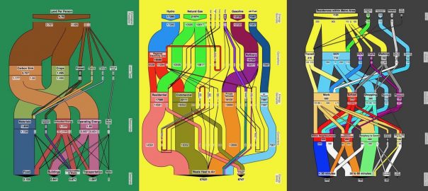
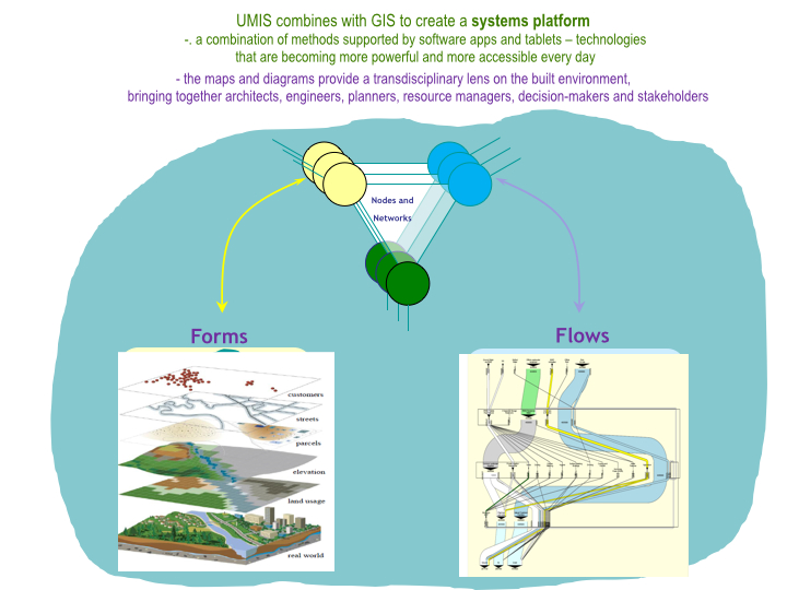
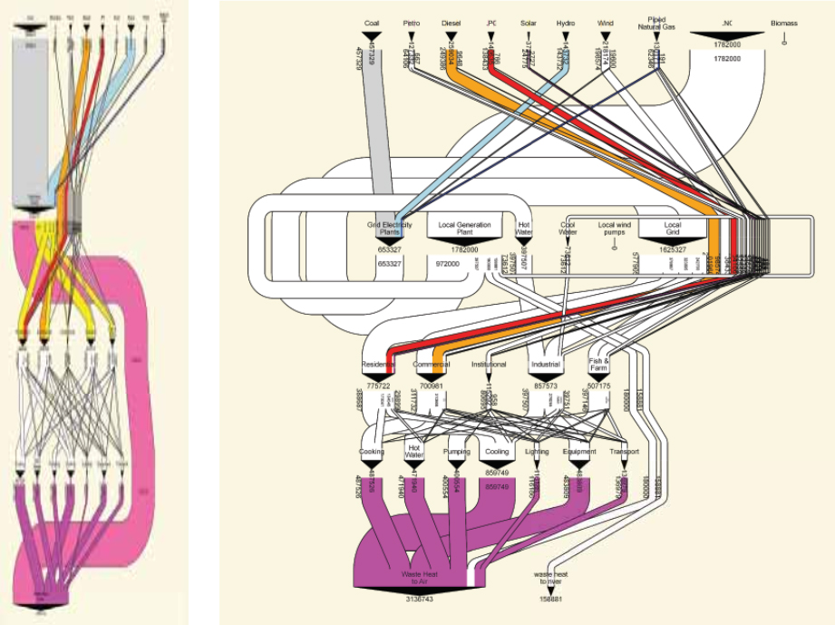
Please follow the SURE LatAm Chapter on Facebook.

Ana Faggi
Buenos Aires

On The Nature of Cities

References

Gehl J. 2010. Cities for people.  Island Press.

LAPOP-UNDP 2012 Latin American Public Opinion Project. Vanderbilt University.

Pauchard A, O Barbosa. 2013. Regional assessment of Latin America: rapid urban development and social economic inequity threaten biodiversity hotspots. In. Elmqvist, Th., Fragkias, M., Goodness, J., Güneralp, B.,Marcotullio, P.J., McDonald, R.I., Parnell, S., Schewenius, M.,Sendstad, M., Seto, K.C., Wilkinson, C. (Eds.) Urbanization, biodiversity and ecosystem services: Challenges and opportunities. Springer.

UNDP (2013) Seguridad ciudadana con rostro humano: Diagnóstico y propuestas para América Latina.

Urban Metabolism: A Real World Model for Visualizing and Co-Creating Healthy Cities

Art, Science, Action: Cities Re-imagined
With citizen-generated maps and diagrams based on real-life conditions and structured around a holistic framework, the patterns that emerge allow for both residents and planners to ask questions that can lead to both local and regional ecological improvements.
Like the human body, cities are living, ever-evolving organisms. Just as diet, exercise, sleep, or laughter can be seen as indicators of our personal physical and emotional well being, the ways in which goods, water, commuters, or food move through the urban ecosystem determines a city’s health and sustainability within larger regional and global natural systems. The more knowledge we have of which resources flow into our system, how these resources are being used, and what happens with any output the organism doesn’t need to sustain itself, the more likely we are to live balanced and healthy lives.

While figuring out the intricacies of our own body’s metabolism is no simple feat, doing a holistic assessment of something as complex as a modern industrial city, with all its physical and cultural microcosms, can seem daunting. However, if we look at cities through a metabolic lens, just as we do for our bodies, a framework through which to successfully model urban systems flows comes into focus. Urban metabolism, used to analyze how urban areas function with regard to resource use and underlying infrastructures, helps us understand the relationship between human activities and the natural environment.

Applied urban metabolism

Urban metabolism as a concept is not entirely new. As far back as the 19th century, Karl Marx and Friedrich Engels recognized that human activity alters the biophysical processes by analyzing the dynamic internal relationships between humans and nature. It wasn’t until over a hundred years later that a more holistic assessment of a city’s anatomy was formally developed for the first time. In a 2007 paper entitled “The Changing Metabolism of Cities“, Christopher Kennedy and a team of civil engineers from the University of Toronto defined urban metabolism as “the sum total of the technical and socio-economic process that occur in cities, resulting in growth, production of energy and elimination of waste”.

Urban metabolism forms and flows. Graphic: Ecocity Builders
Since then, urban metabolism analysis has evolved from a mostly academic exercise to more practical applications. For example, Urban Metabolic Information Systems (UMIS), an applied methodology first developed by Canadian researcher, author, and systems design specialist Dr. Sebastian Moffatt, is a standardized “source to sink” framework to better understand and analyze urban systems as they process through the built environment over time and space. The key to this tracking and visualization of the material flow that constitutes an urban metabolism are MetaFlow diagrams, also known as Sankey diagrams. As part of the 2010 Eco2 Cities: Ecological Cities as Economic Cities project, Moffatt began developing diagrams for entire urban systems. Seeking to offer ground-level perspective, the research team conducted case-studies in cities across Asia that would help showcase the cities’ current flow and offer insights into how these flows could be better looped in order to avoid so much waste and leakage.

A MetaFlow diagram of the energy system of Jinze, Shanghai shows the discrepancy between the current system (left) and a scenario for an advanced system (right). Source: Author elaboration (Sebastian Moffatt) with approximate data provided by Professor Jinsheng Li, Tongii University, Shanghai.
More recently, Dr. Philip Mansfield of Graphical Memes has created a number of MetaFlow diagrams for the City of Vancouver B.C., with data provided by BCIT‘s Director of Institute Sustainability, Dr. Jennie Moore. The energy diagram, for example, shows a very typical modern centralized system, with small amounts of locally sourced electricity, not much energy diversity, and minimal cascading, meaning very little efficiency, recycling, or dual use. Most of Vancouver’s energy essentially comes from non-renewable sources (except hydro) and ends up in the air after being used for a single purpose at a single time.

Vancouver B.C. MetaFlow Diagrams for energy (left) and food (right). Credit: Dr. Philip Mansfield/Graphical Memes
Vancouver’s MetaFlow diagram for food shows a lot more cascading at the top, indicating more diverse food-types than energy-types, with local farms supplying a visible share of different foods. Fruits and vegetables are a substantial amount of the total organic material flow. In contrast, the sinks at the bottom of the chart are much less textured, with most of Vancouver’s food waste (which typically represents about 50% of the entire waste stream) passing through transfer stations and incinerators before going to landfill or getting released into the air. Many strategies could be considered for looping and cascading these flows, i.e. to create a more connected food web within the city. For example, if food waste were to be composted as soil, the soil could be used locally for farming or landscaping so the city would have less need for hauling material by truck and acquiring land for landfill.

According to Dr. Moffatt, these diagrams are worth a thousand pie charts. But what if we could drill even deeper into the metabolism of a city by looking at the resource flows through each neighborhood? The fact that currently flow diagrams for most cities in the world would look similar to Vancouver’s—linear and centralized, leaving little room for localized and adaptable ways to make better use of both natural and human resources—shows that there’s a real need for tools that enable communities to better understand their own neighborhoods and identify the areas where more looping and cascading could be applied as systems become more ecological.

Participatory urban metabolism

Enter a methodology designed to empower citizens to map out their own neighborhoods and become participants in transforming their communities into more resilient, equitable, and ecologically healthy settlements: Participatory Urban Metabolism. This approach brings an increased focus on moving from a top-down to a bottom-up approach to urban environmental accounting, in order to capture data that is unavailable in conventional databases while promoting a transdisciplinary approach in which co-design takes place with society and not for society, and to ensure assessment is not a one-off event.

First piloted through Ecocity Builders’ Urbinsight Global Data Initiative in Cairo and Casablanca, the model has most recently been successfully implemented in Cusco, Peru, and Medellín, Colombia. Commissioned by the U.S. Office of the Geographer’s Secondary Cities (2C) initiative and profiled in a blog and video series as part of UN Environment’s Global Initiative for Resource Efficient Cities initiative, these two showcases offer real world examples of how urban metabolism tools and methods can be utilized by managers and practitioners to transition their cities towards more resilience and resource efficiency. To wit, based on the outcomes of Cusco and Medellín’s participatory urban metabolism assessments, city government, local universities, and community groups in those cities are now working together to develop Neighborhood Sustainability Plans.

Cusco: a participatory approach to urban metabolism

Focused on the metropolitan area in and around the city of Cusco, in southern Peru, local citizens, city officials, and student researchers from Universidad Alas Peruanas have been engaged in a multi-faceted and multiple-phase participatory action approach to urban environmental accounting since 2016. The city’s historic inner city neighborhoods, where several small study areas are located, have increasingly been feeling the need for this kind of in-depth accounting of conditions on the ground in order to find and implement a holistic solution to their garbage problem.

Participants consisting of faculty, students, local officials, architects, and planners were first introduced to the technical, community engagement, and planning processes at the core of the participatory urban metabolism method during EcoCompass workshops conducted by Ecocity Builders’ on-the-ground implementation team. After learning the ins and outs of creating a dynamic mapping platform that visualizes multiple data types, they went on neighborhood scoping trips before holding a roundtable with community leaders, who laid out the changes they wanted to see in their neighborhoods: better management of waste, a cleaner environment, and healthier food.

Based on these needs, student teams went on to conduct neighborhood material audits. They collected consumption and waste data from residents, who participated by sorting their solid waste, weighing materials by type, and analyzing composites. The team then created detailed views of neighborhood archetypes of the historic districts, which gives important insights into solutions for neighborhoods with similar characteristics and challenges. With almost 50% of household waste turning out to be organic, the team decided to research methods of constructing home composting modules, which they ultimately co-designed with the help of community members and piloted throughout four communities in the homes of participating neighbors.

The neighborhood metabolism diagrams that were created to visualize the collected data have become conversation pieces that help the community as well as city planners make informed decisions about how to redirect the flows from linear to circular. Community members found that in order to understand urban metabolism it is necessary to understand the origin of resource flows, their distribution within the city, and how the resources are being used. These insights empower people to create informed change in their unique urban contexts, which is currently being enshrined in the city’s DNA as part of the project’s next phase: the creation of Neighborhood Sustainability Plans.

Medellín: Co-creating more robust urban knowledge systems

In February 2013, the Urban Land Institute chose Medellín as the most innovative city in the world due to its advances in politics, education, and social development. Although Medellín has been crowned Most Innovative City and sets an example for urban planning to the world at large, the city is still challenged by harsh economic disparity. Wealth mainly clusters around the city center and decreases exponentially into the surrounding hills.

In Phase I of Ecocity Builders/2C Medellín, local planners, utilities, academics, and local non-profits teamed with community members of Comuna 8, one such vulnerable hillside district outside of the city center that is made up of several low income formal and informal neighborhoods, to apply local participation methods to urban metabolism. The team focused their data collection and mapping on waste management, material flows to and through households, and citizen perspectives of waste practices in their communities throughout several neighborhoods within Comuna 8, a priority expressed specifically by community leaders.

After they collected the data, participants were able to apply their training from the workshops by using Urbinsight’s metaflow app to turn their collective data input into urban metabolic information system flow diagrams. These visualizations proved not only important for researchers to streamline and interpret the household and parcel scale data, but for Comuna 8 residents to understand and improve their own waste stream and for the city to understand the needs of its people.

Water, materials and energy metaflow charts for Medellín, courtesy of Ecocity Builders.
For Phase II of the project, the team determined that the next priority neighborhood type should be a mixed income city center neighborhood. Many neighborhoods of this type are situated within the city center nestled among more wealthy business districts, but are often overlooked by the municipality. As a result, community members of these neighborhoods often have lower earnings, high unemployment, reduced waste collection services, reduced security or health services, and increased air pollution.

On recommendation by the planning department, Universidad EAFIT took the lead as the main academic partner, which suggested Boston, a neighborhood characterized as the intended archetype (mixed-income, city center), as the recommended study area. Low Carbon City, a Medellín-based and internationally recognized non-profit organization with strong ties to the Boston community, joined as the community based partner.

After the data collection activities, participants divided into research teams based on categories of materials that were found to be the most common in the waste stream: plastic, glass, metal, paper, organic, hazardous waste and oils, and mixed waste. Using the field data, they produced reports and presentations on actions that citizens can take to reduce demand, increase efficiency, and reuse/repurpose and recycle materials at home and in the neighborhood in order to decrease waste in public spaces.

During two “mapathons,” participants completed analysis of their waste and materials audits and geoprocessed original data to develop geospatial layers for further analysis and map development. They then worked with the team to integrate municipal data layers with the original neighborhood data layers to produce original maps that they presented to the community members. In a final community event, each group presented interactive participatory educational activities relating to their type of resource topic. They developed posters and short videos to “tell the story” of urban metabolism and the role citizens play in resource cycles.

Sample of materials prepared by community partner Low Carbon City for neighborhood workshops.
Since their collaboration in 2017, the course participants and Low Carbon City have maintained a strong connection to the planning office, which has been analyzing all course data to be officially recognized by the municipality and included in their open data portal for planning and analysis. Intrigued by the potential use of the urban metabolism assessment methodology, planning department professionals asked to collaborate with the Ecocity Builders/2C team on a city-wide data collection exercise to complete all available urban metabolism studies.

The project has now entered its next phase during which the partners are once again coming together to create a Sustainable Neighborhood Plan. Building from initial and ongoing urban metabolism assessments, methods and participatory processes, the plan is meant to be adaptable and replicable and is based on Ecocity Builders’ bottom up approach to ecocity development, underscored by Urban Metabolic Information Systems (UMIS) assessments at the neighborhood scale.

Where do we want to go and why?

More sustainable and resilient urban futures can be furthered by using urban metabolism methods and approaches in an ongoing and iterative process. Healthy urban metabolism, just like a healthy ecosystem or an organism, works best when it’s frequently monitored and continuously fine-tuned.

In addition, since it is human beings that are driving the demand for resources that shape a city’s metabolism, it is imperative that citizens are allowed to weigh in and participate in a meaningful way. Getting this kind of first-hand information is not only invaluable because of the previously unknown data points it provides, but because the personal involvement creates new awareness and provides incentive to the community to become engaged in finding solutions to existing problems.

With citizen-generated maps and diagrams based on real-life conditions and structured around a holistic framework, the patterns that emerge allow for both residents and planners to ask the kind of questions that can lead to both local and regional ecological improvements. What could we do for people to get by on rainwater? How could the city avoid leakage in their water and energy systems? How do we create material loops that solve both local waste problems and reduce global carbon emissions? How do we stay within the Earth’s carrying capacity?

Or as Sebastian Moffatt remarks, “we can use these diagrams to tell the story of where we want to go and why!”

Sven Eberlein
Oakland

On The Nature of Cities

Header Image: UMIS Vancouver transportation energy footprint.

A Google Earth image of an open pit

Urban Mining: A Sustainable Alternative to the Environmental Impacts and Social Injustices of Extractive Mining

Art, Science, Action: Cities Re-imagined
For cities to be sustainable, they should avoid the environmental impacts over far away ecosystems and deteriorate human rights to obtain resources.

Every human activity generates environmental impacts, such as in the case of urban settlements. Conventionally, the urban environmental impacts that are more worrisome are those that are the result of the city itself, such as urban solid wastes and water contamination. These wastes are the remains of urban metabolism, and society does not know what to do with them. However, what is usually forgotten is that the most significant environmental problem are indirectly about cities: they are linked to the importation of goods that the city needs to function, such as the exploitation of natural resources, industrial processes, and global transport networks that depend on fossil fuels.

Both kinds of urban environmental impact sources, goods import and waste generation, result from the urban linear metabolism based on an infinite natural resource consumption. However, natural resources are finite, and one day, they will be depleted. For example, the availability of copper and zinc has an expiry date.

Urban’s linear metabolism impacts are usually unknown by citizens, especially the impacts linked to the import of goods, with substantial global and local impacts. This essay highlights the local impacts of mining projects on the environment and indigenous communities.

Urban metabolism

The undoubted cause of the increase in socio-environmental conflicts in extraction, transportation, and waste disposal is the increase in social metabolism. This social metabolism is particularly important in cities as they consume the most significant global resources (Musango, Currie, & Robinson, 2017).

From an ecological point of view, The Planet is an open system in terms of the solar energy it receives, and it is a closed system in terms of materials (4). Urban metabolism refers to the flows of energy and materials that cities demand to function, resources that are not produced by cities; they are extracted from Nature.

Even though urban areas account for approximately 0.4-0.9% of the global surface area, they contribute to around three-quarters of worldwide final energy consumption and carbon dioxide emissions (Marvuglia et al., 2020). On average, urban areas utilize around 70-75% of total natural resources (Tan et al., 2021), and the predicted growth in population is linked with increased resource usage.

Thus, cities have become mainly responsible for the extraction of materials. Some of these resources are used to obtain energy, and others are used to manufacture products. According to Martínez Allier (2000), these resources could be characterized as non-inexhaustible from a time-human scale; for example, solar energy is derived from wind, and its availability does not depend on how they are used nowadays. Secondly, renewable resources are potentially exhaustible, which sets intergenerational issues because of the exploitation intensity and ecosystem degradation. Finally, there are nonrenewable resources from a human time scale, such as fossil fuels, earth minerals, and metal ores.

Cities need vast amounts of resources such as metal ores, which causes intense pressure on countries with abundant resources. It means, for example, that just in Latin America, extraction increased four times between 1970 and 2008, and exports increased in a similar proportion (Martínez Alier & Walter 2015).

However, this story does not end here. After the extraction of mining resources, they are used for the industrial production of computers, cell phones, and construction materials, among others, products thrown into the urban landfills after the end of their useful life cycle. Here, the other side of the problem comes into play: waste is not valued from the perspective of the linear economy and is treated as trash when, in reality, it is an extremely valuable resource.

Recent research indicates that if the current exploitation model continues, the deposits of mineral raw materials (copper, zinc, etc.) will be depleted in about 50 years. The definition of resource availability for a potential mining project concerns economic viability. If the exploitation system is too expensive, it is considered that the resource is no longer available for extraction. Moreover, that is when we talk about the depletion of resources; although they are basically found underground, we cannot dispose of them.

Political ecology of extractivism

Nature plays a double role as a resource supplier and recipient of waste. During the last decades, the natural supplier of resources has been located in developing countries, suffering the environmental impacts and resource depletion caused by extractives to supply raw materials to industrialized countries. In other words, developing countries have become the receivers of industrialized societies’ metabolism.

Considering that Political Ecology is interested in explaining how political power affects socio-environmental conflicts, it is argued that it focuses on the parallel study of social metabolism and distributive ecological conflicts. As a result, Political Ecology allows us to reveal the terms of trade, the physical deficit existing in the international trade of undeveloped countries, and the associated environmental liabilities (Martínez Alier, 2013).

The result of this unequal trade is that mining’s economic profit does not include the environmental costs that a territory will suffer, nor the socioeconomic costs of the residents who live in the territories where extractives take place, especially in developing countries such as Latin America. The effects of contaminating rivers, soils, and groundwater generate serious problems for fauna, flora, and human beings. These environmental and social costs are not internalized in the manufactured products we consume, but this does not imply that they do not exist.

One case representative of resource exploitation impact is the mining projects developed by the enterprises Petaquilla Gold and Minera Panamá, located in the Republic of Panama, 124 km east of Panama City. Both mining projects are inserted in a protected area of the Mesoamerican Biological Corridor, a habitat of endemic species.

The enterprise Minera Panamá (MPSA), owned by the Canadian company First Quantum Minerals, has settled in the Donoso District, Colón Province in Panama, to exploit open-pit copper in an area of near 12,000 hectares. This project not only has an enormous impact on biodiversity, but the company has not accomplished the commitment of investing 11 million dollars in improving the management of neighboring protected areas, as the Environmental Impact Assessment indicated, for strengthening the connectivity of the Biological Corridor.

A map of panama
Fig. 1 Location of the Minera Panamá copper mining project in the Mesoamerican Biological Corridor. Source: The author with Google Earth satellite image and data from Earthstar Geographic and Zamora N. (2008)

Moreover, regarding the impacts on water resources, one of Panama’s Ministry of Environment reports reviewed by CIAM (a non-governmental organization dedicated to conservation), highlights that the project discharges process waste into natural water bodies without permission from the ministry. This is causing negative impacts on the natural ecosystems and human populations adjacent to and dependent on the water bodies subject to the discharges through the contribution of possible dangerous contaminants such as heavy metals, among others. The report adds that discharges from wastewater treatment plants in the mine and port areas do not comply with current legislation (CIAM, 2021).

A Google Earth image of water
Fig. 2 Toxic waste from the Minera Panamá copper mine. Source: Google Earth

On the other hand, a valuable clamor is also expressed by the surrounding communities’ residents regarding the company’s expropriation of their lands (Defensoría del Pueblo, 2022). One of the communities most affected by mining activity claims to be victims of abuse at the hands of a subsidiary of the Canadian company Inmet Mining Corporation and its local partner, Minera Panamá. On November 6, 2010, members of affected communities warned that they were being expelled from their lands and that they were victims of abuse.

Panama’s situation is only one example of the extraction issues from Canadian mining enterprises working in different countries in Latin America. Indeed, the presence of Canadian mining enterprises in Latin America has strongly increased in the last decades. Most Canadian mining experiences evidence of a development model that causes enormous negative impacts on human rights without the local population’s participation and prior and informed consultation in search of consent when required. The results are the disruption of the social fabric, forced displacement of populations, and disrespect for the protection of natural spaces and territories owned by peasants or indigenous people (Grupo de trabajo sobre minería y derechos humanos en América Latina, 2014).

Besides, many of these projects generate serious environmental impacts, which at the same time impact biodiversity. Of particular concern are the violations of the rights of communities and their members as a result of mining activity related to the cases in this study. Violations of the right to life and integrity, the right to health, and property have been documented (Justice & Corporate Accountability Project, 2023).

These rights violations and disrespect for environmental conservation by Canadian companies in Latin America are possible because of the weak environmental laws, and the weak institutional exigencies of the law accomplishment in the hosting countries. For example, in Panama, the Canadian enterprise Minera Panama had an irregular contract that by 2017, the Panama Supreme Court declared unconstitutional and recently was demanded again a new contract signed in October 2023. And by 28 November the Supreme Court declared that the contract violated 25 articles of Panama’s Constitution, including the violation of the right to live in a healthy environment. After this last ruling, the company started to terminate their activities.

While Canada works to ensure that mining in Canada and Canadian mining abroad meet environmental, social, and governance objectives (Government of Canada, 2023), the federal government also plays a role through research and innovation at CanmetMINING. Research at CanmetMINING helps mining become more sustainable. However, these green mining technologies are not applied in Canadian enterprise extractive projects in Latin America. Instead, it has documented several health issues in people living around mines in Latin America, such as respiratory diseases, plumeria, anemia, kidney failure, neurological diseases, and cancer (Grupo de trabajo sobre minería y derechos humanos en América Latina, 2014).

All these local environmental and social damages and the global environmental impacts linked to global networks of transport dependent on fossil fuels are not reflected in exported resources prices nor in the products retailed. These damages are part of a system of unpaid costs, where externalities are not considered as “market failures” but as regrettable “successes” in transferring costs to future generations, to other species, and to the poor people of our generation (Kapp, 1950). In these environmental and social damages, it should include human health.

Therefore, halting extractive projects benefits the affected region and a less unsustainable and more ecological society and cities. Environmental justice can contribute to increased environmental sustainability. For example, by stopping the mining project in the Central America biodiversity corridor in Panama, it is protecting biodiversity while reducing Co2 emissions linked to copper transport.

Sustainability and urban mining

The pattern of resource exploitation and waste disposal does not seem justifiable if we consider the concept of sustainable development. This concept was first coined in the Brundland report of the United Nations in 1987, understanding sustainable development as that which meets the needs of the present without compromising the needs of future generations. The Brundland report also indicates that sustainable development does not only imply growth. “It requires a change in the content of growth so that its consumption of materials and energy is less and its effects are more equitable”. These concepts have been used since the 1980s, and recently, they have been called circular economy, an economic system based on obtaining resources from recycling and reusing waste.

A Google Earth image of an open pit
The copper open pit mine project in the middle of the Republic of Panama’s protected area is part of the Mesoamerican Biological Corridor. Source: Google Earth

However, sustainability is not only concerned about extractive resources with local impacts; it also has to do with reducing our dependence on fossil fuels responsible for climate change sustainability at multiple scale; that is, a global environmental impact. This sustainable goal is also known as the energy transition. Recent studies indicate that Between 2022–2050, the energy transition could require the production of 6.5 billion tonnes of end-use materials, 95% of which would be steel, copper, and aluminum, and will require much smaller quantities of critical minerals/materials such as lithium and cobalt (Energy Transitions Commission, 2023). It is becoming a problematic dichotomy to invest in transition energy and fight climate change but increasing pressure on countries rich in the minerals that the energy transition needs. However, recycling could be a key solution.

Unfortunately, because industrial economies traditionally are not circular, metal ore has been recycled but at a low rate, at most 30 to 50 percent in the case of copper and aluminum, the energy transition.

Copper is one of the few materials that can be recycled several times without losing functionality (International Copper Association, 2022). Copper recycling is also a very eco-friendly method of returning a valuable resource to the market; it uses less energy than initial production and minimizes CO2 emissions. On the other hand, nearly 70% of global copper production is utilized for electrical/conductivity applications and communications, and 20% is used in construction. Therefore, cities around the world have a massive stock of copper, which contains a  variety of end uses and is equivalent to approximately 33 years of mine output. These urban metal ore resources are known as “urban mines” (International Copper Association, 2022). Aside from its environmental advantages, the complex copper waste products found in urban mines, such as electronic waste, promote the recovery of many other metals, including gold, silver, nickel, and zinc.

Furthermore, the rapid fall in natural ore grades and the ongoing expansion of urban reserves imply that higher recycling is the optimum action. Cities with a high population density have greater options for recycling optimization since they create a huge amount of waste each year (Li, et al., 2022).

Nevertheless, cobalt is a different case; its supply shortage appears inevitable during 2028-2033 despite the advances in cobalt-free batteries and recycling (Zeng et al, 2022). This means that cobalt extractive projects still have to go on. In this case, the mining projects need to entirely apply new green technology and knowledge in mining that guarantees respect for human and environmental rights.

Despite the cobalt situation, for cities to be sustainable they should avoid the environmental impacts over far away ecosystems and deteriorate human rights to obtain resources. Urban mining, recycling, and self-sufficient strategies are mandatory for this goal.

Graciela Arosemena
Panama City

On The Nature of Cities


References

Ciam (2021) Informes Del Ministerio De Ambiente Revelan Nuevamente Graves Incumplimientos De Minera Panamá – Ciam Panamá. https://ciampanama.org/2022/04/22/minera-panama-sigue-incumpliendo/ Reviewed September 2023.

International Copper Association (2022) Copper recycling. Copper Alliance. https://copperalliance.org/resource/copper-recycling/ Reviewed September 2023.

Defensoría Del Pueblo (2022) Dirección Nacional de Protección de los Derechos Humanos Consideraciones Ante el Nuevo Contrato de Concesión Entre el Estado y la Empresa Minera Panamá.

Energy Transitions Commission (2023) Material And Resource Requirements For The Energy Transition.

Government of Canada (2023) Responsible Mining. https://natural-resources.canada.ca/our-natural-resources/minerals-mining/responsible-mining/25103 Reviewed October 2023.

Grupo De Trabajo Sobre Minería Y Derechos Humanos En América Latina (2014) El Impacto De La Minería Canadiense En América Latina Y La Responsabilidad De Canadá Informe Presentado A La Comisión Interamericana De Derechos Humanos.

Justice & Corporate Accountability Project (2023) Canada’s Systematic Failure to Fulfill its International Obligations to Human and Environmental Rights Defenders Abroad. Submission to the UPR Working Group of the United Nations Human Rights Council In anticipation of the 2023 Universal Periodic Review (UPR) of Canada April 4, 2023.

Li, D. Eheliyagoda, Y. Geng, et al. (2022) Examining The Influence Of Copper Recycling On Prospective Resource Supply And Carbon Emission Reduction, Fundamental Research.

Kapp, K.W (1950) The Social Cost of Private Enterprise. Oikos-Tau, Barcelona.

Martínez Alier, J (2015) Ecología política del extractivismo y justicia socio-ambiental. Interdisciplina 3, no 7:57-73.

Martínez Allier, J; Roca, J (2013) Economía Ecológica y Política Ambiental. Fondo de Cultura Económica

Marvuglia, A., Havinga, L., Heidrich, O., Fonseca, J., Gaitani, N., and Reckien, D. (2020). Advances and challenges in assessing urban sustainability: an advanced bibliometric review. Renew. Sust. Energ. Rev. 124:109788.

Musango, J.K., Currie, P. & Robinson, B. (2017) Urban Metabolism For Resource Efficient Cities: From Theory To Implementation. Paris: Un Environment.

Pérez Rincón, M (2006) Colombian international trade from a physical perspective: towards an ecological “prebisch thesis”.» Ecological Economics 59, nº 4 (2006): 519-529.

Tan, L. M., Arbabi, H., Tingley, D. D., Brockway, P. E., and Mayfield, M. (2021). Mapping resource effectiveness across urban systems. Urban Sustain. 1:20.

Working Group on Mining and Human Rights in Latin America (2013) The impact of Canadian Mining in Latin America and Canada’s Responsibility.

Zeng, A., Chen, W., Rasmussen, K.D. et al. Battery technology and recycling alone will not save the electric mobility transition from future cobalt shortages. Nat Commun 13, 1341 (2022).

Urban Nature as Festival: Berlin’s Long Day of Urban Nature

Art, Science, Action: Cities Re-imagined

Just before 10 am one Sunday this June, 300 people prepared for a boat ride on the River Spree, lining up in a park next to the longest surviving stretch of the Berlin Wall. The boat was a cheerful blue and yellow passenger vessel, mostly used for river tourist excursions and dinner cruises. But this group differed from the usual crowd of visitors from across Germany, Europe, and further beyond. Instead, local nature enthusiasts, families, and curious Berliners prepared to board the ship, ready for commentary on the river’s unique urban ecosystems.

Langer Tag der Stadtnatur - Boat at Oberbaumbrücke

Langer Tag der Stadtnatur - Boat at Treptower Park
Eight riverfront ecology boat tours carrying 300 people each traversed the Spree during the Langer Tag der Stadtnatur. Here, guide Derek Ehlert narrates the tour, as it approached the Oberbaumbrücke in Friedrichshain (top), and passed along the banks of Treptower Park (bottom).

Over 90 minutes, the boat passed the heart of gritty Friedrichshain and the media headquarters of the Urban Spree redevelopment and cruised to the east, towards the waterfront green spaces of Treptower Park. Some participants brought binoculars and observation gear, while others simply relaxed with a coffee or lager. Landscape planner and ecologist Derk Ehlert narrated the tour, pointing out wildlife and describing the various species’ habitats, food sources and migration patterns within Berlin’s parks and waterways. Ehlert estimates that there are roughly 20,000 plant and animal species in Berlin, which he considers the greenest city in Europe.

During this particular weekend, such a convening was not unusual: over 26 hours, an estimated 25,000 people explored the city’s forests, riverfront, lakes, gardens and landscapes through the Langer Tag der Stadtnatur, or the Long Day of Urban Nature. Although cities are increasingly celebrating urban biodiversity, Berlin’s event is perhaps the largest regular citywide celebration in the world and will mark its tenth anniversary next year. The event includes contributions by dozens of local partners and sponsors and is a great model for other cities hoping to better engage their citizens in matters of urban ecology.

Langer Tag der Stadtnatur - Berlin panorama from boat
View of Berlin’s skyline from the River Spree, including Treptower Park (at left), the Fernsehturm or TV Tower, and the Ostkreuz water tower

Wolfgang Bussman, the director for the Langer Tag der Stadtnatur has explained: “our main goal is to make nature in our immediate neighborhoods visible and to provide visitors with unique experiences which show how important conservation in the city is.”

This year, events began in the afternoon of Saturday, June 20th, with late-night activities such as night climbs and forest walks running until 1am on Sunday. Sunday, June 21st then saw a full schedule of walks, boat rides, bus tours, bike tours, lectures, and other happenings at sites ranging from the riverfront to private gardens to nature reserves. Events were nearly free: a 7-euro full-weekend ticket covered some basic event costs, but mostly existed in order to allow organizers to track participant numbers, organize reservations, and coordinate corporate block bookings.

In total, the Langer Tag der Stadtnatur included over 500 events at about 150 sites across the city, including hubs in the city’s center, north, south, east, and west. The city center’s largest hub was an urban garden sponsored by a housing association near the central crossroads of Alexanderplatz. Initially set up as a short-term project, the garden recently became a permanent space for the housing association residents. Event hubs elsewhere in the city this year included the Grunewald, Berlin’s famous urban forest; Tempelhofer Feld, the historic airport recently reclaimed as a park; the Natur-Park Südgelände in Schöneberg, and Britzer Garten in the southern district of Neukölln.

Langer Tag der Stadtnatur - Prinzessinnen garten, Berlin honig-min
Urban garden Prinzessinnengarten, or Princess Gardens, hosted numerous events during Berlin’s Langer Tag der Stadtnatur, as well as the garden’s regular community flea market, which is held bimonthly (see below).

The first Langer Tag der Stadtnatur was held in 2007 and included about 350 events that attracted 10,000 visitors. Over the years, the program has steadily grown, with different focuses each year depending on the interests in the city at the time. Urban gardening and beekeeping, for example, have been prominent themes recently. Partnerships also emerge in different years depending on major urban initiatives or events; for example, organizers anticipate collaborating with Berlin’s upcoming IGA (Internationale Gartenaustellung, or International Gardening Exhibition) in 2017.

The Stiftung Naturschutz Berlin (or, the Berlin Nature Conservation Foundation) is the main coordinator for the event, partnering with the Berlin Senatsverwaltung for Stadtenwicklung und Umwelt (Senate Department for Urban Development and the Environment), which is a primary funder. Corporate and public sector partners also contribute funding, while local NGOs, community organizations, and individuals organize and host specific events across the city. The Stiftung coordinates this citywide participation, arranging a few signature events and managing the website, printed program materials, online reservation system, and marketing. Stiftung Naturschutz Berlin staffer Wieke Mikette explained that “we try to have all the main characters in Berlin participating, ranging from the relevant organizations to private persons hosting events in their gardens.” The partnership aspect of the program is seen as one of the most successful elements, both in creating a full calendar of events and in engaging a wide range of stakeholders.

The program also aims to engage with decision-makers, to help them recognize the urban nature present in Berlin. This year, several neighborhood bus tours included the heads of Berlin’s local district administrations (the Bezirksbürgermeister) seeing their own districts, along with constituents and other event participants. National politicians also participated in the riverfront ecological tours and other events. The Stiftung hoped “that [the politicians participating] could see how important [urban ecology] is and how green the city is,” explained Mikette, who added that most other participants were regular Berliners, including “people coming from the north, from the south, from the east, from the west. They are really from Berlin. It is a Berlin event.”

The event has now grown and expanded across Germany, with 11 other cities hosting similar weekends, including Hamburg and Bremen. In Berlin, the weekend is also reminiscent of other opportunities for marathon-style urban immersion, such as the Long Night of Museums and the Long Night of Science. In fact, the Naturschutz Stiftung first looked to these events as models when piloting the Langer Tag der Stadtnatur.

Langer Tag der Stadtnatur - Prinzessinnen garten flohmarkt-min
Urban garden Prinzessinnengarten, or Princess Gardens’ community flea market.

Internationally, many other cities host citywide celebrations around built environment themes, but very few introduce urban nature to a mass audience the way that the Langer Tag currently does. Some address architectural topics, such as London’s Open House, which in 2014 opened 850 architectural sites to over 250,000 people. About twenty other cities internationally now also host Open Houses, including New York, Buenos Aires, Rome, Tel Aviv, Melbourne and Chicago. Similarly, Jane’s Walk is a festival of citizen-led neighborhood walking tours, held simultaneously in cities around the world. Either of these festivals may contain tours or open houses relevant to ecological issues, but urban ecology is not necessarily at the forefront of discussions.

As another alternative to the Langer Tag model, Bioblitzes celebrate the abilities of citizen scientists and invite community members to consider the ecological diversity of their cities. Short-term events in which scientists and community members seek to identify as many species as possible, Bioblitzes offer a comparable “festival” atmosphere and can be held at a site, neighbourhood, or on a citywide scale. Although the concept of a Bioblitz was pioneered in the U.S., it is currently particularly well developed in the UK. Bristol’s Natural History Consortium runs a national Bioblitz Network and London’s Museum of Natural History recently released a full Guide to Running a Bioblitz within its citizen science division.

The Melbourne Bioblitz is one particularly remarkable example due to its citywide scale, longer duration, and contribution to the city’s planning policies. Held over two weeks in October and November 2014, the project invited citizens to participate in data collection for the city’s first-ever Urban Ecology Strategy. Over 700 people participated at sites across the city, providing 300 sightings and photographs, which have since been mapped by the City of Melbourne. The Bioblitz included extensive online engagement opportunities alongside the 52 in-person events, which occurred in disparate locations and at different times of day to accommodate both human participants’ schedules and the wildlife’s likely patterns. In some ways, the event was akin to a citywide charrette for ecological planning, with citizens supporting the scientists and planning professionals in a rapid-fire period of on-site analysis.

Unsurprisingly, urban Bioblitzes are more frequently organized on a smaller scale, focused on single sites or areas of biological interest. For example, the 2015 Auckland Bioblitz invited citizen scientists to participate in the development of a Biodiversity Strategy for the Pourewa Reserve and Kepa Bush over a 2-day period. Like the Bioblitz in Melbourne, the event served a dual purpose: it sought both to create an educational opportunity for participants and to gather data to inform a plan for the site’s preservation as a reserve. Tasks for citizens ranged from freshwater fish counting to insect sweeping, plant identification, and moss identification, all of which contributed to the long-term plan for the site’s use as a reserve.

Langer_Tag_der_StadtNatur_Poster
Promotional posters for the Langer Tag der Stadtnatur were visible throughout Berlin during the weeks leading up to the event, including in the U-Bahn and S-Bahn.

The organizational approach for Auckland’s Bioblitz differed radically from the Melbourne or Berlin model in that it focused on a single natural area with unique biodiversity or a particular need for a survey as opposed to encouraging participants to explore and reflect on nature in the city at large. Many other events worldwide have followed this model, such as the National Geographic 2007 Bioblitz in Washington’s Rock Creek Park or the 2015 bioblitz in Hawaii’s Volcanoes National Park. Numerous British cities also hosted small-scale Bioblitzes in 2015, as well as national themed Bioblitzes, such as the Garden Bioblitz, which invited people across the UK to tally the species in their home garden and then upload the information to a national database.

Finally, Los Angeles offers a fourth model for engaging citizens in local urban ecology: a purely educational event, hubbed at a single civic institution. The city recently piloted its Urban Nature Fest, hosted at the Natural History Museum and described as the city’s “first ever festival for metropolitan nature lovers.” Activities largely took place on site, including garden tours, performances, readings, and presentations, many of which sought to increase the public’s exposure to the museum’s scientific research. Forty different local environmental organizations participated, as did entertainers such as the Santa Monica Mountain Rangers Band.

As urban ecology plays an increasingly prominent role in local planning, will other cities take the initiative to launch events such as these? Local advocacy organizations such as San Francisco’s Nature in the City, museums such as New York’s Museum of Natural History, and academic centers such as Yale’s Urban Ecology and Design Laboratory would be well placed to spearhead efforts in their own cities. Berlin and Melbourne’s examples show that the most effective events involve partners across a metropolitan area, including both organizations and individuals. The contrast between the Berlin, Melbourne, and local bioblitz models also shows that the events can be effective as either citywide festivals or single-site immersion opportunities, with or without a substantial citizen scientist element.

Whether attending much of the Langer Tag, or environmental events at other points during the year, Berliners are lucky to have such a green city and such a chance to explore it. Cities across Germany have already followed suit, and perhaps the model will soon spread further afield.

Katharine Burgess
Berlin

On The Nature of Cities

Urban Nature Forms Urban Character

Art, Science, Action: Cities Re-imagined

“Urban nature” is, for many people, a contradiction in terms. Urban spaces are all about control, hard edges, and the fabrication of an environment. Nature is wild, opportunistic, and fragile. Where is the overlap?

We don’t remember how places look—we remember how they feel.

Yet for those of us who work in fields related to urban nature, we see that there is more integration between the two than might seem obvious at first glance. In 1978, G.W. Grey and F.J. Denke stated in Urban Forestry that most cities were forests based on the definition of a forest as an area where “at least 10% of the land is stocked with trees” (Rowntree 1984). While cities may not feel like forests, the role of nature in the built environment is a powerful one. City dwellers understand, perhaps because of its relative scarcity, that urban nature is as essential to creating the character of cities as buildings and streets.

In some ways, character is a soft term. It’s subjective and a little squishy—ask five different people about the character of a place and you will likely get five different answers. I think one of the primary ways that humans experience the character of a place is through the creation of an enduring feeling or memory—something nature provides even in the densest urban environments.

I grew up in New York City on a block with a church on it, and not much else of note. This was on the Upper West Side of Manhattan, a relatively tree-d neighborhood compared to many parts of the city. Our block was lined mostly with honey locusts, with their distinctive dark, ridged bark, and bipinnate compound leaves that turn brilliant shades of yellow. Every year their fruit—long, twisty black pods—would spin lazily in the wind before falling to the sidewalk with a clattering noise. For me, these trees were some of the most defining features of our micro-neighborhood.

Honeylocust pods. Image credit/link: Dave Bonta. Attribution: CC BY-SA 2.0

I also spent a lot of time in Riverside Park, one of the city’s “wild places”. It’s where we would walk the dog every day, and it was also the site of countless play dates, parties, and sporting events. Our school “field days” were held in fields on the lower level of the park, above the West Side Highway and with a clear view of the Hudson River. The topography of this part of the park is still quite steep, a remnant of when it was all rugged bluffs and rocky outcroppings There are many wonderful trees in the park, but the ones I remember the most distinctly are the Liquidambar. I always liked their starry leaves, and their prickly “gumball” fruit was good for kicking. In some parts of the park, there were so many of them, they would collect in a small ocean across the asphalt paths.

Riverside Park, seen from the George Washington Bridge. Image credit/link: b k. Attribution: CC BY-SA 2.0
Pin oak. Image credit/link: George Thomas. Attribution: CC BY-NC-ND 2.0

There was a giant pin oak adjacent to a lawn where a lot of people used to gather with their dogs (and probably still do). It was so large that you could easily duck under its drooping branches and wander around the cool, hidden interior. This is where I remember catching fireflies during wonderfully pink, languorous summer dusks.

Does that sound too idyllic to be a memory of someone who grew up in New York City? It isn’t. Green places make those experiences possible, even in the most developed urban places. And they infuse a place that will always and forever be known for its high-rises and busy streets with a deeper sense of place and character.

That my childhood memories are so enduring illustrates one of the most compelling features of urban nature, which is its ability to transform the character of a place by impacting how we feel about it—our emotional response to being there. One interesting quirk of human psychology is that we often fail to remember the specific features of a place that affect our experience of it. We may not notice, for example, that we gravitate to the shady side of the street, or that we choose our route home based on the quiet of a tree-lined block. Places that we want to be—streets that are safe, shady, and calm—don’t advertise their alchemy. They appear to simply work. In other words, we don’t remember how places look, we remember how they feel.

Discussions around urban character tend to focus on architecture and street design—and those are important. But I do think sometimes we prioritize aesthetic details over the experiential, what it means to actually stand somewhere and be immersed in a place. Ultimately, it is this experience of a place that comes to define it. This elusive goal is part of what makes successful planning so enduring, and also so challenging.

I’m not the only one who vividly remembers the trees of my childhood. There’s a reason the trees we grew up with remain embedded in the landscape of our memories: they mark the passage of time.

Leda Marritz
San Francisco

On The Nature of Cities

Urban Nature that Reduces Risk in Kampala

Art, Science, Action: Cities Re-imagined

I have written in previous articles (here and here) that Kampala’s urban landscape has been largely fragmented, just like the landscapes of many other cities. In fact, this is the common character of urban development. But it isn’t the only way. In this article, I illustrate the urban risks that Kampala faces—especially those related to natural hazards such as floodingand demonstrate how diverse forms of nature within Kampala can be harnessed to reduce such risk. This is not based on the dominant grey infrastructure approach (technological-engineering solution) to risk management, but a counter argument: that risk reduction through and by use of nature can be achieved in cities such as Kampala.

Urban risk in Kampala can greatly be reduced through greening and restoration of nature in lowland forests and hilltop forests.

With increasing climate variability as well as future projected climate change, the urban risks associated with these changes are likely to increase [1]. The climate-induced risks, coupled with the nature of urban development, accentuate urban risk in Kampala. The nature of topography, ecosystems, and urban development interact to cause frequent flash floods in Kampala that affect housing, infrastructure, and social services. Disruption of transport in the city usually occurs whenever there are heavy downpours in Kampala.

But if nature is systematically and strategically embedded in urban development, we can reduce impacts from a range of urban risks. From mudslides on steep slopes, floods, air quality, and health outcomes of these hazards, nature in Kampala has the potential to reduce the risks.

Hazards, exposure and urban risk in Kampala

Flooding in Kampala is among the most common and widespread hazards, with impacts on the economy, business, infrastructure, housing, and livelihoods. They can even be life threatening [2]. Kampala experiences flash floods virtually every year, leaving little room for recovery by personal households or by institutions with respect to infrastructure. The topography, comprising hills, wide valleys, landscape changes, and inadequate drainage infrastructure for runoff combines to affect the city from upslope to downstream, as shown in the figure below.

Flood-related losses and damage to people’s property is escalating, while the cost of maintaining roads and drainage channels is also on the rise. One of the key outcomes of flood-related risk is a downturn in public health. The incidence of water borne diseases—such as cholera, typhoid, dysentery, and malaria, which are linked to flood and precipitation events characterized by variable climate—is increasing. Although the flood events occur in low-lying areas often occupied by informal settlements, the wider, knock-on effects on transportation, economy, and infrastructure also influence middle and upper income groups. In this way, the entire city is exposed to these climate-induced risks, despite geographic-, location-, and spatially-differentiated social groups.

The most important infrastructure is located in exposure zones, which are low-lying. Because of this exposure, even a light downpour in the catchment can cause anything from loss and damage to high runoff accumulation.

In addition to floods and related health risks are the less known and less documented risks associated with high temperatures and air pollution. There is a loose connection between high temperatures during the dry seasons with the hottest nights and respiratory diseases, and the same for air pollution, which is also usually at its highest during this period due to a haze that is driven to the region from dry winds that blow over the Sahara desert. The other driver for the haze and dust, which increases PM, is dusty roads; unpaved roads in the city range between 1000 and 1400 km in length.

Figure 1 Feb 2016 copy
Figure 1. Topography of Kampala, showing rolling hills and valleys. Image: Shuaib Lwasa

But it is important to reflect on flood mitigation efforts, most of which are concentrated around Kampala city and are technology-based. The more it floods, the more the city authority designs drainage channels to accommodate the runoff. This technological approach to potential flooding has led to the persistence of urban risk in Kampala. Two of the four major drainage systems have been constructed with concrete lining and more are yet to be expanded under a multi-lateral funded project on infrastructure in the city. The thinking is that the major drainage channel modifications will solve the flooding problem.

However, there is increasing evidence that the flash flood problem in Kampala is an interaction between upstream and downstream surface conditions. These conditions relate directly to land cover, which is characterized by degrading natural vegetation as it is cleared for housing and infrastructure development. The higher the roof area, the higher the runoff, and when drainage channels are constructed without cascade design, then the time lag for runoff to reach downstream is shorter. Thus, due to limited infiltration, runoff rapidly moves in the form of pipe flow.

As urban growth and development continues in Kampala, there is an increasing surface condition-created discharge of runoff. Changes associated with urban development, such as channel modifications, storm-sewer construction, and paving of pervious areas, can increase flash flood hazards in the city.

Changing landscape and risk in Kampala

In Kampala, the landscape is a combination of structures and green areas. This landscape has been changing with urban developments and will continue to change. The hilltops and upper slopes are losing tree cover, which is important for infiltration and the slowing of surface runoff. The lower slope and valleys are losing vegetation, which otherwise would slow the velocity of streams and aid in retention. Instead, the valleys and lower slopes are increasingly being urbanized, exposing many buildings, infrastructure, livelihoods, and people to flash floods. As mentioned earlier, the Kampala City Council Authority is in the process of embarking on planting trees in Kampala with a high mark. But this greening is selective and, perhaps, not strategic enough in view of reducing flood risk or air pollution. By focusing on beautification and planting of tress along streets, there is a missed opportunity to utilize nature in reducing flood risk: strategically greening hilltops for multiple purposes, including runoff management. We are losing trees at an alarming rate, especially on hilltops and in lowland areas.

Feb 2016 figure 2v2 copy
Figure 2. Flood assessment of one sub-catchment in Kampala and a micro-catchment’s contribution to surface runoff. Image: Shuaib Lwasa

For example, in one of the sub-catchments (as shown in figure 2) of Kampala, the loss of tree cover couples with waste management practices, unplanned construction, construction in wetlands, small size and depth of drainage channels, intensive rainfall, and poor drainage maintenance to cause flash floods, with the most affected areas being those located around wetlands. In this micro-sub catchment, runoff is generated by a fifth of the area, mainly because of the relative steepness of the slopes and connectivity and density of housing units. This runoff is likely to increase as more impervious surfaces are created to match increasing development trends. The effects of urban development on runoff characteristics are widely acknowledged and include decreased low flow and groundwater recharge, increased surface runoff in annual stream flow, increased magnitude of peak runoff, decreased lag time between rainfall and runoff response, increased rate of hydrograph rise and recession, and decreased mean residence time of stream flow. Technological solutions are unlikely to solve the problem because the capacity of the drainages will have to be consistently increased, placing huge costs to the city authority. The current engineering work to increase drainage channel size will not reduce flood risk in Kampala, though upslope management activities can enable more infiltration of rainfall. Still, the loss of vegetation cover reduces the ability of the urban ecosystem to reduce ambient particulate matter, which causes respiratory diseases. This occurs both upslope and in the valleys of Kampala. The loss also has effects on micro-ecosystem service of moderating temperatures, which would otherwise reduce the risk associated with hot nights during the dry period.

How restoring nature reduces urban risk

It is clear that nature is useful and should be part of the range of solutions to reduce risk, whether in relation to floods, air pollution, or moderating heat in urban areas like Kampala. But how, exactly, can nature be harnessed to reduce these risks?

In the process of greening, there are competing issues. At the local scale, nature can help in storm protection, erosion control, flood regulation, and microclimate moderation. For example, shade trees not only beautify roadways, but also provide a buffer against high and low temperature extremes, providing natural microclimate control. Conversely, the removal of trees leads to an increase in soil surface temperature and reduced relative air humidity. Additionally, shade trees can enhance soil quality by producing litter fall and pruning residues, which can offset urban heat island effects by increasing the amount of green space within urban areas and their surrounds. Fruit crops and agroforestry also provide shade, which can reduce land surface temperature and hasten night time cooling [3]. Agricultural lands and urban gardens increase evapotranspiration, thereby lowering temperatures through evaporative cooling. The potential for carbon sequestration by nature has not been adequately analysed, but agroforestry is associated with minimal carbon emissions and the trees absorb carbon.

Other co-benefits of urban forestry include windstorm reduction and, to some extent, maintenance of soil hydrology, which can stabilise slopes and reduce landslides. Hedgerows and shade trees provide buffers against strong wind gusts, reducing the overall intensity of storms and damage to infrastructure. In these ways, urban forestry and agriculture can help mitigate landslide hazards associated with an increased frequency of rainfall events by stabilizing steep slopes where urban expansion and residential development often occur. Urban agriculture has demonstrated flood reduction capabilities in Kampala by extending the lag time between floods and slowing stormwater. Reduction of surface runoff from urban forestry ranges between 15-20 percent of rainfall, depending on surface conditions, soil composition, and permeability. In addition to reducing runoff, more porous land surfaces (such as soil) support recharge of water tables and increase groundwater flows. And wetland ecosystems are recognized as economically sound and effective alternatives to traditional water treatment practices; ecological management of water purification may provide useful strategies in Kampala, where often only a fraction of wastewater is treated [4].

Plot-level to citywide restoration of nature

There is a wide range of nature-based solutions, from the plot level to the city level, that can reduce risk. At the plot level, for example, drainage ponds can capture storm runoff, then release it after the rainfall event to reduce surface runoff and increase lag time for stormwater. Rainwater harvesting at the plot level can be used for different purposes, including productive greening. But preservation of tree cover on hilltops to enable infiltration is important for stabilizing slopes, especially given the mudslides associated with excavations and constructions in the city. On some hills in Kampala, such as Kololo, extensive tree cover reduces slope instability; they have almost no accidents compared to other parts of the city. But the upstream to downstream connection is critical: several interventions, including preservation of retention areas with natural cover upstream and using lowland areas to increase tree cover, could attenuate floods in the city.

Conclusion

Technological solutions are not the panacea for urban risk reduction, especially with regard to flood risk and health outcomes related to floods and air pollution. Nature has an important role to play and, based on some examples of existing slopes with few or no disasters compared to other parts of the city with hills that have experienced disasters, may reduce urban risk to a great extent. Living in harmony with nature in urban Kampala will be possible when strategically targeted greening, which includes planting trees, can increase infiltration, reduce particulate matter and air pollution, and slow runoff. Urban risk in Kampala can greatly be reduced through greening and restoration of nature in lowland forests and hilltop forests. Given that Kampala lies in a tropical zone that receives substantial rainfall, flooding will simply continue if technological solutions are taken as the primary risk reducing measures.

Shuaib Lwasa
Kampala

On The Nature of Cities

References

[1] IPCC, Summary for policymakers. In: Climate Change 2014: Impacts, Adaptation, and Vulnerability. Part A: Global and Sectoral Aspects. Contribution of Working Group II to the Fifth Assessment Report of the Intergovernmental Panel on Climate Change, Cambridge University Press, Cambridge, United Kingdom, New York, NY, USA, pp. 1-32., 2014.

[2] UN Habitat, Cities and Climate Chage: Global Report on Human Settlements, 2011, Earthscan / UN HABITAT, 2011.

[3] S. Lwasa, F. Mugagga, B. Wahab, D. Simon, J. Connors, C. Griffith, Urban and peri-urban agriculture and forestry: transcending poverty alleviation to climate change mitigation and adaptation, Urban Clim. 7 (2014) 92–106.

[4] S. Lwasa, M. Dubbeling, URBAN AGRICULTURE AND CLIMATE CHANGE, Cities Agric. Dev. Resilient Urban Food Syst. (2015) 1.

Two maps of a city showing temperature through cool or warm coolers

Urban Parks During Heat and Drought Conditions: A Case Study in Leipzig, Germany during the 2018 and 2019 Heat Periods

Art, Science, Action: Cities Re-imagined
The results of the measurement campaigns show how important urban green spaces are for the provision of the cooling function as a regulating ecosystem service — even under heat and drought conditions.

Assessing the cooling function of urban parks under heat and drought conditions

Thanks to the cooling function of the vegetation, urban parks offer cool, pleasant places in cities during hot summer days. Urban parks are also places for recreation and social interaction. In parks, people go jogging or cycling, meet friends, or relax during their lunch breaks (Nadja Kabisch et al. 2021).

The Green Equity Health Logo depicting a person running, a child swinging, and an older person standing with a city in the background

The interdisciplinary research project GreenEquityHealth (www.greenequityhealth.hu-berlin.de) investigated the cooling and recreation function of urban parks under extreme heat and drought conditions in the city of Leipzig. Leipzig, like most Central European cities, was affected by severe heat and dry periods in 2018 and 2019. The annual mean air temperature of the city increased by 2.5°C in both years, and the total annual precipitation was reduced by about 34 percent in 2018 and by 22 percent in 2019 (Stadt Leipzig 2022).

In July 2018 and June 2019, a one-week measurement campaign was carried out in two inner-city parks in the city of Leipzig. The aim was to create empirical evidence on the cooling function of urban parks under severe heat and drought conditions. Two structurally distinct parks close to the city center were selected for the campaign: the Friedenspark and the Lene-Voigt-Park. The Friedenspark, which was used as a cemetery until the 1970s, is an urban park of about 17 ha with extensive lawns and a dense stand of large, old trees. The Lene-Voigt-Park, on the other hand, is a newly created park developed in the early 2000s on a former railway brownfield site. The former railway station and the track structures can still be recognized today in the ruins of some buildings and in the elongated shape of the park with its approx. 9 ha size. Large, open lawns predominate here, with tree plantings and larger rows of trees in the side areas.

Figure 1 shows photos that illustrate the drought-induced vegetation degradation and Photo 3 one of the measurement station in the Friedenspark. The one-week measurement campaigns took place from 19 to 25 July 2018 and from 30 June to 6 July 2019 under high temperatures of up to 34°C. Air temperature and humidity were measured at two heights (2m and near ground level) at 17 measuring sites distributed over both parks. Additional measurements were carried out in the adjacent built-up street area.

Three pictures: Upper left, a park with a paved walkway, trees, and people sitting in the half-dead grass. Lower left, a park with dead grass and green trees. Right, a pole with a sign taped to it in a field of dead grass
Figure 1: Photos of the Lene-Voigt Park (upper left) and the Friedenspark (lower left) illustrating the drought and heat conditions during the summer of 2018 and 2019. An air temperature and air humidity measurement station during our GreenEquityHEALTH project measurement campaign. Photos: Roland Krämer.

Air temperature and air humidity measurements in mid-July 2018 showed increasing daily maximum air temperatures from around 28°C in Friedenspark on 18 July to around 34°C in Lene-Voigt Park on 25 July, reflecting the gradual heating of the entire urban landscape during the 2018 heatwave. In Lene-Voigt Park, the highest air temperatures of 33.5°C were measured at a height of 2m and even 40°C at ground level. In contrast, lower daily maximum temperatures were recorded in the Friedenspark (up to 28°C at 2m height). Especially during the day, the higher air temperatures in Lene-Voigt Park can be explained by the very open structures with little amount of shade. Due to the dryness that has already prevailed since April 2018 (with below-average precipitation) and the frequented use by park visitors, the ground vegetation in Lene-Voigt Park was also severely damaged and the lawn areas have turned into bare soil areas. In the Friedenspark, too, meadows and many trees were impacted by the drought and heat. However, due to a tree cover of over 60 percent, large areas remained shaded even under these extreme conditions providing cooling. The tree cover in Lene-Voigt Park, on the other hand, is only about 15 percent, which partially reversed the temperature situation in the parks at night. The open areas in Lene-Voigt Park favor a vertical heat flow, which led to a partly stronger cooling during the night in the Lene-Voigt-Park (Kabisch et al. 2020; Kabisch et al. 2021; Kabisch/Kraemer 2020).

In the adjacent residential neighborhoods, a stronger heating of the building fabric is expressed with local temperature differences of up to 2 K compared to adjacent green spaces, especially in the afternoon. Figure 2 shows the result of an area-based modelling of the situation on 30 June 2019, when almost 40°C air temperature was reached at 2 m above ground (Kraemer/Kabisch 2022). Cooling takes place mainly in the green structures in Friedenspark and in the isolated vegetation-covered areas of gardens and backyards (Fig. 2). The strong heating of the open areas in Lene-Voigt Park is also evident here.

Two maps of a city showing temperature through cool or warm coolers
Figure 2: Air Temperature difference in the Lene-Voigt Park (black frame upper part) and Friedenspark (black frame in the mid of the figures) and adjacent residential neighborhood areas in the city of Leipzig on June 30, 2019, at 3 pm and July 1, 2019, at 6 am (deviation from span wide M in Kelvin): The Friedenspark provides cooling both during the day and at night. The Lene-Voigt Park, on the other hand, heats up considerably during the day, especially under dry conditions, but provides important cooling at night and in the morning due to open, unsealed surfaces. Based on Kramer and Kabisch, 2022.

The significance of urban green spaces

The results of the measurement campaigns impressively showed how important urban green spaces are for the provision of the cooling function as a regulating ecosystem service. In particular, urban parks still provide cooling under drought and heat conditions but also the vegetation in gardens or backyards reduce local air temperatures and contribute to heat mitigation. Especially in growing cities, the preservation and further development of urban parks, but also other elements of green infrastructure, is of great importance, particularly under climate change.

Roland Kraemer and Nadja Kabisch
Leipzig and Hannover

On The Nature of Cities

Nadja Kabisch

About the Writer:
Nadja Kabisch

Nadja Kabisch holds a PhD in Geography. Her special interest is on human-environment interactions in cities taking co-benefits from nature-based solutions implementation for human health and social justice into account.

Acknowledgement

The project “Environmental-Health Interactions in Cities (GreenEquityHealth, www.greenequityhealth.hu-berlin.de) – Challenges for Human Well-Being under Global Changes” (2017 – 2022) was funded by the Federal Ministry of Education and Research (BMBF; funding code 01LN1705A).

References

Kabisch, N. et al. (2021): A methodological framework for the assessment of regulating and recreational ecosystem services in urban parks under heat and drought conditions. In: Ecosystems and People 17/1, 464–475.

Kabisch, Nadja et al. (2021): Impact of summer heat on urban park visitation, perceived health and ecosystem service appreciation. In: Urban Forestry & Urban Greening 60, 127058.

Kabisch, N. et al. (2020): “Physical activity patterns in two differently characterised urban parks under conditions of summer heat” [Environ. Sci. Policy 107 May (2020) 56–65]. In: Environmental Science & Policy 114, 216.

Kabisch, N. and Kraemer, R. (2020): Physical activity patterns in two differently characterised urban parks under conditions of summer heat. In: Environmental Science & Policy 107, 56–65.

Kraemer, R. and Kabisch, N. (2022): Parks Under Stress: Air Temperature Regulation of Urban Green Spaces Under Conditions of Drought and Summer Heat. In: Frontiers in Environmental Science 10.

Stadt Leipzig (2022): Stadtgebiet und Witterung Stadt Leipzig. https://statistik.leipzig.de/statcity/table.aspx?cat=1&rub=3.

Urban Protected Areas: Important for Urban People, Important for Nature Conservation Globally

Art, Science, Action: Cities Re-imagined

The international conservation movement traditionally has concentrated on protecting large, remote areas that have relatively intact natural ecosystems. It has given a lot less attention to urban places and urban people. About ten years ago, four of us long involved in IUCN, the International Union for Conservation of Nature, set out to correct this.

IUCN is the global umbrella organization of nature conservation. Its 1,200 members in 172 countries include national governments as well as governmental agencies and nongovernmental organizations. IUCN advises UNESCO, the UN Convention on Biological Diversity, and other intergovernmental organizations, as well as governments, especially in developing countries. Although it has a staff of over 1,000, much of IUCN’s work is done by six commissions composed of professionals who volunteer or raise money to cover their time.

The four of us were Jeff McNeely, longtime IUCN Chief Scientist and author of numerous scientific publications on nature conservation; Adrian Phillips, a former chair of the IUCN World Commission on Protected Areas and IUCN Program Director; the late John Davidson, co-founder of Britain’s pioneering Groundwork urban regeneration program; and me, a political scientist and former U.S. career diplomat and chair of the then IUCN Commission on Environmental Strategy and Planning.

We decided to focus our attention on urban nature reserves, especially those fitting IUCN’s definition of “protected areas,” which is also used by the UN: “a clearly defined geographical space, recognised, dedicated, and managed, through legal or other effective means, to achieve the long-term conservation of nature with associated ecosystem services and cultural values.”

The most important product of our efforts to date is a new IUCN book, Urban Protected Areas: Profiles and Best Practice Guidelines, by Ted Trzyna in collaboration with Joseph T. Edmiston, Glen Hyman, Jeffrey A. McNeely, Pedro da Cunha e Menezes, Brett Myrdal, and Adrian Phillips (Gland, Switzerland: IUCN, 2014, 124 pages, illustrated).

Back cover shot: Mountain lion in the Santa Monica Mountains above Los Angeles. From the cover of Urban Protected Areas. Photo: Steve Winter/National Geographic Society © NGS 2013. Used by permission.

In addition to providing guidance on managing urban protected areas, our book takes a strong stand on their importance. We believe they are important for two reasons. First, a reason that has now become obvious: regular contact with nature is good for people. Second, a reason that has not been as obvious: urban people are critical for nature conservation nationally and globally. Conservation depends on support from urban voters, urban donors, and urban communicators. In a rapidly urbanizing world, people tend to have less and less contact with nature. People will value nature only if they care about nature where they live.

Defining urban protected areas

We use the term ”urban protected areas” to mean protected areas in or at the edge of larger population centers. A more detailed definition is given in the book, but two points need mentioning: First, conventional urban parks, with lawns, flowerbeds, playgrounds, and sports fields, are not considered to be urban protected areas, although such places can be very useful in sustaining native animal species and connecting natural areas. Second, there are no limits as to size or location of such protected areas, as is made plain by examples in the book.

The Index of Naturalness developed by the Spanish biologist Antonio Machado is useful in describing the condition of natural and quasi-natural areas in urban settings. On a scale of zero to ten, with zero representing an artificial environment and ten representing the opposite extreme of a (now nonexistent) natural virgin system, most conventional urban parks would fall under point 3 on the scale, while the urban protected areas described in our book would generally fall between 8 and 6, and parts of them may fall under 9 or 5.

Urban protected areas have no formal recognition internationally, nor is there a global inventory of urban protected areas. The World Database of Protected Areas (WDPA – managed by the United Nations Environment Programme’s World Conservation Monitoring Centre) includes many such areas, but does not identify them separately (although maps on WDPA’s interactive website are helpful in identifying protected areas in and near urbanized places).

In terms of IUCN’s six Protected Area Management Categories, most urban protected areas are recognized either as Category II (national park) or Category V (protected landscape or seascape). However, there are urban protected areas in all categories. In terms of other forms of international recognition, urban protected areas include marine protected areas, World Heritage sites, UNESCO Geoparks, Ramsar sites, and biosphere reserves. Examples of all of these are given in the book.

Urban protected areas can be managed by national governments, state or provincial governments in federal systems, local governments, nongovernmental organizations, local community groups, or businesses. Again, examples are given in the book.

How urban protected areas are distinctive

Urban protected areas are distinctive in several ways. They:

—Receive large numbers of visitors, including many who visit frequently, even daily. Many of these visitors lack experience of wilder forms of nature. They tend to be much more diverse ethnically and economically than visitors to more remote protected areas.

—Relate to numerous actors in the urban arena, including government decision-makers, communications media, opinion leaders, and key educational and cultural institutions.

—Are threatened by urban sprawl and intensification of urban development.

—Are disproportionately affected by crime, vandalism, littering, dumping, and light and noise pollution.

—Are subject to such urban edge effects as more frequent and more severe fires, air and water pollution, and introduction of invasive alien species.

NASA aerial image of Sanjay Gandhi National Park in Mumbai. By NASA [Public domain], via Wikimedia Commons
Ten examples of urban protected areas

These examples of urban protected areas represent different world regions, socioeconomic situations, natural environments, sizes, and styles of management:

Cape Town, South Africa (metropolitan population 3.9 million): Table Mountain National Park (IUCN Category II, 25,000 hectares of land; 100,000 ha of the Atlantic Ocean). Includes iconic Table Mountain, the Cape of Good Hope, and unparalleled floral diversity. Managed by South African National Parks. Part of a natural World Heritage site.

Hong Kong (7 million): Hong Kong Country Parks (Category V, 44,000 ha of land; 1,430 ha of marine parks). Mountainous parks cover 40 percent of Hong Kong’s otherwise intensively developed territory. Administered by the Government of the Hong Kong Special Administrative Region of China.

Kingston, Jamaica (580,000): Blue and John Crow Mountains National Park (Category II, 580,000 ha). Protects wet tropical forests that are habitat for diverse wildlife and a key source of water for cities and agriculture. Managed by an NGO, the Jamaica Conservation and Development Trust, under contract with the national government.

London, United Kingdom: London Wetland Centre (Category IV, 42 ha). A “re-creation” of wetlands along the River Thames. Created and managed by an NGO, the Wildfowl and Wetlands Trust.

Los Angeles, California, USA (18 million): Santa Monica Mountains National Recreation Area (Category V, 62,300 ha). Extends from the city’s heart to the Pacific Ocean; top-predator mountain lions are resident. A cooperative effort of the United States National Park Service and two California state protected area agencies.

Marseille, France (1.5 million): Calanques National Park (Category II, 8,500 ha of land and 43,500 ha of the Mediterranean Sea, plus buffer zones). Rocky inlets, headlands, and islands heavily influenced by human activity over millennia. Managed by an administrative council composed of representatives of national and regional agencies and local governments, various interest groups, residents of the park, and park staff.

Nairobi, Kenya (3 million): Nairobi National Park (Category II, 11,700 ha). The protected corner of a large savanna ecosystem; an impressive array of wildlife species includes the black rhinoceros (IUCN Critically Endangered), lion, leopard, buffalo, and hippopotamus. Managed by the Kenya Wildlife Service.

Rio de Janeiro, Brazil (12.8 million): Tijuca National Park (Category II, 4,000 ha). Mountains covered by almost entirely restored tropical rainforest. Part of a cultural World Heritage site. Managed jointly by the municipality and the national protected area agency, the Instituto Chico Mendes de Conservação da Bioversidade.

Seoul, Republic of Korea (25 million): Bukhansan National Park (Category V. 8,000 ha). Granite mountain slopes and wooded valleys with over 10 million visits a year. Managed by the Korea National Park Service.

Sydney, Australia (4.7 million): Royal National Park (Category II, 16,000 ha). Heathland, woodland, forest, and wetland; a heavily visited site bordered by the Pacific Ocean, a bay, suburbs, and a transportation corridor. Managed by the National Parks and Wildlife Service of the State of New South Wales.

Swimmers in Angeles National Forest, Los Angeles area: East Fork San Gabriel River. http://commons.wikimedia.org/wiki/File:ANF_East_Fork01.jpg

Challenges and opportunities especially relevant to urban protected areas

These are pertinent to any protected area, but especially relevant to protected areas in or adjoining large population centers:

Providing access for all; reaching out to diverse ethnic groups and the underprivileged. This includes accommodating disabled people, choosing words and symbols for compliance signs carefully, and using a range of languages in signs and publications where appropriate. It also includes encouraging direct public transportation, supplying transportation if necessary, providing well-mapped and clearly marked trails, and making bicycle routes and rentals available where possible.

Engendering a local sense of ownership. To promote appreciation of their protected area among local residents, managers should draw on writers, artists, and other creative people and their works and ideas that relate to it. They should promote appreciation of their area’s cultural, as well as natural assets. Making facilities available for events of governmental agencies, NGOs, and businesses helps build good relations with these organizations.

Demonstrating, facilitating, and promoting good environmental behavior. Urban protected areas offer opportunities to reach large numbers of people with information about the causes and consequences of climate change and demonstrations of energy efficiency; energy and water conservation; and reduction, reuse, and recycling of materials.

Demonstrating, facilitating, and promoting health benefits of contact with nature and good eating habits. Urban protected areas have an important role here. Spending time in nature improves physical and mental health. And rather than selling conventional fast-food items, restaurants and cafés in these protected areas can set an example by making available nutritious, local, and sustainable fresh food to visitors.

Preventing littering. Littering is a perennial problem in many urban protected areas, with their large numbers of visitors, many of whom regard these places as extensions of the built environment. Managers should draw on the results of local research on littering behavior. However, certain measures apply everywhere: cleaning up litter frequently and consistently, providing plenty of containers for trash and cigarette butts, and informing visitors of the importance of and reasons for not littering.

Reducing human-wildlife interaction and conflict. Although conflict between people and wildlife can occur almost anywhere, dense human populations near urban protected areas increase the likelihood of such encounters. Predators are of particular concern. Managers should help people protect themselves from predators and seek to maintain a balance between predators and their wild prey. Public education has a key role. Keeping habitat as natural as possible helps control emerging zoonotic diseases, that is, diseases transmitted between other animals and humans.

Controlling invasive species. The main pathways by which invasive alien species invade new territory are urban: seaports, river ports, airports, rail and truck yards, plant nurseries, and gardens. Urban protected areas can be both facilitators and victims of such traffic. Managers should survey their lands and waters regularly to detect new invasions; and participate in local and national partnerships for prevention, early detection, eradication, and control.

Promoting connections to other natural areas. Managers should cooperate with other public agencies and NGOs to prevent their areas from becoming green islands, including by containing or guiding urban sprawl, maintaining and creating corridors to other natural areas and rural lands, and creating and maintaining buffer zones. Trails linking urban natural areas are physical and psychological connectors to the natural environment.

Helping infuse nature into the built environment. Managers of urban protected areas and their allies should participate in region-wide nature conservation coalitions; projects to develop comprehensive local biodiversity strategies; and efforts to protect, restore, and infuse natural elements in the built environment.

Controlling encroachment. Although illegal building in protected areas is usually associated with the poor, offenders in urban protected areas can also be wealthy and politically well-connected. Managers should prevent and control all encroachment by keeping vigilant, enforcing the law, seeking help from local authorities, and enlisting the cooperation of local people.

Astronomy_enthusiasts_PurpleReducing impacts of noise and artificial nighttime light. Noise, defined as unwanted sound, and artificial nighttime light can be problems in any protected areas, but those in urban settings are especially vulnerable. Humans and wildlife are both stressed by noise from visitors, road and rail traffic, aircraft, and other sources. Artificial nighttime light interferes with organism and ecosystem function, impedes visitors’ enjoyment of the nighttime sky, as well as astronomy, and can intrude on appreciation of cultural heritage sites in their authentic state. Some urban protected areas are making progress toward protecting natural soundscapes and the nighttime sky by developing indicators and standards, educating visitors, enforcing regulations, and working with local authorities and businesses in adjoining communities.
Cooperating with institutions that have complementary missions. Educating young people about nature through visits of school and youth groups is a core mission of almost all urban protected areas. Another set of connections is less obvious. Typically there are several kinds of museums and similar institutions in metropolitan areas aimed at educating and sensitizing people to the natural world, but these institutions rarely work together. Managers of urban protected areas should encourage natural history museums, science centers, zoos, aquariums, and botanic gardens to provide information and exhibits about nature and conservation challenges in their regions and cooperate toward that purpose. This can start with cross-promotion. For example, a museum can provide visitors with information about natural places to visit nearby, and exhibits in protected areas can direct visitors to museums.

Other problems especially relevant to urban protected areas include fire, crime, vandalism, flooding, and air and water pollution. Other opportunities include training urban teachers, taking advantage of highly motivated and well-educated urban volunteers, and cooperating with urban universities. These are all discussed with examples in the Urban Protected Areas volume.

Ted Trzyna
Claremont, California

On The Nature of Cities

Urban Spaces and the Mattering of Black Lives 

Art, Science, Action: Cities Re-imagined
See the full list of Essays
Introduction, Toni L. Griffin, Ariella Cohen and David Maddox Tearing down Invisible Walls Defining the Just City Beyond Black and White, Toni L. Griffin In It Together, Lesley Lokko Cape Town Pride. Cape Town Shame, Carla Sutherland Urban Spaces and the Mattering of Black Lives, Darnell Moore Ceci n'est pas une pipe: Unpacking Injustice in Paris, François Mancebo Reinvigorating Democracy Right to the City for All: A Manifesto for Social Justice in an Urban Century, Lorena Zárate How to Build a New Civic Infrastructure, Ben Hecht Turning to the Flip Side, Maruxa Cardama A Just City is Inconceivable without a Just Society, Marcelo Lopes de Souza Public Imagination, Citizenship and an Urgent Call for Justice, Teddy Cruz and Fonna Forman Designing for Agency Karachi and the Paralysis of Imagination, Mahim Maher Up from the Basement: The Artist and the Making of the Just City, Theaster Gates Justice that Serves People, Not Institutions, Mirna D. Goransky Resistance, Education and the Collective Will, Jack Travis Inclusive Growth The Case for All-In Cities, Angela Glover Blackwell A Democratic Infrastructure for Johannesburg, Benjamin Bradlow Creating Universal Goals for Universal Growth, Betsy Hodges The Long Ride, Scot T. Spencer Turning Migrant Workers into Citizens in Urbanizing China, Pengfei XIE The Big Detox  A City that is Blue, Green and Just All Over, Cecilia P. Herzog An Antidote for the Unjust City: Planning to Stay, Mindy Thompson Fullilove Justice from the Ground Up, Julie Bargmann Elevating Planning and Design Why Design Matters, Jason Schupbach Claiming Participation in Urban Planning and Design as a Right, P.K. Das Home Grown Justice in a Legacy City, Karen Freeman-Wilson Epilogue: Cities in Imagination, David Maddox
18. MooreIt was close to midnight. A youngish, jovial-looking white woman with russet colored hair ran by me with ostensive ease. She donned earphones and dark, body-fitting jogging attire. I was walking home from the A train stop and along Lewis Avenue, which is a moderately busy thoroughfare that runs through the Bedford-Stuyvesant neighborhood in central Brooklyn, where I live.

Integrated neighborhoods are beautiful expressions of community when, in fact, all members are seen as worthy of police protection or respect from business owners.
Lewis runs parallel to Marcus Garvey. Black. Two avenues to the right is Malcolm X Boulevard.  It’s Black. Fulton Street. Atlantic Avenue. The B15 bus. Bedford Avenue. Marcy Projects. Brownstoners. The C train. Working class renters. Peaches Restaurant. June Jordan. Livery taxis. Restoration Plaza. Jay-Z. Bed-Stuy is quite black. I am, too.

Encountering the strange sight of a white woman running without care on a street in a section of our borough once considered an unredeemable “hood” terrified me. She ran pass the new eateries and grocery shops that sell organic and specialty foods. Within a span of a few blocks, residents and visitors now have their choice of premium Mexican eats, brick oven pizza or freshly baked scones with artisan coffee. Citi Bike racks and skateboard riding hipsters adorn the now buzzing thoroughfare. To many, our part of BedStuy may appear safer, cleaner, and whiter.

And, yet, I was still terrified. It was midnight. Black boys and men have been killed throughout the history of the U.S. for being less close to and observant of white women’s bodies as I was that late evening.

Shortly after I passed by with the white woman jogger, my close friend, Marcus, who lives in walking distance from me—closer to a densely populated public housing development—lamented about the lingering tremors of gentrification. Citing the presumed changes in racial demographics, renovated housing options, and increased business development efforts, Marcus hinted at the frustration of black communities undergoing rapid and contested transformation.

He came upon a flier that was fastened to a tree. According to Marcus, the New York Police Department (NYPD) precinct near his building created a “wanted” sign that was posted not too far from where he lived. The “wanted” were a few black men who allegedly robbed a neighbor. The neighbor was white.

Never before, in the several years Marcus had lived in Bed-Stuy, had he seen anything similar. There were no signs made after black teens were shot or robbed. There were no cries for the “wanted” after black women and girls were sexually assaulted or followed home by a predator. There was no indication of concern for black people besides the ever-present anxiety black bodies seem to cause both to the state and to white people when they dwell en masse in the hood. A cursory review of NYPD’s data on the disproportionate and deleterious impact of stop, question and frisk procedures and broken windows policing on black communities is but one example. Marcus’s critique resonated because it illuminated the ways the state and its citizenry afford value to white lives.

Hence, the reason for selecting the vignettes I’ve opened with here. In both scenes, white bodies signify worth and, therefore, are always centered in our collective imagination. They are esteemed commodities, especially in black spaces—that is, neighborhoods and other publics mostly inhabited and culturally shaped by a majority black populace. Thus, any dreamed and invented “just city” that is structured by a set of race ideologies that do not factor in the hyper-mattering of white lives and the perceived worthlessness of black and brown lives is not “just” at all. That is why catch phrases like “community development” or “urban planning and design” can be counterproductive if, in fact, one’s praxis is not guided by a commitment to a type of transformative work grounded in the belief that black lives actually matter.

The connection between space and race became clearer to me after visiting Ferguson, MO, shortly after 18-year old Mike Brown, Jr. was fatally shot by police officerDarren Wilson. Standing in the same street where Brown’s bloodied body had been left uncovered for four hours—in view of his family and neighbors—forced me to question the extent to which ideas about race and space collude to create precarious lives for black and brown people. In an essay titled “The Price of Blackness: From Ferguson to Bed-Stuy” originally published at The Feminist Wire shortly after my return, I wrote, “Changes in the racial composition of towns precipitate changes in the ways black bodies are policed and valued in many neighborhoods.”

I was drawn to the horrific events unfolding in Ferguson because it occurred to me that Ferguson — like some neighborhoods in New York City, Chicago, Oakland and elsewhere —have not only experienced shifts in its racial composition, but also have undergone changes in government leadership, laws, policing practices and economics that inevitably impact black and poor people.

Mike Brown’s death was a unique tragedy that occurred within a specific place and time, but the conditions within which it took place are mundane and, seemingly, quintessential characteristics of gentrified black spaces. This led me to postulate, “Black lives and white lives are differently valued and are, therefore, differently impacted under the conditions of white racial supremacy across the country.” Thus, beyond the noticeable changes—such as the movement of more white people into otherwise black neighborhoods—the insidious aspect of gentrification is the seeming logic of white significance and black worthlessness that underwrites the process.

“My brief time in Ferguson prompted me to consider the many ways Mike Brown’s death, and life, was warped by the structural conditions mentioned above—all emanating from what scholar George Lipsitz aptly calls the ‘possessive investment in whiteness,’” I concluded upon my return from Ferguson. “Such investments in whiteness, which impact everything from access to housing markets to points of educational access for black people across the country, must also be considered alongside the mundane incidents of police violence and hyper criminalization in the U.S.”

But police violence is one lens through which we can assess the connection between race and space, whether in Ferguson or Brooklyn. 16-year old Kimani Gray was shot and killed by a member of NYPD in the Flatbush neighborhood of Brooklyn in March 2013. Flatbush is not too far from Bed-Stuy. Like Bed-Stuy, it is a neighborhood that has experienced an increase in its white populace. While some may argue that the increased number of white people in black spaces is the singular problem, I contend the public should be concerned with the problematic ways whiteness functions as a signifier. As I’ve written elsewhere: 

The more insidious problem is the belief that whiteness at all times and in all places signifies safety and bounty and, therefore, represents a site of investment: new stores selling expensive items begin emerging; the same stores stay open (the doors and not just side windows) twenty-four hours; realtors finally begin to take an interest in property sales; nameless and faceless ‘investors’ begin leaving cheap flyers on stoops or in mailboxes promising cash for homes. Safety becomes a relative experience when gentrification occurs. The presence of white people almost always guarantees the increased presence of resources, like police, which does not always guarantee safety for black people in those same spaces.

A “just city,” then, is a space where one’s hued flesh does not determine one’s full or limited access to equity and safety in communities where she or he lives and works. To vision and create the type of city that is not a built rendition of the biased ideologies we maintain requires a liberated imagination, but we can only free our minds from the chains of anti-blackness and classism when we first acknowledge each has its hold on us. An expanded public dialogue is necessary for us to arrive at this set of shared understandings.

The current movement for black lives is a perfect backdrop for a conversation on reimagined cities that needs to move from the halls of think tanks and municipal development offices to the streets and neighborhoods where all manner of black people dwell.

Imagine dialogues on neighborhood development and urban design occurring among protest participants. Imagine planned public talks hosted on neighbors’ stoops or in the foyers of housing projects. Imagine democratized approaches to urban planning that begins with the people,not the corporate class. Imagine the embedding of urban planners within movement collectives combatting anti-black racism and state sanctioned violence from Ferguson to Flatbush. That type of work is characteristic of the critical first steps needed to inform the creation of the “just” city.

We have reached a critical juncture in the U.S. Indeed, if the Black Lives Matter iteration of the long struggle for black liberation in this country has done nothing else, it has reminded us that the fight for a new, black-loving and just world is an ideological and material struggle. Our public ethos begets our public spaces. And we need unjust spaces no more.

Instead, we need neighborhoods where the value afforded to inhabitants is not based on the color of their skin, or presumed or actual gender expression and sexual identity. Integrated neighborhoods are beautiful expressions of community when, in fact, all members are seen as worthy of police protection or respect from business owners.

In my imagination, a safe and materially just black space is one where residents, whether homeowners or renters, are actually asked about the changes they’d like to see occur. Citi Bike representatives would knock on doors and assess residents’ levels of comfort and desires before placing hordes of bikes on street corners where car services would previously park in wait for residents en route to their jobs, the market, or doctors’ offices. I heard that particular complaint on my block.

In a “just city” residents can actually afford food at eateries and wares sold at businesses in their neighborhoods and, even more,  they are provided access to services so they too can create businesses in the very locales they reside.

I want to live in neighborhood where mostly white police officers do not see or treat me like a potential threat when walking home while my new white neighbors are offered respect regardless of their too loud parties or strong smell of marijuana coming from their direction. I’ve experienced or witnessed all of the above.

I imagine neighborhoods my physically disabled friends can maneuver through with greater ease. My South African wheelchair-bound mentee could not visit me in New York City because it would have been hard for him to make it through most of the city, including my neighborhood, without encountering a range of obstacles.

A safe and equitable space is one that centers the needs and desires of all residents regardless of race, gender, ability, income, or sexual identity. And in the cases when design and redevelopment revolve around those typically centered in the public imagination—characteristically white, sometimes heterosexual, nearly always abled-bodied people with wealth or access to other forms capital—the work must be recalibrated. Yet the only way these forms of erasure can be assessed is by ensuring the group assembled at the planning table is as diverse as the communities it aims to reimagine and rebuild.

The public and private sectors will remain complicit in the creation of inequitable communities as long as both benefit from the structural inequities that surface as a result of race, class, and other forms of stratification. And that is not just.

Darnell L. Moore
New York


The Just City Essays is a joint project of The J. Max Bond Center, Next City and The Nature of Cities. © 2015 All rights are reserved.

A picture of a spider in a web hanging off a window and outdoor ceiling

Urban Spiders – Fuzzy Friends or Fearsome Foes?

Art, Science, Action: Cities Re-imagined
We know a lot more about how urbanization generally affects spider communities outdoors. Interestingly, in a meta-analysis of lots of arthropod studies across urbanization gradients, spiders were the only taxa that were not clearly and negatively affected by urbanization.

Spiders are among my favorite urban neighbors. They’re flashy, charismatic, and they’re everywhere. Spiders also evoke a range of emotions and thoughts from their human cohabitants. If you see one in your house do you squish it? Do you capture it gently and relocate it? Do you run away screaming? Do you get excited and acquainted with one another?

One week in 2020 I was making coffee early in the morning and noticed a small little spider on the wall of the kitchen next to me. I thought it was pretty cool looking but didn’t think much of it and went on with my day. The next morning, I came down, and there it was again! I watched in interest as it hopped around and stared at me. And then the next morning it was back. That’s when I took a photo and later discovered through iNaturalist that it was Adanson’s house jumper (Hasarius adansoni). It stayed around for a few more days, watching me make coffee. And then it disappeared.

A picture of a spider
Adanson’s house jumper (Hasarius adansoni) took residence in the author’s kitchen (Lamma Island, Hong Kong)

Interestingly, today a paper came out showing that spiders exhibit patterns of REM sleep… spiders dream! I now wonder if my companion had a particularly rough week of sleepless nights and joined me early after sunrise also badly wanting some caffeine.

This week I’ve enjoyed a rather large huntsman spider in the shower. When I turned the water on the spider ran around and I figured it was a goner. But I should not have underestimated the spider. It too stuck around for a few days… and my wife was not happy about it, nor the fact that I refused to move it.

A picture of a huntsman's spider next to a picture of a message thread
A huntsman’s spider (Heteropoda venatoria) in the author’s bathtub (Lamma Island, Hong Kong)… and two contrasting opinions about this development. [the author also failed to take out the trash that morning]
While I’m not afraid of spiders now, I was scared to death of black widows as a kid growing up in Los Angeles. Seriously, it was like rattlesnakes, sharks, and black widow spiders. While black widow spider bites can be painful and problematic they are very very rarely fatal – between 2000 and 2008 there were over 23,000 reported bites in the US with 33.5% reporting “moderate effects”, 1.4% “major effects” and no deaths. So, my fear was certainly not justified [probably don’t need to be afraid of sharks either but that’s another story]. Not surprisingly, depictions of spiders in the media are part of the problem in generating such fear.

Indoor diversity of urban spiders

There are a number of fun studies that have examined the question of indoor spider diversity in more detail. Entomologists “raided” 50 homes in North Carolina in 2012 and collected all the arthropods they could. Spiders made up about 20% of the arthropod fauna in the homes on average and they found all sorts of spider types including funnel weavers, ghost spiders (scary), orb weavers, sac spiders, ground spiders, dwarf spiders, wolf spiders, wall spiders, goblin spiders, cellar spiders, jumping spiders, spitting spiders, cobweb spiders, and crab spiders.

Other than entertaining (or frightening) their human cohabitants, what are the spiders doing? While drinking my coffee and watching my friendly H. adansoni I liked to thank them for keeping mosquito populations low. But do they actually do this? Researchers have tested this in salticid spiders (related to H. adansoni in fact) in arenas with mosquitoes and found that spiders can consume between 2 to 9 mosquitoes a day! Female spiders also fed on a greater number than males.

In truth, there is a lot we don’t know about spiders and biodiversity in our homes. But there is increasing interest in indoor biodiversity and ecosystem function relationships. I’m willing to bet that spiders are key to a lot of indoor food webs.

Urbanization impacts on spider diversity

We know a lot more about how urbanization generally affects spider communities outdoors. Interestingly, in a meta-analysis of lots of arthropod studies across urbanization gradients, spiders were the only taxa that were not clearly and negatively affected by urbanization. This is likely a consequence of habitat- and species-specific responses in spiders that lead to either negative or positive effects on spider diversity.

For example, in Córdoba, Argentina, researchers found that spider diversity was lower in urban sites relative to both suburban and exurban (non-urban) sites. On the other hand, for ground-dwelling spiders in Hungary, diversity tends to be higher in urban areas relative to rural and suburban sites. In Sydney, spider diversity was highest in remnant habitat patches but gardens were also quite high in diversity. So, patterns of spider diversity across urban gradients are rather complex.

Has urbanization caused any extinctions of spiders? This question is surprisingly difficult to answer for most arthropods. After all, if a species isn’t in a city how do you know whether it has become extinct or was simply never there? For one case, scientists have found evidence that the trapdoor spider Apomastus has become extirpated in parts of the Los Angeles basin, leading to reduced genetic diversity.

Despite the uncertainties and questions regarding urbanization effects on spiders, experts agree that urbanization is among the greatest threats to spider conservation along with agriculture, climate change, and pollution.

Behavior of urban spiders

Porchy (Nephila pilipes) was a golden orb weaver spider that lived on my porch in 2017. She grew to be quite large, about the size of an orange from foot tip to foot tip. For months my wife and I watched daily as she would munch on flies, moths, and other creatures that would come into her web. Sometimes I would forget about her presence and ruin her web in the morning. No matter, she would rebuild it quite quickly and soon get back to work. N. pilipes are particularly feared in Hong Kong by morning runners and hikers as their webs are frequently run into and the image of an orange-sized spider close-by is not comforting to some. But they’re mostly harmless. [They will catch the occasional bat or bird though!]

Anecdotally, it sure appeared that Porchy was leveraging our strong porch light to catch insects attracted to the bulb. The web was often positioned to exploit the light (or so it seemed) and she had good success during her time on the porch. And indeed, there are studies showing that spiders are attracted to light on buildings. But the story is not as simple as it might seem…

Minnie Yuen was an undergraduate in my lab in 2016 whose passion for golden orb weaver spiders led her to conduct an experiment. She went to several sites in Hong Kong, found spiders, and then did an experiment where she set up a light at several webs and compared to unlit webs. She then put up video cameras at the webs to see how effective they were in catching insect prey/moths. We were expecting to find that the spiders next to lights would catch more prey. And then, we found the opposite! Fewer prey were intercepted in the spiders’ webs… but there were roughly equal numbers of moths that approached the web. We suspect that the light may have given moths an opportunity to detect the webs and avoid capture.

A picture of a spider in a web hanging off a window and outdoor ceiling
Porchy (Nephila pilipes) lived on the author’s porch in 2017 and remains his favorite spider cohabitant in recent memory.

The closely related Nephila plumipes in Sydney can also thrive in urban areas. Spiders in urban areas with greater impervious area persist longer than other spiders, perhaps due to localized warming increasing survival. The species is well adapted to the urban environment and seems to be one of the “winners” of such landscape change.

In Belgium, orb weaver spiders exhibit intriguing changes in their webs with increasing urbanization. While prey capture rates are similar between high, medium, and low levels of urbanization, the architecture of the webs change significantly. Urban webs tend to be situated higher and are less inclined.

Fuzzy friends! Obviously…

Both inside your urban, suburban or rural home, you are likely to find some very cool spiders. Like us, they are going through their day trying their best to bring home the bacon. They sleep and dream. They’re just trying to make it in this big crazy world. The least we could do is not make it harder for them and fear their presence. But we should go well beyond the simple act of empathy for our fellow urban cohabitants. More attention and effort should be paid to conserving these important and unique animals. For all the Porchys out there, I hope we can create hospitable landscapes where humanity and spiderdom live together harmoniously.

Timothy C. Bonebrake
Hong Kong

On The Nature of Cities