The actions we undertake under the banner of “creating biodiversity-friendly cities” are about more than just conservation, they are about managing urban biodiversity in a broader sense. Frequently in our discussions of this topic, two distinct but interdependent ideologies tend to emerge. First, we begin by talking about how to preserve the area’s unique plants, animals and ecosystems, which is largely the foundation for the conservation objective in managing biodiversity. However, discussions are increasingly incorporating a second notion, which centres on our motives for managing biodiversity, and in urban areas these are largely expressed as a desire to manage biodiversity for the multiple benefits it provides to people. This latter approach is largely concerned with managing the delivery of ecosystem services for the health and wellbeing of the human population. Recognizing and then fostering the correct balance between these two ideologies is important if we want to be successful in the long-term.
If we wish to achieve this broader goal of preserving, managing and enhancing urban biodiversity, we need to explicitly consider both ideologies, and strike a balance that is informed by the local context or “place”, and the objectives that we are trying to achieve. In this way we can ensure that we maximize our opportunities to get a win-win outcome for people and biodiversity (Fig. 1). Without a balance between these two ideologies, we can end up with a situation where either nature wins, such as in the creation of a biodiversity reserve that does not allow local community access and therefore no opportunities for interaction and engagement, or a much more common situation where people win, for example when lawn and trees are planted to mitigate the local climatic conditions for people, but provide little habitat for plants and other animals. It could be argued that while these situations might be a small win for one component in the short term, in the longer term they are likely to result in a lose-lose situation.
A more effective and rewarding strategy is the development of management actions that include wins for both people and biodiversity in order to create positive outcomes for both people and biodiversity. Due to the ever increasing threat to the survival of many plant and animals in our cities and towns, we need to develop appropriate and effective management actions to achieve more wins for biodiversity.
Fig. 1 Conceptual diagram showing how decisions made entirely within a single ideology can result in win-lose situations, and therefore highlighting the importance of balancing the two ideologies in order to deliver a win-win situation.
Extinction debt: An unanticipated threat to urban biodiversity
Karen Seto and her colleagues have predicted that unless global efforts are made to reduce the impact of urban expansion on existing natural areas more plants and animals will go extinct by 2030 (Seto et al. 2012). Our research indicates that for some cities we can expect significant losses of biodiversity, especially local extinctions, even without the further destruction of existing natural habitats because they are carrying what ecologists refer to as an extinction debt (Hahs et al. 2009). Simply defined, extinction debt is our prediction of the number of species that will most likely go extinct in cities over the next 100 years based primarily on the fact that the larger areas of natural habitats that once supported a diversity of plants and animals have become significantly reduced as the cities have developed and grown. In the case of plants, local extinctions in urban areas occur because populations that persist in relatively small natural areas are vulnerable to extirpation due to a variety of factors including a lack of pollinators and dispersers, increased plant-plant competition and herbivore loads, disruption of ecosystem processes, altered disturbance regimes and a reduced potential for migration and recolonization due to the absence of nearby allied populations.
Extinction debts primarily occur in relatively young cities, those less than 200 years old, that have experienced extensive native habitat destruction, but still support a diversity of plants and animals in relatively small reserves and parks. Using well established ecological species/area relationships it is possible to predict the number of species small reserves or parks can support (Drakare et al. 2006, Hahs et al. 2009). The smaller the size of the reserve or park the fewer species it can support, which will inevitably lead to the extirpation of some species over periods of decades or centuries. Following this principle, the greater the decline of the total area covered by native vegetation in urban areas the less native biodiversity can persist over the long term. (Fig. 2). For example, our research
Fig. 2 A diagrammatic representation of the relationship between the area covered by native vegetation in cities and towns and the persistence of native plant and animal species. Grey shading represents built up areas and green shading indicates native vegetation. Extinction debts occur due to the lag time between the loss of habitat as shown from right to left and the ultimate local extinction of plant and animal species. The solid line represents the expected number of species based on well established ecological species/area relationships (Hahs et al. 2009).
indicates that pre-urbanization the greater Melbourne area included some 225,000 ha of native vegetation, but by 2005 over 90% had been destroyed. But somewhat surprisingly, Melbourne still supports over 90% of the native plant species recorded over past last 100 years. Using this information with the species/area relationships discussed above and the fact that Melbourne has lost such a significant amount of its native habitats, we propose that the city is carrying a high extinction debt. We predict that over the next 100 years it could lose over 55% of its native plant species (Hahs et al. 2009, Hahs and McDonnell in press). For example, our Plains Grasslands community has been reduced by nearly 50,000 ha with only 7.3% of the original habitat remaining, but it supports over 350 native plant species. This plant community exhibits the highest local extinction debt in the region with 21% of the species predicted to go extinct in the future which equates to a loss of some 184 species if management actions are not undertaken over the next few decades (Fig. 3)
Four ways to reduce the loss of native plants and animals from our cities and towns
In order to reduce the further loss of native plants and animals from our cities and towns in the future, we need to develop management actions that mitigate the negative impacts of small reserves as well as the detrimental chemical, physical and biotic conditions that occur in urban environments. In the following paragraphs we will discuss some key issues related to the creation of management actions to reduce future local extinctions of plants and animals in our cities and towns. These include (1) link management actions with ecological knowledge, (2) protect existing natural habitats, (3) restore degraded habitats, and (4) integrate remnant patches into the urban landscape.
Fig. 3 A 134 ha remnant native Plains Grassland reserve located 20 km from Melbourne’s Central Business District. Photo: M. J. McDonnell
Link management actions with ecological knowledge
Management is critical to conservation practices in urban landscapes. Without effective and efficient management practices, the remaining areas of native vegetation, either remnant or restored, are unlikely to deliver the desired outcomes for conservation of native species. One of the basic foundations of effective ecological management is having a strong understanding of the biology, ecology and population dynamics of the target species and the community level processes that influence the composition of the plant and animal communities. This basic ecological understanding relates to patterns such as the distribution of things in time and space (Level I, Fig. 4 ), as well as processes which involve the interactions between organisms, and how they are modified by local context (Level II, Fig. 4).
When this information is available, it can help to inform and guide the most effective and efficient strategies for action (Level III, Fig. 4). When the information is either limited, or unavailable, any decisions about potential actions have to be based on either a “best guess” approach or through learning by doing.
Fig. 4 The relationship between science (Level 1 and Level 2) and effective ecological conservation, management and restoration (Level 3). It is difficult to achieve useful and effective outcomes in Level III without good information in Levels II and I.
Unfortunately, plants and animals are relatively understudied in most of our cities and towns. This means that many of the decisions we are making with regard to how we manage urban biodiversity is being made without a comprehensive knowledge base. We therefore have a pressing need to collect more of this basic ecological information at local urban scales if we want to identify the most efficient and effective management and restoration practices for these systems. In addition, there is a need to conduct more research that investigates the social dimensions of ecological management, in order to better understand the constraints, and options for negotiating alternative outcomes. These social dimensions include understanding the constraints that land managers are operating within, and the potential ways to circumvent these constraints such as overcoming barriers to ecological burning, or identifying alternative practices; as well as understanding how we can engage the broader community in understanding, valuing and supporting these important elements of our natural heritage.
Protect existing natural habitats
Incremental habitat loss has been identified as one of the most widespread, yet least recognized sources of local plant extinctions in urban areas. This incremental loss occurs when the impacts of multiple small scale decisions are added up over time and space, or when a site becomes degraded over time through inappropriate management actions. When there is already such a small extent of native vegetation cover remaining within cities, those areas that do exist become even more valuable to the local ecosystem and the human population because of their rarity. These areas represent some of the last remaining examples of a city’s natural heritage, and may be critical habitat for plants and animals that cannot persist in the urban landscape outside of these remnant patches. Therefore, protecting the remaining areas of native vegetation is a critical first step in minimizing the extinction debt for the city.
Restore degraded habitats
To reverse the impacts of reduced habitat availability, we need to actively undertake restoration efforts in strategic locations throughout our urban areas. These restoration actions can occur at a range of spatial scales, as multiple actions taken at scales as small as 1 m2 can contribute to incremental habitat gain. However, in such cases we may need to be flexible in our approach and recognize that these efforts may be more about gardening practice and the introduction of individual plant species, rather than attempting to recreate a functioning ecosystem. In other cases, where larger areas are available, we should be striving to develop restoration practices that allow broad-scale restoration actions to occur, as these initiatives would allow us to achieve the greatest gains over the shortest time periods.
Integrate remnant patches in the urban landscape
One of the more underutilized actions that can play an important role in biodiversity conservation involves modifying the urban matrix to make the differences between the remnant patch and the surrounding landscape less pronounced. Built structures such as roads and buildings contribute to localized warming and the heat island effect. They also modify patterns of wind and rain within the urban area, and can restrict the recharge of the ground water as rainfall is largely redirected out of the system via an efficient network of roads and drains. All of these factors can contribute to drier, more exposed conditions within the remnant patches, and the associated effects on vegetation.
By increasing the amount of permeable surfaces adjacent to remnant patches we can increase the amount of water that enters the soil and recharges the local ground water tables. By planting trees, shrubs and other plants within the urban matrix we can moderate the local climatic conditions such as temperature and atmospheric water, as well as reduce the flow of wind along urban canyons, and thereby create less extreme environmental conditions in the landscapes surrounding important patches of native vegetation. In addition, by integrating native plants into adjacent street, garden and park landscapes we can increase the effective population size of the various native species, and create a network that increases the opportunities for plants and animals to move across the landscape. This increases the effective size of the remnant patch, and reduces the isolation between patches, and therefore contributes directly to conserving and enhancing biodiversity in our cities and towns.
Drakare S., Lennon J. J. and Hillebrand H. (2006) The imprint of the geographical, evolutionary and ecological context on species-area relationships. Ecol. Lett., 9, 215-227.
Hahs A. K. and M. J. McDonnell (in press) Extinction debt of cities and ways to minimise their realisation: A focus on Melbourne. Ecological Management and Restoration
Hahs A. K., McDonnell M. J., McCarthy M. A., Vesk P. A., Corlett R. T., Norton B. A., Clemants S. E., Duncan R. P., Thompson K., Schwartz M.W., and Williams N. S. G. (2009) A global synthesis of plant extinction rates in urban areas. Ecology Letters 12, 1165-1173.
Seto K. C., Guneralp B., and Hutyra L. R. (2012) Globalforecasts of urban expansion to 2030 and direct impacts on biodiversity and carbon pools. Proc. Natl. Acad. Sci.109:16083–16088.
Dr Amy Hahs is an urban ecologist who is interested in understanding how urban landscapes impact local ecology, and how we can use this information to create better cities and towns for biodiversity and people. She is Director of Urban Ecology in Action, a newly established business working towards the development of green, healthy cities and towns, and the conservation of resilient ecological systems in areas where people live and work.
With almost all of my career (and most of my adult life) spent working in or around city parks, I was recently surprised to learn an astonishing fact. In American’s largest cities, more than half contain park systems that are more than 50 percent “natural.” In fact, in America’s 10 largest cities, all but one (Chicago) have park systems where more than half are natural.
The idea that our nation’s largest cities are repositories of natural areas of significant size flies in the face of not only the perception of cities as crowded “concrete jungles,” but also of the popular image of city parks all being in the Olmstedian tradition, of designed, heavily manicured greenswards or large modern recreational facilities — ballfields, tennis courts, golf courses, running and cycling tracks, and skating rinks.
That so much of the park systems of our largest cities are natural has profound implications for the future not just of the park systems themselves, but also for the environmental sustainability of cities and for all of the factors that go into planning, designing, constructing, and managing parks. And as cities confront climate change, rising sea levels, increased storm water runoff, or drought, and in some cases burgeoning populations, their parks and especially their natural areas, will play even more important roles, particularly as they are recognized for providing ecosystems services and other benefits.
Importantly, city officials, park managers, scientists, landscape architects, planners, engineers, and open space advocates understand the value of natural areas in cities, and are taking steps to protect, study, manage, and, in some cases, restore natural areas.
These facts can be found in the recently issued 2014 City Park Facts (CPF), written and published by The Trust for Public Land’s Center for City Park Excellence, a “think tank” for urban park issues. For readers wondering how America’s biggest cities — some of them very densely populated and developed — have so much natural land within their borders, it is important to first define the terms. According to CPF, “Natural areas are either pristine or reclaimed lands that are open to the public and left largely undisturbed and managed for their ecological value (i.e., wetlands, forests, deserts). While they may have trails and occasional benches, they are not developed for any recreation activities beyond walking, running, and cycling.”
CPF also takes pains to define “Designed Parkland”: “Designed areas are parklands that have been created, constructed, planted, and managed primarily for human use. They include playgrounds, neighborhood parks, sports fields, plazas, boulevards, municipal golf courses, municipal cemeteries, and all areas served by roadways, parking lots, and service buildings.”
In most cases, the natural areas were deliberately preserved as part of official efforts to save large open spaces and preserve their natural aspects. In other cases, the preservation of natural areas was somewhat accidental at first, as open space acquired to develop as active parkland sat fallow due to lack of resources or civic will, or formerly disturbed areas (garbage dumps, filled-in freshwater and tidal wetlands) were naturalized as human intervention tailed off.
The “benign neglect” theory applies to New York City, by far the nation’s largest city, and the largest city to have a park system more than 50 percent natural. I have some experience with that, as for two years in the late 1980’s, I was the Director of the NYC Parks Department’s Natural Resources Group (NRG). The NRG was created in 1986 under then Parks Commissioner Henry J. Stern. Stern had a personal fondness for natural areas and especially for trees, and his First Deputy Commissioner, Robert Santos, proposed creating the NRG to assess and develop management plans for the City’s natural areas.
This was a watershed moment for NYC, and perhaps for urban park management nationally, because generally speaking, the then quite vast areas of woodland, meadow, and salt and freshwater wetland (approximately 10,000 acres of city parkland; another 7,000 acres of Federal parkland were mostly “natural” as well) were shown on park maps as “undeveloped land.” While recent Federal and State regulations offered some protections for wetlands, the natural areas were all subject to being “developed“ for active recreation purposes, or in some cases for roadways. With the creation of the NRG, we set out to determine what the resource was, see how healthy it was, assess the types of restoration or other intervention that might be appropriate, and also promote the values of the wild areas through education and the creation of trails and nature centers, helping people to understand, appreciate, and use them more.
How did NYC come to possess so much “natural” open space? Some of it was deliberate — though Robert Moses is reviled for filling in wetlands and building major highways along shorelines, he also presided over the saving of what was left of the open spaces of Jamaica Bay, including land that would later be transferred to the National Park Service as part of Gateway National Recreation Area. Much earlier, in the early 1880s, John Mullaly led an effort to acquire and protect as parkland almost 6,000 acres of woodlands and meadows and wetlands in the Bronx, creating Pelham Bay Park — still the city’s largest park and almost four times the size of Central Park — along with Van Cortlandt Park and Bronx Park, later the homes of the Bronx Zoo and NY Botanical Garden.
But other “natural” parks are former dumps, filled-in wetlands, and areas of designed parks that either naturalized due to lack of maintenance, or were deliberately restored or managed as natural areas.
In many other cities, the preponderance of natural areas is due to “the idiosyncrasies of city boundaries” according to the CCPE, but also because many cities have within their boundaries large Federal or State parks or natural areas. In that vein, Anchorage, Alaska leads the pack. Its astonishing 501,785 acres of parkland include just 2,400 acres of designed parks, and the vast majority of its parkland is contained in the Chugach State Park, with 490,125 acres within the Anchorage city limits. Spacious natural parks also dominate in cities with large populations as well as in those not as densely populated.
Of the 36,113 acres of parkland in Los Angeles, more than 26,000 are natural, with the State managing over 10,000 acres, and the Mountains Recreation and Conservation Authority managing almost 6,000 acres. Phoenix, Arizona also has a huge park system, mostly city-owned, and 43,610 acres are natural, with 5,654 acres designed. Of Scottsdale, Arizona’s nearly 29,000 acres of parks, a scant 974 are designed. In New Orleans, Louisiana more than 24,000 of the total 28,432 acres of parks are contained in the Bayou Sauvage National Wildlife Refuge.
Bruce Vento Nature Sanctuary in St. Paul, Minnesota, a Trust for Public Land Project. Image from The Trust for Public Land database. Photo: Allen Brisson-Smith
So with all of this natural land in many cities, what are the best strategies for protecting and even expanding these areas? Some of them face threats that may include inappropriate development (such as utility rights of way), lack of funding for maintenance and security, and the effects of climate change. Is there consensus among city leaders, or even among environmental managers, for how best to take care of the resource? For example, in many places there have been efforts to restore natural areas through the careful eradication of non-native, exotic species of plants, and even of animals. But that is an expensive proposition, with no certainty of a desired outcome, and some professionals, such as Peter del Tredici, suggest that we should respect the tenacity and success of certain invasives and not try to fight an ultimately losing battle against them.
What are the challenges confronting natural areas in cities and the benefits they provide? How can cities best address these challenges, and who are their potential allies?
First, the impetus to protect and enhance urban natural areas must start locally. In a number of cities, municipal and county government and non-profit organizations have come together in productive partnerships. The Green Seattle Partnership provides a sophisticated stewardship model for urban woodlands. In Portland, the Intertwine brings together a variety of levels of government and the non-profit sector to address the varied needs of natural spaces and the connective tissue of greenways. The Chicago Wilderness Alliance links together public and private entities with a focus on the prairie ecosystem.
But a stronger partnership between the three prominent levels of government may be the key to success in the preservations and productive use of urban natural areas. In New York City, the NRG is partnering with the US Forest Service in the operation of an “Urban Field Station,” a jointly run laboratory where city, state, federal, and academic researchers and practitioners are studying the impact of natural areas and trees on the environmental health of cities. The Million Trees NYC project, that has led to the planting (so far) of nearly 850,000 trees, is now the focus of research projects thorough the Urban Field Station. It is accepted that trees and woodlands play an important role in cleaning the air, storing carbon, mitigating the urban heat island effect, and processing storm water, but how much of a role do they play, relative to other design features? Which trees function best in the difficult urban environment, and what is the mortality rate of small whips planted in old landfills, compared to large balled-and-burlapped trees planted in sidewalk pits?
Part of the funding for the research, and for base level assessments of the natural areas of NYC is coming from a major public-private partnership focused on helping protect and manage the resources, known as the Natural Areas Conservancy, which in just a few years has already raised over $5 million in donations from private funders. Also in New York City, a conservancy has been formed to partner with both the National Park Service and the NYC Parks Department on caring for and programming the 10,000 acres of mostly natural parklands of Jamaica Bay, and a research institute focused on the damaged ecosystem of the bay has recently been created.
But the biggest lift may be the one of changing attitudes. Too many elected officials still look at large natural areas and see them as “empty” or “undeveloped,” envisioning active recreation facilities, roads, container ports, or real estate developments. In coastal cities, at least, drastic weather events such as Hurricanes Katrina and Sandy have shown the perils of building anything in flood zones, but as cities grow and feel the pressure to create housing and economic development, will we forget the cruel lessons of the recent past?
Particularly in cities affected by extreme weather events, we have seen an evolution and new appreciation for the ecosystems services value of natural areas, and even the value of creating green infrastructure to capture storm water and mitigate storm surge, with the attendant layers of value as parks and habitat. And there may be additional, less urgent, but equally interesting challenges.
There are a number of metrics that have been developed for calculating the value of trees on city streets and in landscape designs, but not necessarily for urban forests. Can we develop metrics for the value of large urban natural areas? How much carbon dioxide can be processed by one tree? What are the optimum species and sizes? What is the rate of return of a large wooded area? Does size matter, or is it density and species composition? The groundbreaking work of Richard TT Forman in landscape ecology offers ways to predict the soil’s carbon storage potential in different types of forests or other landscapes, based on such factors as types of plants and rainfall data. Are all wetlands generally helpful in storm surge mitigation, or must they be of a certain magnitude? Can we develop metrics that would suggest an ideal amount of tidal wetland or number of trees per person for an environmentally healthy city?
Three decades ago, forestry school graduates and ecologists were looked at as batty to practice their trades in or focus research on cities — surely, no real “nature” was taking place there. But as people around the world and in the US (83 percent at last count) live in cities, and as we come to understand the extraordinary value of natural areas to cities, the cutting edge research and practice of natural area protection and management will increasingly take place in urban areas. Elected officials, public sector managers, non-profit and academic partners, and citizens can help to effect a sea change in how our urban natural areas are viewed, appreciated, and treated going forward.
David Dixon, Boston When asked “What can cities hope to get from community gardens and urban agriculture?” A decade ago I would have replied “not much”. Today I see them as potent tools for helping us realize the unfolding potential of urban life.
Alexandre Guertin, Montreal By reconnecting people with the natural cycles of food production, urban agriculture opens the doors on responsible consumption and forces us to question on what truly is sustainable.
Gareth Haysom, Cape Town Universal calls for urban agriculture “as the solution to the urban food challenge” obscure deep systemic issues within the wider urban food system.
Marianne Krasny, Ithaca Miami’s Little Haiti Community Garden is a demonstration of how community gardens adapt to opportunities and challenges—along the way inventing new approaches to address their tripartite mission of cultivating community, food, and nature.
Madhu Jaganmohan, Leipzig The concept of urban farming is not very new to a city like Bangalore. There has always been local produce of fruits, vegetables, greens and flowers to meet the needs of consumers.
Jenga Mwendo, New Orleans Backyard Gardeners Network in New Orleans was founded on the idea that the cultural tradition of growing food in the Lower 9th Ward is worth preserving because it creates more than just food.
Mary Rowe, New York Let’s stop confusing apples and oranges: but we like them both. ‘Community gardens’ and ‘Urban agriculture’ are not the same thing.
Naomi Tsur, Jerusalem In my city, Jerusalem, local agriculture opens up an additional opportunity, to restore ancient agricultural landscapes and practices, using the terraces that have survived from the time of the Second Temple.
Darlene Wolnik, New Orleans The bulk of the work of community food systems remains ahead: to redefine wealth creation for producers, and increase the health (mental and physical) of the entire community that it serves.
Lindsay K. Campbell is a research social scientist with the USDA Forest Service. Her current research explores the dynamics of urban politics, stewardship, and sustainability policymaking.
Lindsay Campbell
Community gardening and urban agriculture are not synonymous. Although community gardens can be important agricultural sites, certainly not all gardens focus on food. Instead, community gardens are community-managed open space. Thus, they can serve as recreational space, open space, performance space, food production space, gathering space, cultural space, or many other functions. Picture a Venn diagram: some gardens produce food (but not all), and some urban agriculture sites are community-managed (but not all).
Since the fiscal crisis and large-scale property abandonment and disinvestment of the 1970s, New York City has one of the largest and most robust community gardening programs in the world, with a broad base of resident engagement in the creation of beautiful, safe, meaningful sites of neighborhood cohesion. The garden history in New York City reflects a pattern that we see trans-nationally: vacant land, re-appropriation of land, and contention over temporary use of land occur in many cities across the Global North and South. Currently there are approximately 600 community gardens citywide and approximately 20,000 gardeners citywide (and this does not include the hundreds of resident gardens on New York City Housing Authority land).
Since the 2000s, there has been a rising wave of interest in urban agriculture and growing food in the city. New York City has new rooftop farms, urban farms, school gardens/greenhouses, backyard chickens, beekeeping and generally high media attention and excitement surrounding urban agriculture. Urban agriculture is presented as one of a suite of strategies for helping to address both the crisis of obesity/diabetes as well as issues of food access, security, and hunger. Again, this pattern is not unique to New York — we see a resurgence of urban agriculture in both growing, global cities where land is at a premium (the Bay Area, London) as well as in shrinking cities with abundant vacant land (Detroit, Cleveland).
Recently, funders, policymakers, and activists alike have organized around a ‘local and regional food systems frame’ that positions urban agriculture as a form of local food production, and part of a larger cycle of food production, processing, distribution, consumption and post-consumption. In New York City, food systems planning and urban agriculture made some modest policy inroads via the work of former Manhattan Borough President (now Comptroller) Scott Stringer, former City Council Speaker Christine Quinn, and former Mayor Bloomberg. Many other cities have created zoning rules related to urban agriculture or have full-blown food policies.
At the same time, we can draw attention to the fact that nothing is so new about urban agriculture; it is part of a long lineage of people growing food in cities that occurs across time, space, and cultural context. This work has been done for decades with little fanfare in the press and policymaking circles, which raises all sorts of questions about inclusion — why now is agriculture so appealing? And might it have to do with the demographic profile of some of the current wave of participants in the practice (young, white, college educated) as compared to gardeners and farmers from low-income communities of color? Within the food justice, food sovereignty, and local food movements, there is frank and productive dialogue occurring about how to build and sustain an inclusive and anti-racist movement.
Moreover: what is potentially lost or obscured by this enhanced attention to food?
Many community gardens were created to promote neighborhood stabilization first and foremost. In many cases the growing of plants and crops was more of a means than an end. By casting community gardens whole cloth as part of urban agriculture, there is a danger in the production of food eclipsing the many other important reasons why we might want gardens (or even farms!) in the city, such as education, empowerment, and cultural heritage. Indeed, many of the current practitioners of larger scale urban food production recognize that one of the most valuable contributions of these sites is to educate urban residents about agriculture and ecology. These sites are inherently multi-functional and are about much more than just ‘food production’. So while a food systems approach allows for elaborate coalition-building and plan-making, it is important that we remember the nuance and history of gardening in the city that long precedes the current wave of interest in hyper-local food.
Joana Chan & Bryce DuBois
Community gardens have long served as buffers to crises in cities. Victory Gardens during World War II not only boosted morale, but also produced nearly half of the fresh vegetables and fruits consumed in the U.S. at that time. During the 1970s and 1980s era of urban decline in New York City, community gardens blossomed to reclaim vacant lots into verdant grassroots community spaces in low-income and high-crime neighborhoods. Forms of urban agriculture have thus served as community responses to times of change and need, or manifestations of “local resiliency,” where residents respond to food insecurity and foster community and individual well-being through their gardening practice.
However, what do community gardens offer to cities in the face of natural disasters? This question guides our research on the role of coastal community gardens in Post-Hurricane Sandy New York City. Unlike previous socio-economic disturbances, food provision, for example, was not a major community garden function in Sandy “red-zones” because they had been flooded with water, sand, debris and sewage. Instead, what we learned was that community gardens served as safe, open community spaces after the storm ravaged the city in October 2012.
Sea-Song Memorial Sculpture at Hip Hop Community Garden (hyperlink: http://sandysculpture.weebly.com/) Photo: Joana Chan
The combination of public accessibility and the personalized nature of community gardens contributed to the function of these spaces as local havens during the distress and disorder immediately following the storm. As safe community spaces, community gardens were sites for neighborhood convening, news-sharing and communal cooking. In at least one garden in the Rockaways, therapeutic healing circles were facilitated for the gardeners and their neighbors. The unplanned, adaptable nature of the gardens allowed for flexible use and appropriation of the spaces for community needs, such as staging grounds and distribution sites for food, clothing and solar- generated electricity. As time progressed, these coastal community gardens became prime sites for engaging residents in volunteer efforts and civic stewardship. Community gardens also served as ideal spaces for art and memorialization, where residents were able to (re)create their narratives of place through works of beauty, meaning and defiance.
Campos community gardeners using their social networks to help neighbors after Sandy. Photo capture from Campos Community Garden Facebook Page (hyperlink: http://goo.gl/JYfC8B)
Campos community gardeners using their social networks to help neighbors after Sandy. Photo capture from Campos Community Garden Facebook Page
One key element that distinguished the function of community gardens from other open spaces like parking lots and parks Post-Sandy, was the fact that they were community-managed spaces with their own communities of practice. For example, in Campos Community Garden in the Lower East Side of Manhattan, gardeners mobilized after the storm to help ensure the well-being of local residents, some of whom were stranded without electricity, food or water.
The intimate connection with nature that gardeners had developed through their gardening practice helped some to accept Sandy as an inevitable force of nature, and to move forward in recovery and in the implementation of infrastructural garden adaptations, such as preemptively pruning vulnerable trees and installing raised beds made of stronger, longer lasting materials, to prepare themselves and their neighborhood for future storms.
Sea level rise and extreme weather events like Superstorm Sandy will become increasingly common in our new climate change reality. While community gardens are certainly not the sole method for increasing resilience to all social-ecological disturbances everywhere, our study has shown that they can serve as adaptive local spaces which foster important social networks and provide meaningful opportunities to rebuild social and ecological communities after natural disasters.
David Dixon FAIA leads Stantec’s new Urban Group. Wiley will publish his Urban Design for an Urban Century, with Lance Brown, this Spring.
David Dixon
A self-disclosure: I didn’t start out loving urban gardening and agriculture. I learned to love them. I am not a gardener. The last time I visited a farm was in the first grade…to see where milk came from. These are not the words of an expert in micro-lettuces.
I have a different passion: cities. We are lucky enough to live and work in the midst of a profound urban revival. A decade ago I hoped cities would “come back”. Today I aspire to cities that nurture an ever richer diversity of people, ideas, and experiences. When asked “What can cities hope to get from community gardens and urban agriculture?” A decade ago I would have replied “not much”. Today I see them as potent tools for helping us realize the unfolding potential of urban life. For example…
—America may pride itself on its commitment to individualism, but for six decades we produced mostly one-size-fits-all choices for the building blocks of quality of life such as housing, workplaces, and entertainment. Today reinvigorated cities make life better by offering multiple choices that support multiple lifestyles. But cities also constrain choices, and limited access to nature tops the list. Voila: urban gardeners and farmers invented the opportunity to toil in the soil on rooftops, in community gardens, and on vacant lots.
—In 1960 my city, Boston, was 96% white and consisted of homogeneous or segregated (pick your word) neighborhoods that found community naturally in churches and schools that residents shared. Today Boston is a majority minority city with few places that bring us together, searching for community in the midst of diversity. Urban gardening and agriculture represent a growing source of community — inviting people to cross racial, economic, and other lines of separation to become neighbors. Just as valuable for our increasingly privatized city, gardening and farming are reintroducing the concept of working together and sharing the benefits.
—Cities are made of buildings, public spaces, and infrastructure built to last for 30 years or longer. Meanwhile the people they house, economy they serve, and culture they celebrate change constantly. Today our society…and even our environment…are evolving at a record pace. Urban gardens and agriculture were invented by people with the fortitude to adapt cities to their own passions. When they look at building roofs, shade structures over parking lots, even the walls of buildings and see gardens and corn fields, they are contributing to a personal urbanism that teaches all of us to draw on our own passions to see and reshape our cities. These passions generate the ever changing magic of urban life.
But the influx of people and dollars that fuel urban revival come at a cost. Displacement is real. For the first time in America’s history more poor households live in suburbs than cities. Equity is not about stopping the influx of affluence into cities, but empowering people to share in its opportunities. As Growing Power in Milwaukee and Chicago demonstrate, urban gardening and agriculture are also about cultivating entrepreneurship, training kids and refugees alike for jobs, and relieving food deserts.
I never thought an urbanist could learn from a farmer. I was wrong.
Alexandre Guertin is a landscape architect and permaculture enthusiast at the Montreal Urban Ecology Center, a local Montreal non-profit working for greener and healthier cities.
Alexandre Guertin
Cities from around the world can expect a lot of great things from the generalized practice of urban agriculture by their citizens, but local authorities need to recognize these benefits. Urban agriculture is a complete toolbox to build sustainable and more resilient food systems and cities. By reconnecting people with the natural cycles of food production, urban agriculture open the doors on responsible consumption and forces us to question on what truly is sustainable. When people start growing their own food, they often face questions about food production that they wouldn’t even have considered when buying from the supermarket. Is that food safe? Is it nutritious? Should I use chemical fertilizers? By getting people together, community and collective gardens allow people to learn how to grow food, but more importantly, to engage and participate in their community. They engage in a movement that places great emphasis on civic education and community celebration around every aspects of food. More than just about quantities, people grow their own food because they want quality — quality in flavor and nutrition.
Quebec parliamentWhat started as a disaster response here in Montreal’s southeast in 1974 became one of the first and biggest community gardens program in North America, with more than 25 hectares of gardens today. With this growing number of citizens and community organization’s initiatives in backyards, on balconies or on rooftops, other types of urban agriculture gardens appeared in the last few years. Institutional gardens on university campus, in schoolyards and even in front of Government buildings like the Parliament Building in Quebec (shown left) are becoming common. A growing number of businesses gardens or new enterprises are also appearing on restaurants, hotels and offices throughout cities. While some are dedicated entirely to food production like the Lufa farms (the world’s first commercial rooftop greenhouse), others do it for the environment, for fun, to complement their cooking, for the benefit of their employees or food banks (below, the rooftop garden of the Santropol roulant in Montreal).
Santropol roulantComing out of our backyards and dedicated infrastructures like community gardens or other group endeavor, urban agriculture’s next steps will have to be in the broader public realm. With clear definitions and understanding of urban agriculture and its components, policy makers and planning authorities have the power to innovate and provide an optimal framework that takes account of cross effects of urban agriculture (meaning that incorporates various effects such as urban revitalization, job creation, promotion of culture, integration and social participation, public health, waste management and nutrient cycling, biodiversity, and much more). A productive city that focus on human scale urban density and integrate urban agriculture into neighborhood design can generate creative solutions and offer a high quality living environment that contributes to food security and creates opportunities for participation to all members of the community.
Urban ag effectIn a medium density city such as Montreal, there is more than plenty of space for citizens to grow a large part of their fresh food needs. Projects like the Incredible Edible inspire and take pride in using these public spaces to grow stronger and more resilient communities.
In that sense, I do think the sky is the limit for urban agriculture.
Gareth Haysom is a researcher at the African Food Security Urban Network based at the African Centre for Cities at the University of Cape Town. Gareth’s research focuses primarily on issues of urban food governance in cities of southern Africa. A key output of this work is to encourage cities to play an active role in the food system.
Gareth Haysom
Urban agriculture makes a real contribution to the urban food system in multiple ways. The benefits are not just about net food produced. As an example, urban agriculture assists in “repairing” what Nathan McClintock terms the socio-ecological metabolic rift, or our socio-natures. Such benefits for urban residents are not disputed. However, seeing urban agriculture as the primary solution to the urban food challenge is problematic.
The current global food system is a key driver of negative global environmental change. In a predominantly urban world, the consumptive nature of cities is therefore a key force precipitating this change. It is clear that cities need to play a role in retarding this change. Is urban agriculture the solution? No, it is not.
In considering the motivation driving calls for urban agriculture, Battersby noted a distinct anomaly: In Northern cities urban agriculture is predominantly described in terms of the socio-ecological benefits described above. However, when urban agriculture is advocated for in Southern cities, the benefits described seldom go beyond poverty relief, economic opportunity and notions self motivated development. This dichotomy requires deeper analysis.
Universal calls for urban agriculture assume a measure of homogeneity in how cities are considered. Such assertions miss the stark differences in development, governance, economy, geography, structure, location and climate, to name but a few. Even within Cape Town, for example, despite being one of the only South African cities with an urban agriculture policy, economies, micro climates and geographies mean that different approaches and motivations apply in different parts of the city.
Universal calls for urban agriculture “as the solution to the urban food challenge” obscure deep systemic issues within the wider urban food system. When the challenges of food insecurity are considered, assertions that through urban agriculture, the “poor” can counter the challenges of poverty and constrained food access, miss deeper considerations of the structural and governance nature of such predicaments. Such calls perversely place the responsibility on the poor to create the solutions without questioning the drivers of such predicaments.
The espoused benefits of urban agriculture also require some interrogation. There is an emerging body of literature that challenges the often argued extent and scale of urban agriculture. Different cities reflect different levels of urban agriculture uptake and derived benefit.
Changes are required in the structure, governance and impact of the overall food system. Urban agriculture is just one component of far wider urban food system restructuring.
Arguing urban agriculture as the solution to the growing urban food challenge can be likened to the notion that planting trees will resolve climate change. Both calls are actions with a measure of utility, enabling action at an individual scale. However, when these actions are offered as the solution, they divert attention from deeper, critical examinations into the systemic drivers of the challenge.
By seeing urban agriculture as the only solution to the urban food challenge avoids considerations of the imbedded drivers of the food system challenge and could precipitate greater ecological and food system instability.
Marianne Krasny is professor in the Department of Natural Resources and Director of the Civic Ecology Lab at Cornell University, and leader of EPA’s national environmental education training program (“EECapacity”).
Marianne Krasny
The first thing that struck me upon entering Miami’s Little Haiti Community Garden was its tropical luxuriance — a community garden with bananas, papayas, coconuts, and sugar cane was something novel. As we wove our way along the winding paths, Prevner Julien looked up from his freshly composted bed to greet us in halting English. Then we sat down underneath the sprawling banyan tree with Gary Feinberg, who along with New York to Miami transplant Tamara Hendershoot, owns the 1/3 acre garden lot.
When Gary and Tamara purchased the lot in 2004, they envisioned reproducing the New York model for community-engaged, allotment style gardening in Miami. Their start was on target — volunteers worked for two months to remove the refrigerators, tires, and other trash piled 8 feet high in the back corner of the lot. Now the lot was ready to plant…except for the fact that they found high lead levels in the soil. Over 50 volunteers helped to bring in clean soil and manure to build up the beds. The soil was now lead-free, but counter to what Gary and Tamara had envisioned, the volunteers had lost interest. So the vacant lot laid vacant a while longer.
After the 2010 earthquake in Haiti, Gary received a call from Medishare. The non-profit wanted to bring a boy who had suffered a serious head injury for treatment in Miami, but needed work for his father. Together Gary and Medishare secured $4000 from the Miami Dolphins Foundation to employ Prevner Julien. But would employing one gardener make any real difference to the Little Haiti community?
Little Haiti Community Garden. Photo: Marianne Krasny
My visit to Little Haiti was a lesson in the sky’s the limit for community gardens. That is, if we envision the sky as a horizon — and believe that change limited by the level of the horizon is important. Even though the garden has adapted its original community engagement/allotment vision, and now focuses on one employee producing food for sale (sales provide 95% of the funds to maintain the garden), it still helps to sustain a broader community. Neighbors come to buy collards, kalaloo, Malabar spinach, and papayas — and all sorts of Haitian herbs that Prevner mixes up to treat ailments. Adults and school children learn about four square gardening and permaculture, and a plan for growing herbs to be distilled into bitters is in the works. As we listened to Gary’s stories, a woman walking by peered through the fence and commented on how beautiful the garden was — just like in Haiti. And Rémi stopped in to ask if he could volunteer; Prevner immediately assigned the Parisian newcomer to Miami the job of hauling compost.
In short, Little Haiti Community Garden is a demonstration of how community gardens adapt to opportunities and challenges — along the way inventing new approaches to address their tripartite mission of cultivating community, food, and nature. A community garden in Toronto provides a haven for Afghani war refugees; in post-conflict Monrovia women gain a sense of empowerment by growing food for their families; in Sacramento Hmong refugees recreate place through growing vegetables from Laos — across the horizon community gardens are hotbeds of “grassroots” and “social-ecological” innovation. And they adapt as social and ecological conditions change, continually reinventing themselves.
But the horizon is limited — community gardens operate at a very small scale — often the size of a single city lot. If the sky is the limit, then the question becomes: “Do community gardens have the capacity, not only to dot the horizon with small patches of community and green, but to scale up to address regional, national and even international governance and environmental issues?”
Not infrequently, one of those dots on the horizon has an impact that reaches for the sun at high noon. Here are several “limitless, sky overhead” examples.
—Community gardeners in the Bronx learn about decision-making and democratic processes, and become empowered to get involved in broader food justice issues.
—Community gardens provide evidence of collective efficacy — that someone cares. When neighborhoods demonstrate collective efficacy, crime decreases.
—Community gardens in Bosnia-Herzegovina bring together warring sides of the former Yugoslavian conflict and thus have a role in peace-making.
—Community gardening is a part of larger civic agriculture, slow foods, and civic environmental movements — together they can impact policy change. (Witness Michelle Obama touting the benefits of community gardens on the White House Lawn.)
Little Haiti Community Garden transformed its original mission of reproducing New York’s community engagement/allotment model for community gardens to one that uses paid employment, and fruit, vegetable, herbal remedy and even bitters sales to build a sense of community. It demonstrates that community gardens are able to adapt and transform when faced with the unexpected. Such adaptive capacity and ability to transform are critical in face of future and unexpected stresses, including those brought about by climate change.
Acknowledgments: Thanks go to Phil Silva, David Maddox, and Gary Fienberg and Prevner Julien at Little Haiti Community Garden.
Madhumitha is a scientist at the Department of Landscape Ecology, Helmholtz Centre for Environmental Research – UFZ, Leipzig. Her current research is focused to study the effects of spatial configuration of urban green spaces and biodiversity on the cooling effects of green spaces in the city of Leipzig.
Madhu Jaganmohan
Many citizens are adopting healthy and eco-friendly lifestyles, and also trying to put forth their green thumb to have a better environment in cities. Cognizance of benefits that patches of greenery could provide, empathy towards loss of green cover in rapidly urbanizing cities has motivated the citizens to contribute towards a greener environment. Traditionally gardens were mostly cultivated for producing fruits, vegetables, flowers or medicinal plants which come in a variety of sizes and setup. People are getting highly creative and innovative now a days, and they try to make the best out of the limited spaces provided within most of the households. This has led to a sudden rise in a variety of gardens within constrained spaces in an urban environment.
The concept of urban farming is not very new to a city like Bangalore. There has always been local produce of fruits, vegetables, greens and flowers to meet the needs of consumers. Such produce is sold in a ”Santhe” (local market setup by farmers) which cater to the locals on a weekly basis, and are favoured by consumers over the ones from regular stores due to the fact that they are farmed organically and harvested fresh from the farms. This type of market not only supports and encourages the local farming community but also keeps our city sustainable. This might not be sufficient to meet the needs of an ever growing population of this city as rapid changes in land use will affect the productivity in terms of quality and quantity of local food produce.
While large scale farming is one part of the story, the gardens on roof tops, terraces, balconies, community gardens or even spaces as small as window sills for greenery have become increasingly common. Gardens have always been an integral part of almost every household in Bangalore, mainly serving as space to grow plants and trees for food, medicinal or religious purposes. In our research study on home gardens, we found a high diversity of species, about 300 species of trees and plants. Majority of the species were ornamental, but about 40% of the plants and trees were grown for food, medicinal or religious purpose which was really impressive. And, most of the residents don’t use pesticides and herbicides for their garden.
Many forums and conclaves have mushroomed for budding city gardeners, providing them a common platform for exchange of ideas, sharing knowledge and experiences on urban farming. Practices such as innovative space utilization techniques, seed exchange and composting at home are making people share the resources and provide support, building a strong community with large networking. In the near future, for a city like Bangalore there is a good potential to develop community gardens and increase its green roofs not only to reap benefits of supporting, provisioning but also to a certain extent regulating services of our ecosystem. This contribution may not seem like much of a consequence, but if everyone in the city contributed their own green bit towards this cause, it will make a remarkable change in the landscape.
Not until I saw many flowering plants, vegetables and fruits like mango, guava, custard-apple, lemons and also sometimes maize or sorghum all growing happily in my own balcony, under my mother’s tender care and love, that I started believing that there is no limit to what could be grown in an urban environment.
Jenga Mwendo, a community organizer based in New Orleans' Lower Ninth Ward, focuses on strengthening community through the cultural tradition of gardening.
Jenga Mwendo
In New Orleans after Hurricane Katrina, most of the houses in the Lower 9th Ward were vacant, many blighted. And many, many empty lots. Most of the residents did not, could not, return. The ones that did had a hard road ahead of them, rebuilding not only their own homes, but a whole community. Because what is community when the people you know are gone and the places you remember are destroyed? Even now, nearly 10 years after the storm, only about 25% of the population has returned.
In 2007, a few residents got together and started clearing an overgrown pre-Katrina community garden. Together, we cut down a jungle of weeds, planted vegetables and flowers, created pathways and formed a garden committee. Throughout, people who had them talked about their own gardens, and told stories about when everyone had something growing in the backyard, and traded produce with neighbors. These stories just naturally emerged. We smiled and laughed with one another, shared with one another. A couple years later, another group of neighbors decided to turn a vacant, blighted lot into a beautiful garden space. And, similarly, these same stories, this same connectivity, naturally emerged. We talked about what we wanted for our neighborhood and how we could have those things manifest in a garden space. We started with just an empty plot of land, littered with trash and tires. And, determined to combat blight in our community, we slowly transformed the space — clearing the land, planting trees, building raised garden plots for residents to adopt, installing a rain garden, and eventually a patio area with a shade structure for community gatherings. With the help of waves of volunteers, we developed a beautiful space in a neighborhood where signs of neglect still outweigh beauty.
Last year, we started programming at the Guerrilla Garden. Six afternoons a week, neighbors come for gardening and cooking workshops, children’s activities, Black history and culture events, community potlucks and other social events. Neighborhood residents have adopted all of the garden plots and grow for their families. School groups take field trips to the garden. And people come just to relax and breathe. It’s by our community, for our community. *We are now in the running for a $20K grant to continue our programming and re-start our youth internship program. Anyone can vote for the Guerrilla Garden to win at www.seedsofchangegrant.com, daily through April 21st.
Gardening with Kids. Photo: Jenga Mwenga
Backyard Gardeners Network was founded on the idea that the cultural tradition of growing food in the Lower 9th Ward is worth preserving because it creates more than just food. And there is something magical about a community garden. It’s a perfect community project. Any and everyone can be involved, no matter your age or skill level. Those who garden on their own feel strengthened and supported, just being in concert with others who share their passion. And when people get together and work on a project that benefits more than just themselves, they feel more connected and more proud of the community in which they live. They get the satisfaction of knowing that they contributed to making the neighborhood a better place. Garden spaces like ours are essentially open-air community centers, where food is grown, neighbors meet, skills are shared, and people just have a good time. And even passersby gain a sense of hope and joy, seeing a blighted lot transform into a fabulous community greenspace. Finally, everyone eats! So even those who haven’t gotten their hands dirty can still enjoy the wonderful food that is grown. Community gardens brings everyone together, and are often practices in self-determination. In neighborhoods like the Lower 9th Ward, still recovering from disaster, the things that emerge from creating and maintaining a community garden are the things that hold a community together.
Mary W. Rowe is an urbanist and civic entrepreneur. She currently lives in Toronto, Canada, the traditional territories of the Anishinabewaki, Huron-Wendat and Haudenosauneega Confederacy, and works with government, business and civil society organizations to strengthen the economic, social, cultural and environmental resilience of the city and its neighborhoods.
Mary Rowe
Let’s stop confusing apples and oranges: but we like them both. ‘Community gardens’ and ‘Urban agriculture’ are not the same thing.
The initial provocation for this panel is questioning the value of these two aspects of urban life, suggesting they are synonymous, which they are not. I think differentiating between them is important to assessing their value.
Community gardens are a fabulous manifestation of ‘the commons’ — of how neighbors can come together to create a shared resource that delivers multiple benefits for them that they couldn’t possibly create by themselves. CGs beautify a vacant lot, provide respite in a dense urban environment, provide opportunities for spontaneous interactions and also more formal meetings, enable people to express their aspirations to grow or create something that nourishes them (figuratively and literally) and others. A vibrant community garden makes commensality — one of the great gifts of urban life through the commons — possible.
Urban agriculture is something else altogether. It’s about growing food within the city, at a scale that has the potential to put a dent in food security challenges. Scaling up growing food in cities is a laudable goal: but this idea needs to move from a quaint aspiration that mainly takes root in shrinking cities in North American where urban neighborhoods have been abandoned as the industrial economy has vanished. In those cities, re-pastoralizing parts of the city landscape may make sense, in the short and intermediate terms. But in dense urban environments, in rapidly growing cities in the global south and north, what makes more sense is integrating productive planting into everyday urban design. Edible landscapes, such as fruit trees along greenways and in parks, green roofs on residential and commercial buildings, living walls — these can be imaginative interventions that deliver many ecological benefits as well. But I think we need to be realistic about urban land uses and remember that density is crucial to making a city work — economically, socially, culturally and environmentally. So setting aside wide swaths of land for ‘agriculture’ in a contemporary city doesn’t make sense in the long term, because it defeats density. As an interim use — while the local economy develops and will eventually need that land for development purposes, ok.
Here is what I see as the potential of both: as forms of urban acupuncture, a term coined by Jaime Lerner, former Mayor of Curatiba, to describe the potential of hyper local interventions that can catalyze city building. Community gardens enliven neighborhoods and help cultivate local resilience. Urban agriculture, as a transitional use where the demand for developable land has slowed, makes sense. But it is no panacea: we need city builders around the world to continue to look for ways to integrate food growing into everyday life, in denser and denser urban environments, and find ways to integrate and embrace nature in cities within a livable and resilient urban built environment, not in place of one.
Naomi Tsur is Founder and Chair of the Israel Urban Forum, Chair of the Jerusalem Green Fund, Founder and Head of Green Pilgrim Jerusalem, and served a term as Deputy Mayor of Jerusalem, responsible for planning and the environment.
Naomi Tsur
When it comes to tools of trade in the urban arsenal, I believe community gardens come very high on the list of “must haves”, and for a very interesting reason. In many ways, like mothers of large families, community gardens multi-task, and that is why the proponents of so many different disciplines support and praise them.
—CGs reclaim abandoned plots within neighborhoods, beautifying them and making them useful for residents, and even upgrading land value
—CGs enable residents to grow some of their own food, whether for enjoyment or as a needed source of nutrition
—CGs provide healthy outdoor activity
—CGs serve as a meeting ground, where there is non-violent interaction between different age groups, different faiths and different cultures. The setting of a garden has proved beneficial.
—CGs fulfil an educational role, so we can understand and appreciate that our food does not grow on a shelf in a supermarket.
—CGs can be excellent community compost drop-offs, and the excellent organic compost produced can be used to fertilize not only the CG itself, but also the residents’ gardens and potted plants. Organic waste is 40% of the total waste.
—CGs can talk to each other and generate a city-wide discussion and interaction
—CGs help restore nature, so birds, bees, butterflies, frogs and insects will all come back if invited by a colorful and healthy garden
For many residents community gardens are an extension of their community center, or an appropriate setting for parties and celebrations, such as weddings and birthdays, to name a couple…..
From multi-tasking community gardens to a city that is self-sufficient in growing its food is a long jump. Experts may well be able to prove that even if we coordinate perfectly, and utilize every possible open space in the urban and peri-urban areas, we can’t grow all we need. Does that mean we shouldn’t try to grow as much as we can? Of course not. Making people aware and respectful of what is invested in successfully growing food could play an invaluable role in making people environmentally responsible.
In my city, Jerusalem, local agriculture opens up an additional opportunity, to restore ancient agricultural landscapes and practices, using the terraces that have survived from the time of the Second Temple. Many urban open spaces are neglected and abandoned, begging to be taken over for the purpose of local farming and food-growing.
I honestly believe that the sky is the limit for urban agriculture, as long as the diverse stakeholders in and around the city are fully engaged with the process. The network of urban foodgrowers can include individuals that want to use their gardens, roofs or walls, community groups and cooperatives, periurban farmers, schools, senior citizens’ homes and others. The network can be coordinated through the municipality, through non-profit networks, or as a purely business framework. In Jerusalem, where 50 community gardens are already growing a lot of food, we are currently initiating an urban agriculture network, to see just how much food we can grow locally, and are waiting to see who will come on board. We hope that growing food together will be a way of finding common ground, in more senses than the physical, for the diverse communities that share Jerusalem’s public domain.
Darlene Wolnik
To begin with, the limits may be with the phrase “urban” agriculture. Agriculture, especially sustainable agriculture, works best described as an ecosystem of the region’s foodshed, watershed, energy resources and population patterns with as little divide between people in the various locations as possible. After all, how often do we talk of “rural” agriculture?
In the farmers market revival that started in the 1970s, the earliest markets were often in the university towns of America, but were founded by rural and periurban back-to-land farmers. The very idea of requiring all vendors to “grow it to sell it” was meant to remind urban citizens about the farmland that lay near enough to see, but maybe not close enough to smell or to taste any longer and to reintroduce those who toiled happily at that work too. Or as Wendell Berry wrote, (to know) “farming as the proper use and care of an immeasurable gift.”
Unfortunately, the astounding growth of farmers markets has not rid most of the country of its ill-conceived perceptions of rural people and farmers as lacking sophistication or of their of willingness to create a new world. So, the bulk of the work of community food systems remains ahead: to redefine wealth creation for producers, and increase the health (mental and physical) of the entire community that it serves. And yes, urban people working in agriculture must be part of that future. They can help by testing innovative farming strategies in their yards and on their rooftops to then share with their rural colleagues and by allowing agriculture to be seen, smelled and experienced in their neighborhood.
If we spent our energy organizing and connecting everyone with experience and/or the desire to farm with little or no regard to socioeconomic status or to location, we might then have a fighting chance to have a system that is direct and fair and able to withstand the inevitable environmental and political damage coming (again) soon.
Don’t take me at face value, go look for the most successful “urban” agriculture initiatives; I bet when you do you’ll find they have a bioregional focus and systems that create opportunities for all comers whether they live at the end of the block or the end of the road.
Tim Beatley (2000: 224) cites Portland, Oregon as one example of progressive regional, bioregional, and metropolitan-scale greenspace planning in the country. Portland is also known for its land use planning and sustainability practices. Indeed, the city has more LEED (Leadership in Environmental Design) buildings than any other city. While the nation had increased greenhouse gases by 13%, Portland’s fell by 12% between 1990 and 2001. During a comparable period public transit ridership grew by 75% and bicycle commuting by 500%. Between 1990 and 2000 the Portland region’s population grew by 31% but consumed only 4% more land to accommodate that growth. By contrast the Chicago region grew by 4% yet consumed 36% more land (Chicago Wilderness, 1999: 21).
However, until the late 1980s Portland’s urban nature agenda had lagged behind other sustainability initiatives. Competing policies pitted otherwise progressive planning objectives against natural resource protection. Urban planners’ focus on compact urban form and containing sprawl to protect farm land had dominated their thinking. Protecting “too much” urban greenspace, they argued, would result in loss of the buildable lands inside the region’s Urban Growth Boundary (UGB). Many politicians also made this argument. As a result the Portland metropolitan region had failed to adequately protect natural resources within the region’s Urban Growth Boundary (Houck and Labbe, 2007, 40) (Wiley, 2001).
My involvement in urban nature issues began in 1982 when I was approached by Oregon Department of Fish and Wildlife (ODFW) with a proposal to fund Audubon Society of Portland to take the lead role for inventorying fish and wildlife habitat as part of our statewide land use planning process. Each city and county in Oregon was, and still is, responsible for conducting inventories of their wetlands, open space and fish and wildlife habitat. ODFW felt their resources were better focused on “real” habitat beyond the urban and urbanizing portions of our region. With a $5,000 grant from the state’s nongame wildlife program our new Urban Naturalist Program began work in three counties and twenty-four cities in natural resource protection.
Lessons Learned
Between 1982 and 2007 we engaged with local and regional governments, sewer and stormwater agencies, federal and state agencies, and an emerging NGO network to build support for urban natural resource protection, restoration and management. Presently, we have moved from a planning philosophy which held there was “no place for nature in the city” to where access to nature is now considered an essential element of local and regional planning programs and park and recreation agendas. How did we achieve that shift in thinking? Why are health providers such as Kaiser Permanente and Moda Health, outdoor outfitters, and state and federal wildlife agencies, on board with urban nature programs? There are numerous lessons learned regarding how to mobilize political and public support for an urban nature agenda. The following are a few examples.
David Goode (2002). Photo Mike Houck
Power of the Outside Expert: I met Dr. David Goode, then Director of the London Ecology Unit in London, England at an urban wildlife conference in 1984. We invited Dr. Goode to Portland on five occasions, one of which was to speak at Portland’s premier civic organization, City Club. He said very little that diverged from what we had been saying for the past decade, the fact that he was from London and he spoke with a British accent, accorded him the gravitas that we lacked locally. His presence boosted our efforts considerably.
People Love Maps!: Prior to 1989 we had antiquated black and white aerial images of our region’s natural areas. In the spring of 1989 we flew the Portland-Vancouver region with color infrared photography that Portland State University digitized, producing for the first time in our region a map depicting all remaining natural areas. Maps are powerful organizing tools. People love maps! The first response I got when the map was released were angry phone calls, not from people who might have concern about private property rights, but from people who wanted to know why their favorite greenspace was not on the map. I used the map with an acetate overlay to begin generating lists of people who wanted to know the location of the closest greenspace near their home. The map became the rallying point for a regional vision for an interconnected system of natural areas.
Icons are Important: In 1986 I persuaded Portland’s mayor, Bud Clark, to designate the Great Blue Heron as the city’s official bird. While that may sound trivial, each year since Portland’s city council issues a proclamation for the annual Great Blue Heron Week, late May to early June, that spells out what the city will do to ensure herons continue to co-exist with the urban population. It’s our opportunity work with city council to spell out what conservation initiatives we can celebrate having been completed and which ones we will undertake the following year.
Heron, heron flyer and City Council proclamation.
Have Fun: The day the Great Blue Heron was adopted as Portland’s city bird several of us met to have a beer at Bridgeport Brewpub, Portland’s first microbrewery. The brewmaster walked by and asked what was new in the world of urban nature. After we told him that we’d just adopted the Great Blue Heron as the city’s official bird he said he’d just brewed a new ale he had yet to name. Voila, Great Blue Heron Ale was born. Again, that may sound trivial, but Blue Heron Ale became the official beer of the Metropolitan Greenspaces movement and Bridgport Brewpub “greenspace central” for meetings, planning sessions, and celebrations.
Blue Heron Ale became the “lubricant” for building social capital and strategic planning. Photos: Mike Houck
Build Social Capital: It’s All About Relationships: We have been rigorously intentional about establishing strong, long-term relationships among NGOs, government agencies, and the private sector. Many of those involved in the regional greenspaces movement have known one another for twenty to thirty years. During that time, frequently over Blue Heron Ale, good friendships and trust have been forged. Those relationships and trust have been essential to moving the urban greenspaces agenda forward.
Find Good Models: In our case we took elected officials and park professionals on two visits to East Bay Regional Park District to show an on-the-ground example of what we had been describing. Having elected-to-elected and park professional-to-park professional discussions with East Bay staff and their board provided our elected and park professionals with a fifty-year old system that we could emulate in our region. Our efforts to describe what we wanted to create in our region was made real by using East Bay’s program as a template. Similarly, visits to and by Chicago Wilderness allowed Chicago and Portland to enter into a friendly rivalry and to share best practices. As will be explained later, these relationships have expanded to a national Metropolitan Greenspaces network.
1990 visit to East Bay Regional Park District by elected officials and park professionals from Portland region. Photo: Mike Houck
Results
Today, we’ve begun to give serious attention to protecting nature in the city. We’ve passed three regional bond measures totaling more than $400 million to acquire and manage more than 16,000 acres of natural areas within and in close proximity to the region’s UGB.
Regional Park Land Additions 1870 to 2003, courtesy Jim Morgan, Metro
Stormwater and sewage management agencies have retooled and evolved into broader based watershed health organizations and have begun to incorporate green infrastructure into their formerly grey infrastructure dominated sewer and stormwater programs. No longer mere “sewage” agencies, they now address issues related to state and federal endangered species; they have robust invasive species removal initiatives; and they have recently begun to integrate the natural and built environments at the street-scale and neighborhood scale through innovative, “green” stormwater management programs. And local park providers, such as Portland Parks and Recreation, have re-discovered natural areas as a legitimate element of their parks systems.
Moving To A Collective Impact Model: The Intertwine Alliance
As successful as our efforts have been, they have for the most part been “one-offs.” For each effort we had to mobilize elected officials, civic leaders, and non-profits anew. Each of these efforts, for example the regional bond measures, required an inordinate amount of sweat equity and financial capital to succeed. By 2007 it was clear that we needed a more sustained, efficient model to carry the work forward.
In 2007 David Bragdon, then President of the Metro Council, convened leaders from around the region and brought leaders from around the country, including Chicago Mayor Richard Daley, for a Connecting Green symposium. The parks visionaries from around the US told their stories, and the lesson was clear. Behind every significant achievement, whether it be the completion of Millennium Park in Chicago or the River Ring trail network in St. Louis, there was a common denominator. Behind every accomplishment stood a coalition of public, private and nonprofit organizations and leaders.
With new inspiration and a clear confirmation of the power of the coalition model we set out to grow our coalition and to make it permanent. We thought: “rather than put this coalition together each time we want to do something big, why not put it together and keep it together and keep doing big things?”
The coalition started with four committed partners and quickly grew. Metro Council President David Bragdon and the Metro Council* took the emerging coalition under their wing for its initial four years, giving it time to grow and get stronger. The Alliance launched as a 501c3 on July 1, 2011 with 28 partners. In less than three years it quadrupled in size to 112 public, private and nonprofit partners.
* Metro is the only directly elected regional government in the United States. By law all twenty-four cities and three counties within its jurisdiction must amend their local plan to conform to the region’s land use planning, transportation, and natural resource regulations. Metro is an important convener of parties with interests in issues or regional importance (www.oregonmetro.gov)
The scope of The Alliance is broad
The Alliance exists to ensure the region’s trail network gets completed; that our natural areas get restored, and that people of all ages discover they can enjoy the outdoors near where they live. We exist to make our region more attractive to new businesses and to help our existing companies attract talent. We’re here to reduce utility and transportation costs and keep our water clean. Finally, we’re here to help our partner organizations build their capacity and become more successful.
Our coalition is diverse. It includes parks agencies, from the smallest municipality to the National Park Service. It includes nonprofit conservation organizations, active transportation organizations, sportswear companies, chambers of commerce, landscape architecture firms, water utilities, and health organizations. It has become a virtual “who’s who” of organizations that have a stake in more deeply integrating nature into the metropolitan region. While our partners share a commitment to nature, their individual missions can differ significantly and it is not uncommon for our partners to be on opposing sides of a local issue. To succeed the benefits of working together must be greater than the benefit of individual action. The forces bringing us together must be stronger than the forces that divide us. We’ve addressed this in three ways.
Focus on investment and engagement
We found that there are two things that our partners universally agree on:
1) We need to attract new investment in nature and better leverage existing investment, and 2) We need to more deeply engage the region’s residents and civic leaders.
We focus on the big things, investment and engagement, where the power of a coalition is truly needed, rather than the smaller issues that are more easily addressed by individual organizations and where there is less universal agreement.
Attend to fundamentals
The “lessons learned” outlined earlier apply as much today as they did early in our evolution. Social capital is particularly important. We host two summits per year and they always have a strong networking component. We celebrate our progress and set our sights on the next big thing. We don’t know what our successes will be, but we know for sure we’re going to celebrate them twice a year.
Mike Wetter of The Intertwine.
Our vision for the Portland-Vancouver region is made up of many inter-related parts and likewise our coalition is made up of many interrelated groups of interests. For example, some of our partners are primarily interested in building out our region’s trail network. Others are focused on natural area acquisition and restoration. Others operate parks. Rather than pick one or the other, we build and support these individual strands and weave them together into whole cloth. When we started our work, we focused on five issue areas, in the illustration at right. We quickly outgrew this model, and now, in addition to those in the diagram, we support initiatives focused on public engagement, race and equity, economic development, ecosystem services, and nature and health.
The Intertwine Alliance has created a public engagement campaign called Our Common Ground that we are implementing collaboratively
All these years we’ve been feeling our way along, trying things, keeping what worked and discarding the rest. We assumed we were pioneers, until we stumbled onto the Collective Impact Model. In 2011 an article appeared in the Stanford Social Innovation Review titled “Collective Impact.” The article described, with academic rigor and authoritative case studies, how the really complex challenges facing society today can’t be addressed by individual organizations working independently. They required coalitions of public, private and nonprofit organizations working in close alignment towards a set of shared outcomes.
Collective Impact is more rigorous and specific than collaboration among organizations. According to John Kania and Mark Kramer, Collective Impact’s originators, there are five conditions that, together, lead to meaningful results from Collective Impact:
Common Agenda: All participants have a shared vision for change including a common understanding of the problem and a joint approach to solving it through agreed upon actions
Shared Measurement: Collecting data and measuring results consistently across all participants ensures efforts remain aligned and participants hold each other accountable
Mutually Reinforcing Activities: Participant activities must be differentiated while still being coordinated through a mutually reinforcing plan of action
Continuous Communication: Consistent and open communication is needed across the many players to build trust, assure mutual objectives, and appreciate common motivation
Backbone Organization: Creating and managing collective impact requires a separate organization(s) with staff and a specific set of skills to serve as the backbone for the entire initiative and coordinate participating organizations and agencies
Collective Impact has been enormously helpful to our work in several ways:
We now have a global network of peers. Practitioners are applying collective impact across the globe to issues from education, to human health, to world hunger. We now have colleagues around the world to exchange best practices with.
Our approach has been validated. The approach we are taking is now being recognized as best practice when approaching complex social challenges. The United Way has adopted it for their community work nationally. Many foundations are supporting further development and application of the approach and we’re starting to see federal RFP’s calling for a collective impact approach.
We get new tools. Collective Impact is a framework to guide our work. It is helping us get much more intentional and disciplined about how we guide Intertwine Alliance initiatives.
There’s a name for what we do. What we are doing is a new way of doing business, which has always made it a little harder to explain. Collective Impact has given us language to describe what we do.
The Intertwine Alliance has sister organizations in other US cities, which have banded together to form the Metropolitan Greenspaces Alliance (MGA). Representatives of The Intertwine Alliance were in Denver March 13 through 15th for an MGA summit and conference. We themed our work at the conference around collective impact. Cities that have or are developing conservation coalitions like ours is almost doubling this year, from seven cities to thirteen. Each is applying the collective impact framework in their own fashion. It should make for a very dynamic and productive era for conservation in urban regions.
Mike Wetter is Executive Director of The Intertwine Alliance, where he leads a coalition of 112 organizations working to integrate nature into the Portland-Vancouver region.
In a healthy functioning city, various forms of urban capital, including natural, social, cultural — and economic — are enabled to flow smoothly and flexibly, along paths that are productive and enriching to the system of which they are a part. The most efficient patterns of capital ‘flows’ in a city are organic: well connected, rooted to ‘cores’ that branch out to ‘outer’ places. As we know, there is an ecology to the city, a pattern of reciprocal connections that underpin its resilience. We see this in the landscape and topography that (hopefully) informs the constructed city, and then in the design of human-made services of city-life, like transit and street grids, public spaces that serve as recharge areas (in all sorts of ways), and in the ways that water and energy and food are transmitted through the city.
This connectedness is an essential prerequisite for urban resilience in all its forms: environmental, cultural, social, and economic. Nowhere is the natural pattern of cities more alive than in their economies, which function as ecosystems of invention and opportunity, connecting ideas with designers, thinkers with doers, makers with traders, producers with buyers. As with all natural ecosystems, the denser and more diverse a city economy is, the more resilient and adaptive it can be, nimble and able to self-correct. At its root is the capacity of a city, through its economy, to provide multiple opportunities and choices for its denizens. This essay illustrates just how a city economy mimics nature, and needs tending, just as other natural systems do.
Filling gaps and seeing new opportunities: entrepreneurs create diversity and choice
As in all forms of urban life, a city’s economy is the result of combining an agglomeration of people with a particular place. Together, we make our way forming a web of connections that we then navigate, daily, to raise our families, earn a living, enjoy leisure and make a contribution to our common life. A diverse city economy provides many different kinds of economic opportunity, including for those who aspire to pursue an independent economic life, not working for someone else in an established enterprise, but in fact to start up a new venture and be an entrepreneur. Entrepreneurs are fundamentally searchers, looking for new ways to solve problems, close gaps, develop new products that make life easier, more productive, pleasant, fun. Entrepreneurs are resourceful: they see connections, gaps, and opportunities to try something differently. Larger cities like New York have been the perfect habitat for entrepreneurs because the city offers so much diversity in close proximity, especially of people. Different skills, knowledge, and tastes in an urban population makes it much easier to co-develop products or services that are adapted to particular users. If you have an idea and need a prototype made, someone here can do it. If you have a concept but need a technical expert to test it, someone here can do it. And if you have a dream, but need some financial capital to realize it, someone here has the resources to help you mount it.
Plus you have a test-market right on your doorstep. The hackneyed phrase, famously attached to New York, “If I can make it here, I can make it anywhere” is literally true. We have 15 million diverse consumers reflecting the cultural and ethnic preferences of the globe, within a 20-mile radius: if there’s a market for your offering here, there is probably a market anywhere.
A diverse city teems with choices
Entrepreneurs thrive on choices, because they’re always making them, choosing this approach over that, trying A but realizing B is in fact better. Trial and error is part of the entrepreneurial cycle, until you find the right choice. A city friendly to entrepreneurs makes that pursuit of finding easy. And perhaps most importantly, once found, the entrepreneur can access the resources they need to realize and to capitalize upon their idea.
It’s the urban economy, stupid
City economies drive national GDPs: we know generally that 70-80% of any nation’s wealth is generated from their productive cities. This has become more widely acknowledged over the last few decades, debunking the prevailing notion of previous times when cities were wrongly thought of as consumers of capital rather than net generators. But despite this growing acknowledgement from economists, economic and workforce development policies still aren’t particularly focused on the spatial form of the city, and how it may in fact impact upon the capacity of the city to generate wealth, and within it, affect the capacity of local businesses and the entrepreneurs.
(c)UN-Habitat/Alessandro Scotti
We live in New York City, the great urban laboratory that continues to manifest the challenges, and opportunities, of contemporary city life. But our circumstances, although unique to this place, are not exceptional. The world’s global cities share with us many similar struggles. One is how to continue to attract and then harbor new people and their ideas, and provide them with the conditions that allow their ingenuity and creativity to flourish, for them to search and find. People are what made New York New York. So too London, Hong Kong, Paris, and Shanghai, Mumbai and Rio. But as our cities grow, in wealth and population and physical size, are those characteristics that allowed entrepreneurs to contribute to their initial making imperiled?
Principles that underpin an entrepreneurial city ecosystem
Above, we mention diversity, choice, and proximity. We also touched on the ease of finding and access. These elements, characteristics typical to any life-giving ecosystem, are essential to supporting urban economic life, and in fact characterize the entrepreneurial process. There are others important ingredients that are probably less tangible, much harder to measure. Is a city ‘open’ to new ideas? Is there a culture of experimentation, of risk-taking? Does the city feel flexible, adaptive, creative, nimble?
Make way for serendipity and ecosystem ‘volunteers’
Cities that house significant numbers of entrepreneurs have a ‘vibe’. They seem more dynamic, ever changing, and responsive to new trends and styles and needs. You can be surprised in an entrepreneurial city: by a neighborhood which seems to have suddenly formed up around a coffee roaster, or a new funky shop selling clothes by consignment, or a community garden you serendipitously stumble upon, or a new app someone has out ‘in beta’ that helps you call a local cab or order some take out food. Entrepreneurial cities aren’t predictable, like university towns might be, or factory towns once were. Entrepreneurs are almost by definition non-conformists. They’ve rejected an existing approach or service and have started up a venture because they think can do better. Successful ones do. So in a city where entrepreneurs thrive, you see that kind of non-conformism manifesting physically. Neighborhoods don’t look the same: as in natural systems, they differentiate. Historically, this has often been by ethnicity, or class or race, or business niche. The local businesses reflect the tastes and preferences of those neighborhoods. In some cases, a micro-ecosystem forms, where a particular economic niche grows in proximity: most cities of a certain size have a Chinatown; an entertainment district; a garment district; a tech sector; a medical district. Large global cities form more than just one of each, and naturally spin off sub-ecosystems.
Porosity
Healthy entrepreneurial ecosystems — as in natural systems — are also characterized by porous edges, where there can be a flow within but also out to the adjacent parts of the city. This is critical to ensuring diverse access — both for the entrepreneur and the consumer. It allows the system to ‘re-fuel’ itself, to be exposed to other forms of innovation, other consumer preferences and inputs. Sometimes within neighborhoods you see an anomaly: for instance, a Mexican restaurant opens up in the middle of a Chinatown, which brings a new clientele into the neighborhood, who may shop for fabrics before they order their tacos. Rather than seen as an interloper, these volunteer species within the entrepreneurial ecosystem introduce new potential, new products, new variations (Asian fusion, anyone?).
Photo: Mary Rowe
Interlopers signal innovation
In the early days of digital and social media, they were the interlopers, encroaching upon traditional journalism and publishing. Started by entrepreneurs who found un-served populations with unmet needs that new technologies could reach, these startups brought a new hip, legitimacy to entrepreneurship, which previously may have been perceived to be primarily the purview of geeky tinkerers working in their garages and basements on off-hours.
Similarly, over the last decade we’ve seen in urban environments a resurgent interest in bringing innovation into the social economy: mission-based enterprises focused on improving how society functions. Social entrepreneurship has emerged as an ambitious career choice, attracting highly educated university grads wanting to come up with disruptive innovations to transform everything from public education to approaches to re-incarceration and recidivism. Young people entering the urban workforce now are just as likely to reject any separation between pursuing private interests and serving the public good. They see no reason for their careers to not serve both by creating personal wealth and making the city better for everyone. Entrepreneurship is the new legitimate career aspiration, suggesting a skill set that is fundamentally ecological: adaptive, resourceful, flexible, and opportunistic.
Threats to an entrepreneurial city ecosystem: why the spatial city matters
The success of global cities like New York is often measured by their capacity to attract investment. Here is how that thinking goes: if global capital finds a safe haven here, we too who walk the streets and play in the parks are assured that the quality of our life will be maintained. But anyone living in this kind of global city knows that setting a city’s sights on attracting international investment, to the exclusion of fostering the entrepreneurial ecosystems that lie below the frisson of winning yet another global investment deal, is a fool’s errand. Here are just a few of the ways in which we see the entrepreneurial ecosystem can be undermined.
Monocultures kill diversity
As in good agrarian practice, diversity ensures the health of a city’s economy. For global capital centers this is an ongoing struggle. We need our Fleet and Wall Streets; we need that tax base; we need the financial means to invest in the ventures that our entrepreneurial community develops. The pursuit of global capital, though, can become a vicious cycle: where the only kinds of new development worth pursing are ones that provide the most expensive real estate. Here in New York that has set us up to think that Class A office space and high end residential is our only bet. Over the last few years our work at the Municipal Art Society of New York, a century-old, esteemed civil society organization concerned with the livability and resilience of this city, has raised questions about the overall sustainability of this winner-takes-all approach to urban development. Vibrant urban economies need a diverse mix of users and uses. That includes types of buildings.
Famed urbanist Jane Jacobs, cited often in this The Nature of Cities blog, famously said “New ideas need old buildings”, pointing out so definitively how dependent a vibrant city economy is on connecting the new with the old. Businesses grow incrementally, with old work being converted into newer work, and older, more affordable workspaces make that kind of creative morphing possible. Older buildings are cheaper to run (even if they need to be retrofitted) and therefore cheaper to rent. But there is also something ethereal, not quantatatively measurable, about older buildings that appeal to entrepreneurs. Maybe its because they see the possibilities in adapting an older space to their newer use, and that just feels better than the pristine floorplates of new construction. Or maybe they just like them because they’re cheap. But old spaces are most often where today’s entrepreneur wants to work. A dynamic entrepreneurial ecosystem needs a mix: of old and new, of small suppliers working in make-shift spaces, and larger corporate services.
Photo: Mary Rowe
We need city policies that support diversity and inhibit monocultures
Predators in global cities take many forms. Up-zoning initiatives that incentivize new developments also have the potential to crowd out other existing building types and uses that are an essential part of the entrepreneurial ecosystem. Growing institutions like universities and hospitals run the risk of encroaching upon the mixed nature of their neighborhoods that are also home to those smaller enterprises, housing and offices that in fact act as their supply-chain, feeding their core business and supplying their workers with the amenities they need. Large-scale developments of any kind, either private or public, need to be designed with great care to allow for detail and differentiation, always enabling the organic mix that we know will grow, if permitted.
Keeping the street affordable to a diverse mix
Probably the most significant threat to the diversity of use and user in a city is the cost of land. Where we can see this most viscerally is on the street. If retail space becomes so expensive, smaller independent businesses that deliver the variety and serendipity of urban street life can’t manage. Just as when described above when institutions become predators, if the market crowds out smaller enterprises it disrupts, and not in a good way, the entrepreneurial supply chains that the city’s larger, dynamic economic enterprises rely upon. Anyone traveling to New York City and spending time in Manhattan will be struck by the dominant presence of two repeating uses at key intersections: banks and drug stores, in some cases occupying all four corners.
Photo: Mary Rowe
Here is a typical story: a decades old shoe repair business operates in east midtown, a neighborhood home to one of North America’s most economically productive districts. Jim’s family business not only resoles the shoes of the city’s business elites, he also is the one surefire place where fashion designers can get a dozen pairs of pumps dyed over night for their runway show the next day. Over the almost eight decades that Jim’s business has operated, around him the retail landscape has changed, and in 2014 he will potentially have to close, because the Duane Reed pharmaceutical chain that surrounds him will finally engulf his business. And they are unlikely to add shoe repair to their offerings. Again cities must find ways to secure the presence of smaller independent enterprises that service the entrepreneurial ecosystem. Could Jim have stayed had his tenancy been secured by his buying his unit, or his landlord incentivized to keep him there?
In less affluent neighborhoods you see other kinds of dominant businesses: fast food outlets, cheque cashing stores. What ways are available to the city to ensure a mix of retail uses that make room for the smaller entrepreneur? In New York City, even in neighborhoods where the average household income is lower, commercial and retail real estate is still very expensive; all the more reason to explore ways to make access to prime spaces affordable to local merchants.
Our defense of these kinds of businesses is not out of nostalgia, but rather an awareness that sustainable city life is dependent on the mix of services and amenities. To attract and keep entrepreneurs choosing to open their businesses in New York City, we need lots of varieties of everything: restaurants, suppliers, tech companies and investors. And shoe repair shops. And we also need attractive public spaces and infrastructure that makes our density an asset and not a liability. If the streets become too crowded, the transit system overwhelmed, and there is no place for respite and recreation, entrepreneurs will leave in droves.
Which takes us back to choice. The entrepreneurial ecosystem offers many choices.
Draconian zoning and other outdated rules inhibit choice: let’s make it simpler
Zoning is a product of the last century and no doubt contributed to cities being freed from the tyranny of soot and noise and refuse, which literally contaminated urban life for decades following the industrial revolution. But, for the most part, the threats to cities in this century are quite different. Generally, entrepreneurs need access to a variety of places: they work wherever they are, on their own, and with others. In their apartments, the local coffee shop, in public places like parks and libraries, in bars, in pool halls. Zoning that prohibits businesses from operating in certain parts of the city is outdated, protecting neighbors from uses that no longer threaten to encroach upon their lives. We mentioned above about the priority of access for entrepreneurs: to each other, to capital, to markets.
One glaring example where rules impede access is in public housing, where residents are prohibited from (legally) running businesses out of their units. This isn’t a challenge unique to public housing, as similar prohibitions exist in many forms of rental housing. But the difference may be one of enforcement. Either way, people have run businesses (formerly, and rather quaintly, called ‘cottage industries’) out from the backs of their vans or yards or back bedrooms forever. Now with the Internet people can do this less conspicuously [1]. And yet we continue to put up barriers to this form of economic life, instead of finding ways that enable it, addressing any real risks, and ensuring some form of monitoring and taxation can be incorporated. Further, the administrative burden we place on people willing to risk their own resources and livelihoods is out of proportion to the economic benefits their ventures can potentially bring to the city. A city friendly to entrepreneurs would be aggressive in findings ways to ease their establishment [2].
We need city policies that make access to shared services easy
Another way in which a city economy acts like a natural ecosystem is in its reusing of waste. Ideally a vendor would always prefer to sell his excess to another user, rather than pay to have it landfilled. (A recent trip to one of the new businesses in the Brooklyn Navy Yard incubator space showed a local distillery, which sells all of its waste by products back to the upstate farms that supply it with grains). Scrap industries of all kinds have grown up in the city: metal, fabric, used clothing, food. Now entrepreneurs have spotted other forms of waste or excess capacity, not in disposable goods, but in under utilized resources or ‘slack’: extra bedrooms, under used tools, spare office space, cars left parked in garages except for a few hours on the weekend, empty industrial kitchens.
The rise of the sharing economy, again something that has existed informally forever, but is now able to formalize easily though the Internet, has exposed in the city new forms of income generation. Our colleague Lisa Gansky, serial entrepreneur and author of The Mesh, says the fundamental principle of the sharing economy is ‘where access trumps ownership’. In dense urban environments where space is scarce, owning less and sharing more makes sense. Urban dwellers already do this: we share parks, cafés, libraries, skating rinks and pools. Why not create the city mechanisms to make the sharing economy easier [3]?
We need policies that incentivize making better use of empty, or underused spaces
Entrepreneurs are the ones who really do know how to make a silk purse from a sow’s ear. Many are artists, again familiar with finding frugal ways to create something of value. Cities are full of spaces waiting to be better used, shared, providing opportunities for new uses and collaborations. Here are some obvious examples: underneath elevated expressways; lands that often surround public housing; the second and third floors of buildings that line otherwise very successful commercial corridors. City governments can find ways to incentivize smart, imaginative design thinking that liberates these spaces and puts them into productive use. There was a time, not so long ago, when no one wanted to live or work in an old factory. If it was a city without development pressure, the old building just waited, until popular tastes and investment caught up with its potential. In hotter markets, we lost some of that stock, its potential never to be realized.
Right before us now are spaces waiting to be used anew, for purposes we may not have even imagined yet, but old rules remain, demanding too many forms of egress, or concerned with regulating competing uses, and stand in the way of these spaces being released into play. We are not advocating for the elimination of practical zoning, which helps cities function in safe, fair ways. But we know that there are rules still on the books that impede trying new approaches. And we would go even further: we need new tax credit schemes, new investment vehicles that entice developers and financial institutions to invest, and property owners (public and private) to be interested in opening these spaces up [4].
One size never fits all
Part of nurturing economic diversity in cities means allowing differentiation to happen. The not so secret ingredient to successful global cities is immigration. Newcomers arrive with their skills and preferences, and often with a profound work ethic and experience running businesses in the countries they have left. Quite naturally, newcomers chose neighborhoods to settle in and establish their businesses where family members and other cultural connections exist. This may lead that neighborhood to physically develop in ways that reflect the preferences of the people that have chosen to live there, creating those micro-ecosystems we discussed above. Land uses, building types, outdoor signage will begin to reflect the cultural make up and economic preferences of the neighborhood. Planning policies coming from City Hall needs to support these unique, varied needs. The idea is not for them to all look the same: but rather reflect unique identities. So too the needs of local entrepreneurs will vary. We need to find ways to decentralize planning and build the capacity of local community members to participate in decisions that affect them.
Co-working and co-production: enabling connections
Entrepreneurs on both sides of the equation: those looking to create economic wealth and those building social capital (and those doing both) are increasingly looking for spaces to work in the company of others. These co-working spaces are literally hives of development. Members can work alone, or easily find collaborators within their co-working community. Writers find publishers, techies find marketers. These spaces are flexible, so if your enterprise grows the space can continue to accommodate you, up to a point. Incubators are another form of co-working but offer more support to help new enterprises scale. In some cases public monies are invested in these spaces, through rent subsidies generally. They might also receive workforce development program money if training is an integral part of the facility’s aims [5]. Co-working spaces run as profit-making businesses continue to pop up, but there is the challenge to making them both profitable for their owners and affordable for their users.
Co-working space. Photo: Courtesy of Center for Social Innovation
One unusual model is that of the Centre for Social Innovation, a mission-based non-profit to support social innovators through co-working and shared programming. Originally based in Toronto, CSI was wooed to New York City by an enlightened property owner Scott Rechler who had purchased the majestic Starrett LeHigh Building in the west Chelsea neighborhood of Manhattan, a sprawling multi-story building that housed blue chip design and media companies. Rechler wanted to find the best co-location model to infuse his building with the energies and ideas of startups. He settled on CSI and offered them early support to develop a New York operation. With a robust tenant mix and extensive programming, the benefits of CSI accrue not only to its members but also to the buildings’ other tenants.
Co-working space are another form of micro-ecosystem, a way of enabling entrepreneurs to make connections and find access. Scott Rechler’s Starrett-LeHigh building is mimicking the life of mixed tenancy buildings all around the city. In the past tenants may have occupied entire floors, but now enterprises may be smaller and would ideally sublet a portion of their space, or wish to co-locate with related enterprises on the same floor. But without an amenable landlord like Rechler, the legal logistics of arranging sub-leases often prohibits these kind of flexible arrangements. How can cities encourage developers and landlords to make smaller spaces easier to rent? In new developments, in addition to provisions for affordable housing, should we be considering forms of inclusionary zoning that set aside percentages for smaller, entrepreneurial ventures?
Garment District, New York City. Photo courtesy of MAS NYC
New York City still has an intact garment district, where fabric cutters and piece workers share buildings and maybe even share production space. And nearby independent button sellers and bead stores do both a wholesale and retail business. But only a few short years ago this district was threatened by development activity that would have shattered these webs of exchange [6]. The garment district isn’t just a throw back to simpler times before offshore production displaced the larger factories that used to also be located there. It demonstrates the improvisational quality of true urban economics. Small ideas are improved upon, value is added though craftsmanship, and finished products are brought to market under the watchful eye of their creator. And city economic life doesn’t stop there: products can be replicated in factories located somewhere else, where land and labor is cheaper. But the entrepreneurial process, that took an idea through its gestation, and co-developed it for a potentially global market, is fundamentally an urban one, made possible by diversity, choice, serendipity, access, proximity, improvisation, adjacency, supply chains, immigration, and sharing: all attributes of the entrepreneurial ecosystem.
A cautionary tale
As with any natural system, feedback loops are critical to a city’s survival. When a city starts to worry more about the personal income tax filings of its residents by postal codes, rather than the per capita investment in new businesses or number of new patents registered; if land use policies, zoning and planning decisions favor larger lot assembly and mega developments over the incremental, more modest developments that accommodate smaller enterprises; if we continue to resist the changing consumption and production preferences of our urban populations who are choosing to share rather than own; and uphold archaic rules that discourage people from being resourceful and inventive in finding new ways to earn self-employed income, then the entrepreneurial ecosystem upon which the wealth of the city was based in the first place, is imperiled.
The Nature of Economies. Jane Jacobs.2000.
The Economy of Cities. Jane Jacobs. 1970.
Cities and the Wealth of Nations. Jane Jacobs.1984.
Natural Capitalism. Paul Hawken. 1999.
The Mystery of Capital. Hernando de Soto. 2003
Sanford Ikeda. http://www.fee.org/the_freeman/type/wabi-sabi Market Urbanism. http://marketurbanism.com/ The Mesh. Lisa Gansky. http://lisagansky.com/
Notes:
1 — Etsy, an on-line platform based in Brooklyn, New York to connect artists, makers and artists directly with consumers, now has a membership of 80,000 people and on average contributes $25,000 annually to a typical vendors household income. http://www.etsy.com/about?ref=ft_about
5 — Successful examples here in New York City of publicly funded spaces are Hot Bread Kitchen, http://hotbreadkitchen.org/ which trains immigrant women to work in the baking industry, sells products at local farmers markets and also provides production space for artisinal food entrepreneurs, and The New York City Accelerator for a Clean and Resilient Economy http://www.nycacre.com, a partnership with the city’s economic development agency and a local university NYU-Poly, which is focused on the intersections between buildings, energy, technology, and data. These enterprises demonstrate the range of entrepreneurial opportunity that exist in a diverse global city: its not confined to just the knowledge economy and workers with advanced degrees. The food truck phenomenon, taking many global cities by storm (at least those that are smart enough to permit it), is a great example of a relatively accessible choice for entrepreneurs without formal educational credentials.
Mary W. Rowe is an urbanist and civic entrepreneur. She currently lives in Toronto, Canada, the traditional territories of the Anishinabewaki, Huron-Wendat and Haudenosauneega Confederacy, and works with government, business and civil society organizations to strengthen the economic, social, cultural and environmental resilience of the city and its neighborhoods.
Cape Town sprawls beneath the majestic Table Mountain in the heart of the mega-diverse Cape Floral Kingdom. With 3.74 million inhabitants, it is South Africa’s second most populous city. Despite the obvious ecological stressors resulting from the city’s high metabolism and rapid expansion (ca. 1.4% per year), a spectacular richness of biodiversity survives within and around the city limits.
Early European settlers of the Cape quickly denuded the region’s small patches of native forest. To compensate for this loss, they undertook several waves of planting, primarily for timber, fruit and shade but also for aesthetic beauty and defence (see tree No. 11 below). Consequently, many of the heritage trees found in Cape Town today have been introduced, typically from Europe or other distant parts of the world with historical trade links to the Cape. Yet even non-native trees can be valuable, especially in terms of ‘cultural ecosystem services’.
This article is a sequel to an earlier installment, entitled, Trees as Starting Points for Journeys of Learning about Local History, published on 1 September 2013. In that article, I explored the historical, cultural and spiritual dimensions of a selection of remarkable trees found in the vicinity of Cape Town, South Africa. I suggested that such trees have distinctive personalities, reflected in the various anecdotes that we attach to them; that they shed light on the cultural value systems and economic priorities of bygone generations; and that they provide excellent starting points for journeys of learning about a city, journeys that have no fixed route or endpoint.
I argue that such trees deserve greater recognition and protection for their part in enriching the urban landscape.
Here follows a selection of additional Capetonian Heritage Trees
9. Van Riebeeck’s Hedge
Africa is the cradle of humankind. There is evidence of modern humans living 130,000 years ago in the Western Cape and at least 30,000 years ago in what is now Cape Town. Comparatively recently, in the late 1400s, European explorers began foraying into the Cape coming face to face with the region’s indigenous people: interconnected communities of San (hunter-gatherers) and Khoikhoi (nomadic pastoralists), collectively known as Khoisan. Each summer, the Khoikhoi would bring herds of cattle across the Cape Flats to graze on the slopes of Table Mountain. Delighted to find a reliable supply of fresh meat, the Europeans quickly established trade with the Khoikhoi, exchanging metal for livestock. The first transaction is recorded to have taken place in December, 1497, in Mossel Bay.
In 1652, when Jan van Riebeeck of the Dutch East India Company (VOC) arrived at the Cape with orders to establish a victualing station, relations with the Khoisan took a turn for the worse. Essentially nomads without a written culture or bureaucratic governance system, the Khoisan did not have written title deeds. Accordingly, van Riebeeck contrived to deny the Khoisan their traditional land rights, provoking a revolt and ultimately bringing an end to a long period of reasonably friendly association (with some notable exceptions e.g. see No. 1, in Trees as Starting Points for Journeys of Learning about Local History). Cattle theft and bloody skirmishes became increasingly common. In 1660 Van Riebeeck ordered new defences to be built, including the planting of a Wild Almond (Brabejum stellatifolium) hedge around the perimeter of the settlement, encompassing an area of about 6 miles by two.
The Wild Almond is a member of the Protea family and closely related to the Australian Macademia Tree. It grows as much horizontally as it does vertically, posing an almost impassable barrier to cattle. Its wild fruits were harvested, specially prepared and eaten by the Khoisan. Today one can find remnants of Van Riebeeck’s Hedge on a leafy ridge in Kirstenbosch National Botanic Garden. There, a plaque reads:
For many, this hedge marks the first step on the road to Apartheid and symbolizes how white South Africa cut itself off from the rest of Africa, dispossessed the indigenous people and kept the best of the resources for itself. Our challenge in South Africa today is to dismantle the barriers erected in the past, share the resources equally and build a home for all.
10. The Namesake of the Palm Tree Mosque
A raucous collision of colour where old meets new, tourists meet pickpockets, businessmen meet prostitutes, and drunkards meet drug-dealers: Long Street — the ‘beating heart’ of Cape Town — is not a savoury place. Yet skirting this canyon of intemperance, tucked among the busy restaurants, clubs and stores are architectural gems of great antiquity including one of the city’s most enduring and historic spiritual spaces: the Palm Tree Mosque.
Also known as the Dadelboom Mosque, it is the second-oldest place of Muslim workshop and one of the oldest substantially unaltered buildings in Cape Town (constructed c. 1780; second story added c. 1820).
Two tall palm trees (species unidentified) once towered above a small garden in front of the mosque. The garden is now pavement and only one of the original trees remains; the other fell victim to the fierce ‘south-easterly’ presumably in the early 1960s, as a framed photograph inside the mosque, suggests that a replacement tree was planted in 1965. Segments of the deceased tree’s trunk are seemingly used as stools inside the mosque.
In Islamic culture, palm trees are deeply symbolic: they appear around oases to signal water as a gift of Allah; they are said to grow in the Islamic paradise of Jannah; Muhammad built his home and the first ever mosque out of palm trees; the first muezzin would climb up palm trees to proclaim the call to prayer; and in the Quran (19:16–34), Jesus was born under a palm tree.
Under Dutch rule of the Cape, Islam could not be practiced in public. They banished one of the founders of Islam in the Cape, Tuan Guru (‘Mister Teacher’), to Robben Island where he famously wrote his own edition of the Quran from memory. Restrictions were relaxed when the British took control in 1795 and the free Tuan Guru soon established the Auwal Mosque (the city’s oldest mosque).
In the early 19th century, two freed slaves, Jan van Boughies and Frans van Bengalen, turned their backs on the Auwal Mosque after the former failed to succeed as imam. In 1807, they purchased the building which they would fashion into the Palm Tree Mosque. Records suggest that Van Boughies eventually owned 16 slaves, although some sources suggest that he only purchased them to set them free. Van Boughies died in 1846 at the age of 112, bequeathing the property to his wife under the condition that it would continue functioning as a mosque.
11. The Money Tree in Kalk Bay
Money may not grow on trees, but it often changes hands beneath their branches. In the sleepy fishing village of Kalk Bay in the southern suburbs of Cape Town, the Money Tree — a Monterey cypress (Cupressus macrocarpa) — is said to have sheltered countless transactions.
From the late 1600s to 1850s, Kalk Bay — as its name would suggest — supported a lime industry burning locally abundant seashells in kilns. With the demise of that industry, fishing emerged as the village’s economic staple. After each day at sea, it was under the Money Tree, safe from driving rain or blistering heat, that fishing boat skippers would dispense wages to their crews. So too, traders known as ‘langgannas’ — a Malay word reflecting Capetonian ancestry — would gather around the Money Tree to purchase cartloads of fish. These they would lug some 30 km north to Table Bay, blowing traditional fish horns at way stations to announce the arrival of their commerce.
Many of Kalk Bay’s ‘coloured’ residents survived the abhorrent Group Areas Act of 1966, receiving dispensation from forced removal. As such, Kalk Bay enjoys a cultural continuity unknown to other parts of Cape Town. However, decades of overfishing have dramatically reduced the size of the fishing fleet and the Money Tree now hangs rotting by the roadside, devoid of leaves, a skeleton of its former glory.
12. The Kindergarten Giant
A century-old Moreton Bay Fig (Ficus macrophylla) — indigenous to the east coast of Australia — radiates from a kindergarten in the University of Cape Town. Scores of children find magic and adventure in the deep boughs and buttresses of its roots. With a girth (trunk circumference) of 16m and a crown of 41m, it is also known as the Big Friendly Giant. However this giant is dwarfed by its sibling living just a few miles away in Claremont’s Arderne Gardens (see No. 13).
13. The Colossi of Arderne
In the southern suburb of Claremont an extraordinary garden is home to some of South Africa’s most colossal trees.
The Arderne Gardens were established in 1845 by the Englishman, Ralph Arderne, who had amassed a considerable fortune as a timber merchant. His trade enabled him to collect plants from all over the world and soon his garden became famous for its exceptionally-beautiful collection of exotic trees. Ralph Arderne died in 1885, but his son, Henry, continued to develop the garden well into the 20th century. When Henry died in 1914 on the eve of the Great War, it is said that one of the original Norfolk Island Pines which is father had planted, synchronously withered and died. The garden then passed to a property developer who threatened to divide up the land into building lots. However, much of the garden was salvaged when, buoyed by a public outcry, the City’s Director of Parks and Gardens, Mr. A. W. van den Houten, persuaded the City Council to purchase the most important part. For the following 27 years, the garden was curated by M. A. Scheltens, who is said to have forgone several promotions in order to stay with the trees he so loved.
Today, the Arderne Gardens remains one of Cape Town’s most popular green spaces, drawing sunbathers, picknickers, joggers and dog-walkers. Over weekends dozens brightly-coloured wedding parties pose for photo-shoots in the garden. One of the garden’s huge Norfolk Island Pines (Auraucaria heterophylla) features so regularly as a backdrop, that it is now colloquially known as the “Wedding Tree”. Of the many impressive trees in the Arderne Gardens, some are particularly huge. For instance, the world’s largest Aleppo Pine (Pinus halepensis) — native to the Mediterranean region — forms a giant corner-post of the garden, not far from the largest individual tree in the Western Cape and possibly South Africa: the Moreton Bay Fig (Ficus macrophylla).
Nearly 70% of the world population lives in urban areas and nearly 75% of economic activity is located therein. Urban areas concentrate not only wealth but also extreme poverty and environmental degradation. Despite the significant progress in urbanization, still a billion people live in the slums of urban areas. Thus the issue of urban transitions to sustainability is a major challenge. In Europe, the 2007 Leipzig Charter puts “sustainable cities” on top of the agenda for sustainability. Two years later, the situation report of the European Commission on the European Union Sustainable Development Strategy considered the issue of “sustainable cities” to be crucial. But what cities are we speaking about?
In the minds of many people, sustainable urbanization is identified with the historical model of European cities, with their dense center and their suburbs. Thus, “compact cities” are often perceived as the universal model of urban transition to sustainability.
I’d like to ask two very simple questions, however incongruous they might seem: Is it feasible? Is it desirable?
Urban sprawl in the Paris metropolitan region, near Versailles: Where are the limits? Photo : Medy Sejai, Wiki 2005.
For over half a century, whatever huge efforts were made by public authorities wherever in the world to limit urban sprawl, they failed miserably. Sprawl has become the usual mode of production of the contemporary city, whatever its size, institutional and administrative configuration or its policy choices. Even “shrinking cities” and those facing decline and abandonment, have to deal with fragmentation and urban sprawl.
In the compact city, sustainability generally means making a better use of what is already there, by recycling their urban fabric and their urban functions without going through phases of obsolescence and degraded neighborhoods, and without squandering soils, as mentioned by Mark Whitehead (and see Note 1 at the bottom). This is all well and good but there are other aspects of urban sustainability, which cannot be treated within the limits of the compact city. For example, any city — be it sustainable or not — has to provide water and energy to its inhabitants while reducing pollution and processing all the urban waste produced. To put it simply: it as a matter of urban metabolism. And yes, beyond all the technical solutions to make this metabolism more sustainable — smart grids, water and electricity networks, intelligent buildings, etc. — the energy, the resources, the water, the food still come from outside the compact city limits. The sewage plants and garbage dumps are also outside. And, you know what, even a large number of people working in the city live outside, when they cannot afford to live anymore in the expensive — and sometimes gentrified — compact city. When a place looks sustainable by giving to other places the burden of its transition to sustainability — exporting pollution and undesired products (waste and nuisances) or polluting activities, siphoning their resources — this place is not really sustainable. It benefits from what David Pearce (Note 2) calls imported sustainability. Imported sustainability is a major bias against the implementation of sustainability policies.
It is still unclear, for example, how local energy flows in buildings aggregate to define the larger-scale energy performance of the agglomeration. Conversely, urban heat islands are very dependent of the land cover and the structure of the neighboring natural and agricultural areas, and not only of the topography, the urban fabric or the climate (Note 3). But one thing is certain: to avoid imported sustainability, urban policies should be conceived and implemented at three complementary scales. First is the scale of the neighborhood. At this level the physical impact of urban projects, even if they are conceived at the agglomeration level, is maximal. The scale of the agglomeration is the second one, which plays a strategic role in producing sustainable urbanization. At this scale the coordination between multiple actors producing policies is crucial. Finally, there is the scale of the hinterland with the adjacent agricultural and natural areas, which reflects the agglomeration environmental footprint. It is defined to include most of the fluxes of the urban metabolism (Note 4).
Thus, on the one side effective sustainability urban policies should be conceived across areas large enough to avoid the imported sustainability bias, and on the other side it has proved impossible to prevent urban sprawl with the classical urban regulation tools. It is time to start thinking differently. No, high urban density and compact city are not the be all and end all of transition to sustainability. No, it is not possible to address urban sustainability issues by considering only urbanized areas and urban centers. Yes, it is crucial to design sustainability across or integrating areas large enough to include most of the fluxes of the urban metabolism, which means areas encompassing suburban, periurban and dependent rural, or natural places.
Forget the city limits: Soay sheep, grazing on the top of the old fortifications of the city of Lille (France). Photo: Lamiot, Wiki 2012
There is a debate going on over whether there is a need for a stand-alone sustainable urbanization goal within the SDG or not. The main argument against is that urban sustainability is a cross-cutting theme —giving it the status of a main development goal means taking the risk of shifting the focus away from issues such as poverty and exclusion. But, how should I put this: It looks like the defenders of this position don’t live in the same planet I do. Over one billion people live in slums in the developing countries, and the number continues to grow, and these slums are de facto urban areas, as Thomas Elmqvist pointed out in a previous TNOC post. In so-called developed countries, social exclusion and extreme poverty is usually associated with social housing complexes, or run-down urban areas. Besides, our future world will be predominantly urban. It means that urban areas are humanity’s best places to act, for example against climate change, promote social innovation, and bring people out of poverty. That is, provided that policies don’t address the cities only, but also include the periurban and rural neighborhood or context. In this sense, we surely need an urban sustainability development goal.
As a matter of fact, why on earth are we supposed to set up a false dichotomy between urban and rural areas? What about Giorgio Piccinato’s Città Diffusa? Indeed, the social, economic, scientific, technical and cultural transformations of the last few decades have produced deep changes in how society relates to space. Today, urban areas have either no boundaries or very fuzzy ones. Given that lifestyle, facilities and amenities are not so different between urban and rural areas, is it still worth separating them with an imaginary border?
Soft mobility, pastures and sustainable water recovery system in a periurban area (urban development zone – ZAC) near Saint-Omer (France). Photo: Mélanie Huguet, Wiki 2008
Such a perspective compels us to cast a fresh eye on what is going on with the periurbanization, one eye without prejudice, which does not consider from the start only the negative aspects of periurbanization. Naturally periurbanization often goes with urban sprawl, and urban sprawl has many pernicious effects. It goes without saying that urban sprawl is unsustainable for at least three reasons: the development of estates and the phenomena of urban segregation all conspire to degrade the quality of life with ever-longer commuter travel, accessibility problems; the cost of connection to public service networks is much higher than in urban centers; urban sprawl leads to an exponential waste of land, not only because urban density is low but also because many cumbersome transport infrastructures need to be built — accessibility for one periurban housing unit costs much more surface than one housing unit in a denser area.
It must be accepted nevertheless that periurbanization does have its advantages. It reduces the concentration of nuisances and pollution, and lowers the density of urban centers that are sometimes on the brink of congestion. Besides, it is geographically impossible for everyone to live downtown. There is the idealization of a quasi-urban life in the countryside, which, even if completely illusory, is a myth that fuels the desire for periurban housing. All the more so as the economic aspect — the possibility for a household to get more square feet and a small garden investing the same amount of money — reinforces the myth. And well, eventually, it is not possible to impose a residential choice when this choice contradicts the deep motivations of a population; this is the reason why all the policies developed to contain urban sprawl have failed.
Thus, to foster urban transition to sustainability the solution is not to oppose urban sprawl but to guide it. After all, low-density urbanization was rather the rule than exception for centuries all around the world — in villages and hamlets small communities have had a very dynamic social and cultural life. Besides, climate policies introduce new arguments for low-density urbanizations. Green, low density neighborhoods planted with trees with a high water loss coefficient can lower locally the temperature (10% of vegetation increase lowers the temperature as much as 1°C within a 100 meters radius). In low density areas there higher square-foot of roof per household than in high-density areas. Thus, generalized photovoltaic roofs can be a significant source of clean energy and so on. More generally, periurban areas are wonderful places to examine how to integrate science, technology and societies. In particular, how do inhabitants change, or not, their usage of cities after urban transformations due to new combinations of techniques (grids, eco-constructions, etc.), scientific knowledge and political decisions? Such places oblige us to think new forms of living that may result in the transition towards sustainability — forms in which the improvement of environmental conditions stricto sensu (water quality, air, biodiversity, prudent use of resources, land and energy, etc.) will lead to improved living conditions; one in which technical devices and ecological processes — included in areas large enough to take into account imported sustainability— will lead to new lifestyles.
Let there be no mistake about it — addressing sustainability on areas large enough to prevent imported sustainability, also means recognizing and promoting the diversity of paths that lead to sustainable cities. Despite differences in history, type of development, size and heritage, cities and urban regions still have an unexplored potential in adaptability.
4 — Billen G., Barles S., Chatzimpiros P., Garnier J., 2012, “Grain, meat and vegetables to feed Paris: where did and do they come from? Localizing Paris food supply areas from the eighteenth to the twenty-first century,” Regional Environmental Change 12: 325–335 Springer.
A lot of recent discussion around urban planning, resilience, and sustainable cities has included ideas about community engagement. How do we get the public more engaged in urban planning in ways that are effective — that honors good design, evidence-based science and community desires? Having decided that community engagement is a good idea doesn’t make it easy. My friend and colleague PK Das of Mumbai has been involved in a lot of public engagement around the expansion of open spaces, and he said something insightful. One the one hand, plopping a big plan with an elaborate drawing down in front of an audience is not exactly engagement — in fact, it can easily be a buzz kill. On the other hand, when I asked Das what for him was the biggest difficulty, he responded: “As a professional, it is resisting the temptation to try an control the proceedings; I need to relax and be a participant.”
So there it is. How can we meld expert opinion (plus facts and science) and non-expert opinion (just as valid, but different) in a way that honors and includes both?
I am very excited about engagement exercises that use simulation models as tools to get people talking not just about their opinions, but about the consequences of their opinions. Incorporating simulation models explicitly into community dialogues is an approach to this. That is, individuals or groups can sit down with a computer simulator of, say, how green infrastructure performs in storm water capture. The people can arrange green roofs, or parks, or street trees on the landscape and the model calculates for them how much storm water has been captured using their design. The science and expert knowledge are built into the inner workings of the simulator (the “black box”). Individuals can try out their designs and social ideas using the model as context, and have the model give some feedback about the how their ideas would work on the ground. Their ideas are taken out of the realm of unverified opinion and placed in a context in which their function, output, and outcomes can be compared. You might still prefer one type of design to another, but its performance could now be part of the decision mix.
Mannahatta 2409
A fantastic new example of such a simulator is now available in a testing phase (“Beta”) version. It is called Mannahatta2409 and is an outgrowth of Wildlife Conservation Society ecologist Eric Sanderson’s work to reconstruct what Manhattan island looked like in the year 1609, the year the Dutch arrived. Mannahatta2409 is forward looking. You can take any section of today’s Manhattan and redesign it, putting it parks, bike lanes, green roofs, streetcar lines, wind arrays, landfills, bigger buildings…almost anything. You can specify the consumption behavior of the residents in your simulation: average New Yorker, average American, “Eco-hipster”, etc.
Want to retreat from the shore and install barrier beaches along the periphery? OK. Want to compare street trees to parks in their storm water capture? Get to it. Want to fill Central Park with solar panels? Sure — great for carbon footprint, bad for biodiversity (don’t worry, eliminating Central Park as a public space means you won’t be Mayor of New York for long).
You redesign Manhattan, block by block, to your specifications and then the “black box” of the simulator calculates a variety of key sustainability statistics, such as energy use, carbon, water flow, biodiversity, human population size, etc. You can register at the website and make your own designs (or “Visions”) or just check out others (there is a library of them). Warning: there is a bit of a learning curve, but investing some time, with patience, is fascinating and greatly rewarding. The creators have plans to continue improving it, including things like learning “competitions” to find to best and most productive design ideas.
For example, Eric Sanderson created a Vision of the 14th Street corridor in lower Manhattan (the northern boundary of Greenwich Village). Using a combination of parks, trees, street cars, and bioswales, Sanderson redesigned the yellow zone in the image above to have higher population density and yet to require dramatically less energy. Sure, it’s a hypothetical exercise, but one that has enormous potential to demonstrate what is possible when we rethink how cities are put together.
Eric did this Vision on his own, but imagine gathering groups of neighbors to discuss neighborhood redesign. Or using it with students as an education tool (as the Manahatta team hope to do). Or…you get it, the potential applications are vast.
Select “Existing Visions” and a popup presents a list of Visions that have already been created.
Scroll to the right (with the right arrow); find and click on “Terra Nova 14th Street”, a redesign of the east to west length of 14 Street in lower Manhattan
A box appears in the upper left; click on the little “i” button to see some information about the Vision.
Click on “Environmental Performance” and then “Show Details” to see how the design (the orange bar in the histogram) performs compared to the current design of the street in 2010 (brown bar), and the how the place was in the year 1609 (green bar).
Notice that this design has more people (higher density buildings) but emits dramatically less carbon and flushes zero storm water. Beware: no automobiles!
A group of engineers and storm water experts including Franco Montalto have produced a focused tool for storm water planning called Lidra (the site is still under construction). The thematic scope is more proscribed than Mannahatta2409, but it is geographically unlimited. Like Mannahatta2409, Lidra is a black box. However, Lidra focuses on models of storm water capture by various types of green infrastructure such as street trees, bioswales, green roofs, etc.
As a participatory planning tool, the idea is this. A neighborhood group convenes after having installed an infrastructure map of their area in Lidra. The group then can discuss how their want to design their neighborhood from a green infrastructure (GI) perspective, placing the various types of GI down in space: a green roof here, a bioswale there. The model then calculates and outputs the total storm water capture potential of the design and how much it would cost to build and maintain.
Does one person in your area want to invest everything in green roofs, while another thinks street trees are the answer? The model can help place the consequences of these alternatives in context (at least from a storm water perspective), making their relative outcomes easier to see, digest, and decide upon. Sure, there would still be decisions to make that are outside the scope of Lidra — aesthetics, access, equitability, and so on — but the model helps take at least some of the guesswork out of the process.
Participatory planning is difficult enough. Why not strive for apples to apples comparisons whenever possible? Simulation models such as Lidra have enormous potential to help.
All models are wrong — some are useful
There is a famous adage about models: “All models are wrong; some of them are useful.” The designers of Mannahatta2409 and Lidra have created tools that model various key elements of sustainable cities, and which allow you (or groups) to test drive designs and see how they perform, to compare them. They’re not perfect — they are not meant to be, they are for focusing on elements of a system — and it isn’t exactly “real life”, but as any thoughtfully and comprehensively created models do, they provide tools to think, compare, and come to a better understanding of how sustainable cities might be put together. They can take a little of guesswork and unvarnished opinion out of the important but difficult work of participatory planning.
These specific simulators are amazing accomplishments. And, I think approaches like this are a key element to the future of thoughtful and productive public engagement in urban planning.
What will it take to get more tools like this into participatory planning? I believe it will be key to get scientists and planners talking actively with each other about exactly what is needed as outputs of participatory planning events. I often hear people wonder how scientists and practitioners can work together. Working side by side to build participatory planning tools with foundations in science and data has enormous potential.
Mumbai’s development plan is revised every twenty years. The revision process of the current plan is underway for preparation of a new plan for 2014-2034, to be launched some time later this year. Amongst many issues that active citizens and environmental groups have flagged is that of ecology and environment. Sadly, ecology and environmental causes are considered by authorities as huge burdens on the “development” agenda, particularly so in “land starved” cities, as is Mumbai. This is true for many city governments around the world. Such a mindset has to be challenged. Sustainable Ecology & Environment has to be the central aspect of city development plans and prepared with peoples’ participation. For this to be successful, ecology rights movements have to be popularized worldwide.
Interestingly, participation in the preparation of the new development plan for Mumbai has been bigger than anytime before. Under pressure from people’s movements and active citizenry, the Municipal Corporation has launched public consultations before finalizing the new plan. Individuals, organisations and institutions engaged in wide ranging subjects are today actively contributing. As for the environmental cause, several groups have come together to jointly submit their views and demands during public hearings to the corporation’s officials. This is probably the first time when such collective and concerted effort has been witnessed.
Background
City building efforts have led to unprecedented abuse and destruction of natural assets and ecosystems. Also their relationship with built environment has been severed in most instances. As a matter of fact, development plans and programs have dealt with natural conditions with hostility. Their exclusion from city maps or their inadequate documentation, as in the case of Mumbai, is an example of such apathy and indifference. Instead, our challenge is their integration, towards building a sustainable urban ecology.
City development anarchy in Mumbai.
Today, cities are seen as opportunities to build more, achieving higher and even higher construction turnover for mere financial gains at the cost of social and environmental interests. This build-more syndrome and the development anarchy across cities has led to the decimation of natural environmental conditions and turned these areas into city’s backyards: both physically and metaphorically.
In Mumbai’s case, the vast and diverse extent of the city’s natural assets covering an area of over 180 square kilometers (area for construction & other development works being 260 sq.kms), has been damaged and in many instances totally destroyed by indiscriminate construction. These eco-sensitive areas have been considered as dumping grounds for waste disposal and illegal land filling. Such acts of arrogant violence against natural environment are increasingly witnessed under growing urbanization and city expansion programs.
Mumbai’s seafronts as dumping grounds. Photos: PK Das
Open Mapping
Due to rapid expansion plans and programs in cities, it has become necessary to define boundaries and areas of various natural aspects. This proposal is not meant for a permanent division or separation of the natural areas from the city building process, but to ensure their protection in the intermediate phases towards the achievement of an informed integrated urban ecology. Also determining and demarcating buffer areas for every natural element has become an absolute necessity during this period. Such buffer areas will help in the establishment of open space between various built developments and core ecological areas.
While undertaking both these exercises we will experience critical differences with our governments and bitter conflicts with private builders and developers who forever want to extend their property boundaries onto these areas for further construction and real estate benefit. In Mumbai, based on ‘Open Mumbai’ plans, we have jointly proposed to the authorities to designate the buffer areas as reserved public open spaces for walking and cycling without any form of construction and for regeneration of natural ecosystems. Further, we have proposed to develop a contiguous network of these buffer areas connected with other open spaces of the city parks, gardens, playground etc., and various public places: market areas, community buildings, transportation hubs, etc. We believe that free public access to spaces in this network will facilitate effective vigilance by community groups against abuse and misuse of the natural assets. Such collective engagement in open spaces will facilitate social networking and the democratization of public spaces and vital ecological resources.
Mapping is not merely a physical exercise but has to be understood as a socio-political action engaging people across neighborhoods and the city. Through the mapping process individuals would not only be able to contribute but will learn to work together with others in building public knowledge about ecology and the importance of conservation of fragile environmental conditions. People’s survey data, generated through collective engagements will challenge government’s skewed and insufficient information manufactured to suit certain vested interests that are contrary to larger sustainable environmental cause.
Popularizing ecology & the environmental cause
Collective engagement along with wide public dialogue is a necessary democratic process for the achievement of such an objective. Organizing public meetings and campaigns for awareness towards building public opinion can achieve this process. Significantly, public engagement would be possible only when they realize the necessity of the importance of environmental issues in their daily life experience.
Citizen’s action will inevitably include legal interventions and public interest litigations (PIL) in the courts. Many significant orders in favor of environmental cause have been achieved through this effort. In Mumbai’s case, due to PILs, the Courts have ordered that mangrove areas be reserved as protected forests. Similar orders have prohibited land filling in wetlands. Strangely, the State Government of Maharashtra that includes the city of Mumbai has been pursuing an idea of building low-cost housing on saltpan lands and other wetlands for short-term political gains. These court orders are big victories in the battle towards conservation and protection of natural assets. But, filing PILs are neither simple nor easy for citizen’s movements. They involve massive expenditure, time and sustained effort to cope with slow legal procedures. Moreover the opponents are powerful people with enormous resources at their disposal to fight these legal challenges.
For long-term gain, it is important to achieve necessary legislative changes for the protection, conservation and enrichment of various natural conditions. Governments deciding unilaterally or taking decisions in collaboration with highly influential private developers, land sharks and business houses, as is the practice today, leads to the downsizing of natural areas and depletion of these vital public assets. In spite of protracted struggles for environmental cause, governments have undermined such critical decisions and thereby allowed the continuing destruction of natural areas. In Mumbai for example, we witness large-scale illegal land filling, dumping of garbage and rubble generated from building repairs and construction sites onto areas of mangroves, wetlands, rivers and creeks. Even the city government, has over the years, used wetlands and mangrove areas as solid waste dumping sites. Hence, concerted democratic movements and protracted struggles will have to continue in order to influence decisions in favour of environmental protection and their conservation.
Integrated City Development Plans
Amongst many steps that have to be undertaken and battles waged, the formalization of boundaries and areas of the natural and eco-sensitive areas in the development plans of cities is of utmost importance. Only then we would achieve legal teeth for pursuing our ecology rights battles for the achievement of sustainable ecology and environmental justice.
Preparation of development plans of cities with such ideas and objectives creates new challenges. Integration of the natural areas with other social infrastructure and human development demands are complex, when basic human rights related to housing, amenities, access to healthcare and education are pressing demands. In spite of public suggestions backed by surveys and elaborate data — as also carried out by Mumbai waterfronts Center and this author — the authorities in Mumbai have not committed as yet to define the boundaries and areas in the forthcoming development plan of the rich and varied natural elements that this city uniquely possesses.
With continuing pressure from movements and sustained public action, hopefully the authorities will ultimately concede to the demand for surveying all the natural areas and carry-out their integration in the forthcoming development plan for Mumbai.
Continuing participation and active citizen’s movements have been able to influence government decisions in many other planning issues and related areas of concern. As demanded, the idea of participatory neighbourhood planning forming the basis of city planning, is one such example which the authorities have adopted. In the new draft plan, the city has been divided into 151 planning units.
Local area or neighbourhood plans facilitates maximum participation as people relate best to their neighbourhood. In any case, Mumbai has evolved by itself and every area has typical challenges. Each neighbourhood has its own unique set of strengths, weaknesses and opportunities, best understood by the people who live and have an interest in it. Also every neighbourhood has distinct geographic and environmental conditions. Allowing citizens to utilize this awareness of their nighbourhood will result in a vision best suited to them and to the city. ‘Neighbourhood Planning’ keeping larger, city issues in mind is the way ahead. It will empower local residents and make them responsible for their area development. This will truly be our Vision, our desired future for our surroundings, our city and the environment.
In India, as in many other countries, destruction of natural areas continues to exceed efforts towards arresting them. Simultaneously, pretentious and counter-productive plans are mooted on many fronts. For example, to reduce erosion of the coastline including beaches, governments are dumping concrete tetra pods and building sea walls. Similarly, enormous concrete walls are being built on both sides of rivers and other watercourses to contain their spread. These big contract turnover projects permanently severe the water courses from the natural ecosystems.
Integration of the natural assets with other urban development goals is not easy; particularly when the city is being systematically fragmented into disparate and conflicting parts, best reflected in the physical form of cities. Land and resources, including natural areas are divided and barricaded and considered individually and separately for various construction and development works. How then can the integration of natural and built environments happen for the achievement of a sustainable urban ecology under the present nature of city development?
This integration is indeed one of our biggest challenges in our thrust towards urbanization and city building. For this purpose people’s movements for environmental cause would necessarily have to join forces with other democratic rights movements for the achievement of integrated and inclusive cities world over. This has to be a simultaneous effort in all cities of the world.
The nature of cities is inextricably tied to the nature of public space and this blog is about just a small part of that ‘nature’. It was inspired by what appeared to be graffiti on a public footpath that runs along the street where I live, in sunny Semaphore, South Australia.
Sidewalk spam in Semaphore. Photo: Paul Downton
Now I appreciate intelligent, well-executed graffiti. I like the stuff that possesses some style and carries a positive, or simply necessary message. The best graffiti rescues blighted spaces from greyness and orthographic rigour with dynamic swathes and patterns of colour that maybe should have been there in the first place, and graffiti has a proud place in the annals of urban ecology. Some nature-oriented graffiti in Cape Town was discussed in this blog space by Pippin Anderson.
Different people know different natures. Graffiti from Cape Town. Photo: Jaques de SatageDifferent people know different natures. Graffiti from Cape Town. Photo: Jaques de SatageUrban Ecology member Nancy Lieblich stenciling storm drains in Berkeley in 1989. Photo courtesy of Richard Register
In the late 1980s, activists from the Urban Ecology group in Berkeley used graffiti to draw attention to the collectively forgotten creeks of the city that had been turned into stormwater drains. Ecocity pioneer Richard Register made stencils and got a crew together of some three dozen people and identified nearly nine hundred places where the creeks of Berkeley went under curbs. There were twelve different stencils for all the named creeks in Berkeley, including branches of one of the five full creek watersheds. An Urban Ecology board member working for the county led to the idea being picked up as a “don’t dump, drains to bay” campaign by the counties of Berkeley and Oakland with a standardized stencil image and billboard campaign. Urban Ecology’s original campaign contributed to realisation of the restoration of Berkeley’s Strawberry Creek. During the First International Ecocity Conference convened by Urban Ecology in Berkeley in 1990, banners with the ‘creek critter’ designs flew over downtown streets. (Personal communication 8 March 2014)
Register’s original ‘creek critter’ stencilled graffiti was permitted by the city council, and thus was a meme released for stencilling and painting graffiti around street drain inlets that has since become a respectable way to celebrate a vital part of urban nature.
Illegal guerilla poster posting by Peter Drew, Adelaide CBD. Image is of a series old photograph of Adelaidians from the past that Peter unearther for the project. Photo: Paul Downton
In California, a bunch of activists defaced public footpaths with neat paint work in order to present messages about the nature of their city and it made a positive difference that helped real change take place in the Berkeley environment. ‘Visual pollution’ became respectable in the process and stencilled and graffitied creek markers are now recognised as street art and sanctified by city authorities, as august as the state of Pennsylvania, but graffiti possesses its own kind of authority, and even when it has been assimilated by the mainstream, as happened with the street art of Peter Drew in Adelaide, South Australia, where his guerrilla poster campaign portraying historical figures in Adelaide’s downtown led to council endorsement.
Despite this kind of assimilation Drew is certain that street art will maintain its authenticity as a political statement “because there’s always going to be an illegal aspect to it…It’s a conflict between two great principles of western democracy — the sanctity of private property and freedom of expression. Those two principles clash in street art, and they will always be at odds in some way.” Peter Drew advocates street art as an unmediated medium for dissent; adamant that it needs to be treated as a legitimate form of expression, not as a problem. According to Drew, the street art graffiti community are respectful of each other’s work and of personal property — they graffiti decaying old buildings and rail yards, not garage doors on private property.
Creek critter flags fly during the First International Ecocity Conference, convened by Urban Ecology in Berkeley 1990. Photo courtesy of Richard Register
But “Late capitalism absorbs all forms of resistance and dissent.” (Sebastian Moody, ‘The Hand that Feeds — Graffiti and authenticity in contemporary brand culture’, Artlink vol 34 #1 Adelaide 2014) and graffiti is now a marketing tool, though it may be just as illegal as the tags of dispossessed youth. The stencilled graffiti that promised to let me “know the truth about Semaphore” turned out to be advertising for the real estate department of a major bank. Just another example of the 1% toying with novelty, sucking up and massaging ‘street cred’ from the language and media of the dispossessed and creating, as a consequence, visual pollution in publicly owned space.
The public realm is supposed to be something separate from the commercial realm — unless you buy the argument that nothing should be exempt from being measured and traded by commerce. Buy the argument? Isn’t that what commercial interests do — purchasing the best lines and pithiest sound bites to convince us of whatever it is they wish us to be convinced of? Done by government it’s called propaganda; done through commerce it’s simply advertising. Either way it’s about getting in the way of the eyes and minds of our daily lives. The traditional view and understanding of art is as “an authentic and sublime antidote to the overbearing rationality of commerce”. There are cultural critics who protest that ‘authentic identity’ should not be thought of and defined by its non-commercial nature. They suggest that history shows that continuing to do so is a fallacious ‘binary’ proposition in which individuals ‘continue to invest in the notion that authentic spaces’ of the self, creativity and spirituality exist as a kind of opposition to mercantile culture — if it makes money it can’t be real art. In the same way one could argue for the idea that public space is only ‘real’ public space if it isn’t part of mercantile space.
It boils down to the issue of ownership and control. In a shopping mall all activity is mediated by mercantile interests and entry is controlled so that there is no ’social’ activity outside of retail hours. In a ‘model’ traditional street, mercantile interests are clearly important, but any number of social activities and interaction can take place in the street at any time without being mediated by commercial transaction. It is in the nature of cities that they require other kinds of public space in addition to streets, and it is increasingly the case that that space must embrace living systems and support non-human species.
But what if living systems and non-human species were themselves conscripted into the armies of the advertisers?
Dull grey boring wall transformed by ‘commissioned’ graffiti for The People’s Market <facebook.com/wlspeoplesmarket> at West Lakes Shore, South Australia. Photo: Paul Downton
Conscripting selfish genes
Humans are alarmingly attracted to novelty. If you think visual pollution is already a problem, consider a future in which every item and organism in the public environment is considered fair game as a potential billboard. Not content with ordinary trees and for some reason perturbed by the ordinariness of street lights, there are clever people actively working to breed trees and flowers that glow in the dark. According to the report in the New York Times, one organisation “has already obtained a letter from the department saying that it will not need approval to release its glowing plants because they are not plant pests, and are not made using plant pests.”
An example of stencilled graffiti that DOES tell the truth! On the wall of the Central Market in Adelaide. Photo: Paul Downton
Whether or not to allow genetically-modified glowing trees to dominate public space by taking the place of street lights is not only a question about the ethics of genetics, it’s about the purpose and meaning of public space.
What is ‘real’ public space all about? What is its meaning or purpose? Does it need to be differentiated from privately owned space? It’s generally taken for granted by the general public and ostensibly, it’s inviolable. But in reality it’s a bit like the idea of ‘freedom’ — it means different things to different people, is interpreted differently by different cultures, and is most noticeable when it’s absent. Historically, public space has been that place, or places, where the community can gather to dance, sing, march or stroll along together, where major events in the life of a community can be celebrated or debated — in public.
Great public space is where people can escape from the boxes and buildings that mostly contain their lives and risk collective and individual dissent, face to face with others, in real space and time. It can be in the form of grand spaces, modest parks and gardens, or the footways of daily loitering and travel. But it is expressly not a corporate or privately owned domain. Owned by everyone and nobody in particular, public space offers the kind of socially mediated freedom that helps citizens work through their differences and define their commonalities. It can provide the fulcrum for social revolution or the anvil of repression. It is fundamentally about shared ownership and consequently has always been under threat from market forces.
Permanently ephemeral
All manufacturers, retailers and other businesses are as ephemeral as their products. Within a few short years, or even months, the information they contain and impart is redundant. Would a wise society embed that ephemera in the DNA of living organisms? We’re beginning to refine the idea that our cities need to be connected with the cycles of nature and that living systems are fundamental to the health of urban systems, but does glowing vegetation have a legitimate or defensible part of that vision? Historically, the great innovation represented by the provision of living nature as public open space was that it provided a place of rest, recuperation and recreation. We attribute or find meaning embedded in the natural world, as we do in human constructed space, and our urban constructs meld them into this thing we call civilisation; do we really want the nature in our cities to be represented by massively manipulated environments? Is the future now doomed to be irredeemably synthetic? Letting every pretty idea loose might have some merit, but I think it also compares with letting small kids have their way with crayons and markers in the living room.
But compare streets with shopping malls — where the only messages allowed are for commercial purposes, approved by commercial interests, solely for the purpose of selling something. Shopping malls demonstrate how the commodification of daily life looks and feels. And you can only enter between certain fixed times. This is public space in a sharply abbreviated form. It exists only at the behest or indulgence of private owners. It is not owned or controlled by the public, it is place where the public are allowed only for the purpose of fulfilling their obligations as consumers. Buy nothing, and you are barely tolerated. A shopping mall is not the public space that enables towns and cities to work. If there are no aspirations beyond those that are commodified and commercialised, then there can be no true civics.
Public space should have a timeless sense. It should be that part of the urban environment which provides the spatial armature for the rest of the city or town. Streets need to be part of their neighbourhood in a way that is, in a sense, non-partisan, a place that is not taking sides in commercial slanging matches nor telling me to be, do, say or buy anything. The street is a place where I want to be a citizen, free to use commercial services as a consumer if I wish, but not be defined by them, or made to feel unwelcome if I’m not responding to mercantile interests as I stroll along.
I, for one, don’t have any desire to walk into the public realm and be treated to yet more itsy-bitsy pieces of commercial spin.
All change
Change is normal, but change is no longer creeping, it’s galloping. Accelerated anthropogenic climate change changes the weather and landscape so that what is now ‘normal’ isn’t what was normal less than a generation ago. Everything seems to have a shifting baseline, even in the realms that used to appear stable. The children and grandchildren of people in my generation are living with a suite of ‘normal’ behaviours that were almost unthinkable when we were their age. The context of their communication is different. They are beginning to speak the language of consumers almost exclusively, a language in which everything is a product, where there are no commons and the role of civics has already atrophied into irrelevance. They are mostly passive spectators in the society of the spectacle. If they grow up thinking it’s normal to have commercial interests invading every space, can we really hope to ever again have a sane discussion about shared, common, public space?
There is one massive public space, or series of public spaces, where it is has become normal to be assaulted by histrionic commercial pleading at every turn. It’s called the internet, and it is changing our perceptions and expectations of the world at a rate that no-one really anticipated. Both the internet and public street provide a commons where people can be exposed to art and new ideas. Much more so than on the street, in this new public realm spectators can readily turn into players, seeking applause by advertising their private lives on Facebook and uploading personal movies on YouTube. Perhaps more than the street, the internet provides public domains of open access and experimentation where ideas adaptively and rapidly reproduce with what Drew calls ‘virality’ and memes spread with ease — whether or not they’re about authentic reality.
So when I stumble across a stencilled graffiti on a public footpath telling me that the truth lies in a website, and yet I know it’s not true, I’m really experiencing a kind of spam in the physical world to match what’s on-line. It’s a kind of meeting of realms where the boundaries of public and private domains are deliberately obscured and the key questions are no longer about meaning or purpose, but about who’s paying and who’s making money out of it. It’s a place in which it seems to be harder than ever to be sure what it means to be ‘authentic’ or know when the truth lies.
Afterword
I contacted my local council about the “know the truth” graffiti and they immediately sent out a graffiti-removal crew. And the council followed up my enquiry about the legality of the bank’s graffiti. I was told that the council never gives approval to activities that deface its assets. I have to conclude that the bank’s defacement of my local piece of public realm was neither legal nor was it permitted by the publicly owned-entity representing the citizens’ interest. It didn’t stop them though, and in that lovely ironic way capitalism works, this blog is itself infected by the ‘virality’ of their illegal stencils and has become an adjunct to their advertising campaign. Where does their truth lie? Everywhere!
Regularly, we feature a Global Roundtable in which a group of people respond to a specific question in The Nature of Cities.
show/hide list of writers
Hover over a name to see an excerpt of their response…click on the name to see their full response.
Taylor Britt, Houston Money can be very tangible to people, but that doesn’t necessarily entail a full accounting of the externalities associated with protecting and restoring ecosystems.
Nette Compton, New York In a climate of tighter budgets and more scrutiny of government spending, we need to do a better job of convincing the public and our political leaders that investing in natural systems is worth it.
Thomas Elmqvist, Stockholm Urban ecosystem services are not market priced, and thus usually under-provided by market forces.
Haripriya Gundimeda, Mumbai When it comes to personal assets, we make rational and conscious decisions after carefully valuing all the alternatives Why cannot we do the same for urban planning and make cities better living spaces?
Mike Houck, Portland A fundamental challenge is convincing policy makers, natural resource managers, the philanthropic community, and sadly, some prominent conservation NGOs that urban natural resources, whether natural or built, have ecological value.
Patrick Lydon, Edinburgh The very fact that government and business leaders are attempting to work ‘nature’ into a balance sheet is good sign that there’s trouble afoot.
Rob McInnes, Faringdon, UK The disconnection between urban humans and the natural systems upon which they all depend has permeated the minds of politicians and decision-makers.
Timon McPhearson, New York Experiences in many cities show that expressing benefits in monetary value motivates policy and green infrastructure investment.
Franco Montalto, Philadelphia I believe that we could generate a lot more public support and associated investment in ecosystem services if they were better calibrated to the values, needs, and goals of diverse urban residents.
Steve Whitney, Seattle The real strength of ecosystem service thinking in an urban environment is its ability to reveal the multiple benefits of green infrastructure investments, encourage interdisciplinary planning, foster collaborative governance, and illuminate systemic costs and benefits.
Taylor Britt is a recent Rice University graduate who works as Research and Special Projects Manager at Houston Wilderness, a local environmental nonprofit.
Taylor Britt
The promise of ecosystem services is that it can unite our understanding of ecology and earth science with the world of business and politics by allowing us to assess the true economic value of the natural world. But no matter how sophisticated the methods for calculating the monetary value of ecosystem services are, what really matters is the ability to reach the institutions and humans that will make the decisions to adopt ecosystem services.
Of course, money can be very visceral to people, but that doesn’t necessarily entail a full accounting of the externalities associated with protecting and restoring ecosystems. For instance, here in Houston, what the Texas Department of Transportation found especially compelling about urban freeway forestation wasn’t the air quality or aesthetic benefits (or what dollar value you put on that), but the fact that they would no longer need to mow the grass along the freeways. Many widely heralded green infrastructure successes (for instance, New York City’s protection of the Catskill-Delaware watershed) saved enormous amounts of money without even accounting for the value of the full societal benefit of ecosystem services.
What Houston still needs is more biophysical information the services provided by our region’s ecosystems. Local studies are especially important here because our politicians are often skeptical of information coming from other regions. Houston’s Harris County Flood Control District is currently looking at several possible solutions to flooding caused by Cypress Creek, which could have devastating impacts on the city if it overruns existing infrastructure. An expanded conservation area is on the table as part of the solution, but will depend on a study that is currently underway to demonstrate the effectiveness of native prairie grasses in absorbing water.
Local political realities inform the way solutions must be crafted in other ways as well. High private property ownership and suspicion of government regulation present challenges that require locally-tailored solutions. One especially exciting prospect here is the Lone Star Coastal Exchange, which is an ecosystem services marketplace under development that is targeted at philanthropic organizations and corporations seeking offsets for their environmental footprint. This could offer new revenue streams for landowners around Galveston Bay while serving to maintain the storm surge absorption capacity of coastal wetlands that is vital for protecting the Houston metropolitan area from hurricanes and tropical storms. Buyers and sellers will have to decide what providing and protecting these ecosystem services is worth to them monetarily.
Nette Compton is the Associate Director of City Park Development for the Trust for Public Land and a registered Landscape Architect.
Nette Compton
The answer, as is so often the case, is that it depends on whom you ask. For some of us, the facts have already convinced us to invest in ecosystem services. We have seen the loss of some ecosystems and degradation of those which remain, particularly in urban areas. We need to preserve and restore these areas because they provide habitat for other species, many of which are threatened by human development. We can be more selfish, and look at the value provided to humans by protecting non-human habitat. There is a strong case to be made that preserving biodiversity serves humans, though that can be a hard sell to the average urban dweller, who may struggle to see the importance of bobolinks returning to New York City in the face of paying rent and commuting to work.
The debate then shifts towards what ecosystems can do for the collective us. These arguments can drive home the point that nature helps in a number of ways to make cities livable. People innately understand the pleasure of being surrounded by beauty and natural spaces, and that feeling helps underlay an effort to preserve such space for public use in the future. People know that New York City’s Central Park has value, but making the case that salt marshes also have value takes more education. But more is being done to quantify the many services natural systems provide such as cooling our cities, filtering our air, absorbing rain fall, as well as helping buffer the impacts of larger and more frequent storms.
Who isn’t convinced? Many people, some of them local residents, and others who hold decision-making positions. In a climate of tighter budgets and more scrutiny of government spending, we need to do a better job of convincing the public and our political leaders that investing in natural systems is worth it, tipping the balance towards overwhelming public and political support.
And one path to success is to convince people, regardless of political affiliation or interests, that green infrastructure is a better and less costly way of providing many services city dwellers need. To better accomplish this with a bigger audience, we need to assign dollar values to these services in a scientifically justifiable way. These types of efforts so far have been quite successful; ecosystem service valuation research performed by the Trust for Public Land in several states has shown that state investment in land conservation returns anywhere from $4 to $11 in natural goods and services per $1 invested. This work has persuaded legislatures and voters to fund state-wide conservation work. The more we can make this case, and specifically target urban areas where need and cost is greatest, the more we can strengthen the understanding and political support for green infrastructure. And that is much more impactful than convincing the small group of us that is already convinced.
Thomas Elmqvist is a professor in Natural Resource Management at Stockholm University and Theme Leader at the Stockholm Resilience Center. His research is on ecosystem services, land use change, natural disturbances and components of resilience including the role of social institutions.
Thomas Elmqvist
The difficult but important task of valuing urban nature: Valuation of ecosystems and their services has developed rapidly as a way to avoid them being invisible in planning and development and prevent losses of assets important for the wellbeing of people. However, recently it has been clear that in the urban landscapes there are also numerous un-captured economic opportunities related to investments in urban green spaces, e.g. less costly and more sustainable solutions to address climate change challenges (compared to conventional engineering). Such opportunities also need robust tools of valuation. In various cities around the world (such as Amsterdam), initiatives have been taken where cash flows resulting directly from urban green space are being generated and captured in order to sustainably manage them. The underlying principle of these approaches (e.g., landscape auctions, crowd funding, private ownership of public parks) is to link the real economic benefits to the maintenance costs of urban green spaces in order to achieve sustainable management.
How do we value urban nature? The total value of multiple services generated by ecosystems can be divided in different parts as illustrated in the figure below, depending on whether there is a market and whether the value can be expressed in monetary or only in non-monetary terms. Many tools for monetary valuation of ecosystem services are already available: direct market price, replacement cost, damage cost avoided, production function (value added), hedonic price (extra amount paid for higher environmental quality), travel cost (cost of visiting a site), and willingness-to-pay surveys.
The value of ecosystem services can be expressed as (1) recognized value, the bulk of which includes cultural and aesthetical values that are often possible to express only in non-monetary terms; (2) demonstrated value, where it is possible to calculate a potential substitution cost in monetary terms (e.g. the replacement cost of wild pollinators); and (3) captured value, where there is a market that determines a value, often priced in monetary terms (water, food, fiber, etc). (Modified after TEEB 2010)
However, if we only describe the captured and demonstrated value, we would leave the recognized value invisible in decision-making processes and perhaps the bulk of values be lossed. Then, what are the non-monetary values and how could we go about to be better in making them visible?
In general, non-economic values of urban ecosystems could be summarized into the contribution by ecosystems to the formation of 1) place values, social cohesion, identity values, 2) educational and cognitive development, and 3) insurance value from increased social-ecological resilience.
1) Place values emerge from attachment to physical places as these come to be rendered meaningful by those who live or lived there. Several recent studies have shown that sense of place tend to be a major driver for environmental stewardship. Identity and sense of community, i.e., the feelings towards a group and strength of attachment to communities is often shaped by social processes that are attached to physical places and culturally valued species.
2) Urban ecosystems also provide multiple opportunities for cognitive development and educational benefits. Cognitive development associated to urban green areas would include the development and transmission of local ecological knowledge.
3) Finally, a critical type of non-economic benefit stems from the ‘insurance value’ that can be attributed to the contribution of urban ecosystems and biodiversity to maintain social-ecological resilience and security in cities and capacity to respond and adapt in the face of disturbance and change.
To summarize, urban ecosystem services are not market priced, and thus usually under-provided by market forces. To make the full range of values visible we need not only develop methods for non-monetary valuation but also a frame-work for how we produce an enriched picture of values, including monetary and non-monetary, through some form of multi-criteria analysis. Such a framework is urgently needed.
Dr. Gundimeda is a Professor in the Department of Humanities and Social Sciences at the Indian Institute of Technology Bombay; and the President of URBIO. Her main interests are green accounting, mitigation aspects of climate change, energy demand and pricing, valuation of environmental resources, and issues relating to the development in India.
Haripriya Gundimeda
Yes, I believe that better information on the monetary value of ecosystem services is critical for getting cities adopt greener infrastructure solutions. The reason — most often, we take these things for granted and do not recognize the importance of ecosystems in providing the cost effective solutions. We cannot manage what we cannot measure and hence, not measuring the true contribution of ecosystem services leads to its mismanagement. The international project on “The economics of ecosystems and biodiversity” (TEEB) has provided several examples on how recognising the importance of ecosystem services helped in providing cost-effective solutions, analysing the trade-offs better and helped improve the decision making, thereby leading to conservation of the ecosystems.
For example, we recognize the fact that urban heat island — a phenomenon that occurs due to higher density of population, pollution and infrastructure — leads to increased consumption of energy and that green spaces can provide cost-effective solutions would lead to better green infrastructure solutions. Here, the expenditure saved due to increased energy tariffs from air-conditioning can be compared to the cost incurred in maintaining the green spaces in urban ecosystems. The role of green spaces in providing cost-effective solutions can thus be better understood with monetary valuation. The recognition that nature often provides cost effective solutions leads one to explore innovative alternatives like green rooftops and green spaces thereby reducing the temperatures in urban set up.
Similarly the role of mangroves in protecting the urban areas against storm surges can better be understood from what it costs to plant or maintain the mangroves intact as against constructing and maintaining an artificial dike. Mangroves can provide the same solution with almost one-fifth of the cost of an alternate man-made infrastructure (dykes). The value recognition can definitely help in including green spaces like mangroves in city planning.
What happens if wetlands are transferred to alternate land use like agriculture? The functions provided by the wetlands have to be performed by artificial structures. This can cost the governments higher than maintaining wetlands intact. Demonstration of these values led to conservation of wetlands in New York and Kampala.
When it comes to personal assets, we make rational and conscious decisions after carefully valuing all the alternatives Why cannot we do the same for urban planning and make cities better living spaces?
Mike Houck is a founding member of The Nature of Cities and is currently a TNOC board member. He is The Urban Naturalist for the Urban Greenspaces Institute (www.urbangreenspaces.org), on the board of The Intertwine Alliance and is a member of the City of Portland’s Planning and Sustainability Commission.
Mike Houck
I’d frame the question: How do we convince elected officials and policy makers to invest in both built and natural green infrastructure which then will retain or deliver ecosystem services, both monetary and non-monetary. Yes, of course we need to demonstrate the monetary value, both avoided and reduced costs, of using green infrastructure and better integrating grey and green infrastructure systems in our cities.
That said, a more fundamental challenge is convincing policy makers, natural resource managers, the philanthropic community, and sadly, some prominent conservation NGOs that urban natural resources, whether natural or built, have ecological value. Well-intentioned, progressive urban planners often argue there is “no room for nature in cities” because they eat up to much “buildable” land. For example, for those cities or regions with Urban Growth Boundaries (UGB), some argue that UGBs are to protect “nature out there” and that everything inside the UGB is to be urbanized. “Too much” green inside the UGB, they say, is antithetical to good urban design and growth management.
While that canard is on the wane, even some conservation groups contribute to an anti-urban by asserting that investing in urban natural resource protection, restoration, and management is contrary to the broader conservation agenda. This stance has been used at times as a rationale to propose raiding urban coffers to fund “real” conservation projects in “pristine” environments.
LEFT: Urban natural areas such as 160-acre Oaks Bottom Wildlife Refuge in downtown Portland provide multiple ecosystem services including maintaining biodiversity (more than 100 species of birds have been recorded at Oaks Bottom) in the heart of the city, multiple passive recreational opportunities, waster quality benefits, floodplain storage, and environmental education. RIGHT: At the other range of the size spectrum built green infrastructure like this curb extension not only protect the city’s $1.44 billion investment in its Combine Sewer Overflow program by keeping stormwater out of the city’s grey, piped system but also create a more aesthetic green street and contributes to traffic calming, improving quality of life in the neighborhood.Grey Infrastructure such as Portland’s Combined Sewer Overflow “big pipe” (LEFT) is essential to the city’s efforts to clean up the Willamette River by virtually eliminating sewer overflows, but it is a single, purpose “out of sight,out of mind” solution with none of the additional benefits provided by green infrastructure such as Portland’s Park Blocks (RIGHT), which attenuate stormwater, reduce urban heat island effect, provide migratory bird habitat and beautify downtown Portland.This figure demonstrates the cost savings a city can realize by combining grey and green infrastructure. Portland’s Bureau of Environmental Services calculated what it would cost if it only replaced the aging (100-year old) pipes in on sub-basing of the Willamette River vs combining green streets, bioswales, tree planting and other green approaches. The cost savings amounted to $63 million. Courtesy City of Portland
Green infrastructure practitioners and ecosystem services researchers and policy makers I work with say the following are the most significant knowledge gaps, although many feel we already have all the information we need to promote and implement green infrastructure projects. The biggest gap we face is more effectively educating policy makers and the public about the multiple benefits (monetary and non-monetary) of built and natural green infrastructure.
Gaps:
1) Knowledge of all benefits of complex green infrastructure projects (e.g., wetlands, floodplain, managing hydrograph). Need more information on multiple benefits of urban floodplains.
2) Proper geographic context in which we value ecosystem services. Generally, context is too small.
3) Inconsistency in how ecosystem services are measured and lack of common terminology.
4) Inability to capitalize green infrastructure so utilities can bond and use rates to fund projects. Need changes to national capital improvements and accounting standards.
6) Measuring cultural ecosystem services. How do people value green infrastructure, both built and natural and the ecosystem services they provide?
7) Social and quality of life and human health costs and benefits are typically not accounted for.
8) In an era where regulators are emphasizing incentives and non-regulatory, voluntary approaches, a lack of understanding of, or political will to enforce a strong regulatory hammer, without which green infrastructure programs won’t materialize.
Social benefits such as birdwatching, community interaction, and environmental literacy are seldom, if ever, calculated in ecosystem services analyses
Patrick Lydon
The very fact that government and business leaders are attempting to work ‘nature’ into a balance sheet is good sign that there’s trouble afoot.
If we’re serious about presenting ecosystem services as integral to the city, I would argue that we should seek to establish nature’s place, not as a good infrastructure option and not as a positive economic impact factor, but as a service which is absolutely essential to the life of the city itself. Absent this ideology, nature becomes too easily shoehorned into the more convenient languages of economics and statistics, where it suffers the fate of being forever pushed around, outbid, and marginalized.
This past summer, when interviewing a particularly insightful natural farmer in Japan, I asked something to the effect of “why can’t we all just understand that the earth should be revered and appreciated?” His simple answer surprised me.
The farmer corrected my statement, saying “We understand already. Every time we stand in nature, every time we look up at the sky, or the tree, or the wheat plant, we feel joy in the simple moment, we smile for no apparent reason other than the fact that we are here on this earth…we understand, we just need a bit of help to cultivate this understanding.”
If our need is to cultivate a proper understanding of why nature and ecosystem services are important, any discussions of monetary value run contrary to this need. Yet how do we make our case, when speaking qualitatively about nature is something of a foreign language to most public and private sector decision makers?
I am reminded of a recent public art installation seen in Silicon Valley called A Floating World. The artworkspoke of urban ecosystem services in a more visceral way, and it gave the city a different language with which to see, hear, and understand the value of ecosystem services. Value, repackaged.
Robin Lasser’s public artwork brings urban awareness to ecological ideas. Photo courtesy of the artist
We can’t all be farmers, nor should we throw eco art everywhere, but what we can do quite easily is to help politicians and denizens alike regularly come into contact with nature in various ways as part of their job and life. Put people in a position where they can begin to understand the value of ecosystem services qualitatively instead of quantitatively.
Monthly experiences in nature? Council meetings at a city farm? There are myriad ways to discuss the importance of nature outside of economic terms and to begin building a true case for nature as an essential part of the city.
Rob McInnes is an independent wetland expert with particular knowledge of urban ecosystem services and their role in maintaining human well-being.
Rob McInnes
The spectre of industrialisation and technology continues to cast its shadow over human society, narrowing our natural horizons whilst expanding a virtual world. As human society has become increasingly urbanised and technology-obsessed the intrinsic bond between people and nature has slowly evaporated. Too often nature in cities is confined to postage stamp gardens, regimented parks or peri-urban nature conservation areas. Urban humans have become disconnected from nature. Nature is something that is “out there”, beyond the city, on the pages of the Sunday supplements, portrayed on jaw-dropping television documentaries, captured on amusing clips on YouTube, mumbled in the rambling memories of elderly relatives and trapped in the camera-phone snapshots of exotic holidays.
The disconnection between urban humans and the natural systems upon which they all depend has permeated the minds of politicians and decision-makers. Policy decisions too often fail to recognise the full value of urban nature. But this is not simply a failure of the economists. Wider society lacks the knowledge to understand the benefits that can flow from urban ecosystems. Sectoral governance structures perpetuate siloed thinking and compromise integrated decision-making. Even the nature conservation sector too often valiantly champions the threatened and the rare at the expense of extolling the wider benefits that nature provides human society. Consequently, biodiversity frequently becomes synonymous with the conservation of the iconic resulting in an undervaluing of the common and widespread species and habitats which underpin human well-being in the urban environment. It is no longer enough to consider urban biodiversity purely through the failing paradigm of protected species and habitats. Whilst not rejecting traditional nature conservation approaches, a parallel process must be developed where urban ecosystem services are more fully integrated into decision-making.
To achieve this will necessitate a hierarchical approach which does not simply fixate on the monetisation of these benefits. Simple methodologies need to be developed so that the full suite of benefits can be recognized as a precursor to integration within decision-making. These must be fit for purpose, designed for the appropriate audiences within city management structures and not another well-meaning, expensive but ultimately redundant output from an academic research platform. Once recognized, these benefits need to be qualitatively and quantitatively assessed and city managers need the relevant tools to achieve this. The objective should be to develop capacity within the people responsible for local decision-making to facilitate understanding of the full range of benefits and the scope of beneficiaries. Only once this process has been completed tools which facilitate monetisation of benefits should be applied.
The academic understanding to achieve this exists. The finances can be found. The tools and protocols can be developed. The solution is less to do with knowledge gaps or economics and more to do with capacity building and dissemination. Why wait for perfect knowledge if making well-informed decisions based on our current understanding would be an improvement? The key challenge is to provide information in the appropriate language to convince all stakeholders, from city mayors to individual citizens, of the importance and relevance of urban biodiversity and developing the relevant tools for the appropriate audience and with the necessary utility to recognise, capture and integrate into decision-making the benefits which nature provides human society in cities.
Dr. Timon McPhearson works with designers, planners, and local government to foster sustainable, resilient and just cities. He is Associate Professor of Urban Ecology and Director of the Urban Systems Lab at The New School and Research Fellow at the Cary Institute of Ecosystem Studies and Stockholm Resilience Centre.
Timon McPhearson
Cities around the world are beginning to realize that urban biodiversity and ecosystems are incredibly valuable for an expanding list of reasons. For example, cities like New York that need to find ways to deal with urban heat islands, troublesome stormwater, or extreme events are turning more and more to green infrastructure because it is both cost effective and can provide additional benefits. Though we know that ecosystems provide many types of services, we are only able to put monetary values on a few of them. This doesn’t mean that these services are the only valuable ones. We simply lack the necessary data to reveal the exact economic value of the larger set of ecosystem services that are being generated in urban ecosystems.
Experiences in many cities show that expressing benefits in monetary value motivates policy and green infrastructure investment. What we need, in addition to data, are robust mathematical models that take into account ecological, economic, social, and spatial data, which can be combined to calculate the value of multiple ecosystem services simultaneously, including provisioning, regulating, and cultural ecosystem services. To build such models will require developing indicators for aesthetic, sense of place, environmental education, and cognitive development benefits of urban green areas, in addition to improving our ability to capture real estate, tourism, mental and physical health, and insurance values connected to ecosystems. Urban planning and governance could benefit from the ability to examine development and planning scenarios in terms of trade-offs in delivery of ecosystem services. With potential decision-support tools like the mathematical modeling approach, we could demonstrate how alternative residential or urban park development plans affect the generation of future ecosystem services.
New economic valuation models also need to be spatially explicit so that planning and management can decide on how to create multi-functional ecosystems in places where they are needed most. Equity issues are paramount and we simply have to do a better job of creating green infrastructure solutions in low income, and minority communities. Understanding the spatial mismatches between where ecosystem services are most needed, whether for recreation, heat reduction, or noise pollution mitigation, and where they are currently provided is a critical first step for deciding future planning and development.
It also important to recognize that ecosystems services are influenced by human perceptions, values, and cultural traditions. There are probably few one-size fits-all solutions; rather, we need to work with neighborhoods and local stakeholders to find out the needs and priorities at the community level. In the meantime, we will need indicators for social need that can begin the process of identifying high need communities that should be prioritized for green infrastructure development. And since some aspects of ecosystems can also yield disservices, we need to get the science right to be sure we are in fact creating services, and not disservices. Ecological input to urban planning and management is important to achieve this.
Finally, not every important benefit of urban biodiversity and ecosystems can be captured in monetary terms. We need to advance non-monetary valuation at the same time, and work with our city leaders to understand how non-monetary valuation can be used in priority setting.
Dr. Montalto, PE is a licensed civil/environmental engineer and hydrologist with 20 years of experience working in urban and urbanizing ecosystems as both a designer and researcher. His experience includes planning, design, implementation, and analysis of various natural area restoration and green infrastructure projects.
Franco Montalto
Decision makers (and individuals) always try to get the most out of their money. However, I believe that we could generate a lot more public support and associated investment in ecosystem services if they were better calibrated to the values, needs, and goals of diverse urban residents.
By modifying the configuration of urban spaces, we can change what happens there, i.e. we add and subtract functions to that particular urban space. A small but rapidly growing body of researchers from different disciplines (including yours truly) are working in lock step with practitioners to study these projects. I am confident that this work, though in its early stages, will ultimately produce robust empirical, statistical, or physical representations of these dynamic conditions, enabling us eventually to predict the various functions obtained from discreet modifications to urban space.
A related, and much more fundamental question, however, is why and how we modify urban spaces in the first place. Stated differently, given that there are an infinite number of ways that we can design/redesign/modify a space, be it a living room, a rooftop, or a wall, how do we settle on any one concept? Research here is less prevalent.
I believe that many green infrastructure advocates often mistakenly assume that a common set of values underlies such decisions, and expect that consensus regarding ecosystem service goals should follow. In my opinion, there is absolutely no reason to believe that such assumptions would be true. Anyone who grew up in a city remembers how differently you perceived the kids from your block compared to the kids on the next one. Even if you grew up in the suburbs, you remember how different the neighborhood on your side of the tracks was from the one on the other side. Our cities are dynamic networks of enclaves (voluntary clustering for example by ethnicity, lifestyle, or sexual orientation) and ghettos (default and/or imposed involuntary segregation of minority groups). In the US, zoning and other land use policies have also segmented our cities into commercial, residential and industrial areas, and physically separated high income from low income households on parcels of different sizes. We’ve got neighborhoods that are “where it is at”, neighborhoods that are “up and coming”, and neighborhoods that may- or may never- be; we’ve got contested, dangerous, sacred, and safe spaces; and both public and private land. The folks who live, work, and circulate through urban neighborhoods see different opportunities, face different challenges, have different goals, and, therefore, desire radically different things from the spaces around them. As any community planning meeting will demonstrate, most proposed changes to communities generate debate. If the transition to more enhanced urban ecosystem services is to be meaningful in scale and impact, it too will generate significant debate and discussion, and different strategies will emerge in different places.
I suppose that on a very basic level, it is safe to assume that we all want cleaner, healthier, more efficient cities, and broad typologies of ecosystem services (e.g. clean air, clean water, etc.) can be mapped to these goals. But in this usage, the ecosystem service concept is, to me, too general to be actionable and will therefore only generate lackluster support from the public. On the other hand, if the growing body of ecosystem service practitioners is willing to get down and dirty, more nuanced (and therefore more relevant = politically powerful) ecosystem service goals that address the real needs, goals, and aspirations of community residents can be developed. If you were a city council person, would you expect more phone calls from your constituents if you touted the need for cleaner water, or if instead you articulated your support to efforts that would create opportunities for gardening for local seniors; cut off the ability of thieves to access the backs of our houses; and eliminate persistent puddling in the streets after rainstorms?
The challenge is that as diverse as our communities are, is as diverse as these customized ecosystem service goals will be. It takes time and effort to inventory community needs, and the responsibility for doing so does not fall squarely on a water department, a public works department, or even on local politicians. Yet, by definition, ecosystem service goals need to be elicited directly from the public. They will be varied and responsive to the needs of different urban constituencies. They will vary from community to community, and from city to city. They will need to be adapted and changed over time, as communities change.
I am suggesting that instead of viewing ecosystem services as some new, noble, post-Brundtland, 21st century, game changing theoretical concept, let’s just think of this term as a name for our ever-improving multi-faceted abilities to map local to global, built to natural, and people to nature. If we can demonstrate the relevance of the concept in this way, very little convincing of the need for investment in ecosystem services will be required. It will be obvious.
Steve Whitney is an urban planner serving as Program Officer, Ecosystem Services for the Seattle-based Bullitt Foundation.
Steve Whitney
The Environmental Protection Agency values a human life at $9.1 million U.S. dollars. To derive this number it applies some sort of sophisticated statistical analysis. In my cartoon fantasy, however, I see a room full of anatomic bean counters individually valuing the human body’s component parts. Once totaled, this approach could certainly produce an aggregate monetary value, but it would fail to account for the inherent value of the body as a system — a system about which we are still learning and upon which we are entirely dependent.
Attempts to monetize the value of ecosystem services often fall into this very same trap. The real strength of ecosystem service thinking in an urban environment is its ability to reveal the multiple benefits of green infrastructure investments, encourage interdisciplinary planning, foster collaborative governance, and illuminate systemic costs and benefits. In contrast, most efforts to monetize ecosystem services employ an opposite, fragmented approach where ecosystem components and associated benefit flows are disaggregated and considered separately. Unfortunately, even if all of the individual categories of benefit could be accurately valued, and they cannot, the sum total would not reflect the true composite value of the living systems upon which we are also entirely dependent.
There are other limitations as well. Original research to determine ecosystem values can be expensive and time intensive, transferring benefit values from elsewhere can be imprecise, and valuation techniques derived from the field of ecological economics can be difficult to describe and defend in a policy development context.
So, despite these significant limitations, why might information on the monetary value of ecosystem services be critical for cities seeking to accelerate the use of natural green infrastructure?
First, monetary values are required whenever a reciprocal agreement is negotiated whereby one party agrees to pay another party for the generation of a particular ecosystem service. Such transactions, typically among municipal utilities and nearby landowners, are becoming increasingly common as an alternative pathway for cities to meet regulatory obligations, or to incentivize private developers to meet additional green infrastructure targets.
Monetary values also are needed when a unit of government seeks to comprehensively account for its capital assets. In the United States, established accounting rules allow consideration of built capital only, while natural capital assets are kept completely off the books. This makes it difficult for a municipality to secure needed public financing for green infrastructure investments. Some municipalities are beginning to push back, with efforts now underway to convince the Governmental Accounting Standards Board to allow accounting for natural capital assets.
I believe natural green infrastructure is the very foundation on which urban sustainability is based. If a dollar sign can help reveal the true costs and benefits of urban planning and development decisions, then we should monetize. But as we do, we must always remember that no matter what monetary values the environmental bean counters might conjure up, we can be absolutely certain they will be low.
Next year, the Millennium Development Goals (MDGs), adopted by the United Nations after the Millennium Declaration, are set to expire. The next set of global development goals, which are supposed to be even more environmentally focused — the Sustainable Development Goals — are currently under discussion at the UN and in multiple fora around the world.
While some goals have already, or will be successfully achieved in 2015 — tackling key social, economic, and health problems (the first six MDGs) — there is an awareness of that the process has failed to address environmental issues, including biodiversity loss and climate change (MDG seven). The failure to address global climate change is particularly worrisome because it has the potential to reverse gains made in other areas of development.
There have been a myriad of efforts to prepare goals to succeed the MDGs. Current Secretary-General Ban Ki-moon commissioned a report by a high-level panel; the UN Development Group created 11 task forces to look at specific issues; and nearly a million people across the globe have participated via websites like The World We Want. These efforts are expected to filter into something of a consensus foundation for the SDGs, but there is doubt whether they would produce specific, clear, and meaningful goals that the international community could agree on.
The United Nations uses an Open Working Group (OWG) structure to engage stakeholders other than nation-states. In particular, the OWG on SDGs allows formally constituted groups including the scientific and technological community, and The Sustainable Development Solutions Network (SDSN) to influence the decision-making apparatus. SDSN is a global network launched by the UN Secretary General in 2012 to mobilize scientific and technical expertise from academia, civil society, and the private sector in support of sustainable-development problem solving at local, national, and global scales
A consensus is emerging among members of the OWG over the inclusion of a few stand-alone goals — such as on food security, water access, energy and health. But with a list of around 25 other candidate themes to cut down and group together, much work remains.
In early January this year, I attended the OWG 7th session at UN in NYC, addressing among other things urbanization and among the critical issues now being debated is how the SDGs should deal with urban issues. At stake is whether there should be a stand-alone urban goal (and what it might be) or a mainstreaming and/or a continuation of the situation that prevailed under the MDGs.
The arguments for an urban SDG are many. Urbanization has the ability to transform the social and economic fabric of nations and cities are responsible for the bulk of production and consumption worldwide, and are the primary engines of economic growth and development. Roughly three-quarters of global economic activity is urban, and as the urban population grows, so will the urban share of global GDP and investments. The right to development for low-income and middle-income countries can only be realized through sustainable urbanization that addresses the needs of both rural and urban areas. It must also be recognized that cities are home to extreme deprivation and environmental degradation with one billion people living in slums. In many countries the number of slum dwellers has increased significantly in recent years, and urban inequality is deepening.
Given the profoundly transformative impact of urbanization also highlighted in many contributions to TNOC, many believe that failure to develop a goal around sustainable urbanization would be a significant missed opportunity to unlock the potential of local governments being deeply involved and leading the sustainable development agenda.
What would an urban SDG look like? This is a delicate and complex issue and many argue that such a goal should center around the sustainability of urbanization rather than sustainability of cities per se, and focus on the process rather than specific geographical locations. A focus on urbanization as a process would have the advantage that crucial urban-rural interactions that need to be considered and the long-distance effects of urbanization on resource extraction, energy, waste, etc., also to be included.
The OWG 7th session at UN NYC on Sustainable Cities 6 January 2014
My impression from the discussions in the OWG 7th session in January was that while many UN member states are sympathetic to ensuring that attention has to be given to the urban question, some are clearly threatened by the potential threats to development assistance to less-developed and primarily rural economies. For others with a strong interest in infrastructure development and other priorities, it is not clear whether a stand-alone goal or a mainstreamed interest will more effectively lead to appropriate action.
One important function of a stand-alone urban SDG would be to signal to the world that we have crossed an important global threshold and that we now live in a predominantly urban planet. This would enable a mobilization of all urban stakeholders around sustainable pathways and the adoption of the SDGs in 2015 could represent a turning point in how cities are perceived, structured and run. This is especially true for much of Africa and Asia, which are concurrently the poorest, least urbanized, but also the most rapidly urbanizing regions in the world.
There is now a campaign on supporting a stand alone urban goal initiated by SDSN. The Campaign for an Urban SDG argues that a dedicated and stand-alone urban SDG is essential to mobilize stakeholders, promoted integrated, city-level approaches, and accelerate progress towards sustainable development, including the end of extreme poverty. To date more than 200 cities, regional governments, international organisations and academic institutions support the Urband SDG campaign.
My final reflection is that to ensure that the urban realities of the next decades are adequately profiled in the SDG process, the burden is for scientists to engage in the setting of appropriate targets and indicators. The system for monitoring the SDGs needs to be:
a) flexible, to enable cross-referencing of environmental, social and economic questions;
b) scalable, i.e. selecting indictors that make sense on a local scale and can also, where appropriate, be upscaled to address national, regional or global agendas and,
c) based upon credible data.
Clearly, overcoming the existing gaps in data, theory and analytical capacity, especially at the urban scale, must be a priority for the global scientific community. The establishment of an international scientific program, Future Earth provides an opportunity to mobilize the research community to address the challenges of sustainable development. More specifically, scientists with urban and data expertise must be called on to support the technical discussions on selecting the SDG targets and indicators. For example, the only “green” urban indicator mentioned at all is a measure of green space area per inhabitant. We could surely do better than that (see for example the City Biodiversity Index/Singapore Index).
If poorly defined and managed, targets and indicators will almost certainly have unintended consequences and negative outcomes that will be difficult to reverse. In this context, silence from the urban scientific community may be the most dangerous path of all.
Recently Buenos Aires, the capital city of Argentina, has begun a transformation to reduce the urban processes that have negative effects on biodiversity.
The city has an area of 202 square kilometers and a population of 2.9 million. Every day up to four million people enter in the city from the metropolitan area to work. During the last century the urban development contributed to the degradation of the natural environment that creates a rupture in the continuity of the natural ecosystem.
To mitigate this situation some strategies have been developed to strengthen and recover the relation between the city and its green and blue natural capital. The revitalization of the waterfront, squares, parks and green woodland connectors has been implemented to expand and regenerate permeable urban surface, creating healthier environments for biodiversity. Policies at metropolitan scale propose to rehabilitate biocorridors along watercourses (Fig.1).
Fig. 1 Proposed green connectors and corridors. An interconnected network of tree- lined streets, boulevards, alleys and riparian remnant vegetation. Source: Buenos Aires Verge. SSPlan, MDU, 2011
But what is the reality behind this strategy? So far, the implemented measures connecting green areas through a structure of wooded corridors are aimed to improve public space, especially for citizens’ satisfaction. Up to now, little has been done for an ecological rehabilitation that puts priority on the local flora and fauna, restoring the living environment to sustainable conditions over time.
Birds are charismatic components of urban nature and we can rejoice in their singing and presence in our day to day lives. They are also well known as bioindicators. Because urbanisation’s effects and patterns can be effective environmental filters, driving many sensitive birds out of town, many articles around the world have analyzed the complex factors affecting species richness, composition and abundance. As metropolitan areas expand into the surrounding natural remnants and rural zones, native habitats significant for the avifauna become progressively altered, fragmented or substituted with managed systems. The rule of thumb is that in the city sensitive birds are replaced by generalists — especially opportunists such as doves and sparrows (Fig. 2) — and overall avian richness is lower than in the surrounding areas. In general, the larger the cities are, the greater the negative effects on biodiversity. In addition, bird communities can be shaped directly by on site-specific land cover variables within urban habitats, and by overall features of the surrounding landscape including the proximity of large forested areas and developed areas.
Fig. 2 In Buenos Aires city native (Zenaida auriculata) and exotic doves (Columba livia) are very abundant in compacted build areas with higher population density. They dominate (see brown areas) especially in neighborhoods with lower presence of parks (see green areas).
Factors affecting birds are multidimensional, so local and regional-scale applied ecological research is needed to understand which features can favor bird communities. Finally, we need information to improve urban planning and design with ecologically informed suggestions to policy-makers.
In the pampa ecoregion where I live, many cities are located near water bodies comprising riparian habitats. These productive lowlands — composed of grasslands, marsh vegetation, wet woodland and vegetated water cover — are significant biocorridors. They provide habitat, refuge and food sources in relatively unmanaged ecosystems supporting higher bird diversity than other urban environments. One wonders to what extent different assemblages of land cover — such as the surface area of vegetated water bodies, native and exotic tree canopy cover, grasslands, paved paths, buildings, parking lots, mowed grass and fallow field, pasture or shrubs — impacts the diversity of birds along riparian cities of quite diverse size. Surveys carried out in nine cities with diverse population density (28-5700 inhabitants/km2) along 252 km riparian gradient captured up to 49 bird species, representing 63% more than the richness recorded in Buenos Aires metropolitan watercourses (Fig. 3).
Fig. 3 Analyzed cities using the urban-exurban gradient bird sampling method along the riparian coast.
Analyses of data show that 20 common species were found in every city, preferring the riparian sites near the city centers, while grassland and forests birds were city avoiders and significantly linked to natural patches with heterogeneity of habitats. Our results suggest that pampean avian communities along the riparian corridors are shaped more by site-specific land cover variables than overall landscape context and that bird richness was not so much linked to city size and density.
Based on the conclusions of the analysis, municipalities in this region — including small towns — should consider, from a variety of ecological perspectives, that restoring a riparian corridor is more effective than foresting the city. The riparian zone, because of its structural and compositional complexity, is a supplier of nutrients and sediments to the channel, of microhabitats for vegetation and animals, as well and an important climate regulator.
Corridor projects should not miss design opportunities to improve wild life habitat quality by:
a) limiting paved trails and surfaces that impede infiltration, so reducing surface runoff and removing pollutants (Fig. 4).
(b) reducing the exotic tree cover and amount of highly managed grass area;
(c) creating and sustaining more structurally diverse native vegetation patches within and surrounding all water bodies (Fig. 5). This can directly affect the characteristic of streams regulating waterflow and erosion, nutrient balance and the formation of microhabitats relevant to vertebrates and invertebrates. In doing so, they should remember that as streams change over time pioneer and longer lived plants should be used;
e) implementing monitoring and adaptive management.
But these recommendations are not quite new and we should ask ourselves why they are not put into practice? This brings us to the hackneyed discussion of the disconnection between those who investigate environmental issues and planners.
Programs that try to preserve, rehabilitate or restore biodiversity along river corridors should consider their complexity from the earliest stages of the project. Generally these areas are shared between different municipalities, which makes necessary a joint work that brings together various authorities and bodies in harmony.
Those who manage urban territory usually respond more to political mandates following particular agendas with action times narrower than an ecological rehabilitation project requires. In addition,such managers often lack the technical knowledge that the project requires, while the specialists are working in other areas (universities, institutes). There is often mutual distrust between them.
Designing successful projects means breaking this vicious circle fed by political and personal interests seeking ways to work together to provide greater flexibility in the actions.
Today, we live in the ‘Urban Anthropocene’. This expression combines the global trend towards urbanization and the neologism ‘Anthropocene’, the term an ecologist would be forced to use these days to describe Homo sapiens as the key structuring species that could determine, alone, the fate of Earth’s life forms. For better or worse, it’s become clear that the way this strange species grows, and accelerates the cycles of nature to serve its own needs, will define whether the planet will evolve towards greater diversity and relative stability (a recurrent association in past human history), or loss of ecological balance and (quite well defined scientifically) significant loss of biodiversity, as has happened a few times over the last 4 billion years. Likewise, an ecologist would agree that this species is highly gregarious and, since 2007, its majority concentrates in sprawling and increasingly vertical self-constructed settlements that consume natural goods and services such as food, water, temperature regulation and many others brought from increasingly distant places through the use of energy from fossil fuels, but also foster innovation and creativity, and can lead to economies of scale at an unprecedented level. The future of the Earth is defined by the future of urban settlements. Thus, what is the best way to try to govern the Urban Anthropocene? Is the present structure of the United Nations (UN) up to the task of helping its peoples in the governance challenges we have in the years ahead?
Certainly we need a global legitimate organization like the UN to support the coordination of global efforts. But this is not enough. Global efforts will have impacts on the ground only if we have good local governance in a significant large number of localities. Thus, understanding the mechanisms governing urbanization, arguably as the largest human movement in history, is key to protecting the global environment, and for global politics and governance systems. Just as the UN needs to change to accommodate the new global “aid architecture” resulting from the enduring economic crisis and the increasing influence of “BRICS+” countries (Brazil, Russia, India, China, and South Africa, expanded to include other emerging economies such as, but not limited to, Mexico, Turkey and Indonesia), it should also change and adapt to a world where “networked” local and subnational levels of action and governance are increasingly becoming determinants for success in sustainable development. Decision makers in cities are the nerve cells (in an organism), or the genetic replication/transcription systems (in cells) of human impact on land and nature in all scales.
The urban anthropocene. Photo: Osman Balaban
Particularly after reading all the articles on this blog, we would also need to recognize that the governance of many of the relevant processes defining which way we go as a species reside in the interstices between many levels of governance, with emphasis on the urban level where most of us live. It won’t be hard to find recent official UN language with what are today accepted “soundbites”: national governments cannot walk the talk of sustainability alone; the creative energy of cities, and the process of urbanization itself, are determining forces in our future. The recent movement for an entire Sustainable Development Goal (SDG) on urban settlements is just its latest symptom, as are statements like “the campaign for Life on Earth will be won, or lost, in cities”. Several of the Convention on Biological Diversity (CBD) Addis Ababa Principles and Guidelines for Sustainable Use of Biodiversity (notably 1, which speaks of the need for congruence between national and subnational levels of government; 2, addressing the empowerment and accountability of local players; and 7, speaking about the need for coherence in governance levels and the scales of use and impact) indicate that the decentralization of governance should be compatible with mandates and capacity to address issues.
Is the UN doing enough to accommodate this clear trend? How creatively, urgently or constructively are players discussing such an essential issue? What are the main challenges for increased cooperation in the UN with subnational and local authorities? Well, in principle the answer is that there is increasing participation and awareness, and that decentralization of decisions and responsibilities are happening by global trend, independent of politics. Still we dare say that the evolution towards a more realistic distribution of decisions and responsibilities is happening much quicker at national than at regional and/or global (i.e. UN) levels. And concretely, the current official UN representation of subnational and local governments is clear: other than those parallel events (such as the CBD’s City and Subnational Governments Summits, informal discussions platforms, partnerships with associations or Plans of Actions like the CBD’s – exceptions as we know), there’s not much progress. Some provocative local councillors we know would point to the need for something akin to “taxation with representation” in the UN.
In recent work, we have also become aware of the following points (not yet scientifically proven for all levels, but compiling evidence for this could be a decent enough challenge):
a) Local and subnational governments are not civil society groups (or major groups in the UN jargon), nor should their associations be called NGOs, as sub-national and local authorities represent governments: political and administrative organizations legitimated by their own people through their national political system. Clearly they have special mandates complementary to those of national and federal governments. Indeed they are best placed to control crucial issues such as watershed management and land-use zoning, business, infrastructure and housing development, regulation and enforcement, and coordination of efforts in participation, communication, education, and awareness raising of citizens. States/Provinces are natural landscape managers (watersheds, forests, mosaics of different land uses like Biosphere Reserves or Regional Natural Parks usually are managed and financed by subnational and local governments), and have a mandate for coordinating actions by municipalities. As such, local and subnational governments should be given an appropriate position in UN-level negotiations, at least at the status of “special partner”. If SIDS, LDCs and ILCs have already been granted special status in some multilateral agreements, why not parts of governments themselves, through the use of creative arrangements that preserve UN member States’ sovereign mandates and UN protocol?
b) National budgets are formed, and executed, to a significant degree, by local and subnational authorities. Indeed, a graph of public procurement in anything (the largest budget allocations, such as housing/infrastructure development, salaries and/or education/health, but also much smaller ones like biodiversity or protected areas) across governance levels would look something like a cone with its point at the top (i.e. large amounts of taxes are collected by or at the jurisdiction of subnational/local levels, such as VATs and some income, and then transferred to federal accounts). While the role of national governments is clear in setting UN and global parameters and policies and negotiating in the international arena on environment and development issues like biodiversity, large part of all global expenditures are actually made at the local level (and expenditures could be correlated with activity levels). Many sub-national governments have access (through an endorsement at national level) to grants and loans from international organizations. The same will probably be found to apply to law enforcement, CEPA and capacity building, among other topics.
Those challenges are not easy. First, the sheer scale of coordination and capacity building tasks is daunting. There are around 1 million mayors and something like 50,000 governors, not to speak of various other public executive categories (relatively autonomous regions, counties, local-level associations, dependencies and territories, overseas islands, etc.), but only around 200 UN member States. Then, of course, even if such capacity could be fully supported, local/urban governance is a necessary, BUT NOT SUFFICIENT condition for moving localities to more sustainable development, as national governments would still hold important responsibilities in the constitution of many countries — and their own capacity to coordinate with thousands of local authorities is not assured…
Second, we are clearly as far from good governance at local level as we are at national scale, particularly in developing countries. We need to recognize that the UN has well-known challenges in governance and efficiency itself. Most of the agencies are underfunded (UN Habitat in particular) for their mandates. In fact, global governance through the UN is always limited by design: no national government wants the UN to step beyond their sovereignty, nor could they accept equal voting right for subnational authorities responding to strict mandates at national level (negotiations in IUCN on subnational vote a couple of years ago are a good example). Furthermore, Brazil, for instance, has around 5,500 municipalities, yet arguably much less than a fifth are institutionally strong and viable to be financially independent with the present institutional arrangements. Even successful efforts like the CBD Global Partnership on Subnational and Local Action for Biodiversity, or ICLEI and UCLG involve only a minority of local authorities, may be even a few hundreds or thousands, well under 1% of the whole. On the other hand, the UN, just like all governments, is like that old VW beetle some of us still have at least in memory: it’s not perfect, may even have serious problems, but in general we know how to fix it and anyway it’s all we’ve got to travel a long trip. So improve it we should, and must.
Photo: Jose Puppim de Oliveira
What can be done?
The power of coordinated efforts, even if at limited level, is overwhelming. Naturally, cities and States converge in the UN through two “kinds” of networks: coherent “coalitions of the willing”, engaged “locomotive” minorities proposing ways ahead and pilot projects (networks, ICLEI, etc.) and wider, more representative (and thus less focused) networks such as UCLG, who are more consultative and generally react when one or two issues impact MOST of the members enough to generate consensus for action. By involving them more broadly and institutionally in the UN according to their mandate, we can advance on what we call a more decentralized (i.e. “polycentric”) approach. We can design parallel interfaces of negotiation. Different territories have different institutions in place that could be made more effective for the changes we want, but for that we need to “couple” our UN-level efforts with those of non-UN institutions that are already on the ground to support them in their efforts in the best way we can. We could also focus on improving the spending effectiveness of international aid further through increased substantive, if not financial, contributions of subnational and local governments including coordination with, and recognition of, the impressive amounts of decentralized cooperation already underway. Given that the UN’s reform will be slow and funding will never be enough to address all challenges, what innovative ideas can we propose for the likes of ICLEI (i.e. coalitions of leading and innovative local authorities on sustainable development issues) to break through the “International donors-national governments” limits more efficiently for the benefit of all?
We could go even further. In the late 1910s, organized labor and the “spectre that haunted Europe” (representing a growing power of employed consumers increasingly aware of their role as citizens) contributed to an innovative arrangements in the International Labor Organization (ILO), today a “tripartite” organization in which labor and business are equally represented with national authorities. The World Tourism Organization (UNWTO) has tourism businesses and their associations as associate members. How could we strengthen the relevant UN agencies (more strategy, planning and policy-focused like UN-HABITAT but also implementation-centered like UNDP) institutionally, in their current cooperation levels with subnational players? How could we adapt and build on the still limited examples of subnational involvement in the CBD and Ramsar towards all of the world’s hundreds of multilateral environmental agreements?
Our perception is that if the member countries of the UN do not seize the opportunity and energy of involving subnational and local governments in global UN governance, parallel (and often not well coordinated) processes risk taking the limelight, a kind of “shadow UN” of subnational and local authorities. And we could do much better to avoid this, with benefits to all. We look forward to 2014, with the CBD COP 12 in the Republic of Korea and its Summit of cities and subnational governments, with the World Urban Forum in Medellin, Colombia, and the HABITAT III process, and we look forward to a much stronger subnational component for the formulation and implementation of the UN’s Sustainable Development Goals, all to improve the governance of our Urban Anthropocene.
Jose A. Puppim de Oliveira is a faculty member at FGV (Fundação Getulio Vargas), Brazil. He is also Visiting Chair Professor at the Institute for Global Public Policy (IGPP), Fudan University, China. His experience comprises research, consultancy, and policy work in more than 20 countries in all continents.
At first glance, Greenpoint seems much like many other ethnically diverse New York City neighborhood struggling with rapid gentrification. Traditional neighborhood businesses jostle for space with trendy new restaurants and shops, while developers hype luxury high-rise development proposals.
But, underneath the ground, something is very different.
Between the late 1800s to the mid 1900s, nearby Newtown Creek was a bustling industrial waterway, its banks lined by dozens of oil refineries. The major oil companies Exxon, Chevron and BP all had refineries and/or storage facilities in Greenpoint. Together, over the course of a century, they spilled or leaked somewhere between 17 million to 30 million gallons of oil into Greenpoint’s soil and groundwater. (For perspective, the Exxon Valdez crash spilled 11 million gallons of oil in Alaska. )
This contamination was discovered by a 1978 by a US Coast Guard helicopter out on routine patrol. The next year, Exxon which owns most of the contaminated land, and is responsible for an oil plume that extends under 300 local houses, began recovering free oil from the spill site. But Exxon’s cleanup program was small and progress was slow. It took another 12 years for the state to negotiate consent orders with ExxonMobil for Clean Water Act violations stemming from the spill. These consent orders were notable largely for their lack of stringency.
As a result, even though ExxonMobil has recovered roughly 8 million gallons of oil from the site, most of the oil that was spilled in Greenpoint is still there. Lurking beneath the surface in a massive plume, the oil makes 50+ acres of land are undevelopable, and three city blocks of homes virtually worthless. The oil has also helped make Newtown Creek one of the most polluted waterways in the United States. The most optimistic projections are that 70% of the oil can be recovered by 2026.
In September 2010, EPA designated Newtown Creek a Superfund Site under CERCLA (the Comprehensive Environmental Response, Compensation and Liability Act, 42 U.S.C. §9607.) The next year, EPA signed a Consent Order with six potentially responsible parties. The remedial investigation, a precursor to developing a cleanup plan, is currently ongoing. The eventual Superfund cleanup will focus on Newtown Creek, and will not address the contamination of Greenpoint’s aquifer, or the soil contamination in Greenpoint.
Oily sheen on Newtown Creek, 7 July 2006. Photo: Riverkeeper
Two months later, then-Attorney General Andrew Cuomo announced a state settlement with ExxonMobil over contamination in Greenpoint. The deal, which also settled lawsuits brought by Riverkeeper and by local Greenpoint residents, committed ExxonMobil to clean up the soil and water in Greenpoint, and created a $19.5 million dollar fund for environmental benefit projects in Greenpoint.
This Environmental Benefits Project Fund again sets Greenpoint apart.
Not only is this the largest such benefits fund in New York State, but the ongoing process for allocating the funds has been notable for its transparency and participation. The New York Attorney General appointed the North Brooklyn Development Corporation and the National Fish and Wildlife Foundation as general administrators, and created a Greenpoint Community Advisory Panel to provide community input regarding allocation of these funds. To date, there have been multiple, well-attended public meetings to identify priorities for potential projects to be funded from these settlement monies. Through an open, transparent process, the administrators have solicited project proposals and communicated community priorities. [full disclosure, the Center for Urban Environmental Reform, which I direct, is participating in this process] The submitted proposals, in turn, have been disclosed to the community for discussion and input. The process is structured to provide maximum public participation to ensure that funded projects provide clear environmental benefits to Greenpoint, based on the priorities identified by Greenpoint residents themselves.
As such, Greenpoint offers a model that other cities, towns and neighborhoods might fruitfully copy. Urban areas are peppered with polluted former industrial sites, so-called brownfields. These sites sit there, contaminated, amidst neighborhoods that change over time. Many formerly industrial areas transition to residential, prompting concerns about exposure, illness and other harms. Contamination, along with CERCLA liability, can make it difficult to redevelop these former industrial sites. Some areas remain permanently blighted because of the logistic challenges of cleaning up these former industrial sites. CERLCA liability presents a tremendous barrier to these properties changing hands, and cleaning up these sites can take years and millions of dollars.
Any attempt to move forward must confront some fundamental questions about priorities. How clean is clean enough? When is monitoring sufficient? How should neighborhoods bearing the brunt of these environmental burdens be compensated? These questions are front and center of any discussion of cleaning up these hazardous sites. If public participation follows the model set out for the Greenpoint Environmental Benefits Fund, it will ensure that communities play a central role in this process of environmental decisionmaking.
There’s an old saying about defecating and eating and not doing both in the same place. It is usually applied to interpersonal relations but serves just as well for industrial ones. And it is particularly relevant to mining. Certainly we don’t want to mine directly upstream of water intake sites, blast into rock near dense human settlements or leave scarred sites unrehabilitated. But as the scramble for increasingly scarce resources intensifies and the price of energy escalates, our axiom becomes increasingly untenable. Material flows are intensifying as their travel distances are shortening. With resource extraction, separation and containment are becoming less and less viable.
Offsetting the damage that mining does in one area by compensating with another less-disturbed site — which suggests that a landscape is composed of interchangeable pixels — is making it even harder. As the world effectively shrinks we may well have to eat, draw water and live where our waste ends up. Indeed in many ways we urbanites already are. Why shouldn’t this be a good thing? Cities have long been accruing refined products and are poised to deliver higher recycling yields than they currently are. We need to rewrite the equation so that cities — rather than being the distant instigators and, increasingly, victims of mining — are at the center of the metabolic loop.
1 Minerals
In the last local election in New York State, in November 2013, the question of whether to allow mining in an upstate forest preserve was put to the voters, including those in downstate — and potentially downstream — New York City. This made me happy. Even if some 400 km away, having a say in what happened in the far north was poetic justice since the distant State government had long held sway over local issues within New York City borders. (In fact some contend that the State government has long been ‘mining’ the City by spending less than 10% of the City’s tax revenue on City-related concerns.) It was also the first time I remember being able to directly vote on an environmental issue.
Map showing existing NYCO wollastonite mines (brown), 1 km2 mine expansion as the hatched area cutting into the Jay Mountain Wilderness (blue) and 7 km2 land swap (yellow). Obtained at http://www.adirondackalmanack.com/
One of six on the ballot, Proposal Five was to amend a portion of the State Constitution to allow mineral extraction on roughly 1 km2 of land within Adirondack Park. Adopted in 1894, that portion of the State Constitution protected the 25,000 km2 Adirondack Park as off limits for sale or lease. Second to the higher-profile Mayoral election, all six Proposals were hidden on the back of the ballot like the throwaway songs on the ‘B side’ of a vinyl record. (20 per cent of voters didn’t even bother to flip it over. In New York City, 40 per cent of voters ended up abstaining on the referenda.) Still, I was sure New York’s voters would reject it.
Though it was the only Proposition on which New York City disagreed with the rest of the state, the measure narrowly passed with 53% of votes in favor of constitutional amendment. I was tempted — as I often am — to cast bad design as the villain. (The election in the State of Florida in 2000 illustrates the spectacular fiasco that poorly designed ballots can create.) But the culprit in this election was probably far more banal: simple ignorance. As a result NYCO Minerals, a private corporation, will extract wollastonite — a fairly anodyne mineral conventionally used in ceramics, plastics and asbestos replacement — from within a protected area.
Existing wollastonite mine (foreground) will now expand 1 km2 into the Jay Mountain Wilderness (background), which until the successful November amendment was protected by the New York State Constitution. Photo: Carl Heilman II
Some ‘yes’ voters’ consciences may have been assuaged by the Proposal’s offset arrangement whereby an equivalent amount of land outside the current preserve would be substituted for the piece surrendered within. But New York State may be setting a more ominous precedent. This will be the first ever land swap within Adirondack Park — the largest park in the contiguous US, roughly the size of Albania or Rwanda — for private commercial profit. If NYCO Minerals were to go out of business the extracted land might not be returned to the public trust. In an age of global resource grabs and trade-offs with sometimes catastrophic consequences, the Adirondack mining expansion is relatively small scale. Still, it provides a fascinating lens through which to view the rural-urban continuum and it touches on the wider issues of tradeoffs between economy and environment, geopolitics and offsets.
Edward McClelland writes that ‘[a]n industrial city follows the same life cycle as a prizefighter or a prostitute. Its native beauty, the freshness of its earth and water, the youth and strength of its people, are used up and discarded’. Whereas downstate New York City remains a global financial capital, upstate New York State — like most of the Rust Belt that extends west across the Great Lakes — has never fully recovered from the loss of its manufacturing base. It is easy to understand why the region would seek to attract new jobs. On the other hand, if one doesn’t have a personal (and direct) stake in the economic gains, it is also easy to criticize prioritizing short-term economic gains for more dubious long-term environmental health. As it turns out, the new NYCO mine is expected to support just 100 jobs. In Essex County, where the mining site is located, 65% of voters supported Proposal Five (37% of some 26,000 eligible voters voted in Essex County), where conservatives outnumber liberals 2 to 1. That support — and general turnout — declined with distance to a low of 29% in remote New York City (24% of some 4.6 million eligible voters voted in New York City, where liberals outnumber conservatives 6 to 1).
Wollastonite detail. Photo: R Weller/Cochise CollageReinforced concrete walls of a high-rise building under construction in Manhattan. Photo: Graham Coreil-Allen
While not one of the sexier rare earth minerals famed for their cool performance under high-heat conditions, wollastonite is nonreactive and bright. Second only to China in global production, the US extracts all of its wollastonite from two existing mines in the New York Adirondacks. The mines never sleep, operating 24/7 until the day they are tapped out and closed. One is reaching the end of its life and the land swap now allows NYCO to replace it with another. Increasingly wollastonite is being used as a performance-enhancing additive in concrete, which is now the second-most used resource in the world behind water itself. For the world’s most rapidly urbanizing areas access to concrete is essential. The wollastonite from the new mine may well end up deposited in the new skyscrapers of expanding cities around the world. Perhaps even in New York City itself, which anticipates a net gain of more than half a million residents by 2030.
In 2012 NYCO’s parent company was acquired by a minerals conglomerate in Athens that controls more than 100 mines in 20 countries, representing a diversification of supply and dispersal of risk. Environmental offsets such as the one represented by this land swap suggest that we can neutralize the sins we make in one area by compensating for them in another. Applied spatially, offsets treat land as an undifferentiated field of pixels, any of which could be swapped for another. But of course the effects of land and habitat degradation cannot be easily contained. And the false equivalency of ‘here for there’ distracts from the wider issues of land fragmentation and watershed degradation. Yet, in the ‘iTunes’ mentality of the early 21st century, New York State’s voters seemed content to see this story as two micro-targeted areas of interest in ignorance of the interrelated whole surrounding them.
Edge of existing wollastonite ore mine, beyond which NYCO minerals will now expand. Photo by Mary Esch
2 Water
As it turns out, New York City is not actually part of the same watershed as the NYCO mines. Though the Hudson River also originates in the Adirondacks, the new Adirondack mining site is drained by a watershed that ultimately flows northward to the St Lawrence River, just downstream of Montreal. New York City’s vaunted tap water comes from another watershed, the Delaware-Catskill, which ultimately empties out further south near Philadelphia. Still, the themes of economy vs. environment and pixilated offsets have been playing themselves out over the wider politics of the US.
It has been said that upstate New York was the victim of its own ingenuity. In response to demands of the New York City printing industry, a Buffalo engineer more or less invented air conditioning in 1902. Air conditioning spread rapidly across the hotter, drier southern US, making the naturally mild climate and plentiful water supply of the northern Great Lakes region less of an advantage. Over the next decades, then, a great many factories left the north for the weaker labor and environmental regulations of the south. The fastest growth in the US still persists in the Sun Belt states. However, long forgotten upstate New York and the rest of the Rust Belt may have the last laugh if recent, record draughts in the Sun Belt prove more than a passing exception. California is now experiencing the worst drought in 500 years. Traditional extraction-friendly states like Texas and Oklahoma are seeing no better. The Executive Director of the Associate of California Water Agencies said that ‘[his] industry’s job is to try to make sure that these kind of things never happen. And they are happening.’
In West Virginia mining-related water troubles have been plaguing some 300,000 residents around the city of Charleston since early January when 20,000 litres of 4-methylcyclohexane methanol (MCHM) seeped out of storage tanks of Freedom Industries into the Elk River, just upstream of the water intake for the region. Exposure to MCHM in the local tap water has caused headaches, nausea skin irritation and difficulty breathing. Though the chemical has long been used in the processing of coal mined from the surrounding mountains, its human and environmental effects have never been thoroughly tested. In response to criticisms that the State was not doing enough to provide water and mitigate public health risk, the Governor simply said ‘[i]t’s your decision […] if you do not feel comfortable, don’t use it.’
Freedom Industries site on the Elk River where the chemical spill occurred. The intake for West Virginia American Water, which supplies water to 300,000 people in the Charleston area, is 1.2 km downstream, in the distant upper left. Photo obtained at http://inhabitat.com/huge-chemical-spill-leaves-30000-without-drinking-water-in-west-virginia/The Central Business District of Charleston, West Virginia, 4 km downstream from the chemical spill. Photo: Tim Kiser
Faced with multiple lawsuits over the Elk River spill, Freedom Industries filed for bankruptcy. There were other, less successful attempts to pick up and move on. While the tap water prohibition was still in effect the local water company allegedly attempted to provide untainted water in trucks on a point-by-point basis. The problem was the source of that water: the same Elk River, two km downstream from the chemical spill site. Either they did not understand or hoped no one else would notice that, where water is concerned, a polluted site cannot so easily be substituted for a non-polluted one. An increasingly dispersed scramble for diminishing supply is driving some increasingly desperate attempts to access resources where deposits are costly to access and rife with side effects. Extraction at this scale and intensity is seriously calling into question whether containment and offsets can actually work.
3 Oil and gas
Mining and water supply in New York State remain fairly well regulated, but what does potentially threaten New Yorkers’ water supply is the specter of hydraulic fracturing, commonly known as ‘fracking’. Use of the procedure is accelerating as much of the world’s low-hanging fruit, in terms of energy, disappears. Injecting high-pressure chemicals, water and sand into deep rock strata can liberate otherwise difficult-to-access places. But it is also premised on the gauzy hope that the desired substances — and only the desired ones — will be released. In fact, side effects not infrequently include ground water contamination of ground water, fresh water depletion — especially in the drought-afflicted areas of the Great Plains — air pollution and the migration of gases and hydraulic fracturing chemicals to the surface.
Fracking site in Wyoming, USA with four dispersed oil pads per km2. Obtained at http://blog.ucsusa.org
Proponents contend that it is safe when properly executed. Yet there remains so much that is uncontrollable and, frankly, unknown. And when potential profits exceed the litigation costs of possible environmental disaster, we are digging ourselves into a hole that is both spatially and metaphorically deeper than we have bargained for. Fracking represents a kind of three-dimensional pixellization in which chemicals are injected underground, often across vast areas and beneath settlements under the shaky assumption that its effects — whether contamination, tectonic shift or others — will not percolate beyond the target area. Nevertheless, widespread complaints in four US states (Ohio, Pennsylvania, Texas and West Virginia) suggest its effects are far from contained. In one viral example, a North Dakota man who lives in a fracking zone has posted an online video of him lighting his tap water on fire.
Until now, fracking has been banned in New York State. However, the ban is currently under review and many civil society organizations worry that intense industry lobbying may pressure Governor Cuomo. A new energy plan recently issued by the State does not include fracking as part of its long-term strategy, though it remains agnostic on the issue as a whole. But the Governor’s wider decision has yet to be announced, perhaps before November 2014. There is concern about the potential effect on the Delaware-Catskill watershed: if the state’s fracking ban were lifted, would New York City forfeit its waiver of the national water filtration requirement?
Two weeks ago we saw the environmental impact assessment for the Keystone XL pipeline that would increase the capacity to transport oil from Canadian fields to the US Gulf Coast for shipping. Like the NYCO minerals mine, the lifespan of the existing pipeline is near its end and expanded fracking is raising transport demand. But while a revised route has Keystone XL circumventing the fragile Nebraska Sand Hills, 400 km of it would still cross the highly superficial 450,000 km2 Ogallala Aquifer that supplies water to more than 2 million people. The report takes the shockingly cynical position that since climate-damaging fracking would essentially be taking place anyhow, the pipeline might as well be built. As we double down on our unsustainability, Godfrey Reggio’s film Koyaanisqatsi comes immediately to mind. But what is troubling about this movie is that it is so beautiful we almost forget to be alarmed by its wider message. Clearly it is ‘Life Out of Balance’, but the spectacle and sheer kinetic energy of so much production and consumption is dazzling. I wonder whether we are complacent or just bedazzled by it all. Or both?
1* Garbage
Interestingly, local environmental advocacy groups were somewhat divided on the merits (or evils) of the NYCO land swap. National environmental groups such as the Sierra Club joined Protect the Adirondacks in opposing it because of the precedent established by swapping land for private profit. On the other hand, Adirondack Council and Adirondack Mountain Club believe the 100 jobs and 7 km2 of forest land in exchange make it worthwhile. NYCO Minerals, which will operate the new wollastonite mine in the Adirondacks, has a record of restoring former mining scars to a modicum to habitat recovery. But, as past attempts have shown, a multi-storey hole in the ground is a drastic change and recovering mixed-growth, biodiverse habitat takes many human generations; far beyond the extremely narrow window of opportunity we have to tackle climate change and biodiversity loss. But we are running out of time and land, and the metabolic circle is tightening.
Existing NYCO Minerals wollastonite ore mine. Photo: Mary Esch
Consumption in population-heavy areas often instigates the rural mining that comes back to haunt those same areas in the form of contaminated water and food supply. Urban areas are usually seen as both the perpetrators and victims of unsustainable extraction. But they could be heroes, if their consumption literally fueled itself. Turning waste into inputs allows us close the loop on material flows. Whereas mineral ores have accrued over many millennia, cities often accrue valuable deposits over mere decades. The substances extracted and refined elsewhere are ‘redeposited’ into the buildings, landfills, sewers and other infrastructural systems of the city. In The Economy of Cities Jane Jacobs wrote about the city as a ‘waste-yielding mine’. By transforming that which is challenging and dangerous (and in any case difficult to contain), such as sulfur dioxide and fly ash, into a valuable asset.
Much earlier, and clearly inverting our earlier axiom, Paris achieved an elegantly circular metabolism of its food system whereby ‘night soil’ (i.e. human solid waste) was collected and redistributed as fertilizer to peri-urban farms. Since then, urban mining has reemerged in ways both intentional and informal. In many Rust Belt cities of the North American Great Lakes region, abandoned building stock that remains is frequently vulnerable to theft. Rather than going for typical consumer end products, renegade urban ‘miners’ strip the copper pipes and wiring from the buildings’ plumbing and electrical systems. Clearly this does not qualify as a ‘best practice’, but it signifies the increasing value seen in urban material deposits.
McClelland writes ‘[a]fter a car maker or a steel mill wears out a factory, extracts all the tax breaks a treasury will bear, and accumulates more obligations to its workers than the stockholders will bear, it flees town like a deadbeat husband, leaving a worn-out, exploited patch of land no one else will touch.’ Nevertheless, China has begun to invest in whole portions of cities in the US Rust Belt. For example, Toledo’s recently-obsolete, bargain-priced built infrastructure — and its easy fresh water supply — is a valuable asset to high-growth, limited-resource China. One high-growth economy is taking advantage, like a hermit crab, of the unoccupied urban shell of another. On some level this may be speculation on temporarily undervalued urban space. But it also effectively represents an innovative form of mining of post-industrial urban detritus.
New York City’s capped Fresh Kills Landfill with the Manhattan skyline in the distance. Photo: Nathan Kensinger
Other more formal ways have been widely touted for their ability to transform problems into solutions. A number of cities including New York have begun generating power from methane emitted by landfills. A few such as Singapore have taken to purifying and transforming waste water into drinking water. Other cities are looking to generate power from the waste water that they collect and consolidate, 30% of the energy embedded in which can be readily reused. Most common, in any case, is the recycling of e-waste for more common and rare earth metals. The informal settlement of Dharavi, in Mumbai, continues to exemplify that cities are mines as profitable as conventional ones in rural areas, and they favor a more granular approach suited to SMEs. The continued obstacles of toxicity and child labor are formidable, but with better environmental and worker safety standards they can also provide work that is more decent.
Waste consolidated for recycling in Dharavi, Mumbai. Photo: lecercle
The elephant in the room, or course, is energy consumption. Continued development is predicated — as it always has been — on a continuous supply cheap energy. But existing sources of minerals, water, oil and gas can only be extracted at an increasingly untenable financial and environmental cost. Cities can at least help with relative decoupling of growth from energy consumption and reduce energy demands in transport and building sectors (which are already responsible for approximately two-thirds of energy consumption globally). Shared infrastructure that reduces per capita demand. Material flows analyses are being undertaken by MIT and others. These analyses aim to account for all inputs, transformations and sinks generated through the city-regions’ production, distribution and consumption systems.
In the city, however, we are not necessarily faced with the binary of environment or jobs. Here we can have both if unwanted outputs become desirable inputs by exploiting cities’ highly concentrating infrastructural systems. ‘[City] mines will differ from any now to be found because they will become richer the more and the longer they are exploited. The law of diminishing returns applies to other mining operations: the richest veins, having been worked out, are gone forever. But in cities, the same materials will be retrieved over and over again. New veins, formerly overlooked, will be continually opened. And just as our present wastes contain ingredients formerly lacking, so will the economies of the future yield up ingredients we do not now have’ (Jacobs). Eldorado may not be a distant, legendary city of dazzling gold, but rather– as Calvino painted — our very own city built of cast-off things, whose riches are hidden underfoot. We may as well be bedazzled by it all. But there’s no need for cynicism.
Hammarby sjöstad (Hammarby Lake City) is an urban development project directly south of Stockholm’s South Island. This is no doubt the most referenced and visited spot among Scandinavian examples of implemented eco-friendly urban developments. Hammarby is included in many publications, for example in the recent Ecological Design by Nancy Rottle (2011). There are 13 000 visitors a year from all over the world.
Stockholm. Location of Hammarby
The original plan of Hammarby was to develop the former industrial area to an ecological sports arena and athlete’s village – the aspiration was to develop this area for the Olympics 2012. When the bid was won by London the plans were changed and instead the Stockholm municipality – together with a number of construction companies – decided to make this the first Ecocity district in Stockholm for the first millennium. (The other was Western Harbour in Malmö which was displayed during the National Residential Fair 2001). The district is developed around Hammarby Sjö (Lake) and when it is finished it will contain around 1 000 apartments for more than 26 000 inhabitants, with 6 m2 work space/inhabitant.
Model of Hammarby Sjöstad Photo: Maria Ignatieva (taken in Hammarby Sjöstad environmental information centre).
The Hammarby model
One new feature of the Ecodistrict, which has won international recognition, was to integrate several infrasystems in the planning from the very beginning: technical infrastructure, mobility and communication infrastructure, building infrastructure and to some extent green-blue infrastructure. Another strong feature is the system of interdisciplinary planning of physical flows of energy, water and waste. The Hammarby model is today mimicked around the world — e.g. in the Caofeidian Ecocity development in China and in the Swedish SWECO consultant concept Symbiocity in Brasil.
Fragment of Hammarby Sjöstad. Photo by Maria Ignatieva taken in Hammarby Sjöstad environmental information centre. Eco duct is visible in the right corner of this picture.
The Hammarby model includes energy conservation measures in which the goal is to reduce heat consumption by 50% and use electricity more efficiently compared to the Swedish average. The share of renewable energy was also intended to be considerably higher than the Swedish average – using bioenergy and incineration of local waste to produce both locally generated heat and co-generated electricity. Large-scale local wastewater and stormwater harvest and filtration were also implemented. Stormwater devices have high aesthetical quality, which is an important factor in the livability of the neighborhood.
Stormwater management system. Photos: Maria IgnatievaStormwater management system. Photos: Maria Ignatieva
One of the most famous features of the Hammarby model was the implementation of a high-tech waste sorting and waste transportation system, also linked to the local energy production in Stockholm. The most spectacular technical system is perhaps the vacuum waste suction system of various household waste functions (including, for example, burnable and compostable waste). In this system, which is implemented all over the district, filled waste bags are intermittently transported to sub-stations in the periphery of the district, which results in markedly efficient waste collection and no need for waste-lorries to enter the residential areas at all.
A more sustainable mobility and communications infrastructure
Hammarby sjöstad is the first district in half a century in which a tram-line was built as the main commuting traffic mode and the first tram-line ever which was outlined as a cross connection in the southern part of Stockholm. Other features of the sustainable local transport system include an attractive pedestrian and bicycle network, a large carpooling system, a popular ferry connecting the Hammarby sjöstad with Stockholm Downtown’s South Island.
Hammarby sjöstad tram. Photo: Per BergHammarby sjöstad ferry Upper Photo: Per Berg Lower Photo: Maria Ignatieva
A dense green-blue city district with basically positive aesthetic qualities
Hammarby sjöstad has been planned with a dense settlement structure with typically 4-5 story buildings in a compact neighbourhood outline, but with reasonably spacious green courtyards. The moderate height of the houses and the sufficiently spacious neighbourhoods allow for both wind-shielded and sunny inner courtyards with ample possibilities and incentives to develop both inviting entrance green and common courtyard green, and facilitating small-scale cultivation in micro-garden plots or small greenhouses. There are also established green roofs which are an important part of the stormwater system as well as providing important habitat. The area is, at a larger scale, linked to one of the green wedges – the Nacka Wedge with a large ski-slope, vast forests, small fields and several lakes.
View of the ski slope Photo: Maria IgnatievaEco duct connecting Hammarby with the nearby green wedge. Photo Maria IgnatievaLarge parts of the southern Lake shore was planted with reeds where a popular system of recreational boardwalks was built. Photo: Maria IgnatievaLarge parts of the southern Lake shore was planted with reeds where a popular system of recreational boardwalks was built. Photo: Maria Ignatieva
Other district green areas of importance are the Luma-park, the Oak park and the Sjöstads parterre. In Oak Park there are quite a few very old oaks trees which have the highest historical, ecological and aesthetical values.
Hammarby sjöstad features many aesthetic qualities: the traffic planning has created a good soundscape with a low level of noise, allowing attractive sounds to enrich the residents’ living environments. The first phases of the Lake City neighbourhoods are both wind protected and offer sunny courtyard and public space areas. The local areas in Hammarby are easy to keep clean, to maintain (e.g., green and blue elements) and the whole district has an attractive background fragrance due to lack of garbage, much green structure, soil surfaces, lake and designed streams.
Locals and visitors enjoy and appreciate good landscape architecture design in Hammarby. Photo: Maria IgnatievaLocals and visitors enjoy and appreciate good landscape architecture design in Hammarby. Photo: Maria IgnatievaOld oak tree. Photo: Maria Ignatieva
An evolving Sea City service structure
Slowly the commercial and municipal services are developing in Hammarby sjöstad. From the beginning it featured a number of restaurants and cafés, whereas the general stores where developed more slowly. This may have been an advantage as the expected wealthy senior population was not the dominant resident category in the Hammarby. Instead the sjöstad mainly attracted young families without or with one child. The result was an initial lack of stores for children and families, municipal services (schools and nurseries) and appropriate green areas. The sjöstads parterre is an important common open space – even if it is mainly restricted to adjacent neighbourhoods and lacks several pedestrian path qualities with cafés and shops.
Inner green areas. Photos: Maria Ignatieva and Per Berg
Common urban space and one of the cafes. Photos: Maria Ignatieva
Some weak points that need to be developed
Hammarby sjöstad lacks sufficient intermediary scale (district) green areas, which makes it important do develop “leisure commuting” both to the southern green wedge across the two ecoducts built over the main South link freeway and across the Hammarby lake to the South Island. The Lake City so far also lacks proper public squares for open space markets and an intense city life. It also still lacks a core centre and smaller local cultural centres with cinema, theater and music stages as well as public indoor meeting places. The apartment prices are rather high and there is a lack of affordable rental flats. The demographic structure is biased towards young families, which will create peaks of societal needs (daycare > schools > secondary schools > unqualified jobs). Also the cultural diversity is low and the area is highly income-segregated. The whole sustainability concept is challenged as long as the Hammarby sjöstad waste-food cycle is not better developed in micro-regional and local scales. The Hammarby could also strengthen its social cohesion in order to develop its sustainable lifestyle habits. Today the Lake City offers a more sustainable framework for everyday life compare to the average Swedish city but hardly challenges its inhabitants to lead a more resilient life.
Per Berg is a landscape architect interested in resilient urban, rural and local community development; and ecologically adapted construction, technology and living.
Walking in Bangkok is a messy experience. It is impossible to predict a change of grade or width of sidewalk under your feet. That is if there is a sidewalk. Similarly it is impossible to predict if the next building you walk past will be a shop house, condominium, bungalow, abandoned orchard, construction site, shopping mall or factory. Never mind the vendors, carts or motorcycle taxis. Or the many little pots filled with water, fish and lotus, or soil and flowering plants. It feels as if the whole city could be classified as mixed-use or just perfectly heterogeneous. Viewing the city from a car on one of the elevated highways, or from the skytrain it appears as a dense mix of tall and short buildings, sometimes in clusters, or almost a row but most often scattered. I find the assortment intellectually interesting, as when I walk I feel alert and engaged. From close up and afar, it is a beautiful mess. And my Thai students agree.
Last month I taught a workshop in Bangkok titled “Bangkok: Beautiful Mess” [See image 1]. It was pitched as follows: “This workshop engages the messiness of cities, in particular Bangkok. Students in this workshop love messiness, they enjoy its strange beauty and challenge those who want to tidy things up.” At the launch of the workshop I asked the students, why did you choose this workshop amongst the many they were offered? They said they were attracted to the word mess. So we spent eight days together, amidst the Bangkok Shutdown, exploring the nature of the mess. The students are third year undergraduate architecture from the International Program in Design and Architecture (INDA) program at Chulalongkorn University. The workshop is part of a yearly event called Design Experimentation Exchange (DEX). This blog post is a workshop report, which builds on two earlier posts, Patch Reflection that shared some new tools, and Urban Practice that was a seminar report. Together these are part of an ongoing project to explore ecological urban design practice, learning from the Baltimore School of Ecology.
Bangkok is changing fastest on the periphery — at the edge of the Bangkok Municipal Area and in the surrounding provinces such as Samut Prakan, Nonthanburi and Pathum Thani — all connected by the new ring road and an expanding skytrain and highway network. This is where the private-luxury-fast-car-air-conditioned life and all its urban forms is shared with the multimodal-shared-slow-car-boat-motorcycle-walking life of the village, farm, and temple. And so it was here that I focused our attention.
I also focused on the periphery because I observed an emerging pattern: megablocks form in the periphery in ways that were different than what I had observed in China and India. I also learnt from two bodies of research that I titled Bangkok Solid and Bangkok Liquid, as well as Grahame Shanes short history of the megablock [See references at the bottom].
Image 2: Khlongs and Skytrain. Credit: Victoria Marshall
The historical development of Siamese urbanism evolved from a tributary political system and a distributary water system and it has followed the Chao Phraya River from upstream to downstream. For example, Bangkok — a delta city — is the third capital, and is located downstream of the previous upstream capitals Sukhothai — a fan terrace city — and Ayutthaya — an island city (McGrath et al 2013). The Chao Phraya River as it forms the delta, meanders [See image 2: brown wiggly line]. Various khlong (canals) construction projects created north south shortcuts to enhance trade, shortening the distance for boats travelling from the gulf of Thailand to Ayutthaya, and later to Bangkok [See image 2: curved blue lines]. Other khlongs were built as east west shortcuts for defense — to allow the movement or troops [See image 2: straight blue lines]. The megablock for our workshop [See image 2+3: yellow square] is bisected by a busy waterway, Bangkok Noi Canal, an historical course of the Cho Phraya River. On the southern boundary of our megablock is an east west khlong, which is the site of a proposed fast boat dock that exits directly into the Bang Wa skytrain interchange. This is a brand new urban condition, where the elevated skytrain network and the khlong network are formally integrated [See image 2: orange line and See image 3: The image on the left shows the location and character of a proposed skywalk that connects the skytrain station to the boat dock. The image on the right shows the expanded BTS network for Bangkok that includes new growth areas (big green circles — Bang Wa is the one on the left), and the new fast boat (blue boat icon and small wavy blue line].
Image 3: Transit maps on display at Bang Wa BTS station. Credit: Victoria Marshall
The future skytrain and fast boat city is embedded within a bigger and much longer historical transition from the slow water-based city to the car-based city. This is described as the shift from fluid khlongs to clogged roads (Sintusingha 2010). This is also a shift from the tributary political system of the Kingdom to the nation-state, and marks the subsequent decline of the water-body, an imagined national geo-body (McGrath et al 2013). It also marks the transformation from the distributary water system of the urban-agricultural delta from the cultivation of rice to a global network for exporting electronics and automobiles (McGrath et al 2013).
Bangkok grew historically along its khlongs, these long corridors formed a type of linear urbanism because canals were often filled in to create roads, or roads were built parallel to the canals. In addition thanons (roads) that ignored pre-existing land patterns were built to link distant provinces. Since the 1950s and today, rural land adjacent to new roads is developed as part of the car-based city. Soi (alleys or local feeders) are built to connect to old water-based temples, and villages. Soi are also built to create land development estates or housing development estates. The landowners build soi that follow agrarian land ownership patterns, therefore each landowner individually and varyingly participates in the piecemeal development of the their rice paddies into Bangkoks suburb (Sintusingha 2006). With the recent construction of the ring roadand the new airport [See image 4: pink lines and pink zone] these radial corridors with their maze like soi are being increasingly interconnected at the periphery. Today a finer grain of connector roads that link old linear corridors have been built, and many more are proposed in the future [See image 4: red lines].
Image 4: Thanon, Ring Road and Connector Roads. Credit: Victoria Marshall
In Thailand megablocks form where these three different types of roads intersect in varying combinations: thanon, ring road and connector road. In India and China megablocks are formed by new city (Shanghai, China) or new town (Kolkata, India) development where each road is built at the same time, and rapidly (China) or incrementally infilled (India). In both cases land is no longer farmed as before. In Shaoxing I observed many piles of recently excavated soil located adjacent to farmer resettlement houses being temporarily farmed as kitchen and vegetable gardens. In Kolkata I observed former fish farms that are now grass-covered low lying lands used as foraging fields for villagers, and their roaming herds of cows and buffalos. In both cases existing residents leave, often under duress. Some stay under certain conditions, such as resettlement, as a urban village with varying upgrades, or as a type of non-urban area — a condition with less services, rights and privileges than adjacent urban areas.
These two linked methods for addressing rapid urban growth on the periphery of cities aim to solve congestion through decentralization in different ways. Thinking about city models is useful here [For an expanded description of city models for theory and practice see the McGrath and Shane 2012 reference listed below]. One way is to network existing and new cities (megalopolis city model is dominant in the Yangtze River Megadelta), another is to create a new legal entity, conduct a massive land grab on the periphery, and build a new town that includes all of the new big things that don’t fit in the old city: for example city governance, education, health, military or religious campuses, special zones for IT or industry, eco-parks, shopping malls, big box retail, and elite housing estates (fragmented metropolis is an emerging condition in the Ganges River Megadelta which is dominated by the megacity model). In Bangkok megablocks are not master-planned, and form overtime in a way that combines the big infrastructure moves of the megalopolis, and the big urban fragments of the metropolis with the water, plant, soil and micro-economy based livelihoods of the megacity. This is creating a messy but fertile urban form for thinking about inclusive and sustainable cities (might the Metacity become a dominant model for the Chao Phraya River Megadelta?)
For the long time residents of Bang Wa the new connector road is a boundary as it is ten lanes wide with no opportunities for pedestrian crossing, other than skywalks. It is this road, that formed a megablock in this area, enfolding and bringing diverse communities and places together. There is often a gradient of increasing privacy as you get deeper into a megablock. Typically the intersection where a connector, radial or ring road meets a long branching little soi forms a type of gateway that supports micro-economies. When congested, this street life with its many generations of street vendors makes for a difficult place to drive or walk if you are in a hurry. However the slow speed affords many types of transactions that support diverse livelihoods — one of many local systems of order which are deeply loved [See image 5]. In India and China the roads within the megablock are shaped in a different way. In the newest new town in Kolkata it remains to be seen how much of Kolkatas famous street life — maybe more messy than Bangkok — will be cultivated by everyone involved. Of note here are local syndicates which tend to exclude those that aren’t part of their patronage system, however they also create a powerful Occupancy Urbanism which bogs down mega politics while reconstituting real estate (Solly Benjamin 2007). In Shanghai state-led strategic planning protocols direct the design of inner block street life. Typically developers build an inner loop road to service each gated development, therefore creating an even more exhausting pedestrian situation than what Bang Wa residents are dealing with.
Image 5: When a long branching soi meets a big road with a sky train. Credit: Khim Pisessith and Grape Nalintragoon
In the mebablocks of the periphery of Bangkok large land or housing development parcels are assembled from adjacent plots of farmland, which are typically found in the middle of the block. Grand gates, and long private roads service these middle-class residential enclaves which are often shaped like Thailand itself — with a narrow ‘neck’ and awkwardly shaped ‘body.’ New big roads are increasingly lined with suburban car-based attractions such as: nightclubs and restaurants with big outdoor terraces illuminated brightly at night, big box home furniture stores such as IKEA, and the newest urban form — a ‘community’ mall which consist of various air-conditioned pavilions in landscaped grounds rather than a big spectacular multi-level box. Sky train stations attract much high-rise condominium development increasingly connected by elevated walkways directly to the BTS or to adjacent shopping malls. At Bang Wa the riverside urban villages have become a nostalgic floating city backdrop for tourists as they speed by in colorful longtail boats for hire. Self-built pathways and boardwalk trails that connect houses within tightly built villages, and villages to farm land, khlongs, soi, schools and temples are being reorganized with changing ownership of land.
And so It is in this context that students designed urban design practices that might shape one megablock differently, and allow them to rethink the periphery of Bangkok. Below are six edited examples of the work and a conclusion to this workshop report.
Soi-Soi: shaping the messiness of our megablock street life in inclusive ways Jom Praj Kongthongluck and Woody Sethavudh Siddhisariputra
Our idea is to minimize the soi (alleys) in order to provide more space for people to use. One reason for the famous traffic of Bangkok is because there are a variety of routes that drivers can choose to go. This diversity does not dilute the flow, but rather it causes congestion, as there are too many routes that lead to the same destination. So we dug into the typology of the soi of our megablock. We categorized them into three types that overlay each other: block (brown), ladder (red), and spiral (orange). We then highlighted all of the soi that lead to the same big street and to the temples — which are important community centers (green) [See image 6]. Soi in Thai means cutting off. So our project is called Soi-Soi or cut-cut.
Our proposal is to interrupt the soi with movable gates. This is not a shut down like a protest or the creation of a private enclave, but a break in the street system. We want to rearrange its mechanics. The result could be increased privacy for the local people, more plants and water gardens in pots, trellises for shade or food, and an increase in micro-economies such as motorcycle taxis, roaming cart shops, food vendors and expanded areas to accommodate temple festivals [See image 7].
Image 6: Analysis of soi types and soi cuts. Credit: Jom Praj Kongthongluck and Woody Sethavudh SiddhisariputraImage 7: Exploring how to cut and which urban elements to rearrange. Credit: Jom Praj Kongthongluck and Woody Sethavudh Siddhisariputra
Drift: shaping canals so local, express and excess water life can co-exist Peachy Pitchanee Sae tung and Sarar Punnarungsi Temswaenglert
In Siam urbanization water was very meaningful to our lives. People used water for transportation, drinking, washing clothes and dishes, and cooking. Today the rivers and canals are gradually disappearing. Not physically disappearing, as they still exist, but visually as they become invisible in the shift from water-based to land-based urbanization [See image 8]. In our megablock we observed that Khlong Bangkok — the main canal — is only used by tourists in speedboats or for people who use it as a water expressway. These boats create many waves as they speed by. The smaller canals that are perpendicular to this turbulent water space have been ignored for some time.
Our idea is to support small groups of adjacent property owners to collaborate and build new connections between these smaller canals: to create a local economy from a secondary and less dangerous water movement network. These new canals could have water gates and weirs that connect to orchards revaluing their corrugated landform as productive monkey cheeks (micro water retention systems). Some orchards might form a shady canopy for floating markets. Drift is a spatial strategy but it is also a perceptual image, one that brings forward the smell of romance during dinner while enjoying sunset reflections. Old teak houses and new elevated buildings are home stay or apartments. These new neighbors who commute to the city on the fast boat, now live with slow local water too [See image 9].
Image 8: Analysis of water-based to land-based urbanism. Credit: Peachy Pitchanee Sae tung and Sarar Punnarungsi TemswaenglertImage 9: Example of fast khlongs and slow khlongs. Credit: Peachy Pitchanee Sae tung and Sarar Punnarungsi Temswaenglert
Seasonal tung: forming parks within the heterogeneity of the inner block
Gun Donrawat Jantarumporn and Punch Nattan Limpanyakul
We are the plant group and we don’t want to destroy the mess of the Thai culture but be adaptive to it. Our idea is that fruit plants can act as the catalyst for parks, a spatial type that is lacking in our megablock. Learning from our fieldwork we studied the many different types of land cover mixes within our megablock. We then created an animated drawing to help us imagine how different vegetation systems might be engaged among the existing communities, as a living way to organize area [See image 10]. There is a trend in the periphery of Bangkok where agricultural land in the middle of the megablock is the last to be in-filled with new buildings, such as gated middle-class housing developments. Typically those areas closer to the fast roads get built first. Seasonal Tung (field) is an idea where the owner opens up the remnant farmland as well as front yards and backyards for public use.
Our idea follows a coffee shop model. You are expected to buy a cup of coffee, or a bowl of noodles for example, and then you can hang out all day. This is something that happens all over the city. During the fruit harvest, or whenever the owner wants, the park is closed. People then explore their neighborhood further, moving with the seasons and becoming closer to plants [See image 11].
Image 9: Tungs (field) are parks with open and close according with fruit harvests and other yearly rhythms. Credit: Gun Donrawat Jantarumporn and Punch Nattan LimpanyakulImage 11: Tung calendar Credit: Gun Donrawat Jantarumporn and Punch Nattan Limpanyakul
Shared privacy: dead ends as gates that sustain existing communities Kanoon Prechaya Punyakham, Imm Pawika Thienwongpetch and Jean Rudiampai Kuonsongtham
Our group focused on dead ends, which are located throughout our megablock. We observed two types. First are shared, and often self-built alleys, which provide access to private homes in tightly built villages. Second are new, and gated developments, which have one fancy entry gate with roads and sidewalks that again lead to private homes. In this case the homes are often large villas, or townhouses surrounded by walls. Both societies desire privacy. Moreover, we noticed that abandoned farmland — an indicator of future gated developments — lay in between many of these two dead ends [See image 12].
We saw this as potential. For an expanded private space that supports peace between people from each side. Shared Privacy is an idea that transforms horizontal sprawl into vertical living to create new model of urban form: a vertical suburban condominium in a monkey cheek. This is an idea that acknowledges flooding as a part of urban life. It is also an idea that supports existing communities, offering an expanded environment for living within the urban periphery a place where increasing congestion and enclosure is imminent [See image 13].
Image 12: Understanding the spatial arrangement of dead end patches. Credit: Kanoon Prechaya Punyakham, Imm Pawika Thienwongpetch and Jean Rudiampai KuonsongthamImage 13: Section through vertical suburban condominium in a monkey cheek. Credit: Kanoon Prechaya Punyakham, Imm Pawika Thienwongpetch and Jean Rudiampai Kuonsongtham
Bangkok on top: expanding the multi-level city Khim Pisessith and Grape Nalintragoon
Our project is a system of multiplying messy street life activities that occur on the ground vertically. In our fieldwork we investigated the elevated BTS and MRT train lines with their skywalks, and new ferry pier inclusively. We stumbled upon several types of urban actors that had influenced and were being influenced by prominent places: such as a university, a hospital, and most distinctively, the under-construction condominiums. We also noticed that shophouses — a flexible and resilient urban form — were being demolished removed in blocks in order to provide spaces for condominiums or to widen the roadways. [See image 14]. Bangkok on Top offers a way for the “old settlements” as in the shophouses and the “new settlements” being the condominiums and other expanded institutions to coexist.
We asked what if the condominiums are built one block back? That is one block away from the main road, and is connected to the skytrain via a walkway, which links to the rooftops of the shophouses? [See image 15]. This keeps a vibrant street life on the ground level, as the shophouses have a mix of retail and residential and the condos only have parking. It also makes for a lively roofscape, multiplying and distributing the retail across the neighborhood, rather than in one big shopping mall, a trend at the other BTS stations. Our project aims to scatter perception in the multilevel city, and to create a complication of method, which supports inclusive messiness to the messy city that we all adore [See image 16].
Image 14: Analysis of multi-level city under construction. Credit: Khim Pisessith and Grape NalintragoonImage 15: Section of shophouse streetscape with new skytrain, walkways and shady recreation. Credit: Khim Pisessith and Grape NalintragoonImage 16: Collage of shophouse streetscape with new skytrain, walkways and shady recreation. Credit: Khim Pisessith and Grape Nalintragoon
Non-place some-place: forming mid-block communities Tarn Chanaporn Sutharoj and Fon Thanwarat Petchote
We analyzed two roads, which are Jaransanidwong Road and Ratchaphruek Road. Both roads have their own characteristics: the Jaransanidwong area is a dense, slow, congested and friendly mess but Ratchaphruek is loose, fast, and alienating [See image 17]. It is a Non-Place that we wanted to make into Some-Place. Our project therefore explores sharing activities to create a community within this new, and wide suburban road. We observed three new activities that come with this road: car sales and service, fancy sport clubs, outdoor pubs and restaurants which are brightly illuminated at night. We mixed these with existing activities such as shopping for vegetables, waiting for the bus, and crossing the street — it is long hike to cross the 10-lanes road by walking. The long distance between the people in terms of feeling and physical space us to our proposal to expand three existing pedestrian bridges into skywalk community spaces. These are an urban form produced through a negotiation with the new landowners. These new crossing and intersection spaces will benefit their business, and activate their parking lots while providing pleasurable mid-megablock pedestrian destinations, something that is lacking [See image 18].
Image 17: Megablock boundary comparison. Credit : Tarn Chanaporn Sutharoj and Fon Thanwarat PetchoteImage 18: Crossing interactions around the megablock. Credit : Tarn Chanaporn Sutharoj and Fon Thanwarat Petchote
Conclusion
Reflecting on the workshop, which was the first urban design experience for all of the students, I can imagine two shared directions that this research might be advanced. First is to further understand the nature of the people that are rooted to this mess. What is their realistic agency within the city? As seen in many projects, their superadaptiveness can create amazing mutant kinds of physical and social spaces which are valuable in many ways. How might urban design practice support these types of public realms so as not to create a completely new city, but not to be nostalgic or romantic either? Rational modern strategic planning had a bias, it was assumed that cleaning things up was important because cities without order were characterized by ignorance and confusion, lethargy on the part of the people, which would be represented in their surroundings with crime, accidents, disease, juvenile delinquency, racial tension, waste and excessive cost, and potential political corruption, therefore planning of a type created in the 1960s was needed. Today this sounds plain silly, but still the nature of the mess could be supported and shaped much better.
A second direction is to draw more, to learn to see the dynamics of all of the periphery megablocks in relation to other changes occurring in the delta. Our workshop has found ways that one megablock might be valued as a basic urban element that keeps its messiness in patchy, reflective, playful, and inclusive ways. Every urban condition here is seen as having potential: the maze-like nature of the soi, latent water infrastructure, multi-layered sky-train spaces, shophouse street life, and the abandoned orchards with their fertile soil and little pathways that connect to small urban villages. The resorting of the delta by the state, particularly after the 2011 flood is occurring in ways that continue to ignore the water-body, privileging a solid imagination over a liquid one, and ignoring important cultural knowledge (Thaitakoo and Mcgrath 2008). Many megblocks are connected to canals and the expanding skytrain network. Might it be possible to open up a discussion with the irrigation department about opening flood gates during the dry season, rather than pumping? This would allow the fast boat network to expand. Might a water-body be created anew, moving downstream, but this time connecting to the ocean-body, a geo-body which disappeared in the sixteenth century but one that is also being created anew.
Victoria Marshall with Yanisa Chumpolphaisal Newark and Bangkok
References:
Bangkok – Solid
Sidh Sintusingha, “Sustainability and urban sprawl: Alternative scenarios for a Bangkok superblock,” Urban Design International, 00 (2006) 1–22.
Sidh Sintusingha, “Bangkok’s Urban Evolution: Challenges and Opportunities for Urban Sustainability,” in Megacities: Urban Form, Governance, and Sustainability, eds. A. Sorensen and J. Okata (Tokyo: Springer, 2010).
Bangkok – Liquid
Brian McGrath, Terdsak Tachakitkachorn and Danai Thaitakoo, “Bangkok’s Distributary Waterscape Urbanism,” in Village in the City: Asian Variations of Urbanisms of Inclusion, Eds. Kelly Shannon, Bruno De Meulder, and Yanliu Lin, (Chicago: Park Books – UFO: Explorations of Urbanism, 2013) in press.
Danai Thaitakoo and Brian McGrath, “Mitigation, Adaptation, Uncertainty –Changing Landscape, Changing Climate: Bangkok and the Chao Phraya River Delta,” Places, 20.2 (2008), 30-35.
Urban Design Theory
D.G. Shane, “Block, Superblock, Megablock: A Short Global History,” in press
Brian McGrath, Grahame Shane, “Metropolis, Megalopolis and Metacity,” C. Greig Crysler, Stephen Cairns, Hilde Heynen, The Sage Handbook of Architectural Theory, (London: Sage, 2012).
The City of Jerusalem has been subject to geopolitical and religious conflict for more than three millennia, ever since King David chose it as the site for the capital of the Kingdom of Judah. His choice has often been criticized, because of the inherent difficulty in supplying water to the city under conditions of siege. In Biblical times a major focus of the Kings of Judah was to ensure access to water through tunneling that made the water of the Silwan spring accessible to residents within the walls. In those times food security was also secured by maintaining agriculture in the peri-urban area, in a green agricultural belt around the city, where water erosion was prevented by the painstaking construction of agricultural terraces that can still be viewed as we approach Jerusalem from the west.
I am convinced that when asked to say what associations are triggered by the name “Jerusalem”, most will answer “Holy City”, ” Crusaders”, “terror attacks” or “the Israeli-Palestinian conflict”. Very few will know about the rich natural heritage of Biblical flora and fauna, which is such an integral part of the special landscape that is Jerusalem. Very few know that Jerusalem is a significant place for rest and recreation for half a billion birds, on one of the most important global bird migration routes, which follows the course of the Great Rift Valley. The traditional symbol of the tribe of Judah was the lion, no longer to be found in the Judean hills on the west side of the city, nor in the Judean Desert on the east side.
Jerusalem is characterized topographically by the watershed that draws a clear divide between the eastern side, a desertscape of great beauty with many historic features, including the magnificent Kidron/Wadi El Nar Basin, running down to the Dead Sea, and the western side, with the green rolling Jerusalem Hills, abundant water sources and fertile valleys. The physical contrast between these two microclimates is dramatic, and very much an integral part of Jerusalem’s magic and majesty.
The subject I have chosen relates to urban Jerusalem, and has no bearing on the city’s status as a geopolitical jigsaw puzzle. In Urban Jerusalem residents meet nature and vice versa, and indeed the case of the Gazelle Valley Park has proved to be one of the most fascinating of these meeting grounds. Originally the valley had formed part of a succession of open spaces, forming a north-south ecological corridor for wildlife such as gazelles to roam freely across the city and into the surrounding natural areas. Infrastructure of roads around the valley effectively cut off a whole herd of gazelles that were forced to stay within the bounds of the valley.
Over the last twenty years the Gazelle Valley has also become a symbol of community action, apart from the fact that it is currently undergoing the initial stages of development as Israel’s first urban nature park.
In the 1990’s an attempt was made to convert the sixty acres of the park into a residential neighborhood with a business center, then considered worthy urban objectives. The land had previously been allocated to two collective farms that had been asked to grow fruit for Jerusalem under siege during Israel’s War of Independence. The orchards were planted already in the 1940’s and provided a source of fresh fruit for residents during the six-month siege in 1948. During those difficult months, Jerusalemites had a meager water supply thanks to the rainwater cisterns that have been part of life in Jerusalem for thousands of years.
In the 1970’s farming in Israel began to be less profitable, and many of the collective farms (Kibbutzim) tried to change the zoning of their land to enable industrial and residential development. The possible implications of this change, if effected on a wide scale, might be disastrous in terms of the balance between open and built-up space in a tiny country like Israel, with precious aquifers and relatively narrow ecological corridors running north-south, impeded by a lot of urban development along the way. In order to grasp the scale of this little country, it will help to remember that the whole of Israel is about the same size as the state of New Jersey in the USA, and about the same size as the island of Sicily in Italy. The case of open agricultural land inside municipal boundaries is even more complex, because of the need for preservation of open space as part of the city development plan.
Our Gazelle Valley had already been reduced in size by a major highway that shaved off an entire strip of the triangular valley, which eventually became an enclave, hemmed in by roads on all three sides. The gazelles were trapped, deprived of the ability to roam throughout the western Jerusalem hills, and it was nothing short of a miracle that a small herd of some 30 gazelles survived and thrived. The remaining 60 acres went untouched for a couple of decades, becoming a haven for indigenous flora and fauna.
The argument for real estate development in this prime area was powerful, and I found myself heading a coalition of neighborhood committees and civil society organizations, who fought hard for the right to leave the valley free of building.
The Society for the Protection of Nature in Israel fought the battle for the Gazelle Valley in the planning committees and the courts, eventually winning the case by proving that percentage-wise, this space needed to be left open to enable intensive development in the surrounding neighborhoods. Without realizing, we were making the case for preservation of urban nature, and indeed for the multiple eco-system services it provides. Those that argued in favor of intensive residential development in the valley claimed that the pro urban nature camp was hypocritical, since by not developing the Gazelle Valley we would push urbanization further into suburbs on the west side of Jerusalem, where the really important natural resources are. So we were accused of conducting a NIMBY fight to prevent building in our back yards.
A gazelle, resident of Gazelle Valley with the backdrop of the Givat Mordechai neighborhood. Photo: Amir Balaban
Realizing that the victory over the planning committees was a tenuous one at best, we found ourselves facing a singular window of innovative opportunity, to put an alternative plan before the committees, that would rezone the valley as an urban nature park (this was to be a first for Jerusalem and indeed for Israel). Our planning argument was strengthened by in-depth community work which established the support of the 150,000 residents living in close proximity to the valley, based on the premise that without consensual support of the adjacent neighborhoods there could be no public legitimacy for our daring initiative. This was the first time a community-supported initiative dared to propose an alternative plan and see it through the planning committees, filling the vacuum that had been created by the rebuttal of the original proposal for a residential neighborhood.
Thus over a period of twelve years, from 1996 to 2007, Jerusalem civil society not only successfully opposed an unsustainable proposal for residential development in the Gazelle Valley, but also steered a community-backed initiative to establish Israel’s first urban nature park in the 60-acre triangle of the valley. In 2008 a new municipal administration was sworn in, and I found myself in the novel role of no longer being the civil opposition to municipality, but senior Deputy Mayor with the responsibility for strategic planning and environment……
I had quite reasonably insisted that the Gazelle Valley Park be one of the commitments for the new administration, but this did not mean that it would happen immediately. The investment needed to develop the park was not easy to come by for the City of Jerusalem, the poorest city in Israel, although the capital. However funds were soon located for the detailed planning of the park, essential before the actual physical development, so as to get an idea of the design, and also the philosophy of a comfortable interface between the public and the herd of gazelles, some of which had survived the years of living in an urban nature no-man’s land hemmed in by traffic. The main threat to the gazelles during these years of campaigning, planning and fundraising, had been the danger of being run over after running out unwittingly into one of the three busy roads bordering the triangular valley.
When it came to planning the park in preparation for the actual development, an additional element of great significance for Jerusalem was brought into the picture.
The famous Jerusalem watershed, which divides the city into two distinct microclimates, places the Gazelle Valley in the western Soreq basin, which drains ultimately into the Mediterranean. Because of the hilly topography of Jerusalem, there has been an age-old struggle to retain rainwater and prevent it from running off to the Dead Sea on the east side, and to the Mediterranean on the west. In biblical times farmers built endless rows of stone terracing, to prevent soil erosion and enable crop-growing in the hilly Jerusalem terrain, while rainwater has been harvested and stored in cisterns for thousands of years. Thus typically, the 60-acre triangle of the Gazelle Valley is severely flooded in the rainy season, although the water has disappeared well before summer.
The solution offered in the plan for the Gazelle Valley Urban Nature Park is simple but most effective, and will now be used regularly in the western valleys of the Soreq basin. By digging a canal where the floodwater runs, rainwater can be channeled and collected in a series of small lakes, which will serve several very important purposes.
—Water will be provided for wildlife in the valley well past the spring months of heavy rainfall.
—A water experience will be provided for visitors to the park.
—The channel and lakes will provide a natural divide, allowing the gazelle privacy in their habitat, without needing a fence of any kind.
As I submit this entry to the TNOC blog, the fence around the valley, which will provide protection for the gazelles from the heavy traffic all round, and from marauding wild dogs, is nearing completion, and so is the rainwater collection system I have described. The many ancient agricultural terraces around the valley will be restored, and a bike path will run round the entire park, as well as along the axis of lakes and streams. A Visitors’ Center will provide educational material and information for tourists. There will be no lighting in the park after 22:00, and the park will be closed to the public at night, with no entry fee during opening hours.
The Gazelle Valley Urban Nature Park is a dream come true in more ways than one.
—It symbolizes the capacity of civil society to intelligently change planning policy, compelling the planning authority to recognize the depth of local wisdom and the importance of local needs.
—It has proved a catalyst for urban densification in surrounding neighborhoods, because of the attractiveness of such a park close by.
—It has helped move the city planning administration closer to the understanding of the potential role of urban nature, when placed in intelligent interface with urban development.
—It enables thousands of Jerusalem residents to enjoy nature within easy walking, biking and light rail distance from their homes.
—It provides a wonderful educational resource for many local schools and kindergartens.
—It contributes to resilience in the face of climate change, preventing flooding and erosion and retaining water for flora and fauna for additional months of the early summer.
—Sensitive development will ensure the preservation of fragile ecosystems in the valley.
—Jerusalem will add a new potential experience for visitors and pilgrims.
Soon the Gazelle Valley Urban Nature Park will be opening its gates to visitors, and there will be a lot to learn and a lot more work to do in the park development process. As each exciting stage unfolds, I look forward to sharing the many faces of urban nature in Jerusalem with fellow readers and contributors to TNOC.
Regularly, we feature a Global Roundtable in which a group of people respond to a specific question in The Nature of Cities.
show/hide list of writers
Hover over a name to see an excerpt of their response…click on the name to see their full response.
Rebecca Bratspies, New York without strong public-minded government oversight, “green” development too often leads to exclusion and displacement. One important tool for reversing this trend is mandatory inclusionary zoning.
PK Das, Mumbai Erosion of public space in both its physical and democratic dimensions is leading to more people being excluded and marginalized from mainstream developments.
Cecilia Herzog, Rio de Janeiro Multifunctional green areas sprinkled in the urban areas should offer ecosystem services democratically for all residents.
Jim Labbe, Portland The challenge going forward is to distribute and democratize the benefits of nature-rich cities and, in the process, create the economic opportunity, civic movements, and the political constituencies necessary to transform of metropolitan regions.
Brian McGrath, Newark “Green” cities are “just” cities when there are opportunities for direct civic participation in the making of urban ecologies.
Harini Nagendra, Bangalore Solutions exist, but they’re not easy. First, though, we have to acknowledge the existence of the problem, and the magnitude of its scale.
Charlie Nilon, Columbia Green cities do not have to result in gentrification and exclusion. Working with local residents on community-based greening projects that meet the needs and concerns of people are a first step!
Stephanie Pincetl, Los Angeles Key is adequate funding and training of a new cadre of civil servants and the de-siloing of municipal budgets and departments.
XiePengfei, Beijing The process of gentrification does not make for a green city. A truly environmentally conscious city should be inclusive of all social groups while at the same time respecting the natural environment.
Rebecca Bratspies is a Professor at CUNY School of Law, where she is the founding director of the Center for Urban Environmental Reform. A scholar of environmental justice, and human rights, Rebecca has written scores of scholarly works including 4 books. Her most recent book is Naming Gotham: The Villains, Rogues, and Heroes Behind New York Place Names. With Charlie LaGreca-Velasco, Bratspies is co-creator of The Environmental Justice Chronicles: an award-winning series of comic books bringing environmental literacy to a new generation of environmental leaders. The ABA honored her with its 2021 Commitment to Diversity and Justice Award.
Rebecca Bratspies
In 2008, for the first time, a majority of people on planet earth live in urban environments. That fact lends urgency to attempts to make cities more liveable, more sustainable and more green. Unfortunately, without strong public-minded government oversight, “green” development too often leads to exclusion and displacement. One important tool for reversing this trend is mandatory inclusionary zoning.
Take New York City as an example. Over the past decade luxury high-rises mushroomed around the city, replacing more affordable housing stocks, and displacing long-time residents newly priced out of the communities they helped build. In 2011, half of all New Yorkers paid more than 30% of their income in rent, while one-third paid 50% (or more). And, that is not even counting the 50,000 New Yorkers who sleep in shelters every night.
With great fanfare, then-Mayor Bloomberg launched a voluntary, “inclusionary zoning” policy in 2005. This plan purported to use market incentives to promote building affordable units. Developers were granted zoning exceptions allowing them to build larger projects in exchange for including affordable units. Despite a flurry of press coverage, and extravagant predictions, this voluntary program produced few affordable units — 2700 units as of 2013, which is less than 2% of the total units built during that time, and a far cry from the 65,000 affordable units initially projected by the City. Indeed, the dirty little secret is that over that time period, New York lost as many affordable units as were built or preserved.
Voluntary programs do little to address the overwhelming affordability crisis in cities like New York.
A more aggressive approach is needed if development is to benefit everyone, not merely the well-off. Going forward, inclusionary zoning should be mandatory. New York’s zoning ordinances should require that 10-30% of all future development be affordable. Mayor de Blassio, who took office in January 2014, has promised to do just that, projecting that such a move could deliver 50,000 new affordable units and preserve another 150,000 over the next decade.
Inclusionary zoning builds affordable housing into urban development. That, in turn reduces vehicle trips as workers can afford to live nearer their jobs. Because economics is so often a proxy for race, inclusionary zoning provides an additional lever for addressing stubbornly lingering residential segregation. In short, inclusionary zoning ensures that increased urbanization is sustainable: economically, environmentally and socially.
P.K. Das is popularly known as an Architect-Activist. With an extremely strong emphasis on participatory planning, he hopes to integrate architecture and democracy to bring about desired social changes in the country.
PK Das
I am deeply concerned about the systematic fragmentation of our towns and cities and with it the breaking down urban ecology — an integrated structure of built and natural environments. This fragmentation process produces individual, disparate, competing and often-contradictory situations that are detrimental to the very idea of an integrated and sustainable urban ecology.
To check this ongoing fragmentation and simultaneously work towards their successful unification is our key objective. Development plans and programs must therefore be rooted in this objective and the ideas therein. This is not an easy task under the dominant market led development regimes, in which packaging and marketability are considered to be necessary and sufficient criteria for success. This is where lies the problem. Natural environmental conditions and assets are considered to lack exchange value in the capital markets, and are therefore excluded from the development plans and programs. Not just ignored but also abused, misused and destroyed to gain grounds for furthering construction and real estate opportunity.
Cities are seen to be grounds for quick capital turnover through real estate business, construction of buildings and infrastructure that are aggressively pursued in the name of development. They are increasingly expensive and exclusive, and being carried out at a cost to social development and larger public good, including large-scale human displacements. Gentrification, the emergence of gated communities and their barricaded colonies are in vogue. This trend is furthering the fragmentation of cities into exclusive privatized blocks, while reducing the left over spaces as mere transportation corridors: roads, highways and flyovers that support our increased dependency on motorized transport. Where are the streets where people meet, exchange politics and build social and community networks? As cities expand, public spaces are rapidly shrinking.
Erosion of public space in both its physical and democratic dimensions is leading to more people being excluded and marginalized from mainstream developments. It imposes enormous burden on people, particularly the poor and the marginalized, while leading to inequality and environmental injustice. These ‘development’ processes also further alienation and social tensions. Sustainable urban ecology is thus fractured and severed into disparate pieces.
Our challenge is not only to check the fragmentation of our cities in all its violent dimensions but also build a robust urban ecology rooted in the democratic principles of social and environmental justice. Urban design is an incredible tool for the achievement of this objective. The ‘Open Mumbai’ plan addresses these issues for Mumbai, aiming to achieve the integration of the vast extent of natural assets with the daily social and cultural life of people.
Cecilia Polacow Herzog is an urban landscape planner, retired professor at the Pontifical Catholic University of Rio de Janeiro. She is an activist, being one of the pioneers to advocate to apply science into real urban planning, projects, and interventions to increase biodiversity and ecosystem services in Brazilian cities.
Cecilia Herzog
Ecology in cities is about the urban environment, built and natural, and PEOPLE. It is about diversity: biological, social and cultural. Ethics and sustainable development call for equity and justice: economic, social, environmental. In the last decades several cities have had a primary focus on economic growth, investing in “revitalization” of decaying areas, with extremely expensive striking architecture and park projects. Often powerful economic interests disregard underprivileged forms of occupation and people’s life when they decide to give a new life to sites with plenty social and cultural activities and house people and biodiversity. The result, in many cases, has been the displacement of less privileged dwellers and businesses.
Cities around the world are investing in new parks and “revitalization” of degraded urban districts, after successful examples in Europe, in the US, and in the developing world like Argentina and Brazil. For instance in Buenos Aires, in Puerto Madero an old port gave place to retrofitted warehouses focused on high-end touristic restaurants and stores with mirrored residential high-rises and top class hotels. Although Puerto Madero became an exclusive area, portenhos (locals) who I have interviewed don’t like the place because they say it is not related to the urban fabric and is focused on the high-end businesses and real estate market for wealthy residents and tourists. I believe that in most cases top-down greening decisions lead to gentrification, because they promote strong private interests.
On the other hand there are examples of community gardens, small parks and squares where residents are involved and work together to build greener neighborhoods. Bottom-up approaches pop-up all over the world. Kersentuin (Utrecht, The Netherlands) and Vauban (Freiburg, Germany) are inspiring cases. People gather and go over a dream of better life, in healthier environments with more social-economic-biologic diversity.
In this century we face severe challenges, being the most urgent the climatic changes that hit harder the most vulnerable, less privileged people. Ecosystem-based adaptation planning and design play important role to regenerate the urban ecosystem building resilience against natural hazards. Multifunctional green areas sprinkled in the urban areas should offer ecosystem services democratically for all residents.
Jim served Audubon Society of Portland’s Urban Conservationist from 2003-2016 where he led several habitat protection, access to nature, and constituency building projects. Jim is currently serving as the executive director of Depave.org. In his free time, Jim enjoys biking, dancing, studying Russian, playing music, and lollygagging in his garden.
Jim Labbe
The challenges to fostering ecologically sustainable metropolitan regions are no longer primarily technical. Local adaption and refinement will always be needed, but the last 20+ years of experimentation across many different metropolitan regions is rapidly proving that nature-rich urban neighborhoods are doable, desirable, smart, and increasingly cost-effective.
But can they be affordable to everyone? We know ecosystem services are capitalized positively into property values which in turn influence community affordability, and thus where low-income, cost-burdened households can locate. The result is an inequitable distribution in access to nature and its positive health effects — both mental and physical — that make us healthier, wealthier, and happier and likely safer and smarter too.
The challenge going forward is to distribute and democratize the benefits of nature-rich cities and, in the process, create the economic opportunity, civic movements, and the political constituencies necessary to transform of metropolitan regions.
A key strategy for combating displacement at the neighborhood level is linking investments in parks, natural areas, and other green infrastructure to permanent investments in affordability, housing and transportation. Portland’s New Columbia or Seattle’s High Point neighborhoods are good examples. But equity can’t merely be about geography. We need more conservation-based work force development organizations and initiatives dedicated spreading the employment and educational benefits of nurturing urban ecosystems. This is about diversifying the movement by expanding the constituencies and leadership for ecological cities.
Above all we need to think and act regionally. At the regional scale equity is not just a moral virtue but an ecological and political imperative. Incrementally addressing problems at the municipal level is not enough, especially if it merely shifts problems or people elsewhere. If a metropolitan region must be nature-rich and livable to be compact, efficient and sustainable, it must be nature-rich and livable everywhere and for everyone. Therefore regional governance, policy, and revenue sharing are critical tools. Far more than states and nations, metropolitan regions function as interdependent ecological, social and economic systems. They are also where most of us live. Thus they are the optimal political geography for advancing an ecologically sustainable and equal opportunity society.
Brian McGrath is Professor of Urban Design at Parsons School of Design at The New School and Associate Director of the Tishman Center for Environment and Design where he leads the Infrastructure, Design and Justice Lab. The focus of his work is the architecture of urban adaptation and change from social justice and ecological resilience perspectives.
Brian McGrath
It is not by accident that community organization is referred to by the ecological metaphor of “grass roots”. Natural systems are heterogeneous, cooperative, modular, distributed, redundant, and flexible. Modern human systems tend to be centralized, rigid and dependant on large basins of exploitation of natural resources. When these modernist systems get applied to greening cities they often ignore the grass root social and natural systems on the ground.
“Green” cities are “just” cities when there are opportunities for direct civic participation in the making of urban ecologies. I am using the plural term ecologies as an architect and urban designer whose lifework has been engaged in understanding and maintaining the plurality, diversity and heterogeneity of urban form as a political struggle against master planning. Urban ecologies, in the plural, consist of countless human and environmental interactions, which are continually in flux. Some of these changes are geologically slow and vast; some are instant and microscopic. Economic and political cycles pass through annual election cycles and market cycles. Social interactions include generations of legacy and descent, but also quick encounters. Urban design is somewhere in the middle lasting within a moderate duration of decades and centuries.
This question of green cities and social justice resonates with me in both my personal and professional experience. As a marginal gentrifier in the East Village of New York in 1980, I arrived in a city where economic and political changes were introduced to redevelop a city that physically deteriorated. However within the social disorganization that accompanied the fiscal default of the city, new forms of socio-ecological experiments were continually emerging. While New York City appears shinier and greener at the end of the Bloomberg, it is only with grassroots urban ecologies that the city will develop greater socio-ecological resilience.
Recent economic critiques of neoliberalism have demonstrated that top feeding economies collapse. Jared Diamond has used archaeological evidence to demonstrate how historical civilizations with elaborate centralized political and physical infrastructure such as the Khmer at Angkor became vulnerable to environmental change. Grass root economic development is less expensive to manage and more resilient. New York’s spectacular new public landscapes have depended on a form of economic development that has been proven historically to collapse.
Harini Nagendra is a Professor of Sustainability at Azim Premji University, Bangalore, India. She uses social and ecological approaches to examine the factors shaping the sustainability of forests and cities in the south Asian context. Her books include “Cities and Canopies: Trees of Indian Cities” and "Shades of Blue: Connecting the Drops in India's Cities" (Penguin India, 2023) (with Seema Mundoli), and “The Bangalore Detectives Club” historical mystery series set in 1920s colonial India.
Harini Nagendra
From my office, on the 9th floor of a building in the peri-urban part of Bangalore, I have a very nice view of a marshy wetland with grazing cows accompanied by flocks of birds. You could almost forget that you were in a big city, if it were not for the fact that you can also see construction and debris dumping on one side of the lake. Conflicts between the twin imperatives of “development” and “conservation” are not unique to Bangalore. The exploitation of natural resources has given rise to inequities worse than we can imagine. Indeed, the recent Oxfam report tells us that the world’s richest 85 people have as much wealth as the poorest 50% of the human population. I have been trying to wrap my mind around it for the past few days, but it’s still very hard to swallow.
Conservation presents the other side of this imbalance, and it is equally important to address the role of imbalance in power and equity in facilitating conservation as it plays out today. This is as true in forests as in cities. In cities across the world, trees are found in areas where the wealthy live, and the poor are largely deprived of access to natural spaces that can provide them with food, fresh air, and spaces for recreation. In cities such as Bangalore, where ecosystems have traditionally been used for food and consumptive uses and as important cultural and sacred spaces, wealthier residents often have a very different conceptualization of these spaces as areas purely meant for recreation and exercise. While groups of citizens have been very successful in banding together for the protection and restoration of polluted lakes, most restored urban lakes seem to end up as fenced enclaves, with restrictions on traditional activities such as grazing, cattle washing and fishing. Yet such activities have been practiced in these lakes literally for centuries, and it was the direct dependence on lakes for consumptive use that was responsible for their protection in the past.
How do we change this dynamic? Solutions exist, but they’re not easy. First, though, we have to acknowledge the existence of the problem, and the magnitude of its scale. I look forward to this roundtable to getting us started.
Charlie Nilon is a professor of urban wildlife management at the University of Missouri. His research and teaching focus on urban wildlife conservation and on the human dimensions of wildlife conservation. Since 1997, he has ben a co-principal investigator on the Baltimore Ecosystem Study (BES).
Charlie Nilon
This question requires some definitions based on my experience working in cities in the United States. Social justice issues in the United States often deal with disparities resulting from race and / or ethnicity, and income. Urban ecology incorporates work done by both researchers studying the ecology of cities and practitioners involved with management, design, and planning. Green cities are the outcomes of planning, design, and management decisions that focus primarily on vegetation, biodiversity, and ecosystem services. Gentrification involves restoration or redevelopment of neighborhoods often at the expense of existing residents, whereas exclusion implies that residential patterns in cities create disparities in access to vegetation biodiversity, and ecosystem services.
Researchers studying the environmental justice aspects of urban ecology have documented disparities in the amount and type of vegetation, access to ecosystem services that are tied to race and ethnicity and income. In many cases low income residents and people of color often live in neighborhoods with less tree canopy cover, different types of vegetation in residential lots than wealthier white residents. This is an example of exclusion. Researchers have also documented a “legacy effect” where some older inner city neighborhoods with large numbers of minority and low income residents have retained large trees and other types of vegetation and associated biodiversity and benefits from ecosystem services. Redevelopment of these neighborhoods to provide housing and take advantage of these residential greenspaces and the potential displacement of residents who are often people of color with low incomes could be an example of gentrification.
Management and design projects emphasizing urban greening and ecosystem services can increase disparities among urban residents. Greening programs, including tree planting, use of native species in yards and gardens, development of rain gardens to reduces storm water runoff, and planning and development of conservation subdivisions all target relatively relatively affluent, well educated residents. However there are examples of management to green cities that involve and are led by diverse groups of residents. Detroit’s D-Town Farm, and restoration, greening, and outreach projects run by Grace Hill Settlement House in St. Louis, and recognition and management of Baltimore’s Mount Auburn Cemetery are examples of community-led management efforts that engage local residents around projects that may be of little interest to the larger community. Significantly all three projects were started by local residents but benefited from collaboration with researchers and practitioners.
Green cities do not have to result in gentrification and exclusion. Working with local residents on community-based greening projects that meet the needs and concerns of people are a first step!
Pincetl has written extensively about land use in California, environmental justice, habitat conservation efforts, urban ecology, water and energy policy.
Gentrification and exclusivity is predicated on unique features or characteristics, or special attributes that make places nicer to live. In order to ensure that green cities are not exclusive, or the greening is not unequally distributed according to income, the introduction of living nature and its benefits must become an aspect of urban infrastructure, just like sewage systems, or electricity. New interdisciplinary skills to implement and maintain this infrastructure will need to be developed and funded by municipal budgets like all other services. Future urban sustainability will require the use of nature in the city, for cooling, pollution filtration, habitat and biodiversity, and human happiness.
But for it to be successful, it will need to be equitably distributed, just like the other services, and thus funded and raised to similar importance as clean water at the tap. Blended funding from agencies and departments to train new personnel, establish new services that are multi-dimensional must be developed. Neighborhood-scale stewards could be the new municipal employee: planting and maintaining trees, maintaining the new residential greywater systems and street bioswales, ensuring solar arrays are clean, that the distributed sewage treatment plants are functioning appropriately. They will monitor source separation of recyclables and create and maintain green streets.
Key is adequate funding and training of a new cadre of civil servants and the de-siloing of municipal budgets and departments. The alternative, volunteerism, ad-hoc and opportunistic greening, will remain inadequate, ineffectual, and likely unjust in its distribution and effectiveness.
Pengfei is China Program Director of RAP (Regulatory Assistance Project). RAP is a US based non government organization dedicated to accelerating the transition to a clean, reliable and efficient energy future.
Xie Pengfei
According to the principles of urban ecology we can consider the city as its own ecosystem. The urban ecosystem should strike a balance between goals of functionality and efficiency and social equity. The relationship between a city’s inhabitants and the natural environment is directly related to the societal balance of people within a city. The city government should have a stake in maintaining social justice and safeguarding the public interest.
The process of gentrification does not make for a green city. A truly environmentally conscious city should be inclusive of all social groups while at the same time respecting the natural environment. If the objective of socially and environmentally responsible urban planning can be defined as maximizing the public interest while safeguarding the environment, we should:
1) Strengthen public participation in order to make the urban planning process more inclusive;
2) Open up urban land use for more residents by building more mixed-income housing;
3) Work to build more affordable housing to guarantee the needs of disadvantaged social groups;
4) Ensure uniform arrangement of public infrastructure;
5) Diligently carry out Environmental Impact Assessments (EIAs);
6) Urban planning laws and regulations should balance the multiple objectives of social justice, environmental protection, and economic development.
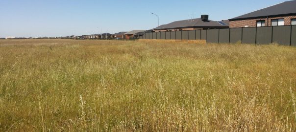


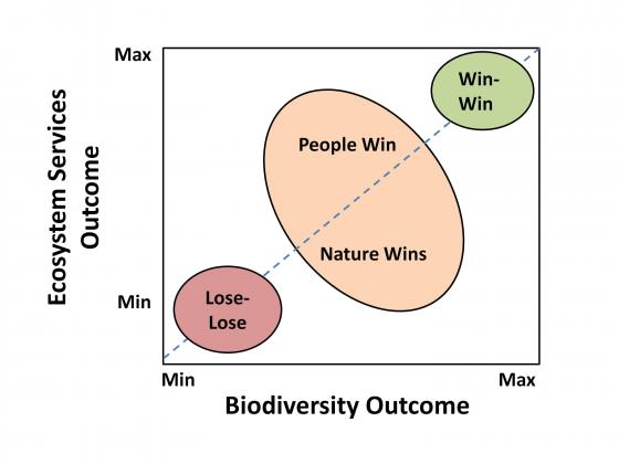
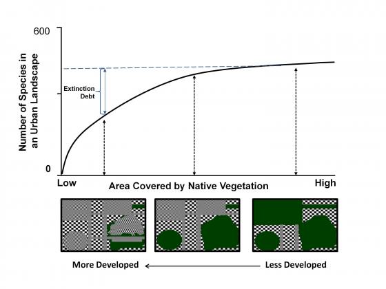
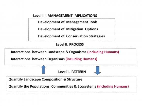
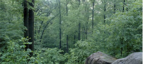
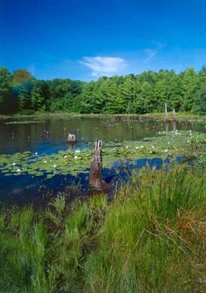
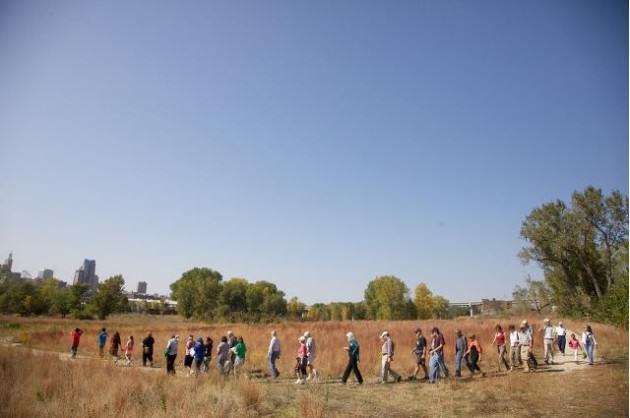
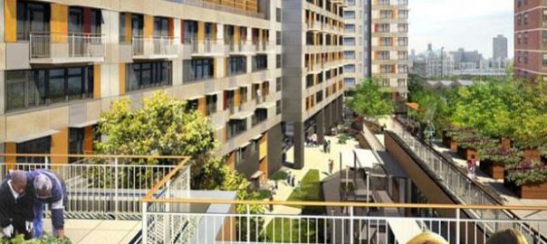

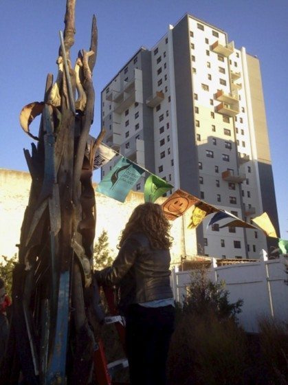
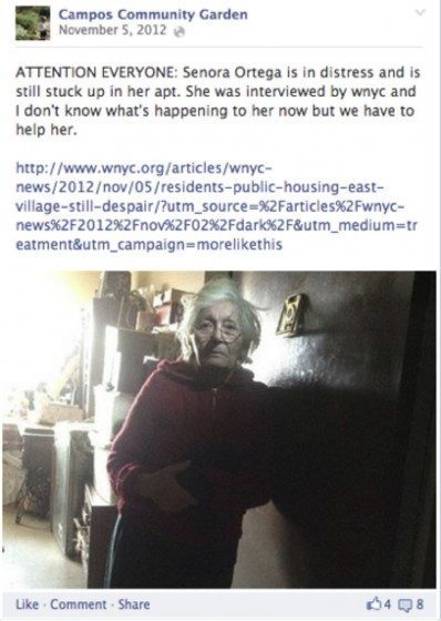
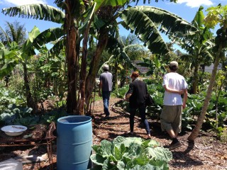

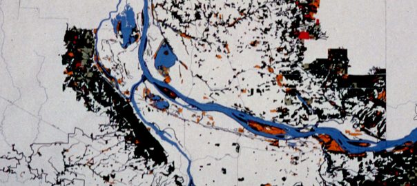
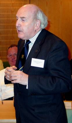
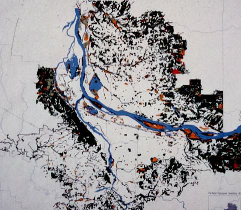
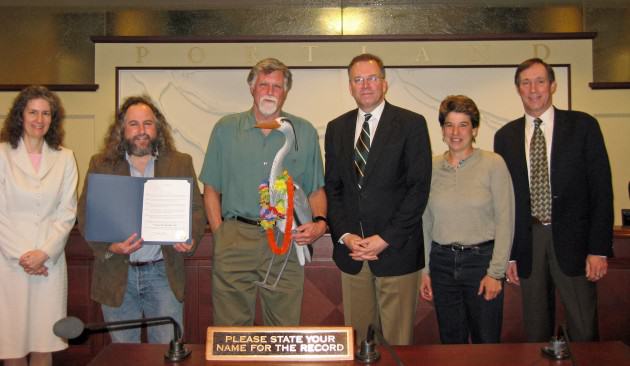
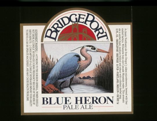

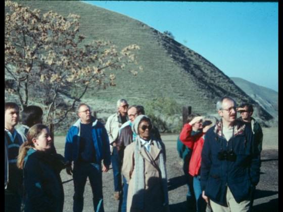

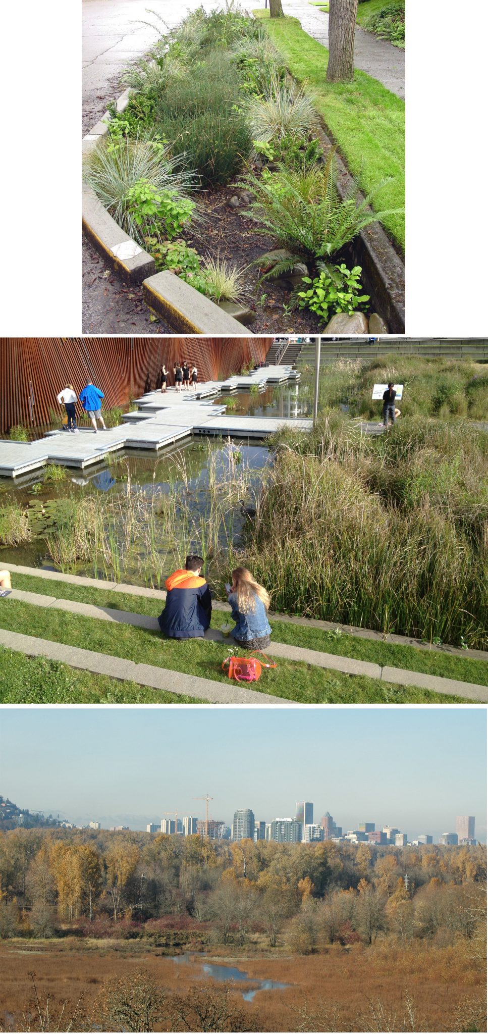 Moving To A Collective Impact Model: The Intertwine Alliance
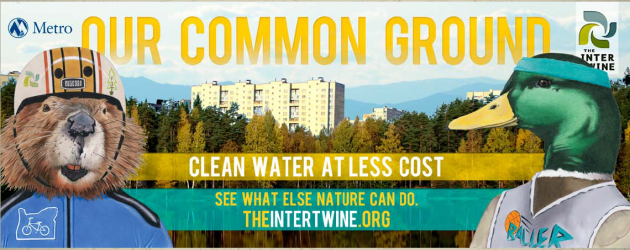 Attend to fundamentals
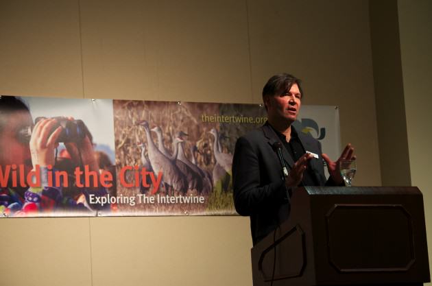
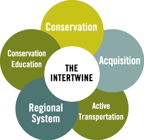


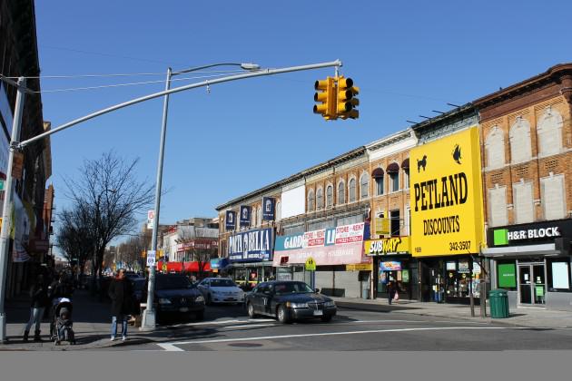


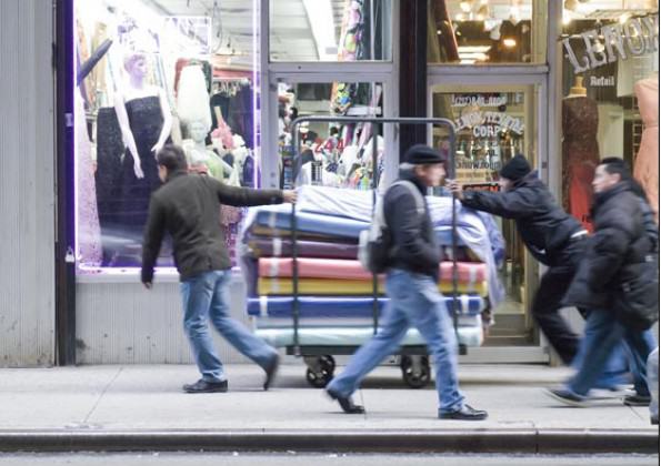


 Also known as the Dadelboom Mosque, it is the second-oldest place of Muslim workshop and one of the oldest substantially unaltered buildings in Cape Town (constructed c. 1780; second story added c. 1820).
 From the late 1600s to 1850s, Kalk Bay — as its name would suggest — supported a lime industry burning locally abundant seashells in kilns. With the demise of that industry, fishing emerged as the village’s economic staple. After each day at sea, it was under the Money Tree, safe from driving rain or blistering heat, that fishing boat skippers would dispense wages to their crews. So too, traders known as ‘langgannas’ — a Malay word reflecting Capetonian ancestry — would gather around the Money Tree to purchase cartloads of fish. These they would lug some 30 km north to Table Bay, blowing traditional fish horns at way stations to announce the arrival of their commerce.
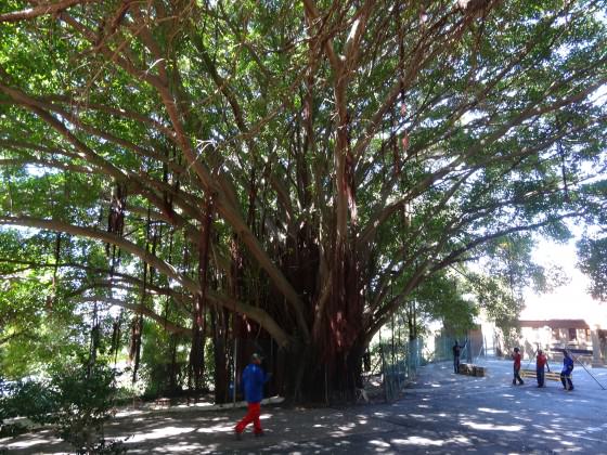 13. The Colossi of Arderne
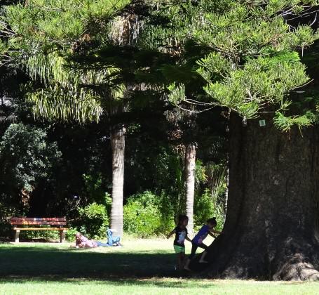
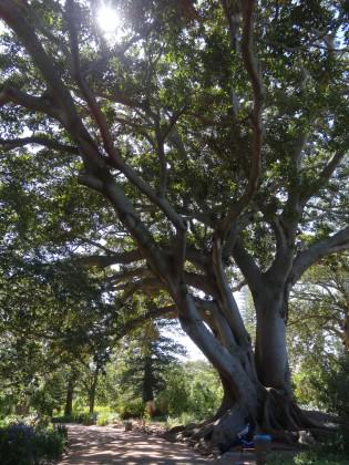
 The
The 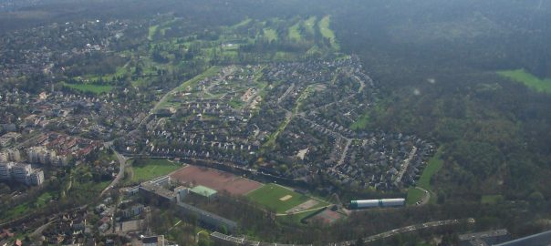
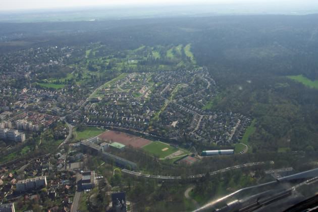
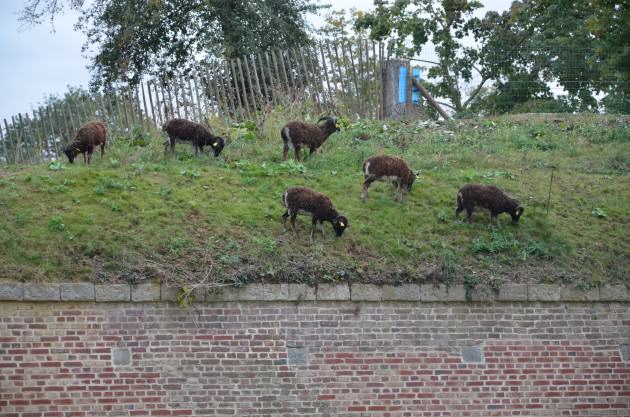
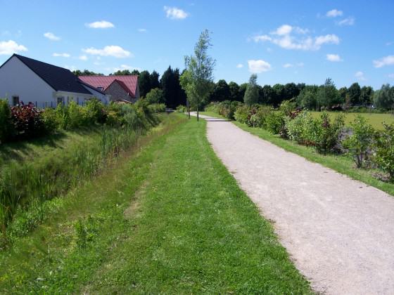
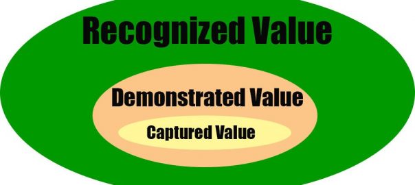
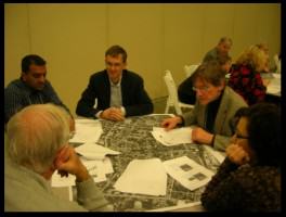 I am very excited about engagement exercises that use simulation models as tools to get people talking not just about their opinions, but about the consequences of their opinions. Incorporating simulation models explicitly into community dialogues is an approach to this. That is, individuals or groups can sit down with a computer simulator of, say, how green infrastructure performs in storm water capture. The people can arrange green roofs, or parks, or street trees on the landscape and the model calculates for them how much storm water has been captured using their design. The science and expert knowledge are built into the inner workings of the simulator (the “black box”). Individuals can try out their designs and social ideas using the model as context, and have the model give some feedback about the how their ideas would work on the ground. Their ideas are taken out of the realm of unverified opinion and placed in a context in which their function, output, and outcomes can be compared. You might still prefer one type of design to another, but its performance could now be part of the decision mix.
 You redesign Manhattan, block by block, to your specifications and then the “black box” of the simulator calculates a variety of key sustainability statistics, such as energy use, carbon, water flow, biodiversity, human population size, etc. You can register at the website and make your own designs (or “Visions”) or just check out others (there is a library of them). Warning: there is a bit of a learning curve, but investing some time, with patience, is fascinating and greatly rewarding. The creators have plans to continue improving it, including things like learning “competitions” to find to best and most productive design ideas.
 Does one person in your area want to invest everything in green roofs, while another thinks street trees are the answer? The model can help place the consequences of these alternatives in context (at least from a storm water perspective), making their relative outcomes easier to see, digest, and decide upon. Sure, there would still be decisions to make that are outside the scope of Lidra — aesthetics, access, equitability, and so on — but the model helps take at least some of the guesswork out of the process.
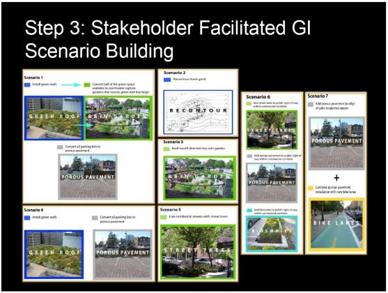
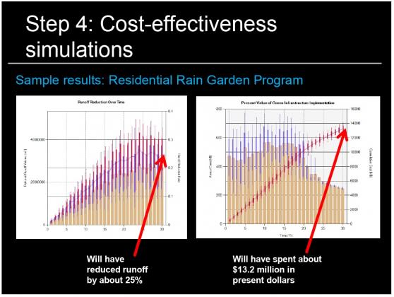 All models are wrong — some are useful
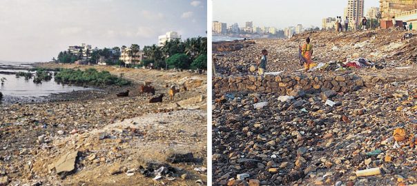
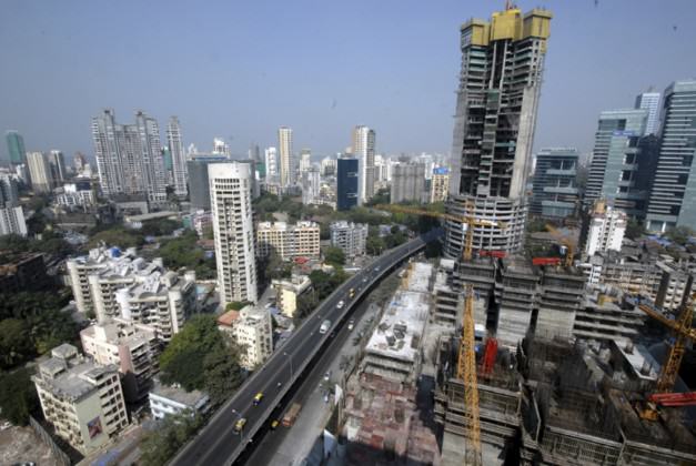
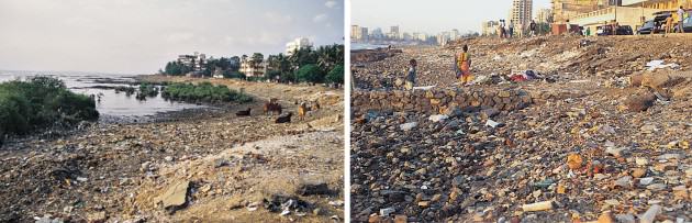
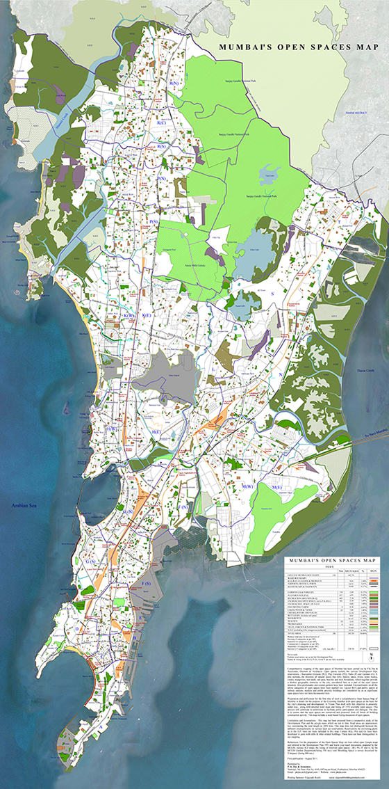
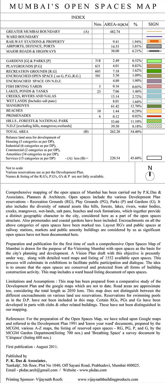
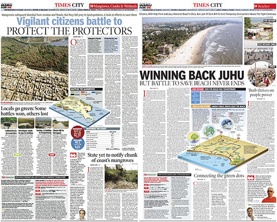
 For long-term gain, it is important to achieve necessary legislative changes for the protection, conservation and enrichment of various natural conditions. Governments deciding unilaterally or taking decisions in collaboration with highly influential private developers, land sharks and business houses, as is the practice today, leads to the downsizing of natural areas and depletion of these vital public assets. In spite of protracted struggles for environmental cause, governments have undermined such critical decisions and thereby allowed the continuing destruction of natural areas. In Mumbai for example, we witness large-scale illegal land filling, dumping of garbage and rubble generated from building repairs and construction sites onto areas of mangroves, wetlands, rivers and creeks. Even the city government, has over the years, used wetlands and mangrove areas as solid waste dumping sites. Hence, concerted democratic movements and protracted struggles will have to continue in order to influence decisions in favour of environmental protection and their conservation.
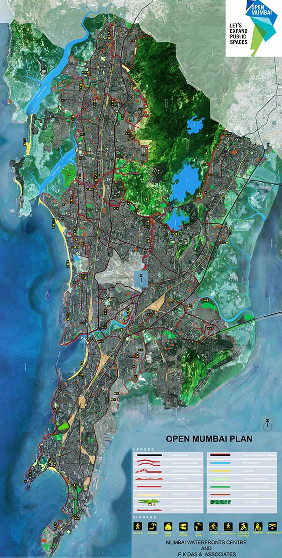
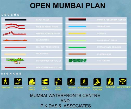

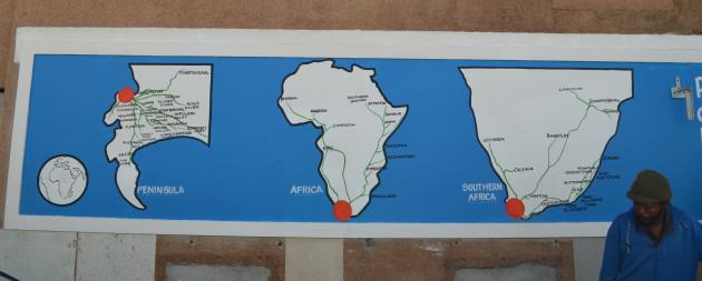

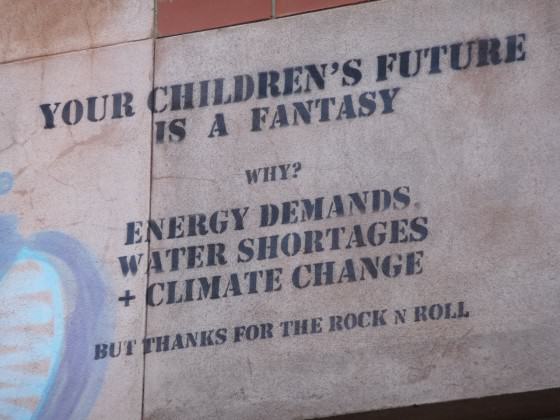
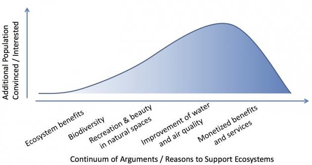 Who isn’t convinced? Many people, some of them local residents, and others who hold decision-making positions. In a climate of tighter budgets and more scrutiny of government spending, we need to do a better job of convincing the public and our political leaders that investing in natural systems is worth it, tipping the balance towards overwhelming public and political support.
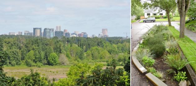

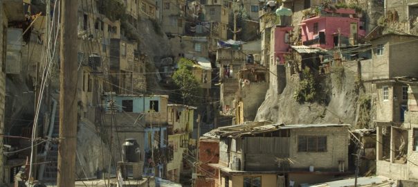
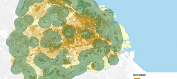
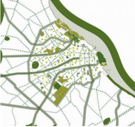
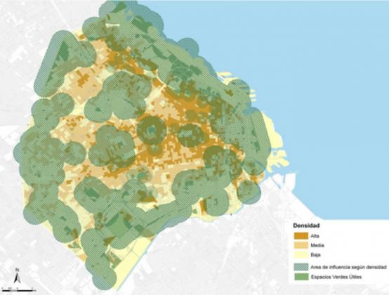
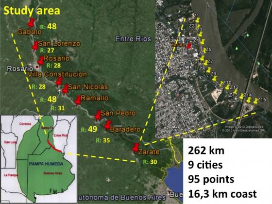
 (b) reducing the exotic tree cover and amount of highly managed grass area;
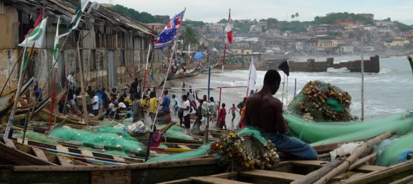
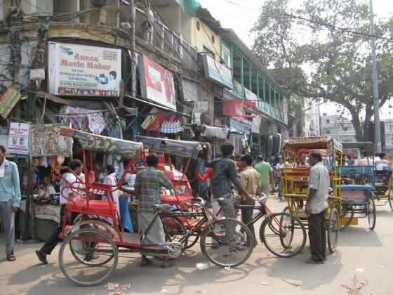

 As a result, even though ExxonMobil has recovered roughly 8 million gallons of oil from the site, most of the oil that was spilled in Greenpoint is still there. Lurking beneath the surface in a massive plume, the oil makes 50+ acres of land are undevelopable, and three city blocks of homes virtually worthless. The oil has also helped make Newtown Creek one of the most polluted waterways in the United States. The most
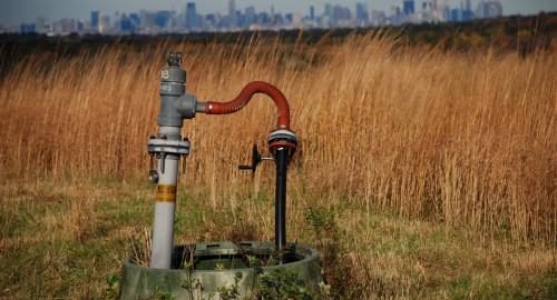

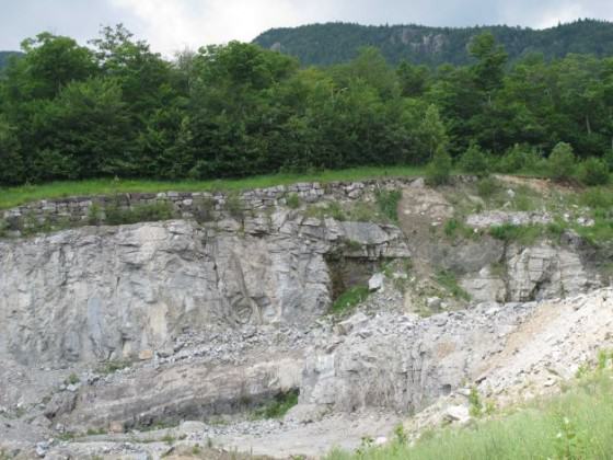
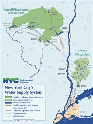
 Until now, fracking has been banned in New York State. However, the ban is currently under review and many civil society organizations worry that intense industry lobbying may pressure Governor Cuomo. A new energy plan recently issued by the State does not include fracking as part of its long-term strategy, though it remains agnostic on the issue


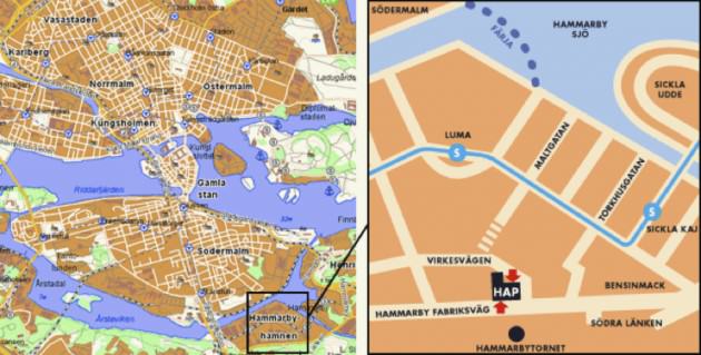
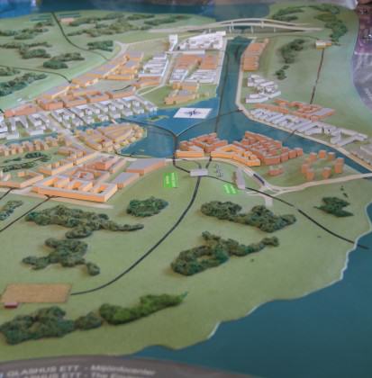
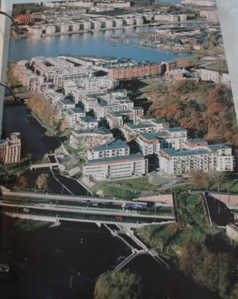
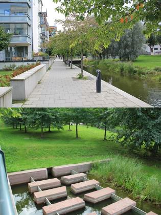
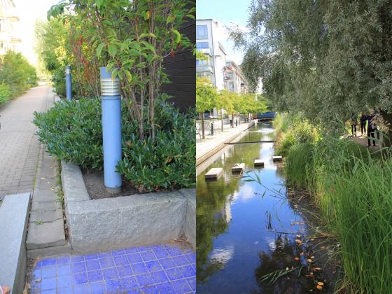
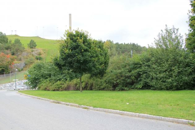
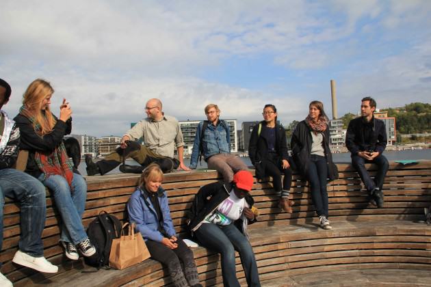
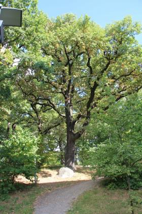
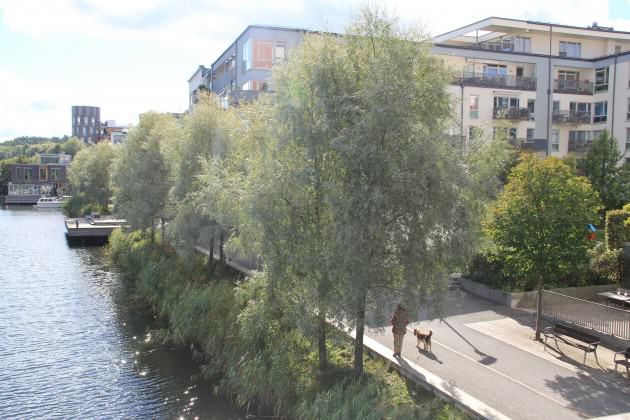
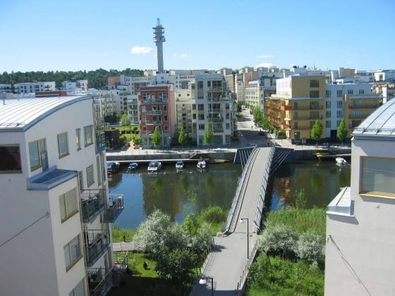
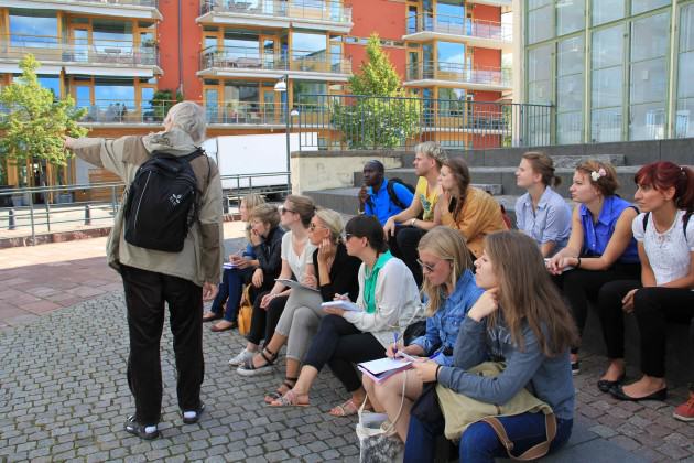
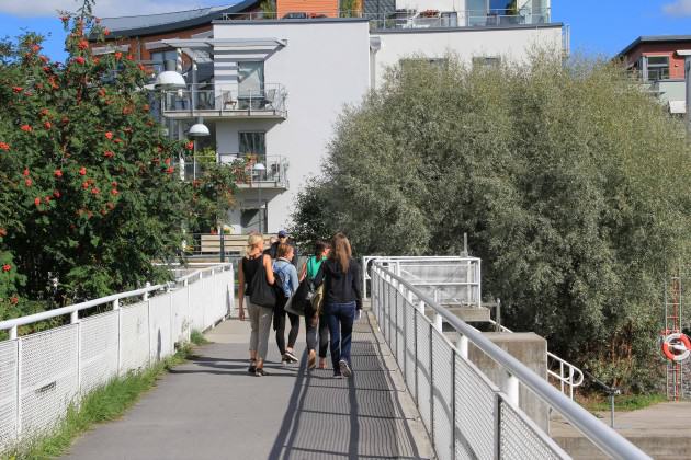 Some weak points that need to be developed
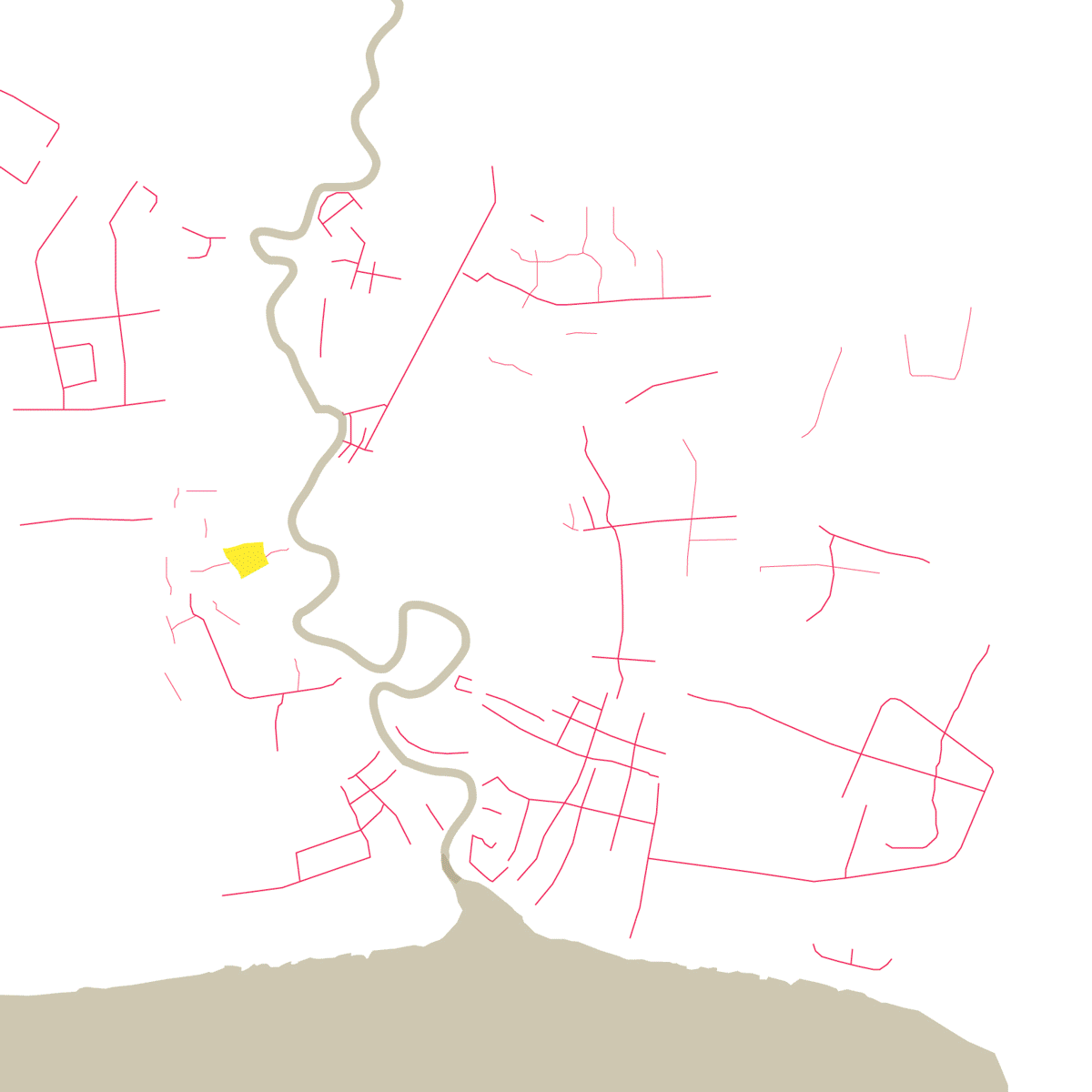
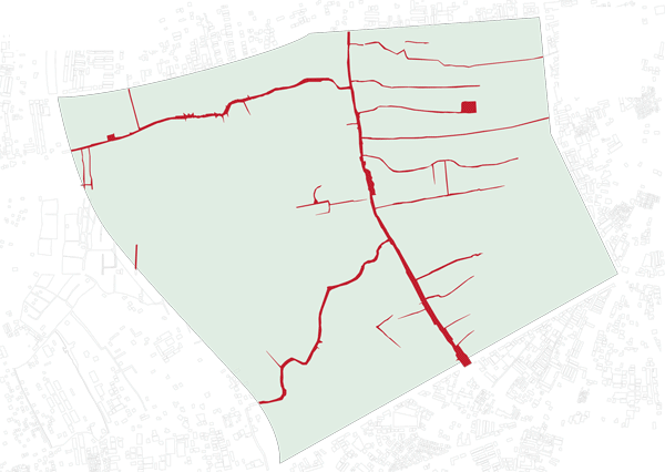
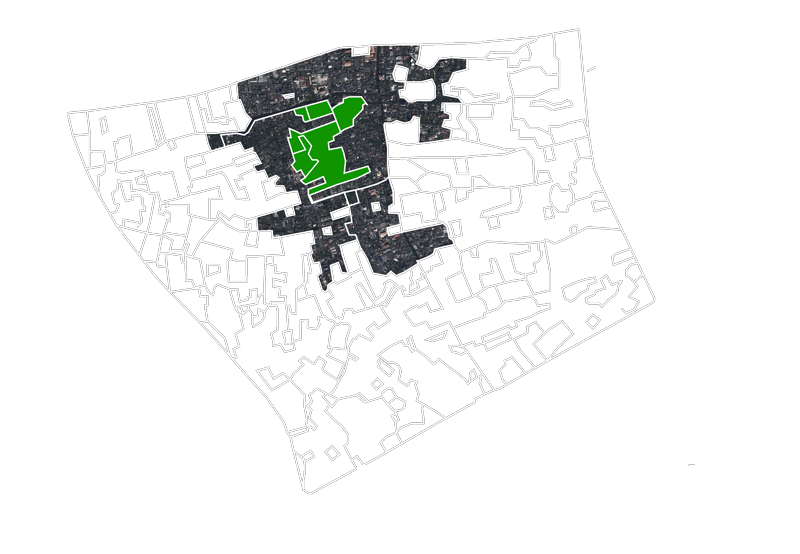
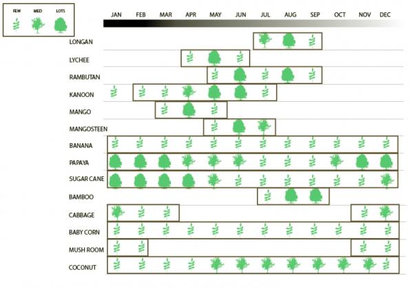

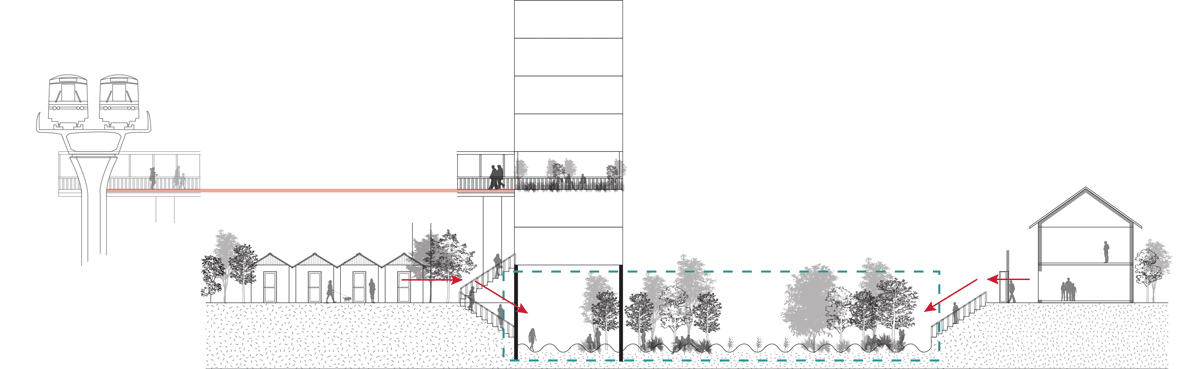
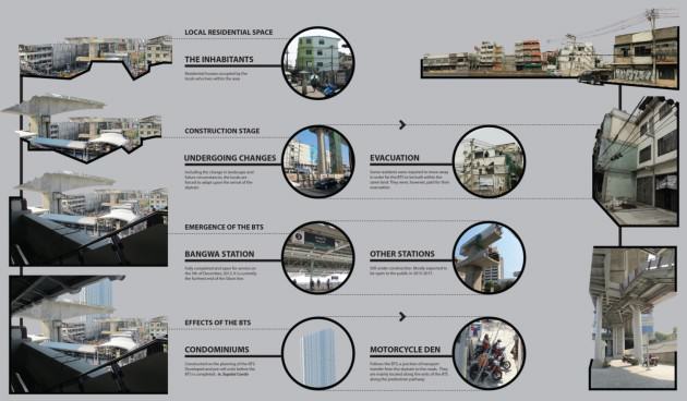
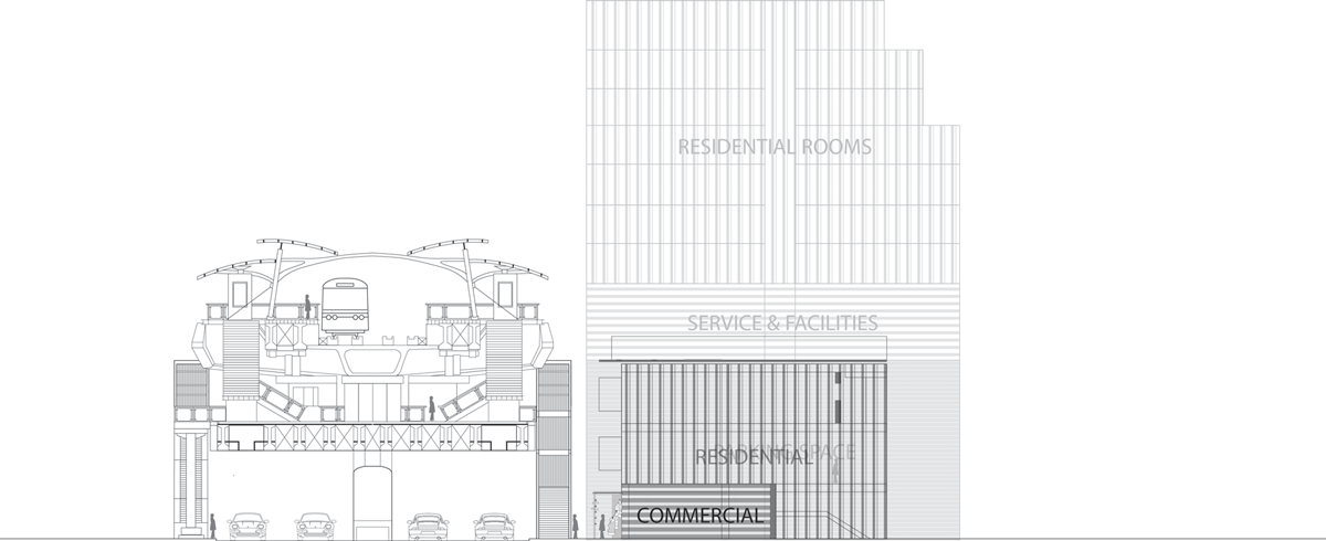
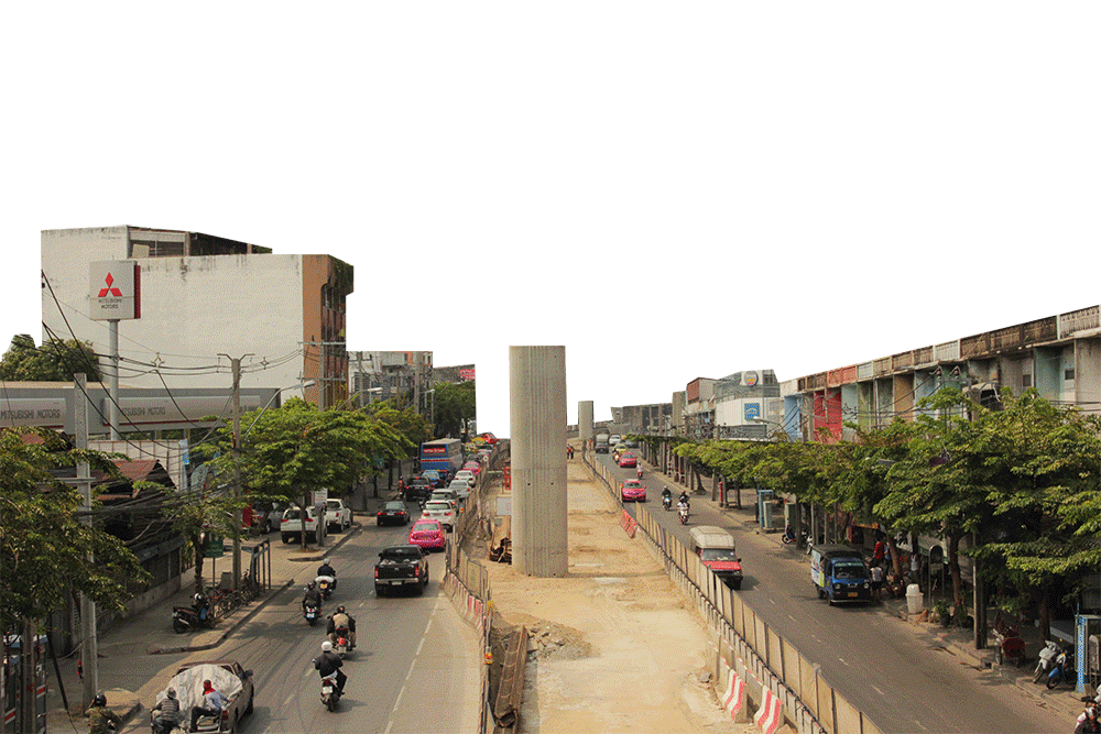
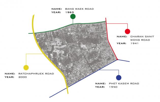
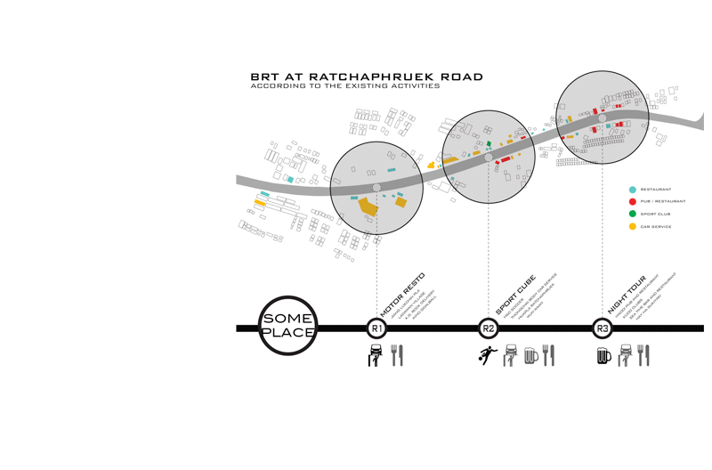


 Jerusalem is characterized topographically by the watershed that draws a clear divide between the eastern side, a desertscape of great beauty with many historic features, including the magnificent Kidron/Wadi El Nar Basin, running down to the Dead Sea, and the western side, with the green rolling Jerusalem Hills, abundant water sources and fertile valleys. The physical contrast between these two microclimates is dramatic, and very much an integral part of Jerusalem’s magic and majesty.
 In the 1990’s an attempt was made to convert the sixty acres of the park into a residential neighborhood with a business center, then considered worthy urban objectives. The land had previously been allocated to two collective farms that had been asked to grow fruit for Jerusalem under siege during Israel’s War of Independence. The orchards were planted already in the 1940’s and provided a source of fresh fruit for residents during the six-month siege in 1948. During those difficult months, Jerusalemites had a meager water supply thanks to the rainwater cisterns that have been part of life in Jerusalem for thousands of years.
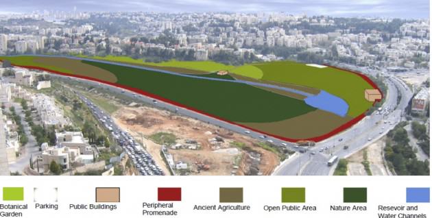
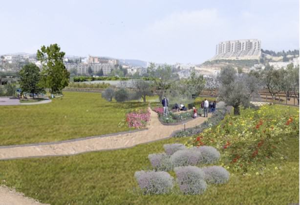 The Society for the Protection of Nature in Israel fought the battle for the Gazelle Valley in the planning committees and the courts, eventually winning the case by proving that percentage-wise, this space needed to be left open to enable intensive development in the surrounding neighborhoods. Without realizing, we were making the case for preservation of urban nature, and indeed for the multiple eco-system services it provides. Those that argued in favor of intensive residential development in the valley claimed that the pro urban nature camp was hypocritical, since by not developing the Gazelle Valley we would push urbanization further into suburbs on the west side of Jerusalem, where the really important natural resources are. So we were accused of conducting a NIMBY fight to prevent building in our back yards.
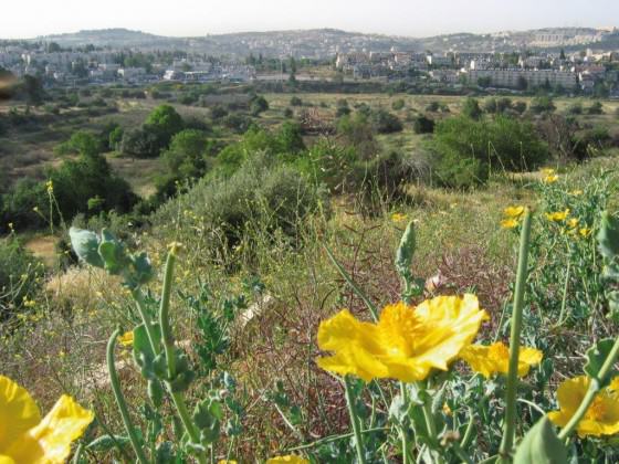


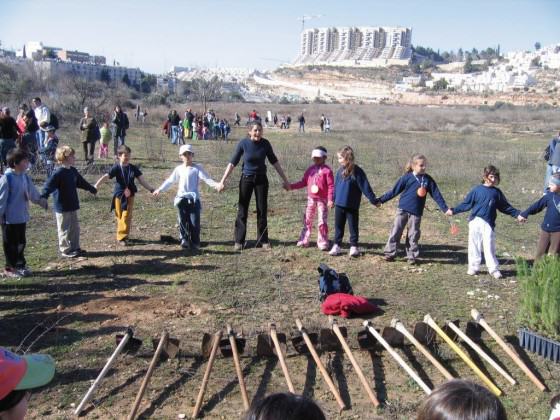 When it came to planning the park in preparation for the actual development, an additional element of great significance for Jerusalem was brought into the picture.
 As I submit this entry to the TNOC blog, the fence around the valley, which will provide protection for the gazelles from the heavy traffic all round, and from marauding wild dogs, is nearing completion, and so is the rainwater collection system I have described. The many ancient agricultural terraces around the valley will be restored, and a bike path will run round the entire park, as well as along the axis of lakes and streams. A Visitors’ Center will provide educational material and information for tourists. There will be no lighting in the park after 22:00, and the park will be closed to the public at night, with no entry fee during opening hours.


Add a Comment
Join our conversation