People Take Over Nature in Cities with their Own Hands

Art, Science, Action: Green Cities Re-imagined

Em Português.

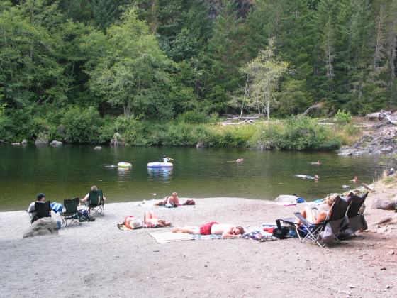
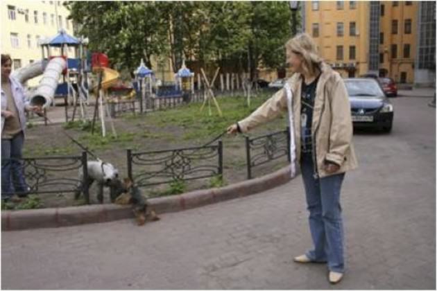
Urban food production is gaining momentum with launching of books, seminars and congresses, websites and social media. Some cities have programs to promote people-nature direct contact through vegetable gardens — common or in allotment gardens. Urban dwellers are becoming more and more engaged in cultivating and collaborating in common public spaces, transforming many underused lawns into productive landscapes.

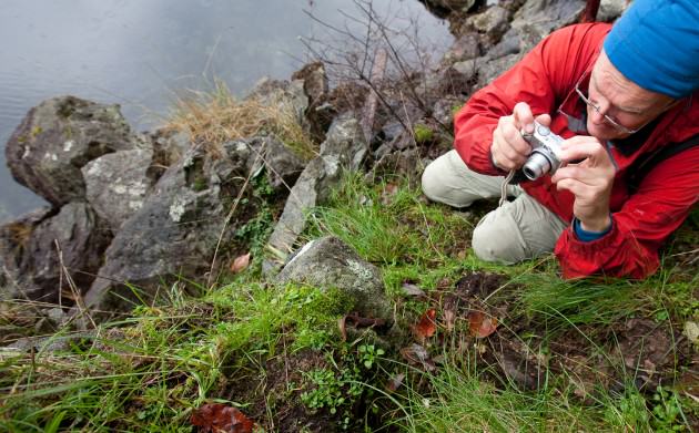
I have been inspired by these issues and have been investigating and visiting many places in search of interesting examples.
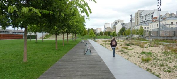
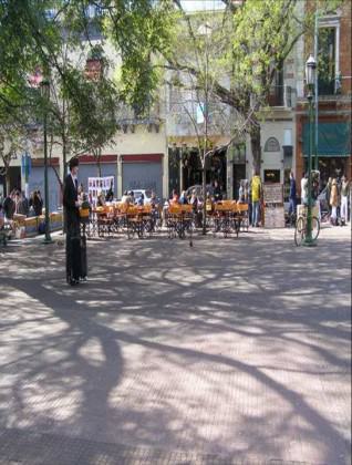
Paris

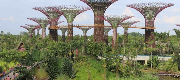
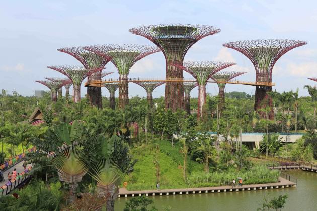
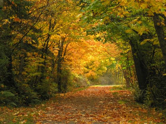
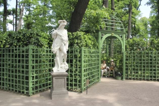
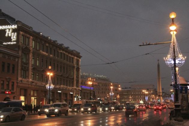
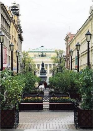
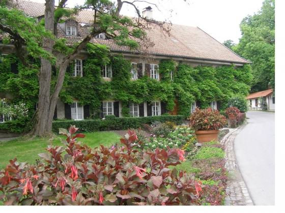
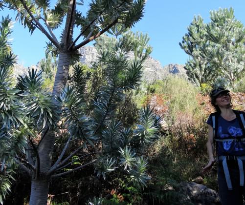
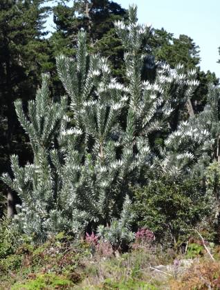
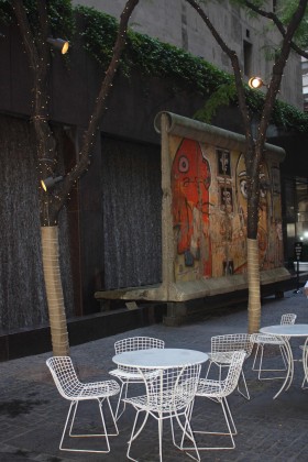
Paris has been an exciting case not only because it is a large and complex metropolis, but because it also has an important role in people’s imaginations, being one of the most visited cities in the world. Paris attracts visitors from everywhere looking for art, culture, fashion, architecture, and parks and gardens! Yes, Paris has numerous parks and gardens of all sizes, shapes, functionality and vegetative cover. They may be historic, recreational, ecological and are important part of the urban forest, like Bois de Boulogne and Bois de Vincennes.

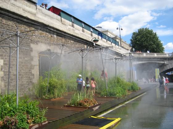
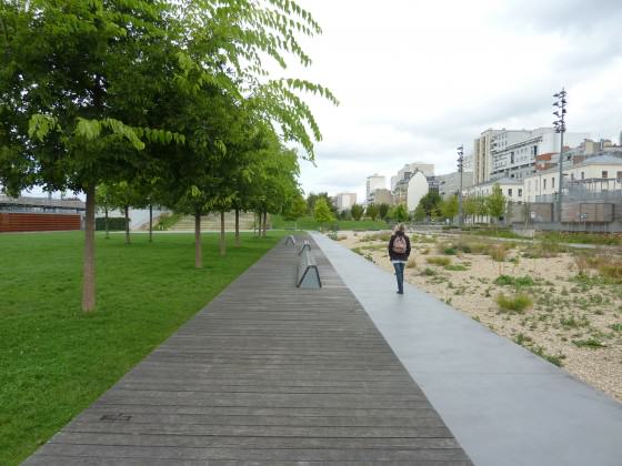
I have gone to Paris very often for decades. In the last years I have seen a great transformation in how Parisians are dealing with urban nature and opening space for people, biodiversity and food production. It is happening not only in parks and gardens, but in streets, small lots, roofs, in public and private areas. Along the river Seine, in the summer streets are transformed as urban beaches. The city has promoted educational events in all spaces and scales, and my perception is that they are making a silent revolution in the way people value nature and have enhanced the day-to-day interrelation with the river, parks and the urban vegetable gardens.

“Paris Plage” – Paris Beach: in the summer the border of the Seine river is transformed in a beach. Now some parts are closed to vehicles at all times (July 2009). Photo: Cecilia Herzog

In recent years Gilles Clément, a landscape designer and writer, has done a terrific job in changing minds, both of decision-makers and regular people. He has designed and written about landscape and gardens, as the Tier Paysage (Third Landscape — the unmanaged derelict areas that abound in cities and house an expressive biodiversity); and the Jardins en Mouvement (Changing Gardens) — gardens where the designers and the caretakers work with nature so the vegetation can thrive with diversity in surprising ways; among other publications.

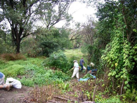
My friends Miguel, Pablo Georgieff and Nicolas Bonnenfant are architects and landscape architects working with communities to build gardens together (see the COLOCO website). They explore the urban biodiversity in many ways, sometimes in urban performances with public participation.

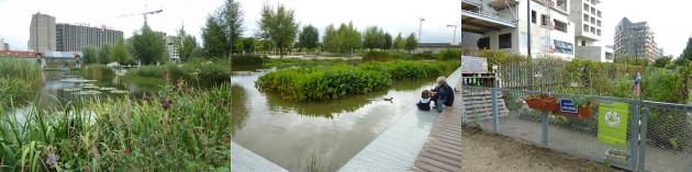
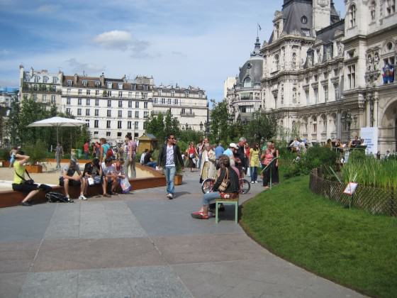
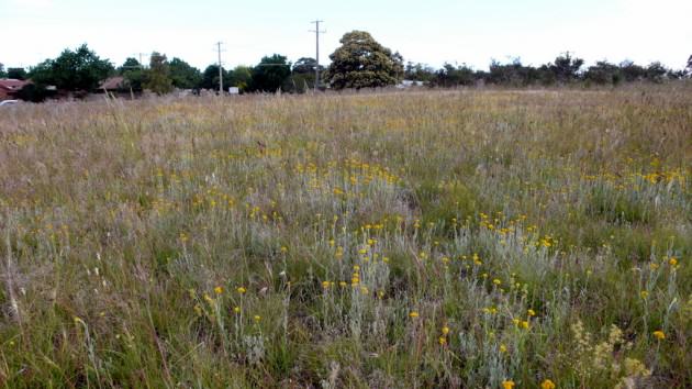
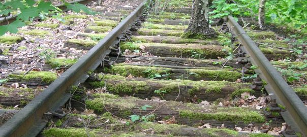
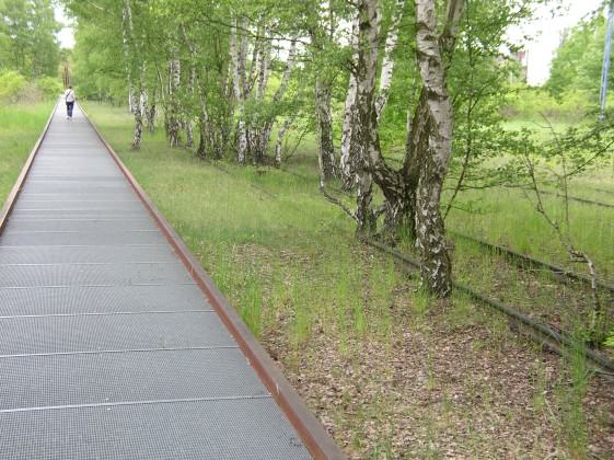
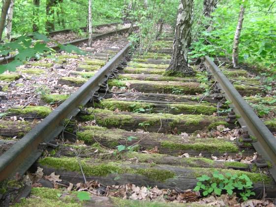
The square in front of the Hotel de Ville (City Hall) hosts different events all year long. In the summer I saw an installation of samples of regional ecosystems to educate people about the nature around them. Many new parks have been designed to recreate those ecosystems. For instance, Jardin d’Éole has beautiful small wetlands and sandy gardens where once there was a train track maneuver area.

"Hôtel de Ville" - City Hall: the paved area in front converted into a regional ecosystem demonstration and educational project (july 2009). Photo: Cecilia Herzog
“Hôtel de Ville” – City Hall: the paved area in front converted into a regional ecosystem demonstration and educational project (July 2009). Photo: Cecilia Herzog
“Jardin d´Éole” New park in the Northern side of the city: sandy ecosystem in the right side with a small built wetlands in the extreme right. Photo: Cecilia Herzog

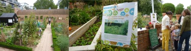
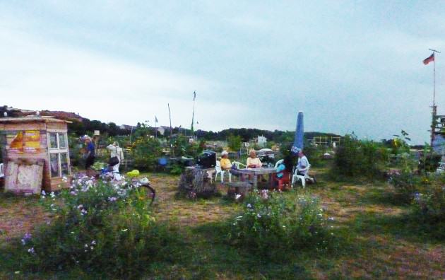
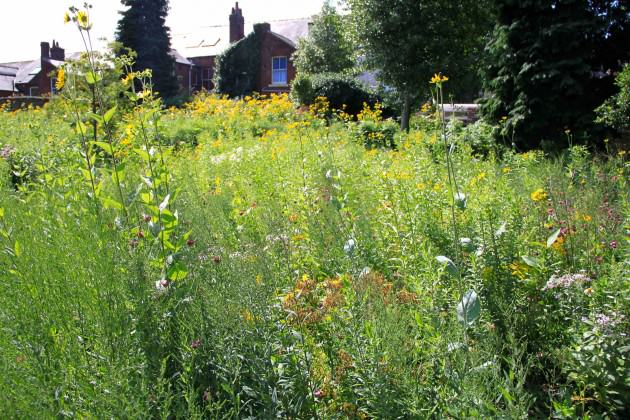
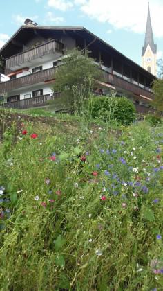
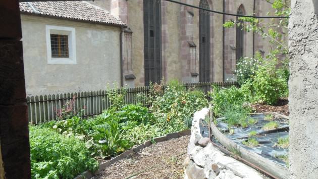
But what strikes me the most is the food planting that is being incorporated in parks and other public and private spaces. It is not a new concept, but today they are part of all the neighborhoods. The public program Jardins Familiaux et Collectifs (Family and Collective Gardens) is more than 100 years old and gives urbanites a chance to keep contact with soil, planting, digging and picking their own food or flowers. There is a long waiting list for a plot of land to explore your own garden, for food production or flowers.

"Jardin Familliaux et Colectifs" Family and Collective Gardens: this is close to the Chemin de l´Île Park along the Seine, in Nanterre - a city neighboring central Paris. Below the electrical transmission lines there are allotment gardens where city dwellers have direct contact with nature. Photo: Cecilia Herzog
“Jardin Familliaux et Colectifs” Family and Collective Gardens: this is close to the Chemin de l´Île Park along the Seine, in Nanterre – a city neighboring central Paris. Below the electrical transmission lines there are allotment gardens where city dwellers have direct contact with nature. Photo: Cecilia Herzog

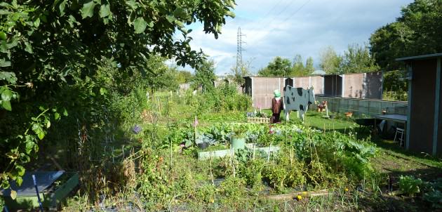
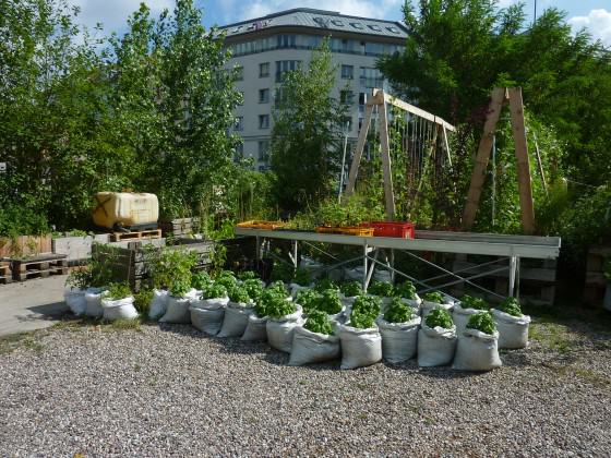
The city is developing a former industrial area in the northwestern 17eme Arondissement (17th district), Clichy-Batignolles. The strategy was to start with the new park Martin Luther-King. The park has achieved social and ecological goals, with spaces for a variety of activities, a built wetland and a productive garden, as part of the Jardin Partagé – Main Verte city program (Shared Garden – Green Hand ). This is an amazing way to give school kids the opportunity to cultivate food in public areas nearby. Each class has its own plot. The common vegetable garden has signs that show who is planting what.

Martin Luther-King Park: Offers an array of ambiances combining biodiversity, water natural drainage and filtration, recreation and vegetable garden for school students. Photos: Cecilia Herzog
Martin Luther-King Park offers an array of ambiances combining biodiversity, water natural drainage and filtration, recreation and vegetable garden for school students. Photos: Cecilia Herzog

The Main Verte is not only happening in new parks, it is also in Bercy Park, which is now some decades old (see the map with all locations here). Every year in September, the city promotes a weekend dedicated to the gardens, with an emphasis in food production: it is the “Fête des Jardins” (Gardens Party).

Bercy Park: Vegetable garden during the Fête des Jardins (Gardens’ Party week-end): education, recreation and direct contact with nature. Photos: Cecilia Herzog

Berlin

There is a strong bottom-up movement looking “backwards” to reconnect people with nature in dense urban areas. I was in Berlin last July (2013), and visited two urban gardens that really impressed me: the Prinzessinnengarten at the Moritz Platz, and Tempelhof Park. Both are examples of active social engagement with ecological issues related to food and biodiversity. They are unique places, and have been developed by residents intending to conserve open areas from real estate development. The first is located in the heart of the city, in a former derelict space. An association named Nomadic Green was created and they rented the space from the city and have a restaurant, a café, and a small library. The planting is in portable containers — that’s the origin of their name. In just few years the transformation of the place and people has been absolutely astonishing .

Portable vegetable garden in the Prinzessinnengarten in the heart of Berlin. Photo: Cecilia Herzog

Tempelhof Park is a former airport that was converted in a public park in the South of Berlin. It is impressive in its size. People use and love it. Most remarkable to me is the area where the residents created vegetable gardens and “living rooms” in open air made of recycled material. It is a truly hospitable outdoor place. Even with a strong rain at the end of the day, it was pleasant being in a communal tent, with the sound of the water and wind, and nice conversation with interesting people.

Late afternoon last summer at the Tempelhof Park vegetable garden: beer and nice conversation close to nature. Photo: Cecilia Herzog

New York

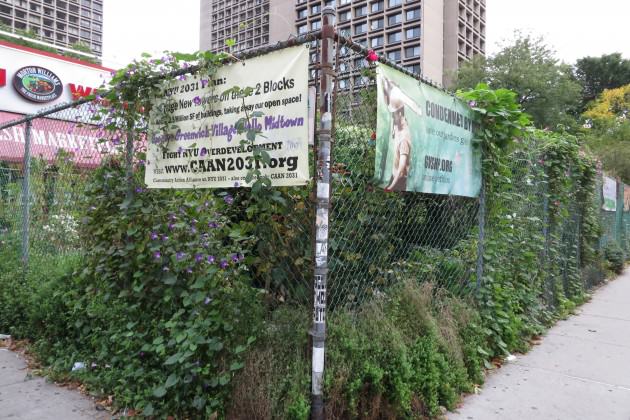
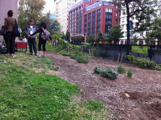
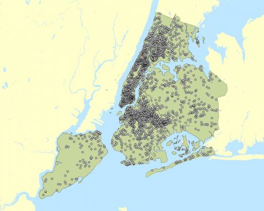
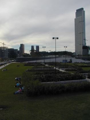
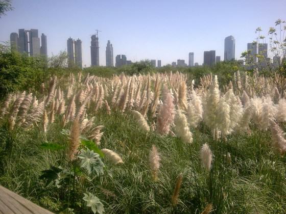
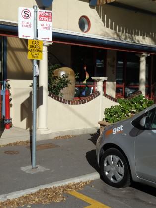
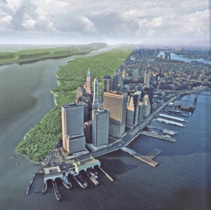
Talking about large cities and food production, New York City is really impressive. There are numerous community gardens in all boroughs, such as the one in the West Side Community Garden. In the area of the New York University there are two examples of engagement with nature. At LaGuardia Corner Gardens, located next to the New York University, there are people that care for a community garden, working to keep it beautiful and with rich biodiversity. It is under threat, because the “NYU 2031” plan proposes building a new high rise on the site. The university itself has the NYU Urban Farm, and when I was there young students were concluding their work in the garden.

La Guardia Corner Gardens partial view, with the banners against the future development that Will eliminate the garden. Photo: Cecilia Herzog
NYU Urban Farm. Photo: Cecilia Herzog

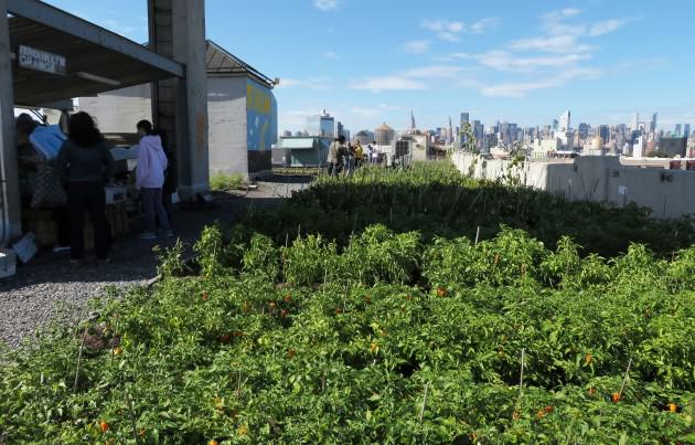
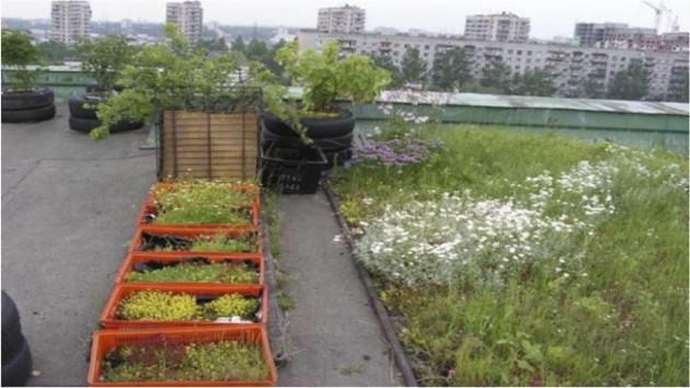
On a commercial scale, the striking innovation is the transformation of gray roofs to urban farms by the Brooklyn Grange. They have two facilities: the first is located in Brooklyn and the second in Queens. They are opened to guided visits on the market days (check the website to see openings that vary according to different seasons. I visited the Queens facility on a beautiful Saturday morning last October (2013). There were a lot of visitors, people buying fresh produce, learning about food planting, appreciating nature on the rooftop of an old building with an astonishing view of Manhattan.

View from the Brooklyn Grange roof top farm at the Queens facility, in NYC: last October in a Saturday morning. The Market is on the left and the view of Manhattan in the back. Photo: Cecilia Herzog

São Paulo

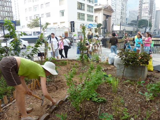
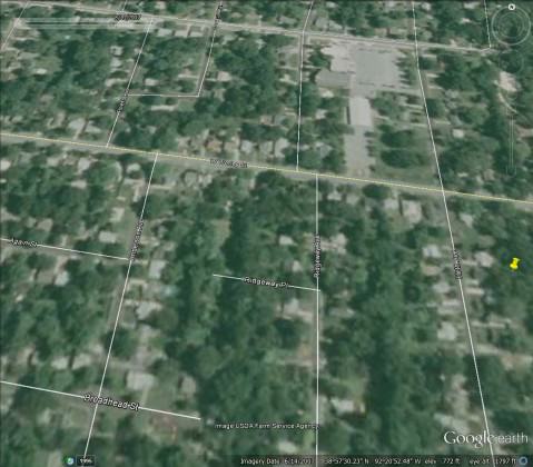
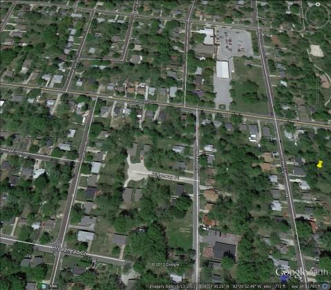
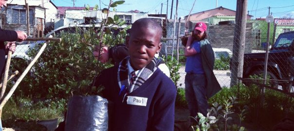
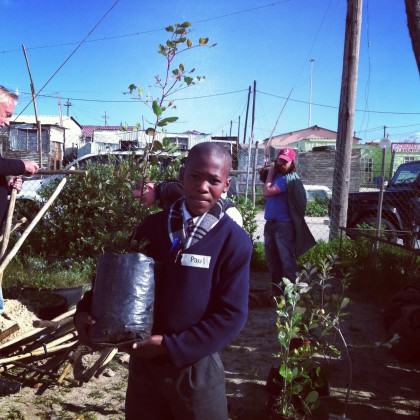
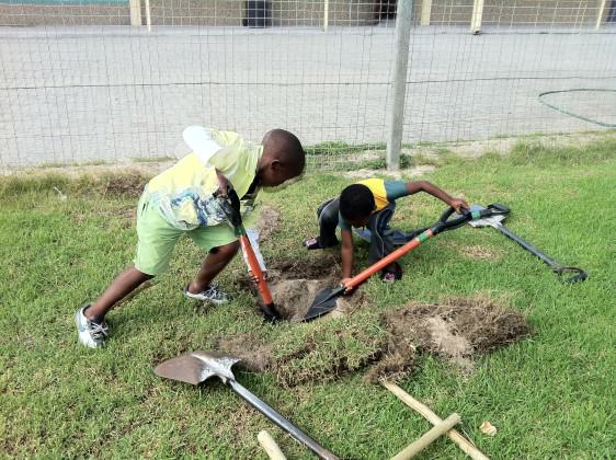
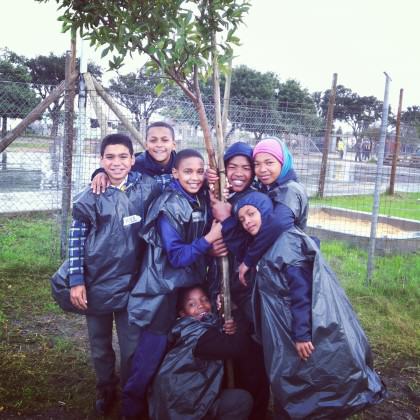
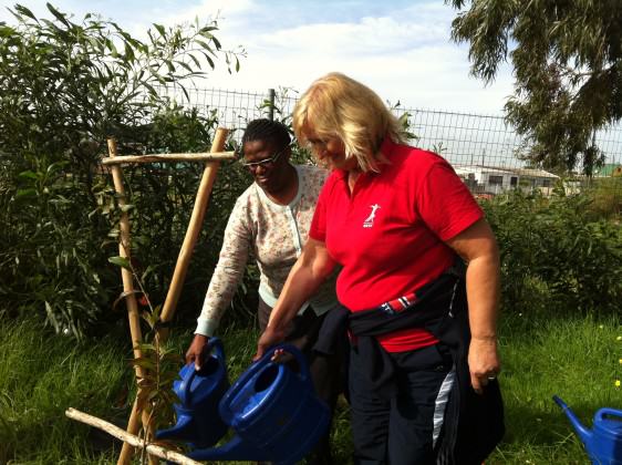
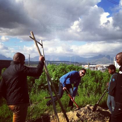
In the city where I was born, São Paulo, Brazil, there is a group called Hortelões Urbanos (Urban Vegetable Producers — in a loose translation) that is transforming places, minds and hearts. It a pro-life movement — in a broad sense — started after two journalists completed a permaculture course and decided to grow their own food. The initial place was at Praça das Corujas (Owl’s Place), located in a nice neighborhood. They took over a lawn in this small park to plant food and flowers, and decorated with recycled artwork. In a short period of time, they were joined by more and more residents and replicated the intervention in other public and private spaces. They started a group on the Internet, and in a year and a half they have more than 6,000 members! It is like a good virus inoculated in urbanites in search of a better quality of life.

Claudia Visoni one of the co-founders of “Hortelões Urbanos” working in the vegetable garden in the financial district of São Paulo, over a tunnel in a central area between an extremely busy street, Avenida Paulista. Photo: Cecilia Herzog
"Praça das Corujas" (Owl's Place): lawn in a small park transformed in a community productive garden in São Paulo, Brazil. Photo: Cecilia Herzog
“Praça das Corujas” (Owl’s Place): lawn in a small park transformed in a community productive garden in São Paulo, Brazil. Photo: Cecilia Herzog

Farmer’s Markets go along with those movements. Producers get together to sell their local production to neighbors. Local small urban farmers are gathering to keep productive properties in urban areas in Rio de Janeiro. They have support of local “eco-chefs” that run fancy restaurants. Local is beautiful because it conserve people’s jobs and relationships, incentivizes attachment to the land and nature, and maintains traditions and culture, and most of all promotes people’s values and emotions.

The benefits are evident: healthy food, people-nature reconnection, better local climate and water quality, more biodiversity and, most important, happier and healthier people. There are many scientific studies that prove the ecosystem services provided by biodiversity and organic food production are essential to maintain life on planet Earth. The recently released book Urbanization, Biodiversity and Ecosystem Services led by Thomas Elmqvist is a must read for people interested in learning more about the benefits of nature in the cities. Productive and biodiverse landscapes should replace lawns and cosmetic gardens with few species, which need costly and constant maintenance. Those areas may be of great importance to build more livable, sustainable and resilient cities.

After years of research, Marco Schmidt (Water Paradigm) eloquently states that extensive land-use change from green to gray, and other uses that cause biodiversity eradication and soil depletion, are important drivers of climate change because there is an alteration in the evaporation cycle that is responsible for the hydrologic cycle which influences local and global climate. This is often ignored. Soils and plants capture carbon and release oxygen, which is fundamental to life; drain and filter water; prevent floods and landslides; cool temperatures and regulate local climate. Urbanization is increasing and so is land-cover change. If we reverse the process, greening and including water in plans and design in many ways in private and public urban areas, we can contribute to build more sustainable and resilient cities. Many of the most pressing crisis may be mitigated and even adapt urban areas for the unexpected challenges that climate change is already bringing to us all, wherever in this planet we may be.

And if public and private lawns were transformed in productive landscapes, planted with food and associated flora for a healthy biodynamic interaction among biodiversity? And if impervious surfaces, such as gray rooftops, sidewalks, parking lots and school yards became green with functional, visible, educational and recreational with water features accessible to all: kids and adults and seniors? And if people, local arts and culture, biodiversity, water bodies and mobility were planned and designed to harmonize communities with plenty of amenities for all ages? What a marvelous cities we would have: livable cities.

These are not dreams. These places exist and people love them, as we have seen above. People have the power to transform the world little-by-little, garden-by-garden, block-by-block, community-by-community.

So, let’s get started!

Cecilia Herzog
Rio de Janeiro

On The Nature of Cities 


*** 

As Pessoas Tomam Conta da Natureza em suas Cidades com suas Próprias Mãos

A produção de alimentos nas cidades está ganhando momentum com o lançamento de livros, seminários e congressos, websites e mídia social. Algumas cidades têm promovido programas para que haja um contato direto pessoas e a natureza através de hortas – comuns ou em allotment gardens (lotes públicos que são disponibilizados por uma quantia simbólica anual).

Fiquei instigada por essas questões. Por isso, tenho pesquisado e visitado muitos lugares em busca de casos interessantes. Paris tem sido um modelo empolgante, não apenas por se tratar de uma cidade grande e uma metrópole complexa, mas porque também tem um papel importante no imaginário das pessoas sendo uma das cidades mais visitadas do mundo. Paris atrai visitantes de todos os lugares em busca de arte, cultura, moda, arquitetura, e parques e jardins! Sim, Paris tem inúmeros parques e jardins de todos os tamanhos, formas, funcionalidades e cobertura vegetais. Eles podem ser históricos, recreativos, ecológicos e são parte importante da floresta urbana, como Bois de Boulogne e Bois de Vincennes.

Paris

Tenho ido a Paris com frequência por décadas. Nos últimos anos tenho visto uma grande transformação em como os parisienses estão lidando com a natureza urbana e abrindo espaços para pessoas, biodiversidade e produção de alimentos. Isso está acontecendo não apenas em parques e jardins, mas nas ruas, pequenos lotes, tetos, em áreas públicas e privadas. Ao longo do rio Sena, as ruas no verão são transformadas em praias urbanas. A cidade tem promovido eventos educacionais em todos os espaços e escalas, e minha percepção é que estão fazendo uma revolução silenciosa no modo como as pessoas valoram a natureza e têm melhorado no dia-a-dia as suas inter-relações com o rio, parques e hortas urbanas.

“Paris Plage” – Paris Praia: no verão as bordas do Sena são transformadas em praias. Atualmente, partes dessas vias já estão fechadas ao tráfego de veículos permanentemente. (julho de 2009). Photo: Cecilia Herzog

Nos últimos anos Gilles Clément, um paisagista e escritor, tem feito um tremendo trabalho mudando a cabeça das pessoas, tanto de tomadores de decisões como das pessoas comuns. Ele tem projetado e escrito sobre paisagens e jardins, como Tier Paysage (Terceira Paisagem — áreas urbanas não manejadas que se espalham pelas cidades e abrigam expressiva biodiversidade); e Jardins en Mouvement (Jardins em Movimento) — jardins onde o projetista e o jardineiro trabalham com a natureza de forma que a vegetação possa resplandecer com diversidade de maneiras surpreendentes; entre outras publicações.

Meus amigos Miguel, Pablo Gorgieff e Nicolas Bonnenfant são arquitetos e paisagistas que trabalham com comunidades na construção conjunta de jardins (veja o website COLOCO). Eles exploram a biodiversidade urbana de várias maneiras, algumas vezes em performances com a participação do público.

A praça em frente ao Hotel de Ville (Prefeitura) é lugar de diferentes eventos ao longo do ano. No verão, estive numa instalação de amostras de ecossistemas que visavam educar as pessoas sobre a natureza que as rodeia.  Muitos parques novos estão sendo projetados para recriar esses ecossistemas. Por exemplo, o Jardin d’Éole tem um belo wetland (ecossistema de área alagada, no Brasil também conhecido como banhado) e um jardim arenoso, no local onde anteriormente abrigou uma área de manobras de trens.

"Hôtel de Ville" - Prefeitura: áreas pavimentadas em sua frente são convertidas em demonstração de ecossistemas regionais com fins educativos july 2009). Photo: Cecilia Herzog
“Hôtel de Ville” – Prefeitura: áreas pavimentadas em sua frente são convertidas em demonstração de ecossistemas regionais com fins educativos july 2009). Photo: Cecilia Herzog
“Jardin d´Éole” – Novo parque na zona norte da Cidade: ecossistema arenoso no lado direitor, com pequeno alagado construído na extrema direita. Photo: Cecilia Herzog

Mas, o que mais me impressiona são as plantações de alimentos que estão sendo incorporadas aos parques e outros espaços públicos e privados. Não é um conceito novo, mas hoje fazem parte de todos os bairros. O programa Jardins Familiaux et Collectifs (Jardins Familiares e Coletivos) tem mais de 100 anos e dá aos “urbanoides” a oportunidade de manter o contato com a terra, com o plantio e colheita de sua própria comida e flores. Há uma longa lista de espera para um lote de terra que possiblita explorar seu próprio jardim, para produção de alimentos ou flores.

"Jardin Familliaux et Colectifs" (Jardim Familiar e Coletivo): esse é perto do Parque Chemin de l´Île Park que fica ao longo do Sena, em Nanterre - uma cidade vizinha de Paris. As hortas ficam sob as linhas de transmissão de energia, com os allotment gardens onde os moradores podem ter contato direto com a natureza . Photo: Cecilia Herzog
“Jardin Familliaux et Colectifs” (Jardim Familiar e Coletivo): esse é perto do Parque Chemin de l´Île Park que fica ao longo do Sena, em Nanterre – uma cidade vizinha de Paris. As hortas ficam sob as linhas de transmissão de energia, com os allotment gardens onde os moradores podem ter contato direto com a natureza . Photo: Cecilia Herzog

A cidade está desenvolvendo uma antiga área industrial na zona noroeste, no 17eme Arondissement (17o. distrito), Clichy-Batignolles. A estratégia foi a de começar com o novo parque Martin Luther-King. O parque atingiu objetivos sociais e ecológicos, com espaços para umq variedade de atividades, um alagado construído (wetland) e jardins produtivos, que fazem parte do programa Jardin Partagé – Main Verte (Jardim Compartilhado – Mão Verde). Esse é um modo inovador de dar oportunidade a alunos – crianças – de cultivar alimentos em áreas públicas em sua vizinhança. Cada classe (ou sala como se diz no Rio de Janeiro) tem seu próprio lote. O jardim comunitário tem sinalização que mostra quem está plantando o que.

Parque Martin Luther-King Park: Oferece uma variedade de ambientes que conciliam biodiversidade, drenagem natural e filtragem das águas das chuvas, recreação e hortas para estudantes. Photos: Cecilia Herzog

O Main Verte não acontece apenas em parque novos, tem também em Bercy que já existe há algumas décadas (veja o mapa para localização de todas as hortas na cidade em http://www.paris.fr/pratique/jardinage-vegetation/jardins-partages/liste-des-jardins-partages/rub_9111_stand_24892_port_22123). Todo ano no mês de setembro, a cidade promove um fim de semana dedicado aos jardins, com ênfase na produção de alimentos: “Fête des Jardins” (Festa dos Jardins).

Bercy Park: Hortas durante a Festa dos Jardins: educação, recreação e contato direto com a natureza. Photos: Cecilia Herzog

Berlim

Há um forte movimento de baixo para cima (vindo dos moradores) olhando “para trás”, que visa reconectar as pessoas com a natureza em densos centros urbanos. Estive em Berlim em julho passado, e visitei duas hortas urbanas que realmente me impressionaram: o Prinzessinnengarten na  Moritz Platz (Praça Moritz), e no parque Tempelhof. Ambos são exemplos de engajamento social ativo em assuntos ecológicos relacionados com comida e biodiversidade. São lugares únicos, e têm sido desenvolvidos pelos moradores com a intenção de conservar espaços abertos da especulação imobiliária. O primeiro é localizado no coração da cidade, em um antigo espaço subutilizado. A associação chamada Nomadic Green (Verde Nômade) foi criada e alugou o espaço público da cidade, onde implantou além da horta, um restaurante, um café e uma pequena biblioteca. O plantio é feito em recipientes portáteis – daí a origem do seu nome. Em apenas poucos anos a transformação do lugar e das pessoas tem sido absolutamente surpreendente.

Portable vegetable garden in the Prinzessinnengarten in the heart of Berlin. Photo: Cecilia Herzog

O parque Tempelhof se situa em um aeroporto desativado que foi convertido em espaço público no sul de Berlim. O seu tamanho é impactante. As pessoas usam intensamente e amam o lugar. A área do parque mais marcante para mim foi a parte em que os moradores se apropriaram e criaram hortas e “salas de estar” ao ar livre. É um lugar acolhedor. Mesmo em final de dia com forte chuva, foi agradável ficar em uma tenda comum com o som das águas e do vento, conversando com gente interessante e amigável.

Final do dia no ultimo verão na imensa horta comunitária no Parque Tempelhof: cerveja e boa conversa perto da natureza urbana. Photo: Cecilia Herzog

Nova York

Falando de cidade grande e produção de alimentos, Nova York é realmente surpreendente. Existem inúmeros jardins comunitários em todos os bairros, como o West Side Community Garden (Jardim Comunitário do Lado Oeste), na rua 89. Na região da universidade de Nova York (NYU) existem dois exemplos de engajamento com a natureza. No LaGuardia Corner Gardens (Jardins da Esquina LaGuardia), moradores cuidam do jardim comunitário, trabalhando para mantê-lo bonito e com rica biodiversidade. Está ameaçado pelo plano NYU 2031 que prevê a expansão da área para a construção de mais um edifício no local. Alunos da universidade mantêm a Fazenda Urbana NYU. Quando estive lá os alunos estavam terminando o trabalho do dia.

Vista parcial do LaGuardia Corner Gardens, com os cartazes contra o futuro desenvolvimento que irá eliminar o jardim. Photo: Cecilia Herzog
Fazenda Urbana NYU: estudantes encerrando o dia de trabalho. Photo: Cecilia Herzog

Em uma escala comercial, a inovação espetacular é a transformação de tetos do cinza para o verde nas fazendas do Brooklyn Grange. Ela possui duas sedes: a primeira é a do bairro do Brooklyn e a segunda foi instalada no bairro do Queens. Ambas são abertas à visitação nos dias em que a feira funciona (a programação está disponível no site, pois varia segundo as estações do ano). Visitei a fazenda no Queens em uma bela manhã de outono em outubro passado. Havia muitos visitantes, gente comprando alimentos frescos e orgânicos, aprendendo sobre como plantar, apreciando a natureza do alto do teto de um prédio antigo com uma vista de Manhattan.

Figure 15 – Vista da fazenda Brooklyn Grange em um teto no bairro do Queens, em Nova York: outubro passado emum sábado de manhã. A feira está no lado esquerdo e a vista de Manhattan ao fundo. Photo: Cecilia Herzog

São Paulo

Na cidade em que nasci, São Paulo, há um grupo chamado Hortelões Urbanos que está transformando lugares, mentes e corações. É um movimento a favor da vida – num sentido amplo – começou com duas jornalistas que completaram um curso de permacultura e decidiram cultivar seu próprio alimento. O local inicial foi a Praça das Corujas, na Vila Madalena, um bairro cheio de vida que reúne artistas e muitos jovens. Tomaram conta do que era um gramado (“um deserto verde”) plantando comida e flores, decoraram com arte feita de material reciclado. Em curto espaço de tempo, houve uma adesão significativa de mais moradores. Começaram um grupo na Internet, e em um ano e meio possuem mais de 6,000 membros! É como um vírus do bem que está sendo inoculado nos “urbanoides” que buscam uma qualidade de vida melhor.

Claudia Visoni uma das cofundadoras do “Hortelões Urbanos” trabalhando na horta no distrito financeiro da Avenida Paulista, sobre um túnel central entre vias extremamente movimentadas por carros. Photo: Cecilia Herzog
"Praça das Corujas": gramado transformado em jardim comunitário produtivo na Vila Madalena em São Paulo, Brasil. Photo: Cecilia Herzog
“Praça das Corujas”: gramado transformado em jardim comunitário produtivo na Vila Madalena em São Paulo, Brasil. Photo: Cecilia Herzog

Feiras orgânicas acompanham esses movimentos. Pequenos produtores se reúnem para vender a produção local nos bairros das cidades. Um exemplo de resistência às investidas de urbanização desenfreada é o movimento dos produtores rurais da cidade do Rio de Janeiro, que estão se organizado para manter as propriedades agrícolas nas áreas urbanas. Seus sítios ficaram inviáveis por conta do Plano Diretor que designa toda a área da cidade como urbana, tendo que pagar o imposto por metro quadrado. Eles têm o apoio dos “ecochefs” que trabalham em restaurantes e mantêm uma barraca na Feira Orgânica do Jardim Botânico, aos sábados. Produção local é bonita, pois conserva o trabalho e as relações, incentiva laços com a terra e a natureza, e mantém tradições e cultura locais, e mais do que tudo melhora os valores e emoções das pessoas.

Os benefícios são evidentes: comida saudável, reconexão das pessoas com a natureza, melhoria do clima e da qualidade das águas do local, aumenta a biodiversidade e, mais importante, proporciona pessoas mais felizes e saudáveis. Existem inúmeros estudos científicos que comprovam que os benefícios que a natureza e alimentos orgânicos oferecem são essenciais para manter a vida no planeta Terra. O livro lançado recentemente Urbanization, Biodiversity and Ecosystem Services (Urbanização, Biodiversidade e Serviços Ecossistêmicos) liderado por Thomas Elmqvist é uma leitura essencial para pessoas interessadas em aprender mais sobre os serviços que a natureza oferece nas cidades. Paisagens produtivas e biodiversas deveriam substituir gramados e jardins cosméticos com poucas espécies ornamentais, que necessitam de manutenção cara e permanente, melhorar a funcionalidade da cidade. Essas áreas podem ser de grande importância para a construção de cidades com melhor qualidade de vida, mais sustentáveis e resilientes.

Depois de anos de pesquisa, Marco Schmidt (Water Paradigm) afirma eloquentemente que a mudança do uso do solo de verde para cinza, e em outros usos que causam erradicação da biodiversidade e perda de solo fértil, é um fator que provoca mudanças climáticas porque altera o ciclo de evaporação que é responsável pela manutenção do ciclo hidrológico, o qual influencia o clima local e global. Isso é frequentemente ignorado. Solos e plantas capturam carbono e produzem oxigênio que é fundamental para manter a vida; drenam e filtram águas da chuva; previnem enchentes e deslizamentos de terra; amenizam as temperaturas e regulam o clima local. A urbanização está aumentando, assim como a mudança na cobertura do solo. Se revertermos esse processo, incluindo vegetação nativa e as águas em planos e projetos de diversas maneiras em áreas urbanas públicas e privadas, podemos contribuir para a construção de cidades mais sustentáveis e resilientes. Muitas das crises mais urgentes podem ser mitigadas e até mesmo adaptar áreas urbanas para desafios inesperados que as mudanças climáticas nos trazem, onde quer que estejamos no planeta.

E se gramados públicos e privados fossem transformados em paisagens produtivas, com alimentos e vegetação associados para manter a interação biodinâmica entre a biodiversidade? E se as superfícies impermeáveis, como tetos, calçadas, estacionamentos e pátios escolares se tornassem verdes com águas visíveis, recuperando as funções da paisagem, proporcionando recreação e educação acessíveis a todos: crianças, adultos e idosos? E se as pessoas, arte e cultura locais, biodiversidade e mobilidade fossem planejadas e projetadas para harmonizar comunidades com muitas amenidades para todas as idades? Que cidades maravilhosas poderíamos ter: “cidades vivíveis”.

Esses não são sonhos. Esses lugares existem e as pessoas adoram, como vimos acima. As pessoas têm o poder de transformar o mundo pouco-a-pouco, jardim por jardim, quarteirão por quarteirão, comunidade por comunidade.

Então, mãos à obra!

Cecilia Herzog
Rio de Janeiro

A Worldview of Urban Nature that includes “Runaway” Cities

Art, Science, Action: Green Cities Re-imagined

This article presents an alternative perspective on urban nature that extends the debates on ecology in cities to ecology of cities. In Africa, and particularly Kampala, where we have undertaken research on various aspects of urban development, we are increasingly confronted by a realization that urban built up components are only conveniently “detached” from the urban nature on which these sit. In fact the combination of the built up and urban ecosystems is creating a unique urban form that is a fusion of interacting parts of the city as whole. Cities in other parts of the world that have benefited from long standing planning have the urban form which, to a degree, separates built up from nature areas as nature parks and recreation areas (Grimm et al. 2008). The design and planning has also reserved multi-purpose green parks, as seen in recent urban development, to respond to the environmental change challenges. In contrast, cities in Africa, as is the case of Kampala, can be described as ‘runaway’ cities by nature of the sprawl and fragmentation of natural ecosystem interwoven with built up land. This is a different worldview of urban nature with implications on how to maintain ecosystem functions.

In Kampala, there is evidence of continuous interactions and influences between built-environment and the natural components to form a unique urban fabric. This worldview helps us to understanding the urban system interactions at various scales. Our understanding of how the built environment components interact with nature on which it sits is key in addressing the challenges of urban management, and there is critical importance in sustaining some level of ecosystems functions of provisioning, regulating and supporting services (Shuaib Lwasa et al. 2009). The speed of urbanization in Africa is characterized by, among other things, the degradation and reduction in ecosystem services within urban areas. This dilemma is felt in Kampala where ecosystem services are dwindling due to land competitions for development.

The challenge is that the city is extending further into the rural hinterland. The reduction of ecosystem services along the urban-rural gradient is evident. Exportation of pollution and contaminants into the rural hinterland is also a key urban management challenge, while the importation of nutrients from rural areas and stocking the organic nutrients in the cities has benefits but it is equally of concern. Some of the ecological functions of urban and peri-urban agriculture provide immediate benefits to producers, most notably food production, while other benefits are realized as flood regulation.

The provisioning services provided by agricultural lands are among the most immediately important for the city population. Provisioning services include the production of grain, livestock, produce, fuel, and forage. Along with food production, agroforestry in urban and peri-urban areas of Kampala are supporting the growing demand for wood fuel, which continues to be an important source of energy for domestic use. Sustainable management of timber and non-timber resources from forested lands can be an incentive for sustaining ecosystem services.

Ecology of urbanscapes in Kampala

The growth and expansion of Kampala has altered the natural ecosystem to create a complex system of interactions. Surface conditions of the ‘urbanscapes’ play an important role in mediating regulating and provisioning ecosystem services. The increase in impervious surfaces and reductions of vegetation cover has an influence on the urban heat island (UHI) effect characterized by higher temperatures and less variation in nighttime and daytime temperatures.

While the continued practice in urban and peri-urban agriculture has formed a fusion of built up and nature with patches of nature surrounded by concrete and infrastructure. Urban and peri-urban agriculture regulates local microclimate to some degree but has also contributed to maintenance of vegetation cover in the city. Effects of changes in urban ecosystems include weather extremes and impacts of local temperatures, and increasing wind intensities, partly due to losses of vegetation. Increases in impervious surfaces associated with urbanization reduce soil infiltration and increase surface runoff during storms while lowering the water tables. Thus planning would have to address the reduction of storm runoff with more porous land surfaces to support recharge of water tables, increase groundwater flows and urban vegetation.

Though Kampala can be described as a ‘runaway’ city due to the nature of growth and expansion, its regional extent also offers opportunities to plan for development as a city-region to influence ‘urbanscape’ ecosystems.

Kampala. Photo by Shuaib Lwasa
Kampala, the ‘runaway city’. A map of built up areas. Image: Shuaib Lwasa, 2009

Trans-boundary city and stock flows

Though we haven tended to look at cities as bounded spatial entities to inform and guide planning, development and investment, the nature of urban growth and expansion has gone beyond these boundaries. This nature of urban development relates to urban hierarchy and convergence of metropolises perspectives in which maintaining a hinterland around the cities as the source of supplies in fiber, timber, food, water and labor is important.

But cities such as Kampala are exemplifying a new phenomena of spatial expansion of the built up with continued reliance, to some degree, on resources from the immediate hinterland. The new feature is that cities have also consolidated distal relations with other resource producing areas, some of which have no direct physical connection with the consuming city. This has accelerated the flow of resources from the hinterlands but also from distal places, accentuated by global trade. In essence, cities are stocking materials and nutrients that originate or are produced elsewhere.

Some of the materials are exported back to the hinterlands and the distal places as pollutants, wastes and consumables. Studies have framed the flows as urban metabolism, which helps in understanding the inflows and outflows (Bohle 1994). The inflows that stay in the urban areas become part of the urban ecosystem in terms of landfills, wastewater treatment plants and concrete infrastructure. This influences the ‘urbanscapes’ of cities like Kampala.

Photo3 Urban nature and biodiversity

Despite the fragmentation of urban nature in ‘urbanscapes’, there is continued recognition of the importance of cities in conservation of biodiversity (Loreau et al. 2001). The existence value of certain species is felt by people around the world, indicated by the extensive investment in global conservation efforts.

Biodiversity also presents options and value for future uses of the world’s genetic diversity. There are policies at national level in Uganda to promote biodiversity conservation and some of the entry points have been wetland ecosystems, forests and conservation of natural surface water bodies. Kampala is lined with extensive wetlands that connect the hills of the city. Though there has been massive encroachment and changes in the wetland ecosystems there is matching effort to conserve the wetlands ecosystems.

But planning for infrastructure needs of a burgeoning population presents challenges of conserving biodiversity. For example, sewage management and treatment plants have been established in the wetlands as the considered best sites for locating such infrastructure. But this comes with loss of biodiversity and ecosystem changes. This is due to the decentralization of treatment facilities that moves away from the traditional central sewer systems that have often transported sewage for long distances to central treatment plants.

One response to sustaining some level of ecosystems and biodiversity is the promotion of decentralized sewer systems that can take advantage of the local resources and purification systems using the natural environment. This has potential for improving infrastructure access and efficiency, but also biodiversity conservation.

Kyanja Edible Landscape Project, agriculture and biodiversity, Kampala City Council 2008

The role of planning and design

Moving from ecology in cities to ecology of cities provides an opportunity for sustainable city-regional development. But this will have to address the challenge of jurisdictional and territorial responsibilities, since urban ecosystems do not necessarily follow the administrative boundaries.

Even when natural systems like wetlands form the boundaries, there is a challenge of responsibility for biodiversity along the administrative boundaries. One way to optimize the ecosystem services within the city-region is through spatial planning for enhancement of the ecosystem services as a strategic intervention at city-regional scale, compared to the practice of piecemeal planning at neighborhood scale (Lwasa 2013). This requires consideration of the interrelationships between built environmental components with biophysical systems within city-regions. The most challenging consideration is to related to distant relations that cities have with other regions. In Kampala, some steps have been taken to introduce in planning practice design principles that can promote ‘urbanscapes’ with biodiversity and ecosystem functions. As shown in the pictures below, planning at neighborhood scale can also be an entry point for sustenance of urban ecosystems.

Kyanja Edible Landscape, A rendered neighborhood ecological plan Kampala City Council, 2006


Kyanja Edible Landscape, Plot level planning, Kampala City Council, 2006


Kyanja Edible Landscape, Plot level planning, Kampala City Council, 2006

Conclusion

In conclusion, Kampala like many other cities of Africa can be looked at with a different worldview. That which differs greatly from other cities is characterized by patches of built form interwoven with smaller patches of nature.

This article argues that the form presents distinct ‘urbanscapes’ in which interactions of the components is important. The interrelationships between urban and peri-urban agriculture in promoting these interactions as well as biodiversity conservation is an important feature of the ‘urbanspaces’, though the conservation can be considered as minimal.

Kampala relates with the hinterland through resource flows but has also distal linkages with other regions to which it is not physically connected. The resource flows contributes to the understanding of stocking of materials and nutrients that influence urban nature but also the complex urban ecosystem. The relations are bi-directional because there are also outflows from the city to the hinterland.

The challenge of determining an urban nature which promotes biodiversity and functioning of ecosystems will remain as urbanization occurs but the role of planning and design is critical in maintaining some level of ecosystem services within which biodiversity conservation can be promoted. Kampala has taken some steps through a city-region planning approach but it is important to note that this will not be the only solution to an urban nature that is sustainable.

Shuaib Lwasa
Kampala

On The Nature of Cities 


References

Bohle, Hans-Georg. 1994. “Metropolitan Food Systems in Developing Countries: The Perspective of ‘Urban Metabolism’.” GeoJournal 34 (3): 245 – 251. doi:10.1007/BF00813926.

Grimm, N. B., S. H. Faeth, N. E. Golubiewski, C. L. Redman, J. Wu, X. Bai, and J. M. Briggs. 2008. “Global Change and the Ecology of Cities.” Science 319 (5864) (February 8): 756–760. doi:10.1126/science.1150195.

Loreau, M., S. Naeem, P. Inchausti, J. Bengtsson, J. P. Grime, A. Hector, D. U. Hooper, et al. 2001. “Biodiversity and Ecosystem Functioning: Current Knowledge and Future Challenges.” Science 294 (5543) (October 26): 804–808. doi:10.1126/science.1064088.

Lwasa, S. 2013. “Planning Innovation for Better Urban Communities in sub-Saharan Africa: The Education Challenge and Potential Responses.” Town and Regional Planning 60 (0) (April 30): 38–48.

Lwasa, Shuaib, Charles Koojo, Paul Mukwaya, Frank Mabiriizi, and Deogracious Sekimpi. 2009. “Climate Change Assessment for Kampala, Uganda: A Summary.” Cities and Climate Change Initiative. Nairobi, Kenya: UN-Habitat.


The Urban-Nature Continuum: Different ‘Natures’, Different Goals

Art, Science, Action: Green Cities Re-imagined

The question of what exactly we are working towards when we talk about nature in the city has been bothering me for some time now. I work as a research fellow in conservation science at RMIT University, Melbourne, and much of my time is spent working on challenges to do with minimizing negative impacts on biodiversity in urban landscapes. As I have interacted with researchers and practitioners from around the world, I have become increasingly aware that the types of urban ‘nature’ that we are passionate about promoting can vary significantly. Although we use the same terms (such as ‘biodiversity’ or ‘conservation’), the range of meanings we interpret can be very different. So what are these different kinds of urban nature, and can they exist together?

Four approaches to promoting urban nature

I present here four brief sketches of urban nature, as a way of highlighting contrasting approaches to how nature is understood and promoted in different settings. These approaches are (i) conserving habitat, (ii) restoring composition, (iii) promoting function, and (iv) designing for people. While these approaches are not mutually exclusive, the examples below serve to illustrate the breadth of ideas and actions that fall presently within the mission of enhancing urban nature.

Conserving Habitat

On the western outskirts of Melbourne lies a four hectare patch of grassland. Evans Street reserve was originally quarantined from residential development as a railway reserve, and has since received conservation protection because of its significance as an example of the endangered basalt plains grassland ecosystem (less than 1% remains as a result of agricultural use and residential development). Some plaques have been set up at the edge of the reserve to communicate to the public that it is home to threatened flora and fauna and should be valued and protected.

Evans Street Grassland, Sunbury, Melbourne. Photo: G. Garrard

The importance placed on these areas reflects a habitat conservation approach to urban nature. Generally, this approach considers rare and threatened habitat as most important, and human activity as a process that threatens the persistence of ‘unspoilt’ nature. Conservation planning principles, which have been developed to efficiently design reserve networks, are taken and applied in an urban context (these principles include comprehensiveness, adequacy and representativeness; Pressey et al 1993). This approach is most prominent in new world cities where intense human impacts upon ecosystems are relatively recent, such as in Australia and South Africa (see Cowling & Pressey, 2003; Gordon et al., 2009).

Restoring composition

It is common in Australia for local councils to invest significant resources in restoring the ‘health’ of remnant vegetation that has undergone some kind of alteration in floristics. Teams of bush regenerators remove ‘weeds’ or undesirable species in order to let the original native species return from the seed-bank. Where this does not happen, local species grown from ‘local provenance’ material are planted. Often the sites targeted first are the most degraded (e.g. overgrown with vines) and conspicuous to the passing public. These activities reflect a paradigm that considers urban nature to be at its best when it resembles the ‘original’ (pre-European) habitat most closely. These restoration activities are also common in many other parts of the world where some form of remnant vegetation exists, such as urban greenways in the USA. While activities may occur in priority endangered ecosystems (those prioritised in the habitat conservation approach above), they can be are undertaken in any patch of vegetation irrespective of threat status, due to their local rather than regional significance.

Bush regeneration activities in Sydney. Photo credit: Wikimedia Commons: http://commons.wikimedia.org/wiki/File:Bush_regeneration_Bray_Avenue_Earlwood.jpg

Promoting function

During a recent visit to the UK, some colleagues and I visited the Sheffield Botanical Gardens. Our guide, Dr. Ken Thompson, showed us a series of small ‘prairies’ of mixed herbaceous species. Designed by Professor James Hitchmough (known for creating the man-made wildflower meadows at the 2012 London Olympic Games), these were praised for their alternative visual appeal (e.g. the diverse combination of flowers), while also promoting ‘wild’ and ‘unkempt’ characteristics that attracted pollinators and enabled natural ecological functions. Dr. Thompson informed us that while some local residents were unhappy that certain species were not local to England the project demonstrated that ecological function does not rely on our arbitrary categories of ‘native’ and ‘exotic’. The type of urban nature that is being encouraged is therefore one that can support natural processes, regardless of what actually exists there.

This focus on ecosystem function contrasts with the paradigm of restoring composition discussed above as less importance is placed on species identity. Processes such as pollination, nutrient cycling and carbon sequestration are of supreme importance, with the assemblage of species existing as a means to these ends. The functional approach is perhaps strongest in areas where original habitats are no longer present, or have been substantially altered by human activity and no appropriate analogue of floristic composition can be found. For example, I observed this recently during a field trip to Schöneberger Südgelände, an abandoned railway yard in Berlin, where our guide Professor Ingo Kowarik highlighted the importance of the successional processes occurring in a stand of exotic maple trees.

Wildflower meadows in Sheffield Botanical Gardens. Photo: C. Ives

Designing for people

In August this year I visited Singapore and observed examples of green infrastructure. While significant areas of the city have been ‘greened’ since the introduction of the Singapore Green Plan in 1992, the most visually striking example is grove of ‘supertrees’ in the Gardens by the Bay. These man-made constructions up to 50 meters tall are covered by vegetation and resemble the shape of large trees. They demonstrate how integrating green features into the city can enhance wonder and awe and be therapeutic for urban dwellers.

Cities from all around the world contain examples of urban nature that have been designed primarily for human appreciation, such as designed garden beds, green walls and landscaped walking paths. This approach sees urban ecology (both the composition of species and their function) as a means of enhancing the lives of city dwellers, and there is a great deal of literature documenting the health and wellbeing benefits of interaction with green spaces and ‘nature’. Typically the importance the designing-for-people approach to urban nature is greatest in densely populated cities.

‘Supertrees’, Singapore. Photo credit: Wikimedia Commons: http://commons.wikimedia.org/wiki/File:Supertree_Grove,_Gardens_by_the_Bay,_Singapore_-_20120712-02.jpg

A guide for decision-making

Given this diversity of understandings of urban nature and how it is to be promoted, two questions immediately come to mind. First, is it possible for all these expressions of nature in the city to fit together in some coherent way? And second, given the enormous differences in context, how can planners, managers and designers decide what appropriate goals are for promoting urban nature?

A useful way to navigate this difficult territory is to consider the placement of a site of interest along an urban nature continuum using a series of biophysical axes, and apply a number of decision-making filters (see the graphic below). Doing so can help unify the wide-ranging approaches to urban ecology under a single coherent framework. While urban nature outcomes are invariably influenced by multiple stakeholders, the merit of this approach is in its ability to assist those with a desire to promote urban nature to discern what is appropriate in a given context and to set goals accordingly.

Biophysical Axes

Three axes can help to characterise a city. The first axis is the urban-rural gradient. As dozens of studies have shown, biodiversity patterns differ according to the intensity of urbanisation surrounding it (see McDonnell et al., 1997). Just as different assemblages of species are found at different points along the gradient, so must the biodiversity goals differ between an urban core and a sparsely inhabited peri-urban landscape. For example, some species that can reasonably be promoted on the fringe of the city may not survive in the inner CBD regardless of effort.

The second axis is the temporal gradient. Older cities (such as many in Europe) have a longer history of human disturbance, and have influenced the ecology accordingly. Evidence has shown that the age of a city affects local species richness and extinction rates (Hahs et al., 2009). Therefore, maintaining a certain habitat composition may be a more appropriate goal in younger cities than older ones.

The third axis is the biophysical context of the city. Obviously, a city positioned in a tropical biome (e.g. Singapore) should have very different goals to one position in an arid zone (e.g. Phoenix), purely as a result of biophysical opportunities and constraints.

Filters

Understanding the biophysical character of a city might assist in knowing what is achievable, but it does not determine the appropriate objective. To get to this point, it’s necessary to apply a number of additional decision filters.

First, the scale of the action must be evaluated. The sorts of targets being set will differ greatly depending on whether the biodiversity of a city as a whole is of interest, or that of a neighbourhood park. For example, conservation planning principles that evaluate the importance of the landscape for endangered species are unlikely to be of much use when determining species selection for a new municipal garden.

Second, the social context of the site must be considered. This includes the city itself (such as the level of development, cultural context) and the position of the site within the city (such as socio-economic status). For example, cultural expectations of neat and tidy parks may mean that areas of urban ‘wilderness’ may be unachievable in heavily trafficked parts of a city.

Third, the social-ecological balance must be established. Although there are many benefits to people of enhancing urban nature, biodiversity conservation does not always align directly with human wellbeing. For this reason, the priorities need to be set clearly. For example, if human wellbeing is of primary importance, promoting green infrastructure such as green walls may be justified, even if there is little evidence of their contribution to overall ecosystem function or habitat to native species. Similarly, excluding public access to a nature reserve on ecological grounds may be inappropriate in an economically depressed part of a city with little access to green space.

The stages of determining biodiversity goals across the urban nature continuum. First, the position of the city is determined by assessing the three axes: urban-rural gradient, temporal gradient, and biophysical context. Then the three filters of scale, social context and social-ecological balance are applied. Credit: C. Ives

Conclusion

Setting clear goals for urban nature is a difficult process, and the application of hard and fast rules are likely to over-simplify the challenge. It is necessary therefore that researchers and practitioners understand the context of their work along the urban nature continuum so as to set objectives that are both appropriate and justifiable. By using the guidelines presented above (characterising the biophysical context of the city and applying the decision filters) it is possible for diverse activities such as conservation planning, habitat restoration and urban greening to be understood as different aspects of the same mission. In this way, none of the examples presented in this article are necessarily more or less ‘correct’ than another. This shared understanding will be critical for communicating the achievements, challenges and future directions of promoting cities as ecological spaces.

Chris Ives
Melbourne Australia

On The Nature of Cities


References

Cowling, R., & Pressey, R. (2003). Introduction to systematic conservation planning in the Cape Floristic Region. Biological Conservation, 112(1-2), 1–13.

Gordon, A., Simondson, D., White, M., Moilanen, A., & Bekessy, S. A. (2009). Integrating conservation planning and landuse planning in urban landscapes. Landscape and Urban Planning, 91(4): 183–194.

Hahs, A. K., McDonnell, M. J., McCarthy, M. A, Vesk, P. A, Corlett, R. T., Norton, B. A, Clemants, S. E., Duncan, R. P., Thompson, K., Schwartz, M. W. and Williams, N. S. G. (2009). A global synthesis of plant extinction rates in urban areas. Ecology Letters, 12(11), 1165–73. 

McDonnell, M. J., Pickett, S. T. A., Groffman, P., Bohlen, P., Parmelee, R. W., Carreiro, M. M., & Medley, K. (1997). Ecosystem processes along an urban-to-rural gradient, Urban Ecosystems. 1: 21–36.

Pressey, R.L., Humphries, C.J., Margules, C.R., Vane-Wright, R.I., Williams, P.H., 1993. Beyond opportunism: key principles for systematic reserve selection. Trends in Ecology and Evolution. 8: 124-128.


Up the Creek, With a Paddle: Urban Stream Restoration and Daylighting

Art, Science, Action: Green Cities Re-imagined

A few weeks ago I visited Austin, Texas to participate in the SXSW Eco conference. Staying across the street from Austin’s large and beautiful convention center, I was astonished to discover a green ravine immediately adjacent to the mammoth building, at the bottom of which was a slow moving creek full of small fish and a large turtle sunning on a rock.  I soon learned that this was Waller Creek, a relatively short urban stream in a very highly developed area.  I also learned that the stream is currently the focus of an ambitious public-private partnership to restore the stream and connect its banks with neighboring parks, creating both a recreational amenity and an ecological improvement.

Waller Creek as it flows by the Austin Convention Center, and a resident turtle. Photos: Adrian Benepe

Across the United States and around the world, urban rivers have been the focus of major clean-up and restoration efforts over the last century, going from places to conduct business and dump refuse and pollution, to waterfront parks and residences.  More recently, the smaller creeks and streams that function as tributaries to those rivers have been the focus of restoration and even rediscovery, as cities “daylight” streams that have been covered for decades.

While there is no denying that the restored and rediscovered streams have led to more attractive and literally greener urban environments, and possibly increased real estate values, the jury is still out on the ecological value of these often extensive and expensive projects.  With much of the work either still quite new or ongoing, and only a few scientific studies conducted, we would be well advised to document the effects of these efforts even as we continue them.

Urban stream restoration has been in practice for approximately three decades, with early efforts in the Chesapeake Bay watershed and in California, and in the last few decades they have spread to cities that include New York City and nearby suburbs, Boston, Los Angeles, Kalamazoo, San Luis Obispo and others.  Currently major stream restoration projects are underway or planned for Austin, Atlanta, and many other cities.

There are two major trends in urban stream restoration—one is a more naturalistic restoration of an existing degraded stream, the other is the daylighting of a stream or small river that has been covered over.  Perhaps the best known example of daylighting a “forgotten” stream is in Seoul, South Korea, where the Cheonggyecheon stream—once pristine but by the 20th century an open sewer—was buried under layers of highways and other urban systems for decades.  The city peeled away the layers of roadways, exposing and restoring the stream bed and making it the centerpiece of a newly enlivened neighborhood, where children play in the clean waters (fed by a mechanical system) and where plant, insect, bird and fish species proliferate, despite the extensive engineering.

While technically a river (and the only fresh water river in New York City), the Bronx River is only a few feet wide in many places, and it had an equally notorious recent history, befouled by raw sewage and chemical waste by all the communities that adjoined its 23-mile length.  It was also a favored dumping ground for abandoned and stolen cars, tires, household appliances, and all other forms of rubbish.  A partnership between neighborhood groups—particularly those advocating for environmental justice, the NYC Parks & Recreation Department, and local elected officials, especially Congressman José Serrano— has led to a two-decade-long restoration, managed for the last decade by the non-profit Bronx River Alliance working with the City.  Now local youth groups paddle its newly clean waters in canoes and hand-made row boats, a fish ladder will soon be built to allow reintroduced alewife herring to swim upstream, and at least two beaver have returned to the area after their species was exterminated locally by trappers.

The Bronx River, before (upper right image) and after (lower right) restoration. Images courtesy of New York City Department of Parks and Recreation (NYC DPR)

Other creeks in New York City that once fed the salt marshes that used to define the coastline were boxed in for commerce and turned into “canals” and polluted by local industries, dumped on and despoiled.  Now these creeks are being restored, ranging from the ambitious plans for the Gowanus Canal (both a Superfund clean-up and the use of innovative designs to capture stormwater runoff) and Newtown Creek (also a Federal Superfund site), to the beautifully restored wetlands of Gerritsen Creek on Jamaica Bay.

Gerritsen Creek, New York, before (upper image) and after (lower) restoration. Images courtesy of New York City Department of Parks and Recreation (NYC DPR)

A dramatic example of daylighting a buried stream can be found in Yonkers, NY.  The Saw Mill River (also known as the Saw Mill Creek) long ago the home of the eponymous saw mill that used hydropower to cut timber into boards, was covered over by the City of Yonkers and encased in a 10-by-20-foot steel and concrete flume to hide the dirty and smelly waters that flowed through the heart of the city.  Recently the city celebrated the completion of the first phase of daylighting of the Saw Mill, which did not demolish the c. 1925 flume but instead diverted water from it into a new river bed that now flows through the heart of the city where a parking lot once covered the river.  Upriver, a fish ladder allows eels to migrate upstream, though officials are trying to figure out how they can get back down without being trapped in nets installed to capture floating debris.

One of the earliest stream restoration projects was in Kalamazoo, Michigan, where beginning in 1986 a 1/3–mile stretch of the formerly covered over Arcadia Creek was daylighted to help address stormwater runoff problems and reinvigorate a downtown business district, at a cost of $18 million.  In San Luis Obispo, CA, a much less expensive project that involved local business owners fended off a proposed covering over of the creek.  As described in the excellent report “Daylighting and Restoring Streams in Rural Community City Centers: Case Studies” by Paul Hoobyar of the National Park Service:

The community eventually gained consensus on a design for the creek’s restoration. The agreed-upon design called for widening the creek’s floodplain and re-contouring the streambanks. The design also incorporated building terraced stone walls to prevent bank scouring during high winter flows. The City Council adopted the restoration design, as well as a flood management policy that was atypical for cities at that time. The city policy avoided creating the usual concrete-lined, trapezoidal channels that many communities were adopting for flood control…the City began developing a program designed to protect the creek while reducing the risk of flooding.

As climate change and related severe weather and flooding become issues confronting public officials, even as cities seek to make their cities more attractive and with higher ecological functions, three major projects are at various stages of development in three American cities.  In Boston, the Muddy River Restoration Project is a massive, multi-pronged, multi-year initiative for a 3.5-mile section of the river to improve flood control, and water quality, enhance the aquatic/riparian habitat, rehabilitate the landscape and historic resources, and implement Best Management Practices.  Among the many goals of the project are the reduction of sedimentation from local sources and the use of underground particle separators to remove sediment, along with the removal of invasive plants and their replacement with “a diverse cross section of plantings including emergent wetland species, low and high shrubs, and trees.”

In Austin, the Waller Creek Conservancy is partnering with the City on a plan to restore the 1.5-mile creek that runs from the north end of the University of Texas campus into the Lady Bird Lake (a dammed section of the Colorado River).  The Conservancy recently ran an international design competition, eventually selecting the Brooklyn, NY-based firm Michael van Valkenburgh Associates to develop a master plan to restore the degraded creek and connect three parks along the Creek into a riparian greenway.  The city is also just completing a massive project to capture storm water runoff in an adjacent pipe, to help avert some of the disastrous flooding that can come from sudden and torrential downpours. (Two days after I left Austin, which was bone dry at the time, 13 inches of rain fell there in just a few hours, flooding many portions of the city.)  Waller Creek, along with its neighbors Shoal Creek and Barton Creek, must also play roles in natural flood prevention, and they need to be able to sustain both drought and sudden, intense storms.

Barton Springs Pool (Barton Creek) in Austin, Texas. Photo: Adrian Benepe

Even tiny creeks can get a lot of attention, as is the case with Proctor Creek in Atlanta.  Unknown to most local residents, Proctor Creek runs from near the Georgia Tech campus into the Chattahoochee River.  Though diminutive, the stream is responsible for 42 percent of the pollutants from the City of Atlanta that enter the Chattahoochee.  The Proctor Creek Watershed was recently named one of 11 newly selected Urban Waters Federal Partnership locations, with five “champion” federal agencies and five additional federal agencies working to help the state and city improve many overlapping environmental and public health issues, including illegal dumping, brownfields, blighted sites, impaired water quality, pervasive flooding, and combined sewer overflows.  The Trust for Public Land is one of the non-profit partners in this effort, and it will be supporting the creation of a mitigation bank, in which private sector partners will restore the banks of the creek, remove invasive species and contaminants, and restore the natural hydrologic functions, while creating a 7-mile accessible greenway trail along the banks of the creek.

With so many communities investing so much time, energy and money in urban stream restoration, what are the expected outcomes?  While the field is still relatively young, a thorough study done by Kenneth B. Brown, an aquatic ecologist with The Center for Watershed Protection in Elliot City, Maryland evaluated 24 different types of stream restoration practices and included over 450 individual practice installations.  There are both optimistic and less positive results.  On the plus side, according to the study “overall, nearly 90% of the individual stream restoration practices assessed remained intact after an average of four years.”  On a less positive note, habitat restoration was not as successful, with the study finding that “less than 60% of the practices fully achieved even limited objectives for habitat enhancement.”

Overall, it appears that cities should proceed with these ambitions plans, but we would all benefit from a much more widespread and detailed sharing of the best (and least) successful models, helping our cities to retain and improve our small but precious urban streams.

by Adrian Benepe
New York City

On The Nature of Cities

Striving Towards Ecocity: Experience from Huainan, China

Art, Science, Action: Green Cities Re-imagined

China’s rapid urbanization in the last 30 years has brought about many problems. The country is now facing a huge challenge to balance economic development with environmental conservation and social stability. Sustainable development is in the spotlight: how can we build a better city that can provide a better life for its citizens?

The ecocity seems to be one of the solutions. Since the concept of “Eco-Civilization” was advocated by China’s central government in 2007, local governments have responded actively to the appeal. By 2011, 90% of Chinese cities at the prefecture-level and above had proposed ambitious goals to build eco-cities (XIE and ZHOU, 2010). However, in China and throughout the world, the ecocity is still in its preliminary stage, without a mature theoretical basis and systematic exemplary practices. Local governments in China are encouraged to learn by exploring sustainable development models through ecocity construction.

Different people hold different opinions on the concept of an ecocity. By now, there has been no globally recognized definition for an ecocity. In China, a representative definition is: an Ecocity is a composite human settlement system combining balanced socio-economic development with healthy ecological objectives to achieve the harmonious coexistence of man and nature.

Ecocity features

Area

Characteristics

Philosophical base • Ecological theory, system theory, sustainable development theory
• Ecological view of nature
• Scientific outlook on development
Development background • The acceleration of global urbanization process since 1970s
• Human beings are facing the dual pressure of resource deficiency and environmental deterioration
• The rise of ecology research
Concept discrimination • A composite human settlement system combining balanced socio-economical development with healthy ecological objective to achieve the harmonious coexistence of man and nature
Objectives • To construct a new type of city features efficient economy, harmonious society, conservative resource utilization, progressive technology, innovative system and sustainable development
Main development areas • City planning, eco-community, green building, green transportation, eco-infrastructure, energy use, water resource use, waste disposal, eco-industry, digital city, eco-ideology and behavior model, institutional support system.
Means of realization • (In China) Led by the Government, top-down guidance
Development stage • The concept of ecocity has been proposed for some 40 years. In the past 10 years, the research of ecocity theory and practice has gradually heated up. In China, the so called “ecocity boom” is around the corner. However, as there is no mature ecocity theory and practice now, everything is still in the exploration stage. Eco-city is more an advocate or idea than a reality. Until now, no city could label itself a globally recognized ecocity. Uncertainty exists in its future development.

There are generally two types of ecocity initiatives in China: new ecocity projects (e.g. Sino-Singapore Tianjin, Caofeidian, Beichuan, Chenggong, Yuelai etc.), and eco-remodeling of existing cities (e.g. Huainan, Tangshan, Shenzhen, Miyun, Anji, etc.). Many of these remodeling projects are implemented in resource-based cities that need urgent ecological renovation.

There are 118 resource-based cities in China with a total population of 154 million. Located in central Anhui Province some 980km from Beijing, Huainan is an industrial city and an important Chinese energy producer, with significant coal, electricity generation, and chemical industries. It is one of the largest coal producing areas in China. The estimated coal reserves are 44 billion tons, making up 19% of all the country’s total coal reserves. The city has a population of 2 million an area of 2121 km2. In the last 10 years, Huainan has been striving to develop into an environmentally friendly and resource conserving ecocity. Its development mode was hailed by the central government, and it was selected as one of the best practices for sustainable urban development in China.

fig1Urban-Rural integrated planning 
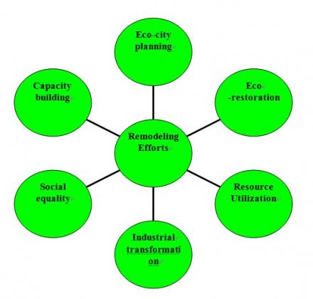
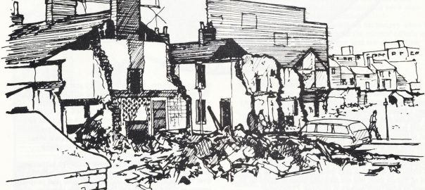
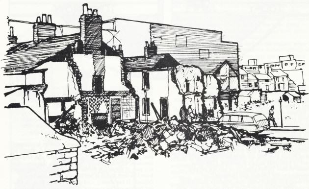
China has adopted a policy of urban-rural dual structure system since the founding of the Republic in 1949. The system is urban-biased in economic, social and infrastructure development. This has brought about many problems triggered by urban-rural separation and inequality. It creates a serious obstacle for sustainable urban-rural integrated development.

Huainan has taken the lead to change this situation through its “Urban-Rural Integration Plan 2011”. Upholding the idea of an integrated Huainan, the plan features  comprehensive treatment of coal subsidence areas; promotes intensive and compact development of urban and rural land, maintains five balances of urban-rural planning, industrial development, infrastructure, public service, employment and social security. Altogether, the plan supports an urban-rural integrated development model of “industry promoting agriculture, city helping town, town helping village and city-town interacting with each other.” There is an ecocity indicator system tailor-made for Huainan, which sets targets and provides an assessment tool for each stage of development.

Urban-Rural Integration Plan (2011) of Huainan city

Ecological restoration of mining subsidence areas

Long-time coal mining results in subsiding land, which in effect destroys the local environment. Main ecological restoration techniques of mining subsidence areas include improvement of soil, re-vegetation and application of soil micro-organisms (LIU and LU, 2009). According to Huainan’s “Eco-city Construction Plan 2005” the local government will by 2020 invest 10 billion RMBuan in ecological restoration, infrastructure and slum reconstruction. An important feature of the Eco-City Construction plan is that ecological renovation goes hand in hand with infrastructure improvement, human habitat environment upgrading and industrial transformation.

Huainan’s coal mines have been exploited for 500 years and mining subsidence areas exist in many places of the city. In 2007, the city launched an ecological restoration project of the Quanda region, 1,250,000m2 in area and with 250,000 inhabitants. The coal has long been exhausted there and the land was abandoned, leaving a wasteland of mining subsidence areas. In compliance with the topography of the region, the government divided it into four sub-areas for ecological restoration, and reconstructed them with different characteristics.

These four sub-areas include reservoirs, wetlands, residential areas and mountains. The wetland area centers around the Datong mining subsidence, where the environment is most seriously damaged and in need of urgent remediation (e.g. construction of wetland parks and public facilities, closure and relocation of heavily polluting enterprises, vegetation restoration and landscaping etc). In 2010, with the completion of the restoration project, the Quanda region was revitalized and became a new urban center for living, working, transportation and recreation.

Mining substistence areas, before and after restoration.
Mining subsistence areas, before and after restoration.

Comprehensive utilization of resources 

Coal-mine gas

Coal mines emit gas containing mainly coal mine methane (CMM). It poses the biggest risk to coal mine safety, and it is one of the major greenhouse gas emissions contributing to global warming. However, if the coalmine gas is comprehensively utilized, it can be converted into a source clean energy.

Huainan is the forerunner of comprehensive coal mine gas utilization in China. Its coalfield is rich in CMM resources and has large-scale CMM drainage. Huainan Mining Group is in charge of the effort to comprehensively utilize the drained CMM and ventilation air methane as green energy resources. The National Engineering Research Center for Coal Gas Control is established in the city. According to market conditions in the region, the most practical utilization option for CMM is use as household fuel, and secondarily for power generation. The household utilization project mainly uses CMM recovered from the seven permanent gas drainage systems (USEPA and CCMC, 2001). The Huainan mining area is divided into the Panji and Xinxie Blocks, and CMM in these two blocks is supplied to residents in Huainan City through the gas storage and distribution system and pipeline network, serving 100,000 households. In addition, the CMM is used to generate 47,646,000kwh of electricity each year. The CMM recovery method adopted in the Huainan mining area is underground gas drainage. The total CMM drainage was 49.4 Mm3 in 2000 and reached 416 Mm3 in 2010.

CMM Drainage of the Huainan Mining Area

Year Methane drainage (Mm3)
1990 5.06
1995 5.00
1998 22.60
1999 37.60
2000 49.40
2002 100.00
2006 172.00
2010 416.00
Huainan CMM drainage Corp.


Household use of gas
Household use of gas     
Reading meters
Reading meters

Mine water utilization

During coal mine operations, a large amount of mine water is discharged. It not only causes environment pollution to surrounding mining areas, but also wastes a lot of precious natural resources. Comprehensive utilization of mine water is needed for the sustainable development of coalmines. Appropriate utilization of mine water enables us to achieve the multiple goals of economic, social and environmental benefits.

The mine water is classified into five categories according to qualities and characteristics. Different techniques are used to treat each category of water. After the treatment, the water is suitable for industrial and domestic use. In 2007, Huainan Mining Group processed 15.1 million m3 of mine water with a utilization rate of 61%, saving 12.8 million RMB a year.

Mine water utilization process in Huainan. CHENG and HU, 2005
Mine water utilization process in Huainan. (CHENG and HU, 2005)

Cultural and creative industries

Huainan is a coal-dependent city and its leading industries are coal mining, electric power generation and chemicals. To achieve a balanced industrial structure and sustainable development, the restructuring of its industry is necessary. Economic development plans were made and industrial parks were established to encourage economic developments and a diversified industrial structure.

Today, apart from coal mining, electricity and chemicals, more and more industries are represented in its economy, including pharmaceuticals, construction, textiles, machinery, electronics, light industry, high technology and cultural and creative industries.

Huainan has a long history. It was once the capital city of the state of Chu (one of the major powers in ancient China) during the Warring States period (475BC-221BC) and the city has kept its prosperity ever since. Now, Huainan has many historic sites, like Bagong Mountain where the famous Feishui Battle was fought in 383AD along with the ancient Chu state capital and the tombs of many historical figures. Since 2000, the local government has made plans to boost its tourist industry. Large investments have been made on tourist infrastructure upgrading and service improvement. Income from tourism has increased sharply since 2001.

Huainan’s tourist industry is associated with rich cultural activities. Known in China as the birthplace of Tofu, each year Huainan hosts the Chinese Bean-Curd Cultural Festival, which has been held for 19 years. Nowadays, eco-tourism and agri-tourism (agri-tourism includes a wide variety of agriculturally-based activities, such as picking fruit, buying produce direct from a farm, feeding animals and farm stay etc.) are very popular in the city. Moreover, one of Huainan’s industrial ambitions is to develop the animation industry. The local government has invested 6 billion RMB to build an animation industry park in the city. These rising “smokeless” industries have the potential to contribute to the ecological transformation of the industrial structure, and will help to deliver a more balanced form of economic development to Huainan.

TouristIncomeSlum reconstruction

It is a general consensus that social equality is a prerequisite for ecocity development. Huainan’s local government has worked hard to help underprivileged citizens improve their living conditions. An important component of Huainan’s public welfare program involves slum reconstruction.

From 1950s onwards, many shanty towns have established alongside the coal mines to accommodate miners. In the planned economy period (1949-1978), the government focused on production rather than on consumption. Miners’ quality of life was neglected. They lived in slums with primitive conditions and a bad environment, posing a threat to local security and having a negative impact on urban development.

In 2003, under the leadership of the local government, Huainan Mining Group launched a campaign to progressively reconstruct slums in the city. The plan called for an investment of 13.9 billion RMB to build a total of 8.7 million m2 affordable housing in the following 10 years, altogether benefiting 250,000 people. In 2007, the 1st batch of residents moved in to the new housing with consummate infrastructure and social amenities. Slum reconstruction has revitalized the local community and is an important function of the city’s sustainable development.

fig11
Before and after reconstruction-a comparison of the slum and new resident community

Capacity building

Capacity building is one of the most important components of ecocity development. The stakeholders include city decision makers, companies, public service departments, public organizations, social associations, individual households and residents. Huainan focuses its efforts on the establishment of proper government management systems, information dissemination, along with education and training for residents.

Local laws and regulations were made to promote and guarantee ecocity development in Huainan. These laws include the “Regulation on Environment Protection of the Development and Construction Projects”, “Regulation on the Restoration of Coalmine Subsidence Areas” and “Management Ordinance of the Recycling of Renewable Resources.” Relevant plans were compiled to guide its development, like the “Ecocity Construction Plan 2005”, “Urban-Rural Integration Plan 2011”, “Master Plan for Mineral Resources”, “Public Transit Plan” and “Master Plan for the Tourist Industry.” Enforcement and implementation of these regulations and plans were greatly enhanced by revising the political achievement assessment system for local government officials, effectively moving from a GDP centered system to a more comprehensive assessment of environmental, economic and social balanced development. Better enforcement was also achieved by increasing the public participation in the compiling, implementation and management of the whole planning process. The local government has also worked to expand urban financing channels by exploring new models like PPP, BOT, BT to raise funds for the construction of eco-city infrastructure projects, in addition corporate investment construction and government repurchasing.

People’s habits, behavior and life style choices have a deep impact on ecocity development. Dissemination of information, education and training for the public all plays a significant role. Huainan has established a National Education Base for Eco-Civilization, a platform for eco-education. Local government tries to foster an ecocity, eco-community and eco-family culture by organizing training seminars and activities such as “City Car-Free Day” and “Low-Carbon Eco-Family,” thereby publicizing ecocity concepts to residents from all walks of life.

Discussion and Conclusion

Huainan’s remodeling efforts cover 6 major areas of ecocity development as shown below.

Major areas of eco-city development in Huainan
Major areas of ecocity development in Huainan

Huainan’s experience shows a vivid picture of ecocity remodeling practice in a resource-based city. Through Hainan’s example and Chinese understanding of the definition of an ecocity achieves a balance between the environment, natural resources, industry, and social equity.

There is no fixed and unified model for ecocity development. Residents in different cities hold different opinions on what makes an ecocity. However, they tend to agree on some important areas of ecocity development. According to a questionnaire survey conducted in eight Chinese cities of vary size and regions (in total, 788 respondents), the most important factors influencing sustainable urban development are the natural environment, housing, income and employment, transportation, and social security.

Ecocity development in resource-based cities involves a lot of aspects. It cannot be conducted in all-round manner, and it can’t reach its final goal in one step. Each city must examine its own individual characteristics, and concentrate their efforts and to make those defining characteristics the highlight of their city. Then cities should spread their relevant experience points to other areas. In other words, be sure to avoid aiming too high beyond one’s reach in an attempt to gain quick success and instant benefits.

Ecocity development is not the end product, rather, it is a long-time systematic process towards sustainable urban development. We shouldn’t dwell on the terminology the ecocity, as it is no more than a useful phrase to express people’s aspiration on an ideal city, like the “Garden City” term used over a hundred years ago. What is far more important is to witness the city’s actual progress on the road towards urban sustainability.

Pengfei Xie
Beijing

On The Nature of Cities

Acknowledgement: Thanks to Jack Maher (PIA fellow at NRDC) for the English editing.

References:

CHENG Xuefeng and HU Youbiao (2005) Quality Characteristic of Mine Water and its Utilization in Huainan Mining Area,  Journal of Anhui University of Science and Technology (Natural Science),3:5-8

LIU Fei and LU Lin (2009), Progress in the Study of Ecological Restoration of Coalmine Subsidence Areas, Journal of Natural Resources, 4:612-620

USEPA (2001), Investment Opportunities in Coalmine Methane Projects in Huainan Mining Area, Huainan Mining Group Ltd.

XIE Pengfei and ZHOU Lanlan, et al. (2010) Research on Eco-city Index and Best Practices, Urban Studies, 7:12-18

ZHU Xiaohui and DUAN Xuecheng (2009) Study on Developing Tourism in Resources-Based Cities—A Case Study of Huainan City, Journal of Shanxi Agriculture University (Social science edition), 2:216-219

Everyone Has Contact with Nature but that Nature Is Not the Same

Art, Science, Action: Green Cities Re-imagined

Lessons from a small city

Much of the urban ecology literature focuses on the world’s largest cities, and many of the Nature of Cities bloggers have written about these places. Blog posts have discussed the challenges of conserving biodiversity and ecosystem services in London and New York City, planning for greenspace and social justice issues in Rio de Janeiro, Johannesburg and Cape Town. So what can be learned from a smaller city in the midwest United States — an average city?

Columbia, Missouri is very different from those places, but it is also a city shaped by a legacy of racial segregation that continues to influence its neighborhoods and it is a city that is faced with equally important planning and development questions. A focus on biodiversity associated with these day-to-day settings is useful in illustrating some of the challenges in making biodiversity meaningful and accessible to all urban residents.

Nearby nature

In the 1980’s Rachel Kaplan and Stephen Kaplan introduced the concept of nearby nature, the nature that is within 1 km of where people live and work. The Kaplan’s argued that these nearby places are where people encounter nature on a day-to-day basis, are places that are valued by urban residents, and have a strong influence on residents’ perceptions and values.

Nearby nature has become an important concept in landscape architecture and urban planning but the concept is often ignored by people who study biodiversity in cities. The common, the ordinary, and the everyday are often described as examples of degraded or homogenized biodiversity. existence.  My work as an urban wildlife ecologist considers the biodiversity associated with day-to-day environments, and the role focuses on these areas and in this blog I will describe some of the work that my students, colleagues, and I have done in these places in the city where I live and work, Columbia, Missouri.

Shaping nearby nature: race matters

Urban form and morphology shape patterns of nearby nature and form and morphology are shaped by laws, policies, and decision making. Columbia developed during a time when the civil rights of black Americans were limited by law and practice. Segregation was a social driver shaping the form of neighborhoods in central parts of Columbia, and to some extent shaping nearby nature. Before 1954 Columbia’s black residents attended a single school and lived in four neighborhoods in the center of the Flat Branch Creek Watershed. Residential segregation was not required under Missouri law but it Columbia it was enforced by custom and local planning policy. The 1935 City Plan for Columbia, Missouri states,

“The negroes are an important and useful element in the city’s life, and provision should be made for their welfare, including suitable locations for living and recreation.  It is not to the best interest of either race to encroach upon the other. Control by zoning, while instituted in certain southern cities, is not entirely satisfactory, and it is believed that mutual agreements between the races offer a better method of procedure. With little possibility of material increase in negro population, and with considerable vacant property within the principal sections now occupied by them, effort should be made to concentrate future population within these principal sections and avoid scattering into other sections of the city.”

Location of Jindrich Negro Neighborhoods  Source: Jason Jindrich http://jindrichyanes.net/Jindrich_Thesis.pdf
Location of Jindrich Negro Neighborhoods Source: Jason Jindrich http://jindrichyanes.net/Jindrich_Thesis.pdf

Pictures of the “principal sections occupied by Negroes” show a mix of traditional streetscapes and small greenspaces along with unpaved streets and open sewers. In 1956 the city developed the Douglass School Urban Renewal Area to initiate a process that resulted in tearing down 222 houses, additional small business, and burying portions of Flat Branch Creek. The urban renewal project moved relocated much of Columbia’s black community to the west and northwest portions of the watershed, away from Flat Branch Creek.

Unpaved street in Columbia's “Negro District. Source: Columbia Housing Authority
Unpaved street in Columbia’s “Negro District. Source: Columbia Housing Authority
Urban renewal in Columbia's “Negro District.” Source: Vox Magazine / State Historical Society of Missouri http://www.voxmagazine.com/media/img/photos/2012/11/5.jpg
Urban renewal in Columbia’s “Negro District.” Source: Vox Magazine / State Historical Society of Missouri http://www.voxmagazine.com/media/img/photos/2012/11/5.jpg

Shaping nearby nature: planning policy matters

Columbia is a growing city with development focused on infill of greenspaces within older parts of the city and sprawl on the fringe of the city. I have mentioned the role of planning as part of a broader pattern of residential segregation in Columbia, but planning plays an additional role is shaping nearby nature in that it provides guidance on development.  Planning and zoning authority in the city does not address wildlife habitat. Environmental planning is limited to a floodplain overlay zone protecting streams and riparian areas in the city and a land protection ordinance protecting forested parcels in the city.

To support this ordinance the city has uses a natural resource inventory that maps contiguous forest and tree cover. This has led to a planning approach that focuses on protecting large blocks of open space and riparian corridors around the city, a process that often ignores nearby nature. This lack of focus has resulted in small-scale controversies over proposed developments throughout the city.

The look of nearby nature: big differences along the same street

Our work focuses on describing and assessing nearby nature in the city’s neighborhoods.  George Middendorf and I developed a crosstown walk as a teaching tool for a qualitative look at environmental changes along single streets that track a socioeconomic gradient.  We’ve used the crosstown walk to describe differences in nearby nature along a 1.8 km stretch of a Columbia street. Edgewood Ave., Aldeah Ave., and Alexander Street are a single street west of downtown Columbia. The southern end of the street (Edgewood Ave.) is part of one of the wealthiest and mostly white census tract block groups in the city with large houses, brick streets and mature street trees. The northern end of the street (Alexander Ave.) has a median family income almost $50,000 lower, a relative small number of white residents, has smaller houses and fewer trees on streets and in yards.

Two blocks on Edgewood / Aldeah / Alexander Avenue, January 2013. Left: more affluent, more white; Right:, 1 km north. less affluent, more mixed. Photos: Charles Nilon

With support from USDA Forest Service’s Midwest Center for Urban and Community Forestry, we asked groups of residents from different Columbia neighborhoods to describe the places in their neighborhoods that were important to them and to explain why they were important. Representatives from the Westmount NA that includes the southern end of Edgewood / Aldeah / Alexander,  described the large street trees in their neighborhood, mentioning the beauty of the fall colors and the trees framed houses along the streets.  They also valued the wooded hillsides and small streams near some of the houses and these features provide a unique feel to the street. They voiced concern about the city’s management of street trees in their neighborhood.

Yards dominated by large trees and landscaping. Photo: Charles Nilon

Residents of the Smithon Valley Neighborhood Association, that included the central and northern blocks of Edgewood / Aldeah / Alexander, valued the deep 50 m lots behind their houses and the spontaneous vegetation associated with old fence rows that was growing up in the back of many of the lots. The residents also valued relative large patches of forest that were formed behind houses. They were concerned about the potential development of some of the larger patches, mentioning the recent purchase of some of these interior lots and proposed development for homes.

Woodland in interior of block prior, 2007. Source: GoogleEarth
Woodland in interior of block following development in 2009. Source: Google Earth

Biodiversity and nearby nature

Since 2008 we have worked on a project to document the animal species that occur that are associated with nearby nature. We’ve developed a biotope map for the city, a process that has identified more than 60 types of habitats associated with different land use types in Columbia. We have used this as a tool for looking at habitats and species associated with neighborhoods in the city. We have started to assess some of the places identified by our discussions with local residents. Places that form unique biotope types, such as the spontaneous vegetation associated with alleys in the city’s older neighborhoods.

Spontaneous vegetation along fence rows in central Columbia.  Photo: Charles Nilon
Spontaneous vegetation along fence rows in central Columbia. Photo: Charles Nilon

Our studies of birds, small mammals, and butterflies are designed to document the species occurring in habitats in residential neighborhoods. For example, we are studying breeding and winter birds in one central Columbia neighborhood as a pilot study for a larger study looking at birds and management of habitats in residential neighborhoods.

By documenting the species associated with the nature that Columbia resident’s encounter near where they live we will be able provide information to residents and planners about the contributions these places make to local and regional biodiversity.

neighborhood biotpe map
Biotope map of neighborhood with bird census points. Photo: Christine Rega

Our emphasis on nearby nature points to the importance of understanding the local context that shapes biodiversity and ecosystem services in cities. The approach we use in Columbia is relevant to all cities because it combines understanding what residents see and value in the nature around them, and assessing and recognize the contributions of these important places.

Charles Nilon
Columbia, Missouri

On The Nature of Cities


References

A City Plan for Columbia, Missouri. 1935.   Report to the City Planning and Zoning Commission. Hare and Hare City Planners, Kansas City, Missouri.

Cady C. Finding Flat Brach. City of Columbia Department of Parks and Recreation.

Middendorf, G. and C. Nilon. 2005. A Crosstown Walk to Assess Environmental Changes Along an Urban Socioeconomic Gradient. Teaching Issues and Experiments in Ecology 3: Experiment #3 [online].

Pierce, R.A. II, C. Nilon, and H. Stelzer. 2013. Assessing wildlife habitats and natural resources in neighborhoods and urban environments. MP927 University of Missouri Extension.

Sullivan, J. 2003 Ridgeway neighbors oppose Habitat’s housing proposal. Columbia Daily Tribune


Encountering “The Nature of Cities” through Tree Planting

Art, Science, Action: Green Cities Re-imagined

I have planted lots of trees around schools in Cape Town. Each experience has been profoundly different from the next, but there have been common threads running through each experience — muddy feet and hands; the strong stem of a young tree as I carry it from the bakkie to the planting site; the unwieldy mixing of compost and soil by a learner with less-than-practical spade techniques; the sound of the spade bashing the stake into the ground. And always the magical moment of pulling the tree out of the bag and placing it in the hole; the excitement which follows as the soil is firmed around the base of the tree and watering cans are filled, followed by the foamy mixture the water and soil form before sinking into the ground.

Photo: Kate Pallett (www.greenpop.org )
Photo: Kate Pallett (www.greenpop.org)
Photo: Kate Pallett (www.greenpop.org )
Photo: Kate Pallett (www.greenpop.org)

I work for a social enterprise called Greenpop, who plant trees in “under-greened” communities to create excitement and inclusivity in the environmental movement. We’re mostly based in the Western Cape, although we’ve run projects throughout South Africa and have a large satellite project in Zambia (a country with, surprisingly, one of the highest rates of deforestation in the world. As someone who has encountered both the benefits and criticisms of urban tree planting, I’d like to argue that it’s an essential starting point for acknowledging cities as natural spaces: a simple yet largely missing philosophy amongst many city-dwellers. The time which I’ve spent planting trees over the last 9 months has inevitably resulted in encountering “the nature of cities”.

In a sense, the Nature of Cities blog is about this philosophy: all the writers know and acknowledge the importance of urban ecology and provide suggestions and examples of better integration of natural spaces with city spaces. But, as Pippin Anderson mentioned in her blog post on 13 February this year, “living with so much nature right in the heart of your city can be a challenging business”. Many of us — myself included — still largely think of Nature with a capital “N”, a separate and pristine wilderness aside from ourselves and our existence (this is especially notable in Cape Town, a city in the shadow of a looming national park of Table Mountain). In activating people towards a better, sustainable, more ecologically in-tune life, the first step is the breakdown of the misconception that nature is separate to us. I remember the first time I realised that buildings are made out of the earth. I remember it feeling like an epiphany, a real discovery; and then I remember being puzzled as to why I didn’t think of it before: it’s so obvious!

The “obvious”, inseparable connection between humans and nature is surprisingly not realised by lots of people. We have centuries of civilisation telling us that we’re above it — not to mention the enlightenment legacy of the separation of Nature vs Culture, which we still find hard to dispute, even in academia. As a result, “nature” itself has been marginalised, separated and placed in another realm — one which is “removed” from everyday citizens. In trying to break down these beliefs, it’s important to remember that there are multiple political, historical factors tied to them. How on earth can we separate them?

Photo: Kate Pallett (www.greenpop.org )
Photo: Kate Pallett (www.greenpop.org)

Tree planting itself has long been a symbolic act of caring for the environment — from over 140 years ago, in 1872, when the first “arbour day” was held in Nebraska, to generic images of politicians with a golden spade, sprinkling some soil around a newly planted tree. In some senses, tree planting could reify the divide between ourselves and nature, if it’s done in a purely symbolic way (for example, with a golden spade). However, given the benefits of trees in an objective sense, and the fact that many corporate “greening” initiatives consider tree planting of paramount importance, I think that tree planting provides an extremely important opportunity: a space to value “nature”, and, more importantly, connect with it.

The key point here is making sure that it is done correctly.

There is also no doubt that when planted correctly, trees improve soil quality, provide oxygen, increase biodiversity and provide fruit and other valuable resources. Similarly in a less scientific light, trees have an enormous aesthetic and social impact, providing shade, offer hiding places and climbing obstacles for children. As Russel Galt mentioned in his September 1 blog post, trees can provide a unique historical perspective in a city, which point to the space’s cultural landscape and tell stories about times past. Anyone who has been to Cape Town and driven through Bishop’s Court — covered in large, majestic trees — followed by the barren landscape of Mitchell’s Plain, will agree that trees point to specific incidents in South Africa’s historical map.

Greenpop logo -longAt Greenpop, we focus on planting trees in areas where they’re needed most — in historically marginalised and deforested areas. We utilise a lot of support and funding from corporate ventures who are likely to view tree planting in the “old” sense: symbolic, so to say. However, and as I mentioned above, when a tree planting session is facilitated correctly, participants can avoid the problematic symbolic elements which further separate ourselves from nature. Instead, there is a magic that happens: a starting point in a future of possibilities for both our funders and beneficiaries alike.

Photo: Kate Pallett (www.greenpop.org )
Photo: Kate Pallett (www.greenpop.org)

We recently planted trees at a crèche in Khayelitsha — a marginalised area from the Cape Town city bowl both spatially and economically. We were planting with a medium sized group: a young actor who lived on the crèche property, community members from Khayelitsha, school children, our team, and a group of people from the office of a wine merchant in Cape Town (who were sponsoring the trees). A motley crew indeed, some gathered in a space familiar to them, for others it was particularly foreign. As always happens at the start of a planting day, the groups were split at first; everyone huddled into their own familiarity. To most of us, the space was defined already: we were in a township, a densely populated area far away from the city centre.

But planting a tree facilitates that moment when we put away our preconceptions of a space and become humble enough to interact with the earth. As a group we mingled, learnt how to plant trees and, most majestically, spent a lot of time planting trees. We were connecting with nature more than we were connecting with a township. As we used our hands to mix soil, placed a tree in the ground and covered it, as we smelled the water and soil mixing and as we encountered the textures of the soil underneath the grass, we became part of the earth.

Photo: Kate Pallett (www.greenpop.org )
Photo: Kate Pallett (www.greenpop.org)

I believe strongly that tree planting is an essential starting point for acknowledging the city as a primarily natural space; an important step in losing the disconnect between nature and ourselves. Trees are a valuable contribution to urban spaces, especially lower income ones, if they’re planted responsibly and appropriately. If facilitated correctly, tree planting can be a starting point in acknowledging ourselves as part of the earth and engaging with our will to protect it.

Kate Pallett
Cape Town

On The Nature of Cities

Who Cares for the City?

Art, Science, Action: Green Cities Re-imagined

In 2002, I was working full-time as a social science researcher for the US Forest Service in New York City.  My colleague Lindsay Campbell and I visited with leaders of the urban greening movement at that time — from community gardeners and park volunteers to environmental justice activists and tree planters, to directors of community service organizations and long-time government program staff.  The message was the same: we need a way to capture the varied and wonderful ways that people are caring for the environment in New York City.

During this time, I was working on my doctoral degree at Columbia University. I met a sociology professor, Dana R. Fisher, who was also excited by the prospect of creating new knowledge about civic action and the environment in cities.  Shortly thereafter, STEW-MAP was born — in many ways as a celebration and further understanding of local people who have been inspired by the environment, in its various and restorative forms, to bring about change in their lives and communities.

The Stewardship Mapping and Assessment Project (STEW-MAP) is a research project led by US Forest Service researchers and cooperators that seek to answer the questions: Which environmental stewardship groups are working across urban landscapes, where, why, and how?

Stewardship can be an awkward term for some, so we settled on a clear definition. STEW-MAP defines a “stewardship group” as an organization or group that works to conserve, manage, monitor, advocate for, and/or educate the public about their local environments.  This work includes efforts that involve water, forests, land, air, waste, toxics, and energy use.  Many civic stewardship groups work within, alongside or independent of public agencies and private businesses in managing urban places.  Over the years, STEW-MAP has become both a study of urban stewardship socio-spatial characteristics and a publicly available online tool to help support those networks.  To see our multi-city portal, visit here.

Inspired by neighborhood change and revitalization

Years before, when I was working as an urban and community forester in southwest Baltimore, I met many people whose work inspired me to think of the city as a place of innovation and change, of generosity and understanding, of deep ecological knowledge.  In the early 1990s, Baltimore residents were coping with ways to deal with entire blocks of abandoned homes, open-air drug activity, the everyday threat of gun violence and severe poverty.  Many of the people I met chose to address troubles in their community through civic action: cleaning up vacant lots, planting flowers, creating afterschool programs for neighborhood kids.  Many of these people were neither saints or sinners, but self-directed in teaching themselves the fundamental skills necessary to grow a garden next to an abandoned row house, to carve out a bike trail alongside old railroad tracks, to restore a neglected park to its former glory.

During the course of my work, I met an amazing photographer, Steffi Graham, who began to document people throughout the city who were caring for public and neglected areas. One afternoon, we set out to find a garden that was rumored to be producing the ‘best greens on the east side.’  We walked through a seemingly endless maze of vacant lots and back-alleys, and after a few hours we were about to give up.  Luckily, an encampment of old timers sitting on the corner, shouted out to us, “what you two doing here?”  We replied, “Just looking for the garden.”  We were provided an escort back into the alleyway and before our eyes emerged row after row of the biggest collard greens and cabbages I have ever seen.  Interestingly enough, these prize specimens were planted in the back yards of homes that were boarded and abandoned.  Further back, across the alley and along the wall of a warehouse was a make-shift, fenced in yard that was overgrown with vines.  We peered through the fence and came face-to-face with a large, metal shovel.  Holding onto this shovel in a not-so-friendly way, was a man in coveralls.  Clearly, he was the steward of this land.  We quickly stated our intentions and after a period of time, our questions were answered.

Why are you gardening here?  It’s where I live.

How do you grow such great stuff? I read up on things and watch other people, especially that guy who grows over on North Avenue. Him and I been watching each other for years. This year I got my peas in earlier than him and you can still see some over here……

Who is planting outside your fence, in the backyards?  I am.  That’s for anybody who’s hungry.  This way, they won’t mess with my stuff.   

How do you get water?  I watch the weather and figure on planting plants that can take the drought, and, when things get real rough, the guys at warehouse lend me the hose.

Such exchanges, and many others like it, have served as evidence enough for me that urban residents are ecological thinkers who care for the land with a sense of stewardship,  not unlike their rural counterparts, helping to care for forests, farms, rivers and grasslands.  As I learned more about these innovative people and their projects, I realized that many received encouragement, information and occasionally modest funding from a growing number of bridging organizations, groups like neighborhood associations, clubs, and environmental civic groups that serve as an interface between government agencies and the local community.

STEW-MAP Today

To date, STEW-MAP has collected information from thousands of local stewardship groups in New York City, Chicago, Seattle, Baltimore, and Philadelphia.  These groups range from neighborhood block associations and kayak clubs, to tree planting groups and regional environmental coalitions, to nonprofit educational institutions and museums.  Other cities, including Los Angeles and San Juan, Puerto Rico, are expressing keen interest in developing a STEW-MAP study and application.

What is shown on STEW-MAP?

Stewardship maps tell us about the presence, capacity, geographic turf, and social networks of environmental stewardship groups in a given city.  For the first time, these social infrastructure data are treated as part of green infrastructure asset mapping.  For example, the interactive mapping website developed in New York City currently displays basic data for 405 groups citywide alongside other open space data layers.  Other STEW-MAP cities continue to expand the NYC model and have created new maps and resources for their cities.

STEW-MAP data: A map of stewardship organizations in New York City

Why is STEW-MAP important?

STEW-MAP can highlight existing stewardship gaps and overlaps in order to strengthen organizational capacities, enhance citizen monitoring, promote broader civic engagement with on-the-ground environmental projects, and build effective partnerships among stakeholders involved in urban sustainability.  Long-term community-based natural resource stewardship can help support and maintain our investment in green infrastructure and urban restoration projects.  STEW-MAP creates a framework to connect potentially fragmented stewardship groups; to measure, monitor, and maximize the contribution of our civic resources.

Who should use STEW-MAP?

STEW-MAP is a tool for natural resource managers, funders, policymakers, stewardship groups, and the public.  For example, managers in NYC have queried STEW-MAP to find stewards proximate to specific forest restoration projects run by MillionTreesNYC.  Funders or community organizers can identify areas having the greatest or least presence of stewardship groups, taking into account organization size and focus area.  Those seeking to disseminate policy information can target the most connected groups to quickly and effectively reach an entire network or a subset.  Members of the public who want to know who is working in a particular neighborhood or who can provide technical resources for a project can search the database, which displays results as a list or on a map.

Example uses: Stewards in proximity to Flushing Meadow Park, New York

How is STEW-MAP implemented?

STEW-MAP is a research and application project that involves two stages.  STEW-MAP 1.0 is the “lay of the land” data collection stage, during which the organizational population is inventoried, surveyed, and analyzed.  This stage produces a database of stewardship organizations in the city, maps of where the organizations conduct stewardship activities, and social network analyses of the numbers and types of ties among groups.  This work is accomplished in partnership between a local partner from the study area, a university partner, and a scientist from Forest Service.

STEW-MAP 2.0 is the “how do we use the data?” — the applied stage of the project.  This stage includes the development of resources and tools that make the data easier to access and use.  STEW-Map cities are exploring a range of visualizations for use in policy and practice.  The Chicago team will be conducting focus groups in the coming months to enhance our understanding of user needs and applications.  In Baltimore, federal and local participants in Baltimore’s Urban Waters Program are interested in using STEW-MAP data to facilitate their work: to increase collaboration, improve the flow of information and identify program gaps and overlaps.  And in New York City, STEW-MAP data has been made available for a wide range of public uses, serving policy makers, program directors and the general public.

You can check out the New York City data here:

STEW-MAP NETWORK FIGURE 3
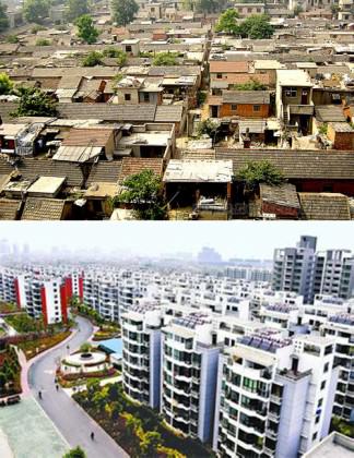
Where can you get more information?

If you would like to learn more about STEW-MAP or ways you can develop a project for your area, contact:
Erika Svendsen, [email protected]

To learn more about stewardship work in a particular city, please contact:

New York City:
Lindsay Campbell, [email protected]

Chicago:
Lynne Westphal, [email protected]

Philadelphia:
Sarah Low: [email protected]

Baltimore:
Morgan Grove, [email protected]
Michele Romolini, [email protected]

Seattle:
Dale Blahna, [email protected]
Kathy Wolf, [email protected]

Los Angeles:
[email protected]

San Juan:
Tischa Munoz-Erickson, [email protected]

Erika S. Svendsen
New York City

On The Nature of Cities

What People Really Want From Their Regional Parks System

Art, Science, Action: Green Cities Re-imagined

Since 1966, the Capital Regional District (CRD) in British Columbia, Canada (Map 1 below) has developed an outstanding park and trail system, which today is perhaps one of the finest regional park systems in North America [Note 1].  Primarily a natural areas system encompassing three biogeoclimatic zones (Map 2), CRD Regional Parks comprises 33 parks covering more than 33,000 acres and three regional trails extending more than 110 kilometres (Map 3).  CRD Regional Parks recently prepared a new strategic plan (Regional Parks Strategic Plan 2012-2021) which sets the direction for the regional parks and trails system over the next decade.  The strategic plan defines the long-term “big picture” framework for our regional parks and trails.  As part of the preparation of the strategic plan, Regional Parks undertook extensive public consultation to find out what was important to people about the regional parks system.  What we found was quite surprising – people expect the regional parks system to fulfill a wide range of wants and needs, apart from just a place to spend leisure time.


1 — Politically, the CRD is comprised of thirteen municipalities and three electoral areas (e.g. non-incorporated areas).  The CRD has a population of about 375,000 and an area of about 245,000 hectares.  Victoria, the provincial capital, anchors the region’s urban core.

Photo 1
Children at play at Witty’s Lagoon Regional Park. Photo: Bev Hall
CRD Administrative Boundaries.
Map 1. CRD Administrative Boundaries.
Expansive view of the Sea to Sea Regional Park.  Photo: CRD Image Library.
Expansive view of the Sea to Sea Regional Park. Photo: CRD Image Library.
Biogeoclimatic Zones in the CRD
Map 2. Biogeoclimatic Zones in the CRD


Nationally endangered Garry Oak Ecosystem at Mill Hill Regional Park.  Photo: CRD Image Library.
Nationally endangered Garry Oak Ecosystem at Mill Hill Regional Park. Photo: CRD Image Library.


Map 3. Parks and Protected Areas in the CRD.


Photographing a rough-skinned newt.  Photo by Mary Sanseverino.
Photographing a rough-skinned newt. Photo: Mary Sanseverino.

What People Really Want from Regional Parks

Citizen involvement in the development of the strategic plan was an essential component of the planning process.  To this end, a comprehensive public engagement strategy was developed to provide opportunities for regional residents to contribute their ideas into the preparation of the strategic plan.

Opportunities for residents to express their ideas included:

  • Creation of a regionally representative Citizen Advisory Panel (CAP) to guide development of the strategic plan
  • Public engagement at community dialogue sessions throughout the region
  • Engagement with secondary school students at seven area schools
  • Availability of an on-line and a hard copy response form
  • Presentations by interest groups

The public was asked to comment on the following themes:

  • Vision for the regional parks and trails system
  • Values and benefits of regional parks and trails
  • Opportunities and challenges for regional parks and trails
  • Recreational opportunities
  • Environmental conservation

Secondary students were invited to directly write down their comments on the following themes:

  • Types of recreational activities engaged in/desired in regional parks
  • Location of future regional parks
  • Meaning of regional parks to “me”
  • Environmental conservation in regional parks

The information received during the consultation process highlighted participants’ strong beliefs and opinions about Regional Parks.  Through an analysis of the data, a number of key themes emerged which clearly indicate the public’s high valuing of, and expectations from, the regional parks system.  You can see the full public comment report here.

Horseback riding at Island View Beach Regional Park.  Photo CRD Image Library.
Horseback riding at Island View Beach Regional Park. Photo CRD Image Library.

Ten of the most salient themes for urban nature conservation are presented below, in no rank order of importance.

(1) Expand the park and trail network; develop more connections, corridors, and linkages.

The public is vitally interested in seeing Regional Parks develop a network of parks and trails that provides connectivity for people, wildlife, and ecosystems.  Representative quotes include:

  • “Maintain large swathes of area better able to sustain bio-diverse populations, instead of subdividing the parks into little ‘islands’.”
  • “Regional parks can help interconnect the many smaller patchworks of small parks into something bigger and better.”
  • “Parks should become hubs for re-establishing native ecosystems to benefit native flora and fauna.”

(2) Value parks for their ecosystem services and ability to mitigate climate change impacts

Many people are aware of the value of park lands for the “free” nature’s services they provide, including reducing the impacts of climate change.  Representative quotes include:

  • “People are worried about climate change, so the time is right to protect natural areas that help counteract the negative impact of humans and human development on the climate.”
  • “Parks provide rain water filtration to ground water and act as a sink both regarding water and carbon, unlike cement/pavement structures. “
  • “Build on climate change awareness and community realization that we have to do more; parks and trails are the lungs of our region….our air and water.”

(3) Maintain biodiversity and ecosystem integrity; understand and monitor what we have, restore landscapes, and address invasive species.

Public concern with the environment came through strongly.  The public is very supportive of regional parks’ role in environmental conservation and landscape protection. Representative quotes include:

  • “Protect and maintain the biodiversity of our parks in both a natural and environmentally safe manner, and remove invasive species once and for all.“
  • “Increase ecosystem restoration projects, education projects, and the development of more conservation corridors.”
  • “Use scientifically sound methods of preserving the plant and animal life in the parks.”

(4) Acquire more land while it is still available; target beaches, forests, lakes, rivers, and lands in the western part of the regional district; maintain open space within the urban fabric.

The public expressed strong support for continued acquisition of land for parks, particularly in light of continuing development pressures and increasing regional population growth. Representative quotes include:

  • “Public opinion is strong for land acquisition.  More parks for reasons of conservation and global warming (more trees = less carbon dioxide).”
  • “Expand the park system; this is vital with the push for development.”
  • “We should have more parks.  Parks can both preserve habitats, old growth trees, sensitive areas, and salmon spawning grounds, and provide more green space for residents to enjoy.  It is a win-win for all.”

(5) Ensure that parks and trails are accessible and in close proximity to all regional residents.

The issue of easy accessibility to parks and trails was a predominant concern for many regional residents.  Accessibility also involves parks being free of charge.  Representative quotes include:

  • “I value that the parks are a quiet get-away from city life, yet still so close to home.“
  • “It is important that the parks are accessible to everyone in every area.”
  • “Parks are great places for everyone to go or use, especially those with limited incomes.”
The Selkirk Trestle on the Galloping Goose Regional Trail is a popular urban destination. Photo: CRD Image Library

(6) Keep the parks and trails clean, safe, and well maintained

Many people commented on how much they value parks being well cared for and maintained, and the importance they place on feeling safe in the parks.  Representative quotes include:

  • “The parks are safe for everyone to use.  They make the community better.”
  • “The parks are mostly very well maintained.  It feels like wilderness and the CRD has lots of parks close to the city where a family can safely enjoy the outdoor life.”
  • “Please just keep the parks in good condition.”

(7) Recognize that parks and trails are important for exercise, fitness, health, and well-being 

Public comments heavily emphasized the importance of parks for encouraging and supporting healthy, active life-styles, as well as being fun, spiritual, and relaxing places. Representative quotes include:

  • “Undisturbed nature, near the city but virtual wilderness, a place where almost everyone can connect with nature and keep physically and mentally fit.”
  •  “The calming experience and relaxing exercise of walking, hiking, jogging, bird observation, and flora/fauna appreciation makes living in our area tolerable in an ever frustrating and populating world.”
  • “Being in a place that’s free of cars, loud industrial noise and commercial advertising is just an overwhelming relief—it feels like you can breathe again.”
  •  “Parks bring the natural world to the doorstep of the urban dweller.  They provide an indispensable place of peace and beauty, of plants and animals, a place to calm the soul.”

(8) Utilize parks as green space buffers to urban and suburban sprawl

Respondents strongly support parks and trails serving as buffers to development and regional sprawl.  Representative quotes include:

  • “Parks serve as natural green space and a buffer to traffic and the spread of urban sprawl.”
  • “Parks are pockets of accessible green space in an increasing urbanized environment.”
  •  “As Victoria gets more crowded with houses and commercial real estate, parks are going to be our oasis of green space.”
  • “As we build more and more, I think it is imperative to keep parks so we have places to be in nature and not on cement.”

(9) Encourage current generations to leave a parks legacy for future generations

A strongly expressed sentiment was a concern that we protect lands now and build a strong park system as a legacy for (and duty to) future generations.  Representative quotes include:

  • “Parks and areas of nature are very important for future generations and the only way we can teach our kids about the environment and what it looked like before mankind came and logged it and built houses.”
  • “Parks are valuable for future generations in their naturalness.”
  • “We need to have parks to show our children and grandchildren nature as it used to be”.

(10) Celebrate public support of Regional Parks and its relevance to their lives

The majority of respondents support the current direction and focus of regional parks in protecting the environment and providing outstanding recreational opportunities.  Representative quotes include:

  • “The regional parks provide access to nature, a place to get out of the car, to ride bikes and to walk.  They connect urban areas and urban to rural areas.”
  • “I love being surrounded by a greenbelt.  I look from my urban condo to the north and west.  I can see an almost continuous green line on the horizon made up of parks all the way to Salt Spring Island.”
  • “The value of regional parks to me is that they provide a beautiful place that no matter how old or young, rich or poor you are, they are available and accessible to you.  They also prove a valuable tool for protecting places for future generations to enjoy as well.”

It seems clear that public expectations of regional parks and trails is wide-ranging.  And with time, these expectations will likely increase, as the stresses of urbanization, population growth, changing demographics, loss of natural areas and biodiversity, and climate change continue to affect the region.  This presents many challenges for CRD Regional Parks, some of which are explained in more depth below.

Black bears at Sooke Potholes Regional Park during the fall salmon run.  Photo CRD Image Library.
Black bears at Sooke Potholes Regional Park during the fall salmon run. Photo CRD Image Library.

Challenges Facing Regional Parks
(From the Regional Parks Strategic Plan 2012-2021, pages 56-66)

Managing for Growth:

By the year 2038, the regional population is expected to increase from a current level of 375,000 to 475,000, with anticipated continuing growth well beyond 2038.  The population structure will also change with marked increases in older age groups.  This has profound implications for Regional Parks, including:

  • More visits to regional parks will result in increased demands for facilities and services;
  • Crowding and pressure for recreational space will create a need for more and more varied places to recreate;
  • Utilizing the existing land base for development will result in the loss of natural areas, greenspace and biodiversity; and
  • Existing parks will become more valuable as places that conserve biodiversity and offer people a place to get away from urban and suburban development.
Visitors enjoying a summer afternoon at Sooke Potholes Regional Park.  Photo: CRD Image Library.
Visitors enjoying a summer afternoon at Sooke Potholes Regional Park. Photo: CRD Image Library.

Maintaining Ecological Integrity:   Regional Parks represent remnants of the region’s original ecosystems.  It is important to ensure that these ecosystems continue to function, evolve and remain viable over the long-term.  Ensuring this ecological health is a challenge for Regional Parks:

  • Most parks are fragments of altered landscapes and do not protect complete ecosystems
  • Park boundaries have often been determined by administrative rather than ecological considerations
  • Park environments are subject to impacts from urban, suburban, and rural land uses on surrounding lands
  • Park ecosystems are subject to impacts from visitors and visitor facilities
  • Native plant and animal species in regional parks are being altered and displaced by invading non-native species


Nationally endangered Bluegrey Taildropper (slug).  Photo by Kristiina Ovaska.
Nationally endangered Bluegrey Taildropper (slug). Photo by Kristiina Ovaska.

Connecting with Nature:

People visit regional parks to participate in activities such as hiking, walking, horseback riding, cycling, camping, swimming, boating, beachcombing, fishing , nature study, and organized group activities.  These activities can be enjoyed year-around and they contribute to a healthy lifestyle.  However, this high level of use impacts the very things these visitors come to enjoy.  Regional Parks is challenged to ensure a sustainable harmony exists between sound land stewardship and outdoor recreation activities.


Hikers on Mt. Wells Regional Park.  Photo by Mary Sanseverino.
Hikers on Mt. Wells Regional Park. Photo by Mary Sanseverino.

Funding Existing Demand:

Regional Parks is supported primarily through property taxes, with a 2012 operating expenditure budget of $10,014,290.  Regional Parks faces significant funding challenges and effective financial management  is essential to ensure the long-term sustainability of the system.  The organization must sustain the capacity to operate and manage the system in a fiscally responsible manner, while providing stewardship of natural and cultural resources and built infrastructure, and continuing to deliver excellent services to park visitors.


A section of the new E&N Rail Trail in the Capital Regional District.  Photo CRD Image Library.
A section of the new E&N Rail Trail in the Capital Regional District. Photo CRD Image Library.

Acquiring New Regional Parkland:

In 2000, the CRD Board established a ten-year Land Acquisition Fund at a rate of $10 per average residential household.  The fund generated approximately $1.7 million per year to purchase land for regional parks and trails.  In 2010, the Board extended the Land Acquisition Fund for another ten years and increased the fund by $2 per average residential household per year, to a maximum of $20 in 2014 through to 2019.  The Fund will generate approximately $3.4 million per year at the $20 rate. In 2010, Regional Parks made significant acquisitions of parkland and the financial commitments for those purchases extends to 2015.  As a result, Regional Parks will not have significant funds for further land acquisition until 2016.

Waterfall at Sandcut Beach in the newly acquired Jordan River Regional Park. Photo: CRD Library.

Integrating Land Use Planning:

Regional parks and trails help define the regional landscape, and it is important to manage them in the context of their relationship with the rest of the landscape.  However, the regional parks and trails system is only one part of the land use planning in the CRD.  It is important to manage land use both inside and outside of regional parks and trails boundaries.  This is one reason why Regional Parks must collaborate with others involved in land use planning.  This collaboration is also critical in establishing landscape corridors in support of biodiversity.

A rural section of the popular Galloping Goose Regional Trail in autumn.  Photo by Bev Hall.
A rural section of the popular Galloping Goose Regional Trail in autumn. Photo by Bev Hall.

Looking to the Future

In spite of the many challenges facing Regional Parks, we are very optimistic about the future of the region and the regional parks system.  The CRD is fortunate to enjoy high levels of public support for the protection of green and blue space as well as continuing demand for accessible opportunities to connect with the natural world.  Regional Parks is committed to providing residents and visitors with a world-class parks system that both protects the environment and provides for outstanding recreational opportunities.  This commitment is reflected in the Strategic Plan’s goals for regional parks. (See the Regional Parks Strategic Plan 2012-2021, page 74.

Goals for Regional Parks

Regional Parks are dedicated to:

  • Protecting the region’s extraordinary biodiversity in perpetuity
  • Providing for the health, inspiration and education of residents and visitors through human-powered outdoor experiences and activities that foster enjoyment of, and appreciation and respect for the region’s natural environments
Child with dragonfly at one of CRD Regional Parks’ interpretive programs. Photo by Deborah Kerr.
Child with dragonfly at one of CRD Regional Parks’ interpretive programs. Photo: Deborah Kerr.

Adding to this, one of the most exciting initiatives included in the Strategic Plan is promotion of the idea of managing half of the land and waters in the CRD for the conservation of nature.  Otherwise known as “Nature Needs Half”, this idea is explained in the vision statement as:

In this century, regional parks and trails will become part of a larger integrated and connected system of natural areas.  Subscribing to the idea that “nature needs half”, policies and actions are explored through sustainability planning to significantly enhance the system of natural areas in the region in order to sustain life supporting ecological processes.  By conserving at least half of the Capital Region’s land and water base for nature, residents may live and work in harmony with the environment.

View from Babbington Hill, East Sooke Regional Park.  Photo by Mary Sanseverino.
View from Babbington Hill, East Sooke Regional Park. Photo: Mary Sanseverino.

Regional Parks is starting to act on this concept by collaborating with CRD Regional Planning to embed Nature Needs Half as a policy direction in the development of the Regional Sustainability Strategy.  This multi-year planning process will result in a comprehensive regional growth management plan that addresses issues such as transportation, population change, settlement patterns, and resource management.  Discussions are now taking place to define what “nature” and “half” mean in the context of the CRD, and how this concept can move from idea to implementation over the next several decades.

In support of this, Regional Parks has included a graphic long-term vision for completing the parks and trails system in the Strategic Plan (Regional Parks Strategic Plan 2012-2021, pages 79-82).   Realizing this proposed system will take time and require innovation, collaboration, financial resources, public support, and political direction.  Map 4 shows the proposed system, with areas in orange identifying areas of acquisition interest for Regional Parks.

Face-painting at a CRD interpretive event.  Photo: CRD Image Library.
Face-painting at a CRD interpretive event. Photo: CRD Image Library.
Proposed Regional Parks and Trails System.
Baird’s Sandpiper at Island View Beach Regional Park.  Photo by Dave Appleton.
Baird’s Sandpiper at Island View Beach Regional Park. Photo by Dave Appleton.

Conclusion                                                                                                      

It seems clear that Regional Parks are very important to residents of the CRD and very much a part of their everyday lives — their relevance to the public is high.  But, as we have seen, this creates numerous challenges in trying to meet these expectations in an era of budgetary constraints, limited capacity, and changing conditions and demands.

Regional Parks has recently developed a comprehensive strategic plan which lays out how we will meet these challenges over the next ten years, and which describes our vision of at least half of the land and water base being managed for nature conservation.  With continuing public and political support, we feel confident that we will be able to meet these challenges and continue to offer the public outstanding opportunities to connect with nature close at hand and on demand.

Lynn Wilson
Victoria, British Columbia

On The Nature of Cities

Enjoying the day at Brooks Point Regional Park.  Photo by Danica Rice.
Enjoying the day at Brooks Point Regional Park. Photo by Danica Rice.

Further reading

Salient facts about Regional Parkst: http://www.crd.bc.ca/parks/preservation/newparks.htm

Information about the strategic planning process: http://www.crd.bc.ca/parks/planning/strategicplan.htm

Information about the land acquisition fund: http://www.crd.bc.ca/parks/documents/landacquisitionbulletin2011.pdf

Cities as Refugia for Threatened Species

Art, Science, Action: Green Cities Re-imagined

When we conjure up images of animals in temperate cities we think of such pesky creatures as pigeons, cockroaches, English sparrows, crows, rats and mice, while in other cities around the world urban dwellers encounter geckos, Indian mynas, monkeys, raccoon-dogs and baboons. In all of these cases, the organisms have adapted and they thrive due to the profusion of suitable habitats and resources provided by human settlements.  With the current human population growth rate and the increase in the amount, size and intensity of urban development around the world, there are grave concerns amongst biologists, ecologists and conservationists that organisms that can adapt and thrive in human dominated landscapes will continue to survive and flourish while those organisms that can’t will decline and eventually go locally extinct.

Not too surprisingly, as human settlements expand there are a growing number of examples of iconic ‘wild’ creatures that have inhabited urban ecosystems, including peregrine falcons, bears, foxes, coyotes, deer, hedgehogs, koalas, kangaroos and microbats to name a few.  Bill Sherwonit’s July 2013 post ‘Living with Bears: A Continuing Challenge in Alaska’s Urban Center’, discusses the increasing interactions between wildlife and urban dwellers in cities that are adjacent to wild lands such as Anchorage, Alaska.  There are many examples in the news and in the scientific literature of unfortunate interactions between people and wild animals in peri-urban areas around the world.  I totally support his message that we need to increase urban dwellers’ awareness of the actions we must take in order to live harmoniously in the same neighbourhoods and cities as these wild animals.

In our current efforts to create green, healthy and resilient cities and towns we (I include scientists, conservationists, architects, designers, planners, engineers, landscape architects, land managers, decision makers and teachers) have an obligation and the ability to create urban ecosystems that will support a diversity of organisms that can help preserve our natural heritage at local and regional scales.  As a result of the research conducted by the staff and students of the Australian Research Centre for Urban Ecology (ARCUE) over the last decade, I believe we can move beyond living with a fairly common and limited pool of urban adapted species in our cities by explicitly creating urban ecosystems that provide habitat and resources for a diversity of organisms, including threatened species.

In the rest of this blog, I will describe one of our research projects that examined the expanding range of the nationally threatened Grey-headed Flying-fox (GHFF, Pteropus poliocephalus) into Australian cities and towns, which convinced us that we have the knowledge and skills to make cities around the world refugia for a diversity of organisms including threatened species.

Grey-headed Flying-foxes in Australia

Over the past two decades there has been an increase in the level of interaction between humans and flying-foxes in Australia most likely due to a combination of cities and towns expanding into the range of flying-foxes, as well as flying-foxes establishing new camps within areas populated by humans.  There are some 11 species of flying-foxes in Australia, found primarily in the northern and eastern coasts of the continent.  Grey-headed Flying-foxes are megabats (Megachiroptera) that live in roosts (called camps in Australia) ranging from 10’s to 200,000 individuals and are commonly found along the eastern seaboard of Australia. There are ancient GHFF camps in two of Australia’s major urban centers, Brisbane and Sydney.  GHFFs are one of the largest megabats, ranging in weight from 600 to 1000 g with a wing span of up to a meter (see the photo below).

Grey-headed Flying-fox in Melbourne, Australia. Photo: Ian Kitchen

Up close and personal, these bats are big.  I have heard locals refer to them as chihuahuas with wings.  They are also long-lived with an average reproductive age of between 6 and 10 years.  They are very social animals that can forage an area of 50 km for food at night but congregate in pre-established camps in the morning.  They primarily eat fruits and nectar from a variety of trees, but especially enjoy eucalyptus blossoms.

GHFF in captivity eating pollen & nectar from a Eucalyptus blossom. Photo: Rodney van der Ree

GHFFs are critical to Australian forest ecosystems because they play a major role in pollinating and dispersing trees in native hardwood forests and rainforests.  They are listed as threatened under Australian Commonwealth law and are considered “vulnerable” because over the last several decades there has been a significant decline in numbers as a result of the loss of their feeding habitat and traditional camp sites due to deforestation.  Unfortunately, GHFFs carry several serious disease threats to humans and other animals.  The two most dangerous are the Australian Bat Lyssavirus (ABL) which is a virus closely related to rabies and Hendra virus which is passed to horses and then from horses to humans.  To date, there have been four human fatalities attributed to this virus in Australia.

Grey-headed Flying-foxes now call Melbourne home

In Melbourne, GHFFs have been recorded occasionally passing through since 1884.  The first camp to be occupied year round was established in 1986 at the Royal Botanic Gardens (RBG).  Over the following 17 years the camp grew exponentially from 10 – 15 individuals that remained yearround in 1986 to nearly 30,000 individuals in March 2003.  The Royal Botanic Gardens was established in 1846 soon after the city of Melbourne was founded and is a much treasured cultural asset that receives between 1.5 and 2 million visitors a year.  It was obvious to nearly everyone that 30,000 GHFFs camping in the Botanic Gardens during the day had negative impacts (noise, smell, plant damage, etc.) on the plant collections, RBG staff and visitors.

As the Director of the newly created Australian Research Centre for Urban Ecology, which is a division of the Royal Botanic Gardens, I found this to be a very challenging research and management predicament.  Something had to be done to reduce the impacts of the GHFFs on the RBG, but at the same time the health and welfare of the nationally threatened GHFF population needed to be maintained.  Ultimately, a solution to this conundrum emerged from the combination of a solid scientific knowledge of the issues (i.e., ecology of the flying-foxes and the city) and a strong working partnership with the local GHFF management authority which in our case was the Victorian Department of Sustainability and Environment and other stakeholders.

To develop a solution to our conundrum we needed to address two primary questions: 1) Why did the flying-foxes migrate over 400 km from their nearest existing camp to establish a new permanent camp in Melbourne?, and 2) Was there scope for moving the camp to a suitable nearby habitat with less public access without negatively impacting on the health and welfare of the population?

Initially, the popular belief was that the GHFFs moved to Melbourne because of the destruction of the native habitat primarily as a result of the expansion of orchard and crop lands and more recent sprawling suburban developments.  Upon closer examination it was clear that most of this land-use change occurred over 50 years ago and thus if it was a driving factor in the GHFFs move to Melbourne than it should have occurred much earlier.  The primary reason other ‘wild creatures’ inhabit cities is because of the availability of much needed resources, especially food.

So, what had changed in Melbourne?

The urban forest of Melbourne, like many cities in the world, has experienced cycles of change in response to social, financial and ecological factors.  Prior to European settlement, Melbourne supported only 3 species of plants that were important food resources for GHFFs.  In the 1970s there was renewed interest in cities and towns throughout Australia to plant native species.  Thus, in Melbourne there was a significant increase in the number of eucalypts and other trees such as Morton Bay figs from around Australia planted along streets and in parks and gardens.  From our analysis of Melbourne’s street trees in early 2000, we found an additional 87 species that provided sustenance for GHFFs and other tree dwelling species such as lorikeets and possums.  Not only were there more types of food resources available, because trees came from around the country with different life cycles they also provided blossoms and fruits throughout the year.  This point is especially notable, because never before in the history of this species was there an abundant year round availability of food resources in a limited geographic location.  Because humans cultivate and water these urban plants even during severe Australian droughts, cities provide an unprecedented food resource for many species of animals. We feel, in part, this is why GHFFs now call Melbourne home.

Once we understood that there was a huge year round food resource for GHFFs in Melbourne we needed to develop appropriate techniques to manage them in a way that would protect them from further harm while also limiting their impacts on urban dwellers.  Using good science and a lot of help from volunteers, we were able to move the GHFF camp out of the Botanic Gardens.  In 2003 over a period of several weeks, we herded the flying-foxes out of the RBG to a more secluded park along the banks of the Yarra River some 5 km away without any harm coming to the GHFFs or the public.  We accomplished this by primarily playing loud sounds, which we had especially developed to excite GHFFs, from speakers attached to garden utility vehicles.  This ‘new’ Melbourne GHFF camp has remained intact in this location for the last 10 years (photo below).  The techniques we developed to manage urban GHFF populations has been adopted in other cities and towns in eastern Australia.

Grey-headed Flying-Fox camp along the Yarra River, Melbourne Australia. Photo: Ian Kitchen

Over the last few years, GHFFs have established completely new camps in other cities in New South Wales, Victoria and South Australia.  We believe that the replanting of urban forests in Australia with native species have provided a totally new resource for many Australian birds and mammals, but especially the threatened GHFFs.

As land-use change, drought and fires create an increasingly unpredictable food resource for these species, cities and towns now provide abundant and stable food resources for the future.

The take-home message from our Australian experience is that everyone should seriously consider what species are being planted in cities and towns around the world and it is possible to plant species that will, in the future, provide valuable resources for threatened and endangered species.  Cities and towns definitely have the potential of becoming important refugia for threatened species’ in the future.

Mark McDonnell
Melbourne

On The Nature of Cities 


Additional reading material:

Shukuroglou, P., and McCarthy, M.A. (2006). Modelling the occurrence of rainbow lorikeets (Trichoglossus haematodus) in Melbourne. Austral Ecology 31: 240–53

van der Ree, R., M. J. McDonnell, Temby, I.D., Nelson, J. and Whittingham, E. (2005). The establishment and dynamics of a recently established camp of flying-foxes (Pteropus poliocaphalus) outside their geographic range. Journal of Zoology 268: 177-85

Victorian Department of Environment and Primary Industries. About flying-foxes.

http://www.dse.vic.gov.au/plants-and-animals/flying-foxes-home-page/flying-foxes-about-flying-foxes

Williams, N. S. G., McDonnell, M. J., Phelan, G K., Keim, L., van der Ree, R. (2006). Range expansion due to urbanisation: increased food resources attract Grey-headed Flying-foxes (Pteropus poliocephalus) to Melbourne. Austral Ecology 31: 190-8


Building Cities that Think Like Planets

Art, Science, Action: Green Cities Re-imagined

This essay is adapted from Marina Alberti Cities as Hybrid Ecosystems (Forthcoming) and from Marina Alberti “Anthropocene City”, forthcoming in The Anthropocene Project by the Deutsche Museum Special Exhibit 2014-1015

Cities face an important challenge: they must rethink themselves in the context of planetary change. What role do cities play in the evolution of Earth? From a planetary perspective, the emergence and rapid expansion of cities across the globe may represent another turning point in the life of our planet. Earth’s atmosphere, on which we all depend, emerged from the metabolic process of vast numbers of single-celled algae and bacteria living in the seas 2.3 billion years ago. These organisms transformed the environment into a place where human life could develop. Adam Frank, an Astrophysicist at the University of Rochesters, reminds us that the evolution of life has completely changed big important characteristics of the planet (NPR 13.7: Cosmos & Culture, 2012). Can humans now change the course of Earth’s evolution? Can the way we build cities determine the probability of crossing thresholds that will trigger non-linear, abrupt change on a planetary scale (Rockström et al 2009)?

For most of its history, Earth has been relatively stable, and dominated primarily by negative feedbacks that have kept it from getting into extreme states (Lenton and Williams 2013). Rarely has the earth experienced planetary-scale tipping points or system shifts. But the recent increase in positive feedback (i.e., climate change), and the emergence of evolutionary innovations (i.e. novel metabolisms), could trigger transformations on the scale of the Great Oxidation (Lenton and Williams 2013). Will we drive Earth’s ecosystems to unintentional collapse? Or will we consciously steer the Earth towards a resilient new era?

In my forthcoming book, Cities as Hybrid Ecosystems, I propose a co-evolutionary paradigm for building a science of cities that “think like planets” (see the Note at the bottom)— a view that focuses both on unpredictable dynamics and experimental learning and innovation in urban ecosystems. In the book I elaborate on some concepts and principles of design and planning that can emerge from such a perspective: self-organization, heterogeneity, modularity, feedback, and transformation.

How can thinking on a planetary scale help us understand the place of humans in the evolution of Earth and guide us in building a human habitat of the “long now”?

Planetary Scales

Humans make decisions simultaneously at multiple time and spatial scales, depending on the perceived scale of a given problem and scale of influence of their decision. Yet it is unlikely that this scale extends beyond one generation or includes the entire globe. The human experience of space and time has profound implications for our understanding of world phenomena and for making long- and short-term decisions. In his book What time is this place, Kevin Lynch (1972) eloquently told us that time is embedded in the physical world that we inhabit and build. Cities reflect our experience of time, and the way we experience time affects the way we view and change the environment. Thus our experience of time plays a crucial role in whether we succeed in managing environmental change. If we are to think like a planet, the challenge will be to deal with scales and events far removed from everyday human experience. Earth is 4.6 billion years old. That’s a big number to conceptualize and account for in our individual and collective decisions.

Thinking like a planet implies expanding the time and spatial scales of city design and planning, but not simply from local to global and from a few decades to a few centuries. Instead, we will have to include the scales of the geological and biological processes on which our planet operates. Thinking on a planetary scale implies expanding the idea of change. Lynch (1972) reminds us that “the arguments of planning all come down to the management of change.” But what is change?

Human experience of change is often confined to fluctuations within a relatively stable domain. However Planet Earth has displayed rare but abrupt changes and regime shifts in the past. Human experience of abrupt change is limited to marked changes in regional system dynamics, such as altered fire regimes, and extinctions of species. Yet, since the Industrial Revolution, humans have been pushing the planet outside a stability domain. Will human activities trigger such a global event? We can’t answer that, as we don’t understand enough about how regime shifts propagate across scales, but emerging evidence does suggest that if we continue to disrupt ecosystems and climate we face an increasing risk of crossing those thresholds that keep the earth in a relatively stable domain. Until recently our individual behaviors and collective institutions have been shaped primarily by change that we can envision relatively easily on a human time scale. Our behaviors are not tuned to the slow and imperceptible but systematic changes that can drive dramatic shifts in Earth’s systems.

Planetary shifts can be rapid: the glaciation of the Younger Dryas (abrupt climatic change resulting in severe cold and drought) occurred roughly 11,500 years ago, apparently over only a few decades. Or, it can unfold slowly: the Himalayas took over a million years to form. Shifts can emerge as the results of extreme events like volcanic eruptions, or relatively slow processes, like the movement of tectonic plates. Though we still don’t completely understand the subtle relationship between local and global stability in complex systems, several scientists hypothesize that the increasing complexity and interdependence of socio-economic networks can produce ‘tipping cascades’ and ‘domino dynamics’ in the Earth’s system, leading to unexpected regime shifts (Helbing 2013, Hughes et al 2013).

Planetary Challenges and Opportunities

A planetary perspective for envisioning and building cities that we would like to live in—cities that are livable, resilient, and exciting—provides many challenges and opportunities. To begin, it requires that we expand the spectrum of imaginary archetypes. Current archetypes reflect skewed and often extreme simplifications of how the universe works, ranging from biological determinism to techno-scientific optimism. At best they represent accurate but incomplete accounts of how the world works. How can we reconcile the messages contained in the catastrophic versus optimistic views of the future of Earth? And, how can we hold divergent explanations and arguments as plausibly true? Can we imagine a place where humans have co-evolved with natural systems? What does that world look like? How can we create that place in the face of limited knowledge and uncertainty, holding all these possible futures as plausible options?

Futures Archetypes
Futures Archetypes. Credits: Upper left: 17th street canal, David Grunfeld Landov Media; Upper right: Qunli National Urban Wetland, Turenscape; Lower left: Hurricane Katrina – NOAA; Lower right: EDITT tower, Hamzah & Yeang

The concept of “planetary boundaries” offers a framework for humanity to operate safely on a planetary scale. Rockström et al (2009) developed the concept of planetary boundaries to inform us about the levels of anthropogenic change that can be sustained so we can avoid potential planetary regime shifts that would dramatically affect human wellbeing. The concept does not imply, and neither rules out, planetary-scale tipping points associated with human drivers. Hughes et al (2013) do address some the misconception surrounding planetary-scale tipping points that confuses a system’s rate of change with the presence or absence of a tipping point. To avoid the potential consequences of unpredictable planetary-scale regime shifts we will have to shift our attention towards the drivers and feedbacks rather than focus exclusively on the detectable system responses. Rockström et al (2009) identify nine areas that are most in need of set planetary boundaries: climate change; biodiversity loss; input of nitrogen and phosphorus in soils and waters; stratospheric ozone depletion; ocean acidification; global consumption of freshwater; changes in land use for agriculture; air pollution; and chemical pollution.

A different emphasis is proposed by those scientists who have advanced the concept of planetary opportunities: solution-oriented research to provide realistic, context-specific pathways to a sustainable future (DeFries et al. 2012). The idea is to shift our attention to how human ingenuity can expand the ability to enhance human wellbeing (i.e. food security, human health), while minimizing and reversing environmental impacts. The concept is grounded in human innovation and the human capacity to develop alternative technologies, implement “green” infrastructure, and reconfigure institutional frameworks. The potential opportunities to explore solution-oriented research and policy strategies are amplified in an urbanizing planet, where such solutions can be replicated and can transform the way we build and inhabit the Earth.

Imagining a Resilient Urban Planet

While these different images of the future are both plausible and informative, they speak about the present more than the future. They all represent an extension of the current trajectory as if the future would unfold along the path of our current way of asking questions, and our way of understanding and solving problems. Yes, these perspectives do account for uncertainty but it is defined by the confidence intervals around this trajectory. Both stories are grounded in the inevitable dichotomies of humans and nature, and technology vs. ecology. These views are at best an incomplete account of what is possible: they reflect a limited ability to imagine the future beyond such archetypes. Why can we imagine smart technologies and not smart behaviors, smart institutions, and smart societies? Why think only of technology and not of humans and their societies that co-evolve with Earth?

Understanding the co-evolution of human and natural systems is key to build a resilient society and transform our habitat. One of the greatest questions in biology today is whether natural selection is the only process driving evolution and what the other potential forces might be. To understand how evolution constructs the mechanisms of life, molecular biologists would argue that we also need to understand the self-organization of genes governing the evolution of cellular processes and influencing evolutionary change (Johnson and Kwan Lam 2010).

To function, life on Earth depends on the close cooperation of multiple elements. Biologists are curious about the properties of complex networks that supply resources, process waste, and regulate the system’s functioning at various scales of biological organization. West et al. (2005) propose that natural selection solved this problem by evolving hierarchical fractal-like branching. Other characteristics of evolvable systems are flexibility (i.e. phenotypic plasticity), and novelty. This capacity for innovation is an essential precondition for any system to function. Gunderson and Holling (2002) have noted that if systems lack the capacity for innovation and novelty, they may become over-connected and dynamically locked, unable to adapt. To be resilient and evolve, they must create new structures and undergo dynamic change. Differentiation, modularity, and cross-scale interactions of organizational structures have been described as key characteristics of systems that are capable of simultaneously adapting and innovating (Allen and Holling 2010).

To understand coevolution of human-natural systems will require advancement in the evolution and social theories that explain how complex societies and cooperation have evolved. What role does human ingenuity play? In Cities as Hybrid Ecosystems I propose that coupled human-natural systems are not governed only by either natural selection or human ingenuity alone, but by hybrid processes and mechanisms. It is their hybrid nature that makes them unstable and at the same time able to innovate. This novelty of hybrid systems is key to reorganization and renewal. Urbanization modifies the spatial and temporal variability of resources, creates new disturbances, and generates novel competitive interactions among species. This is particularly important because the distribution of ecological functions within and across scales is key to the system being able to regenerate and renew itself (Peterson et al. 1998).

The city that thinks like a planet: What does it look like?

In this blog article I have ventured to pose this question, but I will not venture to provide an answer. In fact no single individual can do that. The answer resides in the collective imagination and evolving behaviors of people of diverse cultures who inhabit a diversity of places on the planet. Humanity has the capacity to think in the long term. Indeed, throughout history, people in societies faced with the prospect of deforestation, or other environmental changes, have successfully engaged in long-term thinking, as Jared Diamond (2005) reminds us: consider Tokugawa shoguns, Inca emperors, New Guinea highlanders, or 16th-century German landowners. Or, more recently, the Chinese. Many countries in Europe, and the United States, have dramatically reduced their air pollution and meanwhile increased their use of energy and combustion of fossil fuels. Humans have the intellectual and moral capacity to do even more when tuned into challenging problems and engaged in solving them.

A city that thinks like a planet is not built on already set design solutions or planning strategies. Nor can we assume that the best solution would work equally well across the world regardless of place and time. Instead, such a city will be built on principles that expand its drawing board and collaborative action to include planetary processes and scales, to position humanity in the evolution of Earth. Such a view acknowledges the history of the planet in every element or building block of the urban fabric, from the building to the sidewalk, from the back yard to the park, from the residential street to the highway. It is a view that is curious about understanding who we are and about taking advantage of the novel patterns, processes, and feedbacks that emerge from human and natural interactions. It is a city grounded in the here and the now and simultaneously in the different time and spatial scales of human and natural processes that govern the Earth. A city that thinks like a planet is simultaneously resilient and able to change.

How can such a perspective guide decisions in practice? Urban planners and decision makers, making strategic decisions and investments in public infrastructure, want to know whether certain generic properties or qualities of a city’s architecture and governance could predict its capacity to adapt and transform itself. Can such a shift in perspective provide a new lens, a new way to interpret the evolution of human settlements, and to support humans in successfully adapting to change? Evidence emerging from the study of complex systems points to their key properties that expand adaptation capacity while enabling them to change: self organization, heterogeneity, modularity, redundancy, and cross-scale interactions.

A co-evolutionary perspective shifts the focus of planning towards human-natural interactions, adaptive feedback mechanisms, and flexible institutional settings. Instead of predefining “solutions,” that communities must implement, such perspective focuses on understanding the ‘rules of the game’, to facilitate self-organization and careful balance top-down and bottom-up managements strategies (Helbing 2013). Planning will then rely on principles that expand heterogeneity of forms and functions in urban structures and infrastructures that support the city. They support modularity (selected as opposed to generalized connectivity) to create interdependent decentralized systems with some level of autonomy to evolve.

In cities across the world, people are setting great examples that will allow for testing such hypotheses. Human perception of time and experience of change is an emerging key in the shift to a new perspective for building cities. We must develop reverse experiments to explore what works, what shifts the time scale of individual and collective behaviors. Several Northern European cities have adopted successful strategies to cut greenhouse gases, and combined them with innovative approaches that will allow them to adapt to the inevitable consequences of climate change. One example is the Copenhagen 2025 Climate Plan. It lays out a path for the city to become the first carbon-neutral city by 2025 through efficient zero-carbon mobility and building. The city is building a subway project that will place 85 percent of its inhabitants within 650 yards of a Metro station. Nearly three-quarters of the emissions reductions will come as people transition to less carbon-intensive ways of producing heat and electricity through a diverse supply of clean energy: biomass, wind, geothermal, and solar. Copenhagen is also one of the first cities to adopt a climate adaptation plan to reduce its vulnerability to the extreme storm events and rising seas expected in the next 100 years.

In the Netherlands, alternative strategies are being explored to allow people to live with the inevitable floods. These strategies involve building on water to develop floating communities and engineering and implementing adaptive beach protections that take advantage of natural processes. The experimental Sand Motor project uses a combination of wind, waves, tides, and sand to replenish the eroded coasts. The Dutch Rijkswaterstaat and the South Holland provincial authority placed a large amount of sand in an artificial 1 km long and 2 km wide peninsula into the sea, allowing for the wave and currents to redistribute it and build sand dunes and beaches to protect the coast over time.

New York is setting an example for long-term planning by combining adaptation and transformation strategies into its plan to build a resilient city, and Mayor Michael Bloomberg has outlined a $19.5 billion plan to defend the city against rising seas. In many rapidly growing cities of the Global South, similar leadership is emerging. For example, Johannesburg which adopted one of the first climate change adaptation plan, and so have Durban and Cape Town, in South Africa and Quito, Equador, along with Ho Chi Minh City Vietnam, where a partnership with the City of Rotterdam Netherlands has been established to develop a resilience strategy.

To think like a planet and explore what is possible we may need to reframe our questions. Instead of asking what is good for the planet, we must ask what is good for a planet inhabited by people. What is a good human habitat on Earth? And instead of seeking optimal solutions, we should identify principles that will inform the diverse communities across the world. The best choices may be temporary, since we do not fully understand the mechanisms of life, nor can we predict the consequences of human action. They may very well vary with place and depend on their own histories. But human action may constrain the choices available for life on earth.

Scenario Planning

Scenario planning offers a systematic and creative approach to thinking about the future by letting scientists and practitioners expand old mindsets of ecological sciences and decision making. It provides a tool we can use to deal with the limited predictability of changes on the planetary scale and to support decision-making under uncertainty. Scenarios help bring the future into present decisions (Schwartz 1996). They broaden perspectives, prompt new questions, and expose the possibilities for surprise.

Scenarios have several great features. We expect that they can shift people’s attention toward resilience, redefine decision frameworks, expand the boundaries of predictive models, highlight the risks and opportunities of alternative future conditions, monitor early warning signals, and identify robust strategies (Alberti et al 2013)

A fundamental objective of scenario planning is to explore the interactions among uncertain trajectories that would otherwise be overlooked. Scenarios highlight the risks and opportunities of plausible future conditions. The hypothesis is that if planners and decision makers look at multiple divergent scenarios, they will engage in a more creative process for imagining solutions that would be invisible otherwise. Scenarios are narratives of plausible futures; they are not predictions. But they are extremely powerful when combined with predictive modeling. They help expand boundary conditions and provide a systematic approach we can use to deal with intractable uncertainties and assess alternative strategic actions. Scenarios can help us modify model assumptions and assess the sensitivities of model outcomes. Building scenarios can help us highlight gaps in our knowledge and identify the data we need to assess future trajectories.

Scenarios can also shine spotlights on warning signals, allowing decision makers to anticipate unexpected regime shifts and to act in a timely and effective way. They can support decision making in uncertain conditions by providing us a systematic way to assess the robustness of alternative strategies under a set of plausible future conditions. Although we do not know the probable impacts of uncertain futures, scenarios will provide us the basis to assess critical sensitivities, and identify both potential thresholds and irreversible impacts so we can maximize the wellbeing of both humans and our environment.

A new ethic for a hybrid planet

More than half a century ago, Aldo Leopold (1949) introduced the concept of “thinking like a mountain”: he wanted to expand the spatial and temporal scale of land conservation by incorporating the dynamics of the mountain. Defining a Land Ethic was a first step in acknowledging that we are all part of larger community hat include soils, waters, plants, and animals, and all the components and processes that govern the land, including the prey and predators. Now, along the same lines, Paul Hirsch and Bryan Norton in Ethical Adaptation to Climate Change: Human Virtues of the Future, (2012, MIT Press) articulate a new environmental ethics by suggesting that we “think like a planet.” Building on Hirsch and Norton’s idea, we need to expand the dimensional space of our mental models of urban design and planning to the planetary scale.

Marina Alberti 
Seattle

On The Nature of Cities

Note: The metaphor of “thinking like a planet” builds on the idea of cognitive transformation proposed by Paul Hirsch and Bryan Norton (2012) In Ethical Adaptation to Climate Change: Human Virtues of the Future, MIT Press.

Outdoor Recreation, Restoration and Healing for Returning Combatants

Art, Science, Action: Green Cities Re-imagined

In the recently released book Greening in the Red Zone, I and many of my colleagues argued that people who have recently experienced surprise, shock and other perturbations (such as created by disasters and war) often demonstrate a significant interest in greening and ecological restoration activities. Those of us who work in urban settings are always interested in groups of people who express interest and support for urban greening and restoration. As wars of the last ten years or more draw to a close an important group of people who have a great deal of experience in the red zone are returning to our cities. These returning warriors may represent both active, well trained and motivated future participants in greening and restoration, and may be excellent examples themselves of the value of greening and green spaces.

3.4 million United States Veterans have a service-connected disability, and they are not all men. More than 250,000 women served in Iraq and Afghanistan, compared with 7,500 during the Vietnam War. While the rate of suicide of young male veterans is reaching epidemic proportions, young women who have served in the military face a suicide risk triple that of non-veterans. Medical and public health officials are desperately seeking more effective ways to address concerns about combat veteran reintegration. Though this issue is not purely an urban issue, it relates to urban studies in both obvious and less obvious ways, and presents an important opportunity to remind us all about the power of nature in healing.

where troops are basedSplit1 As of a couple of years ago, there were 2,266,883 people serving in the U.S. military, many of whom serve on bases in the U.S. or abroad. The majority of Active Duty members (86.5%) are stationed in the United States and U.S. territories. The next largest percentages of Active Duty members are stationed in East Asia (7.1%) and Europe (5.8%). The largest base in the US is Fort Bragg, which is home to 55,000 military and 8,000 civilian personnel. With a population of over 60,000 people, Fort Bragg is about the size of Utica, NY, a small, but distinctly urban city in the U.S. (see Note 1).

where troops are basedSplit2
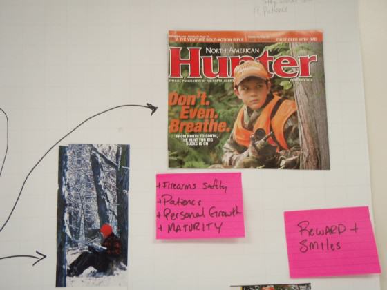
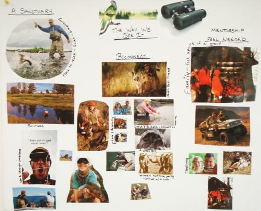
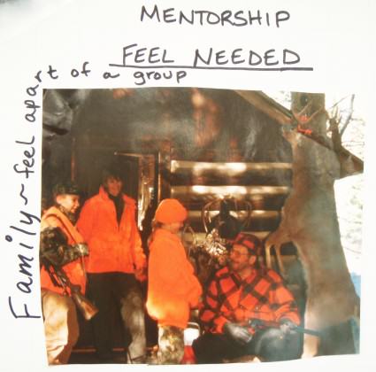
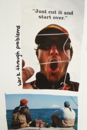
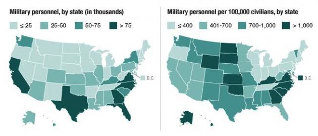
The benefits of human-nature interaction as a form of therapy are well documented. However, the value of human-nature interaction for returning combat veterans and their families and communities has been less studied. While administrators in the U.S. Department of Defense and the U.S. Department of Veterans Affairs struggle to design programs to help returning combatants reintegrate into communities, programs started by veterans themselves have emerged in New York State and across the U.S. Notably, many of these programs have a focus on the healing power of interacting with nature through outdoor recreation, including hunting and fishing, and through other restoration and greening activities. Examples include Wounded Warriors in Action Foundation, Project Healing Waters, Veteran Outdoors,  Veterans Conservation Corps of Chicagoland, and Growing Veterans, among many others. Testimony from program participants indicates their powerful impact on vets.

Although a number of research projects are being conducted on reintegrating veterans, a recent literature review revealed only one research project on the impact of nature programs, the results of which were inconclusive. A current study on human-nature interactions among families dealing with deployment suggests that such interactions contribute to individual and community resilience among families and communities where deployment of soldiers to combat zones creates disturbances in social-ecological systems.  We know of no studies that look specifically at female returning vets and human-nature interactions. The work presented in overview fashion herein attempts to move beyond these limited studies and begins to fill some gaps in terms of exploring the importance of human-nature interactions in outdoor recreation activities among returning war veterans, male and female, including those disabled in combat, and then accounting for how these interactions relate to individual, community, and social-ecological resilience.

To begin to understand these issues, I started attending events and getting to know the main players working at Fort Drum in the area of Morale, Welfare and Recreation (MWR), the Natural Resources group, and others working in the area of “navigating the deployment cycle.” Fort Drum is an army base in upstate New York that has seen frequent deployments of large numbers of troops in the past few years.

An initial event included one held on post where women and children were able to learn how to plant vegetables in containers. Some of these containers were sent to Afghanistan so that the women’s husbands deployed there could also garden, the idea being that this “distance-gardening” would create shared experience and “common ground” between the deployed soldiers and those left home.

army jacket green plant yello emblem

Fort Drum army soldiers and wives participating in a distance-gardening activity, coordinated by members of Cornell’s Civic Ecology Lab and Jefferson County Cornell Cooperative Extension.

I also participated in and helped coordinate Earth Day festivities on Fort Drum, again, to try to get a sense of the way human-nature experiences might be similar or different among this specific community (the military community). We set up a table to attract participants with children that featured a theme of “lending a hand to the planet.” The children worked with their parents to write down one thing that they would do to “lend a hand to the planet” on a colorful cut-out of their hand and then were invited to place the hand on the larger poster of planet earth.

soldier w daughter drawing hand

Children and their parents participating in Earth Day activities at Fort Drum, NY.

I later convened groups of veterans in the Fort Drum area to explore how outdoor recreation helped them reintegrate with their families and communities. I employed a method I have called “Collaborative ‘Cut and Paste’ Concept Mapping” (C3M) wherein participants are broken up into teams of 3-5 persons. They are then given a simple task to, in this case, map the multiple ways in which outdoor recreation is important to veteran reintegration. Participants are given no elaboration on the task and outcome. Participants are given a large supply of magazines ranging from general health magazines, hunting and fishing magazines, non-consumptive outdoor recreation magazines, gardening and hobby farming magazines, lifestyle magazines, and electronic industry magazines. They are also given scissors, glue sticks, sticky notes, a package of markers of different colors, and easel paper. Participants are then instructed to spend the first 15 minutes of group time “brainstorming” what they as a group feel are the important meanings and messages they would like to depict, and sketching a general schematic of how they will depict these meanings and messages on their final C3M map. Participants then begin a 90 minute period of interactivity to create the C3M map.

This method is useful both in terms of the final product, which is a visually interesting and conceptually intriguing collage, and in terms of the interaction opportunity to share with fellow veterans in a topic-focused, collaborative and creative endeavor. The following images are examples of the themes and linkages generated via this method. These are being used to better understand common themes and concepts for later use in content analysis of interview data.

OLYMPUS DIGITAL CAMERAOLYMPUS DIGITAL CAMERAOLYMPUS DIGITAL CAMERAOLYMPUS DIGITAL CAMERAOLYMPUS DIGITAL CAMERA
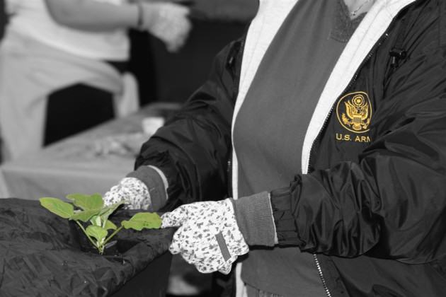
So what have we learned and where do we go from here?

Whether through working with military families on installations such as Fort Drum doing gardening activities and other traditionally “earth friendly’ activities, or working with retuning combatants — many of them wounded — in outdoor recreation with organizations such as Wounded Warriors in Action Foundation, Project Healing Waters, and many others, one common theme continues to emerge in this work: the importance of interaction with the rest of nature for veterans and their families.

Work in this area is ongoing, and data gathering and analysis is underway in multiple studies. Though conclusive statements remain in the future, the evidence thus far suggests that outdoor recreation, from gardening and tree planting to hunting and fishing are uniquely powerful and multifaceted avenues for returning combatant reintegration and healing, as is depicted in this Field & Stream video portraying some of this important work.

OLYMPUS DIGITAL CAMERAOLYMPUS DIGITAL CAMERA
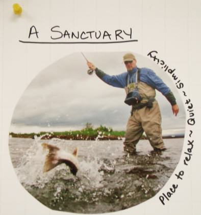
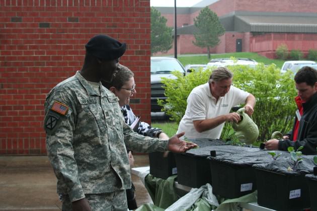
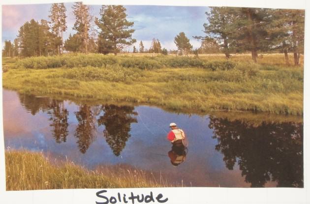
Soldiers returning from long and protracted wars, especially with life altering injuries, often  report feelings of inadequacy and of being devalued, and of feeling that their particular skill sets and competencies are not applicable in civilian life. On the other hand, returning veterans that engage in outdoor recreation and restoration activities report significant relief from these and other feelings, sometimes for short periods of time and more often for longer periods. In these reports are suggestions that reveal an intensification and specific manifestation of Kellert’s Typology of Values of Nature.

Specifically, in the case of returning veterans, the values depicted graphically by soldiers themselves as in the above images indicate the importance of rekindling camaraderie, the value of nature as solace and solitude, the potential of mission accomplishment, and the important inner work of reconnecting to and understanding the sacredness of both life and death, as represented by planting a tree, harvesting a crop, by catching and then releasing a trout, or by taking the responsibility of taking the life of an animal to provide for one’s family. These are not trivial matters, and they represent a specific manifestation of Greening in the Red Zone that may hold clues to how urban society, human society, may rediscover its ecological identity.

I conclude with the story of Chicago area based restoration ecologist Ben Haberthur, a former Marine who deeply believes that working in nature can help veterans heal their war-wounded spirits. Ben, who started the Veterans Conservation Corps of Chicagoland, was stationed in southern Iraq in 2003. Upon returning to the United States, he found that exploring coastal areas in California was a “peaceful, calming alternative to the stresses of my former military life.” He believes connecting with nature could help veterans struggling with post-traumatic stress disorder. He also said his resolve to protect and restore American ecosystems was solidified after seeing environmental devastation wrought by Saddam Hussein, including draining Iraq’s southern marshlands. The lush marshlands, between the Tigris and Euphrates rivers, were drained after the first Gulf War, because Hussein thought the area harbored rebels.

Haberthur obtained a $10,000 grant from TogetherGreen, which is an organization run by the National Audubon Society and Toyota, to start the Chicago chapter. He observes that military service is a place where you can readily see that your actions are having an impact and says that “once you get out of the military, people still want to have that sort of impact in their life…they want to be part of something bigger than themselves…being in nature more led to a stronger connection with nature, so it went hand in hand that I would be restoring natural environments at the same time that I was trying to bring a balance and restoration to my life.”

It is my hope that urban planners, those involved in urban ecological applied research and those involved in restoration activities will recognize and appreciate two important things; first, the great potential of the veteran community to participate in the restoration work that is increasingly an important part of what we understand to be the “nature of cities,” and second, the invaluable power of nature and the time we spend in it to heal the deepest and most destructive wounds.

Keith Tidball
Ithaca, New York


Note 1: According to the US Census Bureau, urban is defined as “all territory, population, and housing units in urbanized areas and in places of 2,500 or more persons outside urbanized areas.” See http://www.census.gov/population/censusdata/urdef.txt

St. Petersburg: Towards Integrated and Sustainable Green Infrastructure

Art, Science, Action: Green Cities Re-imagined

Compared with other countries, Russia came relatively late to the world of market economy. It was a quite painful process as the Socialist planned economy changed to the demands of the market and working with private investors. Rapid urbanisation and new rules of planning require searching for new approaches to design and management of urban green areas in Russian cities.

St. Petersburg is the second biggest Russian city, with 5 million people. The city is famous as the cultural capital of Russia with its unique historical monuments and museums. The whole central part of the city is protected by UNESCO as a World Heritage Site, and there are numerous historical parks and gardens. Green areas cover 7,209 hectares.

Summer Garden is the oldest St. Petersburg green area founded in 1703

These facts leave a mark in policy discussions and require a special approach to the city’s development policy. The main task in central districts of St. Petersburg is, first of all, to protect existing green areas from densification and growing demand for parking. Compared to the central area, with its very dense built infrastructure, districts that were created later during the Soviet era have quite a high amount of green area. But after years of neglect and lack of management these green areas need extensive repair and improvements.

New residential areas constructed in recent areas are often lacking any greening. There is also another trend directly related to urbanization and globalization: a growing suburbia with individual houses that are “eating” surrounding green belt of native forests and coastal landscapes.

One of the Soviet time “microrayon”(microdistrict) founded in late 1960’s
New district constructed in 2000’s
New Russian suburbia in pine forest in the outskirts of St. Petersburg
The main and the oldest street of St. Petersburg-Nevsky Prospect
The Ring Road in St. Petersburg (finished in 2011)

St. Petersburg has experienced tremendous growth of private cars, which has resulted in incredible traffic problems. The Old Baroque city structure is really struggling to accommodate such a number of vehicles. Even construction of the Ring Road has not help to solve traffic jams in the City.

Another recent St. Petersburg phenomenon is directly connected to the new economic situation. Quite a few industrial factories in the central districts are closing and vacated areas are waiting for reuse. Looking at the plan of St. Petersburg it is quite easy to see the limitation of city’s growth. The most important is the Gulf of Finland and a big forest greenbelt.

Map of St. Petersburg
Plan of St. Petersburg with Gulf of Finland and Forest Greenbelt

At the moment the most disadvantage of St. Petersburg is isolation of the small central green areas from suburban residential greening (microdistricts — “microrayon” in Russian).

All these factors are contribute to the need for a new strategy of green infrastructure development. We believe that the following principles should be considered for the new sustainable green infrastructure in the city:

  • Planning of green infrastructure should be an important and integrated part of the overall architectural and urban planning development strategy (master plan) of the city. It is a time for an interdisciplinary approach, incorporating principles of landscape ecology into urban design and planning. Principal St. Petersburg axes (along main streets) started in the central cities should have logical extension into suburban areas.
  • New infrastructure should not be a random mosaic of different green spaces but interconnected infrastructure. One of the proposals is to create a system of ecological axes along main urban axes. They would start in the city centre with a system of green streets and pedestrian zones, then continue to newer residential areas and finally create relatively large green areas on the intersection of such axes, or lines.
  • Strengthen the links within the green infrastructure through the development of linear green areas along the main city roads and river embankments. This strategic line has a lot of potential in St. Petersburg, even in the historical central part of the city through organization of pedestrian zones with pockets of vegetation.
  • One of the important principles of any new green infrastructure strategy is the relative autonomy of the individual parts of the green infrastructure elements. Different types of green areas should penetrate into the most important structural and functional urban planning in each of residential, industrial and recreational units.
  • The organisation of new park areas in existing residential areas and the newly built up areas.
  • Greening of embankments in St. Petersburg is restricted due to historical preservation. Most of Neva river embankments is covered by granite and is the part of the historical heritage. However there are still a lot of potential for river’s vegetation restorations of banks in smaller Neva’s tributaries and other minor rivers within city’s boundaries.
  • There is a lot of potential for ecologically effective and rational organization of inter housing estates (courtyards) which are primary units of green infrastructure in St. Petersburg. For example, even the city centre — very restricted by heritage status —  has potential for increasing green areas ratio by introduction of new technologies (e.g., vertical and container gardening, “green roofs” and “green walls”).
Pedestrian Malaya Sadovaya Street in historic centre
Granite embankment of St. Petersburg is the part of St. Petersburg Heritage Site
New strategies for old embankment greening
New life of old St. Petersburg inner courtyards
One of the few green roofs in St. Petersburg created by enthusiastic citizens
One of the few green roofs in St. Petersburg — created by enthusiastic citizens

One of the goals today is to increase the level of green areas of St. Petersburg by 150 percent (compared to the present status) by moving some companies and businesses from the historic centre to the suburbs and re-purposing these newly vacant lands. There are quite a few already demolished areas which are planned to become new park areas. This strategic process should include reclamation of areas of former industrial sites and landfills of municipal and industrial waste and their landscape development.

The formal cable factory of Edwards and Kavos in the surrounding park

The lack of land for urban development in St. Petersburg dictates another direction in green infrastructure planning: development of the coastal areas of the Neva River and the Gulf of Finland through the creation of new parks and gardens on the reclaimed lands.  Park “300 years of St. Petersburg” is the most recent examples of such areas.

City of St. Petersburg has a lot of potential for designing green corridors along transport lines first of all railways and roads. Design peculiarities of public railroads spaces in St. Petersburg give the opportunities for introducing green areas. For example, spontaneously appeared parking facilities can be relocated to specially designed parking towers and the liberated space can be reuse for green recreational facilities. The most recent Ring Road (bypass) also great great potential by using motorway slopes for greening.

This parking can be turned to residential park
This parking lot could be turned to residential park if a parking tower was created for the cars.

The pressure for private housing developments in the unique forest belt zones required a reexamination of existing legislation and tightening of protections for remnants of native vegetation and nature reserves in general. Thus, we insist on the idea of including water protection zones, sanitary protection zones of enterprises, and protected natural areas into the united green infrastructure system of St. Petersburg.

Existing Network of Special Protected Areas in St. Petersburg in 2005

One of important tools for implementing a new green infrastructure strategy at intermediate scales in real neighboorhoods is using innovative approaches such as ecological design and low impact design principles of stormwater management.

In 2012 we used a typical St. Petersburg suburb, Novoye Devyatkino, as the first case study of implementing principals of Low Impact Development in Russia. Novoye Devyatkino has active residential construction and as a consequence its very limited green spaces face increasing pressure. The traditional approach to the design of the urban environment, promoted in Russia for the last 15 years, follows globalization trends and dramatically changes the face of the territory towards placeless landscapes. This approach usually does not take into account the character of the local plant communities and contributes to the creation of biologically unstable ecosystems.

Novoye Devyatkino site

Low Impact Design has been used in many European, USA, Australian and New Zealand cities. The key task of this design is to create a sustainable environment by using typical local plant communities. We also take into consideration the dynamic character of vegetation as well as respect the natural flow of water and its infiltration into the soil. The project has to deal with stormwater runoff without creating a network of traditional drainage systems, which in our case, is replaced by a chain of “rain gardens”.

One of the main challenges of our conceptual approach is abolishing the idea of a traditional lawn, which requires intensive management and maintenance (weekly mowing, very often herbiciding and pesticiding). Instead, the design proposes creating meadows, requiring a minimum of care and calling for the preservation of biodiversity. The project provides for the use of decorative groups of shrubs and trees, based on a mix of species from natural biomes, which will allow the creation of the “spirit” of the Karelian Isthmus.

Meadow with native plants is one of the targets in Novoye Devyatkino
Meadows with native plants is one of the design goals in Novoye Devyatkino

The project also proposes a “public garden” where residents of neighboring houses could grow common garden plants and vegetables without using pesticides and fertilizers.  We also introduce interactive gardens such as a “Garden of bugs”, “Garden of touch”, and “Garden of Sounds”.

One of the Kew Botanic Gardens exhibits was an inspiration for Novoye Devyatkino design
Workshop with local residents in June 2012
Workshop with local residents in June 2012. The Novoye Devyatkino project involves local citizens in designing and implementation process and can be seen as a good example for other St. Petersburg areas.

Traditionally, the maintenance and construction of urban green areas in Russian cities is a task of specialized landscape companies (private or municipal). However the experience of European cities, for several years using the concept of ecological design, proves the success of direct involvement of local residents into the design, construction, and maintenance process. By introducing a similar approach we hope to reduce vandalism and increase social interest in maintaining and improving the status of residential areas.

Another positive aspect of this project is its cost effectiveness compared to traditional methods of improvement, as well as the possibility of preserving and increasing the biodiversity of the urban environment.

Maria Ignatieva, Irina Melnichuk & Andrei Bashkirov
Uppsala, St. Petersburg, St. Petersburg

In The Nature of Cities

Maria Ignatieva
Swedish University of Agricultural Sciences

Irina Melnichuk
St. Petersburg Forest Technical University

Andrei Bashkirov
Landscape Architecture Firm “Sakura”, St. Petersburg, Russia


Rebuilding After Hurricane Sandy—A Blueprint for a Better Future for People and Wildlife

Art, Science, Action: Green Cities Re-imagined

While I was enjoying my August beach vacation, the federal government was releasing its plan for rebuilding the New York City metro area and the New Jersey shore in the wake of Hurricane Sandy. I grew up in the New Jersey suburbs and spent many summers on the Jersey shore, in some of the very towns hardest hit by that epic storm. So I was pleased to see that the Hurricane Sandy Rebuilding Strategy offers a very thoughtful, albeit incomplete, action plan for helping this region bounce back from the devastation and prepare for the next big storm.

Preparing for the next storm

NWF volunteers spent the day planting native grasses to help rebuild dunes devastated by Hurricane Sandy
Although there should be no retreat from efforts to reduce the carbon pollution that drives climate change, there is no question that we must also prepare for the inevitable change. The National Oceanic and Atmospheric Administration estimates that sea levels in the NYC metro area will rise at least a half a foot and up to 2.5 feet by mid-century. Because of this inexorable sea level rise, we know with certainty that every major storm that hits the region going forward will push sea water further inland than before. And the tropical storms that fuel this surge are expected to become more frequent and more powerful as the climate warms. Extreme rainfall of every variety is expected to become more intense, worsening flood risk across the region. Arguably the most detailed and farsighted climate change adaptation plan ever produced by the federal government, the Hurricane Sandy Rebuilding Strategy should be of interest to anyone who cares about building cities resilient to intensified floods and storms. And with very substantial funding to fuel the strategy — a roughly $50-billion Sandy relief package approved by Congress in early 2013 plus significant additional public and private dollars — local leaders will be able to move quickly into implementation. Many features of the Strategy merit attention. Here are just a few:

  • Educating people about flood risk and practical steps they can take to reduce that risk.
  • Making science-based analysis of climate risks a part of all project planning.
  • Using insurance and other market forces to reduce building in hazardous locations.
  • For the first time ever, applying climate resiliency principles and guidelines to all federal investments — federal infrastructure construction as well as state and local infrastructure construction using federal dollars.

This last point is especially important. Until now, the many federal actors involved in climate change adaptation have lacked any agreed upon approaches to building climate-resilient communities. Now, every agency charged with investing the billions in Sandy recovery funds will fund only those projects that conform with the best science on preparing for climate change.

Emphasizing green infrastructure

Perhaps most importantly, the new guidelines call for capturing the benefits of nature-based (“green infrastructure”) solutions to protecting communities from intensifying storms and floods. Green infrastructure is defined as including:

  • Protecting communities from storm surge using the natural defenses provided by land and water systems such as wetlands, vegetated sand dunes, and forests.
  • Building stormwater management systems that soak up and store water using natural areas and natural processes.
  • Otherwise integrating natural systems and processes, or engineered systems that mimic natural systems and processes, into infrastructure.

This move by top federal officials to help steer the sizable Sandy investments toward green infrastructure is an exciting sign that the nation is truly beginning to shift away from its historic over-reliance on sea walls, dikes, levees and other “hard infrastructure” flood protection solutions. Although hard infrastructure is warranted in some cases, in many cases it is ineffective in controlling floods and causes extensive damage to wildlife and other natural resources.

Aerial views of the damage caused by Hurricane Sandy to the New Jersey coast (U.S. Air Force photo by Master Sgt. Mark C. Olsen).
Aerial views of the damage caused by Hurricane Sandy to the New Jersey coast. U.S. Air Force photo by Master Sgt. Mark C. Olsen.
Building, protecting and restoring green infrastructure provides significant opportunities to restore wildlife. At the same time, it reduces flood damage to communities, creates open space and recreational opportunities, provides clean water and clean air, reduces the urban heat island effect, and saves taxpayer dollars. For example, the strategy notes how oyster reefs, installed several years ago parallel to the shoreline on Pimlico Sound in North Carolina, have absorbed some of the energy of storm-generated waves and decreased erosion in that region. Oyster reefs are among the many green infrastructure options now under consideration for protecting shorelines in the NYC metro area.

Missing: a wildlife restoration vision

One key flaw in the strategy is its failure to outline any kind of vision for wildlife restoration in the NYC metro area and Jersey shore. In fact, the plant and animals species of the region are barely mentioned. The New York City Parks Department alone has over 10,000 acres of forests, woodlands, freshwater wetlands, and saltwater marshes. Surrounding suburbs are likewise blessed with a diverse array of species and habitats. Historically, the Atlantic flyways teemed with migratory birds and the rivers and estuaries teemed with fish, shellfish, amphibians and reptiles. What part of the region’s rich natural legacy do the people of New York, New Jersey and Connecticut want to bequeath to future generations?

Beach-nesting birds—like these black skimmers—were among the wildlife hit hardest by Hurricane Sandy.
Beach-nesting birds—like these black skimmers—were among the wildlife hit hardest by Hurricane Sandy. Photo by Jack Rogers.
As we embark upon a centuries-long project of redesigning our communities to accommodate sea level rise and intensified floods and storms, how wildlife fits into the puzzle is a key question. When I lived in the NYC metro area, I had the great pleasure of fishing in the Ken Lockwood Gorge of the Raritan River, hiking and fishing in New York’s Catskills Mountains, crabbing down the New Jersey shore, canoeing in the Pine Barrens, and birdwatching in the Dismal Swamp. These interactions with nature shaped my worldview about the interconnectedness of people and wildlife and helped drive me to a life in conservation. I hope that future generations of kids in the region have similar experiences and help lead tomorrow’s conservation movement. By conserving wildlife, we provide those crucial formative nature experiences for kids and families – and we bring back the diversity of life forms that is so essential for healthy and resilient ecosystems.

Integrating wildlife into green infrastructure strategies

Some might argue that the best place for planners to express their wildlife vision is in a wildlife or natural resources plan. But by their inclusion of green infrastructure in their rebuilding plan, the Hurricane Sandy task force implicitly acknowledges that the natural and built environments are so closely intertwined that they must be dealt with holistically. Now local leaders must take the next step and build the wildlife restoration element of the region’s green infrastructure strategies. If they do this, we will end up with abundant wildlife and safer, more vibrant communities.

John Kostyack
National Wildlife Federation

On The Nature of Cities

This post was also published on NWF’s Wildlife Promise blog.

The Power of Unkempt Wilderness in the Hearts of Berlin and Buenos Aires

Art, Science, Action: Green Cities Re-imagined

Today I would like to celebrate the First Congress of the Society for Urban Ecology (SURE), which took place at the end of July in Berlin, just in the place where urban ecology emerged as a discipline. And also I’ll consider what our discipline of urban ecology has to say to people in cities such as Berlin and my hometown, Buenos Aires.

The conference brought together more than 300 people from different continents, who spoke in keynote presentations and symposia. It was an encouraging opportunity to meet old friends, members of The Nature of Cities blog who only knew each other through their posted essays, and also some Urban Ecology “celebrities” (those famous guys of the literature).

Twenty-five speakers participated in the symposium entitled “The Nature of Cities: The diverse roots of coupled social-ecological research that leads to design of urban environments” giving credit to the excellent idea conceived one year ago by ​​David Maddox, encouraging readers to reconnect to nature and to think about the necessity to maintain urban nature and biodiversity.

The conference reinforced ideas that have been discussed in the last decades in the context of disciplines like Urban and Landscape Ecology, Geography, Landscape Architecture, Urbanism, Sociology, among others, showing that cities are complex socio-techno-ecological systems impacted by external drivers at different scales (as discussed by Nancy Grimm). That each city has a distinctive cultural heritage, development history, planning tradition and social structure, offering at the same time opportunities to reimagine and reinvent a sustainable future for all species (Thomas Elmqvist).

Naturalistic plantings resembling native meadows in Southern Germany. Photo: Ana Faggi

As expected in times of climate and demographic change, special attention was placed on the relevance to livability, resilience and sustainability of green and blue infrastructure in densely built-up areas (Giovanni Sanesi). As many presentations showed, investments in such infrastructure represent win-win ways to reconcile urbanization with the protection of ecosystems, landscape ecological functions and processes (Cecilia Herzog).

Nonetheless, other evidence showed that in many cases urban park designs frequently do not reflect the necessary full spectrum of ecosystem services that we care about considering needs, values and perceptions (Jürgen Breuste) and that global trends in urban design and planning are responsible for sadly homogenous flora in gardens across latitudes, when in fact native plantings would easily support biodiversity and be more locally relevant (Maria Ignatieva).

Naturalistic plantings resembling native meadows in Southern Germany. Photo: Ana Faggi

The Congress’ message was this: people want cities that are livable, resilient and smart (Christiane Weber), in which they can appreciate, be aware and celebrate worthy things. What works in nature to produce healthy and resilient systems? What works in communities of people to make heathy and livable cities? Let’s (re)discover these things and apply them in our cities and towns. Wei-Ning Xiang offered useful advice in a keynote presentation: learn from the past. This is a fundamental principle in all ecological restoration projects!

A livable street in the old Erfurt, Germany. Photo: Ana Faggi
A resilient building in Aying, Germany. Photo: Ana Faggi
Smart Meran, Italy. Urban Agriculture downtown. Photo: Ana Faggi

At the end of the day, on the way to my accommodation in the Steglitz neighborhood, I tried to recognize in the urban matrix of Berlin evidence of our discussions during the conference. They were hot days and suburban train travellers showed signs of climate discomfort, showing the importance of the urban green and the need of improvements in transport conditions in the heat waves that are likely to be more frequent. Such simple things as windows that would open, makes us realize that good design is secured by cultural norms and at the same time by environmental realities and imagination. On the other hand, the massive turnout of people in the parks and lakes in the late afternoons confirmed how they profit from the existing green and blue infrastructure within the city. The appearance of mammals — a fox between parked cars, squirrels and porcupines in a front garden — was to me a sign of a livable, green Berlin unlike the everyday in the Buenos Aires metropolis, where I live.

Berlin Botanic Garden. Photo: Ana Faggi

Buenos Aires is a good example demonstrating that cities are products of history and therefore socially conditioned. The European immigration in the late 19th century shaped the city.  Today we can recognise the Spanish and Italian Heritage in the city grid and design and, at the same time, the French and English influence in the signature of green areas.

Tres de Febrero Park, Buenos Aires. Photo: Ana Faggi
Plaza Dorrego, downtown Buenos Aires. Photo: Ana Faggi

The city has a high population density, which comes at the expense of green space — just 6 square metres of green space per person within the city area. In trying to regreen the city, today the local government is revitalising green spaces, creating at the same time a network of green corridors with bicycle lanes that connect parks, plazas, the waterfront and an urban ecological reserve.

Micaela Bastidas Park in Puerto Madero, Buenos Aires. Photo: Ana Faggi
Costanera Sur reserve, Buenos Aires. Photo: Ana Faggi

This reserve is an important focus for environmental conservation and education downtown and resembles the conservation area Schöneberger Südgelände, one of the excursion destinations offered during the SURE conference.

In Buenos Aires the 370 hectares reclaimed from the river were very soon spontaneously colonized by humid forests, grasslands, scrublands and wetlands. The new landscape offered shelter and food to many bird species and other animals. By the early 1980s the lagoons and grasslands attracted the attention of bird watchers and the place also became a meeting point for joggers, cyclists, students and naturalists. In 1986, the City Council granted protection to the area in response to claims from many local Non-Governmental Organizations. Since 2005 the natural reserve “Costanera Sur” is included in the Ramsar list of important wetlands for bird conservation.

The Schöneberger Südgelände, was an originally desolate freight railyard built between 1880–1890, mostly abandoned since1952. Photo: Ana Faggi

On the majority of the Schöneberger Südgelände site, also natural development began to take place, which, by 1981, had led to a richly structured mosaic of dry grasslands, tall herbs, shrub vegetation and individual woodlands, then for over four decades an almost untouched new wilderness (Kowarik & Lager 2005).

Schöneberger Südgelände, Berlin. Photo: Ana Faggi

The Buenos Aires ecological reserve, on the other hand, is a landfill area created in the La Plata estuary using the Dutch “polder” system, which was invented in 1978. A few blocks away from downtown, the embankments were built with demolition materials brought from highway construction works. The polders were filled with silt and sand from the river and drained. However, as in the Schöneberger Südgelände in Berlin, the area was abandoned and the spontaneous sucession resulted in an extraordinary urban wilderness. In both brownfields regeneration areas, visitors are surprised at the beauty of spontaneous vegetation and the force of Nature in reconquering land.

Both cases are good triggers for debate, especially talking about restoration in complex socio-techno-ecological systems as cities are. Ecological restoration is defined by the process of repairing damage caused by humans to the diversity and dynamics of native ecosystems. What is going on in the new urban wilderness is more inclusive, covering reclamation projects, replacements, ecosystem creation and naturalized areas. In general, the challenges of restoration are difficult if not impossible; this is particularly true in cities where the intentional ecological manipulation of ecosystems is subject to variables that go beyond the ecological understanding.

Schöneberger Südgelände is an example of a brownfield reclamation; Costanera Reserve of the creation of a terrestrial ecosystem in a river bed. Both areas have received relatively little systematic stewardship and have become, over time, naturalized. Both are threatened or — depending our values and perceptions — modified by invasions, and are living examples of the New Nature in cities. As exemplary biodiversity urban bastions they mirror the stories that gave them life.

In many ways, they show us that we are living in a new time, where old assumptions — including the ecological ones but also societal choices — must be reconsidered, looking for a compromise in restoration projects where the main objectives should be to improve ecosystem services while reconnecting people with local, native, and spontaneous nature.

Ana Faggi
Buenos Aires

On The Nature of Cities


I. Kowarik, A. Langer 2005. Natur-Park Südgelände: Linking Conservation and Recreation in an Abandoned Railyard in Berlin.


Trees as Starting Points for Journeys of Learning About Local History

Art, Science, Action: Green Cities Re-imagined

Have you ever sat beneath an old urban tree and wished that it could talk? Many times older than any human, yet always rooted to one location, imagine the stories that the tree could share and the wisdom it could impart. Such trees could have led extraordinary lives, witnessing profound landscape transformations: from natural to rural to urban; from residential to industrial to commercial.

Why do they stand where they do? Did somebody plant them, and if so, for what purpose? What history occurred beneath their branches? Were battles waged, was power brokered, were treaties signed, were enterprises born, were slaves sold, and convicts hung? What human tragedy, scandal, and elation, have these trees beheld? Moreover, why have they survived so long, when all about them is changing?

Interesting trees can be found in almost any city. They can shed light on the cultural value systems and economic priorities of bygone generations. If approached with an inquisitive mind, these trees provide excellent starting points for journeys of learning about a city — journeys that have no fixed route or endpoint. Over time, the trees and their environs develop distinctive personalities, reflected in the various anecdotes that we attach to them. This makes for an altogether more interesting and enriching urban landscape.

So far, I have identified over 30 remarkable trees in the City of Cape Town, South Africa. These trees have captured my imagination and led me to better understand and appreciate the colourful culture and rich, if brutal, history of the city. Here follows a small selection. 

(1) The Treaty Tree in Woodstock

On Treaty Road, about 2 km east of the city centre, in the post-industrial suburb of Woodstock, there stands an ancient milkwood (Sideroxylon inerme), known as ‘The Treaty Tree’, which is well over 500 years old.

Treaty Tree—The Treaty Tree was previously known as the Old Slave Tree of Woodstock. Photo: Russell Galt
The Treaty Tree was previously known as the Old Slave Tree of Woodstock. Photo: Russell Galt

It was here on Cape Town’s original beachfront, in 1510, that the famous Portuguese explorer, Dom Francisco de Almeida, and 64 of his finest men met a gruesome end. A band of enraged Khoekhoe (local indigenous people) armed with sticks attacked and slaughtered the Portuguese, revenging cattle raids, abductions and extortion.

In later centuries, the tee became known as the Old Slave Tree of Woodstock. Under its shady breadth, slave masters bartered away humans like livestock, and from its gnarled branches, numerous “disobedient” slaves were hung.

In the early 19th Century the tree was renamed, The Treaty Tree, to commemorate the start of the second British occupation of the Cape. It was here, following the Battle of Blaauwberg in 1806, that the victorious British Forces regrouped and the defeated commander of the Dutch (Batavian) Forces signed capitulation conditions, effectively transferring control of the Cape to Britain. Different sources contest whether the treaty was signed underneath the tree or in an adjacent cottage later named Treaty House. However, the latter was demolished in 1935 to make way for a factory, so today, only the Treaty Tree remains and it is now protected as a National Monument.

The historical significance of The Treaty Tree is not reflected in its upkeep. Tall neighbouring buildings crowd it from view. Abandoned, stripped, and rusting old cars line along Treaty Road. Dozens of colourful plastic bags are tangled like tinsel in its branches. Remnant glue on a flat-faced rock suggests that the only information plaque has been stolen.

(2) European Oak in Groot Constantia

This European oak tree (Quercus robur) is several centuries old and remarkably hollow. Presumably it suffered from a fungal disease, perhaps after being struck by lightning or split by violent wind. Appearing at odds with gravity, its thick heavy branches hang precariously on the trunk’s thin, empty exoskeleton.

European Oak—The old hollow oak tree. Photo: Russell-Galt
The old hollow European oak tree. Photo: Russell-Galt

This oak tree is one of many found on Groot Constantia, South Africa’s oldest wine estate. In 1685, the Dutch East India Company (VOC) granted the land to Simon van der Stel, the Governor of the Cape of Good Hope and an avid wine-lover. Van der Stel recruited French winemakers to the colony, who with the assistance of slaves, established vineyards in Constantia Valley, now suburban Cape Town. Rows of oak trees were planted to shield the vineyards from the beating winds of the ‘Cape Doctor’ and to provide wood for making wine barrels. This latter function will have been limited, because oaks tend to grow quickly in the Cape, rendering only low-quality, porous wood. In any case, the wine of Constantia soon became widely admired, especially the desert wine, Vin de Constance, famously a favourite of Napoleon Bonaparte when in exile on the island of St Helena.

From the affluent vantage point of the old hollow oak tree, one has a panoramic view of False Bay, called so because sailors returning from the East would mistake it for Table Bay further up the coastline. To the south, the Cape Peninsula skirts high above the surfing town of Muizenberg, and to the north, one can see part of the Cape Flats, known as ‘apartheid’s dumping ground’.

(3) Saffron Pear in the Company’s Garden

Of the many old trees in the centre of Cape Town, the saffron pear (Pyrus communis) in the Company’s Garden could be the oldest. Brought here from Holland during the time of Jan van Riebeeck (the founder of Cape Town) some 350 years ago, it is probably also South Africa’s oldest living cultivated tree. Three suckers radiate from the main trunk which died back many years ago. The rot has been scraped away and special sealant applied. Metal crutches and cables now hold the tree in place. Astonishingly, it still produces clusters of white flowers every spring and a bounty of edible fruit every autumn. It must be a surreal experience to taste the fruit of the same tree from which the traveller, Valentyn, recorded eating in 1714!

Saffron Pear—The saffron pear tree. Photo: Russell Galt
The saffron pear tree. Photo: Russell Galt

Established by the VOC in 1652, when indigenous hunter-gatherers and migratory pastoralists still roamed the land, the Company’s Garden is a foundation stone of Western colonisation of Africa. The Dutch needed a victualing station to provide fresh supplies to sailing ships plying the spice trade between the East and Europe, and later, to support ships engaged in foreign wars. To this end, the Company’s Garden was designed primarily to produce food. One can still see evidence of the original irrigation furrows and wells.

Today, the Company’s Garden provides Capetonians with a well-used refuge in the busy city centre. This green oasis brims with fascinating plants, statues and monuments, and abuts several historic buildings, thereby presenting an ideal gateway to discover the city.

(4) European Oak in the Company’s Garden

Another fascinating European oak tree can be found next to a well, dated 1842, in the Company’s Garden. The tree is remarkable because it has somehow engulfed the well pump and lifted it up to head height such that a large tap, also dated 1842, now protrudes from the trunk.

European Oak—A tap protrudes from the tree trunk at head height. Photo: Russell Galt
A tap protrudes from the tree trunk at head height. Photo: Russell Galt

The well was constructed with alternate rings of wood, slate, and brick to allow for the percolation of groundwater, whilst the base is lined with impermeable clay.

Water has played an essential role in the development of Cape Town. In the ancient Khoisan tongue, the area was known as ‘Camissa’, meaning ‘the place of sweet waters’. It is the existence of this freshwater running cleanly from the slopes of Table Mountain that ultimately determined the site of the city.

The Dutch utilised this water by building various irrigation furrows and canals. Later, in the context of increasing water consumption and periods of severe drought, the British filled in these canals and constructed a system of pipes and sewers, with a view to improving water supply and sanitation. Prevailing street names including the word, ‘gracht’ (e.g. Heerengracht and Buitengracht), reveal the whereabouts of original canals and forgotten waters still flow under these streets. A movement to make better use of this valuable water resource is now underway, spearheaded by the campaign group, Reclaim Camissa.

(5) Black Mulberry in the Company’s Garden

One can also find a contorted black mulberry tree (Morus nigra) in the Company’s Garden. This species, which is native to Persia, was cultivated across much of the old world, partly for its sweet fruit and partly for its leaves which are eaten by silkworms (Bombyx mon) — a clue to the story of the tree in question.

Black Mulberry—The black mulberry in Company's Garden. Photo: Russell Galt
The black mulberry in Company’s Garden. Photo: Russell Galt

In 1704, Willem Adrain van der Stel, who succeeded his father, Simon, to become Governor of the Cape, sought to establish a local silk industry. ‘Die Oude Spinnery’ (the old spinning factory) was constructed on present-day Spin Street, next to the Company’s Garden. Imported silkworms fed on the leaves of black mulberry trees cultivated in the garden, and slave children were tasked with unspinning their cocoons. The black mulberry tree in the garden dates to 1800 and is probably the offspring of one planted earlier in support of the silk industry.

The industry failed to prosper and was soon abandoned. One account suggests that the eggs of the imported silkworms did not survive well in the Cape, perhaps owing to the harsh climate. Another possible explanation is that silkworms survive poorly on black mulberry, and actually favour white mulberry (Morus alba). Sensing a threat to their commerce, could Eastern silk producers have deliberately provided the Dutch with seeds of the less suitable species?

Black-Mulberry—Spin Street is named after the old spinning factory. Photo: Russell-Galt
Spin Street is named after the old spinning factory. Photo: Russell-Galt

Many years later in 1753, the Frenchman, Francois Guillaumet, unsuccessfully sought to re-establish silk production. Thereafter, the old spinning factory was converted into a grain depot before it burnt down in 1792, leaving only the street name and black mulberry as evidence of Cape Town’s short-lived silk industry.

(6) The Old Slave Tree on Spin Street

Silk aside, Spin Street has a deeply sinister history. An old fir tree, the exact species of which could not be determined, stood here for hundreds of years until 1916 when it was cut down. Under this tree, an estimated 100,000 souls were sold into slavery.

Today, in the absence of that tree, a raised octagonal plaque lies wedged on a traffic island. It is faintly inscribed with the words, “On this spot stood the old slave tree”, which are only legible when the sun hangs low. Pedestrians seem largely unaware of the historical significance of this marker, and sometime walk directly over it when rushing across the street.

Slave Tree—The rather inconspicuous Slave Tree Plaque. Photo: Russell-Galt
The rather inconspicuous Slave Tree Plaque. Photo: Russell-Galt

Slaves were brought to the Cape from other parts of Africa, India and Indonesia from 1656 onwards. They were named by their masters after months of the year, or characters from the Bible and classical mythology. Their surnames were replaced by their country of origin.

Near to the slave tree plaque is the Slave Lodge, which was built in 1679 and eventually housed 1000 slaves. Having served temporarily as the Supreme Court, the building is a now a museum providing a tear-jerking account of slavery in the region. Visitors can still see the squalid, inhumane conditions in which the slaves were kept. It was not until the 1830s, almost two centuries later, that slaves were finally emancipated.

The inconspicuousness of the slave tree plaque is partially compensated by ‘The Cape Town Memorial to the Enslaved’, unveiled in 2008, in the adjacent Church Square. The memorial comprises a sombre arrangement of eleven blocks of black granite. Each block is engraved with evocative words depicting the names and experiences of slaves.

(7) The Stone Pines of Groote Schuur Estate

Driving into Cape Town along the main freeway, one can see zebra and black wildebeest grazing in grassy paddocks next to massive stone pines (Pinus pinea) afore the crags of Devil’s Peak. The scene is Groote Schuur Estate, and contrasts strikingly with the concrete jungle on the lower side of the freeway.

Stone Pines—Most of the surviving stone pines are nearing the end of their natural lives: Photo: Russell-Galt
Most of the surviving stone pines are nearing the end of their natural lives: Photo: Russell-Galt

Stone pines are native to the Mediterranean region and have long, branchless trunks terminating in an umbrella-shaped crown. In Cape Town, the trees often grow at an angle owing to the harsh south-easterly wind. Their cones produce large edible kernels known locally as ‘dennepitjies’ (pronounced denna-pye-kees). Many are over 150 years old and have become regarded as an important part of Cape Town’s landscape and heritage, popular for recreational activities and family ‘braais’ (barbeques). However, the pines are extremely water thirsty and corrode native biodiversity. As such, conservation authorities are at pains to remove them and prevent their regeneration, often in the face of strong public opposition.

Stone Pines—The thirsty roots of a stone pine exposed here by erosion. Photo: Russell-Galt
The thirsty roots of a stone pine exposed here by erosion. Photo: Russell-Galt

The stone pines were originally planted by the Dutch in the 1700s, in response to escalating demand for timber. Later, in the 1890s another wave of planting was conducted, this time at the behest of the controversial British imperialist and owner of Groote Schuur Estate, Cecil John Rhodes (1853-1902). It is these pines which can be seen from the freeway today.

Rhodes actually introduced many alien species to the Cape, some of which have become invasive, wreaking ecological havoc. He augmented the diverse stock of African animals kept on Groote Schuur Estate, with llama from Peru and emu, wallaby, and kangaroo from Australia. This folly of nature resulted in overgrazing and land degradation, for which Rhodes has been criticised. However, he has also been rightly credited for preventing this expanse of prime land from being consumed by urbanisation.

Stone Pines—Cecil Rhodes introduced many alien species to the Cape. Photo: Russell Galt
Cecil Rhodes introduced many alien species to the Cape. Photo: Russell Galt

In his will, Rhodes bequeathed Groote Schuur Estate to the nation under strict conditions: that it would be used exclusively for public purposes; that any new buildings would be in architectural harmony with the existing buildings; and that the land would not be sold or developed into a residential area. The conditions have been interpreted flexibly over the ensuing years, allowing for two landmark constructions — namely the University of Cape Town in 1920 and the Groote Schuur Hospital in 1938 (made famous by Dr Christiaan Barnard, who conducted the world’s first heart transplant there in 1967) as well as the aforementioned freeway — to infringe on the Estate.

(8) The Silvertree of Table Mountain

The silvertree (Leucadendron argentium) is an endangered species native to the Western Cape fynbos biome. Its silky leaves are covered in fine hairs that shimmer in the sunlight like shards of mirror. A member of Protea family, it only occurs in a few discrete locations on the sunny slopes of Table Mountain, specifically, Kirstenbosch, Newlands and Lion’s Head, where the soils are well-drained and acidic. The tree was once widespread around Table Mountain but urban sprawl, demand for timber, inappropriate fire management, and the spread of invasive alien species, have reduced its range by three-quarters. So precarious is the species’ survival, that a single fire in 2006 destroyed almost half of the world’s entire wild population. Fortunately, the species actually requires fire to regenerate and the population has already recovered to pre-2006 levels.

Silvertree—The silvertree is steeped in folklore. Photo: Russell Galt
The silvertree is steeped in folklore. Photo: Russell Galt
Silvertree—The silvertree is a member of the Protea family. Photo: Russell-Galt
The silvertree is a member of the Protea family. Photo: Russell-Galt

The silvertree holds a special place in Khoisan folklore. It is said that God asked the birds, animals, and Khoisan people, to plant special seeds which he gave to them. The birds planted the seeds in the centre of the land but they would not germinate because it was too high and cold. The animals planted the seeds on the West coast but they too would not germinate, because it was too dry. The Khoisan headed southwards to plant the seeds. On route, they encountered a great flat mountain (Table Mountain), and in an excited frenzy, spilled the seeds on its sandy slopes. The seeds germinated and grew into trees that shimmered silver to express their glee.

The silvertree also holds a place in modern folklore. Some say that the leaves will only turn silver if the tree has an unobstructed view of Table Mountain. Others say that the leaves turn especially silver when rain is imminent.

Almost all of the history that I have alluded to in this post can be found in museums, books, city archives and specialist websites. However, there are also personal histories that we as individuals can associate with certain trees. For example, on a recent hike through Newlands Forest one of my most spiritually-alert friends stopped abruptly to explain the significance of a large silvertree branching across our path. It was to this place, that some months earlier, she had carried her deceased, beloved cat to bury it in the fynbos. Unable to bring herself to let go, she slumped against the large silvertree and sobbed. Then, in the corner of her eye, she glimpsed a Cape Robin (Cossypha caffra) boldly perching nearby. They looked directly at each other before the robin fluttered away into the thickets. Perceiving it as a sign, she pursued the robin far off the beaten path, until she found it once more, resting on another silvertree. It is there that she chose to bury her cat.

To be continued…

There are far too many fascinating trees in Cape Town, to cover in this post alone.

Russell Galt
Cape Town

On The Nature of Cities


Designing the Urban Soundscape

Art, Science, Action: Green Cities Re-imagined

City planners have often many and innovative solutions for how to create a ’good urban milieu’. However, these ideas are mainly focused on accommodating visual aesthetics with necessary practical matters for transport, waste and energy. The dynamic sound perspectives in the urban environment, such as sonic diversity and acoustic ecology, are still very much neglected aspects in planning and architectural design. We are all in general largely unaware of the importance of sounds for how we perceive the quality of a place and a good living environment. Whenever urban sound is on the agenda the topic is primarily noise abatement and legislation to reduce noise.

But the challenge of how we may create an enjoyable acoustic milieu needs to be approached in much more creative ways.

Tim Beatley writes in his excellent essay “Celebrating the Natural Soundscapes of Cities” (January 2013) about the importance of engaging in the soundscape of the city, and that the city should be enriched with natural sounds. Tim points out that the fact that so many urbanites fail to recognize common nature sounds, suggests something about our disconnect from the aural realm and that we have lost the skill or desire to carefully listen to the world around us. Tim argues that the subject of sound needs to be put more squarely on the agenda of  urban planning and design fields.

In this essay we will elaborate a bit further on the qualitative aspects of sounds and how innovative design may contribute to acoustic environments that people perceive as enjoyable and less stressful.

What do we know about urban soundscapes and how do we analyse them?

The study of soundscape is the subject of acoustic ecology and refers to both the natural acoustic environment — consisting of natural sounds, including animal and sounds from trees, the sounds of water, weather — and environmental sounds created by humans — through musical composition, sound design, and other human activities, including sounds of mechanical origin resulting from use of industrial technology.

Ecology is the study of the relationship between living organisms and their environment. Acoustic ecology is the study of sounds in relationship to life and society.
Shafer (1977)

Studies of sound are broad and may include: acoustics, psychoacoustics, otology (study and treatment of the ear), noise reduction practices, analyses of patterns of acoustic perceptions and the structural analysis of language and music.

Much of the analyses and mapping of soundscapes have been done in North America but also e.g. in Sweden. In the US, the New York Society for Acoustic Ecology has been very active, developing projects that focus on the sounds of the urban environment and hosting lectures and concerts that encourage public dialogue concerning sound in cities. The New York Soundmap at Soundseeker.org allows the public to upload their own sounds that simultaneously get marked on an online map. In Sweden earlier this year, Gothenburg introduced a new research program called Sonorus. The Division of Applied Acoustics at Chalmers is coordinating this European project, training “urban sound planners” to reverse the negative trend of a deteriorating acoustic environment in urban areas. “The soundscape is determined as early as at the drawing board” — Wolfgang Kropp (Applied Acoustics, Chalmers University of Technology)

Increasingly, the study of urban sound is becoming an established research field in many parts of the world, with various methods, models and standardized ways of expressing the results. Soundscape studies represent an emerging and exciting research field that unifies the independent areas related to sound and environment. Although soundscape studies so far have been focused on noise pollution, many scientists and planners today argue for the need to make environmental acoustics a study program using innovative design to bring out the positive aspects of sound in the urban environment.

There is room for much innovation and experimentation on how design, architecture and the use of different materials and different types of plant species and other organisms may together create a new type of sound environment — not just noise reduction and not just natural sounds, but the creation of a hybrid sound environment that is the signature of what is urban.

What is noise?

We often refer to noise as “unwanted sounds”. The acoustic ecologist Schafer (1977) proposed three different types of noise: 1) unwanted sound, 2) unmusical sound (defined as non-periodic vibration), 3) any loud sound, and disturbance in signaling systems. The unwanted sound, loud sound and the disturbance of signal are independent factors, having the potential of leading to emotional responses often manifested in frustration. However, some view noise as “unrealized sound” that has the possibility and potential of being redesigned or put into a context that makes it more appreciated.

Noise affects human wellbeing in many ways. The threshold of pain is for most people in the interval 115-140 dB, naive listeners — that is, without training in the particular listening experience — reach a limit at approximately 125 dB, while experienced listeners can expand the limit to 135 -140 dB. Audiologists agree, however, that no unprotected ear should ever be stressed with a 135 dB sound. Constant exposure to moderate or intense noise levels will eventually lead to a temporary threshold shift, which is experienced as a loss of sensitivity when the stimulus is removed (Shafer 1977). For example, the sound output of the police siren has risen 40dB in many North American cities since the beginning of the last century as a result of more traffic, more street activity and an increased ambient sound level in general. The police siren needs to be heard through the highest levels of city sounds (recent research also show that the song of some bird species is affected in the same way).

Midtown Manhattan on 5th Avenue at 53rd St, on a "quiet" Saturday afternoon. Photo: David Maddox
Midtown Manhattan on 5th Avenue at 53rd St, on a “quiet” Saturday afternoon. Photo: David Maddox
Crossing traffic in downtown Mumbai. Photo: David Maddox

This is a problem, and a rather complicated one. A siren in a noisy environment might be barely noticeable, while the same siren in a calm neighborhood might result in a temporal, or chronic, hearing loss if the attack is sudden. Another problem is the presence of infrasonic frequencies, i.e. sound waves 20 Hz or lower. These frequencies can, if intense enough, result in experiences of nausea and dizziness. Such frequencies are only felt as vibrations and are difficult to extract since they have a tendency to transmit through earth and building materials. We still know little about the long-term physiological and psychological effects of constant exposure to these frequencies.

Today, many cities have effective legislation to reduce the negative effects of noise and even though many (e.g. large Asian) cities may be perceived as very noisy, there are many good and effective experiences and practices that can be rather quickly implemented.

How do we analyze what is a positive and enjoyable sound environment?

To move beyond just reducing noise levels and start innovative experiments of designing urban soundscapes that would, for example, reduces stress levels, we need some sort of conceptual and theoretical framework. Ipsen (2002) developed the Theory of Complexity focusing on acoustic complexity — or sonic diversity (see below).

Relationship between complexity of information and human curiosity. Credit: After Ipsen (2002)

In this model the relation between quality and the complexity of a situation is a non-linear, hump-backed curve. If the complexity of the information is rather low, humans may often find a situation less attractive. Also if the complexity is very high and ”unreadable” humans tend to react with annoyance. There is an intermediate level of complexity, between these two extremes, which generates a high positive motivation and this applies to any form of information, including acoustic perception. However, there is large individual variation. The same level of complexity of a situation may be attractive or unattractive, depending on the individual. The more familiar an individual is with a situation, the less complex the information input gets and the adaptability an individual possesses will influence the response to the acoustic information.

Each city may have a rather unique acoustic profile — the composition of  specific natural sounds, signals and noise. Listen here are two examples from Stockholm and New York and an interpretation of the acoustic profiles of the two cities.

Greenacre Park in Midtown Manhattan (51st St), with a waterfall and a green wall. Photo: David Maddox
A small park embedded between buildings in East Midtown Manhattan (51st St), with a waterfall and a green wall. Photo: David Maddox

How do we proceed?

We can learn from theory that there is a complexity that is appealing to us, no matter the context. Urban sounds can be enjoyable for people in need of high complexity information. At the same time urban planners need to respect those who do not find the high complexity of sounds as attractive.

The solution for this would be the creation of zones and refuges, with varying acoustical complexity. Complete silence is impossible to achieve, but much city noise can be masked and dimmed. Using natural sound sources in urban planning, such as water and vegetation, has proved to be effective for this purpose and pleasing for the general public. Green walls can, if properly constructed, reduce up to 40dB of outdoor noise and vibration.

Parks were previously poorly designed, often a result of leftover pieces of real estate (Shafer 1977). Today, with a more detailed perspective on environmental sounds the value of sonic refuges, such as parks and open spaces, they should become a more pronounced part of urban soundscape planning.

Amanda Huron, geographer at City University of New York and working for the New York Society for Acoustic Ecology:

“One thing that I think works really well is the use of water to mask certain sounds, like traffic. There actually is a spot on 53rd street in Midtown here in New York that’s really easy to miss. It’s this little park that is just stuck between these two big buildings and you go in and it’s wonderful because it’s this total oasis. Part of the reason, I think, is because at the end of the park there is this wall and it’s just got all this water, it’s like a waterfall running down this wall, going down over this stone and there are trees. It’s just a wonderful spot. I really think a big reason that it’s so popular is because the water masks a lot of the city sounds. I’m really into plants, what they can do to increase the visual environment – but audio environment too maybe. I’m interested in this question about plants and how they absorb sounds, I wonder if succulent plants absorb more sound because their leaves are thicker.”
— from Pontén (2012)

A small park in Midtown Manhattan (53rd St), with a waterfall and a green wall. Green walls may reduce up to 40dB of outdoor noise and vibration. Photo: David Maddox
A small park between buildings in Midtown Manhattan (53rd St, and mentioned in the quote above), with a waterfall and a green wall. Green walls may reduce up to 40dB of outdoor noise and vibration. Photo: David Maddox
A small park in Midtown Manhattan (53rd St), with a waterfall, and a piece f the Berlin Wall. Photo: David Maddox
A small park in Midtown Manhattan (53rd St), with a waterfall, and a piece of the Berlin Wall. Photo: David Maddox

There are many ways we could move forward. On the small neighborhood scale we could work on developing innovative design and materials — green spaces, green walls, water walls and other unrecognized ecosystem services. On the larger district or city scale we could work on the composition of urban soundscapes — e.g. “the dual soundscape”, including zoning areas with “silent parts” intermixed with more “noisy parts” and designing individual acoustic profiles for specific zones in a city.

Andrea Williams, co-founder of the New York Society of Acoustic Ecology, and involved in the New York Soundmap:

I think that it would be interesting to have architects and city planners go on sound walks on a site where they intend to build. Such a walk based on listening to the environment and social atmosphere might inspire them to be creative with the design of the building and how it may interact with the soundscape around it.”
— from Pontén (2012)

Conclusion

Urban planning should involve more explicit zoning requirements for new constructions, which offers us the possibility to design soundscapes. However, there must also be an opportunity for people to choose their sonic environment. It would be unwise to impose a general sound aesthetic in ways we may have general visual aesthetics, since sounds are often perceived more subjectively than visual objects.

Acoustic ecology is not just an interesting new aspect of urban studies. We believe that through novel integration of landscape architecture, ecology, acoustics, psychology, innovative design, etc., soundscape design will be crucial for future city planning — building sustainable and pleasant cities.

Thomas Elmqvist and Emeli Pontén
Stockholm

Emeli Pontén can be contacted at [email protected]. Her work as a curator can be seen at Stocktown.


References

Hellström, B. 1998. The Voice of Place: A Case-study of the Soundscape of the City Quarters of Klara, Stockholm , Research Report: Royal Institute of Technology. Department of Architecture and Town Planning. Division of Complex Structures, Division of Design Methodology, Stockholm,

Ipsen, D. 2002. The Urban Nightingale – or some theoretical considerations about sound and noise.  in H Järviluoma & G Wagstaff (eds), Soundscape Studies and Methods,  The University of Turku, Vaasa, 2002, p. 185

Schafer, RF 1977.  The Soundscape; Our Sonic Environment and the Tuning of the World. Cambridge University Press, 2nd edn.


Form, Function, and Cultural Memory: Recalling the Nature of Cities

Art, Science, Action: Green Cities Re-imagined

Yesterday upon the stair
I met a man who wasn’t there
He wasn’t there again today
Oh, how I wish he’d go away
       — William Hughes Mearns 1922

Learning to forget

When the early settlers headed west across the American continent their cultural baggage weighed lightly when it came to reading the landscape. Oak trees were recognisably oak trees and the pathways made by the first peoples bore the same legibility and logic as trails through European woods; so they followed them, and assimilated them into their own transport networks. In 1847, Cayuga chief Wa-o-wo-wa-no-onk observed that the land of the ‘Empire State’ was “…once laced by… trails worn so deep by the feet of the Iroquois that they became (the settlers’) own roads of travel…” (McLuhan p.100).

Old ways may have been forgotten but memory is the essential substrate of culture. Some memory of the paths made by the Cayuga remain etched beneath the blacktops of New York. Memory, in the form of books, transcripts, recordings, oral history, song and building is how we transfer essential information from each generation to the next. Each generation doing something like their predecessors did with imperfect recollections, passing on patterns of the past. So cities and architecture evolved over time on the foundations of things that people have found to be functional. Wipe that memory clean and a subtle form of chaos begins to take hold. A society that forgets its history is like a person with dementia — trying to orientate themselves and live competently in the present without the benefit of being able to draw on years of accumulated knowledge and experience.

Too often, when we construct our human nests and lace our habitat with roads and sewers and all the paraphernalia of infrastructure we forget history’s lessons and no longer follow well-worn paths made with the inter-generational logic of ancient trails. The best we manage is to follow the guidelines of rule books (albeit they are also the consequence of cultural record keeping). As a result, our newest cities and urban spaces tend to be delivered with little palpable sense of place and with a kind of emotional emptiness. Modernist experiments like Brasilia perfectly express the kind of alienated thinking that has ruled the way we have shaped and reshaped our cities since the early 20th century, abandoning the intuitive evolution and understanding of place in exchange for an abstract set of rules derived from crude, simplistic, early-industrial logic.

Brasilia – A piece of ‘new world’ delivered to a land of tropical rainforest with little palpable sense of place and styled around a heart of emotional emptiness. Photo Paul Downton
Brasilia – A piece of ‘new world’ delivered to a land of tropical rainforest with little palpable sense of place and styled around a heart of emotional emptiness. Photo: Paul Downton

How and where we live is crucial to the health of the natural environment and to our well-being. Modern humans have evolved to need shelter to the point that, unless specifically trained to do otherwise, we cannot survive without it. Yet all too often, the mainstream disciplines of architecture and planning offer superficial views of the built environment in which design is about making fashionable choices of cladding whilst communities are mostly disregarded and the natural world is treated as an inanimate backdrop to design rather than a living system that encompasses it.

Efforts to understand the ecology of the built environment is muddled by the kind of revisionism that sees an architectural culture hero like arch-Modernist Le Corbusier, who celebrated the city as ‘an assault on nature’, as a prototypical ‘green’ architect (Farmer 1996). One might reasonably ask how architects and planners can hope to see past such sophistry, stuck as they are within the frame of a severely damaged picture of the world.

Urban ‘renewal’ Swansea, South Wales 1977 Drawing: Paul Downton

As if the absence of memory was somehow cleansing and good, the enterprise of Modernism has always trumpeted the joys of kicking over the traces of the past and celebrated the triumph of the new over the old. Anxious to prove its superiority, Modernism has long conflated ‘new’ with ‘freedom’ and ‘progress’ and confounded attempts to conserve the old by portraying it as reactionary. We have learned to forget lest we become somehow corrupted by the past. The preferred canvas of Modernism is a tabula rasa, a place like a blank sheet of paper, without definition or limits. Lost in this indeterminate ‘space’ fetishized by Modernist architectural and planning training, the practice of design is restrained only by the limitless bounds of a designer’s ego, whilst the facts of life and the natural limits of place are willfully ignored.

However, natural systems don’t have the luxury of being able to ignore what designers choose to practice and try as we might, there is no way to maintain civilization outside of the constraints of the actual context of place.

Layers of Change

Stewart Brand explored how different rates of change apply to the various layers that make up civilisation. The ‘slowest’ layer is nature. That’s where we find the slow churning of geology and climate. Resting on that is culture. The fundamental settings of culture are determined by the nature of the environment in which the culture evolves, so desert customs and technologies are markedly different from those associated with rain forests. Culture changes faster than nature. Then, with increasing pace, comes governance, infrastructure, commerce and the flibbertigibbet of fashion. At least that’s how it used to be, maybe for ten thousand years — since the beginning of civilisation.

Layers of change by Stewart Brand ©

But in the Australian ‘Age’ newspaper in October 2007, Rachel Wells reported that leading international fashion designers and industry experts were claiming unpredictable and typically warmer weather worldwide was wreaking havoc on the industry and the whole fashion system would have to change. “So worried are some fashion houses about the impact climate change is having on the way we dress and shop,” said Wells “they are calling in the climate experts.” Brand’s layers of change have suddenly flipped. The climate is changing faster than the fashion industry.

An entire nation is sinking beneath the waves in the Indian Ocean
An entire nation is sinking beneath the waves in the Indian Ocean. See also here, and here.

Not only is the climate changing, the nature of every place is being systemically undone by ecological poverty as human disturbances range from the introduction of pest species to the clear-felling of ancient forests.

 (c) DJTaylor / www.fotosearch.com Stock Photography

(c) DJTaylor / www.fotosearch.com Stock Photography

What used to be the world’s fourth largest lake, the Aral Sea, has all but dried up. People are being dispossessed of places that have shaped their lives and old certainties are turning into conundrums. In the face of such changes, it is no wonder that some resort to denial. Losing your place is disorientating.

Despite the gloomy evidence that we are better equipped to diminish or destroy the quality of places rather than enhance them, or perhaps because of it, I would argue that there remains a profound need for maintaining a ‘sense of place’ and responsiveness to place in the making of our built environments. There are sound reasons to reinforce whatever skerrick of sense we might have about where we live. Like the thread of an ecological corridor in a degraded landscape maintaining the connections of diversity and life between human-sundered species, even the slightest sense of what a ‘place’ might have been can catch the thread of memory and pull us into its orbit. Humanity is part of nature, after all.

And humans are integral to the ecosystem that is a city. An unoccupied urban environment is different from an occupied urban environment — one is a mere assemblage of physical stuff, the other is alive. One can be studied by an archaeologist, the other demands the attentions of an ecologist. Pioneering urban ecologist Ian Douglas wrote about the difference between the civitas – the functional, cultural entity, and the urbs – the physical entity. Douglas proposed that “No biophysical study of the city can… be divorced from the ancient view of the city (polis) as a political conception.” (Douglas 1983). To reinforce the idea that there is a difference between the inhabited and uninhabited states of buildings and cities, in a presentation toolkit I put together recently for Urban Ecology Australia I described the physical built environment of the city as its hardware, and community as its software.

A city is nothing without its people and it is the people who decide the nature of the city. (From a slide set prepared for Urban Ecology Australia Inc) Credit: photo and graphic: Paul Downton

Off with their heads! 

Cities occupy territory and gradually change it. Industrial civilisation has taken that process of change and put it on steroids. Symbols of the ‘old’ become unwanted, even hated, as brave new worlds jostle for attention. Modernists don’t like pitched roofs because they symbolise another time. Even in climates that command the logic of tilted planes to shed rain or snow the Modernist passion to cut clean across the skyline runs unfettered, slicing off the determinedly irregular patterns of the past in favour of the indeterminate horizontal line. Clearing the city’s collective memory of its weather by decapitating it.

Freiburg, Germany. Photo Sven Eberlein
Freiburg, Germany. Photo: Sven Eberlein

After the Second World War, eschewing the conventional logic of the time, which favoured a Modernist rebuilding agenda that would rid it of the past, Freiburg recognised that its history went back much further than the years usurped by Nazism and set out to reclaim its heritage and its memory. Its citizens took to hard-wiring the city’s built form as a memory of what it used to be. It was very unfashionable — and it has proved very successful in creating a city with a strong sense of itself with progressive communities that harbour the resilience and determination to tackle, amongst other things, the challenge of climate change.

To restore the deeper memories of place we need to go back beyond the cultural baselines established in more recent times. In his book ‘Feral’, George Monbiot writes elegantly and powerfully about the concept of ‘rewilding’ in which nature is given the opportunity to restore landscapes by letting them evolve without heavy-handed management — without, in effect, being shaped by the prejudices of human culture.

On those terms, is rewilding possible in our cities? We have seen the introduction of meadow lands instead of ‘conventional’ parks in many cities including, Dublin, London’s 2012 Queen Elizabeth Olympic Park and Bristol, England, where at least there is some memory of its pre-urban past as “Many hedges several centuries old survive in Bristol, and many of the city’s older streets follow the lines of hedges they replaced.” The Shifting Baseline Syndrome (see below) is alive and well as the Bristol City Council website has that piece of information listed under ‘Fascinating facts about Bristol’s wildlife’ (my emphasis). Hedges (and most meadows) are anything but wild.

There is a need for wildness in the heart of civilisation, there is a need to maintain some threads of historical continuity and there is a need to try and recover a sense of how the world was before the baselines shifted. These things, once discovered, are like itchy wounds; they are irritants reviving the memory of a previous condition and with luck, like an itchy wound, the itch could be a sign that the damage is being healed, provided it isn’t scratched away.

And if we were to rewild our cities, how far back do we go? Some say there were elephants in Europe just a few thousand years ago. There were certainly wolves. Wolves are being reintroduced to landscapes in Europe and North America — is it even possible to conceive of cities that include wild wolves in their cityscapes?

To do so, a cultural shift is needed.

Evoking place

Salvaged verandah connects new apartment to the history of its site (photo Paul Downton)

The evocation of a sense of place can come from small, specific memories. Using reclaimed bricks and masonry pillars, the verandah along the street front of Christie Walk’s largest apartment building is a partial restoration of the verandah that used to front an old house on the site. To those who knew the site before the apartment was built it offers a trigger for memory from which can cascade stories about the place. For those who never knew what was there before, it provides the basis for asking questions about the place and its history.

The evidence that people want to hold on to the past remains strong. Sadly, that evidence is often in the form of debased replicas of old things and places, or the memories of words and meanings applied to things that bear no relation to their origin. Whereas specific memories can evoke a particular sense of place, generic ‘pseudo-memories’ of place corrupt its very essence — one thinks of shopping ‘villages’… Is it possible to recover the deeper past as a means of informing the making of the present?

Solastalgia and the Shifting Baseline Syndrome

In a world that’s quickly heating up and drying up, you can’t go home again — even if you never leave.
— 
(Thompson 2008 p.70)

Making architecture and building cities is about manipulating the material and processes of the natural environment to create artificial places of firmness, commodity and delight. When those manipulations took place relatively slowly (several hundred years in the case of medieval cathedrals) people were able to adapt to their changing environments whilst maintaining a sense of belonging and of being in place. With more rapid change those senses become unanchored and fossil-fuelled industrial society has been delivering accelerating rates of change for over two centuries.

The ‘Super Pit’ Fimiston Open Pit Mine, Kalgoorlie, Western Australia, Australia

Developments like open-pit coal mining rapidly and radically change familiar environments and can create a sense of displacement so severe as to raise suicide rates. Climate change may seem to have barely begun but it has already brought about such rapid changes in the natural environment that people in some places are reported to be feeling a “deep, wrenching sense of loss as they watch the landscape around them change.” (Thompson 2008 p.70). Environmental philosopher Glenn Albrecht’s word for this “new type of sadness” is solastalgia: “the pain or sickness caused by the loss or lack of solace and the sense of desolation connected to the present state of one’s home and territory. It is the ‘lived experience’ of negative environmental change. It is the homesickness you have when you are still at home.” (Albrecht 2008). Albrecht describes the syndrome as “that feeling you have when your sense of place is under attack.” His more formal definition is that solastalgia is “an emplaced or existential melancholia experienced with the negative transformation (desolation) of a loved home environment.” And he suggests that with the speed and spread of environmental change, particularly that associated with shifting climate regimes, it is going to become much more common.

Whilst the on-the-spot remaking of places might afflict individuals with solastalgia, the flip side of that remaking is the creation of new baseline normalities for each generation — the ‘Shifting Baseline Syndrome’. The term, according to George Monbiot, was coined by fisheries scientist Daniel Pauly to describe a kind of collective amnesia in which “The people of every generation perceive the ecosystems they encountered in their childhood as normal.” Monbiot cited Pauly’s term to reinforce his argument that many of the supposedly ‘wilderness’ landscapes of Britain are, in truth, severely degraded — the bare hills of “sheep-scraped misery” that are the Cambrian uplands were once rainforest. In the same way, the climate that has been experienced since childhood by anyone in the younger generation is different from the climate that us older folk are likely to recall from when we were growing up.

This is even more true of the villages, towns and cities of childhood, almost anywhere across the globe. As populations have increased, urbanisation has accelerated, technologies have shifted, and the shape of daily life in the world’s towns and cities has changed. What people remember as ‘normal’ varies between generations, what they think of as ‘traditional’ depends on how old they are — if traditional used to mean ‘what our great-grandparents used to do’, it now means ‘what our parents used to do’.

Obliterating sense of place in Swansea, Wales 1977. Drawing: Paul Downton

The upshot of this is that, intuitively, we have lost any sense of perspective on history and place. To know what a place is about with any degree of historical depth, we must consciously study and interpret the scattered and damaged evidence of whatever information we can get hold of.

Living-in-Place

Back in the 1970s, the ever-iconoclastic Peter Berg, with Raymond Dasmann, described a phenomenon they called ‘reinhabitation’ and defined it as a process that involves learning to ‘live-in-place’.

‘Living-in-place is an age-old way of existence, disrupted in some parts of the world a few millenia ago by the rise of exploitative civilization, and more generally during the past two centuries by the spread of industrial civilization. It is not, however, to be thought of as antagonistic to civilization, in the more humane sense of that word, but may be the only way in which a truly civilized existence can be maintained.’

The late Peter Berg, Curitiba 2000. Photo: Paul Downton

Living-in-place, they said, “means following the necessities and pleasures of life as they are uniquely presented by a particular site, and evolving ways to ensure long-term occupancy of that site.” Industrialisation and urbanisation have reshaped and redefined the nature of every place they’ve touched so to get to know the landscape of where a modern city now stands you need to somehow stand in that place as it was before the city was there. We can’t go back in time, so in the absence of a TARDIS, the temporal relocation required has to be all in the mind – fed by whatever data, experiences, fables and history that remains of the original place.

The final boundaries of a bioregion are best described by the people who have long lived within it, through human recognition of the realities of living-in-place.
             — Berg and Dasmann 1977

Berg and Dasmann’s concept of a bioregion differs from purely biogeographic or biotic definitions by extending the term to include both a geographical terrain and its related ‘terrain of consciousness’. By incorporating this cultural perception of place the Bergian concept of a bioregion knits human occupation into the fabric of our understanding of ecosystems. It places people firmly in the picture and reminds us that even the idea of ‘wilderness’ is a cultural construct. By seeing the changes in the nature of a place as a continuum of human-induced changes it may be easier to make logical connections between pre-industrial and pre-urban environments and the present.

‘Half-Park’ Mannahatta|Manhattan, image Mark Boyer WCS
‘Half-Park’ Mannahatta|Manhattan. Image: ©  Mark Boyer, Wildlife Conservation Society, Eric Sanderson

There are ways to recover a deeper sense of place, by understanding the nature of a city before it became a city. Said to be ‘the most detailed scientific reconstruction of an ecological landscape ever attempted’, the Mannahatta Project by Eric Sanderson and the New York-based Wildlife Conservation Society is perhaps the best attempt yet to recapture an in-depth sense of what a place was like before being worked over by industrial-urbanism. The project does not explore bioregional terrains of consciousness, but it does demonstrate how thoroughly retrospective mapping can be and provides good evidence for the power of mental temporal time machines.

The Manhatta Project: Manhattan as it probably was in 1609 (left) and modern Manhattan. Images: © Paul Berg, Wildlife Conservation Society (Eric Sanderson)
The Manhatta Project: Manhattan as it probably was in 1609 (left) and modern Manhattan. Images: © Paul Berg, Wildlife Conservation Society, Eric Sanderson

Shadow Plans

Inspired by numerous discussions and Richard Register’s ‘Ecocity Zoning Maps’ in ‘Ecocity Berkeley’ (1987) I became intrigued by the idea of using physical models of a region to assist in planning and conceptualising the perception of place. In 1994 I ran a third year studio in the architecture program of the University of South Australia called ‘City as Organism’ in which we explored ways to plan for the future of Adelaide’s Tandanya bioregion. Students were asked to look at the city as if it was a living organism and they began by investigating the creeks of Adelaide and trying to imagine the place as it was prior to the arrival of Europeans and urbanisation.

The students then began constructing large scale relief models (2.4 x 1.2 metres) of the River Torrens Catchment, extending from the coast all the way to the source of the Torrens near Mt Pleasant. This was inspired by Register’s proposition that creeks should be restored, and informed by the photographic and historical study, edited by Warburton, of the five creeks which drain into the River Torrens (Warburton 1977). The series of three-dimensional contour maps of the watershed were later completed by volunteers, trainees and interns at the Centre for Urban Ecology (notably Digby Hall and later, Nina Creedman).

In a visit to South Australia to address the 1991 National Greenhouse Conference Richard had observed the phenomenon of a ‘shadow ministry’ in Australian governments and noted:

Shadow ministers belong to the party that is not in power at a particular time. These people are those most likely to assume the ministry positions should a new government be formed…The shadow ministers have great influence and are sought out by the media as key critics of the present administration and are a channel for new ideas into the system.

Image: Paul Downton
The Shadow Plans for Adelaide and its watershed (partial bioregion). The 1.2m x 2.4m panels cover an area of 30 x 60 kilometres, north is to the left. Metropolitan Adelaide extends some 80 kilometres plus from north to south and the bioregion is larger than that, but the watershed that contains the central city of Adelaide was chosen to make the mapping achievable. Image: Paul Downton

Following this convention of having ‘plans in waiting’, we renamed the zoning maps ‘Shadow Plans’. They spanned some 300 years, from before Europeans came along and started altering the landscape (1836) to Adelaide’s 300th anniversary in the year 2136. The plans are snapshots along that timeline, intended to show how things might evolve in a society that had reinvigorated its culture of city making with deeper ideas about memory, reinhabitation, ecological regeneration and a sense of place. Although focused on the River Torrens Catchment the plans employ and display principles that can be applied to any bioregion in the world and help us remember where our cities really are and what they could be. As I finish this blog, I’ve been told by David Maddox that Eric Sanderson’s current project is ‘2409’ – a simulator that lets people plan NYC the way they want to see it, with user-editable consumption patterns, and feedback on what ecological results ensue. I’d call that a nicely sophisticated shadow planning tool!

The Shadow Plans for Adelaide and its watershed (partial bioregion). The 1.2m x 2.4m panels cover an area of 30 x 60 kilometres, north is to the left. Metropolitan Adelaide extends some 80 kilometres plus from north to south and the bioregion is larger than that, but the watershed that contains the central city of Adelaide was chosen to make the mapping achievable. Image: Paul Downton

Shadows of the past affect every moment of the present — which is damaged when memories are damaged — while the more we imagine and learn about the way things could be, and the more skillful we become at communicating and sharing those imaginings, the more likely it is that shadow plans of the future can enable us to anticipate the accelerating changes in our biosphere, and form cities that properly reflect the reality that, whether smart or dull, cantankerous or harmonious, humans are part of the functioning nature of the world.

Paul Downton
Adelaide, Australia

On The Nature of Cities

Ω

The pen drawings are taken from illustrations I did for ‘The Second Blitz: The demolition and rebuilding of town centres in South Wales’ written by Bob Dumbleton, illustrated by Paul F Downton, published by Bob Dumbleton in 1977 in Cardiff, Wales.


McLuhan, T.C. (compiler), 1973, Touch the Earth, Abacus/Sphere Books, London.


Open Mumbai: Re-envisioning the City and Its Open Spaces

Art, Science, Action: Green Cities Re-imagined

41% of the total land area in the densely built city of Mumbai must be reserved as open spaces. A change in the mindset, along with not so radical changes in the development plan, can make this city very eco sensitive and a sustainable urbanized centre to live in.

We feel the need to prepare development plans with open spaces expansion being the basis of planning for Indian cities and towns because of worsening conditions of our urban life. Deteriorating quality of life, growth of informal sector, degradation and deprivation of open spaces, destruction of the environment and the abuse of the ecological assets including water bodies have rendered our cities into a regrettable state. Also the high cost of urban transportation, lack of housing for a majority of the people, inadequate and costly amenities, fragile services, overwhelming real estate thrust, colonization of land and arbitrary decisions in urban development make our cities an arduous place to live in. Our attempts at city development are tragically fragmented, disparate, contradictory and almost always reactionary. Anarchic growth marks the character of most Indian towns and cities.

In response to crises and adversities, the government and development agencies have only looked at ways to exploit the real estate potential of the city. Real estate turnover, in fact has been the single largest thrust of our cities’ development even at the cost of social amenities, basic infrastructure appraisal and loss of open spaces. Our cities are controlled by a real estate agenda and arbitrary changes in land use and development control regulations which work against public good.

As towns expand, their open spaces are shrinking. The democratic ‘space’ that ensures accountability and enables dissent is also shrinking. Over the years, open spaces become ‘leftovers’ or residual spaces after construction potential has been exploited. Hence we need plans that redefine the ‘notion’ of open spaces to go beyond gardens and recreational grounds –– to include the vast, diverse natural assets of our cities, including rivers, creeks, lakes, ponds, exhausted quarries, mangroves, wetlands, beaches and the seafronts. Plans that aim to create non-barricaded, non-exclusive, non-elitist spaces that provide access to all citizens. Plans that ensure open spaces are not only available but are geographically and culturally integral to neighbourhoods and a participatory community life. Plans that redefine land use and development, placing people and community life at the centre of planning — not merely real estate and construction potential.

The objectives for any city should be to expand its open spaces by identifying its natural assets, preserving them and designing them to turn into public spaces for recreation. The aim should be to expand and network public open spaces, conserve natural assets & protect eco-sensitive borders, prepare a comprehensive waterfronts/natural assets plan, establish walking and cycling tracks to induce health enhancing behavior while promoting energy efficient transport and promote social, cultural and recreational opportunities.

Also, interaction in public spaces is an old tradition and needs to be policy of contemporary cities. A good city should have a good community life. Urbanized centers world over have a tendency to create individual spaces and gated communities which result in aloofness, loneliness and depressed lifestyles. Sense of community fades and individualism takes over. According to urbanologist Jan Gehl when the city whole heartedly invites to walk, stand and sit in the city’s common space a new urban pattern emerges: more people walk and stay in the city. We need to design cities as meeting places — for small events and larger perspectives. City designers need to set the stage for necessary activities like walking, optional activities like enjoying a view and social activities like tempting public interaction. Public institutions tempt public interaction and greatly enhance and consolidate social, cultural and community aspirations. Historically public institutions like libraries, cultural centers, theatres, planned squares and chowks, etc have led to significant movements, demonstrations and alternate thinking. For now and for the future it is necessary to establish public institutions to contribute and enrich the life of all the people in the city and facilitate growth of public engagement and knowledge for human development. By building public spaces we weave psychological and intellectual growth into a comprehensive physical plan while bringing substance to the notion of public realm.

Open Mumbai

The ‘Open Mumbai’ plan takes into consideration the various reservations in the existing development plan of the city. The recreation grounds, playgrounds, gardens, parks, rivers, nullahs, hills are already marked in the development plan; we are recognizing them and linking them with marginal open spaces and pavements along roads. No radical land use changes are proposed, except to limit further conversion of natural assets to buildable land. Such measures would make implementation simpler and successful.The various reservations are most often segregated and individual and so we are bringing them together to create a larger network of public spaces.

For example, we are maintaining the land along the mangroves as eco sensitive border but integrating it in the urbanized area with the concept of promenades and cycling tracks and thus merging it with the idea of open spaces, to experience them as a part of the public realm. This will also contribute to enormous recreational activity as citizens can walk, cycle along the marshy bushes and also learn about the ecosystem. Children too will get a chance to play in natural, open to sky surroundings instead of just visiting artificial atriums created in malls — the notion of contemporary public spaces today. Thus the idea of creating green spaces is not just designated to the building of cute and fancy parks and gardens but creating a network of open spaces, open and clear forever for all the citizens equally.

‘Open Mumbai’ Plan objectives and elements (Open Mumbai Map)

Maps are an insight into a nation’s progress. Not maps that define national boundaries, but maps that define cities and neighbourhoods. Maps that reveal the resources we have and how we share them. And the resources we may have lost. Open spaces, water bodies, vegetation, wildlife. Maps that make us vigilant and protective. Ours is a voluntary effort that has helped create a basis for the ‘Open Mumbai’ vision plan. An even more concerted effort by government is needed to continually map the city in extensive detail…if we are to build a more equitable city for its citizens.

Objectives:       

  • Expand and network public open spaces
  • Conserve natural assets & protect eco-sensitive borders
  • Prepare a comprehensive waterfronts plan
  • Establish walking and cycling tracks
  • Promote social, cultural and recreational opportunities
  • Evolve and facilitate participatory governance practices
  • Democratise public spaces
  • Undertake necessary amendments in the DP and DCR

‘Open Mumbai’ Plan Elements:

  • Vast Seafronts
  • Beaches
  • From Rivers To Nullah’s To Rivers Again
  • Creeks and Mangroves
  • Wetlands Conservation
  • Lakes Ponds and Tanks
  • Integration Of Nullah’s
  • Parks and Gardens
  • Plots and layout RG’s
  • Historic forts and Precincts
  • Hills and forests
  • City Forests
  • ‘Open’ people-friendly Railway Stations
  • Area Networking

© Open Mumbai PK DasThe Way Forward: Summary

  • Reserve open space around or adjoining the various natural assets and define boundaries of various elements like seafronts, beaches, rivers, creeks and mangroves, wetlands, lakes, ponds, tanks, nullahs, parks and gardens, plots and layout recreational grounds, historic forts and precincts, hills and forests, city forests which will help in creating buffer zones in order to arrest the continuing abuse of these assets.
  • Earmark spaces that would enable the networking of the various categories of open spaces. These networks may take the form of avenues, ‘squares’, plaza’s, walking and cycling tracks, landscapes, reserved as ‘Open Networks’.
  • Reserve spaces adjoining markets and public buildings as ‘Open Spaces’.
  • Reserve spaces adjoining railway stations and other public transportation hubs as ‘Open Spaces’ and reserve the precincts as special planning areas.
  • Reserve all waterfronts as open spaces.
  • Demarcate the various beaches as reserved ‘Open and Conservation Precincts’.
  • Demarcate and reserve 6m open space on both sides of the nullahs and develop them as public open space while also providing access for the maintenance of the nullah.
  • Identification and demarcation of NDZ land to be reserved as compulsory open spaces, marked as ‘Open NDZ’
  • Distinguish hills and forests from all other open spaces reservation.
  • Limit building/civil construction to public conveniences like toilets, drinking water fountains & assistance booths in all accessible spaces.
  • Permit landscape development to only include promenades, plantations, paving, walkways, seating, lighting, signage, drainage, boardwalks, cantilever decks, railings, steps, plaza’s, open-air performing spaces and edge retaining walls along the natural assets.
  •  Make necessary modifications to ensure that Recreational Grounds (RGs) are effective open spaces for recreation and not fragmented, misused and built upon at anytime. Also, layout RGs be notified as Designated Protected reservations.
  • It is the State government and the Municipal Corporation who have to initiate the planning and development of public open spaces. Therefore, public participation and dialogue on issues relating to public open spaces becomes necessary.

Vast seafronts: 0.95 sq km

With 149 kms of coastline and seven interconnected islands, Mumbai is a city on the sea. A city with few parallels in the world. Yet how much of this coastline is respected, preserved and used as planned public space? The promenades at Carter Road and Bandstand in Bandra demonstrate how neighbourhood initiatives, ‘inclusive’ non-elitist planning and government and private support can transform our seafronts meaningfully.

Mumbai has a whole series of once iconic waterfronts that have the potential of becoming vibrant, open public spaces, providing access to all sections of society.

© Open Mumbai PK Das© Open Mumbai PK DasBeach conservation and nourishment: 16 km in length

With 16 kilometers of beaches, Mumbai should have an abundance of public open spaces and opportunities to enjoy the Arabian Sea. Unfortunately, our beaches are shrinking due to unbridled construction along the coast and consequent ecological damage. Some of the damage can be reversed by a beach conservation and nourishment programme similar to the one undertaken in Tel Aviv, Israel. On a modest scale, this is being attempted at Dadar Prabhadevi with encouraging results that can be replicated at other beaches in the city. As the beach ‘regenerates’, an inevitable corollary is neighbourhood pride that ensures ongoing conservation.

© Open Mumbai PK Das © Open Mumbai PK DasFrom rivers to ‘Nullahs’ to rivers again: 81.4 kms in length — both banks

Did you know that Mumbai has four rivers? Mithi, Oshiwara, Dahisar and Poisar, together 40.7 kms long? Almost invisible to the city’s population, these rivers are waiting to be ‘discovered’, protected and their shores revitalised as open public spaces. Mumbai’s riverfronts can yield 81.4 km of walking and cycling pathways. They are the ‘veins’ that can be networked with other public spaces, creating a veritable ‘tree of life’ for the city.

© Open Mumbai PK Das © Open Mumbai PK DasCreeks and mangroves: 34 km

Mumbai is one of the few cities in the world where over 70 sq km of creeks and mangroves coexist with the city’s land mass. A proven natural barrier against high tides, cyclonic winds and coastal erosion, their environs also represent unused potential for the development of ecologically-sensitive public open spaces. The city stands to gain approximately 33 km of boardwalks and promenades in the process. By creating these spaces alongside ecologically rich creeks and mangroves, we open them to public vigilance and therefore greater protection too.

© Open Mumbai PK Das © Open Mumbai PK DasWetland conservation: 10 km

Every year, hundreds of flamingoes temporarily migrate to Mumbai, drawn to our urban wetlands. A part of nature’s bio-engineering, wetlands protect our coastlines, check soil erosion, keep floods at bay and breed precious marine life. We can integrate our wetlands by creating boardwalks, promenades and gardens along their edges. Let us protect and enjoy our rich natural treasures, instead of building upon them.

© Open Mumbai PK Das © Open Mumbai PK DasLakes, ponds and tanks: 2.4 km

Compared with our attitude to other natural resources, Mumbai has recognised the importance of its lakes, be it Vihar, Tulsi or even Powai. Our ponds and tanks, however, are an altogether different matter. Instead of losing our once-pristine ponds and tanks to pollution, waste disposal and development, we need to work towards their conservation, so that we can enjoy them. Instead of barricading them, let us network our lakes, along with our ponds and tanks, with other neighborhood open spaces so they become an organic part of the city.

© Open Mumbai PK Das © Open Mumbai PK DasIntegration of ‘Nullahs’: 96 kms

Mumbai has 16 planned nullahs covering a length of 48 kms. Designed to be storm water drains meant to protect the city from flooding, these nullahs are misused as dumping grounds for sewage. Let us protect these vital lifelines from abuse and keep them clean. Let us integrate these spaces into our neighborhoods, create walking and cycling tracks and plantations along their sides.

© Open Mumbai PK Das © Open Mumbai PK DasPlaygrounds, parks and gardens: 13.37 sq km

London has 31.68 square meters of open space per person. New York has 26.4 square meters. In comparison, Mumbai has just 1.58 square meters of open space per person. Under current development policies, this will further reduce to 0.87 square meters per person. Mumbai’s Development Plan (DP) provides 2053 playgrounds and gardens covering 18.98 square km. Of this, 5.3 square km have already been encroached upon.

The city urgently needs to safeguard and expand its green space through gardens and parks that provide opportunities for enriching community life and expand open spaces. We need to turn all the marginal open spaces along nullahs, roads, transportation links, public buildings and our vast natural assets into welcoming gardens and parks.

© Open Mumbai PK Das © Open Mumbai PK DasPlots and layout Recreational Grounds: 23.15 sq km

In an effort to maintain our green cover, development regulations stipulate that a certain portion of all plot and layout development have to be reserved for Recreational Grounds (RGs). Despite these guidelines, there are no official records or audits that ensure compliance by builders with these regulations. This invariably leaves these spaces open for misuse through further construction, which further depletes our open spaces.

Let us ensure that the roughly 23.15 sq km of open spaces earmarked for Recreational Grounds, which constitute 10.49% of Mumbai’s ‘developable’ land area, is opened up for public use, instead of being misused.

Historic forts and precincts: 0.083 sq km

Mumbai has a rich martial heritage that includes six forts, designated as ‘protected’ areas but in practice entirely neglected. The transformation of the once derelict Bandra Fort into a cultural hub that dominates the urban landscape, proves that all it takes to restore our imposing forts is determined, concerted effort. Mumbai’s ancient forts represent important landmarks in the city’s history. Developing them into meaningful public open spaces as neighbourhood initiatives, supported by government, can ensure greater vigilance and protection of these sites.

© Open Mumbai PK Das
Bandra Fort

In a city where land costs are among the highest on earth, there actually exists something even more precious — small urban ‘forests’. The verdant BPT Gardens in Colaba, the green cover around Juhu’s Irla nullah (created by an enlightened former-municipal commissioner), and the hidden gem that was born on a dumping ground, the Mahim Nature Park, are only a fraction of the potential that exists.

Instead of cutting down trees and small urban ‘forests’ in the name of development, let us create new ‘forests’ as part of developmental projects, by adding buffer zones along and around creeks,water bodies and coastline edges. Let us create landscapes that are contiguous, enabling networking of open spaces and inter-weaving of neighbourhoods.

© Open Mumbai PK Das © Open Mumbai PK Das © Open Mumbai PK DasDevelopment control regulations for hills: 64.31 sq km

  • Restoration of the hills damaged by quarrying and re-forestation.
  • Protect the National park by defining its borders with walking and cycling tracks, along with necessary resting places.
  • These hills and forests should further be declared as ‘Conservation Areas’ to ensure their safekeeping.

Name, Location, Total Area (square meters)

  • Mandala Hill, Chembur 6,333,524.54
  • Gilbert Hill, Andheri 6,195.11
  • Sanjay Gandhi National Park, Borivali 46,685,597.10
  • Aarey Milk Colony, Goregaon 11,230,000.00
  • Total: 64.31 square km

Open peopl-friendly railway stations: 0.06 sq km

Trains are the lifeline of Mumbai. Almost 7 million Mumbaikars use them every day to travel to work. Our city has 51 stations, covering 155 acres. Yet, crowds, congestion and chaos are the words that come to mind when we think about the hubs that link our trains — the railway stations.

A simple act of building ‘Roof Plazas’ at railway stations, with multiple connectivity to neighbourhoods and their surrounding streets, could ease some of this congestion, and greatly improve the quality of travel. With extensive landscaping and public facilities, these Roof Plazas would not only provide substantial open space, but also enable easy access to and from platforms, help commuter dispersal and contribute substantially

© Open Mumbai PK Das © Open Mumbai PK DasRoads and pedestrian avenues

In our Open Mumbai Plan, we propose comprehensive planning of roads having dedicated and segregated steady lanes to allow the flow of traffic and efficient mobility by various modes of transport including walking and cycling. These roads would then form an integral part of the open space networks throughout the city.

In this plan, many of the arterial roads are redesigned as one-way roads with additional lanes along with adequate space for walking and dedicated cycling tracks. Wider one-way roads will facilitate faster movement of traffic thereby de-congesting the roads. Arterial roads that are parallel with each other would be interconnected laterally to form rings for easy access and dispersal. This road pattern is illustrated in the case of DN Road in the fort area. In our plan certain other roads are re-oriented largely for pedestrian movement and cycling along with motorable service lanes in cases where the buildings have no other access road. The road from Churchgate to Flora Fountain and Horniman Circle is an example of such conversion. Many neighborhood roads throughout the city can be similarly altered.

© Open Mumbai PK Das
DN road after designing

Mumbai, like any other global city, is an amalgamation of a diverse set of neighborhoods, each with distinct identities, opportunities, strengths and weaknesses. Neighborhood planning which focuses on individual neighborhoods, without losing sight of the city at a macro level, empowers local residents and leads to quicker development, as seen in the case of ‘Vision Juhu’.

The aim? To develop contiguous open spaces by interconnecting various areas open to the public. A ‘Green Spine’ that nourishes community life, neighbourhood engagement and public participation.

© Open Mumbai PK Das © Open Mumbai PK DasConclusion

These plans and proposals are essentially rooted in ideas of conservation, restoration, recycling, re-planning and re-structuring existing realities and their spatial transformation. Rather than mega projects with large-scale displacements and enormous revenue burdens, this approach is based on more pragmatic and people-oriented alternatives.

Firstly, we believe that all re-developments should recognise and respect existing realities as part of the planning and urban development process. Public open spaces as the basis of planning are an effective means to achieve these objectives. Such an approach engages citizens, leads to better quality life and ensures a more ‘democratic’, more equitable city.

By achieving intensive levels of citizens’ participation we wish to engage and influence governments to devise comprehensive plans for public spaces and re-envisioning the city with open spaces being the basis for planning including the vast natural assets of the city.

P.K. Das
Mumbai

On The Nature of Cities

All images are © Open Mumbai and P.K. Das

Expanding the Guest List at City Parks

Art, Science, Action: Green Cities Re-imagined

The health benefits of the natural environment

One of the most important factors in promoting good health and preventing chronic disease is regular physical activity; ranked second only to tobacco control. With less than a third of Australians getting enough physical activity, this is leading to increased risks of chronic disease and mental ill health. The estimated cost to the Australian economy has been put at a total of $13.8 billion each year.

Public parks in Victoria, Australia, offer access to nature and it is widely accepted that time spend in nature improves wellbeing, reduces stress and promotes physical activity for all. Parks are now perhaps the main way of accessing nature in the daily lives of many city-dwellers, particularly in Victoria’s capital city of Melbourne. Melbourne is reported to have the largest area of parkland within a three-kilometre radius of the CBD of any major city in the world (Australian Institute of Urban Studies & City of Melbourne 2004, ‘Chapter 5: Open Space’, Environmental Indicators for Metropolitan Melbourne, no. 7, pp. 49-52).

View from an urban park with Melbourne in the background. Photo: Parks Victoria

In light of this it seems timely to acknowledge that natural environments with contemporary facilities may encourage diverse experiences that support our emotional, physical and spiritual health. The benefits of contact with nature for human health are become increasingly clear and it appears that such benefits hold true regardless of age, gender, race, ethnicity and health status (for examples see here).

Nature is now also beginning to be viewed as a commodity that should be readily available to everyone and not just to the lucky few living close to parks. Access to nature is a determinant of health for entire city-based populations and as such is becoming a social justice issue.

Finding lost wisdom

As the number of people in cities continues to rise, how will we meet the challenge of designing and maintaining healthy cities that engage and inspire residents to be healthy? I was pondering this challenge when I recently attended a Biodiversity and Health Forum in the Melbourne (Australia) suburb of Broadmeadows, hosted by the Local Government Biodiversity Planners Network.

One of many insights that I had on that day related to how the park and open space planners of the early 1900s in Melbourne were keenly aware of the health benefits of nature and planned urban development of Melbourne to take advantage of these.  A highly insightful quote from 1929 states that:

“…abundant evidence is available to substantiate the views of city planners, the medical profession and psychologists that proper outdoor recreation has a most beneficial effect on the health, morals and business efficiency of communities and consequentially on national life”. —1929 Melbourne Metropolitan Town Planning Commission

Health for all

By 2050, the number of people living in cities is expected to rise to 86% in the more developed and 67% in the less developed regions of the world.

A newly developing suburb in Melbourne’s outer west. Photo Credit: Parks Victoria

The inter-linkages between our health and where we live, work and play means that there are daily opportunities to improve our individual and community health. As we’re predominantly living in cities, let’s work with the decision-makers to maximise nature conservation, share benefits and support community wellbeing and prosperity.

Put simply, we need to broaden the guest list at city parks and do it urgently.

It’s empowering to realise that health promotion policies and actions that focus on combating our non-communicable diseases (NCDs) can achieve benefits for parks too. NCDs include heart attacks, strokes, cancers, various respiratory diseases and diabetes.

More than 36 million people die every year from NCDs and almost 80% of NCD deaths now occur in low- and middle-income countries. With the projected number of deaths per year expected to reach 44 million deaths per year by 2020, this is a global health epidemic. To reinforce this, the World Health Organization (WHO) will convene a formal meeting with Member States in November this year for a new interagency UN Task Force on NCDs, given that the global burden of NCDs “constitutes one of the major challenges for development in the 21st century”.

Current evidence suggests that NCDs can be greatly reduced by lifestyle decisions that are actually key risk factors: tobacco use, unhealthy diet and physical inactivity, and the harmful use of alcohol. In tackling these lifestyle issues, there are opportunities to also benefit and promote urban biodiversity.

Developing urban spaces that improve air quality, promoting public transport and physical activity, and facilitating local food security, for example, can improve our health, conserve biological diversity; and support healthy ecosystems in parks. We need to get more people, more active, more often in city parks.

Parks for preservative health

Parks Victoria has for more than a decade championed the Healthy Parks Healthy People (HPHP) philosophy and developed four principles, which are:

  • The wellbeing of all societies depends on healthy ecosystems
  • Parks conserve and nurture healthy ecosystems
  • Contact with nature is essential for improving emotional, physical and spiritual health and wellbeing
  • Parks are fundamental to economic growth and to vibrant and health communities

The HPHP principles make it quite clear that parks are of critical importance to the economy and to society and thus to our future health and prosperity. This is a much more holistic and collaborative interpretation of parks and conservation than perhaps just ten years ago.

Through the HPHP Active in Parks program, Parks Victoria and partners have involved approximately 15,000 people in 13 different types of activities in a variety of city parks and some national parks. This program adopts collaborative initiatives to encourage ‘at risk’ groups of people to be more active in parks. ‘At risk’ refers to groups who have been identified as having barriers to accessing parks and include: youth, the elderly, people living with a disability, culturally and linguistically Diverse (CALD) communities, among others.

Laughter Yoga with Council of the Aging. Photo: Parks Victoria

Some examples of activities in the HPHP Active in Parks program include green gyms, art and cultural activities, volunteering opportunities, children and family activities, urban camping, guided walks and other facilitated activities and community exercise events.

The activities are designed to overcome barriers for increasing physical participation, as identified by VicHealth, Australia. These barriers were a lack of time; affordability; visitor knowledge; transport; inclusive facilities; self-confidence and support, as well as concerns about safety and injury.

Examples of Active in Parks activities. Photo: Parks Victoria

HPHP Active in Parks emphasises the introduction of new visitors to Parks that may not otherwise understand the availability, safety, accessibility and additional health benefits of being active in nature. The program facilitates a connection with individuals through partnerships with community development organisations and provides them with information to assist with their confidence and knowledge so that they may pursue their own activities in nature in the future.

The activities and models continuing to be tested and adapted, but they demonstrate just some of the opportunities for city parks to support local residents and to contribute to community wellbeing. It is a practical example of park managers working closely with other sectors to engage new audiences in using urban parks.

Setting the future agenda—World Parks Congress 2014

The upcoming 6th IUCN World Parks Congress (WPC), which will be held in Sydney in November 2014, offers a once-in-a-decade opportunity to collaboratively define a new guest list for parks.

To give a little history, the IUCN World Parks Congress has been held every ten years since 1962, and sets the global parks agenda for the following decade. The 5th World Parks Congress was held in Durban South Africa in 2003. Its theme was ‘Benefits Beyond Boundaries’ and the Congress produced the Durban Accord and Action Plan and the ‘Message to Convention on Biological Diversity’ that led to the development and adoption of the Programme of Work on Protected Areas (http://www.cbd.int/protected/).

The 6th WPC in 2014 is expected to attract 3,000 delegates from about 160 countries. The ultimate aim of the Congress is to position parks and protected areas firmly within broader goals of economic and community wellbeing. The theme of the Congress is ‘Parks, People Planet: Inspiring Solutions’. The program is divided into 8 streams (see below) and will consist of plenary sessions, workshops, special events, side meetings and capacity building activities. A public festival will be held on Sunday 16 November 2014.

The eight streams at the WPC 2014 and their contribution to the goals of the IUCN Global Protected Areas Programme.

Improving global health and wellbeing 

The theme  ‘improving health and wellbeing’ at the WPC is highly complimentary to the approach of Healthy Parks Healthy People and offers an excellent opportunity for park managers and the health sector to further develop awareness of and commitment for healthy, prosperous societies being dependent on healthy natural environments.

The ultimate aim of the health and wellbeing stream is to enhance concerted global actions for parks and contribute to improved health of individuals and communities globally. This will be achieved by developing a stream programme that:

  • Creates awareness of the range of vital linkages between human health and parks (nature)
  • Develops a shared understanding between sectors responsible for human health and parks (nature)
  • Enables park agencies to develop new health sector partnerships and strengthen existing ones to deliver benefits for both human health and parks (nature)
  • Inspires the ‘influencers’ to deliver long-term, positive change to the policies, programmes and funding for both human health and parks (nature)

Our success will initially be measured during the WPC, but a more challenging assessment will be the collective ability of stream partners and participants to look long-term and work towards legacy outcomes for the health and parks after the energy and excitement of the Congress has left.

The following five ‘big ticket’ items are currently being discussed with partners (of course!) in a range of forums as potential long-term legacies of the health and wellbeing stream at WPC:

  • Inspire leaders to promote and utilize parks for their value in connecting individuals and communities to nature and as a means to improving health and wellbeing for all
  • Develop an innovative and diverse suite of policy, planning, program and funding models that connect the environment (parks) and health sectors in order to enhance the use of and support for nature-based health programmes
  • Imbed a range of human health objectives into park conservation targets with the outcome being a measure of the value of parks for human health
  • Contribute to achievement of the Strategic Plan for Biodiversity 2011–2020 and particularly the Aichi Biodiversity Targets 11 and 14 related to protected areas, ecosystem services and human health
  • Influence the development of the Sustainable Development Goals to recognize the co-dependence of human health and healthy ecosystems and to enhance concerted global actions for parks as a result of their significant contribution to human health and sustainable development

One specific and tangible way that knowledge will be shared on the linkages between healthy societies on healthy natural environments is through the development of a new IUCN Best Practise Guideline for Healthy Parks Healthy People in 2015. The process for development will take advantage of upcoming lead-in events including IUCN Asian Parks Congress (Japan, Nov. 2013) and the 2nd International HPHP Congress and Expo (USA, June 2014) as well as utilizing on-line collaborative development tools. The draft Guidelines will be ready for further consultation and workshopping during the health stream at the WPC 2014. City-based case studies can be contributed and will be considered during the drafting process. Please contact me ([email protected]) for further details.

Volunteer-led community walking in a city park, Melbourne. Photo: Parks Victoria

Funding the future

Parks contribute to human health and nature conservation and nowhere is this more relevant than in cities, given the current and projected proportion of the global population living there. City-based parks boost urban liveability and offer low-cost preventative and remedial health opportunities for individuals and communities, among other benefits.

Park establishment and management demands resources, but their long-term benefits in controlling healthcare costs makes a case for combined budgeting and program development with health and environment sectors. There is also now increasing interest by both sectors to jointly quantify and communicate the values and benefits of parks for health; explore innovative partnerships that establish further clinical trials; and leverage funding for the expansion of nature-based health programs.

The future of city parks is inclusive and collaborative—parks are inspiring and accessible solutions for being healthy by nature.

Kathryn Campbell
Victoria, Australia

On The Nature of Cities