I admit it, I’m obsessed with a small created wetland in NW Portland’s Pearl District. When it comes to urban greenspaces size is often overrated, meaning even a small created 200 x 200 foot faux wetlands can be both biologically and socially meaningful in intensely development urban neighborhoods. Tanner Springs is one of those sites.
In my last piece, Biodiversity Planning: Finally Getting It Right In the Portland-Vancouver Metro Region, I described The Intertwine Alliance’s newly released Regional Conservation Strategy and Biodiversity Guide for the Greater Portland-Vancouver Region that will allow our region to prioritize areas of high conservation value across the 3,000 square mile urban-rural continuum. These products are a vast improvement over past efforts to map fish and wildlife habitat and areas of special ecological concern. One of the most important features of the new mapping was its five meter pixel resolution that is intended to assist park and natural area planners and restoration ecologists to prioritize their work at every scale, from the 3,000-square mile landscape to individual neighborhoods and the streetscape.
The Intertwine RegionPowell Butte Nature Park. Photo: Mike Houck.
On the acquisition side, we have passed two bond measures totaling $363 million with which our regional government, Metro, and local park providers have added thousands of acres of natural areas to the public land base. Most of those acquisitions, however, have been sites of several hundred to more than 1,000 acres. Another significant recent success was the recent passage of the region’s first ever natural areas management and restoration levy, a $50 million five year funding source that will provide Metro with funds to manage is 16,000 acres of natural areas.
While these accomplishments contribute mightily to the region’s efforts to protect biodiversity across the regional landscape, what of the small, interstitial greenspaces, the left over bits of nature that play an oversized role in providing access to nature in the everyday lives of urban dwellers? They have historically been overlooked, undervalued, and viewed as throw away habitats, discarded in the name of “compact urban form.” If we hope to create livable and lovable cities where urbanites have access to nature where they live, work and play our next big challenge is protecting, restoring and, where necessary, designing and creating, small but ecologically and socially significant patches of urban greenspace. Without diminishing the importance of large “anchor” habitats in maintaining biodiversity, the scraps and threads of urban greenspaces that provide connectivity throughout the city and into the surrounding rural landscape are equally important. Size matters alright…at every scale, from the streetscape to large regionally significant nature preserves.
Osprey with fish. Photo: Mike Houck
What these small pieces, embedded in the urban matrix, lack in biodiversity they often matter most vis a vis their proximity to the majority of urban residents and ensuring people have access to nature—often in more dramatic ways than a wilderness experience. This is especially true in park and nature deficient neighborhoods. One expects to see an osprey land a fish in the Columbia or Willamette River in Portland.
But, when an osprey snags a koi ten feet away from a shallow pond or a great blue heron walks through a created wetland in one of the city’s densest neighborhoods it’s a transformational experience for a five-year old. It’s possible to design such experiences into the urban landscape, in even the smallest parks and natural areas.
Heron at Tanner Spring. Photo: Michael AbbateChild with Great Blue Heron at Tanner Springs. Photo: Mark Wheaton
Creating wild in the city: Portland’s park triptych
A triptych is a work of art that is divided into three sections, or three carved panels which are hinged together and can be folded shut or displayed open. Something composed or presented in three parts or sections; three canvases forming one image.
With the recent dedication of The Fieldspark a new work of art, a park triptych, was unveiled in Portland’s Pearl District.
The Fields Park. Photo: Mike HouckThe Pearl District. Photo: Mike Houck
The Fields, an expansive greensward, is the third in a series of parks in one of Portland’s densest neighborhoods, The Pearl District. The other two parks, the hardscaped water park at Jamison Square and the faux wetlands and spring of Tanner Springs Nature Park were dedicated in 2002 and 2005 respectively. Each park represents a unique urban design serving widely divergent, but complementary functions.
Jamison Square. Photo: Mike HouckTanner Springs from the Sitka. Photo: Mike Houck
In June 1999, Peter Walker & Partners landscape architects provided Portland Parks and Recreation concepts for three new parks that have become critical to the success of what has been a dramatic transformation of an industrial and manufacturing center and transportation hub of rail yards to a new high density, mixed use neighborhood with multi-family residences, offices, and commercial development. What I admire most about these parks is that their designs reflect the philosophy espoused by landscape architect John Charles Olmsted in his 1903 master plan for Portland, which called for the creation of a comprehensive, interconnected park system.
Olmsted’s plan and mapIpe wood boardwalk. Photo: Mike Houck
Olmsted developed a park typology, from urban squares that would function as public gathering places to large scenic reservations like Forest Park. Walker’s vision for the Pearl District included three parks that would serve specific functions and be knitted together with an ipe wood boardwalk.
Jamison Square Park, the first to be developed, was named to honor William Jamison, art gallery owner and early advocate for the Pearl District. The park’s main feature is a fountain with a shallow wading pool that ebbs and flows throughout the day. On a regular basis water flows between and over a rock wall, filling a shallow basin. What was conceived of as a neighborhood park has, in fact, become a regional attraction. On a hot summer day there may be several hundred children and their parents playing in the water or lounging under the birch trees.
Jamison Square Entrance. Photo: Mike Houck
The Fields, a large grassy ellipse three blocks north of Jamison Square, was designed for kite flying, throwing Frisbees, sunbathing, and other informal recreation. The park features an off-lease dog area, rain garden, and children’s play area.
The Fields. Photo: Mike Houck
Tanner Springs Park
A couple years ago I was driving north, adjacent to Tanner Springs Park, when a black and white blur flashed across my windshield. I looked to my right and a woman stood, mouth agape. She’d clearly seen the same thing I had. As I jumped out of my car an Osprey arose from the park’s shallow pond, a koi clutched in its talons.
Osprey in Tanner Springs Park. Photo: Mike Houck
It carried its prey to the roof of a nearby condominium and consumed the tiny koi after which it returned to its nest on the nearby Willamette River. I asked the woman whether this was unusual and she replied no, that it had become fairly common since someone in the surrounding condos had, illegally, started dumping koi in the pond. She provided me with a photo of the osprey which I immediately sent to Herbert Dreiseitl at Atelier Dreiseitl in Germany and Mike Faha, at Portland’s GreenWorks landscape architects who collaborated on Tanner Springs design to inform them that they had just been paid the highest praise for their design work. Great blue herons, too, visit Tanner Springs Park, attracted by koi. Great Blue Herons also frequent the nearby Chinese Garden in old town Portland.
Chinese Gardens in Portland’s Old Town. Photo: Mike Houck
What was once a stream, a natural wetland, and lake system in the Willamette River floodplain is now a native plant-dominated one-square block nature park. What’s amazing about this small urban greenspaces is the wildlife it has attracted into the newly created Pearl District. The original plan for the park was to daylight Tanner Creek. That turned out to be impractical, given the stream now flows more than twenty feet below the park. The Dreiseitl/GreenWorks design was developed from several charettes that were conducted in 2003 that revealed the public’s desire to have a water feature and access to nature in the city.
Dreiseitl Plan for Tanner Springs Nature Park. Image: Atelier DreiseitlVisitors with Great Blue Heron, Tanner Springs Park. Photo: Mike HouckGreat Blue Heron and its reflection in Tanner Springs. Photo: Mike HouckMother and daughter at Tanner Springs. Photo: Mike HouckCamas, Tanner Springs Park. Photo: Mike HouckRailroad Track art wall, Tanner Springs. Photo: Mike Houck
An “artwall” runs along the east edge of the park consisting of 368 railroad tracks set on end with almost one-hundred blue “Bulls Eye” fused glass which was produced by a Portland glass art company. Each of the rectangular glass panels has images of dragonflies, and other aquatic invertebrates native to local wetlands. The images were hand-painted by Herbert Dreiseitl directly onto the glass panel, which was then fused and melted and inset into the tracks. One of Dreisitl’s panels is dedicated to the “lost wetlands” the park is intended to evoke. The New York Times ran a piece on Tanner Springs, describing it as “a sort of cross between an Italian piazza and a weedy urban wetland with lots of benches perched besides gently running streams.” Tanner Springs also provides a quiet, contemplative space for tenant in the nearby Sitka Apartments, an affordable housing project that sits catty-corner to the park.
Aquatic Insect art. Photo: Mike HouckIn Remembrance of Lost Wetland. Photo: Mike HouckThe Sitka from Tanner Springs Park. Photo: Mike Houck
Heron Pointe Wetlands
While Tanner Springs represents an example of created nature, a second small wetland is a case study in the preservation and restoration of a less than one-acre wetland on the west banks of the Willamette River. In 1984 the Heron Pointe condominium development proposal would have filled the postage stamp wetland.
Heron Pointe Wetlands. Photo: Mike HouckHeron Pointe Wetlands view downstream. Photo: Mike Houck
The argument used to request the wetland fill was one all too often invoked when developers seek wetland fill permits—the site was so small that it had little ecological value and that nearby Ross Island complex was more significant. After a protracted fight the wetland was retained as an amenity to the adjacent condominiums.
Ross Island. Photo: Mike Houck
Today, not only has the wetland been restored in a cooperative effort with the home owners association and city’s Bureau of Environmental Services and Park Bureau, but it is one of very few refugia for Chinook salmon and steelhead trout, both of which are now listed as Threatened under the Endangered Species Act. While it’s true that, compared with nearby 350-acre Ross Island complex the wetland is comparatively unimportant from a region’s biodiversity perspective, it serves as one of only two sites for the local neighborhood.
In the end, small seemingly unimportant areas like Heron Pointe are treasured by local residents not for their contribution to the city’s biodiversity, but because they bring wildlife to their very doorstep. We installed an interpretive sign twenty years ago which we situated next to the Willamette Greenway Trail that sees hundreds of people daily on their commute or walking and cycling the greenway on weekend outings.
Heron Pointe Interpretive Sign. Photo: Mike HouckAnna’s Hummingbird female on nest. Photo: Mike Houck.Downy woodpecker. Photo: Mike HouckWhite crowned sparrow at Heron Pointe. Photo: Mike Houck
Nothing represents the neighborhood’s attachment to this small scrap of wetland more than the tiny bronze beaver that was installed by a local resident in memory of her husband who succumbed to Alzheimer’s. More often than not passersby leave a little memento with the beaver, sometimes a beaver-chewed stick others a more whimsical gift of flowers or other memorabilia. The beaver’s head is worn smooth from the many pats on the head it receives from walkers on the adjacent Willamette River Greenway path.
2013 is the 40th anniversary of two important moments in wildlife conservation history. In 1973, Congress enacted and President Nixon sign into law the Endangered Species Act. The ESA has become the U.S.A.’s most important wildlife conservation law, helping rescue from extinction the American bald eagle, the Florida panther, and hundreds of other at-risk species. It also has unleashed countless wildlife and habitat restoration projects across the country and served as the model and inspiration for endangered species laws and programs around the globe.
A whooping crane plucks a blue crab from the Aransas National Wildlife Refuge in Texas. Photo by David Sager, an entrant in the National Wildlife Photo Contest.National Wildlife Federation (NWF) has been a major supporter of this “safety net for wildlife” since its inception, helping to shape the legislation and the implementing regulations, helping to secure needed funding, and defending the law against the efforts by special interests to weaken. We also have participated in numerous on-the-ground efforts to restore endangered species, such as the historic reintroduction of the gray wolf into the Yellowstone and central Idaho ecosystems and the restoration of thousands of acres of habitat for the whooping crane along the Platte River.
1973 was also the year that the National Wildlife Federation launched its Certified Wildlife Habitat (CWH) program, in which homeowners, business owners, parks agencies and others voluntarily commit to providing the habitat elements needed by native wildlife in their communities. Today, over 160,000 properties are enrolled in the program. Perhaps most importantly, many local officials today are using CWH as a vehicle to organize community-based wildlife conservation efforts. Soon we will have secured participation from 175 certified communities, representing 10 million residents, committing to restoring and maintaining wildlife habitat in their communities.
For endangered species, habitat is the key
Cuyahoga River fire, 1952 – Jefferson St. and W. 3rd. Photo by James Thomas, courtesy of Special Collections, Cleveland State University Library.What do these two programs have in common besides their anniversary? On the surface, seemingly little: the federal endangered species program is a massively complex legal framework and CWH is a small and simple volunteer program. However, in the course of their 40-year histories, both programs have helped to demonstrate the great things that can be accomplished for wildlife in urban and suburban spaces.
The importance of urban wildlife restoration was not a subject of national debate in 1973. The American people were focused on declining environmental quality, but when it came to the cities, the big topic was the sorry state of the air and water and the inadequate regulation of industrial pollution. When the Cuyahoga River again caught fire just outside of Cleveland in 1969, the national outrage boiled over and spurred an avalanche of pollution control initiatives, including the creation of the Environmental Protection Agency.
Michigan Rep. John Dingell being sworn into Congress in 1955.In contrast, much of the national conversation about wildlife in that era was focused on areas outside of the cities. For example, when wildlife champion Rep. John Dingell (a Democrat from Michigan) went to the floor of the House of Representatives in January 1973 to speak in support a new Endangered Species Act, he cited six species that live (or once lived) in the wide open spaces: the timber wolf, the red wolf, the wolverine, the kangaroo, the Asian elephant, and the eastern cougar. Like most of his contemporaries, he was rarely if ever heard discussing the plight of endangered wildlife in and around the places where most people live.
Fortunately, the authors of the ESA were sufficiently visionary to offer protections to any plant or animal species threatened with extinction, regardless of where it might reside (although in the U.S., plants and invertebrate animal species would get significantly less protection than vertebrate animal species, and species outside of the U.S. would get far less attention). Beginning in 1973, for the first time ever, developers and local governments in the U.S. cities and suburbs were required to think seriously about the implications of their proposed actions on endangered wildlife.
Innovative protections for threatened plants and animals
This endangered Mission Blue Butterfly was found on Milagra Ridge near Pacifica, California. Photo by Kirke Wrench, entrant in the National Wildlife Photo Contest.One of the key innovations that would drive urban and suburban wildlife conservation was the habitat conservation plan (HCP) under Section 10 of the ESA. The first HCP was crafted in the early 1980s by developers and local officials in San Mateo County, California, just south of San Francisco. Seeking to build subdivisions in the habitat of listed butterfly species, the developers recognized that winning approval of their plans from the U.S. Fish and Wildlife Service would require habitat acquisitions and restoration measures to offset the harmful impact. The result of their efforts was the San Bruno Mountain Habitat Conservation Plan, operated to this day by the San Mateo Parks Department and funded by developer fees. In its 1982 update to the ESA, Congress cited this plan as basis for the new Section 10 “incidental take” permitting and HCP provisions.
Implementation of Section 10 has not been without controversy. I represented NWF and other conservation groups in the late 1990s and early 2000s challenging some implementation decisions in the courtroom and as an advocate before the Clinton Administration to help ensure that an appropriate balance is struck between the needs of developers and those of wildlife.
Where do urban and suburban habitats come in?
The golden cheeked warbler is a protected species under the Endangered Species Act. Photo by Gail Buquoi, an entrant in the National Wildlife Photo Contest.Today, 40 years after the passage of the ESA, dozens of large-scale HCPs, and hundreds of single-parcel HCPs, have been approved by the Fish and Wildlife Service. The large-scale HCPs are the most noteworthy because most have substantial involvement with local governmental entities charged with land use. Metropolitan areas ranging from Austin, Texas, to Pima County, Arizona, to San Diego, Orange, Contra Costa and Placer counties in California now have large-scale efforts underway to restore urban and suburban wildlife thanks to the ESA. Cities in the Pacific Northwest have become leaders in watershed protection and restoration thanks in part to the addition of salmon to the threatened and endangered species list in the 1990s.
Meanwhile, many urban and suburban leaders in places without ESA listings are also pioneering new approaches to wildlife restoration, while helping reconnect people to the nature in their communities. The core idea of the Community Wildlife Habitat certification—that city leaders will harness community pride and volunteer spirit with just a simple recognition and thank you from a national conservation organization—is spurring exciting wildlife restoration efforts in big cities such as Baltimore, Maryland and small suburbs such as Davie, Florida, an ethically diverse town just outside of Fort Lauderdale with 96,000 residents.
Studies on how best to conserve biodiversity in urban yards and parks are in their relative infancy. One recent study of the Certified Wildlife Habitat program found that participants were providing significantly greater habitat for native wildlife than non-participants. However, to date, no one has studied how best to organize efforts at a landscape scale to ensure that measurable benefits to targeted species are achieved. NWF has begun reaching out to partners such as the Cornell Lab of Ornithology and the U.S. Geological Survey to address this challenge for the Community Wildlife Habitat program.
In the meantime, groups such as Monarch Watch, initially focused on using citizens to gather scientific data on the Monarch Butterfly, are shifting to a more active approach, challenging their members and supporters to carry out the restoration actions needed to address threats to long-term survival. Thanks to the internet, the typical urban dweller now has a wealth of information on how to make a difference, both on the science and on the groups who are working on the ground to make a difference.
Residents restoring native plants in Davie, Florida.Many people I know feel daunted by reports of species decline and extinction. Virtually every day they hear some frightening new statistic on the enormity of the biodiversity crisis. Just a few days ago, a study in the journal Nature Climate Change revealed that almost two thirds of common plants and half the common animals could see a dramatic decline this century due to climate change.
Although it may be tempting to conclude that there is little that can be done given the vastness of the threats facing wildlife, the past 40 years of experience with the ESA and CWH suggests otherwise. These programs show that with a strong Endangered Species Act and other conservation laws, complemented by strong voluntary restoration programs, substantial progress on wildlife conservation can be made in the very communities where we live.
How do the benefits of urban green infrastructure stack up against the costs? We need to better understand the services and disservices generated by urban green infrastructure in order to build better decision support tools for improved planning and management of urban ecosystems that support human health and well-being.
Urban disturbances
In August 2009, a fierce rainstorm with high winds tore through New York City, toppling more than 100 trees in Central Park and damaging many others. Adrian Benepe, then Commissioner of New York City Parks & Recreation, said that “It created more damage than I’ve seen in 30 years of working in the parks”. Just eight months later in April 2010, after consecutive days of steady rain had saturated the ground across the region, a brief but heavy windstorm with hurricane-force winds blew through the metro area. The effects were so severe in some places that it looked as if a tornado had touched down. Officials of the local electric power company (ConEdison) reported that the storm damage was the worst in 30 years. Kevin Law, president of the Long Island Power Authority, was reported as saying that the storm was “among the top five or six weather events that have impacted Long Island in the last forty years”.
In the days following the April 2010 storm, the New York City Parks Department found that more than 1,100 street trees had fallen or split, and 25 city parks crews had to be dispatched to investigate reports of trees crashing into 117 homes. By the time the worst of the weekend storm was over, at least six people were killed, countless vehicles and homes were smashed, scores of roadways were left impassable and more than 500,000 homes had lost power, many of which stayed without power for weeks.
Recent projections from global climate models suggest that NYC will be in for more of these intense disturbances (Rozensweig et al, 2009) including more frequent and intense storms. One could reasonably predict that we are in for more built infrastructure damage and more destruction to the critical green infrastructure of the city (McPhearson, 2011). And yet, these storms pale in comparison to the destruction in the last two years caused by Hurricane Irene in 2011 and Hurricane Sandy in 2012. Clean-up costs from Sandy in one park alone, Gateway National Park, totaled US$178 million.
Clearly, nature is not always beneficial.
Ecosystem disservices
This blog space has often focused on the benefits of urban nature, described as “ecosystem services”. Ecosystem services include stormwater absorption, climate regulation, flood prevention, air pollution removal, food and water production, carbon sequestration and storage, recreation, aesthetics, sense of place, habitat for biodiversity and more. But whether mediated by intense storm events such as the series of storms that have hit New York over the last four years, or just a function of natural ecological processes, urban green infrastructure can provide both services and disservices to urban residents. When trees fall during storm events they turn from a service to the city to a disservice.
To date, there is little research on urban ecosystem disservices, yet without taking disservices into account in urban green infrastructure planning, policy and management, we may be inadvertently shifting the balance toward decreased net ecosystem services in the future. For example, tree planting is proceeding rapidly in cities around the world with expected benefits for human health driven, for example, by air pollution removal by urban trees. Yet new research is showing this expectation to be one sided. Trees do not only remove important pollutants from the air (which they do). Urban trees can also be a source of air pollution.
A recent study by researchers at the Columbia University Mailman School of Public Health and colleagues have shown correlation between the amount of urban tree canopy in New York City and incidence of asthmas, wheezing, Rhinitis, and allergic sensitization to tree pollen (Lovasi et al., 2013). The study used new high resolution land cover data and a study of residents in Northern Manhattan and The Bronx to map a 0.25 km circle around each home to examine the potential relationship between asthma and asthma precursors and tree canopy cover. We already know that trees produce pollen that many residents are sensitive to, causing allergic reactions in residents, and in some cases contributing to asthma. Lovasi et al. (2013) found that when there is more tree canopy, there is more sensitization to tree pollen.
Allergic sensitivity varies with tree canopy cover (canopy cover increases from Q1 to Q4). Credit: Lovasi et al., 2013Credit: Brett Silvers
The assumption in the study is that trees in the area around residents’ homes are producing pollen that causes allergies and also leads to asthma symptoms. For each standard deviation increase in canopy cover, researchers found an overall 43% increase in allergic sensitivity. Overall, respiratory health seems to be clearly negatively related to increasing amounts of tree canopy cover. In this case, leaving storms and natural disasters aside, urban green infrastructure can be a disservice.
I don’t want to oversell the results of the Lovasi et al. (2013) study, since it is a study of a single area within a single city, and there is not enough data to draw causality between specific NYC trees and asthma sufferers in The Bronx and Northern Manhattan. As the authors note, “Future research should examine spatial variation in tree species, pollen exposure, and air quality and their link to health across diverse populations and geographic settings.” However, we clearly need to think more about both ecosystem services and disservices and how to mange ecosystems for a net positive affect on human health.
Colleagues in the Urban Biodiversity and Ecosystem Services Project have started looking more closely at services and disservices of green infrastructure in urban landscapes. In a recent literature review on the topic, Gómez-Baggethun and Barton (2013) summarize a number of urban ecosystem disservices. Ecosystem disservices of urban trees alone can include emission of VOCs and pollen, habitat for insect pests, destruction to pavement and sidewalks, falling limbs, which can be a hazard for pedestrians, and expensive maintenance for city parks managers.
Examples of Ecosystem Disservices in Urban Areas. See citations at the end of the essay. Modified from Gómez-Baggethun and Barton, 2013
Full cost/benefit environmental accounting for urban planning and management
I don’t want to suggest that trees are terrible for cities. On the contrary, my hunch is that we’ll find that the benefits ultimately outweigh the costs, but we need more research. Urban ecosystems provide a long list of benefits. For more information start with the excellent literature review at Green Cities: Good Health on the benefits of urban green infrastructure for human biophysical and mental health, crime reduction, and more.
What I do want to suggest is that urban ecosystems provide us with both services and disservices, but the balance sheet is poorly calculated on both sides, perhaps more so on the disservices side. We need better environmental accounting to truly understand the costs and benefits of urban nature. This blog space has championed, and rightly so, the benefits of urban nature for human health and well-being (among other benefits), as I have in other places. The increasing articulation of urban nature benefits is in part to generally raise awareness of the urban nature we live amongst, and also to highlight the economic and non-economic value that urban ecosystems provide to our daily lives.
However, if we are planting millions of trees in our cities, or in the case of NYC, spending over US$1 billion dollars on green infrastructure improvements, we need to do this in ways that maximize the positive impacts on human health and well-being while minimizing negative impacts. This is fundamentally impossible to get right until we have a clearer, more robust view of the full landscape of ecosystem services and disservices.
For example, in the case of tree pollen and allergy sufferers, we could study which tree pollen sources cause the most allergic sensitivity to urban residents and plant fewer of these particular tree species. Or, we could manage tree planting so that trees that are most problematic are not planted in high population density areas or areas with the highest density of allergy or asthma sufferers.
Conversely, we also need more detailed knowledge on the benefits of urban green infrastructure. For example, not all urban residents have the same access to benefits of urban ecosystems and addressing this inequity is crucial. Big Data could go a long way toward provide greater transparency in the social and ecological relationships associated with urban green infrastructure, but municipal and state governments have to do a better job of opening the data vaults.
Valuing urban green infrastructure
Fundamentally, what is needed to improve urban policy, planning, and management in this area are models that can help us evaluate the value of urban ecosystems taking into account as much information on services and disservices as research can provide. One of our greatest challenges now is to take what we have learned from recent research and expand it, while developing predictive models that can help us forecast the services and disservices of ecosystems, since ecosystems are dynamic and change over time.
How will all this investment in urban green infrastructure ultimately affect urban residents?
Will we find that a narrow focus developing new urban green infrastructure designed to maximize stormwater absorption or heat island reduction through tree shading leads to increases in asthmas rates, or some other disservice?
Not if we can get out in front of the planning with better data and complete models on both services and disservices. We have a great opportunity, perhaps even urgency, to not only improve urban ecosystems by restoring and expanding them, but to do so in ways that maximize the services while minimizing the disservices.
Altieri, M.A., Companioni, N., Cañizares, K., Murphy, C., Rosset, P., Bourque, M., Nicholls, C.I., 1999. Greening of the ‘barrios’: urban agriculture for food security in Cuba. Agriculture and Human Values 16, 131–140.
Lyytimäki, J., Sipilä, M., 2009. Hopping on one leg—the challenge of ecosystem disser- vices for urban green management. Urban Forestry & Urban Greening 8, 309–315.
Lyytimäki, J., Kjerulf Petersen, L., Normander, B., Bezák, P., 2008. Nature as nuisance? Ecosystem services and disservices to urban lifestyle. Environnmental Sciences 5, 161–172.
Bixler, R.D., Floyd, M.F., 1997. Nature is scary, disgusting, and uncomfortable. Environment and Behavior 29, 443–467.
D’Amato, G., 2000. Urban air pollution and plant-derived respiratory allergy. Clinical and Experimental Allergy 30, 628–636.
I have three jobs—lecturer, facilitator of academic research, and mother of two nature-engaged kids. My three experiences lead me to think we have a core problem in urban social-ecology: that we let our fealty to discipline-specific methods get in the way of true multidisciplinary work that is key to real understudying in urban social-ecological systems. That is, our cross-cutting ideas are good and on the right track. Our methods, kept in silos, hold us back.
Job 1
One of the best parts of my lecturer job is that I get to teach a graduate course in urban ecology. I take a class of fourteen postgraduate students and we spend a semester exploring the theory and practice of urban ecology. The University of Cape Town’s Environmental and Geographical Science Department has various streams and points of entry for graduate students and students in my class have a diversity of backgrounds. Some have a strong disciplinary foundation in biology or social science, and others have more vocational training and are looking to add value to their qualification. This makes for an interesting teaching space, and we often end up in lively debate. The debate that goes on in my head is:
“What sort of urban ecologists do we want to train?”
“What should they be capable of?” And finally:
“Do we want good generalists or niche-specific specialists?”
Irrespective of their backgrounds, all my students relish the examination of the theory emerging in the field of urban ecology. For the first half of the semester we grapple with the call for new frameworks and theory, and scrutinize the old ecological theories to see if they fit the urban context. We delve into several thematic areas, and as the students lead these discussion sessions, selecting the themes at the start of the semester and the readings for each class, we shy away from nothing. This is a thrilling and greedy journey in which the students flex their muscles and put out critical and bold views.
Just as we are getting to that point when classmates start to anticipate each other’s points of view, we change gears. We start the second term of the semester with a daylong field trip, the purpose of which is to stimulate research ideas. Students return from this field trip and must present their research idea to the class—the question there are addressing, likely areas of literature, and the methods—following which we take a vote on which project the class should carry out. I am always delighted by the creative project ideas, and can see the culmination of theory and local context informing the ideas.
At this point I allow myself a brief moment of smug happiness. This year they elected to do one project, and are currently busy with the task of redesigning the City of Cape Town to the best ecological end. They have subcommittees representing different entities such as transport and biodiversity, and are steeped in the challenges of collective governance.
My smugness, however, is short lived. When it comes to the presentation of likely methods that would answer their questions, I start to squirm in my seat. Here students really flounder. While my students read a lot and are exposed to a variety of methods, it seems there is no compensation for a full and concentrated undergraduate degree in a single field in which one is systematically trained in discipline-specific methods.
This begs the question of what sort of training we need to make a contribution to urban ecology. It is comforting to fall back on an idea from ecology: that in life we need the generalists, who will thrive in a diversity of conditions, and the specialists who will fill specific roles and niches. Ecology also tells us we need this sort of diversity of function for health and persistence, so all is not lost. I like to look at the class as a whole, a representative group of young professionals heading out into the work force, and I see among them some specialists who have now added an urban angle to their undergraduate foundation, and then some well positioned knowledge brokers, who have been sensitized to another way of thinking that will inform their professional practice. I also know that by simply sitting in a class together they now also have each other as they move out into the world, one of the often under recognized benefits of being at university.
Job 2
My job with the African Centre for Cities (ACC) sees me heading up an Urban Ecology CityLab. The CityLabs follow the notion of city as ‘Laboratory’ and a number of thematic CityLabs have been set up to foster the transdisciplinary co-production of knowledge between the academy, the various tiers of government running the City of Cape Town, and broader society. In each instance the work generated is meant to be put towards a publication.
Here, while still steeped in the theory and practice of urban ecology, my engagements take a different turn. My role is not instructive, but that of facilitator. I am conscious of being among a diverse working group of well-informed colleagues (again a miscellany of generalists and specialists) and guiding this group through the process of sharing and creating knowledge. After the first two years of the initiation of the CityLab programme, a group of us CityLab leaders got together to reflect on the CityLab process. This brought to light a number of interesting insights, where for example the spatial geography of the meetings significantly influenced attendance and outcomes, and debates around appropriate terminology had resulted in irreparable schisms. In the Urban Ecology CityLab we ran a series of seminars, on the basis of which we worked towards a special issue publication. I was not sure in the end if we managed to pierce any disciplinary boundaries. Generally we worked well across institutions. For example we had papers co-authored by staff at the City and staff of the South African National Biodiversity Institute (SANBI), and papers co-authored by staff at UCT and the Council for Scientific and Industrial Research (CSIR).
But we did not have papers that were co-authored between a social scientist and a botanist, or an anthropologist and a zoologist. I think it might come down once again to methods. We are married to our methods, guarding our own territory closely on the basis of some secret society bounded by method. It is our security blanket, and often the site of great mistrust. As scientists we believe we are only as good as our method. What we achieved was a collective output, rather than any true transdisciplinary engagement.
I believe, indeed fear, that until we are happy to really acknowledge the value of each other’s method, any real transdisciplinary engagement, so critical to urban ecology and more broadly global sustainability, will continue to elude us. Simon Lewis (quoted in Zoe Corbyn’s piece ‘Ecologists shun the urban jungle’), commenting on the failure of ecologists to engage in the social really, calls us on it when he attributes this to the fact that it helps make complex systems more analytically tractable.
In other words, when upacking a complicated multidisciplinary problem, we often have more fealty to the method that to understanding.
These musings around the need for, and frequent failure to achieve, integrated and more holistic research in the urban, are of course not new. The literature is full of reference to the need for complex methods to engage with the complexity of cities, and the call for transdisciplinary work. There are good stories, and I do stumble on the occasional inspiring and insightful collaborations in the literature. For example, Vesa Yli-Pelkonen and Jari Niemela (2005) give a very frank account of the rewards and challenges in work in Finland that aimed to integrate ecological and social systems.
However, the examples do not abound, and I think we still have a big leap to take in forging methods that really bring together the diversity of research needed to understand the workings of our cities. Certainly in my own world I think a conservative approach to research on the basis of discipline-specific methods, developed in our silos, is retarding our progress in forging the cities of the future.
Job 3
Moving to my third ‘job’, I ask the question: ‘how do you raise children to be decent human beings with sound ethics and an appreciation of the natural environment?’ And given my own particular fascination with urban ecology: ‘how do you raise urban children to be ecologically aware and thoughtful, and give them the necessary tools to see, and experience nature in our cities?
With children (mine anyway) I am increasingly aware there is limited teaching and instruction. In part we set up patterns and rhythms that they fall into step with, and in part allow them space to dance to their own beat. My children spend much of their time out of doors in and around the City of Cape Town. Our front yard often looks like the high water mark after a heavy storm, with sticks, seaweed, stones and all manner of flotsam and jetsam lying about.
Like my graduate students, they are also not short of questions. At the moment they are exploring what happens to dead jelly fish when you freeze them. As for robust method, well, they are not there yet, but they have an unbounded and exploratory approach that is inspiring. Perhaps we lose our willingness to try new stuff, and become too rigid in our approach to problem solving. Perhaps if we embraced their open-minded approach, and accept a process of experiential learning throughout life, we might be less stubborn in our engagements with others and more open to ongoing learning.
Young people, my graduate students and my kids, pose interesting and unusual questions. They pose the kinds of difficult questions that integrate different areas of thought and reflect the complex world we live in.
They are, however, short on the methods.
My colleagues, on the other hand, may be too precious about their methods.
There is certainly space for experts; the specialists who will contribute the detailed and fine work and grow the disciplines. Much of the work required in understanding our cities will however require a more integrated approach. What I would like to see is the retention of some of the youthful no-categories approach to urban study, and the forging of a new and unified methodology that will facilitate real multidisciplinary work.
My sense is that there is a growing understanding of this need and that we are ripe for the revolution.
How can we measure the ways in which we perceive, are affected by, act and reflect on the nature of the city? The human body is a sensor-motor apparatus within a mutually moving nature-culture continuum. This sensori-motor apparatus has a vast capability of quickly evaluating vast amounts of information and acting on it while new technologies continue to extend human perception.
Remote sensing from satellites, airplanes and drones has replaced the cadastral survey from the ground, extending the body’s earth bound senses with continuous data from above. GIS has become the dominant mode of accurate measurement of spatial data, but cinematic, video and now smart phone eye-level camera views are almost universally employed to describe the qualitative feeling of a particular place at a specific point in time. Camera toting vehicles from Google roam the earth with the promise of integrating the map and street view into one tool. Satellites are now connected to the global positioning of our smart phones, combining both portable maps and cameras, and putting data gathering, mapping, filming and viewing in the hands of millions of people.
Crowd sourcing this data has a great potential to inform us about how humans behave within earth’s nature-culture continuum, if only we had ways of filtering and understanding this avalanche of information.
New tools are needed in order to understand the interconnectedness of nature and culture, where neither is fixed in space or time. Specific disciplinary tools such as those developed separately in the fields of cognitive science, architecture, film and ecology can be combined in order to find common knowledge among different ways of thinking and practicing and to connect quantitative and qualitative research.
This post introduces the concept of the sensori-motor city as a methodology to call attention to human perception, affection, action and reflection as discrete sets of information within the informational overload of the nature-culture continuum. Rushing by at twenty-four frames per second, a single film frame is an instantaneous slice of perception within the illusion of cinematic continuity. Frozen as an immobile cut, a film frame can be mined for information and measured as an instance of space/time.
The workshops presented here are examples of design-based research combining architecture and film techniques situated between cognitive and ecological science. While both sciences seek to measure complex systems, architecture and film exists in the space between perceiving, sensing beings and a world of constant flux. Human attention when directed towards understanding our selves as decisive agents within an environment in flux can lead to engaged sustainable design practices.
This blog post describes sensori-motorexercises that have made us more aware of how we perceive and act in the world, how we make choices and how we behave. The ability to measure the human sensori-motor system will inform more effective design strageties to connect rather than separate culture from nature.
Film frames as data on moments of the nature-culture continuum
The book Cinemetrics introduces the camera as a tool through which framed sets of information can be measured as immobile cuts through the continuous movement of matter in flux. Exercises from the book utilize film theory in order to understand human cognition and behavior in relation to architectural space and environmental stimulus. The workings of the human sensori-motor system can be understood through a frame-by-frame mapping of film sequences in order to draw attention to how we perceive the world through our senses, how our body is affected by those perceptions, how we act on those feelings, sometimes on impulse, and how we reflect on the consequence of those actions. By stopping the world through framed infomatic sets, we are able to relate perceptions and feelings to actions and learn to recognize impulsive behavior over time. Framed information from the ground can be aggregated to produce clouds of data informing socio-ecological science.
The architecture of cities extends the human sensori-motor system. Cities provide comfort, nourishment and pleasure. We need to tools to continue to adapt cities for that purpose while also measuring the environmental impacts of human behavior—the ecology of the city. The sensori-motor city is an idea of directing the human sensori-motor system towards sharper attentiveness and reflective action through careful analysis of film frames as sets of information, or individual pieces of data. The sensori-motor city is introduced here through a series of videos recorded during three undergraduate student workshops over the past year at National Cheng Kung University in Tainan, Taiwan, Parsons The New School for Design in New York and Chu Hai College of Higher Education in Hong Kong. Concepts and examples from Cinemetrics were put into practice through performance, video and drawing exercises.
All the workshops employ three brief film sequences to measure, frame-by-frame, how the human sensori-motor apparatus continually reframes perceptions, affections, impulses, actions, reflections and relations as immobile instances through the fluidity of the nature-culture continuum of urban life. First, students in the design studios of National Cheng Kung University in Tainan, Taiwan reenacted scenes from three movies, each with a unique filming method. Second, the students performed these scenes in the limited confines of a 3 x 6 meter space in the Taipei. Here the cultural differences between the three film directors became understood by comparative measurement. Thirdly, the film scene reenactments were performed in slow motion in the Aronson 5th Avenue storefront Gallery at Parsons The New School for Design in New York as part of a hand-drawing workshop. Machines were constructed to allow the hand drawing style to follow the method of filming of each film director. Finally, these drawing machines were recreated in order to record and measure ordinary human movement on site in Tsuen Wan New Town, Hong Kong. Based on this research, we call for new tools to understand cities as social and physical extensions of the sensori-motor system as the first step in making cities more sensitive and systemic and therefore more humane and sustainable.
The workshops are centered around three short film sequences from domestic scenes taking place in Tokyo (Yasujiro Ozu’sEarly Spring 1956), Rome (Jean-Luc Godard’s Contempt 1963)and Los Angeles (John CassavetesFaces 1968). Domestic scenes are ways of seeing cities from the inside out. All films take the viewer from the interior of the house to the larger natural-cultural changes that the microcosm of domestic life serves to represent. Since the students who participated in the Taiwan workshop were born nearly three decades after the making of these three films, their performance of the three film sequences offered them cross-cultural and historical insight into the emergence of the mediated consumer culture that came to dominate the world of global modernization they were born into. The lesson we all learned through the workshop was not just how to use film techniques to measure urban spatial experience, but also how the human sensori-motor system is transmitted and affected by media. Performing the roles of a husband and wife in Tokyo, Rome and Los Angeles generated lessons in empathy, for both the student-actors, audience participants and the general audience, as well as in measuring the social production on space in different cultural contexts.
Ozu’s films set during Japan’s post-war economic boom were made as entertaining melodramas appealing to the tastes of women living through an exceptional shift in domestic life during the 1950’s. The drama of Early Spring follows a young wife’s struggle to maintain the rituals of a traditional household while her husband, a new breed of white-collar salary man, succumbs to the boredom of modern commuting life. While Masako, the wife, dutifully performs traditional mourning rites for their deceased child, Shoji, the husband enters into a brief affair with an office co-worker. The film continuously “commutes” between the couple’s home and the husband’s office, and the in-between third spaces that constitute the rich social life of the city. Watching Early Spring, like many of Ozu’s films, we witness the huge social mutation of modernity from a small-scale domestic point of view, where the wife’s traditional sense of duty and devotion prevails in the end.
Mapping of the three still camera positions of the opening sequence of Yasujiro Ozu’s Early Spring: getting up in the morning. Numbers indicate the three positions of the camera. The drawing indicates in grey the area that falls within the camera cone of vision over the plan of the room. Drawings of the scenes captured in each film frame are depicted on top and the sides of the plan, representing the shifting position of the camera around the room and also closer or further away from the actors.
Godard’sRome of 1963 is similarly caught in the post-war dynamics of an economic boom, but from a European socio-political perspective. The three-scene movie begins and ends on film sets of a Hollywood spectacle, and in between is the domestic scene where the married couple bathes and dresses to go out to watch a movie. The opening scene takes place in Cinecitta, the film studios built by Mussolini. In the film a Hollywood production of the classical Greek tragedy of Odyssey is dictated over by the fascist-like American film producer. The last scene of the film is a staged film shoot that takes place on the roof of Casa Malaparte overlooking the Mediterranean Sea. The pivotal domestic scene at the heart of the movie is filmed in a modern new condominium outside Rome. The apartment is the dream home of the married couple, the writer, and the former secretary, paid for by the writer selling is talents to rewrite the Greek tragedy for a Hollywood audience. Fritz Lang has a cameo role as the hapless European film director dominated by the commercial interests of the American producer. The couple’s struggles mirror Fritz Lang’s in that their dreams are now dictated by a new American hegemony, which came to dominate Europe following World War II. Contempt, Godard’s only Hollywood financed movie, expresses the director’s own dilemma in creating a work of art when film is in fact had become an industrial product. Godard’s critique of the new dominance of American consumer culture is situated dramatically here in Rome as the cross Atlantic natural-cultural continuum replaced the classical Mediterranean world.
Mapping of the panning camera in middle sequence of Jean-Luc Godard’s Contempt: coming home, bathing, getting change and going out. While Ozu’s camera shifts around the perimeter of the scene in three stationary positions, Godard’s camera is located in the center of the apartment and continuously pans as the actors move around from room to room. The diagram repeats the same grey tone depicting in plan what is captured within the film frame, but also adds a time line where each line indicates one second around the arcs generated by the panning camera.
Cassavetes takes us to the capital of this new empire of the Hollywood spectacle: Los Angeles, 1968, a most auspicious year for societal breakdown. Here we are in the decadent heart of the mid-20th century American consumerism, as the husband Richard is a prosperous movie producer as well, with a car, a beautiful wife, Maria, and a large home in the hills above Hollywood. Richard, like Greek-American Cassavetes, is living the “American Dream.” Cassavetes, however, remained outside the Hollywood studio system, as his films were deemed too experimental. He financed his films independently through his own acting career in Hollywood films, and relied on his wife, family and friends to act in is movies. Faces was shot in his own home he shared with his wife and star of many of his films, Gena Rowlands, who plays Richard’s mistress Jeannie in Faces. For Cassavetes and his ensemble of actors, the American dream was portrayed in fact as a nightmare of unrestrained and uninhibited impulse.
Mapping of the hand-held camera in the final sequence of John Cassavetes’ Faces: coming home after a late night out. Cassavetes camera is hand held, so this diagram measures the distance between the camera and the head of the actor. Both are continuously moving at high speed throughout the scene as actor and camera run into the house, up the stair and out the second floor window.
Performing these three sequences helped us to understand how the cities in which these films are located could be understood through measuring and comparing the embodied habitation of each. Additionally, while each of the three directors filmed a husband and wife in domestic routines, the film style shifts radically—from stationary and meditative to slowly moving and geometric to impulsive and dynamic. With industrialization and modernization, cities are often blamed for both human and environmental “breakdowns.” These workshops help students understand how sensori-motor breakdowns are, in fact, part of a feedback loop between human perceptions, feelings and actions in culturally constructed urban environments. The exercises provide the source for new ways of thinking and living within the mutual movement of nature and culture. Performing the three film scenes generated embodied empathetic knowledge of the breaking points and blind spots of consumer culture. This embodied knowledge came from inhabiting media as well as the globalized space of an international workshop and expositions.
Additionally each film director has a distinct way of framing the nature-culture continuum. Ozu patiently portrayed the social mutation of post-war Tokyo by framing separate shots that illustrate the basic movements of sensori-motor system: perception, action and affection images respectively as long, medium and close-up shots. Godard scans European culture under assault in the banality of American style consumer culture with a slowly moving yet monumentally framed cinemascope camera. Cassavetes exhausts these movements and assembles a montage of bodies experiencing physical and psychological breakdowns with his innovation of the hand-held camera.
Ozu, Godard and Cassavetes not only provide clear examples of the human sensori-motor system, but they are exemplary of the new direction in film following World War II that is inhabited by bodies that do not know how to sense, feel or act [see Note 1 at the end of this essay]. Cassavetes and Godard’s films end as Ozu’s starts – as pure optical and sound image beyond the endless cycle of perception, affections and action. After a sensori-motor breakdown, inventing the new ways of perceiving, feeling and acting within the nature-culture continuum becomes possible.
Measuring the Sensori-motor City
The first workshop in Taiwan involved the students rehearsing the three film scenes in order to perform in a 3 x 6 meter space in the Tapei World Design Expo. The directive of the workshop was to match as closely as possible the original film within the spatial limits of the Taipei World Design Expo venue, and to consider how to attract an audience to the performance. Yasujiro Ozu filmed Early Spring in a sound stage in Tokyo. The set for the domestic scene depicts a modest working class home with sliding shoji screens, tatami mats, and several neighbors’ homes located directly across a narrow alley. The scenes’ separate shots are staged as composed tableau-like theater sets, precisely filmed at right angles.
The setting of the Early Spring’s opening scene easily fit within the 3 x 6 meter Expo booth space. The challenged faced by the Ozu student team [Note 2] in performing this three minute sequence was not one of spatial limitation as the film is a vivid depiction of the frugal and efficient use of space in Japanese tradition. Rather, the challenge was in representing the multiple angled cuts within the three-minute sequence to the audience. Should the live audience remain stable like in the theater, or be encouraged to walk around the performance in order to understand the shifting camera position? Both the 90-degree camera rotation, and altering distance from the performance were critical to Ozu’s film making technique.
Rehearsal of the opening sequence of Ozu’s Early Spring:
The Ozu team constructed a portable set which conveyed the bedroom scene, while at the same time revealing the shifting vantage points from which the scene was shot by constructing framed openings. Students took on various roles, actors, timekeeper, scenery, stage blocking, and director. The audience was not only encouraged to walk around the set in order to understand the multiple camera positions employed by Ozu, but also were given scripts to perform a role in the scene itself. Ozu’s method of matching is cuts precisely within an actors movement, for instance the wife and husband getting up in bed, is performed in stop-motion by the student and audience actors, in order to shift the camera viewing position with the actor’s body motion.
While Ozu shot his film in a sound studio—his framed “set of information” is literally a constructed set—Godard carefully selects and arranges the settings for his films from scouted locations. The modern apartment at the heart of the film is an “art directed” set, carefully arranged to mimic the incompleteness and barrenness of the couple’s marriage. Godard’s filming style of the domestic sequence is a remarkable example of long, uncut sequences. The panning camera frames a variation in subject distance similar to Ozu’s long-shot perception image, medium shot action image and close-up affections, but in Contempt the images are continually unfolding in time rather than separated by discrete edited cuts. The camera slowly pans, while the actors are moving about often in opposite directions creating a complex choreography of image variation.
Rehearsal of sequence from Godard’s Contempt where the students measure the movement of actors, camera and props by tracing their footprints:
The task of the Godard student team [Note 3] both revealed the difficulty of matching the syncopated movements of the actors and the camera, but also the dimensional fact that the spacious Roman flat that Godard chose for the pivotal domestic scene of the movie extends far beyond the 3 x 6 meter exhibition booth at the Taipei World Design Expo. The student team therefore developed a system of moving the background scenery, along with the performing actors, in order to give the illusion of an elongated set as viewed by the centrally placed panning camera. The team also developed a method of recording the changing positions of the actors, set assistants and cinematographer, by dipping hand made sandals in color-coded paint during rehearsal, producing a footprint map of the performance. In the final performance the team coated the black floor of the Design Expo booth with white flour, leaving traces during the performance like footsteps in snow.
Godard performance as part of an exhibit at the Taipei World Design Forum:
Cassavetes filmed the domestic scenes of Faces in his own home in Los Angeles. Filled among the ordinary mess of domestic paraphernalia rather than a sound stage or an art-directed set, the film takes on another level of immediacy and reality. The scale of Cassavetes’ large two-story home presented a considerable challenge for the NCKU team [Note 4] Their task was to present the final scene of the movie where the husband runs up stairs and chases his rival outside and over the garage roof within the same 3 x 6 meter space in the Taipei Expo. The action quickly travels through the two-story extent of the house captured by Cassavetes’ hand-held camera. By focusing on the information within the constantly moving camera frame rather than the spatial extent of the house depicted, the student team was able to create the illusion of a two-story house chase scene within the 3 x 6 meter Design Expo booth. After numerous trials and errors in rehearsal, the team concocted a way of suspending an actor performing the role of the husband horizontally across a moving backdrop of a painted stairway. By turning the plan view of the camera to an elevation, the team created the illusion of the shot in which Cassavetes film Richard running up the staircase from above, thereby compressing a large two-story American home into a small exhibition booth.
Rehearsal of sequence from the final scene of Cassavetes’ Faces:
New York Drawing Workshop: Slow Motion
The Drawing Lab, led by Jose DeJesus at Parsons The New School for Design, transformed the School’s Aronson Gallery into a three-dimensional data mining and drawing apparatus. The installation accumulates works made by the public: free-hand drawing, photo and video, spatial diagramming and measurement, textual performance and language play—all cinemetric tools of the Drawing Lab.
The Taiwan performances were repeated in slow motion in order to allow for simultaneous drawing of the movement of the actors. Jose DeJesus designed and constructed “drawing machines” that matched the camera technique of each director. Each film sequence was mapped and measured on the gallery floor with colored tape: black for Ozu (still camera in seated position), red for Godard (panning camera in standing eye-level position), and yellow for Cassavetes (hand-held camera). The students could measure not only different ways of “acting” in the world, but also different was of framing the mutual movement of nature-culture.
Drawing the Ozu performance:
Drawing the Godard performance:
Measuring the Cassavetes performance with tape on the gallery floor:
Finally, in March 2013, at Chu Hai College of Higher Education in Hong Kong, students and faculty from Chu Hai, Parsons, NCKU, and Chulalongkorn University in Bangkok, Thailand participated in a workshop [Note 5]. The workshop topic was how to recycle the older “New Towns” in Hong Kong, now that factories have been relocated to China, commercial spaces have been left vacant as shopper prefer the malls in central Hong Kong, and the majority of residents are aging in place. Furthermore, the question of the nature-culture continuum is particularly extreme in Hong Kong, as the city has been planned to reserve 65% of the territory as protected natural areas, while most of the city consists of high-rise residential enclaves built on top of podiums. Here students filmed the everyday movements of the New Town residents, and then placed the cinemetric drawing machines in situ in and performed the movements they recorded.
Godard drawing machine in Tsuen Wan New Town, Hong Kong:
This latest step in our collaborative research brought us closer to our aspiration of utilizing sensori-motor tools for participatory urban ecosystem design: first, by making clear how we perceive, are affected by and act in the world, and then how to reflect and relate our actions towards natural-cultural transformations. Measuring the sensori-motor system brings attention to sight, hearing and kinesthetics in relation to environmental change.
Further explorations include smell, taste and touch—all absent when graphically analyzing film frames, but present to participants performing in the workshops. In our last exercise in Hong Kong, by brining the drawing machines into an urban space, we created new ways of sensing and acting within the nature-culture continuum. Fundamentally, Cinemetrics instills the knowledge that we change the environment by first changing our perceptions, our actions and ourselves through reflective feedback and relational behavior.
Brian McGrath, Jose DeJesus, Jean Gardner, Victoria Marshall, Anthony Deen, Alaiyo Bradshaw
New York
Hsueh Cheng-Luen Tainan
Eugenia Vidal Bangkok
Paul Chu, Stan Lai, Santefe Poon Hong Kong
Note 1: Gilles Deleuze, Cinema 2: The Time Image (L’Image-temps, Cinéma 2, Paris: Les Éditions de Minuit, 1985), translated by Hugh Tomlinson, Minneapolis: University of Minnesota Press, 1989.
Note 2: Taiwan Ozu student team: Li Yu-Ting, Lai Szu-Yu, Lou Li-Wan, Liu Sz-Hui, Kornpong Nualsanit, Nuthapong Jiratiticharoen, Pornprapa Rugwongprayoon, Andrea Louise Brondsted, Wuttiphon Rattanajitdamrong, Hsu Wen-Hsiang, Wang Shin-Yu, Wu Ping-Jung
Note 3:Taiwan Godard student team: Cheng Chi-Ying, Wang Po-Hao, Huang Yi-Chen, Napakaporn Buatong, Kasidej Pat Anantaphongs, Veerasu Saetae, Pitchapa Jular, Joann Mari Glorioso Busk, Natreeya Kraichitti, Huang Wan-Yun, Cai Tsung-Han, Wang Chia-Ping, Cheng Yu-Wen
Note 4: Taiwan Cassavetes student team: Lin Jin-Jing, Wong Lii Tyng Irene, Hsu Kuo-Feng, Benjawan Iamsa-ard, Chayongkul Green Tavitavonsawas, Arnut Areechitsakul, Sumana Amatayakul, Carina Dannemand Sorensen, Cheng Chu-Yun, Lu Ching-Yi, Tseng Shiao-Yun, Yang Han-Lin, Wuu Hsih-Shin, Lin Wan-Hsuan
Note 5: “New Towns in Hong Kong team: Au Yeung Kin Sum, Yeung Yuen Wing, Le Donghui, Cham Wai Lok, Tam Kit On, Chang Chien, I-Hsin, Supanut Bunjaratravee, Nut, Wong On Yee, Wong Shuk Man Joyce, Wong Chun Lung, Suen Tin Yat Gary, Tse Pak Wing, Tseng, Yen-Fang, Wongsakorn Wattanavekin, Tee, Chiu Mei Ying, Leung Wai Lap, Wong Wing Man, Ko Wing Kit, Liu Ho Yin, Leung Lok Ming, Hong Jihee, Apisub Phupha, Non, Lie Cheuk Lam, Tse Chi Man, Lam Ho, Chan Cham Kwan, Lam Ho Wing Owen, Yip Wing Yee, So Chun Pong, Lee Ka Chon, Chan Tsz Wai, Ho Yee Ting, Cheung Ming Hin, Zhou Ying, Kwok Yip Wai, Tong Wai Kin, Kong Pui Sze, Chiu, Wei-Chih, Panachai Chankrachang, Yee Ho Yin, Han Sarang, Changlum Chayatip, Thanaphon Morakotwichitkarn, Mark, Chang, Bor-Min, Nichakamol Horungruang, Bung, Lau Chung Ming, Wong King Fai, Zhang Tong, Ho Ho Pong, Poon Iu Tung, Lee Ji Won, Lai, Hung-Yi, Cho Fai, Ho Hoi Kee, Kwok Tung Kiu, Chan Yin Shan, Wong Hoi Lam, Wong Yan Ho, Jung Hee Joon, Kao, Yuan-Tse, Chow Wang Fung, Leung Man Ching, Wong Wai Yee, Fang Ruiyao, Suwanparin Nole, Lopez Jessica, Chan Cho Man, Sin Timothy, Wang Shaoyi, Chan Po Yi, Tse Ching Ho Dax, Chang, Hsiao-Mei, Bahnfun Chittmittrapap, Dream
Resilience is the word of the decade, as sustainability was in previous decades. No doubt, our view of the kind and quality of cities we as societies want to build will continue to evolve and inspire a new descriptive goal. Surely we have not lost our desire for sustainable cities, with footprints we can globally and locally afford, even though our focus has rightly been on resilience, after what seems like a relentless drum beat of natural disasters around the world.
It speaks to the question: what is the city we want to create in the future? What is the city in which we want to live? Certainly that city is sustainable, since we want our cities to balance consumption and inputs to make a footprint that can last into the future. Certainly it is resilient, so our cities are still in existence after the next 100-year storm, now apparently due every few years.
And yet: as we build this vision we know that cities must also be livable. Indeed, we must view livability as the third indispensible—and arguably most important—leg supporting the cities of our dreams: resilient + sustainable + livable.
For example, we can imagine sustainable cities—ones that could persist in resource, energy, and ecological balance—that are nevertheless brittle to shocks and major perturbations. That is, they are not resilient. Such cities are not truly sustainable, perhaps, but their lack of sustainability is for reasons beyond our usual definition of sustainability.
We can imagine resilient cities—especially cities that are made so through extraordinary and expensive works of grey infrastructure—that are not sustainable from the point of view of energy consumption, food security, economy, or other resources. They perhaps are not even resilient, but rather resistant, in the sense that they repel the shock rather than absorb and bend it to.
We can imagine livable cities that are neither resilient nor sustainable.
And, it is easy to imagine resilient and sustainable cities that are not livable—and so are not truly sustainable.
Where does your city, your neighborhood, fall in the three dimensions of resilience, sustainability and livability?
The point is that we must conceive and build our urban areas based on a vision of the future that creates cities that are resilient + sustainable + livable. Nooneof these is sufficient for our dream cities of the future. It is self-preservative, and indeed morally right to do so. Yet we often pursue these three elements on independent tracks, with separate government agencies pursuing one or another and NGOs and community organizations devoted to a single track. Of course, many cities around the world don’t really have the resources to make progress in any of the three.
How do we advance? I’d like to present six challenges about a resilience + sustainability + livability continuum, clarity about which could help us get there.
Challenge #1: Take the concepts of resilience, sustainability and livability beyond metaphorical status…make them operational by being specific
Resilience to what? Resilience for whom?
Everyone can agree that “resilience” is a good thing—but an operation definition is really about difficult choices. We have to be specific about the choices involved in increased resilience, first by asking what stress to want to be resilient to. Storm surge? Heat? Drought? Some of the things we could do to create more resilient cities are stuff we should do anyway. Other choices involve sacrifices, are terrible, difficult, or require enormous trade-offs. As societies we have to be explicit about these trade-offs—about their consequences.
When we are vague about what we mean by resilience, allowing it to stay in the realm of metaphor, we avoid having to face and discuss the possibility that there are real trade offs involved—that such choices may produce winners and losers.
This challenge is so rich in part because each of these words have many definitions, ones that vary by context and profession and community, and are vivid in the eyes of the beholders. It is why the words are so easily left in the realm of metaphor.
Challenge #2: Acknowledge and confront the differences between resilience, restoration and resistance
The classic definitions of ecological resilience and personal resilience both focus on idea that, in the face of stress, we bend but do not break—that our systems are elastic enough to deform and absorb the stress and then “bounce back” to the former state. At some level, though, high stress bumps the system to a new state, or new equilibrium—one we may not like. Resilient systems are those that can take a lot of stress before they are bumped to a new state. Marina Alberti wrote about this on this site.
New Yorkers exhibited a lot of personal and psychological resilience after Hurricane Sandy—they picked themselves up and started again, often rebuilding their lives in the same spot. This is true all over: people are resilient in the face of hard times.
However, cycles of damage and rebuilding is not ecological or system resilience. Restoration is an act of the community and can require great resources. We as a society may choose to rebuild, but it isn’t ecological or system resilience (although certainly suggests social resilience). Resilient systems are those, by nature of their design and function, that absorb shocks and at some point return to their original state unchanged. This is why green infrastructure is so often thought of as key to urban resilience: green infrastructure, both built and natural, absorbs the water, calms the waves, moderates the wind and heat, and bounces back. For cities that don’t have the money to build expensive grey structures to resist, this choice is crucial.
Challenge #3: Can we contribute to communities and social movements that include and engage people where they live?
Engagement is key at every level. Street trees everywhere have a known set of biophysical benefits, from storm water capture to air-cooling and biodiversity habitat. But to me perhaps the greatest brilliance of concerted tree planting projects such as Million Trees NYC and others in cities in the U.S., Europe, and around the world—perhaps unexpected and uncharted by the original creators of these programs—is the community building they engender through stewardship activities. These benefits are now well known and thoroughly part of such programs. For example, GreenPop in Cape town reports on their website 18,000 trees planted, 3,000 volunteers, and 100,000 people benefitting from a program that is just a couple of years old.
The same benefits accrue to other green and blue infrastructure programs that promote resilience, livability, sustainability and social engagement: people get locally engaged in projects that benefit them in multiple ways.
For example, my friend, architect and activist PK Das leads such an effort in Mumbai. Nallahs are open waterways that have largely functioned as open sewers that run through slums and other neighborhoods. Das’ Open Mumbai project blues these waterways, greens their edges, and opens their banks to people. The designers and stewards of these new Nallahs are the people who live there. This is an immense benefit in a city of 24 million with less than 1 square meter of open space per resident.
A Nallah in Mumbai before and (rendered) after. Credit: PK Das
Challenge #4: Mindfully create mosaics of communities and design elements that together add up to resilience + sustainability + livability
If there is one class of design element that embodies all three of these values—resilience + sustainability + livability—it is a community garden. Gardens contribute to a city’s resilience to storms by capturing water that otherwise might contribute to flooding and overloaded sewer systems. They produce food that otherwise would be imported from elsewhere. They are typically places of beauty where people gather and strengthen a community’s sense of identify and cohesion.
Photo: David Maddox
Of course not every type of useful infrastructure or project functions at all three levels. But areas—neighborhoods, zones, or watersheds, etc.—must have multiple projects that add up to all these functions. Paul Downton, in a previous TNOC blog post, spoke of fractals: the idea that each minimum operational geographic scale (e.g., a neighborhood) should have all desirable elements of nature and infrastructure represented. The same is true in this context. Every neighborhood should be planned with all of the resilience + sustainability + livability elements: community gardens, parks, street trees, bioswales, mixed transportation, storm surge barriers (if on the coast), walkable streets, and so on. Green and functional infrastructure, justly delivered.
This point circles back to Challenge #1: resilience for whom? If every zone or neighborhood is planned with a complete set of resilience + sustainable + livable values, then perhaps we are less likely to find that projects that create more resilience for one set of people means less resilience for another.
Challenge #5: What do different types of cities have to say to each other?
There are a few handfuls of cities around the world with the resources to create or buy the resources, structures, and experts they need to solve their resilience, sustainability and livability challenges. But there are, depending on how you count, over 3,000 cities in the world with more than 150,000 inhabitants.
How can people in these cities find the information and inspiration they need to effect positive urban outcomes and green solutions for resilience, sustainability and livability? Cities often have more problems—and solutions—in common with each other, even across political boundaries, than they do with rural areas nearby. International meetings and paid consultants are beyond the reach of most communities. How can they share knowledge and best practices? How can they learn what works well in other cities?
Solutions to urban problems ultimately must be adapted and implemented locally. Because urban problems often have roots in global issues, and the problems are often shared widely, an accessible and practical idea and knowledge-sharing platform is critical. This platform needs to be person to person so that thinkers and doers can share and learn, so knowledge can propagate and spread. Local solutions can thereby be shared globally and then re-localized, in new places.
TNOC and partners are planning such a platform.
Challenge #6: Can we create a unified definition of resilience + sustainability + livability?
Photo: MillionTreesNYC
Why not? In essence, I believe the key is in operationalizing a resilience-sustainability-livability connection—taking it out of pure metaphor. In so many individual places and programs this is happening already, and these triumphs needs to be celebrated and multiplied. Since there are increasing numbers of grass roots examples, real progress may accelerate when, as the people lead, networks spread and the governments follow in supporting the local actions and projects.
Many of the natural features that provide buffer and shelter (i.e., resilience) are also features that improve quality of life, health, have economic value, etc.: parks, street trees, bioswales, gardens, green roofs, etc. Such natural features reduce the economic costs of catastrophic change, certainly, but their benefits extend well beyond, into the very idea of the kind of city we want to create, the city that we all want to live in.
A closing idea from Buzz Holling
One key [to resilience] is maybe best captured by the word “hope”.
Although Buzz Holling was an original elucidator of the ecological resilience concept, here he used a word that is fundamentally a human concept. What does it mean to hope? At its most basic, it is a desire for and the belief in a certain good outcome.
We hope for life. We hope for a certain stability without destructive change. We hope for a future that is at least as good as the present.
We hope to reside in cities that are resilient. Are sustainable. And above all, livable.
We deserve, and with the right choices, can have all three.
As a Brooklyn (New York) resident for over 15 years, I’ve never thought much about whether or not I was living on high ground, within a floodplain or an evacuation zone, or how I might secure my windows during a storm. Recent hurricanes in my city have changed my perception of where I live and, ultimately, the places that have meaning in my community.
As friends and neighbors gathered in my Carroll Gardens apartment to shelter in place during last October’s Hurricane Sandy, we enjoyed conversation and good food. Our children, delighted by the novelty of the event, made up endless games and watched more than their typical allotment of YouTube videos. Around midnight, a friend stopped by our apartment on her way home from her job in Manhattan. I used this excuse to go outside to check on the large London Plane trees that have long surrounded my neighborhood park. Despite the wind and rain, I could see the large, ominous forms of trees on the ground. I retreated back upstairs.
The next morning, my friends returned to their house in Red Hook to survey damages. I took the kids out for much-needed fresh air. The park was filled with similar groups of slightly bedraggled parents alongside energetic youngsters eager to return to outdoor play.
Things in the park had changed. It was strewn with tree limbs and there was significant damage to the play courts. Several old trees had crashed to the ground. Wrought-iron and chain link fencing was crushed. As we followed the length of one downed tree, it led us out of the park and across Carroll Street where its upper trunk came to rest on a parked car and its canopy blocked the entrance to a stately brownstone. There were several people surveying the damage. I was struck by their silence. Suddenly, one of my young charges squeezed through the line of onlookers, inspected the remains of what was once a fancy, red sports car, and proclaimed loudly, “Sheesh, I’m glad that wasn’t our car!” Laughter ensued. We continued along what was clearly a spontaneous pilgrimage to all of the fallen trees in the area. Street trees. Park trees.
And then we come upon one of the most significant sites of tree loss.
For decades, this stately little leaf linden tree stood in a corner of the park, in a small gated area ringed by flowering shrubs. It stood in an area adjacent to basketball courts, benches and a water fountain. The tree’s presence, next to a large boulder, invited a different experience for the park user: one that was more peaceful. Young parents brought their toddlers here to quietly sit upon the shaded rock. Groups of school-aged children often scrambled atop the rock to share secrets or engage in free play in the slightly more subdued place. At dusk, teenagers typically positioned themselves here to look out for friends or spend time talking. Early risers have used this spot to stretch, meditate and greet the morning sun.
At the base of this fallen giant, someone left a bouquet of flowers still encased in plastic wrap from a corner deli. I wondered whether this was the same bouquet I noticed over the weekend at the base of a temporary memorial in the park. Perhaps the wind had blown this small offering around and another person had decidedly placed it at the base of the fallen park tree? Or were the flowers meant only to commemorate the tree?
What seemed to matter most was the connectivity between the two events. Humans use nature as symbols—typically rocks, trees and gardens—to celebrate life and to mourn death. We convene around these symbols to mark the passage of time. Here, the tree, or perhaps this former union of rock, tree, and human, was the object of our memorialization.
Amidst the grave destruction of human life and property, someone paused to mark the tree’s death.
Working for the U.S. Forest Service, I have become acutely aware of cycles of disturbance and resilience. When a forest burns, there are winners and losers among the flora and fauna. Some creatures lose nests or burrows, feeding or breeding grounds. Others flourish as they gain space, light and air. Disturbance is part of life in the woods and, ultimately, we never walk the same forest twice. The quality of resilience often depends upon time and conditions before any disturbance. Having worked as an urban forester and now a researcher of the urban forest, I revere the way in which individuals and groups often embrace nature after a significant disturbance.
In many cases, ‘nature’ was the very thing that destroyed lives, homes and communities. Hurricanes. Ice Storms. Tornados. Floods. After each of these disturbances, there is recovery. Consider your own experience with such events. After the emergency responders have moved on, someone inevitably calls for the need to plant a tree, build a garden, or reclaim a piece of the shoreline. Often, these humble expressions have served to remind us that the most vulnerable people often live in the most fragile places, made worse by social segregation and environmental degradation. And even after ‘not-so-natural’ disasters, as in the case of the September 11th terrorist attacks, we’ve witnessed hundreds of individuals and groups decide to plant trees and create living memorials that stand not only in remembrance of those killed, but of the universal bonds between loved ones and communities.
For decades, we have seen this same, patterned response of emergent stewardship from people living in urban areas where populations have declined, housing has deteriorated, and employment has waned. In these forlorn places, we have seen the rise of vibrant community gardens, pocket parks, window boxes, tree lots and the like. It has been my experience as a researcher delving into human motivations of urban stewards, that many of these acts evoke the spirit of the forest. No matter how humble or small, these efforts loom large in the cycle of disturbance and resilience.
At some point along the path of recovery, we can lose sight of the importance of these actions. We tend to focus on more instrumental or utilitarian questions such as: What can nature do for us? How much is a tree worth? How much can our wetlands and green streets absorb to save our homes and businesses from flooding?
This type of thinking is entirely reasonable when one realizes that yes, as humans we are part of nature. And, as humans, we are the only species that can rise to a level of abstraction to actually do anything about the long-term stewardship of our ecosystems. Thankfully, there are researchers, policy-makers and citizens working hard to help address these questions but we might consider there are some answers that are quite clear.
Earlier this spring, I had the honor to introduce a special lecture on ‘The Benefits of Urban Trees,’ by U.S. Forest Service scientist, Dr. David Nowak. The lecture was part of a series to celebrate the release of a vibrant, new book of photography by Benjamin Swett, entitled “New York City of Trees.” As I prepared my introduction, I found it remarkable that both scientist and artist had found profound, but strikingly different ways to value and understand the urban forest.
Dr. Nowak’s i-Tree model has been used by hundreds of cities throughout the world to quantify the environmental benefits of urban trees. These benefits include cooler air temperatures, air pollution removal, carbon storage and household energy savings. Mr. Swett, on the other hand, presents the urban tree as a ‘keeper of the city’s past.’ He depicts trees as part of the collective memory through a mix of personal stories, historical events and artistry. In one account of a massive Eastern Cottonwood in a corner lot on Staten Island, the reader learns this tree has meaning that spans generations in the community. The tree’s great expanse triggers memories of a parent, a grandparent, a house. Memory continues to shape place and purpose. I was reminded through these two distinct works how fortunate we are to have both artist and scientist value the urban forest, creating varied lenses to understand the essential relationship between rock, trees and humans.
As the audience awaited Dr. Nowak’s top benefit of the urban forest with great anticipation—(Hint: think temperature)—I was pondering the number two benefit of our urban trees: aesthetics and social benefits. Nearly all of the benefits, including temperature, had certain values listed. But why were aesthetics and social benefits marked ‘uncertain’? Isn’t this value universally known? Hasn’t it stood the test of time?
I think it’s fair to surmise that when my neighborhood tree fell down in Carroll Park, residents did not immediately mourn the loss of a few dollars in home heating and cooling bills. Nor is it likely that they lamented its capacity to absorb water and carbon. It is not to suggest that these benefits are not important, but only to have us reflect on the idea that quantifying and qualifying the loss of this tree is dependent upon one’s frame of reference. At the scale of an energetic five-year-old and a parent wanting to escape the confines of an average sized, two-bedroom, Brooklyn apartment, we mourn the shade this tree provided as children spent endless hours climbing the rock beneath its branches and playing with twigs near its base. We’ll miss the cool haven it provided during the hot summer months. I know that many will recall the dappled sunlight and the brilliant, colorful turn of its leaves each fall. And we will be forced to find another way for rock, tree and humans to interact to create a seemingly ordinary but decidedly sacred space.
In this way, we know what this tree was worth in terms of social benefits to the surrounding community.
When we look to the long arc of history, we can understand social value even further. In the writings of our greatest philosophers and work of acclaimed artists of all kinds, we find inspiration from nature. In the speeches of world leaders, we hear language that acknowledges the interplay between nature and the quality of human life. In the actions of those engaged in social movements and acts of resistance, tree planting and reclaiming nature has become an effective ‘weapon of the weak’. We tend to reduce these acts to gestures, moments, stories or fleeting shouts in the street. But they are more than that. When we discover the true value of urban nature it is social and it is transformative. It becomes the place from where we may set a course of change and discovery.
Do we need to quantify what exists before our own eyes?
Back in Carroll Park, there is an active group of park volunteers. The storm’s aftermath has sparked a great deal of activity in terms of clean ups and repair. I’m not certain who led the decision to leave a significant portion of our downed tree alongside the rock or even what exactly they had in mind in doing so. I do know that many of my neighbors have whispered in passing, “I hope they leave it on the ground.” In my own wanderings around the park, I’ve observed a wide range of people, young and old, pause to admire the downed tree. Neighborhood children delight in touching it, climbing it and being in the company of this old friend.
We never experience same forest twice, as both people and place are constantly evolving. Carroll Park is different, post-storm. My perception of it has changed, as I have changed, deepening my understanding of public space and human agency in the recovery process. Somehow park volunteers and managers did more than repair the park, but improved it as they created opportunities for the public to experience the reciprocity of nature. In a dynamic and ever-changing urban environment, they sustained and strengthened a place of social meaning.
Not unlike our vast wilderness areas in the American West, our urban forests have much to teach us not only about disturbance, but about what constitutes resilience.
Erika S. Svendsen
New York City
I’d like to acknowledge the dedication and care of the Friends of Carroll Park in their stewardship of a precious community resource. I’d like to thank Mary Northridge, Sara Metcalf, and Denise Hoffman Brandt for their recent conversations that have inspired many of these ideas. And thanks to my young friend, Shane.
Every time I see an adult on a bicycle I no longer despair for the future of the human race. —H.G. Wells
Fast, efficient and individualistic, the bicycle is no ordinary mode of transport. It’s a church, a gym, a community creator, a cash printer, a protest placard, a dopamine generator, a mechanical expression of self-determination, an icon of hope. It is touchable, attainable freedom.
It is also a tool for nature conservation and one that the City of Cape Town—indeed, any city—stands to benefit from.
My father is a boisterous character, half-man half-bicycle. Last month, he cracked two ribs after tumbling over his handlebars. I profited from his misfortune by taking his place in the world’s largest individually-timed cycle race, the Cape Argus. Egged on by minstrel bands and reels of cheering supporters, some donning fancy dress, I joined over 30,000 competitors to pedal 110 km around the breath-taking Cape Peninsula. The race is a magnificent celebration of sport, healthy living, unity and nature. It physically exposes and connects people to the region’s awe-inspiring natural beauty. The organizers are well aware of this, having furnished all finishing medals with images of iconic local species and the words, “Our Natural Heritage”.
The experience left me wondering whether bicycles could meaningfully contribute to nature conservation in a broader sense. The answer appears to be multifarious.
1. More bikes = more connectivity, awareness, compassion, and innovation
Exposure to nature nourishes the soul and fosters compassion for wildlife (and for fellow humans), especially in children. Urban citizens who never encounter wildlife, who never marvel at the complexity and fragility of nature, may feel indifferent to its plight.
By liberating green space and enhancing mobility, bicycles can reconnect people to nature and to each other. On a bicycle, one cannot turn up the music, wind up the windows, lock the doors and adopt tunnel vision. On a bicycle, one is exposed and alert to their surroundings. One is manoeuvrable, approachable and distractible. One can divert, slow and stop to examine oddities, follow intriguing scents, chat to curious strangers, explore unchartered streets, or just quietly observe wildlife.
With eyes and ears on the ground, cyclists feel a greater sense of place and a stronger connection to their neighbourhoods. Such interaction may ignite compassion for a city, its nature and people; inspire innovations for improving urban liveability; and instil the motivation to set about doing so. Certainly, cycling can render us happier, healthier, wealthier and calmer with more time and money to spare for community-centred activities including nature conservation.
Imagine:
A community of cyclists, proactively interested in their city, its nature and its people.
The ideas they will devise, develop and share, aimed at improving their city.
Bicycles enhance our mobility and connectivity. They enable interactions that would otherwise be impossible. Photo: Georgina Avlonitis
2. More bicycles = more space for nature
I recently visited a suburb of Johannesburg. Ecologically dull, aesthetically grim, traffic congested, socially segregated, it is dominated by roads, car parks and shopping complexes—a superb example of bad urban planning, a suburb designed for cars not people. Yet it resembles much of the modern world—a world that is rapidly transforming through low-density car-infatuated urban sprawl.
A bicycle consumes only a slither of the space that a car does, both in terms of lane width and storage/parking area.
Imagine:
The potential for reducing traffic congestion by converting car drivers into cyclists.
The projected urban sprawl that could be averted and the natural habitats that could be saved.
The area of concrete and tarmac that could be reclaimed, liberated and transformed into ecologically-vibrant, socially-inclusive multifunctional public space.
3. More bicycles = less pollution, more resources
The life-cycle of vehicles and the road infrastructure that they necessitate is resource-ravenous and waste-flatulent. At the point of sale, a new car has already inflicted ecological damage globally not least through the extractive industries that support its manufacture. Regardless of manufacturing, conventional cars are woefully inefficient. Why do we need vehicles that are typically 25 times heavier than our own bodies? What a waste of natural resources! What needless environmental degradation!
Even if distant impacts are “out of sight, out of mind” then surely local impacts elicit concern. Vehicle emissions contribute to urban smog, impart respiratory illnesses and stain our lungs grey. Hydrocarbons, break fluids and other chemicals leak from cars poisoning our waterways. Noise pollution from traffic and road construction shakes the ground, awakens the sleeping and stresses the awake.
An average bicycle, on the other hand, produces comparatively negligible pollution. It weighs around one-sixth of our body weight and less than one-hundredth of an average car. It moves in silence, causing little disturbance to wildlife. Its full life-cycle impacts are dwarfed by those of a car.
Imagine:
The potential reduction in air, noise and water pollution by converting car drivers into cyclists.
The consequent enhancement of a city’s resource-efficiency and the reduction of its ecological footprint.
The water, mineral and energy resources that could be saved.
4. More bikes = more environmental justice
Green infrastructure generates multiple ecosystem services that support human wellbeing including education, recreation, spiritual fulfilment, storm water absorption, climate regulation, and food production. In an increasingly urbanized world, maintaining direct access to such benefits is challenging. Communities may suffer ‘nature deficit disorder’ which hinders child-development and induces psychological ailments. You are not alone if you can identify the logos of obscure commercial brands better than common bird or tree species. Affordable, safe public transport is not always available for carless families wanting to visit green spaces beyond walking distance.
Bicycles can address such environmental injustice: (1) by alleviating road traffic to allow for the establishment of additional green space; and (2) by extending one’s radius of accessible area to encompass otherwise inaccessible ecosystem services.
Imagine:
Establishing more equitably-distributed green space.
Enhancing the mobility of carless citizens to enhance the accessibility of ecosystem services.
Love is a dangerous game
Despite the enormous enthusiasm for cycling, so palpable at the Cape Argus, only a tiny, albeit increasing, proportion of Cape Town’s inhabitants dare to cycle on a regular basis. Their reasons appear multifarious yet rooted in fear: fear of colliding with reckless drivers (taxis deserve a special mention here for frequently endangering the lives of cyclists); fear of exposure to violent crime; fear of inhaling noxious traffic fumes; fear of arriving sweaty at work; and fear of being stigmatized.
These fears are legitimate, but all can be overcome. Local movements like the monthly Moonlight Mass and the annual Naked Bike Ride are helping to raise awareness of cycling in the city. For over a decade, NGOs like the Bicycle Empowerment Network have been addressing poverty and mobility through the promotion of cycling in low-income communities. However, the keys to a more bicycle-friendly city that reaps the aforementioned social and ecological benefits, lie primarily in the hands of the local government.
Thousands of cyclists gather under a full moon at Green Point in Cape Town, before cycling in mass through the city. Photo: Russell Galt
The City of Cape Town will become the 2014 World Design Capital presenting unprecedented opportunities to support urban initiatives fostering social and environmental progress; an opportunity to deploy the bicycle as an agent of urban transformation and as a catalyst for nature conservation.
To achieve this, the local government must:
Strengthen the protection of cyclists, better inform drivers, and enforce road safety;
Expand the network of formal cycle lanes and allow bicycles on board public transport;
Improve street lighting and tighten security to reduce crime;
Improve air quality by taking meaningful measures to reduce traffic congestion;
Launch a well-framed public campaign to promote cycling;
Incentivize employers to provide showers in the work place;
Identify and pedestrianize priority roads (e.g. Long Street and sections of Main Road).
By embracing the bicycle and its associated benefits, Cape Town will truly stand apart as a forward-looking, innovative city designed not for its cars, but for its people and the nature that underpins their wellbeing and prosperity.
I recently gave a talk at the Horticulture Society of New York’s annual Healing Nature Forum: Planting the Seeds of Health and Sustainability. As could be expected, there was a lot of talk about Hurricane Sandy’s aftermath, and the role of greening. This, of course, is of great interest to me. In my talk, I presented a large number of so-called ‘re-words,’ words that are common in the discourse of urban ecology and related disciplines. These words are interesting because of what so many of them represent—they are ‘do-over’ words, words that indicate another opportunity, a second chance. They suggest alternate endings and outcomes, improved performance or satisfaction, a kind of optimism and hopefulness that a second chance means a better conclusion.
My interest in these re-words stems from the broader philosophical underpinnings of my work on Greening in the Red Zone. Though in a direct sense this work is focused on how humans interact with nature in the midst of and in the aftermath of calamity, and how that interaction is a very important but underappreciated source of resilience and recovery, in a broader sense my work on nature and green spaces in hazard and vulnerability contexts is about playing a hunch. The hunch is that perhaps a key to this idea we are collectively chasing called sustainability is in essence a focused understanding of how our species remembers and reconstitutes relationships with the rest of nature when serious calamity occurs, when the proverbial ‘stuff’ hits the fan.
What can we learn about how humans relate and reconnect with nature in dire circumstances? And how can that learning about what we do in urgent circumstances be applied to longer term thinking about sustainability and resilience?
In addressing these broader questions, I find that my work is mostly about a kind of archeology of the human social-ecological experience, trying to excavate and peel back the layers of history that have covered over our ecological identity. I am interested in this because fundamentally I believe that our species faces very dark days indeed if we cannot remember our ecological identity and recover a relationship with the ecosystems upon which we depend. Given the challenges facing society and our planet, remembering and recovering our individual and collective ecological identity is of the utmost urgency. However hopeless this endeavor feels in daily life, it is when we are faced with calamity that our withering ecological identity suddenly flushes and blooms, and becomes more clearly important to our survival.
I have documented and expounded on arguments that creation and access to green spaces promotes individual human health, especially in therapeutic contexts among those suffering traumatic events elsewhere.
But what of the role of access to green space and the act of creating and caring for such places in promoting social health and well-being, at neighborhood, community, and even city-wide scales? The forthcoming book Greening in the Red Zone asserts that creation and access to green spaces confers resilience and recovery in systems, from individual human systems to regional and landscape scale systems, which have been disrupted by violent conflict, crisis, or disaster. This edited volume provides evidence for this assertion through cases and examples. The contributors to the volume use a variety of research and policy frameworks to explore how creation and access to green spaces in extreme situations might contribute to resistance, recovery, and resilience of social-ecological systems.
Fundamental to the book is the argument put forward by Berkes and Folke (1998): systems that demonstrate resilience appear to have learned to recognize feedback, and therefore possess ‘mechanisms by which information from the environment can be received, processed, and interpreted’ (p. 21, emphasis added). In this sense, these scholars go further than simply recognizing that people are part of ecological systems, but attempt to explore the means, or social mechanisms, that bring about the conditions needed for adaptation in the face of disturbance and other processes fundamental to social-ecological system resilience. One such social mechanism extensively documented by Berkes and colleagues is traditional ecological knowledge (Berkes 2004; Berkes, Colding, & Folke 2000; Berkes and Turner 2006; Davidson-Hunt and Berkes 2003; see also Shava et al. 2010).
But what other social mechanisms might exist and how does one identify and describe these mechanisms in often urban post-disaster scenarios?
As a result of editing and writing this book, I have become very interested in tracking down the following questions:
What processes or mechanisms might explain the phenomena of Greening in the Red Zone?
Why do people turn to nature and green spaces as sources, sites, and systems of resilience and other re-words?
To date, my list of processes/mechanisms that might explain the emergence/persistence of Greening in the Red Zone includes five processes:
(1) Urgent Biophilia
(2) Restorative Topophilia
(3) Memorialization Mechanisms
(4) Social-ecological Symbols and Social-ecological Rituals; and
(5) Discourses of Defiance.
Each of these has been (or will be) explored below, and also in a peer reviewed journal article or book chapter (see below).
Processes and mechanisms theorized to explain why people turn to greening in crisis. Credit Keith Tidball
I will briefly describe each of these mechanisms in the following paragraphs, and conclude with some caveats and areas for future work.
Urgent biophilia
Urgent biophilia is the affinity we humans have for the rest of nature, the process of remembering that attraction, and the urge to express it through creation of restorative environments, which may also restore or increase ecological function, and may confer resilience across multiple scales. So, when faced with a disaster, as individuals and as communities and populations, we seek engagement with nature to summon and demonstrate resilience in the face of a crisis, we are demonstrating an urgent biophilia.
Urgent biophilia represents an important set of human-nature interactions in social-ecological systems (SES) characterized by hazard, disaster, or vulnerability, often appearing in the ‘backloop’ of the adaptive cycle (Holling and Gunderson 2002). Urgent biophilia builds upon contemporary work on principles of biological attraction (Agnati et al 2009) as well as earlier work on biophilia while synthesizing literatures on restorative environments, community-based ecological restoration, and both community and social-ecological disaster resilience.
The adaptive cycle, meant to be a tool for thought, focuses attention upon processes of destruction and reorganization, which are often neglected in favor of growth and conservation. In this adaptation, urgent biophilia is modeled. For more on the adaptive cycle, see the Resilience Alliance website.
Restorative topophilia
This mechanism is yin to the yang of urgent biophilia. Here, drawing upon Tuan’s notion of topophilia (literally ‘love of place’), I am emphasizing a social actor’s attachment to place and the symbolic meanings that underlie this attachment. In contrast to urgent biophilia, restorative topophiliais conceived and operationalized as more experiential and ‘constructed’ rather than innate, and suggests that topophilia serves as a powerful base for individual and collective actions that repair and/or enhance valued attributes of place. These restorative greening actions are based not only on attachment—people fight for the places they care about—but also on meanings, which define the kinds of places people are fighting for.
An important implication of the juxtaposition of urgent biophilia and restorative topophilia is the conceptualization of positive dependency. This idea suggest that purely-deficit based perspectives regarding urban social-ecological systems and the human populations within them represent barriers to these systems’ ability to move from undesirable system states into more desirable, sustainable ones. A characterization of issues such as individual ecological identity, human exceptionalism and exemptionalism, anthropocentrism, and resource dependence is offered, in order to better examine notions found in the resource dependency literature, such as the roots of ideas about dependency. This literature is used as a springboard into the possibilities of an antipodal notion of resource dependency that may be applicable in urban contexts, named positive dependency.
Positive dependency as a concept allows us to escape the misguided conclusions potentially drawn by resource dependence arguments that the more that humans depend on natural resources, especially for tangible needs, the more those humans become vulnerable, the more their resilience is compromised. While attempting to recover or reconcile our relationship with nature, we may not need the contradictory message that “the less we are forced to depend upon nature, the better off we are” rattling around our heads. Rather, we can benefit by contributing to the evolution of resource dependency thinking to include the at once simple yet profound idea that “the more we acknowledge our dependence on nature, especially in urban contexts, the more resilient we can be.” Two possible sources of positive dependency in urban social-ecological systems are suggested, urgent biophilia and restorative topophilia. An important conclusion is the recognition of positive dependency as a precursor to the development of a heightened sense of ecological self and sense of ecological place in urban social-ecological systems.
New Orleans is famous for its live oak lined streets. After Hurricane Katrina, restorative topophilia could be observed via residents leveraging place attachment and taking action to restore New Orleans’ sense of place. This was especially visible as a greening “rebirth” movement sprang up and included tree planting and tree rescues, especially of iconic live oak trees, some of which are over 100 years old. Photo: Keith Tidball
Memorialization Mechanisms
A memorialization mechanism begins right after a crisis, when spontaneous and collective memorialization of lost family members or community members through gardening, tree planting, or other civic ecology practices happens. Then a community of practice emerges to act upon and apply these memories to social learning about greening practices. This, in turn, may lead to new kinds of learning, including about collective efficacy and ecosystem services production, through feedback between remembering, learning, and enhancing individual, social, and environmental well-being.
The USDA Forest Service project Living Memorials illustrates the power of the memorialization mechanism. This map depicts Living Memorial sites memorializing 9/11 across the U.S. Image: courtesy of US Forest Service Living Memorials Project
Social-ecological symbols and social-ecological rituals
Social-ecological rituals can be understood as storehouses of meaningful symbols by which information is revealed and regarded as authoritative, as dealing with the crucial values of the community (Turner and International African Institute 1968:2; Deflem 1991). In post-Katrina New Orleans, reforestation activities emerged as rituals by which information that represented a counter-narrative to news media and others who spoke of New Orleans as a ‘failure of resilience’ was revealed and regarded as authoritative. Post-Katrina reforestation rituals acted as storehouses of multiple meaningful tree symbols dealing with crucial community values and concepts such as place attachment and sense of place, resilience and resistance, hope and commitment, and survival and stability.
But tree planting rituals and the symbols contained in them reveal more than crucial social values. They are also transformative for human attitudes and behavior, and therefore the handling of tree symbols in ritual exposes the power of tree symbols to act upon and change the persons involved in ritual performance. Whereas New Orleans residents may have been attracted to tree symbols and rituals for reasons such as urgent biophilia, restorative topophilia, positive dependency, biological impulses combined with socio-cultural phenomena, for instance, recalling social-ecological memories (Barthel, Folke et al. 2010), involvement in memorialization mechanisms, or the clear connection of trees to notions of stability and re-birth, my work in New Orleans suggests that subsequent participation in tree planting rituals appears to change the persons involved such that they experience renewed hope, optimism, and sense of commitment to their neighborhood and to their city, important indicators of community resilience.
Graphic depiction of concepts, themes, connectivity, and relevance from research in New Orleans from 2006 – 2012. Note the closeness of concepts of trees and tree with New Orleans, homes, and neighborhood, indicating strong symbolic significance in trees and ideas of place. Credit: Keith Tidball
I have documented how New Orleans residents organized around a particular area of knowledge and activity (trees and tree planting) and developed or reconstituted rituals and symbols that at once reinforced and reinvented the accumulated knowledge of the community via a distributed community of practice centered on trees and tree planting after Katrina. This, I argue, contributed to enhancing a sense of joint enterprise and identity, and therefore contributed to the resilience of the New Orleans social-ecological system. New Orleans residents also continue to plant and steward trees, directly adding to the biomass, future urban tree canopy, and the potential capacity of the urban social-ecological system to produce critical ecosystem services. In so doing tree symbols, tree planting rituals, and those involved in them simultaneously present both a source of and a demonstration of individual, community, and social-ecological system resilience.
Multiple symbolic meanings of trees in different contexts derived from interview data in post-Katrina New Orleans. The chart depicts three broad families of symbolic meanings of trees: (A) trees themselves as symbols (their presence, their absence, their status); (B) tree planting as a kind of symbol or symbolic action; and (C) both trees and tree planting explicitly combined in the discourse. The presence of tree symbols, the social-ecological memories that define them and that inform the rituals that perpetuate them, and the resulting social-ecological relationships between people and trees or forests, as expressed through symbols and rituals, reveals a possible mechanism within the greening in the red zone system, and a source of resilience in this kind of urban social-ecological system undergoing rapid change. Credit: Keith Tidball
Discourses of defiance
As discussed in the above section describing the importance of tree symbols and tree rituals as counter-narratives, the discourses of defiance mechanism is focused specifically on the importance of the use of social-ecological symbols and rituals, memorialization, restorative topophilia, and urgent biophilia to resist or reshape the conversation about where one resides and the people living there. This mechanism was first explored in my work in New Orleans, as residents resisted initial discourses promulgated by the news media essentially “writing off” New Orleans as a failed, or worse, feral city. Residents used many of the mechanisms above to reframe the discourse to reflect a more hopeful, more optimistic, recovery and rebirth oriented conversation.
More recently, working with my colleagues at the US Forest Service Urban Field Station in New York City with funding from the TKF Foundation, we have begun to more deeply explore these discourses of defiance in places like Detroit, Michigan, which despite years of economic decline and disinvestment is emerging as a sort of greening and urban agriculture mecca; and in Joplin, MO which has worked tirelessly and enthusiastically to create a positive and redemptive community response to the aftermath of an EF-5 tornado that destroyed a large swath of the city and killed 161 people. We are currently working in New York City areas hard hit by hurricane Sandy as well.
Trees and tree symbols figured prominently into the discourse around the tornado in Joplin, as demonstrated in early New York Times reporting on the disaster. Residents recognized the power of trees as social-ecological symbols and reshaped the discourse in Joplin, using the tree symbols to point to brighter futures. Photos: Keith Tidball
Conclusion
A growing network of social and ecological scientists argue that change is to be expected and planned for, and that identifying sources and mechanisms of resilience in the face of change is crucial to the long-term well-being of humans, their communities, and the local environment. Yet, as has been pointed out elsewhere, several gaps in the resilience literature persist, including (1) a lack of studies focused on cultural systems (Wright and Masten 2005), (2) relatively few studies that explicitly re-embed humans in ecosystems, and (3) a need for more studies that integrate the theory and science of individual human resilience with broader ecological systems theory and research exemplified by social-ecological systems resilience scholarship (Masten and Obradovic 2008). In introducing the reader to the five mechanisms above, I hope to have outlined an attempt to address these gaps by asking two fundamental questions.
First, I ask “Why do humans turn to greening in the wake of conflict and disaster?”
This question invites us as humans to revisit our relationship with the rest of nature, and to ask ourselves what we may learn from ourselves, given our behaviors in urgent or dire circumstances.
Second, I ask “Of what use might greening in human vulnerability and security contexts be in managing social-ecological systems for resilience?”
This question alludes to application, in planning and policy making fields, in natural resource management, and in fields of disaster preparedness, mitigation, and recovery. Both questions belie a desire to conceptualize human systems as nested within ecological systems, and therefore human resilience as nested within ecological resilience, especially in disaster resilience contexts (Gunderson 2010). The answers to these questions seem to be timely given continuing worries about conflict over access to resources, climate change, and overpopulation and the red zones that will inevitably emerge. The ways in which we as humans reorganize, learn, recover and demonstrate resilience through remembering and operationalizing the value of our relationships with elements of our shared ecologies in the direst of circumstances such as disaster and war hold clues to how we might increase human resilience to new surprises, while contributing sources of social-ecological resilience to ecosystems.
Keith Tidball Ithaca, New York USA
Citations
Agnati, L., F. Baluska, P. Barlow and D. Guidolin (2009). “Mosaic, Self-similiarity Logic, and Biological Attraction Principles: Three Explanatory Instruments in Biology.” Communicative and Integrative Biology 2(6): 552-563.
Barthel, S., C. Folke and J. Colding (2010). “Social-ecological memory in urban gardens–Retaining the capacity for management of ecosystem services.” Global Environmental Change20(2): 255-265.
Berkes, F. (2004). Knowledge, Learning and the Resilience of Social-Ecological Systems. Knowledge for the Development of Adaptive Co-Management. Tenth Biennial Conference of the International Association for the Study of Common Property, Oaxaca, MX.
Berkes, F., J. Colding and C. Folke (2000). “Rediscovery of traditional ecological knowledge as adaptive management.” Ecological Applications10: 1251-1262.
Berkes, F. and C. Folke, Eds. (1998). Linking social and ecological systems. Cambridge, Cambridge University Press.
Berkes, F. and N. J. Turner (2006). “Knowledge, learning and the evolution of conservation practice for social-ecological system resilience.” Human Ecology34: 479-494.
Davidson-Hunt, I. and F. Berkes (2003). “Learning as you journey: Anishinaabe perception of social-ecological environments and adaptive learning.” Conservation Ecology8(5).
Deflem, M. (1991). “Ritual, anti-structure, and religion: A discussion of Victor Turner’s processual symbolic analysis.” Journal for the Scientific Study of Religion30(1): 1-25.
Gunderson, L. (2010). “Ecological and Human Community Resilience in Response to Natural Disasters.” Ecology and Society15(2): 18.
Holling, C. S. and L. Gunderson (2002). Resilience and Adaptive Cycles. Panarchy: Understanding Transformations in Human and Natural Systems. L. Gunderson and C. S. Holling. Washington, D.C., Island Press.
Masten, A. S. and J. Obradovic (2008). “Disaster preparation and recovery: Lessons from research on resilience in human development.” Ecology and Society13(1): 9.
Shava, S., M. E. Krasny, K. G. Tidball and C. Zazu (2010). “Agricultural knowledge in urban and resettled communities: Applications to social–ecological resilience and environmental education.” Environmental Education Research (Special Issue, Resilience in social-ecological systems: The role of learning and education)16(5): 325-329.
Tidball, K. and M. Krasny, Eds. (2013). Greening in the Red Zone: Disaster, Resilience, and Community Greening. New York, Springer.
Tidball, K. and R. Stedman (2013). “Positive dependency and virtuous cycles: From resource dependence to resilience in urban social-ecological systems.” Ecological Economics86(0): 292-299.
Tidball, K. G. (2012). “Urgent Biophilia: Human-Nature Interactions and Biological Attractions in Disaster Resilience.” Ecology and Society17(2).
Tidball, K. G., M. Krasny, E. Svendsen, L. Campbell and K. Helphand (2010). “Stewardship, Learning, and Memory in Disaster Resilience.” Environmental Education Research (Special Issue, Resilience in social-ecological systems: The role of learning and education)16(5-6): 591-609.
Turner, V. W. and International African Institute (1968). The drums of affliction: a study of religious processes among the Ndembu of Zambia. Oxford, London, International African Institute.
Wright, M. O. and A. S. Masten (2005). Resilience processes in development: fostering positive adaptation in the context of adversity. Handbook of resilience in children. S. Goldstein and R. Brooks. New York, New York, USA, Kluwer Academic/Plenum: 17-37
Written almost thirty years ago, the first postulated that it is imprinted in our DNA that people need connection with biodiversity. Five years ago, the second documented comprehensively the multiple ways in which biodiversity has contributed to our well-being. With more than half the world’s population living in cities, the third book emphasized the importance of integrating nature into urban design and planning.
How can one translate the lessons learnt from these three books to an individual level?
Tim Beatley posted ‘Exploring the Nature Pyramid’ in his TNOC blog on 7 August 2012 where he shared a tool that Tanya Denckla-Cobb initiated and Tim developed to help us conceptualise how much biodiversity we need. Tim posed several thought-provoking questions that triggered some lively discussions.
There is ample evidence of the importance of biodiversity to our health. The key contentions are not whether biodiversity is crucial for human health but rather: (1) how much of what biodiversity do we need for what aspects of our health; and (2) in what form of biodiversity do these requirements have to come?
While there are logical follow-up questions—such as “Are there such things as minimum daily requirements of nature?” or, “What constitutes a ‘serving’ of nature?”, etc.—I would like to work from the premise that it is essential to maximise our daily exposure to and interaction with as much biodiversity in as many forms possible for our physical, mental and spiritual well-being. Moreover, the ground-breaking work carried out by Terry Hartig et al., as published in ‘Tracking restoration in natural and urban field settings’, highlighted that, “for urban populations in particular, easy pedestrian and visual access to natural settings can produce preventive benefits”.
I would like to invite you to join me in the following thought experiment. Let’s walk through a day in our life, consciously ensuring that we maintain a biodiversity view at most, if not all times of day.
Home views
What a refreshing way to start a day when we open our eyes to a green feast every morning through a bedroom window view like this.
This is one of the many biodiversity-filled windows in Dr Thomas Easaw’s house in Singapore. Photo: Cheryl Chia, National Parks Board, SingaporeAnother biodiversity-filled window view in Dr Thomas Easaw’s house. Photo: Cheryl Chia, National Parks Board, Singapore
On the other hand, it might be so pleasant that we would like to spend the rest of the day in bed, gazing out of the window and indulge in some day-dreaming.
As we drag ourselves out of bed to get a cup of tea or coffee, a verdant spread for the eyes stimulates the mind, better preparing us for a productive day ahead.
Personal actions:
Have you planted any trees or shrubs outside your residence to ensure your daily dose of biodiversity? Do you have pots of flowers to brighten your window ledges? Have you suggested to your apartment’s management committee to plant more trees and shrubs around your apartment block? Are you a member of your neighbourhood’s Community in Bloom group?
Journey views
Tree and shrub-lined roads liven our daily journeys with continuous luscious greenery, keep us cooler, surprise us with fluttering bats, bees and butterflies, clean the air and provide many ecosystem services for free.
Personal actions:
If you had a choice, would you select a route with better scenery along the way?
Having tree-lined streetscape involves commitment by several agencies, including the city councils, planners, road departments, etc. Have you suggested to your city council to plant more native plants that will attract small mammals, bats, bees, birds, butterflies, dragonflies, etc.?
Tree-lined and shrub-lined park connector in Singapore. Photo: National Parks Board, Singapore
Work views
On an average, we spend around 9 hours per day at the office and at least 6 hours in school. Most offices have windows, preferably with biodiversity views. How does it enrich our lives and improve our health? A bird or butterfly or squirrel can provide interesting entertainment outside the window at different times of the day. They take your attention away from the computer screen, letting your eye muscles relax. Bird songs and the cacophony of cicadas add an element of naturalness to the sounds of technology that currently dominate our lives.
Personal actions:
Have you persuaded the maintenance managers of your office to plant more trees outside the building and to improve the horticultural landscaping? Have they diversified the floral species to include plants that attract birds, butterflies, dragonflies, etc.?
School views
School grounds that have a substantial area of natural ecosystems enjoy many benefits. The students are not only healthier because of the cooler classroom conditions and cleaner air quality but they can also concentrate better. The natural habitats function as living labs within the school grounds, adding a sense of reality to their lessons.
Personal actions:
Have you tried convincing your school to create an eco-garden or dragonfly pond or butterfly patch? Have you carried out a biodiversity audit in your school? Have you tried to increase the biodiversity in your school by planting native species targeted at specific taxonomic groups?
Greenery around the Singapore Chinese Girls’ School in Singapore. Photo: Lena Chan, National Parks Board, Singapore
Hospital views
Roger S. Ulrich in his paper in Science, ‘View through a Window May Influence Recovery from Surgery’, concluded: “the results imply that hospital design and siting decisions should take into account the quality of patient window views”.
Mr Liak Teng Lit, Group Chief Executive Officer of the Alexander Health System took this further and ensured that Khoo Teck Puat Hospital (KTPH) is both ‘hospital in a garden’ and ‘a garden in a hospital’. Hence, all the hospital rooms in KTPH have windows with a biodiversity view. KTPH embraces an environmental philosophy that is based on sustainable development and the preservation of biodiversity. Some of the ways that operationalised the environmental policy include: (1) natural ecosystems have been created within the grounds of KTPH; (2) bird and butterfly attracting plants are key landscape features; (3) ponds with native freshwater fish provide one of the water features; (4) a roof top garden, that is lovingly maintained by volunteers and KTPH staff, produces organic vegetables, fruits, herbs and spices; and (5) a lake that harbours native freshwater organisms and provides food for raptors.
Visitors to KTPH enjoying the natural scenery. Photo: Taken from KTPH website, www.ktph.com.sg
Restaurant views
The favourite pastime of Singaporeans is eating. While having breakfast, Singaporeans would most likely be discussing where to have lunch. Since people, especially those living in Singapore, spend at least 20% of their waking hours having meals, it would add on to their dining experience if they can also enjoy a visual biodiversity feast.
Au Jardin Les Amis in Singapore Botanic Gardens. Photo: Lena Chan, National Parks Board, Singapore
If each of us plays our part in trying to make our living spaces populated with biodiversity, there will be more biophilic people living in biophilic cities.
Signing off from a room with a biodiversity-filled window view.
Lena Chan Singapore
View from my office. Photo: Lena Chan, National Parks Board, Singapore
In my work at the New York City Department of Parks and Recreation, and more recently with the Trust for Public Land, I have been fortunate to be involved at the nexus of landscape architecture, civil engineering, urban design, environmental management, park planning, and many related areas. Over the last decade, but particularly over the last five years, the concepts of sustainable design and its sub-genre, green infrastructure (GI), have entered into the design, construction, and renovation of parks. At the same time, many cities in America have taken on the challenge of managing storm surge, storm water runoff, water conservation, and water pollution reduction, increasingly through the use of green infrastructure. That challenge has become even more urgent with the advent of global climate change, and the more frequent and intense storms that have accompanied it.
Many cities face fiscal constraints that don’t allow them to build new parks, but are nonetheless obligated to manage water better—even to the point of creating major new infrastructure to protect themselves from catastrophic damage from storm surge, flooding rivers, and other damaging weather events. Parkland in U.S. cities makes up between 2.3% and 22.8% (with a median of 9.1%) of city land area. With the opportunity to build new, functionally layered landscapes that serve to process storm water, abate storm surge and serve as esthetic and recreational assets, parks and green infrastructure may be entering a prolonged, perhaps permanent, symbiotic relationship.
As to the question of whether green infrastructure can always be counted as a “park,” the short answer is no. But properly designed, constructed, and managed, GI can be a park, especially under broader definitions. For example, the 2,000 Greenstreets (i.e., greened traffic islands) created by the City of New York, prior to their being formally engineered as GI, were considered “parks” by the Parks Department. They were mostly very small properties, but what they had in common was plants and trees, and often sidewalks and sitting areas or benches. They played a small role in lowering the urban heat island effect, absorbing carbon dioxide and particulate matter, providing oxygen and habitat, and creating many small islands of beauty in otherwise bleak landscapes.
Perhaps the “mother of all GI” in New York City was the first “Bluebelt” in Staten Island, designed to capture, filter, and slowly release storm water runoff. In Atlanta, the spectacular new Old Fourth Ward Parkis a major new GI installation, and very definitely a public park. Finally, existing (“regular”) public parks can have new GI elements added to them, and new parks can contain significant GI elements (as will be detailed later in this article), and in a sense all parks that have significant green open space that absorbs storm water runoff can be looked at as a form of GI.
So the question of whether parks can be considered green infrastructure is a qualified “yes.”
What is Green Infrastructure?
Defining green infrastructure ought to be easy, but type “green infrastructure” into a Google search field, and there are 141 million entries; “green infrastructure definition” has a more modest 5 million. The Wikipedia definition, which comes up first, is quite vague and generic: “Green Infrastructure is a concept originating in the United States in the mid-1990s that highlights the importance of the natural environment in decisions about land use planning.”
The definition used by the New York State Department of Environmental Conservation is more specific, but also perhaps too circumscribed, defining GI as “a variety of site design techniques and structural practices used by communities, businesses, homeowners and others for managing stormwater.” On a larger scale, green infrastructure includes preserving and restoring natural landscape features (such as forests, floodplains and wetlands), and reducing the amount of land covered by impervious surfaces. On a smaller scale, GI practices include green roofs, pervious pavement, rain gardens, vegetated swales, planters and stream buffers.” Others suggest that true GI is not engineered or “built,” but is “natural” and in its simplest form consists of trees, plants, and soil.
Even among my colleagues at the Trust for Public Land, there has been a healthy debate about the meaning. Some favor the tighter definition that relates primarily to storm water management. But an argument can be made that natural systems, such as salt marshes, can provide a GI approach to storm surge abatement, and that conserving land around drinking water and watersheds to avoid pollution and the resulting need to build hugely expensive drinking water filtration plants would also constitute a kind of GI. Consider also that a medium-sized tree can absorb over 2,500 gallons of rainwater per year, and a riparian forest in the Chesapeake Bay watershed was shown to remove 89% of nitrogen and 80% of phosphorous before it reached the water.
However you choose to define it, GI is quickly becoming a major tool in designing and building sustainable cities, and increasingly as a way to both improve park design, and have GI function as parks.
What follows is neither an encyclopedic nor scientific survey, but rather a highly personal and anecdotal tour of where and how GI and parks are coming together across the US (there is also a great deal going on with GI in cities around the world, but that may be a subject of a future installment). I hope the readers will forgive a focus on projects in New York City and those in other cities being done by the Trust for Public Land, as those are some of the projects I know best.
A Short History of Green Infrastructure
By the broader definitions, parks have been part of GI systems since they were first created. Frederick Law Olmsted and Calvert Vaux captured storm water in an intricate system of underground drainage tiles and pipes, and directed it to the lakes and ponds in their earliest parks in the mid-late 19th century. In Boston’s Back Bay Fens, an early version of GI was first used to clean polluted waters using natural landscape typologies. But for the most part, the 20th century saw an approach to storm water that sought to get it into storm sewers as quickly as possible. The prototypical urban playgrounds of New York and other cities featured huge areas of impermeable asphalt pitched to drain the water into sewers, and even sports fields were designed to drain away as much of the water as possible. That water carries damaging pollutants into water systems, causing combined sewer systems that serve more than a quarter of major U.S. cities to overflow. And when they do, they discharge sewage waste and high levels of phosphorous, pesticides, increased concentrations of a host of metals, including mercury, nickel, chromium, lead, and zinc, as well as organic contaminants such as PCBs and PAHs. However, in recent years, landscape architects, ecologists, and horticulturists have taken a new look at park design, seeking to make parks more sustainable. Among the primary ways to make a park more sustainable was to reduce impermeable surfaces and capture the storm water runoff in enhanced and enlarged landscapes.
The American Society of Landscape Architects, following the lead of LEED, worked with the Lady Bird Johnson Wildflower Center at The University of Texas at Austin and the United States Botanic Garden beginning in 2005 to develop the “Sustainable Sites” and rating systems for sustainable landscape design. And in an unusual partnership, the New York City Department of Parks and Recreation and the non-profit Design Trust for Public Space worked with professional peers beginning in 2008 to develop and publish guidelines for building sustainable parks, “High Performance Landscape Guidelines: 21st Century Parks for NYC.”Charles McKinney (a longtime planner, designer and administrator at NYC Parks) and Deborah Marton (then executive director of the Trust) led a team of “fellows” and peer reviewers in developing guidelines for the design and construction of sustainable parks and public spaces, with a focus on storm water management.
Sustainable Urban Development Meets Water Pollution Control
At the same time the guidelines were being developed, some cities were taking macro approaches to sustainable urban development, including Seattle, Portland, New York, and Philadelphia. Portland and Seattle were among the first cities to use GI to capture storm water runoff in vegetated bioswales. New York City’s “PlaNYC” and the “Greenworks Philadelphia” were among the ambitious plans developed under the leadership of Mayors Bloomberg and Nutter in the first decade of this century. And many of those same cities were also confronted with having to clean up their storm water runoff to address federal Clean Water Act violations and consent decrees governing the management of storm water and combined sewer systems.
Greenstreet on Nashville Boulevard in Queens. Credit: New York City Dept of Parks and Recreation (NYC DPR)
The combination of proactive plans for sustainable cities and ways to comply with consent decrees also led to cities developing plans for storm water management that included heavy GI components. In New York City, a “Green Infrastructure Plan” was developed by the Department of Environmental Protection, and $1.6 billion was allocated toward the development of GI, from green and blue roofs to water cisterns, bioswales, “Blue Belts” and even small traffic islands, known as “Greenstreets” and specially designed tree planting systems, known by the cumbersome title of “Right of Way Street Tree Bioswales.” This commitment by the city represents an unparalleled opportunity to redefine the urban landscape, especially if traditional design approaches and cumbersome regulations and procurement processes can be energized and streamlined.
Diagram of Street Tree Bioswale.Street Tree Bioswale on Dean Street in Brooklyn. Credit: NYC DPR
As city officials across the country address storm water runoff issues (there are at least 770 cities in America with combined sewer systems, and more than 60 of them have consent decrees with the EPA and/or state regulatory agencies), many are also struggling to find funds to build and maintain parks and open spaces, or to plant and care for street trees. In many of those same cities, enterprising landscape architects, park agencies, and community-based organizations are developing novel approaches to address both issues.
In New York City, landscape architect Susannah Drake and her firm, Dlandstudio, have developed a plan to capture and process storm water runoff in street end “Sponge Parks” before it enters the heavily polluted Gowanus canal—construction for the first of these should begin this year. The design itself is complex, but even more complex are the layers of governmental agency oversight and approval involved in the project (see image below). Construction is also essentially complete on a prototype system Dlandstudio developed with the help of the Regional Plan Association to capture and phyto-remediate runoff from an elevated highway in Queens above a creek that flows through Flushing Meadows-Corona Park.
Mapping complex regulatory responsibilities along the Gowanus Canal, New York. Credit: DLand Studio.Rendering of Gowanus Canal Sponge Park.” Credit: dlandstudioLawns at Pier 1, Brooklyn Bridge Park. Credit: nycgo.com Photo by Julienne SchaerDiagram of storm water management system in Brooklyn Bridge Park. Credit: Brooklyn Bridge Park Conservancy/ Michael Van Valkenburgh AssociatesPearly Gates Playground in the Bronx. Credit: NYC DPR
On Brooklyn’s formerly industrial waterfront, landscape architect Michael Van Valkenburgh has designed Brooklyn Bridge Park as the ultimate sustainable park, with among other things hills constructed of stone recycled from a nearby tunnel-digging project, and a vast underground water storage system that captures storm water in the landscape for irrigation purposes (his landscape also performed admirably when much of the park was inundated with saltwater by storm surge from last fall’s disastrous “Superstorm Sandy.” In Queens’ Fort Totten Park, landscape architect Nancy Owens created a new park landscape in a vacant site of former army housing, designing a vegetated bio-swale which absorbs and channels storm water runoff away from structures, and creates an enriched park habitat. In many other projects, Parks Department landscape architects and architects are designing even humble playgrounds with a large array of sustainable elements, following the guidelines they helped develop. For example, the redesign of a classic 1940s playground in the Bronx, known as Pearly Gates Playground (so named by former parks commissioner Henry J. Stern in honor of St. Peter’s church across the street), landscape architects Stephen Koren, Nette Compton, Patricia Clark, and Jim Mituzas reduced the impermeable surfaces by at least 25 percent, using permeable pavement and bioswales to capture storm water, along with other sustainable materials including recycled glass and asphalt and high ash content concrete.
Green infrastructure goes to school
The traditional urban playground has long had its equally non-resilient twin in the urban schoolyard. In Philadelphia, where Mayor Nutter and his team have put forward perhaps the nation’s most ambitious and complex plan for a “green” city, the Trust for Public Land is working with city officials to transform traditional asphalt schoolyards and old-fashioned playgrounds into “green playgrounds.” The play areas, often not much more than huge deserts of impermeable asphalt and battered play equipment, are being transformed into beautiful new playgrounds with state-of-the-art play equipment, playing fields, and large new planting areas designed to capture not just all the rain water that falls on the playground, but also water that drains in from the surrounding sidewalks and streets. Philadelphia is also adding a range of GI elements to parks including, for example, a subsurface infiltration bed beneath a new basketball court at Clark Park to manage stormwater runoff on site, as well as from an adjacent street and parking lot; a stormwater infiltration basin at Clivedon Park; and a stormwater wetland in Fairmont Park. Using a combination of public funds (including a significant contribution from the Philadelphia Water Department) and private donations, the projects create neighborhood amenities that improve the community, expand opportunities for exercise and fitness, and also capture storm water runoff to help Philadelphia meet its ambitious goals for cleaning the adjacent rivers
A similar program is under construction in New York City, where the NYC Department of Environmental Protection and the Department of Education are providing crucial GI funding for the projects that will allow the Trust for Public Land to transform similar poorly functioning, part-time schoolyards into attractive, multi-functional, fulltime playgrounds. Led by Melissa Potter Ix, the landscape design firm Siteworks partners with Trust for Public Land Project Director MaryAlice Lee to manage a three-month community design process at each site, then works to create plans that direct storm water runoff into rain gardens and linear tree pits; water is also collected using porous pavers and in synthetic turf playing fields. And each site is designed to collect the first inch of rain water from every storm, which covers most typical rain events. Cities large and small, across the nation, are now considering using playgrounds as part of their storm water management strategies, in which GI use is encouraged by the EPA and state regulatory agencies, and in some cases compelled to do so as part of the consent decrees.
Schoolyard at P.S. 164 in New York after renovation. Credit: Trust for Public LandSchoolyard at P.S. 164 in New York before renovation. Credit: Trust for Public LandPlan for playground renovation at P.S. 261K in Brooklyn. Credit: Trust for Public Land
No open space is too small to contribute environmental value. In a perfect evocation of ecologist Rene Dubos’ admonition to “Think globally, act locally,” New York City Department of Environmental Protection allocated funding to the Parks Department to transform striped and paved traffic islands into “Greenstreets.” The idea of turning formerly paved areas into small gardens is not new—it was pioneered by then-Parks Commissioner Henry J. Stern and his fellow Department of Transportation Commissioner, Ross Sandler, in the 1980s, following a plan devised by DOT Deputy Commissioner for Planning David Gurin. Approximately 2,000 of these esthetically pleasing transformations were effected over the course of two decades, but the latest GI spin has the Greenstreets being designed to capture the storm water from the surrounding streets in specially designed systems with lush planting beds populated by plants that can tolerate both inundation and drought, along with the other indignities of urban street life, such as salt, contaminants, and dog waste. These hyper-performing landscapes are tiny by park standards, but they bring beauty to formerly barren corners, serve as mini habitats for insects and birds, and most of all, soak up storm water. Moreover, these steps are only the beginning of efforts to abate the increasing “heat island effect” that global warming is bringing to our nation’s cities. During Hurricane Irene two years ago, one of the first generation GI Greenstreets captured 25,000 gallons of storm water, and a corner notorious for flooding during normal rain events did not flood.
Emboldened by the success of the Greenstreets, DEP Commissioner Carter Strickland is now working with his Parks and Transportation colleagues to turn the humble street tree planting pit into a “Right of Way Street Tree Bioswale.” These planting beds are much larger than normal, five feet by twenty, and ten feet deep, with structured soil and drainage materials and infrastructure, with a tree in the middle, and a variety of shrubs and ground covers. Inlets from the street usher in the storm water from the curb, and each bioswales is designed to capture 3,000 gallons of water per rain event. Best of all, perhaps, the DEP is also funding the Parks Department crews that maintain both the Greenstreets and Street Tree Bioswales, addressing one of the essential reasons—chronic lack of maintenance funding—why many city park systems don’t embark on creating new parks and public spaces, no matter how small.
Cities across the country go green
While the GI/parks projects in New York City and Philadelphia are among the largest and most comprehensive currently under development, other cities are also embarking on ambitious projects. In a plan that will restore Olmsted’s Back Bay Fens of the 19th century, the City of Boston is in the first phase of a $93 million project to restore the 3.4 mile Muddy River and its shorelines, to alleviate flooding, restore the riparian habitat, and “daylight” parts of the watercourse that have been hidden in huge culverts for decades. And Washington, DC is commencing a $2.6 billion Clean Rivers Project, including GI/park projects, to comply with a 2005 EPA consent decree. Already Canal Parkis being recognized or its innovative stormwater management, and the National Mall too will become a GI player in the Long Term Control Plan, as the Mall is renovated for the first time in 40 years. Bellevue, Washington, was an early pioneerin a stormwater management partnershipbetween the water district and parks department, where the “Utility” purchased the land and built stormwater management features, and the Parks department built and maintained recreational facilities at each location—where a stormwater vault was built, the Parks would place a tennis court over it; and a stormwater detention basin would also function as a soccer field.
In New Orleans, The Trust for Public Land has worked with local officials to acquire a significant first portion of land that will eventually be part of a 3.1 mile “Lafitte Greenway,” a trail running from the French Quarter to Lakeville near Lake Pontchartrain. A design developed by landscape architect Dan Waggoner envisions not just a traditional bicycle path, but also a complex series of green infrastructure interventions that would help the City of New Orleans manage storm water runoff—a crucial issue for this low-lying city with a history of flooding. In Los Angeles, city officials are likewise looking at the many miles of impervious alleys to transform them into “Green Alleys”where light colored pavement could help alleviate the urban heat island effect, and planting beds could serve as rain gardens to capture storm water. And Chicago is successfully moving forward with its own Green Alley Program, introduced in 2007 to convert more than 1,900 miles of asphalt and concrete public alleys to 3,500 acres of permeable paving, with the goal of reducing stormwater by 80%.
And while green infrastructure has mostly been defined as a natural approach to storm water management, increasingly landscape architects, engineers, geophysicists, planners, and officials are considering natural approaches to creating both barriers and mitigation zones to address the effects of ocean and river storm surge. Fitchburg, Massachusetts, for example, removed a floodwall from the North Nashua River as the first of $39 million in GI in 17 cities across Massachusetts and created a riverfront park on a former brownfields site. And even before the disastrous impact of storm surge from Superstorm Sandy on New York City, ideas had been formulated by these professionals from these diverse specialties. It is been known for years that the low lying areas of New York city would be vulnerable to storm surge damage from both wave action and flooding, that it was just a matter of time before “the Big One” hit and flooded neighborhoods, highways, subway and automobile tunnels, and other crucial infrastructure.
Global climate change, rising sea level, and green infrastructure
In prescient “Rising Currents”exhibition mounted at the Museum of Modern Art in 2010, teams of local landscape architects and architects developed new approaches for addressing rising sea levels and flooding storm surges. Based on a two-year research project by the engineer Guy Nordenson, the landscape architect Catherine Seavitt and the architect Adam Yarinsky, the exhibition (curated by Barry Bergdoll) showcased what appeared to be radical thinking about how to soften the traditional hard edges of the city’s interface with its harbor waters. Among the ideas were recreating the historic salt marsh verges of the city, excavating “slips” that allowed the harbor waters to penetrate the street grid, building two-way porous streets, constructing apartment complexes in Venetian style water settings, and otherwise subverting the traditional approach to harbor waters—to build strong, rigid, vertical structures and walls, which work fine until the water goes higher than the hard edge.
Now, as the city recovers from the devastation of Superstorm Sandy and considers options for preventing or mitigating the effects of both gradual sea level rise and catastrophic storms such as Sandy, officials at the highest levels of government are considering both very expensive, gray infrastructure responses including dikes, levees and barriers, but also green infrastructure approaches, including engineered salt marshes, constructed dunes, and other “soft” systems to mitigate the flooding and storm surge damage. As with the expanded flood plains created next to rural rivers that flood regularly, these green infrastructure elements can also function as parks, greenways, and natural areas, providing public space for humans and vital habitat for animals.
Green infrastructure as part of the solution to managing that most vital and also most dangerous of all natural forces—water—will likely be an essential component of urban design for the foreseeable future. The Trust for Public Land is working with cities across the country to research, design, and construct parks using GI, and to investigate benefits and costs. As we work to create sustainable, resilient cities, green infrastructure, with appropriate planning, will be a way to create new, well-funded, multi-functional public parks and open spaces, large and small.
Adrian Benepe New York City
Acknowledgements: I wish to thank Marianna Koval, a Fellow of the Trust for Public Land, who is currently pursuing a mid-career masters degree at the Harvard Kennedy School of Government, and who is doing research on the use of Green Infrastructure in parks, some of which is incorporated in this piece. I also wish to thanks Cecille Bernstein, an intern here at TPL, who helped with the editing and organization of piece.
Urban Design practices have always been created in response to emerging and overlapping city models and the disciplinary contexts designers find themselves in. I have found that the urban ecology framework of Patch Dynamics has been key in allowing me to see how city models such as the megalopolis and the megacity interact and generate urban ecosystem change [see Note 1, at the end of the blog]. Your first though about a patch may be that of a shape that changes. However, the concept of a patch in this case describes a set of patches or a mosaic that changes over time. My search is not to find or create the best patch mosaics, or those that function in the most resilient ways. Instead, it is a project of creating urban design practices and strategies for a diversity of urban actors to engage their patches and democratize the resilience cycle in their own ways.
This post is partly a how-to-draw-a-patch guide, and partly a reflection on Patch Dynamics, an ecology framework that is being re-engaged by colleagues and myself as a shared tool between urban ecologists and urban designers. There are two recent papers that describe the ecological and urban design theory for the development of this work to date [2]. This post will not attempt to summarize that work but rather will spiral out from it. It reflects on what patches, as the basis of a drawing system for professionals in urban social-ecology, stewardship, resilience, sustainability, policy, design and planning, as well as informed citizens, can and cannot do. This post is illustrated with examples of how the author has been engaging patches in urban design research in India, China, and at The New School in New York [3].
Patches here are engaged as an experiment toward the design of an adaptive mosaic approach to urban change [4]. This is an approach that seeks to maintain a diversity of future options rather than targeting specific outcomes. In this post, patch drawings are shared as a tool that can generate a discursive space. They act to visually communicate the way urbanization intensifies and ages in patchy and complex spatial patterns with biodiversity changes lagging behind or moving ahead in similarly fragmented ways. They aim to foster ways that people can recognize, not just experience, what Steward Pickett describes as the ecology of the city, not ecology in the city.
Patch drawings also point toward a system that permits a diversity of research questions to emerge from, overlapping, adjacent and quite similar urban landscapes; it allows for contesting views and practices to co-exist and as Lily Ling suggests, to “chat” with each other, allowing democratic politics to arise quietly and incrementally through urban ecosystem change [5].
Imagery
Learning from the examples described below, including commissioned flyover, the commissioned satellite, do-it-yourself satellite mapping, oblique aerial imagery, and informed by the release of Google Earth historical imagery in 2009 and advanced printing on Google Earth Pro, this patch guide engages creative use of aerial imagery as an urban design tool [6]. In addition it explores open source approaches, given that imagery may not be free forever or openly available in some countries [7].
Gwynns Falls, Baltimore Flyover imagery comparison: Left 1960 (approx), Right 2006 Credit: BES LTER
In 2003 Laura Kurgan purchased data from Quickbird-2, a high resolution Earth-Observation satellite that only collects images if requested to do so. Her project titled Monochrome Landscapes was both a political and environmental activist statement as well as an innovative use of satellites as drawing tool. She selected four sets of co-ordinates of four spots on earth in which almost nothing but snow, water, trees or sand is visible. The satellite went there, collected imagery data that was later exhibited as a set of Cibachrome prints in a gallery [10]. In her words “they are photographs: information, surface, pattern, change encounter, event, memory field of color” and “they were also places that were contested, fragile, and subjected to an increasingly through surveillance apparatus.”
In 2010 Jeff Warren, the founder of grassrootsmapping.org led a balloon and kite aerial mapping workshop for students of Street Life and Mapping the City at The New School. Grassroots Mapping, which is now part of Public Laboratory for Open Technology and Science, has designed a range of participatory mapping projects involving communities in cartographic dispute. They have built a global community of mappers who are engaged in civic issues with low-cost mapping tools like balloons, kites, and remote-control airplanes. Lessons include how to hack a cheap camera, how build a crash proof housing out of a soda bottle, and tape it together into a giant tetrahedron made out of mylar survival blankets. This type of do-it-yourself satellite creates high-resolution imagery of a local area that can be “orthorectified” or “georectificied” and shared. The charismatic balloon attracts everyone who walks by and therefore could be itself a type of social research apparatus.
Animation of images taken from the balloon camera at Union Square, NY. Credit: Colin Macfadyen and Grasrootsmapping.orgUnion Square collage of the urban space generated by the charismatic balloon. Credit: Victoria Marshall, Martin Seck and Grasrootsmapping.org.
In 2010 an installation, titled Backwater Frontwaters, used oblique aerial imagery to bring forward two overlooked backwaters of the Hudson Raritan Estuary—Minetta Brook beneath Greenwich Village and the Newark Bay Wetlands under Newark Liberty Airport and Port of Newark. As part of the Living Concrete/Carrot City exhibition at the Sheila Johnson Design Center the project was a study of patches at two scales: the watershed and the block. Patches were individually arrayed in long vertical strips of paper that were hung from the ceiling like a curtain. In between each patch strip were student projects that engaged the watershed space, engaging memory, microclimate rhythms and everyday life patterns repeated over time in many extremely local experiments—e.g., tree pits, roof top planters, community gardens and new urban form. The installation aimed to demonstrate an approach to urban design where fine grain patchiness makes a difference. Land-cover patches change shape regularly in relation to flows of people, matter and information. The Backwater Frontwaters projects were designed as agents of change within these dynamic patches, altering and responding to moving patch boundaries in conscious and imaginative ways.
Rooftop Patch Study: 13th and 14th St, between 5th and 6th Ave, NY. Credit: Elinor Mossop and Victoria MarshallYardscape Patch Study: Ironbound, Newark NJ, Credit: Elinor Mossop and Victoria Marshall
Patch guide
Patchguide is a simple PDF that will show you how to create a patch drawing. In it you will find instructions on how to save and arrange your base imagery in Google and then create a layered file in Adobe Illustrator. You will then learn how to draw lines, how to create narratives, and then how to save your patch maps. This is a system of making that anyone who is familiar with the Adobe Creative Suite will recognize. For sure there are better ways to do this, for example it could be more high tech and automated (excluding some people) or it could be lower tech using printouts and pens for example (more inclusive).
First, patches are based on land cover, not land use. Its about what covers the land, not how it is defined as being used or anticipated to be used by strategic land use zoning categories such as residential, commercial etc. In other words land cover doesn’t confound the complexity of the city by mixing structure and function. The land cover types are buildings, pavement, bare soil, fine vegetation, coarse vegetation.
Second, a patch boundary is a line that marks differences in the mix of land cover types. In other words, a boundary is located where the heterogeneity of land cover mixes change.
Third, patches change shape and they do so in two ways. First the boundary can stay the same and the contents change. Or, the boundary can move, either becoming bigger or smaller as patches around it or inside of it change (see below.)
Finally the size of a patch depends on your research question. For example you can draw the patches of your block, neighborhood or your watershed.
Kunming, China. Land cover examples: buildings, pavement, bare soil, fine vegetation, coarse vegetation. Credit: Victoria Marshall and Colin MacfadyenKunming, China. Patch boundary examples. Credit: Victoria Marshall and Colin Macfadyen
Kunming, China. Patch change examples. In the middle of each set there is a village which mostly stays the same patch shape, while everything else around it changes. The duration for each sequence is 1999, 2002, 2005, 2007, 2010. Credit: Victoria Marshall and Colin Macfadyen
There are two things to keep in mind while you are in the middle of the drawing process: When you determine your minimum patch size consider it a rule, make notes and follow it. Later if others work with your drawing to add more patches they will be able to follow your rule. For example, a road cannot be a patch, unless it’s a wide highway, or a building cannot be its own patch, unless it’s a gigantic shopping mall. Going the other way, when you find that you are left with a big heterogeneous patch, you will need to make a decision to leave it or to break it up into smaller patches.
Second, as you finish one layer and then move to the next e.g. 2005 to 2007, you will find that you will need to go back and edit some previous patches. This can take time; however this slow process is an important stage in which you learn the particularities of your site. New patterns emerge the longer you look however there is a moment when your rules read evenly across every layer and you can shift to making narratives.
Kunming, China. Narrative #1. A patch change narrative of village edges changing. The rule here is every patch that is adjacent to a village patch is shown. What this reveals the transition whereby villagers change livelihood and lifestyle from agriculture to something else, while staying in place. This narrative is the base for the patch boundary samples shown above. Credit: Victoria Marshall and Colin Macfadyen
When you create your narrative there are many possibilities for example you can ask an objective or a subjective research question (see below.) It may come from your disciplinary expertise and capacity or it may come from the place. One is not better than another. The key is that the patch drawing system can accommodate many questions. For example, you may be interested in the bird diversity in the patch where you live, your neighbor may also be interested in the same patch but in relation to storm sewer flows. Someone else may be researching your neighborhood patch type in comparison with similar types in other cities around the world. In this way patch dynamic narratives provide the basis to share multiple ways of seeing, imagining, and monitoring.
Kunming, China. Narrative #2. A patch change narrative focused only on bare soil dominant patches. The lake is also shown as a reference. In this rapidly changing part of the city, bare soil is a transition phase for patch change from one land cover type to a completely different one. In other cities bare soil may be a mining site or desert, for example. In this narrative the patches change in response first to individual parcels and then later to the highway construction project. The lake gets smaller, due to sedimentation. The duration for all narratives is 1999, 2002, 2005, 2007, 2010. The earth in Kunming is red; therefore bare soil is easily seen by satellite. Credit: Victoria Marshall and Colin Macfadyen
Here are some harder things to understand about patch dynamics. As mentioned above, it is a framework that can be applied at any scale. In this way it is similar to the ecosystem concept. When it is applied to the world it becomes a model. The scale, at which it is applied, depends on your research question. So you ask, how big is a patch? The answer is, it depends on your question. For theKunming patch drawing, this area was chosen, as it appeared to be the most heterogeneous part of the city. A commitment was made to study a large area as the author hadn’t visited China at that stage and wanted to learn as much as possible through drawing, first. On reflection, this drawing was sometimes too big to “hold.” It may therefore be better to do many smaller drawings, faster.
Kunming, China. Narrative #3. A patch change narrative of how road edges change. The rule here is every patch that is adjacent to a road (pink line) is shown. What this reveals the transition whereby a local road is eclipsed by a ring road, and a connection to a new international airport (out of frame.) In making this drawing I wondered about the people who use the road. Does this type of drawing resonate in any way with their lived experience of witnessing this change as a commuter? Later when I visited Kunming (also called ground truthing) I felt like I was inside this drawing. I “knew” the area in a strange way, and of course it was completely alive in incredibly detailed and sensorial ways that can never be learnt remotely. Credit: Victoria Marshall and Colin Macfadyen
There are three things that patches don’tdo
First, patches explain land cover change, however they need to be correlated with other data sets such as social groups in order to learn how the heterogeneity within the city interacts with the social heterogeneity of the city and how together, they function.
Second, for this drawing method at least, Google doesn’t work at the close up scale. Similarly at bigger scales the imagery contrast of different flyovers creates ‘fake’ patches and zoomed out imagery creates ‘muddy’ city-regions.
Third, the patch classification doesn’t include water as a class, however it certainly could. For example, the daily rhythm of satellite circumnavigation of the earth has the potential to visualize urban seasonal change, in particular the monsoon cycle of Asian coastal regions, where most urbanization is taking place.
Kunming, China. Ground Truthing. Top: Dusty Village Street. Middle: Life on the bus. Low: Kunming Urban Planning Museum. Credit: Victoria Marshall
Kunming, China. Ground Truthing. Top: New highway gradient. Mid: Village life under the unopened highway. Low: Red earth. Credit: Victoria Marshall
Conclusion
Kunming is the largest city in Yunnan, a province of northwest China. It is located on the northern edge of the famous Lake Dian. Today this lake is extremely polluted, a legacy of filling in wetlands, which accelerated during the political campaign of spring of 1970, overfishing, a shift to the sanitary city (without constructing the waste treatment facilities,) and the more recent effects of the shoreline flower industry, the largest in China. The area in this patch drawing is on the northeastern edge of the city, upstream, in an area located between the new ring road and the new international airport. It wasn’t chosen because for its rhetorical potential as a new urban form, or a site of innovative social change. It is actually a somewhat unremarkable area and was simply chosen as it was heterogeneous, changing fast, and therefore easy to draw using satellite imagery.
Kunming, China. Location map with study area in orange and Lake Dian in white. The dimensions of the white square are 17 miles x 17 miles. Credit: Victoria Marshall.
Drawing the patches of a city-region is not a search for an ideal patch type, or an ideal urban form, rather it is to learn about the dynamics of the mix. For urban designers and urbanists the next step is to design an urban practice that is responsive to the mix and aims toward a more resilient dynamic. Patches bring everything into the field of view and allow for sorting as a creative and democratic act. They are a type of granular sketch that is shareable and updatable and could be used to create a model as well as new urban design practices.
But first, there is simply the project of learning how to draw and in the process to see urban change remotely and in the street. Making the most of new media and new technology this post shares this drawing system as a tool that contributes to the design of an adaptive mosaic approach to urban change, and as an urban designers contribution to the emerging field of urban ecology.
Victoria Marshall, with M.L. Cadenasso, Colin Macfadyen, Brian McGrath, S. T. A. Pickett
M. L. Cadenasso
Associate Professor
University of California Davis, Department of Plant Sciences [email protected]
Colin Macfadyen
Artist and Integrated Designer
colinmacfadyen.info [email protected]
Brian McGrath
Associate Professor of Urban Design
Urban Design Research Chair
Parsons the New School for Design [email protected]
S. T. A. Pickett
Cary Institute of Ecosystem Studies
Director, Baltimore Ecosystem Study [email protected]
Notes
1 — Haar, S. and V. Marshall, 2013. Mega Urban Ecologies. IN Urban Design Ecologies Reader, B. McGrath (ed.). London: Wiley.
2 — Cadenasso, M.L., S. T. A. Pickett, B. McGrath and V. Marshall. 2013. Ecological Heterogeneity in Urban Ecosystems: Reconceptualizing Land Cover Models as a Bridge to Urban Design. IN Resilience in Ecology and Urban Design: Linking Theory and Practice for Sustainable Cities. S. T. A. Pickett, M. L. Cadenasso, B. McGrath (eds). Dordrecht: Springer.
Cadenasso, M.L.. 2013. Designing Urban Heterogeneity. IN Urban Design Ecologies. Brian McGrath (ed). London: Wiley.
3 — Research in China is supported by the India China Institute http://indiachinainstitute.org/; Research in Patch Dynamics is supported by the Urban Design Working Group, at the Baltimore Ecosystem Study. http://www.beslter.org/
4 — F.S. Chapin et al. 2011. Earth Stewardship: Science for Action to Sustain the Human-earth System. Ecosphere. Vol. 2 (8), Article 89.
5 — L.H.M. Ling, (forthcoming.) The Dao of World Politics: Towards a Post-Westphalian, Worldist International Relations. London: Routlege.
6 — McGrath, B. and G. Shane. 2005. AD:Sensing the 21st Century City: Up close and remote, Vol. 75 (6).
7 — As an alternative to Google Earth, the patch guide includes notes on Open Street Map, which is an open source platform. http://www.openstreetmap.org/
8 — Cadenasso, M. L., S. T. A. Pickett, and K. Schwarz. 2007. “Spatial heterogeneity in urban ecosystems: reconceptualizing land cover and a framework for classification.” Frontiers in Ecology and Environment 5:80-88.
9 — McGrath, B., V. Marshall, M. L. Cadenasso, M. Grove, S. T. A. Pickett, R.A. Plunz, and J. Towers. 2007. Designing Patch Dynamics: Baltimore. New York: Columbia University.
11 — Cadenasso, M. L., S. T. A. Pickett, and K. Schwarz. 2007. Spatial heterogeneity in urban ecosystems: reconceptualizing land cover and a framework for classification. Frontiers in Ecology and Environment 5: 80-88.
A versão em Português segue imediatamente.
Une version en français apparaît immédiatement après la version portugaise.
Designing nature is a challenging task in an urban environment. For example, how can a 38 years old individual (myself) safely edit a 3.8 billion years old system (Nature)? It is quite a test for creative confidence. An arrogance, really.
I remember when I began studying landscape architecture and struggled with the blank page. Twenty years later there is no longer a blank page. Instead, I am challenged by a world of millions of individuals and trillions of interrelations; a never ending border between our knowledge and the regenerative possibilities of nature.
Scales of time, nature and culture
Biodiversity is the greatest value a territory can offer to a human community. Most cities ignore biodiversity.
Why do we create cities this way?
What were the dreams of the generation that drew our cities in this way?
What city do we want?
In what kind of city can we live today?
In what kind of city can we dream?
These are a lot of questions! And in our era of certainty, we may need more questions than answers. I used to work with technical and aesthetic solutions to improve social and ecological performances of territories and ecosystems. However, I think that cultural change in a society can have higher and quicker positive impact than transforming land use or land cover. We may need to change our culture to change the way we develop and conserve our earth and its cities.
This blog is aimed to be a provocation, a utopian design to promote a debate about the place of nature in cities. I used to say that when you ask something for nature you should ask for twice as much, since our society is a fierce negotiator. The proposal is about creating new and audacious layers for the city, building aerial cores of biodiversity and link them to create new usage of the aerial space what is actually the space that is remaining for nature in the middle of the city, something high (including different meanings of the term).
Not writing but reading
In this essay I will try to give a personal and not definitive answer to a few of the questions above. So, first of all, I will to do more of the same—mais do mesmo, a Brazilian expression for when you are not doing something new. It is the way nature works: more and the same, but improved.
I will keep the idea of doing something local, even more local in fact. I will stand at my bedroom window, and start to take a look at my city’s nature and just keep watching. Let us read nature.
I am looking at a public nature. It is the eastern part of Tijuca National Park, and it is actually bigger than public: it is a world heritage cultural landscape. It is the first time an urban landscape has been included in this list and I understand it as an appeal for more protection and conservation of this scenic landscape of tropical Atlantic rainforest, granitic hills …and a lot of concrete occupying most of the lowlands.
Personally, I have my doubts if God is Brazilian as many say, but I am sure that Biodiversity is Brazilian. It lives here, and this country is its temple. There is proof of it. It can be found in biodiversity indices about Brazilian Biomes and species, making Brazil not only a soccer world champion but also a biodiversity world champion.
The neighborhood we are watching in the above picture is called Humaitá. According to the etymologist Machado, the meaning is derived from the Tupi “mbaitá”, meaning a small parrot. Today we place this bird, smaller than a parrot, in the family Psittacidae, and the common name is maitaca or maritaca. You can see pictures and its typical song here. They used to fly through the city at the beginning and at the end of the day, in small groups, making during the flight a typical sound of the city. So as the name of the district says Humaitá: the place of the maitacas.
When Carolus Linnaeus denominated and “taxonomized” our species as Homo sapiens in 1758 in Systema Naturae, we were in the middle of the Siècle de Lumières, the major scientific revolution that occurred in the human history.
Science, art and design were at this time integrated, in part because it used to be more common for people to practice ALL THREE at once. Now they have become separate, and urban design has weakened because of it. And urban nature is abused because of it. How can they be reintegrated for the good of urban spaces, both as places of nature and as human settlements?
Let’s look outside and see what nature teaches us, what she shows us that Works (and doesn’t work).
Let’s learn from this to design better.
So, how should we read nature, especially in the context of reintegrating science with design? Nature is movement, nature is dynamic, so we may use dynamic tool to read it. I am fascinated by time lapse photography, a visual sequencing through a fixed frame rate permitting to see natural movements by changing our vision, our dimension of the fourth dimension of time.
This observation absolutely inspires this proposal, as the dynamic movement of this aerial cloud dance here suggests directly to use the aerial space of the city. It is important to watch this video of around one minute to understand better the origin of the proposal.
Think in four dimensions
When we talk about space we commonly use four dimension parameters. In computer aided design (CAD) software, the X and Y axis are quite similar and define planarity and are the most used dimensions in design and representation of our planet, our communities and our habitats. Z, the vertical axis is the axis of the gravity, it is one of the factor that has shaped and continues shaping the forms of our species and environment, most cycles use its force to promote movements and changes.
Time is the fourth dimension, the dimensional system of actions, interactions and results. Each dimension should have the same importance as the others when analyzing and planning spaces and places.
Dynamic shapes of water cycle from forest to clouds. Credit: Pierre-André Martin
Fight for space
Spatial competition is an ecological interaction between species in the environment since life exists. Today the “best” competitor for space is the human species, with a massive territorial sprawling of agriculture, deforestation, reforestation, mining, cities and their many infrastructures, which generate not only land cover change but also chemical and thermal change of our environments (Living Planet Report 2012).
We have succeeded to giving our name to the next geological era, the Anthropocene. The world is ours, and in a bad way. The proposal drawn for Humaitá, the maitaca´s district is conceptually based on principle of equal rights: equal rights for plants, insects, animals and humans (Michael Marder, The time is ripe for plant rights). Rights for space and place are included in the proposal and offer the nutrient for the utopia of designing a nature for the city.
Humaitá, before and after human occupation. Credit: P. Martin, based on Atlas da evolução urbana da cidade do Rio de Janeiro, Eduardo Canabrava Barreiros
Thinking about more nature, or places for more nature in a city where there are not even places for people to walk in the street is very difficult. Potential areas are shrinking quickly — selling public areas to the private real estate sector is common in Rio. The district is a mix of old villas, old houses, some mansions, and new 10 to 20 story residential buildings popping on top of the other categories.
The official site of urban data of the city hall about the district reveals an astonishing number about vegetation in public parks (2001): 0%. There must be an explanation for why we have zero-tree public parks in the city, but it gives the taste of the environment many experience in the urbanized area of the city of Rio de Janeiro.
Conceptual melting-pot of the proposal.(spider web + hammock + roots bridges + zip-line + rock climbing vegetation). Credit: P. Martin
Change culture like ecological succession
Ecological restoration is based on a range of concepts, one of them is ecological succession, the process by which the species of an ecosystem change over time and the restorative efforts that may required for the creation of environmental conditions for natural successional processes to be activated. But the concept of this essay is to think about a cultural succession, a way to imagine the city. Our city nowadays is not so far from the vision of the Fritz Lang’s ‘Metropolis’ or Ridley Scott’s ‘Blade Runner’ in terms of overanthropized spaces. Science Fiction is a great philosophical device to discuss new forms of nature for urban environment. And it may save many human habitats in Humaitá if we really think of equal rights for space.
Render of a suspended biodiversity cloud in the sky of the Humaitá neighborhood. Credit P.Martin
Natural structures: cores and flows
Island biogeography is one of the main theories of landscape ecology and is a tool for debate in reserve design and other discussions about nature conservancy and design. Here I intend to promote “nature science fiction”, so it will slip a little bit from plausibility and deviate from literal technical and feasibility “details” (purists forgive me, please). And it will draw a utopian proposal for nature in the Humaitá neighborhood, thinking about core and flows as a framework for design.
The idea of creating a radical biodiversity island is not new, Gilles Clément, has done it in its île Derborencein the Parc Matisse, in Lille, France, creating an untouchable part of nature in the middle of an urban planning: 3500 square meters of native mixed stratus of vegetation, 7 meters higher than the common level. The design is a direct reference to one of the few primary forests in Europe located in the Valais (Switzerland).
The main idea of the proposal for Humaitá is to create a new layer above the city in its aerial space, with different types of connections for adventurous fauna, flora and people.
Between clouds and rivers
Water is a fascinating dynamic compound of nature and it is vital for all forms of life. The time lapse observation of the forest creating clouds and receiving rain show us a natural beauty that you cannot see when you are walking in the middle of a polluted flooded street during rush hour. Rain is a true beauty, a source of life and our cities succeed to transform these moments in an urban nightmare. Like every form of life, we are part of the water system, but now there are major negative impacts in the different scales of the water environment of our blue planet. Should offsetting water cycle from human relation be safest for it? For sure it is a polemical idea, but given that we have succeeded to change the chemistry of most of the water on the surface of earth, it is not so radical. Using gravity we can make water pass through suspended gardens and so may think about suspended wetlands to stock water and create habitats for avifauna in the sky.
Hydrological diagram/render of suspended wetlands and thicket connected to lost underground riversthrough lianas and wires. Credit: P. Martin
Social scale, ecology and dynamics
In my opinion, the positive scales for the Human species are the individual and the community scales. Cities in a certain way change the scale of our communities to landscape scale, regional scale and macro scale. If we look at our neighborhood and the social tissues of it through landscape ecology methodologies we might find fragmentations, edge effects and so much more ecological phenomena. Ecological Thinking may be the new holistic approach into all disciplines, not only for biology and earth science.
When you live in Rio de Janeiro, moving from one place to another is a concern — the city has grown but the streets do not get larger. The last brilliant idea of the government was to promote individual motorized transport: the car. So as transport is both a relationship and a flow, the proposal creates suspended pathways and zip-lines between the hills to connect buildings, public spaces, public equipment, schools, slums and natural areas. I think this system creates a richer environment not only for nature, but also for humans.
Rendering of people walking through suspended pathways, vegetated island looking at monkeys and maitacas. Credit: P. Martin
Utopia and reality considerations
I hope this proposal will generate debates and instigate more utopias. For sure many points have not been deeply developed and there is some considerations about integrity of ecosystems, but this proposal is meant to be provocative and novel, creating new communities around new relationships.
Everybody may be concerned by plants falling on the top of their head, but as we already throw a lot of concrete on top of swamps, rivers and forest it is a hard lex talionis logic, an eye for an eye. For safety, don’t try to do this at home, but please dream of new forms of nature for our cities
Pierre-André Martin
Rio de Janeiro
***
Urbanismo Prospectivo—Usando a Ciência e a Ficção para Imaginar uma Nova Natureza Urbana
Escalas da natureza, tempo e cultura
Projetar a natureza é uma tarefa difícil em um ambiente urbano. Por exemplo, como um indivíduo de 38 anos (eu) pode de maneira segura editar um sistema de 3,8 bilhões de anos (Natureza)? É um bom teste para a confiança criativa, uma arrogância, na verdade.
Eu me lembro quando eu comecei a estudar a arquitetura da paisagem, lutando com a página em branco e passando dificuldades com ela. Vinte anos depois, não há mais nenhuma página em branco, agora eu sou desafiado por um mundo de milhões de indivíduos e trilhões de inter-relações, uma borda sem fim entre o nosso conhecimento e as possibilidades de regeneração da natureza.
A biodiversidade é o maior valor que um território pode oferecer a uma comunidade humana. A maioria das cidades ignoram a biodiversidade.
Por que criamos as cidades dessa maneira?
Qual eram os sonhos da geração que desenhou nossas cidades dessa maneira?
Que cidade queremos?
Em que tipo de cidade podemos viver hoje?
Que tipo de cidade podemos sonhar?
Quantas perguntas! Na nossa era de certezas talvez precisamos mais de perguntas do que respostas? Eu uso no meu ofício de paisagista soluções técnicas e estéticas para melhorar as performances sociais e ecológicas de territórios e ecossistemas, mas percebo que a mudança cultural de uma sociedade pode ter um impacto maior e mais rápido do que a positiva transformação do uso ou da cobertura do solo. Talvez seja necessário mudar a nossa cultura para mudar a forma como desenvolver e conservar as nossas terras e as suas cidades. A proposta ora apresentada é uma provocação, um projeto utópico para promover um debate sobre o lugar da natureza nas cidades. Costumo dizer que quando você pede algo para a natureza, você deve pedir em dobro já que a nossa sociedade é muito dura nas suas negociações com ela. A proposta consiste em criar novas e audaciosas camadas para a cidade, pela construção de núcleos aéreos de biodiversidade e ligar eles criando um novo uso do espaço aéreo, que é realmente o espaço que resta para a natureza no meio da cidade, algo alto (incluindo os diferentes significados do termo).
Ler e não escrever
Vou tentar dar uma resposta pessoal e não definitiva para algumas dessas perguntas nesse blog. Então, antes de tudo, eu decidi fazer “mais do mesmo” (artigo anterior). É a maneira que a natureza trabalha, mais e melhor.
Vou manter a idéia de fazer algo local, e dessa vez ainda mais local. Vou ficar na janela do meu quarto, e vou começar a olhar a natureza da minha cidade, vou ler a natureza. Parece uma excelente ocupação.
O relevo da foresta da Tijuca como plano de fundo da cidade. Foto: P. Martin
Estou olhando para uma natureza pública. E a parte mais oriental da Parque Nacional da Tijuca, e na verdade ela é mais do que pública: é um patrimônio mundial da humanidade. É a primeira vez que uma paisagem urbana foi incluída nessa lista e eu entendo isso como um apelo para uma maior proteção e conservação desta paisagem de mata atlântica, morros de granitos … e um monte de concreto ocupando a maior parte das terras baixas. Pessoalmente, tenho minhas dúvidas se Deus é brasileiro, como muitos o dizem, mas tenho certeza de que a biodiversidade é Brasileira. Ela mora aqui, e este país é o seu templo. Há provas disso e elas estão nos índices de biodiversidade dos Biomas Brasileiros, fazendo do Brasil não só um campeão mundial de futebol, mas também o campeão mundial da biodiversidade.
Esse bairro que estamos vendo na foto acima é chamado de Humaitá. De acordo com o etimologista Machado, o significado poderia ser derivado do tupi “mbaitá”, significando um papagaio pequeno. Hoje damos a esse pássaro, da família dos psitacídeos, o nome comum de maitaca ou maritaca. Você pode ver fotos dele e seu canto típico aqui. Eles costumam voar pela cidade no início e no final do dia, em pequenos grupos, fazendo deste vôo um som típico da cidade. Assim como o nome do bairro Humaitá diz: é o lugar das maitacas.
Quando Carolus Linnaeus denomina e “taxonomiza” a nossa espécie como Homo sapiens em 1758 no Systema Naturae, estávamos no meio do Siècle de Lumières, a maior revolução científica ocorrida na história humana. Ciência, arte e design eram integrados neste momento, em parte porque a pratica DOS TRÊS ao mesmo tempo era mais comum. Agora eles se tornaram separados, principalmente no que se remete a projeto urbano. E a natureza urbana sofre com isso. Como eles podem ser reintegrados para o bem dos espaços urbanos, tanto como locais de natureza, tanto como assentamentos humanos?
Vamos olhar para fora e ver o que a natureza nos ensina, ela nos mostrará o que funciona (e não funciona).
Vamos aprender com isso para projetar melhor.
Então, como devemos ler a natureza, especialmente no contexto de reintegração da ciência com design? A natureza é movimento, a natureza é dinâmica, portanto deveríamos usar uma ferramenta dinâmica para lê-la. Sou fascinado pela fotografia Time Lapse (intervalo de tempo), um sequenciamento visual através de uma freqüência fixa de fotos permitindo ver movimentos naturais, alterando nossa visão, nossa dimensão da quarta dimensão, o tempo. Técnica que muitos tem chamado de realidade aumentada. Esta observação dinâmica inspirou esta proposta, com o movimento dinâmico da dança das nuvens sugere diretamente para usar o espaço aéreo da nossa cidade. É importante assistir esse vídeo de um minuto para entender o resto da proposta.
Quatro dimensões
Quando falamos sobre o espaço geralmente usamos quatro parâmetros de dimensão. Em softwares ditos CAD, os eixos X e Y são bastante semelhantes e definem o plano, atualmente são as dimensões mais utilizadas no projeto e na representação do nosso planeta, das nossas comunidades e dos nossos habitats. O eixo Z, a verticalidade é o eixo da gravidade, é um dos fatores que formou e continua esculpindo as formas de nossa espécie e do nosso ambiente, a maioria dos ciclos usam sua força para promover movimentos e mudanças. O tempo é a quarta dimensão, o sistema dimensional das ações, interações e resultados. Cada dimensão deve ter a mesma importância que os outros quando analisamos e planejamos espaços e lugares.
Desenho dinâmico do ciclo da água entre a floresta e as nuvens. Crédito: Pierre-André Martin
A luta por espaço
A competição por espaço é uma interação ecológica entre as espécies no ambiente, que acontece desde que a vida existe. Hoje, o “melhor” concorrente para o espaço é a espécie humana com um enorme alastro territorial pela agricultura, desmatamento, reflorestamento, mineração, as cidades e suas infra-estruturas que geram não apenas mudanças na cobertura da terra, mas também mudanças químicas e térmicas dos nossos ambientes (Living Planet Report 2012). Conseguimos dar o nosso nome para a próxima era geológica, o Antropoceno, o mundo é nosso, e não é no bom sentido do termo. A proposta elaborada para Humaitá, o bairro das maitacas é conceitualmente baseada no princípio da igualdade de direitos. Igualdade de direitos entre as plantas, insetos, animais e seres humanos (Michael Marder. O momento é propício para os direitos das plantas). Direitos ao espaço e a um local de existência estão incluídos nessa proposta e oferece o nutriente para a utopia de se conceber uma natureza para a cidade.
Humaitá, antes e depois da ocupação humana. Crédito: P. Martin, baseado no Atlas da evolução urbana da cidade do Rio de Janeiro, Eduardo Canabrava Barreiros
Pensando re-introduzir mais natureza ou mais locais para a natureza numa cidade onde não há sequer lugar para pessoas caminhar na rua é muito difícil se for pensar de maneira tradicional. As áreas potenciais estão encolhendo rapidamente, já que a venda de áreas públicas para o setor imobiliário privado é comum para a prefeitura e o estado do Rio de Janeiro. O bairro hoje é uma mistura de casas antigas, algumas mansões, órgãos públicos e edifícios de 7 a 20 andares surgindo por cima das outras categorias. Os dados oficiais da prefeitura sobre o bairro confessam-nos surpreendentes números sobre vegetação em parques públicos (2001): 0,00%. Deve haver motivos burocráticos para explicar por que vivemos num bairro sem arvores nos parques públicos, mas dá o tom sobre o ambiente nas situações de pequena escala na área urbanizada da cidade do Rio de Janeiro.
Caldeirão conceptual da proposta. Crédito: P. Martin
Sucessões ecológicas de um ambiente cultural
A restauração ecológica é baseada em uma série de conceitos, um deles é a sucessão ecológica, o processo pelo qual as espécies de um ecossistema mudam ao longo do tempo e os esforços de restauração que podem ser exigidos para a criação de condições ambientais favoráveis para os processos de sucessão natural. Mas o conceito desta proposta é pensar em uma sucessão CULTURAL, uma mudança na forma de imaginar a cidade. Nossas cidades hoje em dia não estão tão longe da visão do Fritz Lang em ‘Metropolis’ ou de Ridley Scott em ‘Blade Runner’ em termos de espaços hiperantropizados. A ficção científica é um excelente dispositivo filosófico para discutir novas formas da natureza para o ambiente urbano. E vai permitir conservar habitats humanos nessa proposta aqui em Humaitá se realmente formos aplicar direitos iguais para o espaço. Dessa maneira, poderemos ocupar um lugar que não existe hoje, pelo menos de forma sólida.
Nuvem de biodiversidade. P. Martin
Estruturas naturais: Núcleos e fluxos
A Biogeografia de Ilhas é uma das principais teorias da ecologia da paisagem e é uma ferramenta para o debate nos projetos de reservas e outras discussões sobre a conservação e o projeto da natureza. A proposta aqui pretende promover uma obra de “ficção científica natural”, um projeto cultural, por isso nos afastaremos de alguns critérios de plausibilidade e questões de viabilidade técnica (puristas, por favor, me perdoem) e será desenhada uma proposta utópica para a natureza do Humaitá pensando em núcleos e fluxos como estrutura de design numa forma literal. A idéia de criar ilhas de biodiversidade em meio urbano não é nova, Gilles Clément, tem executado uma na sua île Derborence no Parc Matisse, em Lille na França, criando um núcleo intocável de natureza no meio de um planejamento urbano, 3.500 metros quadrado de estratos mistos de vegetação nativa situados 7 metros acima do nível de uso comum. Esse projeto é uma referência direta a uma das poucas florestas primárias da Europa localizada no Valais (Suíça). A idéia principal da proposta para o Humaitá é de criar uma nova camada acima da cidade em seu espaço aéreo, com diferentes tipos de conexões para pessoas aventureiras ou não, fauna, flora, sendo que essas conexões podem ser separadas ou não. A legislação urbana do Rio considera que acima de 60m a ocupação é reduzida e, acima de 100m mais ainda, a proposta irá ocupar esses espaços aéreos.
Entre nuvens e rios
A água é um componente fascinante na dinâmica da natureza e é vital para todas as formas de vida. A observação por meio de Time Lapse da floresta criando nuvens e recebendo chuva nos mostra uma beleza natural que você não consegue ver andando no meio de uma rua inundada e poluída na hora do rush. A chuva é maravilhosa e a cidade transforma esse evento vital num transtorno de grandes proporções. Como todas as formas de vida fazemos parte do ciclo da água, mas agora estamos nos mesmo propiciando os principais impactos negativos em variadas escalas sobre ambiente do nosso planeta azul. Será que separar parte do ciclo da água dos ambientes urbanos seria mais seguro para a vitalidade dos nossos corpos hídricos? Com certeza é uma idéia polêmica, mas pensando que conseguimos mudar a química da maior parte da água na superfície da Terra não é tão polêmico numa visão de igualdade de direitos para as diferentes formas de vida. Utilizando a gravidade pode se fazer a água passar pelos jardins suspensos e porque não pensar em zonas úmidas suspensas para estoque e filtração criando habitats para a avifauna no meio do céu?
Ciclo da água da floresta aos rios, deslocado do sistema humano. P. Martin.
Escala social, ecologia e dinâmicas
Na minha opinião, as escalas positivas da espécie humana são a escala individual e a escala comunitária. As cidades, de certa maneira, alteraram a escala de nossas comunidades para a escala da paisagem, a escala regional e macro escala. Se olhar para o nosso bairro e os tecidos sociais usando metodologias de ecologia da paisagem poderá se encontrar fragmentações, efeitos de borda e outros fenômenos típicos da ecologia. O Pensamento Ecológico pode ser uma nova abordagem holística em todas as disciplinas, e não apenas para a biologia e as ciências da terra.
Quando você vive no Rio de Janeiro, se deslocar é um problema cotidiano, a cidade cresceu verticalmente, mas as ruas não ficaram maiores. E a última idéia brilhante do governo é de promover o transporte motorizado individual: o carro, piorando o cenário urbano a curto e longo prazo. Assim como o transporte é uma relação e um fluxo, a proposta cria caminhos suspensos e tirolesas entre os morros para conectar edifícios, espaços públicos, equipamentos públicos, escolas, favelas e áreas naturais. Pensando o sistema das nuvens de biodiversidade como um lugar, não só para a natureza, mas também para o uso humano.
Fluxos humanos lentos e rápidos usando o sistema natural suspenso em cima da cidade. P. Martin
Utopia e considerações sobre realidade
Eu espero que esta proposta irá gerar debates e instigar outras utopias. Com certeza há algumas considerações sobre a integridade desses ecossistemas suspensos, entre outras questões. A proposta se insere num pensamento pós-ecossistemas antropizados, criando novas comunidades em torno de novos relacionamentos, um tipo de novela urbano-natural.
Todo mundo deve estar preocupado com a idéia de que uma arvore caia em cima de sua cabeça, mas como já jogaram um monte de concreto em cima de brejos, rios e florestas é uma lógica de lei do Talião, “olho por olho”. Por obvias razões de segurança não tentem fazer isso em casa, ou pelo menos pedem a ajuda de um especialista motivado, mas por favor não deixe de sonhar novas formas de natureza para as nossas cidades.
Pierre-André Martin Rio de Janeiro
***
Urbanisme Prospectif – Science et Fiction pour imaginer une nouvelle Nature en Ville
Concevoir la nature est une tâche difficile dans un environnement urbain. Par exemple, comment un individu âgé de 38 ans (moi-même) peut éditer un système vieux de 3,8 milliards d’années (la Nature)? C’est un bon test pour la confiance créative, c’est presque une arrogance à la rigueur.
Je me souviens encore de mes combats avec la page blanche quand je commençais à étudier le paysage, vingt ans plus tard, il n’y a plus de page blanche. Au lieu de cela, je suis défié de manière permanente par un monde constitué de millions d’individus et de milliards d’interactions, un bord sans fin entre notre savoir et les capacités régénératives de la Nature.
Échelles de temps, nature et culture
La biodiversité est le patrimoine majeur qu’un territoire puisse offrir à une communauté humaine et la plupart de nos villes ignorent cette biodiversité.
Pourquoi avons-nous créé les villes de cette façon?
Quels étaient les rêves de la génération qui a projeté nos villes de cette façon?
Quelle ville voulons-nous?
Quel genre de ville pouvons-nous vivre aujourd’hui?
Quel genre de ville pouvons-nous rêver?
Ce sont beaucoup de questions! Et en nos temps jonchés de certitudes nous avons peut-être davantage besoin de questions que de réponses? J’ai l’habitude de travailler avec des solutions techniques et esthétiques pour améliorer les performances sociales et écologiques des territoires et des écosystèmes, mais je pense que le changement culturel d’une société peut avoir un impact plus large et plus rapide que la transformation positive de l’utilisation ou de la couverture des sols. Nous avons peut-être besoin de changer notre culture de manière à changer la façon dont nous développons et conservons notre terre et ses villes. Ce blog est destiné à être une provocation, une conception utopique pour promouvoir un débat sur la place de la nature dans les villes. J’ai l’habitude de dire que lorsque vous demandez quelque chose pour la nature, il faut en demander deux fois plus, puisque notre société est une féroce négociatrice. La proposition vise à créer de nouvelles et audacieuses couches sur la ville, en construisant des noyaux aériens de biodiversité et de les relier entre eux pour créer de nouveaux usages de l’espace aérien, ce qui aujourd’hui est réellement l’espace subsistant pour la nature au sein de la ville construite de Rio, quelque chose qui vole haut (dans tous les sens du terme).
Pas d’écriture, mais de la lecture
Dans ce court essai, je vais essayer de donner une réponse personnelle et non définitive à quelques-unes des questions ci-dessus. Alors, tout d’abord, je vais faire « mais do mesmo », une expression Brésilienne qui signifie que vous ne faites pas quelque chose de nouveau. C’est la façon dont fonctionne la nature: en faisant la même chose, sauf qu’en mieux, toujours un peu mieux.
Je vais garder l’idée de faire quelque chose de local (article antérieur), encore plus local, en fait. Je vais me pencher à la fenêtre de ma chambre, et juste regarder. Lisons le paysage, cela semble être une bonne occupation.
C’est une Nature publique. Il s’agit de la partie la plus orientale du parc national de Tijuca, et c’est en fait plus que public: c’est un patrimoine culturel mondial. C’est la première fois qu’un paysage urbain a été classé dans cette liste et je le comprends comme un appel à une plus grande protection et conservation de ce paysage pittoresque de forêt Atlantique, de collines granitiques … et d’accumulation de béton occupant la plus grande partie des plaines côtières.
Personnellement, j’ai des doutes si Dieu est brésilien comme beaucoup le disent, mais je suis sûr que la biodiversité est brésilienne. Elle vit ici et ce pays est son temple, il ya des preuves de cela et peuvent être trouvés dans les indices de biodiversité des biomes Brésiliens et de ses espèces, faisant du Brésil non seulement un champion du monde de football, mais surtout champion du monde de la biodiversité, un patrimoine un peu plus utile.
Le quartier que nous observons dans l’image ci-dessus est appelé Humaitá. Selon l’étymologiste Machado, le sens est dérivé du Tupi “mbaitá”, qui signifie petit perroquet. Aujourd’hui, nous plaçons cet oiseau, plus petit qu’un perroquet, dans la famille des psittacidés, et son nom commun est ‘maitaca’ ou ‘maritaca’. Vous pouvez voir des photos de cette espèce et connaitre son chant typique ici. Ils ont l’habitude de voler à travers la ville en début et fin de journée, en petits groupes, ce qui fait de leur vol un son typique de la ville. Ainsi le nom du quartier Humaitá signifie le lieu des maitacas. Une bien belle toponymie dont peu de gens connaissent l’origine.
Lorsque Carolus Linnaeus étiquette et « taxonomise » notre espèce comme Homo sapiens en 1758 dans son ouvrage Systema Naturae, nous étions au milieu du Siècle des Lumières, la plus grande révolution scientifique de l’histoire de l’humanité.
À l’époque la Science, l’Art et le design été intégrés, en partie parce qu’il était plus fréquent pour les personnes qui les pratiquaient de les pratiquer ensemble. Aujourd’hui, ils sont séparés et c’est un des points faibles majeur du projet de Ville, ce qui fait que la nature en milieu urbain est souvent malmenée à cause de cela. Comment ces domaines théoriques peuvent-ils être réintégrés pour le bien de l’espace urbain, à la fois comme lieu de Nature et lieu d’Humanité?
Regardons vers l’extérieur et voyons ce que la nature nous enseigne, elle nous montre déjà ce qui fonctionne (et ne fonctionne pas). Apprenons avec elle à mieux concevoir.
Alors, comment devrions-nous lire la nature, en particulier dans le contexte de la réinsertion des sciences dans la conception? La nature est mouvement, la nature est dynamique, il serait intéressant d’utiliser un outil dynamique pour la lire. Je suis fasciné par la photographie time lapse, un séquençage visuel à un taux fixe qui permet de voir les mouvements naturels en changeant notre vision, notre dimension de la quatrième dimension, le temps. Cet outil est la base de l’inspiration via le mouvement dynamique de cette danse aérienne des nuages qui suggère ici directement l’usage de l’espace aérien de cette ville tropicale si humide. Il est important de regarder cette vidéo d’environ une minute afin de mieux comprendre l’origine de la proposition.
Penser en quatre dimensions
Lorsque nous parlons de l’espace nous utilisons couramment quatre paramètres de dimensions. Dans un logiciel de CAO, les axes X et Y sont assez semblables et définisse la planéité, ce sont les dimensions les plus utilisées dans la conception et la représentation de notre planète, de nos communautés et de nos habitats. Z, l’axe vertical est l’axe de la gravité, il est l’un des facteurs qui ont façonné et continue de façonner les formes de notre espèce et de l’environnement, la plupart des cycles utilisent sa force pour favoriser les mouvements et les changements. Le temps est la quatrième dimension, le système dimensionnel des actions, des interactions et des résultats. Chaque dimension doit avoir la même importance que les autres lors de l’analyse et de la planification des espaces et des lieux.
Dynamique du cycle de l’eau, de la forêt aux nuages. Pierre-André Martin
La lutte pour l’espace
La compétition spatiale est une interaction écologique entre les espèces dans l’environnement depuis que la vie existe. Aujourd’hui, le “meilleur” compétiteur pour l’espace est l’espèce humaine, avec une expansion territoriale considérable via l’agriculture, la déforestation, le reboisement, l’exploitation minière, les villes et leurs infrastructures, qui génèrent beaucoup d’impacts non seulement sur la couverture terrestre, mais provoque aussi le changement chimique et thermique de nos environnements (Rapport Planète Vivante 2012).
Nous avons réussi à donner notre nom à la prochaine ère géologique, l’anthropocène. Le monde est à nous, dans le mauvais sens du terme. La proposition élaborée pour Humaitá, le quartier des ‘maitacas’ est conceptuellement basé sur le principe de l’égalité des droits: des droits égaux pour les plantes, les insectes, les animaux et les humains (Michael Marder. Le moment est opportun pour les droits des plantes). Droits à l’espace et à l’existence sont inclus dans la proposition et offrent l’engrais essentiel pour l’utopie de la conception d’une nature dans la ville.
Humaitá, avant et après l’occupation humaine. Crédit: P. Martin à partir de l’Atlas da cidade Evolução urbana da do Rio de Janeiro, Eduardo Barreiros Canabrava
Penser à plus de nature ou plus de lieux pour la nature dans une ville où il n’y a pas même d’endroits pour que les gens marchent dans la rue est très difficile. Les espaces potentiels se réduisent rapidement vu que la vente d’espaces publics au secteur immobilier est de plus en plus commune à Rio. Le quartier est aujourd’hui un mélange de vieilles villas, de maisons anciennes ou d’hotels particuliers et de nouveaux bâtiments résidentiels de 7 à 20 étages qui surgissent sur les autres catégories.
Le site officiel des données urbaines de la Mairie révèle pour le quartier un nombre étonnant pour la végétation dans les parcs publics (2001): 0%. Il doit y avoir une explication bureaucratique pour avoir aucun arbre dans les parcs publics de la ville, mais cela donne le ton des espaces urbains à l’intérieur de la zone construite de la ville de Rio de Janeiro.
Pot-pourri conceptuel de la proposition. P. Martin
Successions écologiques d’un environnement culturel
La restauration écologique est basée sur un ensemble de concepts, l’un d’entre eux est la succession écologique, le processus par lequel les espèces d’un écosystème changent au fil du temps ainsi que les efforts de restauration pouvant être nécessaires à la création des conditions environnementales naturelles pour les processus de succession à favoriser. Mais le concept de cet essai est de penser à une succession culturelle écologique, une autre manière d’imaginer la ville. Notre ville aujourd’hui n’est pas si loin de la vision de “Metropolis” de Fritz Lang ou de “Blade Runner” de Ridley Scott en matière d’espaces superanthropisés. La science-fiction est un excellent outil philosophique pour discuter de nouvelles formes de nature pour notre environnement urbain. Et il peut sauver de nombreux habitats humains dans Humaitá si l’on pense vraiment à appliquer l’égalité des droits pour l’espace.
Nuage de biodiversité suspendu dans le ciel du quartier d’Humaitá. Crédit: P. Martin
Structures naturelles: noyaux et flux
La biogéographie insulaire est l’une des principales théories de l’écologie du paysage et est un outil de débat dans la conception de réserves naturelles et autres discussions sur protection de la nature et de sa conception. Ici, j’ai l’intention de promouvoir «la science-fiction naturelle”, avec donc des écarts par rapport à la plausibilité à la faisabilité des “détails” techniques (que les puristes me pardonnent), et la formulation d’une proposition utopique de la nature dans le quartier Humaitá, en pensant aux noyaux et aux flux en tant que charpente littérale de conception.
L’idée de créer une biodiversité insulaire radicale en ville n’est pas nouvelle, Gilles Clément l’a fait dans son île Derborence au Parc Matisse, à Lille, en créant un espace inaccessible de nature au milieu d’un plan urbanisme: 3.500,00 mètres carrés de végétation native en strates mixtes, à 7 mètres de hauteur du niveau d’usage commun. Le projet est une référence directe à l’une des rares forêts primaires en Europe situé dans le Valais (Suisse).
L’idée principale de la proposition pour Humaitá est de créer une nouvelle couche au-dessus de la ville dans l’espace aérien, avec différents types de connexions pour la faune, la flore et les aventureux.
Entre nuages et rivières
L’eau est un composant fascinant de la dynamique naturelle et elle est vitale pour toutes les formes de vie. L’observation via Time Lapse de la forêt créant des nuages nous montre une beauté naturelle que vous ne pouvez plus voir quand nous marchons au milieu d’une rue inondée et polluée en pleine heure de pointe. Comme toute forme de vie, nous faisons partie du cycle hydrologique, mais maintenant des impacts négatifs majeurs sont présents à différentes échelles de l’environnement de l’eau et de notre planète bleue. Séparer les cycles de l’eau de l’action humaine serait plus prudent pour notre patrimoine hydrologique? C’est une idée polémique, mais étant donné que nous avons réussi à changer la composition chimique de l’eau sur la surface de la terre, ce n’est pas si radicale. En utilisant la gravité, il serait possible de faire passer l’eau à travers jardins et zones humides suspendus, filtrant et stockant l’eau et créant des habitats pour l’avifaune.
Cycle de l’eau, de la forêt aux rivières, deconnecté du système humain. P. Martin.
Échelle sociale, écologie et dynamiques
À mon avis, les échelles positives pour l’établissement et la saine pérrénité de l’espèce humaine sont celles de l’individu et de la communauté. Les villes d’une certaine manière ont changé l’échelle de nos communautés à l’échelle du paysage, à l’échelle régionale et à l’échelle macro. Si nous regardons notre quartier et les tissus sociaux de celui-ci à travers des méthodologies d’écologie du paysage nous pourrions y trouver des fragmentations, des effets de bord et bien d’autres phénomènes écologiques. La pensée écologique, au sens scientifique de l’écologie du paysage, peut-être la nouvelle approche holistique dans toutes les disciplines, et non seulement en biologie et sciences de la terre.
Quand vous vivez à Rio de Janeiro, se déplacer d’un endroit à un autre est un sujet de soucis, la ville a augmenté, mais les rues ne se sont pas élargies. La dernière idée géniale du gouvernement brésilien fût de promouvoir le transport motorisé individuel: la voiture. Comme le transport est à la fois une relation et un flux, le projet crée des voies suspendues et des tyroliennes entre les collines pour relier les bâtiments, les espaces publics, équipements, écoles, favelas et zones naturelles. Permettant de créer un environnement plus riche et efficient non seulement pour la nature, mais aussi pour les humains.
Flux humains lents et rapides dans une nature suspendu au dessus de la ville. Crédit: P. Martin
Utopie et considérations sur la réalité
J’espère que cette proposition générera des débats et suscitera l’envie d’autres utopies. Bien sûr de nombreux points n’ont pas été profondément développés et il ya quelques considérations sur l’intégrité des écosystèmes, mais cette proposition se veut provocante et novatrice autour de l’idée de la création de nouvelles communautés autour de nouvelles relations.
Tout le monde peut être préoccupé que des plantes nous tombe sur la tête, mais comme nous avons déjà jeté beaucoup de béton sur les marais, rivières et forêts, ce ne serait que le début de la facture dans la dure logique de la loi du talion, un oeil pour un oeil. Par mesure de sécurité, ne tentez pas de faire à la maison sans l’aide d’un spécialiste motivé, mais s’il vous plaît rêvez de nouvelles formes de nature pour nos villes.
Nairobi is a bustling city of over 3 million people, many of whom are stuck in traffic for hours each day. One effort to mitigate these wasteful jams involves construction of additional motorways. But with little space specifically reserved for these new arteries, their proposed routes involve some delicate tradeoffs. One such road, the proposed Southern Bypass, is planned to run along the eastern boundary of Nairobi National Park. As presently designed, 150 acres of park land would need to be degazetted (i.e., lost) to accommodate the new road. Several nature conservation organizations have joined together to oppose the project, and a pending legal action has provisionally halted all construction.
In passing, one might understand this story as a tale of local conservation organizations banding together to “hold the line” — protecting a parcel of wilderness from the bulldozers of urban expansion. But in an urban system as complicated as Nairobi, context truly matters. Managing urban nature requires flexible and forward-looking perspectives, and I argue here that the issue is much more intricate than first meets the eye.
In fact, the project presents a rare opportunity, if leveraged aggressively, to expand and strengthen the integrity of Park while letting the Bypass go forward.
A Giraffe in Nairobi National Park. Photo: Wikipedia Commons
Nairobi National Park: a brief introduction
Situated just outside Kenya’s capital, the 117km² Nairobi National Park is a relatively small protected area (IUCN Category II). Managed by the Kenya Wildlife Service, this urban protected area is home to a wide range of wildlife, such as lion, leopard, cheetah, buffalo, giraffe, and the critically endangered black rhinoceros.
Nairobi and its urban national park, Credit: Quentin Fleuret, 2012
The formally protected area is itself an integral part of a 2000km² semi-arid savannah ecosystem, marked by characteristic seasonal wildlife migration from as far south as Tanzania. In the dry-season months of June to November, herbivores such as zebra and wildebeest take their annual refuge within park boundaries. From December, when rains return, this wildlife quickly disperses back to the open plains, where food will have become more plentiful and predators are more easily avoided.
Beyond serving as important habitat for wildlife, these plains south of Nairobi are also the traditional home of Maasai pastoralists, who have long adapted their practices to the natural rhythms of seasonal migration. For example, these herdsmen judiciously move away from migration routes at times when predators and calving wildlife posed risk to their cattle.
Back in 1946, when this national park was first established, these migrations were largely undisturbed by human activity. The city of Nairobi was much smaller then — about 120,000 residents — and the park was an unfenced wilderness somewhat beyond the urban horizon. Residential and industrial activity remained largely concentrated around Nairobi’s core, and a wide buffer remained between built-up and protected areas. Beyond the boundaries, with but little competition for land, wildlife, pastoralists, and city-dwellers all managed to live together.
However, Nairobi’s formerly modest urban center has now grown to a city of over 3 million inhabitants, and the functional distance between park and city has dramatically decreased. Residential development has progressively expanded against many of the park’s edges, including both informal townships and luxury accommodation.
Luxury Housing along NNP edge, 2010. Photo: Glen HymanHousing built just beyond the NNP fence; Southern Bypass is to be built along the dirt strip that still separates them. In the foreground is Michael Wanjau, then-Senior Warden for NNP. Photo: Glen Hyman
Especially along the eastern boundary, heavy industrial activity like cement factories and an oil refinery contribute to a noxious environment where neither wildlife nor people can easily flourish. Clogged roadways now border the park on several sides, and works are underway to widen these to relieve congested traffic conditions.
Such intense urban activity just beside the national park has direct impacts for the health of this natural environment. Industrial and residential effluent require constant monitoring; windblown waste and illegal dumping pollute protected habitat; wildlife are increasingly killed along the heavily trafficked roads that now surround the park; while fence vandalism, illegal encroachment, and bush-meat poaching are other urban problems faced by park managers.
Expansion of Langata Road – NNP on the left, March 2012. Photo: Glen HymanDust from a cement factory adjacent to NNP renders vegetation unpalatable to wildlife, 2011. Photo: Glen Hyman
To separate the national park from the urban fabric, electric fences were progressively installed to the west, north, and east. Further reinforcing park boundaries, a public-private partnership called Nairobi GreenLine has been working to grow a 50m wide forest of native trees, along 30km of the park’s eastern edge.
As the initiative simple puts it: Nairobi National Park is Under Siege — It’s Time to Draw the Line.
GreenLine MAP: Credit: Nairobi GreenLine , 2010
It’s important to remember that the initial boundaries of the National Park were fixed by arbitrary conveniences such as a river, a road, and railway. Though only a small portion of the broader ecosystem was included for protection, seasonal wildlife movement was nonetheless able to continue precisely because of the strong connectivity between the park and its wildlife dispersal area. Explicitly for this purpose, the southern edge still retains an open border, allowing free movement of wildlife across the broader landscape. However, the growth of Nairobi shows no sign of slowing, and the long-term viability of these migrations is far from certain.
Fast-growing settlements of Rongai and Kitengela have respectively become established at the southeast and southwest corners of the park. Their persistent expansion continues to consume land that had previously been available for transiting wildlife. Similarly, land-speculation along the entire southern boundary is driving land-prices up, increasing the incentive for owners to subdivide. Over time, the park is slowly being encircled.
Because of the deep interdependence between the Nairobi National Park and the wildlife dispersal area to its south, a southern boundary fence would forever sever the protected area from its ecosystem. Though if privately built fences south of the park were to become sufficiently dense — as they seem on track to become — wildlife would similarly be inhibited from migrating, and the park would become totally isolated from the broader ecosystem it is supposed to support and protect.
Plots for Sale, Kitengela, 2011. Photo: James Canonge
In an attempt to preserve the needed migration corridors, several important efforts are ongoing. One initiative, known as the “Wildlife Lease Program” works to identify unprotected parcels of land most important for migration, and pays a nominal rent to the landowners in exchange for their commitment to neither subdivide, nor sell, nor fence the property. The lengthy waiting list of individuals that have applied to participate in the scheme is an indication both of this project’s potential, as well as just how much of the migration corridor remains unprotected.
A more general tool for preserving an unfenced landscape, the Kitengela-Isinya-Kipeto Land Use Management Plan is a community-developed planning regulation that restricts the minimum plot-size in much of the dispersal area. Here, the interests of the local community align with conservation aims, and collective efforts are underway to implement this scheme which simultaneously supports pastoral activity and wildlife migration.
While these and other efforts are laudable, urban pressures continue to increase the potential value of land this land south of the park – and the area remains especially and increasingly vulnerable to irreversible change.
On the importance of boundaries
In a sense, the 67-year history of Nairobi National Park can be summarized by two observations about its boundaries. First, the borders of this national park have proven to be a largely effective barrier to landuse change within the protected area. Spatial images illustrate this quite well: the unmistakable growth of urban Nairobi abruptly stops precisely where the national park begins.
Nairobi is small in 1976, and remains away from the park. NNP Landsat. 1976. Credit: UNEP, 2009, “Kenya: Atlas of Our Changing Environment.” pp. 146-147.By 2005, Nairobi urbanization extends all the way to the park border. NNP Landsat, 2005. Credit: UNEP, 2009, “Kenya: Atlas of Our Changing Environment.” pp. 146-147.
Second, however, the area that was protected in 1946 doesn’t very well correspond to the most vulnerable places in 2013. This should not be surprising. After all, this was Kenya’s first protected area — and it was designated at a time when the scale of today’s Nairobi was simply unimaginable. As the capital has expanded — both in terms of its physical footprint and its indirect influence — the mismatch has become all the more consequential.
To secure permanent protection for ecosystem function in this rapidly evolving urban landscape – a reimagining is in order.
The Southern Bypass: a conservation threat?
Traffic congestion is a ubiquitous feature of daily life in Nairobi. Narrow roads are plied each day by an increasing number of private cars, heavy trucks, public busses and mini-van taxis. Crossing town can take hours — wasting human and energy resources, worsening air quality, and generally deteriorating the quality of urban life.
The Government of Kenya is mobilizing many resources to address this problem throughout the Nairobi metro region. These efforts include a network of so-called “bypass” roads, providing alternative routes to especially clogged arteries. One of these projects, the “Southern Bypass,” was approved in 2012 and will run parallel to the boundary of Nairobi National Park.
Under Kenyan law, this project required an Environmental Impact Assessment and a special license from the National Environmental Management Authority (NEMA). A standard and unsurprising condition of this license is that “the proponent shall not encroach on gazetted parks,” specifically Nairobi National Park. However, this condition is being tested in two related respects.
First, over time, the land just beside Nairobi National Park has been occupied by a range of different residential and industrial land uses. While a narrow strip remains available for road construction, the proposed route is insufficiently wide. Second, in one specific place, the proposed road will run perpendicular to the runway of Nairobi’s domestic airport. There, flight safety regulations require more distance between the bypass than is presently available. Together, these reasons have obliged road engineers to design a route that at some points would traverse parts of Nairobi National Park. Accordingly, to comply with the conditions of the NEMA licence, the Kenyan Parliament would need to excise about 150 acres from the park. Local press reports that the loss would eventually be compensated by some 1.8 billion shillings (≈ US$21 million).
On the surface, transforming National Park land into a highway seems like a terrible outcome for nature. To stop this from happening, several local conservation organizations have begun legal proceedings at the National Environmental Tribunal, and indeed, construction has halted while the appeal is under review.
The main arguments of these organizations are as follows:
The road would illegally encroach on the currently gazetted Nairobi National Park
The project has become much larger than what was evaluated for the EIA
The Kenya Wildlife Service has no mandate to negotiate the disposal of park land
The integrity of national park boundaries must be respected, forever.
Alternative means could allow road construction without traversing the National Park
Degazetting park land would set a dangerous precedent and would damage Kenya’s reputation
Land has already been allocated for a road; it must be reclaimed from other users.
Some of these arguments raise very important issues, especially the substantive questions about how the proposed transportation project is evolving on the ground. Others appear more tactical in nature, mobilizing political or procedural claims to prevent the proposed construction from going forward. Taken together, their unambiguous objective is to prevent Nairobi National Park from being harmed.
Of course, a vigilant and engaged civil society is an important part of conserving nature. With more and more people concentrated in cities, it is only natural that threats to urban protected areas are so vigorously resisted. However, these very same urban places are also subject to much more complex tradeoffs than wilderness settings would require. Such tradeoffs are politically delicate, but crucial for effective and adaptive stewardship of urban nature.
In this particular case, most arguments against the Southern Bypass also appear to be rooted in an absolute commitment to protecting the integrity of the park boundaries, no matter what. In light of the ever-growing threats that protected areas face, such a conservative position is often quite justified. But again, context truly matters — and maintaining pre-existing boundaries isn’t always the best deal for nature. Given how degraded certain sections of the park have become, how arbitrary the initial boundaries seem to have been, and the mismatch between the areas under protection and those essential for ecosystem function — if leveraged aggressively, this Southern Bypass could also be seen as a conservation opportunity.
The Southern Bypass: A Conservation Opportunity?
Like any policy, nature conservation does not and cannot exist in a vacuum. The hard reality is that, in many respects, the GreenLine initiative has it right: Nairobi National Park is under siege. Along the urban-facing edges, negative impacts are increasingly degrading the protected habitat; and along the southern boundary, if the status quo persists, growing pressure from an expanding city will totally isolate this protected area from its natural ecosystem. Though the current park boundaries are fairly effective at preventing land use change within them — the surrounding landscape is evolving in ways that undermine the sense of that protection.
When viewed in this way, the proposed Southern Bypass should be seen not only as a threat to the National Park — but also as a multifaceted opportunity.
Remaining focused for a moment on the narrow strip of land that might be excised: the traffic congestion in Nairobi truly is dire, and resolving this problem is a top urban priority. With virtually no alternative routes available, this land along the Nairobi National Park boundary is tremendously valuable. It is a true asset, which can shrewdly be leveraged to support the park’s overall conservation.
Looking more broadly at edge conditions, decades of relaxed planning regulation seem to have allowed areas beside the National Park to be occupied by a land uses that are entirely inappropriate neighbors for a protected area. The negative impacts they cause are in some cases so severe that neither wildlife nor people are able to occupy the areas. With no real hope of moving these industries away from the park, one viable solution for better edge protection is to create a new buffer from existing park land. In some places, the forest proposed by Nairobi GreenLine is an example of how this is being done. In other sections, it’s worth asking whether and how an appropriately built roadway could serve a similar function.
Unsurprisingly, the land within protected area boundaries is often coveted for other uses, and this is not the kind of tradeoff to be made lightly. Decisions should be informed by the best available science, and in case of doubt over the conservation value of affected areas, the precautionary principle should prevail. But if it turns out such a bargain would yield significant, permanent gains for conservation it would be foolish to dismiss the opportunity out of hand.
From a landscape perspective, the most pressing threat to Nairobi National Park does not really depend on the exact location of its northern boundaries. Rather, the future of this protected area hinges instead on how the area south to its south will develop. As it looks now, the prognosis is fairly bleak.
In this light, the real opportunity of the Southern Bypass is to reimagine the size and shape of Nairobi National Park — expanding its protection to the most vulnerable places, thanks to the value of some its most degraded parcels.
In so rapidly changing an urban setting — where events are quickly overtaking the existing conservation geography — what sense does it really make to tightly preserve the precise locations of historical park boundaries? By virtue of the resources available for constructing this road infrastructure, the proposed Southern Bypass offers a rare opportunity to broadly renegotiate the form and function of Nairobi National Park. This opportunity should be seized, and the net gains for conservation should be measured not in terms of individual parcels, but rather, in terms of long-term ecosystem function.
How broad a migration corridor would need protection to permanently facilitate seasonal wildlife movement?
What other benefits would this protection have for the practice of traditional pastoralism in the dispersal area?
Would such gains make for a worthwhile tradeoff?
For the future health of Nairobi National Park — and by extension, the wellbeing of all Nairobians — I’d strongly suggest that such questions are worth considering.
The premises on which we build our cities and construct civilisation, and the extent and means by which we include nature in our cities depends on what values we choose to adopt. Our capacity to engage with the processes of nurturing the nature of our cities depends on how we see our roles as members of society.
Consumer or citizen?
When teaching tertiary students in the subjects of ‘Urbanity and Landscape’ and ‘Urban Ecology’, I would often ask a class whether they thought of themselves as consumers. Everyone would raise a hand. When I asked who thought of themselves as citizens, out of a class of around sixty I’d be lucky to see half a dozen hands go up; this was in the second or third year of university amongst the best educated young people of an ‘advanced’ western democracy — all putative young professionals likely to be charged with the significant roles in the ongoing development of our built environment.
Pursuing the point, I would try to open up some discussion by asking what rights one has as a consumer or as a citizen. The answers pretty much boiled down to the right to return faulty goods or not to buy things you weren’t satisfied with (as a consumer) and the right to vote (as a citizen). Going a little further and asking about responsibilities, I generally drew blanks.
Straw polls these may have been, but this is worrying stuff because I think it flags clearly that something is amiss in the body politic.
I don’t have the data to prove it (who would fund such a study?), but I am certain that billions of people around the world now see themselves primarily as consumers rather than citizens. They understand ‘freedom of choice’ to be about choosing from products on offer, be they from car manufacturers, washing powder purveyors or political parties. The concept of active citizenship is tenuous, if it exists at all.
The consequences of this are far-reaching and disturbing and affect the nature of cities.
Consumption or conservation?
What product do you offer a consumer that gives them the choice to value nature for its own sake? There are a handful of well-intentioned products that, as part of their cover price, offer to save whales or plant trees or whatever, but most cash-strapped consumers buy on price, not a sentimental regard for nature. At the same time, the nature of the marketplace is predicated on the consumption of natural resources in a way that precludes systemic change towards a system that values the conservation of resources. Scarcity adds value to resources and enhances them as targets for exploitation.
It’s an approach that didn’t help the Dodo, and it isn’t doing any favours to African elephants or Asian tigers. Their increasing scarcity renders them ever more valuable and as their value rises the incentive to hunt them is increasing. In a similar way the ecology of the Canadian wilderness is despoiled because its intrinsic value counts for nothing against the dollar value of the resources buried within it. As oil becomes more scarce its value is rising and it is becoming more and more ‘economic’ to employ expensive and destructive means to release oil from tar sands. In each case, as the perceived monetary value of elephants, tigers and tar sand wilderness increases, their intrinsic value counts for nothing.
It’s a vicious circle against which the consumer system provides no defences. Its hapless targets are either given little value unless they can be exploited, or great value as they become exploited. The values assigned by the market system work in direct opposition to almost all aspects of intrinsic value.
Development, and collective benefit
Land itself is only valued as it is developed and becomes developable. Notwithstanding cultural undercurrents that have long struggled to see recognition of the intrinsic merits of ‘wilderness’ it remains clear that wild nature has no monetary value until it can be consumed. A piece of prairie, stand of forest, or basin of wetland is seen as worthless unless and until it can be turned into ‘real’ estate. Once human ingenuity introduces the tools and processes capable of manipulating the landscape into usable real estate its monetary value rises. As a rule, its value continues to rise as its capacity to support living systems is diminished. The most valuable real estate is in the most built-up areas of heavily developed urban systems.
The consumerist economic system adds value to land in the marketplace in inverse proportion to the ability of that land to sustain life. A – Undeveloped land B – Land division + road = $ C – Reticulated power + water = $$$ D – Building + wider road = $$$$$ E – More building + more road + more power… = $$$$$$$$$$$ Credit: Paul Downton
It’s one of the ironies of mass industrial society that its preferred economic framework is focussed on satisfying the consumptive desires of ‘the individual’. This is where the fundamental value base of the consumer and the citizen, of necessity, diverge. The idea of being a consumer is exclusive. It is explicitly not about the greater good, it is about satiating individual desire and pandering to individual whims and the dictates of fashion for perceived personal benefit.
Consumers compete. Conversely, the idea of being a citizen rests on concern for the collective. Citizens make cities.
In order for any individual to gain advantages from it, a city first requires the creation of collective benefits. City infrastructure is a shared resource that contains such thoroughly mixed contributions from so many people that their individual contributions cannot sensibly be identified. Before any individual can walk down the sidewalk or drive along the road there has to be collective effort and acceptance of shared costs to create the sidewalk or roadway. It would be nonsense for any one individual to try and walk along only that part of the pavement, or drive down only that part of the road they paid for.
Archaeologists study the ruins of cities to gain insight into how people organised their lives in much the same way that a pathologist studies a corpse. A city is a social construct and every element of it betrays some information about how its people lived. This great construction depends on coordinated and productive behaviour by the individuals who bring it into being and maintain it.
A living city is no more a collection of buildings, roads and sewers than a living person is a mere collection of limbs, organs, arteries and veins. It is something that transcends the tribe as much as it transcends the individual.
Exchanging the wealth of human experience
Cities are places of exchange. That is their essence, their fundamental purpose; but the exchanges they foster and facilitate extend far beyond buying and selling in the marketplace. Social and cultural exchanges can, and do, exist without being tied to financial transactions. The value of cities cannot — should not — be measured only in monetary currency.
Unless you believe that all we are good for is to buy and sell goods and services, then reducing all relationships to mercantile exchange is to diminish what it means to be human. At best, it’s like marrying for money — it more or less guarantees a relationship empty of love, life and meaning. At worst, it is de-humanising, reducing the wealth of human experience to simplistic, one-dimensional measures of worth.
And it dangerously diminishes our capacity to appreciate the value of nature.
The same mindset that reduces the value of nature to what it’s worth in monetary terms is the one that speaks of valuing ‘natural infrastructure’ on the same basis as power grids and gas pipelines. If they deliver services, they have value. If they don’t, they’re worthless. In the monetary system a forest may have value as a stand of timber that’s worth more wood-chipped and dead than alive. Valued as natural infrastructure, a forest might be viewed as a useful part of a catchment that provides water for a city with a dollar value that reflects how much the water supply is valued by the markets at any given time. The rub is that in a monetary system the value of the forest varies in relation to changes in human affairs, distorted through the cultural prisms of the mercantile class, all bearing no direct relation to what the forest does in its natural state as part of the skein of living systems.
Understanding the value of nature in, and of, cities requires acceptance of its intrinsic worth as part of our life support system. The nature of cities can be measured in dollars or Yen or RMB, but that does not capture its worth.
Commodification of nature does not capture its true value. Credit: Paul Downton
To say that a tree provides services which clean and oxygenate the air, absorb stormwater and provide shade that are altogether worth $xxx simply commodifies the tree and enables it to be listed in a set of financial accounts. But the merit of those accounts varies.
This is not to say that there is no merit in valuing ecosystem services in monetary terms, but the inherent danger in accepting commodification of the living world to any degree is that in an almost completely mercantile environment the commodified value becomes the only measure that is accepted in wider discourse. There is no actual equivalence between say, a thriving temperate rainforest (such as in Tasmania’s Tarkine region) and an open-cut mine, or between a Tennessee snail darter and a hydroelectric dam, and once the debate about their value is reduced to dollars, the argument about worth becomes subject to the vagaries and distortions of the marketplace and insidious assertions that ‘making a living’ is somehow more important than maintaining life.
Painting a picture
In any mercantile system ‘value’ varies. Perceived worth is negotiable. The coinage is based on fantasy — literally, on phantasms of the mind, albeit ones that a society chooses to share. The measures of worth derive, not from any absolute or grounded measures of things but from agreements to set a value on one or another aspect of human mental construction. Thus a 67 cm x 56 cm piece of canvas smeared with pigments and stretched across a timber frame may be valued at perhaps $80, or it may be valued at more than $80 million. Doing nothing but occupying space in a vault or hanging on a wall, over 20 years or more its value might rise from $80 million to nearly $150 million. Such has happened to the Portrait of Dr Gachet by Vincent Van Gogh (who never benefited personally from this perception of value and died in relative poverty).
Wheatfield with cypresses by Vincent Van Gogh 1889, said to be worth $91.5 million. Credit: Wikipedia Commons
This kind of perverse valuation can be seen again, all too clearly, when a two-dimensional representation of the complex, multivalent reality of nature using canvas and pigments possesses more dollar-value than the nature to which the artist was doing homage. One could buy many wheat fields with cypresses with the $91.5 million at which Van Gogh’s painting of that name is currently valued.
Dead as a Dodo. Painting of a Dodo head by Cornelius Saftleven 1638, believed to be one of the last illustrations made of a live Dodo. Credit: Wikipedia Commons
The nature of a city, in every sense, ultimately rests on the quality of its governance. That governance is informed by the values of its citizens and what they choose to prioritise. As consumers within the framework of the world financial system we choose to create socially agreed (if morally questionable) values for works of art that represent nature. Although our species is presently responsible for the biggest wave of mass-extinctions since the dinosaurs disappeared, as citizens and city-makers, we need to both identify and defend the full intrinsic value of nature within the framework of the city-making that represents our global civilisation.
The vagaries of the modern marketplace make it open to manipulation to a quite astonishing extent. The stock exchange crashes of recent and past history provide prodigious proof of that. What is worth a dollar today may be worth twice as much tomorrow — or not — but the value of nature is intrinsic. It is about living systems. Ultimately, it is about survival and if we allow the nature of our cities to be valued in terms of the marketplace rather than its integral necessity to our collective health and well-being, there is nothing to prevent it from going the way of the Dodo.
Two of the most debated and challenging concepts in urban development are sustainability and resilience. How are they related? Do they mean approximately the same thing or are they distinctly different and can misunderstandings lead to undesired outcomes?
In this essay I will try to clarify the concepts, discuss two common misinterpretations and reflect on the many difficulties that remain in application in urban development.
Can a city be sustainable?
Most people would answer that this is not only possible but also given rapid urbanization, necessary for the planet to become sustainable. But my immediate answer is NO and here is the first common misconception we need to deal with. Cities are centers of production and consumption and urban inhabitants reliant on resources and ecosystem services, from food, water and construction materials to waste assimilation, secured from locations around the world. Although cities can optimize their resource use, increase their efficiency, and minimize waste, they can never become fully self-sufficient. Therefore, individual cities cannot be considered “sustainable” without acknowledging and accounting for their teleconnections — that is, their long-distance dependence and impact on resources and populations in other regions around the world.
Sustainability is commonly misunderstood as being equal to self-sufficiency, but in a globalized world virtually nothing at a local scale is self-sufficient. To become meaningful, urban sustainability therefore has to address appropriate scales, which always would be larger than an individual city.
The classical definition of sustainable development (Brundtland Report on Sustainable Development) focuses on how to manage resources in a way that guarantees welfare and promotes equity of current and future generations, in general addressing the global scale. However, in the urban context, research and application of sustainability have so far been constrained to either single or narrowly defined issues (e.g., population, climate, energy, water) or rarely moved beyond city boundaries.
Clearly what constitutes urban sustainability needs rethinking and reformulation, taking urban teleconnections into account. We will come back to this at the end of the essay.
Can we build resilience in a single city?
Similarly, most people would answer yes to this question and that a resilient city would be highly desirable and necessary. But again, my answer is NO, at least when it comes to general resilience, and here we deal with the second common misconception.
Firstly, a narrow focus on a single city is often counterproductive and may even be destructive since building resilience in one city often may erode it somewhere else with multiple negative effects across the globe (this relates to the distinction between general and specified resilience explained below).
Secondly, from historical accounts we learn that while there are some cities that have actually failed and disappeared (e.g. Mayan cities), our modern era experience is that cities rarely if ever collapse and disappear. Rather, they may enter a spiral of decline, becoming non-competitive and losing their position in regional, national and even global systems of cities. However, through extensive financial and trading networks, cities have a high capacity to avoid abrupt change and collapse and applying the resilience concept at the local city scale is thus not particularly useful.
What is resilience?
Resilience (see Resilience Alliance) has a long history in engineering science but the most influential ecological interpretation was developed by Canadian ecologist C.S. “Buzz” Holling in 1973. Resilience builds on two radical premises. The first is that humans and nature are strongly coupled and co-evolving, and should therefore be conceived of as one “social-ecological” system.
The second is that the long-held assumption that systems respond to change in a linear, predictable fashion is simply wrong. Complex systems are, according to resilience thinking, rarely static and linear, instead they are often in constant flux, highly unpredictable and self-organizing, with feedbacks across time and space. A key feature of complex adaptive systems is that they can settle into a number of different stability domains. A lake, for example, will stabilize in either an oxygen-rich, clear state or algae-dominated, murky one. A financial market can float on a housing bubble or settle into a basin of recession.
Historically, we have tended to view the transition between such states as gradual. But there is increasing evidence that many systems do not respond to change that way: The clear lake seems hardly affected by fertilizer runoff until a critical threshold is passed, at which point the water abruptly goes turbid. Resilience science focuses on these sorts of tipping points. It looks at slow variables (i.e. gradual stresses), such as climate change, as well as fast variables (i.e. chance events), such as storms, fires, even stock market crashes that can tip a system into another equilibrium state from which it is difficult, if not impossible, to recover.
Over the past decade, resilience science has expanded much beyond ecologists to include thinking among economists, political scientists, mathematicians, social scientists, and archaeologists. For a general overview see this video.
Resilience is now used widely in discussing urban development, but it is much more challenging than when applied to a lake, agricultural or a forest system. When most people think of urban resilience it is generally in the context of response to sudden impacts, such as a hazard or disaster recovery — for example Hurricane Katrina in New Orleans and recently Sandy in New York City. How rapidly does the system recover and how much shock can it absorb before it transforms into something fundamentally different? This is often viewed as the essence of resilience thinking. However, the resilience concept goes far beyond recovery from single disturbances and it is here an important distinction is made between general resilience and specified resilience. General resilience refers to the resilience of a large-scale system to all kinds of shocks, including novel ones, specified resilience refers to the resilience “of what, to what” — that is, resilience of smaller scale-systems, a particular part of a system, related to a particular control variable, or to one or more identified kinds of shocks.
From an urban perspective, general resilience thus only makes sense on a much larger scale than individual cities (although specified resilience may be explored at a smaller scale). The concept of general resilience and scale lead us to another quite radical idea: change and transformation at the city level is necessary for maintaining resilience at the larger scale.
This may at first seem strongly counter-intuitive. Isn’t resilience about keeping systems as is and avoid change and transformations?
Transformation and resilience
To further explore this we need to put everything in a larger historical and global perspective, as shown below.
The last glacial cycle of 18O (an indicator of temperature) and selected events in human history. The Holocene is the last 10,000 years. From Rockström et al. 2009)
The relatively stable environment of the Holocene, the current interglacial period that began about 10,000 years ago, allowed agriculture and complex societies, including current urbanization to develop. This stable period is in contrast to the rather violent fluctuations in temperature in the preceding 90,000-year period. The stability induced humans, for the first time, to invest in agriculture and manage the environment rather than merely exploit it. Despite some natural environmental fluctuations over the past 10,000 years, complex feedback mechanisms involving the atmosphere, the terrestrial biosphere and the oceans have kept variation within the narrow range associated with the Holocene state. However, since the industrial revolution (the advent of the Anthropocene), humans are believed to have effectively begun pushing the planet outside the Holocene range of variability for many key Earth System processes (for full reference see here) including introduction of the concept of planetary boundaries). Urbanization represents one of the major processes contributing to this pushing pressure through, for example, green house gas emissions, massive land use change and increased resource consumption.
Maintaining resilience at the global scale — that is, avoiding that the planet passes a threshold and again enter into a new period of violent climate fluctuations — is therefore believed to require massive transformations at the level of cities. But what are these transformations, and what would trigger urban regions to employ them?
Coping vs. transformation
To explore this we will return to the basic principle in resilience thinking: a slow variable (like urbanization) may invisibly push the larger system closer and closer to a threshold (beyond which there would be radical change toward a new equilibrium) and that disturbances that previously could have been absorbed become the straws that break the camel’s back. However, urbanization does not just represent a slow variable. At the same time it is a process leading to higher intensity/frequency of disturbances through, for example, its impact on both global and regional climate change. Urbanization therefore represents a double-arrowed process and complex interaction between slow and fast variables. Conventional urban responses to disturbances such as coping and adaptive strategies may not only over time be insufficient at the city scale, they may also be counterproductive when it comes to maintaining resilience at the global scale.
A coping strategy is often used to describe the ability at the local scale and often at the level of individuals (such as having savings on a bank account), to deal effectively with a single disturbance, with the understanding that a crisis is rare and temporary and that the situation will quickly normalize when the disturbance recedes. Adapting to change is defined as an adjustment at somewhat larger scales in natural and human systems, in response to actual or expected disturbances when frequencies tend to increase (e.g. building higher and higher levees in response to increasing risks of flooding) (see the image below).
Transformation strategies are employed when coping and adaptation strategies are insufficient and outcomes are perceived to be highly undesirable, A transformation is thus defined as a response that differs from both coping and adaptation strategies in that the decisions made and actions taken change the identity of the system itself, create a fundamentally new system when ecological, economic, or social structures make the existing system untenable. It also and most importantly must address the causes of the increasing intensity/frequency of disturbance, which necessarily may not be the case with coping and adaptation. There are numerous examples of urban regions already engaged in developing both coping and adaptive strategies in response to, for example, sea level rise, demographic changes, and shortage of natural resources. However, when intensities and frequencies of disturbances increase, building larger dams or higher levees may no longer protect a city from flooding or sea level rise. Instead, a transformation to, say, a floating city, may be the only viable option.
Coping, adaptive, transformative strategies in relation to spatial scales and intensity/frequency of disturbances and anthropogenic impacts.
However, even if we would agree that a myriad of transformations at the local/regional scale is important for maintaining resilience at the global scale, current coping and adaptive strategies needs our attention since they may be counter-productive, lead to lock-in and prevent a transformation to be initiated. For example, this would include exploring the local-global synergies or trade-offs of different re-designing schemes of the supply and consumptions chains, evaluating different modes of re-designing urban morphology and transport and different modes of stewardships of ecosystem services within and outside city boundaries.
Resilience and sustainability — what is the difference?
So where does this take us when it comes to understanding urban resilience and sustainability?
First of all, for both concepts the local city scale is too narrow. Urban sustainability must include teleconnections and urban dependence and impacts on distal populations and ecosystems. Similarly, when building resilience at the global scale (i.e. general resilience), urban regions must take increased responsibility for implementing transformative solutions and, through collaboration across a global system of cities, provide a transformative framework to manage resource chains.
However, how do we then distinguish between the two concepts? Isn’t there still a substantial overlap? My view is that we may accept that the concepts are quite similar when addressing the global scale, but we may give them a distinctly different meaning when addressing other scales. At regional and local scales resilience could more be seen as an approach (non-normative process) to meet the challenges of sustainable development (normative goal). Treating resilience as non-normative at these scales is preferable since knowledge about the components of resilience could be used to either build or erode resilience depending on whether a transformation is desirable or not in a specific context.
I have above outlined some of the challenges with the two concepts, but there are many more. We will need a lively debate exploring even further the meaning of the concepts in an urban context and how cities may contribute to global sustainability and resilience through transformative actions redefining their role and become more of sources of ecosystem services rather than sinks and increasingly provide better stewardship of marine, terrestrial and freshwater ecosystems both inside and outside city boundaries.
It would be important to feed such a lively debate into the current efforts to develop a framework for the Sustainable Development Goals (for example, see here):
Can we agree that the city-scale is too narrow for both sustainability and resilience analyses and policies implementing them?
How should SDGs become relevant for urban development? How could scales be addressed in the SDGs? For example, how do we design scalable targets and indicators that link the local and the global scale?
How should we use the resilience concept in relation to urban development? Could and should resilience be used in both a normative and a non-normative sense depending on scale?
Evidence from many cities around the world shows that urbanization is a widespread process that homogenises biota as ecological communities become more alike one another through the introduction and extinction of species. On account of this process, there is great concern about the conservation of local biodiversity, which may suffer a decline due to the coupled effects of accelerating the extinction of rare species, whether intentionally or not, and dispersing exotic species that have a high potential risk of invasiveness.
Changes in land use in beach resorts resulting from urbanization and activities associated with tourism are usually recognised as a principal driving force behind biodiversity change. Coastal urbanization is normally preceded by the stabilization of dunes with fast-growing plants, often exotics that strongly impact on local biodiversity. Domestic gardening, urban forestry and green area stewardship are other important sources that tend to increase the diversity and abundance of exotic species. In a number of cases some of these species grow spontaneously in remnant patches of vegetation and occasionally some of them can become invasive transforming composition and structure of natural communities.
Coastal urbanization in Villa Gesell, Argentina, south of Buenos Aires. Photo: A. Faggi
Recently we have studied the human impact on the vegetation of several beaches located along a strip of Argentina’s Atlantic coast, analysing temporal and spatial changes in the floristic composition of fore dune vegetation caused by urban development and human activities related to tourism.
We focused our study on the vegetation changes driven by the addition and/or loss of species to dunes derived from human activities and land use change along a strip of beach.
Grassy and wooded dunes in Mar de Ajó, near Villa Gesell. Photo: A. Faggi
The vegetation under study covers the dunes and comprises Panicum grassland and forests (see the photo to the right). Woodlands are mainly composed of exotic trees: Acacia melanoxylon, Pinus sylvestris and Tamarix gallica that were planted to stabilize the dunes (see photo below)). The typical plant community before massive tourism was open grassland composed of appromxiately 40 species, with relatively few alien plants.
The intensification of human activities in the second half of the last century brought with it the deliberate introduction of specific plants for sand dune stabilization, creating woods for amenity uses and domestic gardening. The population of sun-loving native dune species gradually decreased due to these actions which also facilitated the proliferation of weeds and other immigrant species.
Exotic afforestation to fix dunes near Quequèn, south of Buenos Aires. Photo: A. FaggiNative grassland on dunes in puerto Madryn, in Buenos Aires. Photo: A. Faggi
Plant species gains or losses from previous assemblages since the second half of the 20th century were connected very much to urbanization forces. The high similarity of the vegetation in areas located 10 km away from the urban centres and previous communities as recorded in 1940 suggests that the former has remained beyond the reach of human settlement. We found that the number of exotics increased substantially towards urban centres and that urban and suburban areas were important sources for the spread of introduced plant species.
Some plants were deliberately introduced for dune reclamation: the succulent Carpobrotus edulis and trees such as Acacia melanoxylon and Tamarix gallica. These new man-made canopies then facilitated the unintentional introduction of other plants by trapping windborne seeds (e.g., white poplar, Populus alba; annual rabbitsfoot grass. Polypogon monspeliensis; andHare’s Tail Grass, Lagurusovatus.
The planned replacement of the plant canopy from open grassland with a comparatively closed and tall tree canopy facilitated the recruitment of spontaneous alien trees. The resulting vertical structure of planted woodlands have an indirect positive effect on seed dispersal by increasing the population of perching birds which, for example, facilitates the dispersal of seeds of the Russian olive tree (Eleagnus angustifolia) and of vines, e.g. Passifloracoerulea (native) and Lonicera japonica (an exotic).
Our evidence showed that reduced light flux under a wooded canopy displaced most of the original shade intolerant native plants, e.g. Achryrocline satureoides, Margyricarpus pinnatus, Solidago chilensis, Oenothera mollissima andPanicum racemosum.
Tamarix gallica, vines and many mesic immigrant plants on remnant dunes in Monte Hermoso, south of Buenos Aires. Photo: A. Faggi
They were replaced by immigrant plants dispersed as a result of agricultural, gardening, and recreational activities. The influence of afforestation on changes in plant assemblages as shown by the presence of native plants like Salpichroa origanifolia, Passiflora coeruleaand Cestrum parqui, normally found in forest understories, could also be seen in the urban centers.
Some mesic immigrant native plants found in the urban core, supported our hypothesis that higher run-off and artificial irrigation increase soil moisture at the resort centres. Soil compaction by trampling was another factor that could be beneficial for mesic vegetation in dune habitats.
In city cores and adjacent areas, new man-made microhabitats encouraged non-native plants to displace most of the native assemblages during the urban growth process. Away from there vegetation composition was the same as past communities. The processes that modify the vegetation in the cities studied here are similar to those observed in other urban agglomerations.
As settlements sprawl along the coast the topography, the microclimate, the availability of water and nutrients, and the substrates where plants grow change. Additionally the effect on the vegetation of several uses and activities and the differential management of the urban green also influences the resulting vegetation.
Therefore the abundance of exotics, the replacement of native species, and the decrease of the plants characteristic of dunes are not only the result of gardening and afforestation, but of the effects caused by uses and activities outside the management of the green. Evidences show that urbanization increases the man made components, deepening the artificialization of the environment and generating mechanisms that alter the processes of dispersal and colonization of species. Since the vegetation in urban areas is perpetuated by gardening it is advisable to establish a more sustainable management, consuming less energy, water, fertilizers and pesticides to the time which allows to maintain the local identity using native species of ornamental attractiveness.
These results highlight the importance of giving due consideration to the conservation of native biodiversity when planning new resorts along the beach. For example, by leaving at least a 10 km of buffer zone of natural dunes free of impacts between neighbouring resorts long enough to guarantee the persistence of natural communities we can ensure local identity.
These results can be inspiring because as progress is made in the understanding of the processes involved in the urbanization it will be possible to improve both the urban design and municipal planinng in the framework of an integrated coastal management.
Ana Faggi
Buenos Aires
Naturalistic garden design. Pampa grass and the endemic herb Hyalis argentea combined with exotics like Carpobrotus chilensis and Buxus sempervirens, Las Grutas. Photo A. Faggi.
Since writing my last blog in October 2012, I returned to Victoria, Australia, at the conclusion of an exciting two year secondment to the Secretariat of the Convention on Biological Diversity (CBD) in Montreal, Canada. The focus there was on further embedding biological diversity (biodiversity) and human health matters in the work of the Convention; increasing the international policy support for health and biodiversity links; and further strengthening a range of strategic partnerships, particularly between the CBD Secretariat and the World Health Organization (WHO). Now I’m delighted to be further building on this work on the human health and nature nexus in the context of sub-national protected areas and parks in the role of Manager Healthy Parks Healthy People (HPHP) in Parks Victoria.
My blog this week focuses on some of the work underway on the integral links between nature and human health in Victoria’s cities, and the embodiment of the phrase Healthy Parks Healthy People, an approach pioneered by Parks Victoria more than 10 years ago now. Parks Victoria is dedicated to protecting and improving the wonderful natural environment — and helping Victorians become healthier.
Healthy Parks Healthy People in the Victorian context
There are a number of drivers in the Victorian context that have raised the awareness of these links and resulted in actions for public health and public lands managed by Parks Victoria, in partnership with other public land managers and health agencies. Parks Victoria, is the statutory authority which manages approximately 17% of Victoria, Australia including national parks, state parks, bays, waterways, cultural and heritage sites. Parks Victoria adopted the Healthy Parks Healthy People approach in 2000.
In Victoria, we live in increasingly urbanized societies, a trend seen throughout the world’s population. Another significant and alarming trend, often linked with urbanization, is the rise in a range of non-communicable diseases (such as obesity, diabetes and cardiovascular disease), as well as mental health issues, such as anxiety and depression, and declining social and community connectedness. Additional drivers in the Victorian context, which are also relevant in many other cities around the world, include changing demographics and population factors, such as an aging population and understanding increasingly culturally and linguistically diverse (CALD) communities.
In combination, these factors are challenging and altering the perceptions, management and usage of parks in cities and in urbanized areas in regional Victoria.
Well-managed parks can contribute to improving several of these public health challenges as they provide access to nature throughout Victoria. Parks offer a wonderful setting for improving our mental, physical and spiritual health, while they continue to be fundamentally important for the protection of biodiversity and the provision of ecosystem services, such as clean air and water. In addition, parks can provide social and economic benefits.
The Healthy Parks Healthy People approach underpins the foundation of Parks Victoria and results in a holistic approach to parks, people and nature, with a greater “well being” focus and an emphasis on management for ecosystem services and facilitating access for people to get active in nature. For service delivery, this translates into a broader partnership approach in the management of parks that supports multiple benefits and experiences, and actively seeking health and nature connections that reflect community diversity within the broader ecological, economic and social landscape. In the longer term, we seek to offer life-long experiences that benefit people’s health and benefit parks by supporting healthy lifestyles in nature and active participation in the sustainable management of public land by staff, the community and visitors.
Given the evidence, and as the custodian of four million hectares of parklands, Parks Victoria has a clear role to play in connecting people with nature and providing broad societal benefits above and beyond those traditionally associated with parks.
And the word is spreading. In May 2010, over 1000 participants from 37 nations attended the International Healthy Parks Healthy People Congress held in Melbourne. This successful event explored the many ways nature and parks significantly contribute to our health and wellbeing across different sectors and resulted in two key outcomes, being the Melbourne Communiqué and the HPHP Central web portal. Other organizations have now adopted and developed the Healthy Parks Healthy People approach. For example, the U.S. National Parks Service is set to host a Healthy Parks Healthy People International Congress and Expo in Atlanta, Georgia, in June 2014 and the once-in-a-decade IUCN World Parks Congress will profile health and wellbeing in its program in Sydney, New South Wales, in November 2014.
Parks Victoria is continuing to further work on translating the Healthy Parks Healthy People approach into reality. Two practical examples of innovation and leadership with key partners are provided below:
Active in Parks, Geelong and Keilor
Active in Parks is a Healthy Parks Healthy People program which targets health and community development agencies to undertake activities in parks and open spaces to achieve social, physical and mental health outcomes in two Victorian cities: Keilor, approximately 19 kilometres north-west of Melbourne has a culturally diverse population of more than 191,000, over 40% of which were born outside of Australia; and Geelong, approximately 75 kilometres south-west from Melbourne on the shores of Port Phillip Bay with an urban population estimated at approximately 175,000 for the City of Greater Geelong.
Active in Parks is an innovative multifaceted approach to increase physical activity in parks, encouraging health and community agencies to embed park visits into their regular routines and encouraging communities to enjoy parks’ benefits for physical and mental health, and social well-being. The program facilitates access to and promotes appreciation of parks, aiming to increase community health, build the value of parks, commitment for conservation and advocacy of parks whilst promoting community physical, social and mental health benefits.
The program was initially launched as a 12-month pilot to assess the effectiveness of the activities, the local needs, the appetite of the health community, and the resources and facilities needed to run the program at a local level. After this period, it was mutually agreed by the funders and key partners to continue for a total of three years due to its high interest from multiple stakeholders, proven effectiveness and replicability.
The success of the program has been achieved by partnering with the health and community sectors along with local government, and tapping into the many local health and community organisations and, of course, the contribution of the participants themselves has been critical.
• Patients with pre-diabetic lifestyle risks referred by General Practitioners to structured exercise program in parks.
• Patients with serious mental illness referred into guided park visits by Pathways Psychiatric Disability Rehabilitation Support Service.
• Clients of Health Centres who experience severe mental illness and whom may have risk factors of obesity or health conditions such as heart disease, high blood pressure and/or diabetes. An 8-week exercise and lifestyle program now extends their activities out in the parks and encourages daily park visits.
• Families with children under 4 years old in need of support referred into bush playgroup by local Community Services Agencies and local government.
• Young people at risk of disengagement from education in ‘Park Ambassadors’ program 12 week adventure challenge – partners: Secondary College, Headspace Youth and YMCA.
• People with a disability referred into “green gym” program. With partners: Leisure Networks, Conservation Volunteers, Barwon Water and Catchment Management Authorities.
• Refugees referred into guided park visits by refugee support service partnering Diversitat Services.
• Children’s Week activities in parks promoted to young children and families utilizing various partner organizations.
• Young Australian Aboriginal students sponsored to take part in a ‘learn to surf’ program.
• Guided park walks marketed in Seniors Week promotions.
• People from low socio-economic areas encouraged to participate in consecutively run weekend events with various partner organizations.
• The general community is encouraged to get active in parks via a calendar of events and activities that were promoted through social and print media campaigns.
“I remember coming here when I was a teenager ….this place makes me happy” Pathways Rehabilitation Photo: People and Parks Foundation
The Healthy Parks Healthy People Active in Parks vision is that it will connect people to parks and open space to improve their health and wellbeing. The Active in Parks program achieves its vision by working in partnership, delivering within a sustainable framework – that is replicable and innovative, while benefiting the community and meeting the objectives of key partners. This program provides opportunities for advocacy of parks by diverse stakeholders, builds the reputation of parks and encourages people to value the access to and easy availability of nature (in parks) for their health, as well as practical improvements such as planting and weeding to improve and restore habitat and undertaking ecosystem monitoring surveys.
The framework that was developed incorporates sustainability on a number of levels: local advocacy, incorporation of Active In Parks into participating organisation’s operations, replication of components into other settings – various ‘types’ of parks and other open space areas, secured funding, co-funding models combining various partners and a strong commitment from various levels of government.
There is considerable evidence of the effectiveness of the program. It has been measured on four levels:
1. Organisational engagement — Many organisations are engaged and 35 are specifically committed to involvement in the program. A regional governance structure involving multiple agencies has been formed and 30 organisations have incorporated ‘Healthy Parks Healthy People’ into their operations.
2. Recruitment of participants—over 2,000 participants recruited, and 590 repeat/multiple participants.
3. Participant experience — results indicate participants enjoy the program. There is evidence that participation motivated more future visits to parks and increased the likelihood of some of the participants taking up more outdoor activities. Research for walking groups indicated 70% had never been to some of the parks before and 90% intended to return.
Participant comment: “I enjoyed it every day I went…I liked meeting different people and the fresh air, not being boxed in – I’ve never done that kind of exercise in the fresh air before.”
Another comment: “The kids and I had a fantastic time each week and the park was the perfect location…it is lovely to show dad the plants the kids planted…”
4. Facilitator experience—Many facilitators saw great value in working in different settings and with organisations that they had not traditionally viewed as partners.
For example, the General Practitioners’ Association – one Doctor commented: “… I have no trouble in finding new participants (patients); in fact I am creating a waiting list …”
Western Health Manager said “It isn’t about training hard for a marathon but making healthy changes in their day to day life, one participant would love to be able to walk her children to school each day”.
From the outset, the program was designed with a key indicator of the success of Active in Parks being its replicability and transferability of the program. Twelve months later, with the learnings from the pilot, the program was replicated in another site. The program has attracted recognition and high levels of interest from many preventative health agencies and park agencies in the local areas and across Victoria. For example: Active in Parks has been recognised at the prestigious 2012 Victorian Health Promotion awards in December 2012 when the People and Parks Foundation were one of three finalists in the Building Health through Community and Local Government category at the official awards ceremony; and, Active In Parks was awarded the Parks Forum 2012 Excellence in Parks Award.
Kitchen garden project at Werribee Park
The kitchen garden at Werribee Park has undergone a major revival thanks to the efforts of new Victorians living in the City of Wyndham, approximately 35 kilometres southwest of Melbourne and has benefited the health and community connections of the volunteers too. Wyndham is in the outer urban fringe of Melbourne and it is one of Victoria’s fastest growing suburbs. The volunteers are new residents whom have come from various countries and represent some of the new and emerging communities in Victoria’s western suburbs.
The project was initiated by the Adult Multicultural Education Service (AMES) and Parks Victoria and is part of a local Parks Victoria program that focuses on “stepping outside” of some of the more traditional ways to connects with communities around parks. It is not just about getting people to visit and enjoy the parks, it’s about exploring ways that make parks more relevant and contemporary to communities and when people volunteer, the park benefits by their contribution of labour, skills and time. Parks Victoria is working on a range of projects to better connect to the diverse, local communities in three Melbourne urban growth areas where parks are located, being Werribee Park, Point Cook Coastal Park and Brimbank Park.
At Werribee Park, the kitchen garden project is strengthened by its focus on some broader social and educational components. The gardening forms part of a women’s program, which addresses mental health issues, such as isolation within the communities. It targets a number of women from the culturally and linguistically diverse (CALD) communities in the City of Wyndham area that are experiencing loneliness and depression associated with having been newly arrived to the country. These women have been encouraged and supported by AMES to join the program and by taking part in the activities are able to socialise through gardening and growing vegetables, as well as network with others who are already established in the community and build their confidence and sense of place.
Volunteers and Parks Victoria staff learning about the need for mulching in Victoria’s dry conditions in the kitchen garden at Werribee Park Photo: Will Raynor, Parks Victoria
In addition, the project has a formal educational aspect that is led by a registered training organisation and provides the participants with park-based training in vocational English as well as Horticulture. As a result, participants develop skills and ultimately an accreditation that can contribute to future employment and their involvement also helps to establish and transition participants into the local community.
The kitchen garden currently has more than 40 active members and is part of an extensive suite of existing volunteer-based projects in Werribee Park including Heritage Orchard, State Rose Garden, Mansion Interpretation Program, Children Education Program, Garden Volunteers and the Friends of Werribee River Park.
Over coming years, the project is likely to expand to include a number of other CALD communities and to further build and expand on new partnerships with a range of organisations, with a focus on ensuring the sustainable future of the project and undertaking further evaluations and monitoring to quantify the health benefits to participants. Additional funding for this pilot project has also been acquired from the Australian Government under the Skills Australia program. Based on the initial success of this innovative project, there are plans to replicate it in a number of other parks in line with Parks Victoria’s Healthy Parks Healthy People approach.
Secrets for future success
So, hopefully you’re now inspired to get out and active in nature!
You might be asking yourself some personal questions, such as “Why walk on a treadmill indoors when I can take in some of the best views and exercise outdoors in a park?” or “Why ride my bike only on the road when there are some amazing park trails with sounds, smells and sights to exercise all of my senses?”
You might even be considering how to bring this approach to your work and wanting some suggestions on getting started. It’s not surprising that there are many factors that have contributed to the successful creation and delivery of these community partnerships to benefit community health and help to improve the management of public land. There is no simple recipe that will apply in all contexts, as many of you will already be aware.
However, I believe that there are some themes that often re-appear, so I have distilled this down into my version of three do’s and three don’ts and I welcome your comments and suggestions from your own experiences:
Three do’s:
Do find energetic partners in diverse sectors and committed leaders in the community
Do think long-term and be clear as to what you want to achieve in ten years time — consider transferability, evaluations and monitoring
Do develop a simple governance structure and roles that support each contributor’s mandate
Three don’ts:
Don’t be afraid to trial different ideas with different partners in different locations over time
Don’t create unachievable expectations with partners or the community
Don’t give up!
After all, a healthy park system is a vital component of a healthy community – parks offer tranquil natural areas where you can release your stress; beautiful venues to uplift your spirit and connect with your community; and a myriad of opportunities for healthy exercise.
Public parks belong to all of us. Let’s get healthy in a park today.
Kathryn Campbell Victoria, Australia
Acknowledgements: Kathryn thanks the partner organisations, funding agencies, volunteers and colleagues for their enthusiastic involvement in these projects. I also think Jacquie deKievet (People and Parks Foundation) and James Brincat (Parks Victoria) for their contributions to this blog.
On January 25, 2013, a dolphin swam into Brooklyn, New York’s Gowanus Canal. Poor dolphin! Gowanus canal is a 1.8 mile long Superfund site—a toxic stew of pesticides, heavy metals and PCBs masquerading as “the waters of the United States” (to use the language of the Clean Water Act). A media circus ensued—TV stations set up camp beside the contaminated waters, news choppers hovered over the scene, reporters interviewed children worried about the dolphin’s fate. The dolphin’s struggles were streamed live on the internet. From all sides came the urging—do something! Save the dolphin from this environmental disaster into which it had unwittingly stumbled! Dolphin rescuers demurred, citing the risks to would-be rescuers from entering the toxic waters. A rescue decision was postponed until high tide in the hopes that the dolphin could free itself.
When the dolphin died under the glare of publicity, the polluted Gowanus Canal was suddenly a news story. Yet, the day before the dolphin arrived, the waters were just as polluted. And they remain so today, two months after the dolphin’s death. The cameras have moved on, the choppers hover over new disasters, while the Gowanus Canal remains a perilous trap—a grotesque stew posing a threat not only to marine mammals, but also to communities adjacent to the canal.
This ongoing danger typically gets little attention except from those most directly affected. Perhaps we are so habituated to the idea that economic “progress” demands the sacrifice our waterways that unsafe waters have been normalized. Yet, for a brief moment in January, the Gowanus dolphin pierced that apathy.
The polluted surface of the Gowanus Canal. Photo: William Miller
Even though a later autopsy showed the dolphin to be in such poor health that its death probably had little to do with the canal, the public narrative focused on the dolphin “struggle[ing] in the filthy gray canal.” And, indeed, it was quite an image—a beloved, charismatic marine mammal amidst the fetid sludge, surrounded by the litter and plastic detritus of modern urban life. The very fact of a dolphin in Gowanus Canal, let alone its death, captured the public imagination. I suggest it did so because the dolphin pierced the psychological barriers we use to separate urban places with their contaminated waters and lands from what we think of as “nature.” If the Gowanus dolphin could cross that seemingly stark divide, then perhaps the divide does not actually exist. Moreover, the dolphin’s journey brought home the true meaning of “interconnected waterways” at that term applies to waters regulated under the Clean Water. In addition to the more obvious physical interconnection between the ocean and the Gowanus Canal, the dolphin forced us to appreciate the temporal interconnections between the present Canal and the historical to which it had been put.
Contaminated waterways like the Gowanus canal are all too common in the United States and around the world. Nearly half of the lakes in America are too polluted for fishing or swimming. Of the more than 60,000 chemicals used in the United States, only 91 are regulated by the Safe Water Drinking Act. Toxic pollution spews into rivers, streams and bays, creating a staggering pollution load. As Juana Mariño Drews pointed out in her recent Nature of Cities blog post, “The current development model encourages the location of higher productivity activities in urban areas all over the world.” Polluted urban waterways like the Gowanus Canal and the nearby, similarly-contaminated Newtown Creek are predictable byproducts of that phenomenon.
Indeed, the Gowanus Canal’s history marks the trajectory of a changing relationship between people and their environment in New York. Early Dutch settlers found the Carnarsee Indians living and farming along the Gowanus creek’s rich shores. Indeed, the name Gowanus derives from “Gowanes,” the name of a tribal leader. The Dutch settlers soon forced out the Native inhabitants, and began catching vast quantities of fish and raising beds of oysters for sale to European markets. Overexploitation and pollution from a growing shore-side settlement began to cut into what had been abundant fish populations. Sewage contamination skyrocketed.
In 1849 the New York State Legislature authorized the construction of the Gowanus Canal, a dead-end channel connecting the Port of New York with the Gowanus Bay, and ultimately the Atlantic Ocean. The Canal soon became one of the nation’s busiest industrial waterways. Among the industrial facilities concentrated along its banks were oil refineries, manufactured gas plants, paper mills, tanneries and chemical plants. These facilities discharged large quantities of industrial waste directly into the Canal. Industrial pollutants, combined with storm-water runoff and raw sewage (the Canal served as an open sewer in the 1860s), turned the canal into a fetid, stagnant pool.
By the middle of the 20th century, truck transportation (including along the Gowanus expressway) largely replaced shipping through the canal. The Army Corps stopped dredging and sediment built up in the canal. New York had entered a period of industrial decline, and by the late 1970s, half the properties along the Gowanus were abandoned and derelict. Economic activity may have moved on, but the legacy of prior industrial activity remained. High levels of toxic and hazardous substances turned the Canal into a “Lavender Lake”—an oily, smelly, polluted mess.
Several residential neighborhoods border the Canal, including Gowanus, Park Slope, Cobble Hill, Carroll Gardens and Red Hook. Thousands of people live within one block of the canal. While the waterfront properties directly abutting the canal are primarily commercial and industrial, the City began rezoning these parcels to high density residential use, apparently on the principle that New York can gentrify anything. A major developer recently proposed a 700 unit residential development, and construction of a Whole Foods along the Canal is nearly complete.
Yet, no glossy development brochure can change the reality just living near the Canal puts nearby residents in jeopardy. Recent testing show detected than a dozen contaminants in the Canal. Among the most dangerous were carcinogenic polycyclic aromatic hydrocarbons (PAHs), polychlorinated biphenyls (PCBs) and toxic heavy metals, including mercury, lead and copper. Additional contaminants continue to migrate into the canal from the adjacent abandoned industrial sites.
Rendering of a proposed development by the Lightstone Group,Average Concentrations of Selected Constituents in Surface Sediment in the Upper, Middle, and Lower Canal. Table from EPA Feasibility Study.
During routine storm events, raw sewage flows into the canal from 10 combined sewer overflow (CSO) outlets and three stormwater outfalls dump 355 million gallons of sewage and stormwater into the Canal.
Undoubtedly good advice, these messages to avoid the contaminated floodwaters and sediments were of little use to residents facing flooding (sometimes of well over 6 feet) in their houses.
A neighborhood near the Gowanus Canal during the Hurricane Sandy flood. Photo: Sam Horine
If the poor dolphin had no idea what it was getting into, government officials most assuredly did. Responding to what it identified as “a clear threat to human health and the environment,” the United States Environmental Protection Agency (EPA) added the Gowanus canal to the National Priorities List (NPL) in 2010, calling the canal “one of the nation’s most extensively contaminated water bodies.” The NPL was created by the 1980 Comprehensive Environmental Response, Compensation and Liability Act (CERCLA), popularly known as the Superfund. Once EPA listed the Gowanus Canal, cleaning up the canal became a “national priority” and under 42 U.S.C. §121(b)(1) EPA must devise a remedial plan that will be “protective of human health and the environment.” To that end, EPA conducted more extensive investigations of the contamination at the site. In 2011, EPA confirmed that contamination of the Gowanus Canal “is widespread and may threaten people’s health, particularly if they eat fish or crabs from the canal or have repeated contact with the canal water or sediment.”
This past December, EPA took a first major step toward cleaning up the Gowanus Canal by releasing a Feasibility Plan for the Gowanus Canal. The public comment period on this plan runs until April 27, 2013. Loaded as it is with PCBs, coal tar wastes, heavy metals and volatile organics, EPA estimates that recreational users of the Canal would be exposed to a carcinogenic risk of 1 x 10,-3 meaning that one out of every thousand people using the canal for recreational purposes would develop cancer from those activities. The Agency pegged the overall cancer risk for residents living near the Canal at 3 x 10⁻⁴—meaning three extra cancer cases for every 10,000 residents exposed to the site’s contaminants—a level well about the 1 x 10⁻⁶ (one in a million) level EPA generally considers acceptable. Thus EPA concluded that the Canal posed unacceptable risk levels for surface water/sediment contact and fish consumption.
Testing also shows that fish and shellfish in the canal pose a danger to those who eat it, with Mercury and PCB contamination posing the highest risks. A New York State Department of Health fish advisory covers the entire Gowanus Canal, and signs posted along the canal warn of the dangers of eating fish from the Canal. Yet, subsistence fishing, by environmental justice communities surrounding the canal continues.
Congress passed the 1972 Clean Water Act “to restore and maintain the chemical, physical, and biological integrity of the Nation’s waters.” The Act set a legislative goal of “fishable, swimmable waters” by 1983. For many rivers, lakes and streams, this law has made a difference. Yet, thirty years later, the Gowanus Canal, like Newtown Creek, the Bronx River, the East River and many other urban waterways throughout New York and around the country have been left behind. The Gowanus Canal is neither fishable nor swimmable. Its sediment is toxic to benthic organisms, and its waters pose a risk to a wide range of reptiles, amphibians and waterfowl. Fish from the canal are unsafe for human consumption and just touching the water poses health risks. The Canal thus utterly fails to meet the key goals of Section 101 of the Act.
Multiple community groups have advocated for years to clean up the Canal. Frustrated at the slow pace of clean up, in the late 1990’s citizens began taking matters into their own hands. For more than a decade, the Gowanus Dredgers Canoe Club has run a public education campaign that includes free canoe tours of the Canal and shoreline cleanup initiatives.
The most recent iteration of community action is a citizen science project launched in December 2012 by Brooklyn Atlantis, a collection of scientists associated with the Polytech Institute of New York University. The group developed a solar-powered, remote-controlled aquabot to explore the canal. As part of this project, the aquabot takes readings every few seconds of the Canal’s water quality—including pH, oxygen levels, and other measures of the waterway’s health. That data, along with photos from above and beneath the water, is then uploaded to the project’s website. The public is invited to help tag items captured in the photos in order to develop an aggregate picture of the canal’s conditions across time.
Cleaning up the Gowanus Canal is expected to take more than a decade, and will cost approximately $500 million. A separate NY State-managed cleanup is focusing on contaminated land sites along the canal, including three former manufactured gas plants. EPA clearly stated that it does not expect the cleanup to mean that it will be safe to eat fish from the Canal. Indeed, $500 million and 10 years of effort will not make the Gowanus Canal safe for drinking, fishing or swimming. It will certainly make the Canal less of a health threat for nearby residents, but the Canal will continue to pose a danger for wayward dolphins.
So, perhaps the clearest lesson the Gowanus dolphin taught is that we live (and die) connected to the legacies of past development choices. Our grandchildren, and the marine mammals with whom we hope they still share the earth, will bear the consequences of choices we make today about greenhouse gas emissions, about toxic substances, about pollution more generally. Unless we change things, and soon, it is likely that they will inherit a Gowanus Canal that is still not safe for dolphins (and children).
Much of urban history has emphasized density and centrality in city form. Though some environmentalists question the sustainability of such intensive land use, recent studies have shown that urban density correlates positively with resource efficiency and reduced emissions. At the same time, innovations in transport technology have historically allowed cities to extend their spatial edges. This tendency towards urban sprawl is accelerating worldwide. Despite some possibilities for decentralized self-sufficiency, many urbanists cite the high per capita footprint of extensive settlement patterns.
In the late 20th century more hybrid forms appeared. Many cities now exhibit both intensiveness and extensiveness in crowded slums and dispersed peripheral areas, respectively. But a ‘reverse hybrid’ may be possible. Landscape urbanism, which emphasizes surface as a structuring element, may introduce innovative ways of reducing the footprint of more extensive settlement patterns.
The intensive urban landscape
‘In Esmeralda…a network of canals and a network of streets span and intersect each other […]an up-and-down course of steps, landings, cambered bridges, hanging streets. Combining segments of the various routes, elevated or on ground level, each inhabitant can enjoy every day the pleasure of a new itinerary to reach the same places. […]Esmeralda’s cats, thieves, illicit lovers move along higher, discontinuous ways…[b]elow, the rats run in the darkness of the sewers…crossing the city’s compactness…’—Italo Calvino, Invisible Cities (1974)
The world’s earliest cities formed more than 9,000 years ago on the Anatolian Plateau, in modern-day Turkey. Of these, Çatalhöyük is the oldest yet discovered. Most likely it arose as the centre of a regional obsidian trade. Dwellings were narrow and deep, separated by shared party walls, and accessed through holes in their roofs. Roads traversed the roofs of the buildings. Earth’s earliest urbanites effectively lived halfway underground. Though it probably had no more than 10,000 permanent residents at its peak, this would have equated to 700 inhabitants per hectare. Such a density would have required a degree of restrictions over the hunter-gatherer lifestyle. And it clearly would have required the drawing of resources from a much wider area.
But from the start agglomeration must have provided clear advantages. If not, the city as a form of human settlement—despite the extreme variations in its form since then—would never have endured until now. Not only may it have preceded agriculture—Çatalhöyük’s fossil record predates that of the earliest agriculture—but it may actually also have helped precipitate the agricultural revolution. Particularly in a pre-digital era innovation would scarcely have been possible without so many people in a concentrated space. This points to the city is a fundamentally qualitative rather than quantitative phenomenon. Its most enduring and essential qualities are permanent human agglomeration and the necessary sharing that stems from that.
The land use intensity that cities represent has always possessed particular sustainability advantages. Denser cities mean more people accommodated on less land, and less per capita built-up (urban) land cover. (A recent adage has put it as ’50 per cent of the population on 2 per cent of its land area’.) This in turn allows greater areas of green space and natural habitat to be preserved intact. Naysayers have countered with claims that this 2 per cent of the earth’s land area is responsible for a severely disproportionate resource footprint, with estimates of energy consumption and greenhouse gas emissions at much more than 50 per cent of the global total.
Leaving aside the complications of production, distribution and consumption, the average urbanite produces significantly fewer greenhouse gas emissions than the average non-city dweller in the same country. Wealthy countries—and wealthy populations in all countries—show that the culprit lies in unsustainable patterns of consumption and production rather than cities per se. All things equal, the denser a city the lesser its environmental footprint. Of course one size does not fit all. UN-Habitat is currently testing the range of 150-450 inhabitants per hectare in a variety of contexts. Optimal density is highly contingent on factors such as amount of green space per person, availability of mass transit, and cultural perceptions of crowding.
An alternative viewpoint holds that excessive intensity (of human activity, of land use, of resource consumption and emissions) forfeits any of the sustainability factor that urban density might otherwise offer. It is true that the deep impact of dense cities may be detrimental to ecosystems’ restorative and regenerating capacities. Such intensity may also degrade much of the ecological character within the densest parts of cities’ footprints. Others may see this as an acceptable trade-off for the ability to preserve intact larger functional green areas in the periphery. All the same, the counterstrategy of dispersal has been steadily accelerating in its prevalence and sheer scope.
The extensive urban landscape
‘You advance for hours and it is not clear to you whether you are already in the city’s midst or still outside it. Like a lake with low shores lost in swamps, so Penthesilea spreads for miles around, a soupy city diluted in the plain […] [O]utside Penthesilea does an outside exist? Or, no matter how far you go from the city, will you only pass from one limbo to another, never managing to leave it?’—Italo Calvino, Invisible Cities
Since the first permanent human settlements each new innovation in transport technology has extended the possibilities for living further and further from the old urban cores. Steam ships, trains, streetcars, automobiles, airplanes have all expanded cities’ frontiers. The latest tendency toward exurban sprawl is nothing new, though the postfordist restructuring of the late 20th century accelerated things to the point where it became difficult to discern where cities began and where they ended. Architect Cedric Price conceptualized the history of the city as an egg: in ancient times it was boiled and encapsulated within a hard shell; in the Industrial era it was fried, yellow and white still discernable, but more disperse; in the modern era it was scrambled, without clear distinctions or limits.
In the early 20th century in the United States Frank Lloyd Wright advocated for settlements at much lower densities than the city of his day, which streetcars had extended but which still retained a discernable edge and remained relatively compact. But the automobile pushed the limits beyond cities’ historical recognition. Wright’s Broadacre City model interspersed infrastructure with nature and spread the city much more extensively across the landscape. Extensive urban landscapes may bring some sustainability benefits such as decentralized power generation—ideal for certain renewable energy sources such as solar and wind—that can prevent the extreme energy inefficiency of distribution over a highly centralized infrastructure. They may also afford sufficient land for self-sufficient urban food production.
However, Wright’s work—along with that of Le Corbusier—had the effect of fueling the largely unsustainable, fuel consumption-heavy, pro-private automobile frenzy that first took hold of the Post-World War II United States and has since spread as a growth dynamic and spatial reality in most areas of the world. (The American suburb in which I grew up weighs in at fewer than 20 inhabitants per hectare on average.) Sprawl is not only a result of the private automobile and its inherently extensive infrastructure. But the consequences—and the relatively weak, unregulated peripheries that they open up—are that sprawl is increasing in nearly every city-region in the world. And it shows few signs of stopping, particularly in city-regions in the developing world.
In my last piece for The Nature of Cities I mentioned two meta-studies on global urban land cover that showed precisely this phenomenon. Much of this periurban sprawl may derive from an increasingly globalized economy driven by multinational corporations seeking to maximize profits in countries where labour and environmental protections are weakest. This also holds true at the city-region scale: production and distribution centres are now often strategically located away from dense cores and their relatively strict land-use regulations. It is these ‘no-man’s-lands’ that are most vulnerable to unrestricted and unsustainable development patterns. Even within the same metropolitan areas this can produce highly polarized urban landscapes.
Polarized landscapes
‘It is true that the city is accompanied by two projections of itself, one celestial and one infernal; but the citizens are mistaken about their consistency. The inferno that broods in the deepest subsoil of Beersheba is a city…built with the most expensive materials on the market. […] [A]t the zenith of Beersheba there gravitates a celestial body that shines with all the city’s riches…a planet a-flutter with potato peels, broken umbrellas, old socks…eggshells.’—Italo Calvino, Invisible Cities
Postmodern geographer Edward Soja writes of ‘metropolarities’ and the ways that class and race divisions are increasingly represented within the geographies of contiguous areas of a single metropolitan area. Nairobi, which I will soon leave, is a city of such extremes. A thriving informal economy overlays an essentially independent, conspicuous mall-based one. Throngs of pedestrians precariously share car-choked highways with the other economy’s more insulated residents. And those same highways press outward to speculative low- and medium-density suburbs at the city’s fringe, following the global trend, at the same time as slums surrounding the core remain as congested and segregated as ever. In that sense Nairobi, like many other cities in the developing world, exhibits both intensive and extensive urban dynamics.
My neighbourhood in Nairobi has a population density of approximately 5 inhabitants per hectare. By contrast, Nairobi’s dense Kibera slum accommodates more than 1,000 inhabitants per hectare. The first time I visited Kibera I was struck by the thinness of it all. Tightly-packed dwellings of corrugated iron were strung together with threadlike, jerry-rigged electrical lines, creating a filigree between the footpaths and the sky. Similarly jua kali television antennae shot above the rooftops on thin metal poles, bending and waving in the breeze like young, willowy tree shoots. Below, on the footpaths, was a carpet of plastic bags, banana peels and other castaway items, gradually being compressed under the constant foot traffic.
Antennae and power lines above roofs in Kibera, Nairobi. Photo: Andrew Rudd
In Kenya many rural-urban migrants continue to identify with the village and region from which they came, and do not necessarily see themselves as Nairobians. Many Kibera dwellers probably imagine their stay is temporary. Conceptually they may live lightly, never putting down roots, a quick in and out each day, imagining relocating to a more permanent life elsewhere once enough money can be saved. Not only does temporary residence often ends up lasting much longer than intended, but living so lightly in a place also has longer-term sustainability consequences. And it embodies how systemic urban failure occurs before agglomeration advantages can ever be realized. They don’t put down deep roots, but the consequences are there in the soil.
A friend of mine works for an NGO that constructed a public space and concomitant water infrastructure in Kibera. The project also featured an urban agriculture component that consists almost entirely of sack gardening. My friend explained that this was because the gradually compressing layer of non-biodegradable plastic bags was sterilizing the soil to the extent that virtually no worms could be found. As a result, the soil could barely support life. With the global rural-urban exodus showing few signs of stopping and cities expected to house 60 per cent of the world’s population by 2030—not to mention increasingly unsustainable food miles—cities are increasingly going to have to feed themselves. Not despite their density, but because of their density. In part this demands a return to the original hybrid urban landscape. But before then a more symbiotic urban nature must be found.
Back to the beginning?
‘“I am a wandering herdsman. Sometimes my goats and I have to pass through cities; but we are unable to distinguish them. Ask me the names of the grazing lands: I know them all… Cities have no name for me: they are places without leaves, separating one pasture from another…” “I am the opposite of you,” I said. “I recognize only cities and cannot distinguish what is outside them. In uninhabited places each stone and each clump of grass mingles…with every other…”—Italo Calvino, Invisible Cities
The sparse city is not necessarily the terminal condition. Density is not dead. Many sprawling, low-density cities were built and continue to operate based on the presumption of indefinitely cheap energy (i.e. for long commutes and distribution via private automobile or truck and for heating large, stand-alone, single-use buildings). Very likely this cannot last. Moreover, despite technology that allows remote communication, face-to-face contact is more important than ever. Perhaps because it is rarer, place matters more than ever. The command centres of the global economy—London, New York and Tokyo—remain competitive because of their density and the interactions and exchanges of ideas and innovation that that density encourages. At the same time, some interesting hybrids have arisen.
Landscape urbanists suggest that the increasing horizontality of the city requires a new discourse that acknowledges surface as the new structuring element of urbanization. In a way this constitutes a hybrid intensive-extensive model. We are indeed spreading. However, it may not be so thin as in the past. Stan Allen has referred to this urban landscape as a thick mat. This effectively represents a new three-dimensional way of looking at surface, and at a conflation of urban and natural. Perhaps we are not spreading ever more lightly across the surface as much as we are beginning to embed ourselves in the surface. But this increasing focus on surface need not forsake the age-old advantages of agglomeration. The increasing prevalence of phenomena like green roofs suggest that both may be possible.
In a workshop on urban nature several years ago a number of us were discussing whether to measure urban green space by tree canopy. I voiced the concern that low-density cities with high canopy coverage but high sprawl (such as Atlanta, Georgia in the USA), and excessive mobility would perversely be incentivized over dense, more resource-efficient ones. I argued for giving cities credit for green roofs and vertical green surfaces as a way of restoring the green space of the ground plane. Though likely not habitat for many high-level taxa, these surfaces can still deliver critical ecosystem services including four of most ignored, as revealed by a recent UN-Habitat study on urban biodiversity: nutrient recycling, accumulation of organic matter carbon storage and pollination. (Not yet published. Contact [email protected] for more information.)
In this sense do green roofs signify going back to the beginning? Are they a new kind of high-tech Çatalhöyük whereby, having rediscovered the advantages of agglomeration, we are again taking to inhabiting the world beneath the ground plane? By recreating the ground plane above, is homo urbanus simultaneously becoming more of the earth?


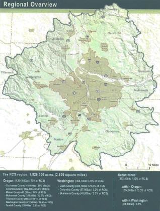
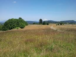
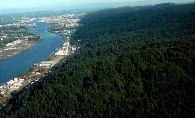

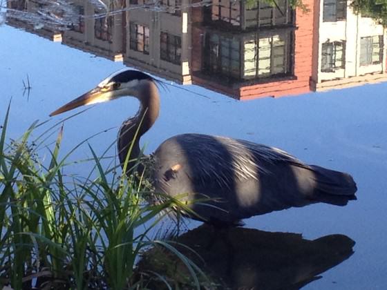
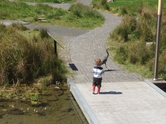
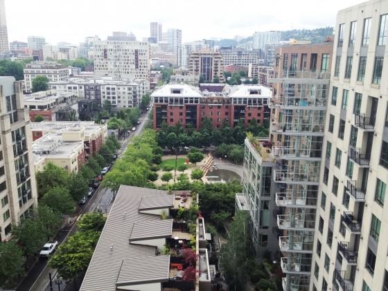
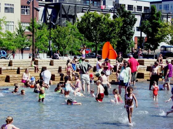
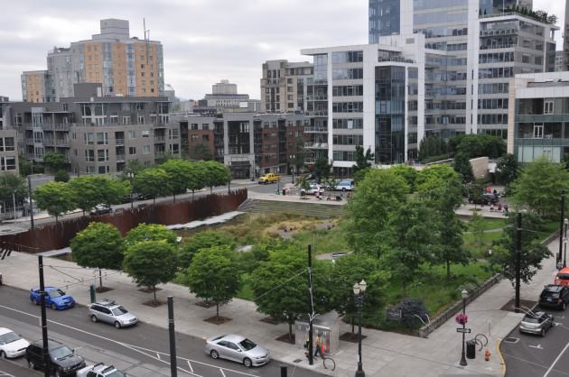
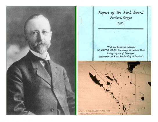
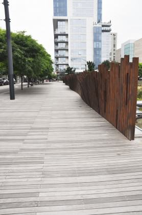
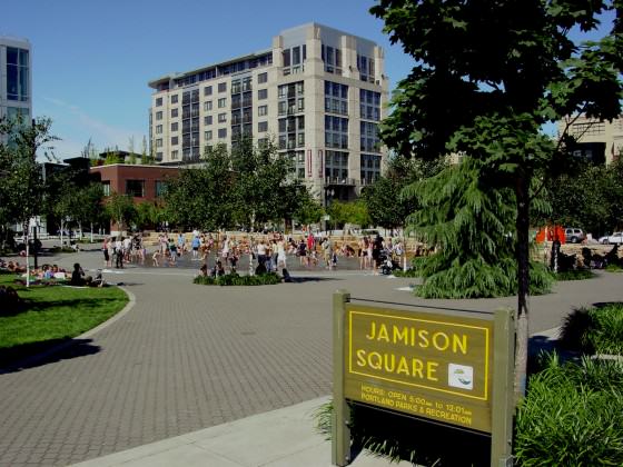
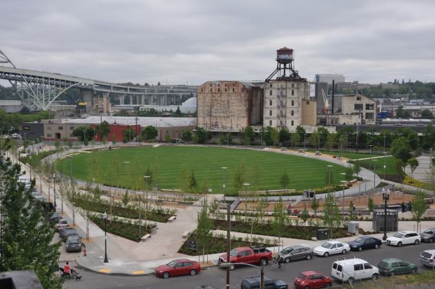

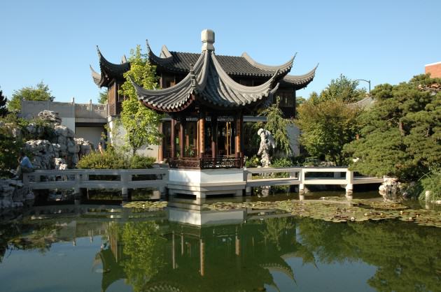
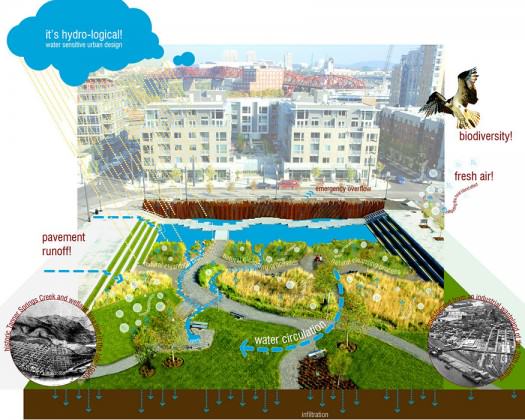
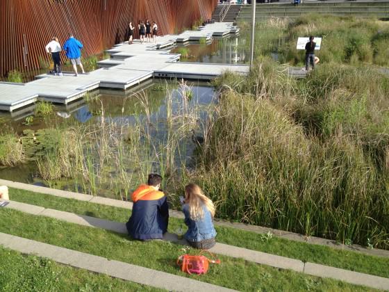
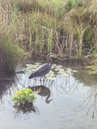
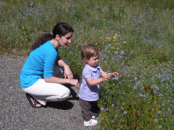
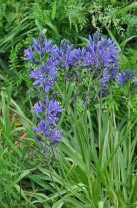
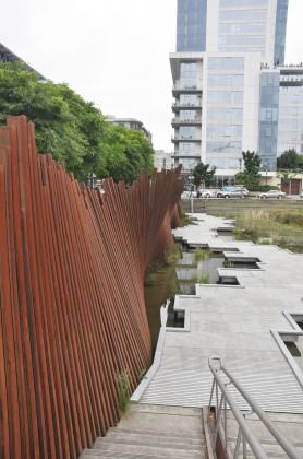

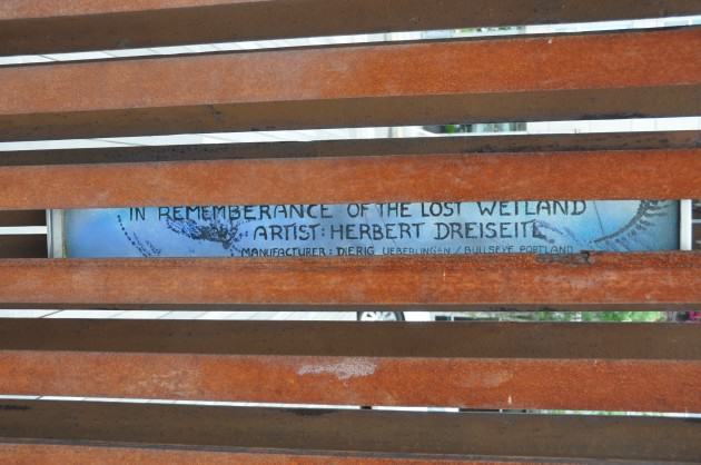
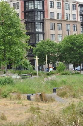
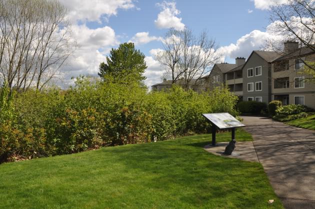
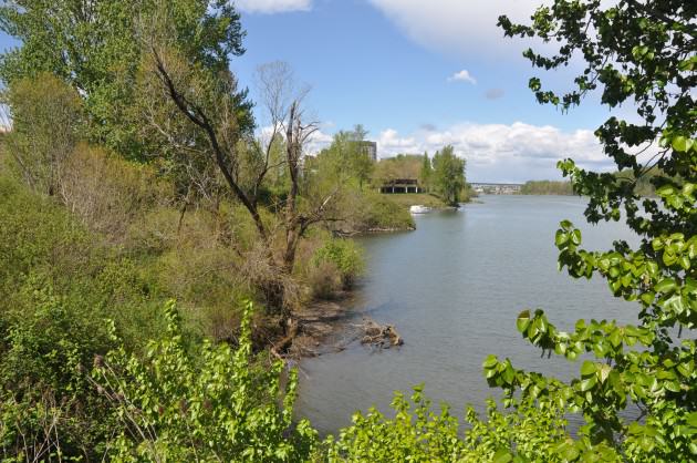
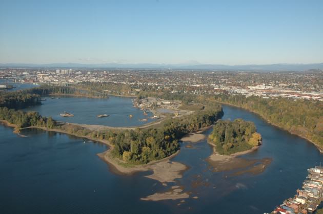
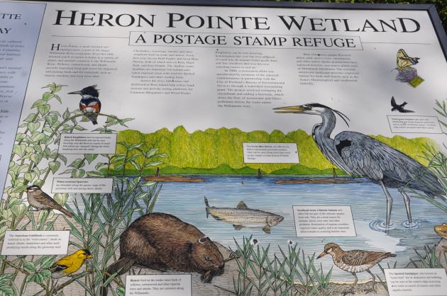

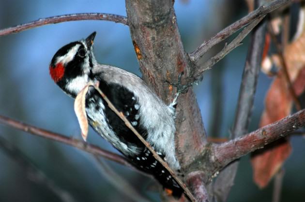

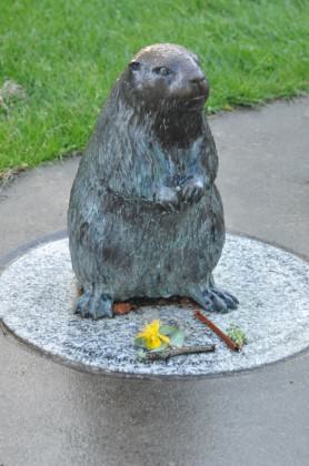

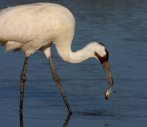


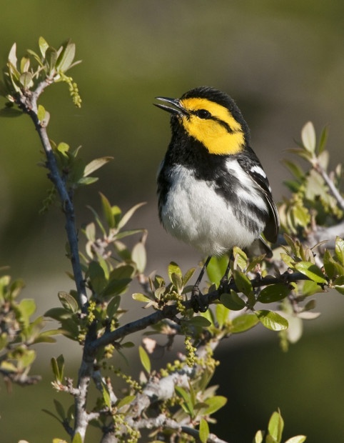
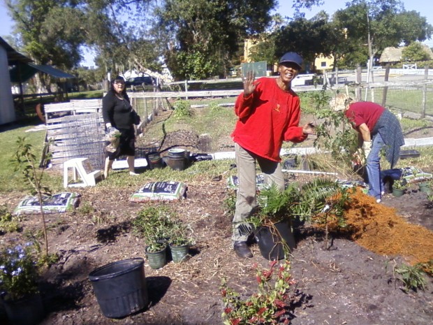
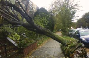
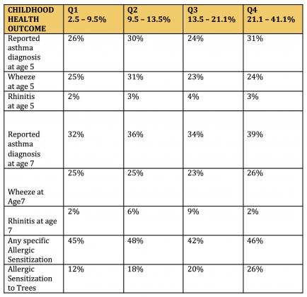
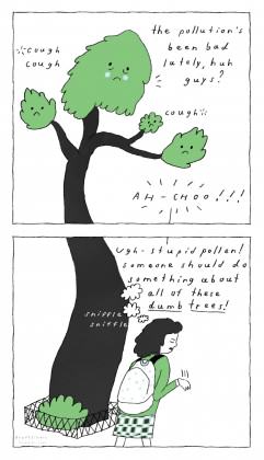
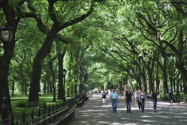
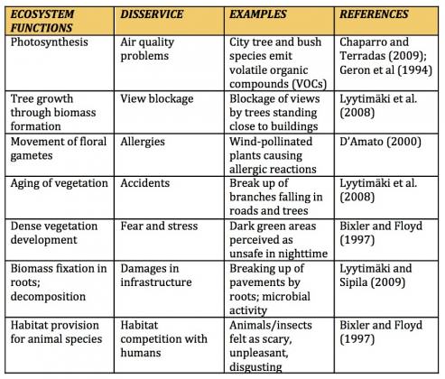
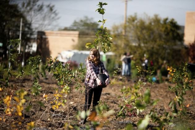
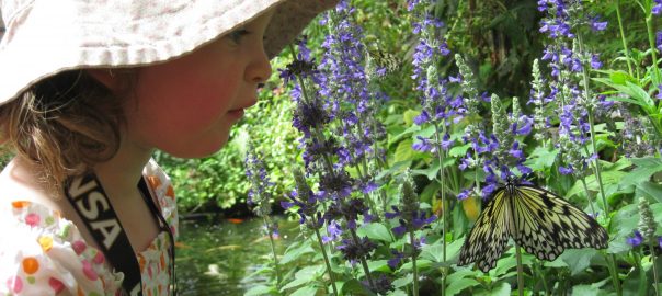


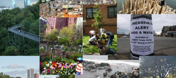
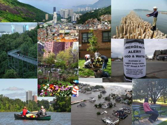 For example, we can imagine sustainable cities—ones that could persist in resource, energy, and ecological balance—that are nevertheless brittle to shocks and major perturbations. That is, they are not resilient. Such cities are not truly sustainable, perhaps, but their lack of sustainability is for reasons beyond our usual definition of sustainability.
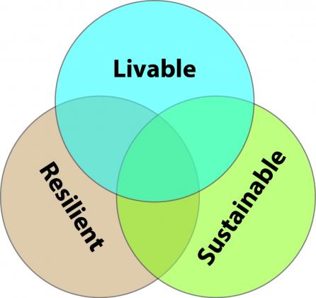 Challenge #1: Take the concepts of resilience, sustainability and livability beyond metaphorical status…make them operational by being specific
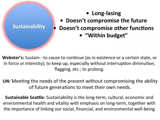
 Challenge #2: Acknowledge and confront the differences between resilience, restoration and resistance
 The same benefits accrue to other green and blue infrastructure programs that promote resilience, livability, sustainability and social engagement: people get locally engaged in projects that benefit them in multiple ways.
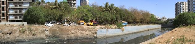
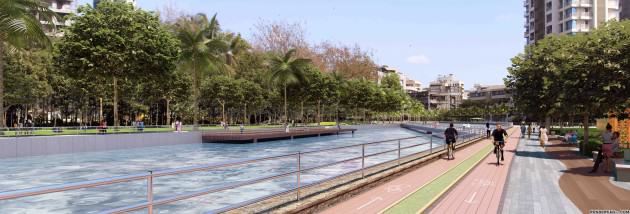
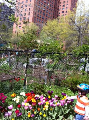
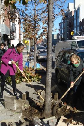
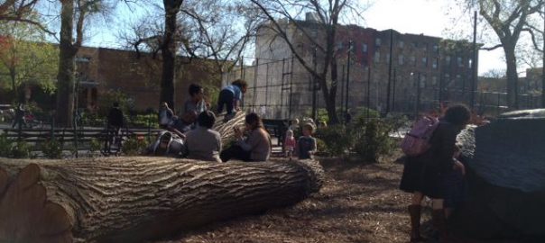
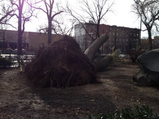
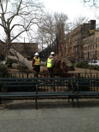 For decades, this stately little
 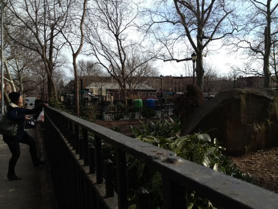 Working for the
 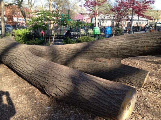 Earlier this spring, I had the honor to introduce a special lecture on ‘The Benefits of Urban Trees,’ by U.S. Forest Service scientist,
 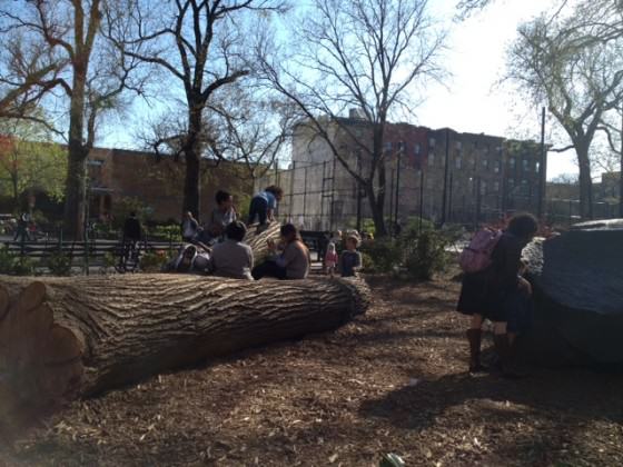 Back in Carroll Park, there is an active group of park volunteers. The storm’s aftermath has sparked a great deal of activity in terms of clean ups and repair. I’m not certain who led the decision to leave a significant portion of our downed tree alongside the rock or even what exactly they had in mind in doing so. I do know that many of my neighbors have whispered in passing, “I hope they leave it on the ground.” In my own wanderings around the park, I’ve observed a wide range of people, young and old, pause to admire the downed tree. Neighborhood children delight in touching it, climbing it and being in the company of this old friend.
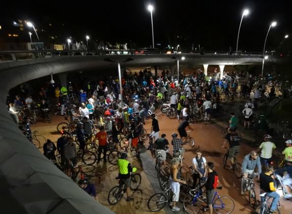
 My interest in these re-words stems from the broader philosophical underpinnings of my work on
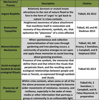
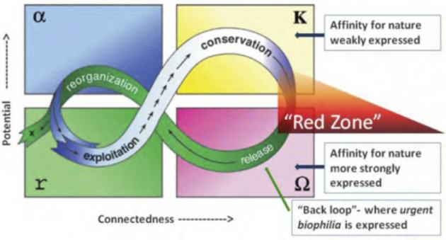
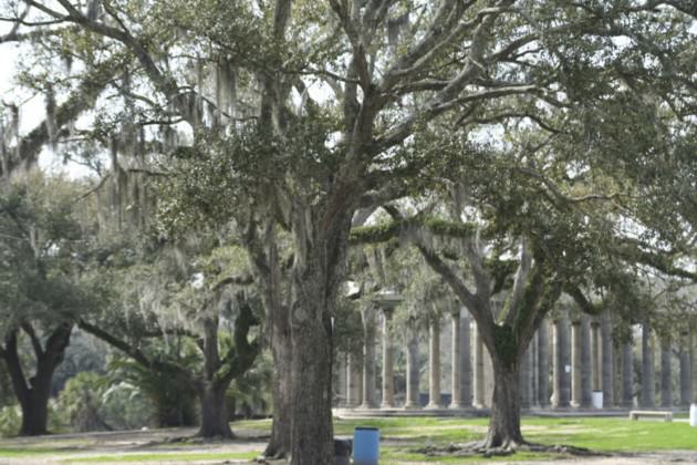
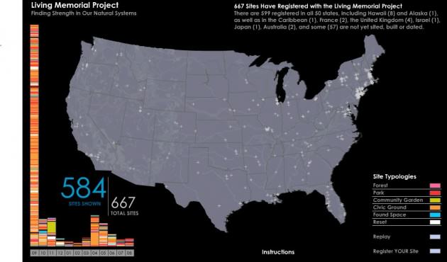
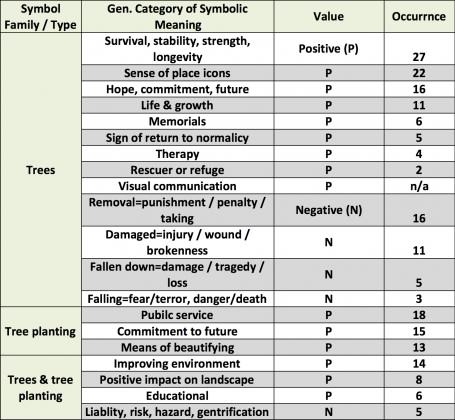
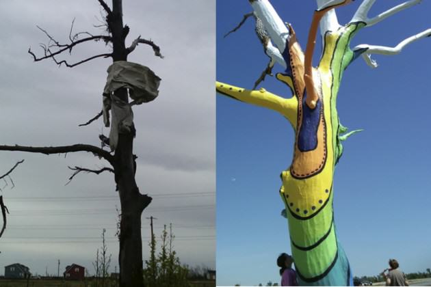
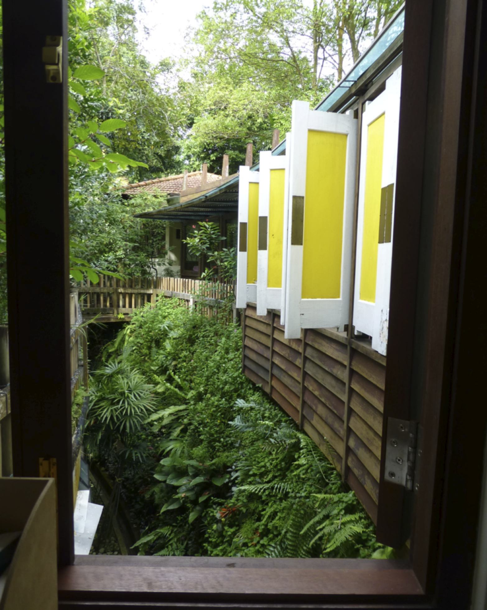
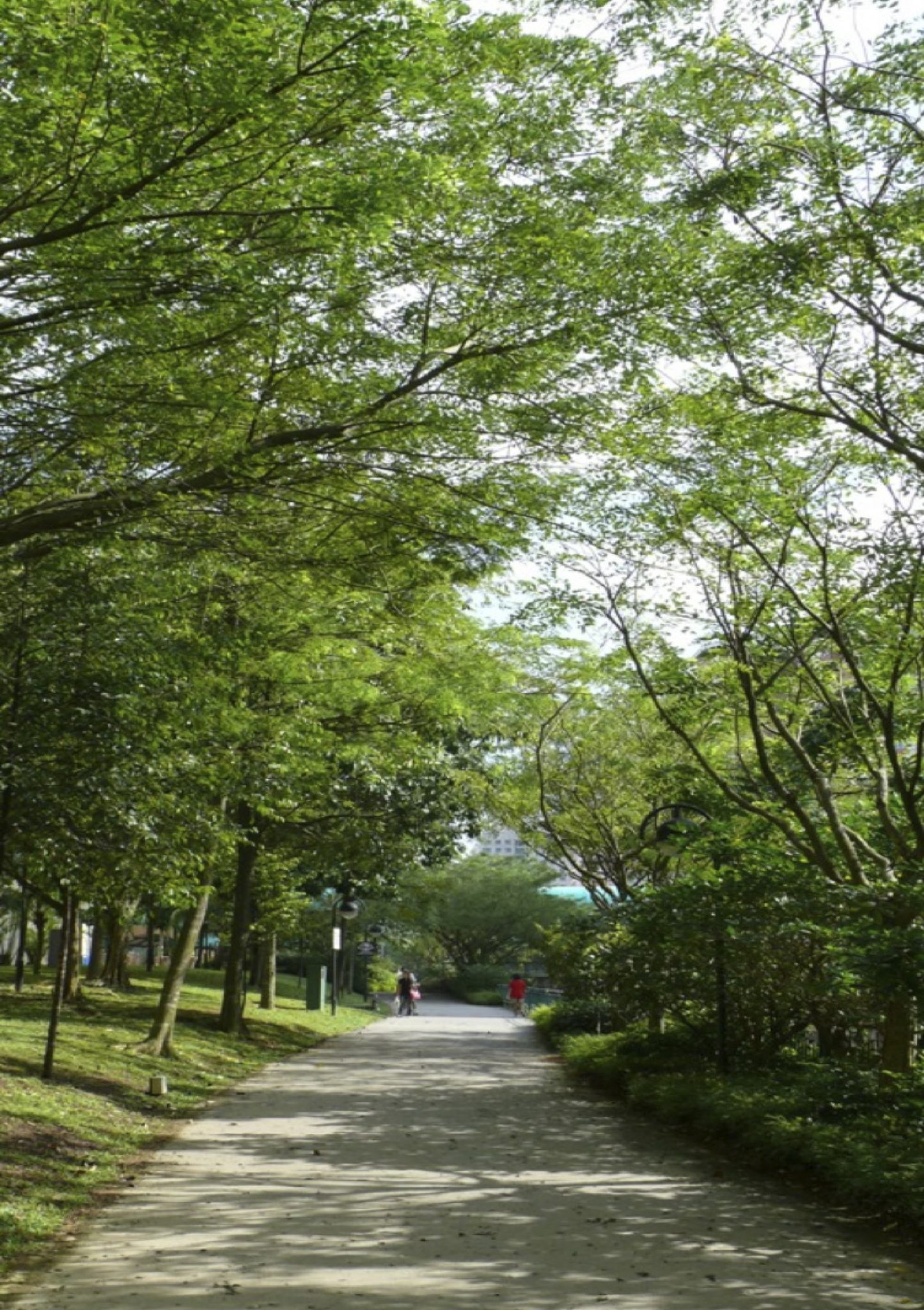
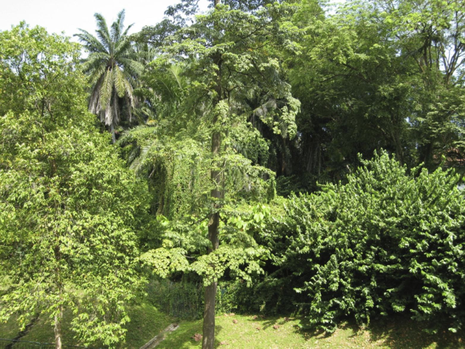
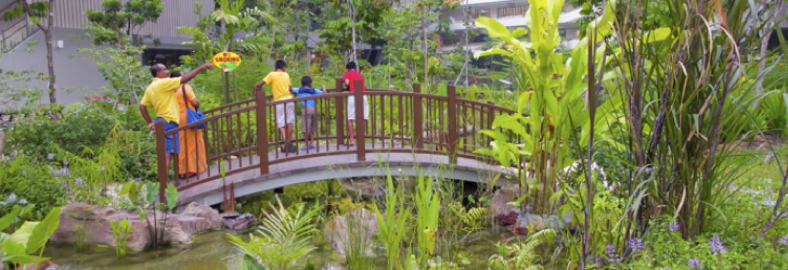
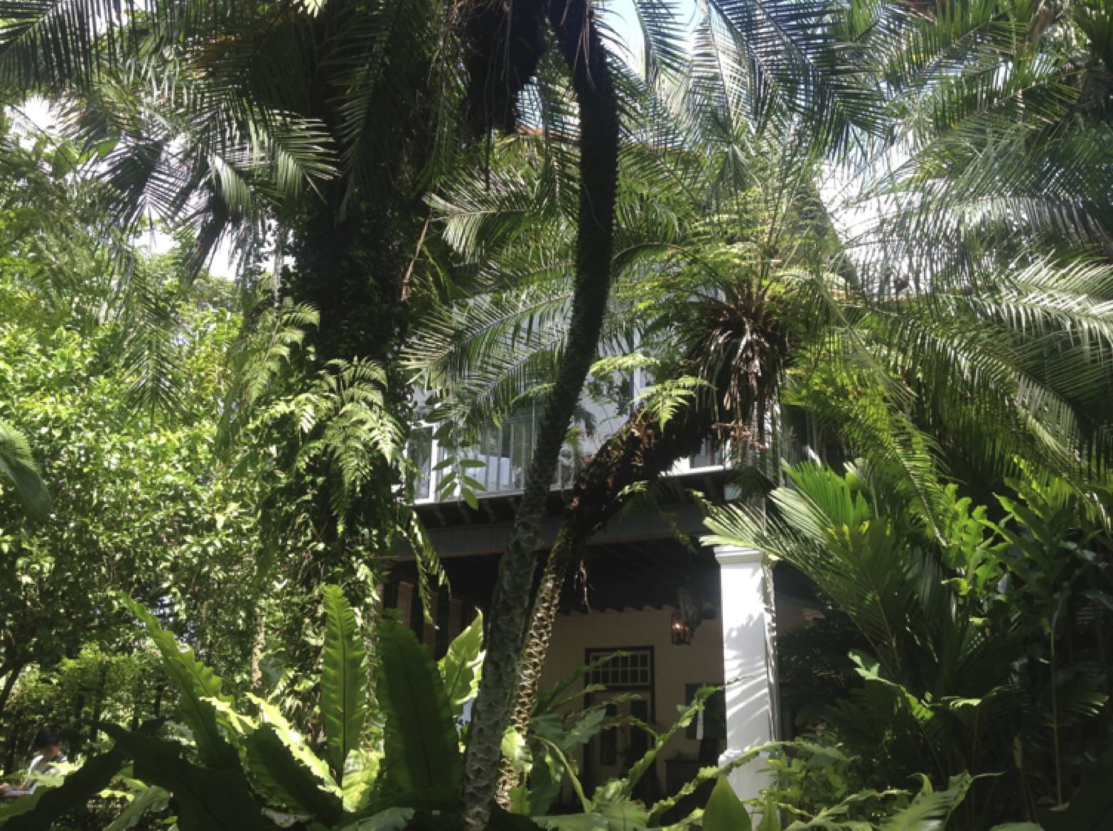

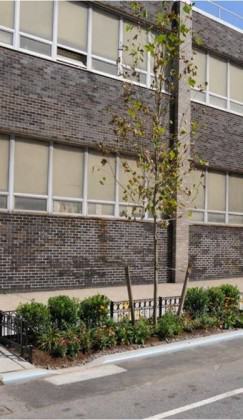
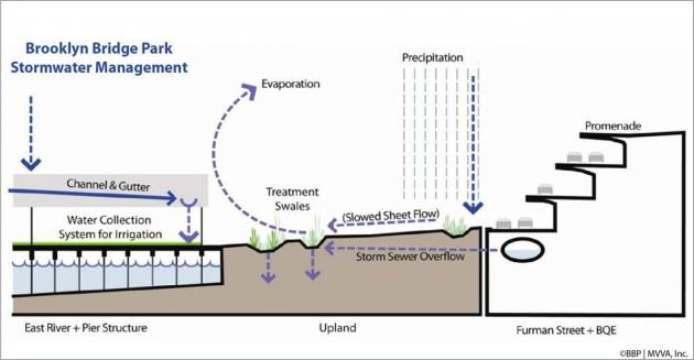
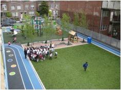
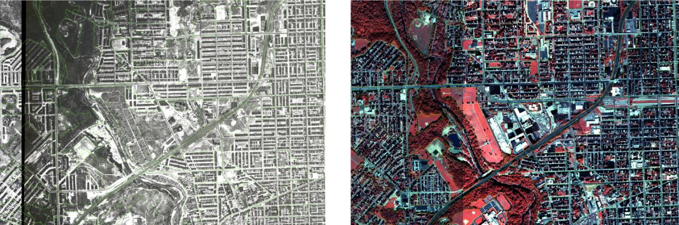
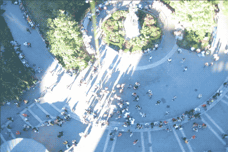
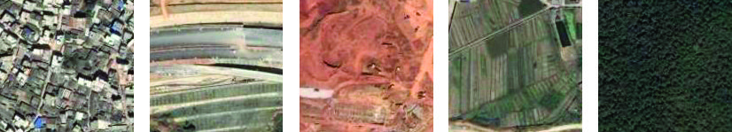
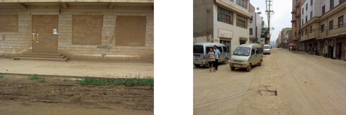
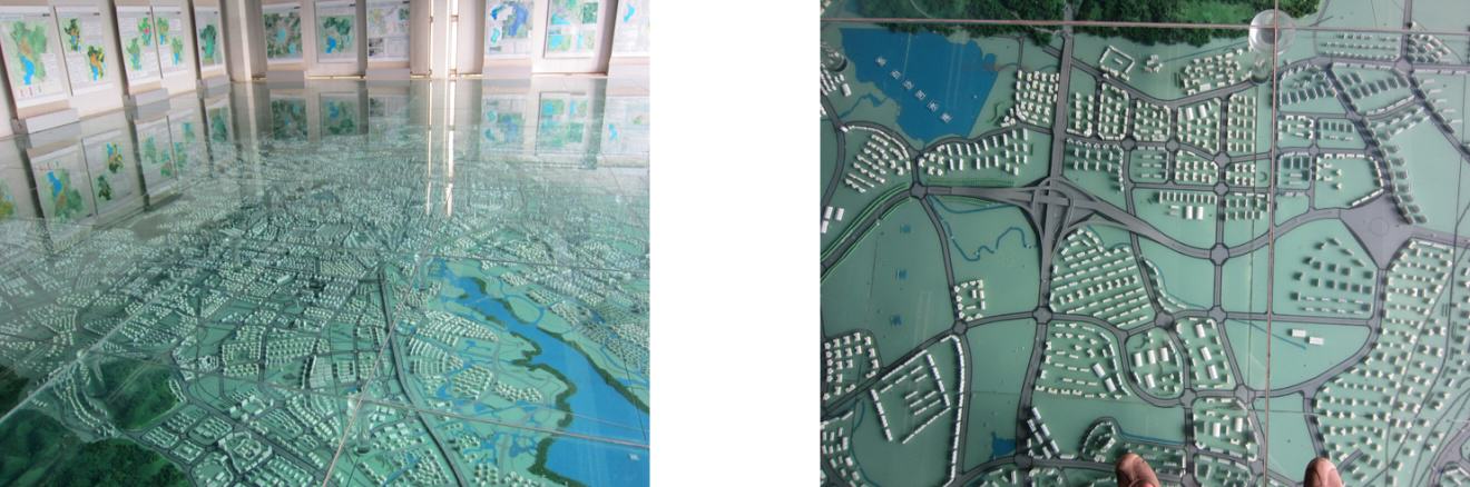
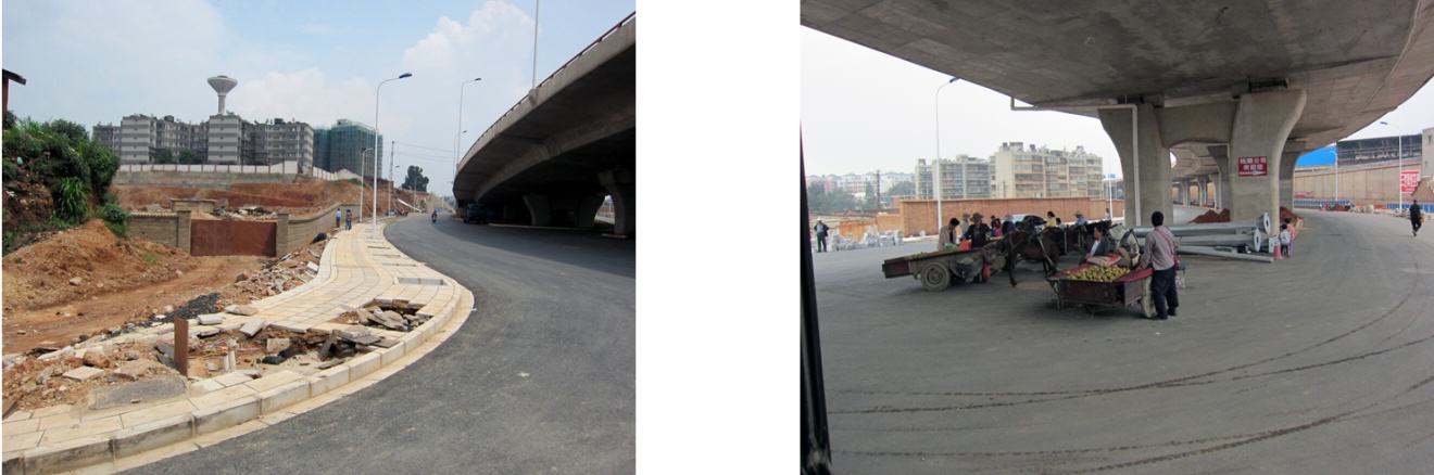
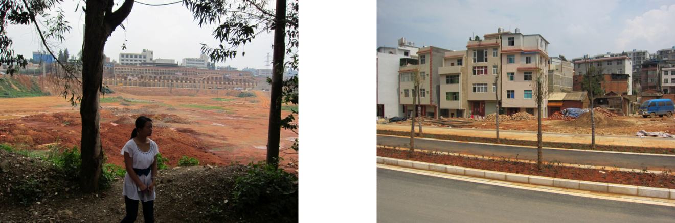
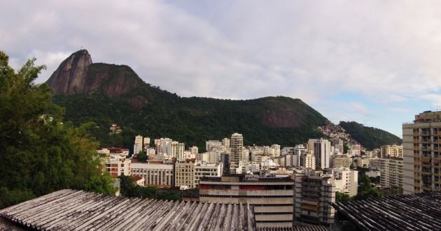

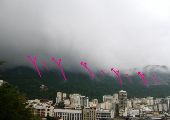
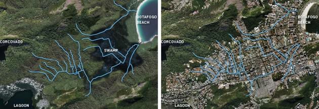
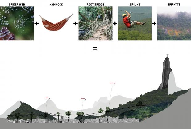

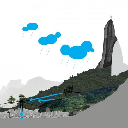
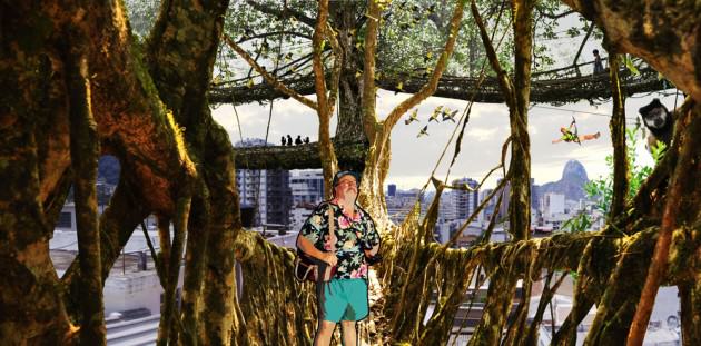


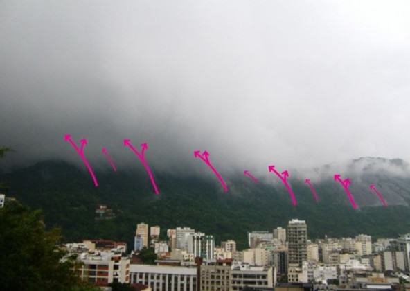
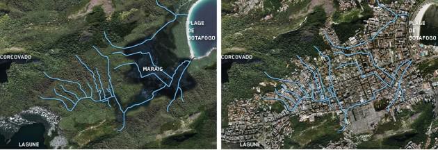
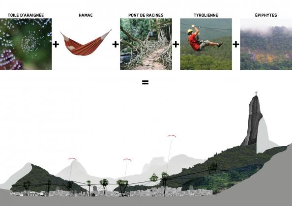
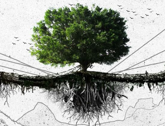
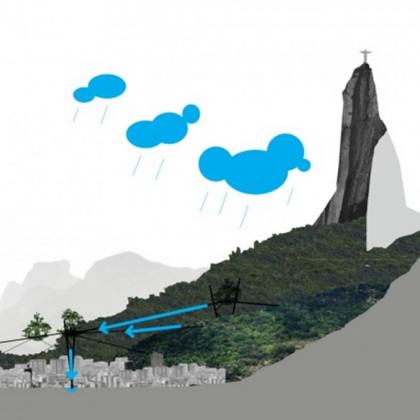

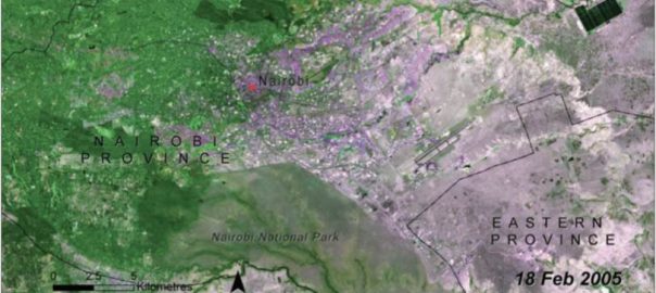
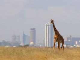
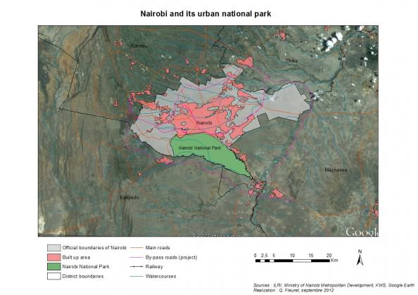
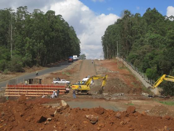
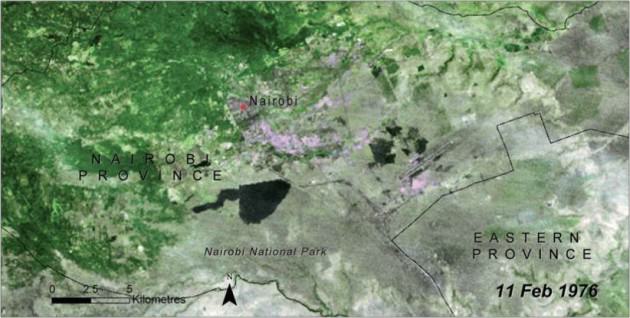
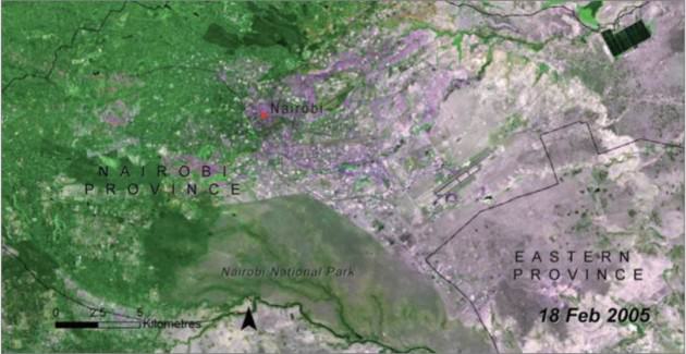

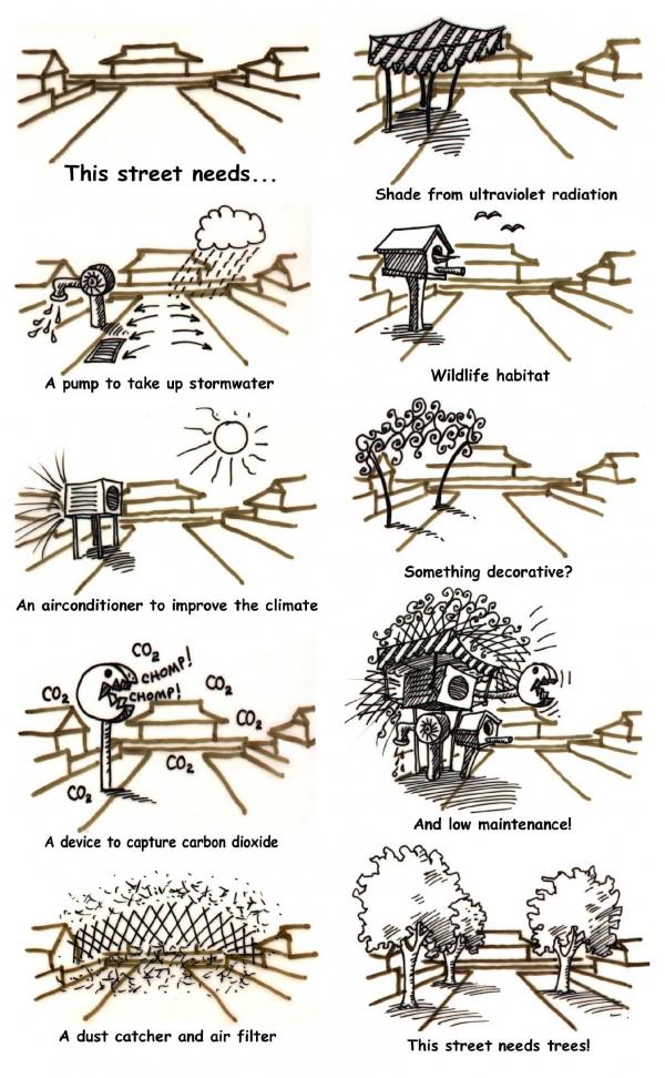

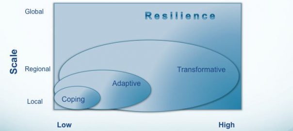

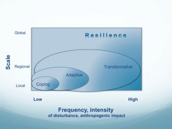
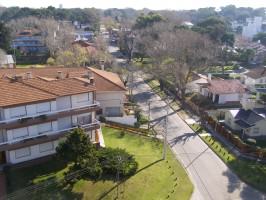
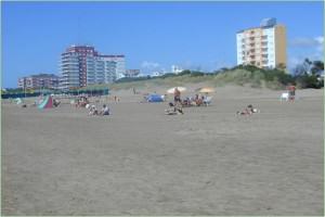
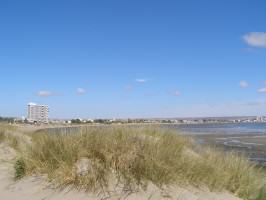
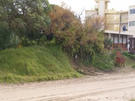
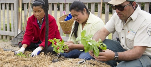
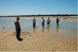
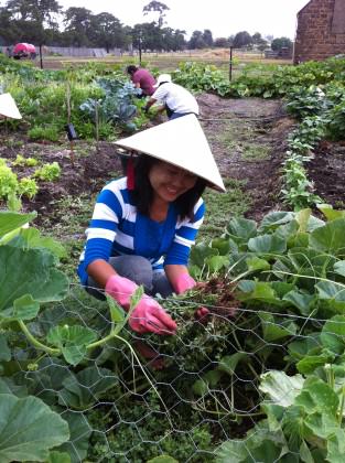
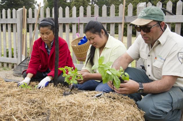


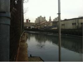
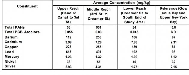
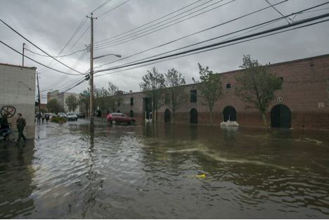


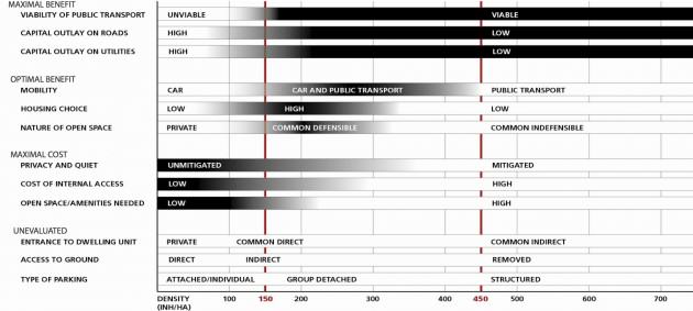
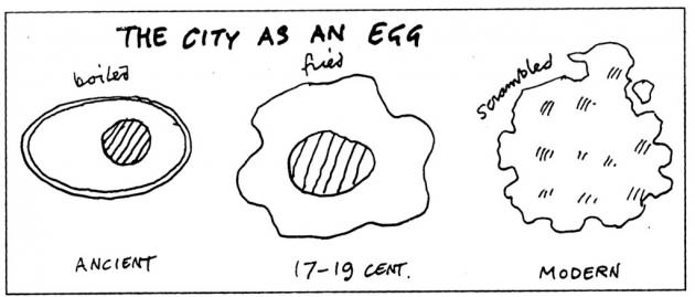
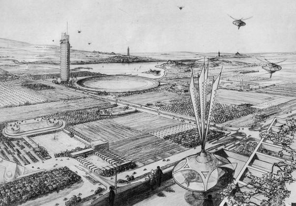
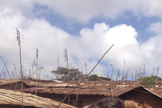
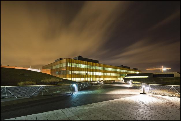
6 Comments
Join our conversation