What’s Next? Learning From Nature During Lockdown

Many voices. Greener cities. Better cities.
Every month we feature a Global Roundtable in which a group of people respond to a specific question in The Nature of Cities.
show/hide list of writers
Hover over a name to see an excerpt of their response…click on the name to see their full response.
Elmaz Abinader, Oakland Here I sit in California where fire is consuming the hills. Today, they say, prepare to evacuate. The city of my obsession is in shambles: Beirut is changed forever.  Lebanon, we are at the beginning again. You reach out. I take your hand.
Anne Brochot, Paris To support oneself in a vacuum does not mean believing in a possible vessel that carries the vacuum. No, emptiness is merely our condition.
Joyce Garvey, Dublin I will commit to persuading a prominent local business to commission from me a piece of environmental art which I will complete without charge, in return for their public commitment to appoint an environmental officer to their business.
Leslie Gauthier, New York My deck is an ecosystem: bumble bees and blue-winged wasps, grasshoppers, ladybugs, spiders. More, too. But I’m still learning.
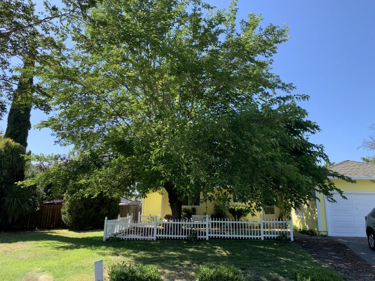
Jane Ingram Allen, Santa Rosa During these months of isolation, I have had time to reflect and make art and also to start a vegetable garden; to make paper “from scratch” in my garage studio using the bark of the mulberry tree in my front yard.
Frances Mezzetti, Dublin A world with making less the pressure as we set Zoom up and move in our respective garden or spaces and tune into each others movements through the flatness of the screen to connect and open up a space of consciousness, to imagine, to create!
Munira Naqui, Portland I settled down to be in the gentle rhythm of nature. Watched the signs of Spring as the snow heaps diminished and the woods slowly stirred into life with shades of green. This is when I started to pine for human presence and got restless.
Carmen Bouyer

About the Writer:
Carmen Bouyer

Carmen Bouyer is a French environmental artist and designer based in Paris.

Introduction

In order to keep a trace of the major collective experience we all went through during quarantine time, Anne Brochot, and myself as an invited artist at Cour Commune, launched a program called « Et Après? » (what’s next?) throughout the Summer. Cour Commune is a third place that includes a printing studio, visual art residency, and communal garden, based in an ancient 19th century shop located in Voulx, a small village 100km south of Paris.

We invited neighbours and friends to write about what they lived during quarantine, what they learned, what became obvious to them and what they wished for the future while confined in their homes. We are extending here, on The Nature of Cities platform, our collective inquiry, opening it to a larger network of artists living around the globe and focusing on the relationship to nature. We are exploring here how artists’ relationships/or non relationship with nature have moved them during lockdown. What kind of nature experience did they have during quarantine? How did it manifest itself? What teachings did those experiences convey?

To you too, who is reading these lines, we invite you to reflect on how your relationship to nature has been or is shaped by this time: what is standing out that needs to be remembered and put into practice?

Anne Brochot

About the Writer:
Anne Brochot

In 2012 Anne created CourCommune, an artistic third place located 100 km from Paris, which she animates in the spirit of Robert Filliou: "Art is what makes life more interesting than art". The way of life, around a workshop space and a garden, is participative and inspired by the regrowth movement.

Anne Brochot

To support oneself in a vacuum does not mean believing in a possible vessel that carries the vacuum. No, emptiness is merely our condition.
EN
I created CourCommune in 2012 and we moved into an old village grocery store in 2016. We welcome artists in residence and organize many other events. A month before the lockdown we needed to shore up the cellar, which was threatening to collapse. We are in full lockdown, we realize that our foundation is fragile and the building could collapse. We cover the entire studio and the masons tear up the floor. I move my office upstairs, just above where they are working.
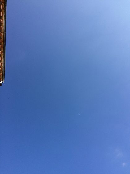
The sky, with the edge of the roof of CourCommune’s house. And far away in the middle, the moon. Photo: Anne Brochot

May 5th. Since 8 a.m., the jackhammer has been breaking through the concrete mass supporting a brick pillar in the cellar that has exploded under the weight of the two-storey building. Several tons rest on a few poorly mortared bricks. Suddenly, I hear a crashing, metallic noise and feel vibrations, then, silence. In the wall just behind me, a series of crystalline, musical sounds; the particles of the plaster tearing. For two seconds, the floor shifts, almost imperceptibly. A barely audible crackling sound and it’s over. Gravity has provided the structure with new-found stability.

During the few seconds it takes for the weight to transfer from one reinforcement to another, I feel the words of the psychoanalyst Jean-Pierre Lebrun “to support oneself in the void” pass through me. To support oneself in a vacuum does not mean believing in a possible vessel that carries the vacuum. No, emptiness is our condition. Yet, we need to exist and possess skills, to reflect and to concentrate during the moment when, for however long and for whatever reason, individually or collectively, we will have only the void as our only support.

FR
J’ai créé CourCommune en 2012 et nous sommes rentrés dans une ancienne épicerie de village en 2016. Nous y accueillons des artistes et bien d’autres choses. Un mois avant le confinement nous avons dû étayer une cave qui menaçait de s’effondrer. Nous sommes en plein confinement, nous constatons que nos fondations sont fragiles et le bâtiment nous parle d’effondrement. Tout l’atelier est bâché, le sol est ouvert, les maçons travaillent. J’ai monté le bureau à l’étage, je suis installée juste au dessus des maçons.

5 mai. Depuis 8h, le marteau-piqueur défonce le massif de béton supposé soutenir un pilier de briques dans la cave et le pilier lui-même. Ce dernier a explosé sous la charge de l’étage et du toit. Plusieurs tonnes reposaient sur quelques briques mal maçonnées. Puis des bruits de masse, un bruit métallique, des vibrations, et le silence. Et là dans le mur juste derrière moi, des crépitements minuscules, une série de sons cristallins, musicaux ; les particules du plâtre qui se déchirent. Pendant 2 secondes, l’étage se repose sur un appui qui descend, imperceptiblement. Un craquement à peine audible et c’est fini. Le principe de gravité a redonné à la structure une nouvelle stabilité.

Pendant les quelques secondes nécessaires au transfert d’un appui à l’autre, j’ai senti passer en moi l’expression du psychanalyste Jean-Pierre Lebrun « se soutenir dans le vide ». Se soutenir dans le vide ne veut pas dire croire en une possible propriété porteuse du vide. Non, le vide est notre condition. Mais il faut des étais, du savoir faire, de la réflexion, de la concentration autour du moment où, pendant un temps plus ou moins long et pour quelque raison que ce soit, individuellement ou collectivement, nous n’aurons que le vide pour seul appui.

About the Writer:
Elmaz Abinader

Elmaz Abinader is the author of two poetry collections, a memoir, Children of the Roojme and several plays. This House, My Bones was the Editors Selection 2014 for Willow Books, and In the Country of my Dreams won the Oakland PEN award for poetry. She is a co-founder of VONA—the workshop for writers-of-color. She lives in Oakland, CA.

Elmaz Abinader

The Collapse in the Quiet

…imagine looking down on earth, seeing marionette strings
that once kept it afloat in the black current.
Think of every moment breath swept through you,
unremarkable. Your heart squeezing a handful of red petals//…
           — “After” by Ruth Awad in Set a Music to Wildfire

Here I sit in California where fire is consuming the hills. Today, they say, prepare to evacuate. The city of my obsession is in shambles: Beirut is changed forever.  Lebanon, we are at the beginning again. You reach out. I take your hand.
Lebanon, I had put you to rest this summer. Smoothed the last page of the book that cost years of research, interviews, translations, and visit. Thrashed out the differences between interpretations, replayed old news videos like they were dear home movies, called out to the soldiers in every army, to the children hiding under the bed; to the women cooking hot in the bomb shelters. I studied your war — our wars — more deeply than my family tree.

I had put you, the book, Almost a Life, to rest in the quiet. World struck with fever, I had to figure out how to sustain and develop the story of Dede from the shelter of my porch overlooking the looming redwoods and blossoming peach tree. There was no other way to approach the chaos of the civil war, except in the company of the fierce rotations of nature, where death brings life, and decomposition feeds new bodies. I sat in gardens filled with wild tomato vines, in giant forests where treetops fused together, on empty beaches, feet dug into sand, words resting on my knees. Dreaming in an Arabic that was colloquial, illiterate and insufficient, I finished, confidently, I thought.

But Lebanon, you did not let me go. My eye drifted from one news story to the next, to the view of Beirut: the port, the Corniche, the night clubs, the restaurants, Pigeon Rock. I stepped in the shoes of my mother and father’s promenades, my own strolls along the beach, the lingering on the rail watching the fishermen and their long rods.

And then you exploded: the first time, a tremor in the chest; the second — I rose and fell and rose again. A gasp that has not exhaled. When a city explodes, the air becomes inhabited with flying glass, the sea burns a sickening ash, the trees in Martyr’s Square collapse as if they were never rooted. When a city ignites, all is fire: the frantic rush to rescue a body, the words calling for help, the hearts who don’t imagine what can survive or how they can live. Just like that, the cells have shifted, in every living thing.

I have not let go, after all. Here I sit in California where fire is consuming the hills. Today 367 wildfires. Today, they say, prepare to evacuate. Where I wrote is off-limits; do not go outside. The city of my obsession is in shambles: Beirut is changed forever.  Lebanon, we are at the beginning again: wondering how it will go, how the story will end. You reach out; I take your hand.
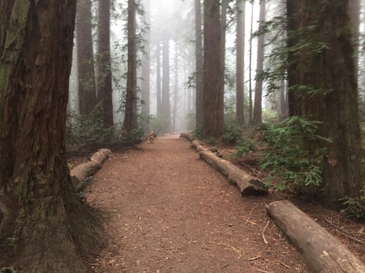
Photo: Elmaz Abinader
Frances Mezzetti

About the Writer:
Frances Mezzetti

Frances is a visual artist and works in live art, video and sound, with performances nationally and internationally. At present she is exploring connections through technological inter - actions in various groups. Her work is mostly collaborative, choosing to develop projects on relationships with other humans within the environment.

Frances Mezzetti

A world with making less the pressure as we set Zoom up and move in our respective garden or spaces and tune into each others movements through the flatness of the screen to connect and open up a space of consciousness, to imagine, to create!
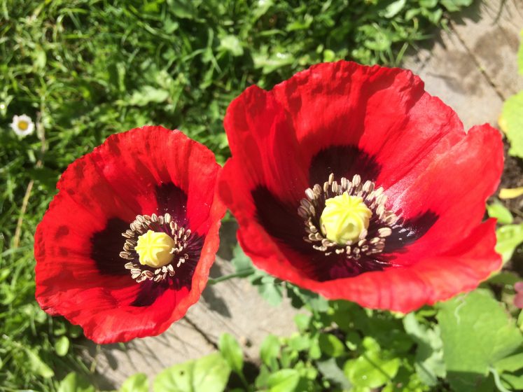
Lockdown, a halt to the free flow of coming and going, for some, the age of privilege is gone. The choice of how, where, when to travel or not is curtailed, for now, for how long? The concept of time is challenged.!

It’s Springtime. Nature is taking her time. The red poppy welcomes the bumblebee! There is a quietness, a silence in the sky, an absence of the heavy reverberation of jet engines overhead, no white tail streaks across the blue. Blackbirds, robins and twittering sparrows, thrill us with their singing. Pause in the still morning barefooted on the grass, the ground is hard for lack of rain. Feel blessed to have this space to go outside! The streets are empty. It’s the script of a movie of the end of the world. The questions is: Is it ? What have we done? What are we doing to this beautiful planet to these/us endangered species? Busyness is slowing down. Fear meets us from the TV, the pandemic, with daily statistics of contagion and deaths. This is not just a local hiccup, a town in flux, a city ground to a halt, a country watching, waiting, a continent, a globe suspended in time. While borders are closing, people are opening up to each other across fences, balconies, reaching out but not touching, sending vibrations of care like the opera singer in Milan!!

Time to reflect and to envision for the future!

A kinder, compassionate world, softer, listening to nature, to her creatures, to what matters. A world with making less the pressure as we set Zoom up and move in our respective garden or spaces and tune into each others movements through the flatness of the screen to connect and open up a space of consciousness, to imagine, to create!

Jane Ingram Allen

About the Writer:
Jane Ingram Allen

Jane Ingram Allen creates environmental art projects around the world using natural materials and collaborative processes to raise public awareness about environmental and social issues. Allen also curates international environmental art projects and writes about sculpture and environmental art for publications such as SCULPTURE, PUBLIC ART REVIEW, and ART RADAR ASIA.

Jane Ingram Allen

During these months of isolation, I have had time to reflect and make art and also to start a vegetable garden; to make paper “from scratch” in my garage studio using the bark of the mulberry tree in my front yard.
I have been quarantined at my home in northern California since mid-March. Most of the US, California and our county still have a rising number of COVID-19 cases, so we expect to be quarantined longer.  The future is very uncertain, and my art projects have mostly been postponed until 2021.

During these months of isolation, I have had time to reflect and make art and also to start a vegetable garden. One art project I set for myself is to create a mixed media painting each week on handmade paper I create from plants in my own yard. I call these works “Quarantine Flowers”.  I wanted to do something hopeful and uplifting, and the colorful flowers were particularly appealing. These paintings depict flowers that were blooming in my yard during the Spring months of quarantine:  pink apple blossoms, blue oxalis, cream orchids, golden poppies, yellow sunflowers, and red nasturtiums.

During the quarantine I made paper “from scratch” in my garage studio using the bark of the mulberry tree in my front yard. Making paper from plant materials involves gathering the bark, cooking it, beating it to a pulp and then forming the sheets. Mulberry bark is one of the best plant fibers for papermaking; paper mulberry bark is used in Japan to make some of the finest paper in the world. My mulberry tree is not the same one that is used in Japan, but it is from the same plant family. The mulberry bark paper is thin and strong when done in my modified Asian style. This Zoom program now available online shows my process for making paper directly from plant materials.

Joyce Garvey

About the Writer:
Joyce Garvey

Dr Joyce Garvey is a Scottish born visual artist and writer, living and working in Ireland. She is a graduate of the National College of Art and Design in Dublin with an ANCA and BA majoring in Fine Art and holds an MA in Film and a PhD in Creative Writing. She has written a trilogy of books on "women living in the shadow of famous men".

Joyce Garvey

I will commit to persuading a prominent local business to commission from me a piece of environmental art which I will complete without charge, in return for their public commitment to appoint an environmental officer to their business.
CHANGE

One of the few positives of the COVID-19 pandemic has been lockdown’s beneficial effect on the environment.

Although climate change has temporarily slowed,  because of Covid restrictions, it is still accelerating the destruction of the planet’s life support systems and the decline of species that humanity depends upon.

Since being presented with a beautifully preserved and intact dragonfly during an art residency in Courcommune, Voulx, France, my particular interest has been this wonderful insect whose symbol is change.

Therefore I was disturbed to read a UN report (March 2019) which noted a catastrophic decline in the abundance and diversity of insects, particularly the dragonfly.

Change is the key?

Every day during lockdown I walked to a local graveyard where I sat quietly  and undisturbed and drew the glory of nature.

The question I asked was: Could I do anything through my art to preserve this beneficial effect that lockdown was having?

Inspired by the dragonfly, I devised a plan called:

The Art Challenge”

Simply: I will commit to persuading a prominent local business to commission from me a piece of environmental art which I will complete without charge, in return for their public commitment to appoint an environmental officer to their business.

Through social media’s art societies, I will create a viral campaign challenge involving tens of thousands of artists in every city/town and village worldwide.

Challenges on social media, like the ice bucket challenge,  promoting awareness of the disease ALS, worked incredibly well for charity. They can be equally successful for nature.

The positive publicity would raise the profile of artists, and businesses involved would save money too in sustainability.

But the greatest beneficiary would be us, and the wonderful, natural world we live in.
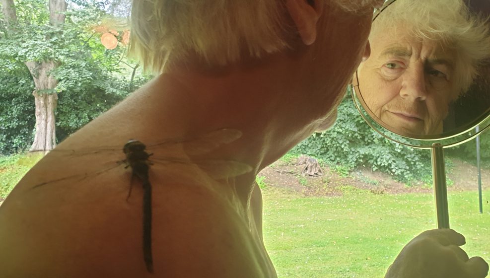
The Artist and the Dragonfly. Photo: Joyce Garvey
Leslie Gauthier

About the Writer:
Leslie Gauthier

Leslie Gauthier is an interdisciplinary artist based in Brooklyn, NY. Her writing has appeared in The New York Times and Paste Magazine. Leslie wrote, produced and performed in 23-Year-Old Myth as part of Theater for the New City's Dream-Up Festival. Her short film, “The Astronaut Hour”, was recognized by the International Independent Film Awards in 2019.

Leslie Gauthier

Brooklyn, Summer 2020

Every morning since April I wake up and greet the plants. We prepare each other for the day.

My deck is an ecosystem: bumble bees and blue-winged wasps, grasshoppers, ladybugs, spiders. More, too. But I’m still learning.
We watched the neighbors chain smoke and move back to Moscow because “they just can’t with America right now”; the refrigerated trucks come and leave Brooklyn; the arrival of the house finches and mourning doves in May, and their departure in July when the airplanes returned.

In June, protests streamed by the apartment nightly, and the plants grew with the movement. They stood in solidarity when the helicopters hovered, trying to intimidate.

The garden shook as I did when the mysterious professional-grade fireworks exploded in the peaceful summer sky. Are they trying to desensitize us?
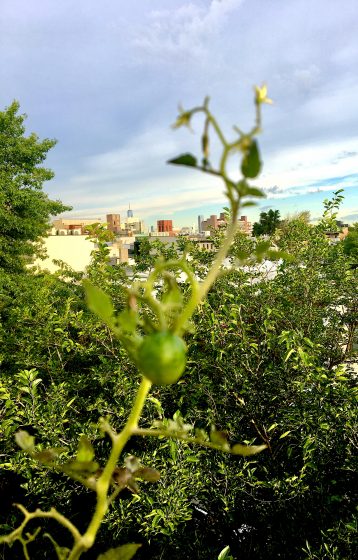
Photo: Leslie Gauthier

We wilted in July: dried leaves, aphids, high heat / anxiety and insomnia. Remedies: hydration, potassium, Klonopin, early-morning yoga, the courage to try new spaces and the trust to grow into them. There were miracles — a cucumber on what I thought was a tomato plant. There were casualties: the cilantro, RIP.

A fighter jet flew over Brooklyn yesterday. The windows rattled, worse than the fireworks.

How can an American — an immigrant — right the wrongs done to this land? How can I make myself indiginous to a place my ancestors didn’t know? How will I survive the conflict I fear is coming? Do people garden in wars?

Manhattan’s buildings stand empty and gray across the river. My old life a backdrop to a smaller but generative one — full, colorful, and a home. My deck is an ecosystem: bumble bees and blue-winged wasps, grasshoppers, ladybugs, spiders. More, too. But I’m still learning.

Munira Naqui

About the Writer:
Munira Naqui

Munira Naqui is a visual artist who was born in Chattogram, a bustling port town on the coast of Bay of Bengal which is now Bangladesh. She now lives in Portland Maine, a beautiful coastal town at the edge of the Atlantic Ocean and works in her studio tucked in the woods across a pristine lake. Her work is abstract, concrete and reductive in nature. To her painting is a form of language that gives shape to a space for contemplative engagement.

Munira Naqui

Light, like life, can be delicate,

fragile, unique, volatile, ethereal.
But of unbearable lightness.
Let me dream reality, another reality

—Fernando Pessoa

I settled down to be in the gentle rhythm of nature. Watched the signs of Spring as the snow heaps diminished and the woods slowly stirred into life with shades of green. This is when I started to pine for human presence and got restless.
It was still deep winter here in Maine. COVID-19 was sweeping across continents shutting down the world. My quiet little town went into “lockdown”. The winter skies were grey and there was an ominous feeling of doom as people stayed in and everything closed. After several weeks of isolation in town we took refuge in our cottage on the lake near my studio in the woods. I thought I would work on my unfinished paintings in my studio while I waited for the crisis to be over. I found it hard to concentrate even harder to continue working on the work conceived in the past as I felt the ground shift. I realized a pause was needed.

It was very quiet at the lake. Not unusual for that time of the year. Most of the cottages were closed down for the season. The lake and nature here was on its normal schedule. Nothing had changed here. I found that reassuring as I felt the human part of my world descending into chaos.

I settled down to be in the gentle rhythm of nature. Watched the signs of Spring as the snow heaps diminished and the woods slowly stirred into life with shades of green. The chartreuse of leaf buds changed into  deeper forest green, the drama of the ice melt on the lake as  its surface changed from white to dark patches and finally into the color of water. The birds got busy building nests, the tree frogs chirped. The sun had changed its angle and I discovered new shadows. The lake was ready for people to return but no one came. This is when I started to pine for human presence and got restless. We also realized with the way the public health crisis was handled we were in for a long haul. It made me sad to think that all my travels were cancelled. I wouldn’t be going to Cour Commune for my residency this year. Worse, I would not be able to visit my mother in Bangladesh or see my grandchildren in far away states.

We entered a phase of cloudy days with no rain. Then suddenly thunder and lightning lit up the sky accompanied by a heavy down pour. I stayed inside reading that day. At some point I looked up from my book and saw the sun come out casting a magical light on the lake. The leaves on the trees were shimmering in the golden light. It was still raining, but gently.  I stepped out on the deck to capture the sight. I stood quietly in the rain watching the magic. Something lifted off my heart. I felt the lightness of being.
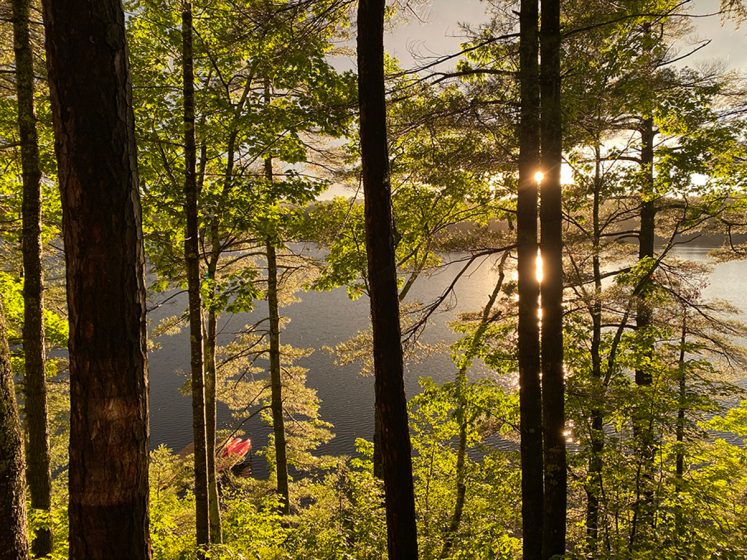
Photo: Munira Naqui

What’s Under the Car Hood? Looks Like Good News for Stormwater Pollution

Many voices. Greener cities. Better cities.

Want less, and cleaner stormwater runoff? Buy an electric car. Or, abandon your car and get your city to invest in renewable energy public transportation.

The literature has established that electric vehicles are better for the environment—they produce less pollution than a conventional gas vehicle, regardless of the electricity mix used to fuel the vehicle.[1] They are more efficient, and in part thanks to many state policies[2]—the costs of ownership are decreasing and the vehicles are becoming more ubiquitous. School districts are investing in electric school buses, transit districts now deploy fleets of electric buses, and even ports are converting heavy equipment to run on electricity.

Will Moore’s Chevrolet Volt produces far fewer stormwater pollution-causing substances than a comparable gasoline-powered vehicle. Photo: Will Moore.

Will Moore, the proud owner of a Chevrolet Volt, popped open the hood of his car. Inside, there’s just an electric motor, a battery, and a controller.[3] When compared with a typical gas engine car, the electric vehicle has no petroleum-based fluids, lubricants, antifreeze, or other chemicals. There is no need to change the motor oil. Because there is no tailpipe on an electric vehicle, the car won’t produce particulate matter, ground-level ozone, nitrates or sulfates because an electric vehicle is as clean as the grid behind it (which in California, where Will lives, is close to 40% renewable).[4] When he bought the car, Will understood that his car purchase would reduce the carbon pollution that causes climate change and result in cost savings over the lifetime of the vehicle, but he did not know that his Chevy Volt could have immense benefits for reducing toxic stormwater runoff and groundwater pollution.

In California, there are routine warnings posted after storms for swimmers and surfers to stay out of the water. That’s because the rains cause an alphabet soup of toxins, stagnant on our roadways, to runoff into our stormdrains. That toxic soup is comprised of chemicals and heavy metals from gasoline-powered vehicles, pesticides, herbicides, and other compounds. The capacity of storms often exceeds the ecosystem’s natural ability to filter out the petroleum-derived compounds from oil, grease, vehicle exhaust, heavy metals, benzene, tar, and vehicle coolants.[5] Instead, the pollution enters our waterbodies—urban streams, lakes, estuaries, and eventually the ocean—polluting humans as well as other urban wildlife.

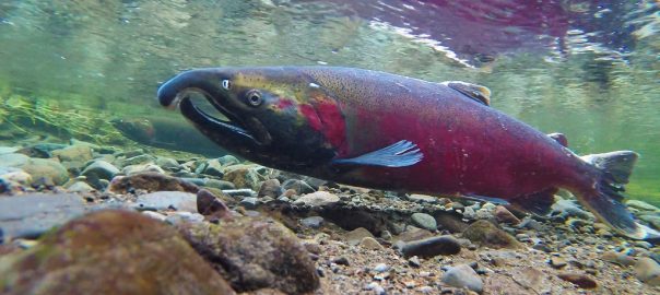
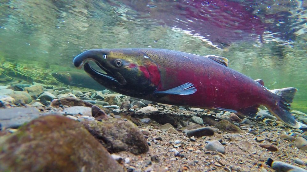
Coho salmon spawning on the Salmon River are at risk from stormwater pollution. Photo: BLM (Flickr). https://www.flickr.com/photos/blmoregon/16335492972

There are severe stormwater pollution impacts on urban watershed health and wildlife. Studies in Seattle, Washington have found that the dissolved copper in vehicle exhaust impairs the ability for salmon and steelhead to detect the environmental cues necessary for upstream spawning.[6] Exposure to copper can inhibit predator avoidance behavior and therefore reduce the chance of survival. Once-productive shellfish beds are now barren because heavy metals (like cadmium, chromium, copper, zinc, and lead) bioaccumulate in mussels and clams, which are then toxic to other predators—including humans.[7] There are other human consequences as well. The decline of fisheries from stormwater pollution results in job losses. People can become sick and die from exposure to stormwater. While the cause of stormwater impacts results from pollution from many different sources, a switch to electric transportation is a mitigation strategy for the unique petroleum-based chemicals and heavy metals from gasoline-powered vehicles.

While we know enough to understand the pollution concerns from gasoline-powered vehicles, there have yet to be studies quantifying the potential stormwater benefits from a switch to transportation electrification.

In the U.S., there are regulations in place governing stormwater management. The Clean Water Act’s National Pollutant Discharge Elimination System (NPDES) targets point pollution sources and requires the adoption and implementation of a stormwater management plan.[8] While the NPDES can work for facilities that discharge wastewater directly, it is much more challenging to regulate pollution from millions of non-point pollution sources—e.g., gasoline-powered vehicles.

Another aspect of transportation electrification that will yield enormous benefits for urban watershed health will be the eventual phase-out of gas filling stations. Underground pipes and tanks often leach gasoline and other chemicals into the surrounding soil, eventually contaminating the groundwater.[9] Extensive and costly remediation is often required before a site can be redeveloped or repurposed. As we switch toward transportation electrification, the lingering groundwater contamination from these sites can be addressed. Although groundwater and stormwater are different aspects of the urban watershed, the benefits from eliminating pollution from our transportation system will play a critical role in improving overall urban health during the 21st century.

Signs at the beaches saying “DO NOT SWIM” are already too common. The pollution impacts from our urban transportation system are a negative impact on our urban watersheds, public health, and wildlife. While the switch to electric transportation won’t ameliorate all stormwater pollution, it will make a significant dent in reducing pollution from toxic chemicals and heavy metals prevalent in gasoline-powered vehicles and the fueling system that supports fossil-fuel transportation.

The switch to electric transportation is occurring at a faster pace than expected. [10]  Norway, India, China, the United Kingdom, and France have all enacted plans to ban gasoline-powered vehicles in the next few decades. Bloomberg New Energy Finance predicts that 50% of new car sales will be electric vehicles by 2040. Close to a third of all vehicles registered in Norway are electric. Many car manufacturers have announced that they will only offer new electric vehicle models in the future. Almost 130 new battery-electric vehicle models will be available in the next five years. All-electric bus fleets are being deployed to meet transit district needs.

Even though there is much positive movement on the road to transportation electrification, more needs to be done to advance transportation electrification, support climate goals as outlined in the Paris Agreement, and comply with air pollution standards. State and federal policies can help reduce the cost of electric vehicle ownership, support the deployment of public electric vehicle charging infrastructure, and encourage fleet ownership of electric transit buses or other heavy-duty electric buses. Comprehensive integration of electric transportation into an asset of a utility-managed grid can help facilitate the broad scale and comprehensive transformation of an urban transportation system. Adopting universal standards and establishing set protocols can help drive interoperability and facilitate a positive driving experience. These changes will not occur on their own, and the market needs support and guidance from state and federal policy, as outlined above.

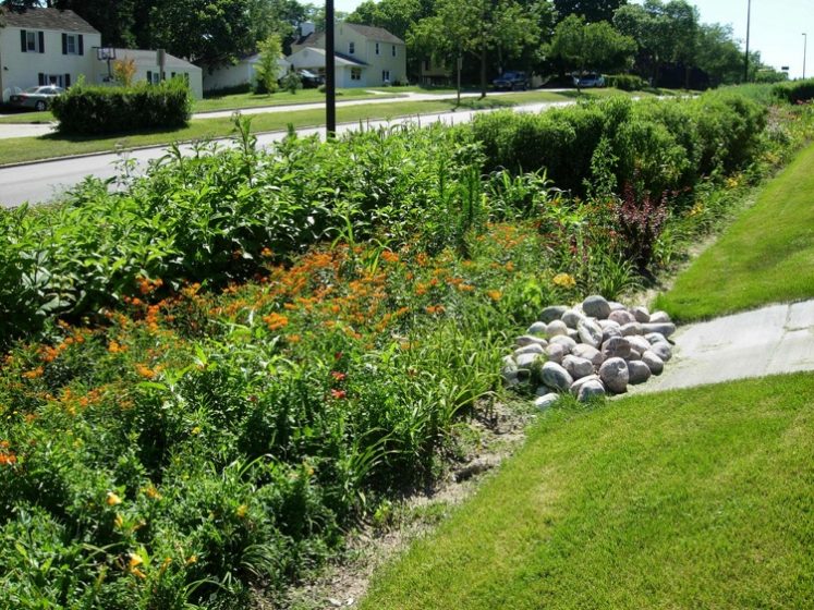
Bioswales can help buffer stormwater runoff and reduce pollution entering urban watersheds. Photo: Aaron Volkening (Flickr) https://www.flickr.com/photos/87297882@N03/7994702746

Furthermore, a comprehensive strategy to reduce non-point pollution cannot rely on source reduction alone. Integrated solutions to reduce infiltration will be critical. This includes construction of semi-permeable surfaces that can absorb rainwater, rather than just letting the water travel into the stormdrain. Green roofs, rain gardens, and bioswales offer filtering and buffering capacity, and some plants such as sunflowers and mustard greens can even thrive in the presence of heavy metals.[11] These green infrastructure elements can remove pollutants and reduce runoff.[12]

Although this piece did not delve into the multitude of benefits that electric transportation can yield—from air pollution reduction to mitigating climate change—the stormwater pollution reduction potential certainly represents an underappreciated asset. It makes sense to seize upon these benefits and put them to good use in driving toward an electric transportation system. Individual actions like Will’s electric vehicle purchase, when aggregated over large scales, can have substantial positive impacts. We just need the policies in place to encourage the switch to electric transportation and ensure that it is comprehensive.

Emily Wier
New York City

On The Nature of Cities

Disclaimer: The views and opinions expressed in this essay are those of the author and do not necessarily represent official policy or positions of her employer or of its clients.

 Notes

 [1] https://www.ucsusa.org/clean-vehicles/electric-vehicles/life-cycle-ev-emissions#.WpM_smaZORs

[2] http://www.ncsl.org/research/energy/state-electric-vehicle-incentives-state-chart.aspx

[3] https://auto.howstuffworks.com/electric-car2.htm

[4] https://www.eia.gov/state/?sid=CA#tabs-4

[5] https://www.kingcounty.gov/services/environment/water-and-land/stormwater/introduction/stormwater-runoff.aspx

[6] http://www.westcoast.fisheries.noaa.gov/publications/habitat/fact_sheets/stormwater_fact_sheet_3.22.2016.pdf

[7] www.epa.sa.gov.au/files/7597_water_caryards.pdf

[8] https://www.epa.gov/cwa-404/clean-water-act-section-402-national-pollutant-discharge-elimination-system

[9] https://www.eia.gov/energyexplained/index.cfm?page=gasoline_environment

[10] https://www.greentechmedia.com/articles/read/how-vehicle-electrification-will-evolve-in-2018#gs.S7GukWE

[11] http://www.resilience.org/stories/2014-08-11/using-plants-to-clean-contaminated-soil/

[12] https://www.epa.gov/green-infrastructure/performance-green-infrastructure

When “Good Commons” Create “Bad Commons”

Many voices. Greener cities. Better cities.
We need to reimagine the institutional landscape of urban disputed commons governance to accommodate diverse goals and management practices that simultaneously produce good and bad commons. On one hand, practices of good commoning produce bad commons. On the other hand, if disputes were to be resolved, the land would likely be privatized, halting the practices of good commoning.

Can practices that produce “good” commons also create “bad” commons? In some instances, practices of commoning spaces that are neither public, private, nor common can also degrade these spaces.

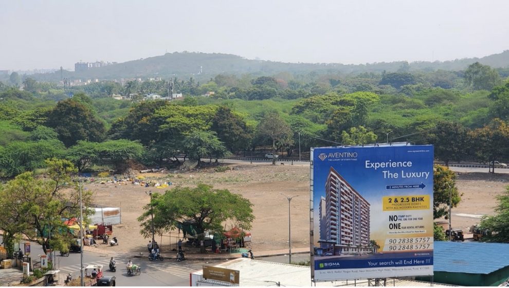
Mornings in my neighborhood of Wanowrie in Pune city, in the western state of Maharashtra, India are a charming sight. An undeveloped parcel of land also known as Kakade ground, approximately 48 acres in size, is the center of Wanowrie’s universe. An enthusiastic and dedicated youth group begins the day with volleyball matches. Running and cycling groups gather at the local tea seller’s semi-permanent structure on the land for their post-exercise banter. Street dogs playfully loiter around them, yapping for a stray biscuit. Residents may be shopping for fruits and vegetables at nearby popup stalls. The elderly may assemble at a corner of the land for their morning constitution and some healthy neighborhood gossip.

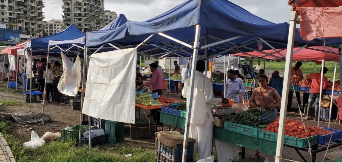
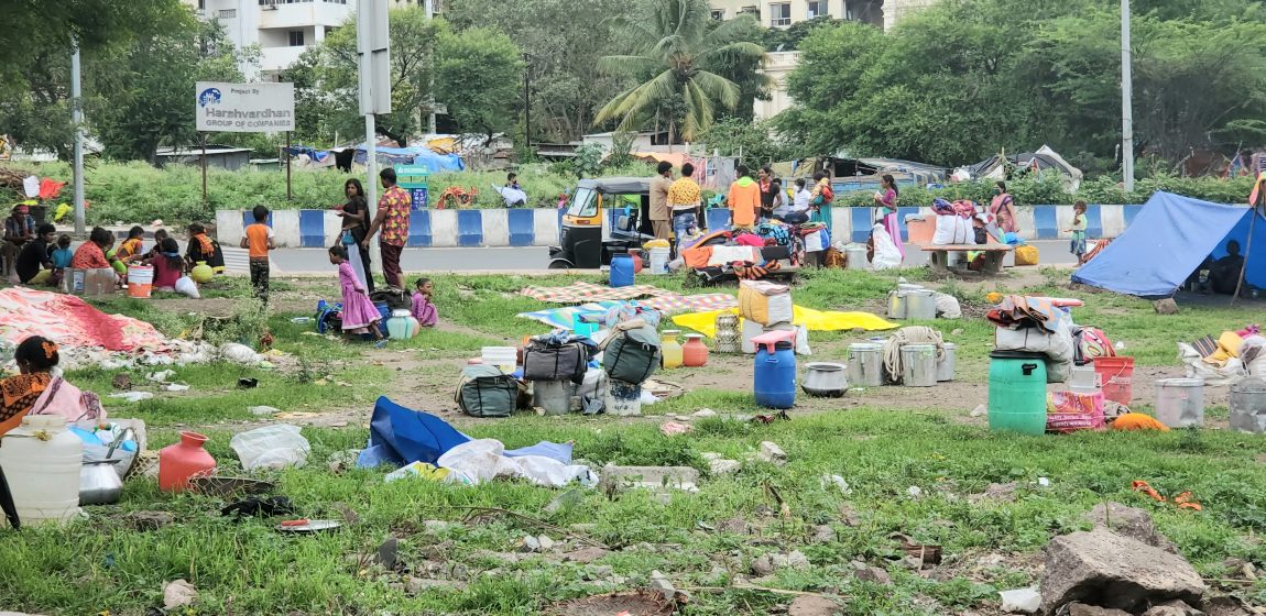
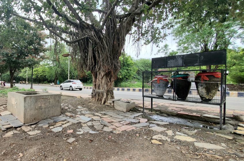
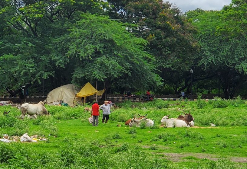
On some days, youth wings of local political groups organize cricket and soccer matches, bringing the passing traffic to an eager halt to watch the game. Strategically placed benches provide rest, and traditional water pitchers quench the thirst of the weary. Weekly and semi-permanent farmer markets save residents a trip to the inner city for produce. These decentralized produce markets provided an essential service during the COVID-19 induced lockdowns. Street vendors and fast-food selling hawkers take over the land in the evening. Approximately, five times a year, the land hosts artists and small businesses all over India, automobile exhibitions, book fairs, circuses, and fun-fairs. The land also provides space for local residents to learn and hone their car and bike driving skills. Occasionally, the land becomes home to migrant laborers and the nomadic Dhangar tribe with their sheep, camel, goats, and horses. Some trees on the land have threads tied around their barks, indicating that local residents may be worshipping the tree. Thus, a “good” commons results from these various uses that miraculously do not conflict with each other, but instead create a vibrant neighborhood.
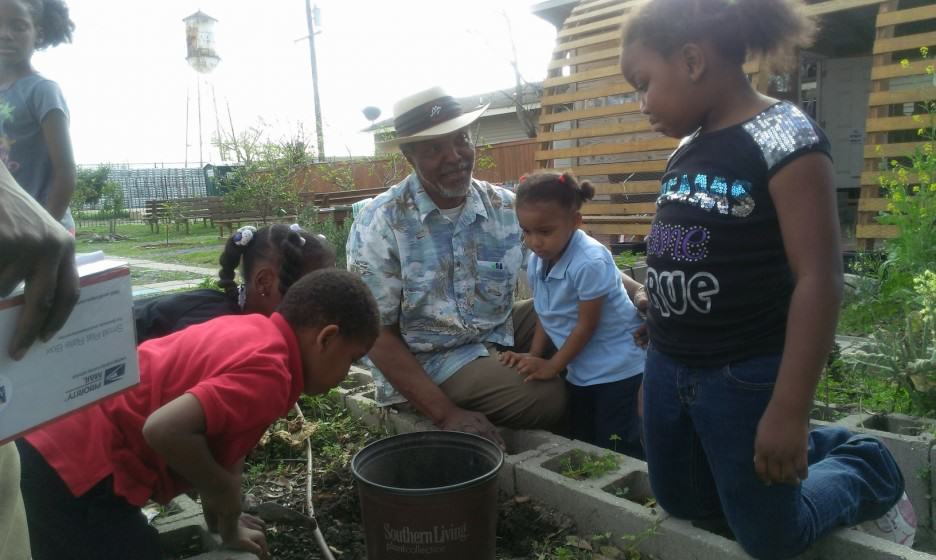
Kakade ground in Wanowrie. Photo: Praneeta Mudaliar
Weekly farmer’s market. Photo: Praneeta Mudaliar
Migrant laborers in July 2021. Photo: Praneeta Mudaliar
A sacred Banyan tree keeps the water cool for humans in earthen pitchers and for animals in a water trough. Photo: Praneeta Mudaliar

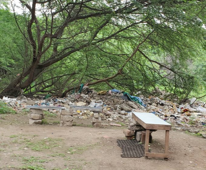
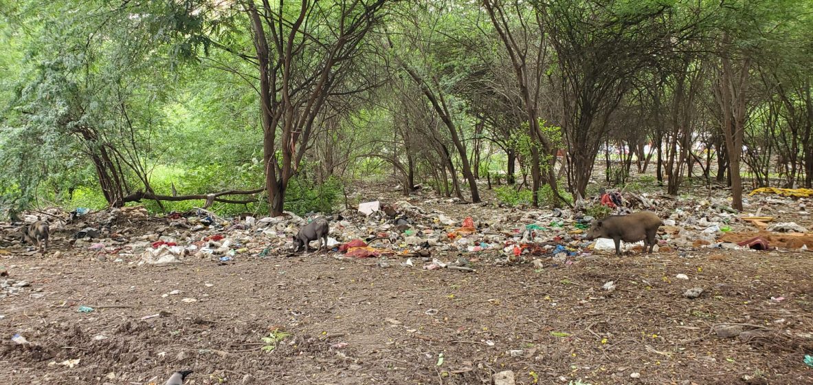
With multiple people using the land as an open-access “good” commons, “bad” commons are close behind. The waste from the farmer’s market and street vendors accumulates on the land. Plastic bags, in which residents bring food for the nomadic and migrant communities, litter the land. A cow-shelter that pious residents constructed to house cows on the land generates a steady stream of waste. Housekeeping staff of the surrounding gated communities dump trash on the land. Burning the trash engulfs the neighborhood with noxious fumes. Passing men use the land as a urinal. Pigs, dogs, donkeys, camels, horses, crows, pigeons, and flies abound. Mosquitoes, in particular, pose a real threat of malaria and dengue. In the absence of a natural predator, pigeons are a growing menace with the city registering wheezing cases related to pigeon droppings. Thus, the very process of making the commons is also degrading the commons. In the absence of maintenance, commoning is endangering the well-being of residents and people using and accessing the land.

Good commons meets the bad commons. Benches to rest amidst the trash. Photo: Praneeta Mudaliar
Pious residents feeding cows on the land. Photo: Praneeta Mudaliar
Pigs amidst the trash. Photo: Praneeta Mudaliar

Such parcels of undeveloped land are common not just in Pune, but across India because these lands are usually entangled in a legal controversy. The Center for Policy Research, New Delhi estimates that 7.7 million people in India are affected by disputes over 2.5 million hectares of land, affecting investments worth $200 billion. 66% of all civil cases in India are related to land/property disputes and the average timespan of a land acquisition dispute, from the creation of the dispute to its resolution by the Supreme Court, is 20 years.

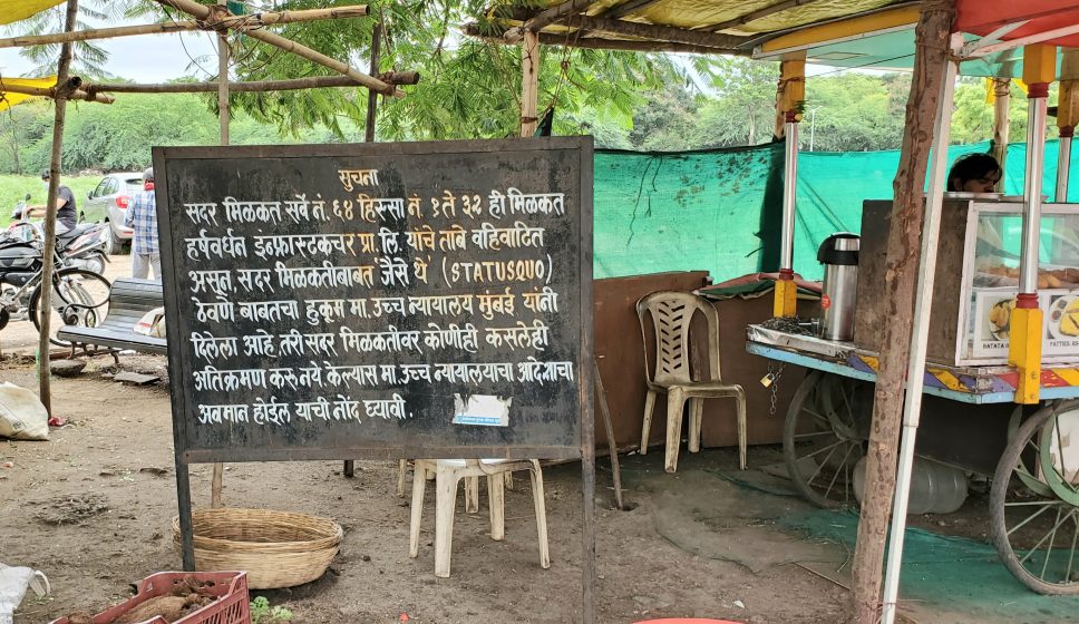
Like other undeveloped legally disputed parcels of land in India, the land opposite my home is similar. This dispute can be traced back to two land developers who earmarked the land in 1957 for a shopping mall, multiplex, restaurant, corporate park, and a hotel with exclusive apartment units. The dispute is complicated by the fact that the land was granted to the people to be held in trust and can only be sold with the District Collector’s permission. The departments of revenue and forest are also involved. These departments have passed a stay order against the sale of the land to the developers. In 2009, the Pune Cantonment court directed the police to inquire into the land dispute, which is still in progress.

When resources are legally disputed, who should have the responsibility for maintaining the “good” commons generated through commoning? Is it the police department that is conducting the inquiry? Is it the court or the departments of revenue and forest? Is it the Pune Municipal Corporation (PMC) that collects rent from the street vendors and hawkers but cites the dispute as a reason to not clean up the land? Is it the land developers who also collect rent from the vendors on the land? Is it the wealthy and middle-class residents of this plush neighborhood who are the main actors in the making of the commons?

Mumbai High court’s notice that the status quo of the land should be maintained. Photo: Praneeta Mudaliar

Sheila Foster argues that when governments are unable to provide essential services or are not able to oversee and manage resources, a situation called “regulatory slippage” arises. In such situations, the resource is vulnerable to degradation because of competing users and uses. When regulatory slippage occurs, a group of actors with high collective efficacy i.e., strong social ties and networks may fill the vacuum in governance. At Kakade ground, residents voice their concern at the trash and occasionally conduct cleanliness drives on the land, but these sporadic efforts do little to arrest land degradation. Thus, for Kakade ground, a 20-year-old practice of commoning to create a “good” commons may have built collective efficacy among residents, but the exercise of that collective efficacy for maintaining the commons is yet to be seen. Perhaps the land dispute[1] may be preventing them undertaking long-term action.

Practices that simultaneously produce good and bad commons on disputed spaces raise several questions for future inquiry:

  • What happens when the commoning of legally disputed spaces occurs without explicit or implicit intent to common that space?
  • What are the unforeseen, unpredictable, and undesirable consequences that emerge from the use and access to such disputed spaces?
  • What is the role of the state in such situations?
  • Would residents have maintained the commons if the space were not disputed?
  • On one hand, practices of good commoning produce bad commons. On the other hand, if the dispute were to be resolved, the land would likely be privatized, halting the practices of good commoning. Thus, with or without the resolution of the dispute, residents stand to lose the most. Therefore, what could be the form and nature of collective management for such legally disputed resources?
Despite critical advancements in the scholarship on common-pool resources, studies on rural commons dominate the field. While research on urban commoning is growing, scholars are yet to delve into the commoning of legally disputed resources. Where resources don’t neatly fall into categories of private, public, and commons, approaches to manage such kinds of resources are also missing. The undeveloped land in my neighborhood accommodates multiple uses, reflecting the diverse social goals of different groups of people. There is therefore a need to re-conceptualize and reimagine the institutional landscape of urban commons governance to recognize and accommodate diverse goals and practices that simultaneously produce good and bad commons.

Praneeta Mudaliar 
Ithaca

On The Nature of Cities

Note: [1] Residents developed a community garden at an undisputed dumpsite, a few meters away from Kakade ground.

When a Korean Hillside Town Disappears, Who will Notice?

Many voices. Greener cities. Better cities.

A review of “A Local Neighborhood Traveler,” an exhibition of painting and drawing by Korean artist Se Hee Kim at the Boroomsan Museum of Art in Gimpo, South Korea.

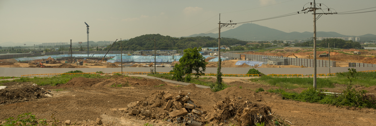
On the outskirts of Seoul, tucked away into a traditional hillside garden is the Boroomsan Museum of Art. The museum sits on the edge of an enormous expanse of dry, dusty terrain. From the museum’s hillside vantage point, one can see dozens of trucks traversing the landscape in a two-file line, one in, one out. They carry away loads of soil. A few months later, a similar cadre of trucks will be pouring the foundations for what is to be another of South Korea’s ubiquitous “new town” developments.

Kim is thoroughly interested in co-discovering the relationships between people and their environments. She remains curious, not in the object of curiosity, but in the action of being curious.
Less than a year ago, this landscape was not they dusty, desolate, and Martian place it is today. It was an entire village, home to thousands of residents, small farms, schools, local shops, and marketplaces, and a small forested hill affectionately called Boroomsan (Full Moon Hill) by the villagers. It is after this hill that the museum was named.

The hill was bulldozed a few months ago, along with the rest of the village.

View from the front of Boroomsan Museum after the town’s demolition. Boroomsan hill, now excavated, would formerly have blocked most of the view in the left half of the image. Photo: Patrick M. Lydon,  CC BY-SA

Looking at the landscape today, it’s almost unimaginable the swift pace and force with which the developer removed an entire town, hill, forest, and farms from the Earth. For most Korean people however, it’s just an everyday reality. The call to “modernize” the country has been going on for some decades now, and is still largely seen as a badge of pride by most elders.

Some members of the younger generation however—born from the 1980s onward, in the midst of a dynamic and active democracy—see things a bit differently. This, by way of lengthy introduction, is where we meet the work of South Korean artist, Se Hee Kim.

Inside the museum, we encounter Kim and her exhibition, A Local Neighborhood Traveler. At first glance the works, primarily small paintings and illustrations, are of ordinary scenes from life during her travels. Three distinct collections hang on the walls of the museum, comprising works created during stays in Japan and Taiwan, as well as Anyang, the town where her studio was located in Korea.

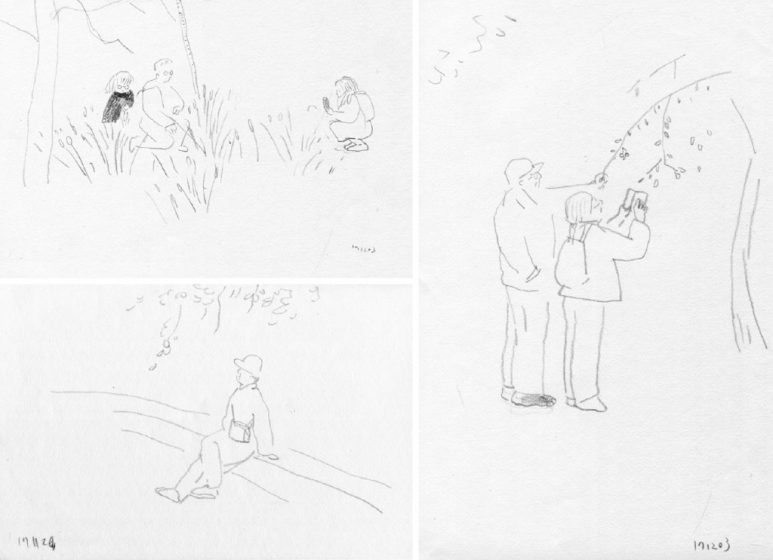
Three drawings in a series from Kim’s time in Taiwan. Images courtesy of the artist.

The most simple of these works are a series of pencil drawings; small scenes of individuals living and being within urban nature. Kim uses her graphite sparsely and suggestively. Figures are unmoored; people float in space together, sometimes comically, with the natural elements. The works convey comfort, curiosity, and playfulness. In these simple works, Kim seems thoroughly interested in co-discovering the relationships between people and their environments; she remains curious, not in the objects being contemplated, but in the action of being curious.

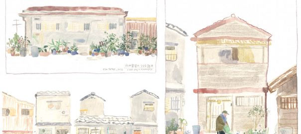
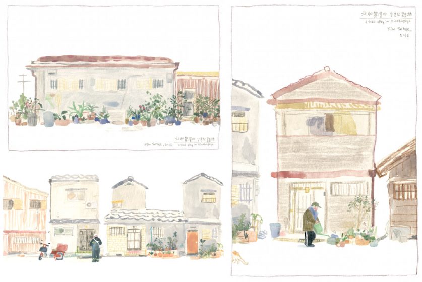
These small works are juxtaposed against a set of large-scale architectural panoramas, made while Kim was resident in Japan. The content of these larger works is broad, covering entire blocks of homes, complete with tiny urban gardens and their caretakers, parking lots, construction zones, and mailmen. These are quiet, contemplative moments, in urban nature. They take place in old, sometimes slightly crumbling towns, filled with character, with subtle diversity, with a feeling that these are spaces truly “lived” in the fullest and deepest meaning of the term.

Three cropped frames from a series on Kitakagaya, a small urban neighborhood in Japan. Images courtesy of the artist.

Kim’s form and color is whimsical to an extent, yet the making of these observations of place is not an unconcerned process. Even the smallest of works, sparse as they often are, feel as if an entire day could be wrapped up into one scene. You will not sense it in a busy onslaught of figures or activities, but instead in the attentiveness and intention that is conveyed in each work.

The work here at times brings with it a melancholic impression. Is it pure romanticism? Or, is there somewhere—wrapped up in Kim’s attentiveness to the slow, the old, the diverse-yet-grumose urban worlds we are fast destroying—a reminder of something missing in our own lives?

Whichever view you take, Kim’s illustrations do provide a stunning antithesis to what is happening just outside the museum—and in so many of our own backyards around the industrialized world.

The work on display here feels in search, not only of the nostalgic and simple, but of ways to build an authentic, creative, and meaningful culture and place within an economic atmosphere that is largely unsupportive of such notions.

In light of Korea’s ongoing pace and methods of development, one hopes that delicate and emotive works such as Kim’s might help us to re-appreciate the old, the diverse, the nature-connected urban landscapes; to trust our own curiosity, playfulness, and love for the places in which we live.

Patrick M. Lydon
Osaka

On The Nature of Cities

When Will We Start to Green the Roofs of Cities on a Massive Scale?

Many voices. Greener cities. Better cities.

The urban heat island is a well-known phenomenon that affects all cities around the world. It is the difference in temperature between a city and the surrounding suburban area. In countries such as Greece, the peak summertime temperature difference between a city such as Athens and its periphery can be as much as 10 degrees Centigrade. The causes of this difference are multiple. In general, two of the main causes are the lack of natural green space in a city centre and the use of air conditioning for cooling.

Green roofs can cool a city such as Athens by a substantial amount—if we can install a sufficient number of them.

Natural green spaces that surround Greek cities lower the ambient temperature in those areas substantially. Over the last three decades, the use of air conditioning has grown and its implementation has accelerated. Air conditioning works by removing heat from inside a building and pumping it outside. This creates a vicious cycle. The air conditioning effectively heats the city while cooling the buildings internally. As the city gets hotter, more air conditioning is used to cool the buildings, making the city even hotter and increasing the requirement for cooling. Hotter cities mean more air conditioning, which means even hotter cities.

FullSizeRender-2
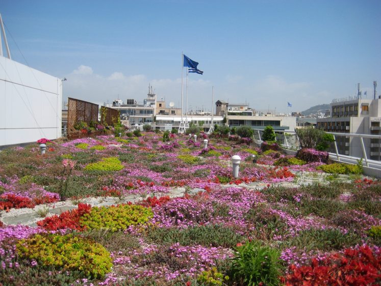
The Greek Treasury, Constitution Square, Athens. Photo: Andrew Clements

Studies conducted in Athens over the last thirty years have confirmed that the city is getting hotter over time and that air conditioning use is a major contributor to this heating. Other studies have shown that urban greening mitigates the urban heat island.

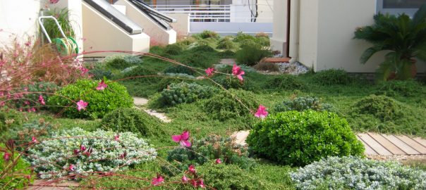
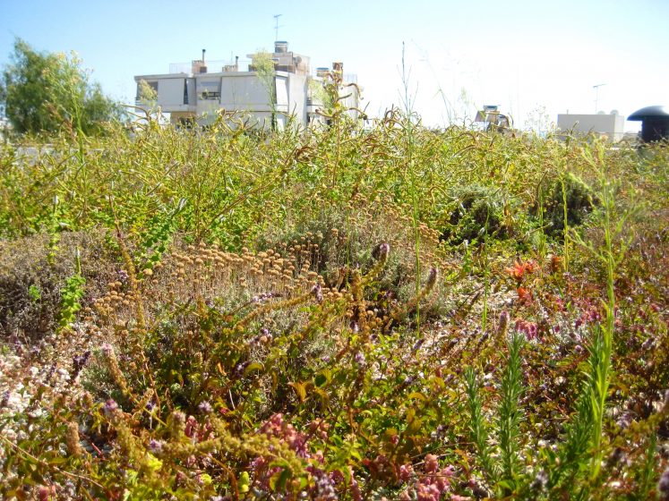
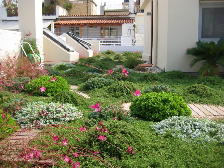
Cities in hot countries tend to have flat roofs and Athens is no exception. Currently, the rooftops typical of Athens, and of many other cities around the world, are a barren concrete wasteland of unused urban space. They represent a huge potential for greening.

A green roof is a perfect way to cool a building and also the surrounding space. A green roof cools a building in two ways. First of all, it shades the roof surface, protecting it from heat load and thereby reducing the temperature of the building. The second way a green roof cools a building is even more interesting in terms of city cooling. The plants on a green roof evapotranspire water through their leaves. This uses heat energy in the building. So the plants effectively remove heat from the building and, by extension, the city. Therefore, these two effects of green roofs lower both the temperature of the building and the temperature of the city. Consequently, less air conditioning is required and a “virtuous” cycle is established. Less air conditioning leads to less heat in the city, which, in turn, leads to a lowered requirement for air conditioning and on and on. How virtuous this cycle is depends on the amount of green roofs installed. The more green roofs the greater the cooling effect, the less air conditioning used and, consequently, the less heat produced and the more heat used.

FullSizeRender-9
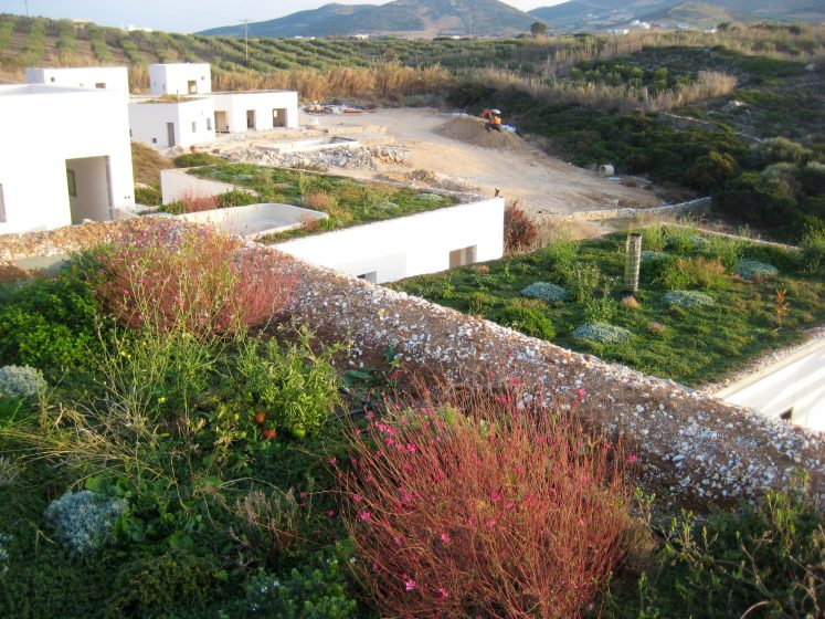
Villas in Antiparos. Photo: Andrew Clements

If this is all true, and research suggests it is, one must ask: when we will start to green the roofs of cities on a massive scale?

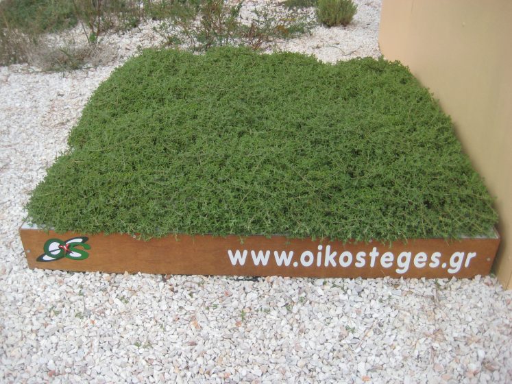
A one square metre green roof plot. Photo: Andrew Clements

I am a believer in the power of the consumer. If we can get a critical mass of adopters, this could work. One idea would be for every resident of the city to fund and/or install one square metre of green roof on their building. Many of the apartment buildings in Athens have flat roofs of about 150 square metres and house 40 or more residents. So, under such a plan, each roof would have a total of 40 or more square metres of green roof. The total number of residents of Athens is five million. So that would be five million square metres of green space. This represents a green area bigger than the size of Central Park in New York (which is about 3.4 million square metres in area). This amount of cooling should lower the peak ambient temperature of the city to an extent that warrants much less use of air conditioning, yielding lower peak temperatures and less of a requirement for air conditioning; the aforementioned virtuous cycle kicks in. The point at which the virtuous cycle would start is not known empirically and is difficult to calculate because we are dealing with subjective human behaviour. A pilot study is required to prove the concept and, once proven, the concept would need effective communication to achieve a critical mass of adopters.

This is a simple way to cool a city appreciably. Once the model has been proven, it could be implemented worldwide. The one important consideration with this model is to not exchange the urban heat island problem for the bigger problem of water consumption. Appropriate green roofs should be installed and that means natural ecosystem green roofs which require much less irrigation, less other inputs, and less maintenance than inappropriate grass or sedum blanket roofs. Also, methods of winter rainwater harvesting for irrigation in the summer should be adopted.

FullSizeRender-4
Commercial building, southern Athens. Photo: Andrew Clements
Residential building, northern Athens. Photo: Andrew Clements

The opportunities that such a greening effort would provide are myriad, and include a wide range of business, employment, and recreational potentials not to mention the more important restoration of habitats for wildlife. In terms of business and employment opportunities, researchers of many varieties would be required to make the initiative a success, along with a list of green roof professionals, gardeners, installers, maintenance people, and so on. Communications and advertising professionals, as well as media people, would be required. Getting the public to support this idea is a matter of effective communication, in my opinion.

We could transform life in a city using this model with relatively little effort and with relatively little use of finite natural resources.

Andrew Clements
Corinth

 On The Nature of Cities

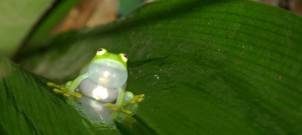
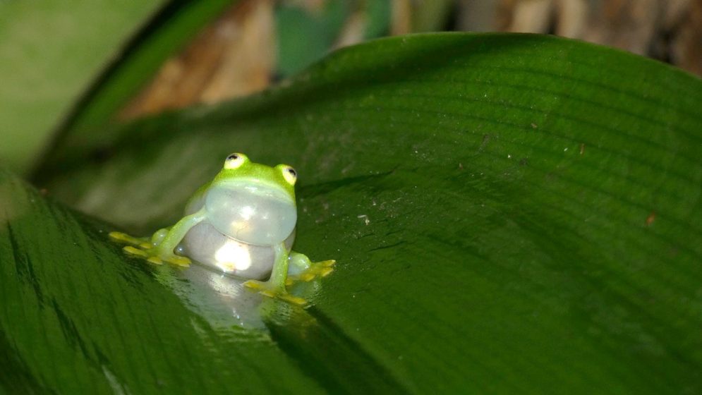
A picture of a tiny green frog sitting on a leaf

When You Sing You Want Noise and Bright Lights? Singing Behavior of Urban Frogs

Many voices. Greener cities. Better cities.
Fleischmann’s Glass Frog males use songs to attract females to copulate and reproduce. In urban areas, anthropogenic noise and light may affect reproductive success, so males sing differently—in duration, frequency, and pitch—to adapt to the situation.

Obstacles in nature are quite variable. Some are easy to observe: for example, a tree in the middle of an open area, a rock in the middle of a trail, or a lake in the forest. Others are not that easy to spot or identify as an obstacle. For example, wind currents, river noise, natural light, ambient temperature, or small gaps in the middle of the forest. Those obstacles may limit animal distribution and movement. Small insects like ants may move around the tree in the middle of an open area to pass from the nest to their feeding area. Tropical birds inside the forest will avoid moving through the forest gap or human trails. Wind currents, on the other hand, may limit the places flying insects can reach, because heavy wind currents push insects in opposite directions. Finally, ambient temperature limits the species distribution, due in part to the temperature tolerance that each species has.

Interestingly, in present days, animals not only need to deal with natural obstacles, but they also need to deal with artificial obstacles created by humans, many inside urban areas, but not limited to habitats like dams, roads, buildings, or windmills. Water dams are a huge obstacle for migratory fishes (e.g., salmon) to move along the riverbed. Highways and even small roads limit rodents, salamanders, and arthropods to move between both sides of the road. Natural or artificial obstacles not only limit animal distribution and movement between habitats, they also limit communication and as a consequence reproduction, territory defense, or social communication (e.g., food or danger advertisement).

Probably the communication most affected by natural and artificial obstacles is acoustic communication (animals’ songs and calls), because is a long-distance signal that attenuates and degrades when it hits different surfaces, travels throughout the wind currents, finds different temperature layers, or competes with other acoustic signals like other animal sounds or artificial sounds produced by humans (e.g., music, automobile motors, and factories). This will limit acoustic communication between individuals of the same species or between species. Therefore, many investigators around the world have invested the last 20 years in understanding the effect of anthropogenic noise and urban development on animals’ acoustic communication, including birds, mammals, insects, fishes, and amphibians. The amphibians (frogs and toads) are probably the less studied group in terms of the effect of anthropogenic noise on acoustic communication, especially inside tropical areas, because they are nocturnal, inhabit inside wet areas, and are not easy to spot.

Recently, biologists started to pay attention to another obstacle for acoustic communication, which at first sight does not look like an obstacle: night light pollution. How is night light pollution an obstacle to acoustic communication? Well, nocturnal animals like frogs, toads, crickets, or owls, avoid sites with a lot of lights at night to vocalize. Consequently, some places inside urban areas are losing populations of the night-singing species and the isolation makes the distance between individuals bigger, reducing reproduction chances. Additionally, animal species that vocalize during the day increase the vocalizing hours at night (they keep vocalizing during the night or vocalizing early in the mornings). This increases the number of sounds that occur at night and competes with the vocalizations of nocturnal species to reach potential receivers. For these reasons, night light pollution has been an obstacle to acoustic communication in nocturnal animals.

With all previous information in mind, we want to know what happens with the singing behavior and song characteristics of small frogs in urban tropical areas, when they deal with anthropogenic noise (mainly motors from cars) and night light pollution together. Do they move far from the noise and light-polluted areas? Do they stop vocalizing when the noise is higher? Is noise not important but they sing less in sites with higher night light pollution?

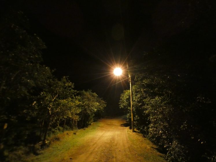
A picture of a dirt road with trees on either side at night with a single glowing streetlight
Night light pollution on the Fleischmann’s Glass Frog (Hyalinobatrachium fleischmanni) habitat in rural area. (Photo: Luis Sandoval)

So, this set of questions is what we investigated in recent years using the Fleischmann’s Glass Frog (Hyalinobatrachium fleischmanni) males that inhabit urban and rural areas in the Costa Rican Central Valley, the most populated and urbanized area in the country. This glass frog inhabits creeks inside urban areas, next to bridges and roads with higher levels of anthropogenic noise and night light pollution. Fleischmann’s Glass Frog males use songs to attract females to copulate and reproduce. Therefore, if light and noise affect their singing behavior, the populations that inhabit urban areas are going to have serious trouble surviving and keeping stable populations in the future.

A picture of a tiny green frog sitting on a leaf
Fleischmann’s Glass Frog (Hyalinobatrachium fleischmanni) male singing on top a leaf next to a rural road (Photo: Luis Sandoval)

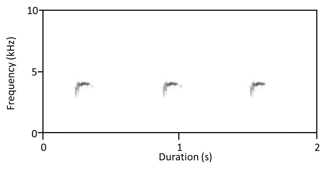
The small Fleischmann’s Glass Frog males have two strategies to increase their probability of attracting a female with their songs inside urban noisier sites. First, males sing longer songs and wait more time between songs on urban sites, compared to males who live in rural areas with less noise. Second, males sing songs with higher frequencies in urban sites. Increase the song duration also increases the probability that part of the song reaches the potential female because higher noise levels are not constant over time. To wait more time before singing the next song is similar to being next to a busy avenue talking with someone else, and the talker stops to talk when a noisier car or motorcycle passes by, increasing the time between words, but allowing communication. Finally, the frequency increase is a very common response in animals (including humans) when there is a lot of noise and they need to vocalize to communicate. For example, when we are at a party with a lot of people and music, we need to increase our voice volume a little bit to be hearing for the others, the increase in voice volume also increases the frequency of our regular voice. This increase in voice frequencies is similar to the song frequency increase displayed by urban male frogs to communicate in noisier sites.

A soundwave graph depicting Frequency and Duration
Visual representation of Fleischmann’s Glass Frog (Hyalinobatrachium fleischmanni) male song (Gutierrez-Vannucchi unpub. data)

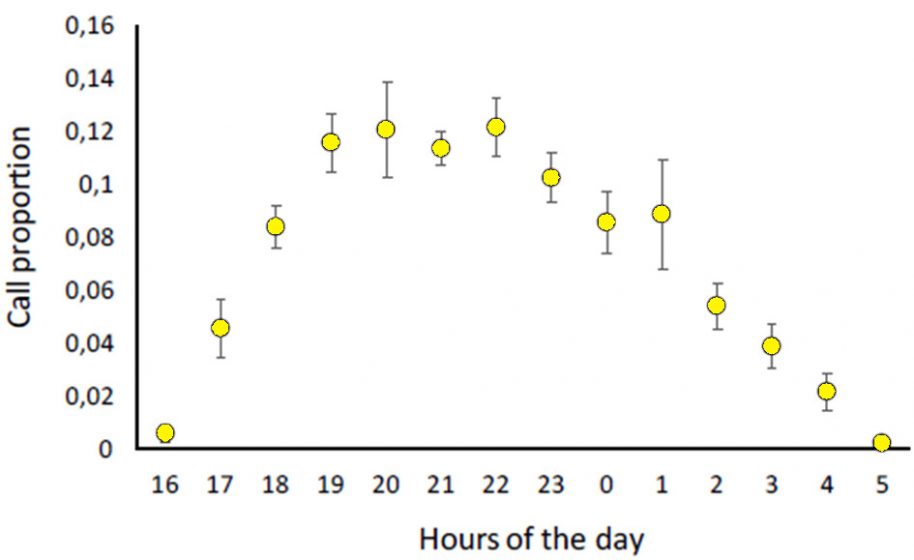
We also found that anthropogenic noise has an effect not only on song structure but also on the singing activity patterns of the Fleishmann’s Glass Frog. The males of this frog (and possibly other species too) can respond differently to different sources of noise, at different times of the night, which can also be related to mating status, female availability, and energy levels in males. Because, late at night, independent of noise levels, males sing a lot, probably because it is the last chance they have to attract a female to reproduce that night.

A graph depicting call proportion and hours of the day
Variation in the abundance of Fleischmann’s Glass Frog (Hyalinobatrachium fleischmanni) male songs per hour at night (Gutierrez-Vannucchi unpub. data)

On the other hand, night light pollution apparently is not affecting the singing behavior of Fleischmann’s Glass Frog males. Mmales in very illuminated sites started and finished singing at the same time that males did in darker sites. Frog males also sing with a similar quantity of songs per hour during all night in illuminated and darker sites.

In conclusion and to answer our title question, Fleishmann’s Glass Frog males did not want anthropogenic noise when they sing, but artificial light apparently did not affect their singing behavior.

There is still a lot that is not known about the effects of anthropogenic pollutants on the survival, reproduction, and communication of small nocturnal animals like amphibians, crickets, spiders, or rodents, especially in areas that are much less studied like the tropics. Also, anthropogenic pollutants can interact between them and produce combined effects on animals. Therefore, studying them together becomes important to better understand the overall effect humans and urbanization have on wildlife inside and outside the cities.

Luis Sandoval

About the Writer:
Luis Sandoval

Luis Sandoval is a researcher and professor at Escuela de Biología, Universidad de Costa Rica. His research focuses on urban ecology, animal communication, and behavior and natural history of birds.

Ana-Cecilia Gutiérrez-Vannucchi and Luis Sandoval
San José Continue reading

Where Can Civic Ecology Lead? TNOC Podcast Episode 003

Many voices. Greener cities. Better cities.
Play

Also available at iTunes.

Story notes: A conversation about civic ecology between Lance Gunderson, a landscape ecologist from Emory University in Atlanta; Caroline Lewis, of Climate Leadership Engagement Opportunities, or CLEO, in Miami; and Arjen Wals, a professor of social learning and sustainable development at Wageningen University, The Netherlands.

Climate change and other stresses on cities represent great challenges to societies. Some of these challenges are systematic and somehow “knowable”—that is, we know generally what to expect, even if we aren’t sure how to respond. Other threats and stresses are unexpected, even random in the appearance. Things happen that put pressure on our systems, organizations, and communities that we didn’t expect, and didn’t necessarily plan for—freak storms, or economic stress, or the loss of a charismatic leader. Our ability to respond to the unexpected is one aspect to the idea of resilience. Are our communities flexible or brittle in the face of shocks?

This episode of This Is The Nature of Cities discusses these issues and role Civic Ecology plays is maintaining resilient and vibrant communities. What is civic ecology? Think community gardens, or faith groups working in sustainability, river restoration organizations, or friends of parks groups. Such organizations form key and critical elements to the functioning of resilient communities, not just in their direct action, but in their contribution to social cohesion.

Marianne KrasnyGardeningWithKids-GuerrillaGarden-BGN and Keith Tidball convened a group of civic ecology leaders at the National Socio-Environmental Synthesis Center, or SESNYC, to discuss their work. In the green room three of the attendees met to talk about civic ecology organizations and how they are key to resilience.

Where Can I Dream? Eight Stories of Life in Bogotá

Many voices. Greener cities. Better cities.

“We need to have a beautiful place so we can live in dignity as human beings—that’s what we need the most: a place where we can go and speak to our ‘Older Brother’; to our brothers and sisters, the trees; to nature; a place where we can rest.”
(Una versión en español, aqui.)

In pondering the question: “Who should have access to the countless benefits and services that urban ecosystems provide?” We have put together a collection of eight first-person accounts that portray city dwellers’ dreams.

Luisa. Photo: Johanna Gonzalez

This series of Sketches of life explores both individual and collective human experiences as participants narrate their lives and reveal their innermost thoughts. These acts of remembrance provide a key to human identity and give meaning and substance to daily life (Cifuentes A., 2016).[1]

I am Hernan Garcia, from the Barrancas-Quebrada el Cedro neighborhood located in Bogotá’s eastern foothills. I envision a movement that would revolve around the entire watershed basin … a territory that would take in both the brook and its basin … I dream about all of us forming a harmonious bond, one based on mutual interests and symbiosis with all the communities that live in the foothills, as well as with those located in the mid and lower basins which the Cedro brook flows through; I believe this is possible because part of this basin is located where the brook empties into the Torca stream, and further downstream into the Bogota River.  So, I dream about this territory being held together by water: by crystal-clear water, by marvelous biodiversity. I also think that eco-tourism could contribute to the development of these communities.”

My name is Neiphy. I’m 26 years old and I live in the Usme neighborhood in the southeastern part of Bogotá. The Tunjuelo River runs through it. I have heard that this river comes from a high mountain meadow. Being close to a river means that we live in a special place, but my kids don’t go out very much to explore the river and its surroundings because this a dangerous neighborhood. The only place for them to play outside is on a hilly area inside the housing project where only a few trees are growing.”

My name is Jorge Enrique. I was born in 1953. I grew up in the country, but I had to leave during a period of political violence. I came to Bogotá with my family. I dream about Bogotá’s northern border being turned into a giant forest that would unite the eastern mountain range with the plateau below so that all the falling water could flow through it. This would make the eastern mountain range happy because it would be brought closer to the Majuy hills located west of the city. Right now, these two mountain formations can’t be together, but they are winking at each other and playing hide-and-seek, because they know that someday the giant forest will make their rendezvous possible.”

My name is Enilfa. I live in a neighborhood in the southern part of the city, where I really don’t feel at home. Most of the houses are only half-built, and the streets are filled with dust that comes from the nearby open-air quarries. Progress means that some of the streets have been paved. The truth is that most of the people who live here don’t want to see any trees planted because they would only give the criminals with knives in their hands a place to hide behind. If the city wants to build us a park, we just want playground equipment and benches in it.”

Moses. Photo: Lina Prieto

My name is Moses, but some people can’t pronounce it right and they call me ‘Moset’. I was born on April 4, 1928, and because of the political violence in the country I was forced to move to the northern part of Bogotá with my family. I remember that at that time everything was very pretty; we hunted capybaras, armadillos and wild turkeys. Every year we used to have barbecues with the corn we raised in our garden; it wasn’t just about agriculture, but about the ritual of being together. I have dreams that I try to thread together: I dream about a neighborhood where the young people and everybody else knows where they come from so they can work together within their own culture. I visualize a territory made up of waterways that starts where the water springs from the soil. I dream about us building a harmonious, mutually-dependent and reciprocal relationship with the communities in the mountains and with those who live along the banks of the Cedar Brook which pours into the Torca Brook and then into the Bogotá River.”

My name is Ligia Hernan. Take for example the Bogotá River … you travel to other places and you find cities that have big rivers running through them. Why isn’t the Bogotá River the city’s most important feature? Instead, here you have the impression that the river is “just over there”, that it’s better to not even look at it, that it’s something of an eyesore, that it doesn’t even move … you should be able to walk along the river and come upon birds and fish.  It’s something we’ve lost without even realizing it … it’s sad, isn’t it?  So, what happened?  People still strongly believe that they can only be living well if they have pavement beneath their feet.”

Granmother Blancanieves. Photo: Daniela Robayo

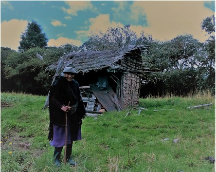
I am the grandmother, Ichakaka Blanca.  My words carry the most weight in the Council of Women here in Suba, located in the northwestern part of Bogotá. I belong to the indigenous nation of the Muiscas whose territory is called Bacatá (Bogotá). I have always lived in my territory. I am a daughter of Mother Lagoon because I was born in Aguascalientes in the region of Mother Lagoon, and it is where I still live. We lived here with my grandmother, Amalia, who was the doctor. She used traditional medicine from our territory to treat people. She applied the remedies herself. She also wove baskets and gathered all kinds of vegetables and medicinal plants to take to the October 12th Market Place where she bartered with them. It was a cultural exchange: she gave what she had brought for salt and cane sugar in return. Those are the things she would bring back home.”

“I dream about seeing our Pusmuyes (houses) being built. As the first nation and inhabitants of this sacred Muisca territory, we need to have our territory given back to us. We need to have sacred places where we can plant our crops; what I see every day in the city are just more and more playing fields for sports being built. We need to have a beautiful place so we can live in dignity as human beings—that’s what we need the most: a place where we can go and speak to our ‘Older Brother’; to our brothers and sisters, the trees; to nature; a place where we can rest.”

Photo: Andrés Angel
Mister Poveda-Romero with Sandra Valencia. Photo: Sketches of Life Team

My name is Edgar Armando Poveda-Romero. I’m not a native son to these parts [I was not born in Bogotá]. We came here as outsiders 50 years ago. I was born in a gunny-sack where they planted potatoes, 59 years ago, on November 23, 1957. We had milk, farmer’s cheese and eggs, which meant that the country people really didn’t need any money for groceries because we raised our own food with our own hands. As a community, we all belonged to the same family; we lived in harmony. If you were at your neighbor’s house at noon, you all shared lunch from the same pot, followed by a cup of hot chocolate. It was a big family-style meal. What they call Bear Mountain here represents love for this place, for life, for the will to live. In the future, I would like to see everybody interested in this place because they really care about it from the bottom of their hearts, not because they have to be thinking about the environment.”

Sketches of Life Team: Daniela Robayo, Lina Prieto, Sandra Valencia, Laura García, Benoit de Santignon, Paula Faure, Johanna Gonzalez

The Sketches of Life Initiative includes real life-stories as told by inhabitants from different corners of Bogota. This Initiative, carried out by Bogotá Mountain Foundation volunteers, including Sandra Valencia, Johanna Gonzalez, Lina Prieto, Paula Faure, Daniela Robayo, Catalina Garcia, Benoit de Santignon, and Maria Alejandra Peña who recorded the observations which reveal that ecological services in a given place must be concerned with more than just the issue of nature itself: it must be remembered that these services are also loaded with meanings and memories that represent the soul of the community. Therefore, plans based solely on quantitative distribution and indicators are insufficient: the soulfulness of the area’s inhabitants must also be taken into account. In Bogotá, we have a long way to go in fulfilling this moral obligation: an obligation, which demands that nature and the landscape, make up part of a more equitable city.  [2]

Diana Wiesner Ceballos
Bogotá

On The Nature of Cities.


[1] Cifuentes, Andrés. 2016. Saberes de vida para dar vida historias de vida de comunicadores populares, Editor: Corporación Escuela de Artes y Letras. Bogotá, Colombia

[2] Translated by Steven Bayless


¿A donde puedo soñar? Ocho relatos de vida en Bogotá

 Mediante unos relatos reales pongo a consideración la reflexión planteada respecto a la pregunta sobre ¿Quién debería tener acceso a los innumerables beneficios de los servicios de los ecosistemas y la naturaleza urbana? y la coincidencia con ocho historias y ocho sueños ciudadanos.

“Nosotros necesitamos tener un espacio lindo, digno, como seres humanos para vivir, eso es lo que más necesitamos, ese espacio donde nosotros podamos ir a hablar con nuestro hermano mayor, con nuestros hermanos árboles, hablar con la naturaleza, poder descansar”.
Doña Luisa, Paramo de Guerrero. Foto: Johanna Gonzalez

Historias de vida indaga de las experiencias humanas individuales y colectivas, tomando la interioridad del personaje para darle voz a través de su narrativa de vida; permite construir una visión de la sociedad en conjunto, además de acercarnos a la memoria, elemento clave para la identidad humana, la cual da sentido y contenido a la vida (Cifuentes A, 2016)[1].

Me llamo Hernán García Cerros Orientales, Barrio Barrancas-Quebrada el Cedro. “me imagino una dinámica de cuenca, el territorio entendido desde el agua y la cuenca, es importante entender desde donde nace el agua y donde desemboca, entonces yo sueño con que nosotros establezcamos un vínculo armónico, mutualista y simbiótico con las comunidades de los cerros, y de las comunidades de la cuenca media y baja de la quebrada el Cedro, porque parte de esta cuenca desemboca al Torca y luego al río Bogotá, entonces sueño este territorio conectado a través del agua y con agua impecable y una biodiversidad maravillosa y creo que desde el turismo responsable puede haber ese desarrollo en las comunidades.”

Soy Neiphy, tengo 26 y vivo en un barrio al suroriente de Bogotá, llamado Usme. Es un lugar que lo recorre el rio Tunjuelo que desciende de un paramo de donde me cuentan viene el agua de la ciudad. “A pesar de parecer un lugar único, mis hijos solo cuando se arriesgan con temor de la inseguridad llegan a ver el rio. El único juego que encuentran es un rodadero en la mitad de lo que dejo la urbanización casi sin árboles”.

Mi nombre  es Jorge Enrique, “nací 1953, soy de origen campesino, en medio de la violencia política, nos desplazamos a vivir en Bogotá. El borde Norte  de la ciudad lo sueño como un gran bosque que posibilite un encuentro entre la montaña, la planicie y que las aguas discurran, fluyan como transmitiendo ese deseo que de pronto tienen los cerros de oriente se acerquen con los cerros del Majuy en el occidente, y con un guiño se hacen esquivos y entre ellos saben, que por ahora no van a estar juntos pero, que de pronto pueden tener la posibilidad de encontrarse en un gran bosque”.

Me llamo Enilfa, vivo en un barrio de la zona sur en el que no puedo ubicarme bien, predominan casas en proceso de construcción, calles cuyo cielo se llena de polvo que viene de las montañas excavadas por las canteras que aún funcionan o que dejaron abiertas. El desarrollo trajo la pavimentación de algunas vías, y la verdad la gente que vive acá no quiere que siembren árboles, pues pueden ser lugares de inseguridad, donde se esconden los cuchillos para robar. Preferimos que si nos hacen un parque solo tenga juegos  y bancas.

Moses. Photo: Lina Prieto

Me llamo Moisés,  “a veces  se traban y me dicen  MONSIETE, nací  El 4 de abril de 1928, llegamos por la violencia desplazados a Bogotá por la zona norte. Me acuerdo que todo eso era muy bonito, había algo que cazar como Borujos, Armadillos, Pavas . Todos los años hacíamos asados con las mazorcas de la huerta; no solo ha sido un tema de agricultura, sino también un rito de compartir. Yo tengo sueños que he tratado de ir enlazando, sueño un barrio donde los jóvenes y todas las personas reconozcan el valor de su origen y se trabaje a partir de una cultura propia. Imagino un territorio entendido desde el agua y la cuenca desde donde nace el agua. Sueño con que nosotros establezcamos un vínculo armónico, mutualista y simbiótico con las comunidades de los cerros, y de las comunidades de la cuenca media y baja de la quebrada el Cedro, porque parte de esta cuenca desemboca al Torca y luego al río Bogotá”.

Ligia Hernán “por ejemplo el río Bogotá… uno va a  otras parte y uno ve que dentro de las ciudades pasan ríos grandes, ¿por qué aquí el rio Bogotá no puede sentirse dueña de la ciudad? El rio esta como por allá, como que mejor no lo miro, esa destrucción que uno ve ahí , como que no se mueve nada, uno esperaría ver al lado del rio pajaritos, peces. Y eso es como una perdida que uno no fue consciente de que se dio, es como triste ¿no?, qué sucedió… se sigue pensando que lo que es bueno es que la gente vive bien porque  tiene el piso pavimentado. ”

Abuela Ichakaka Blanca. Foto: Daniela Robayo.

Soy la abuela Ichakaka Blanca. “Soy la palabra mayor aquí en el consejo de mujeres de Suba, al noroeste de Bogotá, soy la abuela Muisca del territorio acá de Bacatá. Siempre he vivido aquí en mi territorio. Soy hija de Madre Laguna, pues nací en la Laguna Sagrada de Aguascalientes y aquí estoy. Nosotras vivíamos acá también con mi abuela Amalia, que era como la médica tradicional de territorio Y era la que daba la medicina, también era tejedora de esteras y también ella recolectaba mucho, todo lo que era la verdura y todas las plantas medicinales pa’ llevarlas a la plaza del 12 de octubre, para hacer el trueque, el intercambio cultural de todo esto; lo que no había acá, más que todo era la sal y la panela, así que  era lo que ella traía de allá.

Me sueño una construcción de nuestros Pusmuyes (casas), y como primeros nativos y vivientes de este territorio sagrado Muisca necesitamos nuevamente nuestro territorio. Necesitamos tener espacios sagrados donde sembrar, pues cada día amanecen en la ciudad mas canchas deportivas. Nosotros necesitamos tener un espacio lindo, digno, como seres humanos para vivir, eso es lo que más necesitamos, ese espacio donde nosotros podamos ir a hablar con nuestro hermano mayor, con nuestros hermanos árboles, hablar con la naturaleza, poder descansar”.

Foto: Andrés Angel
Don Poveda con Sandra Valencia Foto: Equipo Historias de vida

Mi nombre es Edgar Armando Poveda Romero, “no soy rasal de aquí de la región, nosotros lléganos aquí como forasteros hace 50 años, nací en unos costales en un campamento donde se cultivaba la papa, hace 59 años, el 23 de noviembre de 1957. Había leche, cuajadas, huevos, es decir, el campesino prácticamente no necesitaba tanta plata para completar la canasta familiar, porque la mayoría de producción alimentaria se generaba aquí, del trabajo de los campesinos y en el tema social, todos éramos  una sola armonía, una sola familia, llegaba al medio día a la casa del vecino, así estuviera almorzando y siga para la olla del fogón, y le compartían, tómese un tinto un cacao, y se participaba de lo que estaban compartiendo en familia… La montaña del oso representa una convicción por el amor del lugar, a mi vida, las ganas de vivir, y a futuro me gustaría ver un conglomerado de personas que a conciencia valoren este lugar, no por necesidad del tema ambiental, sino por convicción”.

Algunos miembros del Equipo Historias de Vida: Daniela Robayo, Lina Prieto, Sandra Valencia, Laura García, Benoit de Santignon, Paula Faure y Johanna Gonzalez

En la iniciativa llamada Historias de Vida, narraciones reales de habitantes de distintos rincones de Bogotá la Fundación Cerros de Bogotá (www.cerrosdebogota.org), grupo de voluntarios ciudadanos, liderada por Sandra Valencia; Johanna González, Lina Prieto, Paula Faure, Alejandra Peña recogen los relatos que dan cuenta de que los servicios de la naturaleza van mas allá y están cargados de significado y memorias que representen un lugar del alma de esa comunidad. Por lo tanto, hay que ir mas allá de pensar en distribución e indicadores cuantitativos, hacia indicadores desde el alma de sus habitantes. En Bogotá, estamos lejos de cumplir ese imperativo moral para que la naturaleza  y el paisaje participen en la noción de ciudades justas.

Diana Wiesner Ceballos
Bogotá

On The Nature of Cities.


[1] Cifuentes, Andrés. 2016. Saberes de vida para dar vida historias de vida de comunicadores populares, Editor: Corporación Escuela de Artes y Letras. Bogotá, Colombia


Where Did All the Streams Go?

Many voices. Greener cities. Better cities.

A review of Hidden Waters of New York City: A History and Guide to 101 Forgotten Lakes, Ponds, Creeks, and Streams in the Five Boroughs. By Sergey Kadinsky. Countryman Press, Woodstock, VT. ISBN: 9781581573558. 336 pages. Buy the book.

There is something about a stream that just won’t let go of the imagination. People somehow accept other aspects of the environmental destruction required to make cities. Most folks don’t recall the legions of forests and acres of meadows that have been bulldozed for townhouses or that the soil must be encased in asphalt to make it easier for cars and bikes. Urbanites might find it sad, but understandable, that trillions of former wildlife inhabitants—birds, bees, bears, beetles, bobcats—have been swept from the cityscape to make room for people and our pet animals instead. But everyone wants to know, once they start to think about it: what happened to the streams?

A remarkable number of streams and stream fragments still exist in New York City, and Kadinsky tries to find every one of them.
Sergey Kadinsky’s new book provides 101 answers to that question for the five boroughs of New York City. For the 8.6 million citizens and the 50 million visitors to the city each year, Kadinsky’s book is your best guide to the lost and underappreciated hydrological features of New York City—not only streams, but also ponds, lakes, creeks, and the occasional spring. His is the modern incarnation of the same spirit that drove James Reuel Smith, a former merchant in lower Manhattan, to buy a bicycle and an early camera, and ride around snapping pictures and penning nostalgic accounts, which resulted in Springs and Wells of Manhattan and the Bronx from 1916 (later republished by the New-York Historical Society in 1938). Kadinsky trades Smith’s bicycle for the subway and buses, but their impetus is the same.

hidden-water-coverSmith and Kadinsky are not alone in being drawn to running water. Paul Talling’s Lost Rivers of London, Joel Pomerantz’s Kickstarter-funded maps of the streams and springs of San Francisco, Mary Miss’s artful explication of the White River in Indianapolis, Jessica Hall’s creek freak investigations in Los Angeles, Steve Duncan’s fearless expeditions into the sewers, Robin Grossinger and Erin Beller’s detailed studies of the streams of Silicon Valley (formerly “The Valley of Heart’s Delight”) and our own work on the Welikia Project in New York, testify to the same obsession. Maybe e.e. cummings said it best, writing in his Greenwich Village apartment not far from the former shores of Minetta Water in Manhattan: “For whatever we lose (like a you or a me), / It’s always ourselves we find in the sea.”
A remarkable number of streams and stream fragments still exist in New York City, and Kadinsky tries to find every one of them. His book is divided by borough, with convenient finding aids on the page edges. Place names are written in bold text to catch the eye, and numerous figures of historic maps and images (unfortunately all in gray scale and rather small) provide context. After giving a brief historical walking tour of each stream or pond, their descriptions end with directions, places to see, and recommendations to learn more. At the end of the volume, Kadinsky includes a bibliography organized by borough and waterway, including valuable references to long-lost newspaper accounts and historical volumes.

Kadinsky’s descriptions of waters invoke the flow of time. Gabler’s Creek in Douglaston, for example, reminds us not only of the fight to preserve the narrow ravine of Udall’s Cove Park Preserve in the 1970s, but also the construction of Overbrook Street in the 1930s, and the Battle of Madnan’s Neck in the 1650s, which drove the last Native Americans from their homely abodes along Great Neck Bay. In the Bronx, Rattlesnake Brook still rambles down through Seton Falls Park, over an eighteenth century diversionary waterfall, and through a nineteenth century ice pond, once used for winter skating and summer cooling, before slipping into an underground pipe, to emerge down by Co-op City and slip silently, and mostly unnoticed, into Long Island Sound.

Perusing Hidden Waters is fun for both the armchair historian and the modern urban eco-adventurer. Without sermonizing, there is a distinct historical rhythm to these accounts. Most begin with a colonial description of a typically beautiful, formerly long-lasting, watery feature of the environment, many of which formed during the last Ice Age—that has been co-opted for industrial purposes. Nineteenth century New Yorkers largely regarded waterways as places to get power, launch vessels, and/or dispose of sewage and garbage. Once these ponds, streams, and other waters were fouled, the city government and private actors, on the hunt for more land to develop, filled and paved them, a process that played itself out in fits and starts from the late 19th century through most of the 20th century. The natural waters we have left now are largely the result of neglect—so little time, so many streams to fill—until the environmental movement of the late 20th century finally created the legal and regulatory tools to stop their destruction.

And now it’s the 21st century’s turn to do something for the wet nature of the city. Kadinsky’s day job is with the New York City Department of Parks and Recreation, which has its own natural resources group, and is engaged in a large number of stream, pond, and wetland restoration projects across the five boroughs. The city even has a wetlands strategy. Contemporary New Yorkers are perhaps more willing than our peers in the past to see nature as part of the infrastructure of the city. Climate change is part of that: green, wet places help cool the city and, at the shore’s edge, may contribute to blunting the adverse effects of wave energy and storm surge. Returning precipitation and snowmelt to the ground also has an effect on water quality. The city has only so much room for water treatment plants and infrastructure; the soil is an efficient sop that keeps water out of the treatment system; and water in the ground will help fill ponds and make streams perennial again. For a city that drinks more than a billion gallons per day, returning a modicum to nature seems like the least that we can do.

One of us (Sanderson) remembers giving a historical walking tour and stopping at the intersection of Maiden Lane and Pearl Street in downtown Manhattan, only a few blocks from Wall Street, in the shadows of skyscrapers, to describe the stream that once flowed there. Maiden Lane got its name from the Dutch washing women who used to leave the palisades of New Amsterdam to do their laundry along the “Maagde Paetje” or Virgin’s Path. In the old sources, the stream is invariably described as sparkling over a bottom of smooth pebbles. As I was describing this on a dank, unpebbled street corner at the height of rush hour, one of the guests on the tour abruptly interrupted, and asked, in a rather loud voice: “where has the stream gone now?” I pointed to the manhole cover in the middle of the street and the storm drain at her feet. For most of the city, gutters are our streams, and the water isn’t hidden when it rains; rather, it pours out in fast, furious floods and swirls down into dark places not to be seen again. I told the ensemble about all the ways that we can bring streams back, by daylighting them, revegetating them, or, at the very least, in our mind’s eye, re-imagining them. The woman looked less than convinced. But at least someone wanted to know and was ready to shout into the cacophony: what happened to the streams?

Eric W. Sanderson and Christopher Spagnoli
New York City

On The Nature of Cities

Christopher Spagnoli

About the Writer:
Christopher Spagnoli

Christopher Spagnoli Program Assistant at Wildlife Conservation Society's Conservation Innovation program. Since 2014 he has worked on the development of the Welikia Project and Visionmaker.nyc.

Where Did the Rivers Go? The Hidden Waterways beneath London

Many voices. Greener cities. Better cities.

A review of The Lost Rivers of London, by Nicholas Barton and Stephen Myers, 2016.  ISBN:1905286511. Historical Publications Ltd . 224 pages. Buy The Lost Rivers of London.
…and London’s Lost Rivers, by Paul Talling. ISBN: 184794597X. Random House UK. 192 pages. Buy London’s Lost Rivers.

How many travellers are aware that there is a river flowing over their heads? It’s one of the wonders of London. But abuse of the rivers was one of the greatest failures in London’s evolution as a great metropolis.
The Lost Rivers of London by Nicholas Barton and Stephen Myers, was published in 2016 by Historical Publications. Originally published in 1962 by Nicholas Barton, this is a substantially revised and extended edition of this classic work. Alongside this there is a photographic exploration of London’s Lost Rivers, 2011 by Paul Talling, Random House. They are very different works, the first being a scholarly and comprehensive description of the lost rivers and their history, with numerous detailed maps charting their course. The second provides a more popular illustrated journey through the lost rivers and associated waterways.

Beautifully written with a wealth of detail, The Lost Rivers of London, by Barton and Myers, provides an invaluable historical perspective on the fate of many small rivers that still flow beneath the streets of London. The course of each river has been identified from historical records, paintings, photographs and maps, including one of the earliest maps of London dated 1559.
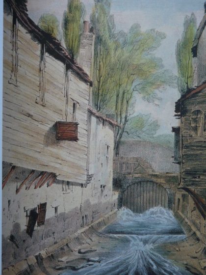
But the book is far more than a history of the rivers. It tells the story of London through the treatment of its rivers; how development and expansion of the city depended on availability of fresh water; how the rivers were modified and canalised to provide water for many different purposes including defence, navigation, agriculture, fishing, mill-power and industry.

The book paints a picture of great changes overwhelming the rural landscape as London became an industrial metropolis. Clear bubbling streams and rivers, with numerous wells serving local communities, were replaced by urban squalor. As the city grew the rivers were progressively covered over and converted to subterranean conduits, lost from view. Out of view, out of mind. With the impact of industrialisation and rapid population growth the rivers became sewers. What had been some of London’s greatest assets were allowed to become so polluted that they became a major hazard to public health. Abuse of the rivers was one of the greatest failures in London’s evolution as a great metropolis.

The Westbourne near Knightsbridge, as portrayed by G.F. Phillips in c. 1825 not long before the river was culverted. Illustrated on page 81 of Barton and Myers, this is one of many historical pictures that bring the book to life.

Creation of the great Victorian sewer system for London by Joseph Bazalgette in the 1860s was seen as a great success and his system of building sewers along the contours to intercept the natural drainage pattern was copied across the world. But most of the lost rivers of London are still there today. The book brings us right up to date with a discussion of problems associated with increased frequency of severe rainfall events, almost certainly due to climate change, when localized severe flooding overwhelms the so called “combined-sewers”, resulting in discharge of raw sewage into the River Thames. We learn that a massive new sewer, the Thames Tideway Tunnel, is currently being constructed to cope with these new conditions. It will be 25 km long running mostly under the tidal section of the River Thames through central London. The tunnel has a diameter of 7.2m, and is designed to provide capture, storage and conveyance of almost all the combined raw sewage and rainwater discharges that currently overflow into the river.

The Lost Rivers of London looks ahead and sees prospects for bringing back some of the hidden rivers. This has already been achieved for sections of small tributaries south of the Thames. Barton and Myers argue that it would be possible to do the same, even in the centre of London. The key to success of such a scheme is the fact that several of the lost rivers were naturally fed from unpolluted springs and streams on Hampstead Heath. At present this water is diverted straight into the local sewage system; a complete waste of a valuable asset. The authors suggest that this water could be channeled by gravity through a new pipeline into central London where it would certainly be possible to recreate short clean stretches on the courses of the Fleet, Tyburn, Westbourne and Walbrook in the very heart of the city. Now there’s a vision; the Fleet flowing again through the capital as a sparkling stream! This book is a must for anyone dealing with urban planning and design, not only in post-industrial cities, the lessons are just as valid in new cities today.
Inside the Fleet Sewer. Photo: Paul Talling

London’s Lost Rivers, by Paul Talling, is a more lighthearted take on the subject, choosing many of the oddities that are the legacy of the lost rivers. Examples include the sewage lamp nicknamed Iron Lily on Carting Lane in the West End, which was designed to burn off sewage smells from below, and the “stink pipe” performing a similar function at Stamford Brook. Other memorable features are the remains of numerous wells that once dotted the banks of the Fleet River and now grace street corners in Hampstead and Camden. It is a photojournalist’s book that provides a quick guide to London’s waterways that have disappeared, including docks, wharfs, canals and other man-made features that have little to do with lost rivers. But the sections dealing with the rivers provide an interesting perspective on the story, with magnificent photos such as the vast brick lined chambers of the Fleet Sewer built 160 years ago. The photo on page 41 says it all.


The River Westbourne in its iron pipe crosses Sloane Square underground station over the heads of commuters on the tube trains. Photo: Paul Talling

Paul Talling suggests that perhaps the most surprising thing about the hidden waterways is not that they have virtually disappeared into obscurity, but that there are so many of them. He points out that London is riddled with watery relics and clues to the past. There is abundant evidence if you know what you are looking for. His book provides an inspirational resource for schools, local historians, artists, poets, and even tourist guides. It’s a good size too; something that fits in the pocket whilst you explore the city.

Both books have a photo of the River Westbourne in its iron tube where it crosses the platforms above the underground line at Sloane Square station. How many travellers, I wonder, are aware that they have a river flowing over their heads? For me it’s one of the wonders of London.

David Goode
Bath

On The Nature of Cities

To buy the book, click on the images below. Some of the proceeds return to TNOC.


Where Have All Our Gunda Thopes Gone? An Illustrated Story of Loss and Hope Around Peri-Urban Commons in Karnataka, India

Many voices. Greener cities. Better cities.

“Lakshmamma thought sadly of her grandchildren, growing up in the city, in a crowded slum with no thope to run around in or trees to climb.”

This excerpt, from our bilingual book “Where have all our gunda thopes gone?”, is a story of loss and hope—loss of nature as a city expands and hope that our readers will be encouraged to protect nature in their neighbourhoods.

Though the characters are fictional, the setting and experiences are based on conversations we have had with residents living in a village in peri-urban Bengaluru—and one of the sites of our research on commons.

Gunda thopes (or wooded groves) are an important common once found across the state of Karnataka in Southern India. Historically, thopes have been an integral part of the rural landscape, planted with fruit and timber yielding trees, and cared for by the local community. But, in recent times, there have been transformations to these thopes especially in the peri-urban interface of cities such as Bengaluru, the capital of Karnataka. Our story is about one such thope that transformed from a grove of towering mango (Mangifera indica) and jamun (Szyzygium cumini) into a landscaped park with lawns and ornamental plants.

A gunda thope (wooded grove)
The original gunda thope on which the story is based.. Photo: Seema Mundoli
A landscaped park
The thope after it was transformed into a landscaped park. Photo: Raghavendra Vanjari
We have brought out this booklet at a time when rapid urbanisation with its challenges of sustainability and equity is being witnessed in the Global South.

Our story follows Lakshmamma, who lives in Bengaluru, and who has returned on a visit to her natal village after many years. Lakshmamma is amazed at how much had changed—the village situated now in the peri urban interface of Bengaluru, looked more like a city to her. On her last evening in the village, she retraces her steps past commons, like the pond and lake, making her way to a gunda thope she visited often as a child.

An illustration of a man-made pond
The village pond with stone steps leading down to the water. Illustration: Sukanya Basu

Lakshmamma is shocked at what she sees. Instead of a thick grove with trees, what she sees is a landscaped park—similar to the parks in the city she lived in now. A large fence, a signboard with “do’s and don’ts”, exercise machines, a playground, and perfectly trimmed trees greet Lakshmamma.

An illustration of an urban park
The signboards with “do’s and don’t’s” in the park, once a thope: A common sight in many urban parks. Illustration: Sukanya Basu

Walking through the park, Lakshmamma is filled with bitter-sweet memories. She then spots a majestic peepul (Ficus religiosa) tree—she had fondly named Maranna (tree brother) as a child. The rest of the booklet is a conversation between Lakshmamma and Maranna about the changes to the thope.

An illustration of a large tree in a grove
Maranna the majestic peepul tree. Illustration: Neeharika Verma

The conversation weaves through Lakshmamma’s childhood, the many happy hours she had spent in the thope—playing with friends, eating mangoes, grazing her goats. But it soon turns sad as Maranna tells her about how the thopes and their uses had changed over time—and the slow erasure of thopes from even the community’s memory. Lakshmamma mourns the loss of the commons, thinking sadly of her grandchildren living in the city who will never experience the abundance of gunda thopes that Lakshmamma did as a child.

An illustration of a woman talking to a large tree
Lakshmamma in conversation with Maranna. Illustration: Neeharika Verma

The story of this story

Though the characters are fictional, the setting and experiences are based on conversations we have had with residents living in a village in peri-urban Bengaluru—and one of the sites of our research on commons. The thope has indeed been transformed as described in the story. But is not an exception. Other urban and peri-urban commons such as lakes, ponds, cemeteries, and grazing lands have witnessed a similar fate. Some commons have been converted to schools, roads, bus stops, community centers, housing, and so on. As a result, the ecological benefits that these green and blue spaces provided have been lost forever. Others, like the thope in the book, have been converted to parks and spaces of leisure. Stripped of their native vegetation, we now have perfectly manicured lawns, fenced walls, and several rules and regulations that prioritise recreational use of the urban elite and middle class. Meanwhile, the conversion, enclosure, and gentrification of what were once commons have all marginalised traditional users and the local community who had livelihood, social, and cultural connections extending across generations.

Our research on the transformation of and contestations around thopes and similar urban and peri-urban commons has been published in peer-reviewed journals (Mundoli et al 2017, 2018) and used as a teaching case study in the MA Development programme at Azim Premji University. Students have also visited our field sites to undertake land use and biodiversity mapping.

People standing in a grove
Students learning about transect and quadrats to map plant biodiversity in the thope. Photo: Seema Mundoli

But one of the questions we asked ourselves is:

“How can we communicate our research to a wider public, and partner with them in protecting the city’s environment?”

The story of Lakshmmamma and Maranna is our attempt to do that and, in order to make it more accessible, the booklet has also been illustrated.

We decided early on that illustrations would be an integral part of the story. The first step for us was to identify what illustrations could fit the storyline. Once this was done, the illustrators read some of the field notes and publications and looked at photographs taken during field visits over the years. Next, rough sketches were drawn by the illustrators and, if the sketches resonated with the storyline, the sketches were completed by adding details.

Four pictures of a dirt road transformed into an illustration of a landscaped area
From a photo to an illustration. Photo: Seema Mundoli; Illustration: Sahana Subramanian

Illustrations as a new way of conversing about urban commons

We did not want the illustrations to direct too much attention away from the story. Rather, we wished to complement the story. The simple hand-drawn black and white line-art enabled us to achieve this effect. It was an added advantage that, while there were three of us illustrating, our styles were similar, enabling us to achieve a consistency in the illustrations. Apart from adding power to storytelling, the illustrations also act as a tool that allows readers to imagine the story of the thopes. Through the illustrations of Lakshmammas lined face, the spreading branches of Maranna, the lake surrounded by agricultural fields, and several others the readers are able to visualise the landscape of the village as it once was. Similarly, through the illustrations of the park and the school into which the thopes were converted, readers are able to relate to what the thopes have become. We feel that this allows the readers to sympathise with Lakshmamma and Maranna’s story more deeply. Illustrating a book was a new experience for the illustrators—and it was an exciting venture to convert an academic publication into a more widely accessible format. This experience also provided us an opportunity to converse about urban commons in a new way.

A wider outreach of the story

India is a country of many languages, and also of many similar thopes, albeit by different names, spread across the country. For a wider reach, the booklets were conceptualized as bilingual and were translated into two languages—Kannada, spoken in Karnataka, and Hindi a language familiar across other states. Printed copies of the English-Kannada version have already been distributed through the Department of Panchayat Raj and Rural Development across 6400 rural libraries in the state of Karnataka. In addition, we prepared illustrated worksheets for teachers and educators on the topics of commons, benefits of trees, and maintenance of commons under the rights-based legislation, the Mahatma Gandhi National Rural Employment Guarantee Act. The worksheets elaborated include activities that involve students identifying commons and engaging with nature around them. The objective is to create awareness among children and encourage collective action to protect the disappearing commons. The Department is also considering an awareness campaign that includes identifying thopes and working with the local community in planting and maintenance for which we are collaborating as well.

Conclusion

We have brought out this booklet at a time when rapid urbanisation with its challenges of sustainability and equity is being witnessed in the Global South. We especially recognise the important role that commons play in countries like India, and the contestations around commons as cities sprawl into the peri-urban adversely impacting local communities and ecosystems. But we also realise that communicating these challenges and raising awareness is the first step towards forming partnerships in protecting commons. And our illustrated book “Where have all our gunda thopes gone”, seeks to do just that.

Sahana Subramanian, Neeharika Verma, Sukanya Basu, Seema Mundoli, Harini Nagendra
Lund, Amherst, Göttingen, Bangalore, Bangalore

On The Nature of Cities

Neeharika Verma

About the Writer:
Neeharika Verma

Neeharika Verma received her undergraduate degree in biology from Azim Premji University, and is currently pursuing her master’s in marine science from the University of Massachusetts, USA.

Sukanya Basu

About the Writer:
Sukanya Basu

Sukanya Basu was a Research Assistant at the Azim Premji University and is pursuing her PhD in Sustainable Food Systems from University of Göttingen, Germany.

Seema Mundoli

About the Writer:
Seema Mundoli

Seema Mundoli is an Assistant Professor at Azim Premji University, Bengaluru. Her recent co-authored books (with Harini Nagendra) include, “Cities and Canopies: Trees in Indian Cities” (Penguin India, 2019), "Shades of Blue: Connecting the Drops in India's Cities" (Penguin India, 2023) and the illustrated children’s book “So Many Leaves” (Pratham Books, 2020).

Harini Nagendra

About the Writer:
Harini Nagendra

Harini Nagendra is a Professor of Sustainability at Azim Premji University, Bangalore, India. She uses social and ecological approaches to examine the factors shaping the sustainability of forests and cities in the south Asian context. Her books include “Cities and Canopies: Trees of Indian Cities” and "Shades of Blue: Connecting the Drops in India's Cities" (Penguin India, 2023) (with Seema Mundoli), and “The Bangalore Detectives Club” historical mystery series set in 1920s colonial India.

Where Walking and Just Cities Meet

Many voices. Greener cities. Better cities.

“We live in a fast-paced society. Walking slows us down.” — Robert Sweetgall, walking guru and president of Creative Walking Inc.

JB bkk-bcn first post lotus flowerWalking. It’s a natural, human thing to do. Whether we wander through wide open green spaces or ramble around in cities, the simple act of putting one foot in front of the other makes everything around us feel more intimate. Walking puts the unreachable within reach.
Starting in mid-January 2016, Lluís, my partner for 10 years, and I will add a new dimension to our walking habit. We’ll fly to Bangkok, Thailand and walk our way home to Barcelona, Catalonia. Our planned route will take us through about 20 countries and hundreds of cities, towns, villages and unheard of corners of the world. It won’t be a straight line, and there will be detours and places that are politically shut off to us or geographically too complicated to cross. But we intend to try and cover as much ground as possible on foot.

BABA Map Route 2592x1944What are we looking for? We are seeking goodness in the world. It’s our anti-fear approach to living life well. The ubiquitous headlines screaming about all the wrong being done everywhere have created a world that seemingly wants to surround itself with fear—fear of uncertainty, fear of “those people,” fear of our neighbors. We don’t buy into that. Our live-our-best-lives intuition and longtime backpacking experience tell us that there is more good in the world than bad. And we believe that if we start with the humble (or perhaps lofty) ideas that the whole world belongs to each and every one of us (not just a chosen few in wealthy, developed countries), that we all belong to each other, and that everyone deserves respect, kindness and compassion, then something that looks like goodness naturally flows.
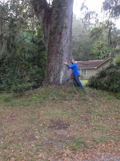
JB hugging a treeGoodness comes in an endless number of varieties. It’s that moment when a complete stranger invites you into their home and offers you tea, or walks with you to the place for which you’ve asked directions. It’s the helping hand, or the smile of understanding that breaks language barriers. It’s also birds singing in a tree-filled park where people stroll hand in hand and children play. It’s listening to waves roll in while strolling along a beachside pedestrian promenade, and watching and helping people plants seeds and harvest vegetables in community gardens. Goodness is appreciating the clean, potable water from your sink, and having a safe place to sleep every night.
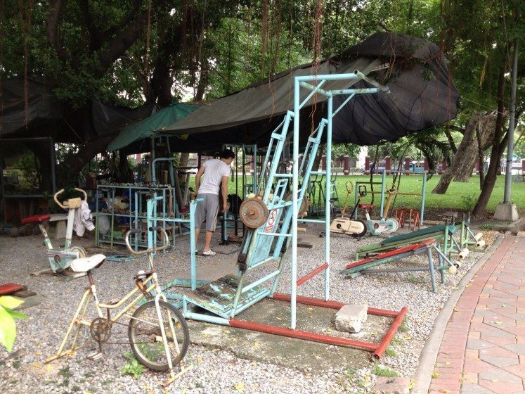
Goodness, also, is the balance struck between accessibility, aesthetics, resourcefulness, sustainability and usefulness. This is where our Bangkok-to-Barcelona walk intersects with The Nature of Cities’ mission to encourage the development of just, resilient cities and to promote citizen equality, participation and stewardship.

Lumphini Park
Lumphini Park
Fountains, Montjuic, Barcelona

As the borders between urban, rural and natural areas blend and fade, citizens the world over are hard pressed to find and invent new ways of living together while maintaining the core elements that keep us connected to the Earth. Urban planners, community activists and development organizations struggle to create sustainable footprints that accommodate the increasing needs of city dwellers while also protecting water supplies, natural resources, biodiversity and delicate ecosystems.

Globally, the expansion of urban boundaries brings with it dozens of questions. Who has access to green spaces in growing urban areas? How can livable spaces and industrial areas co-exist without harming residents? How is nature integrated into megacity and mid-size city plans? How are urban areas in emerging countries and developed nations making themselves resilient? What are cities and citizens throughout Asia and Europe doing to improve equity and inclusion among their residents? How are cities creating opportunities for their citizens and incorporating social justice while also balancing environmental needs and natural resources capacity?

As we travel across continents, we’ll explore the idea of Just Cities and share our perspectives, photos and podcasts of what we find in different corners of the world here on The Nature of Cities. We’ll submit stories and slideshows about parks and open spaces that would make great parks, and share insights about what we think urban graffiti says about a place. We’ll look at how urban life spills into rural areas, and what’s happening as more people move from farms to cities. We’ll walk with open eyes, ears and hearts and witness ways human connect to each other and the world around them.

We hope you’ll follow our footsteps and join the conversation. Maybe we’ll even meet some of you along the way.

Jenn Baljko

See more about the trip here.

Who Cares for the City?

Many voices. Greener cities. Better cities.

In 2002, I was working full-time as a social science researcher for the US Forest Service in New York City.  My colleague Lindsay Campbell and I visited with leaders of the urban greening movement at that time — from community gardeners and park volunteers to environmental justice activists and tree planters, to directors of community service organizations and long-time government program staff.  The message was the same: we need a way to capture the varied and wonderful ways that people are caring for the environment in New York City.

During this time, I was working on my doctoral degree at Columbia University. I met a sociology professor, Dana R. Fisher, who was also excited by the prospect of creating new knowledge about civic action and the environment in cities.  Shortly thereafter, STEW-MAP was born — in many ways as a celebration and further understanding of local people who have been inspired by the environment, in its various and restorative forms, to bring about change in their lives and communities.

The Stewardship Mapping and Assessment Project (STEW-MAP) is a research project led by US Forest Service researchers and cooperators that seek to answer the questions: Which environmental stewardship groups are working across urban landscapes, where, why, and how?

Stewardship can be an awkward term for some, so we settled on a clear definition. STEW-MAP defines a “stewardship group” as an organization or group that works to conserve, manage, monitor, advocate for, and/or educate the public about their local environments.  This work includes efforts that involve water, forests, land, air, waste, toxics, and energy use.  Many civic stewardship groups work within, alongside or independent of public agencies and private businesses in managing urban places.  Over the years, STEW-MAP has become both a study of urban stewardship socio-spatial characteristics and a publicly available online tool to help support those networks.  To see our multi-city portal, visit here.

Inspired by neighborhood change and revitalization

Years before, when I was working as an urban and community forester in southwest Baltimore, I met many people whose work inspired me to think of the city as a place of innovation and change, of generosity and understanding, of deep ecological knowledge.  In the early 1990s, Baltimore residents were coping with ways to deal with entire blocks of abandoned homes, open-air drug activity, the everyday threat of gun violence and severe poverty.  Many of the people I met chose to address troubles in their community through civic action: cleaning up vacant lots, planting flowers, creating afterschool programs for neighborhood kids.  Many of these people were neither saints or sinners, but self-directed in teaching themselves the fundamental skills necessary to grow a garden next to an abandoned row house, to carve out a bike trail alongside old railroad tracks, to restore a neglected park to its former glory.

During the course of my work, I met an amazing photographer, Steffi Graham, who began to document people throughout the city who were caring for public and neglected areas. One afternoon, we set out to find a garden that was rumored to be producing the ‘best greens on the east side.’  We walked through a seemingly endless maze of vacant lots and back-alleys, and after a few hours we were about to give up.  Luckily, an encampment of old timers sitting on the corner, shouted out to us, “what you two doing here?”  We replied, “Just looking for the garden.”  We were provided an escort back into the alleyway and before our eyes emerged row after row of the biggest collard greens and cabbages I have ever seen.  Interestingly enough, these prize specimens were planted in the back yards of homes that were boarded and abandoned.  Further back, across the alley and along the wall of a warehouse was a make-shift, fenced in yard that was overgrown with vines.  We peered through the fence and came face-to-face with a large, metal shovel.  Holding onto this shovel in a not-so-friendly way, was a man in coveralls.  Clearly, he was the steward of this land.  We quickly stated our intentions and after a period of time, our questions were answered.

Why are you gardening here?  It’s where I live.

How do you grow such great stuff? I read up on things and watch other people, especially that guy who grows over on North Avenue. Him and I been watching each other for years. This year I got my peas in earlier than him and you can still see some over here……

Who is planting outside your fence, in the backyards?  I am.  That’s for anybody who’s hungry.  This way, they won’t mess with my stuff.   

How do you get water?  I watch the weather and figure on planting plants that can take the drought, and, when things get real rough, the guys at warehouse lend me the hose.

Such exchanges, and many others like it, have served as evidence enough for me that urban residents are ecological thinkers who care for the land with a sense of stewardship,  not unlike their rural counterparts, helping to care for forests, farms, rivers and grasslands.  As I learned more about these innovative people and their projects, I realized that many received encouragement, information and occasionally modest funding from a growing number of bridging organizations, groups like neighborhood associations, clubs, and environmental civic groups that serve as an interface between government agencies and the local community.

STEW-MAP Today

To date, STEW-MAP has collected information from thousands of local stewardship groups in New York City, Chicago, Seattle, Baltimore, and Philadelphia.  These groups range from neighborhood block associations and kayak clubs, to tree planting groups and regional environmental coalitions, to nonprofit educational institutions and museums.  Other cities, including Los Angeles and San Juan, Puerto Rico, are expressing keen interest in developing a STEW-MAP study and application.

What is shown on STEW-MAP?

Stewardship maps tell us about the presence, capacity, geographic turf, and social networks of environmental stewardship groups in a given city.  For the first time, these social infrastructure data are treated as part of green infrastructure asset mapping.  For example, the interactive mapping website developed in New York City currently displays basic data for 405 groups citywide alongside other open space data layers.  Other STEW-MAP cities continue to expand the NYC model and have created new maps and resources for their cities.

STEW-MAP data: A map of stewardship organizations in New York City

Why is STEW-MAP important?

STEW-MAP can highlight existing stewardship gaps and overlaps in order to strengthen organizational capacities, enhance citizen monitoring, promote broader civic engagement with on-the-ground environmental projects, and build effective partnerships among stakeholders involved in urban sustainability.  Long-term community-based natural resource stewardship can help support and maintain our investment in green infrastructure and urban restoration projects.  STEW-MAP creates a framework to connect potentially fragmented stewardship groups; to measure, monitor, and maximize the contribution of our civic resources.

Who should use STEW-MAP?

STEW-MAP is a tool for natural resource managers, funders, policymakers, stewardship groups, and the public.  For example, managers in NYC have queried STEW-MAP to find stewards proximate to specific forest restoration projects run by MillionTreesNYC.  Funders or community organizers can identify areas having the greatest or least presence of stewardship groups, taking into account organization size and focus area.  Those seeking to disseminate policy information can target the most connected groups to quickly and effectively reach an entire network or a subset.  Members of the public who want to know who is working in a particular neighborhood or who can provide technical resources for a project can search the database, which displays results as a list or on a map.

Example uses: Stewards in proximity to Flushing Meadow Park, New York

How is STEW-MAP implemented?

STEW-MAP is a research and application project that involves two stages.  STEW-MAP 1.0 is the “lay of the land” data collection stage, during which the organizational population is inventoried, surveyed, and analyzed.  This stage produces a database of stewardship organizations in the city, maps of where the organizations conduct stewardship activities, and social network analyses of the numbers and types of ties among groups.  This work is accomplished in partnership between a local partner from the study area, a university partner, and a scientist from Forest Service.

STEW-MAP 2.0 is the “how do we use the data?” — the applied stage of the project.  This stage includes the development of resources and tools that make the data easier to access and use.  STEW-Map cities are exploring a range of visualizations for use in policy and practice.  The Chicago team will be conducting focus groups in the coming months to enhance our understanding of user needs and applications.  In Baltimore, federal and local participants in Baltimore’s Urban Waters Program are interested in using STEW-MAP data to facilitate their work: to increase collaboration, improve the flow of information and identify program gaps and overlaps.  And in New York City, STEW-MAP data has been made available for a wide range of public uses, serving policy makers, program directors and the general public.

You can check out the New York City data here:

STEW-MAP NETWORK FIGURE 3Where can you get more information?
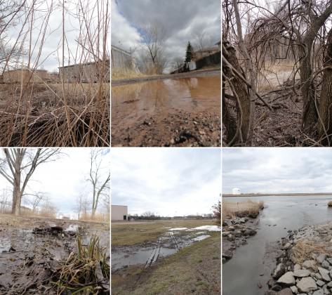
If you would like to learn more about STEW-MAP or ways you can develop a project for your area, contact:
Erika Svendsen, [email protected]

To learn more about stewardship work in a particular city, please contact:

New York City:
Lindsay Campbell, [email protected]

Chicago:
Lynne Westphal, [email protected]

Philadelphia:
Sarah Low: [email protected]

Baltimore:
Morgan Grove, [email protected]
Michele Romolini, [email protected]

Seattle:
Dale Blahna, [email protected]
Kathy Wolf, [email protected]

Los Angeles:
[email protected]

San Juan:
Tischa Munoz-Erickson, [email protected]

Erika S. Svendsen
New York City

On The Nature of Cities

Who Creates the Art of Urban Practice?

Many voices. Greener cities. Better cities.

This blog post takes the form of a seminar report. It is a reflection of the work of the City in Environment class of spring 2013 at The New School, New York. It is also a reflection on urban practice. In this class student explored and interrogated many terms that surround the urban environmental debate. In particular the five big terms: nature, landscape, sustainable, ecosystem and ecology were discussed and documented in a glossary. In short, we didn’t start with an issued based or rights based approach, but rather we learnt from past and emerging urban design and ecosystem science theories, frameworks and spatial strategies in order to discover what new hybrid urban practices might contribute to making positive differences for neighborhoods.

Who creates the art of urban practice?

The neighborhoods, all in or near New York City, were selected from a layered analysis using four datasets on a crop that partially framed the New Jersey Meadowlands, Manhattan Island, Jamaica Bay and Long Island Sound. The four layers, shown in Fig. 1, include the megalopolis highway infrastructure (grey), the New York City Bike Map (orange), a FEMA map of inundation by Hurricane Sandy (pink) and shopping malls or big box retail (not visible at this scale). These conditions intersect fifteen times (black boxes).  Thirteen students had a site each, and shared their work on the class blog as well as presenting informally in the seminar each week. The base map was created as a prompt, with shared urban environmental conditions, in different combinations that are current to the region within an easy fieldwork range of the university.

Neighborhood location map. Image: Victoria Marshall
Fig. 1. Neighborhood location map. Credit: Victoria Marshall

The students come from a range of graduate and undergraduate programs across the university (MA MS International Affairs, MS Design and Urban Ecologies, MA Media Studies, BA Environmental Studies), and from around the world (Italy, Belgium, Netherlands, Germany, USA). The assignment is an academic exercise that leans on the full arc of a students learning, for example the International Field Program, and the Atlantis Program: Urbanisms of Inclusion. The class offers students tools through which to develop their own critical practice in a context of world politics. This means that student work was always discussed in relation to other urban environmental debates that surround development, democracy, participation, design, planning policy and imperialism.

The students’ final projects have been sorted into three clusters: chatting, extreme timing and after land use. Direct quotes and original drawings from the student blog posts are used here to share the project intent most clearly.

Chatting 

These projects engage participation in urban change, through walking, chatting and online media. The term chatting is used here in the sense described by L. H. M. Ling from her forthcoming book The Dao of World Politics: Towards a Post-ˇWestphalian, Worldist International Relations. The book draws on Daoist yin/yang dialectics to move world politics from the current stasis of hegemony, hierarchy, and violence to a more balanced engagement with parity, fluidity, and ethics. She suggests new ways to articulate and act so that global politics is more inclusive and less coercive. One of the ways to act is chatting.

Emily translates chatting to mean a kind of informal, back-and-forth relationship with an environment through a walking tour. Alberto engages chatting as a relational circuit amongst walking and blogging and drawing and building and then more walking and so on. Samantha discovers that there is already online chatting going on, and her project plugs into this, inflecting it with new connections.

Fluid Experience

Emily Ball

“In the field of International Affairs, there is a strong concern with the categorization of economic and political processes. We have this notion that cities and even countries, basically any area that is formed by political boundaries, follow nice, non-overlapping linear stages that can be easily defined and organized. India is the world’s largest democracy. Pittsburgh is a post-industrial city. In using these simplistic descriptions we are able to simplify the complex processes within a geographical context and apply comparative analysis to otherwise distinct regions. However, in the study of cities, this urgency to define urban form and activity can lead to a sense that we have lost touch with important things happening in transition and have failed to fully realize the overlapping quality of stages …Have we lost sight of the integral relationship between human urban processes and the greater ecological systems for which we are a part? If so, in a chaotic climate era, how do we evolve to address our cities as ever changing and evolving urban ecologies? … With these questions in mind, I visited Red Hook, a neighborhood of 10,000 on the Southwestern tip of Brooklyn (New York), in early spring of this year and I was at once both more confused and utterly inspired.”

After a reflection on the contradictions she encounters, Emily then proposes a strategy of a changing walking tour as a generator for dialogue on urban change. She then offers her idea of the first walking tour of Red Hook including ideas for ways to engage and consider these urban spaces:

“I began to wonder how a waterfront community like Red Hook could redesign their vulnerable urban spaces in coordination with an alternative definition of stability. My proposal is a self-guided walking tour of the neighborhood beginning from the closest subway stop (The Smith St./9th St. F/G Station). The paths would change either seasonally or depending on topical events in the neighborhood so the physical path markers would be minimal and temporary and social media could be used to broadcast the route. The temporary nature of the paths would provide a broader metaphor for the shifting regimes inherent in our urban spaces.  The path is a welcoming place for evolving ideas, concerns and desires in the community” Fig. 2

For example:

“The painting of waves presents a bold statement: “Some Walls Are Invisible.”  The Mural is a project by Groundswell, a community public art program, and Miles4Justice, a Dutch human rights organization. They propose that the piece: ‘examines the ways that visible attributes of race and ethnicity can be invisible barriers to equality and justice. These barriers can be overcome with careful attention to our shared community and principles of human rights.’ This is such a strong statement of community engagement, I wonder if this work, or the area around it, could expand to include other visual representations of invisible barriers—in particular the community’s waterfront vulnerability. Perhaps an interactive flood marker could be installed which plays off of the waves in the mural.“

"Some Walls Are Invisible." Photo: Emily Ball
Fig 2. “Some Walls Are Invisible.” Photo: Emily Ball

Walkscapes for Seacaucus: A Nomadic Observatory for an Inclusive Design

Alberto Salis

“The trigger of this work … is to deal with a certain rhetoric embedded in urban practice. In the latter years debates and topics around urbanism are more and more engaging participation and inclusiveness in projects and proposals by thinkers, planners and designers. It appears quite paradoxical this doesn’t happen within the creative process as well. It has to be said, of course, this assumption yet keeps in mind of any precedent attempt in this track. But still the impression is transdisciplinary communicativity in urban practice needs a deeper understanding. This project, in this framework, wants to be a starting point for a personal (no less shared) research around this topic.”

“A second trigger is related to environmental debate within urban design, and the complexity of the relations among what are generally called ‘anthropic’ and ‘natural’ environments. This duality here is meant to be argued. If it exists in expressive terms, it doesn’t as an actual concept. Even if it does, the relationships occurring between the two has to be dialectic, that is to say ‘anthropic’ and ‘natural’ delineation is not completely fit to describe the complexity of an environment. This statement, still somehow not yet mature and defined, is supposed to be provocative in a positively and propositive way, rather than being a defeatist critique.”

Albertos blog is divided into three sections that together function as a nomadic observatory: derive mindset (a journal where story telling invites the reader to establish an involvement and to take a critic statement, whether positive or negative), visual derive (paintings, graphic novels, video footage), operative derive (to metabolize the information into an operational agenda, as a milestone) and sketchbook (making design process habits inclusive). He explains:

“Walking is put as a main carrier of meanings all through the project, as esthetic tool of urban investigation and urban practice … this project [is] the first spine of this practice, a proposal for walkable spaces leading to both psychological and environmental resiliency implementation in neglected and over-exploited urban spaces. In the design process it embodies itself in infrastructural intervention and reorganization in Secaucus, NJ.” Figs. 3-5

Walkscapes for Seacaucus Operative Derive key map. Image: Alberto Salis
Fig 3. Walkscapes for Seacaucus Operative Derive key map. Credit: Alberto Salis
Walkscapes for Seacaucus Visual Derive. Image: Alberto Salis
Fig 4. Walkscapes for Seacaucus Visual Derive. Credit: Alberto Salis
Walkscapes for Seacaucus Operative Derive Section. Image: Alberto Salis
Fig 5. Walkscapes for Seacaucus Operative Derive Section. Credit: Alberto Salis

Scat: A sample of processing East Harlem urban design

Samantha Clements

“Public engagement as a method is used in development and urban design alike. In order to explore this further I have made a website that is a form of public engagement. It’s a sample of what I imagine would be a way of reaching out to the community through technology that already exists and combining information that is already presented in various forums online into one condensed website.

I used Tumblr as the host of the website because it is already a popular community orientated website (whether that be outside / established communities connecting online or communities forming around shared interests) and therefore there would not be an additional problem of driving traffic to the website, which is important because its an interactive extension of conversations already occurring in East Harlem.”

Samantha embedded a music video as a sound image in order to stimulate a better understanding of modern application of scat, which in itself is seemingly haphazard but really is a methodical chaos that is based off of set musical standards.

“The posts may seem a little disjointed but this is to simulate pieces of an urban design project coming together online. That is why there is a ‘site’ map updated to outline how all the pieces of the individual projects come together with any additional information needed. The hash tag system Tumblr utilizes allows for each post to be tagged with its project name any other relevant terms, users can then search for a particular term and see all posts tagged as such.”

Screen shot of blog. Image: Samantha Clements
Screen shot of blog. Credit: Samantha Clements

Extreme timing

Space, typically thought of as a territory, is also something that we generate through thought in movement. These projects engage frames of time as types of spaces that are generative of new urban form and new urban forms of democracy. The goal is to correlate different time frames. Extreme timing translates dynamics of urban change that are currently generating stress and friction both environmentally and socially into urban form, making danger sensible. The projects are therefore a new type of reasonable speculation.

Thomas translates extreme timing to be a project of drawing long cycles of urban ecosystem change into each other to form a sense of enclosure with a sensibility of sand as an urban actor. Luca engages extreme timing as a long-term restoration project that starts with a sudden overnight move; closing a duplicated branch of highway I-95 and opening it as a pedestrian parkway. Veronica carefully captures the temporal gap between the creative flexibility of residents in a neighborhood and the rigidity of governance systems, finding it as a site for a new extreme timing organization.

Dynamic Dunelandscapes: A framework for the Shifting Sands of Coney Island

Thomas Willemse

Thomas presents Coney Island in his blog through its long cultural, very long geological and very short seasonal histories. He notes that it is a history of inversion (the super-natural opposite of Manhattan) countermoves (reclamation) and extremes (the most recent being Hurricane Sandy.) Inspired by his fieldwork, he explains (Fig. 6):

“…in October 2012 the shores of the island were once again swept clean, this time by Hurricane Sandy. The remaining fun fair was once more heavily hit, leaving the rollercoaster in the middle of a sea of water this time. Sea Gate was struck by an equal force of water that swept through many of the beach houses. But something else has also happened: the artificial barriers between the clearly delineated patches, that protected the ‘super-natural’ inside, have been breached. The escapist ambitions of one realm were blurred with those of another. The ‘naturally restored’ dunes of the Coney Island Creek Park shifted and buried the delineating fence of Sea Gate—and the lower levels of some houses—erasing this once so sharp border. On top of this breaches were slashed in the social barriers, bringing alienated neighbors back together in the recovery afterwards.”

“Perhaps instead of ignoring the disturbances throughout its history and reinforcing the inversion of the natural and re-erecting the barriers between the patches, something can be learned from the blurring that happened after Hurricane Sandy. A new relationship with the omnipresent sand can perhaps be found and some badly hit patches can learn the resilient ecologies of their neighbors. It might even close the circle of its history where the artificial ‘super-natural’ meets the natural again, just like the sand that continuously finds it way in between the patches of the island.”

Fieldwork photo. Photo: Thomas Willemse
Fig 6. Fieldwork photo. Credit: Thomas Willemse

For example:

“If we focus on one section in particular, crossing the beach, park(ing) area and residential towers, we encounter highly volatile seasonal dynamics on the shore, with a rapid succession of ecologies, then the amusement park area alternating between very high and very low intensities, until the very slow dynamics of the residential towers.”

Fast, seasonal, slow dynamics map. Credit: Thomas Willemse

What if:

“A wooden framework can be grafted on an existing pedestrian bridge that connects the boardwalk with the elevated subway train station. Perpendicular to this bridge wooden structures, filled with reeds, form first of all collectors of the sand that blows inland from the beach and secondly permanently stabilize the dunes. These dunes are then organized in such a way that they form a framework for a car parking lot, temporary event structures or attractions of the fair. Other hills of sand that might have formed in between can easily be cleared to open the areas in between the stabilized hills that are reinforced by the wooden framework. But the structure itself also becomes a facilitator for other uses to reinvigorate the patches. In winter and spring the framework is a boardwalk in a dunelandscape with lookout posts for bird watching. But transforms completely in summer in a rollercoaster of activities with a stage, a busy metro hub and a major skating area penetrating the residential towers.” Fig. 7

fig10

Dunescape Section and vignette. Image: Thomas Willemse
Fig 7. Dunescape section and vignette. Credit: Thomas Willemse

“In Coney Island the sand presents itself as ultimate carrier of the dynamics of its ecologies—shorebirds, water animals, sunbathers—and relates to different spans of time. The sand alternates with the short seasonal histories of the ebb and flow of the migrating tourists. But this revised process still brings new sand on shore to re-nourish now, not only the beach, but also the whole barrier island. And finally, as pointed out before, the ebb and flow of sand could become a major attraction in itself, intertwining in this way the natural and super-natural, bringing the circle of the Island’s history to a new dynamic close.”

Dynamics of Fragmentation

Luca Fillipi

After an analysis of the disturbances created by socio-economic trends, Luca offers three integrated frameworks to guide change in the New Jersey Meadowlands:

“The first one, called an “Inaccessible Landscape,” starts from a ground observation that shows fragmentation as a landscape dramatically cut by infrastructural barriers that deny a real point of entry into it. The second part, called a “Resisting Landscape,” tries to do a qualitative evaluation of the effects of the different dynamics and agents of fragmentation by using an ecological framework that is usually not considered in this kind of evaluation: the non-equilibrium paradigm. In this specific case, it will mean evaluating fragmentation inside an ecological model that accept it to the extent that it contributes in generating a more dynamic, and eventually resilient, ecosystem. The third one, called a “Disturbance Landscape,” develops the argument of the previous chapter by engaging the fragmentation as a disturbance in a landscape of disturbances.” Figs. 8-10

New Mobilities: an inaccessible landscape. Image: Luca Fillipi
Fig 8. New Mobilities: an inaccessible landscape. Credit: Luca Fillipi
Restoration: a resisting landscape. Image: Luca Fillipi
Fig 9. Restoration: a resisting landscape. Credit: Luca Fillipi
Renovation: a disturbance landscape. Credit Luca Fillipi
Fig 10. Renovation: a disturbance landscape. Credit: Luca Fillipi

“I started this project close to the ground and I moved out from it for finding a way, a project, for going back there, in the middle of the swamp.”

I want to close this essay, started by quoting Bryan Zanisnik, referring again to his work. He writes at the end of his Beyond Passaic:

“…I took some steps to the east and looked past the facade, toward a paved parking lot with evenly spaced white lines and decorative lampposts. All this, along with American Dream Meadowlands, may soon be swallowed up by the marsh, I thought. But if not, the marsh may soon disappear or, even worse, be placed on maps”.

This quote, although absolutely beautiful, refers probably again to an idea of ecology that needs to be overcome. The interaction between human and nature in a way that do not exclude each other is possible and the project that we propose here try to show it. Time has maybe come to place the Meadowlands on a map. 

The Metaphors of the City of Resilience

Veronica Foley

Veronica starts her project that engages parks, balance, and order with a discussion metaphors:

“Steward Pickett explains that the use of a metaphor helps create a connection between urban planning and the science of ecology”

“The past notion that ecosystems were constant and maintained a stable equilibrium has been replaced by the non-equilibrium paradigm that emphasizes dynamism, patch dynamics and resilience. Resilience is key to the non-equilibrium paradigm; it takes into account the many stable states of ecosystems.  In order to evolve alongside the metaphors that have designed Jersey City, the city must plan for changes in the future. One way that the city can do this is by integrating its open and green spaces into a land trust.  A land trust is a flexible urban infrastructure that can handle new metaphors of cities of resilience.”

Veronica introduces three parks, each of which are analyzed through the various metaphors that they engage: Liberty State ParkReservoir #3, Harsimus Stem Embankment. Her proposal is to connect them as an urban forest trail managed by a land trust, which she describes as a new dimension democratic project:

“The proposed urban forest trail and the sites that would be connected increase the flexibility of Jersey City. These projects would help integrate the public into plans for the city’s future. The many organizations that have formed to support the already existing projects at the embankment, Liberty State Park and Reservoir # 3, have begun to rework how the city government functions.”

“A new dimension of democracy has emerged; these groups have organized to take care of the environment and also to fight for the same resources from the city. This democratization of the decision making process regarding the ecology of the city has lead to a system of governance that is more sustainable and a more sustainable ecosystem.”

“The land trust gives power to the people to create the spaces they want. The changing climate has prompted community to react with plans for sustainable change while sometimes city governments have different obligations that don’t allow them to be as flexible as community actors.”

“The democratic project that could begin once the land trust is established would transform Jersey City from the congested rail city of its past to a city of resilience. The land trust and the urban forest trail would be a platform for democratic and sustainable change.” Fig. 11

fig15

Three parks (blue) forest trail (green). Image: Veronica Foley
Fig 11. Three parks (blue) forest trail (green). Credit: Veronica Foley

After Landuse

Speculative turbulence always surrounds the process of land use reclassification e.g., wetland to commercial, industrial to park, farmland to residential, low density to high density etc. At the same time the fine grain, block, lot, rooftop, sidewalk scale of changes persist such as crisis, disaster, decline, renovation and redevelopment. These are sometimes prescient of a new turn in land use categories, again setting in place another type of speculative turbulence. Can urban practice help correlate the actors who generate land use turbulence with non-equilibrium ecosystems better? The projects in this section offer land cover as a public engagement tool toward this goal. (See my previous post: Patch Reflection.) This approach is also of use in cities where there is no strategic land use planning and a lot of contested speculative urban change.

Noora translates after land use as a tactic of proposing several interconnected micro-changes as tangible requests to be a participant in various disconnected macro-decisions. Wendy engages after land use as a vertical strategy that moderates and makes climate change sensible. Jonas captures the speculative turbulence that is occurring after Hurricane Sandy to create more options for residents to stay in place.

Creating a Patchy Discussion for Corona Park and Willets Point

Noora Marcus

“I analyze the park both as a land cover patch and as located in a larger area of multiple intersecting land cover patches. Through a focus on the patch dynamics of the area of Flushing Bay and three design interventions, the roles, divisions and potential interactions between the green infrastructure and grey infrastructure in the area, are brought into focus. The narrative offered here is for public debate, with the objective to enrich the discussion on heterogeneous urban ecosystem change and the ideal of sustainability.”

“The goal of this narrative is to enrich the area through a strategy that does not erase the existing layers, but works to integrate the layers in new creative ways. The design proposals presented here aim to transform different patches (different land cover mixes) into new types of infrastructure (physical, social and aesthetic). Beyond the designs themselves, the narrative presented here aims to encourage the people of Flushing Bay to view themselves as part of the urban fabric of the park and the city, and to hopefully assert themselves as actors that can influence the potential of this space.” Fig. 12

A simple sharable drawing using simple drawing tools showing sophisticated ideas for urban change. Image: Noora Marcus.
Fig 12. A simple sharable drawing using simple drawing tools showing sophisticated ideas for urban change. Credit: Noora Marcus.

Urban Strata in Transition

Wendy Van Kessel

“Lower Manhattan is different. Walking through the streets you will notice that it doesn’t conform to the street grid of the rest of Manhattan. The streets have names instead of numbers, and avenues don’t exist.”

Wendy explored a strata section, a vertical analysis toward classifying vertical heterogeneity according to microclimate. Her analysis started from the view from the street, as well as the view from the water, focusing specifically on what she calls the ‘shrub layer.’ Her proposal for a Shoreline Portico aims to intensify the transition between the different urban microclimates. It marks the former shoreline of Manhattan, creates a semi-public terrace, and amplifies the explosion of sky that emerges when a pedestrian walks from from the ‘canyon’ to the ‘waterfront.’ Figs. 13-15

Fieldwork.  (See this link for animated river to river cross-section of Lower Manhattan) (See this link for strata study of Lower Manhattan) Photo: Wendy Van Kessel
Fig 13. Fieldwork.
(See this link for animated river to river cross-section of Lower Manhattan)
(See this link for strata study of Lower Manhattan) Credit: Wendy Van Kessel
Urban Portico Plan. Image: Wendy Van Kessel
Fig 14. Urban Portico Plan. Credit: Wendy Van Kessel
Urban Portico Section. Image: Wendy Van Kessel
Fig 15. Urban Portico Section. Credit: Wendy Van Kessel

“Altogether, the proposed intervention is a way to reflect the different micro-climates within Lower Manhattan and with that has environmental benefits: reduction of the storm-water runoff, maximize ecosystem diversity, mediation of the “heat island” effect, create shade, oxygen, and habitat for insects and birds.”

“The benefits however are not only environmental; it will give the people a tool to think about their environment as an ecosystem and to be able to understand the differences in micro-climates, the elements that cause these differences and the negative effects by revealing the risk of flooding and the role that the city therein has played.”

“Giving more space to different species, creating more awareness, but also creating a more mix-used area… reflecting the functional transition of Lower Manhattan into an increasingly tourist visited place, with more residential and the persistence of business and commerce.”

Adapting Meadowmere

Jonas De Maeyer

“Although belonging to the New York city area, you easily notice that Meadowmere is totally a different world. Together with Meadowmere Park, part of Long Island it was formed as a fishermen’s village, of which each part flanks a side of the slaloming Hook Creek. Together they are connected by a picturesque pedestrian bridge. The airport and the bay form physical borders and distance Meadowmere from the city and the city’s officials that have lost sight of it for a long time.” Figs. 16-17

Meadowmere environmental history. Image: Jonas De Maeyer
Fig 16. Meadowmere environmental history. Credit: Jonas De Maeyer
Meadowmere and Venice comparison. Credit: Jonas De Maeyer
Fig 17. Meadowmere and Venice comparison. Credit: Jonas De Maeyer

“In general I see three strategies to deal with afflicted places as Meadowmere; Rebuilding, depopulating or adapting. Homeowners ravaged by the hurricane overwhelmingly choose to stay and rebuild rather than to take a state buyout. But is it really smart to just rebuild everything as it was? I try to understand the stubbornness of the community to stay and try to design adaptive solutions for rebuilding. We have to adapt the community to new floods, but certainly we also have to incorporate the earlier problems (such as the weekly street floods and the forgotten character of the area) and future problems (cost of rebuilding and increasing insurance costs) in the design proposal. I want a Meadowmere that is economically less dependent from the city and physically more resistant to rain and storms.”

Jonas did an analysis of three ecologies, which he describes as three different ecosystems that influence Meadomere and each other: airport, Jamaica bay and suburbia. In his blog he then proposes urban change using a micro-patchy approach that expands out from the front yard:

“Every moon tide the street floods and becomes impassable. There is more that can be done than blaming the City. By replacing impermeable front yards, mainly paved to park cars, we can plant permaculture gardens to absorb the overflowing water instead of directing it straight to the saturated sewage canals. This is the first step.”

“Meanwhile, we can start another strategy by bringing limited tourism. Different from other afflicted suburbia, Meadowmere has a strong locality thanks to its unique relation with the bay. Although a few people try to sell their properties, most people don’t to think of leaving their homes. They prefer to take the risk because they enjoy a lot living there. The S-shape of the Hook creek resembles to the Grand Canal in Venice.”

“To encourage more tourism and to save future re-pavement costs we can make Meadowmere car free. Meadowmere’s relation towards the water is therefore upgraded and the relation with the motorway is downgraded. The relationship with the megasupermarket can be changed as they can sell local products to their consumers. We can create a deal to share parkingspaces for the few cars still needed in Meadowmere and we can create a pontoon so that Meadowmere citizens can still go shopping with their boat to the shoppingmall … We can think of expanding the strategies towards the giant boxes and parking places and towards recovering the oil storage plant.” Fig. 18

Fig 17. Postcard. Image: Jonas De Maeyer
Fig 18. Postcard. Credit: Jonas De Maeyer

Conclusion

Grahame Shane in his book Urban Design Since 1945 notes that urban design was created in response to emerging and overlapping city models and the disciplinary contexts designers find themselves in. Today, in the rush to access deregulated finance, the desire to explore new city models is often left aside, leaving those who are urban practitioners the job of trying to make a difference within the gigantic coupled city model; megalopolis – megacity, and the earliest and most persistent city model for New York, the metropolis. [Brian McGrath, Grahame Shane, “Metropolis, Megalopolis and Metacity,” in C. Greig Crysler, Stephen Cairns, Hilde Heynen (eds), The Sage Handbook of Architectural Theory, 641-657 (London: Sage, 2012)]

The assignment of creating a design project in a seminar, in a class of approximately half design and half social science students, was a request for a type of urgent reflection on our city models and the state of urban practice today. The students didn’t have the luxury of a semester long studio class to develop a deep design project, nor did the social scientists have an extended fieldwork and immersive literature review period. This rapid assimilation and expanded disciplinary experience is often the nature of professional practice today and therefore in itself and important experience.

The lessons of this class therefore position urban practice as an open topic with a physical and intellectual context, in particular learning from the Baltimore School of Ecology. [Science for the Sustainable City: Insights from the Baltimore School of Urban Ecology (Forthcoming) Eds. Steward T.A. Pickett, J. Morgan Grove, Elena G. Irwin, Emma J. Rosi-Marshall, Christopher M. Swan]

By offering the students two professional discourses; urban ecology and urban design, offering them a research neighborhood and asking them to put it all together in their own way in a collaborative classroom environment empowered them to see their ideas as important and generative toward new city models.

Who will create the next opportunities for these young urban practitioners to make more of a difference?

Victoria Marshall
Newark, New Jersey USA

With:

Stefano Aresti, Emily Ball, Samantha Clements, Luca Fillipi, Veronica Foley, Kelsey Gosselin, Alma Hidalgo, Wendy Van Kessel, Jonas De Maeyer, Noora Marcus, Martin Mayr, Alberto Salis, Thomas Willemse

On The Nature Of Cities

Who Takes Care of New York?

Many voices. Greener cities. Better cities.
In the future, I could imagine a whole series of exhibitions—Who Takes Care of Paris? Who Takes Care of Cairo? Who Takes Care of Delhi?—featuring the faces and actions of stewards in each of these places combined with artistic perspectives on that work.
Civic leaders and community members regularly put time and energy into caring and advocating for the environment. We call these acts of care stewardship. Beyond improving green and blue spaces, stewardship can also lead to other types of civic action. Local stewardship groups can strengthen social trust within a neighborhood. People who come together around the shared love of a garden or park steward not just that space, but also their relationships to one another—making them poised to organize around any number of issues affecting their community.

Who Takes Care of New York? was a public exhibition held at the Queens Museum 12-29 September 2019 that highlighted the stories, geographies, and impacts of diverse civic stewards across New York City through art, maps, and storytelling. This transdisciplinary show was organized by the NYC Urban Field Station; Pratt Institute’s Spatial Analysis and Visualization Initiative; and independent curator Christina Freeman.

It drew upon the USDA Forest Service’s Stewardship Mapping and Assessment Project (STEW-MAP), which is a dataset of thousands of civic stewardship groups’ organizational capacity, geographic territories, and social networks. STEW-MAP has been implemented in approximately a dozen global locations; it was piloted first in New York City in 2007 and then updated in 2017, which was the source of the data that were used in this exhibit.

The show featured artists whose work aligns with the themes of community-based stewardship, civic engagement, and social infrastructure: Magali Duzant, Matthew Jensen, Jodie Lyn-Kee-Chow, and Julia Oldham. Through photography, drawing, book arts, and performance, these artists reflected upon, amplified, and interpreted the work of stewards and the landscapes and neighborhoods with which they work.

This essay excerpts content taken from exhibition wall text, data visualizations, and artists’ work—interspersed with comments from the curator. The video below is a virtual tour of the exhibition.

What is stewardship?

When you take care of a place you love, you are engaging in stewardship. Whether you pick up trash that you see in your park, band together with a few neighbors to tend to the trees in front of your building, or teach the next generation about the importance of biodiversity, you are joining a network of care that keeps cities like New York green and flourishing. Caring for the environment happens at different scales, and there are roles for all sectors: public, private, and civic. Most often, civic environmental stewardship happens in groups—from a couple of friends, to small informal associations, to citywide or even international nonprofits. But sometimes the important work of these civic groups can go unrecognized. This exhibition aims to make these groups more visible.

The first artist perspective that I will highlight here is Matthew Jensen. Training his eye on the street tree, he reveals the incredible diversity and resilience of this form of nearby nature that is for many New Yorkers (including me) and for many urban dwellers around the world—their first entry point into stewardship action. As a qualitative social scientist interested in place meanings, I found many resonances with Matthew’s multi-modal approach to research (photo documentation, interview, mapping, archives). His process of walking and observing the landscape has taught me a great deal about the porous and blurry line between art and science. He is not only an observer, however, he is also a participant, as he trains himself in the practices and tactics of his subjects, such as becoming a Citizen Pruner to better engage in the care of trees.

 Matthew Jensen

Selection from The Forest Between: Street Trees and Stewardship in New York City, 2019. Courtesy Matthew Jensen.

This photographic series celebrates the myriad of ways city residents care for street trees and the spaces surrounding them. Jensen is especially taken with what he refers to as New York’s amazing trees— distinctive for their impressive size, ability to thrive in unexpected locations and defy such obstacles as, extreme damage or abnormal habitat. Jensen’s project recognizes a diversity of practices—from homemade tree guards and creative support systems, to ornate gardens. Through the process of documenting, the artist also participates in his own form of tree stewardship.

Matthew Jensen is a Bronx-based interdisciplinary artist whose rigorous explorations of landscape combine walking, collecting, photography, mapping and extensive research. During his 2017/2018 artist residency at the NYC Urban Field Station he developed his current project The Forest Between: Street Trees and Stewardship in New York City.

Stewardship comes in all shapes and sizes

Stewardship territory reflects each group’s claim on space; it is their basis of power and their landscape of care and concern. Territory ranges in scale from a single tree, to a watershed, to an entire region. It varies in shape and can include rectangular lots, linear strips, curving shorelines, and blocky political districts. For some stewards, such as community gardeners, territory is the specific site where physical land management occurs. Other groups focus on advocacy across wider spatial scales, such as environmental justice groups running neighborhood air quality or green job campaigns. Finally, some groups focus on transformation of waste, food, or energy systems, and therefore have multiple sites across the city.

Stewardship territories. Image created by Pratt SAVI using USDA Forest Service STEW-MAP NYC 2017 data.

 Stewards respond to disturbance 

Stewardship is one of the ways that communities respond to social-ecological disturbances and stressors, including both disinvestment and gentrification, as well as climate change and its attendant weather extremes. This pattern has repeated over time here in New York City, with stewardship groups forming in response to the fiscal crisis of the 1970s, September 11th, and Hurricane Sandy. The act of caring for local places can transform not only the physical environment, but also our relationships to those places, and, perhaps most importantly, our relationship to each other. It is this shared sense of trust and reciprocity that serves as a building block for the radical changes that are required to steer our cities toward a more just and sustainable future.

New York City is facing a housing affordability crisis. Debates center on concerns around “green gentrification,” rezonings, and whether and how stewardship groups can be part of efforts to both stabilize communities in place and improve local environmental quality with and for residents.
Our changing climate has multiple impacts, including more intense coastal flooding and an increase in the heat island effect. Stewardship groups are on the front lines of observing these impacts, adapting to change, and enhancing the ecological function of sites. Map created by Pratt SAVI using USDA Forest Service STEW-MAP NYC 2017 data.

New York City is facing a housing affordability crisis. Debates center on concerns around “green gentrification,” rezonings, and whether and how stewardship groups can be part of efforts to both stabilize communities in place and improve local environmental quality with and for residents.

Julia Oldham’s artistic work helps us think through stewardship and connections to nature in the era of climate change. Across Julia’s body of work, she imagines both dystopian and more hopeful renderings of our future. She also points out spaces that are often neglected by humans—where human/nature/animal relations have undergone a radical reworking—as with her video “Fallout Dogs” about the Chernobyl exclusion zone.

I was excited to see what sorts of spaces or futures Julia might envision for New York City. At the same time, these futures are rooted very much in the embodied experience of being there—Julia is an intrepid explorer of wildernesses both urban and rural and never travels without her wellies. It also reflects the importance of talk. She interviewed dozens of government workers and volunteer stewards to find both their favorite wild places and to understand their hopes for the future of those places. In particular, Beaver Village reflects Julia’s truly inter-species affection for living things, and playfully imagines a different way in which we might cohabit with non-human others.

 Julia Oldham

Beaver Village from Undiscovered City, 2018- ongoing. Courtesy Julia Oldham.

Oldham’s series presents an amalgamated vision of New York City’s future, inspired by conversations with those most intimately connected to its wilderness. During her New York City Urban Field Station residency, the artist used the STEW-MAP database, to connect with nearly 40 stewards of the city’s natural areas. Asking scientists, park rangers, gardeners, beekeepers, educators and volunteers to share their views—especially in regard to nature and climate change—Oldham collected projections ranging from the utopian to the less optimistic.

The visual narratives here are a combination of Oldham’s own methodical documentation to create a unique 360-degree photograph, followed by a process of digital collaging with satellite images, drawings, and found photographs. Julia Oldham’s work expresses moments of hope in a world on the edge of environmental collapse. Working in a range of media including video, animation and photography, she explores potential in places where human civilization and nature have collided uneasily.

STEW-MAP includes 720 groups with a combined budget of $5,301,875,991 and a total of approximately 633,000 people engaged as staff, volunteers, and members.
Stewards are agents of change 

The power of civic environmental stewardship groups comes from their ability to create lasting change through direct action, management, education, and advocacy. Beyond environmental benefits, civic environmental stewardship groups provide opportunities for people to get to know one another and beautify their community in the process. These actions create a sense of social connection and a feeling of ownership and place attachment. Stewardship groups work on everything from restoring New York City’s oyster population, to protecting natural areas from development, to helping women get outside to exercise and form empowering friendships and civic ties. Taken together, these efforts can collectively transform our environment and communities.

How can we understand both the collective impact and individual experiences of these thousands of stewards? Magali Duzant’s work takes a deeper dive into the knowledge, practices, and actions of Queens, NY-based stewards, revealing that each of these dots on a map is comprised of important (and even sometimes humorous!) lifeways and histories. In order to uncover these stories, she queried the STEW-MAP database, scoured the internet, and talked with stewards. A self-professed outsider to the world of environmentalism, Magali shared that she found surprising resonances between the network of stewards and her existing world of artists and arts organizations. Everyone was just a few links from each other, and was happy to pass on another recommendation, a site to visit, and event to participate in. Magali navigated that network of relationships to create a new publication that could serve as a sort of “starter kit” for an interested novice to get involved in stewardship work (and play) in Queens and beyond.

 Magali Duzant

A page from Whole Queens Catalog, 2019. Courtesy Magali Duzant.

Whole Queens Catalog is a free (limited run) publication commissioned for Who Takes Care of New York? Magali Duzant’s new commission, Whole Queens Catalog, takes inspiration from Stewart Brand’s 1960’s American counterculture magazine and product catalog (Whole Earth Catalog). Duzant has gathered anecdotes, recipes, disaster survival techniques, and other wisdom from stewardship groups throughout Queens that she identified from the STEW-MAP database and additional research.

Magali Duzant is an interdisciplinary artist based in New York. Her work spans photography, books, installation, and text. In collaborative and participatory approaches to projects, she couples research-based practices with a poetic knack for capturing where public and private experiences converge.

A page from Whole Queens Catalog, 2019. Courtesy Magali Duzant.

Stewards work together

Civic stewardship groups collaborate across a broad constellation of stakeholders. Whether they need more volunteers for an event they are holding, a bag of compost for their garden, or information about how to build their own tree guards, the larger stewardship network provides. STEW-MAP asked groups who they work with in order to visualize these vital connections of ideas, materials, labor, and capital. Over time, these relationships shape governance across civic, public, and private sectors, and influence the policy agenda and the form of the city.

NYC Parks, the largest land manager in the city, is also the most connected broker in the entire stewardship network. Partnerships for Parks is the central broker in New York City’s civic stewardship system. Working with hundreds of “Friends of Parks” groups across the city, they were removed from this visualization in order to see other connections between groups:

This diagram focuses on the civic-to-civic component of the STEW-MAP respondent network. Dots represent individual groups and lines represent collaborative ties between them. The network is organized by the types of places where groups work (athletic fields, urban farms) and their issues of concern (employment, seniors). Image created by Pratt SAVI using USDA Forest Service STEW-MAP NYC 2017 data.

Visualizing the power of sometimes subtle forces is not easy. How do we show the strength of a network? Jodie Lyn-Kee-Chow’s work uses a patchwork dress, a picnic, a participatory performance—each of these forms demonstrate the way in which the whole is greater than the sum of its parts. Lyn-Kee-Chow has created a series of picnic performances staged in various locations of the public realm of New York City—including streets, parks, and museums. While the artist herself anchors and orchestrates these performances, she engages others both as co-performers and as participants. For this piece, Lyn-Kee-Chow invited stewardship groups focusing on food justice work to share their wisdom, their harvests, and their relationships in a conversation and celebration on the outstretched dress-as-gathering-space.  Throughout the rest of the show, a similar dress hung as a symbol of this gathering.

Jodie Lyn-Kee-Chow

The Picnic: Harvest of the STEW, 2019. Photo: Christina Freeman

Jodie Lyn-Kee-Chow’s participatory performance on September 15, 2019 honored stewardship groups in the five boroughs whose work centers around food justice issues. Lyn-Kee-Chow was joined by representatives from Edible Schoolyard NYC, Hunter College NYC Food Policy Center, Smiling Hogshead Ranch, and Sunnyside CSA, groups she learned about through the STEW-MAP database. These organizations serving The Bronx, Brooklyn, Harlem, and Queens were highlighted for their projects organized by and supporting New York City’s communities of color and immigrant populations.

Since 2010, Jodie Lyn-Kee-Chow has created a series of picnic performances that set up space for the public to have conversations. Inspired by the kitchen tablecloths of her grandmother, she sews together vinyl tablecloths from bargain stores, creating elaborate dresses that double as picnic blankets. Embracing her mixed Chinese and Jamaican heritage, her projects reflect on multiculturalism, food migration and the colonial food trade. Hailing from a lineage of farmers on both maternal and paternal sides of her family, food justice has a particularly personal connection for the artist.

Jodie Lyn-Kee-Chow is a 1.5 generation Jamaican-American interdisciplinary artist living and working in Queens, NY. Her work often explores performance and installation art, drawing from the nostalgia of her homeland, Caribbean folklore, fantasy, globalism, spirituality, and migration.

Stewardship timeline

Stewardship groups not only exist, they persist. They have evolved along with the social, political, economic, and environmental histories of our city.

This animation shows the emergence of stewardship groups by year founded, including the proliferation of groups after the 1970s.

Stewardship animation. Video created by Pratt SAVI using USDA Forest Service STEW-MAP NYC 2017 data.

The timeline calls out selected key moments and turning points in New York City’s stewardship history.

Stewardship timeline. Image created by Pratt SAVI using USDA Forest Service STEW-MAP NYC 2017 data.

Stewards in their own words

Quotes were collected from interviews with a subset of stewardship groups. USDA Forest Service researchers asked stewards to share their definition of stewardship, stories of ways in which they helped to take care of the environment, and their vision for the future of stewardship work in NYC.

Stewardship stories. Image created by Pratt SAVI using USDA Forest Service STEW-MAP NYC 2017 data.

Finally, we have been gathering personal accounts of people’s stewardship stories from all over the world. These narratives range from cherished memories, to everyday occurrences, to sparks that started social movements. To add your own story to the map, go here!

In the future, I could imagine a whole series of exhibitions—Who Takes Care of Paris? Who Takes Care of Cairo? Who Takes Care of Delhi?—featuring the faces and actions of stewards in each of these places combined with artistic perspectives on that work. Not only global cities across the world, but also mid-size cities, smaller towns, and rural areas have their own stewardship stories to tell. Perhaps we can begin to see more clearly the ties of care and connection that bind us all.

Lindsay Campbell
New York

On The Nature of Cities

Acknowledgments: Who Takes Care of New York? was organized by the  NYC Urban Field Station, a partnership between USDA Forest Service researchers (Lindsay Campbell; Michelle Johnson; Laura Landau; Erika Svendsen), NYC Parks (Caitlin Boas), and the Natural Areas Conservancy, with a mission to improve quality of life in urban areas by conducting, supporting, and communicating research about social-ecological systems and natural resource management; Pratt Institute’s Spatial Analysis and Visualization Initiative, SAVI (Jessie Braden; Can Sucuoğlu; Case Wyse; Josephina Matteson; Zachary Walker; Lidia Henderson), a multi-disciplinary mapping research lab and service center within Pratt Institute that focuses on using geospatial analysis and data visualization to understand NYC communities; and Independent Curator, Christina Freeman. Thank you to the thousands of stewards across this city whose work we aimed to amplify in this exhibition.

Whose Park? The Forty-Year Fight for Justice in ‘The People’s Park’ under Copenhagen’s Evolving Urban Managerialism

Many voices. Greener cities. Better cities.
Do larger trends associated with neoliberalism and xenophobia simply cancel out participatory efforts at urban planning? Are inclusive renewals inadvertently widening the gap between the haves and have-nots and contributing to local conflict?
In the last three decades, Copenhagen has shifted from an obscure Nordic capital to a leading global city. It is known for progressive environmental policies, an enviable public transportation and cycling network, and numerous public green spaces, earning it the European Green Capital Award in 2014. Moreover, Denmark is repeatedly pointed to as one of the happiest countries in the world by various indices. It is praised for having a robust social welfare system yielding comparatively high rates of equality.

On a meta-level these claims appear true, but what is often overlooked is the country’s slide into the same neoliberal order the rest of the world has faced. This entails tremendous pressure to grow, privatize, and become further entangled in the web of global finance capital. In Denmark, like other Nordic countries, this familiar move has begun to yank at the seams of the social welfare system, with a tendency towards a political shift to the right, replete with austerity policies and an increasingly xenophobic slant.

When we zoom in on the ground to Nørrebro in Copenhagen, one of the most vulnerable neighborhoods in the country, this shift is shift is manifesting into rapid gentrification, crackdowns on homelessness, and slashes to public funds that fall heavy on local activities including urban green spaces. Here, “Folkets” Park, or “The People’s Park”, which has served as a valued green space for community-building, local activism, and recreation, is now also a site of intensifying struggle amongst incoming middle-class residents, long-term immigrant residents and their descendants, neighborhood activists, and homeless migrants.

Evolving urban development practices and struggles for justice

While Folkets Park has seen managerial and aesthetic shifts over the years, it has endured as a battleground for environmental justice. During the 1970s and early 1980s in the traditionally working class neighborhood of Nørrebro, activists and residents demanding quality and affordable housing clashed with a technocratic, top-down municipality that aimed to renew what they deemed as a “disadvantaged” neighborhood. Inexpensive housing to accommodate a swelling population coupled with poor facilities had produced a dank, unhealthy environment. Allied with private development firms, the municipality instigated a sweeping demolition and reconstruction agenda. Residents, who preferred the renovation of existing buildings rich with local identity, resisted top-down development by squatting buildings. Moreover, residents wanted a greater say in how exactly their neighborhood would transform.

Aerial shot of Folkets Park taken between 1932-1967 displays the dense nature of the neighborhood before the renovation demolitions initiated in the 1970s. The rectangle displays where Folkets Park would be established. Photo by Nowico/Royal Danish Library as conservation institution.

In the midst of demolitions, residents were experiencing open spaces where they lived for the first time. They quickly laid claim to these sites, using demolition debris as well as trees and shrubs from local allotments to cultivate open, green spaces with their labor and new visions for the neighborhood.

While most plots were reclaimed and built up by developers, even despite violent resistance by activists, one small, half-hectare plot survived: Folkets Park. Yet it was not without a fight. Municipal authorities attempted to reclaim it several times, even sending in bulldozers in the middle of the night. But by 2004, the struggle for distributional justice of open, green spaces in the low-income neighborhood of Nørrebro succeeded, and Folkets Park was officially recognized by the municipality (KK 2004).

In the following years, the struggle for justice in and around Folkets Park continued to evolve. Following official recognition, the city determined the park needed a makeover. Several rounds of renewal ensued in the mid-2000s and again in 2012, alongside a notable rise in both local gang membership particularly among male youth of Middle Eastern descent, and the presence of homeless persons primarily of West African origin. The city pointed to these user groups as part of the justification for intervention, with the objective to establish greater security and a ‘space for all’. Early renewal attempts aimed at for local participation, following a global trend toward inclusive urban development but perhaps especially, in recognition of the legacy of contestation in the neighborhood. The early attempts at park renewal faced eventual criticism. Residents were frustrated with high costs, physical outcomes, and little meaningful change to the neighborhood’s persistent socio-economic challenges.

More inclusive processes were adopted in subsequent renewals—notably in a renovation that ran from 2012-2014—featuring intensive community interviews and eventually, physical park modifications that genuinely reflected the interests of marginalized users. Armless benches accommodated those sleeping outdoors. Track lighting left areas in shadow, providing some users with feelings of security (despite the municipality’s initial protests that more lighting was key to safety). That marginalized users’ needs were reflected in the park design showed promising signs of procedural justice taking hold in the area, reflecting an evolution in how city officials—or as in this case, private urban development consultants hired by the municipality—approached urban development.

Folkets Park today. Photo: Steve Johnson, courtesy of the Robert Wood Johnson Foundation. via Next City

Folkets Park and Copenhagen today

Copenhagen seems to have taken on a model of participatory planning as a reflection of its creativity, inclusiveness, and even reliance on residents to participate in urban development. In Nørrebro, diversity is celebrated (though some say commodified), with the official tourism agency labeling it as ‘colorful’ and ‘multicultural’. Its surge in popularity has led to dozens of new shops and cafes, garnering international press coverage and ranking in Vogue’s “Coolest Spots in Copenhagen”.

This, of course, has its consequences. Housing prices are skyrocketing. The country is embroiled in debates around the nature of “Danishness”, with divisive narratives being pushed by leading political parties against non-white Danes and legal non-white residents. New xenophobic housing policies like the “Ghetto law” aim to disenfranchise and expel certain residents. Meanwhile, city officials have launched a crackdown on homeless in Nørrebro, in an attempt to rid them from areas like Folkets Park that seem to increasingly cater to wealthier residents—thanks, in part, to its various makeovers.

A former housing rights activist tells the story of Folkets Park to University of Copenhagen students, 2017. Photo: Jens Friis Lund

This leads us to wonder, do larger trends associated with neoliberalism and xenophobia simply cancel out participatory efforts at urban planning? Are inclusive renewals inadvertently widening the gap between the haves and have-nots and contributing to local conflict? What happens after hard-fought battles for distributional and procedural justice are seemingly won?

Amidst these developments, there are lessons from analyzing four decades of struggles over Folkets Park. One: justice hangs perpetually in the balance and the struggle never ends. In the context of the neoliberal city, messy conflicts and local activists’ efforts to balance the scales in favor of social justice actually matters for securing rights to the city for marginalized and vulnerable groups. Without these efforts, urban managers would have long ago paved over much needed open spaces like Folkets Park and pursued top-down urban development agendas, irrespective of local residents’ needs or aspirations. Two: the resistance to top-down urban renewal, which appeared messy and unruly at one point in time, has come to be celebrated today in Copenhagen, and paradoxically contributed to changing norms around urban green spaces and urban development. Folkets Park thus continues to remind contemporary urban planners that their actions today will be judged, and celebrated or reviled, for generations to come.

Rebecca Leigh Rutt and Stephanie Loveless
Copenhagen and Barcelona

On The Nature of Cities

This post originally appeared on BCNUEJ’s Green Inequalities blog and is based on a recent open-access paper by the authors: Rutt, R.L. and Loveless, S. 2018. Whose Park? The forty-year fight for Folkets Park under Copenhagen’s evolving urban managerialism. People, Place and Policy12/2: 99-117.

Stephanie Loveless

About the Writer:
Stephanie Loveless

Stephanie Loveless is a researcher at BCNUEJ focused on greening and urban renewal in European and North American Cities. She currently works as a PhD fellow on the GreenLULUs project at BCNUEJ as part of a team effort centered on investigating the relationship between urban sustainability planning and potential impacts on human health, well-being and environmental justice.

Why are we doing walking tours in African cities? To help us see and engage with small scale urbanism and urban tinkering.

Many voices. Greener cities. Better cities.
Every month we feature a Global Roundtable in which a group of people respond to a specific question in The Nature of Cities.
show/hide list of writers
Hover over a name to see an excerpt of their response…click on the name to see their full response.
Pippin Anderson, Cape Town To take a diverse bunch of people from different backgrounds, work place, and life experiences and put them in a shared space is a very unifying thing to do. At once we are all on the same page, faced with the same scenery, evidence and circumstance.
Celestine Collins, Kisumu Through engagement, we realized that small actions could actually make a big difference.
Julie Goodness, Cape Town The walking workshop format seems to help to level power issues and allows more voices to be heard. During the walk, I observed people talking that had been largely silent when we were previously in an inside meeting room.
Odhiambo Ken K’oyooh, Kisumu The peer learning sessions—whereby all the different stakeholders shared success stories—made a great impact on me, changing the way I view urbanization challenges.
Viveca Mellegård, Stockholm We walk in African cities to put ourselves at the edge of knowledge and experience. It is a blurred boundary where ideas begin, where they reformulate and reshape, where they fill in at the point at which reality stops.
Benard Ojwang, Kisumu If we embrace the tinkering concept it will focus on local manifestation of such approaches wherein actors from across society create joint experiments to achieve common goals.
Aiuba Oliveira, Nacala The ideas we exchanged as we walked became increasingly interesting. Now we look at our city differently and as we walk we think about the small changes we can make, making our city better in small steps.
Semakula Samson, Entebba Urban tinkering is definitely worth trying out in our developing cities as it gives opportunity for small scale innovations which, when aggregated together, can result into large scale worldwide environmental solutions.
Ellika Hermansson Török, Stockholm Urban tinkering functions by promoting a diversity of small-scale urban experiments that, in aggregate, can lead to large-scale, often playful innovative solutions to the problems of sustainable development.
Thandeka Tshabalala, Cape Town The exchange of  knowledge between stakeholders can improve governance, ultimately leading to long-term and sustainable interventions.
Jessica Kavonic

About the Writer:
Jessica Kavonic

Jess is part of ICLEI’s Cities Biodiversity Center as well as ICLEI Africa’s Resilience team. She has a background in atmospheric science with a more specialised knowledge of climate change and its relationship with a sustainable approach to development.

Introduction

I was standing in the street in the middle of Dar es Salaam. Every one of my senses was in overdrive as stimuli after stimuli overwhelmed me. Smells of plantain and corn being cooked on open fires. Traffic hooting and honking and people shouting and talking and laughing and running. I quickly move out the way as a donkey cart comes hurtling out of nowhere. A flash of colour as a woman wearing the most beautiful kanga almost bumps into me.

My colleague and city official grabs my arm and laughs. “You see how busy it is here. As more and more people come into the city this area gets busier and busier. But this area experiences flooding. How do we best deliver services to areas like this? How do we plan appropriately here when there is already so much going on?”

Searching for these answers keeps the ICLEI Africa team up at night. How does one support shifts in decision making and city planning to effectively allow future cities to deal with the rapid changes expected? How does one support cities to embrace and implement new ways of thinking and doing that can guide how society works? How can one help cities become solution- and action-orientated?

The Urban Natural Assets for Africa (UNA) programme is trying to answer some of these questions by implementing walking tours in multiple African cities. These walking tours are then combined with an urban tinkering approach in order to co-produce local participatory scenarios.

As expressed by the image above, urban tinkering is a socio-environmental theory that promotes small scale urbanism through adjusting and moulding the existing landscape through small-scale “experiments” that can result in dramatic shifts in the way the landscape works as a system. But does it hold the answer? Is it an appropriate method?

We asked a mix of scientists, practitioners and city officials who actively participated in the UNA walking tours to reflect on their own experience. Specifically, we asked: Why are we doing walking tours in African cities? What small actions made an impression on you? Why is urban tinkering an appropriate method?

There are many interesting and common threads in their responses. Those that stand out are:

  • Small-scale interventions that are possible might add up to wider-scale impacts. The big systemic problems seem impossible to solve, especially when there are insufficient resources. We become paralyzed. Perhaps the big fix isn’t available (or even understood sufficiently to address the challenges), but a collection of small interventions can add up to a pervasive impact.
  • Walking tours themselves are a beneficial collaboration mechanism, as they provide the space to effectively share knowledge, understand the local context, break down power dynamics and build relationships.
  • Understanding the local context is imperative when designing future interventions and dealing with rapid change. Walking tours and an urban tinkering approach allow a group of diverse stakeholders to grapple with the real context in a hands-on and interactive fashion.
  • There are already urban solutions being implemented at ground-level in many pockets of African cities. City officials should support and build on these opportunities.
  • Urban tinkering provides the opportunity for decision makers and communities to collaborate in more effective ways.
  • Decision makers are often overwhelmed by the thought of large-scale implementation. Especially coupled with limited budget and capacity for management and maintenance. Urban tinkering relieves city officials of this burden by providing an alternative planning and implementing approach that is better suited to their context and available resources.
  • Despite being an approach that focuses on small scale urbanism, the opportunity for up and out-scaling is large. Urban tinkering allows for a “safe-to-fail” approach, which allows for the discovery of innovative approaches that if tested at scale might be too complex. If successful they can then be used to explore ways for larger transformative interventions.

From the responses it is very clear that all authors are suggesting that we need to do more of this in cities everywhere. We need to get people out of their offices and shift the focus away from the operational day-to-day grind. We need to really talk to each other. More importantly we need to get people talking to communities that USE the areas of the city. That changes the dynamic. It produces new ideas that wouldn’t have been possible. It gets the mind, heart, and blood flowing.

Video by Viveca Mellegård.

Pippin Anderson

About the Writer:
Pippin Anderson

Pippin Anderson, a lecturer at the University of Cape Town, is an African urban ecologist who enjoys the untidiness of cities where society and nature must thrive together. FULL BIO

Pippin Anderson

To take a diverse bunch of people from different backgrounds, work place, and life experiences and put them in a shared space is a very unifying thing to do. At once we are all on the same page, faced with the same scenery, evidence and circumstance.
We walk to think. Research tells us that the exertion changes our body chemistry with an increase in heart rate and the shunting of oxygen around a little faster, including to our brains, and that this aids brain activity both in the moment, and over the longer term. In his 2014 article on why walking helps us think in the New Yorker, Ferris Jabr talks of the manner in which walking provides a rhythm between our bodies and our mental state that resonates with our inner voice, and that we can change the pace or nature of our thoughts by changing the pace or nature of our stride. Walking aids thinking.

And what better way to tackle a problem than to walk through it? I had the pleasure of joining one of ICLEI Africa’s walking workshops in Kisumu in Kenya recently and was struck by the tremendous value of walking to problem solving. Here I got to be part of an urban tinkering workshop which sought solutions towards improving the state of a local river. The workshop spanned three days and involved city officials, people from state government, local academics, and academics from elsewhere. In addition to the individual benefits of improved thinking capacity and rhythms that allow our own thoughts and voices to bubble up, the collective walking proved to be very useful too. To take a diverse bunch of people from different backgrounds, work place, and life experiences and put them in a shared space is a very unifying thing to do. At once we are all “on the same page”, faced with the same scenery, evidence and circumstance. We are all feeling the heat of the day, stepping over the same discarded banana peels and plastic bags, and all smelling and hearing the river in front of us. This immediately brings everyone together through shared understandings and experiences. Locals could provide insights to questions from new comers, and ideas and solutions, their likely successes and short-comings could be discussed in situ.

In his article on the benefits of walking (New Yorker, 2014), Jabr gives us a quote from writer Virginia Woolf, who describing her great pleasure in walking around London, talks of the joy of being, “right in the centre and swim of things”. This is very true. A walk through any city will put you at the heart of its people, their energy, their joys, and their sadness. You will see what they eat, what they wear, and how they spend their time. You will be at the very “swim of things”. This proved very true of our walking workshop. The energy and collective understanding on returning to our workshop space to start designing solutions was palpable.

And why tinker? Tinkering—seeking out those small opportunities for change and influence—is a very appropriate approach in an urban, fiscally-constrained environment. The spaces around rivers in cities in Africa tend to be heavily occupied and well used spaces. In this particular circumstance a light touch with clever, initially small, wins is the order of the day. Tinkering, which tends to towards the considered, out-of-the-box thinking, novel interventions and solutions, builds on past transactions, and seeks where possible to running with current energies, is just the right approach to these collaborative urban environmental engagements.

Celestine Collins

About the Writer:
Celestine Collins

Celestine Collins is the Director of Education, City of Kisumu (Kenya). She holds a Master of Education Degree. She is currently acting as the Assistant City Manager as an additional responsibility and the Focal Point for Disaster Risk Reduction with the United Nations for Disaster Risk Reduction (UNDRR).

Celestine Collins

Through engagement, we realized that small actions could actually make a big difference.
The term Urban Tinkering and Walking Workshop, when heard for the first time by Kisumu Residents, raised many questions as to their meaning. Would we actually understand and get the concept? It wasn’t long before we realized in our Walking Workshop that Urban Tinkering is all about embracing an approach that would simply guide the design of new (and redesign of existing) urban structures, while promoting innovative integration of grey, green, and blue infrastructure into achieving environmental and health objectives, while taking into consideration policies and interventions to deal with growing urban vulnerabilities.

Cities are currently experiencing adverse environmental challenges due to climate change, and the degree to which they need to cope with and adapt to such challenges continues to increase. Kisumu, as is the case with other cities, has been experiencing rapid urbanization, accompanied by an increase in environmental challenges that accelerate vulnerabilities. Realizing the need for deliberate action, the office of the City Manager (City of Kisumu) is committed to strengthening the capacity of the City (as an institution) towards resilience. It is for this reason that we as a city have identified our challenges and seek to address them for a more sustainable and resilient city. As a result, we have joined the UNA programme, which has been designed to support local governments in Africa successfully integrate nature-based solutions into land use planning and decision making processes. We embrace and plan to work together for a better course and embrace the Urban Tinkering approach, with the help of ICLEI Africa and are committed to achieving our desired goals.

The challenge we face as an institution is lack of capacity to effectively address issues that adversely affect the people and the institution as a whole, such as majorly floods and solid waste. It is for this reason that I feel that small scale urbanism should be given the attention it deserves. There is a need for institutional capacity building to support local governments with this approach. Local governments are the closest level to the citizens and communities and therefore have a responsibility to take a lead in responding to crises and emergencies and to ensure essential services to citizens (water, health, education, transport, etc.) are resilient to disasters.

Due to rapid urbanisation, population growth, increasing demands for effective service delivery, and infrastructure development and improvement on the City Management of Kisumu, there is immense pressure to deliver. This puts the City in the forefront of the agenda. In the week of 19-23 August 2019, Kisumu hosted the first ever Walking Workshop in their history. It gave the participants a direct view of the challenges we face as a City. This was so exciting as it moved away from the normal dialogue approach that most of the time does not actually give the true picture of the situation at hand.

Through engagement, we realized that small actions could actually make a big difference. A small action that made an impression on me was the fact that the community can be actively engaged in taking responsibilityfor the good of their environment. With a little empowerment, capacity building and monitoring, the City can reclaim its glory and move forward towards resilience. It is important to note that to achieve the best results we need multi-stakeholder engagement, instilling in people a sense of belonging and ownership.

Julie Goodness

About the Writer:
Julie Goodness

Julie Goodness has a PhD in Sustainability Science from the Stockholm Resilience Centre at Stockholm University; her research is focused on urban social-ecological systems, functional traits and ecosystem services, environmental education, design-thinking and design-based learning, social action and community development.

Julie Goodness

The walking workshop format seems to help to level power issues and allows more voices to be heard. During the walk, I observed people talking that had been largely silent when we were previously in an inside meeting room.
To me, walking workshops seem to enable a unique kind of communication and discussion that is not possible in a conventional meeting room setting. I had the opportunity to take part in the ICLEI Urban Natural Assets for Africa (UNA) Programme’s walking workshop in Kisumu, Kenya, during August 2019. The goal of the workshop was to utilize a walk through the Auji River catchment with stakeholders in the area (including community members, academic researchers, and government officials) to identify challenges along the river, and propose potential urban planning solutions. We made various stops along the walk so that workshop participants could point to and share thoughts on river challenges (for example, pollution and dumping of waste, flooding, invasive species, and locations where crossing the river was difficult because proper infrastructure was lacking). Participants also shared positive aspects of the river: how it was important for water provision to crops and livestock, for fishing, and was also a place of biodiversity.

As part of the photovoice activity, a participant in the walking workshop takes a photo to capture challenges along the Auji River. Photo: Viveca Mellegård
This shows farming of vegetables without a buffer zone. Enforcement of a buffer zone of 6 meters is needed, and fruit trees to be planted closest to the river to prevent erosion. If grass is planted on the buffer zone, this can be used for recreation by the nearby communities when not flooded. Photo: Viveca Mellegård.

I observed that the walking workshop allowed us to have a special kind of grounded discussion, because we weren’t in a closed, inside meeting space; instead we were actually out there in the environment in which we wanted to create positive change. The abstract suddenly became concrete, and we could take in and share experiences with all of our senses. This created a particular kind of understanding, empathy, and common knowledge among participants. It allowed us to reach a shared consensus on river issues, so that we could move towards thinking about potential solutions.

One thing that made a particular impression on me was how the walking workshop format seems to help to level power issues and allows more voices to be heard. When we were out in the field, doing the river walk, I observed people talking that had been largely silent when we were previously in an inside meeting room space. The people who were now talking more and speaking up were often the residents of that community (which is a crucial group to include and integrate insights from in any urban planning project). It seemed that suddenly being in their home environment enabled them to share their knowledge (i.e., they became the experts), and we could all talk about what we were seeing in the landscape together.

Another thing that made an impression on me was the experience of using a photovoice method during the walking workshop as an additional way to identify challenges and facilitate discussion. Photovoice is a method that invites participants in a project to take photographs as a way of telling their own stories through images that represent their perspective at a particular moment in time. Participants paired up during the walking workshop to take photos together. After the workshop, paired participants selected their most important photos and gave them captions that described the challenges the images depicted. Participants then used the captioned photos as objects for discussion, and this process eventually allowed participants to reach agreement about the most important issues to prioritize for action along the river. I think the photovoice was a useful activity to guide participants through this prioritization process.

From the winnowing of ideas, participants decided work on a section of the Auji River alongside a school, which frequently floods and prevents the students from being able to attend their classes. The participants would like to create a nature-based engineering solution that uses vegetation to help reduce flooding impacts. They would also like to involve the schoolchildren in the vegetation planting process and maintenance, and include environmental education as part of the project. This is an urban tinkering initiative that the workshop stakeholders will strive to implement in conjunction with ICLEI during the next year.

Credit: Viveca Mellegård.

Overall, I think urban tinkering is an appropriate method because it allows the implementation of positive action at any scale. While in many cases large amounts of human or monetary capital may not be available to create widespread changes across an urban area (particularly in under-resourced cities), urban tinkering can provide a way to utilize means available, test interventions, and provide learnings and seeds for future change that can be scaled up or out across new locations.

Odhiambo Ken K'oyooh

About the Writer:
Odhiambo Ken K'oyooh

Odhiambo Ken K’oyooh is currently the Director in charge of Environment (Conservation and Stewardship) in County Government of Kisumu (which forms part of the Department of Water, Climate Change, Environment and Natural Resources).

Odhiambo Ken K’oyooh

The peer learning sessions—whereby all the different stakeholders shared success stories—made a great impact on me, changing the way I view urbanization challenges.
In equal measures, both man-made and natural assets characterize developing African Cities. Heavy capital investment is often channeled, by city authorities, towards man-made infrastructure at the expense of the natural assets. This is done in an attempt to open up the cities for aspired trade and other socio-economic growth. In addition, the rapid urbanization experienced in these cities coupled with inadequate basic infrastructures like decent housing and water recreation facilities puts immense pressure on urban natural resources, threating their very existence.

In the case of Kisumu City, a fast growing lakeside city in Kenya, we did a walking tour to identify the challenges along River Auji. The river is an important natural asset snaking through two important informal settlements of Manyatta (on the upper reaches) and Nyalenda (on the lower reaches). Siltation, and degenerated aesthetics characterized the stretch toured. The walking tour however also identified the opportunities to address the observed challenges.

What small actions made an impression on me?

The peer learning sessions—whereby all the different stakeholders shared success stories—made a great impact on me, changing the way I view urbanization challenges. Deep community participation approaches and learning appear to be the key element for the successful implementation of projects.

In addition, the practical action of walking, making stops and exploring opportunities at certain stop overs made the practical beat of our urban tinkering session a lot more sensible in coming up with appropriate solutions to challenges faced along River Auji.

Why is urban tinkering an appropriate method?

Theoretical aspects of urban tinkering well prepare the participants with what to expect. It lays the foundation on importance and the important aspects of developing solutions. While on the other hand, field tours bring out the practical aspects of this methodology. Practitioners, representatives’ from city authority and locals are able to freely share experiences and find practical solutions to observed challenges during urban tinkering approaches.

In the case of Kisumu City, the method enabled the team to identify appropriate measures to deal with the challenges faced by communities settled within the lower reaches of River Auji. Silt traps in certain locations, along the river course, appeared to be a preferred sustainable solution to control the river siltation on the lower reaches. Woodlots and greening complete with resting benches was preferred, as a way of improving aesthetics, within a government school bordering the river.  A bridge to improve safety for school children was also proposed by community members. This is meant to help pupils’ crossing the river on their way to school, as a remedy to reduce the risk of drowning in the river during high flow periods. It is worth-noting that the aforementioned was only made possible through the participatory nature of the tinkering processes.

Viveca Mellegård

About the Writer:
Viveca Mellegård

Viveca is a researcher and filmmaker. At the BBC she directed and produced long form science, history, and arts programmes. For the past five years she has integrated film and photography as methods in sustainability projects aiming to build better cities, to know more about human-nature interactions and to include marginalised or unheard voices.

Viveca Mellegård

We walk in African cities to put ourselves at the edge of knowledge and experience. It is a blurred boundary where ideas begin, where they reformulate and reshape, where they fill in at the point at which reality stops.
Connection, cooperation, creativity and caring

My pace slows down and gradually my ears attune to the layers of sound mixing and meandering in and out of each other. Our group stands next to a bridge over the Auji river and behind the voices discussing flooding, waste dumping and contaminated water, the stream gurgles over what looks like the remnants of a t-shirt caught by stones on the river bed. I begin to notice details that my eyes had overlooked. Tiny striations on leaves, an insect crawling deeper into the magenta belly of a flower.

Poet and forester, Gary Snyder, promotes this kind of perception with the body, the conversation between ourselves and our environments as “The way to see the world: in our own bodies”. Walking can make all of our senses come alive. A one-dimensional interaction becomes five dimensional. We stop for a moment and our ears attune to the layers of sound all around us. Our eyes pull focus between small details and the big picture. Our sense of smell picks up nuances and changes in scent. We touch and feel different textures, we might taste something.

Urban tinkering can be a way to bring about a whole person engagement with ourselves, others and a particular place because we enter into an activity that asks us to observe, listen, respond, inquire, be curious. In my view, when we walk together in African cities with a tinkering mindset, with the intention to understand more, several possibilities emerge for transformations within ourselves as individuals, between ourselves and others, and between ourselves and the urban landscape.

The first is connection. We connect with each other by communicating what we see and comparing our points of view and understandings of what we observe. There is also a connection to the places we walk through. We mingle with a place and it mingles with us.

The second is cooperation. With a shared purpose to tinker so that we can live in more climate resilient cities, our different experiences, skills and types of knowledge have the potential to become the material from which we shape a shared vision. In nature-based urban tinkering, nature is our partner in guiding and suggesting smart and simple solutions.

Thirdly there is creativity. We bounce ideas off each other, become inspired by what we see, hear, touch, taste, and smell. Walking and moving through space, memories become dislodged and a creative flow begins. Perhaps it is the kind of potent force that can loosen the grip of fear, paralysis even and the feelings of helplessness when confronted by the scale and complexity of problems. (See psychologist R.J Clifton on the human response to catastrophe, in Kimmerer, 2013).

Then there is caring. After spending time somewhere, we become entangled with it and even in our over-stimulated mental landscapes, we find that images have been carved into our memory, our thoughts, and in our bodies. People make an impression on us, we make an impression on them. We are changed by a place and a place can be changed by us. Reciprocal exchanges might sometimes be invisible to the eye but in our imagination, the possibilities for how a city could or might be, has the charge of a creative spark.

Walking and urban tinkering complement each other by creating the conditions for a creative and collaborative mindset—the kind of mindset from which solutions that can lead to more climate resilience and equitable cities might emerge.

We walk in African cities to put ourselves at the edge of knowledge and experience. It is a blurred boundary where ideas begin, where they reformulate and reshape, where they fill in at the point at which reality stops.

Reference
Kimmerer, R.W., 2013. Braiding sweetgrass: Indigenous wisdom, scientific knowledge and the teachings of plants. Milkweed Editions.

Benard Ojwang

About the Writer:
Benard Ojwang

Benard Ojwang is the current Ag. Director for Environment at the City of Kisumu (Kenya). Benard holds a MSc in Urban Environmental planning and management, a BSc in Environmental Health and a Diploma in Environmental Resource Management.

Benard Ojwang

If we embrace the tinkering concept it will focus on local manifestation of such approaches wherein actors from across society create joint experiments to achieve common goals.
Urban tinkering is “a mode of operation, encompassing policy, planning and management processes, that seeks to transform the use of existing and design of new urban systems in ways that diversify their functions, anticipate new uses and enhance adaptability, to better meet the social, economic and ecological needs of cities under conditions of deep uncertainty about the future” (Elmqvist et al. 2019).

St Mark’s primary school, which is prone to flooding when the Auji River bursts its banks. Photo: Benard Ojwang
Repurposing a foot bridge to connect two major access points that is St Marks School and the community area—to prevent loss of life as children cross the river during high flow periods. Photo: Benard Ojwang

In the context of cities, green and blue infrastructure is to be understood as natural and semi-natural elements, like hedgerows, parks, ponds, or water courses. Together they form a green-blue infrastructure which is an important component of the urban tinkering approach. Experimenting with different combinations of these natural elements and the human-engineered “grey” infrastructure to provide social, economic, and environmental values to a city and its surroundings is an important part of the solution.

Urban tinkering can function by promoting a diversity of small-scale urban experiments that, in aggregate, lead to large-scale often playful innovative solutions to the problems of sustainable development.

Small interventions—”tinkering”—can serve to make urban features more accessible and potentially more equitable (i.e., just). Indeed, such acts can expand the sense of ownership among the community members, and belonging and allow for the kind of civic partnerships that can be useful in managing cities, particularly those that face fiscal constraints.

An urban tinkering walking workshop that has recently occurred in Kisumu (as part of the UNA programme) was radical in that while it sought to grow local conservators to lead and manage conservation spaces, it was always with a view to improving local social engagement in conservation practice and spaces.

The walking workshop adopted a variety of reflective and reflexive practices, including listening to communities, hearing their stories, including their views and visions for green space in their communities in our discussions and involving them in planning and management strategies. Conservators were also encouraged to form their own communities of practice where they could share and reflect on failures and successes.

The concept of urban tinkering was first introduced in Kisumu by ICLEI Africa to help the city manage its urban natural resources and promote biodiversity conservation. This has helped the city to plan effectively for the protection of our resources so that we can build better resilience (through managing the natural buffer zones).

As City of Kisumu, we plan for biodiversity, rivers, and lakes within Kisumu city through:

  • Afforestation programmes, both national and local (tree planting in forests, catchment areas, schools, (wood lots) public institutions and open spaces.
  • Desilting of river channels to mitigate flooding.
  • Involvement of community in planning, management, conservation and protection of biodiversity and rivers.
  • Improving of research to inform planning, policies and programmes.
  • Continuous awareness and sensitization programmes.
  • Setting aside adequate resources for planning and mainstreaming for biodiversity and rivers.
  • Lobbying city and county leadership and County Assembly to consistently provide adequate resources for biodiversity and rivers.

Rivers are vital elements in the water cycle‚ acting as drainage channels for surface water. Most areas in Kisumu County are confronted with blocked drainages and bushy rivers leading to high rates of flooding and waterborne diseases.

Auji River was built by the World Bank in the early 1980s, but lack of maintenance has led to its current state: bushy shrubs‚ raw affluent discharge and soil chunks on its bed. It flows through Migosi ward‚ Manyatta B ward‚ Nyalenda A, and Nyalenda B wards.

Through the “tinkering walk”, we observed the following:

  • Sewer pipe constructed across the river at fly-over hindering the flow of water.
  • Continuous bursting of the old sewer pipe.
  • Emptying of sewer by exhausters in the river therefore causing contamination.
  • Farming activities along the river.
  • Solid wastes like bottles and syringes deposited along the river thus interfering with the flow.

Therefore, if we embrace the tinkering concept it will focus on local manifestation of such approaches wherein actors from across society create joint experiments to achieve common goals.

Reference:
Thomas Elmqvist; Jose Siri; Erik Andersson; Pippin Anderson; Xuemei Bai; P.K. Das; Tatu Gatere; Andrew Gonzales; Julie Goodness; Steven N. Handel; Ellika Hermansson Török; Jessica Kavonic; Jakub Kronenberg; Elisabet Lindgren; David Maddox; Raymond Maher; Cheik Mbow; Timon McPhearson; Joe Mulligan; Guy Nordenson; Meggan Spires; Ulrika Stenkula; Kazuhiko Takeuchi; Coleen Vogel. 2018. “Urban Tinkering”. Sustainability Science. https://link.springer.com/article/10.1007%2Fs11625-018-0611-0

Aiuba Oliveira

About the Writer:
Aiuba Oliveira

Aiuba is currently an advisor to the President of the Nacala Municipal Council (Mozambique) in the areas of Territorial Planning, Urbanization and Development Projects.

Aiuba Oliveira

The ideas we exchanged as we walked became increasingly interesting. Now we look at our city differently and as we walk we think about the small changes we can make, making our city better in small steps.
Before the tour, when the UNA Coasts team announced that the next day’s workshop would be a walk, a walk in our own town, and that we should bring sneakers, a hat, and water bottles, I wondered: I walk this city every day, what will be the difference of this walk?

Then we were informed that the goal was to walk around the community and talk about how we could overcome the challenges we face in our city using the method called “Urban Tinkering”.

The idea aroused great interest in me because our city faces major challenges such as erosion that drags soil to our port, lack of drainage, poor access to clean water, decent housing, sanitation, and more. They are beyond local financial capacity and it is not easy to get money from the national government or other donors.

But while the challenges are great, we were asked that while we were walking we should think of small scale things that could help overcome the challenge and perhaps offer other opportunities, environmentally, socially, or economically.

The idea was interesting and made me start thinking differently about the need for big budgets to overcome the challenges we face in the city.

Before leaving, we examined alternative planning methods and how we can embrace informality and use what we already have in our city.

As we walked a little farther, we came to an area that was once a park, a place for children to play safely and where people from the community used to meet to talk. But now there were few trees and the play area was broken. While we were in the park under a tree, we talked about how if we started fixing the park, planting more trees and grass, fixing the swings and play area, then the kids would have a safe place to play again and we could stop the sand from being eroded into our port. Over time, when we received more money, we could improve the park more.

It was hard not to dream big, and instead to think about what we could do with smaller ideas to overcome the challenge. But we soon realized that we had enough to already solve part of the problem and provide other benefits.

We were told to talk and get involved with community members as we walked, to find out what they needed or how what ideas they had. We are not used to just talking to people about street work; we usually gather in a meeting lounge to discuss matters.

We walked a little further and found a building, which had a great view of the bay, with a large and beautiful free ground in front. But the building was in a very poor state. The ground floor was abandoned and full of rubbish. The residents pour dirty water from the balconies to the ground. The front had scruffy bushes. As we passed the building, under the blazing sun, we talked: what if we began to requalify the building, clear the ground floor, and put in some income-generating activities to ensure maintenance? We could clean the front yard and put in shade trees and seating benches for people to sit and watch the sunset in Nacala Bay.

These actions would not really require much money, but would make the place one of the most appreciable in the city because it has incredible views of the bay and this would have a good impact on city life.

The ideas we were exchanging became increasingly interesting. Now we look at our city differently and as we walk now we think about the small changes we can make.

Semakula Samson

About the Writer:
Semakula Samson

Semakula Samson is an agricultural officer and environmental inspector for the Entebbe Municipal Council (Wakiso District), Uganda. Sam is the focal point for the Urban Natural Assets for Africa programme.

Semakula Samson

Urban tinkering is definitely worth trying out in our developing cities as it gives opportunity for small scale innovations which, when aggregated together, can result into large scale worldwide environmental solutions.
African cities experience unique, multi-pronged, and usually persistent localized environmental challenges. These otherwise local challenges are amplified by global environmental challenges like climate change.

Walking tours make it possible for us city managers to clearly come in touch with the issue at hand at the ground level, and as such enable us to come out with workable and sustainable environmental solutions.

During walking tours in the city you go on an excursion of you own city, like a tourist in a forest. Things that have become the ordinary for the local inhabitants begin to strike you and catch your sight. For example, you see the dirty stagnant water, mosquito larvae, think of the diseases that come with them. So, it is basically re-discovering the city.

It is correct to say that all cities are urbanizing, but they are all urbanizing slightly differently, owing to their localized opportunities and challenges. The spaces are urbanizing differently at the end of the day. Such small-scale difference are made apparent by city walking tours. After touring the city by walking you can then draw a conclusive picture of the city.

What small actions made an impression on me? Why is urban tinkering an appropriate method?

During the walk I was impressed by how well we all (city officials and members of the community) shared our vision of the problem in an area that has been hostile to other enforcement agencies. We are trying to develop a buffer between the wetland body and developments.

Urban Tinkering (UT), if well conducted, has the potential and energy to substantially aid conventional planning and development. UT allows for greater levels of flexibility and this complements finding multifunctional designs that can promote diversity, hence making it more likely to approach the unique challenges of urbanization in our cities. This results in greater levels of adaptability in planning. This is especially the case in our African setting, where development usually overtakes planning processes.

It contributes to the realization of Sustainable Development Goal number 11 (SDG 11) and the New Urban Agenda. It brings about a different mode of operation that brings together planning and management processes onto a similar platform and transforms the use of existing urban systems by helping design innovative simple and practical ways that expand their capabilities and functions. This enhances environmental adaptability to better meet the demands of the city.

UT is definitely worth trying out in our developing cities as it gives opportunity for small scale innovations which, when aggregated together, can result into large scale worldwide environmental solutions. UT also has close relation with improved systems approaches as it is a highly appreciated method which is critical to sustainable development.

It is hence worthwhile to undertaking UT as it creates a platform for interaction between the various environmentalists, planners, engineers, public health teams, and others city stakeholders. UT also works just as well in the peri-urban centre of our cities and this is where environmental challenges are best manifested.

Ellika Hermansson Torok

About the Writer:
Ellika Hermansson Torok

Ellika Hermansson Török is a Senior Adviser for SwedBio at Stockholm Resilience Centre, Stockholm University, and is responsible for SwedBio’s project portfolio of urban collaborative projects in developing countries.

Ellika Hermansson Török

Multi-actor action planning—informed and inspired by the urban landscape

Urban tinkering functions by promoting a diversity of small-scale urban experiments that, in aggregate, can lead to large-scale, often playful innovative solutions to the problems of sustainable development.
I had heard very positive things about walking workshops from colleagues, but I had not understood how helpful and powerful these kinds of place-based discussions can be.

Over the years, I have enjoyed many field trips at conferences and workshops. These often showcase practical examples related to the conference themes, and can provide valuable insights and new knowledge. But unlike walking workshops, field trips are seldom designed to actively advance the discussions or workshop processes. After having experienced the walking workshop in Kisumu, Kenya, I think of some of these previous field trips as “lost opportunities”.

I am working for the SwedBio programme at Stockholm Resilience Centre, a programme that devotes a lot of time and resources into facilitating dialogue on different scales between different actors that represent different knowledge systems such as research, policy and practice, including traditional and indigenous knowledge. Walking workshops have been used by some colleagues in close collaboration with our partner organisations in developing countries, but the walking workshop in Kisumu was the first time for me.

Some quick impressions and reflections: why are we doing these tours, and why urban tinkering?

Understanding.Research has shown that walking stimulates creativity, and it is well-known that learning processes can be improved by using multiple senses. When walking in pairs along the Auji River in Kisumu, we got to use all our senses when observing, identifying, discussing and analyzing problems and possible tinkered solutions. I am pretty sure this “physical experience of observations” helped the diverse group of participants­—with very different backgrounds, expertise and language—to both better understand the challenges and opportunities, individually and mutually, and to generate more informed and creative ideas for solutions than in a more formal workshop setting.

Walking workshop along Auji River in Kisumu with participants representing the City of Kisumu, Kisumu County Government, Universities, NGOs, and Community Based Organisations from villages along the river. Photo: Ellika Hermansson Török

Sharing.Insights from previous walking workshops also suggest that discussions that take place in the landscape encourages practitioners and community members to actively share their experience-based knowledge. It creates synergies and innovations based on connections across knowledge systems, rooted in equity and reciprocity. Meeting outside the conference venue, in a local landscape guided by local community members or other local actors, helps to level the power within a group.

Engagement.Like everyone else at the workshop, I was aware of the widespread and severe problems of flooding. But watching local school kids play outside their school building, visibly stained by previous flooding events, made it clear to me and other participants the impact flooding has on the community. This observation effectively brought the reality of local communities into the discussions and injected energy into finding possible solutions. In my mind, engagement is necessary for creating long-term commitment and behavior change.

A local school along Auji River in Kisumu that gets hit by severe flooding and has to close for long periods twice a year. Photo: Ellika Hermansson Török

Prioritisation. The participants were instructed to take photographs of both problems and ideas for solutions identified during the walk. They did so using a method called Photovoice, which is often used for community-based participatory research to document and reflect reality. The photos taken by the participants, with explanatory captions, were helped with the prioritisation discussion. They helped us remember what we had observed and discussed during the walk, and they made the prioritisation process more informed and concrete.

Nothing is useless. By using the urban tinkering approach (Elmqvist et al. 2018), characterized by, for example, “build on what you have on the ground”, “integrate built systems with living systems”, and “see informality as an opportunity for innovation”, participants came up with a plethora of nature-based solutions for decreasing future flooding of the above-mentioned school.

Vegetables are grown on the river bank without any buffer zone. Proposed solutions to reduce future flooding and erosion included the creation of a buffer zone, planting of fruit trees, small scale interventions up-stream such as removal of constructed narrow channels and lowering of some built-up river banks. Photo: Ellika Hermansson Török

As suggested by Elmqvist and colleagues, urban tinkering is most useful and easily applied in rapidly urbanizing regions of developing countries, harnessing social and human capital for innovation. It functions by promoting a diversity of small-scale urban experiments that, in aggregate, can lead to large-scale, often playful innovative solutions to the problems of sustainable development.

The results from the application of the concept through the walking workshop in Kisumu are promising, and with financial support by SwedBio some of the ideas will be implemented. There is a lot that can be done with very limited resources, as long as there is creativity.

Reference:
Thomas Elmqvist; Jose Siri; Erik Andersson; Pippin Anderson; Xuemei Bai; P.K. Das; Tatu Gatere; Andrew Gonzales; Julie Goodness; Steven N. Handel; Ellika Hermansson Török; Jessica Kavonic; Jakub Kronenberg; Elisabet Lindgren; David Maddox; Raymond Maher; Cheik Mbow; Timon McPhearson; Joe Mulligan; Guy Nordenson; Meggan Spires; Ulrika Stenkula; Kazuhiko Takeuchi; Coleen Vogel. 2018. “Urban Tinkering”. Sustainability Science. https://link.springer.com/article/10.1007%2Fs11625-018-0611-0

Thandeka Tshabalala

About the Writer:
Thandeka Tshabalala

Thandeka Tshabalala is a professional officer in the Climate Change, Energy and Resilience work stream at ICLEI Africa. At ICLEI she is involved in implementing the Urban-LEDS II, Urban Natural Assets: Rivers for Life (UNA Rivers) and Reflecting Cities projects.

Thandeka Tshabalala

The exchange of knowledge between stakeholders can improve governance, ultimately leading to long-term and sustainable interventions.
African cities are very diverse. Most African cities are experiencing high migration rates coupled with a rise of informality. Through walking tours one is able to experience firsthand how urban challenges are interlinked and play out in reality. Walking tours offer an opportunity for exchange of knowledge from the ground up, an opportunity for the community, experts and local government officials to share ideas, and find practical solutions that respond to real needs of the community and/or urban residents. Further, walking tours give an opportunity for decision-makers in cities to immerse themselves in the physical context of the urban environment so that the proposed interventions are well suited to the local context. I have been involved in two walking tours and have witnessed these emergent benefits first-hand. For example, a walking tour in Nacala (a coastal city in Mozambique) took place at midday. The sun was scorching hot, which led to discussions about the provision of shaded areas in public open spaces and using building materials that can withstand the local weather conditions.

The exchange of diverse views during walking tours builds relations amongst stakeholders. This allows for shifts of power dynamic that can potentially remove barriers to effective public participation and interdepartmental collaboration. Given the complexity of urban challenges in African cities, sustainable interventions that rely on local knowledge are vital for creating targeted and responsive interventions that improve people’s day to day needs. The walking tours implemented by the UNA programme saw decision-makers and “experts” being taken on a tour by community representatives and users of the open public spaces. This provided the opportunity for local residents to explain their context (problems and opportunities) firstand, allowing attendees an opportunity to see things through the community representatives’ eyes. The “experts” learned.
What experiences made an impression?
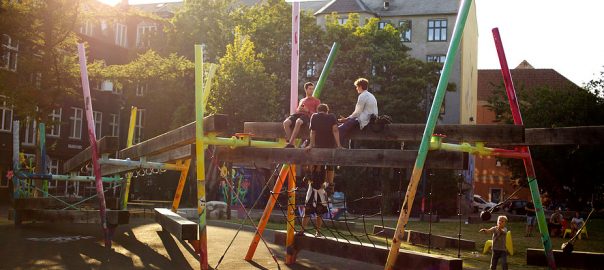
During a second walking workshop (implemented in Kisumu, Kenya), I was particularly impressed by a community member who took the lead of the tour with pride. He showed off some improvements he was doing, such as planting a nursery along the river banks, which not only has potential for future income for his family but also protects the river banks from erosion. As part of the feedback after the Kisumu walking tour one of the municipal officials said she found the tour useful because “it forced her to be out of her office and to walk a site that she has never walked before”. As a result, the walking tour gave her a different perspective on how she could use her expertise and knowledge to enhance some of the activities that the community members valued, and were already doing. The session also offered an opportunity for city officials from various departments to understand how vital interdepartmental and intersectoral collaboration is in tackling certain issues. This showed me how the exchange of knowledge between stakeholders can improve governance, ultimately leading to long-term and sustainable interventions.
Is urban tinkering an appropriate method?
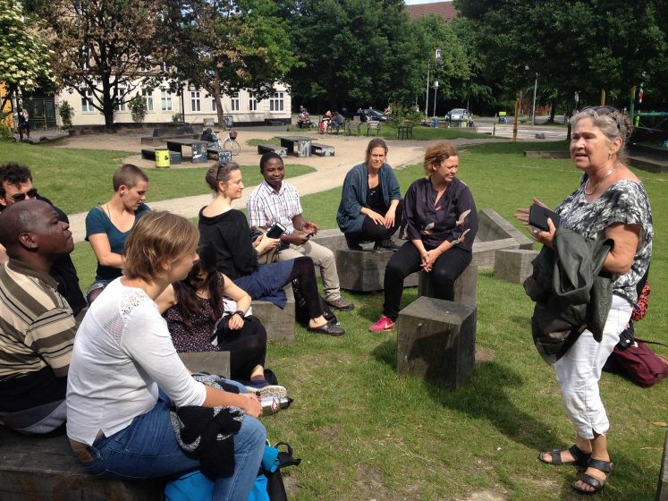
Urban tinkering allows decision-makers and communities to look at challenges and collaborate in innovative ways. It improves the understanding of the local context by providng the opportunity to observe how people use an actual site and analyse how existing opportunities can be harnessed. This includes understanding what kind of economic or social benefits are derived from the site. The methodology focuses on small scale solutions and local knowledge that can later be upscaled to respond to everyday challenges.

Why Conserve Small Forest Fragments and Individual Trees in Urban Areas?

Many voices. Greener cities. Better cities.

For many developers and city planners, it takes time and money to plan around trees and small forest fragments. Often, the message from conservationists is that we want to avoid fragmentation and to conserve large forested areas. While this goal is important, the message tends to negate any thoughts by developers towards conserving individual mature trees and small forest fragments.

Fragmented landscapes have value for a variety of species—stating that fragmentation is unequivocally bad can only lead to lost conservation opportunities.

To design around individual trees and small forest fragments, it takes a good deal of planning and, in some cases, extra costs. Roads have to be realigned, homes on lots have to be sited to protect trees, and a considerable amount of construction management has to be implemented to prevent earthwork machines from damaging conserved trees and forest areas. From an engineering/construction perspective, it is sometimes easier to wipe out all vegetation and start from scratch. So why should trees and forest fragments be conserved? Below, I discuss a few ecological and environmental reasons.

Hartfordforest
A view of the tree canopy in downtown Hartford, Connecticut. Photo: Hari Menon/Flickr and American Forests

Benefits for migrating birds

Long-distance Migrants

In and around urban areas, forest fragments could be used by an important group of long-distance migrants called Neotropical birds (Figure 1). These birds typically breed during the summer in the U.S. and Canada and they migrate south to spend the winter months in Mexico, the Caribbean islands, Central America, and South America (Figure 2). Migrating species make the return trip in the spring back to their breeding grounds. Along the migration route, forest fragments in urban areas can serve as stopover sites where migrants rest and forage for food. These stopover sites are critical, as the birds need to rest and forage in these sites in order to make their long journeys.

Yellow_Warbler_(audubon)

Yellow-throated_Vireo_(audubon)
Figure 1. Neotropical migrants, such as the Yellow Warbler (Setophaga petechia, top photo) and Yellow-throated Vireo (Vireo flavifrons , bottom photo), migrate during the spring and fall. Forest fragments could be used as stopover sites during migration. Photos: Audubon, www.audubon.org

On their breeding grounds, a few Neotropical migrants use forest edges and open woodlands and are not very sensitive to forest fragmentation (e.g., Baltimore Oriole, Icterus galbula). However, many Neotropical migrants are sensitive to fragmentation (e.g., Cerulean warbler, Setophaga cerulea) and typically only breed successfully in large patches of forest (e.g., greater than 100 acres). Birds that primarily breed in large forest patches are called interior forest specialists. It is hypothesized that these species are vulnerable in fragmented landscapes because they are area sensitive, typically nest in open-cups on or near the ground, have small clutch sizes, and often do not nest again if a nest fails.

yellowwarblermap
Figure 2: Yellow Warbler’s range map. All along the migration route, from the upper regions of Canada to the southern regions of Columbia, birds can use forested areas as stopover habitat. Image: www.allaboutbirds.org

In fragmented landscapes containing agricultural and urban areas, a variety of nest predators and brood parasites are more abundant along the edges of forests. Nest predators include mammals and birds, such as raccoons, cats, skunks, blue jays, and crows. The main brood parasite is the brown-headed cowbird, which lays eggs in a Neotropical migrant’s nest; the parents are tricked into feeding and raising the cowbird chick instead of their own. Cowbirds and nest predators thrive in fragmented forest landscapes containing agriculture fields, pastures, and residential development.

Some interior forest specialists (e.g., Canada Warbler, Cardellina Canadensis) breed in dense understory growth in the openings of large forests and use regenerating vegetation (caused by windfalls, fires, and clearcutting) when nesting. Although they technically breed along edges, they do so in large forested areas, and they are thought to be vulnerable to forest edges found in fragmented landscapes where urban and agricultural areas are nearby. This is because of increased predation and cowbird parasitism in fragmented landscapes containing agriculture and urban areas. Overall, interior forest specialists are vulnerable to forest fragmentation; many populations of these species are declining and are in danger of extinction due to human modifications of the landscape.

Short-distance migrants

Short-distance migrants are birds that breed in the U.S. and Canada and winter in the U.S. Many of these species include populations that are considered both as year-round residents (e.g., they breed and winter in the same area) and short-distance migrants. American Robins (Turdus migratorius ) are one example: a portion of the robin population breeds in Canada and migrates south to the U.S. during the winter. American robins can be seen year round in most states south of Canada, but of these robins, a portion of the population will migrate south during the winter, going across state lines. Florida is one state where robins do not breed but they can be found in Florida during the winter because some robins migrate there.

Sometimes, individuals in the same species can either be short-distance or long-distance migrants. For example, Cedar Waxwings (Bombycilla cedrorum) are Neotropical migrants, with a majority appearing during the winter months in Central America and the Caribbean islands. However, a portion of the population winters in southern states, such as Georgia, Texas, and Florida.

Do migrants use forest fragments and trees as stopover sites?

Through a literature review that my graduate student (Jan Archer) and I conducted, we found that many Neotropical migrants—both interior forest specialists and migrants that breed in small forest patches and open woodlands—use small forest fragments as stopover sites. Thus, small forest fragments may not be appropriate breeding habitat for many interior forest migrant species but these fragments could serve as stopover habitat. Short-distance migrants also use forest fragments as stopover sites. We even found studies that found migrating birds using trees in residential areas. Thus, individual trees and small forest fragments are important features in urban landscapes for migrating birds.

In the literature, we found that a majority of the migrant species were from studies that surveyed in one or several similar-sized, small forest fragments. These studies listed migrant bird species that used these patches during the fall or spring. They did not explicitly compare forest fragments of different sizes. However, a few studies conducted surveys across a range of small forest fragments, and these studies found that relatively larger forest fragments contained more Neotropical migrants. These were still small fragments, but more birds were found in forest fragments from 10 to 17 acres in size when compared to fragments from 1 to 10 acres. Because of these studies, I suggest conserving relatively larger forest fragments when opportunities present themselves.

Carbon and energy benefits

First off, trees and forests sequester and store carbon. Trees perform an important function in the natural carbon cycle, helping to mitigate climate change. Through the process of photosynthesis, trees sequester, or capture, carbon dioxide from the atmosphere to create energy for growth. This carbon is then stored in the tree’s biomass over its lifetime. Trees store carbon in their leaves, branches, trunks, stems, and roots, and their fallen leaves contribute biomass to the soil. In addition to directly limiting carbon emissions by storing carbon, trees can indirectly limit CO2 emissions when they are positioned effectively so that they shade a house. Providing shade and evapotranspiration near homes (see here) reduces building energy needs for cooling, allowing homeowners to avoid unnecessary carbon emissions. Trees shade homes, reducing building temperatures and the amount of sunlight entering homes (Figure 3). In such cases, the air conditioning unit will run less frequently and use less carbon-emitting energy to cool the home (see here).

MaderaModelHome
Figure 3. A model home in Gainesville, FL where trees have been conserved to provide shading. Photo: Hal Knowles

Not all trees avoid, sequester, or store carbon at the same rate, however. Carbon sequestration rates and avoidance of carbon emissions are based on a tree’s species, age, size, height, crown characteristics, overall health, and its location in the yard. For example, a live oak (Quercus virginiana, Figure 4) will sequester and store more carbon than a magnolia (Magnolia grandiflora) or a loblolly pine (Pinus taeda). A live oak will typically have more biomass than a pine or a magnolia for a number of reasons. First, wood density has a positive relationship with the amount of carbon stored. In general, hardwood tree species, such as oaks, tend to have a denser wood and a more open crown structure than softwood species. Greater wood density equates to greater biomass and, generally, a more open crown structure means more volume and growth and, therefore, higher carbon sequestration.

live oak
Live oak trees with resurrection fern and Spanish moss. Credit: Treehuggerimages.com

Summary

Overall, urban trees and forest fragments provide many ecological, environmental, and aesthetic benefits. In particular, the function of stopover sites for migrating species is very interesting and more research is needed to document the ecological benefits of urban trees and forests. I did not review all benefits, for example, how trees control stormwater runoff and improve water quality (see here). The trick is to convey information to developers and environmental consultants that make on-the-ground decisions. As conservationists, we have to be careful about our messages, as they may dissuade decision makers from doing the best that they can.

As mentioned in this essay, fragmented landscapes do have value for a variety of species and only stating that fragmentation is bad can lead to lost conservation opportunities. Providing local, model examples can help promote such communication and best management practices. Also, city policies can create the enabling conditions for urban forest conservation, such as the Urban Design Framework and Green Streets Policy in Melbourne, Australia, and the Tampa, FL Urban Forest Management Plan.

Mark Hostetler
Gainesville

On The Nature of Cities

Why Defunding the Police is an Issue of Democracy and Public Space

Many voices. Greener cities. Better cities.
As the virus and the revolution continue to unfold in real time, all with the threat of climate change looming, we must ask ourselves who and what we will prioritize. Will we continue to feed the systems that claim to keep us safe, while in reality upholding white supremacy at the cost of Black lives? Or will we invest in our community resources in the places where it counts the most?
In the first five months of 2020, we have seen enough change, chaos, and uncertainty to last a lifetime. The year began with a world on quite literally on fire, most notably in Australia. The news cycle was quickly upended when the novel coronavirus swept the globe. Now, police violence has led to the beginnings of a revolution in the streets. Watching all this unfold while still under “shelter-in-place” has shifted our relationships to nature and the civic realm, and reaffirmed the need for public space that is accessible and safe for all.

Despite some of the rhetoric circulating, we know that COVID-19 is not a great equalizer that is blind to color and privilege. It is true that this pandemic is personally impacting every individual in a way that few events in history have, and that the COVID-19 infectious droplets cannot themselves discriminate based on race or class. But just as “natural” disasters are a result of both social and environmental factors, the virus itself is only one actor in the current pandemic. Our leaders, police, and healthcare systems are all co-producers of this crisis and help dictate who is impacted. Environmental justice literature and activism have taught us that the effects of climate change disproportionately burden the already vulnerable, and COVID-19 is no different. We are seeing increasing evidence of disturbingly high death rates in poor Black communities in the United States, while the wealthy can escape to their private islands to wait out the pandemic in luxury.

This means that open spaces in urban areas are needed now more than ever. Those of us with the privilege to have a public park within walking distance have likely seen a change in how the space is used and what it means to us. A few of my colleagues and I have been journaling about our experiences in New York City during shelter-in-place, and all of us have found new meaning in our neighborhood walks and park visits. Beyond providing crucial ecosystem services, parks allow for physical fitness and recreation, and have proven mental health benefits. As the weather warms, parks and open spaces are becoming even more of a necessity, providing places to visit with friends while maintaining safe social distance.

But we also know that access to and safety within public space is an issue of racial equity that has been heightened since the pandemic. Activists have long been aware of the general lack of parks and public space access in lower income communities of color. It is no surprise that these few existing parks are seeing increased crowds on nice days, nor is it surprising that we are seeing disparate enforcement of social distancing. Images of police happily handing out masks in crowds of white people contrast sharply with the violent, stop-and-frisk style policing in Black neighborhoods. This inequitable policing, along with the surge in the murders of Black bodies, reminds us that there are multiple pandemics going on right now, all of which are disproportionately impacting the Black community.

Photo: Laura Landau

The recent public murders of George Floyd and Ahmaud Arberythe latter of which has been charged as a hate crimealong with the racist incident against Christian Cooper in New York’s Central Park (which could have easily also ended in police violence), are all direct results of the racist police system embedded in the origins of our country. Indeed, the case of Arbery arguably fits the definition of a “lynching,” an informal public execution over an alleged offense without legal trial. In addition, all of these incidents took place in public spaces that belong to the victims just as much as they belong to anyone else. These are just a few of the recent examples of a much more pervasive and systemic problem, a problem that protesters on the streets demand be finally solved.

These protests have highlighted another important use of public space: the right to assemble. Following Trump’s election, New Yorkers for Parks documented the hundreds of thousands of people who came out to protest in NYC public spaces in the year 2017. The streets, parks, and plazas served a crucial role as gathering points for demonstration. Now, many of those same spaces are once again being activated. In my own Brooklyn neighborhood, I’ve joined and witnessed crowds filling major streets like Eastern Parkway, and congregating at Barclay’s Center and Grand Army Plaza. I am reminded of the many times I have gathered with my community in those spaces to pray, to celebrate, to mourn, and to speak out. I am reminded that the ability to take up space in public is a human right that is protected for white and privileged citizens but not others.

In the past few days, Mayor Bill deBlasio has condemned the “violence” of protesters against inanimate objects while defending the police for driving an SUV into a crowd of people, threatening human lives (he only softened his stance after considerable blowback). Recent budget cuts to crucial city agencies—including the Parks Department have affirmed deBlasio’s priorities. He thinks that more police will equal more safety. But we know that it is the eyes on the street of our community members that keep us safe, not the police. Luckily, some of our leaders agree, and are pushing back against deBlasio’s budget proposal. In an email to his constituents on 31 May 2020, New York City Council Member Brad Lander called for a de-escalation of the NYPD:

“At the city level, cuts to the NYPD’s budget are necessary. As the city faces a massive deficit, the mayor proposed a budget that would put a hiring freeze on teachers, counselors, youth workers, parks workers … but not police officers. If we can’t afford to hire more teachers, then we cannot afford to hire more cops.”
—New York City Council Member Brad Lander

Lander also highlighted the work of Communities United for Police Reform (CPR) in leading a campaign for budget justice (#NYCBudgetJustice). As it stands, for every dollar toward the NYPD, crucial agencies and services are getting pennies (see image). The campaign calls for cuts to the nearly $6 billion NYPD budget, and for funds to be redirected towards social services that work to combat the impacts of COVID-19, particularly in the Black, Latinx, and other communities of color that have been hit the hardest. Imagine the impact $6 billion could have on our communities if it instead went toward public health, fair and affordable housing, community programing, and parks.

As the virus and the revolution continue to unfold in real time, all with the threat of climate change looming, we must ask ourselves who and what we will prioritize. Will we continue to feed the systems that claim to keep us safe, while in reality upholding white supremacy at the cost of Black lives? Or will we invest in our community resources in the places where it counts the most? We have entered a moment of sustained uncertainty, and many are feeling the hopelessness that comes from not knowing what will come next. Instead of giving into despair, let’s address the things we can control, starting with starting with reallocating money away from police departments and toward the services and public spaces that foster community building.

Audre Lorde reminds us that “Sometimes we are blessed with being able to choose the time, and the arena, and the manner of our revolution, but more usually we must do battle where we are standing.” As researchers and practitioners who are passionate about sustainable and just cities, this is our fight.

Laura Landau
New York

On The Nature of Cities


Why Design Matters

Many voices. Greener cities. Better cities.
See the full list of Essays
Introduction, Toni L. Griffin, Ariella Cohen and David Maddox Tearing down Invisible Walls Defining the Just City Beyond Black and White, Toni L. Griffin In It Together, Lesley Lokko Cape Town Pride. Cape Town Shame, Carla Sutherland Urban Spaces and the Mattering of Black Lives, Darnell Moore Ceci n'est pas une pipe: Unpacking Injustice in Paris, François Mancebo Reinvigorating Democracy Right to the City for All: A Manifesto for Social Justice in an Urban Century, Lorena Zárate How to Build a New Civic Infrastructure, Ben Hecht Turning to the Flip Side, Maruxa Cardama A Just City is Inconceivable without a Just Society, Marcelo Lopes de Souza Public Imagination, Citizenship and an Urgent Call for Justice, Teddy Cruz and Fonna Forman Designing for Agency Karachi and the Paralysis of Imagination, Mahim Maher Up from the Basement: The Artist and the Making of the Just City, Theaster Gates Justice that Serves People, Not Institutions, Mirna D. Goransky Resistance, Education and the Collective Will, Jack Travis Inclusive Growth The Case for All-In Cities, Angela Glover Blackwell A Democratic Infrastructure for Johannesburg, Benjamin Bradlow Creating Universal Goals for Universal Growth, Betsy Hodges The Long Ride, Scot T. Spencer Turning Migrant Workers into Citizens in Urbanizing China, Pengfei XIE The Big Detox  A City that is Blue, Green and Just All Over, Cecilia P. Herzog An Antidote for the Unjust City: Planning to Stay, Mindy Thompson Fullilove Justice from the Ground Up, Julie Bargmann Elevating Planning and Design Why Design Matters, Jason Schupbach Claiming Participation in Urban Planning and Design as a Right, P.K. Das Home Grown Justice in a Legacy City, Karen Freeman-Wilson Epilogue: Cities in Imagination, David Maddox
24. SchupbachMy vision for a just city is one where design and its power as a tool against inequality is leveraged for the benefit of all residents. As the director of design programs at the National Endowment for Arts, and one of the U.S. government’s primary advocates for good design, I spend a lot of time with mayors and other leaders advocating for the power of design. In the words of Charleston, South Carolina Mayor Joseph Riley, a mayor is “the chief urban designer” of his or her city.  Even so, most mayors require education on what design can do—and what it cannot do.

Why does design matter to the just city? 

Residents must be part of the urban design process. They must not only demand good design but also support and reward it.  History has shown good design does not happen without public input.
Design matters because design is all around us. Every object, place and many experiences are designed. Design is a problem-solving tool that transforms an idea into reality. Good designers take their creative genius, apply it to the most difficult problems in our lives and come up with solutions that are sensitive to people’s needs, efficient, and ultimately cost-effective.  A recent British government study showed that every one pound invested in effective design yielded 26 pounds in savings.

Yet there are forces of inequality that are outside design’s reach as a tool. A just city will have fairer tax and fee codes to balance community resources for all of its citizens. A just city will crack down on predatory lending and other detrimental banking practices.  A more just city will have better paying jobs to help lift people out of poverty. A more just city will listen to the #Blacklivesmatter protestors and look at policies to address the unjust penal and policing system.  None of those are design issues.  Still, design can play a role. Here’s how:

Creating a better public realm: Mayor Riley likes to talk about how every citizen’s heart deserves to sing in public spaces. These are the spaces in the city that all of us own—the places where we can mix and build understanding across economic and racial barriers.  It is vitally important that they are designed the right way, and often, they are not. How a building meets the street matters, the materials you use matter, and the scale and size of spaces and buildings matter. It has been proven that better designed streetscapes and public spaces typically have less crime, higher pedestrian activity and increased economic activity.  If done correctly, public space can also have multiple other benefits too, such as the Main Terrian park in Chattanooga, Tennessee, which cleaned up a polluted site in a historically disadvantaged neighborhood (environmental justice benefit) and has public art that encourages exercise (public health benefits).

Many people (and NEA grantees) across the country are dedicated to making better public spaces. I advise you to go seek out their suggestions. It is important you empower not only the designer in the creation of public space but also the public at the same time.

Maintaining infrastructure: The maintenance of the designed part of cities, the buildings and infrastructure, matters. It shows respect for the entire public when you respect the public space. A just city is well-maintained across all of its neighborhoods. At the most basic level, the public infrastructure needs to work. Public water systems impact public health. Street lights lead to safety. It is all connected. Dr. Mindy Fullilove urgently talks about how the aging lead pipes in historically underserved neighborhoods are poisoning the children and holding them back in educational ability—maintenance matters. Even where you put flood infrastructure matters. In Fargo, ND, the huge drainage basins they built in response to the disastrous flooding of the Red River tore apart some of the most disadvantaged neighborhoods. To fix this mistake, they have used NEA funds to work with artists and designers to rethink the spaces as community commons for the neighborhoods—spaces to gather and be active that can also flood.

Improving connectivity: Transportation is a design issue. It helps determine street life, walkability and much more. Because of the gentrification of strong market cities and the hollowing out of the inner core of weak market cities, many lower income people have moved to the first ring of suburbs, which are often poorly served by public transit. This trend means if they do not have cars, they are unable to easily access the economic centers of their community. Some cities are responding to this trend better than others. In Atlanta, there are stories of people taking Uber to the nearest bus line because it is not walkable. Whereas in Houston, the city is redoing all of its bus lines—literally throwing out the map and starting over – in order to better serve lower income residents. What it all boils down to is people need to be able to get to jobs, and not everyone can afford a car and gas.  If we want to create accessible cities with economic opportunity for all, we must design better transportation systems.

Zoning for progress: There may be no topic more important to urban designers and more impenetrable to the public than zoning. These are the laws that regulate land use in most of America. They must be modernized if we want to build thriving, inclusive neighborhoods. Too many communities try to work within outdated regulations instead of tackling the issue head on, or they use zoning as a way to keep existing power systems in place—regulating affordable housing out of communities, for instance. It is a tool that must be used carefully though, as evidenced by the recent backlash to the rezoning plans in New York City. The intention was to help the market build more affordable housing, but instead the plans have led to a gold rush of speculation of the existing properties and begun to price out longtime residents.

Engaging all residents: Residents must be part of the urban design process. They must not only demand good design but also support and reward it.  History has shown good design does not happen without public input.  Most of the design people I know who care about inequality are asking important questions right now: When does design matter to the civic engagement process? How can it give voice to the previously unheard or underserved? How can design help them take control of the development decisions in their own neighborhoods?  We at the NEA are working with field partners to expand on what we already know: designers can help residents see what proposed change could look like sooner rather than later through temporary or inexpensive installations, and design processes can help residents envision their own future in inventive ways.  I suggest you check out the work of the Kounkuey Design Initiative in the Coachella Valley in California to get a sense of what design can do to engage and give voice to residents. They are one of many designers working in this space.

Experiment: We all know that there is limited funding out there to support our cities. To combat this, be experimental.  Try small things.  There has been an explosion of “tactical urbanism”—a fancy term for small temporary projects—happening across the nation in which designers and others act on their own initiatives to solve urban problems. Parking Day is one example of such works—it’s when people create a temporary park in a parking space.  While some probably think these projects do not address the big issues needed to be addressed in a just city, I have seen many of them impact their communities in important ways, such as the Market Street Prototyping Festival in San Francisco, in which the Planning Office is using temporary experiments to learn about what works before they undertake a massive rebuilding of the street. We’re seeing experiments all over the place and in unexpected places—take the work of Emily Roush-Elliot, an Enterprise Rose Fellow working closely with residents of Greenwood, MS.  As a first step to engage this historically disadvantaged African-American community, Emily and her co-workers took a muddy lot and, using a few concrete pavers and some benches, created a small new park.  This space brought residents out of their homes to discuss housing and economic needs and set forward a whole series of activities that are chipping away at years of disinvestment and distrust. Inequality will die from a thousand cuts, not a silver bullet.

Don’t forget about beauty: Aesthetics are subjective, but good design is not. In 2010, the Knight “Soul of the Community” study investigated just why people move somewhere. It asked the question: “Great schools, good transit, affordable health care and safe streets all help create strong communities. But is there something deeper that draws people to a city—that makes them want to put down roots and build a life?” After interviewing more than 40,000 residents over three years, the top three answers for why someone loves living in a place shocked almost everyone—they are “social offerings, openness, and aesthetics.” Doesn’t a just city build the place that people want to love? Don’t all residents deserve beauty? Many people have made the case as to why beauty is a tool for justice—the most famous being Elaine Scarry in her landmark work “On Beauty and Being Just.” While it is a must read, I do prefer the TED talk of another author in this series, Theaster Gates, who, amongst other ideas, makes a great case for how beauty begets beauty; beauty is a positive beacon shining a light to show that change is possible, and hence beauty can change how people act.

Design Matters

Remember, design is a tool—not a solution.  It is imperative that when trying to build a more just city you remember the anthropological history of a place and understand what has shaped it up to this point. Any leader or resident or designer must dig into the history of a place and look at the policies that have shaped it. If you do that and use the tools of design the right way, I am convinced that design will matter, that engaging smart designers will help as we try to bend the arc of history towards just cities.

Jason Schupbach
Washington


The Just City Essays is a joint project of The J. Max Bond Center, Next City and The Nature of Cities. © 2015 All rights are reserved.