Environmental traumas are here. Global climate is a reality that is bringing extremes in weather as we have seen recently with the devastating impacts of Hurricane Sandy in the northeast of the USA. And in the last several years there have been massive earthquakes that have devastated cities in Japan, Haiti and New Zealand. To manage the effects of these traumas on the urban environment, we first must identify the socio-ecological drivers governing the urban ecosystems and then ascertain the degree of departure of the “new-normal” state from the pre-trauma conditions. Individual and institutional responses set the trajectory of recovery and subsequently create a “new-normal” not only for ecological but also social systems.
The Christchurch earthquakes that began in September 2010 provided a unique opportunity to address the impacts of traumas on the urban environment and in particular, identifying “resilient” components of coupled ecological-social systems. In this blog I will outline a study focussing on urban vegetation succession post-earthquakes. In later contributions I will update the findings of this study based on further data analysis and discuss other aspects, such as the effects on urban fauna, and implications and options for future urban greening thru ecological design.
A shallow earthquake of 7.1 magnitude struck the South Island of New Zealand at 4:35 am on 4 September 2010. The quake caused widespread damage and several power outages, particularly in the city of Christchurch, New Zealand’s second largest city. Mass fatalities were avoided as the quake during the night when most people were off the street.
Aftershocks have continued into 2012 with some causing significant damage themselves. The strongest to date, of magnitude 6.3, occurred on 22 February 2011. Because this was centred very close to Christchurch and it occurred during the day, it was much more destructive, with 185 fatalities. Significant liquefaction affected the eastern suburbs, producing around 400,000 tonnes of silt. The total cost to insurers of rebuilding has been estimated at NZ$15 billion, making it by far New Zealand’s costliest natural disaster, and the third-costliest earthquake (nominally) worldwide.
In the aftermath of the earthquakes (and there have been >12,000 aftershocks as I write this) significant decisions meant that several parts of Christchurch city would not be re-built as the ground was deemed too unstable. This residential “red zone” (see the map below) includes over 7,000 residential properties which have been abandoned and are being progressively demolished.
The current proposal for the residential “red zone” is to convert it into a public park called Avon-Otakaro (see the map below). Here is an excerpt from the Avon-Ōtakaro Network [AvON] charter:
“Avon-Otakaro is a network of individuals and organisations promoting the future use of the residential red zone lands as an ecological and recreational reserve. We wish to establish a community-driven science-informed living memorial to rejuvenate and nurture the long-term environmental, economic, community and spiritual wellbeing of the eastern suburbs and of those living throughout greater Christchurch. Our aim is to turn a tragedy into an opportunity, a polluted drain into a vibrant river system, and exhaustion and despair into hope and inspiration.”
Various volunteer groups have been collecting ecological information on the area, particularly on the occurrence of notable mature native and exotic trees that should be preserved.
The majority of the properties in this zone were abandoned after the earthquakes in September 2010 or February 2011 with little or no subsequent maintenance to gardens and road verges. We sampled 100 properties over 9 suburbs with a view to determining the regeneration responses of native and exotic woody tree and shrub species after abandonment. The regeneration of native species has been rapid and, in some situations, prolific.
Native Plagianthus regius (lowland ribbonwood) seedlings 1.5m tall established on silt (liquefaction) in the front garden of a residential property. Photo: Glenn Stewart.
In the absence of garden management we are seeing a “new” vegetation dynamic driven by new substrate availability, dispersal of seeds by birds, and the presence of surviving seed sources. The most common native seedlings are cabbage tree (Cordyline australis), Coprosma spp. Pittosporum tenuifolium, P. eugenioides and Solanum aviculare, all of which have fleshy fruits and are dispersed by birds. There has also been a dramatic increase in seedlings of exotic species as well. Examples include Scotch Broom (Cytisus scoparius), Elderberry (Sambucus nigra), Prunus spp., Sycamore (Acer pseudoplatanus), and Buddleja spp. This is not surprising as disturbed substrates and a high light environment provide an ideal environment for exotic invasion, especially if persistent seed banks are already present.
Native Coprosma repens seedlings established in an untended “herbaceous border” in a residential property. Photo: Glenn Stewart
Substantial planting of native trees and shrubs in city residential gardens over the last several decades has provided a seed source for this regeneration. Seedlings are more abundant in suburbs with more mature native trees and also with greater numbers of “perch” trees (for bird-dispersed species). There was also a distinctive pattern of compositional change in native species (seedlings) with increasing distance from the coast. For example, the dioecious shrub Coprosma repens (naturally a coastal species) was more prevalent close to the coast. Prior to the earthquakes this species would not have been as common as it is not regularly planted in residential gardens. But after property abandonment it is increasing rapidly as a result of natural successional processes.
A typical “abandoned” property in the residential “red zone”, Christchurch. NB the front lawn now resembles an unkempt pasture and contains abundant exotic herbaceous and woody weeds. Photo: Glenn Stewart.
Conclusions and further research
Early indications are that the native flora is remarkably resilient. So much so that it seems certain that in the absence of human interference a substantial native-dominated urban forest will establish in the residential “red zone”.
On the other hand, vigorous and intensive on-going management will be required to control exotic species that are both adaptable and aggressive. The introduction of other native species that currently lack a seed source would also increase biodiversity and offer other important food sources for native birds, lizards and invertebrates. This area (Avon-Otakaro) has the potential to add to the rich tapestry of natural habitats in the city and become an area of considerable native biodiversity.
The preliminary results from our pilot study highlights the need for further studies of vegetation dynamics in urban landscapes and the nature of chronic and catastrophic disruption on the mechanisms of and management of vegetation within the context of dynamic physical, social and ecological systems.
The preliminary results from our pilot study highlights the need for further studies of vegetation dynamics in urban landscapes and the nature of chronic and catastrophic disruption on the mechanisms of and management of vegetation within the context of dynamic physical, social and ecological systems.
“It is estimated that 220 natural catastrophes, 70 technological disasters and 3 new armed conflicts occur each year”. Alexander (2005)
The urban environment and community are key indicators and drivers of a nation’s adaptability and resilience to catastrophic events such as earthquakes, fires, floods, tsunamis, dust storms and hurricanes. Yet the urban environment is often ignored or is an afterthought in planning even though accessible and diverse green space is regarded as a predictor of human health, happiness, equity, and biodiversity. In fact, the value of urban green space and more specifically biodiversity is critical to providing ecosystem services, services used by humans to survive and live and achieve resilience in the face of impending global disruption and despite the coming associated environmental and economic trauma(s).
In his book Green UrbanismTim Beatley touted Portland, Oregon as one example of progressive regional, bioregional, and metropolitan-scale greenspace planning in the U.S. It is true that the Portland metropolitan region is well known for its land use planning and sustainable practices. Portland itself has more LEED buildings than any other American city. While the nation had increased greenhouse gases by 13% between 1990 and 2001, Portland’s fell by 12%. During this period transit use increased 75% and bicycle commuting 500%. Between 1990 and 2000 the Portland region’s population grew by 31% but consumed only 4% more land to accommodate that growth. By contrast the Chicago region grew by 4% yet consumed 36% more land (Chicago Wilderness 1999: 21).
However, until relatively recently our region’s urban nature agenda has lagged behind in both local and regional land use planning. Competing policies have often made otherwise progressive land use planning objectives and natural resource protection a zero sum proposition. Urban planners have focused almost exclusively on creating compact urban form and containing sprawl to protect farm land outside the region’s Urban Growth Boundary (UGB). They have maintained that protecting “too much” urban greenspace inside the UGB would result in loss of the buildable lands inventory inside the region’s UGB. Most politicians, especially in Portland and Metro, ran their campaigns on a promise to hold a tight UGB.
Developing a watershed in Portland. Development inside the Urban Growth Boundary was permitted so that land outside the boundary could remain green. Top: 1984. Middle: 1990. Bottom: 2002. Credit: Jim Labbe.
Unfortunately, the UGB became a sacrosanct icon, an end to a means rather than merely a planning tool. As a result the Portland-Vancouver metropolitan region has failed to adequately protect natural resources within the region’s Urban Growth Boundary and inside the region’s twenty-five individual cities, including Portland (Houck and Labbe 2006, p. 40).
Lessons learned: size and scale matter
One of many barriers to protecting urban natural areas is knowing where they are and their relative importance to maintaining biodiversity.
“Connectivity is needed both within a particular network and across many networks of human, built, and natural systems in a region. Some structures and patterns would be more appropriately understood at a regional and metropolitan scale; others, at the city or neighborhood scale; and still others at the site scale.” (Gerling and Kellett, 2006).
To be fair, the UGB has been very successful at maintaining the region’s compact urban form and there have been some significant milestones in our region concerning description and protection of special urban landscapes. The earliest is John Charles Olmsted’s 1903 master plan for Portland’s park system in which he observed that the city was “most fortunate, in comparison with the majority of American cities, in possessing such varied and wonderfully strong and interesting landscape features” (Olmsted, 1903: 34).
John Charles Olmsted was brought to Portland by the citizen park boards in Portland, Oregon and Seattle and Spokane, Washington.
Olmsted proposed that Portland create a ”system of public squares, neighborhood parks, playgrounds, scenic reservations, rural or suburban parks, and boulevards and parkways” built around features that are today among Portland’s most treasured natural landscapes (Olmsted,1903: 36-68). Unlike Seattle and Spokane, two cities he also visited on his train excursion to the Pacific Northwest, Portland was too tight with its budget to pay Olmsted to create a map. It fell to later park advocates to produce such a map. And, while his vision included significant natural areas, it was solely for the city of Portland, not the metropolitan region.
Needless to say, it was neither GIS-based nor scientifically derived. Still, many of his recommendations ring true today. For example, he addressed urban stream management in a prescient manner, especially with regard to today’s concerns with stormwater management and adaptation to climate change, when he wrote:
“Marked economy in municipal development may also be effected by laying out parkways and park, while land is cheap, so as to embrace streams that carry at times more water than can be taken care of by drain pipes of ordinary size. Thus brooks or little rivers which would otherwise become nuisances that would some day have to be put in large underground conduits at enormous expense, may be made the occasion for delightful local pleasure grounds or attractive parkways.” (Olmsted 1903)
Similarly, in yet another forward thinking passage, he admonished the city to avoid building on steep slopes:
The broken hillsides between Portland Heights, and the comparatively flat portion of the city below, are neither economical nor desirable as building sites for crowded residences; It would be a very profitable investment for the city to take these lands out of the market and use them for pleasure grounds for the benefit of the citizens at large, and for the particular benefit of adjoining properties below.” (Olmsted 1903)
There were, however, no turn-of-the-century maps to represent hazard avoidance, much less biodiversity hot spots.
“Another school of thought…believes that open-space planning should take its cue from the patterns of nature itself—the water table, the flood plains, the ridges, the woods, and above all, the streams…I think these people are right and that there is strong evidence to prove that their way works…” (William H Whyte, 1968)
1971 Urban Outdoors Map, from Columbia Region Association of Governments (CRAG) report.
Landscape planning did not truly get underway in our region until 1971 when the Columbia Region Association of Governments (CRAG) laid out a bi-state Park and Open Space System based on the premise that “open spaces are needed for immediate enjoyment and use within the urban complex.” (CRAG,1971: 3-4).
The CRAG report did include a map, but it merely conceptualized some of the region’s most significant natural areas in broad strokes. It contained no information regarding the region’s flora and fauna. It also went to the region’s bookshelves because it lacked the political and public support necessary for its implementation. The bounty of natural resources outside the urbanized portion of our region (Columbia River Gorge, Mt Hood Wilderness, Oregon Coast, and Willamette Valley) drew the region’s attention to conservation, resulting in a lack of protection within the urban core.
Areas outside the region’s UGB, like the Columbia River Gorge, were the focus of conservation efforts in the 1970s and 1980s. Photo by Mike Houck.
Scale and science: getting it right
It was another twenty years before public alarm at the loss of local greenspaces grew into a full-throated grassroots, citizen-led demand for protection of urban nature at both the local and regional scales.
Portland State University, Audubon Society of Portland and Metro collaborated to create for the first time in the region a map of natural resource lands in the four county Portland-Vancouver metropolitan region in 1989.
Three years later Metro adopted the Metropolitan Greenspaces Master Plan calling for “a cooperative regional system of natural areas, open space, trails, and greenways for wildlife and people” in the four-county metropolitan area that would “protect and manage significant natural areas through a partnership with governments, nonprofit organizations, land trusts, businesses and citizens.” The system’s primary purpose was to preserve the diversity of plant and animal life in the urban environment using watersheds as the basis for ecological planning and restore green and open spaces in neighborhoods where natural areas had all but eliminated (Metro, 1992).
In 1995 a coalition of park advocates and Metro threw their political weight behind the passage of a region-wide bond, which produced $135.6 million for urban natural area acquisition. In the fall of 2006 Metro passed a second bond that will provide another $227.4 million for additional acquisitions. The combined $363 million has allowed Metro to purchase over 12,000 acres of biologically rich natural areas and parkland, bringing the total holding to over 16,000 acres. Local park providers across the Columbia River in Clark County, Washington added thousands more acres with their local share and Washington’s Legacy Lands program.
This graph represents natural areas added to public ownership. It is no coincidence that public acquisition of regionally significant natural areas grew exponentially after Metro’s 1992 adoption of a Greenspaces Master Plan for the Portland-Vancouver region. Credit: Jim Morgan, Metro.
Regional restoration strategy and biodiversity guide for the greater Portland-Vancouver region
We envision an exceptional, interconnected system of neighborhood, community, and regional parks, natural areas,trails, open spaces, and recreation opportunities distributed equitably throughout the region. This region-wide system is an essential element of the greater Portland-Vancouver metropolitan area’s economic success, ecological health, civic vitality, and overall quality of life. — The Intertwine Vision
Former Metro Council President David Bragdon.
In the summer of 2007 the Metro Council President, David Bragdon invited Chicago Mayor Richard Daley and several other dignitaries from around the U.S. and issued a challenge. Bragdon declared that his top priority in his final two years in office was to create the “greatest park system in the world” in the Portland-Vancouver region. Subsequent to his departure to work for New York City as director of their planning and sustainability program The Intertwine Alliance, a new nonprofit organization was created to embark on creation of that system, now known as The Intertwine.
There had been earlier efforts to map regionally and locally significant landscapes that would contribute to maintaining biodiversity in our region but they all had drawbacks, mostly related to scale and geographic extent. The 1989 PSU and Metro effort suffered from the fact that the minimum mapping unit for upland forests was five-acres. The habitat map did not cover the entire 3,000 square mile Intertwine geography. An earlier effort by The Nature Conservancy’s Oregon Natural Heritage Database project, which mapped Oregon, Washington and Idaho, had pixels so large that the entire Portland metropolitan region was characterized as “urban” — that is, their mapping suggested that the entire metropolitan region was a biodiversity free zone.
Once again both scale and geographic extent were all wrong.
The image on the left represents earlier vegetation mapping of Oregon, Idaho and Washington at a scale that suggests no biodiversity within the UGB. When mapped at the appropriate scale high biodiversity is revealed inside the UGB (lower right). The remapping effort was initiated by the U.S. Fish and Wildlife Service and the Intertwine Alliance.The Nature Conservancy’s Oregon Natural Heritage Database project mapped Oregon with pixels so large that the entire Portland metropolitan region (inset) was characterized as “urban”, i.e., no nature at all.
In 2005 the region’s Greenspaces Policy Advisory Committee convened a diverse expert panel that created a map (below) which depicted what in their best professional judgment were the highest priority landscapes in the Portland-Vancouver region. The map was a valuable aid to prioritizing acquisition and restoration projects and the geography was right.
But, there was no “science” behind the map (below), only expert opinion.
Greenspaces Policy Advisory Committee’s “expert panel” 2005 map of highest priority landscapes in the Portland-Vancouver region, based on expert opinion.
The geographic area for mapping was 2,859 square miles, including all or parts of seven Oregon and three Washington counties and 14 sub-basins (HUC 4 and HUC 5).
In any mapping effort the issue of database size is a critical factor. In our region, while we have imagery at the one-half meter resolution most regional mapping efforts have been at 30-meters or larger resolution, which is fine if all your are interested in is characterizing an ecoregion. If, however, you are interested in both the ecoregion and urban core higher resolution is required.
To achieve both the coarse and fine grained objective of our work the Alliance contracted with Portland State University’s Institute for Natural Resources (INR) to produce a land cover maps of the greater Portland-Vancouver region at 5-meter pixel resolution. The project mapped land cover, forest and tree patches, watersheds, and public land ownership.
This map indicates the extent of the 2,850 square mile Portland-Vancouver metropolitan region that was mapped for The Intertwine Alliance’s biodiversity mapping, including breakdown of area by city and county. Source: Biodiversity Guide For The Greater Portland-Vancouver Region, The Intertwine Alliance.
To add “science” to the land cover mapping and develop a method for prioritizing acquisition and restoration across both the urban and rural landscape the Alliance developed a modeling effort that was coordinated by a GIS savvy subcommittee representing federal, state, and local jurisdictions and nonprofit organizations. The Institute for Natural Resources (INR) assumed data development and modeling approach with input from the GIS Subcommittee.
The model allows, for the first time in our region to prioritize areas of high conservation value across the 3,000 square mile urban-rural continuum, both within and outside the urban core, from the 3,000 square mile region to individual neighborhoods and the streetscape.
Five meter resolution, combined with habitat modeling, will allow biodiversity-focused planning at every scale, from the neighborhood and street scape, to local areas, and to the entire 3,000 square mile Intertwine region. Source: Biodiversity Guide For The Greater Portland-Vancouver Region, page 177
The model provides more detail than any previous mapping effort. Interestingly, when areas of highest biodiversity potential from the Biodiversity Guide are compared with the earlier 2006 “expert panel” map there is virtual overlap between what the model predicts with regard to highest priority habitats and what a panel of experts all of whom were knowledgable about the region indicated where their highest priority landscapes for protection and restoration.
Armed with the high resolution mapping and modeling results The Intertwine Alliance and its partners from nonprofit organizations and government agencies have, for the first time in the history of our region, the science-based tools to manage both the urban and rural landscapes with an aim to protect the region’s biodiversity, provide a framework for adapting to climate change, and move toward creating a world-class system of parks, trails, and natural areas for the region’s citizens to enjoy access to nature where they live, work and play.
Mike Houck
Portland, Oregon USA
_______________________________
Gerling and Kellett (2006), Skinny Streets & Green Neighborhoods, Design for Environment and Community, Island Press.
Beatley, Tim (2000) Green Urbanism, Learning from European Cities, Island Press, 38, 16, 30, 407, 35, 224.
Chicago Wilderness (1999) An Atlas of Biodiversity, Protected Land in the Chicago Region, Chicago Region Biodiversity Council, Chicago Wilderness Chicago, IL, 21.
Houck, Michael C. and Labbe, Jim (2007) Ecological Landscape: Connecting Neighborhood to City and City to Region, Metropolitan Briefing Book, Institute for Metropolitan Studies, Portland State University, 40, 44-46.
Wiley, Pam (2001), No Place for Nature, The Limits of Oregon’s Land Use Program, In Protecting Fish and Wildlife Habitat in the Willamette Valley, Defenders of Wildlife.
Olmsted, John Charles and Frederick Law Jr. (1903) Outlining a System of Parkways, Boulevards and Parks for the City of Portland, Report of the Park Board, Portland, 34, 36-68.
Metro, (1992) Greenspaces Master Plan, Metro Parks and Greenspaces Department.
Regional Conservation Strategy For The Greater Portland-Vancouver Region,The Intertwine Alliance, 2012. www.theintertwine.org
Biodiversity Guide For The Greater Portland-Vancouver Region, A companion to the Regional Conservation Strategy, The Intertwine Alliance, 2012. www.theintertwine.org.
It is interesting that we think of nature in cities only as fauna and flora. Mineral nature—the rocks and inert resources—is the stage on which living nature is set. In cities, this means that the embedded nature all around us, that has been extracted from the Earth like the processed aggregate that we use to make concrete, or the oil (decomposed plants) we lay down for our streets as asphalt, are excluded from the conversation about nature in the city, or city nature. What is it about mineral, inert nature that surrounds us in the city—and is used to create the infrastructure we depend on like buildings—that it gets no attention? We make pilgrimages to see Half Dome in Yosemite, or admire the Palisades along the Hudson River, but the transformation of this inert nature, the rocks, gypsum, iron ores and other metals and minerals, timber and asphalt, are never considered as part of the nature in cities. They are often seen as in the way of planting more trees, allowing water to infiltrate into the soil, and to creating more green open space.
What would happen to our view of city nature if we began to be aware of all the embedded inert nature in urban areas and consider the enormous resource value they contain?
Inert nature, the materials that make up the city and every object in our daily lives, is almost incomprehensibly ubiquitous, and valuable. It represents a sunk investment, sunken fossil energy, sunken human energy, sunken materials that can only be reused (if at all) by applying more energy, labor and ingenuity. Many of the materials are already highly energy intensive, like concrete, aluminum, steel. Energy that is often fossil energy, and to reuse them means more fossil energy expended. These mineral resources in cities are predicated on a vast exploitation of Earth ecosystems and resources. Should we begin to treat this embedded mineral nature with more awareness of what it represents relative to the exploitation of natural resources, ecosystems and people, it might lead to new ideas about how to make cities more sustainable.
The ubiquitous way in which sunken infrastructure is invisible can be seen in the way modern ecology has turned its back on the interactions between natural and modern industrial systems, just like much of neoclassical economics has ignored the physical and biotic underpinnings of economic production. Economic production is treated as sui generis, subject to its own rules and not to natural scarcities or pollution impacts on future biotic or physical resources. Ecologists have little to say about modern industrial systems, despite those systems being derived from, and built upon, physical principles and elements (Hall, Cleveland and Kaufmann 1992). Sustainable city literature seems to have done so as well. Ecological footprint analysis, that measures embedded energy in the city, still does not seem to make us appreciate the actual mineral materiality in our every day urban lives. To realize how much Earth resources our existing cities contain, and to begin to consider those transformed resources as part of city nature, could transform our relationship to the city’s infrastructure.
One of the myths supporting the invisibility of nature in infrastructure is that technological advances and human ingenuity make the issue of resource availability and resource quality irrelevant (Hall, Cleveland and Kaufman 1992). Though modern technology has made the link between natural resources and human existence less apparent, we are still as dependent as ever on the extraction of natural resources to make material goods, and to build infrastructure. The lack of awareness of the processes and impacts of resource exploitation and the often profound disruptions in the ecosystem where that deposit is located, regardless of its scarcity, enable a kind of cavalier approach to the built environment, where not only do we build carelessly as to the local impacts on natural systems, but we are wasteful of Earth resources, building cheaply knowing that things will be torn down and rebuilt in the next economic cycle, or by the next property owner, or that with enough heating and cooling energy expended, the quality of the construction does not matter.
Half Dome, Yosemite National Park. Photo: USGS.
Yet, true resources are expended in rebuilding, resources from nature that come from somewhere. Just like cutting down mature street trees is wasteful, so is our churning of the urban fabric to maximize the next real estate cycle. So, to better take this situation into account, we need to comprehend that the mineral hard surfaces of the city are city nature too. This calls for consciousness in what we use to build, how we build, and ensuring the longevity of that investment.
Over time, as resources become rare, or dissipated, the more energy will be needed to extract them. Geological factors ultimately determine the amount of energy needed to exploit a resource deposit and humans can apply greater and greater fossil energy to extracting resources—to a point. Ultimately there are diminishing returns and the resource is too dissipated to be exploited in any reasonable manner. There are changes in quality of the resource with increased rates of exploitation. All this is important to keep in mind when thinking about the nature in cities and sustainability.
What has already been extracted and transformed into usable materials must be valued for what it is: largely unrenewable. For example, copper deposits, once exploited, do not regenerate. Copper in infrastructure provides important services, it has to be conserved, reused, well managed. Plastics, such as for pipes, may be more abundant since we still have fossil energy, but once disposed of are unrecoverable, and pose disposal challenges.
Chino open pit copper mine., New Mexico USA. Credit: Wikipedia.
Understanding that cities are nature—including an inert nature that is harvested, extracted, mined, reprocessed and made into our roads, buildings, pipes, roofs, wiring, doors, windows, mechanical systems, and more—is sobering. It means we need to be thoughtful when we advocate for new LEED buildings, or Zero Net Energy buildings. It means that any new infrastructure, including public transportation infrastructure, means more capturing of mineral nature and the application of fossil energy, to make it and to place it in existing infrastructure, ripping out the existing infrastructure that will then need to be disposed of. All that rubble originally came from somewhere, whose extraction damaged ecosystems.
One approach to better determine how to retrofit the existing built environment is to begin to employ new tools like life cycle analysis more systematically, to reveal the already invested materials and energy in what we have built. Life Cycle Analysis (LCA) is a cradle to grave energy and materials accounting method that reveals the existing sunk costs. Conducting LCAs to better evaluate choices in approaching the already built environment could lead to better use of existing cities, densifying them, repurposing existing buildings, reworking existing transportation corridors, and appreciating the degree to which the cities we live in are expressions of nature in and of themselves rather than disregarding the resources already mustered in what we have built already.
In Los Angeles we have a research project attempting to quantify the city’s urban metabolism—the energy flows in and the waste flows out—in greater granularity and specificity. Concerned with understand the energy and materials already existing in the built environment, we are using county tax assessor parcel data that includes building age, size, type, and material make up. Based on this information we are creating a life cycle assessment of the embedded energy in 27 different building types to begin to account for the nature that we have already used and are living in.
This type of accounting may help in determining the true cost of new building, especially on green fields, and urban retrofitting. We are still in the process of developing the calculations on the LCA of the building types, but according to new studies, there is evidence that retrofitting existing infrastructure for energy conservation has lower life cycle impacts than building new energy efficient buildings – except for warehouses. This adds to the argument that building on green fields is generally less efficient than infill. Additionally, as there is plenty of land already annexed in most American cities new population growth should be accommodated where there is already infrastructure. So, if already existing infrastructure is retrofitted and urban space better utilized, the pressure on virgin resources, and on ecosystems will be lessened. While ecological footprinting has already shown the Earth impacts of cities, it has not really been used to examine the amount of nature captured in city systems; life cycle tools are useful in this regard.
In the end, our immersion in nature is inescapable, even in what we perceive of as the most non-natural of environments—cities. Once this realization starts to change we can really begin to appreciate the nature of cities and treat the mineral resources of cities as lovingly as fauna and flora.
In 2008 the London Natural History Society celebrated its 150th anniversary with a conference on ‘London’s Natural History: past, present and future’. I was asked to consider future prospects. What changes might we expect in London’s natural history in fifty year’s time, and what are the prospects for the Society? Whilst I recognised that making predictions about future ecological changes is notoriously hazardous, I soon found that I had more concerns about the future of the Society. With an ageing membership and few young recruits the prospects were not looking good.
So I called my contribution ‘2058: Plenty of wildlife but where are the naturalists?’. If bodies like London’s Natural History Society were to survive it would require a revolutionary new approach and I suggested that this might be possible by means of the Internet. Four years later I am convinced that the Internet is not only crucial to the survival of natural history, but it will bring about a renaissance that offers great opportunities.
Those of us working in urban ecology today owe a great debt to the naturalists of the 19th Century who first investigated the flora and fauna associated with major cities. In the UK there has been a long tradition of botanical exploration which had its origins in the quest for medicinal herbs. Later the blossoming of natural history as part of a wider understanding and popularization of natural sciences led to the formation of numerous societies, from local field clubs to august bodies such as the Royal Society. The enormous growth of interest in natural history at the height of the industrial revolution led to new natural history societies being established in many British towns and cities such as Liverpool, Manchester, Bristol and London.
They were remarkably popular. During the 1860s onwards their field excursions attracted hundreds of participants. Manchester had 550 people attending one such gathering. These societies were subsequently instrumental in organizing the systematic recording of Britain’s natural history, and they produced a wealth of information about nature in and around the cities where their members lived. Amateur naturalists specializing in particular groups of organisms collected most of these records. Their taxonomic approach produced an important legacy of studies relating to individual cities, especially through distribution maps and atlases of birds and plants. Natural history societies were extremely important in documenting and recording the flora and fauna of their local areas, providing a vital template for later ecological studies that cut across taxonomic boundaries.
Britain was not alone. In the City of New York formal study of the flora began with John Torrey’s catalogue of plants in 1819. With creation of the New York (Bronx) Botanical Garden a new initiative was promoted under the aegis of the Torrey Botanical Club to collect plant species from the whole metropolitan area. Many species were collected from localities that have since been developed. Landscapes have changed, and natural habitats have been reduced, but the legacy of these early botanical investigations is still vitally important. John Kieran’s classic 1959 book on the Natural History of New York City could not have been written without the countless army of naturalists and other specialists who knew the intricacies of the city’s wildlife and wild spaces.
Precisely the same was happening in most developed countries. It was a time when individuals could pursue their interests in great depth, secure in the support of friends and colleagues around them in their local societies. These naturalists provided the backbone for our understanding of natural history.
But why does this pursuit of natural history by amateurs matter to present day urban ecology and the management of towns and cities? There are two main reasons. One is the wealth of information already alluded to. It is fair to say that most of what we know about the distribution of species comes from the work of amateur naturalists. The way information has been collected has been progressively refined and most modern studies are done in ways that make them directly applicable to broader urban ecological studies. Without the work of these dedicated naturalists our knowledge of urban ecology would be much reduced.
The second reason is the fact that local naturalists form an important constituency. They are the people who know which species occur where. They can have considerable influence on the planning and management of towns and cities. Their voice is vitally important in a world where large numbers of people are divorced from nature. When we talk about community involvement in biodiversity it is the informed naturalists who are the key players.
Looking ahead I am acutely aware that profound ecological changes will affect cities throughout the world over coming decades. As climate change really starts to bite it will become increasingly urgent to record and measure the biological components of such changes. There will be a continuing role for specialists in natural history, even more so than today; not only surveying, recording and cataloguing flora and fauna, but also alerting decision makers to the ecological consequences of new conditions, including new colonisers, and those that will be lost.
Central to all of this will be a crucial need for amateur naturalists who are good taxonomists.
Yet membership of natural history societies is gradually, but inexorably, getting older. The eminent naturalist Richard Fitter warned of the danger when he said, “if the London Natural History Society fails to recruit younger people to learn identification skills, the Society itself will become an endangered species.” Sadly, as we lose older members their skills and expertise go with them. Every natural history society is faced with the same dilemma. They all have a remarkable body of knowledge and expertise in their ageing membership. We need to capitalise on this great asset for the future. Action is required now to make the most of this expertise in training the next generation.
But it will require a radical shift of emphasis to meet the challenges ahead. First we need to attract younger members into natural history and then train them so that they become proficient naturalists.
But how do we do this?
A budding naturalist photographs a centipede in his school yard for identification on iSpot. Photo by David Goode.
The Internet is now beginning to provide answers. When the LNHS held its conference in 2008 the revolution in social networking was well underway and it already had implications for natural history. The increased use of digital and mobile-phone cameras led to a surge of natural history photography with thousands of people using web sites such as Flickr. Many photographs were posted by people who had relatively little knowledge of natural history, but others added notes confirming or correcting their identifications. The power of the Internet to stimulate interest in natural history was clearly demonstrated and I suggested to the LNHS that it might be used to bring in new blood.
Here was a great opportunity for natural history societies to step in and use their skills. They could aid verification by providing sound taxonomic expertise. A dedicated section of Flickr devoted to London’s flora and fauna might use LNHS specialists as mentors providing comments and guidance. Some initiatives of this kind were already underway. The Open Air Laboratories Network (OPAL) run by Imperial College London jointly with the UK National Biodiversity Network and the Natural History Museum already had a number of schemes up and running, including some in London. They were open to anyone with an interest in nature and were designed to inspire a new generation of field naturalists and at the same time encourage the development of citizen science. It seemed that the LNHS would do well to work with them.
The smartphone is the new butterfly net
The smartphone and apps revolution has transformed the digital landscape over the past few years and with it the prospects for natural history. We now have iSpot, the Open University’s wildlife spotting social network which has grown enormously since it was launched in 2009. It currently has 22,000 registered users who have made over 150,000 observations, resulting in over 7,000 species being identified. Most of these were identified within minutes of photos being posted on iSpot.
It has been said that the mobile phone is the 21st century equivalent of the butterfly net. We are moving into a different world.
Social networking of the kind promoted by iSpot offers the opportunity for anyone with a mobile phone to become a naturalist. It is a new kind of society, linked by a common interest and where beginners feel comfortable. They are encouraged to learn more by gaining credits for their competence. Its not unlike the badges earned by scouts, but here the end result is to produce competent naturalists who may well go on to become the expert taxonomists of the future. Professor Jonathan Silvertown, Director of iSpot, tells me that the results are shared with all the major wildlife agencies in the UK, so not only is it providing a learning opportunity but it also contributes to our ‘official’ body of knowledge. But iSpot is already operating on a much wider geographical basis than the UK and has plans to become a global network.
Why is this relevant to towns and cities? The fact is that most people live in urban areas and that is where young people will find their most immediate contact with nature. They don’t have to go off into the wilds to photograph unusual creatures. Indeed many photos are done with the support of teachers at schools in their local neighborhood. One of the commonest photos on iSpot is a species of ladybird now commonly found in houses and gardens, though it only recently arrived in the UK.
The prospects for community based science programmes are enormous. Mobile phones provide satellite location down to a few metres and the Internet can provide expertise and keys for identification of species. Already there are numerous apps for identifying birds, plants and many other groups of species. New York area parks have an app that can identify plants by taking a photo of the leaves. It has become possible to develop recording schemes using citizen science on a scale never contemplated before. They could be designed to investigate and record biological responses to climate change, using a large number of observers all contributing to the same data bank.
Similarly the public could be encouraged to record the spread of introduced pests and diseases or to catalogue newly colonising species; or simply to map the distribution of popular species in towns and cities. Every city could have an ID app for major groups such as plants, birds, butterflies, dragonflies, and other common insects. The US Department of Agriculture has produced a scheme called Open Tree Map allowing residents to record all the trees in a city. A fine example is Philly Tree Map, which aims to build a total inventory of Philadelphia’s urban forest. The power of the Internet is so enormous it takes us into completely new fields of activity that could be extremely productive.
The approach is very different from anything that natural history societies have traditionally done before, but it gives hope that the pursuit of natural history can be revitalised. It is possible too that the role of specialists or mentors will take on a new significance. Many naturalists will tell you that it was a particular teacher or enthusiast who set them on the road to natural history. The expertise of specialists in natural history societies could be one of our greatest assets in generating enthusiasm among the younger generation. Perhaps some of them will emerge to become Internet celebrities.
Predicting the future is full of uncertainties but we can be sure that the opportunities presented by the Internet have enormous implications for learning about the natural history and ecology of places where people live.
It may even ensure a future for the pursuit of natural history itself.
I left Springfield to study architecture in 1974, two years after passage of the Clean Water Act of 1972. The first watershed association in the U.S. was established the Connecticut River Watershed Council two years before my birth in 1956. I can measure my return to the Connecticut River Valley some four decades later against the socio-ecological changes in the water and land of the Connecticut Valley as the result of water management following the introduction of Environmental Protection Agency in 1970, but most importantly, the social urge to abandon the old industrial centers, and build a new city within the old tobacco and corn fields of the Connecticut Valley.
As William Cronon has demonstrated in his book Changes in the Land: Indians, Colonists and the Ecology of New England,new social practices can completely alter an environment in a generation. Comparing 17th century explorers accounts of the first encounters with the Native American landscape of New England with the with descriptions of the colonial landscape at the end of the 18th century, Cronin situates historical change within socio-ecological processes tied to belief systems and economic practices. He concludes that the deep ecosystem knowledge that the Native American’s had was not recognized by the colonists bent on an attitude of “land improvement” rather than ecological stewardship.
Returning home, I felt a similar kind of urban knowledge was lost, as my parents’ “greatest generation” lost contact with the institutions, social alliances into which they were born.
This year I began an urban design research project on recent urbanization in the Mae Ping River Valley city in Chiang Mai, Thailand. My research framework is to compare indigenous and scientific practices in water management in relation to urban resilience in the face of climate change as part of a sabbatical leave generously provided by The New School. I was drawn to Northern Thailand in order to understand the famous muang fai gravity-fed weir and canal based irrigation system for wet paddy rice farming that evolved over many centuries. My home in Chiang Mai affords me an intimate view of this system along the Mae Kuang River, a few hundred yards below a community-managed weir.
For a New Englander, this flexible, adaptable and resilient water management practice reminded me both of the wetland engineering qualities of the native North American beaver, and Native American socio-ecological knowledge described by Cronin. The muang fai remain remarkable examples of community based natural resource planning, design, management, adaptation, and resource sharing, even in the face of extreme pressures of urbanization and centralized government development policy.
String of industrial mill towns along the Connecticut River in 1895: From north to south: Northampton, Holyoke, Chicopee and Springfield, Massachusetts, and Enfield and Windsor Locks, Connecticut.
This work, far afield, as has often been the case during the previous decade of my life, has been regularly interrupted as I try to return to the place of my birth and upbringing to care for my parents, aunts and uncles as the normal end cycles of human life take its toll on their generation. What started as an exploration of indigenous socio-ecological practices in Thailand has resulted in an inverted telescope looking at the American landscape from Southeast Asia, much as Benedict Anderson describes in The Spectre of Comparisons. Through this inverted telescope, I began to compare the muang fai system’s network of irrigation dams and canals to the Connecticut Valley’s legacy of beaver dams and industrial mills.
Around Springfield, alongside and replacing this concentration of early urbanization at water power sources exists a landscape of shopping malls, industrial parks and housing subdivisions, which since the 1970’s has been more and more carefully managed through the creation of point-source water pollution restrictions, wetland boundaries around non-point pollution sources. Since selling our family house in the city of Springfield, I have a close-up view of this new landscape. I now often stay on of the hotels clustered at exit 47E on Interstate 91, just over the state line from Springfield. Motel 6, Red Roof and Hampton Suites all have robust storm water management systems between their parking lots and the Freshwater Brook in Enfield, Connecticut, and the shopping malls at Enfield Square and Enfield Commons form a super-block with the fenced brook as its ecological “commons”.
Top: Rice paddy irrigated from a muang fai dam (circular inset) along the middle reach of the Mae Kuang River near Ban Nam Rongkuhn. Bottom: Freshwater Brook passes through the shopping center parking lots comprising Enfield Square and Enfield Commons, before passing under Interstate 91 and forming a mill pond at the Thompsonville hydropower dam (circular inset). Credit: Martina Barcelloni Corte
While in Northern Thailand I am studying new patterns of urbanization in relationship to indigenous water management practices based on diverting water to wet rice paddies. In New England I witnessed the development of more and more intricate water management obsessed with removing water from parking lots. While the control of non-point pollution from America’s ubiquitous asphalt parking surfaces has put us at some distance to water bodies in everyday life, it has also successfully contributed to the remarkable restoration of the Connecticut River Watershed as a whole.
However, the New England mill, like the Northern Thailand muang fai provided an example of direct engagement with water, but based on renewable energy rather than subsistence food production. Through this study I hope to develop design tools combining scientific knowledge about maintaining ecosystems, with socially resilience indigenous practices of adaptation and self-reliance.
Twin Storms
View from Mount Holyoke, Northampton, Massachusetts, after a Thunderstorm—The Oxbow, Thomas Cole, 1826, from the collection of the Metropolitan Museum of Art, New York.
The ancient volcanic ridge of the Holyoke Range cuts across the Connecticut River between Northampton and Holyoke, Massachusetts, creating the famous oxbow scene for Thomas Cole’s seminal landscape painting View from Mount Holyoke, Northampton, Massachusetts after a Thunderstorm. Like the river, Interstate Route 91 now cuts through the weathered ridge forming the northern edge of Jean Gottman’s Bos-Wash megalopolis, and travelers with skis strapped to their roofs know they are entering the heartland of rural New England when they pass through the Holyoke Range.
A similar feeling of arrival greets a driver from Bangkok when crossing the last ridge of mountains separating the ancient valley Kingdoms at Lampang and Chiang Mai, as one descends into the broad belly of the Ping River Valley into the domain of the ancient Lanna Kingdom in Northern Thailand. Teak forests give way to a fertile plain of villages, fruit orchards and rice paddies. A vast, intricate and indigenous irrigation network maintains a lush green carpet among a patchwork of new resorts and subdivisions, even in the dry months of the monsoon cycle.
By coincidence, cross mountain drives across both river valleys last year revealed the urgency of new design and water management practices to enhance urban resilience in the face of climate change. In August, 2011, I found myself traveling in the wake of the late season Typhoon Nok Ten, which dropped an unprecedented amount of rainfall across the already monsoon saturated mountains and plains of Northern Thailand. The storm triggered in the following months the most devastating flood in Thai history, crippling the high-tech and automobile industrial estates in the Central Plane north of Bangkok. I was back in the U.S. for less than a week when I again found myself driving in the wake of a devastating storm as I returned to New York on the tail of Hurricane Irene. Unlike Hurricane Sandy in October 2012, Irene spared the coast of the megalopolis from the feared storm surge, but like Nok Ten, Irene released an unprecedented amount of rain into the upstream watersheds, especially the Connecticut River and its tributaries.
While Cole’s painting is said to metaphorically depict the clash between civilization and nature, the scene depicting a severe thunderstorm about to descend on a peaceful agricultural valley depicts a very real event of ecological disturbance. The twin storms heightened my sense of urgency in discovering how the urbanized countryside in both Connecticut and Ping River Valleys might be designed to be more resilient in the face of unpredictable weather patterns. The initial study begins with close observations in the two sites in early spring through late summer of 2012.
This blog post takes the form of a photo-diary, beginning in April, the Thai New Year, in New England, then taking in the second-crop rice harvesting and new year planting cycle in Northern Thailand, before returning to the wet beginnings of late summer back home.
April, 2012, Enfield Commons, Connecticut, May, 2012 Ban Nam Rongkuhn, Chiang Mai
A dry spring allowed me access to Freshwater Brook, enabling me to conduct an initial survey of the various drains, catch basins, pipes, retention ponds and wetlands. A winter of snow removal and salting had ended the month before. Arriving in Chiang Mai at the end of dry season, it was time for stream dredging and embankment construction for flood control and second rice crop harvesting.
Left: Snowplows finished for the winter line up behind Enfield Commons, Enfield, Connecticut. Right: Just before the monsoon starts in earnest, the Thai Royal Irrigation Department dredges the Mae Kuang River in order to prevent flooding. Credit: Brian McGrath.Left: Freshwater Brook behind Enfield Commons, Enfield, Connecticut. Right: Embankment reinforcement, Mae Kuang River. Credit: Brian McGrath.Left: Parking lot grated drain, Enfield Commons. Right: Access to piped irrigation ditch, Ban Nam Rongkuhn. Credit: Brian McGrath.Left: Parking lot drainpipe outlet to Fresh Water Brook, Enfield Square. Right: Muang fai irrigation canal, Chiang Mai. Credit: Brian McGrath.Left: Parking lot drainpipe outlet to Fresh Water Brook, Enfield Square. Right: Irrigation canal, Ban Nam Rongkuhn. Credit: Brian McGrath.Left: Snow plowing equipment and salt storage sheds, Enfield Square. Right: Rice harvesting, Ban Nam Rongkuhn. Credit: Brian McGrath.Left: Shopping carts at the edge of the Freshwater Brook wetland boundary, Enfield Commons. Right: Rice harvesting machinery, Ban Nam Rongkuhn. Credit: Brian McGrath.Left: Shopping carts along the Freshwater Brook wetland boundary, Enfield Commons. Right: Burning rice fields after harvest, Ban Nam Rongkuhn. Credit: Brian McGrath.
Top: Detail of Ban Nam Rongkuhn rice paddies along Mae Kuang River, top. Bottom: Enfield shopping centers along Fresh Water Brook. Credit: Martina Barcelloni Corte
May-August, 2012 Ban Nam Rongkuhn, Chiang Mai, August 2012, Enfield Commons, Connecticut,
With the start of the monsoon, I had the opportunity to watch initial plowing and dike rebuilding and the first diversion of water to nursery rice paddies. Next the surrounding fields were plowed, and transplanting occurred just before I left in early August. Some fields were more simply planted with a broadcasting method.
Returning to New England during a period of end of summer thunderstorms, I was able to further investigate the effectiveness of the water management techniques used in the various parking lots at Enfield Square and Enfield Commons.
Left: The wood and rock dam at Enfield Falls was built to divert water to the Windsor Locks Canal (foreground embankment) from the main course of the Connecticut River. The bridge in the background is Route 190, Hazard Avenue, which leads directly to Enfield Commons. Right: One of the ten Muang fai built across the Mae Ping River in Chiang Mai. These weirs diverted water to irrigation canals and were rebuilt of stone and bamboo annually. Credit: Brian McGrath.Left: The Windsor Lock Canal is now a scenic State Park Trail and a bald eagle preserve, with only one remaining paper factory. The locks are closed and the water remains stagnant. Right: Irrigation canal diverting water from the Mae Ping River weir. Credit: Brian McGrath.Left: The hydropower falls at Thompsonville, along the Freshwater Brook just west of Enfield Commons. Right: The Thai Royal Irrigation Department has improved many muang fai weirs, like this one on the Mae Kuang River near Ban Nam Rongkuhn by modernizing them with concrete. Credit: Brian McGrath.Left: Detail of Thompsonville Falls. Right: Youngsters use a Mae Kuang River weir as a water slide after the first monsoon rains in June. Credit: Brian McGrath.Left: Detail of millpond above the Thompsonville Falls. Right: Above the Mae Kuang weir villagers feed fish in floating hatchery. Credit: Brian McGrath.Left: The Freshwater Brook is protected by wetland boundary regulations from the Connecticut Department of Energy and Environmental Protection. Right: A spirit house and ceremonies performed by the villagers protect The Mae Kuang weir and its water bounty. Credit: Brian McGrath.Left: The forest wetland around Freshwater Brook behind Enfield Square. Right: The Mae Kuang below the weir with irrigated rice paddy beyond. Credit: Brian McGrath.Left: The mouth of the Freshwater Brook where it meets the Connecticut. The pilings from the old Elm Street Bridge at Route 220 can be seen in the background. The angled north face of the pilings was to break the ice floating downriver in the spring. Right: The mouth of an irrigation canal above a Mae Ping weir. Credit: Brian McGrath.Left: Retention pond behind Enfield Square after a thunderstorm. Right: First nursery paddy is filled with water in Ban Nam Rongkuhn. The rest of the field has yet to be plowed. Credit: Brian McGrath.Left: Parking lot behind Enfield Square after a thunderstorm drains to a grassy retention pond. Right: Rice seedlings sprout in nursery paddy at Ban Nam Rongkuhn. Credit: Brian McGrath.Left: Parking lot at Enfield Commons after a thunderstorm drains to a catch basin where the runoff is piped to Freshwater Brook. Right: Nursery paddy at Ban Nam Rongkuhn. The name of the village refers to the irrigation ditch along the road. Credit: Brian McGrath.Left: Curbless edge of parking lot behind Enfield Square drains oily water to a retention pond. Right: Ban Nam Rongkuhn rice field dike is rebuilt before plowing. Credit: Brian McGrath.Left: Snowplow behind Enfield Commons is idled for the summer. Freshwater Brook is just behind the tractor. Right: Plowing the fields around the nursery paddy at Ban Nam Rongkuhn. Credit: Brian McGrath.Left: Reeds flourish in a retention pond behind Motel 6. Freshwater Brook is in the forest beyond. Right: Freshly plowed paddy fields at Ban Nam Rongkuhn. Credit: Brian McGrath.Left: Bus stop and parking stalls at Enfield Commons. Right: The nursery paddy rice has matured and is ready to transplant. Credit: Brian McGrath.Left: Rather than a drain and a catch basin, the curb at Red Roof Inn drains water into a gravel channel and then pipes runoff to a wetland behind the sign. Freshwater Brook is in the forest beyond. Right: Irrigation channel between nursery and newly flooded paddy. Credit: Brian McGrath.Left: Open curb behind Enfield Square sheds water to a retention pond beyond the curb. Freshwater Brook is in the forest beyond. Right: Transplanting begins at Ban Nam Rongkuhn. Credit: Brian McGrath.Left: Drain, catch basin and pipe system at Enfield Commons. Right: Transplanting at Ban Nam Rongkuhn is done cooperatively and takes one day to transplant the entire nursery. Credit: Brian McGrath.Left: People wait for the Mohegan Sun Casino bus at Enfield Commons after a thunderstorm. Right: Ban Nam Rongkuhn rice field. Credit: Brian McGrath.Looking at these photographs together I wonder how to make parking lots more like rice paddies. Credit: Brian McGrath.Left: Curb between Motel 6 and Enfield Commons. Right: Ban Nam Rongkuhn rice field curves around an uncultivated island of fruit trees. Credit: Brian McGrath.Left: Curb outlet between Motel 6 and Enfield Commons. Right: Rebuilt dike protects rice paddy. Credit: Brian McGrath.Left: Small pond before pipe at Red Roof Inn collects cigarette butts. Right: Dike also acts as a walkway and has sluice gates to control paddy water level. Credit: Brian McGrath.Left: Parking lot stalls and drainage pattern behind Enfield Square. Right: Bamboo bridge over dike. Papaya trees are planted on the dike. Credit: Brian McGrath.Left: One of the last remaining tobacco drying sheds in Enfield, just above Enfield Square on Route 220. Right: Ban Nam Rongkuhn resident enjoys a smoke of locally grown tobacco wrapped in banana leaf. Credit: Brian McGrath.Gravity fed urban water system Mae Ping River Valley: Kuang River muang fai fills rice paddies with rainwater in Ban Nam Rongkuhn. The Kuang is a tributary to the Mae Ping RIver, draining to the south. (left in image). Credit: Martina Barcelloni CorteGravity fed urban water system Connecticut River Valley: Fresh Water Brook forms a wetland boundary between the parking lots of Enfield Square (north) and Enfield Commons (south). The old Thompsonville millpond and falls is east of the wetland, before the brook deposits into the Connecticut River. Credit: Martina Barcelloni Corte
Chiang Mai’s waterways are hard working elements in a productive agricultural landscape, and could use some of the care devoted to the Connecticut River and its tributaries. However, Enfield’s parking lots could learn from the intricacy of the social networks around Chiang Mai’s muang fai system. Other than Black Friday, intense day of shopping the day after Thanksgiving, the lots are rarely fully occupied.
Rather than concentrating landscaping on the periphery of the asphalt, perhaps parking areas could form paddies, sometimes filled with cars, sometimes with water, sometimes used for agriculture, and sometimes with public events. Both sites would benefit from investment or reinvestment in micro hydropower.
Water is central to the nature of cities, as a source of productivity both economically and ecologically.
I have always thought – I am really lucky because I live in a city with rich biodiversity that still remains in patches spread in the hills and close to the ocean. In spite of other problems we have, being close to nature is a great asset that attracts countless visitors from all around the world, some of whom many end up deciding to stay in Rio de Janeiro.
I have had a long time dream of a green city beyond the protected areas that are close to affluent districts. In my dream, biodiversity is distributed in all neighborhoods and all residents have ecosystems services where they live, work and play. I envision planning and implementation of multi-functional green infrastructure that protects and connects a wide variety of ecosystem remnants in the massifs and in the lowlands, such as Atlantic rain forest, wetlands, mangroves and restinga (sandbanks ecosystem). The green infrastructure restores abiotic and biotic processes and flows at multiple scales, and is focused on the quality of people’s lives. The architectural projects and traffic systems are truly “green” and integrated with the green infrastructure. And it is possible to heal the landscape to avoid the same mistakes made in the past.
In my dream, floods and landslides are minimized, waters are clean, tree canopy covers most of the urbanized areas, people enjoy staying outdoors riding bicycles and walking because the air is clean and the temperature is pleasant. The city is people friendly, and conserving and restoring biodiversity is a priority for decision-makers.
In my dream the economy creates jobs to research, develop and implement the green infrastructure that has six inter-related and inter-dependent systems: geologic, biologic, hydrologic, social, circulatory and metabolic (mainly energy and food production).
In the last decades, ecological restoration of urban native ecosystems and watersheds has been done in many places, e.g. Korea and Singapore. I envision Rio de Janeiro as a Latin American leader in urban ecology and landscape ecological planning, with our own know-how adapted to the Brazilian and Latin American contexts. Regarding the social system, we invest in human friendly places where local businesses bloom on green streets and close to squares and parks with high performance landscapes. Open spaces inspire people to appreciate art, local culture and history. Wherein clean mobility is planned and implemented in a systemic way, with pedestrian, bicycles and mass transit transportation taking priority over private cars. Clean and renewable energy (biomass, solar, wind, tidal) and food are produced on-site or at short distances – places with smaller ecological footprints that generate local income for all residents.
This broad view of the city is based on priority public and private investments in education, research and development, planning and implementation, capacity building and training, management and monitoring in all levels in a very democratic, open, participatory and accountable manner. Small businesses are a priority for the municipality, building a strong local really green economy.
In my vision, Rio de Janeiro is sustainable and resilient to face the challenges of the present and the future, mainly caused by the uncertainties of climate change, the finite natural resources and the global economic crisis. Our leaders have taken all the opportunities brought by the international sports events investment to plan, build and retrofit degraded areas in consonance with nature and the natural processes, because they understand that we live in a global system, where local decisions matter and give an enormous contribution to change the course of this dark scenario.
This isn’t just my dream
This dream is shared by a group of idealist volunteers that founded the non-profit organization INVERDE in January 2009. We were inspired by Jack Ahern’s lecture about green infrastructure on 9 December 2008, which I had organized with my dream in mind. He challenged the audience to present a green infrastructure plan during the IFLA (International Federation of Landscape Architects) World Congress that would take place in Rio, in September 2009. In early January 2009, this small group gathered with a common goal: contribute to rethinking the local urban development. Instead of car-based city expansion dominated by roads, impervious parking lots, gated communities with manicured “homogenized” gardens mainly with few exotic species, extensive lawns and palm trees; we envisioned green infrastructure focused on people in harmony with nature.
Then the dream became a team vision: the neighborhoods are pleasant, calm and human friendly, where kids can play safely; native biodiversity has regenerated in streets, yards, roofs, walls, squares and pocket parks, with bioclimatic buildings; people move around in safe mass transit modals, or walking and cycling in safe, comfortable and trees shaded sidewalks and bike lanes. Rio de Janeiro has become a “Celestial City”, as Anne W. Spirn described in her seminal book, The Granite Garden.
What a dream!
Rio+Verde (Greener Rio) INVERDE proposition for the re-naturalization of canals in the Macacos’ river watershed. Credit: INVERDE
With this high spirit we started working on an ideal proposition to be presented during the IFLA Congress, the Rio+Verde (Greener Rio). We worked on a highly visible watershed that is a microcosm of what happens in other parts of the city, the Macacos’ River catchment that drains to Lagoa Rodrigo de Freitas – a city post-card. After the IFLA Congress this proposal was presented in various national and international events, so we always believed that some decision-maker or developer would be inspired and would start an urban transformation, even in a very small scale to “learn by doing”.
Rio+Verde greening degraded lagoon’s margins with rain gardens. Credit: INVERDE
We strongly understand that a well planned and designed multifunctional green infrastructure, even at a local scale as a green street or a natural drainage system inside a residential-commercial complex, would give the needed visibility to start the shift toward the green paradigm.
Examples abound in the world: Portland, Seattle, Freiburg or Chang Won and Seoul (in South Korea) among so many others are mimicking nature in smaller scales and then expanding for larger areas. Some cities are becoming “Celestial”!! Learning with nature makes better cities, as McHarg already proposed in the late 1960’s! We know now that people matter, and without the action of interdisciplinary teams and actual participation of committed residents and accountability, there is no chance to achieve sustainability or build urban resilience. In order for people to understand that they need nature to survive, they need to have direct contact with biodiversity, food and water sources. Biophilia must be cultivated, even on hourly basis, as Tim Beatley proposes in his post about the nature pyramid.
What now? Dream vs. reality
When Rio de Janeiro was chosen in 2009 to host the Olympic Games in 2016, we really started believing that our dreams would come true. Huge investments started flowing in. The city finally was at the spotlight! Not because of the “social” war (as it had been for decades), but because we would have a bright and rich ($$$) future. Could we have a better opportunity? This would be THE TIME!
Actually, to our disappointment the decision-makers had other plans in mind, nothing to do with biodiversity, wetlands, ecosystems services, and so on.
We had another flow of fresh air in our dreams when earlier this year the city of Rio de Janeiro was made a World Cultural Landscape Heritage by UNESCO. Then, we thought our dream would finally have a chance. Something innovative, with a 21st Century approach, would have to happen in the mentality of the decision makers and legislators. Instead of the isolated projects focused on the international events the city will host in the next years — FIFA World Cup in 2014, and the Olympic and Paralympic Games in 2016 — we would have an integrated, participative and accountable urban landscape planning. What a marvelous chance to protect and enhance the natural capital present in this wonderful geologic formation, covered by luxurious Atlantic rain forest and its surrounding lowlands.
What a dream!
Unfortunately, the first term of this administration is getting to its last year without any of those dreams even in the last places of their agenda.
New hotel, commercial and shopping mall at the “Porto Maravilha” “revitalization” area. Note the lawns and palm trees. Perfect mirrored buildings for 40°C Summer days, fit for people-oriented livable urban areas! Credit: O Globo Rio de Janeiro newspaper, 11.08.2012, p. 12
The second term election will start in January, and it seems that things are turning to an even grayer scenario, or a more greenwashed gray scenario. In the last four years, Rio has been preparing to look as many of the “Global Cities”, with disconnected projects intended to appear “green” with certification that may apply to other latitudes, but which for a hot country should have been revised and adapted. Mirrored glass high rises (only some are LEED certified) are flourishing in the “revitalized” and flood- and sea level rise-prone lowlands regions with more roads being built without awareness about biodiversity, waters, soil or natural flows. The vulnerable areas where the natural wetlands are located are being filled-in for more construction.
Rivers are being channelized, eliminating even the narrow green margins that previous predatory urbanization had left (see my previous post). Hundreds of kilometers of unsuitable bike lanes are being “built” — or rather painted over narrow sidewalks, believe it or not. There is no bike lane integrated system planning. Many lanes simply end in the middle of a dense traffic road! Pedestrians are not a priority either.
Actual new pedestrian sidewalk combined with bike lane, November 2012. Credit: Cecilia Herzog
But there is more, much more. I will go over only at the last big discussion that is going on in the city: the Olympic golf course. It will be built in a legally protected restinga area that borders a coastal lagoon in the Jacarepaguá lowlands (Fig. 5). The protected area is an oasis of restinga native vegetation remnant, where lagoons and canals are neglected and heavily polluted by sewage, garbage and diffuse pollution. Native species will probably suffer even more with the “proper care” of the golf course turf and gardens.
Sea level rise prone areas and areas being filled-in for urbanization in blue/purple: elimination of biodiversity in humid areas and wetlands. What next? (adapted by Embya over TDM – terrain digital model published by Gusmão et al., 2008)
No wonder alligators (Caiman latirostris) “invade” swimming pools of wealthy gated communities that once were their habitats! Capybaras (Hidrochoerus hidrochoeris), another autochthonous mammal species can be seen wondering in streets and concreted channels, where their homes once were. Actually, we can see the native species resilience under such a great pressure.
Alligator close to the lagoon in the Jaracepaguá lowlands. Credit: Celso Junius
Capybaras wondering in the middle of the main Road central drainage swale surrounded by mowed turf. Credit: Celso Junius
But “The Dream” goes on…
Participating in this collective blog is a great source of motivation to go on with my work to disseminate the role of biodiversity in cities, aiming to transform dreams into reality. Thomas Elmqvist, Kathryn Campbell and Oliver Hillel encourage change in their previous posts, in which they go over the Convention on Biological Diversity, the Stockholm Resilience Center, and the Cities and Biodiversity Outlook, among other current publications, events and movements to measure and make ecosystems services really valued and visible in different cities around the world. It is clear that there are so many opportunities for cities to redefine their roles, instead of being sinks of natural resources and sources of pollution, they can become providers of ecosystems services by protecting and enhancing native and non-invasive adapted biodiversity through nature-based solutions.
I agree with Russell Galt that there is a general lack of comprehension of why cities need biodiversity close to where people are. Russell argues that we need to work together, exchange knowledge, and he cites a series of organizations and publications that are helping to change urban disconnection with nature to enter another era. In Brazil, I believe we need to have more incentive to study and research urban ecology to orient our urban plans and projects. We need professionals trained to understand how our urban landscapes function with a systemic and resilient thinking. Brazilians need to enter the 21st Century and envision better cities in harmony with nature, like Curitiba has been doing in the past years. We must consider people, ecosystems and biodiversity as a priority when we talk about “green cities”.
“Biodiversity is critical for urban quality of life”, as Oliver states, and INVERDE is doing a myriad of actions to change minds and values. We are using all the instruments we have to try to introduce new (or maybe old) alternative nature-based solutions for problems created by the industrial urbanization of the 20th Century. We are building networks to disseminate our knowledge among practitioners, technical personnel of public departments in local, states and national levels through participation in different forums, lectures and writings. INVERDE maintains an active blog and uses social media that attracts visitors not only from Brazil, but from many countries around the world. The NGO now has a seat in the Rio de Janeiro Environmental City Council, participates in three technical chambers and coordinates the Environmental Monitoring Chamber with the cooperation of brave volunteers engaged in this cause.
As we strongly believe that education is a key for transformation, we continue to promote lectures, and round tables about green infrastructure and other themes related to urban sustainability and resilience building. In 2011 we started Green Infrastructure and Urban Ecology short courses. This has been an extremely gratifying experience because we have had a diversity of students from different ages, social and educational backgrounds. The last course ended 14 November 2012. It is quite innovative, once the topics are not offered in any other place in Rio de Janeiro. Our classes are made up of students from different districts of the city, the Metropolitan Region, and even from the cities in the hills that travel more than four hours to attend each class! Next year we will offer new courses on urban sustainable development, to complement the green infrastructure. We already have a waiting list for the next courses in 2013. It is really amazing that one applicant is from the Southern state of Santa Catarina! Our seeds are being further spread!
Last day of “Green Infrastructure for Sustainable Cities” course, students with their certificates. Credit: Marinah Raposo for INVERDE
Three days after the Green Infrastructure and Urban Ecology course ended, I received an email from our student Ana Buarque Ferreira that made me believe that we will be able to realize our dreams in a near future. She says: “The course was excellent. […] Besides contributing for my capacity of critical analysis of the reality, the course is a factory of possible dreams. I would like to have a project like Seoul’s (CheongGyeCheon) in Presidente Vargas Avenue (one of the main roads in the downtown area, with seven car and bus lanes in each side with a concreted drainage canal in the center, where there was once a mangrove)…”
(The full email text in Portuguese: “O curso foi ótimo, torço para conseguir fazer a parte dois. Além de contribuir para a contribuição critica, o curso eh uma fabrica de sonhos possíveis. Queria um projeto Seul na Presidente Vargas… “ Ana Buarque Ferreira, November 16th 2012.)
In Brazil, stakeholders must urgently understand that urban biodiversity is a valuable natural capital, and it is vital to contribute to achieve our global goals to offer better quality of life to all people, and contribute to mitigation and adaptation of cities in the face the challenges of our present and common future. In Brazil there are a growing number of organizations focused on changing the current unsustainable urban situation. INVERDE’s main contribution is to propose, raise awareness and educate about nature-based systemic urban interventions. We believe that it is possible to reconcile people and nature if we plan and design cities based on deep comprehension of urban social-ecological processes and inter-relations with active citizen participation. Rio de Janeiro is a national and international reference because of its wonderful natural landscape, and has all the possibilities to lead the paradigm shift.
Being in Rio is also a great opportunity for us, because we work in a city that has the potential to be a truly green city model, at all scales: regional, city, and neighborhood. We are in the spotlight now, and we hope we can also be a source of inspiration for more people in other places.
Who doesn’t love a list? The 100 richest people in the world. The best guitar players of all time. The most beautiful beaches in the world. The world’s “greenest cities”. The USA’s most livable cities. The most resilient cities. For people interested in the particular theme of the list, the lists are fascinating. We can compare them against our own ideas and experience. We can debate and complain about the order. (I personally agree with Jimi Hendrix at number 1 in Rolling Stone’s list of guitar players, but think that Ry Cooder at #31 is scandalously low.)
Some lists are based on simple and easily understood data, such as the Forbes list of 2012’s richest people in the world. Let’s accept as correct Carlos Slim Helú’s valoration ($69 billion) and agree he has the most scratch. Among the swells, Mukesh Ambani, whose personal skyscraper towers above Mumbai and has a green wall, is a laggard and in the (relative) poorhouse at #20. A list of the most beautiful beaches, like the guitar players, is much more subjective, but nevertheless is grounded in a set of attributes, such as the beauty of the physical setting, the soft whiteness of the sand, and so on.
Lists are about values
Is this city greener …(el Paseo de Martí in Havana, Cuba) Photo by David Maddox
The critical thing to keep in the front of one’s mind when pondering all such lists is that they are based on values, which are in turn based on concepts of what is important. That is, lists are grounded in a set of underlying indicators: elements or attributes that the creators of the list believe to be most central to the idea of “best of” in their particular category. If the creators left the attribute you think is most important out of their set of attributes for valoration, well, it was because they didn’t think it was important enough.
But if it is important it should be included in the foundational data that informs the list. And let’s be clear: if an attribute is left out of a valuation, then it affects the overall rankings and our overall impression of what’s “important”.
…than this one? How would you know? View from Central Park toward Columbus Circle, New York City. Photo by David Maddox.
Let us not think of “values” as simply being opinions. For any personal interest of ours, each of us has a set of attributes – a mental conceptual model, if you will – that we believe are key to qualities that are central to the idea of “better”. It is the same with lists, whether they are subjective (e.g., most over-rated footballer) or objective (i.e., something that is data- driven).
In data-driven best-of lists the values of the creators are expressed, or revealed, in:
(1) The attributes that are included in the valuation, and;
(2) The relative weights that are given to each attribute.
Note that the relative weighting of different attributes is also critical. Equal weighting is not an absence of weights, and essentially “values” all attributes equally. This is an expression of values.
Comparative lists of the attributes of cities
What is great about data-driven lists is that they facilitate apples vs. apples comparisons.
(1) We can compare a single city’s performance through time: is it improving based on the attributes used?
(2) We can compare among cities on standard scales, across time or across regions.
(3) If we can understand what is going on in the data we have chosen to use, then we might understand how our values are being expressed in terms of city performance and, importantly, in which specific areas we are succeeding or failing.
Certainly we can’t include all attributes into such rankings – that is the role of more detailed question-driven science and monitoring (say, Singapore’s city biodiversity index). But knowing what is in them is critical to understanding what to think of the final list and how to use it for good. How is it, for example, that New York City often scores low on “green” when in fact we use less water per capita, less energy per capita, use more public transportation, and have a tree canopy of 24% of total area? It is because of the values expressed in the construction of the list. Right, it’s complicated.
What can be great about lists is when they inspire (or sometimes embarrass) us into greater attention to both appropriate measurements and desired outcomes. At the heart of this idea is the importance of information in decision-making. My own city, New York, has generally been good at this – taking a information-rich and data-driven approach to planning.
Under the hood of “Most Green” and “Most Livable” cities lists
There are quite a few “most green city” and “most livable city” lists. And let me say right now, and with emphasis, that I think they are generally interesting and can be useful. But it is also important to know what values lay inside them. So, what are the values inherent in such lists? What “green” attributes drive the ranking of cities?
I can tell you that it is generally not biodiversity or the performance of ecosystem services. Even green space (typically expressed as the total area of park land or open space) is given a relatively modest role. Although the methods are typically only seen through a veil, the principle drivers in most of these lists are attributes involving energy, transportation, and public transportation. Water use is rarely included. Air quality, which is really an outcome related to energy and transportation, but which is also driven significantly by green infrastructure (e.g., parks and street trees), is occasionally included.
Take for instance a popular and impressive valoration by Siemens, the Green City Index. One element that is impressive is its attempt to include multiple cities across most regions of the world. Thus, we can ask about sustainable cities in Africa, or Asia, not just Europe and the U.S. (This is important because there are generally more data available in the U.S. and Europe, so I applaud Siemens for seeking out the harder to find data in other places.)
The exact methods are not made public, but the list below shows the attributes they include.
CO2 emissions – total emissions
Energy – use of renewables
Land Use – including the % of the “green space” as part of the total city area
Buildings – energy efficient buildings
Transportation – public transportation networks
Water – water use per capita
Waste – existence of robust waste policies
Air – the existence of air quality policies and targets
Environmental Governance – existence of environmental planning
Note that they don’t include biodiversity or any meaningful measures of natural areas. The nine categories appear to be weighted equally. Parks and green space are placed in the category Land Use. This is the usual state of affairs. Just a few examples of recent lists of “Green” or “Sustainble” or “Livable” include those from PopSci, Mother Nature Network, Grist, and Country Home, and Scientific American has done a review of such lists in various categories. Attributes involving biodiversity, natural areas, protection of wetlands, street trees, or even water use are rare.
This needs to change.
A conceptual model for a green city that includes green infrastructure as a key driver. Graphic by David Maddox.
Making Most Green Cities lists better and inspiring more data collection
A mountain of research demonstrates that biodiversity, nature, and ecosystems in cities contribute to a wide array of desirable outcomes, from conservation and ecosystem services to sustainability, human wellbeing, community cohesion, and resilience to shocks. Indeed, in many cases they are drivers of key urban outputs such as air quality, storm water management, population health, housing prices, and quality of life.
In turn, these core components of “green” cities are the ones that also play a key role in determining livable and resilient cities. Browse other essays in this blog to see examples and links. TNOC contributor Marina Alberti wrote a textbook full of examples. Tim Beatley (another TNOC contributor) and colleagues make a similar argument in their new book “The Green Cities of Europe”.
So, here are some recommendations for attributes to include in future valorations of green cities – what we might call a fully specified conceptual model of the “Green Elements” of a green city.
(1) Green: High amounts of parkland, green, or blue space relative to the size of the municipal area. (This is measure typically included in green city lists today).
(2) Ecosystem services: Significant examples of investment in green infrastructure, including green roofs, bioswales, rain gardens, permeable surfaces, etc.
(3) Biodiversity: Demonstrated biodiversity, and institutional commitment to locally native species.
(4) Justice: Equitable distribution of this green or blue space among neighborhoods within the city (or related connectivity among parcels).
(5) Natural areas: High amounts of “natural areas” as a part of the green and blue space (i.e., not simply parks that are for recreation).
(6) Connectivity and Placement: Green areas that connected and placed purposefully relative to known threats (e.g., wetlands in the path of storm surge).
(7) Wildlands: Parkland, including significant natural or wilderness areas, within one-day’s journey from the city center.
A conceptual model for the elements of critical green in a “green” city. Graphic by David Maddox.
The specifics of each are of course arguable, as are their relative weighting. Also arguable is the weighting of these attributes relative to the commonly included transportation, energy, and so on. What is not arguable is their importance to urban sustainability, resilience, and human wellbeing – to the “Greenness” of a city. In some form, they belong in the methodology of any organization creating “Most Green City” lists.
And, more importantly, they belong in the conversations of the people planning and managing the cities.
So what? It’s just a list
Including such attributes among the values inherent in the methodology will change the ranking of cities – as any new metric would. But since nature, ecosystems and biodiversity are critical to “greenness” and sustainability, leaving them out, as the rankings now largely do, creates incorrect or misleading lists, which impedes both planning for improvements in these areas, but also corrupts pubic perception about what makes up a “green”, “sustainable”, and “resilient” city.
Greener cities are not only made up of LEED buildings, transit systems, energy sources, density planning and building codes. Green cities are also those that value and implement strategies for some of the key drivers of healthy and livable cities. This is more than just undifferentiated “green space”. It is coherent and connected planning for and evidence of parks, street vegetation, natural areas, and various provisions for ecosystem services. And, support for and interest in public engagement in the creation of an equitable experience in their benefits – that is, the creation of a real green ethos embedded deep in the philosophy of the city.
Yes, lists are silly diversions. Except that rankings are important because they both reflect and perpetuate our basic values about cities and what they are made of.
Elevate biodiversity, ecosystem services, and nature in cities to the levels of value they deserve.
For our part, urbanists should strive to create a model definition of a “green city”—such as fleshed out versions of the sketches shown above—that properly indicate and weight the drivers of “green”. That is, we should state is explicit terms our values about what comprises a “green city”—or a “livable” one for that matter. Then we could truly take stock of cities and their greenness, based on a metric that contained values we believe in.
The Convention on Biological Diversity (CBD) currently has 193 Parties. It is indeed a challenge for each of the Parties, as a nation, to implement their commitments to an international convention like the CBD. How can each Party know how successful it has been in fulfilling its obligations to the CBD? In April 2002 at 6th Meeting of the Conference of the Parties (COP6) to the CBD, the Parties committed themselves to achieve a target of reducing significantly the rate of biodiversity loss at the global, regional and national level by 2010.
If we cannot measure quantitatively what biodiversity we have how can we manage and protect it? If we do not evaluate our biodiversity conservation efforts, how do we know that they are achieving what they were set to do? These were the questions that Singapore pondered over and we would like to share what we have done to help us meet our international commitments through local action.
The figures for environmental sustainability and performance looked grim for countries.
A landmark event occurred in 2008. UN-Habitat announced that the world’s demographic patterns indicated that currently more people lived in cities than in rural area. This trend has shown no sign of reversing or easing in pace. Hence, it is inevitable that cities must play a pivotal role in biodiversity conservation. Doing a similar search for indices that evaluated biodiversity conservation at the city level drew a blank despite observations that cities are pro-active in the intensification of biodiversity efforts. It became increasingly obvious that the success of biodiversity conservation lies in efforts carried out by cities, local authorities and sub-national governments.
Networking among cities occurred as early as 2006 when the Global Partnership on Local and Sub-national Action for Biodiversity was initiated at the ICLEI General Assembly in Capetown, South Africa. The former mayor of Bonn, Barbara Dieckmann, hosted a Mayoral Conference in Bonn in 2008 at the Bonn UN Biodiversity Summit which resulted in the Bonn Declaration. The Global Partnership of Cities and Biodiversity finally took place at the IUCN World Conservation Congress in October 2008 at Barcelona, Spain. At COP10 in Nagoya, for the first time in the history of the CBD, the role of subnational governments, local authorities and cities was recognized when the Parties to the CBD supported the Plan of Action on Subnational Governments, Cities and other Local Authorities for Biodiversity as reflected in Decision X/22. It is significant that the City and Subnational Biodiversity Summit or Cities for Life, was held for the first time at the same location as COP11, a signal of the integral part that subnational governments will be contributing to the implementation of the objectives of the CBD.
I would like to focus on Singapore’s contribution to the role that cities can play in biodiversity conservation.
Aerial view of part of Singapore. Photo by Wong Tuan Wah.
Singapore, as a city-state, has to cater to many land-uses, such as defense, national security, water supply, etc., that many cities do not have to allocate land resources for. The constraint of space is further exacerbated by its size: 710 square kilometres. As an island, it does not have a hinterland to expand to. By virtue of its location in the tropics, Singapore has rich natural heritage of native flora and fauna species that inhabit this island along with 5.3 million humans.
We are in a unique situation in that Singapore is both a city as well as a nation, hence, a Party to the CBD. So how does Singapore, as a nation and a city, address these challenges?
(1) The biodiversity resources of Singapore are our heritage and should be conserved for future generations.
(2) Considerations on biodiversity and ecosystems are factored into the national planning process.
(3) A balanced view is adopted among national priorities and international and regional obligations.
Freshwater swamp in Singapore. Photo by Cheryl Chia.
The goals mirror that of the CBD, i.e., conserve and enhance biodiversity at the genetic, species and ecosystem levels, ensure sustainable use of Singapore’s biodiversity resources, and ensure fair and equitable sharing of benefits that result from the use of our genetic resources. To implement the NBSAP, we have adopted 5 strategies.
(1) To safeguard our biodiversity.
(2) To consider biodiversity issues in policy and decision-making.
(3) To improve knowledge of our biodiversity and the natural environment.
(4) To enhance education and public awareness.
(5) To strengthen partnerships with all stakeholders and promote international collaboration.
Chek Jawa as a rich inter-tidal site with more than 5 ecosystems. Photo by Ria Tan.
The success of the implementation of the NBSAP depends on the comprehensive participation of the public, private and people sectors. Some of the implementation activities for the above strategies are described below.
Oriental Pied Hornbill. Photo by Wong Tuan Wah.
Safeguard our biodiversity
There is a hierarchy of conservation areas in Singapore including Nature Reserves, which are legally protected under the Parks and Trees Act, and Nature Areas, which are captured under the Special and Detailed Controls Plan administered by the Urban Redevelopment Authority. Several of our parks have native ecosystems and these act as conservation sites in addition to providing recreational ecosystem services.
Roads and park connectors form the major green backbone infrastructure. More and more of the roads and park connectors are planted with native species with multiple layers that emulate the tropical rainforest structure.
Consider biodiversity issues in policy and decision-making
In a city context, it is not possible to legally protect all the biodiversity areas. Hence, it is important that biodiversity considerations be incorporated into the development planning process. The implementation of an integrated coastal and marine environmental management plan is an example of how biodiversity can be mainstreamed and applied cross-sectorally.
Improve knowledge of our biodiversity and the natural environment
More than ten native ecosystems, both terrestrial and marine, can be found in Singapore. More than 52 native mammal species, 364 bird species, 60 orthopteran species, 301 butterfly species, etc. have been recorded in Singapore. The marine biodiversity is also interesting. Singapore has more than 50 species of intertidal anemone species, which is a number greater than the north-eastern Pacific coast from Victoria, British Columbia, to Santa Barbara, California. There are 255 species of hard coral species inhabiting Singapore’s waters, which amount to about 32% of the total hard coral species found worldwide, i.e., 800 species.
Dragonfly. Photo by Robin Ngiam.
Knowing what we have and where they are found helps us to make better-informed decisions and to better manage our biodiversity. NParks is in the midst of carrying a Comprehensive Marine Biodiversity Survey in partnership with the National University of Singapore, several non-governmental organisations (NGOs) and over 400 volunteers. We are still finding new species, new records and re-discoveries.
The biodiversity discovery journey never ends – not even in a city.
Enhance education and public awareness
The biodiversity conservation community in Singapore is as diverse as its biodiversity, comprising schools, NGOs, commercial companies, volunteers, government departments, etc. The Ministry of Education has incorporated biodiversity into its school curricula. When commercial companies donate to biodiversity conservation, their employees also participate as volunteers.
Strengthen partnerships with all stakeholders and promote international collaboration
Earlier on, I mentioned how NParks found a paucity of indices for biodiversity at the city level. To address this lack of an evaluation tool for biodiversity conservation efforts for cities, Singapore suggested the development of an assessment tool with the Secretariat of the CBD (SCBD) and proposed it at COP 9 in Bonn in 2008. An international partnership led by SCBD with the Global Partnership on Subnational Governments and Local Authorities on Biodiversity was formed to develop a self-assessment tool known as the City Biodiversity Index or Singapore Index on Cities’ Biodiversity. The draft User’s Manual for the City Biodiversity can be found on the CBD website. The final version of the Index and the User’s Manual will be ready by 31 December 2012. To date, over 70 cities have applied the Singapore Index. It would be great if more cities join in this initiative and share their experiences.
Singapore as a City
Singapore embarked on its Garden City programme in June 1964. It formed the blue-print of the greening of Singapore. Singapore celebrates the 50th Garden City Anniversary next year. In the course of 50 years, Singapore has matured from a Garden City to a City in a Garden; where stepping out of any building should make one feel that you are in a garden. This is a story to be told another day.
The Convention brings together the governments of 192 countries to discuss policies, actions and investments in the conservation and sustainable use of all life forms on Earth, as well as access to biological resources and equitable sharing in the benefits of their use. Working in collaboration with global networks of cities and subnational governments for the last six years, and supported by relevant international and UN agencies, these governments adopted a decision (XI/8) in which they commit to continue investing in a specific Plan of Action to work with municipal and other local authorities, states, regions and provinces, and to promote the development, enhancement and/or adaptation of local and subnational biodiversity strategies and action plans in line with each country’s respective national-level plans and strategies.
Maybe even more concretely, more than 21 Parties have shown leadership in showcasing successful strategies, and (as reported by Kathryn Campbell in this blog recently) more than 400 cities and subnational governments worked in parallel and announced their own strategies, policy instruments and campaigns in support of the CBD. The increased mobilization of local and subnational authorities along the CBD targets, themes and issues over the last six years is arguably one of the most notable changes in terms of its potential positive impacts.
…but it’s not enough
This mobilization does not come a moment too soon, and it is still too small by orders of magnitude. Extinction rates for life of Earth are 1000 higher than the usual “background” rates over its geological history – we’re losing species at a rate comparable to one of the last five extinction events of Earth’s history, and this time the culprit is us. What is at direct risk is nothing less than the food we eat, cheap drinkable water, the air we breathe and between 40 and 57% of our economy (100% really, at the end…).
We can – and must – to do something urgently at the local level: most of the catastrophic loss of biodiversity foreseen for the 21st century, with its lasting and critical effects on development, food security, health, resilience to climate change and peacekeeping, is still ahead of us. And most of it, for better or worse, is and will be linked to the way we live in our cities, and more specifically with the way urbanization will happen in emerging economies.
Biodiversity is critical for urban quality of life, but most decision makers in urban planning and management are still not aware to which extent. Urban planners, legislators, investors, city managers, developers and organizations of residents have yet to realize how much their success and well-being are dependent on ecosystem services. We need to bring biodiversity and its services into the factors considered in urban governance and reduce the ecological footprint of urban life.
Not that the process of urbanization is an option: evidence shows that urban development and the evolution of human settlements is largely inevitable and organic (meaning that its growth evolves naturally and is affected more by global trends than by national governance or NGO or UN-level actions), but can be positively influenced through participative planning, incentives and guidelines that decouple urban expansion rates from unsustainable resource consumption rates.
We in fact have such schemes for such participative planning: governments in the CBD have committed to a well-designed Strategic Plan for the next 8 years, with a set of 20 specific targets (collectively called Aichi targets for the city in which they were adopted) ranging from environmental education to nature-friendly business incentives, parks and the contribution of indigenous and traditional knowledge, linking biodiversity to poverty eradication and saving money and generating jobs by using nature’s bounties. What is needed, as recalled by the Convention’s Executive Secretary, Dr. Braulio Dias, is implementation: bringing those good ideas into reality at national level and, increasingly, at local level. It will be the ecological footprint of the newly urbanized citizens that will ultimately make or break the chances that the Convention’s ambitious Strategic Plan on Biodiversity 2011-2020 and its associated Aichi targets are reached in 8 years.
A new form of urbanization, as outlined by former Curitiba mayor and well-known urban planner Jaime Lerner, or an urban bio-revolution as proposed by planner and activist Jeb Brugmann, are not only part of the solution for a more sustainable future: they are our only hope. The green economy is essentially an urban phenomenon, and needs local governance to work.
What we accomplished in Hyderabad
Let us begin by celebrating recent progress on this topic – aside from being a prominent issue in the Rio+20 conference last June, decision XI/8 is proof that green urbanization is a relevant issue in the Convention’s work. At the City and Subnational Governments Summit, an official event of the Conference, 12 national governments, 60 mayors and governors and 200 local and subnational government officers showcased coordination efforts between different levels of governments, and launched the Cities and Biodiversity Outlook, a reference publication on local action on biodiversity. Eight city leaders showcased their advances and commitment through a 37 panel “Biodiversity in Cities” exhibition. Announcements were made on Medivercities (a Mediterranean network of cities for biodiversity supported by the city of Montpellier, France) and a network of port cities and their associated scientific and technological institutions (called maritime innovative territories, MarITIN) proposed by Brest Metropole Oceane. New projects like URBIS, a proposal to set criteria and recognize local governments making a difference on the wider concept of biosphere reserve, and an approach to reduce impacts on nearby conservation hotspots called the BiodiverCity Hotspots concept were proposed by ICLEI, Conservation International and IUCN, and are gathering partners and momentum.
Culminating with the Cities for Life Summit in Hyderabad this October, the last six years have seen rapidly increasing cooperation with local governments in response to the global biodiversity crisis:
In 2006, a global network of around 1,200 local governments, “ICLEI – Local Governments for Sustainability”, officially included biodiversity as a focus area and began a worldwide programme known as Local Action for Biodiversity (LAB) in which local governments are guided through a step-wise process towards improved biodiversity management.
Curitiba, Brazil, 2007: at the first anniversary of the eighth meeting of the Conference of the Parties (COP 8), Curitiba’s Mayor supported by Brazil, hosted a meeting of cities and biodiversity, following and making use of the momentum created by the COP and launching the official process of cooperation between different levels of government in the Convention.
Bonn, 2007: Following Curitiba and driven by ICLEI and the City of Bonn in partnership with the Secretariat of the Convention, around 50 local governments gathered at a Mayors’ Conference in parallel to the ninth meeting of the Conference of the Parties (COP 9). The “Bonn Call to Action” was subsequently presented by four Mayors to the high-level segment of COP 9.
The CBD Global Partnership on Local and Subnational Action for Biodiversity, a cooperative forum of governments, networks of cities and States, as well as UN and international agencies, which became the main exchange platform for subnational implementation of the Convention, was launched at the IUCN World Conservation Congress in October 2008 in Barcelona. Today the Partnership brings together more than 1,200 cities, 50 subnational governments, 25 Parties, scientific networks like URBIO, UN agencies like UN-Habitat, UNESCO, FAO, UNEP and UNDP, as well as IUCN and the World Resources Forum. It has an advisory committee of cities and an advisory committee of subnational governments that communicate its advice to the CBD’s Ministerial Segment at every COP, and its members have been responsible for a number of catalytic initiatives over recent years.
Nagoya, 2011: The same partners worked together to organize the largest side event of the tenth meeting of the Conference of the Parties (COP 10), where more than 600 participants from more than 200 local and subnational governments met at the “City Biodiversity Summit”, to indicate support for the implementation of the Convention and to illustrate their potential to contribute to that implementation.
Activities of the Global Partnership have shown that when they get mobilized, far from becoming a financial burden to CBD Parties, cities and subnational governments can be trustworthy partners in joint ventures on the sustainable use of urban biodiversity and in the reduction of footprints, co-financing and co-management arrangements involving a wide range of stakeholders.
Just imagine: one million mayors and 40-70,000 subnational heads of state can be involved, consulted, sourced and supported to identify, adjust and replicate greener policy and development solutions that achieve quality of life and protect nature and its services. On this avenue of work, we are still subject to Pareto’s Principle: the next 20% effort may result in quite significant (if not 80%) change. We should act now to take advantage of this momentum.
Let’s not reinvent the wheel – or should we?
As usual in the history of societal change, most technologies, solutions, programmes and initiatives needed to make these solutions happen are already available and beginning to get known through networks of practitioners and scientists. Curitiba’s green bus transportation system, Catalonia’s footprint analysis and its concrete recommendations for action, Singapore’s Cities and Biodiversity Index as a measuring stick to monitor progress, Bonn’s and Montreal’s experience in green area management, Hyderabad’s beautification efforts for COP 11, Sao Paulo’s green procurement policies – these examples are known and described in various publications. Solutions towards a more sustainable, and biodiversity-friendly city are available, and will come, to a large extent, from relatively large urban conglomerates in developing countries. Today’s laboratories for the most cost-effective and resource-efficient innovations in green urban technologies are more likely to be found in rapidly expanding cities in developing economies, and in better-organized slums of large cities.
Back cover of the Cities and Biodiversity Outlook.
Although many cities have attained high levels of excellence in greening their operations, funding and technology limitations today still restrict the “replicability” of those solutions. Also, solutions will require partnerships: many of the approaches described in the Cities and Biodiversity Outlook and recent related publications arise not from direct public governance, but through the spontaneous participation of citizens and associations of small-scale businesses. They may not come from “open” Western-style lay democracies, as many communities in more centralized countries and religious societies are showing very relevant leadership. They may not even come through new ideas: much of what works at the local level is really “reinventing the wheel”, a novel association of already tested mechanisms. With so many different solutions and technologies being applied around the globe, effective dissemination depends on networks of practitioners at local and subnational level, supported by national guidelines and programmes and articulated through regional and global exchange platforms, so that each subnational or local government can identify its specific menu of activities working in the context of their national policies. As shown in a side event at COP 11 by the World Resources Forum, Internet and mobile phone technology can help interested citizens monitor their biodiversity in cooperation with city park agencies. Gardening and green roofs can reduce temperature variation and cooling/heating needs, and using endemic species increases the resilience and decreases the cost of maintaining these patches of nature. Well-managed wetlands and surrounding hillsides can also harbor Satoyama-like sustainable and traditional food production units, contributing to urban food security and health. Hundreds of case studies are available in the literature available to the participants of the Global Partnership, and in the Cities and Biodiversity Outlook.
These solutions will be identified and disseminated by working closely with subnational and local authorities. They need to be involved and consulted from the inception of any biodiversity strategy or action plan, and this may often require capacity building for effective engagement.
But in my personal experience over the last years, and considering how effective this line of work is, it is still amazing how little this is actually done, at a larger scale and in more coordinated ways.
Clearly, implementation is site- and country-specific, responding to the legal and governance systems of each country. It will need to be adjusted and scaled up or down through equitable scientific and technical cooperation (whether North-South, South-South or triangular) with different levels of decentralization. The process needs to be informed through and coordinated with national and global processes, and if it should support implementation of the CBD, it needs to reflect the Convention’s guidance and tools, specifically the Strategic Plan and the associated Aichi targets.
What we need next
What we need is international and national support for local action.
We need different levels of government, and the players that support them, to coordinate action to protect nature as the ultimate source of all economic and social development (as someone said, you cannot eat money) and well-being in our cities. Our choices in urban living need to reflect our growing awareness of their impact on nature, nearby and thousands of miles away. Life in cities should offer natural experiences to its citizens as well. Cities, rural and natural areas are interconnected to the core.
The CBD Plan of Action on Subnational Governments, Cities and Other Local Authorities has been a key force as it has opened the way for support, from various quarters, for local and subnational governments’ implementation of the Strategic Plan for Biodiversity 2011-2020. Local and subnational governments and their partners now intend to play a more significant and appropriate role in cooperation with their relevant national governments, in implementing the Strategic Plan for Biodiversity 2011‑2020 and achieving the Aichi Biodiversity Targets.
In a further effort to complement and respond to Parties’ fulfillment of the Plan of Action, the Global Partnership on Local and Subnational Action for Biodiversity proposes a response divided into four complementary strategies: a local government response; a subnational government response; a response from academia; and a response from the UN and international agencies.
Illustration of the grouping of stakeholders producing response strategies to complement the CBD’s implementation of the Plan of Action. Credit: UN CBD.
The current global (and UN-led) policy development and governance structure is already aware of the need to build capacity of local and subnational authorities to engage with multilateral environmental agreement like the CBD, but it needs adjustments in order to respond more adequately to the size of the challenges. Some initial ideas would include:
Greater participation of representative bodies of local and subnational governments in all multilateral environmental agreements such as the CBD, by being represented and involved, including in the elaboration of national strategies and action plans and reporting exercises.
Enhanced and more flexible/adjustable funding (and technical support including match-making) for decentralized cooperation on biodiversity supported by the competent UN agencies.
Support to the development or enhancement of local and subnational strategies and action plans in line with national policies and international agreements.
Consistent capacity building programmes for local and subnational authorities on the implementation of the CBD. For instance, effective technical helpdesks for local authorities to learn about best practices and benchmarks (such as ICLEI’s Cities’ Biodiversity Center in Cape Town) can disseminate solutions and coordinate training and cooperation initiatives.
We need to show local governments the wheel, and they remake and adapt it as fits their needs, culture and society.
Based on the encouraging results of COP 11 for subnational implementation, I look forward to the next steps and to another City Summit at Korea, the accepted venue of COP 12 in 2014 and a very active Party when it comes to subnational and local action for the CBD.
It is an irony that despite the magnificent natural beauty of Rio de Janeiro, the city itself is largely devoid of functioning nature. It is now time for Rio to not only to host global events such as the World Cup and Olympics, but to host its primary nature, not outside the city, but in the middle of its streets, plazas and buildings. This blog discusses a case study – the greening of the Carioca River watershed that emerges from Tijuca National Park – as an example of what we could accomplish for the good of all Cariocas (which is what residents of Rio are called).
The land cover map around Rio de Janeiro. The watershed that is the focus of this blog is shown in orange to the left of the red star. Credit: Instituto Pereira Passos
The presence of nature is decreasing in the daily life of Rio due to the expansion of the impervious area at many scales, from street to district scale, architectural models of arid constructions and street tree plantings that are getting old. Slowly the nature is being “expelled”, transforming the city in an hot and arid landscape.
Hot days are more frequent, transforming the city in an uncomfortable and stressing way. Credit: P. Martin.
The city of Rio de Janeiro has a semi-humid tropical climate, with hot and humid summers and mild and dry winters. Climate change forecasts in the medium to long-term for this region indicate more peaks of heat and rain, more drought, a rise in average temperature and larger drought periods (Megacidades, Vulnerabilidades e Mudanças Climáticas: Região Metropolitana do Rio de Janeiro). The future may be one of environmental imbalance, mainly because of alteration of quality and quantity of water and strong changes of the vegetation land cover, plus other alterations to natural systems and their co-relations.
What can Rio, its government, and its citizens do to face these new challenges? Urban design issues focused on nature efficiency can be a response. Here are some conceptual experiments and designs on the potential presence of nature into the city.
Case study: the Carioca River watershed
Rio de Janeiro will host the World Cup and the Olympic Games in the coming years but it will also host global changes like rising temperature and more extremes of humidity. We know that ecosystems can be effective regulators of the environment, especially at local scales (Millennium Ecosystem Assessment), so we will propose nature, in this speculative exercise, as a method of regulating heat and humidity for our urban environmental scenario in the medium term.
Painting showing the old aqueduct that diverted the river from the watershed to the downtown, nowadays it used as a bridge for a tramway. Leandro Joaquim (Brasil, c. 1738 – c. 1798). Oil paint on wood. Museu Histórico Nacional, Rio de Janeiro
To illustrate Rio’s current conditions and create contemporary design proposals to reverse the lack of nature and its immediate consequences, we will study the Rio Carioca watershed for its iconic abiotic, biotic and social status. It is unfortunately not valued by the city or many of its residents, but it will at least illustrate problems the city is facing in its everyday life but not in its political decisions. (See also here.)
The watershed of Rio Carioca has been occupied by humans since the dawn of colonial occupation because of its fresh water, firstly by local farms, later by industries, and then finally by planned residential neighborhoods. The Carioca River was a source of fresh water for most of the settler population. In 1750 the river was diverted to supply the downtown Rio’s fountains and the arches of Lapa aqueduct, which conducted the water, remains today. The aqueduct is now a historical monument is used as a bridge and is the most iconic element of this neighborhood. However, only a very few remember what was its original purpose.
A city between hills and lowlands
The geology of the city mainly separates the territory in two main classes that are hills of granite or gneiss and lowlands constituted by silt, sands or landfills. During the 20th century many hills were used for landfill and wetlands filled to create more territory near the ocean and the bay. This territory has been highly transformed by built infrastructure, and even its national park, Parque Nacional da Tijuca, was reclaimed, at the end of the 19th century, after coffee plantations drained most of the rivers of the city. Major Archer was responsible for planting 100,000 trees and restored this forest with native plants.
Aerial image and elevations of the watershed showing land uses and relief Credit: P.Martin using mixed public data.
Most of the watersheds pass through these geologies and the natural lowlands were occupied by marshes, lagoons and meandering rivers. Nowadays the city is concentrated in the lowlands and and the natural history has largely been removed from the urban landscape. The Carioca River watershed, even if it is not the worst environmental example in the city, has a clear and strong gradient: green in the hills, but very grey in the city.
Analysis maps showing the different characters, uses, and structures of the watershed. Credit: P. Martin using mixed public data.
Blue system, lost river
Today the Carioca River has disappeared from the city. It is covered by infrastructure soon after it enters the formal city and only reappears near Guanabara Bay in the middle of Flamengo Park, a masterpiece of landscape architecture by Burle Marx. Ironically, the river passes through a sewer treatment plant as it arrives in the park, revealing the true official recognition by the authorities that the Carioca River is no longer a river but a sewer system.
We cannot hide our problems under the rug (or concrete) and it is time to rethink the role of water resources in the city and recognize that the health of our environment must be measured against the health of our urban waters.
Left: the last vision of the Carioca River before it enters in the piped system of the underground artificial hydrology. Right: the river going off into the bay a few meters after passing through a sewage treatment station . Credit: P.Martin
Green systems, fragmentation and anthropization
Rio de Janeiro recently won the title of UNESCO world heritage site and reasons for winning this award abound in this watershed. For example, Tijuca National Park, an approximately 4000 hectare conservation unit (CU) created in 1961, successfully protects Atlantic Rainforest biodiversity in the middle of the city, although it has always suffered influences from the actions of Man (As marcas do homem na floresta – História ambiental de um trecho urbano de mata atlântica). Nowadays the sum of all CUs in the municipality of Rio de Janeiro represents one third of its territory. However, most of these conservation parks are at the edges of the city with few entrances and distant from the central cores. On the one hand they provide excellent stages for conservation, but their remoteness means that most residents have little contact with nature except for distant views. Natural landscapes in Rio are more background than foreground.
Full city or empty nature?
To examine the watershed more closely we divided it into seven parts of equal length as a tool for interpretation and analysis – like botanists do in surveys of biodiversity – drawing grids and surveying parcels on the land. Summarizing, we can read on the landscape the following four main typologies.
The top of the hills with scenic views acting as natural belvederes and monuments, such as the Cristo Redentor statue – highly touristic sites but only suitable for short visits.
The border between the forest and the city, where there are expensive residences occupying big parcels and slums situated in between infrastructure and residual spaces.
Middle-class residential vertical neighborhoods and their infrastructure.
A large modernist park on landfill areas.
Seven zones along the Carioca River, used in this territorial morphology analysis. Credit: P.Martin using mixed data
Reading this territory it is clear that the gradient of green to grey is also a gradient of population density in a city that has been emptied of nature. When I say nature I mean efficient ecosystems, not man made gardens with mainly esthetic purposes. So actually we have quite an empty city with a full nature only around the city at its edge.
The forest
Tijuca National Park does a really great job at interpretation for visitors, with all of its trails mapped and signage in place. It interacts actively through neighborhood meetings with all communities touching its border, but the two million+ visitors each year are mainly tourists who enter into a funicular in the middle of the city, jump out of it when arriving at the Corcovado statue (Cristo Redentor) and return after taking a few pictures of the city and its unique territory from above.
It is a missed opportunity that so many people from all over the world pass through the forest but do not have real contact with it or an understanding of its particular ecology. This is the point that should be better developed in one of the biggest urban forests of the world: connecting the forest and the touristic points with accessible and educational trails expanding the tourists’ knowledge of one of the best fragments of Atlantic Rainforest and its ecosystem services, such as biodiversity habitats, atmospheric and temperature regulation and water purification.
Upper: a photo from the forest near the Cristo Redentor statue. Lower: the same photo, with a drawing of potential tourist trails, including a canopy walks with environmental education. Credit: P. Martin.
The border between the forest and city
This area is complex, with a mix of environmental, urban and historical restrictions and sometimes many public owners, such as the city, the state and the federal government. There is interpenetration of private and public spaces and some “nobody” places that are, for example, the buffer zones around energy and transportation infrastructure and properties of undetermined ownership. This area needs to be activated ecologically, and given sustainable uses. For example, small scale slums have social and economic demand for natural land uses such as agroforestry. This border could be co-managed in a model of land use similar to the Satoyamas in Japan.
These borders experience significant pressure from ecological edge effects and invasive of species such as the jackfruit tree, Artocarpus heterophyllus Lam., which compete on the Forest floor with native species. An active and planned use with co-management of population and public entities will result in more security for the population and the ecosystems.
Using earth retaining infrastructure to implant urban agriculture and agroforestry into the border of the city. The position is strategic for education as around 200,000 vehicles per day pass through this tunnel. Credit: P. Martin.
The city
In Rio our public spaces such as street and plazas suffer from deficient maintenance and no systemetic planning for urban trees and permeable surfaces (i.e., areas without concrete where water can be absorbed). The main activity of public agents in public spaces is just cleaning or tree pruning. There is still a culture of concrete as a symbol of modernity, which results in an urban environment that acts more like a bathtub than as a natural system normal water flow and biodiversity.
Our proposals look to increase vertical biodiversity as a response for the vertical city that occupies most of the watershed with urban territory that lacks trees, soil, and permeable surfaces. Our idea is to use the huge range of epiphytes of the Atlantic rainforest that can be used for vertical gardening that does not require irrigation or strong support structures. Complementing this action would be extensive natural green roofs that could restore native herbaceous ecosystems of this biome and also serve as habitat for birds.
Using nature on the built structures through the use of native epiphytic plants on the walls and roofs, reducing heat and pollution. Credit: P. Martin.
The big park
This is for sure a polemical issue because Flamengo Park is a masterpiece of designer Roberto Burle Marx, and a landmark for the city, its citizens and their common history. We will not enter here into a discussion about the park’s esthetic or historical value. The issue here is mainly about ecology and environmental efficiency of this 1.2 million square meters of public space.
Actually the park is almost a giant lawn with a really diverse trees but virtually no shrubs or wet zones. You can see gardeners cutting its lawn all year long making a lot of air and noise pollution…not so efficient for maintenance.
The way the herbaceous layer is designed should be rethought so as to complement it with shrubs, native grasses with only one or two cuts a year. The first ecological renovation could be implemented as a test for social understanding: the Carioca River, after it is no longer used as a sewer line.
Above: Flamengo Park today, with the river under a deck. Below: a design for re-naturalized Carioca River and park area, providing habitat an natural areas. Credit: P. Martin.
Conclusion
This proposal is clearly a meant as a provocative and reactive initiative but it is surely aligned to the importance of the Brazilian biodiversity and its main biodiverse biome: the Atlantic Rainforest. It is now in time for Rio de Janeiro not only to host global events but to host its main nature, not outside the city, but in the middle of its streets, plazas and buildings.
With the global urban population expected to double to around 6.5 billion by 2050, the future outlook for biodiversity can be positive, particularly if biodiversity is seen as a part of the solution to some of our most urgent development challenges. Biodiversity underpins the functioning of the ecosystems on which we depend for our food and fresh water; aids in regulating climate, floods and diseases; provides medicines (traditional and modern components); offers recreational opportunities, mental health benefits and spiritual enrichment; and supports services such as soil formation, photosynthesis and nutrient cycling. Biodiversity also contributes to local livelihoods and economic development. All human health depends, ultimately, on ecosystem services that are made possible by biodiversity, ecosystems, and the products derived from them.
Given that the current trends for biodiversity loss are bringing us closer to a number of potential tipping points that would catastrophically reduce the capacity of ecosystems to provide the essential services upon which we all depend for our health and well-being (see Global Biodiversity Outlook 3, 2010), the predicted tripling of the global urban area between 2000 and 2030 has potentially grave impacts on biodiversity, ecosystems and human health. In addition, many of the possible consequences are likely to be most acute for the poor and marginalized, as they are more likely to rely directly on biodiversity and associated ecosystem services for their very survival. Although the impact on vulnerable populations may be more visible, all human populations are ultimately dependent on ecosystem services, and global urbanization will have knock-on effects for human health and development.
A standard of living adequate for the highest attainable level of health is often considered as a basic human right and therefore one of the most important indicators of development. As defined by the World Health Organization (WHO), health does not just mean freedom from illness, but a state of complete physical, mental and social wellbeing. Some suggest that a healthy environment should also be a basic human right and according to a recent Docs Talk blog by Dr. David R. Boyd, protection for the environment is already recognized as a right by ninety-five countries.
Many of the great development challenges, such as global environmental change, climate change and biodiversity loss, as well as food and water security, can be approached by considering the inter-linkages between human health, biodiversity and ecosystem services. Cities are critical laboratories for this kind of thinking. Because of the speed at which the world’s urban areas are expanding, and given that much of this is occurring in biodiversity hot spots (particularly Figure 1 in this link), there is a great opportunity to conduct further research on biodiversity-health connections and improve human health in cities through biodiversity conservation and ecosystem restoration.
Links between biodiversity and health
The linkages between biodiversity, ecosystem services and human health are complex and our understanding of the cause and effect relationships is continuing to develop. The reports of the Millennium Ecosystem Assessment (2005) and the Intergovernmental Panel on Climate Change (2007) highlighted that human health is affected by the state of the global environment and the health of ecosystems. Then in 2008, the highly acclaimed ”Sustaining life: How our health depends on biodiversity” by Dr. Eric Chivian and Dr. Aaron Bernstein at the Center for Health and the Global Environment, Harvard School of Public Health, was published with contributions from 100 leading scientists. In terms of the existing scientific literature on the specific relationships between human health, ecosystems and biodiversity, there are a number of potential mechanisms proposed and evidence is usually drawn from specific case studies.
A direct example of the linkages are the outbreaks of many diseases, including SARS, Ebola, hanta viruses, malaria, and the HIV pandemic, which have underlying causes related to human impacts on wildlife and ecosystems, such as land-use change, human encroachment into wilderness areas, and unsustainable bushmeat and livestock trade (Keesing et al. 2010). As a result of the relationship between biodiversity loss, ecosystem change and the emergence and spread of diseases, management can be viewed as an opportunity to conserve biodiversity and reduce health impacts by tackling the underlying causes (see Campbell et al. 2012).
Given these inextricable links between biodiversity, human populations and health, the Secretariat of the Convention on Biological Diversity (CBD) is undertaking a range of activities, with the vital support of partners, that further highlight these linkages and that support collaborative implementation.
For example:
1. A joint WHO Discussion Paper entitled Our Planet Our Health, Our Future, was launched at Rio+20 in June 2012 which examines the increasing opportunities for linking human health in the context of the three Rio Conventions (the United Nations Conventions on Biodiversity, Climate Change and Desertification) and highlights the opportunity to achieve further implementation of the Conventions and to contribute to improved human health outcomes;
2. The commencement of a series of regional capacity-building workshops, with the first for the Americas held in September 2012 and further workshops being planned for 2013 and 2014; and
Of particular interest to many readers of this blog will be the recent launch of the Cities and Biodiversity Outlook: Action and Policy (CBO) at the Cities for Life Summit, which ran in parallel to the 11th meeting of the Conference of the Parties to the CBD (COP 11) on 15 October in Hyderabad, India.
CBO book cover.
CBO was produced by the Stockholm Resilience Centre, the Secretariat of the CBD and ICLEI (Local Governments for Sustainability), with contributions by more than 120 experts worldwide. The key messages and some of the highlights were the subject of a previous blog on The Nature of Cities by Thomas Elmqvist, from the Stockholm Resilience Centre, on 3 October 2012.
As outlined in CBO, urbanization does not have to be accompanied by increased traffic congestion, greater air pollution and more sedentary and isolated lifestyles without nature. There are opportunities for urban ecosystems to improve human health and for cities to conserve and restore ecosystems by considering the way our cities are designed, the way we live in cities and the policy decisions of cities and local authorities. As stated in CBO as key message 4, “maintaining functioning urban ecosystems can significantly improve human health and well-being”.
Urban expansion can better utilize nature-based solutions to reduce impacts on biodiversity and improve human health. Photo: Kathryn Campbell
Although some health and ecosystem service links may be more obvious, such as disease regulation and emergence, there are other connections that are less obvious, including the alarming rise in non-communicable diseases (NCDs) and benefits for biodiversity that can be achieved in parallel. More than 36 million people die every year from NCDs and almost 80% of NCD deaths now occur in low- and middle-income countries. With the projected number of deaths per year expected to reach 44 million deaths per year by 2020, this is a global health epidemic. The current evidence suggests that NCDs can largely be prevented through lifestyle decisions, such as increasing our dietary diversity, which can promote awareness of the value of biological diversity for food and nutrition and can lead to the improved protection of species, their genetic diversity and ecosystems; and getting more regular physical exercise, which can reduce greenhouse gas emissions, encourage greater appreciation of the environment, and benefit mental, physical, and emotional health as more time is spent in natural settings.
Case studies that illustrate the connection between design, ecosystems and human health
Case Study 1: The Healthy Parks, Healthy People Approach
Parks Victoria, a park management agency of the State Government of Victoria, Australia, launched the “Healthy Parks, Healthy People” (HPHP) approach in 2000. The goal was to emphasize the value of visiting parks and natural open spaces for the benefits they provide as healthy places for body, mind, and soul. Similar approaches have now developed around the world, including in Canada, the UK, and the USA. The Melbourne initiative that emerged from the first International HPHP Congress declared that parks are “integral to healthy people and a healthy environment” and that “human health depends on healthy ecosystems”. The Congress was also the springboard to a partnership with a national health insurance provider, which is now funding public preventative health activities and establishing a network of health professionals to encourage people to increase their physical activity by engaging in activities in parks.
The Healthy Parks, Healthy People concept is also being adapted to developing countries, beginning with HPHP Nepal, a partnership involving the International Union for Conservation of Nature, Parks Victoria, and the Nepalese government. A 2010 workshop in Kathmandu highlighted that HPHP and resulting lessons learned could indeed be applied in countries with different socioeconomic contexts. As Dr. Chhatra Amatya,
chairman of Chhahari Nepal for Mental Health, explained, “HPHP is all the more needed in a country like Nepal. Our children do not have space to play a game in a city”.
Visitors getting active in Melbourne’s urban parks network (Australia). Photos by Parks Victoria
(Reproduced from Cities and Biodiversity Outlook: Action and Policy, 2012)
Case Study 2: The Many Benefits of Urban and Peri-Urban Agriculture
Raising local crops and livestock can increase knowledge of and interest in the biophysical and food-growing processes, empower citizens to influence sources of food production, strengthen links to local food systems, and encourage healthier lifestyle choices. Greater food self-reliance, cheaper food prices, greater accessibility to fresh and nutritious products, and poverty alleviation are all key benefits that can arise from urban agriculture with sound decision-making and planning of the cities’ ecosystems. The advantages of urban and peri-urban agriculture have been noted by the UN Food and Agriculture Organization (FAO) and by the World Health Organization’s
There can be many benefits for health and biodiversity from well-planned and managed urban and peri-urban agriculture initiatives. Photo: Kathryn Campbell
Healthy Cities Programme, which appeals to local governments around the world to include urban and peri-urban agriculture in their urban plans.
(Reproduced from Cities and Biodiversity Outlook: Action and Policy, 2012)
Case Study 3: More Trees, Less Childhood Asthma: New York City
Rates of childhood asthma in the USA increased by 50 percent between 1980 and 2000, with the highest rates reported in poor urban communities. In New York City, where asthma is the leading cause of hospitalization among children under age 15, researchers at Columbia University studied the correlation between numbers of trees on residential streets and incidences of childhood asthma. They found that as the number of trees rose, the prevalence of childhood asthma tended to fall, even after data were adjusted for sociodemographics, population density, and proximity to pollution sources. How might trees reduce the risk for asthma? One explanation is that they help remove pollutants from the air. Another is that trees may be more abundant in neighborhoods that are well maintained in other ways, leading to lower exposure to allergens that trigger asthma. Yet another is that leafy neighborhoods encourage children to play outdoors, where they are exposed to microorganisms that help their immune systems develop properly. Further studies will provide a clearer picture of whether street trees really do make for healthier children. New York City is currently in the midst of planting a million new trees by 2017.
City and Subnational Biodiversity Summit, 15 and 16 October 2012
In addition to the launch of the Cities and Biodiversity Outlook (CBO) at the City and Subnational Biodiversity Summit at COP 11, the event was a demonstration of the strong commitment and the contribution that can be made by these levels to achievement of the Strategic Plan for Biodiversity 2011 – 2020 and its 20 Aichi Biodiversity Targets.
The Cities for Life Summit attracted more than 400 participants from 45 countries, including 60 mayors and governors. There were more than 50 presentations that highlighted a wide variety of themes including, among others, vertical cooperation between levels of government; progress on the Plan of Action on Local and Subnational Action for Biodiversity; support for the principle of greater integration and mainstreaming of biodiversity into other sectors including health, economic development, tourism and culture; and existing and potential activities at city and subnational levels. At its conclusion, the participants adopted the Hyderabad Declaration on Subnational Governments, Cities and other Local Authorities for Biodiversity which further supports their work towards achievement of the Strategic Plan for Biodiversity and seeks greater coordination between different levels of government.
Ways Forward
Our fundamental reliance on ecosystem services offers significant opportunities to more consistently recognize biodiversity and ecosystem services for human health and to contribute to biodiversity conservation in cities. Although the linkages between biodiversity, ecosystem services and human health are complex, an increasing focus on inter-disciplinary research is aiming to develop a more thorough understanding of the linkages between ecosystem services and the conditions under which health and environment co-benefits can be achieved, as well as the development of robust predictions of the health impacts of different approaches to ecosystem management (for example, the DIVERSITAS EcoHealth activities; and the Health & Ecosystems: Analysis of Linkages (HEAL) initiative. Further examination of these linkages in the context of cities would be another significant step forward.
There is increasing awareness of and interest in the inter-linkages between human health and ecosystem functioning and growing support for collaboration (for example Cooperation on Health and Biodiversity Initiative, COHAB. The impact on cities of using current knowledge in policy, and supporting emerging research, that leads to implementation can be substantial and far-reaching, particularly considering that approximately 60% of the projected total urban area in 2030 is yet to be constructed. We need to collectively seize this opportunity for the health of current and future generations and of the planet.
For the first time in our history, more people live in urban vs. rural areas and humans continue to move into cities. Cities have huge impacts on our natural resources. Urban dwellers consume vast amounts of energy, produce waste, and alter landscapes to the point where native plant and animal populations decline precipitously. As cities grow, people have pondered – can we develop land without destroying our natural heritage?
While conventional development has years of inertia behind it, there is a movement afoot to design and manage growing cities in a more sustainable fashion. You most likely have heard the buzzwords – green development, new urbanism, smart growth, conservation development, etc. Urban communities have and will continue to expand, and the aforementioned concepts attempt to reduce our collective impact on local and surrounding environments.
This logo for a development near Melbourne, Australia depicts the sustainability goals for the project. Courtesy of VicUrban.
Why are green developments different? The goals are conservation while providing a unique living experience, which includes energy efficiency, alternative transportation, livability and walkability, and water conservation. Biodiversity, however, often is lower on the totem pole of priorities and is not explicitly addressed in urban development plans, unless an endangered species is identified. And even then, it may not be addressed adequately.
Biodiversity, which refers to variety of life and its processes, is unique to each region and country. Metropolitan areas are embedded in natural systems, and the urban matrix dissects and sometimes surrounds natural areas. Often the end result is the homogenization of species within cities. As one travels from one city to the next, exotic species dominate; from turfgrass to ornamentals, it is often difficult to distinguish one city from another. Further, cities impact natural habitats near and far away. For example, both animal and plant invasive exotics can overrun natural environments, and theses invasives (e.g., Burmese pythons and Chinese tallow trees) often originate from peoples’ yards.
Homes can be nestled in amongst the trees and native plants used as landscaping. Photo Credit Steve Allen.
As an urban wildlife ecologist, I have been involved with a number of green development projects, not only conducting research but also implementing outreach programs and consulting with planners, developers, and citizens. Often, there are many connections between biodiversity conservation and energy, water conservation, transportation, and walkability strategies. Examples include conserving native trees near buildings (which provide shade to reduce energy consumption during the summer) and clustering homes to reduce vehicle miles traveled (which conserves open space for wildlife habitat). From my experiences, though, many green development projects fail to meet the test of time and the original intent is lost, and the community becomes dysfunctional, at least in terms of biodiversity conservation.
In the community of Prairie Crossing, Illinois (USA), lots and common spaces are landscaped with native plants. Photo Credit Vicky Ranney.
Of course, site design is very important and one must conserve the appropriate green infrastructure, which translates (among other things) to a compact design where significant natural areas are conserved and connectivity is built across landscapes. Whatever is on paper, though, is only the first step. Construction activities can destroy the conservation areas carefully identified during the design phase. A host of contractors and sub-contractors, with a variety of equipment and heavy earthwork machines, can wreak havoc. Examples include:
• Earthwork machines run over the root zones of conserved trees, effectively killing the trees.
• Construction vehicles park or drive through natural areas, compacting the soil and even spreading invasive exotic plants.
• Silt fences are improperly installed and managed, causing nutrients and sediments to choke nearby wetlands.
• Chemicals and materials on site are improperly managed, changing soil chemistry and killing conserved vegetation.
Even if the design and construction phases went well, over the long term, successful biodiversity conservation is dependent on how people manage their homes, yards, and neighborhoods. The below actions can dramatically compromise the biological integrity of a green community:
• Large amounts of fertilizers and pesticides applied on yards, causing the pollution of bodies of water and killing non-target species (e.g., butterflies).
• People release invasive exotic plants and animals, including cats, killing wildlife in nearby habitats.
• Homeowners remove native plant landscaping and replace it with turfgrass and exotic plants.
• Conserved areas are compromised by improper recreation activities, such as people riding ATVs throughout a designated conserved area.
A Way Forward
How do we create functional, biodiverse communities? First, a range of stakeholders must understand the dynamic relationship among the three phases of development: design, construction, and postconstruction. Policy makers, planners, regulators, tree survey companies, and green certification agencies must not only create the enabling conditions for a good design, but set in motion incentives and regulations to promote good construction and postconstruction practices. Built environment professionals (including landscape architects, contractors, civil engineers, etc.) need to adopt alternative design, construction, postconstruction practices.
Most importantly, each of us needs to know how to evaluate the “greenness” of a community in order influence future green developments. Collectively, through purchasing power, negative and positive feedback will help raise the bar on what is a green development. The “functionality” of a green city or neighborhood is directly dependent on our actions, and we should reach out to neighbors to share and demonstrate green ideas.
In order for urban communities to conserve biodiversity, a range of stakeholders must be engaged. In this heuristic model, policy makers, developers, and residents constrain and influence each other in dynamic ways. Policy makers constrain the decisions made by developers through regulations. Developers constrain the decisions of residents by how the communities were designed. Residents, though, because of voting and purchasing power, can influence the decisions made by developers and policy makers. In addition, developers wielding economic power can dramatically influence policy depending on local political conditions.
I am utterly convinced the way forward is dependent on creating working models of “green” developments, from whole subdivisions to individual yards, in each county and neighborhood across the country. Do not underestimate the power of a local example. Nothing speaks more to increasing the uptake of alternative designs and management practices than examples that people can see and discuss. I have found building that first, local green subdivision helps to showcase green development practices and provide a catalyst for future developers to adopt new practices. To help promote biodiversity conservation in subdivision development, I recently have written a book titled, The Green Leap: A Primer for Conserving Biodiversity in Subdivision Development (University of California Press). This book contains a host of strategies and case studies to create model conservation developments.
The time is ripe for action; the current low in the housing market allows some breathing room to discuss and set in motion new ways for communities to grow. The leap towards a new path is not complicated, but it will take a concerted effort from a variety of folks. I welcome comments and even examples of urban biodiversity conservation in your towns and neighborhoods.
Mark Hostetler
Gainesville, Florida USA
Editor’s note: this blog was also published as a Huffington Blog post
Botanical gardens (BGs) are places where people like to be. They provide not only amenities and relaxation for the visitors but opportunities to learn about plants and their environment. In many cases they represent one of the few opportunities for city dwellers to connect with nature. At the same time provide an exceptional introduction to conservation issues.
From their early days in which botanical gardens grew medicinal plants, to the time in which they created extensive botantical collections, and until now, BGs have been appreciated as places of wonder. However, as centers of species introduction BGs also contributed to the introduction of invasive plants with subsequent negative impact in many ecosystems. Most invaders have been introduced for horticultural use by nurseries, botanical gardens, and individuals (Reichard and White 2001).
With the increase of ecological consciousness beginning in the 1970s and the extraordinary increase of the urban population all over the world, BGs have assumed a strong role in protection of species in their original habitats and restoration programs, maintaining nature reserves and, in some cases conserving large fragments of natural vegetation in urban centers. In so doing BGs have become key actors in the implementation of International Agendas, such as the Convention on Biological Diversity, the Framework Convention on Climatic Change, and Agenda 21. This is the reason why today they are a blend of attractive urban green and key actors for environmental education that allows people to recognize the value of nature and promoting an adequate environmental behavior.
In this blog I want to share some experiences carried out in Latin American and Caribbean BGs showing the shift in understanding toward an holistic vision of biodiversity, which focuses not only on plants but on different kinds of communities and environmental activities.
During the last century many cities in Latin American and Caribbean have ignored the green elements of their urban designs, the ecological and scenic potential offered by their natural surroundings and the value of the native flora. Immigrants brought with them the gardening traditions and plant preferences of their countries, and so most cities have prototypes of design styles and planting choices from Europe. Only few landscape architects, such as like Burle Marx or Carlos Thays, were fascinated by the majestic native flora and included native trees with outstanding flowers, stems or foliage in their projects.
Today Latin American and Caribbean BGs are leading the reconnection of people with the local nature. As a result many BGs have programs preserving germplasm of threatened species, and carry out rehabilitation and restoration projects. Thus, the role of BGs has expanded.
Tania Sampaio Pereira and colleagues in Rio de Janeiro Botanical Garden, Brazil are working on in situ and ex situ conservation specifically for the regeneration and restoration of the Atlantic forest, which is one of the most endangered ecosystems in Brazil. They are restoring the forest inside the BG and also along some riverbanks in the metropolitan area. Pinheiro, in Sao Paulo, Brazil showed the importance of municipal botanical gardens for the in situ conservation of the flora of the regions where they are located.
A similar project for the restoration of dry forest was implemented by the BG of San Carlos Centro in Santa Fe, Argentina. The main objective of this work is to stop the loss of genetic diversity of species by the advance of industrial activities or urbanization — that the native forest surveyed 60 years ago has been reduced to only 20% of its total. Many actions have been launched with the participation of the local community (e.g., seed collection, creation of a gene bank, restoration).
The BG of the Argentine Museum of Natural Science, in Buenos Aires, is dedicated to the enjoyment and conservation of the flora and vegetation of the Pampa region. The small (0,5 ha) garden in the middle of the city is a network of paths winding through grasslands and forests and has an educational program to call people’s attention to the importance of the local flora. The staff is involved in a participatory restoration project on the riverbanks of the Buenos Aires metropolitan area, helping the city administration to make ecologically sound decisions in vegetation management. At the same time they are investigating how people experience and perceive urban green spaces. Such knowledge of the value that people place on urbn greencan be used by the city administration in designing sounded spaces as the valuation that people have of urban green matters. It brings to mind deep emotions and can mobilize strong attitudes towards a sustainable use.
Many BGs are involved in programs concerning street trees. While in Santo Domingo endangered and endemic native trees are planted, in the Brasilia BG many orchids from the Cerrado Biome are propagated by in vitro culture, propagated and placed on trees along the streetscapes. In Ecuador BGs have been advising the municipal administration on local and regional reforestation, promoting the use of native species. They have been also key actors concerning care, rehabilitation and release of wild animals promoting public awareness about the preservation of wildlife.
The examples described above show that Latin American and the Caribbean BGs are working on an integrated model of multiple dimensions and generate an urban landmark able to create synergies between the exurban and urban environment. Among the dimensions that BGs address should be mentioned the promotion of culture, including environmental rehabilitation of urban and architectural heritage of their buildings, the conservation and management of biodiversity, the generation and transfer of environmental knowledge and policies for social and economic development as inevitable companions of all dimensions. In so doing they have adopted a partnership approach at both the local and national level between actors of different natures, which explains the possibility of taking action with relatively small budgets.
Why have BGs been successful? They are icons central to the city with high social recognition combining at the same time research, agronomic practice and good connection with the community.
The near absence of any discussion of the environment in the presidential debates has led me to think about the state of the U.S. environmental movement. In one sense, conservationists in the U.S. should be proud of all that we have accomplished in cleaning up our air and water, restoring fish and wildlife, and increasing consumer demand for environmentally sound products. On the other hand, climate change, ocean acidification, biodiversity loss and other key indicators of environmental (and economic) health are worsening, and the environmental movement has not succeeded in elevating these issues to the top of the national priority list. We in the movement simply need to wield our power more effectively if we are going to achieve needed societal change.
Much has been written on how this might be accomplished. Rather than summarize the literature, I’d like to focus on an exciting development that offers great promise for movement building: the explosion of hands-on habitat restoration and wildlife gardening being carried out in urban and suburban communities around the nation.
Redefining our base
In Fayetteville, Arkansas (USA), for example, community volunteers and local officials have committed to provide habitat for wildlife on over 250 sites, including city parks, school yards, backyards, businesses and even wastewater treatment plants. The mayor attends the dedication of every Schoolyard Habitat® and educates school kids about the importance of conserving wildlife. As a result of these volunteer-driven efforts, the National Wildlife Federation has certified Fayetteville as a Community Wildlife Habitat.
Fayetteville volunteers and officials celebrate the city’s certification as Community Wildlife Habitat.
I anticipate that many readers of this blog will wonder why I would bring up hands-on neighborhood improvement efforts in a discussion of the environmental movement. After all, the term “movement” implies collective political action, doesn’t it? A search of the 150 most recent U.S. news articles using the terms “environmental movement” and “conservation movement” reveals that this indeed has been the connotation: 91 percent used the term in a political or policy context.
I wonder whether by defining itself in political and policy terms and excluding community cleanups and other hands-on volunteer work, the movement has understated its scope and influence—and perhaps even turned people away. A March 2010 Gallup poll found that the proportion of Americans who were either active in, or sympathetic to, the environmental movement had declined from 71 percent to 61 percent between 2000 and 2010. Those who were neutral toward the movement rose from 23 to 28 percent and those unsympathetic went from 5 to 10 percent. Gallup attributed these changes in part to increased political polarization.
Historian Christopher Sellers reminds us that environmental causes were “extraordinarily popular” in the 1960s and 1970s. Inspired by Rachel Carson’s landmark book Silent Spring, environmentalists rallied suburbanites around excessive pesticides and other direct threats to their personal well-being. Sellers argues that for the environmental movement to regain widespread acceptance, it must return to its suburban roots and refocus on local concerns. According to Sellers, even climate change can be placed in a local context.
Easy steps with concrete outcomes lead to increased engagement
I mostly agree, except I think it would be naïve to believe that many of the people who are currently uninvolved with conservation issues will immediately leap into the political fray once global issues are reframed as local ones. A key lesson from the behavioral research is that education on the issues, by itself, rarely stimulates action. Many people fail to take action on the environment despite being both knowledgeable and concerned. Behavioral change typically comes about after an individual completes small first steps and sees positive and concrete outcomes.
Virginia volunteer displays oysters he helped to grow for the benefit of Chesapeake Bay
This is one of the reasons why I am so excited about the volunteer habitat restoration and wildlife gardening projects that are now proliferating across the country. The actions are very manageable and they produce very tangible outcomes that benefit local quality of life.
One project that impresses me is the recent effort to restore a nature education facility in Atlanta led by the West Atlanta Watershed Alliance, with support from the National Wildlife Federation’s Earth Tomorrow program. The Outdoor Activity Center, sited in one of the largest urban forests in Atlanta, was falling into disrepair when WAWA and Earth Tomorrow volunteers stepped in to remove invasive plants, prepare wildlife gardens, install bird feeders and repair trails and foot bridges. The facility is now providing a site for science-oriented field trips for Atlanta public schools as well as serving as a nature oasis for the local community.
Volunteers plant trees for nature center in West Atlanta.
Positioning ourselves for success with wildlife and habitats
As volunteer efforts proliferate, a key challenge for local leaders and their partners in conservation organizations will be to design projects that measurably improve the condition of imperiled wildlife species and habitats. One example of how this might be accomplished comes from the Chesapeake Bay watershed, near Washington, D.C. where I live. In the Oyster Gardening Program, volunteers in Maryland and Virginia sign up with the Chesapeake Bay Foundation (CBF) to grow oysters in rivers and streams in their communities. Volunteers place seed oysters into cages and install the cages at private docks, community piers and marinas. After a year and inch or two of growth, the volunteers return the oysters to CBF, which then plants them in a sanctuary (non-harvestable) reef. As the reef grows, CBF will be able to quantify the oysters’ role in filtering the bay and restoring it to health.
A key focus for the National Wildlife Federation is finding ways to achieve similarly measurable and achievable gains for species and habitats in cities and suburbs. As is the case around the globe, metropolitan areas in the U.S. are generally located in biologically rich locations, with roughly 60 percent of the nation’s imperiled species found there. The urban and suburban residents who are willing to get their hands dirty to improve local parks, school yards and other open spaces will be key to our success in conserving imperiled wildlife.
Over time, as more citizens become engaged in stewarding their local land, water and wildlife and become better connected with conservation organizations, the clout of the environmental movement will grow. For some citizens, a degree of engagement with politics will flow from hands-on stewardship work, since politics can so easily jeopardize hard-won progress. Others may want to focus solely on achieving on-the-ground progress and will want to steer clear of politics. In fact, given the political context in which many people in the U.S. and around the globe operate, this may be the only feasible way to have an impact in the near term.
Conservation organizations should be willing to accept these volunteers and work with them on their terms. If they do, and legions of local stewards become better integrated into the broader environmental movement, the cause of conservation will greatly benefit.
Urbanisation is spreading across the face of the planet at an unprecedented rate. Most of it is opportunistic; ad hoc development and shanty towns rather than master plans. Virtually none of it, planned or otherwise, incorporates the elements of natural capital that are needed to create sustainable cities. Every time a new piece of urban fabric is created, or an existing piece is patched up and reworked, it may add to the value of the real estate but subtracts from the ecological health of the urban area. As each conurbation grows it diminishes the biological wealth of its region. Globally, the entire urban system trends towards becoming increasingly dysfunctional.
But what if it were different? What if, every time we added to the weave of this great human construct, we constructed pieces of urbanism that not only provided good shelter for people but also increased biodiversity and enhanced the value of natural capital?
Urban systems are largely unplanned with only incidental (though crucial) relationships to the bioregions on which they are ultimately dependent. Credit: Creative Commons license
For some time I have been intrigued by the idea that one might be able to identify patterns in urban systems that could provide a systematic model for developing cities that can always and simultaneously incorporate the essential characteristics of ecologically sustainable urbanism – and that this might be applicable across the spectrum from eco-village to metropolis.
Dongtan, China – centrally planned but not yet realized. Situated adjacent to RAMSAR wetlands, would it have incorporated the essential characteristics of sustainable urbanism that would protect natural capital? Credit: Arup
Cultural fractals
Around the start of the century I proposed that a living system of human relationships that displays the essential characteristics of the larger culture of which it is a part can be thought of as a “cultural fractal”. In my book Ecopolis – Architecture and cities for a changing climate(Springer 2009) I formally set out a number of propositions, including that:
Cultural change can be catalysed by the creation of cultural fractals that display essential characteristics of the preferred cultural condition.
An “urban fractal” is a network that contains the essential characteristics of the larger network of the city. Each fractal will possess nodes, or centres, and patterns of connectivity that define its structure and organisation, and it will exhibit characteristics of community associated with living processes. It is a particular type of cultural fractal.
Culture is a living system of human relationships that expresses itself in language, arts, tool-making and social organisation, including politics and economics. Characteristic and distinctive elements weave together in a pattern that we recognise as a particular culture. If there is an identifiable smaller pattern that displays the essential characteristics of the larger culture – if it is self-similar to the cultural whole – it can be considered a “cultural fractal”. For a cultural fractal to be meaningful it should contain all the essential characteristics of its culture. Cities weave together the strands of cultural activity and are the most complete expressions of a society. They include, express and are a consequence of relationships between the rural and urban, the domestic and the wild. The most complete fractal representation of a civilisation is urban. The concept of a sustainable city includes the essential characteristics of a sustainable culture – the concept of ecopolis includes the essential characteristics of an “ecological culture” – in its physical and organisational structure, its ethos, and its process of realisation.
An urban fractal is a kind of cultural fractal.
Fractals catalyse more fractals Credit: Paul Downton.
An urban fractal is any part of the urban system that contains sufficient characteristics of that system to represent the essence of that system in microcosm. It is a conceptual tool (what Patrick Geddes might have called a “thinking machine”) that, I believe, has scope and potential as both an analytical device for understanding exactly what is the essence of sustainable cities and societies, and as a synthesising device for creating replicable models of sustainable design.
The pioneering ecocity advocate and theorist Richard Register found that the urban fractal idea “describes very well” his own “integral neighborhoods” and “ecological demonstration projects” (Register 2006). His nicely succinct summary of the urban fractal is that it is “a fraction of the whole city with all essential components present and arranged for good interrelationship with one another and with the natural world and its biology and resources for human activity”.
Urban fractals should include ecology: Design guidelines for non-human species
Each neighbourhood and precinct scale piece of the city should be what I have called an “urban fractal”, containing the essential characteristics that we want to see in the whole urban system, including nature, ecosystem services, and urban agriculture. The dimensions of an urban fractal are defined in terms of performance, rather than its spatial dimensions. Thus, a required dimension for an urban fractal that supports nature in the city might be a set of Design Guidelines for Non-Human Species that required it to provide support for wildlife indigenous to the place and be able to provide, for example, sufficient viable habitat that it can support at least one key indicator species of fauna and a majority of the species of birds indigenous to the place.
Because urban fractals are not physically the size of a whole town or city they are more achievable than whole new cities, particularly in developed countries. It is possible to identify potential (and partial) urban fractals in existing projects and cities, but an ideal urban fractal of a sustainable city or ecopolis would be an integral neighbourhood with human diversity that reflects the city, shops, jobs, education, housing, biodiversity, gardens, renewable energy systems, water capture and conservation, good transit and pedestrian oriented planning all configured in such a way as to nurture and restore the natural processes of the bioregion to which it belongs. One would expect to see creek and watershed protection or restoration and green roofs. Parks, gardens, public spaces and waterways would form life-supporting arteries of green and blue and there would be a mutually enhancing relationship of built form with the needs of both social exchange and ecosystem function.
Each one of these in every fractal.
The reader may enjoy speculating on what elements should be in place to ensure that an urban fractal for a sustainable city or ecopolis included essential requirements for the functional relationship and integration between natural and anthropogenic systems.
Green roofs to provide both human amenity and other species habitat might be a required dimension for an urban fractal. This one is at Christie Walk in downtown Adelaide, South Australia. Credit: Paul Downton, architecture & photography.
Making complete fractals may appear to be relatively difficult to achieve but developments that are physically large enough to contain a functioning neighbourhood are not unusual, for instance, when an entire city block is redeveloped. However, it is rare for even the largest of conventional developments to contain sufficient characteristics and services for it to function as a neighbourhood. By including those services it would facilitate the activities of a socially functional neighbourhood and by then adding key characteristics that would connect that neighbourhood to natural systems and ecosystem services it can be transformed into a fractal of a sustainable city with the potential to become an ecopolis – that is, a city comprised of ecologically, socially, and architecturally complete fractals.
The urban fractal concept fits well with ideas of the “distributed city”, for instance, where power, water and resource management systems are less centralised, with the technologies under more local control, assisting in the reduction of a city’s ecological footprint.
Pocket neighbourhoods
The task of creating fractals can be broken down further into bite-size chunks of urban development at the smaller scale of what Ross Chapin calls “pocket neighbourhoods”. These are essentially a few dwellings, typically 6 to 20, that are gathered around a commons. Chapin claims that with this simple concept he is giving name to a pattern innate to human nature, which he sees as having the potential power to shift the thinking of everyone involved in building, from home-dwellers to city officials and architects.
Considering that every dwelling in a pocket neighbourhood looks onto the green heart of a central commons of social and green space, it is easy to see how this might be extrapolated to the larger scale of the neighbourhood, and how that neighbourhood might constitute an urban fractal. One can envisage that with each “pocket” within the neighbourhood containing both social and biologically productive or viable space the total socio-biological performance of the fractal would be enhanced.
Socially and biologically viable – part of the common space in the Christie Walk pocket neighbourhood, Adelaide. Credit: Paul Downton, architecture & photography.
As the various fractals developed, linked and interacted, the synergies of their relationships would form the emergent order of the larger anthropogenic biome of the city.
Using this concept of an urban fractal it is possible to imagine the evolution of a city model that can always and simultaneously incorporate the essential requirements for urban nature across the spectrum of urban scale, beginning at the level of the precinct and neighbourhood. In this model, urban fractals would need to exhibit characteristics of healthy ecosystems, such as circular (non-waste) resource flows. Although these characteristics could not all be displayed completely (eg. resource flows might only be circular for some materials, not all) this parallels local ecosystem behaviour in that although all resources are metabolised in ecosystems when viewed globally, the process is only partial when viewed locally.
This, in turn, reinforces the need for effective connectivity between ecological neighbourhoods and the crucial role of boundaries and edge conditions.
Our cities need to be “greener”, incorporating and being incorporated by nature and ideally, operating within the framework and limitation of pre-industrial ecological systems. They need to greatly reduce (and ultimately help to heal) damage from global warming. We’ve got an impressive tool kit of strategies and devices to green our cities and combat climate change, but they won’t work if we don’t use them well. In the context of the larger urban system, green buildings are simply part of the tool kit, they cannot, by themselves, make a green city. For all their individual merits, the tools in this kit work best when they are applied as a set and attention is paid to their interrelationships. The concept of the urban fractal offers a way to frame a thorough consideration of those interrelationships.
Christie Walk is a 27 dwelling, high density ‘pocket neighbourhood’ development on a 2,000sq.m. (half-an-acre) block in the centre of Adelaide that demonstrates how careful design that creates pedestrian pathways rather than bitumen roads can provide corridors of green habitat as well as human amenity even in dense urban development. Credit: Paul Downton, architecture & photography.
Think fractal, act local
At the local level of the neighbourhood and precinct it is much easier to gather, process and act upon information. Rather than seeking top-down control what I’m proposing is a kind of biomimicry in which planning and city governance facilitate the emergence of natural patterns and processes within the artificial ecology of urban systems. Working from a decentralist model, this could also be seen as mapping and embedding desired tendencies for development into the DNA of the city.
In his TNOC post (3 October 2012) Thomas Elmqvist identified opportunities that lie in greening the urban expansion and cited a checklist of “key messages” including that “Ecosystem services must be integrated in urban policy and planning.” If one imagines every development of neighbourhood scale or larger (of whatever density) being required to support and enhance ecosystem services (eg. by replacing lost habitat with green roofs) then the progress of a city’s development will continually move towards greater ecosystem health and associated resilience for humans reliant on that system.
Overall, what’s needed is an approach that allows for individual initiative, creativity and diversity but ensures that all the individual initiatives are related to each other in ways that are practical and effective. So let a thousand fractal flowers bloom – and include all the bugs that make an ecosystem work.
Paul Downton
Adelaide, Australia
Just as nature grows individual organisms that reflect their circumstances whilst developing according to the same set of rules, so individual pieces of the city can grow and develop to reflect their place and circumstance whilst fitting their defining characteristics as urban fractals. Credit: Paul Downton.http://books.google.com/books/about/Ecopolis.html?id=iDhbMM5ms6QC
The future of the environmental movement lies in the world’s cities. In 2008, for the first time in human history, more of us lived in urban environments than in any other setting. This trend is only going to accelerate as human population approaches the 10 billion (!) mark by the end of the 21st Century. Indeed, almost two decades ago, UNFPA predicted that “[t]he growth of cities will be the single largest influence on development in the 21st century.” Subsequent developments have borne out this prediction. In 2008, UNFPA projected that, on a global level, all future population growth would be in urban areas. For good or for ill, we humans are heading down an urbanized path.
In the developing world, the burgeoning growth of urban areas has relegated more than 1 billion people to overcrowded and polluted slums, often lacking basic services such as clean water and sanitation. Even in wealthier, developed countries like the United States, urban settings present a host of environmental challenges for their current and future inhabitants. Our cities tend to have concentrated pockets of poor and minority populations. The political marginalization of these groups, coupled with an environmental ethos that valorized “the wild” over the built environment has too often left these communities behind. Indeed, one of the major insights of environmental justice is that racial minorities bear a disproportionate share of the nation’s environmental bads, while having access to only a small sliver of the environmental goods. Our national environmental laws too often fail to combat this mal-distribution of environmental amenities and harms, and rarely manage to account for the disproportionate burdens on environmental justice communities associated with cumulative pollution loads from multiple polluting sources in urban environments.
At the same time that environmental law has developed without cities in mind, cultural changes have produced a generation with a much more tenuous relationship to the natural environment than any in human history. Indeed, teaching in an urban university, it can be hard to convince students that they live in an environment. To them, “the environment” exists elsewhere—in a place with forests, fauna and few people. Their world—a world of pollution, grime, multiculturalism and subways—is emphatically not “natural” and therefore, on some fundamental level, not “an environment.”
Of course cities are affected by broader environmental considerations like climate change. But, cities are far more than passive recipients of changes wrought elsewhere—they are the locus of nearly all major economic, social, demographic and environmental transformations. Cities are complex and multilayered environments that exist on the border between the built and the natural, with the “urban footprint” stretching far beyond a city’s political boundaries.
As such, this perceived dichotomy between the “city” and “the environment” in the law is increasingly problematic: it is often focused in a fashion that does nothing to combat (and sometimes makes worse) the poverty that can exist right alongside the resource being protected. And an overly-myopic focus on protecting “the real environment” can play into the hands of those interested in reducing environmental protections—allowing them to portray environmental advocates as environmentally unjust, or at least agnostic with respect to justice. There is at least a kernel of truth to this allegation—around the world, the preservation priorities of many large, Western environmental organizations have clashed with the development priorities of local (and often impoverished) communities who perceive hunting and resource extraction on those same lands as their most viable development option. Within the United States, too many urban communities have felt excluded from environmental priorities that focused more on preserving wild lands than on greening the cities. This justice blind spot has limited the reach and appeal of the environmental movement. Worse, it has allowed those opposed to environmental protection to portray environmental law, and environmentalism more generally, as an elitist endeavor. To the extent that urban populations perceive improving the material conditions of their lives to be in conflict with protecting the environment, environmental protection becomes yet another racial and class-based structural bias.
There is nothing inevitable about these clashes—environmental protection need not disadvantage the urban (or rural) poor. The environmental justice movement offers a way out of this dilemma. By surfacing when and how environmental laws fail to generate improvements that reach everyone, even despite national statistics showing overall environmental progress, environmental justice highlights the unequal distribution of both environmental bads and environmental goods in a society. Thus, an examination of environmental laws through an environmental justice lens focuses attention on which communities become overburdened with polluting industry and why, while also demonstrating that those same communities are often underserved by green infrastructure, including adequate sewers, clean accessible rivers, parks and greenspaces.
Both prongs of environmental justice are vitally important. Urban pollution loads have dramatic health impacts, with children in New York and Washington DC and other urban settings having disproportionately high childhood asthma rates, and blood lead levels. Among the many negative consequences flowing from these adverse health effects is one that too often gets overlooked—health effects of urban pollution loads make playing outside less possible for urban children. Theorists have recently begun to acknowledge the problems flowing from the growing dissociation between children and their environment. The idea of a “nature deficit disorder” has taken root, with Richard Louv’s groundbreaking book “The Last Child in the Woods” sparking an international conversation about the alienation children increasingly experience from nature. Urban ills of crime and pollution only make this nature deficit problem worse.
Far too many urban children have never walked barefoot on the grass (too much broken glass and dog feces), and have only limited access to outdoor play spaces (typically playing outside means close supervision on a concrete playground). For young people whose exposure to fauna is limited to pigeons, robins, squirrels and rats, the very idea of habitat or biodiversity protection can seem hopelessly abstract. Yet this vision of New York
Pale, Male, one of the famous red-tailed hawks of Central Park, New York City. Photo from palemale.com
City as an impoverished ecosystem-less wasteland is a fiction—as regular readers of this site know, urban environments are host to a rich array of biodiversity. Indeed, even within NYC’s self-lore, counterexamples abound—witness Andrew Rudd’s recent post about the new species of leopard frog discovered in Staten Island, or the media furor over Pale Male, a red-tailed hawk that has nested for years on a fancy 5th Avenue coop just off Central Park.
Yet these kinds of stories are not uncommon. Hawks nest in Astoria Park, Prospect Park, at New York University in lower Manhattan, and Queens College. Indeed, hawks, egrets, cormorants, various species of gulls, possums, raccoons and snails are just the most visible edge of a rich biota that even includes large predators like coyotes.
Coyotes in an undisclosed location in New York City. Photo by Mark Merkel.
Rather than embrace the richness of New York City as a thriving, albeit modified ecosystem, well-meaning attempts to combat the problem too often focus on teaching children more about the “real” environment that exists away from cities. The message children get is that “the environment is not yours. It is elsewhere, belonging to others.”
Organizations working with young people to green their current urban environment have demonstrated that teaching children about their own environment reaps tremendous dividends, empowering children to work to change their environments while simultaneously sparking their interest in science and the environment. Global Kids, an NGO that works with at risk youth has reported that participants in their Environmental Justice Summer Workshop program have improved school performance and self-esteem, even as they work to make real changes in their environment.
Councilmember Peter Vallone with PS122Q students. Photo by Donnelly Marks.
Advocacy and research by school children at PS122Q prompted NYC City Council to pass a “no idling” ordinance which limits bus and truck idling in school zones. GrowNYC’s Grow to Learn school gardens transform asphalt schoolyards into gardens that teach students about environmental sustainability and healthy eating.
Even these modest initiatives pay huge health and environmental dividends, and these programs help build the next generation of environmental leadership. This is why a vital component of greening our cities must be youth education—and education that does not just take place in a classroom. New York City has a number of interesting initiatives tying environmental justice initiatives to environmental education and environmental protection.
Target planting neighborhoods for MillionTreesNYC.
One of the highest profile is the MillionTrees initiative that NYC is undertaking as part of PlaNYC—New York City’s ambitious plan to reduce its carbon emissions by 30% by 2020.
As part of this initiative, New York City is preferentially planting trees in six environmental justice neighborhoods that the Parks Department identified as neighborhoods of greatest need for trees. These six neighborhoods were selected because they have fewer than average street trees and higher than average rates of asthma among young people. The hope is that additional trees will help reduce the pollutants that trigger asthma, and will also make the area more inviting to residents. Community outreach and education around tree planting also provide an opportunity to teach urban youth about trees, while expanding the urban forest provides habitat for birds and other creatures, reduces the heat island effect, and marks a step toward addressing the nature deficit.
Four years ago I moved to Nairobi and repaired the concrete-lined fish pond on my property. Soon thereafter the frogs appeared unbidden. Their performance generally begins with a single peep or croak and rapidly crescendos into something so dramatic and deafening that it feels more like the opening refrain of Carmina Burana than a mundane event in an expatriate Nairobi garden. But, halfway across the world from New York, it is these frogs that remind me where I am. However, their presence, both nocturnally and seasonally, is fleeting. No doubt they are there to breed and lay their eggs. But as the effects of climate change intensify and the distinctions between seasons are blurred, they are less signifiers of seasonal shifts than some obscure evidence of a micro-opportunism I have not yet discerned.
The relationship between human and non-human nature in Nairobi usually raises the issue of exploitation, particularly wildlife poaching. It is true that Nairobi National Park and the Karura Forest – the only protected area in the world adjacent to a capital city and one of the largest urban gazetted forests in the world, respectively — represent relative successes, however isolated. Still, industrial effluent from nearby factories has contaminated the ground water of the Park and the construction of a highway bypass has threatened a wetland connected to the Forest. In the main, biodiversity in Nairobi is considered vulnerable, where it is considered at all. It is easy to think of the frogs in my pond as mere victims. That we as humans impose our own narrative on nature is hardly surprising.
The gardener on my property, James, says that it is the belief of his ethnic group, the Luhya, that frogs cease their calls only when a “bad man” happens to be walking by. This raises the scintillating possibility that the frogs impose their own judgmental narrative on us…and, moreover, the possibility that we may, in turn, use them as a kind of security alarm. (Jane, another Luya, dismisses this with a laugh as sheer superstition. Like many other Luhya, both are effectively long-term commuters who have come to Nairobi for the work opportunities yet continue to identify with and return seasonally to their home in western Kenya).
At some point during the night the frogs in my garden pond conclude their song and suburban Nairobi returns to the hum of generators and bore hole pumps and distant hooting of matatus. Whatever their reasons or our uses for them, the fact remains that the frogs are there. And then, at a certain point, they are not. They arrive when the conditions suit them and disappear, it would seem, once things turn unfavourable. Once again my sense of being on a suburban plot in Nairobi, Central Province Kenya supersedes that of being within the Tana, Athi & Coastal Drainages Freshwater Ecoregion of East Africa (whose description, curiously, on the Freshwater Ecosystems of the World website does not even mention Nairobi).
In February 2012 biologists in the United States published an astonishing discovery. A theretofore unknown species had been discovered in one of the most built-up and ecologically studied areas in the world. According to Jeremy Feinberg of Rutgers University, who first discovered the new species on Staten Island, one of New York City’s five boroughs, an entirely distinct leopard frog exists exclusively within the typical commuting range of midtown Manhattan, effectively New York City’s central business district. Its epicentre, amazingly, is estimated to be Yankee Stadium in the Bronx. However, so far the new species has only been found in parts of the commuter belt surrounding the core of New York City: Staten Island (New York City), in Orange and Rockland Counties (New York State) and in Great Swamp, New Jersey. In other words, its range is relatively low density – i.e. relative to Manhattan — but still very built up with highly fragmented green patches. The area lies entirely within the Northeast United States and Southeast Canada Atlantic Freshwater Ecoregion.
How could an entirely new species have been missed for so long? Feinberg admits that the New York City metropolitan area had long been dismissed as lacking biodiversity. In appearance, the new species closely resembles the northern and southern leopard frogs (Rana pipiens and Rana sphenocephala, respectively) whose own natural ranges — which extend over areas of North America thousands of times larger — intersect here in metropolitan New York City. However, the new species’s mating call is completely different. Unlike the “repetitive chuckle” of the other two widespread North American species, the new species emits a terse single cluck.
The New York Times immediately commenced a name-the-frog initiative, highlighting its unique croak. Readers suggested enshrining its commuting habits as well as the New Yorkness of its terse mating call. Some marvelled at its exclusive existence within the urban metropolitan area; others clarified that, strictly speaking, much of the frog lived in upstate New York and the adjacent state of New Jersey, outside of New York City proper. Still others, citing the relatively high (human) incomes of much of the commuter belt that the new leopard frog species inhabits, called it out for its snobbery (admittedly, the original publication does cite “high levels of divergence [that] strongly suggest a lack of gene flow between R. sp. Nov. populations and other leopard frog species, and cluster analysis indicated that none of the samples were of admixed ancestry”).
I myself wondered whether it was being ironical. Was its limitation to metropolitan commuting New York out of solidarity for public transportation? Or had it been riding the Staten Island Ferry, New York Water Taxi and MetroNorth trains out of sheer convenience? Or was this the latest wave of hipster frogs recolonizing the periurban wastelands? Then an unnerving possibility came to my urbanistic mind: perhaps it really is a suburban frog.
The metropolitan settlement patterns of human New Yorkers have long been studied and theorized. For E B White, in Here Is New York, there were “roughly three New Yorks. There is, first, the New York of the man or woman who was born there, who takes the city for granted and accepts its size, its turbulence as natural and inevitable. Second, there is the New York of the commuter—the city that is devoured by locusts each day and spat out each night. Third, there is New York of the person who was born somewhere else and came to New York in quest of something. Of these trembling cities the greatest is the–the city of final destination, the city that is a goal.”
Had this new species first appeared inevitably in New York and stayed effectively invisible all this time? Or had it come from somewhere else in quest of something new? Had it tried the City itself and, like White’s much-maligned “locusts”, fled for the peri-urban edge? Or had it really discovered a peri-urban niche all along? Mr. Feinberg has hypothesized that the new frog may have once existed in the rest of New York City – Manhattan, Brooklyn, Queens and yes, the Bronx of the Yankee Stadium – but only further studies will tell. Mr Feinberg will be publishing a related manuscript later this year.
White’s literary contemporary, John Cheever, chronicled the relationship between New York City’s core and periphery. His suburbanites north of the city (near where the new frog species has been found) had also sought access to livelihoods, maximization of opportunities and space — real and perceived – in which to thrive. Many thought they had found the best of both worlds at the metropolitan edge. However, dysfunction and disillusionment was beginning to creep into many of their lives. In The Five-Forty-Eight a corporate commuter abuses and abandons his office assistant, then hopes to escape the consequences by leaving the city. For him, atonement lay in the suburbs beyond the urban periphery. But when his disgruntled ex-assistant follows him home on the commuter train, he realizes that the frontier of consequences has been breached and he is forced to reckon with his earlier indecencies. We learn that there is no protected area that consequences cannot surpass.
Regular readers of this site will already know that the heterogeneous mosaic that comprises the urban built environment – in short, “the city” – hosts a high amount of biodiversity, especially in terms of richness. Whether in the core or at the periphery, cities and their concentrated interchanges of resources, money, ideas, innovation and genes draw all creatures in search of opportunity. Urbanites and suburbanites; humans and nonhumans; and the New York as-yet-unnamed leopard frog have all come to the New York metropolitan region to secure a place in their respective niches. Evolution favours the resourceful. Some may revel and steep in the midst of constant surprise and exposure; others may go about their business, oblivious to the diversity around them; still others may dash in, acquire what they need and return to the privacy of their homes to enjoy their spoils.
For those who may still think that biodiversity has at best a marginal role in cities – or vice versa – I would ask what becomes of the protected areas once the frontier of development has passed them? As in Nairobi, the key is not so much the continued existence of its protected areas – important as they are – as it is what we do with the built-up spaces that remain in between them. With so many spaces already fragmented, the key is to link the patches into a functional mosaic, leveraging the heterogeneity of urban and suburban green spaces and the varied, unexpected opportunities they provide. But unless we can make our suburbs more sustainable, those opportunities may no longer be there. The problems of the city cannot be displaced by pushing the edge/frontier further.
Wily as they may be, these new frogs’ exceptional niche existence remains threatened as long as wetlands – particularly those in peri-urban areas – are continually drained, degraded and fragmented. The biologists of this discovery remind us that “urban environments such as the northeastern US have been shown to be detrimental to anuran populations, primarily due to habitat fragmentation and isolation, road mortality, and contamination”. That is why the passage of the Ramsar Convention Resolution XI.11, Principles for the planning and management of urban and peri-urban wetlands, is so important. And the stakes are even higher for cities like Nairobi and thousands of others in the developing world whose low-density, peri-urban fringe – often where land is cheapest and environmental and zoning regulations weakest – is expanding faster than its population. How to allow these cities to grow without increased environmental impact in a time of climactic uncertainty and an impending resource wall?
Unless we take urgent measures now to make our cities more compact, less resource intensive and less disruptive of natural processes (often one and the same thing) there will remain no edge beyond which there is no consequence. The key is to assess how advantageous our configuration is now, its implications for urban metabolism – materially, what is flowing through our cities – and adjust them accordingly. This is critical to halting sprawl, preserving existing large green patches on the periphery and improving environmental interface within existing built-up areas.
In this International Decade for Biodiversity, it is clear that there are no more deferrals, write-offs or “elsewheres”. We cannot any longer sacrifice our metropolitan edges to the caprices of unplanned, underzoned development in the hopes that our indecencies can later be atoned for by compensating with “untouched” protected areas. Instead, the solutions lie within rather than without. The Convention for Biodiversity’s Global Biodiversity Outlook 3, from 2010, showed that amphibians – including frogs – were the most endangered of all classes, with 42 per cent of all amphibian species declining in population.
The time and place for urban wetlands is now and here, in the places we have already created. Biodiversity in urban areas continues to be opportunistic, but we must ensure that urban opportunities remain viable for all.
There is no single path to sustainability. As Thomas Elmqvist wrote in a recent blog post, each city has its own challenges and opportunities for sustainable growth, and yet we all have much to learn from each other. Reading the past weeks of blogs on the Nature of Cities has been fascinating. Looking at the diversity of writings, it is very interesting to think about cultural and ecological context affects how the writers perceive cities as well as their environments.
So this is where this blog takes off, to explore the context of urban collective action for natural resource conservation in Bangalore, but also to muse aloud on what conditions may be specific to this city, and what may transfer to other contexts.
But first, to describe the context of this city: Bangalore. I have been a long term resident of Bangalore, a “local”, having lived here most of my adult life. Indeed, it is very difficult for me to think of living anywhere else in India, or in the world for that matter. The city is complex, ever changing and challenging – but also cool, green, vibrant, strongly networked (especially socially), and endlessly fascinating. The consequences of city growth are especially noticeable in cities such as Bangalore, where urbanization has made visible impacts over the past couple of decades. Once a much quieter city, famous for its scenic tree lined avenues, bungalows with majestic gardens, large parks, and scenic lakes, Bangalore was called the “Garden City” of India. This once-sleepy city, which used to be called a “pensioners’ paradise” because of its popularity with retired senior citizens, is now home to close to 8.5 million residents, and slowly turning from green to gray.
Lal Bagh, Bangalore’s oldest park, dating from the 18th century. Photo by Harini Nagendra.
The popular narrative of Bangalore’s urbanization usually begins with an account of the city’s software industry boom. Yet, the region around Bangalore has a much longer history of settlements, with human artifacts dating as far back as the 5th century B.C. Bangalore also has a fairly long and unbroken history of functioning as an economic and cultural capital, being established as the capital of a local king, Kempe Gowda, in the 16th century A.D. This burgeoning city, along with the many villages and surrounding agricultural landscape that sustained its presence, relied like all other settlements do on the availability of a reliable, clean and continuous supply of fresh water. However, unlike many other old settlements, the city of Bengaluru is located in the rain shadow of the Deccan hill ranges, and it lacks the presence of a large river that can be sufficient to provide fresh water.
Fortunately, an innovative response to this challenge of water scarcity was at hand. The terrain around Bangalore is undulating, with a number of small (largely seasonal) streams. These have been dammed to form large, networked series of fresh water tanks (lakes) throughout the region. This is not unique to Bangalore – similar structures are found across large parts of southern India, as in other parts of the world. Some of the lakes in Bangalore city are very old, and can be dated at least as far back as the 5th century, while others are relatively more recent, having been developed during the 19th century. The number of lakes, large and small, was mind bogglingly large – a survey conducted in 1830, for instance, records close to 20,000 water bodies in the surrounding region of Mysore.
Lakes within the Bruhat Bengaluru Mahanagara Palike (BBMP, Bangalore’s administrative boundary) and outside – note the relative lack of lakes in the center of the city, where urban pressures have been greatest). Image credit: Harini Nagendra.
What does all of this have to do with collective action? Lakes were maintained by local communities who formed a closely intertwined social-ecological system, wherein certain communities took up responsibilities for various activities such as channeling and monitoring water distribution, dredging and desilting the lake, or maintenance of the tank embankments. Water from the lakes was used for domestic purposes, agriculture, and to recharge large, open cast community wells placed next to these lakes, as well as for fishing. When water levels began to recede, cattle grazed on common property lands in the exposed wetland areas. Water occupies a significant position in Indian cultural and sacred traditions, and most lakes had lake deities next to the shore, which helped to reinforce restrictions on overuse during specific seasons, through cultural and religious taboos. Lakes were also important foci for biodiversity support, harboring a rich diversity of birds, insects, wildlife and aquatic life.
Sacred trees next to the largest lake in Bangalore, Bellandur lake. Photo by Harini Nagendra.
What happened to the lakes next is a testament to the disruptive power of urbanization. Within a relatively short span of a couple of decades, this lake network that survived for centuries has been disrupted. Many lakes have been converted to land uses such as shopping malls and bus parking areas, while others are encroached, polluted with waste and sewage, overgrown with weeds, or dry. The depletion of water in lakes has gone hand in hand with alarming decline in the city’s ground water, on which a large proportion of Bangalore’s peripheral populations depend. The disruption of inter-lake connectivity also leads to frequent flooding in the monsoon season, which exacerbates the spread of diseases such as malaria, diarrhea and dengue.
Construction of an apartment complex next to a lake (lake fencing can be seen in the background) leads to pollution. Photo by Harini Nagendra.
Yet, there are other entrants into this story of overall gloom, playing the role of game changers. Collective action by a wide and disparate set of actors, including local communities, civic action groups, corporate groups, the government and the judiciary have led to a range of efforts to save the remaining lakes, protect them from further encroachment, and restore them. There is a lot to talk about here – but in this blog, I am going to focus on a set of interesting urban oriented experiments using the synergies of urban collective action to develop ecologically and socially inclusive lake restoration plans. For those interested in the aspects of civic action and legal response, more is available here. In the rest of this blog, I will narrate a tale of two lakes to illustrate some of the challenges and opportunities of lake restoration in Bangalore.
A tale of two lakes
The story of collective action in Bangalore’s lakes has a long history, with active bird watchers and naturalists taking great interest in these regions, and working with a variety of government departments, schools and colleges, and other groups to conduct lake monitoring, and organize lake clean-ups. Diverse local groups, from peri-urban villages to software companies, have organized to protest against lake pollution and agitate for restoration. Thus, for instance, the Bellandur lake – Bangalore’s largest water body, with a size of 307 hectares, is almost completely covered with water hyacinth, which is an invasive exotic in India, and polluted by industrial effluents and sewage from a number of apartments, industries and even hospitals.
Bellandur lake covered by water weeds. Photo by Harini Nagendra.School children living in a village next to Bellandur lake agitating for a lake cleanup. Photo by Harini Nagendra.
Despite intense efforts by a number of highly committed individuals, it has been close to impossible to get local authorities to begin restoration of the Bellandur lake. This lake represents a particularly challenging case, where there is collective action, but it has not been able as yet to get translated into ecological results. This could be because of the complexity of restoration in this lake. Bellandur receives water from a number of upstream lakes, many of which are polluted, as well as sewage and industrial waste from a large number of apartments and industries. Cleaning up a lake of this size is a large, lengthy and expensive task – and maintaining the lake in a healthy condition requires the cleanup and maintenance of a number of other upstream lakes, as well as monitoring of other locations around the lake to ensure there is no further pollution. Thus, getting traction on restoration at this site is proving to be a hard task.
Another lake located within the same network is the Kaikondanahalli lake, a few kilometers away at the southeastern periphery of Bangalore. Once a naturalists’ paradise, as recently as 2009, this lake was severely polluted with sewage and solid waste.
The Kaikondrahalli lake in 2009, shortly before restoration commenced – overgrown with weeds, and choked with solid waste, yet the bird diversity was still impressive. Photo by Harini Nagendra.
In early 2009, in response to a newspaper report that the Bangalore corporation was planning a restoration of this lake, local residents formed a group with varied expertise in areas such as engineering, ecology, education and outreach, interfacing with the government to refine plans for the restoration keeping in mind ecological principles, and providing a diverse landscaping that included a jogging track, an amphitheater for local events, a cattle wash for original inhabitants of adjacent villages, and recreational and other facilities that could be additionally accessed by a low income school at the periphery of the lake. (See http://www.wipro.org/community/hygienic-sanitation-bangalore.htm.)
The objective was to develop an integrated plan for lake restoration that could be customized for additional lakes, which incorporates attention to conservation, water rejuvenation, urban recreation, and the socio-economic requirements of multiple strata of society. This group includes a diversity of representation from original inhabitants of peri-urban villages around the lake and from recently built high-end apartments and residential layouts, sometimes with very different cultural and political beliefs. This diversity is often a strength while planning, underlining the need to restore for different objectives, but has led to tensions at times!
The response to these efforts has been impressive. Once heavily polluted with sewage from nearby residential areas, this lake has now been restored, draining and dredging the basin to remove silt, diverting sewage, restoring the bund, and planting a rich variety of locally adapted, biodiversity friendly trees and plants around the periphery. The original restoration plans called for conversion of some areas covered by water into landscaped gardens and extension of the jogging path to the biodiversity rich marshy area at one end of the lake. Based on inputs from the community, with additional advice from ornithologists and naturalists familiar with the lake and its non-human inhabitants, these plans were modified. The plans for an expensive, input-intensive landscaped garden with cannas and gladioli was thankfully dropped, and the walkway avoids the marshy, biodiversity rich southern end.
The restored Kaikondanahalli lake. Photo by Harini Nagendra.
Based on this experience, the group has also developed guidelines to facilitate a larger rejuvenation programme aimed at restoring and conserving a network of lakes in south-eastern Bengaluru. These follow some basic guiding principles, acknowledging that lakes have different, often contrasting uses and benefits, with synergies and tradeoffs between these factors. Instead of valuing one benefit, e.g. water recharge, or bird diversity, above all other factors, we proposed an integrated approach that incorporates consideration of these tradeoffs, keeping in mind factors such as lake location, size, and biodiversity.
The challenges of urban conservation remain severe in cities like Bangalore. Our tale of two lakes shows that collective action by a number of sectors, including the government, local citizens, researchers, NGOs, and business is required to make effective progress towards sustainable ecological and environmental planning. Yet, this is hard to achieve in the context of life in an urban environment, where the social, cultural, and linguistic heterogeneity, coupled with economic inequalities, make it particularly challenging to create social capital and facilitate collective action.
One of the most memorable events in this short history of lake restoration at Kaikondanahalli lake was when my dear friend, colleague and collaborator Elinor Ostrom, who was awarded the 2009 Nobel Prize in Economics for her ground breaking work demonstrating the potential of local communities for conservation, visited the lake in February 2012. We had been working to understand the principles behind collective action in urban contexts for a while before her visit, looking at several lakes including Bellandur and Kaikondanahalli. She planted the locally endemic jackfruit tree at the lake and, although she passed away a few months after her visit, the tree survives in her memory. The tree also has an interesting history that fits into our narrative of urbanization: Lin (as she was known by most) was familiar with jackfruits, having had one in her backyard in Los Angeles, where she grew up!
Lin Ostrom planting a jackfruit tree at Kaikondrahalli lake. Photo by Harini Nagendra.
We continue to face challenges at the lake. For instance, an informal settlement that has come up right next to the lake requires access to this water for sanitation and domestic use, as they cannot afford to purchase water, and this part of the city – like other peripheral areas – lacks a piped supply of fresh water. Limiting their access to their lake is clearly socially unjust – yet, permitting large scale use of the lake for activities such as washing of clothes will only result in further pollution. Even more disturbing are recent attempts by vested political, interests to encroach on the lake for developmental activities (see link above).
Informal settlement at the periphery of the Kaikondanahalli lake fence – the clothes hanging on this fence are washed in this lake! Photo by Harini Nagendra.
Collective action is especially challenging in urban contexts, where people are on the move, preoccupied, and living in heterogeneous, dense, assemblages, often in relative anonymity. Using collective action to successfully facilitate the sustainable management of natural resources is even more tricky in cities. There needs to be scope for the people affected by the mismanagement of urban forests and lakes (often the poorest of the urban poor) to be able to have some input into their management and monitoring, and prompt punishment of offenders. Yet, after many decades of neglect, lake management in Bangalore shows some signs of hope because of citizen action. Such activities are not unique to Kaikondanahalli – other lakes in Bangalore, including Puttenahalli lake and Ambalipura lake are other inspiring examples of community-involved lake restoration. Such programs provide a path forward for sustainable, participatory and green (or blue!) urban futures.
One of the original objectives of this blog post was to think about which parts of this experience are unique to Bangalore, and what is common to other cities. In Bangalore, as possibly in many other countries where the urban footprint remains relatively small and recent – at least in contrast to countries in Europe and northern America – the heterogeneity of uses of environmental commons such as lakes is high, with fishers and fodder collectors, bird watchers and joggers, artists and temple visitors, rich apartment dwellers and underprivileged slums, and many others forming a loose, sometimes coupled and sometimes antagonistic social network. Managing a lake under such circumstances is challenging, in part because defining what constitutes a “community” of users is not easy.
Social, economic and cultural inequities can be perpetuated or even exacerbated in such systems of collective action. This exacerbation of environmental inequities is of course not unique to Bangalore, and have been shown elsewhere, but in the Bangalore context such inequities are particularly important to address because the disparities are often strong, and visibly unfair. However, the broader take-away lesson for multi-level governance, that collaboration between collective groups of citizens and local government is required for conservation to succeed in cities, seems to be a more general one, one that will apply to urban areas across the world.
The world is increasingly urban, interconnected, and changing. If current trends continue, by 2050 the global urban population is estimated to double and be around 6.5 billion. Most of future urban growth is expected to happen in small and medium-sized cities, not in megacities, and approximately 60% of the projected total urban area in 2030 has yet to be built. This represents unprecedented challenges for both halting biodiversity loss and creating sustainable global development, but also unprecedented opportunities. Many of the opportunities can be found in nature based solutions, using biodiversity and ecosystems in novel ways to address some of the most pressing challenges, such as climate change, water and food security. In particular, the way forward for cities involves reimagining cities as a places of biodiversity, and as sources for unique ecosystem services that have value to society, rather than only sinks that create large ecological footprints.
The CBO A&P is organized around ten Key Messages, of which one sets the framework of challenges and opportunities, and the remaining nine explore the opportunities with urbanization:
Urbanization is both a challenge and an opportunity to manage ecosystem services globally.
Rich biodiversity can exist in cities.
Biodiversity and ecosystem services are critical natural capital.
Maintaining functioning urban ecosystems can significantly enhance human health and wellbeing.
Urban ecosystem services and biodiversity can help contribute to climate-change mitigation and adaptation.
Increasing the biodiversity of urban food systems can enhance food and nutrition security.
Ecosystem services must be integrated in urban policy and planning.
Successful management of biodiversity and ecosystem services must be based on multi-scale, multi-sectoral, and multi-stakeholder involvement.
Cities offer unique opportunities for learning and education about a resilient and sustainable future.
Cities have a large potential to generate innovations and governance tools and therefore can—and must—take the lead in sustainable development.
Cities and biodiversity
All cities rely on and have a significant impact on biodiversity. Four major trends in the urbanization process have significant implications for biodiversity and ecosystem services:
The total urban area is expected to increase two- to five-fold within the next two decades, while urban populations are expected to double. In other words, urban areas are expanding faster than urban populations and an urbanized area the size of South Africa is projected to be added by 2030. For examples see NASA’s Landsat program.
This urban expansion will draw heavily on natural resources, including water, on a global scale, and will often consume prime agricultural land, with knock-on effects on biodiversity and ecosystem services elsewhere.
Urban expansion is occurring fast in areas adjacent to biodiversity hotspots and faster in low-elevation, biodiversity-rich coastal zones than in other areas.
Most future urban expansion will occur in areas of low economic and human capacity, which will constrain the protection of biodiversity and management of ecosystem services. On the other hand, investing in green infrastructure may the only viable option for many cities in the developing world to address climate change challenges, food and water security and poverty.
Global urbanization and biodiversity hotspots, 1950–2025. Some of the world’s fastest growing cities are near important centers of biodiversity.
Urbanization and biodiversity – challenges
CBO highlights that many of the world’s cities are located in biodiversity-rich areas and this often has historical roots; areas with rich and diverse ecosystems are also often rich in natural resources and therefore have long been magnets for human settlement and commerce. Urban expansion and habitat fragmentation are rapidly transforming critical habitats that are of value for the conservation of biodiversity across the globe —so-called biodiversity hotspots—among them the Atlantic Forest Region of Brazil, the Cape of South Africa, and coastal Central America (see the map above). The direct impacts of urban growth will clearly affect biodiversity in many biomes; about 10 percent of terrestrial vertebrates are in regions that are heavily affected by urbanization. If current trends in population density continue, by 2030 urban land cover will show a two- to five-fold increase from 2000. This would result in considerable loss of habitats in key biodiversity hotspots, including the Guinean forests of West Africa, tropical Andes, Western Ghats, and Sri Lanka (see also www.urbanplanetatlas.org). Mediterranean habitat types are particularly affected by urban growth because they support a large concentration of cities as well as many range-restricted endemic species—species that occur nowhere else in the world. Urban expansion also will have significant effects on freshwater biodiversity. (See also the BBC’s urban ecosystem-series.)
The study also highlights that urbanization increases the number and extent of non-native species, to the point where they often become invasive, by increasing the rate of introduction events and creating areas of disturbed habitats where non-native species can be the quickest to become established. There is a suite of “cosmopolitan” species, skilled generalists that are present in most cities around the world. At the same time, urbanization and habitat conversion often leads to the loss of “sensitive” species dependent on larger, more natural blocks of habitat for survival. The net result is sometimes termed “biotic homogenization.”
Nevertheless, the conclusion based on recent studies summarized in CBO is that a remarkably high number of native species occur in cities. Studies across many taxonomic groups show that 50 percent or more of the regional or even national species assemblage is found in cities. For instance, more than 50 percent of the flora of Belgium can be found in Brussels, and 50 percent of vertebrates and 65 percent of birds in Poland occur in Warsaw. While some cosmopolitan urban species are indeed found worldwide, concerns about overall biotic homogenization may be somewhat unfounded. A recent global analysis of flora from 112 cities and avifauna from 54 cities found that on average two-thirds of plant species occurring in urban areas tend to be native to the region of each city; the proportion of native bird species is considerably higher (94 percent) than that of other native taxa. Clearly, many cities continue to retain a significant proportion of native biodiversity.
Although some non-native species become invasive, dominating entire ecosystems and causing significant economic loss, other introduced species actually may replace functions of lost species and enhance specific ecosystem services in cities, such as soil mineralization, climate-change adaptation and mitigation, and cultural/aesthetic benefits. The opportunity (and challenge) lies in understanding what species will be favoured by the emerging urban areas, the roles they can play in the new ecosystems and thus what services they will support.
Urbanization and biodiversity – opportunities
There is an emphasis in CBO that urbanization provides multiple opportunities to ensure basic human welfare and a viable global environment. The opportunities are that urban landscapes are the very places where knowledge, innovations, and human and financial resources for developing nature based solutions to current and future challenges of sustainability are more likely to be found.
One important challenge that could be successfully addressed by investments in nature-based solutions is climate change. For cities, climate change is manifested by rising sea level, higher temperatures causing heat waves, variation in precipitation, and more frequent and severe floods, droughts and storms. Despite the fact that the world is increasingly urban, the ways in which cities influence and are influenced by climate change have been considerably less explored than other areas of research on global warming. The situation is particularly alarming for Africa, where greater temperature increases than the global average are expected. This will have adverse effects on human wellbeing, particularly in cities, through dramatic changes in issues such as water availability, health, and sanitation.
However, since more than 60 percent of the area projected to be urban in 2030 has yet to be built, this presents unprecedented opportunities to vastly improve the resilience of cities through designing systems for adaptation to climate change.
Nature based solutions to climate change risks
By establishing new urban parks and increasing vegetation cover, cities may effectively reduce the urban heat island effect. Additional potential for lowering urban temperatures may be realized through construction of green roofs and green walls. Data from Manchester, UK, show that a 10 percent increase in tree canopy cover may result in a 3–4°C decrease in ambient temperature and save large amounts of energy used in cooling buildings (see further UK Ecosystem service assessment Urban chapter). In addition, there are other multiple benefits since urban green spaces can contribute to filtering dust, storing CO2, serving as windbreaks, etc.
Vulnerability to climate-change effects may also be reduced through increased interception of rainfall by trees, other vegetation, and permeable soils in urban areas, reducing pressures on the drainage system and lowering the risk of surface-water flooding. Urban landscapes with 50–90 percent impervious ground cover can lose 40–83 percent of incoming rainfall to surface runoff, whereas forested landscapes lose only about 13 percent of rainfall input from similar precipitation events. Urban mangroves and other wetlands also serve as biofiltration systems for treatment of sewage, storm water, and other water-vectored wastes and help reduce downstream pollution.
Biodiversity in cities exposes people to nature and thereby facilitates an appreciation of nature. It also provides opportunities for recreation, health and relaxation, and community cohesion and thus contributes to the resilience of societies. Green-area accessibility has been linked to reduced mortality and improved perceived and actual general health. It has been shown that the psychological benefits of green space increase with biodiversity, and that a “green view” from a window increases job satisfaction and reduces stress. This can have a strongly positive effect on economic productivity and hence regional prosperity. The distribution and accessibility of green space to different socioeconomic groups, however, often reveals large inequities in cities, contributing to inequity in both physical and mental health among socioeconomic groups.
How to value urban ecosystem services?
The development of more nature based solutions has been hampered so far by lack of methods and application of an economic valuation. Many tools for monetary valuation of ecosystem services are already available, but these need to be complemented with non-monetary valuation methods and with planning tools based on multiple criteria. The total value of multiple services generated by ecosystems can be divided in different parts, as illustrated in the figure below, depending on whether there is a market and whether the value can be expressed in monetary or only in non-monetary terms. Ecosystem service science still lacks a robust theoretical framework that allows considering social and cultural values of urban ecosystems on an equal basis with monetary values in decision-making processes. Developing such a framework involves synthesizing the large but scattered body of literature that has dealt with non-monetary values of the environment, and articulating this research into ecosystem service concepts, methods, and classifications.
The value of ecosystem services can be expressed as (1) recognized value, the bulk of which includes cultural and aesthetic values that are often possible to express only in non-monetary terms; (2) demonstrated value, where it is possible to calculate a potential substitution cost in monetary terms (e.g., the replacement cost of wild pollinators); and (3) captured value, where there is a market that determines a value, often priced in monetary terms (water, food, fiber, etc). (Modified after TEEB 2010.)
Urbanization and biodiversity – the way ahead
Since urbanization is fundamentally changing the nature of our planet, preserving biodiversity on this new urban world requires going well beyond the traditional conservation approaches of protecting and restoring what we think of as “natural ecosystems,” and trying to infuse or mimic such elements in the design of urban spaces. Cities already represent a new class of ecosystems shaped by the dynamic interactions between ecological and social systems. As we project the spread of these ecosystems across the globe, we must become more proactive in trying not only to preserve components of earlier ecosystems and services that they displace, but in imagining and building entirely new kinds of ecosystems that allow for a reconciliation between human development and biodiversity.
While urbanization displaces many species, novel plant and animal communities have evolved in urban areas, often with active management by human society, and some of these now provide important services extending beyond urban boundaries. Residential gardens and parks, for example, have become important reservoirs for populations of bees and other pollinators, providing a diet more diverse than that from the countryside. Even some endangered species find suitable habitats in urban ecosystems when their original habitats have disappeared. Innovations such as rooftop gardens and vertical forests, and human interventions such as supplementary feeding and watering, have the potential to offer novel habitats and niches for species that may be quite different from those in more natural ecosystems.
Finally, the implications of urban expansion are both local and global, as ecosystems do not follow municipal or national boundaries. The displaced ecological impact of increased urban consumption highlights the importance of moving away from narrow place-based solutions to more broadly addressing concerns on ecological degradation and urban biodiversity concerns. It is time to recognize the overarching impact of an increasingly urbanized world and to design appropriate governance responses. This is further discussed in an SRC video.
Three take home messages
There is a need for redefining the role of cities so that they increasingly become sources of ecosystem services rather than sinks and that they provide stewardship of marine, terrestrial and freshwater ecosystems elsewhere.
Developing the concept of nature based solutions entails not only relying on urban ecosystems to address challenges related to climate change, food and water security, but also to explore a deeper dimension of how attributes of ecosystems, such as diversity, modularity and redundancy may be interpreted, applied and used to build resilience in the urban landscape.
Every city is unique, with its own social and ecological prerequisites for development and evolution, and there are no global panaceas to urban biodiversity and ecosystem management, or to sustainability. However, there is much to be gained from questioning current trajectories and values while learning from others, producing better evidence and sharing information and experiences. No city can solve the current challenges alone.
At the international conference Resilience 2008, which gathered more than 600 leading scientists, business leaders and politicians in Stockholm, Sweden, I was struck by the Changing Matters art exhibit that explored resilience themes. One of the artists, Jon Brunberg, shared a piece called 19 Years, a one-minute Flash animation that depicts the more than 91 million people around the world who took part in mass demonstrations between 1989 and 2007, crying out for change. Locational dots appear on a screen showing a world map, gradually at first, but increasing in intensity, accompanied by the jolting sounds of fire-crackers popping, each corresponding with the appearance of a new dot, a new mass demonstration. The dots and sounds crescendo to an alarming level as time passes, communicating the urgency and power of humanity’s will and alluding to their capacity to change things, to shake their realities into new ones. Experiencing this art is a sublime experience, paradoxical in its inspiring yet disturbing spectacle. One is moved, somewhat overwhelmed, alarmed and yet optimistic.
An example of greening in a red zone, this is an image of a London WWII bomb crater in the courtyard of Westminster Cathedral that has been transformed into a thriving Victory garden. Photo used by permission of Getty Images
Similarly, in urban post-disaster and post-conflict situations, I have seen equally overwhelming, alarming, and yet optimistic human responses, demonstrating the extraordinary resilience of our species. Some of the most intriguing and inspirational responses to disaster and conflict are found in the mysterious realms of altruism. One needs only to recall the week of September 11th, 2001, in New York City and Washington D.C. to conjure images of selfless heroes and an understanding of this type of response.
Another form of response is somewhat more muted, but in the end, perhaps equally, or even more profound. I am referring to the response by both individual and groups of humans to return to “nature” when calamity strikes, to actively seek intimacy with other living things, to retreat (or advance!) to life-affirming interactions in verdant, alive contexts. Often these responses start with individuals and grow into movements larger social movements and even government sponsored programs. I am highlighting how brave people combine their own fate with that of the animal, tree, flower, forest or garden that lives or dies. This type of response, the many motives and explanations for how it comes about, and the implications of its presence and efficacy in terms of resilience and sustainability is an area of inquiry that I call “greening in the red zone” and is the name and subject of a forthcoming book.
At the time of this writing, the conclusion of the first decade of the 21st century is “in the rearview mirror,” and as we advance into the second decade the world is still reeling from what seems to many to be increasingly frequent perturbances. Recent multiple earthquakes and disasters (Japan, Haiti, Chile, China, and others) have punctuated an already chaotic ten-year period that has seen buildings felled by terrorists from New York City to Nairobi, wars in the Middle East, catastrophic flooding in New Orleans, mudslides, typhoons, complex disasters such as in Fukushima Japan, and the list goes on. But as troubling as these events are, they are not in themselves particularly new phenomena. Even in my own lifetime, I have noticed the predictable likelihood that disasters will happen.
The coastal city of Souma, Fukushima was inundated by devastating tsunami flood waters. It is located about 27 miles north of the Fukushima Nuclear Power Plant. Photo: Cornell Institute for Public Affairs.
My early upbringing was as the child of a minister in the prairie country of Minnesota, in the north central USA. We were not strangers to natural disasters; every summer communities near us, and sometimes our own community, experienced the devastating power of tornadoes. I grew up with ‘70’s era TV images of families weeping while standing where their trailer used to be, or where their barn used to be, or even standing where they last saw members of their family. These were terrifying images, but they were also fascinating. I was at an early age captivated by the human survival instinct in the wake of calamity, and motivated to gain an experiential understanding of these human traits.
Being a minister’s child, I was exposed to different cultures around the world through missionaries. When our family moved to Detroit, these impression-making interactions increased. In the summer of 1988, between my junior and senior year of high school, I experienced my first international disaster. I travelled to Haiti to work with Mission Aviation Fellowship (MAF), a faith-based, nonprofit organization founded by military pilots to use aircraft to help missionaries respond to disasters. MAF currently operates 136 light aircraft to support their outreach and humanitarian relief and development activities in 38 nations, providing aviation support in a variety of settings. We were assisting a community near the city of Cap-Haïtien, which had experienced damage to hillside buildings, including a school, during Hurricane Emily in 1987. It was here that I began to understand the links between people, the rest of nature, and the outcomes of surprise events like so-called natural disasters or other catastrophes.
According to Jane Deren of Education for Justice, during the 1980’s, Haiti still had 25% of its forests, which allowed the tropical island nation to endure rain events like 1987’s Category 3 Hurricane Emily, with minimal loss of life. But, she says, as of 2004, only 1.4% of Haiti’s forests remained. The effects of this slow erosion of a source of Haitian social-ecological system resilience are now being felt. Storms Jeanne and Gordon were not even officially hurricanes when they descended upon Haiti, but the almost complete lack of tree cover has been pointed to as a major contributing factor to the devastating floods that killed thousands. And, according to some, it doesn’t even take a tropical storm to seriously disrupt the Haitian system — in May of 2004, three days of heavy rains from a tropical disturbance dumped more than 18 inches of rain in the mountains, triggering floods that killed over 2600 people. Tragically, the tens of thousands of Haitians who died as a result of the 2010 earthquake are further testimony to the loss of resilience within the Haitian social-ecological system. (For an exhaustive body of work on Haiti and forestry, see anthropologist Gerald F. Murray’s research portfolio.)
My own experience in disaster relief in Haiti over 20 years ago was extraordinary in many ways, but one experience stands out in particular. There was a small school perched precariously on a slope. The school had been closed since the storm of a year earlier, as it was deemed unsafe. Portions of the exterior showed signs of slumping down the hill. Every day, women and older men were planting small trees on the uphill side of the building. I asked someone one day what they were doing, and the person replied, in a rather condescending way, that they were wasting their time trying to save the school. About a week later, I heard a man yelling and whistling shrilly. I looked in the direction of the noise and saw the tree planters scurrying away from the school. Moments later, the building totally collapsed and slid a little ways down the hill. The entire community seemed to assemble at the site within minutes, and there could be heard great cries and wailing, yet thankfully, no one was injured. After about an hour of this, the women who were planting trees, and two or three of the old men trudged up the slope and resumed their planting. Slowly, others climbed to assist, until there were maybe 30 people on the side of the hill above the rubble. I was greatly moved.
Later, I mustered the courage to ask our host to help me pose some questions to the tree planters. I asked them why they continued to plant trees when the school was destroyed. The interpreter asked my question in Creole, and there were many answers, and much hand waving. I thought I had offended the people. Then, the interpreter turned to me with tears in his eyes. He said:
“We didn’t plant the trees to save the school. We planted the trees to save the children in the school. We are still planting the trees because we are still worried about our children. We are planting the trees because there is nothing else we can do. See? We are not crying here, we are planting trees.”
More recently, on 29 August 2005, New Orleans endured weeks of inundation and devastation, and months of disorganized recovery efforts as a result of Hurricane Katrina. Yet despite media reports portraying New Orleans as paralyzed and helpless, or even worse, descending into chaos, ordinary citizens were observed planting and caring for trees in neighborhoods across the city. Within four years after the disaster, three local NGOs, Parkway Partners, Hike for KaTREEna, and Replanting New Orleans, worked with community volunteers and government agencies to plant over 6000 trees in hard hit areas. Interviews I conducted with volunteers in the devastated 9th Ward and other New Orleans neighborhoods, and with leaders of local NGOs, revealed how trees and replanting trees were critical in bolstering people’s resolve to rebuild their lives, and how memories of the live oaks and other trees that had been symbolic of New Orleans as a place to live became a symbol of hope for re-growth of the city and of their lives (see Tidball, K. G. 2012, Greening in the Red Zone: Valuing Community-Based Ecological Restoration in Human Vulnerability Contexts. Department of Natural Resources. Ithaca, NY, Cornell University: 355; and Tidball, K. G. 2012, Trees and Rebirth: Symbol, Ritual, and Resilience in Post-Katrina New Orleans. In Greening in the Red Zone: Disaster, Resilience, and Community Greening. K. G. Tidball and M. Krasny. New York, Springer-Verlag.)
Post-Hurricane Katrina tree planting in Tremé, New Orleans. Photo: Keith G. Tidball
It is my hope that greening efforts that I have witnessed first-hand, like NYC’s Million Trees program, New Orleans’s post-Katrina greening efforts, the Greening of Detroit, and the ReLeaf Joplin movement can become inspirational to policy makers and planners in post-conflict and post-disaster contexts, especially in large population centers, and also affirming and inspiring to community greeners everywhere. I am optimistic that humanity can recall its collective connections to the rest of the biosphere, especially in times of crisis, and that such recollection will help us remember our way out of current pathologies and learn our way in to a sustainable urban future on ever-changing planet earth.
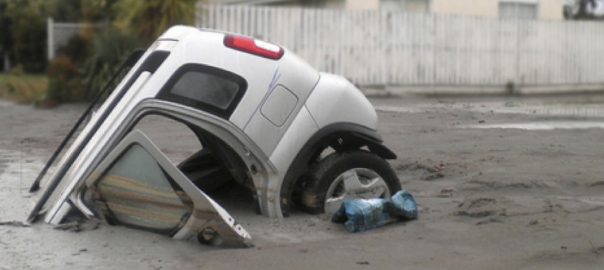


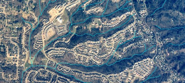
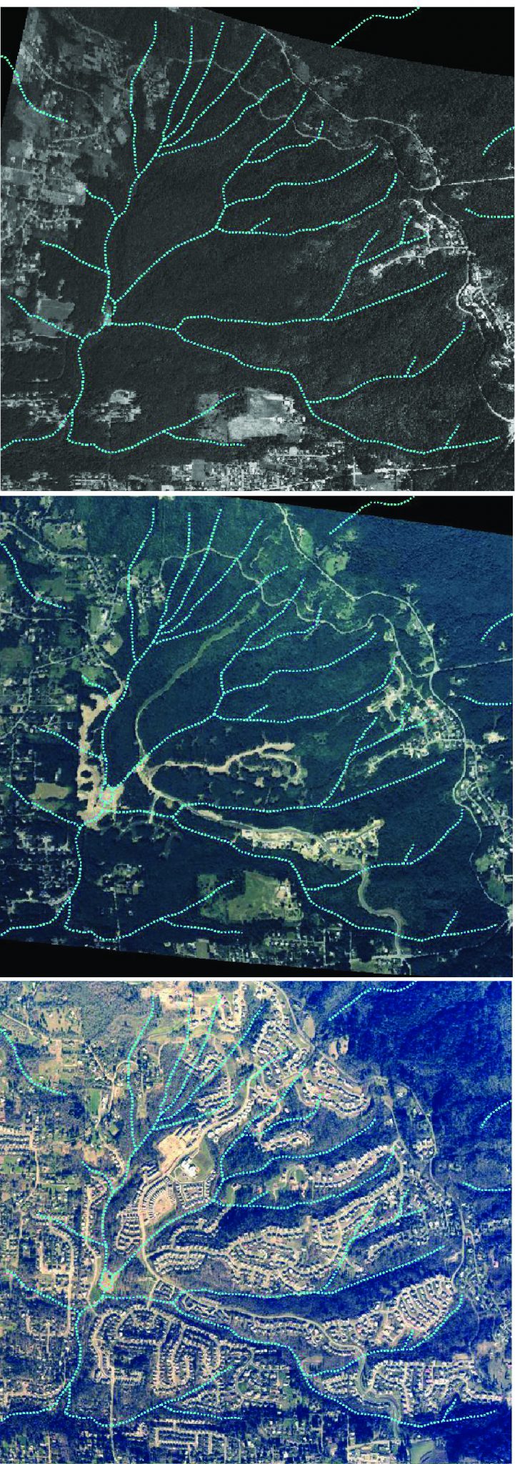
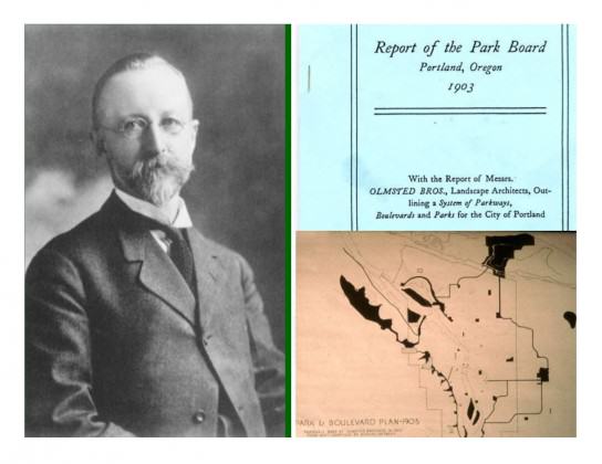
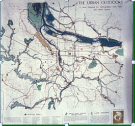
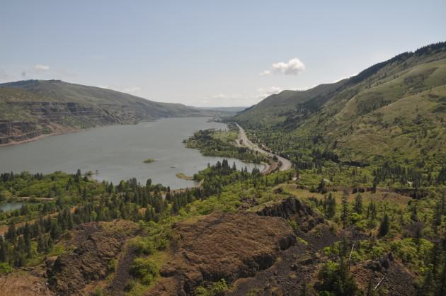
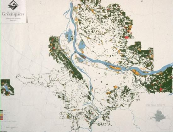
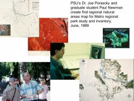 Three years later Metro adopted the
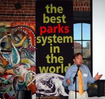
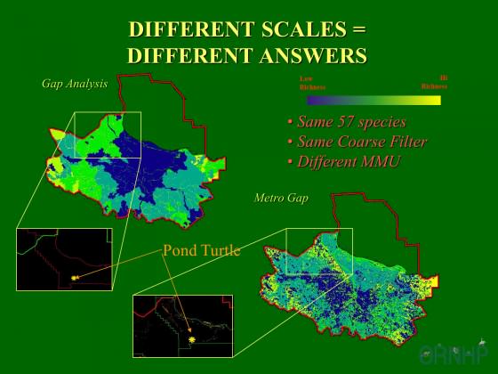

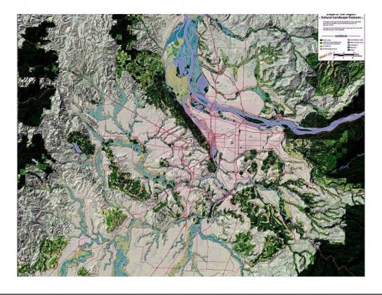
 In 2010 The Intertwine Alliance launched the
  In any mapping effort the issue of database size is a critical factor. In our region, while we have imagery at the one-half meter resolution most regional mapping efforts have been at 30-meters or larger resolution, which is fine if all your are interested in is characterizing an ecoregion. If, however, you are interested in both the ecoregion and urban core higher resolution is required.
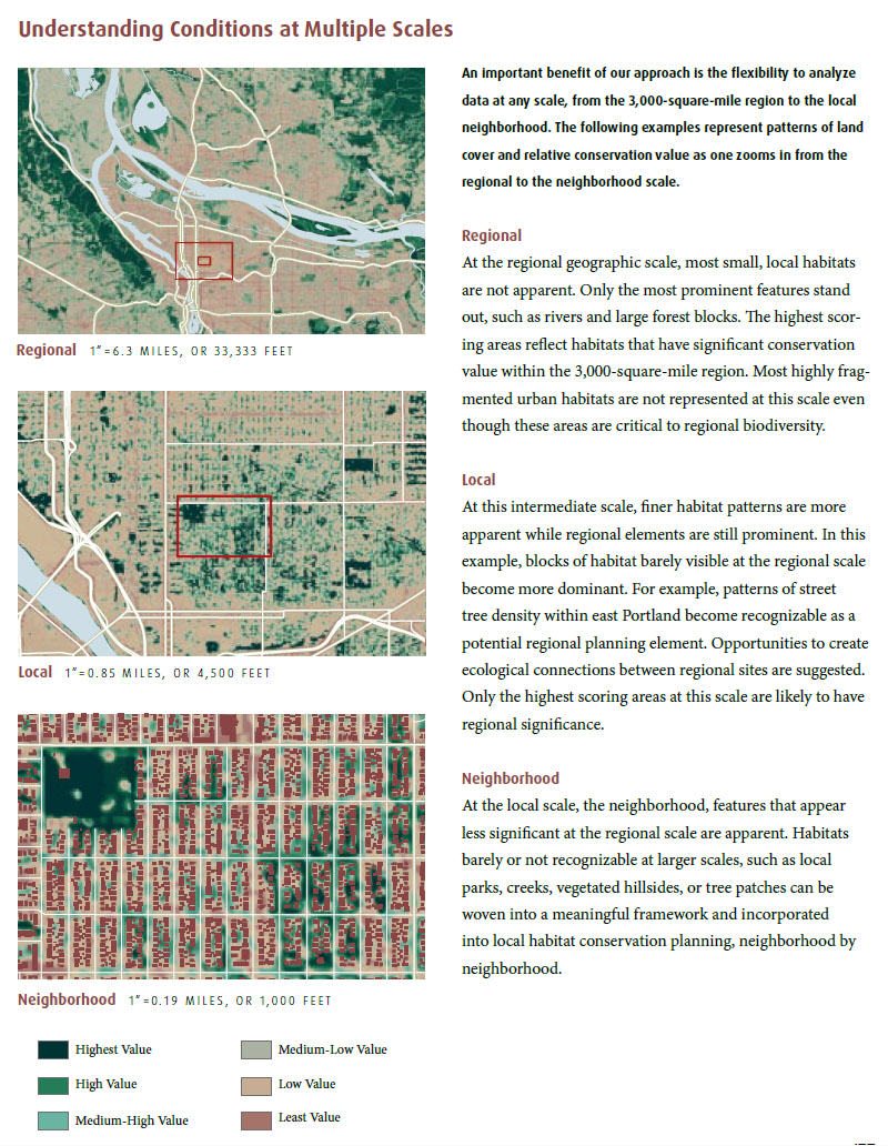


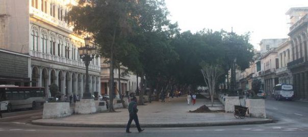
(PhotoDavidMaddox)")
")


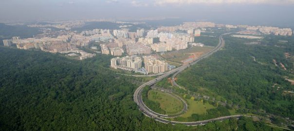


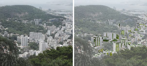


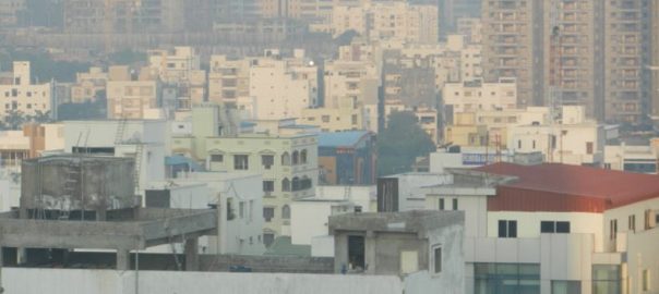


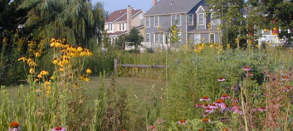


 I am utterly convinced the way forward is dependent on creating working models of “green” developments, from whole subdivisions to individual yards, in each county and neighborhood across the country. Do not underestimate the power of a local example. Nothing speaks more to increasing the uptake of alternative designs and management practices than examples that people can see and discuss. I have found building that first, local green subdivision helps to showcase green development practices and provide a catalyst for future developers to adopt new practices. To help promote biodiversity conservation in subdivision development, I recently have written a book titled,
 A similar project for the restoration of dry forest was implemented by the
  The BG of the
  Many BGs are involved in programs concerning street trees. While in
  The examples described above show that Latin American and the Caribbean BGs are working on an integrated model of multiple dimensions and generate an urban landmark able to create synergies between the exurban and urban environment. Among the dimensions that BGs address should be mentioned the promotion of culture, including environmental rehabilitation of urban and architectural heritage of their buildings, the conservation and management of biodiversity, the generation and transfer of environmental knowledge and policies for social and economic development as inevitable companions of all dimensions. In so doing they have adopted a partnership approach at both the local and national level between actors of different natures, which explains the possibility of taking action with relatively small budgets.

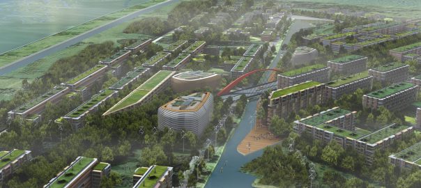


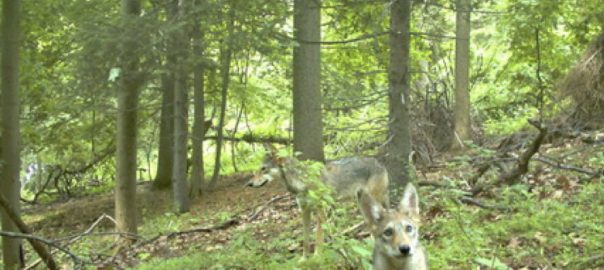


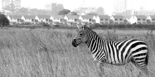


")


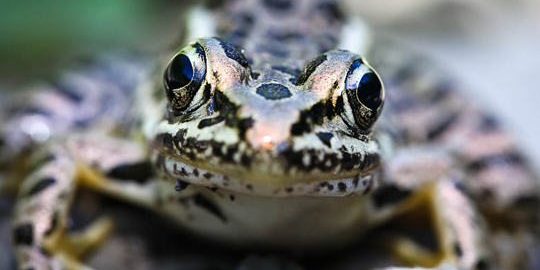


 Finally, the implications of urban expansion are both local and global, as ecosystems do not follow municipal or national boundaries. The displaced ecological impact of increased urban consumption highlights the importance of moving away from narrow place-based solutions to more broadly addressing concerns on ecological degradation and urban biodiversity concerns. It is time to recognize the overarching impact of an increasingly urbanized world and to design appropriate governance responses. This is further discussed in an
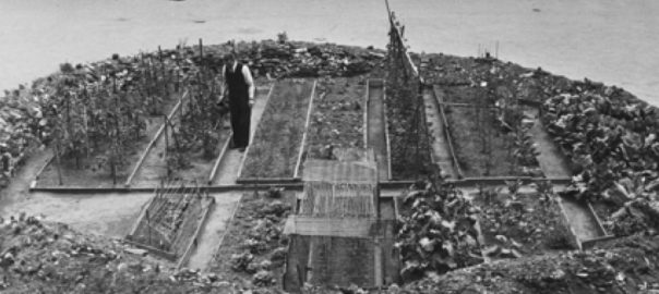


9 Comments
Join our conversation