Designing Integrated Ecologies: Real Estate, Ecosystems, and Everyday Perception

Art, Science, Action: Green Cities Re-imagined

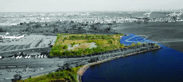
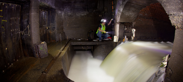
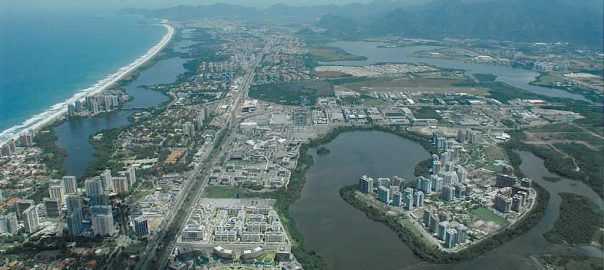
In 1990 the municipal landfill of the City of Elizabeth, New Jersey (near New York City) was officially closed and a leachate system, layers of cleaner soils, and two brand new wetlands were constructed. The landfill, located on the waterfront on Newark Bay, on top of the mouth of a creek that once supported the salt marsh of the Hackensack Meadows, is now covered with a self-seeded poplar forest and traversed by fishermen seeking solitude at the shore. In 2004 we (Till Design) were commissioned to co-design on this land a new neighborhood for Elizabeth, one that connected people to the key and organizing cycles of nature, and whose rhythms were explicit in the everyday life of the new residents. This neighborhood is called Celadon.

Ecosystem modeling uses patterns of past behavior to predict future trends. However, such models have difficulty accounting for humans as creative actors that learn, evolve new patterns and do unexpected things. Ecosystem change can emerge from invention, from an imagination of a better future and not only as a response to a crisis or disturbance. Are background assumptions and fundamental equations of models about the negative impacts of cities masking the complexity that people in cities generate and demonstrate, and obscuring the benefits of new design ideas?

This blog post describes the urban design model of an environmentally activist real estate development that aims to honor and use the creativity that results when people are exposed to new opportunities and patterns. Future growth based on such dynamic foundations will lead to social sustainability and ecosystem resilience for Newark Bay.

Oblique aerial photo of the former Elizabeth municipal landfill. The Celadon site area is in full color and includes water. The ferry dredge zone is shown in white. In the foreground a fragment of one wetland is visible with the second wetland located on the far side of the landfill seen here as an enclosed body of water. The poplar forest, Newark Port, Newark Bay, Bayonne, Jersey City and the Manhattan skyline can be seen in the background. Image credit: Tern Landing Development and TILL

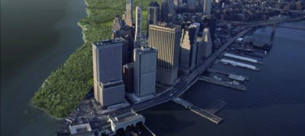
After 9/11 a ferry landing was hurriedly approved in order to provide another means of egress from Manhattan, however it was never used. In the mid 2000s, with the unused ferry permit due to expire, a discussion began around a concept of doing a real estate project on the landfill. Celadon, is an 8.75 million square foot, twenty-four hour mixed use transit village and airport city, with three thousand housing units, four public gardens, two overlook decks, two neighborhood plazas, an upper and lower waterfront promenade, a pier, ferry terminal and a ferry. The scale of the development made feasible the realization of New Jersey Transit’s long planned light rail line connecting the City of Elizabeth to a ferry terminal at the Celadon site and Newark Liberty International Airport beyond.

People infrastructure

New Jersey is not just the most wealthy and densest state in the United States, but one of the most diverse, being the point of arrival of America’s newest immigrant groups. These new residents are not like 19th century immigrants who leave their homelands behind. They are more likely to be transnational, moving between two homelands and racking up frequent flier miles. The City of Elizabeth is the fourth largest city in New Jersey and its people represent more than 50 countries and 37 language groups. Celadon is designed as a multi-level, high-density neighborhood for these new and existing immigrants and residents.

Our question was how to connect this mobile and diverse social system with a degraded and dramatic bay ecosystem?

We began by offering insights learnt from the Baltimore Ecosystem Study, which revealed that the construction and use of green infrastructure such as greenway trails can be an important tool for building awareness and support for watershed conservation and restoration, and that humans can function as a regulatory feedback mechanism in the ecosystem much as a complex web of interactions maintains stability (resistance and resilience) in unmanaged forest ecosystems (Morgan Grove of the USDA Forest Service). According to Grove, social meanings, social capital and social levels of organization are linked by the fact that different social meanings and types of social capital are significant at different levels of social organization and the social ecological resilience of urban ecosystems is likely to increase with linkages among scales.

The public space and landscape design strategy discussed and presented to the development team and city officials was described as comprised of feedback loops with social and ecological complexity. Due to its industrial legacies and pattern of large fenced land parcels, Newark Bay is off limits both physically and in the general mental map of most New York and New Jersey residents when they consider recreational opportunities.

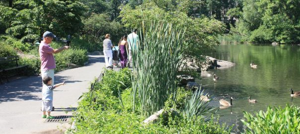
Rather than wait 12 years until all phases of the Celadon project were completed, we proposed a complementary set of temporary urban interventions that expand and complement the existing uses observed on the site, such as fishing, camping and birding. We also wanted to spiral out from the existing social networks, no matter how diffuse, starting now.

Site photos of the shoreline of Celadon. The southern end (top) of the site has many new salt marsh patches and, with the old abutment of the Conrail bridge behind that projects into the bay, this cove collects all sorts of debris from the bay, such as driftwood from vegetation as well as lumber from old piers, plastic bottles, balls and toys. At the northern end (bottom) of the site is a rocky terrace where fishermen build little huts. There is also a lovely beach where waves on the sand offer a relaxing ambiance. This is a good place to launch a kayak. Photo credit: TILL

The three proposed phases of the urban interventions are: a geo-located sound game that functions like a treasure hunt. Building on the experience trend, it acts to prompt Jersey Gardens mall visitors to wander outside and explore with curiosity the huge parking lot surface of the mall, the Celadon landfill and the adjacent poplar forest, guided by a smart phone. At night the sound game nodes illuminate the ground allowing the asphalted, soily and gravelly game surfaces to be seen from the planes taking off and landing nearby. The second phase coincides with the opening of the ferry pier, concession cafe and commuter parking lot. A bike share with clip-on shopping carts and a new bike trail connects the Celadon site with IKEA using an existing maintenance trail in the poplar forest. A simple kayak clubhouse and removable launch ramp opens the shallows adjacent to the shore for recreational kayaking and gaming. A third phase coincides with the completion of the Celadon roads, buildings, designed landscapes, kayak launch pier and permanent kayak clubhouse. More game nodes with more information mark the water surface of the whole bay extending the range to explore Snug Harbor Cultural Center and Botanical Garden, Fresh Kills Park, Newark’s Riverfront and connecting to the New York water trail.

Three diagrams showing the three phases of urban interventions. Each phase engages a different scale of the bay, repeating tactics and negotiations and introducing new ones. Image credit: TILL

This strategy of temporary installation, underutilized site mini-alterations, site re-use and hybridization is not an unusual urban tactic. What is unusual is that it is part of a real-estate development project.

Often these tactics are deployed by street artists, art and design festivals sponsored by urban or environmental advocacy groups such as community groups, NGOs or quasi-public agencies. The reason that the client supported the development of these tactics was that they would bring attention to the project, generating revenue and create an amenity for the new residents. In order to succeed they would require several key negotiations that Celadon, as a new major urban actor in the bay, would broker. For example, the Jersey Gardens mall and Port Newark security patrol is tolerant of a program that engages their parking lot and forest as a game surface as long as it doesn’t trigger a homeland security alert. The construction of a traffic light and pedestrian crossing on the road to IKEA is important because many trucks traveling at high speed and carrying stacked shipping containers frequent this road. Finally, buoys in the water are needed to demarcate shipping lanes, ferry zone and safe kayak crossings.

This drawing shows the parking lot for the commuters who will take the ferry to Manhattan. Our contribution to the parking layout included a concession café, bike parking for the forest trail, sidewalks for pedestrians and a ‘shipping container wetland hotel’ for adventure seeking tourists. We weren’t able to negotiate a bike lane. The lower waterfront promenade is also built at this stage. It was set back in order to keep and highlight the unique features of the shoreline described in the site photos images above. Image credit: TILL and Langan
This is the site plan for Celadon. In this drawing all elements of the project are shown, such as the roof garden located on top of the inner block. It is designed for music concerts as well as a big playground for the school. Public elevators, a sky bridge connection and rooftop café are designed to encourage residents to traverse the roof on their way to and from the ferry. The roof is also a place for workers from the office tower and the mall to enjoy lunch or sunset. Other elements include ground level pocket parks, plazas, a bioswale shopping street, sand terraces, waterfront promenade, fishing and kayak pier with clubhouse, marina, ferry, storm water retention pond and wetlands. Other features include geothermal energy for lobby common areas, a grey water collection system, solar panels on the roof and façade, a vegetarian building, a charter school focused on the environment, a brewery and below all of this is a new state of the art leachate system. Image credit: TILL
Perception?

We perceive our urban environment in a distracted way. We rarely focus our attention out in most situations. Even in a rarified environment such as the theater, museum or art gallery we wander distractedly, attaching given images to mental images and memories.

What we do have, however, is habits, and we often repeat our thoughts, gestures and movements over time, accumulating a deeper understanding of some places more than others.

Three phases of urban interventions in the Celadon project located within the site boundary, around the site boundary, in the sites around the bay and in Newark Bay were created in order to encourage people to further explore a place they have been before even if it was just a glimpse from a car window or a tired gaze from an airplane.

In other words, this project is not designed to be an inward looking otherworld, a place of escape, or a gated community.


These two sets of vignettes communicate the roof and ground level designed landscapes as part of a movement system and as fragments of a bigger landscape. The Celadon landscapes are designed to encourage movement and exploration. Orienting the visitor to the bay in different ways, they rarely offer the whole view, encouraging the visitor to move and put it all together for themselves in their own way, and over time. The smaller vignettes reveal some of the pedestrian unfriendly and degraded but spectacular environments around the site that we discovered in our fieldwork. This vast landscape for cars, trucks and ships, when strategically retrofitted and programmed, will be a more wonderful place to be. Image credit: TILL and MU-Studio.

Finance design

Often, there is a paradoxical situation in accessing the funds to build a real estate project: in order to service the debt portion of the capital stack, taxes and cash-flow are needed – but they cannot be generated without the buildings being built. The financial strategy must therefore reach far forward while operating in the present simultaneously and concurrently otherwise the model falls apart.

This section describes three concurrent cycles – short, medium and long – that are launched through clusters of different financial strategies to allow this environmentally activist real-estate development to happen. Essentially the three subsidies described below allow a clean up of the landfill, new leachate system, landfill cap, construction of private and public spaces including the ferry terminal, and the Celdaon real-estate project itself. These spaces, structures, and the programs attached to them allow three concurrent cycles to occur.

At Celadon the financial means are provided by incremental property taxes, sales taxes and rents. An example of this is Tax Increment Financing (TIF): the anticipated new and additional taxes (hence tax increment) that will be generated by the properties yet to be built are sold to investors in order to raise upfront money for the project.

Brownfields Reimbursement Program (BRP) and the Payment In-Lieu of Taxes (PILOT) can be structured as TIF’s. The BRP permits the reimbursement of 75% of the sales taxes (plus a few other state taxes) generated on the site for 75% of the remediation costs. The BRP is a New Jersey Department of Environmental Protection (NJDEP) program that is implemented by the New Jersey Economic Development Authority (NJEDA). Under the PILOT, the property tax burden (consisting of municipal, county, and school tax) is reduced by eliminating the school tax and substantially reducing the county tax. The difference between the market rate tax payment and the PILOT payment can be montetized through issuance of bonds. The PILOT can be for a period up to 30 years (reduced after 15 years) from the completion of the project.

Although not a TIF, the New Jersey Environmental Infrastructure Trust Financing Program (EIT) also depends on the cash flow that is expected to be produced from the real-estate project. The EIT is largely funded by the EPA’s Clean Water State Revolving Fund, which provides money for the state agency. The EIT program is run in conjunction with the NJDEP, which provides 75% of the funds at 0% interest. The remaining 25% is provided through a bond issuance by the EIT and is currently priced at approximately 2% interest. That is a 20-year loan at an average interest rate of 0.5%! The BRP and EIT can be used for environmental cleanup and environmental infrastructure, without which it would be more difficult, if not impossible, to make economic sense for a landfill-based real-estate project. The proceeds of the bonds issued under the PILOT program can be used in the real-estate project itself.

For simplicity’s sake this description does not talk about the property being in an Urban Enterprise Zone with its own subsidies and the availability of New Markets Tax Credits, which can be sold as quasi equity.

Celadon was paused in 2008 due to local, state and federal issues and the 2007–2012 global financial crisis; therefore the description below of the three cycles is offered as an example of this innovative and sophisticated environmental activist finance design.

It was a great idea but was undermined by economic and political forces beyond our control.

Real estate, ecosystems, and everyday perception diagram. Image credit: TILL

The short-term cycle for Celadon was proposed to start with the above-mentioned financings, which lead to environmental remediation of the leachate system and upgrading of the landfill cap; thus creating the usable spaces of the real-estate development. Private spaces such as residential units become part of the saleable and rentable real-estate and they generate sales proceeds, rent and sales taxes, thus servicing the EIT, BRP and PILOT financings. The minimum time frame to build the first phase of the Celadon was approximately two years. After this each phase takes between two to three years. Therefore this short-term cycle ranges from two to three years and with five phases in total it is completed in 10 years.

Once again, the medium-term cycle starts with the financing program, leading to the construction of the waterfront public spaces – including the promenade, the pier, the ferry terminal and the ferry itself – which bring people to, onto and into the water, thus creating a first connection with the bay. The increased likeability of the experience near and on the water enhances the desirability of the real-estate. That in turn leads to higher sales taxes, higher rents and better sales proceeds. Consequently, there is more money to support environmental stewarship of the bay and urban interventions around and in the bay. The time it takes to build, and get the kinks out of the programming to generate the flow of people is at least five years. If done successfully, the traffic flow keeps on increasing over a long period of time.

The long-term cycle is about creating an identity, particularly with a sound signature for Newark Bay. A lot of people think of Asbury Park when they hear Bruce Springsteen and vice-versa. Expanding on this we proposed to support new and exsiting musicians, poets, storytellers and sound artists around Newark Bay, and to call it NewB music. The cities around Newark Bay – Newark, Elizabeth, Iselin – have living arts that include Brazilian, Indian, and their local fusion. The sound signature would be achieved through installations,  live performances, and mass marketing. The time frame to connect this could easily take 10 years; the idea is that a highly diverse group of sound projects as well as a greater desirability of living along the Bay of NewB would generate additional resources for Newark Bay.

Approaching by car down the Exit 13 ramp and then up and over I-95, Celadon appears as a tight cluster of towers on the edge of Newark Bay. Moving up onto the landfill of the Jersey Gardens Mall and around the edge of the parking lot, you see the water of Newark Bay below you on the right with the Bayonne Bridge framing the Kill Van Kull. Entering Celadon and once again moving up and onto a landfill, your attention this time tilts up sensing the enclosure of towers and a curved symmetrical street wall. Image credit: TILL and Urban-Interface

Movement systems

Brian McGrath (also a TNOC writer) offers the concept of correlative space, which is a space, created by movement systems that bring together different groups, urban elements and ideas about the city (McGrath). For example, in New York the subway system and suburban commuter train lines allowed for the concentration of new business districts in both Lower and Midtown Manhattan, while the new Skytrain in Bangkok has created a multi-level urban armature which interconnects formerly distinct urban shopping enclaves.

A recent workshop called High Speed Urbanism hybridized correlative space with environmental activism. Students studied the high-speed train that connects many cities in Taiwan forming one megalopolis. One project titled Pulsating Taiwan imagined the train as a sensing device scanning the island and logging urban ecosystem cycles into the rhythm of the morning and evening commute, correlating the patchy dynamics of spectacular cyclones, landslides, earthquakes and urban regeneration with micro-measures of local biodiversity and food production into sustainable growth.

Pulsating Taiwan aims to hybridize and localize the big and fragmented urban elements that are transforming the western shoreline of Taiwan into a megalopolis by highlighting local food production and landscape identities. Aided and accelerated by the construction of a high speed train the different cities along the coast are responding to their increased connectivity with each-other by emphasizing why they are different. At the same time people on the incredibly steep slopes of the mountains and fertile western shoreline of Taiwan are increasingly adjusting to ecological disturbances that increasingly effect more and more people. A seismic island with a cyclone season, Taiwan people are already tuned into its geological and climate rhythms. This project proposes a correlation of these two pulses with rapid urbanization, re-valuing of vegetative systems and cycles, and repetitive high-speed travel. Pulsating Taiwan was made by students at National Cheng Kung University, Tainan. Image credit: Yu-Chen Zao, Jay Hsu, Chun Shun Yu, Wallace Tsai, Bo Lin

Similar movement systems with environmental activism already exist in Newark Bay on a smaller scale but are not yet correlated together, below are three examples.

New Jersey PATH trains run parallel to the Passaic River between Journal Square and Harrison Stations passing directly opposite the clean up project of the Diamond Alkali site, the source of dioxin, the major contaminant of the Newark Bay water body. Starting in July 2011 a weekly PDF report provided updates on the project. In addition commuters on the train could witness these changes like a stop motion film or flipbook. Each day it is possible witness change, for example the construction of a new sheet pile wall, then excavators removing the soil, new hoppers and barges, a floating pipeline, then tugboats delivering clean back fill, more cranes, etc.

Another example is Captain Bill of the Hackensack River Keeper taking a group on one of over 35 of summer eco-cruises and guided canoe paddles. In addition to introducing the environmental history of the bay, with his binoculars, he is constantly monitoring the bay from the water, keeping track of the health of the salt marshes, bird watching, crab spotting as well as double checking on encroachment and the activity of storm sewer outfalls. The newsletter Hackensack Tidelines, in addition to providing updates on legal proceedings is an almanac of wildlife observations. Learning from the Hudson River Almanac, this simple media formalizes everyday ecosystem process observations into a public database

In 2006 the Newark Bay was scanned using sonar imagery in order to evaluate the age of industrial-age deposit, the images of this project offer a compelling insight into the links between new media and new spatial practices of the bay. Seeing underwater is something only for crystal clear water and what is revealed in the scan are the canyons dredged from the bay for shipping. These effectively keep the large tankers in a tight watery lane, opening the remainder of the bay, which is mostly made up of shallows, as a safe and spectacular surface for kayak exploration. Handheld depth finders and fish finders allow kayakers to continue this ‘reading’ of the bay at an intimate scale.

Celadon as a model

Celadon is a development model which emerged in the vast, dispersed, networked environment for housing, work, leisure and consumption that top-down management systems legislated by master planning, land use and zoning could no longer keep up with. It anticipated, and is now confronting the collapse of our carbon-based urban model. Newark Bay will continue to grow by its own measures. How can we engage and not negate or override this type of ad-hoc change? Expanding from the practices developed for Celadon, and others observed and noted above, we propose enhanced environmental activism that resonates with New B sound. Soon, we hope that more formerly contaminated real estate developments will also contribute to creating a newly famous Newark Bay. In other words these deeply sectional and multiple crisscrossing and parallel, slow speed and high-speed movements together form a correlative space that transforms the bay.

Feedback loops only work when there are linkages among scales. Finance strategies only work when they are concurrent. Urban designers are trained to create spatial strategies, physical environments and programs that allow these loops and cycles to correlate and make a difference. How can the design of urban ecology research account for this and participate? We are in an extremely creative time of rapidly diversifying tools with which to re-imagine and re-define the 21st century city. The Celadon urban design model allows us to now imagine integrated cultural, social and ecological identities in many newly famous waters around New York City, such as Hudson River Upper Bay, Jamaica Bay, Sandy Hook Bay, Raritan Bay, Flushing Bay – learning from other famous movement systems and famous waters around the world – directing future development into more sustainable growth.

Victoria Marshall
Newark, NJ USA

Acknowledgement

TILL team: Dil Hoda, Brian McGrath. Mateo Pinto, Kate Cella, Flora Chen, Marc Brossa, Phanat Xanamane and Manolo Ufer.

This drawing locates Newark Bay within the Hudson Raritan Estuary (the south end of which lies New York City) and within two zones of regional socio-natural resources accessible by car, train and boat. The red line is the East Coast Greenway, a trail that connects major cities along the east coast USA between Key West and Canada. Image credit: TILL

Rediscovering Wildness—and Finding the “Wild Man”—in Alaska’s Urban Center

Art, Science, Action: Green Cities Re-imagined

I have been getting quite the education on “The Nature of Cities” these past few months, while taking in the perspectives of academics, ecologists, naturalists, architects and urban designers, educators, and conservationists (some contributors wearing several hats). I have been impressed—and at times overwhelmed—by the scope of research, activism, and community programs dedicated to urban nature and our species’ connection to it.

And our place within it.

I had no idea how much work (and play) is going on around the globe, tied to the study and enjoyment of cities’ wild nature. And I suspect that’s true for many others who’ve participated in this blogsite’s commentaries and conversations. Here I will bring the perspective of a nature writer, essayist, and naturalist, who has spent the past couple of decades getting to know, and writing about, his adopted homeland. Like Bob Sallinger (“Souvlaki Coyote and Other Tales of Urban Wildlife”), I strongly believe in the power of story and the necessity of telling stories that recognize, even emphasize, the wild nature of our cities. Here, then, is part of my story.

Though I grew up along the edges of rural Connecticut, I have spent nearly all of my adult life in urban settings: first Lewiston, Maine and Tucson, Arizona (both in the USA, and where I attended college and graduate school, respectively); then the Los Angeles megalopolis, where I somehow survived six years despite never feeling at home; and finally, since 1982, Anchorage, Alaska, the 49th state’s urban center.

Schooled in the geosciences (I got an MS from the University of Arizona), I changed careers in my late twenties and became a journalist, which in turn led me eventually into my current life as a freelance nature writer and activist for both wildlands and wildlife (I explore that evolution in Changing Paths: Travels and Meditations in Alaska’s Arctic Wilderness). It was only after I’d begun to seriously observe and write about Anchorage’s “wild side” in the 1990s that I began to more fully appreciate—and examine—the delights, mysteries, and importance of urban nature. I have written about my adopted hometown’s wild riches in essays and two books (Changing Paths and Living with Wildness) and will use my initial TNOC posting to share some of what I’ve noticed and learned about Anchorage’s wild nature, which has relevance to other discussions presented on this site.

Downtown Anchorage, Alaska. Photo by Bill Sherwonit.

A city of nearly 300,000 people, Alaska’s largest community is rarely lauded for its wild nature or frontier aesthetics. Many rural Alaskans consider Anchorage to be a northern incarnation of Lower 48 excesses. They derisively call the city Los Anchorage, a not-so-subtle comparison to Southern California’s smog-enshrouded, freeway infested, urban-sprawl megalopolis (this description perhaps revealing some of my own prejudices about L.A.). Other Alaskans, including some residents, ridicule Anchorage as Anywhere USA and claim its only saving grace to be its close proximity to “the real Alaska.”

Outsiders—anyone living beyond the state’s borders—have also gotten in their digs. John McPhee took perhaps the most famous swipes at Anchorage in his best seller Coming Into the Country: “Almost all Americans would recognize Anchorage, because Anchorage is that part of any city where the city has burst its seams and extruded Colonel Sanders. It is virtually unrelated to its environment. It has come in on the wind, an American spore. A large cookie cutter brought down on El Paso could lift something like Anchorage into the air.”

Ouch.

Anchorage skyline. Photo by Bill Sherwonit.

The truth stings: Anchorage largely deserved McPhee’s late 1970s jabs. It still merits them and, to some degree, those of rural Alaska critics. Poor municipal planning has led to haphazard development and some mighty ugly architecture. Sections of the city are an appalling mix of malls, fast-food restaurants, boxy discount stores, massive parking lots, and ever-expanding service stations and quick stops. Even now, when the city is in the midst of rewriting its land-use laws to make Anchorage a more livable city, with a higher quality of life, there’s substantial pushback from businesses, development interests, and some politicians (including our mayor), whose credo seems to be “develop, develop, develop,” with little regard for how that development is done. Too many of the country’s mega-chains have heard our politicians’ declaration that Anchorage is “open for business,” turning sections of the city into versions of Miracle Mile. And those of us who care about Anchorage’s wilder aspects are constantly battling efforts that would diminish trails, greenbelts, and parks.

“Coastal Trail” in Anchorage, part of the city’s extensive trail system. Photo by Bill Sherwonit.

Yet for all this laying down of asphalt and mushrooming of boxlike buildings, pockets of wetlands, woodlands, and other wild areas remain scattered throughout our municipality. You just have to know where to look. And to be honest, those areas aren’t hard to find; Anchorage has some wonderfully large parks and a world-class trail system.

Those natural areas sustain a wide diversity of wildlife and native plants: the bowl is seasonal home to some 230

Kincaid Park single track trail, Anchorage. Photo by Bill Sherwonit.

species of birds, five types of Pacific salmon, and 48 different mammals.

Anchorage’s patchwork of greenbelts and forested municipal parks is threaded together by a network of bike trails and walking paths. From Anchorage’s much-beloved Coastal Trail, bicyclists, joggers, and walkers can occasionally spot pods of ghostly white beluga whales, chasing fish through the inlet’s murky waters. Along that trail and others, people may also meet moose, lynx, great-horned owls, black bears, and even the occasionally grizzly. Beyond the Coastal Trail is a state wildlife refuge, a place of surprising wildness and solitude on the city’s western flanks, with sedge flats and mudflats and ponds inhabited in spring and summer by all manner of songbirds, shorebirds and waterfowl, from savannah sparrows to Arctic terns and Sandhill cranes.

Also threading through the bowl are several creeks, which connect hills to lowlands to saltwater. Some are filled in, paved over, or polluted before they reach the inlet, but others

Lesser Sandhill cranes in the Anchorage Coastal Wildlife Refuge. Photo by Susan R. Serna.

are large and pure enough to have natural or rebuilt salmon runs. In Anchorage’s most industrialized section, anglers pull 40-pound king salmon from Ship Creek. The bowl is also rich in lakes and bogs, which serve as important avian nesting grounds. Anchorage, in fact, is the largest U.S. city to support nesting populations of loons. And wolf packs roam the city’s eastern edges, sometimes sneaking into homeowners’ yards to kill domestic fowl or dogs.

Anchorage Coastal Wildlife Refuge stretches for 16 miles south from Anchorage. Photo by Bill Sherwonit.
The boundary of the Anchorage Wildlife Refuge, just south of Anchorage.

Though I’ve resided here since 1982, only since the early nineties have I truly delighted in Anchorage’s greener, wilder side. In part that reflects a gradual shift in desires and priorities: once a newspaper sports reporter tied to newsroom desks and indoor arenas, I’ve metamorphosed into a nature writer who chooses woodland trails and alpine meadows over noisy, sweaty gyms. I now prefer watching birds and bears and spiders to TV sports. And I’ve re-learned the value of paying close attention to my home grounds, something I did as a boy, but somehow forgot in my early adulthood.

I believe my boyhood adventures in The Woods behind my family’s Connecticut home and along the margins of a nearby neighborhood swamp helped establish a deep love and joy for wild nature that, while dampened or misplaced for a while in my late adolescence and early adulthood, would be resurrected after I’d settled in Anchorage. This touches on themes made popular in recent years by Richard Louv (Last Child in the Woods, The Nature Principle), David Sobel (Beyond Ecophobia, Childhood and Nature), and others. And it points to a critical aspect of this “Nature of Cities” movement: the absolutely urgent need for increased connections between children and nature in our cities, especially given the abundant—and growing—evidence that childhood experiences have a huge influence on how we relate to the “natural world” as adults.

Another reason for my new perspective: relocation to the hills on Anchorage’s eastern edge in October 1993. That move, as much as anything, clarified what my friend William calls the “power of place.” From 1982 through 1988, I had lived the mobile life of a renter. Then I became a first-time homeowner. But like my earlier rentals, that cul-de-sac property failed to draw me into the local landscape. Needing solitude or a renewal of spirit, I would invariably go “out there,” to the wildlands beyond Anchorage.

But once settled on the Hillside, that wasn’t necessarily so. I continued to love my forest and mountain walks in Anchorage’s neighboring “backyard wilderness,” Chugach State Park and I certainly relished my longer journeys deep into Alaska’s more remote backcountry. Yet I also began to find joy, surprise, connection, and, yes, even solitude on Anchorage’s Hillside, an area of town that mixes modern suburban neighborhoods with older homesteads on the wooded foothills of the Chugach Mountains.

A moose shares an Anchorage street with human pedestrians and vehicles. Photo by Susan R. Serna.

Everything wild seemed closer on the Hillside: the clouds, the mountains, the animals, the weather. It became easier, somehow, to slip outside at night and star gaze, stand in the eerie light of a full moon, or look for northern lights. Easier to go walking and exploring. Winter comes earlier and stays longer. There’s more snow. More wildlife. More frequent and stronger gales. Born along Alaska’s Gulf Coast, high winds called chinooks come roaring out of the southeast and through the Chugach Mountains, then tumble down the Hillside as warm, dry, turbulent air, in gusts of 50 to 100 mph.

In my new home, all manner of things began to grab my attention in new ways: the chinooks; the pleasing rush of springtime creek water; the winter commutes of ravens, which fly daily between their nighttime roosts in the Chugach Mountains and the scavenging-rich environs of mid- and downtown Anchorage; the spruce bark beetle and its infestation of local forests. Nothing, however, grabbed me as deeply as the neighborhood’s black-capped chickadees, whose bright presence drew me into bird feeding and watching and along the way transformed my world, showed me some of what I had been missing. In a way, they become my teachers.

In the spirit of telling “urban animal stories,” I’ll briefly describe here how chickadees helped deepen my awareness (there’s a more detailed account in Living with Wildness).

My enchantment began on a Saturday morning in 1993, shortly before solstice. Lolling in bed, I glanced outside. And there before me, several black-capped chickadees flitted about a backyard spruce. Inspired by their presence, I placed a bird feeder where it could be easily observed from the dining and living rooms. My first-ever feeder wasn’t much to look at: an old, slightly bent baking pan covered with sunflower seeds.

Nothing happened that first day. But Sunday the chickadees returned. Seated at my dining room table, I watched with delight as a black cap landed on the tray, grabbed a seed, and zoomed to a nearby tree. Then in flashed another. And a third. For each the routine was the same: dart in, look around, peck at the tray, grab a seed, look around some more, and dart back out. Nervous little creatures, full of bright energy, they somehow penetrated the toughened shell of this former sports reporter and touched my heart. I laughed at their antics and felt an all-too-rare childlike fascination.

Stellers jay. Photo by Susan R. Serna.

The chickadees were soon joined by several other songbirds. What started as mere curiosity blossomed over the next few months into a consuming passion. I found myself roaming bookstores in search of birding guides, spontaneously exchanging bird descriptions with a stranger, and purchasing fifty-pound bags of seeds. All of this seemed very strange to a fortysomething guy who had never been intrigued by birds (except for the occasional charismatic raptor) and had previously judged bird watchers to be rather odd sorts. I didn’t know what it meant, except that a door had opened. And I passed through.

Now wherever I am—city, woods, mountains—I invariably notice songbirds and their assorted voices. They’re everywhere, it seems. How did I miss them before? And I wonder what else beckons, that I haven’t yet noticed.

I have since moved from the Hillside back to Anchorage’s lowlands, in a residential neighborhood near the city’s western, coastal border. There’s still plenty of wild nature in my new environs, manifested in moose and fox, merlin and goshawk, chickadee and waxwing, spruce and birch, on and on. The opportunities to encounter wildness and learn more about my homeland are endless. But I can’t emphasize enough that this recognition began with some specific experiences—for instance moving to the Hillside, inviting chickadees to my feeder—that opened my senses to the wild world that surrounds us, wherever we live. Even though I’d been trained (as both scientist and journalist) to notice details, it seems I didn’t naturally tune into, or relish, the city’s wilds, until some aspect of it grabbed my attention in a way that I couldn’t ignore. This is something that I—we—need to remember as we work to increase the awareness of the general public to our cities’ wild side.

•     •     •

In recent years I’ve come to believe strongly that this sense of connection, this love for wild nature, is a crucial part of our humanity, even in the twenty-first century. It’s alive in us when we’re born, no matter where that is. The question, then, is how do we nurture our wildness, rather than subdue and tame it?

Great grey owl. Photo by Susan R. Serna.

In The Abstract Wild, Jack Turner argues that “in many inner cities here in the United States and in the developing world people no longer have a concept of wild nature based on personal experience.” (Many others have made similar observations, including on this blogsite.) I agree wholeheartedly with that. But I also believe it is possible to have “raw visceral contact with wild nature” wherever we live, if we take the time, make the effort, and leave ourselves open to wonder and mystery. Then the challenge becomes: how do we reinforce and encourage this wild awareness in each other, in our children? I don’t have any easy answers. But my life in this far north metropolis and my own discoveries of Anchorage’s wild nature (some of which I’ve shared here) has offered hints of what’s possible.

At first glance, my choice to settle in Anchorage may seem a strange one for someone who claims to be so passionate about the natural world. But in living along the city’s eastern and western edges, I’ve gotten the best of both worlds, natural and man-made (though of course the two are connected). I love the amenities that come with living in an urban center, with its coffee shops and restaurants, movie theaters and Performing Arts Center, universities and libraries and sports programs. Here I’ve found intersecting circles of writers and outdoors enthusiasts and earth- and peace-loving activists. Yet I also have easy access to parks, trails, greenbelts, a coastal refuge, and a nearby mountain range, the Chugach, whose remotest valleys and peaks are seldom visited. And I reside in a landscape also inhabited by chinook and coho, goshawk and owl, coyote and lynx. But again I must emphasize that I only came to this awareness, and appreciation, over time, thanks in large part to teachers who grabbed my attention, chickadees (and bears and frogs) among them.

Living in Anchorage, I’m now constantly reminded that wildness is all around us, all the time, even in the city. It’s just that most of us humans don’t notice the “wild side” of our busy urban lives (some, it’s true, are simply trying to survive their urban lifestyles, which leaves little, if any, opportunities for wild connections), just as I largely didn’t for my first decade of living in Alaska’s urban center. Of course, in many a metropolis you have to look hard to find even hints of the wild behind the elaborate layers of human construct that shield us from the rest of nature. Anchorage’s juxtaposition of malls and moose, brewhouses and bears, or libraries and loons makes it easier to notice urban wildness here than in cities like L.A. or Tucson or even Lewiston, Maine, all places that I’ve lived. This city, more than any other, has opened my eyes and enlarged my awareness of wild nature in a way that even the wilderness couldn’t.

It’s also been here that I’ve come to better understand—through personal experience, research and readings, and shared stories with other friends and colleagues—that we humans do indeed carry wildness within us. We are animals, after all. And though many of our natural instincts are “tamed”—or suppressed—as we grow up, we carry deep within us a wild nature that’s expressed not only in our need to eat, drink, sleep, and procreate, but also in our emotions, dreams, spontaneity, hunting instincts (expressed in a variety of ways), our draw to the outdoors, and the deep aliveness and sense of wonder we sometimes feel when making an unexpected connection with the larger, wilder world we inhabit.

I’ve written about this inner nature in an essay, “In Search of the Wild Man,” included in Living with Wildness. As I discuss in that essay, this inner wild man, or wild woman, or wild child, is an important part of who we are. And it is nourished by connecting with what David Abram (The Spell of the Sensuous) has called more-than-human nature. This—need I say it?—is a good thing, and essential to a deeper, more respectful, and more joyful relationship with our original and primary home, the Earth, and the other inhabitants with whom we share this planet.

All of this can happen, must happen, in our cities.

A few final thoughts, pulled from my essay, “In Search of the Wild Man”:

Only by getting to know wild nature will we learn to embrace and cherish and preserve it, both within ourselves and as manifested in myriad other forms, in the larger, more-than-human world. Such a full embrace is possible, no matter how frightening, because at some deep level, we and all “the others” are part of a larger—and what some would call a sacred—oneness. All of the world’s mystical traditions teach this. Even Christianity maintains that we are all part of the creation: people and trees and hills and butterflies and bacteria. And though it doesn’t normally use words like “sacred” or “holy,” science confirms it too.

Bald eagle on the outskirts of town. Photo by Susan R. Serna.

The good news is that wildness reaches everywhere, from the far wilderness to the innermost pockets of our biggest cities. We can each choose where, in what form, and in what way we get to know the wild. But we must make some effort, if we care at all about healing ourselves, healing the world, keeping things whole. In touching the Wild Man or Wild Woman, we learn to better love the world. And in loving the world, we embrace our own richly wild essence. As I’ve discovered in my own life, it’s not necessarily an easy thing for us modern Homo sapiens to understand or practice. But like Gary Snyder says in The Practice of the Wild, “I for one, will keep working for wildness day by day,” in whatever small way I’m able.

And, I might add here, that I will do so wherever I reside, even—or perhaps especially—in the city.

Bill Sherwonit
Anchorage, Alaska
USA

Souvlaki Coyote and other Tales of Urban Wildlife

Art, Science, Action: Green Cities Re-imagined

Much of the fabulous writing on The Nature of Cities blog site to date has focused on integrating the built and natural environment, erasing, or at least softening the lines that separate the natural and the manmade. I would like to shift focus a bit and explore the intersection between people and wildlife and suggest that we would also be wise to consider how we integrate animals into our urban stories, poems, art, culture and collective narrative. We need to bring the same level of creativity and imagination that we are currently investing in transforming our physical landscape into repopulating our mental landscape with the diversity of life that surrounds us.

In short, we need to do a better job telling animal stories  urban animal stories.

I am not talking here necessarily of ecology, biology and natural history, although ecological literacy is of critical importance. I am taking at least one step further back into the realm of mythology, legend and folklore, about how we tell and retell our own story in a way that truly recognizes wild beings as fellow travelers on our urban landscapes.

For many years I ran Portland Audubon Society’s wildlife hospital. There we treated upwards of 3,000 injured wild animals and responded to more than 15,000 wildlife related phone calls each year. The vast majority of both calls and animals emanated from the urban and suburban landscape. One of the indelible impressions from those years was how often somebody would walk into our center having taken significant time out of their busy day to deliver an injured animal, and ask us some variation on “what is it and why is it here?” They would insist that until that very morning, when the animal was dragged in by the cat or slammed into their kitchen window or collided with their car, they had never seen this creature in their neighborhood before. We would slowly open the box only to find ourselves eye to eye with…a crow…or a robin…or a scrub jay…or a fox squirrel. Often however, when the same people returned a few weeks later to pick-up the repaired animals for release, they would tell us that their neighborhood was suddenly teaming with never before seen wildlife. A connection was made…eyes were opened.

Fish art on downtown Portland, Oregon (USA) building, Photo by Bob Sallinger.

The human mind is good at filtering information and more than 35,000 years after humans first painted wild animals on cave walls, we have done a remarkable job of exorcizing wildlife from our consciousness. We don’t expect to see wildlife in our cities and therefore we don’t…until something or someone alters our expectations.

Those animals we treated at our hospital were sad and broken, but at the same time they also painted a rich tapestry of stories about how wild animals live and die in our urban landscape and how they interact with one another and with us. These stories are not the stuff of field guides, PhDs or wildlife management plans. They are funny and sad and weird and mysterious…sometimes they are mystical.

Raccoon as urban trickster. Photo by Michael Durham.

They are messy too.

If we restore it, critters will come, but we are not always sure what to do with them when they get here. Coyotes run off with cats, raccoons roll garbage cans, birds slam into windows, deer browse grandma’s flower beds, otters crack shellfish on the decks of high priced yachts…they are our own modern day tricksters.

Throw a high concentration of humans into the mix and the opportunities for mayhem increase exponentially. Among my favorite vignettes: the woman who wanted me to suggest a natural area to release her pet alligator. It was cute, apparently, when she bought it, but now it is three feet long, won’t stay in the bathtub and seems inclined to eat the kids and Chihuahua.

Apparently they don’t read the signs. Photo by Bob Sallinger.

The gentleman who graciously shared his hot tub with the neighborhood raccoons because “all the wetlands have been filled” and could not understand why the ungrateful little beasties decided to dismantle it one day while he was at work.

The lady from the Greek restaurant who delivered leftover souvlaki to a street corner in an upscale Portland neighborhood each morning to feed the local coyotes who promptly began associating all people with restaurant handouts.

Nursing moms who suckle orphaned raccoons (yes, really… and it happens more often than you might think!). Working on urban wildlife management issues is sometimes a bit like living inside of an extended “Far Side” cartoon.

A friend who works as an urban natural resource planner once told me that 90% of her job was trying to get people comfortable with “messiness.” She is right. A big part of the challenge before us is integrating messiness into a culture that increasingly prioritizes higher and higher levels of organization.

Souvlaki Coyote on the prowl in downtown Portland, Oregon (USA). Photo by Bob Sallinger.

Over time I came to realize that wildlife rehabilitation was about fixing broken animals, but it also was just as much about being a chronicler of the animals in our midst. I slowly realized that the succession of stories that I heard day in and day out were indelibly transforming my own mental map of the city. As I move about Portland now I can’t help but transpose those stories onto the landscape. That corner is where coyote loped across the highway and disappeared behind a bar….this fire escape is home to a pair of red-tails that sometimes bop high-rise construction workers that intrude upon their airspace…that bridge is where a pair of Peregrines have nested since 1994 and fledged 58 young…and so on.

Peregrine nesting on Portland Bridge. Photo by Bob Sallinger.

I can already hear the lamentations of my friends on the scientific community: “uou are talking about anthropomorphizing wildlifethat’s the last thing we need.”

Actually I am not.

I am after something different here.

How do we create stories that fundamentally reconnect our communities with the life forms that surround us? The types of stories that imbue our urban landscape with the magic, mystery, ambiguity, messiness…inspiration that comes with a recognition that we are not alone…we weren’t even here first.

Fledgling Peregrine exploring Portland’s industrial landscape on foot. Photo by William Hall.

Our lack of awareness plays out subtly as we consider policies to re-green our landscape. Too often our decision-makers and the community at large view wildlife as something we should consider adding as opposed to recognizing wild animals as something that has always been and will always be part of our urban landscape. In a city like Portland, which sits at the confluence of two great rivers, wild animals will continue to live upon and migrate through our landscape. The only question is whether we will provide for their needs when they are here.

There are signs of progress. I am intrigued by the proliferation of urban wildlife webcams. Several years back, Portland Audubon collaborated with a local television station and placed one above a pair or Red-tails that nest on a downtown fire escape and “Raptor Cam” was born. As something of a Luddite, I was initially skeptical and frankly appalled by the substitution of digital experience for direct experience.

Raptor Cam Red-tail on nest. Photo by Dieter Waiblinger.

Half a decade later, I see it differently. Each year the site gets nearly a million hits as people track these birds like a soap opera. They anticipate and celebrate and grieve and discuss and opine on line with one another. I hope and wonder if perhaps it causes them to look skyward more often when they actually are outdoors.

My friend Mike Houck of the Urban Greenspaces Institute (and who also writes on this blog) was after the same type of awareness when he commissioned a giant mural of our urban birds on an bare mausoleum wall overlooking Portland’s first natural area at Oaks Bottom and when he convinced a local brewery to name a microbrew after Portland’s official city bird, the Great Blue Heron.

Oaks Bottom Mural, Portland, Oregon, commissioned by Mike Houck. Photo by Nelson Photography.

I see it as well in books like Wildwood by Colin Meloy and Carson Ellis which transforms Portland’s Forest Park into an impassible wilderness occupied by baby snatching crows and scheming coyotes. Even the television show Portlandia, with its ubiquitously referenced (at least in Portland) “Put a bird on it” sketch edges towards what I am after.

Wildwood by Colin Meloy and Carson Ellis.

Restoring ecologically healthy cities will require the participation of a far broader cross-section of the urban population than is currently engaged, whether that is naturescaping backyards, reducing nighttime lighting to prevent migratory bird strikes, housing cats indoors, or funding green infrastructure. At Audubon we often talk about the conservation continuum of appreciation, understanding and action, but I think sometimes we skip a step, perhaps the most vital step, of simple awareness. I think we underestimate the degree to which the concept of “urban wildlife” remains an anomaly for much of the populace. People can’t care if they are not aware…

Wildlife of Portland Poster produced by Portland Bureau of Environmental Services http://www.portlandonline.com/bes/index.cfm?c=32184 to raise awareness of urban biodiversity

This site has attracted an amazing array of experts already but I hope as it continues to expand it can perhaps pull in some poets and storytellers. To that end I will leave those who have read this far with one of may favorite urban wildlife stories. It involves a crow named “Havoc” that I came to know several years ago. It has been more than a decade since I last saw him, but he has forever altered the way I look at crows.

One of Portland’s more unique residents was a crow appropriately dubbed “Havoc.” Havoc was discovered in downtown Portland where he spent his days drinking out of the Benson bubblers, dodging traffic and barking at blond women. Our best guess is that he had been illegally raised as a pet and then set free.

Eventually his antics resulted in his capture and delivery to Audubon’s Wildlife Care Center. Upon arrival, he immediately released himself from the confines of the pet carrier in which he found himself imprisoned, flew to nearest sink, turned on the faucet and had himself a nice, long, cool drink. Once satiated, he turned to the assembled staff and volunteers, gave three high pitched barks, “whoop, whoop, whoop,” and bowed.

Havoc lived at Audubon’s Care Center for a year during which he served as an education bird teaching kids about the importance of keeping wild animals wild. With a penchant for blondes, bathes, mice and mealworms, he quickly became a favorite of the general public. Generally he had the run of the place during the day but was caged at night—something he openly and vocally despised. He would greet us each morning by springing up and down in his cage like some manic, feathered pogo stick. Failure to satiate his ever-changing desires quickly resulted in what only can be described as a vindictive temper-tantrum, a full-fledged squawking, shrieking, food flying, ankle pecking, crow freak-out. His tastes were expensive too—one day I turned to find him removing the prism from a five hundred dollar ophthalmoscope.  

Several months after arriving Havoc decided to test out what it was like to be free again—my suspicion is that he was thinking about it for quite some time because he waited until several doors were simultaneously open and then launched himself through a succession doorways and out into our sanctuary. A short while later we began receiving reports of an oddly vocal crow down by the creek that runs through our property.

The creek was running high and muddy from winter rains and perched in the middle on a barely exposed rock was Havoc. Upon seeing us, he immediately leapt off the rock and made like some sort of mutant dipper, dunking himself completely below the surface and then reappearing to preen and make sure that we were still there watching. Each time we moved toward him, he inched away. It was about the time that we were about to leave him to his freedom that a particularly large swell in the creek caught him off-guard. The sight of the distraught crow tumbling beak over claw down the creek surfacing occasionally to gurgle out a forlorn shriek was matched in absurdity only by the foolish human who dove in after him and emerged on the opposite bank muddy, drenched, ungrateful biting crow firmly in hand.

He was sent for a short time to live at Oregon State University where he participated in a study of captive crows. The professor in charge arranged for a cohort of blond coeds to visit Havoc on a daily basis to keep him reasonably entertained. I have always wondered about how many times the professor in charge got turned down before he found students willing to participate. “So, I have this crow that likes blonds and I was hoping you might be able to swing by my lab about 3 pm…” Havoc eventually returned to Audubon, irascible as ever.

Eventually Havoc was set free on a property at the edge of the urban growth boundary where the neighbors were apprised and accepting of a somewhat odd bird. He spent many months in the vicinity perfecting the art of pushing azalea pots off porches and showing up uninvited at local barbecues.

One day Havoc was sighted keeping company with other crows. However, when the flock left to roost Havoc was left behind, apparently absorbed in watching a man fly his model airplane in the field below. As time wore on his interactions with the flock increased. The last known Havoc sighting was at a local school. A man working in the school basement turned to find Havoc barking at him from the window well. That was just around sunset. The next morning the flock had moved on and Havoc was nowhere to be found.

Bob Sallinger
Portland, Oregon
USA

Cities and Biodiversity: A Call for Up-Scaled Action

Art, Science, Action: Green Cities Re-imagined

For all of us working in the field of “cities and biodiversity”, it is well worth reflecting on our achievements. We can take personal satisfaction knowing that we contribute to a meaningful cause with tangible results. Every scientific paper, policy-brief and newsletter, every side event, meeting and presentation, every phone call, email and letter, even the brow-raising intensive travel regimes, collectively have contributed to a proliferation of projects, programmes, initiatives, tools and resources. Collectively they are driving a positive movement – that is, the movement to bring nature back into urban areas, sensitize citizens to its importance, reduce ecological footprints, and secure ecosystem services.

…or are we failing?

Although many local governments are making commendable progress in managing biodiversity, the vast majority are visibly struggling with a lack of expertise, funds and capacity. To bring this lagging peloton up to speed will require an up-scaling of technical support, an expansion of learning networks and a strengthening of performance incentives.

Choosing a trajectory

The width of a horse’s backside placed inconvenient limitations on space travel. The former determined the gauge of Roman chariot wheels, and through a chain of technological influence, thereby determined the diameter of rail tunnels, which in turn constrained the shape of space-shuttle fuel rockets. Thus, a 2000 year old technology limited the design of a space-age technology. Utter baloney perhaps, but the point prevails: that the infrastructure we design and build today could have a significant bearing on that of the future. This is pertinent, because the anticipated quadrupling of urban area over the next three decades will entail unprecedented construction levels. The manner in which we plan and steer this urban growth will affect the lifestyles and wellbeing of generations to come.

What a heavy responsibility!

What a magnificent opportunity!

Urban design and public space influence us in profound and multifarious ways – our health, fitness, diets, social life, mobility, psychology, aspirations, etc. Indeed, our relationship with biodiversity is a strong determinant of our psychological and physical wellbeing. Architects, engineers, and planners, endorsed by foresighted mayors and informed by the voices of science and local community groups, can together reconcile urbanisation with nature conservation, to create more sustainable, biodiverse and resilient cities. Our generation could render a positive and enduring legacy for the benefit of future generations.

Ariel view of Sao Paulo, Brazil. Photo credit: Russell Galt.

A unique disposition

As the level of government closest to the people, cities are relatively responsive, accountable, and well-connected to their citizens. With short chains of command, they and are able to take and implement decisions quickly. They hold important competences affecting biodiversity, including the procurement of goods and services, land-use planning, infrastructure design, food systems, education, energy and waste management, and the protection of watersheds and coastal resources.

Their standard operating procedure, by the nature of their mandates, is through alliances, partnerships and leveraging of resources, thereby enhancing the efficacy of their investments in biodiversity. They can hone national and international biodiversity goals to become more locally relevant and practical, thereby addressing global problems with systemic localised solutions. They can produce and enforce normative and legislative instruments that promote sustainable practices. Cities harbour enormous potential to develop innovative governance tools and take the lead in sustainable development.

The dark age

Only a decade ago, conservation organisations and local governments regarded the theme “cities and biodiversity” with little excitement. Many deemed cities and biodiversity to be mutually exclusive. Conservationists busied themselves staving off creeping human pressures on viciously inbred megafauna in dwindling remnants of wilderness. Not all foresaw or accepted that their traditional conservation strategies would need to be fundamentally revised to meet the explosive force of 21st century urbanisation.

Likewise, few local governments afforded any priority to biodiversity. Why would they? The connections between ecosystem services, municipal service delivery and human wellbeing were not yet compellingly clear.

It seems that the conservation community and local governments alike struggled to shake-off that unhelpful notion of human supremacy; that humans are in some way separate from other life forms. Wilderness for wildlife. Cities for humans.

A groundswell of support

In Brussels some years ago, I met a candid journalist who rhetorically inquired, “oh no, you work in biodiversity? Isn’t that suicidally depressing?”

Sure, the gravity of the ecological crisis and the woefully inadequate attention it receives is as disheartening as it is alarming, but what tremendous encouragement one can derive from the palpable progress achieved by the “cities and biodiversity” movement.

Today, as I write this on an airliner, bound for another swell of international events focusing on cities and biodiversity, I realise how profoundly the tide has turned. Indeed, I have witnessed a remarkable upsurge in the field, which I would attribute to at least the following factors:

Various networks now exist to facilitate knowledge exchange, advance research, and spur action on the ground. The ICLEI-IUCN Local Action for Biodiversity (LAB) Pioneer Project and its affiliated LAB – Climate Change, and LAB – Communication, Education and Public Awareness (CEPA) projects are well established. Other networks like Urban Biodiversity and Design (URBIO), and the Urban Biosphere Initiative (URBIS) are growing in stature. ICLEI is supporting the development of new networks with thematic (e.g. Cities in Biodiversity Hotspots), linguistic (e.g. lusophone) and regional (e.g. MediverCities) foci.

An ever-expanding toolkit of guidelines, indices, software and best practices now serve local governments in biodiversity management. These tools include:

Leading research institutions like Stockholm Resilience Centre, Cornell University and The New School, and groups such as the Baltimore Ecosystem Study are churning out high-calibre papers on urban social-ecological systems, directly impacting local government policy-making. Unprecedentedly large research initiatives like the Biodiversa-supported, SRC-coordinated URBES project are now in full swing.

The Secretariat of the Convention on Biological Diversity (CBD) regularly convenes an advisory body of local governments, namely, the Global Partnership on Local and Subnational Action. The Executive Secretary, has declared that the objectives of the Convention cannot be met without the full support of local governments. The CBD Secretariat has supported and facilitated many significant local government initiatives and partnered with ICLEI to organise several City Summits, in parallel to Conferences of the Parties (COPs).

National Governments too are increasingly recognising and supporting cities as effective implementation agents of the CBD. This headway manifested in the adoption of groundbreaking decisions at the last two COPs, including the endorsement by all 193 Parties to the Convention, of a “Plan of Action” to better engage cities in biodiversity conservation.

Other UN agencies, such as UN-Habitat, have started to develop tools and guidelines that focus specifically on urban biodiversity management. See for example the recent publication, Working with Nature.

Major conservation organisations are also supporting the movement. IUCN has taken a particularly proactive role, partnering with ICLEI to run LAB Pioneer Project. The IUCN French National Committee is deeply engaged with French local authorities, whilst IUCN’s World Commission on Protected Areas (WCPA) has a dedicated Urban Specialist Group.

Healthy competition between local governments has been instilled by major initiatives like the European Capitals of Biodiversity and by the inclusion of biodiversity indicators in the European Green Capitals Award. Mayors now take pride or shame in the condition of their cities’ biodiversity and extent of their ecological footprints.

Global UN-backed studies such as the 1st Cities and Biodiversity Outlook are now underway and look set to continue periodically.

All of the initiatives listed here, including this very blog, may be regarded as both symptoms and drivers of the cities and biodiversity movement.

Most importantly, cities across the world are taking action by conducting biodiversity assessments, monitoring indicators, developing Local Biodiversity Strategies and Action Plans (LBSAPs), and implementing targeted measures. Cities are already investing substantial resources in biodiversity, manifold that of national and subnational governments combined. Many cities are demonstrating outstanding commitment to biodiversity, taking advantage of their dense concentrations of political, financial, and human capital.

Photo credits: Russell Galt.

The peloton

Still, the vast majority of local governments do not have the foggiest understanding of what species inhabit their jurisdictions, let alone have operational LBSAPs. Many suffer from a severe lack of staff capacity, and are often without an environmental manager or access to expert ecologists. Where environmental managers do exist, they are often inadequately trained and hopelessly stretched over unrealistically broad mandates.

Passionate local government officials, hungry for knowledge, are often hindered by language barriers, as most of the aforementioned tools and resources are available only in English. Even in the most advanced, well-resourced local governments, efforts to conserve biodiversity are constrained by interdepartmental bickering, cut-throat politics, and old-fashioned stereotyping. Environmental staff members are still referred to in dismissive tones as “greenies” or “tree-huggers”.

Biodiversity considerations are rarely mainstreamed across all local government line functions. The ongoing crunch on public finances has stifled interest in biodiversity conservation, diverging attention and funds towards more politically incendiary issues. Local governments with insufficient financial resources cannot readily access international development funds. Nor can they afford to participate in international initiatives and training programmes.

As well-resourced, usually large cities become increasingly engaged in biodiversity, poor cash-strapped cities which need training the most, become increasingly disengaged and neglected. LAB Pioneer Project, the longest running, most successful initiative of its kind, has engaged with only a tiny fraction of the world’s cities. The recently-unveiled URBIS initiative will attempt to mobilise additional cities, but it too will need financial backing.

Local action moves the world, but not without support

Reversing the loss of biodiversity was never going to happen overnight and although much has been achieved, we need to achieve so much more. Clearly, cities can play a game-changing role in sustainable development.

To unlock their full potential, cities will need the following enabling support:

  • Technical capacity-building support in the form of guidance, tools, and training in local languages
  • Enhanced opportunities for learning exchanges, through forums such as the URBIS initiative, that facilitate the dissemination, replication and up-scaling of best practices accumulated by cities
  • Financially assisted participation in results-driven, tried and tested programmes like LAB Pioneer Project
  • Stronger incentives for good biodiversity management, including greater recognition of achievements and  inter-city competition
  • Streamlined direct access to international development funds for biodiversity conservation measures at the local level

The imminent quadrupling of total global urban area constitutes a “make or break” for humanity. Local governments have the potential to steer our planet onto a safe and prosperous trajectory. In that pursuit, a plethora of tools and initiatives are emerging to support them. Such manifestations of the cities and biodiversity movement are indicative of success, not failure.

However, for every pocket of natural habitat that is afforded municipal protection, a far larger area is destroyed by urban sprawl; for every native species conduced to live in urban settings, many others are banished; for every urban citizen sensitized to nature, many more are estranged. Such trends are not indicative of success.

Our movement is nascent and faces immense challenges. We must find new ways to engage and mobilise local governments regardless of their size, capacity, language, and finances. We must heighten our ambitions, upscale our activities, and expand our outreach.

It is imperative that national governments, international donors and the private sector now throw their weight behind the cities and biodiversity movement. By doing so, they will help to unlock the extraordinary potential of local governments to become drivers of sustainable development for the benefit of all humanity.

Russell Galt
Cape Town, South Africa

Photo credit: Russell Galt.

Architecture, Ecology and the Nature-Culture Continuum

Art, Science, Action: Green Cities Re-imagined

The Venetians built a remarkable city made up of close-knit island neighborhoods within a briny lagoon, centered on fresh ground water cisterns in the middle of sand filled public plazas called campi. There are few cities where one feels so in touch with nature, in the stone of the buildings, the light bouncing off the remarkable reflective water of the lagoon and canals. This is the special nature that envelops one’s body moving through that great city.

New Yorkers built a grid of reflective towers, which offer residents the pagan delight of “Manhattanhenge,” when the sun sets directly at the perspective endpoints of its 155 parallel cross-town streets. On ordinary days, light bounces mysteriously from high towers blocks away into narrow airshafts of old-law tenements. Its grid slopes to two arms of the Hudson/Raritan estuary, and a bike riding tenement dweller knows how to escape the seasonal extreme heat or cold precisely according to a local knowledge of the glass-canyon microclimates.

Nature loving Bangkokians believe all things are alive, and offer food, flower garlands and incense to the ghosts that inhabit their city. As part of their animist roots, nature is an invisible force only partly felt through sensations of hope, dread or fear. Buddhist practice places nature in a realm beyond form and sense, but manifest in temples designed as models of the cosmos.

What all three of these cities face is the uncharted future of dramatic shifts in climate. Traveling between Venice, Bangkok and New York in 2011, I have seen the plight Venetians face with the high water of each high tide, a devastating flood in Bangkok that crippled a global industrial supply chain, and a ‘what if’ collective breath holding in New York as Hurricane Irene approached. Clearly urbanists and naturalists need to immediately address the dual challenges of rapid urbanization and climate change from a diverse range of cultural practices globally. In order to meet these pressing challenges we need to get beyond the ways we mentally separate nature and culture.

Philosopher Brian Massumi has introduced the idea of the nature-culture continuum (2002) to provoke us to go beyond the Enlightenment idea of a human/nature divide. He asks us to examine ourselves as moving, sensing beings within a surrounding Nature directly present as flowing matter-flux. The energy source of the sun together with water, the dominant element of the planet and our bodies, are the sources of life. Humans are mobile subjects in continuous interaction of sun energy and water evident in atmospheric deposition, transevaporation, photosynthesis and microclimates. Great city designs such as Edo-era Tokyo make physically evident in public life the natural-cultural continuum of maintaining energy, food and water supply, and the healthy reuse of waste.

Anthropologist and Sociologist of Science Bruno Latour (2004) asks us to abandon the idea of a big universal Nature in order to create a truly micro politics of ecology. For him Big Nature dominates the political project of ecology and prevents citizens from taking nature and science in their own hands from their own experience as a common and immediate project. Big Science, in its search for universal truths, tries to be above politics, but as a consequence removes nature from the cultural continuum of public life.

In spite of four decades of environmental achievements in the United States, urbanization since the 1970s has mostly taken the form of a massive oil-based, highly dispersed conurbation of consumption. According to The Global Footprint Network the U.S. now exceeds its bio-capacity by four times. Our new sprawling cities in the U.S. are consuming more and more diminishing resources, and since the 2008 economic crisis have become even economically unsustainable. Our contemporary cities may look greener, but they have displaced energy sources, food supply, water sources and waste streams beyond our immediate sensate experience as well as the public life.

The Architecture of the Nature of Cities

As an architect, I am fascinated by the ways the cities have been designed to variously reinvent, rename and reinterpret nature throughout history. Cities help us understand nature’s terrors and benefit from its immense resources. Humans are born and gain consciousness within the vast pre-existing and ongoing reality of nature, and now most humans are born in cities of one form or another, many in the U.S. growing up in the backseat of an SUV, watching a green world quickly fly by. In spite of the proliferation of vast artificial environments, we can never be separated from how we culturally interpret the nature that surrounds us and that constitutes us as living beings.

This blog presents a great opportunity to begin to find better ways of understanding the Nature ofCities as a natural-cultural continuum instead of the act of separating out examples of nature incities. The operative word in this title of this blog is of.The definitions of both “nature” and “city” are inherently political and open to a wide variety of interpretations based on our particular inherited culture and way of living.

The important book by Italian architect Aldo Rossi, (1966, translated to English in 1982) The Architecture of the City repositioned the way architects saw cities. His simple title contains a radical criticism of modern architecture’s focus on object buildings set in a naturalized landscape. Instead, he taught us to readcities as collective cultural-natural artifacts with both fixed and changing elements.

Morphological and typological analyses were Rossi’s tools, much like a botanist he taught us to study and classify the spatial and temporal aspects of the city. He lead the way for generations of urban readers of American cities – including Reyner Banham (1971) finding The Architecture of Four Ecologies in Los Angeles, Robert Venturi, Denise Scott-Brown and Steven Izenour, (1972) Learning from Las Vegas, Rem Koolhaas’ (1978) Delirious New York, and Albert Pope’s (1997) Ladders of Houston. These studies reveal the different nature of city cultures.

My own work began with a comparative mapping of New York and Rome as cities in the process of adaptation and change over time due to various political and economic ruptures (Transparent Cities, 1994). When I conducted the research in the 1980s New York was just recovering from the economic crisis following the oil shock. I found inspiration in the resilience of Rome, which collapsed in the 6th century with the destruction of the road, food supply and water infrastructure of the imperial city, but over the next millennium developed a self-sufficient urban model where half of the city within the old walls was devoted to food production, and the river became the source of water and hydropower.

Transparent Cities is a boxed set of hand drawn maps of layers of historical and environmental information of Rome and New York reproduced as acetate plates. The publication is a tool to understand how cities adapt and change over time.

The Ecology of the Nature of Cities

With the emergence of digital technology changing the means and tools for communicating and designing cities, I founded urban-interface, an urban design consultancy specializing in the relationship between design, ecology and media. One of the first projects in this area was an interactive on-line analysis of the formation of Manhattan’s central business districts for the Skyscraper Museum called Manhattan Timeformations, a project that makes legible the esoteric knowledge of speculative real estate development.

In interactive maps, time lines and 3-d views, Manhattan Timeformations allows the browser to understand the genealogy of New York’s two central business districts. Courtesy of urban-interface.

After Timeformations was published in Wired magazine in 2001, I got an e-mail from Morgan Grove of the U.S.D.A Forest Service. It seemed that the project resonated with scientific researchers at the Baltimore Ecosystem Study (BES), who were examining the processes of urban patch dynamics and succession. Since then, I have lead an Urban Design Working Group at BES, where Massumi’s natural-cultural continuum is most evident in the watershed continuum and patch-dynamic theories for the research, while Latour’s political ecology plays out with the collaborative work between social scientists, local non-profits and ecologies under the Human Ecosystem Framework.

There is an architecture of the city, as well as an architecture (physiognomy) in natural processes such as ecological succession (Picket, et al 2011). Ecologist Steward Pickett also uses the preposition ofas a provocation when he asks us to consider the ecology of the city rather than ecology inthe city (S.T.A. Pickett, W. R. Burch, Jr., and S. E. Dalton ‘Integrated Urban Ecosystem Research’, Urban Ecosystems, vol 1, 1997, pp 183–4). Together with Pickett, I have postulated a metacity theory as a way to bridge the gap between the architecture and ecology of the city. In this approach the entire city is relevant for analysis by a wide array of actors. The ecology of the city becomes the driving cultural metaphor for citizens and architects as well as scientists. My interest in the metacity is to understand how the ecology and architecture of the city can co-evolve as part of a natural-cultural continuum.

For example, as part of a N.S.F. Biocomplexity study, we worked with a team of social and bio-physical scientists to study how changes in peoples vegetation and water management habits could lead to larger structural changes in the form of the city to mitigate non-point nitrogen pollution in the Chesapeake Bay, the largest estuary in the U.S. east coast, downstream from Baltimore and Washington, D.C. We looked at three sample sites that represent completely different ideas within the evolving natural-cultural continuum of Baltimore.

The Gwynns Falls Watershed, stretching from the City of Baltimore to the outer fringes of Baltimore County where every household in the region is part of a watershed continuum. Courtesy of urban-interface.

Our design work at urban-interface tried to imagine the choices each resident could make individually, or in partnership with neighbors, or at a municipal level to enter into a nature-culture continuum to improve the quality of Chesapeake Bay. We created a matrix of best water management practices, and presented three options for each neighborhood: what you could do yourself on your own property (me), what you could accomplish in shared backyards or by cooperating with neighbors (us), and what was possible to do on public infrastructure and right-of-ways (ours).

Urban-interface developed a simple matrix of best water management practice options everyone in the Chesapeake watershed could understand, debate and chose from. Courtesy of urban-interface.

Homes in Baisman Run are within subdivisions regulated by Clean Water Act mandates, and are set back along cul-de-sacs from protected streams on five-acre lots. The large five acre lots can accommodate septic systems which were designed to manage bacterial contamination, but do not prevent nitrogen export. Additionally, riparian setback regulations place the development along stream ridges, and fire access regulations and multiple car ownership means that there is large up-slope impervious pavement that accelerates rainwater into the streams, excising the streambeds.

The cultural choice to live in such close contact with a highly scenic nature is having severe unintended consequences on the watershed as a whole.

Large estates on five-acre lots in Baisman Run have many options open to them on their own private property, but much of the most potentially productive landscapes for nitrogen retention are between properties. Also, the public right of ways of both the hillcrest road and streambed suggest the possibilities of publicly funded solutions. Courtesy of urban-interface.

The older suburb of Dean Run consists of ranch houses on ¼ acre lots with separated sanitary and storm sewers. These communities were built between the two World Wars when a progressive era of provision of sanitary infrastructure and public parks was paramount. Here the stream is partially piped, but comes to the surface to flow through  neighborhood parks, where water monitoring has shows a great deal of nitrogen processing is taking place in slow moving, organic litter-filled pools.

This block in the Dean Run sub-watershed has more restricted private property, but shared driveway and backyard spaces where common rain gardens could be developed. The neighborhood park just downstream manages the public street rainwater runoff. Courtesy of urban-interface.

In the City of Baltimore, row-house blocks dominate. All streams are piped, and parks and open spaces, such as residential squares, were designed for passive recreation, not for ecosystem functioning. With a history of urban renewal and disinvestment in these old neighborhoods, vacant land and buildings, however, as Timon McPhearson has shown in New York, allow for new natural-cultural resources. Harlem Park is a neighborhood in West Baltimore called Watershed 263, where many community green infrastructure projects are working towards taking advantage of the open land as a community natural resource.

The Harlem Park neighborhood in west Baltimore was a site of an experimentally urban renewal project in the 1960s, which removed low quality housing in the inner block, creating parks. Together with the vacant lots in the neighborhood there is a significant amount of open space to mix cultural activities with surface water management gardens. Courtesy of urban-interface.

Embracing the Nature-Culture Continuum of Cities

Both ecologists and architects need to together embrace the nature-culture continuum and to examine all the ways Nature is imagined, framed, viewed, cultivated, and used by city dwellers, as well as when it refuses to be tamed the way we expect it to. Our own intimate engagement with Nature emerges inside a particular natural-cultural continuum. Various human social groups construct different views of nature and act according to their particular sets of beliefs. This is the basis of the micro-politics of ecology. Some of us see the trees, some the shadows of passing figures on the sidewalk, and some watch the way the rain gathers litter in the curb. The political ecology of the cultural/natural continuum is multi-layered, multi-nodal, overlapping, conflicting, always evolving and increasingly limited.

In addition to marveling at the different forms the nature-culture continuum have taken in Venice, New York and Bangkok, I have also been working with colleagues at New York’s Parsons The New School for Design, Università IUAV Venice, and Chulalongkorn University in Bangkok on the challenges of climate change across huge mega-regions. BES provides a model of how science and design, ecology and architecture, might work together as part of a nature-culture continuum. Its focus, which is quite different from the search for abstract universals of Big Science, is on action based knowledge production and design based research.

I encourage all readers of this blog, whether you think of yourself culturally as a naturalist or an urbanist, to participate in the nature-culture continuum in order to better understand and participate in the ongoing process of the Nature of Cities.

Brian McGrath
Newark, NJ
USA


Vacant Land in Cities Could Provide Important Social and Ecological Benefits

Art, Science, Action: Green Cities Re-imagined

Walk through any major city and you’ll see vacant land. These are the weed lots, garbage strewn undeveloped spaces, and high crime areas that most urban residents consider blights on the neighborhood. In some cases, neighbors have organized to transform these spaces into community amenities such as shared garden spaces, but all too often these lots persist as unrecognized opportunities for urban improvement. In densely populated cities with sometimes few opportunities for new park or green space development, small vacant lots could provide green relief, especially in low-income areas with reduced access to urban parkland. (You can read the academic paper on this research here.)

And yet, few cities are taking advantage of these underutilized spaces to improve urban biodiversity and provide additional ecosystem services. What’s even more surprising is the vast amount of urban land that is categorized as vacant. Take New York City for example: in this urban metropolis there are 29,782 parcels designated by the city tax code as vacant within the city boundaries, not counting vacant land in the surrounding suburbs and exurbs. This totals more than 7,300 acres of land that could be providing important social and ecological benefits for urban residents.

There are 29,782 publicly owned (red) and privately owned (orange) vacant lots in New York City. When combined they represent a sizable opportunity for urban improvement. NYC Parks are shown in green for reference. Image credit: Peleg Kremer (all rights reserved).
Urban garden in Manhattan, New York City. Photo by David Maddox.

Here is what we know:  Local and regional urban ecosystems provide important services that urban residents rely on for daily living. For example, ecosystems can supply clean water, produce food, absorb air pollution, mitigate urban heat, provide opportunity for recreation, decrease crime, and more. A recent publication from TEEB (The Economics of Ecosystems and Biodiversity) details the list of ecosystem services that can be provided by urban ecosystems.

And yet, all cities do not have the same level of food production, clean water supply, or air pollution removal. Different levels of ecosystem services among cities are due to a myriad of reasons. However, research is beginning to make clear that to improve urban sustainability and resilience city planners and policymakers need to strategically develop and manage the ecological resources within the city to meet the needs of expanding urban populations.

Green infrastructure is being improved and expanded in New York City to improve the capacity of the city to absorb stormwater run-off, an important ecosystem service of green space in cities. Photo by New York City Department of Parks and Recreation.

To improve the quality and quantity of ecosystem services that cities can reliably depend on, and given the financial difficulties most cities are facing, we need to find the low cost investment/high rate of return urban spaces where urban biodiversity and ecosystem services can be improved. These have to be spaces where people can interact with people (a component of ecosystems) and where people can interact with other components of ecosystems (air, soil, water, plants, animals). It’s also important for us to better understand urban people-nature dynamics (also termed social-ecological dynamics), which are about how interacting social and ecological components of ecosystems change over space and time and, for me anyway, understanding what these changes mean for future urban sustainability and resilience.

Lots of vacant land

One of the results of rapid population shifts in cities is the abandonment of previously occupied land. You can see the effects of this in older cities just by walking around. It is nearly impossible not to find land that is vacant in a city, regardless of whether you are in New York, Berlin, Sao Paulo, Shanghai, or Jerusalem. Vacant land typically results from human migration, deindustrialization, environmental disaster, decreased birth rates or contamination, and occurs at various concentrations in cities across the world. Though all cities have vacant land, some have more than others. In some cities the amount of vacancy is tremendous, such as in Detroit, Michigan (USA) where nearly one third of the city is vacant land.

So, why am I so captivated with these overlooked, unmanaged, vacant spaces in cities, especially considering that they are not the most pleasant places in which to conduct research? For one simple reason: vacant, underutilized land has the potential to provide cities with opportunity to create and develop new ecosystems that support biodiversity and increase the provisioning of vital ecosystem services for urban residents. Vacant land is ripe for transformation into more sustainable, resilient urban forms. I’m not the only one who is thinking along these lines. Urban ecologists have long recognized that the ecology in the city is not relegated to parks and protected natural areas, but exists everywhere: on rooftops, in sidewalk cracks, in backyards, in soils, rivers, and streams, in narrow green islands between streets, and also in vacant land areas.

[Interesting side note: Urban ecology as a discipline basically started with the study of plant communities on vacant land in European cities.  Urban botanists in Berlin and other European cities studied the response of urban plants on “ruderal” bombed sites following World War II. These vacant sites, often consisting of rubble from destroyed buildings, provided warm, dry conditions for locally adapted plants to occupy.]

Researchers have noticed that vacant land in cities is created by a variety of urban processes, including deindustrialization, demographic and preference-based residential shifts, suburban expansion, and relocation of the work force. When my lab at The New School in New York City reviewed the literature, we noticed that the proportion of vacant lot area to total land area in large U.S. cities is relatively persistent, especially along the East Coast and Midwest of American cities, and remarkably, does not appear to be related to population growth.

Vacant lands constitute a large fraction of urban land area. In fact, vacant land in U.S. cities of more than 100,000 people varies between 19 and 25% of total land area — our research papers are in review in journals now — while for cities with populations greater than 250,000, vacant land makes up between 12.5 and 15% of total land area. The fact that the proportion of urban vacant land is fairly persistent in spite of population growth implies that vacant land may be a lasting phenomenon in urban areas, at least in the United States, and suggests that we need to be doing a lot more to manage these spaces to meet the current and future needs of urban nature and urban residents.

Vacant lots as opportunities

Another persistence is the way people tend to think about vacant lots: as areas associated with crime, abandonment, depressed real estate values, trash, overgrown weeds, pests, and general economic and/or social failure. Most people consider vacant lots to be negatively impacting community vitality.

I want to offer a challenging perspective, which is that we begin viewing vacant lots as opportunities for land use transformations that can contribute to community development. Vacant land in cities could provide important social and ecological benefits, including habitat for biodiversity, provisioning of ecosystem services, and new green space for residents in underserved neighborhoods of the city.

Given global urbanization trends compounded by the effects of climate change and other environmental pressures that are fast approaching or even exceeding planetary boundaries, one could argue that the primary dynamic that must be understood for increasing urban sustainability and resilience is the social-ecological relationships between humans and urban ecosystems.

Most humans are urban residents now. Which means, if you grow up in a city, your understanding of, and connection to, nature comes through interaction with urban nature. So, what is the state of our urban nature? Is it up to the task? Future decisions about how we steward our planet will likely be made by urbanites. What will their view of nature be? We don’t have answers to these questions yet, though the U.N. Convention on Biological Diversity has recently launched a series of comprehensive publications to try to get a handle on the state of urban nature. However, many of us in the field of urban ecology and related disciplines would probably argue, first, that there is already amazing nature in cities, and second, that this nature is often overlooked, under-managed, misunderstood, abused, neglected, or wiped out for development. In any case, if we can agree that the current state of urban nature is not necessarily the ideal state for increasing the connectedness between people and ecosystems and for providing high quality urban living environments for human well-being, then where are the opportunities for making improvements?

Clearly, vacant land is an opportunity, and it’s time to seize it.

The benefits of vacant lot transformation

Here is a short list of the potential benefits that small investments to transform vacant land into more useful spaces could provide to cities:

  • Stormwater absorption
  • Air temperature regulation
  • Wind speed mitigation
  • Air purification (pollution absorption)
  • Carbon absorption
  • Flood control
  • Habitat for biodiversity (e.g. plants and pollinators)
  • Green corridors between urban natural areas
  • Recreation space
  • Community garden space
  • Social gathering space
  • Temporary art installation space
  • Crime reduction
  • Noise reduction
  • Neighborhood beautification
  • Increased adjacent property value
  • Sense of place
  • Environmental education opportunity
  • Sense of well-being
  • Green spaces for low-income neighborhoods
  • Residential and commercial building energy savings

However, the full ecological potential of the urban environment, especially in vacant land areas, is just beginning to be understood.

Some U.S. cities are beginning to get the idea. In Baltimore, Maryland, a city leading the way in urban ecological research by way of the long-term Baltimore Ecosystem Study, vacant land has been considered from the perspective of pockets for urban plant diversity. In Brooklyn, New York a non-profit group, 596acres.org, has mapped all the vacant lots in Brooklyn and is working with local neighborhood communities to turn these spaces into gardens; places not only for growing food, but also as social spaces for neighborhood residents. In Detroit, citizens, farmers, and entrepreneurs are turning vast amounts of vacant land into urban farms. And in Philadelphia, when researchers cleaned up and greened vacant lots, the crime rate fell.

At The New School in New York City, post-doctoral fellow Peleg Kremer and PhD candidate Zoé Hamstead have been working with me to map vacant lots to understand the social and ecological value of these spaces. Our goal has been to understand the combined value of urban vacant land in order to illuminate overlooked spaces in the city where policy and planning could simultaneously meet goals for biodiversity habitat, ecosystem services provisioning, and social justice. This work (currently in review for publication) shows that, at least for New York City, vacant lots are already providing a host of cultural, provisioning, and regulating ecosystem services.

For example, we were a bit surprised to find that most vacant lots are already relatively green. Trees, shrubs, and herbaceous plants dominate the vacant lots we sampled. On the other hand, there were many vacant lots located in lower income areas where people lived with fewer parks and other green spaces, neighborhoods where existing vacant lots could be actively managed to provide new green infrastructure to meet community needs.

“Develop Differently”: If you have lemons, make lemonade

It’s interesting to look at just how many vacant lots cities have. Perhaps you should take a look at the tax code in your city to see how many spaces tax assessors identify as vacant?

In New York City, there are nearly 30,000 sites identified as vacant lots. Numbers like these demonstrate the vast potential for providing ecosystem services and new urban biodiversity habitats. But a significant requirement in making these services possible over the long term is to assure they are planning and management priorities, both at the city and neighborhood level.

Currently, there is very little management of urban vacant land. Since most vacant lots in New York are small (<500m2), they may not be easily developed into more traditional built infrastructure such as housing, retail, or other typical uses. Lots that are small in size or otherwise make development challenging present ideal opportunities to develop differently, by enhancing or preserving urban green infrastructure. Land that is topographically-challenging, for example, may be well suited as nature preserves, or oddly shaped lots may serve as greenways or small pocket parks with public access. Land near existing rail or other transportation corridors where other types of development are unlikely may serve as portions of greenways with pedestrian and bike access.

Google Earth Images of vacant lots in New York City shown here represent a range of contexts, from a high social need area (e.g. low-income, high population density) near a high ecological quality (highly green) vacant lot on the left (H-H) to a low social need area (e.g. high-income, low population density) near a low ecological quality (completely paved) vacant lot in L-L. Image Credit: Peleg Kremer.

It is common to find vacant lots in both low and high-density residential areas. Some may be small lots, located in the middle of rows of low-rise and low-density residential streets. Others, as in the example of a New York City community garden in the photo below, are part of higher density residential area. The lot on the far left in the image above representing tree cover within a residential context serves as an example of the importance of the location context and spatial distribution of vacant lots. In this case, the relatively high ecological quality (e.g. green) vacant lot is immediately adjacent to a low-income, high population density neighborhood. This lot is also next to a large public open space (not shown) and provides a connection between open space to the southeast and street trees to the northwest. Such connections are crucial in the maintenance and provisioning of ecosystem services, as well as the maintenance of biodiversity that supports ecosystem services in cities. Vacant lots could serve as corridors and connectors between fragmented urban green spaces, improving the ability for species to migrate between the built infrastructures of the city.

Vacant land can be transformed into community gardens, which provide multiple benefits for urban nature and urban residents. Photo by David Maddox.

The temporal perspective is also important to consider in addition to the spatial. For example, even if there is planned development for a particular vacant parcel, we should be considering the option of utilizing vacant lots — in the short, medium and long terms — as urban nature sites that provide and support ecosystem services. In a 2002 Planners Advisory Report of the American Planning Association (506/507 Old Cities/Green Cities: Communities Transform Unmanaged Land. J. Blaine Bonham, JR., Gerri Spilka, and Darl Rastorfer. March 2002. 123pp), the authors suggest that vacant land slated for eventual redevelopment should serve interim beneficial uses such as community gardens, wildlife gardens, public plantings and recreational areas so as to avoid the common blighting influence on the surrounding community. Community gardens, open spaces and other urban greening sites provide important cultural value in addition to ecological amenities such as food, air quality improvement and stormwater mitigation.

To develop differently, we need to plan and design urban spaces where ecological and cultural value can be intertwined. Importantly, as communities transform low quality landscapes into community gardens or other sites of community engagement, more resilient communities may emerge; communities that are better equipped to deal with future urban stresses. Community engagement that involves ecological resources may, in turn, perpetuate the development of ecosystem services and enhancement of community cultural amenities that continuously build both social and ecological resilience through a virtuous cycle. In this way, transformation of vacant land may provide an opportunity for enhancing the resilience of coupled social-ecological systems in urban areas.

There is still work to do to understand in detail how to best to use the cache of vacant land that cities have. Ecologists and social scientists could be very useful to planners, designers, and policymakers who are interested in transforming blighted urban spaces into social and ecological amenities. For example, differentiating vacant lot types according to how they are actually used, even if their use is temporary, can help planners identify target areas for improvement, as well as indicate possibilities for land transformation. Similarly, by assessing the size, location and shape characteristics of vacant lots, planners may be able to identify suitable spaces for various community purposes.

For instance, small, oddly-shaped lots along roadways with foot traffic may be best developed as pocket parks, while larger lots adjacent to residential buildings may be better suited for urban agriculture or neighborhood parks. Because most vacant lots are in residential areas, they can serve as spaces for community activities where people live, thus creating the potential to support neighborhood improvement and community engagement. Essentially, vacant lots could provide opportunity for developing social capacity at the same time that they provide new urban ecological infrastructure.

Frankly, vacant land has been overlooked for far too long. If cities were to invest in the social-ecological transformation of vacant land into more useful forms, they would be creating the potential to increase the overall sustainability and resilience of the city.  Depending on the kinds of land transformations urban planners and designers dream up, vacant land could provide increased green space for urban gardening and recreation, habitat for biodiversity, opportunities for increasing water and air pollution absorption and many other regulating, provisioning, and cultural ecosystem services.

Community gardeners across the world have capitalized on the opportunities of urban vacant land for decades, and the rest of us should too.

Timon McPhearson
New York City
USA

For more information see:  

McPhearson, Timon, Peleg Kremer, and Zoé Hamstead. “Mapping Ecosystem Services in New York City: Applying a Social-Ecological Approach in Urban Vacant Land.” Ecosystem Services (2013):11-26  http://dx.doi.org/10.1016/j.ecoser.2013.06.005

Kremer, Peleg, Zoé Hamstead, and Timon McPhearson. “A Social-Ecological Assessment of Vacant Lots in New York City.” Landscape and Urban Planning (2013): 218-233  http://dx.doi.org/10.1016/j.landurbplan.2013.05.003


Discovering Urban Biodiversity

Art, Science, Action: Green Cities Re-imagined

The world is losing its biological diversity – or biodiversity – at an alarming rate. The primary force driving this is habitat degradation. When the places where animals, plants, fungi, and the myriad other organisms live are converted to other uses, conditions change and the prior residents often move on or die. The two major causes of this habitat degradation, or the extreme of wholesale habitat loss, are agriculture and urbanization. And it is certainly true that converting forests or wetlands to corn fields or apartment buildings changes the land cover, vegetation, soils, hydrology, and other environmental factors in drastic ways. We all expect that many of the kinds of organisms found in those “natural” environments will be missing from the “manmade” environments. And it stands to reason that, as more of the world is converted to “manmade” habitats, the space left for wild organisms diminishes and many are lost from the earth. [I’m using quotation marks around the words “natural” and “manmade” since these are rather gross oversimplifications of the range of human impacts – but that’s a topic for another day.]

While this narrative is true in the broad sense – there is abundant evidence of biodiversity loss resulting from human modification of the environment – it is too simple. It’s not just a case of cities (or farms, but this a blog about cities) replacing other kinds of ecosystems – there are some important nuances to this process. Many elements of nature – the rocks, soils, sunlight and water, but also many organisms – persist even as a city grows up around them. The kinds of species and their abundances will change after urbanization, but some wild life will remain from the previous community. Urban environments also encourage other kinds of organisms by providing habitats that were not present before. And urban environments are sometimes recolonized by species that were originally lost.

Pigeons in midtown Manhattan, New York City. Photo by David Maddox.

The biodiversity among us

When I mention urban biodiversity to my students for the first time, a common reaction is “Are you talking about rats and pigeons?” While rats and pigeons are certainly a part of the system, I think this reaction is shaped by thinking about the largest mobile (and therefore most conspicuous) organisms in the most heavily built-up portions of city. When I press these students, they realize that urban biodiversity also includes the small stuff (like plants in the sidewalk cracks, insects feeding on those plants, and microbes on the surfaces of … well, everything). They also realize that lots of parts of the city aren’t so heavily built-up – the parks and greenways, the low-density neighborhoods, or the outskirts of the city – and that these places are often greener (i.e., have more vegetation) and busier, biologically speaking.

When you consider this whole range – the variety of kinds of organisms and kinds of places in the urban matrix – it’s not hard to image that urban biodiversity can be quite rich.

But we can do more than imagine – increasingly we know. We have data. To list some examples from New York City, where I work:

In addition to these formal survey programs, academic researchers throughout New York City are finding all sorts of organisms in various field research projects, from coyotes and small mammals in our parks to unusual insects on green roof meadows.

Similar kinds of programs are happening in cities all around the world.

A coyote with pups in a New York City park. This photo was taken by a stationary camera trap. Photo credit: Mark Weckel

These efforts to document what species are present in cities – along with information about where and when they were observed – allow us to understand changes in distribution over time. Which species’ populations are declining and which are increasing? Which species have disappeared over time, which were lost and have come back, and which species are arriving for the first time in recorded history? These are critical data if we are to make targets for biological conservation or hope to track how invasive species or climate change alter the biota.

These efforts contribute to understanding not only the biodiversity patterns of individual cities, but in the aggregate they allow us to look for generalities about how cities affect biodiversity. How do city centers compare to the urban fringe? How does the age of the city affect biological diversity? Are patterns similar in tropical and temperate cities? Or across continents?

The number and scope of these urban biodiversity inventories has increased dramatically in the past 20 years. It’s a sad fact that cities were generally ignored by most academic ecologists and biodiversity scientists for much of the 20th century. We are finally starting to address that shortcoming – it’s going to be an exciting next decade for understanding how urbanization affects all kinds of organisms.

Urban biodiversity and people

As the previous blog post by Tim Beatley discussed, most urban residents encounter some amount of nature on a daily basis in a casual way – the shade from a street tree, the songbirds overhead or pigeons underfoot, or the calls of crickets on a summer evening. Many of these interactions may not even register consciously, and it’s interesting to think about how they affect the quality of life for city dwellers. There is a growing body of evidence for how contact with nature affects people’s health, attitudes, and behaviors, but I don’t know of research that specifically looks at how exposure to varying levels of biodiversity affects people. Does the satisfaction a visitor gets from a walk in the park increase if there is a greater variety of birdsong? Does a child get more engaged by seeing five kinds of pollinators visit a flower bed than she would if she only saw only three kinds? Would an apartment overlooking a high-diversity forest command a higher rent than an otherwise similar apartment overlooking a low-diversity forest?

Watching Canada Geese and ducks in Central Park, New York City. Photo by David Maddox.

Ecologists have made great progress in understanding the relationship between biodiversity and ecosystem functions like productivity and resistance to invasion (though relatively little of this research has been done in cities), but is there a social dimension to biodiversity-function relationships? And if there is, how will changes in patterns of urban biodiversity affect human well-being and attitudes toward nature?

The answers to these questions will almost certainly be complex. People vary in their perceptions of urban wildlife – a good example here in NYC is diverging opinions about the management of Canada geese. For a vegetation example, what may look like a desirable biodiversity-rich meadow to one person will look like a messy weed lot to another person. The value of nature is at least partly in the eye of the beholder.

What to do about “biodiversity blindness”

One other challenge to understanding the connection between urban biodiversity and human well-being is that much of this biodiversity goes undetected by the vast majority of people. While biodiversity may impact people’s attitudes subconsciously, the sad fact is that most folks – at least in the places where I’ve worked – don’t know much about the other organisms with whom they share their cities. To a lot of eyes, vegetation is an undifferentiated mass of green and all those critters with six legs are just anonymous pests.

Both children and adults are spending less time outdoors and our schools – from grade schools through universities – teach less natural history than in former generations. I’ve seen a fact reported in several places – often attributed to a campaign by Adbusters – that American children can identify hundreds of corporate logos but fewer than a dozen plants and animals native to their home places. If anyone knows the source of this data please let me know in the comments; this is a delicious tidbit, but it may be apocryphal.

As discouraging as this general insensitivity to our natural surroundings can seem, there are some bright spots. Even if one doesn’t get a chance to learn natural history in school, there are many options for motivated people to learn independently. There are natural history groups with regular outings in many cities – NYC has the Torrey Botanical Club, NYC Audubon, the NY Mycological Society, and likely many others that I haven’t come across yet. These outings are often led by local experts and open to novices.

The author leading a field trip in an urban wetland. Photo by Hara Woltz.

For the independent learners, there are excellent field guides for many taxa in much of the world (although admittedly biased towards the charismatic organisms and in the relatively low-diversity temperate regions). There are increasingly good technology options like Leafsnap – a smartphone app that uses automated visual recognition of leaves to identify tree species. There are active online communities that can assist beginners with species identifications – the community at bugguide.net is particularly good. And there are efforts at increasing public awareness of biodiversity like NYC Wildflower Week and several good urban nature blogs.

As a community of professionals, we can also take responsibility for advancing the dialogue about biodiversity education. Offer to go into schools and meet with teachers to see how to get urban biodiversity into the classroom. Many schools have excellent teachers that would be delighted to have local, “real world” materials for their students but they lack the expertise to develop those materials themselves. If you know enough to lead a program, offer yourself to the local nature center or park. Participate in a local natural history group or, if you don’t have one nearby, start one.  Support citizen science programs – they educate and empower people and generate useful data.  And when you give lectures, media interviews, etc., talk both about why biodiversity is important and why people should get to know their non-human neighbors. It will be hard to motivate the public to care about an issue unless they have a personal connection with it.

Limits to biodiversity knowledge

Although there is a lot one can learn about biodiversity from classes, field trips, field guides, online communities, and careful independent study, there are – of course – limits to our knowledge. All the documentation and analysis of biodiversity data I described earlier is limited to those organisms that are sufficiently well described by science. But there are great bushy sections of the tree of life that are largely undescribed. If you wanted to know something about urban distributions of many kinds of mites or nematodes (to pick two relatively understudied groups), you would be hard-pressed to find information. Not only do we not know much about these organisms in cities – we don’t know much about them at all. Many of the species you would find, even in well-studied parts of the world, haven’t been described, so there’s no reference to consult to find out what lives nearby. The remedy for this is an increased investment in systematics – the branch of biology focused on evolutionary relationships and which classifies and names organisms – but that’s a difficult issue for another time.

Discovery

Urban biodiversity is at several exciting points of discovery. The growing stores of information collected on the distribution of organisms in urban areas around the world will provide the data to address synthetic questions in urban ecology. Better understanding of the ways that biodiversity affects people’s relationship with urban nature will hopefully inform design and stewardship programs. Finally, although the state of biodiversity knowledge in the urban public may be low, there are multiple opportunities for citizens to learn more and discover the life right outside their door.

Let’s help them to do it.

Matt Palmer
New York City
USA

Exploring the Nature Pyramid

Art, Science, Action: Green Cities Re-imagined

I have long been a believer in E.O. Wilson’s idea of biophilia; that we are hard-wired from evolution to need and want contact with nature. To have a healthy life, emotionally and physically, requires this contact. The empirical evidence of this is overwhelming: exposure to nature lowers our blood pressure, lowers stress and alters mood in positive ways, enhances cognitive functioning, and in many ways makes us happy. Exposure to nature is one of the key foundations of a meaningful life.

How much exposure to nature and outdoor natural environments is necessary, though, to ensure healthy child development and a healthy adult life? We don’t know for sure but it might be that we need to start examining what is necessary. Are there such things as minimum daily requirements of nature? And what do we make of the different ways we experience nature and the different types of nature that we experience? Is there a good way to begin to think about this>

A Powerful Idea

Here at the University of Virginia (Charlottesville, VA USA), my colleague Tanya Denckla-Cobb has had a marvelous and indeed brilliant idea. Why not employ a metaphor and tool similar to the nutrition pyramid that has for many years been touted by health professionals and nutritionists as a useful guide for the types and quantity of food we need to eat to be healthy. Call it, as Tanya does, the Nature Pyramid, and we have something at once novel and attention-getting, but potentially very useful in helping to shape discussion about biophilic design and planning. Towards the top end of that nutritional pyramid, as we know, are things that, while important to overall nutritionmeat, dairy sugar, salt—are less healthful in larger quantities and should be consumed in the smallest proportions. Moving down the pyramid are elements in the dietfruits and vegetables—that should be consumed more frequently and in greater quantity, and then finally, grains that provide healthy nutrients and carbohydrates that are needed on a daily basis. The Nature Pyramid would work in a similar way. I have taken a stab at what the nature pyramid might look like, presented in the graphic below. It is a bit different than Tanya’s initial idea, but a version I am convinced will be highly useful as a way to begin to explore and discuss the amounts and types of natural experiences we need to live a healthy life.

A hypothetical depiction of The Nature Pyramid. Graphic by Tim Beatley.

The Nature Pyramid, then, challenges us to think about what the analogous quantities of nature are, and the types of nature exposures and experiences, needed to bring about a healthy life. Exposure to nature, direct personal contact with natural is not an optional thing, but rather is a necessary and important element of a healthy human life. So, like the nutritional pyramid, what specifically is required of us? What amounts of nature, different nature experiences, and exposure to different sorts of nature, together constitute a healthy existence? While we may lack the same degree of scientific certainly or confidence about the mix of requisite nature experiences necessary to ensure a healthy life (or healthy childhood), as exists with respect to dietary and nutrition (and of course there remains much disagreement even about this), the pyramid at least begins to ask the right questions. It starts an essential and important conversation that needs to occur given our modern earthly circumstances.

The Nature Pyramid helps us to begin to think about what will be necessary to counter what journalist Richard Louv calls “nature deficit disorder” in his important book Last Child in the Woods (Algonquin, 2005; and further explored in his more recent book The Nature Principle, Algonquin, 2012). It is helpful for several reasons. First and foremost perhaps is the important message that, like one’s diet, it is possible to act in ways that lead to a healthy mix and exposure to nature. This is subject to agency and behavior and responsible choice in the same way that the food pyramid guides eating. And, like the nutritional pyramid, the Nature Pyramid provides guidance to planners, designers and public decision makers. We have important choices about community design: what we choose or choose not to subsidize, what nature opportunities we want our children and adults to have available to them, and what steps might make a healthier biophilic life more feasible or possible.

Casual interaction with naturein this case street trees in Madridshould be experienced in daily doses. Photo by Tim Beatley.

What Should Make Up the Bulk of Our Nature Diet?

At the bottom of the pyramid are forms of nature and outside life that should form the bulk of our daily experiences. Here there are the many ways in which we might daily enjoy and experience nature, both suburban and urban. As adults, a healthy nature diet requires being outside at least part of each day, walking, strolling, sitting, though it need not be in a remote and untouched national park or otherwise more pristine natural environment. Brief experiences and brief episodes of respite and connection are valuable to be sure: watching birds, hearing the outside sounds of life, and feeling the sun or breeze on one’s arms are important natural experiences, though perhaps brief and fleeting. Some of these experiences are visual and we know that even views of nature from office or home windows provides value. For school aged kids spending the day in a school drenched in full spectrum nature daylight is important and we know the evidence is compelling about the emotional and pedagogical value of this. Every day kids should spend some time outside, sometime playing and running outside, in direct contact with nature, weather, and the elements.

A park  this one in Oslo, Norway  makes for a slightly more immersive nature experience. Photo by Tim Beatley.

Moving from the bottom to the top of the pyramid also corresponds to an important temporal dimension. We need and should want to visit larger more remote parks and natural areas, but for most of us the majority of these larger parks will not be within distance of a daily trip. At the top of the pyramid are places and nature experiences that are profoundly important and enriching, yet are more likely to happen less frequently, perhaps only several times a year. They are places of nature where immersion is possible, and where the intensity and duration of the nature experience are likely to be greater. And in between these temporal poles (from daily to yearly) lie many of the nature opportunities and experiences that happen often on weekends or holidays or every few weeks, and perhaps without the degree of regularity that daily neighborhood nature experiences provide.

Areas such as this park connector in Singapore provide more intense experience with nature higher on the pyramid. Photo by Tim Beatley.

Like the food items higher on the food pyramid, the sites of nature highest on the Nature Pyramid might best be thought of occasional treats in our nature diet—good for us in small and measured servings, but actually unhealthy if consumed too often or in too great a quantity. For many urbanites from the industrialized North, large amounts of money and effort are expended visiting remote eco-spots, from Patagonia, to the cloud forests of Costa Rica, to the Himalayas. It seems we relish and celebrate the ecologically remote and exotic. While they are deeply enjoyable nature experiences, to be sure, they come at a high planetary cost, as the energy and carbon footprint associated with jetting to these places is large indeed. No longer are such trips appreciated as unique and special “trips of a lifetime,” but fairly common and increasingly pedestrian jaunts to the affluent citizenry of the North. The Nature Pyramid sends a useful signal that travel to faraway nature may as glutinous and unhealthy as eating at the top of the food pyramid.

Torres del Paine National Park in southern Chile: an experience, at least for people from outside South America, that would be high on the Nature Pyramid. Photo by David Maddox.

Another message is that a diversity of nature experiences will yield a healthy life, in the same way that a diversity of foods and food groups leads to a healthy diet. The middle of the pyramid suggests the need for larger local and regional green spaces that provide more respite and deeper engagement than street trees or green rooftops might. They can be visited less frequently, but perhaps with greater duration and intensity, say on a weekly or bi-weekly basis. The Nature Pyramid allows us to imagine lives lived mostly in urban (albeit green urban) environments but with some substantial amount of time spent in more classically natural environments around and outside cities. The pyramid lets us begin to imagineas we imagine the combinations of food and types of food that go into our daily and weekly dietsthe combination of different nature experiences essential to a healthy human life.

Overcoming the Nature-Urban Dichotomy

The Nature Pyramid encourages us to overcome the paralysis of the modern urban-nature split that many of us perceive. For example, the United States is an urban population, for the most part: more than 80% of Americans live in metropolitan areas. Cities and urbanized areas typically provide less direct contact with the kind of pristine nature we often think we need. There are good and important reasons we live in cities, and from the perspective of sustainability and sustainable living, cities are an essential aspect of effectively addressing global environmental problems. Yet, the types of nature found in cities are more fragmented, smaller and generally allow less and shorter kinds of immersion than, say, camping in a remote wilderness area or spending several days in a national park. But as the planet continues to become more urban the challenge of providing the essential minimum dosage of nature becomes an increasingly important challenge everywhere.

Many of the techniques currently used to green urban environments provide value—”nature nutrients” if you will—in the lower rungs of the pyramid. Green design features such as eco-rooftops, bioswales and rain gardens, community gardens, trees and tree-lined streets, and vegetation strips and urban landscaping, provide valuable ecological services (from retaining stormwater, to moderating the urban heat island problem, to sequestering carbon), but they also provide urban residents with exposure to nature, albeit in a human-altered context. The pyramid helps us see how the daily consumption of and exposure to the myriad green features of cities provide, like a balanced food diet, a healthy mix of nature experiences. I know in my own case I notice and enjoy the circling turkey vulture, the ant life and invertebrate antics below foot, the sounds and sights of the not insignificant green strips and edges that I walk by on my way to work and on walks through my neighborhood. I might be happier (and healthier?) if my nature experiences were deeper in time or quality, but these fleeting and fragmentary episodes of a green urban life are valuable and indeed make up the bulk of my daily nature experiences. The Pyramid helps us appreciate the valuable exposure to many smaller green features and nature episodes in the course of a day, and importantly, the need to include these features in urban design.

Portland, Oregon, USA. Photo by Mike Houck.

Thinking About “Servings” and “Nutrients”

There are many unknowns in this conceptual framework, of course, and many open questions. But the Nature Pyramid is valuable in identifying and framing these important questions. One interesting question is how we measure the “servings,” if you will, of nature exposure in this nature diet. What is the unit of measurement that we ought to speak of in terms of a nature experience; say a walk or other time outside that takes twenty minutes or a half an hour, or something qualitatively different, say a momentary sighting of a bird, or tree, or distinctive mushroom. Is a ten-second glance out the window at work onto a verdant courtyard adequate to compose a “serving”? Is the momentary wonder at the interaction of two birds, at the joyous sight of a circling hawk, the scolding chatter of a squirrel as you pass by that corner lot with the large trees a useful serving? And how, over the course of an hour, an afternoon, a day, do these servings add-up to or accumulate to form the nature nutrition we need?

Often our nature “servings” don’t nicely fit into any description of an event or episode, and are more continuous, less discrete: for instance the aural background of natural sounds, the katydids, tree frogs, crickets that compose the night soundscape that many of us find so replenishing and soothing. One’s day is, in fact, made up of unique and complex combinations of these nature experiences (or they should be), some fleeting and momentary, others of longer duration and intensity. The Nature Pyramid helps us, at least calls upon us, to develop some form of metric for understanding this richness and complexity and to understand how (or not) these different experiences add up over the course of a day, week, month or year to a healthy life in close and nurturing contact with the natural world.

And there are other important open questions highlighted by the Nature Pyramid. Is it possible to imagine more intensive, immersive nature experiences even in normal everyday urban environments; urban places and smaller urban environments that may deliver the restorative power of experiences higher on the pyramid? And can we design them in ways that intensify these experiences? A brief visit to a forested urban park, or botanic garden, could in theory permit an immersive experience equal to more distant forms of nature. Again, these are important questions that the framework of the Nature Pyramid helps us to identify and focus on.

The Nature Pyramid encourages us to look around at the actual communities and places where we live to see if they are delivering the nature nutrients and diet we need. Yale professor Stephen Kellert argues that we need to overcome the sense that nature is “out there, somewhere else,” probably a national park, and what we need today more than ever is “everyday nature,” the nature all around us in cities and suburbs. Much is there, of course, if we look, but we must also work to enhance, repair and creatively insert new elements of nature wherever we can, from sidewalks to courtyards, from alleyways to rooftops, from balconies to skygardens. Less frequent perhaps are the deeper and longer episodesthe visit to a regional park, the longer hike along a nature trail or through a regional trail or greenway system beyond one’s immediate neighborhood. These experiences might for some happen daily, but likely don’t. They are more infrequent, tending to occur more on a weekly than daily basis. There are several nature trails my family visits and hikes on weekends, and they form a part of our healthy nature diet.

We can quibble, certainly, about what the appropriate mix of nature experiences is or ought to be, to ensure health and well-being—how much of our day should be about experiencing nature through an outdoor walk on a trail or in a park, versus contemplating a beautiful view of a river or forest from an indoor room or balcony? But the pyramid most importantly helps us to see that for most individuals, living a healthy urban life in touch with nature is a function of the daily, weekly, and monthly (and even less frequent) nature experiences we have. Ensuring that we provide the minimum dosage or serving of nature should be a priority for all planners and designers.

A Rich Research Agenda

While the Nature Pyramid already provides us with important policy and planning insights and guidance, there are clearly many important open questions and a significant (and exciting) research agenda that flows directly from it. Addressing these questions will require the good work of researchers in a number of disciplines, including medicine and public health, psychology, and of course the design disciplines of landscape architecture and city planning, among many others. The research questions are not easy ones, as this essay has shown, but are in fact rather complex. There is a need to focus at once on the natural elements and processes of neighborhood urban nature (trees, birds, gardens), the different ways in which these elements are experienced or enjoyed (listening, seeing, digging in soil), and the many factors that may influence their emotional import and “nutritional value” (are they experienced alone or enjoyed with others, with friends and family, for example). And there is a need to better understand and describe more precisely the outcomes or benefits delivered, i.e. the ways in which exposure to nature makes us happier and healthier.

And there are complex behavioral cascades that will need to be better understood. If we feel happier when we see trees and vegetation in our neighborhoods, for instance, we are more inclined to spend time outside and engaged in walking, strolling, hiking and other physical activity, in turn delivering important physical health benefits. Some studies already confirm this. Equally true, trees and nature create context for socializing, thus in turn delivering important emotional benefits (and we already have considerable evidence about the many health benefits of friendships). So the research task becomes one of better understanding how and in what ways the nature in cities can set in motion other positive health outcomes (and again, which natural elements, experiences, features, or processes, and in which combinations, will trigger these valuable cascades).

One view of Singapore. Photo by Tim Beatley.

Some of this research is already underway through our Biophilic Cities Project, here at the University of Virginia, with funding from the Summit Foundation and the George Mitchell Foundation. Much of our work has focused on learning from emerging biophilic cities around the world, and the tools, techniques and ideas these exemplary cities are employing to deliver nature to their citizens, and to foster connections and contact with the nature. We have partnered with some exemplars of urban nature, including Singapore, Portland, San Francisco, and Oslo, among others. But soon we will also be attempting to tackle the question of the minimum daily dose of the natural world. We are planning to consult leading researchers in medicine, public health, and other fields about the question of minimum levels of nature, through the use of a Delphi process, and to explore whether there might emerge some areas of early consensus about what kinds and amounts of nature urbanites need.

We are also beginning to work with our colleagues in psychology to better understand the comparative emotional and restorative value of different combinations of urban nature. But this work is just a beginning, and we will need many colleagues, in many allied disciplines, to join with us in this important work. While we know much, there is so much more to do, and so much exciting research to at least begin in the next few years. The Nature Pyramid, rather than being an answer or a complete and fully-developed model, is but the beginning point, a provocation to explore and innovate and better understand the important ways in which everyday, neighborhood nature can help deliver the essentials of a happy, healthy and meaningful urban life.

Tim Beatley
Charlottesville, VA
USA

Experiencing nature. Photo by Tim Beatley

Cyborgs, Sewers, and the Sensing City

Art, Science, Action: Green Cities Re-imagined

Cities have long been seen as the antithesis – or, at least, the absence – of nature. Yet in recent years, environmentalists started rethinking their long-held prejudices against urban areas. The rise of neighborhood-based environmental justice movements, beginning in the 1980’s, forced us to confront the human side of pollution and its relationship to urban poverty. The evolution of green building standards and advances in sustainable design helped us imagine an environmentally enlightened future for our offices and homes. The growing number of city-dwellers across the planet may have played the biggest role in our shifting perceptions of cities and nature. Moving “back to the land” and “living off the grid” could never be a tenable option for three and a half billion people. The result would end up closer to an explosion in suburban sprawl than a no-impact return to simpler times. Like it or not, we’ve realized that cities will have to figure into our schemes for a sustainable planet.

Despite this growing acceptance of cities within environmental circles, we haven’t completely let go of all our negative associations and assumptions. Old habits die hard. Images of polar bears and pine forests still grace the homepages of large environmental organizations. Intellectually, we’ve grown more comfortable seeing the nature in cities and, at the same time, understanding cities as unique manifestations of nature in and of themselves. Yet emotionally, it still doesn’t click. In New York City, Central Park seems categorically different from Grand Central Terminal.

How might we start to intuitively feel what our minds have started to know? Matthew Gandy, the prolific British geographer, makes a compelling case for seeing cities as cyborgs –  “beings with both biological and artificial parts” according to Wikipedia’s definition of this concept from the space age. Looking back, you might say that cities have always been cyborgs, even if we didn’t see  them that way. Even the earliest cities – both old world and new – were defined by the blended infrastructures and ecosystems that made their perpetuation possible. The Aztecs built Tenochitilan atop Lake Texcoco and created canals and aqueducts to manipulate the region’s hydrology. You’ll still find Mexico City there today.

Gandy suggests that the cyborg metaphor helps “fire the imagination” as we struggle to describe the complex interplay between urban infrastructure and ecology. The recent TNOC post, “Cities of Nature” by Eric Sanderson of the Wildlife Conservation Society, explores the difficulties we face in getting across what we mean, exactly, when we start talking about the “nature of cities.” Are we talking about parks and green spaces? Or are we talking about the whole city as an ecosystem all its own? Seeing cities as cyborgs may help us find ways to get on the same page.

The cyborg metaphor may also help us avoid spinning that same old “cities versus nature” yarn. Cities undeniably transform landscapes – both near and far away. But any permanent human settlement is bound to change things. A zero impact city – a city without the artificial stuff – is a city that never comes into existence. To that end, if we still value cities for all of the many reasons humans have valued cities for millennia, we need to stop trying to make them more “like nature.” As James Howard Kunstler reminds us, there’s little good that comes from trying to solve urban problems with “nature Band-Aids.” The cyborg city doesn’t need to be made “more natural.” Nor, for that matter, does it need to be made “more artificial” (the tacit goal of the Modernist City with its own legacy of failure). Instead, the cyborg needs to be made more resilient. It needs to work better.

We can spend a lifetime debating what, exactly, it means for a city to work better in light of all our different goals for ongoing human existence on this planet. Yet for many grassroots environmentalists, there’s no time to waste. They’re happy to shoot from the hip and just get started, growing gardens and tending street trees and sowing oyster reefs to clean polluted waters. Others are going one step further. They’re working to program the cyborg city to make it smarter – to make it talk back at us and tell us how our efforts are progressing. One of these cyborg ventriloquists is Leif Percifield, a recent graduate of the M.F.A. program in Design and Technology at Parsons The New School For Design in New York City. A self avowed “creative technologist,” Percifield’s DontFlush.Me project aims to help us interact more intelligently with one of the cyborg city’s metabolic systems – its sewers.

Leif Percifield attaches a water quality monitor to the bulkhead outside of a Combined Sewage Outfall in NYC. Photo Credit: Leif Percifield

Percifield’s goal with DontFlush.Me is straightforward. “I want you to know exactly when your sewer pipe is connected to the river instead of a sewage treatment plant,” he says. Deploying a network of D.I.Y. sensors and rooftop weather stations across the city, he believes he can do just that.

Like most older industrial American cities, New York is built on top of a combined sewage system – “Basically just a storm sewer and a sanitary sewer meeting in the same pipe,” Percifield explains. “The pipe where you flush your toilet and the pipe that collects the stormwater from the street all go to the same place.” Throughout most of the city’s history, sewage from this combined system poured directly into the rivers, canals, and bays that make up New York harbor, polluting its waters and silting up its shipping channels with human waste.

Joseph Mitchell, the harbor’s unofficial ethnographer during his tenure at The New Yorker, described the state of local waterways by the 1940’s and ‘50’s:

“In most places, [the Harbor’s bottom] is covered with a blanket of sludge that is composed of silt, sewage, industrial wastes, and clotted oil. The sludge is thickest in the slips along the Hudson, in the flats on the Jersey side of the Upper Bay, and in backwaters such as Newtown Creek, Wallabout Bay, and the Gowanus Canal. In such areas, where it isn’t exposed to the full sweep of the tides, it accumulates rapidly.”

The city’s first sewage treatment plants, built in the 1890’s to improve water quality along popular beaches in Brooklyn, were quickly overwhelmed by New York’s booming population. More treatment plants were added throughout the early twentieth century, but the city’s desultory investments in infrastructure were no match for the volume of waste flowing from apartments, offices, and industry. By the time Mitchell started reporting on the harbor, the city’s waters had mostly been left for dead.

Large-scale efforts to treat raw sewage would only arrive with the federal Clean Water Act of 1972, mandating widespread improvements in municipal water quality. During the next three decades, the city would build new treatment plants and expand capacity at facilities that were, in some instances, already operating for nearly a century. Water quality gradually improved, but sewage still makes its way into New York Harbor in the 21st Century – approximately 27 billion gallons per year, according to Percifield.

“When it rains, the volume of water quickly causes the combined system to be overloaded,” he explains. “Currently, combined sewers are the number one source of pollution in New York harbor.”

Through the city’s fourteen treatment plants are designed to handle 1.3 billion gallons of sewage each day, even a small rainstorm can overwhelm the system with excess water. The rising slurry of human waste and street runoff bypasses the treatment plants and flows to the nearest “combined sewage outfall” – an engineer’s euphemism for open pipes that dump into the harbor. Right now, nearly 500 combined sewage outfalls are scattered across New York City, each pouring untreated sewage from the Bronx River to Jamaica Bay and everywhere in between.

The reasoning behind DontFlush.Me is elegantly simple: if New Yorkers knew exactly when an overflow was underway, they’d think twice about loading the dishwasher, taking a long shower, or, even, flushing the toilet. Its the old “let it mellow” logic, with a twist. Once the overflow is over, city dwellers will get the “all clear” to flush once again. There’s just one catch. Right now, the only way to know whether an overflow is happening is to witness it, first hand, at the tail end of a pipe.

“The most important thing is understanding when these overflows occur,” according to Percifield. Yet it’s unlikely that most New Yorkers will be standing around an overflow pipe in the middle of a downpour waiting to find out whether it is safe to flush the toilet back home. The cyborg city needs a better way of sensing itself.

Leif Percifield explores some of NYC’s sewers with Steve Duncan. Photo Credit: Steve Duncan

Percifield’s solution is a mix of off-the-shelf gadgets and a good deal of hacking, tinkering, and tactical appropriation of the city’s existing sewer infrastructure. Percifield has asked the NYC Department of Environmental Protection (the “DEP”) for permission to install water quality sensors at a handful of sewage outfalls, and this spring he worked with a team of like-minded technologists to test the equipment at an outfall on the notoriously nasty Gowanus Canal. The sensors broadcast information about water quality and create a stream of data that can warn New Yorkers when an overflow is taking place.

“These alerts can encourage people to do point-source conservation,” Percifield claims, drawing inspiration from voluntary electricity conservation programs that kick into gear during heatwaves. “Con Edison [the local utility] can contact commercial customers that have signed up and say, ‘We need you to reduce your power for a period of time.’”

Though the DontFlush.Me sensors have yet to be installed, the alert system is already up and running. Percifield designed this first iteration of the system to tap into publicly available weather data and make a best-guess at the likelihood of an overflow in each of New York City’s five boroughs. Real-time updates are available as emails and text-messages, and you can follow DontFlush.Me on Twitter.

As part of his graduate thesis at Parsons, Percifield designed a colored LED light bulb with a direct connection to the Internet – and, of course, the DontFlush.Me datastream. Plug the light bulb into any electrical socket and the color of its glow tells you whether or not it’s O.K. to flush. “I think it’s the beginning of a future where things will provide you with feedback about their impact,” Percifield says. “It’s a piece of infrastructure that can engage people more actively in their daily lives.”

Floating up to a Combined Sewage Outfall chamber in New York City. Photo Credit: Leif Percifield

Percifield admits that DontFlush.Me is just one part of a comprehensive strategy to clean up New York’s waterways, making them safer for swimming and fishing – and, potentially, for any creature that would thrive in cleaner waters. DEP is making significant investments in bricks-and-mortar infrastructure to upgrade the sewage system. At the same time, community groups are planting trees, rain gardens, and green roofs to trap stormwater and prevent it from overwhelming the city’s treatment plants. In the process, they are creating habitat and transforming urban ecosystems. Both halves of the cyborg are being tweaked here and there to better work together as a whole system.

Our knowledge of what works in managing rural places doesn’t always port over to the living systems we’re fostering in the city. Robert Sullivan tells of ecologists at the NYC Parks Department discovering that roofing material and plywood – illegally dumped in the city’s out-of-the-way open spaces – make great habitat for snakes. So, sometimes, they leave it alone. If the snakes like it, maybe it isn’t such a big deal. Time will tell. “Smart city” projects like Percifield’s can help us practice a sort of minute-by-minute adaptive management in these cases. New data streams can tell us whether or not we’re doing more harm than good as we muddle through with our environmental initiatives. They may also welcome every city dweller to participate in that adaptive management process, tweaking day-to-day interactions with urban ecosystems and immediately getting feedback on the results. DontFlush.Me may be connected to the sewers, but ultimately its about the relationship between New Yorkers  and the harbor estuary that surrounds their city.

Since starting his project in early 2011, Percifield has only been down inside New York City’s sewers twice. Once, he ventured down a manhole with Steve Duncan, an urban explorer with a penchant for wandering into the forgotten nooks of NYC infrastructure. Early in the development of DontFlush.Me, Percifield planned to install sensors directly in the underground pipes to monitor water volume (the idea was later nixed by engineers at the DEP). Though anyone can tour the sewers of Paris, New York’s subterranean waterways are off-limits to the general public, and Percifield has yet to pop another manhole cover.

Another expedition took Percifield straight into the mouth of a large sewage outfall in Brooklyn. Rowing in a tiny boat, he floated under the bulkhead and into a cavernous concrete chamber. “In some places it’s about 18 feet across and five or six feet high,” he recalled. “You’re talking about a space the size of a two car garage.” On a rainy day, these massive outfalls create a frothy Niagara of sewage and street litter. It’s a sight that few New Yorkers would willingly witness for themselves. Soon they won’t have to. The cyborg is learning to speak, and it’s telling us how to help it work better.

Let us champion “Biodiversinesque” landscape design for the 21st century

Art, Science, Action: Green Cities Re-imagined

I started my research as a landscape architect and urban ecologist in St. Petersburg, Russia. My home town is one of the biggest European cities and it is famous for numerous historical landscapes. In that time (1990’s) investigation of urban biotopes was a novelty. Passion for the history of landscape architecture resulted in my concentration on biodiversity of historical parks and gardens.

With a dramatic turn in my life I had a chance to research UK, US and then New Zealand urban flora and vegetation. One of the first striking surprises in the city of Christchurch, New Zealand, where I moved in 1997, was the similarity of urban floras. I could easily identify almost 90% of plant material! Urban landscapes, traditions and way of life in New Zealand were so similar to “motherland” England and to general Anglo-American culture. In this particular moment I felt myself a “global” person and started my research on unification of urban global landscapes and searching for alternative sustainable landscape design solutions. I saw as my goal to use knowledge of landscape ecology processes and match them with landscape design practice. Why the rest of the world so easily accepted British picturesque and gardenesque thinking even when this is not sustainable at all. How we landscape architects and environmentalists can convince ordinary citizens, as well as politicians and even our own professionals, to accept a new way of thinking — biodiversinesque — which gives a way and space to nature in our cities and not only “tidy” gardens with colourful flowers and lawns?

There are different definitions of globalization and its main manifestations. This phenomenon is always described as multifaceted and connected with market economics (economic globalization), political, cultural (worldwide homogenization of culture, export of western culture), ideological and even ecological and social globalization. The last aspect is referred to as consumerist culture – today’s homogenized mode of life based on an individualistic approach.

I started to search for the roots of landscape globalization and found them in 19th century England. The most influential park styles and the major contributors to later global aesthetics, which started to reshape the physiognomy of cities and towns in 19th and 20th centuries, were Landscape or “natural style” (later known as the English landscape park style or sometimes called Picturesque) and Gardenesque style. The principal attributes of this “natural style” were irregularity, serpentine and meandering paths, “green openings like meadows”, groves, forests and shrubberies of free configurations. Being born in Britain, this park movement reflected the features existing in natural ecosystems in Britain. Open grasslands (most of them were secondary, as a result of deforestation), broadleaved forests, groves and tree groups began to be the dominant feature of English parks. Flowering plants were only allowed if they grew naturally in the fields and woods.

The Gardenesque style was directly connected to the Industrial Revolution, geographical discoveries and the conquest of new lands by the British Empire. The main principle of this style was eclecticism: a mixture of formal elements (for example French parterres, topiaries and flowerbeds), picturesque imagery (winding path, groves and lawns) and even Chinese motifs. In planting design, Gardenesque introduced exoticism and the wide use of new plant species that were introduced from different parts of the world. Victorian gardens had always been based on Christian belief and philosophy. Man was nearer to God in the garden (a reference to Eden and the Gethsemane gardens in the Bible). For wealthy people gardening was “a source of agreeable domestic recreation” and for the poor it was “beneficial to physical, mental and spiritual well-being”. The Victorian era was a triumph of art and horticultural skills over nature.

Lawn as a powerful global symbol. Hyde Park in London, Central Park in New York, Public Park in Shanghai, Safa Park in Dubai. Photos by Maria Ignatieva.

All evidence suggests that the British Empire presented not only a new “model” of a public park for the rest of Europe and colonial countries. Britain introduced a whole range of garden related attributes and plant material which later, in the 20th century, became symbols of the entire western civilization and an important feature of “global” landscapes. Among them are botanical gardens and public park layouts and principles, garden (flower) shows, popular gardening books and magazines and a “global pool” of exotic plants for temperate as well as tropical landscapes and commercial nurseries. Researching for years in different urban landscapes around the globe I argue that the main influential elements of picturesque-gardenesque landscapes, which were “accepted” for global landscapes, are lawn, flowerbed and rockery.

The history of forming the “global pool” of plant material started from the second part of the 19th century and went through several stages of introducing chosen plants from Asia, the Americas, Australia and tropical countries. With movement towards an “international market economy” the rich choice of original Victorian plant material was dramatically simplified and declined especially with the development of mass commercial nurseries. Many landscapes follow the typical slogan of a globalization era: to be “tidy”, “pretty” and “colorful”. For example, today the most common annual “global” flower bedding plants are: Begonia, Tagetes, Petunia, Salvia, Pelargonium, Viola, Coleus (Solenostemon) and Lobelia. I am sure that everyone can see these plants today in different cities from northern part of Russia to desert Dubai.

Typical “global” flowerbed with Petunia, Shanghai, China. Photo by Maria Ignatieva.

Interestingly enough, in tropical and subtropical countries the available plant material is also the result of English Victorian garden activity. The Industrial revolution, with its opportunities to build glasshouses together with the enthusiasm of colonial botanists, explorers and commercial plant hunters, resulted in the creation of the core of favorite tropical and subtropical plants, which were first collected and displayed in Kew Botanic Gardens (the Palm House). British glasshouses were responsible for creating the Western image of a modern “tropical paradise”. The process of choosing the most “appropriate” beautiful and unusual tropical and subtropical plants in greenhouses started in Victorian England and ended in the crystallisation of the Western image of “tropical Eden” based on exotic plants from all over the world. Modern global tropical resorts, urban private gardens and public parks are all based on the same unified group of tropical and subtropical plants (mostly exotic to the local areas). I say to my landscape architecture students: “If you would like to work as a landscape architect in tropical countries it would be enough to know about 200 plants and you will be able to create private “tropical paradises”. The most popular plants are: palms, bougainvillea, Chinese hibiscus, croton (Codiaeum variegatum), cordalyne (Coprdalyne spp.) south-east Asian orchids, African bird of paradise (Strelitzia), South American Plumeria and Australian Casuarina. Botanical Institutions all over the Victorian British Empire helped to epitomize the image of the “lost Eden”.

Classical tropical paradise in Rarotonga (Cook Islands). All plants are exotic execpt coconut palm. Photo by Maria Ignatieva.

One of my favorite “justifications” of plant material unification is the comparative analysis of the plants offered for sale by nurseries in Seattle (USA), Christchurch (New Zealand), and St. Petersburg (Russia), which I did in 2007. It showed tremendous similarity of plant material, especially for conifers.

And now I think many of my landscape architecture colleagues would disagree with my next argument. Today big international architectural and landscape firms are playing an extremely important role in creating patterns of global landscape architecture and unification of urban landscapes. These firms create examples of “routine modernism” of skyscrapers – one of the most powerful symbols of success and prosperity of market economy in urban landscapes. The group of Anglo-American “signature” architects and landscape architects offer similar, “familiar”, and comfortable landscapes with its buildings, picturesque-gardenesque public parks and “global” plants which can attract international investments to the new market economies in Russia, China and the United Arab Emirates. Paradoxically, the practice of modern landscape architecture is contributing to the ecological globalization and is linked to environmental problems such as climate change, water and air pollution, and the spread of invasive species. For example, our research on urban biotopes in different cities in the Northern and Southern hemispheres, particularly urban lawns, shows striking similarities in species composition and the structure of lawns. Today, the lawn is the main element of open space design in all types of green areas (up to 70%!). The “sacred” Western lawn is declared by many researches as the most ecologically extravagant element of our cities (because of high resource use, contribution to urban pollution and loss of biodiversity) and one of serious contributors to global climate change. For example, according to recent studies in the US, greenhouse gas emissions from fertilizer production, mowing, leaf blowing and other lawn management practices are four times greater than the amount of carbon stored by ornamental grass in parks.One of theemissions includes nitrous oxide (which is released from soil after fertilization), a greenhouse gas that is 300 times more powerful than carbon dioxide, the Earth’s most problematic climate warmer.

Compared to countries with temperate climates, tropical and arid cities in Africa, India, South East Asia, Indonesia and the Middle East are behind in research and providing different design solutions on urban biodiversity at different landscape scales. Fast growing megapolises are catching up in acceptance of Anglo-American global landscape signatures and developing international modern “civilized” examples of public and private parks and gardens. Big international American and British landscape architecture firms have found a great new market in these countries and broadly advocate “global consumer culture”. In this particular case, Western landscape architecture created “brands” such as lawns (symbol of “clean and green”), golf courses (symbol of western gentlemen “style” and prosperity), palms (very powerful symbol of Victorian exotism), and brightly colored plants (also powerful Victorian landscape symbol) as very modern and ideal combinations of nature and civilization and, ironically, advocated this vision as “sustainable”. For example in the recently established professional landscape journal “Landscape”, new “sustainable golf course development” is widely advertised. How can a golf course be sustainable in the desert? But funny enough, the lawn is seen as a very “sustainable” element in dry environment of Dubai because of its “green” image and exotic plants. It is declared to be very ecological because of its “cooling effect”.

Urban landscape in Dubai. Photo by Maria Ignatieva.

Among my dear Russian landscape architects colleagues, lawn, rockery and flowerbeds are the most important elements of design for private gardens. Newly rich Russians are catching up to have “Western paradise”. Fortunately among progressive landscape designers there is a growing concern for unprecedented acceptance of western landscape consumerism and dramatic loss of local cultural traditions and suppressing native plant communities. The real essence of landscape and urban ecology as a science that works and respects natural processes is lost in the process of globalization and consumerization of landscape architecture.

This is why it is not a surprise that such cultural and ecological globalization has led to an identity crisis in modern cities and pushed designers to search for inspiration in indigenous landscapes and particularly in native flora. Today urban biodiversity is seen as an important tool for creating resilient and sustainable urban landscapes. The native component of biodiversity (native flora and fauna) began to be appreciated more and more as one of the most important tools for urban ecological and cultural identity. It is visible not only in the Southern Hemisphere, where there is a real problem with exotic species and their naturalization (in New Zealand for example there are 2,500 indigenous species of higher vascular plants, 2,500 completely naturalized non-native and 25,000 exotic species which are planted in various habitats) but in the Northern Hemisphere cities as well.

Demonstration Gardens “Design with Indigenous Plants” in Christchurch Botanic Gardens, NZ (design of the team from Lincoln University and Landcare Demonstration Gardens “Design with Indigenous Plants” in Christchurch Botanic Gardens, NZ (design of the team from Lincoln University and Landcare Research) See also
http://researcharchive.lincoln.ac.nz/dspace/bitstream/10182/553/1/landcare_ignatieva.pdf
Photo by Maria Ignatieva

Today I see several approaches to design of urban biodiversity that are addressed by planners and designers in different scales across the landscape. I name just a few of them: “Go Wild”, “Go Spontaneous”, “Prairie Style”, “Going Native”, xeric landscapes, plant signature, “natural schemes” and pictorial meadow. They are using the models from nature (different ecosystems or their fragments) as an inspiration for planting design. These innovative concepts of “design with nature” are powerful visual tools for reinforcing urban biodiversity and make it more visible and recognizable for the general public as well. The most recent trends in landscape design are going even broader and include not only plants but insect and animal populations, for example bird, butterfly and lizard gardens in Switzerland.

In my opinion western countries can be champions for introducing the “right” ecological scenarios for developing countries in place of the current “global” pool of traditional western design and planting suggestions. Now it is time to create a new landscape architecture style which should be dominant over the 21st century –biodiversinesque style!

Lizard Garden in Zurich, Switzerland. Photo by Maria Ignatieva.

Cities of Nature

Art, Science, Action: Green Cities Re-imagined

Many entries in this collective blog about the nature of cities will focus your attention on the nature that remains in cities, defined in terms of those patches of semi-natural habitat, the green bits, which are found in all cities, and which can be encouraged or discouraged by human action.  Consider for example Celicia Herzog’s recent post delighting in the green landscapes in and around Rio de Janiero, connecting fragments of the famously-biodiverse Atlantic Forest in which Rio is emplaced.  Or consider Mike Houck’s paean to the nature nearby, and within, Portland, Oregon, where his organization seeks to make Pacific Northwest cities both livable and loveable for people and other critters.  Lovely pieces both, well worth your time.

I want to write about something related, but different, something which I think is both more encompassing and less well understood:  that is, the total nature of cities.  I want us to conceive of cities in their entirety as ecological places (more precisely, as ecological landscapes), where buildings, streets, boardwalks, sidewalks and parking lots, ball fields, basketball courts, fountains, and power plants, as well as the green bits, participate in a complex and evolving mosaic, where natural things happen.  By nature I mean the interactions of soil and rock, air and water, energy and life, that characterize our verdant planet, and by natural, I mean the qualities of everyone and everything that participates in the great congress of life on Earth, including you and me.  Those interactions and those qualities do not disappear when we build a city.  Rather they take on new, idiosyncratic forms, which contrast in many, ordinary and extraordinary ways, with the ecological mosaics that formerly filled the place where the city now stands.

For example consider the fascinating work from Nova Scotia, where Jeremy Lundholm and his team surveyed the plants living in the cracks of sidewalks, the edges of the lawns, and other corners of the city of Halifax, and then traced back those plants, which most of us would think only as weeds, to the ecological niches where they were originally found in the world.  They found that Halifax city plants have affinities with species that normally inhabit cliffs and talus slopes, and less commonly, grasslands and floodplains.  Sidewalks are, from these plants’ perspective, a cliff on its side.

Plants adapted to cliffs often do well in cities, like this grass plant flowering next to an abandoned building in Savannah, Georgia. Credit: CasaDeQueso from flickr.com: http://www.flickr.com/photos/casadequeso/2324751838/sizes/z/in/photostream/

Lundholm’s open-minded inquiries are on to something:  can we read an urban landscape “naturally”?  Perhaps with analogues we can.  Let’s let tall buildings stand in for cliffy hills, notice how gutters guide bubbling streams during a storm, observe sidewalks as animal trails with regular patterns of use in morning and evening.  Let’s talk about the evaporation coming out of grates on a cold Manhattan morning in the same breath as the evapotranspiration from trees on a summer afternoon, for both flows are part of a hydrological cycle returning rain water from the ground to the atmosphere.  Let’s find out how biological matter passes through an ecosystem, whether that biomass is measured in leaves falling from a tree, or sandwiches passing through the deli door.  The nature of cities requires us to broaden our sense of what nature is.

Of course part of what we are broadening to include is us.  In ancient texts, nature was commonly contrasted with artifice:  artifice is what people create; nature is what is created without us.  What a terrible notion!  Terrible on two counts.  Terrible on the first count, because it suggests an equivalency, as if one species (people) were somehow equivalent in creative powers to everything else on Earth, an idea ludicrous and arrogant, no matter how much we may delight privately in our own inventions.  Terrible on the second count, because it suggests a sundering, a division of us from our world.  Rather than seeing us as participants in the network of life, which we manifestly are, we instead imagine we are removed and separate.  Much havoc has been wreaked on the backs of these misconceptions, with not the least of the mayhem originating from cities.

Streams in a city? They reappear after every storm flowing beside the traffic.
Credit: Bengt Nyman from Wikipedia.org: http://en.wikipedia.org/wiki/File:Street_gutter_in_Old_Town_Stockholm.jpg

So let us reconceive.  What are cities?  Cities are constructed habitat for people.  Most species in nature come to an environment with whatever skills and characteristics their evolutionary history has provided them with and then they try to fit in.  How well they do, whether they survive, depends on how well-suited they are to the new conditions.  Cliff plants do well in sidewalks because they are pre-adapted to living in tight places.  The human trick is instead of adapting to the environment, we change the environment to adapt to us.  Too cold in winter?  Build a building and close the window.  Not enough food?  Domesticate plants and animals and grow a garden.  Water levels uncertain?  Construct a dam and an aqueduct.

How are we able to do these things?  Because our evolutionary gifts are large and flexible minds, an admirable ability to communicate in language, expression, and deed, and an affinity for each other:  we are social like few animals have ever been.  Because of these gifts, I can conceive of yesterday and contrast it with today; I can imagine different futures; and I can communicate my ideas with you, through this blog.  If you find those ideas have merit, then we can work together to change the environment to match our conception of it.  We can even, if we try, change our conceptions to match the environment.

And so we get to the nub of it:  the nature of cities.  Cities are ecological places, but have rarely been conceived in those terms, despite a history nearly 10,000 years in the making.  Perhaps this will be our 21st century contribution to the notion of urban life:  that cities are not only places of art, culture, communication, finance, business, science, religion, politics, and economy, but cities are also places for and from and of nature, cities of nature, nature with us in it.

It helps when thinking about the nature of cities to remember the nature that was there before the city, as in the Wildlife Conservation Society’s Mannahatta and Welikia Projects.
Credit: Markley Boyer / The Mannahatta Project / Wildlife Conservation Society; Yann-Arthus Bertrand / CORBIS. Originally published in Eric Sanderson’s Mannahatta: A Natural History of New York City (Abrams, 2009): http://www.nytimes.com/2009/05/24/books/review/Sullivan-t.html

Connecting the Wonderful Landscapes of Rio de Janeiro

Art, Science, Action: Green Cities Re-imagined

(Nota: A versão em Português segue imediatamente.)
The tropical urban landscapes of Rio de Janeiro, a city of 6.3 million inhabitants, are really impressive and unique. It is the outcome of five centuries of nature-human interaction. Last week UNESCO elected part of the city as a World Cultural Heritage.

It is quite meaningful that most of the selected images show the high biodiversity Atlantic Rainforest that have regenerated after centuries of natural resources exploitation and agricultural practices that had eliminated most of the native land cover (http://whc.unesco.org/en/list/1100/ viewed 07.05.2012). Actually the forests are fragmented, surrounded by dense urban occupation, and under pressure of further expansion repeating the same mistakes made in the past. The urbanized areas occupy mainly the lowlands, where ocean lagoons and wetlands were land filled with the devastation of several hills. One of the elected sites, the Flamengo Park, is a huge 1.2 km² created land, where the world renowned landscape designer Roberto Burle Marx was responsible for the magnificent gardens.

View from the Tijuca National Park, Christ the Redeemer (left) and Sugar Loaf (far center): reforested hills and the city. Photo by Cecilia Herzog.

In the Tijuca massif, where the famous Christ the Redeemer oversees the city, coffee plantations replaced forests and then were abandoned leaving a grassy and dry landscape until the XIX Century, when their slopes were partially replanted to restore the water sources. Nature took care of the rest, with the regeneration of vast areas of the two major massifs: Tijuca and Pedra Branca. Both are protected areas today. Tijuca National Park is one of the UNESCO elected sites. In the last 25 years a successful city reforestation program called “Mutirão Reflorestamento” (“common effort to restore forests”) has effectively replanted trees on slopes to prevent landslides, mainly close to the favelas. It is a social-ecological program because local people are hired and trained to work in the planting and monitoring process, becoming stewards of the forest.

View from the favela (slum) Santa Marta, with formal city in the lower areas. Christ the Redeemer in the right side. The city has high contrasts of forests and dense urbanized areas. Photo by Cecilia Herzog.

Green Yields to Grey

Although nature is present in our scenic views, the urbanized areas are heavily impervious and gray, especially in the Northern zones with almost no remaining green areas, not even public squares. The city has diverse environments, with pleasant forests and nice parks contrasting with arid, hot and noisy streets where the majority of the population lives. Most of the time the city is fairly hot. For instance, today is winter and the temperature is 29°C (84.2°F) at mid-day. I live very close to the forest, where it is quite pleasant with many trees, birds and insects. Native and invasive species are present, and should be permanently managed. Biodiversity abounds even close to the ecosystem remnants. In fact, if we let the windows open in the morning, monkeys (Cebus apella) come inside our apartment. Many residents feed them, consequently they keep coming back after easy junk food. Meanwhile, if I walk down one block, the traffic jam is constant, the temperature is much higher, and the street trees are old, under severe pressure in unsuitable situations, and many are dying and not being replaced.

Monkey in our balcony, with an onion. Photo by Alex Herzog.

People value the forested hills and the beaches mainly for recreation, biking, walking, hiking or just contemplating. I am not sure how they acknowledge and value the ecosystems services the forests and the urban trees provide. There is a great opportunity for further research about urban ecology and urban/regional landscape planning in Brazil, but there still isn’t formal education in these fields. Urban biodiversity and human-nature relations are not current issues in the majority of the Brazilian cities either, where in the last 20 years shopping malls and manicured gardens of gated communities are replacing open public spaces as recreation areas.

Urban Nature is not a Rio de Janeiro Decision-maker’s Priority

The decision makers in Rio de Janeiro do not make urban nature a priority. There is a lack of real comprehension of the role of biodiversity for a healthy city. The urbanized areas are subject to frequent floods and landslides because of the historic change in land use and vegetation cover. The World Cup and Olympic games that will take place here in the coming years drive a fast urban expansion that follows the same land cover pattern transformation in the remaining lowlands located in the western zone, in the Jacarepaguá and Guaratiba watersheds. Wetlands are being filled to create land for new expressways (cars and BRT’s) and by the real estate speculative process. The last legally protected mangrove remnant is under threat of excessive salinization because a new highway was built with traditional engineering techniques that interfere with the hydrologic flows, block the fresh water in the residential side, and, according to residents, cause more severe and recurrent floods. Other roads are under construction with no care for the landscape ecological processes and flows, eliminating biodiversity and changing water flows.

Aerial view of Jacarepaguá lowlands: Modernist urbanization based on car transportation, gated communities and shopping malls. Parks along the riparian corridors designed by Fernando Chacel. There is an opportunity for the Green Corridors plan to protect and enhance nature-human interaction for more sustainable and resilient urban landscapes. Photo: courtesy of Carvalho Hosken S.A.

Planning for Green Corridors

On the other hand, the City’s Environmental Department is working on a new Green Corridors plan to reconnect fragmented forested patches and to try to contain irreversible ecological damages in the urban expansion areas. Celso Junius, the head of the Mosaico Carioca, together with 20 specialists from 8 city departments constituted the working group that developed the initial proposition for the Green Corridors (available at http://mosaico-carioca.blogspot.com.br/search?updated-max=2012-05-23T22:41:00-03:00&max-results=3). The Environmental Department has done a great job of mapping all the Atlantic Rainforest ecosystems fragments and making it available on line ( http://sigfloresta.rio.rj.gov.br/ viewed 07.05.2012). “Sigfloresta” mapping is an important tool to effectively monitor the land cover in real time and is being used to develop the Green Corridors plan.

Green Corridors proposal connecting Tijuca, Pedra Branca and Gericinó massifs. City Zones: (1) Central; (2) South; (3) North; (4) Jacarepaguá watershed – Olympic Green Corridor; (5) Guaratiba watershed; (6) West. Most of the UNESCO Cultural Heritage Landscape is in zone 2, except the Tijuca National Park that separates the city. The Jacaperaguá watershed is delimited in red. Image adapted from Mosaico Carioca – Corredores Verdes – SMAC-RJ.

Design that Mimics Nature in the City

INVERDE is collaborating, on a voluntary basis, to further develop the green infrastructure plan, focusing first on the Jacarepaguá watershed, where the construction of many of the Olympic venues is driving urban expansion with high impact on the ecological landscape. The watershed is vulnerable to sea level rise, with most of its area no more than 1 meter  above sea level. The wetlands and the low areas are being landfilled and rivers are being rectified and channelized.

Pierre Martin, a French landscape architect (partner of Embya studio located in Rio), and I are committed to helping improve the final report for the “Olympic Green Corridors”, which will link fragments of Tijuca and Pedra Branca massifs through the Jacarepaguá lowlands.  The objective is to deepen and illustrate the proposals at the watershed and the site scale for a better understanding of the huge opportunities there are to shift to a new paradigm of social-ecological multifunctional and high performance urban landscape planning and design that mimics nature in the city.

Illustration of the urban green infrastructure new paradigm to reconcile multiple functions: road, clean mobility, pedestrians and bicycles, biodiversity and water. Illustration by Embya Studio, Rio de Janeiro.

We also believe that education and raising public awareness is vital to gain support for the proposition. We coordinated and recorded an open lecture at INVERDE in May 2012, which will be available on Youtube soon. We also co-organized a seminar with the City Environmental Department and the Botanic Garden Research Institute during the Rio+20 congress. It was an official event that focused on specialists and scientists working together to enhance the plan with a scientific foundation.We are all committed to taking this plan further on a continuous basis, with more research on urban ecology to better understand the abiotic and biotic processes and flows, as well as social-ecological relationships.The idea is not to greenwash the urban expansion, but to shift to a new transdisciplinary planning process and to design methods that incorporate science-based social-ecological knowledge.

City flood prone areas. Source: Gusmão, P.P. et al., Rio Próximos 100 anos, 2008.
River being canalized, a new road will be built where once there were the riparian corridors: monofunctional hard engineering to drain water, in Jacarepaguá lowlands. Photo by Gisela Santana.

Fernando Chacel

There are already local examples of ecological restorations that were designed by Fernando Chacel, a pioneer landscape architect with a systemic vision. He planned and designed state-of-the-art parks along the lagoons of Jacarepaguá, the urban expansion lowlands where Rio+20 took place. He started the designed restoration of the lagoons riparian corridors in 1980’s until he fell sick in 2009 (unfortunately he passed away last year). He recomposed degraded landscapes, beautifully reintroducing native ecosystems and respecting the phytosociology. He worked with a multidisciplinary team.

Landfill in Jacarepaguá lowlands. Photo by Celso Junius.

His legacy must be known, and therefore serve as inspiration to new professionals: he developed the “ecogenesis” theory, where he learned from nature to restore degraded mangrove, sandbank and wet forests. His book Landscape Architecture and Ecogenesis should be available in all Brazilian schools (it is in Portuguese and English).

Fernando Chacel ecogenesis concept: park design with mangrove and sandbank ecosystems, at Peninsula in the Jacarepaguá lowlands. Photo by Cecilia Herzog.

Rio de Janeiro’s Green Potential

Rio de Janeiro has an enormous potential to be one of the greenest cities in the world, not only in GHG emissions mitigation or garbage collection and disposal (main targets of this administration).

The urban scale green infrastructure is outstanding and should be preserved and enhanced through the connection of the forest remnants, so they can exchange genetic faunal and floral material, in addition to providing clean human mobility for pedestrians and bicycles.

It is urgent that our decision makers have a real understanding of the role of urban biodiversity for healthy, safe, sustainable and resilient communities. Urban nature may offer numerous ecosystems services where people live, work and play: along the streets, in renaturalized canals, in roofs and yards, and in high performance, designed parks and squares with dense plantings of native trees.

********

Conectando as Magníficas Paisagens do Rio de Janeiro

As paisagens da cidade do Rio de Janeiro, uma cidade com 6, 3 milhões de habitantes, são realmente impressionantes e únicas. É o resultado de cinco séculos de interações entre o homem e a natureza. Na semana passada a UNESCO elegeu parte da cidade como Patrimônio Cultural da Mundial.

É muito significativo que a maioria das imagens premiadas tenha os maciços cobertos por Mata Atlântica com alta biodiversidade que se regenerou dos impactos causados por séculos de exploração de recursos naturais e de práticas de agricultura que tinham eliminado a cobertura vegetal nativa (http://whc.unesco.org/en/list/1100/ visitado em 07.05.2012). Na verdade as florestas estão fragmentadas, cercadas por densa ocupação urbana e sob pressão de expansão que repete os mesmo enganos feitos no passado. As áreas urbanizadas ocupam prioritariamente as terras mais baixas, onde lagoas oceânicas e brejos foram aterrados com o desmonte de muitos morros. O Parque do Flamengo (um dos locais eleitos) é um enorme aterro com 1,2 Km², onde o paisagista Roberto Burle Marx, reconhecido mundialmente, foi o responsável pelos magníficos jardins.

No maciço da Tijuca, onde se situa o Cristo Redentor que olha sobre a cidade, plantações de café substituíram as florestas e depois foram abandonadas deixando uma paisagem seca coberta por gramíneas.  No século XIX suas encostas foram parcialmente replantadas para restaurar as fontes de água, com a regeneração natural que ocorreu em vastas áreas dos dois maiores maciços da cidade: Tijuca e Pedra Branca. Ambos se tornaram áreas protegidas. O Parque Nacional da Tijuca é um dos locais eleitos pela UNESCO. Nos últimos 25 anos, o bem sucedido programa da Secretaria do Meio Ambiente “Mutirão Reflorestamento”, efetivamente replantou árvores com intuito de conter deslizamentos, muitos próximos a favelas. Trata-se de um programa sócio-ecológico porque emprega e capacita moradores das comunidades locais para o plantio e monitoramente, que acabam se tornando guardiões da floresta.

O Verde se Submete ao Cinza

Apesar da natureza estar quase sempre presente em nossas belas vistas, as áreas urbanizadas são altamente impermeáveis e cinzas, especialmente na Zona Norte onde não há quase nenhum remanescente de área verde, nem mesmo praças públicas. A cidade tem ambientes extremamente diversificados, com florestas luxuriantes e belos parques contrastando com ruas áridas, quentes e barulhentas onde a maioria da população vive. A maior parte do tempo faz muito calor. Por exemplo, hoje é inverno e a temperatura no meio do dia é de 29°C. Moro perto da floresta, onde é bastante agradável com muitas árvores, pássaros e insetos. Espécies nativas e exóticas invasoras estão presentes e deveriam ser permanentemente manejadas. A biodiversidade abunda especialmente perto dos remanescentes dos ecossistemas florestais. Na verdade, se deixar as janelas abertas de manhã macacos-prego (Cebus apella) entram no meu apartamento. Muitos moradores os alimentam, portanto retornam atrás de comida fácil e não apropriada para eles. Ao mesmo tempo, se eu descer um quarteirão, o engarrafamento é constante, as temperaturas são mais elevadas e as árvores das ruas estão velhas, sob intensa pressão em situações inadequadas, muitas estão morrendo e não estão sendo repostas.

As pessoas valorizam os morros com as florestas e as praias principalmente para recreação, para caminhar, andar de bicicleta ou apenas para contemplar. Não estou certa de como reconhecem e valorizam os serviços ecossistêmicos (ou ambientais, como são mais conhecidos) prestados pelas florestas e pelas árvores urbanas. Existe uma enorme oportunidade para pesquisar sobre ecologia urbana no Brasil, mas ainda há não educação formal nos campos de ecologia urbana e planejamento urbano/regional da paisagem. Biodiversidade urbana e as relações pessoas-natureza também ainda não são preocupações presentes na maioria das cidades brasileira, onde nos últimos 20 anos shopping centers e jardins cosméticos com tendências globalizadas localizados em condomínios fechados têm se tornado as áreas de lazer de grande parte das cidades, substituindo os espaços públicos abertos onde o encontro com diversidade social acontece.

Natureza Urbana não é uma prioridade para os tomadores de decisão do Rio de Janeiro

Para os tomadores de decisões do Rio de Janeiro a natureza urbana não é uma prioridade. Existe uma falta de compreensão do papel da biodiversidade para a qualidade de vida em uma cidade saudável. As áreas urbanizadas estão sujeitas a enchentes e deslizamentos devido às mudanças históricas do uso do solo e da cobertura vegetal. A Copa do Mundo e os Jogos Olímpicos irão ocorrer nos próximos anos e estão levando a uma rápida expansão urbana que segue os mesmos padrões de transformação dos remanescentes de áreas alagáveis localizados nas baixadas de Jacarepaguá e Guaratiba. Áreas alagadas estão sendo aterradas para dar lugar a estradas (para carros e BRT’s) e para o processo especulativo do mercado imobiliário. O último remanescente de manguezal legalmente protegido (Reserva Biológica de Guaratiba) está sob ameaça de desaparecer pelo excesso de salinidade, devido à nova estrada que foi construída com técnicas tradicionais de engenharia que interferem nos fluxos hidrológicos, que estão causando enchentes mais freqüentes e recorrentes nas áreas residenciais do outro lado da estrada, segundo seus moradores. Outras estradas estão sendo projetadas e construídas sem o devido entendimento da ecologia das paisagens, e seus processos e fluxos, com a eliminação da biodiversidade e alteração na dinâmica das águas.

Planejando Corredores Verdes

Por outro lado a Secretaria do Meio Ambiente da Cidade (SMAC) está trabalhando em um novo plano de Corredores Verdes para reconectar os fragmentos florestais e tentar conter danos ecológicos irreversíveis nas áreas de expansão urbana. Celso Junius, coordenador do Mosaico Carioca, junto com 20 especialista de 8 departamentos da cidade constituíram um Grupo de Trabalho que desenvolveu a proposta inicial para os Corredores Verdes (disponível em http://mosaico-carioca.blogspot.com.br/search?updated-max=2012-05-23T22:41:00-03:00&max-results=3). A Secretaria do Meio Ambiente fez um excelente trabalho com o mapeamento dos remanescentes de ecossistemas de Mata Atlântica da cidade e de disponibilizá-los amplamente na internet, onde é possível emitir relatórios de acordo com os diversos interesses ( http://sigfloresta.rio.rj.gov.br/ viewed 07.05.2012). O “Sigfloresta” é uma ferramenta importante para monitorar de forma efetiva a cobertura vegetal e está sendo usada para desenvolver o plano dos Corredores Verdes.

Projeto que Mimetiza a Natureza nas Cidades

O INVERDE está colaborando de forma voluntária, para desenvolver mais detalhadamente o plano de infraestrutura verde, focando inicialmente na baixada de Jacarepaguá. A bacia hidrográfica local é vulnerável à elevação do nível do mar, com a maior parte de suas áreas não tendo mais do que 1 metro acima do nível do mar atual. As áreas alagáveis e as áreas baixas estão sendo aterradas e os seus rios e córregos retificados e canalizados pelo sistema de macrodrenagem, que também é do século XX, quando se tinha a pretensão de controlar as forças da natureza.

Pierre Martin, paisagista formado na França (sócio do escritório Embya ) e eu estamos comprometidos a contribuir para incrementar o relatório final dos “Corredores Verdes Olímpicos”, os quais irão conectar os fragmentos protegidos pelos maciços da Pedra Branca e da Tijuca através da Baixada de Jacarepaguá. O objetivo é aprofundar e ilustrar as propostas na escala da bacia hidrográfica e local para uma melhor compreensão do imenso potencial que existe ao se mudar para o novo paradigma sócio-ecológico que mimetiza a natureza na cidade, e de planejar a paisagem urbana para que tenha alto desempenho em diversas funções: para as águas, a biodiversidade e as pessoas.

Nós do INVERDE, também acreditamos que educação e conscientização das pessoas é fundamental para que possamos obter suporte para a proposta. Nós promovemos e gravamos uma palestra aberta ao público de maio de 2012, a qual em breve estará disponível no Youtube. Nós também coorganizamos um seminário com a Secretaria do Meio Ambiente da Cidade e o Instituto de Pesquisas do Jardim Botânico do Rio de Janeiro durante a Rio+20. Foi um evento oficial focado em especialistas e cientistas para trabalhar em conjunto para aprimorar o plano com base em ciência. Estamos todos comprometidos a dar andamento a esse plano de forma contínua, com mais pesquisas em ecologia urbana para melhor compreender os processos e fluxos abióticos e bióticos, bem como as relações sócio-ecológicas. A idéia não é fazer uma “maquiagem verde” (greenwashing) para a expansão urbana, mas mudar para um novo processo de planejamento transdisciplinar e para desenvolver métodos de projeto que incorporem conhecimentos científicos sócio-ecológicos.

Fernando Chacel

Existem exemplos locais de restauração ecológica que foram projetados por Fernando Chacel, o paisagista pioneiro com uma visão sistêmica. Ele planejou e projetou parques “estado-da-arte” ao longo das lagoas de Jacarepaguá, a baixada que sofre pressão de expansão urbana onde se localizou a Rio+20. Ele começou a projetar a recuperação dos corredores marginais das lagoas na década de 1980 até ficar doente em 2009 (infelizmente, faleceu no ano passado). Ele recompôs paisagens degradadas, reintroduzindo com grande beleza ecossistemas nativos e respeitando a sua fitosociologia. Ele trabalhou com equipes multidisciplinares.

Seu legado deve ser reconhecido e servir de inspiração para os novos profissionais: ele desenvolveu a teoria da “ecogênese”, onde foi aprender com a natureza para restaurar e proteger os manguezais, restingas e florestas paludosas de baixada. Seu livro “Landscape Architecture and Ecogenesis” deveria estar disponível em todas as escolas brasileiras que ensinam sobre o tema.

O Potencial Verde do Rio de Janeiro

O Rio de Janeiro tem um enorme potencial para ser uma das cidades mais verdes do mundo, não apenas em mitigação de gases efeito estufa e em coleta e disposição de resíduos sólidos (dois alvos prioritários dessa administração).

A infraestrutura verde na escala urbana é espetacular e deveria ser preservada e aprimorada através da conexão dos remanescentes florestais, para que possam fazer a troca de material genético de fauna e flora, além de oferecer mobilidade multimodal, sistêmica, limpa, confortável e segura para as pessoas, principalmente para pedestres e bicicletas.

É urgente que os tomadores de decisões tenham uma real compreensão do papel da biodiversidade urbana para comunidades saudáveis, seguras, sustentáveis e resilientes. A natureza urbana pode oferecer inúmeros serviços ecossistêmicos onde as pessoas vivem, trabalham e se divertem: ao longo das ruas, em canais renaturalizados, em tetos e quintais, em parques e praças projetados para ter alto desempenho sócio-ecológico com plantio intensivo de árvores nativas (não palmeiras!).


Nature Nearby

Art, Science, Action: Green Cities Re-imagined

The belief that the city is an entity apart from nature and even antithetical to it has dominated the way in which the city is perceived and continues to affect how it is built.
The city must be recognized as part of nature and designed accordingly

— Anne Whiston Spirn, The Granite Garden (1984)

Coming on the heels David Maddox’s references to Central Park’s Pale Male red-tailed hawk and David Goode’s recent piece featuring London’s peregrines, it may appear that contributors to The Nature of Cities are fixated on urban raptors.  Continuing that thread, it was just yesterday as I sat on the front stoop of the four-plex I’ve shared with friends for more than thirty years in Portland, Oregon (USA), I heard vaguely familiar cries overhead.  At first the high-pitched screeching evoked the sound of hungry young red-tailed hawks, begging to be fed.  Once I picked them out of the clouds and could see their sleek, swept-back, pointed wings it was clear the plaintive calls were coming from six peregrine falcons who were arrayed, Blue Angel-like across the neighborhood sky.  The peregrine flyby was undoubtedly this year’s four fledglings accompanied by both parents from the nearby Fremont Interstate 405 Bridge.  The Fremont, a three-span, half-through-tied arch that soars almost four-hundred feet above the Willamette River, the most productive peregrine nesting site in Oregon, has its western-most footings planted firmly in nearby in Portland’s densest neighborhood.

Adult peregrine falcon on Portland’s Fremont Bridge. Photo by Bob Sallinger.
The Fremont Bridge hosts Oregon’s most productive peregrine falcon nest Photo Mike Houck.

Just a few weeks ago I had a similar aural and visual treat while walking through 5000-acre Forest Park, a ten minute stroll from my apartment.  As a friend and I sauntered down Leif Erickson Road I heard, faintly overhead the unmistakable, nasal whinny of a bald eagle.  It was soon clear that not one, but six bald eagles were kettling directly overhead, less than a mile from my apartment.

Vaux’s swifts swirling around Chapman Elementary School chimney in NW Portland Photo by Mike Houck.

Both the peregrine and eagles sightings came a few blocks from where up to three-thousand nature enthusiasts have migrated during the fall for the past two decades to watch up to 40,000 Vaux’s swifts dive into the chimney at Chapman Elementary School.  Families gather with picnic dinners and are treated to a fantastic raptorial display as peregrines slice through the Vaux’s whirling votex or a Cooper’s hawk alights on the chimney’s lip from where they snatch a swift as it enters the opening.  Half the onlookers cheer the birds of prey, while the rest boo and root for the swifts’ successful dive into the tall chimney.  All of this near the heart of downtown Portland.

Lessons from Colorado

Shortly after the peregrine flyby I grabbed my copy the New York Times and turned on the television to catch the latest about the Colorado fires.  More than the magnitude of the blaze and the fact that in excess of 30,000 people had been uprooted from their homes, I was intrigued that one lucky soul, whose house had been untouched by the conflagration, re-located to the steep, rural forested slopes outside Colorado Springs because of a desire to be “close to nature”, to live where they could “watch chipmunks” at their feeder!”

More than 3,000 people gather some evenings mid-September to watch Vaux’s swifts gather at Chapman Elementary School in NW Portland. Photo by Mike Houck.

From where I sat, in the densest urban neighborhood in a city of almost 500,000 and metropolitan region of two million–a region that, despite its size, still abounds with wildlife–I was saddened by the tragedy unfolding in Colorado and by the perceived need to locate outside the city in order to commune with nature. Of course their plight has been repeated throughout the country as people seeking their acre or two of paradise build in floodplains, on coastal barrier islands, in wetlands, on steep slopes and other inappropriate landscapes.  Ironically, this unsustainable land use pattern fragments wildlife habitat, diminishing the very resource they located their homes to enjoy.  Unfortunately, these poor choices are often abetted by local elected officials and planning commissions.

Nature Nearby…In the City

Why the perceived need to build outside the city to “have access to nature?”  For too long there has been an anti-urban bias in the United States that has resulted in a desire by some to seek their “piece of nature” outside the city.  Even in relatively progressive Portland, I was told by local planners almost forty years ago that there was “no place for nature” in the city.  Our urban growth boundary and statewide land use planning program, they asserted, was established to protect nature “out there” beyond the urban fringe.  Everything inside the urban growth boundary was “up for grabs”, intended for intense urbanization.  If it was nature I wanted there was plenty to be had in the Cascade Mountains, Columbia Gorge or the Oregon coast.

This “real nature is out there” philosophy has even been echoed by some conservation organizations and wildlife agencies whose missions are focused exclusively on protecting pristine rural landscapes.  Dedicating limited resources on “trashed” urban habitats, they argued, was, at best, a fool’s errand and at worst a profligate waste of limited resources.

In Livable Cities is Preservation of the Wild

Cities have for too long been demonized.  While it’s indisputable that many cities were once oppressive places to live–particularly for the urban poor–and were most certainly not wildlife havens, today there is a growing renaissance in urban planning and design, with access to nature as a central tenet.  People are flocking back to the urban core and new alliances of urban pioneers are working to integrate the built and natural landscapes in and around metropolitan regions across the world.

When we founded the Urban Greenspaces Institute in 1999 we adopted as our motto, “In livable cities is preservation of the wild” as a corollary to H D Thoreau’s aphorism, “In wildness is the preservation of the world.”

Protecting the rural wilderness requires an equally aggressive commitment to make our cities more livable and loveable.  That requires the protection and restoration of a vibrant urban green infrastructure that includes healthy watersheds, diverse fish and wildlife populations and ecosystems, parks, and recreational trails where the vast majority of our population lives–in cities.  It also requires, as David posited in the inaugural The Nature of Cities blog, that cities be viewed and planned as unique ecosystems for both their inherent ecosystem service values and for their contribution to our quality of life.

Many conservation organizations have begun to retool themselves in recognition of the role nature in the urban and urbanizing landscape plays in a broader conservation national agenda and have begun to focus on the protection and restoration of nature in cities as well.  In fact, numerous local conservation organizations in the Portland-Vancouver region now focus exclusively on urban nature conservation.  The same phenomenon is occurring across the country and internationally.

Yesterday as I reflected on the Colorado wildfires I picked up a copy of our daily paper, The Oregonian.  K D Lang was asked why she had recently moved to a condominium in Northwest Portland’s Pearl District.  Her response?  “I just think the proximity to nature is wonderful.”

When David asked if I’d participate in The Nature of Cities project I jumped at the opportunity to contribute to a dialogue whose primary focus would be nature in the city.  Until very recently most efforts regarding “sustainability” in Portland have focused almost exclusively on LEED ratings, energy conservation, transit, and recycling with too little attention paid to protecting and managing nature in the city.  Happily, owing to a more than thirty year sustained effort on the part of a few individuals, a growing cadre of NGOs, and a few progressive agencies, we’ve experience a dramatic shift in thinking regarding nature’s role in combining our region’s commitment to maintaining compact urban form while simultaneously striving for an ecologically vibrant city and region.  For example, in its new We Build Green Cities initiative the Portland Sustainability Institute recently added natural habitat to its sustainability objectives.

In future contributions to The Nature of Cities I plan to trace the evolution of how our region has moved from a “nature is out there” philosophy to a regional strategy through The Intertwine Alliance to ensure access to nature is equitably distributed throughout the 3,000 square mile Portland-Vancouver metropolitan region.  I’ll also explore efforts by the national coalition, the Metropolitan Greenspaces Alliance to mount an effort at the national level to attract more investment from federal natural resource agencies to metropolitan regions across the United States.

In the early 1970s neither what is now Oaks Bottom Wildlife Refuge and Ross Island were viewed as legitimate elements of Portland’s park system. Today, Ross Island is being restored and Oaks Bottom is Portland’s first official urban wildlife refuge. More than 100 species of birds have been recorded at Oaks Bottom, less than a half-mile from downtown Portland. Photo by Mike Houck.

Colonisation and Creativity: Two of the Drivers in Urban Ecology

Art, Science, Action: Green Cities Re-imagined

Over the past two weeks I have experienced two very different aspects of urban ecology.  The first centered on a pair of peregrine falcons nesting close to where I live in the city of Bath.  The second was a visit to the Olympic Parklands which have been created for the 2012 Olympic Games in London.  They illustrate well the range of issues and opportunities involved with nature in the city.

Peregrine falcon with pigeon on St John’s Church in Bath UK. Photo by David Goode

We are all familiar with the way that some species are particularly good at colonising urban areas.  In the UK some groups of birds have been particularly successful, notably those of the crow family and a wide range of water birds, including a number of alien species.  But the colonisation of towns and cities by peregrine falcons has been one of the most dramatic changes of recent years.  Until the 1990s traditional nest sites of peregrines in Britain were restricted to mountain crags and sea cliffs.  But as the population recovered from the low levels brought about by chemical pesticides in the 1960s some birds started to use quarries and artificial structures.  The recent colonisation of urban areas has been spectacular.  I remember the excitement amongst local birders when a pair first took up residence on Battersea Power Station in London in 2000.  This was followed by enormous public interest when people were able to watch the birds through telescopes in central London when they became an established feature on the Tate Modern Art Gallery.  Many thousands of people have enjoyed seeing the birds at first hand.  My local pair in Bath is no exception.  I regularly take my telescope for people to see the birds which nest on a city centre church.  The standard reaction from almost everyone when they first see the bird is “Oh Wow!”  This year they were given live national coverage by the BBC in it’s Springwatch programme.

The pace of this recent colonisation has been extraordinarily rapid.  From a few scattered pairs in the late 1990s we now have a situation where many major cities have at least one pair.  London now has over twenty pairs.  Young birds raised in urban areas will find breeding sites in similar places and there are plenty to choose from.  But for me the most significant feature of the colonisation of towns and cities is the discovery that these birds are gaining an advantage by hunting at night.  Examination of prey remains by Ed Drewitt of Bristol Museum has shown that whilst feral pigeons form about half their diet, the other half is made up of a wide range of species, many of which are not local birds.  In Bath their prey in winter months includes large numbers of woodcock which are thought to be migrants flying though the city.  By using the lights of the city the peregrines are adapting very effectively to an urbanised lifestyle.  But not everything is plain sailing.  The urban environment poses a variety of hazards for young birds when they take their first flight and I have witnessed numerous mishaps.  But they also have the advantage of being watched over by many people during the critical period and the proportion of young birds that have been rescued is remarkably high. Local members of the Hawk and Owl Trust have been kept busy. One young bird had to be fished out of the river twice last week!

Once the peregrine nesting season had finished I went to see the venue for the London Olympics.  You may think that the Olympic Games is all about sporting events and has little to do with nature.  But the reality is very different.  London set out to put sustainability at the heart of the 2012 Games and this meant that biodiversity had to be addressed as part of the overall plan.  Construction of the Olympic Parklands with its various sports arenas and Athletes Village includes a range of newly created naturalistic habitats designed to

River valley wetlands created alongside the River Lea with the Olympic Stadium and Aquatic Centre behind. Photo by David Goode

enhance the wildlife of the Lea Valley in which the venue is situated.  After the Games are over the area will become the Queen Elizabeth Olympic Park which has been designed to provide high quality green infrastructure alongside a mixture of residential, sporting and commercial development.  The legacy of the Olympics will be to revitalise an area of London which had suffered severe post-industrial blight and create a new high-quality environment incorporating sustainable drainage schemes, green roofs, and forty-five hectares of new ecological landscapes as part of a much wider area of newly accessible green space.

The London Olympics Velodrome with herb-rich grassland in foreground. Photo David Goode

Looking round the park last week I was impressed by the transformation that has been achieved.  Although there are six major sporting venues in the park, including the Olympic Stadium, Velodrome, Aquatic Centre, also Hockey and Basketball pitches there was a sense of space, with river channels and wetlands, as well as more formal areas representing the gardens of the world.  But what I particularly liked was the effort that had been made to incorporate nearly 700 bird boxes and bat boxes into all the built structures.  So gabions of the bridges had large numbers of bird boxes built in to accommodate species such as swift, house sparrow, starling and one of the local rarities the black redstart.  Elsewhere there are artificial banks for kingfishers, and sand martins.  Needless to say the martins were using holes intended for kingfishers. There are also artificial holts for otters.  Reed warblers and reed buntings were singing from the newly created reedbeds and large numbers of native black poplar have been planted to create wet woodlands.  The process involved clearance of extensive areas of invasive plants including giant hogweed, Himalayan balsam and Japanese knotweed.

Both land and water were heavily polluted.  The Velodrome is built on what was locally known as “fridge-mountain”.  The whole area of the park has been restored to create high-quality habitats.  Ecological features of post-industrial landscapes have been retained by creation of stone and rubble banks supporting vegetation characteristic of urban wastelands.  It is hoped that these will provide suitable habitat for locally endangered invertebrate species, such as the brown-banded carder bee and toadflax brocade moth.  This is all far removed from one’s normal perception of Olympic Games!

I didn’t get to see the Athlete’s Village, there was too much security, but I’m told that the buildings all have green roofs and there are further areas of species-rich grassland with a large lake for flood alleviation, all of which will be maintained when the athlete’s accommodation becomes a residential area.  Biodiversity is only one element of the overall design for sustainability.  The carbon footprint of the Games has been mapped in great detail and the pursuit of sustainability has affected the design of every aspect of the park and the staging of the games.  There is much talk of designing new urban areas to improve their environmental performance, especially in the context of climate change, but also to improve the quality of urban life for their residents.

The Queen Elizabeth Olympic Park provides a microcosm of what is possible.

But it can only happen if sustainability is central to design and if there is the political will to make it happen.  The Olympic Park could provide a new model for urban development.  Its legacy will not only be in the new landscapes and buildings that have been created, but also in what everyone involved has learnt from doing it.  The culture change in addressing sustainability in such detail has been immense.  It has affected everyone from architects and civil engineers to all those involved in the vast supply chain of materials and in the actual staging of the Games.  It has been a unique opportunity to develop solutions that can now be applied more widely.  London 2012 has been dubbed the One Planet Olympics.  The benefits will go far beyond London.

Newly created wetland habitats and Athletes Village for the 2012 Olympics. Photo by David Goode


Reflections on Cities, Seasons and Bioregions

Art, Science, Action: Green Cities Re-imagined

This winter I had occasion to spend a few days in the city of Albuquerque, where it was cold, dry and brown. Winter in the Southwestern United States. Trees along the Rio Grande were bare; not too many trees elsewhere. Taking the taxi back home from the Los Angeles International Airport, fondly known as LAX, was almost a sensory overload, greenness everywhere in this Mediterranean climate: in median strips, in freeway interchanges, in cracks in sidewalks, along streets and in yards, feral weeds and selected plants. What irrigation and a benign climate can sustain is truly a wonder. Los Angeles has about 562 different tree species in the county, arguably one of the most biodiverse forests in the world, but virtually totally human created.

Such non-native tree diversity raises issues about what belongs, what doesn’t, and whether cities – almost entirely anthropogenic systems, including their urban vegetation – can be analyzed using conventional ecological science. I raise this as conventional ecosystem science has built in assumptions about processes that are derived from studying systems that evolved over a very long time. Are these assumptions adequate for anthropogenic ecosystems that are new? I don’t know, but surely worth some examination.

Los Angeles vegetation from around the world. Photo from “City of Los Angeles: Urban Forest Program Annual Report” (2004)

It is quite astonishing to drive around in L.A. and see what people have planted from around the world, from Australia, Latin America, Europe, Asia and North America. This riot of tree species, juxtaposed through human inspiration, raises provocative questions about concepts of biodiversity, conservation biology, and urban ecology. Is biodiversity a positive value in itself? If so, Los Angeles ranks very high on that index! Or is it indigenous biodiversity? In which case L.A. is far from the scrubby chaparral ecosystems and swamps that characterized its low lands, and the intermittent oak and black walnut forests of its alluvial fans. In this region, summer would be our equivalent of winter in the northern latitudes: plants shut down to survive rainless summers. Trees hug alluvial fans with accessible ground water, or the intermittent riparian corridors where water may have receded under ground. People chose to alter this native vegetation and landscape in the early Spanish colonial period, to introduce ceremonial and food bearing vegetation. As Anglo settlers came with their visions of Italy and Europe, with curiosity about plants in other parts of the world like Australia, Southern California was an excellent laboratory to experiment with new cultivars. Immigrants from east of the 100th meridian brought norms of landscaping, including lawns. Over a century and a half, the indigenous landscape was transformed to a lush, varied, and arguably seductive (but entirely new) set of plants and assemblages.

In LA, seasons be damned, lush green has been normalized as the quotidian landscape of the region. This is the new normal for Angelenos, and changing to something else will be difficult. It will be difficult because it takes time for expectations about normality to shift, and it will be difficult because there will have to be agreement about what the something else should be. Urban landscapes reflect history, culture and preferences – within the context of climate and geographical location. They are often far distant from the native ecosystems. Thus it is entirely legitimate to ask what kind of ecology is an urban one, as in cities, humans have came in, eradicated nearly all the native vegetation, transformed the soils and topography, and plunked a bunch of plants from around the world together because they liked them. Do these plant assemblages function in the same way as plant assemblages that evolved over millennia? Can the same tools be used to examine them?

Finally, there is the interesting development of ecosystem valuation. For cities this means developing metrics of the value of trees in cities for their carbon sequestration capacity, storm water mitigation, shading value to reduce the urban heat island and air pollution mitigation potential. For cities in the southwest – where there were no forests to begin with, and with urban trees from elsewhere – it will be important to balance these uncertain values with water requirements by trees. Again, the question of ecosystem science comes into play as much of the quantification of tree attributes in cities is based on average calculations of benefits from across the country. It all seems rather cobbled together in an effort to ensure that trees are planted in cities, rather than on careful examination of trees in situ. For I would argue, how well trees do in cities all depends – on soils, air pollution, watering regimes, pruning regimes, location and mostly on humans. Including the human element in urban ecology, still remains the frontier of research.

There is a temptation to naturalize urban systems, including their urban vegetation, but in the case of L.A. (and perhaps other cities too), perhaps we flip this on its head and humanize vegetation, asking why this type of planting, and how humans may impact its success. In the American Southwest, water is the key, and humans manage that asset. It will be a matter of choice whether the trees make it, versus lawns, or other values. Seasons will impact that choice only to the extent that summers become hotter and drier, or winters wetter and more violent. And that will depend on how the climate evolves, again a by-product of human decisions.

Introducing “The Nature of Cities”

Art, Science, Action: Green Cities Re-imagined

Sitting in the southern end of Central Park in New York City a few weeks ago, I found myself at what is called the “Literary Walk”. Statues of Robert Burns, Sir Walter Scott, Shakespeare and others decorate a cathedral of elm trees that line a wide path. It was a beautiful day and scores of visitors from across the globe wandered by, taking in the beauty of the place – a natural oasis in the middle of one of the biggest cities in the world.

Central Park, New York City. Photo by Marta Tellado

I happened to look straight up into the blue sky where, as luck would have it, three Red-tailed Hawks cruised in lazy circles. One on them, maybe, was Pale Male, the famous nest builder at 927 Fifth Avenue since the early 1990’s. He has sired a dynasty of hawks around Central Park and New York, and a recent Audubon study suggests that there are over 30 Red-tail nests around New York City. Still, three of them circling overhead was impressive and exciting. On my way out of the park a Snowy Egret hunted in the shallow edges of a Central Park pond, collecting a small crowd of admirers along the shore, taking pictures of the elegant bird which, if you didn’t know better, would seem to have wandered a long way from home.

But we do know better.


Cities are ecological spaces

Central Park, New York City. Photo by David Maddox

Interaction between people and nature in cities isn’t unique, of course. It happens daily. And in watching the egret I craved a new forum for sustained conversation specifically on urban nature: how we study and understand it, how we adapt knowledge of it into design, architecture and policy, and how our very proximity to urban nature can improve the quality of urban life. So began “The Nature of Cities”, a new collaborative blog on nature, ecosystems, and biodiversity in urban spaces; and their importance to the people who live there.

Cities are ecological spaces: ecosystems packed with trees and vegetation that comprise an urban forest, birds, insects, small mammals, water, wetlands, and more. They are connected to suburban and rural areas along green corridors and ecological gradients. Human wellbeing and effective urban architecture and design are intimately connected to the health of urban ecosystems.

We know that our collective future is largely urban. More than 50% of the world’s population now lives in cities — up from less than 5% in 1900. More people move into urbanized areas every day. This is as true in the United States as it is in Europe, Africa, Asia, and South America — more than 75% of populations in developed nations live in urban areas.

This growth is both a challenge for those trying to protect biodiversity and natural systems in urban areas, and an opportunity to recognize and use such systems for the good of the people who live there, both for the direct ecosystem services they provide, but also the inherent (but difficult to measure) value they contribute to human happiness and quality of life.

Sustaining Dialogue

In increasing numbers, scientists, designers, and practitioners are working to create useful knowledge about urban nature through study and research that can inform pubic debate and decision makers. Ecologists study the patterns and processes of urban nature, sociologists demonstrate its importance to people, land stewards devise ways to manage it, public health researchers document the relationships between healthy ecosystems and population health, designers and architects integrate human, green and blue with grey, and elected officials and city managers formulate and implement green policy.

These new movements in urban socio-ecological study receive increasing attention in various forms. For example, this week significant conferences on urban biodiversity are taking place in Belo Horizonte, Brazil – ICLEI’s World Congress and Urban Nature Forum (http://worldcongress2012.iclei.org/urban-nature.html). Other conferences and meetings around the world will follow.

Research that is turned into useful knowledge is a kind of quantitative storytelling we use to communicate key values about nature in urban spaces that are both grounded in data and thoughtfully put into a human context. And we hope such quantitative storytelling illuminates a path forward for understanding cities as ecosystems.

Our collective blog: The Nature of Cities

Thought-leading dialogue in urban nature needs to be broadened. While there are websites and organizations devoted to various issues in urban sustainability and resilience, very few are specifically focused on urban nature and its importance to people.

For this reason – to expand and support greater conversation on the topics of nature, ecosystems and biodiversity in urban settings – we launch this blog space, which is devoted to essays, opinion, and conversation about cities as ecological spaces…tothe nature of cities.

Any conversation about urban ecosystems is fundamentally multidisciplinary. Attend a meeting about urban ecology and you will likely find ecologists, biodiversity specialists, sociologists, climate scientists, landscape designers, architects, community organizers, land stewards, and more.

It is in this spirit of diverse intellectual inquiry that our collaborative blog is organized. We are a collective of 18 contributing writers, including academics, leaders from community organizations and NGO’s, researchers in biodiversity and ecology, sociologists, architects, RLA’s and landscape designers, and nature writers.

Join the Conversation

We believe that a diversity of perspectives focused on urban nature can be a laboratory for new ideas that cut across the current and inspire innovation. We hope that the ideas expressed in these essays will provoke exchanges about urban nature that our readers will want to join.

We will publish every week, in an approximate rotation among our contributors. You can read the full bios of our members in the “Meet the Writer” section of the site. The upcoming schedule is as follows:

12 June: David Maddox, Sound Science LLC, New York, NY, USA

19 June: Stephanie Pincetl, UCLA Center for Sustainable Urban Systems, Los Angeles, CA, USA

26 June: David Goode, Environment Institute, University College London, UK

3 July: Mike Houck, Urban Greenspaces Institute, Portland, OR, USA

10 July: Cecilia Herzog, Inverde, Rio de Janeiro, Brazil

17 July: Eric Sanderson, Wildlife Conservation Society, Bronx, NY, USA

24 July: Maria Ignatieva, Swedish University of Agricultural Sciences, Uppsala, Sweden

31 July: Phillip Silva, Cornell University, Ithaca, NY, USA

7 August: Tim Beatley, University of Virginia School of Architecture, Charlottesville, VA, USA

14 August: Matt Palmer, Columbia University, New York, NY, USA

21 August: Timon McPhearson, The New School, New York, NY, USA

28 August: Brian McGrath, Parsons The New School for Design, New York, NY, USA

4 September: Russell Galt, ICLEI Cities Biodiversity Center, Tyger Valley, South Africa

11 September: Bob Sallinger, Audubon Society of Portland, Portland, OR, USA

18 September: Bill Sherwonit, Nature Writer, Anchorage, AK, USA

25 September: Victoria Marshall, Till Design, Newark, NJ, USA

2 October: Keith Tidball, Department of Natural Resources, Cornell University, Ithaca, NY, USA

9 October: Andrew Rudd, Urban Environment and Planning Branch, UNHABITAT, Nairobi, Kenya

16 October: Kathryn Campbell, Secretariat of the Convention on Biological Diversity, Montreal, Canada

Then we will rotate through our writers, adding Glenn Hyman (Center for the Sociology of Organizations, ScienesPo, Paris), Thomas Elmqvist (Stockholm Resilience Center, Stockholm), and John Kostyack (National Wildlife Federation, Washington DC USA). From time to time, we will add new voices.

Please visit often, post your own comments, and join the conversation.