Permaculture is a fascinating, humble, and endless exploration of natural sciences and it reconnects with Nature through a better understanding of the living world.
Like seeds planted in my brain
The first time I ever heard about permaculture was in 2016. I discovered this life philosophy in the French documentaries “The World of Tomorrow” (by Cyril Dion and Mélanie Laurent), and then in “A Quest for Meaning” (by Nathanaël Coste and Marc de la Ménardière). The latter explained the inefficiencies of our globalized socio-economic system, and how food sovereignty through natural farming methods can be part of the solution to the current environmental and socio-economic crisis. More than just producing food, permaculture is a collaboration between Humans and Nature that repairs soil, gives back pride to biodiversity, uses water carefully, builds the resilience of local economies, and nurtures people’s social existence.
From seeds to reality
I wanted this permaculture life to become part of my reality. However, I have always been living and working in a city and never had a short-term plan to move to peri-urban or rural areas. Instead of postponing to “one day”, I thought what about practicing permaculture in my current situation with what I had and where I was? After all, aren’t imperfection and incompleteness part of the authentic journey?
Curiosity as a first step
Ever since fall 2019, I transformed my Parisian apartment into a chaotic urban jungle. I started to plant “bio” fruits and vegetables’ stones or roots (instead of wasting them) in pots, and to observe the miracle of life. Plants were growing by themselves, I basically had so little to do.
Photo: Lamiaa Biaz
During the strict lockdown in 2020, I had even more time to take care of the plants and try to grow almost everything I could. I harvested tomatoes, potatoes, aromatic herbs, etc. that I joyfully cooked. I even tried to plant coffee seeds, but I obtained nothing and sprouted ginger that turned into a very nice exotic plant.
Photo: Lamiaa Biaz
Even if I practiced permaculture at a small scale, I learned a lot about the living world just by testing and observing: plants that can or can’t grow together — like us humans in society; soil that should be covered — like humus in forests; plants that thrive for life — like survivalists; and farm seeds that can infinitely reproduce – like all Nature species.
So simple and so complex
To go further in the journey, I attended a permaculture internship and visited a few farms. What struck me most was the duality: it looks so simple yet, in reality, it is so complex. Permaculture is a fascinating, humble, and endless exploration of natural sciences and it reconnects with Nature through a better understanding of the living world.
Photo: Lamiaa Biaz
From all I have learned, the permaculture theory that inspired me the most was the “Do Nothing” by the Japanese microbiologist Masanobu Fukuoka (1), who considers that Nature is abundant and inherently programmed to do its job very well. Almost no human intervention is needed. Under a simple appearance, he succeeded in developing a natural farming method, based on holistic natural sciences knowledge. This method uses no chemical fertilizer, no pesticide, no soil plow, no prepared compost, no machine, no fossil fuel, less water, and less work. Without polluting and degrading soils, his rice yields were as high as the most productive farms in Japan. In his book The One-straw Revolution, Masanobu Fukuoka claimed that the natural farming method he used “throws scientific knowledge and traditional farming craft right out the window”.
I couldn’t help thinking: if farm seeds are naturally available for free and can infinitely reproduce (2), if Nature is so abundant, and if Masanobu Fukuoka is right, then why do poverty and scarcity exist?
Life industrialization for a global chaos
I used to have a transactional and utilitarian relationship with everything. I used to be at the center of my own world, and I had a list of personal needs to fulfill. Since I started the permaculture journey, my perspective has changed. I now see plants, soils, and biodiversity as beings or living entities – as opposed to assets – and myself as part of Nature’s world. The moment we, Humans, are separated from Nature, we lose meaning.
Our current globalized system treats Humans and Nature as production factors creating value, the biggest part of which is captured by the top of the pyramid. The 85 richest people are as wealthy as the rest and poorest half of the world (3). The richest top 1% of the total population have more than twice as much as 6.9 billion people (4) and earned 82% of the wealth created in 2017(5). Half of humanity is living on less than $5.50 a day (4). 75% of terrestrial environments are severely altered by human actions. Of a total of 8 million species, almost a million are threatened with extinction within decades (6). Are we efficient?
When it comes to the globalized food production system, urbanization, industrialization, and infrastructure construction are cited as major factors of soils degradation (therefore of arable lands loss) (7). Agricultural expansion is responsible for 90% of deforestation worldwide (8). Industrial agriculture (based on fossil fuels, pesticides, herbicides, monoculture, and genetical modifications) is responsible for the degradation of a third of earth soil (9). However, soil is a necessary condition for life and a nonrenewable resource relative to the human lifespan (10). Also, industrial agriculture “is among the leading causes of water pollution, especially in most high-income countries and many emerging economies” (11). Finally, 62% of species are imperiled by agricultural activity (12). Is this our legacy for future generations?
As for land use: one-third of global agricultural lands are used for cropland (including for human and animal food, energy production, and industrial use), two-thirds are used for grazing livestock (13). 33% of croplands are used for livestock feed production (14), while livestock supports nutrition for only 1.3 billion people (15). Images of farm animal cruelty are hard to witness. The food produced travels across continents which generates even more greenhouse gas emissions. Food waste accounts for around 30% of the total food produced (16), and every 5 seconds a child under 15 dies around the world (17) while s/he could have been fed. Is this humanity?
Aren’t natural and local the new beautiful?
Since 1974, when Bill Mollison and David Holmgren co-developed permaculture philosophy, the number of permaculturists flourished and so many of them succeeded in turning a desert into a meadow just by using natural farming methods and mimicking Nature. For example, in France, Pierre Rabhi envisioned decades ago agroforestry/permaculture as a new society model, and Perrine and Charles Hervé-Gruyer founded the famous farm “la ferme du Bec Hellouin”; in India, Vandhana Shiva led a farm seed revolution; in Zimbabwe, Allan Savory used livestock to reverse desertification; in Australia, Geoff Lawton pioneered permaculture in the seventies and developed programs in the Middle East to help poor populations to access food. Permaculture can be practiced in small areas (such as 1 hectare) and could yield 3 to 4 times as much as conventional agriculture (18).
In the middle of the current ecological collapse and worldwide socio-economic crisis, why not build resilience at local levels, in rural and urban areas, by reconnecting Humans with Nature? By giving people lands and letting them freely garden farm seeds, they could use natural farming methods, be actors of their own life, and produce a part of their own consumption. This would revive Nature in rural and urban areas, recreate biodiverse ecosystems, sequester carbon in soils, create massive jobs, feed people, and give them back autonomy, joy, and meaning.
Do they really care about us?
If permaculture, practiced by communities, can locally ensure food security, and recreate natural ecosystems, this would only represent a small fraction of 22% of global agricultural lands, which are used for human food (excluding meat and dairy products), energy production, and industrial needs (textile, cosmetics, medical, etc.) (19).
To have a global impact, and reduce negative environmental externalities of modern agriculture, industries will need to rely more on natural farming methods, including for livestock management. Also, to end farm animal cruelty and reduce industrial land use, the 1.3 billion people able to access meat and dairy products must change their diet and living standards. Most importantly, since minimizing environmental and social negative impacts goes against maximizing profits, governments who must regulate business practices might need to be separated from corporates to unlock the current political inertia.
The power to change sits within us
Individuals form the ultimate group that can make a difference. Only they own the power to make change happen. The journey starts with the awareness of the current ecological collapse and global socio-economic crisis and the development of a critical thinking mindset to avoid greenwashing traps. Then, the quest for meaning should be considered because it offers opportunities to garden the Self, find a “why”, and be part of communities creating positive solutions. Ultimately, the connection with Nature gives more meaning and perspective: realizing the magnificence of Nature forces us to cultivate humility and respect, and to understand that Nature is a condition for life. Our role is to sustain life, not our standards. Life.
(6) Figure produced by the latest Living Planet Index: https://www.un.org/sustainabledevelopment/blog/2019/05/nature-decline-unprecedented-report/
(7) “la perte de terres cultivables par les effets conjoints de l’industrialisation, de l’urbanisation, de la construction d’infrastructures de transports (routière, portuaire et aériennes) représente une cause souvent méconnue, persistante et considérable de perte de terres cultivables qui sont fréquemment de très haute fertilité » Extrait de les limites de la production alimentaire Ed. Dunod
(16) “globally, around 14 percent of food produced is lost between harvest and retail, while an estimated 17 percent of total global food production is wasted (11 percent in households, 5 percent in the food service and 2 percent in retail).” https://www.un.org/en/observances/end-food-waste-day
(17) The death causes are lack of access to water, sanitation, proper nutrition or basic health services: https://www.unicef.org/press-releases/child-under-15-dies-every-five-seconds-around-world-un-report
(18) According to Professor Olivier de Schueter in the French documentary “the world of tomorrow” by Cyril Dion
(19) Looking back at the figures cited (13) and (14), cropland, including human food, animal food, energy production and industrial use, account for 33% of global agricultural lands. 11% of agricultural lands are used to feed livestock, and the remaining 22% for human food (including unprocessed and processed food), industrial use (such as textile, medical products, cosmetics, etc.) and energy production.
As we continue to make positive ecological, economic, and social impacts in each community, we have been asking ourselves how we can “thread the needle” and invest in vulnerable and disadvantaged communities while minimizing the negative impacts of gentrification and displacement.
Dr. Ian Mell from the University of Manchester recently published an article in Frontiers in Sustainable Cities on the role of green infrastructure in cities as a tool for economic and ecological “regeneration”. Dr. Mell’s article is one of a series of articles in both the peer-reviewed and popular literature that is critically analyzing whether urban greening projects are, not only providing measurable ecological benefits, but also providing “positive change” in communities.
Dr. Mell’s article identifies two United States examples where green infrastructure development has resulted in varying levels of gentrification and displacement — The New York City High Line and the Atlanta BeltLine. An earlier study by researchers at the University of Utah and the University of Colorado in Urban Studies found that long linear greenway parks like those in New York and Atlanta (plus Chicago’s 606 trail and Houston’s Buffalo Bayou Park) cause the most gentrification due to the amount of real estate development and redevelopment that can take place in close proximity to the amenity. Although the study also found that parks near downtown caused relatively greater gentrification than other new parks in cities, the study finds that there is less gentrification on balance in cities with higher-quality park systems.
Based on these findings, Dr. Mell sums up urban greening initiatives well: “All investment in [green infrastructure] …needs to be cognizant of the benefits and disservices that may develop because of landscape change. These potential problems should not limit the discussion of [green infrastructure] intervention in regeneration activities but should be examined to assess who benefits and who loses from change, and how any negative aspects of [green infrastructure] can be mitigated against.” As new urban greening projects come online around the US, more attention is now being paid to ensure that the negative externalities and unintended consequences of well-intentioned investments are minimized and that any new “value capture” near these projects can benefit the current residents near these amenities.
For the past decade, The Conservation Fund has been involved in green infrastructure regeneration in US cities through its Parks with Purpose program, with pilot initiatives in places like Atlanta, Baltimore, Durham, and Raleigh. As we continue to make positive ecological, economic, and social impacts in each community, we have been asking ourselves how we can “thread the needle” and invest in vulnerable and disadvantaged communities while minimizing the negative impacts of gentrification and displacement.
While we do not have all the answers, The Conservation Fund has been intentional with approaches intended to support local communities and minimize unintended consequences. These include: (1) planning, development, and construction of parks by the community (residents near Mattie Freeland Park identified key amenities during the visioning process); and (2) identifying opportunities for local value (acquisition of commercial land adjacent to the Harbour-8 Park in Richmond, California to support local park maintenance).
Mattie Freeland Park concept drawing. Credit: Park Pride
The next frontier in this work, supported by the findings of the study referenced earlier, is a two-pronged approach. For linear and downtown green infrastructure, affordable housing provision and anti-displacement regulations, through tax increment financing and inclusionary housing tactics, can be implemented. For other areas of the city, making more green infrastructure investments in park-poor, lower-income communities, in combination with protecting nearby affordable housing, would make cities more equitable and livable. Alessandro Rigolon from the University of Utah Department of City & Metropolitan Planning and Jon Christensen from the UCLA Institute of Environment & Sustainability are demonstrating leadership in this space through their research into parks-related anti-displacement strategies (PRADS).
Coordinating green infrastructure investment and affordable housing will be an ongoing challenge given the institutional history and constraints of each industry, but it will be worth the effort to try and, as I like to say, would not be any fun if it was easy.
The COVID-19 outbreak that began early in 2020 has been an accelerator of how outer public and private spaces are perceived and valued as places for shelter, amusement, and social gathering.
Urban public space has been a subject of rethinking for decades regarding its role as a catalyst for revitalization and as a promoter of social interaction. Thus, most cities have experienced substantial improvements which positioned them in a better ranking of liveable cities, since the type and quality of urban public space have also been associated with the quality of life.
Life quality constitutes a subjective state of comfort that a citizen has in relation to their experience of living and developing in the city. Safety, health, cultural activities, infrastructure, diversity of places, mobility, and citizen participation are some of the important issues that control it. It is clear that part of this satisfaction is linked to public space, which does not only depend on urban services and goods, but also involves factors related to social interaction and organization.
Urban greenspace has long been excellent as a fundamental component in the structuring of outdoor space for its contribution to well-being and mental health. This positioning gained strength in the era of Hygienism, long before the urban revitalization movements of recent decades were installed, focusing mainly on the functionality of public space.
The COVID-19 outbreak that began early in 2020 has been an accelerator of how outer public and private spaces are perceived and valued as places for shelter, amusement, and social gathering. Some previous TNOC essays and roundtables are worth reading again, as they bring an account of ideas to navigate the pandemic and rethink cities in the desired post-COVID era.
To explore the importance that people gave urban green during the pandemic, Baillie (2020) analysed over 40 million posts published through the social network Twitter, finding two trending topics: “enjoying nature from home” and “outdoor exercise”.
Globally, over the course of the COVID-19 outbreak, visits to parks and squares have increased, and new personal rituals and habits with their local environment developed in an effort to escape confinement. Parks, squares, and waterfronts became dance floors, gyms, and open-air halls to celebrate events. In other words, the pandemic strongly modified the relationship between neighbours and nearby green spaces (images below).
Square in Floresta Neighbourhood in Buenos Aires. Clowns with masks cheering the public while adults get vaccinated (A. Faggi August 2021)A beach in Puerto Madryn as a place to celebrate a wedding (A. Faggi January 2022)
In Argentina, between March and July 2020, only health, security, and food supply workers, or those involved in human care tasks were allowed to leave their houses. The rest of the inhabitants could only move around a radius of up to 500m from their homes for their essential supplies. During the strict confinement period (image below), visits to green spaces decreased by about 87%. Then these restrictions were gradually relaxed, and, by October 2020, the practices of outdoor physical activities and social meetings were finally permitted first to be performed in open spaces. As this happened, people visiting green spaces increased, reaching a level 45% below the baseline pre-COVID. Highly populated districts with low green areas densities showed the highest mobility rates (Apple 2020).
Empty streets and buses during the Corona virus lockdown (A. Faggi Buenos Aires, September 2020)
Green spaces became the meeting places in the first place. A recent publication comparing the perception of residents about the UG in Buenos Aires city pre, during, and post-pandemic, based on 1740 surveys and interviews (Marconi et al. 2022) gives interesting results. Respondents of diverse social and demographic profiles assigned similar meaning to UG when asked before and during the COVID-19 confinement. They recognize green areas as “places to be with nature”. This opinion changed post-lockdown as UG spaces were considered “important places in the city”.
This is striking, since in Buenos Aires the density of green areas per inhabitant is low (6.09 m2/person) and the spaces for the parks and squares were not planned in advance, parks being located in vacant lots. https://elgatoylacaja.com/pisar-el-cesped.
What other examples of change triggered by COVID-19 can be found in some cities in the south of Latin America?
As in other parts of the world, cities have reallocated road space from cars to provide more space for people to stay in bars and restaurants (image below), for bicycles and people to move safely, respecting physical distancing rules. One of the proposals that came with the pandemic is the slow streets, which remain closed to cars and are only accessible to pedestrians, bicycles, and roller skates.
Tables and chairs from a bar in Buenos Aires advancing on the street where cars used to park (A. Faggi January 2022)
Consumption habits have changed significantly due to fear of contagion, which added to strict confinement measures, and increased the number of workers making home deliveries. A study carried out by the IDB Lab and Digital Future Society shows a home delivery increase of 81% between March and June 2020 in Latin America and the Caribbean. In the city of Montevideo, Uruguay, a multi-stakeholder project created a bicycle parking space as a secure rest-waiting area for those workers, in what was previously a car parking lot, with sanitizing devices and solar energy charging for cell phones.
The pandemic also changed the way we work. With the installation of remote working, the desire to live in a garden city where infrastructure, nature, and landscape merge was realized by many families. Thus, many families moved to localities that were previously only summer tourist destinations. An example is Pinamar, a seaside resort in the South Atlantic that combines sea with forest. With 55,000 inhabitants it had a demographic growth of 17.5% in the last 18 months. Despite the economic retraction that Argentina is experiencing, building construction in Pinamar has grown 225%, eight times higher than the country average with 25 % more shops open than in 2019.
The 2,500 families who moved in the last few months appreciate a city that strives for nature conservation and an adaptive management of the waterfront.
Pinamar, a small town at the Atlantic coast, an attractive place to move and escape the hectic life of the Buenos Aires metropolis (December 2021)
Paradoxically, in the last two years, not only the virus has been mutating, cities did too.
The pandemic made visible shortcomings in the planning of public space, including accessibility, flexibility, design, management, connectivity, and equitable urban distribution. The cities that are best positioned are those who reacted quickly by adopting a political agenda that brings together urban planning, community development, environmental rehabilitation, and public health.
In these two years, the Coronavirus has been a catalyst for the magnificent ideas that the Danish architect Jan Gehl (2010) has preached since his graduation in 1960: Cities for people, with the urgent need to increase more square meters for common interests. His ideas indicate the need to plan cities on a human scale, where to find people: friendly and safe streets to walk along and stop to see details and for social interaction. https://www.youtube.com/watch?v=KL_RYm8zs28.
Let us hope that this street’s recognition as structuring channels in which social meaning, mobility, civic engagement, human health, and environmental integrity converge last forever, offering an encouraging future to our cities. If that were the case, the tragedy of the virus would not have been in vain.
Baillie R (2020) How social distancing has renewed our love for nature, and what it means for a sustainable future. Granite J 4(1):27–36
Gehl, Jan (2010) Cities for people. Washington, United States Island Press
Marconi P, Perelman P, Salgado V (2022) Green in times of COVID‑19: urban green space relevance during the COVID‑19 pandemic in Buenos Aires City Urban Ecosystems https://doi.org/10.1007/s11252-022-01204-z
The COVID-19 pandemic persisted long enough to accelerate existing trends, leading to what appears likely to be persistent changes in urban form.
The COVID-19 pandemic is slowly receding and, while it still is a fatally serious problem in some places, it is possible to imagine it at least receding into an endemic disease. It is perhaps, therefore, a good time to reflect on what COVID-19 has meant and will mean for urban form and urban nature. In a previous post on TNOC, my coauthor and I argued, among other things, that the effects of COVID-19 on urban form were likely to be transitory. I was wrong. What seemed like a sensible argument in 2020 now doesn’t make sense. The COVID-19 pandemic persisted long enough to accelerate existing trends, leading to what appears likely to be persistent changes in urban form.
The simplistic version of the story is that COVID-19 led people to abandon cities for rural areas. I believe this simplistic version of an urban to rural migration to be a myth, with little support in the empirical data. The popular press sometimes equates “city” with the dense cores of major metro areas, or just focuses on major metro areas and their population trends. But when you look at urban areas as a whole, the fundamental trend does not seem to be migration to rural areas, but migration within and between urban areas.
Moreover, this migration seems to apply only to a few. Only about a quarter of workers in the US can work fully remotely, a figure that is likely much smaller globally. For these “knowledge workers” (a similar but broader set of people than Richard Florida’s famous formulation of the Creative Class), it was surprisingly possible to work remotely from their homes. However, many more workers have place-based jobs, jobs that must occur in a certain place, either because they are service jobs (e.g., wait staff in a restaurant) or because of centralized facilities (e.g., factory workers). The discourse then about COVID-19 leading people to abandon cities only applied to a small slice of (relatively well off) workers.
One unexpected effect of the COVID-19 pandemic was long-distance migration between urban areas, and sometimes between countries. This is best understood as families “going home” to solve problems associated with COVID-19. This could involve returning to family after the loss of a job, to save on the cost of housing. Or it could be, for instance, moving closer to relatives to deal with a lack of childcare caused by the widespread closing of daycare and schools. Whether these long-distance migrations are temporary or permanent is unclear but, at least in the short-term, the usual directions of global immigration reversed. Indeed, new immigration (away from relatives to a new country) appears down in most places.
My family is an example of such a long-distance migration home. While my wife and I thankfully held on to our jobs during the pandemic, two-income families like ours in the U.S. faced a severe childcare crisis. Schools were closed for in-person instruction for almost 18 months, leaving parents with the challenge of working remotely while also serving full-time as teacher’s aides and IT consultants. There was a sense of the U.S. society falling apart, of each family being left to fend for itself. For my French wife, there was some envy of how quickly French schools reopened compared with American ones, and a newfound respect for how difficult it is to be separated from one’s family by an ocean when borders begin to close. Moreover, our (now former) city of Washington, DC, was a particularly difficult place to weather the COVID-19 pandemic. Between civil unrest and an attempted coup on January 6 (2021), it was a grim time to be in the nation’s capital. My family and I ended up taking an opportunity to resettle in the Basel area. I am grateful for the opportunity, and the flexibility of my employer in allowing me to work remotely in the same job. Our family ended up moving from the Washington, DC metro area (population 6.3 million) to the Basel metro area (population 600,000), closer to my wife’s family (although farther from mine).
Our story is but one example among millions of stories of families responding to COVID-19. On average, prior immigrants tended to return to their home countries. There was a movement also from large to small metro areas. In the US, for instance, there was a movement away from big city metros like New York, San Francisco, and Los Angeles, and an acceleration of a preexisting trend toward growth in small metro areas in the South and West of the US. There was also an uptick in people settling in smaller towns and cities that have low costs of living but natural beauty, like Bozeman, Montana. Conversely, there does not appear to be a strong migration from urban areas to rural areas, per se. We might predict, then, that a consequence of COVID-19 globally, at least in the short to medium term, is a slowing of the growth rate in the world’s largest and most dense cities, but an acceleration of growth in small and medium-size urban agglomerations.
Perhaps more common than long-term migration is a shift within urban areas. One can move 50km out of a core urban area, to areas that are much lower density exurbs, and still be within the broader metropolitan area, as defined by commuting trends. For instance, a team member of mine moved to West Virginia rather than being near company headquarters, but may still be within the Washington, DC, metro region, as defined by the US Census Bureau. We might predict, then, that COVID-19 globally has led, at least in the short to medium term, to relatively faster growth rates in far suburbs and exurbs, and relatively slower growth rates in center cities.
One primary driver of this migration within urban areas was the need for more space in housing. City centers have more economic possibilities, for jobs and consumption, but they also have more expensive rent, which leads to smaller sizes of housing units. Households always balance the pros and cons of proximity to urban centers. The COVID-19 pandemic appears to have accelerated significantly an already existing trend toward increased telework. This drastically increased the time we all spent at home, increasing the value of having more space at home. To an urban economist, then, it is a very rational response to move farther from city centers, and get more space at home, if proximity to the urban core is no longer as important. Whether this is permanent or temporary depends on employer’s telework policy but, it should be noted that, in a sense, COVID-19 simply accelerated a transition that has been going on for much of the last century, of decreasing urban densities in metro areas.
Another driver, at least anecdotally, of this move to far suburbs or exurbs is a desire for more parks and nature nearby. A large body of hedonic research shows that proximity to parks and natural areas is an amenity people are willing to pay for during normal times, and health researchers find physical and mental health benefits of time in nature. The COVID-19 pandemic, by reducing other entertainment options, appears to have increased the premium people are willing to pay to be located near natural areas, and this increased access may have been easier to obtain in rural areas. There is also some evidence that desire to access nature during the pandemic was increased, and there is even some evidence that those who have more access to nature are less likely to develop cases of COVID-19. I am hopeful that the desire to be near natural areas that many felt during the pandemic, as well as the rhetoric of policymakers around a “green recovery” to COVID-19, will lead to many communities (small and large) investing more in parks and open space.
While this shift to far suburbs and exurbs appears economically rational, it may have real negative consequences for the natural work. We might predict increased habitat conversion at the fringes of metro areas, as the real estate market responds to increased demand. We might predict increased vehicle kilometers traveled and increased GHG emissions, especially if remote working ends and commuting for knowledge workers restarts. For those now working remotely from a long distance, there is the potential for increased air travel. There is an analogy here to the invention of the Internet, which enables more remote teams but also led to increased business travel- teleworking appears to be a complementary good for physical travel, rather than a substitute.
As the joke goes, predictions are always hard, especially when they are about the future! But that caveat said, it seems likely to me that the increased tolerance for telework mostly persists. We will still live in an urban world, but a less dense, more diffuse one. The world’s urban network may be a bit more polycentric rather than having an intense concentration of talent in an industry in just a few metro areas. For those with place-based jobs, however, urban areas will face a prolonged period of transition, as firms adjust to the new distribution of customers. It is still an urban world, but COVID-19 has altered its form.
A key to the Urban Systems Community of Practice Ecosystem being explored is how to create and use structures that give the highest levels of participation, whatever the level within the system. For this, fractal systems were explored.
The Festival attempted to push boundaries to radically imagine our cities for the future; its stated aim was to explore how to build better cities for nature and all citizens. The virtual festival spanned 5 days with programming across all regional time zones and translations provided in multiple languages. Our event sought to build on the guiding philosophy of the moment in these strange times:
A lot of what we are trying to do with this event is experimental… Lots of people, time zones, languages, ways to interact. We might make some mistakes along the way. Please be patient.
Translocal adventures in TNOC’s Imagined City, artwork by Frida Larios
What was tried
ECOLISE is the “European Network for Community-Led Initiatives on Climate Change and Sustainability” and is the chief driver of these three interconnected projects. The overall aim of the work is to enable massive citizen-led system change to counter Climate Breakdown. The domain that this Urban Systems Community of Practice Ecosystem supports is nothing less than full eco-social just transition, to return the scope of human activity back within the limits of planet earth. Or to reconnect our ecological and economical worlds, as Satish Kumar so wonderfully put it some time back.
ECOLISE spent most of 2019 developing a new action platform, a rallying point for everyone and anyone to organise around, a toolkit of tricks to radically change our own backyards. Inspired by the wonderful Fridays for Future movement, they created Communities for Future and launched it last September.
The TNOC event was an experimental step, to try to move the process further down the road of change. It aimed to share the story so far, maximize guest participation, allow diverse discussions to develop, harvest insights from the group, and encourage wider participation in the CfF CoPs Ecosystem process after the event. The event’s structure was based on UrbanA’s “Community Conversation” (CoCo) format and was part of the 3rd stage development of the UrbanA Community of Practice (CoP). The structure of the 1.5-hour long event was divided into 3 distinct sections:
1st half-hour: General presentation + intro questions.
2nd half-hour: Breakout rooms + Listening Rooms. These happened at the same time.
3rd half-hour: Feedback, to hear back from the Breakout Rooms & Listening Rooms in Plenary. This was followed by open discussion.
A key to the Urban Systems Community of Practice Ecosystem being explored is how to create and use structures that give the highest levels of participation, whatever the level within the system. For this, fractal systems were explored. The introduction presentation briefly explored the use of city river basins, and mini basins, as fractal systems for the design of ecocities, nested local community assemblies, as An Ecobarrio for Curitiba? (2018) explored. (The recent Indigenous legal victory of the Māori tribe of Whanganui was also remembered; We are the river, the river is us) A recent academic publication from Jamila Haider was also looked at, to assist this idea of scales of activity: Rethinking resilience and development: A coevolutionary perspective.
Fractal structures; From river basins to an urban community assembly process
In the UrbanA section of the intro presentation, some space was given to outlining some of the theory behind this concept; Communities of Practice, or what in academic shorthand we refer to as CoPs. This included Margaret Wheatley’s wonderful 2006 work on Emergence theory developing in three Stages to bring about system change:
Networks (Discovering Shared Meaning and Purpose)
Communities of Practice (Developing New Practices Together)
Systems of Influence (New Practices Become the Norm)
The method used normally in the UrbanA CoCos during the 2nd half-hour is a series of Breakout Rooms of about 4–10 people, to open up spaces for all voices, maximise discussion and enable a process to feed critical insights, questions, or relevant links to projects into a Harvest Document. These moments are normally not recorded, to maximize openness. Noticing in previous sessions that not everybody wanted to participate in such a fashion, or perhaps due to language difficulties, or that some people just preferred to listen to great stories about great projects, the UrbanA team began to add a simultaneous process during the 2nd section, the Listening Room. They never had more than one, and it was used to expand on the core presentation idea or explore a specific case study on the topic. The projects were presented in greater detail for 20 minutes, followed by a 10-minute Q&A session, with responses given to questions typed in the Zoom chat. These sections were recorded and shared later on the UrbanA blog.
In keeping with TNOC’s experimental streak, for this session, newer dynamics were tested. Breakout Rooms and Listening Rooms were divided into 4 themes; following the design system developed by the Global Ecovillage Network (GEN); The 5 Dimensions of Sustainability which sees a system divided into 4 main dimensions: Social, Cultural, Ecology, Economy, with the extra dimension of Whole System or Integral Design, integrating all four dimensions into one. This structure forms the base of The Ecovillage Map of Regeneration and the Ecovillage Design Cards, which can be explored here.
Event structured using the Global Ecovillage Network’s “5 Dimensions of Sustainability”
For the event, the structure of the event itself was the Integral Design, with the Breakout Rooms and Listening Rooms both divided into the 4 Dimensions.
Lastly, to realise the event, a call-out went out to friends and colleagues for assistance, with not much time to organise and prepare before the event. This resulted in a group of 15 people joining forces from different countries, backgrounds, and communities or projects. Although the group had never worked together before, there was a willingness and excitement to try something new, plug into the experimental world of TNOC. Hopes were high.
How it went
There were good points and bad points. On the macro, outside level, it worked very well in pulling the somewhat disparate processes of UrbanA and Communities for Future closer together, enabling new working relationships to form. The group of 15 mostly found the experience enriching, the discussions stimulating, and enjoyed connecting into the TNOC festival.
It was an experiment, it worked pretty well. Some people had trouble finding their way to the exact Zoom link, maybe others couldn’t find the event? The explanation of the Breakout rooms and instructions were not clear enough and much time was lost between sections 1 and 2 trying to transfer to this section. Also, due to numbers being less than hoped for, not all the rooms happened. We attempted to do three simultaneous listening rooms but, in the end, only the Ecology Listening Room happened with MiT. Three of the four Breakout Rooms happened, Social lost out. The Harvesting Document was filled out and interesting feedback was shared in the plenary, with viewpoints from Europe, Latin America, and Asia. The World map was filled in a bit, the general document for sharing of info, links, and projects was not used, so we don’t have a good record of what sort of projects were represented from the experience. Perhaps we tried too much but, overall, we feel it was a success. Here are some of what was shared.
Giorgia welcomed the 25 people who turned up for the event and Duncan gave an overview of the event structure and housekeeping (screens on, locations, and projects in name). Duncan then gave the main presentation about ECOLISE, UrbanA, and Communities for Future, this finished with some slides at different scales from the CfF CoPs Ecosystem workspace on MIRO. From this, Sara took the reins and opened up the MIRO board, giving a guided tour walk-through, explaining the work done so far in this process and where we hope to go with it.
Here are the Harvest findings
From Social:
Discuss the question
How best can your community contribute to the Urban Systems Community of Practice?
New concept, hard to add things, seems unclear
How CoP look like? How to interact with other CoP in practice?
How to work with Miro? > can be applied to different scale
CoP: a community with shared interest go deeper in key topics (domain)
MiT have tutors and pioneers > learning together how to implement MiT better | events > facilitator for tools, virtual events, talks; circles of interactions
How to identify knowledge/skill gap (toolkit)? How it is organized esp. in conflict? How to apply in different contexts beyond Europe?
Ex: Sociocracy 3.0 method for governance and interaction with each other in communities with diversity, complexity, different world view. Need to create trust to use methodology, move forward despite conflicts
Ex: MiT toolkit to co-design in urban planning > worked with citizens, designers, politicians
In relation to question:
Governance model is essential, brings security that people are being heard
What? Who? Why? Decentralized not managed by one group of people but facilitated
Transparent collaboration and responsibilities
Sense of ownership is important
From Economy:
Discuss the question
How best can your community contribute to the Urban Systems Community of Practice?
Identifying needs and harvesting information about how these needs are being addressed and covered. Promoting self-responsibility.
Need: Exchange of best practices of grassroots mobilization and public sector advocacy.
Public parks as places of education for sustainability and political expression.
Places of demonstration of best practices that be upscaled.
Experience of structural constraints (dictatorship) of the market economy on transformative public policies.
Need: Combine bottom-up and top-down approach.
Need: Advocacy for the taxation of externalities and the redistribution the income of that taxation directly to the people.
From Culture:
Discuss the question
How best can your community contribute to the Urban Systems Community of Practice?
Supporting cultural and sports events (e.g. Brazil – football, volleyball)
International cities (high migration %) are a place where many different cultures intersect
How to better accommodate intergenerational modes of living and sharing
How to reimagine study-work relationship (e.g. sem estudo sem trabalho)
Community-dancing (sport, exercise)
Food can open the gate to cultural knowledge and exchange
Natural and cultural sites
Edible or flower cities (e.g. vertical gardens as culture and colour)
Religion (shift towards eco-spirituality)
To finish up, people were thanked and everyone was invited to participate further in the Urban Systems Ecosystem and to help shape content in the Knowledge Commons of the various projects: ECOLISE, UrbanA, Communities for Future. For those that wish to, there is a chance to participate in a key project of the ECOLISE project: The Status Report. The 2019 Status Report PDF can be found online here.
Thanks to everybody who participated in this event.
Translocal adventures in developing an Urban Systems Community of Practice
Giorgia completed with honors her Master degree in Environmental Science at Pisa University (Italy) and her bachelor studies at the Faculty of Mathematical, Physical and Natural Sciences at Florence University. Giorgia joined DRIFT in 2014, and she is currently working on various international research projects such as URBANA and TOMORROW.
Sara is a landscape architect and a facilitator for sustainability in Portugal. She is the co-founder and coordinator of Cidade Mais, as well as a co-creator of the Awakened Life Project.
As urban practitioners, it’s important to understand the significance of these city rankings and indices, how they may or may not be useful, and be clear and mindful of their limitations.
So, what happens when a city reaches the top ranks? Have you ever noticed the kind of media attention the city gets? City rankings are indeed very popular and attract a lot of media attention across the globe.
Each year, there are more than 40 city indices published globally. In fact, since 2007, more than 500 different urban indices and rankings have been published worldwide to rank cities from across the globe according to the Business of Cities. These indices show how cities perform when compared with each other in their region or globally based on various indicators including livability, quality of life, competitiveness, sustainability, prosperity, resilience, and others. As urban practitioners, it’s important to understand the significance of these city rankings and indices, how they may or may not be useful, and be clear and mindful of their limitations.
In addition, there are not many rankings that specifically focus on the environment, despite the clear role that cities play amidst the current climate and biodiversity crises. In a recent post on the ecological performance of cities, IUCN and NParks Singapore address this shortcoming by presenting two indices that intend to measure urban nature in cities and set targets towards a nature-positive future. While the City Biodiversity Index has been around for a while, it has recently been revised to improve its robustness and applicability. The other index, IUCN Urban Nature index, which measures the ecological performance of cities, has recently launched its draft and the ongoing pilots in 5 cities will soon provide important insights on its application. Yet, how does one define usability? Or usefulness? And for whom?
In this post, we present the preliminary findings from our research on city rankings and indices, exploring who are the users of city rankings, and how they use rankings in practice. We also identify the limitations of city rankings and propose future prospects and recommendations. Our findings are based on multiple sources of information, including desktop research, literature review, and interviews conducted with the index publishers, urban practitioners, and academic experts.
Who are the users of city rankings and how is it useful for them?
Based on our research, we have considered three main categories of users for city rankings, i.e., a) city ranking producers (including real estate, consulting firms) b) city policymakers and urban planners, and c) researchers and students. Each of them uses city rankings in a different manner and we do acknowledge that there may be other users existing as well.
Similarly, global consultancy firms, such as ARUP and Arcadis, use city rankings as a useful resource for branding and marketing for their own firms. One such example is the ARUP’s City Resilience Index and the framework which is often used by the firm for other projects. On the other hand, Grosvenor, which is one of the largest privately-owned international property companies, produces information that can be used directly for the corporate’s own real estate investments and market visibility.
b) City policymakers, urban planners, and local authorities
City rankings are also used by policymakers for city planning and benchmarking. For example, some cities use their city ranking to benchmark against the best, or at least higher ranked cities and set goals, and Key Performance Indicators (KPIs). One such example is the Global Power City Index used by Tokyo city to set goals and annual KPIs, based on the performance of different indicators each year.
Similarly, there are also various theme-based rankings, for example, transport-related rankings which assess the transport infrastructure in cities and rank them according to public transportation availability, accessibility, and infrastructure provisions for sustainable transport. These rankings help make comparisons on various parameters and inspire other cities to learn from. One such example is the Walking Cities ranking by Institute for Transportation and Development Policy (ITDP) which inspires cities to promote active mobility in cities, thus promoting a healthy air quality environment and cutting transport emissions.
Some cities also use it for domestic comparison, i.e., to assess how different cities are performing at the national or regional level. This is the case for the Global Power City Index used in the United Kingdom or the smart city rankings/ Swachh Bharat Mission (Clean India Initiative) used by the Ministry of Housing and Urban Affairs in India.
City rankings provide access to datasets for researchers. Recently, there has been a steep rise in interest in research on the role and performance of cities in addressing resilience and sustainability issues. City rankings potentially allow researchers to access new data for an individual city, collected and processed by third-party producers. These new data can be used to learn about urbanization trends, including theme-based indicators to understand best practices, e.g., for transport, water, or the environmental and social performance of cities. One such example is the UESI index that offers an interactive tool to compute environmental and social indicators for various cities.
What are some of the limitations to city rankings?
Despite their potential benefits, city rankings do have quite a few limitations. It is important for policymakers, local authorities, and researchers to be mindful of such limitations and consider them whenever necessary.
Limitations to city rankings
Lack of available, accessible, and quality data for assessment. One of the main limitations to city rankings is the lack of quality data available to calculate the index or ranking. Often, city rankings are based on open data sources, and not based on datasets which are officially disclosed or recognized by the city authorities. This lack of data seriously limits the scope of the analyses. For most of the cities, the city-level data are not consistently available and differs drastically. Even if data is publicly available, we usually don’t have information on the way these data are collected, and it may differ from country and city. For example, while making a city-to-city comparison, data may be available for the London city area but, for Tokyo, data might be available only for the metropolitan area.
In addition, in some cities from developing countries, city-level data may be outdated, and the only available data might be from national-level authorities, but updated years ago. Due to financial constraints, most of the cities from the Global South are often unable to update their city-level data annually or make it public, thus missing out on being assessed for city rankings. Conversely, cities from the developed nations of Europe and North America ensure that there is publicly available data, and therefore data accessibility is much easier in these cities. This leads to a clear bias towards the Global North in the majority of city rankings. Therefore, it is important for policymakers to be aware of the potential biases due to data availability when deciding to make use of a city ranking for their own city.
Lack of representation of secondary cities. Relatedly, the method of city selection is rarely explained by the producer of rankings. Most of the cities selected are primarily based on openly available data for cities, a determining factor to include any city in the indices. Some producers also use other available resources to select the city e.g., the Global Power City Index includes cities based on the top 20 major city rankings from Global Cities Index (GCI),Cities of Opportunity, and the Global Financial Centers Index (GFCI). It is more often observed that city rankings focus only on global cities, leading to repetition of the usual suspects at the top and secondary cities not making to the index, thus more often ignoring them.
Disaggregating city-level data. Spatial aspects of a city are important to understand the urban form (sprawl, green space), the geographical situation of the city (natural assets, isolation, connectivity), and others. Hence, spatial datasets are important to determine livability in cities. It is observed that more often the detailed spatial data for cities from the global south is unavailable. As a result, city indices publishers are unable to incorporate spatial data sets in their indicators. It is understood that this could be due to limited resources or publicly available data sets for the producers of these rankings.
Similarly, the neighborhood-level data is more often ignored or not publicly available and captured in these rankings. In cities, neighborhoods are the real essence of city-making, but the producers of city rankings rarely use such nuanced, sub-city-level data. This clearly limits the use of such rankings for urban design and livability purposes.
Lack of (representative) public engagement. Another limitation of city rankings is that they are rarely engaging with the local public. Ideally, publishers of city rankings would understand how an individual city is perceived and lived by the residents, but it is also important to engage them at some point during the city assessment. Even though some of them claim to engage with the city residents, few indices disclose how the public opinion is accounted. Those that do, even suggest a lack of representativity, e.g., EIU the Global Livability Index which is constructed based on subjectively measured data (i.e., data based on the opinion of someone else and relies on the opinion of those creating/capturing the data which are essentially the EIU employees in a particular city). Similarly, IMD-SUTD Smart City Index (SCI) assesses 118 cities worldwide by capturing the perceptions of only 120 residents in each city, which is quite small as a sample size. Almost all the city indices that we came across are based on publicly available secondary data and only a few of them consult the residents, local city authorities, or academia to have their views.
Lack of involvement of academia. Other than a few city rankings which are peer-reviewed by experts from academia, most of the rankings miss out on this expertise. It is often observed that there is an oversimplification of indicators included in the indices and collaborations with academic experts could indeed provide a more integral view of city rankings to guide the index results and suggest improvements.
Lack of transparent methodology. Often, the methodology of city indices is not disclosed publicly or available free of cost. It usually comes with a paid subscription service that policymakers, researchers, or the general public may not be willing to pay for. This leads to misinterpretation of the methodology or the city ranking and interest only on the final ranking instead of fully understanding the detailed methodology or indicators used by the indices.
Lack of learning for other cities. It is also observed that city rankings typically attract attention for winning or losing cities, meaning cities that are ranked at the top or at the bottom. This could be because of the way producers showcase best to worst performing cities, rather than listing them in a way that could trigger learning for cities.
What are the prospects for city rankings in the future?
Overall, we find that, while city rankings are potentially useful for different users, they also come with limitations and constraints which need to be addressed for better outcomes.
First, city ranking publishers need to make sure that there is transparency and a clear indication of the methodology used in city rankings. As mentioned earlier, if the methodology is available publicly without any paid subscription, there could be a better understanding and response to the rankings.
Secondly, city rankings should not just focus on ranking the cities but, in fact, should also indicate ways of improvement or learning for other cities. This could help in having city collaborations and engagements to improve different themes or indicators lacking in respective cities.
Thirdly, in general, the visual appeal of these rankings can be more informative, visually enticing, and insightful with the possibility to change some of the user preferences while exploring these rankings.
In addition, we identify some of the prospects for city rankings and where they could particularly be useful.
Prospects for city rankings in the future
Stimulating Public interest for the city residents: Generally, extreme rankings tend to stimulate public interest in urban policymaking. Once a city ranking is published, the individual performance of that city generates media attention and recognition (or shame!) in the regional and local media. With the rise in public participatory planning approaches in cities, these rankings may be starting points for city-wide discussions between the experts, residents, and local authorities, to how their city can be improved in specific indicators.
Addressing the demand for Environmental Indicators in Global Indices: With the rise in climate change and biodiversity issues, there is a renewed interest in indices and rankings that include environmental indicators. To our knowledge, no existing city ranking covers all the important environmental or nature-related aspects, including the use of nature-based solutions for biodiversity and climate change. However, the recently launched Urban Nature Index by IUCN Urban Alliance promises to be a new knowledge product helping cities measure and track their ecological performance and sets a benchmark in measuring the environmental performance of cities. Increasing the amount of easily accessible environmental indicators and testing their robustness will help guide cities towards better environmental practices.
Developing theme-based vs Overall city indices: More generally, we note that cities are made of complex urban systems, and it is important to understand them individually and in-depth while ranking the cities. Therefore, we recommend city rankings to be more targeted and meaningful by focusing on theme-based city benchmarking rather than trying to cover all the aspects and losing the fine ingredients present in these themes.
For example, the Walking Cities Index by ITDP is an extremely specific index focused on walkability whereas the Best Cities ranking by Resonance considers transportation as a whole (Fig 4. below), but misses out on an important form of transportation in the city, i.e., walkability. In fact, it only considers ease of getting around using public transportation in the city which is just one part of overall transportation in the city. City ranking producers must be transparent in the themes or sub-themes they assess.
Guidance for these themes can be obtained from the Sustainable Development Goals, which represent a useful guideline for cities: not only Sustainable Development Goal #11, which provides specific targets for cities, but also all other goals that are, in one way or another, related to urban governance.
Best Cities Ranking by Resonance (Source: Resonance)
Incorporating retrospective and prospective dimensions: Given the importance of scenario exploration in urban and environmental governance, indices could also consider future scenarios to consider city trajectories. Based on the city action plans, climate change commitments, and future plans for cities, projections can be made, and they can be ranked for the next 10, 20 years. This could generate greater interest, learning, and invite policymakers from other cities to make better commitments or plans in their cities.
Learning for other cities: It is important for city rankings to initiate learning for other cities. Some good examples that city rankings could take inspiration from are, the Urban Environment and Social Inclusion Index (UESI), or the CDP climate scores who don’t focus on showcasing the top and the bottom cities, but are arranged in a format that promotes comparison of cities as well as allows for improvements or learning for other cities.
Our exploration of city indices is still at the beginning, but our preliminary findings agree with other scholars that, in fact, city rankings should be Taken more Seriously. They have the potential to promote healthy competition and guide cities to nature-positive futures, and it’s up to us urban practitioners, to design or interpret them in the most useful way possible.
For the interviews conducted during this research, we would like to thank the team of Global Power City Index, led by Hiromi Jimbo, Norio Yamato, and Peter Dustan from the Mori M Foundation. We would also like to thank the authors of essay – Taking City Rankings Seriously – Daniel Pejic and Michele Acuto from the University of Melbourne. We also appreciate the time for the short discussion with Angel Hsu (author of Urban Environment and Social Inclusion Index) and Agnieszka Ptak-Wojciechowska, Anna Januchta-Szostak (author of publication – ‘The Importance of Water and Climate-Related Aspects in the Quality of Urban Life Assessment’) for taking out time to answer my questions about city rankings.
To read more on this topic, here are some of the reference papers if you are interested to know more about city rankings.
Perrine is an Assistant Professor at NTU’s Asian School of the Environment. Her research group examines how green infrastructure can contribute to creating resilient and inclusive cities in Southeast Asia. Prior to joining NTU, Perrine was a senior scientist at Stanford University with the Natural Capital Project.
With significant climate change impacts already affecting us, we need to go one step further than to simply suggest methods of mitigation and focus more on radical adaptation as well as change the way we look at development in our cities.
Acknowledging local conditions and ensuring adherence across agencies and citizens will ensure achievements of its goals.
With over 140 km of coastline and 480 sq.km land area, Mumbai is one of the most vulnerable cities to climate change induced hazards such as sea-level rise, storm surge, and urban flooding amongst many others. Further, with only 12% of its land area under green cover and with a population of over 13 million, Mumbai has one of the poorest per capita accessible open spaces at 1.08 sq.m/person, which is much lower than the Urban and Regional Development Plan Formulation and Implementation Guidelines of 10-12 sq.m. for Indian cities. Although Mumbai city’s GDP is slated to touch close to $230bn by the year 2030 – which is larger than that of several countries, this development has come at a large natural and environmental cost – the meagre access to green space for its ever-growing population has been further diminished over the last 4 decades in which time Mumbai has lost over 43% of its green cover, and the situation does not seem to be getting better any time soon.
Personally, I was exposed to the first-hand effects of sea-level rise and storm surges in my time in New York City in 2012 when Superstorm Sandy wreaked havoc on the northeastern coastline of the US. The physical, as well as monetary damages, were too large to comprehend, but the response by the federal and state governments to the event was incredible to witness. Rebuild By Design was a competition that was launched by President Obama in order to have some of the best planners, designers, sociologists, architects, landscape architects, scientists, and many others work on creating long term, sustainable interventions to help prevent a similar loss of life and property in the future. Working as an urban designer within one of the winning teams — SCAPE Landscape Architecture — and on the Rebuild By Design competition opened my eyes to the issues surrounding climate change and its effects in a way I had never before comprehended. The winning proposals like Living Breakwaters by SCAPE off Staten Island, the Big U by BIG Architects in Manhattan, and the Hunt’s Point Lifeline proposal by Penn Design are stellar examples of acknowledging climate change and adapting our urban fabric to be more resilient by addressing the root causes of the issues and by way of systemic changes.
SCAPE/ Landscape Architecture’s winning proposal ‘Living Breakwaters’ for Staten Island/ Raritan Bay. Source: Rebuild by Design
Upon moving back to Mumbai in 2015, I was rather alarmed to see the lack of discussion, or, in fact, any mention of Climate Change hazards let alone planning for their effects. This despite Mumbai having experienced its worst-ever floods in the year 2005 when vast areas of the city were flooded with up to 8 feet of water amidst torrential rain and high tides that paralysed the city for days. The aftermath of the floods saw some peripheral measures being taken such as the installation of check gates in order to prevent backflow of seawater into our natural storm water channels (nullahs) in case of high tide, but no comprehensive changes were set in motion. Mindless construction has followed in the years since the floods, including further destruction of our natural areas such as salt pan lands, wetlands, and mudflats with the government, in fact, proposing these sites as the best areas for generations of large-scale affordable housing. This has ensured that, year after year, the city continues to suffer from any heavy rain event.
Devastating floods in Mumbai on July 26, 2005. Source: PK Das & Associates
Specifically, over the last 8 years, Mumbai city has seen a huge push in city-level transport infrastructure – primarily by way of construction of new Metro rail lines as a means to aid the heavily burdened railway system in the city, as well as an elaborate Coastal road for movement of private vehicles (no planned mass transit systems will use this carriageway). While the Metro is a much-needed initiative in the city, its planning and design have been greatly criticised for lacking a short-term implementation as well as a long-term growth vision. While the southern part of the city has received an underground metro system, the northern part has been planned with elevated metro corridors. The primary reason cited for this differentiation – high costs associated with underground construction. Underground metro construction although more expensive is largely seamless and causes very little disruption to daily life in the city and ensures effortless extension of the lines in the future. (The London Underground— which is the oldest Metro system in the world built in the 1850s continues to grow even today). The overhead metro rail, on the other hand, has forced the hacking and destruction of a countless number of large 50-60-year-old rain trees along our major road arteries in order to make space for the construction and erection of the metro line. The overhead metro also has severe limitations in terms of future expansion and extension since it is weaving through an incredibly dense fabric of the city.
Congestion seen at a typical overhead Metro station in Mumbai. Source: PK Das & Associates
On the other hand, the famed Coastal road —albeit a jewel in the government’s cap — has been proven to be an unnecessary development based on traffic counts and user stats according to transport planners, not to mention the incredible cost of the project ($1.6bn) which could rather have been used for other public infrastructure projects. The coastal road has had a severe impact on the immensely diverse geography of the western coastline. The natural rock beds and their inter-tidal spaces along the coast are home to countless species of marine life. A lot of these areas are also filled with mangroves — which are part of the city’s natural defense mechanism against rising sea levels and coastal flooding due to storm events. The coast is also home to the city’s oldest inhabitants — fisherfolk, referred to as Kolis. Easy and unhindered access to the coastal waters, as well as land areas along the coast for various fishing-related activities, form the basis of the fisherfolk’s livelihood. The incessant landfilling (almost 300 acres) along the coast for the coastal road greatly threatens indigenous activities as well as severely alters the natural anatomy of the coastline. Despite its several cons and clear negative effect on the environment, statutory approvals and all environmental clearances were easily achieved from the Central government — a lot to do with the fact that the ruling party at the centre was also in power in our state.
Glimpses of the immense landfilling off the western coast of Mumbai for the Coastal Road. Source: Times of India and Hindustan Times
These major infrastructure projects coupled with the continuing boom of real estate in the ever-expanding city has meant that we have been in a permanent state of construction which has led to increasing levels of dust and pollution. Despite being a coastal city where the sea breeze aids in carrying most of the polluted air away, Mumbai’s pollution levels have been consistently rising and are similar to the terrible AQI levels seen in northern areas such as New Delhi. What is clearly demonstrated by these projects is a complete disregard towards the state of the environment and its preservation. An immediate shift in our mode of development from purely an engineering and mechanical approach to solving localised problems to a far superior environmental engineering and larger environmental infrastructure approach is the need of the hour if we are to approach and tackle climate change in a holistic manner at a systems level.
Tackling Climate Change is one of the 17 Sustainable Development Goals laid out by the UN- which calls for urgent action to combat climate change and its impacts. The Paris agreement adopted by countries at COP21 in Paris furthers this goal and aims to limit global temperature rise to less than 2 degrees by the end of the century. The agreement requires all countries to take action while recognizing their differing situations and circumstances. Under the Agreement, countries are responsible for taking action on both mitigation and adaptation. As of June 2020, 189 countries have joined the Paris Agreement, India included. In fact, the Government of India had already launched the National Action Plan on Climate Change (NAPCC) in June 2008 and outlined 8 national missions in order to achieve the goals set out in the plan. The National Mission on Sustainable Habitat aims to reduce energy consumption in urban areas used for transport-related infrastructure and urban buildings and promotes an urgent shift to public transport in cities. Taking a cue from the C40 Cities Network, cities are now in the process of developing their own Climate Action Plans to contribute to this vision. (C40 is a network of mayors of nearly 100 world-leading cities that are collaborating to deliver the urgent action needed in order to tackle the climate crisis.) A climate action plan is a detailed and strategic framework for measuring, planning, and reducing greenhouse gas (GHG) emissions and related climatic impacts. Ideally, a climate action plan also includes an implementation strategy that identifies required resources and funding mechanisms. (Source: City of Burlington website)
The Municipal Corporation of Greater Mumbai (MCGM) is developing the City’s first climate action plan with technical support from the World Resources Institute India (WRI). As part of the C40 Cities Network, Mumbai city is encouraged to draft its Climate Action Plan by the end of 2021 and will be doing so in collaboration with and compliance to C40 guidelines and ambitious standards. The Mumbai Climate Action Plan (MCAP): Towards a Climate Resilient Mumbai, primarily focuses on identifying climate change mitigation and adaptation strategies for the city. The 3rd Development Plan of the City – DP 2034 was released last year and aims to guide the city’s development over the next decade. In the city’s history, no previous Development Plan has achieved what it set out to do with local agencies simply not being able to keep up with the promised timelines. With each development plan, earlier initiatives are shelved to make way for new ones leading to a highly unsustainable approach to city planning. The MCAP comes at an important juncture in terms of being able to successfully weave into and carefully facilitate its agenda hand in hand with the goals set out in DP2034. If the MCAP can be successfully integrated into the 12-year plan, it can protect the city’s natural systems, increase resilience capacities of vulnerable groups, and enable resilient urban growth that ensures aggressive reductions to the city’s greenhouse gas emissions. The MCAP is slated to focus on 6 thematic action tracts to specific sectors for mitigation and adaptation. These themes are (1) Sustainable Waste Management, (2) Urban Greening and Biodiversity, (3) Urban Flooding & Water Resource Management, (4) Building Energy Efficiency, and (6) Sustainable mobility.
Mumbai’s unique and diverse ecosystems already offer protection to its citizens from extreme weather-related events such as high tides and floods. The rich diversity of natural assets that are found interspersed across the city’s ever-expanding fabric cover almost 33% of the total landmass and include over 140 km of coastline – which are one of the most bio-diverse zones of the city; 16 km of beaches; 40 km of rivers; over 70 sq. km of creeks, mangroves, and wetlands; 50 km of ‘nullahs’ – open storm water channels; and almost 58 sq. km of hills and forests. In order to have the MCAP truly transform Mumbai into a world-class sustainable and climate-resilient city, the very notion of what open spaces are need to be re-defined to go beyond gardens and parks and include these vast and diverse natural assets. Add the over 320 documented and listed gardens and parks and over 1200 recreation and playgrounds to these natural assets and the MCAP can bring almost 45% of the city’s land area directly under its purview of green and open spaces with policies specifically drafted for their protection.
Some of Mumbai’s natural assets – beaches, creeks, and rivers. Source: Open Mumbai, PK Das & Associates
The MCAP plans to identify pathways for emission reduction strategies for the years 2030 and 2050. Integrating these natural assets into the MCAP will help achieve the following – (1) Enable universal and free access to all types of open spaces in the city – thereby allowing preservation and further expansion of these spaces once they are appropriated by citizens, (2) flood mitigation – by way of protection of mangroves and promoting natural urban drainage systems like our nullahs, permeable pavements, bio-swales and parks to help with maximum water retention and reduce surface runoff during rain events, (3) Reduce urban heat islands and promote carbon sequestration, (4) Develop a local bio-diversity and action plan that can be advocated and implemented by local area residents in their communities thereby contributing to change at a city level and (5) address issues of comprehensive housing and infrastructure solutions for marginalised people living in the buffer areas of these natural assets who otherwise misuse these areas for lack of any options available to them. Over and above this, the MCAP needs to influence the development agenda for infrastructure projects as well and ensure that projects such as the Coastal road and overhead metro go through a much tighter design evaluation process in order to conform to the regulations set in place. In summation, we believe that the following three principles must be adopted under the MCAP in order to achieve the results it is expected to see — (1) Urban Planning & Design are a Right of the common people of the city — and must be an integral part of any design process, not just in the stakeholder consultation stage before the report is published, but should be embedded into the several processes required for implementation as well, (2) Demonstrate change through participatory endeavours at a local, neighbourhood scale which will ensure that local residents can relate to the work being done, and finally (3) Scale-up these local initiatives in order to influence city-wide transformative change.
To ensure a participatory and inclusive process in the development of the MCAP, a series of stakeholder consultation sessions were arranged in the city in September last year where participants included local and state-level government agencies, think tanks, community-based organisations, private enterprises, planners, designers, and citizens of Mumbai participated across various roundtables spanning various topics of waste management, urban mobility, air quality, energy efficiency, urban greening and bio-diversity, and urban flooding and water resource management.
However, as described through the two infrastructure projects of the overhead Metro and the Coastal road, the on-ground realities shed light on the current state of affairs in the financial capital of our country, and, therefore, the distance we need to cover in order to align with some of the initiatives that are being discussed and planned in the MCAP. Close to 50 C40 world cities have successfully developed their own CAPs that are compatible with the Paris agreement ranging from Los Angeles to Kuala Lumpur – clearly, there are several examples to learn from, but it is important to adopt certain unique strategies in order to make a plan truly suitable to the local context. India currently ranks pretty high up in the Climate Change Performance Index of 2022 – in 7th spot with Denmark and Norway leading the charts – but the manifestation of these charts is yet to be seen for any of us here in Mumbai. The MCAP is certainly a much-needed positive step in the quest for tackling Climate change and we truly hope the plan lives up to its hype and facilitates a practical implementation scheme in order to meet its goals.
With significant climate change impacts already affecting us, we need to go one step further than to simply suggest methods of mitigation and focus more on radical adaptation and change the way we look at development in our cities. Initiatives like the MCAP promise a brighter way forward in order to have any chance at a liveable future on our planet.
Regularly, we feature a Global Roundtable in which a group of people respond to a specific question in The Nature of Cities.
show/hide list of writers
Hover over a name to see an excerpt of their response…click on the name to see their full response.
Maria Aragão, Lisbon As far as plants are concerned and, since even the most naturalized of urban settings is man-made, it is of the utmost importance to have proper knowledge of plants.
Amy Bowen, Lincoln From a UTVC perspective, better knowledge of plants and, thereby, success of nature-based green cities can be catalyzed by science and innovation, collaboration, and knowledge mobilization. Urban forests are novel ecosystems and sound science is needed to underpin the entire value-chain.
Luis Camargo, Bogota Taking a big view perspective, the knowledge of plants should ultimately come from the day-to-day relation established with plants in the city. Appropriating our role as citizen naturalists is an essential aspect of this.
Martha Fajardo, Bogota Learning and respecting the ways of today’s indigenous and traditional peoples, and integrating them into environmental and developmental considerations, will prove indispensable for the survival of our biodiversities.
Andrew Grant, Bath Botanic gardens are places of science where an extraordinary diversity of plants representing multiple biomes and habitats inspire not only wonder in botany but wonder in the physical and emotional impact that can be generated by different plant species.
Richard Hallett, Durham Now, as we plan for the future, we are beginning to think about how to maximize the benefits trees and plants provide the city.
Mark Hostetler, Gainesville A continuum exists between highly manicured landscapes that contain mainly monoculture turfgrass and exotic plants to totally wild yards that contain mainly native plants. The horticultural industry, in my opinion, needs to investigate paths forward to shift towards more alternative landscape designs.
Nikara Mahadeo, Cape Town Rapid urbanisation poses significant challenges, but it also creates the opportunity to develop and design more resilient and sustainable cities, inspired by nature and biodiversity. The integration of nature-based solutions (NBS) in land-use planning and development is one such opportunity in cities.
Peter Massini, Robertsbridge The decisions as to which plants to use to best effect are often keenly contested between ecologists, landscape architects, arboriculturists, and horticulturists; all focusing on different aspects of the ‘performance’ and ‘purpose’ of the plants selected.
Darby McGrath, Lincoln From a UTVC perspective, better knowledge of plants and, thereby, success of nature-based green cities can be catalyzed by science and innovation, collaboration, and knowledge mobilization. Urban forests are novel ecosystems and sound science is needed to underpin the entire value-chain.
Matthew Morrow, New York A robust and intelligent information sharing system with input from plant producers, ecologists, botanists, restoration specialists, horticulturists, landscape architects, gardeners, foresters, and city planners could feasibly create a repository for shared information, the purpose of which would be to grow the collective knowledge of useful plants and plant communities for use in our urban greenspaces.
Max Piana, Amherst Now, as we plan for the future, we are beginning to think about how to maximize the benefits trees and plants provide the city.
Ryan Plummer, Lincoln From a UTVC perspective, better knowledge of plants and, thereby, success of nature-based green cities can be catalyzed by science and innovation, collaboration, and knowledge mobilization. Urban forests are novel ecosystems and sound science is needed to underpin the entire value-chain.
Mohan Rao, Bangalore The horticulture industry plays a vital role in mainstreaming the immense floral diversity that one could leverage to address not merely aesthetic considerations but those of resilience, diversity, and endemicity.
Ian Shears, Melbourne How can the horticultural or ‘green’ professional be the fundamentally important voice of the plants? This ‘voice’ is critical in providing the knowledge of plant needs for growth and health, and the knowledge of what the potential of the plant is to provide maximum benefits.
Keith Sacre, Cambridgeshire Does the horticultural industry have a role to play? Well, of course, it does, but it also has to develop an understanding of what nature-based green cities are and how horticultural and plant knowledge is critical to develop the ability to set specific plant knowledge in context.
Georgia Silvera Seamans, New York We can no longer devote public money and public lands to single-function plants. We cannot limit native understory species to natural areas.
Ernita van Wik, Cape Town Rapid urbanisation poses significant challenges, but it also creates the opportunity to develop and design more resilient and sustainable cities, inspired by nature and biodiversity. The integration of nature-based solutions (NBS) in land-use planning and development is one such opportunity in cities.
Mike Wells, Bath The expertise is out there, but the focus and coordination towards practical application in urban areas are rare. Perhaps a good starting point would be a series of international conferences to establish frameworks of required information and the basis for plant selection in urban landscape design in general.
Dr Audrey Timm is a horticultural scientist specialised in ornamental horticulture. Since joining International Association of Horticultural Producers (AIPH) as Technical Advisor in early 2019, Audrey leads their Green City initiative with the purpose of increasing the quality and quantity of living green in urban environments, and of nurturing a strategic shift in city form and function.
Timothy is an urban development professional with a background in the social sciences and city and regional planning. In his role as a Green City Consultant at AIPH, the world’s champion for the power of plants, Timothy is responsible for progressing strategic partnerships within the Green City programme and for coordinating the AIPH World Green City Awards.
As urban and environmental practitioners and change-makers, whether in the public, private or NGO sectors, we work to respond to the global imperative to bring more nature into our cities, with a seemingly clear understanding of the science that underpins the urgency of the current moment. We know full well that nature provides many benefits which sustain our increasingly urban lives. We also know that this nature is diminishing at unprecedented rates and needs to be protected, conserved, and even restored as a matter of priority. Acknowledging the need to act now is an easy message to promote, and at the strategic planning level, awareness, and advocacy of the need for action are at an all-time high. But do we know what this action entails at a practical level?
We know that there is global recognition of the value of plants in providing solutions for common city problems. However, we propose that there is a common deficit in recognition of what this means in terms of moving from planning to implementation, from theory to practice, and from the strategic realm to the practical. This is often where we, as city shapers, are in danger of falling short.
If we accept the hypothesis that plants are the critical foundations of urban nature, then how do we go about ensuring we procure, prepare, and plant the right plants in the right places when implementing nature-based solutions? How can we enable better decision-making when it comes to plant selection and preparation? Is a closer engagement with the ornamental horticulture industry what is missing?
The global green cities community welcomes bold commitments by politicians, and strategic policy and planning visions of restoring significant areas of habitat or of planting impressive numbers of trees in and around cities in the coming years. We ask the question, however, whether these commitments consider how these ambitions are to be achieved. In many cases, plants need to be carefully selected and procured months, and even years, in advance of implementation, and need to be prepared and grown in such a way as to ensure they are fit for purpose. Where do we find stories of best practice in engaging the horticultural industry throughout the process? Do you know of examples of multidisciplinary cooperation that has ensured that the right plants were planted in the right places to deliver on the intended outcomes of an urban greening project?
Let’s think for a moment about how the global rise in attention and awareness of the benefits of nature-based solutions has strengthened connections, partnerships, and engagement with the ornamental horticulture industry. Are we able to effectively implement urban nature-based solutions and restore urban natural habitats without engaging these critical stakeholders – the breeders and producers of plants? If not, why not? Do we need to be?
Let’s take the Bosco Verticale project in Milan as an example. The two residential skyscrapers feature facades covered with the leaves of 800 trees, 4,500 shrub, and 15,000 other plants. The plants found on the façade make up the equivalent of more than two hectares of woodland and undergrowth concentrated into just 3,000 square meters of urban space – a multiplication factor of almost 7 times. We invite you to take a look at how this urban greening project provides nature-based solutions to a wide range of urban challenges:https://aiph.org/green-city/guidelines/case-studies/case-studies-bosco-verticale-milan/
It might seem obvious that careful plant selection made a significant contribution to the capacity of this project to deliver an impressive range of green solutions. What is less known is the fact that the selection of species was informed by a three-year research project, undertaken with horticulturalists, botanists, and ecologists, during which the plants were pre-cultivated in containers in a nursery to accustom them to the conditions they would be subjected to, while producing perfectly adapted root systems. Planting was then carried out progressively over a three-year period, as the building façades were completed, and was completed two years prior to the first residents of the towers moving in. In this example, the process of planning, selecting, producing, procuring, and planting took more than five years.
What does this mean in terms of our approach to planning and implementing urban nature-based solutions which harness the power of plants?
We invite respondents to consider the critical role of plants and the critical importance of careful planning and plant selection in enabling successful urban greening projects. We welcome stories of best practices where the careful selection of plants and engagement with suitable growers and producers of these plants has led to the implementation of effective nature-based solutions for specific urban challenges? How do we ensure that these consultations take place in advance of implementation so that plants are integral to the success of these solutions, and not just an afterthought?
Have you considered this in your work? If so, what has been your experience, and what lessons have you learned along the way? If not, how might these considerations strengthen and enrich your approach in the future?
We are interested to explore the knowledge gaps and identify where there is room for capacity building in ensuring that we, as practitioners, are sufficiently equipped to drive the transformative shift to urgent action for nature in cities.
Portuguese Landscape Architect, educated in the United States. Currently the Technical Support to the Board of Directors of the Portuguese Association of Landscape Architects, a TNOC Festival 2022 Curator, running a small private practice, and raising two boys, two dogs, three cats, and three chickens.
As far as plants are concerned and, since even the most naturalized of urban settings is man-made, it is of the utmost importance to have proper knowledge of plants.
Actually, I believe that the success of nature-based green cities is only possible with a better knowledge of the entire urban ecological cycle, which also includes plants, in addition to air, water, soil, fauna, as well as considerations for environmental quality, sustainability, and human well-being within cities and towns. As the rate of urbanization intensifies throughout the globe, and the devastating effects of global warming can no longer be ignored, urban ecosystems and green corridors are a proven important piece of the city. They are the support, the infrastructure, to ensure that people have a healthy and sustainable place to live, work, and visit. The ecological connection between the countryside and the city must not only be restored, but it must be promoted and nurtured as if life in the city depended on it. Because, in fact, it does! Human connection to nature has been the basic support for our existence for millions of years and, in a world where the effects of climate change rule, it is of the utmost importance that cities lead the transition to more sustainable and resilient human living environments, where ecosystem services and biodiversity are promoted.
As far as plants are concerned and, since even the most naturalized of urban settings is man-made, it is of the utmost importance to have proper knowledge of plants. As landscape architects, and thus the professionals assigned to plan and design the exterior environment, we spend hours and hours in college learning about plants, their characteristics, and how they can be better suited. When planning for urban environments, we learn to avoid large canopies that may interfere with overhead cables, trees with aggressive root systems that may structurally damage sidewalks and underground infrastructures, or plants that are prone to cause allergies and to favor plants with low water requirements and low maintenance, just to mention a few. It is very important to stay updated on this matter as new cultivars are constantly appearing. And this is why it is so important to have a fluid communication between designers and producers. We (designers) need to know what is available in the market. I mean, what is the point of making a pretty plan if it cannot be implemented because the plant pallet chosen cannot be purchased, right? Or worse, forces the builder to have it shipped from other regions, or even countries as is the case in Europe, exponentially increasing the products’ ecological footprint and contributing even more to the fast-pacing increase of adverse impacts of climate change…. and higher probability of failure.
On the other hand, producers need to know what the designers want so that they can produce it. It is a symbiotic relationship that is greater than the sum of its parts. Landscape architects must be more assertive about native plants and be advocates for a more expressive presence of this group of plants, especially in the urban environment. Their benefits are enormous: they are better adapted to the existing local conditions, which means they require less maintenance and, therefore, have a smaller environmental and financial cost for the cities and their constituents; they more effectively contribute to lowering the temperature and, because they are part of the existing local ecosystem, there are most likely several species of plants and animals in the surroundings that depend on them to thrive and prosper; in addition, by using native plants we are reducing the introduction of potentially invasive plants which threaten the proper balance of the whole system. There is, of course, a place for the use of exotic ornamental plants and landscape architects must know the when and where. And, because we have been passed that knowledge, we have the professional and ethical obligation to be more assertive about the use of native plans and advocate for their use, especially in the urban environment.
Landscape architects have been given the knowledge and have been imparted with the responsibility to plan, design, and manage the exterior man-made environments, so we have the professional and ethical obligation to be more assertive and advocate for the importance of the naturalization of the urban environments, the ecological connection to the surrounding rural areas, the generalized use of green infrastructures in lieu of (the currently still) more standard (and less effective) systems, and the use of native plants.
Founder and Director of the Organization for Environmental Education and Protection (OpEPA). Luis is currently the Regional Latin America Vicechair of the IUCN Commission on Education and Communication.
Taking a big view perspective, the knowledge of plants should ultimately come from the day-to-day relation established with plants in the city. Appropriating our role as citizen naturalists is an essential aspect of this.
Reflecting on this prompt, I think that as citizens, our knowledge of plants comes from several sources, such as botanical, functional, emotional, and esthetic. Each direction serves a different function in the appropriation and incorporation of plants into our conception of nature-based green cities.
What are nature-based green cities? For me, the concept of a nature-based green city goes beyond the traditional conception of a city with parks and tamed nature corridors created primarily for recreation and the control of waterways. I imagine cities where multiple strategies are incorporated into the base conception of the city and how humans relate with nature within the city. Nature – biological corridors as part of the main green-urban structures, food gardens, smart nature buildings (green rooftops, green buildings, etc.), parks, urban protected areas, rewilded areas, natural waterways, wetlands, etc. and naturalized learning/playing spaces throughout the city.
The transition from traditional to nature-based green cities is not easy and requires understanding and political commitment. Cities must be re-molded to welcome nature back in. For this transition to occur, we must have better knowledge of plants as urban planners, as park managers, and as citizens in general. Taking a big view perspective, the knowledge of plants should ultimately come from the day-to-day relation established with plants in the city.
Appropriating our role as citizen naturalists is an essential aspect of this. Identifying different plants and their function in the same manner as we identify brands and their function would be a start. This would require not only access and contact with more plants and “natural spaces” but a “marketing” strategy in learning that allows every citizen to learn about and understand their natural environment (species, function, interrelations, and interdependencies).
City forests and biological corridors become a fundamental approach for access and contact. Stemming from these pockets of nature, green walkways that connect smaller parks and green areas full of key and diverse local species serve as bridges for fauna to move through the city, creating flows of non-human life. Green buildings are integrated, providing islands of green for birds and pollinators of all kinds.
There can be three types of spaces for human interaction within these green mazes: parks, nature classrooms, and food gardens. Parks as spaces for recreation can integrate planned, naturalized, and rewilded areas to ensure access to different expressions of nature. Inside parks or as intentional spaces, nature classroom created for formal and non-formal learning allows local schools and organizations to move out of the traditional classroom into plant-rich environments for learning, creating neutral spaces for learning encounters between groups allowing for learning ecosystems to emerge. Finally, food gardens in homes, rooftops, community gardens, and food forest strategies within the main green-city structures allow citizens to establish a more intimate relationship with the plant food sources that nourish us.
Martha Cecilia Fajardo, CEO of Grupo Verde, and her partner and husband Noboru Kawashima, have planned, designed and implemented sound and innovative landscape architecture and city planning projects that enhance the relationship between people, the landscape, and the environment.
LALI Re-orienting nature-based solutions with ancestral-cosmovision thinking.
Learning and respecting the ways of today’s indigenous and traditional peoples, and integrating them into environmental and developmental considerations, will prove indispensable for the survival of our biodiversities.
As a concept, Nature-Based Solutions (NbS), is a big IUCN call and “invention”. We appreciate the funding of timely initiatives by the European Commission (Horizon 2020), bringing together Latin American and European partners to strengthen international cooperation on NbS and ecosystem restoration providing knowledge in co-creating suitable “nature-based cities”.
Special emphasis on these EU policy agenda aims in ‘Innovating with nature’. However, at the Latin American Landscape Initiative, we find ourselves in a stage of inspiration on how to nurture and appropriate this vision for Latin America, making sure our collective brings in the cosmovision of ancestral peoples and local communities and a less utilitarian outlook on nature.
Latin America’s experience with nature dates to indigenous knowledge systems and values that travel through rural and urban settings. This vision sees spirituality, healthy landscapes, and ecosystems as vital for supporting human life and social cohesion. Learning and respecting the ways of today’s indigenous and traditional peoples, and integrating them into environmental and developmental considerations, will prove indispensable for the survival of our biodiversities.
Nearly half of Latin America’s indigenous population now live in urban areas, in areas that are less secure, less sanitary, and more susceptible to disaster. But, people-nature’s values, beliefs, which considers their voices, cultures, and identities are not sufficiently included in city planning, design, and implementation, then NbS can be unjust, hopeless and fail to provide multiple values, ethics for nature, beings, and society.
Latin America is a continent with historical and cultural unity and a vibrant and changing social and economic reality. In this vast territory with diverse morphologies, climates, ethnicity, and development patterns, there are also strong and lasting unifying ties, such as a common historical, indigenous past, and the bonds through which we built our present societies. In this context, the landscape is the tangible expression of these constants of unity within diversity. Inspiring by both the cosmovision of Latin American indigenous peoples and the European Landscape Convention we created the Latin American Landscape Initiative (LALI).
LALI comes as a declaration of fundamental ethical principles to promote the recognition, valuation, protection, management, and sustainable planning/design of Latin American landscapes through the adoption of agreements that recognize local, regional, and national diversity and values, tangible so much as intangible, of landscape, as well as principles and processes to safeguard it.
LALI work through clusters which translates itself as a network, a system that is nourished by cooperation, cocreation, pacts, and the charitable work of key people in Latin America. It grows and becomes stronger through its Clusters. The Ancestral Landscapes Cluster is one of those which aims to recognize, recover, and disseminate the values -tangible and intangible- of ancestral communities/landscapes, inhabited and given meaning by the different native peoples of Latin America, to contribute to their appreciation, understanding, and protection.
The understanding is embedded in a cosmology that reveres and considers nature as sacred and acknowledges humanity as a part of it. The Network invokes indigenous people’s values, asking the world to reevaluate our relationship to “Pachamama”; therefore, we can turn away from ruining, privatizing nature, to create solutions by re-sacralizing our relationship with Mother Earth.
This is part of the contribution that LALI and its Ancestral Landscape cluster, can give to the highly recognized nature-based solution concept to make better, greener equity and more sustainable cities.
Andrew formed Grant Associates in 1997 to explore the emerging frontiers of landscape architecture within sustainable development. He has a fascination with creative ecology and the promotion of quality and innovation in landscape design. Each of his projects responds to the place, its inherent ecology and its people.
Every nature-based green city needs a Botanic Garden for knowledge and inspiration
Botanic gardens are places of science where an extraordinary diversity of plants representing multiple biomes and habitats inspire not only wonder in botany but wonder in the physical and emotional impact that can be generated by different plant species.
‘imagination is more important than knowledge’ Albert Einstein
Knowing plants is not just about understanding how they live, their habits, and their homes but, if we are to create truly inspirational and beautiful nature-based green cities, then it is essential to have the creative vision for how to use them.
Botanic Gardens are typically the places where these elements come together. Places of science where an extraordinary diversity of plants representing multiple biomes and habitats inspire, not only wonder in botany, but wonder in the physical and emotional impact that can be generated by different plant species. It makes me think every green city needs a Botanic Garden.
Singapore has two Botanic Gardens which provide the home for specialist expertise training and for beautiful plant collections that define the very identity of Singapore as a City in a Garden or a City in Nature. In our Gardens by the Bay project, the second Botanic Garden, plants were the client. Whist we helped shape the environment for the plants, the detailed knowledge of the diversity of species came from the horticultural experts within the National Parks Board of Singapore. Having such centres of excellence places a focus on the value of plants in the community and builds local pride and horticultural skills.
My landscape architecture course included weekly teaching sessions at the wonderful Royal Botanic Gardens, Edinburgh; an inspiring place of horticultural excellence and remarkable plants that has fed my imagination and understanding of how to use plants ever since.
Most landscape architects will have had a similar introduction to plants and planting design as part of their qualifications and training. This will involve an understanding of the soils, ground conditions, microclimate considerations, and maintenance that need to be factored in when considering selection of plants. Parallel to this technical awareness of plants is the need to know how to use them as part of a creative and ecological vision or concept. I was lucky to have my experience in horticulture at Edinburgh, but many landscape and ecology courses are less fortunate to have such resources and I fear many students are emerging with limited practical exposure to plants and how to use them. There are exceptions, of course. The University of Sheffield Landscape Department has an enviable core team of experts who have helped pioneer new approaches to urban planting whilst inspiring and teaching thousands of students from around the world using hands-on techniques and research.
Ultimately, this is all about creating the infrastructure for people to learn about plants, and how to use plants in defining the future environment, alongside the establishment or retention of special places dedicated to horticulture and the enhancement of green spaces in cities. Can we create a renewed interest in Botanic Gardens that is less about their heritage and more about their future role as places where we invest in the wonder of plants and in the skills and training that go with the optimum use and maintenance of plants in our future cities?
The challenge is that such places are typically underfunded and in decline rather than being beacons of plant science and wonder. We need a new focus on how we create and maintain such places and will require a much more integrated approach from governments, city councils, universities, and all parts of the landscape, ecology, and horticultural industries.
Dr. Richard Hallett, Research Ecologist, USDA Forest Service, NYC Urban Field Station Dr. Hallett (B.S. UW-Madison, M.S. and Ph.D. UNH)has spent his career studying tree and forest health in the northeastern U.S.
Max Piana is a research ecologist for the USDA Forest Service, based in Amherst, MA. He currently co-leads the Urban Phytotechnology Project in Philadelphia and the Urban Silviculture Network, which spans eight cities in the northeast U.S.
Now, as we plan for the future, we are beginning to think about how to maximize the benefits trees and plants provide the city.
We ask a lot of the plants, especially trees, that make up the green infrastructure of our cities. This is because the environmental conditions (soils, atmosphere, climate) in urban areas are typically very different from the conditions that plants evolved to grow in. Luckily, many of the plants that we use in urban environments are capable of adapting to and thriving in cities.
In our response, we will focus on trees in cities. The knowledge base for planting the right plants in the right places comes from:
Empirical evidence – urban foresters and arborists are keen observers of the urban environment and institutional knowledge can help inform urban greening strategies.
Research on urban ecosystems – rigorous studies have focused on specific species and urban environmental conditions and can be used to inform management decisions.
Research on rural ecosystems – Forest management has been studied for over 100 years in forested ecosystems around the world. This body of work is particularly relevant to how we might think about managing urban forested natural areas in cities.
Trees are typically long-lived and, when we invest in planting a tree in a city, the hope is that it will grow and thrive in that spot for several decades. This tree not only needs to establish itself in today’s challenging and complicated urban environment but will need to thrive in an environment that exists several decades into the future. This future environment will likely be warmer and wetter or dryer. Three important factors come to mind when thinking about the future of urban nature. These involve sourcing plants that are: 1) urban adapted; 2) climate adapted; and 3) ecosystem service adapted.
A paradigm shift is beginning in the urban forestry world as land managers start to think less about restoring to some previous condition and more about what the future might bring to a newly planted tree or forest. Urban forestry has never really focused on extracting forest products but rather has relied on the many benefits or ecosystem services trees and plants provide to urban residents. Now, as we plan for the future, we are beginning to think about how to maximize the benefits trees and plants provide the city. Can we select species or genotypes that are more salt-tolerant to plant in coastal zones that will experience more saltwater flooding? Are there species or genotypes that are particularly effective at removing water from the ground after a major storm event? Are there species that are better at surviving in the high temperatures found in the urban heat island and are there species that are better at cooling the environment?
The horticultural industry is already adept at breeding and selecting plants for desirable traits such as aesthetics or yield. Is it feasible to move towards a model that emphasizes regional needs by providing native and/or adapted plant stock that also works toward selective breeding to maximize critical ecosystem services like stormwater or heat island mitigation? Can economies of scale be created by establishing regional hubs including metropolitan land managers and plant producers to maximize the benefit that plants provide to cities? Are there ways to share knowledge focused on local propagation of planting stock via seed sourcing/sharing, clonal propagation, and/or the creation of seed orchards of adapted species?
Bringing together horticulturalists, urban forest managers, and scientists to focus on breeding, enhancing, and producing trees and plants that can maximize the ecosystem services provided to urban areas might be a way forward for future nature-based green cities.
Horticulture Industry: Shifting Conventional Norms in Cities
Figure 1. A relatively new Gainesville, Florida home with more natural landscaping. It has no lawn and does not require mowing. It conserved trees in the front yard and has native plants that were installed by the landscaper. Photo: Mark Hostetler)
A continuum exists between highly manicured landscapes that contain mainly monoculture turfgrass and exotic plants to totally wild yards that contain mainly native plants. The horticultural industry, in my opinion, needs to investigate paths forward to shift towards more alternative landscape designs.
I am going to take a slightly different angle on this roundtable prompt. When talking about eco-friendly yards and common spaces in green cities, design professionals, city planners, homeowners, and even the horticulture industry often say, “Well, it cannot be too messy!” My immediate thought is: What is too messy? Aesthetic preferences are in the eye of the beholder and are shaped by experiences, culture, societal norms, and values. A continuum exists between highly manicured landscapes that contain mainly monoculture turfgrass and exotic plants to totally wild yards that contain mainly native plants. The horticultural industry, in my opinion, needs to investigate paths forward to shift towards more alternative landscape designs.
Enter “cues to care theory.” Cues to care (Nassauer, 1995) is a phrase used to describe actions undertaken by humans that indicate a landscape is well cared for and meets cultural expectations for maintenance. According to this theory, there is a common expectation in societies that landscapes will be looked after, managed, and maintained to acceptable standards. This cues to care theory is used in the context of creating eco-friendly yards. If we can figure out how much minimum “cues” are needed to make a landscape acceptable, we can incorporate more native plants and wildness into yards. For example, are one trimmed hedge and 20% mowed lawn the expected ingredients?
Thus, what is needed is research that demonstrates what are the “cues” in landscape designs and how far can front/back yards and common spaces be pushed down the ecological continuum before people revolt? To date, very little appropriate research has been conducted to determine the cues needed for different cultures and situations (see more details from this blog) (Hostetler, 2020). From my experiences, landscapes tend to be dominated by conventional “cues” or designs by landscape architects and environmental horticulture professionals, even for eco-friendly landscapes. For example, ‘we need at least 50% mowed lawn’ is a cue that I have heard repeatedly.
To see greater adoption of eco-friendly landscapes in cities, there needs to be a movement in the horticulture industry to take chances. They need to try out different designs that have a reduced monoculture turfgrass footprint. Mavericks are there in the industry, but conventional inertia is quite strong. Perhaps the users (homeowners) are resisting, and subjective norms still perpetuate the adoption and management of conventional landscapes. But I also think the horticulture industry is not presenting enough alternative choices. An understanding of native plants that work well in different soil types will greatly aid in shifting the momentum. In fact, no plant will do well in sterile fill dirt that is typically used for grading on lots in new developments. The industry should push for compost-amended soils and for conserving the topsoil as much as possible.
Further, we do not know how malleable citizen preferences are, and we cannot “shift” preferences if most landscaping designs are based on mowed lawns and colorful vegetation. For example, if homeowners were presented with the environmental and economic costs of a manicured yard versus an alternative yard, perhaps they would be more willing to adopt a more eco-friendly yard. In particular, if an entire neighborhood, from the beginning, was designed with very little turfgrass and had lots of native plants, would not the homeowners in these neighborhoods have a different acceptance level? A new subjective norm? I bet so.
Ultimately, the goal is to have both attractive and ecologically functioning human-dominated landscapes. The challenge of shifting landscape preferences remains but the horticulture industry could play a significant role in shifting norms. Imagine, in your mind’s eye, patches of natural landscaping with complex vertical height structures that are bordered with landscaping rocks, trimmed hedges, etc. (all native plants). These bordering features would indicate human intent while simultaneously providing a more chaotic, natural landscape in the yard itself. Perhaps even educational signage is required to raise levels of awareness for novel yards (see neighborhood signs). Exploring peoples’ preferences when incorporating more natural landscaping needs to be researched and the environmental horticulture industry and maverick developers/homeowners need to try out new designs. Such studies and local examples will lead to the reduction of environmental impacts and create landscapes that are better for wildlife and humankind alike.
Nikara is a Professional Officer: Biodiversity, Nature and Health at ICLEI Africa. Nikara holds an MSc Environmental Sciences (University of KwaZulu-Natal) and an MPhil in Conservation Leadership (University of Cambridge).
Ernita is a Senior Professional Officer: Social-ecological systems at ICLEI Africa. Following initial training in ecology and conservation, Ernita’s interests and work have spanned the design and implementation of research and operational work in the fields of invasive species, adaptive management, biodiversity mainstreaming, and environmental stewardship, over a period of 24 years. Ernita holds a PhD in Environment and Development.
Rapid urbanisation poses significant challenges, but it also creates the opportunity to develop and design more resilient and sustainable cities, inspired by nature and biodiversity. The integration of nature-based solutions (NBS) in land-use planning and development is one such opportunity in cities.
Nature and biodiversity play a critical role in meeting societal needs, with urban communities depending significantly on intact and novel ecosystems to sustain them. Urbanisation, however, is one of the biggest threats and risks to native biodiversity, with residential; business; and industrial infrastructure readily displacing natural areas & species, including plants. It is currently estimated that globally, 2 in 5 plant species are threatened with extinction. This threat can negatively impact human well-being, particularly for those living in cities, as plants produce the air we breathe; food and medicines; cooling of cities, amongst other critical services.
Rapid urbanisation poses significant challenges, but it also creates the opportunity to develop and design more resilient and sustainable cities, inspired by nature and biodiversity. The integration of nature-based solutions (NBS) in land-use planning and development is one such opportunity in cities. In some instances, NBS can be more cost-effective than grey infrastructure alternatives, adding social and economic value over the longer term. Using plants in the implementation of NBS can have multiple benefits, as plants are fundamental to well-functioning ecosystems and are known to adapt to changing environments. For example, creating green open spaces by planting trees and other vegetation can support cooling; improve air quality; and increase biodiversity and beautification in cities. Urban areas with more diverse ecosystems will have greater resilience to shocks, whilst also addressing challenges associated with climate change; food and water security; and mitigate risks to public health; and reduce disaster risk.
In Africa, it is thought that NBS have not readily been used as much as they have in other parts of the world. However, many would argue that NBS solutions have long been a part of many African initiatives but have just not been termed so. Africa is one of the fastest urbanising regions of the world. This growth, however, threatens some of the richest biodiversity, including plants, across the continent. As a result, a significant proportion of African livelihoods are at risk, due to the dependency on ecosystem services, which this biodiversity provides.
Through the INTERACT-Bio Project, the Dar es Salaam City Council has recognised the value of integrating NBS into land-use and development planning. As part of the project, a catalogue on the City’s indigenous biodiversity, focusing primarily on plants, is being compiled. Dar es Salaam is located within the East African Coastal Forest biodiversity hotspot, however, nurseries and urban greening initiatives have traditionally grown and used exotic species. Therefore, the aim of the catalogue is to help create awareness in the City Council, nurseries, and the general public of the rich variety of indigenous coastal forest species that could be used in NBS initiatives, such as ecosystem restoration and urban greening. A good understanding and field knowledge of the local indigenous species was required to develop the catalogue, therefore suggesting that the use of plants in NBS does require the expert skills of horticulturalists, botanists, plant taxonomists, and the like. In addition, different species have different characteristics, therefore, this knowledge can be useful in understanding what ecosystem services different species provide. Using this information can ensure that the best combination of species is used in NBS, to ensure that the maximum ecosystem services benefit is derived. Furthermore, using a variety of species in NBS not only increases biodiversity, but also enhances the functional resilience of urban ecosystems. It is therefore critical that plant biodiversity is promoted in NBS, particularly in fast-growing cities, not only to ensure resilience and sustainability, whilst meeting development needs, but also to sustainably manage and restore ecosystems; and address social challenges, to improve human well-being and quality of life in cities.
Peter is an experienced green infrastructure policy-maker and practitioner. After a 30-year career in both the third sector and public sector, latterly as Green Infrastructure Lead for the Greater London Authority, he now works as a consultant advising public and private sector clients.
The decisions as to which plants to use to best effect are often keenly contested between ecologists, landscape architects, arboriculturists, and horticulturists; all focusing on different aspects of the ‘performance’ and ‘purpose’ of the plants selected.
It would seem axiomatic that plants (and the medium in which they grow) are the fundamental components of the nature-based solutions which, through urban greening, will help cities respond to the challenges of climate change, poor air quality, and biodiversity loss.
Yet despite this, the decisions as to which plants to use to best effect are often keenly contested between ecologists, landscape architects, arboriculturists, and horticulturists; all focusing on different aspects of the ‘performance’ and ‘purpose’ of the plants selected.
The reality is that all of these professionals can, and should, play an important role in designing and specifying nature-based solutions. The landscape architect will provide the framework and select plants that sit well within a designed landscape whilst the ecologist might champion native plants to complement the local ecology; but it is, perhaps, the arboriculturist and horticulturist who may have the most useful knowledge as to the suitability of different species and cultivars for specific conditions and needs.
In recent years in the UK, there has been increasing inter-disciplinary collaboration driven by requirements such as the Urban Greening Factor and Biodiversity Net Gain which demand outcomes that cannot (yet*) be delivered through the skills and expertise of a single professional discipline.
The Trees and Design Action Group (TDAG)[1] has been one of the driving forces, bringing together people and organisations to improve knowledge and good practice to support better collaboration in the planning, design, construction, and management of urban trees. It has been central to ensuring that the commercial part of the arboricultural industry (the suppliers and contractors) have had the opportunity to contribute their knowledge and expertise to help bridge the gap between policy and practice.
So, perhaps now is the time for a sister organisation to bloom, a Horticulture and Design Action Group (HDAG) – or Horticulture and Urban Greening Action Group (HUDAG) for those who prefer an alliterative acronym. A natural extension of the AIPH Green City initiative, the Action Group (or groups across different international domains) could become the focal point for collaborative ventures between academic institutions, public bodies, NGOs, and commercial companies aimed at providing detailed guidance and specifications on urban plants that complements TDAG’s resources on urban trees[2].
Would this not replicate other forums or initiatives? I don’t think so. In the UK at least, most guidance and training are issued by respective professional institutes (for landscape[3], ecology[4], and horticulture[5], for example). Sure, there is plenty of collaboration, but it isn’t providing, in my view, the specific skills and knowledge needed by a new breed of professionals, those specifically engaged with designing and delivering nature-based solutions in urban areas – ecological engineers, urban greening architects, and green infrastructure designers, to coin just a few. A better understanding of the performance of plants in an urban environment will be a core competency for these nature-based solutionists.
Darby McGrath is the Senior Research Scientist for Environmental Horticulture and Program Lead for the Plant Response & Environment at the Vineland Research and Innovation Centre. She has a MES and PhD from the University of Waterloo. She is also an adjunct professor at the University of Waterloo and Brock University.
Amy Bowen is the Director of Consumer, Sensory and Market Insights at the Vineland Research and Innovation Centre. Amy has a PhD in Biological Sciences with a specialization in Plant Science, Oenology, and Viticulture from Brock University.
Ryan Plummer is Professor and Director of the Environmental Sustainability Research Centre (ESRC) at Brock University. In addition to research and teaching, Ryan has led the development of the ESRC and several associated programs – Minor in Environmental Sustainability, Master of Sustainability, and Ph.D. in Sustainability Science.
From a UTVC perspective, better knowledge of plants and, thereby, success of nature-based green cities can be catalyzed by science and innovation, collaboration, and knowledge mobilization. Urban forests are novel ecosystems and sound science is needed to underpin the entire value-chain.
Cities are confronting a myriad of challenges, such as rapid urbanization, increasing disasters, more extreme weather events, and threats to ecosystem services. Nature-based solutions are capturing attention as an innovative response to these and other challenges. In the specific context of Canadian urban forests, this generally manifests as directives to increase canopy cover. While increasing canopy cover in urban areas is critically important, substantive difficulties exist to realizing this aspiration. We fully concur that success of nature-based green cities is only possible with a better knowledge of plants and respond to the questions posed by drawing upon our recent work with urban tree value-chains (UTVC) in Canada.
Where does the knowledge come from? Understanding the pathways by which trees go from nurseries to planting is essential if canopy cover targets are to be met efficiently and effectively. The analogy of a chain is employed to represent linkages among the actors involved with trees from their source to end. While it provides an appropriate starting point, UTVCs are complex, interdependent, and multi-level networks. UTVCs are understudied, with comprehending interactions and decision-making of actors involved identified as essential. Recent advancement in this regard has occurred in Ontario, where research revealed the UTVC to consist of multiple pathways, one based on the flow of products and the other based on the flow of knowledge and communication. Concerningly, urban forest governance in Canada is not comprehensively reflected in value-chain studies to date. It remains fragmented and multi-faceted, with a relative dearth of federal and provincial involvement, considerable municipal purview with diverse policy approaches, and extensive influence of private landowners.
Can the horticultural industry be more useful? Absolutely! Key actors in the UTVC come from the horticultural industry. The following scenario helps to understand the complexity of the UTVC and illustrates how the horticultural industry can be more useful. A city is updating their urban forest management plan. A key component of the plan is their projected tree plantings specifically, the objective of increasing tree diversity. This one objective has implications across the UTVC.
Has the city updated their soil specifications to support a diverse tree canopy? Are the soil suppliers prepared to provide the specified materials to support these trees?
Are landscape contractors aware of changes in the specifications and preparation techniques?
Has the city ensured that recommended trees are available in nurseries as finished stock?
Are the propagating nurseries prepared to meet these changing demands by their finishing nursery customers?
What of the tree care companies that will be maintaining trees through juvenility?
These questions pose common gaps in communication and evidence where actors from the horticultural industry can make key contributions.
From a UTVC perspective, better knowledge of plants and, thereby, success of nature-based green cities can be catalyzed by science and innovation, collaboration, and knowledge mobilization. Urban forests are novel ecosystems and sound science is needed to underpin the entire value-chain. Collaboration is required to remove barriers between actors and build collective capacity. Knowledge mobilization, which is reciprocal amongst value chain actors, provides a basis for decision support tools, evidence-based decision making, and science-informed policies. While approaches that bring these touchstones together are scarce, the Greening the Landscape Research Consortium is a recent example in Canada. It employs a research consortium model in response to challenges and opportunities with the urban forest value chain and serves to illustrate a novel way forward.
Matthew Morrow is the Director of Horticulture at Forestry Horticulture and Natural Resources, a division of the NYC Park's Department. In this role he works to educate and support the gardeners and gardens of the agency, as well as the various native flora and fauna of New York City.
A robust and intelligent information sharing system with input from plant producers, ecologists, botanists, restoration specialists, horticulturists, landscape architects, gardeners, foresters, and city planners could feasibly create a repository for shared information, the purpose of which would be to grow the collective knowledge of useful plants and plant communities for use in our urban greenspaces.
The phrase “If you don’t grow it, you don’t know it,” was oft-repeated by one of my horticulture mentors, as they firmly believed that, if a genus or species of plants was not planted by and maintained by persons themselves, then only a hypothetical knowledge of said plant could be had. I agree with this to an extent, which is why collaborative efforts as listed below are so important. The specific, detailed information that a botanical observer records concerning a species as it exists in the “wild”, should be synthesized with the observations of the person who has grown and maintained that plant in a different setting. A robust and intelligent information sharing system with input from plant producers, ecologists, botanists, restoration specialists, horticulturists, landscape architects, gardeners, foresters, and city planners could feasibly create a repository for shared information, the purpose of which would be to grow the collective knowledge of useful plants and plant communities for use in our urban greenspaces. This data, if supplied to growers in the horticulture industry who have an interest in the concepts and possibilities of ecological gardening, natural areas management, and restoration bring, could provide them with the impetus and financial recompense that they require to partner with those involved in the intelligent greening of our urban spaces. Further alloying this knowledge with tried-and-true gardening wisdom can lead to a macro environment where “Right Plant, Right Place” no longer needs to be stressed or thought of too much, as it will be a baked-in concept, suffused as a guiding philosophy throughout the entire process.
In my opinion, the commercial horticulture industry has many things to atone for: a promulgation of invasive species, the over recommendation of unnecessary, often problematic pesticides and fertilizers, and gatekeeping the aesthetic ideals of the horticulture world to guide consumption of the products produced by favored manufacturers. However, the expertise and ability the horticulture industry possesses to produce high-quality plants on a grand scale is vast, impressive, and could be applied to the purpose of growing and supplying species that serve ecological functions our urban natural areas and greenspaces demand. It is very important for the plants that we include in the public-facing spaces in our cities to be comprised not only of mostly native species and useful to a wide variety of life but to fulfill the requirements of materials in an urban infrastructure. Meaning, they must be safe, appropriate as to habit and size, and tolerant of urban conditions. Finally, but no less importantly, they should be beautiful (or inspiring, compelling, conducive to poetic thoughts, etc.).
I will here emphasize that the role of experienced, passionate, and thoughtful city gardeners, who act often as ambassadors for our gardens and landscapes, educating and inspiring the people who move through and around these spaces cannot be minimized. These interactions can lead to some of these folks asking of their garden centers and nurseries to stock plants that we want to use in our public greening projects, providing further incentive for the horticulture industry to prioritize production of these plants, as their market will have expanded. A benefit of this would be that home gardeners in our cities could be activated to working towards the same goals as our city agencies, will become de facto partners when it comes to nature-based solutions to urban greenspace issues. Though a general idea, the specific measures needed to increase the knowledge of plants and their importance to the future of our greenspaces begins with a conversation between a variety of people who have complementary special knowledge bases. To sum up, better knowledge of plants should come from everywhere.
Keith Sacre has a MSc in Arboriculture and Urban Forestry, a BSc in Arboriculture, a BSc in Social Science, and a post-graduate diploma in management studies. He is currently a director at Barcham Trees, a co-founder of Treeconomics, a founder member and trustee of the Trees and Design Action Group, and a trustee of the UK Arboricultural Association, and is a previous chair of the Association.
Does the horticultural industry have a role to play? Well, of course, it does, but it also has to develop an understanding of what nature-based green cities are and how horticultural and plant knowledge is critical to develop the ability to set specific plant knowledge in context.
If nature-based green cities are to be achieved with all the benefits associated, then it is essential that there is a better knowledge of plants. The urban forest has many benefits to offer and delivers extensive ecosystem services. These have been quantified and valued in the many i-Tree and other studies which have been carried out in the UK up until the present date. The studies underestimate the real value because services, such as health and well-being, are not currently included.
The studies have revealed, in general, that the urban forest is highly dependent on a relatively low number of tree species and faces many challenges.
Of these challenges, two are particularly important if the contribution trees make to nature-based green cities is to be, not only sustained, but enhanced into the future. The two challenges are climate change and the threat of alien pests and disease in the UK. An urban forest heavily dependent on relatively few species is vulnerable and lacks the resilience necessary to cope with either of these challenges.
To meet the challenges which the future holds the species diversity needs to be increased but the question of which species should be planted and in what numbers needs to be answered. This depends on a knowledge of trees and their characteristics. The tolerances of individual species must be known and understood so that appropriate selections are made. Knowledge of their natural environment is critical as the challenges of climate change are going to favour some species and not favour others. Some of which are already present in the population and are threatened as change occurs. There also has to be an understanding and knowledge of the growth characteristics of individual species and how they might impact the environment in which they are planted. It remains true that most landscape architects and others involved in the planting of trees work from a very limited palate which is unlikely to enhance the possibility of nature-based green cities delivering. This limited palate is driven by a safety-first approach and a serious lack of knowledge of what else is available and the capacity of nurseries to produce what is required.
Many tree-planting programmes are driven by numbers and percentage increases in canopy cover which are ill-informed and not strategically planned beyond one planting season. Yet there is an unwritten expectation that planting will ensure that the ecosystem services required will automatically follow. Tree species have different characteristics. Their age potential varies enormously with some approaching the end of their useful life after sixty or so years while others will live beyond a thousand years. Each species has the potential to deliver different ecosystem services at a different rate over a different period. If the potential of nature-based green cities is to be realised, then it is essential that greater tree and plant knowledge is utilised and put into practice.
There is much knowledge already in the public- domain but it is not widely utilised. Examples such as the Trees and Design Action Group’s Tree Species Selection Guide authored by Dr. Andrew Hirons from Lancaster University and Myerscough College need to be more widely promoted but this must be coupled with a desire and intention to use different species and understand why. The lazy approach to species selection is fuelled by a lack of knowledge and the need to meet narrow aesthetic objectives cast aside, and tree knowledge respected and valued.
Does the horticultural industry have a role to play? Well, of course, it does, but it also has to develop an understanding of what nature-based green cities are and how horticultural and plant knowledge is critical to develop the ability to set specific plant knowledge in context. It also requires a focus which is not entirely based on selling trees and plants irrespective of their capability to do the job required of them.
Georgia lives and breathes city trees--with experience in New Haven, Boston, Oakland, and NYC, and a dissertation about urban forestry policy in Northern California cities. Georgia is the founder of Local Nature Lab and directs Washington Square Park Eco Projects where she designs urban ecology programs for New Yorkers of all ages.
Radical Understory—No More Tulip Bulbs
We can no longer devote public money and public lands to single-function plants. We cannot limit native understory species to natural areas.
Cities remain in the grip of ornamental bulb mania. Every fall, in New York City, there are calls to scatter bulbs in the understory and, every spring, our social media feeds fill up with photos of their brassy blooms. The City donates and plants bulbs, and seems just as besotted as the FOMO crowd. While the City’s Parks Department funds native species plantings, the lion’s share of resources is funneled to short-lived spectacles rather than to co-evolved species relationships.
What do tulips and daffodils do for our urban ecosystem? What relationships do they support besides being eye candy for people? What is the carbon footprint of growing and transporting ornamental bulbs? Confession: I like tulips. But we can no longer devote public money and public lands to single-function plants. We cannot limit native understory species to natural areas. All New Yorkers should have everyday exposure to plant biodiversity. Let’s plant native early spring bloomers–trout lily, spring beauty, mayapple. To those who might argue that certain species cannot thrive in certain urban environments, I do not accept these limits, and neither should you. I have seen native species growing in “unlikely” places. We should redesign and manage our cities to support more nature and greater ecological function everywhere.
The push for the “green” in nature-based green cities must come from public agencies. State and local governments must embrace their power as consumers and drive substantive changes in the horticultural marketplace. We have seen this change before. To seed the City’s MillionTreesNYC initiative, the New York City Department of Parks & Recreation (NYC Parks) directly contracted with three nurseries for their street tree procurement system (Jonnes 2016). Because of this one-to-one relationship, NYC Parks was guaranteed their preferred species as well as consistently high-quality plants (Stephens 2010). Pennsylvania imposed a phased ban on the sale of Callery pear effective February 2022 (PA Pressroom 2021).
Governments at all levels tout their sustainability plans but, as they relate to plants, these proposals are a form of shallow sustainability. We need ideas and on-the-ground projects that support deep resilience based on ecosystem functions. Cities and their proxies’ actors must become ecologically literate—total species richness is not enough. Native species outperform introduced species in terms of function even though from a distance they might appear structurally similar.
I do not want to see existing trees such as London plane trees or ginkgos removed to facilitate the planting of native species. We need to preserve our existing canopy. Mature trees absorb more particulate matter, store more carbon, and provide cultural benefits. Have you foraged and eaten ginkgo seeds? They are delicious! But when a plane tree or a ginkgo falls in a park, let’s replace these trees with native forest species. Oaks support many of our breeding bird populations (Narango et al. 2020) but other genera to consider in our parks are Carya, Fagus, and Betula (Doroski et al. 2020). The species choices we make for parks and streets can impact our natural areas; trees in our cultivated landscapes are a seed source for forested natural areas (Doroski et al. 2020).
There is even greater potential to increase native plant diversity by looking below the trees. I am proposing a radical transformation in the understory of our neighborhood parks. New Yorkers are familiar with the knockout rose and Russian sage pairing ubiquitous in many parks. We see ornamental cherries, non-native dogwoods, cherry laurel, Japanese aucuba, and mop-head hydrangea wherever we go. Our smaller parks don’t have plant identities. The sameness of the plant palette leads to fatigue, especially outside of the exuberance of spring flowering and fall color. Many of our parks are not remnant ecologies; however, if they are planted with native species, then they can satisfy the human demand for beauty, offer multi-seasonal liveliness, and function as high-quality habitat patches.
Dr Mike Wells FCIEEM is a published ecological consultant ecologist, ecourbanist and green infrastructure specialist with a global outlook and portfolio of projects.
The expertise is out there, but the focus and coordination towards practical application in urban areas are rare. Perhaps a good starting point would be a series of international conferences to establish frameworks of required information and the basis for plant selection in urban landscape design in general.
To answer the question of how we fill the knowledge gaps in the ability of plants to survive in cities and deliver vital urban ecosystem services, we need to understand the knowledge gaps. These include:
Knowledge of historical ecology. Often the list of species that occupied a site pre-urbanisation is unknown or challenging to compile.
Knowledge of autecology. For some plant species, there is extensive literature relating to a multitude of autecology characteristics, but the information is disparately spread across a very wide range of sources (and languages), in forms not readily accessible to the non-academic practitioner. But even for the most researched plant species, there are often large gaps in what is known about their full requirements. Information that might be needed includes intrinsic conservation value (e.g., rarity, threat status), germination, soil and plant husbandry requirements interdependencies and mycorrhizae, and positive and negative reactions with other plants (see e.g., Wohlleben’s The Hidden Life of Trees, 2018). Also, when we create urban habitats as refuges of plant species that are both naturally rare and threatened, the autecological requirements may be particularly exacting and difficult to recreate and maintain in the urban realm. We also may need to consider the change in requirements, needs, form, appearance, and functions through the year and between years and successional interactions and characteristics. Intrinsic characteristics that are particularly important in a plant species’ ability to adapt to environmental change (e.g., C4 metabolism) are also crucial.
Knowledge of functional potential: To optimize our urban realm, we need to simultaneously consider the following for each plant species and then construct planting designs based on optimization of cumulative functions:
Faunal and floral support potential: Capacity to support native fauna and other flora (and the degree to which this depends on co-evolution, see e.g., Garland and Wells, 2021 in the Handbook of Urban Ecology.)
Capacity for ecosystem service provisioning, aesthetic appearance throughout the year, cultural significance, capacity for shade provision, ability to remove pollutants from air and water, wind sheltering and breeze harvesting functions, food provision, and carbon capture potential.
Techniques to optimize plant community design. We are now starting to look at the optimization of urban ecosystem services in ecological design, for example, using systems such as developed in Germany and elaborated into models such as Envi-Met or ESII and into certification systems such as Greenpass. However, the level of sophistication of these models in terms of taking on board the differences between plant species is currently limited.
At present, urban design practitioners are generally obliged to mentally integrate and extrapolate the multiple characteristics and functionalities of plants through the lens and limitations of professional experience when selecting species for urban design palettes. This frequently reduces palette richness.
To develop a truly holistic model for balancing all these factors in urban design would be an impressive achievement but it is clear that it can only be achieved by concerted and directed interdisciplinary endeavour.
Relevant parties will include plant ecologists, physiologists and socio-phytologists, conservation specialists, soil scientists, mycologists, horticulturalists, researchers into plant-animal interactions, urban historians, palaeobotanists and ecological historians, medical toxicologists and allergenic specialists, eco-climatologists, and computer modelling and Internet of Things (IOT) experts. The expertise is out there, but the focus and coordination towards practical application in urban areas are rare. Perhaps a good starting point would be a series of international conferences to establish frameworks of required information and the basis for plant selection in urban landscape design in general. The Urban Plant Selection and Nurture Project could be born and find its champions.
Mohan S Rao, an Environmental Design & Landscape Architecture professional, is the principal designer of the leading multi-disciplinary consultancy practice, Integrated Design (INDÉ), based in Bangalore, India
Images from Bangalore and Medellin: who is to say which is where?
The horticulture industry plays a vital role in mainstreaming the immense floral diversity that one could leverage to address not merely aesthetic considerations but those of resilience, diversity, and endemicity.
I distinctly remember the day I was walking in Medellin, Colombia and being ‘surprised’ at my own knowledge of plants – surprised because here I was, halfway across the planet from Bangalore, my home in India – and yet able to recognise and even name a large majority of plants one saw along streets, in home gardens, in every tended landscape. To be perfectly honest, I was quite thrilled for a few hours at least, showing off my knowledge to anyone who cared to listen. Mercifully, this elation quickly deflated; I started thinking about context and geography and the ubiquitous presence of a handful of specimens – shrubs, climbers, ground covers – across continents. Whether in large, formally designed landscapes or home gardens, the limited palette of plant material across geographies struck me as odd, something worth pondering about.
And this round table offers the perfect forum for further pondering. The phrase knowledge of plants in the provocation caught my attention – is it really knowledge of plants that is a barrier for the success of nature-based cities? Or is it something else, something deeper? Humanity’s knowledge of floral diversity, built up so diligently and painstakingly over the last three centuries, is extensive and comprehensive. The issue may be not so much in the knowledge as much as in the way it is leveraged. Limiting the discussion to the horticultural aspect of this knowledge, it is worth noting the horticultural industry – one dare says across the globe – is largely driven by aesthetic considerations; an aesthetic rooted in 19th-century ideals of nature, celebrating the exotic.
The challenges that humanity – and the planet – faces from issues like climate change, extreme weather events, and increasing urbanisation need to be tackled, urgently so. As landscape architects, planners, and designers, it is imperative that we consciously address the larger global issues, however, local one’s scale or area of intervention may be. Interventions in urban landscapes play a crucial role in addressing these challenges. A thoughtful deployment of native plant material can help address drought and flood cycles, enable habitat creation and protection for insects, birds, and pollinators, minimise the chemical load on soil and water systems, help tackle urban heat island effect, ameliorate the microclimate; the list is long and is only limited by one’s aspirations for positive change.
The horticulture industry plays a vital role in mainstreaming the immense floral diversity that one could leverage to address not merely aesthetic considerations but those of resilience, diversity, and endemicity. Like any other industry, the horticulture industry too is driven by perceived demands of the markets – specimens seen as the most in-demand are the ones that get the most attention in developing cultivars, in large scale propagation, and in maintaining large stocks. Concerted efforts by the industry to propagate (popularise?) endemic species with manifold advantages can ensure ecologically valuable species are more accessible to, not just landscape professionals, but to lay gardeners too. It is an important opportunity for the industry to shape the nature of the demand and popularise a more mindful and meaningful planting palette.
I am certain many will relate to the struggles one goes through in trying to source native plants specimens since they are rarely available in conventional nurseries and sourcing from the wilderness is increasingly difficult, if not impossible. While catering to conventional demands for the standardised aesthetic plant material, the industry could easily offer a selection of native specimens, catering equally to the casual enthusiast and the serious practitioner.
The horticulture industry invests substantial time and resources in research and development of cultivars that are hardier, less water-intensive, resistant to pests, etc. It is time for some of these efforts to be dedicated in identifying, nurturing, and propagating suitable endemic species; ones that could easily replace the current standard but limited palette. Such a move would go a long way in mainstreaming endemic flora in everyday horticultural practises. This would lead to popularising an entirely new spectrum of plant material which would meet the aesthetic/productivity demands of the designer and the gardener while sustaining a crucial link in sustaining local ecosystems.
Ian Shears is one of Australia’s leading experts in urban landscapes and urban forestry. He has specialised in Urban Landscapes for over 25 years and has worked for over a decade with the City of Melbourne. Ian and his teams have been credited with the development of some of Australia's most progressive environmental projects and polices.
Ian Shears
How can the horticultural or ‘green’ professional be the fundamentally important voice of the plants? This ‘voice’ is critical in providing the knowledge of plant needs for growth and health, and the knowledge of what the potential of the plant is to provide maximum benefits.
In recent times there has been a rethink and repositioning of the role of city greening, its importance to the health and wellbeing of the community, and the liveability of the city. Traditionally green components of cities were viewed from a heritage, aesthetic or amenity perspective. Changing climate, urban densification, urban heat island effect is placing significant pressure on the built fabric, services, and people of the city. A healthy, resilient, and thriving ‘green infrastructure’ is now recognised as playing a critical role in responding to these challenges and conferring environmental service benefits, urban cooling, health, and wellbeing outcomes. The myriad benefits span economic, social and environmental, and political domains, are interrelated, with each feeding cumulatively into the creation of resilient and sustainable urban landscapes.
The knowledge of the benefits of urban greening is well-researched and documented. Translating this ‘benefit’ knowledge into on-ground (or on roof or wall) outcomes is critical to ensure successful outcomes, and to unleash the potential of having nature at the heart of urban planning and design. This transference of knowledge is in essence the ‘applied’ component of horticultural science.
The greening or ‘renaturing ‘of cities involves three distinct, interrelated applications of the idea. Expanding the use of green infrastructure, protecting and enhancing ecosystems and biodiversity, and providing people ways to immerse in nature. Each of these methods involves innovative practices used at multiple urban scales and applies to ‘green field’ locations or retrofitting dense built part of the city.
In unpacking each of these areas it becomes clear that there is a wide range of professional skill sets required to come together to imagine and realise ‘thriving’ outcomes. So how can the horticultural or ‘green’ professional be the fundamentally important voice of the plants? This ‘voice’ is critical in providing the knowledge of plant needs for growth and health, and the knowledge of what the potential of the plant is to provide maximum benefits.
Reflecting on what the ‘green voice’ is provides insight into what knowledge is needed, and how to input and embed the knowledge. The wide range of urban environments that plants will need to tolerate and thrive is expanding and plant knowledge will need to encompass this need. Ecological considerations and biophilic connections between people and nature are increasingly important considerations in urban settings.
Design, implementation, maintenance, and evaluation are critical processes that green professionals and the horticultural industry are able to inform contemporary best practice in the wide range of urban greening projects. Provision of high-quality climate-ready plant materials is increasingly important. This is particularly important with long-lived greening elements such as trees. Trees are vulnerable to increases in urban temperatures and determining how existing trees will fare is as critical as selecting new species to plant.
Of many green infrastructure elements, green roofs, walls, and facades are becoming more common green components of cities, reflecting the paucity of urban space for more traditional greening. The horticultural industry is well placed to provide knowledge on planning, design, and maintenance of these elements.
Another emerging field is nature immersion, understanding why nature improves happiness, health, and creativity. Biophilic urbanism describes the need for human beings to connect with nature and the natural environment. Cities committed to a biophilic approach focus on increasing the amount and quality of nature that is present in the city – and on improving access to it.
Contemporary city greening is providing many opportunities for the horticultural sector and its players. Understanding what knowledge is needed and how to impart that knowledge strategically is a great opportunity.
Green initiatives are seen as educational places where many different people come together and where everyone can do what they want. They are places where peace can be found, but also where you can mean something to someone else.
Nature and greenery are good for you; we all know that by now. But is it also possible to improve your health by actively seeking out greenery or by getting involved in greenery yourself? That is, can you improve your health simply by taking an action? This is something Wageningen University and practice partners are researching in the PARTIGAN project. PARTIGAN focuses on increasing the amount of green space in the living environment, but also on the use of and the experienced contact with greenery in the city. Specifically, we look at green citizen initiatives: food forests and vegetable gardens that residents develop and maintain in their own neighborhood together with other residents. What does it mean for residents to start volunteering here? What do these green spaces mean to them, and does it affect their health?
Green spaces and health
On average, people in cities have poorer health than people living in the countryside, and this difference is largest for mental health (Verheij et al., 2008). One of the reasons for this difference could be the availability of green space. A living environment with more green space in it is associated with better mental health and lower mortality rates (van den Berg et al., 2015). Making living environments greener seems to be a promising instrument to improve public health. Green citizen initiatives can play an important role in this: places where residents sow seeds, harvest crops, and experience for themselves what it is like to grow food (which often goes to charity).
A photo experiment
But how do you find out what these places actually mean to the garden volunteers? During her bachelor’s thesis for the Health and Society degree program at Wageningen University, Berber Bergstra researched this using a participatory photography method: Photovoice. Bergstra gave participants in various green initiatives in Arnhem and Nijmegen four photo assignments, namely: (1) take a picture of your favorite spot in the garden, (2) take a picture of your least favorite spot/something you find difficult, (3) take a picture of something you have learned in the garden, and (4) take a picture of something you would like to share with others (neighborhood, community, friends, family), something you are proud of. This resulted in beautiful, varied photos and stories that we are happy to share here.
Favorite: nature
A place in nature is most people’s favorite spot. Where peace and infinity, but also the function for insects are important. One participant indicated a garden’s central meeting point as her favorite place. She says that it is the place where she meets other people, which energizes her.
“It energizes me to be together, every person needs other people around them.”“The extent of the orchard, the beautiful greenery, the grasses that are allowed to be there. All this gives me peace, a feeling of infinity. For me, De Waalgaard means standing with both feet in the mud and working with your hands, but at the same time pure poetry.”
Least favorite: weeds
Things that are experienced as less enjoyable by the participants are also related to nature. The weeds that keep growing, but also the task of weeding is seen as least favorite. Besides that, weather influences prove to be difficult, but this must be accepted because you cannot do anything about it. In addition, human influences, such as the mess they can make in a shared space, are difficult. One participant states that a clean and tidy place radiates peace and care.
“If there is one thing I hate, it is clutter in the garden. I like to keep the garden looking neat and tidy.”“You must accept that weather influences play a major role, so you always have to wait and see what this does to the harvest.”
Learning in the garden
All participants have learned something from other people in the garden, mostly about nature and gardening. This concerns new techniques related to gardening, such as permaculture. One participant links this to life in the bigger sense and states to have learned that you need to follow your dreams. Participants also mention that they think it is important to help other people. One garden in Arnhem, Stadslandbouw Mooieweg, grows fresh produce for the local Food Bank. In this process, a careful selection of the crops is an important aspect.
“The permaculture method wants to approach nature as close as possible, so the system will eventually keep its own balance. I can still learn a lot about this.”“Here, I learned how to harvest the crops and how to care for them. Because we deliver food to the Food Bank, it is important to carefully select the crops before you harvest them.”
Proud of the garden
Our research shows that the garden volunteers are proud of “their” green initiatives. Bringing together different people is seen as important, not only for the people within the green initiative but, also for society as a whole. The atmosphere at the initiatives, the healthy food, the work as a volunteer, the favorite places, the diversity of people, and the initiatives in their entireness are looked at with great pride.
“This project is so beautiful and fascinating! It is supported by many people who want to achieve diversity, healthy nature, healthy food, and local food sales.”“I want to show my family where I work as a volunteer. Here you see me sitting in my favorite place, while I am meditating on different kinds of insects that feed on different kinds of flowers. What a beautiful picture.”
Green initiatives and health
Photovoice has been a great tool for getting an idea of the meaning that green initiatives have for the people who are involved in the garden, and what this can mean for their well-being. The green initiatives are seen as educational places where many different people come together and where everyone can do what they want. They are places where peace can be found, but also where you can mean something to someone else. The participants are proud of the initiatives and would like to share it with people around them.
Additional research at these locations revealed that active involvement in green community initiatives benefits your health. We found positive well-being outcomes on six dimensions: sense of safety and trust, meaningful involvement, personal development, social connection, sense of ownership, and a healthy lifestyle (Derkzen et al., 2021). Green initiatives are examples of bottom-up places in the city that can promote the physical, mental, and also social health of residents.
References
Derkzen, M.L., Bom, S., Hassink, J., Hense, E.H., Komossa, F. and Vaandrager, L. (2021). Healthy urban neighborhoods: exploring the well-being benefits of green citizen initiatives. Acta Hortic. 1330, 283-292
DOI: 10.17660/ActaHortic.2021.1330.34van den Berg, M., Wendel-Vos, W., van Poppel, M., Kemper, H., van Mechelen, W., & Maas, J. (2015). Health benefits of green spaces in the living environment: A systematic review of epidemiological studies. Urban Forestry & Urban Greening, 14(4), 806–816. https://doi.org/10.1016/j.ufug.2015.07.008
Verheij, R., Maas, J., & Groenewegen, P. (2008). Urban-Rural health differences and the availability of green space. European Urban and Regional Studies, 15(4), 307–316. https://doi.org/10.1177/0969776408095107
Marthe Derkzen and BerberBergstra Arnhem/Nijmegen, Wageningen
Berber Bergstra is a 21 year old student who just finished the bachelor Health & Society at Wageningen University, during which she wrote her bachelor thesis about the meaning of green initiatives such as common vegetable gardens. She is currently on an exchange semester in Denmark for her master's Health & Society.
Through exclusion, the environmental field has taught about environmental issues in a lopsided and limited way. Racist practices, embedded deep within our institutions, have severely limited the extent of our knowledge and knowing about the world.
This article is a statement of gratitude for experiences that have moved me toward antiracist environmental education. The last 20 years of my life have been a story of reckoning and awakening to pervasive racism and its effect on the environmental field. I was never taught the history of enslavement, or the racist legacy embedded in U.S. systems and institutions. I am beginning to understand its impact on environmental education.
Over the decades of my professional life, I have watched mostly white men and women enroll and graduate from the Antioch University Environmental Studies graduate programs. It is no wonder that most environmental organizations are predominately White, as that is what our educational system has cultivated. Through exclusion, the environmental field has taught about environmental issues in a lopsided and limited way. Racist practices, embedded deep within our institutions, have severely limited the extent of our knowledge and knowing about the world.
We must look at how this country was founded on the attempted genocide of Native people and the enslavement of African people. This legacy was institutionalized in all aspects of our society and continues to create racialized impacts born from structural policies, practices, and procedures, often unintentionally. In fact, race is consistently a primary indicator of a person’s success and wellness in society. — https://www.seattle.gov/documents/Departments/RSJI/why-lead-with-race.pdf
I am a White environmental educator whose life radically changed as a result of her BIPOC (Black Indigenous People of Color) students and colleagues. I hope to inspire others to take the risks, develop the relationships, and meet the necessary challenges to disband racism head-on. Social and environmental justice depend upon it. Climate action and environmental integrity depend on it. It is critical that each of us find the courage to lift the veil and closely investigate our values, our assumptions, and the underlying historical foundations that seem to exclude the BIPOC experience. The impact of racism on environmental education, conservation, and urban planning runs deep. For many of the graduate students, UEE classes are the first learning experience in a mostly BIPOC cohort and the first time learning with a BIPOC professor. The conversations that emerge are unique, essential, and rich with new perspectives.
In a recent NPR podcast, Dr. Ayana Johnson, a Black Woman Climate Scientist, captured the need to enlist, recruit, train, and engage BIPOC environmentalists and scientists:
Here’s the rub: If we want to successfully address climate change, we need people of color. Not just because pursuing diversity is a good thing to do, and not even because diversity leads to better decision-making and more effective strategies but, because black people are significantly more concerned about climate change than white people (57 percent vs. 49 percent), and Latinx people are even more concerned (70 percent). To put that in perspective, it means that more than 23 million black Americans already care deeply about the environment and could make a huge contribution to the massive amount of climate work that needs doing. Even at its most benign, racism is incredibly time-consuming. Black people don’t want to be protesting for our basic rights to live and breathe. We don’t want to constantly justify our existence. Racism, injustice, and police brutality are awful on their own, but are additionally pernicious because of the brainpower and creative hours they steal from us. Consider the discoveries not made, the books not written, the ecosystems not protected, the art not created, the gardens not tended. — Marine biologist Ayana Elizabeth Johnson: https://www.npr.org/2020/06/16/878941532/the-inseparable-link-between-climate-change-and-racial-justice
My interest in collecting the stories and curating the narratives of how BIPOC environmental educators navigate and challenge the existing environmental field was sparked 20 years ago. NPR’s ‘Living on Earth’ host, Steve Curwood, invited me to participate in the development of a new radio program. We gathered environmentally based stories from urban youth across the country. I was thrown into multiple urban centers, landing in high schools in order to train teachers and students to record their perceptions of place, to document the environmental state of their neighborhoods, and the ways they wanted to change things. I found myself walking the streets and visiting schools in Camden, NJ, in Crenshaw HS in Los Angeles, in South Boston, two schools in South Chicago, and one on the edge of Harlem in New York City.
Mostly Black and Brown high school students took me into their neighborhoods. We began to document the ways that discrimination, red-lining, inequitable policies, and actions left the environmental quality challenged, their water poisoned, air polluted, and unhealthy food choices. This is where the intersectionality of environmental issues and social justice became crystal clear. Some of the students felt helpless, yet there were a significant number of students in each place finding ways to heal and repair their neighborhoods. They wanted to gain the skills and find opportunities to increase their knowledge and pursue careers in the environmental field.
“Living on Earth” was a watershed experience.
First, I came to know that Urban had to be added to how we think about and prepare environmental educators.
Second, Communities of Color had to be invited into the conversation — we needed to learn how to listen without bias and without a “savior” mentality.
Third, Environment is where we all live…not just Nature, or the pristine preserved land outside of city boundaries.
Our work at this moment in time is to understand how racism has shaped our approaches to educate about the environment. Who have we left out? What could we learn from them? How do we become better at inclusion? The NPR stories from youth showed their deep interest and concern in their home environments. We heard from South Boston students who did research on how their increased rat population was tied to the wealthier communities getting new trash cans financed from city government…to Camden, NJ students who discovered lead in the water of school drinking fountains … to NYC Harbor School students actively rebuilding oyster beds in NY harbor. I knew that these students needed access to higher education and skills to follow their passion, find their voice, and make a change.
Cohort 2016. Birmingham on a Civil Rights tour.
As a result, many years later I was given the opportunity to create a graduate program that works at the intersection of social justice and environmental issues. Traditional models had to be rethought and remodeled so that BIPOC colleagues and students felt welcome and important contributors. Recruiting a multicultural diversity of students and faculty was critical. We’ve managed to maintain at least 65% BIPOC student cohorts each year and 75% BIPOC faculty over 8 years. (https://www.antioch.edu/seattle/degrees-programs/education-degrees/masters-in-education-ma-ed/urban-environmental-education/)
I started collecting stories from the BIPOC students after graduation in order to capture their multicultural perspectives and their experiences with environmental work. I’d like to highlight a few of their narratives here to support the richness that BIPOC voices bring to the conversation. In order to be inclusive and relevant and effective, environmental education has to change in response.
Rasheena Fountain
Rasheena Fountain was in our second UEE cohort. She is a powerful writer and musician and now a Ph.D. student in creative writing at the University of Washington. She moved to Seattle from Chicago where she learned about Nature from her grandmother’s garden. This article was written for Medium in February of 2019 and is entitled, “Working to Decolonize our Environment for Environmental Progress.”
It is the job of those in the environmental movement to join in on this important work of decolonization to break down barriers preventing communities of color from thriving in the environment. My experiences along with other people of color’s experiences highlight what I see as a key to environmental progress — the important work of decolonizing our environment.
As someone who has an environmental graduate degree, I find myself harkening back to a time before the education and before I discovered the othering of my experiences. I long for a time when curiosity, connection, and knowledge were not constrained by the supremacy of dominant westernized environmental views.
Every time I hear someone say that they want to increase the access to the environment or educate communities of color about the environment, it makes me wonder if they truly understand this statement or what this truly entails. I wonder if they understand that access to our natural lands for people of color has never been about choice or due to a lack of education. Our history is rooted in colonization — colonization that meant ripping Indigenous people from their natural lands. Progress is not necessarily about educating these communities; it is about access and repair. White folk that overwhelmingly make up the environmental field need to unlearn the dominant environmental narratives and to acknowledge white supremacy as a continuous barrier for people of color.
Around the world, no land is free from stories of pain and the forcible removal of people from their lands. With pressing issues like climate change, water pollution, and other environmental degradation, there is a growing awareness that diversity within the environmental movement is essential to solving these issues. Yet, oftentimes, steps toward this type of inclusion are done in a way that negates the history of colonization that still shapes communities of color’s relationships with the land, where white supremacy and barriers still exist. Without this historical lens, communities are approached with a savior complex that negates the knowledge and history of these communities. Acting as saviors when approaching communities is not any different than the ideas behind colonization, and it only perpetuates historical tropes. I intend to build upon the work of my ancestors, enslaved and ripped from their land. I will continue to use the access my parents worked hard to give me a generation before to resituate my relationship with the land. The environmental movement needs to join in on this important work of decolonization to break down barriers preventing communities of color from thriving in their environments.
James King came into the UEE program in 2015 and graduated in 2018. He was actively engaged in outdoor education and an interpreter for the National Park Museum in Atlanta honoring Martin Luther King.
James King
It took me three years to complete a higher education degree. Undergraduate institutions failed me by leaving my history and my Color out of the instruction. I didn’t finish my BA until I went to Antioch U. for my Master’s degree. I thrived in the environmental field by introducing urban youth to environmental issues through outdoor experiences. The Natural Leaders program (Children and Nature Network) elevated my connection with diverse groups of young people who also wanted to be outside and become civic leaders. I was able to bring my Black perspective to the participants in any outdoor event.
My environmental work was mostly based in Atlanta…in the city and beyond. That’s where I found my calling to become an environmental educator…at the base of the famed Stone Mountain, a tribute to the Civil war and White Supremacy. I thought this reminder of our history was an important place to start programs that focused on getting People of Color into Nature. The question that followed me into all of my work was “How do I bring system change to the world that includes a broad scale of perspectives?” I was inspired by John Lewis who told me to always make ‘Good Trouble’. I knew that I would need a higher degree to become an ‘accepted’ leader in this work.
I was recruited by the UEE program in Seattle. The UEE cohort helped me gain the confidence to move into the world as a change-maker and fight for those who deserved to be heard. I’ve learned how to bring everyone to the same table, to listen and be heard, and to be part of the solution. Now, I am officially a qualified environmental educator who is prepared to jump over the hurdles of racism and inequity to work as a community advocate and bring people together for environmental change. The link between social justice and environmental work makes so much sense to me.
I recently accepted the position of Executive Director for the Central District Community Preservation and Development Authority (CDCPDA). I work with a historically Black community. It is Black because of ‘red-lining’ which excluded Black people from owning property in certain parts of Seattle. Their environmental issues are connected to this history. To make change happen one has to Know the history of exclusion and how it influences the present. I will help community members apply for grant money, direct money to the right folks, and help them use their funding well. I do a lot of community organizing by being on the street and listening deeply. One of the most important skills I learned in UEE was how to listen, to step back and be quiet but attentive, and when to express concerns. And, more importantly, I learned how to understand my influence as a Black man in those situations and make space for others.
Niesha Fort
Niesha Fort is an educator who transitioned into a community organizer working with immigrant populations of Color and working to make urban communities healthier through environmental integrity.
Learning how to recognize systems of power and decision-making was the most essential learning for me. As a Black woman, I had to better understand the maze of systemic racism in order to unwind it and prepare to succeed in overturning inequitable decisions that impact Communities of Color by the mostly White folks in power. Environmental work is all about the health and well-being of communities for me…clean water, access to healthy food, clean air, and places to sit in Nature…like parks, gardens, or intact tree canopy.
The UEE program provided me with essential information and ways of thinking about the built environment, health, and the intersectionality of housing, transportation, planning, and environment. Even though I’m not doing traditional teaching in the classroom like I used to, I am doing it in a different way. I manage the ‘Connectors’ program with the city of Burien and Tukwila. I am working with different ethnic groups to help them better understand the systems and policies that will influence their communities (environment) and to educate them on how city governments work. Instead of the city using them, I want them to understand that they can work in partnership with city governments to make changes for their community. My analogy is that communities should stop playing checkers…and instead play chess.
This is how a community can make change. It is about building relationships and trust. I also work at Global to Local as their Leadership and Engagement Program Manager. We develop community-led programs to improve health and provide resources for communities. Health equity is the goal, we work with health disparities among women, people of color, those in poverty, immigrants, and refugees. The organization looks at the intersection of the built environment, our ecosystem, tree canopy, and individual health as it relates to chronic illnesses and access to care. We consider how those issues intersect with race, income, transportation, housing.
As the clearly expressed will of the people vis-à-vis environmental rights, New York City’s Section 19 will both constrain and guide legislative action. The amendment provides a floor below which environmental protections cannot sink, and all laws will have to take account of that environmental floor.
In November 2021, New Yorkers overwhelmingly voted to add an environmental amendment to their state constitution. Section 19, which provides that “Each person shall have a right to clean air and water, and a healthful environment,” is now part of the New York Bill of Rights (the part of New York’s constitution that defines individual liberties and the limits of state power). This language is both sweeping and simple. It guarantees all New Yorkers the constitutional right to live, work, and play in communities that are safe, healthy, and free from harmful environmental conditions. As Steve Englebright, the amendment’s primary sponsor in the state assembly, explained: “the right to clean air and clean water and a healthful environment is an elementary part of living in this great state.” Just to give some perspective on how momentous this moment is, the last time any state amended its constitution to recognize environmental rights was 1971 when Pennsylvania voters voted overwhelmingly to add Article I, Section 27 to their constitution.
The final vote adopting this amendment indicated wide political support for environmental rights—the proposal to add Section 19 to the New York constitution garnered just over 70% support from voters, a greater than 2:1 margin. And, before being added to the ballot, the proposed amendment first had to twice pass both houses of the state legislature—something it also did by an overwhelming margin. This amendment clearly and unambiguously reflects the will of the people of New York. In this, New York is part of a broader social consensus on environmental rights across the United States and around the world.
Figure from Struggling to Breathe: Asthma, Pollution, and the Fight for Environmental Justice
In the Fall of 2021, just before New York adopted its environmental amendment, the United Nations Human Rights Council voted overwhelmingly to recognize the right to a clean, healthy, and sustainable environment as a universal human right. In the Spring of 2022, the UN General Assembly as a whole will consider a similar resolution recognizing the human right to a healthy environment. Appropriately, this vote will take place in the UN’s New York headquarters—bringing environmental rights full circle. The New York City Bar Association has long been a vocal supporter of this UN resolution.
What does it mean to amend the state constitution?
The United States has a federal system in which both states and the national government have constitutions. The federal Constitution’s Bill of Rights, which applies to the states through the 14th Amendment, defines the minimum constitutional rights that must be accorded to every person in the United States. While States cannot use their constitutions to deprive individuals of the minimum federally guaranteed rights, they may add additional protections. With this amendment, New York has expanded the fundamental rights of New Yorkers to include the right to a healthy environment.
When the “forever wild” provision was added to the New York constitution in 1894, New York became the first state in the Union to include environmental protection in its state constitution. By enacting Section 19, New York has once again placed itself as the vanguard of green constitutional amendments, but it is far from alone in its embrace of environmental rights. Montana, Pennsylvania, and, to a lesser extent, Hawaii, Massachusetts, and Illinois recognize environmental rights, as do the national constitutions of well over 100 countries. The United Nations Human Rights Council recently recognized the right to a clean, healthy, and sustainable environment as a universal human right.
How will this amendment promote environmental justice?
Section 19 is a clear recognition that environmental rights belong to everyone—that no people and no neighborhoods can be sacrificed on the altar of economic growth.
By grounding environmental rights in the state constitution, New Yorkers have committed their state to a new path forward—one based on environmental justice. Environmental justice involves both fair treatment and meaningful involvement of communities in decisions by which environmental choices are made.
The constitutional rights enshrined in Section 19 give substantive heft to procedural rights that have long been a part of environmental decision-making under the National Environmental Policy Act (NEPA) and the State Environmental Quality Review Act (SEQRA.) These existing laws are focused on creating a pathway for public participation in decision-making processes largely in order to prevent “uninformed rather than unwise” decisions. By contrast, the substantive environmental rights enshrined in Section 19 put issues of fair treatment—how environmental burdens and benefits are actually distributed—squarely on the table.
With the adoption of Section 19, the right to clean air, pure water, and a healthy environment are now on equal constitutional footing with the right to property (Art. I, §7), to petition the government (Art I, §9), freedom of religion (Art, I, §3), and freedom of speech (Art. I, §8). Like these other constitutionally-protected fundamental rights, Section 19 delineates self-executing rights (meaning they can be claimed without additional implementing legislation) that the government can neither deny nor infringe. Every person holds these environmental rights by virtue of being in New York, and Section 19 applies whenever state action might impede those rights. It imposes constraints on what the government can do vis-à-vis environmental rights as well as on how the government must make decisions. All agencies and local governments will need to ensure their decisions take full account of environmental rights. In short, public officials of all stripes must embed protecting environmental rights into the fabric of all governmental workways.
Moreover, this amendment shifts the baseline for considering environmental (in)justice. For far too long, New York’s Black communities, communities of color, and low-income communities have borne far more than their fair share of the environmental burdens, with pollution disproportionately and systematically impacting their communities. They have had to fight tooth and nail for basic environmental rights. Poor communities, and communities of color, bear the brunt of polluted air, unsafe water, and the growing impacts of climate change.
Nearly a century ago, structural racism in the form of redlining intentionally cut Black and brown communities out of the New Deal and out of the economic prosperity it built. New York compounded this legacy of structural racism by steering most of its polluting infrastructure into these same communities, and then by failing to protect those communities with rigorous environmental enforcement. As a result, a Black child in New York is 42% more likely to have asthma than a white child, eight times more likely to be hospitalized for asthma-related ailments, two or three times as likely to miss days of school because of asthma. Across the state, Black New Yorkers are nearly four more likely to die from asthma-related complications.
Figure from the National Asthma Survey—New York State Summary Report
The same grim disparities hold true for cardiovascular and pulmonary disease, which are also closely related to pollution. Recent studies have shown how increased exposure to pollution heightens the risks posed by COVID-19.
Section 19 must be read in combination with the pre-existing guarantees of equal protection under law and the prohibition of discrimination (Art. I, §11). To fulfill their interrelated constitutional duties of equal protection and respecting environmental rights, all government actors, from courts to legislators and regulators, will have to prioritize protecting the most vulnerable from pollution, degradation, and climate change, and ensuring that environmental burdens are not heaped on already overburdened communities.
As such, this amendment is a momentous step forward for environmental justice. It provides a context and platform for raising disparate health and environmental outcomes associated with governmental decisions about polluting activities, and for challenging unequal protection under, or enforcement of existing law. It also requires a rethinking of public participation to ensure that those most affected by environmental decisions have a genuine opportunity for meaningful participation in a decision-making process that takes their environmental rights seriously.
What will this amendment mean in practice?
The challenge will be turning law on the books into change in the world and ensuring that this constitutional change marks the end of business as usual for polluters. If we are successful, Section 19 will mark the beginning of a new era in which human wellbeing and planetary health are the priorities. Nearly a century ago, in New Jersey v. City of New York, the United States Supreme Court explicitly found that issuance of a permit could not prevent a court from enjoining conduct that created an environmental nuisance. Much the same way that a permit is not a defense to a claim sounding in nuisance, a permit will similarly not insulate ongoing conduct from constitutional scrutiny. Article 19 thus opens a pathway for reconsidering past governmental decisions that unduly discounted environmental concerns or did not fully value environmental rights. New York now has both the authority and the duty to ensure that environmental rights are respected. For that to happen, behaviors must change in all branches of government.
Executive Branch
The New York Constitution tasks the Governor with the duty to “take care that the law be faithfully executed.” Article 1, Section 19, now provides a constitutional foundation for all New York’s laws affecting the environment. To faithfully execute the environmental amendments, the state must issue new environmental guidance for interpreting existing law and regulation and will need to enact new regulations designed to promote, protect, and defend environmental rights.
The state has an unambiguous mandate to protect New Yorkers’ right to breathe clean air, drink clean water, and live and work in a healthy environment. Everyone exercising governmental authority, including agencies and local government, has an obligation to protect environmental rights, to promote actions designed to preserve and enhance these rights, and to take affirmative steps to provide a healthy environment to all New Yorkers, including intervening when these rights are jeopardized. Protecting clean air and water must shape how all state law is interpreted and applied. State actors will have new grounds to justify more rigorous enforcement or to defend state environmental legislation from attack by polluting industry.
Section 19 also gives states more flexibility to act in response to emerging environmental threats that might not yet be subject to regulation. This will be particularly useful when responding to threats posed by new chemical compounds. For example, had this constitutional amendment been in place earlier, it would have given New York clear grounds to take actions in Hoosick Falls to remedy PFAS water contamination once it became clear that the pollution was negatively impacting environmental rights. New York would not have to wait for regulations specifically targeting a particular chemical before holding polluters responsible.
Perhaps the most sweeping changes will be in how governmental actors conduct environmental impact assessments and/or consider environmental costs and benefits in decision-making. State actors will need to ensure that their decisions (vis-à-vis e.g. siting, transportation, development, and permitting) fully respect environmental rights. Section 19 necessitates that agencies and local planning boards strike a new balance when environmental rights and property rights (or economic development proposals) conflict. Where DEC previously interpreted SEQRA to allow permit denials “if the adverse environmental impacts cannot be favorably balanced against social and economic considerations,” this amendment now puts a thumb on the scale for protecting the environment.
The Judiciary must assess whether government action has violated these rights
Section 19 will greatly expand the range of people able to establish standing to bring challenges to government decisions about the environment. Because litigants can now allege that their fundamental constitutional rights have been violated, Section 19 will make it easier to challenge government actions with negative environmental impacts. In particular, the new amendment will facilitate new environmental justice challenges—allowing overburdened communities to allege that governmental action (or inaction in the case of failure to enforce permits) unduly infringes on environmental rights. Under Section 19, a court will have to satisfy itself that a challenged government action adequately protects and respects environmental rights. Where that is not the case, courts can impose the full panoply of equitable remedies that might be needed to ensure that environmental rights are honored.
Section 19 will also change the way that courts evaluate the adequacy of governmental decision-making processes by which environmental choices are made. As the United States Supreme Court explained in Cleveland Board of Ed v. Loudermill, the state definition of fundamental rights like property or liberty give rise to constitutional due process requirements. Once a state creates such an interest (and there is no better way to create than via constitutional amendment), no one can be deprived of their liberty/property interest without due process of law, nor can it be taken without just compensation. New York must treat environmental rights akin to property rights—deprivation of which can happen only after due process and with just compensation. This principle should serve as a guide to agencies in interpreting their duties under the myriad state laws and regulations.
The Legislature
As the clearly expressed will of the people vis-à-vis environmental rights, Section 19 will both constrain and guide legislative action. The amendment provides a floor below which environmental protections cannot sink, and all laws will have to take account of that environmental floor. This will be true for existing law, which may have to be amended to bring it into harmony with Section 19. Going forward, Section 19 offers important guidance to New York’s legislature as it debates a wide range of new legislation across a host of topics including eliminating structural racism, criminal justice reform, public education, transportation and energy needs, housing and development, and climate change. Environmental equity provisions like those built into the Climate Leadership and Community Protection Act will become the standard for how to move forward with legislation that affects and concerns the environment.
Video data gathering captured the spatial and temporal distribution pattern — the flux/flow — of the ecology of small lanes in Bangkok. It suggests that we should stop seeing cities in terms of centers and peripheries, a residual concept of colonial metropolitanism, but as patchy distributive ecological systems, where every point in the system has value.
Sois, or lanes, are the capillaries of Bangkok, Thailand. Like rectangular blocks in New York City, or piazzas in Rome, they constitute the architecture or the DNA of the city. For anthropologist Erik Cohen, a Bangkok soi constitutes an overlooked “semi-autonomous ecological sub-system” which comprise the “interstitial hinterland” between the dominating lines of urban development and expansion. As the megacity of Bangkok continues to grow along ribbons of wide roads, sois are the informal, unplanned, in-between micro spaces that still make the city varied, interesting and livable. The Bangkok soi remains a particularly revealing unit of analysis to understand the nature of fast-growing Southeast Asian cities like Bangkok.
Cohen conducted his fieldwork during the summers of 1981 through 1984; co-author McGrath lived in Bangkok between December and May from 1998 to 2007; and Diwadkar just arrived in December 2020 in time for the city’s first COVID lockdown. McGrath’s field research chronicled both the centripetal growth of the center of the city with the construction of the first mass transit lines and the extensive centrifugal expansion of the city with the construction of an outer ring road at the beginning of the millennium. In the decade between Cohen’s and McGrath’s longitudinal fieldwork, Thailand was the world’s fastest-growing economy before the Asian financial crisis of 1997. Between 2006 and today, Bangkok has been the scene of continuing political conflict, including two military coups. At the time of Diwadkar’s arrival, COVID shut the entry doors to one of the world’s most visited tourist hotspots and dampened ongoing street protests.
View of Soi Ratchawithi 6, still from walk-through video shot by Bung, one of the students in the workshop (January 2021).
The ecology of Bangkok’s sois have continued to adapt and change in a way Cohen could only begin to imagine in the early 1980s. Sois remain bounded physical environments condensing both social contact and ecological interactions. As Cohen noted, they mark the transitions of rural patterns of canals, pathways, and fields that become unevenly urbanized during various periods of development. As such, they constitute a dynamic and heterogenous patch matrix of social, built, and vegetated structures that often temporarily revert to flooded waterways during rainy season.
Affinities between the architecture and ecology of the city can advance urban ecology beyond social metaphors. The concept of the metacity, postulated in both urban design and urban ecology, positions the science and design of cities up-close embedded within complex lifeworlds, but also reflects on patterns and processes with objective methods remotely. A metacity approach has the potential to address both the cultural and ecological dimensions of environmental justice and the climate crisis by making accessible the descriptive ecological and projective architectural tools through everyday handheld digital videography to collect data information on patterns, micro-climates, movements of the city, in both biophysical and social science senses.
The Bangkok Metropolitan Area: Inside-out
The two authors returned to the topic of the ecology of Bangkok’s sois during the city’s first COVID lockdown in January 2021, as part of a ten-day remote design experiment workshop (DEX), for Chulalongkorn University Faculty of Architecture. We had the unique experience of understanding Bangkok through the simultaneous social-ecological observations of ten students participating in the workshop, locked down in the immediate areas around their dormitories or family homes across the entire Bangkok metropolitan area. Their video data, gathered over a few days, sheds light on the validity of Cohen’s initial fieldwork but also can be evaluated in relation to the centripetal and centrifugal forces of development that transformed both the city’s center and periphery, as documented by McGrath.
We organized the Design Experiment Workshop into two video exercises derived from The Cary Institute for Ecosystem Studies definition of ecology. The first videoed a 5-minute walk down a soi near their place of residence in order to study the processes influencing the spatial distribution, abundance, and interactions among and between organisms. The second exercise required visiting one ecological “hot spot” on the soi, framing the transformation and flux of energy, matter, and information from multiple camera positions and different times of the day. The workshop employed data gathering through the architectural application of film framing and editing techniques first described in the textbook Cinemetrics. Videography of everyday life is ubiquitous in an age of YouTube and Tik-Tok, but with a systematic framing method, pictures and sounds can create, in the words of philosopher Gilles Deleuze “sets of information”. We offer four examples of this fieldwork, from two students locked down in Bangkok’s periphery, and from two students in the central city. We use students’ nicknames to preserve their privacy.
Google Earth view of Bangkok Metropolitan Area showing the location of the following four examples from workshop. Hong and Oat from the western and northern periphery, and Bung and Toon in the city center. We use the student’s nicknames to protect their privacy.
1. Two 5-minute walks in Bangkok’s Periphery
As documented by McGrath and Thaitakoo’s survey of the construction of Bangkok’s outer ring road, the centrifugal expansion of the metropolitan region has been conducted primarily through highway construction across agricultural land. The ribbon pattern that Cohen described in the urbanization of central Bangkok in the 1980s continues on the periphery today, as large areas between highways remain unplanned. Both housing estates and industrial zones are constructed as gated enclaves on patches of converted farmland between the commercial ribbons. The path of the ring road crossed huge tracks of wet rice fields to the north and east, major trunk canals that fill and drain the fields, fish farms and prawn fields near the coast to the south, and old fruit orchards to the west. The ring road crosses the mighty Chao Phraya River twice but also bridges several of the canals that follow the old course of the river.
Key map of Bangkok’s outer ring road survey by McGrath and Danai Thaitakoo, 2005.
Hong’s walk down Soi Phetkasam 88
In the western periphery, Hong documented the “interesting ecological heterogeneity” along the “interstitial hinterland” of Soi Phetkasam 88, a very dynamic soi crossing a former fruit orchard area and an irrigation trunk canal. The soi connects to an exit from the recently completed 12-lane Western Outer Ring Road, making it a shortcut by-path for many vehicles, including delivery cars, trucks, taxis, and buses.
Google Earth view of Soi Phetkasam 88 with 5-minute walk indicated in yellow.
Hong’s 5-minute video walkthrough along Soi Phetkasam 88 records the ecology of a soi filled with middle to low-income housing, interspersed with multiple shops. The shops occupy quickly built, one-story sheds, and sell both village craft production, such as straw brooms, but also car mechanics, and, as everywhere in Bangkok, street food. At the end of the walk, a small bridge crossed over the Bangchak Canal, which continues to feed remnant fruit orchards as support older villages and new informal settlements.
Video of Hong’s 5-minute walk along Soi Phetkasam 88
Mining the information on their video, students were asked to make a “soi shed” diagram. If a watershed map documents the catchment area of a river system, a soi shed maps the distribution, abundance, and interactions of sound, energy, material, organisms, and information encountered along a five-minute walk. Additionally, students were asked to construct four architectural cross-sections at key “hot-spots” of ecological interactions captured in their 5-minute video. The video itself is seen as a “moving section” through the soi, capturing 30 frames per second. Each drawn section shown is one of 9,000 possible cross-sections captured in the video. Each video frame can be seen as a slice of ecological information rather than a visual picture, and much like in an MRI scanning a living body, video frames can be analyzed as frozen moments of space/time.
Hong’s soi shed map on the left, and cross-sections at two hot-spots, at a local market and crossing the canal, along the soi
Along Soi Phetkasam 88, there are temperate and tropical plants of various sizes and species competing with each other to grow as well as the colorful competition of various signs, flags, and awnings. There are all kinds of different residences, from one-floor and two-floor houses, shophouses, and small apartment blocks. There are no sidewalks, and all kinds of objects line the soi: cars, signs, waste containers, tables, sandbags, traffic cones, and merchandise for sale. Convenience stores line the soi, providing a small income and activity for older citizens who stay at home. Interestingly, as you walk along the path, there are also many car repair garages located next to the convenience stores. Here, the soi is a little livelier, with human interactions around the stores and garages, in combination with the chirping sounds of the birds.
Oat’s walk down Soi Sinsapnakorn
The northern periphery of the city has experienced development longer than the western frontier, especially following the expansion of Don Mueng, Bangkok’s first international airport, after World War II. This area was first developed for export rice field production, but became the location of inexpensive, densely packed single-family houses in gated communities when rice farmers sold land to developers from the 1960s. Soi Sinsapnakorn is the main lane of such an older suburban community.
Google Earth view of Soi Sinsapnakorn with 5-minute walk indicated in yellow.
Oat’s walk starts at the back south end of the soi and crosses six blocks of tightly packed single-family, walled, and gated homes along the soi to the west, and attached row houses further east. Potted plants, well-maintained gardens, and mature trees attract songbirds throughout. On the left, just before the soi crosses the Lam Phakchi Canal, there is a play and sports ground, occupied in the afternoon and early evening by a market.
Video of 5-Oat’s minute walk along Soi Sinsapnakorn
The Lam Phakchi Canal is a major trunk canal, a remnant of the irrigation system for export wet rice production. Along the soi, north of the canal, are four townhouse blocks with front extensions used for hanging laundry, car parking, or gardens. Some have been adapted to shophouses occupying the sidewalk with goods for sale. At the intersection with the 6-lane Thep Rak Road, there is an empty booth no longer occupied by a security guard. The soi is no longer gated since a new road was built as a cut-through to the south.
2. Two 5-minute walks in Central Bangkok
Central Bangkok has experienced an explosion of high-rise condominium, hotel, office, and shopping mall construction following the introduction of mass transit at the beginning of the millennium. The first two lines of the BTS Skytrain system, the Silom and Sukhumvit lines, meet at Siam Central Station, adjacent to Chulalongkorn University property. In addition to the research on Bangkok’s developing agricultural periphery along the outer ring road, from 2000 to 2005, McGrath also documented the transformation of this central node in Bangkok following the opening of the Skytrain. Data on the construction of shopping centers in the area since 1960 was compiled on a 3D digital model that also included a timeline that demonstrates the impact mass transit infrastructure had on the urban adaptation of the public realm of Central Bangkok.
Digital timeformations model showing the evolution of Bangkok’s central shopping district between 1960 and 2005., The completion of Siam Central Station at the intersection of the first two BTS Skytrain mass transit lines in 2000 led to the explosive developments that followed.
Bung’s walk down Soi Ratchawithi 6
Soi Ratchawithi 6 is one of many sub-sois off Ratchawithi Road, a major east-west road that leads to Victory Monument. The BTS Skytrain Silom line skirts around the monument’s roundabout. Ratchawithi Road parallels the San Sem canal, a major waterway connecting to the royal garden district of Dusit and the Chao Phraya “River of Kings” further east. The elevated Sirat Expressway crosses Soi Ratchawithi 6 near the canal. The area is densely urbanized containing a mix of single-family homes, shophouses, and many small affordable dormitory apartment buildings for workers and students.
Google Earth view of Soi Ratchawithi 6 with 5-minute walk indicated in yellow.
Video of Bung’s 5-minute walk along Soi Ratchawithi 6
Soi Ratchawithi 6 is crowded with local shops, supplemented by many street vendors, some conducting business from the back of pick-up trucks. All this retail activity supports the workers and the students living in small, single-room apartments along the soi. It is a pedestrian-friendly space with motorcycles occasionally weaving through. Vending and advertising trucks give way to occasional cars for the few single-family residences that still line the soi. Residents, outside of these few family houses are not car owners, so motorcycle taxis drive clients to nearby mass transit spots.
Toon’s walk down Soi Sawasdee, Sukhumvit 31
Soi Sawasdee lies north of Sukhumvit Road, a main commercial corridor of central Bangkok. It can be also accessed from Asok Montri and Petchburi Roads, while also connecting to multiple other sois, such as Sukhumvit Soi 23, 31, 39, and 49, all the way to Sukhumvit Soi 51, known as Thong Lor. The Asok Skytrain stop is just a short motorcycle taxi ride away. Toon has witnessed rapid development in the past decade that she has been living here. She observes that there is a wide range of different levels of income and expenses on this soi, and it is truly an “interstitial space”.
Google Earth view of Soi Sawasdee, Sukhumvit 31 with 5-minute walk indicated in yellow.
Walking east, on the right-hand side, is a relatively expensive sit-in restaurant which has recently set up a takeaway booth offering cheaper prices to help people out during the pandemic. On the opposite side of the road are commercial shophouses which are mostly medium to high-end restaurants. Visitors usually come from more distant areas, but now mostly delivery motorcycles can be seen here. On the right is a government school called Sawasdee School, so the 7-11 and the street food vendors are usually packed with school kids during after-school hours. A large number of parents of this school ride motorbikes, so there are street barriers set up for dropping off students. Despite the density of tall condominiums, the heat island effect is not very severe here as there are a lot of family homes with mature trees. There is also a small canal, roughly a meter wide, running parallel to the soi.
Video of Toon’s 5-minute walk along Soi Ratchawithi 6
Further down the soi, there are three interconnected, made-to-order, street food vendors open daily from 6:00 AM to 1:00 PM, except Mondays, when they are prohibited. The local motorcycle taxi station is located across the street, serving residents, school kids, and teachers. The inhabitants of the soi are reflected in the mixture of restaurants serving Thai, Western and Japanese food. On the right is a construction site for yet another high-rise condominium that has been in the process for the last three years. Around 5:00 to 6:00 AM when workers commute here for work there is a large flux of bicycles.
Detail of Toon’s soi shed map on the left, and cross sections at three hot-spots, showing top to bottom, a vendor’s street cart, the sidewalk food vendors across from the motorcycle taxi stand, and below the raising of properties to avoid flooding on the bottom right.
The drainage of the soi has always been problematic, and during rainy season it always floods so every entrance to a shop or a compound will have a slope up to prevent water from entering the property. At the end of the walk is a plastic bottle collector, who comes once a month. On the right is a high-end, high-rise condominium that just opened last year, while on the left is a French bakery and patisserie shop. The flux of visitors typically come from Thai youth who appreciate the European look of the shop and the authentic pastries.
3. Four Ecological Hot-Spots
The second phase of the workshop furthered the ecological study of a soi by applying the Cinemetrics multi-dimensional approach to examine micro-level studies of one ecological “hot spot” on each soi. Through systematic video framing, soi hot spots were systematically “scanned” or “sensed” over several daily cycles in order to compile robust qualitative and quantitative data sets. Students videoed a hot spot from three angles at a close, medium, and long-range according to the multiple still framing technique of Japanese filmmaker Yasujirō Ozu. From this information, an interactive 3D digital model was constructed that could also visualize changes over time. Like corresponding architectural drawings plans, sections, and elevations, video frames are seen as 3D data, framing space, but also the transformation and flux of energy, matter, and information, which constitutes the ecological metabolism of the soi.
Plan analysis of the first four shots of Yasijiro Ozu’s film Early Sping. (Drawn by Brian McGrath, 2006). Ozu’s 1956 film opens with two households which share a small alley. Through the film, we see the city of Tokyo undergoing a massive post-war transformation from the inside out.
Car Repair Shop, Soi Phetkasem 88
As Hong noted in her walkthrough, the presence of car repair shops has emerged as a distinct characteristic of Soi Phetkasem 88. These shops play an integral role in the ecological interactions on this soi and are hot spots of social, material, and informational flux. Cars are parked on the soi, and the mechanics cooperate with local convenience stores and food vendors nearby and offer their expertise to the local residents. The interaction of this ecosystem includes a complex social pattern of both the cooperation of the businesses and among the residents of the soi.
Hot-spot video of a car repair shop, Soi Phetkasem 88
Hong documented the affection and attention that the mechanics have for their work. They demonstrated expertise in repairing motorbikes, trucks, racing cars, antique cars, as well as small motor parts. The car repair activities sometimes pollute the soi with oily residues and aerosol spray painting. However, the social care offered by the workers in these shops seems to offset the toxic residue for their soi neighbors.
Hong’s hot-spot digital 3D model of a car repair shop showing social and material interactions, transformations, and flux over time.
The auto repair and the convenience shop workers, as well as residents, demonstrate these caring relationships that were built up over time. This explains why people do not complain much about polluting activities such as spray painting or oil changing. Even though there are residues, wastes, as well as some toxic substances being left behind, other businesses such as restaurants, grocery stores, hairdressers, and cafes are able to thrive due to the influence of the repair shops as it becomes an active hub for automotive work.
Afternoon Market, Soi Sinsapnakorn
With the opening of a new connecting road, an afternoon market has emerged next to the Soi Sinsapnakorn community play and sports area at the Lam Phakchi Canal bridge. Vendors wait for the temperature to drop in the early evening to prepare snacks and take-away meals for students after school, residents out for exercise, or people returning from work. There is a cooperative and complementary spirit among the vendors as each specializes in one course, beverages, or dessert, but they share a seating area and customers.
Video of afternoon market at Soi Sinsapnakorn
Oat observed only exercise activity in the park during his first morning walkthrough, but by returning at different times of day, he was able to document the vendor’s preparation and clean-up, and the portable architecture that they deploy. Interestingly, Oat observed not only human activity at the market, but the relationship between the vendors and the customers with street dogs and birds. Many people fed dogs table scraps, and pigeons and sparrows enjoyed overlooked crumbs on the ground.
Oat’s hot-spot model of the afternoon market documented the interspecies relationships between humans, dogs, and birds.
Street Vendors in Soi Ratchawithi 6
Bung’s morning walk through Soi Ratchawithi 6 showed the leisurely pace of a few students picking up some snacks for breakfast. However, in returning over the course of the day to a particularly dense concentration of mobile street vendors, he was able to document the tightly packed choreography of pedestrians, pick-up trucks, motorcycle taxis, and cars. Soi Rachawithi 6 is a narrow soi that effectively slows vehicular travelers down, as there is no way to quickly traverse the lane in a direct line.
Video of street vendors on Soi Ratchawithi 6
From his video over the course of several days, Bung was able to map the dance between the moving parts in the soi and even document how residents help to direct traffic during times of peak activity. In addition to slow traffic, the soi is also a place to enjoy slow food. Bung’s video documents how each dish is freshly prepared according to the customer’s direction – spicy, sour, sweet, or salty.
Map of mobile street vendors on Soi Ratchawithi 6
Cross-soi cooperation on Soi Sawasdee
Soi Sawasdee, like most of the sois off Sukhumvit, has many high-rise condominiums and commercial buildings as well as older detached houses with gardens, town and shophouses, and construction sites for even more towers. One particular cross-section of the soi, just south of the school, is especially active. A row of three food vendors work opposite a motorcycle taxi station. Both provide essential services to inhabitants and workers in this area, but they also help each other out, exchanging labor, on the part of the motorcycle taxi drivers, with food and drink provided by the vendors.
Video of sidewalk food stalls and motorcycle taxi stand on Soi Sawasdee
There are two food and one drink stall with some seating areas on one side, sharing several sun-shading umbrellas. They have an interconnected relationship with the motorcycle taxi drivers on the opposite side. Some drivers help the food stalls set up at 4:00 AM in trade for lunch. People in this area are regular customers for both services, commuting to-and-from the Skytrain with the bikers, and crossing the road to get lunch with the vendors. The food vendors have everything you’d crave in a made-to-order meal. Aunt Jong has a papaya salad shop and another station grills pork neck on a little gas top. On the opposite side, the motorcycle taxi station uses matching green umbrellas. The water tank behind the drivers also gets refilled by the food vendors.
3D model showing video shooting locations at different times of day.
Some customers have built a close relationship with the food stall owner, even dining on the table with cooking utensils to have casual chitchats with Aunt Jong. She hosts a true “chef’s table”. Later in the afternoon, around 2:00 PM, when there are no more customers, the vendors will start to pack up. Dishes are cleaned in the basin by the station. Umbrellas are knocked on the ground to remove leaves. Then everything gets put away through the gate to the house behind the fence, where one of the stall owners lives and works as a maid. Heavier things are packed and rolled away on a cart, again with the help of the motorcycle taxi drivers. Only the drink stall remains for a few more hours, and a couple of motorcycle taxis still operate late into the evening.
Conclusion
Parallel to the concerted efforts by global alliances and nation-states to confront the twin crises of climate and inequity, there are countless undocumented micro acts of ecological stewardship and social cooperation. Any locality can be seen as a spatially and temporally heterogeneous social-ecological system, and as such, can be analyzed as a hot spot of the potential integration of the architecture and ecology of the city. The metacity framework, explored in the Ecology of a Soi workshop, introduces ecological concepts into everyday architectural contexts in order to begin the process of coordinating and quantifying everyday transformation and flux of energy, matter, and information as important contributions to a just climate transition.
The students’ video data gathering captured the spatial and temporal distribution pattern of human and non-human organisms (plants and animals), their aggregation/abundance, as well as the bidirectional relationships between organisms and flexible self-built environments. They also measured the flux/flow of information, energy, and matter with a focus on processes, interactions, and relations. We present this distributive architectural system of local urban ecological data gathering as fundamental in collectively addressing the twin crises of social justice and climate change. It suggests that we stop seeing cities in terms of centers and peripheries, a residual concept of colonial metropolitanism, but as patchy distributive ecological systems, where every point in the system has equal value.
Acknowledgments
The authors wish to thank INDA Program Director Surapong Lertsithichai, Deputy Director Sorachai Kornkasem, and Third Year Coordinator Scott Drake, as well as the students who participated in the workshop, Aticha Thanadirak, Pattraratee Keerasawangporn, Buris Chanchaikittikorn, Pittinun Tantasirin, Nichaporn Atsavaboonsap, Pheerapitch Phetchareon, Nisama Lawtongkum, Nicha Vareekasem, Raphadson Saraputtised, and Pannathorn Amnuaychokhirun. Special thanks to Dr. Steward Pickett for the many fruitful discussions about integrating the architecture and ecology of the metacity.
Brian McGrath andVineet Diwadkar New York and Bangkok
Vineet Diwadkar is a designer and urban planner working at the intersection of technology, ecology and policy. He is currently Associate Director with AECOM, Primary Investigator with the Terreform Center for Advanced Urban Research, and Adjunct Faculty at Chulalongkorn University in Bangkok. Vineet works with communities, governments and multilateral organizations, infrastructure owners and operators, and researchers to deliver strategic planning and policy, cross-sector infrastructure and development, and to strengthen livelihoods through ecological and heritage conservation.
Arriving at each new city, the traveler finds again a past of his that he did not know he had. — Italo Calvino
When we read unexpected and remarkable things, we smile, even laugh out loud, and think: yes, this makes sense; and I didn’t think of it before now. In this spirit, let us celebrate some of the highlights from TNOC writing in 2021. These contributions from around the world were some combination of widely read, especially innovative, and/or disruptive in a useful way. All 1100+ TNOC essays and roundtables are good and useful reads, of course, but what follows will give you a taste of 2021’s key content.
We are now into two years of Covid — amazing, no? — and I know everyone reading this has suffered loses. So much of what we love about cities—performing arts, restaurants, diverse communities, employment — has been gutted and perhaps changed forever. Now that we have seen how our cities around the world truly function at their most vulnerable, what excuses do we have left not emerge solely committed to fixing it? Maybe in searching for a new post-Covid “normal”, we can grasp the idea that the old normal was a big part of the problem.
Fizzy boundaries all around. Let’s seek them out.
Onward and upward, we can hope. In our writing we continue to seek the frontiers of thought found at the fizzy boundaries of urban ecology, community, design, planning, infrastructure, and art.
Thank you. We hope to see you again in 2022.
Donate to TNOC
TNOC is a public charity, a non-profit [501(c)3] organization in the United States, with sister organizations in Dublin (TNOC Europe) and Paris (TNOC France). We rely on private contributions and grants to support our work, and to demonstrate grassroots support to our organizational funders. No pay-wall exists in front of TNOC content. So, if you can, please help support us. Click here to help.
The Nature of Cities Festival
TNOC Festival pushes boundaries to radically imagine our cities for the future. A virtual festival that spans 3 days with programming across all regional time zones and provided in multiple languages. TNOC Festival offers us the ability to truly connect local place and ideas on a global scale for a much broader perspective and participation than any one physical meeting in any one city could ever have achieved.
Key to us is lowering barriers to participation. Barriers of all sorts: the costs of travel and lost time at work, language, registration costs (are are very inexpensive and often free). And the the program is largely crowd sources to reflect the kinds of conversations you want to have.
Plus, we have a remarkable format and engagement platform. Likely something you have never experienced in a professional meeting.
This year, TNOC festival will take place 29-31 March 2022. Registration opens 1 February, along with a full program announcement. Join us.
There has been a growing belief in the need for “equity” in how we build urban environments. The inequities have long been clear, but remain largely unsolved in environmental justice: both environmental “bads” (e.g. pollution) and “goods” (parks, food, ecosystem services of various kinds, livability) tend to be inequitably distributed. Such problems exist around the world, from New York to Mumbai, from Brussels to Rio de Janeiro to Lagos.
There is a logical resonance of this idea to a wide variety of identities, histories, prejudices, and processes that systematically exclude and discriminate among people, including (but sadly not limited to) colonialism, social caste, gender, sexual orientation, religion, ethnicity, and indigeneity.
So, let us try to imagine approaches beyond the mere basics of equity. What would an anti-racist (or de-colonial or anti-caste, and so on) approach to “urban ecologies” be? How would it be accomplished? Is it an approach that would create progress? How would it integrate social and ecological pattern and process? How would we as professionals and concerned urban residents engage with it?
We must be fiercely honest with ourselves by shining lights into the patterns and limitations — yes, the stubborn prejudices — of our own professions. What can we do as individuals? How can we nudge our disciplines — ecology, or planning, or architecture, or policymaking, or educations, or civil society, or whatever — in better directions?
Nature-based solutions provide an overarching framework embracing concepts and methodologies such as biodiversity net-gain, ecosystem-based adaptation, mitigation, environmental disaster risk reduction, green infrastructure and natural climate solutions to name a few. While much focus to date has been on the environmental or social benefits of nature-based solutions, less attention has been paid to their economic potential and their role in contributing towards more sustainable and just societies.
Indeed, modern economies are not generally build around nature and nature-based solutions — other than extracting from nature. The dire predictions of our climate changed future, now in many way already our present, tell us that this must change. Business as usual is not a prescription for human survival.
Art and Exhibits
As COVID-19 began, The Urban Ecological Arts Forum at The Nature of Cities, sometimes known as FRIEC, started bringing to life virtual exhibition spaces, highlighting current exhibitions on urban ecological themes that would otherwise be impossible to experience due to the closure of cultural facilities. We have expanded this idea of a regular series or “installations” that traverse the shared frontiers of art, science, and practice.
Transmutation Study Collection installation view Marguerite Perret and Bruce Scherting. 2019—present
In this exhibit, science and art are used side-by-side, allowing us to peer deeply into both sides of this human dichotomy through our relationships with water. After multiple years of interdisciplinary research and production, artists Robin Lasser and Marguerite Perret find that we certainly have some work to do in order to live up to our potential as an earth-bound species. This experience is a curated tour of three selected galleries from what is an extremely far-reaching exhibition produced by Lasser and Perret. The selected works here relate intimately to our human relationships with water in cities.
This is our second volume of short fiction about current and future cities. We wanted to explore how to imagine cities. We asked authors to be inspired by an imagining, an evocative phrase: “City in a wild garden.” In this volume, there are stories of transformation, loss, and despair, and also stories of great beauty and hope, with nature and people that emerge from trials, in which people and the wild have merged in fundamental ways. Forty-nine stories from 20 countries are in this book, including the six that we judged to be “prize-winners,” by authors from the United States, India, and Brazil.
SPROUT is an eco-urban poetry journal that curates space for trans- and multi-disciplinary collaborations between poets, researchers, and citizens with a focus on geographical diversity, polyvocality, and translation. For the first volume, in inviting new work to reflect expansively about space, the contributors took up the call to carve out space(s) for themselves. The collected product reflects a multitude of poetic practices. What brings them all together is a particular attentiveness to the liminal, the in-between, the beingness of being-in-space, and acts of seeing out (or, indeed in) wards, into space.
Having begun to appreciate the benefits of putting green infrastructure onto buildings, architects, engineers, horticulturalists, and others have developed techniques to make it real. Cities and buildings, in particular, are designed and maintained in ways where vegetation is omitted, removed, or simplified so that the benefits of having vegetation close by are limited or lost.
Good commons meets the bad commons. Benches to rest amidst the trash. Photo: Praneeta Mudaliar
We need to reimagine the institutional landscape of urban disputed commons governance to accommodate diverse goals and management practices that simultaneously produce good and bad commons.
On one hand, practices of good commoning produce bad commons. On the other hand, if disputes were to be resolved, the land would likely be privatized, halting the practices of good commoning.
The Broadway Temple AME Zion Church sits at a major intersection in a traditionally Black part of town. Photo: Robert L. Pickett
The history of building and space is richer than we usually think. So are the visions of a less racist future, motivated in part by many Black voices and gazes. Reconstruction in America worked briefly in the past, ending not in failure but in its active repression. Black ecologists and architects teach us not to be limited by one’s discipline and, in the words of the creators of the MoMA exhibit, to enact a practice of refusal.
With a watchful eye and sensitive ear Kingfishers can be commonly encountered along the BRL. Photo: Paula Fleischmann
By shining a light on the many urban avian dramas along the Bath River Line, I reveal the amazing behavioral adaptations of birds to our highly human-modified world. Moreover, I suggest that there are as many opportunities for city-dwellers to connect with fabulous wildlife and, in particular, birdlife, as there are for their rural counterparts.
A green wall displayed in Melbourne’s Science Museum, Melbourne Australia, 2021. Photo: Niki Frantzeskaki
Putting nature at the heart of recovery thinking is an argument we read and hear since the beginning of the COVID-19 pandemic. Will we act on this argument? If not, it is just a new greenwash. Collaboration is catalytic for co-design and co-create nature-based solutions with social innovators and citizens including Indigenous communities and not-easy-to-reach groups to make recovery just, equitable, and inclusive.
Ecological City, one of many imaginative designs by this Paris architect. Image: Vincent Callibaut
The world is rapidly urbanizing, putting our natural resources under increasing pressure to meet demands for infrastructure, land, water, food, and other crucial needs. Building greener cities for a more sustainable future is possible, but requires action and redirecting investment by both the public and private sectors. To take the conversation about investment for redesigning cities where nature is part of the solution and results in no net harm to biodiversity, ICLEI organized and hosted a virtual seed session at TNOC Festival 2021. In French and English.
We urge urban forestry advocates to not forget about the suburbs when planning tree planting actions to increase tree equality. Suburban neighborhoods that are low-income or with many people of color may be important places to focus efforts to increase tree canopy if we are to aim for a city in which all households have adequate nature nearby. Urban trees and their canopy cover provide many benefits for urban residents, reducing air pollutant concentrations, mitigating stormwater runoff, maintaining water quality, encouraging physical recreation, and improving mental health.
City of New York vaccine posters and Citi Field vaccination site. Photos by Michelle Johnson
Since 13 March 2020, our team of social science researchers has been keeping a collective journal of our experiences of our New York City neighborhoods, public green spaces, and environmental stewardship during COVID-19. Overall, we found that all stewards—civic and public—responded to the novel conditions of the pandemic. Some adapted more nimbly than others, but the question remains: whose practices will most fundamentally be transformed and how in order to help enable more resilient and inclusive cities and greenspaces?
The list of the birds of Cali has been the basis for a new illustrated field guide of the city and its promotion as an ecotourism destination. Photo: Ruben Dario Palacio
Cali has 562 species of birds; more than all of Europe. Key reasons are that its boundary spans an elevational range between 950m and 4,100m, going through wetlands, grasslands, and dry forests, climbing up to cloud forests and the high Andes. The city lies at the crossroads of three major biogeographic regions. And Cali also has a remarkable number of protected areas. Cities have a long list of duties to become global environmental leaders, and I contend that a humble bird list is a great way to start.
A concept imagination of a new greenspace in the centre of Nottingham. Credit: Influence Architects and Nottinghamshire Wildlife Trust
There is a wealth of scientific evidence showing that urbanisation has been, and continues to be, a global driver of habitat loss and ecological transformation, but that cities can also be places of rich biodiversity. Knowledge production can be elitist and exclusionary, with important voices omitted. Further, the knowledge produced by current knowledge systems is often disconnected from action. We need to diversify the kinds of knowledge available to support NBS.
Amid the coronavirus outbreak, edible gardens have seemed to become an even more critical practice for cities experiencing lockdown, as food supply chains are upended and an edible garden plot close-by residents could enhance food security and mental health. It is also an important time for urban planning to rethink the human-nature relationship while designing the legal mechanisms for not only land use zoning, but also a possibility for nearby residents to suggest a rezoning.
The city’s iconic Majestic bus station, and formerly the Dharmambudhi lake. Photo: Hita Unnikrishnan
Urban planning has historically been iniquitous and geared towards improving the lifestyles of the already privileged. During our long term research conducted into the socio-political and ecological changes driving the loss of lakes within Bengaluru—capital of the south Indian state of Karnataka—we found that certain groups of people have been historically marginalized and continue to remain vulnerable to pressures posed by ongoing urban change.
In order to address the challenges of the 21st century, we cannot rely on 20th-century managerial paradigms and so must embrace new multi-scalar governance arrangements centering beneficial human relations with ecological systems and reduce our dependence on technological extractivism.
Governments and communities around the world are embracing Nature-based Solutions (NbS) as a major climate adaptation strategy. Building off of pre-existing approaches to integrating ecological and built systems, NbS attempt to meet a wide array of social goals including improving urban quality of life, supporting transit and recreation, and mitigating the impacts of extreme events.
In support of this work, NATURA is a global network of networks connecting researchers and practitioners to share knowledge on NbS and improve the implementation of NbS in different contexts. The early career working group within the project sought to identify emergent issues including the meaning of NbS, their motivations for working on NbS, and the challenges and opportunities facing the field. We find that diverse conceptualizations of NbS enable a more transformative approach that embeds considerations of social power and history within research and practice. In order to address the challenges of the 21st century, we cannot rely on 20th-century managerial paradigms and must embrace new multi-scalar governance arrangements centering beneficial human relations with nature and reduce our dependence on technological extractivism.
Introduction
As a group of early career researchers and practitioners within the global NATURA network of networks, we work on applying nature-based solutions (NbS) in varying social, ecological, technological, and geographical contexts. NbS have become mainstream as an urban climate adaptation approach, primarily in the global North (Figure 1). The NATURA project has defined NbS as “…solutions that are based on nature-preserving protective ecosystems, incorporating ecological elements, or even mimicking ecological processes in built infrastructure, offering flexibility in the face of changing conditions and providing multiple benefits to society, often at relatively low cost.” NbS then serves as an umbrella term encompassing different ecosystem-based approaches for climate adaptation inclusive of existing concepts such as green infrastructure, urban ecological infrastructure, and ecological engineering. In the broadest sense, NbS refers to the use of ecological elements to improve urban quality of life in the face of climate change and other social ills stemming from current infrastructure systems.
Figure 1. Geographic foci of current Nature-based Solutions research as indicated by a recent Web of Science Search. Current literature on NbS has been predominantly produced in the Global North, especially within the USA, Germany, the UK, and Italy, though is being taken up in an increasing number of contexts. In the Global South, NbS have been used for a very long time without being named as such, and as such, the academic literature may misrepresent the depth of place based NbS knowledge systems.
As NbS becomes the main approach for climate change adaption, we feel a need to examine its inherited approaches and ideas in light of the pressing human and environmental challenges of our time. These issues include social justice and equity in urban sustainability initiatives, the urgency of climate adaptation and mitigation, and the need for broader and more fundamental transformation of the infrastructural systems underpinning social well-being. Our early career working group was composed of individuals motivated to address these challenges within NbS research and policy.
Figure 2. Geographic representativeness of TNOC Early Career Session participants. While heavily influenced by Europe and North America, there were important insights offered by participants from places poorly represented in the current NbS literature (Africa, Asia Pacific, and Latin America).
To that end, we seek to synthesize the diverse perspectives and approaches to NbS present within the NATURA Early Career working group and a TNOC workshop we organized in February of 2021. The aim was to critically reflect on (1) what NbS means to us and our work; (2) why we are motivated to work on implementing and researching them; and (3) the practical challenges and opportunities for advancing NbS. From our early career perspective, we identify an emergent agenda for NbS research, policy, and practice.
The Meaning of NbS
Both the NATURA early career working group and TNOC session had broad geographic and disciplinary representation through the 45 participants virtually joining from across the globe (Figure 2). The resulting ideas of what constituted NbS reflected this diversity and geography. There was broad consensus that the exact meaning of NbS is often contested, with major tensions between agendas of regulatory and institutional actors and self-organized and ‘bottom-up’ relationships with nature and ecological systems.
The group also found that NbS provides a way of thinking about the deeper relationships between human-built systems and natural systems. Similar to concepts of biomimicry, NbS in this sense turns our attention to how ancient and evolving ecological systems are impacted by and interdependent with human-built infrastructures. Understanding NbS in this way focuses on reciprocal relationships with nature, and as such requires a shift in value systems and world views to reflect an understanding of humans as part of nature rather than as separate entities. While mainstream NbS remains a ‘solutions’-oriented framework — related to the utilitarian construct of Ecosystem Services – our broader framing has potential to promote systemic change in the relationship of infrastructures with natural systems. Such changes include integrating ecological conservation and restoration within urban design and infrastructure planning, and identifying root causes of environmental problems and resilience challenges such as systemic racism and resource extractivism. Similarly, participants recognized the centrality of equity and justice concerns in any reformulation of the human relationship with nature.
While such a framing of NbS is quite broad, it makes space for a diversity of approaches and elements within NbS research and practice that go beyond those currently being used by major implementing organizations (Box 1). Participants raised several issues that related to the meaning of NbS. A major one was the depth of ecological understanding of NbS during their design. For example, if wetlands were being “designed” to handle waste or stormwater, were their dynamic ecological processes considered during design, and by whom? What was the exact role of wetlands in urban nutrient cycling, as well as how these relate to other social and ecological functions and characteristics (e.g. recreation, biocultural relationships, and biodiversity)? This example highlights the importance of the social processes for identifying and framing challenges addressed by NbS, all of which relate to ontological issues around what types of cultural and ecological elements are considered as “nature”, the diversity and abundances of species considered as part of NbS, and their relationships with ecological and technological systems.
Figure 3. Mural Board from 2021 TNOC NATURA Early Career Seed Session.
Box 1: Definitions of Nature Based Solutions
According to the Web of Science Core Collection, the term “nature based solutions” explicitly in the title or abstract, first appeared in 2015 and in 864 peer-reviewed documents since then (as of 20 July 2021). Papers predominately fall under the categories of Environmental Sciences (n = 485), Environmental Studies (n = 237), and Green Sustainable Science Technology (n = 168). Authors and institutions are mostly from the Global North, predominantly Europe (Figure 1). Even with this recent appearance and limited research to date, the term has already diversified. In the United States ‘nature based infrastructure’ and ‘engineering with nature’ are common descriptions for actions to support resilience and to reduce flood risk (US Army Corps of Engineers, 2013, Nesshöver et al., 2017). In Europe, NbS are considered to also ‘harness the power and sophistication of nature to turn environmental, social and economic challenges into innovation opportunities’ (European Commission, 2015 p. 2). Other international organisations such as the International Union for Conservation of Nature (IUCN) and the World Resources Institute (WRI) consider it as those actions that protect, restore, and sustainably manage natural ecosystems while also providing benefits to both society and nature. Established, formal, definitions of NbS include:
“actions to protect, sustainably manage, and restore natural or modified ecosystems that address societal challenges effectively and adaptively, simultaneously providing human well-being and biodiversity benefits.” International Union for Conservation of Nature (IUCN).
“project solutions that are motivated and supported by nature and that may also offer environmental, economic, and social benefits, while increasing resilience. Nature based solutions include both green and natural infrastructure.” The Nature Conservancy.
“solutions that are inspired and supported by nature, which are cost-effective, simultaneously provide environmental, social and economic benefits and help build resilience. Such solutions bring more, and more diverse, nature and natural features and processes into cities, landscapes and seascapes, through locally adapted, resource-efficient and systemic interventions.” European Commission.
employing a similar term to NbS,ecosystem-based management, defined as “an integrated management approach that recognizes the full array of interactions within an ecosystem … an approach that works across sectors to manage species and habitats, economic activities, conflicting uses, and the sustainability of resources.” National Oceanic and Atmospheric Administration (NOAA) Office for Coastal Management.
another similar term, engineering with nature, or “the intentional alignment of natural and engineering processes to efficiently and sustainably deliver economic, environmental, and social benefits through collaboration.” US Army Corps of Engineers.
“solutions that are based on nature-preserving protective ecosystems, incorporating ecological elements or even mimicking nature in built infrastructure, offer flexibility in the face of changing conditions and provide multiple benefits to society, often at relatively low cost”. Nature-based Solutions for Urban Resilience in the Anthropocene (NATURA) project.
Motivations for working on NbS
Early career individuals have diverse motivations for pursuing NbS work, as was highlighted in the diversity of responses to our prompts in the TNOC working session (Figure 3). While diverse, several dominant motivations emerged, namely the need to address increasing climate chaos, deal with urban sustainability challenges in a much more focused and transformative way, and deal with broader systemic and strategic transformations required for planetary sustainability.
Impending Climate Chaos
Not surprisingly, addressing climate challenges, including extreme heat, drought, sea level rise, hurricanes, and flooding, are a large motivation for early career researchers studying NbS. NbS were seen as “…the only solution that can help us reach climate goals and create a healing environment,’ – not only combining adaptation and mitigation within one solution pathway, but addressing the deeper-seated alienation of humans from natural systems in an effort to restore right relations.
Transformative Urban Sustainability
Another major motivation is to transform the urban sustainability agenda. In particular, rather than simply focusing on ‘climate proofing cities’, early career professionals are motivated to understand how NbS can achieve social justice, restore indigenous systems of governance and knowledge, promote community leadership of/anchoring NbS initiatives at appropriate scales, and focus more on health and wellbeing of communities and less on economic outcomes.
These transformative sustainability ideals are seen as particularly critical in cities. Several participants provided insights worth quoting in that
Cities are where increasing numbers of beings, humans and otherwise, live: they are the drivers of biological and cultural evolution, novel ecosystems, and places of exchange and discovery. We need to approach cities much more intentionally with this context in mind, to maximise their potential and minimise their hazards and inequity.
and
If we don’t get it right in cities, we won’t be able to “save” nature elsewhere or get it right anywhere.
And lastly
An unrecognised form of NbS is traditional and indigenous knowledge systems which in their own right offer various solutions. Such knowledge systems have much to offer across the world. They are well suited and highly locally contextual and have much scope. Some of such solutions are now finding their way to mainstream in different ways — ranging from objects of daily use such as bamboo straws, bamboo and Neem tooth brushes to living infrastructures such as the famous root bridges in North East India.
Systemic and Strategic Transformations for Planetary Sustainability
In addition to specifically targeting the urban sustainability agenda for transformation, participants in the EC working group desire even deeper transformations in how NbS practice is taking shape to positively influence planetary sustainability concerns. These desires are in line with broader calls for radical transformation of society and infrastructure systems through embracing the concept of NbS (McPhearson et al. 2021). This larger transformation seeks both a paradigm shift in terms of learning from and emulating natural systems in infrastructure and system design, achieving genuine multi-functionality, as well as accelerating institutional and knowledge system changes required to enable this type of transformation. From this point of view, society, ecology, and technology are fundamentally intertwined as a system, and this larger system is what needs to be radically transformed in order for NbS to be successful in addressing the multitude of related climate and justice goals. A key dimension of this systemic change requires new models of multi-scalar knowledge generation, utilization, and governance, as characterized by one quote from a workshop participant:
Local and regional networks are critical, especially with a research/educational institution as a key participant. Many participants from many types of practice can experiment with approaches, collaborate on intersectional solutions, and share the knowledge they gain.
At the macro level, there is a widely agreed-upon need to accelerate the rate of systemic change. Overall, we feel an increasing urgency to operationalize emergent frameworks for climate-resilient, multi-functional infrastructure addressing intersecting challenges related to climate change, urban sustainability, social equity, and justice, as well as center indigenous and place-based approaches for governance and adaptation. These fundamental transformations of human systems and their relationship with the earth system are absolutely critical to address the multi-scalar and interdependent challenges of planetary sustainability.
Challenges and Opportunities for NbS
Participants had much to say about the challenges and opportunities within NbS research and practice. We organized these into the emergent themes of addressing a need for genuine transdisciplinarity, centering equity and justice principles in the face of very technical decision-making processes, addressing competing value systems and uneven power relations, and lastly, dealing with the contextual and contingent nature of NbS projects.
Genuine Transdisciplinarity
A major challenge – opportunity pair identified is in combining the diverse disciplinary knowledge required to achieve success in NbS projects and research programs. There is widespread agreement that projects and programmes require a transdisciplinary approach in order to both understand the complexity of how NbS fit into existing social and technological systems and deliver on their multiple benefits. Without transdisciplinary research approaches drawing on both biophysical, social science, and participatory research paradigms, it will be impossible to have projects that are context-specific, co-produced and owned by the communities navigating competing demands of different groups. While there is a growing acknowledgement in the academic community that NbS requires a transdisciplinary approach, little consideration is often given to how different underlying conceptual (e.g. scope of approaches) and ontological (meaning of ‘nature’) frameworks shape NbS research and practice. For example, health is often framed in terms of active recreation and biophysical benefits (Dumitru et al. 2020), and furthermore, often seen as secondary to social and economic benefits. Other perspectives on health, such as community health, and relational health frameworks as suggested by recent research on environmental racism (Seamster and Purifoy 2021), look at broader psychological dimensions of belonging, affect, and a sense of responsibility and possibility with regards to how landscapes change. In this sense, an ontology of health as right relationships on multiple levels potentially conflicts with an ontology of health as biomechanical processes within a single organism, and each brings different concepts to bear on the problem (e.g. social transformation vs. medication). Another common theme was that engineering and (bio)physical science often dominate research and design of NbS, and if they ignore the impact of pre-existing structural inequalities, leads to reproduction of environmental and climate injustice.
Centering Equity and Justice in technical and financial decision making
If researchers and practitioners do not center equity and justice in NbS work it can be difficult, if not impossible, to include them as considerations down the road. In addition to basic issues of framing, a key challenge identified by early career researchers and practitioners is that when projects consider justice and equity of NbS, they do so through primarily a distributional perspective, omitting the potential changes that would come from considering participatory, recognitional, procedural, and transformative justice. Dealing with this multi-dimensional concept of justice in NbS projects and research is crucial to not contribute to perverse outcomes of projects. It will also help to identify where the conflicts are while simultaneously making the vital role of the less-privileged communities in environmental decision-making visible and active.
Participants also noted that the planning cycles for deployment or finance of NbS often have a short-term focus. In the UK, for example, the funding cycle for Defra (government), water supply and wastewater companies, and the Environment Agency are misaligned making it difficult for these stakeholders to collaborate with other programmes that deploy nature-based solutions e.g., NGOs’ public health, and community-based organisations. Taken together, the disciplinary, bureaucratic, and financial ‘realities’ of many NbS knowledge to action systems preclude a transformative approach towards including affected communities in research and practice.
Competing Value Systems and Uneven Power Relations
History has shown us that interventions like NbS often have capitalist intentions focusing solely on development and growth disguised as urban greening (Rosol et al. 2017). Early career researchers and those implementing these interventions on the ground have an important role to play challenging these practices to ensure the design of NbS to ensure that they are just and equitable.
In particular, there is a clear inertia in the field of NbS whereby existing conservation and infrastructure practices, and the culture from which they emerged, do not appear to have substantially shifted over the course of our earlier careers. These systems of decision-making have largely been top-down and non-collaborative, and there is a real need to create a cultural value shift around the need for real collaboration with affected communities. Ideally, as collaborative projects become the norm, and principles of Free Prior and Informed Consent become standard practice, the NbS community can lead on demonstrating the value of embedding procedural equity and justice within research and practice.
Proof of Concept and Contextual Contingency
Championing the advancement of the “science” of NbS by advocating the design and implementation of robust monitoring and evaluation programmes that incorporate indigenous and cultural knowledge is also an important goal for early career researchers and practitioners. This is central to work to advance the evidence of the impact NbS have on societal challenges across different scales. The challenge of demonstrating the value of NbS can be partially addressed by embracing opportunities for both “basic” research, in terms of modeling key biophysical processes, such as the role of coastal NbS in basin-scale wave-attenuation and mitigating sea level rise, which can provide new analytical tools with broad applicability. Another key challenge identified was that the functions and benefits of NbS are often perceived to be contingent upon following a particular maintenance regime, and are sensitive to environmental and built environment contexts.
For example, while bioretention facilities were embraced for their role in trapping sediment and pollutants, they become clogged up over time with hazardous waste that then must be disposed of at great costs. What if the larger urban technological system did not generate toxic waste in the first place? How do we beneficially incorporate landscape-scale processes such as sediment movement into the design and maintenance of NbS? Clearly, we have much to learn about how to balance a need for a particular aesthetic, functional predictability, and mimicking ecological processes across scales. How we deal with seasonal vegetation and weather dynamics is also a challenge for standardized engineering paradigms demanding consistency. In an increasingly chaotic climate these challenges are all magnified, highlighting opportunities for creating transparency in design standards to facilitate collaborative learning, and embracing ideas of modularity, flexibility, and facilitating the self-organization of complex ecological systems that have evolved in place over millennia (such as coastal marsh complexes that appear to adapt to sea level rise if not constrained by built infrastructures).
Case Studies Illustrating Diverse Definitions, Motivations, and Challenges and Opportunities for NbS Research and Practice
Across our network, several participants contributed case studies highlighting the major tensions and issues identified in our collaborative meetings and TNOC working session.
Case Study 1: NbS examples from South Africa
NbS projects have emerged in South Africa in a number of different forms, depending upon particular environmental challenges, as well the opportunity-space generated by particular social conditions or current events.
At the national level, the longstanding programs of Working for Water (since 1995) and Working for Wetlands (since 2002), and Working for the Coast (since 2008) provide environmental as well as social benefits through: the removal of alien invasive plant (AIP) species, restoration of native biodiversity and habitat, and provision of employment and skills training opportunities for people. While permanent eradication of AIPs requires long-term, ongoing intervention at sites, benefits include reduction in risk of out-competition of indigenous biodiversity, restoration of water to the water table (as IAPs use up large amounts of groundwater as compared with indigenous plants), and reduction in fire risk (to fire-prone AIP vegetation). Since the inception of the program, Working for Water has cleared more than one million hectares of AIPs. While the program is not designed to offer long-term employment, it has provided temporary jobs and training to approximately 20,000 people each year (with targeted attention to hire people from economically vulnerable groups, including women, youth, and disabled individuals).
At a city level, there are multiple instances in which NbS have been instituted to restore or enhance ecological infrastructure, as well as supply cultural amenities and enhance social value for people. In Cape Town, there are examples of community-driven river or wetland area revitalizations, such as the Liesbeek River Life Project and Plan and Princess Vlei Restoration Project. There are also examples of municipally-driven projects, such as the Green Point Park Biodiversity Showcase Garden, which was one of the City’s Green Goal 2010 projects and part of improvements to the park following the 2010 FIFA World Cup. These various initiatives have focused on removing litter and waste as well as AIPs, restoring native biodiversity through plantings, improving water quality, and providing greater community cohesion and access to waterside amenities (e.g., for picnicking and barbecuing, recreational activities such as walking, boating, fishing, and other sports, and educational exhibits and instructional programs). Ongoing challenges facing these NbS include: equity and social justice questions surrounding who can secure access to these spaces and enjoy their benefits (e.g., are the spaces available to everyone, or rather, are they limited to those who live in the area or have the financial means to travel to the spaces?), threats to longevity of the spaces from bids for commercial development (such as shopping malls), and needs for coordination and perpetuity in maintenance and government-recognized protected area status.
Recently, the COVID-19 pandemic has precipitated a proliferation of a different kind of NbS in Cape Town: small-scale backyard food gardens and urban community farms. Amidst loss of livelihoods/income and increasing levels of food insecurity associated with the COVID-19 pandemic lockdown in South Africa, community food garden initiatives have emerged (such as the Gugulethu Urban Farming Initiative and the Langa Agri/Food Hub, with connection to neighborhood Community Action Networks (CANs)). These initiatives aim to green neighborhoods, grow and provide access to local, nutritious food, foster food sovereignty and security, and build community through the creation of urban “food forests.” Challenges to these initiatives include sustainability of financial and material resources (as many have been started and maintained through donations, short-term fundraising, and small grants, and many of the people running these programs are low-income or unemployed and volunteer their time to keep them going). Other challenges involve gaining formal recognition and status for initiatives (such as NPO status), establishing and maintaining access to distribution networks and markets (for donating or selling produce), and legal access to parcels of land on which to grow crops.
Case Study 2: Flood Control in San Juan, Puerto Rico
Hurricanes María and Irma, which struck San Juan in the fall of 2017, revealed San Juan’s vulnerability to floods and served as a call-to-action to build resilience to future storms in Puerto Rico. The US Army Corps of Engineers (USACE) had a shelved flood control project from 1986 to channelize 9.5 miles of the Puerto Nuevo River – the largest river in the San Juan Metropolitan area. Over a billion dollars was allocated by the federal government in the wake of these hurricanes to begin construction. The USACE’s decade-old project mission was simple: move water as quickly as possible through the river channel and out to the San Juan Bay. Little consideration was given to NbS when the project was designed in the 80s. A high-velocity concrete channel was chosen as the best means to achieve that goal. Despite the apparent conflict with the USACE’s new internal Engineering with Nature vision (see Box 1), the USACE believed that they must move forward with the decade-old channelization project as originally envisioned or risk having to cancel the project and lose the funding. Due to this perceived risk, little to no effort was made to engage with local community leaders and scientists to reimagine what flood control could look like through this alternative NbS mission framing. Instead, local community leaders have taken up the banner in developing NbS visions and designs for flood control that can serve as alternatives to the USACE project. Their message has been: “The river is alive, and nobody knows”. The nascent efforts by local community groups to present alternative framings of flood control are promising, yet have met resistance given the USACE’s narrow mission and vision.
Being a territory of the United States without any representation at the federal level, this example from Puerto Rico highlights how powerful institutions can wield political and institutional power over local communities in shaping their community’s future. While the USACE may have conducted the cost-benefit analysis of the project and its outcomes on communities (the distributional equity aspect), they have seemingly not taken into consideration issues of participatory, procedural, and transformative justice mentioned earlier in Section 4.
This case also highlights how institutional routines, practices, and approaches in an organization are obdurate to change and present a challenge for institutions trying to implement NbS. Despite the USACE’s new framing of flood control projects, the institutional legacies prevented the USACE from reimagining flood control through an NbS lens in San Juan. This case demonstrates the importance of community participation and building multi-level governance capacities in helping to overcome these individual institutional and political challenges.
The early-career researchers who have assisted with this project have been motivated to not only build the flood resilience of San Juan communities, but to also restore watersheds and build the transformative capacities needed to promote community leadership of NbS initiatives.
Case Study 3 Greening Wingrove, UK
NbS within the United Kingdom have taken many, often contested forms (Wright 2011), and have most recently been incorporated into a larger social agenda around sustainability transitions and urban greening. In one case, a group of residents in the West End of Newcastle, UK came together with local ward councillors to explore how they could tackle problems of litter and fly-tipping (i.e. illegal dumping) through a sustainability transition framework including numerous elements of urban greening. Working together with Ward Councillor’s, ‘Green Wingrove’ was born and, in 2014, they secured a £1M grant to help educate the community about sustainable living and re-green parts of the West End through the creation of a community garden, orchard, renovating neglected street planters, back yards food gardens, and an energy efficiency programme.
This project has not been without its challenges. Funding drew to a close in 2017 leading to the loss of community enablers that galvanising action on the ground, cessation of community-led initiatives, and overall downscaling of the programme. Like many other community-driven programmes, closure of sustainable community funding and drive for austerity within local government has posed significant challenges for Greening Wingrove. However, these challenges created many opportunities for reshaping and evolving approaches in a self-determined manner. In an effort to sustain Green Wingrove, work continued behind the scenes to help it transition to a Community Interest Company (CIC), which depended on a small group of volunteers to find creative ways to recycle resources, share plants and seeds to help local residents continue to grow their own food. Today, Greening Wingrove & Arthurs Hill CIC has three nature-based enterprises that operate from the community or the ‘Bike’: Northern Slice Café, Bonsai-Gorilla Garden shop, and the bike repair shop. However, keeping itself afloat and enabling more community action through programmes such as the ‘Growing Green Communities’ project is an ongoing challenge due to the transient nature of the community and its diverse ethnic nature with over 80 different dialects. Championing projects like this that deliver real change, but often don’t “cost the earth” to those that are most vulnerable to the impacts of climate change is a vital role for early career researchers, practitioners, and policymakers alike.
Case Study 4 Sejong Special Self-Governing City, South Korea
NbS in South Korea has been largely considered as a part of the low impact development (LID) or “eco-friendly” rainwater management solutions including bioswales, tree box filters, vegetated walls, rain gardens, infiltration basins, and pervious paving. More recently, with the government’s policy on promoting new housing and urban development to disperse the concentrated population in the metropolitan Seoul area, few cities have been selected as pilot cities for testing out a new paradigm for integrated stormwater management using NbS, namely the “Smart and Eco-friendly Rainwater Management Systems” (Shafique and Kim 2018).
In these cities, traditional approaches for managing stormwater and reclaiming rainwater reclamation have gained increasing urgency as the country faces mounting urban flooding and groundwater depletion problems due to dense urban developments. One of them, Sejong City, has adopted LID-focused NbS within its new urban development plan to reclaim rainwater and reduce runoff volume by ~20% and reduce average surface temperatures by ~1.4 degrees C. The ultimate motivation for the project came from a need to relocating central government offices in support of balancing national development and decentralizing development within the metropolitan Seoul area. The new designated administrative Sejong city will accommodate the relocation of 40 national governmental offices and 15 research institutes by 2030.
Several challenges became apparent during the implementation of NbS within this large-scale new urban development project. These included the lack of legal frameworks and regulations guiding design criteria, and closely related issues stemming from a lack of educational resources about NbS for practitioners and citizens, and a lack of country-specific expertise. As is occurring with Sejong city, NbS will be increasingly turned to in the country to reduce multi-faceted climate risks, including addressing water stress and scarcity alongside mitigating urban heat islands and reducing future urban flood hazards.
Case Study 5: Decentralized Wastewater Treatment Systems
One participant was involved in the regulation, evaluation, and monitoring of existing decentralized wastewater system initiatives through the CSE water team in India in 2019. This case highlighted that NbS can include ‘hybrid technologies’ or ecological-technological systems, a concept which “… explores the relationship between society and nature in the industrial ecosystem and the contradictions that define it. (Schneider 2011)” DWAT systems highlight the role of constructed microbial ecologies in solving persistent human challenges. One example of such a system is the ‘Showcase’ Wastewater system at CSE campus, implemented in 2005, has been designed to treat 8000 litres per day, or the effluent generated by ~100 people. The system is composed of a settling bed, an anaerobic baffled biogas reactor, and a planted filter bed, which treats grey and black water for onsite horticultural re-use and could otherwise be used for agricultural irrigation. The facility serves as a model system for CSE’s consulting work across India.
The motivation for these systems varies across the country. In the industrialised Tughlakabad Institutional area where CSE is located, ongoing water scarcity has highlighted the need for sustainable and cost-effective water treatment solutions. Centralised sewage treatment technologies have proven to be expensive, complex, and are wasteful with regards to the total wastewater generated which also has unacceptable negative impacts on local ecosystems and environmental health.
The construction and dissemination of these systems have not been without challenges. This case highlights the continuous maintenance and training required for stakeholders to employ safely; involving water quality monitoring, plant health surveillance, and routine record keeping. In addition, concerns over the scale of applicability and insufficient land in urban centres arise. While questions over who responsibility falls to multi-partner organisations and developments are evident, as well as competing interests from large-scale infrastructure companies pushing large centralized projects. There are several obstacles to overcome, not least cultural barriers to water reuse and informed knowledge of these systems for widespread uptake.
However, opportunities exist to replicate similar models and refine them within specific application contexts in India and beyond – Over 1/3 % of the world’s population experiences periodic water stress, and issues of scarcity from overconsumption and quality degradation will only be exacerbated by climate change and growing human populations. While not a panacea, DWAT systems create a more cost-effective and ecologically integrated solution towards the perennial problem of wastewater treatment than large expensive technologically fragile centralized systems. While these systems are increasingly deployed in the global south, numerous instances of alternative ecological solutions utilizing a decentralized/distributed wastewater treatment paradigm are also becoming increasingly common in the global north (Angelakis and Snyder 2015).
An agenda for future research and practice on NbS: working on cultural and systemic change for a sustainable future
Early career researchers within the NATURA network seek to engage in transformative work to address multi-scalar and intersectional sustainability, equity, and justice challenges in NbS. This work requires broader cultural and systemic transformation in order to be successful. As we work towards these larger goals, a research agenda emerges that seeks both practical knowledge and wisdom as to what works where, how, and why? These questions must be addressed alongside deeper questions about the role of scientists and experts in relation to the communities impacted by NbS work.
Major topics for further examination include questions such as:
What concepts and definitions of NbS propel different types of projects?
What are their epistemological and ontological foundations, what do they include?
What do they omit?
How are they influenced by disciplinary, cultural, institutional, and political factors?
Do these different concepts and their related approaches overlap or diverge, how do these relate to uneven power relations of different actors and institutions?
How does NbS research and practice consider the history and context of the need for and the nature of NbS?
How do they grapple with questions related to the systems of governing nature and their equity and justice?
At what scale do we need to consider urban NbS?
Only within the city? Including watersheds?
Regional ecological networks?
The full extent of urban metabolism and ecological footprint?
At what spatial, temporal, and social resolution do we deal with global networked social, ecological, and infrastructural complexity?
It is readily apparent that the emergent field of NbS has many questions to answer. It also has a long, and often troubled tradition of imposing particular society-nature ideals onto human and ecological communities. The primary task ahead of us remains the balancing of our motivations to address urgent crises facing humanity with a sensitive and nuanced approach that centers on building healthy relationships with the human and ecological communities that will be impacted by our work. Ultimately, many of us seek to collaboratively produce convivial social-ecological-technological systems, not only to ensure their sustainability, but to provide humans and non-humans alike for a deep and lasting satisfaction with our time here on earth.
Zbigniew Grabowski1, Ffion Atkins2, Lelani Mannetti3, Clair Cooper4, Danielle McCarthy5, Robert Hobbins3, Matt Smith6, Yuliya Dzyuban7, Charlyn Green3, Yeowon Kim8, Richa Joshi, Hopeland P9, Pablo Herreros Cantis1, Luis Ortiz4 1 — New York; 2 — Cape Town; 3 — Atlanta; 4 — Durham; 5 — Belfast; 6 — University Park; 7 — Singapore; 8 — Ottawa; 9 — Tamil Nadu
Ffion is a postdoctoral research fellow at the University of Cape Town focusing on bridging urban metabolism with landscape ecology. With a background in Oceanography, her current work centres around the fluxes of water and nitrogen (and sometimes plastic) in coastal urban systems.
A current Postdoctoral Research Associate at the Urban Studies Institute, Mannetti promotes visionary thinking by city stakeholders to enable sustainable solutions to resilience challenges. With a PhD in Conservation Ecology from Stellenbosch University, South Africa, her research focuses on the adaptive co-governance of complex social-ecological systems.
Clair Cooper is a PhD candidate at Durham University in the UK and an early career fellow at the Urban Systems Lab, New School sponsored by NATURA. Using geometric data analysis techniques, thematic mapping and quantitative text analysis, Clair’s thesis explores the nexus between Nature-based Solutions and structural conditions that influence poor health in cities.
Danielle is a PhD candidate and interdisciplinary researcher in the School of Natural and Built Environment, Queen's University, Belfast. Her interests lie in the nexus of health, built environment, ecology and environmental psychology. Her PhD topic explores the role of urban nature on physical activity in older adults in Belfast.
Robert Hobbins is a Postdoctoral Research Associate at the Urban Studies Institute at Georgia State University. He is an urban sustainability scientist and knowledge architect who researches and implements strategies to build more inclusive, equitable, and resilient cities given today’s rapidly changing environmental conditions.
Matt Smith is a NOAA Sea Grant Knauss Policy Fellow working with the U.S. Army Corps of Engineers Institute for Water Resources and the Coastal States Organization. He is also a Ph.D. Candidate and soon-to-be graduate in Biological Sciences at Florida International University where he studies the influence of coastal flooding and stormwater infrastructure on urban water quality.
Dr. Yuliya Dzyuban is a Research Fellow at Singapore Management University for the Cooling Singapore 2.0 project exploring the impact of vegetation on urban climate and perception of heat. Her area of expertise lies in using mixed-methods approaches to uncover relationships between urban morphology, microclimate, and human wellbeing.
Charlyn Green is a research coordinator at the Urban Studies Institute working on resilience and well-being on the micro, mezzo, and macro scales; trans-disciplinary thinking in problem-solving approaches; social welfare policy; community-based participatory research (CBPR).
Yeowon Kim is professor at Carleton University where she undertakes interdisciplinary studies of infrastructure systems, urban ecohydrology, stormwater management, and institutional governance for sustainable urban futures influenced by resilience theory, civil and environmental engineering, and systems science.
Hopeland is an interdisciplinary ecologist and practitioner working primarily at the intersection of biodiversity, urban ecology, design, restoration ecology and conservation.
Pablo Herreros is a Research Fellow at the URban Systems Lab at the New School, where he applies socio-ecological analysis to urban ecosystem services and environmental risks, with special focus on their spatial attributes and their links to social justice. He previously studied environmental engineering at the Polytechnic University of Madrid, Spain.
Luis Ortiz is currently an EPA ORISE Fellow. As Postdoctoral Research Fellow with the Urban Systems Lab at The New School he examined the spatial and social dimensions of climate change and energy justice.
References:
Dumitru, Adina, Frantzeskaki, Niki, Collier, Marcus. (2020). Identifying principles for the design of robust impact evaluation frameworks for nature-based solutions in cities. Environmental Science & Policy. 112, 107-116.
European Commission. (2015). Towards an EU Research and Innovation policy agenda for nature-based solutions & re-naturing cities. Final Report of the Horizon2020 Expert Group on Nature-Based Solutions and Re-Naturing Cities. Brussels: European Commission.
McPhearson, T., Raymond, C. M., Gulsrud, N., Albert, C., Coles, N., Fagerholm, N., … & Vierikko, K. (2021). Radical changes are needed for transformations to a good Anthropocene. npj Urban Sustainability, 1(1), 1-13.
Nesshöver, C., Assmuth, T., Irvine, K. N., Rusch, G. M., Waylen, K. A., Delbaere, B., Haase, D., Jones-Walters, L., Keune, H., Kovacs, E., Krauze, K., Külvik, M., Rey, F., van Dijk, J., Vistad, O. I., Wilkinson, M. E., & Wittmer, H. (2017). The science, policy and practice of nature-based solutions: An interdisciplinary perspective. Science of the Total Environment, 579, 1215-1227. https://doi.org/10.1016/j.scitotenv.2016.11.106
Rosol, M, Beal, V, & Mossner, S, (2017). Greenest cities? The (post-)politics of new urban environmental regimes. Environment and Planning A. 49, 8, pp.1710-1718.
Schneider, D. (2011). Hybrid nature: Sewage treatment and the contradictions of the industrial ecosystem. MIT Press.
Seamster, L., & Purifoy, D. (2021). What is environmental racism for? Place-based harm and relational development. Environmental Sociology, 7(2), 110-121.
Shafique, M., & Kim, R. (2018). Recent progress in Low-Impact Development in South Korea: Water-management policies, challenges and opportunities. Water, 10(4), 435.
US Army Corps of Engineers (2013). US Army Corps of Engineers Coastal Risk Reduction and Resilience. CWTS 2013-3 Directorate of Civil Works, US Army Corps of Engineers, Washington.
Wright, H. (2011). Understanding green infrastructure: the development of a contested concept in England. Local Environment, 16(10), 1003-1019.
“Lakshmamma thought sadly of her grandchildren, growing up in the city, in a crowded slum with no thope to run around in or trees to climb.”
This excerpt, from our bilingual book “Where have all our gunda thopes gone?”, is a story of loss and hope—loss of nature as a city expands and hope that our readers will be encouraged to protect nature in their neighbourhoods.
Though the characters are fictional, the setting and experiences are based on conversations we have had with residents living in a village in peri-urban Bengaluru—and one of the sites of our research on commons.
Gunda thopes (or wooded groves) are an important common once found across the state of Karnataka in Southern India. Historically, thopes have been an integral part of the rural landscape, planted with fruit and timber yielding trees, and cared for by the local community. But, in recent times, there have been transformations to these thopes especially in the peri-urban interface of cities such as Bengaluru, the capital of Karnataka. Our story is about one such thope that transformed from a grove of towering mango (Mangifera indica) and jamun (Szyzygium cumini) into a landscaped park with lawns and ornamental plants.
The original gunda thope on which the story is based.. Photo: Seema MundoliThe thope after it was transformed into a landscaped park. Photo: Raghavendra Vanjari
We have brought out this booklet at a time when rapid urbanisation with its challenges of sustainability and equity is being witnessed in the Global South.
Our story follows Lakshmamma, who lives in Bengaluru, and who has returned on a visit to her natal village after many years. Lakshmamma is amazed at how much had changed—the village situated now in the peri urban interface of Bengaluru, looked more like a city to her. On her last evening in the village, she retraces her steps past commons, like the pond and lake, making her way to a gunda thope she visited often as a child.
The village pond with stone steps leading down to the water. Illustration: Sukanya Basu
Lakshmamma is shocked at what she sees. Instead of a thick grove with trees, what she sees is a landscaped park—similar to the parks in the city she lived in now. A large fence, a signboard with “do’s and don’ts”, exercise machines, a playground, and perfectly trimmed trees greet Lakshmamma.
The signboards with “do’s and don’t’s” in the park, once a thope: A common sight in many urban parks. Illustration: Sukanya Basu
Walking through the park, Lakshmamma is filled with bitter-sweet memories. She then spots a majestic peepul (Ficus religiosa) tree—she had fondly named Maranna (tree brother) as a child. The rest of the booklet is a conversation between Lakshmamma and Maranna about the changes to the thope.
Maranna the majestic peepul tree. Illustration: Neeharika Verma
The conversation weaves through Lakshmamma’s childhood, the many happy hours she had spent in the thope—playing with friends, eating mangoes, grazing her goats. But it soon turns sad as Maranna tells her about how the thopes and their uses had changed over time—and the slow erasure of thopes from even the community’s memory. Lakshmamma mourns the loss of the commons, thinking sadly of her grandchildren living in the city who will never experience the abundance of gunda thopes that Lakshmamma did as a child.
Lakshmamma in conversation with Maranna. Illustration: Neeharika Verma
The story of this story
Though the characters are fictional, the setting and experiences are based on conversations we have had with residents living in a village in peri-urban Bengaluru—and one of the sites of our research on commons. The thope has indeed been transformed as described in the story. But is not an exception. Other urban and peri-urban commons such as lakes, ponds, cemeteries, and grazing lands have witnessed a similar fate. Some commons have been converted to schools, roads, bus stops, community centers, housing, and so on. As a result, the ecological benefits that these green and blue spaces provided have been lost forever. Others, like the thope in the book, have been converted to parks and spaces of leisure. Stripped of their native vegetation, we now have perfectly manicured lawns, fenced walls, and several rules and regulations that prioritise recreational use of the urban elite and middle class. Meanwhile, the conversion, enclosure, and gentrification of what were once commons have all marginalised traditional users and the local community who had livelihood, social, and cultural connections extending across generations.
Our research on the transformation of and contestations around thopes and similar urban and peri-urban commons has been published in peer-reviewed journals (Mundoli et al 2017, 2018) and used as a teaching case study in the MA Development programme at Azim Premji University. Students have also visited our field sites to undertake land use and biodiversity mapping.
Students learning about transect and quadrats to map plant biodiversity in the thope. Photo: Seema Mundoli
But one of the questions we asked ourselves is:
“How can we communicate our research to a wider public, and partner with them in protecting the city’s environment?”
The story of Lakshmmamma and Maranna is our attempt to do that and, in order to make it more accessible, the booklet has also been illustrated.
We decided early on that illustrations would be an integral part of the story. The first step for us was to identify what illustrations could fit the storyline. Once this was done, the illustrators read some of the field notes and publications and looked at photographs taken during field visits over the years. Next, rough sketches were drawn by the illustrators and, if the sketches resonated with the storyline, the sketches were completed by adding details.
From a photo to an illustration. Photo: Seema Mundoli; Illustration: Sahana Subramanian
Illustrations as a new way of conversing about urban commons
We did not want the illustrations to direct too much attention away from the story. Rather, we wished to complement the story. The simple hand-drawn black and white line-art enabled us to achieve this effect. It was an added advantage that, while there were three of us illustrating, our styles were similar, enabling us to achieve a consistency in the illustrations. Apart from adding power to storytelling, the illustrations also act as a tool that allows readers to imagine the story of the thopes. Through the illustrations of Lakshmammas lined face, the spreading branches of Maranna, the lake surrounded by agricultural fields, and several others the readers are able to visualise the landscape of the village as it once was. Similarly, through the illustrations of the park and the school into which the thopes were converted, readers are able to relate to what the thopes have become. We feel that this allows the readers to sympathise with Lakshmamma and Maranna’s story more deeply. Illustrating a book was a new experience for the illustrators—and it was an exciting venture to convert an academic publication into a more widely accessible format. This experience also provided us an opportunity to converse about urban commons in a new way.
A wider outreach of the story
India is a country of many languages, and also of many similar thopes, albeit by different names, spread across the country. For a wider reach, the booklets were conceptualized as bilingual and were translated into two languages—Kannada, spoken in Karnataka, and Hindi a language familiar across other states. Printed copies of the English-Kannada version have already been distributed through the Department of Panchayat Raj and Rural Development across 6400 rural libraries in the state of Karnataka. In addition, we prepared illustrated worksheets for teachers and educators on the topics of commons, benefits of trees, and maintenance of commons under the rights-based legislation, the Mahatma Gandhi National Rural Employment Guarantee Act. The worksheets elaborated include activities that involve students identifying commons and engaging with nature around them. The objective is to create awareness among children and encourage collective action to protect the disappearing commons. The Department is also considering an awareness campaign that includes identifying thopes and working with the local community in planting and maintenance for which we are collaborating as well.
Conclusion
We have brought out this booklet at a time when rapid urbanisation with its challenges of sustainability and equity is being witnessed in the Global South. We especially recognise the important role that commons play in countries like India, and the contestations around commons as cities sprawl into the peri-urban adversely impacting local communities and ecosystems. But we also realise that communicating these challenges and raising awareness is the first step towards forming partnerships in protecting commons. And our illustrated book “Where have all our gunda thopes gone”, seeks to do just that.
Neeharika Verma received her undergraduate degree in biology from Azim Premji University, and is currently pursuing her master’s in marine science from the University of Massachusetts, USA.
Sukanya Basu was a Research Assistant at the Azim Premji University and is pursuing her PhD in Sustainable Food Systems from University of Göttingen, Germany.
Seema Mundoli is an Assistant Professor at Azim Premji University, Bengaluru. Her recent co-authored books (with Harini Nagendra) include, “Cities and Canopies: Trees in Indian Cities” (Penguin India, 2019), "Shades of Blue: Connecting the Drops in India's Cities" (Penguin India, 2023) and the illustrated children’s book “So Many Leaves” (Pratham Books, 2020).
Harini Nagendra is a Professor of Sustainability at Azim Premji University, Bangalore, India. She uses social and ecological approaches to examine the factors shaping the sustainability of forests and cities in the south Asian context. Her books include “Cities and Canopies: Trees of Indian Cities” and "Shades of Blue: Connecting the Drops in India's Cities" (Penguin India, 2023) (with Seema Mundoli), and “The Bangalore Detectives Club” historical mystery series set in 1920s colonial India.
Around the world, urban planning is inextricably linked to both historic and current power structures. Urban planning in Palestine over the past century is no exception. Perhaps what differentiates Palestine today is the ongoing settler colonialization.
Urban planning often serves existing power structures to the detriment of the marginalized and as such has been used as a tool for racial segregation and discrimination in many contexts. As UCLA Professor Ananya Roy puts it: “Urban planning has repeatedly produced segregation and displacement”. Much has been written, for example, on the discriminatory urban planning practices in the United States and their impact on exacerbating racial injustices against African Americans, in particular.
Yet, even as a planning professional of Palestinian origin who has visited the occupied West Bank many times and witnessed and experienced the discrimination against Palestinians there firsthand, the extent of the influence of planning policy was not obvious to me until I began researching it. Spatial planning policies, systematically introduced and enforced over the past century first by the British Mandate and then the Israeli government, have been instrumental in creating the unjust physical realities experienced by Palestinians today.
Below, I provide a glimpse of this planning history, which is vitally important to understanding today’s reality. I do this by highlighting excerpts from some of the research and scholarly work on this topic. The rest of this essay is organized mostly chronologically to address each of the key periods of the past century, with a final section focusing on the city of Jerusalem.
While this essay focuses on the planning history, I have provided brief commentary and infographics connecting to the wider context and broader history. For further reading on this history as told and experienced by the occupied (not the occupier), I recommend sources like Decolonise Palestine and Palestine Remembered. For a visual representation of how the creation of the State of Israel physically transformed Palestinian cities and villages, I highly recommend this excellent project by Visualizing Palestine.
Planning during the British Mandate (1920 – 1947)
After the defeat of the Ottomans in World War I, Palestine came under the control of the British government. As Martin Crookston, a contemporary British planner, describes in this review, the plans developed by the British under this mandate did not even record all the existing Palestinian villages, let alone plan for their development or expansion to meet the future needs of the indigenous population (as is normal practice). What is even more shocking is that these plans are still in use today by the Israeli government.
“The map below indicates in yellows circles the villages. But the Plans did not record all the villages in 1940s Palestine; so these yellow circles do not represent a complete picture of rural settlement even then. There was intended to be a layer of more local planning below these ‘regional’ plans, but it never really happened, or only to a tiny extent. In the whole of Mandate Palestine, some 900 Arab villages saw only 25 outline plans prepared for them – eight of them in what is now the West Bank.”
A British Mandate Plan for part of Historic Palestine (1947). Source: Martin Crookston (2017) Echoes of Empire: British Mandate planning in Palestine and its influence in the West Bank today, Planning Perspectives, 32:1, 87-98, DOI:10.1080/02665433.2016.1213183
Furthermore, as is typical with the international transfer of planning expertise, British planners brought with them planning solutions which may have worked in Britain but did not necessarily work in Palestine. Crookston elaborates below:
“The echoes of empire ring down to the present in other ways in the Mandate Plans, too… Importing a ‘solution’ intended to tackle the sprawl that was stretching along the radial roads of UK cities, the plans declared wide building-lines to set development well back from primary roads. These are now cited as reasons for demolitions. And the regional plans’ zoning of areas for only a few main uses (roads, an agricultural zone, development zones, nature/forest reserves, and beach reserves) has become a tool for hyper-restriction of natural village expansion.”
In other words, British planning policies which were meant to restrict linear sprawl of town and cities in 20thcentury Britain were imposed on Palestinian villages and are now being used as legal justification for restricting the natural growth of these villages. Critically, the same planning policies were not applied to the Jewish colonies being set up by international Zionist organisations to accommodate hundreds of thousands of Jewish immigrants, who came mostly from Europe and the United States with no immediate ties to the land of Palestine. Not only were these colonies permitted, but they were also allowed to grow and develop without planning requirements or restrictions.
Rassem Khamaisi, professor at the University of Haifa, describes this dichotomy in applying planning policies as follows in his paper on the British Mandate and the control of Palestinians:” The Arabs were subject to restrictive statutory and physical planning, and land surveys were used as a tool for confiscating their land, particularly in situations of ethnic conflict.
By comparison, new Jewish colonies and towns were rapidly developing to absorb largescale Jewish immigration that came to Palestine, especially after the Second World War. The Mandate planning institutions did not involve approved structure plans for the Jewish agriculture colonies. Besides which, most employees in the Planning Adviser’s office and in the district commissions were Jewish, and some of them paid more attention to the Jewish towns plans than to the implementation of the Mandate policy.”
The Creation of the State of Israel over Palestinian villages (1948 – 1967)
Between 1947 and 1948, to enable the creation of a Jewish state, 750,000 Palestinians were made to flee their homes through violent assaults first by militant Jewish groups and then by the newly formed Israeli state. This moment in history had a significant impact on all aspects of life for Palestinians, including the strength and connectivity of their cities. The quote below is from another work by Khamaisi focusing on the major Palestinian urban centers and how they were affected by the creation of the State of Israel.
“In 1947, the United Nations Assembly partitioned Palestine into two states, Arab and Jewish, under Resolution 181. The War of 1948 between the Arabs and the Jewish, as an aftermath of this resolution, lead (sic) to the establishment of a viable, functional sovereign Jewish state with Tel-Aviv its urban core. This urban core began to develop in the 1930’s even though the Israelis aspired to establish Jerusalem as its Political core after the War of 1948, and according to the Rhodes ceasefire agreement of 1949. The Arab Palestinian state failed to establish, with Palestinian territory outside the Israeli state fragmented into two units lacking territorial continuity. As a result of this war, known as “Nakba” [disaster] to the Palestinians, and territorial fragmentation, the normal growth of Palestinian cities and towns changed in the wake of the establishment of the State of Israel. Israel divided Mandate Palestine under Jordanian rule (West Bank, “WB”) and Egyptian administration (Gaza Strip, “GS”). Between 1948-1967 the Palestinians lost their urban centers in territories within the newly established Israel proper, and the urban centers outside Israel’s borders, ruled by foreign Arab States, remained relatively small and dependent on the Jordanian core and the Egyptian core, Amman and Cairo, respectively. Jerusalem, which had previously functioned as the
Palestinian core, was divided into West Jerusalem, under the sovereignty of the State of Israel, while East Jerusalem was under Jordanian sovereignty and dependent on Amman.” The catastrophic loss of the Nakba was also felt, perhaps even more painfully, in Palestinian villages, hundreds of which were wiped off the map:
“After May 15th 1948 the War expanded and Israeli forces took over portions of the territory that was set aside for the establishment of a Palestinian state through the Partition Plan and expelled much of the population that lived in these areas. By the end of the war approximately 750,000 Palestinians had been made refugees and between 500 and 600 Palestinian villages had been depopulated. Many of these communities were later destroyed.”
— Source: https://www.afsc.org/resource/palestinian-refugees-and-right-return
To cover the traces of these acts of ethnic cleaning, many of the sites of the destroyed villages were later designated by Israeli authorities as nature reserves or cultural sites:
“The razed grounds of 182 erstwhile Palestinian villages — almost half of the villages depopulated by Israel in 1948 — are today included within the boundaries of Israeli nature and recreation spaces: mainly national parks, nature reserves and Jewish National Fund (JNF) forests and parks. Most of the Palestinian villages were intentionally destroyed by Israel during and after the 1948 war or gradually dilapidated due to lack of official care as they were not considered heritage sites worthy of preservation. However, many of the villages were centered on ancient ruins, whose historical value led in some cases to declarations of national parks on the grounds of former villages. Similarly, villages near a natural spring were later classified by Israel as nature reserves or recreation areas; and, lastly, one of the goals behind the planting of some of the JNF forests in Israel — later turned into recreational areas — had been to obscure the remains of destroyed Palestinian villages.”
—Source: https://www.palestine-studies.org/en/node/232332
The multiple layers of colonisation and appropriation involved in such acts of forestation over ruined villages are described piercingly by Liat Berdugo in her essay reflecting on the tree she planted as a child in Jerusalem at the age of six:
“So the planting of forests is a politically charged endeavor that links ecology and aesthetics to cultural survival. It is a way for Israeli Jews to say ‘we are here’… But more than that: it is a strategy for expropriating land. Prior to the declaration of Israeli statehood, the leaders of KKL-JNF [Kayemeth Le’Yisrael, also known as the Jewish National Fund] saw afforestation as ‘a biological declaration of Jewish sovereignty’ that could be used to set up ‘geopolitical facts’.”
She goes on to describe:
“A half-century later, it remains a public secret that at least 46 KKL-JNF forests are located on the ruins of former Palestinian villages. American Independence Park, where the names of foreign donors are etched on the Wall of Eternal Life, is superimposed on the villages of Allar, Dayr al-Hawa, Khirbat al-Tannur, Jarash, Sufla, Bayt ‘Itab, and Dayr Aban, which were captured, ‘depopulated’ of their 4,000 inhabitants, and razed by Israeli state actors in 1948.”
Berdugo also implicates the Israeli legal system which rejects claims of Palestinians to village sites after they have been forested:
“And the Israeli courts have determined that when a forest is grown on expropriated land, Palestinians who return to that land are trespassing. In 2010, the Supreme Court rejected a petition by Palestinian refugees from the village of al-Lajjun to reclaim land in the Megiddo forest, ruling that afforestation justified Israeli control under the Land Acquisition Law of 1953.”
Planning during the military occupation of the West Bank (1967 – 1994)
Planning process in Palestinian centres
In 1967, Israel occupied the remainder of historic Palestine (the West Bank and Gaza). As an occupying power, Israeli authorities now had direct control over planning laws in these areas.
Rassem Khamaisi describes how the Israeli state took away agency and representation in planning from the indigenous Palestinian population through the issuance and implementation of Military Order (MO) 148 which transferred planning powers from local village councils to commissions appointed by the Israeli military:
“The MO no. 418 also abolished the local planning commission in village councils, later establishing six Regional Rural Planning Committees (RRPC). It also granted the Military Commander the authority to appoint members of the HPC [Higher Planning Commission] and RRPC. Under the MO, the HPC was also authorized to set up subsidiary or ad hoc committees as it deemed necessary. Once the MO had been issued and implemented, the Palestinians were robbed of all authority and responsibility in the planning institutions; their presence in the province and RRPC, or in the sub-commission of the HPC, was merely formal. The ‘responsible’ in charge set up the HPC and appointed Jewish members with no Palestinian representation.”
In this new planning system, most Palestinian applications for detailed plans or building permits were rejected on the pretence of protecting agricultural land or lack of sufficient land ownership documentation. This is captured in numbers by Khamaisi:
“Thus, obtaining a building permit was a very complicated and serious process, which decreased the number of building permits issued to the Palestinians. For example, in the period between 1 January 1988–1 September 1988, the number of applications submitted was 994, but the number of permits given was only 221. It is worth mentioning that in the period between 15 November 1986 and 28 September 1987 no permits at all were issued by the local committees.”
Establishment of new Jewish settlements
The HPC prepared regional plans for the West Bank in the early 1980s with multiple colonial objectives including limiting the development of Palestinian villages, severing connectivity of Palestinian cities, and most importantly enabling the establishment of Israeli settlements in the West Bank with full spatial segregation from Palestinians. In Khamaisi’s words:
“To amend the Mandate plans in the regional tier, the HPC prepared two regional plans covering part of the West Bank. The first, called the ‘Partial regional plan no. 1/82, amendment to regional plan RJ-5’, emerged in 1982. This plan covered an area of about 45 km2, around the three sides of Jerusalem, forming a belt around Jerusalem in the area of the West Bank. Plan no. 1/82 determined five main land-use zones (agriculture, nature reserve, future development, reserved area and built-up village areas). An analysis of the goal containing proposals of land use and regulations, leads to the conclusion that this plan intended to prevent the securing of building permits in agricultural zones according to the Mandate plans, and to limit Palestinian development in villages and in congested built-up areas. However, the areas designated for future development were selected for the creation or expansion of Jewish settlements.
Planning in the West Bank after the Oslo Accords (1995 – today)
The Oslo Peace Accords signed in 1993 were expected to transfer control of the West Bank, including planning powers, to the Palestinians. The reality was markedly different, with the West Bank being divided into three zones (A, B, C). Area A (covering 18% of the West Bank) is administered by the Palestinian Authority and Area B (covering 22% of the West Bank) is under joint Palestinian-Israeli control. Area C, the largest of the zones covering approximately 60% of the area of the West Bank, is under exclusive Israeli administration including planning control. In Area C, planning restrictions on Palestinians have increased compared to the pre-Oslo era, with even less construction permitted. Simultaneously, the expansion of Israeli settlements in the West Bank continues.
The Israeli NGO Bimkom – Planners for Planning Rights describes this juxtaposition of planning powers between Palestinians and the occupying State of Israel in their 2008 report:
“The two sides in this conflict do not have equal power. The Israeli Civil Administration enjoys substantial statutory and legal powers, and the average Palestinian citizen has no practical possibility of successfully challenging its decisions. Even according to the official position of the Israeli government, Area C is under temporary belligerent occupation and is not part of the sovereign State of Israel. This status implies that the powers of the Israeli authorities in the area to impose restrictions on Palestinian development and building are extremely restricted compared to those of a sovereign government. Nevertheless, the Civil Administration severely restricts Palestinian development in Area C, arguing that the future of this area remains to be determined in negotiations for a permanent agreement. At the same time, Israel continues to permit extensive construction in the settlements scattered throughout Area C, as if this construction does not establish facts on the ground and does not have grave ramifications for any future agreement.”
Source: The Prohibited Zone: Israeli planning policy in Palestinian Villages in Area C, Bimkom, June 2008
Jerusalem
The Israeli planning interventions in the city of Jerusalem, particularly after the 1967 war, offer a rich albeit disheartening case study of planning as a tool for segregation. Some of the injustices have risen to the world scene earlier this year as Palestinian families in neighbourhoods such as Sheikh Jarrah fight illegal dispossession from their homes. Jonathan Rock Rokem has written extensively on this topic, terming Jerusalem as a “Contested City”. Below are excerpts from a 2012 paper on the politics of urban planning in the city:
“Israel, with the Ministry of Interior and the Jerusalem Municipality as its main legislative arms, has been responsible for urban planning and policy for the last 45 years, keeping a clear separation between Israeli and Palestinian living areas clearly visible in the location of disconnected living areas in the map below, dating from 2008.”
“In more details, over the last 46 years, Israel has used its military might and economic power to relocate borders and form boundaries, grant and deny rights and resources, shift populations, and reshape the Occupied Territories for the purpose of ensuring Jewish control. In the case of East Jerusalem, two complementary strategies have been implemented by Israel: the construction of a massive outer ring of Jewish neighborhoods which now host over half the Jewish population of Jerusalem, and the containment of all Palestinian development, implemented through housing demolitions, legally banning Palestinian construction and development, and the prevention of Palestinian immigration to the city.”
“Up until today, planning and development in Jerusalem has been officially determined by the last statutory authorized master plan dating from 1959. The 1959 “[The] Scheme, prepared at the time when Jerusalem was a divided city, includes only the Western part of the pre-1967 Israeli Jerusalem. Therefore, it has little relevance in determining planning and development in the current conditions. This means that without an updated master plan, for almost 50 years, the Municipality, the Ministry of Interior, and other government departments have shared the development and planning without an overall legally binding document.”
“Since 1967, the policy employed by the Jerusalem municipality has been affected by the Israeli national political discourse. The principal Israeli policy has been “reunifying” Jerusalem under Israeli sovereignty while the Palestinian Eastern population sees the integration of East Jerusalem as illegal “annexation.” In ethnically divided cities, urban planning policy can take a major role in enhancing spatial and social division (Bollens 2000). The unequal funding of urban planning and construction projects between the Eastern and the Western parts has resulted in a city split into two distinct growth poles, with the crossover parts and old border areas remaining mainly neglected division points between the two sides.”
Source: Rock, J; (2012) Politics and Conflict in a Contested City: Urban Planning in Jerusalem under Israeli Rule. Bulletin du Centre de recherche français à Jérusalem, 23
What now?
Around the world, urban planning is inextricably linked to both historic and current power structures. Urban planning in Palestine over the past century is no exception. Perhaps what differentiates Palestine today is the ongoing settler colonialization. Unlike other settler colonialization “projects” (e.g., in the US and Canada, Australia and New Zealand, and South Africa), the Israeli colonial regime is still formally in power today and continues to perpetrate injustices at every scale against the occupied Palestinian population. As I have attempted to argue in this essay, spatial planning policy has been an important tool in creating today’s inhumane reality affecting millions of Palestinians on the ground and in the diaspora.
Where do we go from here? The first objective is obvious: ending the colonial project in Palestine. After that point, there will be decades of injustices and abuses to rectify, including the legacy challenges of the planning system, in order to plan for just and liveable cities for all people on that land.
Until then, as built environment professionals, it is important that we denounce the fundamentally unjust systems governing the urban context in Palestine and elsewhere, and continue to work towards rectifying this. For professionals interested in working in Palestine, being fully aware of the colonial planning power dynamics and their impacts is essential to making informed decisions on the projects in which we chose to be involved and the stakeholders and communities we chose to include.
We need to reimagine the institutional landscape of urban disputed commons governance to accommodate diverse goals and management practices that simultaneously produce good and bad commons. On one hand, practices of good commoning produce bad commons. On the other hand, if disputes were to be resolved, the land would likely be privatized, halting the practices of good commoning.
Can practices that produce “good” commons also create “bad” commons? In some instances, practices of commoning spaces that are neither public, private, nor common can also degrade these spaces.
Mornings in my neighborhood of Wanowrie in Pune city, in the western state of Maharashtra, India are a charming sight. An undeveloped parcel of land also known as Kakade ground, approximately 48 acres in size, is the center of Wanowrie’s universe. An enthusiastic and dedicated youth group begins the day with volleyball matches. Running and cycling groups gather at the local tea seller’s semi-permanent structure on the land for their post-exercise banter. Street dogs playfully loiter around them, yapping for a stray biscuit. Residents may be shopping for fruits and vegetables at nearby popup stalls. The elderly may assemble at a corner of the land for their morning constitution and some healthy neighborhood gossip.
On some days, youth wings of local political groups organize cricket and soccer matches, bringing the passing traffic to an eager halt to watch the game. Strategically placed benches provide rest, and traditional water pitchers quench the thirst of the weary. Weekly and semi-permanent farmer markets save residents a trip to the inner city for produce. These decentralized produce markets provided an essential service during the COVID-19 induced lockdowns. Street vendors and fast-food selling hawkers take over the land in the evening. Approximately, five times a year, the land hosts artists and small businesses all over India, automobile exhibitions, book fairs, circuses, and fun-fairs. The land also provides space for local residents to learn and hone their car and bike driving skills. Occasionally, the land becomes home to migrant laborers and the nomadic Dhangar tribe with their sheep, camel, goats, and horses. Some trees on the land have threads tied around their barks, indicating that local residents may be worshipping the tree. Thus, a “good” commons results from these various uses that miraculously do not conflict with each other, but instead create a vibrant neighborhood.
Kakade ground in Wanowrie. Photo: Praneeta MudaliarWeekly farmer’s market. Photo: Praneeta MudaliarMigrant laborers in July 2021. Photo: Praneeta MudaliarA sacred Banyan tree keeps the water cool for humans in earthen pitchers and for animals in a water trough. Photo: Praneeta Mudaliar
With multiple people using the land as an open-access “good” commons, “bad” commons are close behind. The waste from the farmer’s market and street vendors accumulates on the land. Plastic bags, in which residents bring food for the nomadic and migrant communities, litter the land. A cow-shelter that pious residents constructed to house cows on the land generates a steady stream of waste. Housekeeping staff of the surrounding gated communities dump trash on the land. Burning the trash engulfs the neighborhood with noxious fumes. Passing men use the land as a urinal. Pigs, dogs, donkeys, camels, horses, crows, pigeons, and flies abound. Mosquitoes, in particular, pose a real threat of malaria and dengue. In the absence of a natural predator, pigeons are a growing menace with the city registering wheezing cases related to pigeon droppings. Thus, the very process of making the commons is also degrading the commons. In the absence of maintenance, commoning is endangering the well-being of residents and people using and accessing the land.
Good commons meets the bad commons. Benches to rest amidst the trash. Photo: Praneeta MudaliarPious residents feeding cows on the land. Photo: Praneeta MudaliarPigs amidst the trash. Photo: Praneeta Mudaliar
Such parcels of undeveloped land are common not just in Pune, but across India because these lands are usually entangled in a legal controversy. The Center for Policy Research, New Delhi estimates that 7.7 million people in India are affected by disputes over 2.5 million hectares of land, affecting investments worth $200 billion. 66% of all civil cases in India are related to land/property disputes and the average timespan of a land acquisition dispute, from the creation of the dispute to its resolution by the Supreme Court, is 20 years.
Like other undeveloped legally disputed parcels of land in India, the land opposite my home is similar. This dispute can be traced back to two land developers who earmarked the land in 1957 for a shopping mall, multiplex, restaurant, corporate park, and a hotel with exclusive apartment units. The dispute is complicated by the fact that the land was granted to the people to be held in trust and can only be sold with the District Collector’s permission. The departments of revenue and forest are also involved. These departments have passed a stay order against the sale of the land to the developers. In 2009, the Pune Cantonment court directed the police to inquire into the land dispute, which is still in progress.
When resources are legally disputed, who should have the responsibility for maintaining the “good” commons generated through commoning? Is it the police department that is conducting the inquiry? Is it the court or the departments of revenue and forest? Is it the Pune Municipal Corporation (PMC) that collects rent from the street vendors and hawkers but cites the dispute as a reason to not clean up the land? Is it the land developers who also collect rent from the vendors on the land? Is it the wealthy and middle-class residents of this plush neighborhood who are the main actors in the making of the commons?
Mumbai High court’s notice that the status quo of the land should be maintained. Photo: Praneeta Mudaliar
Sheila Foster argues that when governments are unable to provide essential services or are not able to oversee and manage resources, a situation called “regulatory slippage” arises. In such situations, the resource is vulnerable to degradation because of competing users and uses. When regulatory slippage occurs, a group of actors with high collective efficacy i.e., strong social ties and networks may fill the vacuum in governance. At Kakade ground, residents voice their concern at the trash and occasionally conduct cleanliness drives on the land, but these sporadic efforts do little to arrest land degradation. Thus, for Kakade ground, a 20-year-old practice of commoning to create a “good” commons may have built collective efficacy among residents, but the exercise of that collective efficacy for maintaining the commons is yet to be seen. Perhaps the land dispute[1] may be preventing them undertaking long-term action.
Practices that simultaneously produce good and bad commons on disputed spaces raise several questions for future inquiry:
What happens when the commoning of legally disputed spaces occurs without explicit or implicit intent to common that space?
What are the unforeseen, unpredictable, and undesirable consequences that emerge from the use and access to such disputed spaces?
What is the role of the state in such situations?
Would residents have maintained the commons if the space were not disputed?
On one hand, practices of good commoning produce bad commons. On the other hand, if the dispute were to be resolved, the land would likely be privatized, halting the practices of good commoning. Thus, with or without the resolution of the dispute, residents stand to lose the most. Therefore, what could be the form and nature of collective management for such legally disputed resources?
Despite critical advancements in the scholarship on common-pool resources, studies on rural commons dominate the field. While research on urban commoning is growing, scholars are yet to delve into the commoning of legally disputed resources. Where resources don’t neatly fall into categories of private, public, and commons, approaches to manage such kinds of resources are also missing. The undeveloped land in my neighborhood accommodates multiple uses, reflecting the diverse social goals of different groups of people. There is therefore a need to re-conceptualize and reimagine the institutional landscape of urban commons governance to recognize and accommodate diverse goals and practices that simultaneously produce good and bad commons.
This essay collection communicates that it will take our collective vision and action to move toward an equitable future for Richmond. It will require both grassroots and advocacy organizations to influence political action. To do this, we need a comprehensive, multi-sector, intergenerational, intersectional approach to our anti-racist work, which links people, communities, and strategies across policy arenas.
The world is indeed a different place than it was when the idea for the Richmond Racial Equity Essays project was conceived in 2019. With the COVID-19 pandemic, the tragic murder of George Floyd and the subsequent protests, activism and increased awareness of racial inequities and injustice, the need for a diversity of voices and solutions are even more timely and necessary as we try to recover and move forward. We, as a nation and city have hopefully sharpened our commitment to live differently, work more purposely and pursue racial justice with even greater fervor. It is our sincere desire that this essay project helps lead Richmond in that direction, that the words of the essayists inspire us all to action.
The inspiration to create this essay collection came from numerous places. As urban planners practicing as a diversity, equity and inclusion consultant and a professor, we often sit in rooms with Richmonders from various sectors who are constantly talking about equity — what it is and how we get there. These conversations too often happen in silos. We wanted Richmond to have a broader and deeper cross-sector conversation about what equity, especially racial equity means for our city, in practice and from practitioners who could offer concrete strategies and solutions. Secondly, The Richmond Racial Equity Essays was inspired by and modeled after The Just City Essays: 26 Visions of Equity, Inclusion and Opportunity, an e-book of 26 Essays edited by Toni L. Griffin, Ariella Cohen and David Maddox and published by J. Max Bond Center on Design for the Just City at the City College of New York, The Nature of Cities and Next City.
The Richmond Racial Equity Essays is a project with a wide scope, from essays and videos to interviews and podcasts.
Using The Just City Essays as a model, we wanted to co-create a similar collection of essays. With the help of Duron Chavis, our vision morphed into a multimedia project to include video interviews and a virtual discussion series, focused on racial equity in Richmond. We ventured to capture voices from all walks of life and sectors in Richmond, representing the diversity of ideas, identities and perspectives in our city. We asked essayists to explore (1) what an equitable Richmond would like, especially as it relates to racial equity; and (2) highlight the strategies that will help us get there. You will find in this collection, a multiplicity of ideas and perspectives. You will also see themes that are both complementary and intersecting on topics such as housing, education, economic inclusion, transportation, language access, the environment and more. Collectively, this anthology creates a platform for understanding racial equity and the different dimensions of racism, gives voice to some of the great work already being done, and highlights ideas and solutions that will help shape our collective future for the better.
This is, however, just a starting point for bringing together a broad array of thinkers and practitioners that are working toward social change. Hopefully this project is a catalyst for engaging other voices and perspectives that might not be represented here; to inspire others to discuss, assess and champion racial equity in their own communities and organizations. But ultimately, we hope this collection provides a framework for advancing racial equity in Richmond that leads to sustained action and the transformation of our beloved city.
Growing up, I was considered “disadvantaged”, because I lived in a single parent household where we struggled to make ends meet and was enrolled in a low performing school district. In order to flip my “disadvantaged” status on its head, I strove to become the epitome of success by graduating at the top of my class and going off to Georgetown University. Now, as a successful Black entrepreneur who “beat the odds,” I am considered an exception. I, however, am not satisfied with being an anomaly. Even under the worst oppression, there were some Black people that were successful. What would be exceptional is if Black and Brown prosperity were the norm. What if we had a system that encouraged Black and Brown prosperity? What if we had a system that valued and invested in it, and removed the greatest barriers to it: systemic racism and economic inequality — both of which feed into each other. What if we had neighborhoods and communities that displayed, supported and celebrated Black and Brown prosperity rooted in property and business ownership and a robust cultural identity?
I went into urban planning because I wanted to create these types of communities, where Black and Brown prosperity was written into the landscape. I wanted to see more Black and Brown communities with renovated buildings, grocery stores with healthy food, quality housing and successful businesses and commercial buildings owned by the people who lived in the neighborhood. Neighborhoods where Black and Brown presence and culture are celebrated, not seen as signs of degradation. This is still my hope; to help create a racially equitable Richmond that is absent of stark visible differences in streets and streetscapes, parks, housing, services, schools and business districts between the mostly Black and Brown communities in Richmond’s East End, Northside and Southside – and those in the West End — wealthier and white.
To do this, we must intentionally acknowledge and address the racial inequities that have become the norm in our community. Data outlined in Richmond 300 (The City’s Master Plan) Insights Report and RVA Green 2050 (The City’s Climate Resilience Planning Process) Equity Index show the wealth, health, school performance, housing and homeownership and environmental disparities are racial, economic and geographic — the neighborhoods that are not thriving are Black and Brown and in certain sections of the city. I would bet there has also been disparities in city capital improvement spending in Richmond, otherwise sidewalks and street repairs and streetscape improvements would be more equitably distributed.
We have to be diligent and vigilant in unmasking and disrupting white supremacy and the ways it has shaped our urban environment. We know the history of redlining, highway construction through Jackson Ward, concentrating public housing and how Black and Brown communities were targeted for subprime lending and experienced the greatest impact on wealth, foreclosures and homeownership from the Great Recession. Black wealth is at an all-time low; we have lost 3,600 Black homeowners in Richmond and our city is gentrifying. We are far from “ONE” Richmond. We are, like most places, a tale of two cities, one prospering and white, the other mostly struggling and Black and Brown. I am not sure what we need is unity. We need to be comfortable with difference, celebrate diversity, make sure those that are marginalized are at the table and have power and work to upend disparities that have been for too long been associated with our differences. My equitable Richmond includes thriving Black and Brown communities centered on and celebrating cultural identity and ownership in intentional neighborhood centric ways. Creating neighborhoods and communities rooted in Black and Brown cultural identity while supporting ownership and entrepreneurship will be keys to advancing racial equity in our city.
From Ideas to Action
This project would not have been possible without the willingness of all 27 of the essayists to offer their personal experience, professional expertise and transformative ideas to create a dynamic vision and concrete strategies to advance racial equity in Richmond. To all of the essayists, thank you for your contribution to thought leadership in our region. These essays have much to teach us about the racial inequities that plague our lives and our city, but also about how we might dismantle racism and reimagine a new future.
Racial equity is both an outcome and a process. As an outcome, racial equity is realized when race no longer determines one’s ability to thrive and be successful. As a process, racial equity is the practice of meaningfully involving marginalized people in the decisions that impact their lives. The overarching themes gleaned from this collection and categorized below can help inform our actions and processes and influence outcomes towards a more racially equitable future. I hope readers reflect on these themes and strategies, perfect them, and put them into action.
Personal Transformation
Advancing racial equity requires a change in personal perspective, and we see that theme throughout many of the essays. Michael reminds us of the important values, such as respect for elders and love of our neighbor that should be the basis for our community engagement and decision making. Lea, Bekah, Damon and Meghan, encourage us to shift the way we relate to those who are most impacted by inequities, recognizing their value, expertise and creating space for those who are most marginalized to step into power. Oscar lets us know that we need to intentionally create space for relational and cultural connection across differences. Angela prompts us to change how we view Black girls, to value their lives and contributions, and to invest in their futures. Dennis invokes white people to work with other white people to address the white backlash that undermines racial equity. Ram gives us Massive Resilience as a tool to heal Black people and communities through arts, culture, education and health. Ashley prompts us to rethink our approach to mass incarceration for violent offences and tells us to move our anti-racist work from our brain to our body to begin to heal our racial trauma.
Institutional Change
The essays make clear that whether business, non-profit or government organizations, changing the policies and practices that create barriers to prosperity for people of color is a must. Lea and Bekah encourage the non-profit sector to change the way they engage communities of color by centering their experience and expertise. They challenge us to fundraise differently and fund Black led non-profits sufficiently. Brian encourages the business community to adopt more equitable practices and remove barriers to Black and brown entrepreneurs. Shantenymakes it clear that greater representation, cultural appreciation and power distribution for Latinos needs to take place, while Gabriella advocates for empathy, empowerment and linguistically and culturally accessible services for the Latino community.
Reallocating Resources
Creating a more just and equitable world will require intentional reallocation of resources and investment into the lives and communities that have been deprived. Ebony believes investing in Black and brown communities that promote property ownership and entrepreneurship is key. Shekinah gives us Brown Circles as a framework for Black collective financial liberation while Taikein, Genevieve, and Ben point us towards transforming the way we approach and fund education. Maritza advocates investing in public infrastructure that reconnects our city and establishing programs that increase generational wealth. Ryan, Jeremy, Danny, Wyatt and Faith clearly communicate that we need to target our health, climate, greenspace and transportation resources and interventions where they are needed most (using data) and to the historically marginalized first.
Changing Policy
History has taught us that policy plays a significant role in creating and perpetuating systemic racism. Heather and Mariah remind us that it was housing policy that helped segregate our communities. Thus, we need to enact new policies and allocate new resources to make sure we have affordable rental and homeownership options available in every neighborhood, such as inclusionary zoning and property tax relief. Likewise, Martiza proposes rewriting the zoning ordinance as a way to facilitate more housing options. We also need policies that provide greater access and alternatives to our existing systems. Tanya exhorts local governments in the region to adopt a comprehensive immigration integration policy that centers language access services. Ashley points us to models like Common Justice than enable alternatives to incarceration.
Multi-Sector Collective Action
Finally, the essays communicate that it will take our collective vision and action to move toward an equitable future for our city. Actions include building awareness of various issues, catalyzing strategies like those presented in this collection, and supporting the work of both grassroots and advocacy organizations to influence political action. To do this, we need a comprehensive, multi-sector, intergenerational, intersectional approach to our anti-racist work, which links people, communities, and strategies across policy arenas.
The work ahead of us is hard, but the time is now. We hope these ideas create conversations and collaborations that lead to innovation and change for Richmond, and perhaps create new models for advancing racial equity in our nation.
The garden has deep roots in human beings’ evolving sociocultural imaginary. We have created and been around gardens for thousands of years—and the nature of and within these gardens shift and change depending on needs, ideas, and priorities. Gardens—like the works in this volume—form part of the stories we tell about ourselves.
One morning before school, my father hurriedly interrupted my sister and me at the breakfast table, with a look of mischief in his eye, and an instruction to follow him, quickly and quietly, into the garden.1 It was a relatively chilly morning, at least by the standards of generally sunny and temperate Johannesburg. Our morning routines were usually quite rushed, so my father’s slow and deliberate steps from the front door to the far side of the house, us following in eager anticipation and confusion, disrupted the rhythm of the weekday mundane. Our house was located in a relatively newish suburb, somewhat on the periphery of this ever-expanding city. We had wild veld2 growing on neighbouring undeveloped plots and on the roadsides. It was not uncommon to see snakes and meerkats on our walks around the adjacent koppies,3 and hadedas were frequent visitors on our suburban lawn. Lizards sunning themselves on rocks and the odd translucent gecko on our bedroom ceiling (not to mention other critters like rain spiders who would seek respite indoors after a thunder shower) were not unusual curiosities. But these were paltry sightings in comparison with what was waiting for us under the exposed, creosoted eaves of our clay-tiled roof.
Tip-toeing, we caught up to my father: one finger placed on his mouth, with his other hand pointed to the under-hang. The square root of his gesture invited our gaze to follow it upwards, but it took some time for our eyes to adjust to the jarring chiaroscuro: the dimness of the roof under-hang set against the brightness of the early morning highveld sky. Eventually, the silhouette of a medium-sized furry creature came into focus. Slowly, spots started to develop, and I began to make out dark eyes and a black nose encircled by a pinch of white snout. A bushy striped tail accentuated its curled body, which was nestled quite comfortably in the rather awkward right angle made by the wall stud and the wooden strut of the eave. Its eyes were steadily trained on us: a genet! It was both exquisite and ordinary, reminding us of the wild edges of our city. It was both the first and last genet to visit our house—at least to our knowledge—but the memory, almost three decades later, is still angular and distinct.
It seemed unusual then, to come upon a genet in our suburban garden—even though they are relatively common to the region. Our wonder that morning might sound especially strange to readers outside South Africa. It’s a well-worn trope that locals poke fun at foreigners who think that lions and giraffes freely roam the streets (they don’t). Growing up in Johannesburg meant that our exposure to wild animals had been reserved for trips to the zoo and game drives in the bush (the latter, far outside city limits). In fact, our city upbringing was a source of constant mirth in the family: at a tender age, my sister, upon witnessing our Italian grandmother gathering fresh tomatoes from her vegetable garden, commented on the strangeness of this enterprise. Her mother’s tomatoes came packaged in a box from the grocer (as though the provenance of both sets of tomatoes were materially different). The store produced the tomatoes, did it not, so why did Nonna need to toil in the garden to get hers?
Following that morning with the genet, anything now seemed possible. The city was alive with possibility. For weeks afterwards, I would pay careful attention to the margins of our garden and home. I’d find my eyes flitting to the nooks and crannies of the roof, and when playing outside, any movement seemed to promise a break from suburban monotony. During the school-run, my eyes would be trained on the roadside, scanning the edges of brush, as though willing another surprise into existence. I am not entirely sure what I was hoping to see: a mongoose scampering between traffic? A duiker slipping between the trees? Perhaps, if I was lucky, a porcupine hobbling over a rocky outcrop near the golf course? Unfortunately for me, these ideations remained mere flights of fancy.
Eventually, my attuned gaze began to soften, and I stopped searching the wild borders of our city. Yet, just when the excitement of that one school morning threatened to fade away, and slip off the corners of my memory, a tortoise surfaced in our back yard. This was even more impressive than the genet’s arrival. How did it get there!? After all, it takes a rather agile creature to negotiate a six-foot perimeter wall topped with barbed wire! It remains a cheerful mystery to this day.
I hope you can forgive this foray into personal anecdotes, but the theme of this year’s The Nature of Cities flash fiction competition—“the city in a wild garden”—summoned these childhood memories, where lines between city, garden, and wilderness were momentarily blurred. The memory of the genet and the tortoise work to remind me that cities should not, and are not, divorced from the surrounding natural world. Cities are part of ecosystems. A harmful history of anthropocentrism is largely to blame for thinking of cities and nature as antinomies. “The city in a wild garden” invites a radical reimagining of the city. Instead of maintaining so-called neat boundaries between city and nature, here the city— through this theme—situates urban space within nature, hybridising the urban and destabilizing the scope and dimensions of what we have come to think of as city space. It is trenchant, too, that the garden is imagined as a wild space—not a manicured or heavily cultivated zone of human interference. It thus normalizes the wild garden as a feature of city space—not something relegated to the country or undeveloped land on the outskirts of the city. The notion of a garden as wild actively subverts the etymology of the word “garden,” which originally signalled an “enclosure” or that which was “fenced-in.”
Entrants were asked to write short stories with a target length of 750-words or less, set in the present or future (either near or distant), and inspired by this phrase, “city in a wild garden.” In keeping with The Nature of Cities’ focus on greener cities for the benefit of both people and nature, the stories themselves needed to feature the following three components: cities, nature, and people. As part of the brief, writers were asked to imagine cities “in which nature and people co-exist, cities in which the relationships between the human-made and the natural are imagined differently.” The competition’s entry guidelines were otherwise quite expansive and invited stories from a range of genres from science fiction to magical realism, inviting narratives that contemplated food security, climate change, wild nature, love stories, and utopian visions of green cities. The call received over 1000 submissions, from an impressive array of countries (101 in total). Two rounds of adjudication then commenced. The first round (consisting of almost one hundred judges) whittled the number of stories down to 150 submissions. This longlist was then forwarded to an executive committee of thirteen jurists, who ultimately settled on six prize-winning stories and a total of forty-nine entries (from twenty countries) which are collected in this book.
The collection, City in a Wild Garden, boasts a diverse array of gardens and types of gardeners. We find:
kitchen gardens and vegetable gardens;
unkempt, wild, and overgrown gardens;
suburban gardens and neighbourhood gardens;
balcony gardens, vertical gardens, and rooftop gardens;
Botanical gardens, animalled city-gardens;
people turning into gardens;
watchful gardens;
urban guerilla gardens;
… and war-torn gardens.
There are gardeners, old and young;
radical gardeners;
and potential gardeners (equipped with seed banks);
climate-change–combating gardeners;
people who plant gardens to remember;
and gardeners who are both plant and planter.
Ari Honarvar, from San Diego, penned the winning entry, “The Pomegranate Tree,” which follows a nine-year-old child in Pakistan, who helps her father finish smoking the last drags of cigarette in a drone-attack–ravaged garden. The titular tree bears no fruit as a result of the toxic debris caused by exploding ordnances. When the little girl thoughtlessly crushes an ant with a rock, her father allegorizes the garden’s ant colony as a means of developing her empathy for other living things. This poignantly throws into stark relief the inhumanity of the war being waged around them.
In second place, we had two prize winners. The first story, Rahul Kanvinde’s (Mumbai), “Monkey Business” is set in Delhi and presents an amusing postcolonial adaptation of the “dog ate my homework” ruse but now with the added benefit of promoting environmental justice: a bureaucrat plants bananas strategically across offices in a government building so that a monkey takes off with an important government file, which (not so accidentally) helps to thwart a deforestation plan. The other second-place prize was won by Bostonian, Jonathan Bronico with a story entitled, “Plua Koroa.” Bronico’s narrative celebrates traditional ecological knowledge: a mother uses plants for medicinal purposes, presenting an effective critique of the narrative’s Panamanian decree that forbids the cutting and foraging of wild plants.
Tied for third-place prizes were Heidi Ball for “Pomegranate Heights” (a charming love story about food security and fecund balcony gardens), C.Y. Ballard’s “The City Incarnata” (which imagines a dryad, who, through urban-wide rhizomes, pollinates her city), and Fernanda Castro’s haunting “Passing Season” (where every year skyscraper walls disappear and migratory birds pass through, unfettered by glass and concrete; yet, with this “passing season”, a grandmother and child observe the event together for the very last time).
Gardens in the collection are polysemic and teeming with potential. The multiplicity and variety of gardens on display rub away at the obdurate edges of brutalist skyscrapers, and call for reflection amidst humans’ capacity for both destruction and renewal. Many hands shape these narrative gardens. These can be complicated and heterogenous spaces; this rings true for this collection, and for us, as readers, who see this in our lived experiences of reified, physical gardens. Gordon Campbell writes in Garden History: A Very Short Introduction4 that “gardens are living creations that never stand still” and likens them to the flux doctrine, articulated through Heraclitus’s River: “one cannot step into the same river twice; the same might be said of gardens” (4).
Gardens are thus extremely variegated in form and function. The humble vegetable garden satisfies alimentary requirements, whereas, the allotment garden provides an excuse to be outside, enjoy the fresh air, and get some exercise. Remembrance gardens are places for reflection and memorialisation. Urban guerilla gardening challenges the types of locations we think suitable for gardens, and softens rough edges of unused and neglected spaces with new life. The act of gardening is therapeutic, centering—a meditative task that trains eye and hand into careful and productive partnerships to seed the earth and nurture the sprouting growth of young seedlings and saplings. In tony suburbs, gardens can be a narcissistic industry, where the aesthetic economy of landscape architecture signals wealth and privilege. Yet, other gardens, like communal gardens, can refute pecuniary excess, and instead welcome city residents from all walks of life to gather together through the act of planting. Rooftop gardens (for instance, acros Fukuoka in Japan), hanging and vertical gardens (which call to mind the residential towers of Bosco Verticale in Milan), and greenways (probably most famously, the Highline in New York) have presented different architectural opportunities to green the city—rehabilitating industrial and commercial wastelands, by reintroducing organic life into the fissures of concrete, brick, and stone.
The garden has deep roots in human beings’ evolving sociocultural imaginary. We have created and been around gardens for thousands of years—and the nature of and within these gardens shift and change depending on needs, ideas, and priorities. Gardens—like the works in this volume—form part of the stories we tell about ourselves. They feature in poetry, paintings, and literature. The garden, as an idea, underlies the buttressing narratives of ancient human culture and society: whether existing in the terrain of belief (the Garden of Eden in the Abrahamic tradition), history and myth (the Hanging Gardens of Babylon), or even allegory—as in the case in Shakespeare’s Richard II.5
The gardeners, in Act 3, Scene IV of the Bard’s history play, compare kingdom to garden, remarking that
… O, what pity is it
That he had not so trimm’d and dress’d his land
As we this garden! We at time of year
Do wound the bark, the skin of our fruit-trees,
Lest, being over-proud in sap and blood,
With too much riches it confound itself:
Had he done so to great and growing men,
They might have lived to bear and he to taste
Their fruits of duty: superfluous branches
We lop away, that bearing boughs may live:
Had he done so, himself had borne the crown,
Which waste of idle hours hath quite thrown down.5
They liken the king’s neglect of his realm to an untended, unpruned garden. This metaphor of the cultivated garden as representative of order, respectability, and fruitfulness ties in with the Renaissance notion of the garden as the apotheosis of human mastery over nature— imposing order over the non-human world. Gardening, from this vantage point, lent coherence to nature, mirroring the Great Chain of Being—the hierarchical construct that was believed to order all matter on Earth, placing humans atop all other earthly creatures. This would then later contrast with the appreciation of a wilder natural topography observable in the poetry and paintings of the Romantic period: works which eschewed industrial regularity and rather celebrated softer, wilder landscapes (see William Wordsworth’s “I Wandered Lonely as a Cloud” or John Constable’s The Hay Wain). The Romantics sited uncultivated vistas as the liberating sources of creativity, pleasure, and virtue. Gardens have been famously lauded and metaphorized by the likes of Chaucer (his partially translated, “The Romaunt of the Rose”), Barrett Browning (“Beloved, thou has brought me many flowers”), Tennyson (“Come into the Garden, Maud”), Dickinson (“New feet within my garden go”), Lowell (“Behind a Wall”), Frost (“Lodged”) and Auden (“Their Lonely Betters”). More recently, anthropocentric views of nature have been challenged, and different representational modes and epistemes have been promoted.
Moving away from representations and allegories, gardens as physical and geopolitical realities have changed significantly over time. The position of the garden, where and how it takes up space, and whose hands tend it are all deeply political and ideological concerns. Grand, manicured gardens of the landed gentry of Europe telegraphed status and humans’ ability to subdue and order nature into pleasing patterns. Gentlemen gardeners designed, whilst those on the lower rungs of the socioeconomic order tended. Colonial gardens became hallmarks of the landscapes of home—so-called imported “socio-natures”6—but brought with them invasive species that, in many cases, suffocated indigenous variants and erased Indigenous peoples’ methods of land husbandry. Flora and fauna (and even colonized people) were extracted from the colonies and displayed at Kew Gardens and the British Museum as well as at zoos and various international exhibitions (consider for a moment the fact that Ota Benga—a Mbuti, or Congo pygmy, was displayed at the 1904 Louisiana Purchase Exposition in St. Louis and at the Bronx Zoo). Colonial taxonomies extended dangerously beyond colonial landscapes and ultimately “instituted a hierarchy of human species through this episteme of difference, contributing to biologically determinist discourses of race, gender, and nature.”7 In My Garden (Book): Jamaica Kincaid writes about her own gardening and its attendant pleasures, whilst also exploring the nefarious impact of colonial gardens and plant collecting on world culture.8
Only relatively recently have ecologists and scholars started to embrace traditional ecological knowledge (tek) as an approach by which to reverse extractivist industries’ impact on the land. Indeed, Indigenous ecological engineering methods are being promoted over the entropic social metabolisms of industrial economies (with their reliance on non-renewable energies) in favour of fostering more sustainable ecosystems. Indigenous knowledge systems are increasingly being seen as the antidote to Western cultures’ view of society as separate and distinct from ecosystems; instead, “indigenous cultures routinely see themselves as embedded within ecosystems.”9 This ties into the explosion of the post-1980s movement of sustainable gardening: planting gardens that are soil sustaining, food producing, bio-diversifying, climate regulating, flood protecting, and erosion mitigating.
Significantly, the act of planting—which summons the activities and eco-political ethos of Wangari Maathai’s The Green Belt Movement in Kenya—is a transgenerational act. It is an act through which we think of and plan for tomorrow. A seed planted today does not proffer an immediate result. It is an investment in the soil that will yield flowering, fruiting, or shade months or many years hence. In an age of climate change and environmental degradation, gardening can be a radical political act. It is a challenge against what Rob Nixon10 has called the slow, incremental violence of environmental crisis. This type of violence, according to Nixon, has historically not received adequate media attention, or focused sufficient political will, as it lacks the spectacular sensationalism of more immediate national or international threats (i.e., war, terrorism, infectious diseases). What the world learned through Maathai’s ecological activism, is that gardening—or planting in a more general sense—is an affirming and enfranchising strategy of agents of environmentalism of the poor. It is a way in which to build food security and autonomy amidst the deleterious activities of hostile states and private companies that threaten livelihoods. Collective gardening is a form of social mobilization that infuses environmental emergencies with urgent visibility, working to redefine the types of violence societies should cooperatively be galvanising against: environmental collapse. Through a group’s activities as planters, the spectacle-driven attention span can be recast, to focus instead on what can be achieved through the communal “long durée of patient growth” to produce yields “for sustainable collective gain” (135).
In the city, gardens can be a staging ground for this fundamental reimagining of human-nature relationships. This can be a restorative process, as in Ros Collins’s “Raison d’être,” where a guerilla gardener finds solace and healing through gardening. Our eyes must become attuned to the extraordinary beauty and rejuvenating splendour of nature’s wildness. It is through the realm of art that we can safely play out the different possibilities of what sustainable urban futures can look like. This collection presents a geographically diverse contribution to this reimagining—some present warnings to us, whilst others offer up messages of hope. Let us look to the “wild edges of our garden” to see what we might find there (a genet or a tortoise, perhaps?). As the last line of Gitanjali Maria’s story, “Fireflies and Butterflies,” advises:
After all, you need a little wildness in the city to see nature’s beautiful things.
The title of this introduction has been borrowed from a line in Roli Mahajan’s story, “Essence of an Existence,” which also appears in this book.
Afrikaans for open grassland.
Afrikaans for small hills.
Campbell, Gordon. Garden History: A Very Short Introduction. Oxford University Press, 2019.
Shakespeare, William. “The Life and Death of King Richard the Second.” William Shakespeare Complete Works, edited by Jonathan Bate and Eric Rasmussen, Macmillan, 2007, p.870.
Swyngedouw, Erik. “Modernity and Hybridity: Nature, Regeneracionismo, and the Production of the Spanish Waterscape, 1890–1930.” Annals of the Association of American Geographers, vol. 89, no. 3, 1999, pp.443–465.
DeLoughrey, Elizabeth, and George B. Handley. Postcolonial Ecologies: Literatures of the Environment. Oxford University Press, 2011, loc. 334.
Martin, Jay, et al. “Traditional Ecological Knowledge (TEK): Ideas, inspiration, and designs for ecological engineering.” Ecological Engineering, 36, 2010, p. 839.
Nixon, Rob. Slow Violence and the Environmentalism of the Poor. Harvard University Press, 2011.
Humankind took the carbon lodged in the darkness of the earth and expelled it into the sky, setting it alight in a great suffocation. Let there be profit.
In the end, Humankind reverse-engineered the heavens and the world.
And while there had been some semblance of order before, Humankind turned it all inside out, night became muddled with day, and day with night. Humankind took the carbon lodged in the darkness of the earth and expelled it into the sky, setting it alight in a great suffocation.
They said, “Let there be profit,” and by God there was! And though it boded no good, though they were well aware of the consequences, Humankind let it veil undivided over the earth.
And they called it Development, as they poured themselves whiskeys, admiring the sunset from their corner offices. Night fell, morning rose, a promising first business day.
And Humankind looked to the heavens and reflected upon how they might be exploited to the best advantage. They sent aircraft to carry them over the waters, spaceships to multiply their omniscience, a cacophony of communications to echo round the skies. And while all this was deemed definitely worth the damage that it might cause, admittedly much of it did not serve any useful purpose.
Humankind said, “Let us devise a way to raise capital to fructify future projects!” They called it the Stock Exchange, and so it came about.
In the evening they flew to see a theatrical performance on the other side of the ocean. Night fell, morning rose, a satisfying second business day.
And Humankind extended their control over every last portion of the earth. The land was divided up into nations disjointed one from the other by frontiers; where necessary, walls and fortifications were built, for certain parts of Humankind were deemed better kept out. And nations were divided up into private properties locked behind fences so that everyone else might be kept out.
They called it the Rule of Law and said, “Let trespassers be prosecuted!” They saw how good it was, that every man who paid off his mortgage got to play king of his castle.
Then Humankind set aside areas to be amalgamated into plantations, they uprooted indigenous flora and replaced them with monocultures. They spread out fertilizer so as to be quicker to market, and sprayed pesticides to eradicate all unwelcome growth. And though the pollinating bees were poisoned, though most species were amputated of their numbers, judging whether it was good or bad was to be deemed beside the point.
And they said, “Let farmers be prohibited from conserving seed for future generations because they are covered by patent,” and so it came about.
Though some ate at banquets, others had to get by on junk food. Night fell, morning rose, a profitable third business day.
And then Humankind set about subjugating time, with the intent to sidestep the tripartite tango that binds earth to sun, moon to earth. And though they could never seriously counter the seesaw of night and day, nor the merry-go-round of the seasons, they could bundle them up in a straitjacket of timetables and calendars, programmes and agendas.
And they ordained that all people, all things, march in step, and those who could not obey, or did not care to, were shunted aside.
And to supplant natural light so unreliably cyclical, to impede the nightly darkness interrupting the conduct of affairs, they girdled the Earth with a power grid so that neither space nor time might elude illumination at the flick of a switch. And when the world became synchronised and global, when productivity was liberated from its temporal shackles, they saw that it was far better than just good!
And they said, “Let time be money,” and had everyone punching the clock. And so it came about that not an iota of work went to waste.
In the evening, they checked their smartphone health apps, and dreamed of hoodwinking time by outsmarting death. Night fell, morning rose, a productive fourth business day.
And whereas the seas had teemed with fish, and the depths had been filled with an abundance of life, Humankind sent out a fleet of ships and netted the oceans’ creatures, with no bother for their depletion or extinction. And even though they poisoned the waters with industrial waste and throttled all that lived with plastic, annual dividends had little difficulty convincing the shareholders that it was good.
Then Humankind selected poultry too aerially challenged to envisage escape into the sky, and penned them up in great promiscuity in vast enclosures, exiled from the sun and the rain, on ground purged of all growing things. And they were unnaturally selected to grow at a record rate, greased up with industrial feed and medicines, so as to minimise the time between incubation and being shipped off, shrink-wrapped.
And Humankind said, “Let their purpose be served by serving our consumption,” and so it came about.
Then they pulled out their credit cards and blessed the cornucopia overflowing from the supermarket shelves unto their trollies. Night fell, morning rose, a sated fifth business day.
And the fate of those land-bound, readily domesticated creatures was regulated according to the products they could provide: flesh for nourishment, skins, and wool for clothing, bones for tools, weapons, musical instruments, fertiliser, or glue. Whether it was good or not was moot, because it was certainly useful. Those creatures more fearsome, with poisonous fangs, daggered claws or powerful jaws had a fighting chance, until Humankind said, “Let us develop technologies that give us the upper hand.”
And then Humankind said, “Let us create God in our own image,” with the result that He was self-centered and vengeful, though nonetheless enterprising and wily. After which Humankind willfully surrendered their prerogatives into His authority, consenting that He dictate what they might or might not eat, whom they might or might not fuck, and whom they would be allowed to kill in His name.
Then Humankind multiplied and occupied, and organised the dominion that served to divide the privileged from the subaltern. Those with capital over those forced to provide labour. Those with male genitalia over those otherwise equipped. Those white-skinned over those with other complexions. Those colonising over those indigenous. Those technically savvy over those less well-armed to fight back.
And Humankind tightened the grip subduing the Earth in its entirety, over the lands and fields, the forests, the valleys, and mountains, over the rivers, the wetlands and the sea. They extracted ores from the ground, minerals, and metals, and transformed them beyond recognition, into cities and transport networks, weapons of mass destruction, and amusement parks. The Earth in its entirety lay at their disposition, and by God, could it be any other than good?
Humankind raised a glass and said, “Surely God blesses us for our industry and the comforts we have wrought.”
And turning a blind eye to the paradise in tatters that lay all around, they added, “Thank God it’s Friday!” Night fell, morning rose, a conclusive sixth business day.
On the seventh day, Humankind declared the job done, and jolly well done, at that.
And they blessed that day and sanctified it, to be devoted to leisure activities, or simply sitting back and letting themselves be entertained. And those were the most profitable businesses of all, and yes, it was very, very good indeed.


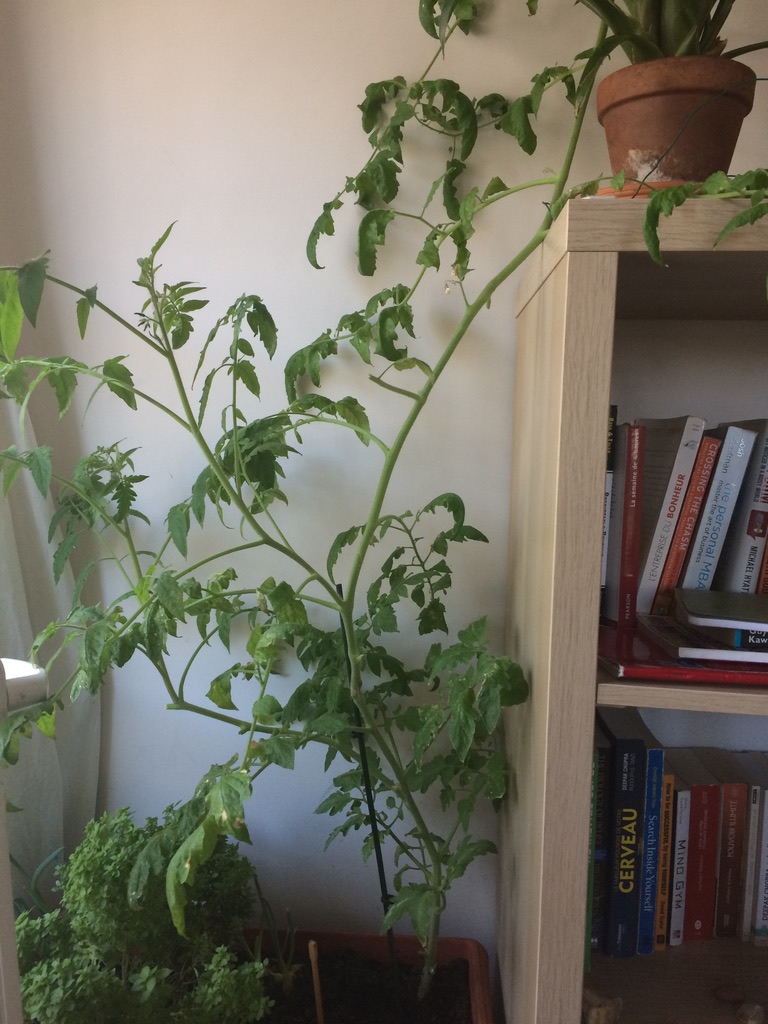
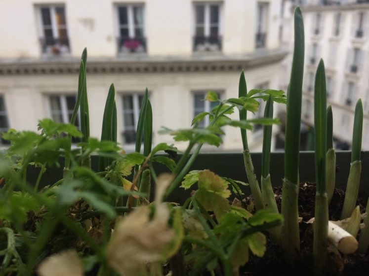
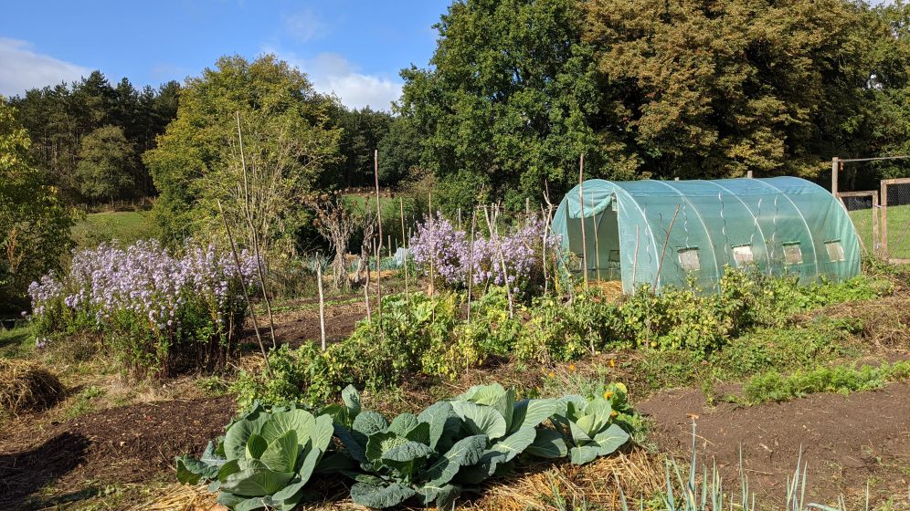
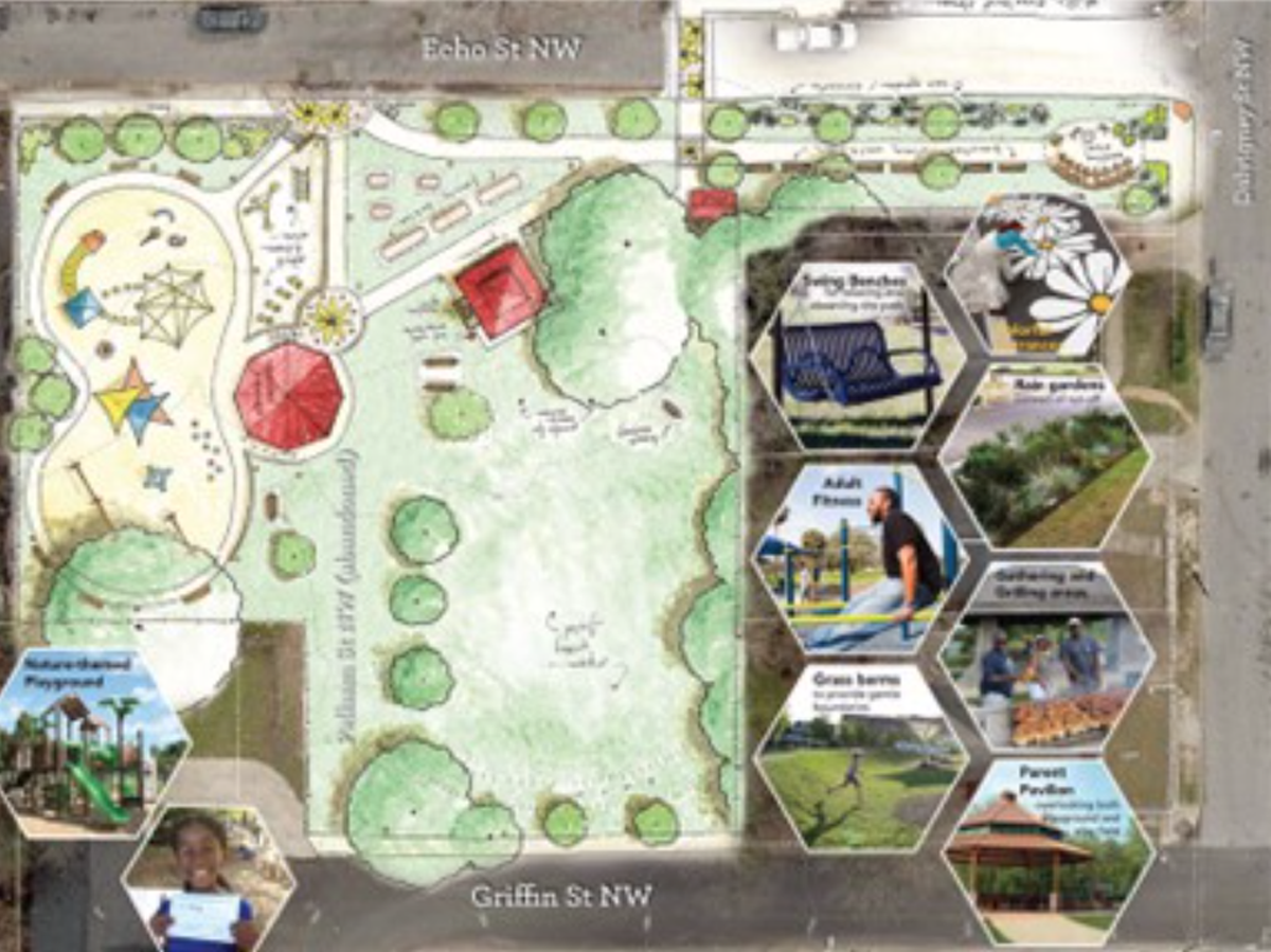
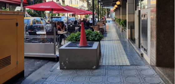
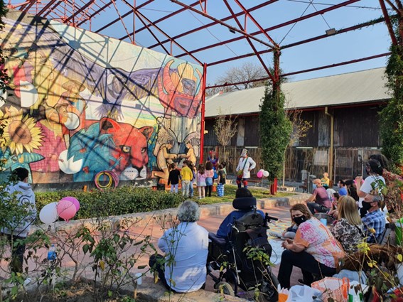

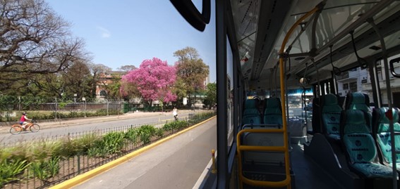
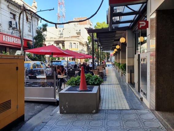
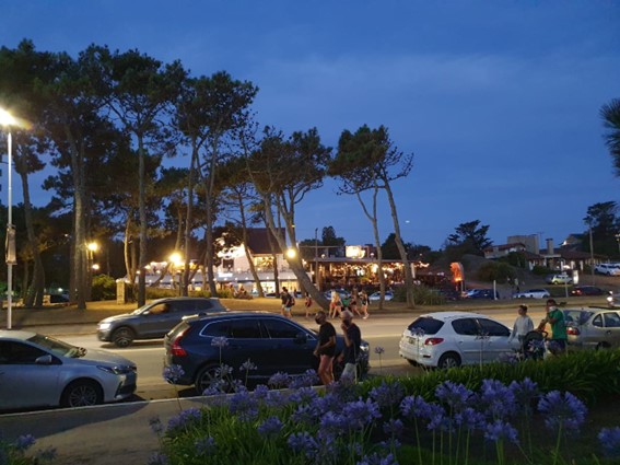
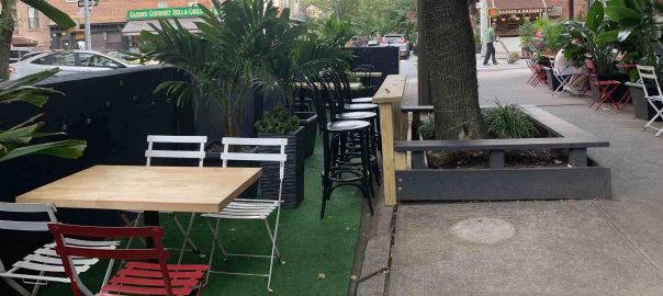
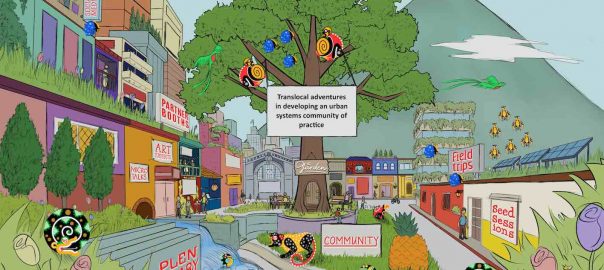
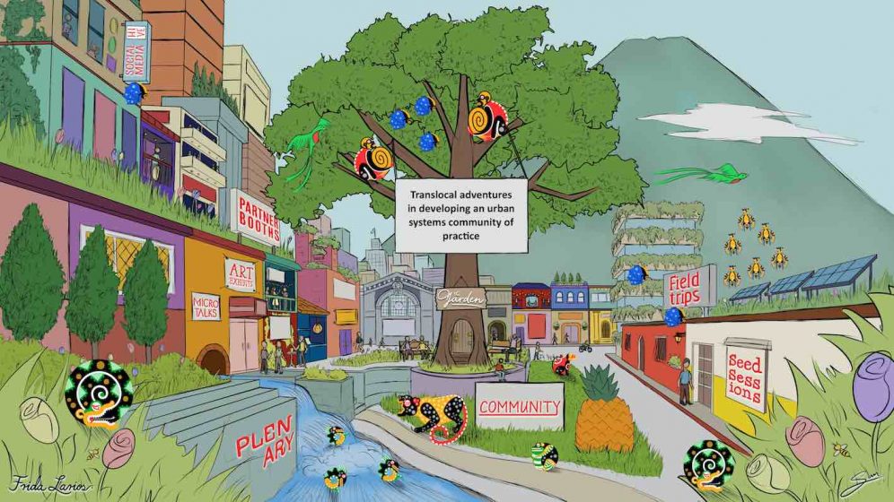
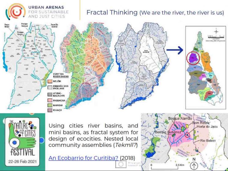
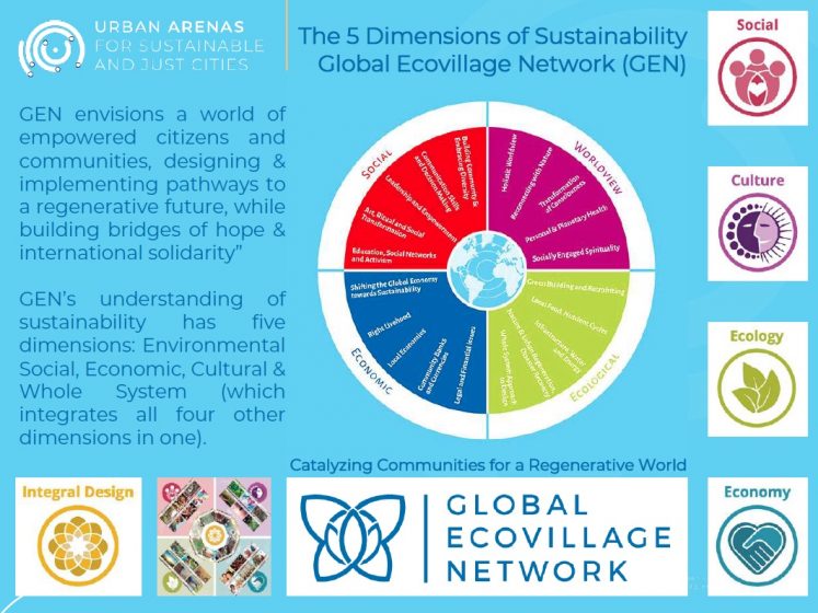
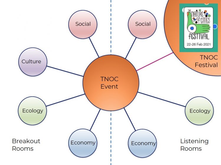
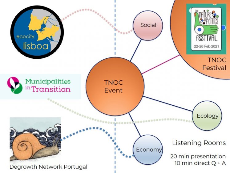 Lastly, to realise the event, a call-out went out to friends and colleagues for assistance, with not much time to organise and prepare before the event. This resulted in a group of 15 people joining forces from different countries, backgrounds, and communities or projects. Although the group had never worked together before, there was a willingness and excitement to try something new, plug into the experimental world of TNOC. Hopes were high.
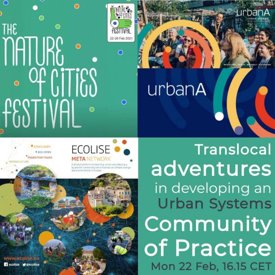


 a) City ranking producers
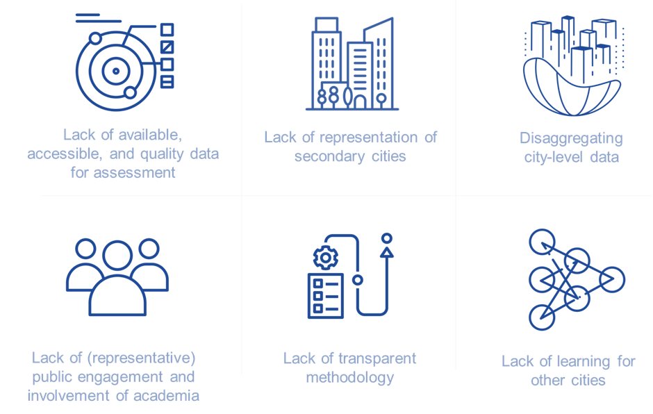
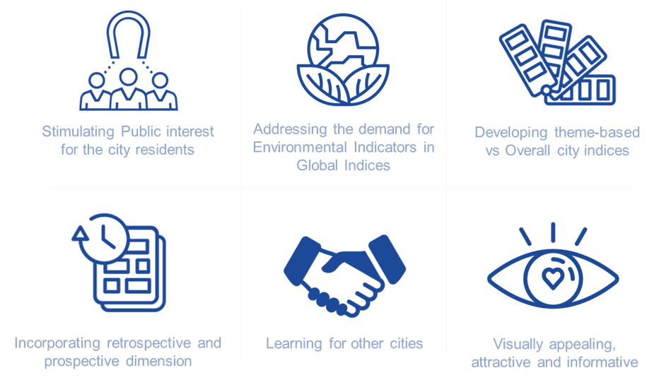

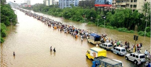
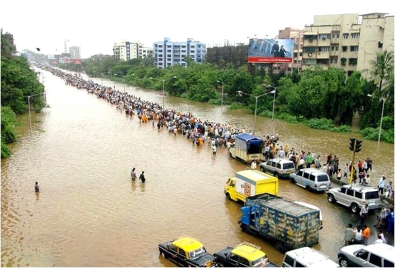
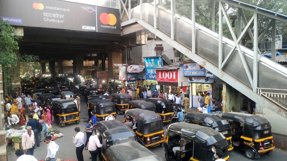
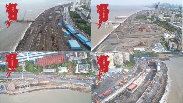
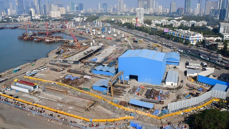


 LALI comes as a declaration of fundamental ethical principles to promote the recognition, valuation, protection, management, and sustainable planning/design of Latin American landscapes through the adoption of agreements that recognize local, regional, and national diversity and values, tangible so much as intangible, of landscape, as well as principles and processes to safeguard it.
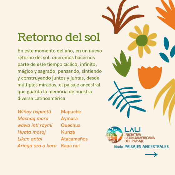
 LALI work through clusters which translates itself as a network, a system that is nourished by cooperation, cocreation, pacts, and the charitable work of key people in Latin America. It grows and becomes stronger through its Clusters. The Ancestral Landscapes Cluster is one of those which aims to recognize, recover, and disseminate the values -tangible and intangible- of ancestral communities/landscapes, inhabited and given meaning by the different native peoples of Latin America, to contribute to their appreciation, understanding, and protection.


 What do tulips and daffodils do for our urban ecosystem? What relationships do they support besides being eye candy for people? What is the carbon footprint of growing and transporting ornamental bulbs? Confession: I like tulips. But we can no longer devote public money and public lands to single-function plants. We cannot limit native understory species to natural areas. All New Yorkers should have everyday exposure to plant biodiversity. Let’s plant native early spring bloomers–trout lily, spring beauty, mayapple. To those who might argue that certain species cannot thrive in certain urban environments, I do not accept these limits, and neither should you. I have seen native species growing in “unlikely” places. We should redesign and manage our cities to support more nature and greater ecological function everywhere.
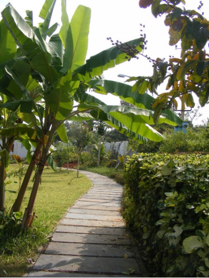


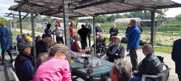
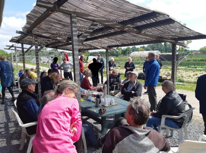
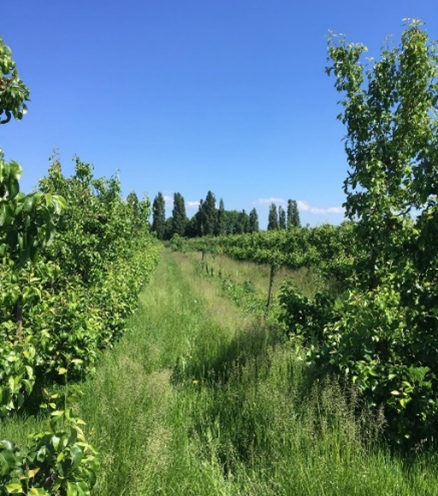
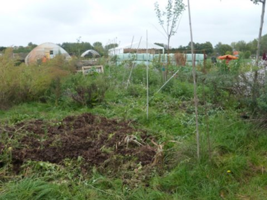
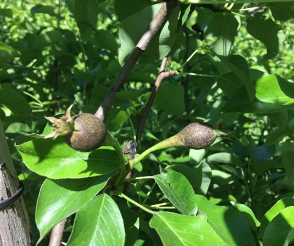
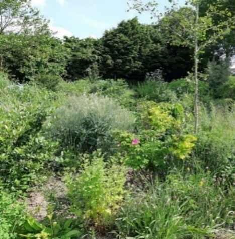
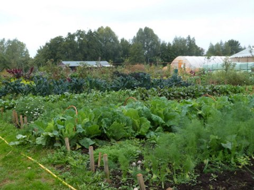
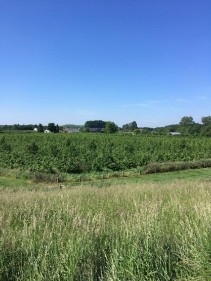
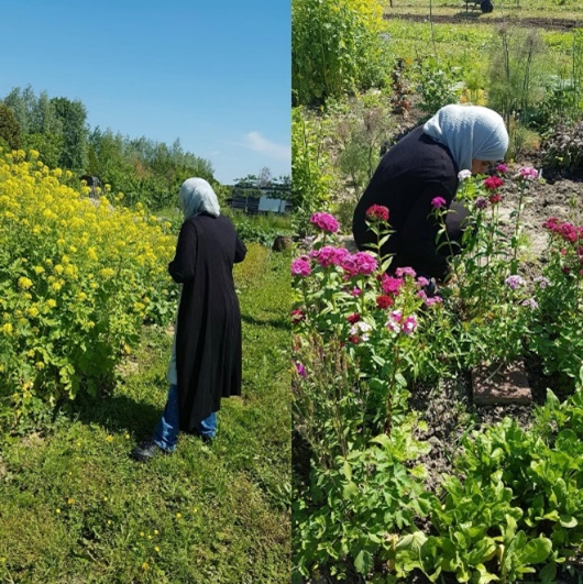


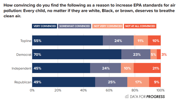
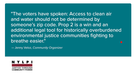 Section 19 is a clear recognition that environmental rights belong to everyone—that no people and no neighborhoods can be sacrificed on the altar of economic growth.
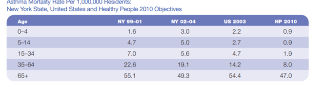
 The state has an unambiguous mandate to protect New Yorkers’ right to breathe clean air, drink clean water, and live and work in a healthy environment. Everyone exercising governmental authority, including agencies and local government, has an obligation to protect environmental rights, to promote actions designed to preserve and enhance these rights, and to take affirmative steps to provide a healthy environment to all New Yorkers, including intervening when these rights are jeopardized. Protecting clean air and water must shape how all state law is interpreted and applied. State actors will have new grounds to justify more rigorous enforcement or to defend state environmental legislation from attack by polluting industry.
 The Judiciary must assess whether government action has violated these rights
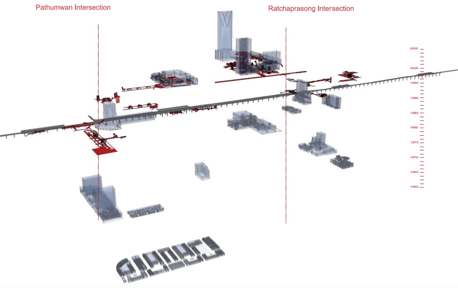
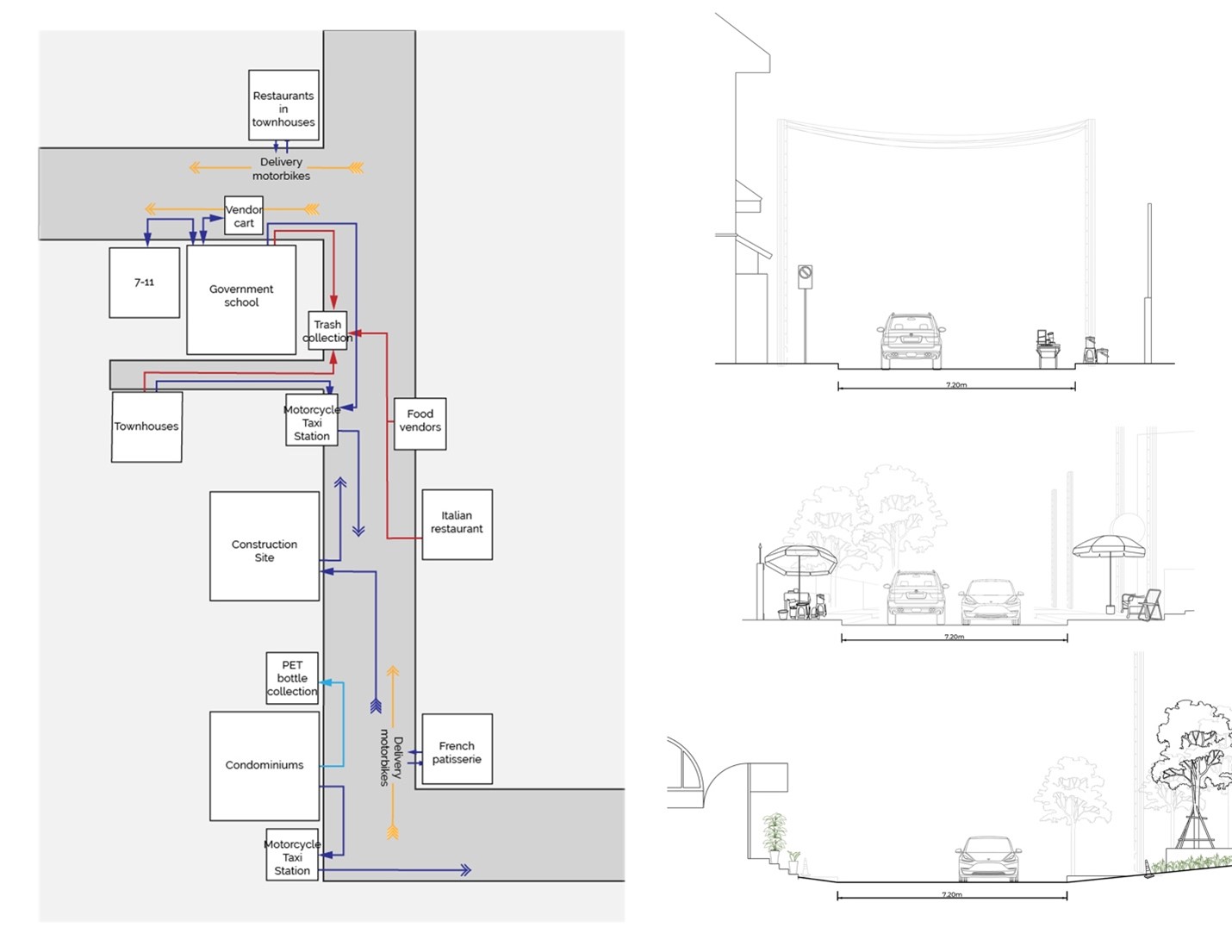
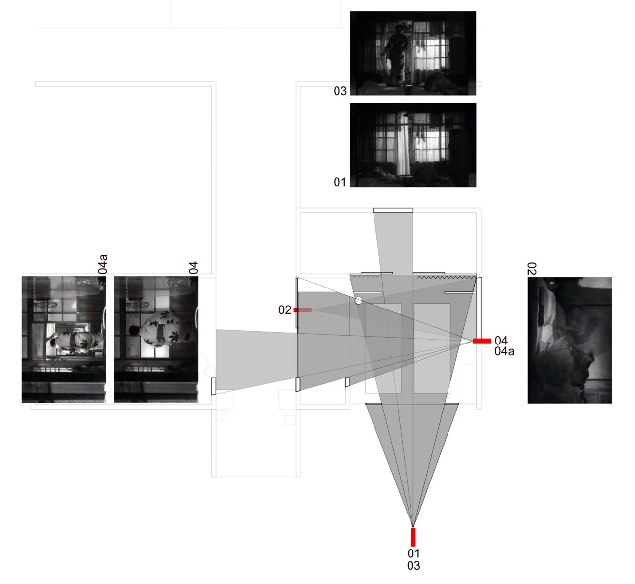
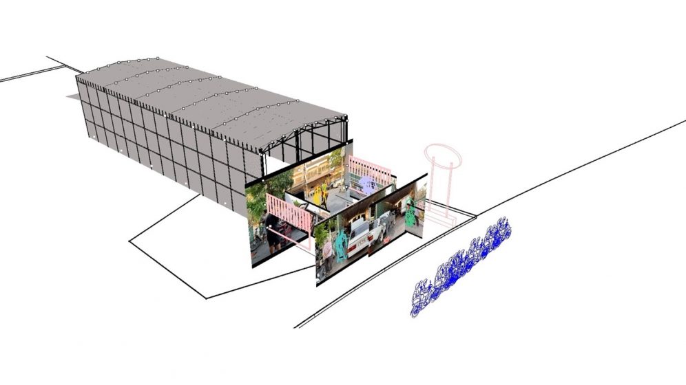
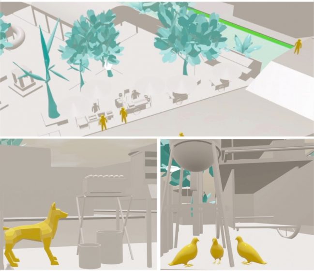
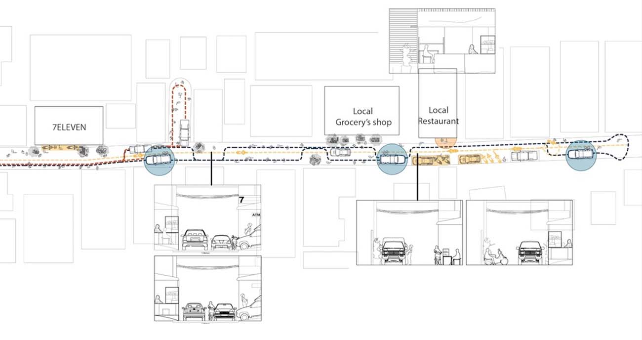

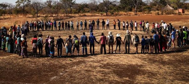
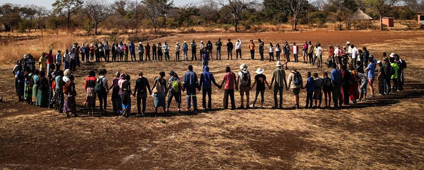

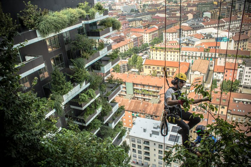
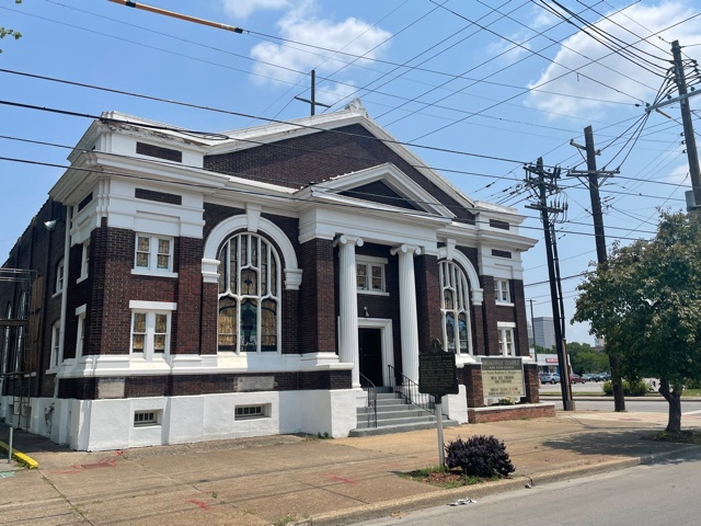


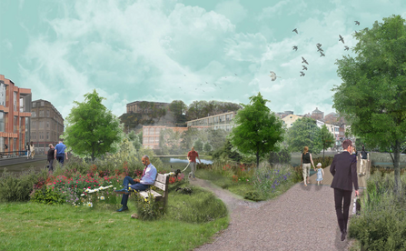
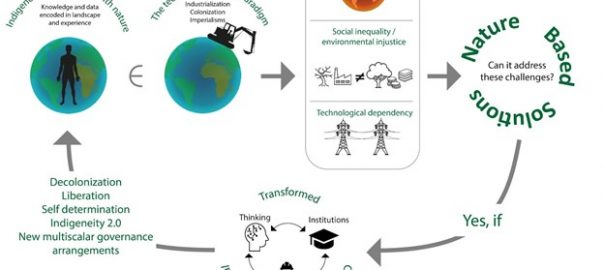
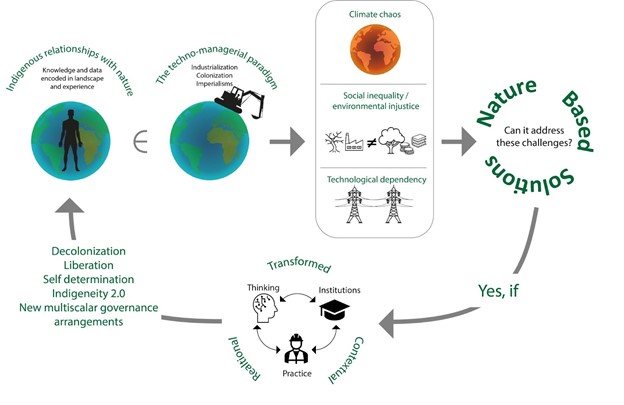
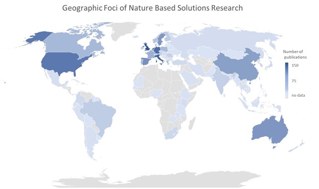
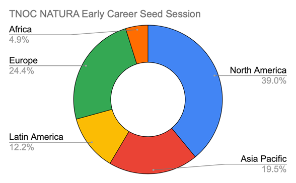
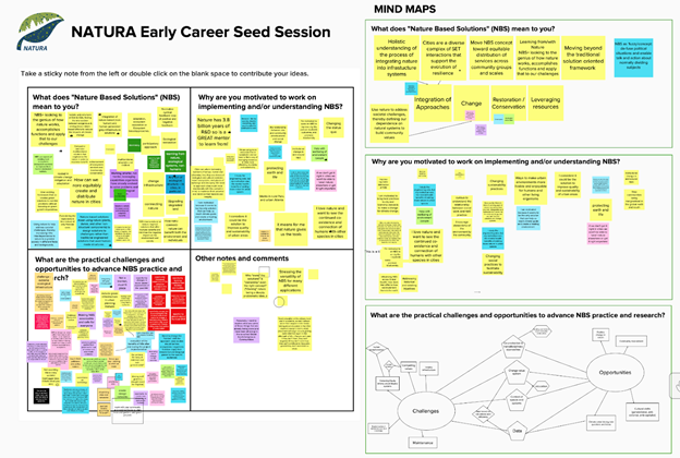


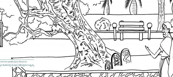
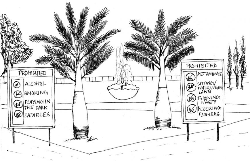
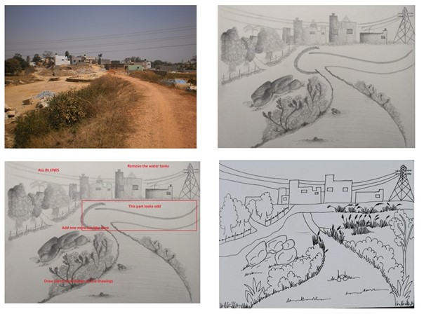


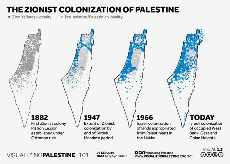
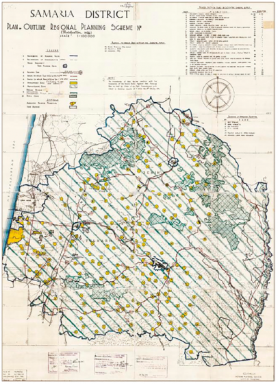
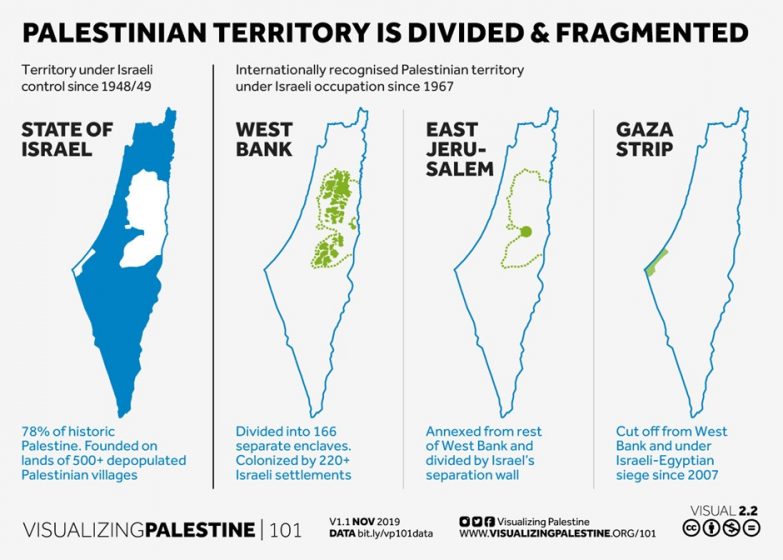
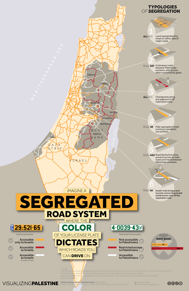
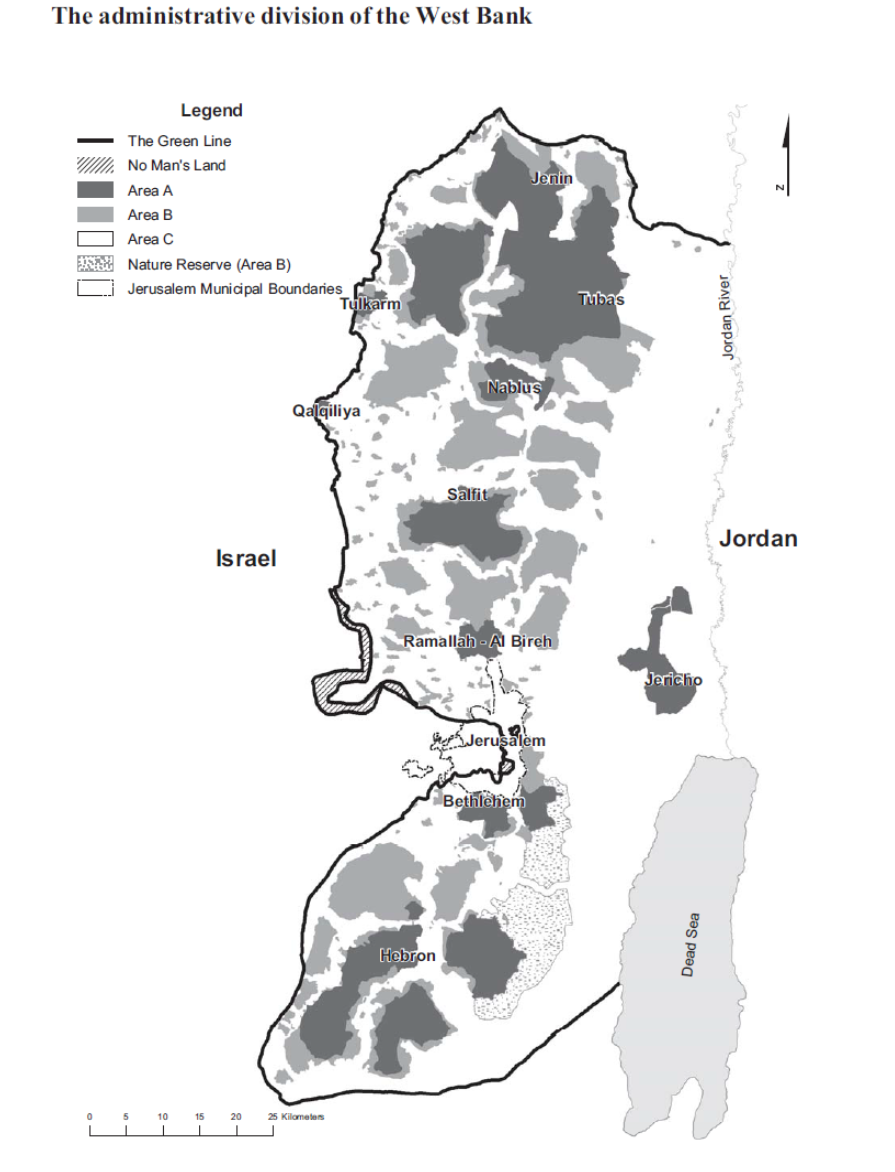
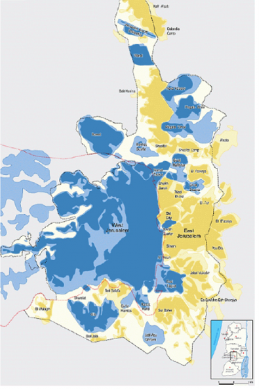
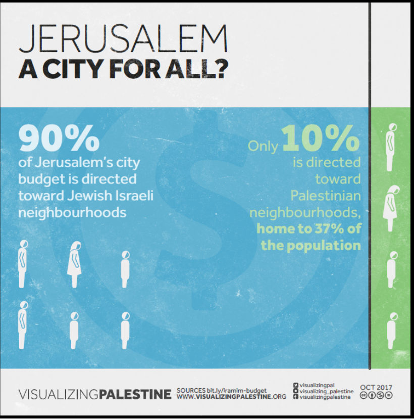
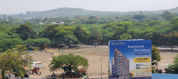
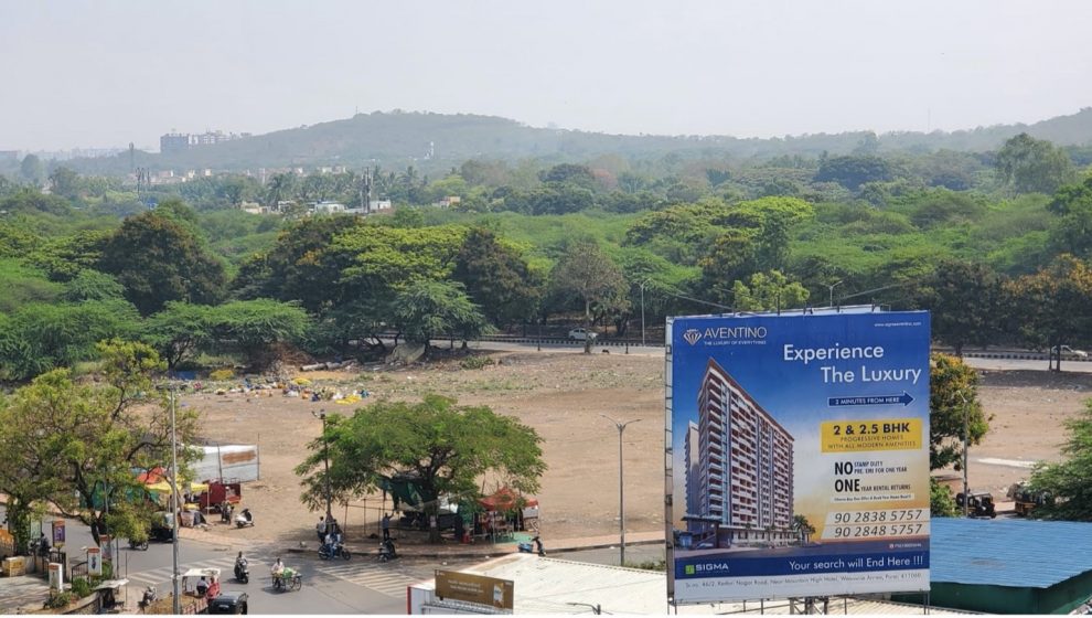

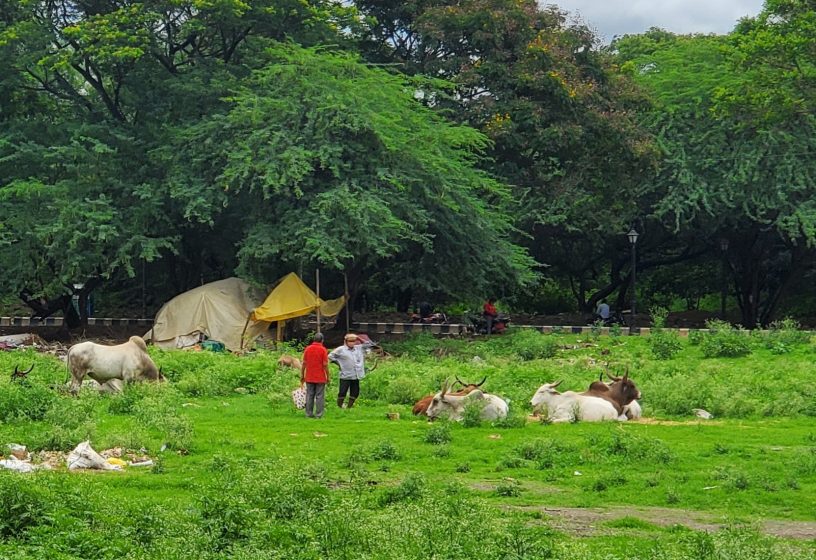


1 Comment
Join our conversation